

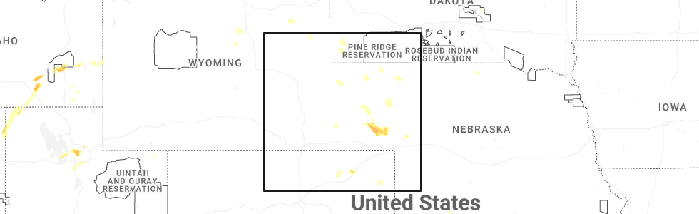
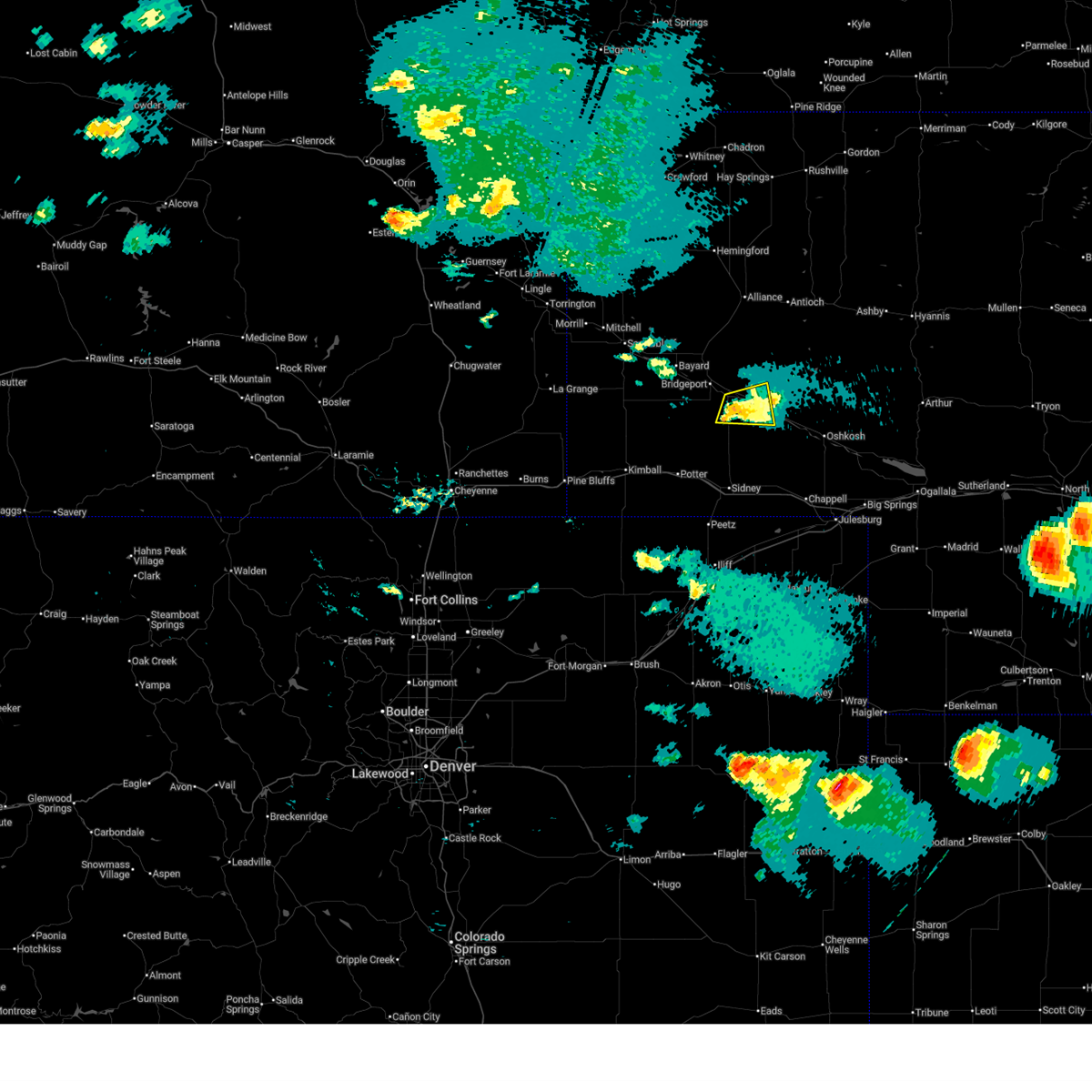
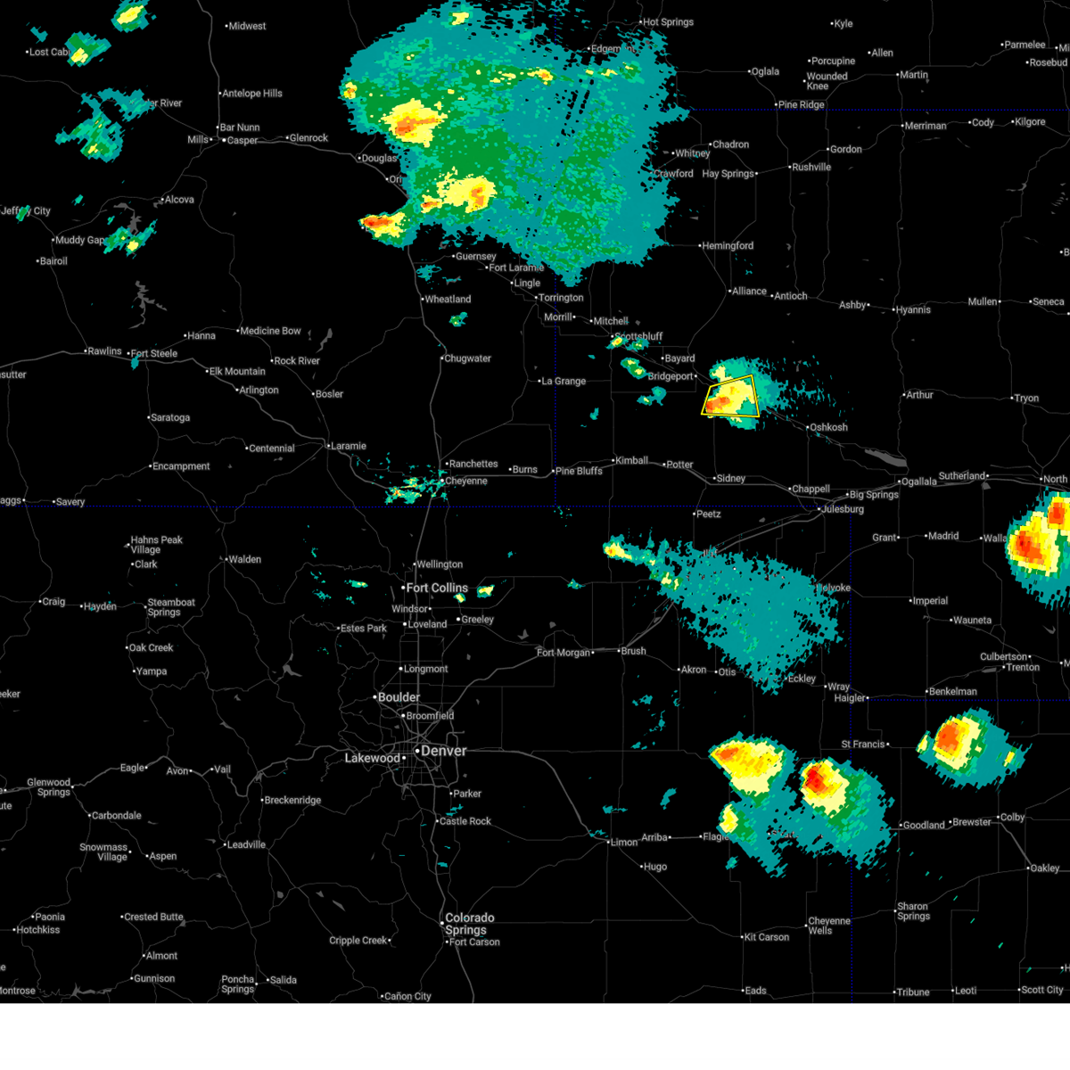
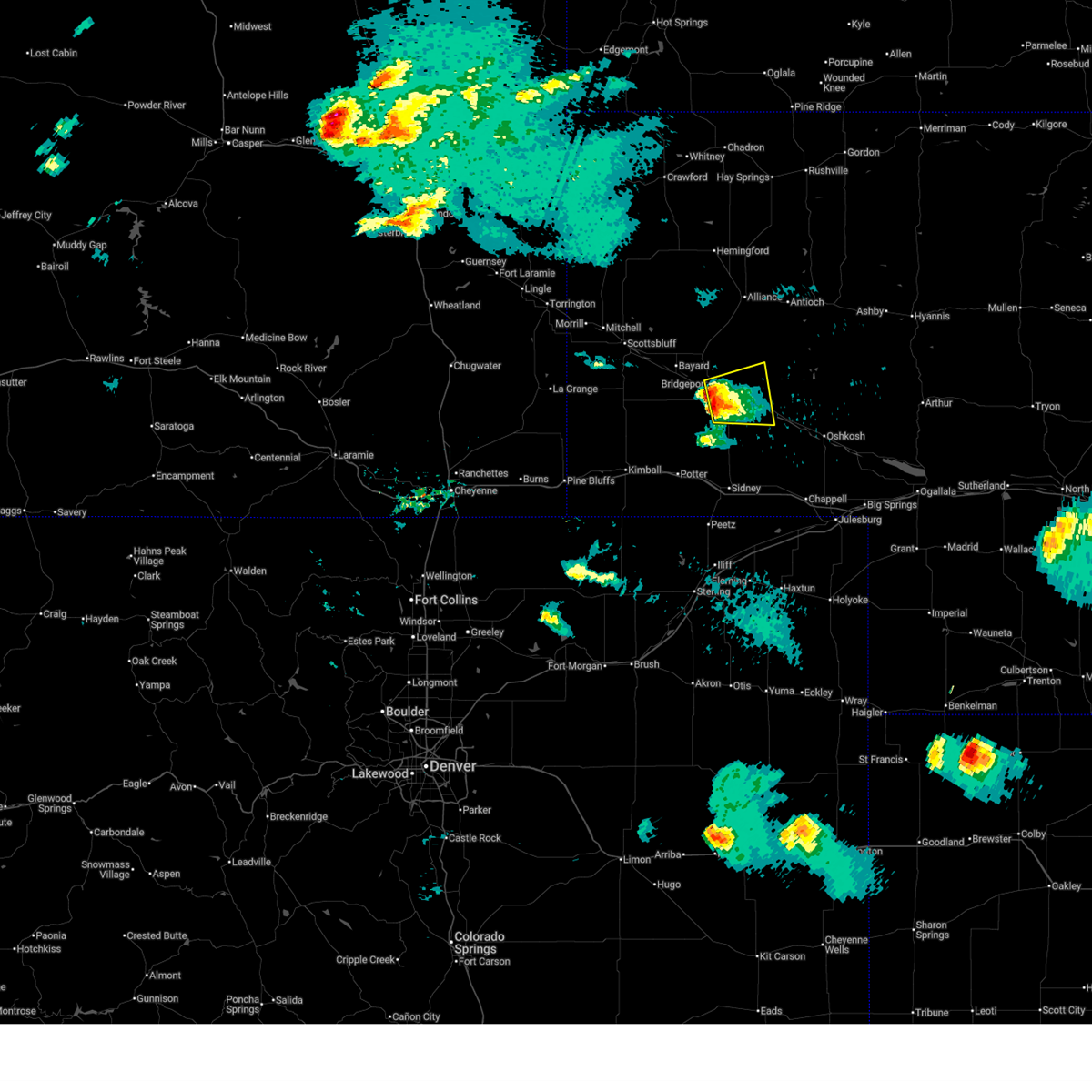
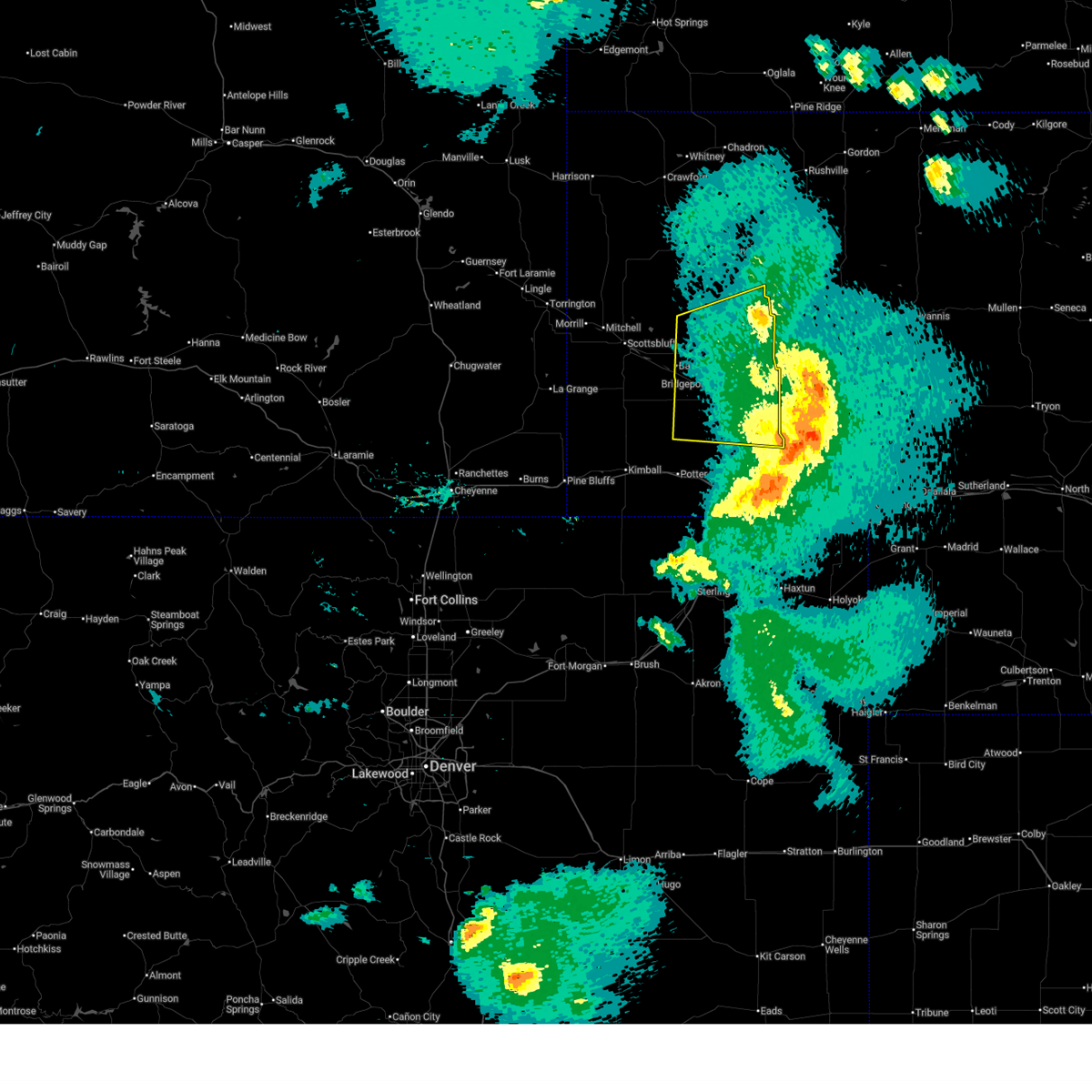
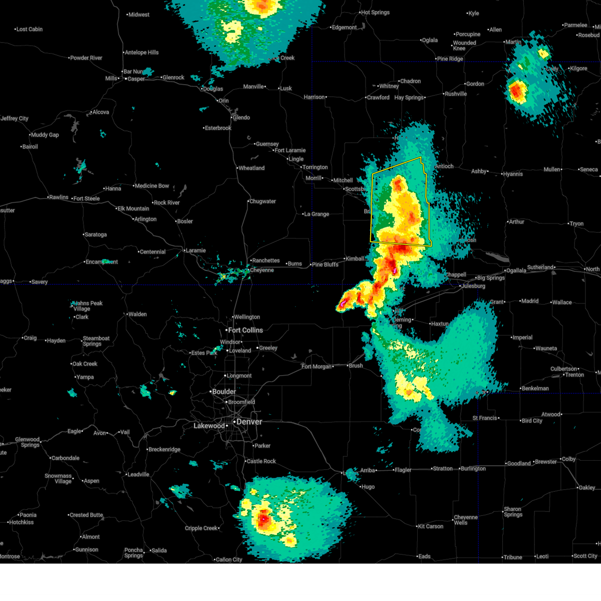
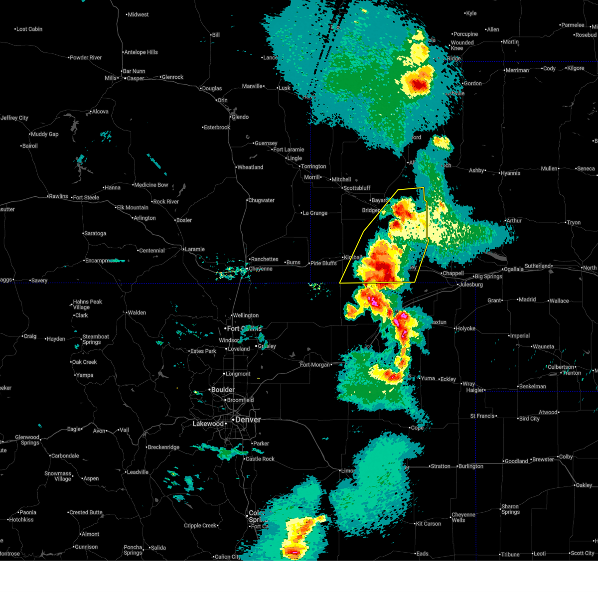
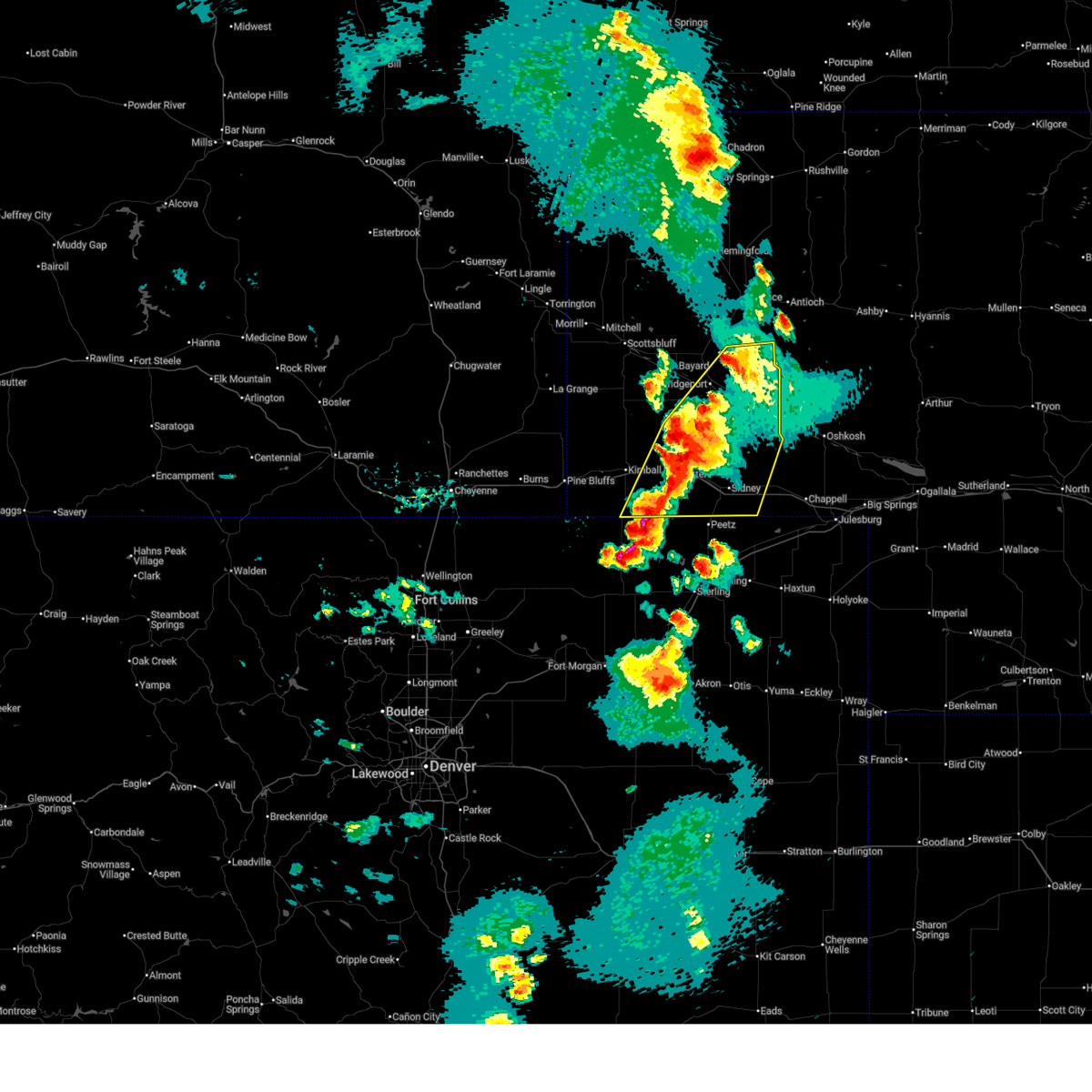
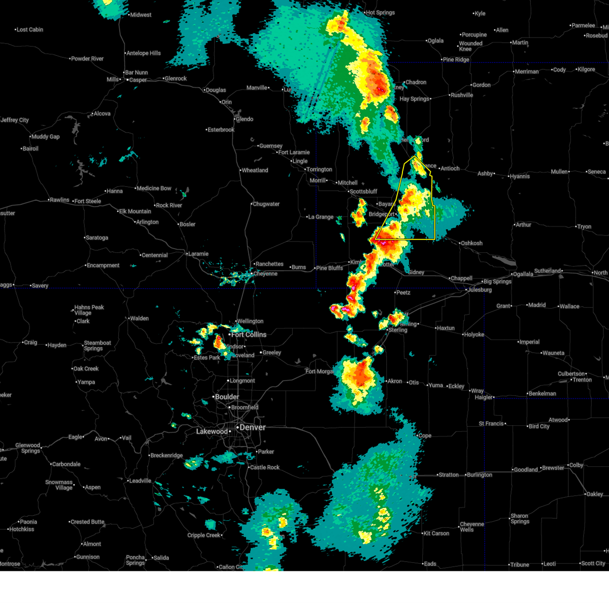
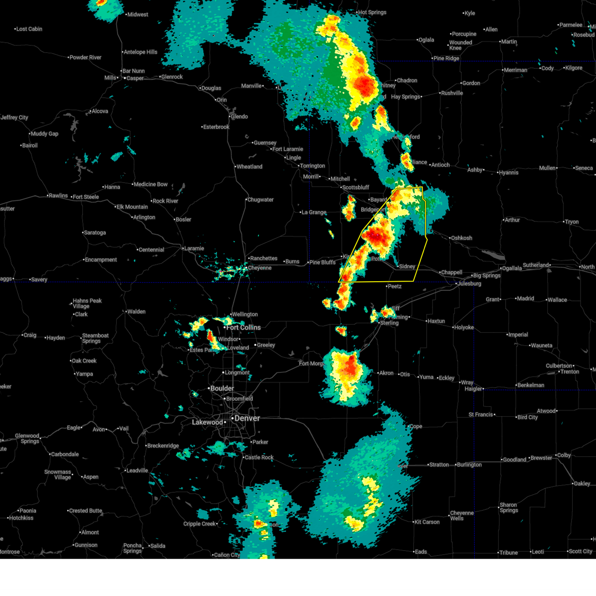
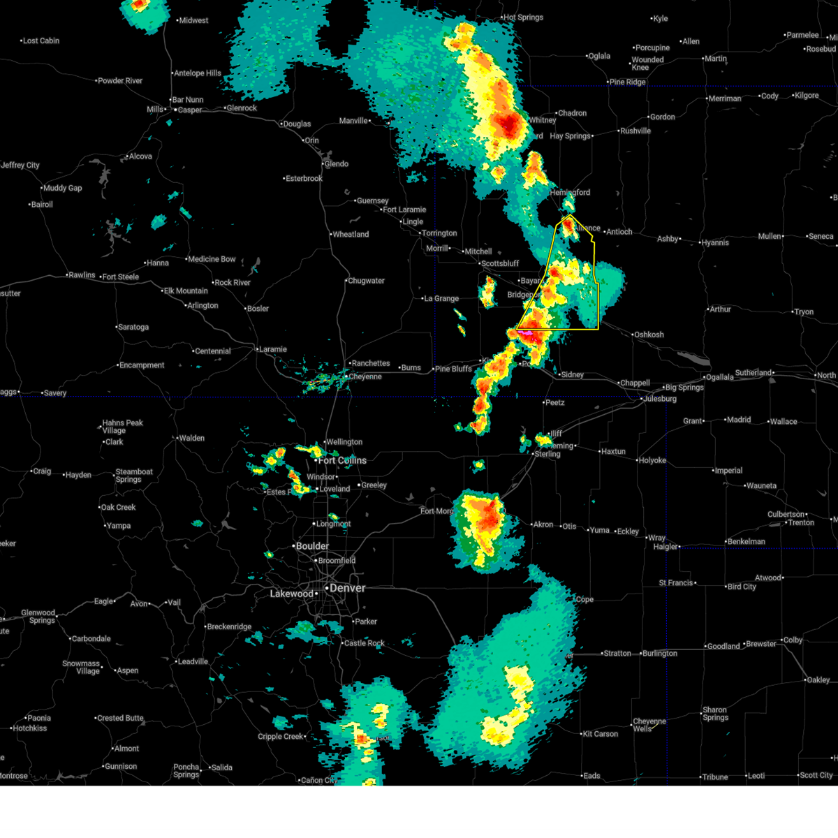
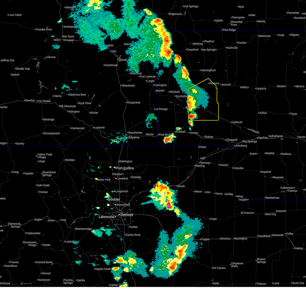
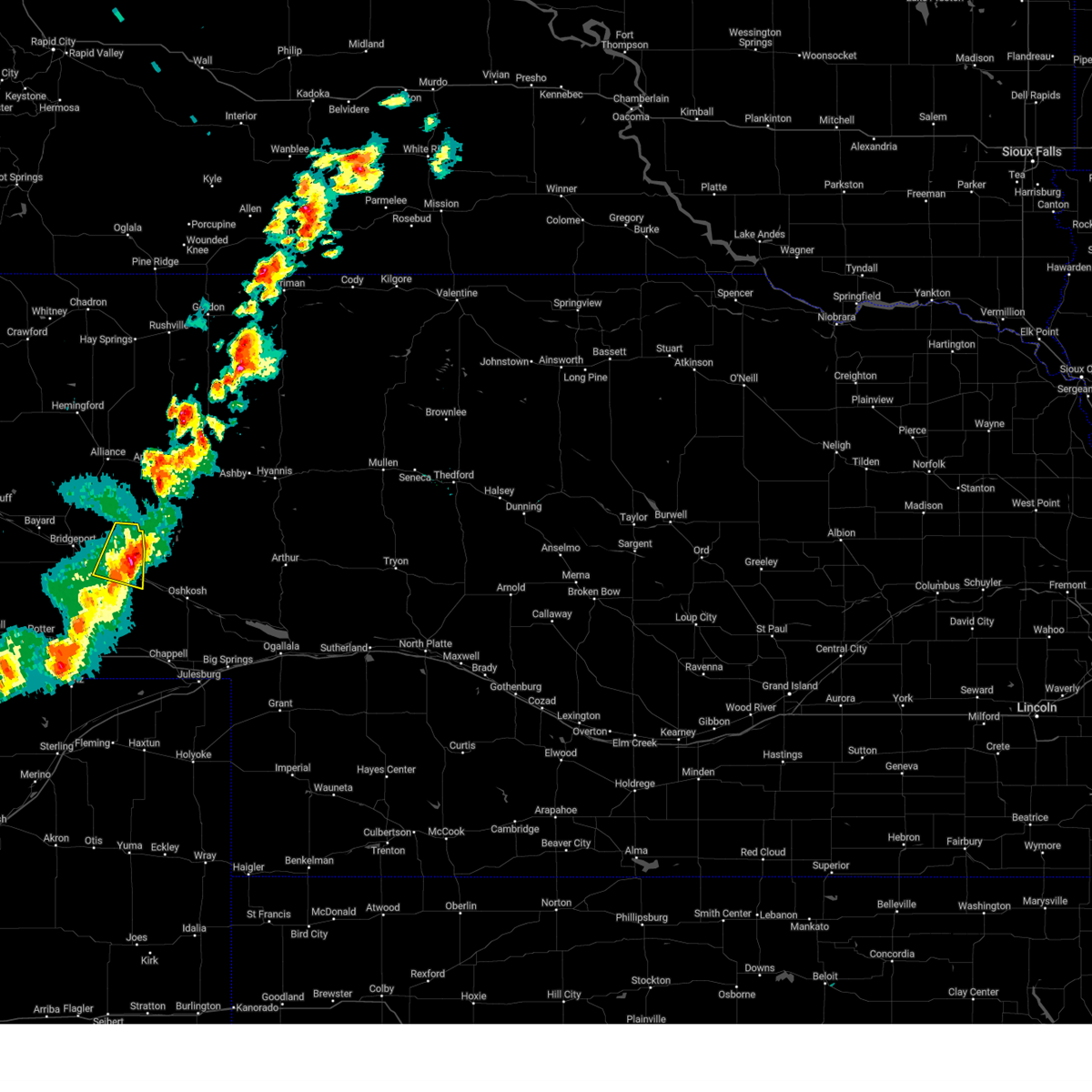
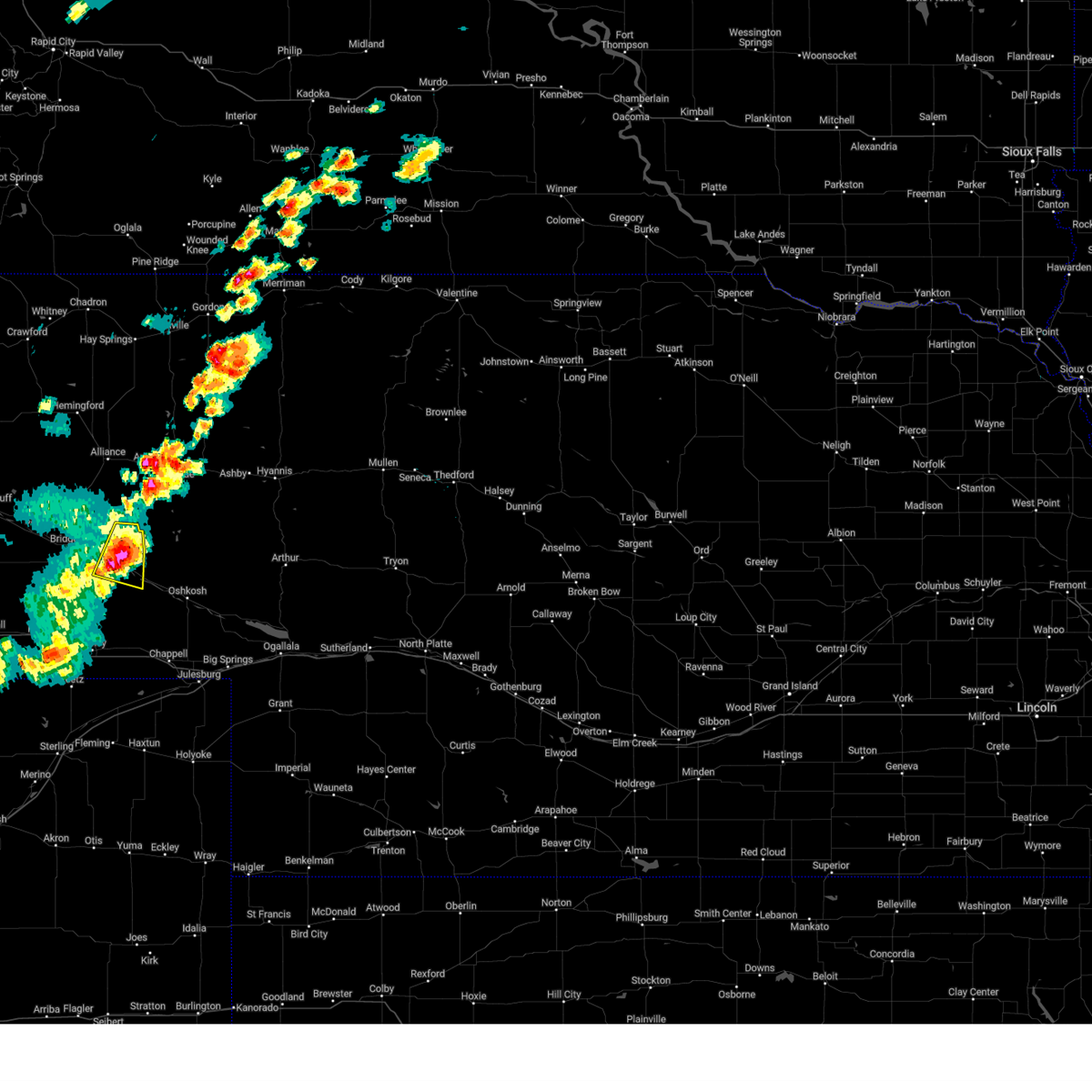
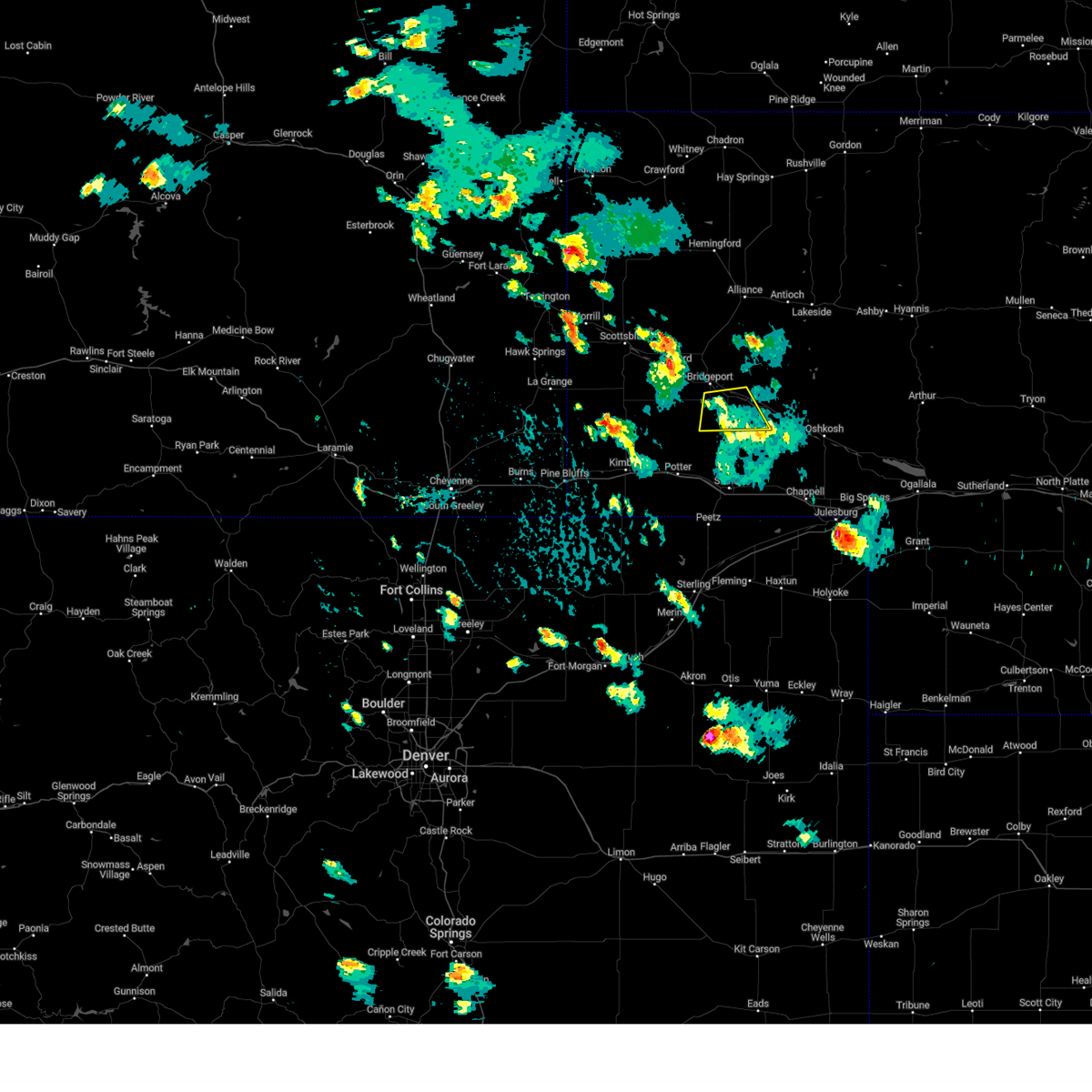
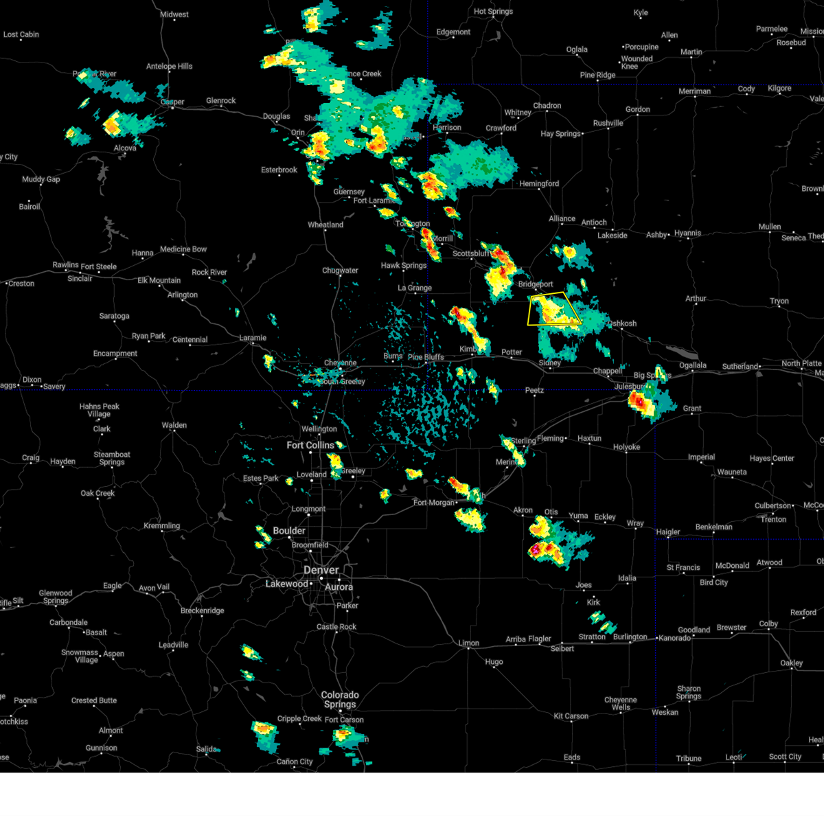
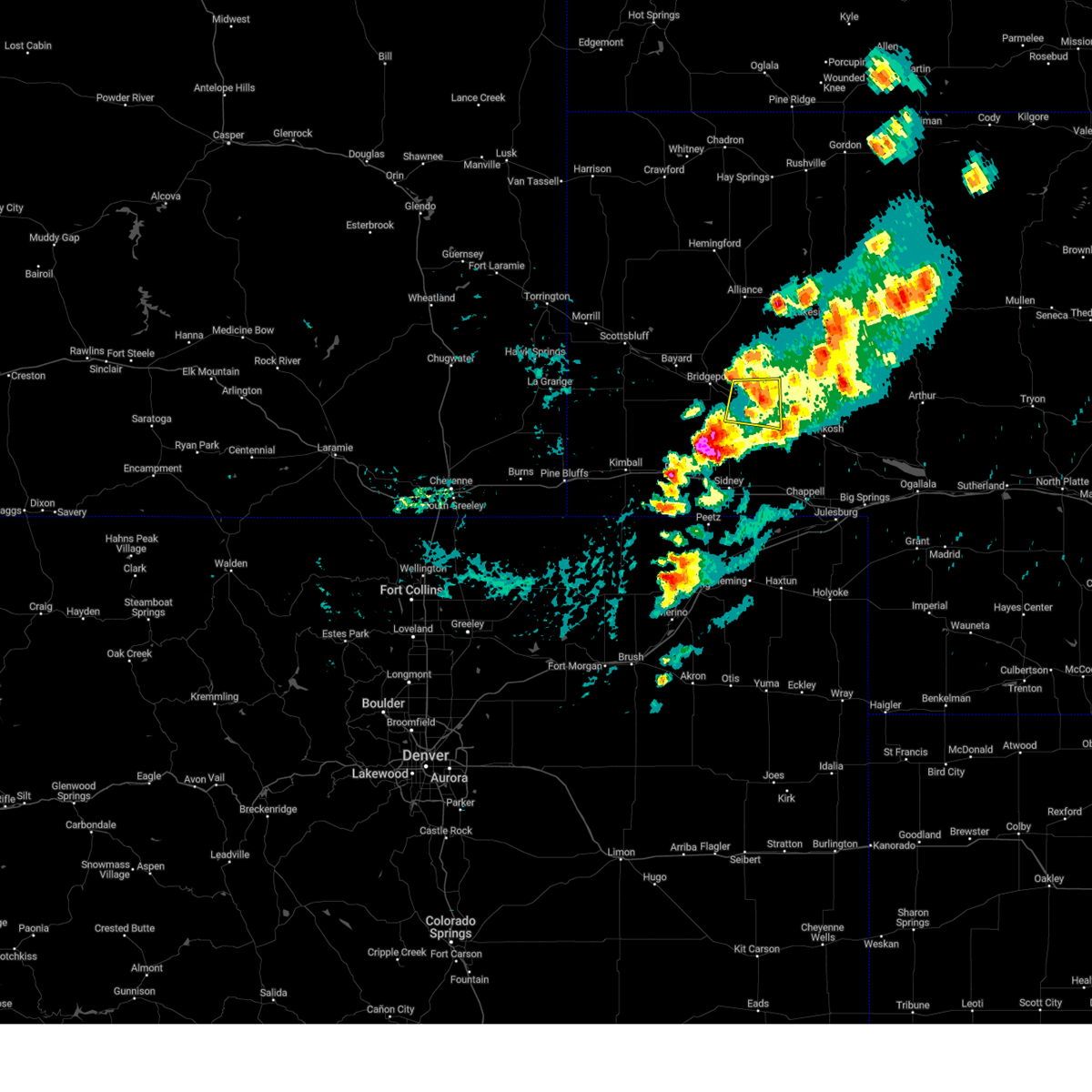
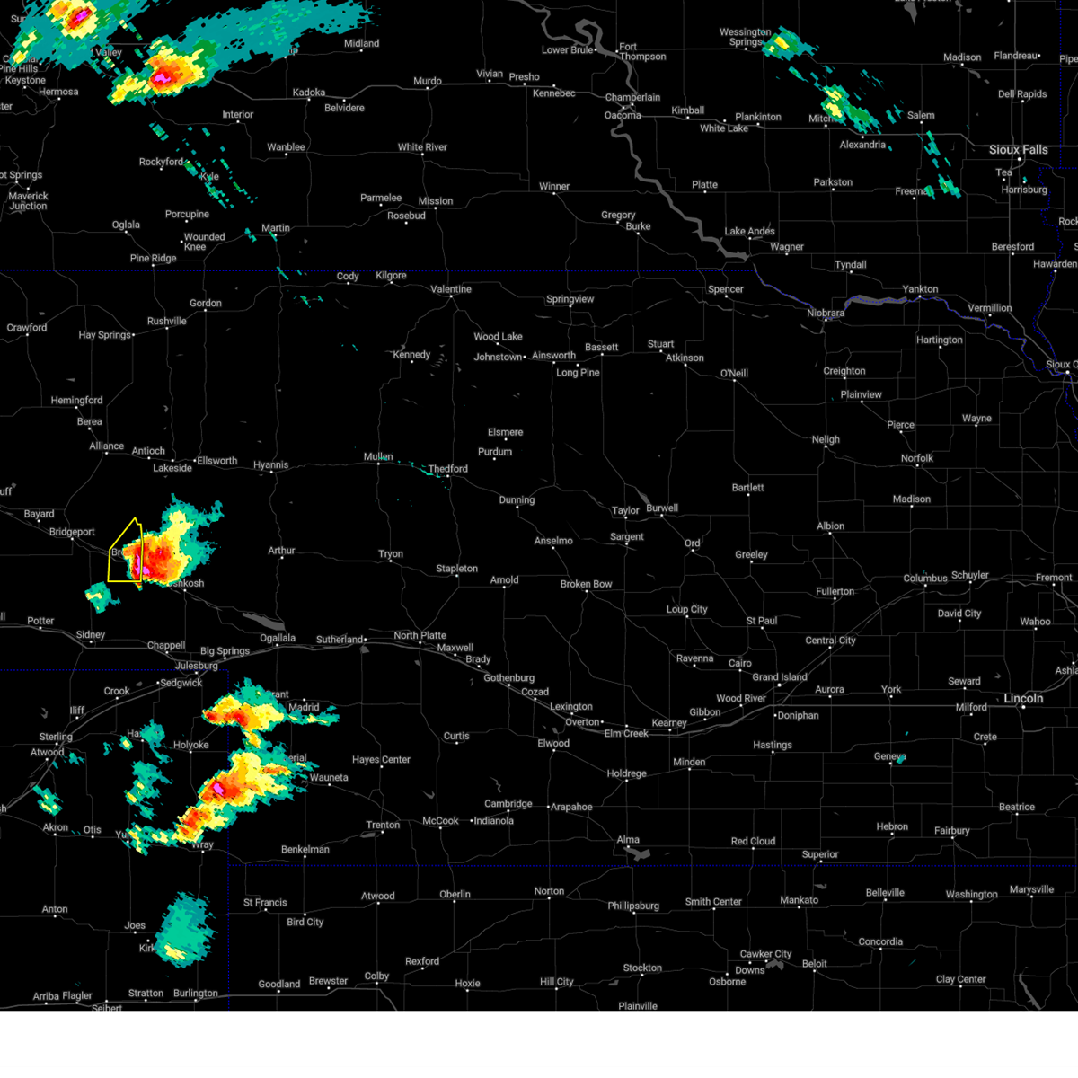
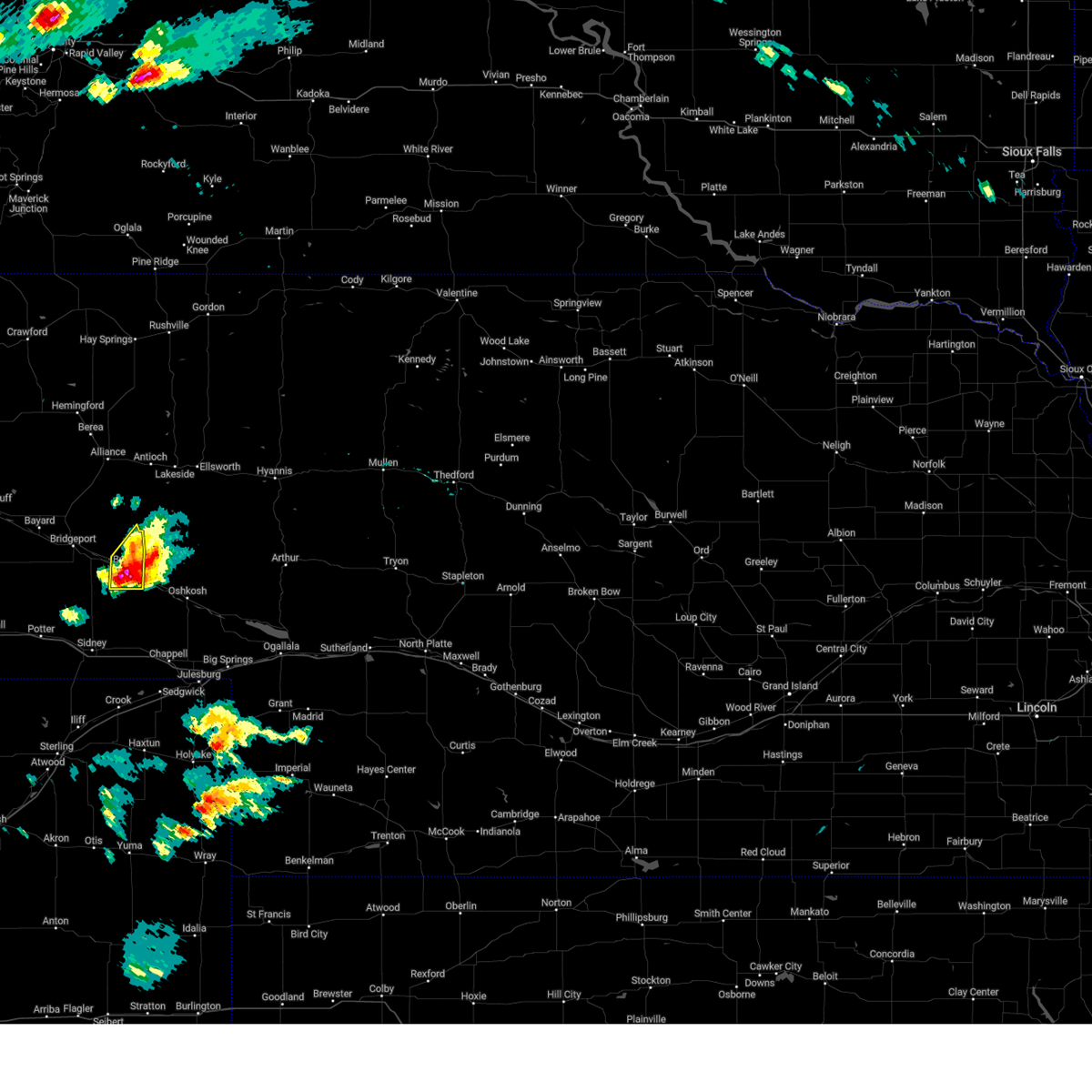
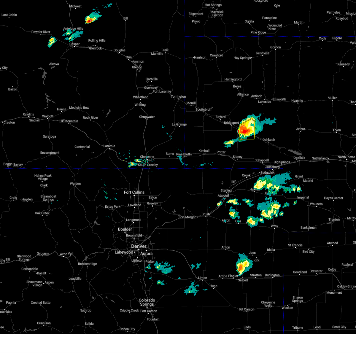
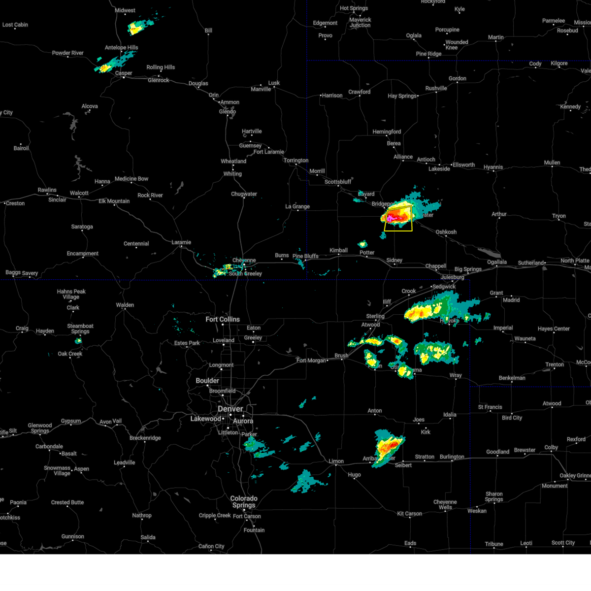
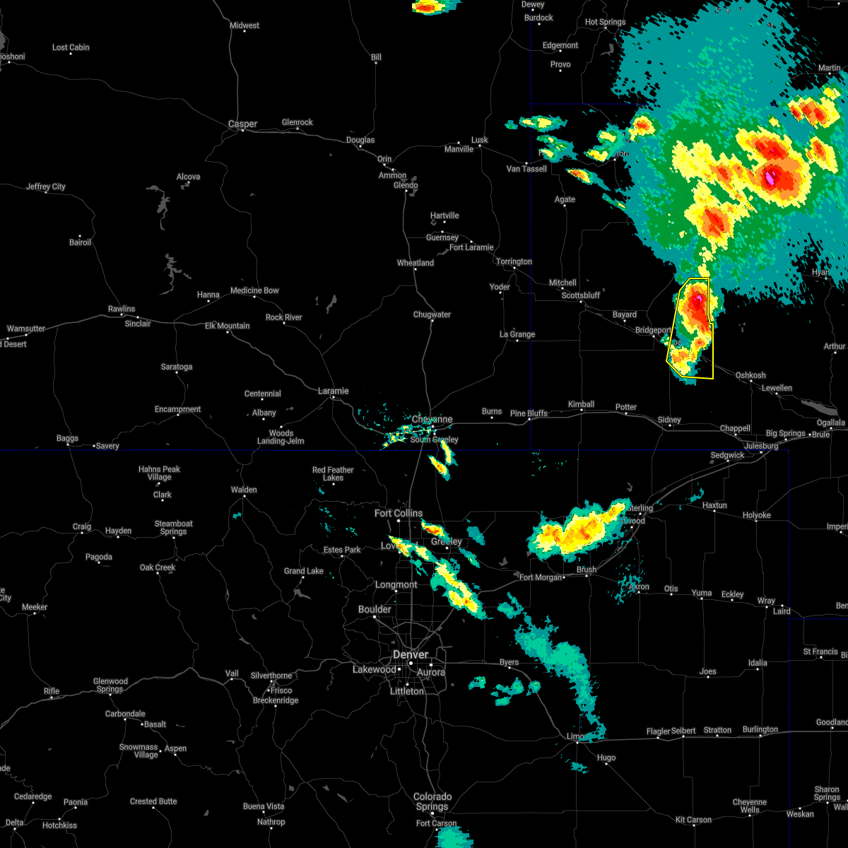
Hail Map for Broadwater, NE
The Broadwater, NE area has had 16 reports of on-the-ground hail by trained spotters, and has been under severe weather warnings 35 times during the past 12 months. Doppler radar has detected hail at or near Broadwater, NE on 73 occasions, including 8 occasions during the past year.
| Name: | Broadwater, NE |
| Where Located: | 45.8 miles ESE of Scottsbluff, NE |
| Map: | Google Map for Broadwater, NE |
| Population: | 128 |
| Housing Units: | 83 |
| More Info: | Search Google for Broadwater, NE |
1
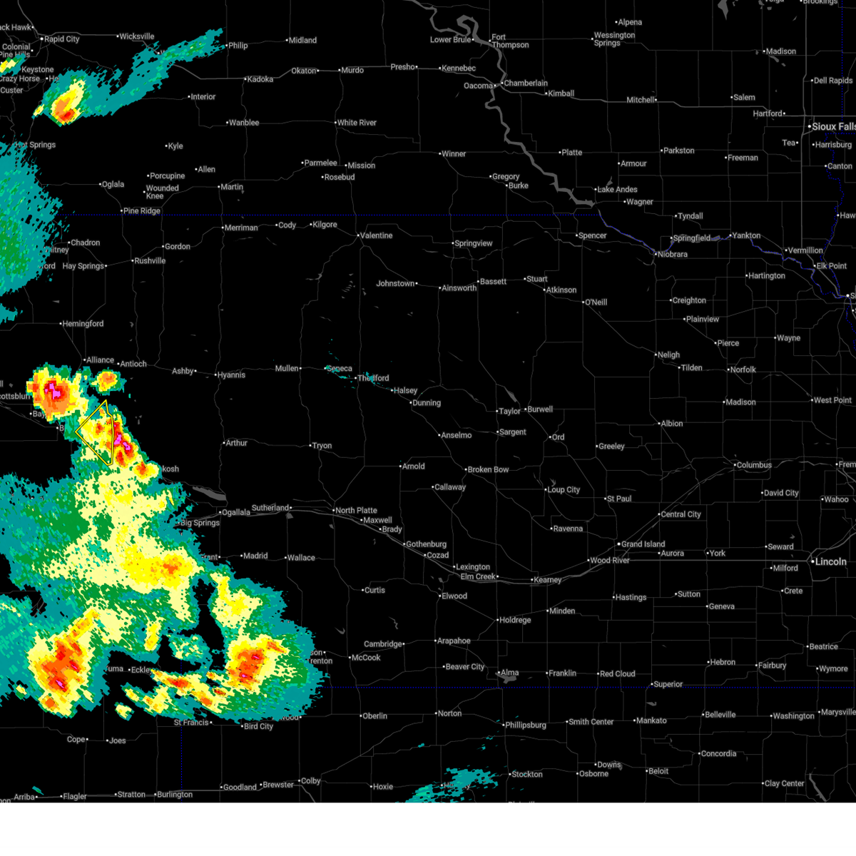
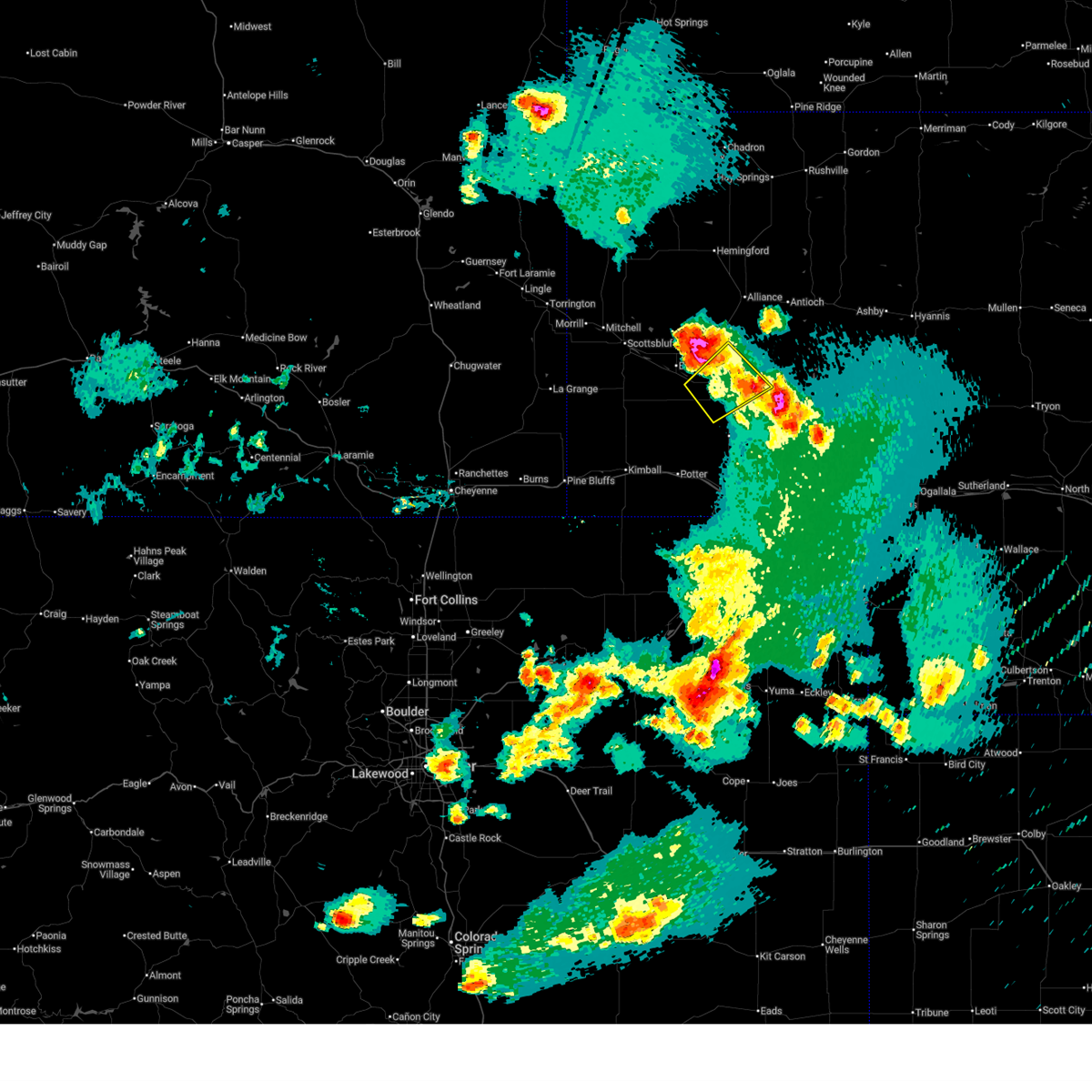
The Top Recent Hail Date for Broadwater, NE is Friday, July 4, 2025 (9th out of 73)
Hail and Wind Damage Spotted near Broadwater, NE
| Date / Time | Report Details |
|---|---|
| 7/6/2025 7:15 PM MDT |
 the severe thunderstorm warning has been cancelled and is no longer in effect the severe thunderstorm warning has been cancelled and is no longer in effect
|
| 7/6/2025 7:05 PM MDT |
 The storm which prompted the warning has moved out of the area. therefore, the warning will be allowed to expire. however, gusty winds and heavy rain are still possible. a severe thunderstorm watch remains in effect until 800 pm mdt for the panhandle of nebraska. The storm which prompted the warning has moved out of the area. therefore, the warning will be allowed to expire. however, gusty winds and heavy rain are still possible. a severe thunderstorm watch remains in effect until 800 pm mdt for the panhandle of nebraska.
|
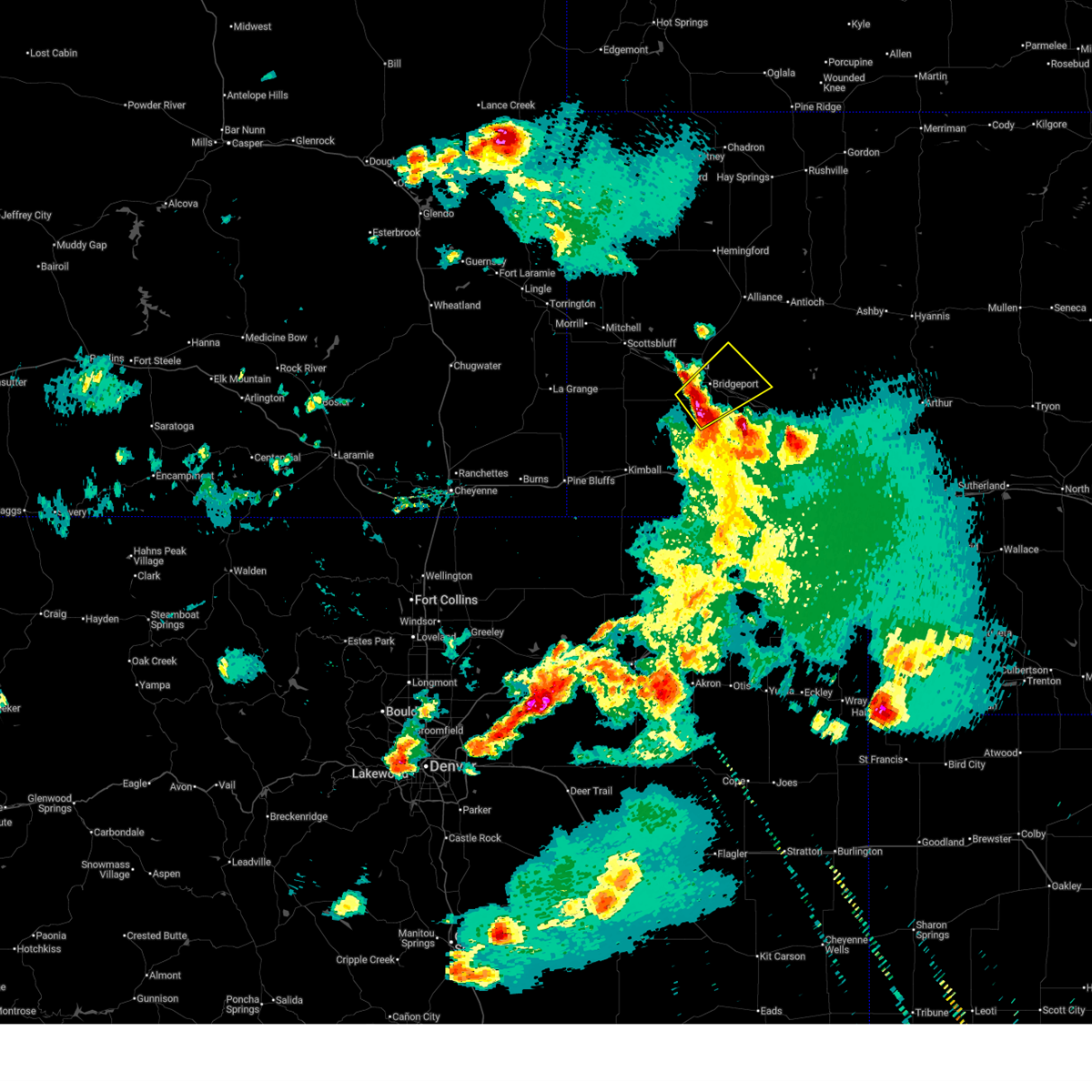
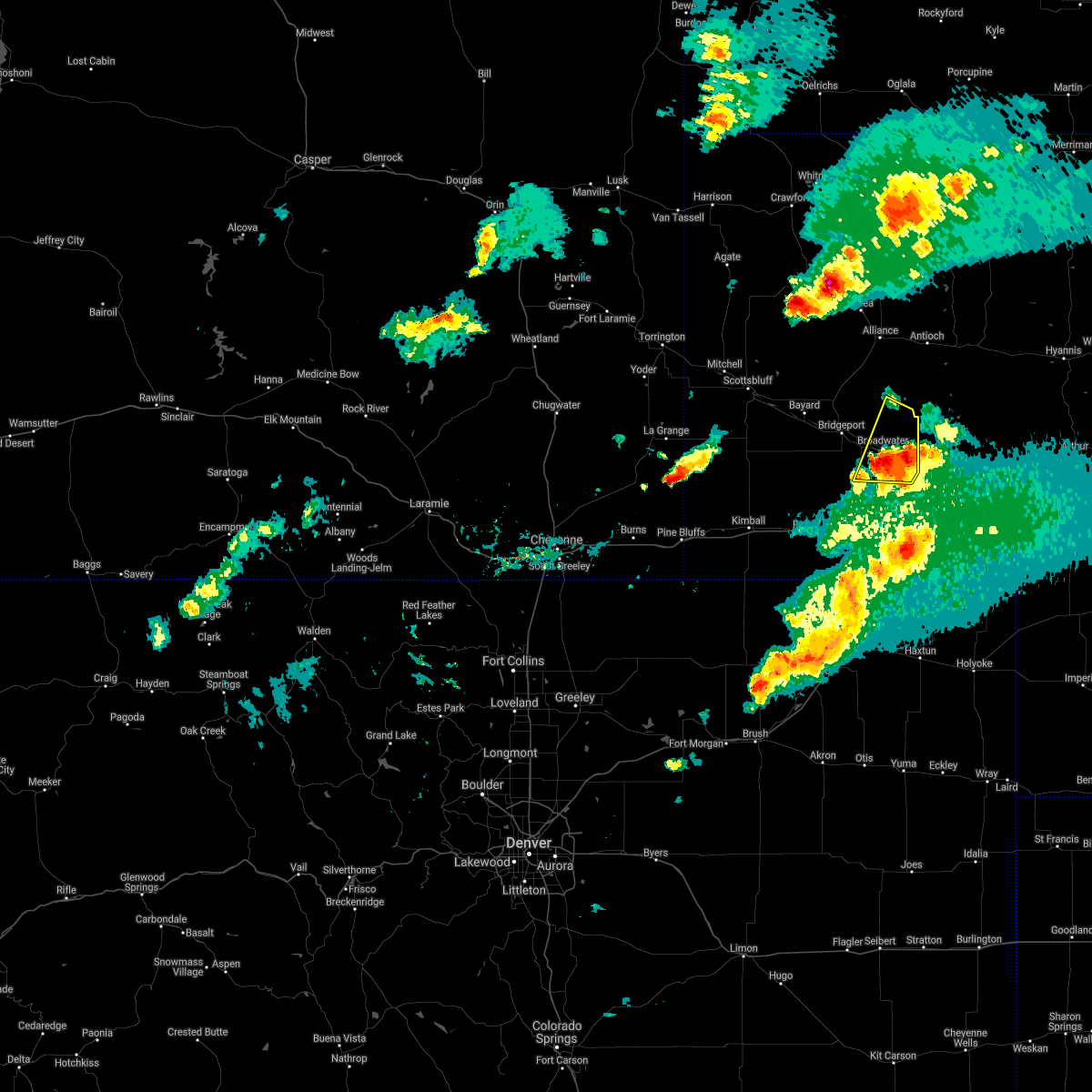
| 7/6/2025 6:57 PM MDT | Quarter sized hail reported 10 miles NW of Broadwater, NE, trained spotter reports quarter size hail. |
| 7/6/2025 6:57 PM MDT | Trained spotter reports crop damage due to wind and a 6 inch diameter tree blown ove in morrill county NE, 10 miles NW of Broadwater, NE |
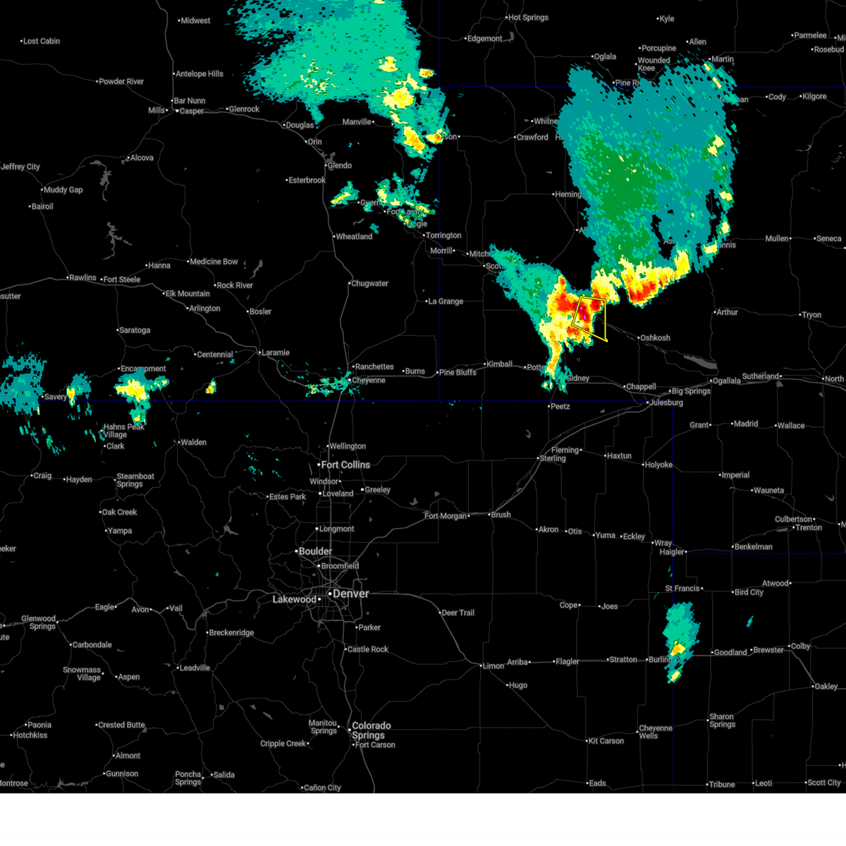
| 7/6/2025 6:57 PM MDT |
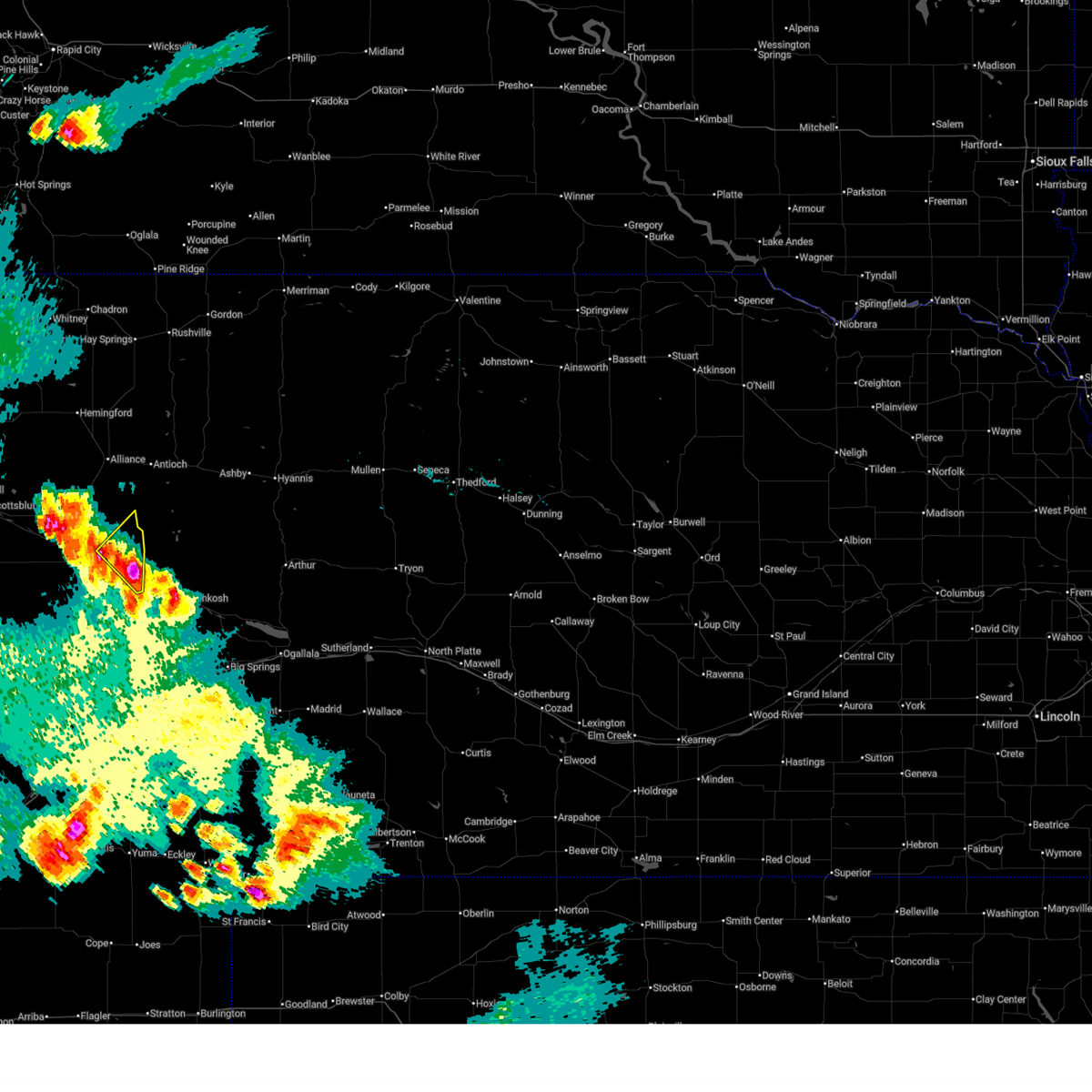 Svrcys the national weather service in cheyenne has issued a * severe thunderstorm warning for, northeastern cheyenne county in the panhandle of nebraska, southeastern morrill county in the panhandle of nebraska, * until 730 pm mdt. * at 656 pm mdt, a severe thunderstorm was located near lisco, or 19 miles northwest of oshkosh, moving northeast at 30 mph (radar indicated). Hazards include ping pong ball size hail, 60 mph wind gusts and landspout tornadoes. People and animals outdoors will be injured. expect hail damage to roofs, siding, windows, and vehicles. Expect wind damage to roofs, siding, and trees. Svrcys the national weather service in cheyenne has issued a * severe thunderstorm warning for, northeastern cheyenne county in the panhandle of nebraska, southeastern morrill county in the panhandle of nebraska, * until 730 pm mdt. * at 656 pm mdt, a severe thunderstorm was located near lisco, or 19 miles northwest of oshkosh, moving northeast at 30 mph (radar indicated). Hazards include ping pong ball size hail, 60 mph wind gusts and landspout tornadoes. People and animals outdoors will be injured. expect hail damage to roofs, siding, windows, and vehicles. Expect wind damage to roofs, siding, and trees.
|
| 7/6/2025 6:46 PM MDT |
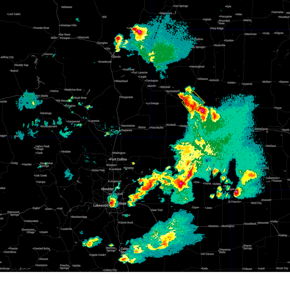 At 645 pm mdt, a severe thunderstorm was located over morrill county fairgrounds, or 32 miles southeast of scottsbluff, moving northeast at 20 mph (radar indicated). Hazards include 60 mph wind gusts, quarter size hail and landspout tornadoes. Hail damage to vehicles is expected. expect wind damage to roofs, siding, and trees. Locations impacted include, bridgeport, broadwater, northport, courthouse and jail rock, bridgeport state recreation area, morrill county fairgrounds, and the intersection of highway 385 and 92. At 645 pm mdt, a severe thunderstorm was located over morrill county fairgrounds, or 32 miles southeast of scottsbluff, moving northeast at 20 mph (radar indicated). Hazards include 60 mph wind gusts, quarter size hail and landspout tornadoes. Hail damage to vehicles is expected. expect wind damage to roofs, siding, and trees. Locations impacted include, bridgeport, broadwater, northport, courthouse and jail rock, bridgeport state recreation area, morrill county fairgrounds, and the intersection of highway 385 and 92.
|
| 7/6/2025 6:33 PM MDT |
 Svrcys the national weather service in cheyenne has issued a * severe thunderstorm warning for, southern morrill county in the panhandle of nebraska, * until 715 pm mdt. * at 631 pm mdt, a severe thunderstorm was located near courthouse and jail rock, or 31 miles southeast of scottsbluff, moving northeast at 20 mph (radar indicated). Hazards include ping pong ball size hail, 60 mph wind gusts and landspout tornadoes. People and animals outdoors will be injured. expect hail damage to roofs, siding, windows, and vehicles. Expect wind damage to roofs, siding, and trees. Svrcys the national weather service in cheyenne has issued a * severe thunderstorm warning for, southern morrill county in the panhandle of nebraska, * until 715 pm mdt. * at 631 pm mdt, a severe thunderstorm was located near courthouse and jail rock, or 31 miles southeast of scottsbluff, moving northeast at 20 mph (radar indicated). Hazards include ping pong ball size hail, 60 mph wind gusts and landspout tornadoes. People and animals outdoors will be injured. expect hail damage to roofs, siding, windows, and vehicles. Expect wind damage to roofs, siding, and trees.
|
| 7/6/2025 6:23 PM MDT |
 Svrcys the national weather service in cheyenne has issued a * severe thunderstorm warning for, north central cheyenne county in the panhandle of nebraska, southeastern morrill county in the panhandle of nebraska, * until 700 pm mdt. * at 622 pm mdt, a severe thunderstorm was located near dalton, or 20 miles north of sidney, moving northeast at 20 mph (radar indicated). Hazards include 60 mph wind gusts, quarter size hail and landspout tornadoes. . Hail damage to vehicles is expected. Expect wind damage to roofs, siding, and trees. Svrcys the national weather service in cheyenne has issued a * severe thunderstorm warning for, north central cheyenne county in the panhandle of nebraska, southeastern morrill county in the panhandle of nebraska, * until 700 pm mdt. * at 622 pm mdt, a severe thunderstorm was located near dalton, or 20 miles north of sidney, moving northeast at 20 mph (radar indicated). Hazards include 60 mph wind gusts, quarter size hail and landspout tornadoes. . Hail damage to vehicles is expected. Expect wind damage to roofs, siding, and trees.
|
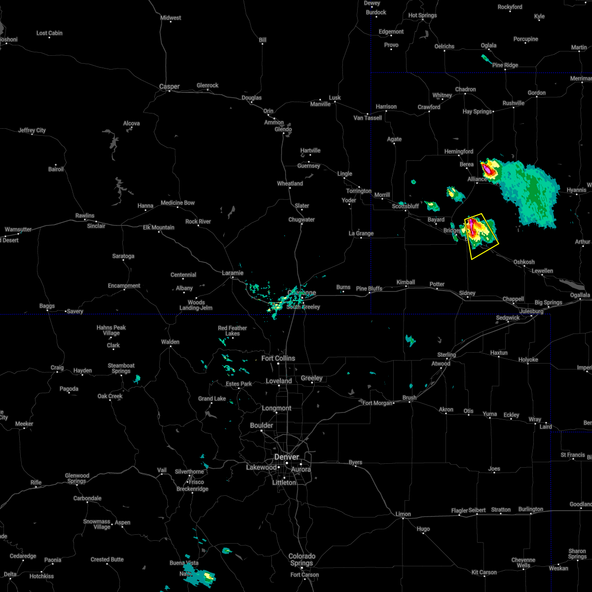
| 7/4/2025 8:31 PM MDT |
 Svrcys the national weather service in cheyenne has issued a * severe thunderstorm warning for, northeastern cheyenne county in the panhandle of nebraska, southeastern morrill county in the panhandle of nebraska, * until 900 pm mdt. * at 831 pm mdt, a severe thunderstorm was located over broadwater, or 26 miles northwest of oshkosh, moving east at 20 mph (radar indicated). Hazards include 60 mph wind gusts and half dollar size hail. Hail damage to vehicles is expected. Expect wind damage to roofs, siding, and trees. Svrcys the national weather service in cheyenne has issued a * severe thunderstorm warning for, northeastern cheyenne county in the panhandle of nebraska, southeastern morrill county in the panhandle of nebraska, * until 900 pm mdt. * at 831 pm mdt, a severe thunderstorm was located over broadwater, or 26 miles northwest of oshkosh, moving east at 20 mph (radar indicated). Hazards include 60 mph wind gusts and half dollar size hail. Hail damage to vehicles is expected. Expect wind damage to roofs, siding, and trees.
|
| 6/22/2025 5:43 PM MDT | Tower1 upr (up417) reported gus in morrill county NE, 7 miles ESE of Broadwater, NE |
| 6/16/2025 6:37 PM MDT |
 The storm which prompted the warning has weakened below severe limits, and no longer poses an immediate threat to life or property. therefore, the warning will be allowed to expire. The storm which prompted the warning has weakened below severe limits, and no longer poses an immediate threat to life or property. therefore, the warning will be allowed to expire.
|
| 6/16/2025 6:29 PM MDT |
 At 629 pm mdt, a severe thunderstorm was located near dalton, or 25 miles north of sidney, moving east at 10 mph (radar indicated). Hazards include 60 mph wind gusts and penny size hail. Expect damage to roofs, siding, and trees. Locations impacted include, broadwater and the intersection of highway 385 and 92. At 629 pm mdt, a severe thunderstorm was located near dalton, or 25 miles north of sidney, moving east at 10 mph (radar indicated). Hazards include 60 mph wind gusts and penny size hail. Expect damage to roofs, siding, and trees. Locations impacted include, broadwater and the intersection of highway 385 and 92.
|
| 6/16/2025 6:07 PM MDT |
 Svrcys the national weather service in cheyenne has issued a * severe thunderstorm warning for, southeastern morrill county in the panhandle of nebraska, * until 645 pm mdt. * at 607 pm mdt, a severe thunderstorm was located near courthouse and jail rock, or just south of bridgeport, moving east at 15 mph (radar indicated). Hazards include 60 mph wind gusts and quarter size hail. Hail damage to vehicles is expected. Expect wind damage to roofs, siding, and trees. Svrcys the national weather service in cheyenne has issued a * severe thunderstorm warning for, southeastern morrill county in the panhandle of nebraska, * until 645 pm mdt. * at 607 pm mdt, a severe thunderstorm was located near courthouse and jail rock, or just south of bridgeport, moving east at 15 mph (radar indicated). Hazards include 60 mph wind gusts and quarter size hail. Hail damage to vehicles is expected. Expect wind damage to roofs, siding, and trees.
|
| 6/15/2025 7:30 PM MDT |
 The storms which prompted the warning have moved out of the area. therefore, the warning will be allowed to expire. northern cheyenne county is still under a severe storm warning. a severe thunderstorm watch remains in effect until 1100 pm mdt for the panhandle of nebraska. The storms which prompted the warning have moved out of the area. therefore, the warning will be allowed to expire. northern cheyenne county is still under a severe storm warning. a severe thunderstorm watch remains in effect until 1100 pm mdt for the panhandle of nebraska.
|
| 6/15/2025 6:56 PM MDT |
 the severe thunderstorm warning has been cancelled and is no longer in effect the severe thunderstorm warning has been cancelled and is no longer in effect
|
| 6/15/2025 6:56 PM MDT |
 At 654 pm mdt, severe thunderstorms were located along a line extending from near alliance municipal airport to near dalton, moving east at 30 mph (radar indicated). Hazards include 60 mph wind gusts and quarter size hail. Hail damage to vehicles is expected. expect wind damage to roofs, siding, and trees. Locations impacted include, alliance, bridgeport, bayard, dalton, broadwater, northport, bridgeport state recreation area, angora, morrill county fairgrounds, courthouse and jail rock, redington, alliance municipal airport, the intersection of highway 385 and 92, moomaw corner, the intersection of highway 385 and l62, and south bayard junction. At 654 pm mdt, severe thunderstorms were located along a line extending from near alliance municipal airport to near dalton, moving east at 30 mph (radar indicated). Hazards include 60 mph wind gusts and quarter size hail. Hail damage to vehicles is expected. expect wind damage to roofs, siding, and trees. Locations impacted include, alliance, bridgeport, bayard, dalton, broadwater, northport, bridgeport state recreation area, angora, morrill county fairgrounds, courthouse and jail rock, redington, alliance municipal airport, the intersection of highway 385 and 92, moomaw corner, the intersection of highway 385 and l62, and south bayard junction.
|
| 6/15/2025 6:24 PM MDT | Svrcys the national weather service in cheyenne has issued a * severe thunderstorm warning for, southeastern box butte county in the panhandle of nebraska, northern cheyenne county in the panhandle of nebraska, northeastern kimball county in the panhandle of nebraska, morrill county in the panhandle of nebraska, eastern banner county in the panhandle of nebraska, * until 730 pm mdt. * at 624 pm mdt, severe thunderstorms were located along a line extending from 7 miles southeast of kilpatrick lake to 11 miles south of courthouse and jail rock, moving east at 30 mph (radar indicated). Hazards include 60 mph wind gusts and quarter size hail. Hail damage to vehicles is expected. Expect wind damage to roofs, siding, and trees. |
| 6/13/2025 8:44 PM MDT |
 The severe thunderstorm warning has been re-issued for eastern cheyenne county and far southeastern morrill county until 930 pm. a severe thunderstorm watch remains in effect until 1000 pm mdt for the panhandle of nebraska. The severe thunderstorm warning has been re-issued for eastern cheyenne county and far southeastern morrill county until 930 pm. a severe thunderstorm watch remains in effect until 1000 pm mdt for the panhandle of nebraska.
|
| 6/13/2025 8:03 PM MDT |
 the severe thunderstorm warning has been cancelled and is no longer in effect the severe thunderstorm warning has been cancelled and is no longer in effect
|
| 6/13/2025 8:03 PM MDT |
 At 803 pm mdt, severe thunderstorms were located along a line extending from broadwater to sidney municipal airport, moving east at 25 mph (radar indicated). Hazards include 60 mph wind gusts and half dollar size hail. Hail damage to vehicles is expected. expect wind damage to roofs, siding, and trees. Locations impacted include, sidney, lodgepole, dalton, gurley, broadwater, colton, sunol, brownson, lorenzo, sidney municipal airport, the intersection of highway 385 and 92, and cheyenne county fairgrounds. At 803 pm mdt, severe thunderstorms were located along a line extending from broadwater to sidney municipal airport, moving east at 25 mph (radar indicated). Hazards include 60 mph wind gusts and half dollar size hail. Hail damage to vehicles is expected. expect wind damage to roofs, siding, and trees. Locations impacted include, sidney, lodgepole, dalton, gurley, broadwater, colton, sunol, brownson, lorenzo, sidney municipal airport, the intersection of highway 385 and 92, and cheyenne county fairgrounds.
|
| 6/13/2025 7:46 PM MDT |
 The severe thunderstorm warning has been re-issued for cheyenne county and southeastern morrill county until 845 pm. a severe thunderstorm watch remains in effect until 1000 pm mdt for the panhandle of nebraska. The severe thunderstorm warning has been re-issued for cheyenne county and southeastern morrill county until 845 pm. a severe thunderstorm watch remains in effect until 1000 pm mdt for the panhandle of nebraska.
|
| 6/13/2025 7:38 PM MDT |
 Svrcys the national weather service in cheyenne has issued a * severe thunderstorm warning for, cheyenne county in the panhandle of nebraska, southeastern kimball county in the panhandle of nebraska, southeastern morrill county in the panhandle of nebraska, * until 845 pm mdt. * at 738 pm mdt, severe thunderstorms were located along a line extending from near broadwater to 9 miles northwest of peetz, moving east at 35 mph (radar indicated). Hazards include 60 mph wind gusts and half dollar size hail. Hail damage to vehicles is expected. Expect wind damage to roofs, siding, and trees. Svrcys the national weather service in cheyenne has issued a * severe thunderstorm warning for, cheyenne county in the panhandle of nebraska, southeastern kimball county in the panhandle of nebraska, southeastern morrill county in the panhandle of nebraska, * until 845 pm mdt. * at 738 pm mdt, severe thunderstorms were located along a line extending from near broadwater to 9 miles northwest of peetz, moving east at 35 mph (radar indicated). Hazards include 60 mph wind gusts and half dollar size hail. Hail damage to vehicles is expected. Expect wind damage to roofs, siding, and trees.
|
| 6/13/2025 6:58 PM MDT |
 At 657 pm mdt, severe thunderstorms were located along a line extending from 12 miles east of angora to 11 miles south of dix, moving east at 20 mph (radar indicated). Hazards include 60 mph wind gusts and half dollar size hail. Hail damage to vehicles is expected. expect wind damage to roofs, siding, and trees. Locations impacted include, sidney, bridgeport, potter, dalton, dix, gurley, broadwater, sunol, brownson, northport, bridgeport state recreation area, sidney municipal airport, morrill county fairgrounds, colton, lorenzo, courthouse and jail rock, redington, the intersection of highway 385 and 92, and cheyenne county fairgrounds. At 657 pm mdt, severe thunderstorms were located along a line extending from 12 miles east of angora to 11 miles south of dix, moving east at 20 mph (radar indicated). Hazards include 60 mph wind gusts and half dollar size hail. Hail damage to vehicles is expected. expect wind damage to roofs, siding, and trees. Locations impacted include, sidney, bridgeport, potter, dalton, dix, gurley, broadwater, sunol, brownson, northport, bridgeport state recreation area, sidney municipal airport, morrill county fairgrounds, colton, lorenzo, courthouse and jail rock, redington, the intersection of highway 385 and 92, and cheyenne county fairgrounds.
|
| 6/13/2025 6:44 PM MDT |
 A new severe thunderstorm warning has been issued for southeastern morrill county until 745 pm. a severe thunderstorm watch remains in effect until 1000 pm mdt for the panhandle of nebraska. A new severe thunderstorm warning has been issued for southeastern morrill county until 745 pm. a severe thunderstorm watch remains in effect until 1000 pm mdt for the panhandle of nebraska.
|
| 6/13/2025 6:40 PM MDT |
 Svrcys the national weather service in cheyenne has issued a * severe thunderstorm warning for, cheyenne county in the panhandle of nebraska, eastern kimball county in the panhandle of nebraska, southern morrill county in the panhandle of nebraska, southeastern banner county in the panhandle of nebraska, * until 745 pm mdt. * at 640 pm mdt, severe thunderstorms were located along a line extending from 8 miles southeast of angora to 9 miles southeast of kimball municipal airport, moving east at 20 mph (radar indicated). Hazards include 60 mph wind gusts and half dollar size hail. Hail damage to vehicles is expected. Expect wind damage to roofs, siding, and trees. Svrcys the national weather service in cheyenne has issued a * severe thunderstorm warning for, cheyenne county in the panhandle of nebraska, eastern kimball county in the panhandle of nebraska, southern morrill county in the panhandle of nebraska, southeastern banner county in the panhandle of nebraska, * until 745 pm mdt. * at 640 pm mdt, severe thunderstorms were located along a line extending from 8 miles southeast of angora to 9 miles southeast of kimball municipal airport, moving east at 20 mph (radar indicated). Hazards include 60 mph wind gusts and half dollar size hail. Hail damage to vehicles is expected. Expect wind damage to roofs, siding, and trees.
|
| 6/13/2025 6:34 PM MDT |
 At 634 pm mdt, severe thunderstorms were located along a line extending from near alliance to 12 miles east of angora to near broadwater, moving east at 20 mph (radar indicated). Hazards include 60 mph wind gusts and quarter size hail. Hail damage to vehicles is expected. expect wind damage to roofs, siding, and trees. Locations impacted include, alliance, bridgeport, broadwater, northport, courthouse and jail rock, bridgeport state recreation area, morrill county fairgrounds, alliance municipal airport, and the intersection of highway 385 and 92. At 634 pm mdt, severe thunderstorms were located along a line extending from near alliance to 12 miles east of angora to near broadwater, moving east at 20 mph (radar indicated). Hazards include 60 mph wind gusts and quarter size hail. Hail damage to vehicles is expected. expect wind damage to roofs, siding, and trees. Locations impacted include, alliance, bridgeport, broadwater, northport, courthouse and jail rock, bridgeport state recreation area, morrill county fairgrounds, alliance municipal airport, and the intersection of highway 385 and 92.
|
| 6/13/2025 5:44 PM MDT |
 Svrcys the national weather service in cheyenne has issued a * severe thunderstorm warning for, southeastern box butte county in the panhandle of nebraska, morrill county in the panhandle of nebraska, * until 645 pm mdt. * at 544 pm mdt, severe thunderstorms were located along a line extending from near kilpatrick lake to near bayard to 7 miles southeast of redington, moving east at 20 mph (radar indicated). Hazards include 60 mph wind gusts and quarter size hail. Hail damage to vehicles is expected. Expect wind damage to roofs, siding, and trees. Svrcys the national weather service in cheyenne has issued a * severe thunderstorm warning for, southeastern box butte county in the panhandle of nebraska, morrill county in the panhandle of nebraska, * until 645 pm mdt. * at 544 pm mdt, severe thunderstorms were located along a line extending from near kilpatrick lake to near bayard to 7 miles southeast of redington, moving east at 20 mph (radar indicated). Hazards include 60 mph wind gusts and quarter size hail. Hail damage to vehicles is expected. Expect wind damage to roofs, siding, and trees.
|
| 7/27/2024 5:11 PM MDT |
 The storm which prompted the warning has moved out of the area. therefore, the warning will be allowed to expire. however, heavy rain is still possible with this thunderstorm. The storm which prompted the warning has moved out of the area. therefore, the warning will be allowed to expire. however, heavy rain is still possible with this thunderstorm.
|
| 7/27/2024 4:47 PM MDT |
 Svrcys the national weather service in cheyenne has issued a * severe thunderstorm warning for, southeastern morrill county in the panhandle of nebraska, * until 515 pm mdt. * at 447 pm mdt, a severe thunderstorm was located near broadwater, or 24 miles northwest of oshkosh, moving east at 30 mph (radar indicated). Hazards include 60 mph wind gusts and half dollar size hail. Hail damage to vehicles is expected. Expect wind damage to roofs, siding, and trees. Svrcys the national weather service in cheyenne has issued a * severe thunderstorm warning for, southeastern morrill county in the panhandle of nebraska, * until 515 pm mdt. * at 447 pm mdt, a severe thunderstorm was located near broadwater, or 24 miles northwest of oshkosh, moving east at 30 mph (radar indicated). Hazards include 60 mph wind gusts and half dollar size hail. Hail damage to vehicles is expected. Expect wind damage to roofs, siding, and trees.
|
| 7/20/2024 2:46 PM MDT |
 the severe thunderstorm warning has been cancelled and is no longer in effect the severe thunderstorm warning has been cancelled and is no longer in effect
|
| 7/20/2024 2:36 PM MDT |
 At 236 pm mdt, a severe thunderstorm was located near courthouse and jail rock, or 28 miles north of sidney, moving south at 15 mph (radar indicated). Hazards include 60 mph wind gusts and penny size hail. Expect damage to roofs, siding, and trees. Locations impacted include, broadwater, courthouse and jail rock, and the intersection of highway 385 and 92. At 236 pm mdt, a severe thunderstorm was located near courthouse and jail rock, or 28 miles north of sidney, moving south at 15 mph (radar indicated). Hazards include 60 mph wind gusts and penny size hail. Expect damage to roofs, siding, and trees. Locations impacted include, broadwater, courthouse and jail rock, and the intersection of highway 385 and 92.
|
| 7/20/2024 2:14 PM MDT |
 Svrcys the national weather service in cheyenne has issued a * severe thunderstorm warning for, north central cheyenne county in the panhandle of nebraska, southeastern morrill county in the panhandle of nebraska, * until 300 pm mdt. * at 214 pm mdt, a severe thunderstorm was located near morrill county fairgrounds, or 33 miles south of alliance, moving south at 15 mph (radar indicated). Hazards include ping pong ball size hail and 60 mph wind gusts. People and animals outdoors will be injured. expect hail damage to roofs, siding, windows, and vehicles. Expect wind damage to roofs, siding, and trees. Svrcys the national weather service in cheyenne has issued a * severe thunderstorm warning for, north central cheyenne county in the panhandle of nebraska, southeastern morrill county in the panhandle of nebraska, * until 300 pm mdt. * at 214 pm mdt, a severe thunderstorm was located near morrill county fairgrounds, or 33 miles south of alliance, moving south at 15 mph (radar indicated). Hazards include ping pong ball size hail and 60 mph wind gusts. People and animals outdoors will be injured. expect hail damage to roofs, siding, windows, and vehicles. Expect wind damage to roofs, siding, and trees.
|
| 7/19/2024 7:06 PM MDT |
 The storm which prompted the warning has moved out of the area. therefore, the warning will be allowed to expire. however, gusty winds and heavy rain are still possible with this thunderstorm. a severe thunderstorm watch remains in effect until 1100 pm mdt for the panhandle of nebraska. The storm which prompted the warning has moved out of the area. therefore, the warning will be allowed to expire. however, gusty winds and heavy rain are still possible with this thunderstorm. a severe thunderstorm watch remains in effect until 1100 pm mdt for the panhandle of nebraska.
|
| 7/19/2024 7:05 PM MDT |
 At 705 pm mdt, a severe thunderstorm was located 10 miles north of sunol, or 16 miles northeast of sidney, moving south at 30 mph (radar indicated). Hazards include 60 mph wind gusts and nickel size hail. Expect damage to roofs, siding, and trees. Locations impacted include, dalton, gurley, broadwater, and the intersection of highway 385 and 92. At 705 pm mdt, a severe thunderstorm was located 10 miles north of sunol, or 16 miles northeast of sidney, moving south at 30 mph (radar indicated). Hazards include 60 mph wind gusts and nickel size hail. Expect damage to roofs, siding, and trees. Locations impacted include, dalton, gurley, broadwater, and the intersection of highway 385 and 92.
|
| 7/19/2024 6:58 PM MDT |
 At 658 pm mdt, a severe thunderstorm was located 9 miles east of dalton, or 18 miles northeast of sidney, moving south at 35 mph (radar indicated). Hazards include 70 mph wind gusts and half dollar size hail. Hail damage to vehicles is expected. expect considerable tree damage. wind damage is also likely to mobile homes, roofs, and outbuildings. Locations impacted include, dalton, gurley, broadwater, and the intersection of highway 385 and 92. At 658 pm mdt, a severe thunderstorm was located 9 miles east of dalton, or 18 miles northeast of sidney, moving south at 35 mph (radar indicated). Hazards include 70 mph wind gusts and half dollar size hail. Hail damage to vehicles is expected. expect considerable tree damage. wind damage is also likely to mobile homes, roofs, and outbuildings. Locations impacted include, dalton, gurley, broadwater, and the intersection of highway 385 and 92.
|
| 7/19/2024 6:50 PM MDT |
 At 650 pm mdt, a severe thunderstorm was located 8 miles east of dalton, or 23 miles north of sidney, moving south at 30 mph (radar indicated). Hazards include 70 mph wind gusts and quarter size hail. Hail damage to vehicles is expected. expect considerable tree damage. wind damage is also likely to mobile homes, roofs, and outbuildings. Locations impacted include, dalton, gurley, broadwater, and the intersection of highway 385 and 92. At 650 pm mdt, a severe thunderstorm was located 8 miles east of dalton, or 23 miles north of sidney, moving south at 30 mph (radar indicated). Hazards include 70 mph wind gusts and quarter size hail. Hail damage to vehicles is expected. expect considerable tree damage. wind damage is also likely to mobile homes, roofs, and outbuildings. Locations impacted include, dalton, gurley, broadwater, and the intersection of highway 385 and 92.
|
| 7/19/2024 6:42 PM MDT |
 At 642 pm mdt, a severe thunderstorm was located near broadwater, or 26 miles north of sidney, moving south at 30 mph (radar indicated). Hazards include 60 mph wind gusts and nickel size hail. Expect damage to roofs, siding, and trees. Locations impacted include, dalton, gurley, broadwater, and the intersection of highway 385 and 92. At 642 pm mdt, a severe thunderstorm was located near broadwater, or 26 miles north of sidney, moving south at 30 mph (radar indicated). Hazards include 60 mph wind gusts and nickel size hail. Expect damage to roofs, siding, and trees. Locations impacted include, dalton, gurley, broadwater, and the intersection of highway 385 and 92.
|
| 7/19/2024 6:36 PM MDT | Upr site gusted 75 mph along us highway 2 in morrill county NE, 6.5 miles ESE of Broadwater, NE |
| 7/19/2024 6:22 PM MDT |
 Svrcys the national weather service in cheyenne has issued a * severe thunderstorm warning for, northeastern cheyenne county in the panhandle of nebraska, southeastern morrill county in the panhandle of nebraska, * until 715 pm mdt. * at 622 pm mdt, a severe thunderstorm was located near broadwater, or 32 miles northwest of oshkosh, moving south at 30 mph (radar indicated). Hazards include 60 mph wind gusts and penny size hail. expect damage to roofs, siding, and trees Svrcys the national weather service in cheyenne has issued a * severe thunderstorm warning for, northeastern cheyenne county in the panhandle of nebraska, southeastern morrill county in the panhandle of nebraska, * until 715 pm mdt. * at 622 pm mdt, a severe thunderstorm was located near broadwater, or 32 miles northwest of oshkosh, moving south at 30 mph (radar indicated). Hazards include 60 mph wind gusts and penny size hail. expect damage to roofs, siding, and trees
|
| 7/3/2024 1:53 PM MDT |
 The storm which prompted the warning has weakened below severe limits, and no longer poses an immediate threat to life or property. therefore, the warning will be allowed to expire. however, small hail and gusty winds are still possible with this thunderstorm. a severe thunderstorm watch remains in effect until 700 pm mdt for the panhandle of nebraska. The storm which prompted the warning has weakened below severe limits, and no longer poses an immediate threat to life or property. therefore, the warning will be allowed to expire. however, small hail and gusty winds are still possible with this thunderstorm. a severe thunderstorm watch remains in effect until 700 pm mdt for the panhandle of nebraska.
|
| 7/3/2024 1:35 PM MDT |
 the severe thunderstorm warning has been cancelled and is no longer in effect the severe thunderstorm warning has been cancelled and is no longer in effect
|
| 7/3/2024 1:35 PM MDT |
 At 133 pm mdt, a severe thunderstorm was located near broadwater, or 25 miles west of oshkosh, moving east at 25 mph. quarter size to half dollar size hail has been observed with this storm near broadwater (radar indicated). Hazards include ping pong ball size hail and 60 mph wind gusts. People and animals outdoors will be injured. expect hail damage to roofs, siding, windows, and vehicles. expect wind damage to roofs, siding, and trees. Locations impacted include, broadwater. At 133 pm mdt, a severe thunderstorm was located near broadwater, or 25 miles west of oshkosh, moving east at 25 mph. quarter size to half dollar size hail has been observed with this storm near broadwater (radar indicated). Hazards include ping pong ball size hail and 60 mph wind gusts. People and animals outdoors will be injured. expect hail damage to roofs, siding, windows, and vehicles. expect wind damage to roofs, siding, and trees. Locations impacted include, broadwater.
|
| 7/3/2024 1:19 PM MDT | Half Dollar sized hail reported 2 miles E of Broadwater, NE |
| 7/3/2024 1:08 PM MDT |
 Svrcys the national weather service in cheyenne has issued a * severe thunderstorm warning for, northeastern cheyenne county in the panhandle of nebraska, southeastern morrill county in the panhandle of nebraska, * until 200 pm mdt. * at 108 pm mdt, a severe thunderstorm was located 7 miles east of courthouse and jail rock, or 29 miles north of sidney, moving east at 25 mph (radar indicated). Hazards include ping pong ball size hail and 60 mph wind gusts. People and animals outdoors will be injured. expect hail damage to roofs, siding, windows, and vehicles. Expect wind damage to roofs, siding, and trees. Svrcys the national weather service in cheyenne has issued a * severe thunderstorm warning for, northeastern cheyenne county in the panhandle of nebraska, southeastern morrill county in the panhandle of nebraska, * until 200 pm mdt. * at 108 pm mdt, a severe thunderstorm was located 7 miles east of courthouse and jail rock, or 29 miles north of sidney, moving east at 25 mph (radar indicated). Hazards include ping pong ball size hail and 60 mph wind gusts. People and animals outdoors will be injured. expect hail damage to roofs, siding, windows, and vehicles. Expect wind damage to roofs, siding, and trees.
|
| 6/20/2024 5:29 PM MDT |
 The storms which prompted the warning have weakened below severe limits, and no longer pose an immediate threat to life or property. therefore, the warning will be allowed to expire. however, small hail, gusty winds and heavy rain are still possible with these thunderstorms. a severe thunderstorm watch remains in effect until 700 pm mdt for the panhandle of nebraska. to report severe weather, contact your nearest law enforcement agency. they will relay your report to the national weather service cheyenne. The storms which prompted the warning have weakened below severe limits, and no longer pose an immediate threat to life or property. therefore, the warning will be allowed to expire. however, small hail, gusty winds and heavy rain are still possible with these thunderstorms. a severe thunderstorm watch remains in effect until 700 pm mdt for the panhandle of nebraska. to report severe weather, contact your nearest law enforcement agency. they will relay your report to the national weather service cheyenne.
|
| 6/20/2024 5:02 PM MDT |
 At 501 pm mdt, severe thunderstorms were located along a line extending from 20 miles northeast of berea to near antioch to 11 miles south of alliance municipal airport to near courthouse and jail rock, moving east at 25 mph (radar indicated. a wind gust to 80 mph was recorded at the alliance airport at 452 pm mdt). Hazards include 70 mph wind gusts and quarter size hail. Hail damage to vehicles is expected. expect considerable tree damage. wind damage is also likely to mobile homes, roofs, and outbuildings. Locations impacted include, alliance, bridgeport, broadwater, northport, bridgeport state recreation area, angora, morrill county fairgrounds, courthouse and jail rock, redington, alliance municipal airport, wild horse butte, the intersection of highway 385 and 92, and the intersection of highway 385 and l62. At 501 pm mdt, severe thunderstorms were located along a line extending from 20 miles northeast of berea to near antioch to 11 miles south of alliance municipal airport to near courthouse and jail rock, moving east at 25 mph (radar indicated. a wind gust to 80 mph was recorded at the alliance airport at 452 pm mdt). Hazards include 70 mph wind gusts and quarter size hail. Hail damage to vehicles is expected. expect considerable tree damage. wind damage is also likely to mobile homes, roofs, and outbuildings. Locations impacted include, alliance, bridgeport, broadwater, northport, bridgeport state recreation area, angora, morrill county fairgrounds, courthouse and jail rock, redington, alliance municipal airport, wild horse butte, the intersection of highway 385 and 92, and the intersection of highway 385 and l62.
|
| 6/20/2024 4:40 PM MDT |
 Svrcys the national weather service in cheyenne has issued a * severe thunderstorm warning for, eastern box butte county in the panhandle of nebraska, morrill county in the panhandle of nebraska, * until 530 pm mdt. * at 439 pm mdt, severe thunderstorms were located along a line extending from 11 miles northeast of berea to 6 miles southwest of alliance to near angora to near redington, moving northeast at 40 mph (radar indicated. these storms have a history of producing widespread wind damage). Hazards include 70 mph wind gusts and quarter size hail. Hail damage to vehicles is expected. expect considerable tree damage. Wind damage is also likely to mobile homes, roofs, and outbuildings. Svrcys the national weather service in cheyenne has issued a * severe thunderstorm warning for, eastern box butte county in the panhandle of nebraska, morrill county in the panhandle of nebraska, * until 530 pm mdt. * at 439 pm mdt, severe thunderstorms were located along a line extending from 11 miles northeast of berea to 6 miles southwest of alliance to near angora to near redington, moving northeast at 40 mph (radar indicated. these storms have a history of producing widespread wind damage). Hazards include 70 mph wind gusts and quarter size hail. Hail damage to vehicles is expected. expect considerable tree damage. Wind damage is also likely to mobile homes, roofs, and outbuildings.
|
| 5/29/2024 4:51 PM MDT |
 At 451 pm mdt, severe thunderstorms were located along a line extending from 11 miles northeast of berea to near morrill county fairgrounds to 10 miles north of kimball, moving east at 25 mph (radar indicated). Hazards include 60 mph wind gusts and quarter size hail. Hail damage to vehicles is expected. expect wind damage to roofs, siding, and trees. Locations impacted include, alliance, bridgeport, dalton, gurley, broadwater, northport, bridgeport state recreation area, angora, morrill county fairgrounds, courthouse and jail rock, redington, alliance municipal airport, wild horse butte, the intersection of highway 385 and 92, and the intersection of highway 385 and l62. At 451 pm mdt, severe thunderstorms were located along a line extending from 11 miles northeast of berea to near morrill county fairgrounds to 10 miles north of kimball, moving east at 25 mph (radar indicated). Hazards include 60 mph wind gusts and quarter size hail. Hail damage to vehicles is expected. expect wind damage to roofs, siding, and trees. Locations impacted include, alliance, bridgeport, dalton, gurley, broadwater, northport, bridgeport state recreation area, angora, morrill county fairgrounds, courthouse and jail rock, redington, alliance municipal airport, wild horse butte, the intersection of highway 385 and 92, and the intersection of highway 385 and l62.
|
| 5/29/2024 4:51 PM MDT |
 the severe thunderstorm warning has been cancelled and is no longer in effect the severe thunderstorm warning has been cancelled and is no longer in effect
|
| 5/29/2024 4:29 PM MDT |
 Svrcys the national weather service in cheyenne has issued a * severe thunderstorm warning for, southeastern box butte county in the panhandle of nebraska, southeastern scotts bluff county in the panhandle of nebraska, northwestern cheyenne county in the panhandle of nebraska, northeastern kimball county in the panhandle of nebraska, morrill county in the panhandle of nebraska, eastern banner county in the panhandle of nebraska, * until 515 pm mdt. * at 428 pm mdt, severe thunderstorms were located along a line extending from near alliance to 8 miles northeast of dix, moving east at 30 mph (radar indicated). Hazards include 60 mph wind gusts and quarter size hail. Hail damage to vehicles is expected. Expect wind damage to roofs, siding, and trees. Svrcys the national weather service in cheyenne has issued a * severe thunderstorm warning for, southeastern box butte county in the panhandle of nebraska, southeastern scotts bluff county in the panhandle of nebraska, northwestern cheyenne county in the panhandle of nebraska, northeastern kimball county in the panhandle of nebraska, morrill county in the panhandle of nebraska, eastern banner county in the panhandle of nebraska, * until 515 pm mdt. * at 428 pm mdt, severe thunderstorms were located along a line extending from near alliance to 8 miles northeast of dix, moving east at 30 mph (radar indicated). Hazards include 60 mph wind gusts and quarter size hail. Hail damage to vehicles is expected. Expect wind damage to roofs, siding, and trees.
|
| 10/2/2023 6:09 PM MDT |
 At 609 pm mdt, severe thunderstorms were located along a line extending from near bridgeport state recreation area to near court house and jail rocks to near peetz, moving north at 45 mph (radar indicated). Hazards include 60 mph wind gusts and quarter size hail. Hail damage to vehicles is expected. expect wind damage to roofs, siding, and trees. locations impacted include, bridgeport, potter, dalton, gurley, brownson, northport, the intersection of highway 385 and 92, court house and jail rocks, bridgeport state recreation area and broadwater. this includes interstate 80 in nebraska between mile markers 40 and 54. hail threat, radar indicated max hail size, 1. 00 in wind threat, radar indicated max wind gust, 60 mph. At 609 pm mdt, severe thunderstorms were located along a line extending from near bridgeport state recreation area to near court house and jail rocks to near peetz, moving north at 45 mph (radar indicated). Hazards include 60 mph wind gusts and quarter size hail. Hail damage to vehicles is expected. expect wind damage to roofs, siding, and trees. locations impacted include, bridgeport, potter, dalton, gurley, brownson, northport, the intersection of highway 385 and 92, court house and jail rocks, bridgeport state recreation area and broadwater. this includes interstate 80 in nebraska between mile markers 40 and 54. hail threat, radar indicated max hail size, 1. 00 in wind threat, radar indicated max wind gust, 60 mph.
|
| 10/2/2023 5:49 PM MDT |
 At 548 pm mdt, severe thunderstorms were located along a line extending from 6 miles south of redington to 10 miles west of gurley to 8 miles northwest of peetz, moving north at 45 mph (radar indicated). Hazards include 60 mph wind gusts and quarter size hail. Hail damage to vehicles is expected. Expect wind damage to roofs, siding, and trees. At 548 pm mdt, severe thunderstorms were located along a line extending from 6 miles south of redington to 10 miles west of gurley to 8 miles northwest of peetz, moving north at 45 mph (radar indicated). Hazards include 60 mph wind gusts and quarter size hail. Hail damage to vehicles is expected. Expect wind damage to roofs, siding, and trees.
|
| 10/2/2023 5:39 PM MDT |
 At 538 pm mdt, severe thunderstorms were located along a line extending from near wild horse butte to near alliance airport to 13 miles southwest of antioch to 9 miles northeast of the intersection of highway 385 and 92, moving north at 50 mph (trained weather spotters. wind gusts in excess of 60 mph have been confirmed with these storms). Hazards include 60 mph wind gusts and quarter size hail. Hail damage to vehicles is expected. expect wind damage to roofs, siding, and trees. locations impacted include, alliance, bridgeport, hemingford, wild horse butte, alliance airport, northport, bridgeport state recreation area, angora, the intersection of highway 385 and 92, court house and jail rocks, berea, the intersection of highway 385 and l62 and broadwater. hail threat, radar indicated max hail size, 1. 00 in wind threat, radar indicated max wind gust, 60 mph. At 538 pm mdt, severe thunderstorms were located along a line extending from near wild horse butte to near alliance airport to 13 miles southwest of antioch to 9 miles northeast of the intersection of highway 385 and 92, moving north at 50 mph (trained weather spotters. wind gusts in excess of 60 mph have been confirmed with these storms). Hazards include 60 mph wind gusts and quarter size hail. Hail damage to vehicles is expected. expect wind damage to roofs, siding, and trees. locations impacted include, alliance, bridgeport, hemingford, wild horse butte, alliance airport, northport, bridgeport state recreation area, angora, the intersection of highway 385 and 92, court house and jail rocks, berea, the intersection of highway 385 and l62 and broadwater. hail threat, radar indicated max hail size, 1. 00 in wind threat, radar indicated max wind gust, 60 mph.
|
| 10/2/2023 5:18 PM MDT |
 At 518 pm mdt, severe thunderstorms were located along a line extending from 6 miles southwest of alliance to 9 miles south of alliance airport to 11 miles east of northport to near the intersection of highway 385 and 92, moving north at 55 mph (radar indicated). Hazards include 60 mph wind gusts and quarter size hail. Hail damage to vehicles is expected. Expect wind damage to roofs, siding, and trees. At 518 pm mdt, severe thunderstorms were located along a line extending from 6 miles southwest of alliance to 9 miles south of alliance airport to 11 miles east of northport to near the intersection of highway 385 and 92, moving north at 55 mph (radar indicated). Hazards include 60 mph wind gusts and quarter size hail. Hail damage to vehicles is expected. Expect wind damage to roofs, siding, and trees.
|
| 7/12/2023 7:57 PM MDT |
 The severe thunderstorm warning for northeastern cheyenne and southeastern morrill counties will expire at 800 pm mdt, the storm which prompted the warning has moved out of the area. therefore, the warning will be allowed to expire. to report severe weather, contact your nearest law enforcement agency. they will relay your report to the national weather service cheyenne. The severe thunderstorm warning for northeastern cheyenne and southeastern morrill counties will expire at 800 pm mdt, the storm which prompted the warning has moved out of the area. therefore, the warning will be allowed to expire. to report severe weather, contact your nearest law enforcement agency. they will relay your report to the national weather service cheyenne.
|
| 7/12/2023 7:36 PM MDT |
 At 734 pm mdt, a severe thunderstorm was located near the intersection of highway 385 and 92, or 29 miles south of alliance, moving southeast at 35 mph (trained weather spotters. at 723pm, golfball sized hail was reported 7 miles south of angora with this storm). Hazards include golf ball size hail. People and animals outdoors will be injured. expect damage to roofs, siding, windows, and vehicles. locations impacted include, bridgeport, northport, the intersection of highway 385 and 92 and broadwater. thunderstorm damage threat, considerable hail threat, radar indicated max hail size, 1. 75 in wind threat, radar indicated max wind gust, <50 mph. At 734 pm mdt, a severe thunderstorm was located near the intersection of highway 385 and 92, or 29 miles south of alliance, moving southeast at 35 mph (trained weather spotters. at 723pm, golfball sized hail was reported 7 miles south of angora with this storm). Hazards include golf ball size hail. People and animals outdoors will be injured. expect damage to roofs, siding, windows, and vehicles. locations impacted include, bridgeport, northport, the intersection of highway 385 and 92 and broadwater. thunderstorm damage threat, considerable hail threat, radar indicated max hail size, 1. 75 in wind threat, radar indicated max wind gust, <50 mph.
|
| 7/12/2023 7:19 PM MDT |
 At 719 pm mdt, a severe thunderstorm was located near northport, or 26 miles south of alliance, moving southeast at 35 mph (trained weather spotters). Hazards include tennis ball size hail. People and animals outdoors will be injured. Expect damage to roofs, siding, windows, and vehicles. At 719 pm mdt, a severe thunderstorm was located near northport, or 26 miles south of alliance, moving southeast at 35 mph (trained weather spotters). Hazards include tennis ball size hail. People and animals outdoors will be injured. Expect damage to roofs, siding, windows, and vehicles.
|
| 6/27/2023 5:25 PM MDT | Golf Ball sized hail reported 1.1 miles W of Broadwater, NE, trained spotter reports hail of 1.75 inches in diameter. |
| 6/27/2023 5:25 PM MDT |
 The severe thunderstorm warning for southeastern morrill county will expire at 530 pm mdt, the storm which prompted the warning has moved out of the area. therefore, the warning will be allowed to expire. a severe thunderstorm watch remains in effect until 900 pm mdt for the panhandle of nebraska. The severe thunderstorm warning for southeastern morrill county will expire at 530 pm mdt, the storm which prompted the warning has moved out of the area. therefore, the warning will be allowed to expire. a severe thunderstorm watch remains in effect until 900 pm mdt for the panhandle of nebraska.
|
| 6/27/2023 5:10 PM MDT | Quarter sized hail reported 10 miles NW of Broadwater, NE |
| 6/27/2023 5:07 PM MDT |
 At 506 pm mdt, a severe thunderstorm was located near lisco, or 21 miles west of oshkosh, moving southeast at 20 mph (radar indicated). Hazards include 60 mph wind gusts and half dollar size hail. Hail damage to vehicles is expected. expect wind damage to roofs, siding, and trees. this severe thunderstorm will remain over mainly rural areas of southeastern morrill county, including the following locations, broadwater. hail threat, radar indicated max hail size, 1. 25 in wind threat, radar indicated max wind gust, 60 mph. At 506 pm mdt, a severe thunderstorm was located near lisco, or 21 miles west of oshkosh, moving southeast at 20 mph (radar indicated). Hazards include 60 mph wind gusts and half dollar size hail. Hail damage to vehicles is expected. expect wind damage to roofs, siding, and trees. this severe thunderstorm will remain over mainly rural areas of southeastern morrill county, including the following locations, broadwater. hail threat, radar indicated max hail size, 1. 25 in wind threat, radar indicated max wind gust, 60 mph.
|
| 6/27/2023 4:52 PM MDT |
 At 452 pm mdt, a severe thunderstorm was located 8 miles northwest of lisco, or 24 miles northwest of oshkosh, moving east at 45 mph (radar indicated). Hazards include 60 mph wind gusts and quarter size hail. Hail damage to vehicles is expected. expect wind damage to roofs, siding, and trees. this severe thunderstorm will remain over mainly rural areas of southeastern morrill county, including the following locations, broadwater. hail threat, radar indicated max hail size, 1. 00 in wind threat, radar indicated max wind gust, 60 mph. At 452 pm mdt, a severe thunderstorm was located 8 miles northwest of lisco, or 24 miles northwest of oshkosh, moving east at 45 mph (radar indicated). Hazards include 60 mph wind gusts and quarter size hail. Hail damage to vehicles is expected. expect wind damage to roofs, siding, and trees. this severe thunderstorm will remain over mainly rural areas of southeastern morrill county, including the following locations, broadwater. hail threat, radar indicated max hail size, 1. 00 in wind threat, radar indicated max wind gust, 60 mph.
|
| 6/27/2023 4:36 PM MDT |
 At 436 pm mdt, a severe thunderstorm was located over the intersection of highway 385 and 92, or 29 miles north of sidney, moving east at 20 mph (radar indicated). Hazards include tennis ball size hail and 60 mph wind gusts. People and animals outdoors will be injured. expect hail damage to roofs, siding, windows, and vehicles. expect wind damage to roofs, siding, and trees. this severe thunderstorm will remain over mainly rural areas of southeastern morrill county, including the following locations, broadwater. thunderstorm damage threat, considerable hail threat, radar indicated max hail size, 2. 50 in wind threat, radar indicated max wind gust, 60 mph. At 436 pm mdt, a severe thunderstorm was located over the intersection of highway 385 and 92, or 29 miles north of sidney, moving east at 20 mph (radar indicated). Hazards include tennis ball size hail and 60 mph wind gusts. People and animals outdoors will be injured. expect hail damage to roofs, siding, windows, and vehicles. expect wind damage to roofs, siding, and trees. this severe thunderstorm will remain over mainly rural areas of southeastern morrill county, including the following locations, broadwater. thunderstorm damage threat, considerable hail threat, radar indicated max hail size, 2. 50 in wind threat, radar indicated max wind gust, 60 mph.
|
| 6/27/2023 4:16 PM MDT |
 At 416 pm mdt, a severe thunderstorm was located near court house and jail rocks, or 29 miles north of sidney, moving east at 10 mph (radar indicated). Hazards include 60 mph wind gusts and quarter size hail. Hail damage to vehicles is expected. expect wind damage to roofs, siding, and trees. this severe thunderstorm will be near, the intersection of highway 385 and 92 around 445 pm mdt. other locations impacted by this severe thunderstorm include broadwater. hail threat, radar indicated max hail size, 1. 00 in wind threat, radar indicated max wind gust, 60 mph. At 416 pm mdt, a severe thunderstorm was located near court house and jail rocks, or 29 miles north of sidney, moving east at 10 mph (radar indicated). Hazards include 60 mph wind gusts and quarter size hail. Hail damage to vehicles is expected. expect wind damage to roofs, siding, and trees. this severe thunderstorm will be near, the intersection of highway 385 and 92 around 445 pm mdt. other locations impacted by this severe thunderstorm include broadwater. hail threat, radar indicated max hail size, 1. 00 in wind threat, radar indicated max wind gust, 60 mph.
|
| 6/23/2023 8:48 PM MDT |
 At 847 pm mdt, a severe thunderstorm was located 9 miles east of gurley, or 17 miles northeast of sidney, moving northeast at 25 mph (radar indicated). Hazards include ping pong ball size hail and 60 mph wind gusts. People and animals outdoors will be injured. expect hail damage to roofs, siding, windows, and vehicles. Expect wind damage to roofs, siding, and trees. At 847 pm mdt, a severe thunderstorm was located 9 miles east of gurley, or 17 miles northeast of sidney, moving northeast at 25 mph (radar indicated). Hazards include ping pong ball size hail and 60 mph wind gusts. People and animals outdoors will be injured. expect hail damage to roofs, siding, windows, and vehicles. Expect wind damage to roofs, siding, and trees.
|
| 5/30/2023 6:43 PM MDT |
 At 643 pm mdt, severe thunderstorms were located along a line extending from near alliance airport to near south bayard junction, moving east at 65 mph (radar indicated). Hazards include 70 mph wind gusts and penny size hail. Expect considerable tree damage. Damage is likely to mobile homes, roofs, and outbuildings. At 643 pm mdt, severe thunderstorms were located along a line extending from near alliance airport to near south bayard junction, moving east at 65 mph (radar indicated). Hazards include 70 mph wind gusts and penny size hail. Expect considerable tree damage. Damage is likely to mobile homes, roofs, and outbuildings.
|
| 5/5/2023 5:42 PM MDT |
 At 542 pm mdt, a severe thunderstorm was located 12 miles northeast of the intersection of highway 385 and 92, or 24 miles south of alliance, moving east at 50 mph (radar indicated). Hazards include 60 mph wind gusts and quarter size hail. Hail damage to vehicles is expected. Expect wind damage to roofs, siding, and trees. At 542 pm mdt, a severe thunderstorm was located 12 miles northeast of the intersection of highway 385 and 92, or 24 miles south of alliance, moving east at 50 mph (radar indicated). Hazards include 60 mph wind gusts and quarter size hail. Hail damage to vehicles is expected. Expect wind damage to roofs, siding, and trees.
|
| 7/5/2022 4:37 PM MDT |
 At 437 pm mdt, a severe thunderstorm was located 9 miles northeast of the intersection of highway 385 and 92, or 29 miles northwest of oshkosh, moving northwest at 10 mph (radar indicated). Hazards include 60 mph wind gusts and quarter size hail. Hail damage to vehicles is expected. Expect wind damage to roofs, siding, and trees. At 437 pm mdt, a severe thunderstorm was located 9 miles northeast of the intersection of highway 385 and 92, or 29 miles northwest of oshkosh, moving northwest at 10 mph (radar indicated). Hazards include 60 mph wind gusts and quarter size hail. Hail damage to vehicles is expected. Expect wind damage to roofs, siding, and trees.
|
| 6/7/2022 2:54 PM MDT |
 At 254 pm mdt, a severe thunderstorm was located over the intersection of highway 385 and 92, moving southeast at 45 mph (radar indicated). Hazards include ping pong ball size hail and 60 mph wind gusts. brief landspouts possible. People and animals outdoors will be injured. expect hail damage to roofs, siding, windows, and vehicles. Expect wind damage to roofs, siding, and trees. At 254 pm mdt, a severe thunderstorm was located over the intersection of highway 385 and 92, moving southeast at 45 mph (radar indicated). Hazards include ping pong ball size hail and 60 mph wind gusts. brief landspouts possible. People and animals outdoors will be injured. expect hail damage to roofs, siding, windows, and vehicles. Expect wind damage to roofs, siding, and trees.
|
| 5/29/2022 4:47 PM MDT |
 At 446 pm mdt, severe thunderstorms were located along a line extending from near chadron airport to near wild horse butte to 8 miles southeast of the intersection of highway 385 and 92, moving east at 45 mph (radar indicated). Hazards include 60 mph wind gusts and penny size hail. blowing dust will reduce visibilities. Expect damage to roofs, siding, and trees. locations impacted include, alliance, chadron, bridgeport, bayard, crawford, hemingford, potter, dalton, gurley, alliance airport, northport, montrose, angora, box butte dam, fort robinson campground, chadron campground, court house and jail rocks, berea, flahertys corner and chadron airport. this includes interstate 80 in nebraska between mile markers 39 and 42. hail threat, radar indicated max hail size, 0. 75 in wind threat, radar indicated max wind gust, 60 mph. At 446 pm mdt, severe thunderstorms were located along a line extending from near chadron airport to near wild horse butte to 8 miles southeast of the intersection of highway 385 and 92, moving east at 45 mph (radar indicated). Hazards include 60 mph wind gusts and penny size hail. blowing dust will reduce visibilities. Expect damage to roofs, siding, and trees. locations impacted include, alliance, chadron, bridgeport, bayard, crawford, hemingford, potter, dalton, gurley, alliance airport, northport, montrose, angora, box butte dam, fort robinson campground, chadron campground, court house and jail rocks, berea, flahertys corner and chadron airport. this includes interstate 80 in nebraska between mile markers 39 and 42. hail threat, radar indicated max hail size, 0. 75 in wind threat, radar indicated max wind gust, 60 mph.
|
| 5/29/2022 4:38 PM MDT |
 At 437 pm mdt, severe thunderstorms were located along a line extending from near whitney lake to near wild horse butte to 6 miles southeast of the intersection of highway 385 and 92, moving northeast at 45 mph (radar indicated). Hazards include 60 mph wind gusts. Expect damage to roofs, siding, and trees. Blowing dust will reduce visibilities. At 437 pm mdt, severe thunderstorms were located along a line extending from near whitney lake to near wild horse butte to 6 miles southeast of the intersection of highway 385 and 92, moving northeast at 45 mph (radar indicated). Hazards include 60 mph wind gusts. Expect damage to roofs, siding, and trees. Blowing dust will reduce visibilities.
|
| 5/29/2022 4:21 PM MDT |
 At 420 pm mdt, severe thunderstorms were located along a line extending from near fort robinson campground to near berea to near dalton, moving east at 45 mph (radar indicated). Hazards include 60 mph wind gusts. Expect damage to roofs, siding, and trees. blowing dust will reduce visibilities. locations impacted include, alliance, chadron, bridgeport, bayard, crawford, hemingford, potter, dalton, harrison, gurley, alliance airport, northport, montrose, angora, box butte dam, fort robinson campground, chadron campground, court house and jail rocks, berea and flahertys corner. this includes interstate 80 in nebraska between mile markers 35 and 42. hail threat, radar indicated max hail size, <. 75 in wind threat, radar indicated max wind gust, 60 mph. At 420 pm mdt, severe thunderstorms were located along a line extending from near fort robinson campground to near berea to near dalton, moving east at 45 mph (radar indicated). Hazards include 60 mph wind gusts. Expect damage to roofs, siding, and trees. blowing dust will reduce visibilities. locations impacted include, alliance, chadron, bridgeport, bayard, crawford, hemingford, potter, dalton, harrison, gurley, alliance airport, northport, montrose, angora, box butte dam, fort robinson campground, chadron campground, court house and jail rocks, berea and flahertys corner. this includes interstate 80 in nebraska between mile markers 35 and 42. hail threat, radar indicated max hail size, <. 75 in wind threat, radar indicated max wind gust, 60 mph.
|
| 5/29/2022 3:56 PM MDT |
 At 354 pm mdt, severe thunderstorms were located along a line extending from 8 miles southeast of harrison to near kilpatrick lake to 6 miles north of potter, moving northeast at 45 mph (radar indicated). Hazards include 60 mph wind gusts. expect damage to roofs, siding, and trees At 354 pm mdt, severe thunderstorms were located along a line extending from 8 miles southeast of harrison to near kilpatrick lake to 6 miles north of potter, moving northeast at 45 mph (radar indicated). Hazards include 60 mph wind gusts. expect damage to roofs, siding, and trees
|
| 5/17/2022 6:45 PM MDT | Quarter sized hail reported 0.2 miles SSW of Broadwater, NE |
| 5/17/2022 6:41 PM MDT |
 At 641 pm mdt, a severe thunderstorm was located 7 miles east of the intersection of highway 385 and 92, or 28 miles northwest of oshkosh, moving southeast at 35 mph (radar indicated). Hazards include 60 mph wind gusts and half dollar size hail. Hail damage to vehicles is expected. Expect wind damage to roofs, siding, and trees. At 641 pm mdt, a severe thunderstorm was located 7 miles east of the intersection of highway 385 and 92, or 28 miles northwest of oshkosh, moving southeast at 35 mph (radar indicated). Hazards include 60 mph wind gusts and half dollar size hail. Hail damage to vehicles is expected. Expect wind damage to roofs, siding, and trees.
|
| 5/17/2022 6:28 PM MDT |
 At 626 pm mdt, a severe thunderstorm was located near the intersection of highway 385 and 92, or 31 miles south of alliance, moving southeast at 35 mph. this storm has a history of producing ping pong ball sized hail (radar indicated). Hazards include ping pong ball size hail and 60 mph wind gusts. People and animals outdoors will be injured. expect hail damage to roofs, siding, windows, and vehicles. expect wind damage to roofs, siding, and trees. this severe thunderstorm will remain over mainly rural areas of central morrill county, including the following locations, broadwater. hail threat, observed max hail size, 1. 50 in wind threat, radar indicated max wind gust, 60 mph. At 626 pm mdt, a severe thunderstorm was located near the intersection of highway 385 and 92, or 31 miles south of alliance, moving southeast at 35 mph. this storm has a history of producing ping pong ball sized hail (radar indicated). Hazards include ping pong ball size hail and 60 mph wind gusts. People and animals outdoors will be injured. expect hail damage to roofs, siding, windows, and vehicles. expect wind damage to roofs, siding, and trees. this severe thunderstorm will remain over mainly rural areas of central morrill county, including the following locations, broadwater. hail threat, observed max hail size, 1. 50 in wind threat, radar indicated max wind gust, 60 mph.
|
| 5/17/2022 6:24 PM MDT |
 At 624 pm mdt, a severe thunderstorm was located near the intersection of highway 385 and 92, or 30 miles south of alliance, moving southeast at 35 mph (radar indicated). Hazards include 60 mph wind gusts and half dollar size hail. Hail damage to vehicles is expected. expect wind damage to roofs, siding, and trees. this severe thunderstorm will remain over mainly rural areas of central morrill county, including the following locations, broadwater. hail threat, radar indicated max hail size, 1. 25 in wind threat, radar indicated max wind gust, 60 mph. At 624 pm mdt, a severe thunderstorm was located near the intersection of highway 385 and 92, or 30 miles south of alliance, moving southeast at 35 mph (radar indicated). Hazards include 60 mph wind gusts and half dollar size hail. Hail damage to vehicles is expected. expect wind damage to roofs, siding, and trees. this severe thunderstorm will remain over mainly rural areas of central morrill county, including the following locations, broadwater. hail threat, radar indicated max hail size, 1. 25 in wind threat, radar indicated max wind gust, 60 mph.
|
| 5/17/2022 6:05 PM MDT |
 At 604 pm mdt, a severe thunderstorm was located near the intersection of highway 385 and l62, or 25 miles east of scottsbluff, moving southeast at 30 mph (radar indicated). Hazards include 60 mph wind gusts and half dollar size hail. Hail damage to vehicles is expected. expect wind damage to roofs, siding, and trees. this severe thunderstorm will be near, bridgeport, northport and bridgeport state recreation area around 615 pm mdt. court house and jail rocks around 620 pm mdt. the intersection of highway 385 and 92 around 630 pm mdt. other locations impacted by this severe thunderstorm include broadwater. hail threat, radar indicated max hail size, 1. 25 in wind threat, radar indicated max wind gust, 60 mph. At 604 pm mdt, a severe thunderstorm was located near the intersection of highway 385 and l62, or 25 miles east of scottsbluff, moving southeast at 30 mph (radar indicated). Hazards include 60 mph wind gusts and half dollar size hail. Hail damage to vehicles is expected. expect wind damage to roofs, siding, and trees. this severe thunderstorm will be near, bridgeport, northport and bridgeport state recreation area around 615 pm mdt. court house and jail rocks around 620 pm mdt. the intersection of highway 385 and 92 around 630 pm mdt. other locations impacted by this severe thunderstorm include broadwater. hail threat, radar indicated max hail size, 1. 25 in wind threat, radar indicated max wind gust, 60 mph.
|
| 8/14/2021 8:11 PM MDT |
 The severe thunderstorm warning for cheyenne, southeastern kimball and southeastern morrill counties will expire at 815 pm mdt, the storms which prompted the warning have weakened or moved out of moved out of the area. therefore, the warning will be allowed to expire. a severe thunderstorm watch remains in effect until 1100 pm mdt for the panhandle of nebraska. to report severe weather, contact your nearest law enforcement agency. they will relay your report to the national weather service cheyenne. The severe thunderstorm warning for cheyenne, southeastern kimball and southeastern morrill counties will expire at 815 pm mdt, the storms which prompted the warning have weakened or moved out of moved out of the area. therefore, the warning will be allowed to expire. a severe thunderstorm watch remains in effect until 1100 pm mdt for the panhandle of nebraska. to report severe weather, contact your nearest law enforcement agency. they will relay your report to the national weather service cheyenne.
|
| 8/14/2021 8:02 PM MDT |
 At 801 pm mdt, severe thunderstorms were located along a line extending from 6 miles northeast of the intersection of highway 385 and 92 to 10 miles north of sunol to near peetz, moving southeast at 30 mph (radar indicated). Hazards include 60 mph wind gusts and quarter size hail. Hail damage to vehicles is expected. expect wind damage to roofs, siding, and trees. locations impacted include, sidney, lodgepole, dalton, gurley, colton, sunol, brownson, lorenzo, the intersection of highway 385 and 92, sidney airport and broadwater. this includes interstate 80 in nebraska between mile markers 40 and 77. hail threat, radar indicated max hail size, 1. 00 in wind threat, radar indicated max wind gust, 60 mph. At 801 pm mdt, severe thunderstorms were located along a line extending from 6 miles northeast of the intersection of highway 385 and 92 to 10 miles north of sunol to near peetz, moving southeast at 30 mph (radar indicated). Hazards include 60 mph wind gusts and quarter size hail. Hail damage to vehicles is expected. expect wind damage to roofs, siding, and trees. locations impacted include, sidney, lodgepole, dalton, gurley, colton, sunol, brownson, lorenzo, the intersection of highway 385 and 92, sidney airport and broadwater. this includes interstate 80 in nebraska between mile markers 40 and 77. hail threat, radar indicated max hail size, 1. 00 in wind threat, radar indicated max wind gust, 60 mph.
|
| 8/14/2021 7:34 PM MDT |
 At 734 pm mdt, severe thunderstorms were located along a line extending from 9 miles northeast of northport to near dalton to 7 miles south of potter, moving southeast at 35 mph (radar indicated). Hazards include golf ball size hail and 60 mph wind gusts. People and animals outdoors will be injured. expect hail damage to roofs, siding, windows, and vehicles. Expect wind damage to roofs, siding, and trees. At 734 pm mdt, severe thunderstorms were located along a line extending from 9 miles northeast of northport to near dalton to 7 miles south of potter, moving southeast at 35 mph (radar indicated). Hazards include golf ball size hail and 60 mph wind gusts. People and animals outdoors will be injured. expect hail damage to roofs, siding, windows, and vehicles. Expect wind damage to roofs, siding, and trees.
|
| 6/13/2021 9:07 PM MDT |
 At 907 pm mdt, a severe thunderstorm was located near northport, or 25 miles south of alliance, moving southeast at 15 mph (radar indicated). Hazards include golf ball size hail and 60 mph wind gusts. People and animals outdoors will be injured. expect hail damage to roofs, siding, windows, and vehicles. expect wind damage to roofs, siding, and trees. Locations impacted include, the intersection of highway 385 and 92 and broadwater. At 907 pm mdt, a severe thunderstorm was located near northport, or 25 miles south of alliance, moving southeast at 15 mph (radar indicated). Hazards include golf ball size hail and 60 mph wind gusts. People and animals outdoors will be injured. expect hail damage to roofs, siding, windows, and vehicles. expect wind damage to roofs, siding, and trees. Locations impacted include, the intersection of highway 385 and 92 and broadwater.
|
| 6/13/2021 8:52 PM MDT |
 At 852 pm mdt, a severe thunderstorm was located near northport, or 25 miles south of alliance, moving southeast at 10 mph (radar indicated). Hazards include golf ball size hail and 60 mph wind gusts. People and animals outdoors will be injured. expect hail damage to roofs, siding, windows, and vehicles. Expect wind damage to roofs, siding, and trees. At 852 pm mdt, a severe thunderstorm was located near northport, or 25 miles south of alliance, moving southeast at 10 mph (radar indicated). Hazards include golf ball size hail and 60 mph wind gusts. People and animals outdoors will be injured. expect hail damage to roofs, siding, windows, and vehicles. Expect wind damage to roofs, siding, and trees.
|
| 6/13/2021 8:16 PM MDT |
 At 816 pm mdt, severe thunderstorms were located along a line extending from 12 miles southeast of alliance airport to 8 miles northeast of dalton, moving east at 20 mph (radar indicated). Hazards include 60 mph wind gusts and quarter size hail. Hail damage to vehicles is expected. expect wind damage to roofs, siding, and trees. Locations impacted include, broadwater. At 816 pm mdt, severe thunderstorms were located along a line extending from 12 miles southeast of alliance airport to 8 miles northeast of dalton, moving east at 20 mph (radar indicated). Hazards include 60 mph wind gusts and quarter size hail. Hail damage to vehicles is expected. expect wind damage to roofs, siding, and trees. Locations impacted include, broadwater.
|
| 6/13/2021 7:38 PM MDT |
 At 738 pm mdt, severe thunderstorms were located along a line extending from near alliance to 9 miles east of angora to near court house and jail rocks, moving east at 30 mph (radar indicated). Hazards include 70 mph wind gusts and half dollar size hail. Hail damage to vehicles is expected. expect considerable tree damage. Wind damage is also likely to mobile homes, roofs, and outbuildings. At 738 pm mdt, severe thunderstorms were located along a line extending from near alliance to 9 miles east of angora to near court house and jail rocks, moving east at 30 mph (radar indicated). Hazards include 70 mph wind gusts and half dollar size hail. Hail damage to vehicles is expected. expect considerable tree damage. Wind damage is also likely to mobile homes, roofs, and outbuildings.
|
| 5/26/2021 5:57 PM MDT |
 The severe thunderstorm warning for southeastern morrill county will expire at 600 pm mdt, the storm which prompted the warning has weakened below severe limits, and no longer poses an immediate threat to life or property. therefore, the warning will be allowed to expire. however gusty winds are still possible with this thunderstorm. a severe thunderstorm watch remains in effect until 900 pm mdt for the panhandle of nebraska. The severe thunderstorm warning for southeastern morrill county will expire at 600 pm mdt, the storm which prompted the warning has weakened below severe limits, and no longer poses an immediate threat to life or property. therefore, the warning will be allowed to expire. however gusty winds are still possible with this thunderstorm. a severe thunderstorm watch remains in effect until 900 pm mdt for the panhandle of nebraska.
|
| 5/26/2021 5:45 PM MDT |
 At 544 pm mdt, a severe thunderstorm was located 9 miles west of lisco, or 25 miles west of oshkosh, moving northeast at 35 mph (trained weather spotters. numerous reports of quarter to ping pong ball sized hail in and near gurley, south of broadwater). Hazards include golf ball size hail and 60 mph wind gusts. People and animals outdoors will be injured. expect hail damage to roofs, siding, windows, and vehicles. expect wind damage to roofs, siding, and trees. Locations impacted include, broadwater. At 544 pm mdt, a severe thunderstorm was located 9 miles west of lisco, or 25 miles west of oshkosh, moving northeast at 35 mph (trained weather spotters. numerous reports of quarter to ping pong ball sized hail in and near gurley, south of broadwater). Hazards include golf ball size hail and 60 mph wind gusts. People and animals outdoors will be injured. expect hail damage to roofs, siding, windows, and vehicles. expect wind damage to roofs, siding, and trees. Locations impacted include, broadwater.
|
| 5/26/2021 5:27 PM MDT |
 At 527 pm mdt, a severe thunderstorm was located near dalton, or 17 miles north of sidney, moving northeast at 35 mph (public). Hazards include ping pong ball size hail and 60 mph wind gusts. People and animals outdoors will be injured. expect hail damage to roofs, siding, windows, and vehicles. Expect wind damage to roofs, siding, and trees. At 527 pm mdt, a severe thunderstorm was located near dalton, or 17 miles north of sidney, moving northeast at 35 mph (public). Hazards include ping pong ball size hail and 60 mph wind gusts. People and animals outdoors will be injured. expect hail damage to roofs, siding, windows, and vehicles. Expect wind damage to roofs, siding, and trees.
|
| 8/17/2020 6:20 PM MDT |
 At 620 pm mdt, a severe thunderstorm was located 9 miles northeast of the intersection of highway 385 and 92, or 25 miles south of alliance, moving south at 25 mph (radar indicated). Hazards include 60 mph wind gusts and quarter size hail. Hail damage to vehicles is expected. expect wind damage to roofs, siding, and trees. Locations impacted include, broadwater. At 620 pm mdt, a severe thunderstorm was located 9 miles northeast of the intersection of highway 385 and 92, or 25 miles south of alliance, moving south at 25 mph (radar indicated). Hazards include 60 mph wind gusts and quarter size hail. Hail damage to vehicles is expected. expect wind damage to roofs, siding, and trees. Locations impacted include, broadwater.
|
| 8/17/2020 6:00 PM MDT |
 At 600 pm mdt, a severe thunderstorm was located 12 miles northeast of northport, or 21 miles south of alliance, moving southeast at 25 mph (radar indicated). Hazards include 60 mph wind gusts and quarter size hail. Hail damage to vehicles is expected. Expect wind damage to roofs, siding, and trees. At 600 pm mdt, a severe thunderstorm was located 12 miles northeast of northport, or 21 miles south of alliance, moving southeast at 25 mph (radar indicated). Hazards include 60 mph wind gusts and quarter size hail. Hail damage to vehicles is expected. Expect wind damage to roofs, siding, and trees.
|
| 7/19/2020 5:57 PM MDT |
 The severe thunderstorm warning for central morrill county will expire at 600 pm mdt, the storm which prompted the warning has weakened below severe limits, and no longer poses an immediate threat to life or property. therefore, the warning will be allowed to expire. however small hail is still possible with this thunderstorm. a severe thunderstorm watch remains in effect until 1100 pm mdt for the panhandle of nebraska. to report severe weather, contact your nearest law enforcement agency. they will relay your report to the national weather service cheyenne. The severe thunderstorm warning for central morrill county will expire at 600 pm mdt, the storm which prompted the warning has weakened below severe limits, and no longer poses an immediate threat to life or property. therefore, the warning will be allowed to expire. however small hail is still possible with this thunderstorm. a severe thunderstorm watch remains in effect until 1100 pm mdt for the panhandle of nebraska. to report severe weather, contact your nearest law enforcement agency. they will relay your report to the national weather service cheyenne.
|
| 7/19/2020 5:45 PM MDT |
 At 544 pm mdt, a severe thunderstorm was located near bridgeport, or 30 miles southeast of scottsbluff, moving east at 30 mph (radar indicated). Hazards include golf ball size hail and 60 mph wind gusts. People and animals outdoors will be injured. expect hail damage to roofs, siding, windows, and vehicles. expect wind damage to roofs, siding, and trees. Locations impacted include, bridgeport, court house and jail rocks, bridgeport state recreation area, northport, the intersection of highway 385 and 92 and broadwater. At 544 pm mdt, a severe thunderstorm was located near bridgeport, or 30 miles southeast of scottsbluff, moving east at 30 mph (radar indicated). Hazards include golf ball size hail and 60 mph wind gusts. People and animals outdoors will be injured. expect hail damage to roofs, siding, windows, and vehicles. expect wind damage to roofs, siding, and trees. Locations impacted include, bridgeport, court house and jail rocks, bridgeport state recreation area, northport, the intersection of highway 385 and 92 and broadwater.
|
| 7/19/2020 5:36 PM MDT |
 At 535 pm mdt, a severe thunderstorm was located near redington, or 28 miles southeast of scottsbluff, moving east at 35 mph (radar indicated). Hazards include golf ball size hail and 60 mph wind gusts. People and animals outdoors will be injured. expect hail damage to roofs, siding, windows, and vehicles. expect wind damage to roofs, siding, and trees. Locations impacted include, bridgeport, northport, the intersection of highway 385 and 92, court house and jail rocks, bridgeport state recreation area, redington and broadwater. At 535 pm mdt, a severe thunderstorm was located near redington, or 28 miles southeast of scottsbluff, moving east at 35 mph (radar indicated). Hazards include golf ball size hail and 60 mph wind gusts. People and animals outdoors will be injured. expect hail damage to roofs, siding, windows, and vehicles. expect wind damage to roofs, siding, and trees. Locations impacted include, bridgeport, northport, the intersection of highway 385 and 92, court house and jail rocks, bridgeport state recreation area, redington and broadwater.
|
| 7/19/2020 5:18 PM MDT |
 At 517 pm mdt, a severe thunderstorm was located near redington, or 24 miles southeast of scottsbluff, moving east at 40 mph (radar indicated). Hazards include 60 mph wind gusts and quarter size hail. Hail damage to vehicles is expected. Expect wind damage to roofs, siding, and trees. At 517 pm mdt, a severe thunderstorm was located near redington, or 24 miles southeast of scottsbluff, moving east at 40 mph (radar indicated). Hazards include 60 mph wind gusts and quarter size hail. Hail damage to vehicles is expected. Expect wind damage to roofs, siding, and trees.
|
| 7/9/2020 7:26 PM MDT | Quarter sized hail reported 0.6 miles WSW of Broadwater, NE |
| 7/9/2020 7:13 PM MDT |
 At 713 pm mdt, a severe thunderstorm was located 9 miles east of the intersection of highway 385 and 92, or 26 miles northwest of oshkosh, moving northeast at 35 mph (radar indicated). Hazards include 60 mph wind gusts and quarter size hail. Hail damage to vehicles is expected. expect wind damage to roofs, siding, and trees. Locations impacted include, dalton and broadwater. At 713 pm mdt, a severe thunderstorm was located 9 miles east of the intersection of highway 385 and 92, or 26 miles northwest of oshkosh, moving northeast at 35 mph (radar indicated). Hazards include 60 mph wind gusts and quarter size hail. Hail damage to vehicles is expected. expect wind damage to roofs, siding, and trees. Locations impacted include, dalton and broadwater.
|
| 7/9/2020 6:57 PM MDT |
 At 657 pm mdt, a severe thunderstorm was located near dalton, or 24 miles north of sidney, moving northeast at 30 mph (radar indicated). Hazards include golf ball size hail and 60 mph wind gusts. People and animals outdoors will be injured. expect hail damage to roofs, siding, windows, and vehicles. expect wind damage to roofs, siding, and trees. Locations impacted include, dalton, the intersection of highway 385 and 92 and broadwater. At 657 pm mdt, a severe thunderstorm was located near dalton, or 24 miles north of sidney, moving northeast at 30 mph (radar indicated). Hazards include golf ball size hail and 60 mph wind gusts. People and animals outdoors will be injured. expect hail damage to roofs, siding, windows, and vehicles. expect wind damage to roofs, siding, and trees. Locations impacted include, dalton, the intersection of highway 385 and 92 and broadwater.
|
| 7/9/2020 6:39 PM MDT |
 At 639 pm mdt, a severe thunderstorm was located 7 miles west of dalton, or 21 miles north of sidney, moving northeast at 35 mph (radar indicated). Hazards include golf ball size hail and 60 mph wind gusts. People and animals outdoors will be injured. expect hail damage to roofs, siding, windows, and vehicles. Expect wind damage to roofs, siding, and trees. At 639 pm mdt, a severe thunderstorm was located 7 miles west of dalton, or 21 miles north of sidney, moving northeast at 35 mph (radar indicated). Hazards include golf ball size hail and 60 mph wind gusts. People and animals outdoors will be injured. expect hail damage to roofs, siding, windows, and vehicles. Expect wind damage to roofs, siding, and trees.
|
| 7/6/2020 7:05 PM MDT |
 At 705 pm mdt, severe thunderstorms were located along a line extending from 8 miles southeast of the intersection of highway 385 and 92 to 9 miles southwest of lisco to near sunol to near lorenzo, moving east at 25 mph (radar indicated). Hazards include 60 mph wind gusts. Expect damage to roofs, siding, and trees. locations impacted include, sidney, lodgepole, colton, sunol, lorenzo, sidney airport and broadwater. This includes interstate 80 in nebraska between mile markers 55 and 77. At 705 pm mdt, severe thunderstorms were located along a line extending from 8 miles southeast of the intersection of highway 385 and 92 to 9 miles southwest of lisco to near sunol to near lorenzo, moving east at 25 mph (radar indicated). Hazards include 60 mph wind gusts. Expect damage to roofs, siding, and trees. locations impacted include, sidney, lodgepole, colton, sunol, lorenzo, sidney airport and broadwater. This includes interstate 80 in nebraska between mile markers 55 and 77.
|
| 7/6/2020 6:50 PM MDT |
 At 650 pm mdt, severe thunderstorms were located along a line extending from 7 miles southeast of the intersection of highway 385 and 92 to near colton to near peetz, moving east at 25 mph (radar indicated). Hazards include 60 mph wind gusts and penny size hail. Expect damage to roofs, siding, and trees. locations impacted include, sidney, lodgepole, dalton, gurley, colton, sunol, brownson, lorenzo, sidney airport and broadwater. This includes interstate 80 in nebraska between mile markers 47 and 77. At 650 pm mdt, severe thunderstorms were located along a line extending from 7 miles southeast of the intersection of highway 385 and 92 to near colton to near peetz, moving east at 25 mph (radar indicated). Hazards include 60 mph wind gusts and penny size hail. Expect damage to roofs, siding, and trees. locations impacted include, sidney, lodgepole, dalton, gurley, colton, sunol, brownson, lorenzo, sidney airport and broadwater. This includes interstate 80 in nebraska between mile markers 47 and 77.
|
| 7/6/2020 6:24 PM MDT |
 At 624 pm mdt, severe thunderstorms were located along a line extending from 7 miles west of dalton to near brownson to 9 miles northeast of westplains, moving east at 25 mph (radar indicated). Hazards include 60 mph wind gusts and nickel size hail. expect damage to roofs, siding, and trees At 624 pm mdt, severe thunderstorms were located along a line extending from 7 miles west of dalton to near brownson to 9 miles northeast of westplains, moving east at 25 mph (radar indicated). Hazards include 60 mph wind gusts and nickel size hail. expect damage to roofs, siding, and trees
|
| 6/8/2020 9:55 PM MDT |
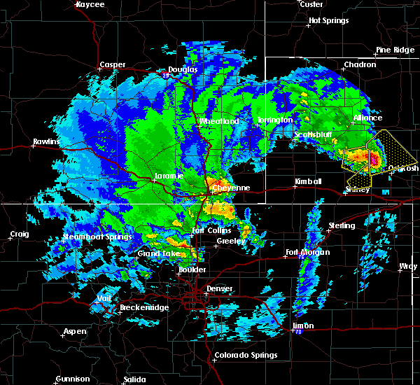 The severe thunderstorm warning for northeastern cheyenne and southeastern morrill counties will expire at 1000 pm mdt, the storm which prompted the warning has moved out of the area. therefore, the warning will be allowed to expire. to report severe weather, contact your nearest law enforcement agency. they will relay your report to the national weather service cheyenne. The severe thunderstorm warning for northeastern cheyenne and southeastern morrill counties will expire at 1000 pm mdt, the storm which prompted the warning has moved out of the area. therefore, the warning will be allowed to expire. to report severe weather, contact your nearest law enforcement agency. they will relay your report to the national weather service cheyenne.
|
| 6/8/2020 9:47 PM MDT |
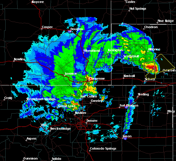 At 946 pm mdt, a severe thunderstorm was located 14 miles northwest of lisco, or 27 miles northwest of oshkosh, moving northeast at 60 mph (trained weather spotters). Hazards include ping pong ball size hail and 60 mph wind gusts. People and animals outdoors will be injured. expect hail damage to roofs, siding, windows, and vehicles. expect wind damage to roofs, siding, and trees. Locations impacted include, the intersection of highway 385 and 92 and broadwater. At 946 pm mdt, a severe thunderstorm was located 14 miles northwest of lisco, or 27 miles northwest of oshkosh, moving northeast at 60 mph (trained weather spotters). Hazards include ping pong ball size hail and 60 mph wind gusts. People and animals outdoors will be injured. expect hail damage to roofs, siding, windows, and vehicles. expect wind damage to roofs, siding, and trees. Locations impacted include, the intersection of highway 385 and 92 and broadwater.
|
| 6/8/2020 9:39 PM MDT |
 At 937 pm mdt, a severe thunderstorm was located near the intersection of highway 385 and 92, or 29 miles northwest of oshkosh, moving northeast at 50 mph (trained weather spotters). Hazards include 60 mph wind gusts and penny size hail one mile south of dalton at 931 pm. Expect damage to roofs, siding, and trees. Locations impacted include, dalton, the intersection of highway 385 and 92 and broadwater. At 937 pm mdt, a severe thunderstorm was located near the intersection of highway 385 and 92, or 29 miles northwest of oshkosh, moving northeast at 50 mph (trained weather spotters). Hazards include 60 mph wind gusts and penny size hail one mile south of dalton at 931 pm. Expect damage to roofs, siding, and trees. Locations impacted include, dalton, the intersection of highway 385 and 92 and broadwater.
|
| 6/8/2020 9:25 PM MDT |
 At 925 pm mdt, a severe thunderstorm was located near dalton, or 22 miles north of sidney, moving northeast at 50 mph (radar indicated). Hazards include 60 mph wind gusts and penny size hail. expect damage to roofs, siding, and trees At 925 pm mdt, a severe thunderstorm was located near dalton, or 22 miles north of sidney, moving northeast at 50 mph (radar indicated). Hazards include 60 mph wind gusts and penny size hail. expect damage to roofs, siding, and trees
|
| 6/8/2020 7:14 PM MDT |
 At 714 pm mdt, a severe thunderstorm was located near the intersection of highway 385 and 92, or 28 miles north of sidney, moving north at 45 mph (radar indicated). Hazards include 60 mph wind gusts and quarter size hail. Hail damage to vehicles is expected. expect wind damage to roofs, siding, and trees. Locations impacted include, bridgeport, court house and jail rocks, bridgeport state recreation area, northport, the intersection of highway 385 and 92 and broadwater. At 714 pm mdt, a severe thunderstorm was located near the intersection of highway 385 and 92, or 28 miles north of sidney, moving north at 45 mph (radar indicated). Hazards include 60 mph wind gusts and quarter size hail. Hail damage to vehicles is expected. expect wind damage to roofs, siding, and trees. Locations impacted include, bridgeport, court house and jail rocks, bridgeport state recreation area, northport, the intersection of highway 385 and 92 and broadwater.
|
| 6/8/2020 7:00 PM MDT |
 At 700 pm mdt, a severe thunderstorm was located near dalton, or 22 miles north of sidney, moving north at 30 mph (radar indicated). Hazards include 60 mph wind gusts and quarter size hail. Hail damage to vehicles is expected. Expect wind damage to roofs, siding, and trees. At 700 pm mdt, a severe thunderstorm was located near dalton, or 22 miles north of sidney, moving north at 30 mph (radar indicated). Hazards include 60 mph wind gusts and quarter size hail. Hail damage to vehicles is expected. Expect wind damage to roofs, siding, and trees.
|
| 6/6/2020 7:30 PM MDT |
 At 729 pm mdt, severe thunderstorms were located along a line extending from 7 miles north of whitney lake to near sunol, moving east at 50 mph (radar indicated). Hazards include 70 mph wind gusts. Expect considerable tree damage. Damage is likely to mobile homes, roofs, and outbuildings. At 729 pm mdt, severe thunderstorms were located along a line extending from 7 miles north of whitney lake to near sunol, moving east at 50 mph (radar indicated). Hazards include 70 mph wind gusts. Expect considerable tree damage. Damage is likely to mobile homes, roofs, and outbuildings.
|
| 6/6/2020 6:19 PM MDT |
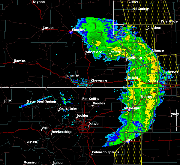 At 617 pm mdt, severe thunderstorms were located along a line extending from 13 miles northeast of the intersection of highway 385 and 92 to near sunol, moving northeast at 55 mph. at 608 pm mdt, sidney municipal airport asos reported 64 mph wind gust (mesonet station). Hazards include 70 mph wind gusts. Expect considerable tree damage. damage is likely to mobile homes, roofs, and outbuildings. locations impacted include, sidney, bridgeport, potter, lodgepole, dalton, dix, gurley, sunol, brownson, northport, bridgeport state recreation area, colton, lorenzo, the intersection of highway 385 and 92, court house and jail rocks, sidney airport, redington and broadwater. This includes interstate 80 in nebraska between mile markers 24 and 77. At 617 pm mdt, severe thunderstorms were located along a line extending from 13 miles northeast of the intersection of highway 385 and 92 to near sunol, moving northeast at 55 mph. at 608 pm mdt, sidney municipal airport asos reported 64 mph wind gust (mesonet station). Hazards include 70 mph wind gusts. Expect considerable tree damage. damage is likely to mobile homes, roofs, and outbuildings. locations impacted include, sidney, bridgeport, potter, lodgepole, dalton, dix, gurley, sunol, brownson, northport, bridgeport state recreation area, colton, lorenzo, the intersection of highway 385 and 92, court house and jail rocks, sidney airport, redington and broadwater. This includes interstate 80 in nebraska between mile markers 24 and 77.
|
| 6/6/2020 5:28 PM MDT |
 At 528 pm mdt, severe thunderstorms were located along a line extending from near kimball to near westplains, moving northeast at 65 mph (radar indicated). Hazards include 70 mph wind gusts. Expect considerable tree damage. Damage is likely to mobile homes, roofs, and outbuildings. At 528 pm mdt, severe thunderstorms were located along a line extending from near kimball to near westplains, moving northeast at 65 mph (radar indicated). Hazards include 70 mph wind gusts. Expect considerable tree damage. Damage is likely to mobile homes, roofs, and outbuildings.
|
| 8/21/2019 12:23 AM MDT |
 At 1223 am mdt, severe thunderstorms were located along a line extending from near ellsworth to near north sterling reservoir, moving east at 35 mph. these are very dangerous storms (radar indicated). Hazards include 80 mph wind gusts and quarter size hail. Flying debris will be dangerous to those caught without shelter. mobile homes will be heavily damaged. expect considerable damage to roofs, windows, and vehicles. extensive tree damage and power outages are likely. locations impacted include, alliance, sidney, potter, lodgepole, dalton, gurley, sunol, brownson, alliance airport, colton, lorenzo, sidney airport and broadwater. This includes interstate 80 in nebraska between mile markers 37 and 76. At 1223 am mdt, severe thunderstorms were located along a line extending from near ellsworth to near north sterling reservoir, moving east at 35 mph. these are very dangerous storms (radar indicated). Hazards include 80 mph wind gusts and quarter size hail. Flying debris will be dangerous to those caught without shelter. mobile homes will be heavily damaged. expect considerable damage to roofs, windows, and vehicles. extensive tree damage and power outages are likely. locations impacted include, alliance, sidney, potter, lodgepole, dalton, gurley, sunol, brownson, alliance airport, colton, lorenzo, sidney airport and broadwater. This includes interstate 80 in nebraska between mile markers 37 and 76.
|
| 8/21/2019 12:11 AM MDT |
 A severe thunderstorm warning remains in effect until 1245 am mdt for southeastern box butte. cheyenne. eastern kimball. morrill and southeastern banner counties. at 1210 am mdt, severe thunderstorms were located along a line extending from near ellsworth to westplains, moving east at 35 mph. These are very dangerous storms. A severe thunderstorm warning remains in effect until 1245 am mdt for southeastern box butte. cheyenne. eastern kimball. morrill and southeastern banner counties. at 1210 am mdt, severe thunderstorms were located along a line extending from near ellsworth to westplains, moving east at 35 mph. These are very dangerous storms.
|
| 8/20/2019 11:39 PM MDT |
 At 1138 pm mdt, severe thunderstorms were located along a line extending from 8 miles east of wild horse butte to 12 miles east of panorama point, moving east at 35 mph. these are very dangerous storms (radar indicated). Hazards include 80 mph wind gusts and quarter size hail. Flying debris will be dangerous to those caught without shelter. mobile homes will be heavily damaged. expect considerable damage to roofs, windows, and vehicles. Extensive tree damage and power outages are likely. At 1138 pm mdt, severe thunderstorms were located along a line extending from 8 miles east of wild horse butte to 12 miles east of panorama point, moving east at 35 mph. these are very dangerous storms (radar indicated). Hazards include 80 mph wind gusts and quarter size hail. Flying debris will be dangerous to those caught without shelter. mobile homes will be heavily damaged. expect considerable damage to roofs, windows, and vehicles. Extensive tree damage and power outages are likely.
|
| 8/16/2019 2:58 AM MDT |
 The severe thunderstorm warning for southeastern morrill county will expire at 300 am mdt, the storm which prompted the warning has moved out of the area. therefore, the warning will be allowed to expire. a severe thunderstorm watch remains in effect until 500 am mdt for the panhandle of nebraska. to report severe weather, contact your nearest law enforcement agency. they will relay your report to the national weather service cheyenne. The severe thunderstorm warning for southeastern morrill county will expire at 300 am mdt, the storm which prompted the warning has moved out of the area. therefore, the warning will be allowed to expire. a severe thunderstorm watch remains in effect until 500 am mdt for the panhandle of nebraska. to report severe weather, contact your nearest law enforcement agency. they will relay your report to the national weather service cheyenne.
|
| 8/16/2019 2:44 AM MDT | Hen Egg sized hail reported 0.2 miles SSW of Broadwater, NE |
| 8/16/2019 2:42 AM MDT | Golf Ball sized hail reported 1.9 miles NE of Broadwater, NE |
| 8/16/2019 2:39 AM MDT |
 A severe thunderstorm warning remains in effect until 300 am mdt for southeastern morrill county. at 236 am mdt, a severe thunderstorm was located near the intersection of highway 385 and 92, or 32 miles south of alliance, moving east at 40 mph. storm chasers have reported severe hail up to quarter size with this thunderstorm. This storm has the potential. A severe thunderstorm warning remains in effect until 300 am mdt for southeastern morrill county. at 236 am mdt, a severe thunderstorm was located near the intersection of highway 385 and 92, or 32 miles south of alliance, moving east at 40 mph. storm chasers have reported severe hail up to quarter size with this thunderstorm. This storm has the potential.
|
| 8/16/2019 2:17 AM MDT |
 At 214 am mdt, a severe thunderstorm was located near the intersection of highway 385 and l62, or 26 miles east of scottsbluff, moving east at 45 mph. this storm will continue to follow the highway 26 corridor producing large destructive hail (radar indicated). Hazards include tennis ball size hail and 70 mph wind gusts. People and animals outdoors will be injured. expect hail damage to roofs, siding, windows, and vehicles. expect considerable tree damage. wind damage is also likely to mobile homes, roofs, and outbuildings. Locations impacted include, alliance, bridgeport, alliance airport, northport, the intersection of highway 385 and 92, court house and jail rocks, bridgeport state recreation area, angora, the intersection of highway 385 and l62 and broadwater. At 214 am mdt, a severe thunderstorm was located near the intersection of highway 385 and l62, or 26 miles east of scottsbluff, moving east at 45 mph. this storm will continue to follow the highway 26 corridor producing large destructive hail (radar indicated). Hazards include tennis ball size hail and 70 mph wind gusts. People and animals outdoors will be injured. expect hail damage to roofs, siding, windows, and vehicles. expect considerable tree damage. wind damage is also likely to mobile homes, roofs, and outbuildings. Locations impacted include, alliance, bridgeport, alliance airport, northport, the intersection of highway 385 and 92, court house and jail rocks, bridgeport state recreation area, angora, the intersection of highway 385 and l62 and broadwater.
|
| 8/16/2019 1:48 AM MDT |
 At 147 am mdt, a severe thunderstorm was located over minatare, or 8 miles east of scottsbluff, moving east at 45 mph. , this is a very dangerous storm!, (trained spotters and public). Hazards include two inch hail and 70 mph wind gusts. People and animals outdoors will be injured. expect hail damage to roofs, siding, windows, and vehicles. expect considerable tree damage. Wind damage is also likely to mobile homes, roofs, and outbuildings. At 147 am mdt, a severe thunderstorm was located over minatare, or 8 miles east of scottsbluff, moving east at 45 mph. , this is a very dangerous storm!, (trained spotters and public). Hazards include two inch hail and 70 mph wind gusts. People and animals outdoors will be injured. expect hail damage to roofs, siding, windows, and vehicles. expect considerable tree damage. Wind damage is also likely to mobile homes, roofs, and outbuildings.
|
| 7/6/2019 10:32 PM MDT |
 At 1032 pm mdt, severe thunderstorms were located along a line extending from 14 miles south of alliance airport to 9 miles southwest of crescent lake national wildlife refuge to near lisco to near colton to 9 miles south of potter, moving east at 45 mph (trained weather spotters). Hazards include 70 mph wind gusts. Expect considerable tree damage. damage is likely to mobile homes, roofs, and outbuildings. locations impacted include, sidney, potter, lodgepole, dalton, dix, gurley, colton, sunol, brownson, lorenzo, sidney airport and broadwater. This includes interstate 80 in nebraska between mile markers 28 and 77. At 1032 pm mdt, severe thunderstorms were located along a line extending from 14 miles south of alliance airport to 9 miles southwest of crescent lake national wildlife refuge to near lisco to near colton to 9 miles south of potter, moving east at 45 mph (trained weather spotters). Hazards include 70 mph wind gusts. Expect considerable tree damage. damage is likely to mobile homes, roofs, and outbuildings. locations impacted include, sidney, potter, lodgepole, dalton, dix, gurley, colton, sunol, brownson, lorenzo, sidney airport and broadwater. This includes interstate 80 in nebraska between mile markers 28 and 77.
|
| 7/6/2019 10:10 PM MDT |
 At 1009 pm mdt, severe thunderstorms were located along a line extending from near angora to 7 miles northeast of the intersection of highway 385 and 92 to 6 miles northeast of dalton to near brownson to 9 miles south of dix, moving east at 45 mph (trained weather spotters. these storms have a history of producing very strong winds in excess of 70 mph). Hazards include 70 mph wind gusts. Expect considerable tree damage. Damage is likely to mobile homes, roofs, and outbuildings. At 1009 pm mdt, severe thunderstorms were located along a line extending from near angora to 7 miles northeast of the intersection of highway 385 and 92 to 6 miles northeast of dalton to near brownson to 9 miles south of dix, moving east at 45 mph (trained weather spotters. these storms have a history of producing very strong winds in excess of 70 mph). Hazards include 70 mph wind gusts. Expect considerable tree damage. Damage is likely to mobile homes, roofs, and outbuildings.
|
| 7/6/2019 10:00 PM MDT |
 At 1000 pm mdt, severe thunderstorms were located along a line extending from angora to near northport to near dalton to near dix, moving east at 40 mph. these are very dangerous storms capable of significant damage. seek shelter immediately! (trained weather spotters. these dangerous storms have a history of producing extreme wind gusts producing widespread tree and structural damage). Hazards include 80 mph wind gusts. Flying debris will be dangerous to those caught without shelter. mobile homes will be heavily damaged. expect considerable damage to roofs, windows, and vehicles. extensive tree damage and power outages are likely. locations impacted include, sidney, bridgeport, bayard, potter, dalton, dix, gurley, brownson, northport, bridgeport state recreation area, angora, the intersection of highway 385 and 92, court house and jail rocks, moomaws corner, redington, south bayard junction, the intersection of highway 385 and l62 and broadwater. This includes interstate 80 in nebraska between mile markers 27 and 55. At 1000 pm mdt, severe thunderstorms were located along a line extending from angora to near northport to near dalton to near dix, moving east at 40 mph. these are very dangerous storms capable of significant damage. seek shelter immediately! (trained weather spotters. these dangerous storms have a history of producing extreme wind gusts producing widespread tree and structural damage). Hazards include 80 mph wind gusts. Flying debris will be dangerous to those caught without shelter. mobile homes will be heavily damaged. expect considerable damage to roofs, windows, and vehicles. extensive tree damage and power outages are likely. locations impacted include, sidney, bridgeport, bayard, potter, dalton, dix, gurley, brownson, northport, bridgeport state recreation area, angora, the intersection of highway 385 and 92, court house and jail rocks, moomaws corner, redington, south bayard junction, the intersection of highway 385 and l62 and broadwater. This includes interstate 80 in nebraska between mile markers 27 and 55.
|
| 7/6/2019 9:48 PM MDT |
 At 948 pm mdt, severe thunderstorms were located along a line extending from near the intersection of highway 385 and l62 to bridgeport state recreation area to 7 miles south of court house and jail rocks to kimball, moving east at 45 mph. these are very dangerous storms capable of significant damage. seek shelter immediately! (trained weather spotters. these dangerous storms have a history of producing extreme wind gusts producing widespread tree and structural damage). Hazards include 80 mph wind gusts. Flying debris will be dangerous to those caught without shelter. mobile homes will be heavily damaged. expect considerable damage to roofs, windows, and vehicles. extensive tree damage and power outages are likely. locations impacted include, sidney, kimball, bridgeport, bayard, potter, dalton, dix, gurley, oliver campground, brownson, northport, angora, oliver reservoir, court house and jail rocks, chimney rock state park, bridgeport state recreation area, the intersection of highway 385 and 92, kimball airport, moomaws corner and redington. This includes interstate 80 in nebraska between mile markers 15 and 55. At 948 pm mdt, severe thunderstorms were located along a line extending from near the intersection of highway 385 and l62 to bridgeport state recreation area to 7 miles south of court house and jail rocks to kimball, moving east at 45 mph. these are very dangerous storms capable of significant damage. seek shelter immediately! (trained weather spotters. these dangerous storms have a history of producing extreme wind gusts producing widespread tree and structural damage). Hazards include 80 mph wind gusts. Flying debris will be dangerous to those caught without shelter. mobile homes will be heavily damaged. expect considerable damage to roofs, windows, and vehicles. extensive tree damage and power outages are likely. locations impacted include, sidney, kimball, bridgeport, bayard, potter, dalton, dix, gurley, oliver campground, brownson, northport, angora, oliver reservoir, court house and jail rocks, chimney rock state park, bridgeport state recreation area, the intersection of highway 385 and 92, kimball airport, moomaws corner and redington. This includes interstate 80 in nebraska between mile markers 15 and 55.
|
| 7/6/2019 9:35 PM MDT |
 At 934 pm mdt, severe thunderstorms were located along a line extending from near lake minatare campground to chimney rock state park to 6 miles southwest of redington to near oliver reservoir, moving east at 40 mph. these are very dangerous storms capable of significant damage. seek shelter immediately! (trained weather spotters. significant structural and tree damage has been reported across scotts bluff county with these storms!). Hazards include 80 mph wind gusts. Flying debris will be dangerous to those caught without shelter. mobile homes will be heavily damaged. expect considerable damage to roofs, windows, and vehicles. extensive tree damage and power outages are likely. locations impacted include, scottsbluff, sidney, kimball, gering, mitchell, bridgeport, bayard, terrytown, minatare, potter, dalton, dix, gurley, oliver campground, wildcat hills state recreation area, brownson, northport, angora, wildcat hills campground and oliver reservoir. This includes interstate 80 in nebraska between mile markers 15 and 55. At 934 pm mdt, severe thunderstorms were located along a line extending from near lake minatare campground to chimney rock state park to 6 miles southwest of redington to near oliver reservoir, moving east at 40 mph. these are very dangerous storms capable of significant damage. seek shelter immediately! (trained weather spotters. significant structural and tree damage has been reported across scotts bluff county with these storms!). Hazards include 80 mph wind gusts. Flying debris will be dangerous to those caught without shelter. mobile homes will be heavily damaged. expect considerable damage to roofs, windows, and vehicles. extensive tree damage and power outages are likely. locations impacted include, scottsbluff, sidney, kimball, gering, mitchell, bridgeport, bayard, terrytown, minatare, potter, dalton, dix, gurley, oliver campground, wildcat hills state recreation area, brownson, northport, angora, wildcat hills campground and oliver reservoir. This includes interstate 80 in nebraska between mile markers 15 and 55.
|
| 7/6/2019 9:23 PM MDT |
 At 923 pm mdt, severe thunderstorms were located along a line extending from near scottsbluff airport to 6 miles west of chimney rock state park to 11 miles southwest of redington to near oliver campground, moving east at 40 mph (trained weather spotters). Hazards include 60 mph wind gusts. expect damage to roofs, siding, and trees At 923 pm mdt, severe thunderstorms were located along a line extending from near scottsbluff airport to 6 miles west of chimney rock state park to 11 miles southwest of redington to near oliver campground, moving east at 40 mph (trained weather spotters). Hazards include 60 mph wind gusts. expect damage to roofs, siding, and trees
|
| 6/30/2019 10:14 PM MDT |
 At 1013 pm mdt, severe thunderstorms were located along a line extending from 8 miles east of harrisburg to court house and jail rocks to 6 miles south of lisco, moving east at 40 mph (at 10:11 pm trained weather spotters reported tree damage and wind gusts of 65 to 70 mph near chimney rock). Hazards include 70 mph wind gusts. Expect considerable tree damage. damage is likely to mobile homes, roofs, and outbuildings. Locations impacted include, alliance, bridgeport, bayard, minatare, lake minatare campground, alliance airport, northport, chimney rock state park, bridgeport state recreation area, angora, kilpatrick lake, the intersection of highway 385 and 92, berea, moomaws corner, lake minatare, south bayard junction, the intersection of highway 385 and l62, broadwater, melbeta and mcgrew. At 1013 pm mdt, severe thunderstorms were located along a line extending from 8 miles east of harrisburg to court house and jail rocks to 6 miles south of lisco, moving east at 40 mph (at 10:11 pm trained weather spotters reported tree damage and wind gusts of 65 to 70 mph near chimney rock). Hazards include 70 mph wind gusts. Expect considerable tree damage. damage is likely to mobile homes, roofs, and outbuildings. Locations impacted include, alliance, bridgeport, bayard, minatare, lake minatare campground, alliance airport, northport, chimney rock state park, bridgeport state recreation area, angora, kilpatrick lake, the intersection of highway 385 and 92, berea, moomaws corner, lake minatare, south bayard junction, the intersection of highway 385 and l62, broadwater, melbeta and mcgrew.
|
| 6/30/2019 10:06 PM MDT |
 At 1006 pm mdt, severe thunderstorms were located along a line extending from 6 miles east of harrisburg to near court house and jail rocks to 9 miles south of lisco, moving northeast at 40 mph (radar indicated). Hazards include 60 mph wind gusts. expect damage to roofs, siding, and trees At 1006 pm mdt, severe thunderstorms were located along a line extending from 6 miles east of harrisburg to near court house and jail rocks to 9 miles south of lisco, moving northeast at 40 mph (radar indicated). Hazards include 60 mph wind gusts. expect damage to roofs, siding, and trees
|
| 6/30/2019 9:39 PM MDT |
 At 939 pm mdt, severe thunderstorms were located along a line extending from near oliver reservoir to 6 miles east of potter to near sunol, moving northeast at 40 mph (trained weather spotters reported trees down near gurley). Hazards include 60 mph wind gusts and penny size hail. expect damage to roofs, siding, and trees At 939 pm mdt, severe thunderstorms were located along a line extending from near oliver reservoir to 6 miles east of potter to near sunol, moving northeast at 40 mph (trained weather spotters reported trees down near gurley). Hazards include 60 mph wind gusts and penny size hail. expect damage to roofs, siding, and trees
|
| 7/18/2018 3:25 AM MDT |
 The severe thunderstorm warning for southeastern morrill county will expire at 330 am mdt, the storm which prompted the warning has moved out of the area. therefore, the warning will be allowed to expire. however gusty winds are still possible with this thunderstorm over the next 30 minutes. The severe thunderstorm warning for southeastern morrill county will expire at 330 am mdt, the storm which prompted the warning has moved out of the area. therefore, the warning will be allowed to expire. however gusty winds are still possible with this thunderstorm over the next 30 minutes.
|
| 7/18/2018 2:57 AM MDT |
 At 257 am mdt, a severe thunderstorm was located near the intersection of highway 385 and 92, or 30 miles northwest of oshkosh, moving southeast at 35 mph (radar indicated). Hazards include 70 mph wind gusts and half dollar size hail. Hail damage to vehicles is expected. expect considerable tree damage. Wind damage is also likely to mobile homes, roofs, and outbuildings. At 257 am mdt, a severe thunderstorm was located near the intersection of highway 385 and 92, or 30 miles northwest of oshkosh, moving southeast at 35 mph (radar indicated). Hazards include 70 mph wind gusts and half dollar size hail. Hail damage to vehicles is expected. expect considerable tree damage. Wind damage is also likely to mobile homes, roofs, and outbuildings.
|
| 7/18/2018 2:43 AM MDT |
 At 243 am mdt, severe thunderstorms were located along a line extending from 11 miles northwest of crescent lake national wildlife refuge to near bridgeport, moving southeast at 45 mph (radar indicated). Hazards include 70 mph wind gusts and half dollar size hail. Hail damage to vehicles is expected. expect considerable tree damage. wind damage is also likely to mobile homes, roofs, and outbuildings. Locations impacted include, bridgeport, court house and jail rocks, bridgeport state recreation area, northport, the intersection of highway 385 and 92 and broadwater. At 243 am mdt, severe thunderstorms were located along a line extending from 11 miles northwest of crescent lake national wildlife refuge to near bridgeport, moving southeast at 45 mph (radar indicated). Hazards include 70 mph wind gusts and half dollar size hail. Hail damage to vehicles is expected. expect considerable tree damage. wind damage is also likely to mobile homes, roofs, and outbuildings. Locations impacted include, bridgeport, court house and jail rocks, bridgeport state recreation area, northport, the intersection of highway 385 and 92 and broadwater.
|
| 7/18/2018 2:25 AM MDT |
 At 224 am mdt, severe thunderstorms were located along a line extending from 6 miles south of alliance airport to near bayard, moving southeast at 45 mph (radar indicated). Hazards include 70 mph wind gusts and half dollar size hail. Hail damage to vehicles is expected. expect considerable tree damage. Wind damage is also likely to mobile homes, roofs, and outbuildings. At 224 am mdt, severe thunderstorms were located along a line extending from 6 miles south of alliance airport to near bayard, moving southeast at 45 mph (radar indicated). Hazards include 70 mph wind gusts and half dollar size hail. Hail damage to vehicles is expected. expect considerable tree damage. Wind damage is also likely to mobile homes, roofs, and outbuildings.
|
| 6/29/2018 8:22 PM MDT |
 The severe thunderstorm warning for southeastern box butte and morrill counties will expire at 830 pm mdt, the storms which prompted the warning have weakened below severe limits, and have exited the warned area. therefore, the warning will be allowed to expire. a severe thunderstorm watch remains in effect until 100 am mdt for the panhandle of nebraska. to report severe weather, contact your nearest law enforcement agency. they will relay your report to the national weather service cheyenne. The severe thunderstorm warning for southeastern box butte and morrill counties will expire at 830 pm mdt, the storms which prompted the warning have weakened below severe limits, and have exited the warned area. therefore, the warning will be allowed to expire. a severe thunderstorm watch remains in effect until 100 am mdt for the panhandle of nebraska. to report severe weather, contact your nearest law enforcement agency. they will relay your report to the national weather service cheyenne.
|
| 6/29/2018 7:59 PM MDT |
 At 758 pm mdt, severe thunderstorms were located along a line extending from near alliance to 13 miles south of alliance airport, moving east at 30 mph (radar indicated). Hazards include 60 mph wind gusts and quarter size hail. Hail damage to vehicles is expected. expect wind damage to roofs, siding, and trees. Locations impacted include, alliance, bridgeport, alliance airport, northport, the intersection of highway 385 and 92, court house and jail rocks, bridgeport state recreation area, angora, redington, the intersection of highway 385 and l62, south bayard junction and broadwater. At 758 pm mdt, severe thunderstorms were located along a line extending from near alliance to 13 miles south of alliance airport, moving east at 30 mph (radar indicated). Hazards include 60 mph wind gusts and quarter size hail. Hail damage to vehicles is expected. expect wind damage to roofs, siding, and trees. Locations impacted include, alliance, bridgeport, alliance airport, northport, the intersection of highway 385 and 92, court house and jail rocks, bridgeport state recreation area, angora, redington, the intersection of highway 385 and l62, south bayard junction and broadwater.
|
| 6/29/2018 7:32 PM MDT |
 At 732 pm mdt, severe thunderstorms were located along a line extending from 7 miles west of alliance to near northport, moving east at 30 mph (radar indicated). Hazards include 60 mph wind gusts and quarter size hail. Hail damage to vehicles is expected. Expect wind damage to roofs, siding, and trees. At 732 pm mdt, severe thunderstorms were located along a line extending from 7 miles west of alliance to near northport, moving east at 30 mph (radar indicated). Hazards include 60 mph wind gusts and quarter size hail. Hail damage to vehicles is expected. Expect wind damage to roofs, siding, and trees.
|
| 6/23/2018 7:34 PM MDT |
 At 733 pm mdt, a severe thunderstorm was located 9 miles northwest of lisco, or 23 miles northwest of oshkosh, moving east at 35 mph (radar indicated). Hazards include 60 mph wind gusts. Expect damage to roofs, siding, and trees. This severe thunderstorm will remain over mainly rural areas of northeastern cheyenne and southeastern morrill counties, including the following locations, broadwater. At 733 pm mdt, a severe thunderstorm was located 9 miles northwest of lisco, or 23 miles northwest of oshkosh, moving east at 35 mph (radar indicated). Hazards include 60 mph wind gusts. Expect damage to roofs, siding, and trees. This severe thunderstorm will remain over mainly rural areas of northeastern cheyenne and southeastern morrill counties, including the following locations, broadwater.
|
| 6/23/2018 7:16 PM MDT |
 At 715 pm mdt, a severe thunderstorm was located over the intersection of highway 385 and 92, or 32 miles north of sidney, moving east at 40 mph (radar indicated). Hazards include 60 mph wind gusts and penny size hail. this storm has a history of producing winds of 60 to 65 mph and minor tree damage in bridgeport. Expect damage to roofs, siding, and trees. This severe thunderstorm will remain over mainly rural areas of northeastern cheyenne and southeastern morrill counties, including the following locations, broadwater. At 715 pm mdt, a severe thunderstorm was located over the intersection of highway 385 and 92, or 32 miles north of sidney, moving east at 40 mph (radar indicated). Hazards include 60 mph wind gusts and penny size hail. this storm has a history of producing winds of 60 to 65 mph and minor tree damage in bridgeport. Expect damage to roofs, siding, and trees. This severe thunderstorm will remain over mainly rural areas of northeastern cheyenne and southeastern morrill counties, including the following locations, broadwater.
|
| 6/23/2018 6:56 PM MDT |
 At 654 pm mdt, a severe thunderstorm was located near bridgeport state recreation area, or 29 miles southeast of scottsbluff, moving east at 35 mph (radar indicated). Hazards include 60 mph wind gusts and quarter size hail. Hail damage to vehicles is expected. expect wind damage to roofs, siding, and trees. at 653 pm mdt, 60 to 65 mph winds and minor tree damage were reported at bridgeport. this severe storm will be near, court house and jail rocks and northport around 700 pm mdt. the intersection of highway 385 and 92 around 715 pm mdt. Other locations impacted by this severe thunderstorm include broadwater. At 654 pm mdt, a severe thunderstorm was located near bridgeport state recreation area, or 29 miles southeast of scottsbluff, moving east at 35 mph (radar indicated). Hazards include 60 mph wind gusts and quarter size hail. Hail damage to vehicles is expected. expect wind damage to roofs, siding, and trees. at 653 pm mdt, 60 to 65 mph winds and minor tree damage were reported at bridgeport. this severe storm will be near, court house and jail rocks and northport around 700 pm mdt. the intersection of highway 385 and 92 around 715 pm mdt. Other locations impacted by this severe thunderstorm include broadwater.
|
| 6/23/2018 6:37 PM MDT |
 At 637 pm mdt, a severe thunderstorm was located over south bayard junction, or 19 miles southeast of scottsbluff, moving southeast at 40 mph (radar indicated). Hazards include 60 mph wind gusts and quarter size hail. Hail damage to vehicles is expected. expect wind damage to roofs, siding, and trees. this severe thunderstorm will be near, bridgeport, bridgeport state recreation area and northport around 655 pm mdt. court house and jail rocks around 700 pm mdt. the intersection of highway 385 and 92 around 710 pm mdt. Other locations impacted by this severe thunderstorm include mcgrew and broadwater. At 637 pm mdt, a severe thunderstorm was located over south bayard junction, or 19 miles southeast of scottsbluff, moving southeast at 40 mph (radar indicated). Hazards include 60 mph wind gusts and quarter size hail. Hail damage to vehicles is expected. expect wind damage to roofs, siding, and trees. this severe thunderstorm will be near, bridgeport, bridgeport state recreation area and northport around 655 pm mdt. court house and jail rocks around 700 pm mdt. the intersection of highway 385 and 92 around 710 pm mdt. Other locations impacted by this severe thunderstorm include mcgrew and broadwater.
|
| 6/7/2018 9:10 PM MDT |
 The severe thunderstorm warning for north central cheyenne and southern morrill counties will expire at 915 pm mdt, the storms which prompted the warning have weakened below severe limits, and no longer pose an immediate threat to life or property. therefore the warning will be allowed to expire. however small hail and gusty winds are still possible with these thunderstorms. The severe thunderstorm warning for north central cheyenne and southern morrill counties will expire at 915 pm mdt, the storms which prompted the warning have weakened below severe limits, and no longer pose an immediate threat to life or property. therefore the warning will be allowed to expire. however small hail and gusty winds are still possible with these thunderstorms.
|
| 6/7/2018 9:00 PM MDT |
 At 900 pm mdt, severe thunderstorms were located along a line extending from 8 miles southwest of crescent lake national wildlife refuge to near potter, moving east at 35 mph (trained weather spotters). Hazards include 70 mph wind gusts and quarter size hail. Hail damage to vehicles is expected. expect considerable tree damage. wind damage is also likely to mobile homes, roofs, and outbuildings. Locations impacted include, dalton, court house and jail rocks, the intersection of highway 385 and 92 and broadwater. At 900 pm mdt, severe thunderstorms were located along a line extending from 8 miles southwest of crescent lake national wildlife refuge to near potter, moving east at 35 mph (trained weather spotters). Hazards include 70 mph wind gusts and quarter size hail. Hail damage to vehicles is expected. expect considerable tree damage. wind damage is also likely to mobile homes, roofs, and outbuildings. Locations impacted include, dalton, court house and jail rocks, the intersection of highway 385 and 92 and broadwater.
|
| 6/7/2018 8:29 PM MDT |
 At 828 pm mdt, severe thunderstorms were located along a line extending from 9 miles northeast of the intersection of highway 385 and 92 to near kimball, moving east at 35 mph (radar indicated). Hazards include 70 mph wind gusts and half dollar size hail. Hail damage to vehicles is expected. expect considerable tree damage. Wind damage is also likely to mobile homes, roofs, and outbuildings. At 828 pm mdt, severe thunderstorms were located along a line extending from 9 miles northeast of the intersection of highway 385 and 92 to near kimball, moving east at 35 mph (radar indicated). Hazards include 70 mph wind gusts and half dollar size hail. Hail damage to vehicles is expected. expect considerable tree damage. Wind damage is also likely to mobile homes, roofs, and outbuildings.
|
| 6/7/2018 8:12 PM MDT |
 At 812 pm mdt, a severe thunderstorm was located near the intersection of highway 385 and 92, or 28 miles north of sidney, moving east at 25 mph (radar indicated). Hazards include 70 mph wind gusts and half dollar size hail. Hail damage to vehicles is expected. expect considerable tree damage. wind damage is also likely to mobile homes, roofs, and outbuildings. Locations impacted include, bridgeport, bayard, dalton, gurley, northport, the intersection of highway 385 and 92, chimney rock state park, court house and jail rocks, bridgeport state recreation area, redington, south bayard junction and broadwater. At 812 pm mdt, a severe thunderstorm was located near the intersection of highway 385 and 92, or 28 miles north of sidney, moving east at 25 mph (radar indicated). Hazards include 70 mph wind gusts and half dollar size hail. Hail damage to vehicles is expected. expect considerable tree damage. wind damage is also likely to mobile homes, roofs, and outbuildings. Locations impacted include, bridgeport, bayard, dalton, gurley, northport, the intersection of highway 385 and 92, chimney rock state park, court house and jail rocks, bridgeport state recreation area, redington, south bayard junction and broadwater.
|
| 6/7/2018 7:42 PM MDT |
 At 742 pm mdt, a severe thunderstorm was located over redington, or 26 miles southeast of scottsbluff, moving east at 25 mph (radar indicated). Hazards include 70 mph wind gusts and half dollar size hail. Hail damage to vehicles is expected. expect considerable tree damage. Wind damage is also likely to mobile homes, roofs, and outbuildings. At 742 pm mdt, a severe thunderstorm was located over redington, or 26 miles southeast of scottsbluff, moving east at 25 mph (radar indicated). Hazards include 70 mph wind gusts and half dollar size hail. Hail damage to vehicles is expected. expect considerable tree damage. Wind damage is also likely to mobile homes, roofs, and outbuildings.
|
| 5/27/2018 6:58 PM MDT |
 The severe thunderstorm warning for cheyenne. eastern kimball. southeastern morrill and southeastern banner counties will expire at 700 pm mdt. the storms which prompted the warning have weakened below severe limits, and no longer pose an immediate threat to life or property. Therefore the warning will be allowed to expire. The severe thunderstorm warning for cheyenne. eastern kimball. southeastern morrill and southeastern banner counties will expire at 700 pm mdt. the storms which prompted the warning have weakened below severe limits, and no longer pose an immediate threat to life or property. Therefore the warning will be allowed to expire.
|
| 5/27/2018 6:22 PM MDT |
 At 621 pm mdt, severe thunderstorms were located along a line extending from near dix to 7 miles northwest of dalton to near gurley to lodgepole to julesburg, moving northeast at 35 mph (radar indicated). Hazards include 70 mph wind gusts and quarter size hail. Hail damage to vehicles is expected. expect considerable tree damage. Wind damage is also likely to mobile homes, roofs, and outbuildings. At 621 pm mdt, severe thunderstorms were located along a line extending from near dix to 7 miles northwest of dalton to near gurley to lodgepole to julesburg, moving northeast at 35 mph (radar indicated). Hazards include 70 mph wind gusts and quarter size hail. Hail damage to vehicles is expected. expect considerable tree damage. Wind damage is also likely to mobile homes, roofs, and outbuildings.
|
| 5/17/2018 10:44 PM MDT |
 At 1044 pm mdt, a severe thunderstorm was located over gurley, or 11 miles north of sidney, moving east at 10 mph (radar indicated). Hazards include ping pong ball size hail and 60 mph wind gusts. People and animals outdoors will be injured. expect hail damage to roofs, siding, windows, and vehicles. expect wind damage to roofs, siding, and trees. this severe storm will be near, dalton and gurley around 1100 pm mdt. other locations impacted by this severe thunderstorm include broadwater. This includes interstate 80 in nebraska between mile markers 43 and 51. At 1044 pm mdt, a severe thunderstorm was located over gurley, or 11 miles north of sidney, moving east at 10 mph (radar indicated). Hazards include ping pong ball size hail and 60 mph wind gusts. People and animals outdoors will be injured. expect hail damage to roofs, siding, windows, and vehicles. expect wind damage to roofs, siding, and trees. this severe storm will be near, dalton and gurley around 1100 pm mdt. other locations impacted by this severe thunderstorm include broadwater. This includes interstate 80 in nebraska between mile markers 43 and 51.
|
| 5/17/2018 10:28 PM MDT |
 At 1027 pm mdt, a severe thunderstorm was located near gurley, or 13 miles northwest of sidney, moving northeast at 20 mph (radar indicated). Hazards include two inch hail and 60 mph wind gusts. People and animals outdoors will be injured. expect hail damage to roofs, siding, windows, and vehicles. expect wind damage to roofs, siding, and trees. this severe thunderstorm will be near, gurley around 1045 pm mdt. dalton around 1050 pm mdt. other locations impacted by this severe thunderstorm include broadwater. This includes interstate 80 in nebraska between mile markers 43 and 51. At 1027 pm mdt, a severe thunderstorm was located near gurley, or 13 miles northwest of sidney, moving northeast at 20 mph (radar indicated). Hazards include two inch hail and 60 mph wind gusts. People and animals outdoors will be injured. expect hail damage to roofs, siding, windows, and vehicles. expect wind damage to roofs, siding, and trees. this severe thunderstorm will be near, gurley around 1045 pm mdt. dalton around 1050 pm mdt. other locations impacted by this severe thunderstorm include broadwater. This includes interstate 80 in nebraska between mile markers 43 and 51.
|
| 5/17/2018 10:15 PM MDT |
 At 1014 pm mdt, a severe thunderstorm was located 8 miles northeast of potter, or 14 miles northwest of sidney, moving east at 25 mph (radar indicated). Hazards include 60 mph wind gusts and quarter size hail. Hail damage to vehicles is expected. expect wind damage to roofs, siding, and trees. this severe storm will be near, gurley around 1030 pm mdt. other locations impacted by this severe thunderstorm include broadwater. This includes interstate 80 in nebraska between mile markers 40 and 45. At 1014 pm mdt, a severe thunderstorm was located 8 miles northeast of potter, or 14 miles northwest of sidney, moving east at 25 mph (radar indicated). Hazards include 60 mph wind gusts and quarter size hail. Hail damage to vehicles is expected. expect wind damage to roofs, siding, and trees. this severe storm will be near, gurley around 1030 pm mdt. other locations impacted by this severe thunderstorm include broadwater. This includes interstate 80 in nebraska between mile markers 40 and 45.
|
| 5/17/2018 9:45 PM MDT |
 At 944 pm mdt, severe thunderstorms were located along a line extending from near dalton to near dix, moving northeast at 10 mph (radar indicated). Hazards include 60 mph wind gusts and quarter size hail. Hail damage to vehicles is expected. expect wind damage to roofs, siding, and trees. these severe storms will be near, dalton around 1005 pm mdt. other locations impacted by these severe thunderstorms include broadwater. This includes interstate 80 in nebraska between mile markers 29 and 45. At 944 pm mdt, severe thunderstorms were located along a line extending from near dalton to near dix, moving northeast at 10 mph (radar indicated). Hazards include 60 mph wind gusts and quarter size hail. Hail damage to vehicles is expected. expect wind damage to roofs, siding, and trees. these severe storms will be near, dalton around 1005 pm mdt. other locations impacted by these severe thunderstorms include broadwater. This includes interstate 80 in nebraska between mile markers 29 and 45.
|
| 5/17/2018 9:26 PM MDT |
 At 926 pm mdt, severe thunderstorms were located along a line extending from 7 miles west of dalton to 6 miles south of dix, moving northeast at 10 mph (radar indicated). Hazards include 60 mph wind gusts and quarter size hail. Hail damage to vehicles is expected. expect wind damage to roofs, siding, and trees. severe thunderstorms will be near, dalton around 1005 pm mdt. potter and the intersection of highway 385 and 92 around 1030 pm mdt. other locations impacted by these severe thunderstorms include broadwater. This includes interstate 80 in nebraska between mile markers 29 and 45. At 926 pm mdt, severe thunderstorms were located along a line extending from 7 miles west of dalton to 6 miles south of dix, moving northeast at 10 mph (radar indicated). Hazards include 60 mph wind gusts and quarter size hail. Hail damage to vehicles is expected. expect wind damage to roofs, siding, and trees. severe thunderstorms will be near, dalton around 1005 pm mdt. potter and the intersection of highway 385 and 92 around 1030 pm mdt. other locations impacted by these severe thunderstorms include broadwater. This includes interstate 80 in nebraska between mile markers 29 and 45.
|
| 5/10/2018 5:30 PM MDT | Two large trees down. one fell on a pickup truck... another is blocking the roa in morrill county NE, 0.2 miles SSW of Broadwater, NE |
| 5/10/2018 5:24 PM MDT |
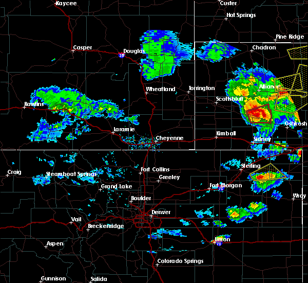 At 523 pm mdt, a severe thunderstorm capable of producing a tornado was located near the intersection of highway 385 and 92, or 31 miles south of alliance, moving east at 40 mph (radar indicated rotation). Hazards include tornado and baseball size hail. Flying debris will be dangerous to those caught without shelter. mobile homes will be damaged or destroyed. damage to roofs, windows, and vehicles will occur. tree damage is likely. locations impacted include, broadwater. People in broadwater should seek shelter immediately!. At 523 pm mdt, a severe thunderstorm capable of producing a tornado was located near the intersection of highway 385 and 92, or 31 miles south of alliance, moving east at 40 mph (radar indicated rotation). Hazards include tornado and baseball size hail. Flying debris will be dangerous to those caught without shelter. mobile homes will be damaged or destroyed. damage to roofs, windows, and vehicles will occur. tree damage is likely. locations impacted include, broadwater. People in broadwater should seek shelter immediately!.
|
| 5/10/2018 5:13 PM MDT |
 At 513 pm mdt, a severe thunderstorm capable of producing a tornado was located over the intersection of highway 385 and 92, or 32 miles south of alliance, moving east at 40 mph (radar indicated rotation). Hazards include tornado and baseball size hail. Flying debris will be dangerous to those caught without shelter. mobile homes will be damaged or destroyed. damage to roofs, windows, and vehicles will occur. tree damage is likely. This tornadic thunderstorm will remain over mainly rural areas of southeastern morrill county, including the following locations: broadwater. At 513 pm mdt, a severe thunderstorm capable of producing a tornado was located over the intersection of highway 385 and 92, or 32 miles south of alliance, moving east at 40 mph (radar indicated rotation). Hazards include tornado and baseball size hail. Flying debris will be dangerous to those caught without shelter. mobile homes will be damaged or destroyed. damage to roofs, windows, and vehicles will occur. tree damage is likely. This tornadic thunderstorm will remain over mainly rural areas of southeastern morrill county, including the following locations: broadwater.
|
| 5/10/2018 5:05 PM MDT |
 At 504 pm mdt, a severe thunderstorm was located over bridgeport, or 33 miles southeast of scottsbluff, moving east at 40 mph. this is a very dangerous storm (radar indicated). Hazards include baseball size hail and 70 mph wind gusts. People and animals outdoors will be severely injured. expect shattered windows, extensive damage to roofs, siding, and vehicles. Locations impacted include, bridgeport, court house and jail rocks, bridgeport state recreation area, northport, the intersection of highway 385 and 92 and broadwater. At 504 pm mdt, a severe thunderstorm was located over bridgeport, or 33 miles southeast of scottsbluff, moving east at 40 mph. this is a very dangerous storm (radar indicated). Hazards include baseball size hail and 70 mph wind gusts. People and animals outdoors will be severely injured. expect shattered windows, extensive damage to roofs, siding, and vehicles. Locations impacted include, bridgeport, court house and jail rocks, bridgeport state recreation area, northport, the intersection of highway 385 and 92 and broadwater.
|
| 5/10/2018 5:00 PM MDT | Reported along hwy 385 in morrill county NE, 9.6 miles NE of Broadwater, NE |
| 5/10/2018 4:48 PM MDT |
 At 448 pm mdt, a severe thunderstorm was located over redington, or 25 miles southeast of scottsbluff, moving east at 40 mph (radar indicated). Hazards include 60 mph wind gusts and quarter size hail. Hail damage to vehicles is expected. Expect wind damage to roofs, siding, and trees. At 448 pm mdt, a severe thunderstorm was located over redington, or 25 miles southeast of scottsbluff, moving east at 40 mph (radar indicated). Hazards include 60 mph wind gusts and quarter size hail. Hail damage to vehicles is expected. Expect wind damage to roofs, siding, and trees.
|
| 8/12/2017 4:57 PM MDT |
 The severe thunderstorm warning for southern morrill county will expire at 500 pm mdt, the storms which prompted the warning have weakened below severe limits, and no longer pose an immediate threat to life or property. therefore the warning will be allowed to expire. however torrential rain and small hail are still possible with these thunderstorms. a severe thunderstorm watch remains in effect until 1100 pm mdt for the panhandle of nebraska. to report severe weather, contact your nearest law enforcement agency. they will relay your report to the national weather service cheyenne. The severe thunderstorm warning for southern morrill county will expire at 500 pm mdt, the storms which prompted the warning have weakened below severe limits, and no longer pose an immediate threat to life or property. therefore the warning will be allowed to expire. however torrential rain and small hail are still possible with these thunderstorms. a severe thunderstorm watch remains in effect until 1100 pm mdt for the panhandle of nebraska. to report severe weather, contact your nearest law enforcement agency. they will relay your report to the national weather service cheyenne.
|
| 8/12/2017 4:49 PM MDT |
 At 449 pm mdt, severe thunderstorms were located along a line extending from 8 miles northwest of lisco to near the intersection of highway 385 and 92 to near redington, moving southeast at 35 mph (radar indicated). Hazards include ping pong ball size hail and 60 mph wind gusts. People and animals outdoors will be injured. expect hail damage to roofs, siding, windows, and vehicles. expect wind damage to roofs, siding, and trees. Locations impacted include, bridgeport, northport, the intersection of highway 385 and 92, court house and jail rocks, bridgeport state recreation area, redington and broadwater. At 449 pm mdt, severe thunderstorms were located along a line extending from 8 miles northwest of lisco to near the intersection of highway 385 and 92 to near redington, moving southeast at 35 mph (radar indicated). Hazards include ping pong ball size hail and 60 mph wind gusts. People and animals outdoors will be injured. expect hail damage to roofs, siding, windows, and vehicles. expect wind damage to roofs, siding, and trees. Locations impacted include, bridgeport, northport, the intersection of highway 385 and 92, court house and jail rocks, bridgeport state recreation area, redington and broadwater.
|
| 8/12/2017 4:29 PM MDT |
 At 428 pm mdt, a severe thunderstorm was located over bridgeport, or 32 miles south of alliance, moving southeast at 25 mph. a second severe thunderstorm was located near redington, and was moving to the east southeast around 15 mph (radar indicated). Hazards include ping pong ball size hail and 60 mph wind gusts. People and animals outdoors will be injured. expect hail damage to roofs, siding, windows, and vehicles. Expect wind damage to roofs, siding, and trees. At 428 pm mdt, a severe thunderstorm was located over bridgeport, or 32 miles south of alliance, moving southeast at 25 mph. a second severe thunderstorm was located near redington, and was moving to the east southeast around 15 mph (radar indicated). Hazards include ping pong ball size hail and 60 mph wind gusts. People and animals outdoors will be injured. expect hail damage to roofs, siding, windows, and vehicles. Expect wind damage to roofs, siding, and trees.
|
| 8/8/2017 3:21 PM MDT |
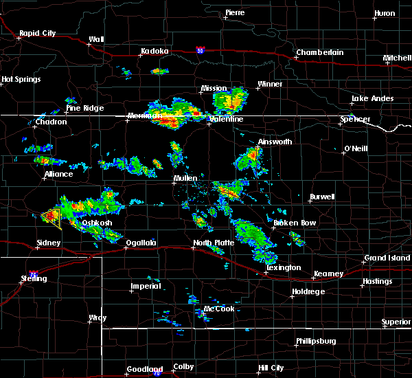 At 320 pm mdt, a severe thunderstorm was located 8 miles northwest of lisco, or 23 miles northwest of oshkosh, moving southeast at 15 mph (radar indicated). Hazards include 60 mph wind gusts and half dollar size hail. Hail damage to vehicles is expected. expect wind damage to roofs, siding, and trees. Locations impacted include, broadwater. At 320 pm mdt, a severe thunderstorm was located 8 miles northwest of lisco, or 23 miles northwest of oshkosh, moving southeast at 15 mph (radar indicated). Hazards include 60 mph wind gusts and half dollar size hail. Hail damage to vehicles is expected. expect wind damage to roofs, siding, and trees. Locations impacted include, broadwater.
|
| 8/8/2017 2:57 PM MDT |
 At 257 pm mdt, a severe thunderstorm was located 9 miles west of richardson lake, or 27 miles northwest of oshkosh, moving southeast at 20 mph (radar indicated). Hazards include 60 mph wind gusts and half dollar size hail. Hail damage to vehicles is expected. Expect wind damage to roofs, siding, and trees. At 257 pm mdt, a severe thunderstorm was located 9 miles west of richardson lake, or 27 miles northwest of oshkosh, moving southeast at 20 mph (radar indicated). Hazards include 60 mph wind gusts and half dollar size hail. Hail damage to vehicles is expected. Expect wind damage to roofs, siding, and trees.
|
| 7/3/2017 5:24 PM MDT |
 At 524 pm mdt, a severe thunderstorm was located 10 miles west of richardson lake, or 27 miles south of alliance, moving southwest at 10 mph (radar indicated). Hazards include 60 mph wind gusts and quarter size hail. Hail damage to vehicles is expected. expect wind damage to roofs, siding, and trees. this severe thunderstorm will be near, the intersection of highway 385 and 92 around 630 pm mdt. Other locations impacted by this severe thunderstorm include broadwater. At 524 pm mdt, a severe thunderstorm was located 10 miles west of richardson lake, or 27 miles south of alliance, moving southwest at 10 mph (radar indicated). Hazards include 60 mph wind gusts and quarter size hail. Hail damage to vehicles is expected. expect wind damage to roofs, siding, and trees. this severe thunderstorm will be near, the intersection of highway 385 and 92 around 630 pm mdt. Other locations impacted by this severe thunderstorm include broadwater.
|
| 6/27/2017 2:24 PM MDT |
 The severe thunderstorm warning for northeastern cheyenne and morrill counties will expire at 830 pm mdt, the storms which prompted the warning have moved out of the area. therefore the warning will be allowed to expire. The severe thunderstorm warning for northeastern cheyenne and morrill counties will expire at 830 pm mdt, the storms which prompted the warning have moved out of the area. therefore the warning will be allowed to expire.
|
| 6/27/2017 1:59 PM MDT |
 A severe thunderstorm warning remains in effect until 830 pm mdt for northeastern cheyenne and morrill counties. at 759 pm mdt, severe thunderstorms were located along a line extending from 7 miles north of angora to near colton, moving east at 40 mph. hazard. 70 mph wind gusts and quarter size hail. A severe thunderstorm warning remains in effect until 830 pm mdt for northeastern cheyenne and morrill counties. at 759 pm mdt, severe thunderstorms were located along a line extending from 7 miles north of angora to near colton, moving east at 40 mph. hazard. 70 mph wind gusts and quarter size hail.
|
| 6/27/2017 1:29 PM MDT |
 At 728 pm mdt, severe thunderstorms were located along a line extending from near minatare to 11 miles north of potter, moving east at 55 mph. these are very dangerous storms (radar indicated. at 719 pm mdt, a 79 mph wind gust was reported at the scottsbluff airport). Hazards include 80 mph wind gusts and quarter size hail. Flying debris will be dangerous to those caught without shelter. mobile homes will be heavily damaged. expect considerable damage to roofs, windows, and vehicles. extensive tree damage and power outages are likely. severe thunderstorms will be near, the intersection of highway 385 and l62 around 745 pm mdt. dalton and angora around 750 pm mdt. other locations impacted by these severe thunderstorms include broadwater. This includes interstate 80 in nebraska between mile markers 33 and 51. At 728 pm mdt, severe thunderstorms were located along a line extending from near minatare to 11 miles north of potter, moving east at 55 mph. these are very dangerous storms (radar indicated. at 719 pm mdt, a 79 mph wind gust was reported at the scottsbluff airport). Hazards include 80 mph wind gusts and quarter size hail. Flying debris will be dangerous to those caught without shelter. mobile homes will be heavily damaged. expect considerable damage to roofs, windows, and vehicles. extensive tree damage and power outages are likely. severe thunderstorms will be near, the intersection of highway 385 and l62 around 745 pm mdt. dalton and angora around 750 pm mdt. other locations impacted by these severe thunderstorms include broadwater. This includes interstate 80 in nebraska between mile markers 33 and 51.
|
| 9/4/2016 4:57 PM MDT | Quarter sized hail reported 2.8 miles NNE of Broadwater, NE |
| 6/28/2016 7:15 PM MDT |
 At 711 pm mdt, damaging winds associated with thunderstorms were still tracking through morrill county. these strong winds should begin to subside during the next hour. this is a reissuance of the previous severe thunderstorm warning (radar indicated). Hazards include 70 mph wind gusts. Expect considerable tree damage. Damage is likely to mobile homes, roofs, and outbuildings. At 711 pm mdt, damaging winds associated with thunderstorms were still tracking through morrill county. these strong winds should begin to subside during the next hour. this is a reissuance of the previous severe thunderstorm warning (radar indicated). Hazards include 70 mph wind gusts. Expect considerable tree damage. Damage is likely to mobile homes, roofs, and outbuildings.
|
| 6/28/2016 7:05 PM MDT |
 At 702 pm mdt, severe damaging winds were continuing to move through morrill county. these damaging winds were occurring around bridgeport where they had reports of 75 mph and bayard recently had a report of 60 mph. this cluster of strong winds is moving east at 30 mph (radar indicated). Hazards include 60 mph wind gusts. Expect damage to roofs. siding. and trees. Locations impacted include, bridgeport, bayard, the intersection of highway 385 and 92, bridgeport state recreation area, moomaws corner, angora, south bayard junction, chimney rock state park, court house and jail rocks, northport, the intersection of highway 385 and l62 and broadwater. At 702 pm mdt, severe damaging winds were continuing to move through morrill county. these damaging winds were occurring around bridgeport where they had reports of 75 mph and bayard recently had a report of 60 mph. this cluster of strong winds is moving east at 30 mph (radar indicated). Hazards include 60 mph wind gusts. Expect damage to roofs. siding. and trees. Locations impacted include, bridgeport, bayard, the intersection of highway 385 and 92, bridgeport state recreation area, moomaws corner, angora, south bayard junction, chimney rock state park, court house and jail rocks, northport, the intersection of highway 385 and l62 and broadwater.
|
| 6/28/2016 6:46 PM MDT |
 At 644 pm mdt, a severe thunderstorms was located near the intersection of highway 385 and 92, or 32 miles south of alliance, moving east at 30 mph. strong winds over 60 mph are also occurring in eastern scottsbluff county (radar indicated). Hazards include 60 mph wind gusts and penny size hail. Expect damage to roofs. siding. And trees. At 644 pm mdt, a severe thunderstorms was located near the intersection of highway 385 and 92, or 32 miles south of alliance, moving east at 30 mph. strong winds over 60 mph are also occurring in eastern scottsbluff county (radar indicated). Hazards include 60 mph wind gusts and penny size hail. Expect damage to roofs. siding. And trees.
|
| 6/13/2016 7:48 PM MDT |
 At 747 pm mdt, severe thunderstorms were located along a line extending from the intersection of highway 385 and 92 to 6 miles northeast of dalton to near gurley, moving northeast at 40 mph (trained weather spotters). Hazards include 60 mph wind gusts. Expect damage to roofs. siding. And trees. At 747 pm mdt, severe thunderstorms were located along a line extending from the intersection of highway 385 and 92 to 6 miles northeast of dalton to near gurley, moving northeast at 40 mph (trained weather spotters). Hazards include 60 mph wind gusts. Expect damage to roofs. siding. And trees.
|
| 6/12/2016 9:43 PM MDT |
 At 942 pm mdt, severe thunderstorms were located along a line extending from near alliance to 12 miles east of angora to near richardson lake to 9 miles south of lisco to 7 miles south of colton, and are nearly stationary (radar indicated). Hazards include 60 mph wind gusts and penny size hail. Expect damage to roofs. siding. and trees. locations impacted include, alliance, sidney, bridgeport, lodgepole, dalton, gurley, the intersection of highway 385 and 92, bridgeport state recreation area, angora, lorenzo, northport, colton, sidney airport, alliance airport, sunol, brownson and broadwater. This includes interstate 80 in nebraska between mile markers 51 and 77. At 942 pm mdt, severe thunderstorms were located along a line extending from near alliance to 12 miles east of angora to near richardson lake to 9 miles south of lisco to 7 miles south of colton, and are nearly stationary (radar indicated). Hazards include 60 mph wind gusts and penny size hail. Expect damage to roofs. siding. and trees. locations impacted include, alliance, sidney, bridgeport, lodgepole, dalton, gurley, the intersection of highway 385 and 92, bridgeport state recreation area, angora, lorenzo, northport, colton, sidney airport, alliance airport, sunol, brownson and broadwater. This includes interstate 80 in nebraska between mile markers 51 and 77.
|
| 6/12/2016 9:24 PM MDT |
 At 923 pm mdt, severe thunderstorms were located along a line extending from near alliance to near angora to near richardson lake to 10 miles east of gurley to near lorenzo, moving east at 45 mph (radar indicated). Hazards include 60 mph wind gusts and penny size hail. Expect damage to roofs. siding. And trees. At 923 pm mdt, severe thunderstorms were located along a line extending from near alliance to near angora to near richardson lake to 10 miles east of gurley to near lorenzo, moving east at 45 mph (radar indicated). Hazards include 60 mph wind gusts and penny size hail. Expect damage to roofs. siding. And trees.
|
| 5/24/2016 6:18 PM MDT | The national weather service in cheyenne has issued a * severe thunderstorm warning for. cheyenne county in the panhandle of nebraska. morrill county in the panhandle of nebraska. southern box butte county in the panhandle of nebraska. Until 700 pm mdt. |
| 8/1/2015 5:00 PM MDT | Quarter sized hail reported 11 miles NNW of Broadwater, NE |
| 8/1/2015 4:53 PM MDT |
 The severe thunderstorm warning for central morrill county will expire at 500 pm mdt, , the severe thunderstorm warning remains in effect for southeast morrill county until 515 pm mdt, the storm which prompted the warning has moved out of the area. therefore the warning will be allowed to expire. however heavy rain is still possible with this thunderstorm. to report severe weather, contact your nearest law enforcement agency. they will relay your report to the national weather service cheyenne. The severe thunderstorm warning for central morrill county will expire at 500 pm mdt, , the severe thunderstorm warning remains in effect for southeast morrill county until 515 pm mdt, the storm which prompted the warning has moved out of the area. therefore the warning will be allowed to expire. however heavy rain is still possible with this thunderstorm. to report severe weather, contact your nearest law enforcement agency. they will relay your report to the national weather service cheyenne.
|
| 8/1/2015 4:37 PM MDT |
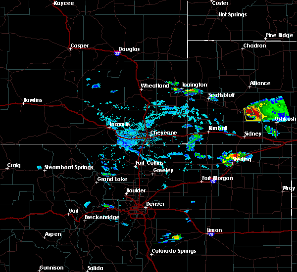 At 437 pm mdt, a severe thunderstorm was located 7 miles east of the intersection of highway 385 and 92, or 29 miles northwest of oshkosh, moving southeast at 15 mph (radar indicated). Hazards include two inch hail and 60 mph wind gusts. People and animals outdoors will be injured. expect hail damage to roofs, siding, windows and vehicles. expect wind damage to roofs, siding and trees. This severe thunderstorm will remain over mainly rural areas of southeastern morrill county, including the following locations, broadwater. At 437 pm mdt, a severe thunderstorm was located 7 miles east of the intersection of highway 385 and 92, or 29 miles northwest of oshkosh, moving southeast at 15 mph (radar indicated). Hazards include two inch hail and 60 mph wind gusts. People and animals outdoors will be injured. expect hail damage to roofs, siding, windows and vehicles. expect wind damage to roofs, siding and trees. This severe thunderstorm will remain over mainly rural areas of southeastern morrill county, including the following locations, broadwater.
|
| 8/1/2015 4:29 PM MDT |
 At 428 pm mdt, a severe thunderstorm was located near the intersection of highway 385 and 92, or 30 miles south of alliance, moving south southeast at 15 mph (radar indicated). Hazards include golf ball size hail and 60 mph wind gusts. People and animals outdoors will be injured. expect hail damage to roofs, siding, windows and vehicles. expect wind damage to roofs, siding and trees. This severe thunderstorm will remain over mainly rural areas of east central morrill county, including the following locations, broadwater. At 428 pm mdt, a severe thunderstorm was located near the intersection of highway 385 and 92, or 30 miles south of alliance, moving south southeast at 15 mph (radar indicated). Hazards include golf ball size hail and 60 mph wind gusts. People and animals outdoors will be injured. expect hail damage to roofs, siding, windows and vehicles. expect wind damage to roofs, siding and trees. This severe thunderstorm will remain over mainly rural areas of east central morrill county, including the following locations, broadwater.
|
| 8/1/2015 4:18 PM MDT |
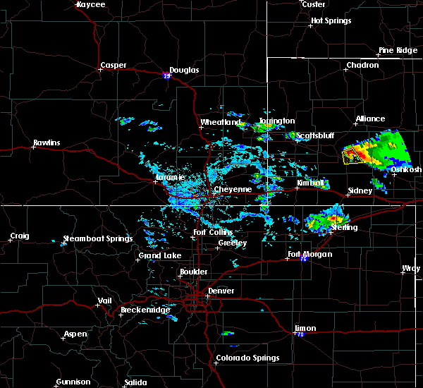 At 417 pm mdt, a severe thunderstorm was located 7 miles east of northport, or 26 miles south of alliance, moving south at 10 mph (radar indicated). Hazards include half dollar size hail. Damage to vehicles is expected. this severe thunderstorm will be near, the intersection of highway 385 and 92 around 500 pm mdt. Other locations impacted by this severe thunderstorm include broadwater, highway 26 between bridgeport and broadwater. At 417 pm mdt, a severe thunderstorm was located 7 miles east of northport, or 26 miles south of alliance, moving south at 10 mph (radar indicated). Hazards include half dollar size hail. Damage to vehicles is expected. this severe thunderstorm will be near, the intersection of highway 385 and 92 around 500 pm mdt. Other locations impacted by this severe thunderstorm include broadwater, highway 26 between bridgeport and broadwater.
|
| 7/26/2015 1:22 PM MDT |
 At 121 pm mdt, a severe thunderstorm was located 10 miles northwest of richardson lake, or 24 miles south of alliance, moving northeast at 30 mph (public). Hazards include 60 mph wind gusts and nickel size hail. Expect damage to roofs. siding and trees. Locations impacted include, broadwater. At 121 pm mdt, a severe thunderstorm was located 10 miles northwest of richardson lake, or 24 miles south of alliance, moving northeast at 30 mph (public). Hazards include 60 mph wind gusts and nickel size hail. Expect damage to roofs. siding and trees. Locations impacted include, broadwater.
|
| 7/26/2015 1:05 PM MDT |
 At 105 pm mdt, a severe thunderstorm was located 10 miles northeast of the intersection of highway 385 and 92, or 28 miles south of alliance, moving northeast at 30 mph (public). Hazards include 60 mph wind gusts and nickel size hail. Expect damage to roofs. Siding and trees. At 105 pm mdt, a severe thunderstorm was located 10 miles northeast of the intersection of highway 385 and 92, or 28 miles south of alliance, moving northeast at 30 mph (public). Hazards include 60 mph wind gusts and nickel size hail. Expect damage to roofs. Siding and trees.
|
| 7/26/2015 1:00 PM MDT | Top of poplar tree blown down in estimated 60 mph winds. also had nickel size hai in morrill county NE, 3 miles E of Broadwater, NE |
| 7/18/2015 5:55 PM MDT |
 At 554 pm mdt, a severe thunderstorm was located near dalton, or 21 miles north of sidney, moving east at 40 mph (radar indicated). Hazards include quarter size hail and 60 mph wind gusts. Hail damage to vehicles is expected. expect wind damage to roofs, siding and trees. Locations impacted include, dalton, gurley, court house and jail rocks, the intersection of highway 385 and 92 and broadwater. At 554 pm mdt, a severe thunderstorm was located near dalton, or 21 miles north of sidney, moving east at 40 mph (radar indicated). Hazards include quarter size hail and 60 mph wind gusts. Hail damage to vehicles is expected. expect wind damage to roofs, siding and trees. Locations impacted include, dalton, gurley, court house and jail rocks, the intersection of highway 385 and 92 and broadwater.
|
| 7/18/2015 5:43 PM MDT |
 At 543 pm mdt, a severe thunderstorm was located 9 miles south of court house and jail rocks, or 24 miles northwest of sidney, moving east at 30 mph (radar indicated). Hazards include quarter size hail and 60 mph wind gusts. Hail damage to vehicles is expected. expect wind damage to roofs, siding and trees. Locations impacted include, dalton, gurley, court house and jail rocks, redington, the intersection of highway 385 and 92 and broadwater. At 543 pm mdt, a severe thunderstorm was located 9 miles south of court house and jail rocks, or 24 miles northwest of sidney, moving east at 30 mph (radar indicated). Hazards include quarter size hail and 60 mph wind gusts. Hail damage to vehicles is expected. expect wind damage to roofs, siding and trees. Locations impacted include, dalton, gurley, court house and jail rocks, redington, the intersection of highway 385 and 92 and broadwater.
|
| 7/18/2015 5:14 PM MDT |
 At 513 pm mdt, a severe thunderstorm was located 11 miles southwest of redington, or 20 miles northeast of kimball, moving east at 40 mph (radar indicated). Hazards include two inch hail and 70 mph wind gusts. this storm has a history of producing large hail and 70 mph winds. People and animals outdoors will be injured. expect hail damage to roofs, siding, windows and vehicles. expect considerable tree damage. Wind damage is also likely to mobile homes, roofs and outbuildings. At 513 pm mdt, a severe thunderstorm was located 11 miles southwest of redington, or 20 miles northeast of kimball, moving east at 40 mph (radar indicated). Hazards include two inch hail and 70 mph wind gusts. this storm has a history of producing large hail and 70 mph winds. People and animals outdoors will be injured. expect hail damage to roofs, siding, windows and vehicles. expect considerable tree damage. Wind damage is also likely to mobile homes, roofs and outbuildings.
|
| 6/25/2015 5:44 PM MDT |
 At 543 pm mdt, a severe thunderstorm with a history of producing tornadoes was located near bridgeport, or 32 miles south of alliance, moving southeast at 30 mph (radar indicated rotation. this storm has a history of producing tornadoes. people in bridgeport should seek shelter immediately). Hazards include possible tornado and hail up to two inches in diameter. Flying debris will be dangerous to those caught without shelter. mobile homes will be damaged or destroyed. damage to roofs, windows and vehicles will occur. tree damage is likely. this dangerous storm will be near, the intersection of highway 385 and 92 around 555 pm mdt. Other locations impacted by this tornadic thunderstorm include broadwater. At 543 pm mdt, a severe thunderstorm with a history of producing tornadoes was located near bridgeport, or 32 miles south of alliance, moving southeast at 30 mph (radar indicated rotation. this storm has a history of producing tornadoes. people in bridgeport should seek shelter immediately). Hazards include possible tornado and hail up to two inches in diameter. Flying debris will be dangerous to those caught without shelter. mobile homes will be damaged or destroyed. damage to roofs, windows and vehicles will occur. tree damage is likely. this dangerous storm will be near, the intersection of highway 385 and 92 around 555 pm mdt. Other locations impacted by this tornadic thunderstorm include broadwater.
|
| 6/16/2015 8:10 PM MDT | Quarter sized hail reported 7.9 miles NW of Broadwater, NE, 60-70 mph winds and one inch hail were reported. |
| 6/16/2015 7:21 PM MDT |
 The tornado warning for southern morrill county will expire at 730 pm mdt, the storm which prompted the warning has weakened below severe limits, and no longer appears capable of producing a tornado. therefore the warning will be allowed to expire. however nickel size hail is still possible with this thunderstorm. a severe thunderstorm watch remains in effect until 900 pm mdt for central nebraska. The tornado warning for southern morrill county will expire at 730 pm mdt, the storm which prompted the warning has weakened below severe limits, and no longer appears capable of producing a tornado. therefore the warning will be allowed to expire. however nickel size hail is still possible with this thunderstorm. a severe thunderstorm watch remains in effect until 900 pm mdt for central nebraska.
|
| 6/16/2015 7:01 PM MDT |
 At 701 pm mdt, a severe thunderstorm capable of producing a tornado was located near court house and jail rocks, or 27 miles north of sidney, moving southeast at 25 mph (radar indicated rotation). Hazards include possible tornado and golf ball size hail. Flying debris will be dangerous to those caught without shelter. mobile homes will be damaged or destroyed. damage to roofs, windows and vehicles will occur. tree damage is likely. This tornadic thunderstorm will remain over mainly rural areas of southern morrill county, including the following locations, broadwater. At 701 pm mdt, a severe thunderstorm capable of producing a tornado was located near court house and jail rocks, or 27 miles north of sidney, moving southeast at 25 mph (radar indicated rotation). Hazards include possible tornado and golf ball size hail. Flying debris will be dangerous to those caught without shelter. mobile homes will be damaged or destroyed. damage to roofs, windows and vehicles will occur. tree damage is likely. This tornadic thunderstorm will remain over mainly rural areas of southern morrill county, including the following locations, broadwater.
|
| 6/16/2015 6:44 PM MDT |
 At 644 pm mdt, a severe thunderstorm capable of producing a tornado was located near redington, or 31 miles northwest of sidney, moving southeast at 25 mph (radar indicated rotation). Hazards include tornado and golf ball size hail. Flying debris will be dangerous to those caught without shelter. mobile homes will be damaged or destroyed. damage to roofs, windows and vehicles will occur. tree damage is likely. this dangerous storm will be near, court house and jail rocks around 655 pm mdt. Other locations impacted by this tornadic thunderstorm include broadwater. At 644 pm mdt, a severe thunderstorm capable of producing a tornado was located near redington, or 31 miles northwest of sidney, moving southeast at 25 mph (radar indicated rotation). Hazards include tornado and golf ball size hail. Flying debris will be dangerous to those caught without shelter. mobile homes will be damaged or destroyed. damage to roofs, windows and vehicles will occur. tree damage is likely. this dangerous storm will be near, court house and jail rocks around 655 pm mdt. Other locations impacted by this tornadic thunderstorm include broadwater.
|
| 5/28/2015 2:40 PM MDT | At 240 pm mdt, a severe thunderstorm was located near the intersection of highway 385 and 92, or 29 miles north of sidney, moving east at 25 mph (radar indicated). Hazards include quarter size hail and 60 mph wind gusts. Hail damage to vehicles is expected. Expect wind damage to roofs, siding and trees. |
| 5/15/2015 7:10 PM MDT | The severe thunderstorm warning for eastern morrill county will expire at 715 pm mdt, the storm which prompted the warning has weakened below severe limits, and no longer pose an immediate threat to life or property. therefore the warning will be allowed to expire. however small. |
| 5/15/2015 6:41 PM MDT | At 639 pm mdt, a severe thunderstorm was located 12 miles southeast of angora, or 21 miles south of alliance, moving north at 45 mph (radar indicated. at 628 pm mdt...golfball size hail was reported 6 miles west northwest of broadwater). Hazards include quarter size hail and 60 mph wind gusts. Hail damage to vehicles is expected. expect wind damage to roofs, siding and trees. this severe thunderstorm will remain over mainly rural areas of eastern morrill county, including the following locations, broadwater. a tornado watch remains in effect until 800 pm mdt for central nebraska. 1. 00in. |
| 5/15/2015 6:28 PM MDT | Golf Ball sized hail reported 6.1 miles ESE of Broadwater, NE, mostly pea to nickel size hail with largest golfball. |
| 5/15/2015 6:19 PM MDT | At 618 pm mdt, a severe thunderstorm was located over the intersection of highway 385 and 92, or 29 miles north of sidney, moving north at 40 mph (radar indicated). Hazards include quarter size hail and 60 mph wind gusts. Hail damage to vehicles is expected. expect wind damage to roofs, siding and trees. this severe thunderstorm will remain over mainly rural areas of eastern morrill county, including the following locations, broadwater. a tornado watch remains in effect until 800 pm mdt for central nebraska. 1. 00in. |
| 5/15/2015 5:45 PM MDT | Golf Ball sized hail reported 0.2 miles SSW of Broadwater, NE, quarter to golfball size hail. |
| 5/15/2015 5:42 PM MDT | Quarter sized hail reported 0.2 miles SSW of Broadwater, NE, marble to quarter size hail with very heavy rain. |
| 5/15/2015 5:33 PM MDT | At 533 pm mdt, a severe thunderstorm was located 8 miles southeast of the intersection of highway 385 and 92, or 27 miles west of oshkosh, moving north at 30 mph (radar indicated). Hazards include quarter size hail and 60 mph wind gusts. Hail damage to vehicles is expected. expect wind damage to roofs, siding and trees. this severe thunderstorm will remain over mainly rural areas of eastern morrill county, including the following locations, broadwater. a tornado watch remains in effect until 800 pm mdt for central nebraska. 1. 00in. |
| 5/15/2015 3:25 PM MDT | At 325 pm mdt, a severe thunderstorm was located near court house and jail rocks, or 33 miles north of sidney, moving north at 30 mph (radar indicated). Hazards include quarter size hail and 60 mph wind gusts. Hail damage to vehicles is expected. expect wind damage to roofs, siding and trees. this severe thunderstorm will be near, bridgeport, northport and bridgeport state recreation area around 335 pm mdt. the intersection of highway 385 and l62 around 355 pm mdt. angora around 400 pm mdt. other locations impacted by this severe thunderstorm include broadwater. a tornado watch remains in effect until 800 pm mdt for central nebraska. 1. 00in. |
| 6/3/2014 5:45 PM MDT | Baseball sized hail reported 6.1 miles ESE of Broadwater, NE |
| 7/24/2013 4:30 PM MDT | Ping Pong Ball sized hail reported 9.8 miles S of Broadwater, NE, broke out cars windshield. |
Hail Maps for Broadwater, NE
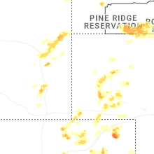
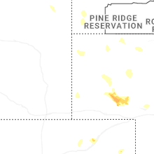
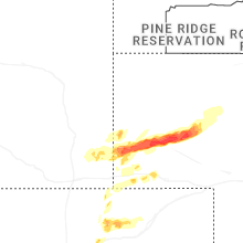
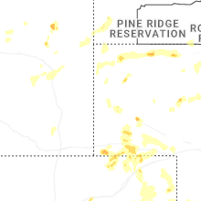


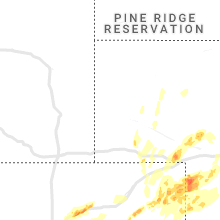


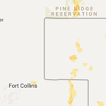


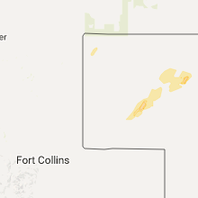


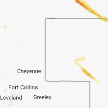


Connect with Interactive Hail Maps