

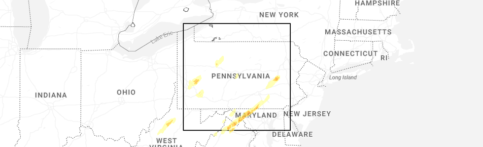
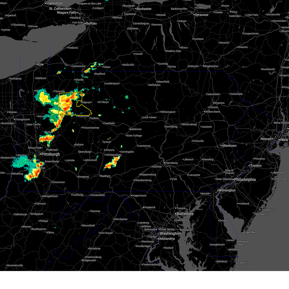
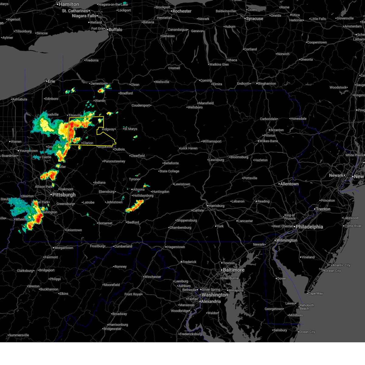
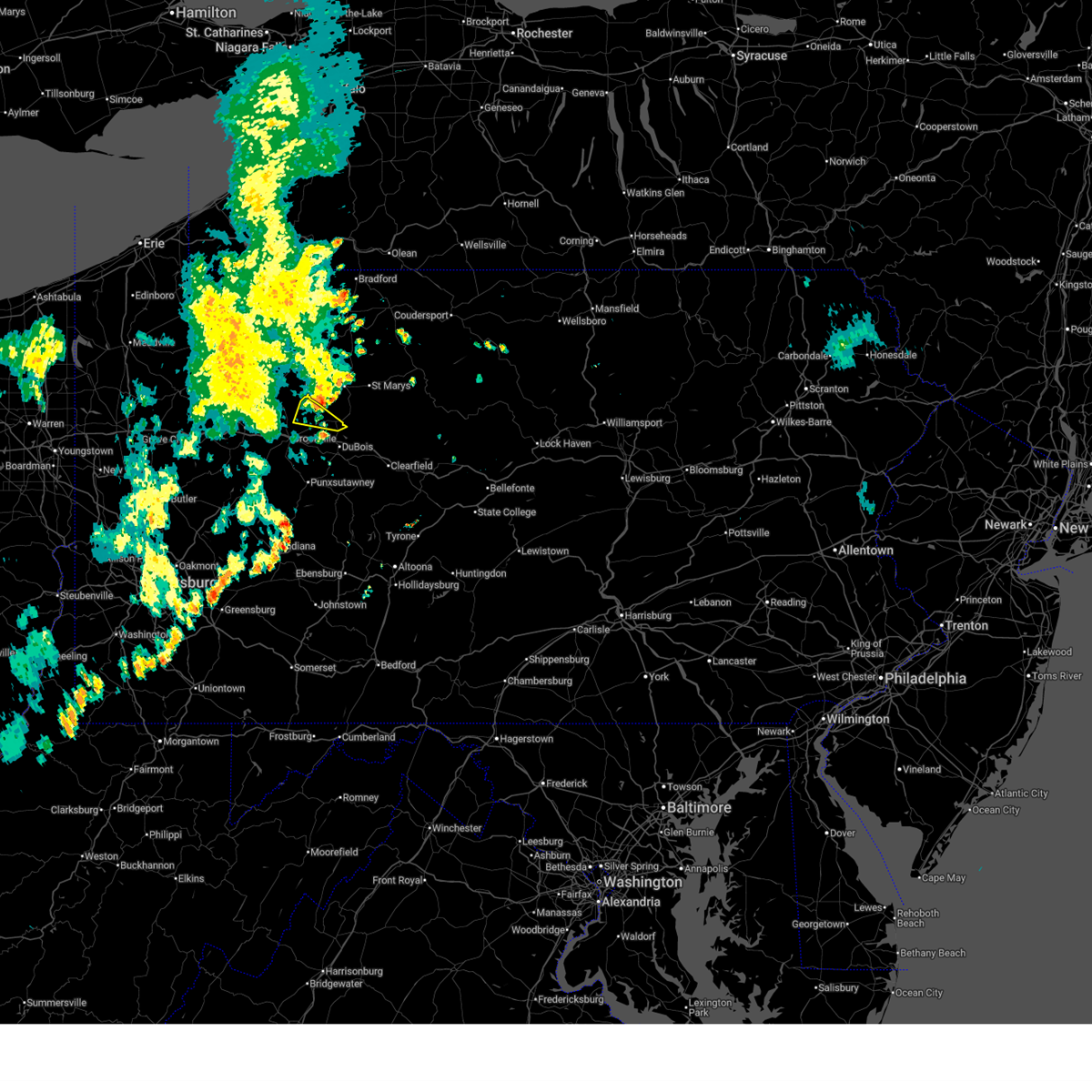
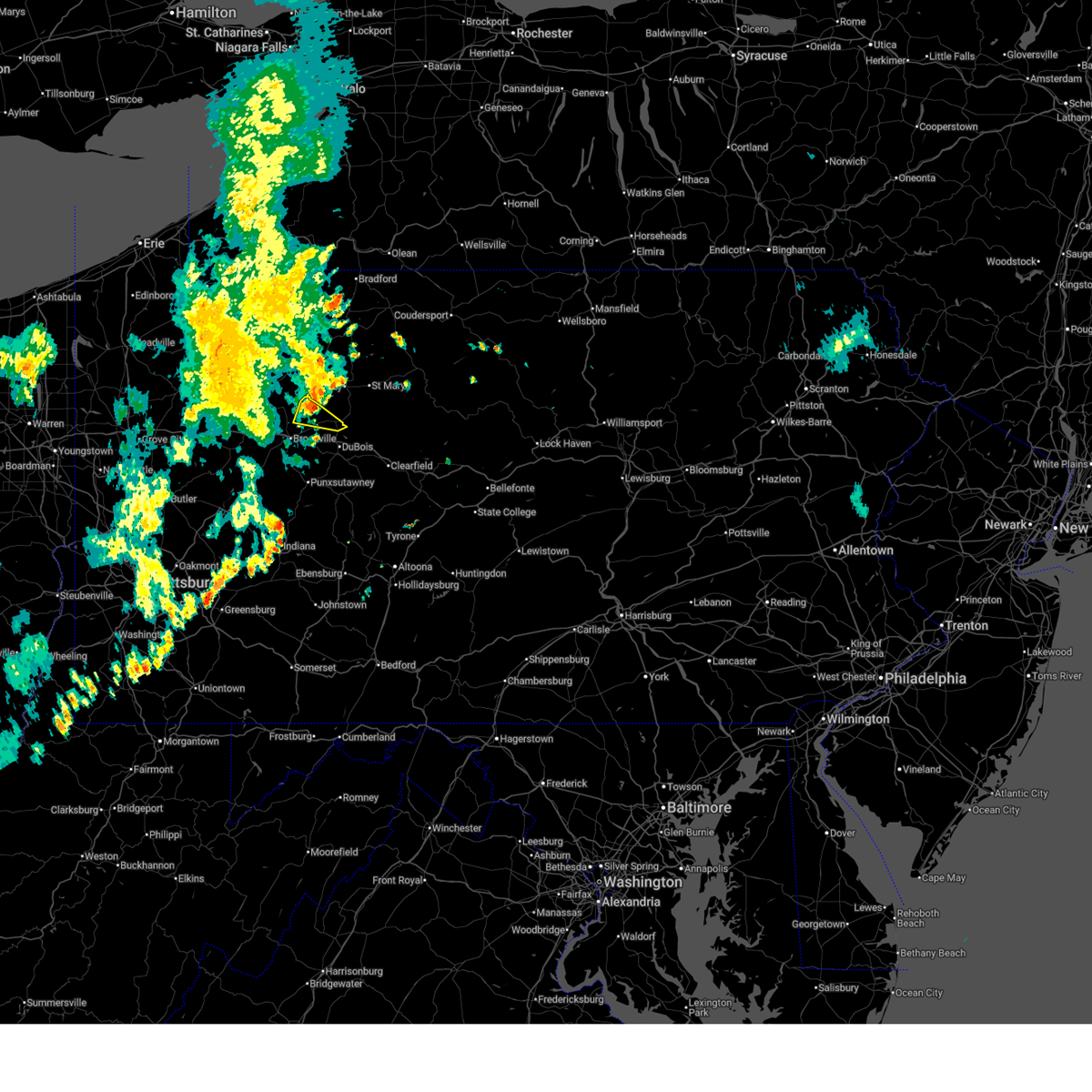
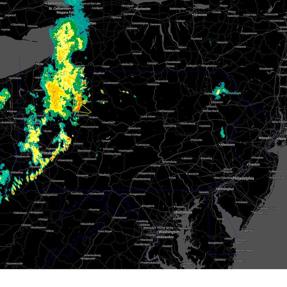
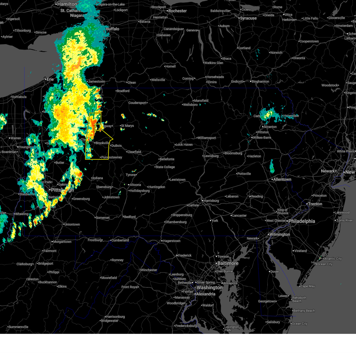
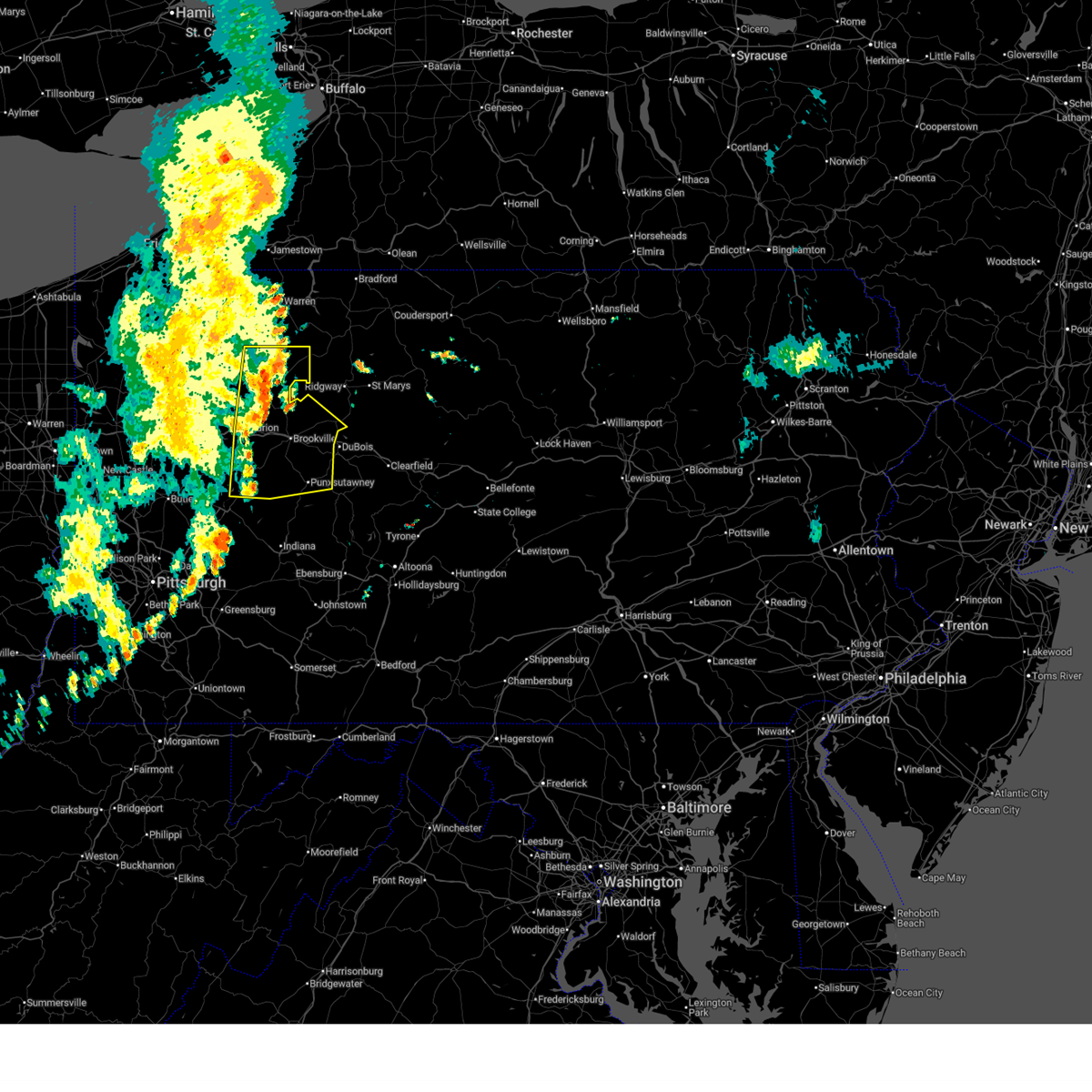
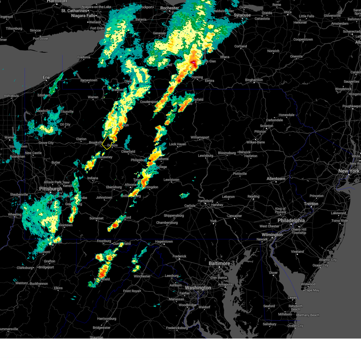
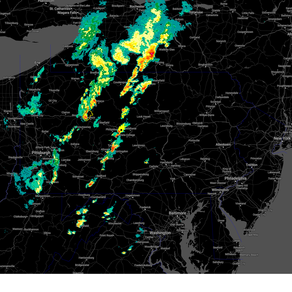
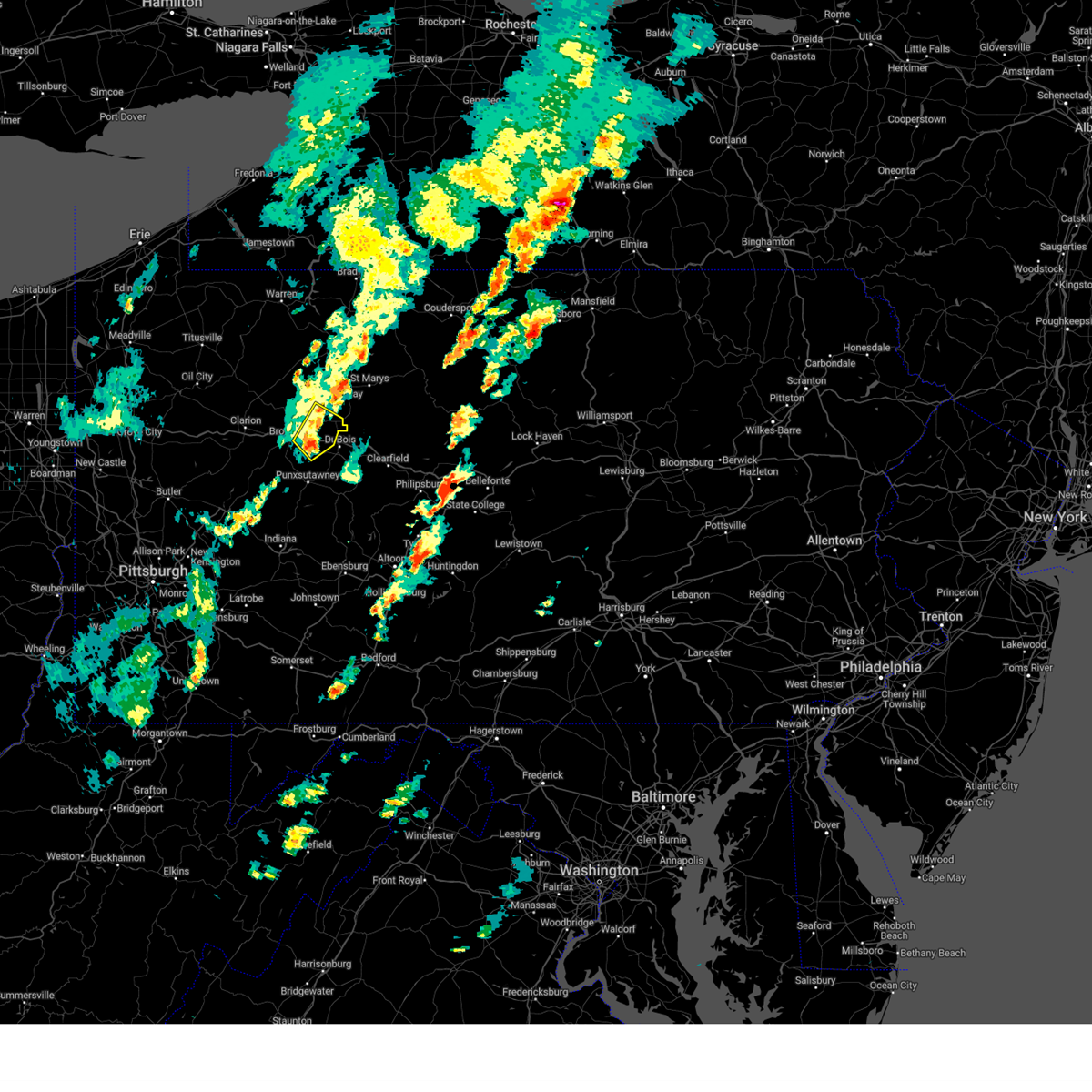
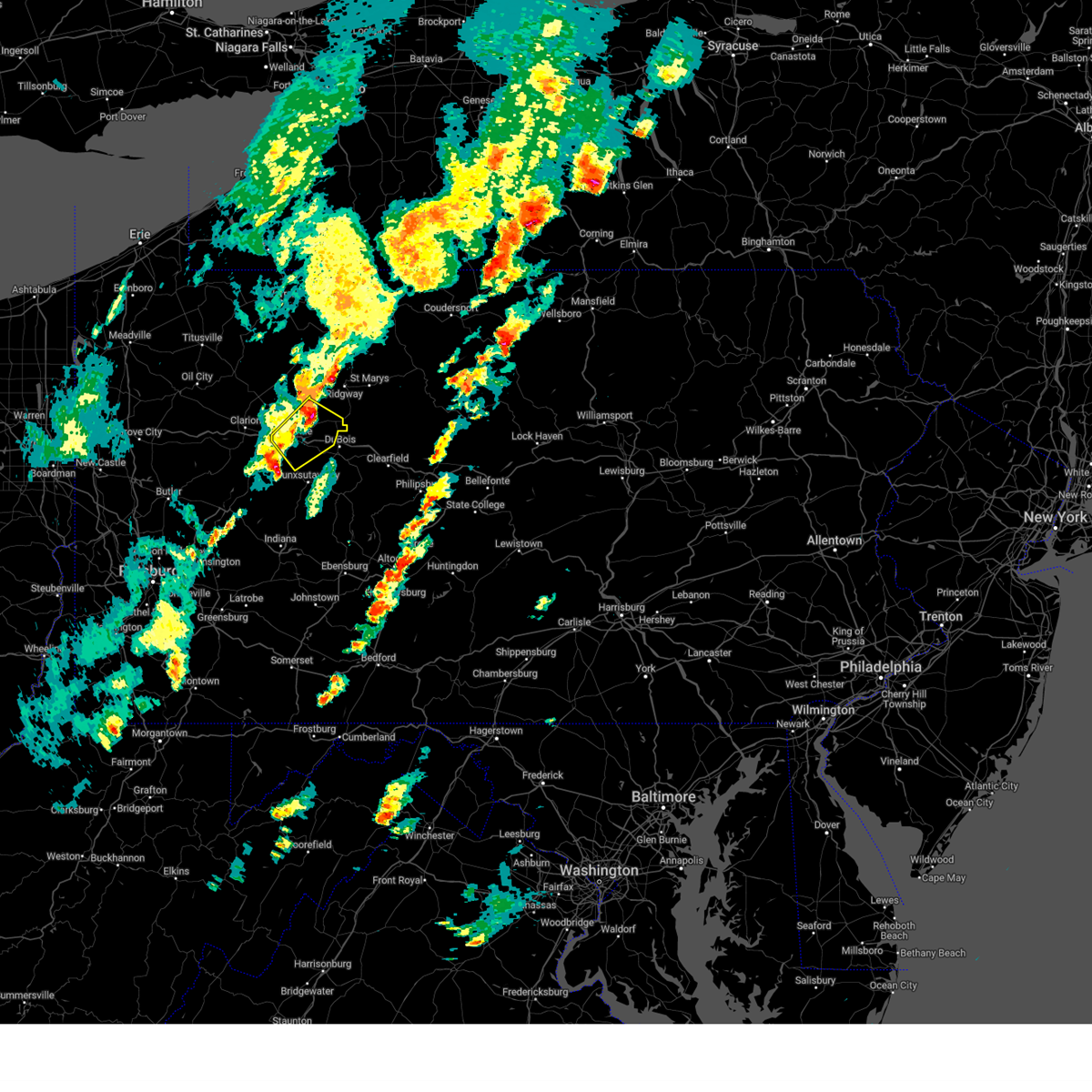
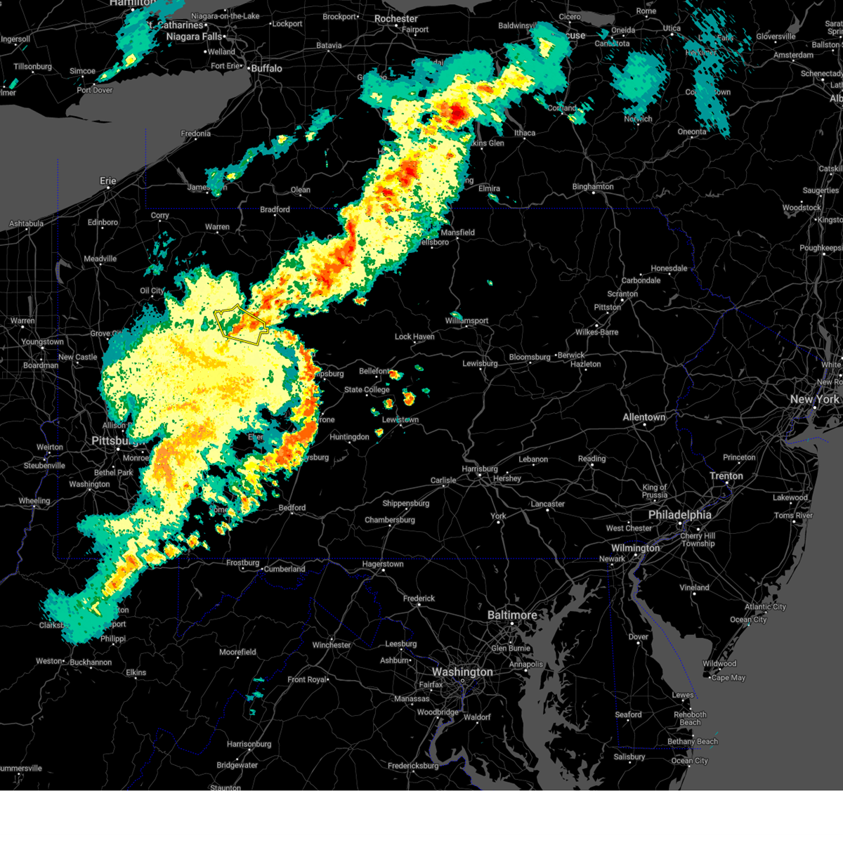
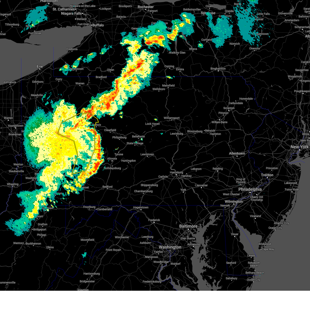
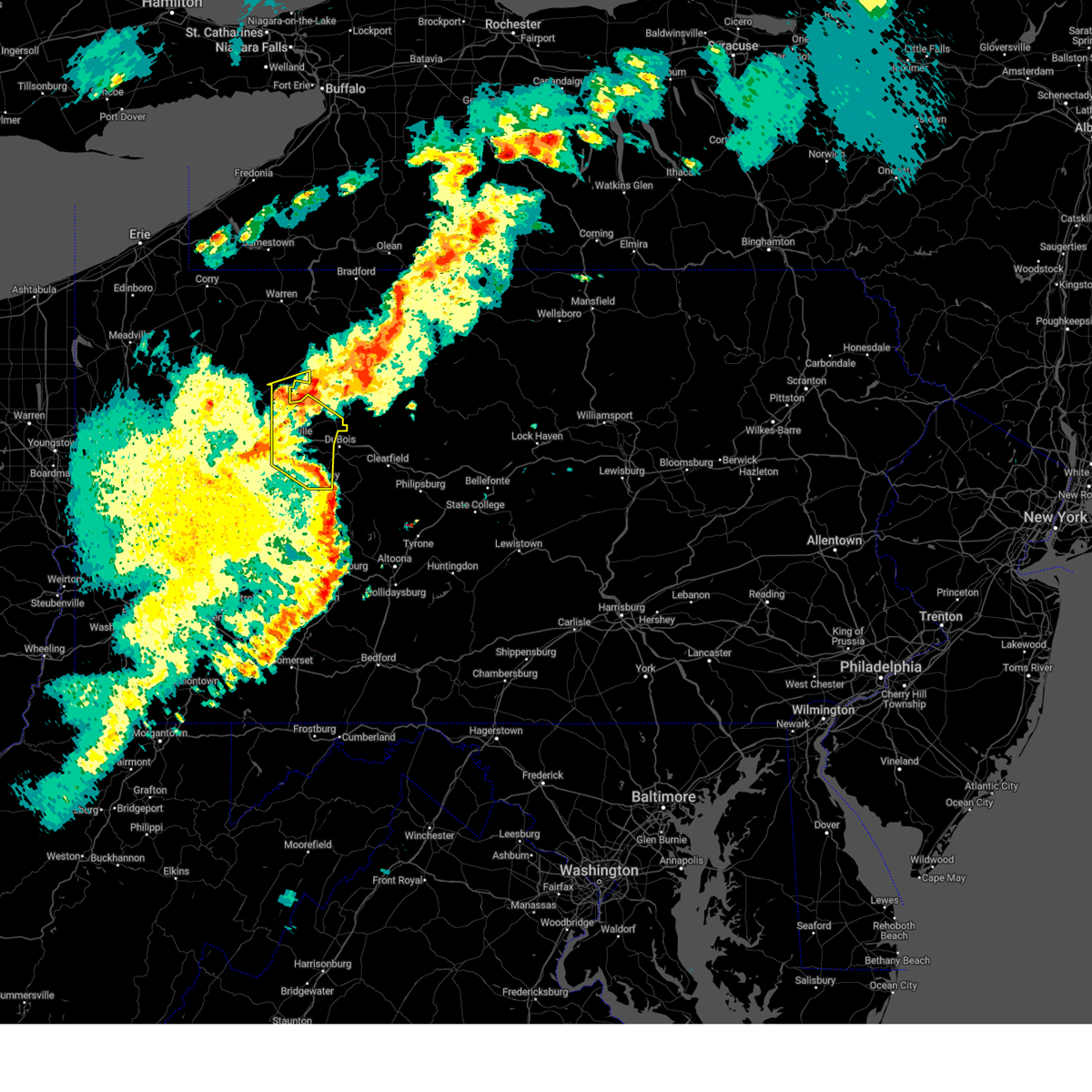
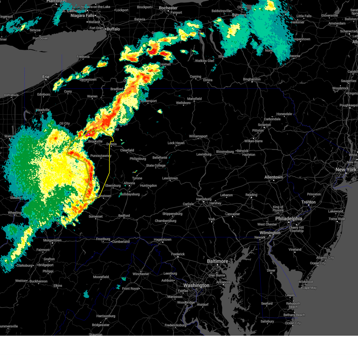
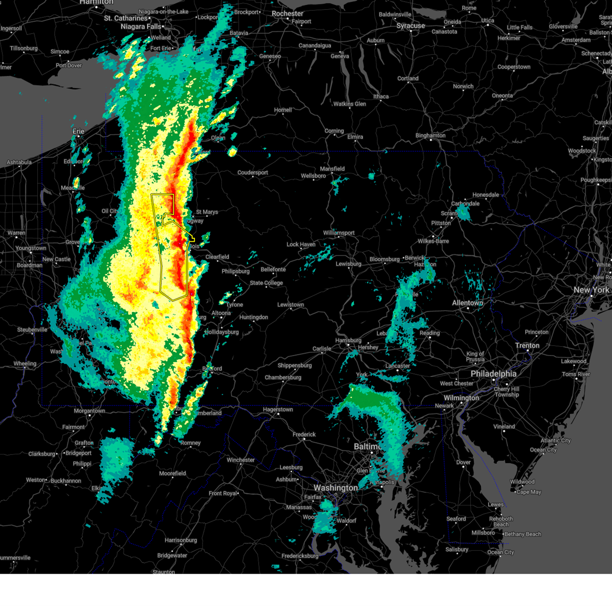
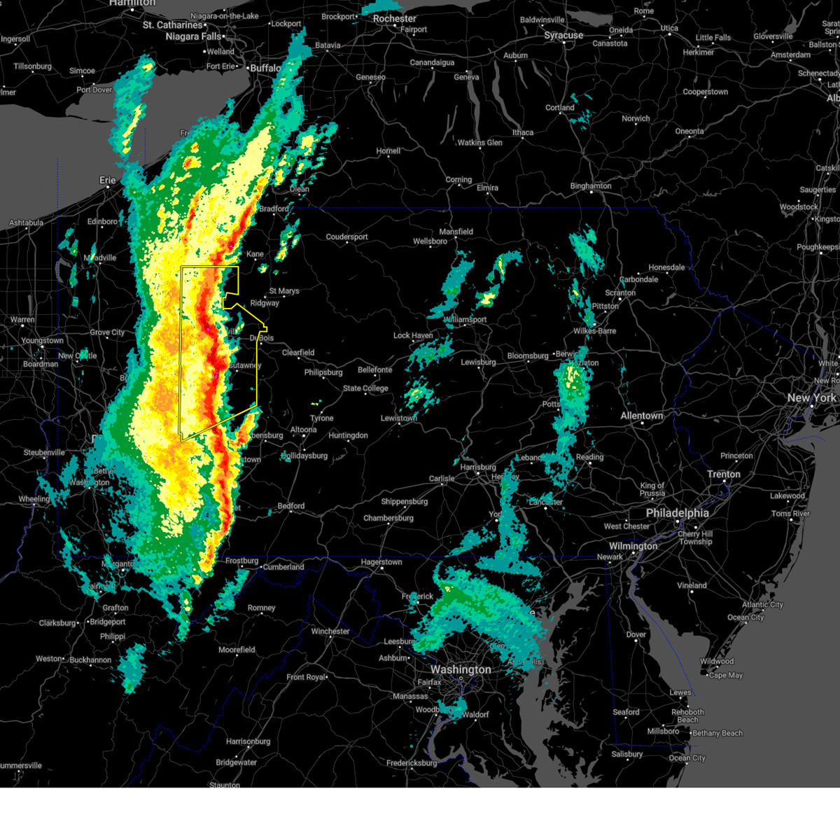
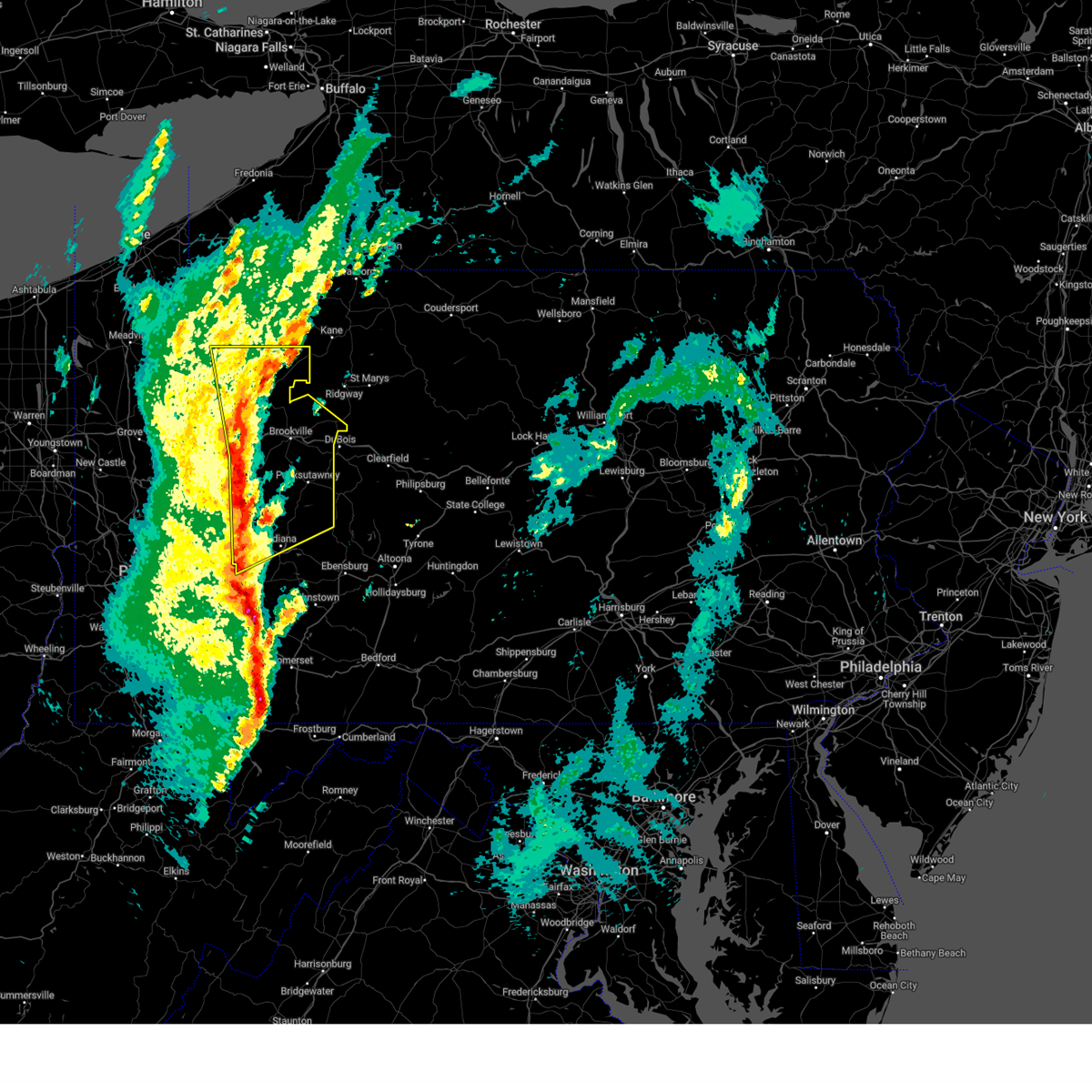
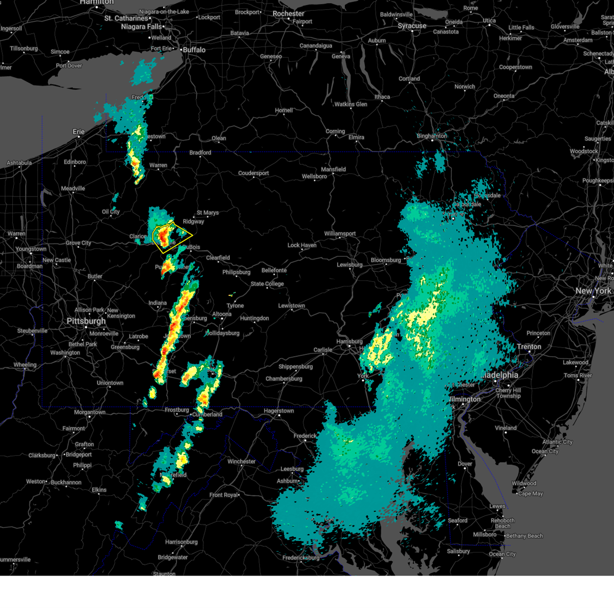
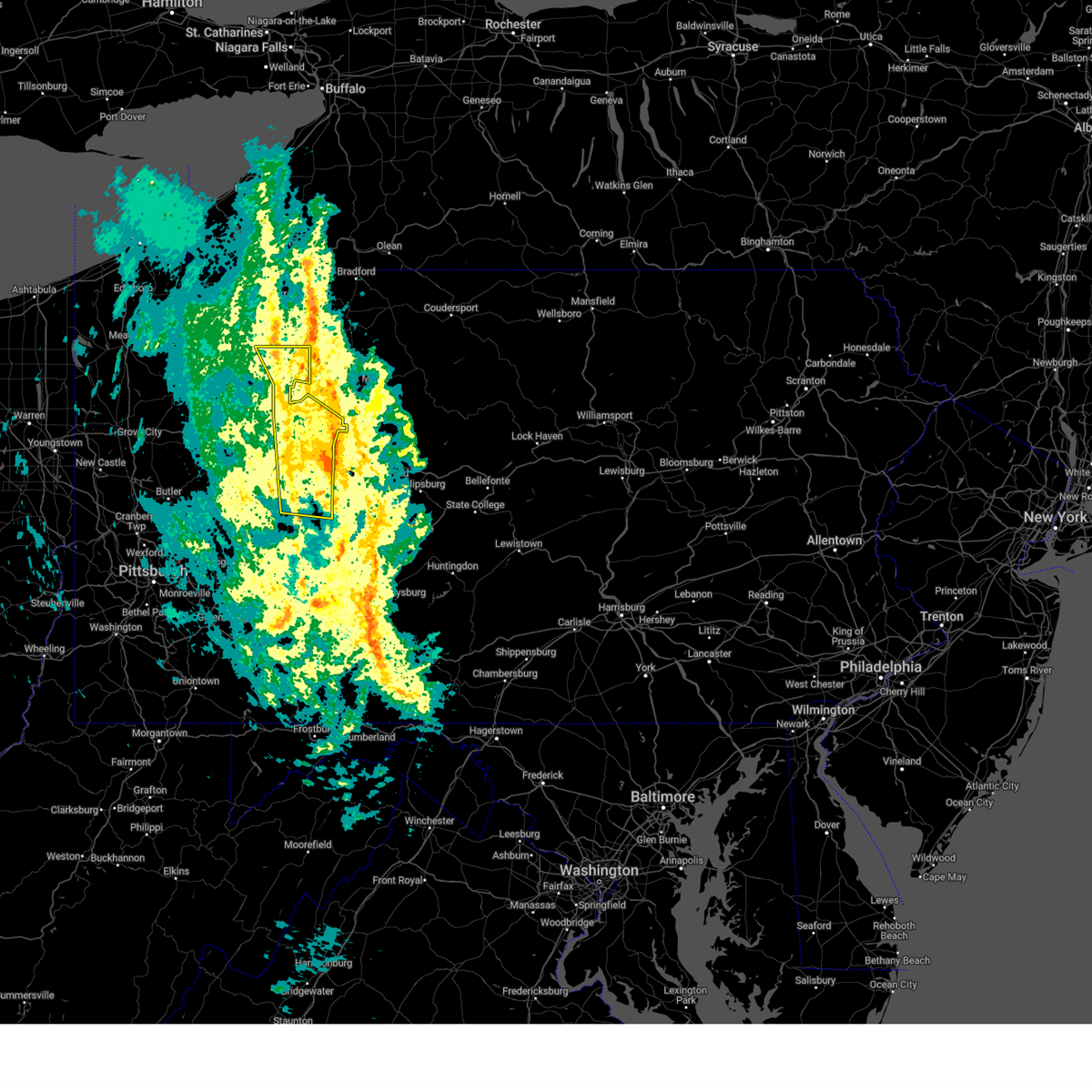
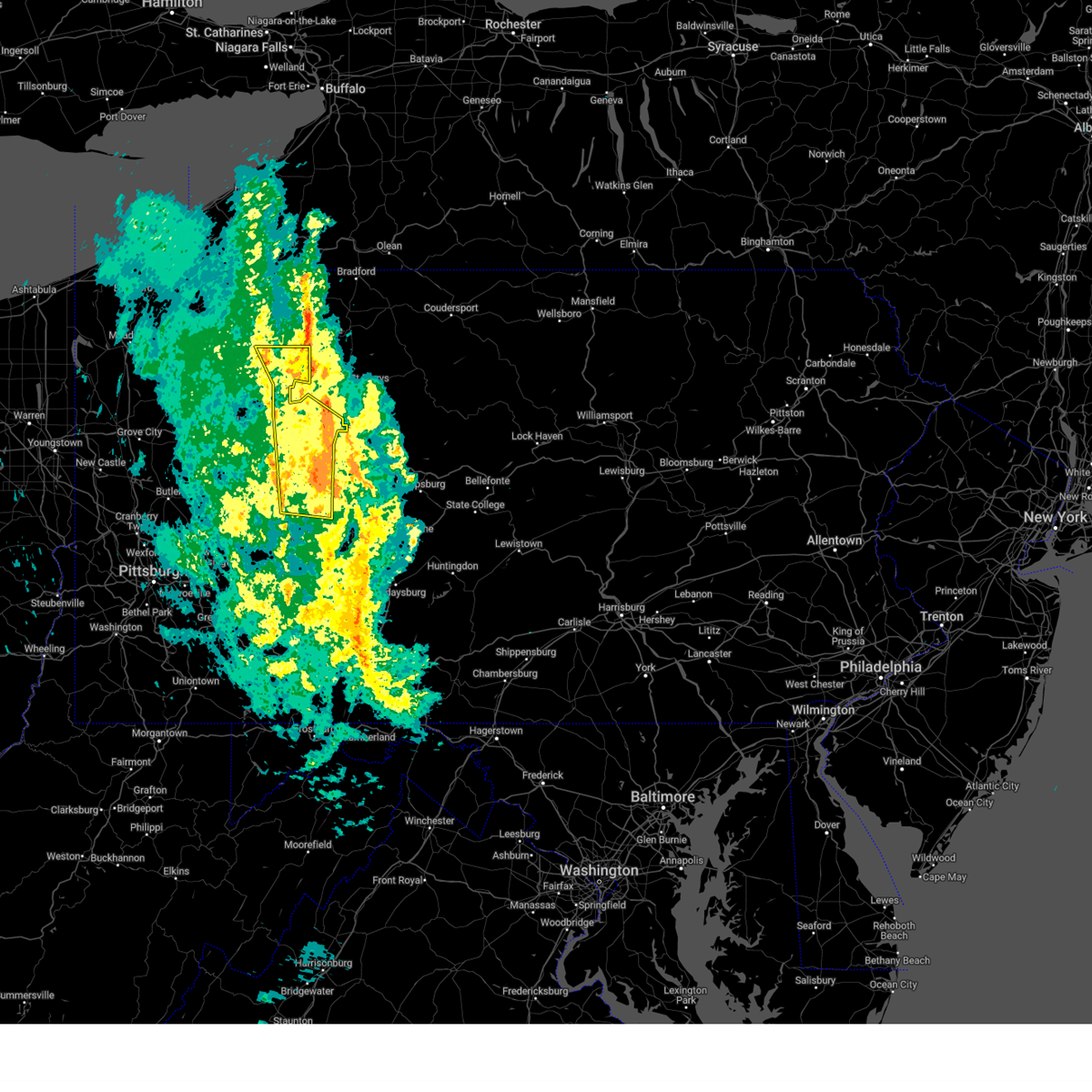
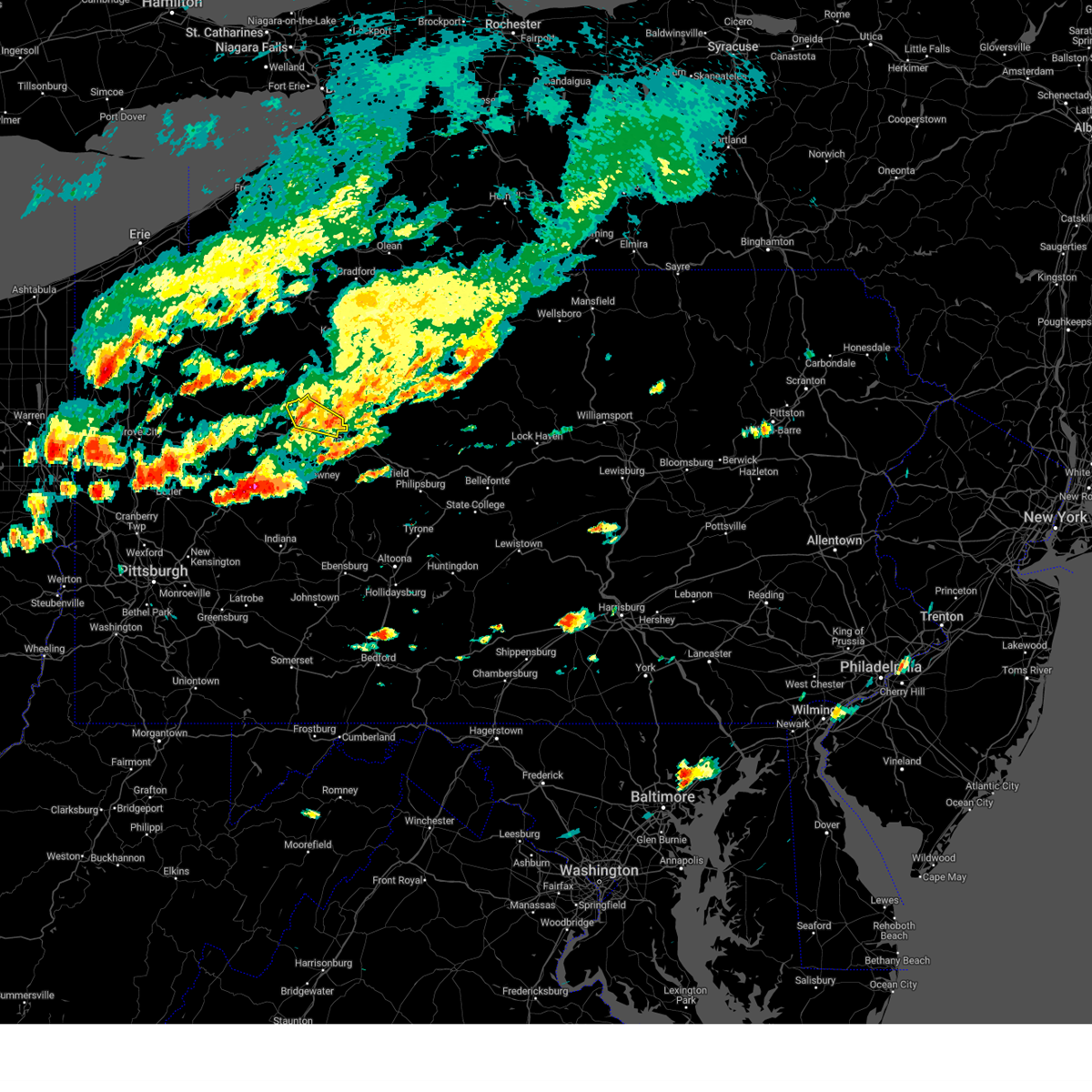
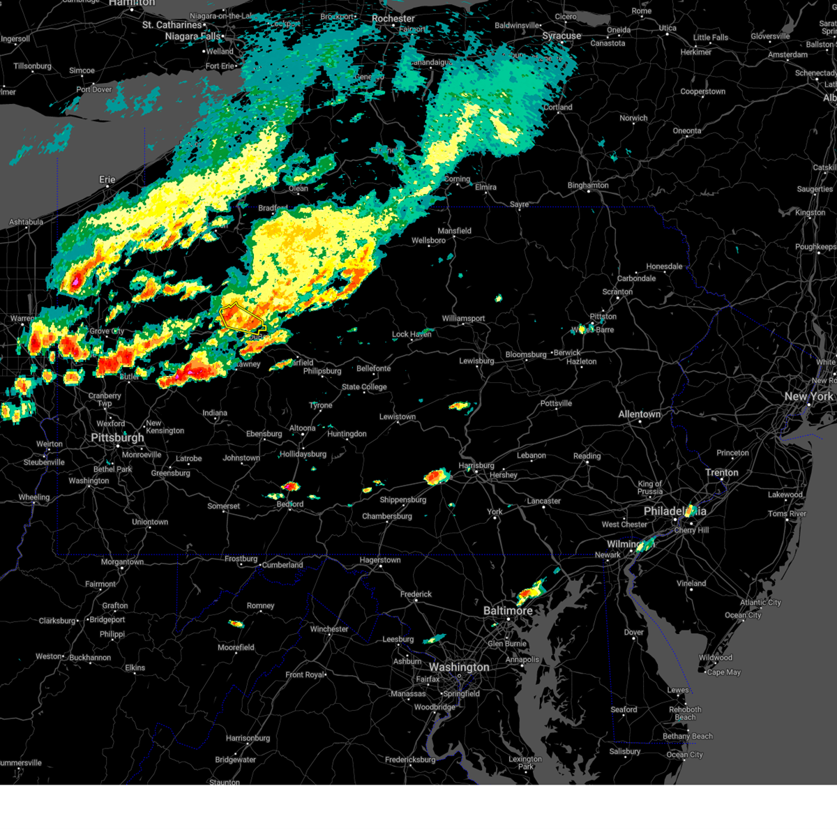
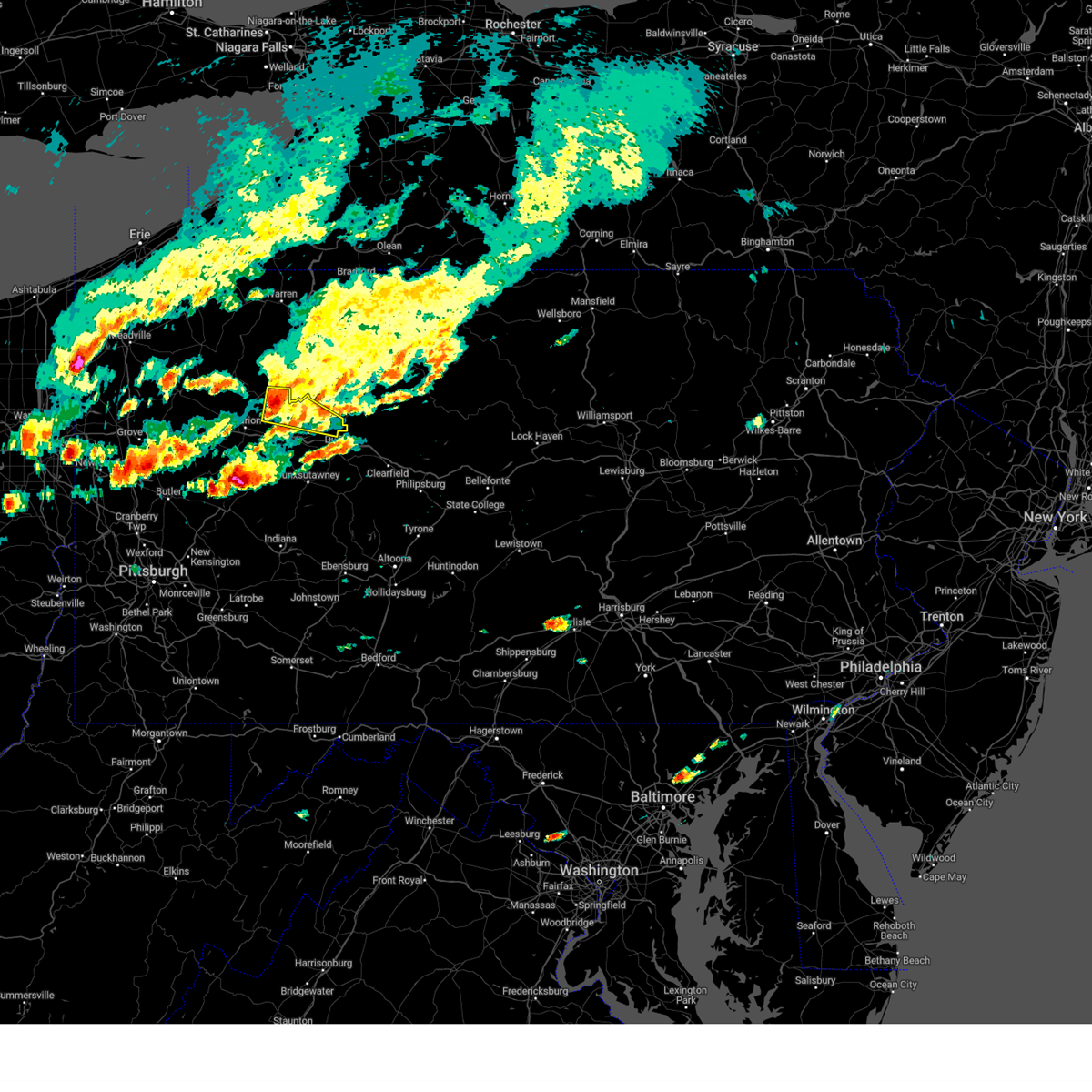
Hail Map for Brockway, PA
The Brockway, PA area has had 5 reports of on-the-ground hail by trained spotters, and has been under severe weather warnings 58 times during the past 12 months. Doppler radar has detected hail at or near Brockway, PA on 24 occasions, including 2 occasions during the past year.
| Name: | Brockway, PA |
| Where Located: | 57.8 miles WNW of State College, PA |
| Map: | Google Map for Brockway, PA |
| Population: | 2072 |
| Housing Units: | 996 |
| More Info: | Search Google for Brockway, PA |
5
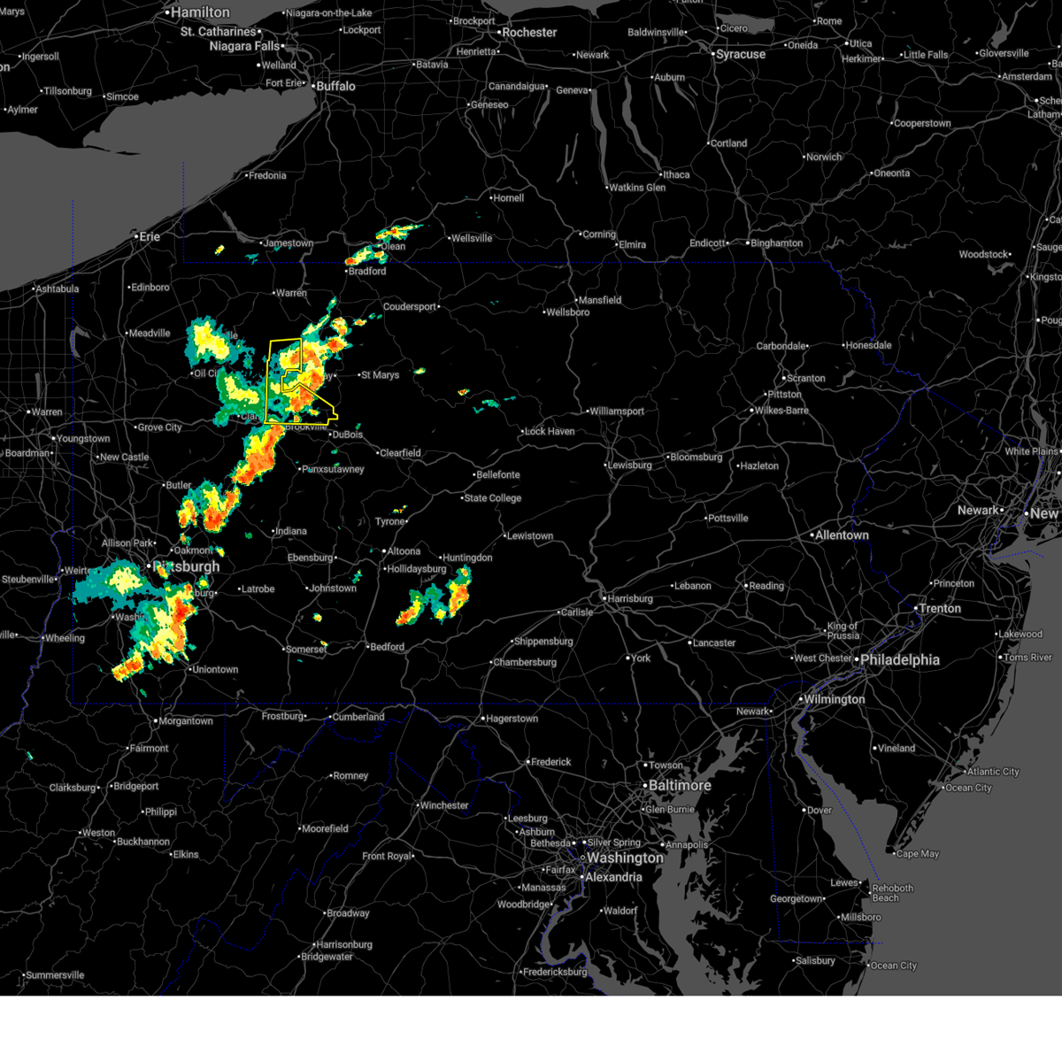
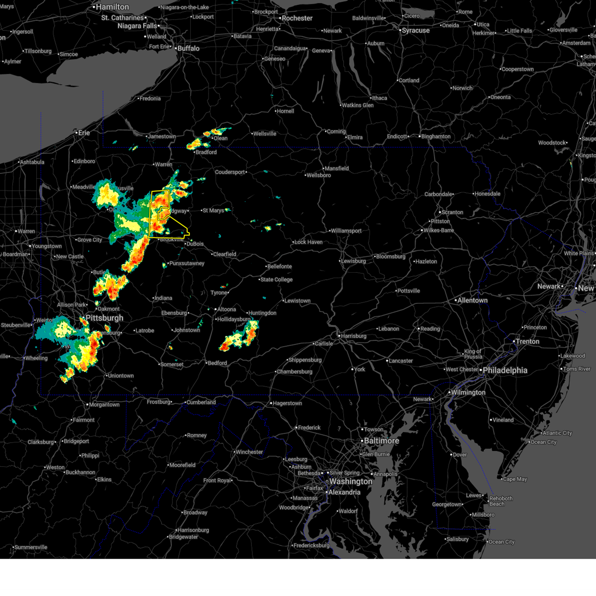
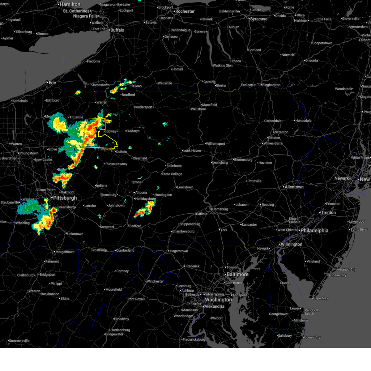
The Top Recent Hail Date for Brockway, PA is Sunday, March 16, 2025 (1st out of 24)
Hail and Wind Damage Spotted near Brockway, PA
| Date / Time | Report Details |
|---|---|
| 6/28/2025 12:59 PM EDT |
 The storms which prompted the warning have moved out of the area. therefore, the warning will be allowed to expire. however, gusty winds are still possible with these thunderstorms. to report severe weather, contact your nearest law enforcement agency. they will send your report to the national weather service office. a severe thunderstorm watch remains in effect until 800 pm edt saturday for portions of northwest and west central pennsylvania. The storms which prompted the warning have moved out of the area. therefore, the warning will be allowed to expire. however, gusty winds are still possible with these thunderstorms. to report severe weather, contact your nearest law enforcement agency. they will send your report to the national weather service office. a severe thunderstorm watch remains in effect until 800 pm edt saturday for portions of northwest and west central pennsylvania.
|
| 6/28/2025 12:46 PM EDT |
 At 1246 pm edt, severe thunderstorms were located along a line from 12 miles northeast of marienville to 7 miles northeast of brookville, moving east at 45 mph (law enforcement reported widespread wind damage across venango county). Hazards include 70 mph wind gusts. Expect considerable tree damage. damage is likely to mobile homes, roofs, and outbuildings. Locations impacted include, brookville, marienville, brockway, corsica, sigel, clear creek state park and clarington. At 1246 pm edt, severe thunderstorms were located along a line from 12 miles northeast of marienville to 7 miles northeast of brookville, moving east at 45 mph (law enforcement reported widespread wind damage across venango county). Hazards include 70 mph wind gusts. Expect considerable tree damage. damage is likely to mobile homes, roofs, and outbuildings. Locations impacted include, brookville, marienville, brockway, corsica, sigel, clear creek state park and clarington.
|
| 6/28/2025 12:46 PM EDT |
 the severe thunderstorm warning has been cancelled and is no longer in effect the severe thunderstorm warning has been cancelled and is no longer in effect
|
| 6/28/2025 12:31 PM EDT |
 At 1231 pm edt, severe thunderstorms were located along a line from 6 miles north of marienville to 8 miles northwest of brookville, moving east at 45 mph (law enforcement reported widespread wind damage across clarion county). Hazards include 70 mph wind gusts. Expect considerable tree damage. damage is likely to mobile homes, roofs, and outbuildings. Locations impacted include, clarion, marienville, brockway, strattanville, corsica, sigel, fisher, leeper, kellettville, clarington, clear creek state park, cook forest state park and starr. At 1231 pm edt, severe thunderstorms were located along a line from 6 miles north of marienville to 8 miles northwest of brookville, moving east at 45 mph (law enforcement reported widespread wind damage across clarion county). Hazards include 70 mph wind gusts. Expect considerable tree damage. damage is likely to mobile homes, roofs, and outbuildings. Locations impacted include, clarion, marienville, brockway, strattanville, corsica, sigel, fisher, leeper, kellettville, clarington, clear creek state park, cook forest state park and starr.
|
| 6/28/2025 12:31 PM EDT |
 the severe thunderstorm warning has been cancelled and is no longer in effect the severe thunderstorm warning has been cancelled and is no longer in effect
|
| 6/28/2025 12:23 PM EDT |
 At 1223 pm edt, severe thunderstorms were located along a line from 9 miles northwest of marienville to over clarion, moving east at 45 mph (law enforcement reported widespread wind damage across clarion county). Hazards include 70 mph wind gusts. Expect considerable tree damage. damage is likely to mobile homes, roofs, and outbuildings. Locations impacted include, clarion, marienville, knox, brockway, tionesta, strattanville, shippenville, corsica, sigel, leeper, fisher, kellettville, fryburg, west hickory, cook forest state park, clarington, clear creek state park, starr and east hickory. At 1223 pm edt, severe thunderstorms were located along a line from 9 miles northwest of marienville to over clarion, moving east at 45 mph (law enforcement reported widespread wind damage across clarion county). Hazards include 70 mph wind gusts. Expect considerable tree damage. damage is likely to mobile homes, roofs, and outbuildings. Locations impacted include, clarion, marienville, knox, brockway, tionesta, strattanville, shippenville, corsica, sigel, leeper, fisher, kellettville, fryburg, west hickory, cook forest state park, clarington, clear creek state park, starr and east hickory.
|
| 6/28/2025 12:08 PM EDT |
 At 1208 pm edt, severe thunderstorms were located along a line from near tionesta to over knox, or along a line from 14 miles northeast of oil city to over knox, moving east at 45 mph (law enforcement reported wind damage across venango county). Hazards include 60 mph wind gusts. Expect damage to roofs, siding, and trees. Locations impacted include, clarion, brookville, marienville, knox, brockway, tionesta, strattanville, shippenville, corsica, sigel, pleasantville, leeper, fisher, kellettville, fryburg, west hickory, cook forest state park, clarington, starr and clear creek state park. At 1208 pm edt, severe thunderstorms were located along a line from near tionesta to over knox, or along a line from 14 miles northeast of oil city to over knox, moving east at 45 mph (law enforcement reported wind damage across venango county). Hazards include 60 mph wind gusts. Expect damage to roofs, siding, and trees. Locations impacted include, clarion, brookville, marienville, knox, brockway, tionesta, strattanville, shippenville, corsica, sigel, pleasantville, leeper, fisher, kellettville, fryburg, west hickory, cook forest state park, clarington, starr and clear creek state park.
|
| 6/28/2025 12:05 PM EDT |
 Svrpbz the national weather service in pittsburgh has issued a * severe thunderstorm warning for, forest county in northwestern pennsylvania, eastern venango county in northwestern pennsylvania, northern clarion county in west central pennsylvania, northern jefferson pa county in west central pennsylvania, * until 100 pm edt. * at 1205 pm edt, severe thunderstorms were located along a line from near tionesta to near knox, or along a line from 12 miles northeast of oil city to near knox, moving east at 45 mph (radar indicated). Hazards include 60 mph wind gusts. expect damage to roofs, siding, and trees Svrpbz the national weather service in pittsburgh has issued a * severe thunderstorm warning for, forest county in northwestern pennsylvania, eastern venango county in northwestern pennsylvania, northern clarion county in west central pennsylvania, northern jefferson pa county in west central pennsylvania, * until 100 pm edt. * at 1205 pm edt, severe thunderstorms were located along a line from near tionesta to near knox, or along a line from 12 miles northeast of oil city to near knox, moving east at 45 mph (radar indicated). Hazards include 60 mph wind gusts. expect damage to roofs, siding, and trees
|
| 6/19/2025 1:00 AM EDT |
 the severe thunderstorm warning has been cancelled and is no longer in effect the severe thunderstorm warning has been cancelled and is no longer in effect
|
| 6/19/2025 12:56 AM EDT |
 At 1256 am edt, severe thunderstorms were located along a line from 10 miles northwest of brockway to 8 miles northeast of brookville, or along a line from 13 miles southeast of marienville to 8 miles northeast of brookville, moving east at 30 mph (law enforcement reported trees and wires down with this line of storms). Hazards include 60 mph wind gusts. Expect damage to roofs, siding, and trees. Locations impacted include, brockway. At 1256 am edt, severe thunderstorms were located along a line from 10 miles northwest of brockway to 8 miles northeast of brookville, or along a line from 13 miles southeast of marienville to 8 miles northeast of brookville, moving east at 30 mph (law enforcement reported trees and wires down with this line of storms). Hazards include 60 mph wind gusts. Expect damage to roofs, siding, and trees. Locations impacted include, brockway.
|
| 6/19/2025 12:56 AM EDT |
 the severe thunderstorm warning has been cancelled and is no longer in effect the severe thunderstorm warning has been cancelled and is no longer in effect
|
| 6/19/2025 12:48 AM EDT |
 At 1248 am edt, severe thunderstorms were located along a line from 10 miles northeast of marienville to 7 miles north of brookville, moving east at 30 mph (law enforcement reported trees and wires down with this line of storms). Hazards include 60 mph wind gusts. Expect damage to roofs, siding, and trees. Locations impacted include, marienville, brockway, sigel, clear creek state park and clarington. At 1248 am edt, severe thunderstorms were located along a line from 10 miles northeast of marienville to 7 miles north of brookville, moving east at 30 mph (law enforcement reported trees and wires down with this line of storms). Hazards include 60 mph wind gusts. Expect damage to roofs, siding, and trees. Locations impacted include, marienville, brockway, sigel, clear creek state park and clarington.
|
| 6/19/2025 12:48 AM EDT |
 the severe thunderstorm warning has been cancelled and is no longer in effect the severe thunderstorm warning has been cancelled and is no longer in effect
|
| 6/19/2025 12:38 AM EDT |
 At 1238 am edt, severe thunderstorms were located along a line from 8 miles north of marienville to 8 miles southeast of new bethlehem, or along a line from 8 miles north of marienville to 14 miles west of punxsutawney, moving east at 30 mph (law enforcement reported trees and wires down with this line of storms). Hazards include 60 mph wind gusts. Expect damage to roofs, siding, and trees. Locations impacted include, punxsutawney, brookville, marienville, reynoldsville, brockway, sykesville, falls creek, big run, summerville, hawthorn, corsica, sigel, timblin, fisher, worthville, knox-dale, clear creek state park, clarington, anita and cook forest state park. At 1238 am edt, severe thunderstorms were located along a line from 8 miles north of marienville to 8 miles southeast of new bethlehem, or along a line from 8 miles north of marienville to 14 miles west of punxsutawney, moving east at 30 mph (law enforcement reported trees and wires down with this line of storms). Hazards include 60 mph wind gusts. Expect damage to roofs, siding, and trees. Locations impacted include, punxsutawney, brookville, marienville, reynoldsville, brockway, sykesville, falls creek, big run, summerville, hawthorn, corsica, sigel, timblin, fisher, worthville, knox-dale, clear creek state park, clarington, anita and cook forest state park.
|
| 6/19/2025 12:38 AM EDT |
 the severe thunderstorm warning has been cancelled and is no longer in effect the severe thunderstorm warning has been cancelled and is no longer in effect
|
| 6/19/2025 12:25 AM EDT |
 At 1225 am edt, severe thunderstorms were located along a line from over marienville to over delmont, or along a line from over marienville to 7 miles north of greensburg, moving east at 30 mph (law enforcement reported trees and wires down with this line of storms). Hazards include 60 mph wind gusts. Expect damage to roofs, siding, and trees. Locations impacted include, punxsutawney, clarion, brookville, marienville, reynoldsville, brockway, new bethlehem, sykesville, falls creek, big run, dayton, strattanville, summerville, limestone, rossiter, hawthorn, corsica, sigel, timblin and fisher. At 1225 am edt, severe thunderstorms were located along a line from over marienville to over delmont, or along a line from over marienville to 7 miles north of greensburg, moving east at 30 mph (law enforcement reported trees and wires down with this line of storms). Hazards include 60 mph wind gusts. Expect damage to roofs, siding, and trees. Locations impacted include, punxsutawney, clarion, brookville, marienville, reynoldsville, brockway, new bethlehem, sykesville, falls creek, big run, dayton, strattanville, summerville, limestone, rossiter, hawthorn, corsica, sigel, timblin and fisher.
|
| 6/19/2025 12:25 AM EDT |
 the severe thunderstorm warning has been cancelled and is no longer in effect the severe thunderstorm warning has been cancelled and is no longer in effect
|
| 6/19/2025 12:14 AM EDT |
 the severe thunderstorm warning has been cancelled and is no longer in effect the severe thunderstorm warning has been cancelled and is no longer in effect
|
| 6/19/2025 12:14 AM EDT |
 At 1214 am edt, severe thunderstorms were located along a line from 9 miles west of marienville to over murrysville, or along a line from 9 miles west of marienville to 6 miles east of monroeville, moving east at 30 mph (law enforcement reported trees and wires down with this line of storms). Hazards include 60 mph wind gusts. Expect damage to roofs, siding, and trees. Locations impacted include, pittsburgh, penn hills, monroeville, indiana, punxsutawney, clarion, vandergrift, kittanning, brookville, marienville, homer city, apollo, knox, rimersburg, plum, murrysville, wilkinsburg, new kensington, lower burrell and harrison township. At 1214 am edt, severe thunderstorms were located along a line from 9 miles west of marienville to over murrysville, or along a line from 9 miles west of marienville to 6 miles east of monroeville, moving east at 30 mph (law enforcement reported trees and wires down with this line of storms). Hazards include 60 mph wind gusts. Expect damage to roofs, siding, and trees. Locations impacted include, pittsburgh, penn hills, monroeville, indiana, punxsutawney, clarion, vandergrift, kittanning, brookville, marienville, homer city, apollo, knox, rimersburg, plum, murrysville, wilkinsburg, new kensington, lower burrell and harrison township.
|
| 6/18/2025 11:57 PM EDT |
 Svrpbz the national weather service in pittsburgh has issued a * severe thunderstorm warning for, forest county in northwestern pennsylvania, eastern venango county in northwestern pennsylvania, northeastern allegheny county in southwestern pennsylvania, northern westmoreland county in southwestern pennsylvania, armstrong county in west central pennsylvania, eastern butler county in west central pennsylvania, clarion county in west central pennsylvania, indiana county in west central pennsylvania, jefferson pa county in west central pennsylvania, * until 115 am edt. * at 1157 pm edt, severe thunderstorms were located along a line from near tionesta to over penn hills, or along a line from 16 miles northeast of oil city to over penn hills, moving east at 30 mph (law enforcement reported trees and wires down with this line of storms). Hazards include 60 mph wind gusts. expect damage to roofs, siding, and trees Svrpbz the national weather service in pittsburgh has issued a * severe thunderstorm warning for, forest county in northwestern pennsylvania, eastern venango county in northwestern pennsylvania, northeastern allegheny county in southwestern pennsylvania, northern westmoreland county in southwestern pennsylvania, armstrong county in west central pennsylvania, eastern butler county in west central pennsylvania, clarion county in west central pennsylvania, indiana county in west central pennsylvania, jefferson pa county in west central pennsylvania, * until 115 am edt. * at 1157 pm edt, severe thunderstorms were located along a line from near tionesta to over penn hills, or along a line from 16 miles northeast of oil city to over penn hills, moving east at 30 mph (law enforcement reported trees and wires down with this line of storms). Hazards include 60 mph wind gusts. expect damage to roofs, siding, and trees
|
| 6/9/2025 7:55 PM EDT |
 the severe thunderstorm warning has been cancelled and is no longer in effect the severe thunderstorm warning has been cancelled and is no longer in effect
|
| 6/9/2025 7:44 PM EDT |
 At 744 pm edt, a severe thunderstorm was located near brockway, or 15 miles east of brookville, moving northeast at 45 mph (radar indicated). Hazards include 60 mph wind gusts. Expect damage to roofs, siding, and trees. Locations impacted include, reynoldsville, brockway and falls creek. At 744 pm edt, a severe thunderstorm was located near brockway, or 15 miles east of brookville, moving northeast at 45 mph (radar indicated). Hazards include 60 mph wind gusts. Expect damage to roofs, siding, and trees. Locations impacted include, reynoldsville, brockway and falls creek.
|
| 6/9/2025 7:35 PM EDT |
 At 735 pm edt, a severe thunderstorm was located over reynoldsville, or 9 miles east of brookville, moving northeast at 45 mph (radar indicated). Hazards include 60 mph wind gusts and small hail. Expect damage to roofs, siding, and trees. Locations impacted include, brookville, reynoldsville, brockway and falls creek. At 735 pm edt, a severe thunderstorm was located over reynoldsville, or 9 miles east of brookville, moving northeast at 45 mph (radar indicated). Hazards include 60 mph wind gusts and small hail. Expect damage to roofs, siding, and trees. Locations impacted include, brookville, reynoldsville, brockway and falls creek.
|
| 6/9/2025 7:24 PM EDT | At 724 pm edt, a severe thunderstorm was located 8 miles south of brookville, moving northeast at 45 mph (radar indicated). Hazards include 60 mph wind gusts and small hail. Expect damage to roofs, siding, and trees. Locations impacted include, brookville, reynoldsville, brockway, falls creek and knox-dale. |
| 6/9/2025 7:13 PM EDT |
 Svrpbz the national weather service in pittsburgh has issued a * severe thunderstorm warning for, central jefferson pa county in west central pennsylvania, * until 815 pm edt. * at 713 pm edt, a severe thunderstorm was located 8 miles west of brockway, or 10 miles northeast of brookville, moving northeast at 45 mph (radar indicated). Hazards include 60 mph wind gusts and small hail. expect damage to roofs, siding, and trees Svrpbz the national weather service in pittsburgh has issued a * severe thunderstorm warning for, central jefferson pa county in west central pennsylvania, * until 815 pm edt. * at 713 pm edt, a severe thunderstorm was located 8 miles west of brockway, or 10 miles northeast of brookville, moving northeast at 45 mph (radar indicated). Hazards include 60 mph wind gusts and small hail. expect damage to roofs, siding, and trees
|
| 4/29/2025 6:34 PM EDT |
 the severe thunderstorm warning has been cancelled and is no longer in effect the severe thunderstorm warning has been cancelled and is no longer in effect
|
| 4/29/2025 6:29 PM EDT | At 629 pm edt, severe thunderstorms were located along a line extending from near johnsonburg to near brookville to near curwensville, moving east at 50 mph (radar indicated). Hazards include 60 mph wind gusts. Expect damage to trees and power lines, resulting in some power outages. Locations impacted include, brockway, falls creek, sigel, clear creek state park, and clarington. |
| 4/29/2025 6:21 PM EDT | At 621 pm edt, severe thunderstorms were located along a line extending from near johnsonburg to brookville to near curwensville, moving east at 55 mph (radar indicated). Hazards include 60 mph wind gusts. Expect damage to trees and power lines, resulting in some power outages. Locations impacted include, brookville, reynoldsville, brockway, sykesville, falls creek, summerville, corsica, sigel, clear creek state park, knox-dale, and clarington. |
| 4/29/2025 6:21 PM EDT | the severe thunderstorm warning has been cancelled and is no longer in effect |
| 4/29/2025 6:10 PM EDT |
 The storms which prompted the warning have moved out of the area. therefore, the warning will be allowed to expire. however, gusty winds are still possible with these thunderstorms. a severe thunderstorm watch remains in effect until 1000 pm edt for southwestern, northwestern and west central pennsylvania. remember, a severe thunderstorm warning still remains in effect for jefferson and forest counties. The storms which prompted the warning have moved out of the area. therefore, the warning will be allowed to expire. however, gusty winds are still possible with these thunderstorms. a severe thunderstorm watch remains in effect until 1000 pm edt for southwestern, northwestern and west central pennsylvania. remember, a severe thunderstorm warning still remains in effect for jefferson and forest counties.
|
| 4/29/2025 6:08 PM EDT |
 Svrpbz the national weather service in pittsburgh has issued a * severe thunderstorm warning for, jefferson county in west central pennsylvania, southeastern forest county in northwestern pennsylvania, * until 645 pm edt. * at 608 pm edt, severe thunderstorms were located along a line extending from 6 miles northwest of portland mills to 7 miles southeast of clarion to 11 miles southeast of punxsutawney, moving east at 55 mph (radar indicated). Hazards include 70 mph wind gusts. Trees snapped and uprooted. Power outages can be expected. Svrpbz the national weather service in pittsburgh has issued a * severe thunderstorm warning for, jefferson county in west central pennsylvania, southeastern forest county in northwestern pennsylvania, * until 645 pm edt. * at 608 pm edt, severe thunderstorms were located along a line extending from 6 miles northwest of portland mills to 7 miles southeast of clarion to 11 miles southeast of punxsutawney, moving east at 55 mph (radar indicated). Hazards include 70 mph wind gusts. Trees snapped and uprooted. Power outages can be expected.
|
| 4/29/2025 5:52 PM EDT |
 At 551 pm edt, severe thunderstorms were located along a line extending from near rimersburg to 9 miles southeast of new bethlehem to near indiana to near blairsville, moving east at 70 mph. these are destructive storms for northern indiana and southern jefferson counties (radar indicated). Hazards include 80 mph wind gusts. Extensive tree damage and widespread power outages. mobile homes will be heavily damaged. expect considerable damage to roofs, windows and vehicles. Locations impacted include, indiana, punxsutawney, clarion, brookville, homer city, rimersburg, blairsville, reynoldsville, derry, brockway, new bethlehem, black lick, clymer, sykesville, falls creek, east brady, sligo, new florence, big run, and dayton. At 551 pm edt, severe thunderstorms were located along a line extending from near rimersburg to 9 miles southeast of new bethlehem to near indiana to near blairsville, moving east at 70 mph. these are destructive storms for northern indiana and southern jefferson counties (radar indicated). Hazards include 80 mph wind gusts. Extensive tree damage and widespread power outages. mobile homes will be heavily damaged. expect considerable damage to roofs, windows and vehicles. Locations impacted include, indiana, punxsutawney, clarion, brookville, homer city, rimersburg, blairsville, reynoldsville, derry, brockway, new bethlehem, black lick, clymer, sykesville, falls creek, east brady, sligo, new florence, big run, and dayton.
|
| 4/29/2025 5:52 PM EDT |
 the severe thunderstorm warning has been cancelled and is no longer in effect the severe thunderstorm warning has been cancelled and is no longer in effect
|
| 4/29/2025 5:42 PM EDT | the severe thunderstorm warning has been cancelled and is no longer in effect |
| 4/29/2025 5:42 PM EDT | At 540 pm edt, severe thunderstorms were located along a line extending from 10 miles southwest of knox to near rimersburg to 9 miles east of ford city to 6 miles northeast of delmont, moving northeast at 70 mph. these are destructive storms for armstrong, indiana, and jefferson counties (radar indicated). Hazards include 80 mph wind gusts. Extensive tree damage and widespread power outages. mobile homes will be heavily damaged. expect considerable damage to roofs, windows and vehicles. Locations impacted include, greensburg, indiana, jeannette, latrobe, punxsutawney, clarion, vandergrift, kittanning, brookville, homer city, apollo, rimersburg, murrysville, irwin, mcchesneytown-loyalhanna, blairsville, manor, youngwood, ford city, and reynoldsville. |
| 4/29/2025 5:21 PM EDT | Svrpbz the national weather service in pittsburgh has issued a * severe thunderstorm warning for, east central washington county in southwestern pennsylvania, southeastern lawrence county in western pennsylvania, butler county in west central pennsylvania, indiana county in west central pennsylvania, eastern allegheny county in southwestern pennsylvania, jefferson county in west central pennsylvania, westmoreland county in southwestern pennsylvania, armstrong county in west central pennsylvania, clarion county in west central pennsylvania, south central forest county in northwestern pennsylvania, * until 615 pm edt. * at 520 pm edt, severe thunderstorms were located along a line extending from 7 miles west of shanor-northvue to near meadowood to near new kensington to near clairton, moving northeast at 70 mph. these are destructive storms for butler, armstrong, and westmoreland counties (radar indicated). Hazards include 80 mph wind gusts. Extensive tree damage and widespread power outages. mobile homes will be heavily damaged. Expect considerable damage to roofs, windows and vehicles. |
| 3/16/2025 2:06 PM EDT |
 The storms which prompted the warning have moved out of the area. therefore, the warning will be allowed to expire. however, gusty winds are still possible with these thunderstorms. a tornado watch remains in effect until 400 pm edt for portions of northwest and west central pennsylvania. The storms which prompted the warning have moved out of the area. therefore, the warning will be allowed to expire. however, gusty winds are still possible with these thunderstorms. a tornado watch remains in effect until 400 pm edt for portions of northwest and west central pennsylvania.
|
| 3/16/2025 1:56 PM EDT |
 At 156 pm edt, severe thunderstorms were located along a line from 9 miles northeast of marienville to over reynoldsville, or along a line from 9 miles northeast of marienville to 11 miles east of brookville, moving northeast at 55 mph (radar indicated). Hazards include 70 mph wind gusts and small hail. Expect considerable tree damage. damage is likely to mobile homes, roofs, and outbuildings. this severe thunderstorm will be near, brookville around 140 pm edt. marienville and punxsutawney around 145 pm edt. reynoldsville around 155 pm edt. brockway around 205 pm edt. Other locations impacted by the severe thunderstorm include sigel, knox-dale, clear creek state park, clarington, anita, sykesville and falls creek. At 156 pm edt, severe thunderstorms were located along a line from 9 miles northeast of marienville to over reynoldsville, or along a line from 9 miles northeast of marienville to 11 miles east of brookville, moving northeast at 55 mph (radar indicated). Hazards include 70 mph wind gusts and small hail. Expect considerable tree damage. damage is likely to mobile homes, roofs, and outbuildings. this severe thunderstorm will be near, brookville around 140 pm edt. marienville and punxsutawney around 145 pm edt. reynoldsville around 155 pm edt. brockway around 205 pm edt. Other locations impacted by the severe thunderstorm include sigel, knox-dale, clear creek state park, clarington, anita, sykesville and falls creek.
|
| 3/16/2025 1:56 PM EDT |
 the severe thunderstorm warning has been cancelled and is no longer in effect the severe thunderstorm warning has been cancelled and is no longer in effect
|
| 3/16/2025 1:35 PM EDT |
 At 135 pm edt, severe thunderstorms were located along a line from 11 miles northeast of clarion to 10 miles west of punxsutawney, moving northeast at 55 mph (radar indicated). Hazards include 70 mph wind gusts and quarter size hail. Hail damage to vehicles is expected. expect considerable tree damage. wind damage is also likely to mobile homes, roofs, and outbuildings. this severe thunderstorm will be near, clarion and new bethlehem around 125 pm edt. brookville around 140 pm edt. marienville and punxsutawney around 145 pm edt. reynoldsville around 155 pm edt. brockway around 205 pm edt. Other locations impacted by the severe thunderstorm include limestone, hawthorn, rural valley, distant, atwood, dayton, mahoning creek lake, strattanville, smicksburg and plumville. At 135 pm edt, severe thunderstorms were located along a line from 11 miles northeast of clarion to 10 miles west of punxsutawney, moving northeast at 55 mph (radar indicated). Hazards include 70 mph wind gusts and quarter size hail. Hail damage to vehicles is expected. expect considerable tree damage. wind damage is also likely to mobile homes, roofs, and outbuildings. this severe thunderstorm will be near, clarion and new bethlehem around 125 pm edt. brookville around 140 pm edt. marienville and punxsutawney around 145 pm edt. reynoldsville around 155 pm edt. brockway around 205 pm edt. Other locations impacted by the severe thunderstorm include limestone, hawthorn, rural valley, distant, atwood, dayton, mahoning creek lake, strattanville, smicksburg and plumville.
|
| 3/16/2025 1:35 PM EDT |
 the severe thunderstorm warning has been cancelled and is no longer in effect the severe thunderstorm warning has been cancelled and is no longer in effect
|
| 3/16/2025 1:21 PM EDT |
 Svrpbz the national weather service in pittsburgh has issued a * severe thunderstorm warning for, forest county in northwestern pennsylvania, northeastern venango county in northwestern pennsylvania, southeastern armstrong county in west central pennsylvania, clarion county in west central pennsylvania, indiana county in west central pennsylvania, jefferson pa county in west central pennsylvania, * until 215 pm edt. * at 121 pm edt, severe thunderstorms were located along a line from near clarion to 10 miles east of kittanning, moving northeast at 55 mph (radar indicated). Hazards include 70 mph wind gusts and half dollar size hail. Hail damage to vehicles is expected. expect considerable tree damage. wind damage is also likely to mobile homes, roofs, and outbuildings. this severe thunderstorm will be near, clarion, new bethlehem and knox around 125 pm edt. brookville around 140 pm edt. marienville and punxsutawney around 145 pm edt. reynoldsville around 155 pm edt. brockway around 205 pm edt. Other locations impacted by the severe thunderstorm include limestone, hawthorn, rural valley, distant, shippenville, atwood, dayton, mahoning creek lake, strattanville and smicksburg. Svrpbz the national weather service in pittsburgh has issued a * severe thunderstorm warning for, forest county in northwestern pennsylvania, northeastern venango county in northwestern pennsylvania, southeastern armstrong county in west central pennsylvania, clarion county in west central pennsylvania, indiana county in west central pennsylvania, jefferson pa county in west central pennsylvania, * until 215 pm edt. * at 121 pm edt, severe thunderstorms were located along a line from near clarion to 10 miles east of kittanning, moving northeast at 55 mph (radar indicated). Hazards include 70 mph wind gusts and half dollar size hail. Hail damage to vehicles is expected. expect considerable tree damage. wind damage is also likely to mobile homes, roofs, and outbuildings. this severe thunderstorm will be near, clarion, new bethlehem and knox around 125 pm edt. brookville around 140 pm edt. marienville and punxsutawney around 145 pm edt. reynoldsville around 155 pm edt. brockway around 205 pm edt. Other locations impacted by the severe thunderstorm include limestone, hawthorn, rural valley, distant, shippenville, atwood, dayton, mahoning creek lake, strattanville and smicksburg.
|
| 3/5/2025 4:27 PM EST |
 Svrpbz the national weather service in pittsburgh has issued a * severe thunderstorm warning for, northern jefferson pa county in west central pennsylvania, * until 500 pm est. * at 427 pm est, a severe thunderstorm was located near brookville, moving northeast at 40 mph (radar indicated). Hazards include 60 mph wind gusts and quarter size hail. Hail damage to vehicles is expected. Expect wind damage to roofs, siding, and trees. Svrpbz the national weather service in pittsburgh has issued a * severe thunderstorm warning for, northern jefferson pa county in west central pennsylvania, * until 500 pm est. * at 427 pm est, a severe thunderstorm was located near brookville, moving northeast at 40 mph (radar indicated). Hazards include 60 mph wind gusts and quarter size hail. Hail damage to vehicles is expected. Expect wind damage to roofs, siding, and trees.
|
| 11/20/2024 6:13 PM EST |
 The winds have weakened below severe limits. gusty winds are still possible. The winds have weakened below severe limits. gusty winds are still possible.
|
| 11/20/2024 6:05 PM EST |
 the severe thunderstorm warning has been cancelled and is no longer in effect the severe thunderstorm warning has been cancelled and is no longer in effect
|
| 11/20/2024 6:05 PM EST |
 At 605 pm est, severe thunderstorms were located along a line from 15 miles north of marienville to 10 miles southwest of punxsutawney, moving east at 40 mph (radar indicated). Hazards include 60 mph wind gusts. Expect damage to roofs, siding, and trees. Locations impacted include, punxsutawney, brookville, marienville, reynoldsville, brockway, sykesville, falls creek, big run, summerville, rossiter, glen campbell, sigel, kellettville, worthville, knox-dale, clear creek state park, anita, clarington and rochester mills. At 605 pm est, severe thunderstorms were located along a line from 15 miles north of marienville to 10 miles southwest of punxsutawney, moving east at 40 mph (radar indicated). Hazards include 60 mph wind gusts. Expect damage to roofs, siding, and trees. Locations impacted include, punxsutawney, brookville, marienville, reynoldsville, brockway, sykesville, falls creek, big run, summerville, rossiter, glen campbell, sigel, kellettville, worthville, knox-dale, clear creek state park, anita, clarington and rochester mills.
|
| 11/20/2024 5:54 PM EST |
 At 554 pm est, severe thunderstorms were located along a line from 13 miles north of tionesta to 12 miles north of indiana, or along a line from 18 miles northwest of marienville to 12 miles north of indiana, moving east at 40 mph (radar indicated). Hazards include 60 mph wind gusts. Expect damage to roofs, siding, and trees. Locations impacted include, punxsutawney, brookville, marienville, reynoldsville, brockway, new bethlehem, sykesville, falls creek, rural valley, big run, dayton, strattanville, summerville, limestone, rossiter, hawthorn, corsica, plumville, glen campbell and sigel. At 554 pm est, severe thunderstorms were located along a line from 13 miles north of tionesta to 12 miles north of indiana, or along a line from 18 miles northwest of marienville to 12 miles north of indiana, moving east at 40 mph (radar indicated). Hazards include 60 mph wind gusts. Expect damage to roofs, siding, and trees. Locations impacted include, punxsutawney, brookville, marienville, reynoldsville, brockway, new bethlehem, sykesville, falls creek, rural valley, big run, dayton, strattanville, summerville, limestone, rossiter, hawthorn, corsica, plumville, glen campbell and sigel.
|
| 11/20/2024 5:54 PM EST |
 the severe thunderstorm warning has been cancelled and is no longer in effect the severe thunderstorm warning has been cancelled and is no longer in effect
|
| 11/20/2024 5:38 PM EST |
 At 538 pm est, severe thunderstorms were located along a line from 13 miles north of tionesta to 10 miles east of kittanning, or along a line from 22 miles northeast of oil city to 10 miles east of kittanning, moving east at 40 mph (radar indicated). Hazards include 60 mph wind gusts. Expect damage to roofs, siding, and trees. Locations impacted include, punxsutawney, clarion, kittanning, brookville, marienville, knox, rimersburg, reynoldsville, brockway, new bethlehem, tionesta, sykesville, falls creek, rural valley, sligo, big run, dayton, strattanville, summerville and limestone. At 538 pm est, severe thunderstorms were located along a line from 13 miles north of tionesta to 10 miles east of kittanning, or along a line from 22 miles northeast of oil city to 10 miles east of kittanning, moving east at 40 mph (radar indicated). Hazards include 60 mph wind gusts. Expect damage to roofs, siding, and trees. Locations impacted include, punxsutawney, clarion, kittanning, brookville, marienville, knox, rimersburg, reynoldsville, brockway, new bethlehem, tionesta, sykesville, falls creek, rural valley, sligo, big run, dayton, strattanville, summerville and limestone.
|
| 11/20/2024 5:20 PM EST |
 Svrpbz the national weather service in pittsburgh has issued a * severe thunderstorm warning for, forest county in northwestern pennsylvania, eastern venango county in northwestern pennsylvania, central armstrong county in west central pennsylvania, clarion county in west central pennsylvania, northeastern indiana county in west central pennsylvania, jefferson pa county in west central pennsylvania, * until 615 pm est. * at 520 pm est, severe thunderstorms were located along a line from 17 miles north of oil city to near ford city, or along a line from 17 miles north of oil city to near kittanning, moving east at 40 mph (radar indicated). Hazards include 60 mph wind gusts. expect damage to roofs, siding, and trees Svrpbz the national weather service in pittsburgh has issued a * severe thunderstorm warning for, forest county in northwestern pennsylvania, eastern venango county in northwestern pennsylvania, central armstrong county in west central pennsylvania, clarion county in west central pennsylvania, northeastern indiana county in west central pennsylvania, jefferson pa county in west central pennsylvania, * until 615 pm est. * at 520 pm est, severe thunderstorms were located along a line from 17 miles north of oil city to near ford city, or along a line from 17 miles north of oil city to near kittanning, moving east at 40 mph (radar indicated). Hazards include 60 mph wind gusts. expect damage to roofs, siding, and trees
|
| 8/6/2024 1:30 PM EDT |
 the severe thunderstorm warning has been cancelled and is no longer in effect the severe thunderstorm warning has been cancelled and is no longer in effect
|
| 8/6/2024 1:27 PM EDT |
 At 127 pm edt, a severe thunderstorm was located 8 miles southwest of portland mills, or 12 miles northeast of brookville, moving east at 40 mph (radar indicated). Hazards include 60 mph wind gusts and nickel size hail. Expect damage to trees and power lines, resulting in some power outages. Locations impacted include, brockway and clear creek state park. At 127 pm edt, a severe thunderstorm was located 8 miles southwest of portland mills, or 12 miles northeast of brookville, moving east at 40 mph (radar indicated). Hazards include 60 mph wind gusts and nickel size hail. Expect damage to trees and power lines, resulting in some power outages. Locations impacted include, brockway and clear creek state park.
|
| 8/6/2024 1:18 PM EDT |
 At 118 pm edt, a severe thunderstorm was located 9 miles south of marienville, moving east at 40 mph (radar indicated). Hazards include 60 mph wind gusts and nickel size hail. Expect damage to trees and power lines, resulting in some power outages. Locations impacted include, brockway, sigel, clarington, and clear creek state park. At 118 pm edt, a severe thunderstorm was located 9 miles south of marienville, moving east at 40 mph (radar indicated). Hazards include 60 mph wind gusts and nickel size hail. Expect damage to trees and power lines, resulting in some power outages. Locations impacted include, brockway, sigel, clarington, and clear creek state park.
|
| 8/6/2024 1:18 PM EDT |
 the severe thunderstorm warning has been cancelled and is no longer in effect the severe thunderstorm warning has been cancelled and is no longer in effect
|
| 8/6/2024 1:11 PM EDT |
 Svrpbz the national weather service in pittsburgh has issued a * severe thunderstorm warning for, northern jefferson county in west central pennsylvania, northeastern clarion county in west central pennsylvania, south central forest county in northwestern pennsylvania, * until 145 pm edt. * at 111 pm edt, a severe thunderstorm was located 9 miles south of marienville, moving east at 40 mph (radar indicated). Hazards include 60 mph wind gusts and nickel size hail. expect damage to trees and power lines, resulting in some power outages Svrpbz the national weather service in pittsburgh has issued a * severe thunderstorm warning for, northern jefferson county in west central pennsylvania, northeastern clarion county in west central pennsylvania, south central forest county in northwestern pennsylvania, * until 145 pm edt. * at 111 pm edt, a severe thunderstorm was located 9 miles south of marienville, moving east at 40 mph (radar indicated). Hazards include 60 mph wind gusts and nickel size hail. expect damage to trees and power lines, resulting in some power outages
|
| 7/15/2024 3:42 PM EDT |
 The storm which prompted the warning has moved out of the area. therefore, the warning will be allowed to expire. The storm which prompted the warning has moved out of the area. therefore, the warning will be allowed to expire.
|
| 7/15/2024 3:24 PM EDT | Trees down and wires dow in jefferson county PA, 0.2 miles SSW of Brockway, PA |
| 7/15/2024 3:23 PM EDT |
 At 323 pm edt, a severe thunderstorm was located near brockway, or 8 miles northwest of dubois, moving northeast at 50 mph (radar indicated). Hazards include 60 mph wind gusts and penny size hail. Expect damage to trees and power lines, resulting in some power outages. Locations impacted include, reynoldsville, brockway, sykesville, falls creek, and clear creek state park. At 323 pm edt, a severe thunderstorm was located near brockway, or 8 miles northwest of dubois, moving northeast at 50 mph (radar indicated). Hazards include 60 mph wind gusts and penny size hail. Expect damage to trees and power lines, resulting in some power outages. Locations impacted include, reynoldsville, brockway, sykesville, falls creek, and clear creek state park.
|
| 7/15/2024 3:11 PM EDT |
 Svrpbz the national weather service in pittsburgh has issued a * severe thunderstorm warning for, jefferson county in west central pennsylvania, * until 345 pm edt. * at 311 pm edt, a severe thunderstorm was located over brookville, moving northeast at 50 mph (emergency management). Hazards include 60 mph wind gusts and nickel size hail. expect damage to trees and power lines, resulting in some power outages Svrpbz the national weather service in pittsburgh has issued a * severe thunderstorm warning for, jefferson county in west central pennsylvania, * until 345 pm edt. * at 311 pm edt, a severe thunderstorm was located over brookville, moving northeast at 50 mph (emergency management). Hazards include 60 mph wind gusts and nickel size hail. expect damage to trees and power lines, resulting in some power outages
|
| 6/26/2024 5:04 PM EDT |
 the severe thunderstorm warning has been cancelled and is no longer in effect the severe thunderstorm warning has been cancelled and is no longer in effect
|
| 6/26/2024 4:50 PM EDT | Trees and lines down with tree on house on main street in brockwa in jefferson county PA, 0.2 miles SSW of Brockway, PA |
| 6/26/2024 4:49 PM EDT |
 Svrpbz the national weather service in pittsburgh has issued a * severe thunderstorm warning for, northeastern jefferson pa county in west central pennsylvania, * until 515 pm edt. * at 449 pm edt, a severe thunderstorm was located 8 miles southwest of brockway, or 10 miles east of brookville, moving northeast at 50 mph (radar indicated). Hazards include 60 mph wind gusts. expect damage to roofs, siding, and trees Svrpbz the national weather service in pittsburgh has issued a * severe thunderstorm warning for, northeastern jefferson pa county in west central pennsylvania, * until 515 pm edt. * at 449 pm edt, a severe thunderstorm was located 8 miles southwest of brockway, or 10 miles east of brookville, moving northeast at 50 mph (radar indicated). Hazards include 60 mph wind gusts. expect damage to roofs, siding, and trees
|
| 6/26/2024 4:47 PM EDT | Trees and lines down with tree on house on main street in brockwa in jefferson county PA, 0.2 miles SSW of Brockway, PA |
| 4/14/2024 8:10 PM EDT |
 At 810 pm edt, a severe thunderstorm was located near brookville, moving east at 50 mph (radar indicated). Hazards include 60 mph wind gusts and quarter size hail. Minor hail damage to vehicles is possible. expect wind damage to trees and power lines, resulting in some power outages. Locations impacted include, clarion, brookville, reynoldsville, brockway, sykesville, falls creek, sligo, big run, strattanville, summerville, limestone, hawthorn, shippenville, corsica, callensburg, sigel, fisher, worthville, anita, and knox-dale. At 810 pm edt, a severe thunderstorm was located near brookville, moving east at 50 mph (radar indicated). Hazards include 60 mph wind gusts and quarter size hail. Minor hail damage to vehicles is possible. expect wind damage to trees and power lines, resulting in some power outages. Locations impacted include, clarion, brookville, reynoldsville, brockway, sykesville, falls creek, sligo, big run, strattanville, summerville, limestone, hawthorn, shippenville, corsica, callensburg, sigel, fisher, worthville, anita, and knox-dale.
|
| 4/14/2024 8:10 PM EDT |
 the severe thunderstorm warning has been cancelled and is no longer in effect the severe thunderstorm warning has been cancelled and is no longer in effect
|
| 4/14/2024 7:48 PM EDT |
 Svrpbz the national weather service in pittsburgh has issued a * severe thunderstorm warning for, southeastern venango county in northwestern pennsylvania, northeastern butler county in west central pennsylvania, jefferson county in west central pennsylvania, northern armstrong county in west central pennsylvania, clarion county in west central pennsylvania, * until 830 pm edt. * at 748 pm edt, a severe thunderstorm was located near clarion, moving east at 65 mph (radar indicated). Hazards include 60 mph wind gusts and quarter size hail. Minor hail damage to vehicles is possible. Expect wind damage to trees and power lines, resulting in some power outages. Svrpbz the national weather service in pittsburgh has issued a * severe thunderstorm warning for, southeastern venango county in northwestern pennsylvania, northeastern butler county in west central pennsylvania, jefferson county in west central pennsylvania, northern armstrong county in west central pennsylvania, clarion county in west central pennsylvania, * until 830 pm edt. * at 748 pm edt, a severe thunderstorm was located near clarion, moving east at 65 mph (radar indicated). Hazards include 60 mph wind gusts and quarter size hail. Minor hail damage to vehicles is possible. Expect wind damage to trees and power lines, resulting in some power outages.
|
| 4/14/2024 6:27 PM EDT |
 New severe thunderstorm warnings have been issued for portions of this warning area, so this originial warning is being allowed to expire. large hail, damaging wind, and frequent lightning are still expected with the ongoing storms. a severe thunderstorm watch remains in effect until 1100 pm edt for western, northwestern and west central pennsylvania. New severe thunderstorm warnings have been issued for portions of this warning area, so this originial warning is being allowed to expire. large hail, damaging wind, and frequent lightning are still expected with the ongoing storms. a severe thunderstorm watch remains in effect until 1100 pm edt for western, northwestern and west central pennsylvania.
|
| 4/14/2024 6:09 PM EDT |
 the severe thunderstorm warning has been cancelled and is no longer in effect the severe thunderstorm warning has been cancelled and is no longer in effect
|
| 4/14/2024 6:09 PM EDT |
 At 608 pm edt, severe thunderstorms were located along a line extending from penfield to near rimersburg to 7 miles east of new wilmington, moving east at 65 mph (radar indicated). Hazards include 65 mph wind gusts and half dollar size hail. Minor hail damage to vehicles is possible. expect wind damage to trees and power lines, resulting in some power outages. Locations impacted include, new castle, hermitage, sharon, grove city, clarion, brookville, knox, rimersburg, farrell, slippery rock, reynoldsville, new wilmington, oakwood, brockway, new bethlehem, new castle northwest, mercer, pulaski, sykesville, and falls creek. At 608 pm edt, severe thunderstorms were located along a line extending from penfield to near rimersburg to 7 miles east of new wilmington, moving east at 65 mph (radar indicated). Hazards include 65 mph wind gusts and half dollar size hail. Minor hail damage to vehicles is possible. expect wind damage to trees and power lines, resulting in some power outages. Locations impacted include, new castle, hermitage, sharon, grove city, clarion, brookville, knox, rimersburg, farrell, slippery rock, reynoldsville, new wilmington, oakwood, brockway, new bethlehem, new castle northwest, mercer, pulaski, sykesville, and falls creek.
|
| 4/14/2024 5:54 PM EDT |
 At 554 pm edt, severe thunderstorms were located along a line extending from near brockway to 13 miles southwest of knox to near new wilmington, moving east at 45 mph (radar indicated). Hazards include 65 mph wind gusts and half dollar size hail. Minor hail damage to vehicles is possible. expect wind damage to trees and power lines, resulting in some power outages. Locations impacted include, new castle, hermitage, sharon, grove city, clarion, sharpsville, brookville, knox, rimersburg, farrell, slippery rock, reynoldsville, new wilmington, oakwood, brockway, new bethlehem, new castle northwest, mercer, pulaski, and sykesville. At 554 pm edt, severe thunderstorms were located along a line extending from near brockway to 13 miles southwest of knox to near new wilmington, moving east at 45 mph (radar indicated). Hazards include 65 mph wind gusts and half dollar size hail. Minor hail damage to vehicles is possible. expect wind damage to trees and power lines, resulting in some power outages. Locations impacted include, new castle, hermitage, sharon, grove city, clarion, sharpsville, brookville, knox, rimersburg, farrell, slippery rock, reynoldsville, new wilmington, oakwood, brockway, new bethlehem, new castle northwest, mercer, pulaski, and sykesville.
|
| 4/14/2024 5:39 PM EDT |
 Svrpbz the national weather service in pittsburgh has issued a * severe thunderstorm warning for, southern mercer county in northwestern pennsylvania, southern venango county in northwestern pennsylvania, northern lawrence county in western pennsylvania, northern butler county in west central pennsylvania, jefferson county in west central pennsylvania, northern armstrong county in west central pennsylvania, clarion county in west central pennsylvania, south central forest county in northwestern pennsylvania, * until 630 pm edt. * at 539 pm edt, severe thunderstorms were located along a line extending from 8 miles west of portland mills to 12 miles south of franklin to hermitage, moving east at 65 mph (radar indicated). Hazards include 60 mph wind gusts and half dollar size hail. Minor hail damage to vehicles is possible. Expect wind damage to trees and power lines, resulting in some power outages. Svrpbz the national weather service in pittsburgh has issued a * severe thunderstorm warning for, southern mercer county in northwestern pennsylvania, southern venango county in northwestern pennsylvania, northern lawrence county in western pennsylvania, northern butler county in west central pennsylvania, jefferson county in west central pennsylvania, northern armstrong county in west central pennsylvania, clarion county in west central pennsylvania, south central forest county in northwestern pennsylvania, * until 630 pm edt. * at 539 pm edt, severe thunderstorms were located along a line extending from 8 miles west of portland mills to 12 miles south of franklin to hermitage, moving east at 65 mph (radar indicated). Hazards include 60 mph wind gusts and half dollar size hail. Minor hail damage to vehicles is possible. Expect wind damage to trees and power lines, resulting in some power outages.
|
| 8/25/2023 2:25 AM EDT |
 The severe thunderstorm warning for southeastern butler, indiana, northeastern allegheny, jefferson, north central westmoreland, armstrong, eastern clarion and eastern forest counties will expire at 230 am edt, the storms which prompted the warning have moved out of the area. therefore, the warning will be allowed to expire. The severe thunderstorm warning for southeastern butler, indiana, northeastern allegheny, jefferson, north central westmoreland, armstrong, eastern clarion and eastern forest counties will expire at 230 am edt, the storms which prompted the warning have moved out of the area. therefore, the warning will be allowed to expire.
|
| 8/25/2023 2:02 AM EDT |
 At 202 am edt, severe thunderstorms were located along a line extending from near portland mills to 7 miles northwest of punxsutawney to near delmont, moving east at 60 mph (radar indicated). Hazards include 60 mph wind gusts. Expect damage to trees and power lines, resulting in some power outages. locations impacted include, indiana, punxsutawney, clarion, vandergrift, kittanning, brookville, marienville, apollo, rimersburg, lower burrell, harrison township, tarentum, natrona heights, brackenridge, ford city, reynoldsville, leechburg, brockway, sarver, and freeport. hail threat, radar indicated max hail size, <. 75 in wind threat, radar indicated max wind gust, 60 mph. At 202 am edt, severe thunderstorms were located along a line extending from near portland mills to 7 miles northwest of punxsutawney to near delmont, moving east at 60 mph (radar indicated). Hazards include 60 mph wind gusts. Expect damage to trees and power lines, resulting in some power outages. locations impacted include, indiana, punxsutawney, clarion, vandergrift, kittanning, brookville, marienville, apollo, rimersburg, lower burrell, harrison township, tarentum, natrona heights, brackenridge, ford city, reynoldsville, leechburg, brockway, sarver, and freeport. hail threat, radar indicated max hail size, <. 75 in wind threat, radar indicated max wind gust, 60 mph.
|
| 8/25/2023 1:46 AM EDT |
 At 145 am edt, severe thunderstorms were located along a line extending from near james city to near rimersburg to freeport, moving east at 65 mph (radar indicated). Hazards include 60 mph wind gusts. expect damage to trees and power lines, resulting in some power outages At 145 am edt, severe thunderstorms were located along a line extending from near james city to near rimersburg to freeport, moving east at 65 mph (radar indicated). Hazards include 60 mph wind gusts. expect damage to trees and power lines, resulting in some power outages
|
| 7/20/2023 9:14 PM EDT |
 At 914 pm edt, severe thunderstorms were located along a line extending from sandy to near rimersburg, moving southeast at 20 mph (radar indicated). Hazards include 60 mph wind gusts. expect damage to trees and power lines, resulting in some power outages At 914 pm edt, severe thunderstorms were located along a line extending from sandy to near rimersburg, moving southeast at 20 mph (radar indicated). Hazards include 60 mph wind gusts. expect damage to trees and power lines, resulting in some power outages
|
| 7/20/2023 9:02 PM EDT |
 At 902 pm edt, severe thunderstorms were located along a line extending from medix run to 7 miles south of new bethlehem, moving southeast at 40 mph (law enforcement reported trees down). Hazards include 60 mph wind gusts. Expect damage to trees and power lines, resulting in some power outages. locations impacted include, punxsutawney, clarion, kittanning, brookville, marienville, knox, ford city, reynoldsville, brockway, new bethlehem, west kittanning, sykesville, falls creek, rural valley, sligo, big run, dayton, strattanville, summerville, and limestone. hail threat, radar indicated max hail size, <. 75 in wind threat, observed max wind gust, 60 mph. At 902 pm edt, severe thunderstorms were located along a line extending from medix run to 7 miles south of new bethlehem, moving southeast at 40 mph (law enforcement reported trees down). Hazards include 60 mph wind gusts. Expect damage to trees and power lines, resulting in some power outages. locations impacted include, punxsutawney, clarion, kittanning, brookville, marienville, knox, ford city, reynoldsville, brockway, new bethlehem, west kittanning, sykesville, falls creek, rural valley, sligo, big run, dayton, strattanville, summerville, and limestone. hail threat, radar indicated max hail size, <. 75 in wind threat, observed max wind gust, 60 mph.
|
| 7/20/2023 8:45 PM EDT |
 At 844 pm edt, severe thunderstorms were located along a line extending from near st. marys to near rimersburg, moving southeast at 40 mph (law enforcement reported trees down and power outages). Hazards include 60 mph wind gusts and penny size hail. Expect damage to trees and power lines, resulting in some power outages. locations impacted include, punxsutawney, clarion, kittanning, brookville, marienville, knox, ford city, reynoldsville, brockway, new bethlehem, west kittanning, sykesville, falls creek, rural valley, sligo, big run, dayton, strattanville, summerville, and limestone. hail threat, radar indicated max hail size, 0. 75 in wind threat, observed max wind gust, 60 mph. At 844 pm edt, severe thunderstorms were located along a line extending from near st. marys to near rimersburg, moving southeast at 40 mph (law enforcement reported trees down and power outages). Hazards include 60 mph wind gusts and penny size hail. Expect damage to trees and power lines, resulting in some power outages. locations impacted include, punxsutawney, clarion, kittanning, brookville, marienville, knox, ford city, reynoldsville, brockway, new bethlehem, west kittanning, sykesville, falls creek, rural valley, sligo, big run, dayton, strattanville, summerville, and limestone. hail threat, radar indicated max hail size, 0. 75 in wind threat, observed max wind gust, 60 mph.
|
| 7/20/2023 8:44 PM EDT | Report of trees and power lines down in the area. time estimated based on rada in jefferson county PA, 0.2 miles SSW of Brockway, PA |
| 7/20/2023 8:27 PM EDT |
 The severe thunderstorm warning for mercer, venango, lawrence, northern butler, northern jefferson, northwestern armstrong, clarion and forest counties will expire at 830 pm edt, the storms which prompted the warning have moved out of portions of the area. therefore, the warning will be allowed to expire. a new warning covers the new threat. a severe thunderstorm watch remains in effect until 300 am edt for east central ohio, and western, northwestern and west central pennsylvania. The severe thunderstorm warning for mercer, venango, lawrence, northern butler, northern jefferson, northwestern armstrong, clarion and forest counties will expire at 830 pm edt, the storms which prompted the warning have moved out of portions of the area. therefore, the warning will be allowed to expire. a new warning covers the new threat. a severe thunderstorm watch remains in effect until 300 am edt for east central ohio, and western, northwestern and west central pennsylvania.
|
| 7/20/2023 8:25 PM EDT |
 At 825 pm edt, severe thunderstorms were located along a line extending from johnsonburg to 7 miles northwest of rimersburg, moving southeast at 40 mph (radar indicated). Hazards include 60 mph wind gusts and penny size hail. expect damage to trees and power lines, resulting in some power outages At 825 pm edt, severe thunderstorms were located along a line extending from johnsonburg to 7 miles northwest of rimersburg, moving southeast at 40 mph (radar indicated). Hazards include 60 mph wind gusts and penny size hail. expect damage to trees and power lines, resulting in some power outages
|
| 7/20/2023 8:02 PM EDT |
 At 801 pm edt, severe thunderstorms were located along a line extending from near james city to 8 miles north of knox to near new wilmington, moving east at 60 mph (law enforcement reported trees down in mercer county). Hazards include 70 mph wind gusts and quarter size hail. Minor hail damage to vehicles is possible. trees snapped and uprooted. power outages can be expected. locations impacted include, new castle, hermitage, sharon, butler, oil city, grove city, franklin, clarion, sharpsville, brookville, marienville, knox, rimersburg, ellwood city, homeacre-lyndora, greenville, sugarcreek, farrell, shanor-northvue, and meridian. thunderstorm damage threat, considerable hail threat, radar indicated max hail size, 1. 00 in wind threat, radar indicated max wind gust, 70 mph. At 801 pm edt, severe thunderstorms were located along a line extending from near james city to 8 miles north of knox to near new wilmington, moving east at 60 mph (law enforcement reported trees down in mercer county). Hazards include 70 mph wind gusts and quarter size hail. Minor hail damage to vehicles is possible. trees snapped and uprooted. power outages can be expected. locations impacted include, new castle, hermitage, sharon, butler, oil city, grove city, franklin, clarion, sharpsville, brookville, marienville, knox, rimersburg, ellwood city, homeacre-lyndora, greenville, sugarcreek, farrell, shanor-northvue, and meridian. thunderstorm damage threat, considerable hail threat, radar indicated max hail size, 1. 00 in wind threat, radar indicated max wind gust, 70 mph.
|
| 7/20/2023 7:56 PM EDT |
 At 755 pm edt, severe thunderstorms were located along a line extending from near sheffield to 6 miles southeast of oil city to near farrell, moving east at 60 mph (radar indicated). Hazards include 70 mph wind gusts and quarter size hail. Minor hail damage to vehicles is possible. trees snapped and uprooted. power outages can be expected. locations impacted include, new castle, hermitage, sharon, butler, oil city, grove city, franklin, clarion, sharpsville, brookville, marienville, knox, rimersburg, ellwood city, homeacre-lyndora, greenville, sugarcreek, farrell, shanor-northvue, and meridian. thunderstorm damage threat, considerable hail threat, radar indicated max hail size, 1. 00 in wind threat, radar indicated max wind gust, 70 mph. At 755 pm edt, severe thunderstorms were located along a line extending from near sheffield to 6 miles southeast of oil city to near farrell, moving east at 60 mph (radar indicated). Hazards include 70 mph wind gusts and quarter size hail. Minor hail damage to vehicles is possible. trees snapped and uprooted. power outages can be expected. locations impacted include, new castle, hermitage, sharon, butler, oil city, grove city, franklin, clarion, sharpsville, brookville, marienville, knox, rimersburg, ellwood city, homeacre-lyndora, greenville, sugarcreek, farrell, shanor-northvue, and meridian. thunderstorm damage threat, considerable hail threat, radar indicated max hail size, 1. 00 in wind threat, radar indicated max wind gust, 70 mph.
|
| 7/20/2023 7:40 PM EDT |
 At 740 pm edt, severe thunderstorms were located along a line extending from near chapman state park to sugarcreek to vienna center, moving east at 60 mph (radar indicated). Hazards include 60 mph wind gusts and quarter size hail. Minor hail damage to vehicles is possible. Expect wind damage to trees and power lines, resulting in some power outages. At 740 pm edt, severe thunderstorms were located along a line extending from near chapman state park to sugarcreek to vienna center, moving east at 60 mph (radar indicated). Hazards include 60 mph wind gusts and quarter size hail. Minor hail damage to vehicles is possible. Expect wind damage to trees and power lines, resulting in some power outages.
|
| 7/12/2023 7:48 PM EDT |
 At 747 pm edt, a severe thunderstorm capable of producing a tornado was located near brookville, moving east at 25 mph (radar indicated rotation). Hazards include tornado. Flying debris will be dangerous to those caught without shelter. mobile homes will be damaged or destroyed. damage to roofs, windows, and vehicles will occur. tree damage is likely. this dangerous storm will be near, brockway around 800 pm edt. Other locations impacted by this tornadic thunderstorm include falls creek. At 747 pm edt, a severe thunderstorm capable of producing a tornado was located near brookville, moving east at 25 mph (radar indicated rotation). Hazards include tornado. Flying debris will be dangerous to those caught without shelter. mobile homes will be damaged or destroyed. damage to roofs, windows, and vehicles will occur. tree damage is likely. this dangerous storm will be near, brockway around 800 pm edt. Other locations impacted by this tornadic thunderstorm include falls creek.
|
| 7/12/2023 7:37 PM EDT |
 At 737 pm edt, a severe thunderstorm capable of producing a tornado was located over brookville, moving east at 30 mph (radar indicated rotation). Hazards include tornado. Flying debris will be dangerous to those caught without shelter. mobile homes will be damaged or destroyed. damage to roofs, windows, and vehicles will occur. tree damage is likely. this dangerous storm will be near, brockway around 800 pm edt. Other locations impacted by this tornadic thunderstorm include falls creek. At 737 pm edt, a severe thunderstorm capable of producing a tornado was located over brookville, moving east at 30 mph (radar indicated rotation). Hazards include tornado. Flying debris will be dangerous to those caught without shelter. mobile homes will be damaged or destroyed. damage to roofs, windows, and vehicles will occur. tree damage is likely. this dangerous storm will be near, brockway around 800 pm edt. Other locations impacted by this tornadic thunderstorm include falls creek.
|
| 4/1/2023 1:59 PM EDT |
 At 158 pm edt, severe thunderstorms were located along a line extending from oil city to plum, moving east at 65 mph (radar indicated). Hazards include 60 mph wind gusts. expect damage to trees and power lines, resulting in some power outages At 158 pm edt, severe thunderstorms were located along a line extending from oil city to plum, moving east at 65 mph (radar indicated). Hazards include 60 mph wind gusts. expect damage to trees and power lines, resulting in some power outages
|
| 7/24/2022 3:36 PM EDT |
 The severe thunderstorm warning for east central jefferson county will expire at 345 pm edt, the storm which prompted the warning has weakened below severe limits, and no longer poses an immediate threat to life or property. therefore, the warning will be allowed to expire. a severe thunderstorm watch remains in effect until 1000 pm edt for west central pennsylvania. The severe thunderstorm warning for east central jefferson county will expire at 345 pm edt, the storm which prompted the warning has weakened below severe limits, and no longer poses an immediate threat to life or property. therefore, the warning will be allowed to expire. a severe thunderstorm watch remains in effect until 1000 pm edt for west central pennsylvania.
|
| 7/24/2022 3:20 PM EDT |
 At 320 pm edt, a severe thunderstorm was located over brockport, or 9 miles south of ridgway, moving northeast at 40 mph (radar indicated). Hazards include 60 mph wind gusts and quarter size hail. Minor hail damage to vehicles is possible. expect wind damage to trees and power lines, resulting in some power outages. locations impacted include, reynoldsville, brockway, falls creek, and knox-dale. hail threat, radar indicated max hail size, 1. 00 in wind threat, radar indicated max wind gust, 60 mph. At 320 pm edt, a severe thunderstorm was located over brockport, or 9 miles south of ridgway, moving northeast at 40 mph (radar indicated). Hazards include 60 mph wind gusts and quarter size hail. Minor hail damage to vehicles is possible. expect wind damage to trees and power lines, resulting in some power outages. locations impacted include, reynoldsville, brockway, falls creek, and knox-dale. hail threat, radar indicated max hail size, 1. 00 in wind threat, radar indicated max wind gust, 60 mph.
|
| 7/24/2022 2:53 PM EDT |
 At 252 pm edt, a severe thunderstorm was located near brookville, moving northeast at 40 mph (radar indicated). Hazards include 60 mph wind gusts and quarter size hail. Minor hail damage to vehicles is possible. Expect wind damage to trees and power lines, resulting in some power outages. At 252 pm edt, a severe thunderstorm was located near brookville, moving northeast at 40 mph (radar indicated). Hazards include 60 mph wind gusts and quarter size hail. Minor hail damage to vehicles is possible. Expect wind damage to trees and power lines, resulting in some power outages.
|
| 6/16/2022 5:17 PM EDT |
 At 517 pm edt, a severe thunderstorm was located 9 miles west of brockway, or 9 miles northeast of brookville, moving east at 45 mph (radar indicated). Hazards include 60 mph wind gusts and quarter size hail. Minor hail damage to vehicles is possible. Expect wind damage to trees and power lines, resulting in some power outages. At 517 pm edt, a severe thunderstorm was located 9 miles west of brockway, or 9 miles northeast of brookville, moving east at 45 mph (radar indicated). Hazards include 60 mph wind gusts and quarter size hail. Minor hail damage to vehicles is possible. Expect wind damage to trees and power lines, resulting in some power outages.
|
| 3/31/2022 12:30 PM EDT |
 At 1230 pm edt, severe thunderstorms were located along a line extending from near ridgway to near dubois to 9 miles east of punxsutawney, moving northeast at 60 mph (radar indicated). Hazards include 60 mph wind gusts. Expect damage to trees and power lines, resulting in some power outages. Locations impacted include, brockway, sykesville, falls creek, big run, rossiter, glen campbell, and rochester mills. At 1230 pm edt, severe thunderstorms were located along a line extending from near ridgway to near dubois to 9 miles east of punxsutawney, moving northeast at 60 mph (radar indicated). Hazards include 60 mph wind gusts. Expect damage to trees and power lines, resulting in some power outages. Locations impacted include, brockway, sykesville, falls creek, big run, rossiter, glen campbell, and rochester mills.
|
| 3/31/2022 12:28 PM EDT |
 The tornado warning for northeastern jefferson county will expire at 1230 pm edt, the storm which prompted the warning has weakened below severe limits, and has exited the warned area. therefore, the warning will be allowed to expire. The tornado warning for northeastern jefferson county will expire at 1230 pm edt, the storm which prompted the warning has weakened below severe limits, and has exited the warned area. therefore, the warning will be allowed to expire.
|
| 3/31/2022 12:23 PM EDT |
 At 1223 pm edt, severe thunderstorms were located along a line extending from near portland mills to dubois to 7 miles southeast of punxsutawney, moving northeast at 70 mph (radar indicated). Hazards include 70 mph wind gusts. Trees snapped and uprooted. power outages can be expected. Locations impacted include, punxsutawney, reynoldsville, brockway, sykesville, falls creek, big run, rossiter, marion center, glen campbell, rochester mills, and anita. At 1223 pm edt, severe thunderstorms were located along a line extending from near portland mills to dubois to 7 miles southeast of punxsutawney, moving northeast at 70 mph (radar indicated). Hazards include 70 mph wind gusts. Trees snapped and uprooted. power outages can be expected. Locations impacted include, punxsutawney, reynoldsville, brockway, sykesville, falls creek, big run, rossiter, marion center, glen campbell, rochester mills, and anita.
|
| 3/31/2022 12:22 PM EDT |
 At 1222 pm edt, a severe thunderstorm capable of producing a tornado was located near reynoldsville, or near dubois, moving east at 55 mph (radar indicated rotation). Hazards include tornado. Flying debris will be dangerous to those caught without shelter. mobile homes will be damaged or destroyed. damage to roofs, windows, and vehicles will occur. tree damage is likely. this dangerous storm will be near, brockway around 1225 pm edt. Other locations impacted by this tornadic thunderstorm include falls creek. At 1222 pm edt, a severe thunderstorm capable of producing a tornado was located near reynoldsville, or near dubois, moving east at 55 mph (radar indicated rotation). Hazards include tornado. Flying debris will be dangerous to those caught without shelter. mobile homes will be damaged or destroyed. damage to roofs, windows, and vehicles will occur. tree damage is likely. this dangerous storm will be near, brockway around 1225 pm edt. Other locations impacted by this tornadic thunderstorm include falls creek.
|
| 3/31/2022 12:17 PM EDT |
 At 1217 pm edt, severe thunderstorms were located along a line extending from near portland mills to near reynoldsville to 7 miles south of punxsutawney, moving northeast at 70 mph (radar indicated). Hazards include 70 mph wind gusts. Trees snapped and uprooted. power outages can be expected. Locations impacted include, punxsutawney, brookville, reynoldsville, brockway, sykesville, falls creek, big run, rossiter, marion center, glen campbell, sigel, and rochester mills. At 1217 pm edt, severe thunderstorms were located along a line extending from near portland mills to near reynoldsville to 7 miles south of punxsutawney, moving northeast at 70 mph (radar indicated). Hazards include 70 mph wind gusts. Trees snapped and uprooted. power outages can be expected. Locations impacted include, punxsutawney, brookville, reynoldsville, brockway, sykesville, falls creek, big run, rossiter, marion center, glen campbell, sigel, and rochester mills.
|
| 3/31/2022 12:15 PM EDT |
 At 1214 pm edt, a severe thunderstorm capable of producing a tornado was located near reynoldsville, or near brookville, moving northeast at 55 mph (radar indicated rotation). Hazards include tornado. Flying debris will be dangerous to those caught without shelter. mobile homes will be damaged or destroyed. damage to roofs, windows, and vehicles will occur. tree damage is likely. this dangerous storm will be near, brockway around 1230 pm edt. Other locations impacted by this tornadic thunderstorm include falls creek, knox-dale and sykesville. At 1214 pm edt, a severe thunderstorm capable of producing a tornado was located near reynoldsville, or near brookville, moving northeast at 55 mph (radar indicated rotation). Hazards include tornado. Flying debris will be dangerous to those caught without shelter. mobile homes will be damaged or destroyed. damage to roofs, windows, and vehicles will occur. tree damage is likely. this dangerous storm will be near, brockway around 1230 pm edt. Other locations impacted by this tornadic thunderstorm include falls creek, knox-dale and sykesville.
|
| 3/31/2022 12:08 PM EDT |
 At 1207 pm edt, severe thunderstorms were located along a line extending from near brookville to near punxsutawney to 8 miles north of indiana, moving northeast at 70 mph (radar indicated). Hazards include 70 mph wind gusts. Trees snapped and uprooted. power outages can be expected. Locations impacted include, punxsutawney, brookville, reynoldsville, brockway, sykesville, falls creek, big run, summerville, rossiter, marion center, corsica, and creekside. At 1207 pm edt, severe thunderstorms were located along a line extending from near brookville to near punxsutawney to 8 miles north of indiana, moving northeast at 70 mph (radar indicated). Hazards include 70 mph wind gusts. Trees snapped and uprooted. power outages can be expected. Locations impacted include, punxsutawney, brookville, reynoldsville, brockway, sykesville, falls creek, big run, summerville, rossiter, marion center, corsica, and creekside.
|
| 3/31/2022 12:06 PM EDT |
 At 1206 pm edt, a severe thunderstorm capable of producing a tornado was located 8 miles northwest of punxsutawney, moving northeast at 55 mph (radar indicated rotation). Hazards include tornado. Flying debris will be dangerous to those caught without shelter. mobile homes will be damaged or destroyed. damage to roofs, windows, and vehicles will occur. tree damage is likely. this dangerous storm will be near, brookville around 1215 pm edt. reynoldsville around 1220 pm edt. brockway around 1230 pm edt. Other locations impacted by this tornadic thunderstorm include falls creek, worthville, anita, knox-dale and sykesville. At 1206 pm edt, a severe thunderstorm capable of producing a tornado was located 8 miles northwest of punxsutawney, moving northeast at 55 mph (radar indicated rotation). Hazards include tornado. Flying debris will be dangerous to those caught without shelter. mobile homes will be damaged or destroyed. damage to roofs, windows, and vehicles will occur. tree damage is likely. this dangerous storm will be near, brookville around 1215 pm edt. reynoldsville around 1220 pm edt. brockway around 1230 pm edt. Other locations impacted by this tornadic thunderstorm include falls creek, worthville, anita, knox-dale and sykesville.
|
| 3/31/2022 11:57 AM EDT |
 At 1156 am edt, severe thunderstorms were located along a line extending from 8 miles north of new bethlehem to 12 miles west of punxsutawney to 8 miles west of indiana, moving northeast at 70 mph (radar indicated). Hazards include 70 mph wind gusts. Trees snapped and uprooted. Power outages. At 1156 am edt, severe thunderstorms were located along a line extending from 8 miles north of new bethlehem to 12 miles west of punxsutawney to 8 miles west of indiana, moving northeast at 70 mph (radar indicated). Hazards include 70 mph wind gusts. Trees snapped and uprooted. Power outages.
|
| 10/21/2021 6:01 PM EDT |
 At 601 pm edt, a severe thunderstorm was located over punxsutawney, moving northeast at 60 mph (radar indicated). Hazards include 60 mph wind gusts. Expect damage to trees and power lines, resulting in some power outages. locations impacted include, punxsutawney, reynoldsville, brockway, sykesville, falls creek, big run, rossiter, timblin, worthville, smicksburg, rochester mills, and anita. hail threat, radar indicated max hail size, <. 75 in wind threat, radar indicated max wind gust, 60 mph. At 601 pm edt, a severe thunderstorm was located over punxsutawney, moving northeast at 60 mph (radar indicated). Hazards include 60 mph wind gusts. Expect damage to trees and power lines, resulting in some power outages. locations impacted include, punxsutawney, reynoldsville, brockway, sykesville, falls creek, big run, rossiter, timblin, worthville, smicksburg, rochester mills, and anita. hail threat, radar indicated max hail size, <. 75 in wind threat, radar indicated max wind gust, 60 mph.
|
| 10/21/2021 5:48 PM EDT |
 At 547 pm edt, a severe thunderstorm was located 12 miles southeast of new bethlehem, or 14 miles southwest of punxsutawney, moving northeast at 60 mph (radar indicated). Hazards include 60 mph wind gusts. expect damage to trees and power lines, resulting in some power outages At 547 pm edt, a severe thunderstorm was located 12 miles southeast of new bethlehem, or 14 miles southwest of punxsutawney, moving northeast at 60 mph (radar indicated). Hazards include 60 mph wind gusts. expect damage to trees and power lines, resulting in some power outages
|
| 10/16/2021 8:26 AM EDT |
 The severe thunderstorm warning for central jefferson county will expire at 830 am edt, the squall line which prompted the warning has moved out of the area. therefore, the warning will be allowed to expire. The severe thunderstorm warning for central jefferson county will expire at 830 am edt, the squall line which prompted the warning has moved out of the area. therefore, the warning will be allowed to expire.
|
| 10/16/2021 8:13 AM EDT |
 At 813 am edt, severe thunderstorms were located along a line extending from 8 miles west of portland mills to near brookville to near reynoldsville, moving east at 45 mph (radar indicated). Hazards include 60 mph wind gusts. expect damage to trees and power lines, resulting in some power outages At 813 am edt, severe thunderstorms were located along a line extending from 8 miles west of portland mills to near brookville to near reynoldsville, moving east at 45 mph (radar indicated). Hazards include 60 mph wind gusts. expect damage to trees and power lines, resulting in some power outages
|
| 8/12/2021 6:53 PM EDT |
 At 653 pm edt, severe thunderstorms were located along a line extending from 8 miles northeast of tionesta to 8 miles south of marienville to brookville, moving east at 25 mph (radar indicated). Hazards include 60 mph wind gusts. expect damage to trees and power lines, resulting in some power outages At 653 pm edt, severe thunderstorms were located along a line extending from 8 miles northeast of tionesta to 8 miles south of marienville to brookville, moving east at 25 mph (radar indicated). Hazards include 60 mph wind gusts. expect damage to trees and power lines, resulting in some power outages
|
| 7/20/2021 9:05 PM EDT |
 The severe thunderstorm warning for northeastern indiana, jefferson, east central armstrong, southeastern clarion and southeastern forest counties will expire at 915 pm edt, the storm which prompted the warning has weakened below severe limits, and no longer poses an immediate threat to life or property. therefore, the warning will be allowed to expire. however gusty winds and heavy rain are still possible with this thunderstorm. The severe thunderstorm warning for northeastern indiana, jefferson, east central armstrong, southeastern clarion and southeastern forest counties will expire at 915 pm edt, the storm which prompted the warning has weakened below severe limits, and no longer poses an immediate threat to life or property. therefore, the warning will be allowed to expire. however gusty winds and heavy rain are still possible with this thunderstorm.
|
| 7/20/2021 8:55 PM EDT |
 At 854 pm edt, a severe thunderstorm was located near punxsutawney, and is nearly stationary (radar). Hazards include wind gusts to 60 mph. Expect damage to trees and power lines, resulting in some power outages. Locations impacted include, punxsutawney, clarion, brookville, reynoldsville, brockway, new bethlehem, sykesville, falls creek, sligo, big run, dayton, strattanville, this includes interstate 80 in pennsylvania between mile markers 61 and 96. At 854 pm edt, a severe thunderstorm was located near punxsutawney, and is nearly stationary (radar). Hazards include wind gusts to 60 mph. Expect damage to trees and power lines, resulting in some power outages. Locations impacted include, punxsutawney, clarion, brookville, reynoldsville, brockway, new bethlehem, sykesville, falls creek, sligo, big run, dayton, strattanville, this includes interstate 80 in pennsylvania between mile markers 61 and 96.
|
| 7/20/2021 8:32 PM EDT |
 At 832 pm edt, a severe thunderstorm was located over brookville, moving southeast at 35 mph (radar). Hazards include wind gusts to 60 mph and quarter-size hail. Minor hail damage to vehicles is possible. Expect wind damage to trees and power lines, resulting in some power outages. At 832 pm edt, a severe thunderstorm was located over brookville, moving southeast at 35 mph (radar). Hazards include wind gusts to 60 mph and quarter-size hail. Minor hail damage to vehicles is possible. Expect wind damage to trees and power lines, resulting in some power outages.
|
| 7/13/2021 5:30 PM EDT |
 At 529 pm edt, a severe thunderstorm was located 9 miles northeast of brookville, moving northeast at 35 mph (radar). Hazards include wind gusts to 60 mph. Expect damage to trees and power lines, resulting in some power outages. Locations impacted include, brookville, brockway, this includes interstate 80 in pennsylvania between mile markers 75 and 84. At 529 pm edt, a severe thunderstorm was located 9 miles northeast of brookville, moving northeast at 35 mph (radar). Hazards include wind gusts to 60 mph. Expect damage to trees and power lines, resulting in some power outages. Locations impacted include, brookville, brockway, this includes interstate 80 in pennsylvania between mile markers 75 and 84.
|
| 7/13/2021 5:08 PM EDT |
 At 508 pm edt, a severe thunderstorm was located near brookville, moving northeast at 35 mph (radar). Hazards include wind gusts to 60 mph. expect damage to trees and power lines, resulting in some power outages At 508 pm edt, a severe thunderstorm was located near brookville, moving northeast at 35 mph (radar). Hazards include wind gusts to 60 mph. expect damage to trees and power lines, resulting in some power outages
|
| 7/11/2021 4:48 PM EDT |
 At 447 pm edt, a severe thunderstorm capable of producing a tornado was located near brockway, or near dubois, moving east at 25 mph (radar indicated rotation). Hazards include tornado. Flying debris will be dangerous to those caught without shelter. mobile homes will be damaged or destroyed. damage to roofs, windows, and vehicles will occur. tree damage is likely. This tornadic thunderstorm will remain over mainly rural areas of east central jefferson county. At 447 pm edt, a severe thunderstorm capable of producing a tornado was located near brockway, or near dubois, moving east at 25 mph (radar indicated rotation). Hazards include tornado. Flying debris will be dangerous to those caught without shelter. mobile homes will be damaged or destroyed. damage to roofs, windows, and vehicles will occur. tree damage is likely. This tornadic thunderstorm will remain over mainly rural areas of east central jefferson county.
|
| 7/11/2021 4:41 PM EDT |
 At 441 pm edt, a severe thunderstorm capable of producing a tornado was located near brockway, or near dubois, moving east at 25 mph (radar indicated rotation). Hazards include tornado. Flying debris will be dangerous to those caught without shelter. mobile homes will be damaged or destroyed. damage to roofs, windows, and vehicles will occur. tree damage is likely. this dangerous storm will be near, brockway around 450 pm edt. Other locations impacted by this tornadic thunderstorm include falls creek. At 441 pm edt, a severe thunderstorm capable of producing a tornado was located near brockway, or near dubois, moving east at 25 mph (radar indicated rotation). Hazards include tornado. Flying debris will be dangerous to those caught without shelter. mobile homes will be damaged or destroyed. damage to roofs, windows, and vehicles will occur. tree damage is likely. this dangerous storm will be near, brockway around 450 pm edt. Other locations impacted by this tornadic thunderstorm include falls creek.
|
| 7/7/2021 6:07 PM EDT |
 The severe thunderstorm warning for northern jefferson, east central clarion and southeastern forest counties will expire at 615 pm edt, the storm which prompted the warning has moved out of the area. therefore, the warning will be allowed to expire. however gusty winds and heavy rain are still possible with this thunderstorm. a severe thunderstorm watch remains in effect until 1100 pm edt for northwestern and west central pennsylvania. The severe thunderstorm warning for northern jefferson, east central clarion and southeastern forest counties will expire at 615 pm edt, the storm which prompted the warning has moved out of the area. therefore, the warning will be allowed to expire. however gusty winds and heavy rain are still possible with this thunderstorm. a severe thunderstorm watch remains in effect until 1100 pm edt for northwestern and west central pennsylvania.
|
| 7/7/2021 5:55 PM EDT |
 At 555 pm edt, a severe thunderstorm was located near portland mills, or 8 miles west of ridgway, moving northeast at 40 mph (radar). Hazards include wind gusts to 60 mph. Expect damage to trees and power lines, resulting in some power outages. Locations impacted include, brookville, brockway, sigel, fisher, clarington, clear creek state park, cook forest state park, this includes interstate 80 in pennsylvania between mile markers 80 and 85. At 555 pm edt, a severe thunderstorm was located near portland mills, or 8 miles west of ridgway, moving northeast at 40 mph (radar). Hazards include wind gusts to 60 mph. Expect damage to trees and power lines, resulting in some power outages. Locations impacted include, brookville, brockway, sigel, fisher, clarington, clear creek state park, cook forest state park, this includes interstate 80 in pennsylvania between mile markers 80 and 85.
|
| 7/7/2021 5:36 PM EDT |
 At 536 pm edt, a severe thunderstorm was located 9 miles north of brookville, moving northeast at 40 mph (radar). Hazards include wind gusts to 60 mph. Expect damage to trees and power lines, resulting in some power outages. Locations impacted include, clarion, brookville, brockway, strattanville, summerville, corsica, sigel, fisher, clarington, clear creek state park, cook forest state park, this includes interstate 80 in pennsylvania between mile markers 69 and 85. At 536 pm edt, a severe thunderstorm was located 9 miles north of brookville, moving northeast at 40 mph (radar). Hazards include wind gusts to 60 mph. Expect damage to trees and power lines, resulting in some power outages. Locations impacted include, clarion, brookville, brockway, strattanville, summerville, corsica, sigel, fisher, clarington, clear creek state park, cook forest state park, this includes interstate 80 in pennsylvania between mile markers 69 and 85.
|
| 7/7/2021 5:24 PM EDT |
 At 524 pm edt, a severe thunderstorm was located 8 miles northwest of brookville, moving northeast at 40 mph (radar). Hazards include wind gusts to 60 mph. expect damage to trees and power lines, resulting in some power outages At 524 pm edt, a severe thunderstorm was located 8 miles northwest of brookville, moving northeast at 40 mph (radar). Hazards include wind gusts to 60 mph. expect damage to trees and power lines, resulting in some power outages
|
| 5/26/2021 1:20 PM EDT |
 At 119 pm edt, a severe thunderstorm was located near dubois, moving east at 40 mph (radar). Hazards include wind gusts to 60 mph and quarter-size hail. Minor hail damage to vehicles is possible. expect wind damage to trees and power lines, resulting in some power outages. Locations impacted include, brockway, falls creek, this includes interstate 80 in pennsylvania near mile marker 96. At 119 pm edt, a severe thunderstorm was located near dubois, moving east at 40 mph (radar). Hazards include wind gusts to 60 mph and quarter-size hail. Minor hail damage to vehicles is possible. expect wind damage to trees and power lines, resulting in some power outages. Locations impacted include, brockway, falls creek, this includes interstate 80 in pennsylvania near mile marker 96.
|
| 5/26/2021 1:19 PM EDT | Quarter sized hail reported 2.7 miles NNW of Brockway, PA |
| 5/26/2021 1:13 PM EDT |
 At 112 pm edt, a severe thunderstorm was located near brockway, or near dubois, moving east at 40 mph (radar). Hazards include wind gusts to 60 mph and quarter-size hail. Minor hail damage to vehicles is possible. Expect wind damage to trees and power lines, resulting in some power outages. At 112 pm edt, a severe thunderstorm was located near brockway, or near dubois, moving east at 40 mph (radar). Hazards include wind gusts to 60 mph and quarter-size hail. Minor hail damage to vehicles is possible. Expect wind damage to trees and power lines, resulting in some power outages.
|
| 5/4/2021 3:08 PM EDT |
 At 308 pm edt, a severe thunderstorm capable of producing a tornado was located near brockway, or 11 miles northwest of dubois, moving east at 25 mph (radar indicated rotation). Hazards include tornado. Flying debris will be dangerous to those caught without shelter. mobile homes will be damaged or destroyed. damage to roofs, windows, and vehicles will occur. tree damage is likely. This dangerous storm will be near, brockway around 320 pm edt. At 308 pm edt, a severe thunderstorm capable of producing a tornado was located near brockway, or 11 miles northwest of dubois, moving east at 25 mph (radar indicated rotation). Hazards include tornado. Flying debris will be dangerous to those caught without shelter. mobile homes will be damaged or destroyed. damage to roofs, windows, and vehicles will occur. tree damage is likely. This dangerous storm will be near, brockway around 320 pm edt.
|
| 5/4/2021 2:56 PM EDT |
 At 256 pm edt, a severe thunderstorm capable of producing a tornado was located 7 miles northeast of brookville, moving east at 25 mph (radar indicated rotation). Hazards include tornado. Flying debris will be dangerous to those caught without shelter. mobile homes will be damaged or destroyed. damage to roofs, windows, and vehicles will occur. tree damage is likely. This dangerous storm will be near, brockway around 320 pm edt. At 256 pm edt, a severe thunderstorm capable of producing a tornado was located 7 miles northeast of brookville, moving east at 25 mph (radar indicated rotation). Hazards include tornado. Flying debris will be dangerous to those caught without shelter. mobile homes will be damaged or destroyed. damage to roofs, windows, and vehicles will occur. tree damage is likely. This dangerous storm will be near, brockway around 320 pm edt.
|
| 11/15/2020 3:53 PM EST |
 At 353 pm est, severe thunderstorms were located along a line extending from near portland mills to 8 miles northeast of indiana, moving east at 55 mph (radar). Hazards include wind gusts to 60 mph. Expect damage to trees and power lines, resulting in some power outages. Locations impacted include, punxsutawney, reynoldsville, brockway, sykesville, falls creek, big run, rossiter, marion center, cherry tree, glen campbell, dixonville, commodore, this includes interstate 80 in pennsylvania between mile markers 81 and 96. At 353 pm est, severe thunderstorms were located along a line extending from near portland mills to 8 miles northeast of indiana, moving east at 55 mph (radar). Hazards include wind gusts to 60 mph. Expect damage to trees and power lines, resulting in some power outages. Locations impacted include, punxsutawney, reynoldsville, brockway, sykesville, falls creek, big run, rossiter, marion center, cherry tree, glen campbell, dixonville, commodore, this includes interstate 80 in pennsylvania between mile markers 81 and 96.
|
| 11/15/2020 3:39 PM EST |
 At 339 pm est, severe thunderstorms were located along a line extending from 6 miles west of portland mills to near black lick, moving east at 55 mph (radar). Hazards include wind gusts to 60 mph. expect damage to trees and power lines, resulting in some power outages At 339 pm est, severe thunderstorms were located along a line extending from 6 miles west of portland mills to near black lick, moving east at 55 mph (radar). Hazards include wind gusts to 60 mph. expect damage to trees and power lines, resulting in some power outages
|
| 7/7/2020 7:15 PM EDT | Trees and power lines down on clay plant road. time estimated from rada in jefferson county PA, 2.2 miles SE of Brockway, PA |
| 6/3/2020 9:11 AM EDT |
 At 911 am edt, a severe thunderstorm was located near portland mills, or 10 miles southwest of ridgway, moving east at 55 mph (radar). Hazards include wind gusts to 60 mph and quarter-size hail. Minor hail damage to vehicles is possible. expect wind damage to trees and power lines, resulting in some power outages. Locations impacted include, brookville, marienville, reynoldsville, brockway, falls creek, shippenville, corsica, sigel, fryburg, fisher, leeper, cook forest state park, this includes interstate 80 in pennsylvania between mile markers 71 and 96. At 911 am edt, a severe thunderstorm was located near portland mills, or 10 miles southwest of ridgway, moving east at 55 mph (radar). Hazards include wind gusts to 60 mph and quarter-size hail. Minor hail damage to vehicles is possible. expect wind damage to trees and power lines, resulting in some power outages. Locations impacted include, brookville, marienville, reynoldsville, brockway, falls creek, shippenville, corsica, sigel, fryburg, fisher, leeper, cook forest state park, this includes interstate 80 in pennsylvania between mile markers 71 and 96.
|
| 6/3/2020 8:54 AM EDT |
 At 854 am edt, a severe thunderstorm was located near marienville, moving east at 55 mph (radar). Hazards include wind gusts to 70 mph and half dollar-size hail. Minor hail damage to vehicles is possible. trees snapped and uprooted. Power outages can be expected. At 854 am edt, a severe thunderstorm was located near marienville, moving east at 55 mph (radar). Hazards include wind gusts to 70 mph and half dollar-size hail. Minor hail damage to vehicles is possible. trees snapped and uprooted. Power outages can be expected.
|
| 5/29/2020 5:16 PM EDT |
 At 515 pm edt, another cluster of severe thunderstorms was located near brookville, moving northeast at 45 mph (radar). Hazards include wind gusts to 60 mph and quarter-size hail. Minor hail damage to vehicles is possible. expect wind damage to trees and power lines, resulting in some power outages. Locations impacted include, brookville, reynoldsville, brockway, new bethlehem, falls creek, dayton, summerville, hawthorn, corsica, timblin, worthville, mahoning creek lake, this includes interstate 80 in pennsylvania between mile markers 73 and 95. At 515 pm edt, another cluster of severe thunderstorms was located near brookville, moving northeast at 45 mph (radar). Hazards include wind gusts to 60 mph and quarter-size hail. Minor hail damage to vehicles is possible. expect wind damage to trees and power lines, resulting in some power outages. Locations impacted include, brookville, reynoldsville, brockway, new bethlehem, falls creek, dayton, summerville, hawthorn, corsica, timblin, worthville, mahoning creek lake, this includes interstate 80 in pennsylvania between mile markers 73 and 95.
|
| 5/29/2020 4:54 PM EDT |
 At 452 pm edt, a severe thunderstorm was located near new bethlehem, or 10 miles southeast of rimersburg, moving northeast at 45 mph (radar). Hazards include wind gusts to 60 mph and quarter-size hail. Minor hail damage to vehicles is possible. Expect wind damage to trees and power lines, resulting in some power outages. At 452 pm edt, a severe thunderstorm was located near new bethlehem, or 10 miles southeast of rimersburg, moving northeast at 45 mph (radar). Hazards include wind gusts to 60 mph and quarter-size hail. Minor hail damage to vehicles is possible. Expect wind damage to trees and power lines, resulting in some power outages.
|
| 3/20/2020 2:50 PM EDT |
 The severe thunderstorm warning for northeastern indiana, southeastern butler, jefferson, armstrong and southeastern clarion counties will expire at 300 pm edt, the storms that prompted the warning have weakened below severe limits and no longer pose an immediate threat to life and property. therefore, the warning will be allowed to expire. however gusty winds are still possible with these thunderstorms. The severe thunderstorm warning for northeastern indiana, southeastern butler, jefferson, armstrong and southeastern clarion counties will expire at 300 pm edt, the storms that prompted the warning have weakened below severe limits and no longer pose an immediate threat to life and property. therefore, the warning will be allowed to expire. however gusty winds are still possible with these thunderstorms.
|
| 3/20/2020 2:38 PM EDT |
 At 238 pm edt, severe thunderstorms were located along a line extending from near s.b. elliot state park to near sarver, moving east at 60 mph (radar). Hazards include wind gusts to 60 mph. Expect damage to trees and power lines, resulting in some power outages. Locations impacted include, butler, punxsutawney, kittanning, brookville, homeacre-lyndora, shanor-northvue, meridian, ford city, reynoldsville, meadowood, oak hills, brockway, this includes interstate 80 in pennsylvania between mile markers 79 and 96. At 238 pm edt, severe thunderstorms were located along a line extending from near s.b. elliot state park to near sarver, moving east at 60 mph (radar). Hazards include wind gusts to 60 mph. Expect damage to trees and power lines, resulting in some power outages. Locations impacted include, butler, punxsutawney, kittanning, brookville, homeacre-lyndora, shanor-northvue, meridian, ford city, reynoldsville, meadowood, oak hills, brockway, this includes interstate 80 in pennsylvania between mile markers 79 and 96.
|
| 3/20/2020 2:15 PM EDT |
 At 215 pm edt, severe thunderstorms were located along a line extending from brockway to near meridian, moving east at 60 mph (radar). Hazards include wind gusts to 60 mph. expect damage to trees and power lines, resulting in some power outages At 215 pm edt, severe thunderstorms were located along a line extending from brockway to near meridian, moving east at 60 mph (radar). Hazards include wind gusts to 60 mph. expect damage to trees and power lines, resulting in some power outages
|
| 8/18/2019 6:42 PM EDT | Clay plant road blocked by fallen tree in jefferson county PA, 0.2 miles SSW of Brockway, PA |
| 8/18/2019 6:25 PM EDT |
 At 624 pm edt, a severe thunderstorm was located 10 miles northeast of brookville, moving east at 20 mph (radar). Hazards include wind gusts to 60 mph and quarter-size hail. Minor hail damage to vehicles is possible. expect wind damage to trees and power lines, resulting in some power outages. Locations impacted include, brockway, clear creek state park,. At 624 pm edt, a severe thunderstorm was located 10 miles northeast of brookville, moving east at 20 mph (radar). Hazards include wind gusts to 60 mph and quarter-size hail. Minor hail damage to vehicles is possible. expect wind damage to trees and power lines, resulting in some power outages. Locations impacted include, brockway, clear creek state park,.
|
| 8/18/2019 6:11 PM EDT |
 The national weather service in pittsburgh has issued a * severe thunderstorm warning for. northern jefferson county in west central pennsylvania. northeastern clarion county in west central pennsylvania. south central forest county in northwestern pennsylvania. Until 645 pm edt. The national weather service in pittsburgh has issued a * severe thunderstorm warning for. northern jefferson county in west central pennsylvania. northeastern clarion county in west central pennsylvania. south central forest county in northwestern pennsylvania. Until 645 pm edt.
|
| 8/17/2019 5:42 PM EDT |
 The severe thunderstorm warning for central jefferson county will expire at 545 pm edt, the storm that prompted the warning is moving out of the area. therefore, the warning will be allowed to expire. a severe thunderstorm watch remains in effect until 800 pm edt for west central pennsylvania. The severe thunderstorm warning for central jefferson county will expire at 545 pm edt, the storm that prompted the warning is moving out of the area. therefore, the warning will be allowed to expire. a severe thunderstorm watch remains in effect until 800 pm edt for west central pennsylvania.
|
| 8/17/2019 5:31 PM EDT |
 A severe thunderstorm warning remains in effect until 545 pm edt for central jefferson county. at 531 pm edt, a severe thunderstorm was located 7 miles west of brockway, or 9 miles northeast of brookville, moving east at 30 mph. hazard. wind gusts to 60 mph. source. Radar. A severe thunderstorm warning remains in effect until 545 pm edt for central jefferson county. at 531 pm edt, a severe thunderstorm was located 7 miles west of brockway, or 9 miles northeast of brookville, moving east at 30 mph. hazard. wind gusts to 60 mph. source. Radar.
|
| 8/17/2019 5:15 PM EDT |
 At 515 pm edt, a severe thunderstorm was located 8 miles north of brookville, moving east at 30 mph (radar). Hazards include wind gusts to 60 mph. Expect damage to trees and power lines, resulting in some power outages. Locations impacted include, brookville, reynoldsville, brockway, sykesville, falls creek, sigel, clarington, clear creek state park, this includes interstate 80 in pennsylvania between mile markers 73 and 96. At 515 pm edt, a severe thunderstorm was located 8 miles north of brookville, moving east at 30 mph (radar). Hazards include wind gusts to 60 mph. Expect damage to trees and power lines, resulting in some power outages. Locations impacted include, brookville, reynoldsville, brockway, sykesville, falls creek, sigel, clarington, clear creek state park, this includes interstate 80 in pennsylvania between mile markers 73 and 96.
|
| 8/17/2019 4:57 PM EDT |
 At 456 pm edt, a severe thunderstorm was located 8 miles northeast of clarion, moving east at 30 mph (radar). Hazards include wind gusts to 60 mph and quarter-size hail. Minor hail damage to vehicles is possible. Expect wind damage to trees and power lines, resulting in some power outages. At 456 pm edt, a severe thunderstorm was located 8 miles northeast of clarion, moving east at 30 mph (radar). Hazards include wind gusts to 60 mph and quarter-size hail. Minor hail damage to vehicles is possible. Expect wind damage to trees and power lines, resulting in some power outages.
|
| 5/28/2019 5:07 PM EDT |
 The severe thunderstorm warning for northern jefferson and south central forest counties will expire at 515 pm edt, the storm that prompted the warning has weakened below severe limits and no longer pose an immediate threat to life and property. therefore, the warning will be allowed to expire. however gusty winds and heavy rain are still possible with this thunderstorm. a tornado watch remains in effect until 1000 pm edt for northwestern and west central pennsylvania. The severe thunderstorm warning for northern jefferson and south central forest counties will expire at 515 pm edt, the storm that prompted the warning has weakened below severe limits and no longer pose an immediate threat to life and property. therefore, the warning will be allowed to expire. however gusty winds and heavy rain are still possible with this thunderstorm. a tornado watch remains in effect until 1000 pm edt for northwestern and west central pennsylvania.
|
| 5/28/2019 4:51 PM EDT |
 At 451 pm edt, a severe thunderstorm was located 8 miles north of brookville, moving east at 45 mph (radar). Hazards include wind gusts to 60 mph and quarter-size hail. Minor hail damage to vehicles is possible. expect wind damage to trees and power lines, resulting in some power outages. locations impacted include, brockway, falls creek, sigel, clarington, clear creek state park, this includes interstate 80 in pennsylvania between mile markers 89 and 96. A tornado watch remains in effect until 1000 pm edt for northwestern and west central pennsylvania. At 451 pm edt, a severe thunderstorm was located 8 miles north of brookville, moving east at 45 mph (radar). Hazards include wind gusts to 60 mph and quarter-size hail. Minor hail damage to vehicles is possible. expect wind damage to trees and power lines, resulting in some power outages. locations impacted include, brockway, falls creek, sigel, clarington, clear creek state park, this includes interstate 80 in pennsylvania between mile markers 89 and 96. A tornado watch remains in effect until 1000 pm edt for northwestern and west central pennsylvania.
|
| 5/28/2019 4:36 PM EDT |
 At 436 pm edt, a severe thunderstorm was located 10 miles northeast of clarion, moving east at 45 mph (radar). Hazards include wind gusts to 60 mph and quarter-size hail. Minor hail damage to vehicles is possible. Expect wind damage to trees and power lines, resulting in some power outages. At 436 pm edt, a severe thunderstorm was located 10 miles northeast of clarion, moving east at 45 mph (radar). Hazards include wind gusts to 60 mph and quarter-size hail. Minor hail damage to vehicles is possible. Expect wind damage to trees and power lines, resulting in some power outages.
|
| 5/23/2019 7:07 PM EDT |
 At 706 pm edt, a severe thunderstorm was located near clarion, moving east at 55 mph (radar). Hazards include wind gusts to 60 mph and quarter-size hail. Minor hail damage to vehicles is possible. expect wind damage to trees and power lines, resulting in some power outages. Locations impacted include, clarion, brookville, reynoldsville, brockway, sykesville, falls creek, strattanville, shippenville, corsica, sigel, fryburg, fisher, this includes interstate 80 in pennsylvania between mile markers 66 and 96. At 706 pm edt, a severe thunderstorm was located near clarion, moving east at 55 mph (radar). Hazards include wind gusts to 60 mph and quarter-size hail. Minor hail damage to vehicles is possible. expect wind damage to trees and power lines, resulting in some power outages. Locations impacted include, clarion, brookville, reynoldsville, brockway, sykesville, falls creek, strattanville, shippenville, corsica, sigel, fryburg, fisher, this includes interstate 80 in pennsylvania between mile markers 66 and 96.
|
| 5/23/2019 6:46 PM EDT |
 At 646 pm edt, a severe thunderstorm was located near oil city, moving east at 55 mph (radar). Hazards include wind gusts to 60 mph and quarter-size hail. Minor hail damage to vehicles is possible. Expect wind damage to trees and power lines, resulting in some power outages. At 646 pm edt, a severe thunderstorm was located near oil city, moving east at 55 mph (radar). Hazards include wind gusts to 60 mph and quarter-size hail. Minor hail damage to vehicles is possible. Expect wind damage to trees and power lines, resulting in some power outages.
|
| 4/14/2019 9:09 PM EDT |
 At 909 pm edt, severe thunderstorms were located along a line extending from near james city to 7 miles south of brookville, moving east at 35 mph (radar). Hazards include wind gusts to 60 mph. Expect damage to trees and power lines, resulting in some power outages. locations impacted include, brookville, reynoldsville, brockway, sykesville, falls creek, summerville, sigel, clear creek state park, this includes interstate 80 in pennsylvania between mile markers 76 and 95. A tornado watch remains in effect until 300 am edt for west central pennsylvania. At 909 pm edt, severe thunderstorms were located along a line extending from near james city to 7 miles south of brookville, moving east at 35 mph (radar). Hazards include wind gusts to 60 mph. Expect damage to trees and power lines, resulting in some power outages. locations impacted include, brookville, reynoldsville, brockway, sykesville, falls creek, summerville, sigel, clear creek state park, this includes interstate 80 in pennsylvania between mile markers 76 and 95. A tornado watch remains in effect until 300 am edt for west central pennsylvania.
|
| 4/14/2019 8:54 PM EDT |
 At 853 pm edt, severe thunderstorms were located along a line extending from 8 miles south of sheffield to 7 miles northeast of new bethlehem, moving east at 45 mph (radar). Hazards include wind gusts to 60 mph. Expect damage to trees and power lines, resulting in some power outages. locations impacted include, brookville, marienville, reynoldsville, brockway, sykesville, falls creek, summerville, corsica, sigel, fisher, clarington, clear creek state park, this includes interstate 80 in pennsylvania between mile markers 68 and 96. A tornado watch remains in effect until 300 am edt for northwestern and west central pennsylvania. At 853 pm edt, severe thunderstorms were located along a line extending from 8 miles south of sheffield to 7 miles northeast of new bethlehem, moving east at 45 mph (radar). Hazards include wind gusts to 60 mph. Expect damage to trees and power lines, resulting in some power outages. locations impacted include, brookville, marienville, reynoldsville, brockway, sykesville, falls creek, summerville, corsica, sigel, fisher, clarington, clear creek state park, this includes interstate 80 in pennsylvania between mile markers 68 and 96. A tornado watch remains in effect until 300 am edt for northwestern and west central pennsylvania.
|
| 4/14/2019 8:42 PM EDT |
 At 842 pm edt, severe thunderstorms were located along a line extending from 7 miles west of marienville to near new bethlehem, moving east at 35 mph (radar). Hazards include wind gusts to 60 mph. Expect damage to trees and power lines, resulting in some power outages. locations impacted include, clarion, brookville, marienville, reynoldsville, brockway, sykesville, falls creek, strattanville, summerville, limestone, corsica, sigel, this includes interstate 80 in pennsylvania between mile markers 63 and 96. A tornado watch remains in effect until 300 am edt for northwestern and west central pennsylvania. At 842 pm edt, severe thunderstorms were located along a line extending from 7 miles west of marienville to near new bethlehem, moving east at 35 mph (radar). Hazards include wind gusts to 60 mph. Expect damage to trees and power lines, resulting in some power outages. locations impacted include, clarion, brookville, marienville, reynoldsville, brockway, sykesville, falls creek, strattanville, summerville, limestone, corsica, sigel, this includes interstate 80 in pennsylvania between mile markers 63 and 96. A tornado watch remains in effect until 300 am edt for northwestern and west central pennsylvania.
|
| 4/14/2019 8:29 PM EDT |
 At 828 pm edt, severe thunderstorms were located along a line extending from near tionesta to near rimersburg, moving east at 35 mph (radar). Hazards include wind gusts to 60 mph. expect damage to trees and power lines, resulting in some power outages At 828 pm edt, severe thunderstorms were located along a line extending from near tionesta to near rimersburg, moving east at 35 mph (radar). Hazards include wind gusts to 60 mph. expect damage to trees and power lines, resulting in some power outages
|
| 10/2/2018 6:38 PM EDT | Quarter sized hail reported 0.2 miles SSW of Brockway, PA, quarter size hail at brockway fire department. |
| 10/2/2018 6:37 PM EDT |
 At 636 pm edt, a severe thunderstorm capable of producing a tornado was located over brockport, or 8 miles north of dubois, moving east at 40 mph (radar indicated rotation). Hazards include tornado. Flying debris will be dangerous to those caught without shelter. mobile homes will be damaged or destroyed. damage to roofs, windows, and vehicles will occur. tree damage is likely. This tornadic thunderstorm will remain over mainly rural areas of northeastern jefferson county. At 636 pm edt, a severe thunderstorm capable of producing a tornado was located over brockport, or 8 miles north of dubois, moving east at 40 mph (radar indicated rotation). Hazards include tornado. Flying debris will be dangerous to those caught without shelter. mobile homes will be damaged or destroyed. damage to roofs, windows, and vehicles will occur. tree damage is likely. This tornadic thunderstorm will remain over mainly rural areas of northeastern jefferson county.
|
| 10/2/2018 6:18 PM EDT |
 At 618 pm edt, a severe thunderstorm capable of producing a tornado was located 7 miles west of brockway, or 10 miles northeast of brookville, moving east at 40 mph (radar indicated rotation). Hazards include tornado. Flying debris will be dangerous to those caught without shelter. mobile homes will be damaged or destroyed. damage to roofs, windows, and vehicles will occur. tree damage is likely. this dangerous storm will be near, brockway around 630 pm edt. Please report severe weather by calling 412-262-1988, posting to the nws pittsburgh facebook page, or using twitter @nwspittsburgh. At 618 pm edt, a severe thunderstorm capable of producing a tornado was located 7 miles west of brockway, or 10 miles northeast of brookville, moving east at 40 mph (radar indicated rotation). Hazards include tornado. Flying debris will be dangerous to those caught without shelter. mobile homes will be damaged or destroyed. damage to roofs, windows, and vehicles will occur. tree damage is likely. this dangerous storm will be near, brockway around 630 pm edt. Please report severe weather by calling 412-262-1988, posting to the nws pittsburgh facebook page, or using twitter @nwspittsburgh.
|
| 10/2/2018 5:49 PM EDT |
 At 548 pm edt, a severe thunderstorm was located 10 miles southwest of portland mills, or 10 miles northeast of brookville, moving east at 25 mph (radar). Hazards include wind gusts to 60 mph. expect damage to trees and power lines, resulting in some power outages At 548 pm edt, a severe thunderstorm was located 10 miles southwest of portland mills, or 10 miles northeast of brookville, moving east at 25 mph (radar). Hazards include wind gusts to 60 mph. expect damage to trees and power lines, resulting in some power outages
|
| 10/2/2018 5:47 PM EDT |
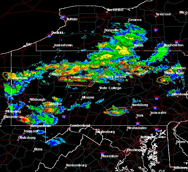 At 547 pm edt, a confirmed tornado was located near brookville, moving east at 30 mph (law enforcement confirmed tornado is on the ground). Hazards include damaging tornado. Flying debris will be dangerous to those caught without shelter. mobile homes will be damaged or destroyed. damage to roofs, windows, and vehicles will occur. tree damage is likely. this tornado will be near, reynoldsville around 555 pm edt. brockway around 600 pm edt. other locations impacted by this tornadic thunderstorm include falls creek and sykesville. This includes interstate 80 in pennsylvania between mile markers 80 and 96. At 547 pm edt, a confirmed tornado was located near brookville, moving east at 30 mph (law enforcement confirmed tornado is on the ground). Hazards include damaging tornado. Flying debris will be dangerous to those caught without shelter. mobile homes will be damaged or destroyed. damage to roofs, windows, and vehicles will occur. tree damage is likely. this tornado will be near, reynoldsville around 555 pm edt. brockway around 600 pm edt. other locations impacted by this tornadic thunderstorm include falls creek and sykesville. This includes interstate 80 in pennsylvania between mile markers 80 and 96.
|
| 10/2/2018 5:36 PM EDT |
 At 535 pm edt, a severe thunderstorm capable of producing a tornado was located over brookville, moving east at 30 mph (radar indicated rotation). Hazards include tornado. Flying debris will be dangerous to those caught without shelter. mobile homes will be damaged or destroyed. damage to roofs, windows, and vehicles will occur. tree damage is likely. this dangerous storm will be near, reynoldsville and brockway around 600 pm edt. other locations impacted by this tornadic thunderstorm include falls creek and sykesville. this includes interstate 80 in pennsylvania between mile markers 75 and 96. Please report severe weather by calling 412-262-1988, posting to the nws pittsburgh facebook page, or using twitter @nwspittsburgh. At 535 pm edt, a severe thunderstorm capable of producing a tornado was located over brookville, moving east at 30 mph (radar indicated rotation). Hazards include tornado. Flying debris will be dangerous to those caught without shelter. mobile homes will be damaged or destroyed. damage to roofs, windows, and vehicles will occur. tree damage is likely. this dangerous storm will be near, reynoldsville and brockway around 600 pm edt. other locations impacted by this tornadic thunderstorm include falls creek and sykesville. this includes interstate 80 in pennsylvania between mile markers 75 and 96. Please report severe weather by calling 412-262-1988, posting to the nws pittsburgh facebook page, or using twitter @nwspittsburgh.
|
| 10/2/2018 5:03 PM EDT |
 At 503 pm edt, a severe thunderstorm was located over brookville, moving east at 35 mph (radar). Hazards include wind gusts to 60 mph. expect damage to trees and power lines, resulting in some power outages At 503 pm edt, a severe thunderstorm was located over brookville, moving east at 35 mph (radar). Hazards include wind gusts to 60 mph. expect damage to trees and power lines, resulting in some power outages
|
| 8/21/2018 8:21 PM EDT |
 The tornado warning for east central jefferson county will expire at 830 pm edt, the storm which prompted the warning has weakened below severe limits and no longer appears capable of producing a tornado. therefore, the warning will be allowed to expire. The tornado warning for east central jefferson county will expire at 830 pm edt, the storm which prompted the warning has weakened below severe limits and no longer appears capable of producing a tornado. therefore, the warning will be allowed to expire.
|
| 8/21/2018 8:09 PM EDT |
 At 809 pm edt, a severe thunderstorm capable of producing a tornado was located over reynoldsville, or near dubois, moving east at 25 mph (radar indicated rotation). Hazards include tornado. Flying debris will be dangerous to those caught without shelter. mobile homes will be damaged or destroyed. damage to roofs, windows, and vehicles will occur. tree damage is likely. this dangerous storm will be near, brockway around 825 pm edt. other locations impacted by this tornadic thunderstorm include falls creek and sykesville. This includes interstate 80 in pennsylvania between mile markers 87 and 96. At 809 pm edt, a severe thunderstorm capable of producing a tornado was located over reynoldsville, or near dubois, moving east at 25 mph (radar indicated rotation). Hazards include tornado. Flying debris will be dangerous to those caught without shelter. mobile homes will be damaged or destroyed. damage to roofs, windows, and vehicles will occur. tree damage is likely. this dangerous storm will be near, brockway around 825 pm edt. other locations impacted by this tornadic thunderstorm include falls creek and sykesville. This includes interstate 80 in pennsylvania between mile markers 87 and 96.
|
| 8/21/2018 8:02 PM EDT |
 At 801 pm edt, a severe thunderstorm capable of producing a tornado was located over reynoldsville, or 8 miles east of brookville, moving east at 25 mph (radar indicated rotation). Hazards include tornado. Flying debris will be dangerous to those caught without shelter. mobile homes will be damaged or destroyed. damage to roofs, windows, and vehicles will occur. tree damage is likely. this dangerous storm will be near, reynoldsville around 805 pm edt. brockway around 825 pm edt. other locations impacted by this tornadic thunderstorm include falls creek and sykesville. this includes interstate 80 in pennsylvania between mile markers 83 and 96. Please report severe weather by calling 412-262-1988, posting to the nws pittsburgh facebook page, or using twitter @nwspittsburgh. At 801 pm edt, a severe thunderstorm capable of producing a tornado was located over reynoldsville, or 8 miles east of brookville, moving east at 25 mph (radar indicated rotation). Hazards include tornado. Flying debris will be dangerous to those caught without shelter. mobile homes will be damaged or destroyed. damage to roofs, windows, and vehicles will occur. tree damage is likely. this dangerous storm will be near, reynoldsville around 805 pm edt. brockway around 825 pm edt. other locations impacted by this tornadic thunderstorm include falls creek and sykesville. this includes interstate 80 in pennsylvania between mile markers 83 and 96. Please report severe weather by calling 412-262-1988, posting to the nws pittsburgh facebook page, or using twitter @nwspittsburgh.
|
| 8/21/2018 4:10 PM EDT | Trees and lines down along rt 219 at harveys run rd in jefferson county PA, 3.3 miles N of Brockway, PA |
| 8/21/2018 3:40 PM EDT |
 The severe thunderstorm warning for northern jefferson county will expire at 345 pm edt, the storm that prompted the warning has weakened below severe limits and no longer pose an immediate threat to life and property. therefore, the warning will be allowed to expire. a severe thunderstorm watch remains in effect until 1000 pm edt for west central pennsylvania. The severe thunderstorm warning for northern jefferson county will expire at 345 pm edt, the storm that prompted the warning has weakened below severe limits and no longer pose an immediate threat to life and property. therefore, the warning will be allowed to expire. a severe thunderstorm watch remains in effect until 1000 pm edt for west central pennsylvania.
|
| 8/21/2018 3:29 PM EDT |
 At 328 pm edt, a severe thunderstorm was located near brookville, moving northeast at 35 mph (radar). Hazards include wind gusts to 60 mph. Expect damage to trees and power lines, resulting in some power outages. Locations impacted include, brookville, brockway, falls creek, this includes interstate 80 in pennsylvania between mile markers 78 and 96. At 328 pm edt, a severe thunderstorm was located near brookville, moving northeast at 35 mph (radar). Hazards include wind gusts to 60 mph. Expect damage to trees and power lines, resulting in some power outages. Locations impacted include, brookville, brockway, falls creek, this includes interstate 80 in pennsylvania between mile markers 78 and 96.
|
| 8/21/2018 3:11 PM EDT |
 At 311 pm edt, a severe thunderstorm was located near brookville, moving northeast at 35 mph (radar). Hazards include wind gusts to 60 mph. expect damage to trees and power lines, resulting in some power outages At 311 pm edt, a severe thunderstorm was located near brookville, moving northeast at 35 mph (radar). Hazards include wind gusts to 60 mph. expect damage to trees and power lines, resulting in some power outages
|
| 6/18/2018 10:35 PM EDT |
 At 1035 pm edt, severe thunderstorms were located along a line extending from near dubois to near new bethlehem, moving east at 45 mph (radar). Hazards include wind gusts to 60 mph. Expect damage to trees and power lines, resulting in some power outages. This includes interstate 80 in pennsylvania between mile markers 51 and 96. At 1035 pm edt, severe thunderstorms were located along a line extending from near dubois to near new bethlehem, moving east at 45 mph (radar). Hazards include wind gusts to 60 mph. Expect damage to trees and power lines, resulting in some power outages. This includes interstate 80 in pennsylvania between mile markers 51 and 96.
|
| 6/18/2018 10:26 PM EDT |
 At 1025 pm edt, severe thunderstorms were located along a line extending from brockway to 6 miles south of clarion, moving southeast at 45 mph (radar). Hazards include wind gusts to 60 mph. expect damage to trees and power lines, resulting in some power outages At 1025 pm edt, severe thunderstorms were located along a line extending from brockway to 6 miles south of clarion, moving southeast at 45 mph (radar). Hazards include wind gusts to 60 mph. expect damage to trees and power lines, resulting in some power outages
|
| 6/18/2018 10:05 PM EDT |
 At 1005 pm edt, severe thunderstorms were located along a line extending from near portland mills to knox, moving southeast at 55 mph (radar). Hazards include wind gusts to 60 mph. Expect damage to trees and power lines, resulting in some power outages. This includes interstate 80 in pennsylvania between mile markers 51 and 96. At 1005 pm edt, severe thunderstorms were located along a line extending from near portland mills to knox, moving southeast at 55 mph (radar). Hazards include wind gusts to 60 mph. Expect damage to trees and power lines, resulting in some power outages. This includes interstate 80 in pennsylvania between mile markers 51 and 96.
|
| 6/18/2018 9:57 PM EDT |
 At 957 pm edt, severe thunderstorms were located along a line extending from 7 miles west of portland mills to near knox, moving southeast at 35 mph (radar). Hazards include wind gusts to 60 mph. expect damage to trees and power lines, resulting in some power outages At 957 pm edt, severe thunderstorms were located along a line extending from 7 miles west of portland mills to near knox, moving southeast at 35 mph (radar). Hazards include wind gusts to 60 mph. expect damage to trees and power lines, resulting in some power outages
|
| 6/18/2018 9:31 PM EDT |
 At 930 pm edt, severe thunderstorms were located along a line extending from 6 miles east of tionesta to near marienville, moving southeast at 30 mph (radar). Hazards include wind gusts to 60 mph. Expect damage to trees and power lines, resulting in some power outages. Locations impacted include, marienville, brockway, tionesta, pleasantville, kellettville, west hickory, leeper, clarington, clear creek state park, cook forest state park, starr, east hickory,. At 930 pm edt, severe thunderstorms were located along a line extending from 6 miles east of tionesta to near marienville, moving southeast at 30 mph (radar). Hazards include wind gusts to 60 mph. Expect damage to trees and power lines, resulting in some power outages. Locations impacted include, marienville, brockway, tionesta, pleasantville, kellettville, west hickory, leeper, clarington, clear creek state park, cook forest state park, starr, east hickory,.
|
| 6/18/2018 9:00 PM EDT |
 At 859 pm edt, severe thunderstorms were located along a line extending from near enterprise to 6 miles northeast of marienville, moving southeast at 35 mph (radar). Hazards include wind gusts to 60 mph. expect damage to trees and power lines, resulting in some power outages At 859 pm edt, severe thunderstorms were located along a line extending from near enterprise to 6 miles northeast of marienville, moving southeast at 35 mph (radar). Hazards include wind gusts to 60 mph. expect damage to trees and power lines, resulting in some power outages
|
| 11/5/2017 8:44 PM EST |
 At 844 pm est, severe thunderstorms were located along a line extending from near wilcox to punxsutawney, moving east at 50 mph (radar). Hazards include 60 mph wind gusts. Expect damage to trees and power lines, resulting in some power outages. Locations impacted include, punxsutawney, brookville, reynoldsville, brockway, sykesville, falls creek, big run, summerville, rossiter, corsica, glen campbell, sigel, this includes interstate 80 in pennsylvania between mile markers 73 and 96. At 844 pm est, severe thunderstorms were located along a line extending from near wilcox to punxsutawney, moving east at 50 mph (radar). Hazards include 60 mph wind gusts. Expect damage to trees and power lines, resulting in some power outages. Locations impacted include, punxsutawney, brookville, reynoldsville, brockway, sykesville, falls creek, big run, summerville, rossiter, corsica, glen campbell, sigel, this includes interstate 80 in pennsylvania between mile markers 73 and 96.
|
| 11/5/2017 8:13 PM EST |
 At 813 pm est, severe thunderstorms were located along a line extending from 11 miles south of chapman state park to near rimersburg, moving east at 50 mph (radar). Hazards include 60 mph wind gusts. expect damage to trees and power lines, resulting in some power outages At 813 pm est, severe thunderstorms were located along a line extending from 11 miles south of chapman state park to near rimersburg, moving east at 50 mph (radar). Hazards include 60 mph wind gusts. expect damage to trees and power lines, resulting in some power outages
|
| 8/22/2017 5:55 PM EDT |
 At 554 pm edt, a severe thunderstorm was located over reynoldsville, or near dubois, moving east at 35 mph (radar). Hazards include 60 mph wind gusts. Expect damage to trees and power lines, resulting in some power outages. Locations impacted include, brockway, falls creek, this includes interstate 80 in pennsylvania between mile markers 86 and 96. At 554 pm edt, a severe thunderstorm was located over reynoldsville, or near dubois, moving east at 35 mph (radar). Hazards include 60 mph wind gusts. Expect damage to trees and power lines, resulting in some power outages. Locations impacted include, brockway, falls creek, this includes interstate 80 in pennsylvania between mile markers 86 and 96.
|
| 8/22/2017 5:36 PM EDT |
 At 536 pm edt, a severe thunderstorm was located near brockway, or 8 miles northwest of dubois, moving east at 40 mph (radar). Hazards include 60 mph wind gusts. Expect damage to trees and power lines, resulting in some power outages. Locations impacted include, brookville, brockway, falls creek, this includes interstate 80 in pennsylvania between mile markers 78 and 96. At 536 pm edt, a severe thunderstorm was located near brockway, or 8 miles northwest of dubois, moving east at 40 mph (radar). Hazards include 60 mph wind gusts. Expect damage to trees and power lines, resulting in some power outages. Locations impacted include, brookville, brockway, falls creek, this includes interstate 80 in pennsylvania between mile markers 78 and 96.
|
| 8/22/2017 5:08 PM EDT |
 At 508 pm edt, a severe thunderstorm was located 7 miles west of brookville, moving east at 40 mph (radar). Hazards include 60 mph wind gusts. expect damage to trees and power lines, resulting in some power outages At 508 pm edt, a severe thunderstorm was located 7 miles west of brookville, moving east at 40 mph (radar). Hazards include 60 mph wind gusts. expect damage to trees and power lines, resulting in some power outages
|
| 8/22/2017 2:51 PM EDT |
 At 251 pm edt, severe thunderstorms were located along a line extending from 6 miles south of brookville to near punxsutawney, moving east at 50 mph (radar). Hazards include 60 mph wind gusts. damage to trees and power lines At 251 pm edt, severe thunderstorms were located along a line extending from 6 miles south of brookville to near punxsutawney, moving east at 50 mph (radar). Hazards include 60 mph wind gusts. damage to trees and power lines
|
| 8/22/2017 1:55 PM EDT |
 At 152 pm edt, a severe thunderstorm was located near knox, moving east at 45 mph (radar). Hazards include 60 mph wind gusts. damage to trees and power lines At 152 pm edt, a severe thunderstorm was located near knox, moving east at 45 mph (radar). Hazards include 60 mph wind gusts. damage to trees and power lines
|
| 8/22/2017 1:52 PM EDT |
 At 152 pm edt, a severe thunderstorm was located near knox, moving east at 45 mph (radar). Hazards include 60 mph wind gusts. damage to trees and power lines At 152 pm edt, a severe thunderstorm was located near knox, moving east at 45 mph (radar). Hazards include 60 mph wind gusts. damage to trees and power lines
|
| 8/4/2017 8:50 PM EDT | Trees down in jefferson county PA, 0.2 miles SSW of Brockway, PA |
| 8/4/2017 8:31 PM EDT |
 At 830 pm edt, a severe thunderstorm was located 8 miles southwest of brookville, moving east at 30 mph (radar). Hazards include 60 mph wind gusts. Expect damage to trees and power lines, resulting in some power outages. Locations impacted include, brookville, reynoldsville, brockway, sykesville, falls creek, summerville, timblin, worthville, anita, this includes interstate 80 in pennsylvania between mile markers 77 and 96. At 830 pm edt, a severe thunderstorm was located 8 miles southwest of brookville, moving east at 30 mph (radar). Hazards include 60 mph wind gusts. Expect damage to trees and power lines, resulting in some power outages. Locations impacted include, brookville, reynoldsville, brockway, sykesville, falls creek, summerville, timblin, worthville, anita, this includes interstate 80 in pennsylvania between mile markers 77 and 96.
|
| 8/4/2017 8:10 PM EDT |
 At 810 pm edt, a severe thunderstorm was located over new bethlehem, or 9 miles east of rimersburg, moving east at 30 mph (radar). Hazards include 60 mph wind gusts. Expect damage to trees and power lines, resulting in some power outages. Locations impacted include, brookville, reynoldsville, brockway, new bethlehem, sykesville, falls creek, summerville, hawthorn, timblin, worthville, anita, mahoning creek lake, this includes interstate 80 in pennsylvania between mile markers 77 and 96. At 810 pm edt, a severe thunderstorm was located over new bethlehem, or 9 miles east of rimersburg, moving east at 30 mph (radar). Hazards include 60 mph wind gusts. Expect damage to trees and power lines, resulting in some power outages. Locations impacted include, brookville, reynoldsville, brockway, new bethlehem, sykesville, falls creek, summerville, hawthorn, timblin, worthville, anita, mahoning creek lake, this includes interstate 80 in pennsylvania between mile markers 77 and 96.
|
| 8/4/2017 8:01 PM EDT |
 At 801 pm edt, a severe thunderstorm was located 7 miles north of brookville, moving east at 35 mph (radar). Hazards include 60 mph wind gusts. Expect damage to trees and power lines, resulting in some power outages. Locations impacted include, brookville, brockway, summerville, limestone, corsica, sigel, clarington, clear creek state park, this includes interstate 80 in pennsylvania between mile markers 69 and 83. At 801 pm edt, a severe thunderstorm was located 7 miles north of brookville, moving east at 35 mph (radar). Hazards include 60 mph wind gusts. Expect damage to trees and power lines, resulting in some power outages. Locations impacted include, brookville, brockway, summerville, limestone, corsica, sigel, clarington, clear creek state park, this includes interstate 80 in pennsylvania between mile markers 69 and 83.
|
| 8/4/2017 7:51 PM EDT |
 At 751 pm edt, a severe thunderstorm was located near rimersburg, moving northeast at 30 mph (radar). Hazards include 60 mph wind gusts. expect damage to trees and power lines, resulting in some power outages At 751 pm edt, a severe thunderstorm was located near rimersburg, moving northeast at 30 mph (radar). Hazards include 60 mph wind gusts. expect damage to trees and power lines, resulting in some power outages
|
| 8/4/2017 7:30 PM EDT |
 At 730 pm edt, a severe thunderstorm was located over clarion, moving east at 35 mph (radar). Hazards include 60 mph wind gusts. expect damage to trees and power lines, resulting in some power outages At 730 pm edt, a severe thunderstorm was located over clarion, moving east at 35 mph (radar). Hazards include 60 mph wind gusts. expect damage to trees and power lines, resulting in some power outages
|
| 6/19/2017 6:39 PM EDT |
 The severe thunderstorm warning for northern jefferson, northeastern clarion and south central forest counties will expire at 645 pm edt, the storm that prompted the warning has weakened. therefore, the warning will be allowed to expire. The severe thunderstorm warning for northern jefferson, northeastern clarion and south central forest counties will expire at 645 pm edt, the storm that prompted the warning has weakened. therefore, the warning will be allowed to expire.
|
| 6/19/2017 6:27 PM EDT |
 At 626 pm edt, a severe thunderstorm was located 10 miles northeast of clarion, moving east at 25 mph (radar). Hazards include 60 mph wind gusts. Expect damage to trees and power lines, resulting in some power outages. Locations impacted include, brockway, sigel, fisher, leeper, clarington, clear creek state park, cook forest state park, this includes interstate 80 in pennsylvania near mile marker 83, and between mile markers 89 and 95. At 626 pm edt, a severe thunderstorm was located 10 miles northeast of clarion, moving east at 25 mph (radar). Hazards include 60 mph wind gusts. Expect damage to trees and power lines, resulting in some power outages. Locations impacted include, brockway, sigel, fisher, leeper, clarington, clear creek state park, cook forest state park, this includes interstate 80 in pennsylvania near mile marker 83, and between mile markers 89 and 95.
|
| 6/19/2017 6:18 PM EDT |
 At 618 pm edt, a severe thunderstorm was located 9 miles northeast of clarion, moving east at 30 mph (radar). Hazards include 60 mph wind gusts and quarter-size hail. Minor hail damage to vehicles is possible. Expect wind damage to trees and power lines, resulting in some power outages. At 618 pm edt, a severe thunderstorm was located 9 miles northeast of clarion, moving east at 30 mph (radar). Hazards include 60 mph wind gusts and quarter-size hail. Minor hail damage to vehicles is possible. Expect wind damage to trees and power lines, resulting in some power outages.
|
| 5/30/2017 1:04 PM EDT |
 At 103 pm edt, a severe thunderstorm was located near reynoldsville, or 8 miles southeast of brookville, moving east at 20 mph (radar). Hazards include 70 mph wind gusts and half dollar-size hail. Hail damage to vehicles. trees snapped and uprooted. Power outages. At 103 pm edt, a severe thunderstorm was located near reynoldsville, or 8 miles southeast of brookville, moving east at 20 mph (radar). Hazards include 70 mph wind gusts and half dollar-size hail. Hail damage to vehicles. trees snapped and uprooted. Power outages.
|
| 5/1/2017 4:27 PM EDT |
 The severe thunderstorm warning for eastern indiana, central jefferson and east central westmoreland counties will expire at 430 pm edt, the storms that prompted the warning have moved out of the area. therefore, the warning will be allowed to expire. a tornado watch remains in effect until 700 pm edt for southwestern and west central pennsylvania. The severe thunderstorm warning for eastern indiana, central jefferson and east central westmoreland counties will expire at 430 pm edt, the storms that prompted the warning have moved out of the area. therefore, the warning will be allowed to expire. a tornado watch remains in effect until 700 pm edt for southwestern and west central pennsylvania.
|
| 5/1/2017 4:10 PM EDT |
 At 410 pm edt, severe thunderstorms were located along a line extending from near brockway to 10 miles northwest of northern cambria to 8 miles west of westmont, moving northeast at 45 mph (trained weather spotters). Hazards include 60 mph wind gusts. Expect damage to trees and power lines, resulting in some power outages. locations impacted include, punxsutawney, reynoldsville, brockway, clymer, sykesville, falls creek, new florence, big run, rossiter, seward, bolivar, marion center, this includes interstate 80 in pennsylvania between mile markers 87 and 96. A tornado watch remains in effect until 700 pm edt for southwestern and west central pennsylvania. At 410 pm edt, severe thunderstorms were located along a line extending from near brockway to 10 miles northwest of northern cambria to 8 miles west of westmont, moving northeast at 45 mph (trained weather spotters). Hazards include 60 mph wind gusts. Expect damage to trees and power lines, resulting in some power outages. locations impacted include, punxsutawney, reynoldsville, brockway, clymer, sykesville, falls creek, new florence, big run, rossiter, seward, bolivar, marion center, this includes interstate 80 in pennsylvania between mile markers 87 and 96. A tornado watch remains in effect until 700 pm edt for southwestern and west central pennsylvania.
|
| 5/1/2017 3:58 PM EDT |
 At 358 pm edt, severe thunderstorms were located along a line extending from near brockway to near punxsutawney to near indiana, moving east at 55 mph (trained weather spotters). Hazards include 60 mph wind gusts. Expect damage to trees and power lines, resulting in some power outages. locations impacted include, indiana, punxsutawney, brookville, homer city, blairsville, reynoldsville, brockway, black lick, clymer, sykesville, falls creek, new florence, this includes interstate 80 in pennsylvania between mile markers 81 and 96. A tornado watch remains in effect until 700 pm edt for southwestern and west central pennsylvania. At 358 pm edt, severe thunderstorms were located along a line extending from near brockway to near punxsutawney to near indiana, moving east at 55 mph (trained weather spotters). Hazards include 60 mph wind gusts. Expect damage to trees and power lines, resulting in some power outages. locations impacted include, indiana, punxsutawney, brookville, homer city, blairsville, reynoldsville, brockway, black lick, clymer, sykesville, falls creek, new florence, this includes interstate 80 in pennsylvania between mile markers 81 and 96. A tornado watch remains in effect until 700 pm edt for southwestern and west central pennsylvania.
|
| 5/1/2017 3:34 PM EDT |
 At 334 pm edt, severe thunderstorms were located along a line extending from 7 miles west of brookville to 10 miles east of kittanning to 8 miles northeast of delmont, moving east at 55 mph (trained weather spotters). Hazards include 60 mph wind gusts. expect damage to trees and power lines, resulting in some power outages At 334 pm edt, severe thunderstorms were located along a line extending from 7 miles west of brookville to 10 miles east of kittanning to 8 miles northeast of delmont, moving east at 55 mph (trained weather spotters). Hazards include 60 mph wind gusts. expect damage to trees and power lines, resulting in some power outages
|
| 4/20/2017 4:10 PM EDT |
 The severe thunderstorm warning for northeastern jefferson county will expire at 415 pm edt. the storm that prompted the warning has weakened below severe limits and has exited the warned area. Therefore, the warning will be allowed to expire. The severe thunderstorm warning for northeastern jefferson county will expire at 415 pm edt. the storm that prompted the warning has weakened below severe limits and has exited the warned area. Therefore, the warning will be allowed to expire.
|
| 4/20/2017 3:58 PM EDT |
 At 358 pm edt, a severe thunderstorm was located near brockway, or 10 miles northeast of brookville, moving northeast at 40 mph (trained weather spotters). Hazards include golf ball-size hail and 60 mph wind gusts. People and animals outdoors will be injured. expect hail damage to roofs, siding, windows, and vehicles. Expect wind damage to trees and power lines, resulting in some power outages. At 358 pm edt, a severe thunderstorm was located near brockway, or 10 miles northeast of brookville, moving northeast at 40 mph (trained weather spotters). Hazards include golf ball-size hail and 60 mph wind gusts. People and animals outdoors will be injured. expect hail damage to roofs, siding, windows, and vehicles. Expect wind damage to trees and power lines, resulting in some power outages.
|
| 4/20/2017 3:45 PM EDT |
 At 344 pm edt, a severe thunderstorm was located over brookville, moving northeast at 35 mph (trained weather spotters). Hazards include golf ball size-hail and 60 mph wind gusts. People and animals outdoors will be injured. expect hail damage to roofs, siding, windows, and vehicles. expect wind damage to trees and power lines, resulting in some power outages. Locations impacted include, brookville, reynoldsville, brockway, falls creek, summerville, corsica, sigel, worthville, clear creek state park, this includes interstate 80 in pennsylvania between mile markers 74 and 96. At 344 pm edt, a severe thunderstorm was located over brookville, moving northeast at 35 mph (trained weather spotters). Hazards include golf ball size-hail and 60 mph wind gusts. People and animals outdoors will be injured. expect hail damage to roofs, siding, windows, and vehicles. expect wind damage to trees and power lines, resulting in some power outages. Locations impacted include, brookville, reynoldsville, brockway, falls creek, summerville, corsica, sigel, worthville, clear creek state park, this includes interstate 80 in pennsylvania between mile markers 74 and 96.
|
| 4/20/2017 3:30 PM EDT |
 At 330 pm edt, a severe thunderstorm was located near brookville, moving northeast at 40 mph (trained weather spotters). Hazards include golf ball size-hail and 60 mph wind gusts. People and animals outdoors will be injured. expect hail damage to roofs, siding, windows, and vehicles. expect wind damage to trees and power lines, resulting in some power outages. Locations impacted include, brookville, reynoldsville, brockway, falls creek, summerville, limestone, hawthorn, corsica, sigel, worthville, clear creek state park, this includes interstate 80 in pennsylvania between mile markers 66 and 96. At 330 pm edt, a severe thunderstorm was located near brookville, moving northeast at 40 mph (trained weather spotters). Hazards include golf ball size-hail and 60 mph wind gusts. People and animals outdoors will be injured. expect hail damage to roofs, siding, windows, and vehicles. expect wind damage to trees and power lines, resulting in some power outages. Locations impacted include, brookville, reynoldsville, brockway, falls creek, summerville, limestone, hawthorn, corsica, sigel, worthville, clear creek state park, this includes interstate 80 in pennsylvania between mile markers 66 and 96.
|
| 4/20/2017 3:14 PM EDT |
 At 314 pm edt, a severe thunderstorm was located over new bethlehem, or 7 miles east of rimersburg, moving northeast at 40 mph (public). Hazards include ping-pong ball-size hail and 60 mph wind gusts. People and animals outdoors will be injured. expect hail damage to roofs, siding, windows, and vehicles. Expect wind damage to trees and power lines, resulting in some power outages. At 314 pm edt, a severe thunderstorm was located over new bethlehem, or 7 miles east of rimersburg, moving northeast at 40 mph (public). Hazards include ping-pong ball-size hail and 60 mph wind gusts. People and animals outdoors will be injured. expect hail damage to roofs, siding, windows, and vehicles. Expect wind damage to trees and power lines, resulting in some power outages.
|
| 1/12/2017 2:52 PM EST |
 At 252 pm est, a severe thunderstorm was located 10 miles north of brookville, moving east at 60 mph (radar indicated). Hazards include 60 mph wind gusts. Expect damage to trees and power lines, resulting in some power outages. locations impacted include, clarion, brookville, reynoldsville, brockway, falls creek, sligo, strattanville, summerville, limestone, corsica, callensburg and sigel. this includes interstate 80 in pennsylvania between mile markers 58 and 96. Please report severe weather by calling 412-262- 1988, posting to the nws pittsburgh facebook page, or using twitter @nwspittsburgh. At 252 pm est, a severe thunderstorm was located 10 miles north of brookville, moving east at 60 mph (radar indicated). Hazards include 60 mph wind gusts. Expect damage to trees and power lines, resulting in some power outages. locations impacted include, clarion, brookville, reynoldsville, brockway, falls creek, sligo, strattanville, summerville, limestone, corsica, callensburg and sigel. this includes interstate 80 in pennsylvania between mile markers 58 and 96. Please report severe weather by calling 412-262- 1988, posting to the nws pittsburgh facebook page, or using twitter @nwspittsburgh.
|
| 1/12/2017 2:24 PM EST |
 At 223 pm est, a severe thunderstorm was located near knox, moving east at 60 mph (radar indicated). Hazards include 60 mph wind gusts. expect damage to trees and power lines, resulting in some power outages At 223 pm est, a severe thunderstorm was located near knox, moving east at 60 mph (radar indicated). Hazards include 60 mph wind gusts. expect damage to trees and power lines, resulting in some power outages
|
| 8/28/2016 2:34 PM EDT |
 At 233 pm edt, a severe thunderstorm was located over brockway, or 9 miles north of dubois, moving east at 10 mph (radar indicated). Hazards include 60 mph wind gusts. Expect damage to trees and power lines. Resulting in some power outages. At 233 pm edt, a severe thunderstorm was located over brockway, or 9 miles north of dubois, moving east at 10 mph (radar indicated). Hazards include 60 mph wind gusts. Expect damage to trees and power lines. Resulting in some power outages.
|
| 8/13/2016 8:49 PM EDT |
 At 848 pm edt, severe thunderstorms were located along a line extending from near brandy camp to 6 miles south of brookville, and are nearly stationary (radar indicated). Hazards include 60 mph wind gusts. Expect damage to trees and power lines. resulting in some power outages. locations impacted include, brookville, reynoldsville, brockway and falls creek. this includes interstate 80 in pennsylvania between mile markers 81 and 96. Please report severe weather by calling 4 1 2, 2 6 2, 1 9 8 8, posting to the nws pittsburgh facebook page, or using twitter @nwspittsburgh. At 848 pm edt, severe thunderstorms were located along a line extending from near brandy camp to 6 miles south of brookville, and are nearly stationary (radar indicated). Hazards include 60 mph wind gusts. Expect damage to trees and power lines. resulting in some power outages. locations impacted include, brookville, reynoldsville, brockway and falls creek. this includes interstate 80 in pennsylvania between mile markers 81 and 96. Please report severe weather by calling 4 1 2, 2 6 2, 1 9 8 8, posting to the nws pittsburgh facebook page, or using twitter @nwspittsburgh.
|
| 8/13/2016 8:26 PM EDT |
 At 826 pm edt, severe thunderstorms were located along a line extending from near brandy camp to 6 miles south of brookville, moving east at 35 mph (radar indicated). Hazards include 60 mph wind gusts. Expect damage to trees and power lines. Resulting in some power outages. At 826 pm edt, severe thunderstorms were located along a line extending from near brandy camp to 6 miles south of brookville, moving east at 35 mph (radar indicated). Hazards include 60 mph wind gusts. Expect damage to trees and power lines. Resulting in some power outages.
|
| 6/16/2016 11:23 AM EDT |
 The severe thunderstorm warning for jefferson and eastern forest counties will expire at 1130 am edt, the storms which prompted the warning have moved out of the area. therefore, the warning will be allowed to expire. The severe thunderstorm warning for jefferson and eastern forest counties will expire at 1130 am edt, the storms which prompted the warning have moved out of the area. therefore, the warning will be allowed to expire.
|
| 6/16/2016 11:15 AM EDT | Large tree blocking intersection of westville rd and arch st ext in jefferson county PA, 2.9 miles NNE of Brockway, PA |
| 6/16/2016 11:14 AM EDT |
 At 1113 am edt, severe thunderstorms were located along a line extending from near ludlow to near reynoldsville, moving east at 35 mph (radar indicated). Hazards include 60 mph wind gusts and penny size hail. Expect damage to trees and power lines. resulting in some power outages. locations impacted include, punxsutawney, brookville, marienville, reynoldsville, brockway, sykesville, falls creek, big run, anita and clear creek state park. this includes interstate 80 in pennsylvania between mile markers 80 and 96. Please report severe weather by calling 4 1 2, 2 6 2, 1 9 8 8, posting to the nws pittsburgh facebook page, or using twitter @nwspittsburgh. At 1113 am edt, severe thunderstorms were located along a line extending from near ludlow to near reynoldsville, moving east at 35 mph (radar indicated). Hazards include 60 mph wind gusts and penny size hail. Expect damage to trees and power lines. resulting in some power outages. locations impacted include, punxsutawney, brookville, marienville, reynoldsville, brockway, sykesville, falls creek, big run, anita and clear creek state park. this includes interstate 80 in pennsylvania between mile markers 80 and 96. Please report severe weather by calling 4 1 2, 2 6 2, 1 9 8 8, posting to the nws pittsburgh facebook page, or using twitter @nwspittsburgh.
|
| 6/16/2016 10:45 AM EDT |
 At 1044 am edt, severe thunderstorms were located along a line extending from 9 miles south of chapman state park to near new bethlehem, moving east at 35 mph (radar indicated). Hazards include 60 mph wind gusts and penny size hail. Expect damage to trees and power lines. resulting in some power outages. locations impacted include, punxsutawney, brookville, marienville, reynoldsville, brockway, new bethlehem, sykesville, falls creek, big run, strattanville, summerville, limestone, hawthorn, corsica, sigel, timblin, leeper, kellettville, fisher and worthville. this includes interstate 80 in pennsylvania between mile markers 65 and 96. Please report severe weather by calling 4 1 2, 2 6 2, 1 9 8 8, posting to the nws pittsburgh facebook page, or using twitter @nwspittsburgh. At 1044 am edt, severe thunderstorms were located along a line extending from 9 miles south of chapman state park to near new bethlehem, moving east at 35 mph (radar indicated). Hazards include 60 mph wind gusts and penny size hail. Expect damage to trees and power lines. resulting in some power outages. locations impacted include, punxsutawney, brookville, marienville, reynoldsville, brockway, new bethlehem, sykesville, falls creek, big run, strattanville, summerville, limestone, hawthorn, corsica, sigel, timblin, leeper, kellettville, fisher and worthville. this includes interstate 80 in pennsylvania between mile markers 65 and 96. Please report severe weather by calling 4 1 2, 2 6 2, 1 9 8 8, posting to the nws pittsburgh facebook page, or using twitter @nwspittsburgh.
|
| 6/16/2016 10:24 AM EDT |
 At 1023 am edt, severe thunderstorms were located along a line extending from 6 miles east of enterprise to rimersburg, moving east at 35 mph (radar indicated). Hazards include 60 mph wind gusts and penny size hail. Expect damage to trees and power lines. Resulting in some power outages. At 1023 am edt, severe thunderstorms were located along a line extending from 6 miles east of enterprise to rimersburg, moving east at 35 mph (radar indicated). Hazards include 60 mph wind gusts and penny size hail. Expect damage to trees and power lines. Resulting in some power outages.
|
| 7/7/2015 9:37 PM EDT |
 The severe thunderstorm warning for jefferson and south central forest counties will expire at 945 pm edt, the storm which prompted the warning has moved out of the area. therefore the warning will be allowed to expire. The severe thunderstorm warning for jefferson and south central forest counties will expire at 945 pm edt, the storm which prompted the warning has moved out of the area. therefore the warning will be allowed to expire.
|
| 7/7/2015 9:30 PM EDT | Trees down in jefferson county PA, 1.9 miles NNW of Brockway, PA |
| 7/7/2015 9:20 PM EDT |
 At 919 pm edt, a severe thunderstorm was located 7 miles northeast of brookville, moving east at 45 mph (radar indicated). Hazards include 60 mph wind gusts. expect damage to trees and some power outages locations impacted include, brookville, reynoldsville, brockway, sykesville, falls creek, summerville, corsica, sigel, worthville, clear creek state park and clarington At 919 pm edt, a severe thunderstorm was located 7 miles northeast of brookville, moving east at 45 mph (radar indicated). Hazards include 60 mph wind gusts. expect damage to trees and some power outages locations impacted include, brookville, reynoldsville, brockway, sykesville, falls creek, summerville, corsica, sigel, worthville, clear creek state park and clarington
|
| 7/7/2015 8:58 PM EDT |
 At 858 pm edt, a severe thunderstorm was located 8 miles southeast of clarion, moving east at 45 mph (radar indicated). Hazards include 60 mph wind gusts. expect damage to trees and some power outages At 858 pm edt, a severe thunderstorm was located 8 miles southeast of clarion, moving east at 45 mph (radar indicated). Hazards include 60 mph wind gusts. expect damage to trees and some power outages
|
| 6/12/2015 6:44 PM EDT |
 At 644 pm edt, a severe thunderstorm was located near brockway, or near dubois, moving east at 55 mph (radar indicated). Hazards include 60 mph wind gusts. Expect damage to roofs. siding and trees. Locations impacted include, brookville, reynoldsville, brockway, sykesville, falls creek, sigel, worthville, clear creek state park and clarington. At 644 pm edt, a severe thunderstorm was located near brockway, or near dubois, moving east at 55 mph (radar indicated). Hazards include 60 mph wind gusts. Expect damage to roofs. siding and trees. Locations impacted include, brookville, reynoldsville, brockway, sykesville, falls creek, sigel, worthville, clear creek state park and clarington.
|
| 6/12/2015 6:25 PM EDT |
 At 625 pm edt, a severe thunderstorm was located near brookville, moving east at 45 mph (radar indicated). Hazards include 60 mph wind gusts. Expect damage to roofs. siding and trees. Locations impacted include, brookville, reynoldsville, brockway, sykesville, falls creek, strattanville, summerville, limestone, hawthorn, corsica, sigel, fisher, worthville, cook forest state park, clarington and clear creek state park. At 625 pm edt, a severe thunderstorm was located near brookville, moving east at 45 mph (radar indicated). Hazards include 60 mph wind gusts. Expect damage to roofs. siding and trees. Locations impacted include, brookville, reynoldsville, brockway, sykesville, falls creek, strattanville, summerville, limestone, hawthorn, corsica, sigel, fisher, worthville, cook forest state park, clarington and clear creek state park.
|
| 6/12/2015 6:15 PM EDT |
 At 614 pm edt, a severe thunderstorm was located near clarion, moving east at 55 mph (radar indicated). Hazards include 60 mph wind gusts. Expect damage to roofs. Siding and trees. At 614 pm edt, a severe thunderstorm was located near clarion, moving east at 55 mph (radar indicated). Hazards include 60 mph wind gusts. Expect damage to roofs. Siding and trees.
|
| 7/7/2014 5:52 PM EDT | Several limbs reported dow in jefferson county PA, 0.2 miles SSW of Brockway, PA |
| 7/7/2014 5:50 PM EDT | Large tree branches snapped and two trees dow in jefferson county PA, 0.2 miles SSW of Brockway, PA |
| 7/7/2014 5:43 PM EDT | Tree down in jefferson county PA, 2.2 miles SE of Brockway, PA |
| 7/7/2014 5:31 PM EDT | Tree down in jefferson county PA, 10.5 miles ESE of Brockway, PA |
| 7/7/2014 5:27 PM EDT | Tree down in jefferson county PA, 10.5 miles ESE of Brockway, PA |
| 7/7/2014 4:30 PM EDT | Tree down in snyder township on route 28 in jefferson county PA, 3.6 miles E of Brockway, PA |
| 7/6/2013 10:10 PM EDT | Trees and wires dow in jefferson county PA, 0.2 miles SSW of Brockway, PA |
| 7/6/2013 10:05 PM EDT | Several trees dow in jefferson county PA, 4 miles NE of Brockway, PA |
| 7/26/2012 3:20 PM EDT | Large tree blown down on 7th ave ex in jefferson county PA, 0.2 miles SSW of Brockway, PA |
| 6/29/2012 2:00 AM EDT | Trees and wires dow in jefferson county PA, 8.6 miles ESE of Brockway, PA |
| 6/3/2012 7:18 PM EDT | Trees down in northern part of brockway in jefferson county PA, 0.2 miles SSW of Brockway, PA |
| 6/3/2012 6:30 PM EDT | Trees down in northern part of brockway in jefferson county PA, 0.2 miles SSW of Brockway, PA |
| 5/29/2012 2:33 PM EDT | Quarter sized hail reported 0.2 miles SSW of Brockway, PA |
| 3/28/2012 9:03 AM EDT | Quarter sized hail reported 3.6 miles E of Brockway, PA, event occurred between 848 am 03/28/2012 and 903 am 03/28/2012 |
| 3/28/2012 8:48 AM EDT | Quarter sized hail reported 0.2 miles SSW of Brockway, PA |
Hail Maps for Brockway, PA
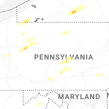
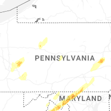


Connect with Interactive Hail Maps