

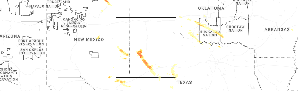
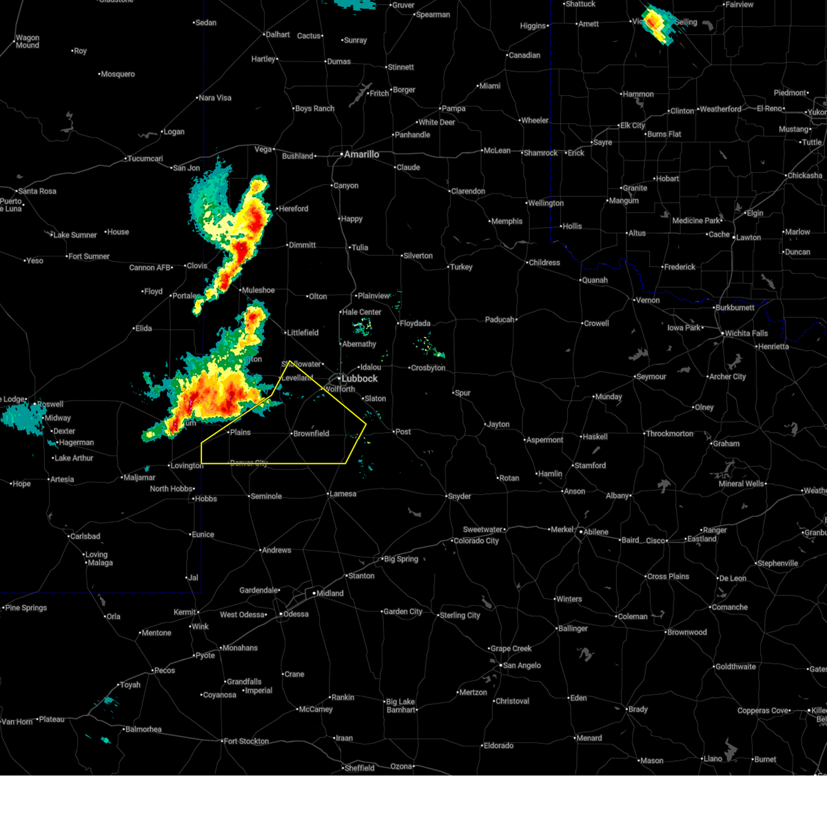
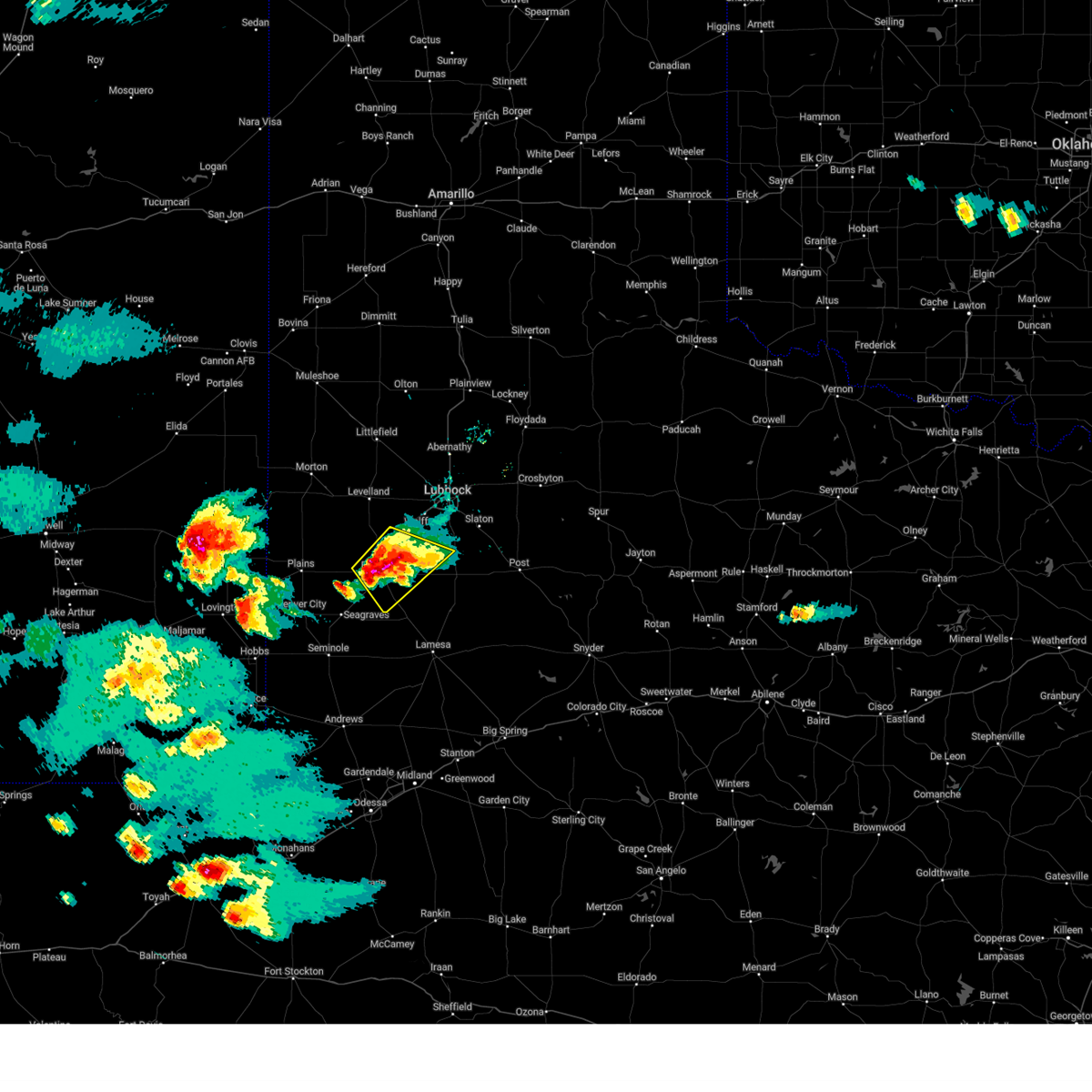
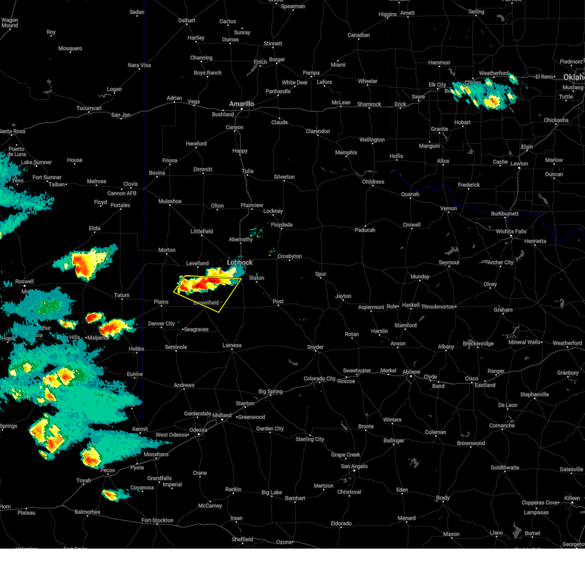
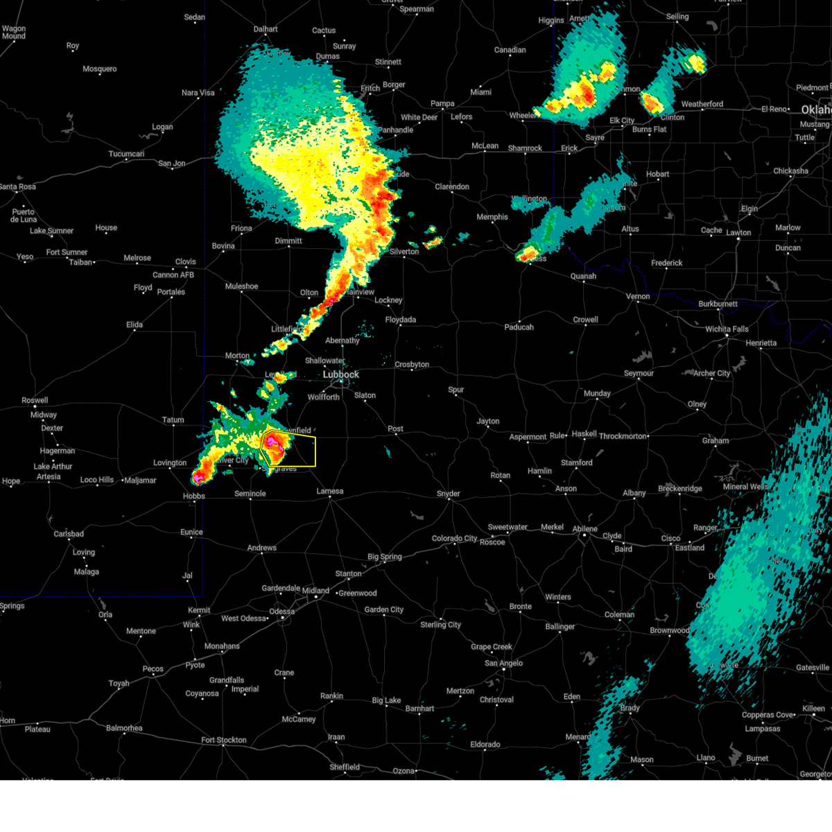
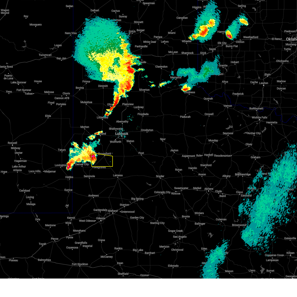
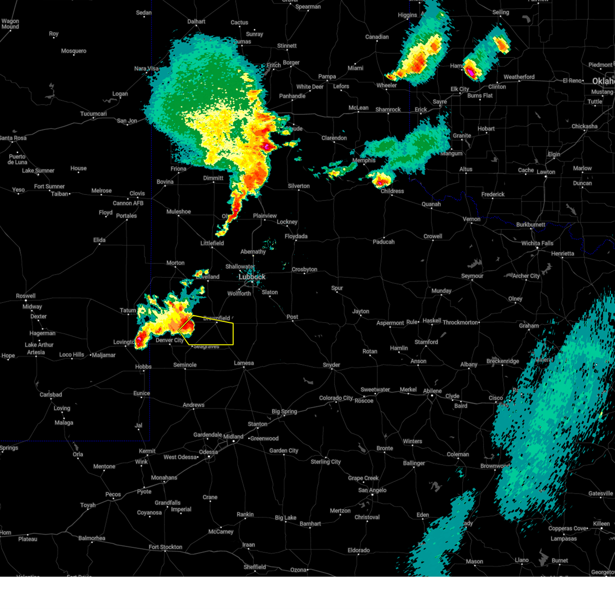
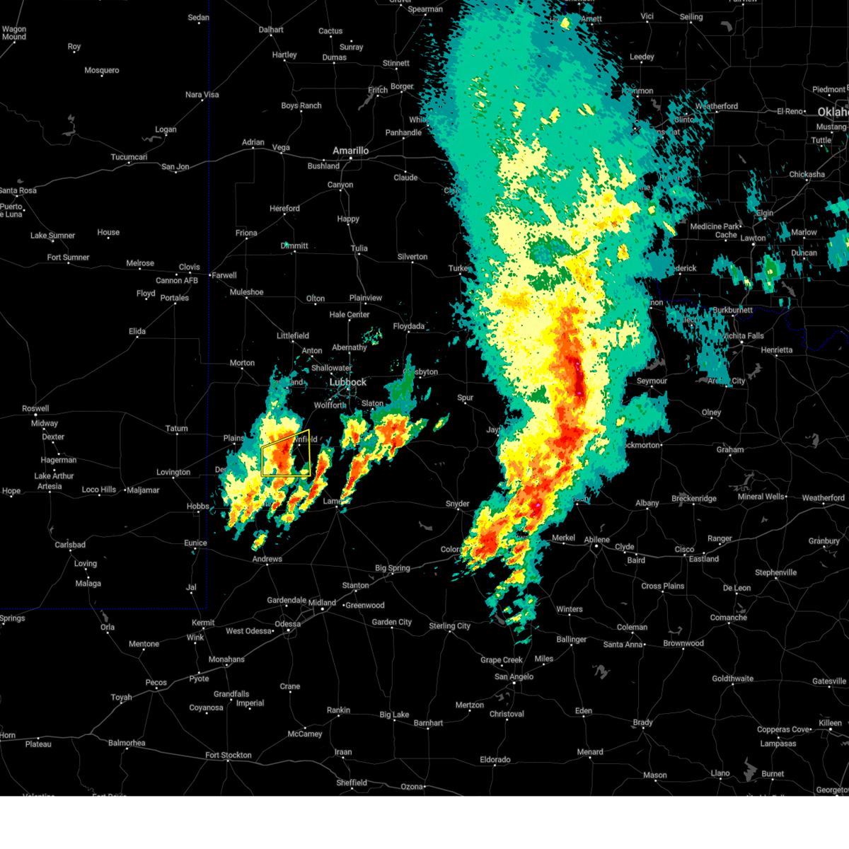
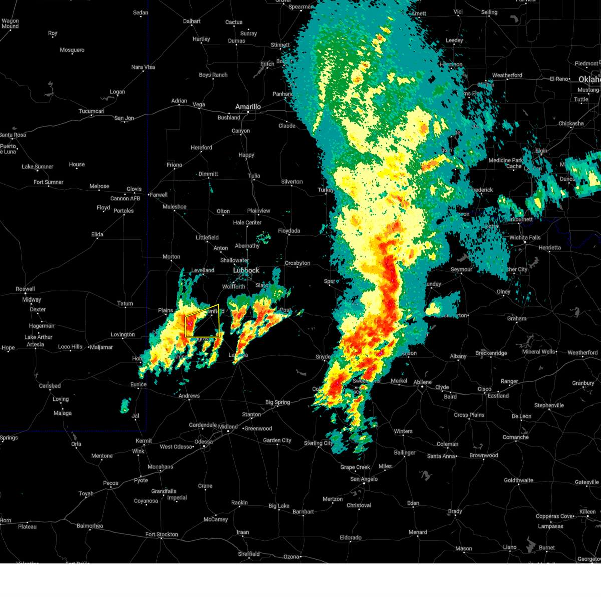
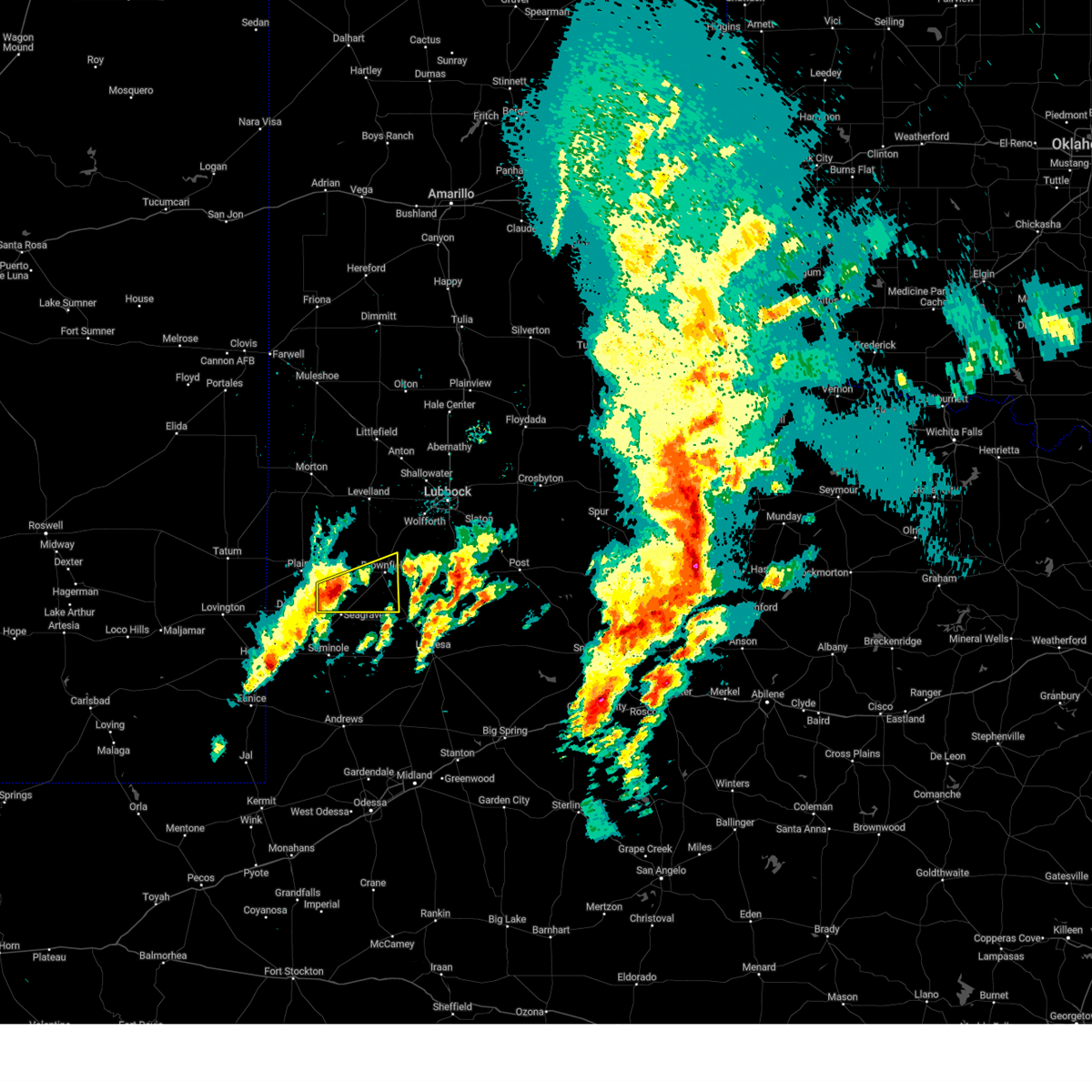
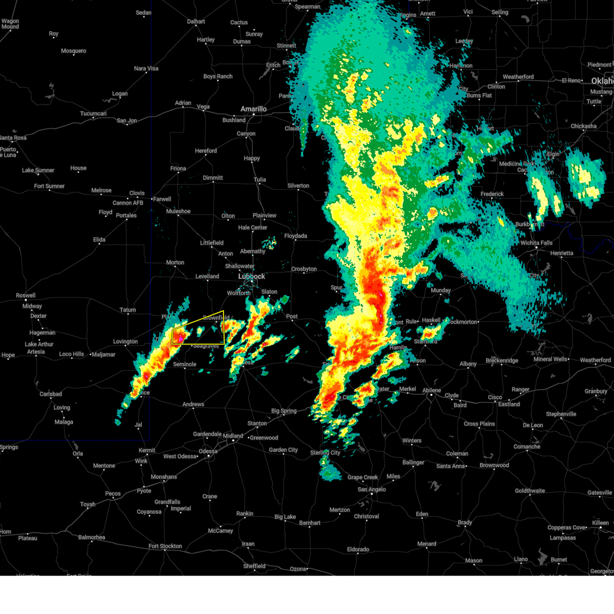
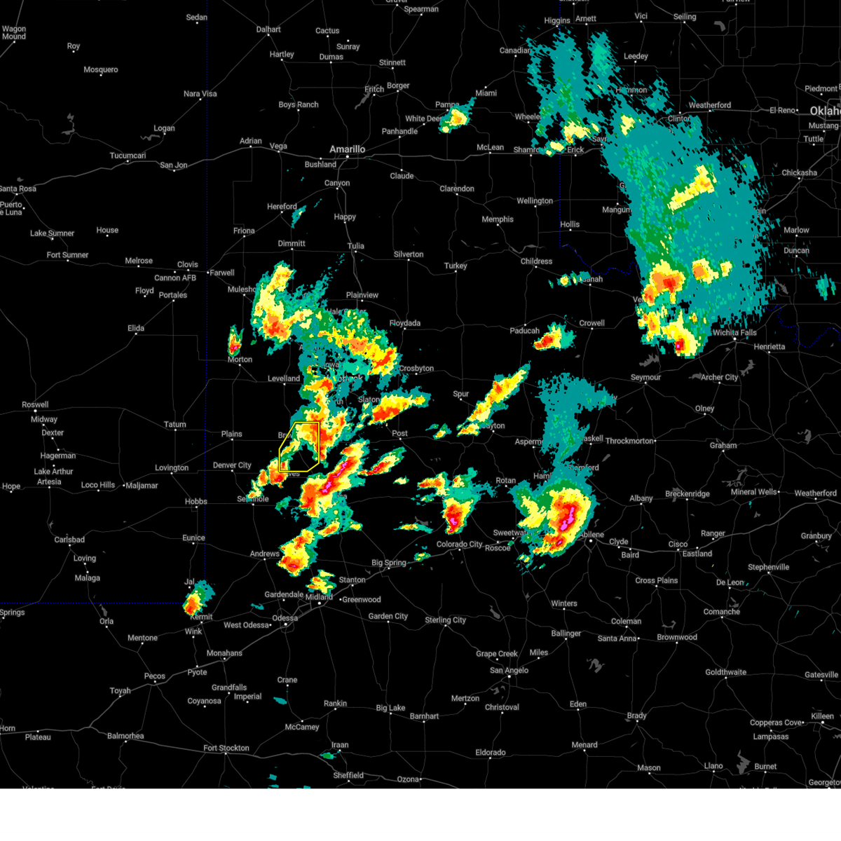
Hail Map for Brownfield, TX
The Brownfield, TX area has had 20 reports of on-the-ground hail by trained spotters, and has been under severe weather warnings 38 times during the past 12 months. Doppler radar has detected hail at or near Brownfield, TX on 85 occasions, including 7 occasions during the past year.
| Name: | Brownfield, TX |
| Where Located: | 37.6 miles SW of Lubbock, TX |
| Map: | Google Map for Brownfield, TX |
| Population: | 9657 |
| Housing Units: | 3571 |
| More Info: | Search Google for Brownfield, TX |
5
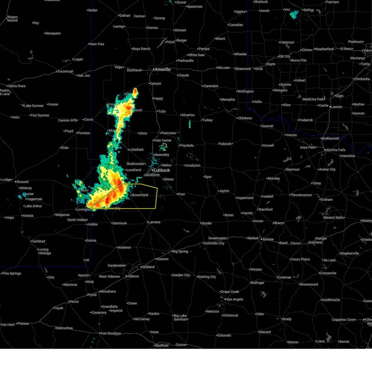
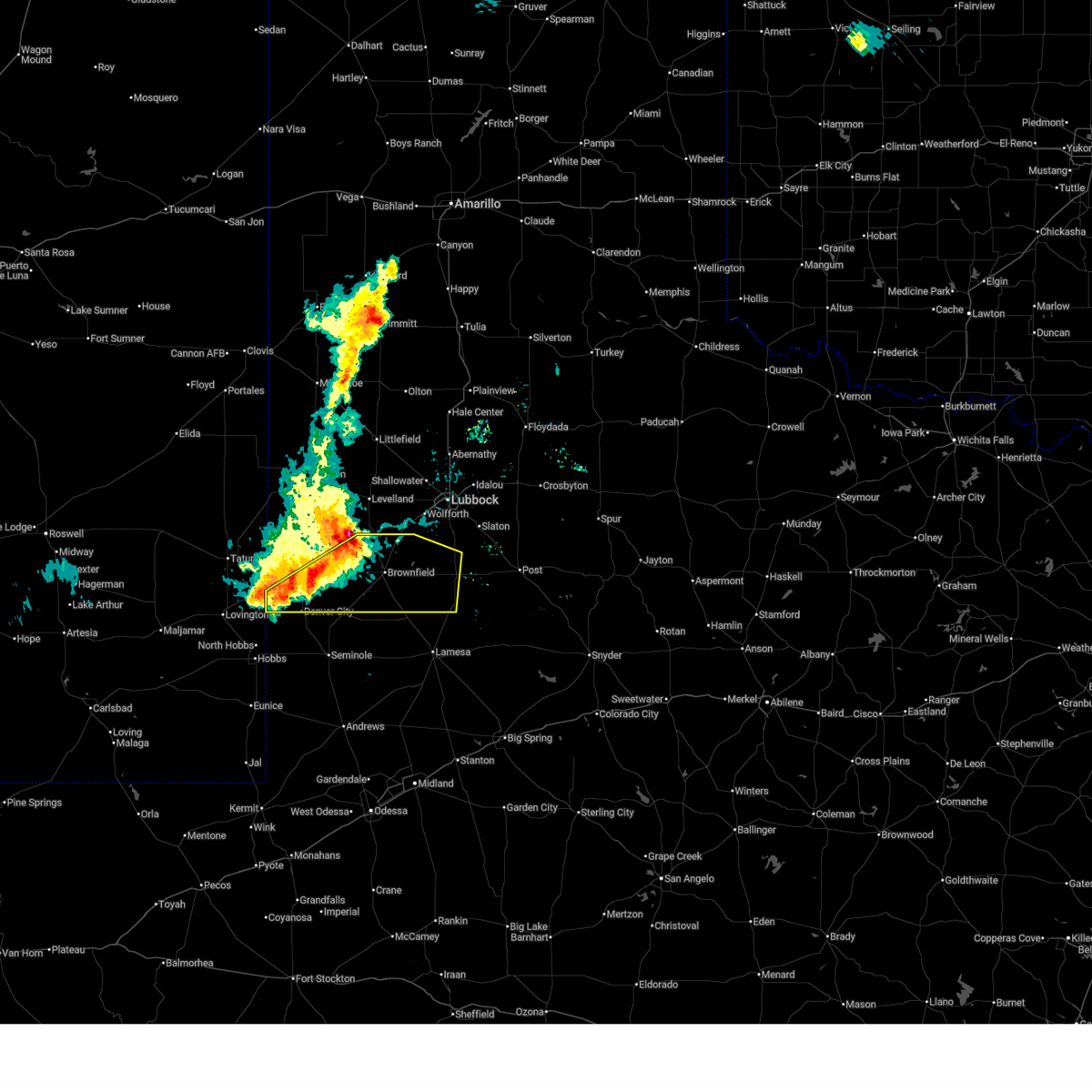
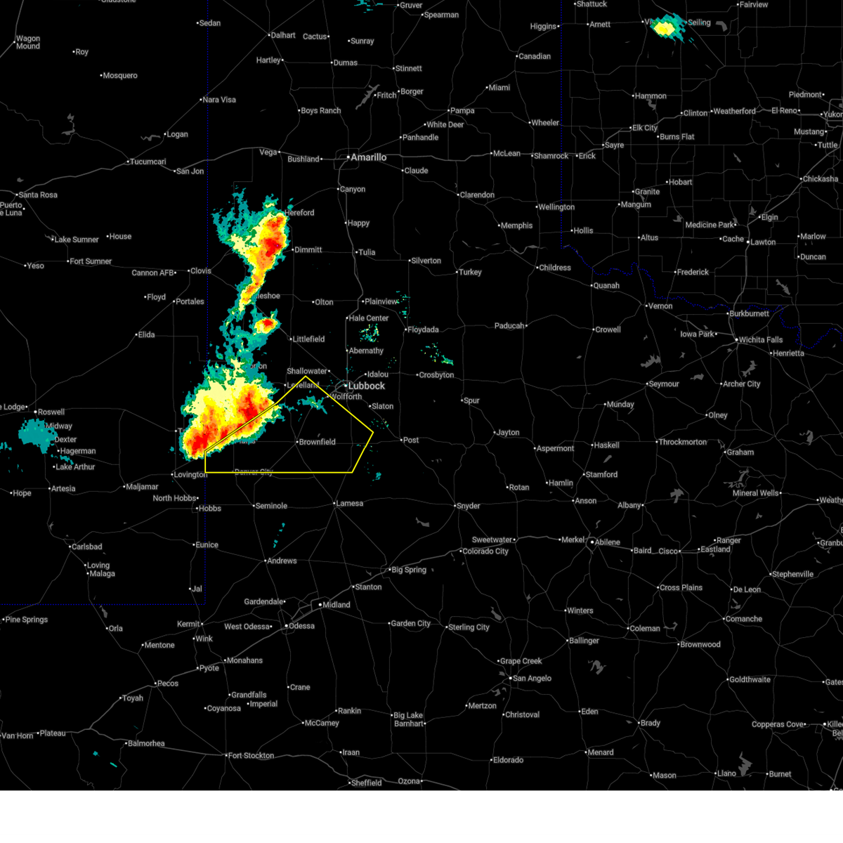
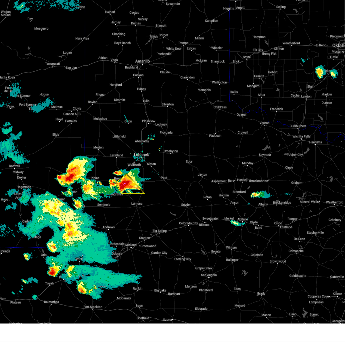
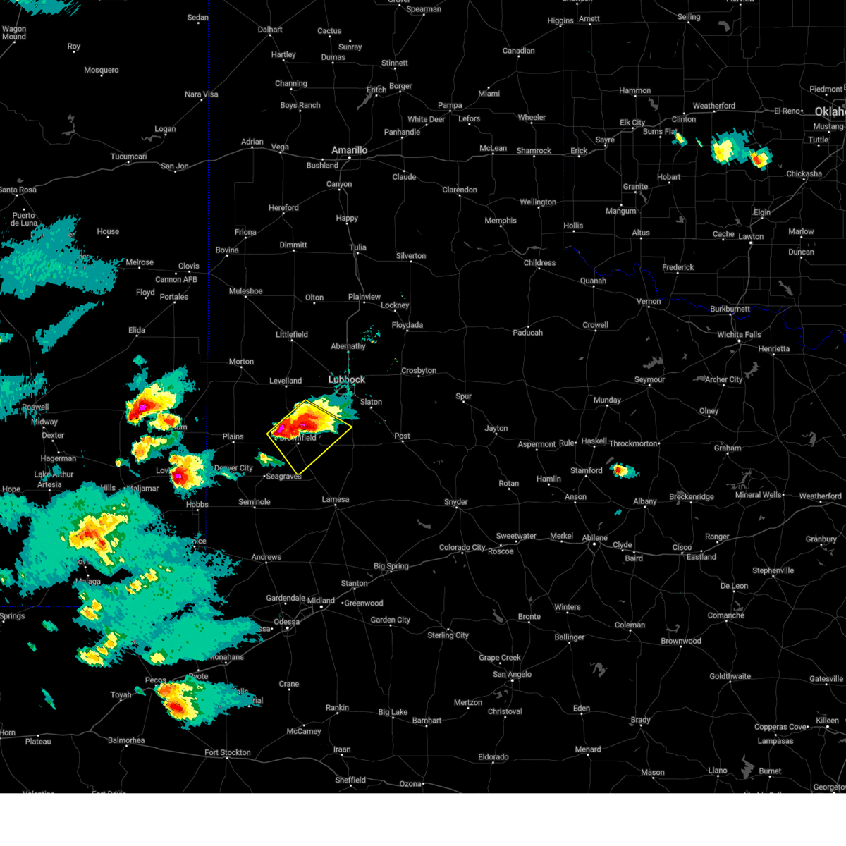
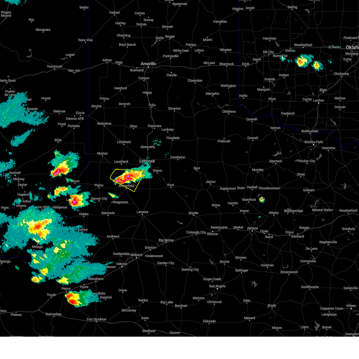
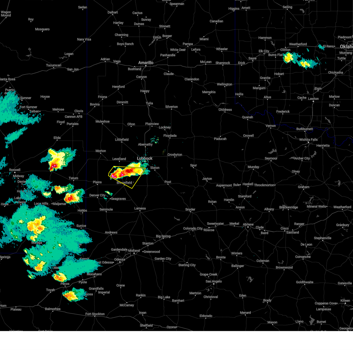
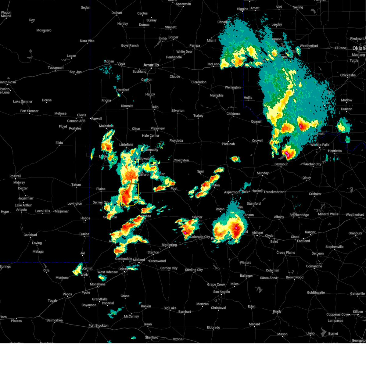
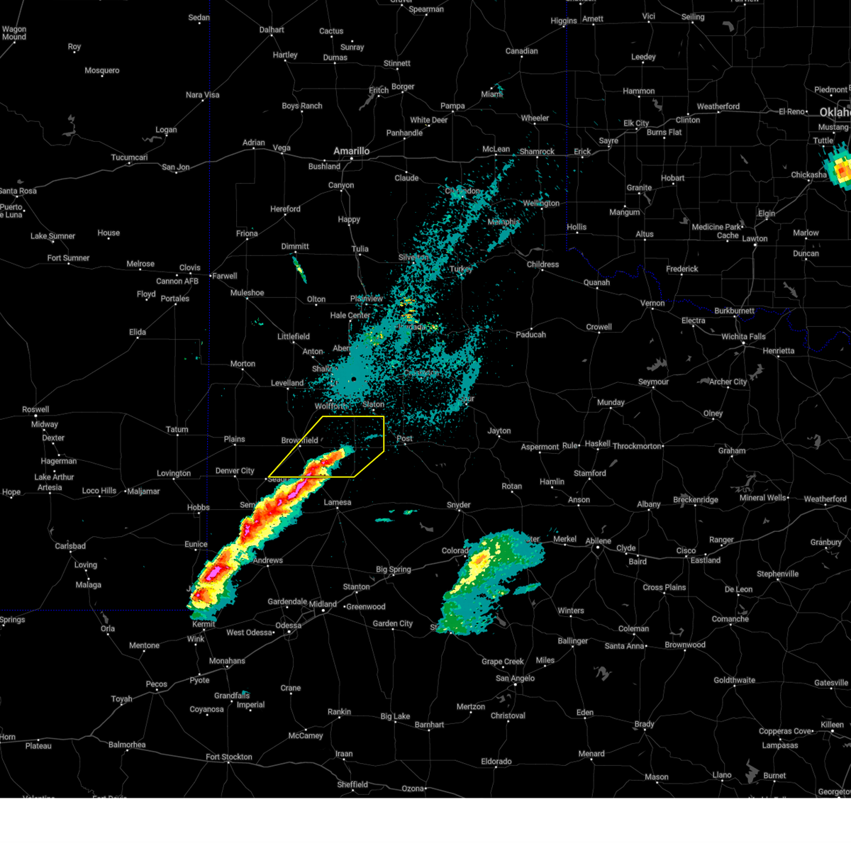
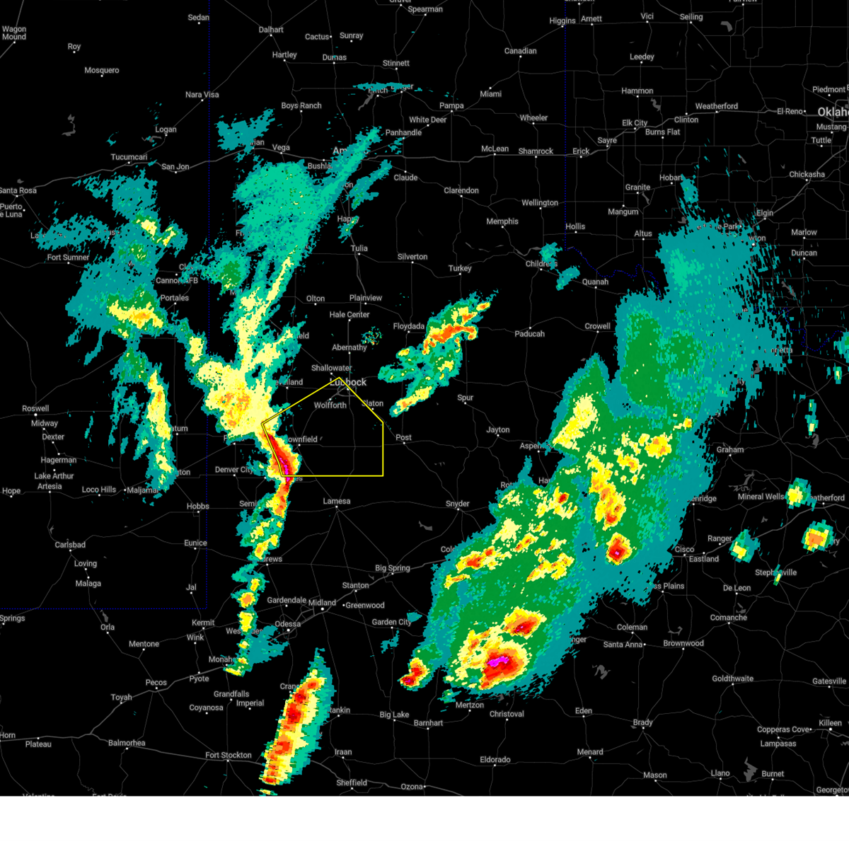
The Top Recent Hail Date for Brownfield, TX is Thursday, May 29, 2025 (2nd out of 85)
Hail and Wind Damage Spotted near Brownfield, TX
| Date / Time | Report Details |
|---|---|
| 6/13/2025 10:06 PM CDT |
 At 1005 pm cdt, severe thunderstorms were located along a line extending from 11 miles southwest of slide to 7 miles southeast of denver city, moving southeast at 40 mph (radar indicated). Hazards include 70 mph wind gusts. Expect considerable tree damage. damage is likely to mobile homes, roofs, and outbuildings. Locations impacted include, brownfield, denver city, tahoka, o'donnell, new moore, tokio, meadow, new home, and wellman. At 1005 pm cdt, severe thunderstorms were located along a line extending from 11 miles southwest of slide to 7 miles southeast of denver city, moving southeast at 40 mph (radar indicated). Hazards include 70 mph wind gusts. Expect considerable tree damage. damage is likely to mobile homes, roofs, and outbuildings. Locations impacted include, brownfield, denver city, tahoka, o'donnell, new moore, tokio, meadow, new home, and wellman.
|
| 6/13/2025 10:06 PM CDT |
 the severe thunderstorm warning has been cancelled and is no longer in effect the severe thunderstorm warning has been cancelled and is no longer in effect
|
| 6/13/2025 9:52 PM CDT |
 the severe thunderstorm warning has been cancelled and is no longer in effect the severe thunderstorm warning has been cancelled and is no longer in effect
|
| 6/13/2025 9:52 PM CDT |
 At 951 pm cdt, severe thunderstorms were located along a line extending from 11 miles southwest of slide to denver city, moving southeast at 35 mph (radar indicated). Hazards include 70 mph wind gusts. Expect considerable tree damage. damage is likely to mobile homes, roofs, and outbuildings. Locations impacted include, brownfield, denver city, tahoka, plains, o'donnell, locketville, new moore, tokio, meadow, new home, and wellman. At 951 pm cdt, severe thunderstorms were located along a line extending from 11 miles southwest of slide to denver city, moving southeast at 35 mph (radar indicated). Hazards include 70 mph wind gusts. Expect considerable tree damage. damage is likely to mobile homes, roofs, and outbuildings. Locations impacted include, brownfield, denver city, tahoka, plains, o'donnell, locketville, new moore, tokio, meadow, new home, and wellman.
|
| 6/13/2025 9:35 PM CDT |
 At 935 pm cdt, severe thunderstorms were located along a line extending from 7 miles southwest of reese center to 4 miles south of locketville to 8 miles west of denver city, moving southeast at 40 mph (radar indicated). Hazards include 70 mph wind gusts. Expect considerable tree damage. damage is likely to mobile homes, roofs, and outbuildings. Locations impacted include, lubbock, brownfield, denver city, tahoka, plains, wolfforth, o'donnell, new moore, tokio, locketville, slide, meadow, wilson, smyer, ropesville, new home, and wellman. At 935 pm cdt, severe thunderstorms were located along a line extending from 7 miles southwest of reese center to 4 miles south of locketville to 8 miles west of denver city, moving southeast at 40 mph (radar indicated). Hazards include 70 mph wind gusts. Expect considerable tree damage. damage is likely to mobile homes, roofs, and outbuildings. Locations impacted include, lubbock, brownfield, denver city, tahoka, plains, wolfforth, o'donnell, new moore, tokio, locketville, slide, meadow, wilson, smyer, ropesville, new home, and wellman.
|
| 6/13/2025 9:15 PM CDT |
 Svrlub the national weather service in lubbock texas has issued a * severe thunderstorm warning for, southwestern lubbock county in northwestern texas, lynn county in northwestern texas, terry county in northwestern texas, southeastern hockley county in northwestern texas, yoakum county in northwestern texas, * until 1015 pm cdt. * at 915 pm cdt, severe thunderstorms were located along a line extending from 6 miles southeast of whitharral to 5 miles southeast of sundown to 15 miles southeast of mcdonald, moving southeast at 40 mph (radar indicated). Hazards include 70 mph wind gusts. Expect considerable tree damage. Damage is likely to mobile homes, roofs, and outbuildings. Svrlub the national weather service in lubbock texas has issued a * severe thunderstorm warning for, southwestern lubbock county in northwestern texas, lynn county in northwestern texas, terry county in northwestern texas, southeastern hockley county in northwestern texas, yoakum county in northwestern texas, * until 1015 pm cdt. * at 915 pm cdt, severe thunderstorms were located along a line extending from 6 miles southeast of whitharral to 5 miles southeast of sundown to 15 miles southeast of mcdonald, moving southeast at 40 mph (radar indicated). Hazards include 70 mph wind gusts. Expect considerable tree damage. Damage is likely to mobile homes, roofs, and outbuildings.
|
| 6/10/2025 12:13 AM CDT | Quarter sized hail reported 17.2 miles E of Brownfield, TX, delayed report from media viewer. hail at least one inch. time and size estimated. |
| 5/29/2025 5:42 PM CDT |
 Svrlub the national weather service in lubbock texas has issued a * severe thunderstorm warning for, southwestern lynn county in northwestern texas, southeastern terry county in northwestern texas, * until 615 pm cdt. * at 542 pm cdt, a severe thunderstorm was located 7 miles southeast of brownfield, moving southeast at 20 mph (radar indicated). Hazards include golf ball size hail and 60 mph wind gusts. People and animals outdoors will be injured. expect hail damage to roofs, siding, windows, and vehicles. Expect wind damage to roofs, siding, and trees. Svrlub the national weather service in lubbock texas has issued a * severe thunderstorm warning for, southwestern lynn county in northwestern texas, southeastern terry county in northwestern texas, * until 615 pm cdt. * at 542 pm cdt, a severe thunderstorm was located 7 miles southeast of brownfield, moving southeast at 20 mph (radar indicated). Hazards include golf ball size hail and 60 mph wind gusts. People and animals outdoors will be injured. expect hail damage to roofs, siding, windows, and vehicles. Expect wind damage to roofs, siding, and trees.
|
| 5/29/2025 5:38 PM CDT | Golf Ball sized hail reported 7.6 miles NNW of Brownfield, TX, report from mping: golf ball (1.75 in.). |
| 5/29/2025 5:37 PM CDT |
 At 537 pm cdt, a severe thunderstorm was located 6 miles southeast of brownfield, moving southeast at 20 mph (radar indicated). Hazards include golf ball size hail and 60 mph wind gusts. People and animals outdoors will be injured. expect hail damage to roofs, siding, windows, and vehicles. expect wind damage to roofs, siding, and trees. Locations impacted include, brownfield. At 537 pm cdt, a severe thunderstorm was located 6 miles southeast of brownfield, moving southeast at 20 mph (radar indicated). Hazards include golf ball size hail and 60 mph wind gusts. People and animals outdoors will be injured. expect hail damage to roofs, siding, windows, and vehicles. expect wind damage to roofs, siding, and trees. Locations impacted include, brownfield.
|
| 5/29/2025 5:27 PM CDT |
 At 527 pm cdt, a severe thunderstorm was located near brownfield, moving southeast at 20 mph (radar indicated). Hazards include golf ball size hail and 60 mph wind gusts. People and animals outdoors will be injured. expect hail damage to roofs, siding, windows, and vehicles. expect wind damage to roofs, siding, and trees. Locations impacted include, brownfield and meadow. At 527 pm cdt, a severe thunderstorm was located near brownfield, moving southeast at 20 mph (radar indicated). Hazards include golf ball size hail and 60 mph wind gusts. People and animals outdoors will be injured. expect hail damage to roofs, siding, windows, and vehicles. expect wind damage to roofs, siding, and trees. Locations impacted include, brownfield and meadow.
|
| 5/29/2025 5:27 PM CDT |
 the severe thunderstorm warning has been cancelled and is no longer in effect the severe thunderstorm warning has been cancelled and is no longer in effect
|
| 5/29/2025 5:14 PM CDT |
 the severe thunderstorm warning has been cancelled and is no longer in effect the severe thunderstorm warning has been cancelled and is no longer in effect
|
| 5/29/2025 5:14 PM CDT |
 At 514 pm cdt, a severe thunderstorm was located near brownfield, moving southeast at 20 mph. this is a destructive storm for brownfield (radar indicated). Hazards include three inch hail and 60 mph wind gusts. People and animals outdoors will be severely injured. expect shattered windows, extensive damage to roofs, siding, and vehicles. Locations impacted include, brownfield, meadow, and new home. At 514 pm cdt, a severe thunderstorm was located near brownfield, moving southeast at 20 mph. this is a destructive storm for brownfield (radar indicated). Hazards include three inch hail and 60 mph wind gusts. People and animals outdoors will be severely injured. expect shattered windows, extensive damage to roofs, siding, and vehicles. Locations impacted include, brownfield, meadow, and new home.
|
| 5/29/2025 5:10 PM CDT | Ping Pong Ball sized hail reported 0.4 miles SSW of Brownfield, TX, picture of half dollar to ping pong ball sized hail in brownfield. relayed by media. exact location is estimated. |
| 5/29/2025 5:02 PM CDT | Tea Cup sized hail reported 6.6 miles S of Brownfield, TX, report from mping: baseball++ (3.50 in.). |
| 5/29/2025 4:58 PM CDT |
 Svrlub the national weather service in lubbock texas has issued a * severe thunderstorm warning for, southwestern lubbock county in northwestern texas, northwestern lynn county in northwestern texas, terry county in northwestern texas, southeastern hockley county in northwestern texas, * until 545 pm cdt. * at 457 pm cdt, a severe thunderstorm was located 7 miles north of brownfield, moving southeast at 20 mph. this is a destructive storm for brownfield and meadow (radar indicated). Hazards include three inch hail and 60 mph wind gusts. People and animals outdoors will be severely injured. Expect shattered windows, extensive damage to roofs, siding, and vehicles. Svrlub the national weather service in lubbock texas has issued a * severe thunderstorm warning for, southwestern lubbock county in northwestern texas, northwestern lynn county in northwestern texas, terry county in northwestern texas, southeastern hockley county in northwestern texas, * until 545 pm cdt. * at 457 pm cdt, a severe thunderstorm was located 7 miles north of brownfield, moving southeast at 20 mph. this is a destructive storm for brownfield and meadow (radar indicated). Hazards include three inch hail and 60 mph wind gusts. People and animals outdoors will be severely injured. Expect shattered windows, extensive damage to roofs, siding, and vehicles.
|
| 5/29/2025 4:54 PM CDT | Tea Cup sized hail reported 6.6 miles S of Brownfield, TX, report from mping: baseball+ (3.25 in.). |
| 5/29/2025 4:52 PM CDT |
 At 451 pm cdt, a severe thunderstorm was located 8 miles southeast of locketville, or 9 miles north of brownfield, moving southeast at 20 mph (radar indicated). Hazards include two inch hail and 60 mph wind gusts. People and animals outdoors will be injured. expect hail damage to roofs, siding, windows, and vehicles. expect wind damage to roofs, siding, and trees. Locations impacted include, brownfield, sundown, locketville, meadow, and ropesville. At 451 pm cdt, a severe thunderstorm was located 8 miles southeast of locketville, or 9 miles north of brownfield, moving southeast at 20 mph (radar indicated). Hazards include two inch hail and 60 mph wind gusts. People and animals outdoors will be injured. expect hail damage to roofs, siding, windows, and vehicles. expect wind damage to roofs, siding, and trees. Locations impacted include, brownfield, sundown, locketville, meadow, and ropesville.
|
| 5/29/2025 4:37 PM CDT |
 the severe thunderstorm warning has been cancelled and is no longer in effect the severe thunderstorm warning has been cancelled and is no longer in effect
|
| 5/29/2025 4:37 PM CDT |
 At 436 pm cdt, a severe thunderstorm was located near locketville, or 11 miles north of brownfield, moving east at 20 mph (radar indicated). Hazards include two inch hail and 60 mph wind gusts. People and animals outdoors will be injured. expect hail damage to roofs, siding, windows, and vehicles. expect wind damage to roofs, siding, and trees. Locations impacted include, brownfield, sundown, locketville, slide, meadow, and ropesville. At 436 pm cdt, a severe thunderstorm was located near locketville, or 11 miles north of brownfield, moving east at 20 mph (radar indicated). Hazards include two inch hail and 60 mph wind gusts. People and animals outdoors will be injured. expect hail damage to roofs, siding, windows, and vehicles. expect wind damage to roofs, siding, and trees. Locations impacted include, brownfield, sundown, locketville, slide, meadow, and ropesville.
|
| 5/29/2025 4:20 PM CDT |
 Svrlub the national weather service in lubbock texas has issued a * severe thunderstorm warning for, southwestern lubbock county in northwestern texas, northwestern lynn county in northwestern texas, northern terry county in northwestern texas, southern hockley county in northwestern texas, northeastern yoakum county in northwestern texas, * until 500 pm cdt. * at 418 pm cdt, a severe thunderstorm was located near locketville, or 14 miles south of levelland, moving southeast at 20 mph (radar indicated). Hazards include two inch hail and 60 mph wind gusts. People and animals outdoors will be injured. expect hail damage to roofs, siding, windows, and vehicles. Expect wind damage to roofs, siding, and trees. Svrlub the national weather service in lubbock texas has issued a * severe thunderstorm warning for, southwestern lubbock county in northwestern texas, northwestern lynn county in northwestern texas, northern terry county in northwestern texas, southern hockley county in northwestern texas, northeastern yoakum county in northwestern texas, * until 500 pm cdt. * at 418 pm cdt, a severe thunderstorm was located near locketville, or 14 miles south of levelland, moving southeast at 20 mph (radar indicated). Hazards include two inch hail and 60 mph wind gusts. People and animals outdoors will be injured. expect hail damage to roofs, siding, windows, and vehicles. Expect wind damage to roofs, siding, and trees.
|
| 5/26/2025 10:41 PM CDT |
 The storm which prompted the warning has weakened below severe limits, and has exited the warned area. therefore, the warning will be allowed to expire. however, small hail, gusty winds and heavy rain are still possible with this thunderstorm. a severe thunderstorm watch remains in effect until midnight cdt for northwestern texas. to report severe weather, contact your nearest law enforcement agency. they will relay your report to the national weather service lubbock texas. The storm which prompted the warning has weakened below severe limits, and has exited the warned area. therefore, the warning will be allowed to expire. however, small hail, gusty winds and heavy rain are still possible with this thunderstorm. a severe thunderstorm watch remains in effect until midnight cdt for northwestern texas. to report severe weather, contact your nearest law enforcement agency. they will relay your report to the national weather service lubbock texas.
|
| 5/26/2025 10:39 PM CDT |
 At 1039 pm cdt, a severe thunderstorm was located over welch, or 17 miles northwest of lamesa, moving southeast at 30 mph (radar indicated). Hazards include ping pong ball size hail and 60 mph wind gusts. People and animals outdoors will be injured. expect hail damage to roofs, siding, windows, and vehicles. expect wind damage to roofs, siding, and trees. Locations impacted include, brownfield. At 1039 pm cdt, a severe thunderstorm was located over welch, or 17 miles northwest of lamesa, moving southeast at 30 mph (radar indicated). Hazards include ping pong ball size hail and 60 mph wind gusts. People and animals outdoors will be injured. expect hail damage to roofs, siding, windows, and vehicles. expect wind damage to roofs, siding, and trees. Locations impacted include, brownfield.
|
| 5/26/2025 10:31 PM CDT |
 At 1031 pm cdt, a severe thunderstorm was located near welch, or 15 miles southeast of brownfield, moving southeast at 30 mph (radar indicated). Hazards include ping pong ball size hail and 60 mph wind gusts. People and animals outdoors will be injured. expect hail damage to roofs, siding, windows, and vehicles. expect wind damage to roofs, siding, and trees. Locations impacted include, brownfield. At 1031 pm cdt, a severe thunderstorm was located near welch, or 15 miles southeast of brownfield, moving southeast at 30 mph (radar indicated). Hazards include ping pong ball size hail and 60 mph wind gusts. People and animals outdoors will be injured. expect hail damage to roofs, siding, windows, and vehicles. expect wind damage to roofs, siding, and trees. Locations impacted include, brownfield.
|
| 5/26/2025 10:25 PM CDT | Half Dollar sized hail reported 6.8 miles NNW of Brownfield, TX |
| 5/26/2025 10:25 PM CDT |
 At 1025 pm cdt, a severe thunderstorm was located 7 miles northwest of welch, or 12 miles south of brownfield, moving southeast at 30 mph (radar indicated). Hazards include ping pong ball size hail and 60 mph wind gusts. People and animals outdoors will be injured. expect hail damage to roofs, siding, windows, and vehicles. expect wind damage to roofs, siding, and trees. Locations impacted include, brownfield. At 1025 pm cdt, a severe thunderstorm was located 7 miles northwest of welch, or 12 miles south of brownfield, moving southeast at 30 mph (radar indicated). Hazards include ping pong ball size hail and 60 mph wind gusts. People and animals outdoors will be injured. expect hail damage to roofs, siding, windows, and vehicles. expect wind damage to roofs, siding, and trees. Locations impacted include, brownfield.
|
| 5/26/2025 10:15 PM CDT | Golf Ball sized hail reported 5.8 miles NE of Brownfield, TX |
| 5/26/2025 10:15 PM CDT |
 At 1014 pm cdt, a severe thunderstorm was located 10 miles south of brownfield, moving southeast at 35 mph (radar indicated). Hazards include golf ball size hail and 60 mph wind gusts. People and animals outdoors will be injured. expect hail damage to roofs, siding, windows, and vehicles. expect wind damage to roofs, siding, and trees. Locations impacted include, brownfield and wellman. At 1014 pm cdt, a severe thunderstorm was located 10 miles south of brownfield, moving southeast at 35 mph (radar indicated). Hazards include golf ball size hail and 60 mph wind gusts. People and animals outdoors will be injured. expect hail damage to roofs, siding, windows, and vehicles. expect wind damage to roofs, siding, and trees. Locations impacted include, brownfield and wellman.
|
| 5/26/2025 10:10 PM CDT |
 At 1010 pm cdt, a severe thunderstorm was located 10 miles southwest of brownfield, moving southeast at 35 mph (radar indicated). Hazards include ping pong ball size hail and 60 mph wind gusts. People and animals outdoors will be injured. expect hail damage to roofs, siding, windows, and vehicles. expect wind damage to roofs, siding, and trees. Locations impacted include, brownfield and wellman. At 1010 pm cdt, a severe thunderstorm was located 10 miles southwest of brownfield, moving southeast at 35 mph (radar indicated). Hazards include ping pong ball size hail and 60 mph wind gusts. People and animals outdoors will be injured. expect hail damage to roofs, siding, windows, and vehicles. expect wind damage to roofs, siding, and trees. Locations impacted include, brownfield and wellman.
|
| 5/26/2025 10:04 PM CDT |
 At 1003 pm cdt, a severe thunderstorm was located 5 miles southeast of tokio, or 13 miles west of brownfield, moving southeast at 30 mph (radar indicated). Hazards include ping pong ball size hail and 60 mph wind gusts. People and animals outdoors will be injured. expect hail damage to roofs, siding, windows, and vehicles. expect wind damage to roofs, siding, and trees. Locations impacted include, brownfield, tokio, and wellman. At 1003 pm cdt, a severe thunderstorm was located 5 miles southeast of tokio, or 13 miles west of brownfield, moving southeast at 30 mph (radar indicated). Hazards include ping pong ball size hail and 60 mph wind gusts. People and animals outdoors will be injured. expect hail damage to roofs, siding, windows, and vehicles. expect wind damage to roofs, siding, and trees. Locations impacted include, brownfield, tokio, and wellman.
|
| 5/26/2025 10:00 PM CDT |
 At 1000 pm cdt, a severe thunderstorm was located 5 miles southeast of tokio, or 12 miles north of seagraves, moving southeast at 30 mph (radar indicated). Hazards include 60 mph wind gusts and quarter size hail. Hail damage to vehicles is expected. expect wind damage to roofs, siding, and trees. Locations impacted include, brownfield, tokio, and wellman. At 1000 pm cdt, a severe thunderstorm was located 5 miles southeast of tokio, or 12 miles north of seagraves, moving southeast at 30 mph (radar indicated). Hazards include 60 mph wind gusts and quarter size hail. Hail damage to vehicles is expected. expect wind damage to roofs, siding, and trees. Locations impacted include, brownfield, tokio, and wellman.
|
| 5/26/2025 10:00 PM CDT |
 the severe thunderstorm warning has been cancelled and is no longer in effect the severe thunderstorm warning has been cancelled and is no longer in effect
|
| 5/26/2025 9:52 PM CDT |
 Svrlub the national weather service in lubbock texas has issued a * severe thunderstorm warning for, southern terry county in northwestern texas, southeastern yoakum county in northwestern texas, * until 1045 pm cdt. * at 951 pm cdt, a severe thunderstorm was located over tokio, or 13 miles east of plains, moving southeast at 30 mph (radar indicated). Hazards include 60 mph wind gusts and quarter size hail. Hail damage to vehicles is expected. Expect wind damage to roofs, siding, and trees. Svrlub the national weather service in lubbock texas has issued a * severe thunderstorm warning for, southern terry county in northwestern texas, southeastern yoakum county in northwestern texas, * until 1045 pm cdt. * at 951 pm cdt, a severe thunderstorm was located over tokio, or 13 miles east of plains, moving southeast at 30 mph (radar indicated). Hazards include 60 mph wind gusts and quarter size hail. Hail damage to vehicles is expected. Expect wind damage to roofs, siding, and trees.
|
| 4/30/2025 4:05 AM CDT |
 the severe thunderstorm warning has been cancelled and is no longer in effect the severe thunderstorm warning has been cancelled and is no longer in effect
|
| 4/30/2025 3:50 AM CDT |
 At 350 am cdt, a severe thunderstorm was located 7 miles southeast of tokio, or 11 miles north of seagraves, moving east at 25 mph (radar indicated). Hazards include 60 mph wind gusts and quarter size hail. Hail damage to vehicles is expected. expect wind damage to roofs, siding, and trees. Locations impacted include, wellman and brownfield. At 350 am cdt, a severe thunderstorm was located 7 miles southeast of tokio, or 11 miles north of seagraves, moving east at 25 mph (radar indicated). Hazards include 60 mph wind gusts and quarter size hail. Hail damage to vehicles is expected. expect wind damage to roofs, siding, and trees. Locations impacted include, wellman and brownfield.
|
| 4/30/2025 3:50 AM CDT |
 the severe thunderstorm warning has been cancelled and is no longer in effect the severe thunderstorm warning has been cancelled and is no longer in effect
|
| 4/30/2025 3:43 AM CDT |
 At 343 am cdt, a severe thunderstorm was located 6 miles south of tokio, or 9 miles north of seagraves, moving east at 30 mph (radar indicated). Hazards include 60 mph wind gusts and quarter size hail. Hail damage to vehicles is expected. expect wind damage to roofs, siding, and trees. Locations impacted include, wellman and brownfield. At 343 am cdt, a severe thunderstorm was located 6 miles south of tokio, or 9 miles north of seagraves, moving east at 30 mph (radar indicated). Hazards include 60 mph wind gusts and quarter size hail. Hail damage to vehicles is expected. expect wind damage to roofs, siding, and trees. Locations impacted include, wellman and brownfield.
|
| 4/30/2025 3:31 AM CDT |
 Svrlub the national weather service in lubbock texas has issued a * severe thunderstorm warning for, southern terry county in northwestern texas, southeastern yoakum county in northwestern texas, * until 430 am cdt. * at 331 am cdt, a severe thunderstorm was located 7 miles northwest of seagraves, moving east at 25 mph (radar indicated). Hazards include ping pong ball size hail and 60 mph wind gusts. People and animals outdoors will be injured. expect hail damage to roofs, siding, windows, and vehicles. Expect wind damage to roofs, siding, and trees. Svrlub the national weather service in lubbock texas has issued a * severe thunderstorm warning for, southern terry county in northwestern texas, southeastern yoakum county in northwestern texas, * until 430 am cdt. * at 331 am cdt, a severe thunderstorm was located 7 miles northwest of seagraves, moving east at 25 mph (radar indicated). Hazards include ping pong ball size hail and 60 mph wind gusts. People and animals outdoors will be injured. expect hail damage to roofs, siding, windows, and vehicles. Expect wind damage to roofs, siding, and trees.
|
| 4/30/2025 1:07 AM CDT |
 The storm which prompted the warning has weakened below severe limits and has exited the warned area. therefore, the warning will be allowed to expire. however, small hail and heavy rain are still likely with this thunderstorm. a severe thunderstorm watch remains in effect until 600 am cdt for northwestern texas. The storm which prompted the warning has weakened below severe limits and has exited the warned area. therefore, the warning will be allowed to expire. however, small hail and heavy rain are still likely with this thunderstorm. a severe thunderstorm watch remains in effect until 600 am cdt for northwestern texas.
|
| 4/30/2025 12:39 AM CDT |
 At 1238 am cdt, a severe thunderstorm was located 10 miles southwest of brownfield, moving northeast at 35 mph (radar indicated). Hazards include 60 mph wind gusts and quarter size hail. Hail damage to vehicles is expected. expect wind damage to roofs, siding, and trees. Locations impacted include, brownfield. At 1238 am cdt, a severe thunderstorm was located 10 miles southwest of brownfield, moving northeast at 35 mph (radar indicated). Hazards include 60 mph wind gusts and quarter size hail. Hail damage to vehicles is expected. expect wind damage to roofs, siding, and trees. Locations impacted include, brownfield.
|
| 4/30/2025 12:23 AM CDT | Svrlub the national weather service in lubbock texas has issued a * severe thunderstorm warning for, terry county in northwestern texas, * until 115 am cdt. * at 1223 am cdt, a severe thunderstorm was located near seagraves airport, or 4 miles northeast of seagraves, moving northeast at 30 mph (radar indicated). Hazards include 60 mph wind gusts and half dollar size hail. Hail damage to vehicles is expected. Expect wind damage to roofs, siding, and trees. |
| 4/28/2025 11:31 PM CDT |
 Svrlub the national weather service in lubbock texas has issued a * severe thunderstorm warning for, lynn county in northwestern texas, southeastern terry county in northwestern texas, southeastern hockley county in northwestern texas, * until 1230 am cdt. * at 1131 pm cdt, a severe thunderstorm was located 4 miles northwest of welch, or 14 miles southeast of brownfield, moving northeast at 40 mph (radar indicated). Hazards include 60 mph wind gusts and quarter size hail. Hail damage to vehicles is expected. Expect wind damage to roofs, siding, and trees. Svrlub the national weather service in lubbock texas has issued a * severe thunderstorm warning for, lynn county in northwestern texas, southeastern terry county in northwestern texas, southeastern hockley county in northwestern texas, * until 1230 am cdt. * at 1131 pm cdt, a severe thunderstorm was located 4 miles northwest of welch, or 14 miles southeast of brownfield, moving northeast at 40 mph (radar indicated). Hazards include 60 mph wind gusts and quarter size hail. Hail damage to vehicles is expected. Expect wind damage to roofs, siding, and trees.
|
| 4/19/2025 9:41 PM CDT | At 941 pm cdt, severe thunderstorms were located along a line extending from 5 miles west of locketville to 4 miles southeast of brownfield to 4 miles northwest of welch, moving east at 50 mph (radar indicated). Hazards include 60 mph wind gusts and quarter size hail. Hail damage to vehicles is expected. expect wind damage to roofs, siding, and trees. Locations impacted include, grassland, meadow, new moore, lubbock south plains mall, wilson, ropesville, wolfforth, brownfield, texas tech university, locketville, tahoka, slide, downtown lubbock, new home, o'donnell, lubbock, woodrow, lubbock science spectrum, and reese center. |
| 4/19/2025 9:30 PM CDT |
 Svrlub the national weather service in lubbock texas has issued a * severe thunderstorm warning for, southwestern lubbock county in northwestern texas, lynn county in northwestern texas, terry county in northwestern texas, southeastern hockley county in northwestern texas, * until 1030 pm cdt. * at 929 pm cdt, severe thunderstorms were located along a line extending from 8 miles north of tokio to 7 miles southwest of brownfield to 11 miles east of seagraves airport, moving east at 50 mph (radar indicated). Hazards include 60 mph wind gusts and quarter size hail. Hail damage to vehicles is expected. Expect wind damage to roofs, siding, and trees. Svrlub the national weather service in lubbock texas has issued a * severe thunderstorm warning for, southwestern lubbock county in northwestern texas, lynn county in northwestern texas, terry county in northwestern texas, southeastern hockley county in northwestern texas, * until 1030 pm cdt. * at 929 pm cdt, severe thunderstorms were located along a line extending from 8 miles north of tokio to 7 miles southwest of brownfield to 11 miles east of seagraves airport, moving east at 50 mph (radar indicated). Hazards include 60 mph wind gusts and quarter size hail. Hail damage to vehicles is expected. Expect wind damage to roofs, siding, and trees.
|
| 6/16/2024 2:45 AM CDT |
 the severe thunderstorm warning has been cancelled and is no longer in effect the severe thunderstorm warning has been cancelled and is no longer in effect
|
| 6/16/2024 2:31 AM CDT |
 the severe thunderstorm warning has been cancelled and is no longer in effect the severe thunderstorm warning has been cancelled and is no longer in effect
|
| 6/16/2024 2:31 AM CDT |
 At 230 am cdt, severe thunderstorms were located along a line extending from 8 miles northeast of brownfield to 7 miles north of seagraves airport, moving east at 25 mph (radar indicated). Hazards include 60 mph wind gusts and quarter size hail. Hail damage to vehicles is expected. expect wind damage to roofs, siding, and trees. Locations impacted include, brownfield and wellman. At 230 am cdt, severe thunderstorms were located along a line extending from 8 miles northeast of brownfield to 7 miles north of seagraves airport, moving east at 25 mph (radar indicated). Hazards include 60 mph wind gusts and quarter size hail. Hail damage to vehicles is expected. expect wind damage to roofs, siding, and trees. Locations impacted include, brownfield and wellman.
|
| 6/16/2024 2:19 AM CDT |
 At 218 am cdt, severe thunderstorms were located along a line extending from 4 miles southeast of locketville to 6 miles southwest of tokio, moving east at 20 mph (radar indicated). Hazards include 60 mph wind gusts and quarter size hail. Hail damage to vehicles is expected. expect wind damage to roofs, siding, and trees. Locations impacted include, brownfield, tokio, meadow, and wellman. At 218 am cdt, severe thunderstorms were located along a line extending from 4 miles southeast of locketville to 6 miles southwest of tokio, moving east at 20 mph (radar indicated). Hazards include 60 mph wind gusts and quarter size hail. Hail damage to vehicles is expected. expect wind damage to roofs, siding, and trees. Locations impacted include, brownfield, tokio, meadow, and wellman.
|
| 6/16/2024 2:01 AM CDT |
 Svrlub the national weather service in lubbock texas has issued a * severe thunderstorm warning for, west central lynn county in northwestern texas, terry county in northwestern texas, east central yoakum county in northwestern texas, * until 300 am cdt. * at 201 am cdt, severe thunderstorms were located along a line extending from 4 miles west of locketville to 4 miles southeast of plains, moving east at 20 mph (radar indicated). Hazards include ping pong ball size hail and 60 mph wind gusts. People and animals outdoors will be injured. expect hail damage to roofs, siding, windows, and vehicles. Expect wind damage to roofs, siding, and trees. Svrlub the national weather service in lubbock texas has issued a * severe thunderstorm warning for, west central lynn county in northwestern texas, terry county in northwestern texas, east central yoakum county in northwestern texas, * until 300 am cdt. * at 201 am cdt, severe thunderstorms were located along a line extending from 4 miles west of locketville to 4 miles southeast of plains, moving east at 20 mph (radar indicated). Hazards include ping pong ball size hail and 60 mph wind gusts. People and animals outdoors will be injured. expect hail damage to roofs, siding, windows, and vehicles. Expect wind damage to roofs, siding, and trees.
|
| 6/15/2024 10:01 PM CDT |
 At 1001 pm cdt, a severe thunderstorm was located 7 miles northeast of brownfield, moving southeast at 15 mph (radar indicated). Hazards include 60 mph wind gusts and half dollar size hail. Hail damage to vehicles is expected. expect wind damage to roofs, siding, and trees. Locations impacted include, brownfield, meadow, and ropesville. At 1001 pm cdt, a severe thunderstorm was located 7 miles northeast of brownfield, moving southeast at 15 mph (radar indicated). Hazards include 60 mph wind gusts and half dollar size hail. Hail damage to vehicles is expected. expect wind damage to roofs, siding, and trees. Locations impacted include, brownfield, meadow, and ropesville.
|
| 6/15/2024 9:43 PM CDT |
 Svrlub the national weather service in lubbock texas has issued a * severe thunderstorm warning for, west central lynn county in northwestern texas, northeastern terry county in northwestern texas, south central hockley county in northwestern texas, * until 1030 pm cdt. * at 943 pm cdt, a severe thunderstorm was located 4 miles south of locketville, or 10 miles north of brownfield, moving southeast at 15 mph (radar indicated). Hazards include ping pong ball size hail and 60 mph wind gusts. People and animals outdoors will be injured. expect hail damage to roofs, siding, windows, and vehicles. Expect wind damage to roofs, siding, and trees. Svrlub the national weather service in lubbock texas has issued a * severe thunderstorm warning for, west central lynn county in northwestern texas, northeastern terry county in northwestern texas, south central hockley county in northwestern texas, * until 1030 pm cdt. * at 943 pm cdt, a severe thunderstorm was located 4 miles south of locketville, or 10 miles north of brownfield, moving southeast at 15 mph (radar indicated). Hazards include ping pong ball size hail and 60 mph wind gusts. People and animals outdoors will be injured. expect hail damage to roofs, siding, windows, and vehicles. Expect wind damage to roofs, siding, and trees.
|
| 6/10/2024 8:26 PM CDT |
 Svrlub the national weather service in lubbock texas has issued a * severe thunderstorm warning for, east central terry county in northwestern texas, * until 900 pm cdt. * at 826 pm cdt, a severe thunderstorm was located over brownfield, moving southeast at 20 mph (radar indicated). Hazards include golf ball size hail and 60 mph wind gusts. People and animals outdoors will be injured. expect hail damage to roofs, siding, windows, and vehicles. Expect wind damage to roofs, siding, and trees. Svrlub the national weather service in lubbock texas has issued a * severe thunderstorm warning for, east central terry county in northwestern texas, * until 900 pm cdt. * at 826 pm cdt, a severe thunderstorm was located over brownfield, moving southeast at 20 mph (radar indicated). Hazards include golf ball size hail and 60 mph wind gusts. People and animals outdoors will be injured. expect hail damage to roofs, siding, windows, and vehicles. Expect wind damage to roofs, siding, and trees.
|
| 6/10/2024 8:22 PM CDT | Ping Pong Ball sized hail reported 0.4 miles SSW of Brownfield, TX, slightly smaller than golf balls. |
| 6/10/2024 8:20 PM CDT | Hen Egg sized hail reported 0.8 miles WNW of Brownfield, TX |
| 6/10/2024 8:19 PM CDT |
 At 818 pm cdt, a severe thunderstorm was located 6 miles northeast of brownfield, moving east at 30 mph (radar indicated). Hazards include golf ball size hail and 60 mph wind gusts. People and animals outdoors will be injured. expect hail damage to roofs, siding, windows, and vehicles. expect wind damage to roofs, siding, and trees. Locations impacted include, brownfield, locketville, and meadow. At 818 pm cdt, a severe thunderstorm was located 6 miles northeast of brownfield, moving east at 30 mph (radar indicated). Hazards include golf ball size hail and 60 mph wind gusts. People and animals outdoors will be injured. expect hail damage to roofs, siding, windows, and vehicles. expect wind damage to roofs, siding, and trees. Locations impacted include, brownfield, locketville, and meadow.
|
| 6/10/2024 8:12 PM CDT |
 At 812 pm cdt, a severe thunderstorm was located 5 miles northeast of brownfield, moving east at 30 mph (radar indicated). Hazards include 60 mph wind gusts and quarter size hail. Hail damage to vehicles is expected. expect wind damage to roofs, siding, and trees. Locations impacted include, brownfield, locketville, and meadow. At 812 pm cdt, a severe thunderstorm was located 5 miles northeast of brownfield, moving east at 30 mph (radar indicated). Hazards include 60 mph wind gusts and quarter size hail. Hail damage to vehicles is expected. expect wind damage to roofs, siding, and trees. Locations impacted include, brownfield, locketville, and meadow.
|
| 6/10/2024 8:04 PM CDT |
 Svrlub the national weather service in lubbock texas has issued a * severe thunderstorm warning for, northeastern terry county in northwestern texas, southeastern hockley county in northwestern texas, * until 830 pm cdt. * at 804 pm cdt, a severe thunderstorm was located 6 miles north of brownfield, moving east at 30 mph (radar indicated). Hazards include golf ball size hail and 60 mph wind gusts. People and animals outdoors will be injured. expect hail damage to roofs, siding, windows, and vehicles. Expect wind damage to roofs, siding, and trees. Svrlub the national weather service in lubbock texas has issued a * severe thunderstorm warning for, northeastern terry county in northwestern texas, southeastern hockley county in northwestern texas, * until 830 pm cdt. * at 804 pm cdt, a severe thunderstorm was located 6 miles north of brownfield, moving east at 30 mph (radar indicated). Hazards include golf ball size hail and 60 mph wind gusts. People and animals outdoors will be injured. expect hail damage to roofs, siding, windows, and vehicles. Expect wind damage to roofs, siding, and trees.
|
| 5/31/2024 11:42 PM CDT |
 The storms which prompted the warning have weakened below severe limits, and no longer pose an immediate threat to life or property. therefore, the warning will be allowed to expire. however, gusty winds and heavy rain are still possible with these thunderstorms. a severe thunderstorm watch remains in effect until 300 am cdt for northwestern texas. The storms which prompted the warning have weakened below severe limits, and no longer pose an immediate threat to life or property. therefore, the warning will be allowed to expire. however, gusty winds and heavy rain are still possible with these thunderstorms. a severe thunderstorm watch remains in effect until 300 am cdt for northwestern texas.
|
| 5/31/2024 11:33 PM CDT |
 At 1133 pm cdt, severe thunderstorms were located along a line extending from 4 miles north of welch to 4 miles east of denver city, moving southeast at 25 mph (radar indicated). Hazards include 70 mph wind gusts and quarter size hail. Hail damage to vehicles is expected. expect considerable tree damage. wind damage is also likely to mobile homes, roofs, and outbuildings. Locations impacted include, brownfield, denver city, plains, tokio, and wellman. At 1133 pm cdt, severe thunderstorms were located along a line extending from 4 miles north of welch to 4 miles east of denver city, moving southeast at 25 mph (radar indicated). Hazards include 70 mph wind gusts and quarter size hail. Hail damage to vehicles is expected. expect considerable tree damage. wind damage is also likely to mobile homes, roofs, and outbuildings. Locations impacted include, brownfield, denver city, plains, tokio, and wellman.
|
| 5/31/2024 11:21 PM CDT |
 At 1120 pm cdt, severe thunderstorms were located along a line extending from 7 miles northwest of welch to 5 miles east of denver city, moving south at 25 mph (west texas mesonet station in brownfield reported a wind gust to 64 mph). Hazards include 70 mph wind gusts and quarter size hail. Hail damage to vehicles is expected. expect considerable tree damage. wind damage is also likely to mobile homes, roofs, and outbuildings. Locations impacted include, brownfield, denver city, plains, tokio, and wellman. At 1120 pm cdt, severe thunderstorms were located along a line extending from 7 miles northwest of welch to 5 miles east of denver city, moving south at 25 mph (west texas mesonet station in brownfield reported a wind gust to 64 mph). Hazards include 70 mph wind gusts and quarter size hail. Hail damage to vehicles is expected. expect considerable tree damage. wind damage is also likely to mobile homes, roofs, and outbuildings. Locations impacted include, brownfield, denver city, plains, tokio, and wellman.
|
| 5/31/2024 11:11 PM CDT | Storm damage reported in terry county TX, 1.7 miles N of Brownfield, TX |
| 5/31/2024 11:04 PM CDT | Storm damage reported in terry county TX, 1.7 miles N of Brownfield, TX |
| 5/31/2024 11:00 PM CDT |
 the severe thunderstorm warning has been cancelled and is no longer in effect the severe thunderstorm warning has been cancelled and is no longer in effect
|
| 5/31/2024 11:00 PM CDT |
 At 1059 pm cdt, severe thunderstorms were located along a line extending from brownfield to 9 miles southeast of plains, moving southeast at 30 mph (radar indicated). Hazards include 70 mph wind gusts and quarter size hail. Hail damage to vehicles is expected. expect considerable tree damage. wind damage is also likely to mobile homes, roofs, and outbuildings. Locations impacted include, brownfield, denver city, plains, tokio, and wellman. At 1059 pm cdt, severe thunderstorms were located along a line extending from brownfield to 9 miles southeast of plains, moving southeast at 30 mph (radar indicated). Hazards include 70 mph wind gusts and quarter size hail. Hail damage to vehicles is expected. expect considerable tree damage. wind damage is also likely to mobile homes, roofs, and outbuildings. Locations impacted include, brownfield, denver city, plains, tokio, and wellman.
|
| 5/31/2024 10:43 PM CDT |
 Svrlub the national weather service in lubbock texas has issued a * severe thunderstorm warning for, southwestern lynn county in northwestern texas, southeastern cochran county in northwestern texas, terry county in northwestern texas, southwestern hockley county in northwestern texas, eastern yoakum county in northwestern texas, * until 1145 pm cdt. * at 1043 pm cdt, severe thunderstorms were located along a line extending from 6 miles southeast of locketville to plains, moving south at 30 mph (radar indicated). Hazards include 70 mph wind gusts and quarter size hail. Hail damage to vehicles is expected. expect considerable tree damage. Wind damage is also likely to mobile homes, roofs, and outbuildings. Svrlub the national weather service in lubbock texas has issued a * severe thunderstorm warning for, southwestern lynn county in northwestern texas, southeastern cochran county in northwestern texas, terry county in northwestern texas, southwestern hockley county in northwestern texas, eastern yoakum county in northwestern texas, * until 1145 pm cdt. * at 1043 pm cdt, severe thunderstorms were located along a line extending from 6 miles southeast of locketville to plains, moving south at 30 mph (radar indicated). Hazards include 70 mph wind gusts and quarter size hail. Hail damage to vehicles is expected. expect considerable tree damage. Wind damage is also likely to mobile homes, roofs, and outbuildings.
|
| 5/28/2024 2:51 PM CDT |
 At 250 pm cdt, a severe thunderstorm was located 9 miles south of brownfield, moving east at 20 mph (public. quarter size hail was reported in wellman). Hazards include golf ball size hail and 60 mph wind gusts. People and animals outdoors will be injured. expect hail damage to roofs, siding, windows, and vehicles. expect wind damage to roofs, siding, and trees. Locations impacted include, brownfield. At 250 pm cdt, a severe thunderstorm was located 9 miles south of brownfield, moving east at 20 mph (public. quarter size hail was reported in wellman). Hazards include golf ball size hail and 60 mph wind gusts. People and animals outdoors will be injured. expect hail damage to roofs, siding, windows, and vehicles. expect wind damage to roofs, siding, and trees. Locations impacted include, brownfield.
|
| 5/28/2024 2:40 PM CDT |
 At 239 pm cdt, a severe thunderstorm was located 9 miles southwest of brownfield, moving northeast at 20 mph (public. quarter size hail was reported in wellman). Hazards include golf ball size hail and 60 mph wind gusts. People and animals outdoors will be injured. expect hail damage to roofs, siding, windows, and vehicles. expect wind damage to roofs, siding, and trees. Locations impacted include, brownfield and wellman. At 239 pm cdt, a severe thunderstorm was located 9 miles southwest of brownfield, moving northeast at 20 mph (public. quarter size hail was reported in wellman). Hazards include golf ball size hail and 60 mph wind gusts. People and animals outdoors will be injured. expect hail damage to roofs, siding, windows, and vehicles. expect wind damage to roofs, siding, and trees. Locations impacted include, brownfield and wellman.
|
| 5/28/2024 2:32 PM CDT |
 At 231 pm cdt, a severe thunderstorm was located 9 miles northeast of seagraves airport, or 11 miles northeast of seagraves, moving northeast at 20 mph (radar indicated). Hazards include golf ball size hail and 60 mph wind gusts. People and animals outdoors will be injured. expect hail damage to roofs, siding, windows, and vehicles. expect wind damage to roofs, siding, and trees. Locations impacted include, brownfield and wellman. At 231 pm cdt, a severe thunderstorm was located 9 miles northeast of seagraves airport, or 11 miles northeast of seagraves, moving northeast at 20 mph (radar indicated). Hazards include golf ball size hail and 60 mph wind gusts. People and animals outdoors will be injured. expect hail damage to roofs, siding, windows, and vehicles. expect wind damage to roofs, siding, and trees. Locations impacted include, brownfield and wellman.
|
| 5/28/2024 2:22 PM CDT |
 Svrlub the national weather service in lubbock texas has issued a * severe thunderstorm warning for, southern terry county in northwestern texas, * until 315 pm cdt. * at 222 pm cdt, a severe thunderstorm was located 6 miles northeast of seagraves airport, or 8 miles northeast of seagraves, moving northeast at 20 mph (radar indicated). Hazards include golf ball size hail and 60 mph wind gusts. People and animals outdoors will be injured. expect hail damage to roofs, siding, windows, and vehicles. Expect wind damage to roofs, siding, and trees. Svrlub the national weather service in lubbock texas has issued a * severe thunderstorm warning for, southern terry county in northwestern texas, * until 315 pm cdt. * at 222 pm cdt, a severe thunderstorm was located 6 miles northeast of seagraves airport, or 8 miles northeast of seagraves, moving northeast at 20 mph (radar indicated). Hazards include golf ball size hail and 60 mph wind gusts. People and animals outdoors will be injured. expect hail damage to roofs, siding, windows, and vehicles. Expect wind damage to roofs, siding, and trees.
|
| 5/1/2024 6:27 PM CDT | At 627 pm cdt, a severe thunderstorm was located 8 miles west of slide, or 15 miles southwest of lubbock, moving north at 35 mph (radar indicated). Hazards include 60 mph wind gusts and quarter size hail. Hail damage to vehicles is expected. expect wind damage to roofs, siding, and trees. this storm is producing also blowing dust that may cause visibility to drop to near zero at times. Locations impacted include, lubbock, levelland, brownfield, wolfforth, shallowater, lubbock south plains mall, texas tech university, locketville, slide, downtown lubbock, reese center, meadow, smyer, ropesville, and new home. |
| 5/1/2024 6:15 PM CDT | Svrlub the national weather service in lubbock texas has issued a * severe thunderstorm warning for, southwestern lubbock county in northwestern texas, northwestern lynn county in northwestern texas, northeastern terry county in northwestern texas, southeastern hockley county in northwestern texas, * until 700 pm cdt. * at 615 pm cdt, a severe thunderstorm was located 9 miles southeast of locketville, or 11 miles northeast of brownfield, moving north at 30 mph (radar indicated). Hazards include ping pong ball size hail and 60 mph wind gusts. People and animals outdoors will be injured. expect hail damage to roofs, siding, windows, and vehicles. Expect wind damage to roofs, siding, and trees. |
| 5/1/2024 6:04 PM CDT | At 604 pm cdt, a severe thunderstorm was located 6 miles east of brownfield, moving north at 40 mph (west texas mesonet). Hazards include 60 mph wind gusts and quarter size hail. Hail damage to vehicles is expected. expect wind damage to roofs, siding, and trees. Locations impacted include, brownfield, tahoka, o'donnell, new moore, meadow, wilson, new home, and wellman. |
| 5/1/2024 5:54 PM CDT | Storm damage reported in terry county TX, 1.7 miles N of Brownfield, TX |
| 5/1/2024 5:43 PM CDT | Svrlub the national weather service in lubbock texas has issued a * severe thunderstorm warning for, lynn county in northwestern texas, northwestern garza county in northwestern texas, terry county in northwestern texas, * until 615 pm cdt. * at 542 pm cdt, a severe thunderstorm was located 8 miles west of welch, or 15 miles south of brownfield, moving north at 40 mph (radar indicated). Hazards include 60 mph wind gusts and quarter size hail. Hail damage to vehicles is expected. Expect wind damage to roofs, siding, and trees. |
| 8/7/2023 9:28 PM CDT | Measured by the west texas mesone in terry county TX, 1.7 miles N of Brownfield, TX |
| 5/28/2023 8:12 PM CDT | West texas mesone in terry county TX, 1.7 miles N of Brownfield, TX |
| 5/25/2023 2:40 AM CDT |
 At 240 am cdt, a severe thunderstorm was located 8 miles northwest of welch, or 10 miles south of brownfield, moving southeast at 20 mph (radar indicated). Hazards include 70 mph wind gusts and ping pong ball size hail. People and animals outdoors will be injured. expect hail damage to roofs, siding, windows, and vehicles. expect considerable tree damage. wind damage is also likely to mobile homes, roofs, and outbuildings. locations impacted include, brownfield. thunderstorm damage threat, considerable hail threat, radar indicated max hail size, 1. 50 in wind threat, radar indicated max wind gust, 70 mph. At 240 am cdt, a severe thunderstorm was located 8 miles northwest of welch, or 10 miles south of brownfield, moving southeast at 20 mph (radar indicated). Hazards include 70 mph wind gusts and ping pong ball size hail. People and animals outdoors will be injured. expect hail damage to roofs, siding, windows, and vehicles. expect considerable tree damage. wind damage is also likely to mobile homes, roofs, and outbuildings. locations impacted include, brownfield. thunderstorm damage threat, considerable hail threat, radar indicated max hail size, 1. 50 in wind threat, radar indicated max wind gust, 70 mph.
|
| 5/25/2023 2:27 AM CDT | West texas mesone in terry county TX, 1.7 miles N of Brownfield, TX |
| 5/25/2023 2:22 AM CDT |
 At 222 am cdt, a severe thunderstorm was located 6 miles southwest of brownfield, moving southeast at 20 mph (radar indicated). Hazards include ping pong ball size hail and 60 mph wind gusts. People and animals outdoors will be injured. expect hail damage to roofs, siding, windows, and vehicles. Expect wind damage to roofs, siding, and trees. At 222 am cdt, a severe thunderstorm was located 6 miles southwest of brownfield, moving southeast at 20 mph (radar indicated). Hazards include ping pong ball size hail and 60 mph wind gusts. People and animals outdoors will be injured. expect hail damage to roofs, siding, windows, and vehicles. Expect wind damage to roofs, siding, and trees.
|
| 5/25/2023 2:03 AM CDT |
 At 203 am cdt, a severe thunderstorm was located 5 miles west of brownfield, moving southeast at 20 mph (radar indicated). Hazards include golf ball size hail and 60 mph wind gusts. People and animals outdoors will be injured. expect hail damage to roofs, siding, windows, and vehicles. expect wind damage to roofs, siding, and trees. locations impacted include, brownfield and wellman. thunderstorm damage threat, considerable hail threat, radar indicated max hail size, 1. 75 in wind threat, radar indicated max wind gust, 60 mph. At 203 am cdt, a severe thunderstorm was located 5 miles west of brownfield, moving southeast at 20 mph (radar indicated). Hazards include golf ball size hail and 60 mph wind gusts. People and animals outdoors will be injured. expect hail damage to roofs, siding, windows, and vehicles. expect wind damage to roofs, siding, and trees. locations impacted include, brownfield and wellman. thunderstorm damage threat, considerable hail threat, radar indicated max hail size, 1. 75 in wind threat, radar indicated max wind gust, 60 mph.
|
| 5/25/2023 1:50 AM CDT |
 At 150 am cdt, a severe thunderstorm was located 7 miles northeast of tokio, or 11 miles west of brownfield, moving southeast at 20 mph (radar indicated). Hazards include golf ball size hail and 60 mph wind gusts. People and animals outdoors will be injured. expect hail damage to roofs, siding, windows, and vehicles. expect wind damage to roofs, siding, and trees. locations impacted include, brownfield, tokio and wellman. thunderstorm damage threat, considerable hail threat, radar indicated max hail size, 1. 75 in wind threat, radar indicated max wind gust, 60 mph. At 150 am cdt, a severe thunderstorm was located 7 miles northeast of tokio, or 11 miles west of brownfield, moving southeast at 20 mph (radar indicated). Hazards include golf ball size hail and 60 mph wind gusts. People and animals outdoors will be injured. expect hail damage to roofs, siding, windows, and vehicles. expect wind damage to roofs, siding, and trees. locations impacted include, brownfield, tokio and wellman. thunderstorm damage threat, considerable hail threat, radar indicated max hail size, 1. 75 in wind threat, radar indicated max wind gust, 60 mph.
|
| 5/25/2023 1:29 AM CDT |
 At 129 am cdt, a severe thunderstorm was located 9 miles north of tokio, or 17 miles northeast of plains, moving southeast at 20 mph (radar indicated). Hazards include golf ball size hail and 60 mph wind gusts. People and animals outdoors will be injured. expect hail damage to roofs, siding, windows, and vehicles. Expect wind damage to roofs, siding, and trees. At 129 am cdt, a severe thunderstorm was located 9 miles north of tokio, or 17 miles northeast of plains, moving southeast at 20 mph (radar indicated). Hazards include golf ball size hail and 60 mph wind gusts. People and animals outdoors will be injured. expect hail damage to roofs, siding, windows, and vehicles. Expect wind damage to roofs, siding, and trees.
|
| 5/2/2023 8:51 PM CDT |
 At 851 pm cdt, severe thunderstorms were located along a line extending from 5 miles south of levelland to 6 miles north of brownfield to 13 miles northwest of welch, moving northeast at 25 mph (radar indicated). Hazards include 60 mph wind gusts and quarter size hail. Hail damage to vehicles is expected. expect wind damage to roofs, siding, and trees. locations impacted include, brownfield, locketville, and meadow. hail threat, radar indicated max hail size, 1. 00 in wind threat, radar indicated max wind gust, 60 mph. At 851 pm cdt, severe thunderstorms were located along a line extending from 5 miles south of levelland to 6 miles north of brownfield to 13 miles northwest of welch, moving northeast at 25 mph (radar indicated). Hazards include 60 mph wind gusts and quarter size hail. Hail damage to vehicles is expected. expect wind damage to roofs, siding, and trees. locations impacted include, brownfield, locketville, and meadow. hail threat, radar indicated max hail size, 1. 00 in wind threat, radar indicated max wind gust, 60 mph.
|
| 5/2/2023 8:38 PM CDT |
 At 838 pm cdt, severe thunderstorms were located along a line extending from 4 miles southwest of sundown to 9 miles northeast of tokio to 9 miles northeast of seagraves airport, moving northeast at 25 mph (radar indicated). Hazards include 60 mph wind gusts and quarter size hail. Hail damage to vehicles is expected. expect wind damage to roofs, siding, and trees. locations impacted include, brownfield, sundown, and wellman. hail threat, radar indicated max hail size, 1. 00 in wind threat, radar indicated max wind gust, 60 mph. At 838 pm cdt, severe thunderstorms were located along a line extending from 4 miles southwest of sundown to 9 miles northeast of tokio to 9 miles northeast of seagraves airport, moving northeast at 25 mph (radar indicated). Hazards include 60 mph wind gusts and quarter size hail. Hail damage to vehicles is expected. expect wind damage to roofs, siding, and trees. locations impacted include, brownfield, sundown, and wellman. hail threat, radar indicated max hail size, 1. 00 in wind threat, radar indicated max wind gust, 60 mph.
|
| 5/2/2023 8:38 PM CDT |
 At 837 pm cdt, severe thunderstorms were located along a line extending from near sundown to 6 miles west of brownfield to 8 miles east of seagraves airport, moving northeast at 25 mph (radar indicated). Hazards include 60 mph wind gusts and quarter size hail. Hail damage to vehicles is expected. Expect wind damage to roofs, siding, and trees. At 837 pm cdt, severe thunderstorms were located along a line extending from near sundown to 6 miles west of brownfield to 8 miles east of seagraves airport, moving northeast at 25 mph (radar indicated). Hazards include 60 mph wind gusts and quarter size hail. Hail damage to vehicles is expected. Expect wind damage to roofs, siding, and trees.
|
| 5/2/2023 8:34 PM CDT |
 At 833 pm cdt, severe thunderstorms were located along a line extending from 6 miles southwest of sundown to 7 miles northeast of tokio to 7 miles northeast of seagraves airport, moving northeast at 25 mph (radar indicated). Hazards include 60 mph wind gusts and quarter size hail. Hail damage to vehicles is expected. expect wind damage to roofs, siding, and trees. locations impacted include, brownfield, sundown, and wellman. hail threat, radar indicated max hail size, 1. 00 in wind threat, radar indicated max wind gust, 60 mph. At 833 pm cdt, severe thunderstorms were located along a line extending from 6 miles southwest of sundown to 7 miles northeast of tokio to 7 miles northeast of seagraves airport, moving northeast at 25 mph (radar indicated). Hazards include 60 mph wind gusts and quarter size hail. Hail damage to vehicles is expected. expect wind damage to roofs, siding, and trees. locations impacted include, brownfield, sundown, and wellman. hail threat, radar indicated max hail size, 1. 00 in wind threat, radar indicated max wind gust, 60 mph.
|
| 5/2/2023 8:20 PM CDT |
 At 819 pm cdt, severe thunderstorms were located along a line extending from 11 miles southwest of sundown to near tokio to near seagraves airport, moving northeast at 25 mph (radar indicated). Hazards include 60 mph wind gusts and quarter size hail. Hail damage to vehicles is expected. expect wind damage to roofs, siding, and trees. locations impacted include, brownfield, sundown, tokio, and wellman. hail threat, radar indicated max hail size, 1. 00 in wind threat, radar indicated max wind gust, 60 mph. At 819 pm cdt, severe thunderstorms were located along a line extending from 11 miles southwest of sundown to near tokio to near seagraves airport, moving northeast at 25 mph (radar indicated). Hazards include 60 mph wind gusts and quarter size hail. Hail damage to vehicles is expected. expect wind damage to roofs, siding, and trees. locations impacted include, brownfield, sundown, tokio, and wellman. hail threat, radar indicated max hail size, 1. 00 in wind threat, radar indicated max wind gust, 60 mph.
|
| 5/2/2023 8:06 PM CDT |
 At 806 pm cdt, severe thunderstorms were located along a line extending from 10 miles northeast of plains to near tokio to 3 miles north of seagraves, moving northeast at 25 mph (radar indicated). Hazards include 60 mph wind gusts and quarter size hail. Hail damage to vehicles is expected. expect wind damage to roofs, siding, and trees. locations impacted include, brownfield, sundown, tokio, and wellman. hail threat, radar indicated max hail size, 1. 00 in wind threat, radar indicated max wind gust, 60 mph. At 806 pm cdt, severe thunderstorms were located along a line extending from 10 miles northeast of plains to near tokio to 3 miles north of seagraves, moving northeast at 25 mph (radar indicated). Hazards include 60 mph wind gusts and quarter size hail. Hail damage to vehicles is expected. expect wind damage to roofs, siding, and trees. locations impacted include, brownfield, sundown, tokio, and wellman. hail threat, radar indicated max hail size, 1. 00 in wind threat, radar indicated max wind gust, 60 mph.
|
| 5/2/2023 7:53 PM CDT |
 At 753 pm cdt, severe thunderstorms were located along a line extending from 5 miles southeast of bledsoe to 7 miles southwest of sundown to 6 miles west of brownfield, moving northeast at 30 mph (radar indicated). Hazards include 60 mph wind gusts and quarter size hail. Hail damage to vehicles is expected. expect wind damage to roofs, siding, and trees. locations impacted include, brownfield, sundown, tokio, and wellman. hail threat, radar indicated max hail size, 1. 00 in wind threat, radar indicated max wind gust, 60 mph. At 753 pm cdt, severe thunderstorms were located along a line extending from 5 miles southeast of bledsoe to 7 miles southwest of sundown to 6 miles west of brownfield, moving northeast at 30 mph (radar indicated). Hazards include 60 mph wind gusts and quarter size hail. Hail damage to vehicles is expected. expect wind damage to roofs, siding, and trees. locations impacted include, brownfield, sundown, tokio, and wellman. hail threat, radar indicated max hail size, 1. 00 in wind threat, radar indicated max wind gust, 60 mph.
|
| 5/2/2023 7:52 PM CDT |
 At 752 pm cdt, severe thunderstorms were located along a line extending from 7 miles northeast of plains to 6 miles southwest of tokio to 3 miles northwest of seagraves, moving northeast at 25 mph (radar indicated). Hazards include 60 mph wind gusts and quarter size hail. Hail damage to vehicles is expected. Expect wind damage to roofs, siding, and trees. At 752 pm cdt, severe thunderstorms were located along a line extending from 7 miles northeast of plains to 6 miles southwest of tokio to 3 miles northwest of seagraves, moving northeast at 25 mph (radar indicated). Hazards include 60 mph wind gusts and quarter size hail. Hail damage to vehicles is expected. Expect wind damage to roofs, siding, and trees.
|
| 5/2/2023 7:43 PM CDT |
 At 743 pm cdt, severe thunderstorms were located along a line extending from 5 miles south of bledsoe to 11 miles southwest of sundown to 9 miles southeast of tokio, moving northeast at 30 mph (radar indicated). Hazards include 60 mph wind gusts and quarter size hail. Hail damage to vehicles is expected. expect wind damage to roofs, siding, and trees. locations impacted include, brownfield, plains, sundown, lehman, tokio, and wellman. hail threat, radar indicated max hail size, 1. 00 in wind threat, radar indicated max wind gust, 60 mph. At 743 pm cdt, severe thunderstorms were located along a line extending from 5 miles south of bledsoe to 11 miles southwest of sundown to 9 miles southeast of tokio, moving northeast at 30 mph (radar indicated). Hazards include 60 mph wind gusts and quarter size hail. Hail damage to vehicles is expected. expect wind damage to roofs, siding, and trees. locations impacted include, brownfield, plains, sundown, lehman, tokio, and wellman. hail threat, radar indicated max hail size, 1. 00 in wind threat, radar indicated max wind gust, 60 mph.
|
| 5/2/2023 7:28 PM CDT |
 At 728 pm cdt, severe thunderstorms were located along a line extending from 11 miles south of bledsoe to 7 miles northeast of plains to 5 miles north of seagraves airport, moving northeast at 30 mph (radar indicated). Hazards include 60 mph wind gusts and quarter size hail. Hail damage to vehicles is expected. expect wind damage to roofs, siding, and trees. locations impacted include, brownfield, denver city, plains, sundown, tokio, lehman, and wellman. hail threat, radar indicated max hail size, 1. 00 in wind threat, radar indicated max wind gust, 60 mph. At 728 pm cdt, severe thunderstorms were located along a line extending from 11 miles south of bledsoe to 7 miles northeast of plains to 5 miles north of seagraves airport, moving northeast at 30 mph (radar indicated). Hazards include 60 mph wind gusts and quarter size hail. Hail damage to vehicles is expected. expect wind damage to roofs, siding, and trees. locations impacted include, brownfield, denver city, plains, sundown, tokio, lehman, and wellman. hail threat, radar indicated max hail size, 1. 00 in wind threat, radar indicated max wind gust, 60 mph.
|
| 5/2/2023 7:20 PM CDT |
 At 719 pm cdt, severe thunderstorms were located along a line extending from 12 miles northwest of bronco to 3 miles northeast of plains to 3 miles north of seagraves, moving northeast at 30 mph (radar indicated). Hazards include 60 mph wind gusts and quarter size hail. Hail damage to vehicles is expected. expect wind damage to roofs, siding, and trees. locations impacted include, brownfield, denver city, plains, sundown, bronco, tokio, lehman, and wellman. hail threat, radar indicated max hail size, 1. 00 in wind threat, radar indicated max wind gust, 60 mph. At 719 pm cdt, severe thunderstorms were located along a line extending from 12 miles northwest of bronco to 3 miles northeast of plains to 3 miles north of seagraves, moving northeast at 30 mph (radar indicated). Hazards include 60 mph wind gusts and quarter size hail. Hail damage to vehicles is expected. expect wind damage to roofs, siding, and trees. locations impacted include, brownfield, denver city, plains, sundown, bronco, tokio, lehman, and wellman. hail threat, radar indicated max hail size, 1. 00 in wind threat, radar indicated max wind gust, 60 mph.
|
| 5/2/2023 7:05 PM CDT |
 At 705 pm cdt, severe thunderstorms were located along a line extending from 8 miles northeast of tatum to near plains to 4 miles west of seagraves, moving northeast at 30 mph (radar indicated). Hazards include 60 mph wind gusts and quarter size hail. Hail damage to vehicles is expected. Expect wind damage to roofs, siding, and trees. At 705 pm cdt, severe thunderstorms were located along a line extending from 8 miles northeast of tatum to near plains to 4 miles west of seagraves, moving northeast at 30 mph (radar indicated). Hazards include 60 mph wind gusts and quarter size hail. Hail damage to vehicles is expected. Expect wind damage to roofs, siding, and trees.
|
| 9/15/2022 5:45 PM CDT |
 At 544 pm cdt, a severe thunderstorm was located near brownfield, moving east at 10 mph (radar and west texas mesonet indicated. at 534 pm cdt, the west texas mesonet station in brownfield recorded a wind gust to 58 mph). Hazards include 60 mph wind gusts and quarter size hail. Hail damage to vehicles is expected. expect wind damage to roofs, siding, and trees. locations impacted include, brownfield. hail threat, radar indicated max hail size, 1. 00 in wind threat, observed max wind gust, 60 mph. At 544 pm cdt, a severe thunderstorm was located near brownfield, moving east at 10 mph (radar and west texas mesonet indicated. at 534 pm cdt, the west texas mesonet station in brownfield recorded a wind gust to 58 mph). Hazards include 60 mph wind gusts and quarter size hail. Hail damage to vehicles is expected. expect wind damage to roofs, siding, and trees. locations impacted include, brownfield. hail threat, radar indicated max hail size, 1. 00 in wind threat, observed max wind gust, 60 mph.
|
| 9/15/2022 5:34 PM CDT | Storm damage reported in terry county TX, 1.7 miles N of Brownfield, TX |
| 9/15/2022 5:28 PM CDT |
 At 528 pm cdt, a severe thunderstorm was located over brownfield, moving northeast at 5 mph (trained weather spotters. at 526 pm cdt, golf ball sized hail was reported in brownfield). Hazards include golf ball size hail and 60 mph wind gusts. People and animals outdoors will be injured. expect hail damage to roofs, siding, windows, and vehicles. Expect wind damage to roofs, siding, and trees. At 528 pm cdt, a severe thunderstorm was located over brownfield, moving northeast at 5 mph (trained weather spotters. at 526 pm cdt, golf ball sized hail was reported in brownfield). Hazards include golf ball size hail and 60 mph wind gusts. People and animals outdoors will be injured. expect hail damage to roofs, siding, windows, and vehicles. Expect wind damage to roofs, siding, and trees.
|
| 9/15/2022 5:26 PM CDT | Golf Ball sized hail reported 0.4 miles SSW of Brownfield, TX, golf ball sized hail reported in downtown brownfield. |
| 6/3/2022 11:25 PM CDT |
 At 1125 pm cdt, a severe thunderstorm was located 8 miles north of plains, moving southeast at 40 mph (radar indicated). Hazards include 60 mph wind gusts and quarter size hail. Hail damage to vehicles is expected. Expect wind damage to roofs, siding, and trees. At 1125 pm cdt, a severe thunderstorm was located 8 miles north of plains, moving southeast at 40 mph (radar indicated). Hazards include 60 mph wind gusts and quarter size hail. Hail damage to vehicles is expected. Expect wind damage to roofs, siding, and trees.
|
| 5/24/2022 5:39 PM CDT |
 At 538 pm cdt, severe thunderstorms were located along a line extending from 5 miles west of new home, moving east at 35 mph (radar indicated). Hazards include 70 mph wind gusts and quarter size hail. Hail damage to vehicles is expected. expect considerable tree damage. wind damage is also likely to mobile homes, roofs, and outbuildings. Locations impacted include, lubbock, brownfield, slaton, wolfforth, ransom canyon, lubbock south plains mall, slide, woodrow, meadow, wilson, buffalo springs, ropesville, new home and lubbock science spectrum. At 538 pm cdt, severe thunderstorms were located along a line extending from 5 miles west of new home, moving east at 35 mph (radar indicated). Hazards include 70 mph wind gusts and quarter size hail. Hail damage to vehicles is expected. expect considerable tree damage. wind damage is also likely to mobile homes, roofs, and outbuildings. Locations impacted include, lubbock, brownfield, slaton, wolfforth, ransom canyon, lubbock south plains mall, slide, woodrow, meadow, wilson, buffalo springs, ropesville, new home and lubbock science spectrum.
|
| 5/24/2022 5:26 PM CDT |
 At 526 pm cdt, severe thunderstorms were located along a line extending from 4 miles northwest of woodrow to 5 miles west of brownfield, moving east at 35 mph (radar indicated). Hazards include 70 mph wind gusts and quarter size hail. Hail damage to vehicles is expected. expect considerable tree damage. wind damage is also likely to mobile homes, roofs, and outbuildings. locations impacted include, lubbock, brownfield, slaton, wolfforth, ransom canyon, lubbock south plains mall, locketville, slide, woodrow, meadow, wilson, buffalo springs, ropesville, new home and lubbock science spectrum. thunderstorm damage threat, considerable hail threat, radar indicated max hail size, 1. 00 in wind threat, radar indicated max wind gust, 70 mph. At 526 pm cdt, severe thunderstorms were located along a line extending from 4 miles northwest of woodrow to 5 miles west of brownfield, moving east at 35 mph (radar indicated). Hazards include 70 mph wind gusts and quarter size hail. Hail damage to vehicles is expected. expect considerable tree damage. wind damage is also likely to mobile homes, roofs, and outbuildings. locations impacted include, lubbock, brownfield, slaton, wolfforth, ransom canyon, lubbock south plains mall, locketville, slide, woodrow, meadow, wilson, buffalo springs, ropesville, new home and lubbock science spectrum. thunderstorm damage threat, considerable hail threat, radar indicated max hail size, 1. 00 in wind threat, radar indicated max wind gust, 70 mph.
|
| 5/24/2022 5:14 PM CDT |
 At 513 pm cdt, severe thunderstorms were located along a line extending from wolfforth to 6 miles east of tokio, moving east at 20 mph (radar indicated). Hazards include 70 mph wind gusts and quarter size hail. Hail damage to vehicles is expected. expect considerable tree damage. Wind damage is also likely to mobile homes, roofs, and outbuildings. At 513 pm cdt, severe thunderstorms were located along a line extending from wolfforth to 6 miles east of tokio, moving east at 20 mph (radar indicated). Hazards include 70 mph wind gusts and quarter size hail. Hail damage to vehicles is expected. expect considerable tree damage. Wind damage is also likely to mobile homes, roofs, and outbuildings.
|
| 5/24/2022 4:47 PM CDT |
 At 447 pm cdt, a severe thunderstorm was located 8 miles northeast of tokio, or 10 miles west of brownfield, moving east at 10 mph (radar indicated). Hazards include 60 mph wind gusts and quarter size hail. Hail damage to vehicles is expected. Expect wind damage to roofs, siding, and trees. At 447 pm cdt, a severe thunderstorm was located 8 miles northeast of tokio, or 10 miles west of brownfield, moving east at 10 mph (radar indicated). Hazards include 60 mph wind gusts and quarter size hail. Hail damage to vehicles is expected. Expect wind damage to roofs, siding, and trees.
|
| 5/16/2022 7:39 PM CDT |
 At 739 pm cdt, a severe thunderstorm was located 7 miles south of locketville, or 8 miles northwest of brownfield, moving northeast at 20 mph (radar indicated). Hazards include 60 mph wind gusts. Expect damage to roofs, siding, and trees. locations impacted include, levelland, brownfield, locketville, meadow, smyer, ropesville and opdyke west. hail threat, radar indicated max hail size, <. 75 in wind threat, radar indicated max wind gust, 60 mph. At 739 pm cdt, a severe thunderstorm was located 7 miles south of locketville, or 8 miles northwest of brownfield, moving northeast at 20 mph (radar indicated). Hazards include 60 mph wind gusts. Expect damage to roofs, siding, and trees. locations impacted include, levelland, brownfield, locketville, meadow, smyer, ropesville and opdyke west. hail threat, radar indicated max hail size, <. 75 in wind threat, radar indicated max wind gust, 60 mph.
|
| 5/16/2022 7:19 PM CDT |
 At 719 pm cdt, a severe thunderstorm was located 4 miles northeast of tokio, or 14 miles west of brownfield, moving northeast at 25 mph (radar indicated). Hazards include 60 mph wind gusts and penny size hail. Expect damage to roofs, siding, and trees. locations impacted include, levelland, brownfield, sundown, locketville, tokio, meadow, smyer, ropesville, wellman and opdyke west. hail threat, radar indicated max hail size, 0. 75 in wind threat, radar indicated max wind gust, 60 mph. At 719 pm cdt, a severe thunderstorm was located 4 miles northeast of tokio, or 14 miles west of brownfield, moving northeast at 25 mph (radar indicated). Hazards include 60 mph wind gusts and penny size hail. Expect damage to roofs, siding, and trees. locations impacted include, levelland, brownfield, sundown, locketville, tokio, meadow, smyer, ropesville, wellman and opdyke west. hail threat, radar indicated max hail size, 0. 75 in wind threat, radar indicated max wind gust, 60 mph.
|
| 5/16/2022 7:02 PM CDT |
 At 702 pm cdt, a severe thunderstorm was located over tokio, or 13 miles east of plains, moving northeast at 25 mph (radar indicated). Hazards include 60 mph wind gusts and penny size hail. expect damage to roofs, siding, and trees At 702 pm cdt, a severe thunderstorm was located over tokio, or 13 miles east of plains, moving northeast at 25 mph (radar indicated). Hazards include 60 mph wind gusts and penny size hail. expect damage to roofs, siding, and trees
|
| 5/10/2022 10:19 PM CDT |
 At 1019 pm cdt, severe thunderstorms were located along a line extending from near petersburg to near ransom canyon to 10 miles east of brownfield, moving northeast at 25 mph (radar indicated). Hazards include 60 mph wind gusts and penny size hail. Expect damage to roofs, siding, and trees. locations impacted include, lubbock, brownfield, slaton, idalou, ransom canyon, lubbock south plains mall, lubbock international airport, texas tech university, slide, woodrow, new deal, wilson, buffalo springs, new home, and lubbock science spectrum. hail threat, radar indicated max hail size, 0. 75 in wind threat, radar indicated max wind gust, 60 mph. At 1019 pm cdt, severe thunderstorms were located along a line extending from near petersburg to near ransom canyon to 10 miles east of brownfield, moving northeast at 25 mph (radar indicated). Hazards include 60 mph wind gusts and penny size hail. Expect damage to roofs, siding, and trees. locations impacted include, lubbock, brownfield, slaton, idalou, ransom canyon, lubbock south plains mall, lubbock international airport, texas tech university, slide, woodrow, new deal, wilson, buffalo springs, new home, and lubbock science spectrum. hail threat, radar indicated max hail size, 0. 75 in wind threat, radar indicated max wind gust, 60 mph.
|
| 5/10/2022 10:10 PM CDT |
 At 1010 pm cdt, severe thunderstorms were located along a line extending from near petersburg to 4 miles southwest of ransom canyon to 7 miles east of brownfield, moving northeast at 25 mph (radar indicated). Hazards include 60 mph wind gusts and penny size hail. expect damage to roofs, siding, and trees At 1010 pm cdt, severe thunderstorms were located along a line extending from near petersburg to 4 miles southwest of ransom canyon to 7 miles east of brownfield, moving northeast at 25 mph (radar indicated). Hazards include 60 mph wind gusts and penny size hail. expect damage to roofs, siding, and trees
|
| 5/1/2022 7:46 PM CDT |
 At 746 pm cdt, a severe thunderstorm was located 6 miles northwest of welch, or 12 miles southeast of brownfield, moving east at 25 mph (trained weather spotters). Hazards include golf ball size hail and 60 mph wind gusts. People and animals outdoors will be injured. expect hail damage to roofs, siding, windows, and vehicles. expect wind damage to roofs, siding, and trees. locations impacted include, brownfield. thunderstorm damage threat, considerable hail threat, observed max hail size, 1. 75 in wind threat, radar indicated max wind gust, 60 mph. At 746 pm cdt, a severe thunderstorm was located 6 miles northwest of welch, or 12 miles southeast of brownfield, moving east at 25 mph (trained weather spotters). Hazards include golf ball size hail and 60 mph wind gusts. People and animals outdoors will be injured. expect hail damage to roofs, siding, windows, and vehicles. expect wind damage to roofs, siding, and trees. locations impacted include, brownfield. thunderstorm damage threat, considerable hail threat, observed max hail size, 1. 75 in wind threat, radar indicated max wind gust, 60 mph.
|
| 5/1/2022 7:28 PM CDT |
 At 727 pm cdt, a severe thunderstorm was located 11 miles northwest of welch, or 11 miles south of brownfield, moving east at 25 mph (trained weather spotters). Hazards include golf ball size hail and 60 mph wind gusts. People and animals outdoors will be injured. expect hail damage to roofs, siding, windows, and vehicles. Expect wind damage to roofs, siding, and trees. At 727 pm cdt, a severe thunderstorm was located 11 miles northwest of welch, or 11 miles south of brownfield, moving east at 25 mph (trained weather spotters). Hazards include golf ball size hail and 60 mph wind gusts. People and animals outdoors will be injured. expect hail damage to roofs, siding, windows, and vehicles. Expect wind damage to roofs, siding, and trees.
|
| 5/1/2022 7:26 PM CDT | Golf Ball sized hail reported 11.8 miles NNE of Brownfield, TX, hail from nickel to golf ball size. time estimated from radar. |
| 5/1/2022 7:18 PM CDT |
 At 718 pm cdt, a severe thunderstorm was located 11 miles northwest of welch, or 12 miles south of brownfield, moving east at 25 mph (radar indicated). Hazards include two inch hail and 60 mph wind gusts. People and animals outdoors will be injured. expect hail damage to roofs, siding, windows, and vehicles. expect wind damage to roofs, siding, and trees. locations impacted include, brownfield and wellman. thunderstorm damage threat, considerable hail threat, radar indicated max hail size, 2. 00 in wind threat, radar indicated max wind gust, 60 mph. At 718 pm cdt, a severe thunderstorm was located 11 miles northwest of welch, or 12 miles south of brownfield, moving east at 25 mph (radar indicated). Hazards include two inch hail and 60 mph wind gusts. People and animals outdoors will be injured. expect hail damage to roofs, siding, windows, and vehicles. expect wind damage to roofs, siding, and trees. locations impacted include, brownfield and wellman. thunderstorm damage threat, considerable hail threat, radar indicated max hail size, 2. 00 in wind threat, radar indicated max wind gust, 60 mph.
|
| 5/1/2022 7:05 PM CDT |
 At 705 pm cdt, a severe thunderstorm was located 8 miles northeast of seagraves airport, or 10 miles northeast of seagraves, moving east at 25 mph (radar indicated). Hazards include two inch hail and 60 mph wind gusts. People and animals outdoors will be injured. expect hail damage to roofs, siding, windows, and vehicles. expect wind damage to roofs, siding, and trees. locations impacted include, brownfield and wellman. thunderstorm damage threat, considerable hail threat, radar indicated max hail size, 2. 00 in wind threat, radar indicated max wind gust, 60 mph. At 705 pm cdt, a severe thunderstorm was located 8 miles northeast of seagraves airport, or 10 miles northeast of seagraves, moving east at 25 mph (radar indicated). Hazards include two inch hail and 60 mph wind gusts. People and animals outdoors will be injured. expect hail damage to roofs, siding, windows, and vehicles. expect wind damage to roofs, siding, and trees. locations impacted include, brownfield and wellman. thunderstorm damage threat, considerable hail threat, radar indicated max hail size, 2. 00 in wind threat, radar indicated max wind gust, 60 mph.
|
| 5/1/2022 6:45 PM CDT |
 At 645 pm cdt, a severe thunderstorm was located 4 miles north of seagraves airport, or 6 miles northeast of seagraves, moving east at 30 mph (radar indicated). Hazards include tennis ball size hail and 60 mph wind gusts. People and animals outdoors will be injured. expect hail damage to roofs, siding, windows, and vehicles. Expect wind damage to roofs, siding, and trees. At 645 pm cdt, a severe thunderstorm was located 4 miles north of seagraves airport, or 6 miles northeast of seagraves, moving east at 30 mph (radar indicated). Hazards include tennis ball size hail and 60 mph wind gusts. People and animals outdoors will be injured. expect hail damage to roofs, siding, windows, and vehicles. Expect wind damage to roofs, siding, and trees.
|
| 5/1/2022 5:27 PM CDT |
 At 527 pm cdt, a severe thunderstorm was located near brownfield, moving northeast at 20 mph (radar indicated). Hazards include 60 mph wind gusts and quarter size hail. Hail damage to vehicles is expected. expect wind damage to roofs, siding, and trees. locations impacted include, lubbock, brownfield, wolfforth, slide, woodrow, meadow, ropesville, and new home. hail threat, radar indicated max hail size, 1. 00 in wind threat, radar indicated max wind gust, 60 mph. At 527 pm cdt, a severe thunderstorm was located near brownfield, moving northeast at 20 mph (radar indicated). Hazards include 60 mph wind gusts and quarter size hail. Hail damage to vehicles is expected. expect wind damage to roofs, siding, and trees. locations impacted include, lubbock, brownfield, wolfforth, slide, woodrow, meadow, ropesville, and new home. hail threat, radar indicated max hail size, 1. 00 in wind threat, radar indicated max wind gust, 60 mph.
|
| 5/1/2022 5:21 PM CDT |
 At 520 pm cdt, a severe thunderstorm was located 8 miles west of slide, or 15 miles southwest of lubbock, moving northeast at 35 mph. another storm was located 5 miles south-southeast of brownfield, moving northeast at 35 mph (radar indicated). Hazards include golf ball size hail and 60 mph wind gusts. People and animals outdoors will be injured. expect hail damage to roofs, siding, windows, and vehicles. expect wind damage to roofs, siding, and trees. locations impacted include, lubbock, brownfield, wolfforth, locketville, slide, woodrow, meadow, ropesville and new home. thunderstorm damage threat, considerable hail threat, radar indicated max hail size, 1. 75 in wind threat, radar indicated max wind gust, 60 mph. At 520 pm cdt, a severe thunderstorm was located 8 miles west of slide, or 15 miles southwest of lubbock, moving northeast at 35 mph. another storm was located 5 miles south-southeast of brownfield, moving northeast at 35 mph (radar indicated). Hazards include golf ball size hail and 60 mph wind gusts. People and animals outdoors will be injured. expect hail damage to roofs, siding, windows, and vehicles. expect wind damage to roofs, siding, and trees. locations impacted include, lubbock, brownfield, wolfforth, locketville, slide, woodrow, meadow, ropesville and new home. thunderstorm damage threat, considerable hail threat, radar indicated max hail size, 1. 75 in wind threat, radar indicated max wind gust, 60 mph.
|
| 5/1/2022 5:07 PM CDT |
 At 506 pm cdt, a severe thunderstorm was located 7 miles southwest of locketville, or 14 miles northwest of brownfield, moving north at 35 mph. another storm was located 2 miles northeast of wellman, moving northeast at 35 mph (radar indicated). Hazards include golf ball size hail and 60 mph wind gusts. People and animals outdoors will be injured. expect hail damage to roofs, siding, windows, and vehicles. expect wind damage to roofs, siding, and trees. locations impacted include, brownfield, denver city, locketville and tokio. thunderstorm damage threat, considerable hail threat, radar indicated max hail size, 1. 75 in wind threat, radar indicated max wind gust, 60 mph. At 506 pm cdt, a severe thunderstorm was located 7 miles southwest of locketville, or 14 miles northwest of brownfield, moving north at 35 mph. another storm was located 2 miles northeast of wellman, moving northeast at 35 mph (radar indicated). Hazards include golf ball size hail and 60 mph wind gusts. People and animals outdoors will be injured. expect hail damage to roofs, siding, windows, and vehicles. expect wind damage to roofs, siding, and trees. locations impacted include, brownfield, denver city, locketville and tokio. thunderstorm damage threat, considerable hail threat, radar indicated max hail size, 1. 75 in wind threat, radar indicated max wind gust, 60 mph.
|
| 5/1/2022 5:03 PM CDT |
 At 502 pm cdt, a severe thunderstorm was located 9 miles northeast of brownfield, moving northeast at 35 mph. another severe thunderstorm was located 2 miles northeast of wellman, moving northeast at 35 mph (radar indicated). Hazards include golf ball size hail and 60 mph wind gusts. People and animals outdoors will be injured. expect hail damage to roofs, siding, windows, and vehicles. Expect wind damage to roofs, siding, and trees. At 502 pm cdt, a severe thunderstorm was located 9 miles northeast of brownfield, moving northeast at 35 mph. another severe thunderstorm was located 2 miles northeast of wellman, moving northeast at 35 mph (radar indicated). Hazards include golf ball size hail and 60 mph wind gusts. People and animals outdoors will be injured. expect hail damage to roofs, siding, windows, and vehicles. Expect wind damage to roofs, siding, and trees.
|
| 5/1/2022 4:57 PM CDT |
 At 456 pm cdt, a severe thunderstorm was located 6 miles northeast of tokio, or 14 miles northwest of brownfield, moving northeast at 45 mph. another severe thunderstorm was located near wellman, moving northeast at 45 mph (radar indicated. golf ball size hail was also reported near tokio by storm spotters). Hazards include tennis ball size hail and 60 mph wind gusts. People and animals outdoors will be injured. expect hail damage to roofs, siding, windows, and vehicles. expect wind damage to roofs, siding, and trees. locations impacted include, brownfield, denver city, locketville, tokio and wellman. thunderstorm damage threat, considerable hail threat, radar indicated max hail size, 2. 50 in wind threat, radar indicated max wind gust, 60 mph. At 456 pm cdt, a severe thunderstorm was located 6 miles northeast of tokio, or 14 miles northwest of brownfield, moving northeast at 45 mph. another severe thunderstorm was located near wellman, moving northeast at 45 mph (radar indicated. golf ball size hail was also reported near tokio by storm spotters). Hazards include tennis ball size hail and 60 mph wind gusts. People and animals outdoors will be injured. expect hail damage to roofs, siding, windows, and vehicles. expect wind damage to roofs, siding, and trees. locations impacted include, brownfield, denver city, locketville, tokio and wellman. thunderstorm damage threat, considerable hail threat, radar indicated max hail size, 2. 50 in wind threat, radar indicated max wind gust, 60 mph.
|
| 5/1/2022 4:46 PM CDT |
 At 446 pm cdt, a severe thunderstorm was located over tokio, or 14 miles east of plains, moving northeast at 45 mph. this is a destructive storm for areas near tokio and wellman (radar indicated). Hazards include three inch hail and 60 mph wind gusts. People and animals outdoors will be severely injured. expect shattered windows, extensive damage to roofs, siding, and vehicles. locations impacted include, brownfield, denver city, locketville, tokio and wellman. thunderstorm damage threat, destructive hail threat, radar indicated max hail size, 3. 00 in wind threat, radar indicated max wind gust, 60 mph. At 446 pm cdt, a severe thunderstorm was located over tokio, or 14 miles east of plains, moving northeast at 45 mph. this is a destructive storm for areas near tokio and wellman (radar indicated). Hazards include three inch hail and 60 mph wind gusts. People and animals outdoors will be severely injured. expect shattered windows, extensive damage to roofs, siding, and vehicles. locations impacted include, brownfield, denver city, locketville, tokio and wellman. thunderstorm damage threat, destructive hail threat, radar indicated max hail size, 3. 00 in wind threat, radar indicated max wind gust, 60 mph.
|
| 5/1/2022 4:32 PM CDT |
 At 430 pm cdt, a severe thunderstorm was located 4 miles northwest of seagraves, moving northeast at 45 mph. this is a destructive storm for areas within 10 to 15 miles east and northeast of denver city (radar indicated). Hazards include three inch hail and 60 mph wind gusts. People and animals outdoors will be severely injured. expect shattered windows, extensive damage to roofs, siding, and vehicles. locations impacted include, brownfield, denver city, locketville, tokio and wellman. thunderstorm damage threat, destructive hail threat, radar indicated max hail size, 3. 00 in wind threat, radar indicated max wind gust, 60 mph. At 430 pm cdt, a severe thunderstorm was located 4 miles northwest of seagraves, moving northeast at 45 mph. this is a destructive storm for areas within 10 to 15 miles east and northeast of denver city (radar indicated). Hazards include three inch hail and 60 mph wind gusts. People and animals outdoors will be severely injured. expect shattered windows, extensive damage to roofs, siding, and vehicles. locations impacted include, brownfield, denver city, locketville, tokio and wellman. thunderstorm damage threat, destructive hail threat, radar indicated max hail size, 3. 00 in wind threat, radar indicated max wind gust, 60 mph.
|
| 5/1/2022 4:23 PM CDT |
 At 423 pm cdt, a severe thunderstorm was located 7 miles west of seagraves, moving northeast at 45 mph (radar indicated). Hazards include tennis ball size hail and 60 mph wind gusts. People and animals outdoors will be injured. expect hail damage to roofs, siding, windows, and vehicles. expect wind damage to roofs, siding, and trees. locations impacted include, brownfield, denver city, locketville, tokio and wellman. thunderstorm damage threat, considerable hail threat, radar indicated max hail size, 2. 50 in wind threat, radar indicated max wind gust, 60 mph. At 423 pm cdt, a severe thunderstorm was located 7 miles west of seagraves, moving northeast at 45 mph (radar indicated). Hazards include tennis ball size hail and 60 mph wind gusts. People and animals outdoors will be injured. expect hail damage to roofs, siding, windows, and vehicles. expect wind damage to roofs, siding, and trees. locations impacted include, brownfield, denver city, locketville, tokio and wellman. thunderstorm damage threat, considerable hail threat, radar indicated max hail size, 2. 50 in wind threat, radar indicated max wind gust, 60 mph.
|
| 5/1/2022 4:17 PM CDT |
 At 417 pm cdt, a severe thunderstorm was located 9 miles southeast of denver city, moving northeast at 45 mph (radar indicated). Hazards include ping pong ball size hail and 60 mph wind gusts. People and animals outdoors will be injured. expect hail damage to roofs, siding, windows, and vehicles. Expect wind damage to roofs, siding, and trees. At 417 pm cdt, a severe thunderstorm was located 9 miles southeast of denver city, moving northeast at 45 mph (radar indicated). Hazards include ping pong ball size hail and 60 mph wind gusts. People and animals outdoors will be injured. expect hail damage to roofs, siding, windows, and vehicles. Expect wind damage to roofs, siding, and trees.
|
| 9/2/2021 8:13 PM CDT |
 At 813 pm cdt, a severe thunderstorm was located over brownfield, moving north at 15 mph (radar indicated). Hazards include 60 mph wind gusts and penny size hail. Expect damage to roofs, siding, and trees. locations impacted include, brownfield and meadow. hail threat, radar indicated max hail size, 0. 75 in wind threat, radar indicated max wind gust, 60 mph. At 813 pm cdt, a severe thunderstorm was located over brownfield, moving north at 15 mph (radar indicated). Hazards include 60 mph wind gusts and penny size hail. Expect damage to roofs, siding, and trees. locations impacted include, brownfield and meadow. hail threat, radar indicated max hail size, 0. 75 in wind threat, radar indicated max wind gust, 60 mph.
|
| 9/2/2021 8:06 PM CDT |
 At 806 pm cdt, a severe thunderstorm was located over brownfield, moving north at 20 mph (radar indicated). Hazards include 70 mph wind gusts and quarter size hail. Hail damage to vehicles is expected. expect considerable tree damage. Wind damage is also likely to mobile homes, roofs, and outbuildings. At 806 pm cdt, a severe thunderstorm was located over brownfield, moving north at 20 mph (radar indicated). Hazards include 70 mph wind gusts and quarter size hail. Hail damage to vehicles is expected. expect considerable tree damage. Wind damage is also likely to mobile homes, roofs, and outbuildings.
|
| 9/2/2021 7:56 PM CDT | Microburst resulted in measured wind gust of 76mp in terry county TX, 1.7 miles N of Brownfield, TX |
| 7/11/2021 3:47 PM CDT |
 At 346 pm cdt, a severe thunderstorm was located 9 miles east of brownfield, moving southeast at 30 mph (radar indicated). Hazards include 70 mph wind gusts and nickel size hail. Expect considerable tree damage. damage is likely to mobile homes, roofs, and outbuildings. Locations impacted include, brownfield. At 346 pm cdt, a severe thunderstorm was located 9 miles east of brownfield, moving southeast at 30 mph (radar indicated). Hazards include 70 mph wind gusts and nickel size hail. Expect considerable tree damage. damage is likely to mobile homes, roofs, and outbuildings. Locations impacted include, brownfield.
|
| 7/11/2021 3:25 PM CDT |
 At 325 pm cdt, a severe thunderstorm was located near brownfield, moving southeast at 30 mph (radar indicated). Hazards include 70 mph wind gusts and nickel size hail. Expect considerable tree damage. Damage is likely to mobile homes, roofs, and outbuildings. At 325 pm cdt, a severe thunderstorm was located near brownfield, moving southeast at 30 mph (radar indicated). Hazards include 70 mph wind gusts and nickel size hail. Expect considerable tree damage. Damage is likely to mobile homes, roofs, and outbuildings.
|
| 6/26/2021 9:45 PM CDT |
 At 945 pm cdt, severe thunderstorms were located along a line extending from slide to 11 miles west of welch, moving east at 35 mph (radar indicated). Hazards include golf ball size hail and 70 mph wind gusts. People and animals outdoors will be injured. expect hail damage to roofs, siding, windows, and vehicles. expect considerable tree damage. wind damage is also likely to mobile homes, roofs, and outbuildings. Locations impacted include, lubbock, brownfield, slaton, wolfforth, shallowater, idalou, ransom canyon, new moore, lubbock south plains mall, lubbock international airport, texas tech university, slide, downtown lubbock, woodrow, reese center, new deal, wilson, buffalo springs, new home and wellman. At 945 pm cdt, severe thunderstorms were located along a line extending from slide to 11 miles west of welch, moving east at 35 mph (radar indicated). Hazards include golf ball size hail and 70 mph wind gusts. People and animals outdoors will be injured. expect hail damage to roofs, siding, windows, and vehicles. expect considerable tree damage. wind damage is also likely to mobile homes, roofs, and outbuildings. Locations impacted include, lubbock, brownfield, slaton, wolfforth, shallowater, idalou, ransom canyon, new moore, lubbock south plains mall, lubbock international airport, texas tech university, slide, downtown lubbock, woodrow, reese center, new deal, wilson, buffalo springs, new home and wellman.
|
| 6/26/2021 9:30 PM CDT |
 At 929 pm cdt, severe thunderstorms were located along a line extending from 3 miles southwest of wolfforth to 5 miles east of seagraves airport, moving east at 35 mph (golf ball size hail reported in abernathy at 917 pm cdt). Hazards include golf ball size hail and 70 mph wind gusts. People and animals outdoors will be injured. expect hail damage to roofs, siding, windows, and vehicles. expect considerable tree damage. wind damage is also likely to mobile homes, roofs, and outbuildings. Locations impacted include, lubbock, levelland, brownfield, slaton, abernathy, wolfforth, shallowater, idalou, anton, ransom canyon, new moore, lubbock south plains mall, locketville, slide, woodrow, reese center, lubbock international airport, texas tech university, downtown lubbock and new deal. At 929 pm cdt, severe thunderstorms were located along a line extending from 3 miles southwest of wolfforth to 5 miles east of seagraves airport, moving east at 35 mph (golf ball size hail reported in abernathy at 917 pm cdt). Hazards include golf ball size hail and 70 mph wind gusts. People and animals outdoors will be injured. expect hail damage to roofs, siding, windows, and vehicles. expect considerable tree damage. wind damage is also likely to mobile homes, roofs, and outbuildings. Locations impacted include, lubbock, levelland, brownfield, slaton, abernathy, wolfforth, shallowater, idalou, anton, ransom canyon, new moore, lubbock south plains mall, locketville, slide, woodrow, reese center, lubbock international airport, texas tech university, downtown lubbock and new deal.
|
| 6/26/2021 8:59 PM CDT |
 At 859 pm cdt, severe thunderstorms were located along a line extending from near levelland to 10 miles northeast of denver city, moving east at 35 mph (radar indicated). Hazards include 70 mph wind gusts and quarter size hail. Hail damage to vehicles is expected. expect considerable tree damage. Wind damage is also likely to mobile homes, roofs, and outbuildings. At 859 pm cdt, severe thunderstorms were located along a line extending from near levelland to 10 miles northeast of denver city, moving east at 35 mph (radar indicated). Hazards include 70 mph wind gusts and quarter size hail. Hail damage to vehicles is expected. expect considerable tree damage. Wind damage is also likely to mobile homes, roofs, and outbuildings.
|
| 6/6/2021 11:19 PM CDT |
 At 1119 pm cdt, a severe thunderstorm was located 8 miles east of brownfield, moving east at 30 mph (radar indicated). Hazards include 60 mph wind gusts and quarter size hail. Hail damage to vehicles is expected. Expect wind damage to roofs, siding, and trees. At 1119 pm cdt, a severe thunderstorm was located 8 miles east of brownfield, moving east at 30 mph (radar indicated). Hazards include 60 mph wind gusts and quarter size hail. Hail damage to vehicles is expected. Expect wind damage to roofs, siding, and trees.
|
| 6/2/2021 11:02 PM CDT |
 At 1101 pm cdt, severe thunderstorms were located along a line extending from near shallowater to near slide to 9 miles east of brownfield, moving east at 35 mph (radar indicated). Hazards include 60 mph wind gusts. Expect damage to roofs, siding, and trees. Locations impacted include, lubbock, brownfield, abernathy, wolfforth, shallowater, idalou, anton, lubbock south plains mall, lubbock international airport, texas tech university, locketville, slide, downtown lubbock, woodrow, reese center, new deal, meadow, smyer, buffalo springs and ropesville. At 1101 pm cdt, severe thunderstorms were located along a line extending from near shallowater to near slide to 9 miles east of brownfield, moving east at 35 mph (radar indicated). Hazards include 60 mph wind gusts. Expect damage to roofs, siding, and trees. Locations impacted include, lubbock, brownfield, abernathy, wolfforth, shallowater, idalou, anton, lubbock south plains mall, lubbock international airport, texas tech university, locketville, slide, downtown lubbock, woodrow, reese center, new deal, meadow, smyer, buffalo springs and ropesville.
|
| 6/2/2021 10:49 PM CDT |
 At 1049 pm cdt, severe thunderstorms were located along a line extending from 4 miles west of shallowater to 5 miles southwest of wolfforth to 3 miles northeast of brownfield, moving east at 40 mph (radar indicated). Hazards include 60 mph wind gusts. Expect damage to roofs, siding, and trees. Locations impacted include, lubbock, levelland, brownfield, abernathy, wolfforth, shallowater, idalou, sundown, anton, tokio, lubbock south plains mall, locketville, slide, woodrow, reese center, lubbock international airport, texas tech university, whitharral, downtown lubbock and new deal. At 1049 pm cdt, severe thunderstorms were located along a line extending from 4 miles west of shallowater to 5 miles southwest of wolfforth to 3 miles northeast of brownfield, moving east at 40 mph (radar indicated). Hazards include 60 mph wind gusts. Expect damage to roofs, siding, and trees. Locations impacted include, lubbock, levelland, brownfield, abernathy, wolfforth, shallowater, idalou, sundown, anton, tokio, lubbock south plains mall, locketville, slide, woodrow, reese center, lubbock international airport, texas tech university, whitharral, downtown lubbock and new deal.
|
| 6/2/2021 10:37 PM CDT |
 At 1036 pm cdt, severe thunderstorms were located along a line extending from 7 miles south of anton to 8 miles southeast of levelland to 5 miles northwest of brownfield, moving east at 35 mph. a texas tech university west texas mesonet measured a wind gust to 64 mph near levelland at 1029 pm cdt (texas tech university west texas mesonet). Hazards include 60 mph wind gusts. Expect damage to roofs, siding, and trees. Locations impacted include, lubbock, levelland, brownfield, abernathy, plains, wolfforth, shallowater, idalou, sundown, anton, tokio, lubbock south plains mall, locketville, slide, woodrow, reese center, lubbock international airport, texas tech university, whitharral and downtown lubbock. At 1036 pm cdt, severe thunderstorms were located along a line extending from 7 miles south of anton to 8 miles southeast of levelland to 5 miles northwest of brownfield, moving east at 35 mph. a texas tech university west texas mesonet measured a wind gust to 64 mph near levelland at 1029 pm cdt (texas tech university west texas mesonet). Hazards include 60 mph wind gusts. Expect damage to roofs, siding, and trees. Locations impacted include, lubbock, levelland, brownfield, abernathy, plains, wolfforth, shallowater, idalou, sundown, anton, tokio, lubbock south plains mall, locketville, slide, woodrow, reese center, lubbock international airport, texas tech university, whitharral and downtown lubbock.
|
| 6/2/2021 10:32 PM CDT |
 At 1032 pm cdt, severe thunderstorms were located along a line extending from 7 miles east of whitharral to 7 miles southeast of levelland to 6 miles northwest of brownfield, moving east at 35 mph (radar indicated). Hazards include 60 mph wind gusts. Expect damage to roofs, siding, and trees. Locations impacted include, lubbock, levelland, brownfield, abernathy, plains, wolfforth, shallowater, idalou, sundown, anton, tokio, lubbock south plains mall, locketville, slide, woodrow, reese center, lubbock international airport, texas tech university, whitharral and downtown lubbock. At 1032 pm cdt, severe thunderstorms were located along a line extending from 7 miles east of whitharral to 7 miles southeast of levelland to 6 miles northwest of brownfield, moving east at 35 mph (radar indicated). Hazards include 60 mph wind gusts. Expect damage to roofs, siding, and trees. Locations impacted include, lubbock, levelland, brownfield, abernathy, plains, wolfforth, shallowater, idalou, sundown, anton, tokio, lubbock south plains mall, locketville, slide, woodrow, reese center, lubbock international airport, texas tech university, whitharral and downtown lubbock.
|
| 6/2/2021 10:14 PM CDT |
 At 1014 pm cdt, severe thunderstorms were located along a line extending from 3 miles southwest of whitharral to 5 miles northeast of sundown to 3 miles northeast of tokio, moving east at 35 mph (radar indicated). Hazards include 60 mph wind gusts. expect damage to roofs, siding, and trees At 1014 pm cdt, severe thunderstorms were located along a line extending from 3 miles southwest of whitharral to 5 miles northeast of sundown to 3 miles northeast of tokio, moving east at 35 mph (radar indicated). Hazards include 60 mph wind gusts. expect damage to roofs, siding, and trees
|
| 5/17/2021 7:16 PM CDT |
 At 716 pm cdt, a severe thunderstorm was located 8 miles northwest of welch, or 10 miles south of brownfield, moving east at 15 mph (radar indicated). Hazards include 70 mph wind gusts and half dollar size hail. Hail damage to vehicles is expected. expect considerable tree damage. wind damage is also likely to mobile homes, roofs, and outbuildings. Locations impacted include, brownfield and new moore. At 716 pm cdt, a severe thunderstorm was located 8 miles northwest of welch, or 10 miles south of brownfield, moving east at 15 mph (radar indicated). Hazards include 70 mph wind gusts and half dollar size hail. Hail damage to vehicles is expected. expect considerable tree damage. wind damage is also likely to mobile homes, roofs, and outbuildings. Locations impacted include, brownfield and new moore.
|
| 5/17/2021 6:58 PM CDT |
 At 658 pm cdt, a severe thunderstorm was located 12 miles south of brownfield, moving east at 15 mph (radar indicated). Hazards include 70 mph wind gusts and half dollar size hail. Hail damage to vehicles is expected. expect considerable tree damage. Wind damage is also likely to mobile homes, roofs, and outbuildings. At 658 pm cdt, a severe thunderstorm was located 12 miles south of brownfield, moving east at 15 mph (radar indicated). Hazards include 70 mph wind gusts and half dollar size hail. Hail damage to vehicles is expected. expect considerable tree damage. Wind damage is also likely to mobile homes, roofs, and outbuildings.
|
| 5/15/2021 9:17 PM CDT |
 At 916 pm cdt, severe thunderstorms were located along a line extending from 4 miles east of spade to 6 miles northwest of shallowater to 3 miles north of wolfforth to 11 miles southeast of locketville to 3 miles northwest of welch, moving east at 20 mph (radar indicated). Hazards include 70 mph wind gusts and quarter size hail. Hail damage to vehicles is expected. expect considerable tree damage. wind damage is also likely to mobile homes, roofs, and outbuildings. Locations impacted include, lubbock, levelland, brownfield, slaton, abernathy, tahoka, wolfforth, shallowater, idalou, anton, ransom canyon, cotton center, new moore, spade, lubbock south plains mall, locketville, slide, woodrow, reese center and lubbock international airport. At 916 pm cdt, severe thunderstorms were located along a line extending from 4 miles east of spade to 6 miles northwest of shallowater to 3 miles north of wolfforth to 11 miles southeast of locketville to 3 miles northwest of welch, moving east at 20 mph (radar indicated). Hazards include 70 mph wind gusts and quarter size hail. Hail damage to vehicles is expected. expect considerable tree damage. wind damage is also likely to mobile homes, roofs, and outbuildings. Locations impacted include, lubbock, levelland, brownfield, slaton, abernathy, tahoka, wolfforth, shallowater, idalou, anton, ransom canyon, cotton center, new moore, spade, lubbock south plains mall, locketville, slide, woodrow, reese center and lubbock international airport.
|
| 5/15/2021 9:03 PM CDT |
 At 856 pm cdt, severe thunderstorms were located along a line extending from spade to 3 miles south of anton to 3 miles southwest of reese center to 6 miles southeast of locketville to 9 miles east of seagraves airport, moving east at 20 mph. a swath of enhanced winds near reese center will continue to move east into central lubbock county (radar indicated). Hazards include 70 mph wind gusts and quarter size hail. Hail damage to vehicles is expected. expect considerable tree damage. wind damage is also likely to mobile homes, roofs, and outbuildings. Locations impacted include, lubbock, levelland, brownfield, littlefield, slaton, denver city, abernathy, tahoka, wolfforth, shallowater, idalou, sundown, anton, ransom canyon, cotton center, new moore, spade, tokio, lubbock south plains mall and locketville. At 856 pm cdt, severe thunderstorms were located along a line extending from spade to 3 miles south of anton to 3 miles southwest of reese center to 6 miles southeast of locketville to 9 miles east of seagraves airport, moving east at 20 mph. a swath of enhanced winds near reese center will continue to move east into central lubbock county (radar indicated). Hazards include 70 mph wind gusts and quarter size hail. Hail damage to vehicles is expected. expect considerable tree damage. wind damage is also likely to mobile homes, roofs, and outbuildings. Locations impacted include, lubbock, levelland, brownfield, littlefield, slaton, denver city, abernathy, tahoka, wolfforth, shallowater, idalou, sundown, anton, ransom canyon, cotton center, new moore, spade, tokio, lubbock south plains mall and locketville.
|
| 5/15/2021 8:59 PM CDT |
 At 856 pm cdt, severe thunderstorms were located along a line extending from spade to 3 miles south of anton to 3 miles southwest of reese center to 6 miles southeast of locketville to 9 miles east of seagraves airport, moving east at 20 mph. a swath of enhanced winds near reese center will continue to move east into central lubbock county (radar indicated). Hazards include 70 mph wind gusts and quarter size hail. Hail damage to vehicles is expected. expect considerable tree damage. wind damage is also likely to mobile homes, roofs, and outbuildings. Locations impacted include, lubbock, levelland, brownfield, littlefield, slaton, denver city, abernathy, tahoka, wolfforth, shallowater, idalou, sundown, anton, ransom canyon, cotton center, new moore, spade, tokio, lubbock south plains mall and locketville. At 856 pm cdt, severe thunderstorms were located along a line extending from spade to 3 miles south of anton to 3 miles southwest of reese center to 6 miles southeast of locketville to 9 miles east of seagraves airport, moving east at 20 mph. a swath of enhanced winds near reese center will continue to move east into central lubbock county (radar indicated). Hazards include 70 mph wind gusts and quarter size hail. Hail damage to vehicles is expected. expect considerable tree damage. wind damage is also likely to mobile homes, roofs, and outbuildings. Locations impacted include, lubbock, levelland, brownfield, littlefield, slaton, denver city, abernathy, tahoka, wolfforth, shallowater, idalou, sundown, anton, ransom canyon, cotton center, new moore, spade, tokio, lubbock south plains mall and locketville.
|
| 5/15/2021 8:40 PM CDT |
 At 835 pm cdt, severe thunderstorms were located along a line extending from 6 miles west of littlefield to 6 miles west of whitharral to 9 miles west of reese center to 7 miles north of brownfield to 4 miles east of seagraves airport, moving east at 20 mph. a swath of enhanced winds just north of opdyke west will continue to move east into central hockley county (emergency management reported 1" sized hail in levelland). Hazards include 70 mph wind gusts and half dollar size hail. Hail damage to vehicles is expected. expect considerable tree damage. wind damage is also likely to mobile homes, roofs, and outbuildings. Locations impacted include, lubbock, levelland, brownfield, littlefield, slaton, denver city, abernathy, tahoka, plains, wolfforth, shallowater, idalou, sundown, anton, ransom canyon, cotton center, new moore, spade, tokio and lubbock south plains mall. At 835 pm cdt, severe thunderstorms were located along a line extending from 6 miles west of littlefield to 6 miles west of whitharral to 9 miles west of reese center to 7 miles north of brownfield to 4 miles east of seagraves airport, moving east at 20 mph. a swath of enhanced winds just north of opdyke west will continue to move east into central hockley county (emergency management reported 1" sized hail in levelland). Hazards include 70 mph wind gusts and half dollar size hail. Hail damage to vehicles is expected. expect considerable tree damage. wind damage is also likely to mobile homes, roofs, and outbuildings. Locations impacted include, lubbock, levelland, brownfield, littlefield, slaton, denver city, abernathy, tahoka, plains, wolfforth, shallowater, idalou, sundown, anton, ransom canyon, cotton center, new moore, spade, tokio and lubbock south plains mall.
|
| 5/15/2021 8:30 PM CDT |
 At 827 pm cdt, severe thunderstorms were located along a line extending from 6 miles northeast of pep to 9 miles west of whitharral to 7 miles east of levelland to 7 miles north of brownfield to seagraves airport, moving east at 20 mph (emergency management reported 1" sized hail in levelland). Hazards include 70 mph wind gusts and half dollar size hail. Hail damage to vehicles is expected. expect considerable tree damage. wind damage is also likely to mobile homes, roofs, and outbuildings. Locations impacted include, lubbock, levelland, brownfield, littlefield, slaton, denver city, abernathy, tahoka, plains, wolfforth, shallowater, idalou, sundown, anton, ransom canyon, cotton center, new moore, spade, tokio and lubbock south plains mall. At 827 pm cdt, severe thunderstorms were located along a line extending from 6 miles northeast of pep to 9 miles west of whitharral to 7 miles east of levelland to 7 miles north of brownfield to seagraves airport, moving east at 20 mph (emergency management reported 1" sized hail in levelland). Hazards include 70 mph wind gusts and half dollar size hail. Hail damage to vehicles is expected. expect considerable tree damage. wind damage is also likely to mobile homes, roofs, and outbuildings. Locations impacted include, lubbock, levelland, brownfield, littlefield, slaton, denver city, abernathy, tahoka, plains, wolfforth, shallowater, idalou, sundown, anton, ransom canyon, cotton center, new moore, spade, tokio and lubbock south plains mall.
|
| 5/15/2021 8:24 PM CDT |
 At 823 pm cdt, severe thunderstorms were located along a line extending from 6 miles northeast of pep to 9 miles west of whitharral to 6 miles east of levelland to 7 miles north of brownfield to seagraves airport, moving east at 20 mph (radar indicated). Hazards include 70 mph wind gusts and half dollar size hail. Hail damage to vehicles is expected. expect considerable tree damage. Wind damage is also likely to mobile homes, roofs, and outbuildings. At 823 pm cdt, severe thunderstorms were located along a line extending from 6 miles northeast of pep to 9 miles west of whitharral to 6 miles east of levelland to 7 miles north of brownfield to seagraves airport, moving east at 20 mph (radar indicated). Hazards include 70 mph wind gusts and half dollar size hail. Hail damage to vehicles is expected. expect considerable tree damage. Wind damage is also likely to mobile homes, roofs, and outbuildings.
|
| 5/15/2021 8:12 PM CDT |
 At 811 pm cdt, severe thunderstorms were located along a line extending from 4 miles southwest of pep to 5 miles north of sundown to 5 miles west of tokio to denver city, moving east at 35 mph (west texas mesonet. winds gusted to 60 mph at the plains mesonet). Hazards include 70 mph wind gusts and quarter size hail. Hail damage to vehicles is expected. expect considerable tree damage. wind damage is also likely to mobile homes, roofs, and outbuildings. Locations impacted include, levelland, brownfield, denver city, morton, sundown, anton, tokio, enochs, locketville, whitharral, pep, lehman, meadow, smyer, whiteface, ropesville, wellman and opdyke west. At 811 pm cdt, severe thunderstorms were located along a line extending from 4 miles southwest of pep to 5 miles north of sundown to 5 miles west of tokio to denver city, moving east at 35 mph (west texas mesonet. winds gusted to 60 mph at the plains mesonet). Hazards include 70 mph wind gusts and quarter size hail. Hail damage to vehicles is expected. expect considerable tree damage. wind damage is also likely to mobile homes, roofs, and outbuildings. Locations impacted include, levelland, brownfield, denver city, morton, sundown, anton, tokio, enochs, locketville, whitharral, pep, lehman, meadow, smyer, whiteface, ropesville, wellman and opdyke west.
|
| 5/15/2021 8:07 PM CDT |
 At 806 pm cdt, severe thunderstorms were located along a line extending from 6 miles southwest of pep to 7 miles north of sundown to 6 miles east of plains to 3 miles west of denver city, moving east at 35 mph (radar indicated). Hazards include 70 mph wind gusts and quarter size hail. Hail damage to vehicles is expected. expect considerable tree damage. wind damage is also likely to mobile homes, roofs, and outbuildings. Locations impacted include, levelland, brownfield, denver city, morton, sundown, anton, tokio, enochs, locketville, whitharral, pep, lehman, meadow, smyer, whiteface, ropesville, wellman and opdyke west. At 806 pm cdt, severe thunderstorms were located along a line extending from 6 miles southwest of pep to 7 miles north of sundown to 6 miles east of plains to 3 miles west of denver city, moving east at 35 mph (radar indicated). Hazards include 70 mph wind gusts and quarter size hail. Hail damage to vehicles is expected. expect considerable tree damage. wind damage is also likely to mobile homes, roofs, and outbuildings. Locations impacted include, levelland, brownfield, denver city, morton, sundown, anton, tokio, enochs, locketville, whitharral, pep, lehman, meadow, smyer, whiteface, ropesville, wellman and opdyke west.
|
| 5/15/2021 7:54 PM CDT |
 At 753 pm cdt, severe thunderstorms were located along a line extending from 5 miles northeast of morton to 8 miles southeast of lehman to near plains to 6 miles west of denver city, moving east at 30 mph (radar indicated). Hazards include golf ball size hail and 70 mph wind gusts. People and animals outdoors will be injured. expect hail damage to roofs, siding, windows, and vehicles. expect considerable tree damage. wind damage is also likely to mobile homes, roofs, and outbuildings. Locations impacted include, levelland, brownfield, denver city, morton, sundown, anton, tokio, enochs, locketville, whitharral, pep, lehman, meadow, smyer, whiteface, ropesville, wellman and opdyke west. At 753 pm cdt, severe thunderstorms were located along a line extending from 5 miles northeast of morton to 8 miles southeast of lehman to near plains to 6 miles west of denver city, moving east at 30 mph (radar indicated). Hazards include golf ball size hail and 70 mph wind gusts. People and animals outdoors will be injured. expect hail damage to roofs, siding, windows, and vehicles. expect considerable tree damage. wind damage is also likely to mobile homes, roofs, and outbuildings. Locations impacted include, levelland, brownfield, denver city, morton, sundown, anton, tokio, enochs, locketville, whitharral, pep, lehman, meadow, smyer, whiteface, ropesville, wellman and opdyke west.
|
| 5/15/2021 7:38 PM CDT |
 At 737 pm cdt, severe thunderstorms were located along a line extending from 4 miles southeast of maple to near denver city, moving east at 35 mph (radar indicated). Hazards include golf ball size hail and 70 mph wind gusts. People and animals outdoors will be injured. expect hail damage to roofs, siding, windows, and vehicles. expect considerable tree damage. Wind damage is also likely to mobile homes, roofs, and outbuildings. At 737 pm cdt, severe thunderstorms were located along a line extending from 4 miles southeast of maple to near denver city, moving east at 35 mph (radar indicated). Hazards include golf ball size hail and 70 mph wind gusts. People and animals outdoors will be injured. expect hail damage to roofs, siding, windows, and vehicles. expect considerable tree damage. Wind damage is also likely to mobile homes, roofs, and outbuildings.
|
| 5/15/2021 7:22 PM CDT |
 At 722 pm cdt, a severe thunderstorm was located 5 miles east of tokio, or 11 miles west of brownfield, moving northeast at 25 mph (radar indicated). Hazards include 60 mph wind gusts and quarter size hail. Hail damage to vehicles is expected. expect wind damage to roofs, siding, and trees. Locations impacted include, brownfield, tokio and wellman. At 722 pm cdt, a severe thunderstorm was located 5 miles east of tokio, or 11 miles west of brownfield, moving northeast at 25 mph (radar indicated). Hazards include 60 mph wind gusts and quarter size hail. Hail damage to vehicles is expected. expect wind damage to roofs, siding, and trees. Locations impacted include, brownfield, tokio and wellman.
|
| 5/15/2021 7:09 PM CDT |
 At 709 pm cdt, a severe thunderstorm was located 6 miles southeast of tokio, or 11 miles north of seagraves, moving northeast at 25 mph (radar indicated). Hazards include 60 mph wind gusts and quarter size hail. Hail damage to vehicles is expected. expect wind damage to roofs, siding, and trees. Locations impacted include, brownfield, tokio and wellman. At 709 pm cdt, a severe thunderstorm was located 6 miles southeast of tokio, or 11 miles north of seagraves, moving northeast at 25 mph (radar indicated). Hazards include 60 mph wind gusts and quarter size hail. Hail damage to vehicles is expected. expect wind damage to roofs, siding, and trees. Locations impacted include, brownfield, tokio and wellman.
|
| 5/15/2021 6:49 PM CDT |
 At 649 pm cdt, a severe thunderstorm was located 6 miles northwest of seagraves, moving northeast at 25 mph (radar indicated). Hazards include 60 mph wind gusts and quarter size hail. Hail damage to vehicles is expected. Expect wind damage to roofs, siding, and trees. At 649 pm cdt, a severe thunderstorm was located 6 miles northwest of seagraves, moving northeast at 25 mph (radar indicated). Hazards include 60 mph wind gusts and quarter size hail. Hail damage to vehicles is expected. Expect wind damage to roofs, siding, and trees.
|
| 5/7/2021 8:40 PM CDT |
 The severe thunderstorm warning for lubbock, northwestern lynn, southeastern cochran, southwestern floyd, terry, southern hockley, southeastern hale and yoakum counties will expire at 845 pm cdt, the storms which prompted the warning have weakened below severe limits, and no longer pose an immediate threat to life or property. therefore, the warning will be allowed to expire. however gusty winds, in excess of 50 mph, are still possible with these thunderstorms. The severe thunderstorm warning for lubbock, northwestern lynn, southeastern cochran, southwestern floyd, terry, southern hockley, southeastern hale and yoakum counties will expire at 845 pm cdt, the storms which prompted the warning have weakened below severe limits, and no longer pose an immediate threat to life or property. therefore, the warning will be allowed to expire. however gusty winds, in excess of 50 mph, are still possible with these thunderstorms.
|
| 5/7/2021 8:26 PM CDT |
 At 825 pm cdt, severe thunderstorms were located along a line extending from 6 miles southwest of petersburg to 5 miles northeast of seagraves airport, moving southeast at 35 mph (radar indicated). Hazards include 60 mph wind gusts. Expect damage to roofs, siding, and trees. Locations impacted include, lubbock, brownfield, denver city, abernathy, plains, wolfforth, shallowater, idalou, petersburg, tokio, locketville, slide, woodrow, reese center, lubbock international airport, texas tech university, new deal and meadow. At 825 pm cdt, severe thunderstorms were located along a line extending from 6 miles southwest of petersburg to 5 miles northeast of seagraves airport, moving southeast at 35 mph (radar indicated). Hazards include 60 mph wind gusts. Expect damage to roofs, siding, and trees. Locations impacted include, lubbock, brownfield, denver city, abernathy, plains, wolfforth, shallowater, idalou, petersburg, tokio, locketville, slide, woodrow, reese center, lubbock international airport, texas tech university, new deal and meadow.
|
| 5/7/2021 8:13 PM CDT |
 At 811 pm cdt, severe thunderstorms were located along a line extending from 3 miles northeast of abernathy to 6 miles north of seagraves airport, moving east at 35 mph (radar indicated. at 8 pm a 73 mph wind gust was measured by the levelland west texas mesonet located 4 miles south of town). Hazards include 70 mph wind gusts. Expect considerable tree damage. damage is likely to mobile homes, roofs, and outbuildings. Locations impacted include, lubbock, levelland, brownfield, denver city, abernathy, plains, wolfforth, shallowater, idalou, sundown, petersburg, anton, tokio, locketville, slide, woodrow, reese center, lubbock international airport and texas tech university. At 811 pm cdt, severe thunderstorms were located along a line extending from 3 miles northeast of abernathy to 6 miles north of seagraves airport, moving east at 35 mph (radar indicated. at 8 pm a 73 mph wind gust was measured by the levelland west texas mesonet located 4 miles south of town). Hazards include 70 mph wind gusts. Expect considerable tree damage. damage is likely to mobile homes, roofs, and outbuildings. Locations impacted include, lubbock, levelland, brownfield, denver city, abernathy, plains, wolfforth, shallowater, idalou, sundown, petersburg, anton, tokio, locketville, slide, woodrow, reese center, lubbock international airport and texas tech university.
|
| 5/7/2021 7:46 PM CDT |
 At 745 pm cdt, severe thunderstorms were located along a line extending from near spade to 6 miles south of plains, moving southeast at 35 mph (radar indicated). Hazards include 60 mph wind gusts. expect damage to roofs, siding, and trees At 745 pm cdt, severe thunderstorms were located along a line extending from near spade to 6 miles south of plains, moving southeast at 35 mph (radar indicated). Hazards include 60 mph wind gusts. expect damage to roofs, siding, and trees
|
| 5/7/2021 7:38 PM CDT |
 At 737 pm cdt, a severe thunderstorm was located 8 miles northeast of plains, moving east at 35 mph. additional thunderstorms capable of producing severe wind gusts extend through levelland and littlefield (radar indicated). Hazards include 60 mph wind gusts. Expect damage to roofs, siding, and trees. Locations impacted include, levelland, brownfield, littlefield, plains, sundown, anton, bronco, spade, tokio, locketville, whitharral, meadow, smyer, whiteface, ropesville and opdyke west. At 737 pm cdt, a severe thunderstorm was located 8 miles northeast of plains, moving east at 35 mph. additional thunderstorms capable of producing severe wind gusts extend through levelland and littlefield (radar indicated). Hazards include 60 mph wind gusts. Expect damage to roofs, siding, and trees. Locations impacted include, levelland, brownfield, littlefield, plains, sundown, anton, bronco, spade, tokio, locketville, whitharral, meadow, smyer, whiteface, ropesville and opdyke west.
|
| 5/7/2021 7:22 PM CDT |
 At 720 pm cdt, a severe thunderstorm was located 7 miles northeast of bronco, or 11 miles northwest of plains, moving east at 30 mph. additional thunderstorms capable of producing severe wind gusts stretched from olton to littlefield to whiteface, and were moving east at 30 mph (radar indicated). Hazards include 70 mph wind gusts and nickel size hail. Expect considerable tree damage. damage is likely to mobile homes, roofs, and outbuildings. Locations impacted include, levelland, brownfield, littlefield, olton, plains, sundown, anton, amherst, bronco, fieldton, spade, tokio, locketville, whitharral, pep, lehman, meadow, smyer, whiteface and ropesville. At 720 pm cdt, a severe thunderstorm was located 7 miles northeast of bronco, or 11 miles northwest of plains, moving east at 30 mph. additional thunderstorms capable of producing severe wind gusts stretched from olton to littlefield to whiteface, and were moving east at 30 mph (radar indicated). Hazards include 70 mph wind gusts and nickel size hail. Expect considerable tree damage. damage is likely to mobile homes, roofs, and outbuildings. Locations impacted include, levelland, brownfield, littlefield, olton, plains, sundown, anton, amherst, bronco, fieldton, spade, tokio, locketville, whitharral, pep, lehman, meadow, smyer, whiteface and ropesville.
|
| 5/7/2021 7:04 PM CDT |
 At 703 pm cdt, severe thunderstorms were located along a line extending from earth to 6 miles southeast of bronco, moving east at 30 mph (radar indicated. at 635 pm, the muleshoe west texas mesonet measured a 68 mph wind gust). Hazards include 70 mph wind gusts and penny size hail. Expect considerable tree damage. damage is likely to mobile homes, roofs, and outbuildings. Locations impacted include, levelland, brownfield, littlefield, olton, morton, plains, earth, sundown, anton, sudan, amherst, needmore, fieldton, spade, tokio, bledsoe, locketville, maple, bronco and enochs. At 703 pm cdt, severe thunderstorms were located along a line extending from earth to 6 miles southeast of bronco, moving east at 30 mph (radar indicated. at 635 pm, the muleshoe west texas mesonet measured a 68 mph wind gust). Hazards include 70 mph wind gusts and penny size hail. Expect considerable tree damage. damage is likely to mobile homes, roofs, and outbuildings. Locations impacted include, levelland, brownfield, littlefield, olton, morton, plains, earth, sundown, anton, sudan, amherst, needmore, fieldton, spade, tokio, bledsoe, locketville, maple, bronco and enochs.
|
| 5/7/2021 6:43 PM CDT |
 At 643 pm cdt, severe thunderstorms were located along a line extending from 4 miles east of muleshoe to 6 miles northeast of bronco, moving east at 35 mph (radar indicated). Hazards include 70 mph wind gusts and penny size hail. Expect considerable tree damage. Damage is likely to mobile homes, roofs, and outbuildings. At 643 pm cdt, severe thunderstorms were located along a line extending from 4 miles east of muleshoe to 6 miles northeast of bronco, moving east at 35 mph (radar indicated). Hazards include 70 mph wind gusts and penny size hail. Expect considerable tree damage. Damage is likely to mobile homes, roofs, and outbuildings.
|
| 5/3/2021 5:36 PM CDT | Golf Ball sized hail reported 0.5 miles NE of Brownfield, TX |
| 5/3/2021 5:28 PM CDT |
 At 528 pm cdt, a severe thunderstorm was located over brownfield, moving east at 35 mph (radar indicated). Hazards include golf ball size hail and 60 mph wind gusts. People and animals outdoors will be injured. expect hail damage to roofs, siding, windows, and vehicles. expect wind damage to roofs, siding, and trees. Locations impacted include, brownfield and wellman. At 528 pm cdt, a severe thunderstorm was located over brownfield, moving east at 35 mph (radar indicated). Hazards include golf ball size hail and 60 mph wind gusts. People and animals outdoors will be injured. expect hail damage to roofs, siding, windows, and vehicles. expect wind damage to roofs, siding, and trees. Locations impacted include, brownfield and wellman.
|
| 5/3/2021 5:27 PM CDT | Quarter sized hail reported 2.2 miles E of Brownfield, TX |
| 5/3/2021 5:18 PM CDT |
 At 517 pm cdt, a severe thunderstorm was located 5 miles west of brownfield, moving east at 30 mph (radar indicated). Hazards include golf ball size hail and 60 mph wind gusts. People and animals outdoors will be injured. expect hail damage to roofs, siding, windows, and vehicles. expect wind damage to roofs, siding, and trees. Locations impacted include, brownfield and wellman. At 517 pm cdt, a severe thunderstorm was located 5 miles west of brownfield, moving east at 30 mph (radar indicated). Hazards include golf ball size hail and 60 mph wind gusts. People and animals outdoors will be injured. expect hail damage to roofs, siding, windows, and vehicles. expect wind damage to roofs, siding, and trees. Locations impacted include, brownfield and wellman.
|
| 5/3/2021 5:09 PM CDT |
 At 509 pm cdt, a severe thunderstorm was located 8 miles west of brownfield, moving east at 35 mph (radar indicated). Hazards include golf ball size hail and 60 mph wind gusts. People and animals outdoors will be injured. expect hail damage to roofs, siding, windows, and vehicles. expect wind damage to roofs, siding, and trees. Locations impacted include, brownfield, tokio and wellman. At 509 pm cdt, a severe thunderstorm was located 8 miles west of brownfield, moving east at 35 mph (radar indicated). Hazards include golf ball size hail and 60 mph wind gusts. People and animals outdoors will be injured. expect hail damage to roofs, siding, windows, and vehicles. expect wind damage to roofs, siding, and trees. Locations impacted include, brownfield, tokio and wellman.
|
| 5/3/2021 5:01 PM CDT |
 At 501 pm cdt, a severe thunderstorm was located 4 miles east of tokio, or 13 miles west of brownfield, moving east at 30 mph (radar indicated). Hazards include golf ball size hail and 60 mph wind gusts. People and animals outdoors will be injured. expect hail damage to roofs, siding, windows, and vehicles. expect wind damage to roofs, siding, and trees. Locations impacted include, brownfield, tokio, meadow and wellman. At 501 pm cdt, a severe thunderstorm was located 4 miles east of tokio, or 13 miles west of brownfield, moving east at 30 mph (radar indicated). Hazards include golf ball size hail and 60 mph wind gusts. People and animals outdoors will be injured. expect hail damage to roofs, siding, windows, and vehicles. expect wind damage to roofs, siding, and trees. Locations impacted include, brownfield, tokio, meadow and wellman.
|
| 5/3/2021 4:51 PM CDT |
 At 451 pm cdt, a severe thunderstorm was located over tokio, or 14 miles east of plains, moving east at 35 mph (radar indicated). Hazards include golf ball size hail and 60 mph wind gusts. People and animals outdoors will be injured. expect hail damage to roofs, siding, windows, and vehicles. Expect wind damage to roofs, siding, and trees. At 451 pm cdt, a severe thunderstorm was located over tokio, or 14 miles east of plains, moving east at 35 mph (radar indicated). Hazards include golf ball size hail and 60 mph wind gusts. People and animals outdoors will be injured. expect hail damage to roofs, siding, windows, and vehicles. Expect wind damage to roofs, siding, and trees.
|
| 7/5/2020 9:25 PM CDT |
 At 925 pm cdt, severe thunderstorms were located along a line extending from 6 miles southwest of abernathy to near wolfforth to 4 miles northeast of brownfield, moving east at 45 mph (radar indicated). Hazards include 70 mph wind gusts. Expect considerable tree damage. Damage is likely to mobile homes, roofs, and outbuildings. At 925 pm cdt, severe thunderstorms were located along a line extending from 6 miles southwest of abernathy to near wolfforth to 4 miles northeast of brownfield, moving east at 45 mph (radar indicated). Hazards include 70 mph wind gusts. Expect considerable tree damage. Damage is likely to mobile homes, roofs, and outbuildings.
|
| 6/22/2020 11:57 PM CDT |
 At 1156 pm cdt, severe thunderstorms were located along a line extending from 5 miles northwest of tokio to 7 miles west of tahoka, moving south at 30 mph (radar indicated). Hazards include 70 mph wind gusts. Expect considerable tree damage. Damage is likely to mobile homes, roofs, and outbuildings. At 1156 pm cdt, severe thunderstorms were located along a line extending from 5 miles northwest of tokio to 7 miles west of tahoka, moving south at 30 mph (radar indicated). Hazards include 70 mph wind gusts. Expect considerable tree damage. Damage is likely to mobile homes, roofs, and outbuildings.
|
| 6/17/2020 7:02 PM CDT | Multiple powerlines down. extensive damage to mobile hom in terry county TX, 0.4 miles SSW of Brownfield, TX |
| 6/17/2020 6:56 PM CDT |
 At 656 pm cdt, a severe thunderstorm was located 7 miles northeast of brownfield, moving northeast at 30 mph (radar indicated). Hazards include 60 mph wind gusts and quarter size hail. Hail damage to vehicles is expected. expect wind damage to roofs, siding, and trees. Locations impacted include, brownfield and meadow. At 656 pm cdt, a severe thunderstorm was located 7 miles northeast of brownfield, moving northeast at 30 mph (radar indicated). Hazards include 60 mph wind gusts and quarter size hail. Hail damage to vehicles is expected. expect wind damage to roofs, siding, and trees. Locations impacted include, brownfield and meadow.
|
| 6/17/2020 6:46 PM CDT |
 At 646 pm cdt, a severe thunderstorm was located over brownfield, moving northeast at 30 mph (radar indicated). Hazards include 60 mph wind gusts and penny size hail. expect damage to roofs, siding, and trees At 646 pm cdt, a severe thunderstorm was located over brownfield, moving northeast at 30 mph (radar indicated). Hazards include 60 mph wind gusts and penny size hail. expect damage to roofs, siding, and trees
|
| 6/4/2020 9:55 PM CDT |
 At 955 pm cdt, severe thunderstorms were located along a line extending from 6 miles northwest of tahoka to 8 miles southeast of locketville, moving south at 30 mph (radar indicated). Hazards include 70 mph wind gusts. Expect considerable tree damage. damage is likely to mobile homes, roofs, and outbuildings. Locations impacted include, brownfield, o`donnell, new moore, meadow, ropesville and new home. At 955 pm cdt, severe thunderstorms were located along a line extending from 6 miles northwest of tahoka to 8 miles southeast of locketville, moving south at 30 mph (radar indicated). Hazards include 70 mph wind gusts. Expect considerable tree damage. damage is likely to mobile homes, roofs, and outbuildings. Locations impacted include, brownfield, o`donnell, new moore, meadow, ropesville and new home.
|
| 6/4/2020 9:43 PM CDT |
 At 943 pm cdt, severe thunderstorms were located along a line extending from 9 miles south of slide to 6 miles north of locketville, moving south at 25 mph. these are very dangerous storms (radar indicated). Hazards include 80 mph wind gusts. Flying debris will be dangerous to those caught without shelter. mobile homes will be heavily damaged. expect considerable damage to roofs, windows, and vehicles. Extensive tree damage and power outages are likely. At 943 pm cdt, severe thunderstorms were located along a line extending from 9 miles south of slide to 6 miles north of locketville, moving south at 25 mph. these are very dangerous storms (radar indicated). Hazards include 80 mph wind gusts. Flying debris will be dangerous to those caught without shelter. mobile homes will be heavily damaged. expect considerable damage to roofs, windows, and vehicles. Extensive tree damage and power outages are likely.
|
| 5/11/2020 9:25 PM CDT |
 At 925 pm cdt, severe thunderstorms were located along a line extending from near lorenzo to 12 miles west of tahoka to 5 miles southeast of tokio, moving southeast at 40 mph (radar indicated). Hazards include golf ball size hail and 60 mph wind gusts. People and animals outdoors will be injured. expect hail damage to roofs, siding, windows, and vehicles. expect wind damage to roofs, siding, and trees. Locations impacted include, lubbock, brownfield, slaton, tahoka, wolfforth, idalou, sundown, lorenzo, ransom canyon, o`donnell, new moore, tokio, lubbock south plains mall, locketville, slide, woodrow, caprock, southland, texas tech university and lubbock international airport. At 925 pm cdt, severe thunderstorms were located along a line extending from near lorenzo to 12 miles west of tahoka to 5 miles southeast of tokio, moving southeast at 40 mph (radar indicated). Hazards include golf ball size hail and 60 mph wind gusts. People and animals outdoors will be injured. expect hail damage to roofs, siding, windows, and vehicles. expect wind damage to roofs, siding, and trees. Locations impacted include, lubbock, brownfield, slaton, tahoka, wolfforth, idalou, sundown, lorenzo, ransom canyon, o`donnell, new moore, tokio, lubbock south plains mall, locketville, slide, woodrow, caprock, southland, texas tech university and lubbock international airport.
|
| 5/11/2020 9:06 PM CDT |
 At 905 pm cdt, severe thunderstorms were located along a line extending from 3 miles southwest of petersburg to 11 miles west of slide to 6 miles northwest of tokio, moving southeast at 40 mph (radar indicated). Hazards include golf ball size hail and 60 mph wind gusts. People and animals outdoors will be injured. expect hail damage to roofs, siding, windows, and vehicles. expect wind damage to roofs, siding, and trees. Locations impacted include, lubbock, brownfield, slaton, abernathy, tahoka, wolfforth, shallowater, idalou, ralls, sundown, petersburg, lorenzo, ransom canyon, o`donnell, new moore, tokio, lubbock south plains mall, locketville, slide and woodrow. At 905 pm cdt, severe thunderstorms were located along a line extending from 3 miles southwest of petersburg to 11 miles west of slide to 6 miles northwest of tokio, moving southeast at 40 mph (radar indicated). Hazards include golf ball size hail and 60 mph wind gusts. People and animals outdoors will be injured. expect hail damage to roofs, siding, windows, and vehicles. expect wind damage to roofs, siding, and trees. Locations impacted include, lubbock, brownfield, slaton, abernathy, tahoka, wolfforth, shallowater, idalou, ralls, sundown, petersburg, lorenzo, ransom canyon, o`donnell, new moore, tokio, lubbock south plains mall, locketville, slide and woodrow.
|
| 5/11/2020 8:45 PM CDT |
 At 845 pm cdt, severe thunderstorms were located along a line extending from 5 miles southeast of hale center to 8 miles southeast of levelland to 15 miles north of plains, moving southeast at 40 mph (radar indicated). Hazards include golf ball size hail and 60 mph wind gusts. People and animals outdoors will be injured. expect hail damage to roofs, siding, windows, and vehicles. Expect wind damage to roofs, siding, and trees. At 845 pm cdt, severe thunderstorms were located along a line extending from 5 miles southeast of hale center to 8 miles southeast of levelland to 15 miles north of plains, moving southeast at 40 mph (radar indicated). Hazards include golf ball size hail and 60 mph wind gusts. People and animals outdoors will be injured. expect hail damage to roofs, siding, windows, and vehicles. Expect wind damage to roofs, siding, and trees.
|
| 9/29/2019 11:27 PM CDT |
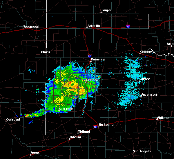 At 1127 pm cdt, the leading edge of strong winds from a severe thunderstorm was located near wolfforth, or 12 miles west of lubbock, moving northeast at 60 mph (radar indicated). Hazards include 70 mph wind gusts. Expect considerable tree damage. damage is likely to mobile homes, roofs, and outbuildings. Locations impacted include, lubbock, levelland, brownfield, slaton, wolfforth, sundown, ransom canyon, lubbock south plains mall, texas tech university, locketville, slide, whitharral, downtown lubbock, woodrow, reese center, meadow, smyer, ropesville, new home and opdyke west. At 1127 pm cdt, the leading edge of strong winds from a severe thunderstorm was located near wolfforth, or 12 miles west of lubbock, moving northeast at 60 mph (radar indicated). Hazards include 70 mph wind gusts. Expect considerable tree damage. damage is likely to mobile homes, roofs, and outbuildings. Locations impacted include, lubbock, levelland, brownfield, slaton, wolfforth, sundown, ransom canyon, lubbock south plains mall, texas tech university, locketville, slide, whitharral, downtown lubbock, woodrow, reese center, meadow, smyer, ropesville, new home and opdyke west.
|
| 9/29/2019 11:18 PM CDT |
 At 1116 pm cdt, a severe thunderstorm was located 6 miles south of locketville, or 8 miles north of brownfield, moving northeast at 40 mph (radar indicated. at 1105 pm, a wind gust of 58 mph was reported by the west texas mesonet station 2 miles south of brownfield). Hazards include 70 mph wind gusts. Expect considerable tree damage. damage is likely to mobile homes, roofs, and outbuildings. Locations impacted include, lubbock, levelland, brownfield, slaton, wolfforth, sundown, ransom canyon, lubbock south plains mall, texas tech university, locketville, slide, whitharral, downtown lubbock, woodrow, reese center, meadow, smyer, ropesville, new home and opdyke west. At 1116 pm cdt, a severe thunderstorm was located 6 miles south of locketville, or 8 miles north of brownfield, moving northeast at 40 mph (radar indicated. at 1105 pm, a wind gust of 58 mph was reported by the west texas mesonet station 2 miles south of brownfield). Hazards include 70 mph wind gusts. Expect considerable tree damage. damage is likely to mobile homes, roofs, and outbuildings. Locations impacted include, lubbock, levelland, brownfield, slaton, wolfforth, sundown, ransom canyon, lubbock south plains mall, texas tech university, locketville, slide, whitharral, downtown lubbock, woodrow, reese center, meadow, smyer, ropesville, new home and opdyke west.
|
| 9/29/2019 11:07 PM CDT |
 At 1106 pm cdt, a severe thunderstorm was located 6 miles northwest of brownfield, moving northeast at 40 mph (radar indicated). Hazards include 70 mph wind gusts. Expect considerable tree damage. Damage is likely to mobile homes, roofs, and outbuildings. At 1106 pm cdt, a severe thunderstorm was located 6 miles northwest of brownfield, moving northeast at 40 mph (radar indicated). Hazards include 70 mph wind gusts. Expect considerable tree damage. Damage is likely to mobile homes, roofs, and outbuildings.
|
| 9/29/2019 11:05 PM CDT | Measured by the west texas mesonet in terry county TX, 1.7 miles N of Brownfield, TX |
| 8/16/2019 5:21 PM CDT |
 The severe thunderstorm warning for western lynn and central terry counties will expire at 530 pm cdt, the storm which prompted the warning has weakened below severe limits, and no longer poses an immediate threat to life or property. therefore, the warning will be allowed to expire. however gusty winds are still possible with this thunderstorm. The severe thunderstorm warning for western lynn and central terry counties will expire at 530 pm cdt, the storm which prompted the warning has weakened below severe limits, and no longer poses an immediate threat to life or property. therefore, the warning will be allowed to expire. however gusty winds are still possible with this thunderstorm.
|
| 8/16/2019 4:49 PM CDT |
 At 447 pm cdt, a severe thunderstorm was located 5 miles southwest of brownfield, moving east at 20 mph (radar indicated). Hazards include 60 mph wind gusts. expect damage to roofs, siding, and trees At 447 pm cdt, a severe thunderstorm was located 5 miles southwest of brownfield, moving east at 20 mph (radar indicated). Hazards include 60 mph wind gusts. expect damage to roofs, siding, and trees
|
| 6/18/2019 3:13 AM CDT |
 At 313 am cdt, a severe thunderstorm was located 7 miles northwest of seagraves, moving east at 35 mph (radar indicated). Hazards include golf ball size hail and 60 mph wind gusts. People and animals outdoors will be injured. expect hail damage to roofs, siding, windows, and vehicles. Expect wind damage to roofs, siding, and trees. At 313 am cdt, a severe thunderstorm was located 7 miles northwest of seagraves, moving east at 35 mph (radar indicated). Hazards include golf ball size hail and 60 mph wind gusts. People and animals outdoors will be injured. expect hail damage to roofs, siding, windows, and vehicles. Expect wind damage to roofs, siding, and trees.
|
| 6/17/2019 8:35 PM CDT | Storm damage reported in terry county TX, 1.7 miles N of Brownfield, TX |
| 6/17/2019 8:33 PM CDT |
 At 833 pm cdt, severe thunderstorms were located along a line extending from 4 miles west of tokio to 4 miles north of brownfield, moving northeast at 30 mph (radar indicated). Hazards include 70 mph wind gusts and ping pong ball size hail. People and animals outdoors will be injured. expect hail damage to roofs, siding, windows, and vehicles. expect considerable tree damage. wind damage is also likely to mobile homes, roofs, and outbuildings. Locations impacted include, brownfield, tokio, meadow and wellman. At 833 pm cdt, severe thunderstorms were located along a line extending from 4 miles west of tokio to 4 miles north of brownfield, moving northeast at 30 mph (radar indicated). Hazards include 70 mph wind gusts and ping pong ball size hail. People and animals outdoors will be injured. expect hail damage to roofs, siding, windows, and vehicles. expect considerable tree damage. wind damage is also likely to mobile homes, roofs, and outbuildings. Locations impacted include, brownfield, tokio, meadow and wellman.
|
| 6/17/2019 8:20 PM CDT |
 At 818 pm cdt, severe thunderstorms were located along a line extending from 6 miles northeast of denver city to 9 miles east of seagraves airport, moving north at 35 mph. an area of severe winds are indicated about 4 miles east of wellman. residents of brownfield should prepare for the possibility of damaging winds (radar indicated). Hazards include 70 mph wind gusts and half dollar size hail. Hail damage to vehicles is expected. expect considerable tree damage. wind damage is also likely to mobile homes, roofs, and outbuildings. Locations impacted include, brownfield, tokio, meadow and wellman. At 818 pm cdt, severe thunderstorms were located along a line extending from 6 miles northeast of denver city to 9 miles east of seagraves airport, moving north at 35 mph. an area of severe winds are indicated about 4 miles east of wellman. residents of brownfield should prepare for the possibility of damaging winds (radar indicated). Hazards include 70 mph wind gusts and half dollar size hail. Hail damage to vehicles is expected. expect considerable tree damage. wind damage is also likely to mobile homes, roofs, and outbuildings. Locations impacted include, brownfield, tokio, meadow and wellman.
|
| 6/17/2019 8:04 PM CDT |
 At 804 pm cdt, severe thunderstorms were located along a line extending from 7 miles southeast of denver city to 9 miles southeast of seagraves airport, moving northeast at 25 mph (radar indicated). Hazards include 60 mph wind gusts and half dollar size hail. Hail damage to vehicles is expected. Expect wind damage to roofs, siding, and trees. At 804 pm cdt, severe thunderstorms were located along a line extending from 7 miles southeast of denver city to 9 miles southeast of seagraves airport, moving northeast at 25 mph (radar indicated). Hazards include 60 mph wind gusts and half dollar size hail. Hail damage to vehicles is expected. Expect wind damage to roofs, siding, and trees.
|
| 5/23/2019 6:41 PM CDT |
 At 641 pm cdt, a severe thunderstorm was located 5 miles southeast of locketville, or 10 miles north of brownfield, moving northeast at 25 mph (radar indicated). Hazards include golf ball size hail and 70 mph wind gusts. People and animals outdoors will be injured. expect hail damage to roofs, siding, windows, and vehicles. expect considerable tree damage. wind damage is also likely to mobile homes, roofs, and outbuildings. Locations impacted include, brownfield, locketville and meadow. At 641 pm cdt, a severe thunderstorm was located 5 miles southeast of locketville, or 10 miles north of brownfield, moving northeast at 25 mph (radar indicated). Hazards include golf ball size hail and 70 mph wind gusts. People and animals outdoors will be injured. expect hail damage to roofs, siding, windows, and vehicles. expect considerable tree damage. wind damage is also likely to mobile homes, roofs, and outbuildings. Locations impacted include, brownfield, locketville and meadow.
|
| 5/23/2019 6:34 PM CDT |
 At 634 pm cdt, a severe thunderstorm was located 6 miles south of locketville, or 8 miles north of brownfield, moving northeast at 25 mph (radar indicated). Hazards include golf ball size hail and 70 mph wind gusts. People and animals outdoors will be injured. expect hail damage to roofs, siding, windows, and vehicles. expect considerable tree damage. wind damage is also likely to mobile homes, roofs, and outbuildings. Locations impacted include, brownfield, locketville and meadow. At 634 pm cdt, a severe thunderstorm was located 6 miles south of locketville, or 8 miles north of brownfield, moving northeast at 25 mph (radar indicated). Hazards include golf ball size hail and 70 mph wind gusts. People and animals outdoors will be injured. expect hail damage to roofs, siding, windows, and vehicles. expect considerable tree damage. wind damage is also likely to mobile homes, roofs, and outbuildings. Locations impacted include, brownfield, locketville and meadow.
|
| 5/23/2019 6:22 PM CDT |
 At 621 pm cdt, a severe thunderstorm was located 7 miles northwest of brownfield, moving northeast at 25 mph (radar indicated. at 615 pm public reported golfball size hail 8 miles west of brownfield). Hazards include golf ball size hail and 70 mph wind gusts. People and animals outdoors will be injured. expect hail damage to roofs, siding, windows, and vehicles. expect considerable tree damage. wind damage is also likely to mobile homes, roofs, and outbuildings. Locations impacted include, brownfield, locketville and meadow. At 621 pm cdt, a severe thunderstorm was located 7 miles northwest of brownfield, moving northeast at 25 mph (radar indicated. at 615 pm public reported golfball size hail 8 miles west of brownfield). Hazards include golf ball size hail and 70 mph wind gusts. People and animals outdoors will be injured. expect hail damage to roofs, siding, windows, and vehicles. expect considerable tree damage. wind damage is also likely to mobile homes, roofs, and outbuildings. Locations impacted include, brownfield, locketville and meadow.
|
| 5/23/2019 6:14 PM CDT |
 At 614 pm cdt, a severe thunderstorm was located 8 miles west of brownfield, moving northeast at 25 mph (radar indicated). Hazards include golf ball size hail and 70 mph wind gusts. People and animals outdoors will be injured. expect hail damage to roofs, siding, windows, and vehicles. expect considerable tree damage. Wind damage is also likely to mobile homes, roofs, and outbuildings. At 614 pm cdt, a severe thunderstorm was located 8 miles west of brownfield, moving northeast at 25 mph (radar indicated). Hazards include golf ball size hail and 70 mph wind gusts. People and animals outdoors will be injured. expect hail damage to roofs, siding, windows, and vehicles. expect considerable tree damage. Wind damage is also likely to mobile homes, roofs, and outbuildings.
|
| 5/23/2019 6:12 PM CDT | Golf Ball sized hail reported 7.9 miles E of Brownfield, TX |
| 5/23/2019 5:58 PM CDT |
 At 558 pm cdt, a severe thunderstorm was located over tokio, or 15 miles north of seagraves, moving northeast at 25 mph (radar indicated). Hazards include 70 mph wind gusts and ping pong ball size hail. People and animals outdoors will be injured. expect hail damage to roofs, siding, windows, and vehicles. expect considerable tree damage. Wind damage is also likely to mobile homes, roofs, and outbuildings. At 558 pm cdt, a severe thunderstorm was located over tokio, or 15 miles north of seagraves, moving northeast at 25 mph (radar indicated). Hazards include 70 mph wind gusts and ping pong ball size hail. People and animals outdoors will be injured. expect hail damage to roofs, siding, windows, and vehicles. expect considerable tree damage. Wind damage is also likely to mobile homes, roofs, and outbuildings.
|
| 5/23/2019 5:51 PM CDT |
 At 551 pm cdt, a severe thunderstorm was located 4 miles south of locketville, or 10 miles north of brownfield, moving northeast at 25 mph (radar indicated). Hazards include golf ball size hail and 70 mph wind gusts. People and animals outdoors will be injured. expect hail damage to roofs, siding, windows, and vehicles. expect considerable tree damage. wind damage is also likely to mobile homes, roofs, and outbuildings. Locations impacted include, brownfield, locketville, meadow and ropesville. At 551 pm cdt, a severe thunderstorm was located 4 miles south of locketville, or 10 miles north of brownfield, moving northeast at 25 mph (radar indicated). Hazards include golf ball size hail and 70 mph wind gusts. People and animals outdoors will be injured. expect hail damage to roofs, siding, windows, and vehicles. expect considerable tree damage. wind damage is also likely to mobile homes, roofs, and outbuildings. Locations impacted include, brownfield, locketville, meadow and ropesville.
|
| 5/23/2019 5:41 PM CDT |
 At 540 pm cdt, a severe thunderstorm was located 8 miles southwest of locketville, or 9 miles northwest of brownfield, moving northeast at 25 mph (radar indicated. at 538 pm a storm chaser reported a rotating wall cloud northwest of brownfield). Hazards include golf ball size hail and 70 mph wind gusts. People and animals outdoors will be injured. expect hail damage to roofs, siding, windows, and vehicles. expect considerable tree damage. wind damage is also likely to mobile homes, roofs, and outbuildings. Locations impacted include, brownfield, locketville, meadow and ropesville. At 540 pm cdt, a severe thunderstorm was located 8 miles southwest of locketville, or 9 miles northwest of brownfield, moving northeast at 25 mph (radar indicated. at 538 pm a storm chaser reported a rotating wall cloud northwest of brownfield). Hazards include golf ball size hail and 70 mph wind gusts. People and animals outdoors will be injured. expect hail damage to roofs, siding, windows, and vehicles. expect considerable tree damage. wind damage is also likely to mobile homes, roofs, and outbuildings. Locations impacted include, brownfield, locketville, meadow and ropesville.
|
| 5/23/2019 5:29 PM CDT |
 The national weather service in lubbock texas has issued a * severe thunderstorm warning for. northern terry county in northwestern texas. southeastern hockley county in northwestern texas. until 615 pm cdt. At 529 pm cdt, a severe thunderstorm was located 8 miles northeast. The national weather service in lubbock texas has issued a * severe thunderstorm warning for. northern terry county in northwestern texas. southeastern hockley county in northwestern texas. until 615 pm cdt. At 529 pm cdt, a severe thunderstorm was located 8 miles northeast.
|
| 5/20/2019 3:24 PM CDT |
 At 323 pm cdt, a severe thunderstorm was located 4 miles southeast of new moore, or 15 miles southwest of tahoka, moving northeast at 60 mph (radar indicated). Hazards include quarter size hail. damage to vehicles is expected At 323 pm cdt, a severe thunderstorm was located 4 miles southeast of new moore, or 15 miles southwest of tahoka, moving northeast at 60 mph (radar indicated). Hazards include quarter size hail. damage to vehicles is expected
|
| 5/7/2019 5:45 PM CDT |
 At 545 pm cdt, a severe thunderstorm was located 8 miles east of brownfield, moving northeast at 25 mph (radar indicated). Hazards include 60 mph wind gusts and half dollar size hail. Hail damage to vehicles is expected. Expect wind damage to roofs, siding, and trees. At 545 pm cdt, a severe thunderstorm was located 8 miles east of brownfield, moving northeast at 25 mph (radar indicated). Hazards include 60 mph wind gusts and half dollar size hail. Hail damage to vehicles is expected. Expect wind damage to roofs, siding, and trees.
|
| 5/7/2019 5:24 PM CDT |
 At 524 pm cdt, a severe thunderstorm was located 6 miles southeast of brownfield, moving northeast at 35 mph (radar indicated). Hazards include 60 mph wind gusts and quarter size hail. Hail damage to vehicles is expected. expect wind damage to roofs, siding, and trees. Locations impacted include, brownfield. At 524 pm cdt, a severe thunderstorm was located 6 miles southeast of brownfield, moving northeast at 35 mph (radar indicated). Hazards include 60 mph wind gusts and quarter size hail. Hail damage to vehicles is expected. expect wind damage to roofs, siding, and trees. Locations impacted include, brownfield.
|
| 5/7/2019 5:08 PM CDT |
 At 508 pm cdt, a severe thunderstorm was located 8 miles northwest of welch, or 12 miles south of brownfield, moving northeast at 30 mph (radar indicated). Hazards include 60 mph wind gusts and quarter size hail. Hail damage to vehicles is expected. Expect wind damage to roofs, siding, and trees. At 508 pm cdt, a severe thunderstorm was located 8 miles northwest of welch, or 12 miles south of brownfield, moving northeast at 30 mph (radar indicated). Hazards include 60 mph wind gusts and quarter size hail. Hail damage to vehicles is expected. Expect wind damage to roofs, siding, and trees.
|
| 5/3/2019 5:56 PM CDT |
 At 555 pm cdt, a severe thunderstorm was located near tokio, or 13 miles west of brownfield, moving southeast at 25 mph (radar indicated). Hazards include golf ball size hail and 60 mph wind gusts. People and animals outdoors will be injured. expect hail damage to roofs, siding, windows, and vehicles. expect wind damage to roofs, siding, and trees. Locations impacted include, tokio and wellman. At 555 pm cdt, a severe thunderstorm was located near tokio, or 13 miles west of brownfield, moving southeast at 25 mph (radar indicated). Hazards include golf ball size hail and 60 mph wind gusts. People and animals outdoors will be injured. expect hail damage to roofs, siding, windows, and vehicles. expect wind damage to roofs, siding, and trees. Locations impacted include, tokio and wellman.
|
| 5/3/2019 5:30 PM CDT |
 At 528 pm cdt, a severe thunderstorm was located 8 miles north of tokio, or 13 miles northeast of plains, moving southeast at 20 mph (radar indicated). Hazards include ping pong ball size hail and 60 mph wind gusts. People and animals outdoors will be injured. expect hail damage to roofs, siding, windows, and vehicles. expect wind damage to roofs, siding, and trees. Location impacted include, tokio. At 528 pm cdt, a severe thunderstorm was located 8 miles north of tokio, or 13 miles northeast of plains, moving southeast at 20 mph (radar indicated). Hazards include ping pong ball size hail and 60 mph wind gusts. People and animals outdoors will be injured. expect hail damage to roofs, siding, windows, and vehicles. expect wind damage to roofs, siding, and trees. Location impacted include, tokio.
|
| 3/9/2019 2:35 AM CST | West texas mesonet in terry county TX, 1.7 miles N of Brownfield, TX |
| 10/8/2018 5:47 PM CDT |
 At 546 pm cdt, a severe thunderstorm was located near brownfield, moving east at 20 mph (radar indicated. at 540 pm quarter size hail was reported 1 mile north of brownfield by the brownfield police department). Hazards include 60 mph wind gusts and quarter size hail. Hail damage to vehicles is expected. expect wind damage to roofs, siding, and trees. Locations impacted include, brownfield and meadow. At 546 pm cdt, a severe thunderstorm was located near brownfield, moving east at 20 mph (radar indicated. at 540 pm quarter size hail was reported 1 mile north of brownfield by the brownfield police department). Hazards include 60 mph wind gusts and quarter size hail. Hail damage to vehicles is expected. expect wind damage to roofs, siding, and trees. Locations impacted include, brownfield and meadow.
|
| 10/8/2018 5:40 PM CDT | Quarter sized hail reported 1.1 miles S of Brownfield, TX |
| 10/8/2018 5:35 PM CDT |
 At 534 pm cdt, a severe thunderstorm was located near brownfield, moving east at 20 mph (radar indicated). Hazards include 60 mph wind gusts and quarter size hail. Hail damage to vehicles is expected. Expect wind damage to roofs, siding, and trees. At 534 pm cdt, a severe thunderstorm was located near brownfield, moving east at 20 mph (radar indicated). Hazards include 60 mph wind gusts and quarter size hail. Hail damage to vehicles is expected. Expect wind damage to roofs, siding, and trees.
|
| 10/5/2018 6:18 PM CDT |
 At 617 pm cdt, severe thunderstorms were located along a line extending from 6 miles southeast of tokio to 5 miles south of brownfield, moving northeast at 20 mph (radar indicated). Hazards include 60 mph wind gusts and half dollar size hail. Hail damage to vehicles is expected. Expect wind damage to roofs, siding and trees. At 617 pm cdt, severe thunderstorms were located along a line extending from 6 miles southeast of tokio to 5 miles south of brownfield, moving northeast at 20 mph (radar indicated). Hazards include 60 mph wind gusts and half dollar size hail. Hail damage to vehicles is expected. Expect wind damage to roofs, siding and trees.
|
| 6/4/2018 12:05 AM CDT |
 At 1204 am cdt, a severe thunderstorm was located 8 miles south of locketville, or 8 miles northwest of brownfield, moving northeast at 35 mph (radar indicated). Hazards include 70 mph wind gusts. Expect considerable tree damage. damage is likely to mobile homes, roofs, and outbuildings. Locations impacted include, brownfield, tokio, meadow, wilson and new home. At 1204 am cdt, a severe thunderstorm was located 8 miles south of locketville, or 8 miles northwest of brownfield, moving northeast at 35 mph (radar indicated). Hazards include 70 mph wind gusts. Expect considerable tree damage. damage is likely to mobile homes, roofs, and outbuildings. Locations impacted include, brownfield, tokio, meadow, wilson and new home.
|
| 6/3/2018 11:43 PM CDT |
 At 1141 pm cdt, a severe thunderstorm was located 8 miles southeast of tokio, or 12 miles southwest of brownfield, moving northeast at 35 mph (radar indicated. at 1130 pm, wind gusts were estimated to be over 70 mph south of wellman along farm to market 213). Hazards include 70 mph wind gusts. Expect considerable tree damage. damage is likely to mobile homes, roofs, and outbuildings. Locations impacted include, brownfield, new moore, tokio, meadow, wilson, new home and wellman. At 1141 pm cdt, a severe thunderstorm was located 8 miles southeast of tokio, or 12 miles southwest of brownfield, moving northeast at 35 mph (radar indicated. at 1130 pm, wind gusts were estimated to be over 70 mph south of wellman along farm to market 213). Hazards include 70 mph wind gusts. Expect considerable tree damage. damage is likely to mobile homes, roofs, and outbuildings. Locations impacted include, brownfield, new moore, tokio, meadow, wilson, new home and wellman.
|
| 6/3/2018 11:33 PM CDT |
 At 1133 pm cdt, a severe thunderstorm was located near seagraves airport, or 7 miles northeast of seagraves, moving northeast at 35 mph (radar indicated). Hazards include 70 mph wind gusts. Expect considerable tree damage. Damage is likely to mobile homes, roofs, and outbuildings. At 1133 pm cdt, a severe thunderstorm was located near seagraves airport, or 7 miles northeast of seagraves, moving northeast at 35 mph (radar indicated). Hazards include 70 mph wind gusts. Expect considerable tree damage. Damage is likely to mobile homes, roofs, and outbuildings.
|
| 5/20/2018 1:16 AM CDT |
 At 113 am cdt, a severe thunderstorm was located near new moore, or 14 miles southeast of brownfield, moving east at 10 mph (radar indicated). Hazards include 60 mph wind gusts and quarter size hail. Hail damage to vehicles is expected. Expect wind damage to roofs, siding, and trees. At 113 am cdt, a severe thunderstorm was located near new moore, or 14 miles southeast of brownfield, moving east at 10 mph (radar indicated). Hazards include 60 mph wind gusts and quarter size hail. Hail damage to vehicles is expected. Expect wind damage to roofs, siding, and trees.
|
| 5/20/2018 1:04 AM CDT |
 At 104 am cdt, a severe thunderstorm was located near new moore, or 12 miles southeast of brownfield, moving east at 15 mph (radar indicated). Hazards include 60 mph wind gusts and quarter size hail. Hail damage to vehicles is expected. expect wind damage to roofs, siding, and trees. Locations impacted include, brownfield. At 104 am cdt, a severe thunderstorm was located near new moore, or 12 miles southeast of brownfield, moving east at 15 mph (radar indicated). Hazards include 60 mph wind gusts and quarter size hail. Hail damage to vehicles is expected. expect wind damage to roofs, siding, and trees. Locations impacted include, brownfield.
|
| 5/20/2018 12:49 AM CDT |
 At 1248 am cdt, a severe thunderstorm was located 5 miles southeast of brownfield, moving southeast at 15 mph (radar indicated). Hazards include 60 mph wind gusts and quarter size hail. Hail damage to vehicles is expected. expect wind damage to roofs, siding, and trees. Locations impacted include, brownfield. At 1248 am cdt, a severe thunderstorm was located 5 miles southeast of brownfield, moving southeast at 15 mph (radar indicated). Hazards include 60 mph wind gusts and quarter size hail. Hail damage to vehicles is expected. expect wind damage to roofs, siding, and trees. Locations impacted include, brownfield.
|
| 5/20/2018 12:37 AM CDT |
 At 1237 am cdt, a severe thunderstorm was located over brownfield, moving east at 25 mph (radar indicated). Hazards include 60 mph wind gusts and quarter size hail. Hail damage to vehicles is expected. Expect wind damage to roofs, siding, and trees. At 1237 am cdt, a severe thunderstorm was located over brownfield, moving east at 25 mph (radar indicated). Hazards include 60 mph wind gusts and quarter size hail. Hail damage to vehicles is expected. Expect wind damage to roofs, siding, and trees.
|
| 5/17/2018 5:51 PM CDT |
 The severe thunderstorm warning for central terry county will expire at 600 pm cdt, the storm which prompted the warning has moved out of the area. therefore the warning will be allowed to expire. however small hail and gusty winds are still possible with this thunderstorm. a severe thunderstorm watch remains in effect until 1000 pm cdt for northwestern texas. The severe thunderstorm warning for central terry county will expire at 600 pm cdt, the storm which prompted the warning has moved out of the area. therefore the warning will be allowed to expire. however small hail and gusty winds are still possible with this thunderstorm. a severe thunderstorm watch remains in effect until 1000 pm cdt for northwestern texas.
|
| 5/17/2018 5:38 PM CDT |
 At 537 pm cdt, a severe thunderstorm was located 2 miles west of brownfield, moving east at 45 mph (radar indicated). Hazards include 60 mph wind gusts and quarter size hail. Hail damage to vehicles is expected. expect wind damage to roofs, siding, and trees. Locations impacted include, brownfield and meadow. At 537 pm cdt, a severe thunderstorm was located 2 miles west of brownfield, moving east at 45 mph (radar indicated). Hazards include 60 mph wind gusts and quarter size hail. Hail damage to vehicles is expected. expect wind damage to roofs, siding, and trees. Locations impacted include, brownfield and meadow.
|
| 5/17/2018 5:27 PM CDT |
 At 526 pm cdt, a severe thunderstorm was located 8 miles east of tokio, or 9 miles west of brownfield, moving northeast at 35 mph (radar indicated). Hazards include 60 mph wind gusts and quarter size hail. Hail damage to vehicles is expected. expect wind damage to roofs, siding, and trees. Locations impacted include, brownfield and meadow. At 526 pm cdt, a severe thunderstorm was located 8 miles east of tokio, or 9 miles west of brownfield, moving northeast at 35 mph (radar indicated). Hazards include 60 mph wind gusts and quarter size hail. Hail damage to vehicles is expected. expect wind damage to roofs, siding, and trees. Locations impacted include, brownfield and meadow.
|
| 5/17/2018 5:12 PM CDT |
 At 511 pm cdt, a severe thunderstorm was located 5 miles south of tokio, or 11 miles north of seagraves, moving northeast at 35 mph (radar indicated). Hazards include ping pong ball size hail and 60 mph wind gusts. People and animals outdoors will be injured. expect hail damage to roofs, siding, windows, and vehicles. Expect wind damage to roofs, siding, and trees. At 511 pm cdt, a severe thunderstorm was located 5 miles south of tokio, or 11 miles north of seagraves, moving northeast at 35 mph (radar indicated). Hazards include ping pong ball size hail and 60 mph wind gusts. People and animals outdoors will be injured. expect hail damage to roofs, siding, windows, and vehicles. Expect wind damage to roofs, siding, and trees.
|
| 7/4/2017 10:18 PM CDT |
 At 1017 pm cdt, severe thunderstorms were located along a line extending from near crosbyton to near grassland to new moore to 6 miles west of seagraves, moving southeast at 40 mph (radar indicated). Hazards include 60 mph wind gusts. Expect damage to roofs, siding, and trees. Locations impacted include, brownfield, slaton, post, denver city, tahoka, crosbyton, ralls, lorenzo, ransom canyon, o`donnell, grassland, new moore, cone, caprock, southland, wilson, new home and wellman. At 1017 pm cdt, severe thunderstorms were located along a line extending from near crosbyton to near grassland to new moore to 6 miles west of seagraves, moving southeast at 40 mph (radar indicated). Hazards include 60 mph wind gusts. Expect damage to roofs, siding, and trees. Locations impacted include, brownfield, slaton, post, denver city, tahoka, crosbyton, ralls, lorenzo, ransom canyon, o`donnell, grassland, new moore, cone, caprock, southland, wilson, new home and wellman.
|
| 7/4/2017 10:05 PM CDT |
 At 1004 pm cdt, severe thunderstorms were located along a line extending from 6 miles northwest of caprock to 9 miles southeast of woodrow to near welch to 6 miles southeast of denver city, moving southeast at 30 mph (radar indicated). Hazards include 60 mph wind gusts. Expect damage to roofs, siding, and trees. Locations impacted include, lubbock, brownfield, slaton, post, denver city, tahoka, crosbyton, idalou, ralls, lorenzo, ransom canyon, o`donnell, grassland, new moore, lubbock south plains mall, slide, woodrow, cone, caprock and texas tech university. At 1004 pm cdt, severe thunderstorms were located along a line extending from 6 miles northwest of caprock to 9 miles southeast of woodrow to near welch to 6 miles southeast of denver city, moving southeast at 30 mph (radar indicated). Hazards include 60 mph wind gusts. Expect damage to roofs, siding, and trees. Locations impacted include, lubbock, brownfield, slaton, post, denver city, tahoka, crosbyton, idalou, ralls, lorenzo, ransom canyon, o`donnell, grassland, new moore, lubbock south plains mall, slide, woodrow, cone, caprock and texas tech university.
|
| 7/4/2017 9:42 PM CDT |
 At 941 pm cdt, severe thunderstorms were located along a line extending from near idalou to near slide to 6 miles southwest of brownfield to near denver city, moving southeast at 30 mph (radar indicated). Hazards include 60 mph wind gusts and penny size hail. expect damage to roofs, siding, and trees At 941 pm cdt, severe thunderstorms were located along a line extending from near idalou to near slide to 6 miles southwest of brownfield to near denver city, moving southeast at 30 mph (radar indicated). Hazards include 60 mph wind gusts and penny size hail. expect damage to roofs, siding, and trees
|
| 7/4/2017 9:25 PM CDT |
 At 923 pm cdt, severe thunderstorms were located along a line extending from near aiken to near lubbock international airport to wolfforth to 9 miles northwest of brownfield to near bronco, moving south at 35 mph. the west texas mesonet station at aiken reported 67 mph at 910 pm (radar indicated). Hazards include 70 mph wind gusts. Expect considerable tree damage. damage is likely to mobile homes, roofs, and outbuildings. Locations impacted include, lubbock, plainview, levelland, brownfield, slaton, tulia, floydada, abernathy, hale center, plains, silverton, wolfforth, shallowater, idalou, ralls, lockney, sundown, petersburg, lorenzo and ransom canyon. At 923 pm cdt, severe thunderstorms were located along a line extending from near aiken to near lubbock international airport to wolfforth to 9 miles northwest of brownfield to near bronco, moving south at 35 mph. the west texas mesonet station at aiken reported 67 mph at 910 pm (radar indicated). Hazards include 70 mph wind gusts. Expect considerable tree damage. damage is likely to mobile homes, roofs, and outbuildings. Locations impacted include, lubbock, plainview, levelland, brownfield, slaton, tulia, floydada, abernathy, hale center, plains, silverton, wolfforth, shallowater, idalou, ralls, lockney, sundown, petersburg, lorenzo and ransom canyon.
|
| 7/4/2017 9:13 PM CDT |
 At 910 pm cdt, severe thunderstorms were located along a line extending from 7 miles south of claytonville to 7 miles southeast of abernathy to near reese center to 6 miles southwest of locketville to near bronco, moving southeast at 40 mph. the west texas mesonet station at sundown reported a wind gust to 64 mph and the station at levelland reported 58 mph, both at 905 pm. these are very dangerous storms (radar indicated). Hazards include 80 mph wind gusts. Flying debris will be dangerous to those caught without shelter. mobile homes will be heavily damaged. expect considerable damage to roofs, windows, and vehicles. extensive tree damage and power outages are likely. Locations impacted include, lubbock, plainview, levelland, brownfield, slaton, tulia, floydada, abernathy, hale center, plains, silverton, wolfforth, shallowater, idalou, ralls, lockney, sundown, petersburg, lorenzo and anton. At 910 pm cdt, severe thunderstorms were located along a line extending from 7 miles south of claytonville to 7 miles southeast of abernathy to near reese center to 6 miles southwest of locketville to near bronco, moving southeast at 40 mph. the west texas mesonet station at sundown reported a wind gust to 64 mph and the station at levelland reported 58 mph, both at 905 pm. these are very dangerous storms (radar indicated). Hazards include 80 mph wind gusts. Flying debris will be dangerous to those caught without shelter. mobile homes will be heavily damaged. expect considerable damage to roofs, windows, and vehicles. extensive tree damage and power outages are likely. Locations impacted include, lubbock, plainview, levelland, brownfield, slaton, tulia, floydada, abernathy, hale center, plains, silverton, wolfforth, shallowater, idalou, ralls, lockney, sundown, petersburg, lorenzo and anton.
|
| 7/4/2017 8:59 PM CDT |
 At 858 pm cdt, severe thunderstorms were located along a line extending from near claytonville to abernathy to near shallowater to sundown to 11 miles north of bronco, moving southeast at 40 mph. these are very dangerous storms (radar indicated). Hazards include 80 mph wind gusts. Flying debris will be dangerous to those caught without shelter. mobile homes will be heavily damaged. expect considerable damage to roofs, windows, and vehicles. Extensive tree damage and power outages are likely. At 858 pm cdt, severe thunderstorms were located along a line extending from near claytonville to abernathy to near shallowater to sundown to 11 miles north of bronco, moving southeast at 40 mph. these are very dangerous storms (radar indicated). Hazards include 80 mph wind gusts. Flying debris will be dangerous to those caught without shelter. mobile homes will be heavily damaged. expect considerable damage to roofs, windows, and vehicles. Extensive tree damage and power outages are likely.
|
| 7/1/2017 1:58 AM CDT |
 At 157 am cdt, a severe thunderstorm was located 9 miles northeast of locketville, or 12 miles southeast of levelland, moving east at 55 mph. this is a very dangerous storm (radar indicated). Hazards include 80 mph wind gusts and quarter size hail. Flying debris will be dangerous to those caught without shelter. mobile homes will be heavily damaged. expect considerable damage to roofs, windows, and vehicles. Extensive tree damage and power outages are likely. At 157 am cdt, a severe thunderstorm was located 9 miles northeast of locketville, or 12 miles southeast of levelland, moving east at 55 mph. this is a very dangerous storm (radar indicated). Hazards include 80 mph wind gusts and quarter size hail. Flying debris will be dangerous to those caught without shelter. mobile homes will be heavily damaged. expect considerable damage to roofs, windows, and vehicles. Extensive tree damage and power outages are likely.
|
| 6/26/2017 2:05 AM CDT |
 At 205 am cdt, severe thunderstorms were located along a line extending from near woodrow to near welch, moving southeast at 45 mph (radar indicated). Hazards include 60 mph wind gusts. Expect damage to roofs, siding, and trees. Locations impacted include, lubbock, brownfield, slaton, tahoka, idalou, ransom canyon, o`donnell, grassland, new moore, lubbock south plains mall, texas tech university, lubbock international airport, slide, downtown lubbock, woodrow, wilson, new home and lubbock science spectrum. At 205 am cdt, severe thunderstorms were located along a line extending from near woodrow to near welch, moving southeast at 45 mph (radar indicated). Hazards include 60 mph wind gusts. Expect damage to roofs, siding, and trees. Locations impacted include, lubbock, brownfield, slaton, tahoka, idalou, ransom canyon, o`donnell, grassland, new moore, lubbock south plains mall, texas tech university, lubbock international airport, slide, downtown lubbock, woodrow, wilson, new home and lubbock science spectrum.
|
| 6/26/2017 1:48 AM CDT |
 At 148 am cdt, severe thunderstorms were located along a line extending from near lubbock south plains mall to 8 miles northeast of loop, moving southeast at 45 mph (radar indicated). Hazards include 70 mph wind gusts. Expect considerable tree damage. Damage is likely to mobile homes, roofs, and outbuildings. At 148 am cdt, severe thunderstorms were located along a line extending from near lubbock south plains mall to 8 miles northeast of loop, moving southeast at 45 mph (radar indicated). Hazards include 70 mph wind gusts. Expect considerable tree damage. Damage is likely to mobile homes, roofs, and outbuildings.
|
| 6/26/2017 1:40 AM CDT | Storm damage reported in terry county TX, 1.7 miles N of Brownfield, TX |
| 6/15/2017 5:21 PM CDT |
 At 521 pm cdt, a severe thunderstorm was located 10 miles east of brownfield, moving southeast at 25 mph (radar indicated). Hazards include 60 mph wind gusts and quarter size hail. Hail damage to vehicles is expected. Expect wind damage to roofs, siding, and trees. At 521 pm cdt, a severe thunderstorm was located 10 miles east of brownfield, moving southeast at 25 mph (radar indicated). Hazards include 60 mph wind gusts and quarter size hail. Hail damage to vehicles is expected. Expect wind damage to roofs, siding, and trees.
|
| 4/16/2017 9:19 PM CDT |
 At 919 pm cdt, a severe thunderstorm was located near brownfield, moving northeast at 10 mph (radar indicated). Hazards include 60 mph wind gusts and quarter size hail. Hail damage to vehicles is expected. expect wind damage to roofs, siding, and trees. Locations impacted include, brownfield. At 919 pm cdt, a severe thunderstorm was located near brownfield, moving northeast at 10 mph (radar indicated). Hazards include 60 mph wind gusts and quarter size hail. Hail damage to vehicles is expected. expect wind damage to roofs, siding, and trees. Locations impacted include, brownfield.
|
| 4/16/2017 8:57 PM CDT |
 At 857 pm cdt, a severe thunderstorm was located over brownfield, moving northeast at 10 mph (radar indicated). Hazards include 60 mph wind gusts and quarter size hail. Hail damage to vehicles is expected. Expect wind damage to roofs, siding, and trees. At 857 pm cdt, a severe thunderstorm was located over brownfield, moving northeast at 10 mph (radar indicated). Hazards include 60 mph wind gusts and quarter size hail. Hail damage to vehicles is expected. Expect wind damage to roofs, siding, and trees.
|
| 4/16/2017 8:35 PM CDT |
 At 833 pm cdt, a severe thunderstorm was located near brownfield, and is nearly stationary. 2" hail was reported at along hwy 137 north of brownfield (radar indicated). Hazards include two inch hail. People and animals outdoors will be injured. expect damage to roofs, siding, windows, and vehicles. Locations impacted include, brownfield. At 833 pm cdt, a severe thunderstorm was located near brownfield, and is nearly stationary. 2" hail was reported at along hwy 137 north of brownfield (radar indicated). Hazards include two inch hail. People and animals outdoors will be injured. expect damage to roofs, siding, windows, and vehicles. Locations impacted include, brownfield.
|
| 4/16/2017 8:31 PM CDT |
 At 829 pm cdt, a severe thunderstorm was located near brownfield, and this storm was nearly stationary (radar indicated). Hazards include two inch hail. People and animals outdoors will be injured. Expect damage to roofs, siding, windows, and vehicles. At 829 pm cdt, a severe thunderstorm was located near brownfield, and this storm was nearly stationary (radar indicated). Hazards include two inch hail. People and animals outdoors will be injured. Expect damage to roofs, siding, windows, and vehicles.
|
| 4/16/2017 8:30 PM CDT | Hen Egg sized hail reported 1.1 miles SSE of Brownfield, TX, easter egg size hail along hwy 137 n of brownfield |
| 4/16/2017 8:24 PM CDT |
 At 824 pm cdt, a severe thunderstorm was located 8 miles northwest of new moore, or 9 miles southeast of brownfield, moving southeast at 20 mph (radar indicated). Hazards include two inch hail. People and animals outdoors will be injured. expect damage to roofs, siding, windows, and vehicles. Locations impacted include, brownfield. At 824 pm cdt, a severe thunderstorm was located 8 miles northwest of new moore, or 9 miles southeast of brownfield, moving southeast at 20 mph (radar indicated). Hazards include two inch hail. People and animals outdoors will be injured. expect damage to roofs, siding, windows, and vehicles. Locations impacted include, brownfield.
|
| 4/16/2017 8:21 PM CDT |
 At 820 pm cdt, a severe thunderstorm was located 8 miles southeast of brownfield, moving southeast at 20 mph. ping pong size hail has been reported in brownfield with this storm (radar indicated). Hazards include ping pong ball size hail. People and animals outdoors will be injured. expect damage to roofs, siding, windows, and vehicles. Locations impacted include, brownfield. At 820 pm cdt, a severe thunderstorm was located 8 miles southeast of brownfield, moving southeast at 20 mph. ping pong size hail has been reported in brownfield with this storm (radar indicated). Hazards include ping pong ball size hail. People and animals outdoors will be injured. expect damage to roofs, siding, windows, and vehicles. Locations impacted include, brownfield.
|
| 4/16/2017 8:16 PM CDT | Ping Pong Ball sized hail reported 0.4 miles SSW of Brownfield, TX |
| 4/16/2017 8:11 PM CDT |
 At 811 pm cdt, a severe thunderstorm was located near brownfield, moving southeast at 20 mph (radar indicated). Hazards include ping pong ball size hail. People and animals outdoors will be injured. Expect damage to roofs, siding, windows, and vehicles. At 811 pm cdt, a severe thunderstorm was located near brownfield, moving southeast at 20 mph (radar indicated). Hazards include ping pong ball size hail. People and animals outdoors will be injured. Expect damage to roofs, siding, windows, and vehicles.
|
| 4/16/2017 7:33 PM CDT |
 At 732 pm cdt, a severe thunderstorm was located near brownfield, moving east at 15 mph (radar indicated). Hazards include two inch hail. People and animals outdoors will be injured. expect damage to roofs, siding, windows, and vehicles. Locations impacted include, brownfield. At 732 pm cdt, a severe thunderstorm was located near brownfield, moving east at 15 mph (radar indicated). Hazards include two inch hail. People and animals outdoors will be injured. expect damage to roofs, siding, windows, and vehicles. Locations impacted include, brownfield.
|
| 4/16/2017 7:25 PM CDT |
 At 725 pm cdt, a severe thunderstorm was located near brownfield, moving east at 15 mph (radar indicated). Hazards include quarter size hail. damage to vehicles is expected At 725 pm cdt, a severe thunderstorm was located near brownfield, moving east at 15 mph (radar indicated). Hazards include quarter size hail. damage to vehicles is expected
|
| 4/12/2017 3:27 PM CDT |
 The severe thunderstorm warning for terry county will expire at 330 pm cdt, the storm which prompted the warning has weakened below severe limits, and no longer poses an immediate threat to life or property. therefore the warning will be allowed to expire. however heavy rain is still possible with this thunderstorm. a severe thunderstorm watch remains in effect until 900 pm cdt for northwestern texas. The severe thunderstorm warning for terry county will expire at 330 pm cdt, the storm which prompted the warning has weakened below severe limits, and no longer poses an immediate threat to life or property. therefore the warning will be allowed to expire. however heavy rain is still possible with this thunderstorm. a severe thunderstorm watch remains in effect until 900 pm cdt for northwestern texas.
|
| 4/12/2017 3:15 PM CDT |
 At 315 pm cdt, a severe thunderstorm was located 9 miles southwest of brownfield, moving northeast at 30 mph (radar indicated). Hazards include quarter size hail. Damage to vehicles is expected. Locations impacted include, brownfield and wellman. At 315 pm cdt, a severe thunderstorm was located 9 miles southwest of brownfield, moving northeast at 30 mph (radar indicated). Hazards include quarter size hail. Damage to vehicles is expected. Locations impacted include, brownfield and wellman.
|
| 4/12/2017 3:00 PM CDT |
 At 300 pm cdt, a severe thunderstorm was located near seagraves airport, or 8 miles northeast of seagraves, moving northeast at 30 mph (radar indicated). Hazards include quarter size hail. damage to vehicles is expected At 300 pm cdt, a severe thunderstorm was located near seagraves airport, or 8 miles northeast of seagraves, moving northeast at 30 mph (radar indicated). Hazards include quarter size hail. damage to vehicles is expected
|
| 1/1/2017 8:52 PM CST |
 At 852 pm cst, severe thunderstorms were located along a line extending from 7 miles east of sundown to near locketville to 9 miles west of new moore, moving northeast at 45 mph. a wind gust to 56 mph was reported by the west texas mesonet station in brownfield (radar indicated). Hazards include 60 mph wind gusts. Expect damage to roofs, siding, and trees. Locations impacted include, brownfield, locketville and meadow. At 852 pm cst, severe thunderstorms were located along a line extending from 7 miles east of sundown to near locketville to 9 miles west of new moore, moving northeast at 45 mph. a wind gust to 56 mph was reported by the west texas mesonet station in brownfield (radar indicated). Hazards include 60 mph wind gusts. Expect damage to roofs, siding, and trees. Locations impacted include, brownfield, locketville and meadow.
|
| 1/1/2017 8:50 PM CST | Powerlines down across some residential streets in brownfiel in terry county TX, 0.4 miles SSW of Brownfield, TX |
| 1/1/2017 8:41 PM CST |
 At 840 pm cst, severe thunderstorms were located along a line extending from 7 miles south of sundown to 8 miles southwest of locketville to near ashmore, moving east at 50 mph (radar indicated). Hazards include 60 mph wind gusts. Expect damage to roofs, siding, and trees. Locations impacted include, brownfield, tokio, locketville, meadow and wellman. At 840 pm cst, severe thunderstorms were located along a line extending from 7 miles south of sundown to 8 miles southwest of locketville to near ashmore, moving east at 50 mph (radar indicated). Hazards include 60 mph wind gusts. Expect damage to roofs, siding, and trees. Locations impacted include, brownfield, tokio, locketville, meadow and wellman.
|
| 1/1/2017 8:33 PM CST |
 At 832 pm cst, severe thunderstorms were located along a line extending from 7 miles northwest of levelland to 8 miles west of sundown to 7 miles west of brownfield, moving northeast at 45 mph. data indicate that terry county has the highest risk of severe winds with this activity (radar indicated). Hazards include 70 mph wind gusts. Expect considerable tree damage. damage is likely to mobile homes, roofs, and outbuildings. Locations impacted include, levelland, brownfield, sundown, anton, whitharral, locketville, tokio, meadow, smyer, whiteface, ropesville, wellman and opdyke west. At 832 pm cst, severe thunderstorms were located along a line extending from 7 miles northwest of levelland to 8 miles west of sundown to 7 miles west of brownfield, moving northeast at 45 mph. data indicate that terry county has the highest risk of severe winds with this activity (radar indicated). Hazards include 70 mph wind gusts. Expect considerable tree damage. damage is likely to mobile homes, roofs, and outbuildings. Locations impacted include, levelland, brownfield, sundown, anton, whitharral, locketville, tokio, meadow, smyer, whiteface, ropesville, wellman and opdyke west.
|
| 1/1/2017 8:18 PM CST |
 At 817 pm cst, severe thunderstorms were located along a line extending from 6 miles southeast of lehman to 11 miles north of plains to 8 miles south of tokio, moving northeast at 45 mph. an area of low level circulation was located about 10 miles southwest of sundown (radar indicated). Hazards include 70 mph wind gusts. Expect considerable tree damage. Damage is likely to mobile homes, roofs, and outbuildings. At 817 pm cst, severe thunderstorms were located along a line extending from 6 miles southeast of lehman to 11 miles north of plains to 8 miles south of tokio, moving northeast at 45 mph. an area of low level circulation was located about 10 miles southwest of sundown (radar indicated). Hazards include 70 mph wind gusts. Expect considerable tree damage. Damage is likely to mobile homes, roofs, and outbuildings.
|
| 5/21/2016 8:16 PM CDT | The national weather service in lubbock has issued a * severe thunderstorm warning for. terry county in northwestern texas. until 915 pm cdt * at 815 pm cdt. a severe thunderstorm was located near seagraves. Moving northeast at 40 mph. |
| 4/21/2016 1:38 AM CDT |
 The severe thunderstorm warning for southern terry county will expire at 145 am cdt, the storms which prompted the warning are weakening below severe limits and no longer pose an immediate threat to life or property. heavy rain and minor flooding are still occurring with these thunderstorms. in just five minutes, a west texas mesonet near brownfield measured 0.31 inches of rain. this will create rapid ponding of water on roads. The severe thunderstorm warning for southern terry county will expire at 145 am cdt, the storms which prompted the warning are weakening below severe limits and no longer pose an immediate threat to life or property. heavy rain and minor flooding are still occurring with these thunderstorms. in just five minutes, a west texas mesonet near brownfield measured 0.31 inches of rain. this will create rapid ponding of water on roads.
|
| 4/21/2016 1:20 AM CDT |
 At 117 am cdt, a severe thunderstorm was located 5 miles southwest of brownfield, moving southeast at 25 mph (radar indicated). Hazards include quarter size hail. Damage to vehicles is expected. Locations impacted include, union, wellman, and brownfield. At 117 am cdt, a severe thunderstorm was located 5 miles southwest of brownfield, moving southeast at 25 mph (radar indicated). Hazards include quarter size hail. Damage to vehicles is expected. Locations impacted include, union, wellman, and brownfield.
|
| 4/21/2016 1:01 AM CDT |
 At 100 am cdt, a severe thunderstorm was located 11 miles west-northwest of brownfield, moving southeast at 30 mph (radar indicated). Hazards include quarter size hail. damage to vehicles is expected At 100 am cdt, a severe thunderstorm was located 11 miles west-northwest of brownfield, moving southeast at 30 mph (radar indicated). Hazards include quarter size hail. damage to vehicles is expected
|
| 6/13/2015 8:17 PM CDT |
 At 817 pm cdt, a severe thunderstorm was located near brownfield, moving northeast at 35 mph (radar indicated). Hazards include 60 mph wind gusts and penny size hail. Expect damage to roofs. siding and trees. Locations impacted include, brownfield, tokio and wellman. At 817 pm cdt, a severe thunderstorm was located near brownfield, moving northeast at 35 mph (radar indicated). Hazards include 60 mph wind gusts and penny size hail. Expect damage to roofs. siding and trees. Locations impacted include, brownfield, tokio and wellman.
|
| 6/13/2015 8:04 PM CDT |
 At 803 pm cdt, a severe thunderstorm was located 9 miles southwest of brownfield, moving northeast at 45 mph (radar indicated. at 750 pm a wind gusty of 74 mph was reported at the texas tech west texas mesonet station 1 mile southwest of seagraves). Hazards include 70 mph wind gusts and penny size hail. Expect considerable tree damage. damage is likely to mobile homes, roofs and outbuildings. Locations impacted include, brownfield, tokio and wellman. At 803 pm cdt, a severe thunderstorm was located 9 miles southwest of brownfield, moving northeast at 45 mph (radar indicated. at 750 pm a wind gusty of 74 mph was reported at the texas tech west texas mesonet station 1 mile southwest of seagraves). Hazards include 70 mph wind gusts and penny size hail. Expect considerable tree damage. damage is likely to mobile homes, roofs and outbuildings. Locations impacted include, brownfield, tokio and wellman.
|
| 6/13/2015 7:47 PM CDT |
 At 747 pm cdt, a severe thunderstorm was located near seagraves, moving northeast at 30 mph (radar indicated). Hazards include 70 mph wind gusts. Expect considerable tree damage. Damage is likely to mobile homes, roofs and outbuildings. At 747 pm cdt, a severe thunderstorm was located near seagraves, moving northeast at 30 mph (radar indicated). Hazards include 70 mph wind gusts. Expect considerable tree damage. Damage is likely to mobile homes, roofs and outbuildings.
|
| 6/12/2015 9:11 PM CDT |
 At 911 pm cdt, a severe thunderstorm was located 11 miles east of brownfield, moving east at 20 mph (radar indicated). Hazards include quarter size hail and 60 mph wind gusts. Hail damage to vehicles is expected. expect wind damage to roofs, siding and trees. locations impacted include, brownfield, new moore, meadow and new home. A tornado watch remains in effect until 1000 pm cdt for northwestern texas. At 911 pm cdt, a severe thunderstorm was located 11 miles east of brownfield, moving east at 20 mph (radar indicated). Hazards include quarter size hail and 60 mph wind gusts. Hail damage to vehicles is expected. expect wind damage to roofs, siding and trees. locations impacted include, brownfield, new moore, meadow and new home. A tornado watch remains in effect until 1000 pm cdt for northwestern texas.
|
| 6/12/2015 8:58 PM CDT |
 At 857 pm cdt, a severe thunderstorm was located 8 miles east of brownfield, moving southeast at 35 mph (radar indicated). Hazards include 60 mph wind gusts and half dollar size hail. Hail damage to vehicles is expected. Expect wind damage to roofs, siding and trees. At 857 pm cdt, a severe thunderstorm was located 8 miles east of brownfield, moving southeast at 35 mph (radar indicated). Hazards include 60 mph wind gusts and half dollar size hail. Hail damage to vehicles is expected. Expect wind damage to roofs, siding and trees.
|
| 6/12/2015 8:49 PM CDT |
 At 848 pm cdt, a severe thunderstorm was located 7 miles north of brownfield, moving east at 15 mph (radar indicated). Hazards include ping pong size hail and 60 mph wind gusts. People and animals outdoors will be injured. expect hail damage to roofs, siding, windows and vehicles. expect wind damage to roofs, siding and trees. locations impacted include, brownfield and meadow. A tornado watch remains in effect until 1000 pm cdt for northwestern texas. At 848 pm cdt, a severe thunderstorm was located 7 miles north of brownfield, moving east at 15 mph (radar indicated). Hazards include ping pong size hail and 60 mph wind gusts. People and animals outdoors will be injured. expect hail damage to roofs, siding, windows and vehicles. expect wind damage to roofs, siding and trees. locations impacted include, brownfield and meadow. A tornado watch remains in effect until 1000 pm cdt for northwestern texas.
|
| 6/12/2015 8:36 PM CDT |
 At 836 pm cdt, a severe thunderstorm was located near locketville, or 10 miles north of brownfield, moving east at 15 mph (radar indicated). Hazards include ping pong size hail and 60 mph wind gusts. People and animals outdoors will be injured. expect hail damage to roofs, siding, windows and vehicles. expect wind damage to roofs, siding and trees. locations impacted include, brownfield, locketville and meadow. A tornado watch remains in effect until 1000 pm cdt for northwestern texas. At 836 pm cdt, a severe thunderstorm was located near locketville, or 10 miles north of brownfield, moving east at 15 mph (radar indicated). Hazards include ping pong size hail and 60 mph wind gusts. People and animals outdoors will be injured. expect hail damage to roofs, siding, windows and vehicles. expect wind damage to roofs, siding and trees. locations impacted include, brownfield, locketville and meadow. A tornado watch remains in effect until 1000 pm cdt for northwestern texas.
|
| 6/12/2015 8:35 PM CDT |
 At 834 pm cdt, a severe thunderstorm was located near locketville, or 11 miles north of brownfield, moving east at 25 mph (radar indicated). Hazards include ping pong size hail and 60 mph wind gusts. People and animals outdoors will be injured. expect hail damage to roofs, siding, windows and vehicles. expect wind damage to roofs, siding and trees. locations impacted include, brownfield, locketville and meadow. A tornado watch remains in effect until 1000 pm cdt for northwestern texas. At 834 pm cdt, a severe thunderstorm was located near locketville, or 11 miles north of brownfield, moving east at 25 mph (radar indicated). Hazards include ping pong size hail and 60 mph wind gusts. People and animals outdoors will be injured. expect hail damage to roofs, siding, windows and vehicles. expect wind damage to roofs, siding and trees. locations impacted include, brownfield, locketville and meadow. A tornado watch remains in effect until 1000 pm cdt for northwestern texas.
|
| 6/12/2015 8:11 PM CDT |
 At 810 pm cdt, a severe thunderstorm was located 7 miles southwest of locketville, or 9 miles northwest of brownfield, moving east at 15 mph (radar indicated). Hazards include ping pong ball size hail and 60 mph wind gusts. People and animals outdoors will be injured. expect hail damage to roofs, siding, windows and vehicles. Expect wind damage to roofs, siding and trees. At 810 pm cdt, a severe thunderstorm was located 7 miles southwest of locketville, or 9 miles northwest of brownfield, moving east at 15 mph (radar indicated). Hazards include ping pong ball size hail and 60 mph wind gusts. People and animals outdoors will be injured. expect hail damage to roofs, siding, windows and vehicles. Expect wind damage to roofs, siding and trees.
|
| 6/12/2015 7:26 PM CDT |
 At 725 pm cdt, a severe thunderstorm was located 11 miles east of brownfield, moving northeast at 25 mph. this is a very dangerous storm (radar indicated). Hazards include baseball size hail and 70 mph wind gusts. People and animals outdoors will be severely injured. expect shattered windows, extensive damage to roofs, siding and vehicles. locations impacted include, brownfield, tahoka and new moore. A tornado watch remains in effect until 1000 pm cdt for northwestern texas. At 725 pm cdt, a severe thunderstorm was located 11 miles east of brownfield, moving northeast at 25 mph. this is a very dangerous storm (radar indicated). Hazards include baseball size hail and 70 mph wind gusts. People and animals outdoors will be severely injured. expect shattered windows, extensive damage to roofs, siding and vehicles. locations impacted include, brownfield, tahoka and new moore. A tornado watch remains in effect until 1000 pm cdt for northwestern texas.
|
| 6/12/2015 7:13 PM CDT |
 At 713 pm cdt, a severe thunderstorm was located 9 miles east of brownfield, moving northeast at 25 mph (radar indicated). Hazards include two inch hail. People and animals outdoors will be injured. Expect damage to roofs, siding, windows and vehicles. At 713 pm cdt, a severe thunderstorm was located 9 miles east of brownfield, moving northeast at 25 mph (radar indicated). Hazards include two inch hail. People and animals outdoors will be injured. Expect damage to roofs, siding, windows and vehicles.
|
| 6/12/2015 6:58 PM CDT |
 At 658 pm cdt, a severe thunderstorm was located near new moore, or 11 miles southeast of brownfield, moving northeast at 30 mph (radar indicated). Hazards include two inch hail and 60 mph wind gusts. People and animals outdoors will be injured. expect hail damage to roofs, siding, windows and vehicles. expect wind damage to roofs, siding and trees. locations impacted include, brownfield and new moore. A tornado watch remains in effect until 1000 pm cdt for northwestern texas. At 658 pm cdt, a severe thunderstorm was located near new moore, or 11 miles southeast of brownfield, moving northeast at 30 mph (radar indicated). Hazards include two inch hail and 60 mph wind gusts. People and animals outdoors will be injured. expect hail damage to roofs, siding, windows and vehicles. expect wind damage to roofs, siding and trees. locations impacted include, brownfield and new moore. A tornado watch remains in effect until 1000 pm cdt for northwestern texas.
|
| 6/12/2015 6:40 PM CDT |
 At 640 pm cdt, a severe thunderstorm was located over ashmore, or 16 miles south of brownfield, moving northeast at 30 mph (radar indicated). Hazards include two inch hail and 60 mph wind gusts. People and animals outdoors will be injured. expect hail damage to roofs, siding, windows and vehicles. Expect wind damage to roofs, siding and trees. At 640 pm cdt, a severe thunderstorm was located over ashmore, or 16 miles south of brownfield, moving northeast at 30 mph (radar indicated). Hazards include two inch hail and 60 mph wind gusts. People and animals outdoors will be injured. expect hail damage to roofs, siding, windows and vehicles. Expect wind damage to roofs, siding and trees.
|
| 5/29/2015 9:45 PM CDT | At 945 pm cdt, severe thunderstorms were located along a line extending from 9 miles southeast of morton to 9 miles northeast of plains to 6 miles north of higginbotham, moving southeast at 20 mph (radar indicated). Hazards include quarter size hail and 60 mph wind gusts. Hail damage to vehicles is expected. expect wind damage to roofs, siding and trees. Locations impacted include, levelland, brownfield, denver city, morton, plains, sundown, anton, whitharral, bledsoe, lehman, locketville, pep, tokio, bronco, meadow, smyer, whiteface, ropesville, wellman and opdyke west. |
| 5/29/2015 9:12 PM CDT | At 910 pm cdt, severe thunderstorms were located along a line extending from 8 miles southeast of bledsoe to near bronco to 6 miles south of lovington, moving southeast at 25 mph. portions of this line have had a history of producing tornadoes and large hail (radar indicated). Hazards include 60 mph wind gusts and quarter size hail. Hail damage to vehicles is expected. Expect wind damage to roofs, siding and trees. |
| 5/28/2015 6:47 PM CDT | At 647 pm cdt, a severe thunderstorm was located near brownfield, moving east at 25 mph (radar indicated). Hazards include half dollar size hail and 60 mph wind gusts. Hail damage to vehicles is expected. expect wind damage to roofs, siding and trees. locations impacted include, brownfield, meadow and ropesville. A tornado watch remains in effect until 800 pm cdt for northwestern texas. |
| 5/28/2015 6:31 PM CDT | At 631 pm cdt, a severe thunderstorm was located 8 miles northeast of tokio, or 12 miles northwest of brownfield, moving east at 30 mph (radar indicated). Hazards include 60 mph wind gusts and half dollar size hail. Hail damage to vehicles is expected. Expect wind damage to roofs, siding and trees. |
| 5/28/2015 6:12 PM CDT | At 611 pm cdt, a severe thunderstorm was located 9 miles south of sundown, or 16 miles northwest of brownfield, moving east at 35 mph (radar indicated). Hazards include half dollar size hail and 60 mph wind gusts. Hail damage to vehicles is expected. expect wind damage to roofs, siding and trees. locations impacted include, brownfield, sundown, locketville and meadow. A tornado watch remains in effect until 800 pm cdt for northwestern texas. |
| 5/28/2015 5:50 PM CDT | At 549 pm cdt, a severe thunderstorm was located 9 miles northwest of tokio, or 13 miles northeast of plains, moving east at 25 mph (radar indicated). Hazards include 60 mph wind gusts and half dollar size hail. Hail damage to vehicles is expected. Expect wind damage to roofs, siding and trees. |
| 5/27/2015 9:30 PM CDT | At 929 pm cdt, a severe thunderstorm was located 8 miles southwest of tokio, or 8 miles southeast of plains, moving northeast at 25 mph (radar indicated). Hazards include 60 mph wind gusts and quarter size hail. Hail damage to vehicles is expected. Expect wind damage to roofs, siding and trees. |
| 5/14/2015 7:16 PM CDT | At 714 pm cdt, a severe thunderstorm located 8 miles north of brownfield, moving north at 30 mph. Hazards include quarter size hail and 60 mph wind gusts. Hail damage to vehicles is expected. expect wind damage to roofs, siding and trees. locations impacted include, wolfforth, ropesville, locketville, and new home. 1. 00in. |
| 5/14/2015 6:58 PM CDT | At 657 pm cdt, doppler radar indicated a severe thunderstorm capable of producing quarter size hail and damaging winds in excess of 60 mph. this storm was located over brownfield, and moving north at 30 mph. a second storm was locate east of brownfield near the lynn county line. |
| 4/8/2015 7:18 PM CDT | A severe thunderstorm warning remains in effect until 745 pm cdt for eastern hockley. eastern terry. lubbock and lynn counties. at 714 pm cdt. a line of severe thunderstorms were located from near reese center to 5 miles west of o`donnell. moving east at 50 mph. hazard. 80 mph wind gusts and penny size hail. |
| 4/8/2015 7:08 PM CDT | The national weather service in lubbock has issued a * severe thunderstorm warning for. eastern hockley county in northwestern texas. terry county in northwestern texas. lubbock county in northwestern texas. Lynn county in northwestern texas. |
| 6/17/2014 7:50 PM CDT | Semi truck blown off the road on highway 82 approximately 15 miles west of brownfiel in terry county TX, 14.9 miles E of Brownfield, TX |
| 6/5/2014 9:40 PM CDT | 10 power poles down from near county road 480 and us 62 continuing 2 miles east. time estimate in terry county TX, 5 miles NE of Brownfield, TX |
| 6/5/2014 9:40 PM CDT | West texas mesonet site reported 77 mph wind gust from heat burst in terry county TX, 1.7 miles N of Brownfield, TX |
| 6/5/2014 9:35 PM CDT | 10 power poles down from near county road 480 and us 62 continuing 2 miles eas in terry county TX, 5 miles NE of Brownfield, TX |
| 6/21/2013 10:34 PM CDT | Quarter sized hail reported 0.4 miles SSW of Brownfield, TX |
| 6/21/2013 10:22 PM CDT | Half Dollar sized hail reported 1.1 miles S of Brownfield, TX, public report relayed from nws midland. hail size was reported as much larger than quarters. |
| 5/6/2013 10:50 PM CDT | Storm damage reported in terry county TX, 5.5 miles SSW of Brownfield, TX |
| 7/25/2012 10:00 PM CDT | West texas mesonet report in terry county TX, 1.7 miles N of Brownfield, TX |
| 4/29/2012 9:31 PM CDT | Baseball sized hail reported 10.7 miles N of Brownfield, TX, lost windshield to baseballhail 3 mi wsw union |
| 1/1/0001 12:00 AM | Gusts estimated at gome in terry county TX, 5 miles E of Brownfield, TX |
| 1/1/0001 12:00 AM | Zero visibility in blowing dus in terry county TX, 8.6 miles N of Brownfield, TX |
| 1/1/0001 12:00 AM | Storm damage reported in terry county TX, 1.7 miles N of Brownfield, TX |
Hail Maps for Brownfield, TX


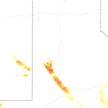
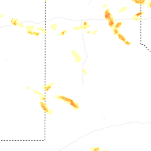

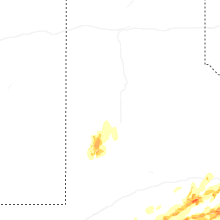


Connect with Interactive Hail Maps