

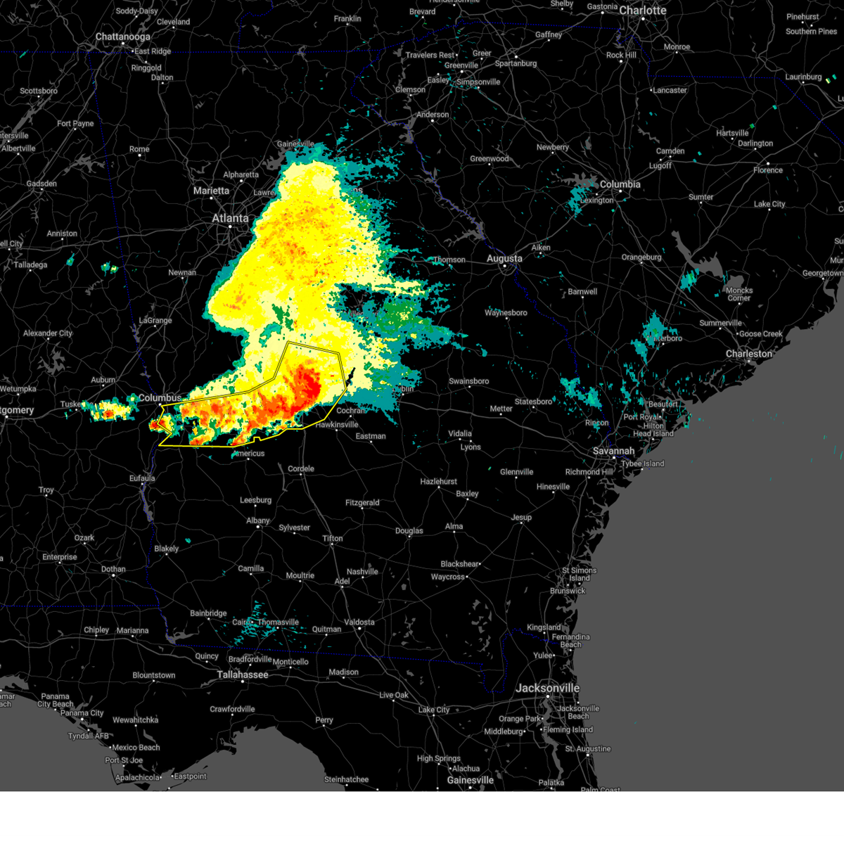
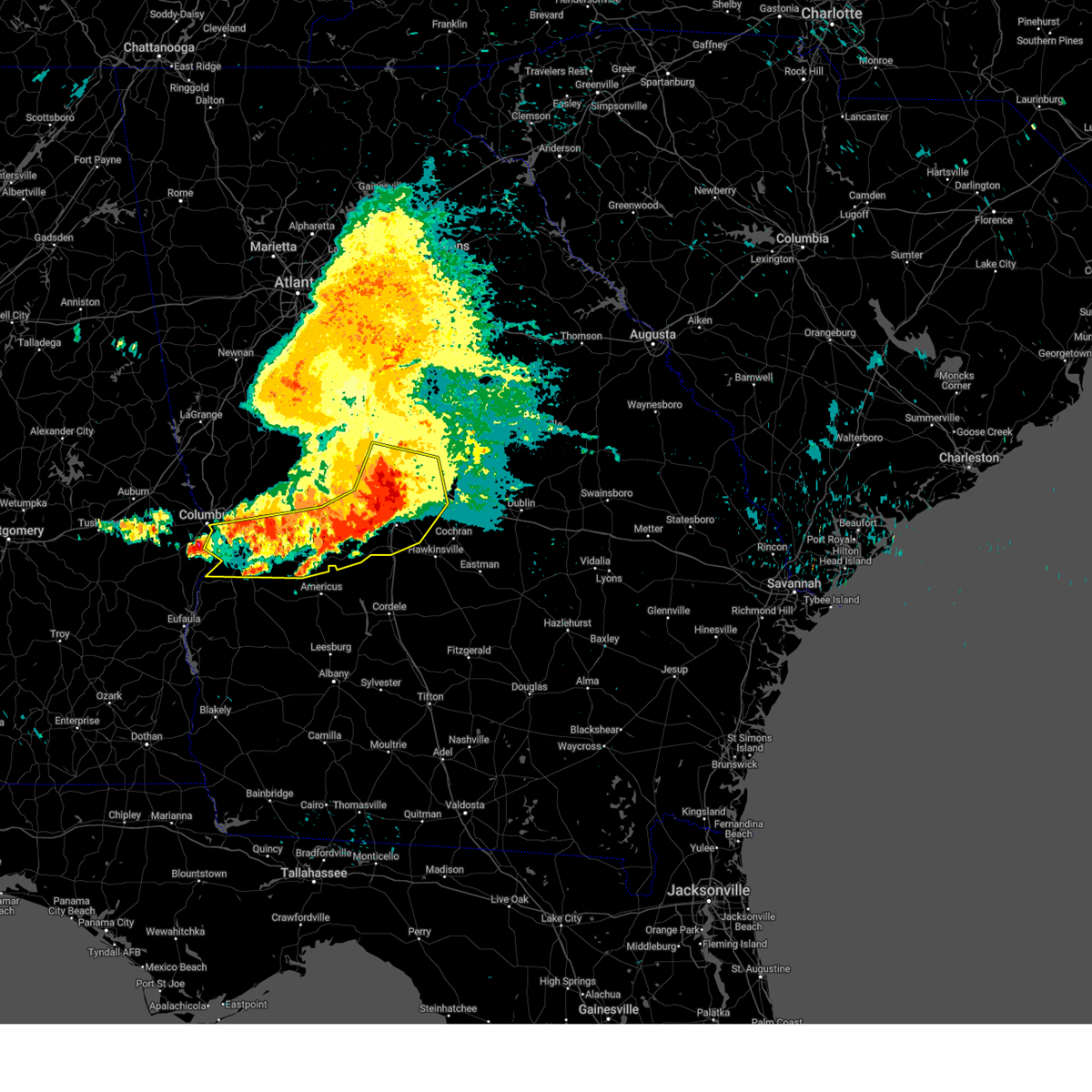
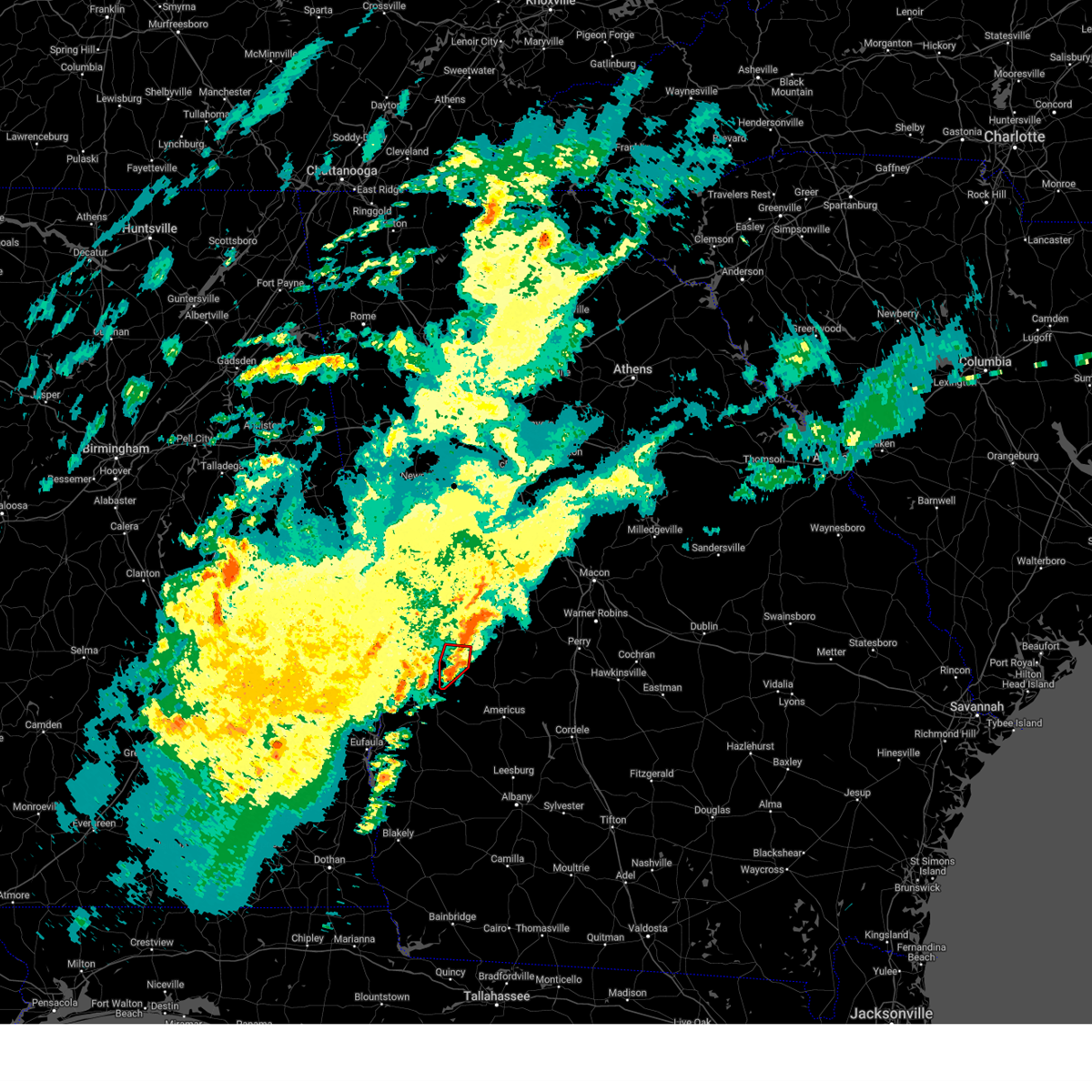
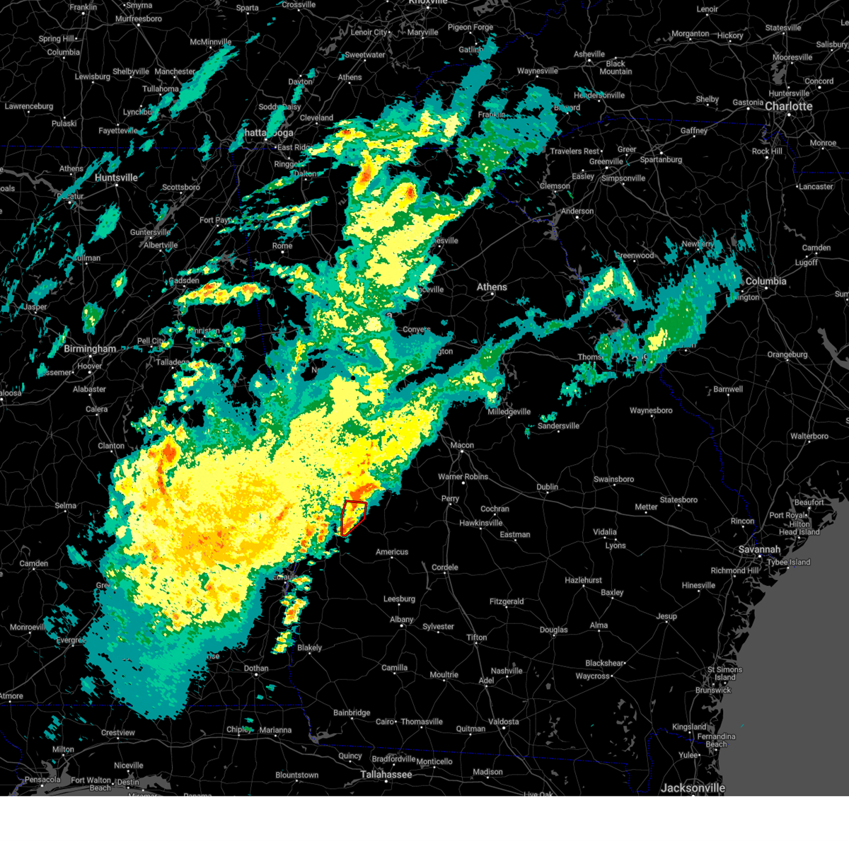
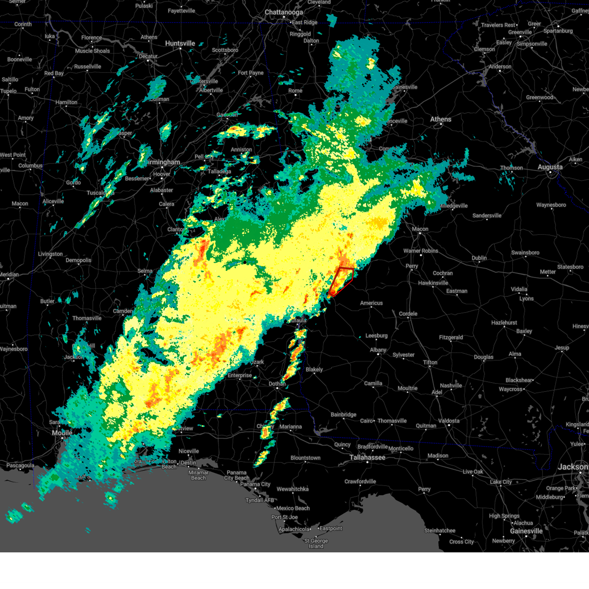
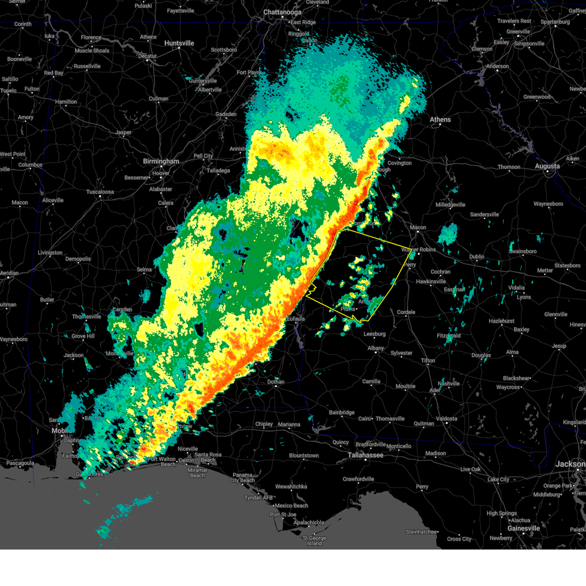
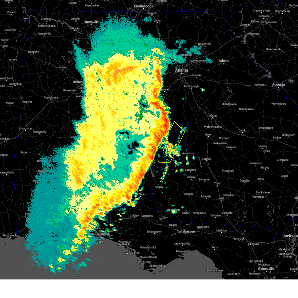
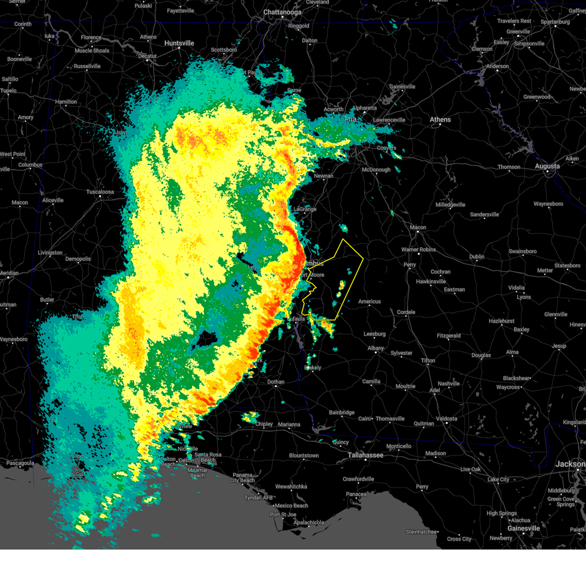
Hail Map for Buena Vista, GA
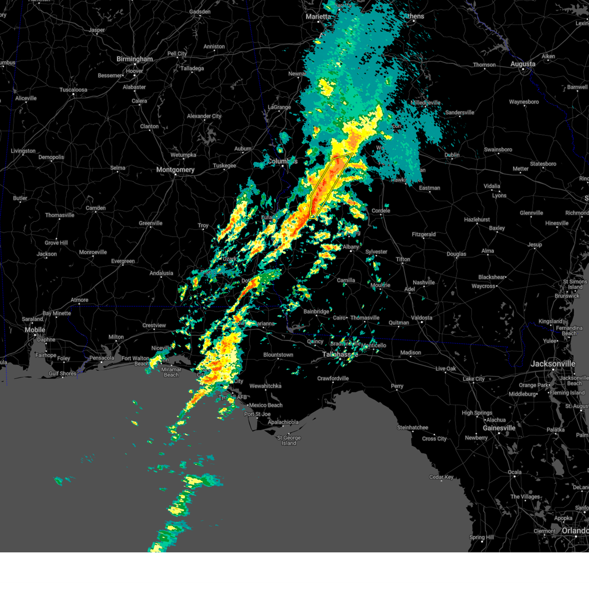
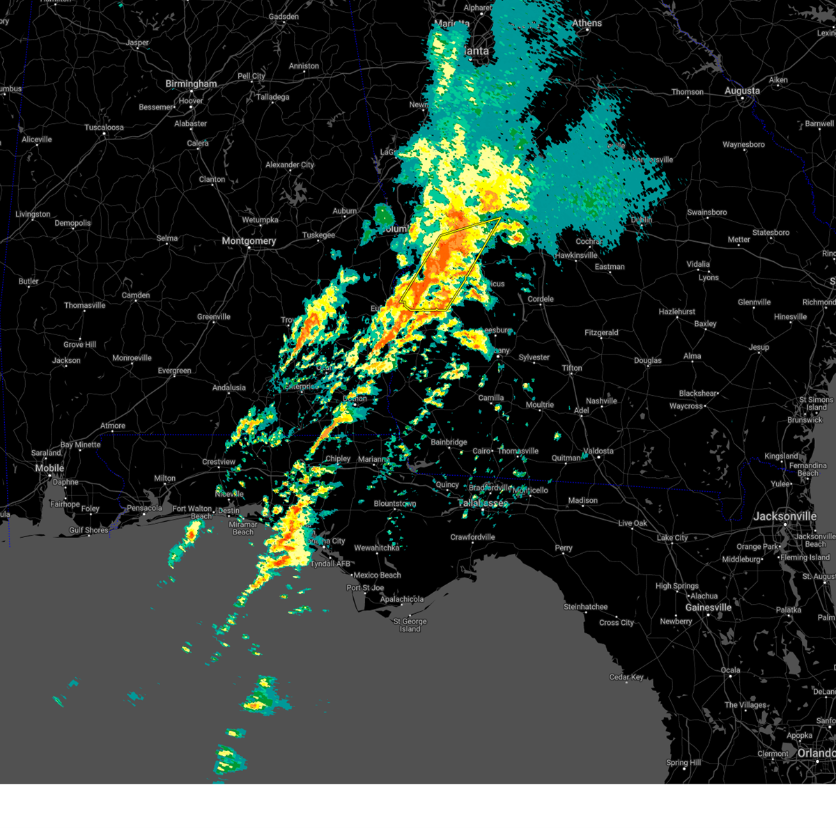
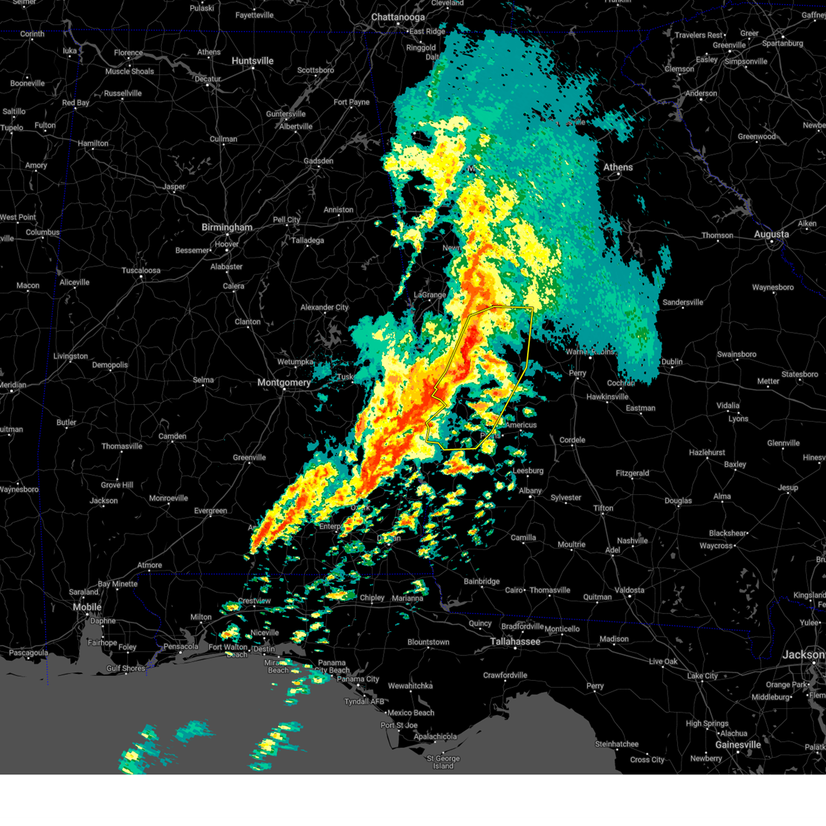
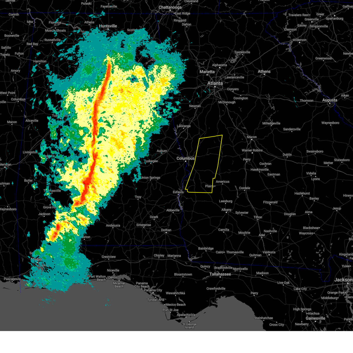
The Buena Vista, GA area has had 2 reports of on-the-ground hail by trained spotters, and has been under severe weather warnings 21 times during the past 12 months. Doppler radar has detected hail at or near Buena Vista, GA on 54 occasions, including 3 occasions during the past year.
| Name: | Buena Vista, GA |
| Where Located: | 59.8 miles ESE of Auburn, AL |
| Map: | Google Map for Buena Vista, GA |
| Population: | 2173 |
| Housing Units: | 1029 |
| More Info: | Search Google for Buena Vista, GA |
1
The Top Recent Hail Date for Buena Vista, GA is Friday, September 13, 2024 (16th out of 54)

Hail and Wind Damage Spotted near Buena Vista, GA
| Date / Time | Report Details |
|---|---|
| 5/18/2025 11:03 AM EDT |
 The storms which prompted the warning have moved out of the area. therefore, the warning has been allowed to expire. a severe thunderstorm watch remains in effect until 100 pm edt for central and west central georgia. The storms which prompted the warning have moved out of the area. therefore, the warning has been allowed to expire. a severe thunderstorm watch remains in effect until 100 pm edt for central and west central georgia.
|
| 5/18/2025 10:47 AM EDT |
 At 1047 am edt, severe thunderstorms were located along a line extending from near lake tobesofkee to near skipperton to near saint louis to near garden valley to buena vista, moving east at 55 mph (radar indicated). Hazards include 60 mph wind gusts and quarter size hail. Hail damage to vehicles is expected. expect wind damage to roofs, siding, and trees. Locations impacted include, macon, perry, fort valley, buena vista, butler, ellaville, oglethorpe, cusseta, warner robins, centerville, byron, montezuma, marshallville, reynolds, ideal, payne, robins afb, payne city, north fort benning, and fort benning/lawson army air fld. At 1047 am edt, severe thunderstorms were located along a line extending from near lake tobesofkee to near skipperton to near saint louis to near garden valley to buena vista, moving east at 55 mph (radar indicated). Hazards include 60 mph wind gusts and quarter size hail. Hail damage to vehicles is expected. expect wind damage to roofs, siding, and trees. Locations impacted include, macon, perry, fort valley, buena vista, butler, ellaville, oglethorpe, cusseta, warner robins, centerville, byron, montezuma, marshallville, reynolds, ideal, payne, robins afb, payne city, north fort benning, and fort benning/lawson army air fld.
|
| 5/18/2025 10:47 AM EDT |
 the severe thunderstorm warning has been cancelled and is no longer in effect the severe thunderstorm warning has been cancelled and is no longer in effect
|
| 5/18/2025 10:11 AM EDT |
 Svrffc the national weather service in peachtree city has issued a * severe thunderstorm warning for, marion county in west central georgia, bibb county in central georgia, southeastern pike county in west central georgia, muscogee county in west central georgia, monroe county in central georgia, chattahoochee county in west central georgia, northern stewart county in west central georgia, eastern upson county in west central georgia, houston county in central georgia, central jones county in central georgia, southeastern harris county in west central georgia, macon county in west central georgia, western twiggs county in central georgia, northwestern webster county in west central georgia, peach county in central georgia, crawford county in central georgia, schley county in west central georgia, southern talbot county in west central georgia, taylor county in west central georgia, lamar county in west central georgia, * until 1100 am edt. * at 1011 am edt, severe thunderstorms were located along a line extending from piedmont to logtown to near howard to juniper to benning park, moving east at 55 mph (radar indicated). Hazards include 60 mph wind gusts and quarter size hail. Hail damage to vehicles is expected. Expect wind damage to roofs, siding, and trees. Svrffc the national weather service in peachtree city has issued a * severe thunderstorm warning for, marion county in west central georgia, bibb county in central georgia, southeastern pike county in west central georgia, muscogee county in west central georgia, monroe county in central georgia, chattahoochee county in west central georgia, northern stewart county in west central georgia, eastern upson county in west central georgia, houston county in central georgia, central jones county in central georgia, southeastern harris county in west central georgia, macon county in west central georgia, western twiggs county in central georgia, northwestern webster county in west central georgia, peach county in central georgia, crawford county in central georgia, schley county in west central georgia, southern talbot county in west central georgia, taylor county in west central georgia, lamar county in west central georgia, * until 1100 am edt. * at 1011 am edt, severe thunderstorms were located along a line extending from piedmont to logtown to near howard to juniper to benning park, moving east at 55 mph (radar indicated). Hazards include 60 mph wind gusts and quarter size hail. Hail damage to vehicles is expected. Expect wind damage to roofs, siding, and trees.
|
| 4/7/2025 12:44 AM EDT |
 The storm which prompted the warning has weakened below severe limits, and no longer appears capable of producing a tornado. therefore, the warning will be allowed to expire. The storm which prompted the warning has weakened below severe limits, and no longer appears capable of producing a tornado. therefore, the warning will be allowed to expire.
|
| 4/7/2025 12:35 AM EDT |
 the tornado warning has been cancelled and is no longer in effect the tornado warning has been cancelled and is no longer in effect
|
| 4/7/2025 12:35 AM EDT |
 At 1234 am edt, a severe thunderstorm capable of producing a tornado was located over zellobee, or near buena vista, moving northeast at 30 mph (radar indicated rotation). Hazards include tornado. Flying debris will be dangerous to those caught without shelter. mobile homes will be damaged or destroyed. damage to roofs, windows, and vehicles will occur. tree damage is likely. Locations impacted include, oakland, zellobee, buena vista, and brantley. At 1234 am edt, a severe thunderstorm capable of producing a tornado was located over zellobee, or near buena vista, moving northeast at 30 mph (radar indicated rotation). Hazards include tornado. Flying debris will be dangerous to those caught without shelter. mobile homes will be damaged or destroyed. damage to roofs, windows, and vehicles will occur. tree damage is likely. Locations impacted include, oakland, zellobee, buena vista, and brantley.
|
| 4/7/2025 12:21 AM EDT |
 Torffc the national weather service in peachtree city has issued a * tornado warning for, northern marion county in west central georgia, southeastern chattahoochee county in west central georgia, northeastern stewart county in west central georgia, * until 1245 am edt. * at 1221 am edt, a severe thunderstorm capable of producing a tornado was located over renfroe, or 7 miles southeast of cusseta, moving northeast at 40 mph (radar indicated rotation). Hazards include tornado. Flying debris will be dangerous to those caught without shelter. mobile homes will be damaged or destroyed. damage to roofs, windows, and vehicles will occur. Tree damage is likely. Torffc the national weather service in peachtree city has issued a * tornado warning for, northern marion county in west central georgia, southeastern chattahoochee county in west central georgia, northeastern stewart county in west central georgia, * until 1245 am edt. * at 1221 am edt, a severe thunderstorm capable of producing a tornado was located over renfroe, or 7 miles southeast of cusseta, moving northeast at 40 mph (radar indicated rotation). Hazards include tornado. Flying debris will be dangerous to those caught without shelter. mobile homes will be damaged or destroyed. damage to roofs, windows, and vehicles will occur. Tree damage is likely.
|
| 3/31/2025 12:49 PM EDT |
 Svrffc the national weather service in peachtree city has issued a * severe thunderstorm warning for, marion county in west central georgia, southern muscogee county in west central georgia, chattahoochee county in west central georgia, northern stewart county in west central georgia, northwestern webster county in west central georgia, * until 130 pm edt. * at 1249 pm edt, severe thunderstorms were located along a line extending from carter acres to near omaha to near hawkinsville, moving east at 50 mph (radar indicated). Hazards include 60 mph wind gusts and quarter size hail. Hail damage to vehicles is expected. Expect wind damage to roofs, siding, and trees. Svrffc the national weather service in peachtree city has issued a * severe thunderstorm warning for, marion county in west central georgia, southern muscogee county in west central georgia, chattahoochee county in west central georgia, northern stewart county in west central georgia, northwestern webster county in west central georgia, * until 130 pm edt. * at 1249 pm edt, severe thunderstorms were located along a line extending from carter acres to near omaha to near hawkinsville, moving east at 50 mph (radar indicated). Hazards include 60 mph wind gusts and quarter size hail. Hail damage to vehicles is expected. Expect wind damage to roofs, siding, and trees.
|
| 3/16/2025 3:25 AM EDT |
 The storms which prompted the warning have moved out of the area. therefore, the warning will be allowed to expire. a tornado watch remains in effect until 400 am edt for west central georgia. a tornado watch also remains in effect until 1000 am edt for west central georgia. remember, a severe thunderstorm warning still remains in effect for eastern schley, eastern taylor, and eastern webster counties. The storms which prompted the warning have moved out of the area. therefore, the warning will be allowed to expire. a tornado watch remains in effect until 400 am edt for west central georgia. a tornado watch also remains in effect until 1000 am edt for west central georgia. remember, a severe thunderstorm warning still remains in effect for eastern schley, eastern taylor, and eastern webster counties.
|
| 3/16/2025 3:11 AM EDT |
 the severe thunderstorm warning has been cancelled and is no longer in effect the severe thunderstorm warning has been cancelled and is no longer in effect
|
| 3/16/2025 3:11 AM EDT |
 At 311 am edt, severe thunderstorms were located along a line extending from near butler to church hill, moving east at 60 mph (radar indicated). Hazards include 60 mph wind gusts. Expect damage to roofs, siding, and trees. Locations impacted include, putnam, kimbrough, preston, rupert, charing, draneville, tazewell, weston, doyle, church hill, seminole, walls crossing, buena vista, and butler. At 311 am edt, severe thunderstorms were located along a line extending from near butler to church hill, moving east at 60 mph (radar indicated). Hazards include 60 mph wind gusts. Expect damage to roofs, siding, and trees. Locations impacted include, putnam, kimbrough, preston, rupert, charing, draneville, tazewell, weston, doyle, church hill, seminole, walls crossing, buena vista, and butler.
|
| 3/16/2025 2:46 AM EDT |
 Svrffc the national weather service in peachtree city has issued a * severe thunderstorm warning for, marion county in west central georgia, southeastern chattahoochee county in west central georgia, stewart county in west central georgia, webster county in west central georgia, western schley county in west central georgia, southwestern taylor county in west central georgia, * until 330 am edt. * at 246 am edt, severe thunderstorms were located along a line extending from near zellobee to near sanford, moving northeast at 60 mph (radar indicated). Hazards include 60 mph wind gusts. expect damage to roofs, siding, and trees Svrffc the national weather service in peachtree city has issued a * severe thunderstorm warning for, marion county in west central georgia, southeastern chattahoochee county in west central georgia, stewart county in west central georgia, webster county in west central georgia, western schley county in west central georgia, southwestern taylor county in west central georgia, * until 330 am edt. * at 246 am edt, severe thunderstorms were located along a line extending from near zellobee to near sanford, moving northeast at 60 mph (radar indicated). Hazards include 60 mph wind gusts. expect damage to roofs, siding, and trees
|
| 3/16/2025 1:59 AM EDT |
 Svrffc the national weather service in peachtree city has issued a * severe thunderstorm warning for, marion county in west central georgia, southeastern meriwether county in west central georgia, muscogee county in west central georgia, chattahoochee county in west central georgia, stewart county in west central georgia, upson county in west central georgia, northwestern webster county in west central georgia, west central crawford county in central georgia, western schley county in west central georgia, talbot county in west central georgia, taylor county in west central georgia, southeastern harris county in west central georgia, * until 245 am edt. * at 159 am edt, severe thunderstorms were located along a line extending from raleigh to near eelbeck/west fort benning to lakepoint resort state park, moving east at 40 mph (radar indicated). Hazards include 60 mph wind gusts. expect damage to roofs, siding, and trees Svrffc the national weather service in peachtree city has issued a * severe thunderstorm warning for, marion county in west central georgia, southeastern meriwether county in west central georgia, muscogee county in west central georgia, chattahoochee county in west central georgia, stewart county in west central georgia, upson county in west central georgia, northwestern webster county in west central georgia, west central crawford county in central georgia, western schley county in west central georgia, talbot county in west central georgia, taylor county in west central georgia, southeastern harris county in west central georgia, * until 245 am edt. * at 159 am edt, severe thunderstorms were located along a line extending from raleigh to near eelbeck/west fort benning to lakepoint resort state park, moving east at 40 mph (radar indicated). Hazards include 60 mph wind gusts. expect damage to roofs, siding, and trees
|
| 3/5/2025 2:41 AM EST |
 The storms which prompted the warning have weakened below severe limits, and have exited the warned area. therefore, the warning will be allowed to expire. a severe thunderstorm watch remains in effect until 400 am est for west central georgia. The storms which prompted the warning have weakened below severe limits, and have exited the warned area. therefore, the warning will be allowed to expire. a severe thunderstorm watch remains in effect until 400 am est for west central georgia.
|
| 3/5/2025 2:00 AM EST |
 Svrffc the national weather service in peachtree city has issued a * severe thunderstorm warning for, marion county in west central georgia, southeastern meriwether county in west central georgia, eastern muscogee county in west central georgia, chattahoochee county in west central georgia, stewart county in west central georgia, central upson county in west central georgia, webster county in west central georgia, western schley county in west central georgia, talbot county in west central georgia, western taylor county in west central georgia, southeastern harris county in west central georgia, * until 245 am est. * at 200 am est, severe thunderstorms were located along a line extending from flint hill to eelbeck/west fort moore to near sanford, moving east at 20 mph (radar indicated). Hazards include 60 mph wind gusts. expect damage to roofs, siding, and trees Svrffc the national weather service in peachtree city has issued a * severe thunderstorm warning for, marion county in west central georgia, southeastern meriwether county in west central georgia, eastern muscogee county in west central georgia, chattahoochee county in west central georgia, stewart county in west central georgia, central upson county in west central georgia, webster county in west central georgia, western schley county in west central georgia, talbot county in west central georgia, western taylor county in west central georgia, southeastern harris county in west central georgia, * until 245 am est. * at 200 am est, severe thunderstorms were located along a line extending from flint hill to eelbeck/west fort moore to near sanford, moving east at 20 mph (radar indicated). Hazards include 60 mph wind gusts. expect damage to roofs, siding, and trees
|
| 2/16/2025 5:02 AM EST |
 Svrffc the national weather service in peachtree city has issued a * severe thunderstorm warning for, marion county in west central georgia, eastern muscogee county in west central georgia, chattahoochee county in west central georgia, northern stewart county in west central georgia, southern upson county in west central georgia, sumter county in west central georgia, southeastern harris county in west central georgia, macon county in west central georgia, webster county in west central georgia, peach county in central georgia, central crawford county in central georgia, schley county in west central georgia, talbot county in west central georgia, taylor county in west central georgia, * until 600 am est. * at 501 am est, severe thunderstorms were located along a line extending from woodland to near box springs to near jamestown/south fort moore, moving southeast at 45 mph (radar indicated). Hazards include 70 mph wind gusts. Expect considerable tree damage. Damage is likely to mobile homes, roofs, and outbuildings. Svrffc the national weather service in peachtree city has issued a * severe thunderstorm warning for, marion county in west central georgia, eastern muscogee county in west central georgia, chattahoochee county in west central georgia, northern stewart county in west central georgia, southern upson county in west central georgia, sumter county in west central georgia, southeastern harris county in west central georgia, macon county in west central georgia, webster county in west central georgia, peach county in central georgia, central crawford county in central georgia, schley county in west central georgia, talbot county in west central georgia, taylor county in west central georgia, * until 600 am est. * at 501 am est, severe thunderstorms were located along a line extending from woodland to near box springs to near jamestown/south fort moore, moving southeast at 45 mph (radar indicated). Hazards include 70 mph wind gusts. Expect considerable tree damage. Damage is likely to mobile homes, roofs, and outbuildings.
|
| 12/29/2024 3:58 AM EST |
 At 357 am est, severe thunderstorms were located along a line extending from near box springs to near sand hill to near lakepoint resort state park, moving east at 35 mph (radar indicated). Hazards include 60 mph wind gusts. Expect damage to roofs, siding, and trees. Locations impacted include, lumpkin, buena vista, talbotton, cusseta, richland, junction city, geneva, fort moore, north fort moore, upatoi, brantley, seminole, florence marina state park, westville, juniper, vista terrace, brooklyn, renfroe, oakland, and manta. At 357 am est, severe thunderstorms were located along a line extending from near box springs to near sand hill to near lakepoint resort state park, moving east at 35 mph (radar indicated). Hazards include 60 mph wind gusts. Expect damage to roofs, siding, and trees. Locations impacted include, lumpkin, buena vista, talbotton, cusseta, richland, junction city, geneva, fort moore, north fort moore, upatoi, brantley, seminole, florence marina state park, westville, juniper, vista terrace, brooklyn, renfroe, oakland, and manta.
|
| 12/29/2024 3:25 AM EST |
 Svrffc the national weather service in peachtree city has issued a * severe thunderstorm warning for, marion county in west central georgia, central muscogee county in west central georgia, chattahoochee county in west central georgia, stewart county in west central georgia, northwestern webster county in west central georgia, southwestern talbot county in west central georgia, southwestern taylor county in west central georgia, * until 430 am est. * at 325 am est, severe thunderstorms were located along a line extending from ladonia sports complex to near russell county sports complex to white oak, moving east at 45 mph (radar indicated). Hazards include 60 mph wind gusts. expect damage to roofs, siding, and trees Svrffc the national weather service in peachtree city has issued a * severe thunderstorm warning for, marion county in west central georgia, central muscogee county in west central georgia, chattahoochee county in west central georgia, stewart county in west central georgia, northwestern webster county in west central georgia, southwestern talbot county in west central georgia, southwestern taylor county in west central georgia, * until 430 am est. * at 325 am est, severe thunderstorms were located along a line extending from ladonia sports complex to near russell county sports complex to white oak, moving east at 45 mph (radar indicated). Hazards include 60 mph wind gusts. expect damage to roofs, siding, and trees
|
| 8/18/2024 6:05 PM EDT |
 Svrffc the national weather service in peachtree city has issued a * severe thunderstorm warning for, northwestern marion county in west central georgia, chattahoochee county in west central georgia, * until 645 pm edt. * at 604 pm edt, a severe thunderstorm was located over vista terrace, or 7 miles east of columbus, moving southeast at 35 mph (radar indicated). Hazards include 60 mph wind gusts and penny size hail. expect damage to roofs, siding, and trees Svrffc the national weather service in peachtree city has issued a * severe thunderstorm warning for, northwestern marion county in west central georgia, chattahoochee county in west central georgia, * until 645 pm edt. * at 604 pm edt, a severe thunderstorm was located over vista terrace, or 7 miles east of columbus, moving southeast at 35 mph (radar indicated). Hazards include 60 mph wind gusts and penny size hail. expect damage to roofs, siding, and trees
|
| 7/29/2024 7:11 PM EDT |
 Svrffc the national weather service in peachtree city has issued a * severe thunderstorm warning for, southern marion county in west central georgia, southeastern chattahoochee county in west central georgia, northeastern stewart county in west central georgia, northwestern webster county in west central georgia, southwestern schley county in west central georgia, * until 800 pm edt. * at 711 pm edt, severe thunderstorms were located along a line extending from christopher to near brantley, moving southeast at 15 mph (radar indicated). Hazards include 60 mph wind gusts and quarter size hail. Hail damage to vehicles is expected. Expect wind damage to roofs, siding, and trees. Svrffc the national weather service in peachtree city has issued a * severe thunderstorm warning for, southern marion county in west central georgia, southeastern chattahoochee county in west central georgia, northeastern stewart county in west central georgia, northwestern webster county in west central georgia, southwestern schley county in west central georgia, * until 800 pm edt. * at 711 pm edt, severe thunderstorms were located along a line extending from christopher to near brantley, moving southeast at 15 mph (radar indicated). Hazards include 60 mph wind gusts and quarter size hail. Hail damage to vehicles is expected. Expect wind damage to roofs, siding, and trees.
|
| 5/10/2024 12:13 AM EDT |
 Svrffc the national weather service in peachtree city has issued a * severe thunderstorm warning for, macon county in west central georgia, central marion county in west central georgia, northwestern dooly county in central georgia, central schley county in west central georgia, * until 100 am edt. * at 1213 am edt, a severe thunderstorm was located over buena vista, moving east at 45 mph (radar indicated). Hazards include 60 mph wind gusts and quarter size hail. Hail damage to vehicles is expected. Expect wind damage to roofs, siding, and trees. Svrffc the national weather service in peachtree city has issued a * severe thunderstorm warning for, macon county in west central georgia, central marion county in west central georgia, northwestern dooly county in central georgia, central schley county in west central georgia, * until 100 am edt. * at 1213 am edt, a severe thunderstorm was located over buena vista, moving east at 45 mph (radar indicated). Hazards include 60 mph wind gusts and quarter size hail. Hail damage to vehicles is expected. Expect wind damage to roofs, siding, and trees.
|
| 5/9/2024 12:33 PM EDT |
 Torffc the national weather service in peachtree city has issued a * tornado warning for, southwestern macon county in west central georgia, southeastern marion county in west central georgia, schley county in west central georgia, northwestern sumter county in west central georgia, * until 100 pm edt. * at 1233 pm edt, a severe thunderstorm capable of producing a tornado was located over draneville, or near buena vista, moving east at 50 mph (radar indicated rotation). Hazards include tornado. Flying debris will be dangerous to those caught without shelter. mobile homes will be damaged or destroyed. damage to roofs, windows, and vehicles will occur. Tree damage is likely. Torffc the national weather service in peachtree city has issued a * tornado warning for, southwestern macon county in west central georgia, southeastern marion county in west central georgia, schley county in west central georgia, northwestern sumter county in west central georgia, * until 100 pm edt. * at 1233 pm edt, a severe thunderstorm capable of producing a tornado was located over draneville, or near buena vista, moving east at 50 mph (radar indicated rotation). Hazards include tornado. Flying debris will be dangerous to those caught without shelter. mobile homes will be damaged or destroyed. damage to roofs, windows, and vehicles will occur. Tree damage is likely.
|
| 5/9/2024 12:30 PM EDT |
 Svrffc the national weather service in peachtree city has issued a * severe thunderstorm warning for, southwestern macon county in west central georgia, southern marion county in west central georgia, north central webster county in west central georgia, schley county in west central georgia, northern sumter county in west central georgia, * until 115 pm edt. * at 1229 pm edt, a severe thunderstorm was located near draneville, or near buena vista, moving east at 50 mph (radar indicated). Hazards include 60 mph wind gusts and nickel size hail. expect damage to roofs, siding, and trees Svrffc the national weather service in peachtree city has issued a * severe thunderstorm warning for, southwestern macon county in west central georgia, southern marion county in west central georgia, north central webster county in west central georgia, schley county in west central georgia, northern sumter county in west central georgia, * until 115 pm edt. * at 1229 pm edt, a severe thunderstorm was located near draneville, or near buena vista, moving east at 50 mph (radar indicated). Hazards include 60 mph wind gusts and nickel size hail. expect damage to roofs, siding, and trees
|
| 3/15/2024 3:37 PM EDT | Golf Ball sized hail reported 5.4 miles N of Buena Vista, GA, local business reports golf ball sized hail near mill pond rd and ga41. |
| 3/15/2024 3:32 PM EDT |
 the severe thunderstorm warning has been cancelled and is no longer in effect the severe thunderstorm warning has been cancelled and is no longer in effect
|
| 3/15/2024 3:32 PM EDT |
 At 332 pm edt, a severe thunderstorm was located near seminole, or 9 miles southwest of buena vista, moving east at 40 mph (radar indicated). Hazards include ping pong ball size hail and 60 mph wind gusts. People and animals outdoors will be injured. expect hail damage to roofs, siding, windows, and vehicles. expect wind damage to roofs, siding, and trees. Locations impacted include, buena vista, putnam, seminole, doyle, church hill, draneville, zellobee, and walls crossing. At 332 pm edt, a severe thunderstorm was located near seminole, or 9 miles southwest of buena vista, moving east at 40 mph (radar indicated). Hazards include ping pong ball size hail and 60 mph wind gusts. People and animals outdoors will be injured. expect hail damage to roofs, siding, windows, and vehicles. expect wind damage to roofs, siding, and trees. Locations impacted include, buena vista, putnam, seminole, doyle, church hill, draneville, zellobee, and walls crossing.
|
| 1/9/2024 9:25 AM EST | Tree downed along hwy 26 near the intersection of firetower roa in marion county GA, 2.5 miles E of Buena Vista, GA |
| 1/9/2024 9:22 AM EST |
 At 922 am est, severe thunderstorms were located along a line extending from brantley to near seminole to kimbrough, moving northeast at 70 mph (radar indicated). Hazards include 60 mph wind gusts. Expect damage to roofs, siding, and trees. locations impacted include, buena vista, butler, ellaville, preston, richland, putnam, brantley, seminole, murrays crossroads, rupert, charing, oakland, draneville, zellobee, mauk, howard, tazewell, marion estates, doyle, and church hill. hail threat, radar indicated max hail size, <. 75 in wind threat, radar indicated max wind gust, 60 mph. At 922 am est, severe thunderstorms were located along a line extending from brantley to near seminole to kimbrough, moving northeast at 70 mph (radar indicated). Hazards include 60 mph wind gusts. Expect damage to roofs, siding, and trees. locations impacted include, buena vista, butler, ellaville, preston, richland, putnam, brantley, seminole, murrays crossroads, rupert, charing, oakland, draneville, zellobee, mauk, howard, tazewell, marion estates, doyle, and church hill. hail threat, radar indicated max hail size, <. 75 in wind threat, radar indicated max wind gust, 60 mph.
|
| 1/9/2024 9:03 AM EST |
 At 903 am est, severe thunderstorms were located along a line extending from louvale to lumpkin to near springvale, moving northeast at 80 mph (radar indicated). Hazards include 60 mph wind gusts. expect damage to roofs, siding, and trees At 903 am est, severe thunderstorms were located along a line extending from louvale to lumpkin to near springvale, moving northeast at 80 mph (radar indicated). Hazards include 60 mph wind gusts. expect damage to roofs, siding, and trees
|
| 8/15/2023 5:47 PM EDT | 1 tree down along highway 137 near tazewel in marion county GA, 6.2 miles SW of Buena Vista, GA |
| 8/12/2023 5:46 PM EDT |
 At 546 pm edt, a severe thunderstorm was located near buena vista, moving southeast at 15 mph (radar indicated). Hazards include 60 mph wind gusts and quarter size hail. Hail damage to vehicles is expected. Expect wind damage to roofs, siding, and trees. At 546 pm edt, a severe thunderstorm was located near buena vista, moving southeast at 15 mph (radar indicated). Hazards include 60 mph wind gusts and quarter size hail. Hail damage to vehicles is expected. Expect wind damage to roofs, siding, and trees.
|
| 8/8/2023 4:46 PM EDT |
 At 446 pm edt, a severe thunderstorm was located near brantley, or near buena vista, moving east at 40 mph (radar indicated). Hazards include 60 mph wind gusts. Expect damage to roofs, siding, and trees. locations impacted include, buena vista, brantley, tazewell, marion estates, and oakland. hail threat, radar indicated max hail size, <. 75 in wind threat, radar indicated max wind gust, 60 mph. At 446 pm edt, a severe thunderstorm was located near brantley, or near buena vista, moving east at 40 mph (radar indicated). Hazards include 60 mph wind gusts. Expect damage to roofs, siding, and trees. locations impacted include, buena vista, brantley, tazewell, marion estates, and oakland. hail threat, radar indicated max hail size, <. 75 in wind threat, radar indicated max wind gust, 60 mph.
|
| 8/8/2023 4:45 PM EDT | A tree fell onto a power line on murray farm rd and caused a fire in a wooded are in marion county GA, 2.6 miles ESE of Buena Vista, GA |
| 8/8/2023 4:28 PM EDT |
 At 428 pm edt, a severe thunderstorm was located near north fort moore, or 12 miles north of cusseta, moving east at 30 mph (radar indicated). Hazards include 60 mph wind gusts and nickel size hail. expect damage to roofs, siding, and trees At 428 pm edt, a severe thunderstorm was located near north fort moore, or 12 miles north of cusseta, moving east at 30 mph (radar indicated). Hazards include 60 mph wind gusts and nickel size hail. expect damage to roofs, siding, and trees
|
| 8/3/2023 7:08 PM EDT |
 At 708 pm edt, severe thunderstorms were located along a line extending from payne to near horns to near green island hills, moving southeast at 30 mph (radar indicated). Hazards include 60 mph wind gusts. expect damage to roofs, siding, and trees At 708 pm edt, severe thunderstorms were located along a line extending from payne to near horns to near green island hills, moving southeast at 30 mph (radar indicated). Hazards include 60 mph wind gusts. expect damage to roofs, siding, and trees
|
| 7/30/2023 3:42 PM EDT |
 At 342 pm edt, severe thunderstorms were located along a line extending from renfroe to lakepoint resort state park, moving southeast at 15 mph (radar indicated). Hazards include 60 mph wind gusts and quarter size hail. Hail damage to vehicles is expected. Expect wind damage to roofs, siding, and trees. At 342 pm edt, severe thunderstorms were located along a line extending from renfroe to lakepoint resort state park, moving southeast at 15 mph (radar indicated). Hazards include 60 mph wind gusts and quarter size hail. Hail damage to vehicles is expected. Expect wind damage to roofs, siding, and trees.
|
| 6/30/2023 4:59 PM EDT |
 At 459 pm edt, severe thunderstorms were located along a line extending from near omaha to near brooklyn to buena vista, moving south at 40 mph (radar indicated). Hazards include 60 mph wind gusts and penny size hail. expect damage to roofs, siding, and trees At 459 pm edt, severe thunderstorms were located along a line extending from near omaha to near brooklyn to buena vista, moving south at 40 mph (radar indicated). Hazards include 60 mph wind gusts and penny size hail. expect damage to roofs, siding, and trees
|
| 6/30/2023 4:32 PM EDT |
 At 432 pm edt, severe thunderstorms were located along a line extending from columbus to near north fort moore to geneva, moving south at 45 mph (radar indicated). Hazards include 60 mph wind gusts and penny size hail. expect damage to roofs, siding, and trees At 432 pm edt, severe thunderstorms were located along a line extending from columbus to near north fort moore to geneva, moving south at 45 mph (radar indicated). Hazards include 60 mph wind gusts and penny size hail. expect damage to roofs, siding, and trees
|
| 6/25/2023 8:53 PM EDT |
 At 853 pm edt, severe thunderstorms were located along a line extending from fountainville to zellobee to fort mitchell, moving south at 30 mph (radar indicated). Hazards include 60 mph wind gusts. expect damage to roofs, siding, and trees At 853 pm edt, severe thunderstorms were located along a line extending from fountainville to zellobee to fort mitchell, moving south at 30 mph (radar indicated). Hazards include 60 mph wind gusts. expect damage to roofs, siding, and trees
|
| 6/25/2023 8:18 PM EDT |
 At 818 pm edt, severe thunderstorms were located along a line extending from near junction city to near bleecker, moving south at 35 mph (radar indicated). Hazards include 60 mph wind gusts. expect damage to roofs, siding, and trees At 818 pm edt, severe thunderstorms were located along a line extending from near junction city to near bleecker, moving south at 35 mph (radar indicated). Hazards include 60 mph wind gusts. expect damage to roofs, siding, and trees
|
| 6/14/2023 1:52 PM EDT |
 The severe thunderstorm warning for southern marion, southeastern chattahoochee, northeastern stewart and west central schley counties will expire at 200 pm edt, the storm which prompted the warning has weakened below severe limits, and no longer poses an immediate threat to life or property. therefore, the warning will be allowed to expire. however heavy rain is still possible with this thunderstorm. a tornado watch remains in effect until 700 pm edt for west central georgia. The severe thunderstorm warning for southern marion, southeastern chattahoochee, northeastern stewart and west central schley counties will expire at 200 pm edt, the storm which prompted the warning has weakened below severe limits, and no longer poses an immediate threat to life or property. therefore, the warning will be allowed to expire. however heavy rain is still possible with this thunderstorm. a tornado watch remains in effect until 700 pm edt for west central georgia.
|
| 6/14/2023 1:35 PM EDT |
 At 135 pm edt, a severe thunderstorm was located over cusseta, moving east at 25 mph (radar indicated). Hazards include 60 mph wind gusts. expect damage to roofs, siding, and trees At 135 pm edt, a severe thunderstorm was located over cusseta, moving east at 25 mph (radar indicated). Hazards include 60 mph wind gusts. expect damage to roofs, siding, and trees
|
| 6/14/2023 8:30 AM EDT | Tree down on hwy 41 near brantley roa in marion county GA, 3.8 miles SSE of Buena Vista, GA |
| 1/12/2023 5:39 PM EST |
 At 539 pm est, severe thunderstorms were located along a line extending from near howard to near tazewell to near zellobee, moving east at 70 mph (radar indicated). Hazards include 60 mph wind gusts. expect damage to roofs, siding, and trees At 539 pm est, severe thunderstorms were located along a line extending from near howard to near tazewell to near zellobee, moving east at 70 mph (radar indicated). Hazards include 60 mph wind gusts. expect damage to roofs, siding, and trees
|
| 8/6/2022 6:30 PM EDT | Tree and powerline down in buena vist in marion county GA, 0.2 miles SE of Buena Vista, GA |
| 6/29/2022 3:36 PM EDT | Tree down at 41 s and hay road in marion county GA, 10.3 miles N of Buena Vista, GA |
| 6/24/2022 2:46 PM EDT |
 At 246 pm edt, a severe thunderstorm was located over tazewell, or near buena vista, moving southeast at 10 mph (radar indicated). Hazards include 60 mph wind gusts and quarter size hail. Hail damage to vehicles is expected. Expect wind damage to roofs, siding, and trees. At 246 pm edt, a severe thunderstorm was located over tazewell, or near buena vista, moving southeast at 10 mph (radar indicated). Hazards include 60 mph wind gusts and quarter size hail. Hail damage to vehicles is expected. Expect wind damage to roofs, siding, and trees.
|
| 6/15/2022 7:51 PM EDT |
 At 751 pm edt, a severe thunderstorm was located near walls crossing, or near ellaville, moving southwest at 30 mph (radar indicated). Hazards include 60 mph wind gusts and quarter size hail. Hail damage to vehicles is expected. expect wind damage to roofs, siding, and trees. locations impacted include, buena vista, ellaville, putnam, brantley, murrays crossroads, tazewell, doyle, draneville and walls crossing. hail threat, radar indicated max hail size, 1. 00 in wind threat, radar indicated max wind gust, 60 mph. At 751 pm edt, a severe thunderstorm was located near walls crossing, or near ellaville, moving southwest at 30 mph (radar indicated). Hazards include 60 mph wind gusts and quarter size hail. Hail damage to vehicles is expected. expect wind damage to roofs, siding, and trees. locations impacted include, buena vista, ellaville, putnam, brantley, murrays crossroads, tazewell, doyle, draneville and walls crossing. hail threat, radar indicated max hail size, 1. 00 in wind threat, radar indicated max wind gust, 60 mph.
|
| 6/15/2022 7:41 PM EDT |
 At 741 pm edt, a severe thunderstorm was located over murrays crossroads, or 7 miles north of ellaville, moving southwest at 30 mph (radar indicated). Hazards include 60 mph wind gusts and quarter size hail. Hail damage to vehicles is expected. Expect wind damage to roofs, siding, and trees. At 741 pm edt, a severe thunderstorm was located over murrays crossroads, or 7 miles north of ellaville, moving southwest at 30 mph (radar indicated). Hazards include 60 mph wind gusts and quarter size hail. Hail damage to vehicles is expected. Expect wind damage to roofs, siding, and trees.
|
| 4/5/2022 2:28 PM EDT | The severe thunderstorm warning for marion, southeastern muscogee, chattahoochee, stewart and webster counties will expire at 230 pm edt, the storms which prompted the warning have moved out of the area. therefore, the warning will be allowed to expire. a tornado watch remains in effect until 700 pm edt for west central georgia. |
| 4/5/2022 2:26 PM EDT |
 At 225 pm edt, severe thunderstorms were located along a line extending from near mauk to seminole to centerpoint, moving east at 65 mph (radar indicated). Hazards include 60 mph wind gusts and penny size hail. expect damage to roofs, siding, and trees At 225 pm edt, severe thunderstorms were located along a line extending from near mauk to seminole to centerpoint, moving east at 65 mph (radar indicated). Hazards include 60 mph wind gusts and penny size hail. expect damage to roofs, siding, and trees
|
| 4/5/2022 2:11 PM EDT |
 At 211 pm edt, severe thunderstorms were located along a line extending from near juniper to louvale to near benevolence, moving east at 45 mph (radar indicated). Hazards include 60 mph wind gusts and quarter size hail. Hail damage to vehicles is expected. expect wind damage to roofs, siding, and trees. Locations impacted include, lumpkin, buena vista, preston, cusseta, richland, north fort benning, weston, upatoi, brantley, seminole, westville, jamestown/south fort benning, brooklyn, renfroe, oakland, manta, zellobee, leveretts, troutman and tazewell. At 211 pm edt, severe thunderstorms were located along a line extending from near juniper to louvale to near benevolence, moving east at 45 mph (radar indicated). Hazards include 60 mph wind gusts and quarter size hail. Hail damage to vehicles is expected. expect wind damage to roofs, siding, and trees. Locations impacted include, lumpkin, buena vista, preston, cusseta, richland, north fort benning, weston, upatoi, brantley, seminole, westville, jamestown/south fort benning, brooklyn, renfroe, oakland, manta, zellobee, leveretts, troutman and tazewell.
|
| 4/5/2022 1:54 PM EDT |
 At 154 pm edt, severe thunderstorms were located along a line extending from near north fort benning to omaha to near crossroads, moving east at 45 mph (radar indicated). Hazards include 60 mph wind gusts and quarter size hail. Hail damage to vehicles is expected. expect wind damage to roofs, siding, and trees. Locations impacted include, lumpkin, buena vista, cusseta, preston, richland, fort benning/lawson army air fld, north fort benning, weston, upatoi, bibb city, brantley, seminole, columbus metropolitan airport, oakland, troutman, sanford, benning hills, benning park, edgewood and charles. At 154 pm edt, severe thunderstorms were located along a line extending from near north fort benning to omaha to near crossroads, moving east at 45 mph (radar indicated). Hazards include 60 mph wind gusts and quarter size hail. Hail damage to vehicles is expected. expect wind damage to roofs, siding, and trees. Locations impacted include, lumpkin, buena vista, cusseta, preston, richland, fort benning/lawson army air fld, north fort benning, weston, upatoi, bibb city, brantley, seminole, columbus metropolitan airport, oakland, troutman, sanford, benning hills, benning park, edgewood and charles.
|
| 4/5/2022 1:37 PM EDT |
 At 137 pm edt, severe thunderstorms were located along a line extending from phenix city to 6 miles north of hawkinsville to near osco, moving east at 45 mph (radar indicated). Hazards include 60 mph wind gusts and quarter size hail. Hail damage to vehicles is expected. Expect wind damage to roofs, siding, and trees. At 137 pm edt, severe thunderstorms were located along a line extending from phenix city to 6 miles north of hawkinsville to near osco, moving east at 45 mph (radar indicated). Hazards include 60 mph wind gusts and quarter size hail. Hail damage to vehicles is expected. Expect wind damage to roofs, siding, and trees.
|
| 3/9/2022 8:26 AM EST |
 At 826 am est, a severe thunderstorm was located near draneville, or near buena vista, moving east at 45 mph (radar indicated). Hazards include 60 mph wind gusts. expect damage to roofs, siding, and trees At 826 am est, a severe thunderstorm was located near draneville, or near buena vista, moving east at 45 mph (radar indicated). Hazards include 60 mph wind gusts. expect damage to roofs, siding, and trees
|
| 12/30/2021 4:23 PM EST |
 At 423 pm est, a severe thunderstorm was located over christopher, or near cusseta, moving east at 40 mph (radar indicated). Hazards include 60 mph wind gusts and quarter size hail. Hail damage to vehicles is expected. Expect wind damage to roofs, siding, and trees. At 423 pm est, a severe thunderstorm was located over christopher, or near cusseta, moving east at 40 mph (radar indicated). Hazards include 60 mph wind gusts and quarter size hail. Hail damage to vehicles is expected. Expect wind damage to roofs, siding, and trees.
|
| 6/20/2021 3:36 AM EDT |
 At 335 am edt, a severe thunderstorm capable of producing a tornado was located over buena vista, moving northeast at 45 mph (radar indicated rotation). Hazards include tornado. Flying debris will be dangerous to those caught without shelter. mobile homes will be damaged or destroyed. damage to roofs, windows, and vehicles will occur. tree damage is likely. Locations impacted include, buena vista, brantley, tazewell and mauk. At 335 am edt, a severe thunderstorm capable of producing a tornado was located over buena vista, moving northeast at 45 mph (radar indicated rotation). Hazards include tornado. Flying debris will be dangerous to those caught without shelter. mobile homes will be damaged or destroyed. damage to roofs, windows, and vehicles will occur. tree damage is likely. Locations impacted include, buena vista, brantley, tazewell and mauk.
|
| 6/20/2021 3:22 AM EDT |
 At 321 am edt, a severe thunderstorm capable of producing a tornado was located over manta, or near cusseta, moving northeast at 40 mph (radar indicated rotation). Hazards include tornado. Flying debris will be dangerous to those caught without shelter. mobile homes will be damaged or destroyed. damage to roofs, windows, and vehicles will occur. Tree damage is likely. At 321 am edt, a severe thunderstorm capable of producing a tornado was located over manta, or near cusseta, moving northeast at 40 mph (radar indicated rotation). Hazards include tornado. Flying debris will be dangerous to those caught without shelter. mobile homes will be damaged or destroyed. damage to roofs, windows, and vehicles will occur. Tree damage is likely.
|
| 5/4/2021 9:15 PM EDT |
 At 914 pm edt, severe thunderstorms were located along a line extending from near manchester to near junction city to buena vista to near lumpkin, moving east at 60 mph (radar indicated). Hazards include 60 mph wind gusts and quarter size hail. Hail damage to vehicles is expected. Expect wind damage to roofs, siding, and trees. At 914 pm edt, severe thunderstorms were located along a line extending from near manchester to near junction city to buena vista to near lumpkin, moving east at 60 mph (radar indicated). Hazards include 60 mph wind gusts and quarter size hail. Hail damage to vehicles is expected. Expect wind damage to roofs, siding, and trees.
|
| 5/4/2021 8:55 PM EDT |
 The national weather service in peachtree city has issued a * severe thunderstorm warning for. marion county in west central georgia. until 945 pm edt. At 854 pm edt, a severe thunderstorm was located near sand hill, or near cusseta, moving east at 50 mph. The national weather service in peachtree city has issued a * severe thunderstorm warning for. marion county in west central georgia. until 945 pm edt. At 854 pm edt, a severe thunderstorm was located near sand hill, or near cusseta, moving east at 50 mph.
|
| 3/17/2021 5:41 PM EDT |
 At 540 pm edt, a severe thunderstorm was located over preston, moving northeast at 30 mph (radar indicated). Hazards include 60 mph wind gusts and quarter size hail. Hail damage to vehicles is expected. Expect wind damage to roofs, siding, and trees. At 540 pm edt, a severe thunderstorm was located over preston, moving northeast at 30 mph (radar indicated). Hazards include 60 mph wind gusts and quarter size hail. Hail damage to vehicles is expected. Expect wind damage to roofs, siding, and trees.
|
| 8/11/2020 6:30 PM EDT | Tree down near the intersection of hwy 41 s and wiggins roa in marion county GA, 7.5 miles N of Buena Vista, GA |
| 6/30/2020 5:37 PM EDT |
 A severe thunderstorm warning remains in effect until 545 pm edt for southeastern marion. schley and south central taylor counties. at 536 pm edt, a severe thunderstorm was located over putnam, or near buena vista, moving east at 35 mph. hazard. 60 mph wind gusts. source. Radar indicated. A severe thunderstorm warning remains in effect until 545 pm edt for southeastern marion. schley and south central taylor counties. at 536 pm edt, a severe thunderstorm was located over putnam, or near buena vista, moving east at 35 mph. hazard. 60 mph wind gusts. source. Radar indicated.
|
| 6/30/2020 5:06 PM EDT |
 At 506 pm edt, severe thunderstorms were extending from near cusseta to near louvale to lumpkin, moving east at 30 mph (radar indicated). Hazards include 60 mph wind gusts and quarter size hail. Hail damage to vehicles is expected. Expect wind damage to roofs, siding, and trees. At 506 pm edt, severe thunderstorms were extending from near cusseta to near louvale to lumpkin, moving east at 30 mph (radar indicated). Hazards include 60 mph wind gusts and quarter size hail. Hail damage to vehicles is expected. Expect wind damage to roofs, siding, and trees.
|
| 5/22/2020 6:43 PM EDT |
 The severe thunderstorm warning for southern marion, southeastern chattahoochee, eastern stewart and webster counties will expire at 645 pm edt, the storms which prompted the warning have moved out of the area. therefore, the warning will be allowed to expire. The severe thunderstorm warning for southern marion, southeastern chattahoochee, eastern stewart and webster counties will expire at 645 pm edt, the storms which prompted the warning have moved out of the area. therefore, the warning will be allowed to expire.
|
| 5/22/2020 6:25 PM EDT |
 At 624 pm edt, a severe thunderstorm was located over buena vista, moving northeast at 35 mph (radar indicated). Hazards include 60 mph wind gusts and nickel size hail. expect damage to roofs, siding, and trees At 624 pm edt, a severe thunderstorm was located over buena vista, moving northeast at 35 mph (radar indicated). Hazards include 60 mph wind gusts and nickel size hail. expect damage to roofs, siding, and trees
|
| 5/22/2020 5:53 PM EDT |
 At 552 pm edt, severe thunderstorms were located along a line extending from near jamestown, south fort benning, to near richland to near troutman, moving northeast at 30 mph (radar indicated). Hazards include 60 mph wind gusts and quarter size hail. Hail damage to vehicles is expected. Expect wind damage to roofs, siding, and trees. At 552 pm edt, severe thunderstorms were located along a line extending from near jamestown, south fort benning, to near richland to near troutman, moving northeast at 30 mph (radar indicated). Hazards include 60 mph wind gusts and quarter size hail. Hail damage to vehicles is expected. Expect wind damage to roofs, siding, and trees.
|
| 4/19/2020 10:38 PM EDT |
 The severe thunderstorm warning for marion, southeastern chattahoochee, northeastern stewart and northwestern webster counties will expire at 1045 pm edt, the storm which prompted the warning has weakened below severe limits, and no longer poses an immediate threat to life or property. therefore, the warning will be allowed to expire. The severe thunderstorm warning for marion, southeastern chattahoochee, northeastern stewart and northwestern webster counties will expire at 1045 pm edt, the storm which prompted the warning has weakened below severe limits, and no longer poses an immediate threat to life or property. therefore, the warning will be allowed to expire.
|
| 4/19/2020 10:22 PM EDT |
 At 1021 pm edt, a severe thunderstorm was located over zellobee, or 7 miles west of buena vista, moving east at 45 mph (radar indicated). Hazards include 60 mph wind gusts and penny size hail. Expect damage to roofs, siding, and trees. Locations impacted include, buena vista, cusseta, putnam, brantley, seminole, christopher, brooklyn, renfroe, oakland, draneville, manta, zellobee, tazewell, doyle and eelbeck/west fort benning. At 1021 pm edt, a severe thunderstorm was located over zellobee, or 7 miles west of buena vista, moving east at 45 mph (radar indicated). Hazards include 60 mph wind gusts and penny size hail. Expect damage to roofs, siding, and trees. Locations impacted include, buena vista, cusseta, putnam, brantley, seminole, christopher, brooklyn, renfroe, oakland, draneville, manta, zellobee, tazewell, doyle and eelbeck/west fort benning.
|
| 4/19/2020 9:56 PM EDT |
 At 955 pm edt, a severe thunderstorm was located over fort mitchell activity center, or 12 miles west of cusseta, moving east at 45 mph (radar indicated). Hazards include 60 mph wind gusts and quarter size hail. Hail damage to vehicles is expected. Expect wind damage to roofs, siding, and trees. At 955 pm edt, a severe thunderstorm was located over fort mitchell activity center, or 12 miles west of cusseta, moving east at 45 mph (radar indicated). Hazards include 60 mph wind gusts and quarter size hail. Hail damage to vehicles is expected. Expect wind damage to roofs, siding, and trees.
|
| 4/13/2020 2:18 AM EDT |
 At 218 am edt, severe thunderstorms were located along a line extending from junction city to near florence marina state park, moving east at 50 mph (radar indicated). Hazards include 60 mph wind gusts. expect damage to roofs, siding, and trees At 218 am edt, severe thunderstorms were located along a line extending from junction city to near florence marina state park, moving east at 50 mph (radar indicated). Hazards include 60 mph wind gusts. expect damage to roofs, siding, and trees
|
| 4/13/2020 1:50 AM EDT |
 At 149 am edt, severe thunderstorms were located along a line extending from ellerslie to midland to vista terrace, moving east at 55 mph (radar indicated). Hazards include 70 mph wind gusts. Expect considerable tree damage. damage is likely to mobile homes, roofs, and outbuildings. Locations impacted include, buena vista, talbotton, cusseta, manchester, waverly hall, woodland, junction city, geneva, north fort benning, upatoi, fort benning/lawson army air fld, brantley, ellerslie, juniper, vista terrace, baughville, flint hill, oakland, tazewell and eelbeck/west fort benning. At 149 am edt, severe thunderstorms were located along a line extending from ellerslie to midland to vista terrace, moving east at 55 mph (radar indicated). Hazards include 70 mph wind gusts. Expect considerable tree damage. damage is likely to mobile homes, roofs, and outbuildings. Locations impacted include, buena vista, talbotton, cusseta, manchester, waverly hall, woodland, junction city, geneva, north fort benning, upatoi, fort benning/lawson army air fld, brantley, ellerslie, juniper, vista terrace, baughville, flint hill, oakland, tazewell and eelbeck/west fort benning.
|
| 4/13/2020 1:39 AM EDT |
 At 139 am edt, severe thunderstorms were located along a line extending from near fortson to laurel hills to near phenix drag strip, moving east at 55 mph (radar indicated). Hazards include 70 mph wind gusts. Expect considerable tree damage. damage is likely to mobile homes, roofs, and outbuildings. Locations impacted include, columbus, buena vista, hamilton, talbotton, cusseta, manchester, waverly hall, woodland, junction city, geneva, fort benning/lawson army air fld, north fort benning, bibb city, upatoi, brantley, green island hills, juniper, cataula, columbus metropolitan airport and oakland. At 139 am edt, severe thunderstorms were located along a line extending from near fortson to laurel hills to near phenix drag strip, moving east at 55 mph (radar indicated). Hazards include 70 mph wind gusts. Expect considerable tree damage. damage is likely to mobile homes, roofs, and outbuildings. Locations impacted include, columbus, buena vista, hamilton, talbotton, cusseta, manchester, waverly hall, woodland, junction city, geneva, fort benning/lawson army air fld, north fort benning, bibb city, upatoi, brantley, green island hills, juniper, cataula, columbus metropolitan airport and oakland.
|
| 4/13/2020 1:18 AM EDT |
 At 117 am edt, severe thunderstorms were located along a line extending from near griffen mill to near uchee to near guerryton, moving east at 55 mph (radar indicated). Hazards include 60 mph wind gusts. expect damage to roofs, siding, and trees At 117 am edt, severe thunderstorms were located along a line extending from near griffen mill to near uchee to near guerryton, moving east at 55 mph (radar indicated). Hazards include 60 mph wind gusts. expect damage to roofs, siding, and trees
|
| 3/31/2020 1:57 PM EDT |
 The tornado warning for central marion county will expire at 200 pm edt, the storm which prompted the warning has weakened below severe limits, and has exited the warned area. therefore, the warning will be allowed to expire. a tornado watch remains in effect until 400 pm edt for west central georgia. The tornado warning for central marion county will expire at 200 pm edt, the storm which prompted the warning has weakened below severe limits, and has exited the warned area. therefore, the warning will be allowed to expire. a tornado watch remains in effect until 400 pm edt for west central georgia.
|
| 3/31/2020 1:39 PM EDT |
 At 139 pm edt, a severe thunderstorm capable of producing a tornado was located near brantley, or 7 miles northwest of buena vista, moving east at 55 mph (radar indicated rotation). Hazards include tornado. Flying debris will be dangerous to those caught without shelter. mobile homes will be damaged or destroyed. damage to roofs, windows, and vehicles will occur. tree damage is likely. Locations impacted include, buena vista, brantley, tazewell, oakland and zellobee. At 139 pm edt, a severe thunderstorm capable of producing a tornado was located near brantley, or 7 miles northwest of buena vista, moving east at 55 mph (radar indicated rotation). Hazards include tornado. Flying debris will be dangerous to those caught without shelter. mobile homes will be damaged or destroyed. damage to roofs, windows, and vehicles will occur. tree damage is likely. Locations impacted include, buena vista, brantley, tazewell, oakland and zellobee.
|
| 3/31/2020 1:30 PM EDT |
 At 129 pm edt, a severe thunderstorm was located over brantley, or near buena vista, moving east at 55 mph (radar indicated). Hazards include 60 mph wind gusts. Expect damage to roofs, siding, and trees. Locations impacted include, buena vista, brantley, murrays crossroads, tazewell, marion estates, eelbeck/west fort benning, rupert, charing, oakland, zellobee and mauk. At 129 pm edt, a severe thunderstorm was located over brantley, or near buena vista, moving east at 55 mph (radar indicated). Hazards include 60 mph wind gusts. Expect damage to roofs, siding, and trees. Locations impacted include, buena vista, brantley, murrays crossroads, tazewell, marion estates, eelbeck/west fort benning, rupert, charing, oakland, zellobee and mauk.
|
| 3/31/2020 1:27 PM EDT |
 At 127 pm edt, a severe thunderstorm capable of producing a tornado was located near cusseta, moving east at 35 mph (radar indicated rotation). Hazards include tornado. Flying debris will be dangerous to those caught without shelter. mobile homes will be damaged or destroyed. damage to roofs, windows, and vehicles will occur. tree damage is likely. Locations impacted include, buena vista, brantley, tazewell, marion estates, eelbeck/west fort benning, oakland, zellobee and christopher. At 127 pm edt, a severe thunderstorm capable of producing a tornado was located near cusseta, moving east at 35 mph (radar indicated rotation). Hazards include tornado. Flying debris will be dangerous to those caught without shelter. mobile homes will be damaged or destroyed. damage to roofs, windows, and vehicles will occur. tree damage is likely. Locations impacted include, buena vista, brantley, tazewell, marion estates, eelbeck/west fort benning, oakland, zellobee and christopher.
|
| 3/31/2020 1:14 PM EDT |
 At 114 pm edt, a severe thunderstorm capable of producing a tornado was located near battle park, or 7 miles west of cusseta, moving east at 35 mph (radar indicated rotation). Hazards include tornado. Flying debris will be dangerous to those caught without shelter. mobile homes will be damaged or destroyed. damage to roofs, windows, and vehicles will occur. Tree damage is likely. At 114 pm edt, a severe thunderstorm capable of producing a tornado was located near battle park, or 7 miles west of cusseta, moving east at 35 mph (radar indicated rotation). Hazards include tornado. Flying debris will be dangerous to those caught without shelter. mobile homes will be damaged or destroyed. damage to roofs, windows, and vehicles will occur. Tree damage is likely.
|
| 3/31/2020 1:04 PM EDT |
 At 104 pm edt, a severe thunderstorm was located over fort benning/lawson army air fld, or 7 miles south of columbus, moving east at 55 mph (radar indicated). Hazards include 60 mph wind gusts. expect damage to roofs, siding, and trees At 104 pm edt, a severe thunderstorm was located over fort benning/lawson army air fld, or 7 miles south of columbus, moving east at 55 mph (radar indicated). Hazards include 60 mph wind gusts. expect damage to roofs, siding, and trees
|
| 2/6/2020 12:47 PM EST |
 At 1246 pm est, severe thunderstorms were located along a line extending from near orchard hill to near redbone crossroads to carsonville to near tazewell, moving east at 55 mph (radar indicated). Hazards include 60 mph wind gusts. Expect damage to roofs, siding, and trees. Locations impacted include, thomaston, buena vista, zebulon, talbotton, cusseta, meansville, junction city, geneva, sunset village, lincoln park, brantley, juniper, atwater, jamestown/south fort benning, oakland, manta, howard, tazewell, sunnyside and eelbeck/west fort benning. At 1246 pm est, severe thunderstorms were located along a line extending from near orchard hill to near redbone crossroads to carsonville to near tazewell, moving east at 55 mph (radar indicated). Hazards include 60 mph wind gusts. Expect damage to roofs, siding, and trees. Locations impacted include, thomaston, buena vista, zebulon, talbotton, cusseta, meansville, junction city, geneva, sunset village, lincoln park, brantley, juniper, atwater, jamestown/south fort benning, oakland, manta, howard, tazewell, sunnyside and eelbeck/west fort benning.
|
| 2/6/2020 12:34 PM EST |
 At 1233 pm est, severe thunderstorms were located along a line extending from near jamestown/south fort benning to lugo, moving east at 55 mph (radar indicated). Hazards include 60 mph wind gusts. expect damage to roofs, siding, and trees At 1233 pm est, severe thunderstorms were located along a line extending from near jamestown/south fort benning to lugo, moving east at 55 mph (radar indicated). Hazards include 60 mph wind gusts. expect damage to roofs, siding, and trees
|
| 2/6/2020 12:25 PM EST |
 At 1224 pm est, severe thunderstorms were located along a line extending from near gay to near woodland to near baughville to cusseta, moving east at 55 mph (radar indicated). Hazards include 60 mph wind gusts. expect damage to roofs, siding, and trees At 1224 pm est, severe thunderstorms were located along a line extending from near gay to near woodland to near baughville to cusseta, moving east at 55 mph (radar indicated). Hazards include 60 mph wind gusts. expect damage to roofs, siding, and trees
|
| 1/11/2020 6:29 PM EST |
 At 628 pm est, a severe thunderstorm was located over draneville, or 7 miles south of buena vista, moving northeast at 60 mph (radar indicated). Hazards include 60 mph wind gusts. Expect damage to roofs, siding, and trees. Locations impacted include, buena vista, preston, richland, weston, putnam, seminole, kimbrough, renfroe, draneville, zellobee, leveretts, troutman, tazewell, doyle, church hill, centerpoint, dumas and chambliss. At 628 pm est, a severe thunderstorm was located over draneville, or 7 miles south of buena vista, moving northeast at 60 mph (radar indicated). Hazards include 60 mph wind gusts. Expect damage to roofs, siding, and trees. Locations impacted include, buena vista, preston, richland, weston, putnam, seminole, kimbrough, renfroe, draneville, zellobee, leveretts, troutman, tazewell, doyle, church hill, centerpoint, dumas and chambliss.
|
| 1/11/2020 5:57 PM EST |
 At 557 pm est, a severe thunderstorm was located over sanford, or 9 miles northeast of georgetown, moving northeast at 60 mph (radar indicated). Hazards include 60 mph wind gusts. expect damage to roofs, siding, and trees At 557 pm est, a severe thunderstorm was located over sanford, or 9 miles northeast of georgetown, moving northeast at 60 mph (radar indicated). Hazards include 60 mph wind gusts. expect damage to roofs, siding, and trees
|
| 1/11/2020 5:34 PM EST |
 At 533 pm est, severe thunderstorms were located along a line extending from olive branch to eelbeck/west fort benning to fort benning/lawson army air fld to near lakepoint resort state park, moving northeast at 55 mph (radar indicated). Hazards include 60 mph wind gusts. expect damage to roofs, siding, and trees At 533 pm est, severe thunderstorms were located along a line extending from olive branch to eelbeck/west fort benning to fort benning/lawson army air fld to near lakepoint resort state park, moving northeast at 55 mph (radar indicated). Hazards include 60 mph wind gusts. expect damage to roofs, siding, and trees
|
| 9/9/2019 3:11 PM EDT |
 At 310 pm edt, severe thunderstorms were located along a line extending from murrays crossroads to buena vista, moving southwest at 10 mph (radar indicated). Hazards include 60 mph wind gusts and penny size hail. Expect damage to roofs, siding, and trees. Locations impacted include, buena vista, ellaville, putnam, doyle, draneville, zellobee and walls crossing. At 310 pm edt, severe thunderstorms were located along a line extending from murrays crossroads to buena vista, moving southwest at 10 mph (radar indicated). Hazards include 60 mph wind gusts and penny size hail. Expect damage to roofs, siding, and trees. Locations impacted include, buena vista, ellaville, putnam, doyle, draneville, zellobee and walls crossing.
|
| 9/9/2019 2:38 PM EDT |
 At 238 pm edt, severe thunderstorms were located along a line extending from cedar creel to near ideal, moving southwest at 10 mph (radar indicated). Hazards include 60 mph wind gusts and quarter size hail. Hail damage to vehicles is expected. Expect wind damage to roofs, siding, and trees. At 238 pm edt, severe thunderstorms were located along a line extending from cedar creel to near ideal, moving southwest at 10 mph (radar indicated). Hazards include 60 mph wind gusts and quarter size hail. Hail damage to vehicles is expected. Expect wind damage to roofs, siding, and trees.
|
| 8/20/2019 4:05 PM EDT |
 The national weather service in peachtree city has issued a * severe thunderstorm warning for. northern marion county in west central georgia. northwestern schley county in west central georgia. southwestern taylor county in west central georgia. Until 445 pm edt. The national weather service in peachtree city has issued a * severe thunderstorm warning for. northern marion county in west central georgia. northwestern schley county in west central georgia. southwestern taylor county in west central georgia. Until 445 pm edt.
|
| 6/7/2019 3:34 PM EDT |
 At 334 pm edt, a severe thunderstorm was located over zellobee, or near buena vista, moving northeast at 25 mph (radar indicated). Hazards include 60 mph wind gusts. expect damage to roofs, siding, and trees At 334 pm edt, a severe thunderstorm was located over zellobee, or near buena vista, moving northeast at 25 mph (radar indicated). Hazards include 60 mph wind gusts. expect damage to roofs, siding, and trees
|
| 3/3/2019 3:54 PM EST |
 At 354 pm est, a severe thunderstorm capable of producing a tornado was located over christopher, or near cusseta, moving east at 45 mph (radar indicated rotation). Hazards include tornado and quarter size hail. Flying debris will be dangerous to those caught without shelter. mobile homes will be damaged or destroyed. damage to roofs, windows, and vehicles will occur. tree damage is likely. Locations impacted include, buena vista, junction city, geneva, brantley, christopher, juniper, oakland, manta, zellobee, box springs, tazewell, marion estates and doyle. At 354 pm est, a severe thunderstorm capable of producing a tornado was located over christopher, or near cusseta, moving east at 45 mph (radar indicated rotation). Hazards include tornado and quarter size hail. Flying debris will be dangerous to those caught without shelter. mobile homes will be damaged or destroyed. damage to roofs, windows, and vehicles will occur. tree damage is likely. Locations impacted include, buena vista, junction city, geneva, brantley, christopher, juniper, oakland, manta, zellobee, box springs, tazewell, marion estates and doyle.
|
| 3/3/2019 3:41 PM EST |
 At 340 pm est, two severe thunderstorms capable of producing a tornado was located over jamestown/south fort benning, or near cusseta, moving east at 40 mph (radar indicated rotation). Hazards include tornado and quarter size hail. Flying debris will be dangerous to those caught without shelter. mobile homes will be damaged or destroyed. damage to roofs, windows, and vehicles will occur. Tree damage is likely. At 340 pm est, two severe thunderstorms capable of producing a tornado was located over jamestown/south fort benning, or near cusseta, moving east at 40 mph (radar indicated rotation). Hazards include tornado and quarter size hail. Flying debris will be dangerous to those caught without shelter. mobile homes will be damaged or destroyed. damage to roofs, windows, and vehicles will occur. Tree damage is likely.
|
| 2/12/2019 2:07 PM EST |
 At 207 pm est, a severe thunderstorm was located over junction city, or 7 miles southeast of talbotton, moving east at 50 mph (radar indicated). Hazards include 60 mph wind gusts. Expect damage to roofs, siding, and trees. Locations impacted include, thomaston, buena vista, butler, talbotton, woodland, junction city, geneva, lincoln park, sunset village, murrays crossroads, rupert, oakland, sprewell bluff state park, howard, logtown, tazewell, prattsburg, big lazer creek wma, wesley church and baldwinville. At 207 pm est, a severe thunderstorm was located over junction city, or 7 miles southeast of talbotton, moving east at 50 mph (radar indicated). Hazards include 60 mph wind gusts. Expect damage to roofs, siding, and trees. Locations impacted include, thomaston, buena vista, butler, talbotton, woodland, junction city, geneva, lincoln park, sunset village, murrays crossroads, rupert, oakland, sprewell bluff state park, howard, logtown, tazewell, prattsburg, big lazer creek wma, wesley church and baldwinville.
|
| 2/12/2019 1:54 PM EST |
 At 154 pm est, a severe thunderstorm was located near baughville, or 7 miles southwest of talbotton, moving east at 50 mph (radar indicated). Hazards include 60 mph wind gusts. expect damage to roofs, siding, and trees At 154 pm est, a severe thunderstorm was located near baughville, or 7 miles southwest of talbotton, moving east at 50 mph (radar indicated). Hazards include 60 mph wind gusts. expect damage to roofs, siding, and trees
|
| 6/28/2018 3:00 PM EDT |
 At 259 pm edt, the leading edge of a line of severe thunderstorms was located along a line extending from columbus metropolitan airport to near buena vista to near ellaville, moving southwest at 30 mph (radar indicated). Hazards include 60 mph wind gusts. expect damage to roofs, siding, and trees At 259 pm edt, the leading edge of a line of severe thunderstorms was located along a line extending from columbus metropolitan airport to near buena vista to near ellaville, moving southwest at 30 mph (radar indicated). Hazards include 60 mph wind gusts. expect damage to roofs, siding, and trees
|
| 6/1/2018 7:41 PM EDT |
 At 741 pm edt, a severe thunderstorm was located over christopher, or over cusseta, moving east at 15 mph (radar indicated). Hazards include 60 mph wind gusts. expect damage to roofs, siding, and trees At 741 pm edt, a severe thunderstorm was located over christopher, or over cusseta, moving east at 15 mph (radar indicated). Hazards include 60 mph wind gusts. expect damage to roofs, siding, and trees
|
| 5/29/2017 3:49 PM EDT |
 At 349 pm edt, a severe thunderstorm was located over lumpkin, moving northeast at 30 mph (radar indicated). Hazards include 60 mph wind gusts and quarter size hail. Hail damage to vehicles is expected. Expect wind damage to roofs, siding, and trees. At 349 pm edt, a severe thunderstorm was located over lumpkin, moving northeast at 30 mph (radar indicated). Hazards include 60 mph wind gusts and quarter size hail. Hail damage to vehicles is expected. Expect wind damage to roofs, siding, and trees.
|
| 5/20/2017 3:15 PM EDT |
 At 314 pm edt, severe thunderstorms were located along a line extending from near omaha to near draneville, moving north at 25 mph (radar indicated). Hazards include 60 mph wind gusts and quarter size hail. Hail damage to vehicles is expected. expect wind damage to roofs, siding, and trees. Locations impacted include, buena vista, preston, cusseta, richland, fort benning/lawson army air fld, putnam, brantley, seminole, charles, christopher, battle park, jamestown/south fort benning, brooklyn, renfroe, draneville, manta, zellobee, omaha, tazewell and doyle. At 314 pm edt, severe thunderstorms were located along a line extending from near omaha to near draneville, moving north at 25 mph (radar indicated). Hazards include 60 mph wind gusts and quarter size hail. Hail damage to vehicles is expected. expect wind damage to roofs, siding, and trees. Locations impacted include, buena vista, preston, cusseta, richland, fort benning/lawson army air fld, putnam, brantley, seminole, charles, christopher, battle park, jamestown/south fort benning, brooklyn, renfroe, draneville, manta, zellobee, omaha, tazewell and doyle.
|
| 5/20/2017 2:56 PM EDT |
 At 256 pm edt, severe thunderstorms were located along a line extending from near twin springs to near friendship, moving north at 25 mph (radar indicated). Hazards include 60 mph wind gusts and quarter size hail. Hail damage to vehicles is expected. Expect wind damage to roofs, siding, and trees. At 256 pm edt, severe thunderstorms were located along a line extending from near twin springs to near friendship, moving north at 25 mph (radar indicated). Hazards include 60 mph wind gusts and quarter size hail. Hail damage to vehicles is expected. Expect wind damage to roofs, siding, and trees.
|
| 4/5/2017 11:38 AM EDT |
 At 1137 am edt, a severe thunderstorm was located near osco, or near eufaula, moving northeast at 55 mph (radar indicated). Hazards include ping pong ball size hail and 60 mph wind gusts. People and animals outdoors will be injured. expect hail damage to roofs, siding, windows, and vehicles. Expect wind damage to roofs, siding, and trees. At 1137 am edt, a severe thunderstorm was located near osco, or near eufaula, moving northeast at 55 mph (radar indicated). Hazards include ping pong ball size hail and 60 mph wind gusts. People and animals outdoors will be injured. expect hail damage to roofs, siding, windows, and vehicles. Expect wind damage to roofs, siding, and trees.
|
| 4/3/2017 12:30 PM EDT |
 At 1229 pm edt, severe thunderstorms capable of producing both tornadoes and extensive straight line wind damage were located over church hill, or 8 miles north of preston, moving northeast at 50 mph (radar indicated rotation). Hazards include tornado. Flying debris will be dangerous to those caught without shelter. mobile homes will be damaged or destroyed. damage to roofs, windows, and vehicles will occur. Tree damage is likely. At 1229 pm edt, severe thunderstorms capable of producing both tornadoes and extensive straight line wind damage were located over church hill, or 8 miles north of preston, moving northeast at 50 mph (radar indicated rotation). Hazards include tornado. Flying debris will be dangerous to those caught without shelter. mobile homes will be damaged or destroyed. damage to roofs, windows, and vehicles will occur. Tree damage is likely.
|
| 7/11/2016 4:06 PM EDT |
 At 406 pm edt, a severe thunderstorm was located over ellaville, moving northeast at 45 mph (radar indicated). Hazards include 60 mph wind gusts and quarter size hail. Hail damage to vehicles is expected. expect wind damage to roofs, siding, and trees. Other locations in the warning include but are not limited to americus, buena vista, ellaville, preston, plains, weston, putnam, seminole, doyle, draneville, la crosse, friendship, church hill, murrays crossroads, walls crossing, centerpoint, leveretts, dumas and chambliss. At 406 pm edt, a severe thunderstorm was located over ellaville, moving northeast at 45 mph (radar indicated). Hazards include 60 mph wind gusts and quarter size hail. Hail damage to vehicles is expected. expect wind damage to roofs, siding, and trees. Other locations in the warning include but are not limited to americus, buena vista, ellaville, preston, plains, weston, putnam, seminole, doyle, draneville, la crosse, friendship, church hill, murrays crossroads, walls crossing, centerpoint, leveretts, dumas and chambliss.
|
| 7/11/2016 3:39 PM EDT |
 At 338 pm edt, a severe thunderstorm was located near preston, moving northeast at 45 mph (radar indicated). Hazards include 60 mph wind gusts and quarter size hail. Hail damage to vehicles is expected. expect wind damage to roofs, siding, and trees. Other locations in the warning include but are not limited to americus, buena vista, ellaville, preston, richland, plains, weston, putnam, seminole, doyle, troutman, draneville, la crosse, friendship, church hill, murrays crossroads, walls crossing, kimbrough, centerpoint and leveretts. At 338 pm edt, a severe thunderstorm was located near preston, moving northeast at 45 mph (radar indicated). Hazards include 60 mph wind gusts and quarter size hail. Hail damage to vehicles is expected. expect wind damage to roofs, siding, and trees. Other locations in the warning include but are not limited to americus, buena vista, ellaville, preston, richland, plains, weston, putnam, seminole, doyle, troutman, draneville, la crosse, friendship, church hill, murrays crossroads, walls crossing, kimbrough, centerpoint and leveretts.
|
| 7/9/2016 3:28 PM EDT | A tree was downed on hwy 137 near the county lin in taylor county GA, 11.1 miles SW of Buena Vista, GA |
| 7/6/2016 2:57 PM EDT |
 At 257 pm edt, a severe thunderstorm was located near cusseta, moving east at 25 mph (radar indicated). Hazards include 60 mph wind gusts and penny size hail. Expect damage to roofs. siding. and trees. Other locations in the warning include but are not limited to buena vista, cusseta, brantley, eelbeck/west fort benning, manta, oakland, zellobee, marion estates, christopher and jamestown/south fort benning. At 257 pm edt, a severe thunderstorm was located near cusseta, moving east at 25 mph (radar indicated). Hazards include 60 mph wind gusts and penny size hail. Expect damage to roofs. siding. and trees. Other locations in the warning include but are not limited to buena vista, cusseta, brantley, eelbeck/west fort benning, manta, oakland, zellobee, marion estates, christopher and jamestown/south fort benning.
|
| 7/6/2016 1:48 PM EDT |
 At 148 pm edt, a severe thunderstorm was located near buena vista, moving east at 25 mph (radar indicated). Hazards include 60 mph wind gusts and quarter size hail. Hail damage to vehicles is expected. expect wind damage to roofs, siding, and trees. Other locations in the warning include but are not limited to buena vista, ellaville, putnam, murrays crossroads, doyle, walls crossing, zellobee and draneville. At 148 pm edt, a severe thunderstorm was located near buena vista, moving east at 25 mph (radar indicated). Hazards include 60 mph wind gusts and quarter size hail. Hail damage to vehicles is expected. expect wind damage to roofs, siding, and trees. Other locations in the warning include but are not limited to buena vista, ellaville, putnam, murrays crossroads, doyle, walls crossing, zellobee and draneville.
|
| 6/26/2016 3:45 PM EDT | 911 call center received report of 1 tree down on dr deryl hart rd just northeast of buena vist in marion county GA, 0.2 miles SE of Buena Vista, GA |
| 6/25/2016 7:09 PM EDT |
 The severe thunderstorm warning for northwestern marion, northeastern chattahoochee, southwestern talbot and eastern muscogee counties will expire at 715 pm edt, the storm which prompted the warning has weakened below severe limits, and no longer pose an immediate threat to life or property. therefore the warning will be allowed to expire. The severe thunderstorm warning for northwestern marion, northeastern chattahoochee, southwestern talbot and eastern muscogee counties will expire at 715 pm edt, the storm which prompted the warning has weakened below severe limits, and no longer pose an immediate threat to life or property. therefore the warning will be allowed to expire.
|
| 6/25/2016 6:28 PM EDT |
 At 627 pm edt, a severe thunderstorm was located 7 miles southwest of geneva, or 13 miles northwest of buena vista, moving south at 15 mph (radar indicated). Hazards include 60 mph wind gusts and quarter size hail. Hail damage to vehicles is expected. expect wind damage to roofs, siding, and trees. Other locations in the warning include but are not limited to buena vista, north fort benning, upatoi, brantley, eelbeck/west fort benning, oakland, marion estates, box springs and juniper. At 627 pm edt, a severe thunderstorm was located 7 miles southwest of geneva, or 13 miles northwest of buena vista, moving south at 15 mph (radar indicated). Hazards include 60 mph wind gusts and quarter size hail. Hail damage to vehicles is expected. expect wind damage to roofs, siding, and trees. Other locations in the warning include but are not limited to buena vista, north fort benning, upatoi, brantley, eelbeck/west fort benning, oakland, marion estates, box springs and juniper.
|
| 6/25/2016 4:56 PM EDT |
 At 456 pm edt, a severe thunderstorm was located near buena vista, moving southwest at 15 mph (radar indicated). Hazards include 60 mph wind gusts and quarter size hail. Hail damage to vehicles is expected. expect wind damage to roofs, siding, and trees. Other locations in the warning include but are not limited to buena vista, zellobee, renfroe, doyle, christopher and manta. At 456 pm edt, a severe thunderstorm was located near buena vista, moving southwest at 15 mph (radar indicated). Hazards include 60 mph wind gusts and quarter size hail. Hail damage to vehicles is expected. expect wind damage to roofs, siding, and trees. Other locations in the warning include but are not limited to buena vista, zellobee, renfroe, doyle, christopher and manta.
|
| 4/7/2016 1:15 AM EDT |
 At 114 am edt, a severe thunderstorm was located near columbus, moving east at 70 mph (radar indicated). Hazards include 60 mph wind gusts. Expect damage to roofs. siding. and trees. Other locations in the warning include but are not limited to columbus, buena vista, junction city, geneva, upatoi, fort benning/lawson army air fld, bibb city, north fort benning, brantley, edgewood, rupert, eelbeck/west fort benning, kenwood, marion estates, rose hill, juniper, avondale, charing, benning park and tazewell. At 114 am edt, a severe thunderstorm was located near columbus, moving east at 70 mph (radar indicated). Hazards include 60 mph wind gusts. Expect damage to roofs. siding. and trees. Other locations in the warning include but are not limited to columbus, buena vista, junction city, geneva, upatoi, fort benning/lawson army air fld, bibb city, north fort benning, brantley, edgewood, rupert, eelbeck/west fort benning, kenwood, marion estates, rose hill, juniper, avondale, charing, benning park and tazewell.
|
| 8/6/2015 7:16 PM EDT |
 At 715 pm edt, a severe thunderstorm was located near buena vista, moving southeast at 20 mph (radar indicated). Hazards include 60 mph wind gusts and quarter size hail. Hail damage to vehicles is expected. expect wind damage to roofs, siding and trees. Other locations in the warning include but are not limited to buena vista, putnam, brantley, murrays crossroads, doyle, tazewell, walls crossing and oakland. At 715 pm edt, a severe thunderstorm was located near buena vista, moving southeast at 20 mph (radar indicated). Hazards include 60 mph wind gusts and quarter size hail. Hail damage to vehicles is expected. expect wind damage to roofs, siding and trees. Other locations in the warning include but are not limited to buena vista, putnam, brantley, murrays crossroads, doyle, tazewell, walls crossing and oakland.
|
| 7/30/2015 3:43 PM EDT |
 At 343 pm edt, a severe thunderstorm was located 10 miles northeast of buena vista, moving southwest at 10 mph (radar indicated). Hazards include 60 mph wind gusts. Expect damage to roofs. siding and trees. Other locations in the warning include but are not limited to buena vista, putnam, brantley, doyle, charing, tazewell, oakland and mauk. At 343 pm edt, a severe thunderstorm was located 10 miles northeast of buena vista, moving southwest at 10 mph (radar indicated). Hazards include 60 mph wind gusts. Expect damage to roofs. siding and trees. Other locations in the warning include but are not limited to buena vista, putnam, brantley, doyle, charing, tazewell, oakland and mauk.
|
| 6/9/2015 1:57 PM EDT | The severe thunderstorm warning for western marion and southeastern chattahoochee counties will expire at 200 pm edt, the storm which prompted the warning has weakened below severe limits, and no longer pose an immediate threat to life or property. therefore the warning will be allowed to expire. |
| 6/9/2015 1:48 PM EDT |
 At 147 pm edt, a severe thunderstorm was located near cusseta, moving east at 15 mph (radar indicated). Hazards include 60 mph wind gusts. Expect damage to roofs. siding and trees. Other locations in the warning include but are not limited to buena vista, cusseta, brantley, renfroe, manta, oakland, zellobee, christopher and jamestown/south fort benning. At 147 pm edt, a severe thunderstorm was located near cusseta, moving east at 15 mph (radar indicated). Hazards include 60 mph wind gusts. Expect damage to roofs. siding and trees. Other locations in the warning include but are not limited to buena vista, cusseta, brantley, renfroe, manta, oakland, zellobee, christopher and jamestown/south fort benning.
|
| 6/9/2015 1:08 PM EDT |
 At 108 pm edt, a severe thunderstorm was located near fort benning/lawson army air fld, or 7 miles northwest of cusseta, moving east at 15 mph (radar indicated). Hazards include 60 mph wind gusts and quarter size hail. Hail damage to vehicles is expected. expect wind damage to roofs, siding and trees. Other locations in the warning include but are not limited to buena vista, cusseta, fort benning/lawson army air fld, north fort benning, brantley, eelbeck/west fort benning, vista terrace, zellobee, benning hills, christopher, renfroe, sand hill, benning park, manta, oakland, battle park, custer road terrace, saint marys hills and jamestown/south fort benning. At 108 pm edt, a severe thunderstorm was located near fort benning/lawson army air fld, or 7 miles northwest of cusseta, moving east at 15 mph (radar indicated). Hazards include 60 mph wind gusts and quarter size hail. Hail damage to vehicles is expected. expect wind damage to roofs, siding and trees. Other locations in the warning include but are not limited to buena vista, cusseta, fort benning/lawson army air fld, north fort benning, brantley, eelbeck/west fort benning, vista terrace, zellobee, benning hills, christopher, renfroe, sand hill, benning park, manta, oakland, battle park, custer road terrace, saint marys hills and jamestown/south fort benning.
|
| 4/19/2015 11:30 AM EDT | 911 center reported a tree down on wire in marion county GA, 0.4 miles WSW of Buena Vista, GA |
| 6/21/2014 4:58 PM EDT | Trees and powerlines down near hwy 240 and buck creek r in marion county GA, 6.7 miles WSW of Buena Vista, GA |
| 7/5/2012 4:50 PM EDT | 6 to 8 trees down along highway 26 just west of buena vista. power lines also down in this area. 1 tree across pineville road about 1 mile southwest of buena vist in marion county GA, 3.1 miles E of Buena Vista, GA |
| 6/14/2012 4:54 PM EDT | Quarter sized hail reported 8.6 miles NNW of Buena Vista, GA, the draneville local store reported quarter sized hail along with water running through the aisles. |
| 1/1/0001 12:00 AM | Marion county 911 relayed reports of a couple of downed tree in marion county GA, 9.1 miles S of Buena Vista, GA |
Hail Maps for Buena Vista, GA
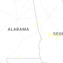


Connect with Interactive Hail Maps