

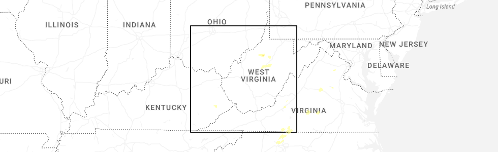
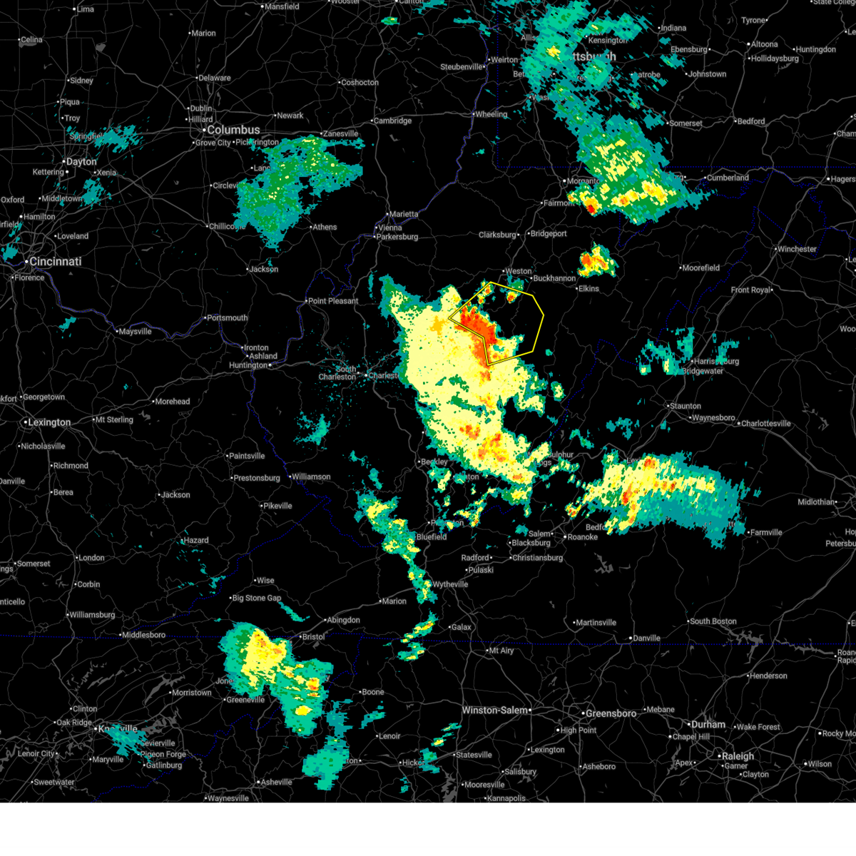
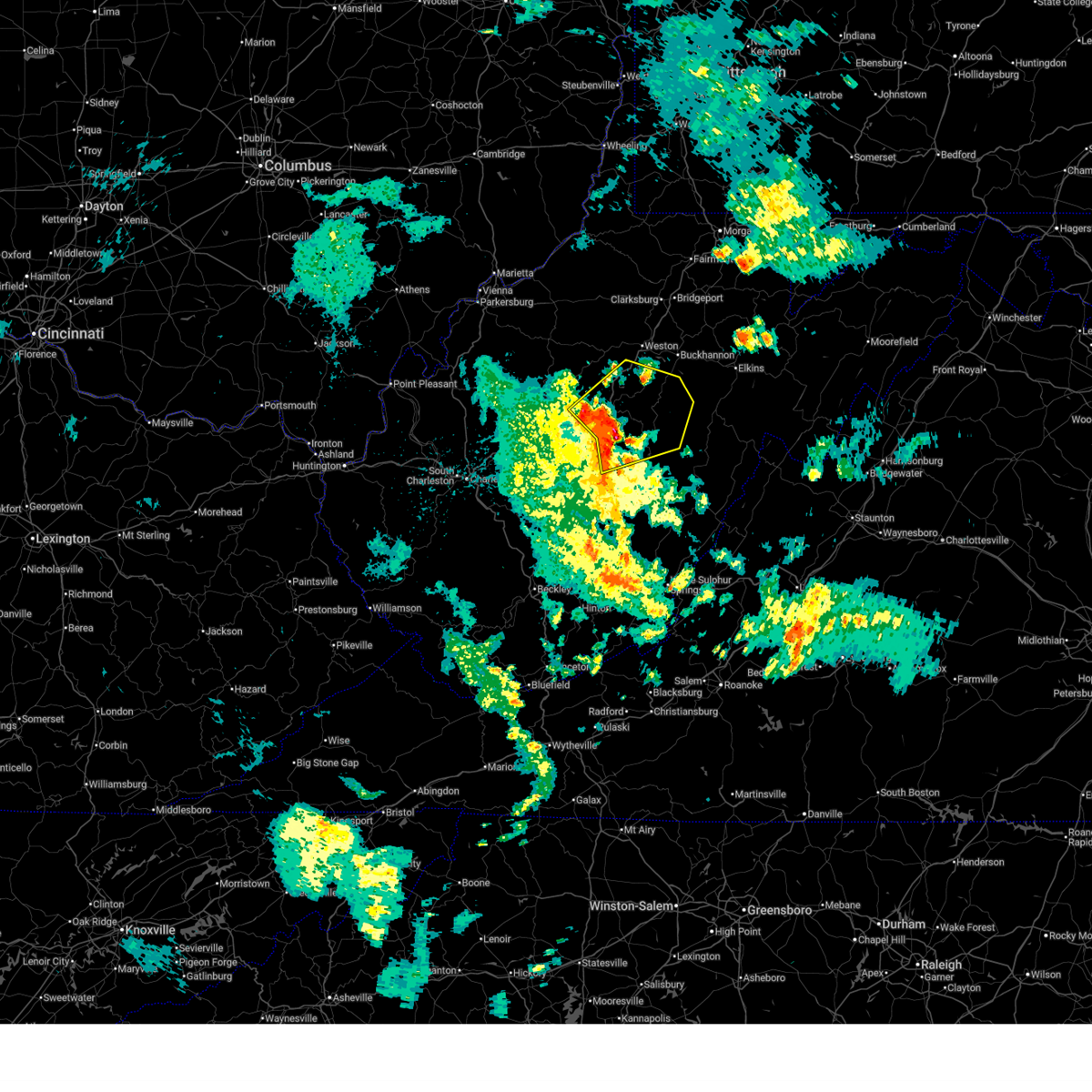
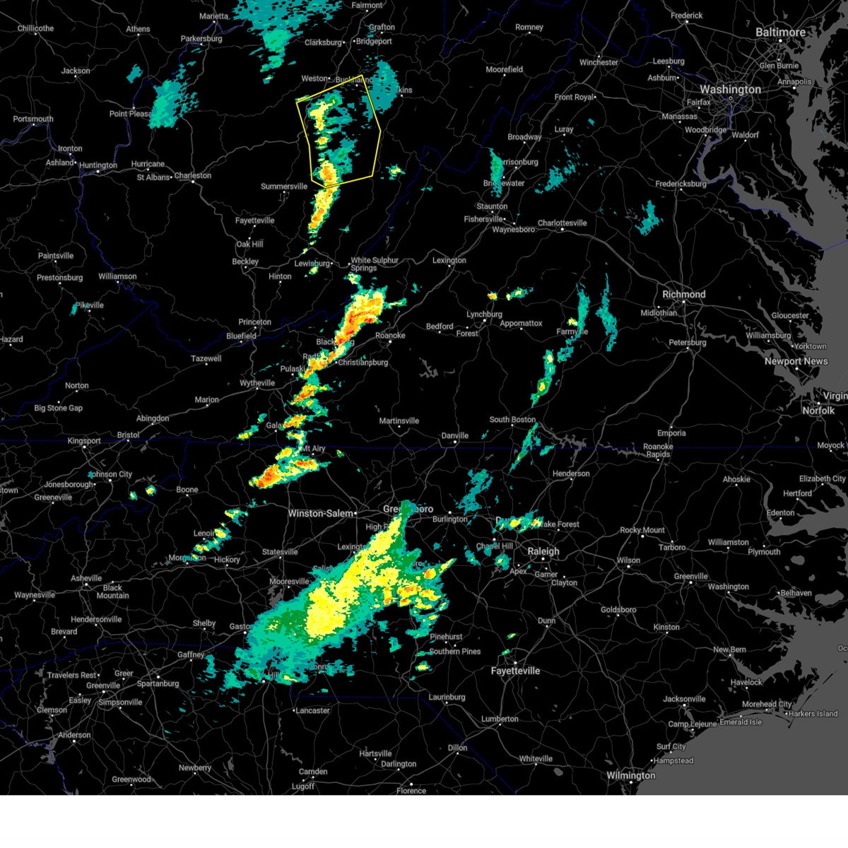
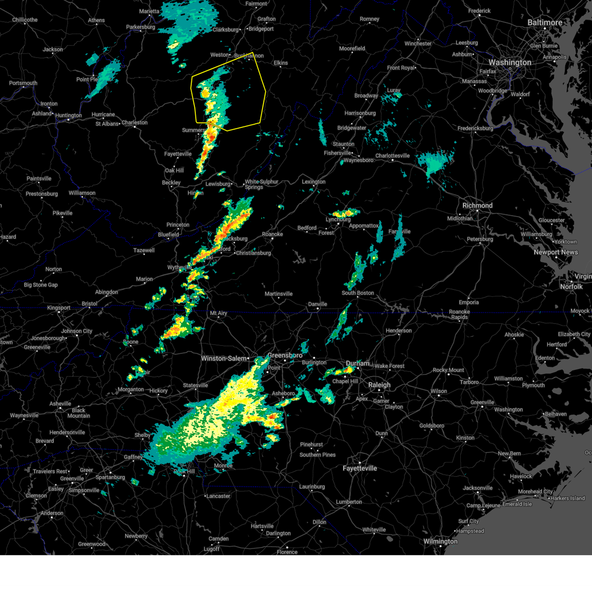
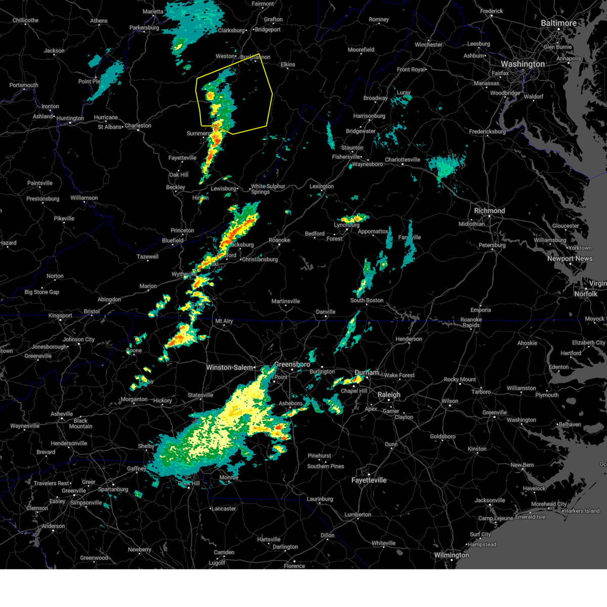
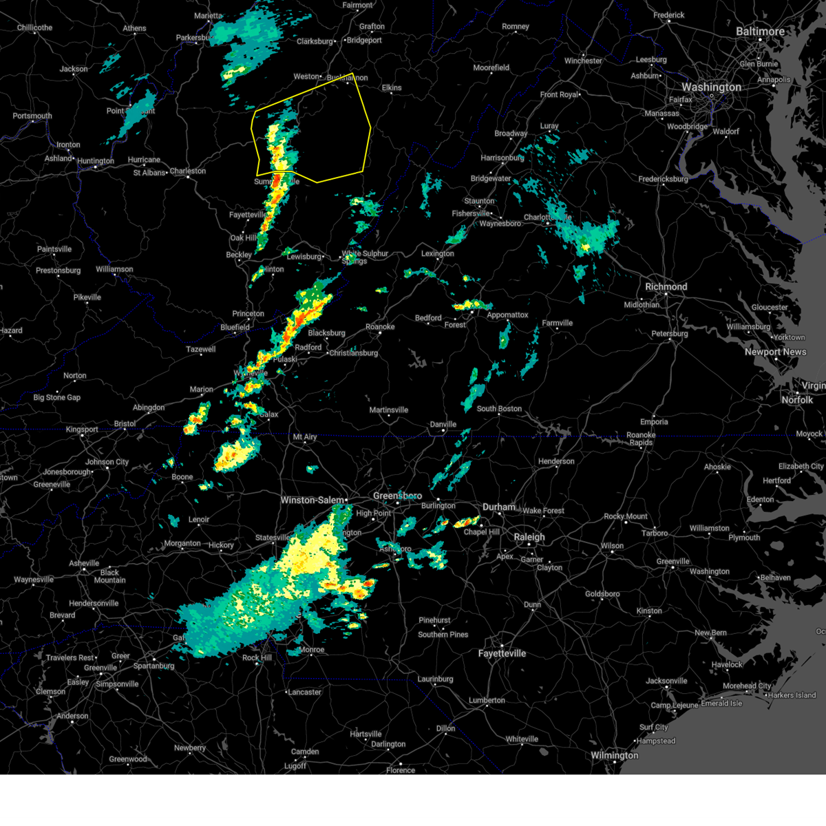
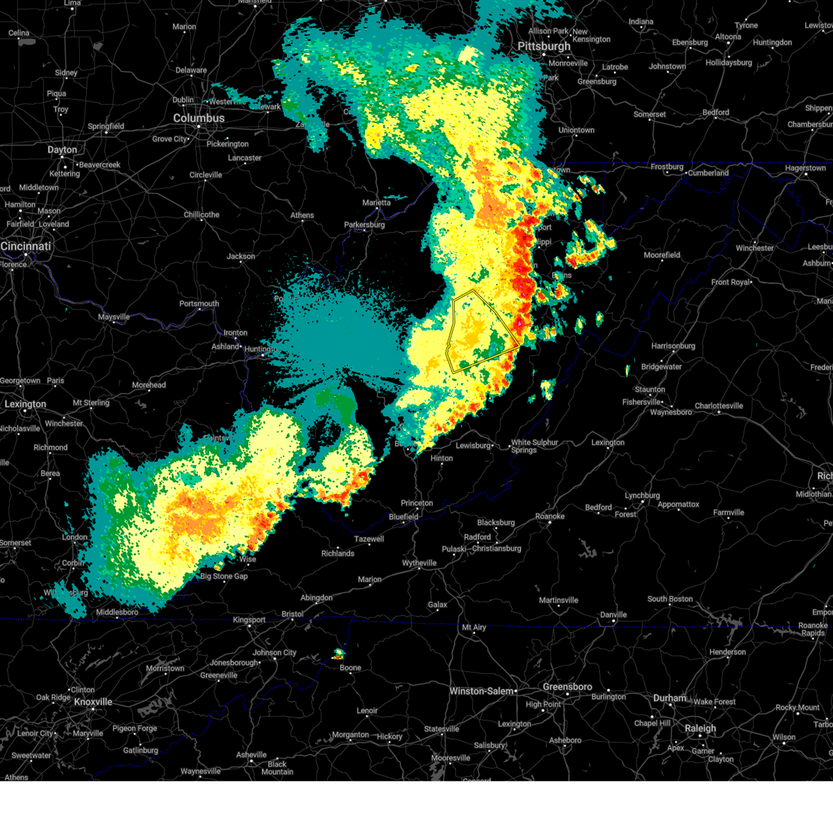
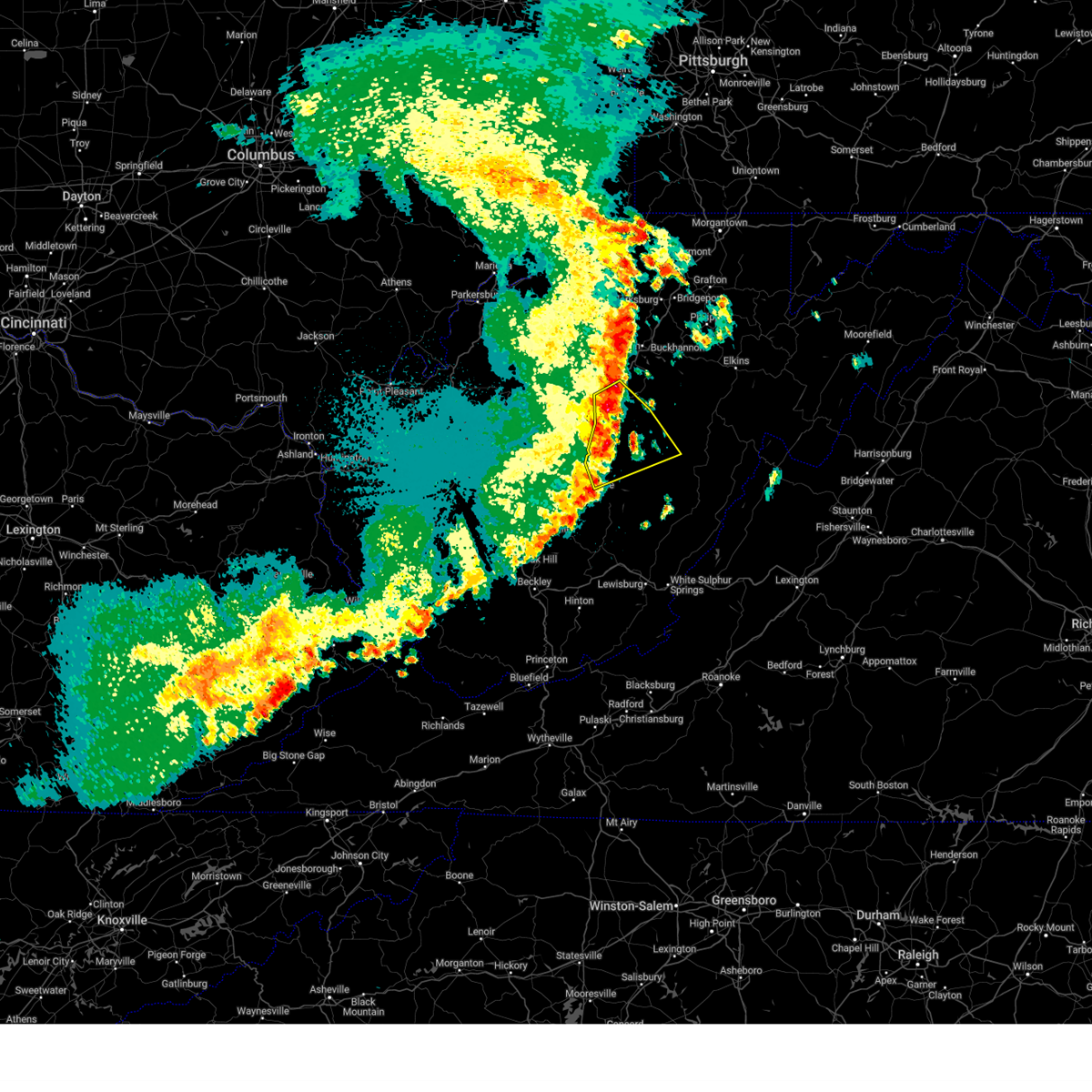
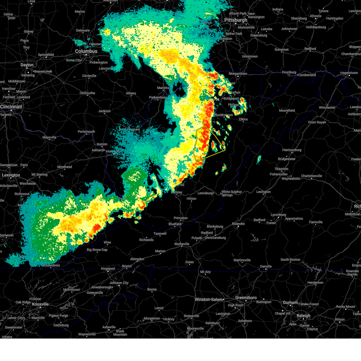
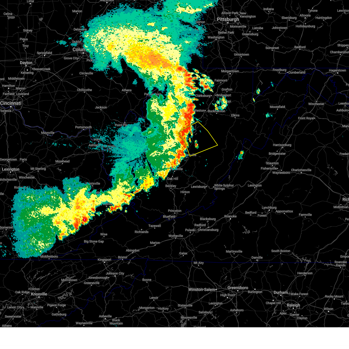
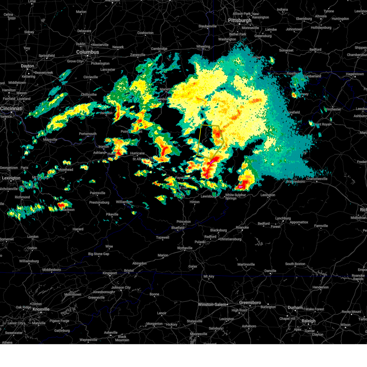
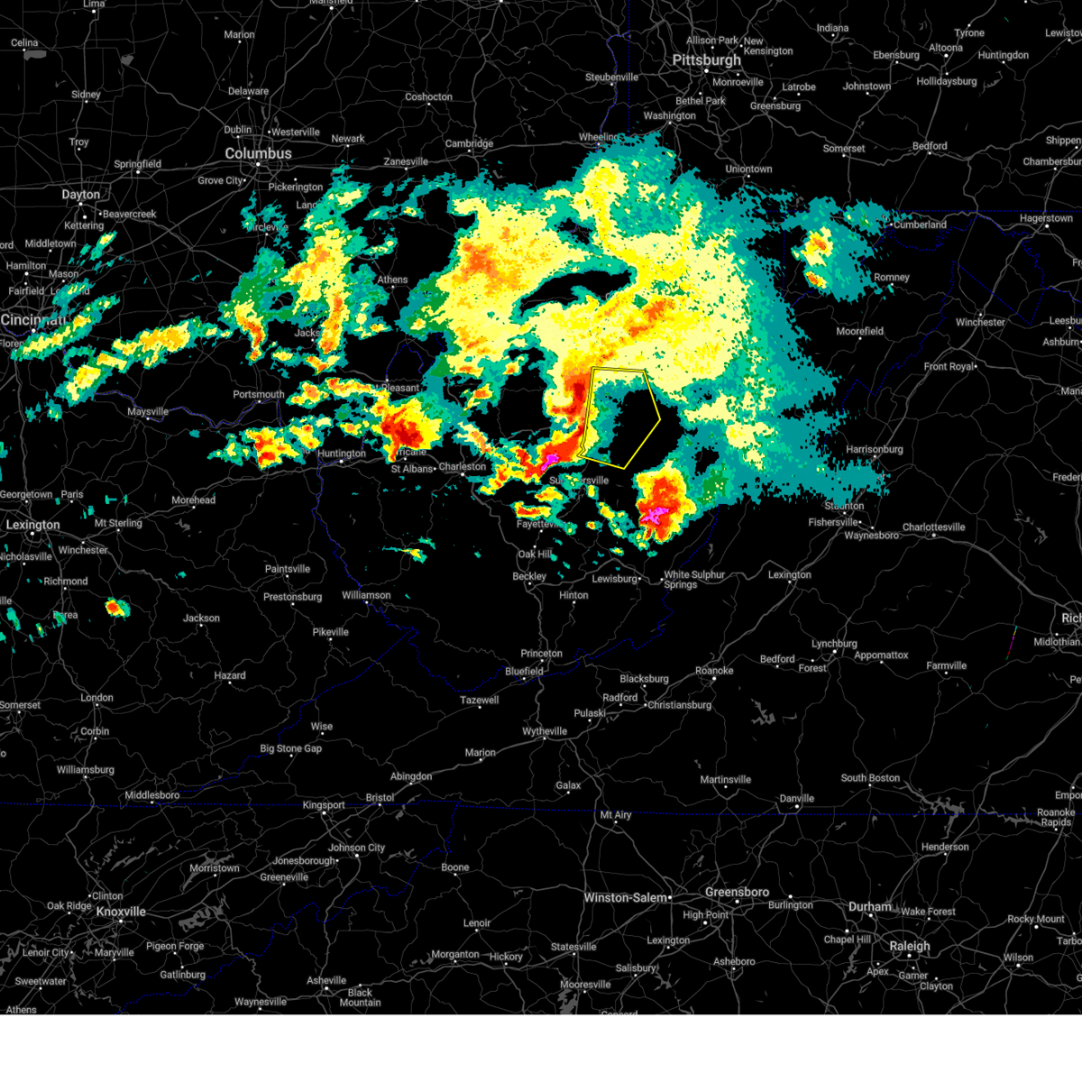
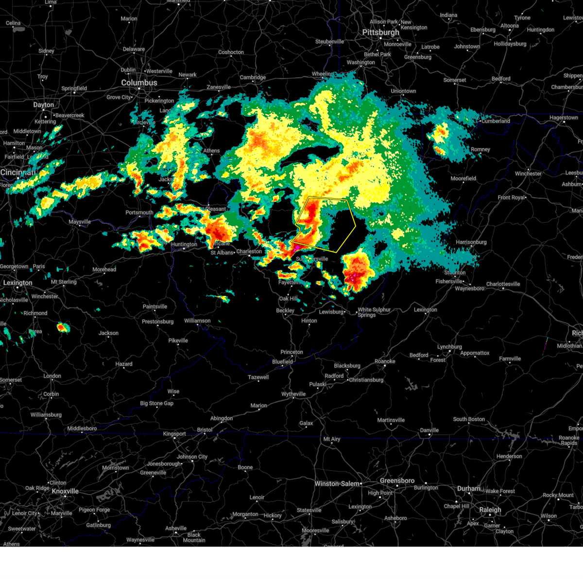
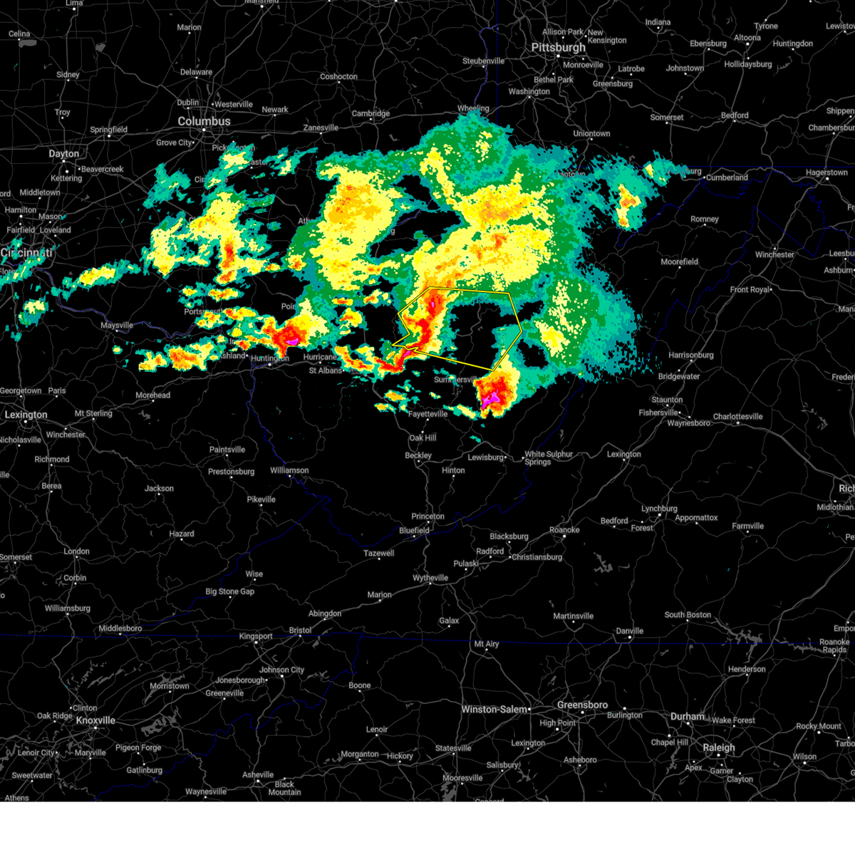
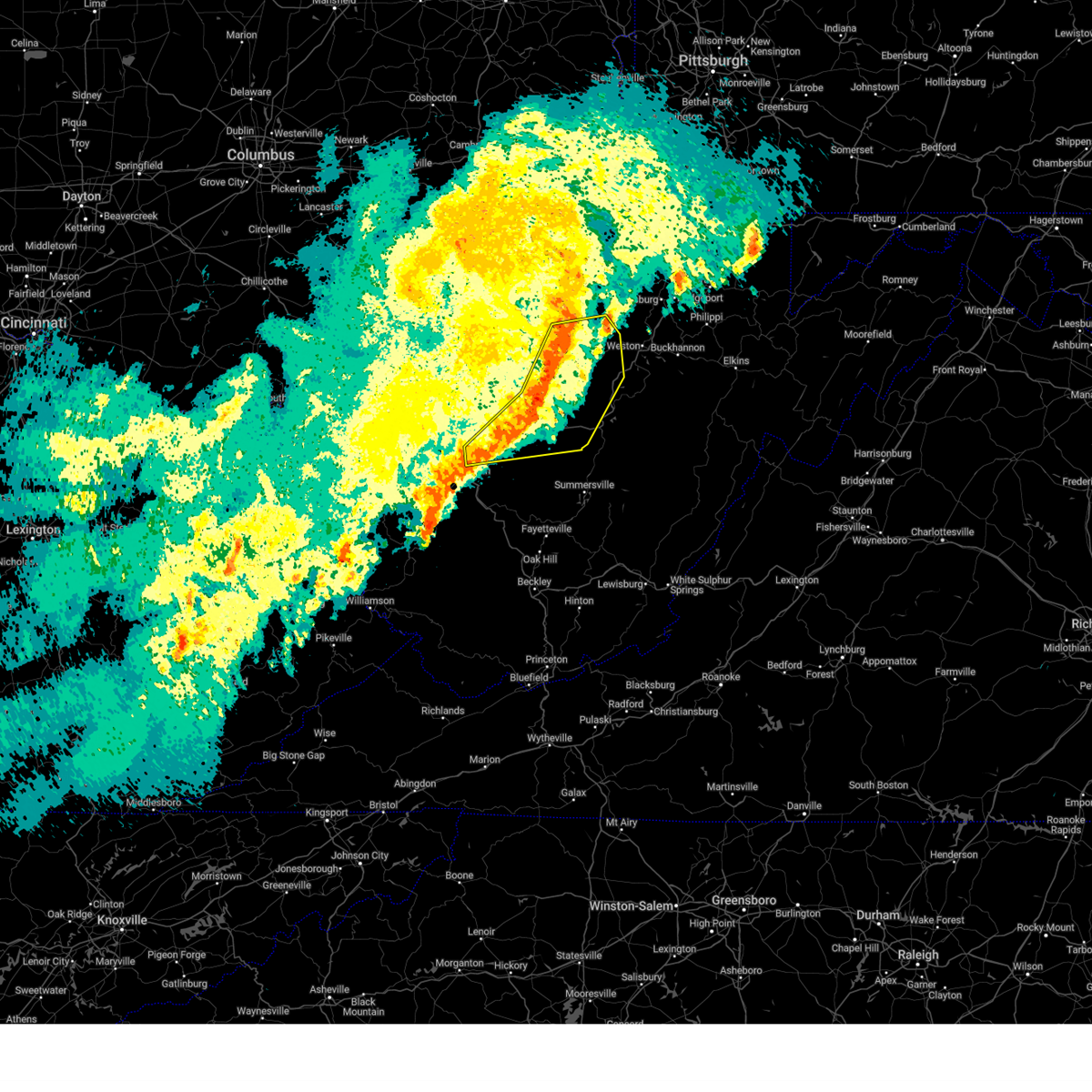
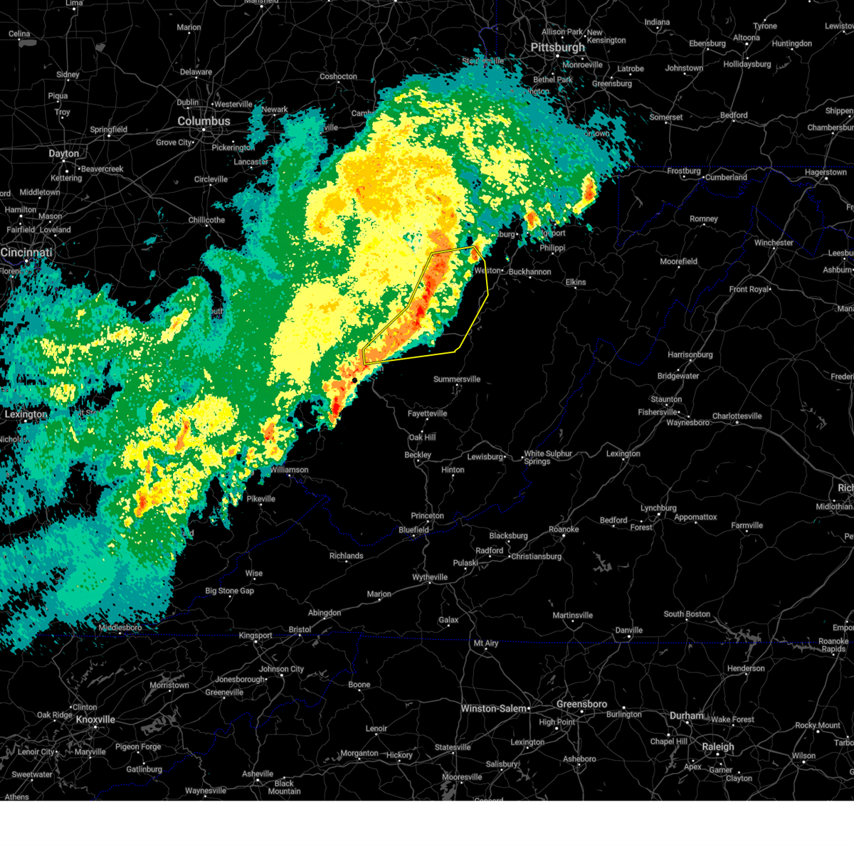
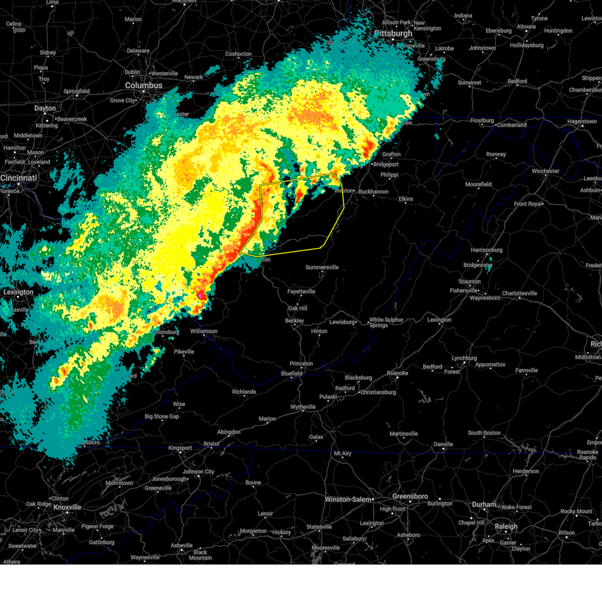
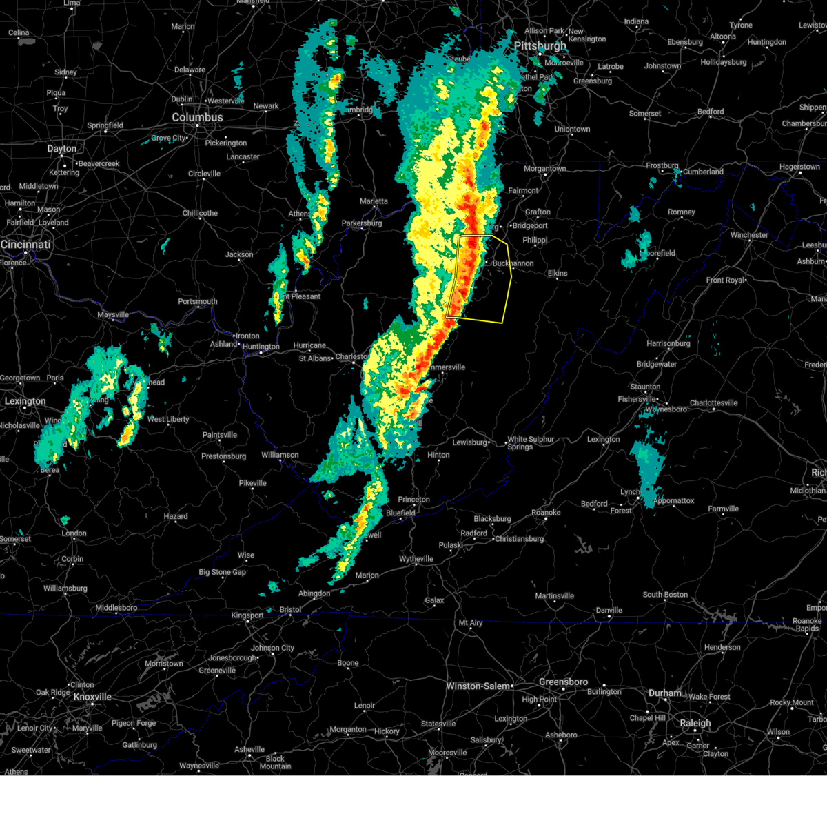
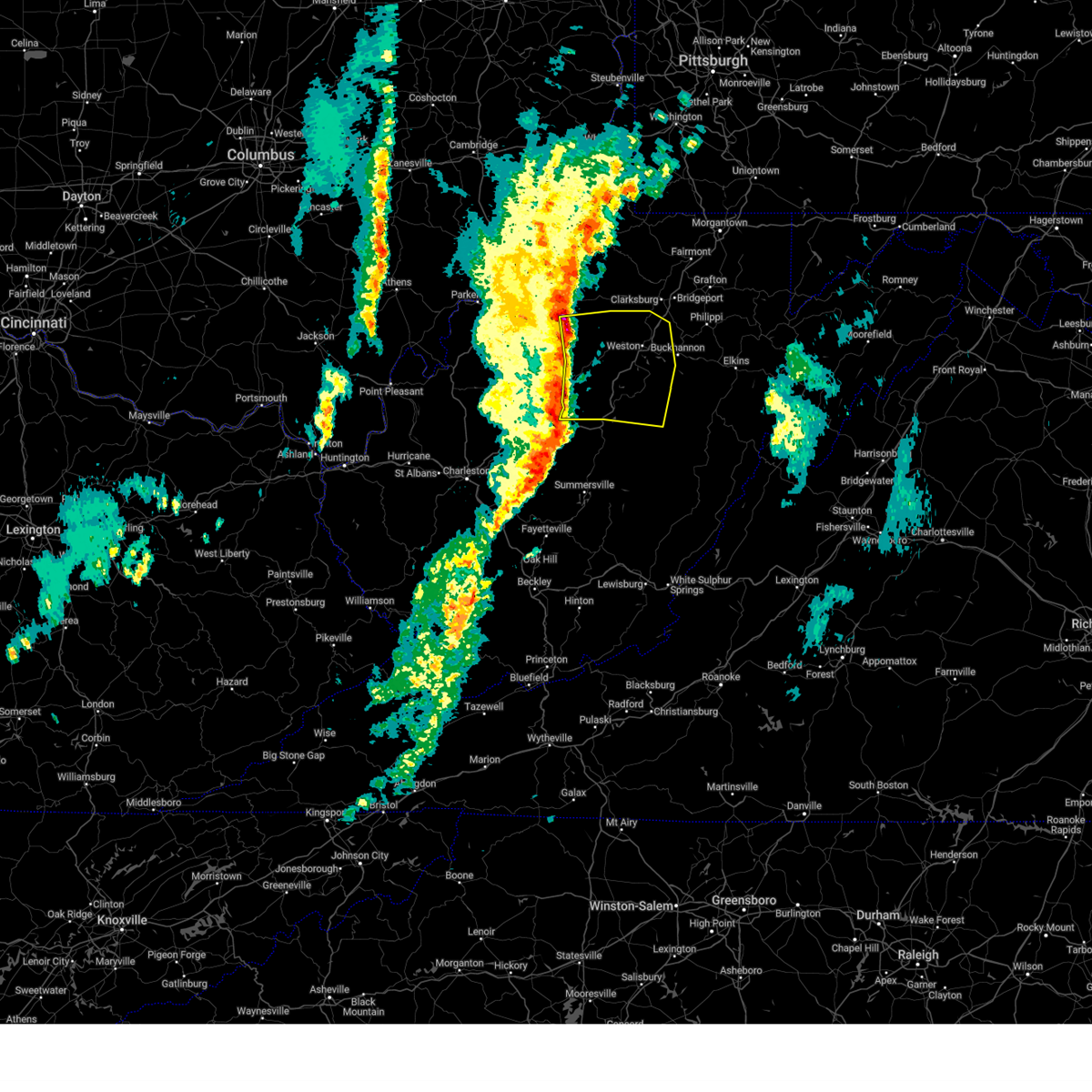
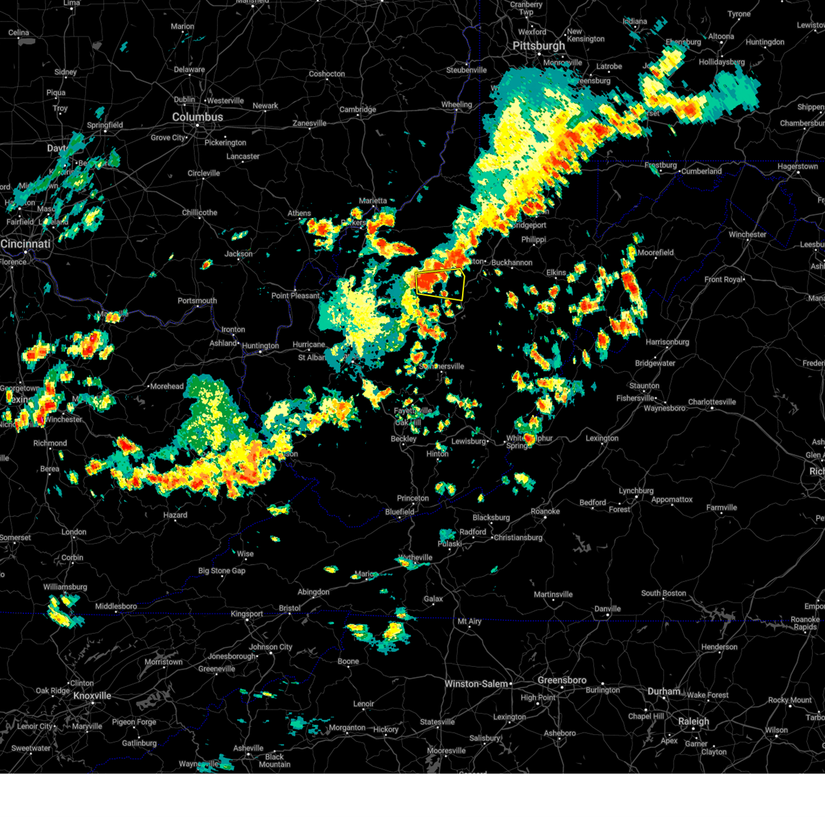
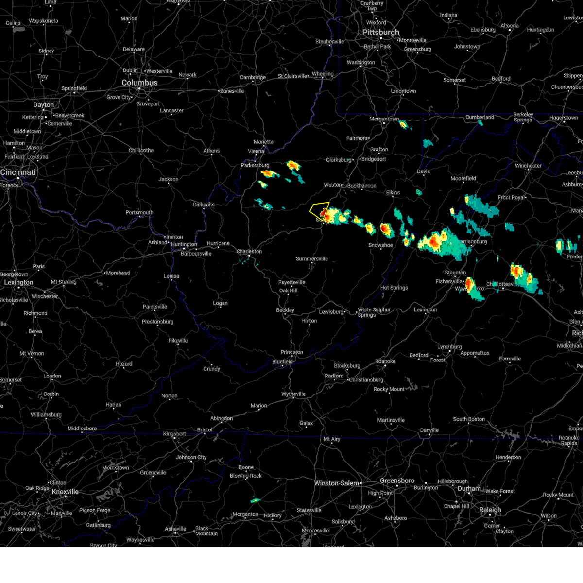
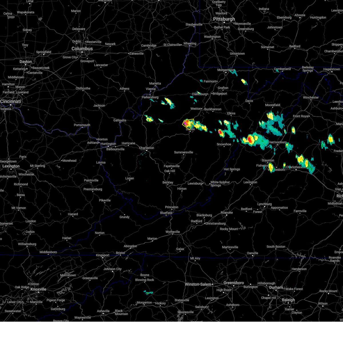
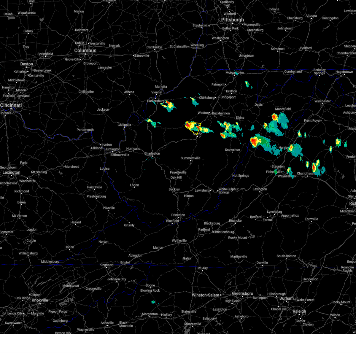
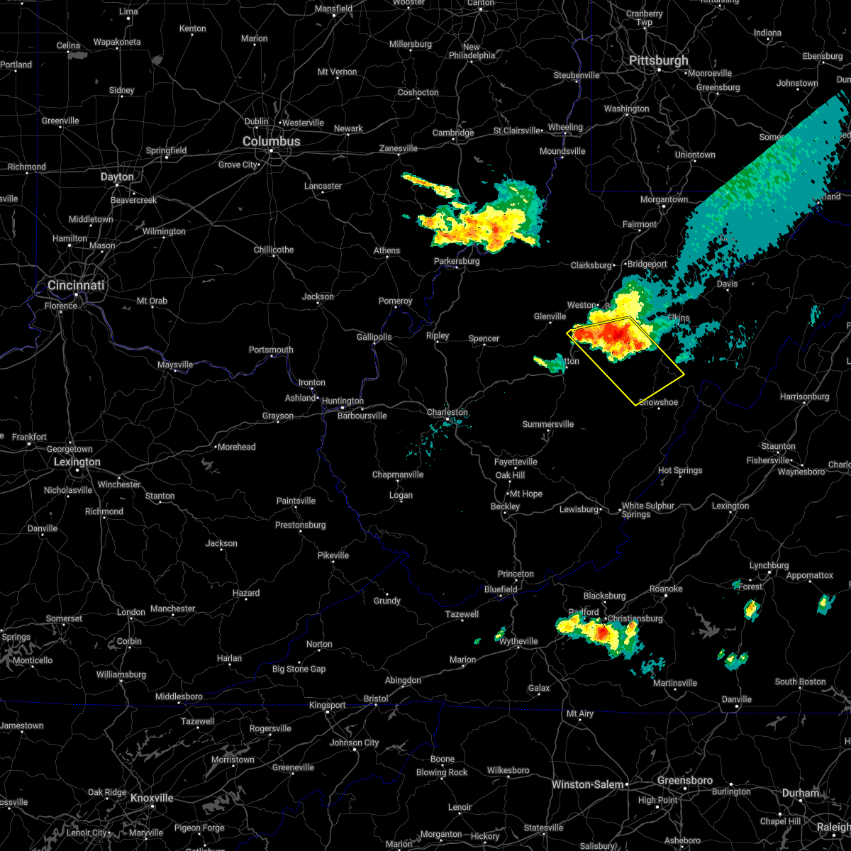
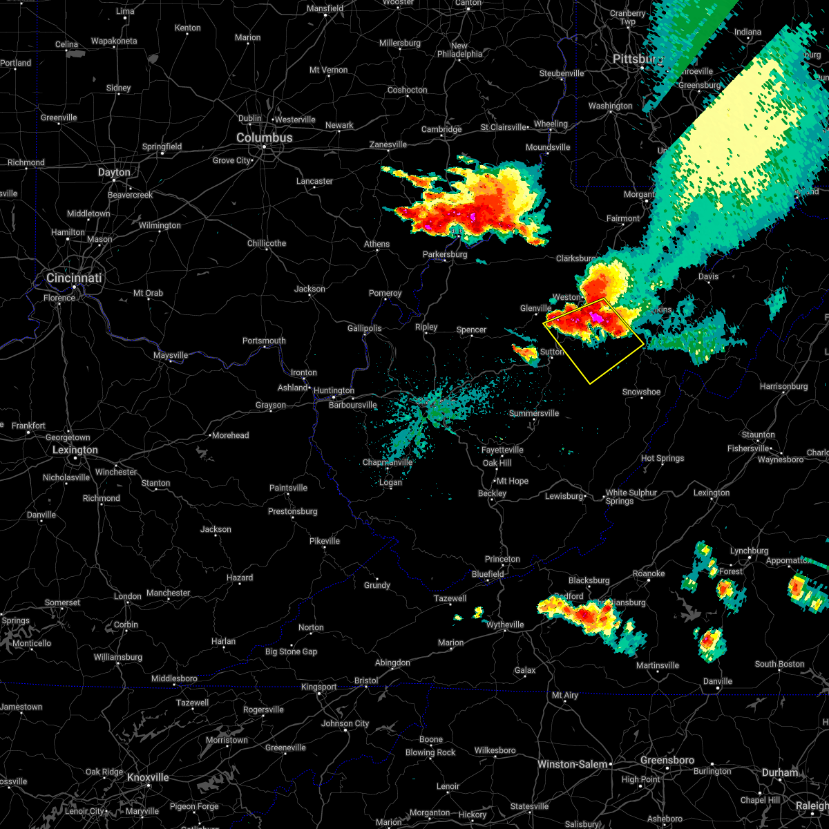
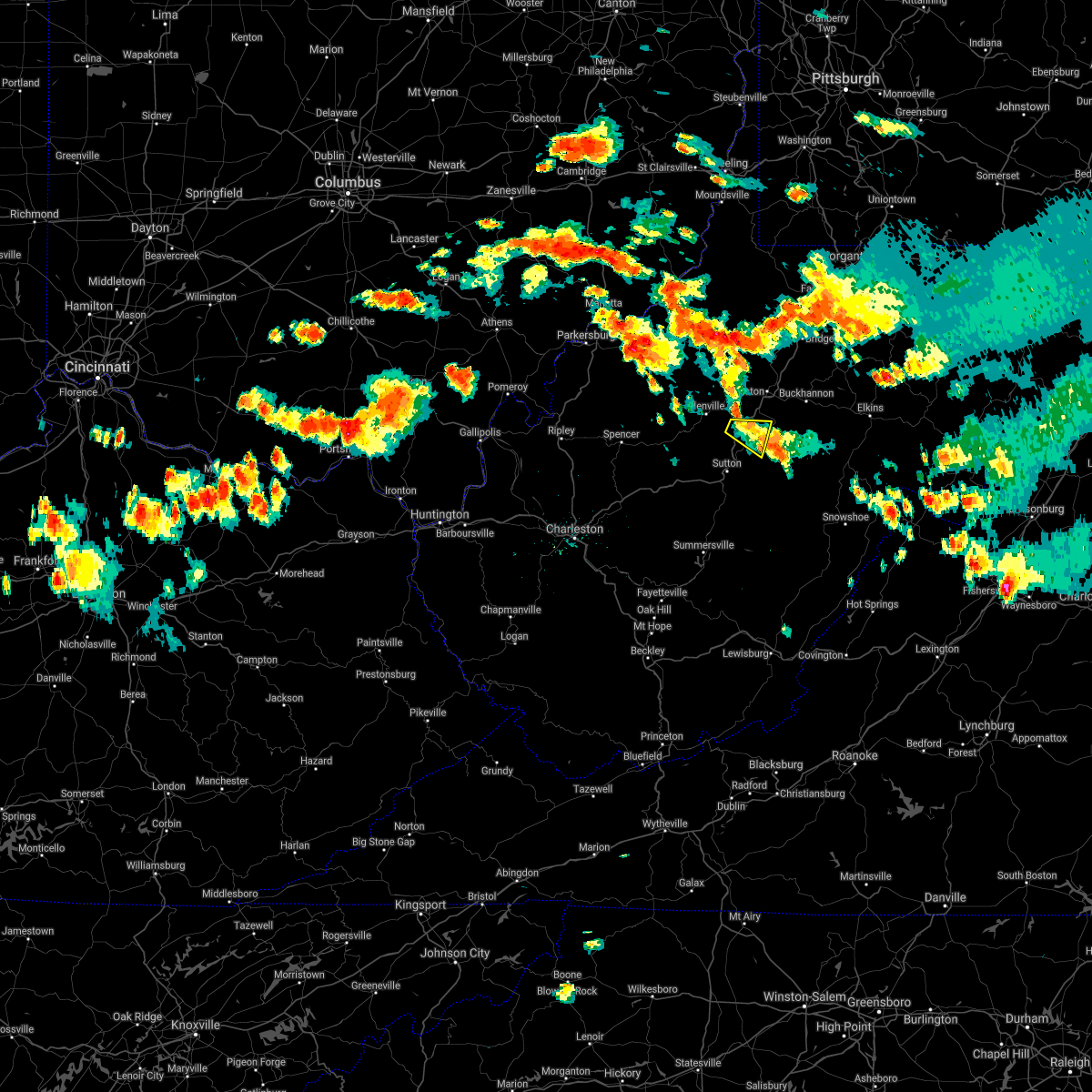
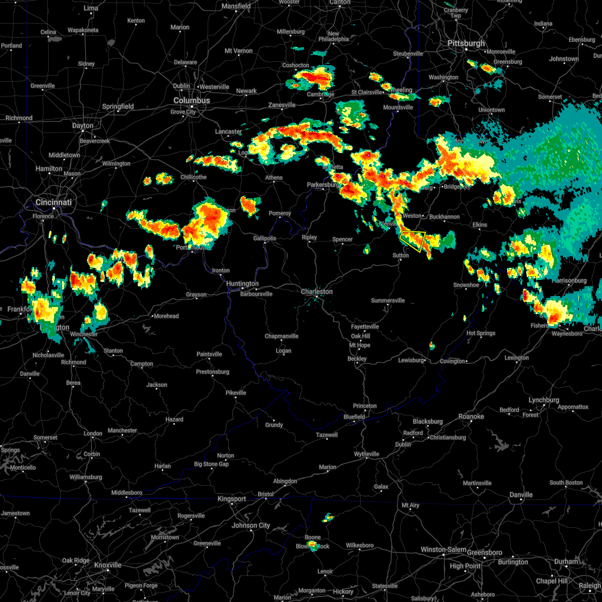
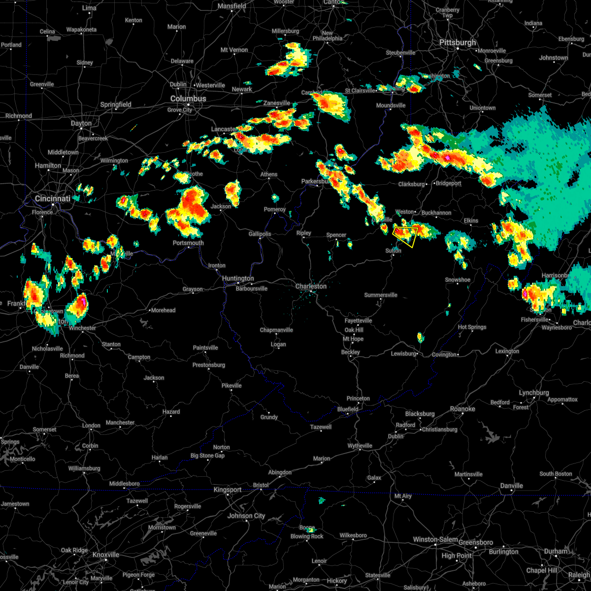
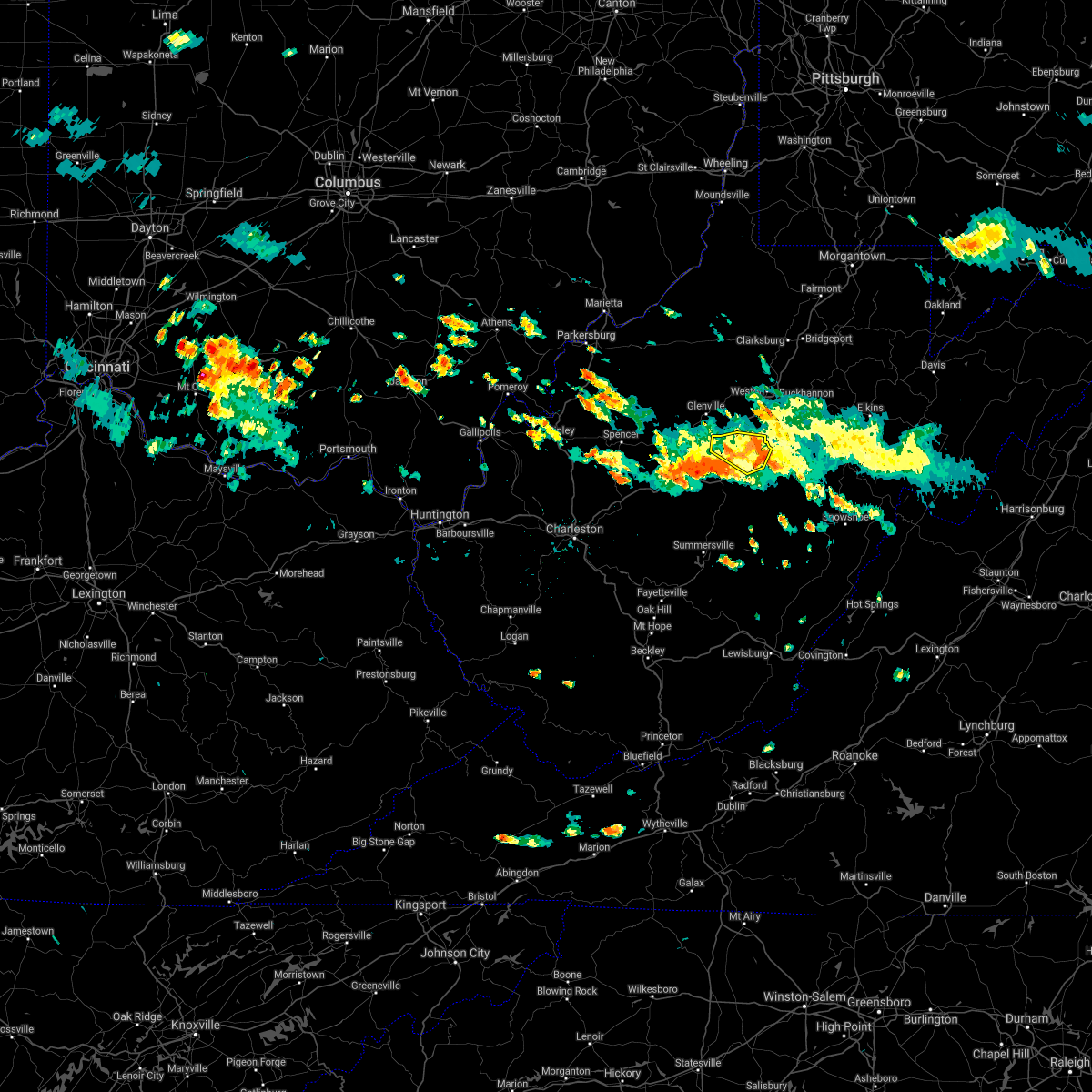
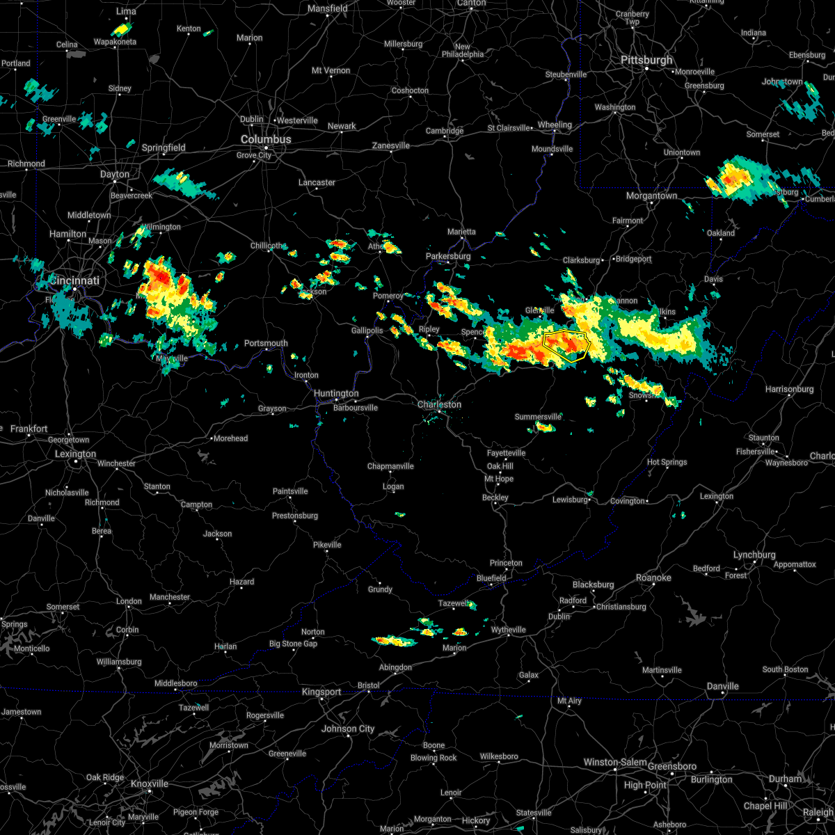
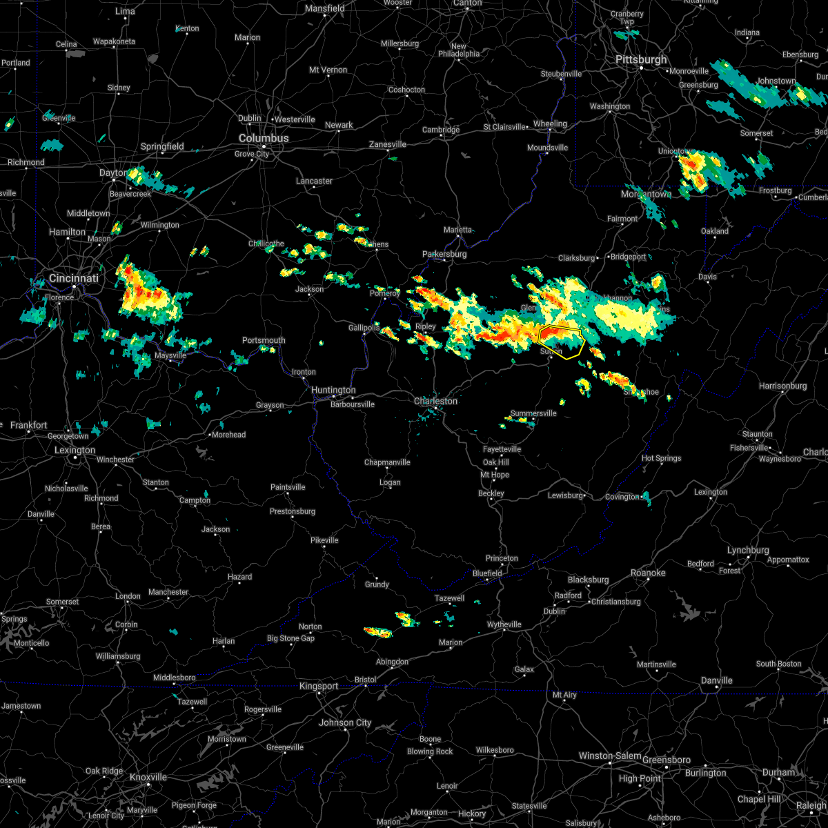
Hail Map for Burnsville, WV
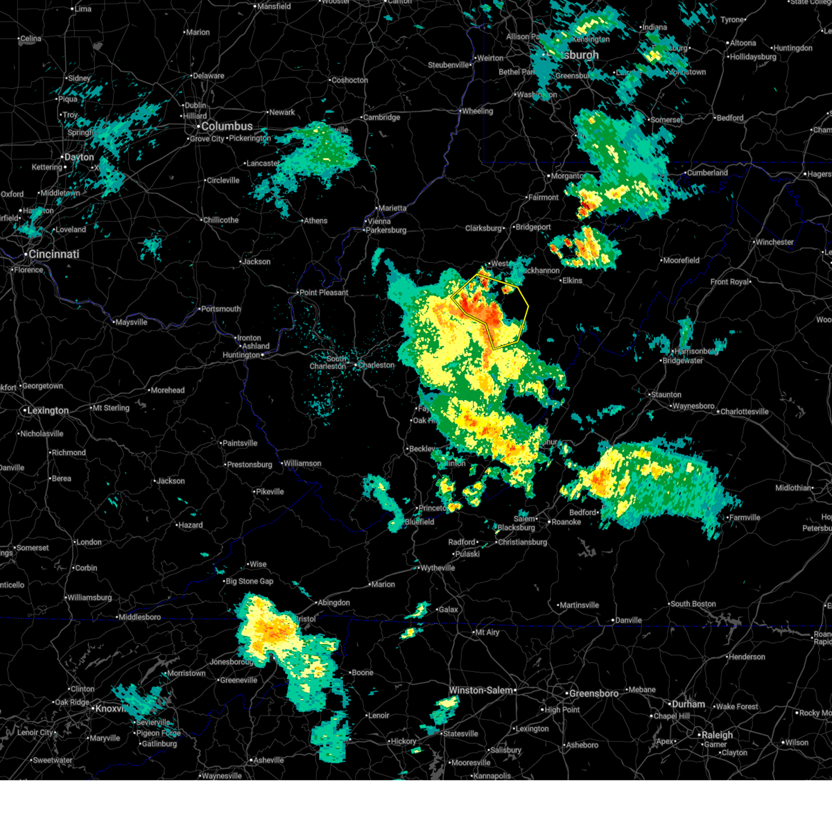
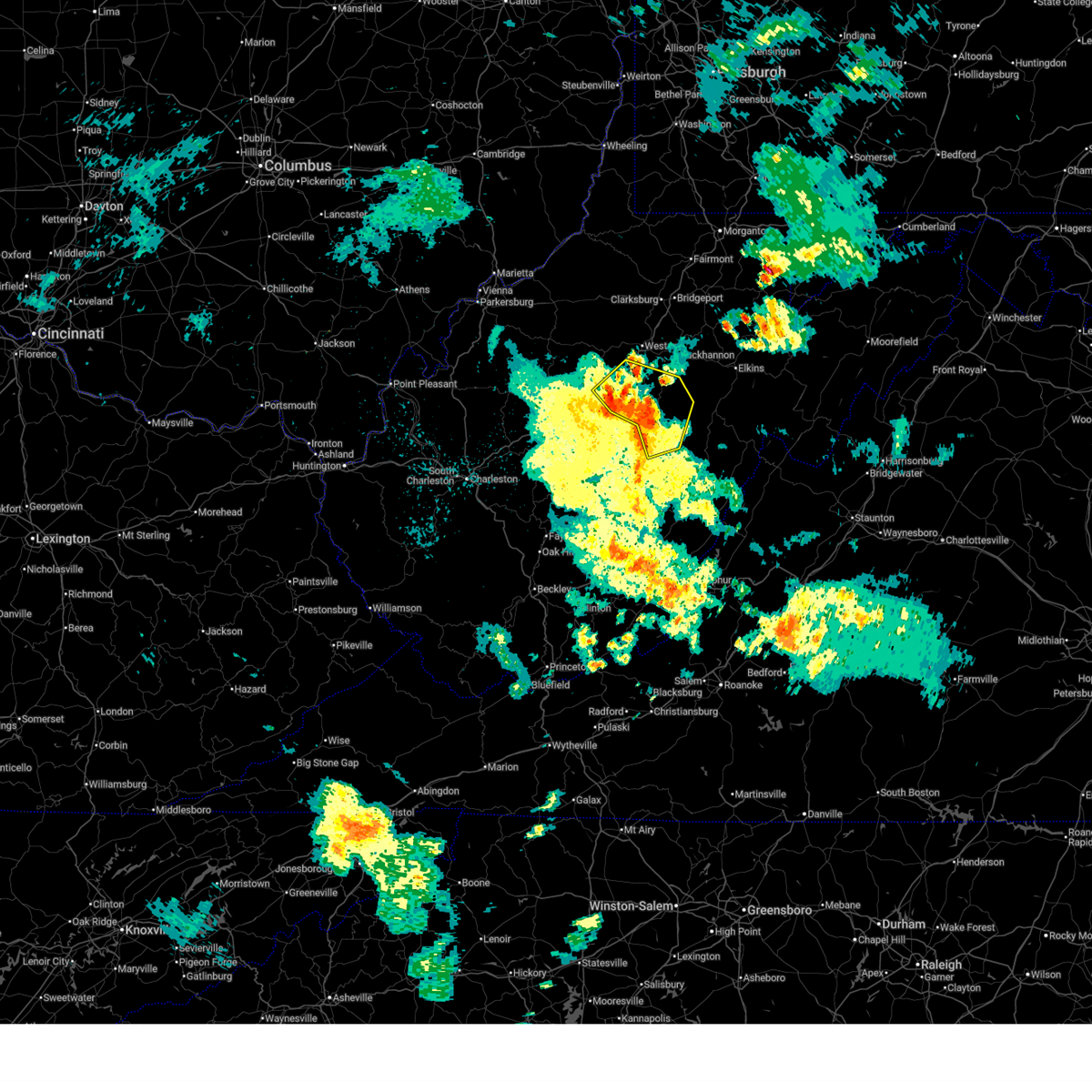
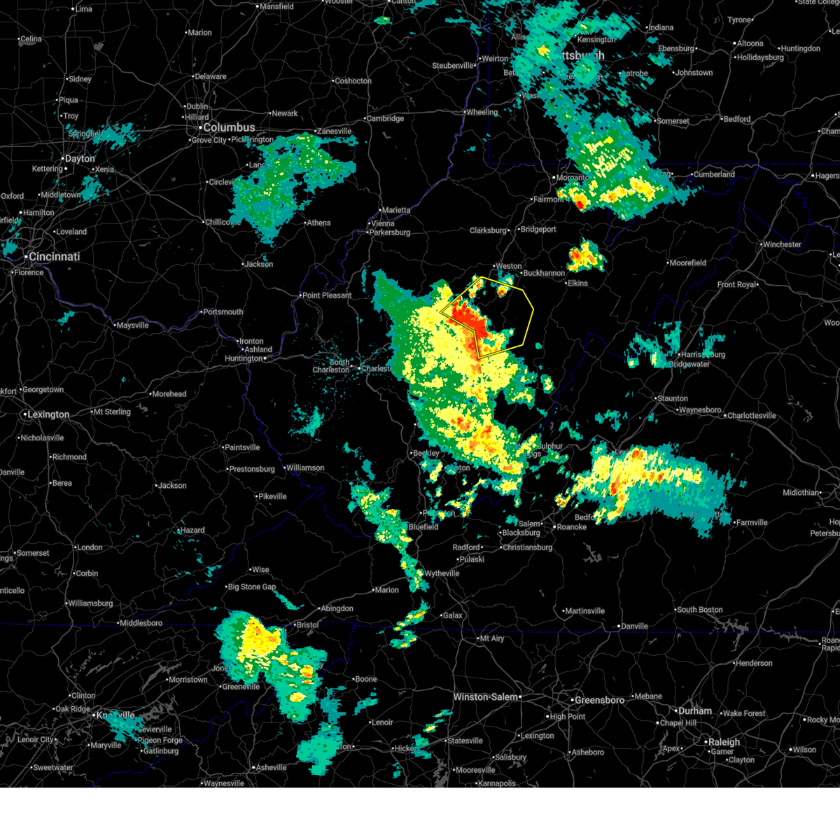
The Burnsville, WV area has had 4 reports of on-the-ground hail by trained spotters, and has been under severe weather warnings 37 times during the past 12 months. Doppler radar has detected hail at or near Burnsville, WV on 26 occasions, including 2 occasions during the past year.
| Name: | Burnsville, WV |
| Where Located: | 43.9 miles W of Elkins, WV |
| Map: | Google Map for Burnsville, WV |
| Population: | 510 |
| Housing Units: | 253 |
| More Info: | Search Google for Burnsville, WV |
0
The Top Recent Hail Date for Burnsville, WV is Wednesday, July 9, 2025 (26th out of 26)
Hail and Wind Damage Spotted near Burnsville, WV
| Date / Time | Report Details |
|---|---|
| 6/14/2025 12:07 AM EDT |
 The storms which prompted the warning have weakened below severe limits, and no longer pose an immediate threat to life or property. therefore, the warning will be allowed to expire. however, gusty winds and heavy rain are still possible with these thunderstorms. The storms which prompted the warning have weakened below severe limits, and no longer pose an immediate threat to life or property. therefore, the warning will be allowed to expire. however, gusty winds and heavy rain are still possible with these thunderstorms.
|
| 6/14/2025 12:02 AM EDT |
 At 1202 am edt, severe thunderstorms were located along a line extending from 11 miles southeast of glenville to near rock cave to near holly river state park to near addison (webster springs), moving east at 30 mph (radar indicated). Hazards include 60 mph wind gusts. Expect damage to roofs, siding, and trees. Locations impacted include, webster springs, addison (webster springs), holly river state park, rock cave, burnsville, flatwoods, diana, alexander, eden, sand run, helvetia, pickens, cleveland, waneta, alton, exchange, heaters, walkersville, hacker valley, and kanawha head. At 1202 am edt, severe thunderstorms were located along a line extending from 11 miles southeast of glenville to near rock cave to near holly river state park to near addison (webster springs), moving east at 30 mph (radar indicated). Hazards include 60 mph wind gusts. Expect damage to roofs, siding, and trees. Locations impacted include, webster springs, addison (webster springs), holly river state park, rock cave, burnsville, flatwoods, diana, alexander, eden, sand run, helvetia, pickens, cleveland, waneta, alton, exchange, heaters, walkersville, hacker valley, and kanawha head.
|
| 6/13/2025 11:42 PM EDT |
 the severe thunderstorm warning has been cancelled and is no longer in effect the severe thunderstorm warning has been cancelled and is no longer in effect
|
| 6/13/2025 11:42 PM EDT |
 At 1142 pm edt, severe thunderstorms were located along a line extending from 7 miles southeast of cedar creek state park to 8 miles northeast of sutton to 9 miles west of holly river state park to 6 miles northeast of camden on gauley, moving northeast at 30 mph (radar indicated). Hazards include 60 mph wind gusts. Expect damage to roofs, siding, and trees. Locations impacted include, sutton, webster springs, gassaway, addison (webster springs), holly river state park, rock cave, burnsville, flatwoods, alexander, eden, helvetia, pickens, cleveland, waneta, hacker valley, kanawha head, ireland, french creek, erbacon, and diana. At 1142 pm edt, severe thunderstorms were located along a line extending from 7 miles southeast of cedar creek state park to 8 miles northeast of sutton to 9 miles west of holly river state park to 6 miles northeast of camden on gauley, moving northeast at 30 mph (radar indicated). Hazards include 60 mph wind gusts. Expect damage to roofs, siding, and trees. Locations impacted include, sutton, webster springs, gassaway, addison (webster springs), holly river state park, rock cave, burnsville, flatwoods, alexander, eden, helvetia, pickens, cleveland, waneta, hacker valley, kanawha head, ireland, french creek, erbacon, and diana.
|
| 6/13/2025 11:30 PM EDT |
 Svrrlx the national weather service in charleston west virginia has issued a * severe thunderstorm warning for, southwestern randolph county in northeastern west virginia, north central nicholas county in southeastern west virginia, east central gilmer county in north central west virginia, southern lewis county in northern west virginia, braxton county in north central west virginia, southwestern upshur county in northeastern west virginia, webster county in northeastern west virginia, * until 1215 am edt. * at 1130 pm edt, severe thunderstorms were located along a line extending from 7 miles northwest of gassaway to near sutton to 10 miles northeast of birch river to near camden on gauley, moving northeast at 25 mph (radar indicated). Hazards include 60 mph wind gusts. expect damage to roofs, siding, and trees Svrrlx the national weather service in charleston west virginia has issued a * severe thunderstorm warning for, southwestern randolph county in northeastern west virginia, north central nicholas county in southeastern west virginia, east central gilmer county in north central west virginia, southern lewis county in northern west virginia, braxton county in north central west virginia, southwestern upshur county in northeastern west virginia, webster county in northeastern west virginia, * until 1215 am edt. * at 1130 pm edt, severe thunderstorms were located along a line extending from 7 miles northwest of gassaway to near sutton to 10 miles northeast of birch river to near camden on gauley, moving northeast at 25 mph (radar indicated). Hazards include 60 mph wind gusts. expect damage to roofs, siding, and trees
|
| 5/30/2025 3:29 PM EDT |
 The storms which prompted the warning have weakened below severe limits, and no longer pose an immediate threat to life or property. therefore, the warning will be allowed to expire. however, gusty winds are still possible with these thunderstorms. a tornado watch remains in effect until 800 pm edt for northern, southeastern, north central and northeastern west virginia. The storms which prompted the warning have weakened below severe limits, and no longer pose an immediate threat to life or property. therefore, the warning will be allowed to expire. however, gusty winds are still possible with these thunderstorms. a tornado watch remains in effect until 800 pm edt for northern, southeastern, north central and northeastern west virginia.
|
| 5/30/2025 3:10 PM EDT |
 At 310 pm edt, severe thunderstorms were located along a line extending from 9 miles southwest of stonewall jackson to 10 miles northwest of webster springs to 6 miles east of camden-on-gauley, moving east at 40 mph (radar indicated). Hazards include 60 mph wind gusts. Expect damage to roofs, siding, and trees. Locations impacted include, buckhannon, webster springs, addison (webster springs), camden-on-gauley, holly river state park, camden on gauley, rock cave, cowen, burnsville, flatwoods, alexander, eden, upper glade, helvetia, pickens, cleveland, waneta, boggs, hacker valley, and kanawha head. At 310 pm edt, severe thunderstorms were located along a line extending from 9 miles southwest of stonewall jackson to 10 miles northwest of webster springs to 6 miles east of camden-on-gauley, moving east at 40 mph (radar indicated). Hazards include 60 mph wind gusts. Expect damage to roofs, siding, and trees. Locations impacted include, buckhannon, webster springs, addison (webster springs), camden-on-gauley, holly river state park, camden on gauley, rock cave, cowen, burnsville, flatwoods, alexander, eden, upper glade, helvetia, pickens, cleveland, waneta, boggs, hacker valley, and kanawha head.
|
| 5/30/2025 3:10 PM EDT |
 the severe thunderstorm warning has been cancelled and is no longer in effect the severe thunderstorm warning has been cancelled and is no longer in effect
|
| 5/30/2025 2:49 PM EDT |
 At 249 pm edt, severe thunderstorms were located along a line extending from near cedar creek state park to near birch river to 7 miles northwest of craigsville, moving east at 45 mph (radar indicated). Hazards include 60 mph wind gusts. Expect damage to roofs, siding, and trees. Locations impacted include, buckhannon, sutton, webster springs, gassaway, addison (webster springs), camden-on-gauley, birch river, holly river state park, camden on gauley, rock cave, cowen, burnsville, flatwoods, alexander, eden, rosedale, upper glade, helvetia, pickens, and cleveland. At 249 pm edt, severe thunderstorms were located along a line extending from near cedar creek state park to near birch river to 7 miles northwest of craigsville, moving east at 45 mph (radar indicated). Hazards include 60 mph wind gusts. Expect damage to roofs, siding, and trees. Locations impacted include, buckhannon, sutton, webster springs, gassaway, addison (webster springs), camden-on-gauley, birch river, holly river state park, camden on gauley, rock cave, cowen, burnsville, flatwoods, alexander, eden, rosedale, upper glade, helvetia, pickens, and cleveland.
|
| 5/30/2025 2:49 PM EDT |
 the severe thunderstorm warning has been cancelled and is no longer in effect the severe thunderstorm warning has been cancelled and is no longer in effect
|
| 5/30/2025 2:37 PM EDT |
 Svrrlx the national weather service in charleston west virginia has issued a * severe thunderstorm warning for, southeastern calhoun county in north central west virginia, southwestern randolph county in northeastern west virginia, west central pocahontas county in northeastern west virginia, northeastern nicholas county in southeastern west virginia, southern gilmer county in north central west virginia, southeastern lewis county in northern west virginia, braxton county in north central west virginia, upshur county in northeastern west virginia, webster county in northeastern west virginia, northeastern clay county in north central west virginia, * until 330 pm edt. * at 237 pm edt, severe thunderstorms were located along a line extending from 8 miles east of arnoldsburg to 6 miles west of birch river to 8 miles north of summersville, moving east at 40 mph (radar indicated). Hazards include 60 mph wind gusts. expect damage to roofs, siding, and trees Svrrlx the national weather service in charleston west virginia has issued a * severe thunderstorm warning for, southeastern calhoun county in north central west virginia, southwestern randolph county in northeastern west virginia, west central pocahontas county in northeastern west virginia, northeastern nicholas county in southeastern west virginia, southern gilmer county in north central west virginia, southeastern lewis county in northern west virginia, braxton county in north central west virginia, upshur county in northeastern west virginia, webster county in northeastern west virginia, northeastern clay county in north central west virginia, * until 330 pm edt. * at 237 pm edt, severe thunderstorms were located along a line extending from 8 miles east of arnoldsburg to 6 miles west of birch river to 8 miles north of summersville, moving east at 40 mph (radar indicated). Hazards include 60 mph wind gusts. expect damage to roofs, siding, and trees
|
| 4/29/2025 11:21 PM EDT |
 The storms which prompted the warning have weakened below severe limits, and have exited the warned area. therefore, the warning will be allowed to expire. The storms which prompted the warning have weakened below severe limits, and have exited the warned area. therefore, the warning will be allowed to expire.
|
| 4/29/2025 10:54 PM EDT |
 the severe thunderstorm warning has been cancelled and is no longer in effect the severe thunderstorm warning has been cancelled and is no longer in effect
|
| 4/29/2025 10:54 PM EDT |
 At 1054 pm edt, severe thunderstorms were located along a line extending from 10 miles west of rock cave to camden-on-gauley, moving east at 55 mph (radar indicated). Hazards include 60 mph wind gusts. Expect damage to roofs, siding, and trees. Locations impacted include, diana, gassaway, birch river, sutton, flatwoods, addison (webster springs), upper glade, boggs, cowen, exchange, little birch, heaters, calvin, webster springs, hacker valley, camden on gauley, bergoo, camden-on-gauley, centralia, and erbacon. At 1054 pm edt, severe thunderstorms were located along a line extending from 10 miles west of rock cave to camden-on-gauley, moving east at 55 mph (radar indicated). Hazards include 60 mph wind gusts. Expect damage to roofs, siding, and trees. Locations impacted include, diana, gassaway, birch river, sutton, flatwoods, addison (webster springs), upper glade, boggs, cowen, exchange, little birch, heaters, calvin, webster springs, hacker valley, camden on gauley, bergoo, camden-on-gauley, centralia, and erbacon.
|
| 4/29/2025 10:37 PM EDT |
 Svrrlx the national weather service in charleston west virginia has issued a * severe thunderstorm warning for, northeastern nicholas county in southeastern west virginia, braxton county in north central west virginia, webster county in northeastern west virginia, northeastern clay county in north central west virginia, * until 1130 pm edt. * at 1037 pm edt, a severe thunderstorm was located 7 miles northeast of clay, moving east at 35 mph (radar indicated). Hazards include 60 mph wind gusts. expect damage to roofs, siding, and trees Svrrlx the national weather service in charleston west virginia has issued a * severe thunderstorm warning for, northeastern nicholas county in southeastern west virginia, braxton county in north central west virginia, webster county in northeastern west virginia, northeastern clay county in north central west virginia, * until 1130 pm edt. * at 1037 pm edt, a severe thunderstorm was located 7 miles northeast of clay, moving east at 35 mph (radar indicated). Hazards include 60 mph wind gusts. expect damage to roofs, siding, and trees
|
| 4/14/2025 7:22 PM EDT |
 The storm which prompted the warning has weakened below severe limits, and has exited the warned area. therefore, the warning will be allowed to expire. a severe thunderstorm watch remains in effect until 1100 pm edt for northern, southeastern, north central and northeastern west virginia. The storm which prompted the warning has weakened below severe limits, and has exited the warned area. therefore, the warning will be allowed to expire. a severe thunderstorm watch remains in effect until 1100 pm edt for northern, southeastern, north central and northeastern west virginia.
|
| 4/14/2025 7:09 PM EDT |
 the severe thunderstorm warning has been cancelled and is no longer in effect the severe thunderstorm warning has been cancelled and is no longer in effect
|
| 4/14/2025 7:09 PM EDT |
 At 709 pm edt, a severe thunderstorm was located 10 miles northwest of webster springs, moving east at 55 mph (radar indicated). Hazards include 60 mph wind gusts and penny size hail. Expect damage to roofs, siding, and trees. Locations impacted include, diana, gassaway, birch river, sutton, flatwoods, stouts mills, cleveland, holly river state park, boggs, cowen, exchange, little birch, heaters, walkersville, hacker valley, ireland, burnsville, centralia, erbacon, and falls mills. At 709 pm edt, a severe thunderstorm was located 10 miles northwest of webster springs, moving east at 55 mph (radar indicated). Hazards include 60 mph wind gusts and penny size hail. Expect damage to roofs, siding, and trees. Locations impacted include, diana, gassaway, birch river, sutton, flatwoods, stouts mills, cleveland, holly river state park, boggs, cowen, exchange, little birch, heaters, walkersville, hacker valley, ireland, burnsville, centralia, erbacon, and falls mills.
|
| 4/14/2025 6:58 PM EDT |
 At 658 pm edt, a severe thunderstorm was located near gassaway, or near sutton, moving east at 65 mph (radar indicated). Hazards include 60 mph wind gusts and quarter size hail. Hail damage to vehicles is expected. expect wind damage to roofs, siding, and trees. Locations impacted include, shock, flatwoods, rosedale, cleveland, boggs, little birch, hacker valley, ireland, ivydale, erbacon, widen, diana, frametown, strange creek, wilsie, gassaway, birch river, sutton, servia, and stouts mills. At 658 pm edt, a severe thunderstorm was located near gassaway, or near sutton, moving east at 65 mph (radar indicated). Hazards include 60 mph wind gusts and quarter size hail. Hail damage to vehicles is expected. expect wind damage to roofs, siding, and trees. Locations impacted include, shock, flatwoods, rosedale, cleveland, boggs, little birch, hacker valley, ireland, ivydale, erbacon, widen, diana, frametown, strange creek, wilsie, gassaway, birch river, sutton, servia, and stouts mills.
|
| 4/14/2025 6:58 PM EDT |
 the severe thunderstorm warning has been cancelled and is no longer in effect the severe thunderstorm warning has been cancelled and is no longer in effect
|
| 4/14/2025 6:42 PM EDT |
 Svrrlx the national weather service in charleston west virginia has issued a * severe thunderstorm warning for, calhoun county in north central west virginia, north central nicholas county in southeastern west virginia, southern gilmer county in north central west virginia, southeastern lewis county in northern west virginia, braxton county in north central west virginia, southwestern upshur county in northeastern west virginia, southeastern roane county in central west virginia, northwestern webster county in northeastern west virginia, northern clay county in north central west virginia, * until 730 pm edt. * at 642 pm edt, a severe thunderstorm was located over wallback, or 9 miles northwest of clay, moving east at 55 mph (radar indicated). Hazards include 60 mph wind gusts and quarter size hail. Hail damage to vehicles is expected. Expect wind damage to roofs, siding, and trees. Svrrlx the national weather service in charleston west virginia has issued a * severe thunderstorm warning for, calhoun county in north central west virginia, north central nicholas county in southeastern west virginia, southern gilmer county in north central west virginia, southeastern lewis county in northern west virginia, braxton county in north central west virginia, southwestern upshur county in northeastern west virginia, southeastern roane county in central west virginia, northwestern webster county in northeastern west virginia, northern clay county in north central west virginia, * until 730 pm edt. * at 642 pm edt, a severe thunderstorm was located over wallback, or 9 miles northwest of clay, moving east at 55 mph (radar indicated). Hazards include 60 mph wind gusts and quarter size hail. Hail damage to vehicles is expected. Expect wind damage to roofs, siding, and trees.
|
| 4/3/2025 6:18 AM EDT | At 617 am edt, severe thunderstorms were located along a line extending from 6 miles west of grafton to near buckhannon to near rock cave to 7 miles west of birch river, moving east at 60 mph (radar indicated). Hazards include 60 mph wind gusts. Expect damage to roofs, siding, and trees. Locations impacted include, flemington, knottsville, eden, grafton, jane lew, anmoore, meadland, bridgeport, little birch, jackson mill, hacker valley, french creek, moatsville, frametown, volga, junior, clarksburg, rosemont, wilsie, and gassaway. |
| 4/3/2025 6:18 AM EDT | the severe thunderstorm warning has been cancelled and is no longer in effect |
| 4/3/2025 5:57 AM EDT | Svrrlx the national weather service in charleston west virginia has issued a * severe thunderstorm warning for, southeastern calhoun county in north central west virginia, northwestern randolph county in northeastern west virginia, northeastern kanawha county in central west virginia, upshur county in northeastern west virginia, southeastern roane county in central west virginia, northwestern webster county in northeastern west virginia, barbour county in northeastern west virginia, harrison county in northern west virginia, southeastern doddridge county in northern west virginia, taylor county in northern west virginia, north central nicholas county in southeastern west virginia, central gilmer county in north central west virginia, lewis county in northern west virginia, braxton county in north central west virginia, northern clay county in north central west virginia, * until 645 am edt. * at 557 am edt, severe thunderstorms were located along a line extending from near salem to 7 miles northwest of gassaway to near amma, moving east at 65 mph (radar indicated). Hazards include 60 mph wind gusts. expect damage to roofs, siding, and trees |
| 4/3/2025 5:46 AM EDT |
 At 545 am edt, severe thunderstorms were located along a line extending from 11 miles north of glenville to near grantsville to amma, moving east at 60 mph (radar indicated). Hazards include 60 mph wind gusts. Expect damage to roofs, siding, and trees. Locations impacted include, smithville, glenville, newberne, berea, stumptown, tanner, frametown, wilsie, sand fork, tariff, gassaway, arnoldsburg, servia, auburn, grantsville, stouts mills, leopold, walton, troy, and exchange. At 545 am edt, severe thunderstorms were located along a line extending from 11 miles north of glenville to near grantsville to amma, moving east at 60 mph (radar indicated). Hazards include 60 mph wind gusts. Expect damage to roofs, siding, and trees. Locations impacted include, smithville, glenville, newberne, berea, stumptown, tanner, frametown, wilsie, sand fork, tariff, gassaway, arnoldsburg, servia, auburn, grantsville, stouts mills, leopold, walton, troy, and exchange.
|
| 4/3/2025 5:46 AM EDT |
 the severe thunderstorm warning has been cancelled and is no longer in effect the severe thunderstorm warning has been cancelled and is no longer in effect
|
| 4/3/2025 5:34 AM EDT | At 533 am edt, severe thunderstorms were located along a line extending from near elizabeth to near spencer to near sissonville, moving east at 60 mph (radar indicated). Hazards include 60 mph wind gusts. Expect damage to roofs, siding, and trees. Locations impacted include, cherry, smithville, glenville, newberne, lucille, berea, stumptown, poca, tanner, macfarlan, frametown, wilsie, harmony, sand fork, tariff, gassaway, arnoldsburg, servia, auburn, and grantsville. |
| 4/3/2025 5:34 AM EDT | the severe thunderstorm warning has been cancelled and is no longer in effect |
| 4/3/2025 5:21 AM EDT |
 Svrrlx the national weather service in charleston west virginia has issued a * severe thunderstorm warning for, calhoun county in north central west virginia, east central putnam county in western west virginia, northern kanawha county in central west virginia, wirt county in northwestern west virginia, roane county in central west virginia, eastern jackson county in northwestern west virginia, south central wood county in northwestern west virginia, southern ritchie county in northwestern west virginia, southwestern doddridge county in northern west virginia, gilmer county in north central west virginia, northwestern lewis county in northern west virginia, western braxton county in north central west virginia, northern clay county in north central west virginia, * until 600 am edt. * at 521 am edt, severe thunderstorms were located along a line extending from 8 miles west of elizabeth to 7 miles west of spencer to near poca, moving east at 60 mph (radar indicated). Hazards include 60 mph wind gusts. expect damage to roofs, siding, and trees Svrrlx the national weather service in charleston west virginia has issued a * severe thunderstorm warning for, calhoun county in north central west virginia, east central putnam county in western west virginia, northern kanawha county in central west virginia, wirt county in northwestern west virginia, roane county in central west virginia, eastern jackson county in northwestern west virginia, south central wood county in northwestern west virginia, southern ritchie county in northwestern west virginia, southwestern doddridge county in northern west virginia, gilmer county in north central west virginia, northwestern lewis county in northern west virginia, western braxton county in north central west virginia, northern clay county in north central west virginia, * until 600 am edt. * at 521 am edt, severe thunderstorms were located along a line extending from 8 miles west of elizabeth to 7 miles west of spencer to near poca, moving east at 60 mph (radar indicated). Hazards include 60 mph wind gusts. expect damage to roofs, siding, and trees
|
| 3/16/2025 12:01 PM EDT |
 the severe thunderstorm warning has been cancelled and is no longer in effect the severe thunderstorm warning has been cancelled and is no longer in effect
|
| 3/16/2025 12:01 PM EDT |
 At 1200 pm edt, severe thunderstorms were located along a line extending from 6 miles north of jackson mill to 7 miles southwest of stonewall jackson to sutton, moving east at 25 mph (radar indicated). Hazards include 60 mph wind gusts. Expect damage to roofs, siding, and trees. Locations impacted include, eden, flatwoods, jane lew, cleveland, jackson mill, west milford, weston, alum bridge, hacker valley, kanawha head, ireland, french creek, camden, stonewall jackson, gassaway, baldwin, lorentz, sutton, stouts mills, and sand run. At 1200 pm edt, severe thunderstorms were located along a line extending from 6 miles north of jackson mill to 7 miles southwest of stonewall jackson to sutton, moving east at 25 mph (radar indicated). Hazards include 60 mph wind gusts. Expect damage to roofs, siding, and trees. Locations impacted include, eden, flatwoods, jane lew, cleveland, jackson mill, west milford, weston, alum bridge, hacker valley, kanawha head, ireland, french creek, camden, stonewall jackson, gassaway, baldwin, lorentz, sutton, stouts mills, and sand run.
|
| 3/16/2025 11:50 AM EDT | Trees down in burnsvill in braxton county WV, 0.4 miles ESE of Burnsville, WV |
| 3/16/2025 11:34 AM EDT |
 Svrrlx the national weather service in charleston west virginia has issued a * severe thunderstorm warning for, southeastern ritchie county in northwestern west virginia, southern doddridge county in northern west virginia, gilmer county in north central west virginia, lewis county in northern west virginia, braxton county in north central west virginia, western upshur county in northeastern west virginia, north central webster county in northeastern west virginia, southwestern harrison county in northern west virginia, * until 1215 pm edt. * at 1133 am edt, severe thunderstorms were located along a line extending from 6 miles southeast of harrisville to near glenville to 7 miles northeast of big otter, moving east at 40 mph (radar indicated). Hazards include 60 mph wind gusts. expect damage to roofs, siding, and trees Svrrlx the national weather service in charleston west virginia has issued a * severe thunderstorm warning for, southeastern ritchie county in northwestern west virginia, southern doddridge county in northern west virginia, gilmer county in north central west virginia, lewis county in northern west virginia, braxton county in north central west virginia, western upshur county in northeastern west virginia, north central webster county in northeastern west virginia, southwestern harrison county in northern west virginia, * until 1215 pm edt. * at 1133 am edt, severe thunderstorms were located along a line extending from 6 miles southeast of harrisville to near glenville to 7 miles northeast of big otter, moving east at 40 mph (radar indicated). Hazards include 60 mph wind gusts. expect damage to roofs, siding, and trees
|
| 8/31/2024 3:21 PM EDT |
 The storm which prompted the warning has moved out of the area. therefore, the warning has been allowed to expire. a severe thunderstorm watch remains in effect until 700 pm edt for north central west virginia. to report severe weather, contact your nearest law enforcement agency. they will relay your report to the national weather service charleston west virginia. The storm which prompted the warning has moved out of the area. therefore, the warning has been allowed to expire. a severe thunderstorm watch remains in effect until 700 pm edt for north central west virginia. to report severe weather, contact your nearest law enforcement agency. they will relay your report to the national weather service charleston west virginia.
|
| 8/31/2024 3:10 PM EDT | One tree down in walkersville at clapboard and two lick roads. time estimated from rada in lewis county WV, 8.3 miles WSW of Burnsville, WV |
| 8/31/2024 3:08 PM EDT |
 Svrrlx the national weather service in charleston west virginia has issued a * severe thunderstorm warning for, southeastern lewis county in northern west virginia, northeastern braxton county in north central west virginia, west central upshur county in northeastern west virginia, north central webster county in northeastern west virginia, * until 345 pm edt. * at 308 pm edt, a severe thunderstorm was located 8 miles north of sutton, moving east at 15 mph (radar indicated). Hazards include 60 mph wind gusts and quarter size hail. Hail damage to vehicles is expected. Expect wind damage to roofs, siding, and trees. Svrrlx the national weather service in charleston west virginia has issued a * severe thunderstorm warning for, southeastern lewis county in northern west virginia, northeastern braxton county in north central west virginia, west central upshur county in northeastern west virginia, north central webster county in northeastern west virginia, * until 345 pm edt. * at 308 pm edt, a severe thunderstorm was located 8 miles north of sutton, moving east at 15 mph (radar indicated). Hazards include 60 mph wind gusts and quarter size hail. Hail damage to vehicles is expected. Expect wind damage to roofs, siding, and trees.
|
| 8/31/2024 3:04 PM EDT |
 the severe thunderstorm warning has been cancelled and is no longer in effect the severe thunderstorm warning has been cancelled and is no longer in effect
|
| 8/31/2024 3:04 PM EDT |
 At 303 pm edt, a severe thunderstorm was located 9 miles north of sutton, moving east at 20 mph (radar indicated). Hazards include 60 mph wind gusts and quarter size hail. Hail damage to vehicles is expected. expect wind damage to roofs, siding, and trees. Locations impacted include, burnsville. At 303 pm edt, a severe thunderstorm was located 9 miles north of sutton, moving east at 20 mph (radar indicated). Hazards include 60 mph wind gusts and quarter size hail. Hail damage to vehicles is expected. expect wind damage to roofs, siding, and trees. Locations impacted include, burnsville.
|
| 8/31/2024 2:41 PM EDT |
 Svrrlx the national weather service in charleston west virginia has issued a * severe thunderstorm warning for, northeastern calhoun county in north central west virginia, central gilmer county in north central west virginia, north central braxton county in north central west virginia, * until 315 pm edt. * at 240 pm edt, a severe thunderstorm was located near grantsville, moving east at 25 mph (radar indicated). Hazards include 60 mph wind gusts and quarter size hail. Hail damage to vehicles is expected. Expect wind damage to roofs, siding, and trees. Svrrlx the national weather service in charleston west virginia has issued a * severe thunderstorm warning for, northeastern calhoun county in north central west virginia, central gilmer county in north central west virginia, north central braxton county in north central west virginia, * until 315 pm edt. * at 240 pm edt, a severe thunderstorm was located near grantsville, moving east at 25 mph (radar indicated). Hazards include 60 mph wind gusts and quarter size hail. Hail damage to vehicles is expected. Expect wind damage to roofs, siding, and trees.
|
| 5/26/2024 6:53 PM EDT |
 The storm which prompted the warning has moved out of the area. therefore, the warning will be allowed to expire. a severe thunderstorm watch remains in effect until 900 pm edt for northern, north central and northeastern west virginia. The storm which prompted the warning has moved out of the area. therefore, the warning will be allowed to expire. a severe thunderstorm watch remains in effect until 900 pm edt for northern, north central and northeastern west virginia.
|
| 5/26/2024 6:44 PM EDT | Lewis county 911 center reports tree down at the intersection of abrams run and sapp run rd in walkersville. tree is blocking entire roadway. time estimated from rada in lewis county WV, 8.9 miles W of Burnsville, WV |
| 5/26/2024 6:34 PM EDT | Lewis county 911 center reported a tree down 600 block of bear run rd near oil creek rd in walkersville. time estimated via rada in lewis county WV, 6.8 miles WSW of Burnsville, WV |
| 5/26/2024 6:34 PM EDT | Lewis county 911 center reported tree down blocking the road 3500 block of oil creek rd near two lick rd in walkersville. time estimated from rada in lewis county WV, 7.8 miles WSW of Burnsville, WV |
| 5/26/2024 6:26 PM EDT |
 The storm which prompted the warning has moved out of the area. therefore, the warning will be allowed to expire. however, gusty winds are still possible with this thunderstorm. a severe thunderstorm watch remains in effect until 900 pm edt for southeastern, north central and northeastern west virginia. The storm which prompted the warning has moved out of the area. therefore, the warning will be allowed to expire. however, gusty winds are still possible with this thunderstorm. a severe thunderstorm watch remains in effect until 900 pm edt for southeastern, north central and northeastern west virginia.
|
| 5/26/2024 6:17 PM EDT | Tree down near the lewis county line. time estimated from rada in braxton county WV, 10.2 miles WNW of Burnsville, WV |
| 5/26/2024 6:10 PM EDT | Tree down. time estimated from rada in lewis county WV, 4.6 miles W of Burnsville, WV |
| 5/26/2024 6:10 PM EDT | Tree down. time estimated from rada in gilmer county WV, 4.5 miles SSE of Burnsville, WV |
| 5/26/2024 6:08 PM EDT |
 Svrrlx the national weather service in charleston west virginia has issued a * severe thunderstorm warning for, west central randolph county in northeastern west virginia, east central gilmer county in north central west virginia, lewis county in northern west virginia, northeastern braxton county in north central west virginia, upshur county in northeastern west virginia, northeastern webster county in northeastern west virginia, south central harrison county in northern west virginia, * until 700 pm edt. * at 608 pm edt, a severe thunderstorm was located near sutton, moving northeast at 70 mph (radar indicated). Hazards include 60 mph wind gusts and penny size hail. expect damage to roofs, siding, and trees Svrrlx the national weather service in charleston west virginia has issued a * severe thunderstorm warning for, west central randolph county in northeastern west virginia, east central gilmer county in north central west virginia, lewis county in northern west virginia, northeastern braxton county in north central west virginia, upshur county in northeastern west virginia, northeastern webster county in northeastern west virginia, south central harrison county in northern west virginia, * until 700 pm edt. * at 608 pm edt, a severe thunderstorm was located near sutton, moving northeast at 70 mph (radar indicated). Hazards include 60 mph wind gusts and penny size hail. expect damage to roofs, siding, and trees
|
| 5/26/2024 6:03 PM EDT |
 At 602 pm edt, a severe thunderstorm was located over camden on gauley, or 11 miles southwest of webster springs, moving northeast at 45 mph (radar indicated). Hazards include 70 mph wind gusts and penny size hail. Expect considerable tree damage. damage is likely to mobile homes, roofs, and outbuildings. Locations impacted include, summersville, richwood, marlinton, sutton, webster springs, gassaway, addison (webster springs), camden-on-gauley, birch river, craigsville, big otter, camden on gauley, harrison, cowen, burnsville, flatwoods, hillsboro, sand fork, little birch, and buckeye. At 602 pm edt, a severe thunderstorm was located over camden on gauley, or 11 miles southwest of webster springs, moving northeast at 45 mph (radar indicated). Hazards include 70 mph wind gusts and penny size hail. Expect considerable tree damage. damage is likely to mobile homes, roofs, and outbuildings. Locations impacted include, summersville, richwood, marlinton, sutton, webster springs, gassaway, addison (webster springs), camden-on-gauley, birch river, craigsville, big otter, camden on gauley, harrison, cowen, burnsville, flatwoods, hillsboro, sand fork, little birch, and buckeye.
|
| 5/26/2024 5:45 PM EDT |
 Svrrlx the national weather service in charleston west virginia has issued a * severe thunderstorm warning for, southeastern calhoun county in north central west virginia, southwestern pocahontas county in northeastern west virginia, nicholas county in southeastern west virginia, southern gilmer county in north central west virginia, braxton county in north central west virginia, webster county in northeastern west virginia, northeastern clay county in north central west virginia, * until 630 pm edt. * at 545 pm edt, a severe thunderstorm was located near summersville, moving northeast at 45 mph (radar indicated). Hazards include 70 mph wind gusts and penny size hail. Expect considerable tree damage. Damage is likely to mobile homes, roofs, and outbuildings. Svrrlx the national weather service in charleston west virginia has issued a * severe thunderstorm warning for, southeastern calhoun county in north central west virginia, southwestern pocahontas county in northeastern west virginia, nicholas county in southeastern west virginia, southern gilmer county in north central west virginia, braxton county in north central west virginia, webster county in northeastern west virginia, northeastern clay county in north central west virginia, * until 630 pm edt. * at 545 pm edt, a severe thunderstorm was located near summersville, moving northeast at 45 mph (radar indicated). Hazards include 70 mph wind gusts and penny size hail. Expect considerable tree damage. Damage is likely to mobile homes, roofs, and outbuildings.
|
| 4/17/2024 11:05 PM EDT |
 At 1104 pm edt, a severe thunderstorm was located 7 miles south of cedar creek state park, or 10 miles northwest of sutton, moving southeast at 35 mph (radar indicated). Hazards include 60 mph wind gusts and quarter size hail from it and other thunderstorms in the area. Hail damage to vehicles is expected. expect wind damage to roofs, siding, and trees. Locations impacted include, sutton, gassaway, arnoldsburg, cedar creek state park, burnsville, flatwoods, shock, millstone, wilsie, rosedale, exchange, heaters, stumptown, cedarville, normantown, and falls mills. At 1104 pm edt, a severe thunderstorm was located 7 miles south of cedar creek state park, or 10 miles northwest of sutton, moving southeast at 35 mph (radar indicated). Hazards include 60 mph wind gusts and quarter size hail from it and other thunderstorms in the area. Hail damage to vehicles is expected. expect wind damage to roofs, siding, and trees. Locations impacted include, sutton, gassaway, arnoldsburg, cedar creek state park, burnsville, flatwoods, shock, millstone, wilsie, rosedale, exchange, heaters, stumptown, cedarville, normantown, and falls mills.
|
| 4/17/2024 10:45 PM EDT |
 Svrrlx the national weather service in charleston west virginia has issued a * severe thunderstorm warning for, northeastern calhoun county in north central west virginia, southern gilmer county in north central west virginia, central braxton county in north central west virginia, * until 1115 pm edt. * at 1045 pm edt, a severe thunderstorm was located near grantsville, moving southeast at 40 mph (radar indicated). Hazards include 60 mph wind gusts and half dollar size hail. Hail damage to vehicles is expected. Expect wind damage to roofs, siding, and trees. Svrrlx the national weather service in charleston west virginia has issued a * severe thunderstorm warning for, northeastern calhoun county in north central west virginia, southern gilmer county in north central west virginia, central braxton county in north central west virginia, * until 1115 pm edt. * at 1045 pm edt, a severe thunderstorm was located near grantsville, moving southeast at 40 mph (radar indicated). Hazards include 60 mph wind gusts and half dollar size hail. Hail damage to vehicles is expected. Expect wind damage to roofs, siding, and trees.
|
| 4/17/2024 10:17 PM EDT |
 Svrrlx the national weather service in charleston west virginia has issued a * severe thunderstorm warning for, northeastern calhoun county in north central west virginia, southeastern ritchie county in northwestern west virginia, gilmer county in north central west virginia, central braxton county in north central west virginia, * until 1045 pm edt. * at 1016 pm edt, a severe thunderstorm was located over grantsville, moving southeast at 35 mph (radar indicated). Hazards include 60 mph wind gusts and quarter size hail. Hail damage to vehicles is expected. Expect wind damage to roofs, siding, and trees. Svrrlx the national weather service in charleston west virginia has issued a * severe thunderstorm warning for, northeastern calhoun county in north central west virginia, southeastern ritchie county in northwestern west virginia, gilmer county in north central west virginia, central braxton county in north central west virginia, * until 1045 pm edt. * at 1016 pm edt, a severe thunderstorm was located over grantsville, moving southeast at 35 mph (radar indicated). Hazards include 60 mph wind gusts and quarter size hail. Hail damage to vehicles is expected. Expect wind damage to roofs, siding, and trees.
|
| 4/15/2024 4:53 PM EDT |
 The storm which prompted the warning has moved out of the area. therefore, the warning will be allowed to expire. a severe thunderstorm watch remains in effect until 1000 pm edt for north central west virginia. remember, a severe thunderstorm warning still remains in effect for portions of braxton county until 515 pm edt. The storm which prompted the warning has moved out of the area. therefore, the warning will be allowed to expire. a severe thunderstorm watch remains in effect until 1000 pm edt for north central west virginia. remember, a severe thunderstorm warning still remains in effect for portions of braxton county until 515 pm edt.
|
| 4/15/2024 4:39 PM EDT |
 At 439 pm edt, a severe thunderstorm was located near cedar creek state park, or 8 miles south of glenville, moving east at 25 mph (radar indicated). Hazards include 60 mph wind gusts and quarter size hail. Hail damage to vehicles is expected. expect wind damage to roofs, siding, and trees. Locations impacted include, burnsville, cedarville, and exchange. At 439 pm edt, a severe thunderstorm was located near cedar creek state park, or 8 miles south of glenville, moving east at 25 mph (radar indicated). Hazards include 60 mph wind gusts and quarter size hail. Hail damage to vehicles is expected. expect wind damage to roofs, siding, and trees. Locations impacted include, burnsville, cedarville, and exchange.
|
| 4/15/2024 4:27 PM EDT |
 Svrrlx the national weather service in charleston west virginia has issued a * severe thunderstorm warning for, southern gilmer county in north central west virginia, north central braxton county in north central west virginia, * until 500 pm edt. * at 426 pm edt, a severe thunderstorm was located near cedar creek state park, or 7 miles southwest of glenville, moving east at 25 mph (radar indicated). Hazards include 60 mph wind gusts and quarter size hail. Hail damage to vehicles is expected. Expect wind damage to roofs, siding, and trees. Svrrlx the national weather service in charleston west virginia has issued a * severe thunderstorm warning for, southern gilmer county in north central west virginia, north central braxton county in north central west virginia, * until 500 pm edt. * at 426 pm edt, a severe thunderstorm was located near cedar creek state park, or 7 miles southwest of glenville, moving east at 25 mph (radar indicated). Hazards include 60 mph wind gusts and quarter size hail. Hail damage to vehicles is expected. Expect wind damage to roofs, siding, and trees.
|
| 4/2/2024 12:05 PM EDT |
 At 1204 pm edt, severe thunderstorms were located along a line extending from 9 miles west of stonewall jackson to near sutton to 6 miles northeast of camden on gauley to 6 miles north of quinwood, moving east at 70 mph (radar indicated). Hazards include 70 mph wind gusts. Expect considerable tree damage. damage is likely to mobile homes, roofs, and outbuildings. Locations impacted include, elkins, buckhannon, weston, philippi, richwood, marlinton, audra state park, greenbank, webster springs, cass scenic railroad, belington, addison (webster springs), mill creek, camden-on-gauley, snowshoe, dailey, holly river state park, stonewall jackson, camden on gauley, and rock cave. At 1204 pm edt, severe thunderstorms were located along a line extending from 9 miles west of stonewall jackson to near sutton to 6 miles northeast of camden on gauley to 6 miles north of quinwood, moving east at 70 mph (radar indicated). Hazards include 70 mph wind gusts. Expect considerable tree damage. damage is likely to mobile homes, roofs, and outbuildings. Locations impacted include, elkins, buckhannon, weston, philippi, richwood, marlinton, audra state park, greenbank, webster springs, cass scenic railroad, belington, addison (webster springs), mill creek, camden-on-gauley, snowshoe, dailey, holly river state park, stonewall jackson, camden on gauley, and rock cave.
|
| 4/2/2024 12:05 PM EDT |
 the severe thunderstorm warning has been cancelled and is no longer in effect the severe thunderstorm warning has been cancelled and is no longer in effect
|
| 4/2/2024 11:44 AM EDT |
 Svrrlx the national weather service in charleston west virginia has issued a * severe thunderstorm warning for, southeastern calhoun county in north central west virginia, randolph county in northeastern west virginia, upshur county in northeastern west virginia, webster county in northeastern west virginia, southern barbour county in northeastern west virginia, pocahontas county in northeastern west virginia, southeastern ritchie county in northwestern west virginia, nicholas county in southeastern west virginia, gilmer county in north central west virginia, lewis county in northern west virginia, braxton county in north central west virginia, northeastern clay county in north central west virginia, northeastern fayette county in southeastern west virginia, * until 100 pm edt. * at 1144 am edt, severe thunderstorms were located along a line extending from 9 miles north of grantsville to 6 miles east of arnoldsburg to 8 miles east of clay to near ansted, moving east at 65 mph (radar indicated). Hazards include 70 mph wind gusts. Expect considerable tree damage. Damage is likely to mobile homes, roofs, and outbuildings. Svrrlx the national weather service in charleston west virginia has issued a * severe thunderstorm warning for, southeastern calhoun county in north central west virginia, randolph county in northeastern west virginia, upshur county in northeastern west virginia, webster county in northeastern west virginia, southern barbour county in northeastern west virginia, pocahontas county in northeastern west virginia, southeastern ritchie county in northwestern west virginia, nicholas county in southeastern west virginia, gilmer county in north central west virginia, lewis county in northern west virginia, braxton county in north central west virginia, northeastern clay county in north central west virginia, northeastern fayette county in southeastern west virginia, * until 100 pm edt. * at 1144 am edt, severe thunderstorms were located along a line extending from 9 miles north of grantsville to 6 miles east of arnoldsburg to 8 miles east of clay to near ansted, moving east at 65 mph (radar indicated). Hazards include 70 mph wind gusts. Expect considerable tree damage. Damage is likely to mobile homes, roofs, and outbuildings.
|
| 2/28/2024 8:59 AM EST |
 Svrrlx the national weather service in charleston west virginia has issued a * severe thunderstorm warning for, southeastern lewis county in northern west virginia, braxton county in north central west virginia, southwestern upshur county in northeastern west virginia, northern webster county in northeastern west virginia, northeastern clay county in north central west virginia, * until 930 am est. * at 859 am est, a severe thunderstorm was located near gassaway, or near sutton, moving east at 60 mph (radar indicated). Hazards include 60 mph wind gusts and penny size hail. expect damage to roofs, siding, and trees Svrrlx the national weather service in charleston west virginia has issued a * severe thunderstorm warning for, southeastern lewis county in northern west virginia, braxton county in north central west virginia, southwestern upshur county in northeastern west virginia, northern webster county in northeastern west virginia, northeastern clay county in north central west virginia, * until 930 am est. * at 859 am est, a severe thunderstorm was located near gassaway, or near sutton, moving east at 60 mph (radar indicated). Hazards include 60 mph wind gusts and penny size hail. expect damage to roofs, siding, and trees
|
| 8/7/2023 1:37 PM EDT |
 The severe thunderstorm warning for southeastern calhoun, southeastern gilmer, braxton and northeastern clay counties will expire at 145 pm edt, the storm which prompted the warning has moved farther east. a new warning has been issued, therefore, the warning will be allowed to expire. a tornado watch remains in effect until 600 pm edt for southeastern, north central and northeastern west virginia. The severe thunderstorm warning for southeastern calhoun, southeastern gilmer, braxton and northeastern clay counties will expire at 145 pm edt, the storm which prompted the warning has moved farther east. a new warning has been issued, therefore, the warning will be allowed to expire. a tornado watch remains in effect until 600 pm edt for southeastern, north central and northeastern west virginia.
|
| 8/7/2023 1:30 PM EDT |
 At 129 pm edt, a severe thunderstorm was located near sutton, moving east at 40 mph (radar indicated). Hazards include 60 mph wind gusts and nickel size hail. Expect damage to roofs, siding, and trees. locations impacted include, sutton, gassaway, burnsville, flatwoods, sand fork, shock, frametown, strange creek, wilsie, servia, rosedale, stouts mills, exchange, little birch, heaters, nicut, cedarville, and centralia. hail threat, radar indicated max hail size, 0. 88 in wind threat, observed max wind gust, 60 mph. At 129 pm edt, a severe thunderstorm was located near sutton, moving east at 40 mph (radar indicated). Hazards include 60 mph wind gusts and nickel size hail. Expect damage to roofs, siding, and trees. locations impacted include, sutton, gassaway, burnsville, flatwoods, sand fork, shock, frametown, strange creek, wilsie, servia, rosedale, stouts mills, exchange, little birch, heaters, nicut, cedarville, and centralia. hail threat, radar indicated max hail size, 0. 88 in wind threat, observed max wind gust, 60 mph.
|
| 8/7/2023 1:19 PM EDT |
 At 119 pm edt, a severe thunderstorm was located over gassaway, or near sutton, moving east at 40 mph (radar indicated). Hazards include 60 mph wind gusts and nickel size hail. Expect damage to roofs, siding, and trees. locations impacted include, sutton, gassaway, burnsville, flatwoods, sand fork, shock, frametown, strange creek, wilsie, servia, rosedale, stouts mills, exchange, little birch, heaters, nicut, cedarville, and centralia. hail threat, radar indicated max hail size, 0. 88 in wind threat, radar indicated max wind gust, 60 mph. At 119 pm edt, a severe thunderstorm was located over gassaway, or near sutton, moving east at 40 mph (radar indicated). Hazards include 60 mph wind gusts and nickel size hail. Expect damage to roofs, siding, and trees. locations impacted include, sutton, gassaway, burnsville, flatwoods, sand fork, shock, frametown, strange creek, wilsie, servia, rosedale, stouts mills, exchange, little birch, heaters, nicut, cedarville, and centralia. hail threat, radar indicated max hail size, 0. 88 in wind threat, radar indicated max wind gust, 60 mph.
|
| 8/7/2023 1:09 PM EDT |
 At 109 pm edt, a severe thunderstorm was located 7 miles west of gassaway, or 10 miles west of sutton, moving east at 40 mph (radar indicated). Hazards include 60 mph wind gusts and nickel size hail. expect damage to roofs, siding, and trees At 109 pm edt, a severe thunderstorm was located 7 miles west of gassaway, or 10 miles west of sutton, moving east at 40 mph (radar indicated). Hazards include 60 mph wind gusts and nickel size hail. expect damage to roofs, siding, and trees
|
| 7/28/2023 4:08 PM EDT |
 The severe thunderstorm warning for southeastern calhoun, northwestern nicholas, east central kanawha, southeastern gilmer, western braxton and clay counties will expire at 415 pm edt, the storms which prompted the warning are moving out of the area. therefore, the warning will be allowed to expire. a severe thunderstorm watch remains in effect until 800 pm edt for central, northern, southeastern and north central west virginia. The severe thunderstorm warning for southeastern calhoun, northwestern nicholas, east central kanawha, southeastern gilmer, western braxton and clay counties will expire at 415 pm edt, the storms which prompted the warning are moving out of the area. therefore, the warning will be allowed to expire. a severe thunderstorm watch remains in effect until 800 pm edt for central, northern, southeastern and north central west virginia.
|
| 7/28/2023 4:03 PM EDT |
 At 403 pm edt, severe thunderstorms were located along a line extending from near gassaway to mount hope, moving east at 40 mph (radar indicated). Hazards include 60 mph wind gusts and penny size hail. expect damage to roofs, siding, and trees At 403 pm edt, severe thunderstorms were located along a line extending from near gassaway to mount hope, moving east at 40 mph (radar indicated). Hazards include 60 mph wind gusts and penny size hail. expect damage to roofs, siding, and trees
|
| 7/28/2023 3:54 PM EDT |
 At 354 pm edt, severe thunderstorms were located along a line extending from cedar creek state park to near smithers, moving east at 45 mph (radar indicated). Hazards include 60 mph wind gusts and nickel size hail. Expect damage to roofs, siding, and trees. locations impacted include, glenville, clay, gassaway, glen, big otter, cedar creek state park, wallback, harrison, burnsville, sand fork, nebo, shock, rosedale, indore, ivydale, pond gap, frametown, strange creek, wilsie, and bickmore. hail threat, radar indicated max hail size, 0. 88 in wind threat, radar indicated max wind gust, 60 mph. At 354 pm edt, severe thunderstorms were located along a line extending from cedar creek state park to near smithers, moving east at 45 mph (radar indicated). Hazards include 60 mph wind gusts and nickel size hail. Expect damage to roofs, siding, and trees. locations impacted include, glenville, clay, gassaway, glen, big otter, cedar creek state park, wallback, harrison, burnsville, sand fork, nebo, shock, rosedale, indore, ivydale, pond gap, frametown, strange creek, wilsie, and bickmore. hail threat, radar indicated max hail size, 0. 88 in wind threat, radar indicated max wind gust, 60 mph.
|
| 7/28/2023 3:37 PM EDT |
 At 337 pm edt, severe thunderstorms were located along a line extending from near grantsville to near belle, moving east at 45 mph (radar indicated). Hazards include 60 mph wind gusts and nickel size hail. expect damage to roofs, siding, and trees At 337 pm edt, severe thunderstorms were located along a line extending from near grantsville to near belle, moving east at 45 mph (radar indicated). Hazards include 60 mph wind gusts and nickel size hail. expect damage to roofs, siding, and trees
|
| 7/18/2023 7:31 PM EDT | Trees down near the intersection of route 5. time estimated from rada in gilmer county WV, 3.8 miles SE of Burnsville, WV |
| 7/18/2023 7:19 PM EDT | Multiple trees down. route 5 is shut down just past sand fork. time estimated from rada in gilmer county WV, 5.9 miles SE of Burnsville, WV |
| 6/16/2022 9:44 PM EDT |
 At 944 pm edt, a severe thunderstorm was located near rock cave, or 14 miles south of buckhannon, moving southeast at 40 mph (radar indicated). Hazards include 60 mph wind gusts and half dollar size hail. Hail damage to vehicles is expected. Expect wind damage to roofs, siding, and trees. At 944 pm edt, a severe thunderstorm was located near rock cave, or 14 miles south of buckhannon, moving southeast at 40 mph (radar indicated). Hazards include 60 mph wind gusts and half dollar size hail. Hail damage to vehicles is expected. Expect wind damage to roofs, siding, and trees.
|
| 6/16/2022 9:37 PM EDT |
 At 937 pm edt, a severe thunderstorm was located near rock cave, or 12 miles south of weston, moving southeast at 40 mph (radar indicated). Hazards include 60 mph wind gusts and quarter size hail. Hail damage to vehicles is expected. expect wind damage to roofs, siding, and trees. locations impacted include, holly river state park, rock cave, burnsville, diana, alexander, lorentz, eden, sand run, helvetia, pickens, cleveland, alton, heaters, walkersville, hacker valley, kanawha head, ireland, tallmansville, horner and french creek. hail threat, radar indicated max hail size, 1. 00 in wind threat, radar indicated max wind gust, 60 mph. At 937 pm edt, a severe thunderstorm was located near rock cave, or 12 miles south of weston, moving southeast at 40 mph (radar indicated). Hazards include 60 mph wind gusts and quarter size hail. Hail damage to vehicles is expected. expect wind damage to roofs, siding, and trees. locations impacted include, holly river state park, rock cave, burnsville, diana, alexander, lorentz, eden, sand run, helvetia, pickens, cleveland, alton, heaters, walkersville, hacker valley, kanawha head, ireland, tallmansville, horner and french creek. hail threat, radar indicated max hail size, 1. 00 in wind threat, radar indicated max wind gust, 60 mph.
|
| 6/16/2022 9:14 PM EDT |
 At 914 pm edt, a severe thunderstorm was located near weston, moving southeast at 45 mph (radar indicated). Hazards include 60 mph wind gusts and quarter size hail. Hail damage to vehicles is expected. Expect wind damage to roofs, siding, and trees. At 914 pm edt, a severe thunderstorm was located near weston, moving southeast at 45 mph (radar indicated). Hazards include 60 mph wind gusts and quarter size hail. Hail damage to vehicles is expected. Expect wind damage to roofs, siding, and trees.
|
| 7/7/2021 5:19 PM EDT |
 At 519 pm edt, a severe thunderstorm was located near glenville, moving northeast at 20 mph (radar indicated). Hazards include 60 mph wind gusts and penny size hail. Expect damage to roofs, siding, and trees. Locations impacted include, glenville, cedar creek state park, burnsville, sand fork, baldwin, stouts mills, cedarville and linn. At 519 pm edt, a severe thunderstorm was located near glenville, moving northeast at 20 mph (radar indicated). Hazards include 60 mph wind gusts and penny size hail. Expect damage to roofs, siding, and trees. Locations impacted include, glenville, cedar creek state park, burnsville, sand fork, baldwin, stouts mills, cedarville and linn.
|
| 7/7/2021 5:03 PM EDT |
 At 503 pm edt, a severe thunderstorm was located near cedar creek state park, or near glenville, moving northeast at 20 mph (radar indicated). Hazards include 60 mph wind gusts and penny size hail. expect damage to roofs, siding, and trees At 503 pm edt, a severe thunderstorm was located near cedar creek state park, or near glenville, moving northeast at 20 mph (radar indicated). Hazards include 60 mph wind gusts and penny size hail. expect damage to roofs, siding, and trees
|
| 6/14/2021 8:09 PM EDT |
 The severe thunderstorm warning for southeastern ritchie, gilmer, west central lewis and north central braxton counties will expire at 815 pm edt, the storm which prompted the warning has weakened below severe limits, and has exited the warned area. therefore, the warning will be allowed to expire. however heavy rain is still possible with this thunderstorm. a severe thunderstorm watch remains in effect until 900 pm edt for northern and northwestern west virginia. The severe thunderstorm warning for southeastern ritchie, gilmer, west central lewis and north central braxton counties will expire at 815 pm edt, the storm which prompted the warning has weakened below severe limits, and has exited the warned area. therefore, the warning will be allowed to expire. however heavy rain is still possible with this thunderstorm. a severe thunderstorm watch remains in effect until 900 pm edt for northern and northwestern west virginia.
|
| 6/14/2021 7:58 PM EDT |
 At 758 pm edt, a severe thunderstorm was located 7 miles southeast of harrisville, moving east at 25 mph (radar indicated). Hazards include 60 mph wind gusts and quarter size hail. Hail damage to vehicles is expected. expect wind damage to roofs, siding, and trees. Locations impacted include, glenville, cedar creek state park, burnsville, sand fork, pullman, auburn, smithville, baldwin, stouts mills, sand run, troy, exchange, newberne, alum bridge, coxs mills, linn, berea, tanner, cedarville and burnt house. At 758 pm edt, a severe thunderstorm was located 7 miles southeast of harrisville, moving east at 25 mph (radar indicated). Hazards include 60 mph wind gusts and quarter size hail. Hail damage to vehicles is expected. expect wind damage to roofs, siding, and trees. Locations impacted include, glenville, cedar creek state park, burnsville, sand fork, pullman, auburn, smithville, baldwin, stouts mills, sand run, troy, exchange, newberne, alum bridge, coxs mills, linn, berea, tanner, cedarville and burnt house.
|
| 6/14/2021 7:34 PM EDT |
 At 733 pm edt, a severe thunderstorm was located near north bend state park, or near harrisville, moving southeast at 50 mph (radar indicated). Hazards include 60 mph wind gusts and quarter size hail. Hail damage to vehicles is expected. Expect wind damage to roofs, siding, and trees. At 733 pm edt, a severe thunderstorm was located near north bend state park, or near harrisville, moving southeast at 50 mph (radar indicated). Hazards include 60 mph wind gusts and quarter size hail. Hail damage to vehicles is expected. Expect wind damage to roofs, siding, and trees.
|
| 6/13/2021 5:51 PM EDT |
 At 519 pm edt, severe thunderstorms along a line were located near cedar creek state park, or near glenville, moving southeast at 20 mph (radar indicated). Hazards include 60 mph wind gusts and quarter size hail. Hail damage to vehicles is expected. Expect wind damage to roofs, siding, and trees. At 519 pm edt, severe thunderstorms along a line were located near cedar creek state park, or near glenville, moving southeast at 20 mph (radar indicated). Hazards include 60 mph wind gusts and quarter size hail. Hail damage to vehicles is expected. Expect wind damage to roofs, siding, and trees.
|
| 6/13/2021 5:20 PM EDT |
 At 519 pm edt, severe thunderstorms along a line were located near cedar creek state park, or near glenville, moving southeast at 20 mph (radar indicated). Hazards include 60 mph wind gusts and quarter size hail. Hail damage to vehicles is expected. Expect wind damage to roofs, siding, and trees. At 519 pm edt, severe thunderstorms along a line were located near cedar creek state park, or near glenville, moving southeast at 20 mph (radar indicated). Hazards include 60 mph wind gusts and quarter size hail. Hail damage to vehicles is expected. Expect wind damage to roofs, siding, and trees.
|
| 6/13/2021 3:51 PM EDT |
 The severe thunderstorm warning for eastern gilmer, south central lewis and northeastern braxton counties will expire at 400 pm edt, the storm which prompted the warning has moved out of the area. therefore, the warning will be allowed to expire. a severe thunderstorm watch remains in effect until 700 pm edt for northern and north central west virginia. The severe thunderstorm warning for eastern gilmer, south central lewis and northeastern braxton counties will expire at 400 pm edt, the storm which prompted the warning has moved out of the area. therefore, the warning will be allowed to expire. a severe thunderstorm watch remains in effect until 700 pm edt for northern and north central west virginia.
|
| 6/13/2021 3:38 PM EDT |
 At 338 pm edt, a severe thunderstorm was located 11 miles southwest of stonewall jackson, or 13 miles southwest of weston, moving east at 15 mph (radar indicated). Hazards include 60 mph wind gusts and nickel size hail. Expect damage to roofs, siding, and trees. Locations impacted include, burnsville, walkersville and falls mills. At 338 pm edt, a severe thunderstorm was located 11 miles southwest of stonewall jackson, or 13 miles southwest of weston, moving east at 15 mph (radar indicated). Hazards include 60 mph wind gusts and nickel size hail. Expect damage to roofs, siding, and trees. Locations impacted include, burnsville, walkersville and falls mills.
|
| 6/13/2021 3:17 PM EDT |
 At 317 pm edt, a severe thunderstorm was located 10 miles southeast of glenville, moving east at 15 mph (radar indicated). Hazards include 60 mph wind gusts and quarter size hail. Hail damage to vehicles is expected. Expect wind damage to roofs, siding, and trees. At 317 pm edt, a severe thunderstorm was located 10 miles southeast of glenville, moving east at 15 mph (radar indicated). Hazards include 60 mph wind gusts and quarter size hail. Hail damage to vehicles is expected. Expect wind damage to roofs, siding, and trees.
|
| 8/27/2020 2:41 PM EDT |
 The severe thunderstorm warning for northeastern braxton county will expire at 245 pm edt, the storm which prompted the warning has weakened below severe limits, and no longer poses an immediate threat to life or property. therefore, the warning will be allowed to expire. however gusty winds are still possible with this thunderstorm. The severe thunderstorm warning for northeastern braxton county will expire at 245 pm edt, the storm which prompted the warning has weakened below severe limits, and no longer poses an immediate threat to life or property. therefore, the warning will be allowed to expire. however gusty winds are still possible with this thunderstorm.
|
| 8/27/2020 2:29 PM EDT |
 At 229 pm edt, a severe thunderstorm was located 10 miles northeast of sutton, moving east at 30 mph (radar indicated). Hazards include 60 mph wind gusts and penny size hail. Expect damage to roofs, siding, and trees. Locations impacted include, flatwoods, exchange, heaters and falls mills. At 229 pm edt, a severe thunderstorm was located 10 miles northeast of sutton, moving east at 30 mph (radar indicated). Hazards include 60 mph wind gusts and penny size hail. Expect damage to roofs, siding, and trees. Locations impacted include, flatwoods, exchange, heaters and falls mills.
|
| 8/27/2020 2:11 PM EDT |
 At 210 pm edt, a severe thunderstorm was located 8 miles southeast of cedar creek state park, or 9 miles north of sutton, moving east at 30 mph (radar indicated). Hazards include 60 mph wind gusts and penny size hail. expect damage to roofs, siding, and trees At 210 pm edt, a severe thunderstorm was located 8 miles southeast of cedar creek state park, or 9 miles north of sutton, moving east at 30 mph (radar indicated). Hazards include 60 mph wind gusts and penny size hail. expect damage to roofs, siding, and trees
|
| 4/9/2020 2:09 AM EDT |
 At 208 am edt, severe thunderstorms were located along a line extending from 10 miles west of jackson mill to 12 miles northeast of sutton, moving east at 65 mph (radar indicated). Hazards include 70 mph wind gusts and penny size hail. Expect considerable tree damage. damage is likely to mobile homes, roofs, and outbuildings. Locations impacted include, buckhannon, weston, stonewall jackson, jackson mill, rock cave, burnsville, jane lew, sand fork, camden, baldwin, lorentz, stouts mills, sand run, alton, troy, walkersville, alum bridge, ireland, linn and horner. At 208 am edt, severe thunderstorms were located along a line extending from 10 miles west of jackson mill to 12 miles northeast of sutton, moving east at 65 mph (radar indicated). Hazards include 70 mph wind gusts and penny size hail. Expect considerable tree damage. damage is likely to mobile homes, roofs, and outbuildings. Locations impacted include, buckhannon, weston, stonewall jackson, jackson mill, rock cave, burnsville, jane lew, sand fork, camden, baldwin, lorentz, stouts mills, sand run, alton, troy, walkersville, alum bridge, ireland, linn and horner.
|
| 4/9/2020 2:04 AM EDT |
 At 203 am edt, severe thunderstorms were located along a line extending from 7 miles west of stonewall jackson to 6 miles north of babcock state park, moving east at 60 mph (radar indicated). Hazards include 70 mph wind gusts and quarter size hail. Hail damage to vehicles is expected. expect considerable tree damage. Wind damage is also likely to mobile homes, roofs, and outbuildings. At 203 am edt, severe thunderstorms were located along a line extending from 7 miles west of stonewall jackson to 6 miles north of babcock state park, moving east at 60 mph (radar indicated). Hazards include 70 mph wind gusts and quarter size hail. Hail damage to vehicles is expected. expect considerable tree damage. Wind damage is also likely to mobile homes, roofs, and outbuildings.
|
| 4/9/2020 2:01 AM EDT |
 At 158 am edt, severe thunderstorms were located along a line extending from 8 miles north of glenville to 6 miles southeast of cedar creek state park, moving east at 55 mph (radar indicated). Hazards include 70 mph wind gusts and penny size hail. Expect considerable tree damage. damage is likely to mobile homes, roofs, and outbuildings. Locations impacted include, buckhannon, weston, glenville, jackson mill, stonewall jackson, rock cave, cedar creek state park, burnsville, jane lew, sand fork, auburn, newberne, alum bridge, ireland, stumptown, tanner, french creek, burnt house, camden and baldwin. At 158 am edt, severe thunderstorms were located along a line extending from 8 miles north of glenville to 6 miles southeast of cedar creek state park, moving east at 55 mph (radar indicated). Hazards include 70 mph wind gusts and penny size hail. Expect considerable tree damage. damage is likely to mobile homes, roofs, and outbuildings. Locations impacted include, buckhannon, weston, glenville, jackson mill, stonewall jackson, rock cave, cedar creek state park, burnsville, jane lew, sand fork, auburn, newberne, alum bridge, ireland, stumptown, tanner, french creek, burnt house, camden and baldwin.
|
| 4/9/2020 1:36 AM EDT |
 At 136 am edt, a severe thunderstorm was located near grantsville, moving east at 75 mph (radar indicated). Hazards include 70 mph wind gusts and penny size hail. Expect considerable tree damage. Damage is likely to mobile homes, roofs, and outbuildings. At 136 am edt, a severe thunderstorm was located near grantsville, moving east at 75 mph (radar indicated). Hazards include 70 mph wind gusts and penny size hail. Expect considerable tree damage. Damage is likely to mobile homes, roofs, and outbuildings.
|
| 10/31/2019 2:50 PM EDT | Tree down on copen r in braxton county WV, 2.1 miles NNE of Burnsville, WV |
| 10/31/2019 2:43 PM EDT |
 At 242 pm edt, severe thunderstorms were located along a line extending from 7 miles southwest of salem to 6 miles north of quinwood, moving northeast at 60 mph (radar indicated). Hazards include 60 mph wind gusts. expect damage to roofs, siding, and trees At 242 pm edt, severe thunderstorms were located along a line extending from 7 miles southwest of salem to 6 miles north of quinwood, moving northeast at 60 mph (radar indicated). Hazards include 60 mph wind gusts. expect damage to roofs, siding, and trees
|
| 10/31/2019 2:35 PM EDT |
 At 234 pm edt, severe thunderstorms were located along a line extending from 6 miles north of glenville to 8 miles north of summersville, moving northeast at 65 mph (radar indicated). Hazards include 60 mph wind gusts. Expect damage to roofs, siding, and trees. Locations impacted include, weston, summersville, richwood, glenville, sutton, webster springs, babcock state park, gassaway, addison (webster springs), camden-on-gauley, birch river, cedar creek state park, craigsville, big otter, camden on gauley, harrison, cowen, burnsville, flatwoods and sand fork. At 234 pm edt, severe thunderstorms were located along a line extending from 6 miles north of glenville to 8 miles north of summersville, moving northeast at 65 mph (radar indicated). Hazards include 60 mph wind gusts. Expect damage to roofs, siding, and trees. Locations impacted include, weston, summersville, richwood, glenville, sutton, webster springs, babcock state park, gassaway, addison (webster springs), camden-on-gauley, birch river, cedar creek state park, craigsville, big otter, camden on gauley, harrison, cowen, burnsville, flatwoods and sand fork.
|
| 10/31/2019 2:22 PM EDT |
 At 222 pm edt, severe thunderstorms were located along a line extending from near grantsville to 9 miles west of summersville, moving northeast at 65 mph (radar indicated). Hazards include 60 mph wind gusts. Expect damage to roofs, siding, and trees. Locations impacted include, weston, summersville, fayetteville, richwood, glenville, sutton, clay, webster springs, babcock state park, oak hill, ansted, gassaway, addison (webster springs), gauley bridge, camden-on-gauley, birch river, arnoldsburg, cedar creek state park, hawks nest state park and craigsville. At 222 pm edt, severe thunderstorms were located along a line extending from near grantsville to 9 miles west of summersville, moving northeast at 65 mph (radar indicated). Hazards include 60 mph wind gusts. Expect damage to roofs, siding, and trees. Locations impacted include, weston, summersville, fayetteville, richwood, glenville, sutton, clay, webster springs, babcock state park, oak hill, ansted, gassaway, addison (webster springs), gauley bridge, camden-on-gauley, birch river, arnoldsburg, cedar creek state park, hawks nest state park and craigsville.
|
| 10/31/2019 2:12 PM EDT |
 At 211 pm edt, severe thunderstorms were located along a line extending from near arnoldsburg to near gauley bridge, moving northeast at 65 mph (radar indicated). Hazards include 60 mph wind gusts. Expect damage to roofs, siding, and trees. Locations impacted include, weston, summersville, fayetteville, richwood, glenville, sutton, clay, webster springs, babcock state park, oak hill, ansted, gassaway, addison (webster springs), gauley bridge, camden-on-gauley, birch river, arnoldsburg, cedar creek state park, glen and hawks nest state park. At 211 pm edt, severe thunderstorms were located along a line extending from near arnoldsburg to near gauley bridge, moving northeast at 65 mph (radar indicated). Hazards include 60 mph wind gusts. Expect damage to roofs, siding, and trees. Locations impacted include, weston, summersville, fayetteville, richwood, glenville, sutton, clay, webster springs, babcock state park, oak hill, ansted, gassaway, addison (webster springs), gauley bridge, camden-on-gauley, birch river, arnoldsburg, cedar creek state park, glen and hawks nest state park.
|
| 10/31/2019 1:51 PM EDT |
 At 150 pm edt, severe thunderstorms were located along a line extending from 8 miles northwest of amma to near burnwell, moving northeast at 65 mph (radar indicated). Hazards include 60 mph wind gusts. expect damage to roofs, siding, and trees At 150 pm edt, severe thunderstorms were located along a line extending from 8 miles northwest of amma to near burnwell, moving northeast at 65 mph (radar indicated). Hazards include 60 mph wind gusts. expect damage to roofs, siding, and trees
|
| 8/8/2019 6:39 PM EDT |
 At 639 pm edt, a severe thunderstorm was located over glenville, moving southeast at 30 mph (radar indicated). Hazards include 60 mph wind gusts and quarter size hail. Hail damage to vehicles is expected. expect wind damage to roofs, siding, and trees. Locations impacted include, glenville, grantsville, cedar creek state park, burnsville, sand fork, shock, wilsie, baldwin, stouts mills, sand run, exchange, newberne, stumptown, tanner, cedarville, normantown and coxs mills. At 639 pm edt, a severe thunderstorm was located over glenville, moving southeast at 30 mph (radar indicated). Hazards include 60 mph wind gusts and quarter size hail. Hail damage to vehicles is expected. expect wind damage to roofs, siding, and trees. Locations impacted include, glenville, grantsville, cedar creek state park, burnsville, sand fork, shock, wilsie, baldwin, stouts mills, sand run, exchange, newberne, stumptown, tanner, cedarville, normantown and coxs mills.
|
| 8/8/2019 6:21 PM EDT |
 At 621 pm edt, a severe thunderstorm was located 8 miles northwest of glenville, moving southeast at 30 mph (radar indicated). Hazards include 60 mph wind gusts and quarter size hail. Hail damage to vehicles is expected. Expect wind damage to roofs, siding, and trees. At 621 pm edt, a severe thunderstorm was located 8 miles northwest of glenville, moving southeast at 30 mph (radar indicated). Hazards include 60 mph wind gusts and quarter size hail. Hail damage to vehicles is expected. Expect wind damage to roofs, siding, and trees.
|
| 6/24/2019 6:30 PM EDT | 911 reports tree down in the walkersville area. time estimated from rada in lewis county WV, 10.5 miles W of Burnsville, WV |
| 5/3/2019 4:17 PM EDT |
 At 416 pm edt, severe thunderstorms were located along a line extending from near glenville to 12 miles northeast of cedar creek state park to 12 miles northwest of holly river state to near sutton, moving northeast at 35 mph (radar indicated). Hazards include 60 mph wind gusts and half dollar size hail. Hail damage to vehicles is expected. expect wind damage to roofs, siding, and trees. Locations impacted include, buckhannon, weston, glenville, jackson mill, stonewall jackson, rock cave, burnsville, lost creek, jane lew, flatwoods, sand fork, cleveland, alum bridge, kanawha head, ireland, french creek, camden, baldwin, lorentz and stouts mills. At 416 pm edt, severe thunderstorms were located along a line extending from near glenville to 12 miles northeast of cedar creek state park to 12 miles northwest of holly river state to near sutton, moving northeast at 35 mph (radar indicated). Hazards include 60 mph wind gusts and half dollar size hail. Hail damage to vehicles is expected. expect wind damage to roofs, siding, and trees. Locations impacted include, buckhannon, weston, glenville, jackson mill, stonewall jackson, rock cave, burnsville, lost creek, jane lew, flatwoods, sand fork, cleveland, alum bridge, kanawha head, ireland, french creek, camden, baldwin, lorentz and stouts mills.
|
| 5/3/2019 3:58 PM EDT |
 At 357 pm edt, severe thunderstorms were located along a line extending from near grantsville to near glenville to sutton to near birch river, moving northeast at 35 mph (radar indicated). Hazards include ping pong ball size hail and 60 mph wind gusts. People and animals outdoors will be injured. expect hail damage to roofs, siding, windows, and vehicles. Expect wind damage to roofs, siding, and trees. At 357 pm edt, severe thunderstorms were located along a line extending from near grantsville to near glenville to sutton to near birch river, moving northeast at 35 mph (radar indicated). Hazards include ping pong ball size hail and 60 mph wind gusts. People and animals outdoors will be injured. expect hail damage to roofs, siding, windows, and vehicles. Expect wind damage to roofs, siding, and trees.
|
| 5/3/2019 3:41 PM EDT |
 At 339 pm edt, severe thunderstorms were located along a line extending from 7 miles west of grantsville to near arnoldsburg to 10 miles northeast of wallback to near big otter, moving northeast at 30 mph (radar indicated). Hazards include 60 mph wind gusts. Expect damage to roofs, siding, and trees. Locations impacted include, glenville, sutton, grantsville, gassaway, arnoldsburg, cedar creek state park, burnsville, flatwoods, sand fork, pullman, auburn, shock, millstone, smithville, rosedale, mount zion, newberne, big springs, berea and stumptown. At 339 pm edt, severe thunderstorms were located along a line extending from 7 miles west of grantsville to near arnoldsburg to 10 miles northeast of wallback to near big otter, moving northeast at 30 mph (radar indicated). Hazards include 60 mph wind gusts. Expect damage to roofs, siding, and trees. Locations impacted include, glenville, sutton, grantsville, gassaway, arnoldsburg, cedar creek state park, burnsville, flatwoods, sand fork, pullman, auburn, shock, millstone, smithville, rosedale, mount zion, newberne, big springs, berea and stumptown.
|
| 5/3/2019 3:17 PM EDT |
 At 315 pm edt, severe thunderstorms were located along a line extending from spencer to 6 miles southwest of arnoldsburg to wallback to near clay, moving northeast at 30 mph (radar indicated). Hazards include 60 mph wind gusts. expect damage to roofs, siding, and trees At 315 pm edt, severe thunderstorms were located along a line extending from spencer to 6 miles southwest of arnoldsburg to wallback to near clay, moving northeast at 30 mph (radar indicated). Hazards include 60 mph wind gusts. expect damage to roofs, siding, and trees
|
| 4/14/2019 10:09 PM EDT |
 At 1009 pm edt, a severe thunderstorm was located near gassaway, or near sutton, moving northeast at 55 mph (radar indicated). Hazards include 60 mph wind gusts. expect damage to roofs, siding, and trees At 1009 pm edt, a severe thunderstorm was located near gassaway, or near sutton, moving northeast at 55 mph (radar indicated). Hazards include 60 mph wind gusts. expect damage to roofs, siding, and trees
|
| 4/14/2019 8:25 PM EDT |
 At 824 pm edt, severe thunderstorms were located along a line extending from 6 miles west of mannington to near gassaway, moving northeast at 60 mph (radar indicated). Hazards include 60 mph wind gusts. expect damage to roofs, siding, and trees At 824 pm edt, severe thunderstorms were located along a line extending from 6 miles west of mannington to near gassaway, moving northeast at 60 mph (radar indicated). Hazards include 60 mph wind gusts. expect damage to roofs, siding, and trees
|
| 4/14/2019 8:14 PM EDT |
 At 814 pm edt, severe thunderstorms were located along a line extending from 7 miles west of mannington to 9 miles northwest of gassaway, moving east at 35 mph (radar indicated). Hazards include 60 mph wind gusts. Expect damage to roofs, siding, and trees. Locations impacted include, clarksburg, weston, glenville, bridgeport, shinnston, stonewood, nutter fort, salem, lumberport, west union, anmoore, jackson mill, cedar creek state park, stonewall jackson, enterprise, west milford, burnsville, lost creek, jane lew and sand fork. At 814 pm edt, severe thunderstorms were located along a line extending from 7 miles west of mannington to 9 miles northwest of gassaway, moving east at 35 mph (radar indicated). Hazards include 60 mph wind gusts. Expect damage to roofs, siding, and trees. Locations impacted include, clarksburg, weston, glenville, bridgeport, shinnston, stonewood, nutter fort, salem, lumberport, west union, anmoore, jackson mill, cedar creek state park, stonewall jackson, enterprise, west milford, burnsville, lost creek, jane lew and sand fork.
|
| 4/14/2019 7:40 PM EDT |
 At 740 pm edt, severe thunderstorms were located along a line extending from near pine grove to near arnoldsburg, moving northeast at 50 mph (radar indicated). Hazards include 60 mph wind gusts. expect damage to roofs, siding, and trees At 740 pm edt, severe thunderstorms were located along a line extending from near pine grove to near arnoldsburg, moving northeast at 50 mph (radar indicated). Hazards include 60 mph wind gusts. expect damage to roofs, siding, and trees
|
| 7/22/2017 8:40 PM EDT |
 At 840 pm edt, a severe thunderstorm was located near cedar creek state park, or 7 miles south of glenville, moving east at 35 mph (radar indicated). Hazards include 60 mph wind gusts and quarter size hail. Hail damage to vehicles is expected. expect wind damage to roofs, siding, and trees. locations impacted include, glenville, sutton, gassaway, cedar creek state park, burnsville, flatwoods, sand fork, shock, frametown, wilsie, rosedale, stouts mills, sand run, exchange, little birch, heaters, walkersville, ireland, nicut and cedarville. This includes interstate 79 between mile markers 50 and 89. At 840 pm edt, a severe thunderstorm was located near cedar creek state park, or 7 miles south of glenville, moving east at 35 mph (radar indicated). Hazards include 60 mph wind gusts and quarter size hail. Hail damage to vehicles is expected. expect wind damage to roofs, siding, and trees. locations impacted include, glenville, sutton, gassaway, cedar creek state park, burnsville, flatwoods, sand fork, shock, frametown, wilsie, rosedale, stouts mills, sand run, exchange, little birch, heaters, walkersville, ireland, nicut and cedarville. This includes interstate 79 between mile markers 50 and 89.
|
| 7/22/2017 8:21 PM EDT |
 At 821 pm edt, a severe thunderstorm was located near grantsville, moving east at 35 mph (radar indicated). Hazards include 60 mph wind gusts and half dollar size hail. Hail damage to vehicles is expected. Expect wind damage to roofs, siding, and trees. At 821 pm edt, a severe thunderstorm was located near grantsville, moving east at 35 mph (radar indicated). Hazards include 60 mph wind gusts and half dollar size hail. Hail damage to vehicles is expected. Expect wind damage to roofs, siding, and trees.
|
| 7/22/2017 6:46 PM EDT |
 At 645 pm edt, severe thunderstorms were located along a line extending from near jackson mill to glenville, moving east at 45 mph (radar indicated). Hazards include 60 mph wind gusts and quarter size hail. Hail damage to vehicles is expected. expect wind damage to roofs, siding, and trees. locations impacted include, weston, glenville, stonewall jackson, jackson mill, burnsville, jane lew, sand fork, camden, baldwin, stouts mills, sand run, troy, heaters, alum bridge, coxs mills, linn and tanner. This includes interstate 79 between mile markers 73 and 105. At 645 pm edt, severe thunderstorms were located along a line extending from near jackson mill to glenville, moving east at 45 mph (radar indicated). Hazards include 60 mph wind gusts and quarter size hail. Hail damage to vehicles is expected. expect wind damage to roofs, siding, and trees. locations impacted include, weston, glenville, stonewall jackson, jackson mill, burnsville, jane lew, sand fork, camden, baldwin, stouts mills, sand run, troy, heaters, alum bridge, coxs mills, linn and tanner. This includes interstate 79 between mile markers 73 and 105.
|
| 7/22/2017 6:16 PM EDT |
 At 616 pm edt, severe thunderstorms were located along a line extending from 7 miles southwest of west union to 7 miles northwest of grantsville, moving southeast at 45 mph (radar indicated). Hazards include 70 mph wind gusts and ping pong ball size hail. People and animals outdoors will be injured. expect hail damage to roofs, siding, windows, and vehicles. expect considerable tree damage. Wind damage is also likely to mobile homes, roofs, and outbuildings. At 616 pm edt, severe thunderstorms were located along a line extending from 7 miles southwest of west union to 7 miles northwest of grantsville, moving southeast at 45 mph (radar indicated). Hazards include 70 mph wind gusts and ping pong ball size hail. People and animals outdoors will be injured. expect hail damage to roofs, siding, windows, and vehicles. expect considerable tree damage. Wind damage is also likely to mobile homes, roofs, and outbuildings.
|
| 3/1/2017 10:56 AM EST |
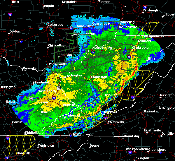 The severe thunderstorm warning for western randolph, southern lewis, northeastern braxton, southwestern upshur and northeastern webster counties will expire at 1100 am est, the severe thunderstorm which prompted the warning has weakened. therefore, the warning will be allowed to expire. a severe thunderstorm watch remains in effect until 100 pm est for northern, north central and northeastern west virginia. The severe thunderstorm warning for western randolph, southern lewis, northeastern braxton, southwestern upshur and northeastern webster counties will expire at 1100 am est, the severe thunderstorm which prompted the warning has weakened. therefore, the warning will be allowed to expire. a severe thunderstorm watch remains in effect until 100 pm est for northern, north central and northeastern west virginia.
|
| 3/1/2017 10:47 AM EST |
 At 1046 am est, a severe thunderstorm was located near rock cave, or 16 miles southwest of buckhannon, moving east at 70 mph (radar indicated). Hazards include 60 mph wind gusts. Expect damage to roofs, siding, and trees. locations impacted include, rock cave, holly river state, burnsville, alexander, eden, sand run, cleveland, alton, walkersville, hacker valley, kanawha head, ireland, french creek and falls mills. This includes interstate 79 between mile markers 80 and 82, and between mile markers 84 and 89. At 1046 am est, a severe thunderstorm was located near rock cave, or 16 miles southwest of buckhannon, moving east at 70 mph (radar indicated). Hazards include 60 mph wind gusts. Expect damage to roofs, siding, and trees. locations impacted include, rock cave, holly river state, burnsville, alexander, eden, sand run, cleveland, alton, walkersville, hacker valley, kanawha head, ireland, french creek and falls mills. This includes interstate 79 between mile markers 80 and 82, and between mile markers 84 and 89.
|
| 3/1/2017 10:25 AM EST |
 At 1025 am est, a severe thunderstorm was located near cedar creek state park, or 9 miles south of glenville, moving east at 70 mph (radar indicated). Hazards include 60 mph wind gusts. expect damage to roofs, siding, and trees At 1025 am est, a severe thunderstorm was located near cedar creek state park, or 9 miles south of glenville, moving east at 70 mph (radar indicated). Hazards include 60 mph wind gusts. expect damage to roofs, siding, and trees
|
| 6/23/2016 4:05 AM EDT |
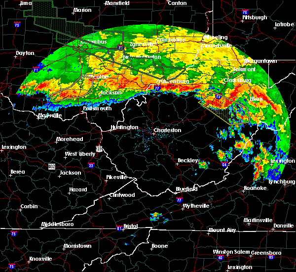 At 404 am edt, a severe thunderstorm was located near rock cave, or 11 miles south of buckhannon, moving southeast at 50 mph (radar indicated). Hazards include 60 mph wind gusts. Expect damage to roofs. siding. and trees. Locations impacted include, buckhannon, mill creek, holly river state, dailey, rock cave, beverly, burnsville, huttonsville, falls mills, cleveland, ireland, sand run, tallmansville, pickens, valley head, kanawha head, monterville, overhill, walkersville and helvetia. At 404 am edt, a severe thunderstorm was located near rock cave, or 11 miles south of buckhannon, moving southeast at 50 mph (radar indicated). Hazards include 60 mph wind gusts. Expect damage to roofs. siding. and trees. Locations impacted include, buckhannon, mill creek, holly river state, dailey, rock cave, beverly, burnsville, huttonsville, falls mills, cleveland, ireland, sand run, tallmansville, pickens, valley head, kanawha head, monterville, overhill, walkersville and helvetia.
|
| 6/23/2016 3:40 AM EDT |
 At 340 am edt, a severe thunderstorm was located near stonewall jackson, or near weston, moving southeast at 50 mph (radar indicated). Hazards include 60 mph wind gusts and penny size hail. Expect damage to roofs. siding. And trees. At 340 am edt, a severe thunderstorm was located near stonewall jackson, or near weston, moving southeast at 50 mph (radar indicated). Hazards include 60 mph wind gusts and penny size hail. Expect damage to roofs. siding. And trees.
|
| 7/14/2015 6:30 PM EDT |
 At 629 pm edt, doppler radar indicated a line of severe thunderstorms capable of producing damaging winds in excess of 60 mph. these storms were located along a line extending from 10 miles south of stonewall jackson to near craigsville to near pratt, moving east at 60 mph. locations impacted include, summersville, fayetteville, richwood, sutton, webster springs, oak hill, montgomery, ansted, cedar grove, east bank, gassaway, glasgow, smithers, addison (webster springs), gauley bridge, pratt, camden-on-gauley, craigsville, camden on gauley and birch river. At 629 pm edt, doppler radar indicated a line of severe thunderstorms capable of producing damaging winds in excess of 60 mph. these storms were located along a line extending from 10 miles south of stonewall jackson to near craigsville to near pratt, moving east at 60 mph. locations impacted include, summersville, fayetteville, richwood, sutton, webster springs, oak hill, montgomery, ansted, cedar grove, east bank, gassaway, glasgow, smithers, addison (webster springs), gauley bridge, pratt, camden-on-gauley, craigsville, camden on gauley and birch river.
|
| 7/14/2015 5:48 PM EDT |
 At 547 pm edt, doppler radar indicated a line of severe thunderstorms capable of producing damaging winds in excess of 60 mph. these storms were located along a line extending from near arnoldsburg to amma to cross lanes, and moving east at 50 mph. At 547 pm edt, doppler radar indicated a line of severe thunderstorms capable of producing damaging winds in excess of 60 mph. these storms were located along a line extending from near arnoldsburg to amma to cross lanes, and moving east at 50 mph.
|
| 6/26/2015 9:25 PM EDT | At 924 pm edt, doppler radar indicated a line of severe thunderstorms capable of producing quarter size hail and damaging winds in excess of 60 mph. these storms were located along a line extending from near rock cave to near summersville, and moving east at 35 mph. |
| 6/20/2015 2:00 PM EDT | Power lines and trees down. power out in lewis county WV, 8 miles WSW of Burnsville, WV |
| 6/17/2015 6:18 PM EDT |
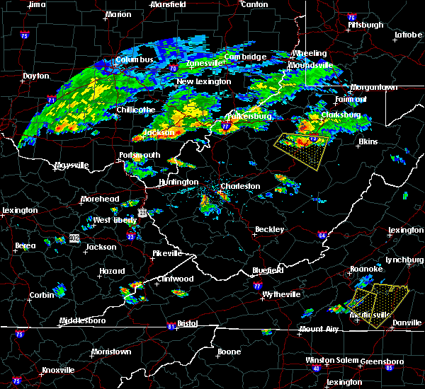 At 617 pm edt, doppler radar indicated a severe thunderstorm capable of producing quarter size hail and damaging winds in excess of 60 mph. this storm was located near stonewall jackson, or 7 miles southwest of weston, moving east at 30 mph. locations impacted include, buckhannon, weston, rock cave, stonewall jackson, burnsville, lorentz, cleveland, hacker valley, falls mills, ireland, sand run, kanawha head, french creek, walkersville, eden, camden and horner. At 617 pm edt, doppler radar indicated a severe thunderstorm capable of producing quarter size hail and damaging winds in excess of 60 mph. this storm was located near stonewall jackson, or 7 miles southwest of weston, moving east at 30 mph. locations impacted include, buckhannon, weston, rock cave, stonewall jackson, burnsville, lorentz, cleveland, hacker valley, falls mills, ireland, sand run, kanawha head, french creek, walkersville, eden, camden and horner.
|
| 6/17/2015 5:54 PM EDT |
 At 554 pm edt, doppler radar indicated a severe thunderstorm capable of producing quarter size hail and damaging winds in excess of 60 mph. this storm was located near glenville, and moving east at 30 mph. At 554 pm edt, doppler radar indicated a severe thunderstorm capable of producing quarter size hail and damaging winds in excess of 60 mph. this storm was located near glenville, and moving east at 30 mph.
|
| 4/9/2015 7:58 PM EDT | Quarter sized hail reported 1.2 miles SW of Burnsville, WV, quarter size hail |
| 4/9/2015 7:11 PM EDT | The severe thunderstorm warning for lewis. extreme north central braxton. east central calhoun and central gilmer counties will expire at 715 pm edt. the storm which prompted the warning has moved out of the warned area. A severe thunderstorm watch remains in effect until 1000 pm edt. |
| 4/9/2015 7:10 PM EDT | Quarter sized hail reported 2.9 miles SW of Burnsville, WV |
| 4/9/2015 7:09 PM EDT | The national weather service in charleston has issued a * severe thunderstorm warning for. southern barbour county in west virginia. this includes the city of audra state park. northeastern braxton county in west virginia. East central gilmer county in west virginia. |
| 4/9/2015 6:34 PM EDT | A severe thunderstorm warning remains in effect until 715 pm edt for lewis. north central braxton. east central calhoun and central gilmer counties. at 631 pm edt. national weather service doppler radar continued to indicate a severe thunderstorm capable of producing quarter size hail. this storm was located near stumptown. Or near grantsville. |
| 4/9/2015 6:11 PM EDT | The national weather service in charleston has issued a * severe thunderstorm warning for. north central braxton county in west virginia. northern calhoun county in west virginia. this includes the city of grantsville. South central doddridge county in west virginia. |
| 4/9/2015 6:11 PM EDT | The national weather service in charleston has issued a * severe thunderstorm warning for. north central braxton county in west virginia. northern calhoun county in west virginia. this includes the city of grantsville. South central doddridge county in west virginia. |
| 3/28/2012 2:35 PM EDT | Half Dollar sized hail reported 10.5 miles W of Burnsville, WV, 1 inch to 1.25 inch hail covering the ground |
| 3/28/2012 2:34 PM EDT | Hen Egg sized hail reported 5.9 miles SW of Burnsville, WV |
| 1/1/0001 12:00 AM | 15 trees down along rt 19 between falls mill and irelan in braxton county WV, 6.9 miles NW of Burnsville, WV |
| 1/1/0001 12:00 AM | Trees are down on rock cave road and route 19 south near walkersville in lewis county WV, 10.5 miles W of Burnsville, WV |
Hail Maps for Burnsville, WV


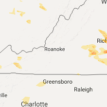


Connect with Interactive Hail Maps