

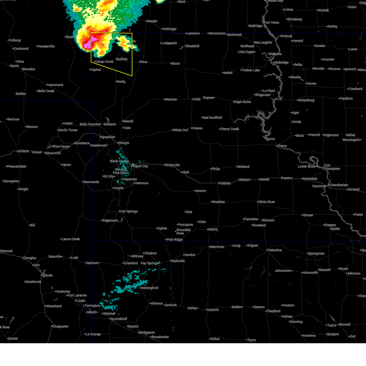
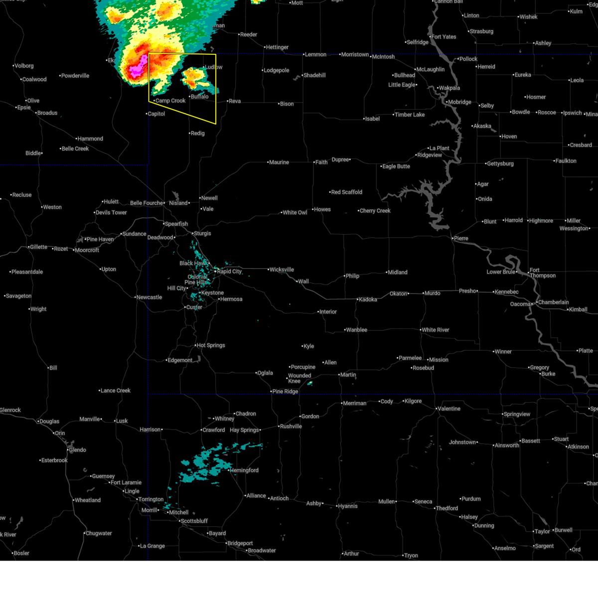
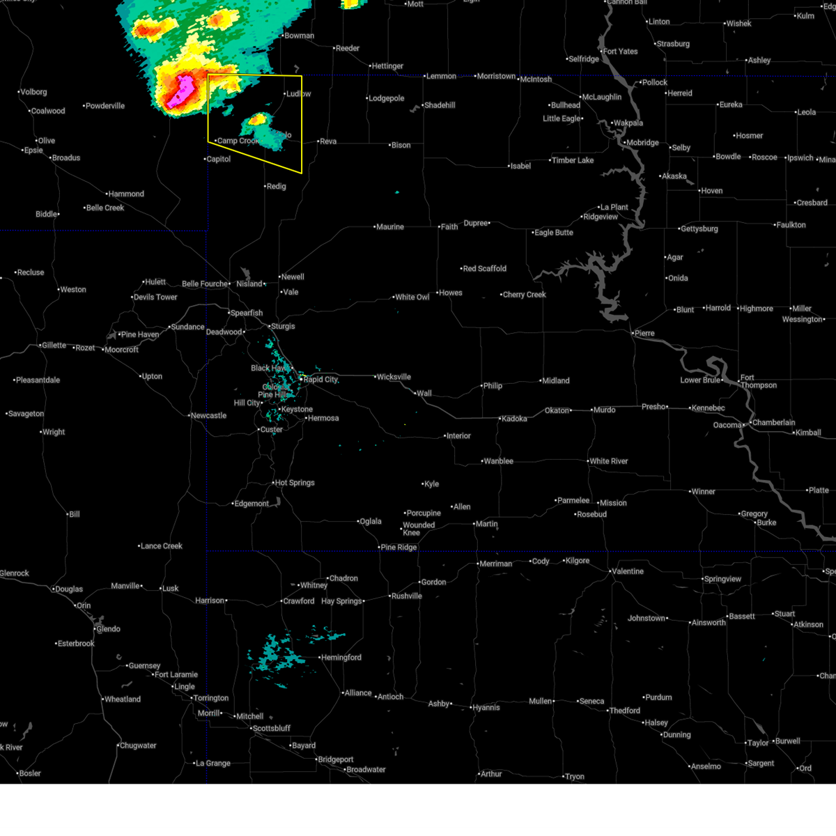
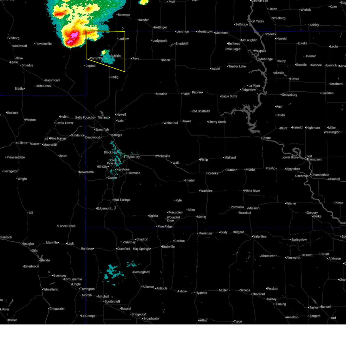
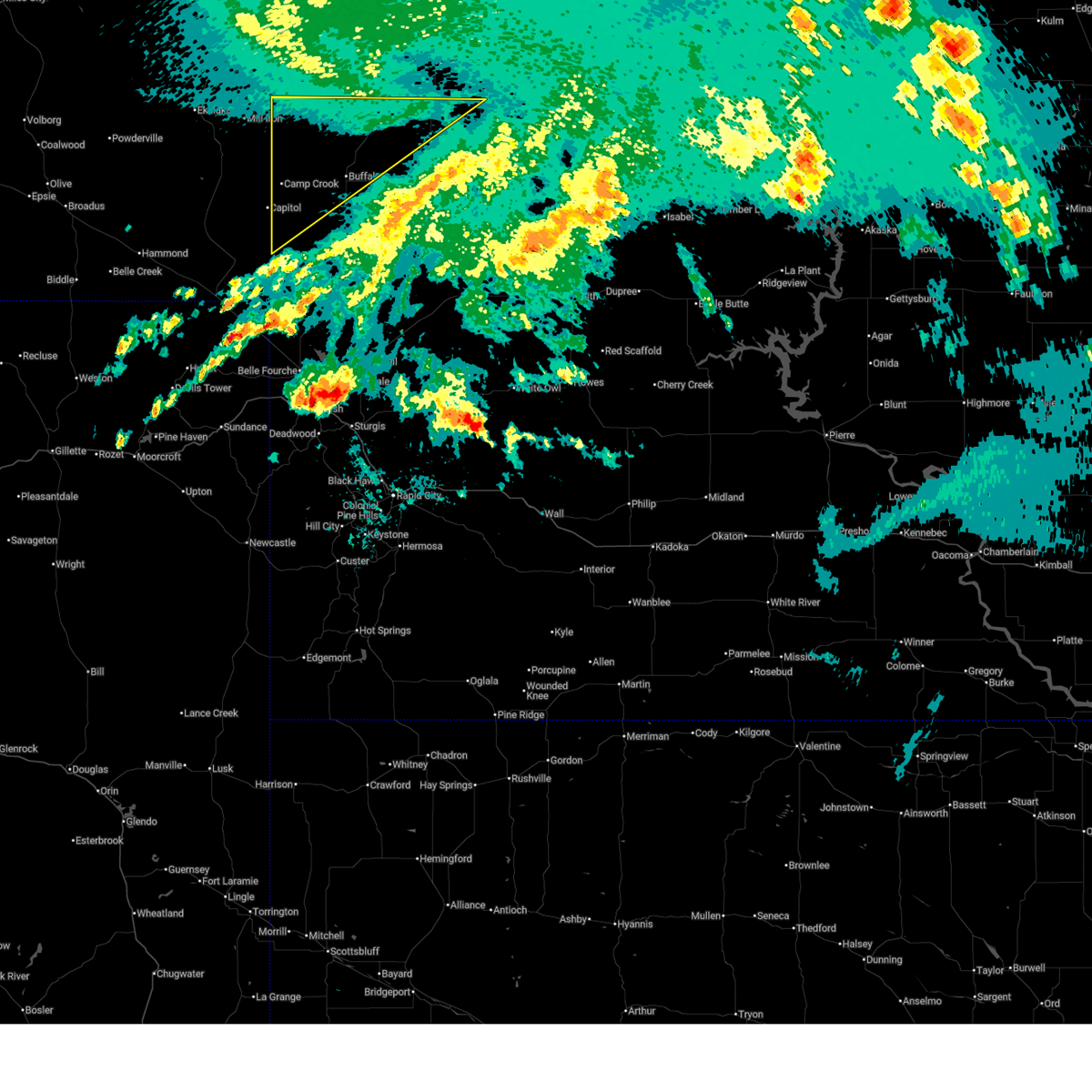
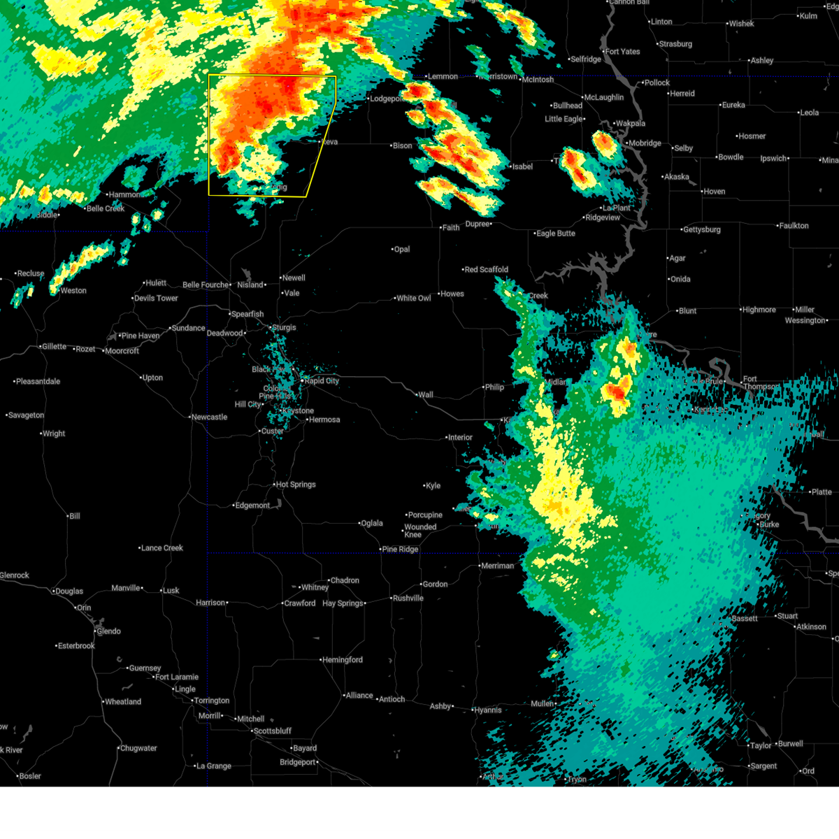
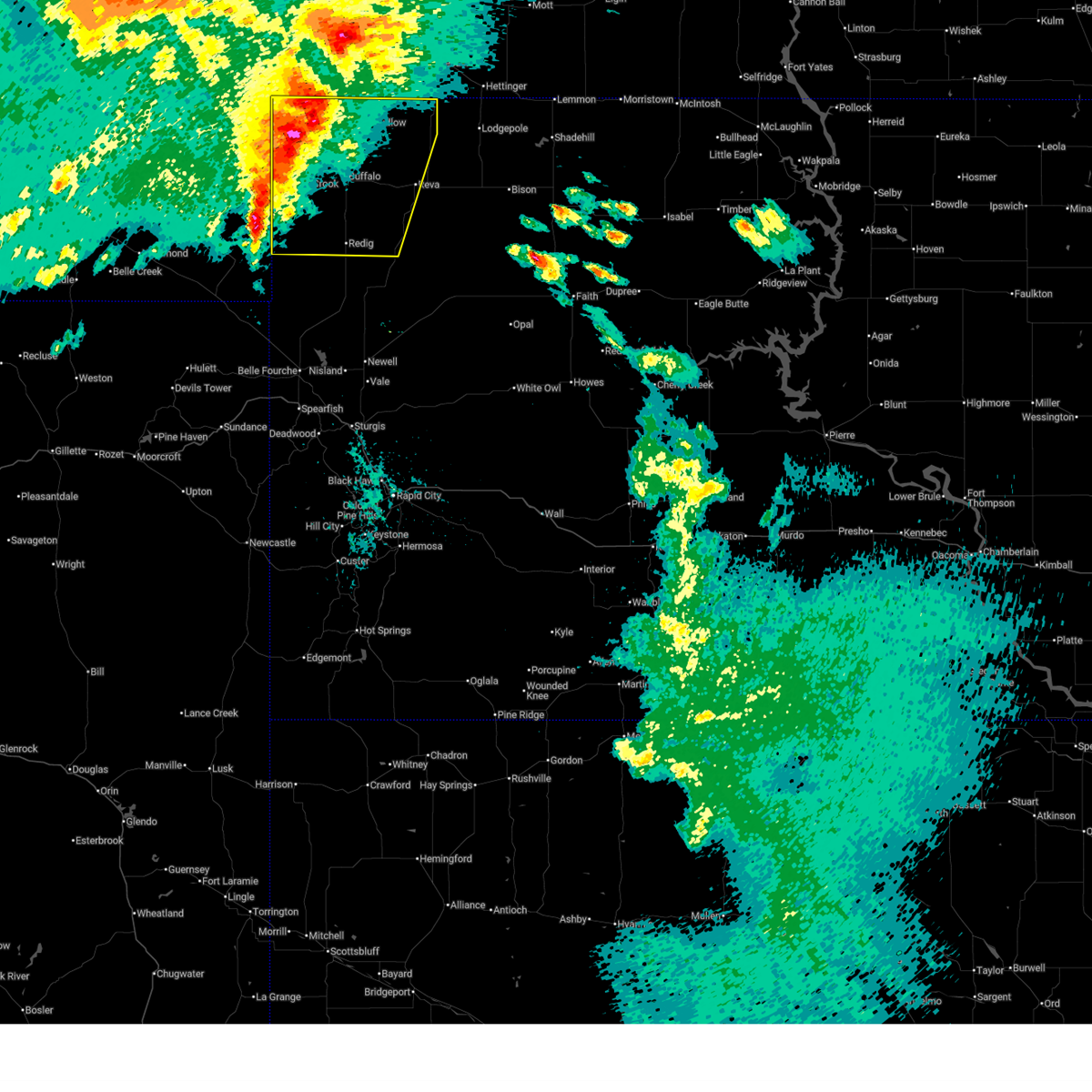
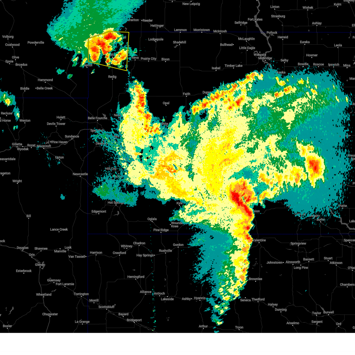
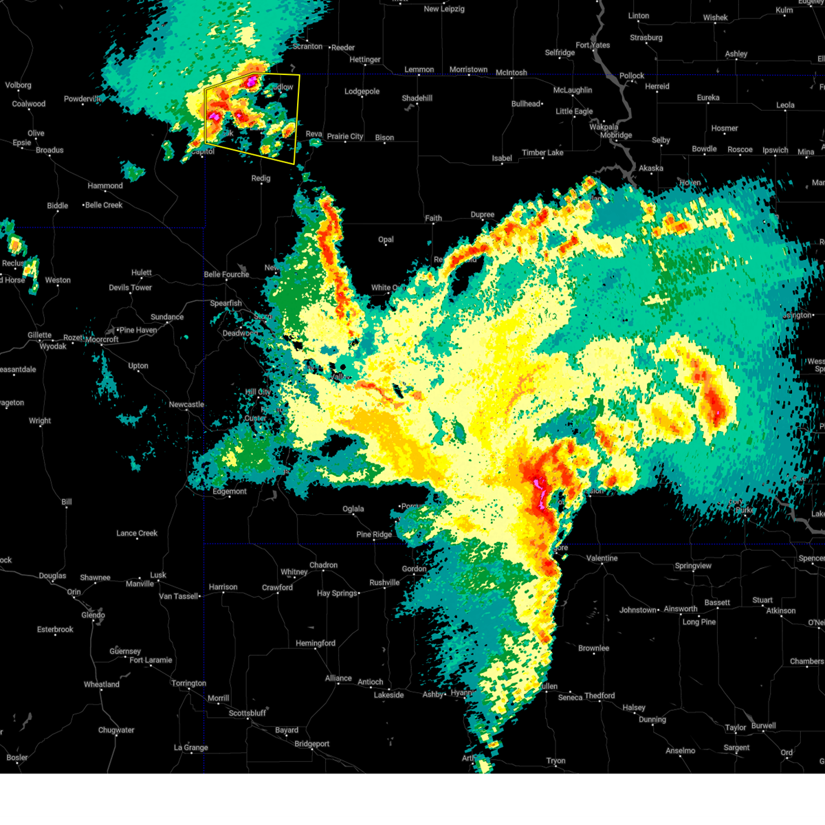
Hail Map for Camp Crook, SD
The Camp Crook, SD area has had 25 reports of on-the-ground hail by trained spotters, and has been under severe weather warnings 16 times during the past 12 months. Doppler radar has detected hail at or near Camp Crook, SD on 34 occasions.
| Name: | Camp Crook, SD |
| Where Located: | 107.8 miles NNW of Rapid City, SD |
| Map: | Google Map for Camp Crook, SD |
| Population: | 63 |
| Housing Units: | 46 |
| More Info: | Search Google for Camp Crook, SD |
0
The Top Recent Hail Date for Camp Crook, SD is Saturday, July 13, 2024 (12th out of 34)

Hail and Wind Damage Spotted near Camp Crook, SD
| Date / Time | Report Details |
|---|---|
| 6/20/2025 5:51 PM MDT | Quarter sized hail reported 13.8 miles SSW of Camp Crook, SD |
| 6/20/2025 5:51 PM MDT | Storm damage reported in harding county SD, 13.8 miles SSW of Camp Crook, SD |
| 6/20/2025 5:42 PM MDT | Golf Ball sized hail reported 11.7 miles S of Camp Crook, SD |
| 6/20/2025 5:37 PM MDT |
 the severe thunderstorm warning has been cancelled and is no longer in effect the severe thunderstorm warning has been cancelled and is no longer in effect
|
| 6/20/2025 5:28 PM MDT |
 At 528 pm mdt, a severe thunderstorm was located 18 miles west of ladner, or 20 miles east of ekalaka, moving east at 30 mph (public). Hazards include tennis ball size hail and 70 mph wind gusts. People and animals outdoors will be injured. expect hail damage to roofs, siding, windows, and vehicles. expect considerable tree damage. wind damage is also likely to mobile homes, roofs, and outbuildings. Locations impacted include, buffalo, ludlow, camp crook, ladner, table mountain, south cave hills, north cave hills, lake gardner, and western slim buttes. At 528 pm mdt, a severe thunderstorm was located 18 miles west of ladner, or 20 miles east of ekalaka, moving east at 30 mph (public). Hazards include tennis ball size hail and 70 mph wind gusts. People and animals outdoors will be injured. expect hail damage to roofs, siding, windows, and vehicles. expect considerable tree damage. wind damage is also likely to mobile homes, roofs, and outbuildings. Locations impacted include, buffalo, ludlow, camp crook, ladner, table mountain, south cave hills, north cave hills, lake gardner, and western slim buttes.
|
| 6/20/2025 5:19 PM MDT |
 At 518 pm mdt, a severe thunderstorm was located 17 miles east of ekalaka, moving east at 35 mph (public reported 2 inch size hail in mill iron at 515 pm). Hazards include two inch hail and 60 mph wind gusts. People and animals outdoors will be injured. expect hail damage to roofs, siding, windows, and vehicles. expect wind damage to roofs, siding, and trees. Locations impacted include, ladner, table mountain, north cave hills and south cave hills. At 518 pm mdt, a severe thunderstorm was located 17 miles east of ekalaka, moving east at 35 mph (public reported 2 inch size hail in mill iron at 515 pm). Hazards include two inch hail and 60 mph wind gusts. People and animals outdoors will be injured. expect hail damage to roofs, siding, windows, and vehicles. expect wind damage to roofs, siding, and trees. Locations impacted include, ladner, table mountain, north cave hills and south cave hills.
|
| 6/20/2025 5:14 PM MDT |
 Svrunr the national weather service in rapid city has issued a * severe thunderstorm warning for, western harding county in northwestern south dakota, * until 615 pm mdt. * at 514 pm mdt, a severe thunderstorm was located 14 miles east of ekalaka, moving east at 35 mph (radar indicated). Hazards include golf ball size hail and 60 mph wind gusts. People and animals outdoors will be injured. expect hail damage to roofs, siding, windows, and vehicles. expect wind damage to roofs, siding, and trees. this severe thunderstorm will be near, ladner around 535 pm mdt. table mountain around 540 pm mdt. north cave hills around 550 pm mdt. South cave hills around 555 pm mdt. Svrunr the national weather service in rapid city has issued a * severe thunderstorm warning for, western harding county in northwestern south dakota, * until 615 pm mdt. * at 514 pm mdt, a severe thunderstorm was located 14 miles east of ekalaka, moving east at 35 mph (radar indicated). Hazards include golf ball size hail and 60 mph wind gusts. People and animals outdoors will be injured. expect hail damage to roofs, siding, windows, and vehicles. expect wind damage to roofs, siding, and trees. this severe thunderstorm will be near, ladner around 535 pm mdt. table mountain around 540 pm mdt. north cave hills around 550 pm mdt. South cave hills around 555 pm mdt.
|
| 6/16/2025 2:10 AM MDT |
 Gusty showers with gusts up to 75 mph will continue over the next few hours. however, this severe thunderstorm warning has been replaced by a high wind warning effective until 500 am mdt. Gusty showers with gusts up to 75 mph will continue over the next few hours. however, this severe thunderstorm warning has been replaced by a high wind warning effective until 500 am mdt.
|
| 6/16/2025 1:40 AM MDT |
 At 140 am mdt, gusty showers were located along a line extending from 9 miles northeast of ludlow to 12 miles west of camp crook, moving southwest at 10 mph (radar indicated). Hazards include 70 mph wind gusts. Expect considerable tree damage. damage is likely to mobile homes, roofs, and outbuildings. Locations impacted include, buffalo, harding, ludlow, ralph, camp crook, ladner, gustave, west short pines, table mountain, south cave hills, north cave hills, and lake gardner. At 140 am mdt, gusty showers were located along a line extending from 9 miles northeast of ludlow to 12 miles west of camp crook, moving southwest at 10 mph (radar indicated). Hazards include 70 mph wind gusts. Expect considerable tree damage. damage is likely to mobile homes, roofs, and outbuildings. Locations impacted include, buffalo, harding, ludlow, ralph, camp crook, ladner, gustave, west short pines, table mountain, south cave hills, north cave hills, and lake gardner.
|
| 6/16/2025 1:15 AM MDT |
 Svrunr the national weather service in rapid city has issued a * severe thunderstorm warning for, harding county in northwestern south dakota, northwestern perkins county in northwestern south dakota, * until 215 am mdt. * at 114 am mdt, gusty showers were located along a line extending from 12 miles south of scranton to 9 miles west of camp crook, moving southwest at 10 mph (radar indicated). Hazards include 70 mph wind gusts. Expect considerable tree damage. Damage is likely to mobile homes, roofs, and outbuildings. Svrunr the national weather service in rapid city has issued a * severe thunderstorm warning for, harding county in northwestern south dakota, northwestern perkins county in northwestern south dakota, * until 215 am mdt. * at 114 am mdt, gusty showers were located along a line extending from 12 miles south of scranton to 9 miles west of camp crook, moving southwest at 10 mph (radar indicated). Hazards include 70 mph wind gusts. Expect considerable tree damage. Damage is likely to mobile homes, roofs, and outbuildings.
|
| 6/15/2025 11:52 PM MDT |
 At 1152 pm mdt, severe thunderstorms were located along a line extending from 6 miles northwest of ralph to 2 miles east of harding, moving east at 40 mph (radar indicated). Hazards include 70 mph wind gusts and quarter size hail. Hail damage to vehicles is expected. expect considerable tree damage. wind damage is also likely to mobile homes, roofs, and outbuildings. Locations impacted include, buffalo, harding, ludlow, reva, ralph, camp crook, gustave, ladner, redig, east short pines, west short pines, slim buttes, south cave hills, lake gardner, table mountain, north cave hills, and crow buttes. At 1152 pm mdt, severe thunderstorms were located along a line extending from 6 miles northwest of ralph to 2 miles east of harding, moving east at 40 mph (radar indicated). Hazards include 70 mph wind gusts and quarter size hail. Hail damage to vehicles is expected. expect considerable tree damage. wind damage is also likely to mobile homes, roofs, and outbuildings. Locations impacted include, buffalo, harding, ludlow, reva, ralph, camp crook, gustave, ladner, redig, east short pines, west short pines, slim buttes, south cave hills, lake gardner, table mountain, north cave hills, and crow buttes.
|
| 6/15/2025 11:49 PM MDT |
 At 1148 pm mdt, severe thunderstorms were located along a line extending from 7 miles northwest of ralph to near harding, moving east at 40 mph (radar indicated). Hazards include 60 mph wind gusts and quarter size hail. Hail damage to vehicles is expected. expect wind damage to roofs, siding, and trees. Locations impacted include, buffalo, harding, ludlow, reva, ralph, camp crook, gustave, ladner, redig, east short pines, west short pines, slim buttes, south cave hills, lake gardner, table mountain, north cave hills, and crow buttes. At 1148 pm mdt, severe thunderstorms were located along a line extending from 7 miles northwest of ralph to near harding, moving east at 40 mph (radar indicated). Hazards include 60 mph wind gusts and quarter size hail. Hail damage to vehicles is expected. expect wind damage to roofs, siding, and trees. Locations impacted include, buffalo, harding, ludlow, reva, ralph, camp crook, gustave, ladner, redig, east short pines, west short pines, slim buttes, south cave hills, lake gardner, table mountain, north cave hills, and crow buttes.
|
| 6/15/2025 11:27 PM MDT |
 Svrunr the national weather service in rapid city has issued a * severe thunderstorm warning for, harding county in northwestern south dakota, * until 1230 am mdt. * at 1127 pm mdt, severe thunderstorms were located along a line extending from 4 miles north of table mountain to 4 miles southwest of gustave, moving northeast at 40 mph (radar indicated). Hazards include ping pong ball size hail and 60 mph wind gusts. People and animals outdoors will be injured. expect hail damage to roofs, siding, windows, and vehicles. Expect wind damage to roofs, siding, and trees. Svrunr the national weather service in rapid city has issued a * severe thunderstorm warning for, harding county in northwestern south dakota, * until 1230 am mdt. * at 1127 pm mdt, severe thunderstorms were located along a line extending from 4 miles north of table mountain to 4 miles southwest of gustave, moving northeast at 40 mph (radar indicated). Hazards include ping pong ball size hail and 60 mph wind gusts. People and animals outdoors will be injured. expect hail damage to roofs, siding, windows, and vehicles. Expect wind damage to roofs, siding, and trees.
|
| 4/27/2025 11:57 PM MDT |
 the severe thunderstorm warning has been cancelled and is no longer in effect the severe thunderstorm warning has been cancelled and is no longer in effect
|
| 4/27/2025 11:41 PM MDT |
 Svrunr the national weather service in rapid city has issued a * severe thunderstorm warning for, northwestern harding county in northwestern south dakota, * until 1245 am mdt. * at 1140 pm mdt, a severe thunderstorm was located over north cave hills, or 17 miles north of buffalo, moving east at 20 mph (radar indicated). Hazards include 60 mph wind gusts and half dollar size hail. Hail damage to vehicles is expected. Expect wind damage to roofs, siding, and trees. Svrunr the national weather service in rapid city has issued a * severe thunderstorm warning for, northwestern harding county in northwestern south dakota, * until 1245 am mdt. * at 1140 pm mdt, a severe thunderstorm was located over north cave hills, or 17 miles north of buffalo, moving east at 20 mph (radar indicated). Hazards include 60 mph wind gusts and half dollar size hail. Hail damage to vehicles is expected. Expect wind damage to roofs, siding, and trees.
|
| 9/17/2024 7:40 PM MDT |
 The storm which prompted the warning has weakened below severe limits and is exiting the warned area. therefore, the warning will be allowed to expire. The storm which prompted the warning has weakened below severe limits and is exiting the warned area. therefore, the warning will be allowed to expire.
|
| 9/17/2024 7:19 PM MDT |
 At 718 pm mdt, a severe thunderstorm was located near west short pines, or 24 miles southwest of buffalo, moving north at 30 mph. wind gusts of 50 to 60 mph were recently reported west of harding (public). Hazards include 60 mph wind gusts and penny size hail. Expect damage to roofs, siding, and trees. Locations impacted include, harding, camp crook, and west short pines. At 718 pm mdt, a severe thunderstorm was located near west short pines, or 24 miles southwest of buffalo, moving north at 30 mph. wind gusts of 50 to 60 mph were recently reported west of harding (public). Hazards include 60 mph wind gusts and penny size hail. Expect damage to roofs, siding, and trees. Locations impacted include, harding, camp crook, and west short pines.
|
| 9/17/2024 7:19 PM MDT |
 the severe thunderstorm warning has been cancelled and is no longer in effect the severe thunderstorm warning has been cancelled and is no longer in effect
|
| 9/17/2024 6:44 PM MDT |
 Svrunr the national weather service in rapid city has issued a * severe thunderstorm warning for, southwestern harding county in northwestern south dakota, northwestern butte county in northwestern south dakota, * until 745 pm mdt. * at 644 pm mdt, a severe thunderstorm was located 9 miles south of gustave, or 33 miles north of belle fourche, moving northwest at 25 mph (radar indicated). Hazards include ping pong ball size hail and 60 mph wind gusts. People and animals outdoors will be injured. expect hail damage to roofs, siding, windows, and vehicles. expect wind damage to roofs, siding, and trees. this severe thunderstorm will be near, gustave around 650 pm mdt. west short pines around 700 pm mdt. Camp crook around 730 pm mdt. Svrunr the national weather service in rapid city has issued a * severe thunderstorm warning for, southwestern harding county in northwestern south dakota, northwestern butte county in northwestern south dakota, * until 745 pm mdt. * at 644 pm mdt, a severe thunderstorm was located 9 miles south of gustave, or 33 miles north of belle fourche, moving northwest at 25 mph (radar indicated). Hazards include ping pong ball size hail and 60 mph wind gusts. People and animals outdoors will be injured. expect hail damage to roofs, siding, windows, and vehicles. expect wind damage to roofs, siding, and trees. this severe thunderstorm will be near, gustave around 650 pm mdt. west short pines around 700 pm mdt. Camp crook around 730 pm mdt.
|
| 7/13/2024 9:13 PM MDT |
 At 912 pm mdt, severe thunderstorms were located along a line extending from 5 miles south of amidon to 3 miles southeast of camp crook to 14 miles south of ridgeway, moving southeast at 40 mph (radar indicated). Hazards include golf ball size hail and 70 mph wind gusts. People and animals outdoors will be injured. expect hail damage to roofs, siding, windows, and vehicles. expect considerable tree damage. wind damage is also likely to mobile homes, roofs, and outbuildings. Locations impacted include, buffalo, harding, ludlow, gustave, lake gardner, north cave hills, south cave hills, east short pines, west short pines, redig, crow buttes, ralph, slim buttes, reva and antelope butte. At 912 pm mdt, severe thunderstorms were located along a line extending from 5 miles south of amidon to 3 miles southeast of camp crook to 14 miles south of ridgeway, moving southeast at 40 mph (radar indicated). Hazards include golf ball size hail and 70 mph wind gusts. People and animals outdoors will be injured. expect hail damage to roofs, siding, windows, and vehicles. expect considerable tree damage. wind damage is also likely to mobile homes, roofs, and outbuildings. Locations impacted include, buffalo, harding, ludlow, gustave, lake gardner, north cave hills, south cave hills, east short pines, west short pines, redig, crow buttes, ralph, slim buttes, reva and antelope butte.
|
| 7/13/2024 8:48 PM MDT |
 Svrunr the national weather service in rapid city has issued a * severe thunderstorm warning for, harding county in northwestern south dakota, northern butte county in northwestern south dakota, northwestern perkins county in northwestern south dakota, northeastern crook county in northeastern wyoming, * until 945 pm mdt. * at 847 pm mdt, severe thunderstorms were located along a line extending from 15 miles west of amidon to 16 miles north of camp crook to 12 miles southwest of ridgeway, moving southeast at 45 mph (radar indicated). Hazards include 70 mph wind gusts and ping pong ball size hail. People and animals outdoors will be injured. expect hail damage to roofs, siding, windows, and vehicles. expect considerable tree damage. wind damage is also likely to mobile homes, roofs, and outbuildings. severe thunderstorms will be near, camp crook, ladner, and table mountain around 855 pm mdt. north cave hills, south cave hills, and west short pines around 900 pm mdt. lake gardner around 905 pm mdt. buffalo, harding, and gustave around 910 pm mdt. Ludlow and east short pines around 915 pm mdt. Svrunr the national weather service in rapid city has issued a * severe thunderstorm warning for, harding county in northwestern south dakota, northern butte county in northwestern south dakota, northwestern perkins county in northwestern south dakota, northeastern crook county in northeastern wyoming, * until 945 pm mdt. * at 847 pm mdt, severe thunderstorms were located along a line extending from 15 miles west of amidon to 16 miles north of camp crook to 12 miles southwest of ridgeway, moving southeast at 45 mph (radar indicated). Hazards include 70 mph wind gusts and ping pong ball size hail. People and animals outdoors will be injured. expect hail damage to roofs, siding, windows, and vehicles. expect considerable tree damage. wind damage is also likely to mobile homes, roofs, and outbuildings. severe thunderstorms will be near, camp crook, ladner, and table mountain around 855 pm mdt. north cave hills, south cave hills, and west short pines around 900 pm mdt. lake gardner around 905 pm mdt. buffalo, harding, and gustave around 910 pm mdt. Ludlow and east short pines around 915 pm mdt.
|
| 6/27/2024 5:55 PM MDT |
 At 555 pm mdt, severe thunderstorms were located along a line extending from near rhame to 2 miles north of camp crook to 16 miles north of alzada, moving east at 35 mph (radar indicated). Hazards include 60 mph wind gusts and quarter size hail. Hail damage to vehicles is expected. expect wind damage to roofs, siding, and trees. these severe storms will be near, harding, camp crook, ladner, gustave, table mountain, lake gardner, north cave hills, south cave hills, and west short pines around 600 pm mdt. east short pines around 605 pm mdt. Other locations in the path of these severe thunderstorms include buffalo, ludlow and redig. At 555 pm mdt, severe thunderstorms were located along a line extending from near rhame to 2 miles north of camp crook to 16 miles north of alzada, moving east at 35 mph (radar indicated). Hazards include 60 mph wind gusts and quarter size hail. Hail damage to vehicles is expected. expect wind damage to roofs, siding, and trees. these severe storms will be near, harding, camp crook, ladner, gustave, table mountain, lake gardner, north cave hills, south cave hills, and west short pines around 600 pm mdt. east short pines around 605 pm mdt. Other locations in the path of these severe thunderstorms include buffalo, ludlow and redig.
|
| 6/27/2024 5:47 PM MDT |
 Svrunr the national weather service in rapid city has issued a * severe thunderstorm warning for, harding county in northwestern south dakota, northwestern butte county in northwestern south dakota, * until 645 pm mdt. * at 546 pm mdt, severe thunderstorms were located along a line extending from 2 miles west of rhame to 3 miles northwest of camp crook to 15 miles north of alzada, moving east at 35 mph (radar indicated). Hazards include 60 mph wind gusts. Expect damage to roofs, siding, and trees. severe thunderstorms will be near, camp crook, ladner, table mountain, and west short pines around 550 pm mdt. harding, gustave, north cave hills, and south cave hills around 555 pm mdt. lake gardner around 600 pm mdt. buffalo and east short pines around 605 pm mdt. Ludlow around 610 pm mdt. Svrunr the national weather service in rapid city has issued a * severe thunderstorm warning for, harding county in northwestern south dakota, northwestern butte county in northwestern south dakota, * until 645 pm mdt. * at 546 pm mdt, severe thunderstorms were located along a line extending from 2 miles west of rhame to 3 miles northwest of camp crook to 15 miles north of alzada, moving east at 35 mph (radar indicated). Hazards include 60 mph wind gusts. Expect damage to roofs, siding, and trees. severe thunderstorms will be near, camp crook, ladner, table mountain, and west short pines around 550 pm mdt. harding, gustave, north cave hills, and south cave hills around 555 pm mdt. lake gardner around 600 pm mdt. buffalo and east short pines around 605 pm mdt. Ludlow around 610 pm mdt.
|
| 7/11/2023 8:47 PM MDT |
 At 847 pm mdt, a severe thunderstorm was located 9 miles southwest of ladner, or 16 miles northwest of buffalo, moving east at 30 mph (radar indicated). Hazards include ping pong ball size hail and 60 mph wind gusts. People and animals outdoors will be injured. expect hail damage to roofs, siding, windows, and vehicles. expect wind damage to roofs, siding, and trees. this severe thunderstorm will be near, ladner around 900 pm mdt. other locations in the path of this severe thunderstorm include south cave hills and ludlow. hail threat, radar indicated max hail size, 1. 50 in wind threat, radar indicated max wind gust, 60 mph. At 847 pm mdt, a severe thunderstorm was located 9 miles southwest of ladner, or 16 miles northwest of buffalo, moving east at 30 mph (radar indicated). Hazards include ping pong ball size hail and 60 mph wind gusts. People and animals outdoors will be injured. expect hail damage to roofs, siding, windows, and vehicles. expect wind damage to roofs, siding, and trees. this severe thunderstorm will be near, ladner around 900 pm mdt. other locations in the path of this severe thunderstorm include south cave hills and ludlow. hail threat, radar indicated max hail size, 1. 50 in wind threat, radar indicated max wind gust, 60 mph.
|
| 6/26/2023 7:58 PM MDT |
 The severe thunderstorm warning for northwestern harding county will expire at 800 pm mdt, the storms which prompted the warning have weakened below severe limits, and no longer pose an immediate threat to life or property. therefore, the warning will be allowed to expire. however small hail and gusty winds are still possible with these thunderstorms. The severe thunderstorm warning for northwestern harding county will expire at 800 pm mdt, the storms which prompted the warning have weakened below severe limits, and no longer pose an immediate threat to life or property. therefore, the warning will be allowed to expire. however small hail and gusty winds are still possible with these thunderstorms.
|
| 6/26/2023 7:47 PM MDT |
 At 747 pm mdt, severe thunderstorms were located along a line extending from 4 miles east of ladner to 7 miles northwest of lake gardner to near camp crook, moving east at 25 mph (radar indicated). Hazards include 60 mph wind gusts and quarter size hail. Hail damage to vehicles is expected. expect wind damage to roofs, siding, and trees. locations impacted include, ludlow, camp crook, ladner, south cave hills, north cave hills, lake gardner and west short pines. hail threat, radar indicated max hail size, 1. 00 in wind threat, radar indicated max wind gust, 60 mph. At 747 pm mdt, severe thunderstorms were located along a line extending from 4 miles east of ladner to 7 miles northwest of lake gardner to near camp crook, moving east at 25 mph (radar indicated). Hazards include 60 mph wind gusts and quarter size hail. Hail damage to vehicles is expected. expect wind damage to roofs, siding, and trees. locations impacted include, ludlow, camp crook, ladner, south cave hills, north cave hills, lake gardner and west short pines. hail threat, radar indicated max hail size, 1. 00 in wind threat, radar indicated max wind gust, 60 mph.
|
| 6/26/2023 7:35 PM MDT | Quarter sized hail reported 4.8 miles S of Camp Crook, SD, also 50 mph wind gusts |
| 6/26/2023 7:26 PM MDT |
 At 726 pm mdt, severe thunderstorms were located along a line extending from near table mountain to 6 miles southwest of ladner to 4 miles northwest of camp crook, moving southeast at 20 mph (radar indicated). Hazards include 60 mph wind gusts and quarter size hail. Hail damage to vehicles is expected. expect wind damage to roofs, siding, and trees. locations impacted include, ladner, table mountain, south cave hills, north cave hills, lake gardner and ludlow. hail threat, radar indicated max hail size, 1. 00 in wind threat, radar indicated max wind gust, 60 mph. At 726 pm mdt, severe thunderstorms were located along a line extending from near table mountain to 6 miles southwest of ladner to 4 miles northwest of camp crook, moving southeast at 20 mph (radar indicated). Hazards include 60 mph wind gusts and quarter size hail. Hail damage to vehicles is expected. expect wind damage to roofs, siding, and trees. locations impacted include, ladner, table mountain, south cave hills, north cave hills, lake gardner and ludlow. hail threat, radar indicated max hail size, 1. 00 in wind threat, radar indicated max wind gust, 60 mph.
|
| 6/26/2023 7:02 PM MDT |
 At 702 pm mdt, severe thunderstorms were located along a line extending from 5 miles south of mud buttes to 7 miles west of ladner to 11 miles northwest of camp crook, moving east at 25 mph (radar indicated). Hazards include 60 mph wind gusts and quarter size hail. Hail damage to vehicles is expected. expect wind damage to roofs, siding, and trees. severe thunderstorms will be near, ladner and table mountain around 720 pm mdt. other locations in the path of these severe thunderstorms include camp crook, north cave hills, south cave hills, ludlow and lake gardner. hail threat, radar indicated max hail size, 1. 00 in wind threat, radar indicated max wind gust, 60 mph. At 702 pm mdt, severe thunderstorms were located along a line extending from 5 miles south of mud buttes to 7 miles west of ladner to 11 miles northwest of camp crook, moving east at 25 mph (radar indicated). Hazards include 60 mph wind gusts and quarter size hail. Hail damage to vehicles is expected. expect wind damage to roofs, siding, and trees. severe thunderstorms will be near, ladner and table mountain around 720 pm mdt. other locations in the path of these severe thunderstorms include camp crook, north cave hills, south cave hills, ludlow and lake gardner. hail threat, radar indicated max hail size, 1. 00 in wind threat, radar indicated max wind gust, 60 mph.
|
| 8/27/2022 9:03 PM MDT | At 902 pm mdt, severe thunderstorms were located along a line extending from 3 miles west of mud buttes to 9 miles northeast of camp crook to 7 miles west of gustave, moving east at 45 mph (radar indicated). Hazards include 60 mph wind gusts. Expect damage to roofs, siding, and trees. severe thunderstorms will be near, buffalo and lake gardner around 920 pm mdt. other locations in the path of these severe thunderstorms include south cave hills, east short pines, redig, crow buttes, slim buttes, ralph and sheep buttes. hail threat, radar indicated max hail size, <. 75 in wind threat, radar indicated max wind gust, 60 mph. |
| 6/29/2022 7:25 PM MDT | Golf Ball sized hail reported 16.2 miles SSW of Camp Crook, SD, second storm of the evening. |
| 6/29/2022 6:58 PM MDT | Quarter sized hail reported 16.2 miles SSW of Camp Crook, SD |
| 5/28/2022 6:01 PM MDT |
 At 601 pm mdt, severe thunderstorms were located along a line extending from 7 miles south of ladner to 6 miles northwest of sheep buttes, moving northeast at 45 mph (radar indicated). Hazards include 70 mph wind gusts and quarter size hail. Hail damage to vehicles is expected. expect considerable tree damage. wind damage is also likely to mobile homes, roofs, and outbuildings. locations impacted include, buffalo, reva, camp crook, hoover, west short pines, slim buttes, deers ears butte, sheep buttes and lake gardner. thunderstorm damage threat, considerable hail threat, radar indicated max hail size, 1. 00 in wind threat, radar indicated max wind gust, 70 mph. At 601 pm mdt, severe thunderstorms were located along a line extending from 7 miles south of ladner to 6 miles northwest of sheep buttes, moving northeast at 45 mph (radar indicated). Hazards include 70 mph wind gusts and quarter size hail. Hail damage to vehicles is expected. expect considerable tree damage. wind damage is also likely to mobile homes, roofs, and outbuildings. locations impacted include, buffalo, reva, camp crook, hoover, west short pines, slim buttes, deers ears butte, sheep buttes and lake gardner. thunderstorm damage threat, considerable hail threat, radar indicated max hail size, 1. 00 in wind threat, radar indicated max wind gust, 70 mph.
|
| 5/28/2022 5:42 PM MDT |
 At 541 pm mdt, severe thunderstorms were located along a line extending from 5 miles northeast of west short pines to near hoover, moving northeast at 40 mph (radar indicated). Hazards include 70 mph wind gusts and quarter size hail. Hail damage to vehicles is expected. expect considerable tree damage. wind damage is also likely to mobile homes, roofs, and outbuildings. locations impacted include, buffalo, harding, reva, camp crook, gustave, castle rock, hoover, redig, east short pines, west short pines, slim buttes, deers ears butte, owl butte, sheep buttes, haystack buttes, lake gardner and crow buttes. thunderstorm damage threat, considerable hail threat, radar indicated max hail size, 1. 00 in wind threat, radar indicated max wind gust, 70 mph. At 541 pm mdt, severe thunderstorms were located along a line extending from 5 miles northeast of west short pines to near hoover, moving northeast at 40 mph (radar indicated). Hazards include 70 mph wind gusts and quarter size hail. Hail damage to vehicles is expected. expect considerable tree damage. wind damage is also likely to mobile homes, roofs, and outbuildings. locations impacted include, buffalo, harding, reva, camp crook, gustave, castle rock, hoover, redig, east short pines, west short pines, slim buttes, deers ears butte, owl butte, sheep buttes, haystack buttes, lake gardner and crow buttes. thunderstorm damage threat, considerable hail threat, radar indicated max hail size, 1. 00 in wind threat, radar indicated max wind gust, 70 mph.
|
| 5/28/2022 5:26 PM MDT |
 At 525 pm mdt, severe thunderstorms were located along a line extending from 3 miles northeast of gustave to 6 miles southeast of castle rock, moving north at 50 mph (radar indicated). Hazards include 70 mph wind gusts and quarter size hail. Hail damage to vehicles is expected. expect considerable tree damage. wind damage is also likely to mobile homes, roofs, and outbuildings. locations impacted include, harding, deers ears butte, west short pines, hoover, lake gardner, sheep buttes and reva. thunderstorm damage threat, considerable hail threat, radar indicated max hail size, 1. 00 in wind threat, radar indicated max wind gust, 70 mph. At 525 pm mdt, severe thunderstorms were located along a line extending from 3 miles northeast of gustave to 6 miles southeast of castle rock, moving north at 50 mph (radar indicated). Hazards include 70 mph wind gusts and quarter size hail. Hail damage to vehicles is expected. expect considerable tree damage. wind damage is also likely to mobile homes, roofs, and outbuildings. locations impacted include, harding, deers ears butte, west short pines, hoover, lake gardner, sheep buttes and reva. thunderstorm damage threat, considerable hail threat, radar indicated max hail size, 1. 00 in wind threat, radar indicated max wind gust, 70 mph.
|
| 5/28/2022 5:09 PM MDT |
 At 509 pm mdt, severe thunderstorms were located along a line extending from 9 miles south of gustave to 3 miles northwest of newell, moving north northeast at 45 mph (radar indicated). Hazards include 70 mph wind gusts and quarter size hail. Hail damage to vehicles is expected. expect considerable tree damage. wind damage is also likely to mobile homes, roofs, and outbuildings. severe thunderstorms will be near, gustave around 520 pm mdt. castle rock around 525 pm mdt. other locations in the path of these severe thunderstorms include harding, west short pines, haystack buttes, camp crook, hoover, reva and slim buttes. thunderstorm damage threat, considerable hail threat, radar indicated max hail size, 1. 00 in wind threat, radar indicated max wind gust, 70 mph. At 509 pm mdt, severe thunderstorms were located along a line extending from 9 miles south of gustave to 3 miles northwest of newell, moving north northeast at 45 mph (radar indicated). Hazards include 70 mph wind gusts and quarter size hail. Hail damage to vehicles is expected. expect considerable tree damage. wind damage is also likely to mobile homes, roofs, and outbuildings. severe thunderstorms will be near, gustave around 520 pm mdt. castle rock around 525 pm mdt. other locations in the path of these severe thunderstorms include harding, west short pines, haystack buttes, camp crook, hoover, reva and slim buttes. thunderstorm damage threat, considerable hail threat, radar indicated max hail size, 1. 00 in wind threat, radar indicated max wind gust, 70 mph.
|
| 7/22/2021 4:25 PM MDT |
 The severe thunderstorm warning for western harding and northwestern butte counties will expire at 430 pm mdt, the storms which prompted the warning have moved out of the area. therefore, the warning will be allowed to expire. however gusty winds are still possible with these thunderstorms. remember, a severe thunderstorm warning still remains in effect for harding, northern butte, northwest perkins until 500 pm mdt. The severe thunderstorm warning for western harding and northwestern butte counties will expire at 430 pm mdt, the storms which prompted the warning have moved out of the area. therefore, the warning will be allowed to expire. however gusty winds are still possible with these thunderstorms. remember, a severe thunderstorm warning still remains in effect for harding, northern butte, northwest perkins until 500 pm mdt.
|
| 7/22/2021 3:54 PM MDT |
 At 354 pm mdt, severe thunderstorms were located along a line extending from 6 miles south of bowman to 7 miles west of antelope butte, moving east at 35 mph (radar indicated). Hazards include 60 mph wind gusts. Expect damage to roofs, siding, and trees. Locations impacted include, buffalo, harding, ludlow, camp crook, ladner, gustave, east short pines, west short pines, table mountain, south cave hills, north cave hills and lake gardner. At 354 pm mdt, severe thunderstorms were located along a line extending from 6 miles south of bowman to 7 miles west of antelope butte, moving east at 35 mph (radar indicated). Hazards include 60 mph wind gusts. Expect damage to roofs, siding, and trees. Locations impacted include, buffalo, harding, ludlow, camp crook, ladner, gustave, east short pines, west short pines, table mountain, south cave hills, north cave hills and lake gardner.
|
| 7/22/2021 3:40 PM MDT | Storm damage reported in harding county SD, 13.8 miles SSW of Camp Crook, SD |
| 7/22/2021 3:33 PM MDT |
 At 332 pm mdt, severe thunderstorms were located along a line extending from 5 miles north of mud buttes to 7 miles east of alzada, moving east at 20 mph (radar indicated). Hazards include 70 mph wind gusts. Expect considerable tree damage. damage is likely to mobile homes, roofs, and outbuildings. These severe thunderstorms will remain over mainly rural areas of western harding and northwestern butte counties from near buffalo to antelope butte. At 332 pm mdt, severe thunderstorms were located along a line extending from 5 miles north of mud buttes to 7 miles east of alzada, moving east at 20 mph (radar indicated). Hazards include 70 mph wind gusts. Expect considerable tree damage. damage is likely to mobile homes, roofs, and outbuildings. These severe thunderstorms will remain over mainly rural areas of western harding and northwestern butte counties from near buffalo to antelope butte.
|
| 7/22/2021 3:30 PM MDT | Storm damage reported in harding county SD, 24.2 miles S of Camp Crook, SD |
| 8/11/2020 8:24 PM MDT |
 At 824 pm mdt, a severe thunderstorm was located 4 miles north of camp crook, or 21 miles west of buffalo, moving southeast at 15 mph (radar indicated). Hazards include 60 mph wind gusts and quarter size hail. Hail damage to vehicles is expected. expect wind damage to roofs, siding, and trees. This severe storm will be near, camp crook around 830 pm mdt. At 824 pm mdt, a severe thunderstorm was located 4 miles north of camp crook, or 21 miles west of buffalo, moving southeast at 15 mph (radar indicated). Hazards include 60 mph wind gusts and quarter size hail. Hail damage to vehicles is expected. expect wind damage to roofs, siding, and trees. This severe storm will be near, camp crook around 830 pm mdt.
|
| 8/11/2020 8:09 PM MDT |
 At 806 pm mdt, a severe thunderstorm was located 6 miles northwest of camp crook, or 24 miles west of buffalo, moving southeast at 15 mph (radar indicated). Hazards include ping pong ball size hail and 60 mph wind gusts. People and animals outdoors will be injured. expect hail damage to roofs, siding, windows, and vehicles. expect wind damage to roofs, siding, and trees. This severe thunderstorm will be near, camp crook around 830 pm mdt. At 806 pm mdt, a severe thunderstorm was located 6 miles northwest of camp crook, or 24 miles west of buffalo, moving southeast at 15 mph (radar indicated). Hazards include ping pong ball size hail and 60 mph wind gusts. People and animals outdoors will be injured. expect hail damage to roofs, siding, windows, and vehicles. expect wind damage to roofs, siding, and trees. This severe thunderstorm will be near, camp crook around 830 pm mdt.
|
| 7/23/2020 2:52 PM MDT |
 At 252 pm mdt, a severe thunderstorm was located 8 miles northeast of camp crook, or 17 miles west of buffalo, moving north at 20 mph (radar indicated). Hazards include 60 mph wind gusts and half dollar size hail. Hail damage to vehicles is expected. expect wind damage to roofs, siding, and trees. this severe thunderstorm will be near, ladner around 330 pm mdt. Table mountain around 345 pm mdt. At 252 pm mdt, a severe thunderstorm was located 8 miles northeast of camp crook, or 17 miles west of buffalo, moving north at 20 mph (radar indicated). Hazards include 60 mph wind gusts and half dollar size hail. Hail damage to vehicles is expected. expect wind damage to roofs, siding, and trees. this severe thunderstorm will be near, ladner around 330 pm mdt. Table mountain around 345 pm mdt.
|
| 7/7/2020 8:40 PM MDT | Quarter sized hail reported 13.8 miles SSW of Camp Crook, SD |
| 7/7/2020 8:36 PM MDT |
 At 835 pm mdt, a severe thunderstorm was located 7 miles north of camp crook, or 20 miles west of buffalo, moving northeast at 45 mph (radar indicated). Hazards include golf ball size hail and 60 mph wind gusts. People and animals outdoors will be injured. expect hail damage to roofs, siding, windows, and vehicles. expect wind damage to roofs, siding, and trees. this severe storm will be near, ladner around 900 pm mdt. Ludlow around 920 pm mdt. At 835 pm mdt, a severe thunderstorm was located 7 miles north of camp crook, or 20 miles west of buffalo, moving northeast at 45 mph (radar indicated). Hazards include golf ball size hail and 60 mph wind gusts. People and animals outdoors will be injured. expect hail damage to roofs, siding, windows, and vehicles. expect wind damage to roofs, siding, and trees. this severe storm will be near, ladner around 900 pm mdt. Ludlow around 920 pm mdt.
|
| 7/7/2020 8:20 PM MDT |
 At 819 pm mdt, a severe thunderstorm was located 8 miles northwest of camp crook, or 26 miles west of buffalo, moving east at 35 mph (radar indicated). Hazards include ping pong ball size hail and 60 mph wind gusts. People and animals outdoors will be injured. expect hail damage to roofs, siding, windows, and vehicles. expect wind damage to roofs, siding, and trees. this severe thunderstorm will be near, ladner around 855 pm mdt. Ludlow around 915 pm mdt. At 819 pm mdt, a severe thunderstorm was located 8 miles northwest of camp crook, or 26 miles west of buffalo, moving east at 35 mph (radar indicated). Hazards include ping pong ball size hail and 60 mph wind gusts. People and animals outdoors will be injured. expect hail damage to roofs, siding, windows, and vehicles. expect wind damage to roofs, siding, and trees. this severe thunderstorm will be near, ladner around 855 pm mdt. Ludlow around 915 pm mdt.
|
| 7/4/2020 9:55 PM MDT |
 At 955 pm mdt, a severe thunderstorm was located 5 miles northwest of south cave hills, or 15 miles north of buffalo, moving east at 40 mph (radar indicated). Hazards include 60 mph wind gusts and penny size hail. Expect damage to roofs, siding, and trees. this severe storm will be near, south cave hills around 1000 pm mdt. north cave hills around 1010 pm mdt. Ludlow around 1015 pm mdt. At 955 pm mdt, a severe thunderstorm was located 5 miles northwest of south cave hills, or 15 miles north of buffalo, moving east at 40 mph (radar indicated). Hazards include 60 mph wind gusts and penny size hail. Expect damage to roofs, siding, and trees. this severe storm will be near, south cave hills around 1000 pm mdt. north cave hills around 1010 pm mdt. Ludlow around 1015 pm mdt.
|
| 7/4/2020 9:13 PM MDT |
 At 912 pm mdt, a severe thunderstorm was located 16 miles north of camp crook, or 23 miles east of ekalaka, moving east at 35 mph (radar indicated). Hazards include 60 mph wind gusts and penny size hail. Expect damage to roofs, siding, and trees. this severe thunderstorm will be near, ladner around 940 pm mdt. table mountain around 950 pm mdt. south cave hills around 955 pm mdt. north cave hills around 1005 pm mdt. Ludlow around 1010 pm mdt. At 912 pm mdt, a severe thunderstorm was located 16 miles north of camp crook, or 23 miles east of ekalaka, moving east at 35 mph (radar indicated). Hazards include 60 mph wind gusts and penny size hail. Expect damage to roofs, siding, and trees. this severe thunderstorm will be near, ladner around 940 pm mdt. table mountain around 950 pm mdt. south cave hills around 955 pm mdt. north cave hills around 1005 pm mdt. Ludlow around 1010 pm mdt.
|
| 7/3/2020 7:55 PM MDT |
 At 754 pm mdt, severe thunderstorms were located along a line extending from 5 miles south of mud buttes to 9 miles west of lake gardner, moving east at 30 mph (radar indicated). Hazards include 70 mph wind gusts and quarter size hail. Hail damage to vehicles is expected. expect considerable tree damage. wind damage is also likely to mobile homes, roofs, and outbuildings. these severe storms will be near, table mountain around 805 pm mdt. lake gardner around 815 pm mdt. buffalo around 820 pm mdt. North cave hills around 825 pm mdt. At 754 pm mdt, severe thunderstorms were located along a line extending from 5 miles south of mud buttes to 9 miles west of lake gardner, moving east at 30 mph (radar indicated). Hazards include 70 mph wind gusts and quarter size hail. Hail damage to vehicles is expected. expect considerable tree damage. wind damage is also likely to mobile homes, roofs, and outbuildings. these severe storms will be near, table mountain around 805 pm mdt. lake gardner around 815 pm mdt. buffalo around 820 pm mdt. North cave hills around 825 pm mdt.
|
| 7/3/2020 7:35 PM MDT | Golf Ball sized hail reported 7 miles S of Camp Crook, SD, hail ranged from 1/2" to golf ball size. |
| 7/3/2020 7:23 PM MDT |
 At 722 pm mdt, severe thunderstorms were located along a line extending from 12 miles northwest of mud buttes to 9 miles west of ladner to 8 miles west of camp crook, moving east at 40 mph (radar indicated). Hazards include 60 mph wind gusts and quarter size hail. Hail damage to vehicles is expected. expect wind damage to roofs, siding, and trees. severe thunderstorms will be near, ladner around 735 pm mdt. north cave hills around 755 pm mdt. ludlow around 800 pm mdt. Buffalo and lake gardner around 805 pm mdt. At 722 pm mdt, severe thunderstorms were located along a line extending from 12 miles northwest of mud buttes to 9 miles west of ladner to 8 miles west of camp crook, moving east at 40 mph (radar indicated). Hazards include 60 mph wind gusts and quarter size hail. Hail damage to vehicles is expected. expect wind damage to roofs, siding, and trees. severe thunderstorms will be near, ladner around 735 pm mdt. north cave hills around 755 pm mdt. ludlow around 800 pm mdt. Buffalo and lake gardner around 805 pm mdt.
|
| 6/28/2020 5:10 PM MDT | Storm damage reported in harding county SD, 0.7 miles SSE of Camp Crook, SD |
| 6/28/2020 5:10 PM MDT |
 At 510 pm mdt, a severe thunderstorm was located 6 miles east of camp crook, or 14 miles west of buffalo, moving northeast at 40 mph (radar indicated). Hazards include 60 mph wind gusts and penny size hail. Expect damage to roofs, siding, and trees. this severe storm will be near, buffalo and lake gardner around 530 pm mdt. south cave hills around 540 pm mdt. Ludlow around 555 pm mdt. At 510 pm mdt, a severe thunderstorm was located 6 miles east of camp crook, or 14 miles west of buffalo, moving northeast at 40 mph (radar indicated). Hazards include 60 mph wind gusts and penny size hail. Expect damage to roofs, siding, and trees. this severe storm will be near, buffalo and lake gardner around 530 pm mdt. south cave hills around 540 pm mdt. Ludlow around 555 pm mdt.
|
| 6/28/2020 4:52 PM MDT |
 At 451 pm mdt, a severe thunderstorm was located 4 miles south of camp crook, or 23 miles west of buffalo, moving northeast at 45 mph (radar indicated). Hazards include 60 mph wind gusts and penny size hail. Expect damage to roofs, siding, and trees. this severe thunderstorm will be near, camp crook around 455 pm mdt. lake gardner around 520 pm mdt. Buffalo around 525 pm mdt. At 451 pm mdt, a severe thunderstorm was located 4 miles south of camp crook, or 23 miles west of buffalo, moving northeast at 45 mph (radar indicated). Hazards include 60 mph wind gusts and penny size hail. Expect damage to roofs, siding, and trees. this severe thunderstorm will be near, camp crook around 455 pm mdt. lake gardner around 520 pm mdt. Buffalo around 525 pm mdt.
|
| 6/14/2020 2:55 PM MDT | Quarter sized hail reported 7 miles S of Camp Crook, SD |
| 6/14/2020 2:55 PM MDT | Golf Ball sized hail reported 7.3 miles SSW of Camp Crook, SD, delayed report |
| 6/14/2020 2:51 PM MDT |
 At 251 pm mdt, a severe thunderstorm was located 4 miles north of camp crook, or 20 miles west of buffalo, moving northeast at 40 mph (radar indicated). Hazards include golf ball size hail and 60 mph wind gusts. People and animals outdoors will be injured. expect hail damage to roofs, siding, windows, and vehicles. expect wind damage to roofs, siding, and trees. this severe storm will be near, ladner around 315 pm mdt. south cave hills around 325 pm mdt. north cave hills around 335 pm mdt. Ludlow around 340 pm mdt. At 251 pm mdt, a severe thunderstorm was located 4 miles north of camp crook, or 20 miles west of buffalo, moving northeast at 40 mph (radar indicated). Hazards include golf ball size hail and 60 mph wind gusts. People and animals outdoors will be injured. expect hail damage to roofs, siding, windows, and vehicles. expect wind damage to roofs, siding, and trees. this severe storm will be near, ladner around 315 pm mdt. south cave hills around 325 pm mdt. north cave hills around 335 pm mdt. Ludlow around 340 pm mdt.
|
| 6/14/2020 2:43 PM MDT |
 At 242 pm mdt, a severe thunderstorm was located 3 miles west of camp crook, or 24 miles west of buffalo, moving northeast at 45 mph (radar indicated). Hazards include 60 mph wind gusts and half dollar size hail. Hail damage to vehicles is expected. expect wind damage to roofs, siding, and trees. this severe thunderstorm will be near, lake gardner around 310 pm mdt. south cave hills around 320 pm mdt. north cave hills around 330 pm mdt. Ludlow around 335 pm mdt. At 242 pm mdt, a severe thunderstorm was located 3 miles west of camp crook, or 24 miles west of buffalo, moving northeast at 45 mph (radar indicated). Hazards include 60 mph wind gusts and half dollar size hail. Hail damage to vehicles is expected. expect wind damage to roofs, siding, and trees. this severe thunderstorm will be near, lake gardner around 310 pm mdt. south cave hills around 320 pm mdt. north cave hills around 330 pm mdt. Ludlow around 335 pm mdt.
|
| 6/6/2020 7:43 PM MDT |
 At 741 pm mdt, severe thunderstorms were located along a line extending from 7 miles northwest of ladner to 8 miles southeast of sorum to 3 miles west of opal, moving northeast at 50 mph (radar indicated). Hazards include 70 mph wind gusts and nickel size hail. Expect considerable tree damage. damage is likely to mobile homes, roofs, and outbuildings. severe thunderstorms will be near, opal around 745 pm mdt. bison around 805 pm mdt. usta around 815 pm mdt. shadehill and shadehill reservoir around 830 pm mdt. Lemmon and glad valley around 840 pm mdt. At 741 pm mdt, severe thunderstorms were located along a line extending from 7 miles northwest of ladner to 8 miles southeast of sorum to 3 miles west of opal, moving northeast at 50 mph (radar indicated). Hazards include 70 mph wind gusts and nickel size hail. Expect considerable tree damage. damage is likely to mobile homes, roofs, and outbuildings. severe thunderstorms will be near, opal around 745 pm mdt. bison around 805 pm mdt. usta around 815 pm mdt. shadehill and shadehill reservoir around 830 pm mdt. Lemmon and glad valley around 840 pm mdt.
|
| 6/6/2020 7:35 PM MDT | Storm damage reported in harding county SD, 0.7 miles SSE of Camp Crook, SD |
| 6/6/2020 7:19 PM MDT |
 At 718 pm mdt, a severe thunderstorm was located near camp crook, or 20 miles west of buffalo, moving north at 55 mph (radar indicated). Hazards include 60 mph wind gusts. Expect damage to roofs, siding, and trees. This severe thunderstorm will be near, ladner around 745 pm mdt. At 718 pm mdt, a severe thunderstorm was located near camp crook, or 20 miles west of buffalo, moving north at 55 mph (radar indicated). Hazards include 60 mph wind gusts. Expect damage to roofs, siding, and trees. This severe thunderstorm will be near, ladner around 745 pm mdt.
|
| 5/31/2020 8:00 PM MDT | Ping Pong Ball sized hail reported 0.3 miles E of Camp Crook, SD |
| 5/31/2020 7:57 PM MDT |
 At 756 pm mdt, severe thunderstorms were located along a line extending from 8 miles northeast of camp crook to 8 miles northeast of buffalo, moving northeast at 35 mph (radar indicated). Hazards include golf ball size hail and 60 mph wind gusts. People and animals outdoors will be injured. expect hail damage to roofs, siding, windows, and vehicles. expect wind damage to roofs, siding, and trees. severe thunderstorms will be near, lake gardner around 815 pm mdt. ralph and south cave hills around 830 pm mdt. Ludlow around 845 pm mdt. At 756 pm mdt, severe thunderstorms were located along a line extending from 8 miles northeast of camp crook to 8 miles northeast of buffalo, moving northeast at 35 mph (radar indicated). Hazards include golf ball size hail and 60 mph wind gusts. People and animals outdoors will be injured. expect hail damage to roofs, siding, windows, and vehicles. expect wind damage to roofs, siding, and trees. severe thunderstorms will be near, lake gardner around 815 pm mdt. ralph and south cave hills around 830 pm mdt. Ludlow around 845 pm mdt.
|
| 5/31/2020 7:45 PM MDT | Golf Ball sized hail reported 0.3 miles E of Camp Crook, SD |
| 5/31/2020 7:36 PM MDT |
 At 736 pm mdt, severe thunderstorms were located along a line extending from 19 miles east of ekalaka to 8 miles northeast of camp crook to 4 miles south of lake gardner, moving east at 25 mph (radar indicated). Hazards include ping pong ball size hail and 60 mph wind gusts. People and animals outdoors will be injured. expect hail damage to roofs, siding, windows, and vehicles. expect wind damage to roofs, siding, and trees. these severe storms will be near, lake gardner around 740 pm mdt. buffalo around 745 pm mdt. Ladner and south cave hills around 820 pm mdt. At 736 pm mdt, severe thunderstorms were located along a line extending from 19 miles east of ekalaka to 8 miles northeast of camp crook to 4 miles south of lake gardner, moving east at 25 mph (radar indicated). Hazards include ping pong ball size hail and 60 mph wind gusts. People and animals outdoors will be injured. expect hail damage to roofs, siding, windows, and vehicles. expect wind damage to roofs, siding, and trees. these severe storms will be near, lake gardner around 740 pm mdt. buffalo around 745 pm mdt. Ladner and south cave hills around 820 pm mdt.
|
| 5/31/2020 7:09 PM MDT |
 At 709 pm mdt, severe thunderstorms were located along a line extending from 13 miles southeast of ekalaka to 8 miles west of camp crook to 2 miles east of west short pines, moving east at 20 mph (radar indicated). Hazards include ping pong ball size hail and 60 mph wind gusts. People and animals outdoors will be injured. expect hail damage to roofs, siding, windows, and vehicles. expect wind damage to roofs, siding, and trees. severe thunderstorms will be near, west short pines around 715 pm mdt. camp crook around 730 pm mdt. lake gardner around 800 pm mdt. Buffalo around 805 pm mdt. At 709 pm mdt, severe thunderstorms were located along a line extending from 13 miles southeast of ekalaka to 8 miles west of camp crook to 2 miles east of west short pines, moving east at 20 mph (radar indicated). Hazards include ping pong ball size hail and 60 mph wind gusts. People and animals outdoors will be injured. expect hail damage to roofs, siding, windows, and vehicles. expect wind damage to roofs, siding, and trees. severe thunderstorms will be near, west short pines around 715 pm mdt. camp crook around 730 pm mdt. lake gardner around 800 pm mdt. Buffalo around 805 pm mdt.
|
| 7/19/2019 9:50 PM MDT |
 At 950 pm mdt, a severe thunderstorm was located 5 miles southwest of west short pines, or 26 miles southwest of buffalo, moving east at 45 mph (radar indicated). Hazards include ping pong ball size hail and 60 mph wind gusts. People and animals outdoors will be injured. expect hail damage to roofs, siding, windows, and vehicles. Expect wind damage to roofs, siding, and trees. At 950 pm mdt, a severe thunderstorm was located 5 miles southwest of west short pines, or 26 miles southwest of buffalo, moving east at 45 mph (radar indicated). Hazards include ping pong ball size hail and 60 mph wind gusts. People and animals outdoors will be injured. expect hail damage to roofs, siding, windows, and vehicles. Expect wind damage to roofs, siding, and trees.
|
| 7/16/2019 8:42 PM MDT |
 At 842 pm mdt, a severe thunderstorm was located near west short pines, or 20 miles southwest of buffalo, moving east at 30 mph (radar indicated). Hazards include 60 mph wind gusts and quarter size hail. Hail damage to vehicles is expected. expect wind damage to roofs, siding, and trees. Locations impacted include, harding, camp crook, gustave, redig, east short pines, west short pines and crow buttes. At 842 pm mdt, a severe thunderstorm was located near west short pines, or 20 miles southwest of buffalo, moving east at 30 mph (radar indicated). Hazards include 60 mph wind gusts and quarter size hail. Hail damage to vehicles is expected. expect wind damage to roofs, siding, and trees. Locations impacted include, harding, camp crook, gustave, redig, east short pines, west short pines and crow buttes.
|
| 7/16/2019 8:33 PM MDT |
 At 833 pm mdt, a severe thunderstorm was located 3 miles southwest of west short pines, or 25 miles southwest of buffalo, moving east at 30 mph (radar indicated). Hazards include 60 mph wind gusts and half dollar size hail. Hail damage to vehicles is expected. Expect wind damage to roofs, siding, and trees. At 833 pm mdt, a severe thunderstorm was located 3 miles southwest of west short pines, or 25 miles southwest of buffalo, moving east at 30 mph (radar indicated). Hazards include 60 mph wind gusts and half dollar size hail. Hail damage to vehicles is expected. Expect wind damage to roofs, siding, and trees.
|
| 7/5/2019 3:56 PM MDT | Quarter sized hail reported 8.7 miles NNE of Camp Crook, SD, flooding on small creeks including hackberry creek. large amount of hail. |
| 7/5/2019 2:50 PM MDT | Quarter sized hail reported 8.7 miles NNE of Camp Crook, SD |
| 7/5/2019 2:37 PM MDT | Quarter sized hail reported 8.7 miles NNE of Camp Crook, SD, rotation in low hanging clouds. |
| 6/7/2019 7:19 PM MDT |
 At 719 pm mdt, a severe thunderstorm was located 10 miles northwest of lake gardner, or 14 miles northwest of buffalo, moving northeast at 40 mph (radar indicated). Hazards include 60 mph wind gusts. Expect damage to roofs, siding, and trees. Locations impacted include, buffalo, ludlow, camp crook, ladner, table mountain, south cave hills, north cave hills, lake gardner and west short pines. At 719 pm mdt, a severe thunderstorm was located 10 miles northwest of lake gardner, or 14 miles northwest of buffalo, moving northeast at 40 mph (radar indicated). Hazards include 60 mph wind gusts. Expect damage to roofs, siding, and trees. Locations impacted include, buffalo, ludlow, camp crook, ladner, table mountain, south cave hills, north cave hills, lake gardner and west short pines.
|
| 6/7/2019 7:03 PM MDT |
 At 702 pm mdt, a severe thunderstorm was located 4 miles north of camp crook, or 21 miles west of buffalo, moving northeast at 45 mph (radar indicated). Hazards include 60 mph wind gusts and quarter size hail. Hail damage to vehicles is expected. Expect wind damage to roofs, siding, and trees. At 702 pm mdt, a severe thunderstorm was located 4 miles north of camp crook, or 21 miles west of buffalo, moving northeast at 45 mph (radar indicated). Hazards include 60 mph wind gusts and quarter size hail. Hail damage to vehicles is expected. Expect wind damage to roofs, siding, and trees.
|
| 6/7/2019 6:00 PM MDT |
 At 600 pm mdt, a severe thunderstorm was located 5 miles northwest of gustave, or 28 miles southwest of buffalo, moving northeast at 40 mph (radar indicated). Hazards include ping pong ball size hail. People and animals outdoors will be injured. Expect damage to roofs, siding, windows, and vehicles. At 600 pm mdt, a severe thunderstorm was located 5 miles northwest of gustave, or 28 miles southwest of buffalo, moving northeast at 40 mph (radar indicated). Hazards include ping pong ball size hail. People and animals outdoors will be injured. Expect damage to roofs, siding, windows, and vehicles.
|
| 8/3/2018 9:23 PM MDT |
 At 922 pm mdt, severe thunderstorms were located along a line extending from 6 miles northeast of table mountain to near buffalo to near redig, moving northeast at 60 mph (radar indicated). Hazards include 70 mph wind gusts and quarter size hail. Hail damage to vehicles is expected. expect considerable tree damage. wind damage is also likely to mobile homes, roofs, and outbuildings. Locations impacted include, buffalo, harding, ludlow, camp crook, gustave, ladner, redig, east short pines, west short pines, slim buttes, south cave hills, sheep buttes, lake gardner, table mountain and north cave hills. At 922 pm mdt, severe thunderstorms were located along a line extending from 6 miles northeast of table mountain to near buffalo to near redig, moving northeast at 60 mph (radar indicated). Hazards include 70 mph wind gusts and quarter size hail. Hail damage to vehicles is expected. expect considerable tree damage. wind damage is also likely to mobile homes, roofs, and outbuildings. Locations impacted include, buffalo, harding, ludlow, camp crook, gustave, ladner, redig, east short pines, west short pines, slim buttes, south cave hills, sheep buttes, lake gardner, table mountain and north cave hills.
|
| 8/3/2018 9:10 PM MDT |
 At 910 pm mdt, severe thunderstorms were located along a line extending from table mountain to 4 miles northeast of harding to 9 miles southeast of gustave, moving northeast at 40 mph (radar indicated). Hazards include 70 mph wind gusts and quarter size hail. Hail damage to vehicles is expected. expect considerable tree damage. wind damage is also likely to mobile homes, roofs, and outbuildings. Locations impacted include, buffalo, harding, ludlow, camp crook, gustave, ladner, redig, east short pines, west short pines, slim buttes, south cave hills, sheep buttes, lake gardner, table mountain, north cave hills and crow buttes. At 910 pm mdt, severe thunderstorms were located along a line extending from table mountain to 4 miles northeast of harding to 9 miles southeast of gustave, moving northeast at 40 mph (radar indicated). Hazards include 70 mph wind gusts and quarter size hail. Hail damage to vehicles is expected. expect considerable tree damage. wind damage is also likely to mobile homes, roofs, and outbuildings. Locations impacted include, buffalo, harding, ludlow, camp crook, gustave, ladner, redig, east short pines, west short pines, slim buttes, south cave hills, sheep buttes, lake gardner, table mountain, north cave hills and crow buttes.
|
| 8/3/2018 8:47 PM MDT |
 The national weather service in rapid city has issued a * severe thunderstorm warning for. harding county in northwestern south dakota. northwestern butte county in northwestern south dakota. Until 945 pm mdt * at 846 pm mdt, severe thunderstorms were located along a line. The national weather service in rapid city has issued a * severe thunderstorm warning for. harding county in northwestern south dakota. northwestern butte county in northwestern south dakota. Until 945 pm mdt * at 846 pm mdt, severe thunderstorms were located along a line.
|
| 6/28/2018 10:13 PM MDT |
 At 1012 pm mdt, severe thunderstorms were located along a line extending from 22 miles northwest of table mountain to 15 miles west of ladner to 19 miles west of camp crook, moving east at 40 mph (radar indicated). Hazards include 70 mph wind gusts and quarter size hail. Hail damage to vehicles is expected. expect considerable tree damage. Wind damage is also likely to mobile homes, roofs, and outbuildings. At 1012 pm mdt, severe thunderstorms were located along a line extending from 22 miles northwest of table mountain to 15 miles west of ladner to 19 miles west of camp crook, moving east at 40 mph (radar indicated). Hazards include 70 mph wind gusts and quarter size hail. Hail damage to vehicles is expected. expect considerable tree damage. Wind damage is also likely to mobile homes, roofs, and outbuildings.
|
| 6/28/2018 8:25 PM MDT |
 At 825 pm mdt, a confirmed large and extremely dangerous tornado was located over west short pines, or 22 miles southwest of buffalo, moving northeast at 25 mph. this is a particularly dangerous situation. take cover now! (weather spotters confirmed tornado). Hazards include damaging tornado. You are in a life-threatening situation. flying debris may be deadly to those caught without shelter. mobile homes will be destroyed. considerable damage to homes, businesses, and vehicles is likely and complete destruction is possible. This tornadic thunderstorm will remain over mainly rural areas of west central harding county. At 825 pm mdt, a confirmed large and extremely dangerous tornado was located over west short pines, or 22 miles southwest of buffalo, moving northeast at 25 mph. this is a particularly dangerous situation. take cover now! (weather spotters confirmed tornado). Hazards include damaging tornado. You are in a life-threatening situation. flying debris may be deadly to those caught without shelter. mobile homes will be destroyed. considerable damage to homes, businesses, and vehicles is likely and complete destruction is possible. This tornadic thunderstorm will remain over mainly rural areas of west central harding county.
|
| 6/28/2018 8:11 PM MDT |
 At 809 pm mdt, a confirmed large and extremely dangerous tornado was located 3 miles southwest of west short pines, or 25 miles southwest of buffalo, moving northeast at 20 mph. this is a particularly dangerous situation. take cover now! (weather spotters confirmed tornado). Hazards include damaging tornado. You are in a life-threatening situation. flying debris may be deadly to those caught without shelter. mobile homes will be destroyed. considerable damage to homes, businesses, and vehicles is likely and complete destruction is possible. the tornado will be near, west short pines around 820 pm mdt. har. Ding around 835 pm mdt. At 809 pm mdt, a confirmed large and extremely dangerous tornado was located 3 miles southwest of west short pines, or 25 miles southwest of buffalo, moving northeast at 20 mph. this is a particularly dangerous situation. take cover now! (weather spotters confirmed tornado). Hazards include damaging tornado. You are in a life-threatening situation. flying debris may be deadly to those caught without shelter. mobile homes will be destroyed. considerable damage to homes, businesses, and vehicles is likely and complete destruction is possible. the tornado will be near, west short pines around 820 pm mdt. har. Ding around 835 pm mdt.
|
| 6/28/2018 8:01 PM MDT |
 At 800 pm mdt, a confirmed tornado was located 7 miles southwest of west short pines, or 29 miles southwest of buffalo, moving east at 20 mph (weather spotters confirmed tornado). Hazards include damaging tornado and golf ball size hail. Flying debris will be dangerous to those caught without shelter. mobile homes will be damaged or destroyed. damage to roofs, windows, and vehicles will occur. tree damage is likely. the tornado will be near, west short pines around 820 pm mdt. Harding around 835 pm mdt. At 800 pm mdt, a confirmed tornado was located 7 miles southwest of west short pines, or 29 miles southwest of buffalo, moving east at 20 mph (weather spotters confirmed tornado). Hazards include damaging tornado and golf ball size hail. Flying debris will be dangerous to those caught without shelter. mobile homes will be damaged or destroyed. damage to roofs, windows, and vehicles will occur. tree damage is likely. the tornado will be near, west short pines around 820 pm mdt. Harding around 835 pm mdt.
|
| 6/7/2018 9:04 PM MDT |
 At 904 pm mdt, severe thunderstorms were located along a line extending from ladner to 9 miles north of harding to 14 miles north of colony, moving east at 45 mph (radar indicated). Hazards include 60 mph wind gusts and quarter size hail. Hail damage to vehicles is expected. expect wind damage to roofs, siding, and trees. Locations impacted include, buffalo, harding, ludlow, camp crook, ladner, gustave, east short pines, west short pines, table mountain, south cave hills, north cave hills and lake gardner. At 904 pm mdt, severe thunderstorms were located along a line extending from ladner to 9 miles north of harding to 14 miles north of colony, moving east at 45 mph (radar indicated). Hazards include 60 mph wind gusts and quarter size hail. Hail damage to vehicles is expected. expect wind damage to roofs, siding, and trees. Locations impacted include, buffalo, harding, ludlow, camp crook, ladner, gustave, east short pines, west short pines, table mountain, south cave hills, north cave hills and lake gardner.
|
| 6/7/2018 8:50 PM MDT |
 At 850 pm mdt, severe thunderstorms were located along a line extending from 8 miles west of ladner to near camp crook to 6 miles northeast of alzada, moving east at 45 mph (radar indicated). Hazards include 70 mph wind gusts and quarter size hail. Hail damage to vehicles is expected. expect considerable tree damage. wind damage is also likely to mobile homes, roofs, and outbuildings. Locations impacted include, buffalo, harding, ludlow, camp crook, ladner, gustave, east short pines, west short pines, table mountain, south cave hills, north cave hills and lake gardner. At 850 pm mdt, severe thunderstorms were located along a line extending from 8 miles west of ladner to near camp crook to 6 miles northeast of alzada, moving east at 45 mph (radar indicated). Hazards include 70 mph wind gusts and quarter size hail. Hail damage to vehicles is expected. expect considerable tree damage. wind damage is also likely to mobile homes, roofs, and outbuildings. Locations impacted include, buffalo, harding, ludlow, camp crook, ladner, gustave, east short pines, west short pines, table mountain, south cave hills, north cave hills and lake gardner.
|
| 6/7/2018 8:35 PM MDT |
 At 835 pm mdt, severe thunderstorms were located along a line extending from 18 miles west of ladner to 11 miles west of camp crook to near alzada, moving east at 40 mph (radar indicated). Hazards include 60 mph wind gusts and quarter size hail. Hail damage to vehicles is expected. Expect wind damage to roofs, siding, and trees. At 835 pm mdt, severe thunderstorms were located along a line extending from 18 miles west of ladner to 11 miles west of camp crook to near alzada, moving east at 40 mph (radar indicated). Hazards include 60 mph wind gusts and quarter size hail. Hail damage to vehicles is expected. Expect wind damage to roofs, siding, and trees.
|
| 4/17/2017 8:09 PM MDT |
 At 808 pm mdt, severe thunderstorms were located along a line extending from 14 miles southwest of mud buttes to 10 miles west of antelope butte, moving east at 40 mph (radar indicated). Hazards include 60 mph wind gusts. expect damage to roofs, siding, and trees At 808 pm mdt, severe thunderstorms were located along a line extending from 14 miles southwest of mud buttes to 10 miles west of antelope butte, moving east at 40 mph (radar indicated). Hazards include 60 mph wind gusts. expect damage to roofs, siding, and trees
|
| 8/9/2016 7:35 PM MDT |
 At 734 pm mdt, severe thunderstorms were located along a line extending from near ladner to 10 miles northeast of camp crook, moving northeast at 35 mph. these are very dangerous storms (radar indicated). Hazards include three inch hail and 60 mph wind gusts. People and animals outdoors will be severely injured. expect shattered windows, extensive damage to roofs, siding, and vehicles. Locations impacted include, camp crook, ladner, south cave hills and north cave hills. At 734 pm mdt, severe thunderstorms were located along a line extending from near ladner to 10 miles northeast of camp crook, moving northeast at 35 mph. these are very dangerous storms (radar indicated). Hazards include three inch hail and 60 mph wind gusts. People and animals outdoors will be severely injured. expect shattered windows, extensive damage to roofs, siding, and vehicles. Locations impacted include, camp crook, ladner, south cave hills and north cave hills.
|
| 8/9/2016 7:25 PM MDT | Ping Pong Ball sized hail reported 5.5 miles S of Camp Crook, SD, ranged from pea to ping pong ball size. lasted 15 minutes |
| 8/9/2016 7:17 PM MDT |
 At 717 pm mdt, a severe thunderstorm was located near camp crook, or 19 miles west of buffalo, moving east at 30 mph. this is a very dangerous storm (radar indicated). Hazards include baseball size hail and 60 mph wind gusts. People and animals outdoors will be severely injured. expect shattered windows, extensive damage to roofs, siding, and vehicles. Locations impacted include, buffalo, camp crook, ladner, south cave hills and north cave hills. At 717 pm mdt, a severe thunderstorm was located near camp crook, or 19 miles west of buffalo, moving east at 30 mph. this is a very dangerous storm (radar indicated). Hazards include baseball size hail and 60 mph wind gusts. People and animals outdoors will be severely injured. expect shattered windows, extensive damage to roofs, siding, and vehicles. Locations impacted include, buffalo, camp crook, ladner, south cave hills and north cave hills.
|
| 8/9/2016 7:15 PM MDT | Baseball sized hail reported 0.3 miles E of Camp Crook, SD |
| 8/9/2016 7:15 PM MDT | Ping Pong Ball sized hail reported 0.3 miles E of Camp Crook, SD |
| 8/9/2016 7:02 PM MDT |
 At 702 pm mdt, a severe thunderstorm was located near camp crook, or 27 miles west of buffalo, moving east at 30 mph. this is a very dangerous storm (radar indicated). Hazards include baseball size hail and 60 mph wind gusts. People and animals outdoors will be severely injured. expect shattered windows, extensive damage to roofs, siding, and vehicles. Locations impacted include, buffalo, camp crook, ladner, south cave hills, west short pines and north cave hills. At 702 pm mdt, a severe thunderstorm was located near camp crook, or 27 miles west of buffalo, moving east at 30 mph. this is a very dangerous storm (radar indicated). Hazards include baseball size hail and 60 mph wind gusts. People and animals outdoors will be severely injured. expect shattered windows, extensive damage to roofs, siding, and vehicles. Locations impacted include, buffalo, camp crook, ladner, south cave hills, west short pines and north cave hills.
|
| 8/9/2016 6:45 PM MDT |
 At 644 pm mdt, a severe thunderstorm was located 10 miles northeast of ridgeway, or 26 miles southeast of ekalaka, moving east at 25 mph. this is a very dangerous storm (radar indicated). Hazards include baseball size hail and 60 mph wind gusts. People and animals outdoors will be severely injured. Expect shattered windows, extensive damage to roofs, siding, and vehicles. At 644 pm mdt, a severe thunderstorm was located 10 miles northeast of ridgeway, or 26 miles southeast of ekalaka, moving east at 25 mph. this is a very dangerous storm (radar indicated). Hazards include baseball size hail and 60 mph wind gusts. People and animals outdoors will be severely injured. Expect shattered windows, extensive damage to roofs, siding, and vehicles.
|
| 7/22/2016 4:05 PM MDT | Storm damage reported in harding county SD, 0.2 miles WNW of Camp Crook, SD |
| 7/22/2016 4:05 PM MDT |
 At 404 pm mdt, a severe thunderstorm was located near camp crook, or 16 miles west of buffalo, moving northeast at 40 mph (radar indicated). Hazards include ping pong ball size hail and 60 mph wind gusts. People and animals outdoors will be injured. expect hail damage to roofs, siding, windows, and vehicles. expect wind damage to roofs, siding, and trees. Locations impacted include, buffalo, harding, ludlow, camp crook, ladner, south cave hills, west short pines, slim buttes, north cave hills and east short pines. At 404 pm mdt, a severe thunderstorm was located near camp crook, or 16 miles west of buffalo, moving northeast at 40 mph (radar indicated). Hazards include ping pong ball size hail and 60 mph wind gusts. People and animals outdoors will be injured. expect hail damage to roofs, siding, windows, and vehicles. expect wind damage to roofs, siding, and trees. Locations impacted include, buffalo, harding, ludlow, camp crook, ladner, south cave hills, west short pines, slim buttes, north cave hills and east short pines.
|
| 7/22/2016 3:54 PM MDT |
 At 354 pm mdt, severe thunderstorms were located along a line extending from 8 miles north of camp crook to 8 miles southeast of gustave, moving northeast at 40 mph (radar indicated). Hazards include 60 mph wind gusts. Expect damage to roofs. siding. And trees. At 354 pm mdt, severe thunderstorms were located along a line extending from 8 miles north of camp crook to 8 miles southeast of gustave, moving northeast at 40 mph (radar indicated). Hazards include 60 mph wind gusts. Expect damage to roofs. siding. And trees.
|
| 6/14/2016 4:35 PM MDT | Golf Ball sized hail reported 15.8 miles S of Camp Crook, SD, hailed for 20-30 minutes. mostly dime-quarter size with a few as large as golf balls. 50-55 mph winds gusts. |
| 7/27/2015 8:28 PM MDT |
 At 828 pm mdt, severe thunderstorms were located along a line extending from 9 miles southeast of baker to 9 miles west of west short pines, moving east at 35 mph (radar indicated). Hazards include 60 mph wind gusts and nickel size hail. Expect damage to roofs. Siding and trees. At 828 pm mdt, severe thunderstorms were located along a line extending from 9 miles southeast of baker to 9 miles west of west short pines, moving east at 35 mph (radar indicated). Hazards include 60 mph wind gusts and nickel size hail. Expect damage to roofs. Siding and trees.
|
| 6/21/2015 9:59 PM MDT |
 At 958 pm mdt, severe thunderstorms were located along a line extending from 11 miles north of ralph to 7 miles northeast of buffalo to near camp crook, moving southeast at 10 mph (radar indicated). Hazards include 60 mph wind gusts and quarter size hail. Hail damage to vehicles is expected. Expect wind damage to roofs, siding and trees. At 958 pm mdt, severe thunderstorms were located along a line extending from 11 miles north of ralph to 7 miles northeast of buffalo to near camp crook, moving southeast at 10 mph (radar indicated). Hazards include 60 mph wind gusts and quarter size hail. Hail damage to vehicles is expected. Expect wind damage to roofs, siding and trees.
|
| 8/21/2014 8:30 PM MDT | Storm damage reported in harding county SD, 15.9 miles NW of Camp Crook, SD |
| 7/24/2014 6:20 PM MDT | Storm damage reported in harding county SD, 15.4 miles NNW of Camp Crook, SD |
| 7/22/2014 6:08 PM MDT | Ping Pong Ball sized hail reported 15.8 miles SSW of Camp Crook, SD |
| 6/4/2014 3:35 PM MDT | Storm damage reported in harding county SD, 9.9 miles WNW of Camp Crook, SD |
| 8/13/2013 1:25 PM MDT | Very heavy rai in harding county SD, 15.4 miles NNW of Camp Crook, SD |
| 8/5/2013 7:30 PM MDT | Dime-sized hail also in harding county SD, 13.2 miles N of Camp Crook, SD |
| 8/5/2013 7:08 PM MDT | Storm damage reported in harding county SD, 13.8 miles SSW of Camp Crook, SD |
| 8/5/2013 6:55 PM MDT | Storm damage reported in carter county MT, 19.4 miles NE of Camp Crook, SD |
| 5/25/2013 6:00 PM MDT | Ping Pong Ball sized hail reported 10.8 miles SSE of Camp Crook, SD |
| 5/25/2013 3:45 PM MDT | Golf Ball sized hail reported 11.7 miles S of Camp Crook, SD |
| 8/13/2012 7:20 PM MDT | Storm damage reported in harding county SD, 0.7 miles W of Camp Crook, SD |
| 7/16/2012 3:18 PM MDT | Sustained winds of 40 to 50 mph with gusts over 60 mph. dime size hail in harding county SD, 9.7 miles N of Camp Crook, SD |
| 7/16/2012 3:18 PM MDT | Pea to nickel size hail in harding county SD, 11.1 miles N of Camp Crook, SD |
| 7/16/2012 3:15 PM MDT | Golf Ball sized hail reported 8.7 miles NW of Camp Crook, SD, two inches of hail on the ground ranging in size from nickle to golfball. wind gusts of 70 mph and water running everywhere from brief heavy rain. |
| 7/16/2012 3:15 PM MDT | Two inches of hail on the ground ranging in size from nickle to golfball. wind gusts of 70 mph and water running everywhere from brief heavy rai in harding county SD, 8.7 miles NW of Camp Crook, SD |
| 1/1/0001 12:00 AM | Storm damage reported in harding county SD, 17.3 miles N of Camp Crook, SD |
| 1/1/0001 12:00 AM | Storm damage reported in harding county SD, 20.1 miles N of Camp Crook, SD |
| 1/1/0001 12:00 AM | Quarter sized hail reported 9.4 miles NNE of Camp Crook, SD |
| 1/1/0001 12:00 AM | Quarter sized hail reported 10.1 miles NNE of Camp Crook, SD, ground covered with quarter sized hail |
| 1/1/0001 12:00 AM | Storm damage reported in harding county SD, 11.8 miles N of Camp Crook, SD |
| 1/1/0001 12:00 AM | Storm damage reported in harding county SD, 11.8 miles N of Camp Crook, SD |
| 1/1/0001 12:00 AM | Baseball sized hail reported 8.9 miles S of Camp Crook, SD |
| 1/1/0001 12:00 AM | Funnel cloud observed in harding county SD, 14.2 miles SSW of Camp Crook, SD |
| 1/1/0001 12:00 AM | Storm damage reported in harding county SD, 19.8 miles SSW of Camp Crook, SD |
| 1/1/0001 12:00 AM | 5 trees snapped off. one about 1.5 ft diameter. strong roaring noise. 15 minutes of very heavy rai in harding county SD, 15.4 miles NNW of Camp Crook, SD |
Hail Maps for Camp Crook, SD


Connect with Interactive Hail Maps