

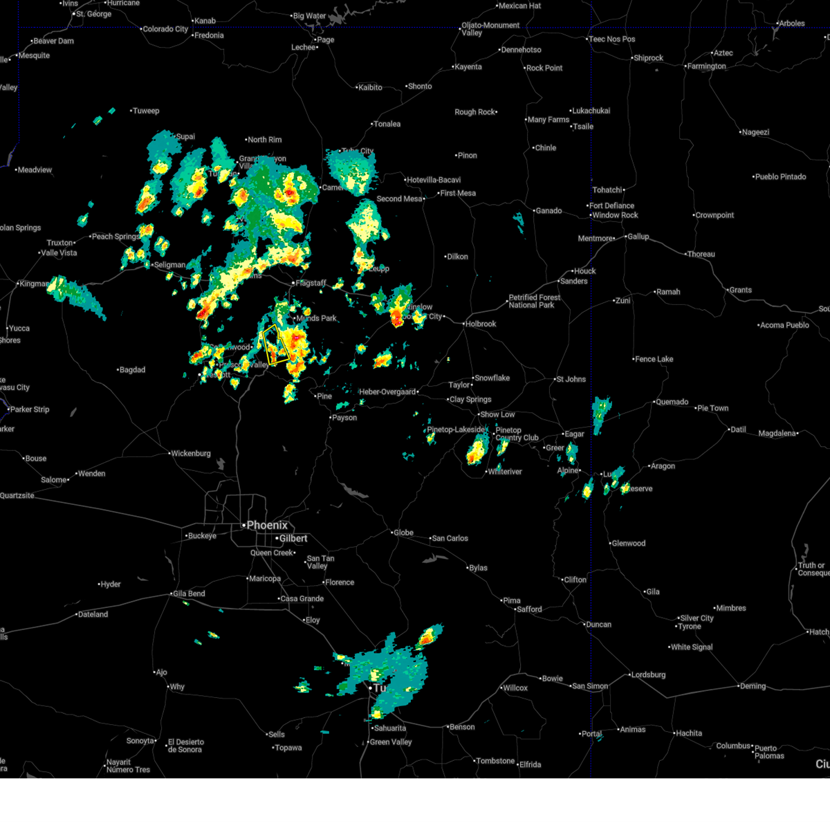
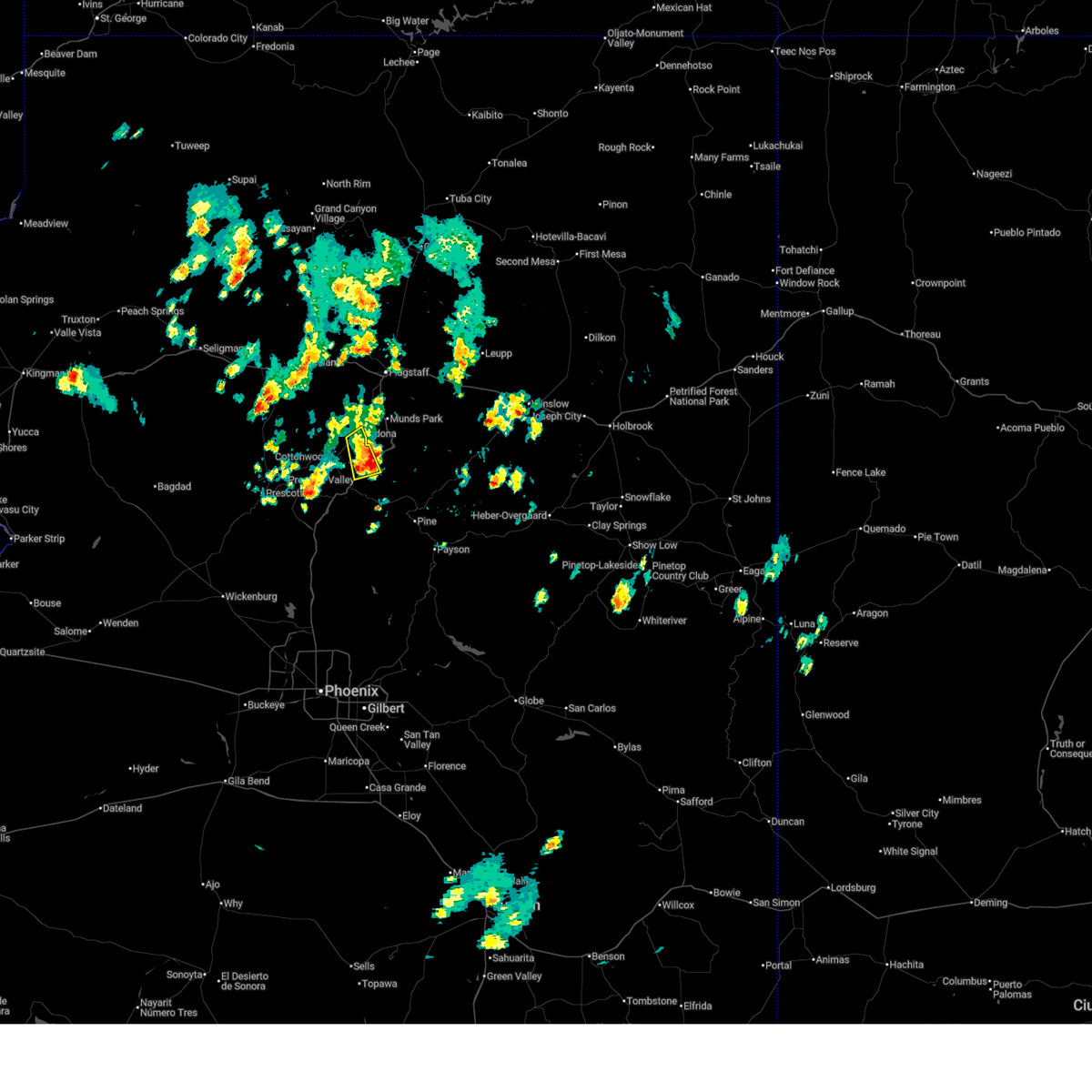
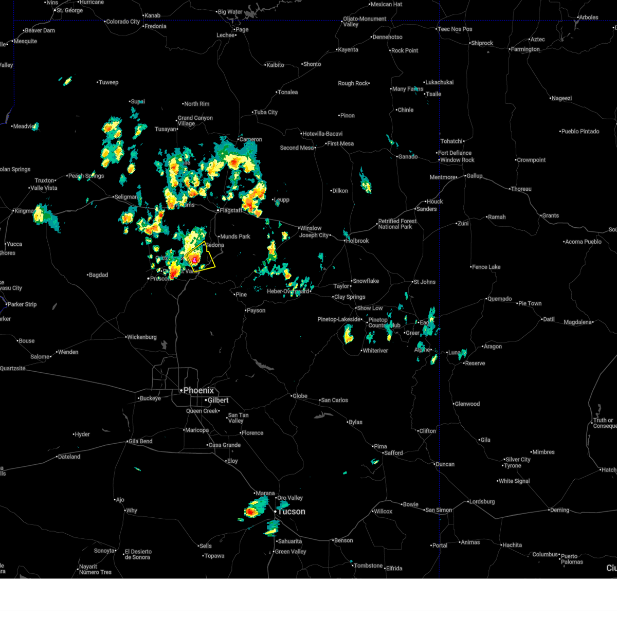
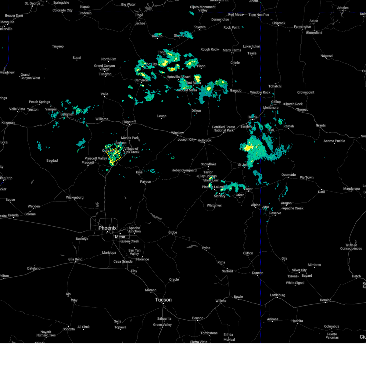
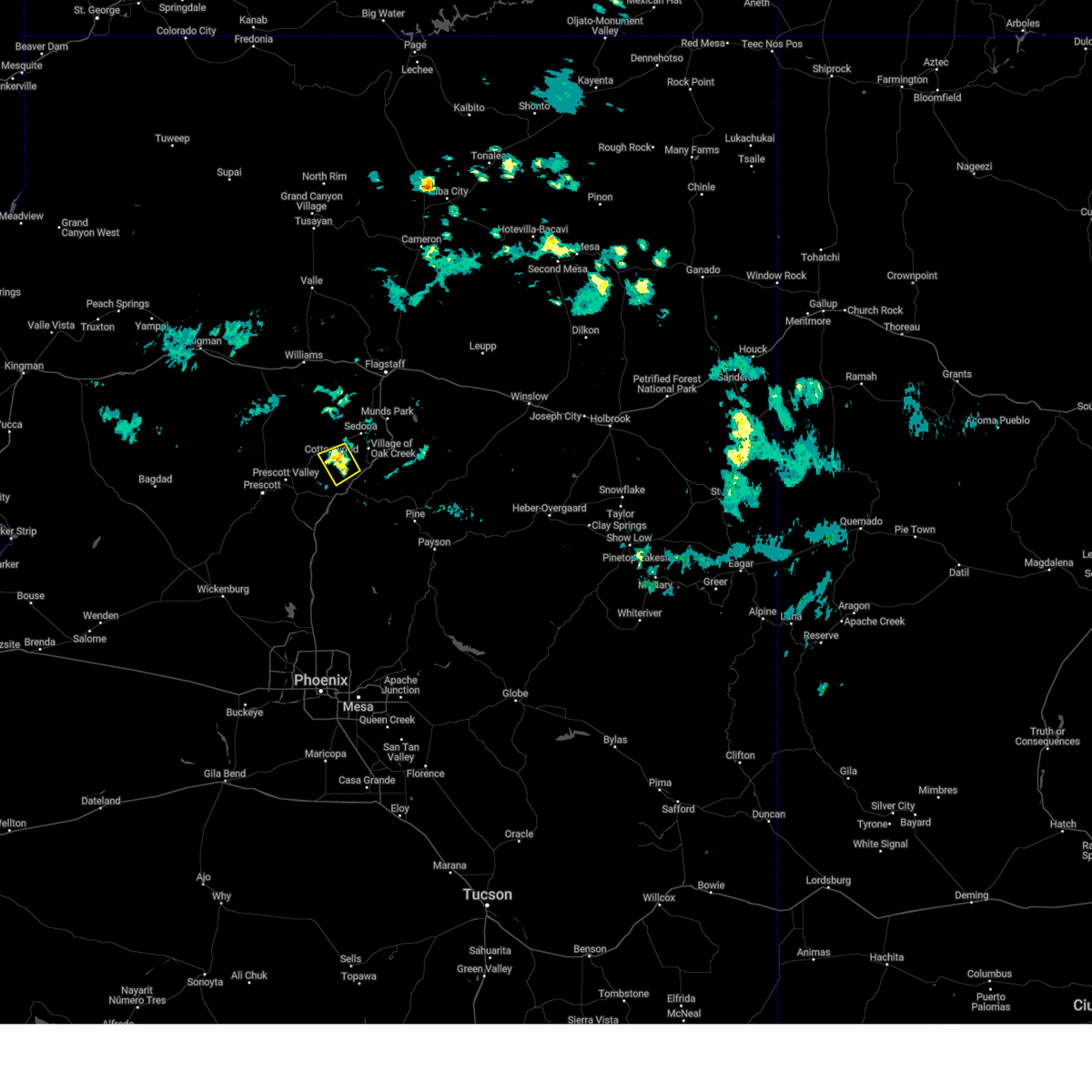
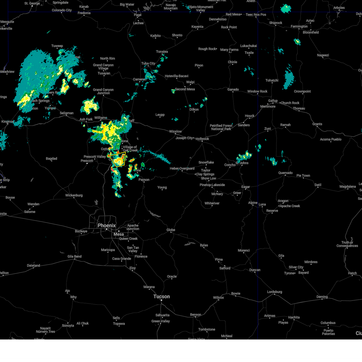
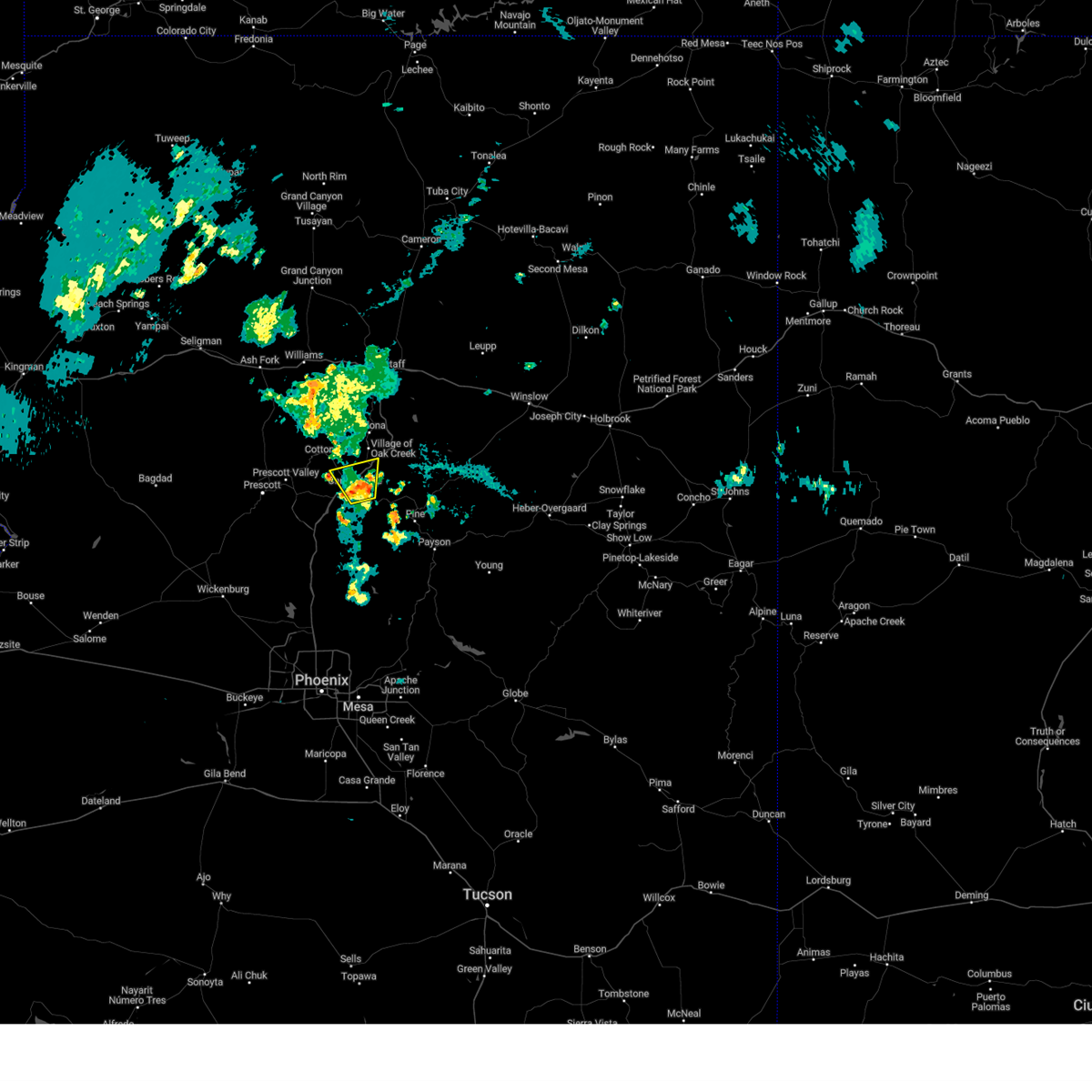
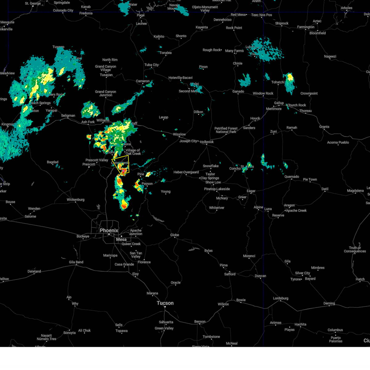
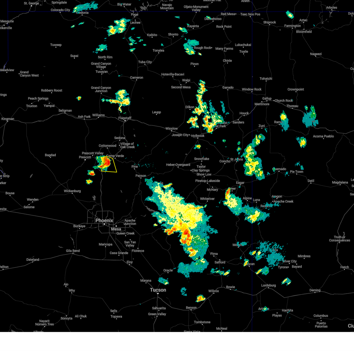
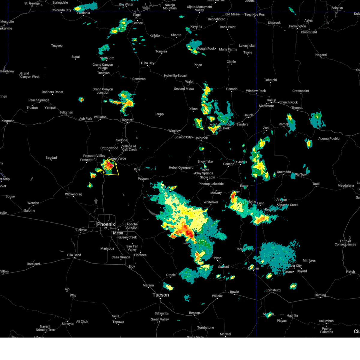
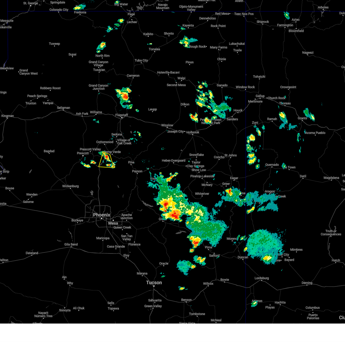
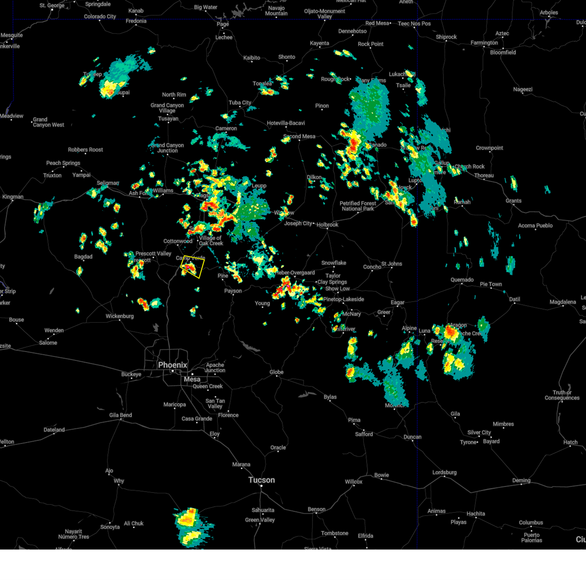
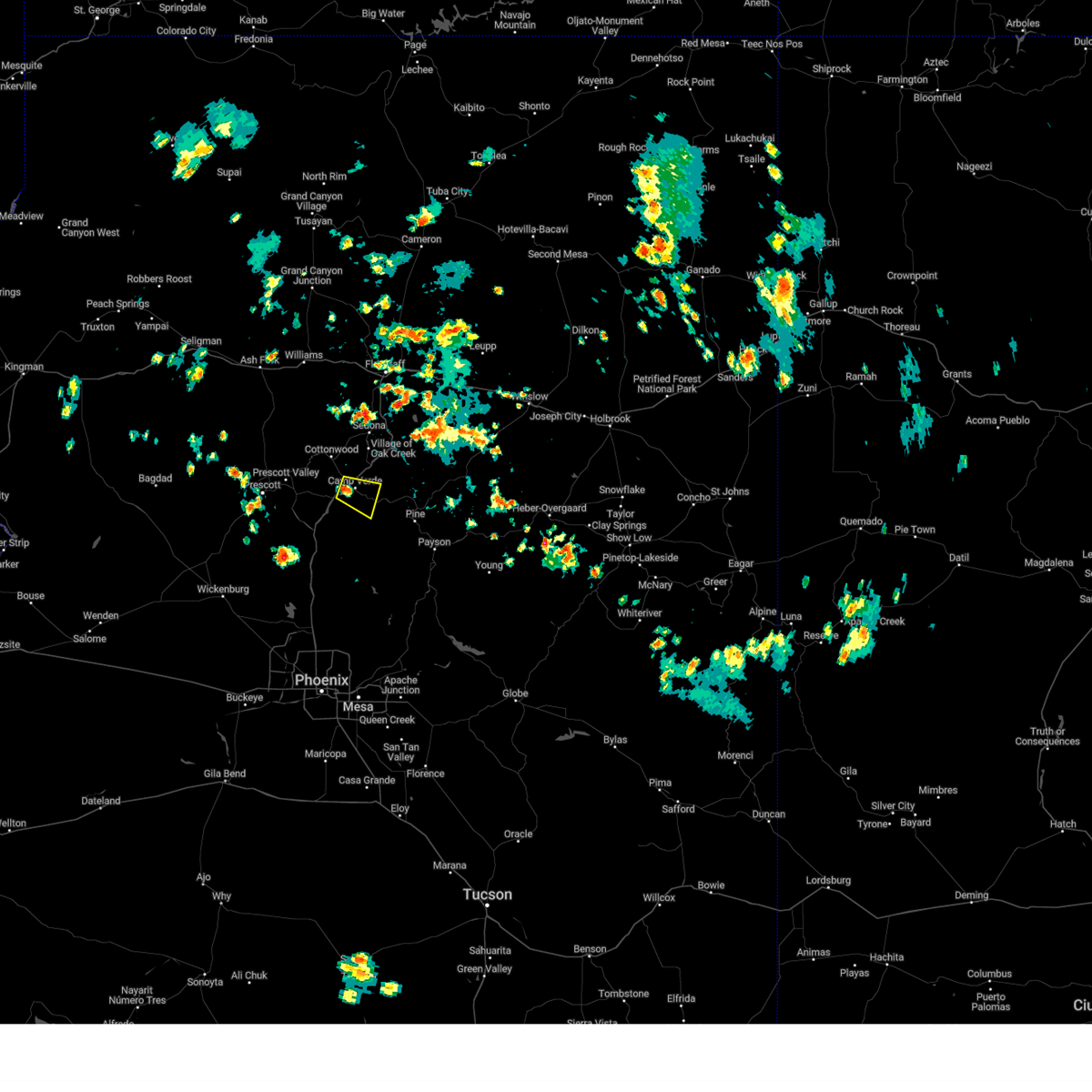
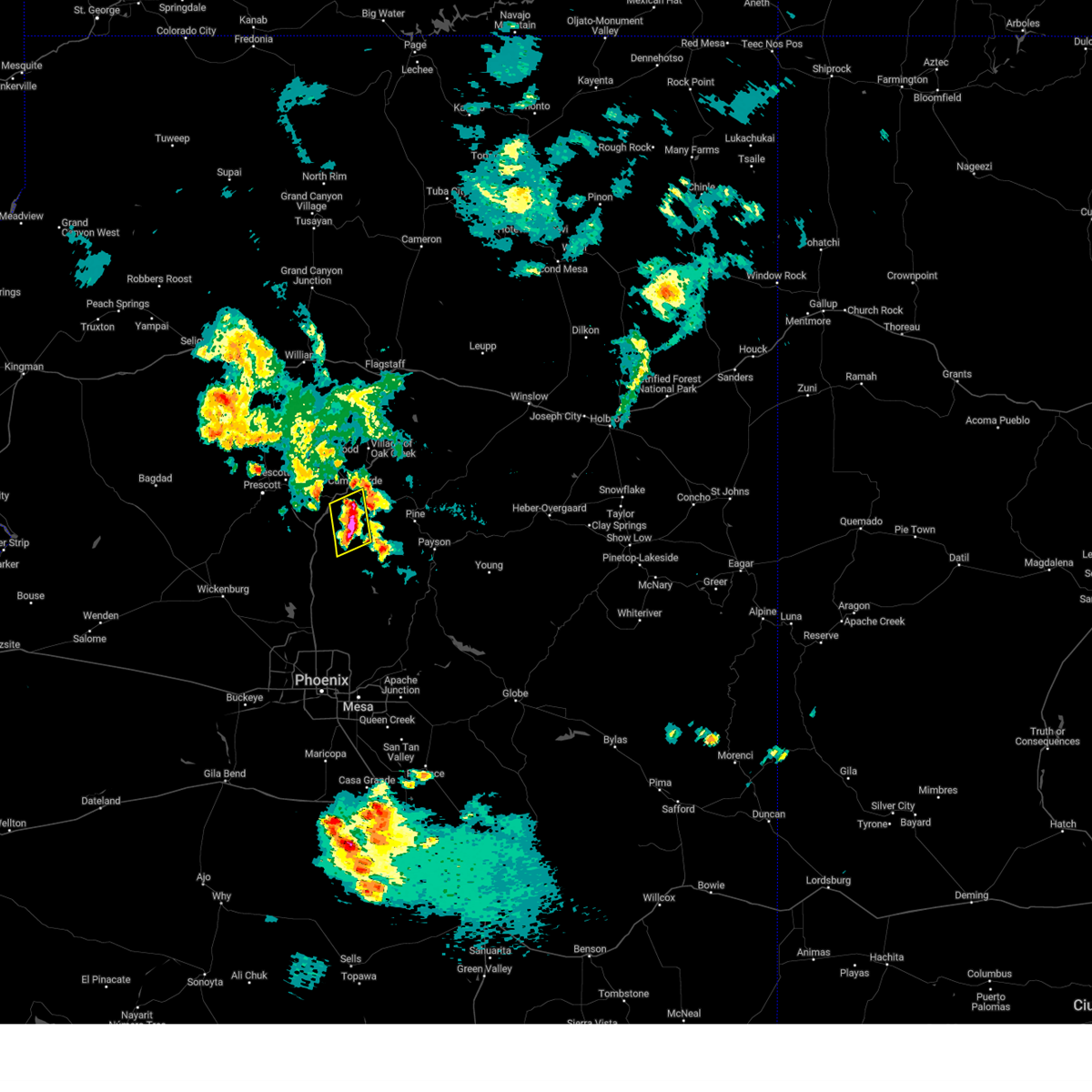
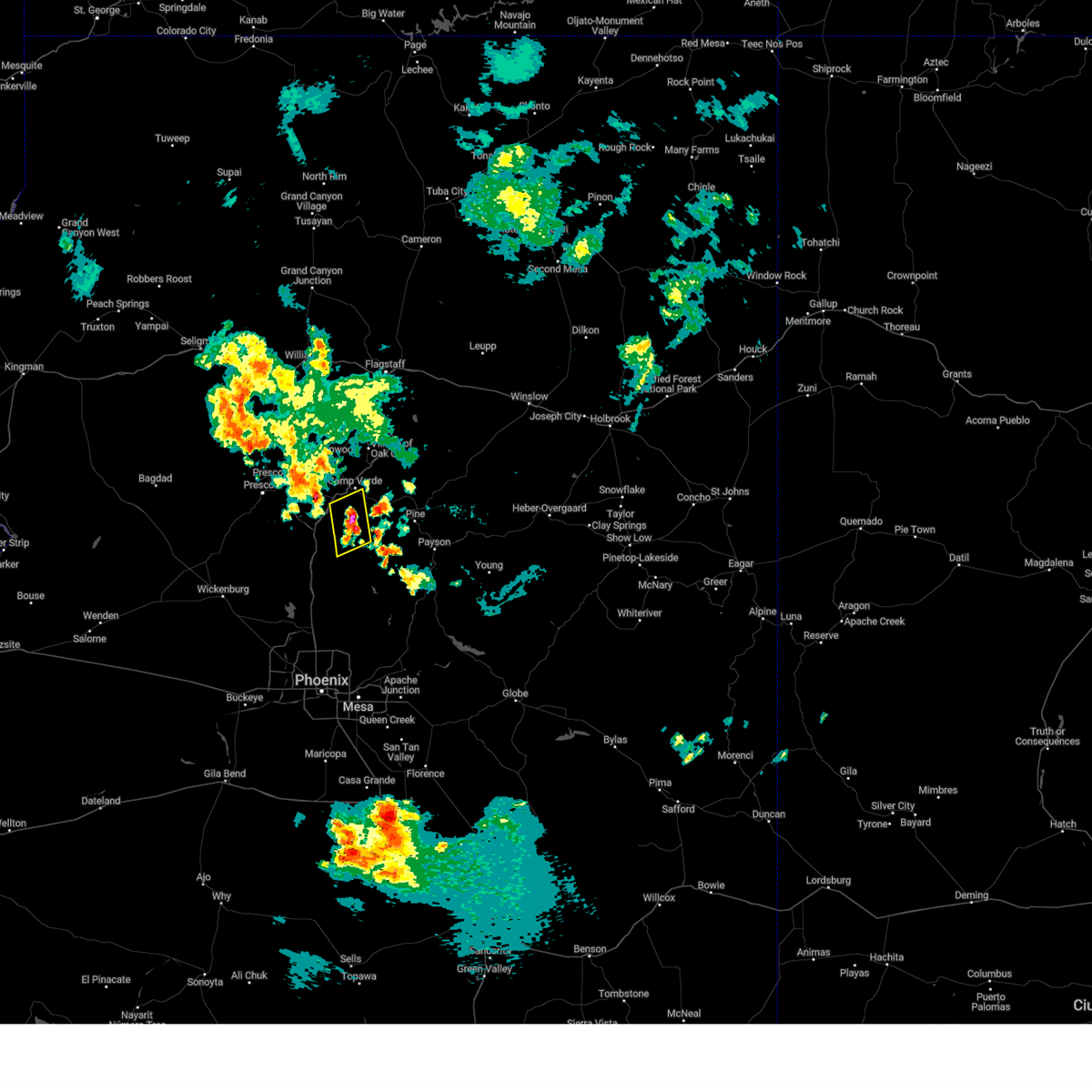
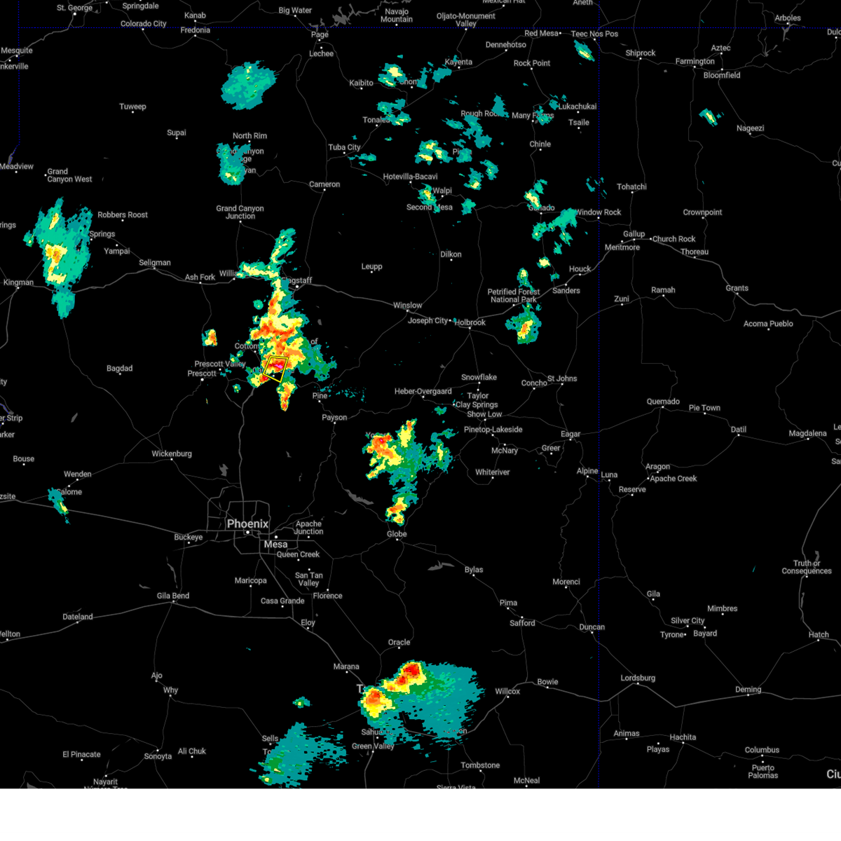
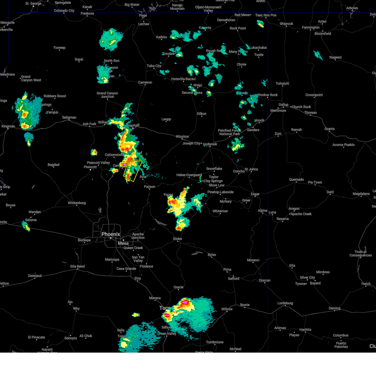
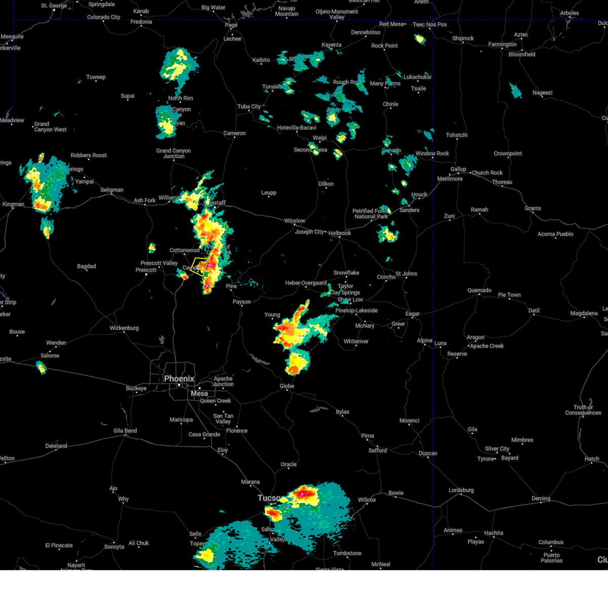
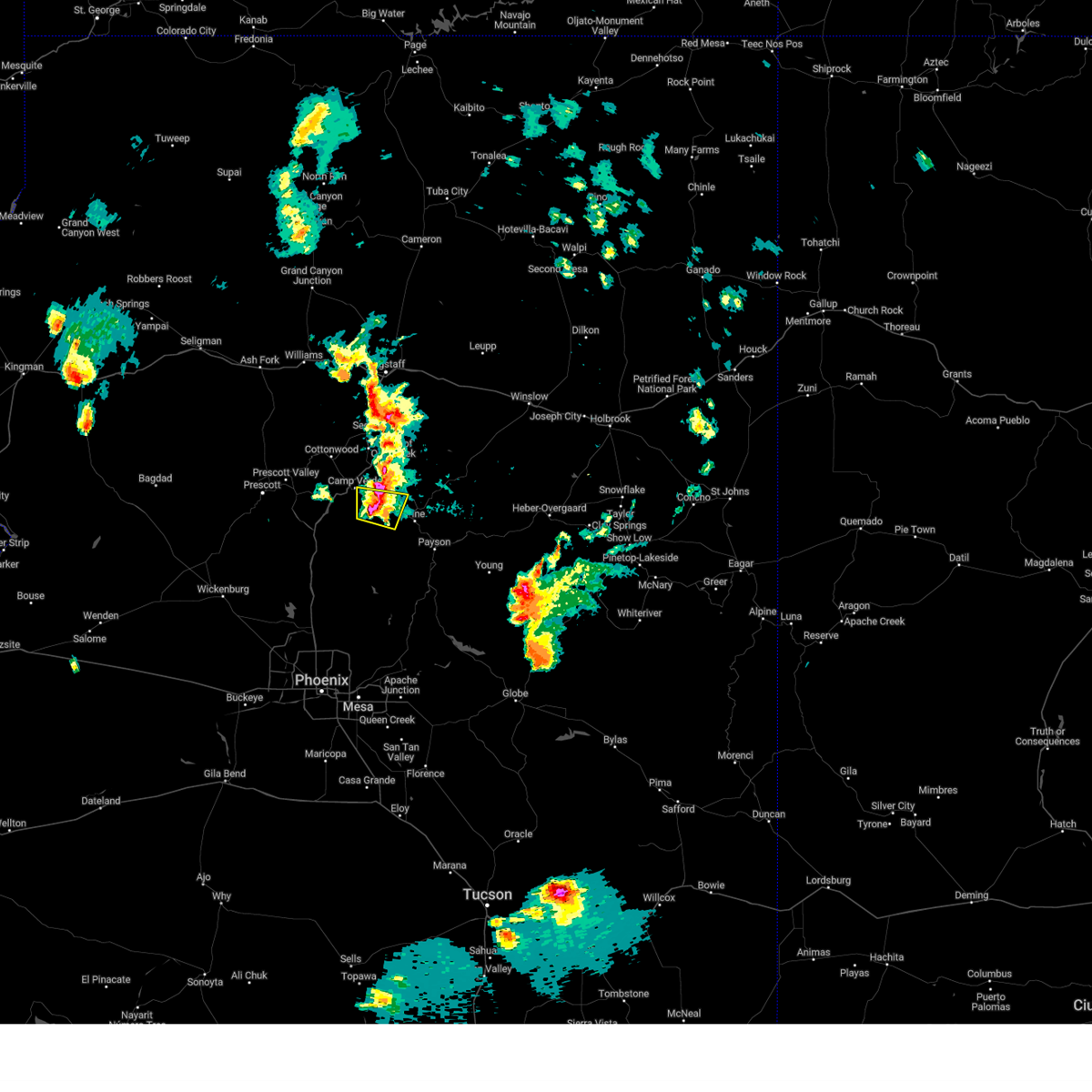
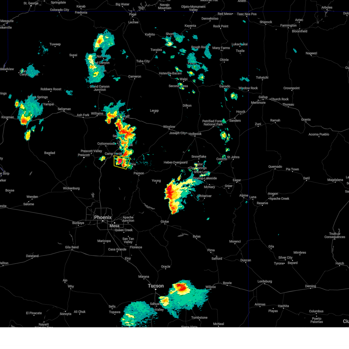
Hail Map for Camp Verde, AZ
The Camp Verde, AZ area has had 2 reports of on-the-ground hail by trained spotters, and has been under severe weather warnings 18 times during the past 12 months. Doppler radar has detected hail at or near Camp Verde, AZ on 82 occasions, including 6 occasions during the past year.
| Name: | Camp Verde, AZ |
| Where Located: | 45.9 miles SSW of Flagstaff, AZ |
| Map: | Google Map for Camp Verde, AZ |
| Population: | 10873 |
| Housing Units: | 4726 |
| More Info: | Search Google for Camp Verde, AZ |
2
The Top Recent Hail Date for Camp Verde, AZ is Wednesday, July 17, 2024 (10th out of 82)

Hail and Wind Damage Spotted near Camp Verde, AZ
| Date / Time | Report Details |
|---|---|
| 7/3/2025 2:42 PM MST |
 The storm which prompted the warning has weakened below severe limits, and has exited the warned area. therefore, the warning will be allowed to expire. however, small hail, gusty winds, and heavy rain are still possible with this thunderstorm. The storm which prompted the warning has weakened below severe limits, and has exited the warned area. therefore, the warning will be allowed to expire. however, small hail, gusty winds, and heavy rain are still possible with this thunderstorm.
|
| 7/3/2025 2:22 PM MST |
 At 222 pm mst, a severe thunderstorm was located over beaverhead flat, or 9 miles south of sedona, moving east at 10 mph (radar indicated). Hazards include 60 mph wind gusts and quarter size hail. Hail damage to vehicles is expected. expect wind damage to roofs, siding, and trees. locations impacted include, camp verde, sedona, beaverhead flat, village of oak creek, bell rock, cathedral rock, page springs, cornville, lake montezuma, montezuma well, sedona airport, montezuma castle national monument, wet beaver creek day use area, cedar ridge, munds mountain wilderness, red rock state park, rimrock airport, rimrock, mcguireville and lawrence crossing. this includes the following highways, interstate 17 between mile markers 291 and 301. state route 179 between mile markers 299 and 307. State route 89a between mile markers 365 and 372. At 222 pm mst, a severe thunderstorm was located over beaverhead flat, or 9 miles south of sedona, moving east at 10 mph (radar indicated). Hazards include 60 mph wind gusts and quarter size hail. Hail damage to vehicles is expected. expect wind damage to roofs, siding, and trees. locations impacted include, camp verde, sedona, beaverhead flat, village of oak creek, bell rock, cathedral rock, page springs, cornville, lake montezuma, montezuma well, sedona airport, montezuma castle national monument, wet beaver creek day use area, cedar ridge, munds mountain wilderness, red rock state park, rimrock airport, rimrock, mcguireville and lawrence crossing. this includes the following highways, interstate 17 between mile markers 291 and 301. state route 179 between mile markers 299 and 307. State route 89a between mile markers 365 and 372.
|
| 7/3/2025 1:53 PM MST |
 Svrfgz the national weather service in flagstaff has issued a * severe thunderstorm warning for, yavapai county in west central arizona, * until 245 pm mst. * at 153 pm mst, a severe thunderstorm was located over cornville, or 10 miles north of camp verde, moving east at 10 mph (radar indicated). Hazards include 60 mph wind gusts and quarter size hail. Hail damage to vehicles is expected. Expect wind damage to roofs, siding, and trees. Svrfgz the national weather service in flagstaff has issued a * severe thunderstorm warning for, yavapai county in west central arizona, * until 245 pm mst. * at 153 pm mst, a severe thunderstorm was located over cornville, or 10 miles north of camp verde, moving east at 10 mph (radar indicated). Hazards include 60 mph wind gusts and quarter size hail. Hail damage to vehicles is expected. Expect wind damage to roofs, siding, and trees.
|
| 6/9/2025 6:27 PM MST |
 The thunderstorm over the central verde valley that was capable of producing severe wind gusts has weakened. light showers and wind gusts to 40 mph will persist through 7 pm mst. the warning will be allowed to expire. The thunderstorm over the central verde valley that was capable of producing severe wind gusts has weakened. light showers and wind gusts to 40 mph will persist through 7 pm mst. the warning will be allowed to expire.
|
| 6/9/2025 6:00 PM MST |
 Svrfgz the national weather service in flagstaff has issued a * severe thunderstorm warning for, yavapai county in west central arizona, * until 630 pm mst. * at 558 pm mst, a severe thunderstorm was located over cornville, or 11 miles northwest of camp verde, moving north at 15 mph (radar indicated). Hazards include 60 mph wind gusts. expect damage to roofs, siding, and trees Svrfgz the national weather service in flagstaff has issued a * severe thunderstorm warning for, yavapai county in west central arizona, * until 630 pm mst. * at 558 pm mst, a severe thunderstorm was located over cornville, or 11 miles northwest of camp verde, moving north at 15 mph (radar indicated). Hazards include 60 mph wind gusts. expect damage to roofs, siding, and trees
|
| 8/10/2024 8:32 PM MST |
 the severe thunderstorm warning has been cancelled and is no longer in effect the severe thunderstorm warning has been cancelled and is no longer in effect
|
| 8/10/2024 8:20 PM MST |
 At 819 pm mst, a severe thunderstorm was located over fort verde state historic park, or over camp verde, moving north at 20 mph (radar indicated). Hazards include 60 mph wind gusts and nickel size hail. Expect damage to roofs, siding, and trees. locations impacted include, verde lakes, camp verde, montezuma airport, beaverhead flat, wet beaver creek day use area, rockin' river ranch state park, montezuma castle national monument, mcguireville, out of africa wildlife park, fort verde state historic park, rimrock airport, mountain view estates, montezuma well, crane petroglyph heritage site, rimrock, lawrence crossing, middle verde, lake montezuma, bignotti, and cottonwood. this includes the following highways, interstate 17 between mile markers 284 and 302. state route 260 between mile markers 211 and 230. State route 179 between mile markers 299 and 301. At 819 pm mst, a severe thunderstorm was located over fort verde state historic park, or over camp verde, moving north at 20 mph (radar indicated). Hazards include 60 mph wind gusts and nickel size hail. Expect damage to roofs, siding, and trees. locations impacted include, verde lakes, camp verde, montezuma airport, beaverhead flat, wet beaver creek day use area, rockin' river ranch state park, montezuma castle national monument, mcguireville, out of africa wildlife park, fort verde state historic park, rimrock airport, mountain view estates, montezuma well, crane petroglyph heritage site, rimrock, lawrence crossing, middle verde, lake montezuma, bignotti, and cottonwood. this includes the following highways, interstate 17 between mile markers 284 and 302. state route 260 between mile markers 211 and 230. State route 179 between mile markers 299 and 301.
|
| 8/10/2024 8:05 PM MST |
 Svrfgz the national weather service in flagstaff has issued a * severe thunderstorm warning for, yavapai county in west central arizona, * until 845 pm mst. * at 804 pm mst, a severe thunderstorm was located over verde lakes, or near camp verde, moving north at 15 mph (radar indicated). Hazards include 60 mph wind gusts and quarter size hail. Hail damage to vehicles is expected. Expect wind damage to roofs, siding, and trees. Svrfgz the national weather service in flagstaff has issued a * severe thunderstorm warning for, yavapai county in west central arizona, * until 845 pm mst. * at 804 pm mst, a severe thunderstorm was located over verde lakes, or near camp verde, moving north at 15 mph (radar indicated). Hazards include 60 mph wind gusts and quarter size hail. Hail damage to vehicles is expected. Expect wind damage to roofs, siding, and trees.
|
| 8/7/2024 4:40 PM MST |
 The storm which prompted the warning has weakened below severe limits, and no longer poses an immediate threat to life or property. therefore, the warning will be allowed to expire. however, heavy rain is still possible with this thunderstorm. The storm which prompted the warning has weakened below severe limits, and no longer poses an immediate threat to life or property. therefore, the warning will be allowed to expire. however, heavy rain is still possible with this thunderstorm.
|
| 8/7/2024 4:25 PM MST |
 At 424 pm mst, a severe thunderstorm was located over interstate 17 about 10 miles southwest of camp verde, moving south at 5 mph (radar indicated). Hazards include 60 mph wind gusts and quarter size hail. Hail damage to vehicles is expected. expect wind damage to roofs, siding, and trees. locations impacted include, flower pot, cedar mill, cherry, dugas, and cedar bench wilderness. This includes interstate 17 between mile markers 264 and 285. At 424 pm mst, a severe thunderstorm was located over interstate 17 about 10 miles southwest of camp verde, moving south at 5 mph (radar indicated). Hazards include 60 mph wind gusts and quarter size hail. Hail damage to vehicles is expected. expect wind damage to roofs, siding, and trees. locations impacted include, flower pot, cedar mill, cherry, dugas, and cedar bench wilderness. This includes interstate 17 between mile markers 264 and 285.
|
| 8/7/2024 4:00 PM MST |
 Svrfgz the national weather service in flagstaff has issued a * severe thunderstorm warning for, yavapai county in west central arizona, * until 445 pm mst. * at 400 pm mst, a severe thunderstorm was located over interstate 17 about 8 miles southwest of camp verde, moving south at 5 mph (radar indicated). Hazards include 60 mph wind gusts and quarter size hail. Hail damage to vehicles is expected. Expect wind damage to roofs, siding, and trees. Svrfgz the national weather service in flagstaff has issued a * severe thunderstorm warning for, yavapai county in west central arizona, * until 445 pm mst. * at 400 pm mst, a severe thunderstorm was located over interstate 17 about 8 miles southwest of camp verde, moving south at 5 mph (radar indicated). Hazards include 60 mph wind gusts and quarter size hail. Hail damage to vehicles is expected. Expect wind damage to roofs, siding, and trees.
|
| 7/25/2024 4:43 PM MST |
 The storm which prompted the warning has weakened below severe limits, and no longer poses an immediate threat to life or property. therefore, the warning will be allowed to expire. however, gusty winds and heavy rain are still possible with this thunderstorm. The storm which prompted the warning has weakened below severe limits, and no longer poses an immediate threat to life or property. therefore, the warning will be allowed to expire. however, gusty winds and heavy rain are still possible with this thunderstorm.
|
| 7/25/2024 4:33 PM MST |
 At 433 pm mst, a severe thunderstorm was located 7 miles southwest of flower pot, or 14 miles southwest of camp verde, moving southeast at 20 mph (radar indicated). Hazards include 60 mph wind gusts and penny size hail. Expect damage to roofs, siding, and trees. locations impacted include, bullpen day use area, verde lakes, cordes junction, camp verde, cordes lakes, arcosanti, cherry, montezuma airport, rockin' river ranch state park, cedar bench wilderness, out of africa wildlife park, spring valley, cedar mill, fort verde state historic park, mountain view estates, middle verde, flower pot, dugas, mayer, and montezuma castle national monument. this includes the following highways, interstate 17 between mile markers 257 and 290. state route 260 between mile markers 212 and 236. State route 69 between mile markers 263 and 270. At 433 pm mst, a severe thunderstorm was located 7 miles southwest of flower pot, or 14 miles southwest of camp verde, moving southeast at 20 mph (radar indicated). Hazards include 60 mph wind gusts and penny size hail. Expect damage to roofs, siding, and trees. locations impacted include, bullpen day use area, verde lakes, cordes junction, camp verde, cordes lakes, arcosanti, cherry, montezuma airport, rockin' river ranch state park, cedar bench wilderness, out of africa wildlife park, spring valley, cedar mill, fort verde state historic park, mountain view estates, middle verde, flower pot, dugas, mayer, and montezuma castle national monument. this includes the following highways, interstate 17 between mile markers 257 and 290. state route 260 between mile markers 212 and 236. State route 69 between mile markers 263 and 270.
|
| 7/25/2024 4:16 PM MST |
 Svrfgz the national weather service in flagstaff has issued a * severe thunderstorm warning for, yavapai county from nea cherry to cordes junction in west central arizona, * until 445 pm mst. * at 415 pm mst, a severe thunderstorm was located near flower pot, or 8 miles west of camp verde, moving southeast at 20 mph (radar indicated). Hazards include 60 mph wind gusts and penny size hail. expect damage to roofs, siding, and trees Svrfgz the national weather service in flagstaff has issued a * severe thunderstorm warning for, yavapai county from nea cherry to cordes junction in west central arizona, * until 445 pm mst. * at 415 pm mst, a severe thunderstorm was located near flower pot, or 8 miles west of camp verde, moving southeast at 20 mph (radar indicated). Hazards include 60 mph wind gusts and penny size hail. expect damage to roofs, siding, and trees
|
| 7/25/2024 1:28 PM MST |
 The thunderstorm near camp verde which prompted the warning has weakened below severe limits and no longer poses an immediate threat to life or property. therefore, the warning will be allowed to expire. however, dime sized hail, gusty winds to 40 mph and very heavy rain are still possible with this thunderstorm, mainly south and southeast of camp verde. The thunderstorm near camp verde which prompted the warning has weakened below severe limits and no longer poses an immediate threat to life or property. therefore, the warning will be allowed to expire. however, dime sized hail, gusty winds to 40 mph and very heavy rain are still possible with this thunderstorm, mainly south and southeast of camp verde.
|
| 7/25/2024 1:03 PM MST |
 Svrfgz the national weather service in flagstaff has issued a * severe thunderstorm warning for, yavapai county in west central arizona, * until 130 pm mst. * at 102 pm mst, a severe thunderstorm was located over camp verde, moving east at 20 mph (radar indicated). Hazards include 60 mph wind gusts and nickel size hail. expect damage to roofs, siding, and trees Svrfgz the national weather service in flagstaff has issued a * severe thunderstorm warning for, yavapai county in west central arizona, * until 130 pm mst. * at 102 pm mst, a severe thunderstorm was located over camp verde, moving east at 20 mph (radar indicated). Hazards include 60 mph wind gusts and nickel size hail. expect damage to roofs, siding, and trees
|
| 7/17/2024 4:28 PM MST |
 The thunderstorm near camp verde that prompted the warning has weakened below severe limits and will be allowed to expire. very heavy rain and small hail is still occurring, just west and just east, of camp verde. The thunderstorm near camp verde that prompted the warning has weakened below severe limits and will be allowed to expire. very heavy rain and small hail is still occurring, just west and just east, of camp verde.
|
| 7/17/2024 4:05 PM MST |
 Svrfgz the national weather service in flagstaff has issued a * severe thunderstorm warning for, yavapai county in west central arizona, * until 430 pm mst. * at 405 pm mst, a severe thunderstorm was located over camp verde, moving south at 5 mph (radar indicated). Hazards include 60 mph wind gusts and nickel size hail. expect damage to roofs, siding, and trees Svrfgz the national weather service in flagstaff has issued a * severe thunderstorm warning for, yavapai county in west central arizona, * until 430 pm mst. * at 405 pm mst, a severe thunderstorm was located over camp verde, moving south at 5 mph (radar indicated). Hazards include 60 mph wind gusts and nickel size hail. expect damage to roofs, siding, and trees
|
| 7/14/2024 8:10 PM MST |
 The storm which prompted the warning has weakened below severe limits, and has exited the warned area. therefore, the warning will be allowed to expire. however, gusty winds and heavy rain are still possible with this thunderstorm. The storm which prompted the warning has weakened below severe limits, and has exited the warned area. therefore, the warning will be allowed to expire. however, gusty winds and heavy rain are still possible with this thunderstorm.
|
| 7/14/2024 7:47 PM MST |
 At 747 pm mst, a severe thunderstorm was located near rockin' river ranch state park, or near camp verde, moving north at 15 mph (radar indicated). Hazards include 60 mph wind gusts and quarter size hail. Hail damage to vehicles is expected. expect wind damage to roofs, siding, and trees. locations impacted include, verde lakes, cedar mill, pine mountain wilderness, mountain view estates, rockin' river ranch state park, cedar bench wilderness, dugas, flower pot, and camp verde. This includes state route 260 between mile markers 223 and 225. At 747 pm mst, a severe thunderstorm was located near rockin' river ranch state park, or near camp verde, moving north at 15 mph (radar indicated). Hazards include 60 mph wind gusts and quarter size hail. Hail damage to vehicles is expected. expect wind damage to roofs, siding, and trees. locations impacted include, verde lakes, cedar mill, pine mountain wilderness, mountain view estates, rockin' river ranch state park, cedar bench wilderness, dugas, flower pot, and camp verde. This includes state route 260 between mile markers 223 and 225.
|
| 7/14/2024 7:31 PM MST |
 Svrfgz the national weather service in flagstaff has issued a * severe thunderstorm warning for, yavapai county in west central arizona, * until 815 pm mst. * at 731 pm mst, a severe thunderstorm was located near rockin' river ranch state park, or 10 miles south of camp verde, moving north at 15 mph (radar indicated). Hazards include 60 mph wind gusts and quarter size hail. Hail damage to vehicles is expected. Expect wind damage to roofs, siding, and trees. Svrfgz the national weather service in flagstaff has issued a * severe thunderstorm warning for, yavapai county in west central arizona, * until 815 pm mst. * at 731 pm mst, a severe thunderstorm was located near rockin' river ranch state park, or 10 miles south of camp verde, moving north at 15 mph (radar indicated). Hazards include 60 mph wind gusts and quarter size hail. Hail damage to vehicles is expected. Expect wind damage to roofs, siding, and trees.
|
| 7/14/2024 6:06 PM MST |
 the severe thunderstorm warning has been cancelled and is no longer in effect the severe thunderstorm warning has been cancelled and is no longer in effect
|
| 7/14/2024 5:45 PM MST |
 the severe thunderstorm warning has been cancelled and is no longer in effect the severe thunderstorm warning has been cancelled and is no longer in effect
|
| 7/14/2024 5:38 PM MST |
 Svrfgz the national weather service in flagstaff has issued a * severe thunderstorm warning for, yavapai county in west central arizona, * until 630 pm mst. * at 537 pm mst, a severe thunderstorm was located over montezuma castle national monument, or near camp verde, moving north at 15 mph (radar indicated). Hazards include 60 mph wind gusts and quarter size hail. Hail damage to vehicles is expected. Expect wind damage to roofs, siding, and trees. Svrfgz the national weather service in flagstaff has issued a * severe thunderstorm warning for, yavapai county in west central arizona, * until 630 pm mst. * at 537 pm mst, a severe thunderstorm was located over montezuma castle national monument, or near camp verde, moving north at 15 mph (radar indicated). Hazards include 60 mph wind gusts and quarter size hail. Hail damage to vehicles is expected. Expect wind damage to roofs, siding, and trees.
|
| 7/14/2024 5:24 PM MST |
 the severe thunderstorm warning has been cancelled and is no longer in effect the severe thunderstorm warning has been cancelled and is no longer in effect
|
| 7/14/2024 5:20 PM MST |
 Svrfgz the national weather service in flagstaff has issued a * severe thunderstorm warning for, gila county in east central arizona, yavapai county in west central arizona, coconino county in north central arizona, * until 600 pm mst. * at 520 pm mst, a severe thunderstorm was located over bullpen day use area, or 10 miles east of camp verde, moving northeast at 20 mph (radar indicated). Hazards include 60 mph wind gusts and quarter size hail. Hail damage to vehicles is expected. Expect wind damage to roofs, siding, and trees. Svrfgz the national weather service in flagstaff has issued a * severe thunderstorm warning for, gila county in east central arizona, yavapai county in west central arizona, coconino county in north central arizona, * until 600 pm mst. * at 520 pm mst, a severe thunderstorm was located over bullpen day use area, or 10 miles east of camp verde, moving northeast at 20 mph (radar indicated). Hazards include 60 mph wind gusts and quarter size hail. Hail damage to vehicles is expected. Expect wind damage to roofs, siding, and trees.
|
| 7/14/2024 5:15 PM MST | Ping Pong Ball sized hail reported 8.6 miles W of Camp Verde, AZ, estimated ping pong ball sized hail at bullpen day use area. report from social media. |
| 7/14/2024 5:13 PM MST |
 Svrfgz the national weather service in flagstaff has issued a * severe thunderstorm warning for, gila county in east central arizona, yavapai county in west central arizona, coconino county in north central arizona, * until 600 pm mst. * at 513 pm mst, a severe thunderstorm was located near bullpen day use area, or 11 miles southeast of camp verde, moving east at 15 mph (radar indicated). Hazards include 60 mph wind gusts and nickel size hail. expect damage to roofs, siding, and trees Svrfgz the national weather service in flagstaff has issued a * severe thunderstorm warning for, gila county in east central arizona, yavapai county in west central arizona, coconino county in north central arizona, * until 600 pm mst. * at 513 pm mst, a severe thunderstorm was located near bullpen day use area, or 11 miles southeast of camp verde, moving east at 15 mph (radar indicated). Hazards include 60 mph wind gusts and nickel size hail. expect damage to roofs, siding, and trees
|
| 9/13/2023 5:43 PM MST |
 At 541 pm mst, a severe thunderstorm was located over bignotti, or 8 miles northwest of camp verde, and is nearly stationary (radar indicated). Hazards include 60 mph wind gusts and half dollar size hail. Hail damage to vehicles is expected. expect wind damage to roofs, siding, and trees. locations impacted include, verde village, bridgeport, cottonwood, bignotti, jordan, cornville, tissaw trailhead, hayfield draw ohv area, cottonwood airport, mormons crossing swimming hole, deadhorse ranch state park, and mcguireville. this includes the following highways, state route 260 between mile markers 207 and 213. state route 89a between mile markers 352 and 358. hail threat, radar indicated max hail size, 1. 25 in wind threat, radar indicated max wind gust, 60 mph. At 541 pm mst, a severe thunderstorm was located over bignotti, or 8 miles northwest of camp verde, and is nearly stationary (radar indicated). Hazards include 60 mph wind gusts and half dollar size hail. Hail damage to vehicles is expected. expect wind damage to roofs, siding, and trees. locations impacted include, verde village, bridgeport, cottonwood, bignotti, jordan, cornville, tissaw trailhead, hayfield draw ohv area, cottonwood airport, mormons crossing swimming hole, deadhorse ranch state park, and mcguireville. this includes the following highways, state route 260 between mile markers 207 and 213. state route 89a between mile markers 352 and 358. hail threat, radar indicated max hail size, 1. 25 in wind threat, radar indicated max wind gust, 60 mph.
|
| 9/13/2023 5:35 PM MST |
 At 535 pm mst, a severe thunderstorm was located over verde village, or 9 miles northwest of camp verde, and is nearly stationary (radar indicated). Hazards include 60 mph wind gusts and quarter size hail. Hail damage to vehicles is expected. Expect wind damage to roofs, siding, and trees. At 535 pm mst, a severe thunderstorm was located over verde village, or 9 miles northwest of camp verde, and is nearly stationary (radar indicated). Hazards include 60 mph wind gusts and quarter size hail. Hail damage to vehicles is expected. Expect wind damage to roofs, siding, and trees.
|
| 8/31/2023 3:58 PM MST |
 At 357 pm mst, a severe thunderstorm was located over beaverhead flat, or near camp verde, moving northeast at 10 mph (radar indicated). Hazards include 60 mph wind gusts and quarter size hail. Hail damage to vehicles is expected. Expect wind damage to roofs, siding, and trees. At 357 pm mst, a severe thunderstorm was located over beaverhead flat, or near camp verde, moving northeast at 10 mph (radar indicated). Hazards include 60 mph wind gusts and quarter size hail. Hail damage to vehicles is expected. Expect wind damage to roofs, siding, and trees.
|
| 7/28/2023 3:12 PM MST |
 The severe thunderstorm warning for yavapai county will expire at 315 pm mst, the storm south of camp verde which prompted the warning has weakened below severe limits, and no longer poses an immediate threat to life or property. this storm is still producing heavy rain and small hail but is no longer severe, therefore, the warning will be allowed to expire. The severe thunderstorm warning for yavapai county will expire at 315 pm mst, the storm south of camp verde which prompted the warning has weakened below severe limits, and no longer poses an immediate threat to life or property. this storm is still producing heavy rain and small hail but is no longer severe, therefore, the warning will be allowed to expire.
|
| 7/28/2023 2:47 PM MST |
 At 247 pm mst, a severe thunderstorm was located 8 miles southeast of camp verde, moving north at 5 mph (radar indicated). Hazards include 60 mph wind gusts and half dollar size hail. Hail damage to vehicles is expected. Expect wind damage to roofs, siding, and trees. At 247 pm mst, a severe thunderstorm was located 8 miles southeast of camp verde, moving north at 5 mph (radar indicated). Hazards include 60 mph wind gusts and half dollar size hail. Hail damage to vehicles is expected. Expect wind damage to roofs, siding, and trees.
|
| 5/19/2023 1:36 PM MST |
 At 136 pm mst, a severe thunderstorm was located over verde village, or 9 miles northwest of camp verde, and is nearly stationary (radar indicated). Hazards include 60 mph wind gusts and quarter size hail. Hail damage to vehicles is expected. Expect wind damage to roofs, siding, and trees. At 136 pm mst, a severe thunderstorm was located over verde village, or 9 miles northwest of camp verde, and is nearly stationary (radar indicated). Hazards include 60 mph wind gusts and quarter size hail. Hail damage to vehicles is expected. Expect wind damage to roofs, siding, and trees.
|
| 9/12/2022 11:42 PM MST |
 At 1141 pm mst, a severe thunderstorm was located near childs power plant, or 19 miles northwest of payson, moving north at 20 mph (radar indicated). Hazards include 60 mph wind gusts and quarter size hail. Hail damage to vehicles is expected. Expect wind damage to roofs, siding, and trees. At 1141 pm mst, a severe thunderstorm was located near childs power plant, or 19 miles northwest of payson, moving north at 20 mph (radar indicated). Hazards include 60 mph wind gusts and quarter size hail. Hail damage to vehicles is expected. Expect wind damage to roofs, siding, and trees.
|
| 8/23/2022 3:51 PM MST | The severe thunderstorm warning for yavapai county will expire at 400 pm mst, the storm which prompted the warning has weakened below severe limits, and no longer poses an immediate threat to life or property. therefore, the warning will be allowed to expire. however small hail is still possible with this thunderstorm. |
| 8/23/2022 3:40 PM MST | The severe thunderstorm warning for yavapai county will expire at 345 pm mst, the storm which prompted the warning has weakened below severe limits, and has exited the warned area. therefore, the warning will be allowed to expire. however small hail is still possible with this thunderstorm. remember, a severe thunderstorm warning still remains in effect for areas near cottonwood arizona. |
| 8/23/2022 3:36 PM MST | At 336 pm mst, a severe thunderstorm was located near verde village, or 11 miles northwest of camp verde, moving southwest at 10 mph (radar indicated). Hazards include 60 mph wind gusts and half dollar size hail. Hail damage to vehicles is expected. Expect wind damage to roofs, siding, and trees. |
| 8/23/2022 3:17 PM MST | At 317 pm mst, a severe thunderstorm was located over verde village, or 10 miles northwest of camp verde, moving southwest at 10 mph (radar indicated). Hazards include 60 mph wind gusts and half dollar size hail. Hail damage to vehicles is expected. Expect wind damage to roofs, siding, and trees. |
| 8/21/2022 4:15 PM MST |
 At 413 pm mst, a severe thunderstorm was located near cherry, west of camp verde, moving south at 5 to 10 mph, bringing hazardous travel conditions to portions of i-17 and highway 169 (radar indicated). Hazards include up to 60 mph wind gusts, quarter size hail, and heavy rainfall. Hail damage to vehicles is expected. expect wind damage to roofs, siding, and trees. locations impacted include, camp verde, cherry and powell springs campground. hail threat, radar indicated max hail size, 1. 00 in wind threat, radar indicated max wind gust, 60 mph. At 413 pm mst, a severe thunderstorm was located near cherry, west of camp verde, moving south at 5 to 10 mph, bringing hazardous travel conditions to portions of i-17 and highway 169 (radar indicated). Hazards include up to 60 mph wind gusts, quarter size hail, and heavy rainfall. Hail damage to vehicles is expected. expect wind damage to roofs, siding, and trees. locations impacted include, camp verde, cherry and powell springs campground. hail threat, radar indicated max hail size, 1. 00 in wind threat, radar indicated max wind gust, 60 mph.
|
| 8/21/2022 3:50 PM MST |
 At 349 pm mst, a severe thunderstorm was located over cherry, or 8 miles west of camp verde, moving south at 5 mph (radar indicated). Hazards include up to 50 mph wind gusts, quarter size hail, and heavy rainfall. Hail damage to vehicles is expected. Expect wind damage to roofs, siding, and trees. At 349 pm mst, a severe thunderstorm was located over cherry, or 8 miles west of camp verde, moving south at 5 mph (radar indicated). Hazards include up to 50 mph wind gusts, quarter size hail, and heavy rainfall. Hail damage to vehicles is expected. Expect wind damage to roofs, siding, and trees.
|
| 8/1/2022 6:11 PM MST |
 The severe thunderstorm warning for yavapai county will expire at 615 pm mst, the storm which prompted the warning has weakened below severe limits, and no longer poses an immediate threat to life or property. therefore, the warning will be allowed to expire. however gusty winds and heavy rain are still possible with this thunderstorm. The severe thunderstorm warning for yavapai county will expire at 615 pm mst, the storm which prompted the warning has weakened below severe limits, and no longer poses an immediate threat to life or property. therefore, the warning will be allowed to expire. however gusty winds and heavy rain are still possible with this thunderstorm.
|
| 8/1/2022 5:59 PM MST |
 At 559 pm mst, a severe thunderstorm was located 8 miles southeast of dewey-humboldt, or 14 miles southeast of prescott valley, moving north at 5 mph (radar indicated). Hazards include 60 mph wind gusts and quarter size hail. Hail damage to vehicles is expected. expect wind damage to roofs, siding, and trees. locations impacted include, cherry and powell springs campground. hail threat, radar indicated max hail size, 1. 00 in wind threat, radar indicated max wind gust, 60 mph. At 559 pm mst, a severe thunderstorm was located 8 miles southeast of dewey-humboldt, or 14 miles southeast of prescott valley, moving north at 5 mph (radar indicated). Hazards include 60 mph wind gusts and quarter size hail. Hail damage to vehicles is expected. expect wind damage to roofs, siding, and trees. locations impacted include, cherry and powell springs campground. hail threat, radar indicated max hail size, 1. 00 in wind threat, radar indicated max wind gust, 60 mph.
|
| 8/1/2022 5:35 PM MST |
 At 534 pm mst, a severe thunderstorm was located 8 miles north of spring valley, or 14 miles southeast of prescott valley, moving north at 5 mph (radar indicated). Hazards include 60 mph wind gusts and half dollar size hail. Hail damage to vehicles is expected. Expect wind damage to roofs, siding, and trees. At 534 pm mst, a severe thunderstorm was located 8 miles north of spring valley, or 14 miles southeast of prescott valley, moving north at 5 mph (radar indicated). Hazards include 60 mph wind gusts and half dollar size hail. Hail damage to vehicles is expected. Expect wind damage to roofs, siding, and trees.
|
| 7/17/2022 4:41 PM MST |
 The severe thunderstorm warning for yavapai county will expire at 445 pm mst, the storm which prompted the warning has weakened below severe limits, and has exited the warned area. therefore, the warning will be allowed to expire. however small hail, gusty winds and heavy rain are still possible with this thunderstorm. The severe thunderstorm warning for yavapai county will expire at 445 pm mst, the storm which prompted the warning has weakened below severe limits, and has exited the warned area. therefore, the warning will be allowed to expire. however small hail, gusty winds and heavy rain are still possible with this thunderstorm.
|
| 7/17/2022 4:06 PM MST |
 The severe thunderstorm warning for gila, yavapai and coconino counties will expire at 415 pm mst, the severe thunderstorm which prompted the warning has moved out of the warned area. therefore, the warning will be allowed to expire. remember, a severe thunderstorm warning still remains in effect for portions of yavapai county near camp verde until 445 pm mst. The severe thunderstorm warning for gila, yavapai and coconino counties will expire at 415 pm mst, the severe thunderstorm which prompted the warning has moved out of the warned area. therefore, the warning will be allowed to expire. remember, a severe thunderstorm warning still remains in effect for portions of yavapai county near camp verde until 445 pm mst.
|
| 7/17/2022 4:05 PM MST | Downed tree limbs reported. time radar estimate in yavapai county AZ, 3.9 miles S of Camp Verde, AZ |
| 7/17/2022 4:01 PM MST |
 At 400 pm mst, a severe thunderstorm was located over montezuma castle national monument, or near camp verde, moving northwest at 15 mph (radar indicated). Hazards include 60 mph wind gusts and quarter size hail. Hail damage to vehicles is expected. Expect wind damage to roofs, siding, and trees. At 400 pm mst, a severe thunderstorm was located over montezuma castle national monument, or near camp verde, moving northwest at 15 mph (radar indicated). Hazards include 60 mph wind gusts and quarter size hail. Hail damage to vehicles is expected. Expect wind damage to roofs, siding, and trees.
|
| 7/17/2022 3:41 PM MST |
 At 341 pm mst, a severe thunderstorm was located 8 miles northwest of strawberry, or 15 miles southeast of camp verde, moving northwest at 15 mph (radar indicated). Hazards include ping pong ball size hail and 60 mph wind gusts. People and animals outdoors will be injured. expect hail damage to roofs, siding, windows, and vehicles. expect wind damage to roofs, siding, and trees. locations impacted include, clear creek campgrounds. hail threat, radar indicated max hail size, 1. 50 in wind threat, radar indicated max wind gust, 60 mph. At 341 pm mst, a severe thunderstorm was located 8 miles northwest of strawberry, or 15 miles southeast of camp verde, moving northwest at 15 mph (radar indicated). Hazards include ping pong ball size hail and 60 mph wind gusts. People and animals outdoors will be injured. expect hail damage to roofs, siding, windows, and vehicles. expect wind damage to roofs, siding, and trees. locations impacted include, clear creek campgrounds. hail threat, radar indicated max hail size, 1. 50 in wind threat, radar indicated max wind gust, 60 mph.
|
| 7/17/2022 3:26 PM MST |
 At 326 pm mst, a severe thunderstorm was located near strawberry, or 18 miles northwest of payson, moving west at 20 mph (radar indicated). Hazards include 60 mph wind gusts and quarter size hail. Hail damage to vehicles is expected. Expect wind damage to roofs, siding, and trees. At 326 pm mst, a severe thunderstorm was located near strawberry, or 18 miles northwest of payson, moving west at 20 mph (radar indicated). Hazards include 60 mph wind gusts and quarter size hail. Hail damage to vehicles is expected. Expect wind damage to roofs, siding, and trees.
|
| 6/28/2022 6:58 PM MST |
 At 657 pm mst, a severe thunderstorm was located over lake montezuma, or 7 miles northeast of camp verde, moving south at 5 mph (radar indicated). Hazards include 60 mph wind gusts and quarter size hail. Hail damage to vehicles is expected. Expect wind damage to roofs, siding, and trees. At 657 pm mst, a severe thunderstorm was located over lake montezuma, or 7 miles northeast of camp verde, moving south at 5 mph (radar indicated). Hazards include 60 mph wind gusts and quarter size hail. Hail damage to vehicles is expected. Expect wind damage to roofs, siding, and trees.
|
| 6/23/2022 6:12 PM MST |
 The severe thunderstorm warning for yavapai and coconino counties will expire at 615 pm mst, the storm which prompted the warning has weakened below severe limits, and no longer poses an immediate threat to life or property. therefore, the warning will be allowed to expire. however areas of heavy rain is still possible with thunderstorms in the area. The severe thunderstorm warning for yavapai and coconino counties will expire at 615 pm mst, the storm which prompted the warning has weakened below severe limits, and no longer poses an immediate threat to life or property. therefore, the warning will be allowed to expire. however areas of heavy rain is still possible with thunderstorms in the area.
|
| 6/23/2022 5:48 PM MST |
 At 546 pm mst, a severe thunderstorm was located near munds park, or 8 miles east of sedona, moving northeast at 45 mph (radar indicated). Hazards include 60 mph wind gusts and penny size hail. Expect damage to roofs, siding, and trees. locations impacted include, camp verde, sedona, munds park, mcguireville, village at oak creek, montezuma castle national monument, montezuma well, rimrock, middle verde, lake montezuma, cornville, wet beaver creek campground, red rock state park, v bar v visitors center and manzanita campground. hail threat, radar indicated max hail size, 0. 75 in wind threat, radar indicated max wind gust, 60 mph. At 546 pm mst, a severe thunderstorm was located near munds park, or 8 miles east of sedona, moving northeast at 45 mph (radar indicated). Hazards include 60 mph wind gusts and penny size hail. Expect damage to roofs, siding, and trees. locations impacted include, camp verde, sedona, munds park, mcguireville, village at oak creek, montezuma castle national monument, montezuma well, rimrock, middle verde, lake montezuma, cornville, wet beaver creek campground, red rock state park, v bar v visitors center and manzanita campground. hail threat, radar indicated max hail size, 0. 75 in wind threat, radar indicated max wind gust, 60 mph.
|
| 6/23/2022 5:29 PM MST |
 At 529 pm mst, a severe thunderstorm was located near village at oak creek, or 8 miles south of sedona, moving northeast at 45 mph (radar indicated). Hazards include 60 mph wind gusts and quarter size hail. Hail damage to vehicles is expected. Expect wind damage to roofs, siding, and trees. At 529 pm mst, a severe thunderstorm was located near village at oak creek, or 8 miles south of sedona, moving northeast at 45 mph (radar indicated). Hazards include 60 mph wind gusts and quarter size hail. Hail damage to vehicles is expected. Expect wind damage to roofs, siding, and trees.
|
| 8/13/2021 8:51 PM MST |
 At 850 pm mst, a severe thunderstorm was located over spring valley, or 22 miles southeast of prescott valley, moving west at 30 mph (radar indicated). Hazards include 60 mph wind gusts. half dollar size hail in the area of cordes junction. Hail damage to vehicles is expected. expect wind damage to roofs, siding, and trees. locations impacted include, camp verde, cordes junction, bumble bee, cordes lakes, black canyon city, rock springs, cordes, spring valley, childs power plant and clear creek campgrounds. hail threat, radar indicated max hail size, 1. 25 in wind threat, radar indicated max wind gust, 60 mph. At 850 pm mst, a severe thunderstorm was located over spring valley, or 22 miles southeast of prescott valley, moving west at 30 mph (radar indicated). Hazards include 60 mph wind gusts. half dollar size hail in the area of cordes junction. Hail damage to vehicles is expected. expect wind damage to roofs, siding, and trees. locations impacted include, camp verde, cordes junction, bumble bee, cordes lakes, black canyon city, rock springs, cordes, spring valley, childs power plant and clear creek campgrounds. hail threat, radar indicated max hail size, 1. 25 in wind threat, radar indicated max wind gust, 60 mph.
|
| 8/13/2021 8:38 PM MST |
 At 838 pm mst, a severe thunderstorm was located near cordes lakes, or 18 miles southwest of camp verde, moving west at 25 mph (radar indicated). Hazards include 60 mph wind gusts. expect damage to roofs, siding, and trees At 838 pm mst, a severe thunderstorm was located near cordes lakes, or 18 miles southwest of camp verde, moving west at 25 mph (radar indicated). Hazards include 60 mph wind gusts. expect damage to roofs, siding, and trees
|
| 7/16/2021 4:18 PM MST |
 At 417 pm mst, a severe thunderstorm was located over cornville, or 9 miles north of camp verde, and is nearly stationary (radar indicated). Hazards include 50 mph wind gusts and quarter size hail. hail damage to vehicles is expected At 417 pm mst, a severe thunderstorm was located over cornville, or 9 miles north of camp verde, and is nearly stationary (radar indicated). Hazards include 50 mph wind gusts and quarter size hail. hail damage to vehicles is expected
|
| 7/13/2021 3:27 PM MST |
 At 326 pm mst, a severe thunderstorm was located over camp verde, and is nearly stationary (radar indicated). Hazards include 60 mph wind gusts and half dollar size hail. Hail damage to vehicles is expected. Expect wind damage to roofs, siding, and trees. At 326 pm mst, a severe thunderstorm was located over camp verde, and is nearly stationary (radar indicated). Hazards include 60 mph wind gusts and half dollar size hail. Hail damage to vehicles is expected. Expect wind damage to roofs, siding, and trees.
|
| 7/10/2021 5:56 PM MST |
 At 555 pm mst, severe thunderstorms were located along a line extending from 7 miles southeast of rimrock to 7 miles east of gisela to 12 miles northwest of hilltop, moving southwest at 20 mph (radar indicated). Hazards include 60 mph wind gusts. expect damage to roofs, siding, and trees At 555 pm mst, severe thunderstorms were located along a line extending from 7 miles southeast of rimrock to 7 miles east of gisela to 12 miles northwest of hilltop, moving southwest at 20 mph (radar indicated). Hazards include 60 mph wind gusts. expect damage to roofs, siding, and trees
|
| 7/9/2021 4:11 PM MST |
 At 410 pm mst, a severe thunderstorm was located over montezuma castle national monument, or just northeast of camp verde, moving southwest at 5 mph (radar indicated). Hazards include 70 mph wind gusts and quarter size hail. Hail damage to vehicles is expected. expect considerable tree damage. wind damage is also likely to mobile homes, roofs, and outbuildings. Locations impacted include, camp verde, mcguireville, montezuma well, montezuma castle national monument, rimrock, middle verde, lake montezuma and clear creek campgrounds. At 410 pm mst, a severe thunderstorm was located over montezuma castle national monument, or just northeast of camp verde, moving southwest at 5 mph (radar indicated). Hazards include 70 mph wind gusts and quarter size hail. Hail damage to vehicles is expected. expect considerable tree damage. wind damage is also likely to mobile homes, roofs, and outbuildings. Locations impacted include, camp verde, mcguireville, montezuma well, montezuma castle national monument, rimrock, middle verde, lake montezuma and clear creek campgrounds.
|
| 7/9/2021 3:42 PM MST |
 At 341 pm mst, a severe thunderstorm was located over lake montezuma, or 5 miles northeast of camp verde, moving southwest at 5 mph (radar indicated). Hazards include 70 mph wind gusts and ping pong ball size hail. People and animals outdoors will be injured. expect hail damage to roofs, siding, windows, and vehicles. expect considerable tree damage. Wind damage is also likely to mobile homes, roofs, and outbuildings. At 341 pm mst, a severe thunderstorm was located over lake montezuma, or 5 miles northeast of camp verde, moving southwest at 5 mph (radar indicated). Hazards include 70 mph wind gusts and ping pong ball size hail. People and animals outdoors will be injured. expect hail damage to roofs, siding, windows, and vehicles. expect considerable tree damage. Wind damage is also likely to mobile homes, roofs, and outbuildings.
|
| 6/30/2021 1:11 PM MST |
 The severe thunderstorm warning for yavapai county will expire at 115 pm mst, the storm which prompted the warning has weakened below severe limits, and no longer poses an immediate threat to life or property. therefore, the warning will be allowed to expire. however small hail, gusty winds up to 50 mph and heavy rain are still possible with this thunderstorm. The severe thunderstorm warning for yavapai county will expire at 115 pm mst, the storm which prompted the warning has weakened below severe limits, and no longer poses an immediate threat to life or property. therefore, the warning will be allowed to expire. however small hail, gusty winds up to 50 mph and heavy rain are still possible with this thunderstorm.
|
| 6/30/2021 1:02 PM MST |
 At 102 pm mst, a severe thunderstorm was located over camp verde, moving east at 5 mph (radar indicated). Hazards include 60 mph wind gusts and nickel size hail. Expect damage to roofs, siding, and trees. Locations impacted include, camp verde, middle verde, montezuma castle national monument and clear creek campgrounds. At 102 pm mst, a severe thunderstorm was located over camp verde, moving east at 5 mph (radar indicated). Hazards include 60 mph wind gusts and nickel size hail. Expect damage to roofs, siding, and trees. Locations impacted include, camp verde, middle verde, montezuma castle national monument and clear creek campgrounds.
|
| 6/30/2021 12:50 PM MST | Public weather station reports wind gust of 58 mph. station on weather underground at montezuma heights airpark - site id kazcampv in yavapai county AZ, 3.2 miles S of Camp Verde, AZ |
| 6/30/2021 12:47 PM MST |
 At 1246 pm mst, a severe thunderstorm was located near camp verde, moving east at 5 mph (radar indicated). Hazards include 60 mph wind gusts and nickel size hail. expect damage to roofs, siding, and trees At 1246 pm mst, a severe thunderstorm was located near camp verde, moving east at 5 mph (radar indicated). Hazards include 60 mph wind gusts and nickel size hail. expect damage to roofs, siding, and trees
|
| 8/23/2020 4:10 PM MST |
 The severe thunderstorm warning for yavapai county will expire at 415 pm mst, the storm which prompted the warning has weakened below severe limits, and no longer poses an immediate threat to life or property. therefore, the warning will be allowed to expire. however gusty winds and heavy rain are still occurring with this thunderstorm. The severe thunderstorm warning for yavapai county will expire at 415 pm mst, the storm which prompted the warning has weakened below severe limits, and no longer poses an immediate threat to life or property. therefore, the warning will be allowed to expire. however gusty winds and heavy rain are still occurring with this thunderstorm.
|
| 8/23/2020 3:48 PM MST |
 At 348 pm mst, a severe thunderstorm was located near middle verde, or near camp verde, moving north at 10 mph (radar indicated). Hazards include 60 mph wind gusts and quarter size hail. Hail damage to vehicles is expected. Expect wind damage to roofs, siding, and trees. At 348 pm mst, a severe thunderstorm was located near middle verde, or near camp verde, moving north at 10 mph (radar indicated). Hazards include 60 mph wind gusts and quarter size hail. Hail damage to vehicles is expected. Expect wind damage to roofs, siding, and trees.
|
| 8/21/2020 5:22 PM MST |
 At 459 pm mst, a severe thunderstorm was located near cherry and cottonwood and is nearly stationary (radar indicated). Hazards include 60 mph wind gusts and quarter size hail. Hail damage to vehicles is expected. expect wind damage to roofs, siding, and trees. Locations impacted include, camp verde, prescott valley, clarkdale, verde village, cherry, bridgeport, cottonwood, middle verde, jerome, mingus mountain campground, playground group campground, potato patch campground and powell springs campground. At 459 pm mst, a severe thunderstorm was located near cherry and cottonwood and is nearly stationary (radar indicated). Hazards include 60 mph wind gusts and quarter size hail. Hail damage to vehicles is expected. expect wind damage to roofs, siding, and trees. Locations impacted include, camp verde, prescott valley, clarkdale, verde village, cherry, bridgeport, cottonwood, middle verde, jerome, mingus mountain campground, playground group campground, potato patch campground and powell springs campground.
|
| 8/21/2020 5:00 PM MST |
 At 459 pm mst, a severe thunderstorm was located near cherry and cottonwood and is nearly stationary (radar indicated). Hazards include 60 mph wind gusts and quarter size hail. Hail damage to vehicles is expected. expect wind damage to roofs, siding, and trees. Locations impacted include, camp verde, prescott valley, clarkdale, verde village, cherry, bridgeport, cottonwood, middle verde, jerome, mingus mountain campground, playground group campground, potato patch campground and powell springs campground. At 459 pm mst, a severe thunderstorm was located near cherry and cottonwood and is nearly stationary (radar indicated). Hazards include 60 mph wind gusts and quarter size hail. Hail damage to vehicles is expected. expect wind damage to roofs, siding, and trees. Locations impacted include, camp verde, prescott valley, clarkdale, verde village, cherry, bridgeport, cottonwood, middle verde, jerome, mingus mountain campground, playground group campground, potato patch campground and powell springs campground.
|
| 8/21/2020 4:46 PM MST |
 At 445 pm mst, a severe thunderstorm was located near cottonwood, or 15 miles northwest of camp verde, and is nearly stationary (radar indicated. this storm has a history of nickel size hail and strong winds). Hazards include 60 mph wind gusts and quarter size hail. Hail damage to vehicles is expected. Expect wind damage to roofs, siding, and trees. At 445 pm mst, a severe thunderstorm was located near cottonwood, or 15 miles northwest of camp verde, and is nearly stationary (radar indicated. this storm has a history of nickel size hail and strong winds). Hazards include 60 mph wind gusts and quarter size hail. Hail damage to vehicles is expected. Expect wind damage to roofs, siding, and trees.
|
| 8/1/2020 5:40 PM MST |
 At 535 pm mst, a severe thunderstorm was located 10 miles southeast of camp verde, located along portions of fossil creek road and south of sr260. the storm was moving southeast at 15 mph (radar indicated). Hazards include 60 mph wind gusts and penny size hail. Expect damage to roofs, siding, and trees. Locations impacted include, fossil creek road west of fossil creek. At 535 pm mst, a severe thunderstorm was located 10 miles southeast of camp verde, located along portions of fossil creek road and south of sr260. the storm was moving southeast at 15 mph (radar indicated). Hazards include 60 mph wind gusts and penny size hail. Expect damage to roofs, siding, and trees. Locations impacted include, fossil creek road west of fossil creek.
|
| 8/1/2020 5:20 PM MST | Quarter sized hail reported 2.6 miles NNW of Camp Verde, AZ, on silver road. |
| 8/1/2020 5:12 PM MST |
 At 510 pm mst, a severe thunderstorm was located just southeast of camp verde, moving southeast at 15 mph (radar indicated). Hazards include 70 mph wind gusts and quarter size hail. Hail damage to vehicles is expected. expect considerable tree damage. Wind damage is also likely to mobile homes, roofs, and outbuildings. At 510 pm mst, a severe thunderstorm was located just southeast of camp verde, moving southeast at 15 mph (radar indicated). Hazards include 70 mph wind gusts and quarter size hail. Hail damage to vehicles is expected. expect considerable tree damage. Wind damage is also likely to mobile homes, roofs, and outbuildings.
|
| 7/11/2020 3:29 PM MST |
 At 329 pm mst, a severe thunderstorm was located near childs power plant, or 14 miles southeast of camp verde, and is nearly stationary (radar indicated). Hazards include 65 mph wind gusts and ping pong ball size hail. People and animals outdoors will be injured. expect hail damage to roofs, windows, and vehicles. expect considerable tree damage. Wind damage is also likely to mobile homes, roofs, and outbuildings. At 329 pm mst, a severe thunderstorm was located near childs power plant, or 14 miles southeast of camp verde, and is nearly stationary (radar indicated). Hazards include 65 mph wind gusts and ping pong ball size hail. People and animals outdoors will be injured. expect hail damage to roofs, windows, and vehicles. expect considerable tree damage. Wind damage is also likely to mobile homes, roofs, and outbuildings.
|
| 9/1/2019 6:36 PM MST |
 At 635 pm mst, a severe thunderstorm was located over camp verde, moving southwest at 10 mph (radar indicated). Hazards include 60 mph wind gusts. expect damage to roofs, siding, and trees At 635 pm mst, a severe thunderstorm was located over camp verde, moving southwest at 10 mph (radar indicated). Hazards include 60 mph wind gusts. expect damage to roofs, siding, and trees
|
| 8/3/2019 2:53 PM MST |
 At 252 pm mst, a severe thunderstorm was located over bridgeport, or 13 miles northwest of camp verde, moving northeast at 10 mph (radar indicated). Hazards include 60 mph wind gusts and quarter size hail. Hail damage to vehicles is expected. expect wind damage to roofs, siding, and trees. Locations impacted include, clarkdale, verde village, bridgeport, cottonwood, cornville, dead horse ranch state park and tuzigoot national monument. At 252 pm mst, a severe thunderstorm was located over bridgeport, or 13 miles northwest of camp verde, moving northeast at 10 mph (radar indicated). Hazards include 60 mph wind gusts and quarter size hail. Hail damage to vehicles is expected. expect wind damage to roofs, siding, and trees. Locations impacted include, clarkdale, verde village, bridgeport, cottonwood, cornville, dead horse ranch state park and tuzigoot national monument.
|
| 8/3/2019 2:30 PM MST |
 At 229 pm mst, a severe thunderstorm was located near verde village, or 12 miles northwest of camp verde, moving southeast at 10 mph (radar indicated). Hazards include 60 mph wind gusts and quarter size hail. Hail damage to vehicles is expected. Expect wind damage to roofs, siding, and trees. At 229 pm mst, a severe thunderstorm was located near verde village, or 12 miles northwest of camp verde, moving southeast at 10 mph (radar indicated). Hazards include 60 mph wind gusts and quarter size hail. Hail damage to vehicles is expected. Expect wind damage to roofs, siding, and trees.
|
| 8/2/2019 5:15 PM MST | Numerous power poles dow in yavapai county AZ, 2.1 miles SSE of Camp Verde, AZ |
| 8/2/2019 5:02 PM MST |
 At 502 pm mst, severe thunderstorms were located along a line extending from cornville to near strawberry, and are nearly stationary (radar indicated). Hazards include 60 mph wind gusts and quarter size hail. Hail damage to vehicles is expected. expect wind damage to roofs, siding, and trees. Locations impacted include, camp verde, verde village, mcguireville, montezuma well, montezuma castle national monument, rimrock, middle verde, lake montezuma, cornville, cottonwood and clear creek campgrounds. At 502 pm mst, severe thunderstorms were located along a line extending from cornville to near strawberry, and are nearly stationary (radar indicated). Hazards include 60 mph wind gusts and quarter size hail. Hail damage to vehicles is expected. expect wind damage to roofs, siding, and trees. Locations impacted include, camp verde, verde village, mcguireville, montezuma well, montezuma castle national monument, rimrock, middle verde, lake montezuma, cornville, cottonwood and clear creek campgrounds.
|
| 8/2/2019 4:50 PM MST |
 At 449 pm mst, severe thunderstorms were located along a line extending from cornville to 6 miles northeast of strawberry, moving east at 55 mph (radar indicated). Hazards include 60 mph wind gusts and quarter size hail. Hail damage to vehicles is expected. Expect wind damage to roofs, siding, and trees. At 449 pm mst, severe thunderstorms were located along a line extending from cornville to 6 miles northeast of strawberry, moving east at 55 mph (radar indicated). Hazards include 60 mph wind gusts and quarter size hail. Hail damage to vehicles is expected. Expect wind damage to roofs, siding, and trees.
|
| 5/8/2019 12:36 PM MST |
 The national weather service in flagstaff has issued a * severe thunderstorm warning for. gila county in east central arizona. yavapai county in west central arizona. coconino county in north central arizona. Until 115 pm mst. The national weather service in flagstaff has issued a * severe thunderstorm warning for. gila county in east central arizona. yavapai county in west central arizona. coconino county in north central arizona. Until 115 pm mst.
|
| 5/8/2019 12:15 PM MST |
 At 1214 pm mst, severe thunderstorms were located along a line extending from near camp verde to childs power plant, and are moving east at 30 mph (radar indicated). Hazards include golf ball size hail. People and animals outdoors will be injured. expect damage to roofs, siding, windows, and vehicles. locations impacted include, camp verde, childs power plant, montezuma castle national monument, clear creek campgrounds and tonto natural bridge state park. this includes the following highways, interstate 17 between mile markers 280 and 290. State route 260 between mile markers 216 and 239. At 1214 pm mst, severe thunderstorms were located along a line extending from near camp verde to childs power plant, and are moving east at 30 mph (radar indicated). Hazards include golf ball size hail. People and animals outdoors will be injured. expect damage to roofs, siding, windows, and vehicles. locations impacted include, camp verde, childs power plant, montezuma castle national monument, clear creek campgrounds and tonto natural bridge state park. this includes the following highways, interstate 17 between mile markers 280 and 290. State route 260 between mile markers 216 and 239.
|
| 5/8/2019 12:02 PM MST |
 At 1202 pm mst, severe thunderstorms were located along a line extending from near camp verde to childs power plant, moving east at 20 mph (radar indicated). Hazards include quarter size hail. damage to vehicles is expected At 1202 pm mst, severe thunderstorms were located along a line extending from near camp verde to childs power plant, moving east at 20 mph (radar indicated). Hazards include quarter size hail. damage to vehicles is expected
|
| 8/26/2018 3:38 PM MST |
 The severe thunderstorm warning for yavapai county will expire at 345 pm mst, the storm which prompted the warning has weakened below severe limits, and no longer pose an immediate threat to life or property. therefore the warning will be allowed to expire. however small hail and heavy rain are still likely with this thunderstorm which could lead to areas of flash flooding. The severe thunderstorm warning for yavapai county will expire at 345 pm mst, the storm which prompted the warning has weakened below severe limits, and no longer pose an immediate threat to life or property. therefore the warning will be allowed to expire. however small hail and heavy rain are still likely with this thunderstorm which could lead to areas of flash flooding.
|
| 8/26/2018 3:30 PM MST |
 At 330 pm mst, a severe thunderstorm was located over verde village, or 12 miles northwest of camp verde, moving east at 10 mph (radar indicated). Hazards include 60 mph wind gusts and penny size hail. Expect damage to roofs, siding, and trees. locations impacted include, clarkdale, verde village, bridgeport, cottonwood, cornville, jerome, dead horse ranch state park, mingus mountain campground and playground group campground. this includes the following highways, state route 260 between mile markers 207 and 215. State route 89a near mile marker 340, and between mile markers 342 and 359. At 330 pm mst, a severe thunderstorm was located over verde village, or 12 miles northwest of camp verde, moving east at 10 mph (radar indicated). Hazards include 60 mph wind gusts and penny size hail. Expect damage to roofs, siding, and trees. locations impacted include, clarkdale, verde village, bridgeport, cottonwood, cornville, jerome, dead horse ranch state park, mingus mountain campground and playground group campground. this includes the following highways, state route 260 between mile markers 207 and 215. State route 89a near mile marker 340, and between mile markers 342 and 359.
|
| 8/26/2018 3:19 PM MST |
 At 319 pm mst, a severe thunderstorm was located near verde village, or 13 miles northwest of camp verde, moving east at 10 mph (radar indicated). Hazards include 60 mph wind gusts and quarter size hail. Hail damage to vehicles is expected. Expect wind damage to roofs, siding, and trees. At 319 pm mst, a severe thunderstorm was located near verde village, or 13 miles northwest of camp verde, moving east at 10 mph (radar indicated). Hazards include 60 mph wind gusts and quarter size hail. Hail damage to vehicles is expected. Expect wind damage to roofs, siding, and trees.
|
| 8/24/2018 2:39 PM MST |
 At 217 pm mst, a severe thunderstorm was located near camp verde, and is nearly stationary (radar indicated). Hazards include 60 mph wind gusts and nickel size hail. expect damage to roofs, siding, and trees At 217 pm mst, a severe thunderstorm was located near camp verde, and is nearly stationary (radar indicated). Hazards include 60 mph wind gusts and nickel size hail. expect damage to roofs, siding, and trees
|
| 8/24/2018 2:18 PM MST |
 At 217 pm mst, a severe thunderstorm was located near camp verde, and is nearly stationary (radar indicated). Hazards include 60 mph wind gusts and nickel size hail. expect damage to roofs, siding, and trees At 217 pm mst, a severe thunderstorm was located near camp verde, and is nearly stationary (radar indicated). Hazards include 60 mph wind gusts and nickel size hail. expect damage to roofs, siding, and trees
|
| 8/20/2018 2:36 PM MST |
 At 235 pm mst, a severe thunderstorm was located near cherry, or 15 miles west of camp verde, moving north at 10 mph (radar indicated). Hazards include golf ball size hail and 60 mph wind gusts. People and animals outdoors will be injured. expect hail damage to roofs, siding, windows, and vehicles. Expect wind damage to roofs, siding, and trees. At 235 pm mst, a severe thunderstorm was located near cherry, or 15 miles west of camp verde, moving north at 10 mph (radar indicated). Hazards include golf ball size hail and 60 mph wind gusts. People and animals outdoors will be injured. expect hail damage to roofs, siding, windows, and vehicles. Expect wind damage to roofs, siding, and trees.
|
| 8/18/2018 4:58 PM MST | Storm damage reported in yavapai county AZ, 2.5 miles SSE of Camp Verde, AZ |
| 8/18/2018 4:51 PM MST |
 At 449 pm mst, a severe thunderstorm was located over middle verde and camp verde, moving south at 25 mph (radar indicated). Hazards include 60 mph wind gusts and penny size hail. expect damage to roofs, siding, and trees At 449 pm mst, a severe thunderstorm was located over middle verde and camp verde, moving south at 25 mph (radar indicated). Hazards include 60 mph wind gusts and penny size hail. expect damage to roofs, siding, and trees
|
| 8/18/2018 4:08 PM MST |
 At 408 pm mst, a severe thunderstorm was located near clarkdale, or 12 miles west of sedona, moving southeast at 20 mph (radar indicated). Hazards include 60 mph wind gusts and penny size hail. expect damage to roofs, siding, and trees At 408 pm mst, a severe thunderstorm was located near clarkdale, or 12 miles west of sedona, moving southeast at 20 mph (radar indicated). Hazards include 60 mph wind gusts and penny size hail. expect damage to roofs, siding, and trees
|
| 8/14/2018 5:43 PM MST |
 At 541 pm mst, a severe thunderstorm was located over mcguireville, moving southwest at 5 mph (trained weather spotters and radar indicated). Hazards include 50 to 60 mph wind gusts and penny to nickel size hail. Damage possible to roofs, siding, and trees. locations impacted include, montezuma castle national monument, mcguireville and lake montezuma. This includes interstate 17 between mile markers 289 and 296. At 541 pm mst, a severe thunderstorm was located over mcguireville, moving southwest at 5 mph (trained weather spotters and radar indicated). Hazards include 50 to 60 mph wind gusts and penny to nickel size hail. Damage possible to roofs, siding, and trees. locations impacted include, montezuma castle national monument, mcguireville and lake montezuma. This includes interstate 17 between mile markers 289 and 296.
|
| 8/14/2018 5:26 PM MST |
 At 525 pm mst, a severe thunderstorm was located over montezuma castle national monument, or near camp verde, moving southwest at 5 mph. interstate-17 will be impacted near mcguireville (radar indicated). Hazards include 60 mph wind gusts and half dollar size hail. Hail damage to vehicles is expected. Expect wind damage to roofs, siding, and trees. At 525 pm mst, a severe thunderstorm was located over montezuma castle national monument, or near camp verde, moving southwest at 5 mph. interstate-17 will be impacted near mcguireville (radar indicated). Hazards include 60 mph wind gusts and half dollar size hail. Hail damage to vehicles is expected. Expect wind damage to roofs, siding, and trees.
|
| 8/13/2018 4:55 PM MST |
 At 454 pm mst, a severe thunderstorm was located 10 miles southeast of camp verde, and is nearly stationary (radar indicated). Hazards include 60 mph wind gusts and quarter size hail. Hail damage to vehicles is possible. expect wind damage to roofs, siding, and trees. locations impacted include, camp verde and clear creek campgrounds. This includes state route 260 between mile markers 221 and 229. At 454 pm mst, a severe thunderstorm was located 10 miles southeast of camp verde, and is nearly stationary (radar indicated). Hazards include 60 mph wind gusts and quarter size hail. Hail damage to vehicles is possible. expect wind damage to roofs, siding, and trees. locations impacted include, camp verde and clear creek campgrounds. This includes state route 260 between mile markers 221 and 229.
|
| 8/13/2018 4:29 PM MST |
 At 427 pm mst, a severe thunderstorm was located near camp verde, and is nearly stationary (radar indicated). Hazards include 60 mph wind gusts and quarter size hail. Hail damage to vehicles is possible. Expect wind damage to roofs, siding, and trees. At 427 pm mst, a severe thunderstorm was located near camp verde, and is nearly stationary (radar indicated). Hazards include 60 mph wind gusts and quarter size hail. Hail damage to vehicles is possible. Expect wind damage to roofs, siding, and trees.
|
| 8/12/2018 8:03 PM MST |
 At 745 pm mst, a severe thunderstorm was located near clints well, or 20 miles north of payson, moving southwest at 30 mph (radar indicated). Hazards include 60 mph wind gusts. expect damage to roofs, siding, and trees At 745 pm mst, a severe thunderstorm was located near clints well, or 20 miles north of payson, moving southwest at 30 mph (radar indicated). Hazards include 60 mph wind gusts. expect damage to roofs, siding, and trees
|
| 8/12/2018 7:46 PM MST |
 The national weather service in flagstaff has issued a * severe thunderstorm warning for. gila county in east central arizona. yavapai county in west central arizona. coconino county in north central arizona. Until 830 pm mst. The national weather service in flagstaff has issued a * severe thunderstorm warning for. gila county in east central arizona. yavapai county in west central arizona. coconino county in north central arizona. Until 830 pm mst.
|
| 8/8/2018 4:30 PM MST |
 At 429 pm mst, severe thunderstorms were located along a line extending from 8 miles southwest of camp verde to near childs power plant, moving south at 10 mph (radar indicated). Hazards include 60 mph wind gusts and quarter size hail. Hail damage to vehicles is expected. Expect wind damage to roofs, siding, and trees. At 429 pm mst, severe thunderstorms were located along a line extending from 8 miles southwest of camp verde to near childs power plant, moving south at 10 mph (radar indicated). Hazards include 60 mph wind gusts and quarter size hail. Hail damage to vehicles is expected. Expect wind damage to roofs, siding, and trees.
|
| 7/27/2018 6:25 PM MST |
 The severe thunderstorm warning for yavapai county will expire at 630 pm mst, the storms which prompted the warning have weakened below severe limits, and no longer pose an immediate threat to life or property. therefore the warning will be allowed to expire. however heavy rain is still possible with these thunderstorms. The severe thunderstorm warning for yavapai county will expire at 630 pm mst, the storms which prompted the warning have weakened below severe limits, and no longer pose an immediate threat to life or property. therefore the warning will be allowed to expire. however heavy rain is still possible with these thunderstorms.
|
| 7/27/2018 5:47 PM MST |
 At 546 pm mst, severe thunderstorms were located along a line extending from near stoneman lake to near cherry, moving south at 20 mph (radar indicated). Hazards include 60 mph wind gusts and quarter size hail. Hail damage to vehicles is expected. Expect wind damage to roofs, siding, and trees. At 546 pm mst, severe thunderstorms were located along a line extending from near stoneman lake to near cherry, moving south at 20 mph (radar indicated). Hazards include 60 mph wind gusts and quarter size hail. Hail damage to vehicles is expected. Expect wind damage to roofs, siding, and trees.
|
| 7/27/2018 5:02 PM MST |
 At 502 pm mst, a severe thunderstorm was located near village at oak creek, or 9 miles south of sedona, moving southeast at 20 mph (radar indicated). Hazards include 60 mph wind gusts and half dollar size hail. Hail damage to vehicles is expected. Expect wind damage to roofs, siding, and trees. At 502 pm mst, a severe thunderstorm was located near village at oak creek, or 9 miles south of sedona, moving southeast at 20 mph (radar indicated). Hazards include 60 mph wind gusts and half dollar size hail. Hail damage to vehicles is expected. Expect wind damage to roofs, siding, and trees.
|
| 7/26/2018 4:23 PM MST |
 At 419 pm mst, a severe thunderstorm was located near camp verde, moving southeast at 10 mph. a station located in camp verde reported a wind gust of 72 mph (radar indicated). Hazards include 70 mph wind gusts and quarter size hail. Hail damage to vehicles is expected. expect wind damage to roofs, siding, and trees. locations impacted include, camp verde, montezuma castle national monument, middle verde, mcguireville, lake montezuma and clear creek campgrounds. this includes the following highways, interstate 17 between mile markers 282 and 296. State route 260 between mile markers 213 and 234. At 419 pm mst, a severe thunderstorm was located near camp verde, moving southeast at 10 mph. a station located in camp verde reported a wind gust of 72 mph (radar indicated). Hazards include 70 mph wind gusts and quarter size hail. Hail damage to vehicles is expected. expect wind damage to roofs, siding, and trees. locations impacted include, camp verde, montezuma castle national monument, middle verde, mcguireville, lake montezuma and clear creek campgrounds. this includes the following highways, interstate 17 between mile markers 282 and 296. State route 260 between mile markers 213 and 234.
|
| 7/26/2018 3:56 PM MST |
 At 355 pm mst, a severe thunderstorm was located near camp verde, moving southeast at 10 mph (radar indicated). Hazards include 60 mph wind gusts and quarter size hail. Hail damage to vehicles is expected. Expect wind damage to roofs, siding, and trees. At 355 pm mst, a severe thunderstorm was located near camp verde, moving southeast at 10 mph (radar indicated). Hazards include 60 mph wind gusts and quarter size hail. Hail damage to vehicles is expected. Expect wind damage to roofs, siding, and trees.
|
| 7/26/2018 3:15 PM MST |
 At 314 pm mst, a severe thunderstorm was located near camp verde, moving south at 15 mph (radar indicated). Hazards include 60 mph wind gusts and quarter size hail. Hail damage to vehicles is expected. Expect wind damage to roofs, siding, and trees. At 314 pm mst, a severe thunderstorm was located near camp verde, moving south at 15 mph (radar indicated). Hazards include 60 mph wind gusts and quarter size hail. Hail damage to vehicles is expected. Expect wind damage to roofs, siding, and trees.
|
| 7/19/2018 5:15 PM MST |
 At 514 pm mst, a severe thunderstorm was located over camp verde, moving north at 15 mph (radar indicated). Hazards include 60 mph wind gusts and nickel size hail. expect damage to roofs, siding, and trees At 514 pm mst, a severe thunderstorm was located over camp verde, moving north at 15 mph (radar indicated). Hazards include 60 mph wind gusts and nickel size hail. expect damage to roofs, siding, and trees
|
| 7/18/2018 2:58 PM MST |
 At 255 pm mst, a severe thunderstorm was located near cottonwood. this storm was nearly stationary or building slowly east and north (radar indicated). Hazards include 60 mph wind gusts and quarter size hail. Hail damage to vehicles is expected. Expect wind damage to roofs, siding, and trees. At 255 pm mst, a severe thunderstorm was located near cottonwood. this storm was nearly stationary or building slowly east and north (radar indicated). Hazards include 60 mph wind gusts and quarter size hail. Hail damage to vehicles is expected. Expect wind damage to roofs, siding, and trees.
|
| 7/23/2017 3:55 PM MST |
 At 355 pm mst, a severe thunderstorm was located 8 miles northwest of childs power plant, or 9 miles southeast of camp verde, moving south at 10 mph (radar indicated). Hazards include 70 mph wind gusts and quarter size hail. Hail damage to vehicles is expected. expect considerable tree damage. Wind damage is also likely to mobile homes, roofs, and outbuildings. At 355 pm mst, a severe thunderstorm was located 8 miles northwest of childs power plant, or 9 miles southeast of camp verde, moving south at 10 mph (radar indicated). Hazards include 70 mph wind gusts and quarter size hail. Hail damage to vehicles is expected. expect considerable tree damage. Wind damage is also likely to mobile homes, roofs, and outbuildings.
|
| 7/23/2017 3:33 PM MST |
 At 332 pm mst, a severe thunderstorm was located 9 miles southeast of camp verde, moving west at 25 mph (radar indicated). Hazards include 60 mph wind gusts and quarter size hail. Hail damage to vehicles is expected. Expect wind damage to roofs, siding, and trees. At 332 pm mst, a severe thunderstorm was located 9 miles southeast of camp verde, moving west at 25 mph (radar indicated). Hazards include 60 mph wind gusts and quarter size hail. Hail damage to vehicles is expected. Expect wind damage to roofs, siding, and trees.
|
| 7/21/2017 3:02 PM MST |
 At 301 pm mst, a severe thunderstorm was located over mcguireville, or near camp verde, and is nearly stationary (radar indicated). Hazards include 60 mph wind gusts and quarter size hail. Hail damage to vehicles is expected. Expect wind damage to roofs, siding, and trees. At 301 pm mst, a severe thunderstorm was located over mcguireville, or near camp verde, and is nearly stationary (radar indicated). Hazards include 60 mph wind gusts and quarter size hail. Hail damage to vehicles is expected. Expect wind damage to roofs, siding, and trees.
|
| 7/16/2017 3:13 PM MST |
 At 312 pm mst, a severe thunderstorm was located over lake montezuma moving west at 5 mph (radar indicated). Hazards include ping pong ball size hail and 60 mph wind gusts. People and animals outdoors will be injured. expect hail damage to roofs, siding, windows, and vehicles. Expect wind damage to roofs, siding, and trees. At 312 pm mst, a severe thunderstorm was located over lake montezuma moving west at 5 mph (radar indicated). Hazards include ping pong ball size hail and 60 mph wind gusts. People and animals outdoors will be injured. expect hail damage to roofs, siding, windows, and vehicles. Expect wind damage to roofs, siding, and trees.
|
| 7/9/2017 5:47 PM MST |
 At 546 pm mst, a severe thunderstorm was located 2 miles west of camp verde, moving southeast at 15 mph (radar indicated). Hazards include 60 mph wind gusts and nickel size hail. Expect damage to roofs, siding, and trees. locations impacted include, camp verde, middle verde and montezuma castle national monument. this includes the following highways, interstate 17 between mile markers 279 and 291. State route 260 between mile markers 212 and 224. At 546 pm mst, a severe thunderstorm was located 2 miles west of camp verde, moving southeast at 15 mph (radar indicated). Hazards include 60 mph wind gusts and nickel size hail. Expect damage to roofs, siding, and trees. locations impacted include, camp verde, middle verde and montezuma castle national monument. this includes the following highways, interstate 17 between mile markers 279 and 291. State route 260 between mile markers 212 and 224.
|
| 7/9/2017 5:27 PM MST |
 At 526 pm mst, a severe thunderstorm was located near middle verde, or near camp verde, moving southeast at 15 mph (radar indicated). Hazards include 60 mph wind gusts and quarter size hail. Hail damage to vehicles is expected. Expect wind damage to roofs, siding, and trees. At 526 pm mst, a severe thunderstorm was located near middle verde, or near camp verde, moving southeast at 15 mph (radar indicated). Hazards include 60 mph wind gusts and quarter size hail. Hail damage to vehicles is expected. Expect wind damage to roofs, siding, and trees.
|
| 8/24/2016 3:23 PM MST |
 At 322 pm mst, doppler radar indicated a severe thunderstorm capable of producing quarter size hail. this storm was located near cherry, or 13 miles northwest of camp verde, and moving south at 10 mph. At 322 pm mst, doppler radar indicated a severe thunderstorm capable of producing quarter size hail. this storm was located near cherry, or 13 miles northwest of camp verde, and moving south at 10 mph.
|
| 8/20/2016 3:28 PM MST |
 At 327 pm mst, doppler radar indicated a severe thunderstorm capable of producing quarter size hail and damaging winds in excess of 60 mph. this storm was located 7 miles south of camp verde, and moving southeast at 10 mph. At 327 pm mst, doppler radar indicated a severe thunderstorm capable of producing quarter size hail and damaging winds in excess of 60 mph. this storm was located 7 miles south of camp verde, and moving southeast at 10 mph.
|
| 8/20/2016 3:16 PM MST |
 At 315 pm mst, doppler radar indicated a severe thunderstorm capable of producing half dollar size hail and damaging winds in excess of 60 mph. this storm was located near camp verde, moving south at 5 mph. locations impacted include, camp verde and clear creek campgrounds. At 315 pm mst, doppler radar indicated a severe thunderstorm capable of producing half dollar size hail and damaging winds in excess of 60 mph. this storm was located near camp verde, moving south at 5 mph. locations impacted include, camp verde and clear creek campgrounds.
|
| 8/20/2016 2:59 PM MST |
 At 258 pm mst, doppler radar indicated a severe thunderstorm capable of producing half dollar size hail and damaging winds in excess of 60 mph. this storm was located near camp verde, and moving south at 5 mph. this will affect interstate 17. At 258 pm mst, doppler radar indicated a severe thunderstorm capable of producing half dollar size hail and damaging winds in excess of 60 mph. this storm was located near camp verde, and moving south at 5 mph. this will affect interstate 17.
|
| 7/29/2016 6:02 PM MST |
 At 559 pm mst, trained weather spotters reported a severe thunderstorm producing quarter size hail near cordes junction. a line of strong storms currently stretches from cordes junction northeastward to near camp verde. these storms are moving south at about 10 mph. locations impacted include, cordes junction, mayer, spring valley, cordes lakes and cordes. At 559 pm mst, trained weather spotters reported a severe thunderstorm producing quarter size hail near cordes junction. a line of strong storms currently stretches from cordes junction northeastward to near camp verde. these storms are moving south at about 10 mph. locations impacted include, cordes junction, mayer, spring valley, cordes lakes and cordes.
|
| 7/29/2016 5:52 PM MST |
 At 551 pm mst, doppler radar indicated a severe thunderstorm capable of producing quarter size hail and damaging winds in excess of 60 mph. this storm was located 8 miles south of cherry, or 10 miles southwest of camp verde, the storm is nearly stationary. At 551 pm mst, doppler radar indicated a severe thunderstorm capable of producing quarter size hail and damaging winds in excess of 60 mph. this storm was located 8 miles south of cherry, or 10 miles southwest of camp verde, the storm is nearly stationary.
|
| 7/29/2016 5:02 PM MST |
 At 459 pm mst, doppler radar indicated a severe thunderstorm capable of producing quarter size hail. a trained weather spotter one mile north of mcguireville reported winds between 60 and 70 mph. this storm was located 7 miles southeast of rimrock, or 9 miles east of camp verde, and is nearly stationary. At 459 pm mst, doppler radar indicated a severe thunderstorm capable of producing quarter size hail. a trained weather spotter one mile north of mcguireville reported winds between 60 and 70 mph. this storm was located 7 miles southeast of rimrock, or 9 miles east of camp verde, and is nearly stationary.
|
| 7/29/2016 4:52 PM MST |
 At 450 pm mst, doppler radar indicated a severe thunderstorm capable of producing quarter size hail. a trained spotter about one mile north of mcguireville reported winds between 60 and 70 mph. this storm is located over lake montezuma, or near camp verde, and is nearly stationary. locations impacted include, camp verde, lake montezuma, montezuma well, rimrock, mcguireville, middle verde, montezuma castle national monument. At 450 pm mst, doppler radar indicated a severe thunderstorm capable of producing quarter size hail. a trained spotter about one mile north of mcguireville reported winds between 60 and 70 mph. this storm is located over lake montezuma, or near camp verde, and is nearly stationary. locations impacted include, camp verde, lake montezuma, montezuma well, rimrock, mcguireville, middle verde, montezuma castle national monument.
|
| 7/29/2016 4:35 PM MST |
 At 434 pm mst, doppler radar indicated a line of severe thunderstorms capable of producing quarter size hail and damaging winds in excess of 60 mph. this storm was located over lake montezuma, or near camp verde, and is nearly stationary. At 434 pm mst, doppler radar indicated a line of severe thunderstorms capable of producing quarter size hail and damaging winds in excess of 60 mph. this storm was located over lake montezuma, or near camp verde, and is nearly stationary.
|
| 7/29/2016 4:10 PM MST |
 At 409 pm mst, doppler radar indicated a severe thunderstorm capable of producing damaging winds in excess of 60 mph. this storm was located over cottonwood, or 13 miles northwest of camp verde. this storm was nearly stationary. nickel size hail may also accompany the damaging winds. At 409 pm mst, doppler radar indicated a severe thunderstorm capable of producing damaging winds in excess of 60 mph. this storm was located over cottonwood, or 13 miles northwest of camp verde. this storm was nearly stationary. nickel size hail may also accompany the damaging winds.
|
| 10/20/2015 5:54 AM MST |
 The severe thunderstorm warning for eastern yavapai county will expire at 600 am mst, the storm which prompted the warning has weakened below severe limits and exited the warned area. the storm is currently east northeast of rimrock and moving northeast at 20 mph. this storm is still capable of producing brief heavy rain with hail from 0.25 to 0.5 inches. therefore the warning will be allowed to expire. The severe thunderstorm warning for eastern yavapai county will expire at 600 am mst, the storm which prompted the warning has weakened below severe limits and exited the warned area. the storm is currently east northeast of rimrock and moving northeast at 20 mph. this storm is still capable of producing brief heavy rain with hail from 0.25 to 0.5 inches. therefore the warning will be allowed to expire.
|
| 10/20/2015 5:40 AM MST |
 At 539 am mst, doppler radar indicated a severe thunderstorm capable of producing half dollar size hail and damaging winds in excess of 60 mph. this storm was located near lake montezuma, or just northeast of camp verde, moving northeast at 20 mph. locations impacted include, camp verde, mcguireville, lake montezuma, montezuma castle national monument and clear creek campgrounds. At 539 am mst, doppler radar indicated a severe thunderstorm capable of producing half dollar size hail and damaging winds in excess of 60 mph. this storm was located near lake montezuma, or just northeast of camp verde, moving northeast at 20 mph. locations impacted include, camp verde, mcguireville, lake montezuma, montezuma castle national monument and clear creek campgrounds.
|
| 10/20/2015 5:27 AM MST |
 At 526 am mst, doppler radar indicated a severe thunderstorm capable of producing quarter size hail and damaging winds in excess of 60 mph. this storm was located near camp verde, and moving northeast at 25 mph. At 526 am mst, doppler radar indicated a severe thunderstorm capable of producing quarter size hail and damaging winds in excess of 60 mph. this storm was located near camp verde, and moving northeast at 25 mph.
|
| 8/26/2015 2:02 PM MST |
 At 201 pm mst, doppler radar indicated a severe thunderstorm capable of producing quarter size hail. this storm was located near verde village, or 10 miles northwest of camp verde, and moving east at 10 mph. At 201 pm mst, doppler radar indicated a severe thunderstorm capable of producing quarter size hail. this storm was located near verde village, or 10 miles northwest of camp verde, and moving east at 10 mph.
|
| 8/23/2015 3:13 PM MST |
 At 313 pm mst, doppler radar indicated a severe thunderstorm capable of producing quarter size hail and damaging winds in excess of 60 mph. this storm was located near mcguireville, or 8 miles north of camp verde. this storm was nearly stationary. At 313 pm mst, doppler radar indicated a severe thunderstorm capable of producing quarter size hail and damaging winds in excess of 60 mph. this storm was located near mcguireville, or 8 miles north of camp verde. this storm was nearly stationary.
|
| 7/3/2015 6:57 PM MST | The severe thunderstorm warning for east central yavapai county will expire at 700 pm mst, the storm which prompted the warning near cornville has weakened below severe limits, and no longer poses an immediate threat to life or property. therefore the warning will be allowed to expire. however gusty winds and heavy rain are still possible with this thunderstorm. |
| 7/3/2015 6:36 PM MST |
 At 634 pm mst, doppler radar indicated a severe thunderstorm capable of producing damaging winds in excess of 60 mph. this storm was located over cornville, or near cottonwood-verde village, and moving southwest at 15 mph. At 634 pm mst, doppler radar indicated a severe thunderstorm capable of producing damaging winds in excess of 60 mph. this storm was located over cornville, or near cottonwood-verde village, and moving southwest at 15 mph.
|
| 7/26/2014 11:05 PM MST | Surface observation site measured 64 mph wind gust between 1005 and 1105 pm mst in the verde valley east of camp verde in yavapai county AZ, 5.2 miles WSW of Camp Verde, AZ |
Hail Maps for Camp Verde, AZ
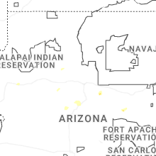
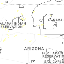


Connect with Interactive Hail Maps