

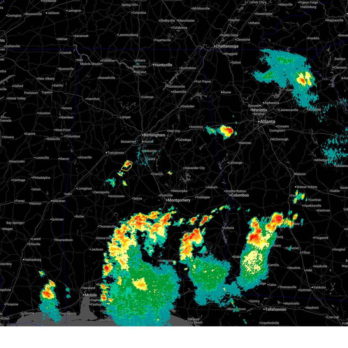
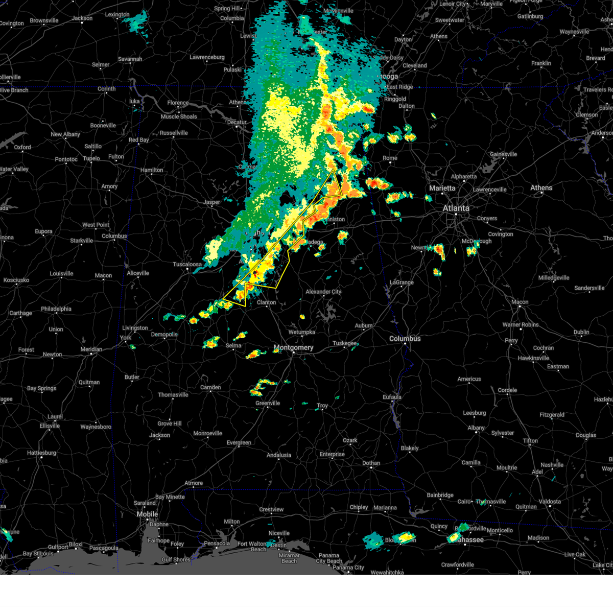
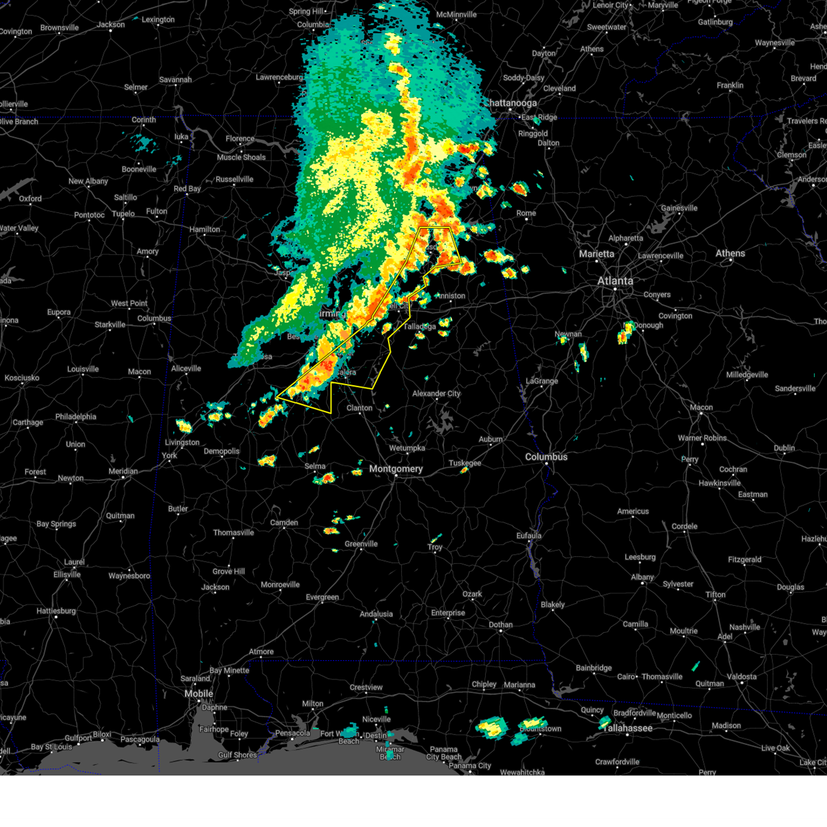
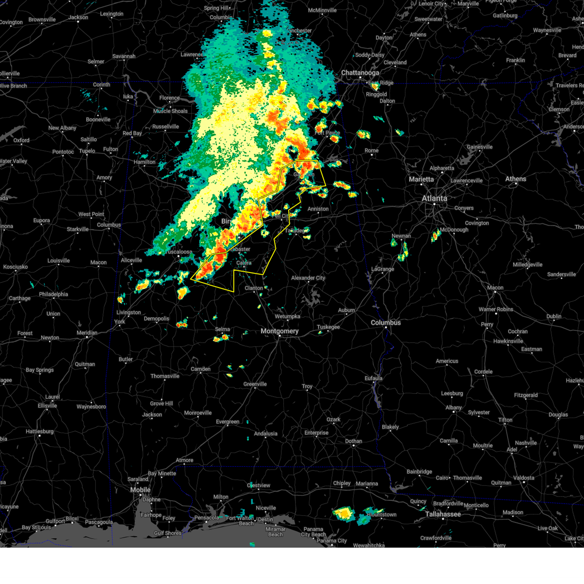
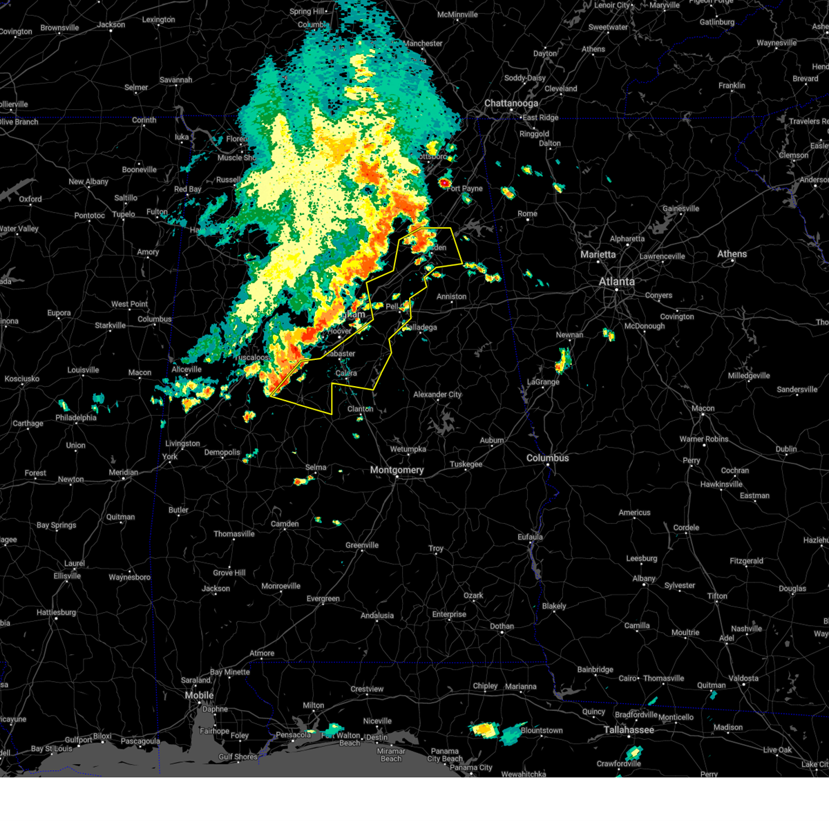
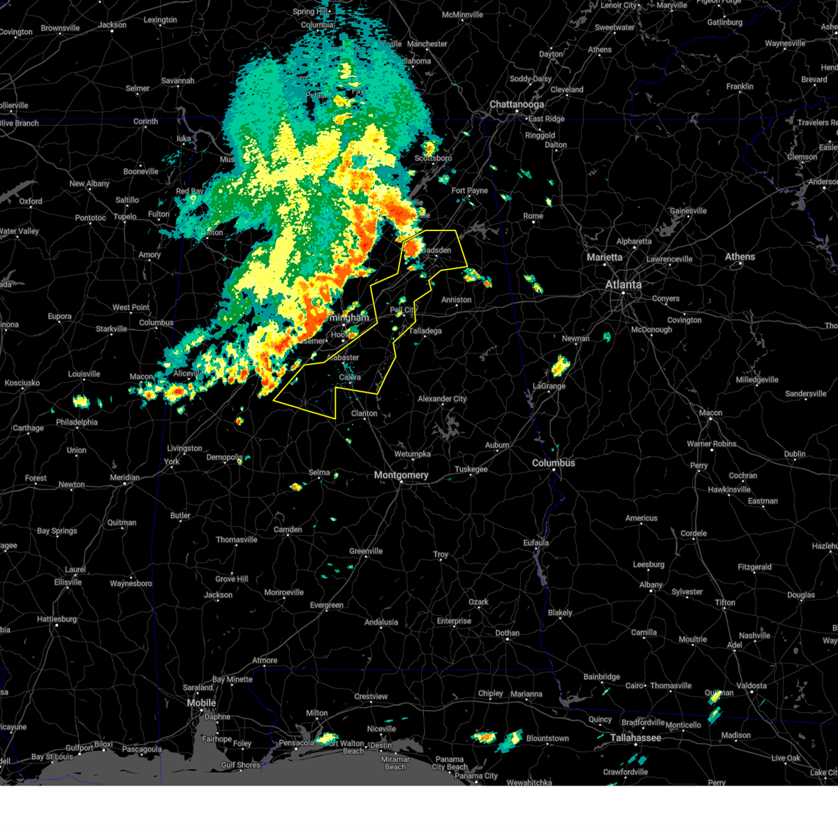
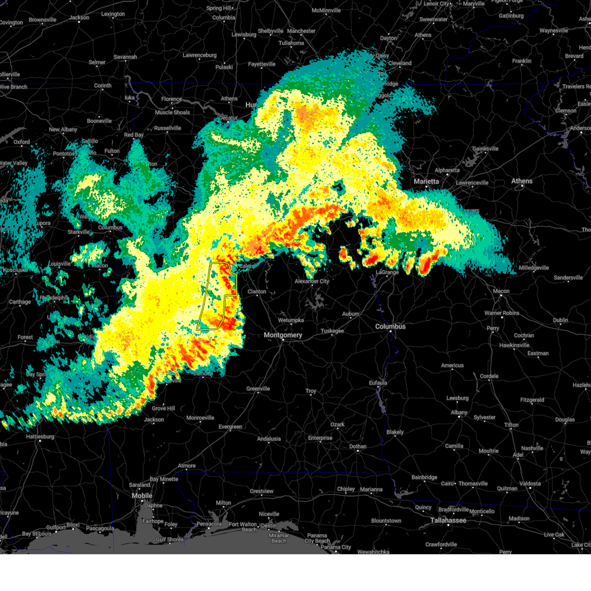
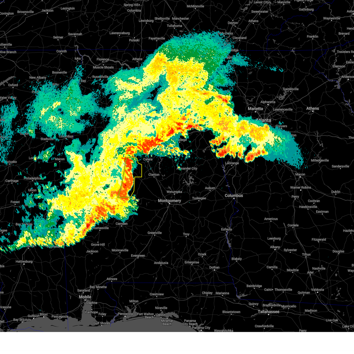
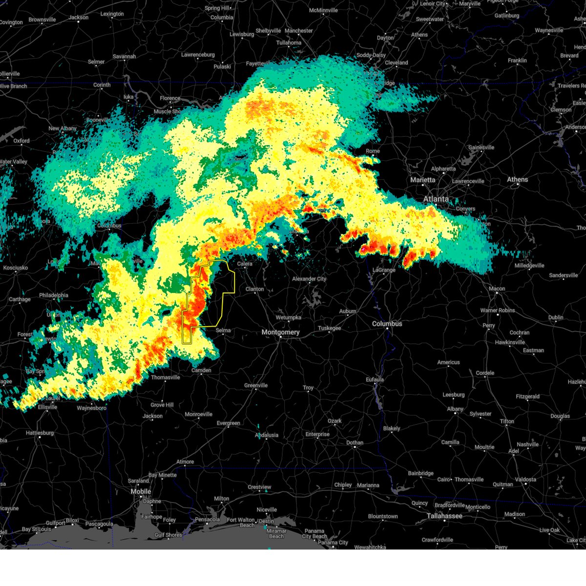
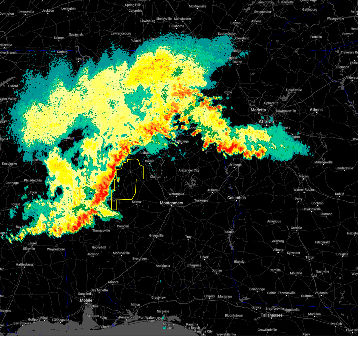
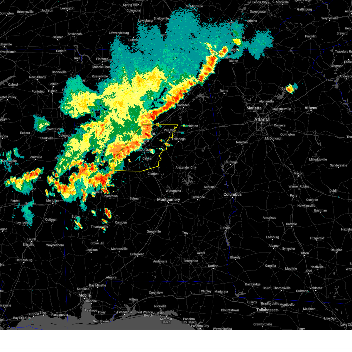
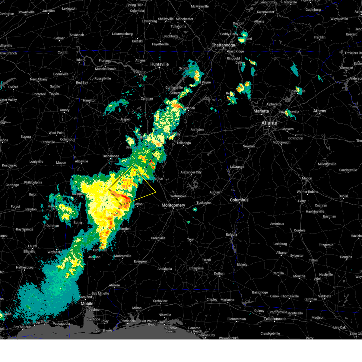
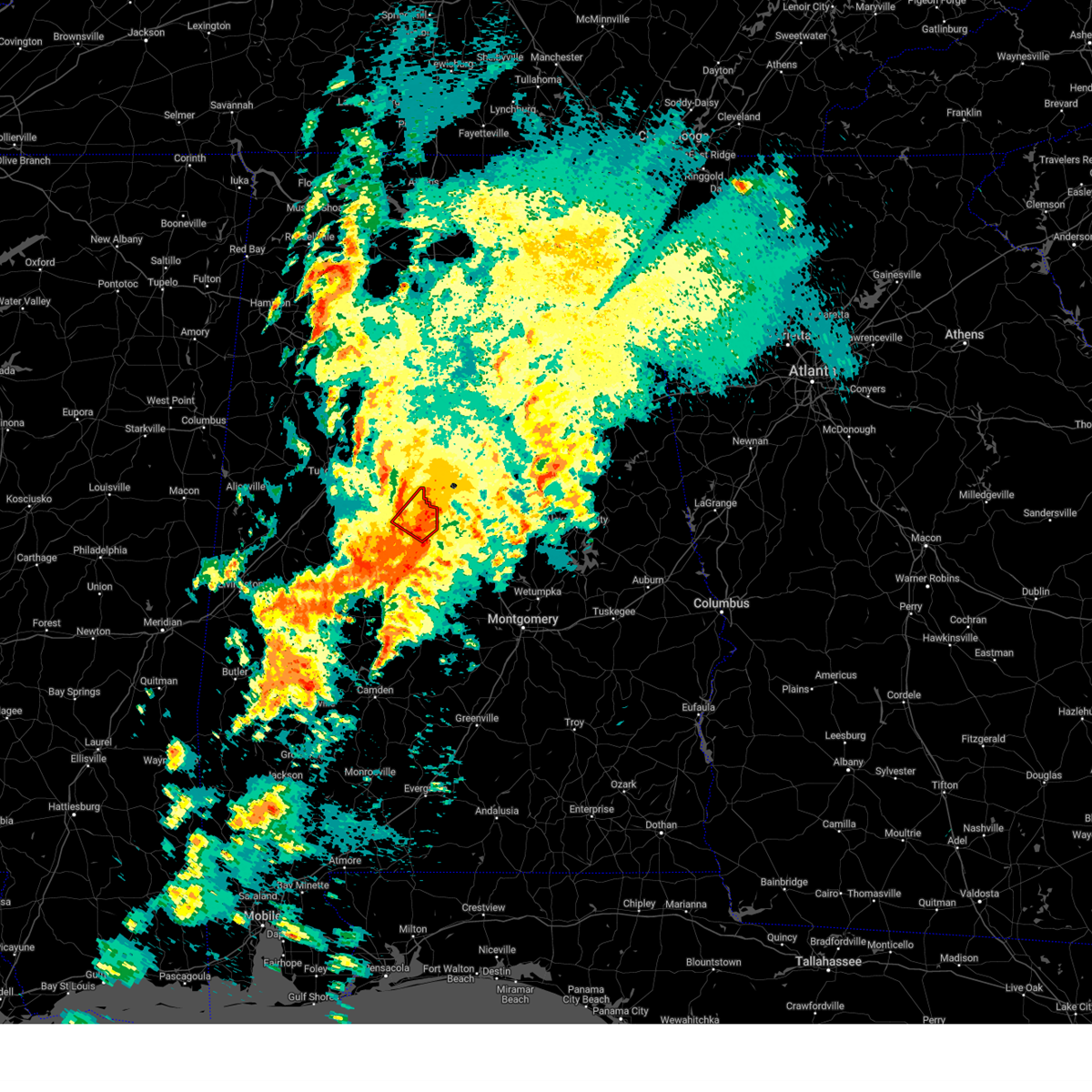
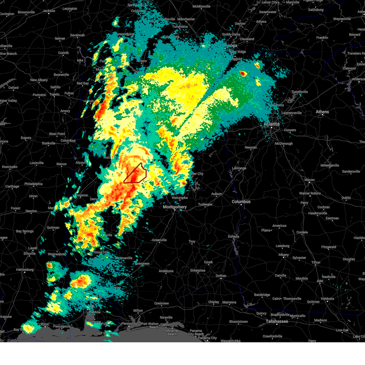
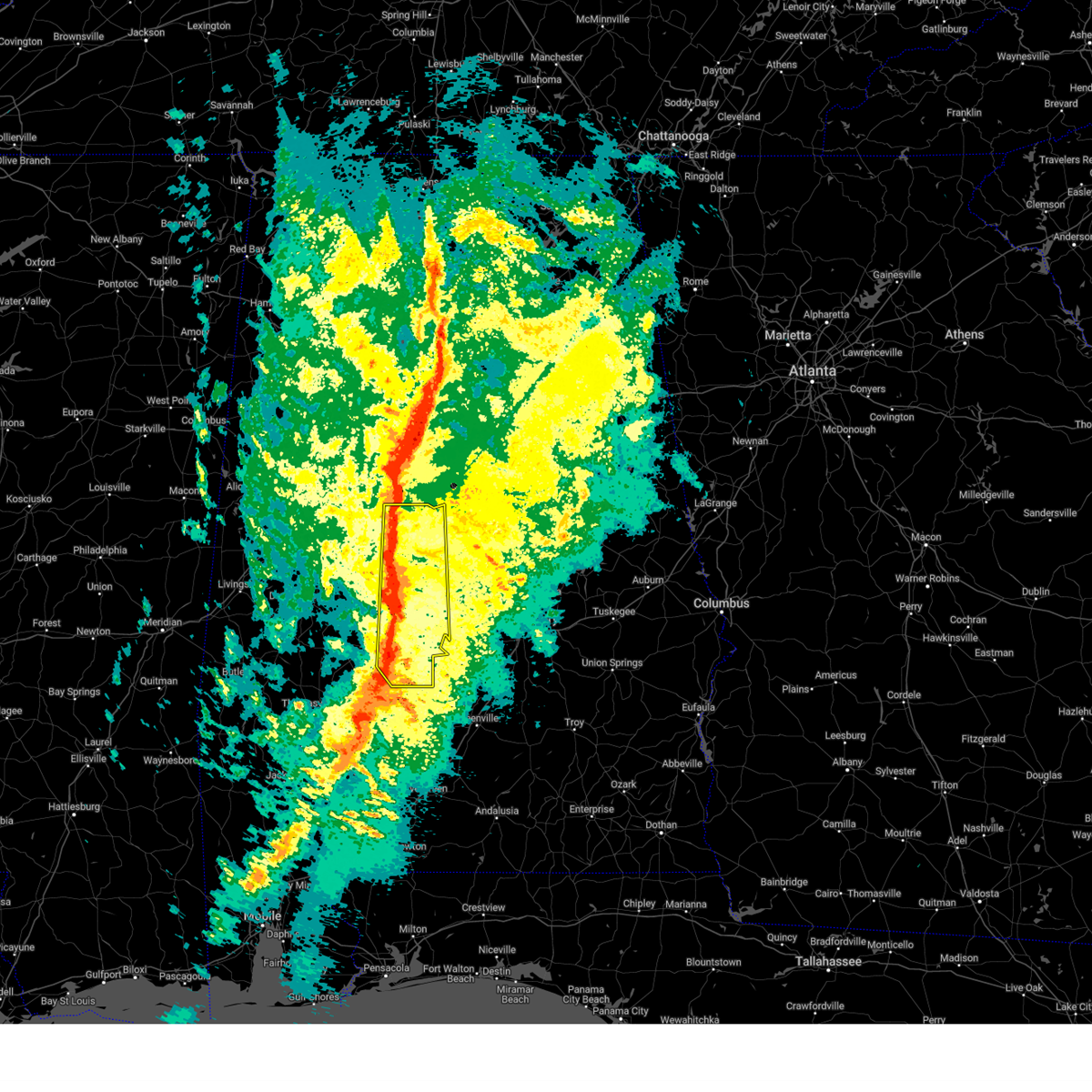
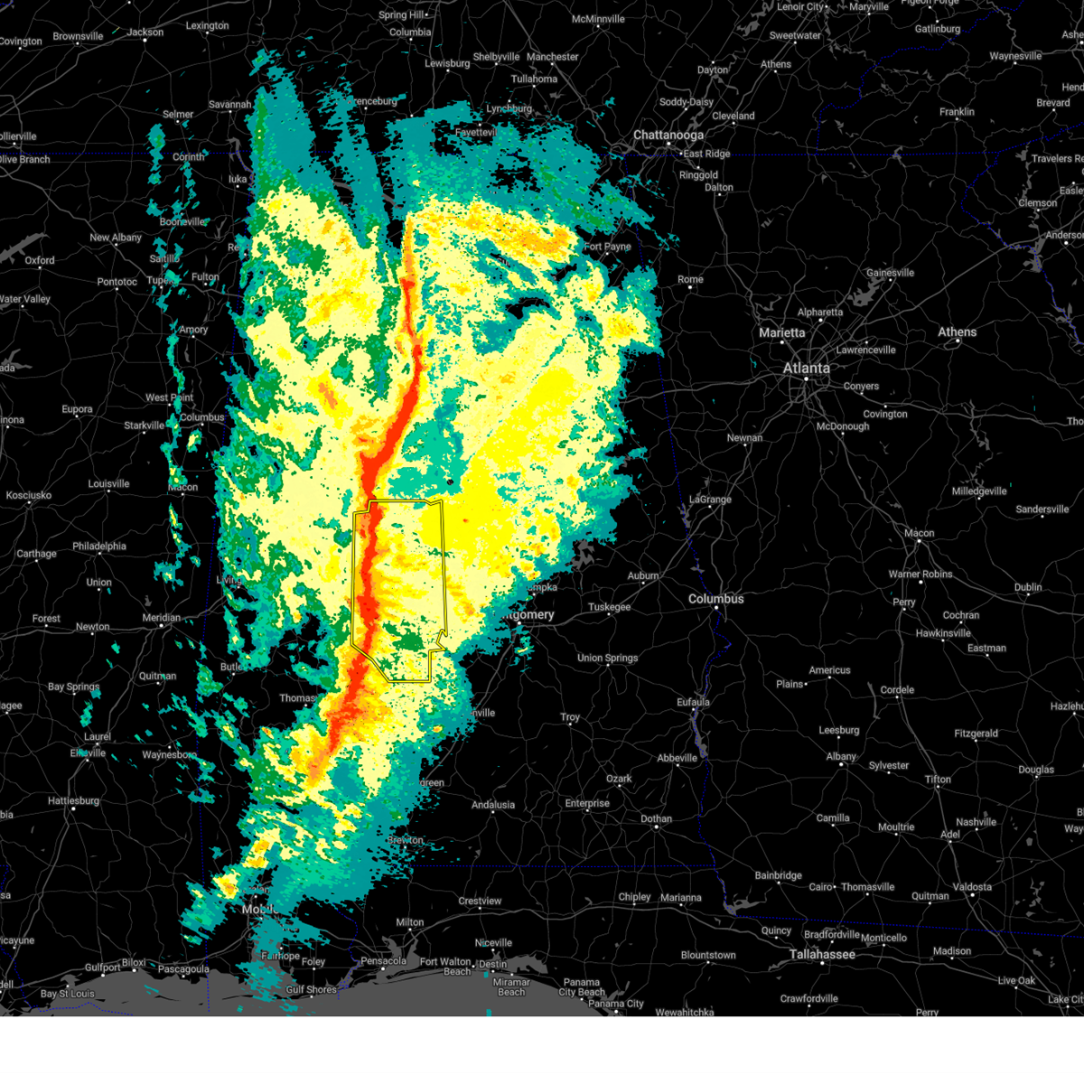
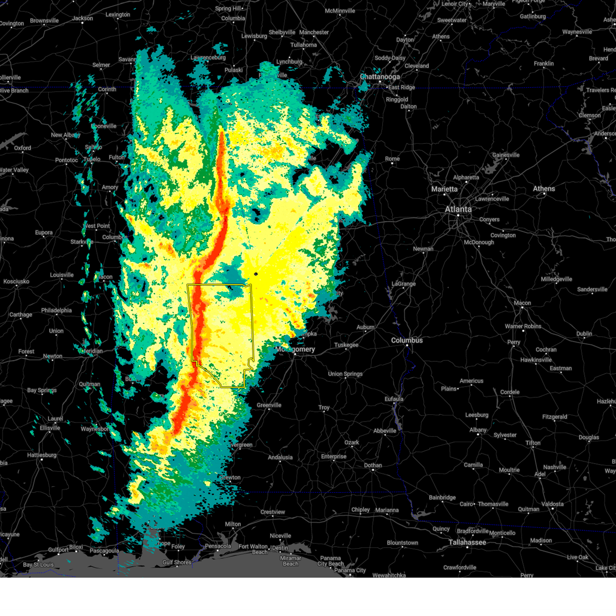
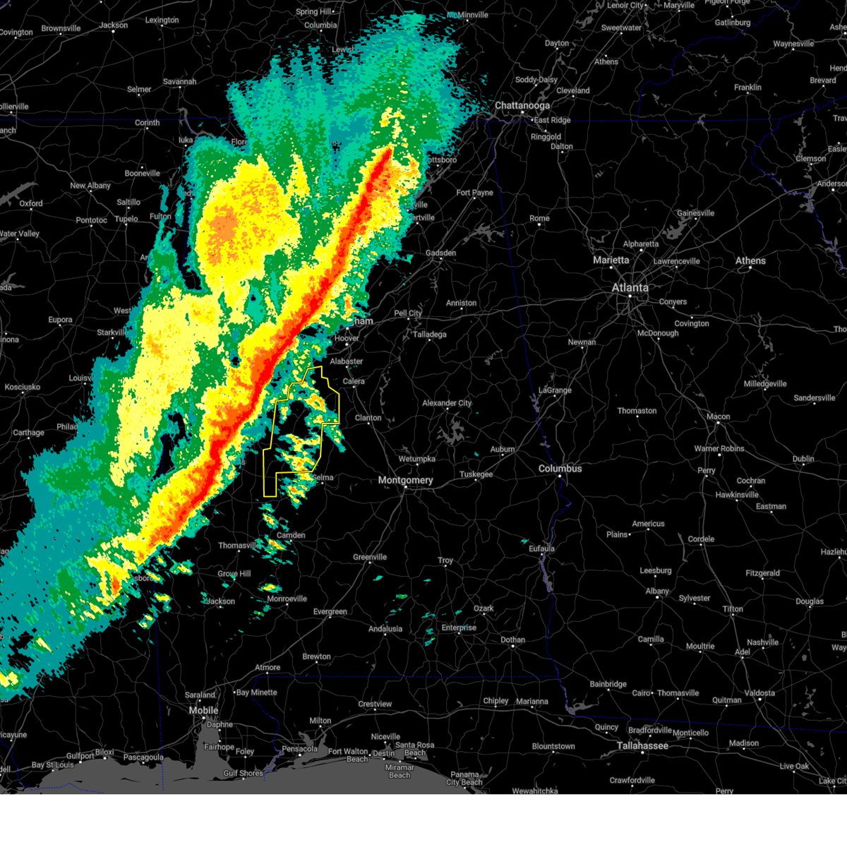
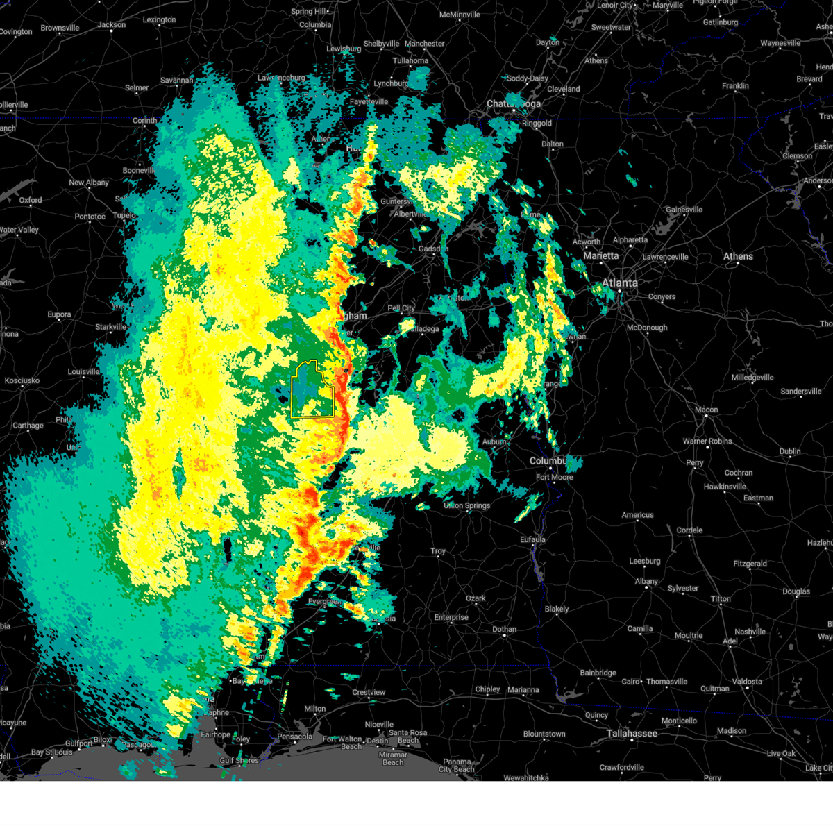
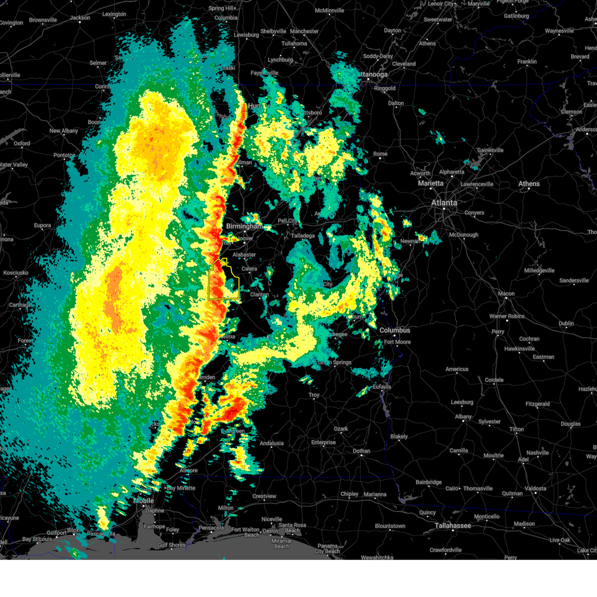
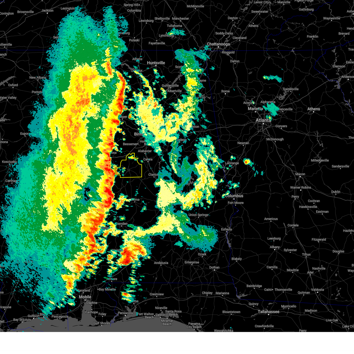
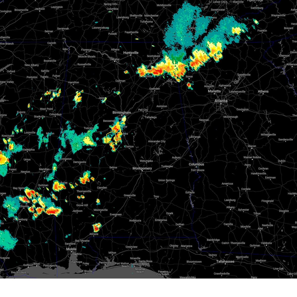
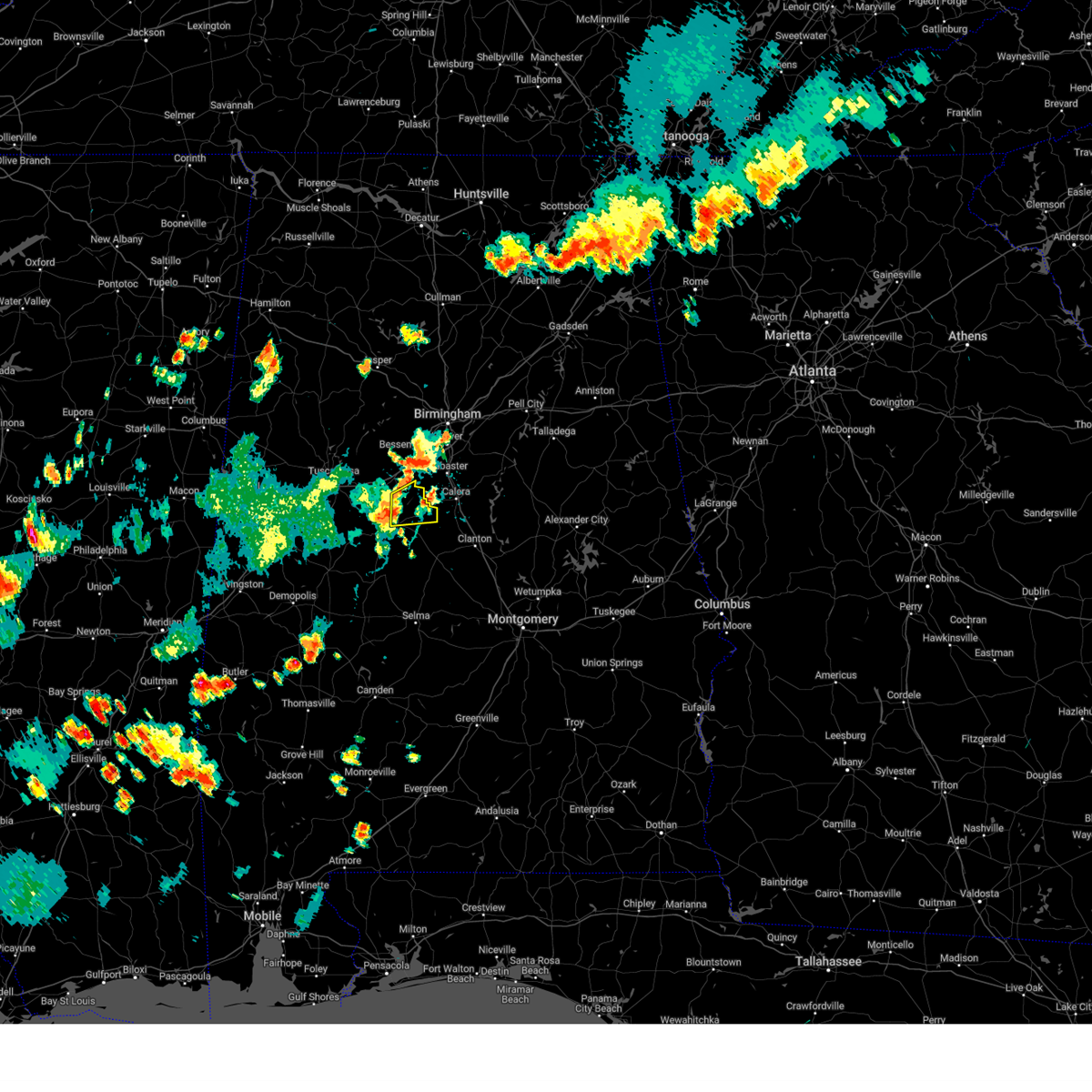
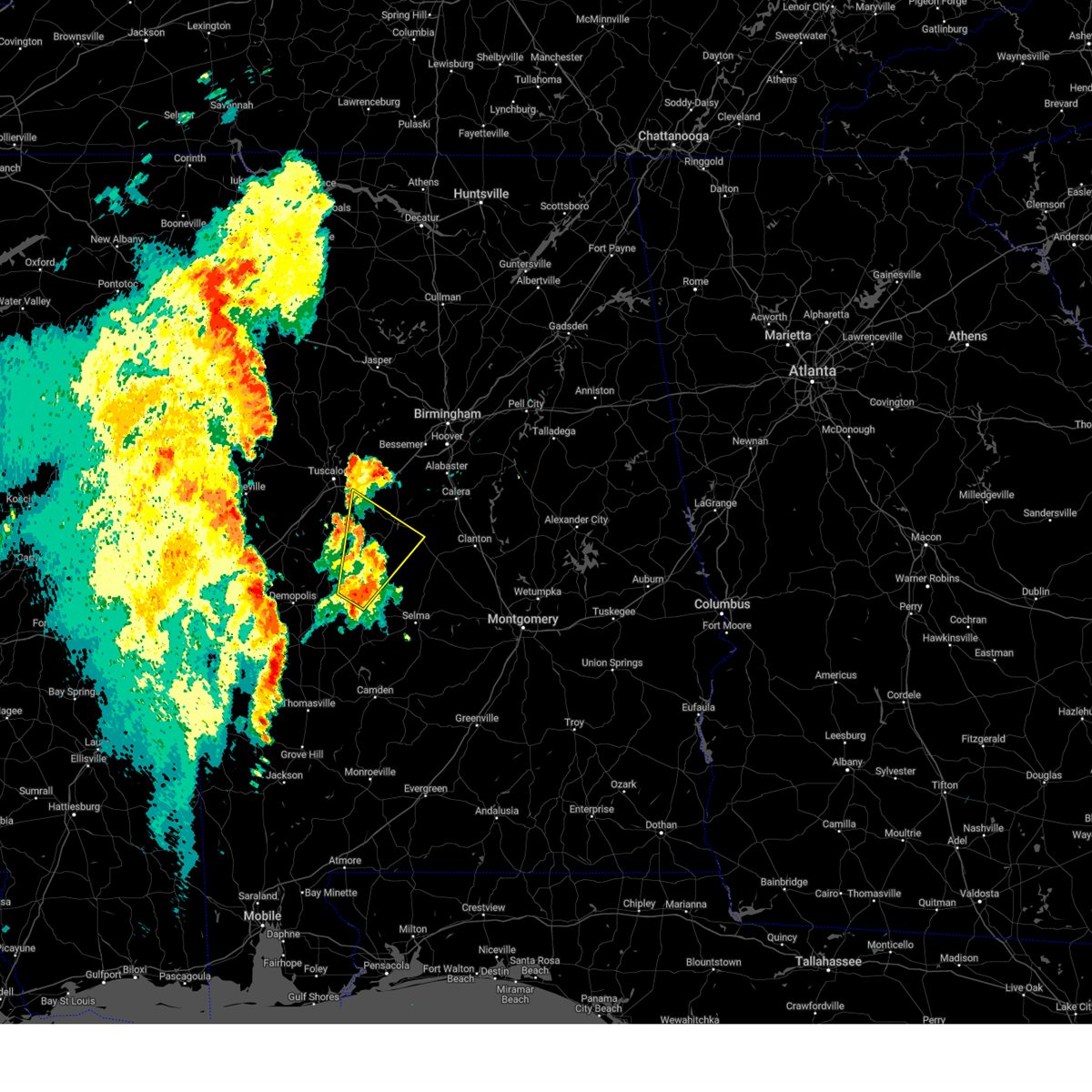
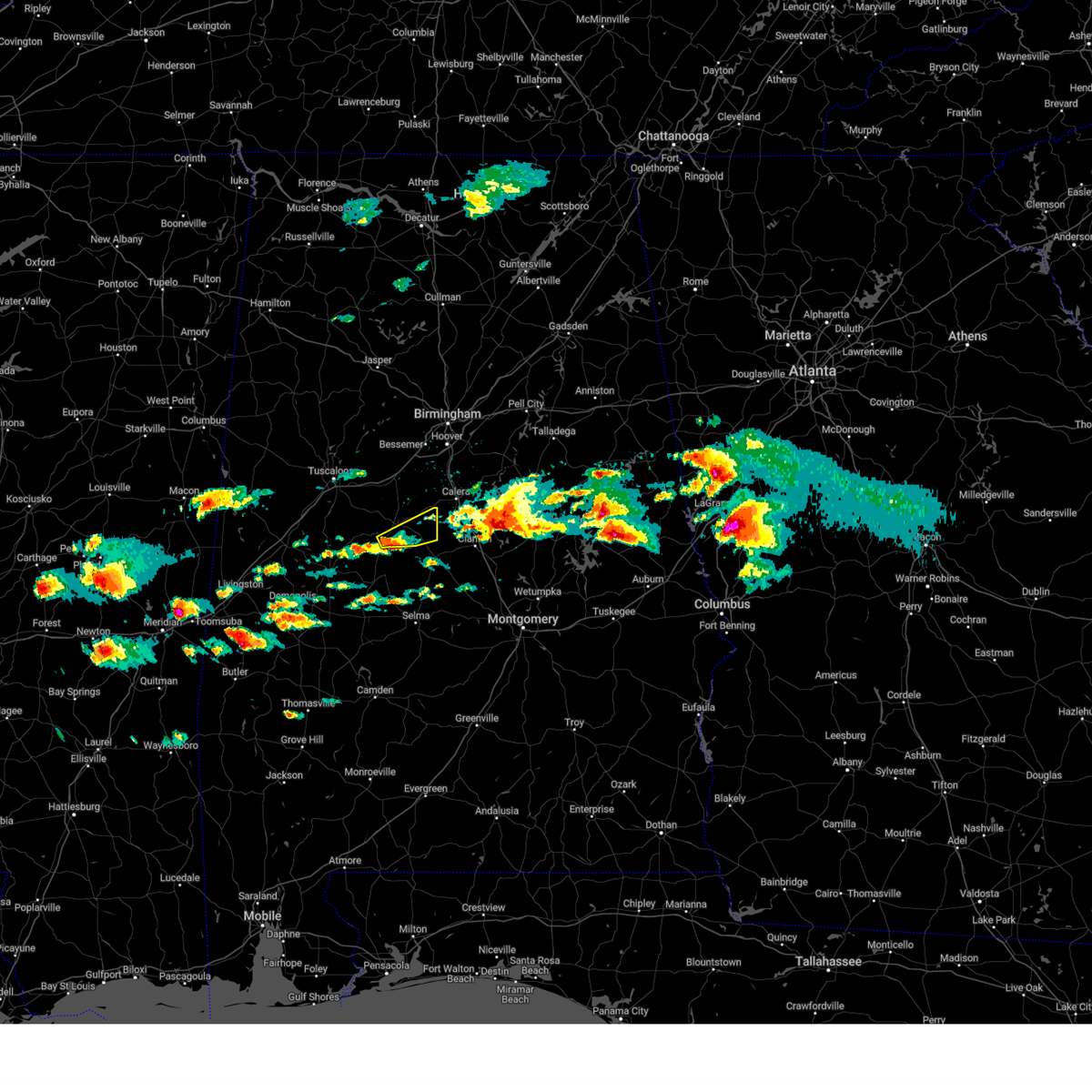
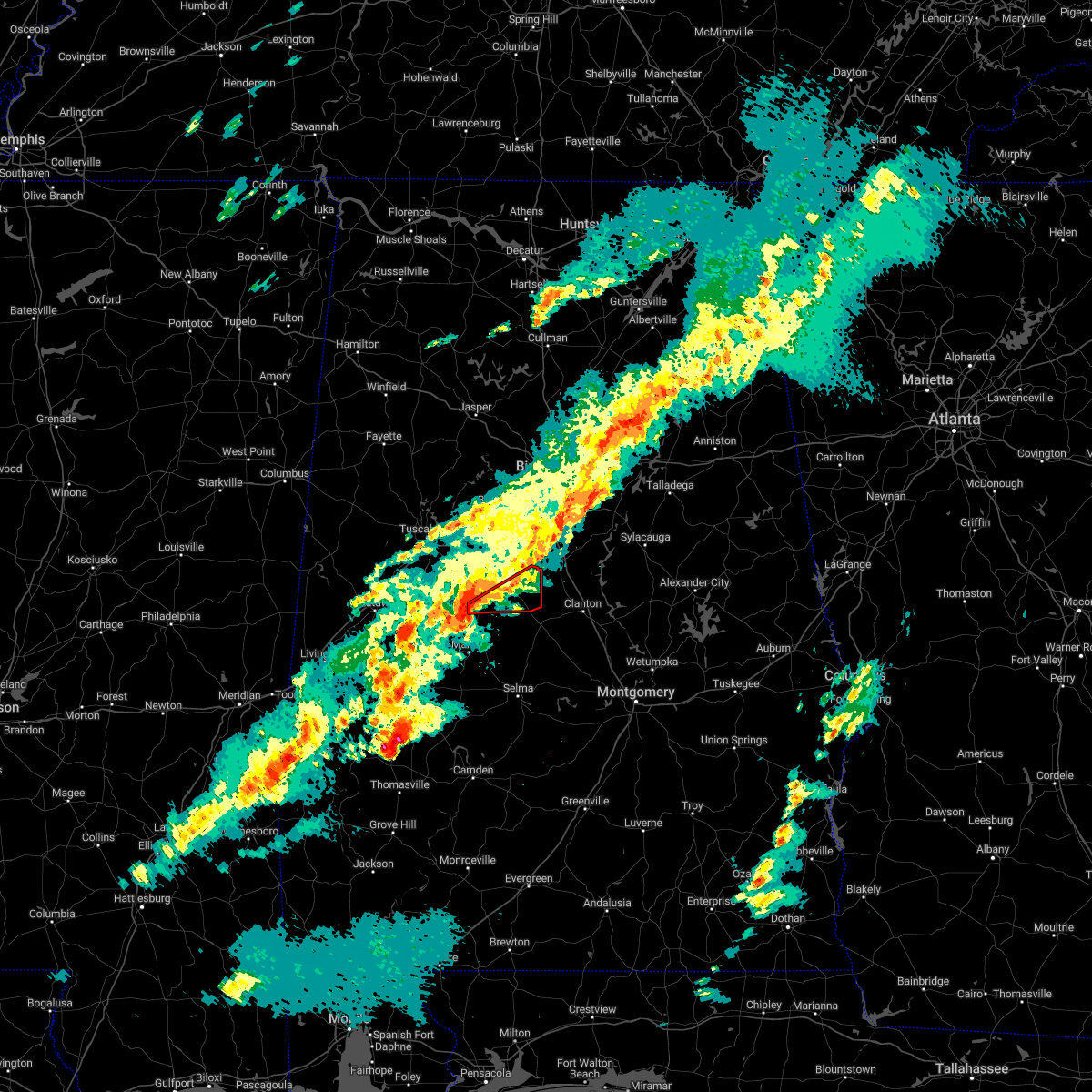
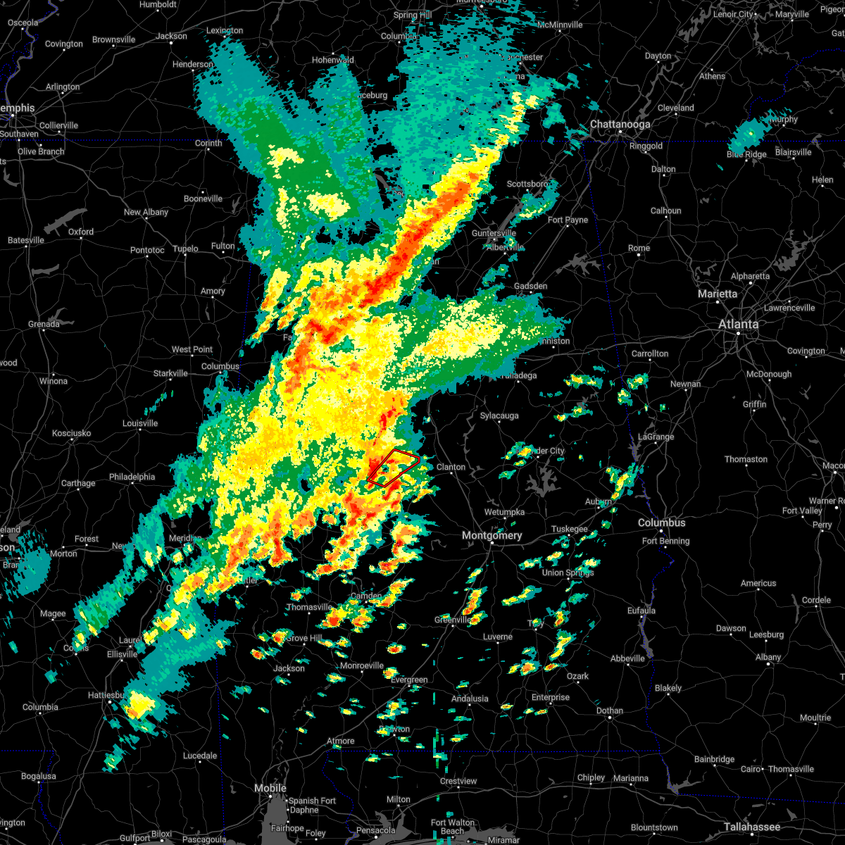
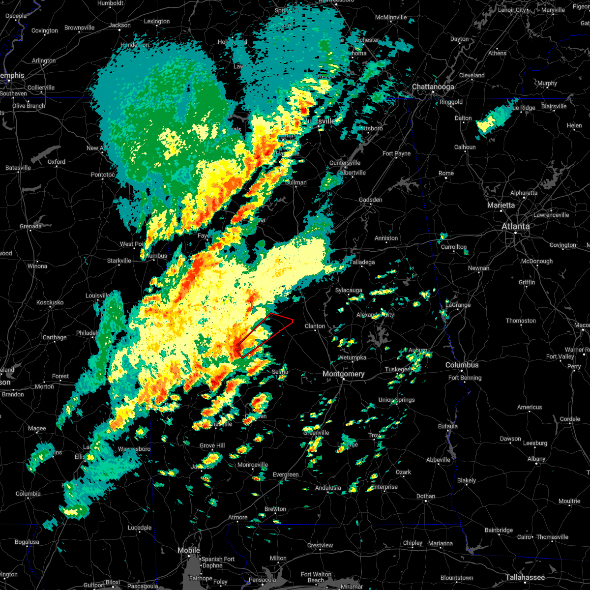
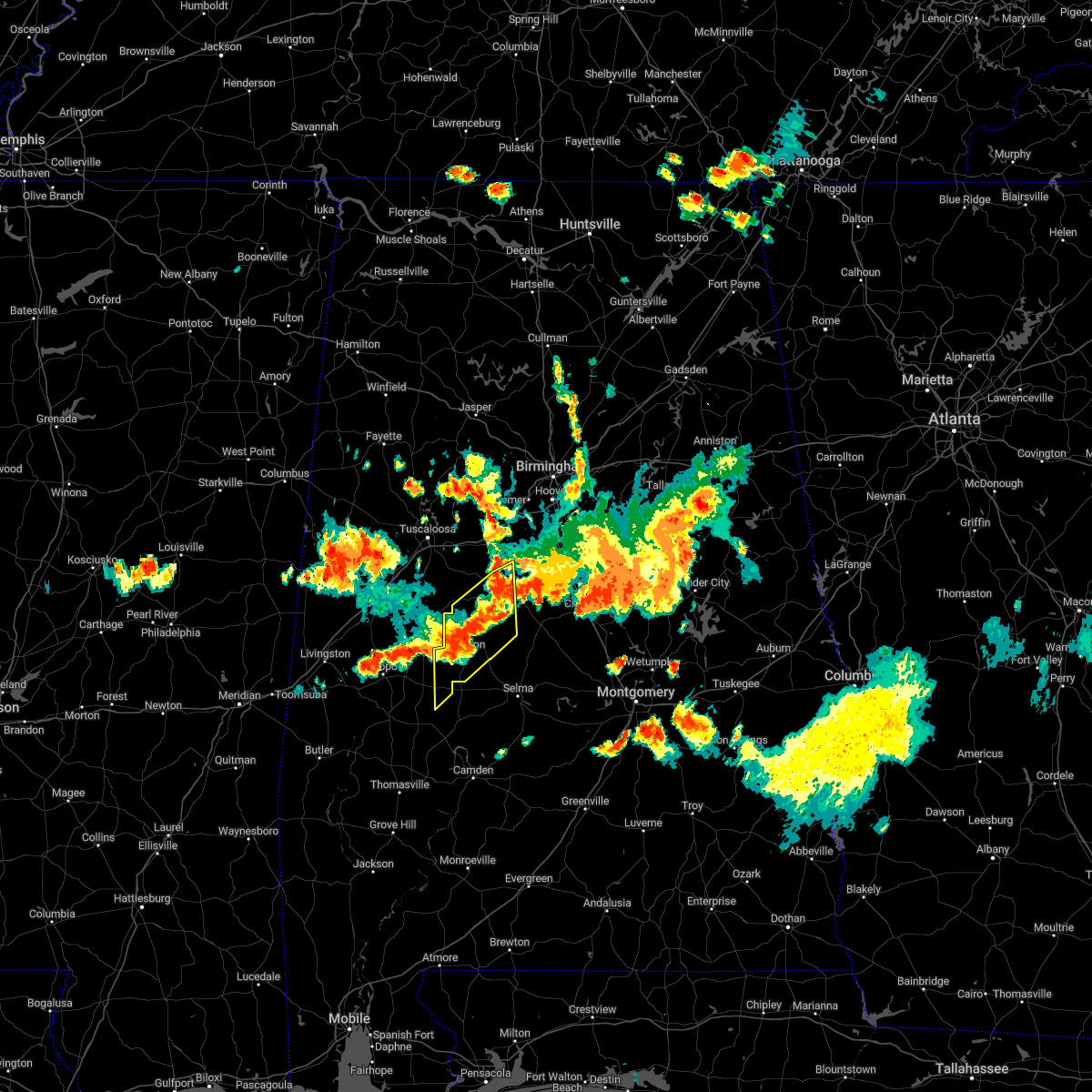
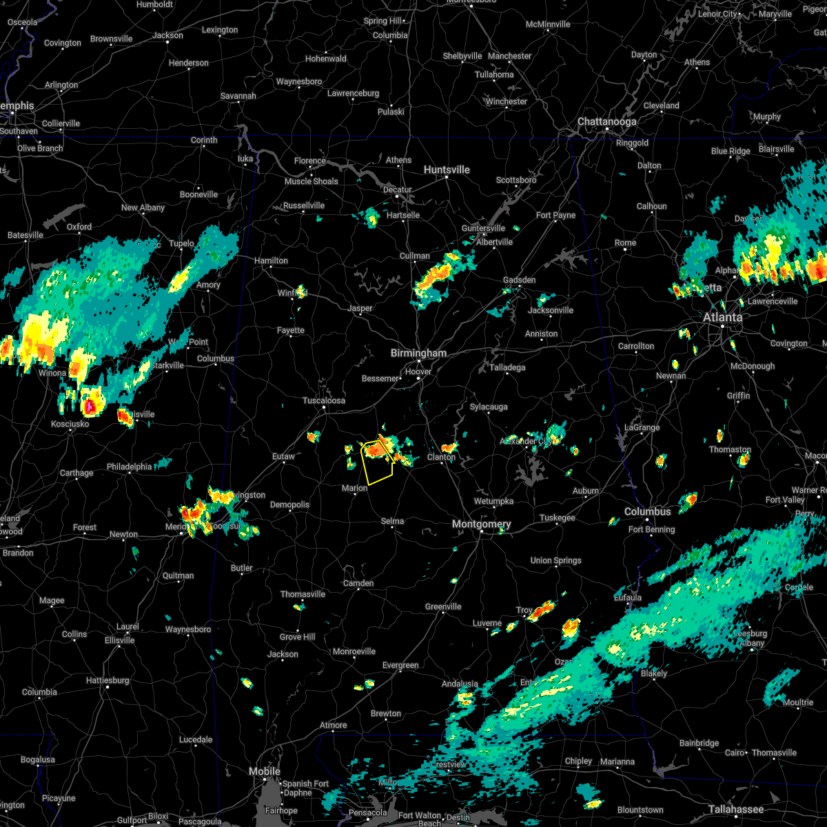
Hail Map for Centreville, AL
The Centreville, AL area has had 6 reports of on-the-ground hail by trained spotters, and has been under severe weather warnings 40 times during the past 12 months. Doppler radar has detected hail at or near Centreville, AL on 76 occasions, including 9 occasions during the past year.
| Name: | Centreville, AL |
| Where Located: | 43.4 miles SSW of Birmingham, AL |
| Map: | Google Map for Centreville, AL |
| Population: | 2778 |
| Housing Units: | 1178 |
| More Info: | Search Google for Centreville, AL |
0
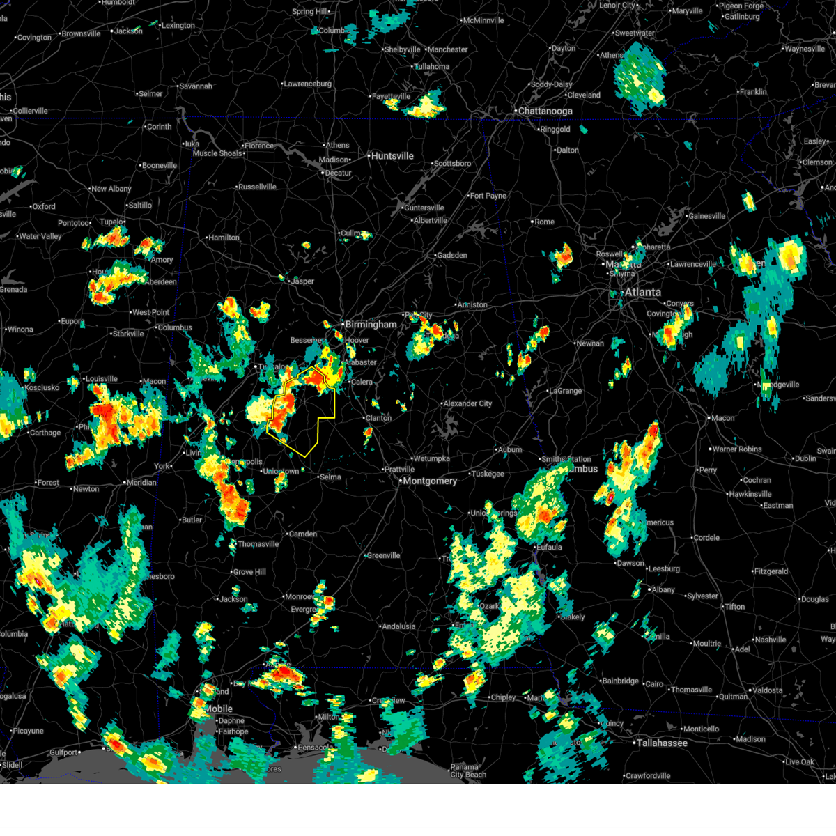
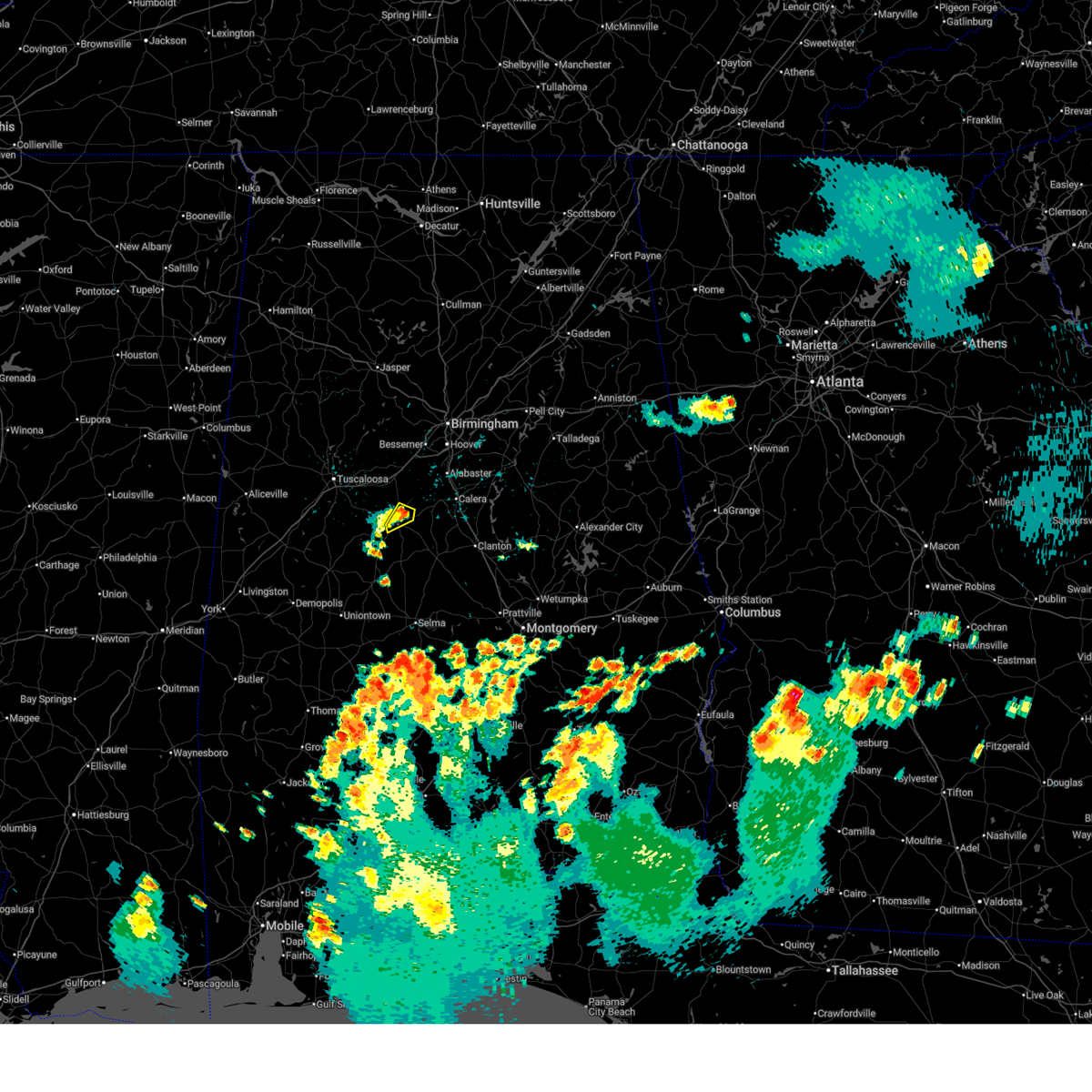
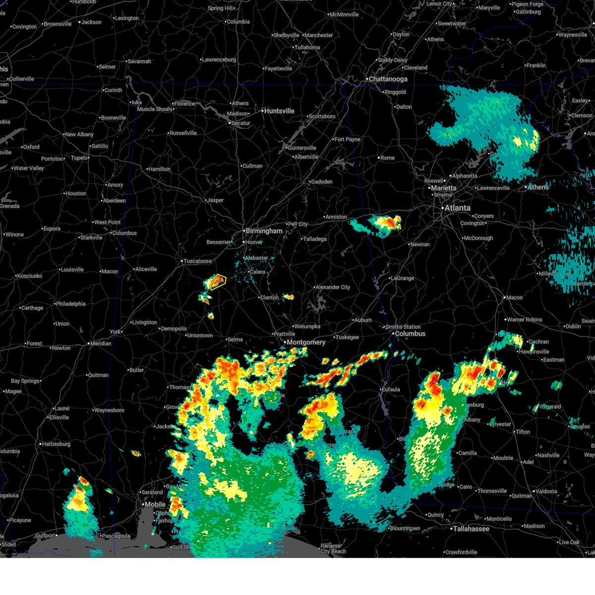
The Top Recent Hail Date for Centreville, AL is Friday, July 11, 2025 (66th out of 76)
Hail and Wind Damage Spotted near Centreville, AL
| Date / Time | Report Details |
|---|---|
| 7/1/2025 4:13 PM CDT | At 413 pm cdt, severe thunderstorms were located along a line extending from near west blocton to near west centreville to near heiberger, moving southeast at 20 mph (radar indicated). Hazards include 60 mph wind gusts and penny size hail. Expect damage to roofs, siding, and trees. Locations impacted include, brent, marion, centreville, west blocton, lawley, west centreville, talladega national forest, heiberger, randolph, trio, radford, six mile, bibb county airport, oakmulgee, sprott, and ellards. |
| 7/1/2025 4:07 PM CDT | Trees down across the road in centrevill in bibb county AL, 1 miles N of Centreville, AL |
| 7/1/2025 4:03 PM CDT | At 403 pm cdt, severe thunderstorms were located along a line extending from near west blocton to west centreville to near heiberger, moving southeast at 25 mph (radar indicated). Hazards include 70 mph wind gusts and penny size hail. Expect considerable tree damage. damage is likely to mobile homes, roofs, and outbuildings. Locations impacted include, brent, marion, centreville, west blocton, lawley, west centreville, talladega national forest, heiberger, eoline, randolph, trio, radford, six mile, bibb county airport, oakmulgee, sprott, and ellards. |
| 7/1/2025 3:51 PM CDT |
 Svrbmx the national weather service in birmingham has issued a * severe thunderstorm warning for, northern perry county in central alabama, bibb county in central alabama, * until 445 pm cdt. * at 351 pm cdt, severe thunderstorms were located along a line extending from near west blocton to near eoline to 6 miles west of heiberger, moving southeast at 20 mph (radar indicated). Hazards include 60 mph wind gusts and penny size hail. expect damage to roofs, siding, and trees Svrbmx the national weather service in birmingham has issued a * severe thunderstorm warning for, northern perry county in central alabama, bibb county in central alabama, * until 445 pm cdt. * at 351 pm cdt, severe thunderstorms were located along a line extending from near west blocton to near eoline to 6 miles west of heiberger, moving southeast at 20 mph (radar indicated). Hazards include 60 mph wind gusts and penny size hail. expect damage to roofs, siding, and trees
|
| 6/25/2025 9:50 PM CDT |
 The storm which prompted the warning has weakened below severe limits, and no longer poses an immediate threat to life or property. therefore, the warning has been allowed to expire. The storm which prompted the warning has weakened below severe limits, and no longer poses an immediate threat to life or property. therefore, the warning has been allowed to expire.
|
| 6/25/2025 9:36 PM CDT |
 At 936 pm cdt, a severe thunderstorm was located near centreville, moving west at 5 mph (radar indicated). Hazards include 60 mph wind gusts and penny size hail. Expect damage to roofs, siding, and trees. Locations impacted include, brent, centreville, and west centreville. At 936 pm cdt, a severe thunderstorm was located near centreville, moving west at 5 mph (radar indicated). Hazards include 60 mph wind gusts and penny size hail. Expect damage to roofs, siding, and trees. Locations impacted include, brent, centreville, and west centreville.
|
| 6/25/2025 9:15 PM CDT |
 At 915 pm cdt, a severe thunderstorm was located near centreville, moving southwest at 10 mph (radar indicated). Hazards include 60 mph wind gusts and penny size hail. Expect damage to roofs, siding, and trees. Locations impacted include, brent, centreville, west centreville, and bibb county airport. At 915 pm cdt, a severe thunderstorm was located near centreville, moving southwest at 10 mph (radar indicated). Hazards include 60 mph wind gusts and penny size hail. Expect damage to roofs, siding, and trees. Locations impacted include, brent, centreville, west centreville, and bibb county airport.
|
| 6/25/2025 9:02 PM CDT | Svrbmx the national weather service in birmingham has issued a * severe thunderstorm warning for, south central bibb county in central alabama, * until 945 pm cdt. * at 902 pm cdt, a severe thunderstorm was located near centreville, moving southwest at 10 mph (radar indicated). Hazards include 60 mph wind gusts and penny size hail. expect damage to roofs, siding, and trees |
| 6/7/2025 3:14 PM CDT |
 At 313 pm cdt, severe thunderstorms were located along a line extending from leesburg to near glencoe to near wilsonville to near lawley, moving east at 55 mph (radar indicated). Hazards include 60 mph wind gusts and penny size hail. Expect damage to roofs, siding, and trees. Locations impacted include, gadsden, alabaster, pell city, calera, chelsea, montevallo, childersburg, hokes bluff, columbiana, centreville, wilsonville, lincoln, glencoe, vincent, ragland, harpersville, westover, wilton, american village, and brierfield ironworks park. At 313 pm cdt, severe thunderstorms were located along a line extending from leesburg to near glencoe to near wilsonville to near lawley, moving east at 55 mph (radar indicated). Hazards include 60 mph wind gusts and penny size hail. Expect damage to roofs, siding, and trees. Locations impacted include, gadsden, alabaster, pell city, calera, chelsea, montevallo, childersburg, hokes bluff, columbiana, centreville, wilsonville, lincoln, glencoe, vincent, ragland, harpersville, westover, wilton, american village, and brierfield ironworks park.
|
| 6/7/2025 3:03 PM CDT |
 At 303 pm cdt, severe thunderstorms were located along a line extending from near tabor road to near neely henry lake to near vincent to near talladega national forest, moving east at 45 mph (radar indicated). Hazards include 60 mph wind gusts and penny size hail. Expect damage to roofs, siding, and trees. Locations impacted include, gadsden, alabaster, pelham, helena, pell city, leeds, moody, calera, chelsea, rainbow city, montevallo, attalla, childersburg, brent, hokes bluff, columbiana, odenville, centreville, wilsonville, and lincoln. At 303 pm cdt, severe thunderstorms were located along a line extending from near tabor road to near neely henry lake to near vincent to near talladega national forest, moving east at 45 mph (radar indicated). Hazards include 60 mph wind gusts and penny size hail. Expect damage to roofs, siding, and trees. Locations impacted include, gadsden, alabaster, pelham, helena, pell city, leeds, moody, calera, chelsea, rainbow city, montevallo, attalla, childersburg, brent, hokes bluff, columbiana, odenville, centreville, wilsonville, and lincoln.
|
| 6/7/2025 2:48 PM CDT |
 At 248 pm cdt, severe thunderstorms were located along a line extending from near sardis city to near steele to near greystone to centreville, moving east at 55 mph (radar indicated). Hazards include 60 mph wind gusts and penny size hail. Expect damage to roofs, siding, and trees. Locations impacted include, hoover, gadsden, alabaster, pelham, helena, pell city, leeds, moody, calera, chelsea, rainbow city, montevallo, attalla, childersburg, brent, hokes bluff, columbiana, springville, odenville, and centreville. At 248 pm cdt, severe thunderstorms were located along a line extending from near sardis city to near steele to near greystone to centreville, moving east at 55 mph (radar indicated). Hazards include 60 mph wind gusts and penny size hail. Expect damage to roofs, siding, and trees. Locations impacted include, hoover, gadsden, alabaster, pelham, helena, pell city, leeds, moody, calera, chelsea, rainbow city, montevallo, attalla, childersburg, brent, hokes bluff, columbiana, springville, odenville, and centreville.
|
| 6/7/2025 2:32 PM CDT |
 At 232 pm cdt, severe thunderstorms were located along a line extending from 6 miles west of albertville to oneonta to birmingham to low gap, moving east at 45 mph (radar indicated). Hazards include 60 mph wind gusts and penny size hail. Expect damage to roofs, siding, and trees. Locations impacted include, hoover, gadsden, alabaster, pelham, helena, pell city, leeds, moody, calera, chelsea, rainbow city, montevallo, attalla, childersburg, brent, hokes bluff, columbiana, springville, odenville, and centreville. At 232 pm cdt, severe thunderstorms were located along a line extending from 6 miles west of albertville to oneonta to birmingham to low gap, moving east at 45 mph (radar indicated). Hazards include 60 mph wind gusts and penny size hail. Expect damage to roofs, siding, and trees. Locations impacted include, hoover, gadsden, alabaster, pelham, helena, pell city, leeds, moody, calera, chelsea, rainbow city, montevallo, attalla, childersburg, brent, hokes bluff, columbiana, springville, odenville, and centreville.
|
| 6/7/2025 2:18 PM CDT |
 Svrbmx the national weather service in birmingham has issued a * severe thunderstorm warning for, shelby county in central alabama, etowah county in northeastern alabama, bibb county in central alabama, st. clair county in central alabama, * until 330 pm cdt. * at 218 pm cdt, severe thunderstorms were located along a line extending from near strawberry to near cleveland to mcdonald chapel to near shelton state community college, moving east at 55 mph (radar indicated). Hazards include 60 mph wind gusts and penny size hail. expect damage to roofs, siding, and trees Svrbmx the national weather service in birmingham has issued a * severe thunderstorm warning for, shelby county in central alabama, etowah county in northeastern alabama, bibb county in central alabama, st. clair county in central alabama, * until 330 pm cdt. * at 218 pm cdt, severe thunderstorms were located along a line extending from near strawberry to near cleveland to mcdonald chapel to near shelton state community college, moving east at 55 mph (radar indicated). Hazards include 60 mph wind gusts and penny size hail. expect damage to roofs, siding, and trees
|
| 5/26/2025 12:04 AM CDT |
 the severe thunderstorm warning has been cancelled and is no longer in effect the severe thunderstorm warning has been cancelled and is no longer in effect
|
| 5/25/2025 11:50 PM CDT |
 At 1150 pm cdt, severe thunderstorms were located along a line extending from 6 miles northwest of brierfield ironworks park to near marion junction, moving east at 35 mph (radar indicated). Hazards include 60 mph wind gusts. Expect damage to roofs, siding, and trees. Locations impacted include, brent, marion, centreville, west blocton, lawley, ashby, brierfield ironworks park, west centreville, talladega national forest, randolph, trio, judson college, radford, marvel, six mile, bibb county airport, oakmulgee, suttle, hebron, and sprott. At 1150 pm cdt, severe thunderstorms were located along a line extending from 6 miles northwest of brierfield ironworks park to near marion junction, moving east at 35 mph (radar indicated). Hazards include 60 mph wind gusts. Expect damage to roofs, siding, and trees. Locations impacted include, brent, marion, centreville, west blocton, lawley, ashby, brierfield ironworks park, west centreville, talladega national forest, randolph, trio, judson college, radford, marvel, six mile, bibb county airport, oakmulgee, suttle, hebron, and sprott.
|
| 5/25/2025 11:32 PM CDT |
 At 1131 pm cdt, severe thunderstorms were located along a line extending from near west blocton to near marion junction, moving east at 35 mph (radar indicated). Hazards include 60 mph wind gusts and penny size hail. Expect damage to roofs, siding, and trees. Locations impacted include, brent, marion, centreville, uniontown, west blocton, newbern, vaiden, west centreville, heiberger, lawley, ashby, brierfield ironworks park, low gap, mertz, talladega national forest, eoline, randolph, radford, folsom, and six mile. At 1131 pm cdt, severe thunderstorms were located along a line extending from near west blocton to near marion junction, moving east at 35 mph (radar indicated). Hazards include 60 mph wind gusts and penny size hail. Expect damage to roofs, siding, and trees. Locations impacted include, brent, marion, centreville, uniontown, west blocton, newbern, vaiden, west centreville, heiberger, lawley, ashby, brierfield ironworks park, low gap, mertz, talladega national forest, eoline, randolph, radford, folsom, and six mile.
|
| 5/25/2025 11:09 PM CDT |
 Svrbmx the national weather service in birmingham has issued a * severe thunderstorm warning for, perry county in central alabama, bibb county in central alabama, * until 1215 am cdt. * at 1109 pm cdt, severe thunderstorms were located along a line extending from near vance to faunsdale, moving east at 35 mph (radar indicated). Hazards include 60 mph wind gusts and penny size hail. expect damage to roofs, siding, and trees Svrbmx the national weather service in birmingham has issued a * severe thunderstorm warning for, perry county in central alabama, bibb county in central alabama, * until 1215 am cdt. * at 1109 pm cdt, severe thunderstorms were located along a line extending from near vance to faunsdale, moving east at 35 mph (radar indicated). Hazards include 60 mph wind gusts and penny size hail. expect damage to roofs, siding, and trees
|
| 5/2/2025 6:35 PM CDT | At 634 pm cdt, severe thunderstorms were located along a line extending from near logan martin lake to near eoline, moving east at 30 mph (radar indicated). Hazards include 60 mph wind gusts and quarter size hail. Hail damage to vehicles is expected. expect wind damage to roofs, siding, and trees. Locations impacted include, minooka park, columbiana, highway 145 and cr 46, american village, westover, oak mountain state park, woodstock, hagler, bibb county airport, camp branch, hoover veterans park, vandiver, alabaster veterans park, green pond, pearson, maylene, camp winnataska, helena, chelsea, and harmon. |
| 5/2/2025 6:13 PM CDT | At 613 pm cdt, severe thunderstorms were located along a line extending from near odenville to 6 miles northwest of ashby, moving east at 40 mph (radar indicated). Hazards include 60 mph wind gusts and quarter size hail. Hail damage to vehicles is expected. expect wind damage to roofs, siding, and trees. Locations impacted include, minooka park, mountain brook, wattsville, american village, westover, oak mountain state park, bibb county airport, camp branch, liberty park, green pond, pearson, maylene, camp winnataska, helena, highland park golf course, grants mill road bridge, leeds, wilton, patton creek, and chula vista. |
| 5/2/2025 5:47 PM CDT |
 At 547 pm cdt, severe thunderstorms were located along a line extending from clay to near eoline, moving east at 40 mph (radar indicated). Hazards include 60 mph wind gusts and quarter size hail. Hail damage to vehicles is expected. expect wind damage to roofs, siding, and trees. Locations impacted include, minooka park, mountain brook, wattsville, american village, westover, mulga, new castle, oak mountain state park, bibb county airport, camp branch, liberty park, green pond, ensley, pearson, maylene, camp winnataska, helena, highland park golf course, grants mill road bridge, and leeds. At 547 pm cdt, severe thunderstorms were located along a line extending from clay to near eoline, moving east at 40 mph (radar indicated). Hazards include 60 mph wind gusts and quarter size hail. Hail damage to vehicles is expected. expect wind damage to roofs, siding, and trees. Locations impacted include, minooka park, mountain brook, wattsville, american village, westover, mulga, new castle, oak mountain state park, bibb county airport, camp branch, liberty park, green pond, ensley, pearson, maylene, camp winnataska, helena, highland park golf course, grants mill road bridge, and leeds.
|
| 5/2/2025 5:23 PM CDT | Svrbmx the national weather service in birmingham has issued a * severe thunderstorm warning for, north central chilton county in central alabama, southeastern tuscaloosa county in west central alabama, shelby county in central alabama, bibb county in central alabama, jefferson county in central alabama, southern st. clair county in central alabama, * until 700 pm cdt. * at 523 pm cdt, severe thunderstorms were located along a line extending from gardendale to near low gap, moving east at 40 mph (radar indicated). Hazards include 60 mph wind gusts and quarter size hail. Hail damage to vehicles is expected. Expect wind damage to roofs, siding, and trees. |
| 4/25/2025 4:57 PM CDT |
 Svrbmx the national weather service in birmingham has issued a * severe thunderstorm warning for, northwestern autauga county in central alabama, southwestern chilton county in central alabama, perry county in central alabama, east central hale county in west central alabama, southern bibb county in central alabama, northern dallas county in south central alabama, * until 545 pm cdt. * at 456 pm cdt, a severe thunderstorm was located over marion, moving northeast at 40 mph (radar indicated). Hazards include 60 mph wind gusts. expect damage to roofs, siding, and trees Svrbmx the national weather service in birmingham has issued a * severe thunderstorm warning for, northwestern autauga county in central alabama, southwestern chilton county in central alabama, perry county in central alabama, east central hale county in west central alabama, southern bibb county in central alabama, northern dallas county in south central alabama, * until 545 pm cdt. * at 456 pm cdt, a severe thunderstorm was located over marion, moving northeast at 40 mph (radar indicated). Hazards include 60 mph wind gusts. expect damage to roofs, siding, and trees
|
| 3/15/2025 7:45 PM CDT |
 At 745 pm cdt, a confirmed large and extremely dangerous tornado was located near ashby, or 11 miles southwest of montevallo, moving northeast at 45 mph. this is a particularly dangerous situation. take cover now! (radar confirmed tornado). Hazards include damaging tornado. You are in a life-threatening situation. flying debris may be deadly to those caught without shelter. mobile homes will be destroyed. considerable damage to homes, businesses, and vehicles is likely and complete destruction is possible. Locations impacted include, talladega national forest, trio, centreville, ashby, brierfield ironworks park, marvel, six mile, bibb county airport, and brent. At 745 pm cdt, a confirmed large and extremely dangerous tornado was located near ashby, or 11 miles southwest of montevallo, moving northeast at 45 mph. this is a particularly dangerous situation. take cover now! (radar confirmed tornado). Hazards include damaging tornado. You are in a life-threatening situation. flying debris may be deadly to those caught without shelter. mobile homes will be destroyed. considerable damage to homes, businesses, and vehicles is likely and complete destruction is possible. Locations impacted include, talladega national forest, trio, centreville, ashby, brierfield ironworks park, marvel, six mile, bibb county airport, and brent.
|
| 3/15/2025 7:26 PM CDT |
 At 726 pm cdt, a severe thunderstorm capable of producing a tornado was located 7 miles south of west centreville, or 7 miles south of brent, moving northeast at 45 mph (radar indicated rotation). Hazards include tornado. Flying debris will be dangerous to those caught without shelter. mobile homes will be damaged or destroyed. damage to roofs, windows, and vehicles will occur. tree damage is likely. Locations impacted include, talladega national forest, trio, centreville, ashby, brierfield ironworks park, west centreville, brent, marvel, six mile, and bibb county airport. At 726 pm cdt, a severe thunderstorm capable of producing a tornado was located 7 miles south of west centreville, or 7 miles south of brent, moving northeast at 45 mph (radar indicated rotation). Hazards include tornado. Flying debris will be dangerous to those caught without shelter. mobile homes will be damaged or destroyed. damage to roofs, windows, and vehicles will occur. tree damage is likely. Locations impacted include, talladega national forest, trio, centreville, ashby, brierfield ironworks park, west centreville, brent, marvel, six mile, and bibb county airport.
|
| 3/15/2025 7:13 PM CDT | Torbmx the national weather service in birmingham has issued a * tornado warning for, southeastern bibb county in central alabama, * until 800 pm cdt. * at 713 pm cdt, a severe thunderstorm capable of producing a tornado was located over heiberger, or 10 miles north of marion, moving northeast at 55 mph (radar indicated rotation). Hazards include tornado. Flying debris will be dangerous to those caught without shelter. mobile homes will be damaged or destroyed. damage to roofs, windows, and vehicles will occur. Tree damage is likely. |
| 3/4/2025 8:49 PM CST |
 At 849 pm cst, severe thunderstorms were located along a line extending from 6 miles southeast of west blocton to near dallas lake, moving east at 40 mph (radar indicated). Hazards include 60 mph wind gusts. Expect damage to roofs, siding, and trees. Locations impacted include, stanton, carlowville, parnell, tyler, selma, craig field aiport, bibb county airport, plantersville, dannelly reservoir, randolph, selmont-west selmont, valley grande, brierfield ironworks park, whites bluff, paul m grist state park, brent, dallas lake, talladega national forest, suttle, and oakmulgee. At 849 pm cst, severe thunderstorms were located along a line extending from 6 miles southeast of west blocton to near dallas lake, moving east at 40 mph (radar indicated). Hazards include 60 mph wind gusts. Expect damage to roofs, siding, and trees. Locations impacted include, stanton, carlowville, parnell, tyler, selma, craig field aiport, bibb county airport, plantersville, dannelly reservoir, randolph, selmont-west selmont, valley grande, brierfield ironworks park, whites bluff, paul m grist state park, brent, dallas lake, talladega national forest, suttle, and oakmulgee.
|
| 3/4/2025 8:33 PM CST |
 At 833 pm cst, severe thunderstorms were located along a line extending from near eoline to 7 miles southwest of orrville, moving east at 30 mph (radar indicated). Hazards include 60 mph wind gusts. Expect damage to roofs, siding, and trees. Locations impacted include, bogue chitto, vaiden, stanton, carlowville, parnell, safford, tyler, selma, craig field aiport, bibb county airport, plantersville, dannelly reservoir, harmon, randolph, selmont-west selmont, judson college, valley grande, brierfield ironworks park, whites bluff, and paul m grist state park. At 833 pm cst, severe thunderstorms were located along a line extending from near eoline to 7 miles southwest of orrville, moving east at 30 mph (radar indicated). Hazards include 60 mph wind gusts. Expect damage to roofs, siding, and trees. Locations impacted include, bogue chitto, vaiden, stanton, carlowville, parnell, safford, tyler, selma, craig field aiport, bibb county airport, plantersville, dannelly reservoir, harmon, randolph, selmont-west selmont, judson college, valley grande, brierfield ironworks park, whites bluff, and paul m grist state park.
|
| 3/4/2025 8:33 PM CST |
 the severe thunderstorm warning has been cancelled and is no longer in effect the severe thunderstorm warning has been cancelled and is no longer in effect
|
| 3/4/2025 8:19 PM CST |
 Svrbmx the national weather service in birmingham has issued a * severe thunderstorm warning for, western autauga county in central alabama, western chilton county in central alabama, south central tuscaloosa county in west central alabama, perry county in central alabama, northeastern hale county in west central alabama, bibb county in central alabama, dallas county in south central alabama, * until 945 pm cst. * at 819 pm cst, severe thunderstorms were located along a line extending from near newbern to near pine hill, moving northeast at 35 mph (radar indicated). Hazards include 60 mph wind gusts. expect damage to roofs, siding, and trees Svrbmx the national weather service in birmingham has issued a * severe thunderstorm warning for, western autauga county in central alabama, western chilton county in central alabama, south central tuscaloosa county in west central alabama, perry county in central alabama, northeastern hale county in west central alabama, bibb county in central alabama, dallas county in south central alabama, * until 945 pm cst. * at 819 pm cst, severe thunderstorms were located along a line extending from near newbern to near pine hill, moving northeast at 35 mph (radar indicated). Hazards include 60 mph wind gusts. expect damage to roofs, siding, and trees
|
| 2/16/2025 1:40 AM CST | the severe thunderstorm warning has been cancelled and is no longer in effect |
| 2/16/2025 1:18 AM CST | At 118 am cst, severe thunderstorms were located along a line extending from near helena to near consul, moving east at 65 mph (radar indicated). Hazards include 70 mph wind gusts. Expect considerable tree damage. damage is likely to mobile homes, roofs, and outbuildings. Locations impacted include, brent, marion, centreville, lawley, ashby, vaiden, brierfield ironworks park, west centreville, talladega national forest, heiberger, randolph, perry county correctional center, trio, judson college, radford, marvel, six mile, bibb county airport, suttle, and oakmulgee. |
| 2/16/2025 12:42 AM CST |
 Svrbmx the national weather service in birmingham has issued a * severe thunderstorm warning for, perry county in central alabama, bibb county in central alabama, * until 200 am cst. * at 1242 am cst, severe thunderstorms were located along a line extending from near brookwood to near myrtlewood, moving east at 65 mph (radar indicated). Hazards include 70 mph wind gusts. Expect considerable tree damage. Damage is likely to mobile homes, roofs, and outbuildings. Svrbmx the national weather service in birmingham has issued a * severe thunderstorm warning for, perry county in central alabama, bibb county in central alabama, * until 200 am cst. * at 1242 am cst, severe thunderstorms were located along a line extending from near brookwood to near myrtlewood, moving east at 65 mph (radar indicated). Hazards include 70 mph wind gusts. Expect considerable tree damage. Damage is likely to mobile homes, roofs, and outbuildings.
|
| 12/28/2024 11:51 PM CST |
 The storms which prompted the warning have moved out of the area. therefore, the warning will be allowed to expire. a tornado watch remains in effect until 400 am cst for central and west central alabama. The storms which prompted the warning have moved out of the area. therefore, the warning will be allowed to expire. a tornado watch remains in effect until 400 am cst for central and west central alabama.
|
| 12/28/2024 11:24 PM CST |
 At 1124 pm cst, severe thunderstorms were located along a line extending from near tannehill ironworks state park to near talladega national forest, moving northeast at 60 mph (radar indicated). Hazards include 60 mph wind gusts. Expect damage to roofs, siding, and trees. Locations impacted include, brent, centreville, vance, woodstock, west blocton, lawley, ashby, brierfield ironworks park, west centreville, talladega national forest, eoline, north bibb, randolph, trio, marvel, six mile, bibb county airport, green pond, and hebron. At 1124 pm cst, severe thunderstorms were located along a line extending from near tannehill ironworks state park to near talladega national forest, moving northeast at 60 mph (radar indicated). Hazards include 60 mph wind gusts. Expect damage to roofs, siding, and trees. Locations impacted include, brent, centreville, vance, woodstock, west blocton, lawley, ashby, brierfield ironworks park, west centreville, talladega national forest, eoline, north bibb, randolph, trio, marvel, six mile, bibb county airport, green pond, and hebron.
|
| 12/28/2024 10:46 PM CST |
 Svrbmx the national weather service in birmingham has issued a * severe thunderstorm warning for, bibb county in central alabama, * until midnight cst. * at 1045 pm cst, severe thunderstorms were located along a line extending from near holt to near vaiden, moving east at 60 mph (radar indicated). Hazards include 60 mph wind gusts. expect damage to roofs, siding, and trees Svrbmx the national weather service in birmingham has issued a * severe thunderstorm warning for, bibb county in central alabama, * until midnight cst. * at 1045 pm cst, severe thunderstorms were located along a line extending from near holt to near vaiden, moving east at 60 mph (radar indicated). Hazards include 60 mph wind gusts. expect damage to roofs, siding, and trees
|
| 8/18/2024 5:33 PM CDT |
 the severe thunderstorm warning has been cancelled and is no longer in effect the severe thunderstorm warning has been cancelled and is no longer in effect
|
| 8/18/2024 5:02 PM CDT |
 At 502 pm cdt, a severe thunderstorm was located over brent, moving southeast at 30 mph (radar indicated). Hazards include 60 mph wind gusts and quarter size hail. Hail damage to vehicles is expected. expect wind damage to roofs, siding, and trees. Locations impacted include, brent, centreville, lawley, talladega national forest, eoline, west centreville, randolph, trio, and bibb county airport. At 502 pm cdt, a severe thunderstorm was located over brent, moving southeast at 30 mph (radar indicated). Hazards include 60 mph wind gusts and quarter size hail. Hail damage to vehicles is expected. expect wind damage to roofs, siding, and trees. Locations impacted include, brent, centreville, lawley, talladega national forest, eoline, west centreville, randolph, trio, and bibb county airport.
|
| 8/18/2024 4:38 PM CDT |
 Svrbmx the national weather service in birmingham has issued a * severe thunderstorm warning for, bibb county in central alabama, * until 545 pm cdt. * at 438 pm cdt, a severe thunderstorm was located near vance, or 12 miles north of brent, moving southeast at 35 mph (radar indicated). Hazards include 60 mph wind gusts and half dollar size hail. Hail damage to vehicles is expected. Expect wind damage to roofs, siding, and trees. Svrbmx the national weather service in birmingham has issued a * severe thunderstorm warning for, bibb county in central alabama, * until 545 pm cdt. * at 438 pm cdt, a severe thunderstorm was located near vance, or 12 miles north of brent, moving southeast at 35 mph (radar indicated). Hazards include 60 mph wind gusts and half dollar size hail. Hail damage to vehicles is expected. Expect wind damage to roofs, siding, and trees.
|
| 8/16/2024 6:04 PM CDT |
 the severe thunderstorm warning has been cancelled and is no longer in effect the severe thunderstorm warning has been cancelled and is no longer in effect
|
| 8/16/2024 5:51 PM CDT |
 At 551 pm cdt, a severe thunderstorm was located near west blocton, or 7 miles northeast of centreville, moving east at 20 mph (radar indicated). Hazards include 60 mph wind gusts. Expect damage to roofs, siding, and trees. Locations impacted include, brent, centreville, west blocton, ashby, brierfield ironworks park, hebron, marvel, and six mile. At 551 pm cdt, a severe thunderstorm was located near west blocton, or 7 miles northeast of centreville, moving east at 20 mph (radar indicated). Hazards include 60 mph wind gusts. Expect damage to roofs, siding, and trees. Locations impacted include, brent, centreville, west blocton, ashby, brierfield ironworks park, hebron, marvel, and six mile.
|
| 8/16/2024 5:34 PM CDT | Svrbmx the national weather service in birmingham has issued a * severe thunderstorm warning for, central bibb county in central alabama, * until 615 pm cdt. * at 534 pm cdt, a severe thunderstorm was located over eoline, or near brent, moving east at 20 mph (radar indicated). Hazards include 60 mph wind gusts. expect damage to roofs, siding, and trees |
| 6/5/2024 8:01 PM CDT |
 the severe thunderstorm warning has been cancelled and is no longer in effect the severe thunderstorm warning has been cancelled and is no longer in effect
|
| 6/5/2024 7:17 PM CDT |
 Svrbmx the national weather service in birmingham has issued a * severe thunderstorm warning for, east central marengo county in southwestern alabama, perry county in central alabama, southern bibb county in central alabama, central dallas county in south central alabama, * until 815 pm cdt. * at 717 pm cdt, severe thunderstorms were located along a line extending from 6 miles southeast of moundville to near newbern to 6 miles east of magnolia, moving northeast at 45 mph (radar indicated). Hazards include 60 mph wind gusts. expect damage to roofs, siding, and trees Svrbmx the national weather service in birmingham has issued a * severe thunderstorm warning for, east central marengo county in southwestern alabama, perry county in central alabama, southern bibb county in central alabama, central dallas county in south central alabama, * until 815 pm cdt. * at 717 pm cdt, severe thunderstorms were located along a line extending from 6 miles southeast of moundville to near newbern to 6 miles east of magnolia, moving northeast at 45 mph (radar indicated). Hazards include 60 mph wind gusts. expect damage to roofs, siding, and trees
|
| 6/5/2024 6:58 PM CDT |
 Svrbmx the national weather service in birmingham has issued a * severe thunderstorm warning for, southeastern walker county in central alabama, north central chilton county in central alabama, eastern tuscaloosa county in west central alabama, western shelby county in central alabama, bibb county in central alabama, jefferson county in central alabama, * until 800 pm cdt. * at 658 pm cdt, severe thunderstorms were located along a line extending from near concord to near centreville, moving northeast at 45 mph (radar indicated). Hazards include 60 mph wind gusts. expect damage to roofs, siding, and trees Svrbmx the national weather service in birmingham has issued a * severe thunderstorm warning for, southeastern walker county in central alabama, north central chilton county in central alabama, eastern tuscaloosa county in west central alabama, western shelby county in central alabama, bibb county in central alabama, jefferson county in central alabama, * until 800 pm cdt. * at 658 pm cdt, severe thunderstorms were located along a line extending from near concord to near centreville, moving northeast at 45 mph (radar indicated). Hazards include 60 mph wind gusts. expect damage to roofs, siding, and trees
|
| 6/5/2024 6:38 PM CDT |
 Svrbmx the national weather service in birmingham has issued a * severe thunderstorm warning for, south central tuscaloosa county in west central alabama, northern perry county in central alabama, eastern hale county in west central alabama, southwestern bibb county in central alabama, * until 745 pm cdt. * at 638 pm cdt, a severe thunderstorm was located near marion, moving northeast at 30 mph (radar indicated). Hazards include 60 mph wind gusts and penny size hail. expect damage to roofs, siding, and trees Svrbmx the national weather service in birmingham has issued a * severe thunderstorm warning for, south central tuscaloosa county in west central alabama, northern perry county in central alabama, eastern hale county in west central alabama, southwestern bibb county in central alabama, * until 745 pm cdt. * at 638 pm cdt, a severe thunderstorm was located near marion, moving northeast at 30 mph (radar indicated). Hazards include 60 mph wind gusts and penny size hail. expect damage to roofs, siding, and trees
|
| 5/27/2024 5:36 AM CDT |
 At 536 am cdt, a severe thunderstorm was located near maylene, or 7 miles northwest of montevallo, moving east at 50 mph (radar indicated). Hazards include 70 mph wind gusts. Expect considerable tree damage. damage is likely to mobile homes, roofs, and outbuildings. Locations impacted include, hoover, vestavia hills, alabaster, bessemer, pelham, helena, calera, chelsea, montevallo, brent, columbiana, centreville, jemison, indian springs village, lake view, brookwood, vance, woodstock, west blocton, and wilton. At 536 am cdt, a severe thunderstorm was located near maylene, or 7 miles northwest of montevallo, moving east at 50 mph (radar indicated). Hazards include 70 mph wind gusts. Expect considerable tree damage. damage is likely to mobile homes, roofs, and outbuildings. Locations impacted include, hoover, vestavia hills, alabaster, bessemer, pelham, helena, calera, chelsea, montevallo, brent, columbiana, centreville, jemison, indian springs village, lake view, brookwood, vance, woodstock, west blocton, and wilton.
|
| 5/27/2024 5:23 AM CDT |
 At 522 am cdt, a severe thunderstorm was located over west blocton, or 10 miles north of centreville, moving east at 50 mph (radar indicated). Hazards include 70 mph wind gusts. Expect considerable tree damage. damage is likely to mobile homes, roofs, and outbuildings. Locations impacted include, southern tuscaloosa, hoover, vestavia hills, alabaster, bessemer, pelham, helena, calera, chelsea, montevallo, brent, columbiana, centreville, jemison, holt, indian springs village, lake view, brookwood, coaling, and vance. At 522 am cdt, a severe thunderstorm was located over west blocton, or 10 miles north of centreville, moving east at 50 mph (radar indicated). Hazards include 70 mph wind gusts. Expect considerable tree damage. damage is likely to mobile homes, roofs, and outbuildings. Locations impacted include, southern tuscaloosa, hoover, vestavia hills, alabaster, bessemer, pelham, helena, calera, chelsea, montevallo, brent, columbiana, centreville, jemison, holt, indian springs village, lake view, brookwood, coaling, and vance.
|
| 5/27/2024 5:20 AM CDT |
 Svrbmx the national weather service in birmingham has issued a * severe thunderstorm warning for, north central chilton county in central alabama, southeastern tuscaloosa county in west central alabama, western shelby county in central alabama, bibb county in central alabama, south central jefferson county in central alabama, * until 600 am cdt. * at 519 am cdt, a severe thunderstorm was located near west blocton, or 10 miles north of centreville, moving east at 50 mph (radar indicated). Hazards include 60 mph wind gusts. expect damage to roofs, siding, and trees Svrbmx the national weather service in birmingham has issued a * severe thunderstorm warning for, north central chilton county in central alabama, southeastern tuscaloosa county in west central alabama, western shelby county in central alabama, bibb county in central alabama, south central jefferson county in central alabama, * until 600 am cdt. * at 519 am cdt, a severe thunderstorm was located near west blocton, or 10 miles north of centreville, moving east at 50 mph (radar indicated). Hazards include 60 mph wind gusts. expect damage to roofs, siding, and trees
|
| 5/9/2024 8:50 PM CDT |
 the severe thunderstorm warning has been cancelled and is no longer in effect the severe thunderstorm warning has been cancelled and is no longer in effect
|
| 5/9/2024 8:50 PM CDT |
 At 850 pm cdt, severe thunderstorms were located along a line extending from near stewartville to near wilsonville to near wilton to near brent, moving southeast at 50 mph (radar indicated). Hazards include 60 mph wind gusts. Expect damage to roofs, siding, and trees. Locations impacted include, calera, montevallo, brent, columbiana, centreville, jemison, wilsonville, thorsby, wilton, west centreville, lawley, ashby, brierfield ironworks park, talladega national forest, chilton county motor sports park, lay lake, shelby, randolph, minooka park, and alabama 4h center. At 850 pm cdt, severe thunderstorms were located along a line extending from near stewartville to near wilsonville to near wilton to near brent, moving southeast at 50 mph (radar indicated). Hazards include 60 mph wind gusts. Expect damage to roofs, siding, and trees. Locations impacted include, calera, montevallo, brent, columbiana, centreville, jemison, wilsonville, thorsby, wilton, west centreville, lawley, ashby, brierfield ironworks park, talladega national forest, chilton county motor sports park, lay lake, shelby, randolph, minooka park, and alabama 4h center.
|
| 5/9/2024 8:32 PM CDT |
 the severe thunderstorm warning has been cancelled and is no longer in effect the severe thunderstorm warning has been cancelled and is no longer in effect
|
| 5/9/2024 8:32 PM CDT |
 At 832 pm cdt, severe thunderstorms were located along a line extending from near wilsonville to near pelham to near west blocton to near brent, moving southeast at 35 mph (radar indicated). Hazards include 60 mph wind gusts. Expect damage to roofs, siding, and trees. Locations impacted include, hoover, alabaster, pelham, helena, calera, montevallo, brent, columbiana, centreville, jemison, wilsonville, indian springs village, thorsby, vance, woodstock, west blocton, wilton, american village, maylene, and brierfield ironworks park. At 832 pm cdt, severe thunderstorms were located along a line extending from near wilsonville to near pelham to near west blocton to near brent, moving southeast at 35 mph (radar indicated). Hazards include 60 mph wind gusts. Expect damage to roofs, siding, and trees. Locations impacted include, hoover, alabaster, pelham, helena, calera, montevallo, brent, columbiana, centreville, jemison, wilsonville, indian springs village, thorsby, vance, woodstock, west blocton, wilton, american village, maylene, and brierfield ironworks park.
|
| 5/9/2024 8:26 PM CDT |
 At 826 pm cdt, severe thunderstorms were located along a line extending from wilsonville to pelham to west blocton to near mertz, moving southeast at 30 mph (radar indicated). Hazards include 60 mph wind gusts and penny size hail. Expect damage to roofs, siding, and trees. Locations impacted include, southwestern birmingham, hoover, vestavia hills, alabaster, bessemer, homewood, pelham, helena, calera, chelsea, montevallo, brent, columbiana, centreville, jemison, wilsonville, indian springs village, thorsby, lake view, and coaling. At 826 pm cdt, severe thunderstorms were located along a line extending from wilsonville to pelham to west blocton to near mertz, moving southeast at 30 mph (radar indicated). Hazards include 60 mph wind gusts and penny size hail. Expect damage to roofs, siding, and trees. Locations impacted include, southwestern birmingham, hoover, vestavia hills, alabaster, bessemer, homewood, pelham, helena, calera, chelsea, montevallo, brent, columbiana, centreville, jemison, wilsonville, indian springs village, thorsby, lake view, and coaling.
|
| 5/9/2024 8:15 PM CDT |
 At 815 pm cdt, severe thunderstorms were located along a line extending from near wilsonville to near tannehill ironworks state park to near vance to mertz, moving southeast at 30 mph (radar indicated). Hazards include 60 mph wind gusts and penny size hail. Expect damage to roofs, siding, and trees. Locations impacted include, southwestern birmingham, southeastern tuscaloosa, hoover, vestavia hills, alabaster, bessemer, homewood, pelham, helena, hueytown, calera, fairfield, chelsea, montevallo, brent, columbiana, centreville, jemison, wilsonville, and pleasant grove. At 815 pm cdt, severe thunderstorms were located along a line extending from near wilsonville to near tannehill ironworks state park to near vance to mertz, moving southeast at 30 mph (radar indicated). Hazards include 60 mph wind gusts and penny size hail. Expect damage to roofs, siding, and trees. Locations impacted include, southwestern birmingham, southeastern tuscaloosa, hoover, vestavia hills, alabaster, bessemer, homewood, pelham, helena, hueytown, calera, fairfield, chelsea, montevallo, brent, columbiana, centreville, jemison, wilsonville, and pleasant grove.
|
| 5/9/2024 8:00 PM CDT |
 Svrbmx the national weather service in birmingham has issued a * severe thunderstorm warning for, northwestern chilton county in central alabama, southern tuscaloosa county in west central alabama, shelby county in central alabama, northeastern hale county in west central alabama, bibb county in central alabama, southern jefferson county in central alabama, * until 915 pm cdt. * at 800 pm cdt, severe thunderstorms were located along a line extending from samford university to 6 miles west of shelton state community college, moving southeast at 50 mph (radar indicated). Hazards include 60 mph wind gusts and penny size hail. expect damage to roofs, siding, and trees Svrbmx the national weather service in birmingham has issued a * severe thunderstorm warning for, northwestern chilton county in central alabama, southern tuscaloosa county in west central alabama, shelby county in central alabama, northeastern hale county in west central alabama, bibb county in central alabama, southern jefferson county in central alabama, * until 915 pm cdt. * at 800 pm cdt, severe thunderstorms were located along a line extending from samford university to 6 miles west of shelton state community college, moving southeast at 50 mph (radar indicated). Hazards include 60 mph wind gusts and penny size hail. expect damage to roofs, siding, and trees
|
| 8/6/2023 4:21 PM CDT |
 At 421 pm cdt, severe thunderstorms were located along a line extending from near columbiana to near west centreville, moving east at 45 mph (radar indicated). Hazards include 60 mph wind gusts. Expect damage to roofs, siding, and trees. locations impacted include, alabaster, pelham, helena, calera, montevallo, brent, columbiana, centreville, jemison, wilsonville, thorsby, wilton, american village, west centreville, maylene, lawley, ashby, brierfield ironworks park, university of montevallo and talladega national forest. hail threat, radar indicated max hail size, <. 75 in wind threat, radar indicated max wind gust, 60 mph. At 421 pm cdt, severe thunderstorms were located along a line extending from near columbiana to near west centreville, moving east at 45 mph (radar indicated). Hazards include 60 mph wind gusts. Expect damage to roofs, siding, and trees. locations impacted include, alabaster, pelham, helena, calera, montevallo, brent, columbiana, centreville, jemison, wilsonville, thorsby, wilton, american village, west centreville, maylene, lawley, ashby, brierfield ironworks park, university of montevallo and talladega national forest. hail threat, radar indicated max hail size, <. 75 in wind threat, radar indicated max wind gust, 60 mph.
|
| 8/6/2023 4:09 PM CDT |
 At 409 pm cdt, severe thunderstorms were located along a line extending from near pelham to near mertz, moving east at 40 mph (radar indicated). Hazards include 60 mph wind gusts. Expect damage to roofs, siding, and trees. locations impacted include, alabaster, pelham, helena, calera, montevallo, brent, columbiana, centreville, jemison, wilsonville, thorsby, west blocton, wilton, american village, west centreville, maylene, lawley, ashby, brierfield ironworks park and low gap. hail threat, radar indicated max hail size, <. 75 in wind threat, radar indicated max wind gust, 60 mph. At 409 pm cdt, severe thunderstorms were located along a line extending from near pelham to near mertz, moving east at 40 mph (radar indicated). Hazards include 60 mph wind gusts. Expect damage to roofs, siding, and trees. locations impacted include, alabaster, pelham, helena, calera, montevallo, brent, columbiana, centreville, jemison, wilsonville, thorsby, west blocton, wilton, american village, west centreville, maylene, lawley, ashby, brierfield ironworks park and low gap. hail threat, radar indicated max hail size, <. 75 in wind threat, radar indicated max wind gust, 60 mph.
|
| 8/6/2023 3:41 PM CDT |
 At 341 pm cdt, severe thunderstorms were located along a line extending from near lake view to 8 miles east of akron, moving east at 45 mph (radar indicated). Hazards include 60 mph wind gusts. expect damage to roofs, siding, and trees At 341 pm cdt, severe thunderstorms were located along a line extending from near lake view to 8 miles east of akron, moving east at 45 mph (radar indicated). Hazards include 60 mph wind gusts. expect damage to roofs, siding, and trees
|
| 8/3/2023 4:37 PM CDT |
 At 437 pm cdt, severe thunderstorms were located along a line extending from near moundville to near clanton to near goldville, moving southeast at 25 mph (radar indicated). Hazards include 60 mph wind gusts. Expect damage to roofs, siding, and trees. locations impacted include, alexander city, clanton, brent, dadeville, centreville, jemison, goodwater, rockford, kellyton, equality, weogufka, thorsby, jacksons` gap, new site, maplesville, goldville, dollar, bradford, gap of the mountain and bentleyville. hail threat, radar indicated max hail size, <. 75 in wind threat, radar indicated max wind gust, 60 mph. At 437 pm cdt, severe thunderstorms were located along a line extending from near moundville to near clanton to near goldville, moving southeast at 25 mph (radar indicated). Hazards include 60 mph wind gusts. Expect damage to roofs, siding, and trees. locations impacted include, alexander city, clanton, brent, dadeville, centreville, jemison, goodwater, rockford, kellyton, equality, weogufka, thorsby, jacksons` gap, new site, maplesville, goldville, dollar, bradford, gap of the mountain and bentleyville. hail threat, radar indicated max hail size, <. 75 in wind threat, radar indicated max wind gust, 60 mph.
|
| 8/3/2023 4:20 PM CDT |
 At 420 pm cdt, severe thunderstorms were located along a line extending from near shelton state community college to near gap of the mountain to 8 miles northwest of goldville, moving southeast at 30 mph (radar indicated). Hazards include 60 mph wind gusts. Expect damage to roofs, siding, and trees. locations impacted include, southern tuscaloosa, alexander city, sylacauga, calera, clanton, montevallo, brent, dadeville, centreville, jemison, goodwater, rockford, kellyton, talladega springs, weogufka, stewartville, equality, thorsby, coaling and vance. hail threat, radar indicated max hail size, <. 75 in wind threat, radar indicated max wind gust, 60 mph. At 420 pm cdt, severe thunderstorms were located along a line extending from near shelton state community college to near gap of the mountain to 8 miles northwest of goldville, moving southeast at 30 mph (radar indicated). Hazards include 60 mph wind gusts. Expect damage to roofs, siding, and trees. locations impacted include, southern tuscaloosa, alexander city, sylacauga, calera, clanton, montevallo, brent, dadeville, centreville, jemison, goodwater, rockford, kellyton, talladega springs, weogufka, stewartville, equality, thorsby, coaling and vance. hail threat, radar indicated max hail size, <. 75 in wind threat, radar indicated max wind gust, 60 mph.
|
| 8/3/2023 4:14 PM CDT |
 At 414 pm cdt, severe thunderstorms were located along a line extending from 6 miles southwest of tuscaloosa regional airport to near jemison to near goodwater, moving southeast at 30 mph (radar indicated). Hazards include 60 mph wind gusts. Expect damage to roofs, siding, and trees. locations impacted include, tuscaloosa, northport, alexander city, sylacauga, calera, clanton, montevallo, brent, columbiana, dadeville, centreville, jemison, wilsonville, goodwater, rockford, kellyton, talladega springs, weogufka, stewartville and holt. hail threat, radar indicated max hail size, <. 75 in wind threat, radar indicated max wind gust, 60 mph. At 414 pm cdt, severe thunderstorms were located along a line extending from 6 miles southwest of tuscaloosa regional airport to near jemison to near goodwater, moving southeast at 30 mph (radar indicated). Hazards include 60 mph wind gusts. Expect damage to roofs, siding, and trees. locations impacted include, tuscaloosa, northport, alexander city, sylacauga, calera, clanton, montevallo, brent, columbiana, dadeville, centreville, jemison, wilsonville, goodwater, rockford, kellyton, talladega springs, weogufka, stewartville and holt. hail threat, radar indicated max hail size, <. 75 in wind threat, radar indicated max wind gust, 60 mph.
|
| 8/3/2023 3:52 PM CDT |
 At 352 pm cdt, severe thunderstorms were located along a line extending from 6 miles west of coker to calera to near sycamore, moving southeast at 30 mph (radar indicated). Hazards include 60 mph wind gusts. expect damage to roofs, siding, and trees At 352 pm cdt, severe thunderstorms were located along a line extending from 6 miles west of coker to calera to near sycamore, moving southeast at 30 mph (radar indicated). Hazards include 60 mph wind gusts. expect damage to roofs, siding, and trees
|
| 7/18/2023 10:23 PM CDT |
 At 1023 pm cdt, severe thunderstorms were located along a line extending from near calera to 6 miles southwest of brent to near akron, moving southeast at 40 mph (radar indicated). Hazards include 60 mph wind gusts. Expect damage to roofs, siding, and trees. locations impacted include, alabaster, pelham, helena, calera, montevallo, brent, columbiana, centreville, moundville, west blocton, wilton, american village, west centreville, maylene, ashby, brierfield ironworks park, low gap, mertz, university of montevallo and eoline. hail threat, radar indicated max hail size, <. 75 in wind threat, radar indicated max wind gust, 60 mph. At 1023 pm cdt, severe thunderstorms were located along a line extending from near calera to 6 miles southwest of brent to near akron, moving southeast at 40 mph (radar indicated). Hazards include 60 mph wind gusts. Expect damage to roofs, siding, and trees. locations impacted include, alabaster, pelham, helena, calera, montevallo, brent, columbiana, centreville, moundville, west blocton, wilton, american village, west centreville, maylene, ashby, brierfield ironworks park, low gap, mertz, university of montevallo and eoline. hail threat, radar indicated max hail size, <. 75 in wind threat, radar indicated max wind gust, 60 mph.
|
| 7/18/2023 10:17 PM CDT | Trees down near centrevill in bibb county AL, 0.3 miles NNE of Centreville, AL |
| 7/18/2023 9:55 PM CDT |
 At 955 pm cdt, severe thunderstorms were located along a line extending from ross bridge to near woodstock to near shelton state community college, moving southeast at 30 mph (radar indicated). Hazards include 60 mph wind gusts. expect damage to roofs, siding, and trees At 955 pm cdt, severe thunderstorms were located along a line extending from ross bridge to near woodstock to near shelton state community college, moving southeast at 30 mph (radar indicated). Hazards include 60 mph wind gusts. expect damage to roofs, siding, and trees
|
| 3/26/2023 3:57 AM CDT |
 At 357 am cdt, a severe thunderstorm was located near brent, moving northeast at 45 mph (radar indicated). Hazards include 60 mph wind gusts and half dollar size hail. Hail damage to vehicles is expected. Expect wind damage to roofs, siding, and trees. At 357 am cdt, a severe thunderstorm was located near brent, moving northeast at 45 mph (radar indicated). Hazards include 60 mph wind gusts and half dollar size hail. Hail damage to vehicles is expected. Expect wind damage to roofs, siding, and trees.
|
| 3/26/2023 2:51 AM CDT |
 At 251 am cdt, a severe thunderstorm was located near heiberger, or 9 miles south of brent, moving northeast at 45 mph (radar indicated). Hazards include ping pong ball size hail and 60 mph wind gusts. People and animals outdoors will be injured. expect hail damage to roofs, siding, windows, and vehicles. Expect wind damage to roofs, siding, and trees. At 251 am cdt, a severe thunderstorm was located near heiberger, or 9 miles south of brent, moving northeast at 45 mph (radar indicated). Hazards include ping pong ball size hail and 60 mph wind gusts. People and animals outdoors will be injured. expect hail damage to roofs, siding, windows, and vehicles. Expect wind damage to roofs, siding, and trees.
|
| 3/3/2023 12:08 PM CST |
 At 1207 pm cst, severe thunderstorms were located along a line extending from near strawberry to near woodstock, moving east at 50 mph (radar indicated). Hazards include 60 mph wind gusts. Expect damage to roofs, siding, and trees. locations impacted include, birmingham, hoover, vestavia hills, bessemer, homewood, mountain brook, trussville, hueytown, gardendale, irondale, leeds, moody, fairfield, fultondale, oneonta, centreville, blountsville, cleveland, dallas and center point. hail threat, radar indicated max hail size, <. 75 in wind threat, radar indicated max wind gust, 60 mph. At 1207 pm cst, severe thunderstorms were located along a line extending from near strawberry to near woodstock, moving east at 50 mph (radar indicated). Hazards include 60 mph wind gusts. Expect damage to roofs, siding, and trees. locations impacted include, birmingham, hoover, vestavia hills, bessemer, homewood, mountain brook, trussville, hueytown, gardendale, irondale, leeds, moody, fairfield, fultondale, oneonta, centreville, blountsville, cleveland, dallas and center point. hail threat, radar indicated max hail size, <. 75 in wind threat, radar indicated max wind gust, 60 mph.
|
| 3/3/2023 11:50 AM CST |
 At 1150 am cst, severe thunderstorms were located along a line extending from near hanceville to near low gap, moving east at 40 mph (radar indicated). Hazards include 60 mph wind gusts. Expect damage to roofs, siding, and trees. locations impacted include, birmingham, hoover, vestavia hills, bessemer, homewood, mountain brook, trussville, hueytown, gardendale, irondale, leeds, moody, fairfield, fultondale, oneonta, brent, centreville, blountsville, cleveland and dallas. hail threat, radar indicated max hail size, <. 75 in wind threat, radar indicated max wind gust, 60 mph. At 1150 am cst, severe thunderstorms were located along a line extending from near hanceville to near low gap, moving east at 40 mph (radar indicated). Hazards include 60 mph wind gusts. Expect damage to roofs, siding, and trees. locations impacted include, birmingham, hoover, vestavia hills, bessemer, homewood, mountain brook, trussville, hueytown, gardendale, irondale, leeds, moody, fairfield, fultondale, oneonta, brent, centreville, blountsville, cleveland and dallas. hail threat, radar indicated max hail size, <. 75 in wind threat, radar indicated max wind gust, 60 mph.
|
| 3/3/2023 11:31 AM CST |
 At 1131 am cst, severe thunderstorms were located along a line extending from near smith dam to holt, moving east at 40 mph (radar indicated). Hazards include 60 mph wind gusts. expect damage to roofs, siding, and trees At 1131 am cst, severe thunderstorms were located along a line extending from near smith dam to holt, moving east at 40 mph (radar indicated). Hazards include 60 mph wind gusts. expect damage to roofs, siding, and trees
|
| 1/12/2023 11:32 AM CST |
 At 1132 am cst, a confirmed large and extremely dangerous tornado was located 7 miles south of brent, moving east at 50 mph. this is a particularly dangerous situation. take cover now! (radar confirmed tornado). Hazards include damaging tornado. You are in a life-threatening situation. flying debris may be deadly to those caught without shelter. mobile homes will be destroyed. considerable damage to homes, businesses, and vehicles is likely and complete destruction is possible. Locations impacted include, brent, centreville, lawley, talladega national forest, ashby, brierfield ironworks park, west centreville, randolph, trio, six mile and bibb county airport. At 1132 am cst, a confirmed large and extremely dangerous tornado was located 7 miles south of brent, moving east at 50 mph. this is a particularly dangerous situation. take cover now! (radar confirmed tornado). Hazards include damaging tornado. You are in a life-threatening situation. flying debris may be deadly to those caught without shelter. mobile homes will be destroyed. considerable damage to homes, businesses, and vehicles is likely and complete destruction is possible. Locations impacted include, brent, centreville, lawley, talladega national forest, ashby, brierfield ironworks park, west centreville, randolph, trio, six mile and bibb county airport.
|
| 1/12/2023 11:27 AM CST |
 At 1127 am cst, a confirmed tornado was located near heiberger, or 10 miles southwest of brent, moving northeast at 45 mph (radar confirmed tornado). Hazards include damaging tornado. Flying debris will be dangerous to those caught without shelter. mobile homes will be damaged or destroyed. damage to roofs, windows, and vehicles will occur. tree damage is likely. Locations impacted include, brent, centreville, lawley, talladega national forest, ashby, brierfield ironworks park, west centreville, randolph, trio, six mile and bibb county airport. At 1127 am cst, a confirmed tornado was located near heiberger, or 10 miles southwest of brent, moving northeast at 45 mph (radar confirmed tornado). Hazards include damaging tornado. Flying debris will be dangerous to those caught without shelter. mobile homes will be damaged or destroyed. damage to roofs, windows, and vehicles will occur. tree damage is likely. Locations impacted include, brent, centreville, lawley, talladega national forest, ashby, brierfield ironworks park, west centreville, randolph, trio, six mile and bibb county airport.
|
| 1/12/2023 11:14 AM CST |
 At 1114 am cst, a tornado producing storm was located 7 miles west of heiberger, or 10 miles northeast of greensboro, moving northeast at 50 mph (radar confirmed tornado). Hazards include damaging tornado. Flying debris will be dangerous to those caught without shelter. mobile homes will be damaged or destroyed. damage to roofs, windows, and vehicles will occur. Tree damage is likely. At 1114 am cst, a tornado producing storm was located 7 miles west of heiberger, or 10 miles northeast of greensboro, moving northeast at 50 mph (radar confirmed tornado). Hazards include damaging tornado. Flying debris will be dangerous to those caught without shelter. mobile homes will be damaged or destroyed. damage to roofs, windows, and vehicles will occur. Tree damage is likely.
|
| 1/12/2023 10:31 AM CST |
 At 1031 am cst, a confirmed tornado was located near low gap, or 14 miles south of tuscaloosa, moving east at 45 mph (radar confirmed tornado). Hazards include damaging tornado. Flying debris will be dangerous to those caught without shelter. mobile homes will be damaged or destroyed. damage to roofs, windows, and vehicles will occur. tree damage is likely. Locations impacted include, brent, centreville, vance, west blocton, ashby, brierfield ironworks park, low gap, eoline, north bibb, marvel, six mile, hagler, pearson, hebron and harmon. At 1031 am cst, a confirmed tornado was located near low gap, or 14 miles south of tuscaloosa, moving east at 45 mph (radar confirmed tornado). Hazards include damaging tornado. Flying debris will be dangerous to those caught without shelter. mobile homes will be damaged or destroyed. damage to roofs, windows, and vehicles will occur. tree damage is likely. Locations impacted include, brent, centreville, vance, west blocton, ashby, brierfield ironworks park, low gap, eoline, north bibb, marvel, six mile, hagler, pearson, hebron and harmon.
|
| 1/12/2023 10:25 AM CST |
 At 1025 am cst, a severe thunderstorm capable of producing a tornado was located near moundville, or 16 miles south of tuscaloosa, moving east at 45 mph (radar indicated rotation). Hazards include tornado. Flying debris will be dangerous to those caught without shelter. mobile homes will be damaged or destroyed. damage to roofs, windows, and vehicles will occur. Tree damage is likely. At 1025 am cst, a severe thunderstorm capable of producing a tornado was located near moundville, or 16 miles south of tuscaloosa, moving east at 45 mph (radar indicated rotation). Hazards include tornado. Flying debris will be dangerous to those caught without shelter. mobile homes will be damaged or destroyed. damage to roofs, windows, and vehicles will occur. Tree damage is likely.
|
| 1/3/2023 12:37 PM CST |
 At 1237 pm cst, a severe thunderstorm capable of producing a tornado was located near talladega national forest, or 8 miles south of centreville, moving northeast at 40 mph (radar indicated rotation). Hazards include tornado. Flying debris will be dangerous to those caught without shelter. mobile homes will be damaged or destroyed. damage to roofs, windows, and vehicles will occur. tree damage is likely. Locations impacted include, centreville, talladega national forest, randolph, trio and bibb county airport. At 1237 pm cst, a severe thunderstorm capable of producing a tornado was located near talladega national forest, or 8 miles south of centreville, moving northeast at 40 mph (radar indicated rotation). Hazards include tornado. Flying debris will be dangerous to those caught without shelter. mobile homes will be damaged or destroyed. damage to roofs, windows, and vehicles will occur. tree damage is likely. Locations impacted include, centreville, talladega national forest, randolph, trio and bibb county airport.
|
| 1/3/2023 12:27 PM CST |
 At 1227 pm cst, a severe thunderstorm capable of producing a tornado was located near heiberger, or 10 miles south of brent, moving northeast at 45 mph (radar indicated rotation). Hazards include tornado. Flying debris will be dangerous to those caught without shelter. mobile homes will be damaged or destroyed. damage to roofs, windows, and vehicles will occur. tree damage is likely. Locations impacted include, centreville, talladega national forest, randolph, trio and bibb county airport. At 1227 pm cst, a severe thunderstorm capable of producing a tornado was located near heiberger, or 10 miles south of brent, moving northeast at 45 mph (radar indicated rotation). Hazards include tornado. Flying debris will be dangerous to those caught without shelter. mobile homes will be damaged or destroyed. damage to roofs, windows, and vehicles will occur. tree damage is likely. Locations impacted include, centreville, talladega national forest, randolph, trio and bibb county airport.
|
| 1/3/2023 12:14 PM CST |
 At 1214 pm cst, a severe thunderstorm capable of producing a tornado was located near heiberger, or near marion, moving northeast at 35 mph (radar indicated rotation). Hazards include tornado. Flying debris will be dangerous to those caught without shelter. mobile homes will be damaged or destroyed. damage to roofs, windows, and vehicles will occur. tree damage is likely. Locations impacted include, centreville, talladega national forest, heiberger, randolph, trio, ellards and bibb county airport. At 1214 pm cst, a severe thunderstorm capable of producing a tornado was located near heiberger, or near marion, moving northeast at 35 mph (radar indicated rotation). Hazards include tornado. Flying debris will be dangerous to those caught without shelter. mobile homes will be damaged or destroyed. damage to roofs, windows, and vehicles will occur. tree damage is likely. Locations impacted include, centreville, talladega national forest, heiberger, randolph, trio, ellards and bibb county airport.
|
| 1/3/2023 12:03 PM CST |
 At 1203 pm cst, a severe thunderstorm capable of producing a tornado was located near marion, moving northeast at 40 mph (radar indicated rotation). Hazards include tornado. Flying debris will be dangerous to those caught without shelter. mobile homes will be damaged or destroyed. damage to roofs, windows, and vehicles will occur. Tree damage is likely. At 1203 pm cst, a severe thunderstorm capable of producing a tornado was located near marion, moving northeast at 40 mph (radar indicated rotation). Hazards include tornado. Flying debris will be dangerous to those caught without shelter. mobile homes will be damaged or destroyed. damage to roofs, windows, and vehicles will occur. Tree damage is likely.
|
| 7/21/2022 7:02 PM CDT |
 At 702 pm cdt, severe thunderstorms were located along a line extending from near talladega national forest to faunsdale, moving south at 25 mph (radar indicated). Hazards include 60 mph wind gusts and penny size hail. Expect damage to roofs, siding, and trees. locations impacted include, brent, marion, centreville, uniontown, newbern, vaiden, west centreville, heiberger, eoline, perry county correctional center, judson college, radford, morgan springs, folsom, bibb county airport, oakmulgee, sprott, vaiden field airport and ellards. hail threat, radar indicated max hail size, 0. 75 in wind threat, radar indicated max wind gust, 60 mph. At 702 pm cdt, severe thunderstorms were located along a line extending from near talladega national forest to faunsdale, moving south at 25 mph (radar indicated). Hazards include 60 mph wind gusts and penny size hail. Expect damage to roofs, siding, and trees. locations impacted include, brent, marion, centreville, uniontown, newbern, vaiden, west centreville, heiberger, eoline, perry county correctional center, judson college, radford, morgan springs, folsom, bibb county airport, oakmulgee, sprott, vaiden field airport and ellards. hail threat, radar indicated max hail size, 0. 75 in wind threat, radar indicated max wind gust, 60 mph.
|
| 7/21/2022 6:47 PM CDT |
 At 647 pm cdt, severe thunderstorms were located along a line extending from near centreville to near newbern, moving south at 20 mph (radar indicated). Hazards include 60 mph wind gusts and penny size hail. Expect damage to roofs, siding, and trees. locations impacted include, brent, marion, centreville, greensboro, uniontown, newbern, vaiden, west centreville, heiberger, eoline, perry county correctional center, judson college, radford, morgan springs, folsom, bibb county airport, oakmulgee, sprott, vaiden field airport and laneville. hail threat, radar indicated max hail size, 0. 75 in wind threat, radar indicated max wind gust, 60 mph. At 647 pm cdt, severe thunderstorms were located along a line extending from near centreville to near newbern, moving south at 20 mph (radar indicated). Hazards include 60 mph wind gusts and penny size hail. Expect damage to roofs, siding, and trees. locations impacted include, brent, marion, centreville, greensboro, uniontown, newbern, vaiden, west centreville, heiberger, eoline, perry county correctional center, judson college, radford, morgan springs, folsom, bibb county airport, oakmulgee, sprott, vaiden field airport and laneville. hail threat, radar indicated max hail size, 0. 75 in wind threat, radar indicated max wind gust, 60 mph.
|
| 7/21/2022 6:34 PM CDT |
 At 634 pm cdt, severe thunderstorms were located along a line extending from near west centreville to near greensboro municipal airport, moving south at 25 mph (radar indicated). Hazards include 60 mph wind gusts and penny size hail. expect damage to roofs, siding, and trees At 634 pm cdt, severe thunderstorms were located along a line extending from near west centreville to near greensboro municipal airport, moving south at 25 mph (radar indicated). Hazards include 60 mph wind gusts and penny size hail. expect damage to roofs, siding, and trees
|
| 7/21/2022 6:04 PM CDT |
 At 604 pm cdt, severe thunderstorms were located along a line extending from near munford to near logan martin dam to shelby county airport to lake view, moving south at 30 mph (radar indicated). Hazards include 60 mph wind gusts. Expect damage to roofs, siding, and trees. locations impacted include, hoover, alabaster, bessemer, pelham, helena, hueytown, talladega, sylacauga, pell city, calera, chelsea, montevallo, childersburg, columbiana, centreville, wilsonville, talladega springs, lincoln, indian springs village and riverside. hail threat, radar indicated max hail size, <. 75 in wind threat, radar indicated max wind gust, 60 mph. At 604 pm cdt, severe thunderstorms were located along a line extending from near munford to near logan martin dam to shelby county airport to lake view, moving south at 30 mph (radar indicated). Hazards include 60 mph wind gusts. Expect damage to roofs, siding, and trees. locations impacted include, hoover, alabaster, bessemer, pelham, helena, hueytown, talladega, sylacauga, pell city, calera, chelsea, montevallo, childersburg, columbiana, centreville, wilsonville, talladega springs, lincoln, indian springs village and riverside. hail threat, radar indicated max hail size, <. 75 in wind threat, radar indicated max wind gust, 60 mph.
|
| 7/21/2022 5:49 PM CDT |
 At 549 pm cdt, severe thunderstorms were located along a line extending from near anniston regional airport to near coosa island to near alabaster to near north johns, moving southeast at 30 mph (radar indicated). Hazards include 60 mph wind gusts. Expect damage to roofs, siding, and trees. locations impacted include, birmingham, hoover, vestavia hills, alabaster, bessemer, homewood, anniston, pelham, oxford, mountain brook, helena, hueytown, talladega, sylacauga, pell city, irondale, leeds, moody, calera and fairfield. hail threat, radar indicated max hail size, <. 75 in wind threat, radar indicated max wind gust, 60 mph. At 549 pm cdt, severe thunderstorms were located along a line extending from near anniston regional airport to near coosa island to near alabaster to near north johns, moving southeast at 30 mph (radar indicated). Hazards include 60 mph wind gusts. Expect damage to roofs, siding, and trees. locations impacted include, birmingham, hoover, vestavia hills, alabaster, bessemer, homewood, anniston, pelham, oxford, mountain brook, helena, hueytown, talladega, sylacauga, pell city, irondale, leeds, moody, calera and fairfield. hail threat, radar indicated max hail size, <. 75 in wind threat, radar indicated max wind gust, 60 mph.
|
| 7/21/2022 5:35 PM CDT |
 At 534 pm cdt, severe thunderstorms were located along a line extending from anniston regional airport to near bald rock to near bessemer to near bankhead lock and dam, moving southeast at 45 mph (radar indicated). Hazards include 70 mph wind gusts. Expect considerable tree damage. damage is likely to mobile homes, roofs, and outbuildings. locations impacted include, birmingham, hoover, vestavia hills, alabaster, bessemer, homewood, anniston, pelham, oxford, mountain brook, trussville, helena, hueytown, talladega, sylacauga, pell city, irondale, leeds, moody and calera. thunderstorm damage threat, considerable hail threat, radar indicated max hail size, <. 75 in wind threat, radar indicated max wind gust, 70 mph. At 534 pm cdt, severe thunderstorms were located along a line extending from anniston regional airport to near bald rock to near bessemer to near bankhead lock and dam, moving southeast at 45 mph (radar indicated). Hazards include 70 mph wind gusts. Expect considerable tree damage. damage is likely to mobile homes, roofs, and outbuildings. locations impacted include, birmingham, hoover, vestavia hills, alabaster, bessemer, homewood, anniston, pelham, oxford, mountain brook, trussville, helena, hueytown, talladega, sylacauga, pell city, irondale, leeds, moody and calera. thunderstorm damage threat, considerable hail threat, radar indicated max hail size, <. 75 in wind threat, radar indicated max wind gust, 70 mph.
|
| 7/21/2022 5:23 PM CDT |
 At 523 pm cdt, severe thunderstorms were located along a line extending from west end-cobb town to 6 miles southwest of bankhead lock and dam, moving south at 30 mph (radar indicated). Hazards include 70 mph wind gusts. Expect considerable tree damage. damage is likely to mobile homes, roofs, and outbuildings. locations impacted include, birmingham, hoover, vestavia hills, alabaster, bessemer, homewood, anniston, pelham, oxford, mountain brook, trussville, helena, hueytown, talladega, gardendale, sylacauga, pell city, irondale, leeds and moody. thunderstorm damage threat, considerable hail threat, radar indicated max hail size, <. 75 in wind threat, radar indicated max wind gust, 70 mph. At 523 pm cdt, severe thunderstorms were located along a line extending from west end-cobb town to 6 miles southwest of bankhead lock and dam, moving south at 30 mph (radar indicated). Hazards include 70 mph wind gusts. Expect considerable tree damage. damage is likely to mobile homes, roofs, and outbuildings. locations impacted include, birmingham, hoover, vestavia hills, alabaster, bessemer, homewood, anniston, pelham, oxford, mountain brook, trussville, helena, hueytown, talladega, gardendale, sylacauga, pell city, irondale, leeds and moody. thunderstorm damage threat, considerable hail threat, radar indicated max hail size, <. 75 in wind threat, radar indicated max wind gust, 70 mph.
|
| 7/21/2022 5:20 PM CDT |
 At 519 pm cdt, severe thunderstorms were located along a line extending from near west end-cobb town to near bankhead lock and dam, moving south at 30 mph (radar indicated). Hazards include 60 mph wind gusts. expect damage to roofs, siding, and trees At 519 pm cdt, severe thunderstorms were located along a line extending from near west end-cobb town to near bankhead lock and dam, moving south at 30 mph (radar indicated). Hazards include 60 mph wind gusts. expect damage to roofs, siding, and trees
|
| 7/13/2022 2:12 PM CDT |
 At 212 pm cdt, a severe thunderstorm was located near brent, moving southeast at 10 mph (radar indicated). Hazards include 60 mph wind gusts and quarter size hail. Hail damage to vehicles is expected. expect wind damage to roofs, siding, and trees. locations impacted include, brent, centreville, west centreville, oakmulgee and bibb county airport. hail threat, radar indicated max hail size, 1. 00 in wind threat, radar indicated max wind gust, 60 mph. At 212 pm cdt, a severe thunderstorm was located near brent, moving southeast at 10 mph (radar indicated). Hazards include 60 mph wind gusts and quarter size hail. Hail damage to vehicles is expected. expect wind damage to roofs, siding, and trees. locations impacted include, brent, centreville, west centreville, oakmulgee and bibb county airport. hail threat, radar indicated max hail size, 1. 00 in wind threat, radar indicated max wind gust, 60 mph.
|
| 7/13/2022 1:55 PM CDT |
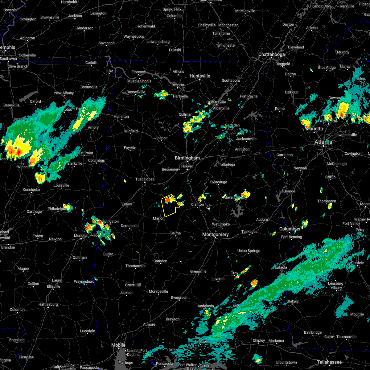 At 155 pm cdt, a severe thunderstorm was located over brent, moving southeast at 10 mph (radar indicated). Hazards include 60 mph wind gusts and quarter size hail. Hail damage to vehicles is expected. Expect wind damage to roofs, siding, and trees. At 155 pm cdt, a severe thunderstorm was located over brent, moving southeast at 10 mph (radar indicated). Hazards include 60 mph wind gusts and quarter size hail. Hail damage to vehicles is expected. Expect wind damage to roofs, siding, and trees.
|
| 7/13/2022 1:42 PM CDT | A few trees were blown dow in bibb county AL, 1 miles N of Centreville, AL |
| 6/17/2022 5:47 PM CDT |
 At 546 pm cdt, a severe thunderstorm was located near heiberger, or 8 miles southwest of brent, moving southeast at 25 mph (radar indicated). Hazards include 60 mph wind gusts and quarter size hail. Hail damage to vehicles is expected. expect wind damage to roofs, siding, and trees. locations impacted include, brent, centreville, mertz and west centreville. hail threat, radar indicated max hail size, 1. 00 in wind threat, radar indicated max wind gust, 60 mph. At 546 pm cdt, a severe thunderstorm was located near heiberger, or 8 miles southwest of brent, moving southeast at 25 mph (radar indicated). Hazards include 60 mph wind gusts and quarter size hail. Hail damage to vehicles is expected. expect wind damage to roofs, siding, and trees. locations impacted include, brent, centreville, mertz and west centreville. hail threat, radar indicated max hail size, 1. 00 in wind threat, radar indicated max wind gust, 60 mph.
|
| 6/17/2022 5:16 PM CDT |
 At 516 pm cdt, a severe thunderstorm was located over low gap, or 10 miles west of brent, moving southeast at 25 mph (radar indicated). Hazards include 60 mph wind gusts and quarter size hail. Hail damage to vehicles is expected. Expect wind damage to roofs, siding, and trees. At 516 pm cdt, a severe thunderstorm was located over low gap, or 10 miles west of brent, moving southeast at 25 mph (radar indicated). Hazards include 60 mph wind gusts and quarter size hail. Hail damage to vehicles is expected. Expect wind damage to roofs, siding, and trees.
|
| 6/8/2022 4:27 AM CDT |
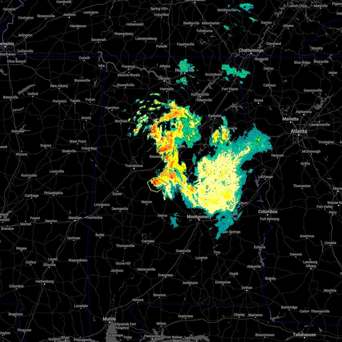 At 427 am cdt, a severe thunderstorm was located over centreville, moving southeast at 15 mph (radar indicated). Hazards include 60 mph wind gusts and half dollar size hail. Hail damage to vehicles is expected. expect wind damage to roofs, siding, and trees. locations impacted include, brent, centreville, eoline, west centreville, trio, six mile and bibb county airport. hail threat, radar indicated max hail size, 1. 25 in wind threat, radar indicated max wind gust, 60 mph. At 427 am cdt, a severe thunderstorm was located over centreville, moving southeast at 15 mph (radar indicated). Hazards include 60 mph wind gusts and half dollar size hail. Hail damage to vehicles is expected. expect wind damage to roofs, siding, and trees. locations impacted include, brent, centreville, eoline, west centreville, trio, six mile and bibb county airport. hail threat, radar indicated max hail size, 1. 25 in wind threat, radar indicated max wind gust, 60 mph.
|
| 6/8/2022 4:10 AM CDT |
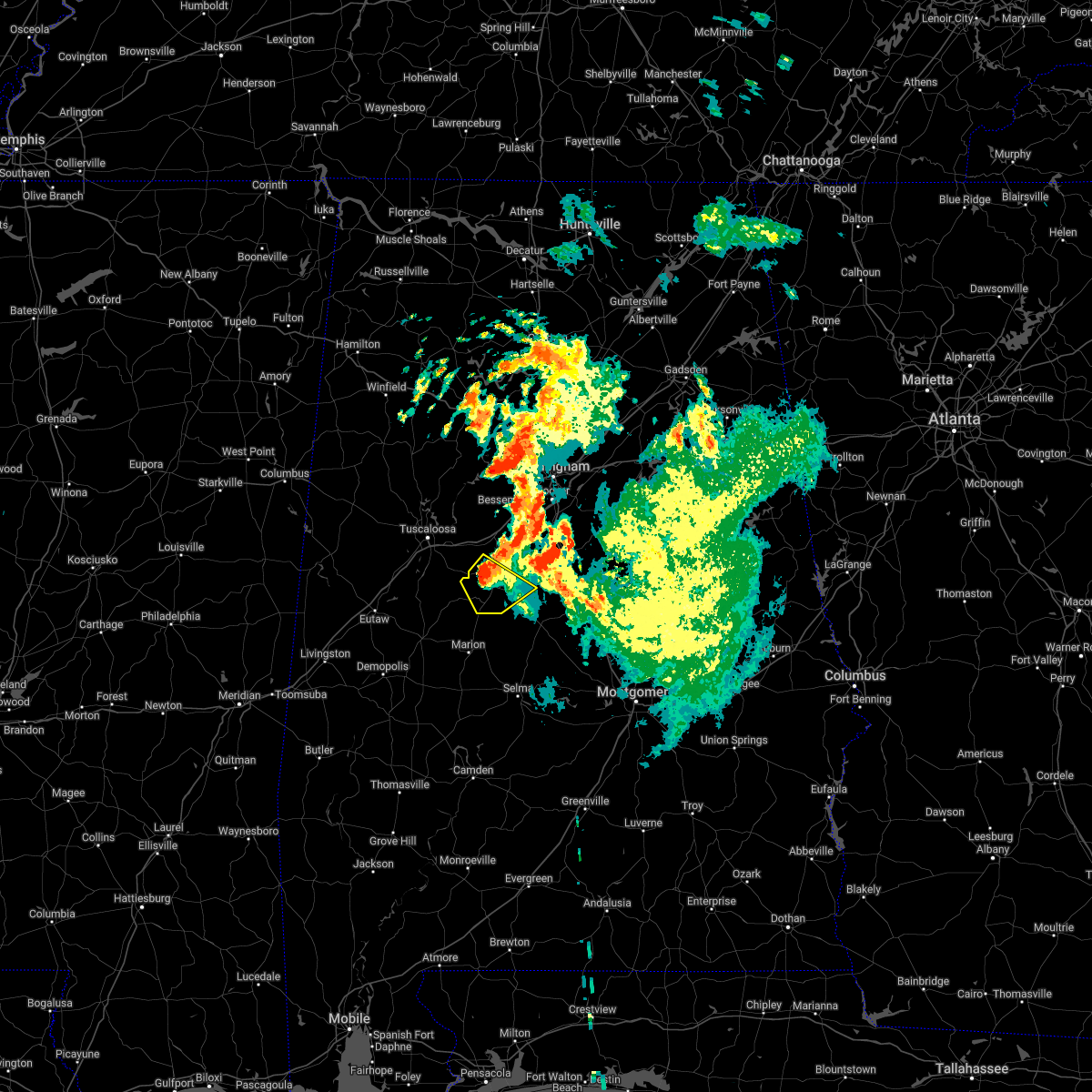 At 409 am cdt, a severe thunderstorm was located over eoline, or near brent, moving southeast at 15 mph (radar indicated). Hazards include 60 mph wind gusts and half dollar size hail. Hail damage to vehicles is expected. Expect wind damage to roofs, siding, and trees. At 409 am cdt, a severe thunderstorm was located over eoline, or near brent, moving southeast at 15 mph (radar indicated). Hazards include 60 mph wind gusts and half dollar size hail. Hail damage to vehicles is expected. Expect wind damage to roofs, siding, and trees.
|
| 6/8/2022 3:51 AM CDT |
 At 350 am cdt, a severe thunderstorm was located near eoline, or 10 miles northwest of brent, moving southeast at 15 mph (radar indicated). Hazards include 60 mph wind gusts and quarter size hail. Hail damage to vehicles is expected. Expect wind damage to roofs, siding, and trees. At 350 am cdt, a severe thunderstorm was located near eoline, or 10 miles northwest of brent, moving southeast at 15 mph (radar indicated). Hazards include 60 mph wind gusts and quarter size hail. Hail damage to vehicles is expected. Expect wind damage to roofs, siding, and trees.
|
| 5/15/2022 4:28 PM CDT |
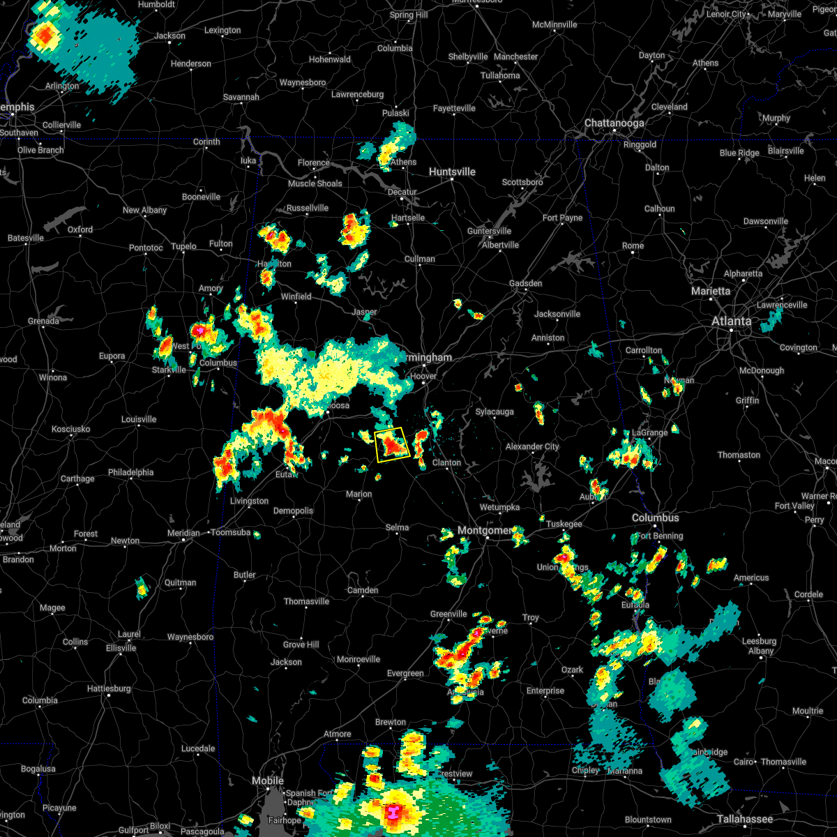 At 428 pm cdt, a severe thunderstorm was located near centreville, moving south at 5 mph (radar indicated). Hazards include 60 mph wind gusts and quarter size hail. Hail damage to vehicles is expected. expect wind damage to roofs, siding, and trees. locations impacted include, brent, centreville, west centreville, trio, six mile and bibb county airport. hail threat, radar indicated max hail size, 1. 00 in wind threat, radar indicated max wind gust, 60 mph. At 428 pm cdt, a severe thunderstorm was located near centreville, moving south at 5 mph (radar indicated). Hazards include 60 mph wind gusts and quarter size hail. Hail damage to vehicles is expected. expect wind damage to roofs, siding, and trees. locations impacted include, brent, centreville, west centreville, trio, six mile and bibb county airport. hail threat, radar indicated max hail size, 1. 00 in wind threat, radar indicated max wind gust, 60 mph.
|
| 5/15/2022 4:20 PM CDT | Golf Ball sized hail reported 3.3 miles WSW of Centreville, AL, reported along gary springs rd. |
| 5/15/2022 4:18 PM CDT | Quarter sized hail reported 5.5 miles SW of Centreville, AL, reported along river bend rd. |
| 5/15/2022 4:14 PM CDT |
 At 414 pm cdt, a severe thunderstorm was located near centreville, moving south at 5 mph (radar indicated). Hazards include 60 mph wind gusts and quarter size hail. Hail damage to vehicles is expected. Expect wind damage to roofs, siding, and trees. At 414 pm cdt, a severe thunderstorm was located near centreville, moving south at 5 mph (radar indicated). Hazards include 60 mph wind gusts and quarter size hail. Hail damage to vehicles is expected. Expect wind damage to roofs, siding, and trees.
|
| 5/1/2022 5:34 PM CDT | Quarter sized hail reported 3.8 miles WNW of Centreville, AL, a few reports of nickel and quarter size hail in the centreville and brent areas. |
| 5/1/2022 5:23 PM CDT |
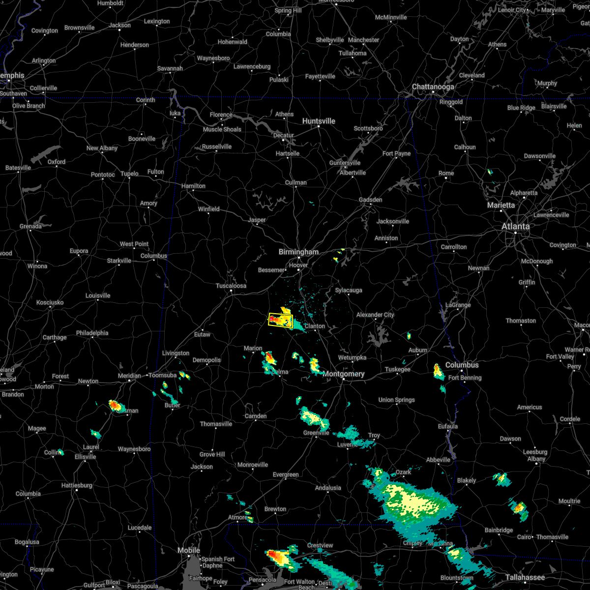 At 523 pm cdt, a severe thunderstorm was located over centreville, moving east at 15 mph (radar indicated). Hazards include 60 mph wind gusts and quarter size hail. Hail damage to vehicles is expected. Expect wind damage to roofs, siding, and trees. At 523 pm cdt, a severe thunderstorm was located over centreville, moving east at 15 mph (radar indicated). Hazards include 60 mph wind gusts and quarter size hail. Hail damage to vehicles is expected. Expect wind damage to roofs, siding, and trees.
|
| 4/16/2022 1:00 AM CDT |
 At 100 am cdt, severe thunderstorms were located along a line extending from near eoline to near heiberger, moving east at 35 mph (radar indicated). Hazards include 60 mph wind gusts and quarter size hail. Hail damage to vehicles is expected. expect wind damage to roofs, siding, and trees. locations impacted include, brent, centreville, lawley, west centreville, mertz, talladega national forest, eoline, randolph, trio, bibb county airport, oakmulgee, ellards and six mile. hail threat, radar indicated max hail size, 1. 00 in wind threat, radar indicated max wind gust, 60 mph. At 100 am cdt, severe thunderstorms were located along a line extending from near eoline to near heiberger, moving east at 35 mph (radar indicated). Hazards include 60 mph wind gusts and quarter size hail. Hail damage to vehicles is expected. expect wind damage to roofs, siding, and trees. locations impacted include, brent, centreville, lawley, west centreville, mertz, talladega national forest, eoline, randolph, trio, bibb county airport, oakmulgee, ellards and six mile. hail threat, radar indicated max hail size, 1. 00 in wind threat, radar indicated max wind gust, 60 mph.
|
| 4/16/2022 12:50 AM CDT |
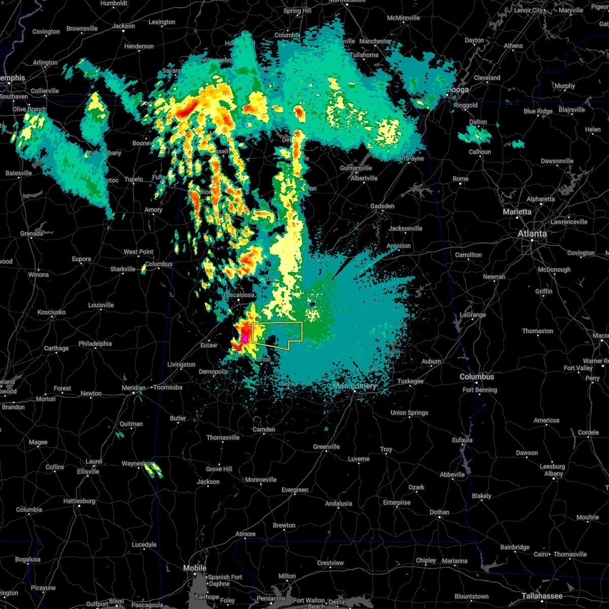 At 1250 am cdt, a severe thunderstorm was located over mertz, or 13 miles west of brent, moving east at 45 mph (radar indicated). Hazards include ping pong ball size hail and 60 mph wind gusts. People and animals outdoors will be injured. expect hail damage to roofs, siding, windows, and vehicles. Expect wind damage to roofs, siding, and trees. At 1250 am cdt, a severe thunderstorm was located over mertz, or 13 miles west of brent, moving east at 45 mph (radar indicated). Hazards include ping pong ball size hail and 60 mph wind gusts. People and animals outdoors will be injured. expect hail damage to roofs, siding, windows, and vehicles. Expect wind damage to roofs, siding, and trees.
|
| 4/13/2022 10:51 PM CDT |
 At 1036 pm cdt, severe thunderstorms were located along a line extending from near west blocton to 8 miles northwest of parnell to near bogue chitto, moving east at 50 mph (radar indicated). Hazards include 70 mph wind gusts and penny size hail. Expect considerable tree damage. damage is likely to mobile homes, roofs, and outbuildings. Locations impacted include, brent, marion, centreville, vance, west blocton, vaiden, west centreville, heiberger, lawley, ashby, brierfield ironworks park, talladega national forest, eoline, north bibb, randolph, radford, six mile, bibb county airport, hebron and harmon. At 1036 pm cdt, severe thunderstorms were located along a line extending from near west blocton to 8 miles northwest of parnell to near bogue chitto, moving east at 50 mph (radar indicated). Hazards include 70 mph wind gusts and penny size hail. Expect considerable tree damage. damage is likely to mobile homes, roofs, and outbuildings. Locations impacted include, brent, marion, centreville, vance, west blocton, vaiden, west centreville, heiberger, lawley, ashby, brierfield ironworks park, talladega national forest, eoline, north bibb, randolph, radford, six mile, bibb county airport, hebron and harmon.
|
| 4/13/2022 10:36 PM CDT |
 At 1036 pm cdt, severe thunderstorms were located along a line extending from near west blocton to 8 miles northwest of parnell to near bogue chitto, moving east at 50 mph (radar indicated). Hazards include 70 mph wind gusts and penny size hail. Expect considerable tree damage. damage is likely to mobile homes, roofs, and outbuildings. Locations impacted include, brent, marion, centreville, vance, west blocton, vaiden, west centreville, heiberger, lawley, ashby, brierfield ironworks park, talladega national forest, eoline, north bibb, randolph, radford, six mile, bibb county airport, hebron and harmon. At 1036 pm cdt, severe thunderstorms were located along a line extending from near west blocton to 8 miles northwest of parnell to near bogue chitto, moving east at 50 mph (radar indicated). Hazards include 70 mph wind gusts and penny size hail. Expect considerable tree damage. damage is likely to mobile homes, roofs, and outbuildings. Locations impacted include, brent, marion, centreville, vance, west blocton, vaiden, west centreville, heiberger, lawley, ashby, brierfield ironworks park, talladega national forest, eoline, north bibb, randolph, radford, six mile, bibb county airport, hebron and harmon.
|
| 4/13/2022 9:59 PM CDT |
 At 959 pm cdt, severe thunderstorms were located along a line extending from near shelton state community college to near greensboro to chickasaw state park, moving east at 55 mph (radar indicated). Hazards include 70 mph wind gusts and penny size hail. Expect considerable tree damage. Damage is likely to mobile homes, roofs, and outbuildings. At 959 pm cdt, severe thunderstorms were located along a line extending from near shelton state community college to near greensboro to chickasaw state park, moving east at 55 mph (radar indicated). Hazards include 70 mph wind gusts and penny size hail. Expect considerable tree damage. Damage is likely to mobile homes, roofs, and outbuildings.
|
| 3/30/2022 10:05 PM CDT |
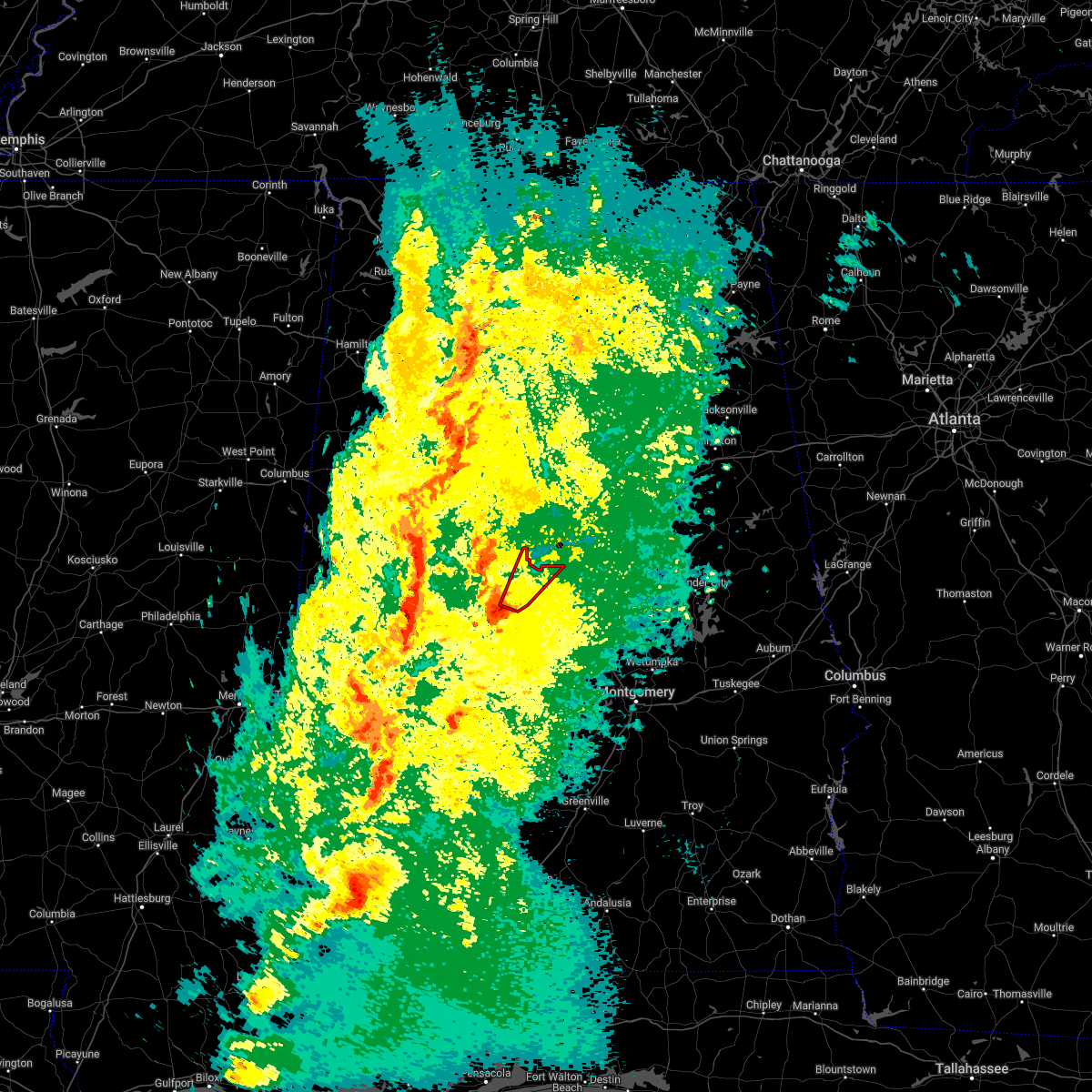 At 1005 pm cdt, a confirmed large and extremely dangerous tornado was located over talladega national forest, or 7 miles southeast of centreville, moving northeast at 55 mph. this is a particularly dangerous situation. take cover now! (radar confirmed tornado). Hazards include damaging tornado. You are in a life-threatening situation. flying debris may be deadly to those caught without shelter. mobile homes will be destroyed. considerable damage to homes, businesses, and vehicles is likely and complete destruction is possible. Locations impacted include, calera, centreville, talladega national forest, ashby, brierfield ironworks park, trio, six mile and bibb county airport. At 1005 pm cdt, a confirmed large and extremely dangerous tornado was located over talladega national forest, or 7 miles southeast of centreville, moving northeast at 55 mph. this is a particularly dangerous situation. take cover now! (radar confirmed tornado). Hazards include damaging tornado. You are in a life-threatening situation. flying debris may be deadly to those caught without shelter. mobile homes will be destroyed. considerable damage to homes, businesses, and vehicles is likely and complete destruction is possible. Locations impacted include, calera, centreville, talladega national forest, ashby, brierfield ironworks park, trio, six mile and bibb county airport.
|
| 3/30/2022 9:58 PM CDT |
 At 957 pm cdt, a confirmed large and extremely dangerous tornado was located near talladega national forest, or 10 miles southeast of brent, moving northeast at 60 mph. this is a particularly dangerous situation. take cover now! (radar confirmed tornado). Hazards include damaging tornado. You are in a life-threatening situation. flying debris may be deadly to those caught without shelter. mobile homes will be destroyed. considerable damage to homes, businesses, and vehicles is likely and complete destruction is possible. Locations impacted include, calera, centreville, jemison, thorsby, maplesville, lawley, ashby, brierfield ironworks park, talladega national forest, chilton county motor sports park, randolph, minooka park, trio, six mile and bibb county airport. At 957 pm cdt, a confirmed large and extremely dangerous tornado was located near talladega national forest, or 10 miles southeast of brent, moving northeast at 60 mph. this is a particularly dangerous situation. take cover now! (radar confirmed tornado). Hazards include damaging tornado. You are in a life-threatening situation. flying debris may be deadly to those caught without shelter. mobile homes will be destroyed. considerable damage to homes, businesses, and vehicles is likely and complete destruction is possible. Locations impacted include, calera, centreville, jemison, thorsby, maplesville, lawley, ashby, brierfield ironworks park, talladega national forest, chilton county motor sports park, randolph, minooka park, trio, six mile and bibb county airport.
|
| 3/30/2022 9:53 PM CDT |
 At 952 pm cdt, a tornado producing storm was located 9 miles east of heiberger, or 13 miles south of brent, moving northeast at 55 mph (radar confirmed tornado). Hazards include damaging tornado. Flying debris will be dangerous to those caught without shelter. mobile homes will be damaged or destroyed. damage to roofs, windows, and vehicles will occur. Tree damage is likely. At 952 pm cdt, a tornado producing storm was located 9 miles east of heiberger, or 13 miles south of brent, moving northeast at 55 mph (radar confirmed tornado). Hazards include damaging tornado. Flying debris will be dangerous to those caught without shelter. mobile homes will be damaged or destroyed. damage to roofs, windows, and vehicles will occur. Tree damage is likely.
|
| 3/30/2022 9:51 PM CDT |
 At 951 pm cdt, a severe thunderstorm capable of producing a tornado was located over eoline, or near brent, moving northeast at 50 mph (radar indicated rotation). Hazards include tornado. Flying debris will be dangerous to those caught without shelter. mobile homes will be damaged or destroyed. damage to roofs, windows, and vehicles will occur. Tree damage is likely. At 951 pm cdt, a severe thunderstorm capable of producing a tornado was located over eoline, or near brent, moving northeast at 50 mph (radar indicated rotation). Hazards include tornado. Flying debris will be dangerous to those caught without shelter. mobile homes will be damaged or destroyed. damage to roofs, windows, and vehicles will occur. Tree damage is likely.
|
| 3/30/2022 9:46 PM CDT |
 At 946 pm cdt, severe thunderstorms were located along a line extending from near coker to near greensboro municipal airport, moving northeast at 45 mph (radar indicated). Hazards include 60 mph wind gusts. expect damage to roofs, siding, and trees At 946 pm cdt, severe thunderstorms were located along a line extending from near coker to near greensboro municipal airport, moving northeast at 45 mph (radar indicated). Hazards include 60 mph wind gusts. expect damage to roofs, siding, and trees
|
| 12/29/2021 9:25 PM CST |
 At 924 pm cst, a severe thunderstorm capable of producing a tornado was located over centreville, moving east at 35 mph (radar indicated rotation). Hazards include tornado. Flying debris will be dangerous to those caught without shelter. mobile homes will be damaged or destroyed. damage to roofs, windows, and vehicles will occur. Tree damage is likely. At 924 pm cst, a severe thunderstorm capable of producing a tornado was located over centreville, moving east at 35 mph (radar indicated rotation). Hazards include tornado. Flying debris will be dangerous to those caught without shelter. mobile homes will be damaged or destroyed. damage to roofs, windows, and vehicles will occur. Tree damage is likely.
|
| 12/29/2021 9:06 PM CST |
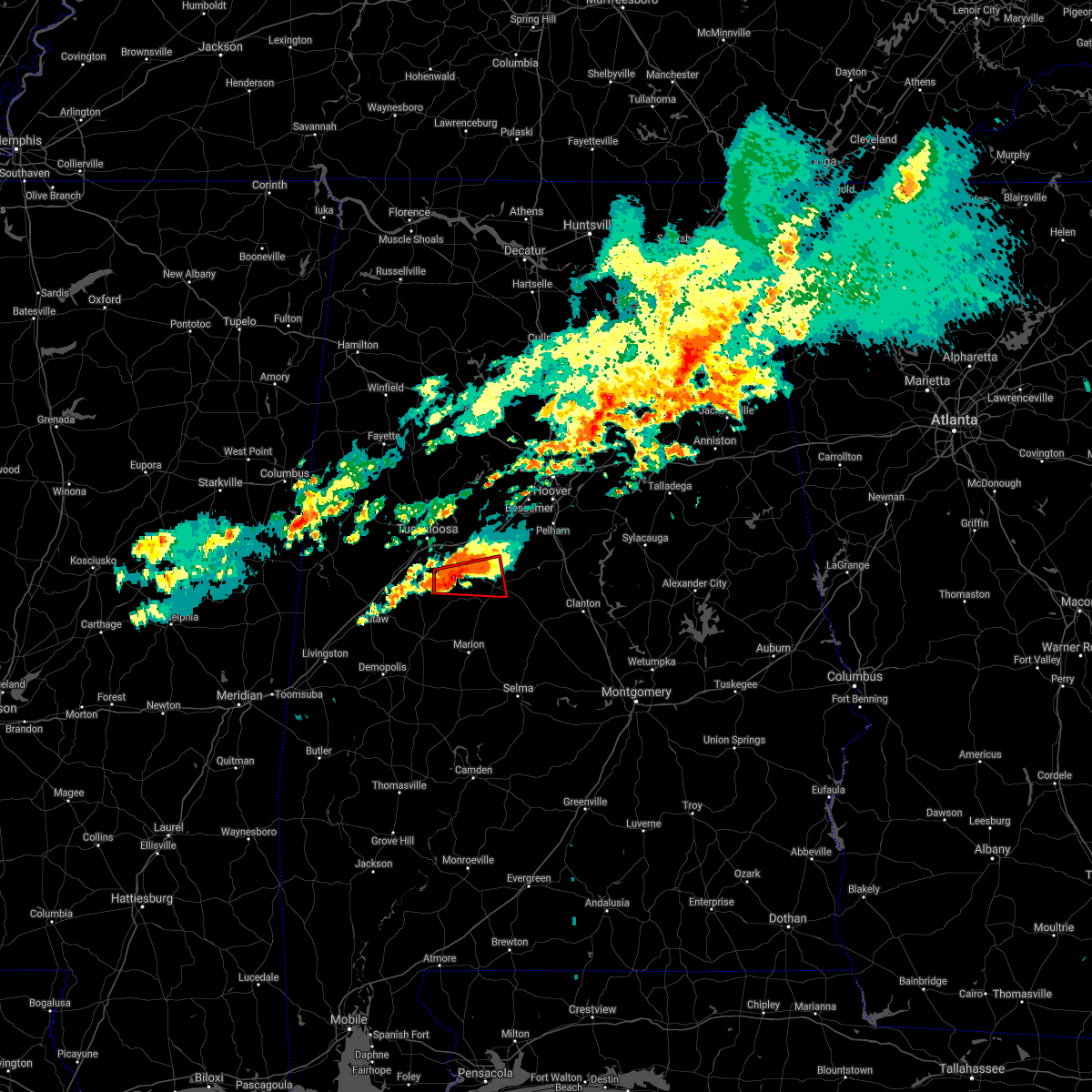 The tornado warning for south central tuscaloosa, northeastern hale and southwestern bibb counties will expire at 915 pm cst, the storm which prompted the warning has weakened below severe limits, and no longer appears capable of producing a tornado. therefore, the warning will be allowed to expire. a tornado watch remains in effect until 1000 pm cst for central and west central alabama. to report severe weather, contact your nearest law enforcement agency. they will relay your report to the national weather service birmingham. The tornado warning for south central tuscaloosa, northeastern hale and southwestern bibb counties will expire at 915 pm cst, the storm which prompted the warning has weakened below severe limits, and no longer appears capable of producing a tornado. therefore, the warning will be allowed to expire. a tornado watch remains in effect until 1000 pm cst for central and west central alabama. to report severe weather, contact your nearest law enforcement agency. they will relay your report to the national weather service birmingham.
|
| 12/29/2021 8:47 PM CST |
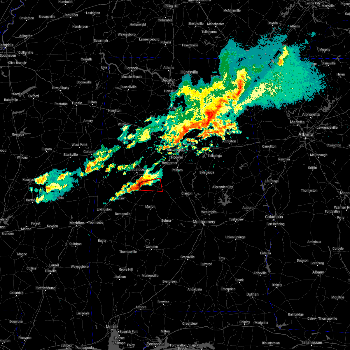 At 847 pm cst, a severe thunderstorm capable of producing a tornado was located over low gap, or 16 miles west of brent, moving east at 45 mph (radar indicated rotation). Hazards include tornado and quarter size hail. Flying debris will be dangerous to those caught without shelter. mobile homes will be damaged or destroyed. damage to roofs, windows, and vehicles will occur. tree damage is likely. Locations impacted include, brent, centreville, west blocton, eoline, low gap, west centreville, pearson, harmon, phipps and hagler. At 847 pm cst, a severe thunderstorm capable of producing a tornado was located over low gap, or 16 miles west of brent, moving east at 45 mph (radar indicated rotation). Hazards include tornado and quarter size hail. Flying debris will be dangerous to those caught without shelter. mobile homes will be damaged or destroyed. damage to roofs, windows, and vehicles will occur. tree damage is likely. Locations impacted include, brent, centreville, west blocton, eoline, low gap, west centreville, pearson, harmon, phipps and hagler.
|
| 12/29/2021 8:35 PM CST |
 At 835 pm cst, a severe thunderstorm capable of producing a tornado was located near moundville, or 16 miles south of tuscaloosa, moving east at 45 mph (radar indicated rotation). Hazards include tornado and half dollar size hail. Flying debris will be dangerous to those caught without shelter. mobile homes will be damaged or destroyed. damage to roofs, windows, and vehicles will occur. tree damage is likely. Locations impacted include, brent, centreville, moundville, west blocton, low gap, west centreville, mertz, eoline, moundville airport, phipps, hagler, mound state park, pearson, elliots creek and harmon. At 835 pm cst, a severe thunderstorm capable of producing a tornado was located near moundville, or 16 miles south of tuscaloosa, moving east at 45 mph (radar indicated rotation). Hazards include tornado and half dollar size hail. Flying debris will be dangerous to those caught without shelter. mobile homes will be damaged or destroyed. damage to roofs, windows, and vehicles will occur. tree damage is likely. Locations impacted include, brent, centreville, moundville, west blocton, low gap, west centreville, mertz, eoline, moundville airport, phipps, hagler, mound state park, pearson, elliots creek and harmon.
|
| 12/29/2021 8:32 PM CST |
 At 832 pm cst, a severe thunderstorm capable of producing a tornado was located over moundville, or 17 miles south of tuscaloosa, moving east at 45 mph (radar indicated rotation). Hazards include tornado. Flying debris will be dangerous to those caught without shelter. mobile homes will be damaged or destroyed. damage to roofs, windows, and vehicles will occur. Tree damage is likely. At 832 pm cst, a severe thunderstorm capable of producing a tornado was located over moundville, or 17 miles south of tuscaloosa, moving east at 45 mph (radar indicated rotation). Hazards include tornado. Flying debris will be dangerous to those caught without shelter. mobile homes will be damaged or destroyed. damage to roofs, windows, and vehicles will occur. Tree damage is likely.
|
| 10/4/2021 5:35 PM CDT |
 The severe thunderstorm warning for southeastern bibb county will expire at 545 pm cdt, the storm which prompted the warning has moved out of the area. therefore, the warning will be allowed to expire. The severe thunderstorm warning for southeastern bibb county will expire at 545 pm cdt, the storm which prompted the warning has moved out of the area. therefore, the warning will be allowed to expire.
|
| 10/4/2021 5:16 PM CDT |
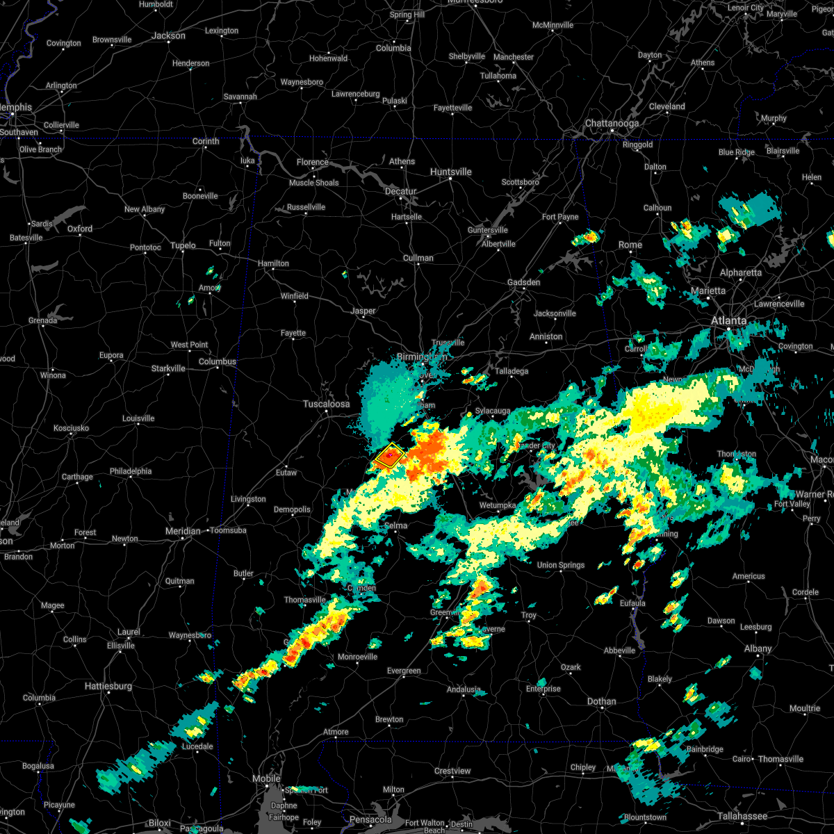 At 515 pm cdt, a severe thunderstorm was located near talladega national forest, or near centreville, and moving northeast at 8 mph (radar indicated). Hazards include 60 mph wind gusts and quarter size hail. Hail damage to vehicles is expected. Expect wind damage to roofs, siding, and trees. At 515 pm cdt, a severe thunderstorm was located near talladega national forest, or near centreville, and moving northeast at 8 mph (radar indicated). Hazards include 60 mph wind gusts and quarter size hail. Hail damage to vehicles is expected. Expect wind damage to roofs, siding, and trees.
|
| 5/4/2021 5:17 PM CDT |
 At 517 pm cdt, severe thunderstorms were located along a line extending from near brent to pine hill, moving east at 55 mph (radar indicated). Hazards include 60 mph wind gusts. wind damage has been reported with this line of storms. Expect damage to roofs, siding, and trees. Locations impacted include, selma, brent, valley grande, marion, centreville, uniontown, selmont-west selmont, maplesville, orrville, newbern, bogue chitto, vaiden, parnell, tyler, dannelly reservoir, paul m grist state park, low gap, mertz, dallas lake and talladega national forest. At 517 pm cdt, severe thunderstorms were located along a line extending from near brent to pine hill, moving east at 55 mph (radar indicated). Hazards include 60 mph wind gusts. wind damage has been reported with this line of storms. Expect damage to roofs, siding, and trees. Locations impacted include, selma, brent, valley grande, marion, centreville, uniontown, selmont-west selmont, maplesville, orrville, newbern, bogue chitto, vaiden, parnell, tyler, dannelly reservoir, paul m grist state park, low gap, mertz, dallas lake and talladega national forest.
|
| 5/4/2021 5:00 PM CDT |
 At 500 pm cdt, severe thunderstorms were located along a line extending from near low gap to near dixons mill, moving east at 55 mph (radar indicated). Hazards include 60 mph wind gusts. wind damage has been reported with this line of storms. expect damage to roofs, siding, and trees At 500 pm cdt, severe thunderstorms were located along a line extending from near low gap to near dixons mill, moving east at 55 mph (radar indicated). Hazards include 60 mph wind gusts. wind damage has been reported with this line of storms. expect damage to roofs, siding, and trees
|
| 3/25/2021 7:34 PM CDT |
 At 733 pm cdt, severe thunderstorms were located along a line extending from 6 miles southeast of shelton state community college to 6 miles east of evansville, moving northeast at 75 mph (radar indicated). Hazards include 60 mph wind gusts and quarter size hail. Hail damage to vehicles is expected. Expect wind damage to roofs, siding, and trees. At 733 pm cdt, severe thunderstorms were located along a line extending from 6 miles southeast of shelton state community college to 6 miles east of evansville, moving northeast at 75 mph (radar indicated). Hazards include 60 mph wind gusts and quarter size hail. Hail damage to vehicles is expected. Expect wind damage to roofs, siding, and trees.
|
| 3/25/2021 5:16 PM CDT |
 Tornado emergency for eastern bibb county, the national weather service in birmingham has issued a * tornado warning for, southeastern bibb county in central alabama, * until 545 pm cdt. * at 515 pm cdt, a confirmed large and destructive tornado was observed near centreville, moving east at 50 mph. tornado emergency for eastern bibb county, ashby, and brierfield. this is a particularly dangerous situation. take cover now! (weather spotters confirmed tornado). Hazards include deadly tornado. You are in a life-threatening situation. flying debris may be deadly to those caught without shelter. mobile homes will be destroyed. Considerable damage to homes, businesses, and vehicles is likely and complete destruction is possible. Tornado emergency for eastern bibb county, the national weather service in birmingham has issued a * tornado warning for, southeastern bibb county in central alabama, * until 545 pm cdt. * at 515 pm cdt, a confirmed large and destructive tornado was observed near centreville, moving east at 50 mph. tornado emergency for eastern bibb county, ashby, and brierfield. this is a particularly dangerous situation. take cover now! (weather spotters confirmed tornado). Hazards include deadly tornado. You are in a life-threatening situation. flying debris may be deadly to those caught without shelter. mobile homes will be destroyed. Considerable damage to homes, businesses, and vehicles is likely and complete destruction is possible.
|
| 3/25/2021 5:08 PM CDT |
 At 507 pm cdt, a confirmed large and destructive tornado was located over brent, moving northeast at 55 mph. tornado emergency for brent and centreville. this is a particularly dangerous situation. take cover now! (radar confirmed tornado). Hazards include deadly tornado. You are in a life-threatening situation. flying debris may be deadly to those caught without shelter. mobile homes will be destroyed. considerable damage to homes, businesses, and vehicles is likely and complete destruction is possible. Locations impacted include, brent, centreville, ashby, brierfield ironworks park, west centreville, trio, six mile and bibb county airport. At 507 pm cdt, a confirmed large and destructive tornado was located over brent, moving northeast at 55 mph. tornado emergency for brent and centreville. this is a particularly dangerous situation. take cover now! (radar confirmed tornado). Hazards include deadly tornado. You are in a life-threatening situation. flying debris may be deadly to those caught without shelter. mobile homes will be destroyed. considerable damage to homes, businesses, and vehicles is likely and complete destruction is possible. Locations impacted include, brent, centreville, ashby, brierfield ironworks park, west centreville, trio, six mile and bibb county airport.
|
| 3/25/2021 5:00 PM CDT |
 At 500 pm cdt, a confirmed large and destructive tornado was located near harrisburg, or 8 miles southwest of brent, moving east at 50 mph. tornado emergency for brent and centreville. this is a particularly dangerous situation. take cover now! (radar confirmed tornado). Hazards include deadly tornado. You are in a life-threatening situation. flying debris may be deadly to those caught without shelter. mobile homes will be destroyed. considerable damage to homes, businesses, and vehicles is likely and complete destruction is possible. Locations impacted include, brent, centreville, eoline, ashby, brierfield ironworks park, west centreville, trio, six mile and bibb county airport. At 500 pm cdt, a confirmed large and destructive tornado was located near harrisburg, or 8 miles southwest of brent, moving east at 50 mph. tornado emergency for brent and centreville. this is a particularly dangerous situation. take cover now! (radar confirmed tornado). Hazards include deadly tornado. You are in a life-threatening situation. flying debris may be deadly to those caught without shelter. mobile homes will be destroyed. considerable damage to homes, businesses, and vehicles is likely and complete destruction is possible. Locations impacted include, brent, centreville, eoline, ashby, brierfield ironworks park, west centreville, trio, six mile and bibb county airport.
|
| 3/25/2021 4:54 PM CDT |
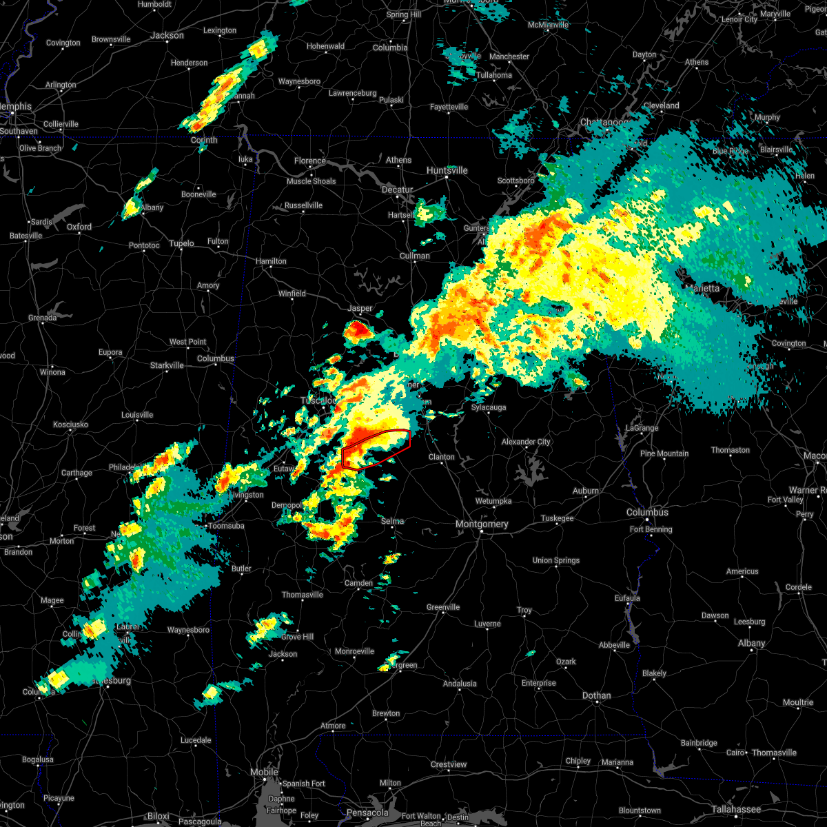 At 453 pm cdt, a confirmed large and destructive tornado was located near mertz, or 13 miles southwest of brent, moving east at 55 mph. tornado emergency for centreville and brent and other locations in the warning. this is a particularly dangerous situation. take cover now! (radar confirmed tornado). Hazards include deadly tornado. You are in a life-threatening situation. flying debris may be deadly to those caught without shelter. mobile homes will be destroyed. considerable damage to homes, businesses, and vehicles is likely and complete destruction is possible. Locations impacted include, brent, centreville, eoline, ashby, brierfield ironworks park, west centreville, mertz, trio, ellards, six mile and bibb county airport. At 453 pm cdt, a confirmed large and destructive tornado was located near mertz, or 13 miles southwest of brent, moving east at 55 mph. tornado emergency for centreville and brent and other locations in the warning. this is a particularly dangerous situation. take cover now! (radar confirmed tornado). Hazards include deadly tornado. You are in a life-threatening situation. flying debris may be deadly to those caught without shelter. mobile homes will be destroyed. considerable damage to homes, businesses, and vehicles is likely and complete destruction is possible. Locations impacted include, brent, centreville, eoline, ashby, brierfield ironworks park, west centreville, mertz, trio, ellards, six mile and bibb county airport.
|
| 3/25/2021 4:45 PM CDT |
 At 444 pm cdt, a confirmed large and destructive tornado was located 8 miles southwest of mertz, or 10 miles northeast of greensboro, moving northeast at 60 mph. tornado emergency for southwest bibb county. this is a particularly dangerous situation. take cover now! (radar confirmed tornado). Hazards include deadly tornado. You are in a life-threatening situation. flying debris may be deadly to those caught without shelter. mobile homes will be destroyed. considerable damage to homes, businesses, and vehicles is likely and complete destruction is possible. Locations impacted include, brent, centreville, west blocton, ashby, brierfield ironworks park, west centreville, mertz, eoline, trio, marvel, six mile, bibb county airport and ellards. At 444 pm cdt, a confirmed large and destructive tornado was located 8 miles southwest of mertz, or 10 miles northeast of greensboro, moving northeast at 60 mph. tornado emergency for southwest bibb county. this is a particularly dangerous situation. take cover now! (radar confirmed tornado). Hazards include deadly tornado. You are in a life-threatening situation. flying debris may be deadly to those caught without shelter. mobile homes will be destroyed. considerable damage to homes, businesses, and vehicles is likely and complete destruction is possible. Locations impacted include, brent, centreville, west blocton, ashby, brierfield ironworks park, west centreville, mertz, eoline, trio, marvel, six mile, bibb county airport and ellards.
|
| 3/25/2021 4:33 PM CDT |
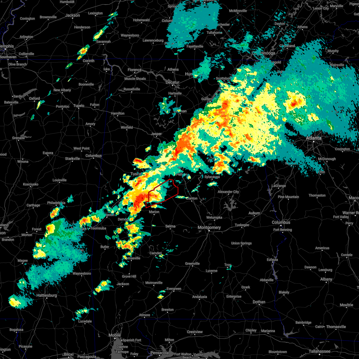 At 433 pm cdt, a confirmed large and extremely dangerous tornado was located near greensboro, moving northeast at 55 mph. this is a particularly dangerous situation. take cover now! (radar confirmed tornado). Hazards include damaging tornado. You are in a life-threatening situation. flying debris may be deadly to those caught without shelter. mobile homes will be destroyed. Considerable damage to homes, businesses, and vehicles is likely and complete destruction is possible. At 433 pm cdt, a confirmed large and extremely dangerous tornado was located near greensboro, moving northeast at 55 mph. this is a particularly dangerous situation. take cover now! (radar confirmed tornado). Hazards include damaging tornado. You are in a life-threatening situation. flying debris may be deadly to those caught without shelter. mobile homes will be destroyed. Considerable damage to homes, businesses, and vehicles is likely and complete destruction is possible.
|
| 3/25/2021 12:27 PM CDT |
 At 1227 pm cdt, a confirmed large and extremely dangerous tornado was located near low gap, or 15 miles southeast of tuscaloosa, moving northeast at 45 mph. this is a particularly dangerous situation. take cover now! (radar confirmed tornado). Hazards include damaging tornado. You are in a life-threatening situation. flying debris may be deadly to those caught without shelter. mobile homes will be destroyed. considerable damage to homes, businesses, and vehicles is likely and complete destruction is possible. Locations impacted include, brent, centreville, moundville, lake view, brookwood, coaling, vance, woodstock, west blocton, tannehill ironworks state park, low gap, mertz, mercedes benz of alabama, eoline, north bibb, maxwell, hull, hagler, green pond and pearson. At 1227 pm cdt, a confirmed large and extremely dangerous tornado was located near low gap, or 15 miles southeast of tuscaloosa, moving northeast at 45 mph. this is a particularly dangerous situation. take cover now! (radar confirmed tornado). Hazards include damaging tornado. You are in a life-threatening situation. flying debris may be deadly to those caught without shelter. mobile homes will be destroyed. considerable damage to homes, businesses, and vehicles is likely and complete destruction is possible. Locations impacted include, brent, centreville, moundville, lake view, brookwood, coaling, vance, woodstock, west blocton, tannehill ironworks state park, low gap, mertz, mercedes benz of alabama, eoline, north bibb, maxwell, hull, hagler, green pond and pearson.
|
| 3/25/2021 12:21 PM CDT |
 At 1221 pm cdt, a confirmed tornado was located near moundville, or 16 miles south of tuscaloosa, moving northeast at 45 mph (radar confirmed tornado). Hazards include damaging tornado and golf ball size hail. Flying debris will be dangerous to those caught without shelter. mobile homes will be damaged or destroyed. damage to roofs, windows, and vehicles will occur. tree damage is likely. Locations impacted include, brent, centreville, moundville, lake view, brookwood, coaling, vance, woodstock, west blocton, tannehill ironworks state park, low gap, mertz, mercedes benz of alabama, eoline, north bibb, maxwell, hull, hagler, green pond and pearson. At 1221 pm cdt, a confirmed tornado was located near moundville, or 16 miles south of tuscaloosa, moving northeast at 45 mph (radar confirmed tornado). Hazards include damaging tornado and golf ball size hail. Flying debris will be dangerous to those caught without shelter. mobile homes will be damaged or destroyed. damage to roofs, windows, and vehicles will occur. tree damage is likely. Locations impacted include, brent, centreville, moundville, lake view, brookwood, coaling, vance, woodstock, west blocton, tannehill ironworks state park, low gap, mertz, mercedes benz of alabama, eoline, north bibb, maxwell, hull, hagler, green pond and pearson.
|
| 3/25/2021 12:11 PM CDT |
 At 1211 pm cdt, a severe thunderstorm capable of producing a tornado was located near moundville, or 16 miles north of greensboro, moving northeast at 40 mph (radar indicated rotation). Hazards include tornado and golf ball size hail. Flying debris will be dangerous to those caught without shelter. mobile homes will be damaged or destroyed. damage to roofs, windows, and vehicles will occur. Tree damage is likely. At 1211 pm cdt, a severe thunderstorm capable of producing a tornado was located near moundville, or 16 miles north of greensboro, moving northeast at 40 mph (radar indicated rotation). Hazards include tornado and golf ball size hail. Flying debris will be dangerous to those caught without shelter. mobile homes will be damaged or destroyed. damage to roofs, windows, and vehicles will occur. Tree damage is likely.
|
| 7/12/2020 2:32 PM CDT |
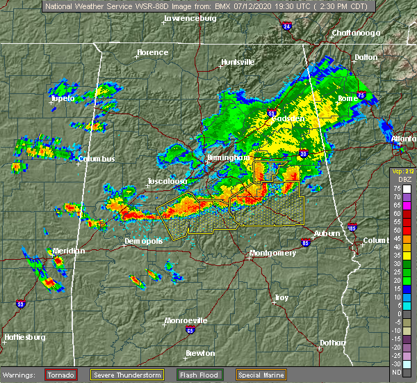 At 232 pm cdt, severe thunderstorms were located along a line extending from near lay lake to near heiberger, moving southeast at 50 mph (radar indicated). Hazards include 60 mph wind gusts. these storms have a history of producing wind damage. Expect damage to roofs, siding, and trees. Locations impacted include, calera, clanton, brent, centreville, jemison, thorsby, maplesville, billingsley, gap of the mountain, parnell, west centreville, heiberger, verbena, plecher, lawley, mitchell lake, ashby, brierfield ironworks park, mertz and lay lake dam. At 232 pm cdt, severe thunderstorms were located along a line extending from near lay lake to near heiberger, moving southeast at 50 mph (radar indicated). Hazards include 60 mph wind gusts. these storms have a history of producing wind damage. Expect damage to roofs, siding, and trees. Locations impacted include, calera, clanton, brent, centreville, jemison, thorsby, maplesville, billingsley, gap of the mountain, parnell, west centreville, heiberger, verbena, plecher, lawley, mitchell lake, ashby, brierfield ironworks park, mertz and lay lake dam.
|
| 7/12/2020 2:23 PM CDT |
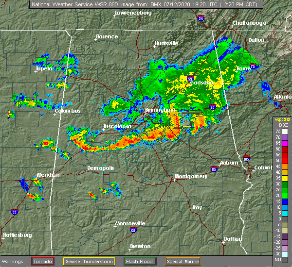 At 223 pm cdt, severe thunderstorms were located along a line extending from brierfield ironworks park to near mertz, moving southeast at 35 mph (radar indicated). Hazards include 60 mph wind gusts. expect damage to roofs, siding, and trees At 223 pm cdt, severe thunderstorms were located along a line extending from brierfield ironworks park to near mertz, moving southeast at 35 mph (radar indicated). Hazards include 60 mph wind gusts. expect damage to roofs, siding, and trees
|
| 7/12/2020 2:17 PM CDT | Tree down across road in centreville. time estimated by rada in bibb county AL, 1.1 miles NNW of Centreville, AL |
| 6/25/2020 9:18 PM CDT | Reports of numerous trees down in bibb county. time estimate in bibb county AL, 6.9 miles SW of Centreville, AL |
| 6/25/2020 9:09 PM CDT | A few trees down in centrevill in bibb county AL, 1 miles N of Centreville, AL |
| 6/25/2020 9:08 PM CDT |
 At 908 pm cdt, severe thunderstorms were located along a line extending from near deerlick creek campgrounds to near mercedes benz of alabama to 6 miles west of talladega national forest, moving northeast at 50 mph (radar indicated). Hazards include 60 mph wind gusts. expect damage to roofs, siding, and trees At 908 pm cdt, severe thunderstorms were located along a line extending from near deerlick creek campgrounds to near mercedes benz of alabama to 6 miles west of talladega national forest, moving northeast at 50 mph (radar indicated). Hazards include 60 mph wind gusts. expect damage to roofs, siding, and trees
|
| 6/23/2020 6:36 PM CDT |
 At 636 pm cdt, severe thunderstorms were located along a line extending from abernant to near centreville, moving east at 35 mph (radar indicated). Hazards include 60 mph wind gusts. Expect damage to roofs, siding, and trees. Locations impacted include, alabaster, pelham, helena, calera, montevallo, brent, centreville, lake view, vance, woodstock, west blocton, wilton, tannehill ironworks state park, abernant, american village, west centreville, maylene, ashby, brierfield ironworks park and university of montevallo. At 636 pm cdt, severe thunderstorms were located along a line extending from abernant to near centreville, moving east at 35 mph (radar indicated). Hazards include 60 mph wind gusts. Expect damage to roofs, siding, and trees. Locations impacted include, alabaster, pelham, helena, calera, montevallo, brent, centreville, lake view, vance, woodstock, west blocton, wilton, tannehill ironworks state park, abernant, american village, west centreville, maylene, ashby, brierfield ironworks park and university of montevallo.
|
| 6/23/2020 6:25 PM CDT |
 At 625 pm cdt, severe thunderstorms were located along a line extending from near brookwood to brent, moving east at 35 mph (radar indicated). Hazards include 60 mph wind gusts. expect damage to roofs, siding, and trees At 625 pm cdt, severe thunderstorms were located along a line extending from near brookwood to brent, moving east at 35 mph (radar indicated). Hazards include 60 mph wind gusts. expect damage to roofs, siding, and trees
|
| 6/23/2020 6:21 PM CDT | Tree down. utility lines affected along hwy 82. time of occurrence estimated from rada in bibb county AL, 0.7 miles ESE of Centreville, AL |
| 4/23/2020 3:56 PM CDT |
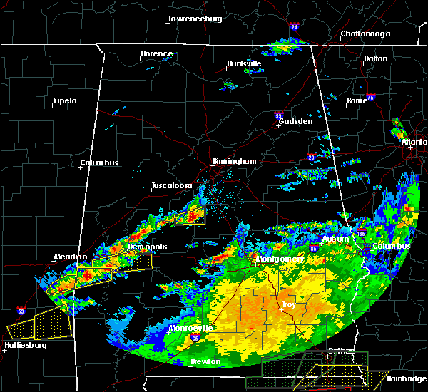 At 356 pm cdt, a severe thunderstorm was located over talladega national forest, or 7 miles southeast of centreville, moving east at 45 mph (radar indicated). Hazards include ping pong ball size hail and 60 mph wind gusts. People and animals outdoors will be injured. expect hail damage to roofs, siding, windows, and vehicles. expect wind damage to roofs, siding, and trees. Locations impacted include, centreville, lawley, talladega national forest, ashby, brierfield ironworks park, randolph, trio, six mile and bibb county airport. At 356 pm cdt, a severe thunderstorm was located over talladega national forest, or 7 miles southeast of centreville, moving east at 45 mph (radar indicated). Hazards include ping pong ball size hail and 60 mph wind gusts. People and animals outdoors will be injured. expect hail damage to roofs, siding, windows, and vehicles. expect wind damage to roofs, siding, and trees. Locations impacted include, centreville, lawley, talladega national forest, ashby, brierfield ironworks park, randolph, trio, six mile and bibb county airport.
|
| 4/23/2020 3:42 PM CDT |
 At 342 pm cdt, a severe thunderstorm was located over harrisburg, or near brent, moving east at 45 mph (radar indicated). Hazards include ping pong ball size hail and 60 mph wind gusts. People and animals outdoors will be injured. expect hail damage to roofs, siding, windows, and vehicles. expect wind damage to roofs, siding, and trees. Locations impacted include, brent, centreville, lawley, talladega national forest, ashby, brierfield ironworks park, west centreville, randolph, trio, six mile and bibb county airport. At 342 pm cdt, a severe thunderstorm was located over harrisburg, or near brent, moving east at 45 mph (radar indicated). Hazards include ping pong ball size hail and 60 mph wind gusts. People and animals outdoors will be injured. expect hail damage to roofs, siding, windows, and vehicles. expect wind damage to roofs, siding, and trees. Locations impacted include, brent, centreville, lawley, talladega national forest, ashby, brierfield ironworks park, west centreville, randolph, trio, six mile and bibb county airport.
|
| 4/23/2020 3:39 PM CDT |
 At 339 pm cdt, a severe thunderstorm was located over harrisburg, or near brent, moving east at 45 mph (radar indicated). Hazards include 60 mph wind gusts and quarter size hail. Hail damage to vehicles is expected. Expect wind damage to roofs, siding, and trees. At 339 pm cdt, a severe thunderstorm was located over harrisburg, or near brent, moving east at 45 mph (radar indicated). Hazards include 60 mph wind gusts and quarter size hail. Hail damage to vehicles is expected. Expect wind damage to roofs, siding, and trees.
|
| 3/3/2020 6:30 AM CST | Trees down on homes in the 500 block of maude tower rd. possible tornad in bibb county AL, 9.1 miles NW of Centreville, AL |
| 2/6/2020 4:04 AM CST |
 At 403 am cst, a severe thunderstorm was located near talladega national forest, or near centreville, moving northeast at 60 mph (radar indicated). Hazards include 60 mph wind gusts and quarter size hail. Hail damage to vehicles is expected. expect wind damage to roofs, siding, and trees. Locations impacted include, brent, centreville, talladega national forest, ashby, brierfield ironworks park, west centreville, trio, marvel, six mile and bibb county airport. At 403 am cst, a severe thunderstorm was located near talladega national forest, or near centreville, moving northeast at 60 mph (radar indicated). Hazards include 60 mph wind gusts and quarter size hail. Hail damage to vehicles is expected. expect wind damage to roofs, siding, and trees. Locations impacted include, brent, centreville, talladega national forest, ashby, brierfield ironworks park, west centreville, trio, marvel, six mile and bibb county airport.
|
| 2/6/2020 3:31 AM CST |
 At 331 am cst, a severe thunderstorm was located near greensboro, moving northeast at 60 mph (radar indicated). Hazards include 60 mph wind gusts and quarter size hail. Hail damage to vehicles is expected. Expect wind damage to roofs, siding, and trees. At 331 am cst, a severe thunderstorm was located near greensboro, moving northeast at 60 mph (radar indicated). Hazards include 60 mph wind gusts and quarter size hail. Hail damage to vehicles is expected. Expect wind damage to roofs, siding, and trees.
|
| 2/6/2020 3:00 AM CST |
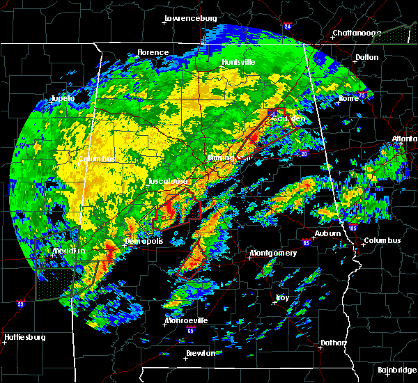 At 300 am cst, a severe thunderstorm capable of producing a tornado was located over west centreville, or near centreville, moving northeast at 55 mph (radar indicated rotation). Hazards include tornado. Flying debris will be dangerous to those caught without shelter. mobile homes will be damaged or destroyed. damage to roofs, windows, and vehicles will occur. tree damage is likely. Locations impacted include, brent, centreville, west blocton, lawley, ashby, brierfield ironworks park, west centreville, talladega national forest, eoline, randolph, trio, marvel, six mile, bibb county airport, hebron and harmon. At 300 am cst, a severe thunderstorm capable of producing a tornado was located over west centreville, or near centreville, moving northeast at 55 mph (radar indicated rotation). Hazards include tornado. Flying debris will be dangerous to those caught without shelter. mobile homes will be damaged or destroyed. damage to roofs, windows, and vehicles will occur. tree damage is likely. Locations impacted include, brent, centreville, west blocton, lawley, ashby, brierfield ironworks park, west centreville, talladega national forest, eoline, randolph, trio, marvel, six mile, bibb county airport, hebron and harmon.
|
| 2/6/2020 2:46 AM CST |
 At 246 am cst, a severe thunderstorm capable of producing a tornado was located near heiberger, or 11 miles southwest of brent, moving northeast at 55 mph (radar indicated rotation). Hazards include tornado. Flying debris will be dangerous to those caught without shelter. mobile homes will be damaged or destroyed. damage to roofs, windows, and vehicles will occur. tree damage is likely. Locations impacted include, brent, centreville, west blocton, lawley, ashby, brierfield ironworks park, west centreville, mertz, talladega national forest, heiberger, eoline, randolph, trio, morgan springs, marvel, six mile, bibb county airport, oakmulgee, hebron and harmon. At 246 am cst, a severe thunderstorm capable of producing a tornado was located near heiberger, or 11 miles southwest of brent, moving northeast at 55 mph (radar indicated rotation). Hazards include tornado. Flying debris will be dangerous to those caught without shelter. mobile homes will be damaged or destroyed. damage to roofs, windows, and vehicles will occur. tree damage is likely. Locations impacted include, brent, centreville, west blocton, lawley, ashby, brierfield ironworks park, west centreville, mertz, talladega national forest, heiberger, eoline, randolph, trio, morgan springs, marvel, six mile, bibb county airport, oakmulgee, hebron and harmon.
|
| 2/6/2020 2:35 AM CST |
 At 235 am cst, a severe thunderstorm capable of producing a tornado was located 9 miles east of greensboro, moving northeast at 55 mph (radar indicated rotation). Hazards include tornado. Flying debris will be dangerous to those caught without shelter. mobile homes will be damaged or destroyed. damage to roofs, windows, and vehicles will occur. Tree damage is likely. At 235 am cst, a severe thunderstorm capable of producing a tornado was located 9 miles east of greensboro, moving northeast at 55 mph (radar indicated rotation). Hazards include tornado. Flying debris will be dangerous to those caught without shelter. mobile homes will be damaged or destroyed. damage to roofs, windows, and vehicles will occur. Tree damage is likely.
|
| 2/6/2020 1:16 AM CST |
 At 116 am cst, severe thunderstorms were located along a line extending from coaling to near low gap to 6 miles northeast of greensboro, moving northeast at 60 mph (radar indicated). Hazards include 60 mph wind gusts and nickel size hail. Expect damage to roofs, siding, and trees. Locations impacted include, brent, centreville, eoline, low gap, west centreville, mertz, wateroak, phipps, ellards and bibb county airport. At 116 am cst, severe thunderstorms were located along a line extending from coaling to near low gap to 6 miles northeast of greensboro, moving northeast at 60 mph (radar indicated). Hazards include 60 mph wind gusts and nickel size hail. Expect damage to roofs, siding, and trees. Locations impacted include, brent, centreville, eoline, low gap, west centreville, mertz, wateroak, phipps, ellards and bibb county airport.
|
| 2/6/2020 1:16 AM CST |
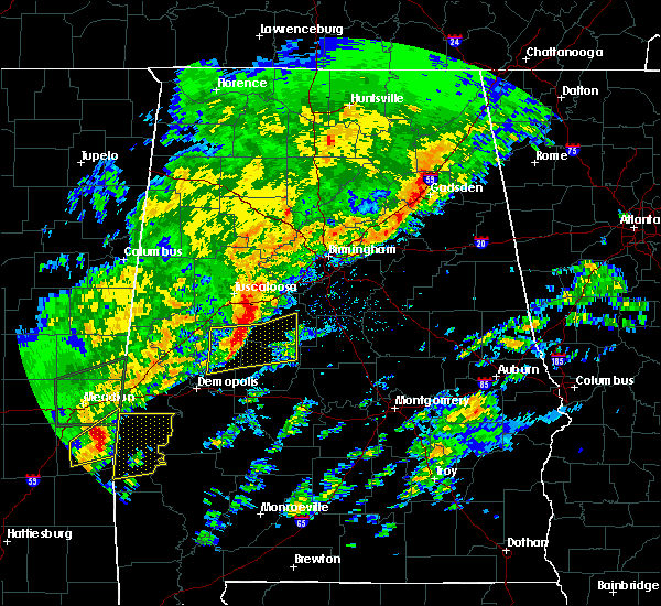 At 116 am cst, severe thunderstorms were located along a line extending from coaling to near low gap to 6 miles northeast of greensboro, moving northeast at 60 mph (radar indicated). Hazards include 60 mph wind gusts and nickel size hail. Expect damage to roofs, siding, and trees. Locations impacted include, brent, centreville, eoline, low gap, west centreville, mertz, wateroak, phipps, ellards and bibb county airport. At 116 am cst, severe thunderstorms were located along a line extending from coaling to near low gap to 6 miles northeast of greensboro, moving northeast at 60 mph (radar indicated). Hazards include 60 mph wind gusts and nickel size hail. Expect damage to roofs, siding, and trees. Locations impacted include, brent, centreville, eoline, low gap, west centreville, mertz, wateroak, phipps, ellards and bibb county airport.
|
| 2/6/2020 12:59 AM CST |
 At 1258 am cst, severe thunderstorms were located along a line extending from near shelton state community college to 9 miles southeast of moundville to near duffys bend, moving northeast at 60 mph (radar indicated). Hazards include 60 mph wind gusts and nickel size hail. Expect damage to roofs, siding, and trees. Locations impacted include, brent, centreville, greensboro, moundville, greensboro municipal airport, low gap, west centreville, mertz, heiberger, eoline, morgan springs, moundville airport, folsom, phipps, bibb county airport, oakmulgee, harper hill, wateroak, ellards and havana. At 1258 am cst, severe thunderstorms were located along a line extending from near shelton state community college to 9 miles southeast of moundville to near duffys bend, moving northeast at 60 mph (radar indicated). Hazards include 60 mph wind gusts and nickel size hail. Expect damage to roofs, siding, and trees. Locations impacted include, brent, centreville, greensboro, moundville, greensboro municipal airport, low gap, west centreville, mertz, heiberger, eoline, morgan springs, moundville airport, folsom, phipps, bibb county airport, oakmulgee, harper hill, wateroak, ellards and havana.
|
| 2/6/2020 12:47 AM CST |
 At 1246 am cst, severe thunderstorms were located along a line extending from near knoxville to sawyerville to near demopolis, moving northeast at 45 mph (radar indicated). Hazards include 60 mph wind gusts and nickel size hail. expect damage to roofs, siding, and trees At 1246 am cst, severe thunderstorms were located along a line extending from near knoxville to sawyerville to near demopolis, moving northeast at 45 mph (radar indicated). Hazards include 60 mph wind gusts and nickel size hail. expect damage to roofs, siding, and trees
|
| 1/11/2020 12:55 PM CST |
 At 1255 pm cst, severe thunderstorms were located along a line extending from 6 miles southwest of maylene to marion junction, moving east at 40 mph (radar indicated). Hazards include 60 mph wind gusts. Expect damage to roofs, siding, and trees. Locations impacted include, brent, marion, centreville, lawley, ashby, vaiden, brierfield ironworks park, west centreville, talladega national forest, heiberger, eoline, randolph, perry county correctional center, trio, judson college, radford, six mile, bibb county airport, suttle and oakmulgee. At 1255 pm cst, severe thunderstorms were located along a line extending from 6 miles southwest of maylene to marion junction, moving east at 40 mph (radar indicated). Hazards include 60 mph wind gusts. Expect damage to roofs, siding, and trees. Locations impacted include, brent, marion, centreville, lawley, ashby, vaiden, brierfield ironworks park, west centreville, talladega national forest, heiberger, eoline, randolph, perry county correctional center, trio, judson college, radford, six mile, bibb county airport, suttle and oakmulgee.
|
| 1/11/2020 12:42 PM CST |
 At 1242 pm cst, severe thunderstorms were located along a line extending from near west blocton to vaiden, moving east at 45 mph (radar indicated). Hazards include 60 mph wind gusts. Expect damage to roofs, siding, and trees. Locations impacted include, brent, marion, centreville, uniontown, vaiden, west centreville, heiberger, lawley, ashby, brierfield ironworks park, talladega national forest, eoline, randolph, radford, folsom, six mile, bibb county airport, harmon, vaiden field airport and perry county correctional center. At 1242 pm cst, severe thunderstorms were located along a line extending from near west blocton to vaiden, moving east at 45 mph (radar indicated). Hazards include 60 mph wind gusts. Expect damage to roofs, siding, and trees. Locations impacted include, brent, marion, centreville, uniontown, vaiden, west centreville, heiberger, lawley, ashby, brierfield ironworks park, talladega national forest, eoline, randolph, radford, folsom, six mile, bibb county airport, harmon, vaiden field airport and perry county correctional center.
|
| 1/11/2020 12:09 PM CST |
 At 1209 pm cst, severe thunderstorms were located along a line extending from near low gap to near dayton, moving east at 45 mph (radar indicated). Hazards include 60 mph wind gusts. expect damage to roofs, siding, and trees At 1209 pm cst, severe thunderstorms were located along a line extending from near low gap to near dayton, moving east at 45 mph (radar indicated). Hazards include 60 mph wind gusts. expect damage to roofs, siding, and trees
|
| 12/16/2019 9:50 PM CST |
 At 950 pm cst, a severe thunderstorm capable of producing a tornado was located near ashby, or 7 miles east of centreville, moving northeast at 35 mph (radar indicated rotation). Hazards include tornado. Flying debris will be dangerous to those caught without shelter. mobile homes will be damaged or destroyed. damage to roofs, windows, and vehicles will occur. tree damage is likely. Locations impacted include, brierfield ironworks park, ashby, trio and six mile. At 950 pm cst, a severe thunderstorm capable of producing a tornado was located near ashby, or 7 miles east of centreville, moving northeast at 35 mph (radar indicated rotation). Hazards include tornado. Flying debris will be dangerous to those caught without shelter. mobile homes will be damaged or destroyed. damage to roofs, windows, and vehicles will occur. tree damage is likely. Locations impacted include, brierfield ironworks park, ashby, trio and six mile.
|
| 12/16/2019 9:48 PM CST | Unknown damage reported by so near 6400 block of montevallo rd. possible tornad in bibb county AL, 5.2 miles WSW of Centreville, AL |
| 12/16/2019 9:40 PM CST |
 At 940 pm cst, a severe thunderstorm capable of producing a tornado was located near west centreville, or near centreville, moving northeast at 40 mph (radar indicated rotation). Hazards include tornado. Flying debris will be dangerous to those caught without shelter. mobile homes will be damaged or destroyed. damage to roofs, windows, and vehicles will occur. tree damage is likely. Locations impacted include, brent, centreville, ashby, brierfield ironworks park, west centreville, trio, six mile and bibb county airport. At 940 pm cst, a severe thunderstorm capable of producing a tornado was located near west centreville, or near centreville, moving northeast at 40 mph (radar indicated rotation). Hazards include tornado. Flying debris will be dangerous to those caught without shelter. mobile homes will be damaged or destroyed. damage to roofs, windows, and vehicles will occur. tree damage is likely. Locations impacted include, brent, centreville, ashby, brierfield ironworks park, west centreville, trio, six mile and bibb county airport.
|
| 12/16/2019 9:26 PM CST |
 At 925 pm cst, a severe thunderstorm capable of producing a tornado was located near harrisburg, or 8 miles southwest of brent, moving northeast at 35 mph (radar indicated rotation). Hazards include tornado. Flying debris will be dangerous to those caught without shelter. mobile homes will be damaged or destroyed. damage to roofs, windows, and vehicles will occur. tree damage is likely. Locations impacted include, brent, centreville, eoline, ashby, brierfield ironworks park, west centreville, trio, marvel, six mile and bibb county airport. At 925 pm cst, a severe thunderstorm capable of producing a tornado was located near harrisburg, or 8 miles southwest of brent, moving northeast at 35 mph (radar indicated rotation). Hazards include tornado. Flying debris will be dangerous to those caught without shelter. mobile homes will be damaged or destroyed. damage to roofs, windows, and vehicles will occur. tree damage is likely. Locations impacted include, brent, centreville, eoline, ashby, brierfield ironworks park, west centreville, trio, marvel, six mile and bibb county airport.
|
| 12/16/2019 9:15 PM CST |
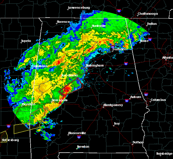 At 915 pm cst, a severe thunderstorm capable of producing a tornado was located near mertz, or 14 miles southwest of brent, moving northeast at 35 mph (radar indicated rotation). Hazards include tornado. Flying debris will be dangerous to those caught without shelter. mobile homes will be damaged or destroyed. damage to roofs, windows, and vehicles will occur. tree damage is likely. Locations impacted include, brent, centreville, west blocton, ashby, brierfield ironworks park, west centreville, mertz, eoline, trio, marvel, six mile, bibb county airport, hebron, harmon and ellards. At 915 pm cst, a severe thunderstorm capable of producing a tornado was located near mertz, or 14 miles southwest of brent, moving northeast at 35 mph (radar indicated rotation). Hazards include tornado. Flying debris will be dangerous to those caught without shelter. mobile homes will be damaged or destroyed. damage to roofs, windows, and vehicles will occur. tree damage is likely. Locations impacted include, brent, centreville, west blocton, ashby, brierfield ironworks park, west centreville, mertz, eoline, trio, marvel, six mile, bibb county airport, hebron, harmon and ellards.
|
| 12/16/2019 9:07 PM CST |
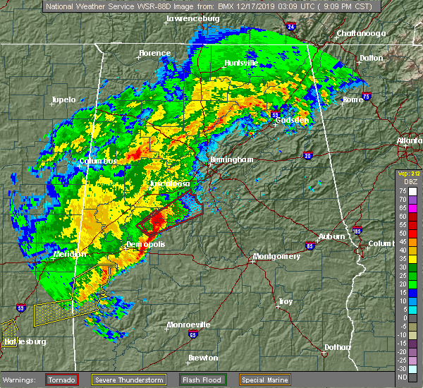 At 906 pm cst, a confirmed tornado was located 9 miles southwest of mertz, or 10 miles northeast of greensboro, moving northeast at 35 mph (radar confirmed tornado). Hazards include damaging tornado. Flying debris will be dangerous to those caught without shelter. mobile homes will be damaged or destroyed. damage to roofs, windows, and vehicles will occur. tree damage is likely. Locations impacted include, brent, centreville, west blocton, ashby, brierfield ironworks park, west centreville, mertz, eoline, heiberger, trio, morgan springs, marvel, six mile, bibb county airport, pearson, hebron, harmon, wateroak and ellards. At 906 pm cst, a confirmed tornado was located 9 miles southwest of mertz, or 10 miles northeast of greensboro, moving northeast at 35 mph (radar confirmed tornado). Hazards include damaging tornado. Flying debris will be dangerous to those caught without shelter. mobile homes will be damaged or destroyed. damage to roofs, windows, and vehicles will occur. tree damage is likely. Locations impacted include, brent, centreville, west blocton, ashby, brierfield ironworks park, west centreville, mertz, eoline, heiberger, trio, morgan springs, marvel, six mile, bibb county airport, pearson, hebron, harmon, wateroak and ellards.
|
| 12/16/2019 9:02 PM CST |
 At 902 pm cst, a severe thunderstorm capable of producing a tornado was located 7 miles northeast of greensboro, moving northeast at 35 mph (radar indicated rotation). Hazards include tornado. Flying debris will be dangerous to those caught without shelter. mobile homes will be damaged or destroyed. damage to roofs, windows, and vehicles will occur. Tree damage is likely. At 902 pm cst, a severe thunderstorm capable of producing a tornado was located 7 miles northeast of greensboro, moving northeast at 35 mph (radar indicated rotation). Hazards include tornado. Flying debris will be dangerous to those caught without shelter. mobile homes will be damaged or destroyed. damage to roofs, windows, and vehicles will occur. Tree damage is likely.
|
| 6/20/2019 3:00 AM CDT |
 At 259 am cdt, severe thunderstorms were located along a line extending from near blount springs to near bessemer to near newbern, moving east at 45 mph (radar indicated). Hazards include 60 mph wind gusts and penny size hail. Expect damage to roofs, siding, and trees. Locations impacted include, birmingham, hoover, vestavia hills, alabaster, bessemer, homewood, pelham, mountain brook, trussville, helena, hueytown, gardendale, irondale, leeds, moody, calera, fairfield, chelsea, fultondale and montevallo. At 259 am cdt, severe thunderstorms were located along a line extending from near blount springs to near bessemer to near newbern, moving east at 45 mph (radar indicated). Hazards include 60 mph wind gusts and penny size hail. Expect damage to roofs, siding, and trees. Locations impacted include, birmingham, hoover, vestavia hills, alabaster, bessemer, homewood, pelham, mountain brook, trussville, helena, hueytown, gardendale, irondale, leeds, moody, calera, fairfield, chelsea, fultondale and montevallo.
|
| 6/20/2019 2:36 AM CDT |
 At 235 am cdt, severe thunderstorms were located along a line extending from near smith dam to near abernant to near arcola, moving east at 45 mph (radar indicated). Hazards include 60 mph wind gusts and penny size hail. Expect damage to roofs, siding, and trees. Locations impacted include, birmingham, hoover, vestavia hills, alabaster, bessemer, homewood, pelham, mountain brook, trussville, helena, hueytown, gardendale, irondale, leeds, moody, calera, fairfield, chelsea, fultondale and montevallo. At 235 am cdt, severe thunderstorms were located along a line extending from near smith dam to near abernant to near arcola, moving east at 45 mph (radar indicated). Hazards include 60 mph wind gusts and penny size hail. Expect damage to roofs, siding, and trees. Locations impacted include, birmingham, hoover, vestavia hills, alabaster, bessemer, homewood, pelham, mountain brook, trussville, helena, hueytown, gardendale, irondale, leeds, moody, calera, fairfield, chelsea, fultondale and montevallo.
|
| 6/20/2019 2:29 AM CDT |
 At 229 am cdt, severe thunderstorms were located along a line extending from near curry to near bull city to near forkland, moving east at 45 mph (radar indicated). Hazards include 60 mph wind gusts and penny size hail. expect damage to roofs, siding, and trees At 229 am cdt, severe thunderstorms were located along a line extending from near curry to near bull city to near forkland, moving east at 45 mph (radar indicated). Hazards include 60 mph wind gusts and penny size hail. expect damage to roofs, siding, and trees
|
| 6/7/2019 7:01 PM CDT |
 At 701 pm cdt, a severe thunderstorm was located over eoline, or near brent, moving northeast at 30 mph (radar indicated). Hazards include 60 mph wind gusts and quarter size hail. Hail damage to vehicles is expected. expect wind damage to roofs, siding, and trees. Locations impacted include, brent, centreville, vance, west blocton, eoline, west centreville, harmon and pearson. At 701 pm cdt, a severe thunderstorm was located over eoline, or near brent, moving northeast at 30 mph (radar indicated). Hazards include 60 mph wind gusts and quarter size hail. Hail damage to vehicles is expected. expect wind damage to roofs, siding, and trees. Locations impacted include, brent, centreville, vance, west blocton, eoline, west centreville, harmon and pearson.
|
| 6/7/2019 6:47 PM CDT |
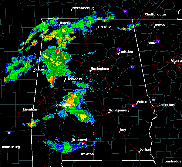 At 647 pm cdt, a severe thunderstorm was located near mertz, or 8 miles west of brent, moving northeast at 30 mph (radar indicated). Hazards include 60 mph wind gusts and quarter size hail. Hail damage to vehicles is expected. Expect wind damage to roofs, siding, and trees. At 647 pm cdt, a severe thunderstorm was located near mertz, or 8 miles west of brent, moving northeast at 30 mph (radar indicated). Hazards include 60 mph wind gusts and quarter size hail. Hail damage to vehicles is expected. Expect wind damage to roofs, siding, and trees.
|
| 4/18/2019 7:24 PM CDT |
 The severe thunderstorm warning for northeastern perry and eastern bibb counties will expire at 730 pm cdt, the storms which prompted the warning have moved out of the area. therefore, the warning will be allowed to expire. a tornado watch remains in effect until 1100 pm cdt for central, south central and west central alabama. The severe thunderstorm warning for northeastern perry and eastern bibb counties will expire at 730 pm cdt, the storms which prompted the warning have moved out of the area. therefore, the warning will be allowed to expire. a tornado watch remains in effect until 1100 pm cdt for central, south central and west central alabama.
|
| 4/18/2019 7:15 PM CDT |
 At 715 pm cdt, severe thunderstorms were located along a line extending from maylene to valley grande, moving east at 45 mph (radar indicated). Hazards include 60 mph wind gusts. Expect damage to roofs, siding, and trees. locations impacted include, centreville, west blocton, lawley, ashby, brierfield ironworks park, west centreville, talladega national forest, randolph, trio, six mile, bibb county airport, suttle, oakmulgee and hebron. A tornado watch remains in effect until 1100 pm cdt for central, south central and west central alabama. At 715 pm cdt, severe thunderstorms were located along a line extending from maylene to valley grande, moving east at 45 mph (radar indicated). Hazards include 60 mph wind gusts. Expect damage to roofs, siding, and trees. locations impacted include, centreville, west blocton, lawley, ashby, brierfield ironworks park, west centreville, talladega national forest, randolph, trio, six mile, bibb county airport, suttle, oakmulgee and hebron. A tornado watch remains in effect until 1100 pm cdt for central, south central and west central alabama.
|
| 4/18/2019 7:04 PM CDT |
 At 704 pm cdt, severe thunderstorms were located along a line extending from 6 miles southeast of tannehill ironworks state park to near potter station, moving east at 45 mph (radar indicated). Hazards include 60 mph wind gusts. Expect damage to roofs, siding, and trees. locations impacted include, brent, marion, centreville, vance, woodstock, west blocton, vaiden, west centreville, heiberger, lawley, ashby, brierfield ironworks park, talladega national forest, eoline, north bibb, randolph, radford, six mile, bibb county airport and green pond. A tornado watch remains in effect until 1100 pm cdt for central, south central and west central alabama. At 704 pm cdt, severe thunderstorms were located along a line extending from 6 miles southeast of tannehill ironworks state park to near potter station, moving east at 45 mph (radar indicated). Hazards include 60 mph wind gusts. Expect damage to roofs, siding, and trees. locations impacted include, brent, marion, centreville, vance, woodstock, west blocton, vaiden, west centreville, heiberger, lawley, ashby, brierfield ironworks park, talladega national forest, eoline, north bibb, randolph, radford, six mile, bibb county airport and green pond. A tornado watch remains in effect until 1100 pm cdt for central, south central and west central alabama.
|
| 4/18/2019 6:47 PM CDT |
 At 647 pm cdt, severe thunderstorms were located along a line extending from near west blocton to near marion junction, moving east at 40 mph (radar indicated). Hazards include 70 mph wind gusts. Expect considerable tree damage. damage is likely to mobile homes, roofs, and outbuildings. locations impacted include, brent, marion, centreville, uniontown, vance, woodstock, west blocton, newbern, vaiden, west centreville, heiberger, lawley, ashby, brierfield ironworks park, low gap, mertz, talladega national forest, eoline, north bibb and randolph. A tornado watch remains in effect until 1100 pm cdt for central, south central and west central alabama. At 647 pm cdt, severe thunderstorms were located along a line extending from near west blocton to near marion junction, moving east at 40 mph (radar indicated). Hazards include 70 mph wind gusts. Expect considerable tree damage. damage is likely to mobile homes, roofs, and outbuildings. locations impacted include, brent, marion, centreville, uniontown, vance, woodstock, west blocton, newbern, vaiden, west centreville, heiberger, lawley, ashby, brierfield ironworks park, low gap, mertz, talladega national forest, eoline, north bibb and randolph. A tornado watch remains in effect until 1100 pm cdt for central, south central and west central alabama.
|
| 4/18/2019 6:32 PM CDT |
 At 632 pm cdt, severe thunderstorms were located along a line extending from near coaling to near vaiden, moving east at 40 mph (radar indicated). Hazards include 70 mph wind gusts. Expect considerable tree damage. damage is likely to mobile homes, roofs, and outbuildings. locations impacted include, brent, marion, centreville, uniontown, vance, woodstock, west blocton, newbern, vaiden, west centreville, heiberger, lawley, ashby, brierfield ironworks park, low gap, mertz, talladega national forest, eoline, north bibb and randolph. A tornado watch remains in effect until 1100 pm cdt for central, south central and west central alabama. At 632 pm cdt, severe thunderstorms were located along a line extending from near coaling to near vaiden, moving east at 40 mph (radar indicated). Hazards include 70 mph wind gusts. Expect considerable tree damage. damage is likely to mobile homes, roofs, and outbuildings. locations impacted include, brent, marion, centreville, uniontown, vance, woodstock, west blocton, newbern, vaiden, west centreville, heiberger, lawley, ashby, brierfield ironworks park, low gap, mertz, talladega national forest, eoline, north bibb and randolph. A tornado watch remains in effect until 1100 pm cdt for central, south central and west central alabama.
|
| 4/18/2019 6:20 PM CDT |
 At 619 pm cdt, severe thunderstorms were located along a line extending from near shelton state community college to near faunsdale, moving east at 40 mph (radar indicated). Hazards include 60 mph wind gusts. expect damage to roofs, siding, and trees At 619 pm cdt, severe thunderstorms were located along a line extending from near shelton state community college to near faunsdale, moving east at 40 mph (radar indicated). Hazards include 60 mph wind gusts. expect damage to roofs, siding, and trees
|
| 3/25/2019 4:32 PM CDT | Trees and power lines were blown dow in bibb county AL, 8.4 miles WSW of Centreville, AL |
| 3/25/2019 4:27 PM CDT |
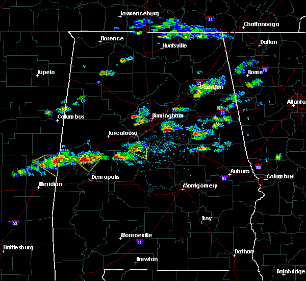 At 427 pm cdt, a severe thunderstorm was located near centreville, moving east at 40 mph (radar indicated). Hazards include quarter size hail. damage to vehicles is expected At 427 pm cdt, a severe thunderstorm was located near centreville, moving east at 40 mph (radar indicated). Hazards include quarter size hail. damage to vehicles is expected
|
| 6/28/2018 3:44 PM CDT |
 At 344 pm cdt, severe thunderstorms were located along a line extending from near bankhead lock and dam to near university of montevallo to lay lake dam, moving south at 35 mph (emergency management). Hazards include 60 to 70 mph wind gusts. Expect considerable tree damage. damage is likely to mobile homes, roofs, and outbuildings. Locations impacted include, southeastern tuscaloosa, calera, clanton, brent, centreville, jemison, holt, thorsby, lake view, brookwood, coaling, vance, woodstock, west blocton, maplesville, gap of the mountain, parnell, verbena, mitchell lake and lake wildwood. At 344 pm cdt, severe thunderstorms were located along a line extending from near bankhead lock and dam to near university of montevallo to lay lake dam, moving south at 35 mph (emergency management). Hazards include 60 to 70 mph wind gusts. Expect considerable tree damage. damage is likely to mobile homes, roofs, and outbuildings. Locations impacted include, southeastern tuscaloosa, calera, clanton, brent, centreville, jemison, holt, thorsby, lake view, brookwood, coaling, vance, woodstock, west blocton, maplesville, gap of the mountain, parnell, verbena, mitchell lake and lake wildwood.
|
| 6/28/2018 3:36 PM CDT |
 At 336 pm cdt, severe thunderstorms were located along a line extending from 6 miles north of bankhead lock and dam to near maylene to near lay lake dam, moving south at 35 mph (emergency management). Hazards include 60 mph wind gusts. expect damage to roofs, siding, and trees At 336 pm cdt, severe thunderstorms were located along a line extending from 6 miles north of bankhead lock and dam to near maylene to near lay lake dam, moving south at 35 mph (emergency management). Hazards include 60 mph wind gusts. expect damage to roofs, siding, and trees
|
| 4/22/2018 7:31 PM CDT |
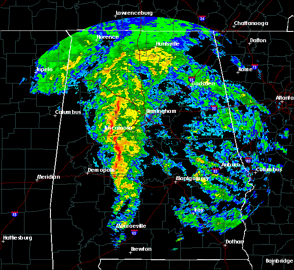 At 731 pm cdt, severe thunderstorms were located along a line extending from near eoline to near harrisburg to near marion, moving northeast at 35 mph (emergency management). Hazards include 60 mph wind gusts. Expect damage to roofs, siding, and trees. Locations impacted include, brent, marion, centreville, lawley, ashby, brierfield ironworks park, west centreville, talladega national forest, heiberger, eoline, randolph, trio, judson college, radford, six mile, bibb county airport, oakmulgee, sprott, harmon and ellards. At 731 pm cdt, severe thunderstorms were located along a line extending from near eoline to near harrisburg to near marion, moving northeast at 35 mph (emergency management). Hazards include 60 mph wind gusts. Expect damage to roofs, siding, and trees. Locations impacted include, brent, marion, centreville, lawley, ashby, brierfield ironworks park, west centreville, talladega national forest, heiberger, eoline, randolph, trio, judson college, radford, six mile, bibb county airport, oakmulgee, sprott, harmon and ellards.
|
| 4/22/2018 7:10 PM CDT |
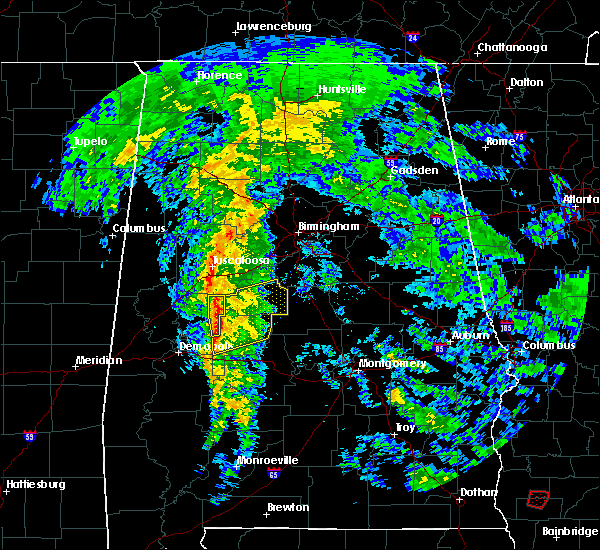 At 709 pm cdt, severe thunderstorms were located along a line extending from 6 miles southwest of mertz to 7 miles southwest of heiberger to near vaiden, moving east at 30 mph (trained weather spotters). Hazards include 60 mph wind gusts. Expect damage to roofs, siding, and trees. Locations impacted include, brent, marion, centreville, newbern, west centreville, heiberger, lawley, ashby, brierfield ironworks park, low gap, mertz, talladega national forest, eoline, randolph, radford, folsom, six mile, bibb county airport, harmon and trio. At 709 pm cdt, severe thunderstorms were located along a line extending from 6 miles southwest of mertz to 7 miles southwest of heiberger to near vaiden, moving east at 30 mph (trained weather spotters). Hazards include 60 mph wind gusts. Expect damage to roofs, siding, and trees. Locations impacted include, brent, marion, centreville, newbern, west centreville, heiberger, lawley, ashby, brierfield ironworks park, low gap, mertz, talladega national forest, eoline, randolph, radford, folsom, six mile, bibb county airport, harmon and trio.
|
| 4/22/2018 6:55 PM CDT |
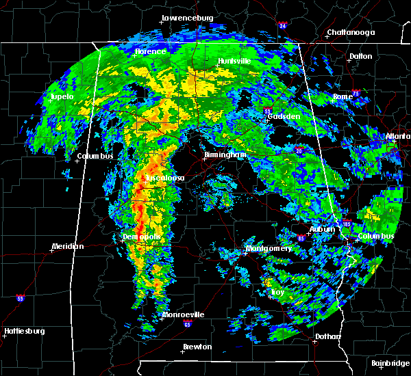 At 654 pm cdt, severe thunderstorms were located along a line extending from 9 miles northeast of greensboro municipal airport to near greensboro to near faunsdale, moving east at 30 mph (trained weather spotters). Hazards include 60 mph wind gusts. expect damage to roofs, siding, and trees At 654 pm cdt, severe thunderstorms were located along a line extending from 9 miles northeast of greensboro municipal airport to near greensboro to near faunsdale, moving east at 30 mph (trained weather spotters). Hazards include 60 mph wind gusts. expect damage to roofs, siding, and trees
|
| 8/31/2017 8:41 PM CDT |
 At 840 pm cdt, a severe thunderstorm was located near wilton, or near montevallo, moving northeast at 50 mph (radar indicated). Hazards include 60 mph wind gusts. expect damage to roofs, siding, and trees At 840 pm cdt, a severe thunderstorm was located near wilton, or near montevallo, moving northeast at 50 mph (radar indicated). Hazards include 60 mph wind gusts. expect damage to roofs, siding, and trees
|
| 8/31/2017 7:12 PM CDT |
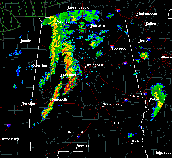 At 711 pm cdt, a severe thunderstorm capable of producing a tornado was located near heiberger, or 12 miles north of marion, moving northeast at 30 mph (radar indicated rotation). Hazards include tornado. Flying debris will be dangerous to those caught without shelter. mobile homes will be damaged or destroyed. damage to roofs, windows, and vehicles will occur. Tree damage is likely. At 711 pm cdt, a severe thunderstorm capable of producing a tornado was located near heiberger, or 12 miles north of marion, moving northeast at 30 mph (radar indicated rotation). Hazards include tornado. Flying debris will be dangerous to those caught without shelter. mobile homes will be damaged or destroyed. damage to roofs, windows, and vehicles will occur. Tree damage is likely.
|
| 8/31/2017 7:09 PM CDT | Trees and power lines down across portions of ward school road... west eoline road and bear creek road. possible tornado. report relayed by social media. location appro in bibb county AL, 8 miles ESE of Centreville, AL |
| 8/31/2017 7:02 PM CDT |
 At 702 pm cdt, a confirmed tornado was located near eoline, or 8 miles west of brent, moving northeast at 35 mph (radar confirmed tornado). Hazards include damaging tornado. Flying debris will be dangerous to those caught without shelter. mobile homes will be damaged or destroyed. damage to roofs, windows, and vehicles will occur. tree damage is likely. Locations impacted include, centreville, vance, woodstock, west blocton, eoline, north bibb, green pond, hebron, harmon and marvel. At 702 pm cdt, a confirmed tornado was located near eoline, or 8 miles west of brent, moving northeast at 35 mph (radar confirmed tornado). Hazards include damaging tornado. Flying debris will be dangerous to those caught without shelter. mobile homes will be damaged or destroyed. damage to roofs, windows, and vehicles will occur. tree damage is likely. Locations impacted include, centreville, vance, woodstock, west blocton, eoline, north bibb, green pond, hebron, harmon and marvel.
|
| 8/31/2017 6:55 PM CDT |
 At 655 pm cdt, a severe thunderstorm capable of producing a tornado was located over mertz, or 10 miles west of brent, moving northeast at 35 mph (radar indicated rotation). Hazards include tornado. Flying debris will be dangerous to those caught without shelter. mobile homes will be damaged or destroyed. damage to roofs, windows, and vehicles will occur. Tree damage is likely. At 655 pm cdt, a severe thunderstorm capable of producing a tornado was located over mertz, or 10 miles west of brent, moving northeast at 35 mph (radar indicated rotation). Hazards include tornado. Flying debris will be dangerous to those caught without shelter. mobile homes will be damaged or destroyed. damage to roofs, windows, and vehicles will occur. Tree damage is likely.
|
| 6/15/2017 3:32 PM CDT |
 At 332 pm cdt, severe thunderstorms were located along a line extending from near alexandria to near maylene to near talladega national forest, moving south at 50 mph (radar indicated). Hazards include 60 mph wind gusts and quarter size hail. Hail damage to vehicles is expected. expect wind damage to roofs, siding, and trees. Locations impacted include, birmingham, hoover, gadsden, vestavia hills, alabaster, bessemer, homewood, anniston, pelham, oxford, mountain brook, trussville, helena, hueytown, talladega, gardendale, sylacauga, pell city, jacksonville and irondale. At 332 pm cdt, severe thunderstorms were located along a line extending from near alexandria to near maylene to near talladega national forest, moving south at 50 mph (radar indicated). Hazards include 60 mph wind gusts and quarter size hail. Hail damage to vehicles is expected. expect wind damage to roofs, siding, and trees. Locations impacted include, birmingham, hoover, gadsden, vestavia hills, alabaster, bessemer, homewood, anniston, pelham, oxford, mountain brook, trussville, helena, hueytown, talladega, gardendale, sylacauga, pell city, jacksonville and irondale.
|
| 6/15/2017 3:23 PM CDT |
 At 323 pm cdt, severe thunderstorms were located along a line extending from glencoe to near bessemer to near centreville, moving south at 50 mph (radar indicated). Hazards include 60 mph wind gusts. there have been several reports of trees downed by these storms. Expect damage to roofs, siding, and trees. Locations impacted include, birmingham, hoover, gadsden, vestavia hills, alabaster, bessemer, homewood, anniston, pelham, oxford, mountain brook, trussville, helena, hueytown, talladega, gardendale, sylacauga, pell city, jacksonville and irondale. At 323 pm cdt, severe thunderstorms were located along a line extending from glencoe to near bessemer to near centreville, moving south at 50 mph (radar indicated). Hazards include 60 mph wind gusts. there have been several reports of trees downed by these storms. Expect damage to roofs, siding, and trees. Locations impacted include, birmingham, hoover, gadsden, vestavia hills, alabaster, bessemer, homewood, anniston, pelham, oxford, mountain brook, trussville, helena, hueytown, talladega, gardendale, sylacauga, pell city, jacksonville and irondale.
|
| 6/15/2017 3:15 PM CDT |
 At 315 pm cdt, severe thunderstorms were located along a line extending from near reece city to hueytown to near west blocton, moving south at 50 mph (radar indicated). Hazards include 60 mph wind gusts. expect damage to roofs, siding, and trees At 315 pm cdt, severe thunderstorms were located along a line extending from near reece city to hueytown to near west blocton, moving south at 50 mph (radar indicated). Hazards include 60 mph wind gusts. expect damage to roofs, siding, and trees
|
| 4/5/2017 6:26 AM CDT |
 At 625 am cdt, a severe thunderstorm was located over low gap, or 11 miles west of brent, moving northeast at 50 mph (radar indicated). Hazards include 60 mph wind gusts and quarter size hail. Hail damage to vehicles is expected. expect wind damage to roofs, siding, and trees. Locations impacted include, brent, centreville, vance, woodstock, west blocton, ashby, brierfield ironworks park, low gap, west centreville, mertz, eoline, north bibb, trio, marvel, six mile, bibb county airport, green pond, hebron and harmon. At 625 am cdt, a severe thunderstorm was located over low gap, or 11 miles west of brent, moving northeast at 50 mph (radar indicated). Hazards include 60 mph wind gusts and quarter size hail. Hail damage to vehicles is expected. expect wind damage to roofs, siding, and trees. Locations impacted include, brent, centreville, vance, woodstock, west blocton, ashby, brierfield ironworks park, low gap, west centreville, mertz, eoline, north bibb, trio, marvel, six mile, bibb county airport, green pond, hebron and harmon.
|
| 4/5/2017 6:20 AM CDT |
 At 619 am cdt, a severe thunderstorm was located near mertz, or 14 miles west of brent, moving northeast at 50 mph (radar indicated). Hazards include 60 mph wind gusts and quarter size hail. Hail damage to vehicles is expected. expect wind damage to roofs, siding, and trees. Locations impacted include, brent, centreville, vance, woodstock, west blocton, ashby, brierfield ironworks park, low gap, west centreville, mertz, eoline, north bibb, trio, phipps, marvel, six mile, bibb county airport, green pond, hebron and harmon. At 619 am cdt, a severe thunderstorm was located near mertz, or 14 miles west of brent, moving northeast at 50 mph (radar indicated). Hazards include 60 mph wind gusts and quarter size hail. Hail damage to vehicles is expected. expect wind damage to roofs, siding, and trees. Locations impacted include, brent, centreville, vance, woodstock, west blocton, ashby, brierfield ironworks park, low gap, west centreville, mertz, eoline, north bibb, trio, phipps, marvel, six mile, bibb county airport, green pond, hebron and harmon.
|
| 4/5/2017 6:04 AM CDT |
 At 603 am cdt, a severe thunderstorm was located 7 miles north of greensboro, moving northeast at 50 mph (radar indicated). Hazards include 60 mph wind gusts and quarter size hail. Hail damage to vehicles is expected. Expect wind damage to roofs, siding, and trees. At 603 am cdt, a severe thunderstorm was located 7 miles north of greensboro, moving northeast at 50 mph (radar indicated). Hazards include 60 mph wind gusts and quarter size hail. Hail damage to vehicles is expected. Expect wind damage to roofs, siding, and trees.
|
| 4/5/2017 4:40 AM CDT |
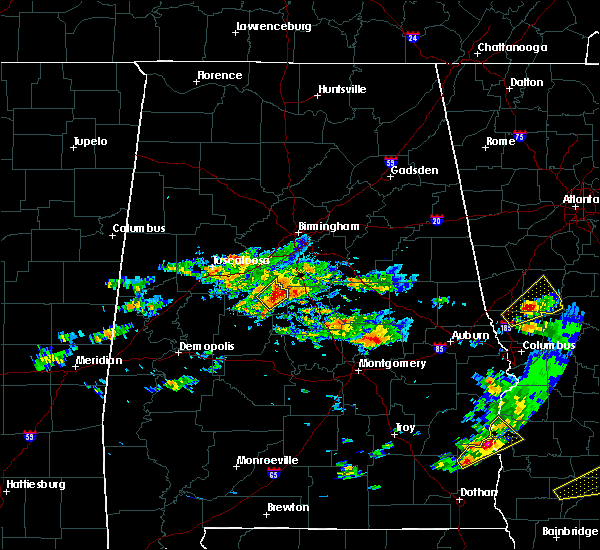 At 440 am cdt, a severe thunderstorm was located near ashby, or 8 miles east of centreville, moving northeast at 45 mph (radar indicated). Hazards include 60 mph wind gusts and half dollar size hail. Hail damage to vehicles is expected. expect wind damage to roofs, siding, and trees. Locations impacted include, centreville, brierfield ironworks park, ashby, trio, six mile and bibb county airport. At 440 am cdt, a severe thunderstorm was located near ashby, or 8 miles east of centreville, moving northeast at 45 mph (radar indicated). Hazards include 60 mph wind gusts and half dollar size hail. Hail damage to vehicles is expected. expect wind damage to roofs, siding, and trees. Locations impacted include, centreville, brierfield ironworks park, ashby, trio, six mile and bibb county airport.
|
| 4/5/2017 4:28 AM CDT |
 At 428 am cdt, a severe thunderstorm was located over centreville, moving northeast at 50 mph (radar indicated). Hazards include 60 mph wind gusts and half dollar size hail. Hail damage to vehicles is expected. expect wind damage to roofs, siding, and trees. Locations impacted include, brent, centreville, ashby, brierfield ironworks park, west centreville, trio, marvel, six mile and bibb county airport. At 428 am cdt, a severe thunderstorm was located over centreville, moving northeast at 50 mph (radar indicated). Hazards include 60 mph wind gusts and half dollar size hail. Hail damage to vehicles is expected. expect wind damage to roofs, siding, and trees. Locations impacted include, brent, centreville, ashby, brierfield ironworks park, west centreville, trio, marvel, six mile and bibb county airport.
|
| 4/5/2017 4:22 AM CDT |
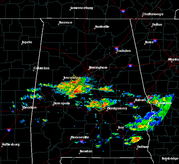 At 421 am cdt, a severe thunderstorm was located over brent, moving northeast at 50 mph (radar indicated). Hazards include 60 mph wind gusts and half dollar size hail. Hail damage to vehicles is expected. expect wind damage to roofs, siding, and trees. Locations impacted include, brent, centreville, ashby, brierfield ironworks park, west centreville, trio, marvel, six mile and bibb county airport. At 421 am cdt, a severe thunderstorm was located over brent, moving northeast at 50 mph (radar indicated). Hazards include 60 mph wind gusts and half dollar size hail. Hail damage to vehicles is expected. expect wind damage to roofs, siding, and trees. Locations impacted include, brent, centreville, ashby, brierfield ironworks park, west centreville, trio, marvel, six mile and bibb county airport.
|
| 4/5/2017 4:11 AM CDT |
 At 411 am cdt, a severe thunderstorm was located near heiberger, or 10 miles southwest of brent, moving northeast at 50 mph (radar indicated). Hazards include 60 mph wind gusts and half dollar size hail. Hail damage to vehicles is expected. Expect wind damage to roofs, siding, and trees. At 411 am cdt, a severe thunderstorm was located near heiberger, or 10 miles southwest of brent, moving northeast at 50 mph (radar indicated). Hazards include 60 mph wind gusts and half dollar size hail. Hail damage to vehicles is expected. Expect wind damage to roofs, siding, and trees.
|
| 3/10/2017 3:46 AM CST |
 At 346 am cst, severe thunderstorms were located along a line extending from near maplesville to near clanton to near lyle, moving south at 45 mph (radar indicated). Hazards include 60 mph wind gusts. Expect damage to roofs, siding, and trees. Locations impacted include, calera, clanton, jemison, thorsby, maplesville, billingsley, dollar, gap of the mountain, parnell, marble valley, verbena, plecher, lawley, mitchell lake, ashby, brierfield ironworks park, lay lake dam, talladega national forest, chilton county motor sports park and higgins ferry park. At 346 am cst, severe thunderstorms were located along a line extending from near maplesville to near clanton to near lyle, moving south at 45 mph (radar indicated). Hazards include 60 mph wind gusts. Expect damage to roofs, siding, and trees. Locations impacted include, calera, clanton, jemison, thorsby, maplesville, billingsley, dollar, gap of the mountain, parnell, marble valley, verbena, plecher, lawley, mitchell lake, ashby, brierfield ironworks park, lay lake dam, talladega national forest, chilton county motor sports park and higgins ferry park.
|
| 3/10/2017 3:15 AM CST |
 At 315 am cst, severe thunderstorms were located along a line extending from 6 miles east of west blocton to american village to near talladega springs, moving south at 45 mph (radar indicated). Hazards include 60 mph wind gusts. expect damage to roofs, siding, and trees At 315 am cst, severe thunderstorms were located along a line extending from 6 miles east of west blocton to american village to near talladega springs, moving south at 45 mph (radar indicated). Hazards include 60 mph wind gusts. expect damage to roofs, siding, and trees
|
| 3/1/2017 4:19 PM CST |
 At 419 pm cst, a severe thunderstorm was located near ashby, or 9 miles east of centreville, moving east at 50 mph (radar indicated). Hazards include 60 mph wind gusts and half dollar size hail. Hail damage to vehicles is expected. expect wind damage to roofs, siding, and trees. Locations impacted include, centreville, lawley, talladega national forest, ashby, brierfield ironworks park, randolph, trio, six mile and bibb county airport. At 419 pm cst, a severe thunderstorm was located near ashby, or 9 miles east of centreville, moving east at 50 mph (radar indicated). Hazards include 60 mph wind gusts and half dollar size hail. Hail damage to vehicles is expected. expect wind damage to roofs, siding, and trees. Locations impacted include, centreville, lawley, talladega national forest, ashby, brierfield ironworks park, randolph, trio, six mile and bibb county airport.
|
| 3/1/2017 4:06 PM CST |
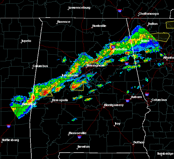 At 406 pm cst, a severe thunderstorm was located over brent, moving east at 45 mph (radar indicated). Hazards include 60 mph wind gusts and half dollar size hail. Hail damage to vehicles is expected. expect wind damage to roofs, siding, and trees. Locations impacted include, brent, centreville, lawley, talladega national forest, eoline, ashby, brierfield ironworks park, west centreville, randolph, trio, six mile and bibb county airport. At 406 pm cst, a severe thunderstorm was located over brent, moving east at 45 mph (radar indicated). Hazards include 60 mph wind gusts and half dollar size hail. Hail damage to vehicles is expected. expect wind damage to roofs, siding, and trees. Locations impacted include, brent, centreville, lawley, talladega national forest, eoline, ashby, brierfield ironworks park, west centreville, randolph, trio, six mile and bibb county airport.
|
| 3/1/2017 3:44 PM CST |
 At 343 pm cst, a severe thunderstorm was located near mertz, or 15 miles west of brent, moving east at 50 mph (radar indicated). Hazards include 60 mph wind gusts and half dollar size hail. Hail damage to vehicles is expected. Expect wind damage to roofs, siding, and trees. At 343 pm cst, a severe thunderstorm was located near mertz, or 15 miles west of brent, moving east at 50 mph (radar indicated). Hazards include 60 mph wind gusts and half dollar size hail. Hail damage to vehicles is expected. Expect wind damage to roofs, siding, and trees.
|
| 1/22/2017 12:40 AM CST |
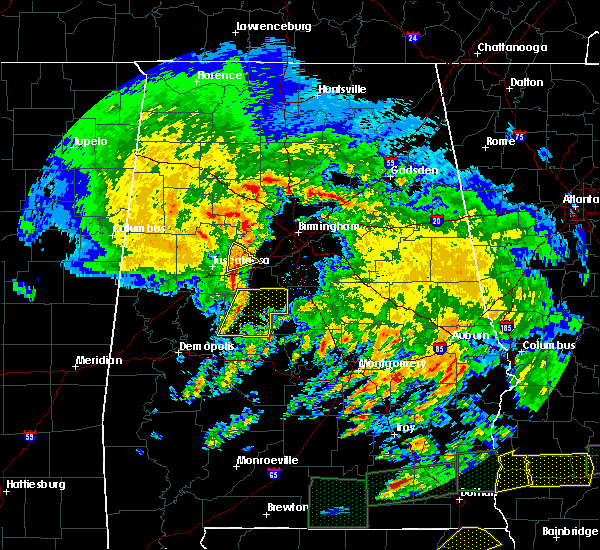 At 1239 am cst, severe thunderstorms were located along a line extending from near eoline to heiberger, moving east at 65 mph (radar indicated). Hazards include 60 mph wind gusts. Expect damage to roofs, siding, and trees. locations impacted include, brent, marion, centreville, heiberger, brierfield ironworks park, talladega national forest, west centreville, eoline, ashby, lawley, randolph, ellards, sprott, bibb county airport, six mile, trio, harmon, oakmulgee, folsom and morgan springs. A tornado watch remains in effect until 300 am cst for south central, west central alabama. At 1239 am cst, severe thunderstorms were located along a line extending from near eoline to heiberger, moving east at 65 mph (radar indicated). Hazards include 60 mph wind gusts. Expect damage to roofs, siding, and trees. locations impacted include, brent, marion, centreville, heiberger, brierfield ironworks park, talladega national forest, west centreville, eoline, ashby, lawley, randolph, ellards, sprott, bibb county airport, six mile, trio, harmon, oakmulgee, folsom and morgan springs. A tornado watch remains in effect until 300 am cst for south central, west central alabama.
|
| 1/22/2017 12:27 AM CST |
 At 1227 am cst, severe thunderstorms were located along a line extending from low gap to near greensboro, moving east at 60 mph (radar indicated). Hazards include 60 mph wind gusts. expect damage to roofs, siding, and trees At 1227 am cst, severe thunderstorms were located along a line extending from low gap to near greensboro, moving east at 60 mph (radar indicated). Hazards include 60 mph wind gusts. expect damage to roofs, siding, and trees
|
| 6/17/2016 4:02 PM CDT |
 At 402 pm cdt, severe thunderstorms were located along a line extending from near logan martin dam to talladega national forest to near sawyerville, moving southeast at 30 mph (radar indicated). Hazards include 60 mph wind gusts and quarter size hail. Hail damage to vehicles is expected. expect wind damage to roofs, siding, and trees. Locations impacted include, calera, montevallo, brent, columbiana, centreville, greensboro, wilsonville, vincent, harpersville, wilton, akron, brierfield ironworks park, talladega national forest, west centreville, wedgeworth, ashby, lay lake, sawyerville, mertz and evansville. At 402 pm cdt, severe thunderstorms were located along a line extending from near logan martin dam to talladega national forest to near sawyerville, moving southeast at 30 mph (radar indicated). Hazards include 60 mph wind gusts and quarter size hail. Hail damage to vehicles is expected. expect wind damage to roofs, siding, and trees. Locations impacted include, calera, montevallo, brent, columbiana, centreville, greensboro, wilsonville, vincent, harpersville, wilton, akron, brierfield ironworks park, talladega national forest, west centreville, wedgeworth, ashby, lay lake, sawyerville, mertz and evansville.
|
| 6/17/2016 3:48 PM CDT |
 At 348 pm cdt, severe thunderstorms were located along a line extending from near vincent to near centreville to evansville, moving south at 40 mph (radar indicated). Hazards include 60 mph wind gusts and quarter size hail. Hail damage to vehicles is expected. expect wind damage to roofs, siding, and trees. Locations impacted include, alabaster, pelham, calera, chelsea, montevallo, brent, columbiana, centreville, greensboro, wilsonville, vincent, harpersville, westover, wilton, akron, brierfield ironworks park, talladega national forest, ashby, shelby county airport and mertz. At 348 pm cdt, severe thunderstorms were located along a line extending from near vincent to near centreville to evansville, moving south at 40 mph (radar indicated). Hazards include 60 mph wind gusts and quarter size hail. Hail damage to vehicles is expected. expect wind damage to roofs, siding, and trees. Locations impacted include, alabaster, pelham, calera, chelsea, montevallo, brent, columbiana, centreville, greensboro, wilsonville, vincent, harpersville, westover, wilton, akron, brierfield ironworks park, talladega national forest, ashby, shelby county airport and mertz.
|
| 6/17/2016 3:23 PM CDT |
 At 323 pm cdt, severe thunderstorms were located along a line extending from near vandiver to near maylene to near knoxville, moving southeast at 35 mph (radar indicated). Hazards include 60 mph wind gusts and quarter size hail. Hail damage to vehicles is expected. expect wind damage to roofs, siding, and trees. Locations impacted include, tuscaloosa, hoover, alabaster, northport, pelham, helena, leeds, calera, chelsea, montevallo, brent, columbiana, centreville, greensboro, wilsonville, holt, moundville, indian springs village, vincent and lake view. At 323 pm cdt, severe thunderstorms were located along a line extending from near vandiver to near maylene to near knoxville, moving southeast at 35 mph (radar indicated). Hazards include 60 mph wind gusts and quarter size hail. Hail damage to vehicles is expected. expect wind damage to roofs, siding, and trees. Locations impacted include, tuscaloosa, hoover, alabaster, northport, pelham, helena, leeds, calera, chelsea, montevallo, brent, columbiana, centreville, greensboro, wilsonville, holt, moundville, indian springs village, vincent and lake view.
|
| 6/17/2016 2:57 PM CDT |
 At 257 pm cdt, severe thunderstorms were located along a line extending from the summit to near gordo, moving southeast at 30 mph (radar indicated). Hazards include 60 mph wind gusts and quarter size hail. Hail damage to vehicles is expected. Expect wind damage to roofs, siding, and trees. At 257 pm cdt, severe thunderstorms were located along a line extending from the summit to near gordo, moving southeast at 30 mph (radar indicated). Hazards include 60 mph wind gusts and quarter size hail. Hail damage to vehicles is expected. Expect wind damage to roofs, siding, and trees.
|
| 2/15/2016 5:02 PM CST |
 At 502 pm cst, severe thunderstorms were located along a line extending from near centreville to 8 miles southwest of belknap, moving east at 45 mph (radar indicated). Hazards include 60 mph wind gusts. Expect damage to roofs. siding and trees. locations impacted include, selma, valley grande, centreville, selmont-west selmont, brierfield ironworks park, memorial stadium, burnsville, talladega national forest, ashby, paul m grist state park, dallas county horse arena, dallas lake, old cahaba park, gardner island, belknap, lawley, tyler, potter station, dannelly reservoir and randolph. A tornado watch remains in effect until 900 pm cst for southern alabama. At 502 pm cst, severe thunderstorms were located along a line extending from near centreville to 8 miles southwest of belknap, moving east at 45 mph (radar indicated). Hazards include 60 mph wind gusts. Expect damage to roofs. siding and trees. locations impacted include, selma, valley grande, centreville, selmont-west selmont, brierfield ironworks park, memorial stadium, burnsville, talladega national forest, ashby, paul m grist state park, dallas county horse arena, dallas lake, old cahaba park, gardner island, belknap, lawley, tyler, potter station, dannelly reservoir and randolph. A tornado watch remains in effect until 900 pm cst for southern alabama.
|
| 2/15/2016 4:45 PM CST |
 At 445 pm cst, severe thunderstorms were located along a line extending from near centreville to 7 miles east of catherine, moving east at 55 mph (radar indicated). Hazards include 60 mph wind gusts. Expect damage to roofs. siding and trees. locations impacted include, selma, brent, valley grande, marion, centreville, selmont-west selmont, orrville, bogue chitto, brierfield ironworks park, memorial stadium, talladega national forest, ashby, vaiden, paul m grist state park, dallas county horse arena, dallas lake, heiberger, old cahaba park, dannelly reservoir and gardner island. A tornado watch remains in effect until 900 pm cst for southern alabama. At 445 pm cst, severe thunderstorms were located along a line extending from near centreville to 7 miles east of catherine, moving east at 55 mph (radar indicated). Hazards include 60 mph wind gusts. Expect damage to roofs. siding and trees. locations impacted include, selma, brent, valley grande, marion, centreville, selmont-west selmont, orrville, bogue chitto, brierfield ironworks park, memorial stadium, talladega national forest, ashby, vaiden, paul m grist state park, dallas county horse arena, dallas lake, heiberger, old cahaba park, dannelly reservoir and gardner island. A tornado watch remains in effect until 900 pm cst for southern alabama.
|
| 2/15/2016 4:27 PM CST |
 At 427 pm cst, severe thunderstorms were located along a line extending from 8 miles northeast of greensboro to near shawnee, moving east at 50 mph (radar indicated). Hazards include 60 mph wind gusts. Expect damage to roofs. Siding and trees. At 427 pm cst, severe thunderstorms were located along a line extending from 8 miles northeast of greensboro to near shawnee, moving east at 50 mph (radar indicated). Hazards include 60 mph wind gusts. Expect damage to roofs. Siding and trees.
|
| 12/25/2015 7:15 PM CST |
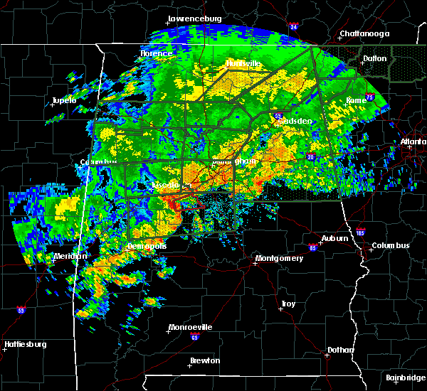 At 714 pm cst, a severe thunderstorm capable of producing a tornado was located near eoline, moving east at 30 mph (radar indicated rotation). Hazards include tornado. Flying debris will be dangerous to those caught without shelter. mobile homes will be damaged or destroyed. damage to roofs, windows and vehicles will occur. tree damage is likely. Locations impacted include, west blocton, eoline, brierfield ironworks park, marvel and hebron. At 714 pm cst, a severe thunderstorm capable of producing a tornado was located near eoline, moving east at 30 mph (radar indicated rotation). Hazards include tornado. Flying debris will be dangerous to those caught without shelter. mobile homes will be damaged or destroyed. damage to roofs, windows and vehicles will occur. tree damage is likely. Locations impacted include, west blocton, eoline, brierfield ironworks park, marvel and hebron.
|
| 12/25/2015 7:04 PM CST |
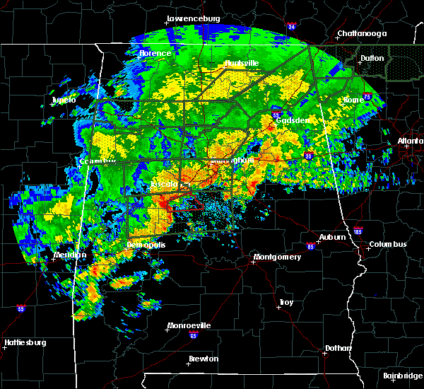 At 703 pm cst, a severe thunderstorm capable of producing a tornado was located near eoline, or 8 miles northwest of brent, moving east at 35 mph (radar indicated rotation). Hazards include tornado. Flying debris will be dangerous to those caught without shelter. mobile homes will be damaged or destroyed. damage to roofs, windows and vehicles will occur. Tree damage is likely. At 703 pm cst, a severe thunderstorm capable of producing a tornado was located near eoline, or 8 miles northwest of brent, moving east at 35 mph (radar indicated rotation). Hazards include tornado. Flying debris will be dangerous to those caught without shelter. mobile homes will be damaged or destroyed. damage to roofs, windows and vehicles will occur. Tree damage is likely.
|
| 7/15/2015 5:22 PM CDT |
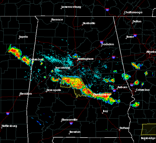 At 521 pm cdt, severe thunderstorms were located along a line extending from near west centreville to near pooles crossroads, moving south at 30 mph (radar indicated). Hazards include 60 mph wind gusts and quarter size hail. Hail damage to vehicles is expected. expect wind damage to roofs, siding and trees. Locations impacted include, clanton, brent, centreville, jemison, thorsby, maplesville, billingsley, chilton county motor sports park, talladega national forest, west centreville, pooles crossroads, heiberger, plecher, parnell, lawley, randolph, sprott, isabella, trio and campbell. At 521 pm cdt, severe thunderstorms were located along a line extending from near west centreville to near pooles crossroads, moving south at 30 mph (radar indicated). Hazards include 60 mph wind gusts and quarter size hail. Hail damage to vehicles is expected. expect wind damage to roofs, siding and trees. Locations impacted include, clanton, brent, centreville, jemison, thorsby, maplesville, billingsley, chilton county motor sports park, talladega national forest, west centreville, pooles crossroads, heiberger, plecher, parnell, lawley, randolph, sprott, isabella, trio and campbell.
|
| 7/15/2015 5:01 PM CDT |
 At 501 pm cdt, severe thunderstorms were located along a line extending from 6 miles northeast of centreville to thorsby, moving southeast at 30 mph (radar indicated). Hazards include 60 mph wind gusts and quarter size hail. Hail damage to vehicles is expected. expect wind damage to roofs, siding and trees. Locations impacted include, clanton, brent, centreville, jemison, thorsby, maplesville, billingsley, chilton county motor sports park, brierfield ironworks park, talladega national forest, west centreville, pooles crossroads, ashby, heiberger, plecher, eoline, parnell, lawley, randolph and sprott. At 501 pm cdt, severe thunderstorms were located along a line extending from 6 miles northeast of centreville to thorsby, moving southeast at 30 mph (radar indicated). Hazards include 60 mph wind gusts and quarter size hail. Hail damage to vehicles is expected. expect wind damage to roofs, siding and trees. Locations impacted include, clanton, brent, centreville, jemison, thorsby, maplesville, billingsley, chilton county motor sports park, brierfield ironworks park, talladega national forest, west centreville, pooles crossroads, ashby, heiberger, plecher, eoline, parnell, lawley, randolph and sprott.
|
| 7/15/2015 4:46 PM CDT |
 At 446 pm cdt, severe thunderstorms were located along a line extending from west blocton to near jemison, moving southeast at 30 mph (radar indicated). Hazards include 60 mph wind gusts and quarter size hail. Hail damage to vehicles is expected. Expect wind damage to roofs, siding and trees. At 446 pm cdt, severe thunderstorms were located along a line extending from west blocton to near jemison, moving southeast at 30 mph (radar indicated). Hazards include 60 mph wind gusts and quarter size hail. Hail damage to vehicles is expected. Expect wind damage to roofs, siding and trees.
|
| 7/14/2015 8:39 PM CDT |
 At 838 pm cdt, severe thunderstorms were located along a line extending from near lake wildwood to west blocton to 7 miles northwest of wilton to near calera to near wilsonville to logan martin dam, moving southeast at 65 mph (radar indicated). Hazards include 60 mph wind gusts. Expect damage to roofs. Siding and trees. At 838 pm cdt, severe thunderstorms were located along a line extending from near lake wildwood to west blocton to 7 miles northwest of wilton to near calera to near wilsonville to logan martin dam, moving southeast at 65 mph (radar indicated). Hazards include 60 mph wind gusts. Expect damage to roofs. Siding and trees.
|
| 7/3/2015 4:54 PM CDT |
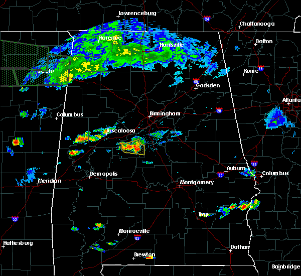 At 454 pm cdt, a severe thunderstorm was located near centreville, moving east at 25 mph (law enforcement). Hazards include ping pong ball size hail and 60 mph wind gusts. People and animals outdoors could be injured. expect hail damage to roofs, siding, windows and vehicles. expect wind damage to roofs, siding and trees. Locations impacted include, brent, centreville, west blocton, brierfield ironworks park, west centreville, ashby, randolph, bibb county airport, six mile and trio. At 454 pm cdt, a severe thunderstorm was located near centreville, moving east at 25 mph (law enforcement). Hazards include ping pong ball size hail and 60 mph wind gusts. People and animals outdoors could be injured. expect hail damage to roofs, siding, windows and vehicles. expect wind damage to roofs, siding and trees. Locations impacted include, brent, centreville, west blocton, brierfield ironworks park, west centreville, ashby, randolph, bibb county airport, six mile and trio.
|
| 7/3/2015 4:47 PM CDT |
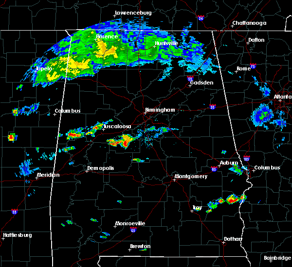 At 446 pm cdt, a severe thunderstorm was located near centreville, moving east at 25 mph (radar indicated). Hazards include 60 mph wind gusts and quarter size hail. Hail damage to vehicles is expected. expect wind damage to roofs, siding and trees. Locations impacted include, brent, centreville, west blocton, brierfield ironworks park, west centreville, eoline, ashby, randolph, harmon, bibb county airport, six mile and trio. At 446 pm cdt, a severe thunderstorm was located near centreville, moving east at 25 mph (radar indicated). Hazards include 60 mph wind gusts and quarter size hail. Hail damage to vehicles is expected. expect wind damage to roofs, siding and trees. Locations impacted include, brent, centreville, west blocton, brierfield ironworks park, west centreville, eoline, ashby, randolph, harmon, bibb county airport, six mile and trio.
|
| 7/3/2015 4:43 PM CDT | Ping Pong Ball sized hail reported 1.2 miles SSW of Centreville, AL, large hail reported in and around centreville with some damage. trees also reported down near brent. |
| 7/3/2015 4:37 PM CDT |
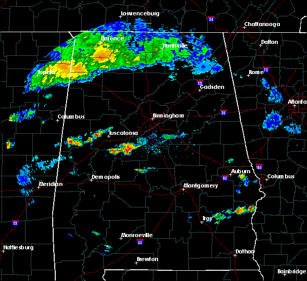 At 437 pm cdt, a severe thunderstorm was located near centreville, moving east at 25 mph (radar indicated). Hazards include 60 mph wind gusts and quarter size hail. Hail damage to vehicles is expected. Expect wind damage to roofs, siding and trees. At 437 pm cdt, a severe thunderstorm was located near centreville, moving east at 25 mph (radar indicated). Hazards include 60 mph wind gusts and quarter size hail. Hail damage to vehicles is expected. Expect wind damage to roofs, siding and trees.
|
| 6/24/2015 10:46 PM CDT |
 At 1045 pm cdt, severe thunderstorms were located along a line extending from north johns to near harrisburg, moving northwest at 25 mph (radar indicated). Hazards include 60 mph wind gusts and quarter size hail. Hail damage to vehicles is expected. expect wind damage to roofs, siding and trees. Locations impacted include, southeastern tuscaloosa, brent, centreville, holt, lake view, brookwood, coaling, vance, woodstock, west blocton, brierfield ironworks park, talladega national forest, west centreville, lake wildwood, low gap, ashby, deerlick creek campgrounds, mercedes benz of alabama, abernant and tannehill ironworks state park. At 1045 pm cdt, severe thunderstorms were located along a line extending from north johns to near harrisburg, moving northwest at 25 mph (radar indicated). Hazards include 60 mph wind gusts and quarter size hail. Hail damage to vehicles is expected. expect wind damage to roofs, siding and trees. Locations impacted include, southeastern tuscaloosa, brent, centreville, holt, lake view, brookwood, coaling, vance, woodstock, west blocton, brierfield ironworks park, talladega national forest, west centreville, lake wildwood, low gap, ashby, deerlick creek campgrounds, mercedes benz of alabama, abernant and tannehill ironworks state park.
|
| 6/24/2015 10:25 PM CDT |
 At 1025 pm cdt, severe thunderstorms were located along a line extending from near splash adventure to near harrisburg, moving northwest at 25 mph (radar indicated). Hazards include 60 mph wind gusts and quarter size hail. Hail damage to vehicles is expected. Expect wind damage to roofs, siding and trees. At 1025 pm cdt, severe thunderstorms were located along a line extending from near splash adventure to near harrisburg, moving northwest at 25 mph (radar indicated). Hazards include 60 mph wind gusts and quarter size hail. Hail damage to vehicles is expected. Expect wind damage to roofs, siding and trees.
|
| 5/27/2015 5:04 PM CDT | At 504 pm cdt, a severe thunderstorm was located near eoline, or near centreville, moving north at 25 mph (radar indicated). Hazards include 60 mph wind gusts and quarter size hail. Hail damage to vehicles is expected. Expect wind damage to roofs, siding and trees. |
| 3/31/2015 7:23 PM CDT | The severe thunderstorm warning for bibb county will expire at 730 pm cdt. the storm which prompted the warning has weakened below severe limits. and no longer pose an immediate threat to life or property. therefore the warning will be allowed to expire. However small hail is still possible with this thunderstorm. |
| 3/31/2015 7:17 PM CDT | A severe thunderstorm warning remains in effect until 730 pm cdt for bibb county. at 717 pm cdt. a severe thunderstorm was located near centreville. moving east at 35 mph. hazard. 60 mph wind gusts and quarter size hail. source. Radar indicated. |
| 3/31/2015 6:42 PM CDT | The national weather service in birmingham has issued a * severe thunderstorm warning for. bibb county in central alabama. southwestern shelby county in central alabama. until 730 pm cdt * at 641 pm cdt. a severe thunderstorm was located near coaling. Or. |
| 4/11/2013 4:27 PM CDT | Trees down along us hwy 82 near mp 93. eastbound lanes were blocked for a short time. time estimated from rada in bibb county AL, 5.4 miles WNW of Centreville, AL |
| 4/11/2013 4:27 PM CDT | Trees were blown down along highway 82 near mile marker 93. the eastbound lanes were blocked for a short period of tim in bibb county AL, 5.4 miles WNW of Centreville, AL |
| 4/11/2013 4:22 PM CDT | More than a dozen trees snapped along sr 219 a few miles south of centreville. road was blocked for a short time. time estimated from radar. trees were also reported do in bibb county AL, 5.6 miles NNW of Centreville, AL |
| 4/11/2013 4:22 PM CDT | More than a dozen trees snapped along state highway 219 a few miles south of centreville. the road was blocked for a short time. time estimated from radar. trees were a in bibb county AL, 5.6 miles NNW of Centreville, AL |
| 3/23/2013 10:47 PM CDT | Sheriff reporting trees down near valley street and highway 219 south in bibb county AL, 1.2 miles SSW of Centreville, AL |
| 3/23/2013 10:45 PM CDT | Golf Ball sized hail reported 1.2 miles SSW of Centreville, AL, covering the road. |
| 3/5/2013 1:25 PM CST | One tree down along hwy 25 near cahawba christian academ in bibb county AL, 1.2 miles SSW of Centreville, AL |
| 3/5/2013 1:22 PM CST | Metal awning/canopy blown off building in downtown. winds estimated around 40-45 mph. time estimated from rada in bibb county AL, 1.2 miles SSW of Centreville, AL |
| 1/1/0001 12:00 AM | Quarter sized hail reported 0.4 miles S of Centreville, AL, quarter sized hail reported on highway 25 near highway 82 in centreville |
| 1/1/0001 12:00 AM | Trees down along the following in bibb county AL, 1.2 miles SSW of Centreville, AL |
Hail Maps for Centreville, AL
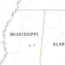
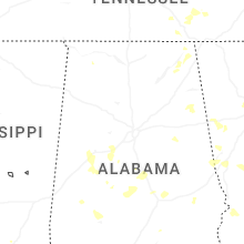
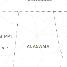
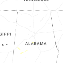


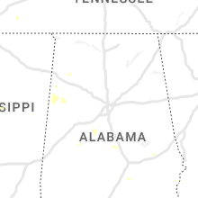

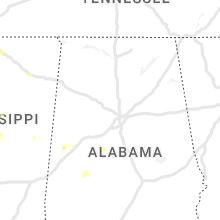


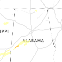


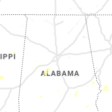


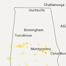


Connect with Interactive Hail Maps