

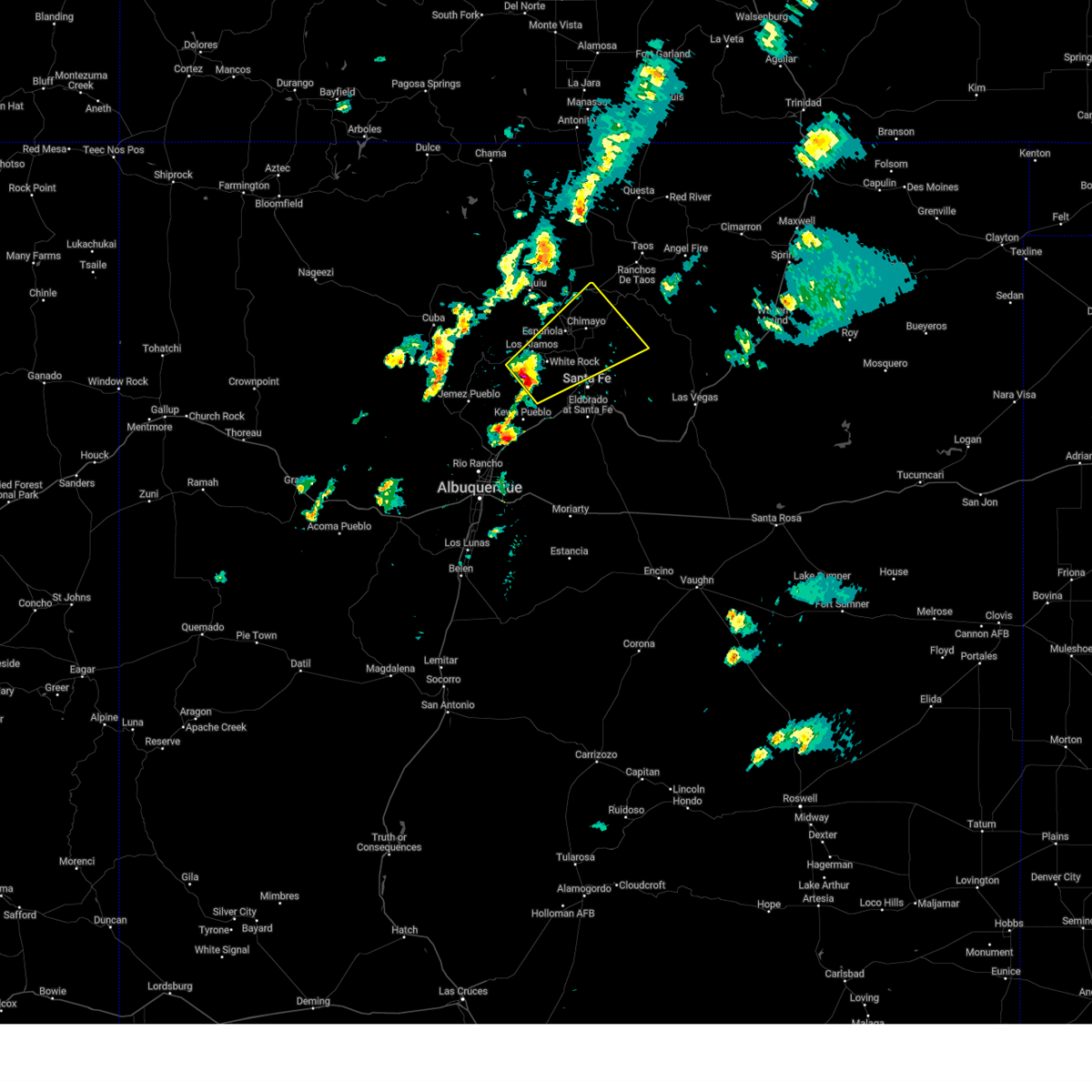
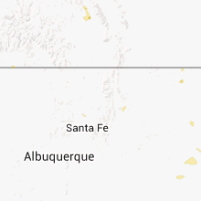
Hail Map for Chili, NM
The Chili, NM area has had 0 reports of on-the-ground hail by trained spotters, and has been under severe weather warnings 7 times during the past 12 months. Doppler radar has detected hail at or near Chili, NM on 15 occasions, including 1 occasion during the past year.
| Name: | Chili, NM |
| Where Located: | 38.7 miles SW of Taos, NM |
| Map: | Google Map for Chili, NM |
| Population: | 654 |
| Housing Units: | 280 |
| More Info: | Search Google for Chili, NM |
1
The Top Recent Hail Date for Chili, NM is Saturday, September 21, 2024 (6th out of 15)

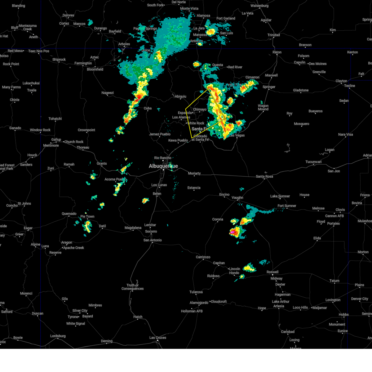
Hail and Wind Damage Spotted near Chili, NM
| Date / Time | Report Details |
|---|---|
| 9/21/2024 5:35 PM MDT | the severe thunderstorm warning has been cancelled and is no longer in effect |
| 9/21/2024 5:15 PM MDT | Svrabq the national weather service in albuquerque has issued a * severe thunderstorm warning for, southeastern rio arriba county in north central new mexico, west central taos county in north central new mexico, * until 600 pm mdt. * at 515 pm mdt, a severe thunderstorm was located 10 miles west of velarde, or 12 miles north of espanola, moving northeast at 25 mph (radar indicated). Hazards include 60 mph wind gusts and quarter size hail. Hail damage to vehicles is expected. Expect wind damage to roofs, siding, and trees. |
| 9/17/2024 3:02 PM MDT |
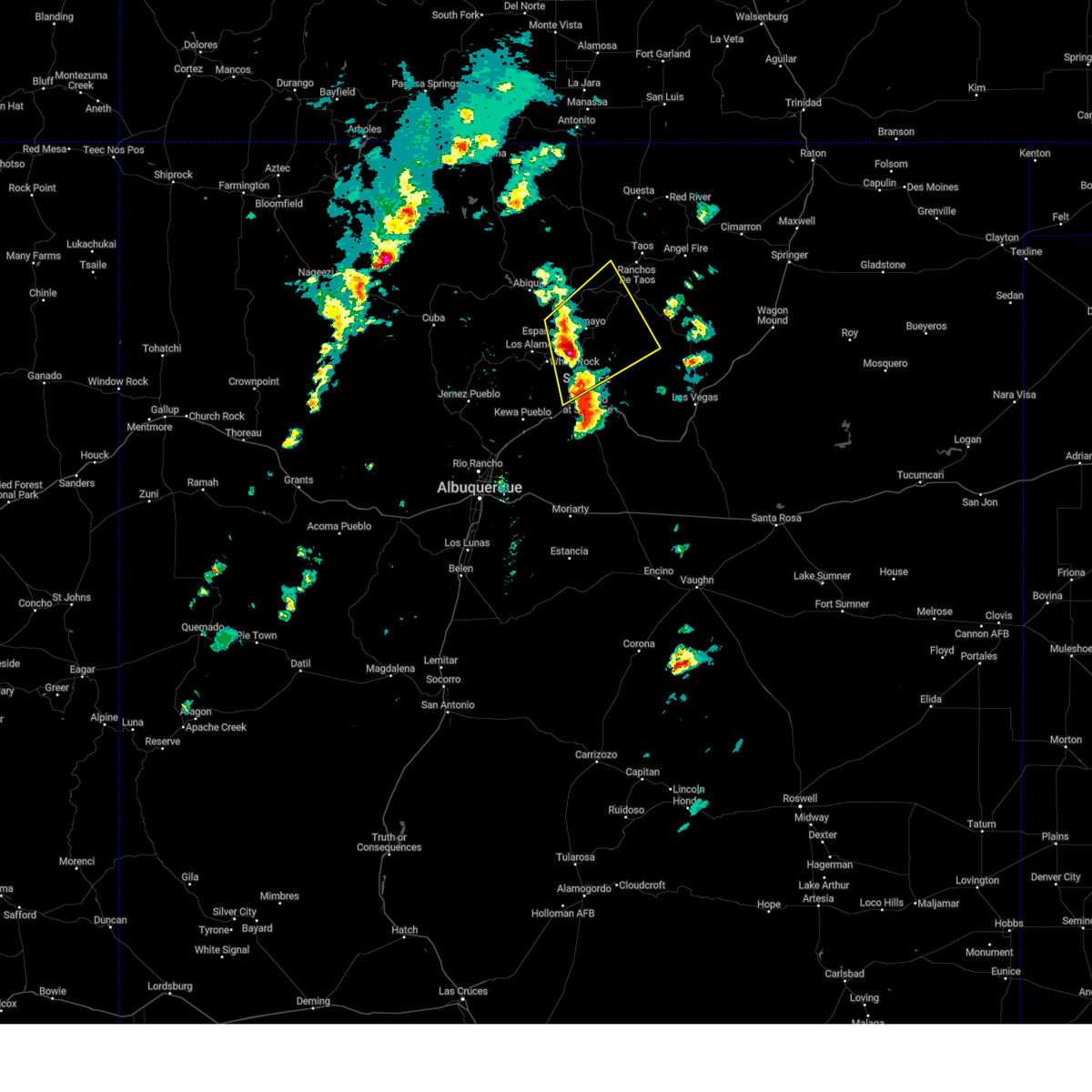
 Svrabq the national weather service in albuquerque has issued a * severe thunderstorm warning for, los alamos county in north central new mexico, northwestern san miguel county in northeastern new mexico, southeastern rio arriba county in north central new mexico, east central sandoval county in north central new mexico, northern santa fe county in north central new mexico, west central mora county in northeastern new mexico, * until 345 pm mdt. * at 301 pm mdt, a severe thunderstorm was located over white rock, or 7 miles south of los alamos, moving northeast at 45 mph (radar indicated). Hazards include 60 mph wind gusts and penny size hail. expect damage to roofs, siding, and trees Svrabq the national weather service in albuquerque has issued a * severe thunderstorm warning for, los alamos county in north central new mexico, northwestern san miguel county in northeastern new mexico, southeastern rio arriba county in north central new mexico, east central sandoval county in north central new mexico, northern santa fe county in north central new mexico, west central mora county in northeastern new mexico, * until 345 pm mdt. * at 301 pm mdt, a severe thunderstorm was located over white rock, or 7 miles south of los alamos, moving northeast at 45 mph (radar indicated). Hazards include 60 mph wind gusts and penny size hail. expect damage to roofs, siding, and trees
|
| 9/17/2024 1:06 PM MDT |
 The storms which prompted the warning have moved out of the area. therefore, the warning will be allowed to expire. however, small hail is still possible with these thunderstorms. a severe thunderstorm watch remains in effect until 700 pm mdt for north central and northeastern new mexico. The storms which prompted the warning have moved out of the area. therefore, the warning will be allowed to expire. however, small hail is still possible with these thunderstorms. a severe thunderstorm watch remains in effect until 700 pm mdt for north central and northeastern new mexico.
|
| 9/17/2024 12:27 PM MDT |
 the severe thunderstorm warning has been cancelled and is no longer in effect the severe thunderstorm warning has been cancelled and is no longer in effect
|
| 9/17/2024 12:27 PM MDT |
 At 1226 pm mdt, severe thunderstorms were located along a line extending from 6 miles northwest of espanola to santa fe, moving northeast at 45 mph (radar indicated). Hazards include 60 mph wind gusts and quarter size hail. Hail damage to vehicles is expected. expect wind damage to roofs, siding, and trees. locations impacted include, santa fe, espanola, chimayo, pojoaque, santa clara pueblo, cuartelez, nambe pueblo, rio chiquito, embudo, and penasco. this includes the following highways, highway 285 between mile markers 337 and 339. State road 63 between mile markers 24 and 25. At 1226 pm mdt, severe thunderstorms were located along a line extending from 6 miles northwest of espanola to santa fe, moving northeast at 45 mph (radar indicated). Hazards include 60 mph wind gusts and quarter size hail. Hail damage to vehicles is expected. expect wind damage to roofs, siding, and trees. locations impacted include, santa fe, espanola, chimayo, pojoaque, santa clara pueblo, cuartelez, nambe pueblo, rio chiquito, embudo, and penasco. this includes the following highways, highway 285 between mile markers 337 and 339. State road 63 between mile markers 24 and 25.
|
| 9/17/2024 12:11 PM MDT |
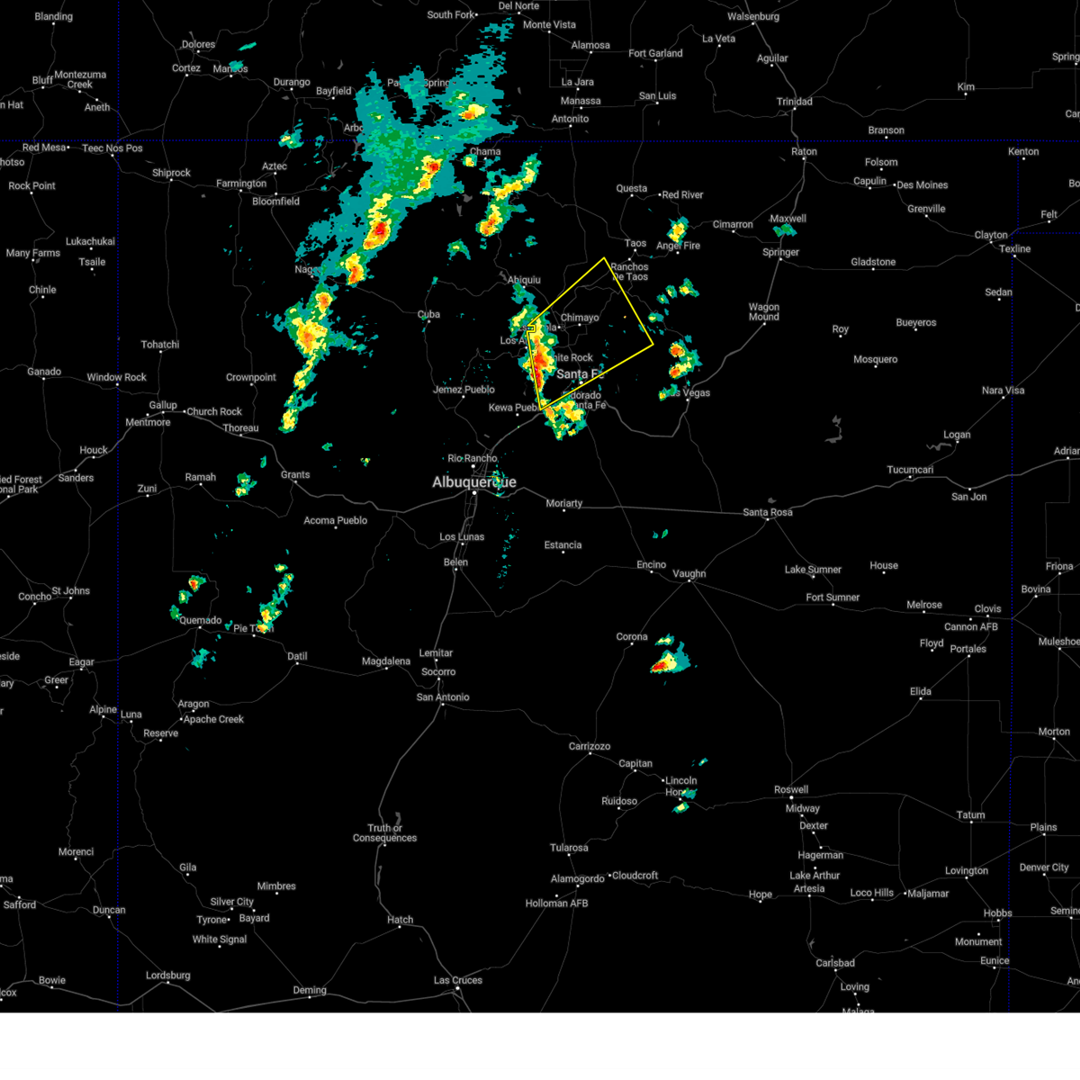 Svrabq the national weather service in albuquerque has issued a * severe thunderstorm warning for, southwestern taos county in north central new mexico, eastern los alamos county in north central new mexico, northwestern san miguel county in northeastern new mexico, southeastern rio arriba county in north central new mexico, northern santa fe county in north central new mexico, west central mora county in northeastern new mexico, * until 115 pm mdt. * at 1210 pm mdt, severe thunderstorms were located along a line extending from near los alamos to la bajada, moving northeast at 45 mph (radar indicated). Hazards include 60 mph wind gusts. expect damage to roofs, siding, and trees Svrabq the national weather service in albuquerque has issued a * severe thunderstorm warning for, southwestern taos county in north central new mexico, eastern los alamos county in north central new mexico, northwestern san miguel county in northeastern new mexico, southeastern rio arriba county in north central new mexico, northern santa fe county in north central new mexico, west central mora county in northeastern new mexico, * until 115 pm mdt. * at 1210 pm mdt, severe thunderstorms were located along a line extending from near los alamos to la bajada, moving northeast at 45 mph (radar indicated). Hazards include 60 mph wind gusts. expect damage to roofs, siding, and trees
|
| 5/22/2021 3:59 PM MDT |
 At 359 pm mdt, a severe thunderstorm was located near espanola, moving north at 25 mph (radar indicated). Hazards include 60 mph wind gusts and half dollar size hail. Hail damage to vehicles is expected. expect wind damage to roofs, siding, and trees. locations impacted include, espanola, santa clara pueblo, embudo, abiquiu, santa cruz, velarde, chili, alcalde, chamita and lyden. This includes highway 285 between mile markers 337 and 350. At 359 pm mdt, a severe thunderstorm was located near espanola, moving north at 25 mph (radar indicated). Hazards include 60 mph wind gusts and half dollar size hail. Hail damage to vehicles is expected. expect wind damage to roofs, siding, and trees. locations impacted include, espanola, santa clara pueblo, embudo, abiquiu, santa cruz, velarde, chili, alcalde, chamita and lyden. This includes highway 285 between mile markers 337 and 350.
|
| 5/22/2021 3:34 PM MDT |
 At 334 pm mdt, a severe thunderstorm was located near white rock, or near los alamos, moving north at 20 mph (radar indicated). Hazards include 60 mph wind gusts and half dollar size hail. Hail damage to vehicles is expected. Expect wind damage to roofs, siding, and trees. At 334 pm mdt, a severe thunderstorm was located near white rock, or near los alamos, moving north at 20 mph (radar indicated). Hazards include 60 mph wind gusts and half dollar size hail. Hail damage to vehicles is expected. Expect wind damage to roofs, siding, and trees.
|
| 6/17/2019 2:17 PM MDT |
 At 216 pm mdt, a severe thunderstorm was located 9 miles northwest of los alamos, moving northeast at 10 mph (radar indicated). Hazards include 60 mph wind gusts and half dollar size hail. Hail damage to vehicles is expected. Expect wind damage to roofs, siding, and trees. At 216 pm mdt, a severe thunderstorm was located 9 miles northwest of los alamos, moving northeast at 10 mph (radar indicated). Hazards include 60 mph wind gusts and half dollar size hail. Hail damage to vehicles is expected. Expect wind damage to roofs, siding, and trees.
|
| 5/21/2018 4:23 PM MDT |
 The severe thunderstorm warning for south central taos, eastern los alamos, southeastern rio arriba and northern santa fe counties will expire at 430 pm mdt, the storms which prompted the warning have weakened below severe limits, and no longer pose an immediate threat to life or property. therefore the warning will be allowed to expire. however gusty winds are still possible with these thunderstorms. a severe thunderstorm watch remains in effect until 700 pm mdt for north central new mexico. The severe thunderstorm warning for south central taos, eastern los alamos, southeastern rio arriba and northern santa fe counties will expire at 430 pm mdt, the storms which prompted the warning have weakened below severe limits, and no longer pose an immediate threat to life or property. therefore the warning will be allowed to expire. however gusty winds are still possible with these thunderstorms. a severe thunderstorm watch remains in effect until 700 pm mdt for north central new mexico.
|
| 5/21/2018 4:07 PM MDT |
 At 407 pm mdt, severe thunderstorms were located along a line extending from 7 miles north of los alamos to near rio en medio in santa fe county, moving northeast at 35 mph (radar indicated). Hazards include 60 mph wind gusts. Expect damage to roofs, siding, and trees. locations impacted include, santa fe, los alamos, espanola, white rock, pojoaque, chimayo, santa clara pueblo, cuartelez, nambe pueblo and rio chiquito. this includes the following highways, interstate 25 between mile markers 268 and 281. Highway 285 between mile markers 337 and 349. At 407 pm mdt, severe thunderstorms were located along a line extending from 7 miles north of los alamos to near rio en medio in santa fe county, moving northeast at 35 mph (radar indicated). Hazards include 60 mph wind gusts. Expect damage to roofs, siding, and trees. locations impacted include, santa fe, los alamos, espanola, white rock, pojoaque, chimayo, santa clara pueblo, cuartelez, nambe pueblo and rio chiquito. this includes the following highways, interstate 25 between mile markers 268 and 281. Highway 285 between mile markers 337 and 349.
|
| 5/21/2018 3:44 PM MDT |
 At 344 pm mdt, severe thunderstorms were located along a line extending from 7 miles southwest of los alamos to 8 miles southeast of white rock, moving northeast at 45 mph (radar indicated). Hazards include 60 mph wind gusts and quarter size hail. Hail damage to vehicles is expected. Expect wind damage to roofs, siding, and trees. At 344 pm mdt, severe thunderstorms were located along a line extending from 7 miles southwest of los alamos to 8 miles southeast of white rock, moving northeast at 45 mph (radar indicated). Hazards include 60 mph wind gusts and quarter size hail. Hail damage to vehicles is expected. Expect wind damage to roofs, siding, and trees.
|
| 5/9/2017 1:21 PM MDT |
 At 121 pm mdt, a severe thunderstorm capable of producing a tornado was located near espanola, moving north at 35 mph (weather spotters reported a funnel cloud). Hazards include tornado and half dollar size hail. Flying debris will be dangerous to those caught without shelter. mobile homes will be damaged or destroyed. damage to roofs, windows, and vehicles will occur. tree damage is likely. This tornadic thunderstorm will remain over mainly rural areas of southeastern rio arriba county. At 121 pm mdt, a severe thunderstorm capable of producing a tornado was located near espanola, moving north at 35 mph (weather spotters reported a funnel cloud). Hazards include tornado and half dollar size hail. Flying debris will be dangerous to those caught without shelter. mobile homes will be damaged or destroyed. damage to roofs, windows, and vehicles will occur. tree damage is likely. This tornadic thunderstorm will remain over mainly rural areas of southeastern rio arriba county.
|
| 5/9/2017 1:20 PM MDT |
 At 119 pm mdt, a severe thunderstorm was located near espanola, moving north at 40 mph (radar indicated). Hazards include 70 mph wind gusts and half dollar size hail. Hail damage to vehicles is expected. expect considerable tree damage. Wind damage is also likely to mobile homes, roofs, and outbuildings. At 119 pm mdt, a severe thunderstorm was located near espanola, moving north at 40 mph (radar indicated). Hazards include 70 mph wind gusts and half dollar size hail. Hail damage to vehicles is expected. expect considerable tree damage. Wind damage is also likely to mobile homes, roofs, and outbuildings.
|
| 8/22/2016 2:59 PM MDT |
 At 258 pm mdt, a severe thunderstorm was located near espanola, moving east at 15 mph (radar indicated). Hazards include quarter size hail with significant hail accumulations. damage to vehicles is expected At 258 pm mdt, a severe thunderstorm was located near espanola, moving east at 15 mph (radar indicated). Hazards include quarter size hail with significant hail accumulations. damage to vehicles is expected
|
| 5/15/2016 3:45 PM MDT |
 At 345 pm mdt, a severe thunderstorm was located near cuartelez, or near espanola, moving northeast at 20 mph (radar indicated). Hazards include quarter size hail and 60 mph wind gusts. Hail damage to vehicles is expected. Expect wind damage to roofs, siding and trees. At 345 pm mdt, a severe thunderstorm was located near cuartelez, or near espanola, moving northeast at 20 mph (radar indicated). Hazards include quarter size hail and 60 mph wind gusts. Hail damage to vehicles is expected. Expect wind damage to roofs, siding and trees.
|
Hail Maps for Chili, NM


Connect with Interactive Hail Maps