

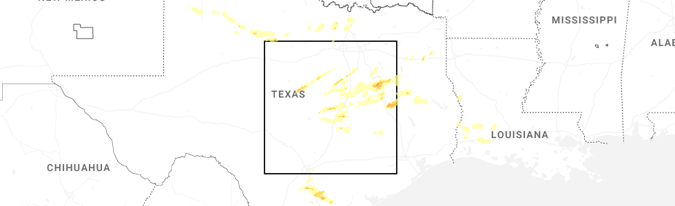
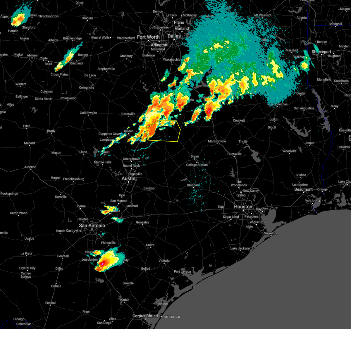
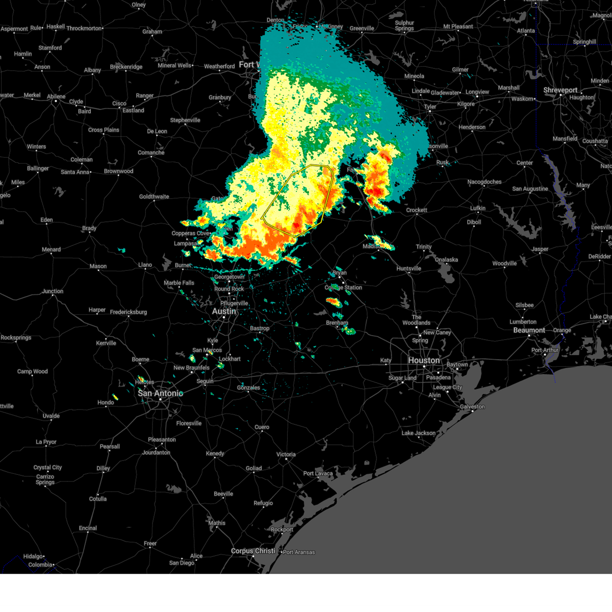
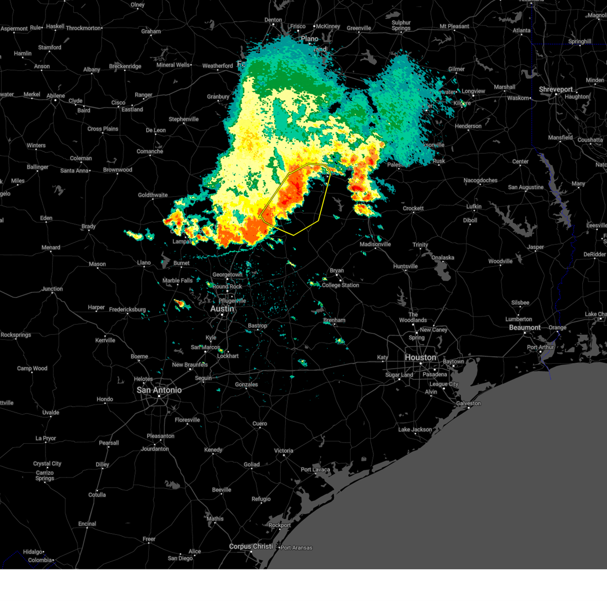
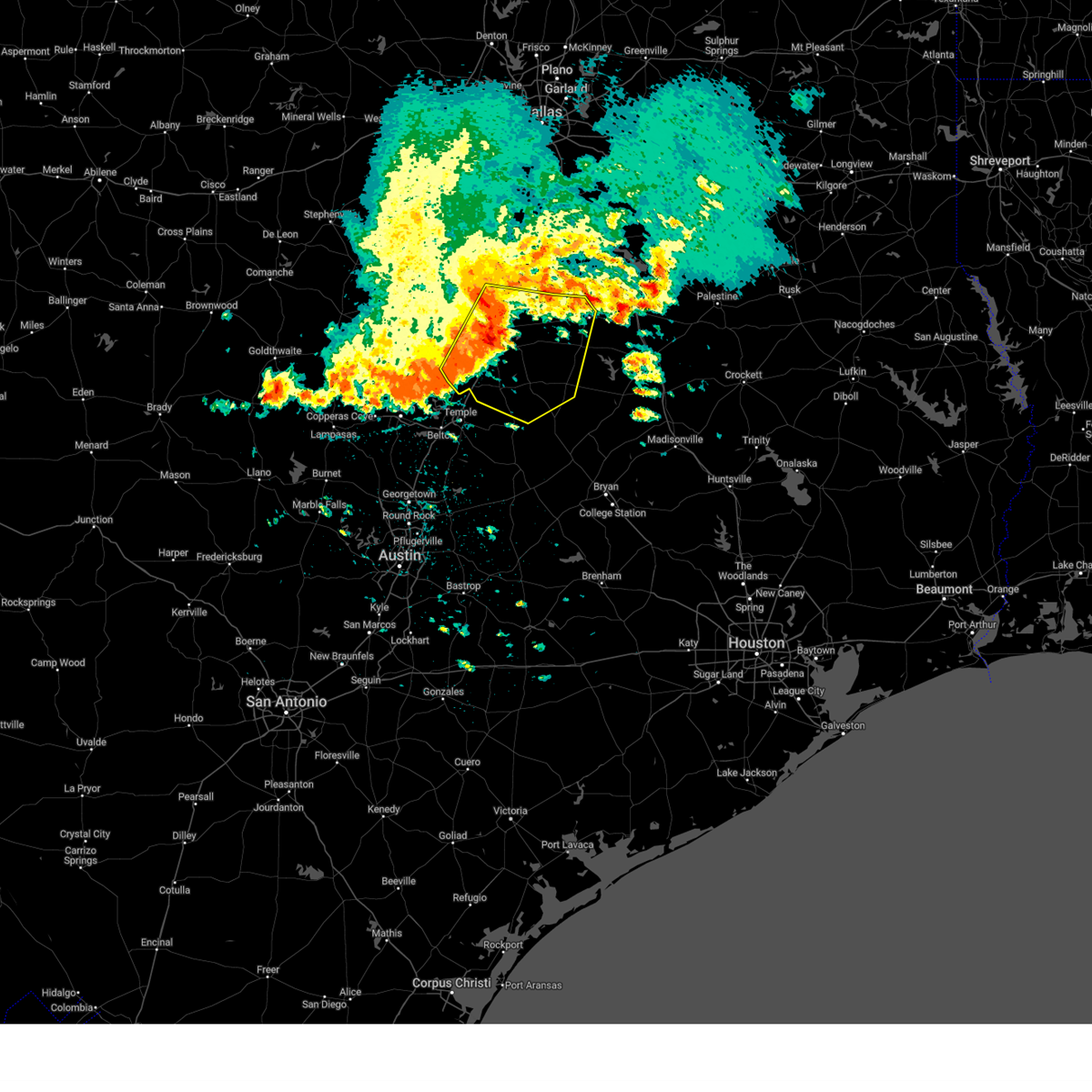
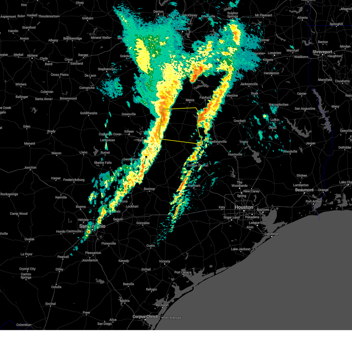
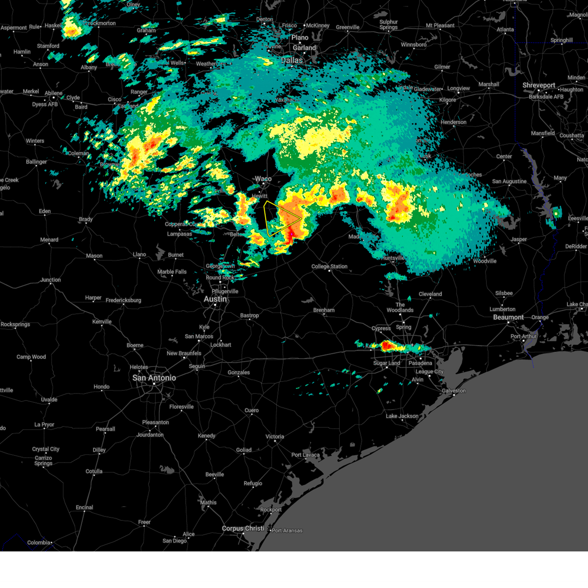
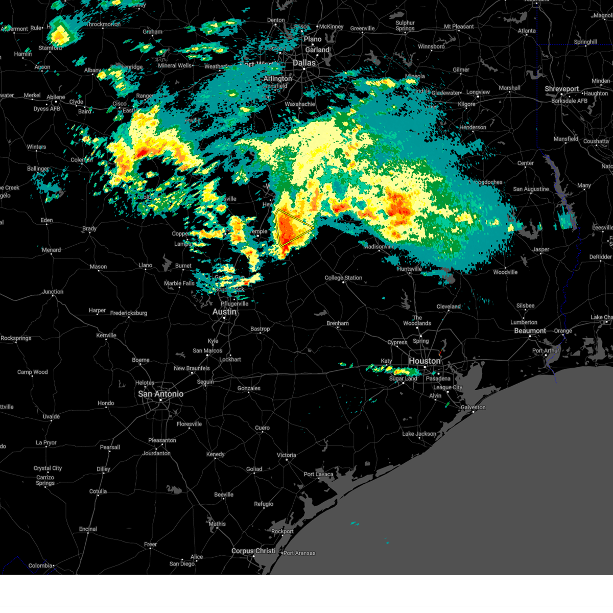
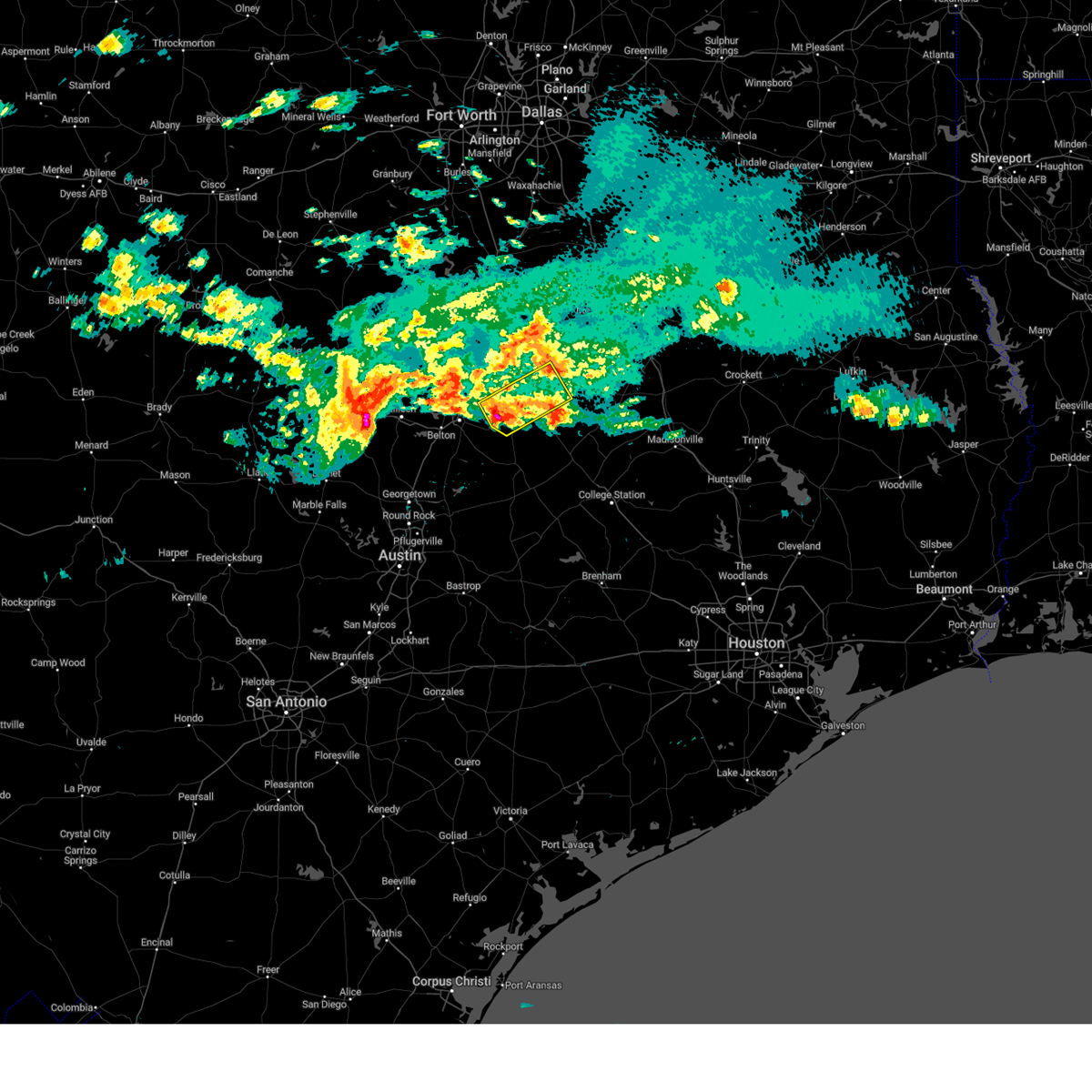
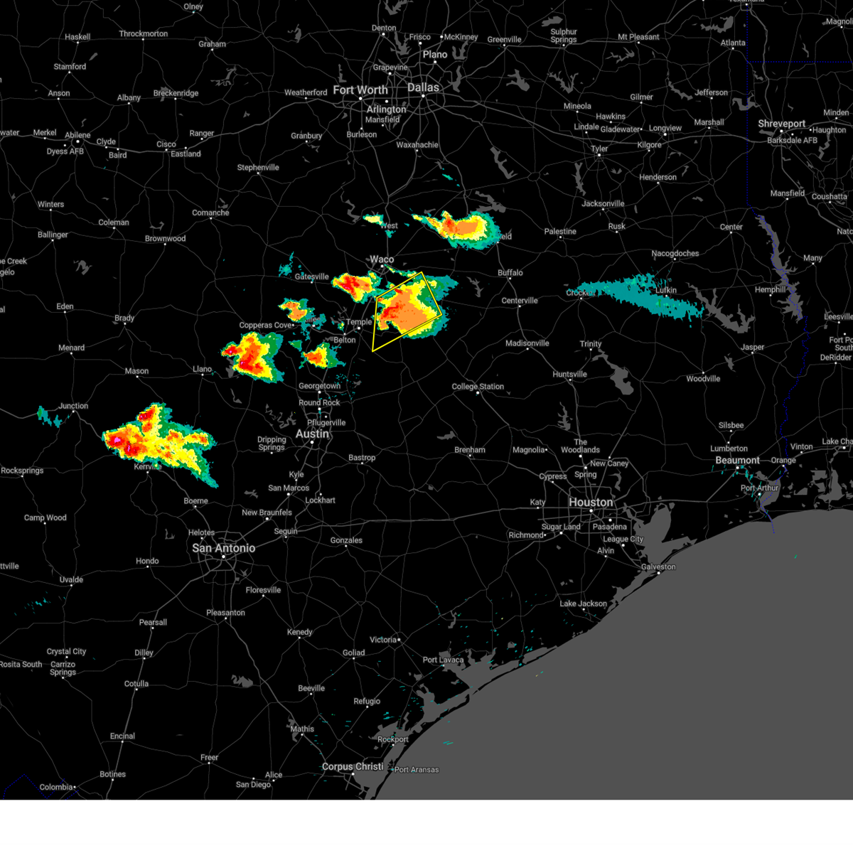
Hail Map for Chilton, TX
The Chilton, TX area has had 4 reports of on-the-ground hail by trained spotters, and has been under severe weather warnings 15 times during the past 12 months. Doppler radar has detected hail at or near Chilton, TX on 52 occasions, including 4 occasions during the past year.
| Name: | Chilton, TX |
| Where Located: | 41.3 miles ENE of Killeen, TX |
| Map: | Google Map for Chilton, TX |
| Population: | 911 |
| Housing Units: | 303 |
| More Info: | Search Google for Chilton, TX |
1
The Top Recent Hail Date for Chilton, TX is Wednesday, April 30, 2025 (14th out of 52)
Hail and Wind Damage Spotted near Chilton, TX
| Date / Time | Report Details |
|---|---|
| 6/1/2025 5:03 PM CDT | Quarter sized hail reported 2.3 miles SE of Chilton, TX, report from mping: quarter (1.00 in.). |
| 5/26/2025 9:26 PM CDT |
 Svrfwd the national weather service in fort worth has issued a * severe thunderstorm warning for, robertson county in central texas, milam county in central texas, eastern bell county in central texas, southeastern limestone county in central texas, falls county in central texas, * until 1015 pm cdt. * at 925 pm cdt, a severe thunderstorm was located near cameron, moving east at 55 mph (trained weather spotters). Hazards include 70 mph wind gusts and quarter size hail. Hail damage to vehicles is expected. expect considerable tree damage. wind damage is also likely to mobile homes, roofs, and outbuildings. this severe thunderstorm will be near, cameron around 930 pm cdt. calvert and hearne around 945 pm cdt. other locations impacted by this severe thunderstorm include barclay, moffat, sharp, yarrelton, hoyte, pettibone, reagan, new baden, davilla, and elevation. This includes interstate 35 between mile markers 290 and 313. Svrfwd the national weather service in fort worth has issued a * severe thunderstorm warning for, robertson county in central texas, milam county in central texas, eastern bell county in central texas, southeastern limestone county in central texas, falls county in central texas, * until 1015 pm cdt. * at 925 pm cdt, a severe thunderstorm was located near cameron, moving east at 55 mph (trained weather spotters). Hazards include 70 mph wind gusts and quarter size hail. Hail damage to vehicles is expected. expect considerable tree damage. wind damage is also likely to mobile homes, roofs, and outbuildings. this severe thunderstorm will be near, cameron around 930 pm cdt. calvert and hearne around 945 pm cdt. other locations impacted by this severe thunderstorm include barclay, moffat, sharp, yarrelton, hoyte, pettibone, reagan, new baden, davilla, and elevation. This includes interstate 35 between mile markers 290 and 313.
|
| 5/2/2025 4:12 PM CDT | the severe thunderstorm warning has been cancelled and is no longer in effect |
| 5/2/2025 3:30 PM CDT | Svrfwd the national weather service in fort worth has issued a * severe thunderstorm warning for, southern mclennan county in central texas, bell county in central texas, falls county in central texas, * until 430 pm cdt. * at 329 pm cdt, a line of severe thunderstorms was located from mart to salado, moving southeast at 30 mph (radar indicated). Hazards include 60 mph wind gusts and quarter size hail. Hail damage to vehicles is expected. expect wind damage to roofs, siding, and trees. this severe thunderstorm will be near, rosebud around 355 pm cdt. other locations impacted by this severe thunderstorm include barclay, cedar valley, moffat, mooreville, owl creek, reagan, prairie dell, asa, meadow grove, and woodland. This includes interstate 35 between mile markers 277 and 338. |
| 5/2/2025 3:19 PM CDT |
 At 318 pm cdt, a severe thunderstorm was located over moody, or 11 miles south of mcgregor, moving southeast at 30 mph (radar indicated). Hazards include 65 mph wind gusts and quarter size hail. Hail damage to vehicles is expected. expect wind damage to roofs, siding, and trees. this severe storm will be near, troy and bruceville-eddy around 325 pm cdt. Other locations impacted by this severe thunderstorm include cedar valley, whitson, moffat, willow grove, mooreville, oglesby, owl creek, prairie dell, asa, and meadow grove. At 318 pm cdt, a severe thunderstorm was located over moody, or 11 miles south of mcgregor, moving southeast at 30 mph (radar indicated). Hazards include 65 mph wind gusts and quarter size hail. Hail damage to vehicles is expected. expect wind damage to roofs, siding, and trees. this severe storm will be near, troy and bruceville-eddy around 325 pm cdt. Other locations impacted by this severe thunderstorm include cedar valley, whitson, moffat, willow grove, mooreville, oglesby, owl creek, prairie dell, asa, and meadow grove.
|
| 5/2/2025 3:19 PM CDT |
 the severe thunderstorm warning has been cancelled and is no longer in effect the severe thunderstorm warning has been cancelled and is no longer in effect
|
| 5/2/2025 2:58 PM CDT |
 Svrfwd the national weather service in fort worth has issued a * severe thunderstorm warning for, southern mclennan county in central texas, eastern coryell county in central texas, southeastern lampasas county in central texas, bell county in central texas, northwestern falls county in central texas, * until 330 pm cdt. * at 257 pm cdt, a severe thunderstorm was located near mother neff state park, or 7 miles southwest of mcgregor, moving southeast at 35 mph (radar indicated). Hazards include 65 mph wind gusts and quarter size hail. Hail damage to vehicles is expected. expect wind damage to roofs, siding, and trees. this severe thunderstorm will be near, mother neff state park and mcgregor around 305 pm cdt. moody around 310 pm cdt. bruceville-eddy around 315 pm cdt. lorena around 320 pm cdt. other locations impacted by this severe thunderstorm include cedar valley, whitson, moffat, willow grove, mooreville, oglesby, owl creek, prairie dell, asa, and meadow grove. This includes interstate 35 between mile markers 278 and 333. Svrfwd the national weather service in fort worth has issued a * severe thunderstorm warning for, southern mclennan county in central texas, eastern coryell county in central texas, southeastern lampasas county in central texas, bell county in central texas, northwestern falls county in central texas, * until 330 pm cdt. * at 257 pm cdt, a severe thunderstorm was located near mother neff state park, or 7 miles southwest of mcgregor, moving southeast at 35 mph (radar indicated). Hazards include 65 mph wind gusts and quarter size hail. Hail damage to vehicles is expected. expect wind damage to roofs, siding, and trees. this severe thunderstorm will be near, mother neff state park and mcgregor around 305 pm cdt. moody around 310 pm cdt. bruceville-eddy around 315 pm cdt. lorena around 320 pm cdt. other locations impacted by this severe thunderstorm include cedar valley, whitson, moffat, willow grove, mooreville, oglesby, owl creek, prairie dell, asa, and meadow grove. This includes interstate 35 between mile markers 278 and 333.
|
| 4/30/2025 7:19 PM CDT | At 718 pm cdt, a severe thunderstorm was located near lott, or 15 miles southwest of marlin, moving east at 30 mph (radar indicated). Hazards include 60 mph wind gusts and quarter size hail. Hail damage to vehicles is expected. expect wind damage to roofs, siding, and trees. this severe storm will be near, lott around 725 pm cdt. bremond around 805 pm cdt. Other locations impacted by this severe thunderstorm include barclay, baileyville, mooreville, reagan, oenaville, highbank, terrys chapel, pleasant grove, satin, and burlington. |
| 4/30/2025 6:58 PM CDT |
 Svrfwd the national weather service in fort worth has issued a * severe thunderstorm warning for, west central robertson county in central texas, northeastern milam county in central texas, northeastern bell county in central texas, falls county in central texas, * until 800 pm cdt. * at 658 pm cdt, a severe thunderstorm was located near troy, or near temple, moving east at 30 mph (radar indicated). Hazards include half dollar size hail. Damage to vehicles is possible. this severe thunderstorm will be near, lott around 720 pm cdt. other locations impacted by this severe thunderstorm include barclay, baileyville, mooreville, reagan, oenaville, highbank, terrys chapel, pleasant grove, satin, and burlington. This includes interstate 35 between mile markers 300 and 314. Svrfwd the national weather service in fort worth has issued a * severe thunderstorm warning for, west central robertson county in central texas, northeastern milam county in central texas, northeastern bell county in central texas, falls county in central texas, * until 800 pm cdt. * at 658 pm cdt, a severe thunderstorm was located near troy, or near temple, moving east at 30 mph (radar indicated). Hazards include half dollar size hail. Damage to vehicles is possible. this severe thunderstorm will be near, lott around 720 pm cdt. other locations impacted by this severe thunderstorm include barclay, baileyville, mooreville, reagan, oenaville, highbank, terrys chapel, pleasant grove, satin, and burlington. This includes interstate 35 between mile markers 300 and 314.
|
| 4/24/2025 3:27 PM CDT |
 The storm which prompted the warning has weakened below severe limits, and has exited the warned area. therefore, the warning will be allowed to expire. however gusty winds and heavy rain are still possible with this thunderstorm. a severe thunderstorm watch remains in effect until 800 pm cdt for central texas. remember, a severe thunderstorm warning still remains in effect for southeast limestone and southern freestone counties. The storm which prompted the warning has weakened below severe limits, and has exited the warned area. therefore, the warning will be allowed to expire. however gusty winds and heavy rain are still possible with this thunderstorm. a severe thunderstorm watch remains in effect until 800 pm cdt for central texas. remember, a severe thunderstorm warning still remains in effect for southeast limestone and southern freestone counties.
|
| 4/24/2025 2:56 PM CDT |
 the severe thunderstorm warning has been cancelled and is no longer in effect the severe thunderstorm warning has been cancelled and is no longer in effect
|
| 4/24/2025 2:56 PM CDT |
 At 255 pm cdt, a severe thunderstorm was located near mart, or 12 miles north of marlin, moving east at 30 mph (public). Hazards include 65 mph wind gusts and quarter size hail. Hail damage to vehicles is expected. expect wind damage to roofs, siding, and trees. this severe storm will be near, mart around 300 pm cdt. Other locations impacted by this severe thunderstorm include wilderville, ben hur, watt, otto, mooreville, tehuacana, reagan, asa, prairie hill, and perry. At 255 pm cdt, a severe thunderstorm was located near mart, or 12 miles north of marlin, moving east at 30 mph (public). Hazards include 65 mph wind gusts and quarter size hail. Hail damage to vehicles is expected. expect wind damage to roofs, siding, and trees. this severe storm will be near, mart around 300 pm cdt. Other locations impacted by this severe thunderstorm include wilderville, ben hur, watt, otto, mooreville, tehuacana, reagan, asa, prairie hill, and perry.
|
| 4/24/2025 2:24 PM CDT |
 Svrfwd the national weather service in fort worth has issued a * severe thunderstorm warning for, mclennan county in central texas, limestone county in central texas, southeastern hill county in central texas, falls county in central texas, * until 330 pm cdt. * at 223 pm cdt, a severe thunderstorm was located over bellmead, moving east at 45 mph (local observations). Hazards include 65 mph wind gusts and quarter size hail. Hail damage to vehicles is expected. expect wind damage to roofs, siding, and trees. this severe thunderstorm will be near, tradinghouse creek reservoir and hallsburg around 230 pm cdt. riesel and lake creek lake around 235 pm cdt. mart around 240 pm cdt. other locations impacted by this severe thunderstorm include rock creek, watt, willow grove, mooreville, reagan, asa, prairie hill, perry, thornton, and highbank. This includes interstate 35 between mile markers 313 and 355. Svrfwd the national weather service in fort worth has issued a * severe thunderstorm warning for, mclennan county in central texas, limestone county in central texas, southeastern hill county in central texas, falls county in central texas, * until 330 pm cdt. * at 223 pm cdt, a severe thunderstorm was located over bellmead, moving east at 45 mph (local observations). Hazards include 65 mph wind gusts and quarter size hail. Hail damage to vehicles is expected. expect wind damage to roofs, siding, and trees. this severe thunderstorm will be near, tradinghouse creek reservoir and hallsburg around 230 pm cdt. riesel and lake creek lake around 235 pm cdt. mart around 240 pm cdt. other locations impacted by this severe thunderstorm include rock creek, watt, willow grove, mooreville, reagan, asa, prairie hill, perry, thornton, and highbank. This includes interstate 35 between mile markers 313 and 355.
|
| 3/4/2025 6:42 AM CST |
 the severe thunderstorm warning has been cancelled and is no longer in effect the severe thunderstorm warning has been cancelled and is no longer in effect
|
| 3/4/2025 6:42 AM CST |
 At 642 am cst, severe thunderstorms were located along a line extending from mart to marlin to rosebud, moving east at 55 mph (radar indicated). Hazards include 60 mph wind gusts and quarter size hail. Hail damage to vehicles is expected. expect wind damage to roofs, siding, and trees. these severe storms will be near, rosebud, mart, and marlin around 645 am cst. groesbeck and bremond around 655 am cst. twin oak reservoir and lake limestone around 705 am cst. franklin around 710 am cst. camp creek lake around 720 am cst. Other locations impacted by these severe thunderstorms include barclay, baileyville, fallon, reagan, new baden, asa, perry, thornton, highbank, and terrys chapel. At 642 am cst, severe thunderstorms were located along a line extending from mart to marlin to rosebud, moving east at 55 mph (radar indicated). Hazards include 60 mph wind gusts and quarter size hail. Hail damage to vehicles is expected. expect wind damage to roofs, siding, and trees. these severe storms will be near, rosebud, mart, and marlin around 645 am cst. groesbeck and bremond around 655 am cst. twin oak reservoir and lake limestone around 705 am cst. franklin around 710 am cst. camp creek lake around 720 am cst. Other locations impacted by these severe thunderstorms include barclay, baileyville, fallon, reagan, new baden, asa, perry, thornton, highbank, and terrys chapel.
|
| 3/4/2025 6:21 AM CST |
 Svrfwd the national weather service in fort worth has issued a * severe thunderstorm warning for, southeastern mclennan county in central texas, robertson county in central texas, north central milam county in central texas, northeastern bell county in central texas, southern limestone county in central texas, falls county in central texas, * until 715 am cst. * at 621 am cst, severe thunderstorms were located along a line extending from beverly hills to 8 miles southeast of troy, moving east at 55 mph (radar indicated). Hazards include 60 mph wind gusts and quarter size hail. Hail damage to vehicles is expected. expect wind damage to roofs, siding, and trees. severe thunderstorms will be near, waco, beverly hills, golinda, and robinson around 625 am cst. tradinghouse creek reservoir, riesel, hallsburg, lott, and lake creek lake around 630 am cst. rosebud and marlin around 635 am cst. mart around 640 am cst. bremond around 650 am cst. groesbeck around 700 am cst. twin oak reservoir, franklin, and lake limestone around 705 am cst. other locations impacted by these severe thunderstorms include barclay, baileyville, fallon, mooreville, reagan, new baden, asa, oenaville, perry, and thornton. This includes interstate 35 between mile markers 314 and 334. Svrfwd the national weather service in fort worth has issued a * severe thunderstorm warning for, southeastern mclennan county in central texas, robertson county in central texas, north central milam county in central texas, northeastern bell county in central texas, southern limestone county in central texas, falls county in central texas, * until 715 am cst. * at 621 am cst, severe thunderstorms were located along a line extending from beverly hills to 8 miles southeast of troy, moving east at 55 mph (radar indicated). Hazards include 60 mph wind gusts and quarter size hail. Hail damage to vehicles is expected. expect wind damage to roofs, siding, and trees. severe thunderstorms will be near, waco, beverly hills, golinda, and robinson around 625 am cst. tradinghouse creek reservoir, riesel, hallsburg, lott, and lake creek lake around 630 am cst. rosebud and marlin around 635 am cst. mart around 640 am cst. bremond around 650 am cst. groesbeck around 700 am cst. twin oak reservoir, franklin, and lake limestone around 705 am cst. other locations impacted by these severe thunderstorms include barclay, baileyville, fallon, mooreville, reagan, new baden, asa, oenaville, perry, and thornton. This includes interstate 35 between mile markers 314 and 334.
|
| 5/31/2024 4:00 AM CDT |
 At 359 am cdt, severe thunderstorms were located along a line extending from 10 miles northeast of tradinghouse creek reservoir to 8 miles south of marlin to near salado, moving southeast at 55 mph (radar indicated). Hazards include 60 mph wind gusts and penny size hail. Expect damage to roofs, siding, and trees. these severe storms will be near, marlin, bartlett, mart, rosebud, rogers, and holland around 405 am cdt. bremond and buckholts around 410 am cdt. cameron, lake mexia, and fort parker state park around 415 am cdt. groesbeck, calvert, and twin oak reservoir around 420 am cdt. lake limestone around 425 am cdt. Other locations impacted by these severe thunderstorms include barclay, mooreville, sharp, yarrelton, pettibone, reagan, davilla, perry, highbank, and val verde. At 359 am cdt, severe thunderstorms were located along a line extending from 10 miles northeast of tradinghouse creek reservoir to 8 miles south of marlin to near salado, moving southeast at 55 mph (radar indicated). Hazards include 60 mph wind gusts and penny size hail. Expect damage to roofs, siding, and trees. these severe storms will be near, marlin, bartlett, mart, rosebud, rogers, and holland around 405 am cdt. bremond and buckholts around 410 am cdt. cameron, lake mexia, and fort parker state park around 415 am cdt. groesbeck, calvert, and twin oak reservoir around 420 am cdt. lake limestone around 425 am cdt. Other locations impacted by these severe thunderstorms include barclay, mooreville, sharp, yarrelton, pettibone, reagan, davilla, perry, highbank, and val verde.
|
| 5/31/2024 4:00 AM CDT |
 the severe thunderstorm warning has been cancelled and is no longer in effect the severe thunderstorm warning has been cancelled and is no longer in effect
|
| 5/31/2024 3:28 AM CDT |
 Svrfwd the national weather service in fort worth has issued a * severe thunderstorm warning for, mclennan county in central texas, northern robertson county in central texas, northern milam county in central texas, southeastern bosque county in central texas, bell county in central texas, limestone county in central texas, falls county in central texas, * until 430 am cdt. * at 327 am cdt, severe thunderstorms were located along a line extending from near laguna park to near mcgregor to fort cavazos, moving east at 60 mph (radar indicated). Hazards include 60 mph wind gusts and nickel size hail. Expect damage to roofs, siding, and trees. severe thunderstorms will be near, killeen, waco, temple, harker heights, belton, hewitt, robinson, bellmead, woodway, and lacy-lakeview around 335 am cdt. west, stillhouse hollow lake, and northcrest around 340 am cdt. riesel, hallsburg, tradinghouse creek reservoir, and lake creek lake around 345 am cdt. marlin, little river-academy, and lott around 350 am cdt. mart around 355 am cdt. rosebud around 400 am cdt. coolidge and lake mexia around 405 am cdt. groesbeck, bremond, and fort parker state park around 410 am cdt. other locations impacted by these severe thunderstorms include barclay, rock creek, moffat, mooreville, sharp, yarrelton, pettibone, reagan, davilla, and meadow grove. This includes interstate 35 between mile markers 278 and 354. Svrfwd the national weather service in fort worth has issued a * severe thunderstorm warning for, mclennan county in central texas, northern robertson county in central texas, northern milam county in central texas, southeastern bosque county in central texas, bell county in central texas, limestone county in central texas, falls county in central texas, * until 430 am cdt. * at 327 am cdt, severe thunderstorms were located along a line extending from near laguna park to near mcgregor to fort cavazos, moving east at 60 mph (radar indicated). Hazards include 60 mph wind gusts and nickel size hail. Expect damage to roofs, siding, and trees. severe thunderstorms will be near, killeen, waco, temple, harker heights, belton, hewitt, robinson, bellmead, woodway, and lacy-lakeview around 335 am cdt. west, stillhouse hollow lake, and northcrest around 340 am cdt. riesel, hallsburg, tradinghouse creek reservoir, and lake creek lake around 345 am cdt. marlin, little river-academy, and lott around 350 am cdt. mart around 355 am cdt. rosebud around 400 am cdt. coolidge and lake mexia around 405 am cdt. groesbeck, bremond, and fort parker state park around 410 am cdt. other locations impacted by these severe thunderstorms include barclay, rock creek, moffat, mooreville, sharp, yarrelton, pettibone, reagan, davilla, and meadow grove. This includes interstate 35 between mile markers 278 and 354.
|
| 5/30/2024 5:10 PM CDT |
 the severe thunderstorm warning has been cancelled and is no longer in effect the severe thunderstorm warning has been cancelled and is no longer in effect
|
| 5/30/2024 5:01 PM CDT |
 At 501 pm cdt, a severe thunderstorm was located over hewitt, moving southeast at 30 mph (radar indicated). Hazards include 60 mph wind gusts and quarter size hail. Hail damage to vehicles is expected. expect wind damage to roofs, siding, and trees. this severe storm will be near, hewitt, robinson, and lorena around 505 pm cdt. golinda around 510 pm cdt. marlin around 535 pm cdt. Other locations impacted by this severe thunderstorm include perry, downsville, satin, otto, mooreville, chilton, asa, spring valley, tomlinson hill, and mcclanahan. At 501 pm cdt, a severe thunderstorm was located over hewitt, moving southeast at 30 mph (radar indicated). Hazards include 60 mph wind gusts and quarter size hail. Hail damage to vehicles is expected. expect wind damage to roofs, siding, and trees. this severe storm will be near, hewitt, robinson, and lorena around 505 pm cdt. golinda around 510 pm cdt. marlin around 535 pm cdt. Other locations impacted by this severe thunderstorm include perry, downsville, satin, otto, mooreville, chilton, asa, spring valley, tomlinson hill, and mcclanahan.
|
| 5/30/2024 4:23 PM CDT |
 Svrfwd the national weather service in fort worth has issued a * severe thunderstorm warning for, central mclennan county in central texas, northwestern falls county in central texas, * until 530 pm cdt. * at 422 pm cdt, a severe thunderstorm was located near crawford, or 9 miles northwest of mcgregor, moving southeast at 25 mph (radar indicated). Hazards include 60 mph wind gusts and half dollar size hail. Hail damage to vehicles is expected. expect wind damage to roofs, siding, and trees. this severe thunderstorm will be near, crawford around 430 pm cdt. waco and mcgregor around 435 pm cdt. woodway and lake waco around 445 pm cdt. hewitt around 450 pm cdt. robinson and lorena around 500 pm cdt. golinda around 510 pm cdt. other locations impacted by this severe thunderstorm include otto, willow grove, mooreville, asa, spring valley, perry, downsville, satin, chilton, and tomlinson hill. This includes interstate 35 between mile markers 317 and 337. Svrfwd the national weather service in fort worth has issued a * severe thunderstorm warning for, central mclennan county in central texas, northwestern falls county in central texas, * until 530 pm cdt. * at 422 pm cdt, a severe thunderstorm was located near crawford, or 9 miles northwest of mcgregor, moving southeast at 25 mph (radar indicated). Hazards include 60 mph wind gusts and half dollar size hail. Hail damage to vehicles is expected. expect wind damage to roofs, siding, and trees. this severe thunderstorm will be near, crawford around 430 pm cdt. waco and mcgregor around 435 pm cdt. woodway and lake waco around 445 pm cdt. hewitt around 450 pm cdt. robinson and lorena around 500 pm cdt. golinda around 510 pm cdt. other locations impacted by this severe thunderstorm include otto, willow grove, mooreville, asa, spring valley, perry, downsville, satin, chilton, and tomlinson hill. This includes interstate 35 between mile markers 317 and 337.
|
| 5/26/2024 10:02 AM CDT |
 the severe thunderstorm warning has been cancelled and is no longer in effect the severe thunderstorm warning has been cancelled and is no longer in effect
|
| 5/26/2024 9:34 AM CDT |
 At 933 am cdt, severe thunderstorms were located along a line extending from near troy to near lott, moving east at 45 mph (radar indicated). Hazards include quarter size hail. Damage to vehicles is possible. These severe storms will be near, marlin and lott around 940 am cdt. At 933 am cdt, severe thunderstorms were located along a line extending from near troy to near lott, moving east at 45 mph (radar indicated). Hazards include quarter size hail. Damage to vehicles is possible. These severe storms will be near, marlin and lott around 940 am cdt.
|
| 5/26/2024 9:34 AM CDT |
 the severe thunderstorm warning has been cancelled and is no longer in effect the severe thunderstorm warning has been cancelled and is no longer in effect
|
| 5/26/2024 9:14 AM CDT |
 Svrfwd the national weather service in fort worth has issued a * severe thunderstorm warning for, southeastern mclennan county in central texas, northeastern bell county in central texas, falls county in central texas, * until 1015 am cdt. * at 913 am cdt, a severe thunderstorm was located over troy, moving east at 45 mph (radar indicated). Hazards include half dollar size hail. Damage to vehicles is possible. This severe thunderstorm will be near, lott around 925 am cdt. Svrfwd the national weather service in fort worth has issued a * severe thunderstorm warning for, southeastern mclennan county in central texas, northeastern bell county in central texas, falls county in central texas, * until 1015 am cdt. * at 913 am cdt, a severe thunderstorm was located over troy, moving east at 45 mph (radar indicated). Hazards include half dollar size hail. Damage to vehicles is possible. This severe thunderstorm will be near, lott around 925 am cdt.
|
| 5/23/2024 6:13 PM CDT |
 At 612 pm cdt, a severe thunderstorm capable of producing a tornado was located near marlin, moving east at 25 mph (radar indicated rotation). Hazards include tornado and ping pong ball size hail. Flying debris will be dangerous to those caught without shelter. mobile homes will be damaged or destroyed. damage to roofs, windows, and vehicles will occur. tree damage is likely. this dangerous storm will be near, marlin around 620 pm cdt. Other locations impacted by this tornadic thunderstorm include reagan, satin, mcclanahan, and tomlinson hill. At 612 pm cdt, a severe thunderstorm capable of producing a tornado was located near marlin, moving east at 25 mph (radar indicated rotation). Hazards include tornado and ping pong ball size hail. Flying debris will be dangerous to those caught without shelter. mobile homes will be damaged or destroyed. damage to roofs, windows, and vehicles will occur. tree damage is likely. this dangerous storm will be near, marlin around 620 pm cdt. Other locations impacted by this tornadic thunderstorm include reagan, satin, mcclanahan, and tomlinson hill.
|
| 5/23/2024 6:01 PM CDT |
 At 600 pm cdt, a severe thunderstorm capable of producing a tornado was located near lott, or near marlin, moving east at 20 mph (radar indicated rotation). Hazards include tornado and ping pong ball size hail. Flying debris will be dangerous to those caught without shelter. mobile homes will be damaged or destroyed. damage to roofs, windows, and vehicles will occur. tree damage is likely. this dangerous storm will be near, marlin around 605 pm cdt. Other locations impacted by this tornadic thunderstorm include chilton, satin, mcclanahan, and tomlinson hill. At 600 pm cdt, a severe thunderstorm capable of producing a tornado was located near lott, or near marlin, moving east at 20 mph (radar indicated rotation). Hazards include tornado and ping pong ball size hail. Flying debris will be dangerous to those caught without shelter. mobile homes will be damaged or destroyed. damage to roofs, windows, and vehicles will occur. tree damage is likely. this dangerous storm will be near, marlin around 605 pm cdt. Other locations impacted by this tornadic thunderstorm include chilton, satin, mcclanahan, and tomlinson hill.
|
| 5/23/2024 6:01 PM CDT |
 the tornado warning has been cancelled and is no longer in effect the tornado warning has been cancelled and is no longer in effect
|
| 5/23/2024 5:57 PM CDT |
 Torfwd the national weather service in fort worth has issued a * tornado warning for, central falls county in central texas, * until 645 pm cdt. * at 557 pm cdt, a severe thunderstorm capable of producing a tornado was located near lott, or 7 miles southwest of marlin, moving east at 25 mph (radar indicated rotation). Hazards include tornado and ping pong ball size hail. Flying debris will be dangerous to those caught without shelter. mobile homes will be damaged or destroyed. damage to roofs, windows, and vehicles will occur. tree damage is likely. this dangerous storm will be near, marlin around 605 pm cdt. Other locations impacted by this tornadic thunderstorm include chilton, reagan, satin, mcclanahan, and tomlinson hill. Torfwd the national weather service in fort worth has issued a * tornado warning for, central falls county in central texas, * until 645 pm cdt. * at 557 pm cdt, a severe thunderstorm capable of producing a tornado was located near lott, or 7 miles southwest of marlin, moving east at 25 mph (radar indicated rotation). Hazards include tornado and ping pong ball size hail. Flying debris will be dangerous to those caught without shelter. mobile homes will be damaged or destroyed. damage to roofs, windows, and vehicles will occur. tree damage is likely. this dangerous storm will be near, marlin around 605 pm cdt. Other locations impacted by this tornadic thunderstorm include chilton, reagan, satin, mcclanahan, and tomlinson hill.
|
| 5/23/2024 5:53 PM CDT |
 At 553 pm cdt, a severe thunderstorm capable of producing a tornado was located near golinda, or 9 miles west of marlin, moving east at 25 mph (radar indicated rotation). Hazards include tornado and quarter size hail. Flying debris will be dangerous to those caught without shelter. mobile homes will be damaged or destroyed. damage to roofs, windows, and vehicles will occur. tree damage is likely. this dangerous storm will be near, marlin around 605 pm cdt. Other locations impacted by this tornadic thunderstorm include perry, downsville, satin, mooreville, chilton, asa, mcclanahan, and tomlinson hill. At 553 pm cdt, a severe thunderstorm capable of producing a tornado was located near golinda, or 9 miles west of marlin, moving east at 25 mph (radar indicated rotation). Hazards include tornado and quarter size hail. Flying debris will be dangerous to those caught without shelter. mobile homes will be damaged or destroyed. damage to roofs, windows, and vehicles will occur. tree damage is likely. this dangerous storm will be near, marlin around 605 pm cdt. Other locations impacted by this tornadic thunderstorm include perry, downsville, satin, mooreville, chilton, asa, mcclanahan, and tomlinson hill.
|
| 5/23/2024 5:40 PM CDT |
 At 539 pm cdt, a severe thunderstorm capable of producing a tornado was located near golinda, or 10 miles south of robinson, moving northeast at 20 mph (radar indicated rotation). Hazards include tornado and quarter size hail. Flying debris will be dangerous to those caught without shelter. mobile homes will be damaged or destroyed. damage to roofs, windows, and vehicles will occur. tree damage is likely. this dangerous storm will be near, golinda around 545 pm cdt. riesel and lake creek lake around 615 pm cdt. Other locations impacted by this tornadic thunderstorm include perry, downsville, satin, cego, mooreville, chilton, asa, mcclanahan, and tomlinson hill. At 539 pm cdt, a severe thunderstorm capable of producing a tornado was located near golinda, or 10 miles south of robinson, moving northeast at 20 mph (radar indicated rotation). Hazards include tornado and quarter size hail. Flying debris will be dangerous to those caught without shelter. mobile homes will be damaged or destroyed. damage to roofs, windows, and vehicles will occur. tree damage is likely. this dangerous storm will be near, golinda around 545 pm cdt. riesel and lake creek lake around 615 pm cdt. Other locations impacted by this tornadic thunderstorm include perry, downsville, satin, cego, mooreville, chilton, asa, mcclanahan, and tomlinson hill.
|
| 5/23/2024 5:28 PM CDT |
 Torfwd the national weather service in fort worth has issued a * tornado warning for, southeastern mclennan county in central texas, northern falls county in central texas, * until 615 pm cdt. * at 528 pm cdt, a severe thunderstorm capable of producing a tornado was located over bruceville-eddy, or 11 miles south of hewitt, moving northeast at 20 mph (radar indicated rotation). Hazards include tornado and quarter size hail. Flying debris will be dangerous to those caught without shelter. mobile homes will be damaged or destroyed. damage to roofs, windows, and vehicles will occur. tree damage is likely. this dangerous storm will be near, lorena and bruceville-eddy around 535 pm cdt. robinson and golinda around 545 pm cdt. other locations impacted by this tornadic thunderstorm include perry, downsville, satin, cego, mooreville, chilton, asa, mcclanahan, and tomlinson hill. This includes interstate 35 between mile markers 313 and 328. Torfwd the national weather service in fort worth has issued a * tornado warning for, southeastern mclennan county in central texas, northern falls county in central texas, * until 615 pm cdt. * at 528 pm cdt, a severe thunderstorm capable of producing a tornado was located over bruceville-eddy, or 11 miles south of hewitt, moving northeast at 20 mph (radar indicated rotation). Hazards include tornado and quarter size hail. Flying debris will be dangerous to those caught without shelter. mobile homes will be damaged or destroyed. damage to roofs, windows, and vehicles will occur. tree damage is likely. this dangerous storm will be near, lorena and bruceville-eddy around 535 pm cdt. robinson and golinda around 545 pm cdt. other locations impacted by this tornadic thunderstorm include perry, downsville, satin, cego, mooreville, chilton, asa, mcclanahan, and tomlinson hill. This includes interstate 35 between mile markers 313 and 328.
|
| 5/23/2024 2:27 PM CDT |
 The storm which prompted the warning has weakened below severe limits. therefore the warning will be allowed to expire. however small hail, gusty winds and heavy rain are still possible with this thunderstorm. The storm which prompted the warning has weakened below severe limits. therefore the warning will be allowed to expire. however small hail, gusty winds and heavy rain are still possible with this thunderstorm.
|
| 5/23/2024 2:16 PM CDT |
 At 216 pm cdt, a severe thunderstorm was located over lake creek lake, or 7 miles east of robinson, moving east at 35 mph (radar indicated). Hazards include 60 mph wind gusts and quarter size hail. Hail damage to vehicles is expected. expect wind damage to roofs, siding, and trees. this severe storm will be near, riesel, hallsburg, and lake creek lake around 220 pm cdt. Other locations impacted by this severe thunderstorm include perry, downsville, satin, otto, mooreville, chilton, asa, mcclanahan, and tomlinson hill. At 216 pm cdt, a severe thunderstorm was located over lake creek lake, or 7 miles east of robinson, moving east at 35 mph (radar indicated). Hazards include 60 mph wind gusts and quarter size hail. Hail damage to vehicles is expected. expect wind damage to roofs, siding, and trees. this severe storm will be near, riesel, hallsburg, and lake creek lake around 220 pm cdt. Other locations impacted by this severe thunderstorm include perry, downsville, satin, otto, mooreville, chilton, asa, mcclanahan, and tomlinson hill.
|
| 5/23/2024 2:16 PM CDT |
 the severe thunderstorm warning has been cancelled and is no longer in effect the severe thunderstorm warning has been cancelled and is no longer in effect
|
| 5/23/2024 2:01 PM CDT |
 At 201 pm cdt, a severe thunderstorm was located over robinson, moving east at 35 mph (radar indicated). Hazards include 60 mph wind gusts and half dollar size hail. Hail damage to vehicles is expected. expect wind damage to roofs, siding, and trees. this severe storm will be near, robinson around 205 pm cdt. riesel and lake creek lake around 210 pm cdt. hallsburg around 215 pm cdt. Other locations impacted by this severe thunderstorm include otto, willow grove, elm mott, mooreville, asa, spring valley, perry, durango, axtell, and downsville. At 201 pm cdt, a severe thunderstorm was located over robinson, moving east at 35 mph (radar indicated). Hazards include 60 mph wind gusts and half dollar size hail. Hail damage to vehicles is expected. expect wind damage to roofs, siding, and trees. this severe storm will be near, robinson around 205 pm cdt. riesel and lake creek lake around 210 pm cdt. hallsburg around 215 pm cdt. Other locations impacted by this severe thunderstorm include otto, willow grove, elm mott, mooreville, asa, spring valley, perry, durango, axtell, and downsville.
|
| 5/23/2024 1:48 PM CDT |
 Svrfwd the national weather service in fort worth has issued a * severe thunderstorm warning for, mclennan county in central texas, northeastern bell county in central texas, central falls county in central texas, * until 230 pm cdt. * at 148 pm cdt, a severe thunderstorm was located near woodway, moving east at 35 mph (radar indicated). Hazards include 60 mph wind gusts and half dollar size hail. Hail damage to vehicles is expected. expect wind damage to roofs, siding, and trees. this severe thunderstorm will be near, waco, hewitt, robinson, woodway, and lorena around 155 pm cdt. riesel and lake creek lake around 210 pm cdt. hallsburg around 215 pm cdt. other locations impacted by this severe thunderstorm include otto, willow grove, elm mott, mooreville, asa, spring valley, perry, durango, axtell, and downsville. This includes interstate 35 between mile markers 307 and 343. Svrfwd the national weather service in fort worth has issued a * severe thunderstorm warning for, mclennan county in central texas, northeastern bell county in central texas, central falls county in central texas, * until 230 pm cdt. * at 148 pm cdt, a severe thunderstorm was located near woodway, moving east at 35 mph (radar indicated). Hazards include 60 mph wind gusts and half dollar size hail. Hail damage to vehicles is expected. expect wind damage to roofs, siding, and trees. this severe thunderstorm will be near, waco, hewitt, robinson, woodway, and lorena around 155 pm cdt. riesel and lake creek lake around 210 pm cdt. hallsburg around 215 pm cdt. other locations impacted by this severe thunderstorm include otto, willow grove, elm mott, mooreville, asa, spring valley, perry, durango, axtell, and downsville. This includes interstate 35 between mile markers 307 and 343.
|
| 5/23/2024 12:08 PM CDT |
 the severe thunderstorm warning has been cancelled and is no longer in effect the severe thunderstorm warning has been cancelled and is no longer in effect
|
| 5/23/2024 11:57 AM CDT |
 At 1157 am cdt, a severe thunderstorm was located near lott, or near marlin, moving east at 40 mph (radar indicated). Hazards include 60 mph wind gusts and half dollar size hail. Hail damage to vehicles is expected. expect wind damage to roofs, siding, and trees. this severe storm will be near, marlin around 1200 pm cdt. Other locations impacted by this severe thunderstorm include highbank, pleasant grove, chilton, cedar springs, reagan, tomlinson hill, and travis. At 1157 am cdt, a severe thunderstorm was located near lott, or near marlin, moving east at 40 mph (radar indicated). Hazards include 60 mph wind gusts and half dollar size hail. Hail damage to vehicles is expected. expect wind damage to roofs, siding, and trees. this severe storm will be near, marlin around 1200 pm cdt. Other locations impacted by this severe thunderstorm include highbank, pleasant grove, chilton, cedar springs, reagan, tomlinson hill, and travis.
|
| 5/23/2024 11:57 AM CDT |
 the severe thunderstorm warning has been cancelled and is no longer in effect the severe thunderstorm warning has been cancelled and is no longer in effect
|
| 5/23/2024 11:49 AM CDT |
 the severe thunderstorm warning has been cancelled and is no longer in effect the severe thunderstorm warning has been cancelled and is no longer in effect
|
| 5/23/2024 11:49 AM CDT |
 At 1148 am cdt, a severe thunderstorm was located near lott, or 14 miles southwest of marlin, moving east at 40 mph (radar indicated). Hazards include 60 mph wind gusts and half dollar size hail. Hail damage to vehicles is expected. expect wind damage to roofs, siding, and trees. this severe storm will be near, lott around 1155 am cdt. bremond around 1220 pm cdt. Other locations impacted by this severe thunderstorm include wilderville, highbank, pleasant grove, durango, cego, baileyville, travis, chilton, cedar springs, and reagan. At 1148 am cdt, a severe thunderstorm was located near lott, or 14 miles southwest of marlin, moving east at 40 mph (radar indicated). Hazards include 60 mph wind gusts and half dollar size hail. Hail damage to vehicles is expected. expect wind damage to roofs, siding, and trees. this severe storm will be near, lott around 1155 am cdt. bremond around 1220 pm cdt. Other locations impacted by this severe thunderstorm include wilderville, highbank, pleasant grove, durango, cego, baileyville, travis, chilton, cedar springs, and reagan.
|
| 5/23/2024 11:42 AM CDT |
 Svrfwd the national weather service in fort worth has issued a * severe thunderstorm warning for, northwestern robertson county in central texas, north central milam county in central texas, northeastern bell county in central texas, falls county in central texas, * until 1230 pm cdt. * at 1142 am cdt, a severe thunderstorm was located 7 miles east of troy, or 12 miles northeast of temple, moving east at 40 mph (radar indicated). Hazards include 60 mph wind gusts and half dollar size hail. Hail damage to vehicles is expected. expect wind damage to roofs, siding, and trees. this severe thunderstorm will be near, lott around 1150 am cdt. bremond around 1220 pm cdt. other locations impacted by this severe thunderstorm include wilderville, baileyville, reagan, oenaville, highbank, pleasant grove, durango, cego, travis, and belfalls. This includes interstate 35 between mile markers 312 and 313. Svrfwd the national weather service in fort worth has issued a * severe thunderstorm warning for, northwestern robertson county in central texas, north central milam county in central texas, northeastern bell county in central texas, falls county in central texas, * until 1230 pm cdt. * at 1142 am cdt, a severe thunderstorm was located 7 miles east of troy, or 12 miles northeast of temple, moving east at 40 mph (radar indicated). Hazards include 60 mph wind gusts and half dollar size hail. Hail damage to vehicles is expected. expect wind damage to roofs, siding, and trees. this severe thunderstorm will be near, lott around 1150 am cdt. bremond around 1220 pm cdt. other locations impacted by this severe thunderstorm include wilderville, baileyville, reagan, oenaville, highbank, pleasant grove, durango, cego, travis, and belfalls. This includes interstate 35 between mile markers 312 and 313.
|
| 5/12/2024 10:05 AM CDT |
 The storm which prompted the warning has weakened below severe limits. therefore the warning will be allowed to expire. a severe thunderstorm watch remains in effect until 300 pm cdt for central texas. The storm which prompted the warning has weakened below severe limits. therefore the warning will be allowed to expire. a severe thunderstorm watch remains in effect until 300 pm cdt for central texas.
|
| 5/12/2024 9:48 AM CDT |
 the severe thunderstorm warning has been cancelled and is no longer in effect the severe thunderstorm warning has been cancelled and is no longer in effect
|
| 5/12/2024 9:48 AM CDT |
 At 947 am cdt, a severe thunderstorm was located over rosebud, or 14 miles north of cameron, moving east at 40 mph (radar indicated). Hazards include 60 mph wind gusts and quarter size hail. Hail damage to vehicles is expected. expect wind damage to roofs, siding, and trees. This severe thunderstorm will remain over mainly rural areas of southern falls county, including the following locations, wilderville, wilson, reagan, terrys chapel, highbank, pleasant grove, travis, chilton, cedar springs, and tomlinson hill. At 947 am cdt, a severe thunderstorm was located over rosebud, or 14 miles north of cameron, moving east at 40 mph (radar indicated). Hazards include 60 mph wind gusts and quarter size hail. Hail damage to vehicles is expected. expect wind damage to roofs, siding, and trees. This severe thunderstorm will remain over mainly rural areas of southern falls county, including the following locations, wilderville, wilson, reagan, terrys chapel, highbank, pleasant grove, travis, chilton, cedar springs, and tomlinson hill.
|
| 5/12/2024 9:30 AM CDT |
 At 929 am cdt, a severe thunderstorm was located 9 miles east of temple, moving east at 40 mph. this strom has a history of golf ball size hail (radar indicated). Hazards include golf ball size hail and 60 mph wind gusts. People and animals outdoors will be injured. expect hail damage to roofs, siding, windows, and vehicles. expect wind damage to roofs, siding, and trees. this severe storm will be near, rosebud around 940 am cdt. Other locations impacted by this severe thunderstorm include barclay, mooreville, reagan, oenaville, terrys chapel, highbank, pleasant grove, chilton, ratibor, and seaton. At 929 am cdt, a severe thunderstorm was located 9 miles east of temple, moving east at 40 mph. this strom has a history of golf ball size hail (radar indicated). Hazards include golf ball size hail and 60 mph wind gusts. People and animals outdoors will be injured. expect hail damage to roofs, siding, windows, and vehicles. expect wind damage to roofs, siding, and trees. this severe storm will be near, rosebud around 940 am cdt. Other locations impacted by this severe thunderstorm include barclay, mooreville, reagan, oenaville, terrys chapel, highbank, pleasant grove, chilton, ratibor, and seaton.
|
| 5/12/2024 9:25 AM CDT |
 Svrfwd the national weather service in fort worth has issued a * severe thunderstorm warning for, northeastern bell county in central texas, southern falls county in central texas, * until 1015 am cdt. * at 924 am cdt, a severe thunderstorm was located near temple, moving east at 40 mph (radar indicated). Hazards include ping pong ball size hail and 60 mph wind gusts. People and animals outdoors will be injured. expect hail damage to roofs, siding, windows, and vehicles. expect wind damage to roofs, siding, and trees. this severe thunderstorm will be near, rosebud around 940 am cdt. other locations impacted by this severe thunderstorm include barclay, mooreville, reagan, oenaville, terrys chapel, highbank, pleasant grove, chilton, ratibor, and seaton. This includes interstate 35 between mile markers 302 and 314. Svrfwd the national weather service in fort worth has issued a * severe thunderstorm warning for, northeastern bell county in central texas, southern falls county in central texas, * until 1015 am cdt. * at 924 am cdt, a severe thunderstorm was located near temple, moving east at 40 mph (radar indicated). Hazards include ping pong ball size hail and 60 mph wind gusts. People and animals outdoors will be injured. expect hail damage to roofs, siding, windows, and vehicles. expect wind damage to roofs, siding, and trees. this severe thunderstorm will be near, rosebud around 940 am cdt. other locations impacted by this severe thunderstorm include barclay, mooreville, reagan, oenaville, terrys chapel, highbank, pleasant grove, chilton, ratibor, and seaton. This includes interstate 35 between mile markers 302 and 314.
|
| 5/12/2024 8:24 AM CDT |
 the severe thunderstorm warning has been cancelled and is no longer in effect the severe thunderstorm warning has been cancelled and is no longer in effect
|
| 5/12/2024 8:24 AM CDT |
 At 824 am cdt, a severe thunderstorm was located near lott, or 15 miles southwest of marlin, moving east at 40 mph (radar indicated). Hazards include ping pong ball size hail and 60 mph wind gusts. People and animals outdoors will be injured. expect hail damage to roofs, siding, windows, and vehicles. expect wind damage to roofs, siding, and trees. this severe storm will be near, lott around 830 am cdt. Other locations impacted by this severe thunderstorm include wilderville, barclay, reagan, terrys chapel, highbank, pleasant grove, durango, travis, cedar springs, and mcclanahan. At 824 am cdt, a severe thunderstorm was located near lott, or 15 miles southwest of marlin, moving east at 40 mph (radar indicated). Hazards include ping pong ball size hail and 60 mph wind gusts. People and animals outdoors will be injured. expect hail damage to roofs, siding, windows, and vehicles. expect wind damage to roofs, siding, and trees. this severe storm will be near, lott around 830 am cdt. Other locations impacted by this severe thunderstorm include wilderville, barclay, reagan, terrys chapel, highbank, pleasant grove, durango, travis, cedar springs, and mcclanahan.
|
| 5/12/2024 8:10 AM CDT |
 Svrfwd the national weather service in fort worth has issued a * severe thunderstorm warning for, northeastern bell county in central texas, falls county in central texas, * until 915 am cdt. * at 810 am cdt, a severe thunderstorm was located 8 miles southeast of troy, or 8 miles east of temple, moving east at 40 mph (radar indicated). Hazards include quarter size hail. Damage to vehicles is possible. this severe thunderstorm will be near, lott around 825 am cdt. Other locations impacted by this severe thunderstorm include wilderville, barclay, wilson, reagan, oenaville, terrys chapel, highbank, pleasant grove, durango, and travis. Svrfwd the national weather service in fort worth has issued a * severe thunderstorm warning for, northeastern bell county in central texas, falls county in central texas, * until 915 am cdt. * at 810 am cdt, a severe thunderstorm was located 8 miles southeast of troy, or 8 miles east of temple, moving east at 40 mph (radar indicated). Hazards include quarter size hail. Damage to vehicles is possible. this severe thunderstorm will be near, lott around 825 am cdt. Other locations impacted by this severe thunderstorm include wilderville, barclay, wilson, reagan, oenaville, terrys chapel, highbank, pleasant grove, durango, and travis.
|
| 5/11/2024 7:50 PM CDT |
 The storm which prompted the warning has weakened below severe limits. therefore the warning will be allowed to expire. however small hail is still possible with this thunderstorm. to report severe weather, contact your nearest law enforcement agency. they will relay your report to the national weather service fort worth. The storm which prompted the warning has weakened below severe limits. therefore the warning will be allowed to expire. however small hail is still possible with this thunderstorm. to report severe weather, contact your nearest law enforcement agency. they will relay your report to the national weather service fort worth.
|
| 5/11/2024 7:43 PM CDT |
 At 743 pm cdt, a severe thunderstorm was located near lorena, or near robinson, moving east at 40 mph (radar indicated). Hazards include quarter size hail. Damage to vehicles is possible. this severe storm will be near, robinson and golinda around 750 pm cdt. Other locations impacted by this severe thunderstorm include spring valley, mooreville, chilton, downsville, and asa. At 743 pm cdt, a severe thunderstorm was located near lorena, or near robinson, moving east at 40 mph (radar indicated). Hazards include quarter size hail. Damage to vehicles is possible. this severe storm will be near, robinson and golinda around 750 pm cdt. Other locations impacted by this severe thunderstorm include spring valley, mooreville, chilton, downsville, and asa.
|
| 5/11/2024 7:26 PM CDT |
 the severe thunderstorm warning has been cancelled and is no longer in effect the severe thunderstorm warning has been cancelled and is no longer in effect
|
| 5/11/2024 7:26 PM CDT |
 At 725 pm cdt, a severe thunderstorm was located near moody, or near mcgregor, moving east at 40 mph (radar indicated). Hazards include ping pong ball size hail. People and animals outdoors will be injured. expect damage to roofs, siding, windows, and vehicles. this severe storm will be near, lorena, bruceville-eddy, and moody around 730 pm cdt. golinda around 745 pm cdt. Other locations impacted by this severe thunderstorm include spring valley, mooreville, chilton, downsville, and asa. At 725 pm cdt, a severe thunderstorm was located near moody, or near mcgregor, moving east at 40 mph (radar indicated). Hazards include ping pong ball size hail. People and animals outdoors will be injured. expect damage to roofs, siding, windows, and vehicles. this severe storm will be near, lorena, bruceville-eddy, and moody around 730 pm cdt. golinda around 745 pm cdt. Other locations impacted by this severe thunderstorm include spring valley, mooreville, chilton, downsville, and asa.
|
| 5/11/2024 7:11 PM CDT |
 Svrfwd the national weather service in fort worth has issued a * severe thunderstorm warning for, southwestern mclennan county in central texas, east central coryell county in central texas, northeastern bell county in central texas, west central falls county in central texas, * until 800 pm cdt. * at 710 pm cdt, a severe thunderstorm was located near mother neff state park, or 11 miles southwest of mcgregor, moving east at 40 mph (radar indicated). Hazards include ping pong ball size hail. People and animals outdoors will be injured. expect damage to roofs, siding, windows, and vehicles. this severe thunderstorm will be near, mcgregor and mother neff state park around 715 pm cdt. moody around 720 pm cdt. bruceville-eddy around 730 pm cdt. lorena around 735 pm cdt. golinda around 745 pm cdt. other locations impacted by this severe thunderstorm include whitson, mooreville, oglesby, leon junction, meadow grove, spring valley, durango, cego, belfalls, and mound. This includes interstate 35 between mile markers 308 and 329. Svrfwd the national weather service in fort worth has issued a * severe thunderstorm warning for, southwestern mclennan county in central texas, east central coryell county in central texas, northeastern bell county in central texas, west central falls county in central texas, * until 800 pm cdt. * at 710 pm cdt, a severe thunderstorm was located near mother neff state park, or 11 miles southwest of mcgregor, moving east at 40 mph (radar indicated). Hazards include ping pong ball size hail. People and animals outdoors will be injured. expect damage to roofs, siding, windows, and vehicles. this severe thunderstorm will be near, mcgregor and mother neff state park around 715 pm cdt. moody around 720 pm cdt. bruceville-eddy around 730 pm cdt. lorena around 735 pm cdt. golinda around 745 pm cdt. other locations impacted by this severe thunderstorm include whitson, mooreville, oglesby, leon junction, meadow grove, spring valley, durango, cego, belfalls, and mound. This includes interstate 35 between mile markers 308 and 329.
|
| 5/9/2024 7:39 PM CDT |
 the severe thunderstorm warning has been cancelled and is no longer in effect the severe thunderstorm warning has been cancelled and is no longer in effect
|
| 5/9/2024 7:32 PM CDT |
 At 731 pm cdt, a severe thunderstorm was located 7 miles southwest of lott, or 14 miles east of temple, moving southeast at 30 mph (radar indicated). Hazards include 60 mph wind gusts and quarter size hail. Hail damage to vehicles is expected. expect wind damage to roofs, siding, and trees. this severe thunderstorm will remain over mainly rural areas of northeastern bell and west central falls counties, including the following locations, oenaville, pendleton, durango, cego, belfalls, mooreville, chilton, white hall, and tomlinson hill. Seek shelter inside from these storms. At 731 pm cdt, a severe thunderstorm was located 7 miles southwest of lott, or 14 miles east of temple, moving southeast at 30 mph (radar indicated). Hazards include 60 mph wind gusts and quarter size hail. Hail damage to vehicles is expected. expect wind damage to roofs, siding, and trees. this severe thunderstorm will remain over mainly rural areas of northeastern bell and west central falls counties, including the following locations, oenaville, pendleton, durango, cego, belfalls, mooreville, chilton, white hall, and tomlinson hill. Seek shelter inside from these storms.
|
| 5/9/2024 7:32 PM CDT |
 the severe thunderstorm warning has been cancelled and is no longer in effect the severe thunderstorm warning has been cancelled and is no longer in effect
|
| 5/9/2024 7:07 PM CDT |
 At 706 pm cdt, a severe thunderstorm was located over bruceville-eddy, or 13 miles northeast of temple, moving southeast at 35 mph (radar indicated). Hazards include 60 mph wind gusts and half dollar size hail. Hail damage to vehicles is expected. expect wind damage to roofs, siding, and trees. this severe storm will be near, troy around 710 pm cdt. Other locations impacted by this severe thunderstorm include pendleton, mooreville, asa, meadow grove, oenaville, perry, durango, downsville, satin, and cego. At 706 pm cdt, a severe thunderstorm was located over bruceville-eddy, or 13 miles northeast of temple, moving southeast at 35 mph (radar indicated). Hazards include 60 mph wind gusts and half dollar size hail. Hail damage to vehicles is expected. expect wind damage to roofs, siding, and trees. this severe storm will be near, troy around 710 pm cdt. Other locations impacted by this severe thunderstorm include pendleton, mooreville, asa, meadow grove, oenaville, perry, durango, downsville, satin, and cego.
|
| 5/9/2024 6:54 PM CDT |
 Svrfwd the national weather service in fort worth has issued a * severe thunderstorm warning for, southern mclennan county in central texas, northeastern bell county in central texas, northwestern falls county in central texas, * until 800 pm cdt. * at 654 pm cdt, a severe thunderstorm was located near moody, or near mcgregor, moving southeast at 30 mph (radar indicated). Hazards include 60 mph wind gusts and quarter size hail. Hail damage to vehicles is expected. expect wind damage to roofs, siding, and trees. this severe thunderstorm will be near, bruceville-eddy and moody around 700 pm cdt. troy around 715 pm cdt. other locations impacted by this severe thunderstorm include pendleton, mooreville, asa, meadow grove, spring valley, oenaville, perry, durango, downsville, and satin. This includes interstate 35 between mile markers 301 and 329. Svrfwd the national weather service in fort worth has issued a * severe thunderstorm warning for, southern mclennan county in central texas, northeastern bell county in central texas, northwestern falls county in central texas, * until 800 pm cdt. * at 654 pm cdt, a severe thunderstorm was located near moody, or near mcgregor, moving southeast at 30 mph (radar indicated). Hazards include 60 mph wind gusts and quarter size hail. Hail damage to vehicles is expected. expect wind damage to roofs, siding, and trees. this severe thunderstorm will be near, bruceville-eddy and moody around 700 pm cdt. troy around 715 pm cdt. other locations impacted by this severe thunderstorm include pendleton, mooreville, asa, meadow grove, spring valley, oenaville, perry, durango, downsville, and satin. This includes interstate 35 between mile markers 301 and 329.
|
| 5/3/2024 1:26 AM CDT |
 The storm which prompted the warning has weakened below severe limits. therefore the warning will be allowed to expire. however gusty winds and heavy rain are still possible with this thunderstorm. The storm which prompted the warning has weakened below severe limits. therefore the warning will be allowed to expire. however gusty winds and heavy rain are still possible with this thunderstorm.
|
| 5/3/2024 1:11 AM CDT |
 At 111 am cdt, a severe thunderstorm was located near lott, or near marlin, moving east at 30 mph (radar indicated). Hazards include 60 mph wind gusts. Expect damage to roofs, siding, and trees. this severe storm will be near, marlin around 115 am cdt. Other locations impacted by this severe thunderstorm include barclay, mooreville, oenaville, terrys chapel, pleasant grove, satin, chilton, ratibor, seaton, and zabcikville. At 111 am cdt, a severe thunderstorm was located near lott, or near marlin, moving east at 30 mph (radar indicated). Hazards include 60 mph wind gusts. Expect damage to roofs, siding, and trees. this severe storm will be near, marlin around 115 am cdt. Other locations impacted by this severe thunderstorm include barclay, mooreville, oenaville, terrys chapel, pleasant grove, satin, chilton, ratibor, seaton, and zabcikville.
|
| 5/3/2024 12:51 AM CDT |
 At 1251 am cdt, a severe thunderstorm was located near troy, or 9 miles northeast of temple, moving east at 35 mph (radar indicated). Hazards include 65 mph wind gusts and penny size hail. Expect damage to roofs, siding, and trees. this severe storm will be near, lott around 105 am cdt. rosebud around 115 am cdt. Other locations impacted by this severe thunderstorm include barclay, mooreville, oenaville, terrys chapel, pleasant grove, satin, chilton, ratibor, seaton, and zabcikville. At 1251 am cdt, a severe thunderstorm was located near troy, or 9 miles northeast of temple, moving east at 35 mph (radar indicated). Hazards include 65 mph wind gusts and penny size hail. Expect damage to roofs, siding, and trees. this severe storm will be near, lott around 105 am cdt. rosebud around 115 am cdt. Other locations impacted by this severe thunderstorm include barclay, mooreville, oenaville, terrys chapel, pleasant grove, satin, chilton, ratibor, seaton, and zabcikville.
|
| 5/3/2024 12:51 AM CDT |
 the severe thunderstorm warning has been cancelled and is no longer in effect the severe thunderstorm warning has been cancelled and is no longer in effect
|
| 5/3/2024 12:36 AM CDT |
 Svrfwd the national weather service in fort worth has issued a * severe thunderstorm warning for, southwestern mclennan county in central texas, east central coryell county in central texas, northeastern bell county in central texas, falls county in central texas, * until 130 am cdt. * at 1236 am cdt, a severe thunderstorm was located near troy, or near temple, moving east at 35 mph (radar indicated). Hazards include 65 mph wind gusts and quarter size hail. Hail damage to vehicles is expected. expect wind damage to roofs, siding, and trees. this severe thunderstorm will be near, temple and troy around 1240 am cdt. lott around 105 am cdt. rosebud around 115 am cdt. other locations impacted by this severe thunderstorm include barclay, whitson, moffat, mooreville, owl creek, meadow grove, woodland, oenaville, terrys chapel, and pleasant grove. This includes interstate 35 between mile markers 288 and 323. Svrfwd the national weather service in fort worth has issued a * severe thunderstorm warning for, southwestern mclennan county in central texas, east central coryell county in central texas, northeastern bell county in central texas, falls county in central texas, * until 130 am cdt. * at 1236 am cdt, a severe thunderstorm was located near troy, or near temple, moving east at 35 mph (radar indicated). Hazards include 65 mph wind gusts and quarter size hail. Hail damage to vehicles is expected. expect wind damage to roofs, siding, and trees. this severe thunderstorm will be near, temple and troy around 1240 am cdt. lott around 105 am cdt. rosebud around 115 am cdt. other locations impacted by this severe thunderstorm include barclay, whitson, moffat, mooreville, owl creek, meadow grove, woodland, oenaville, terrys chapel, and pleasant grove. This includes interstate 35 between mile markers 288 and 323.
|
| 4/28/2024 2:54 PM CDT |
 At 254 pm cdt, a severe thunderstorm was located over rosebud, or 14 miles north of cameron, moving northeast at 35 mph (radar indicated). Hazards include 65 mph wind gusts and half dollar size hail. Hail damage to vehicles is expected. expect wind damage to roofs, siding, and trees. This severe thunderstorm will remain over mainly rural areas of northwestern milam, northeastern bell and falls counties, including the following locations, barclay, ben arnold, baileyville, mooreville, yarrelton, reagan, oenaville, perry, terrys chapel, and highbank. At 254 pm cdt, a severe thunderstorm was located over rosebud, or 14 miles north of cameron, moving northeast at 35 mph (radar indicated). Hazards include 65 mph wind gusts and half dollar size hail. Hail damage to vehicles is expected. expect wind damage to roofs, siding, and trees. This severe thunderstorm will remain over mainly rural areas of northwestern milam, northeastern bell and falls counties, including the following locations, barclay, ben arnold, baileyville, mooreville, yarrelton, reagan, oenaville, perry, terrys chapel, and highbank.
|
| 4/28/2024 2:32 PM CDT |
 Svrfwd the national weather service in fort worth has issued a * severe thunderstorm warning for, northwestern milam county in central texas, northeastern bell county in central texas, falls county in central texas, * until 330 pm cdt. * at 232 pm cdt, a severe thunderstorm was located near rosebud, or 10 miles northwest of cameron, moving northeast at 40 mph (radar indicated). Hazards include 60 mph wind gusts and half dollar size hail. Hail damage to vehicles is expected. expect wind damage to roofs, siding, and trees. this severe thunderstorm will be near, rosebud around 235 pm cdt. Other locations impacted by this severe thunderstorm include barclay, ben arnold, baileyville, mooreville, yarrelton, pettibone, reagan, oenaville, perry, and terrys chapel. Svrfwd the national weather service in fort worth has issued a * severe thunderstorm warning for, northwestern milam county in central texas, northeastern bell county in central texas, falls county in central texas, * until 330 pm cdt. * at 232 pm cdt, a severe thunderstorm was located near rosebud, or 10 miles northwest of cameron, moving northeast at 40 mph (radar indicated). Hazards include 60 mph wind gusts and half dollar size hail. Hail damage to vehicles is expected. expect wind damage to roofs, siding, and trees. this severe thunderstorm will be near, rosebud around 235 pm cdt. Other locations impacted by this severe thunderstorm include barclay, ben arnold, baileyville, mooreville, yarrelton, pettibone, reagan, oenaville, perry, and terrys chapel.
|
| 4/9/2024 9:44 AM CDT |
 The storm which prompted the warning has weakened below severe limits. therefore the warning will be allowed to expire. however gusty winds are still possible with this thunderstorm. a tornado watch remains in effect until 500 pm cdt for central texas. The storm which prompted the warning has weakened below severe limits. therefore the warning will be allowed to expire. however gusty winds are still possible with this thunderstorm. a tornado watch remains in effect until 500 pm cdt for central texas.
|
| 4/9/2024 9:20 AM CDT |
 At 920 am cdt, a severe thunderstorm was located near lake creek lake, or near robinson, moving north at 45 mph (radar indicated). Hazards include 60 mph wind gusts and quarter size hail. Hail damage to vehicles is expected. expect wind damage to roofs, siding, and trees. this severe storm will be near, riesel, hallsburg, tradinghouse creek reservoir, and lake creek lake around 925 am cdt. Other locations impacted by this severe thunderstorm include otto, mooreville, tours, asa, perry, durango, axtell, downsville, satin, and cego. At 920 am cdt, a severe thunderstorm was located near lake creek lake, or near robinson, moving north at 45 mph (radar indicated). Hazards include 60 mph wind gusts and quarter size hail. Hail damage to vehicles is expected. expect wind damage to roofs, siding, and trees. this severe storm will be near, riesel, hallsburg, tradinghouse creek reservoir, and lake creek lake around 925 am cdt. Other locations impacted by this severe thunderstorm include otto, mooreville, tours, asa, perry, durango, axtell, downsville, satin, and cego.
|
| 4/9/2024 9:05 AM CDT |
 Svrfwd the national weather service in fort worth has issued a * severe thunderstorm warning for, eastern mclennan county in central texas, central falls county in central texas, * until 945 am cdt. * at 905 am cdt, a severe thunderstorm was located near lott, or 11 miles west of marlin, moving north at 45 mph (radar indicated). Hazards include 60 mph wind gusts and quarter size hail. Hail damage to vehicles is expected. expect wind damage to roofs, siding, and trees. this severe thunderstorm will be near, golinda around 910 am cdt. robinson and riesel around 915 am cdt. hallsburg and lake creek lake around 920 am cdt. tradinghouse creek reservoir around 925 am cdt. other locations impacted by this severe thunderstorm include otto, mooreville, tours, asa, perry, durango, axtell, downsville, satin, and cego. This includes interstate 35 between mile markers 313 and 341. Svrfwd the national weather service in fort worth has issued a * severe thunderstorm warning for, eastern mclennan county in central texas, central falls county in central texas, * until 945 am cdt. * at 905 am cdt, a severe thunderstorm was located near lott, or 11 miles west of marlin, moving north at 45 mph (radar indicated). Hazards include 60 mph wind gusts and quarter size hail. Hail damage to vehicles is expected. expect wind damage to roofs, siding, and trees. this severe thunderstorm will be near, golinda around 910 am cdt. robinson and riesel around 915 am cdt. hallsburg and lake creek lake around 920 am cdt. tradinghouse creek reservoir around 925 am cdt. other locations impacted by this severe thunderstorm include otto, mooreville, tours, asa, perry, durango, axtell, downsville, satin, and cego. This includes interstate 35 between mile markers 313 and 341.
|
| 9/24/2023 7:41 PM CDT |
 At 741 pm cdt, a severe thunderstorm was located near troy, or near temple, moving south at 25 mph (radar indicated). Hazards include 65 mph wind gusts and quarter size hail. Hail damage to vehicles is expected. Expect wind damage to roofs, siding, and trees. At 741 pm cdt, a severe thunderstorm was located near troy, or near temple, moving south at 25 mph (radar indicated). Hazards include 65 mph wind gusts and quarter size hail. Hail damage to vehicles is expected. Expect wind damage to roofs, siding, and trees.
|
| 9/24/2023 7:24 PM CDT |
 At 723 pm cdt, severe thunderstorms were located along a line extending from near lorena to troy, moving south at 25 mph (radar indicated). Hazards include 60 mph wind gusts and quarter size hail. Hail damage to vehicles is expected. expect wind damage to roofs, siding, and trees. locations impacted include, waco, temple, hewitt, robinson, woodway, marlin, mcgregor, beverly hills, lorena, troy, bruceville-eddy, moody, riesel, lott, golinda, lake creek lake, chilton, mooreville, asa, and oenaville. hail threat, radar indicated max hail size, 1. 00 in wind threat, radar indicated max wind gust, 60 mph. At 723 pm cdt, severe thunderstorms were located along a line extending from near lorena to troy, moving south at 25 mph (radar indicated). Hazards include 60 mph wind gusts and quarter size hail. Hail damage to vehicles is expected. expect wind damage to roofs, siding, and trees. locations impacted include, waco, temple, hewitt, robinson, woodway, marlin, mcgregor, beverly hills, lorena, troy, bruceville-eddy, moody, riesel, lott, golinda, lake creek lake, chilton, mooreville, asa, and oenaville. hail threat, radar indicated max hail size, 1. 00 in wind threat, radar indicated max wind gust, 60 mph.
|
| 9/24/2023 6:52 PM CDT |
 At 652 pm cdt, severe thunderstorms were located along a line extending from near woodway to near mother neff state park, moving southeast at 25 mph (radar indicated). Hazards include 60 mph wind gusts and quarter size hail. Hail damage to vehicles is expected. Expect wind damage to roofs, siding, and trees. At 652 pm cdt, severe thunderstorms were located along a line extending from near woodway to near mother neff state park, moving southeast at 25 mph (radar indicated). Hazards include 60 mph wind gusts and quarter size hail. Hail damage to vehicles is expected. Expect wind damage to roofs, siding, and trees.
|
| 6/16/2023 8:24 PM CDT |
 At 823 pm cdt, a severe thunderstorm was located near rosebud, or 16 miles southwest of marlin, moving south at 25 mph (trained weather spotters). Hazards include tennis ball size hail and 65 mph wind gusts. People and animals outdoors will be injured. expect hail damage to roofs, siding, windows, and vehicles. Expect wind damage to roofs, siding, and trees. At 823 pm cdt, a severe thunderstorm was located near rosebud, or 16 miles southwest of marlin, moving south at 25 mph (trained weather spotters). Hazards include tennis ball size hail and 65 mph wind gusts. People and animals outdoors will be injured. expect hail damage to roofs, siding, windows, and vehicles. Expect wind damage to roofs, siding, and trees.
|
| 6/16/2023 8:15 PM CDT |
 At 813 pm cdt, a severe thunderstorm was located near lott, or 15 miles southwest of marlin, moving south at 25 mph (trained weather spotters). Hazards include golf ball size hail and 70 mph wind gusts. People and animals outdoors will be injured. expect hail damage to roofs, siding, windows, and vehicles. expect considerable tree damage. wind damage is also likely to mobile homes, roofs, and outbuildings. locations impacted include, marlin, rosebud, rogers, lott, golinda, chilton, wilson, leedale, barclay, mooreville, reagan, perry, terrys chapel, highbank, pleasant grove, satin, ratibor, seaton, zabcikville and mcclanahan. thunderstorm damage threat, considerable hail threat, observed max hail size, 1. 75 in wind threat, radar indicated max wind gust, 70 mph. At 813 pm cdt, a severe thunderstorm was located near lott, or 15 miles southwest of marlin, moving south at 25 mph (trained weather spotters). Hazards include golf ball size hail and 70 mph wind gusts. People and animals outdoors will be injured. expect hail damage to roofs, siding, windows, and vehicles. expect considerable tree damage. wind damage is also likely to mobile homes, roofs, and outbuildings. locations impacted include, marlin, rosebud, rogers, lott, golinda, chilton, wilson, leedale, barclay, mooreville, reagan, perry, terrys chapel, highbank, pleasant grove, satin, ratibor, seaton, zabcikville and mcclanahan. thunderstorm damage threat, considerable hail threat, observed max hail size, 1. 75 in wind threat, radar indicated max wind gust, 70 mph.
|
| 6/16/2023 7:46 PM CDT |
 At 745 pm cdt, a severe thunderstorm was located near golinda, or 9 miles south of robinson, moving south at 25 mph (trained weather spotters). Hazards include golf ball size hail and 70 mph wind gusts. People and animals outdoors will be injured. expect hail damage to roofs, siding, windows, and vehicles. expect considerable tree damage. wind damage is also likely to mobile homes, roofs, and outbuildings. locations impacted include, waco, temple, hewitt, robinson, marlin, mart, little river-academy, lorena, troy, bruceville-eddy, rosebud, moody, rogers, riesel, lott, golinda, hallsburg, tradinghouse creek reservoir, lake creek lake and sparks. thunderstorm damage threat, considerable hail threat, observed max hail size, 1. 75 in wind threat, radar indicated max wind gust, 70 mph. At 745 pm cdt, a severe thunderstorm was located near golinda, or 9 miles south of robinson, moving south at 25 mph (trained weather spotters). Hazards include golf ball size hail and 70 mph wind gusts. People and animals outdoors will be injured. expect hail damage to roofs, siding, windows, and vehicles. expect considerable tree damage. wind damage is also likely to mobile homes, roofs, and outbuildings. locations impacted include, waco, temple, hewitt, robinson, marlin, mart, little river-academy, lorena, troy, bruceville-eddy, rosebud, moody, rogers, riesel, lott, golinda, hallsburg, tradinghouse creek reservoir, lake creek lake and sparks. thunderstorm damage threat, considerable hail threat, observed max hail size, 1. 75 in wind threat, radar indicated max wind gust, 70 mph.
|
| 6/16/2023 7:33 PM CDT |
 At 733 pm cdt, a severe thunderstorm was located over golinda, or near robinson, moving south at 25 mph (trained weather spotters). Hazards include ping pong ball size hail and 65 mph wind gusts. People and animals outdoors will be injured. expect hail damage to roofs, siding, windows, and vehicles. Expect wind damage to roofs, siding, and trees. At 733 pm cdt, a severe thunderstorm was located over golinda, or near robinson, moving south at 25 mph (trained weather spotters). Hazards include ping pong ball size hail and 65 mph wind gusts. People and animals outdoors will be injured. expect hail damage to roofs, siding, windows, and vehicles. Expect wind damage to roofs, siding, and trees.
|
| 6/10/2023 8:14 PM CDT |
 At 814 pm cdt, severe thunderstorms were located along a line extending from mexia to 9 miles east of marlin to near lott, moving southeast at 25 mph (radar indicated). Hazards include 60 mph wind gusts and quarter size hail. Hail damage to vehicles is expected. expect wind damage to roofs, siding, and trees. locations impacted include, robinson, mexia, marlin, groesbeck, mart, troy, bruceville-eddy, rosebud, riesel, lott, golinda, hallsburg, lake mexia, fort parker state park, lake creek lake, lake limestone, chilton, thornton, wilson and kosse. hail threat, radar indicated max hail size, 1. 00 in wind threat, radar indicated max wind gust, 60 mph. At 814 pm cdt, severe thunderstorms were located along a line extending from mexia to 9 miles east of marlin to near lott, moving southeast at 25 mph (radar indicated). Hazards include 60 mph wind gusts and quarter size hail. Hail damage to vehicles is expected. expect wind damage to roofs, siding, and trees. locations impacted include, robinson, mexia, marlin, groesbeck, mart, troy, bruceville-eddy, rosebud, riesel, lott, golinda, hallsburg, lake mexia, fort parker state park, lake creek lake, lake limestone, chilton, thornton, wilson and kosse. hail threat, radar indicated max hail size, 1. 00 in wind threat, radar indicated max wind gust, 60 mph.
|
| 6/10/2023 8:01 PM CDT |
 At 801 pm cdt, severe thunderstorms were located along a line extending from near lake mexia to 9 miles northeast of marlin to near bruceville-eddy, moving east at 30 mph (radar indicated). Hazards include 70 mph wind gusts and quarter size hail. Hail damage to vehicles is expected. expect considerable tree damage. wind damage is also likely to mobile homes, roofs, and outbuildings. locations impacted include, hewitt, robinson, mexia, marlin, groesbeck, mart, lorena, troy, bruceville-eddy, rosebud, moody, riesel, lott, golinda, hallsburg, lake mexia, fort parker state park, tradinghouse creek reservoir, lake creek lake and lake limestone. thunderstorm damage threat, considerable hail threat, radar indicated max hail size, 1. 00 in wind threat, radar indicated max wind gust, 70 mph. At 801 pm cdt, severe thunderstorms were located along a line extending from near lake mexia to 9 miles northeast of marlin to near bruceville-eddy, moving east at 30 mph (radar indicated). Hazards include 70 mph wind gusts and quarter size hail. Hail damage to vehicles is expected. expect considerable tree damage. wind damage is also likely to mobile homes, roofs, and outbuildings. locations impacted include, hewitt, robinson, mexia, marlin, groesbeck, mart, lorena, troy, bruceville-eddy, rosebud, moody, riesel, lott, golinda, hallsburg, lake mexia, fort parker state park, tradinghouse creek reservoir, lake creek lake and lake limestone. thunderstorm damage threat, considerable hail threat, radar indicated max hail size, 1. 00 in wind threat, radar indicated max wind gust, 70 mph.
|
| 6/10/2023 7:49 PM CDT |
 At 748 pm cdt, severe thunderstorms were located along a line extending from near coolidge to near mart to near bruceville-eddy, moving east at 35 mph (radar indicated). Hazards include 70 mph wind gusts and quarter size hail. Hail damage to vehicles is expected. expect considerable tree damage. wind damage is also likely to mobile homes, roofs, and outbuildings. locations impacted include, waco, hewitt, robinson, bellmead, mexia, marlin, groesbeck, mart, beverly hills, lorena, troy, bruceville-eddy, rosebud, moody, riesel, coolidge, lott, golinda, hallsburg and lake mexia. thunderstorm damage threat, considerable hail threat, radar indicated max hail size, 1. 00 in wind threat, radar indicated max wind gust, 70 mph. At 748 pm cdt, severe thunderstorms were located along a line extending from near coolidge to near mart to near bruceville-eddy, moving east at 35 mph (radar indicated). Hazards include 70 mph wind gusts and quarter size hail. Hail damage to vehicles is expected. expect considerable tree damage. wind damage is also likely to mobile homes, roofs, and outbuildings. locations impacted include, waco, hewitt, robinson, bellmead, mexia, marlin, groesbeck, mart, beverly hills, lorena, troy, bruceville-eddy, rosebud, moody, riesel, coolidge, lott, golinda, hallsburg and lake mexia. thunderstorm damage threat, considerable hail threat, radar indicated max hail size, 1. 00 in wind threat, radar indicated max wind gust, 70 mph.
|
| 6/10/2023 7:34 PM CDT |
 At 733 pm cdt, severe thunderstorms were located along a line extending from near hubbard to hallsburg to near lorena, moving southeast at 25 mph (radar indicated). Hazards include 65 mph wind gusts and quarter size hail. Hail damage to vehicles is expected. Expect wind damage to roofs, siding, and trees. At 733 pm cdt, severe thunderstorms were located along a line extending from near hubbard to hallsburg to near lorena, moving southeast at 25 mph (radar indicated). Hazards include 65 mph wind gusts and quarter size hail. Hail damage to vehicles is expected. Expect wind damage to roofs, siding, and trees.
|
| 6/8/2023 3:36 PM CDT |
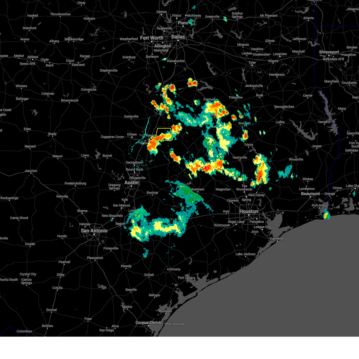 The severe thunderstorm warning for east central bell and southwestern falls counties will expire at 345 pm cdt, the storm which prompted the warning has weakened below severe limits. therefore the warning will be allowed to expire. however gusty winds and heavy rain are still possible with this thunderstorm. The severe thunderstorm warning for east central bell and southwestern falls counties will expire at 345 pm cdt, the storm which prompted the warning has weakened below severe limits. therefore the warning will be allowed to expire. however gusty winds and heavy rain are still possible with this thunderstorm.
|
| 6/8/2023 3:22 PM CDT |
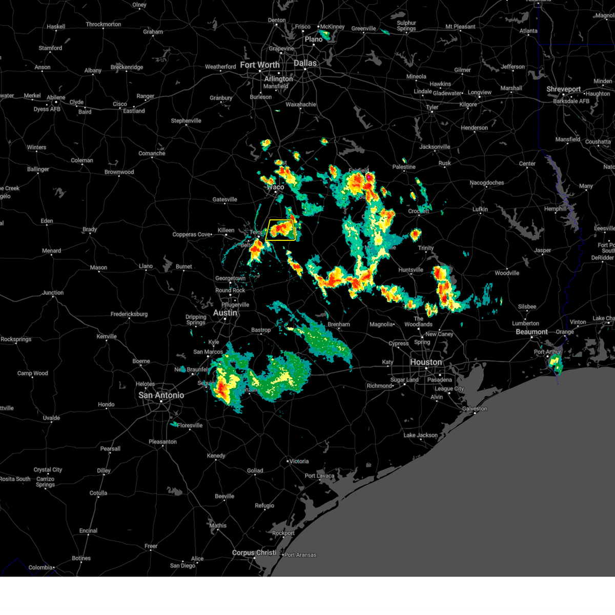 At 321 pm cdt, a severe thunderstorm was located near lott, or 15 miles east of temple, moving south at 5 mph (radar indicated). Hazards include 60 mph wind gusts. Expect damage to roofs, siding, and trees. locations impacted include, rosebud, lott, barclay, oenaville, durango, cego, travis, belfalls, ratibor, airville, westphalia, tomlinson hill, seaton and cedar springs. hail threat, radar indicated max hail size, <. 75 in wind threat, radar indicated max wind gust, 60 mph. At 321 pm cdt, a severe thunderstorm was located near lott, or 15 miles east of temple, moving south at 5 mph (radar indicated). Hazards include 60 mph wind gusts. Expect damage to roofs, siding, and trees. locations impacted include, rosebud, lott, barclay, oenaville, durango, cego, travis, belfalls, ratibor, airville, westphalia, tomlinson hill, seaton and cedar springs. hail threat, radar indicated max hail size, <. 75 in wind threat, radar indicated max wind gust, 60 mph.
|
| 6/8/2023 3:07 PM CDT |
 At 307 pm cdt, a severe thunderstorm was located near lott, or 14 miles southwest of marlin, moving south at 5 mph (radar indicated). Hazards include 60 mph wind gusts. expect damage to roofs, siding, and trees At 307 pm cdt, a severe thunderstorm was located near lott, or 14 miles southwest of marlin, moving south at 5 mph (radar indicated). Hazards include 60 mph wind gusts. expect damage to roofs, siding, and trees
|
| 4/28/2023 4:12 PM CDT |
 At 411 pm cdt, severe thunderstorms were located along a line extending from lott to near rogers to near jarrell, moving southeast at 55 mph (radar indicated). Hazards include 60 mph wind gusts and quarter size hail. Hail damage to vehicles is expected. Expect wind damage to roofs, siding, and trees. At 411 pm cdt, severe thunderstorms were located along a line extending from lott to near rogers to near jarrell, moving southeast at 55 mph (radar indicated). Hazards include 60 mph wind gusts and quarter size hail. Hail damage to vehicles is expected. Expect wind damage to roofs, siding, and trees.
|
| 4/26/2023 9:41 PM CDT |
 The severe thunderstorm warning for northwestern milam, eastern bell and southwestern falls counties will expire at 945 pm cdt, the storm which prompted the warning has weakened below severe limits. therefore the warning will be allowed to expire. however gusty winds and heavy rain are still possible with this thunderstorm. a tornado watch remains in effect until 1000 pm cdt for central texas. The severe thunderstorm warning for northwestern milam, eastern bell and southwestern falls counties will expire at 945 pm cdt, the storm which prompted the warning has weakened below severe limits. therefore the warning will be allowed to expire. however gusty winds and heavy rain are still possible with this thunderstorm. a tornado watch remains in effect until 1000 pm cdt for central texas.
|
| 4/26/2023 9:04 PM CDT |
 At 904 pm cdt, a cluster of severe thunderstorms was located 8 miles southeast of troy to near lott, moving east at 30 mph (radar indicated). Hazards include golf ball size hail and 60 mph wind gusts. People and animals outdoors will be injured. expect hail damage to roofs, siding, windows, and vehicles. expect wind damage to roofs, siding, and trees. locations impacted include, temple, cameron, little river-academy, troy, rosebud, rogers, lott, golinda, buckholts, chilton, wilson, yarrelton, silver city, jones prairie, leedale, edgeworth, barclay, ben arnold, baileyville and mooreville. thunderstorm damage threat, considerable hail threat, radar indicated max hail size, 1. 75 in wind threat, radar indicated max wind gust, 60 mph. At 904 pm cdt, a cluster of severe thunderstorms was located 8 miles southeast of troy to near lott, moving east at 30 mph (radar indicated). Hazards include golf ball size hail and 60 mph wind gusts. People and animals outdoors will be injured. expect hail damage to roofs, siding, windows, and vehicles. expect wind damage to roofs, siding, and trees. locations impacted include, temple, cameron, little river-academy, troy, rosebud, rogers, lott, golinda, buckholts, chilton, wilson, yarrelton, silver city, jones prairie, leedale, edgeworth, barclay, ben arnold, baileyville and mooreville. thunderstorm damage threat, considerable hail threat, radar indicated max hail size, 1. 75 in wind threat, radar indicated max wind gust, 60 mph.
|
| 4/26/2023 8:45 PM CDT |
 At 845 pm cdt, a severe thunderstorm was located near belton, moving southeast at 30 mph (radar indicated). Hazards include two inch hail and 60 mph wind gusts. People and animals outdoors will be injured. expect hail damage to roofs, siding, windows, and vehicles. Expect wind damage to roofs, siding, and trees. At 845 pm cdt, a severe thunderstorm was located near belton, moving southeast at 30 mph (radar indicated). Hazards include two inch hail and 60 mph wind gusts. People and animals outdoors will be injured. expect hail damage to roofs, siding, windows, and vehicles. Expect wind damage to roofs, siding, and trees.
|
| 4/20/2023 6:12 PM CDT |
 At 611 pm cdt, severe thunderstorms were located along a line extending from marlin to cameron, moving east at 25 mph (radar indicated). Hazards include ping pong ball size hail and 60 mph wind gusts. People and animals outdoors will be injured. Expect damage to roofs, siding, windows, and vehicles. At 611 pm cdt, severe thunderstorms were located along a line extending from marlin to cameron, moving east at 25 mph (radar indicated). Hazards include ping pong ball size hail and 60 mph wind gusts. People and animals outdoors will be injured. Expect damage to roofs, siding, windows, and vehicles.
|
| 4/20/2023 5:59 PM CDT |
 At 559 pm cdt, a severe thunderstorm was located near lott, or near marlin, moving east at 20 mph (radar indicated). Hazards include 60 mph wind gusts and half dollar size hail. Hail damage to vehicles is expected. expect wind damage to roofs, siding, and trees. locations impacted include, robinson, marlin, mart, rosebud, riesel, lott, golinda, hallsburg, lake creek lake, chilton, wilson, barclay, mooreville, reagan, asa, perry, terrys chapel, highbank, pleasant grove and satin. hail threat, radar indicated max hail size, 1. 25 in wind threat, radar indicated max wind gust, 60 mph. At 559 pm cdt, a severe thunderstorm was located near lott, or near marlin, moving east at 20 mph (radar indicated). Hazards include 60 mph wind gusts and half dollar size hail. Hail damage to vehicles is expected. expect wind damage to roofs, siding, and trees. locations impacted include, robinson, marlin, mart, rosebud, riesel, lott, golinda, hallsburg, lake creek lake, chilton, wilson, barclay, mooreville, reagan, asa, perry, terrys chapel, highbank, pleasant grove and satin. hail threat, radar indicated max hail size, 1. 25 in wind threat, radar indicated max wind gust, 60 mph.
|
| 4/20/2023 5:41 PM CDT |
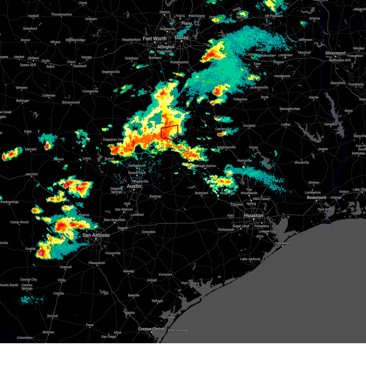 The tornado warning for west central falls county will expire at 545 pm cdt, the tornado threat has diminished and the tornado warning will be allowed to expire. however, large hail and damaging winds remain likely and a severe thunderstorm warning remains in effect for the area. The tornado warning for west central falls county will expire at 545 pm cdt, the tornado threat has diminished and the tornado warning will be allowed to expire. however, large hail and damaging winds remain likely and a severe thunderstorm warning remains in effect for the area.
|
| 4/20/2023 5:18 PM CDT |
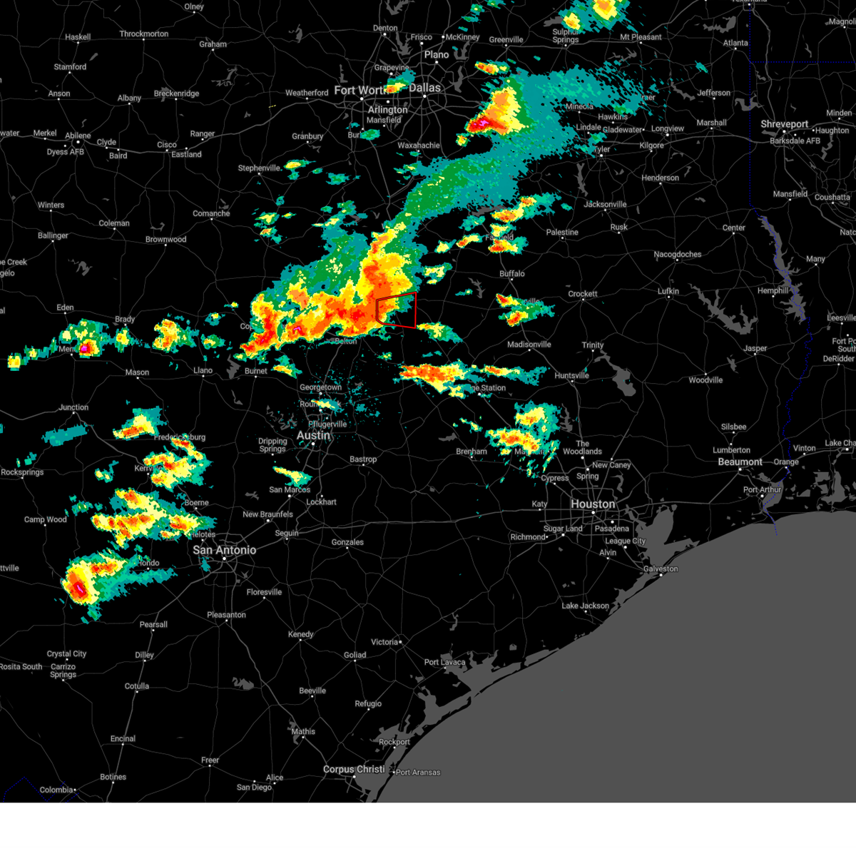 At 518 pm cdt, a severe thunderstorm capable of producing a tornado was located near lott, moving east at 25 mph (radar indicated rotation). Hazards include tornado. Flying debris will be dangerous to those caught without shelter. mobile homes will be damaged or destroyed. damage to roofs, windows, and vehicles will occur. tree damage is likely. this dangerous storm will be near, lott around 530 pm cdt. Other locations impacted by this tornadic thunderstorm include pleasant grove, durango, cego, travis, mooreville, chilton, cedar springs and tomlinson hill. At 518 pm cdt, a severe thunderstorm capable of producing a tornado was located near lott, moving east at 25 mph (radar indicated rotation). Hazards include tornado. Flying debris will be dangerous to those caught without shelter. mobile homes will be damaged or destroyed. damage to roofs, windows, and vehicles will occur. tree damage is likely. this dangerous storm will be near, lott around 530 pm cdt. Other locations impacted by this tornadic thunderstorm include pleasant grove, durango, cego, travis, mooreville, chilton, cedar springs and tomlinson hill.
|
| 4/20/2023 5:11 PM CDT |
 At 510 pm cdt, a severe thunderstorm was located between waco and temple, moving east at 20 mph (radar indicated). Hazards include golf ball size hail and 60 mph wind gusts. People and animals outdoors will be injured. expect hail damage to roofs, siding, windows, and vehicles. Expect wind damage to roofs, siding, and trees. At 510 pm cdt, a severe thunderstorm was located between waco and temple, moving east at 20 mph (radar indicated). Hazards include golf ball size hail and 60 mph wind gusts. People and animals outdoors will be injured. expect hail damage to roofs, siding, windows, and vehicles. Expect wind damage to roofs, siding, and trees.
|
| 4/20/2023 4:55 PM CDT |
 At 454 pm cdt, a severe thunderstorm capable of producing a tornado was located over troy, moving east at 20 mph (radar indicated rotation). Hazards include tornado. Flying debris will be dangerous to those caught without shelter. mobile homes will be damaged or destroyed. damage to roofs, windows, and vehicles will occur. tree damage is likely. this dangerous storm will be near, lott around 540 pm cdt. other locations impacted by this tornadic thunderstorm include pleasant grove, durango, satin, cego, travis, belfalls, mooreville, chilton, cedar springs and tomlinson hill. This includes interstate 35 between mile markers 305 and 314. At 454 pm cdt, a severe thunderstorm capable of producing a tornado was located over troy, moving east at 20 mph (radar indicated rotation). Hazards include tornado. Flying debris will be dangerous to those caught without shelter. mobile homes will be damaged or destroyed. damage to roofs, windows, and vehicles will occur. tree damage is likely. this dangerous storm will be near, lott around 540 pm cdt. other locations impacted by this tornadic thunderstorm include pleasant grove, durango, satin, cego, travis, belfalls, mooreville, chilton, cedar springs and tomlinson hill. This includes interstate 35 between mile markers 305 and 314.
|
| 4/2/2023 4:42 PM CDT |
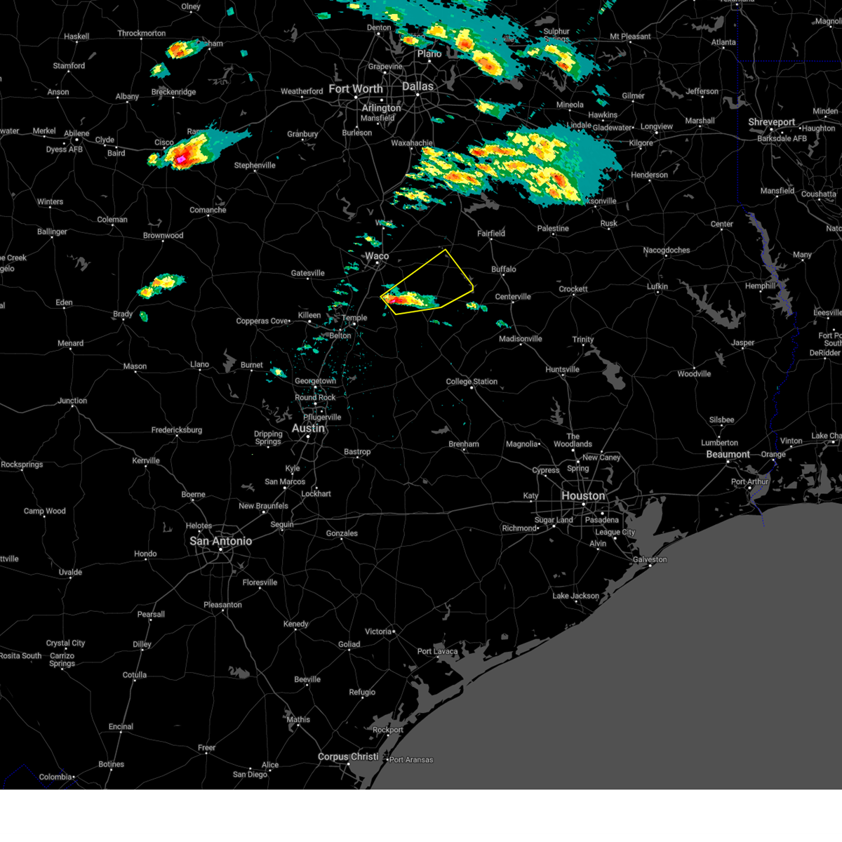 At 442 pm cdt, a severe thunderstorm was located near marlin, moving northeast at 35 mph (radar indicated). Hazards include 60 mph wind gusts and quarter size hail. Hail damage to vehicles is expected. Expect wind damage to roofs, siding, and trees. At 442 pm cdt, a severe thunderstorm was located near marlin, moving northeast at 35 mph (radar indicated). Hazards include 60 mph wind gusts and quarter size hail. Hail damage to vehicles is expected. Expect wind damage to roofs, siding, and trees.
|
| 3/2/2023 7:37 PM CST |
 At 737 pm cst, severe thunderstorms were located along a line extending from near bellmead to near coupland, moving east at 35 mph (radar indicated). Hazards include 60 mph wind gusts and penny size hail. expect damage to roofs, siding, and trees At 737 pm cst, severe thunderstorms were located along a line extending from near bellmead to near coupland, moving east at 35 mph (radar indicated). Hazards include 60 mph wind gusts and penny size hail. expect damage to roofs, siding, and trees
|
| 10/24/2022 9:24 PM CDT |
 At 923 pm cdt, severe thunderstorms were located along a line extending from near marlin to rosebud to 9 miles south of buckholts, moving east at 45 mph (radar indicated). Hazards include ping pong ball size hail and 60 mph wind gusts. People and animals outdoors will be injured. expect hail damage to roofs, siding, windows, and vehicles. Expect wind damage to roofs, siding, and trees. At 923 pm cdt, severe thunderstorms were located along a line extending from near marlin to rosebud to 9 miles south of buckholts, moving east at 45 mph (radar indicated). Hazards include ping pong ball size hail and 60 mph wind gusts. People and animals outdoors will be injured. expect hail damage to roofs, siding, windows, and vehicles. Expect wind damage to roofs, siding, and trees.
|
| 10/24/2022 8:46 PM CDT |
 At 845 pm cdt, a severe thunderstorm was located over belton lake, or near belton, moving east at 40 mph (radar indicated). Hazards include ping pong ball size hail and 60 mph wind gusts. People and animals outdoors will be injured. expect hail damage to roofs, siding, windows, and vehicles. Expect wind damage to roofs, siding, and trees. At 845 pm cdt, a severe thunderstorm was located over belton lake, or near belton, moving east at 40 mph (radar indicated). Hazards include ping pong ball size hail and 60 mph wind gusts. People and animals outdoors will be injured. expect hail damage to roofs, siding, windows, and vehicles. Expect wind damage to roofs, siding, and trees.
|
| 9/4/2022 7:27 PM CDT |
 The severe thunderstorm warning for south central mclennan, northeastern bell and southwestern falls counties will expire at 730 pm cdt, the storm which prompted the warning has weakened below severe limits, and has exited the warned area. therefore, the warning will be allowed to expire. however gusty winds are still possible with this thunderstorm. The severe thunderstorm warning for south central mclennan, northeastern bell and southwestern falls counties will expire at 730 pm cdt, the storm which prompted the warning has weakened below severe limits, and has exited the warned area. therefore, the warning will be allowed to expire. however gusty winds are still possible with this thunderstorm.
|
| 9/4/2022 6:53 PM CDT |
 At 653 pm cdt, a severe thunderstorm was located near lott, or 15 miles northeast of temple, moving south at 15 mph (radar indicated). Hazards include 60 mph wind gusts and penny size hail. Expect damage to roofs, siding, and trees. locations impacted include, temple, marlin, morgan`s point resort, lorena, troy, bruceville-eddy, rosebud, moody, lott and golinda. hail threat, radar indicated max hail size, 0. 75 in wind threat, radar indicated max wind gust, 60 mph. At 653 pm cdt, a severe thunderstorm was located near lott, or 15 miles northeast of temple, moving south at 15 mph (radar indicated). Hazards include 60 mph wind gusts and penny size hail. Expect damage to roofs, siding, and trees. locations impacted include, temple, marlin, morgan`s point resort, lorena, troy, bruceville-eddy, rosebud, moody, lott and golinda. hail threat, radar indicated max hail size, 0. 75 in wind threat, radar indicated max wind gust, 60 mph.
|
| 9/4/2022 6:32 PM CDT |
 At 631 pm cdt, a severe thunderstorm was located over lott, or 11 miles southwest of marlin, moving south at 15 mph (radar indicated). Hazards include 60 mph wind gusts and penny size hail. expect damage to roofs, siding, and trees At 631 pm cdt, a severe thunderstorm was located over lott, or 11 miles southwest of marlin, moving south at 15 mph (radar indicated). Hazards include 60 mph wind gusts and penny size hail. expect damage to roofs, siding, and trees
|
| 5/21/2022 8:17 PM CDT |
 At 817 pm cdt, severe thunderstorms were located along a line extending from near blooming grove to coolidge to groesbeck, moving east at 35 mph (radar indicated). Hazards include 60 mph wind gusts and nickel size hail. Expect damage to roofs, siding, and trees. locations impacted include, mexia, groesbeck, mart, hubbard, riesel, coolidge, dawson, hallsburg, bynum, fort parker state park, frost, mount calm, tehuacana, malone, penelope and mertens. hail threat, radar indicated max hail size, 0. 88 in wind threat, radar indicated max wind gust, 60 mph. At 817 pm cdt, severe thunderstorms were located along a line extending from near blooming grove to coolidge to groesbeck, moving east at 35 mph (radar indicated). Hazards include 60 mph wind gusts and nickel size hail. Expect damage to roofs, siding, and trees. locations impacted include, mexia, groesbeck, mart, hubbard, riesel, coolidge, dawson, hallsburg, bynum, fort parker state park, frost, mount calm, tehuacana, malone, penelope and mertens. hail threat, radar indicated max hail size, 0. 88 in wind threat, radar indicated max wind gust, 60 mph.
|
| 5/21/2022 7:51 PM CDT |
 At 750 pm cdt, a severe cluster of severe thunderstorms was located along a line from near malone to east of waco to golinda, moving east at 30 mph (radar indicated). Hazards include 60 mph wind gusts and nickel size hail. expect damage to roofs, siding, and trees At 750 pm cdt, a severe cluster of severe thunderstorms was located along a line from near malone to east of waco to golinda, moving east at 30 mph (radar indicated). Hazards include 60 mph wind gusts and nickel size hail. expect damage to roofs, siding, and trees
|
| 5/5/2022 3:56 PM CDT |
 At 355 pm cdt, a severe thunderstorm was located near lott, or 13 miles southwest of marlin, moving northeast at 40 mph (radar indicated). Hazards include 60 mph wind gusts and quarter size hail. Hail damage to vehicles is expected. expect wind damage to roofs, siding, and trees. locations impacted include, marlin and lott. hail threat, radar indicated max hail size, 1. 00 in wind threat, radar indicated max wind gust, 60 mph. At 355 pm cdt, a severe thunderstorm was located near lott, or 13 miles southwest of marlin, moving northeast at 40 mph (radar indicated). Hazards include 60 mph wind gusts and quarter size hail. Hail damage to vehicles is expected. expect wind damage to roofs, siding, and trees. locations impacted include, marlin and lott. hail threat, radar indicated max hail size, 1. 00 in wind threat, radar indicated max wind gust, 60 mph.
|
| 5/5/2022 3:42 PM CDT |
 At 341 pm cdt, a severe thunderstorm was located near troy, or 9 miles northeast of temple, moving northeast at 40 mph (radar indicated). Hazards include 60 mph wind gusts and quarter size hail. Hail damage to vehicles is expected. Expect wind damage to roofs, siding, and trees. At 341 pm cdt, a severe thunderstorm was located near troy, or 9 miles northeast of temple, moving northeast at 40 mph (radar indicated). Hazards include 60 mph wind gusts and quarter size hail. Hail damage to vehicles is expected. Expect wind damage to roofs, siding, and trees.
|
| 4/12/2022 7:31 PM CDT |
 At 731 pm cdt, a confirmed tornado was located 10 miles east of temple or near seaton, moving northeast at 25 mph (public confirmed tornado). Hazards include damaging tornado and golf ball size hail. Flying debris will be dangerous to those caught without shelter. mobile homes will be damaged or destroyed. damage to roofs, windows, and vehicles will occur. Tree damage is likely. At 731 pm cdt, a confirmed tornado was located 10 miles east of temple or near seaton, moving northeast at 25 mph (public confirmed tornado). Hazards include damaging tornado and golf ball size hail. Flying debris will be dangerous to those caught without shelter. mobile homes will be damaged or destroyed. damage to roofs, windows, and vehicles will occur. Tree damage is likely.
|
| 4/12/2022 7:22 PM CDT |
 At 721 pm cdt, a severe thunderstorm capable of producing a tornado was located 7 miles north of rogers, or 10 miles east of temple, moving northeast at 25 mph (radar indicated rotation). Hazards include tornado and golf ball size hail. Flying debris will be dangerous to those caught without shelter. mobile homes will be damaged or destroyed. damage to roofs, windows, and vehicles will occur. tree damage is likely. This dangerous storm will be near, rosebud and lott around 755 pm cdt. At 721 pm cdt, a severe thunderstorm capable of producing a tornado was located 7 miles north of rogers, or 10 miles east of temple, moving northeast at 25 mph (radar indicated rotation). Hazards include tornado and golf ball size hail. Flying debris will be dangerous to those caught without shelter. mobile homes will be damaged or destroyed. damage to roofs, windows, and vehicles will occur. tree damage is likely. This dangerous storm will be near, rosebud and lott around 755 pm cdt.
|
| 3/21/2022 8:46 PM CDT |
 At 845 pm cdt, a severe thunderstorm was located 9 miles northeast of rogers, or 12 miles east of temple, moving northeast at 40 mph (radar indicated). Hazards include 60 mph wind gusts and quarter size hail. Hail damage to vehicles is expected. Expect wind damage to roofs, siding, and trees. At 845 pm cdt, a severe thunderstorm was located 9 miles northeast of rogers, or 12 miles east of temple, moving northeast at 40 mph (radar indicated). Hazards include 60 mph wind gusts and quarter size hail. Hail damage to vehicles is expected. Expect wind damage to roofs, siding, and trees.
|
| 3/21/2022 7:05 PM CDT |
 At 705 pm cdt, a severe thunderstorm capable of producing a tornado was located over bruceville-eddy, or 11 miles south of hewitt, moving northeast at 40 mph (radar indicated rotation). Hazards include tornado and quarter size hail. Flying debris will be dangerous to those caught without shelter. mobile homes will be damaged or destroyed. damage to roofs, windows, and vehicles will occur. tree damage is likely. this dangerous storm will be near, lorena around 715 pm cdt. hewitt and golinda around 720 pm cdt. robinson around 725 pm cdt. beverly hills around 730 pm cdt. riesel around 735 pm cdt. waco around 740 pm cdt. Hallsburg around 745 pm cdt. At 705 pm cdt, a severe thunderstorm capable of producing a tornado was located over bruceville-eddy, or 11 miles south of hewitt, moving northeast at 40 mph (radar indicated rotation). Hazards include tornado and quarter size hail. Flying debris will be dangerous to those caught without shelter. mobile homes will be damaged or destroyed. damage to roofs, windows, and vehicles will occur. tree damage is likely. this dangerous storm will be near, lorena around 715 pm cdt. hewitt and golinda around 720 pm cdt. robinson around 725 pm cdt. beverly hills around 730 pm cdt. riesel around 735 pm cdt. waco around 740 pm cdt. Hallsburg around 745 pm cdt.
|
| 3/21/2022 6:53 PM CDT |
 At 653 pm cdt, a severe thunderstorm with a history of producing a tornado was located over troy, or 7 miles northeast of temple, moving northeast at 40 mph (radar indicated rotation). Hazards include tornado and half dollar size hail. Flying debris will be dangerous to those caught without shelter. mobile homes will be damaged or destroyed. damage to roofs, windows, and vehicles will occur. tree damage is likely. this dangerous storm will be near, bruceville-eddy around 710 pm cdt. lorena around 715 pm cdt. hewitt and golinda around 720 pm cdt. robinson around 725 pm cdt. beverly hills around 730 pm cdt. riesel around 735 pm cdt. Hallsburg around 745 pm cdt. At 653 pm cdt, a severe thunderstorm with a history of producing a tornado was located over troy, or 7 miles northeast of temple, moving northeast at 40 mph (radar indicated rotation). Hazards include tornado and half dollar size hail. Flying debris will be dangerous to those caught without shelter. mobile homes will be damaged or destroyed. damage to roofs, windows, and vehicles will occur. tree damage is likely. this dangerous storm will be near, bruceville-eddy around 710 pm cdt. lorena around 715 pm cdt. hewitt and golinda around 720 pm cdt. robinson around 725 pm cdt. beverly hills around 730 pm cdt. riesel around 735 pm cdt. Hallsburg around 745 pm cdt.
|
| 3/21/2022 6:45 PM CDT |
 At 644 pm cdt, a severe thunderstorm with a history of producing a tornado was located over temple, moving northeast at 40 mph (radar indicated rotation). Hazards include tornado and half dollar size hail. Flying debris will be dangerous to those caught without shelter. mobile homes will be damaged or destroyed. damage to roofs, windows, and vehicles will occur. tree damage is likely. this dangerous storm will be near, troy around 655 pm cdt. bruceville-eddy around 710 pm cdt. lorena around 715 pm cdt. hewitt and golinda around 720 pm cdt. robinson around 725 pm cdt. beverly hills and riesel around 730 pm cdt. This includes interstate 35 between mile markers 294 and 333. At 644 pm cdt, a severe thunderstorm with a history of producing a tornado was located over temple, moving northeast at 40 mph (radar indicated rotation). Hazards include tornado and half dollar size hail. Flying debris will be dangerous to those caught without shelter. mobile homes will be damaged or destroyed. damage to roofs, windows, and vehicles will occur. tree damage is likely. this dangerous storm will be near, troy around 655 pm cdt. bruceville-eddy around 710 pm cdt. lorena around 715 pm cdt. hewitt and golinda around 720 pm cdt. robinson around 725 pm cdt. beverly hills and riesel around 730 pm cdt. This includes interstate 35 between mile markers 294 and 333.
|
| 5/3/2021 11:01 PM CDT |
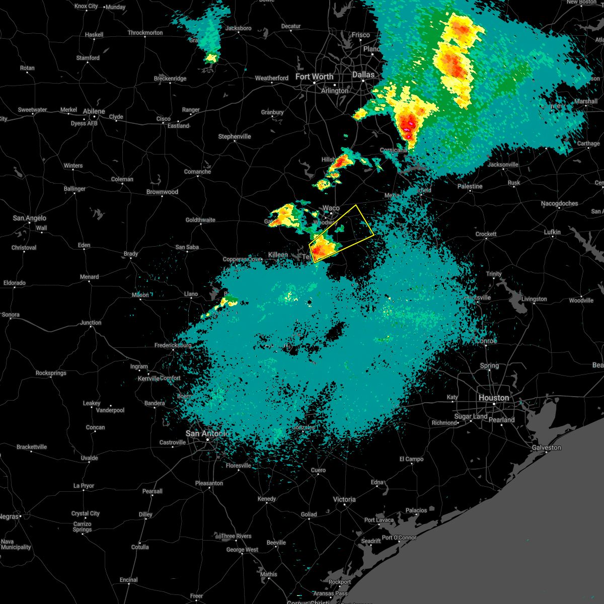 At 1101 pm cdt, a severe thunderstorm was located near troy, moving northeast at 30 mph. golf ball size hail was reported in troy with this storm (trained weather spotters). Hazards include ping pong ball size hail and 60 mph wind gusts. People and animals outdoors will be injured. expect hail damage to roofs, siding, windows, and vehicles. expect wind damage to roofs, siding, and trees. Locations impacted include, temple, robinson, marlin, mart, lorena, troy, bruceville-eddy, riesel, lott, golinda and hallsburg. At 1101 pm cdt, a severe thunderstorm was located near troy, moving northeast at 30 mph. golf ball size hail was reported in troy with this storm (trained weather spotters). Hazards include ping pong ball size hail and 60 mph wind gusts. People and animals outdoors will be injured. expect hail damage to roofs, siding, windows, and vehicles. expect wind damage to roofs, siding, and trees. Locations impacted include, temple, robinson, marlin, mart, lorena, troy, bruceville-eddy, riesel, lott, golinda and hallsburg.
|
| 5/3/2021 10:48 PM CDT |
 At 1048 pm cdt, a severe thunderstorm was located near troy, or near temple, moving northeast at 30 mph (radar indicated). Hazards include 60 mph wind gusts and quarter size hail. Hail damage to vehicles is expected. Expect wind damage to roofs, siding, and trees. At 1048 pm cdt, a severe thunderstorm was located near troy, or near temple, moving northeast at 30 mph (radar indicated). Hazards include 60 mph wind gusts and quarter size hail. Hail damage to vehicles is expected. Expect wind damage to roofs, siding, and trees.
|
| 4/8/2021 7:50 PM CDT |
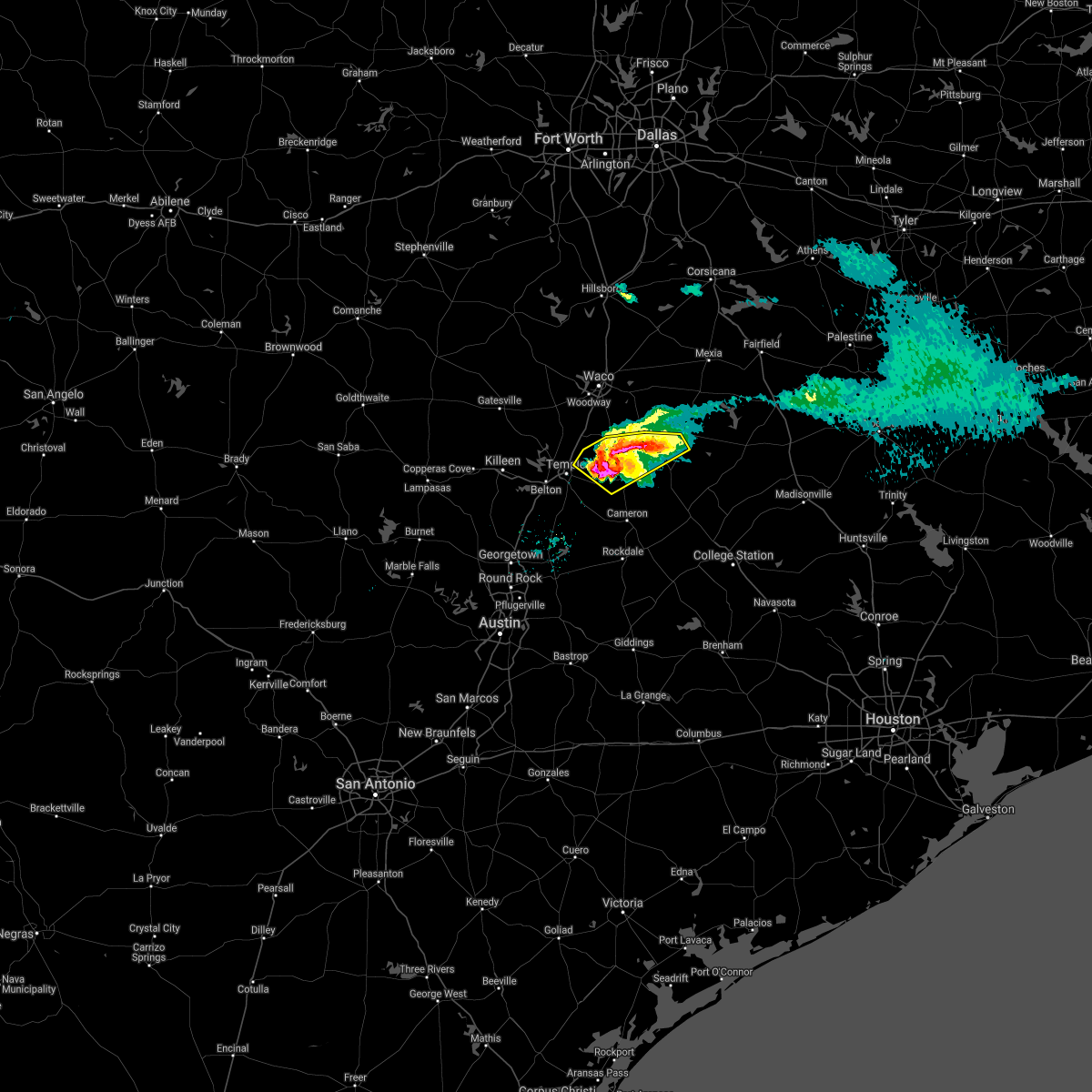 At 749 pm cdt, a severe thunderstorm was located near rosebud, or 15 miles north of cameron, moving southeast at 40 mph (trained weather spotters). Hazards include ping pong ball size hail and 65 mph wind gusts. People and animals outdoors will be injured. expect hail damage to roofs, siding, windows, and vehicles. expect wind damage to roofs, siding, and trees. Locations impacted include, marlin, rosebud and lott. At 749 pm cdt, a severe thunderstorm was located near rosebud, or 15 miles north of cameron, moving southeast at 40 mph (trained weather spotters). Hazards include ping pong ball size hail and 65 mph wind gusts. People and animals outdoors will be injured. expect hail damage to roofs, siding, windows, and vehicles. expect wind damage to roofs, siding, and trees. Locations impacted include, marlin, rosebud and lott.
|
| 4/8/2021 7:40 PM CDT |
 At 739 pm cdt, a severe thunderstorm was located near belfalls, lott, and chilton moving southeast at 30 mph. this storm has a history of producing 2 inch hail in mcgregor and wind damage in troy (trained weather spotters). Hazards include ping pong ball size hail and 65 mph wind gusts. People and animals outdoors will be injured. expect hail damage to roofs, siding, windows, and vehicles. expect wind damage to roofs, siding, and trees. Locations impacted include, temple, marlin, troy, rosebud, lott and golinda. At 739 pm cdt, a severe thunderstorm was located near belfalls, lott, and chilton moving southeast at 30 mph. this storm has a history of producing 2 inch hail in mcgregor and wind damage in troy (trained weather spotters). Hazards include ping pong ball size hail and 65 mph wind gusts. People and animals outdoors will be injured. expect hail damage to roofs, siding, windows, and vehicles. expect wind damage to roofs, siding, and trees. Locations impacted include, temple, marlin, troy, rosebud, lott and golinda.
|
| 4/8/2021 7:37 PM CDT | Quarter sized hail reported 0.3 miles NNE of Chilton, TX, time estimated via radar. |
| 4/8/2021 7:22 PM CDT |
 At 721 pm cdt, a severe thunderstorm was located near bruceville- eddy. another severe thunderstorm was located near moody. both storms are moving southeast at 20 mph. these storms have a history of producing 2 inch hail (trained weather spotters). Hazards include ping pong ball size hail and 60 mph wind gusts. People and animals outdoors will be injured. expect hail damage to roofs, siding, windows, and vehicles. expect wind damage to roofs, siding, and trees. Locations impacted include, temple, hewitt, robinson, marlin, lorena, troy, bruceville-eddy, rosebud, moody, lott and golinda. At 721 pm cdt, a severe thunderstorm was located near bruceville- eddy. another severe thunderstorm was located near moody. both storms are moving southeast at 20 mph. these storms have a history of producing 2 inch hail (trained weather spotters). Hazards include ping pong ball size hail and 60 mph wind gusts. People and animals outdoors will be injured. expect hail damage to roofs, siding, windows, and vehicles. expect wind damage to roofs, siding, and trees. Locations impacted include, temple, hewitt, robinson, marlin, lorena, troy, bruceville-eddy, rosebud, moody, lott and golinda.
|
| 4/8/2021 7:11 PM CDT |
 At 710 pm cdt, a severe thunderstorm was located near bruceville- eddy, moving southeast at 30 mph. 2 inch hail was reported earlier with this storm in mcgregor (trained weather spotters). Hazards include ping pong ball size hail and 60 mph wind gusts. People and animals outdoors will be injured. expect hail damage to roofs, siding, windows, and vehicles. Expect wind damage to roofs, siding, and trees. At 710 pm cdt, a severe thunderstorm was located near bruceville- eddy, moving southeast at 30 mph. 2 inch hail was reported earlier with this storm in mcgregor (trained weather spotters). Hazards include ping pong ball size hail and 60 mph wind gusts. People and animals outdoors will be injured. expect hail damage to roofs, siding, windows, and vehicles. Expect wind damage to roofs, siding, and trees.
|
| 5/27/2020 2:13 PM CDT |
 The severe thunderstorm warning for central robertson, northeastern milam, south central limestone and falls counties will expire at 215 pm cdt, the storms which prompted the warning have moved out of the area. therefore the warning will be allowed to expire. a severe thunderstorm watch remains in effect until 900 pm cdt for central texas. to report severe weather, contact your nearest law enforcement agency. they will relay your report to the national weather service fort worth. time, mot, loc 1912z 299deg 120kt 3051 9589 3065 9565. The severe thunderstorm warning for central robertson, northeastern milam, south central limestone and falls counties will expire at 215 pm cdt, the storms which prompted the warning have moved out of the area. therefore the warning will be allowed to expire. a severe thunderstorm watch remains in effect until 900 pm cdt for central texas. to report severe weather, contact your nearest law enforcement agency. they will relay your report to the national weather service fort worth. time, mot, loc 1912z 299deg 120kt 3051 9589 3065 9565.
|
| 5/27/2020 1:41 PM CDT |
 At 140 pm cdt, severe thunderstorms were located along a line extending from near rosebud to bremond, moving southeast at 35 mph (radar indicated). Hazards include golf ball size hail and 65 mph wind gusts. People and animals outdoors will be injured. expect hail damage to roofs, siding, windows, and vehicles. expect wind damage to roofs, siding, and trees. Locations impacted include, marlin, franklin, bruceville-eddy, rosebud, calvert, bremond, lott and kosse. At 140 pm cdt, severe thunderstorms were located along a line extending from near rosebud to bremond, moving southeast at 35 mph (radar indicated). Hazards include golf ball size hail and 65 mph wind gusts. People and animals outdoors will be injured. expect hail damage to roofs, siding, windows, and vehicles. expect wind damage to roofs, siding, and trees. Locations impacted include, marlin, franklin, bruceville-eddy, rosebud, calvert, bremond, lott and kosse.
|
| 5/27/2020 1:23 PM CDT |
 At 123 pm cdt, severe thunderstorms were located along a line extending from lott to 7 miles northwest of bremond, moving southeast at 40 mph (radar indicated). Hazards include tennis ball size hail and 65 mph wind gusts. People and animals outdoors will be injured. expect hail damage to roofs, siding, windows, and vehicles. expect wind damage to roofs, siding, and trees. Locations impacted include, hewitt, robinson, marlin, mart, lorena, franklin, bruceville-eddy, rosebud, calvert, riesel, bremond, lott, golinda, hallsburg and kosse. At 123 pm cdt, severe thunderstorms were located along a line extending from lott to 7 miles northwest of bremond, moving southeast at 40 mph (radar indicated). Hazards include tennis ball size hail and 65 mph wind gusts. People and animals outdoors will be injured. expect hail damage to roofs, siding, windows, and vehicles. expect wind damage to roofs, siding, and trees. Locations impacted include, hewitt, robinson, marlin, mart, lorena, franklin, bruceville-eddy, rosebud, calvert, riesel, bremond, lott, golinda, hallsburg and kosse.
|
| 5/27/2020 1:17 PM CDT |
 At 117 pm cdt, severe thunderstorms were located along a line extending from near lott to near bremond, moving southeast at 140 mph (radar indicated). Hazards include tennis ball size hail and 65 mph wind gusts. People and animals outdoors will be injured. expect hail damage to roofs, siding, windows, and vehicles. Expect wind damage to roofs, siding, and trees. At 117 pm cdt, severe thunderstorms were located along a line extending from near lott to near bremond, moving southeast at 140 mph (radar indicated). Hazards include tennis ball size hail and 65 mph wind gusts. People and animals outdoors will be injured. expect hail damage to roofs, siding, windows, and vehicles. Expect wind damage to roofs, siding, and trees.
|
| 5/27/2020 12:58 PM CDT |
 At 1257 pm cdt, severe thunderstorms were located along a line extending from near mcgregor to hewitt, moving southeast at 40 mph. these are very dangerous storms (trained weather spotters). Hazards include baseball size hail and 70 mph wind gusts. People and animals outdoors will be severely injured. expect shattered windows, extensive damage to roofs, siding, and vehicles. Locations impacted include, waco, hewitt, robinson, bellmead, woodway, lacy-lakeview, marlin, mcgregor, mart, beverly hills, lorena, bruceville-eddy, rosebud, riesel, lott, golinda, hallsburg, northcrest and kosse. At 1257 pm cdt, severe thunderstorms were located along a line extending from near mcgregor to hewitt, moving southeast at 40 mph. these are very dangerous storms (trained weather spotters). Hazards include baseball size hail and 70 mph wind gusts. People and animals outdoors will be severely injured. expect shattered windows, extensive damage to roofs, siding, and vehicles. Locations impacted include, waco, hewitt, robinson, bellmead, woodway, lacy-lakeview, marlin, mcgregor, mart, beverly hills, lorena, bruceville-eddy, rosebud, riesel, lott, golinda, hallsburg, northcrest and kosse.
|
| 5/27/2020 12:50 PM CDT |
 At 1249 pm cdt, severe thunderstorms were located along a line extending from near riesel to woodway, moving southeast at 40 mph (trained weather spotters have reported golf ball size hail on the north side of waco). Hazards include two inch hail and 65 mph wind gusts. People and animals outdoors will be injured. expect hail damage to roofs, siding, windows, and vehicles. expect wind damage to roofs, siding, and trees. Locations impacted include, waco, hewitt, robinson, bellmead, woodway, lacy-lakeview, marlin, mcgregor, west, mart, beverly hills, lorena, bruceville-eddy, rosebud, valley mills, riesel, lott, crawford, golinda and hallsburg. At 1249 pm cdt, severe thunderstorms were located along a line extending from near riesel to woodway, moving southeast at 40 mph (trained weather spotters have reported golf ball size hail on the north side of waco). Hazards include two inch hail and 65 mph wind gusts. People and animals outdoors will be injured. expect hail damage to roofs, siding, windows, and vehicles. expect wind damage to roofs, siding, and trees. Locations impacted include, waco, hewitt, robinson, bellmead, woodway, lacy-lakeview, marlin, mcgregor, west, mart, beverly hills, lorena, bruceville-eddy, rosebud, valley mills, riesel, lott, crawford, golinda and hallsburg.
|
| 5/27/2020 12:45 PM CDT |
 At 1243 pm cdt, a couple of severe thunderstorms were located along a line extending from near woodway to near riesel, moving southeast at 40 mph (trained weather spotters reported golf ball size hail near bellmead. quarter size hail was reported near china springs as well). Hazards include golf ball size hail and 65 mph wind gusts. People and animals outdoors will be injured. expect hail damage to roofs, siding, windows, and vehicles. expect wind damage to roofs, siding, and trees. Locations impacted include, waco, hewitt, robinson, bellmead, woodway, lacy-lakeview, marlin, mcgregor, west, mart, beverly hills, lorena, bruceville-eddy, rosebud, valley mills, riesel, lott, crawford, golinda and hallsburg. At 1243 pm cdt, a couple of severe thunderstorms were located along a line extending from near woodway to near riesel, moving southeast at 40 mph (trained weather spotters reported golf ball size hail near bellmead. quarter size hail was reported near china springs as well). Hazards include golf ball size hail and 65 mph wind gusts. People and animals outdoors will be injured. expect hail damage to roofs, siding, windows, and vehicles. expect wind damage to roofs, siding, and trees. Locations impacted include, waco, hewitt, robinson, bellmead, woodway, lacy-lakeview, marlin, mcgregor, west, mart, beverly hills, lorena, bruceville-eddy, rosebud, valley mills, riesel, lott, crawford, golinda and hallsburg.
|
| 5/27/2020 12:34 PM CDT |
 At 1232 pm cdt, a couple of severe thunderstorms were located along a line extending from near hallsburg to 7 miles northeast of crawford, moving southeast at 50 mph (trained weather spotters reported golf ball size hail in the lacy-lake view area). Hazards include golf ball size hail and 65 mph wind gusts. People and animals outdoors will be injured. expect hail damage to roofs, siding, windows, and vehicles. expect wind damage to roofs, siding, and trees. Locations impacted include, waco, hewitt, robinson, bellmead, hillsboro, woodway, lacy-lakeview, marlin, mcgregor, west, mart, whitney, beverly hills, lorena, bruceville-eddy, rosebud, valley mills, riesel, lott and crawford. At 1232 pm cdt, a couple of severe thunderstorms were located along a line extending from near hallsburg to 7 miles northeast of crawford, moving southeast at 50 mph (trained weather spotters reported golf ball size hail in the lacy-lake view area). Hazards include golf ball size hail and 65 mph wind gusts. People and animals outdoors will be injured. expect hail damage to roofs, siding, windows, and vehicles. expect wind damage to roofs, siding, and trees. Locations impacted include, waco, hewitt, robinson, bellmead, hillsboro, woodway, lacy-lakeview, marlin, mcgregor, west, mart, whitney, beverly hills, lorena, bruceville-eddy, rosebud, valley mills, riesel, lott and crawford.
|
| 5/27/2020 12:09 PM CDT |
 At 1208 pm cdt, a severe thunderstorm was located near gholson, moving southeast at 40 mph. another developing storm, which may become severe shortly was located near clifton (trained spotters reported golf ball size hail near laguna park). Hazards include golf ball size hail and 65 mph wind gusts. People and animals outdoors will be injured. expect hail damage to roofs, siding, windows, and vehicles. Expect wind damage to roofs, siding, and trees. At 1208 pm cdt, a severe thunderstorm was located near gholson, moving southeast at 40 mph. another developing storm, which may become severe shortly was located near clifton (trained spotters reported golf ball size hail near laguna park). Hazards include golf ball size hail and 65 mph wind gusts. People and animals outdoors will be injured. expect hail damage to roofs, siding, windows, and vehicles. Expect wind damage to roofs, siding, and trees.
|
| 4/29/2020 3:27 AM CDT |
 At 326 am cdt, severe thunderstorms were located along a line extending from kosse to golinda to near mcgregor, moving southeast at 25 mph (radar indicated). Hazards include 60 mph wind gusts and quarter size hail. Hail damage to vehicles is expected. expect wind damage to roofs, siding, and trees. Locations impacted include, waco, hewitt, robinson, woodway, marlin, mcgregor, beverly hills, lorena, bruceville-eddy, rosebud, moody, riesel, lott, crawford, golinda, hallsburg, thornton and kosse. At 326 am cdt, severe thunderstorms were located along a line extending from kosse to golinda to near mcgregor, moving southeast at 25 mph (radar indicated). Hazards include 60 mph wind gusts and quarter size hail. Hail damage to vehicles is expected. expect wind damage to roofs, siding, and trees. Locations impacted include, waco, hewitt, robinson, woodway, marlin, mcgregor, beverly hills, lorena, bruceville-eddy, rosebud, moody, riesel, lott, crawford, golinda, hallsburg, thornton and kosse.
|
| 4/29/2020 2:57 AM CDT |
 At 257 am cdt, severe thunderstorms were located along a line extending from near groesbeck to waco to valley mills, moving southeast at 25 mph (radar indicated). Hazards include 60 mph wind gusts and half dollar size hail. Hail damage to vehicles is expected. Expect wind damage to roofs, siding, and trees. At 257 am cdt, severe thunderstorms were located along a line extending from near groesbeck to waco to valley mills, moving southeast at 25 mph (radar indicated). Hazards include 60 mph wind gusts and half dollar size hail. Hail damage to vehicles is expected. Expect wind damage to roofs, siding, and trees.
|
| 4/12/2020 5:57 AM CDT |
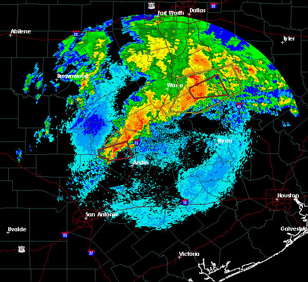 At 556 am cdt, severe thunderstorms were located along a line extending from near coolidge to near fort parker state park to near marlin, moving east at 40 mph (radar indicated). Hazards include 70 mph wind gusts and quarter size hail. Hail damage to vehicles is expected. expect considerable tree damage. wind damage is also likely to mobile homes, roofs, and outbuildings. locations impacted include, mexia, marlin, groesbeck, teague, fairfield, mart, wortham, coolidge, lott, golinda, fort parker state park, fairfield lake state park, thornton, kosse, tehuacana, streetman and kirvin. a tornado watch remains in effect until 800 am cdt for central texas. A tornado watch also remains in effect until noon cdt for central and north central texas. At 556 am cdt, severe thunderstorms were located along a line extending from near coolidge to near fort parker state park to near marlin, moving east at 40 mph (radar indicated). Hazards include 70 mph wind gusts and quarter size hail. Hail damage to vehicles is expected. expect considerable tree damage. wind damage is also likely to mobile homes, roofs, and outbuildings. locations impacted include, mexia, marlin, groesbeck, teague, fairfield, mart, wortham, coolidge, lott, golinda, fort parker state park, fairfield lake state park, thornton, kosse, tehuacana, streetman and kirvin. a tornado watch remains in effect until 800 am cdt for central texas. A tornado watch also remains in effect until noon cdt for central and north central texas.
|
| 4/12/2020 5:43 AM CDT |
 At 543 am cdt, severe thunderstorms were located along a line extending from 6 miles southwest of hubbard to near mart to near lott, moving east at 40 mph (radar indicated). Hazards include 70 mph wind gusts and quarter size hail. Hail damage to vehicles is expected. expect considerable tree damage. Wind damage is also likely to mobile homes, roofs, and outbuildings. At 543 am cdt, severe thunderstorms were located along a line extending from 6 miles southwest of hubbard to near mart to near lott, moving east at 40 mph (radar indicated). Hazards include 70 mph wind gusts and quarter size hail. Hail damage to vehicles is expected. expect considerable tree damage. Wind damage is also likely to mobile homes, roofs, and outbuildings.
|
| 6/19/2019 11:10 PM CDT |
 The severe thunderstorm warning for eastern bell, central limestone and falls counties will expire at 1115 pm cdt, the storms which prompted the warning have weakened below severe limits, and have exited the warned area. therefore the warning will be allowed to expire. however gusty winds of 40 to 50 mph are still possible with these thunderstorms. a tornado watch remains in effect until midnight cdt for central texas. a severe thunderstorm watch remains in effect until 600 am cdt for central texas. The severe thunderstorm warning for eastern bell, central limestone and falls counties will expire at 1115 pm cdt, the storms which prompted the warning have weakened below severe limits, and have exited the warned area. therefore the warning will be allowed to expire. however gusty winds of 40 to 50 mph are still possible with these thunderstorms. a tornado watch remains in effect until midnight cdt for central texas. a severe thunderstorm watch remains in effect until 600 am cdt for central texas.
|
| 6/19/2019 10:58 PM CDT |
 At 1057 pm cdt, severe thunderstorms were located along a line extending from thornton to bartlett, moving southeast at 45 mph (trained weather spotters). Hazards include 60 mph wind gusts. Expect damage to roofs, siding, and trees. locations impacted include, temple, belton, marlin, groesbeck, bartlett, salado, little river-academy, troy, rosebud, rogers, holland, lott, golinda, fort parker state park and thornton. A tornado watch remains in effect until midnight cdt for central texas. At 1057 pm cdt, severe thunderstorms were located along a line extending from thornton to bartlett, moving southeast at 45 mph (trained weather spotters). Hazards include 60 mph wind gusts. Expect damage to roofs, siding, and trees. locations impacted include, temple, belton, marlin, groesbeck, bartlett, salado, little river-academy, troy, rosebud, rogers, holland, lott, golinda, fort parker state park and thornton. A tornado watch remains in effect until midnight cdt for central texas.
|
| 6/19/2019 10:39 PM CDT |
 At 1038 pm cdt, severe thunderstorms were located along a line extending from killeen to mart, moving southeast at 30 mph (trained weather spotters). Hazards include 60 mph wind gusts. Expect damage to roofs, siding, and trees. locations impacted include, killeen, temple, copperas cove, harker heights, belton, marlin, groesbeck, fort hood, nolanville, morgan`s point resort, bartlett, mart, salado, little river-academy, troy, rosebud, rogers, holland, coolidge and lott. A tornado watch remains in effect until midnight cdt for central texas. At 1038 pm cdt, severe thunderstorms were located along a line extending from killeen to mart, moving southeast at 30 mph (trained weather spotters). Hazards include 60 mph wind gusts. Expect damage to roofs, siding, and trees. locations impacted include, killeen, temple, copperas cove, harker heights, belton, marlin, groesbeck, fort hood, nolanville, morgan`s point resort, bartlett, mart, salado, little river-academy, troy, rosebud, rogers, holland, coolidge and lott. A tornado watch remains in effect until midnight cdt for central texas.
|
| 6/19/2019 10:24 PM CDT |
 At 1022 pm cdt, severe thunderstorms were located along a line extending from near copperas cove to near malone, moving southeast at 40 mph (trained weather spotters). Hazards include 65 mph wind gusts. Expect damage to roofs, siding, and trees. locations impacted include, killeen, waco, temple, copperas cove, harker heights, belton, gatesville, hewitt, robinson, bellmead, woodway, lampasas, lacy-lakeview, marlin, mcgregor, groesbeck, fort hood, nolanville, morgan`s point resort and west. A tornado watch remains in effect until midnight cdt for central and north central texas. At 1022 pm cdt, severe thunderstorms were located along a line extending from near copperas cove to near malone, moving southeast at 40 mph (trained weather spotters). Hazards include 65 mph wind gusts. Expect damage to roofs, siding, and trees. locations impacted include, killeen, waco, temple, copperas cove, harker heights, belton, gatesville, hewitt, robinson, bellmead, woodway, lampasas, lacy-lakeview, marlin, mcgregor, groesbeck, fort hood, nolanville, morgan`s point resort and west. A tornado watch remains in effect until midnight cdt for central and north central texas.
|
| 6/19/2019 10:03 PM CDT |
 At 1003 pm cdt, severe thunderstorms were located along a line extending from near west to 13 miles north of lampasas, moving southeast at 30 mph (radar indicated). Hazards include 65 mph wind gusts. expect damage to roofs, siding, and trees At 1003 pm cdt, severe thunderstorms were located along a line extending from near west to 13 miles north of lampasas, moving southeast at 30 mph (radar indicated). Hazards include 65 mph wind gusts. expect damage to roofs, siding, and trees
|
| 5/18/2019 4:38 PM CDT |
 At 437 pm cdt, a severe thunderstorm was located 10 miles northeast of marlin, moving northeast at 40 mph. another severe storm is located near teague, approaching fairfield (radar indicated). Hazards include golf ball size hail and 65 mph wind gusts. People and animals outdoors will be injured. expect hail damage to roofs, siding, windows, and vehicles. expect wind damage to roofs, siding, and trees. locations impacted include, mexia, marlin, groesbeck, teague, fairfield, mart, wortham, lott, golinda, fort parker state park, fairfield lake state park, thornton, oakwood, kosse, tehuacana, streetman and kirvin. a tornado watch remains in effect until 500 pm cdt for central and north central texas. A tornado watch also remains in effect until 800 pm cdt for central texas. At 437 pm cdt, a severe thunderstorm was located 10 miles northeast of marlin, moving northeast at 40 mph. another severe storm is located near teague, approaching fairfield (radar indicated). Hazards include golf ball size hail and 65 mph wind gusts. People and animals outdoors will be injured. expect hail damage to roofs, siding, windows, and vehicles. expect wind damage to roofs, siding, and trees. locations impacted include, mexia, marlin, groesbeck, teague, fairfield, mart, wortham, lott, golinda, fort parker state park, fairfield lake state park, thornton, oakwood, kosse, tehuacana, streetman and kirvin. a tornado watch remains in effect until 500 pm cdt for central and north central texas. A tornado watch also remains in effect until 800 pm cdt for central texas.
|
| 5/18/2019 4:23 PM CDT |
 At 422 pm cdt, a severe thunderstorm was located over marlin, moving northeast at 30 mph. this storm does have some rotation associated with it. additional severe thunderstorms were located from near groesbeck to fairfield, moving east at 30 mph (radar indicated). Hazards include 60 mph wind gusts and half dollar size hail. Hail damage to vehicles is expected. expect wind damage to roofs, siding, and trees. locations impacted include, mexia, marlin, groesbeck, teague, fairfield, mart, rosebud, wortham, lott, golinda, fort parker state park, fairfield lake state park, thornton, oakwood, kosse, tehuacana, streetman and kirvin. a tornado watch remains in effect until 500 pm cdt for central and north central texas. A tornado watch also remains in effect until 800 pm cdt for central texas. At 422 pm cdt, a severe thunderstorm was located over marlin, moving northeast at 30 mph. this storm does have some rotation associated with it. additional severe thunderstorms were located from near groesbeck to fairfield, moving east at 30 mph (radar indicated). Hazards include 60 mph wind gusts and half dollar size hail. Hail damage to vehicles is expected. expect wind damage to roofs, siding, and trees. locations impacted include, mexia, marlin, groesbeck, teague, fairfield, mart, rosebud, wortham, lott, golinda, fort parker state park, fairfield lake state park, thornton, oakwood, kosse, tehuacana, streetman and kirvin. a tornado watch remains in effect until 500 pm cdt for central and north central texas. A tornado watch also remains in effect until 800 pm cdt for central texas.
|
| 5/18/2019 4:05 PM CDT |
 At 405 pm cdt, a cluster of severe thunderstorms was located near wortham to west of groesbeck, moving northeast at 40 mph (radar indicated). Hazards include 60 mph wind gusts and quarter size hail. Hail damage to vehicles is expected. Expect wind damage to roofs, siding, and trees. At 405 pm cdt, a cluster of severe thunderstorms was located near wortham to west of groesbeck, moving northeast at 40 mph (radar indicated). Hazards include 60 mph wind gusts and quarter size hail. Hail damage to vehicles is expected. Expect wind damage to roofs, siding, and trees.
|
| 5/18/2019 3:58 PM CDT |
 At 358 pm cdt, a severe thunderstorm was located over lott, or 10 miles southwest of marlin, moving northeast at 40 mph (radar indicated). Hazards include 60 mph wind gusts and quarter size hail. Hail damage to vehicles is expected. expect wind damage to roofs, siding, and trees. locations impacted include, mexia, marlin, groesbeck, mart, rosebud, lott, golinda, fort parker state park, thornton and kosse. a tornado watch remains in effect until 500 pm cdt for central texas. A tornado watch also remains in effect until 800 pm cdt for central texas. At 358 pm cdt, a severe thunderstorm was located over lott, or 10 miles southwest of marlin, moving northeast at 40 mph (radar indicated). Hazards include 60 mph wind gusts and quarter size hail. Hail damage to vehicles is expected. expect wind damage to roofs, siding, and trees. locations impacted include, mexia, marlin, groesbeck, mart, rosebud, lott, golinda, fort parker state park, thornton and kosse. a tornado watch remains in effect until 500 pm cdt for central texas. A tornado watch also remains in effect until 800 pm cdt for central texas.
|
| 5/18/2019 3:37 PM CDT |
 At 337 pm cdt, severe thunderstorms were located along a line extending from near mart to 6 miles southeast of temple, moving east at 20 mph (radar indicated). Hazards include 60 mph wind gusts and quarter size hail. Hail damage to vehicles is expected. Expect wind damage to roofs, siding, and trees. At 337 pm cdt, severe thunderstorms were located along a line extending from near mart to 6 miles southeast of temple, moving east at 20 mph (radar indicated). Hazards include 60 mph wind gusts and quarter size hail. Hail damage to vehicles is expected. Expect wind damage to roofs, siding, and trees.
|
| 5/18/2019 3:26 PM CDT |
 At 326 pm cdt, a severe thunderstorm was located 7 miles southwest of golinda, moving northeast at 30 mph (radar indicated). Hazards include 60 mph wind gusts and quarter size hail. Hail damage to vehicles is expected. expect wind damage to roofs, siding, and trees. Locations impacted include, waco, robinson, marlin, mart, lorena, bruceville-eddy, riesel, lott, golinda and hallsburg. At 326 pm cdt, a severe thunderstorm was located 7 miles southwest of golinda, moving northeast at 30 mph (radar indicated). Hazards include 60 mph wind gusts and quarter size hail. Hail damage to vehicles is expected. expect wind damage to roofs, siding, and trees. Locations impacted include, waco, robinson, marlin, mart, lorena, bruceville-eddy, riesel, lott, golinda and hallsburg.
|
| 5/18/2019 3:07 PM CDT |
 At 307 pm cdt, a severe thunderstorm was located over lorena, or near hewitt, moving northeast at 35 mph. this storm has some rotation near bruceville-eddy (radar indicated). Hazards include 60 mph wind gusts and quarter size hail. Hail damage to vehicles is expected. expect wind damage to roofs, siding, and trees. locations impacted include, waco, hewitt, robinson, bellmead, woodway, lacy-lakeview, marlin, mcgregor, mart, beverly hills, lorena, bruceville-eddy, moody, riesel, lott, golinda and hallsburg. a tornado watch remains in effect until 500 pm cdt for central texas. A tornado watch also remains in effect until 800 pm cdt for central texas. At 307 pm cdt, a severe thunderstorm was located over lorena, or near hewitt, moving northeast at 35 mph. this storm has some rotation near bruceville-eddy (radar indicated). Hazards include 60 mph wind gusts and quarter size hail. Hail damage to vehicles is expected. expect wind damage to roofs, siding, and trees. locations impacted include, waco, hewitt, robinson, bellmead, woodway, lacy-lakeview, marlin, mcgregor, mart, beverly hills, lorena, bruceville-eddy, moody, riesel, lott, golinda and hallsburg. a tornado watch remains in effect until 500 pm cdt for central texas. A tornado watch also remains in effect until 800 pm cdt for central texas.
|
| 5/18/2019 2:43 PM CDT |
 At 243 pm cdt, a severe thunderstorm was located over moody, or 11 miles south of mcgregor, moving northeast at 45 mph (radar indicated). Hazards include 60 mph wind gusts and quarter size hail. Hail damage to vehicles is expected. Expect wind damage to roofs, siding, and trees. At 243 pm cdt, a severe thunderstorm was located over moody, or 11 miles south of mcgregor, moving northeast at 45 mph (radar indicated). Hazards include 60 mph wind gusts and quarter size hail. Hail damage to vehicles is expected. Expect wind damage to roofs, siding, and trees.
|
| 4/18/2019 12:24 AM CDT |
 At 1223 am cdt, severe thunderstorms were located along a line extending from 7 miles southwest of hillsboro to lacy-lakeview to near lorena, moving east at 55 mph (radar indicated. waco regional airport gusted to 60 mph winds). Hazards include 60 mph wind gusts and quarter size hail. Hail damage to vehicles is expected. Expect wind damage to roofs, siding, and trees. At 1223 am cdt, severe thunderstorms were located along a line extending from 7 miles southwest of hillsboro to lacy-lakeview to near lorena, moving east at 55 mph (radar indicated. waco regional airport gusted to 60 mph winds). Hazards include 60 mph wind gusts and quarter size hail. Hail damage to vehicles is expected. Expect wind damage to roofs, siding, and trees.
|
| 4/7/2019 10:22 AM CDT |
 The severe thunderstorm warning for falls county will expire at 1030 am cdt, the storm which prompted the warning has weakened below severe limits. therefore the warning will be allowed to expire. however small hail, gusty winds and heavy rain are still possible with this thunderstorm. The severe thunderstorm warning for falls county will expire at 1030 am cdt, the storm which prompted the warning has weakened below severe limits. therefore the warning will be allowed to expire. however small hail, gusty winds and heavy rain are still possible with this thunderstorm.
|
| 4/7/2019 10:12 AM CDT |
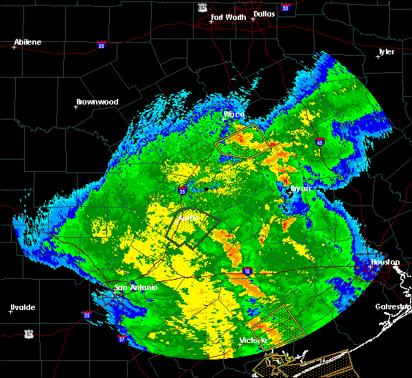 At 1012 am cdt, a severe thunderstorm was located near marlin, moving northwest at 30 mph (radar indicated). Hazards include 60 mph wind gusts and quarter size hail. Hail damage to vehicles is expected. expect wind damage to roofs, siding, and trees. Locations impacted include, marlin, bruceville-eddy, lott and golinda. At 1012 am cdt, a severe thunderstorm was located near marlin, moving northwest at 30 mph (radar indicated). Hazards include 60 mph wind gusts and quarter size hail. Hail damage to vehicles is expected. expect wind damage to roofs, siding, and trees. Locations impacted include, marlin, bruceville-eddy, lott and golinda.
|
| 4/7/2019 9:39 AM CDT |
 At 939 am cdt, a severe thunderstorm was located near bremond, or 11 miles southeast of marlin, moving north at 30 mph (radar indicated). Hazards include 60 mph wind gusts and quarter size hail. Hail damage to vehicles is expected. Expect wind damage to roofs, siding, and trees. At 939 am cdt, a severe thunderstorm was located near bremond, or 11 miles southeast of marlin, moving north at 30 mph (radar indicated). Hazards include 60 mph wind gusts and quarter size hail. Hail damage to vehicles is expected. Expect wind damage to roofs, siding, and trees.
|
| 4/6/2018 8:31 PM CDT |
 At 831 pm cdt, a severe thunderstorm was located near moody, or 10 miles north of temple, moving southeast at 35 mph (radar indicated). Hazards include 60 mph wind gusts and quarter size hail. Hail damage to vehicles is expected. expect wind damage to roofs, siding, and trees. Locations impacted include, temple, marlin, mcgregor, lorena, troy, bruceville-eddy, rosebud, moody, lott and golinda. At 831 pm cdt, a severe thunderstorm was located near moody, or 10 miles north of temple, moving southeast at 35 mph (radar indicated). Hazards include 60 mph wind gusts and quarter size hail. Hail damage to vehicles is expected. expect wind damage to roofs, siding, and trees. Locations impacted include, temple, marlin, mcgregor, lorena, troy, bruceville-eddy, rosebud, moody, lott and golinda.
|
| 4/6/2018 8:11 PM CDT |
 At 809 pm cdt, a severe thunderstorm was located near mother neff state park, or 11 miles southwest of mcgregor, moving southeast at 35 mph (radar indicated). Hazards include 60 mph wind gusts and quarter size hail. Hail damage to vehicles is expected. Expect wind damage to roofs, siding, and trees. At 809 pm cdt, a severe thunderstorm was located near mother neff state park, or 11 miles southwest of mcgregor, moving southeast at 35 mph (radar indicated). Hazards include 60 mph wind gusts and quarter size hail. Hail damage to vehicles is expected. Expect wind damage to roofs, siding, and trees.
|
| 4/3/2018 12:59 PM CDT |
 At 1259 pm cdt, a severe thunderstorm was located near temple, moving east at 45 mph (radar indicated). Hazards include quarter size hail. damage to vehicles is possible At 1259 pm cdt, a severe thunderstorm was located near temple, moving east at 45 mph (radar indicated). Hazards include quarter size hail. damage to vehicles is possible
|
| 4/3/2018 12:48 PM CDT |
 At 1247 pm cdt, a severe thunderstorm was located near mart, or 13 miles northeast of marlin, moving northeast at 35 mph (radar indicated). Hazards include quarter size hail. Damage to vehicles is possible. Locations impacted include, hewitt, robinson, marlin, lorena, bruceville-eddy, moody, riesel, golinda and hallsburg. At 1247 pm cdt, a severe thunderstorm was located near mart, or 13 miles northeast of marlin, moving northeast at 35 mph (radar indicated). Hazards include quarter size hail. Damage to vehicles is possible. Locations impacted include, hewitt, robinson, marlin, lorena, bruceville-eddy, moody, riesel, golinda and hallsburg.
|
| 4/3/2018 12:04 PM CDT |
 At 1204 pm cdt, a severe thunderstorm was located near bruceville-eddy, or 8 miles south of hewitt, moving northeast at 35 mph (radar indicated). Hazards include 60 mph wind gusts and quarter size hail. Hail damage to vehicles is expected. Expect wind damage to roofs, siding, and trees. At 1204 pm cdt, a severe thunderstorm was located near bruceville-eddy, or 8 miles south of hewitt, moving northeast at 35 mph (radar indicated). Hazards include 60 mph wind gusts and quarter size hail. Hail damage to vehicles is expected. Expect wind damage to roofs, siding, and trees.
|
| 3/17/2018 6:26 PM CDT |
 At 626 pm cdt, a severe thunderstorm was located near golinda, or 7 miles west of marlin, moving east at 25 mph (trained weather spotters). Hazards include golf ball size hail and 65 mph wind gusts. People and animals outdoors will be injured. expect hail damage to roofs, siding, windows, and vehicles. expect wind damage to roofs, siding, and trees. Locations impacted include, marlin, lott and golinda. At 626 pm cdt, a severe thunderstorm was located near golinda, or 7 miles west of marlin, moving east at 25 mph (trained weather spotters). Hazards include golf ball size hail and 65 mph wind gusts. People and animals outdoors will be injured. expect hail damage to roofs, siding, windows, and vehicles. expect wind damage to roofs, siding, and trees. Locations impacted include, marlin, lott and golinda.
|
| 3/17/2018 6:18 PM CDT | Golf Ball sized hail reported 5.4 miles SSE of Chilton, TX, golf ball hail reported. |
| 3/17/2018 6:16 PM CDT | Ping Pong Ball sized hail reported 5.4 miles SSE of Chilton, TX, ping pong ball size hail reported. |
| 3/17/2018 5:43 PM CDT |
 At 541 pm cdt, a severe thunderstorm was located over bruceville-eddy, or 13 miles southwest of hewitt, moving east at 25 mph (several storm spotters have reported quarter to golf ball sized hail in the vicinity of moody). Hazards include two inch hail and 70 mph wind gusts. People and animals outdoors will be injured. expect hail damage to roofs, siding, windows, and vehicles. expect considerable tree damage. Wind damage is also likely to mobile homes, roofs, and outbuildings. At 541 pm cdt, a severe thunderstorm was located over bruceville-eddy, or 13 miles southwest of hewitt, moving east at 25 mph (several storm spotters have reported quarter to golf ball sized hail in the vicinity of moody). Hazards include two inch hail and 70 mph wind gusts. People and animals outdoors will be injured. expect hail damage to roofs, siding, windows, and vehicles. expect considerable tree damage. Wind damage is also likely to mobile homes, roofs, and outbuildings.
|
| 2/24/2018 6:16 PM CST |
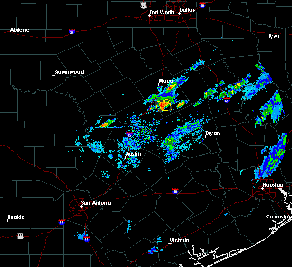 At 615 pm cst, a severe thunderstorm was located near lott, or 15 miles east of temple, moving east at 30 mph (radar indicated). Hazards include 60 mph wind gusts and quarter size hail. Hail damage to vehicles is expected. expect wind damage to roofs, siding, and trees. Locations impacted include, lott. At 615 pm cst, a severe thunderstorm was located near lott, or 15 miles east of temple, moving east at 30 mph (radar indicated). Hazards include 60 mph wind gusts and quarter size hail. Hail damage to vehicles is expected. expect wind damage to roofs, siding, and trees. Locations impacted include, lott.
|
| 2/24/2018 6:02 PM CST |
 At 601 pm cst, a severe thunderstorm was located near troy, or 9 miles northeast of temple, moving east at 35 mph (radar indicated). Hazards include 60 mph wind gusts and quarter size hail. Hail damage to vehicles is expected. expect wind damage to roofs, siding, and trees. Locations impacted include, temple, troy and lott. At 601 pm cst, a severe thunderstorm was located near troy, or 9 miles northeast of temple, moving east at 35 mph (radar indicated). Hazards include 60 mph wind gusts and quarter size hail. Hail damage to vehicles is expected. expect wind damage to roofs, siding, and trees. Locations impacted include, temple, troy and lott.
|
| 2/24/2018 5:45 PM CST |
 At 545 pm cst, a severe thunderstorm was located over morgan`s point resort, or 7 miles northwest of temple, moving east at 30 mph (radar indicated). Hazards include 60 mph wind gusts and quarter size hail. Hail damage to vehicles is expected. Expect wind damage to roofs, siding, and trees. At 545 pm cst, a severe thunderstorm was located over morgan`s point resort, or 7 miles northwest of temple, moving east at 30 mph (radar indicated). Hazards include 60 mph wind gusts and quarter size hail. Hail damage to vehicles is expected. Expect wind damage to roofs, siding, and trees.
|
| 4/2/2017 10:41 AM CDT | At 1040 am cdt, severe thunderstorms were located along a line extending from near troy to near cameron to 6 miles northeast of tanglewood, moving northeast at 55 mph (radar indicated). Hazards include 60 mph wind gusts and nickel size hail. expect damage to roofs, siding, and trees |
| 3/26/2017 11:29 PM CDT |
 At 1128 pm cdt, severe thunderstorms were located along a line extending from near bruceville-eddy to near temple to near nolanville, moving southeast at 20 mph (public report of quarter size hail in belton at 11:22 p.m). Hazards include 60 mph wind gusts and quarter size hail. Hail damage to vehicles is expected. Expect wind damage to roofs, siding, and trees. At 1128 pm cdt, severe thunderstorms were located along a line extending from near bruceville-eddy to near temple to near nolanville, moving southeast at 20 mph (public report of quarter size hail in belton at 11:22 p.m). Hazards include 60 mph wind gusts and quarter size hail. Hail damage to vehicles is expected. Expect wind damage to roofs, siding, and trees.
|
| 1/2/2017 5:24 AM CST |
 The severe thunderstorm warning for western limestone, northern falls, southeastern hill and mclennan counties will expire at 530 am cst, the storm which prompted the warning has moved out of the area. therefore the warning will be allowed to expire. a severe thunderstorm watch remains in effect until 900 am cst for central texas. The severe thunderstorm warning for western limestone, northern falls, southeastern hill and mclennan counties will expire at 530 am cst, the storm which prompted the warning has moved out of the area. therefore the warning will be allowed to expire. a severe thunderstorm watch remains in effect until 900 am cst for central texas.
|
| 1/2/2017 4:41 AM CST |
 At 439 am cst, a severe thunderstorm was located over bellmead, moving east at 50 mph (waco automated surface observation system). Hazards include 65 mph wind gusts. Expect damage to roofs, siding, and trees. this severe storm will be near, hallsburg around 450 am cst. mart around 455 am cst. coolidge around 510 am cst. Other locations impacted by this severe thunderstorm include mount calm, kosse, penelope, thornton, malone, gholson, ross and leroy. At 439 am cst, a severe thunderstorm was located over bellmead, moving east at 50 mph (waco automated surface observation system). Hazards include 65 mph wind gusts. Expect damage to roofs, siding, and trees. this severe storm will be near, hallsburg around 450 am cst. mart around 455 am cst. coolidge around 510 am cst. Other locations impacted by this severe thunderstorm include mount calm, kosse, penelope, thornton, malone, gholson, ross and leroy.
|
| 1/2/2017 4:28 AM CST |
 At 428 am cst, a severe thunderstorm was located over woodway, moving east at 65 mph (radar indicated). Hazards include 60 mph wind gusts. Expect damage to roofs, siding, and trees. this severe thunderstorm will be near, robinson and beverly hills around 435 am cst. bellmead around 440 am cst. riesel around 445 am cst. hallsburg around 450 am cst. mart around 455 am cst. other locations impacted by this severe thunderstorm include mount calm, kosse, penelope, thornton, malone, gholson, ross and leroy. This includes interstate 35 between mile markers 313 and 356. At 428 am cst, a severe thunderstorm was located over woodway, moving east at 65 mph (radar indicated). Hazards include 60 mph wind gusts. Expect damage to roofs, siding, and trees. this severe thunderstorm will be near, robinson and beverly hills around 435 am cst. bellmead around 440 am cst. riesel around 445 am cst. hallsburg around 450 am cst. mart around 455 am cst. other locations impacted by this severe thunderstorm include mount calm, kosse, penelope, thornton, malone, gholson, ross and leroy. This includes interstate 35 between mile markers 313 and 356.
|
| 6/12/2016 11:40 PM CDT |
 The severe thunderstorm warning for central falls and central mclennan counties will expire at 1145 pm cdt, the storm which prompted the warning has weakened below severe limits therefore the warning will be allowed to expire. however gusty winds and very heavy rain are still possible with this thunderstorm. The severe thunderstorm warning for central falls and central mclennan counties will expire at 1145 pm cdt, the storm which prompted the warning has weakened below severe limits therefore the warning will be allowed to expire. however gusty winds and very heavy rain are still possible with this thunderstorm.
|
| 6/12/2016 11:15 PM CDT |
 At 1114 pm cdt, a severe thunderstorm was located over robinson, moving southeast at 10 mph (radar indicated). Hazards include 60 mph wind gusts. Expect damage to roofs. siding. and trees. This severe storm will be near, golinda around 1135 pm cdt. At 1114 pm cdt, a severe thunderstorm was located over robinson, moving southeast at 10 mph (radar indicated). Hazards include 60 mph wind gusts. Expect damage to roofs. siding. and trees. This severe storm will be near, golinda around 1135 pm cdt.
|
| 6/12/2016 10:45 PM CDT |
 At 1044 pm cdt, a severe thunderstorm was located over beverly hills, or near robinson, moving southeast at 20 mph. this storm has a history of producing severe winds (radar indicated). Hazards include 60 mph wind gusts. Expect damage to roofs. siding. and trees. this severe thunderstorm will be near, robinson and lorena around 1050 pm cdt. golinda around 1110 pm cdt. marlin around 1140 pm cdt. lott around 1145 pm cdt. other locations impacted by this severe thunderstorm include gholson. This includes interstate 35 between mile markers 318 and 343. At 1044 pm cdt, a severe thunderstorm was located over beverly hills, or near robinson, moving southeast at 20 mph. this storm has a history of producing severe winds (radar indicated). Hazards include 60 mph wind gusts. Expect damage to roofs. siding. and trees. this severe thunderstorm will be near, robinson and lorena around 1050 pm cdt. golinda around 1110 pm cdt. marlin around 1140 pm cdt. lott around 1145 pm cdt. other locations impacted by this severe thunderstorm include gholson. This includes interstate 35 between mile markers 318 and 343.
|
| 5/18/2015 7:20 PM CDT | At 719 pm cdt, a severe thunderstorm was located near troy, or 10 miles north of temple, moving northwest at 5 mph (radar indicated). Hazards include 60 mph wind gusts. Expect damage to roofs. siding and trees. locations impacted include, temple, hewitt, mcgregor, lorena, troy, bruceville-eddy, moody, golinda, mother neff state park and oglesby. this includes interstate 35 between mile markers 304 and 324. 75in. |
| 5/18/2015 6:57 PM CDT | At 656 pm cdt, a severe thunderstorm was located near troy, or 10 miles north of temple, moving northwest at 15 mph (radar indicated). Hazards include 60 mph wind gusts. Expect damage to roofs. Siding and trees. |
| 4/22/2015 8:20 PM CDT | At 819 pm cdt, a severe thunderstorm was located near lott, or 11 miles west of marlin, moving southeast at 35 mph (radar indicated). Hazards include quarter size hail. Minor damage to vehicles is expected. locations impacted include, marlin, bruceville-eddy, lott and golinda. 1. 00in. |
| 4/22/2015 8:10 PM CDT | At 809 pm cdt, a severe thunderstorm was located near bruceville- eddy, or 10 miles south of hewitt, moving southeast at 30 mph (radar indicated). Hazards include quarter size hail. Damage to vehicles is expected. locations impacted include, hewitt, robinson, marlin, lorena, bruceville-eddy, lott and golinda. this includes interstate 35 between mile markers 313 and 324. 1. 00in. |
| 4/22/2015 7:50 PM CDT | At 750 pm cdt, a severe thunderstorm was located near moody, or 10 miles southeast of mcgregor, moving southeast at 35 mph (radar indicated). Hazards include 60 mph wind gusts and quarter size hail. Hail damage to vehicles is expected. Expect wind damage to roofs, siding and trees. |
| 8/11/2014 1:18 PM CDT | Tree down and was blocking the road near the intersection of highway 7 and cr 4012 in chilto in falls county TX, 1.4 miles SSE of Chilton, TX |
Hail Maps for Chilton, TX


Connect with Interactive Hail Maps