

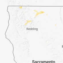
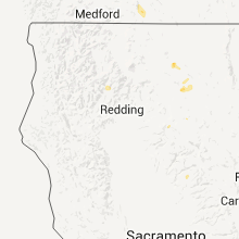
Hail Map for Coffee Creek, CA
The Coffee Creek, CA area has had 0 reports of on-the-ground hail by trained spotters, and has been under severe weather warnings 3 times during the past 12 months. Doppler radar has detected hail at or near Coffee Creek, CA on 5 occasions, including 1 occasion during the past year.
| Name: | Coffee Creek, CA |
| Where Located: | 37.9 miles NNW of Redding, CA |
| Map: | Google Map for Coffee Creek, CA |
| Population: | 217 |
| Housing Units: | 152 |
| More Info: | Search Google for Coffee Creek, CA |
2
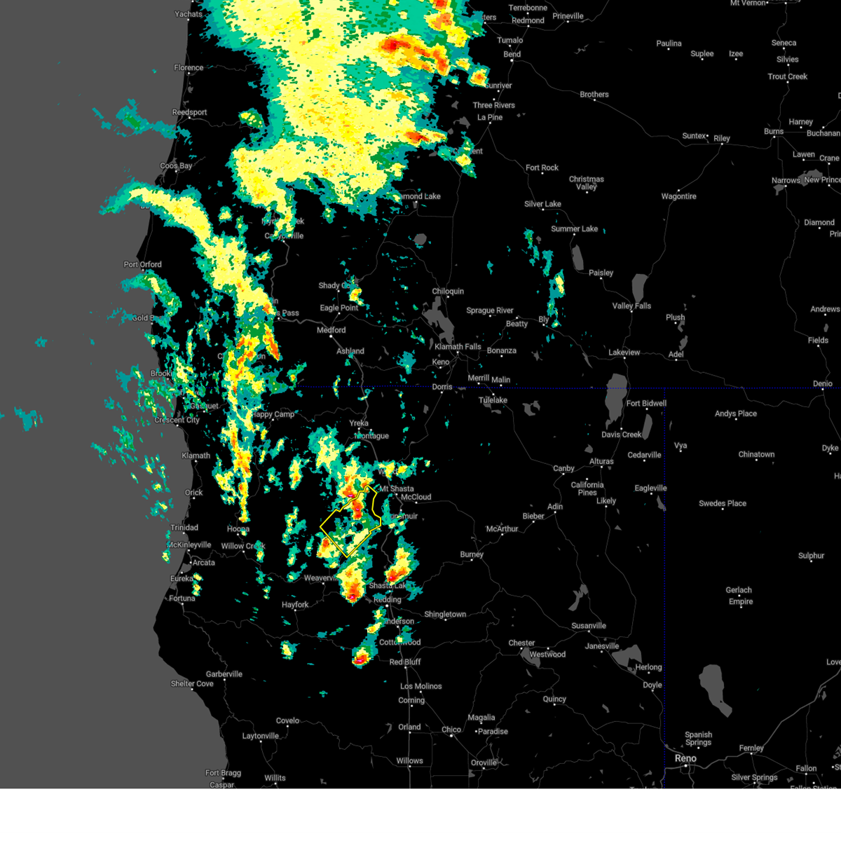
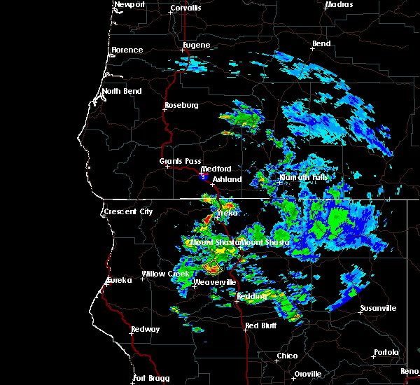
The Top Recent Hail Date for Coffee Creek, CA is Saturday, August 17, 2024 (3rd out of 5)

Hail and Wind Damage Spotted near Coffee Creek, CA
| Date / Time | Report Details |
|---|---|
| 8/17/2024 3:59 PM PDT |
 The storm which prompted the warning has weakened below severe limits, and no longer poses an immediate threat to life or property. therefore, the warning will be allowed to expire. a severe thunderstorm watch remains in effect until 900 pm pdt for northwestern california. The storm which prompted the warning has weakened below severe limits, and no longer poses an immediate threat to life or property. therefore, the warning will be allowed to expire. a severe thunderstorm watch remains in effect until 900 pm pdt for northwestern california.
|
| 8/17/2024 3:30 PM PDT |
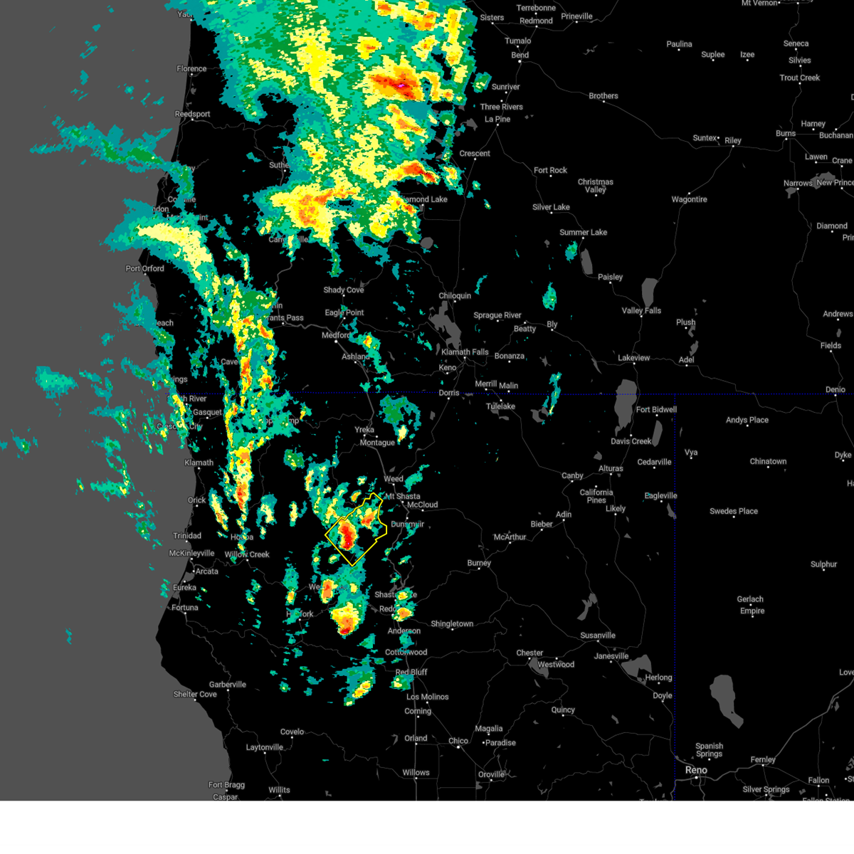 Svreka the national weather service in eureka california has issued a * severe thunderstorm warning for, northeastern trinity county in northwestern california, * until 400 pm pdt. * at 330 pm pdt, a severe thunderstorm was located over carrville, or 21 miles northeast of weaverville, moving northeast at 45 mph (radar indicated). Hazards include 60 mph wind gusts and quarter size hail. Hail damage to vehicles is expected. Expect wind damage to roofs, siding, and trees. Svreka the national weather service in eureka california has issued a * severe thunderstorm warning for, northeastern trinity county in northwestern california, * until 400 pm pdt. * at 330 pm pdt, a severe thunderstorm was located over carrville, or 21 miles northeast of weaverville, moving northeast at 45 mph (radar indicated). Hazards include 60 mph wind gusts and quarter size hail. Hail damage to vehicles is expected. Expect wind damage to roofs, siding, and trees.
|
| 8/17/2024 1:03 PM PDT |
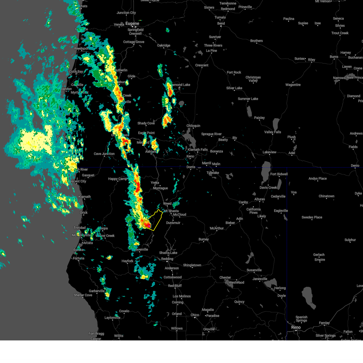 Svreka the national weather service in eureka california has issued a * severe thunderstorm warning for, northeastern trinity county in northwestern california, * until 130 pm pdt. * at 103 pm pdt, a severe thunderstorm was located near carrville, or 24 miles southwest of mount shasta, moving northeast at 25 mph (radar indicated). Hazards include 60 mph wind gusts and quarter size hail. Hail damage to vehicles is expected. Expect wind damage to roofs, siding, and trees. Svreka the national weather service in eureka california has issued a * severe thunderstorm warning for, northeastern trinity county in northwestern california, * until 130 pm pdt. * at 103 pm pdt, a severe thunderstorm was located near carrville, or 24 miles southwest of mount shasta, moving northeast at 25 mph (radar indicated). Hazards include 60 mph wind gusts and quarter size hail. Hail damage to vehicles is expected. Expect wind damage to roofs, siding, and trees.
|
| 8/6/2017 5:55 PM PDT |
 The severe thunderstorm warning for northeastern trinity county will expire at 600 pm pdt, the severe thunderstorm which prompted the warning has weakened. therefore, the warning will be allowed to expire. however small hail is still possible with this thunderstorm. The severe thunderstorm warning for northeastern trinity county will expire at 600 pm pdt, the severe thunderstorm which prompted the warning has weakened. therefore, the warning will be allowed to expire. however small hail is still possible with this thunderstorm.
|
| 8/6/2017 5:40 PM PDT |
 At 539 pm pdt, a severe thunderstorm was located over carrville, or 24 miles northeast of weaverville. this storm is over the north end of trinity lake and is nearly stationary (radar indicated). Hazards include quarter size hail. Damage to vehicles is expected. Locations impacted include, carrville and trinity center. At 539 pm pdt, a severe thunderstorm was located over carrville, or 24 miles northeast of weaverville. this storm is over the north end of trinity lake and is nearly stationary (radar indicated). Hazards include quarter size hail. Damage to vehicles is expected. Locations impacted include, carrville and trinity center.
|
| 8/6/2017 5:32 PM PDT |
 At 530 pm pdt, a severe thunderstorm was located over carrville, or 25 miles northeast of weaverville and is nearly stationary. this storm is over the north end of trinity lake (radar indicated). Hazards include quarter size hail. damage to vehicles is expected At 530 pm pdt, a severe thunderstorm was located over carrville, or 25 miles northeast of weaverville and is nearly stationary. this storm is over the north end of trinity lake (radar indicated). Hazards include quarter size hail. damage to vehicles is expected
|
Hail Maps for Coffee Creek, CA


Connect with Interactive Hail Maps