

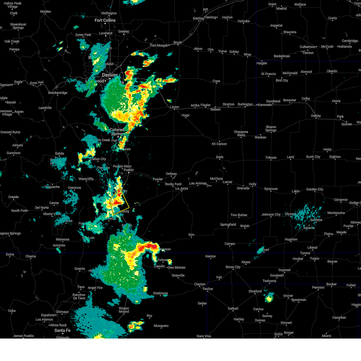
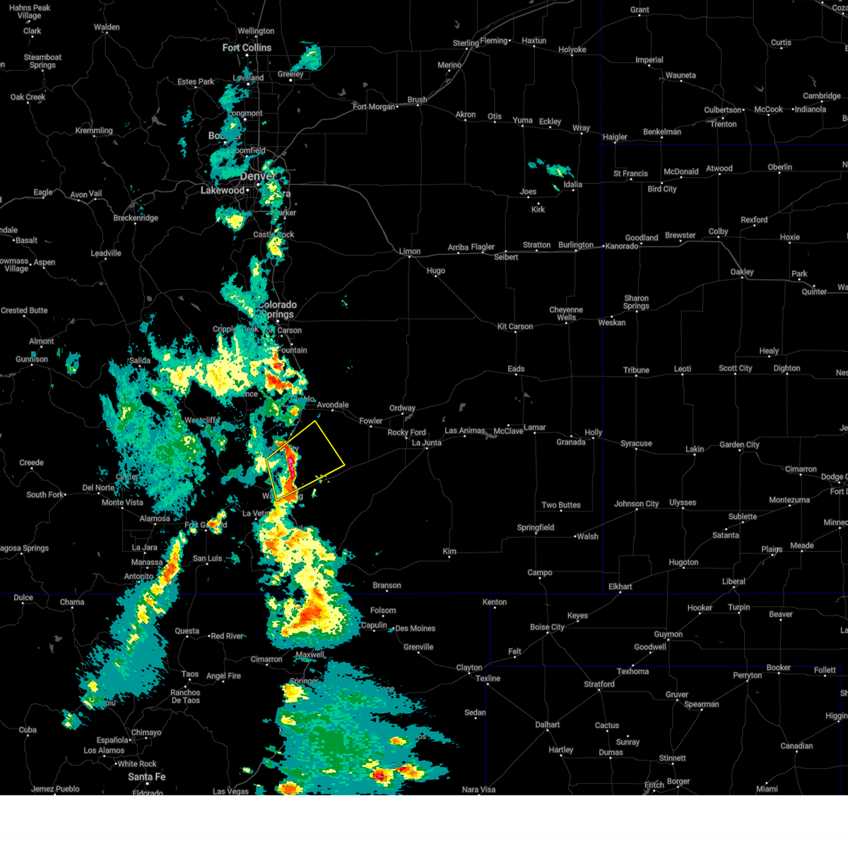
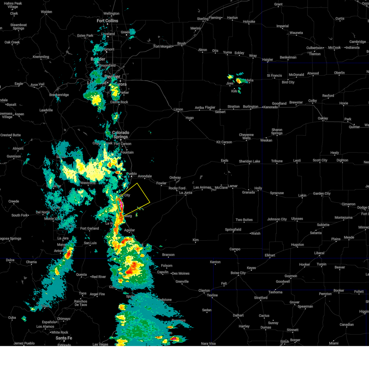
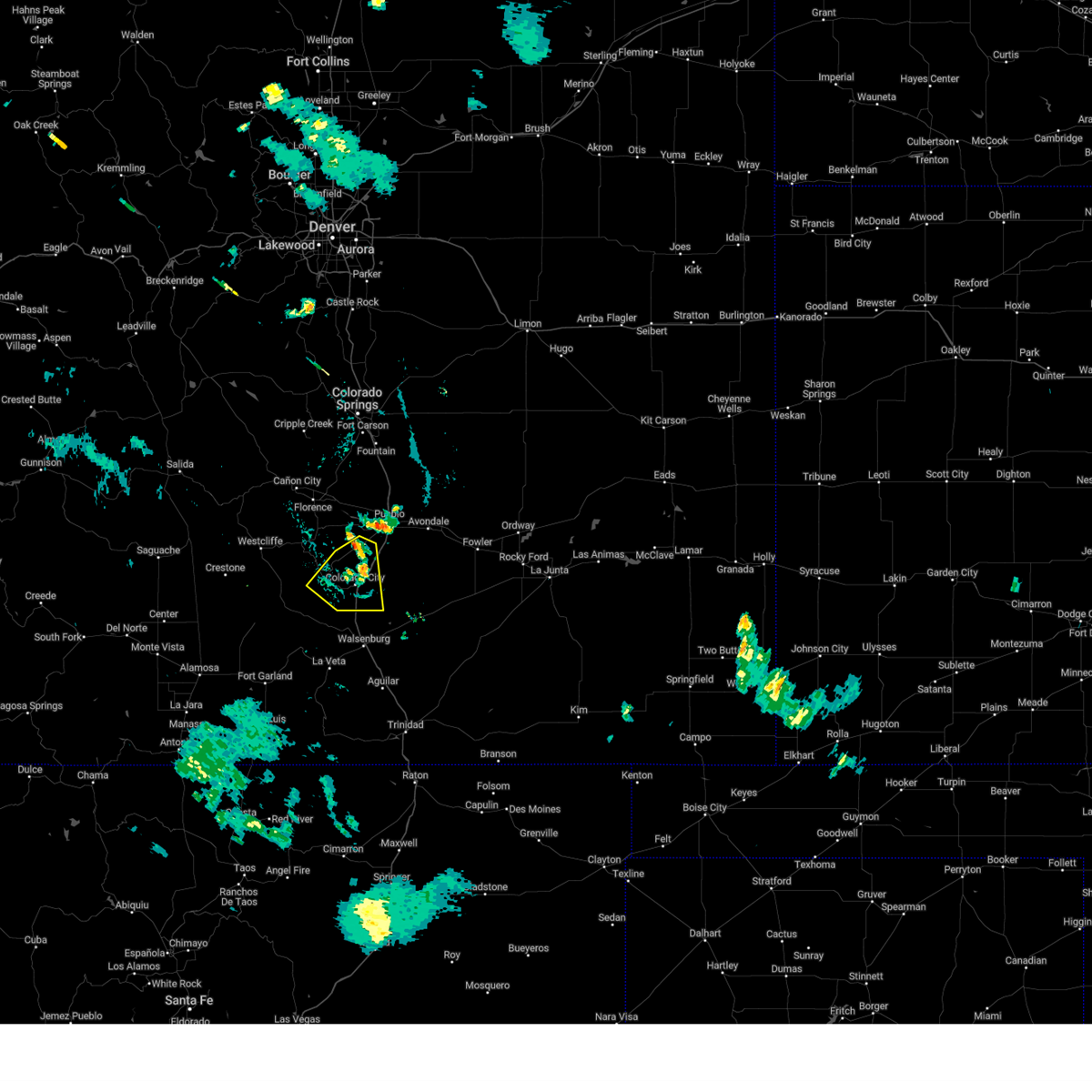
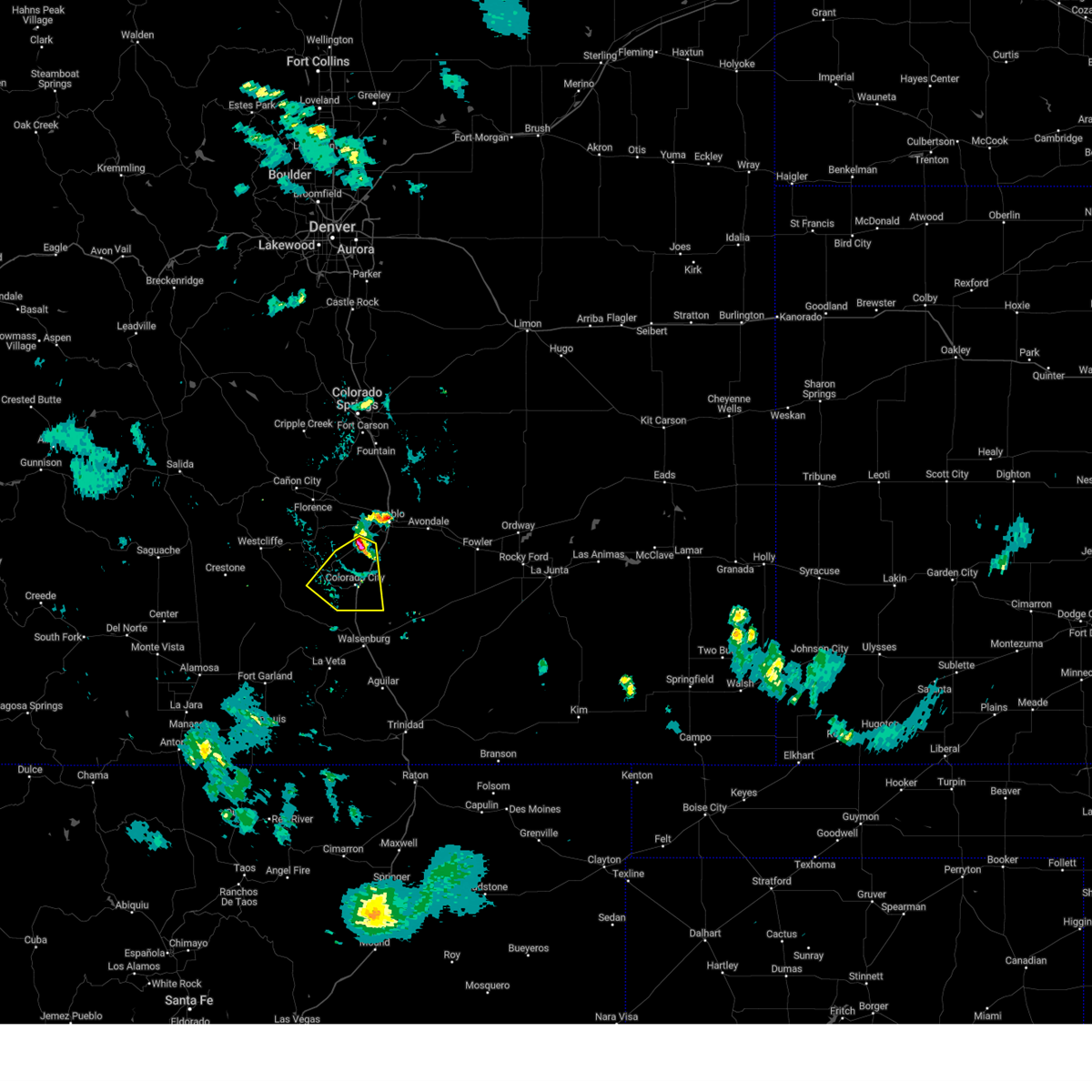
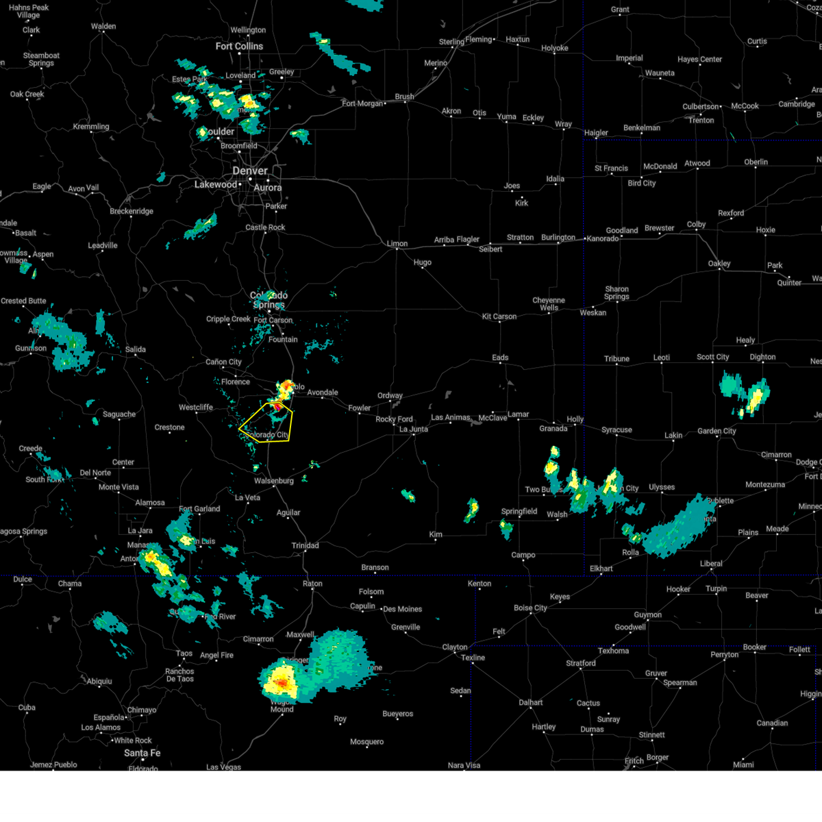
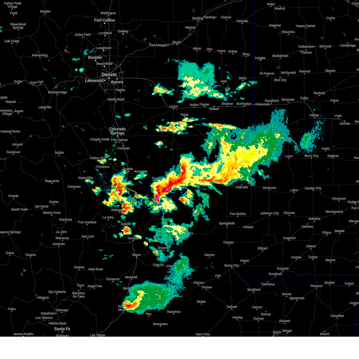
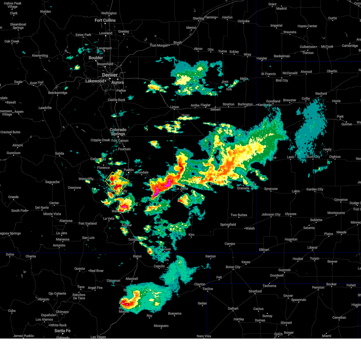
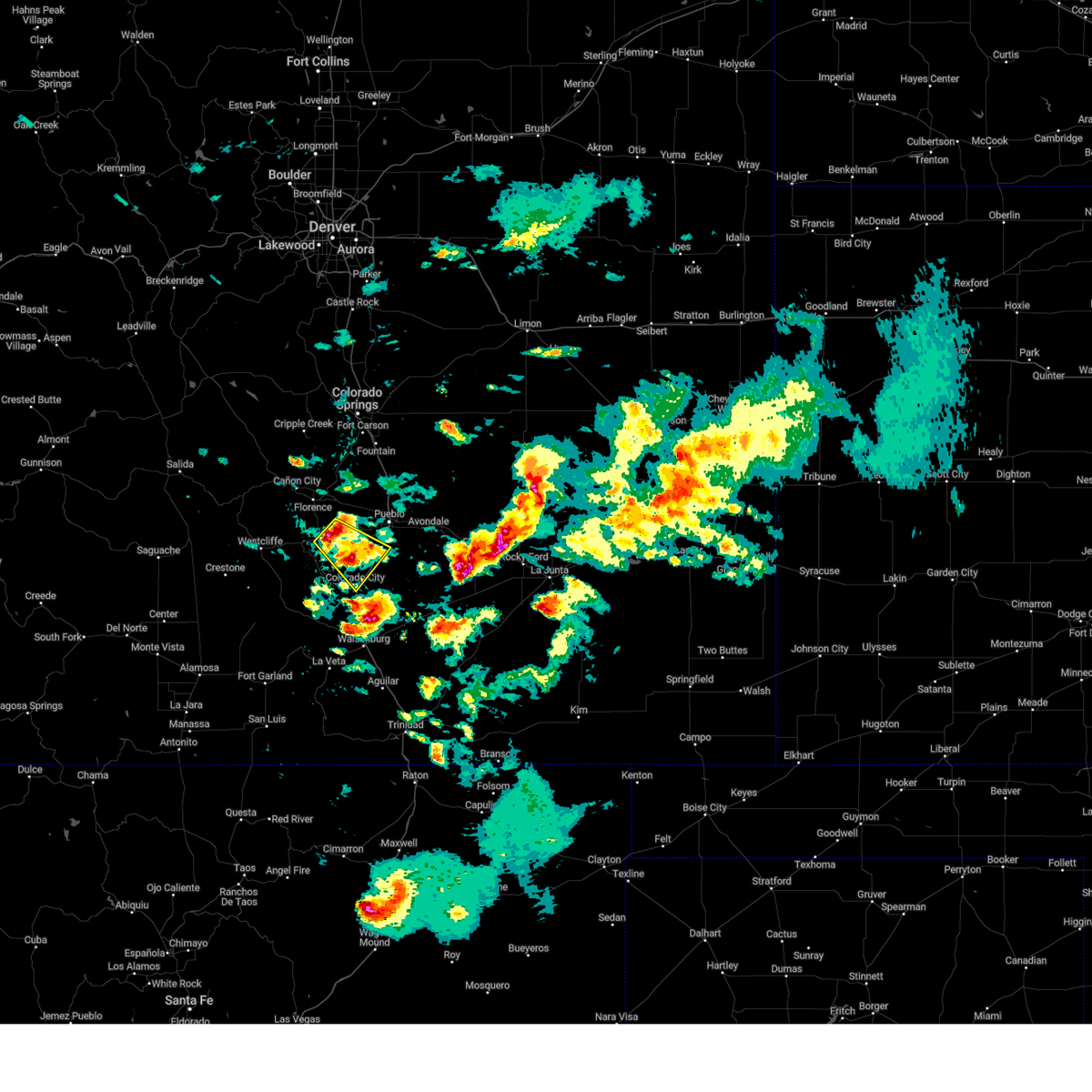
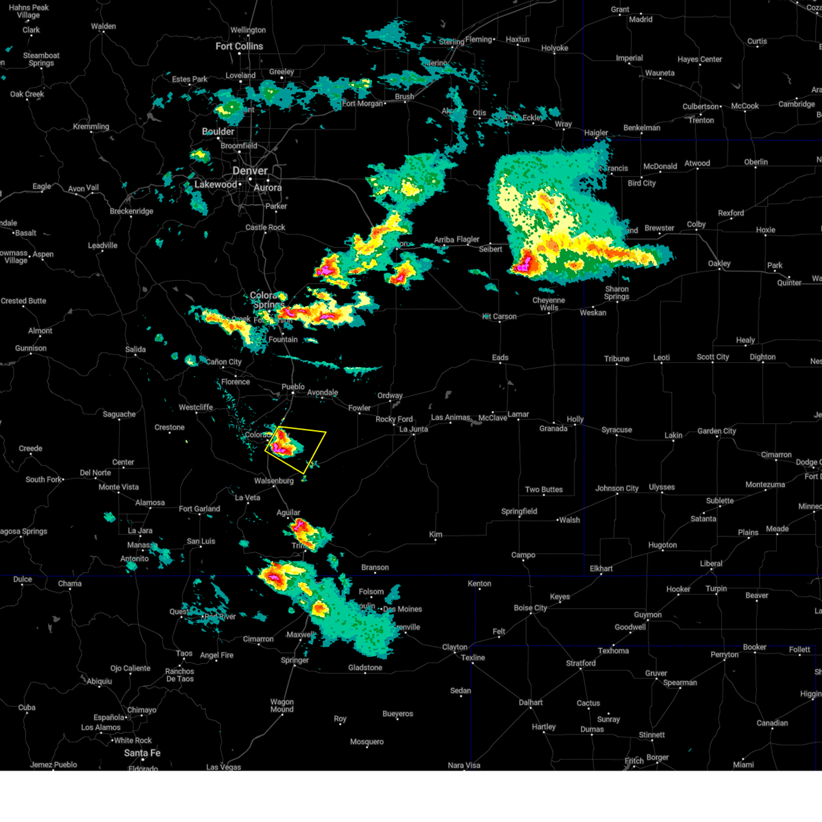
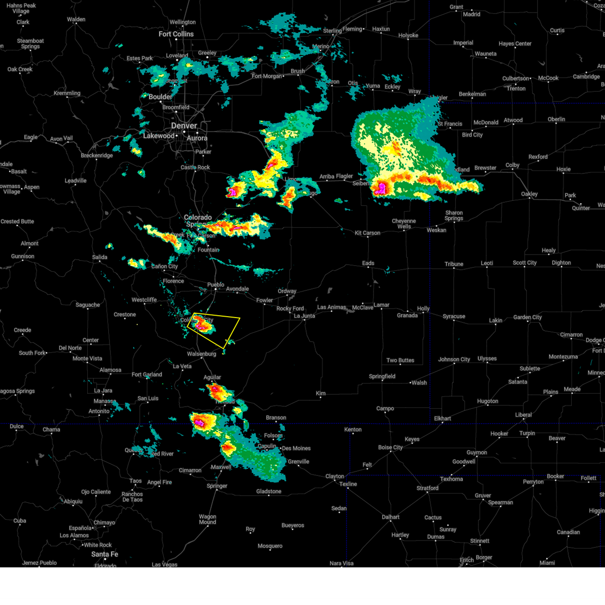
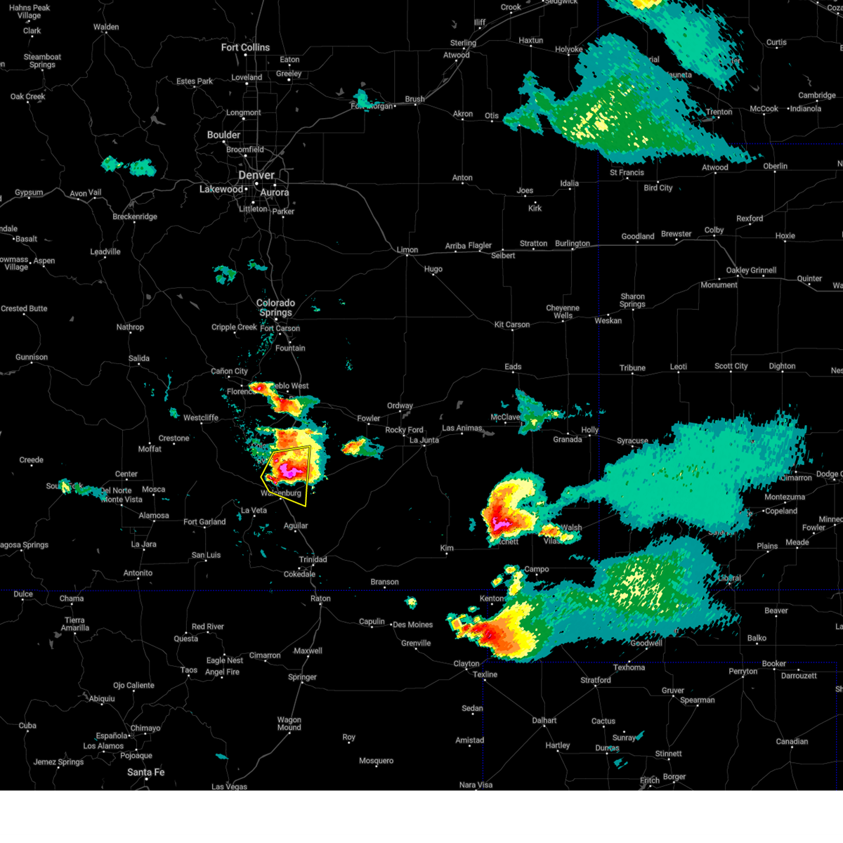
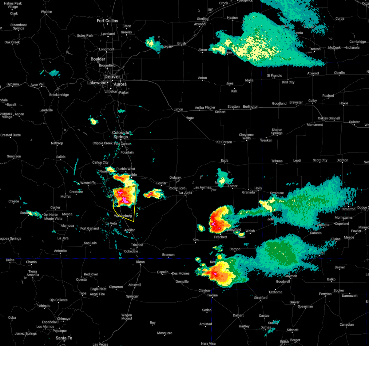
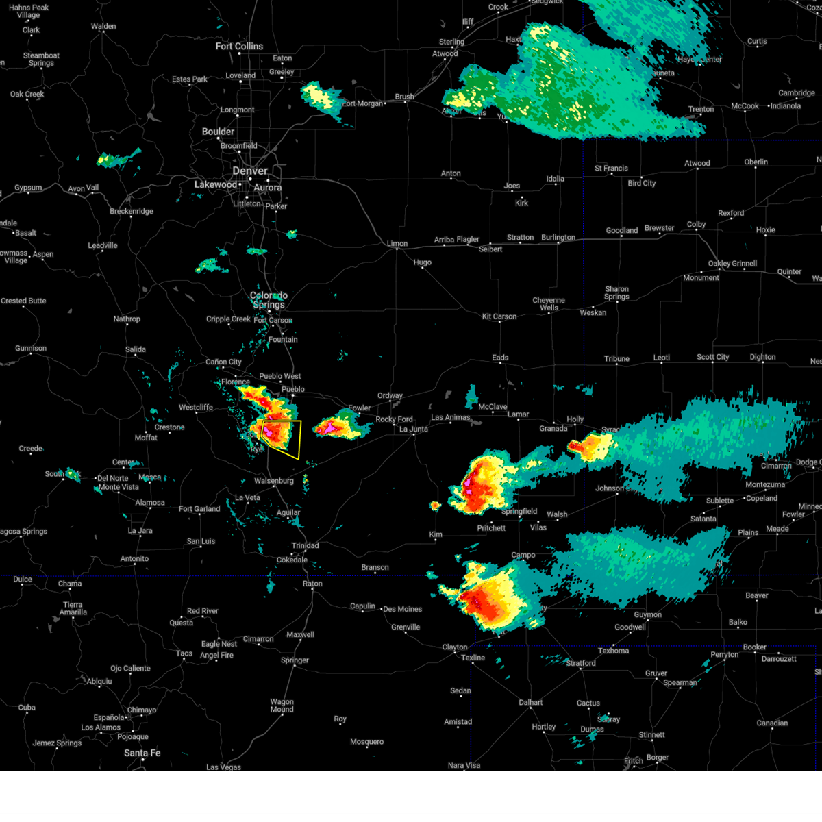
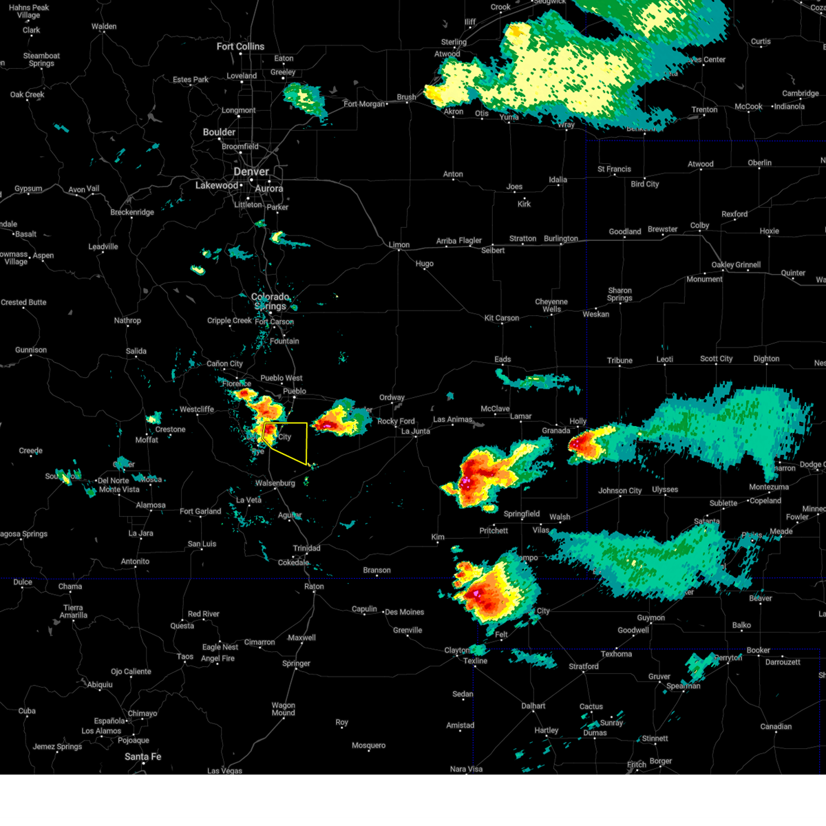
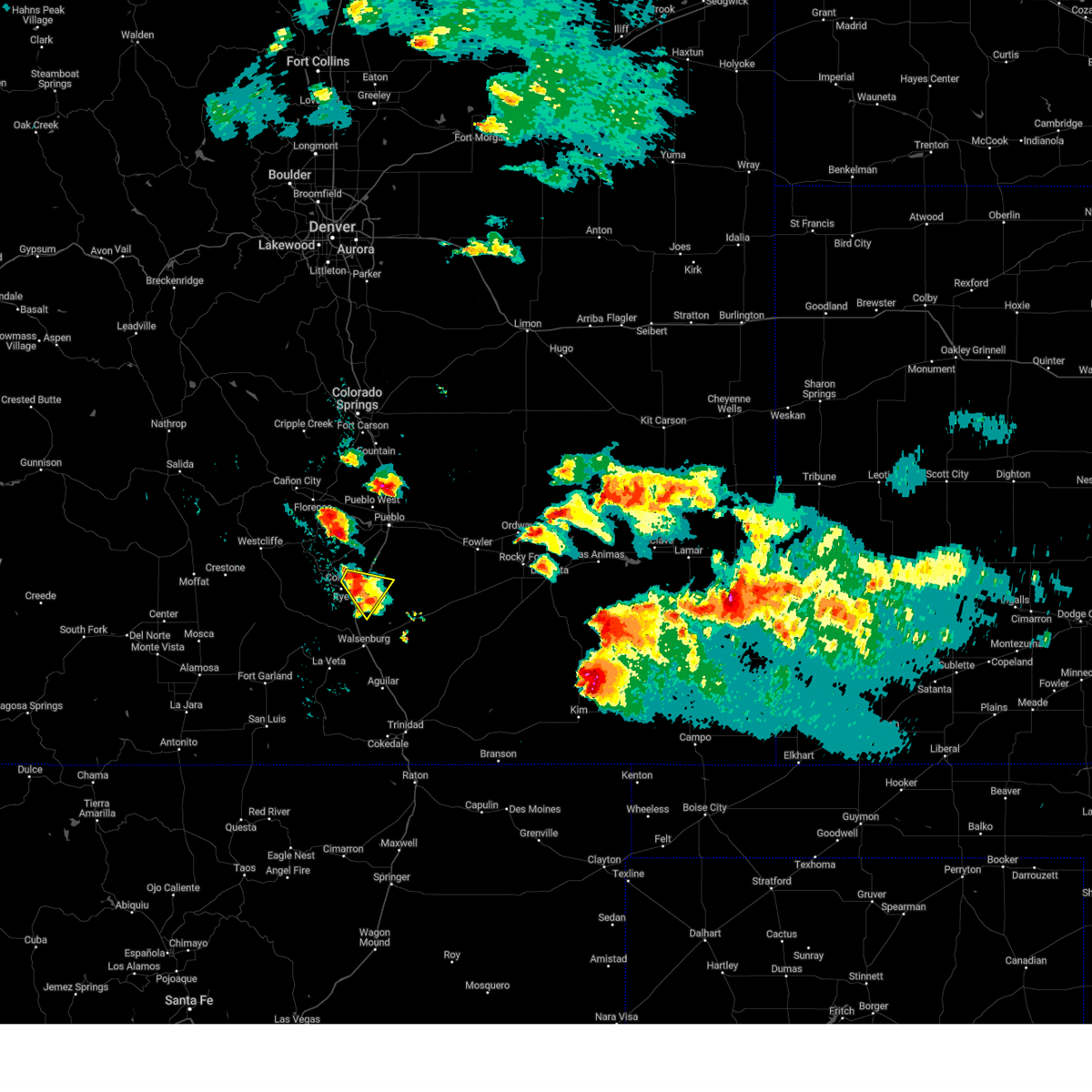
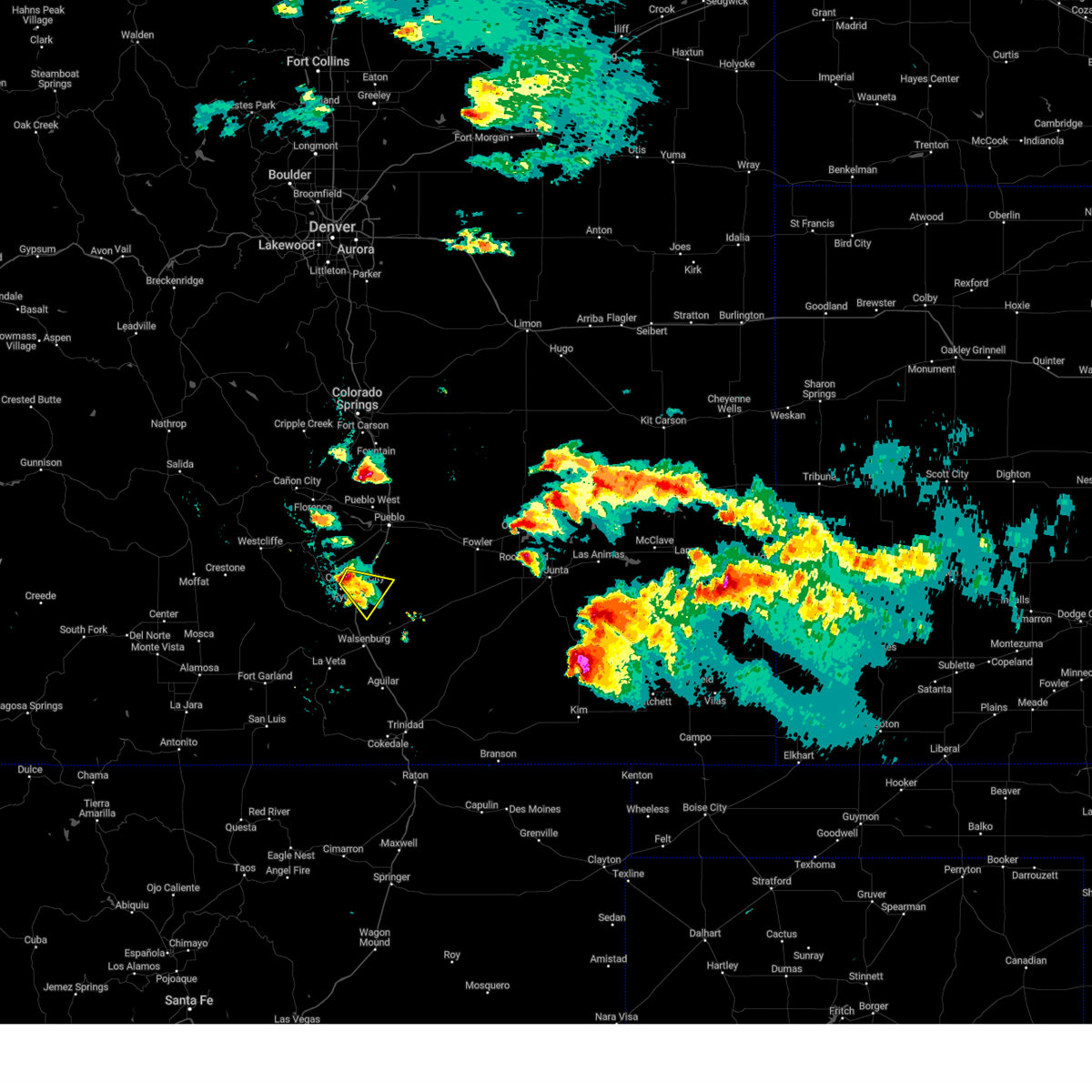
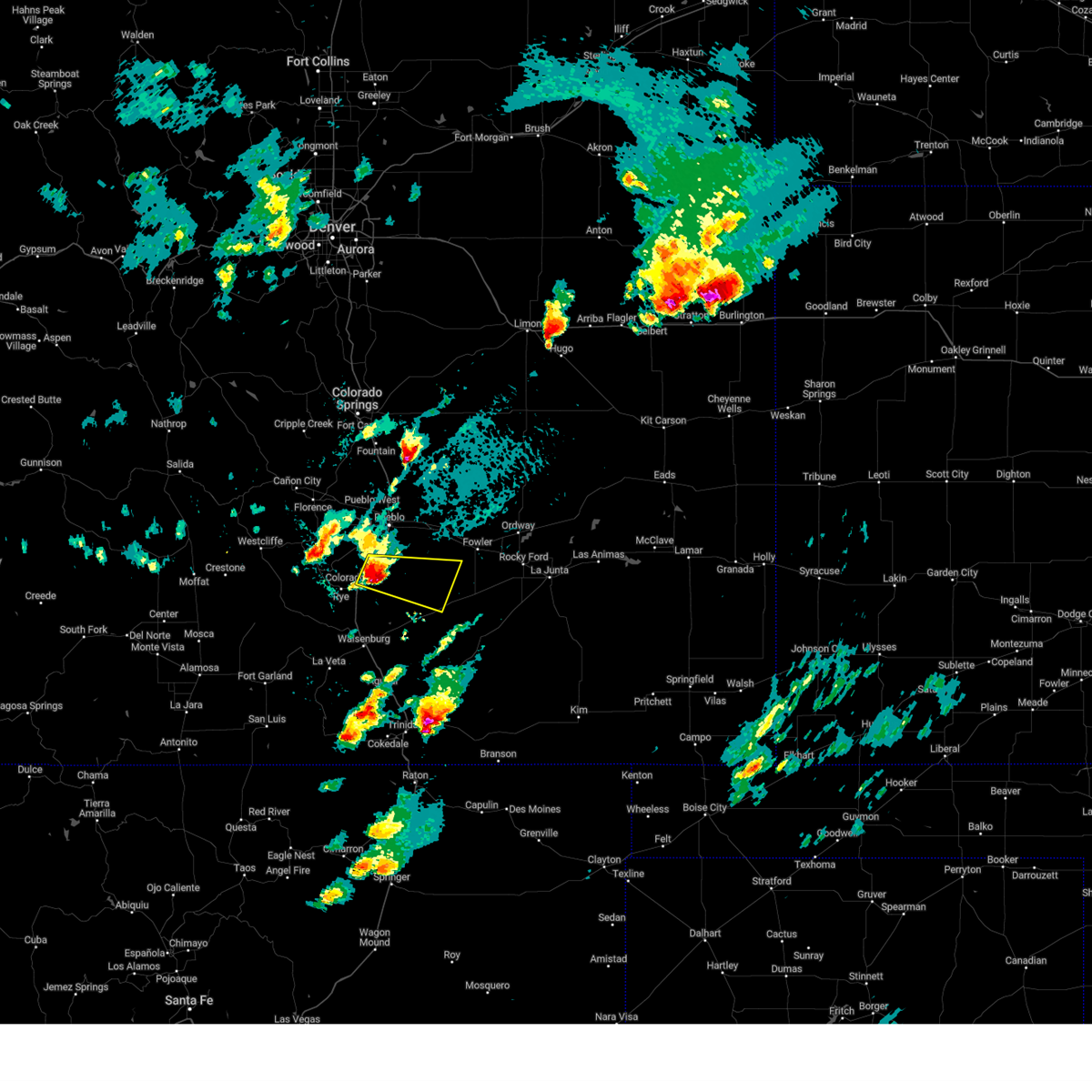
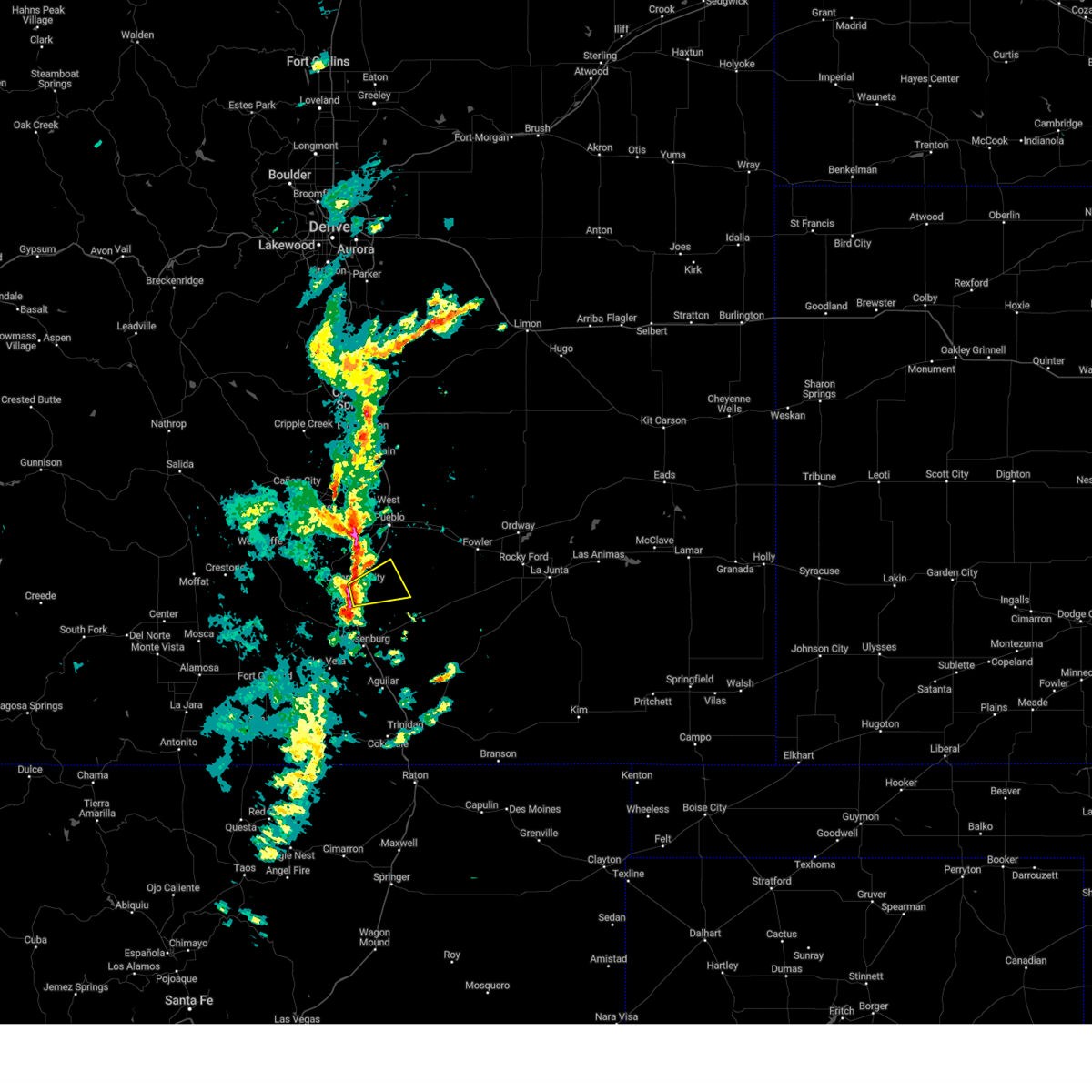
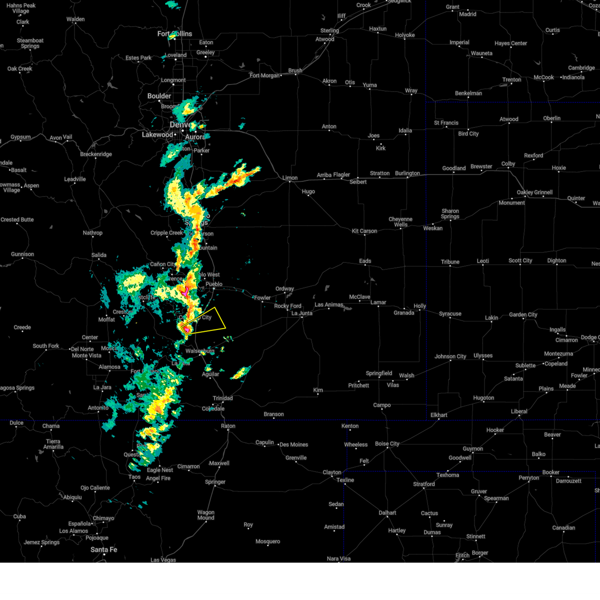
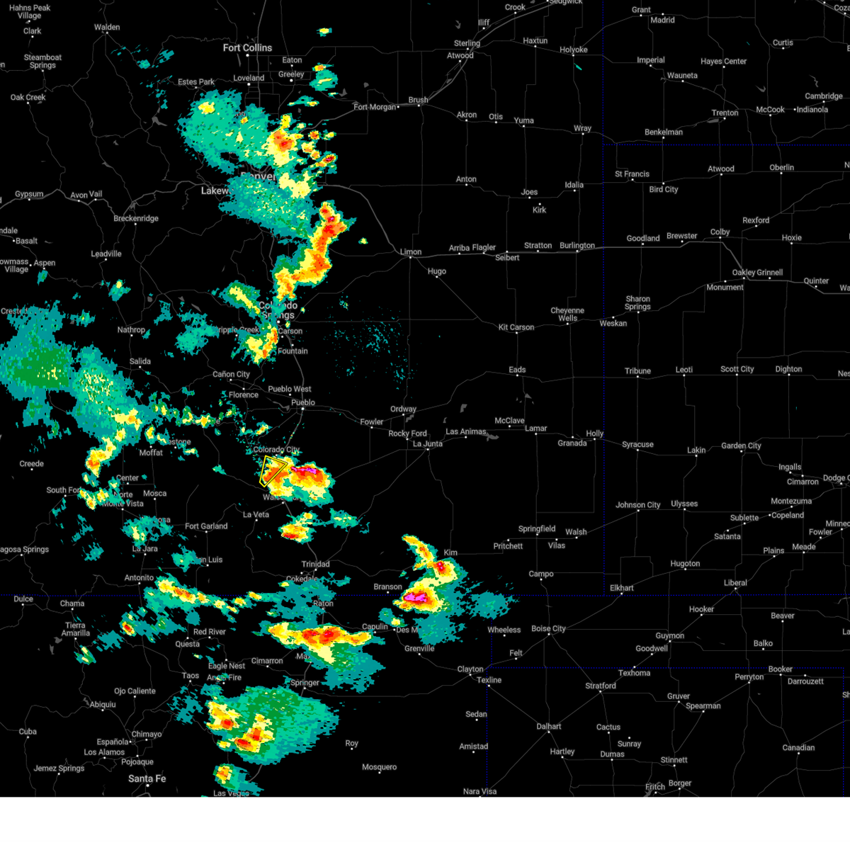
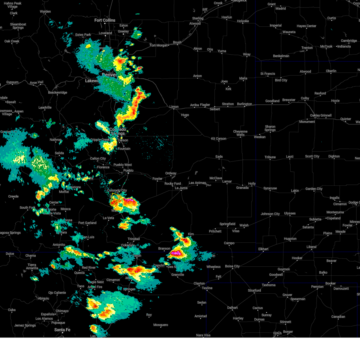
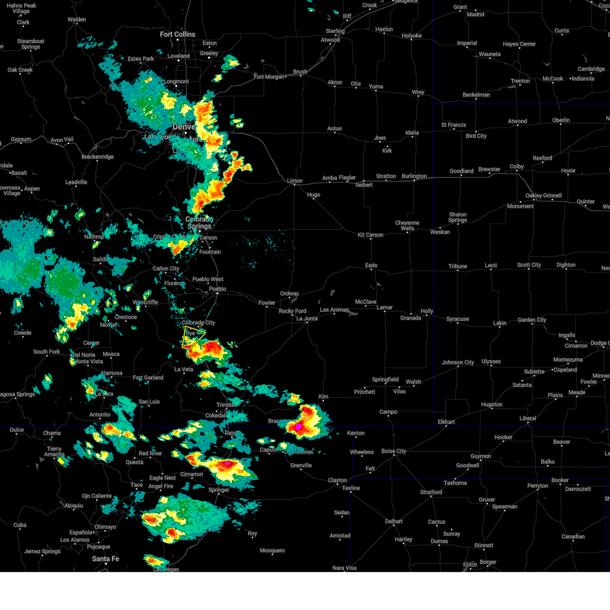
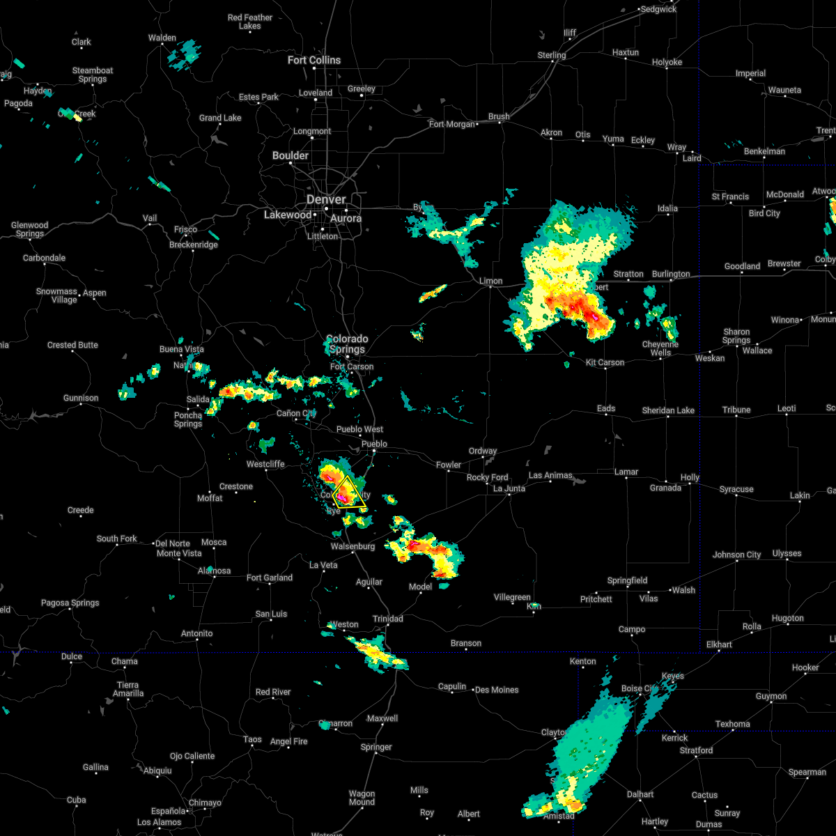
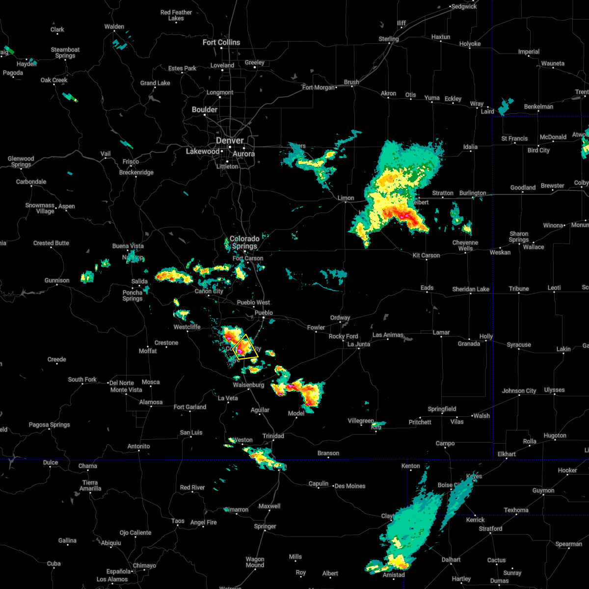
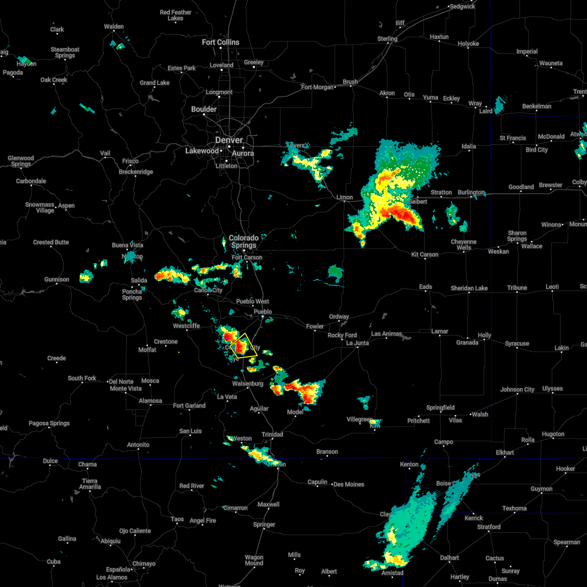
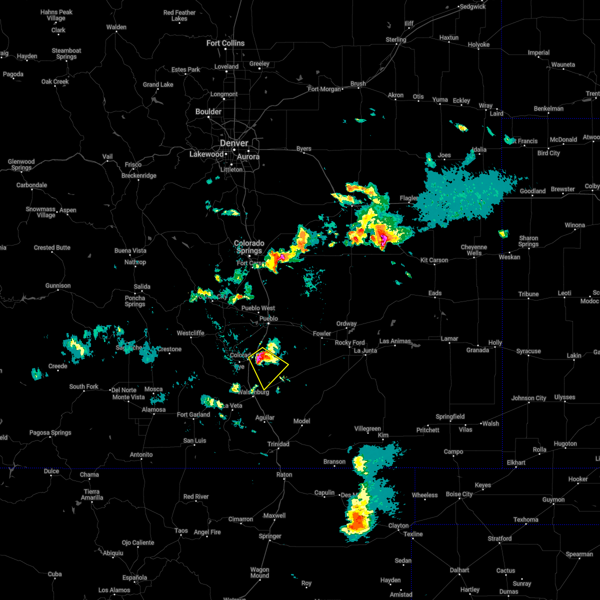
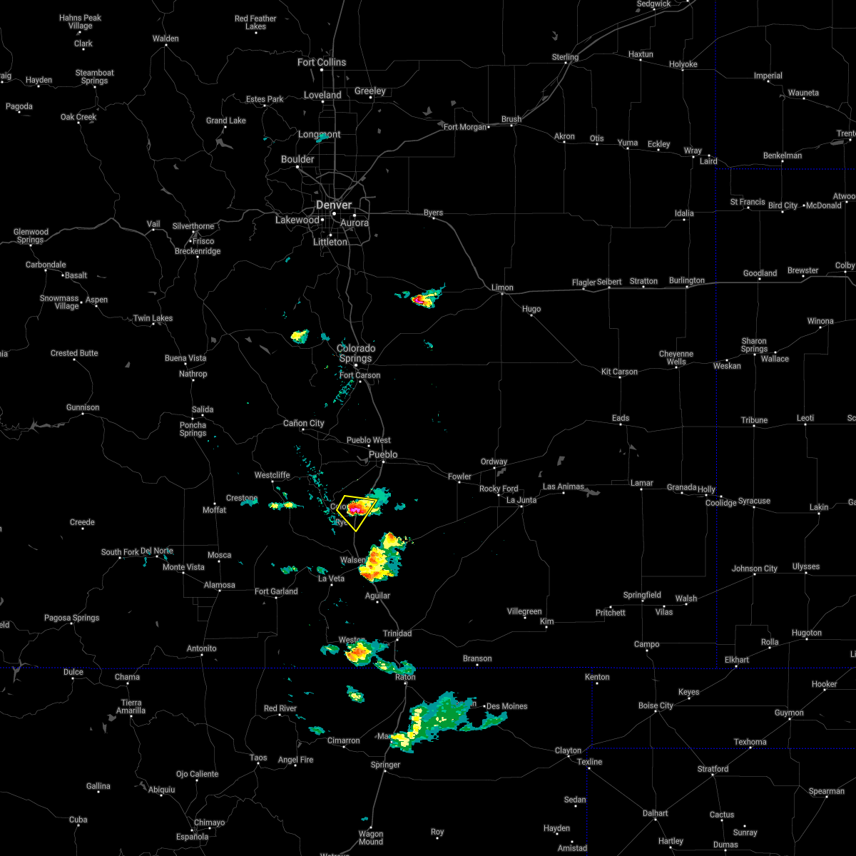
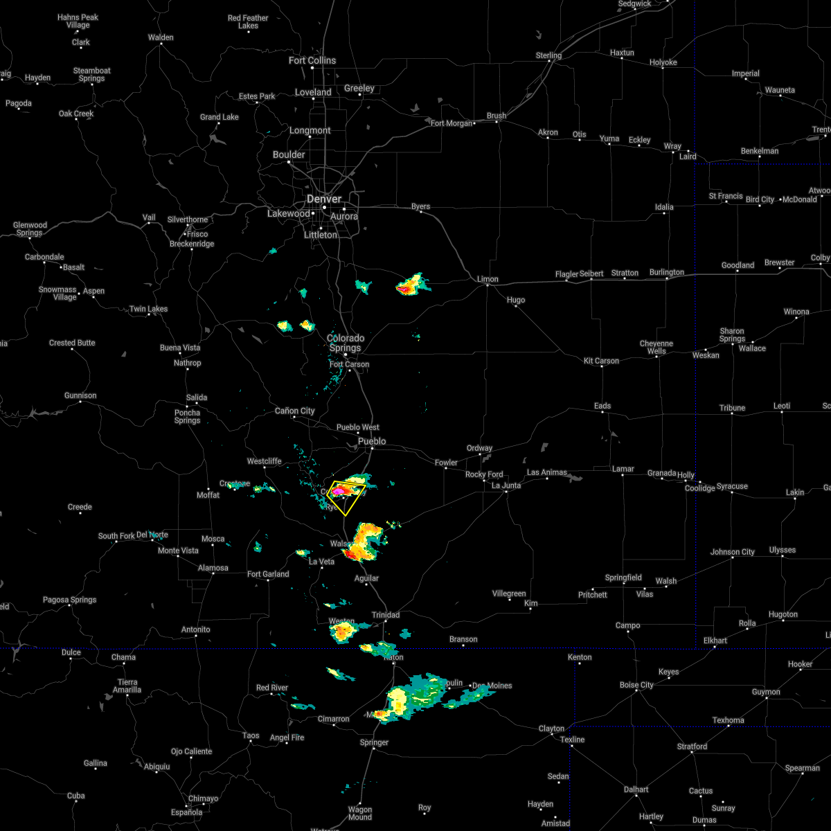
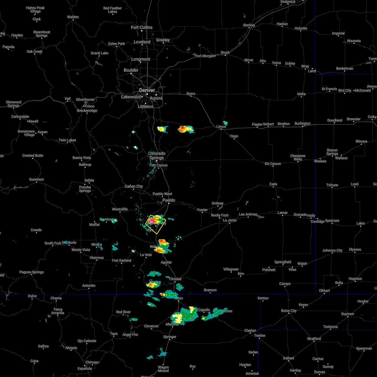
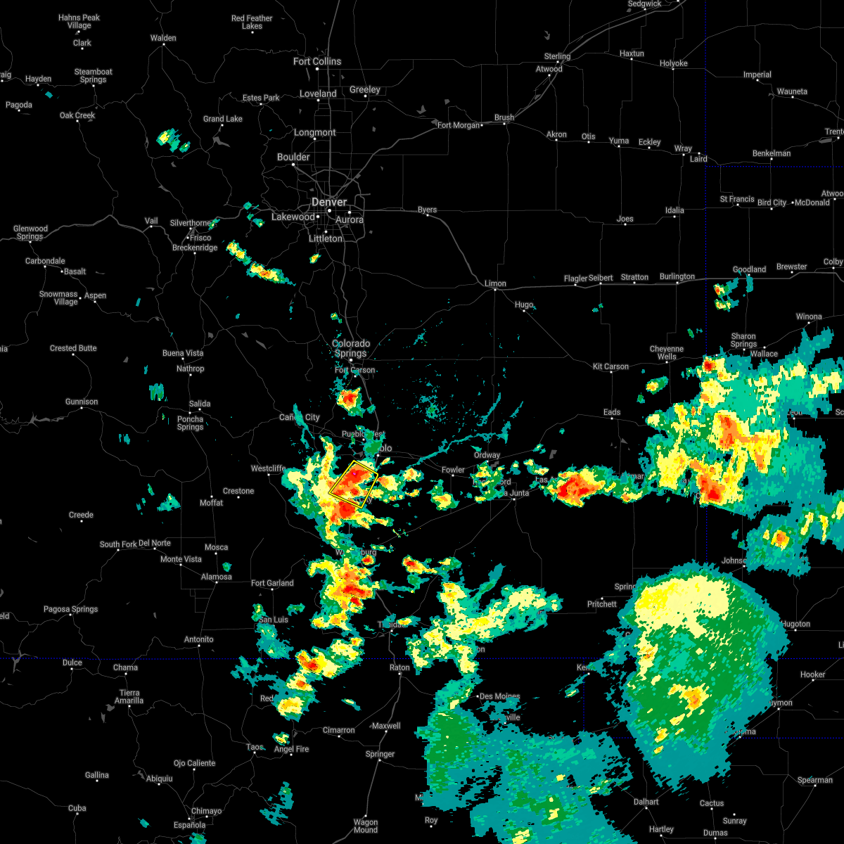
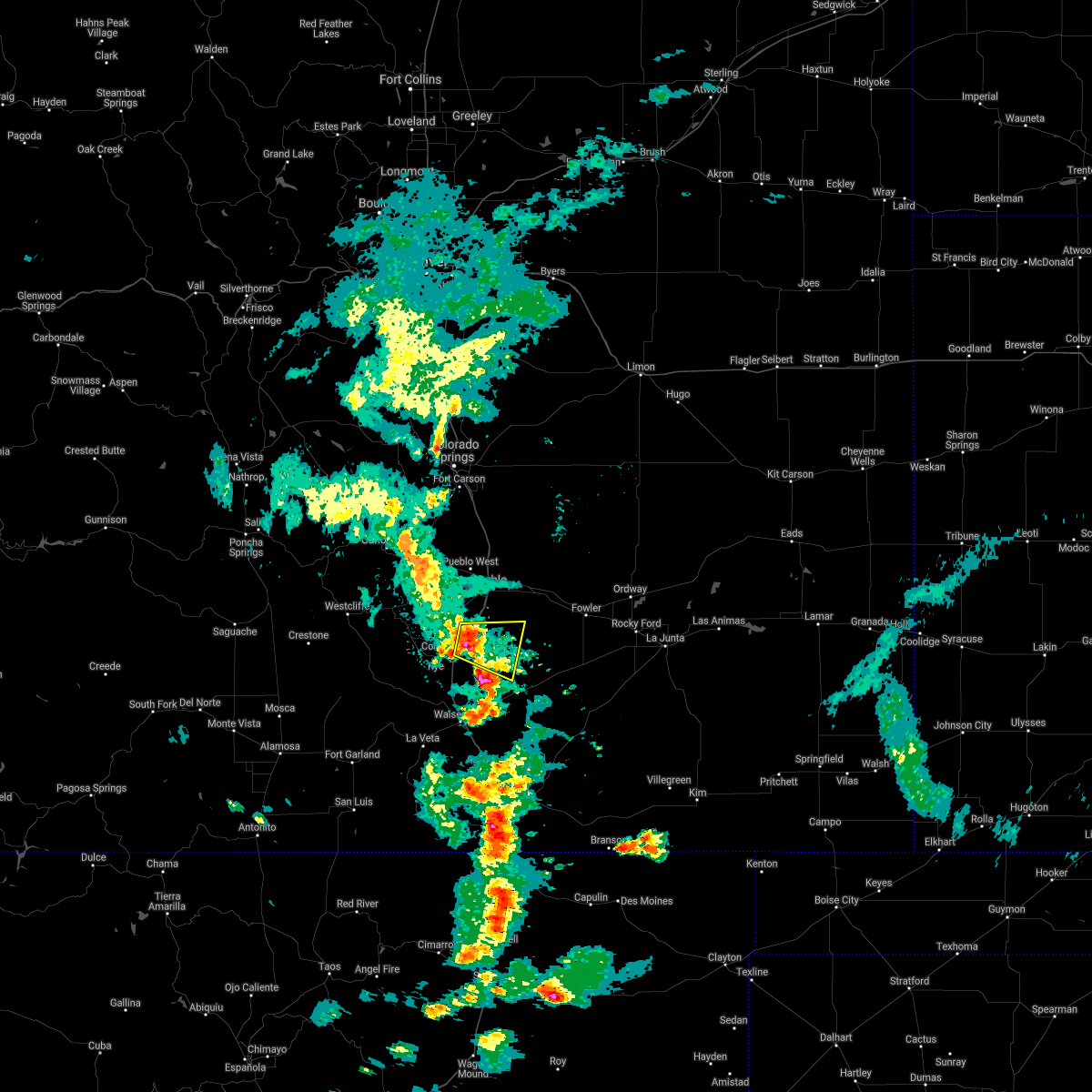
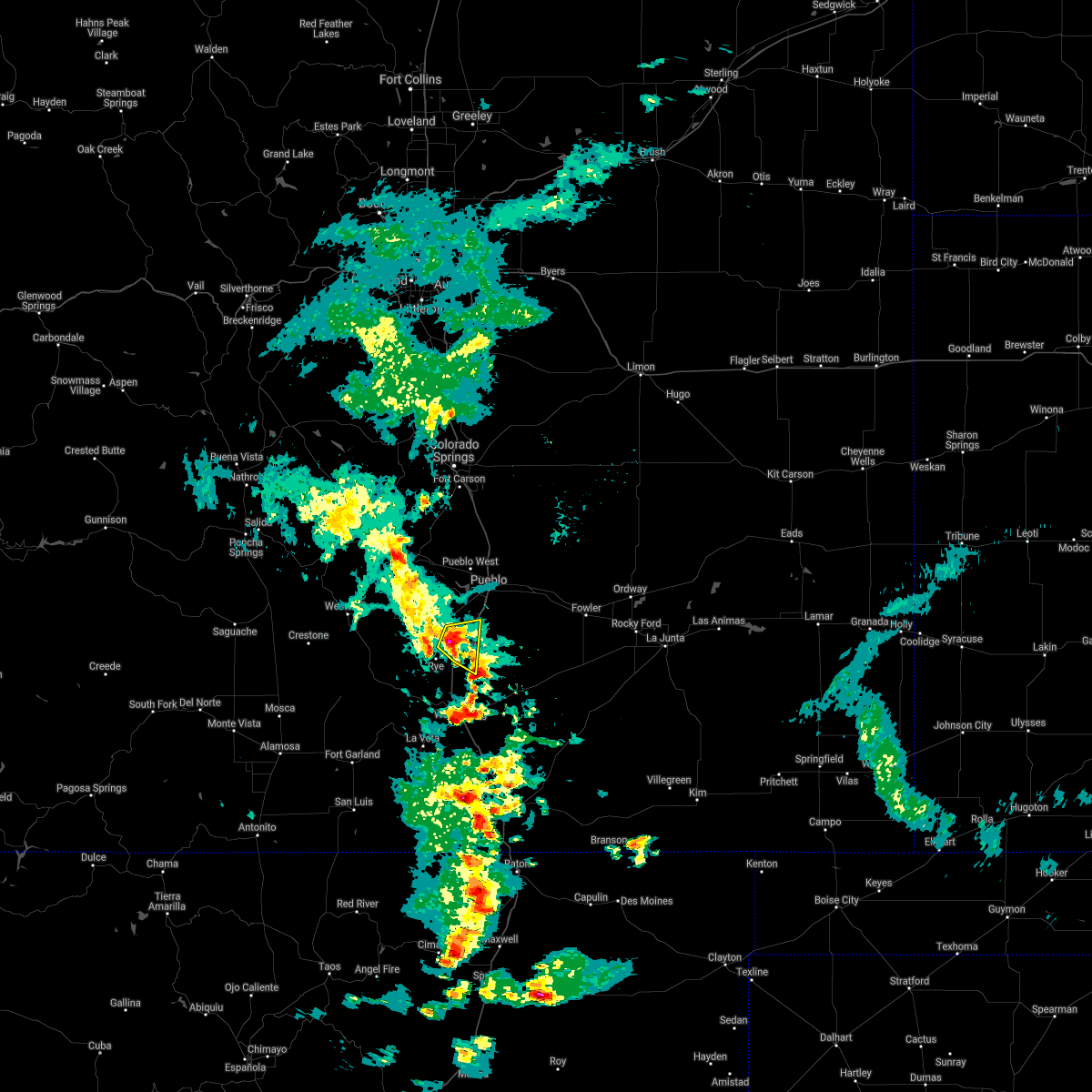
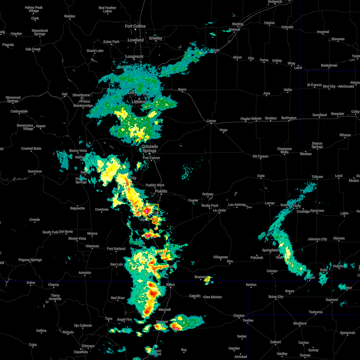
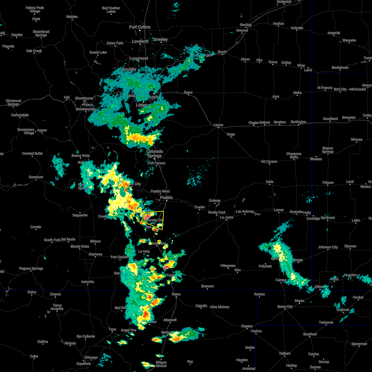
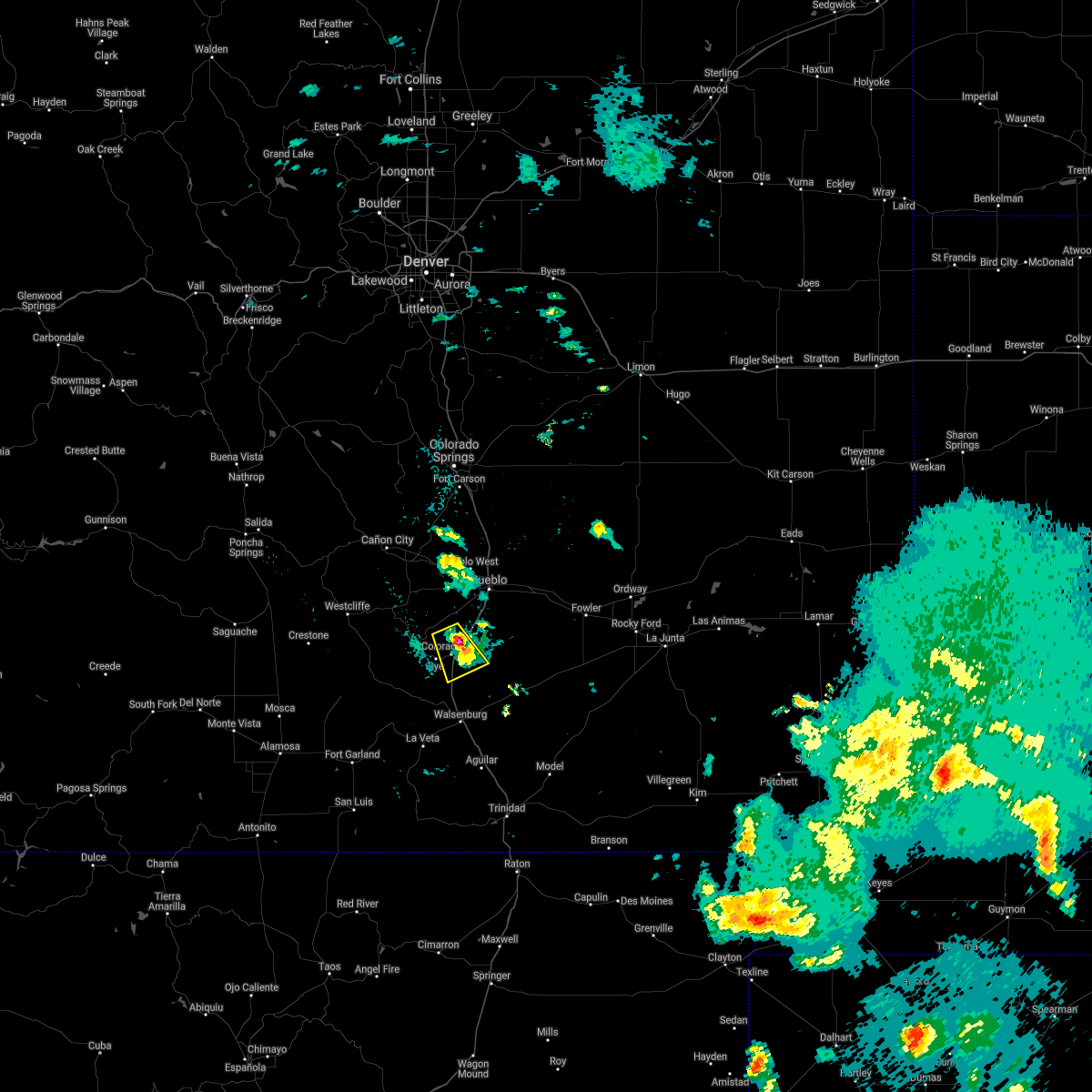
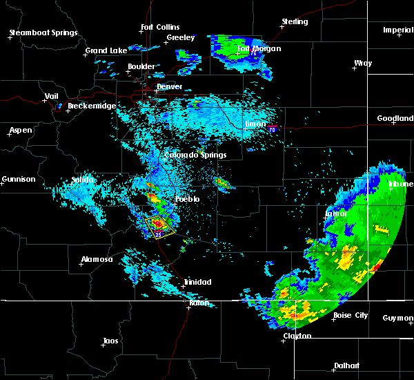
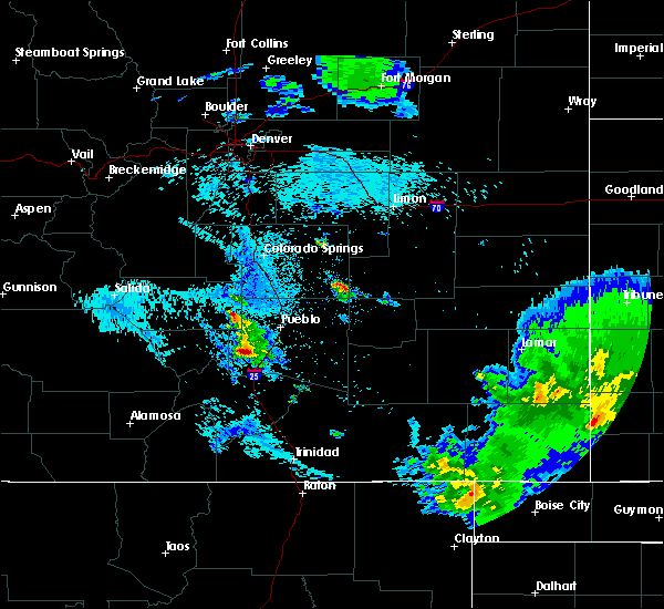
Hail Map for Colorado City, CO
The Colorado City, CO area has had 5 reports of on-the-ground hail by trained spotters, and has been under severe weather warnings 18 times during the past 12 months. Doppler radar has detected hail at or near Colorado City, CO on 75 occasions, including 4 occasions during the past year.
| Name: | Colorado City, CO |
| Where Located: | 26.1 miles SSW of Pueblo, CO |
| Map: | Google Map for Colorado City, CO |
| Population: | 2193 |
| Housing Units: | 943 |
| More Info: | Search Google for Colorado City, CO |
3
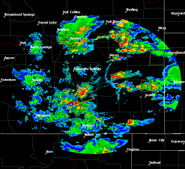
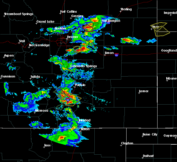
The Top Recent Hail Date for Colorado City, CO is Sunday, July 7, 2024 (2nd out of 75)

Hail and Wind Damage Spotted near Colorado City, CO
| Date / Time | Report Details |
|---|---|
| 6/17/2025 3:06 PM MDT | Svrpub the national weather service in pueblo has issued a * severe thunderstorm warning for, northeastern huerfano county in southeastern colorado, north central las animas county in southeastern colorado, southern pueblo county in southeastern colorado, * until 345 pm mdt. * at 306 pm mdt, a severe thunderstorm was located 15 miles east of greenhorn mountain, or 27 miles south of pueblo, moving southeast at 40 mph (radar indicated). Hazards include 60 mph wind gusts and half dollar size hail. Hail damage to vehicles is expected. Expect wind damage to roofs, siding, and trees. |
| 6/17/2025 2:26 PM MDT | the severe thunderstorm warning has been cancelled and is no longer in effect |
| 6/17/2025 2:26 PM MDT | At 226 pm mdt, a severe thunderstorm was located 15 miles south of salt creek, or 17 miles south of pueblo, moving east at 10 mph (radar indicated). Hazards include 60 mph wind gusts and quarter size hail. Hail damage to vehicles is expected. expect wind damage to roofs, siding, and trees. Locations impacted include, colorado city. |
| 5/26/2025 3:27 PM MDT |
 Svrpub the national weather service in pueblo has issued a * severe thunderstorm warning for, northeastern huerfano county in southeastern colorado, southwestern pueblo county in southeastern colorado, * until 415 pm mdt. * at 326 pm mdt, a severe thunderstorm was located 10 miles southeast of greenhorn mountain, or 33 miles south of pueblo, moving south at 10 mph (radar indicated). Hazards include quarter size hail. damage to vehicles is expected Svrpub the national weather service in pueblo has issued a * severe thunderstorm warning for, northeastern huerfano county in southeastern colorado, southwestern pueblo county in southeastern colorado, * until 415 pm mdt. * at 326 pm mdt, a severe thunderstorm was located 10 miles southeast of greenhorn mountain, or 33 miles south of pueblo, moving south at 10 mph (radar indicated). Hazards include quarter size hail. damage to vehicles is expected
|
| 9/17/2024 2:42 PM MDT |
 At 242 pm mdt, a severe thunderstorm was located 20 miles northeast of walsenburg, or 25 miles south of pueblo, moving northeast at 35 mph (radar indicated). Hazards include 70 mph wind gusts and nickel size hail. Expect considerable tree damage. damage is likely to mobile homes, roofs, and outbuildings. Locations impacted include, colorado city. At 242 pm mdt, a severe thunderstorm was located 20 miles northeast of walsenburg, or 25 miles south of pueblo, moving northeast at 35 mph (radar indicated). Hazards include 70 mph wind gusts and nickel size hail. Expect considerable tree damage. damage is likely to mobile homes, roofs, and outbuildings. Locations impacted include, colorado city.
|
| 9/17/2024 2:30 PM MDT |
 Svrpub the national weather service in pueblo has issued a * severe thunderstorm warning for, northeastern huerfano county in southeastern colorado, southwestern pueblo county in southeastern colorado, * until 300 pm mdt. * at 229 pm mdt, a severe thunderstorm was located 13 miles east of greenhorn mountain, or 30 miles south of pueblo, moving northeast at 35 mph (radar indicated). Hazards include 70 mph wind gusts and nickel size hail. Expect considerable tree damage. Damage is likely to mobile homes, roofs, and outbuildings. Svrpub the national weather service in pueblo has issued a * severe thunderstorm warning for, northeastern huerfano county in southeastern colorado, southwestern pueblo county in southeastern colorado, * until 300 pm mdt. * at 229 pm mdt, a severe thunderstorm was located 13 miles east of greenhorn mountain, or 30 miles south of pueblo, moving northeast at 35 mph (radar indicated). Hazards include 70 mph wind gusts and nickel size hail. Expect considerable tree damage. Damage is likely to mobile homes, roofs, and outbuildings.
|
| 7/13/2024 8:17 PM MDT |
 the severe thunderstorm warning has been cancelled and is no longer in effect the severe thunderstorm warning has been cancelled and is no longer in effect
|
| 7/13/2024 7:55 PM MDT |
 Svrpub the national weather service in pueblo has issued a * severe thunderstorm warning for, north central huerfano county in southeastern colorado, eastern custer county in southeastern colorado, southwestern pueblo county in southeastern colorado, * until 830 pm mdt. * at 754 pm mdt, severe thunderstorm and severe thunderstorm winds were located along a line extending from 17 miles southwest of salt creek to 12 miles northeast of greenhorn mountain to 17 miles southwest of pueblo reservoir, moving south at 25 mph (radar indicated). Hazards include 60 mph wind gusts and penny size hail. expect damage to roofs, siding, and trees Svrpub the national weather service in pueblo has issued a * severe thunderstorm warning for, north central huerfano county in southeastern colorado, eastern custer county in southeastern colorado, southwestern pueblo county in southeastern colorado, * until 830 pm mdt. * at 754 pm mdt, severe thunderstorm and severe thunderstorm winds were located along a line extending from 17 miles southwest of salt creek to 12 miles northeast of greenhorn mountain to 17 miles southwest of pueblo reservoir, moving south at 25 mph (radar indicated). Hazards include 60 mph wind gusts and penny size hail. expect damage to roofs, siding, and trees
|
| 7/13/2024 7:35 PM MDT |
 Svrpub the national weather service in pueblo has issued a * severe thunderstorm warning for, east central custer county in southeastern colorado, west central pueblo county in southeastern colorado, * until 800 pm mdt. * at 735 pm mdt, a severe thunderstorm and severe thunderstorm winds were located along a line extending from 10 miles southwest of salt creek to 10 miles southwest of pueblo reservoir, moving southwest at 25 mph (radar indicated). Hazards include 60 mph wind gusts and penny size hail. expect damage to roofs, siding, and trees Svrpub the national weather service in pueblo has issued a * severe thunderstorm warning for, east central custer county in southeastern colorado, west central pueblo county in southeastern colorado, * until 800 pm mdt. * at 735 pm mdt, a severe thunderstorm and severe thunderstorm winds were located along a line extending from 10 miles southwest of salt creek to 10 miles southwest of pueblo reservoir, moving southwest at 25 mph (radar indicated). Hazards include 60 mph wind gusts and penny size hail. expect damage to roofs, siding, and trees
|
| 7/7/2024 8:58 PM MDT |
 The storm which prompted the warning has weakened below severe limits, and no longer poses an immediate threat to life or property. therefore, the warning will be allowed to expire. a severe thunderstorm watch remains in effect until 1100 pm mdt for southeastern colorado. The storm which prompted the warning has weakened below severe limits, and no longer poses an immediate threat to life or property. therefore, the warning will be allowed to expire. a severe thunderstorm watch remains in effect until 1100 pm mdt for southeastern colorado.
|
| 7/7/2024 8:32 PM MDT |
 the severe thunderstorm warning has been cancelled and is no longer in effect the severe thunderstorm warning has been cancelled and is no longer in effect
|
| 7/7/2024 8:27 PM MDT |
 Svrpub the national weather service in pueblo has issued a * severe thunderstorm warning for, northeastern huerfano county in southeastern colorado, southwestern pueblo county in southeastern colorado, * until 900 pm mdt. * at 827 pm mdt, a severe thunderstorm was located 14 miles northeast of greenhorn mountain, or 22 miles south of pueblo, moving southeast at 20 mph (radar indicated). Hazards include 60 mph wind gusts and quarter size hail. Hail damage to vehicles is expected. Expect wind damage to roofs, siding, and trees. Svrpub the national weather service in pueblo has issued a * severe thunderstorm warning for, northeastern huerfano county in southeastern colorado, southwestern pueblo county in southeastern colorado, * until 900 pm mdt. * at 827 pm mdt, a severe thunderstorm was located 14 miles northeast of greenhorn mountain, or 22 miles south of pueblo, moving southeast at 20 mph (radar indicated). Hazards include 60 mph wind gusts and quarter size hail. Hail damage to vehicles is expected. Expect wind damage to roofs, siding, and trees.
|
| 7/7/2024 8:14 PM MDT |
 At 814 pm mdt, a severe thunderstorm was located 12 miles southwest of pueblo reservoir, or 18 miles southwest of pueblo, moving southeast at 20 mph (radar indicated). Hazards include 60 mph wind gusts and quarter size hail. Hail damage to vehicles is expected. expect wind damage to roofs, siding, and trees. Locations impacted include, beulah and colorado city. At 814 pm mdt, a severe thunderstorm was located 12 miles southwest of pueblo reservoir, or 18 miles southwest of pueblo, moving southeast at 20 mph (radar indicated). Hazards include 60 mph wind gusts and quarter size hail. Hail damage to vehicles is expected. expect wind damage to roofs, siding, and trees. Locations impacted include, beulah and colorado city.
|
| 7/7/2024 8:00 PM MDT |
 Svrpub the national weather service in pueblo has issued a * severe thunderstorm warning for, southeastern fremont county in central colorado, east central custer county in southeastern colorado, west central pueblo county in southeastern colorado, * until 845 pm mdt. * at 800 pm mdt, a severe thunderstorm was located 13 miles southwest of pueblo reservoir, or 20 miles west of pueblo, moving southeast at 20 mph (radar indicated). Hazards include 60 mph wind gusts and half dollar size hail. Hail damage to vehicles is expected. Expect wind damage to roofs, siding, and trees. Svrpub the national weather service in pueblo has issued a * severe thunderstorm warning for, southeastern fremont county in central colorado, east central custer county in southeastern colorado, west central pueblo county in southeastern colorado, * until 845 pm mdt. * at 800 pm mdt, a severe thunderstorm was located 13 miles southwest of pueblo reservoir, or 20 miles west of pueblo, moving southeast at 20 mph (radar indicated). Hazards include 60 mph wind gusts and half dollar size hail. Hail damage to vehicles is expected. Expect wind damage to roofs, siding, and trees.
|
| 7/7/2024 5:50 PM MDT |
 At 550 pm mdt, a severe thunderstorm was located 17 miles east of greenhorn mountain, or 26 miles south of pueblo, moving east at 40 mph (trained weather spotters). Hazards include golf ball size hail and 60 mph wind gusts. People and animals outdoors will be injured. expect hail damage to roofs, siding, windows, and vehicles. expect wind damage to roofs, siding, and trees. Locations impacted include, colorado city. At 550 pm mdt, a severe thunderstorm was located 17 miles east of greenhorn mountain, or 26 miles south of pueblo, moving east at 40 mph (trained weather spotters). Hazards include golf ball size hail and 60 mph wind gusts. People and animals outdoors will be injured. expect hail damage to roofs, siding, windows, and vehicles. expect wind damage to roofs, siding, and trees. Locations impacted include, colorado city.
|
| 7/7/2024 5:45 PM MDT |
 At 544 pm mdt, a severe thunderstorm was located 14 miles east of greenhorn mountain, or 26 miles south of pueblo, moving east at 40 mph (trained weather spotters). Hazards include ping pong ball size hail and 60 mph wind gusts. People and animals outdoors will be injured. expect hail damage to roofs, siding, windows, and vehicles. expect wind damage to roofs, siding, and trees. Locations impacted include, colorado city. At 544 pm mdt, a severe thunderstorm was located 14 miles east of greenhorn mountain, or 26 miles south of pueblo, moving east at 40 mph (trained weather spotters). Hazards include ping pong ball size hail and 60 mph wind gusts. People and animals outdoors will be injured. expect hail damage to roofs, siding, windows, and vehicles. expect wind damage to roofs, siding, and trees. Locations impacted include, colorado city.
|
| 7/7/2024 5:38 PM MDT |
 At 537 pm mdt, a severe thunderstorm was located 11 miles east of greenhorn mountain, or 26 miles southwest of pueblo, moving southeast at 35 mph (radar indicated). Hazards include 60 mph wind gusts and half dollar size hail. Hail damage to vehicles is expected. expect wind damage to roofs, siding, and trees. Locations impacted include, rye and colorado city. At 537 pm mdt, a severe thunderstorm was located 11 miles east of greenhorn mountain, or 26 miles southwest of pueblo, moving southeast at 35 mph (radar indicated). Hazards include 60 mph wind gusts and half dollar size hail. Hail damage to vehicles is expected. expect wind damage to roofs, siding, and trees. Locations impacted include, rye and colorado city.
|
| 7/7/2024 5:24 PM MDT | Svrpub the national weather service in pueblo has issued a * severe thunderstorm warning for, northeastern huerfano county in southeastern colorado, southwestern pueblo county in southeastern colorado, * until 600 pm mdt. * at 524 pm mdt, a severe thunderstorm was located 10 miles northeast of greenhorn mountain, or 24 miles southwest of pueblo, moving east at 45 mph (radar indicated). Hazards include 60 mph wind gusts and quarter size hail. Hail damage to vehicles is expected. Expect wind damage to roofs, siding, and trees. |
| 6/8/2024 3:16 PM MDT |
 Svrpub the national weather service in pueblo has issued a * severe thunderstorm warning for, northeastern huerfano county in southeastern colorado, pueblo county in southeastern colorado, * until 400 pm mdt. * at 316 pm mdt, severe thunderstorms were located along a line extending from near pueblo depot to 6 miles south of blende to 14 miles east of greenhorn mountain, moving southeast at 30 mph (radar indicated). Hazards include 60 mph wind gusts and quarter size hail. Hail damage to vehicles is expected. Expect wind damage to roofs, siding, and trees. Svrpub the national weather service in pueblo has issued a * severe thunderstorm warning for, northeastern huerfano county in southeastern colorado, pueblo county in southeastern colorado, * until 400 pm mdt. * at 316 pm mdt, severe thunderstorms were located along a line extending from near pueblo depot to 6 miles south of blende to 14 miles east of greenhorn mountain, moving southeast at 30 mph (radar indicated). Hazards include 60 mph wind gusts and quarter size hail. Hail damage to vehicles is expected. Expect wind damage to roofs, siding, and trees.
|
| 5/6/2024 3:57 AM MDT | Mesonet station ccyc2 colorado cit in pueblo county CO, 1.5 miles SE of Colorado City, CO |
| 7/29/2023 8:22 PM MDT |
 The severe thunderstorm warning for north central huerfano, southeastern fremont, northeastern custer and western pueblo counties will expire at 830 pm mdt, the storm which prompted the warning has weakened below severe limits, and no longer poses an immediate threat to life or property. therefore, the warning will be allowed to expire. however gusty winds and heavy rain are still possible with this thunderstorm. The severe thunderstorm warning for north central huerfano, southeastern fremont, northeastern custer and western pueblo counties will expire at 830 pm mdt, the storm which prompted the warning has weakened below severe limits, and no longer poses an immediate threat to life or property. therefore, the warning will be allowed to expire. however gusty winds and heavy rain are still possible with this thunderstorm.
|
| 7/29/2023 8:00 PM MDT |
 At 800 pm mdt, a severe thunderstorm was located near pueblo reservoir, or 12 miles west of pueblo, moving southeast at 15 mph (radar indicated). Hazards include 60 mph wind gusts and quarter size hail. Hail damage to vehicles is expected. expect wind damage to roofs, siding, and trees. Locations impacted include, pueblo, pueblo airport, pueblo reservoir, salt creek, blende, pueblo west, penrose, beulah and colorado city. At 800 pm mdt, a severe thunderstorm was located near pueblo reservoir, or 12 miles west of pueblo, moving southeast at 15 mph (radar indicated). Hazards include 60 mph wind gusts and quarter size hail. Hail damage to vehicles is expected. expect wind damage to roofs, siding, and trees. Locations impacted include, pueblo, pueblo airport, pueblo reservoir, salt creek, blende, pueblo west, penrose, beulah and colorado city.
|
| 7/29/2023 7:47 PM MDT |
 At 746 pm mdt, a severe thunderstorm was located 8 miles northwest of pueblo reservoir, or 15 miles west of pueblo, moving southeast at 15 mph (radar indicated). Hazards include 60 mph wind gusts and quarter size hail. Hail damage to vehicles is expected. Expect wind damage to roofs, siding, and trees. At 746 pm mdt, a severe thunderstorm was located 8 miles northwest of pueblo reservoir, or 15 miles west of pueblo, moving southeast at 15 mph (radar indicated). Hazards include 60 mph wind gusts and quarter size hail. Hail damage to vehicles is expected. Expect wind damage to roofs, siding, and trees.
|
| 7/13/2023 6:53 PM MDT |
 At 653 pm mdt, a severe thunderstorm was located 9 miles north of walsenburg, or 23 miles northeast of spring burn scar north of highway 160, moving southeast at 25 mph (radar indicated). Hazards include tennis ball size hail and 60 mph wind gusts. People and animals outdoors will be injured. expect hail damage to roofs, siding, windows, and vehicles. expect wind damage to roofs, siding, and trees. Locations impacted include, walsenburg and colorado city. At 653 pm mdt, a severe thunderstorm was located 9 miles north of walsenburg, or 23 miles northeast of spring burn scar north of highway 160, moving southeast at 25 mph (radar indicated). Hazards include tennis ball size hail and 60 mph wind gusts. People and animals outdoors will be injured. expect hail damage to roofs, siding, windows, and vehicles. expect wind damage to roofs, siding, and trees. Locations impacted include, walsenburg and colorado city.
|
| 7/13/2023 6:40 PM MDT |
 At 640 pm mdt, a severe thunderstorm was located 11 miles east of greenhorn mountain, or 22 miles northeast of spring burn scar north of highway 160, moving southeast at 25 mph (radar indicated). Hazards include tennis ball size hail and 60 mph wind gusts. People and animals outdoors will be injured. expect hail damage to roofs, siding, windows, and vehicles. Expect wind damage to roofs, siding, and trees. At 640 pm mdt, a severe thunderstorm was located 11 miles east of greenhorn mountain, or 22 miles northeast of spring burn scar north of highway 160, moving southeast at 25 mph (radar indicated). Hazards include tennis ball size hail and 60 mph wind gusts. People and animals outdoors will be injured. expect hail damage to roofs, siding, windows, and vehicles. Expect wind damage to roofs, siding, and trees.
|
| 7/13/2023 6:30 PM MDT |
 At 630 pm mdt, a severe thunderstorm was located 17 miles south of salt creek, or 19 miles south of pueblo, moving east at 25 mph (radar indicated). Hazards include two inch hail and 60 mph wind gusts. People and animals outdoors will be injured. expect hail damage to roofs, siding, windows, and vehicles. expect wind damage to roofs, siding, and trees. locations impacted include, colorado city. thunderstorm damage threat, considerable hail threat, radar indicated max hail size, 2. 00 in wind threat, radar indicated max wind gust, 60 mph. At 630 pm mdt, a severe thunderstorm was located 17 miles south of salt creek, or 19 miles south of pueblo, moving east at 25 mph (radar indicated). Hazards include two inch hail and 60 mph wind gusts. People and animals outdoors will be injured. expect hail damage to roofs, siding, windows, and vehicles. expect wind damage to roofs, siding, and trees. locations impacted include, colorado city. thunderstorm damage threat, considerable hail threat, radar indicated max hail size, 2. 00 in wind threat, radar indicated max wind gust, 60 mph.
|
| 7/13/2023 6:17 PM MDT |
 At 617 pm mdt, a severe thunderstorm was located 14 miles northeast of greenhorn mountain, or 18 miles southeast of junkins burn scar, moving east at 25 mph (radar indicated). Hazards include golf ball size hail and 60 mph wind gusts. People and animals outdoors will be injured. expect hail damage to roofs, siding, windows, and vehicles. Expect wind damage to roofs, siding, and trees. At 617 pm mdt, a severe thunderstorm was located 14 miles northeast of greenhorn mountain, or 18 miles southeast of junkins burn scar, moving east at 25 mph (radar indicated). Hazards include golf ball size hail and 60 mph wind gusts. People and animals outdoors will be injured. expect hail damage to roofs, siding, windows, and vehicles. Expect wind damage to roofs, siding, and trees.
|
| 7/8/2023 8:34 PM MDT |
 At 834 pm mdt, a severe thunderstorm was located 12 miles east of greenhorn mountain, or 23 miles southeast of junkins burn scar, moving southeast at 25 mph (radar indicated). Hazards include 60 mph wind gusts and quarter size hail. Hail damage to vehicles is expected. expect wind damage to roofs, siding, and trees. locations impacted include, colorado city. hail threat, radar indicated max hail size, 1. 00 in wind threat, radar indicated max wind gust, 60 mph. At 834 pm mdt, a severe thunderstorm was located 12 miles east of greenhorn mountain, or 23 miles southeast of junkins burn scar, moving southeast at 25 mph (radar indicated). Hazards include 60 mph wind gusts and quarter size hail. Hail damage to vehicles is expected. expect wind damage to roofs, siding, and trees. locations impacted include, colorado city. hail threat, radar indicated max hail size, 1. 00 in wind threat, radar indicated max wind gust, 60 mph.
|
| 7/8/2023 8:22 PM MDT |
 At 822 pm mdt, a severe thunderstorm was located 9 miles northeast of greenhorn mountain, or 18 miles southeast of junkins burn scar, moving southeast at 25 mph (radar indicated). Hazards include ping pong ball size hail and 60 mph wind gusts. People and animals outdoors will be injured. expect hail damage to roofs, siding, windows, and vehicles. expect wind damage to roofs, siding, and trees. this severe thunderstorm will remain over mainly rural areas of north central huerfano and southwestern pueblo counties, including the following locations, colorado city. hail threat, radar indicated max hail size, 1. 50 in wind threat, radar indicated max wind gust, 60 mph. At 822 pm mdt, a severe thunderstorm was located 9 miles northeast of greenhorn mountain, or 18 miles southeast of junkins burn scar, moving southeast at 25 mph (radar indicated). Hazards include ping pong ball size hail and 60 mph wind gusts. People and animals outdoors will be injured. expect hail damage to roofs, siding, windows, and vehicles. expect wind damage to roofs, siding, and trees. this severe thunderstorm will remain over mainly rural areas of north central huerfano and southwestern pueblo counties, including the following locations, colorado city. hail threat, radar indicated max hail size, 1. 50 in wind threat, radar indicated max wind gust, 60 mph.
|
| 6/30/2023 2:19 PM MDT |
 At 219 pm mdt, a severe thunderstorm was located 18 miles south of salt creek, or 20 miles south of pueblo, moving east at 30 mph (radar indicated). Hazards include ping pong ball size hail and 60 mph wind gusts. People and animals outdoors will be injured. expect hail damage to roofs, siding, windows, and vehicles. expect wind damage to roofs, siding, and trees. this severe thunderstorm will remain over mainly rural areas of southern pueblo county, including the following locations, colorado city. hail threat, radar indicated max hail size, 1. 50 in wind threat, radar indicated max wind gust, 60 mph. At 219 pm mdt, a severe thunderstorm was located 18 miles south of salt creek, or 20 miles south of pueblo, moving east at 30 mph (radar indicated). Hazards include ping pong ball size hail and 60 mph wind gusts. People and animals outdoors will be injured. expect hail damage to roofs, siding, windows, and vehicles. expect wind damage to roofs, siding, and trees. this severe thunderstorm will remain over mainly rural areas of southern pueblo county, including the following locations, colorado city. hail threat, radar indicated max hail size, 1. 50 in wind threat, radar indicated max wind gust, 60 mph.
|
| 6/17/2023 1:06 PM MDT |
 At 106 pm mdt, a severe thunderstorm was located 15 miles east of greenhorn mountain, or 24 miles south of pueblo, moving east at 35 mph (radar indicated). Hazards include 60 mph wind gusts and quarter size hail. Hail damage to vehicles is expected. expect wind damage to roofs, siding, and trees. locations impacted include, colorado city. hail threat, radar indicated max hail size, 1. 00 in wind threat, radar indicated max wind gust, 60 mph. At 106 pm mdt, a severe thunderstorm was located 15 miles east of greenhorn mountain, or 24 miles south of pueblo, moving east at 35 mph (radar indicated). Hazards include 60 mph wind gusts and quarter size hail. Hail damage to vehicles is expected. expect wind damage to roofs, siding, and trees. locations impacted include, colorado city. hail threat, radar indicated max hail size, 1. 00 in wind threat, radar indicated max wind gust, 60 mph.
|
| 6/17/2023 12:48 PM MDT |
 At 1248 pm mdt, a severe thunderstorm was located near greenhorn mountain, or 21 miles northeast of spring burn scar north of highway 160, moving east at 35 mph (radar indicated). Hazards include 60 mph wind gusts and quarter size hail. Hail damage to vehicles is expected. Expect wind damage to roofs, siding, and trees. At 1248 pm mdt, a severe thunderstorm was located near greenhorn mountain, or 21 miles northeast of spring burn scar north of highway 160, moving east at 35 mph (radar indicated). Hazards include 60 mph wind gusts and quarter size hail. Hail damage to vehicles is expected. Expect wind damage to roofs, siding, and trees.
|
| 6/12/2023 3:33 PM MDT |
 At 332 pm mdt, severe thunderstorms were located along a line extending from 12 miles south of blende to 17 miles east of greenhorn mountain, moving east at 25 mph (radar indicated). Hazards include 60 mph wind gusts and quarter size hail. Hail damage to vehicles is expected. expect wind damage to roofs, siding, and trees. locations impacted include, rocky ford, manzanola and colorado city. hail threat, radar indicated max hail size, 1. 00 in wind threat, radar indicated max wind gust, 60 mph. At 332 pm mdt, severe thunderstorms were located along a line extending from 12 miles south of blende to 17 miles east of greenhorn mountain, moving east at 25 mph (radar indicated). Hazards include 60 mph wind gusts and quarter size hail. Hail damage to vehicles is expected. expect wind damage to roofs, siding, and trees. locations impacted include, rocky ford, manzanola and colorado city. hail threat, radar indicated max hail size, 1. 00 in wind threat, radar indicated max wind gust, 60 mph.
|
| 6/12/2023 3:03 PM MDT |
 At 302 pm mdt, severe thunderstorms were located along a line extending from 16 miles northeast of pueblo depot to near blende to 15 miles northeast of greenhorn mountain, moving southeast at 30 mph (radar indicated). Hazards include 60 mph wind gusts and quarter size hail. Hail damage to vehicles is expected. expect wind damage to roofs, siding, and trees. the strongest storms on this line are located in southern pueblo county and far eastern crowley county. locations impacted include, pueblo, rocky ford, fowler, ordway, manzanola, olney springs, boone, sugar city, crowley, salt creek, pueblo depot, blende, avondale and colorado city. hail threat, radar indicated max hail size, 1. 00 in wind threat, radar indicated max wind gust, 60 mph. At 302 pm mdt, severe thunderstorms were located along a line extending from 16 miles northeast of pueblo depot to near blende to 15 miles northeast of greenhorn mountain, moving southeast at 30 mph (radar indicated). Hazards include 60 mph wind gusts and quarter size hail. Hail damage to vehicles is expected. expect wind damage to roofs, siding, and trees. the strongest storms on this line are located in southern pueblo county and far eastern crowley county. locations impacted include, pueblo, rocky ford, fowler, ordway, manzanola, olney springs, boone, sugar city, crowley, salt creek, pueblo depot, blende, avondale and colorado city. hail threat, radar indicated max hail size, 1. 00 in wind threat, radar indicated max wind gust, 60 mph.
|
| 6/12/2023 2:50 PM MDT |
 At 250 pm mdt, severe thunderstorms were located along a line extending from 18 miles south of truckton to near blende to 17 miles northeast of greenhorn mountain, moving southeast at 40 mph (radar indicated). Hazards include 60 mph wind gusts and quarter size hail. Hail damage to vehicles is expected. Expect wind damage to roofs, siding, and trees. At 250 pm mdt, severe thunderstorms were located along a line extending from 18 miles south of truckton to near blende to 17 miles northeast of greenhorn mountain, moving southeast at 40 mph (radar indicated). Hazards include 60 mph wind gusts and quarter size hail. Hail damage to vehicles is expected. Expect wind damage to roofs, siding, and trees.
|
| 5/24/2023 2:52 PM MDT |
 The severe thunderstorm warning for north central huerfano and southwestern pueblo counties will expire at 300 pm mdt, the storm which prompted the warning has weakened below severe limits, and no longer poses an immediate threat to life or property. therefore, the warning will be allowed to expire. however small hail and gusty winds are still possible with this thunderstorm. The severe thunderstorm warning for north central huerfano and southwestern pueblo counties will expire at 300 pm mdt, the storm which prompted the warning has weakened below severe limits, and no longer poses an immediate threat to life or property. therefore, the warning will be allowed to expire. however small hail and gusty winds are still possible with this thunderstorm.
|
| 5/24/2023 2:48 PM MDT |
 At 248 pm mdt, a severe thunderstorm was located 7 miles southeast of greenhorn mountain, or 16 miles northeast of spring burn scar north of highway 160, moving northeast at 10 mph (radar indicated). Hazards include 60 mph wind gusts and nickel size hail. Expect damage to roofs, siding, and trees. locations impacted include, rye and colorado city. hail threat, radar indicated max hail size, 0. 88 in wind threat, radar indicated max wind gust, 60 mph. At 248 pm mdt, a severe thunderstorm was located 7 miles southeast of greenhorn mountain, or 16 miles northeast of spring burn scar north of highway 160, moving northeast at 10 mph (radar indicated). Hazards include 60 mph wind gusts and nickel size hail. Expect damage to roofs, siding, and trees. locations impacted include, rye and colorado city. hail threat, radar indicated max hail size, 0. 88 in wind threat, radar indicated max wind gust, 60 mph.
|
| 5/24/2023 2:33 PM MDT |
 At 233 pm mdt, a severe thunderstorm was located near farisita, or 13 miles northeast of spring burn scar north of highway 160, moving northeast at 10 mph (radar indicated). Hazards include 60 mph wind gusts and quarter size hail. Hail damage to vehicles is expected. Expect wind damage to roofs, siding, and trees. At 233 pm mdt, a severe thunderstorm was located near farisita, or 13 miles northeast of spring burn scar north of highway 160, moving northeast at 10 mph (radar indicated). Hazards include 60 mph wind gusts and quarter size hail. Hail damage to vehicles is expected. Expect wind damage to roofs, siding, and trees.
|
| 7/12/2022 4:42 PM MDT |
 At 442 pm mdt, severe thunderstorms were located along a line extending from 18 miles north of walsenburg to near pueblo depot, moving southeast at 20 mph (radar indicated). Hazards include 60 mph wind gusts and penny size hail. Expect damage to roofs, siding, and trees. locations impacted include, pueblo, boone, salt creek, blende, avondale, pueblo depot, pueblo reservoir, pueblo west and colorado city. hail threat, radar indicated max hail size, 0. 75 in wind threat, radar indicated max wind gust, 60 mph. At 442 pm mdt, severe thunderstorms were located along a line extending from 18 miles north of walsenburg to near pueblo depot, moving southeast at 20 mph (radar indicated). Hazards include 60 mph wind gusts and penny size hail. Expect damage to roofs, siding, and trees. locations impacted include, pueblo, boone, salt creek, blende, avondale, pueblo depot, pueblo reservoir, pueblo west and colorado city. hail threat, radar indicated max hail size, 0. 75 in wind threat, radar indicated max wind gust, 60 mph.
|
| 7/12/2022 4:12 PM MDT |
 At 410 pm mdt, a widespread area of strong to severe wind gusts accompanying isolated thunderstorms was spreading across pueblo county. individual storms were moving southeast at 20 mph (radar indicated). Hazards include 60 mph wind gusts and penny size hail. expect damage to roofs, siding, and trees At 410 pm mdt, a widespread area of strong to severe wind gusts accompanying isolated thunderstorms was spreading across pueblo county. individual storms were moving southeast at 20 mph (radar indicated). Hazards include 60 mph wind gusts and penny size hail. expect damage to roofs, siding, and trees
|
| 7/7/2022 8:22 PM MDT |
 At 821 pm mdt, a severe thunderstorm was located 11 miles northeast of greenhorn mountain, or 17 miles southeast of junkins burn scar, moving northeast at 5 mph (radar indicated). Hazards include 60 mph wind gusts and half dollar size hail. Hail damage to vehicles is expected. expect wind damage to roofs, siding, and trees. locations impacted include, colorado city. hail threat, radar indicated max hail size, 1. 25 in wind threat, radar indicated max wind gust, 60 mph. At 821 pm mdt, a severe thunderstorm was located 11 miles northeast of greenhorn mountain, or 17 miles southeast of junkins burn scar, moving northeast at 5 mph (radar indicated). Hazards include 60 mph wind gusts and half dollar size hail. Hail damage to vehicles is expected. expect wind damage to roofs, siding, and trees. locations impacted include, colorado city. hail threat, radar indicated max hail size, 1. 25 in wind threat, radar indicated max wind gust, 60 mph.
|
| 7/7/2022 8:14 PM MDT |
 At 814 pm mdt, a severe thunderstorm was located 10 miles northeast of greenhorn mountain, or 17 miles southeast of junkins burn scar, moving northeast at 5 mph (radar indicated). Hazards include 60 mph wind gusts and half dollar size hail. Hail damage to vehicles is expected. expect wind damage to roofs, siding, and trees. locations impacted include, colorado city. hail threat, radar indicated max hail size, 1. 25 in wind threat, radar indicated max wind gust, 60 mph. At 814 pm mdt, a severe thunderstorm was located 10 miles northeast of greenhorn mountain, or 17 miles southeast of junkins burn scar, moving northeast at 5 mph (radar indicated). Hazards include 60 mph wind gusts and half dollar size hail. Hail damage to vehicles is expected. expect wind damage to roofs, siding, and trees. locations impacted include, colorado city. hail threat, radar indicated max hail size, 1. 25 in wind threat, radar indicated max wind gust, 60 mph.
|
| 7/7/2022 8:10 PM MDT |
 At 809 pm mdt, a severe thunderstorm was located 10 miles northeast of greenhorn mountain, or 16 miles southeast of junkins burn scar, moving northeast at 5 mph (radar indicated). Hazards include 60 mph wind gusts and half dollar size hail. Hail damage to vehicles is expected. expect wind damage to roofs, siding, and trees. this severe thunderstorm will remain over mainly rural areas of southwestern pueblo county, including the following locations, colorado city. hail threat, radar indicated max hail size, 1. 25 in wind threat, radar indicated max wind gust, 60 mph. At 809 pm mdt, a severe thunderstorm was located 10 miles northeast of greenhorn mountain, or 16 miles southeast of junkins burn scar, moving northeast at 5 mph (radar indicated). Hazards include 60 mph wind gusts and half dollar size hail. Hail damage to vehicles is expected. expect wind damage to roofs, siding, and trees. this severe thunderstorm will remain over mainly rural areas of southwestern pueblo county, including the following locations, colorado city. hail threat, radar indicated max hail size, 1. 25 in wind threat, radar indicated max wind gust, 60 mph.
|
| 6/3/2022 3:52 PM MDT |
 At 351 pm mdt, severe thunderstorms were continuing to develop along a line extending from pueblo to 17 miles southwest of fowler, moving northeast at 20 mph (radar indicated). Hazards include 60 mph wind gusts and quarter size hail. Hail damage to vehicles is expected. expect wind damage to roofs, siding, and trees. locations impacted include, pueblo, boone, salt creek, blende, avondale, pueblo depot, greenhorn mountain, rye, beulah, san isabel and colorado city. hail threat, radar indicated max hail size, 1. 00 in wind threat, radar indicated max wind gust, 60 mph. At 351 pm mdt, severe thunderstorms were continuing to develop along a line extending from pueblo to 17 miles southwest of fowler, moving northeast at 20 mph (radar indicated). Hazards include 60 mph wind gusts and quarter size hail. Hail damage to vehicles is expected. expect wind damage to roofs, siding, and trees. locations impacted include, pueblo, boone, salt creek, blende, avondale, pueblo depot, greenhorn mountain, rye, beulah, san isabel and colorado city. hail threat, radar indicated max hail size, 1. 00 in wind threat, radar indicated max wind gust, 60 mph.
|
| 6/3/2022 3:12 PM MDT |
 At 311 pm mdt, a cluster of developing severe thunderstorms was located over southern pueblo county and east central custer county, moving northeast at 30 mph (radar indicated). Hazards include 60 mph wind gusts and quarter size hail. Hail damage to vehicles is expected. Expect wind damage to roofs, siding, and trees. At 311 pm mdt, a cluster of developing severe thunderstorms was located over southern pueblo county and east central custer county, moving northeast at 30 mph (radar indicated). Hazards include 60 mph wind gusts and quarter size hail. Hail damage to vehicles is expected. Expect wind damage to roofs, siding, and trees.
|
| 5/18/2022 3:25 PM MDT |
 At 324 pm mdt, a severe thunderstorm was located 17 miles east of greenhorn mountain, or 23 miles south of pueblo, moving southeast at 15 mph (radar indicated). Hazards include 60 mph wind gusts and quarter size hail. Hail damage to vehicles is expected. Expect wind damage to roofs, siding, and trees. At 324 pm mdt, a severe thunderstorm was located 17 miles east of greenhorn mountain, or 23 miles south of pueblo, moving southeast at 15 mph (radar indicated). Hazards include 60 mph wind gusts and quarter size hail. Hail damage to vehicles is expected. Expect wind damage to roofs, siding, and trees.
|
| 10/12/2021 4:57 PM MDT | Mesonet station ccyc2 colorado cit in pueblo county CO, 1.5 miles SE of Colorado City, CO |
| 9/4/2021 6:55 PM MDT |
 The severe thunderstorm warning for north central huerfano and southwestern pueblo counties will expire at 700 pm mdt, the storm which prompted the warning has weakened below severe limits, and no longer poses an immediate threat to life or property. therefore, the warning will be allowed to expire. however small hail, gusty winds and heavy rain are still possible with this thunderstorm. The severe thunderstorm warning for north central huerfano and southwestern pueblo counties will expire at 700 pm mdt, the storm which prompted the warning has weakened below severe limits, and no longer poses an immediate threat to life or property. therefore, the warning will be allowed to expire. however small hail, gusty winds and heavy rain are still possible with this thunderstorm.
|
| 9/4/2021 6:42 PM MDT |
 At 642 pm mdt, a severe thunderstorm was located 10 miles northeast of greenhorn mountain, or 18 miles southeast of junkins burn scar, moving southeast at 15 mph (radar indicated). Hazards include 60 mph wind gusts and quarter size hail. Hail damage to vehicles is expected. expect wind damage to roofs, siding, and trees. locations impacted include, colorado city. hail threat, radar indicated max hail size, 1. 00 in wind threat, radar indicated max wind gust, 60 mph. At 642 pm mdt, a severe thunderstorm was located 10 miles northeast of greenhorn mountain, or 18 miles southeast of junkins burn scar, moving southeast at 15 mph (radar indicated). Hazards include 60 mph wind gusts and quarter size hail. Hail damage to vehicles is expected. expect wind damage to roofs, siding, and trees. locations impacted include, colorado city. hail threat, radar indicated max hail size, 1. 00 in wind threat, radar indicated max wind gust, 60 mph.
|
| 9/4/2021 6:32 PM MDT |
 At 631 pm mdt, a severe thunderstorm was located 10 miles northeast of greenhorn mountain, or 16 miles southeast of junkins burn scar, moving southeast at 20 mph (radar indicated). Hazards include 60 mph wind gusts and quarter size hail. Hail damage to vehicles is expected. Expect wind damage to roofs, siding, and trees. At 631 pm mdt, a severe thunderstorm was located 10 miles northeast of greenhorn mountain, or 16 miles southeast of junkins burn scar, moving southeast at 20 mph (radar indicated). Hazards include 60 mph wind gusts and quarter size hail. Hail damage to vehicles is expected. Expect wind damage to roofs, siding, and trees.
|
| 7/6/2021 5:38 PM MDT |
 At 538 pm mdt, a severe thunderstorm was located 10 miles south of pueblo reservoir, or 14 miles southwest of pueblo, moving southwest at 20 mph (radar indicated). Hazards include 60 mph wind gusts and quarter size hail. Hail damage to vehicles is expected. expect wind damage to roofs, siding, and trees. Locations impacted include, colorado city. At 538 pm mdt, a severe thunderstorm was located 10 miles south of pueblo reservoir, or 14 miles southwest of pueblo, moving southwest at 20 mph (radar indicated). Hazards include 60 mph wind gusts and quarter size hail. Hail damage to vehicles is expected. expect wind damage to roofs, siding, and trees. Locations impacted include, colorado city.
|
| 7/6/2021 5:27 PM MDT |
 At 527 pm mdt, a severe thunderstorm was located 7 miles south of pueblo reservoir, or 10 miles southwest of pueblo, and is nearly stationary (radar indicated). Hazards include 60 mph wind gusts and quarter size hail. Hail damage to vehicles is expected. Expect wind damage to roofs, siding, and trees. At 527 pm mdt, a severe thunderstorm was located 7 miles south of pueblo reservoir, or 10 miles southwest of pueblo, and is nearly stationary (radar indicated). Hazards include 60 mph wind gusts and quarter size hail. Hail damage to vehicles is expected. Expect wind damage to roofs, siding, and trees.
|
| 8/29/2020 2:28 PM MDT |
 At 228 pm mdt, a severe thunderstorm was located 17 miles northeast of greenhorn mountain, or 20 miles south of pueblo, moving east at 25 mph (radar indicated). Hazards include 60 mph wind gusts and quarter size hail. Hail damage to vehicles is expected. Expect wind damage to roofs, siding, and trees. At 228 pm mdt, a severe thunderstorm was located 17 miles northeast of greenhorn mountain, or 20 miles south of pueblo, moving east at 25 mph (radar indicated). Hazards include 60 mph wind gusts and quarter size hail. Hail damage to vehicles is expected. Expect wind damage to roofs, siding, and trees.
|
| 8/29/2020 2:13 PM MDT |
 At 212 pm mdt, a severe thunderstorm was located 12 miles northeast of greenhorn mountain, or 16 miles southeast of junkins burn scar, moving east at 10 mph (radar indicated). Hazards include 60 mph wind gusts and quarter size hail. Hail damage to vehicles is expected. expect wind damage to roofs, siding, and trees. Locations impacted include, colorado city. At 212 pm mdt, a severe thunderstorm was located 12 miles northeast of greenhorn mountain, or 16 miles southeast of junkins burn scar, moving east at 10 mph (radar indicated). Hazards include 60 mph wind gusts and quarter size hail. Hail damage to vehicles is expected. expect wind damage to roofs, siding, and trees. Locations impacted include, colorado city.
|
| 8/29/2020 2:02 PM MDT |
 At 145 pm mdt, a severe thunderstorm was located 9 miles north of greenhorn mountain, or 11 miles southeast of junkins burn scar, moving east at 10 mph (radar indicated). Hazards include 60 mph wind gusts and quarter size hail. Hail damage to vehicles is expected. Expect wind damage to roofs, siding, and trees. At 145 pm mdt, a severe thunderstorm was located 9 miles north of greenhorn mountain, or 11 miles southeast of junkins burn scar, moving east at 10 mph (radar indicated). Hazards include 60 mph wind gusts and quarter size hail. Hail damage to vehicles is expected. Expect wind damage to roofs, siding, and trees.
|
| 8/29/2020 1:45 PM MDT |
 At 145 pm mdt, a severe thunderstorm was located 9 miles north of greenhorn mountain, or 11 miles southeast of junkins burn scar, moving east at 10 mph (radar indicated). Hazards include 60 mph wind gusts and quarter size hail. Hail damage to vehicles is expected. Expect wind damage to roofs, siding, and trees. At 145 pm mdt, a severe thunderstorm was located 9 miles north of greenhorn mountain, or 11 miles southeast of junkins burn scar, moving east at 10 mph (radar indicated). Hazards include 60 mph wind gusts and quarter size hail. Hail damage to vehicles is expected. Expect wind damage to roofs, siding, and trees.
|
| 8/5/2020 7:34 PM MDT |
 At 734 pm mdt, a severe thunderstorm was located 11 miles east of junkins burn scar, moving southeast at 25 mph (radar indicated). Hazards include two inch hail and 60 mph wind gusts. People and animals outdoors will be injured. expect hail damage to roofs, siding, windows, and vehicles. expect wind damage to roofs, siding, and trees. Locations impacted include, beulah and colorado city. At 734 pm mdt, a severe thunderstorm was located 11 miles east of junkins burn scar, moving southeast at 25 mph (radar indicated). Hazards include two inch hail and 60 mph wind gusts. People and animals outdoors will be injured. expect hail damage to roofs, siding, windows, and vehicles. expect wind damage to roofs, siding, and trees. Locations impacted include, beulah and colorado city.
|
| 8/5/2020 7:27 PM MDT |
 At 727 pm mdt, a severe thunderstorm was located 9 miles east of junkins burn scar, moving southeast at 25 mph (radar indicated). Hazards include golf ball size hail and 60 mph wind gusts. People and animals outdoors will be injured. expect hail damage to roofs, siding, windows, and vehicles. expect wind damage to roofs, siding, and trees. Locations impacted include, eastern junkins burn scar, beulah and colorado city. At 727 pm mdt, a severe thunderstorm was located 9 miles east of junkins burn scar, moving southeast at 25 mph (radar indicated). Hazards include golf ball size hail and 60 mph wind gusts. People and animals outdoors will be injured. expect hail damage to roofs, siding, windows, and vehicles. expect wind damage to roofs, siding, and trees. Locations impacted include, eastern junkins burn scar, beulah and colorado city.
|
| 8/5/2020 7:20 PM MDT |
 At 720 pm mdt, a severe thunderstorm was located 7 miles northeast of junkins burn scar, moving southeast at 30 mph (radar indicated). Hazards include 60 mph wind gusts and quarter size hail. Hail damage to vehicles is expected. Expect wind damage to roofs, siding, and trees. At 720 pm mdt, a severe thunderstorm was located 7 miles northeast of junkins burn scar, moving southeast at 30 mph (radar indicated). Hazards include 60 mph wind gusts and quarter size hail. Hail damage to vehicles is expected. Expect wind damage to roofs, siding, and trees.
|
| 8/4/2020 11:44 PM MDT |
 The severe thunderstorm warning for north central huerfano and southwestern pueblo counties will expire at 1145 pm mdt, the storm which prompted the warning has weakened below severe limits, and no longer poses an immediate threat to life or property. therefore, the warning will be allowed to expire. however small hail, gusty winds and heavy rain are still possible with this thunderstorm. The severe thunderstorm warning for north central huerfano and southwestern pueblo counties will expire at 1145 pm mdt, the storm which prompted the warning has weakened below severe limits, and no longer poses an immediate threat to life or property. therefore, the warning will be allowed to expire. however small hail, gusty winds and heavy rain are still possible with this thunderstorm.
|
| 8/4/2020 11:30 PM MDT |
 At 1130 pm mdt, a severe thunderstorm was located 12 miles northeast of greenhorn mountain, or 16 miles southeast of junkins burn scar, moving southeast at 20 mph (radar indicated). Hazards include golf ball size hail and 60 mph wind gusts. People and animals outdoors will be injured. expect hail damage to roofs, siding, windows, and vehicles. expect wind damage to roofs, siding, and trees. Locations impacted include, colorado city. At 1130 pm mdt, a severe thunderstorm was located 12 miles northeast of greenhorn mountain, or 16 miles southeast of junkins burn scar, moving southeast at 20 mph (radar indicated). Hazards include golf ball size hail and 60 mph wind gusts. People and animals outdoors will be injured. expect hail damage to roofs, siding, windows, and vehicles. expect wind damage to roofs, siding, and trees. Locations impacted include, colorado city.
|
| 8/4/2020 11:19 PM MDT |
 At 1118 pm mdt, a severe thunderstorm was located 13 miles southeast of junkins burn scar, or 3 miles east of beulah, moving southeast at 20 mph (radar indicated). Hazards include ping pong ball size hail and 60 mph wind gusts. People and animals outdoors will be injured. expect hail damage to roofs, siding, windows, and vehicles. Expect wind damage to roofs, siding, and trees. At 1118 pm mdt, a severe thunderstorm was located 13 miles southeast of junkins burn scar, or 3 miles east of beulah, moving southeast at 20 mph (radar indicated). Hazards include ping pong ball size hail and 60 mph wind gusts. People and animals outdoors will be injured. expect hail damage to roofs, siding, windows, and vehicles. Expect wind damage to roofs, siding, and trees.
|
| 7/30/2020 8:08 PM MDT |
 At 808 pm mdt, a severe thunderstorm was located 17 miles east of greenhorn mountain, or 22 miles south of pueblo, moving southeast at 65 mph (radar indicated). Hazards include 60 mph wind gusts and quarter size hail. Expect damage to roofs, siding, and trees. Hail damage to vehicles is expected. At 808 pm mdt, a severe thunderstorm was located 17 miles east of greenhorn mountain, or 22 miles south of pueblo, moving southeast at 65 mph (radar indicated). Hazards include 60 mph wind gusts and quarter size hail. Expect damage to roofs, siding, and trees. Hail damage to vehicles is expected.
|
| 7/30/2020 6:38 PM MDT |
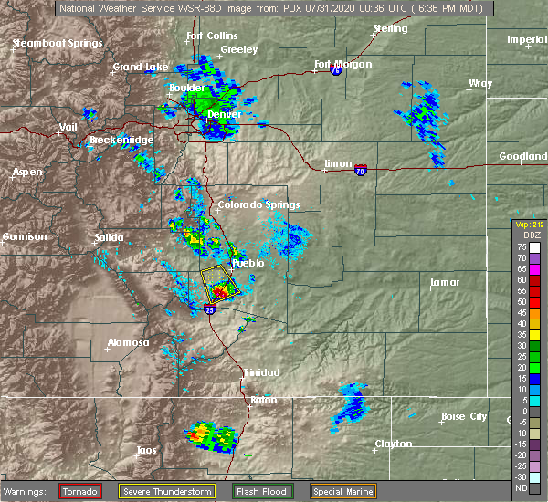 At 637 pm mdt, a severe thunderstorm was located 17 miles south of salt creek, or 19 miles south of pueblo, moving south at 40 mph (radar indicated). Hazards include quarter size hail. Damage to vehicles is expected. This severe thunderstorm will remain over mainly rural areas of northeastern huerfano and southwestern pueblo counties, which includes colorado city. At 637 pm mdt, a severe thunderstorm was located 17 miles south of salt creek, or 19 miles south of pueblo, moving south at 40 mph (radar indicated). Hazards include quarter size hail. Damage to vehicles is expected. This severe thunderstorm will remain over mainly rural areas of northeastern huerfano and southwestern pueblo counties, which includes colorado city.
|
| 7/30/2020 6:16 PM MDT |
 At 616 pm mdt, a severe thunderstorm was located 4 miles southwest of pueblo reservoir, or 10 miles southwest of pueblo, moving south at 30 mph (radar indicated). Hazards include quarter size hail. damage to vehicles is expected At 616 pm mdt, a severe thunderstorm was located 4 miles southwest of pueblo reservoir, or 10 miles southwest of pueblo, moving south at 30 mph (radar indicated). Hazards include quarter size hail. damage to vehicles is expected
|
| 6/6/2020 5:11 PM MDT |
 At 510 pm mdt, a severe thunderstorm was located 13 miles south of salt creek, or 15 miles south of pueblo, moving northeast at 65 mph. this is a very dangerous storm (radar indicated). Hazards include 80 mph wind gusts and quarter size hail. Flying debris will be dangerous to those caught without shelter. mobile homes will be heavily damaged. expect considerable damage to roofs, windows, and vehicles. Extensive tree damage and power outages are likely. At 510 pm mdt, a severe thunderstorm was located 13 miles south of salt creek, or 15 miles south of pueblo, moving northeast at 65 mph. this is a very dangerous storm (radar indicated). Hazards include 80 mph wind gusts and quarter size hail. Flying debris will be dangerous to those caught without shelter. mobile homes will be heavily damaged. expect considerable damage to roofs, windows, and vehicles. Extensive tree damage and power outages are likely.
|
| 6/6/2020 5:03 PM MDT |
 At 502 pm mdt, a severe thunderstorm was located 9 miles south of salt creek, or 11 miles south of pueblo, moving northeast at 55 mph (radar indicated). Hazards include 60 mph wind gusts and nickel size hail. Expect damage to roofs, siding, and trees. Locations impacted include, colorado city. At 502 pm mdt, a severe thunderstorm was located 9 miles south of salt creek, or 11 miles south of pueblo, moving northeast at 55 mph (radar indicated). Hazards include 60 mph wind gusts and nickel size hail. Expect damage to roofs, siding, and trees. Locations impacted include, colorado city.
|
| 6/6/2020 4:50 PM MDT |
 At 450 pm mdt, a severe thunderstorm was located 16 miles east of greenhorn mountain, or 21 miles south of pueblo, moving northeast at 55 mph (radar indicated). Hazards include 60 mph wind gusts and nickel size hail. expect damage to roofs, siding, and trees At 450 pm mdt, a severe thunderstorm was located 16 miles east of greenhorn mountain, or 21 miles south of pueblo, moving northeast at 55 mph (radar indicated). Hazards include 60 mph wind gusts and nickel size hail. expect damage to roofs, siding, and trees
|
| 5/22/2020 1:17 AM MDT |
 At 116 am mdt, a severe thunderstorm was located 4 miles southeast of rye, or 23 miles southeast of junkins burn scar, moving east at 10 mph (radar indicated). Hazards include quarter size hail. Damage to vehicles is expected. Locations impacted include, colorado city. At 116 am mdt, a severe thunderstorm was located 4 miles southeast of rye, or 23 miles southeast of junkins burn scar, moving east at 10 mph (radar indicated). Hazards include quarter size hail. Damage to vehicles is expected. Locations impacted include, colorado city.
|
| 5/22/2020 1:06 AM MDT |
 At 105 am mdt, a severe thunderstorm was located 3 miles south of colorado city, or 22 miles southeast of junkins burn scar, moving east at 10 mph (radar indicated). Hazards include quarter size hail. damage to vehicles is expected At 105 am mdt, a severe thunderstorm was located 3 miles south of colorado city, or 22 miles southeast of junkins burn scar, moving east at 10 mph (radar indicated). Hazards include quarter size hail. damage to vehicles is expected
|
| 5/17/2020 8:01 PM MDT |
 At 801 pm mdt, a severe thunderstorm was located 14 miles east of greenhorn mountain, or 25 miles southeast of junkins burn scar, moving east at 15 mph (radar indicated). Hazards include 60 mph wind gusts and quarter size hail. Hail damage to vehicles is expected. expect wind damage to roofs, siding, and trees. Locations impacted include, colorado city. At 801 pm mdt, a severe thunderstorm was located 14 miles east of greenhorn mountain, or 25 miles southeast of junkins burn scar, moving east at 15 mph (radar indicated). Hazards include 60 mph wind gusts and quarter size hail. Hail damage to vehicles is expected. expect wind damage to roofs, siding, and trees. Locations impacted include, colorado city.
|
| 5/17/2020 7:56 PM MDT |
 At 756 pm mdt, a severe thunderstorm was located 13 miles east of greenhorn mountain, or 24 miles southeast of junkins burn scar, moving east at 15 mph (radar indicated). Hazards include 60 mph wind gusts and quarter size hail. Hail damage to vehicles is expected. Expect wind damage to roofs, siding, and trees. At 756 pm mdt, a severe thunderstorm was located 13 miles east of greenhorn mountain, or 24 miles southeast of junkins burn scar, moving east at 15 mph (radar indicated). Hazards include 60 mph wind gusts and quarter size hail. Hail damage to vehicles is expected. Expect wind damage to roofs, siding, and trees.
|
| 8/30/2019 6:36 PM MDT |
 The severe thunderstorm warning for north central huerfano and southwestern pueblo counties will expire at 645 pm mdt, the storm which prompted the warning has weakened below severe limits, and no longer poses an immediate threat to life or property. therefore, the warning will be allowed to expire. however gusty winds are still possible with this thunderstorm. to report severe weather, contact your nearest law enforcement agency. they will relay your report to the national weather service pueblo. The severe thunderstorm warning for north central huerfano and southwestern pueblo counties will expire at 645 pm mdt, the storm which prompted the warning has weakened below severe limits, and no longer poses an immediate threat to life or property. therefore, the warning will be allowed to expire. however gusty winds are still possible with this thunderstorm. to report severe weather, contact your nearest law enforcement agency. they will relay your report to the national weather service pueblo.
|
| 8/30/2019 6:14 PM MDT |
 At 614 pm mdt, a severe thunderstorm was located 11 miles east of greenhorn mountain, or 22 miles northeast of spring burn scar north of highway 160, moving east at 10 mph (radar indicated). Hazards include 60 mph wind gusts and half dollar size hail. Hail damage to vehicles is expected. expect wind damage to roofs, siding, and trees. Locations impacted include, colorado city. At 614 pm mdt, a severe thunderstorm was located 11 miles east of greenhorn mountain, or 22 miles northeast of spring burn scar north of highway 160, moving east at 10 mph (radar indicated). Hazards include 60 mph wind gusts and half dollar size hail. Hail damage to vehicles is expected. expect wind damage to roofs, siding, and trees. Locations impacted include, colorado city.
|
| 8/30/2019 6:01 PM MDT |
 At 601 pm mdt, a severe thunderstorm was located 9 miles east of greenhorn mountain, or 21 miles northeast of spring burn scar north of highway 160, moving east at 10 mph (radar indicated). Hazards include 60 mph wind gusts and quarter size hail. Hail damage to vehicles is expected. Expect wind damage to roofs, siding, and trees. At 601 pm mdt, a severe thunderstorm was located 9 miles east of greenhorn mountain, or 21 miles northeast of spring burn scar north of highway 160, moving east at 10 mph (radar indicated). Hazards include 60 mph wind gusts and quarter size hail. Hail damage to vehicles is expected. Expect wind damage to roofs, siding, and trees.
|
| 7/21/2019 9:26 PM MDT |
 At 924 pm mdt, a severe thunderstorm was located over pueblo reservoir, or near pueblo, moving southeast at 25 mph. numerous other strong to severe thunderstorms are expected to develop across most of puelbl county through 10 pm. very intense rain is likely with these storms (radar indicated). Hazards include 60 mph wind gusts and quarter size hail. very intense rainfall is also likely. Hail damage to vehicles is expected. Expect wind damage to roofs, siding, and trees. At 924 pm mdt, a severe thunderstorm was located over pueblo reservoir, or near pueblo, moving southeast at 25 mph. numerous other strong to severe thunderstorms are expected to develop across most of puelbl county through 10 pm. very intense rain is likely with these storms (radar indicated). Hazards include 60 mph wind gusts and quarter size hail. very intense rainfall is also likely. Hail damage to vehicles is expected. Expect wind damage to roofs, siding, and trees.
|
| 7/21/2019 9:02 PM MDT |
 At 901 pm mdt, a severe thunderstorm was located 8 miles east of junkins burn scar, moving northwest at 20 mph (radar indicated). Hazards include 60 mph wind gusts and quarter size hail. Hail damage to vehicles is expected. expect wind damage to roofs, siding, and trees. Locations impacted include, san isabel and colorado city. At 901 pm mdt, a severe thunderstorm was located 8 miles east of junkins burn scar, moving northwest at 20 mph (radar indicated). Hazards include 60 mph wind gusts and quarter size hail. Hail damage to vehicles is expected. expect wind damage to roofs, siding, and trees. Locations impacted include, san isabel and colorado city.
|
| 7/21/2019 8:33 PM MDT |
 At 833 pm mdt, a severe thunderstorm was located 10 miles northeast of greenhorn mountain, or 17 miles southeast of junkins burn scar, moving northwest at 20 mph (radar indicated). Hazards include 60 mph wind gusts and quarter size hail. Hail damage to vehicles is expected. Expect wind damage to roofs, siding, and trees. At 833 pm mdt, a severe thunderstorm was located 10 miles northeast of greenhorn mountain, or 17 miles southeast of junkins burn scar, moving northwest at 20 mph (radar indicated). Hazards include 60 mph wind gusts and quarter size hail. Hail damage to vehicles is expected. Expect wind damage to roofs, siding, and trees.
|
| 7/5/2019 6:59 PM MDT |
 At 658 pm mdt, a severe thunderstorm was located 17 miles northeast of greenhorn mountain, or 19 miles south of pueblo, moving northeast at 25 mph (radar indicated). Hazards include 60 mph wind gusts and quarter size hail. Hail damage to vehicles is expected. expect wind damage to roofs, siding, and trees. Locations impacted include, colorado city, southeastern pueblo, avondale, salt creek, blende and pueblo depot. At 658 pm mdt, a severe thunderstorm was located 17 miles northeast of greenhorn mountain, or 19 miles south of pueblo, moving northeast at 25 mph (radar indicated). Hazards include 60 mph wind gusts and quarter size hail. Hail damage to vehicles is expected. expect wind damage to roofs, siding, and trees. Locations impacted include, colorado city, southeastern pueblo, avondale, salt creek, blende and pueblo depot.
|
| 7/5/2019 6:43 PM MDT |
 At 640 pm mdt, a severe thunderstorm was located 14 miles east of greenhorn mountain or near colorado city, moving northeast at 25 mph (radar indicated). Hazards include 60 mph wind gusts and quarter size hail. Hail damage to vehicles is expected. Expect wind damage to roofs, siding, and trees. At 640 pm mdt, a severe thunderstorm was located 14 miles east of greenhorn mountain or near colorado city, moving northeast at 25 mph (radar indicated). Hazards include 60 mph wind gusts and quarter size hail. Hail damage to vehicles is expected. Expect wind damage to roofs, siding, and trees.
|
| 6/17/2019 5:27 PM MDT |
 The severe thunderstorm warning for northeastern huerfano and south central pueblo counties will expire at 530 pm mdt, the storm which prompted the warning has moved out of the area. therefore, the warning will be allowed to expire. however small hail, gusty winds and heavy rain are still possible with this thunderstorm. to report severe weather, contact your nearest law enforcement agency. they will relay your report to the national weather service pueblo. The severe thunderstorm warning for northeastern huerfano and south central pueblo counties will expire at 530 pm mdt, the storm which prompted the warning has moved out of the area. therefore, the warning will be allowed to expire. however small hail, gusty winds and heavy rain are still possible with this thunderstorm. to report severe weather, contact your nearest law enforcement agency. they will relay your report to the national weather service pueblo.
|
| 6/17/2019 5:01 PM MDT |
 At 443 pm mdt, a severe thunderstorm was located 17 miles east of greenhorn mountain, or 24 miles south of pueblo, moving northeast at 10 mph (radar indicated). Hazards include 60 mph wind gusts and half dollar size hail. Hail damage to vehicles is expected. Expect wind damage to roofs, siding, and trees. At 443 pm mdt, a severe thunderstorm was located 17 miles east of greenhorn mountain, or 24 miles south of pueblo, moving northeast at 10 mph (radar indicated). Hazards include 60 mph wind gusts and half dollar size hail. Hail damage to vehicles is expected. Expect wind damage to roofs, siding, and trees.
|
| 6/17/2019 4:44 PM MDT |
 At 443 pm mdt, a severe thunderstorm was located 17 miles east of greenhorn mountain, or 24 miles south of pueblo, moving northeast at 10 mph (radar indicated). Hazards include 60 mph wind gusts and half dollar size hail. Hail damage to vehicles is expected. Expect wind damage to roofs, siding, and trees. At 443 pm mdt, a severe thunderstorm was located 17 miles east of greenhorn mountain, or 24 miles south of pueblo, moving northeast at 10 mph (radar indicated). Hazards include 60 mph wind gusts and half dollar size hail. Hail damage to vehicles is expected. Expect wind damage to roofs, siding, and trees.
|
| 6/4/2019 1:09 PM MDT |
 At 108 pm mdt, a severe thunderstorm was located 19 miles east of greenhorn mountain, or 24 miles south of pueblo, moving northeast at 20 mph (radar indicated). Hazards include ping pong ball size hail and 60 mph wind gusts. People and animals outdoors will be injured. expect hail damage to roofs, siding, windows, and vehicles. expect wind damage to roofs, siding, and trees. Locations impacted include, colorado city. At 108 pm mdt, a severe thunderstorm was located 19 miles east of greenhorn mountain, or 24 miles south of pueblo, moving northeast at 20 mph (radar indicated). Hazards include ping pong ball size hail and 60 mph wind gusts. People and animals outdoors will be injured. expect hail damage to roofs, siding, windows, and vehicles. expect wind damage to roofs, siding, and trees. Locations impacted include, colorado city.
|
| 6/4/2019 12:58 PM MDT |
 At 1258 pm mdt, a severe thunderstorm was located 16 miles east of greenhorn mountain, or 26 miles south of pueblo, moving northeast at 20 mph (radar indicated). Hazards include 60 mph wind gusts and quarter size hail. Hail damage to vehicles is expected. Expect wind damage to roofs, siding, and trees. At 1258 pm mdt, a severe thunderstorm was located 16 miles east of greenhorn mountain, or 26 miles south of pueblo, moving northeast at 20 mph (radar indicated). Hazards include 60 mph wind gusts and quarter size hail. Hail damage to vehicles is expected. Expect wind damage to roofs, siding, and trees.
|
| 8/17/2018 3:08 PM MDT |
 At 308 pm mdt, a severe thunderstorm was located 11 miles east of greenhorn mountain, or 26 miles southwest of pueblo, moving northeast at 15 mph (radar indicated). Hazards include quarter size hail. Damage to vehicles is expected. Locations impacted include, colorado city. At 308 pm mdt, a severe thunderstorm was located 11 miles east of greenhorn mountain, or 26 miles southwest of pueblo, moving northeast at 15 mph (radar indicated). Hazards include quarter size hail. Damage to vehicles is expected. Locations impacted include, colorado city.
|
| 8/17/2018 2:56 PM MDT |
 At 256 pm mdt, a severe thunderstorm was located 11 miles northeast of greenhorn mountain, or 24 miles southwest of pueblo, moving east at 10 mph (radar indicated). Hazards include quarter size hail. damage to vehicles is expected At 256 pm mdt, a severe thunderstorm was located 11 miles northeast of greenhorn mountain, or 24 miles southwest of pueblo, moving east at 10 mph (radar indicated). Hazards include quarter size hail. damage to vehicles is expected
|
| 8/7/2018 4:06 PM MDT |
 At 406 pm mdt, a severe thunderstorm was located 12 miles east of greenhorn mountain, or 28 miles south of pueblo, moving southeast at 20 mph (trained weather spotters). Hazards include quarter size hail. Damage to vehicles is expected. Locations impacted include, rye and colorado city. At 406 pm mdt, a severe thunderstorm was located 12 miles east of greenhorn mountain, or 28 miles south of pueblo, moving southeast at 20 mph (trained weather spotters). Hazards include quarter size hail. Damage to vehicles is expected. Locations impacted include, rye and colorado city.
|
| 8/7/2018 4:00 PM MDT |
 At 400 pm mdt, a severe thunderstorm was located 10 miles east of greenhorn mountain, or 27 miles southwest of pueblo, moving southeast at 20 mph (radar indicated). Hazards include quarter size hail. Damage to vehicles is expected. Locations impacted include, rye and colorado city. At 400 pm mdt, a severe thunderstorm was located 10 miles east of greenhorn mountain, or 27 miles southwest of pueblo, moving southeast at 20 mph (radar indicated). Hazards include quarter size hail. Damage to vehicles is expected. Locations impacted include, rye and colorado city.
|
| 8/7/2018 3:49 PM MDT |
 At 349 pm mdt, a severe thunderstorm was located 8 miles east of greenhorn mountain, or 26 miles southwest of pueblo, moving southeast at 20 mph (radar indicated). Hazards include half dollar size hail. damage to vehicles is expected At 349 pm mdt, a severe thunderstorm was located 8 miles east of greenhorn mountain, or 26 miles southwest of pueblo, moving southeast at 20 mph (radar indicated). Hazards include half dollar size hail. damage to vehicles is expected
|
| 8/7/2018 3:17 PM MDT |
 At 317 pm mdt, a severe thunderstorm was located 11 miles east of greenhorn mountain, or 28 miles south of pueblo, moving southeast at 20 mph (trained weather spotters). Hazards include quarter size hail. Damage to vehicles is expected. Locations impacted include, colorado city. At 317 pm mdt, a severe thunderstorm was located 11 miles east of greenhorn mountain, or 28 miles south of pueblo, moving southeast at 20 mph (trained weather spotters). Hazards include quarter size hail. Damage to vehicles is expected. Locations impacted include, colorado city.
|
| 8/7/2018 3:05 PM MDT | Quarter sized hail reported 0.3 miles S of Colorado City, CO, a colorado city... city employee... reported the 1.0 inch hail. |
| 8/7/2018 3:05 PM MDT |
 At 305 pm mdt, a severe thunderstorm was located 8 miles east of greenhorn mountain, or 28 miles southwest of pueblo, moving southeast at 20 mph (trained weather spotters). Hazards include quarter size hail. damage to vehicles is expected At 305 pm mdt, a severe thunderstorm was located 8 miles east of greenhorn mountain, or 28 miles southwest of pueblo, moving southeast at 20 mph (trained weather spotters). Hazards include quarter size hail. damage to vehicles is expected
|
| 8/5/2018 5:36 PM MDT |
 At 535 pm mdt, a severe thunderstorm was located near greenhorn mountain, or 37 miles southwest of pueblo, moving east at 30 mph (radar indicated). Hazards include 60 mph wind gusts and half dollar size hail. Hail damage to vehicles is expected. expect wind damage to roofs, siding, and trees. this storm is showing increasing rotation, and a tornado could occur with this storm at any time. Locations impacted include, gardner, farisita, greenhorn mountain, rye and colorado city. At 535 pm mdt, a severe thunderstorm was located near greenhorn mountain, or 37 miles southwest of pueblo, moving east at 30 mph (radar indicated). Hazards include 60 mph wind gusts and half dollar size hail. Hail damage to vehicles is expected. expect wind damage to roofs, siding, and trees. this storm is showing increasing rotation, and a tornado could occur with this storm at any time. Locations impacted include, gardner, farisita, greenhorn mountain, rye and colorado city.
|
| 8/5/2018 5:24 PM MDT |
 At 524 pm mdt, a severe thunderstorm was located near gardner, or 39 miles southwest of pueblo, moving east at 30 mph (radar indicated). Hazards include 60 mph wind gusts and half dollar size hail. Hail damage to vehicles is expected. Expect wind damage to roofs, siding, and trees. At 524 pm mdt, a severe thunderstorm was located near gardner, or 39 miles southwest of pueblo, moving east at 30 mph (radar indicated). Hazards include 60 mph wind gusts and half dollar size hail. Hail damage to vehicles is expected. Expect wind damage to roofs, siding, and trees.
|
| 7/27/2018 3:56 PM MDT |
 At 356 pm mdt, a severe thunderstorm was located near walsenburg, or 37 miles northwest of trinidad, moving southeast at 35 mph (radar indicated). Hazards include ping pong ball size hail and 60 mph wind gusts. People and animals outdoors will be injured. expect hail damage to roofs, siding, windows, and vehicles. expect wind damage to roofs, siding, and trees. Locations impacted include, walsenburg and colorado city. At 356 pm mdt, a severe thunderstorm was located near walsenburg, or 37 miles northwest of trinidad, moving southeast at 35 mph (radar indicated). Hazards include ping pong ball size hail and 60 mph wind gusts. People and animals outdoors will be injured. expect hail damage to roofs, siding, windows, and vehicles. expect wind damage to roofs, siding, and trees. Locations impacted include, walsenburg and colorado city.
|
| 7/27/2018 3:56 PM MDT |
 At 355 pm mdt, a severe thunderstorm was located 15 miles south of salt creek, or 17 miles south of pueblo, moving east at 15 mph (radar indicated). Hazards include ping pong ball size hail and 60 mph wind gusts. People and animals outdoors will be injured. expect hail damage to roofs, siding, windows, and vehicles. expect wind damage to roofs, siding, and trees. Locations impacted include, colorado city. At 355 pm mdt, a severe thunderstorm was located 15 miles south of salt creek, or 17 miles south of pueblo, moving east at 15 mph (radar indicated). Hazards include ping pong ball size hail and 60 mph wind gusts. People and animals outdoors will be injured. expect hail damage to roofs, siding, windows, and vehicles. expect wind damage to roofs, siding, and trees. Locations impacted include, colorado city.
|
| 7/27/2018 3:43 PM MDT |
 At 343 pm mdt, a severe thunderstorm was located 7 miles north of walsenburg, or 37 miles south of pueblo, moving southeast at 20 mph (radar indicated). Hazards include ping pong ball size hail and 60 mph wind gusts. People and animals outdoors will be injured. expect hail damage to roofs, siding, windows, and vehicles. Expect wind damage to roofs, siding, and trees. At 343 pm mdt, a severe thunderstorm was located 7 miles north of walsenburg, or 37 miles south of pueblo, moving southeast at 20 mph (radar indicated). Hazards include ping pong ball size hail and 60 mph wind gusts. People and animals outdoors will be injured. expect hail damage to roofs, siding, windows, and vehicles. Expect wind damage to roofs, siding, and trees.
|
| 7/27/2018 3:40 PM MDT |
 At 340 pm mdt, a severe thunderstorm was located 16 miles south of pueblo reservoir, or 17 miles southwest of pueblo, moving northeast at 10 mph (radar indicated). Hazards include ping pong ball size hail and 60 mph wind gusts. People and animals outdoors will be injured. expect hail damage to roofs, siding, windows, and vehicles. Expect wind damage to roofs, siding, and trees. At 340 pm mdt, a severe thunderstorm was located 16 miles south of pueblo reservoir, or 17 miles southwest of pueblo, moving northeast at 10 mph (radar indicated). Hazards include ping pong ball size hail and 60 mph wind gusts. People and animals outdoors will be injured. expect hail damage to roofs, siding, windows, and vehicles. Expect wind damage to roofs, siding, and trees.
|
| 7/27/2018 3:33 PM MDT |
 At 333 pm mdt, a severe thunderstorm was located 11 miles north of walsenburg, or 34 miles south of pueblo, moving southeast at 20 mph (radar indicated). Hazards include 60 mph wind gusts and quarter size hail. Hail damage to vehicles is expected. expect wind damage to roofs, siding, and trees. Locations impacted include, greenhorn mountain, rye and colorado city. At 333 pm mdt, a severe thunderstorm was located 11 miles north of walsenburg, or 34 miles south of pueblo, moving southeast at 20 mph (radar indicated). Hazards include 60 mph wind gusts and quarter size hail. Hail damage to vehicles is expected. expect wind damage to roofs, siding, and trees. Locations impacted include, greenhorn mountain, rye and colorado city.
|
| 7/27/2018 3:14 PM MDT |
 At 314 pm mdt, a severe thunderstorm was located 13 miles east of greenhorn mountain, or 23 miles southwest of pueblo, moving southeast at 35 mph (radar indicated). Hazards include 60 mph wind gusts and quarter size hail. Hail damage to vehicles is expected. Expect wind damage to roofs, siding, and trees. At 314 pm mdt, a severe thunderstorm was located 13 miles east of greenhorn mountain, or 23 miles southwest of pueblo, moving southeast at 35 mph (radar indicated). Hazards include 60 mph wind gusts and quarter size hail. Hail damage to vehicles is expected. Expect wind damage to roofs, siding, and trees.
|
| 7/27/2018 2:59 PM MDT |
 At 259 pm mdt, a severe thunderstorm was located 7 miles east of greenhorn mountain, or 28 miles southwest of pueblo, moving southeast at 10 mph. 1 inch hail was reported 2 east of rye (public). Hazards include 60 mph wind gusts and quarter size hail. Hail damage to vehicles is expected. expect wind damage to roofs, siding, and trees. Locations impacted include, rye and colorado city. At 259 pm mdt, a severe thunderstorm was located 7 miles east of greenhorn mountain, or 28 miles southwest of pueblo, moving southeast at 10 mph. 1 inch hail was reported 2 east of rye (public). Hazards include 60 mph wind gusts and quarter size hail. Hail damage to vehicles is expected. expect wind damage to roofs, siding, and trees. Locations impacted include, rye and colorado city.
|
| 7/27/2018 2:49 PM MDT |
 At 249 pm mdt, a severe thunderstorm was located near greenhorn mountain, or 27 miles southwest of pueblo, moving southeast at 10 mph (radar indicated). Hazards include 60 mph wind gusts and quarter size hail. Hail damage to vehicles is expected. Expect wind damage to roofs, siding, and trees. At 249 pm mdt, a severe thunderstorm was located near greenhorn mountain, or 27 miles southwest of pueblo, moving southeast at 10 mph (radar indicated). Hazards include 60 mph wind gusts and quarter size hail. Hail damage to vehicles is expected. Expect wind damage to roofs, siding, and trees.
|
| 7/26/2018 3:23 PM MDT |
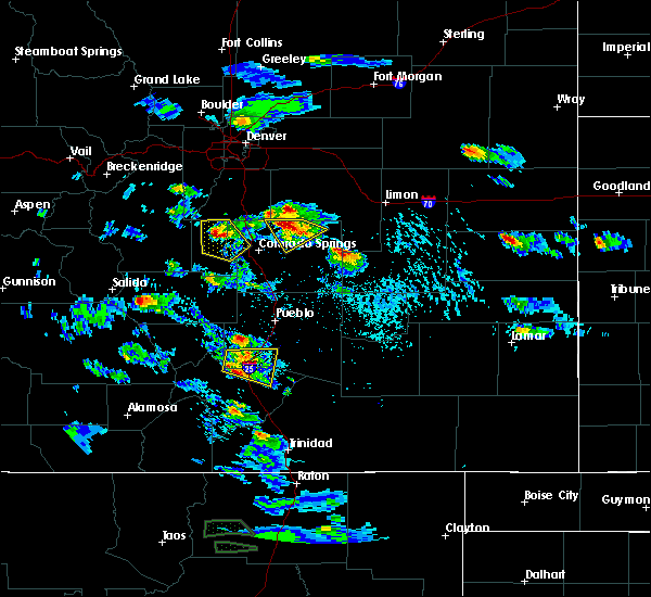 The severe thunderstorm warning for north central huerfano and southwestern pueblo counties will expire at 330 pm mdt, the severe thunderstorm which prompted the warning has weakened. therefore, the warning will be allowed to expire. however small hail and heavy rain are still possible with this thunderstorm. The severe thunderstorm warning for north central huerfano and southwestern pueblo counties will expire at 330 pm mdt, the severe thunderstorm which prompted the warning has weakened. therefore, the warning will be allowed to expire. however small hail and heavy rain are still possible with this thunderstorm.
|
| 7/26/2018 3:13 PM MDT |
 At 313 pm mdt, a severe thunderstorm was located 8 miles northeast of greenhorn mountain, or 25 miles southwest of pueblo, moving east at 15 mph (radar indicated). Hazards include 60 mph wind gusts and quarter size hail. Hail damage to vehicles is expected. expect wind damage to roofs, siding, and trees. Locations impacted include, greenhorn mountain, rye, san isabel and colorado city. At 313 pm mdt, a severe thunderstorm was located 8 miles northeast of greenhorn mountain, or 25 miles southwest of pueblo, moving east at 15 mph (radar indicated). Hazards include 60 mph wind gusts and quarter size hail. Hail damage to vehicles is expected. expect wind damage to roofs, siding, and trees. Locations impacted include, greenhorn mountain, rye, san isabel and colorado city.
|
| 7/26/2018 3:00 PM MDT |
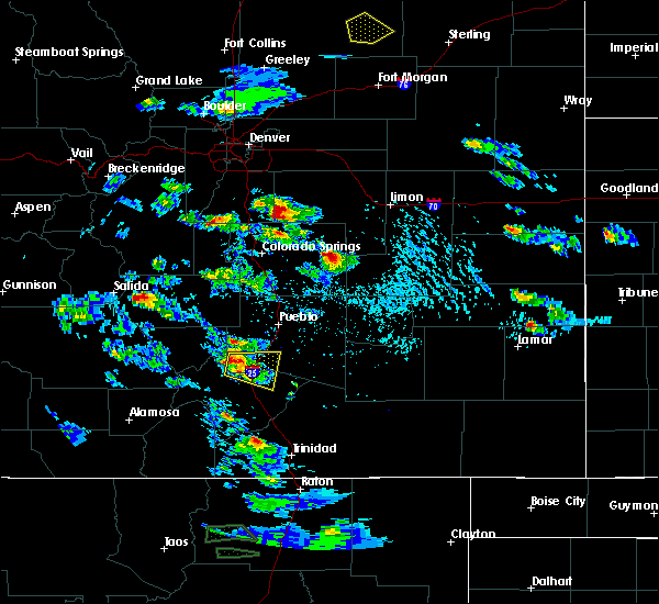 At 259 pm mdt, a severe thunderstorm was located 7 miles northeast of greenhorn mountain, or 27 miles southwest of pueblo, moving east at 20 mph (radar indicated). Hazards include 60 mph wind gusts and quarter size hail. Hail damage to vehicles is expected. expect wind damage to roofs, siding, and trees. Locations impacted include, greenhorn mountain, rye, san isabel and colorado city. At 259 pm mdt, a severe thunderstorm was located 7 miles northeast of greenhorn mountain, or 27 miles southwest of pueblo, moving east at 20 mph (radar indicated). Hazards include 60 mph wind gusts and quarter size hail. Hail damage to vehicles is expected. expect wind damage to roofs, siding, and trees. Locations impacted include, greenhorn mountain, rye, san isabel and colorado city.
|
| 7/26/2018 2:50 PM MDT |
 At 250 pm mdt, a severe thunderstorm was located near greenhorn mountain, or 29 miles southwest of pueblo, moving east at 20 mph (radar indicated). Hazards include 60 mph wind gusts and half dollar size hail. Hail damage to vehicles is expected. Expect wind damage to roofs, siding, and trees. At 250 pm mdt, a severe thunderstorm was located near greenhorn mountain, or 29 miles southwest of pueblo, moving east at 20 mph (radar indicated). Hazards include 60 mph wind gusts and half dollar size hail. Hail damage to vehicles is expected. Expect wind damage to roofs, siding, and trees.
|
| 7/25/2018 5:32 PM MDT |
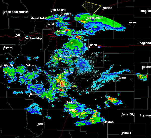 At 532 pm mdt, a severe thunderstorm was located 17 miles east of greenhorn mountain, or 23 miles south of pueblo, moving southeast at 10 mph (radar indicated). Hazards include ping pong ball size hail and 60 mph wind gusts. People and animals outdoors will be injured. expect hail damage to roofs, siding, windows, and vehicles. expect wind damage to roofs, siding, and trees. Locations impacted include, colorado city. At 532 pm mdt, a severe thunderstorm was located 17 miles east of greenhorn mountain, or 23 miles south of pueblo, moving southeast at 10 mph (radar indicated). Hazards include ping pong ball size hail and 60 mph wind gusts. People and animals outdoors will be injured. expect hail damage to roofs, siding, windows, and vehicles. expect wind damage to roofs, siding, and trees. Locations impacted include, colorado city.
|
| 7/25/2018 5:25 PM MDT |
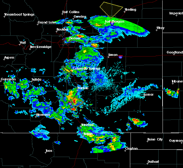 At 525 pm mdt, a severe thunderstorm was located 16 miles east of greenhorn mountain, or 23 miles south of pueblo, moving southeast at 10 mph (radar indicated). Hazards include 60 mph wind gusts and quarter size hail. Hail damage to vehicles is expected. Expect wind damage to roofs, siding, and trees. At 525 pm mdt, a severe thunderstorm was located 16 miles east of greenhorn mountain, or 23 miles south of pueblo, moving southeast at 10 mph (radar indicated). Hazards include 60 mph wind gusts and quarter size hail. Hail damage to vehicles is expected. Expect wind damage to roofs, siding, and trees.
|
| 7/22/2018 3:43 PM MDT |
 At 342 pm mdt, a severe thunderstorm was located 14 miles south of salt creek, or 16 miles south of pueblo, moving southeast at 10 mph. the kpub asos reported at 63 mph gust. there have also been reports of 0.75 inch hail south of the pueblo reservoir (trained weather spotters). Hazards include 70 mph wind gusts and quarter size hail. Hail damage to vehicles is expected. expect considerable tree damage. wind damage is also likely to mobile homes, roofs, and outbuildings. Locations impacted include, boone, avondale, blende, pueblo depot and colorado city. At 342 pm mdt, a severe thunderstorm was located 14 miles south of salt creek, or 16 miles south of pueblo, moving southeast at 10 mph. the kpub asos reported at 63 mph gust. there have also been reports of 0.75 inch hail south of the pueblo reservoir (trained weather spotters). Hazards include 70 mph wind gusts and quarter size hail. Hail damage to vehicles is expected. expect considerable tree damage. wind damage is also likely to mobile homes, roofs, and outbuildings. Locations impacted include, boone, avondale, blende, pueblo depot and colorado city.
|
| 7/22/2018 3:29 PM MDT |
 At 329 pm mdt, a severe thunderstorm was located 12 miles south of salt creek, or 14 miles south of pueblo, moving southeast at 10 mph (trained weather spotters). Hazards include 70 mph wind gusts and quarter size hail. Hail damage to vehicles is expected. expect considerable tree damage. Wind damage is also likely to mobile homes, roofs, and outbuildings. At 329 pm mdt, a severe thunderstorm was located 12 miles south of salt creek, or 14 miles south of pueblo, moving southeast at 10 mph (trained weather spotters). Hazards include 70 mph wind gusts and quarter size hail. Hail damage to vehicles is expected. expect considerable tree damage. Wind damage is also likely to mobile homes, roofs, and outbuildings.
|
| 7/22/2018 3:23 PM MDT |
 At 323 pm mdt, a severe thunderstorm was located 11 miles south of salt creek, or 12 miles south of pueblo, moving southeast at 5 mph. the kpub asos reported at 63 mph gust. there have also been reports of 0.75 inch hail south of the pueblo reservoir (trained weather spotters). Hazards include 70 mph wind gusts and quarter size hail. Hail damage to vehicles is expected. expect considerable tree damage. wind damage is also likely to mobile homes, roofs, and outbuildings. Locations impacted include, pueblo, boone, pueblo reservoir, salt creek, blende, avondale, pueblo depot, pueblo west and colorado city. At 323 pm mdt, a severe thunderstorm was located 11 miles south of salt creek, or 12 miles south of pueblo, moving southeast at 5 mph. the kpub asos reported at 63 mph gust. there have also been reports of 0.75 inch hail south of the pueblo reservoir (trained weather spotters). Hazards include 70 mph wind gusts and quarter size hail. Hail damage to vehicles is expected. expect considerable tree damage. wind damage is also likely to mobile homes, roofs, and outbuildings. Locations impacted include, pueblo, boone, pueblo reservoir, salt creek, blende, avondale, pueblo depot, pueblo west and colorado city.
|
| 7/22/2018 3:12 PM MDT |
 At 311 pm mdt, a severe thunderstorm was located 9 miles south of salt creek, or 11 miles south of pueblo, moving southeast at 15 mph. the kpub asos reported at 63 mph gust. there have also been reports of 0.75 inch hail south of the pueblo reservoir (trained weather spotters). Hazards include 70 mph wind gusts and quarter size hail. Hail damage to vehicles is expected. expect considerable tree damage. wind damage is also likely to mobile homes, roofs, and outbuildings. Locations impacted include, pueblo, boone, pueblo reservoir, salt creek, blende, avondale, pueblo depot, pueblo west and colorado city. At 311 pm mdt, a severe thunderstorm was located 9 miles south of salt creek, or 11 miles south of pueblo, moving southeast at 15 mph. the kpub asos reported at 63 mph gust. there have also been reports of 0.75 inch hail south of the pueblo reservoir (trained weather spotters). Hazards include 70 mph wind gusts and quarter size hail. Hail damage to vehicles is expected. expect considerable tree damage. wind damage is also likely to mobile homes, roofs, and outbuildings. Locations impacted include, pueblo, boone, pueblo reservoir, salt creek, blende, avondale, pueblo depot, pueblo west and colorado city.
|
| 7/22/2018 3:03 PM MDT |
 At 303 pm mdt, a severe thunderstorm was located over salt creek, or near pueblo, and is nearly stationary (radar indicated). Hazards include 70 mph wind gusts and nickel size hail. Expect considerable tree damage. Damage is likely to mobile homes, roofs, and outbuildings. At 303 pm mdt, a severe thunderstorm was located over salt creek, or near pueblo, and is nearly stationary (radar indicated). Hazards include 70 mph wind gusts and nickel size hail. Expect considerable tree damage. Damage is likely to mobile homes, roofs, and outbuildings.
|
| 6/13/2018 2:51 PM MDT |
 At 251 pm mdt, a severe thunderstorm was located 16 miles east of greenhorn mountain, or 21 miles south of pueblo, moving east at 15 mph (trained weather spotters). Hazards include 60 mph wind gusts and quarter size hail. Hail damage to vehicles is expected. expect wind damage to roofs, siding, and trees. Locations impacted include, colorado city. At 251 pm mdt, a severe thunderstorm was located 16 miles east of greenhorn mountain, or 21 miles south of pueblo, moving east at 15 mph (trained weather spotters). Hazards include 60 mph wind gusts and quarter size hail. Hail damage to vehicles is expected. expect wind damage to roofs, siding, and trees. Locations impacted include, colorado city.
|
| 6/13/2018 2:43 PM MDT |
 At 242 pm mdt, a severe thunderstorm was located 14 miles east of greenhorn mountain, or 23 miles south of pueblo, moving east at 15 mph. a trained spotter reported 1 inch hail just east of colorado city (trained weather spotters). Hazards include 60 mph wind gusts and quarter size hail. Hail damage to vehicles is expected. expect wind damage to roofs, siding, and trees. Locations impacted include, colorado city. At 242 pm mdt, a severe thunderstorm was located 14 miles east of greenhorn mountain, or 23 miles south of pueblo, moving east at 15 mph. a trained spotter reported 1 inch hail just east of colorado city (trained weather spotters). Hazards include 60 mph wind gusts and quarter size hail. Hail damage to vehicles is expected. expect wind damage to roofs, siding, and trees. Locations impacted include, colorado city.
|
| 6/13/2018 2:33 PM MDT |
 At 233 pm mdt, a severe thunderstorm was located 12 miles east of greenhorn mountain, or 24 miles southwest of pueblo, moving east at 15 mph (radar indicated). Hazards include 60 mph wind gusts and quarter size hail. Hail damage to vehicles is expected. Expect wind damage to roofs, siding, and trees. At 233 pm mdt, a severe thunderstorm was located 12 miles east of greenhorn mountain, or 24 miles southwest of pueblo, moving east at 15 mph (radar indicated). Hazards include 60 mph wind gusts and quarter size hail. Hail damage to vehicles is expected. Expect wind damage to roofs, siding, and trees.
|
| 8/4/2017 4:15 PM MDT |
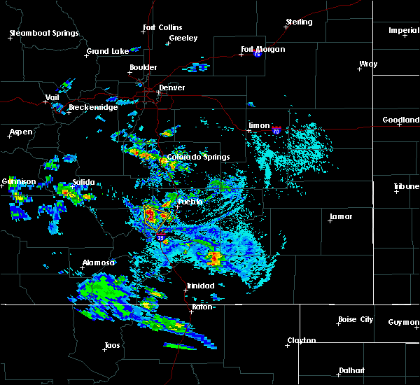 At 415 pm mdt, a severe thunderstorm was located 15 miles southwest of pueblo reservoir, or 21 miles southwest of pueblo, moving southeast at 20 mph (radar indicated). Hazards include half dollar size hail. Damage to vehicles is expected. Locations impacted include, beulah and colorado city. At 415 pm mdt, a severe thunderstorm was located 15 miles southwest of pueblo reservoir, or 21 miles southwest of pueblo, moving southeast at 20 mph (radar indicated). Hazards include half dollar size hail. Damage to vehicles is expected. Locations impacted include, beulah and colorado city.
|
| 8/4/2017 4:05 PM MDT |
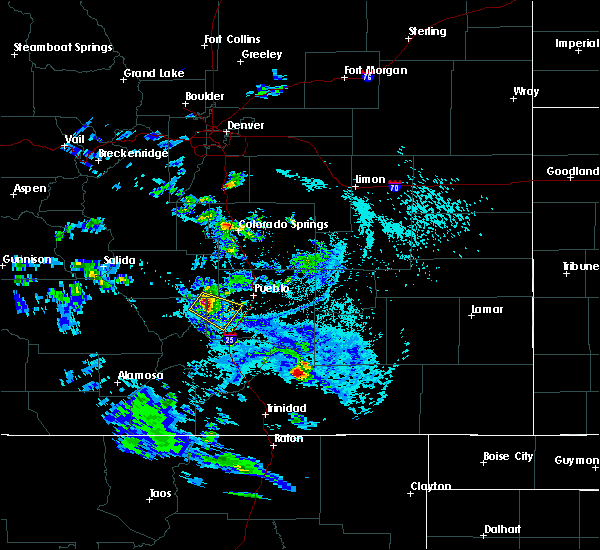 At 404 pm mdt, a severe thunderstorm was located 15 miles south of florence, or 23 miles west of pueblo, moving southeast at 20 mph (trained weather spotters). Hazards include half dollar size hail. Damage to vehicles is expected. locations impacted include, beulah, wetmore and colorado city. A spotter just southwest of wetmore reported half dollar size hail. At 404 pm mdt, a severe thunderstorm was located 15 miles south of florence, or 23 miles west of pueblo, moving southeast at 20 mph (trained weather spotters). Hazards include half dollar size hail. Damage to vehicles is expected. locations impacted include, beulah, wetmore and colorado city. A spotter just southwest of wetmore reported half dollar size hail.
|
| 8/4/2017 3:58 PM MDT |
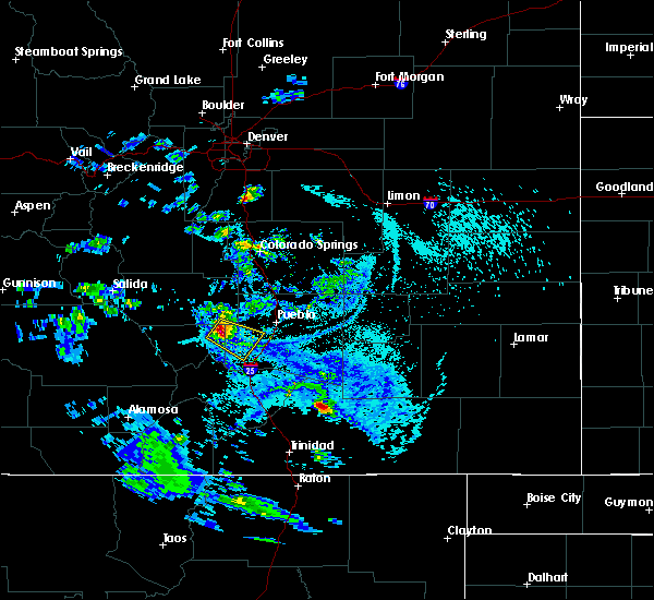 At 357 pm mdt, a severe thunderstorm was located 13 miles south of florence, or 24 miles west of pueblo, moving southeast at 20 mph (radar indicated). Hazards include quarter size hail. damage to vehicles is expected At 357 pm mdt, a severe thunderstorm was located 13 miles south of florence, or 24 miles west of pueblo, moving southeast at 20 mph (radar indicated). Hazards include quarter size hail. damage to vehicles is expected
|
| 7/16/2017 6:51 PM MDT |
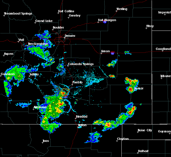 The severe thunderstorm warning for northeastern huerfano and southwestern pueblo counties will expire at 700 pm mdt, the storm which prompted the warning has weakened below severe limits, and no longer poses an immediate threat to life or property. therefore the warning will be allowed to expire. however gusty winds and heavy rain are still possible with this thunderstorm. The severe thunderstorm warning for northeastern huerfano and southwestern pueblo counties will expire at 700 pm mdt, the storm which prompted the warning has weakened below severe limits, and no longer poses an immediate threat to life or property. therefore the warning will be allowed to expire. however gusty winds and heavy rain are still possible with this thunderstorm.
|
| 7/16/2017 6:46 PM MDT |
 At 645 pm mdt, a severe thunderstorm was located 11 miles northeast of greenhorn mountain, or 22 miles southwest of pueblo, moving east at 15 mph (radar indicated). Hazards include 60 mph wind gusts and quarter size hail. Hail damage to vehicles is expected. expect wind damage to roofs, siding, and trees. Locations impacted include, colorado city. At 645 pm mdt, a severe thunderstorm was located 11 miles northeast of greenhorn mountain, or 22 miles southwest of pueblo, moving east at 15 mph (radar indicated). Hazards include 60 mph wind gusts and quarter size hail. Hail damage to vehicles is expected. expect wind damage to roofs, siding, and trees. Locations impacted include, colorado city.
|
| 7/16/2017 6:33 PM MDT |
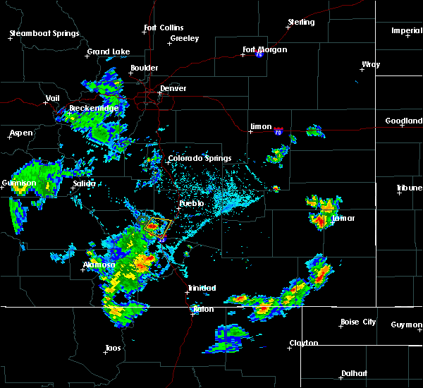 At 632 pm mdt, a severe thunderstorm was located 11 miles north of greenhorn mountain, or 23 miles southwest of pueblo, moving southeast at 15 mph (trained weather spotters). Hazards include quarter size hail. Damage to vehicles is expected. Locations impacted include, beulah and colorado city. At 632 pm mdt, a severe thunderstorm was located 11 miles north of greenhorn mountain, or 23 miles southwest of pueblo, moving southeast at 15 mph (trained weather spotters). Hazards include quarter size hail. Damage to vehicles is expected. Locations impacted include, beulah and colorado city.
|
| 7/16/2017 6:23 PM MDT |
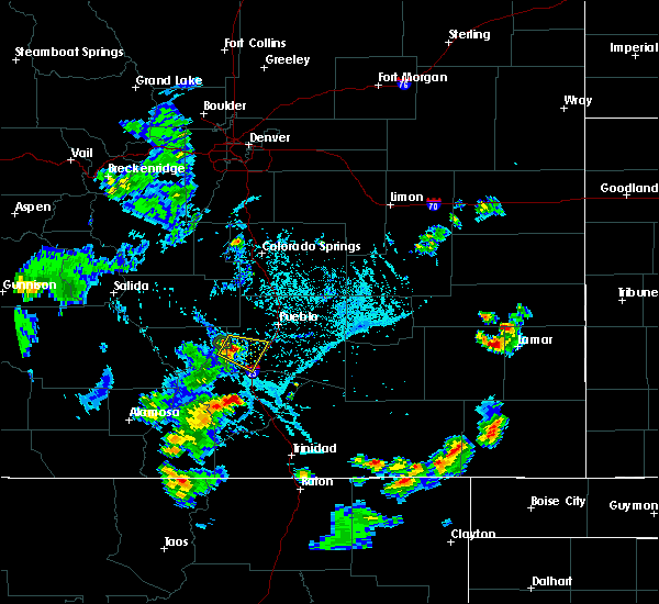 The national weather service in pueblo has issued a * severe thunderstorm warning for. northeastern huerfano county in southeastern colorado. east central custer county in southeastern colorado. southwestern pueblo county in southeastern colorado. Until 700 pm mdt. The national weather service in pueblo has issued a * severe thunderstorm warning for. northeastern huerfano county in southeastern colorado. east central custer county in southeastern colorado. southwestern pueblo county in southeastern colorado. Until 700 pm mdt.
|
| 6/7/2017 4:11 PM MDT |
 At 411 pm mdt, a severe thunderstorm was located near gardner, or 40 miles northeast of alamosa, moving east at 15 mph (radar indicated). Hazards include 60 mph wind gusts and quarter size hail. Hail damage to vehicles is expected. expect wind damage to roofs, siding, and trees. Locations impacted include, gardner, farisita, red wing, greenhorn mountain, and rye. At 411 pm mdt, a severe thunderstorm was located near gardner, or 40 miles northeast of alamosa, moving east at 15 mph (radar indicated). Hazards include 60 mph wind gusts and quarter size hail. Hail damage to vehicles is expected. expect wind damage to roofs, siding, and trees. Locations impacted include, gardner, farisita, red wing, greenhorn mountain, and rye.
|
| 6/7/2017 3:59 PM MDT |
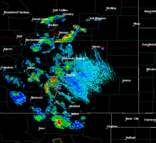 At 359 pm mdt, a severe thunderstorm was located near red wing, or 39 miles northeast of alamosa, moving southeast at 15 mph (radar indicated). Hazards include 60 mph wind gusts and quarter size hail. Hail damage to vehicles is expected. Expect wind damage to roofs, siding, and trees. At 359 pm mdt, a severe thunderstorm was located near red wing, or 39 miles northeast of alamosa, moving southeast at 15 mph (radar indicated). Hazards include 60 mph wind gusts and quarter size hail. Hail damage to vehicles is expected. Expect wind damage to roofs, siding, and trees.
|
| 5/10/2017 3:30 PM MDT |
 At 329 pm mdt, severe thunderstorms were located along a line extending from near pueblo reservoir to 18 miles southwest of pueblo west to 9 miles north of greenhorn mountain, moving northwest at 5 mph (radar indicated). Hazards include 60 mph wind gusts and quarter size hail. Hail damage to vehicles is expected. expect wind damage to roofs, siding, and trees. Locations impacted include, southwestern pueblo, pueblo reservoir, pueblo west, penrose, rye, beulah, wetmore, san isabel and colorado city. At 329 pm mdt, severe thunderstorms were located along a line extending from near pueblo reservoir to 18 miles southwest of pueblo west to 9 miles north of greenhorn mountain, moving northwest at 5 mph (radar indicated). Hazards include 60 mph wind gusts and quarter size hail. Hail damage to vehicles is expected. expect wind damage to roofs, siding, and trees. Locations impacted include, southwestern pueblo, pueblo reservoir, pueblo west, penrose, rye, beulah, wetmore, san isabel and colorado city.
|
| 5/10/2017 3:15 PM MDT |
 At 314 pm mdt, severe thunderstorms were located along a line extending from 6 miles south of pueblo reservoir to 20 miles southwest of pueblo to 7 miles northeast of greenhorn mountain, moving northwest at 20 mph (radar indicated). Hazards include 60 mph wind gusts and quarter size hail. Hail damage to vehicles is expected. Expect wind damage to roofs, siding, and trees. At 314 pm mdt, severe thunderstorms were located along a line extending from 6 miles south of pueblo reservoir to 20 miles southwest of pueblo to 7 miles northeast of greenhorn mountain, moving northwest at 20 mph (radar indicated). Hazards include 60 mph wind gusts and quarter size hail. Hail damage to vehicles is expected. Expect wind damage to roofs, siding, and trees.
|
| 5/8/2017 3:54 PM MDT |
 At 353 pm mdt, severe thunderstorms were located along a line extending from 6 miles west of pueblo reservoir to 19 miles southwest of pueblo west to 12 miles northeast of greenhorn mountain, moving northwest at 15 mph (radar indicated). Hazards include golf ball size hail and 70 mph wind gusts. People and animals outdoors will be injured. expect hail damage to roofs, siding, windows, and vehicles. expect considerable tree damage. Wind damage is also likely to mobile homes, roofs, and outbuildings. At 353 pm mdt, severe thunderstorms were located along a line extending from 6 miles west of pueblo reservoir to 19 miles southwest of pueblo west to 12 miles northeast of greenhorn mountain, moving northwest at 15 mph (radar indicated). Hazards include golf ball size hail and 70 mph wind gusts. People and animals outdoors will be injured. expect hail damage to roofs, siding, windows, and vehicles. expect considerable tree damage. Wind damage is also likely to mobile homes, roofs, and outbuildings.
|
| 5/8/2017 3:49 PM MDT |
 At 348 pm mdt, severe thunderstorms were located along a line extending from 6 miles west of pueblo reservoir to 19 miles southwest of pueblo west to 12 miles northeast of greenhorn mountain, moving north at 10 mph (radar indicated). Hazards include golf ball size hail and 70 mph wind gusts. People and animals outdoors will be injured. expect hail damage to roofs, siding, windows, and vehicles. expect considerable tree damage. wind damage is also likely to mobile homes, roofs, and outbuildings. Locations impacted include, western pueblo, pueblo reservoir, pueblo west, pinon, penrose, beulah, san isabel and colorado city. At 348 pm mdt, severe thunderstorms were located along a line extending from 6 miles west of pueblo reservoir to 19 miles southwest of pueblo west to 12 miles northeast of greenhorn mountain, moving north at 10 mph (radar indicated). Hazards include golf ball size hail and 70 mph wind gusts. People and animals outdoors will be injured. expect hail damage to roofs, siding, windows, and vehicles. expect considerable tree damage. wind damage is also likely to mobile homes, roofs, and outbuildings. Locations impacted include, western pueblo, pueblo reservoir, pueblo west, pinon, penrose, beulah, san isabel and colorado city.
|
| 5/8/2017 3:41 PM MDT |
 At 340 pm mdt, severe thunderstorms were located along a line extending from 6 miles west of pueblo reservoir to 11 miles northeast of greenhorn mountain, moving north at 20 mph (radar indicated). Hazards include golf ball size hail and 70 mph wind gusts. People and animals outdoors will be injured. expect hail damage to roofs, siding, windows, and vehicles. expect considerable tree damage. wind damage is also likely to mobile homes, roofs, and outbuildings. Locations impacted include, western pueblo, pueblo reservoir, pueblo west, pinon, penrose, beulah, san isabel and colorado city. At 340 pm mdt, severe thunderstorms were located along a line extending from 6 miles west of pueblo reservoir to 11 miles northeast of greenhorn mountain, moving north at 20 mph (radar indicated). Hazards include golf ball size hail and 70 mph wind gusts. People and animals outdoors will be injured. expect hail damage to roofs, siding, windows, and vehicles. expect considerable tree damage. wind damage is also likely to mobile homes, roofs, and outbuildings. Locations impacted include, western pueblo, pueblo reservoir, pueblo west, pinon, penrose, beulah, san isabel and colorado city.
|
| 5/8/2017 3:22 PM MDT |
 At 321 pm mdt, severe thunderstorms were located along a line extending from 8 miles southwest of pueblo reservoir to 10 miles east of greenhorn mountain, moving northwest at 15 mph (radar indicated). Hazards include golf ball size hail and 70 mph wind gusts. People and animals outdoors will be injured. expect hail damage to roofs, siding, windows, and vehicles. expect considerable tree damage. Wind damage is also likely to mobile homes, roofs, and outbuildings. At 321 pm mdt, severe thunderstorms were located along a line extending from 8 miles southwest of pueblo reservoir to 10 miles east of greenhorn mountain, moving northwest at 15 mph (radar indicated). Hazards include golf ball size hail and 70 mph wind gusts. People and animals outdoors will be injured. expect hail damage to roofs, siding, windows, and vehicles. expect considerable tree damage. Wind damage is also likely to mobile homes, roofs, and outbuildings.
|
| 7/24/2016 4:46 PM MDT |
 At 446 pm mdt, a severe thunderstorm was located 17 miles north of walsenburg, or 27 miles south of pueblo, moving northeast at 15 mph (radar indicated). Hazards include 60 mph wind gusts and quarter size hail. Hail damage to vehicles is expected. Expect wind damage to roofs, siding, and trees. At 446 pm mdt, a severe thunderstorm was located 17 miles north of walsenburg, or 27 miles south of pueblo, moving northeast at 15 mph (radar indicated). Hazards include 60 mph wind gusts and quarter size hail. Hail damage to vehicles is expected. Expect wind damage to roofs, siding, and trees.
|
| 7/8/2016 7:04 PM MDT |
 At 704 pm mdt, a severe thunderstorm was located over greenhorn mountain, or 31 miles southwest of pueblo, moving southeast at 15 mph (radar indicated). Hazards include 60 mph wind gusts and quarter size hail. Hail damage to vehicles is expected. expect wind damage to roofs, siding, and trees. Locations impacted include, greenhorn mountain, rye, san isabel and colorado city. At 704 pm mdt, a severe thunderstorm was located over greenhorn mountain, or 31 miles southwest of pueblo, moving southeast at 15 mph (radar indicated). Hazards include 60 mph wind gusts and quarter size hail. Hail damage to vehicles is expected. expect wind damage to roofs, siding, and trees. Locations impacted include, greenhorn mountain, rye, san isabel and colorado city.
|
| 7/8/2016 6:50 PM MDT |
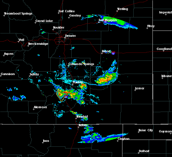 At 648 pm mdt, a severe thunderstorm was located near greenhorn mountain, or 30 miles southwest of pueblo, moving east at 25 mph (radar indicated). Hazards include 60 mph wind gusts and quarter size hail. Hail damage to vehicles is expected. expect wind damage to roofs, siding, and trees. Locations impacted include, greenhorn mountain, rye, san isabel and colorado city. At 648 pm mdt, a severe thunderstorm was located near greenhorn mountain, or 30 miles southwest of pueblo, moving east at 25 mph (radar indicated). Hazards include 60 mph wind gusts and quarter size hail. Hail damage to vehicles is expected. expect wind damage to roofs, siding, and trees. Locations impacted include, greenhorn mountain, rye, san isabel and colorado city.
|
| 7/8/2016 6:36 PM MDT |
 At 636 pm mdt, a severe thunderstorm was located 8 miles northwest of greenhorn mountain, or 34 miles southwest of pueblo, moving southeast at 15 mph (radar indicated). Hazards include 60 mph wind gusts and quarter size hail. Hail damage to vehicles is expected. Expect wind damage to roofs, siding, and trees. At 636 pm mdt, a severe thunderstorm was located 8 miles northwest of greenhorn mountain, or 34 miles southwest of pueblo, moving southeast at 15 mph (radar indicated). Hazards include 60 mph wind gusts and quarter size hail. Hail damage to vehicles is expected. Expect wind damage to roofs, siding, and trees.
|
| 7/8/2016 5:41 PM MDT |
 At 541 pm mdt, a severe thunderstorm was located 14 miles east of greenhorn mountain, or 27 miles south of pueblo, moving southeast at 30 mph (trained weather spotters). Hazards include 60 mph wind gusts and quarter size hail. Hail damage to vehicles is expected. expect wind damage to roofs, siding, and trees. Locations impacted include, colorado city. At 541 pm mdt, a severe thunderstorm was located 14 miles east of greenhorn mountain, or 27 miles south of pueblo, moving southeast at 30 mph (trained weather spotters). Hazards include 60 mph wind gusts and quarter size hail. Hail damage to vehicles is expected. expect wind damage to roofs, siding, and trees. Locations impacted include, colorado city.
|
| 7/8/2016 5:32 PM MDT | Quarter sized hail reported 1.7 miles WNW of Colorado City, CO, . |
| 7/8/2016 5:31 PM MDT |
 At 530 pm mdt, a severe thunderstorm was located 13 miles east of greenhorn mountain, or 24 miles south of pueblo, moving southeast at 35 mph (radar indicated). Hazards include 60 mph wind gusts and quarter size hail. Hail damage to vehicles is expected. Expect wind damage to roofs, siding, and trees. At 530 pm mdt, a severe thunderstorm was located 13 miles east of greenhorn mountain, or 24 miles south of pueblo, moving southeast at 35 mph (radar indicated). Hazards include 60 mph wind gusts and quarter size hail. Hail damage to vehicles is expected. Expect wind damage to roofs, siding, and trees.
|
| 7/8/2016 5:27 PM MDT | Quarter sized hail reported 1.7 miles WNW of Colorado City, CO, . |
| 7/1/2016 2:48 PM MDT |
 At 248 pm mdt, a severe thunderstorm was located 16 miles east of greenhorn mountain, or 21 miles south of pueblo, moving northeast at 15 mph (radar indicated). Hazards include 60 mph wind gusts and half dollar size hail. Hail damage to vehicles is expected. expect wind damage to roofs, siding, and trees. Locations impacted include, colorado city. At 248 pm mdt, a severe thunderstorm was located 16 miles east of greenhorn mountain, or 21 miles south of pueblo, moving northeast at 15 mph (radar indicated). Hazards include 60 mph wind gusts and half dollar size hail. Hail damage to vehicles is expected. expect wind damage to roofs, siding, and trees. Locations impacted include, colorado city.
|
| 7/1/2016 2:40 PM MDT |
 At 240 pm mdt, a severe thunderstorm was located 14 miles east of greenhorn mountain, or 23 miles south of pueblo, moving northeast at 20 mph (radar indicated). Hazards include 60 mph wind gusts and quarter size hail. Hail damage to vehicles is expected. Expect wind damage to roofs, siding, and trees. At 240 pm mdt, a severe thunderstorm was located 14 miles east of greenhorn mountain, or 23 miles south of pueblo, moving northeast at 20 mph (radar indicated). Hazards include 60 mph wind gusts and quarter size hail. Hail damage to vehicles is expected. Expect wind damage to roofs, siding, and trees.
|
| 6/13/2016 2:12 PM MDT |
 At 211 pm mdt, a severe thunderstorm was located 15 miles south of pueblo reservoir, or 17 miles southwest of pueblo, moving northeast at 35 mph (radar indicated). Hazards include 60 mph wind gusts and quarter size hail. Hail damage to vehicles is expected. expect wind damage to roofs, siding, and trees. locations impacted include, pueblo, blende, salt creek, pueblo reservoir, pueblo west, pueblo depot, avondale and colorado city. A tornado watch remains in effect until 900 pm mdt for southeastern colorado. At 211 pm mdt, a severe thunderstorm was located 15 miles south of pueblo reservoir, or 17 miles southwest of pueblo, moving northeast at 35 mph (radar indicated). Hazards include 60 mph wind gusts and quarter size hail. Hail damage to vehicles is expected. expect wind damage to roofs, siding, and trees. locations impacted include, pueblo, blende, salt creek, pueblo reservoir, pueblo west, pueblo depot, avondale and colorado city. A tornado watch remains in effect until 900 pm mdt for southeastern colorado.
|
| 6/13/2016 2:06 PM MDT |
 At 205 pm mdt, a severe thunderstorm was located 13 miles northeast of greenhorn mountain, or 21 miles southwest of pueblo, moving northeast at 35 mph (radar indicated). Hazards include 60 mph wind gusts and quarter size hail. Hail damage to vehicles is expected. Expect wind damage to roofs, siding, and trees. At 205 pm mdt, a severe thunderstorm was located 13 miles northeast of greenhorn mountain, or 21 miles southwest of pueblo, moving northeast at 35 mph (radar indicated). Hazards include 60 mph wind gusts and quarter size hail. Hail damage to vehicles is expected. Expect wind damage to roofs, siding, and trees.
|
| 6/9/2016 4:40 PM MDT |
 At 439 pm mdt, a severe thunderstorm was located 9 miles northeast of greenhorn mountain, or 25 miles southwest of pueblo, moving southeast at 10 mph (radar indicated). Hazards include 60 mph wind gusts and quarter size hail. Hail damage to vehicles is expected. expect wind damage to roofs, siding, and trees. Locations impacted include, greenhorn mountain, rye and colorado city. At 439 pm mdt, a severe thunderstorm was located 9 miles northeast of greenhorn mountain, or 25 miles southwest of pueblo, moving southeast at 10 mph (radar indicated). Hazards include 60 mph wind gusts and quarter size hail. Hail damage to vehicles is expected. expect wind damage to roofs, siding, and trees. Locations impacted include, greenhorn mountain, rye and colorado city.
|
| 6/9/2016 4:27 PM MDT |
 At 426 pm mdt, a severe thunderstorm was located near greenhorn mountain, or 27 miles southwest of pueblo, moving south at 20 mph (radar indicated). Hazards include 60 mph wind gusts and quarter size hail. Hail damage to vehicles is expected. Expect wind damage to roofs, siding, and trees. At 426 pm mdt, a severe thunderstorm was located near greenhorn mountain, or 27 miles southwest of pueblo, moving south at 20 mph (radar indicated). Hazards include 60 mph wind gusts and quarter size hail. Hail damage to vehicles is expected. Expect wind damage to roofs, siding, and trees.
|
| 6/7/2016 6:37 PM MDT |
 At 636 pm mdt, a severe thunderstorm was located 13 miles south of pueblo reservoir, or 14 miles southwest of pueblo, moving north at 10 mph. one inch hail has been reported at mile marker 80 on interstate 25 (trained weather spotters). Hazards include 60 mph wind gusts and quarter size hail. Hail damage to vehicles is expected. expect wind damage to roofs, siding, and trees. Locations impacted include, southwestern pueblo and colorado city. At 636 pm mdt, a severe thunderstorm was located 13 miles south of pueblo reservoir, or 14 miles southwest of pueblo, moving north at 10 mph. one inch hail has been reported at mile marker 80 on interstate 25 (trained weather spotters). Hazards include 60 mph wind gusts and quarter size hail. Hail damage to vehicles is expected. expect wind damage to roofs, siding, and trees. Locations impacted include, southwestern pueblo and colorado city.
|
| 6/7/2016 6:29 PM MDT |
 At 629 pm mdt, a severe thunderstorm was located 14 miles southwest of salt creek, or 15 miles south of pueblo, moving north at 10 mph. this storm is impacting travelers on interstate 25 from mile markers 72 to 83 (radar indicated). Hazards include 60 mph wind gusts and quarter size hail. Hail damage to vehicles is expected. expect wind damage to roofs, siding, and trees. Locations impacted include, southwestern pueblo and colorado city. At 629 pm mdt, a severe thunderstorm was located 14 miles southwest of salt creek, or 15 miles south of pueblo, moving north at 10 mph. this storm is impacting travelers on interstate 25 from mile markers 72 to 83 (radar indicated). Hazards include 60 mph wind gusts and quarter size hail. Hail damage to vehicles is expected. expect wind damage to roofs, siding, and trees. Locations impacted include, southwestern pueblo and colorado city.
|
| 6/7/2016 6:13 PM MDT |
 At 613 pm mdt, a severe thunderstorm was located 17 miles southwest of salt creek, or 18 miles south of pueblo, moving north at 10 mph (radar indicated). Hazards include 60 mph wind gusts and half dollar size hail. Hail damage to vehicles is expected. Expect wind damage to roofs, siding, and trees. At 613 pm mdt, a severe thunderstorm was located 17 miles southwest of salt creek, or 18 miles south of pueblo, moving north at 10 mph (radar indicated). Hazards include 60 mph wind gusts and half dollar size hail. Hail damage to vehicles is expected. Expect wind damage to roofs, siding, and trees.
|
| 6/7/2016 6:06 PM MDT |
 At 606 pm mdt, a severe thunderstorm was located 16 miles south of salt creek, or 18 miles south of pueblo, moving north at 15 mph (radar indicated). Hazards include golf ball size hail and 60 mph wind gusts. People and animals outdoors will be injured. expect hail damage to roofs, siding, windows, and vehicles. expect wind damage to roofs, siding, and trees. Locations impacted include, colorado city. At 606 pm mdt, a severe thunderstorm was located 16 miles south of salt creek, or 18 miles south of pueblo, moving north at 15 mph (radar indicated). Hazards include golf ball size hail and 60 mph wind gusts. People and animals outdoors will be injured. expect hail damage to roofs, siding, windows, and vehicles. expect wind damage to roofs, siding, and trees. Locations impacted include, colorado city.
|
| 6/7/2016 6:00 PM MDT |
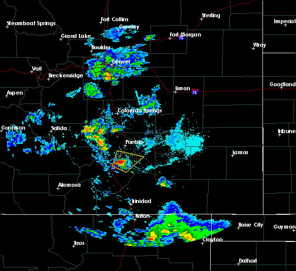 At 559 pm mdt, a severe thunderstorm was located 18 miles east of greenhorn mountain, or 20 miles south of pueblo, moving north at 15 mph (radar indicated). Hazards include golf ball size hail and 60 mph wind gusts. People and animals outdoors will be injured. expect hail damage to roofs, siding, windows, and vehicles. expect wind damage to roofs, siding, and trees. Locations impacted include, colorado city. At 559 pm mdt, a severe thunderstorm was located 18 miles east of greenhorn mountain, or 20 miles south of pueblo, moving north at 15 mph (radar indicated). Hazards include golf ball size hail and 60 mph wind gusts. People and animals outdoors will be injured. expect hail damage to roofs, siding, windows, and vehicles. expect wind damage to roofs, siding, and trees. Locations impacted include, colorado city.
|
| 6/7/2016 5:47 PM MDT |
 At 547 pm mdt, a severe thunderstorm was located 16 miles east of greenhorn mountain, or 23 miles south of pueblo, moving north at 15 mph (radar indicated). Hazards include 60 mph wind gusts and quarter size hail. Hail damage to vehicles is expected. Expect wind damage to roofs, siding, and trees. At 547 pm mdt, a severe thunderstorm was located 16 miles east of greenhorn mountain, or 23 miles south of pueblo, moving north at 15 mph (radar indicated). Hazards include 60 mph wind gusts and quarter size hail. Hail damage to vehicles is expected. Expect wind damage to roofs, siding, and trees.
|
| 6/11/2015 5:03 PM MDT |
 At 503 pm mdt, a severe thunderstorm was located 10 miles north of walsenburg, or 36 miles south of pueblo, moving northeast at 25 mph (radar indicated). Hazards include 60 mph wind gusts and quarter size hail. Hail damage to vehicles is expected. Expect wind damage to roofs, siding and trees. At 503 pm mdt, a severe thunderstorm was located 10 miles north of walsenburg, or 36 miles south of pueblo, moving northeast at 25 mph (radar indicated). Hazards include 60 mph wind gusts and quarter size hail. Hail damage to vehicles is expected. Expect wind damage to roofs, siding and trees.
|
| 5/29/2015 4:20 PM MDT | At 419 pm mdt, a severe thunderstorm was located 13 miles northeast of greenhorn mountain, or 20 miles southwest of pueblo, moving southeast at 25 mph (radar indicated). Hazards include quarter size hail. Damage to vehicles is expected. Locations impacted include, colorado city. |
| 5/29/2015 4:06 PM MDT | At 406 pm mdt, a severe thunderstorm was located 13 miles northeast of greenhorn mountain, or 21 miles southwest of pueblo, moving southeast at 25 mph (radar indicated). Hazards include quarter size hail. damage to vehicles is expected |
| 5/26/2015 6:50 PM MDT | At 649 pm mdt, a severe thunderstorm was located 14 miles northeast of greenhorn mountain, or 19 miles southwest of pueblo, moving east at 10 mph (radar indicated). Hazards include quarter size hail. damage to vehicles is expected |
| 5/25/2015 5:11 PM MDT | At 510 pm mdt, a severe thunderstorm was located 13 miles northeast of greenhorn mountain, or 20 miles southwest of pueblo, moving southeast at 15 mph (radar indicated). Hazards include quarter size hail. Damage to vehicles is expected. locations impacted include, open country of southwestern pueblo county. Colorado city. |
| 5/25/2015 4:59 PM MDT | At 457 pm mdt, a severe thunderstorm was located 15 miles northeast of greenhorn mountain, or 19 miles southwest of pueblo, moving southeast at 20 mph (radar indicated). Hazards include 60 mph wind gusts and quarter size hail. Hail damage to vehicles is expected. expect wind damage to roofs, siding and trees. locations impacted include, open country of southwestern pueblo county. Colorado city. |
| 5/25/2015 4:46 PM MDT | At 445 pm mdt, a severe thunderstorm was located 13 miles southwest of pueblo reservoir, or 19 miles southwest of pueblo, moving southeast at 15 mph (radar indicated). Hazards include 60 mph wind gusts and half dollar size hail. Hail damage to vehicles is expected. expect wind damage to roofs, siding and trees. Locations impacted include, colorado city, san isabel and beulah. |
| 5/25/2015 4:34 PM MDT | At 433 pm mdt, a severe thunderstorm was located 13 miles southwest of pueblo reservoir, or 20 miles southwest of pueblo, moving southeast at 15 mph (radar indicated). Hazards include 60 mph wind gusts and quarter size hail. Hail damage to vehicles is expected. Expect wind damage to roofs, siding and trees. |
| 5/9/2015 1:39 PM MDT | At 138 pm mdt, a severe thunderstorm was located 13 miles northeast of greenhorn mountain, or 21 miles southwest of pueblo, moving northeast at 20 mph (radar indicated). Hazards include 60 mph wind gusts and quarter size hail. Hail damage to vehicles is expected. expect wind damage to roofs, siding and trees. locations impacted include, colorado city. 1. 00in. |
| 5/9/2015 1:30 PM MDT | At 129 pm mdt, a severe thunderstorm was located 12 miles east of greenhorn mountain, or 24 miles southwest of pueblo, moving northeast at 30 mph (radar indicated). Hazards include quarter size hail. damage to vehicles is expected |
| 5/8/2015 2:26 PM MDT | At 226 pm mdt, a severe thunderstorm was located 15 miles south of pueblo reservoir, or 17 miles southwest of pueblo, moving northeast at 15 mph (radar indicated). Hazards include quarter size hail. damage to vehicles is expected |
| 6/16/2012 3:49 PM MDT | Quarter sized hail reported 1.5 miles SE of Colorado City, CO |
| 1/1/0001 12:00 AM | Quarter sized hail reported 3.3 miles NNE of Colorado City, CO |
Hail Maps for Colorado City, CO


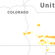


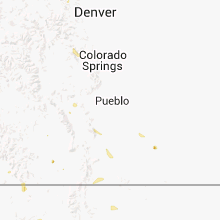


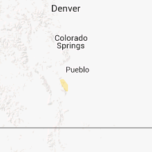


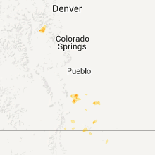


Connect with Interactive Hail Maps