

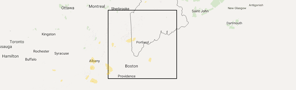
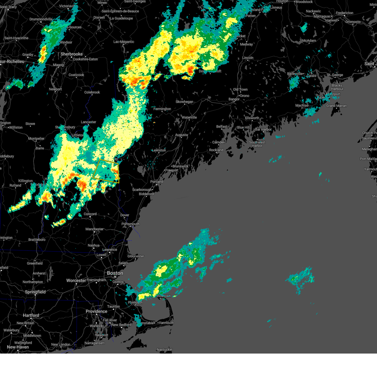
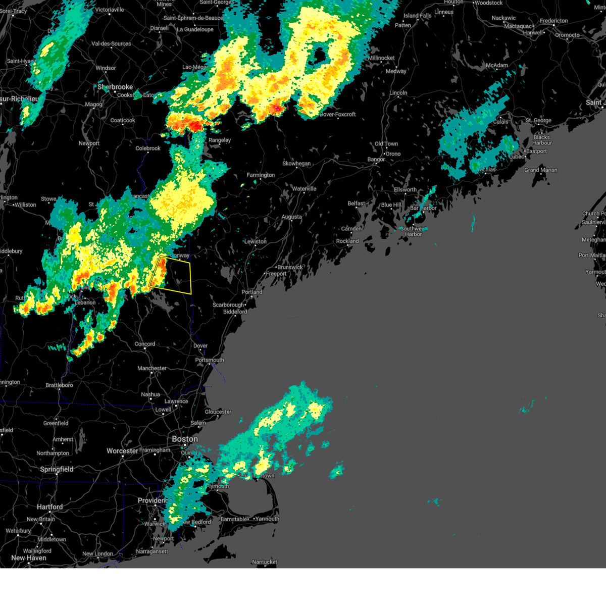
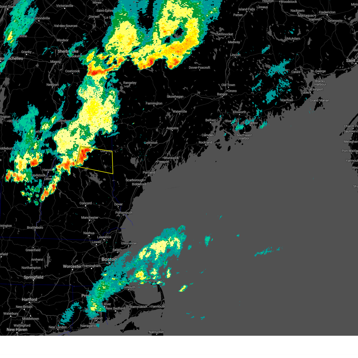
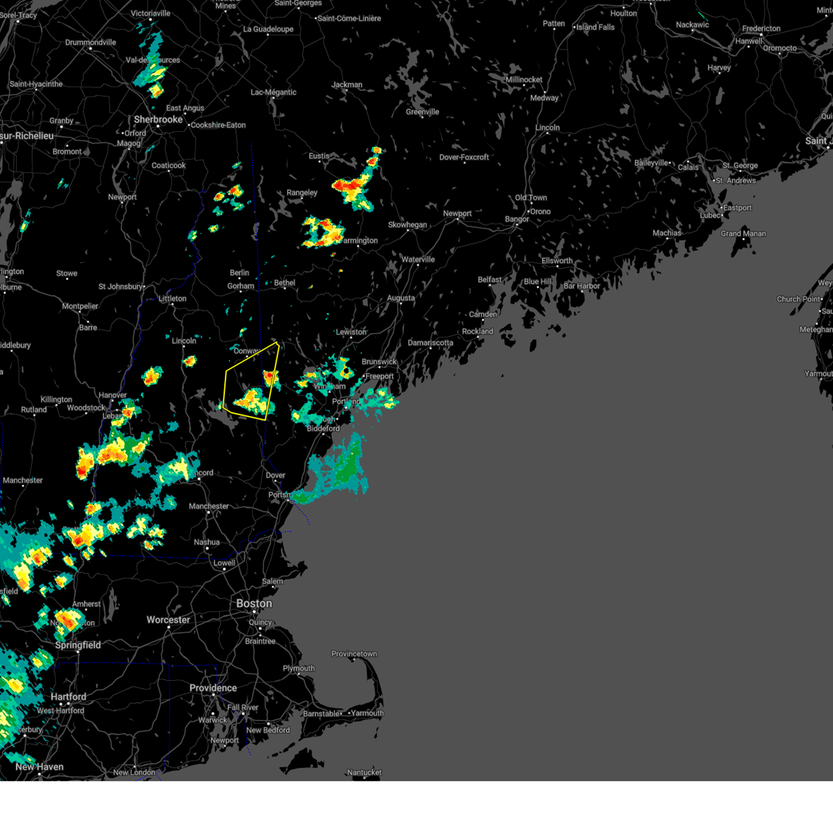
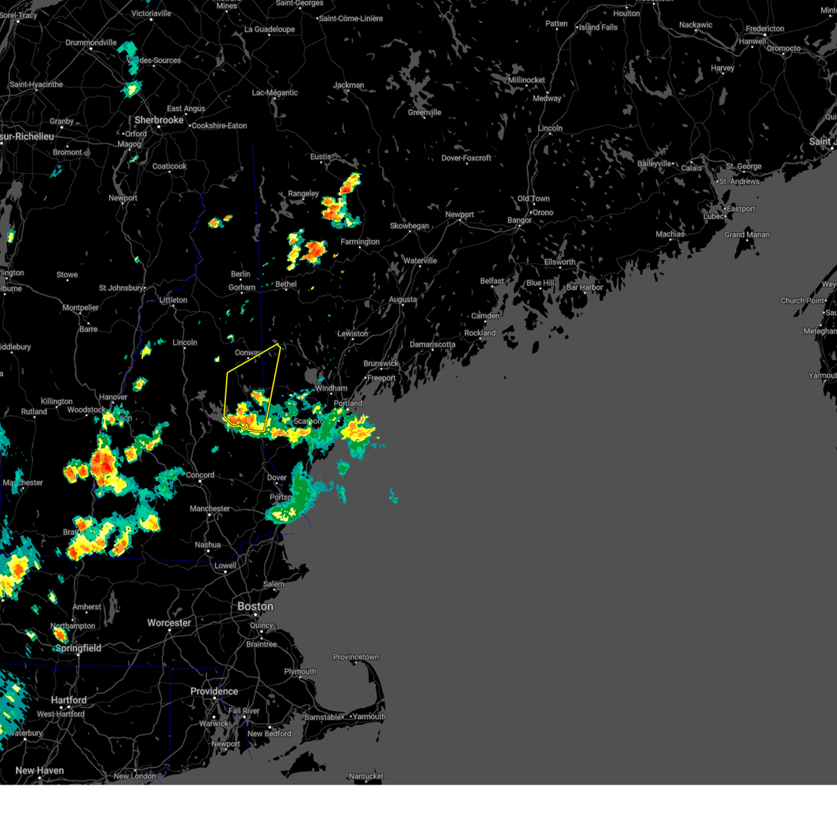
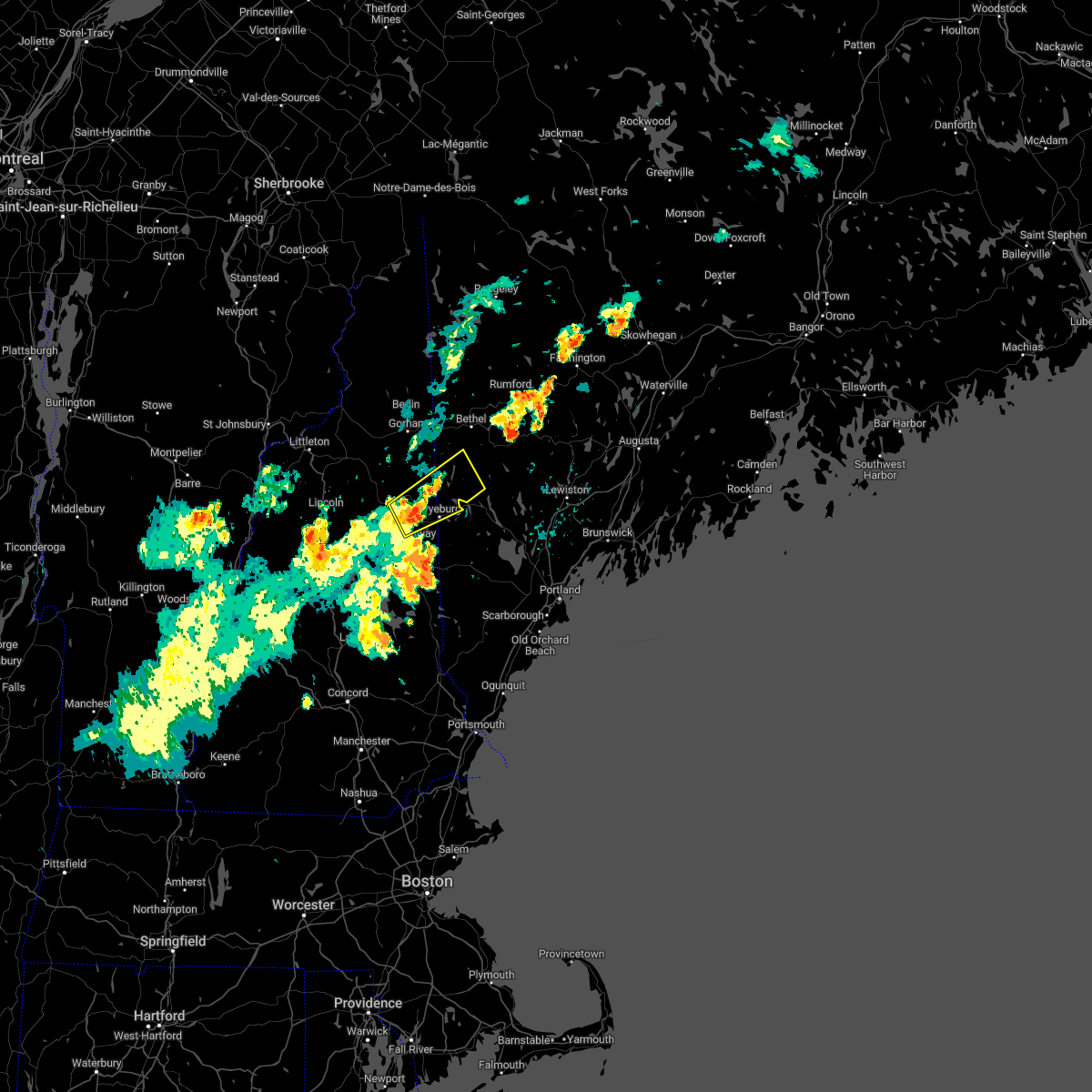
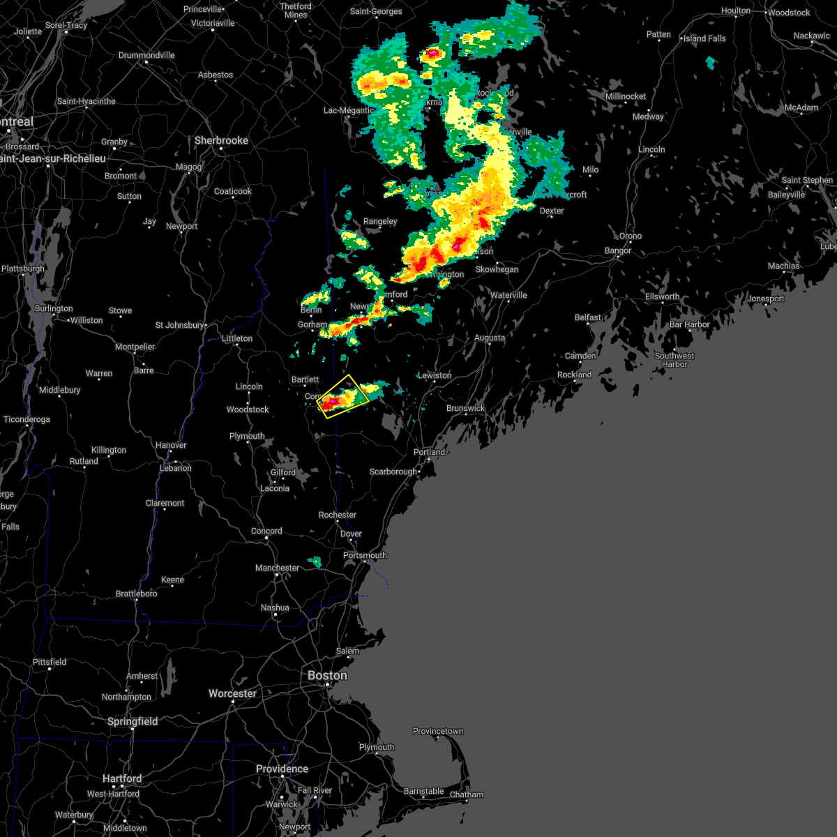
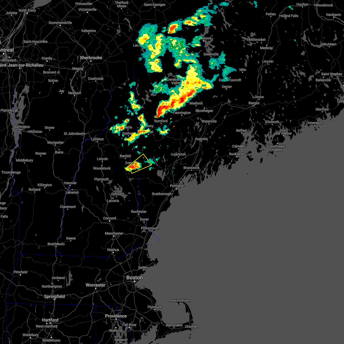
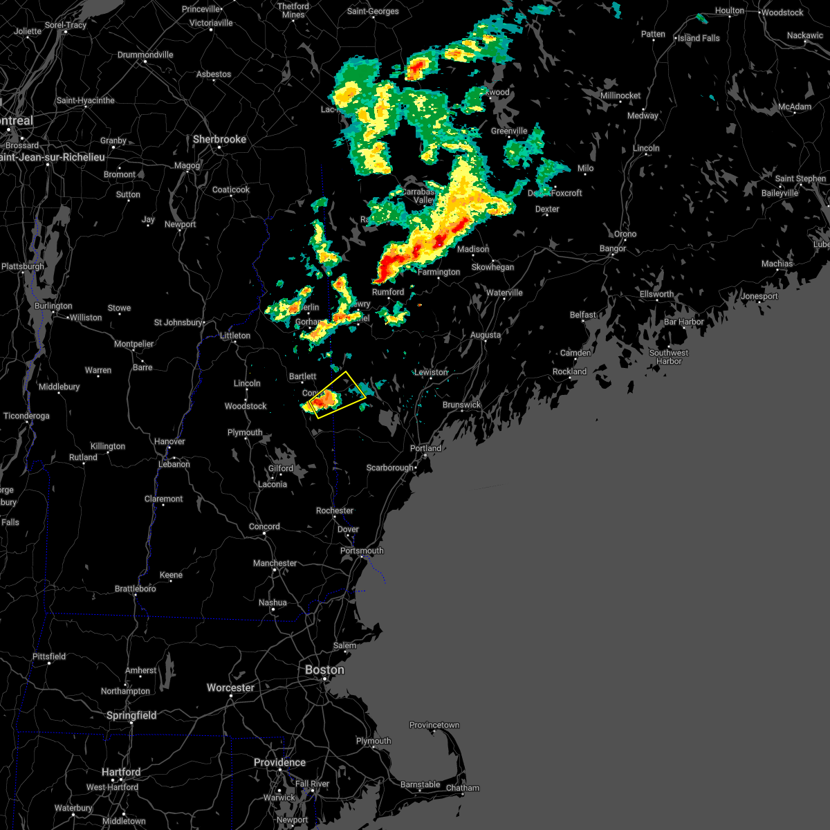
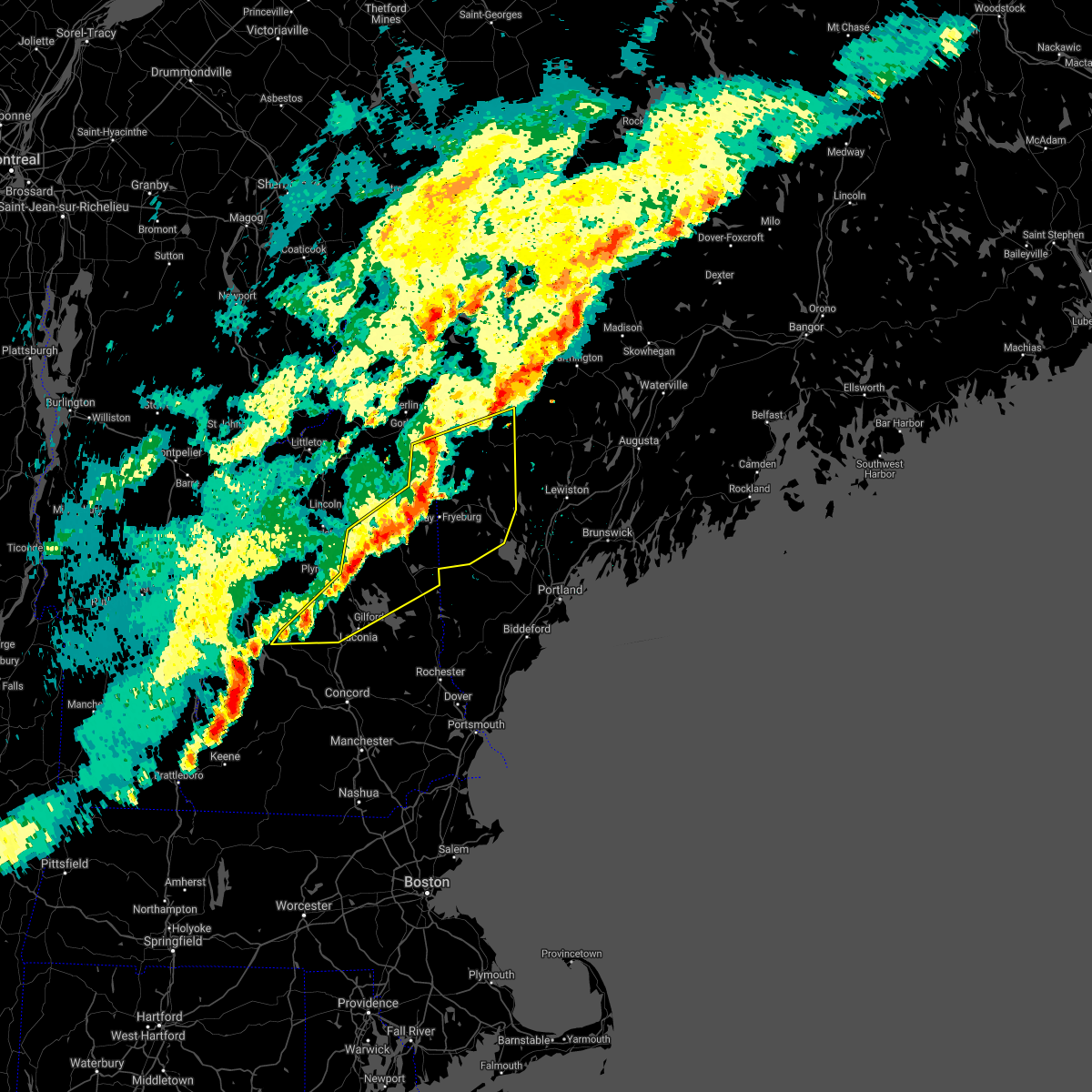
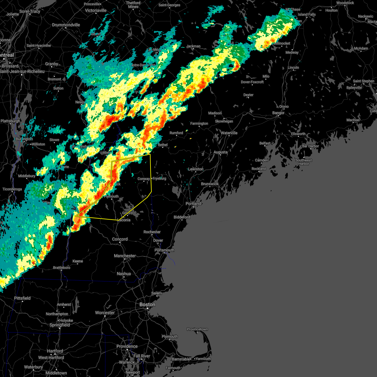
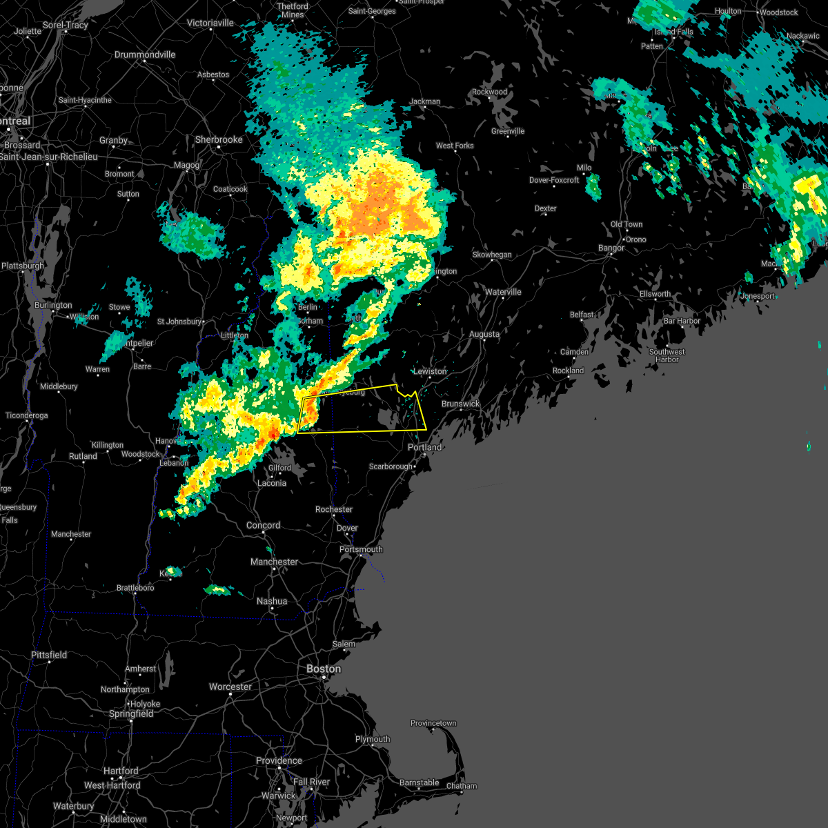
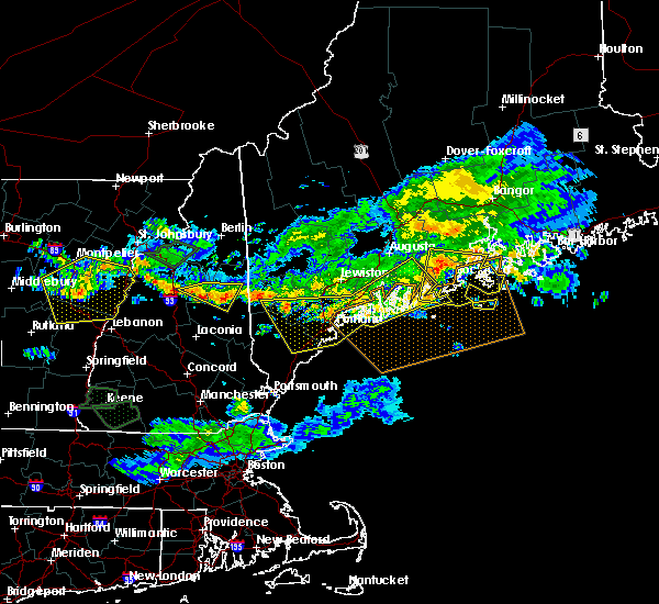
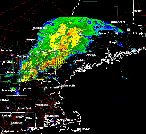
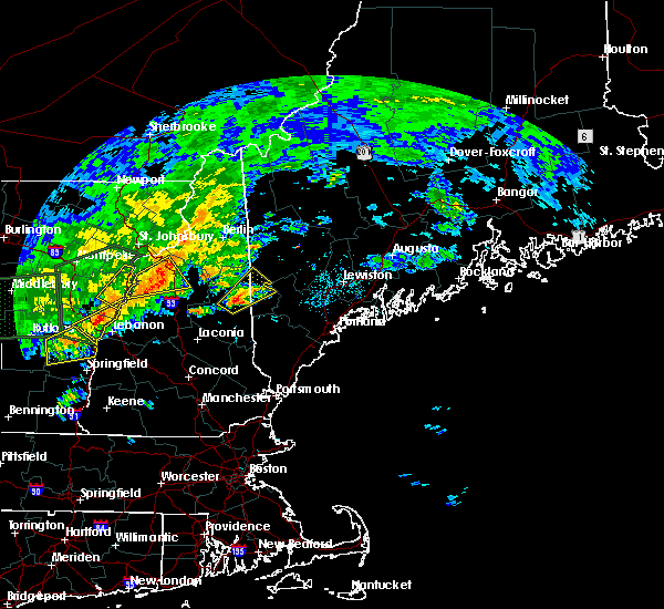
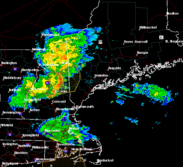
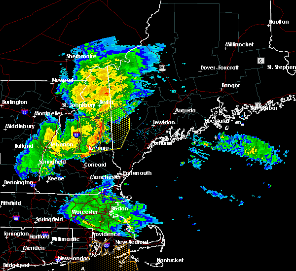
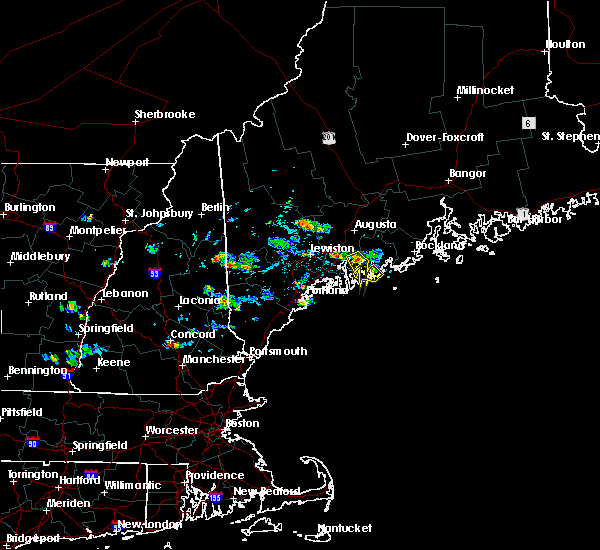
Hail Map for Conway, NH
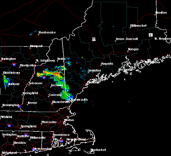
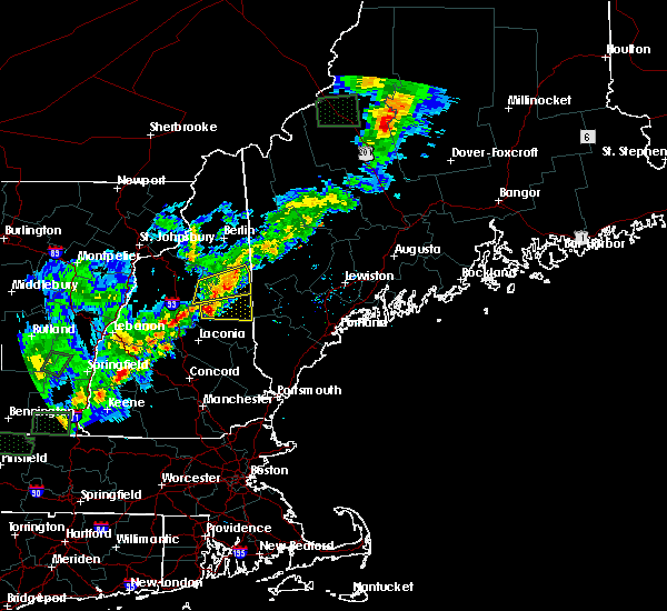
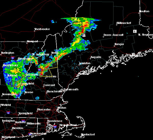
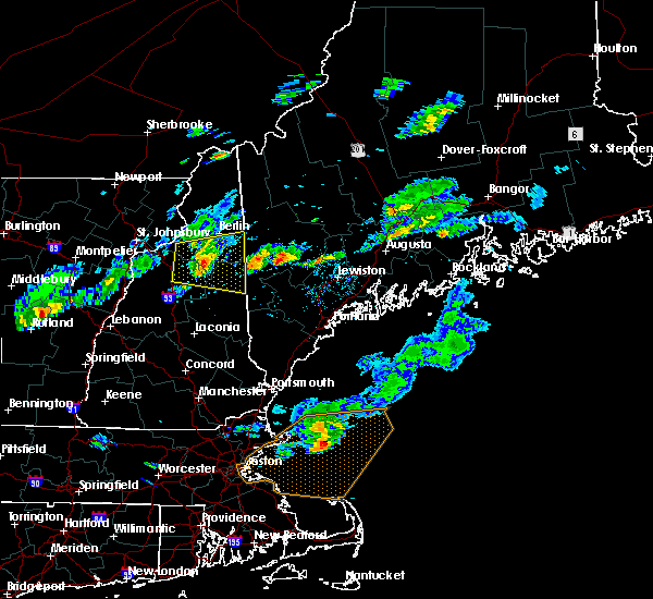
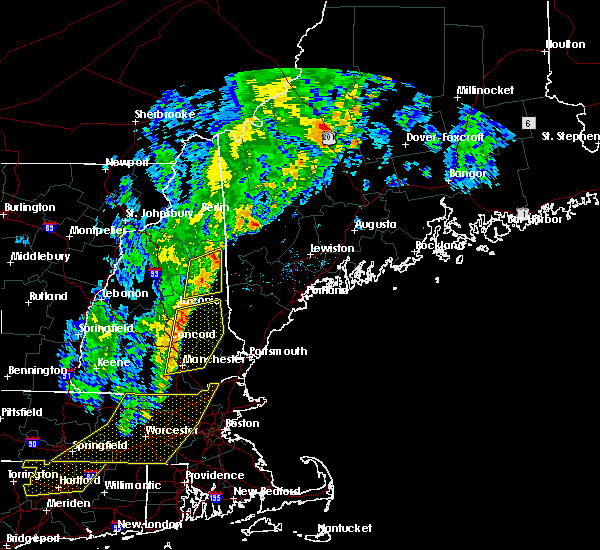
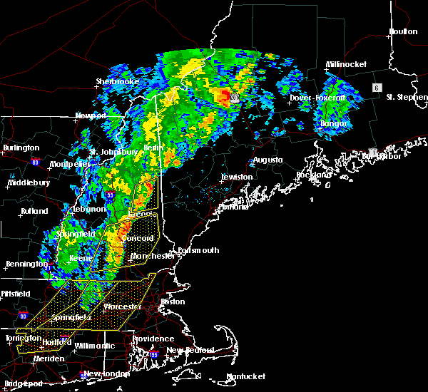
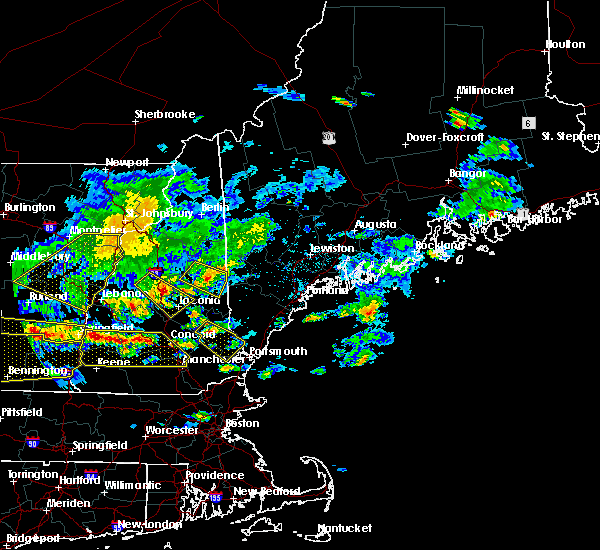
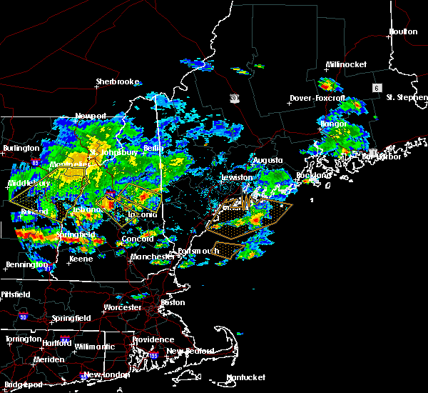
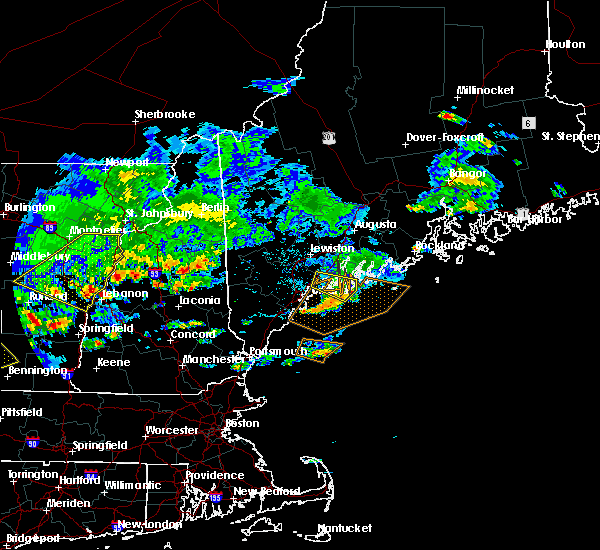
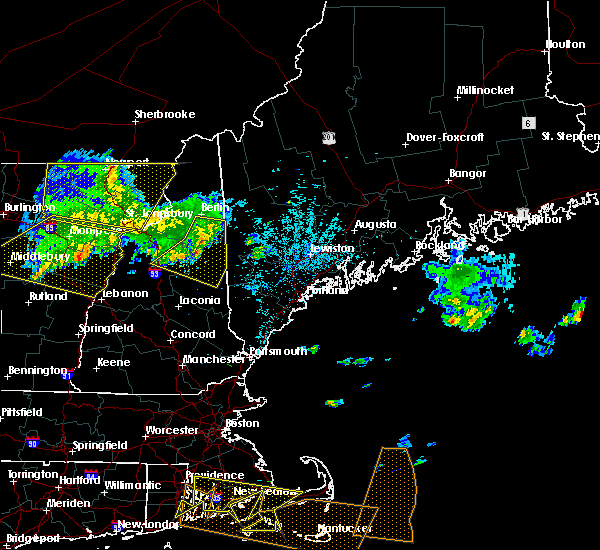
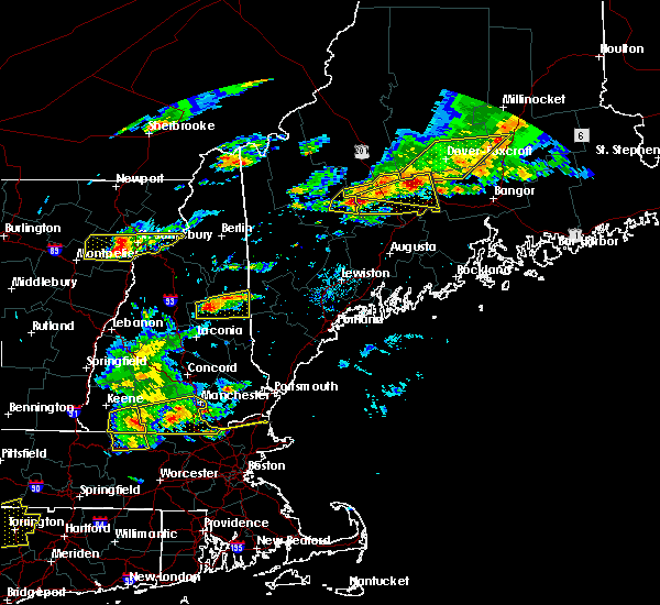
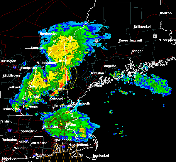
The Conway, NH area has had 12 reports of on-the-ground hail by trained spotters, and has been under severe weather warnings 4 times during the past 12 months. Doppler radar has detected hail at or near Conway, NH on 11 occasions.
| Name: | Conway, NH |
| Where Located: | 48.8 miles WNW of Portland, ME |
| Map: | Google Map for Conway, NH |
| Population: | 1823 |
| Housing Units: | 1062 |
| More Info: | Search Google for Conway, NH |
5
The Top Recent Hail Date for Conway, NH is Wednesday, May 31, 2017 (1st out of 11)
Hail and Wind Damage Spotted near Conway, NH
| Date / Time | Report Details |
|---|---|
| 8/4/2024 9:14 PM EDT |
 The storm which prompted the warning has weakened below severe limits, and has exited the warned area. therefore, the warning will be allowed to expire. The storm which prompted the warning has weakened below severe limits, and has exited the warned area. therefore, the warning will be allowed to expire.
|
| 8/4/2024 8:48 PM EDT | Social media reports of several trees down in chocoru in carroll county NH, 8.8 miles NNE of Conway, NH |
| 8/4/2024 8:48 PM EDT | Trees down on wires on plains rd near nichols beac in carroll county NH, 8.5 miles NNE of Conway, NH |
| 8/4/2024 8:37 PM EDT |
 the severe thunderstorm warning has been cancelled and is no longer in effect the severe thunderstorm warning has been cancelled and is no longer in effect
|
| 8/4/2024 8:37 PM EDT |
 At 837 pm edt, a severe thunderstorm was located near tamworth, or 11 miles southwest of conway, moving east at 30 mph (radar indicated). Hazards include 60 mph wind gusts. Expect damage to roofs, siding, and trees. locations impacted include, conway, ossipee, moultonborough, effingham, tamworth, sandwich, madison, freedom, albany, eaton, tuftonboro, waterville valley, and wakefield. This also includes, mount chocorua, mount passaconaway, and champney falls. At 837 pm edt, a severe thunderstorm was located near tamworth, or 11 miles southwest of conway, moving east at 30 mph (radar indicated). Hazards include 60 mph wind gusts. Expect damage to roofs, siding, and trees. locations impacted include, conway, ossipee, moultonborough, effingham, tamworth, sandwich, madison, freedom, albany, eaton, tuftonboro, waterville valley, and wakefield. This also includes, mount chocorua, mount passaconaway, and champney falls.
|
| 8/4/2024 8:11 PM EDT |
 Svrgyx the national weather service in gray maine has issued a * severe thunderstorm warning for, east central grafton county in northern new hampshire, northwestern belknap county in central new hampshire, central carroll county in northern new hampshire, * until 915 pm edt. * at 810 pm edt, a severe thunderstorm was located 9 miles northwest of sandwich, or 9 miles south of lincoln, moving east at 30 mph (radar indicated). Hazards include 60 mph wind gusts and penny size hail. expect damage to roofs, siding, and trees Svrgyx the national weather service in gray maine has issued a * severe thunderstorm warning for, east central grafton county in northern new hampshire, northwestern belknap county in central new hampshire, central carroll county in northern new hampshire, * until 915 pm edt. * at 810 pm edt, a severe thunderstorm was located 9 miles northwest of sandwich, or 9 miles south of lincoln, moving east at 30 mph (radar indicated). Hazards include 60 mph wind gusts and penny size hail. expect damage to roofs, siding, and trees
|
| 7/17/2024 5:30 PM EDT | Quarter sized hail reported 1.2 miles WNW of Conway, NH, reported by amateur radio. |
| 7/17/2024 4:22 PM EDT | Trees and wires down on east side rd. time estimated by rada in carroll county NH, 0.8 miles NW of Conway, NH |
| 7/17/2024 4:22 PM EDT | Tree down on shoulder of eaton rd about 1/4 mile north of nhdot facility. time estimated by rada in carroll county NH, 1.3 miles NNW of Conway, NH |
| 9/8/2023 5:10 PM EDT |
 At 510 pm edt, severe thunderstorms were located along a line extending from near hiram to ossipee, moving northeast at 30 mph (radar indicated). Hazards include 60 mph wind gusts and half dollar size hail. Hail damage to vehicles is expected. expect wind damage to roofs, siding, and trees. locations impacted include, conway, fryeburg, ossipee, moultonborough, hiram, effingham, tamworth, wolfeboro, madison, acton, brownfield, freedom, denmark, brookfield, eaton, wakefield, tuftonboro, porter, parsonsfield, and newfield. this also includes, burnt meadow mountains and peary mountain. hail threat, radar indicated max hail size, 1. 25 in wind threat, radar indicated max wind gust, 60 mph. At 510 pm edt, severe thunderstorms were located along a line extending from near hiram to ossipee, moving northeast at 30 mph (radar indicated). Hazards include 60 mph wind gusts and half dollar size hail. Hail damage to vehicles is expected. expect wind damage to roofs, siding, and trees. locations impacted include, conway, fryeburg, ossipee, moultonborough, hiram, effingham, tamworth, wolfeboro, madison, acton, brownfield, freedom, denmark, brookfield, eaton, wakefield, tuftonboro, porter, parsonsfield, and newfield. this also includes, burnt meadow mountains and peary mountain. hail threat, radar indicated max hail size, 1. 25 in wind threat, radar indicated max wind gust, 60 mph.
|
| 9/8/2023 4:50 PM EDT |
 At 450 pm edt, severe thunderstorms were located along a line extending from effingham to near wolfeboro, moving north at 25 mph (radar indicated). Hazards include 60 mph wind gusts and half dollar size hail. Hail damage to vehicles is expected. Expect wind damage to roofs, siding, and trees. At 450 pm edt, severe thunderstorms were located along a line extending from effingham to near wolfeboro, moving north at 25 mph (radar indicated). Hazards include 60 mph wind gusts and half dollar size hail. Hail damage to vehicles is expected. Expect wind damage to roofs, siding, and trees.
|
| 7/29/2023 1:40 PM EDT | Half Dollar sized hail reported 7 miles NNW of Conway, NH, reported by amateur radio. 1.25 inch hail reported near the foss mountain trail head. time estimated by radar. |
| 12/23/2022 3:06 PM EST | Reported by weather spotter. numerous trees down across rte 153. traffic blocked on stark rd near hwy 153. time estimated by rada in carroll county NH, 3 miles NNW of Conway, NH |
| 8/7/2022 5:22 PM EDT | Half Dollar sized hail reported 5 miles NW of Conway, NH, observed 1-1.25 inch hail on south end of conway lake. very strong winds knocked down several branches. reports of trees down around the area. time estimated by radar. |
| 8/7/2022 5:22 PM EDT | Reports of trees down around the are in carroll county NH, 5.9 miles NNW of Conway, NH |
| 8/7/2022 4:46 PM EDT | Quarter sized hail reported 0.5 miles NNW of Conway, NH, social media photo and report of quarter-sized hail on the west side of conway. hail fell very briefly and was accompanied by strong winds. time estimated by radar. |
| 8/4/2022 8:52 PM EDT | Time estimated based on radar. social media photos showing a few trees and several branches down east of conwa in carroll county NH, 3.1 miles W of Conway, NH |
| 8/4/2022 8:44 PM EDT |
 At 844 pm edt, a severe thunderstorm was located near conway, moving northeast at 20 mph (radar indicated). Hazards include 60 mph wind gusts and penny size hail. expect damage to roofs, siding, and trees At 844 pm edt, a severe thunderstorm was located near conway, moving northeast at 20 mph (radar indicated). Hazards include 60 mph wind gusts and penny size hail. expect damage to roofs, siding, and trees
|
| 7/25/2022 4:49 PM EDT | Quarter sized hail reported 6.7 miles N of Conway, NH, trained spotter observing 1 inch hail currently falling in madison on highway 113/conway rd near rock farm lane. |
| 6/4/2022 6:58 PM EDT | Half Dollar sized hail reported 1.1 miles N of Conway, NH, hail size slightly larger than a quarter found in conway... nh. |
| 6/4/2022 6:53 PM EDT |
 At 653 pm edt, a severe thunderstorm was located over fryeburg, moving northeast at 20 mph (radar indicated). Hazards include 60 mph wind gusts and quarter size hail. Hail damage to vehicles is expected. expect wind damage to roofs, siding, and trees. locations impacted include, conway, bridgton, fryeburg, brownfield, denmark, lovell, eaton and sweden. hail threat, radar indicated max hail size, 1. 00 in wind threat, radar indicated max wind gust, 60 mph. At 653 pm edt, a severe thunderstorm was located over fryeburg, moving northeast at 20 mph (radar indicated). Hazards include 60 mph wind gusts and quarter size hail. Hail damage to vehicles is expected. expect wind damage to roofs, siding, and trees. locations impacted include, conway, bridgton, fryeburg, brownfield, denmark, lovell, eaton and sweden. hail threat, radar indicated max hail size, 1. 00 in wind threat, radar indicated max wind gust, 60 mph.
|
| 6/4/2022 6:30 PM EDT |
 At 630 pm edt, a severe thunderstorm was located near conway, moving northeast at 25 mph (radar indicated). Hazards include 60 mph wind gusts and quarter size hail. Hail damage to vehicles is expected. Expect wind damage to roofs, siding, and trees. At 630 pm edt, a severe thunderstorm was located near conway, moving northeast at 25 mph (radar indicated). Hazards include 60 mph wind gusts and quarter size hail. Hail damage to vehicles is expected. Expect wind damage to roofs, siding, and trees.
|
| 9/15/2021 4:09 PM EDT |
 At 409 pm edt, severe thunderstorms were located along a line extending from near bethel to near conway to near moultonborough to near franklin, moving east at 40 mph (radar indicated). Hazards include 60 mph wind gusts. expect damage to roofs, siding, and trees At 409 pm edt, severe thunderstorms were located along a line extending from near bethel to near conway to near moultonborough to near franklin, moving east at 40 mph (radar indicated). Hazards include 60 mph wind gusts. expect damage to roofs, siding, and trees
|
| 9/15/2021 3:22 PM EDT |
 At 322 pm edt, severe thunderstorms were located along a line extending from 7 miles southeast of bethlehem to near lincoln to near plymouth to 8 miles south of enfield, moving east at 25 mph (radar indicated). Hazards include 60 mph wind gusts and penny size hail. expect damage to roofs, siding, and trees At 322 pm edt, severe thunderstorms were located along a line extending from 7 miles southeast of bethlehem to near lincoln to near plymouth to 8 miles south of enfield, moving east at 25 mph (radar indicated). Hazards include 60 mph wind gusts and penny size hail. expect damage to roofs, siding, and trees
|
| 7/23/2021 2:25 PM EDT | Multiple branches down due to thunderstorm wind in carroll county NH, 6.1 miles NNE of Conway, NH |
| 7/23/2021 2:25 PM EDT | Golf Ball sized hail reported 7.4 miles N of Conway, NH, golf ball size hail reported... which cracked a car windshield. |
| 7/23/2021 2:25 PM EDT | Several tree branches down across the area. time estimated based on rada in carroll county NH, 7.4 miles N of Conway, NH |
| 3/26/2021 4:19 PM EDT |
 At 418 pm edt, a severe thunderstorm was located 7 miles south of conway, moving east at 50 mph (radar indicated). Hazards include 60 mph wind gusts and penny size hail. expect damage to roofs, siding, and trees At 418 pm edt, a severe thunderstorm was located 7 miles south of conway, moving east at 50 mph (radar indicated). Hazards include 60 mph wind gusts and penny size hail. expect damage to roofs, siding, and trees
|
| 10/10/2020 8:40 PM EDT |
 The severe thunderstorm warning for southwestern oxford, southeastern coos, northeastern grafton and northern carroll counties will expire at 845 pm edt, the storms which prompted the warning have moved out of the area. therefore, the warning will be allowed to expire. however heavy rain is still possible with these thunderstorms. The severe thunderstorm warning for southwestern oxford, southeastern coos, northeastern grafton and northern carroll counties will expire at 845 pm edt, the storms which prompted the warning have moved out of the area. therefore, the warning will be allowed to expire. however heavy rain is still possible with these thunderstorms.
|
| 10/10/2020 8:21 PM EDT |
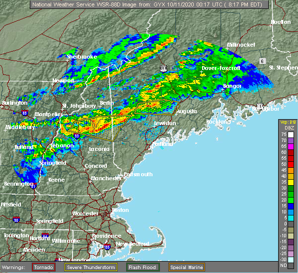 At 820 pm edt, severe thunderstorms were located along a line extending from near waterford to 7 miles northwest of tamworth, moving east at 50 mph (radar indicated). Hazards include 60 mph wind gusts and quarter size hail. Hail damage to vehicles is expected. Expect wind damage to roofs, siding, and trees. At 820 pm edt, severe thunderstorms were located along a line extending from near waterford to 7 miles northwest of tamworth, moving east at 50 mph (radar indicated). Hazards include 60 mph wind gusts and quarter size hail. Hail damage to vehicles is expected. Expect wind damage to roofs, siding, and trees.
|
| 10/10/2020 7:57 PM EDT |
 At 756 pm edt, severe thunderstorms were located along a line extending from 8 miles west of lincoln to near franconia to near pinkham notch, moving east at 40 mph (radar indicated). Hazards include 60 mph wind gusts and quarter size hail. Hail damage to vehicles is expected. Expect wind damage to roofs, siding, and trees. At 756 pm edt, severe thunderstorms were located along a line extending from 8 miles west of lincoln to near franconia to near pinkham notch, moving east at 40 mph (radar indicated). Hazards include 60 mph wind gusts and quarter size hail. Hail damage to vehicles is expected. Expect wind damage to roofs, siding, and trees.
|
| 10/10/2020 7:57 PM EDT |
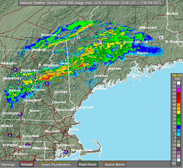 At 756 pm edt, severe thunderstorms were located along a line extending from 8 miles west of lincoln to near franconia to near pinkham notch, moving east at 40 mph (radar indicated). Hazards include 60 mph wind gusts and quarter size hail. Hail damage to vehicles is expected. Expect wind damage to roofs, siding, and trees. At 756 pm edt, severe thunderstorms were located along a line extending from 8 miles west of lincoln to near franconia to near pinkham notch, moving east at 40 mph (radar indicated). Hazards include 60 mph wind gusts and quarter size hail. Hail damage to vehicles is expected. Expect wind damage to roofs, siding, and trees.
|
| 7/8/2020 6:35 PM EDT |
 At 635 pm edt, severe thunderstorms were located along a line extending from near conway to near woodstock, moving south at 15 mph (radar indicated). Hazards include 60 mph wind gusts and quarter size hail. Hail damage to vehicles is expected. Expect wind damage to roofs, siding, and trees. At 635 pm edt, severe thunderstorms were located along a line extending from near conway to near woodstock, moving south at 15 mph (radar indicated). Hazards include 60 mph wind gusts and quarter size hail. Hail damage to vehicles is expected. Expect wind damage to roofs, siding, and trees.
|
| 7/8/2020 6:29 PM EDT |
 At 629 pm edt, severe thunderstorms were located along a line extending from near conway to 10 miles north of sandwich, moving southeast at 30 mph (radar indicated). Hazards include 60 mph wind gusts and quarter size hail. Hail damage to vehicles is expected. expect wind damage to roofs, siding, and trees. locations impacted include, conway, lincoln, ossipee, tamworth, sandwich, bartlett, madison, albany, waterville valley, livermore and thornton. This also includes, mount chocorua, mount whiteface, mount osceola, the tripyramids, and mount passaconaway. At 629 pm edt, severe thunderstorms were located along a line extending from near conway to 10 miles north of sandwich, moving southeast at 30 mph (radar indicated). Hazards include 60 mph wind gusts and quarter size hail. Hail damage to vehicles is expected. expect wind damage to roofs, siding, and trees. locations impacted include, conway, lincoln, ossipee, tamworth, sandwich, bartlett, madison, albany, waterville valley, livermore and thornton. This also includes, mount chocorua, mount whiteface, mount osceola, the tripyramids, and mount passaconaway.
|
| 7/8/2020 6:09 PM EDT |
 At 609 pm edt, a severe thunderstorm was located 11 miles east of lincoln, moving southeast at 20 mph (radar indicated). Hazards include 60 mph wind gusts and quarter size hail. Hail damage to vehicles is expected. expect wind damage to roofs, siding, and trees. locations impacted include, conway, lincoln, ossipee, tamworth, sandwich, bartlett, madison, albany, waterville valley, livermore, hart`s location and thornton. This also includes, mount chocorua, mount whiteface, mount carrigan, mount osceola, and the tripyramids. At 609 pm edt, a severe thunderstorm was located 11 miles east of lincoln, moving southeast at 20 mph (radar indicated). Hazards include 60 mph wind gusts and quarter size hail. Hail damage to vehicles is expected. expect wind damage to roofs, siding, and trees. locations impacted include, conway, lincoln, ossipee, tamworth, sandwich, bartlett, madison, albany, waterville valley, livermore, hart`s location and thornton. This also includes, mount chocorua, mount whiteface, mount carrigan, mount osceola, and the tripyramids.
|
| 7/8/2020 5:58 PM EDT |
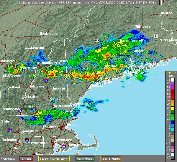 At 557 pm edt, a severe thunderstorm was located 10 miles east of lincoln, moving southeast at 25 mph (radar indicated). Hazards include 60 mph wind gusts and quarter size hail. Hail damage to vehicles is expected. Expect wind damage to roofs, siding, and trees. At 557 pm edt, a severe thunderstorm was located 10 miles east of lincoln, moving southeast at 25 mph (radar indicated). Hazards include 60 mph wind gusts and quarter size hail. Hail damage to vehicles is expected. Expect wind damage to roofs, siding, and trees.
|
| 7/8/2020 5:45 PM EDT | Trees and wires down transvale rd. time estimated from rada in carroll county NH, 1.7 miles SSE of Conway, NH |
| 7/8/2020 4:35 PM EDT | Trees and wires down in town. reported by sheriffs office. time estimated from rada in carroll county NH, 6.1 miles NNE of Conway, NH |
| 8/7/2019 6:21 PM EDT |
 The severe thunderstorm warning for northeastern carroll county will expire at 630 pm edt, the storm which prompted the warning has weakened below severe limits, and no longer poses an immediate threat to life or property. therefore, the warning will be allowed to expire. however heavy rain is still possible with this thunderstorm. The severe thunderstorm warning for northeastern carroll county will expire at 630 pm edt, the storm which prompted the warning has weakened below severe limits, and no longer poses an immediate threat to life or property. therefore, the warning will be allowed to expire. however heavy rain is still possible with this thunderstorm.
|
| 8/7/2019 5:47 PM EDT |
 At 547 pm edt, a severe thunderstorm was located over conway, moving north at 10 mph (radar indicated). Hazards include 60 mph wind gusts. expect damage to roofs, siding, and trees At 547 pm edt, a severe thunderstorm was located over conway, moving north at 10 mph (radar indicated). Hazards include 60 mph wind gusts. expect damage to roofs, siding, and trees
|
| 6/18/2018 4:32 PM EDT |
 At 432 pm edt, a severe thunderstorm was located 11 miles east of woodstock, or 12 miles southeast of lincoln, moving east at 60 mph (radar indicated). Hazards include 60 mph wind gusts. Expect damage to roofs, siding, and trees. locations impacted include, conway, lincoln, ossipee, effingham, tamworth, sandwich, bartlett, madison, freedom, jackson, albany, eaton, chatham, livermore, waterville valley, hart`s location, campton and thornton. This also includes, mount chocorua, kearsarge north , mount whiteface, mount flume, and mount carrigan. At 432 pm edt, a severe thunderstorm was located 11 miles east of woodstock, or 12 miles southeast of lincoln, moving east at 60 mph (radar indicated). Hazards include 60 mph wind gusts. Expect damage to roofs, siding, and trees. locations impacted include, conway, lincoln, ossipee, effingham, tamworth, sandwich, bartlett, madison, freedom, jackson, albany, eaton, chatham, livermore, waterville valley, hart`s location, campton and thornton. This also includes, mount chocorua, kearsarge north , mount whiteface, mount flume, and mount carrigan.
|
| 6/18/2018 4:24 PM EDT | Conway police reports one tree dow in carroll county NH, 0.5 miles NNW of Conway, NH |
| 6/18/2018 4:20 PM EDT |
 The tornado warning for eastern grafton and central carroll counties will expire at 430 pm edt, the storm which prompted the warning has weakened below severe limits, and no longer appears capable of producing a tornado. therefore, the warning will be allowed to expire. however gusty winds are still possible with this thunderstorm. a severe thunderstorm watch remains in effect until 1000 pm edt for northern new hampshire. The tornado warning for eastern grafton and central carroll counties will expire at 430 pm edt, the storm which prompted the warning has weakened below severe limits, and no longer appears capable of producing a tornado. therefore, the warning will be allowed to expire. however gusty winds are still possible with this thunderstorm. a severe thunderstorm watch remains in effect until 1000 pm edt for northern new hampshire.
|
| 6/18/2018 4:08 PM EDT |
 At 407 pm edt, a severe thunderstorm capable of producing a tornado was located near tamworth, or 9 miles west of conway, moving east at 40 mph (radar indicated rotation). Hazards include tornado. Flying debris will be dangerous to those caught without shelter. mobile homes will be damaged or destroyed. damage to roofs, windows, and vehicles will occur. tree damage is likely. locations impacted include, conway, tamworth, madison, albany and waterville valley. This also includes, mount chocorua and champney falls. At 407 pm edt, a severe thunderstorm capable of producing a tornado was located near tamworth, or 9 miles west of conway, moving east at 40 mph (radar indicated rotation). Hazards include tornado. Flying debris will be dangerous to those caught without shelter. mobile homes will be damaged or destroyed. damage to roofs, windows, and vehicles will occur. tree damage is likely. locations impacted include, conway, tamworth, madison, albany and waterville valley. This also includes, mount chocorua and champney falls.
|
| 6/18/2018 3:58 PM EDT |
 At 358 pm edt, severe thunderstorms were located along a line extending from near lincoln to 7 miles northwest of sandwich to holderness, moving east at 55 mph (radar indicated). Hazards include 60 mph wind gusts. expect damage to roofs, siding, and trees At 358 pm edt, severe thunderstorms were located along a line extending from near lincoln to 7 miles northwest of sandwich to holderness, moving east at 55 mph (radar indicated). Hazards include 60 mph wind gusts. expect damage to roofs, siding, and trees
|
| 6/18/2018 3:54 PM EDT |
 At 354 pm edt, a severe thunderstorm capable of producing a tornado was located 9 miles east of lincoln, moving southeast at 30 mph (radar indicated rotation). Hazards include tornado. Flying debris will be dangerous to those caught without shelter. mobile homes will be damaged or destroyed. damage to roofs, windows, and vehicles will occur. tree damage is likely. this dangerous storm will be near, sandwich around 410 pm edt. ossipee and tamworth around 430 pm edt. other locations impacted by this tornadic thunderstorm include waterville valley, livermore, albany, madison and bartlett. This also includes, mount chocorua, mount whiteface, mount osceola, mount tecumseh, and the tripyramids. At 354 pm edt, a severe thunderstorm capable of producing a tornado was located 9 miles east of lincoln, moving southeast at 30 mph (radar indicated rotation). Hazards include tornado. Flying debris will be dangerous to those caught without shelter. mobile homes will be damaged or destroyed. damage to roofs, windows, and vehicles will occur. tree damage is likely. this dangerous storm will be near, sandwich around 410 pm edt. ossipee and tamworth around 430 pm edt. other locations impacted by this tornadic thunderstorm include waterville valley, livermore, albany, madison and bartlett. This also includes, mount chocorua, mount whiteface, mount osceola, mount tecumseh, and the tripyramids.
|
| 5/4/2018 10:37 PM EDT |
 The severe thunderstorm warning for eastern grafton and central carroll counties will expire at 1045 pm edt, the storms which prompted the warning have moved out of the area. therefore, the warning will be allowed to expire. however gusty winds are still possible with these thunderstorms. The severe thunderstorm warning for eastern grafton and central carroll counties will expire at 1045 pm edt, the storms which prompted the warning have moved out of the area. therefore, the warning will be allowed to expire. however gusty winds are still possible with these thunderstorms.
|
| 5/4/2018 10:15 PM EDT |
 At 1015 pm edt, severe thunderstorms were located along a line extending from 10 miles southwest of dixfield to near bridgton to 6 miles southeast of tamworth, moving east at 65 mph (radar indicated). Hazards include 60 mph wind gusts. Expect damage to roofs, siding, and trees. locations impacted include, conway, ossipee, effingham, tamworth, sandwich, bartlett, madison, freedom, albany, eaton and waterville valley. this also includes, mount chocorua, champney falls, rocky gorge scenic area, and lower falls recreation area. At 1015 pm edt, severe thunderstorms were located along a line extending from 10 miles southwest of dixfield to near bridgton to 6 miles southeast of tamworth, moving east at 65 mph (radar indicated). Hazards include 60 mph wind gusts. Expect damage to roofs, siding, and trees. locations impacted include, conway, ossipee, effingham, tamworth, sandwich, bartlett, madison, freedom, albany, eaton and waterville valley. this also includes, mount chocorua, champney falls, rocky gorge scenic area, and lower falls recreation area.
|
| 5/4/2018 9:48 PM EDT |
 At 948 pm edt, severe thunderstorms were located along a line extending from 9 miles northeast of pinkham notch to 11 miles west of conway to near plymouth, moving east at 65 mph (radar indicated). Hazards include 60 mph wind gusts. expect damage to roofs, siding, and trees At 948 pm edt, severe thunderstorms were located along a line extending from 9 miles northeast of pinkham notch to 11 miles west of conway to near plymouth, moving east at 65 mph (radar indicated). Hazards include 60 mph wind gusts. expect damage to roofs, siding, and trees
|
| 10/25/2017 12:51 AM EDT |
 At 1251 am edt, severe thunderstorms were located along a line extending from near mount washington to near pinkham notch to near conway to near tamworth to near moultonborough, moving northeast at 45 mph (radar indicated). Hazards include 60 mph wind gusts. Expect damage to trees, and power lines. locations impacted include, conway, berlin, bethlehem, moultonborough, ossipee, errol, tamworth, sandwich, pinkham notch, mount washington, carroll, gorham, bartlett, madison, freedom, jefferson, center harber, jackson, albany and eaton. This also includes, crawford notch state park, umbagog lake state park, mount jefferson, mount madison, and mount eisenhower. At 1251 am edt, severe thunderstorms were located along a line extending from near mount washington to near pinkham notch to near conway to near tamworth to near moultonborough, moving northeast at 45 mph (radar indicated). Hazards include 60 mph wind gusts. Expect damage to trees, and power lines. locations impacted include, conway, berlin, bethlehem, moultonborough, ossipee, errol, tamworth, sandwich, pinkham notch, mount washington, carroll, gorham, bartlett, madison, freedom, jefferson, center harber, jackson, albany and eaton. This also includes, crawford notch state park, umbagog lake state park, mount jefferson, mount madison, and mount eisenhower.
|
| 10/25/2017 12:33 AM EDT |
 At 1233 am edt, severe thunderstorms were located along a line extending from 8 miles southeast of bethlehem to 12 miles east of lincoln to near tamworth to moultonborough to near laconia, moving northeast at 45 mph (radar indicated). Hazards include 60 mph wind gusts. expect damage to trees, and power lines At 1233 am edt, severe thunderstorms were located along a line extending from 8 miles southeast of bethlehem to 12 miles east of lincoln to near tamworth to moultonborough to near laconia, moving northeast at 45 mph (radar indicated). Hazards include 60 mph wind gusts. expect damage to trees, and power lines
|
| 8/22/2017 10:25 PM EDT |
 At 1025 pm edt, severe thunderstorms were located along a line extending from 13 miles northwest of tamworth to near moultonborough to near laconia to near warner, moving east at 45 mph (radar indicated). Hazards include 60 mph wind gusts. expect damage to trees, and power lines At 1025 pm edt, severe thunderstorms were located along a line extending from 13 miles northwest of tamworth to near moultonborough to near laconia to near warner, moving east at 45 mph (radar indicated). Hazards include 60 mph wind gusts. expect damage to trees, and power lines
|
| 8/4/2017 6:45 PM EDT |
 At 645 pm edt, a severe thunderstorm was located over conway, moving northeast at 30 mph (radar indicated). Hazards include 60 mph wind gusts. Expect damage to trees, and power lines. locations impacted include, conway, tamworth, bartlett, madison, freedom, jackson, albany and eaton. This also includes, mount chocorua, champney falls, rocky gorge scenic area, and lower falls recreation area. At 645 pm edt, a severe thunderstorm was located over conway, moving northeast at 30 mph (radar indicated). Hazards include 60 mph wind gusts. Expect damage to trees, and power lines. locations impacted include, conway, tamworth, bartlett, madison, freedom, jackson, albany and eaton. This also includes, mount chocorua, champney falls, rocky gorge scenic area, and lower falls recreation area.
|
| 8/4/2017 6:30 PM EDT |
 At 630 pm edt, a severe thunderstorm was located near tamworth, or near conway, moving northeast at 30 mph (radar indicated). Hazards include 60 mph wind gusts. Expect damage to trees, and power lines. locations impacted include, conway, moultonborough, ossipee, effingham, tamworth, sandwich, bartlett, madison, brownfield, freedom, jackson, albany and eaton. This also includes, mount chocorua, champney falls, rocky gorge scenic area, and lower falls recreation area. At 630 pm edt, a severe thunderstorm was located near tamworth, or near conway, moving northeast at 30 mph (radar indicated). Hazards include 60 mph wind gusts. Expect damage to trees, and power lines. locations impacted include, conway, moultonborough, ossipee, effingham, tamworth, sandwich, bartlett, madison, brownfield, freedom, jackson, albany and eaton. This also includes, mount chocorua, champney falls, rocky gorge scenic area, and lower falls recreation area.
|
| 8/4/2017 6:16 PM EDT |
 At 616 pm edt, a severe thunderstorm was located over tamworth, or 8 miles northeast of moultonborough, moving northeast at 30 mph (radar indicated). Hazards include 60 mph wind gusts and penny size hail. Expect damage to trees, and power lines. locations impacted include, conway, ossipee, moultonborough, effingham, tamworth, sandwich, wolfeboro, bartlett, madison, brownfield, freedom, jackson, albany, eaton and tuftonboro. This also includes, mount chocorua, champney falls, rocky gorge scenic area, and lower falls recreation area. At 616 pm edt, a severe thunderstorm was located over tamworth, or 8 miles northeast of moultonborough, moving northeast at 30 mph (radar indicated). Hazards include 60 mph wind gusts and penny size hail. Expect damage to trees, and power lines. locations impacted include, conway, ossipee, moultonborough, effingham, tamworth, sandwich, wolfeboro, bartlett, madison, brownfield, freedom, jackson, albany, eaton and tuftonboro. This also includes, mount chocorua, champney falls, rocky gorge scenic area, and lower falls recreation area.
|
| 8/4/2017 6:05 PM EDT |
 The national weather service in gray maine has issued a * severe thunderstorm warning for. carroll county in northern new hampshire. Until 700 pm edt * at 605 pm edt, a severe thunderstorm was located near moultonborough, moving northeast at 30 mph. The national weather service in gray maine has issued a * severe thunderstorm warning for. carroll county in northern new hampshire. Until 700 pm edt * at 605 pm edt, a severe thunderstorm was located near moultonborough, moving northeast at 30 mph.
|
| 7/17/2017 7:58 PM EDT |
 At 758 pm edt, a severe thunderstorm was located over tamworth, or 7 miles northeast of moultonborough, moving northeast at 15 mph (radar indicated). Hazards include 60 mph wind gusts and quarter size hail. Minor hail damage to vehicles is possible. Expect wind damage to roofs, siding, and trees. At 758 pm edt, a severe thunderstorm was located over tamworth, or 7 miles northeast of moultonborough, moving northeast at 15 mph (radar indicated). Hazards include 60 mph wind gusts and quarter size hail. Minor hail damage to vehicles is possible. Expect wind damage to roofs, siding, and trees.
|
| 7/17/2017 7:47 PM EDT |
 At 747 pm edt, a severe thunderstorm was located 8 miles northwest of tamworth, or 11 miles west of conway, moving east at 10 mph (radar indicated). Hazards include 60 mph wind gusts and quarter size hail. Minor hail damage to vehicles is possible. expect wind damage to roofs, siding, and trees. locations impacted include, conway, lincoln, bartlett, jackson, albany, chatham, waterville valley, livermore and hart`s location. This also includes, kearsarge north , mount whiteface, mount carrigan, the tripyramids, and mount passaconaway. At 747 pm edt, a severe thunderstorm was located 8 miles northwest of tamworth, or 11 miles west of conway, moving east at 10 mph (radar indicated). Hazards include 60 mph wind gusts and quarter size hail. Minor hail damage to vehicles is possible. expect wind damage to roofs, siding, and trees. locations impacted include, conway, lincoln, bartlett, jackson, albany, chatham, waterville valley, livermore and hart`s location. This also includes, kearsarge north , mount whiteface, mount carrigan, the tripyramids, and mount passaconaway.
|
| 7/17/2017 7:10 PM EDT |
 At 710 pm edt, a severe thunderstorm was located 11 miles west of conway, moving northeast at 15 mph (radar indicated). Hazards include 60 mph wind gusts and quarter size hail. Minor hail damage to vehicles is possible. Expect wind damage to roofs, siding, and trees. At 710 pm edt, a severe thunderstorm was located 11 miles west of conway, moving northeast at 15 mph (radar indicated). Hazards include 60 mph wind gusts and quarter size hail. Minor hail damage to vehicles is possible. Expect wind damage to roofs, siding, and trees.
|
| 7/8/2017 4:09 PM EDT |
 The severe thunderstorm warning for southern coos, northeastern grafton and northeastern carroll counties will expire at 415 pm edt, the storm which prompted the warning has weakened below severe limits, and no longer pose an immediate threat to life or property. therefore the warning will be allowed to expire. The severe thunderstorm warning for southern coos, northeastern grafton and northeastern carroll counties will expire at 415 pm edt, the storm which prompted the warning has weakened below severe limits, and no longer pose an immediate threat to life or property. therefore the warning will be allowed to expire.
|
| 7/8/2017 3:57 PM EDT |
 At 356 pm edt, a severe thunderstorm was located 11 miles southwest of mount washington, or 12 miles northeast of lincoln, moving east at 30 mph (radar indicated). Hazards include 60 mph wind gusts and quarter size hail. Minor hail damage to vehicles is possible. expect wind damage to roofs, siding, and trees. locations impacted include, conway, berlin, bethlehem, lincoln, franconia, pinkham notch, mount washington, carroll, gorham, bartlett, jefferson, dalton, jackson, albany, eaton, chatham, whitefield, hart`s location, shelburne and randolph. This also includes, crawford notch state park, north twin mountain, franconia ridge, mount jefferson, and mount madison. At 356 pm edt, a severe thunderstorm was located 11 miles southwest of mount washington, or 12 miles northeast of lincoln, moving east at 30 mph (radar indicated). Hazards include 60 mph wind gusts and quarter size hail. Minor hail damage to vehicles is possible. expect wind damage to roofs, siding, and trees. locations impacted include, conway, berlin, bethlehem, lincoln, franconia, pinkham notch, mount washington, carroll, gorham, bartlett, jefferson, dalton, jackson, albany, eaton, chatham, whitefield, hart`s location, shelburne and randolph. This also includes, crawford notch state park, north twin mountain, franconia ridge, mount jefferson, and mount madison.
|
| 7/8/2017 3:37 PM EDT |
 At 337 pm edt, a severe thunderstorm was located near franconia, or near bethlehem, moving east at 30 mph (radar indicated). Hazards include 60 mph wind gusts and quarter size hail. Minor hail damage to vehicles is possible. Expect wind damage to roofs, siding, and trees. At 337 pm edt, a severe thunderstorm was located near franconia, or near bethlehem, moving east at 30 mph (radar indicated). Hazards include 60 mph wind gusts and quarter size hail. Minor hail damage to vehicles is possible. Expect wind damage to roofs, siding, and trees.
|
| 7/1/2017 6:08 PM EDT |
 At 608 pm edt, severe thunderstorms were located along a line extending from near conway to near danbury, moving east at 30 mph (radar indicated). Hazards include 60 mph wind gusts and quarter size hail. Minor hail damage to vehicles is possible. expect wind damage to roofs, siding, and trees. locations impacted include, laconia, conway, franklin, fryeburg, moultonborough, meredith, ossipee, alton, gilmanton, holderness, ashland, hiram, effingham, danbury, wolfeboro, tamworth, sandwich, belmont, gilford and bristol. this also includes, lake winnipesaukee, burnt meadow mountains, peary mountain, and mount cutler. This includes interstate 93 between mile markers 57 and 72. At 608 pm edt, severe thunderstorms were located along a line extending from near conway to near danbury, moving east at 30 mph (radar indicated). Hazards include 60 mph wind gusts and quarter size hail. Minor hail damage to vehicles is possible. expect wind damage to roofs, siding, and trees. locations impacted include, laconia, conway, franklin, fryeburg, moultonborough, meredith, ossipee, alton, gilmanton, holderness, ashland, hiram, effingham, danbury, wolfeboro, tamworth, sandwich, belmont, gilford and bristol. this also includes, lake winnipesaukee, burnt meadow mountains, peary mountain, and mount cutler. This includes interstate 93 between mile markers 57 and 72.
|
| 7/1/2017 6:05 PM EDT |
 At 605 pm edt, a severe thunderstorm was located 7 miles northwest of bridgton, moving east at 35 mph (radar indicated). Hazards include 60 mph wind gusts and quarter size hail. Minor hail damage to vehicles is possible. expect wind damage to roofs, siding, and trees. locations impacted include, conway, bridgton, fryeburg, waterford, tamworth, bartlett, harrison, madison, brownfield, denmark, lovell, greenwood, jackson, eaton, chatham, sweden, stowe, stoneham, albany and otisfield. This also includes, pleasant mountain, kearsarge north , lower falls recreation area, and sabbatus mountain. At 605 pm edt, a severe thunderstorm was located 7 miles northwest of bridgton, moving east at 35 mph (radar indicated). Hazards include 60 mph wind gusts and quarter size hail. Minor hail damage to vehicles is possible. expect wind damage to roofs, siding, and trees. locations impacted include, conway, bridgton, fryeburg, waterford, tamworth, bartlett, harrison, madison, brownfield, denmark, lovell, greenwood, jackson, eaton, chatham, sweden, stowe, stoneham, albany and otisfield. This also includes, pleasant mountain, kearsarge north , lower falls recreation area, and sabbatus mountain.
|
| 7/1/2017 5:50 PM EDT |
 At 550 pm edt, severe thunderstorms were located along a line extending from 7 miles north of tamworth to near new london, moving east at 30 mph (radar indicated). Hazards include 60 mph wind gusts and quarter size hail. Minor hail damage to vehicles is possible. Expect wind damage to roofs, siding, and trees. At 550 pm edt, severe thunderstorms were located along a line extending from 7 miles north of tamworth to near new london, moving east at 30 mph (radar indicated). Hazards include 60 mph wind gusts and quarter size hail. Minor hail damage to vehicles is possible. Expect wind damage to roofs, siding, and trees.
|
| 7/1/2017 5:48 PM EDT |
 At 548 pm edt, a severe thunderstorm was located near fryeburg, moving east at 35 mph (radar indicated). Hazards include 60 mph wind gusts and quarter size hail. Minor hail damage to vehicles is possible. Expect wind damage to roofs, siding, and trees. At 548 pm edt, a severe thunderstorm was located near fryeburg, moving east at 35 mph (radar indicated). Hazards include 60 mph wind gusts and quarter size hail. Minor hail damage to vehicles is possible. Expect wind damage to roofs, siding, and trees.
|
| 7/1/2017 5:35 PM EDT |
 At 535 pm edt, severe thunderstorms were located along a line extending from 7 miles north of holderness to 12 miles east of pinkham notch, moving northeast at 40 mph (radar indicated). Hazards include 60 mph wind gusts and quarter size hail. Minor hail damage to vehicles is possible. expect wind damage to roofs, siding, and trees. locations impacted include, conway, lincoln, holderness, pinkham notch, sandwich, tamworth, bartlett, center harber, jackson, albany, chatham, livermore, hart`s location, campton, thornton, waterville valley and shelburne. this also includes, squam lake, mount chocorua, wildcat mountain, carter notch, and kearsarge north. This includes interstate 93 between mile markers 85 and 91. At 535 pm edt, severe thunderstorms were located along a line extending from 7 miles north of holderness to 12 miles east of pinkham notch, moving northeast at 40 mph (radar indicated). Hazards include 60 mph wind gusts and quarter size hail. Minor hail damage to vehicles is possible. expect wind damage to roofs, siding, and trees. locations impacted include, conway, lincoln, holderness, pinkham notch, sandwich, tamworth, bartlett, center harber, jackson, albany, chatham, livermore, hart`s location, campton, thornton, waterville valley and shelburne. this also includes, squam lake, mount chocorua, wildcat mountain, carter notch, and kearsarge north. This includes interstate 93 between mile markers 85 and 91.
|
| 7/1/2017 4:40 PM EDT |
 At 439 pm edt, a severe thunderstorm was located 8 miles southeast of woodstock, or 10 miles northeast of plymouth, moving northeast at 45 mph (radar indicated). Hazards include 60 mph wind gusts and quarter size hail. Minor hail damage to vehicles is possible. Expect wind damage to roofs, siding, and trees. At 439 pm edt, a severe thunderstorm was located 8 miles southeast of woodstock, or 10 miles northeast of plymouth, moving northeast at 45 mph (radar indicated). Hazards include 60 mph wind gusts and quarter size hail. Minor hail damage to vehicles is possible. Expect wind damage to roofs, siding, and trees.
|
| 7/1/2017 4:13 PM EDT | Trees and wires down in east conway center conway in carroll county NH, 0.5 miles NNW of Conway, NH |
| 7/1/2017 4:13 PM EDT |
 At 413 pm edt, a severe thunderstorm capable of producing a tornado was located near conway, moving northeast at 35 mph (radar indicated rotation). Hazards include tornado and golf ball size hail. Flying debris will be dangerous to those caught without shelter. mobile homes will be damaged or destroyed. damage to roofs, windows, and vehicles will occur. tree damage is likely. this dangerous storm will be near, bridgton around 455 pm edt. waterford around 500 pm edt. other locations impacted by this tornadic thunderstorm include brownfield, lovell, sweden, harrison, stoneham, denmark, eaton, otisfield and porter. This also includes, pleasant mountain, long lake, sabbatus mountain, and peary mountain. At 413 pm edt, a severe thunderstorm capable of producing a tornado was located near conway, moving northeast at 35 mph (radar indicated rotation). Hazards include tornado and golf ball size hail. Flying debris will be dangerous to those caught without shelter. mobile homes will be damaged or destroyed. damage to roofs, windows, and vehicles will occur. tree damage is likely. this dangerous storm will be near, bridgton around 455 pm edt. waterford around 500 pm edt. other locations impacted by this tornadic thunderstorm include brownfield, lovell, sweden, harrison, stoneham, denmark, eaton, otisfield and porter. This also includes, pleasant mountain, long lake, sabbatus mountain, and peary mountain.
|
| 7/1/2017 4:07 PM EDT |
 At 407 pm edt, a severe thunderstorm was located near conway, moving northeast at 35 mph (radar indicated). Hazards include 60 mph wind gusts and half dollar size hail. Minor hail damage to vehicles is possible. expect wind damage to roofs, siding, and trees. locations impacted include, conway, fryeburg, madison, brownfield, denmark, lovell, albany, eaton, chatham, stowe and sweden. This also includes, pleasant mountain and peary mountain. At 407 pm edt, a severe thunderstorm was located near conway, moving northeast at 35 mph (radar indicated). Hazards include 60 mph wind gusts and half dollar size hail. Minor hail damage to vehicles is possible. expect wind damage to roofs, siding, and trees. locations impacted include, conway, fryeburg, madison, brownfield, denmark, lovell, albany, eaton, chatham, stowe and sweden. This also includes, pleasant mountain and peary mountain.
|
| 7/1/2017 3:51 PM EDT |
 At 351 pm edt, a severe thunderstorm was located near tamworth, or near conway, moving northeast at 35 mph (radar indicated). Hazards include 60 mph wind gusts. expect damage to trees, and power lines At 351 pm edt, a severe thunderstorm was located near tamworth, or near conway, moving northeast at 35 mph (radar indicated). Hazards include 60 mph wind gusts. expect damage to trees, and power lines
|
| 6/19/2017 4:30 PM EDT | Trees down south of madiso in carroll county NH, 8.2 miles N of Conway, NH |
| 5/31/2017 7:01 PM EDT | Ping Pong Ball sized hail reported 6.1 miles NNE of Conway, NH |
| 5/31/2017 7:00 PM EDT | Golf Ball sized hail reported 7.3 miles NNE of Conway, NH |
| 5/31/2017 6:54 PM EDT | Quarter sized hail reported 6.1 miles NNE of Conway, NH |
| 5/31/2017 6:46 PM EDT |
 At 645 pm edt, a severe thunderstorm was located over tamworth, or 9 miles southwest of conway, moving east at 30 mph (radar indicated). Hazards include 60 mph wind gusts and quarter size hail. Minor hail damage to vehicles is possible. Expect wind damage to roofs, siding, and trees. At 645 pm edt, a severe thunderstorm was located over tamworth, or 9 miles southwest of conway, moving east at 30 mph (radar indicated). Hazards include 60 mph wind gusts and quarter size hail. Minor hail damage to vehicles is possible. Expect wind damage to roofs, siding, and trees.
|
| 5/31/2017 6:37 PM EDT |
 At 636 pm edt, severe thunderstorms were located along a line extending from 11 miles north of fryeburg to near conway to near sandwich, moving east at 30 mph (radar indicated). Hazards include 60 mph wind gusts and quarter size hail. Minor hail damage to vehicles is possible. expect wind damage to roofs, siding, and trees. Locations impacted include, conway, tamworth, sandwich, bartlett, madison, freedom, jackson, albany, eaton, chatham and waterville valley. At 636 pm edt, severe thunderstorms were located along a line extending from 11 miles north of fryeburg to near conway to near sandwich, moving east at 30 mph (radar indicated). Hazards include 60 mph wind gusts and quarter size hail. Minor hail damage to vehicles is possible. expect wind damage to roofs, siding, and trees. Locations impacted include, conway, tamworth, sandwich, bartlett, madison, freedom, jackson, albany, eaton, chatham and waterville valley.
|
| 5/31/2017 6:18 PM EDT |
 At 618 pm edt, severe thunderstorms were located along a line extending from near pinkham notch to 9 miles northwest of conway to 8 miles southeast of woodstock, moving east at 30 mph (radar indicated). Hazards include 60 mph wind gusts and quarter size hail. Minor hail damage to vehicles is possible. expect wind damage to roofs, siding, and trees. Locations impacted include, conway, tamworth, sandwich, bartlett, madison, freedom, jackson, albany, eaton, chatham, livermore, waterville valley, thornton and hart`s location. At 618 pm edt, severe thunderstorms were located along a line extending from near pinkham notch to 9 miles northwest of conway to 8 miles southeast of woodstock, moving east at 30 mph (radar indicated). Hazards include 60 mph wind gusts and quarter size hail. Minor hail damage to vehicles is possible. expect wind damage to roofs, siding, and trees. Locations impacted include, conway, tamworth, sandwich, bartlett, madison, freedom, jackson, albany, eaton, chatham, livermore, waterville valley, thornton and hart`s location.
|
| 5/31/2017 5:44 PM EDT |
 At 544 pm edt, severe thunderstorms were located along a line extending from 6 miles southwest of mount washington to 6 miles east of lincoln to near woodstock, moving east at 30 mph (radar indicated). Hazards include 60 mph wind gusts and quarter size hail. Minor hail damage to vehicles is possible. Expect wind damage to roofs, siding, and trees. At 544 pm edt, severe thunderstorms were located along a line extending from 6 miles southwest of mount washington to 6 miles east of lincoln to near woodstock, moving east at 30 mph (radar indicated). Hazards include 60 mph wind gusts and quarter size hail. Minor hail damage to vehicles is possible. Expect wind damage to roofs, siding, and trees.
|
| 9/11/2016 9:34 AM EDT |
 At 934 am edt, a severe thunderstorm was located near fryeburg, moving northeast at 45 mph (radar indicated). Hazards include 60 mph wind gusts. Expect damage to roofs. siding. And trees. At 934 am edt, a severe thunderstorm was located near fryeburg, moving northeast at 45 mph (radar indicated). Hazards include 60 mph wind gusts. Expect damage to roofs. siding. And trees.
|
| 9/11/2016 9:25 AM EDT |
 At 925 am edt, a severe thunderstorm was located near conway, moving northeast at 55 mph (radar indicated). Hazards include 60 mph wind gusts. Expect damage to roofs. siding. and trees. Locations impacted include, conway, moultonborough, ossipee, meredith, effingham, tamworth, sandwich, bartlett, madison, freedom, jackson, albany, eaton, chatham, tuftonboro and waterville valley. At 925 am edt, a severe thunderstorm was located near conway, moving northeast at 55 mph (radar indicated). Hazards include 60 mph wind gusts. Expect damage to roofs. siding. and trees. Locations impacted include, conway, moultonborough, ossipee, meredith, effingham, tamworth, sandwich, bartlett, madison, freedom, jackson, albany, eaton, chatham, tuftonboro and waterville valley.
|
| 9/11/2016 8:59 AM EDT |
 At 859 am edt, a severe thunderstorm was located near holderness, or near plymouth, moving northeast at 55 mph (radar indicated). Hazards include 60 mph wind gusts. Expect damage to roofs. siding. And trees. At 859 am edt, a severe thunderstorm was located near holderness, or near plymouth, moving northeast at 55 mph (radar indicated). Hazards include 60 mph wind gusts. Expect damage to roofs. siding. And trees.
|
| 7/23/2016 5:27 PM EDT |
 At 527 pm edt, a severe thunderstorm was located near tamworth, or 9 miles south of conway, moving southeast at 25 mph (radar indicated). Hazards include 60 mph wind gusts and quarter size hail. Hail damage to vehicles is expected. Expect wind damage to roofs, siding, and trees. At 527 pm edt, a severe thunderstorm was located near tamworth, or 9 miles south of conway, moving southeast at 25 mph (radar indicated). Hazards include 60 mph wind gusts and quarter size hail. Hail damage to vehicles is expected. Expect wind damage to roofs, siding, and trees.
|
| 7/23/2016 5:16 PM EDT |
 At 516 pm edt, a severe thunderstorm was located over tamworth, or 9 miles southwest of conway, moving southeast at 30 mph (radar indicated). Hazards include 60 mph wind gusts and quarter size hail. Hail damage to vehicles is expected. expect wind damage to roofs, siding, and trees. Locations impacted include, conway, ossipee, moultonborough, effingham, tamworth, sandwich, madison, freedom, albany, eaton, tuftonboro and waterville valley. At 516 pm edt, a severe thunderstorm was located over tamworth, or 9 miles southwest of conway, moving southeast at 30 mph (radar indicated). Hazards include 60 mph wind gusts and quarter size hail. Hail damage to vehicles is expected. expect wind damage to roofs, siding, and trees. Locations impacted include, conway, ossipee, moultonborough, effingham, tamworth, sandwich, madison, freedom, albany, eaton, tuftonboro and waterville valley.
|
| 7/23/2016 4:56 PM EDT |
 At 456 pm edt, a severe thunderstorm was located 8 miles northwest of tamworth, or 12 miles north of moultonborough, moving southeast at 35 mph (radar indicated). Hazards include 60 mph wind gusts and quarter size hail. Hail damage to vehicles is expected. Expect wind damage to roofs, siding, and trees. At 456 pm edt, a severe thunderstorm was located 8 miles northwest of tamworth, or 12 miles north of moultonborough, moving southeast at 35 mph (radar indicated). Hazards include 60 mph wind gusts and quarter size hail. Hail damage to vehicles is expected. Expect wind damage to roofs, siding, and trees.
|
| 7/23/2016 12:05 AM EDT |
 At 1205 am edt, severe thunderstorms were located along a line extending from 8 miles south of grafton to 9 miles southeast of pinkham notch to lincoln, moving east at 50 mph (radar indicated). Hazards include 60 mph wind gusts. Expect damage to roofs. siding. and trees. Locations impacted include, conway, berlin, fryeburg, lincoln, ossipee, effingham, tamworth, pinkham notch, mount washington, woodstock, sandwich, carroll, gorham, bartlett, madison, freedom, jackson, albany, eaton and chatham. At 1205 am edt, severe thunderstorms were located along a line extending from 8 miles south of grafton to 9 miles southeast of pinkham notch to lincoln, moving east at 50 mph (radar indicated). Hazards include 60 mph wind gusts. Expect damage to roofs. siding. and trees. Locations impacted include, conway, berlin, fryeburg, lincoln, ossipee, effingham, tamworth, pinkham notch, mount washington, woodstock, sandwich, carroll, gorham, bartlett, madison, freedom, jackson, albany, eaton and chatham.
|
| 7/22/2016 11:49 PM EDT |
 At 1149 pm edt, severe thunderstorms were located along a line extending from 6 miles east of berlin to 6 miles south of pinkham notch to woodstock, moving east at 50 mph (radar indicated). Hazards include 60 mph wind gusts. Expect damage to roofs. siding. and trees. Locations impacted include, conway, berlin, lancaster, fryeburg, bethlehem, lincoln, ossipee, effingham, franconia, tamworth, pinkham notch, woodstock, mount washington, sandwich, carroll, gorham, bartlett, madison, freedom and jefferson. At 1149 pm edt, severe thunderstorms were located along a line extending from 6 miles east of berlin to 6 miles south of pinkham notch to woodstock, moving east at 50 mph (radar indicated). Hazards include 60 mph wind gusts. Expect damage to roofs. siding. and trees. Locations impacted include, conway, berlin, lancaster, fryeburg, bethlehem, lincoln, ossipee, effingham, franconia, tamworth, pinkham notch, woodstock, mount washington, sandwich, carroll, gorham, bartlett, madison, freedom and jefferson.
|
| 7/22/2016 11:26 PM EDT |
 At 1126 pm edt, severe thunderstorms were located along a line extending from 9 miles southeast of stratford to 6 miles southeast of bethlehem to haverhill, moving east at 50 mph (radar indicated). Hazards include 60 mph wind gusts. Expect damage to roofs. siding. And trees. At 1126 pm edt, severe thunderstorms were located along a line extending from 9 miles southeast of stratford to 6 miles southeast of bethlehem to haverhill, moving east at 50 mph (radar indicated). Hazards include 60 mph wind gusts. Expect damage to roofs. siding. And trees.
|
| 7/18/2016 7:48 PM EDT |
 At 748 pm edt, severe thunderstorms were located along a line extending from near tamworth to 6 miles northwest of ossipee to near moultonborough, moving southeast at 45 mph (radar indicated). Hazards include 60 mph wind gusts. Expect damage to roofs. siding. And trees. At 748 pm edt, severe thunderstorms were located along a line extending from near tamworth to 6 miles northwest of ossipee to near moultonborough, moving southeast at 45 mph (radar indicated). Hazards include 60 mph wind gusts. Expect damage to roofs. siding. And trees.
|
| 7/18/2016 2:54 PM EDT |
 At 253 pm edt, a severe thunderstorm was located near tamworth, or near moultonborough, moving east at 30 mph (radar indicated). Hazards include 60 mph wind gusts and quarter size hail. Hail damage to vehicles is expected. Expect wind damage to roofs, siding, and trees. At 253 pm edt, a severe thunderstorm was located near tamworth, or near moultonborough, moving east at 30 mph (radar indicated). Hazards include 60 mph wind gusts and quarter size hail. Hail damage to vehicles is expected. Expect wind damage to roofs, siding, and trees.
|
| 7/1/2016 9:33 PM EDT |
 At 933 pm edt, severe thunderstorms were located along a line extending from 10 miles west of bethel to 9 miles north of fryeburg to 7 miles west of hiram to near wolfeboro, moving east at 35 mph (radar indicated). Hazards include 60 mph wind gusts. Expect damage to roofs. siding. and trees. Locations impacted include, conway, bridgton, fryeburg, bethel, ossipee, naples, moultonborough, hiram, effingham, cornish, waterford, wolfeboro, tamworth, limington, limerick, bartlett, harrison, madison, brownfield and freedom. At 933 pm edt, severe thunderstorms were located along a line extending from 10 miles west of bethel to 9 miles north of fryeburg to 7 miles west of hiram to near wolfeboro, moving east at 35 mph (radar indicated). Hazards include 60 mph wind gusts. Expect damage to roofs. siding. and trees. Locations impacted include, conway, bridgton, fryeburg, bethel, ossipee, naples, moultonborough, hiram, effingham, cornish, waterford, wolfeboro, tamworth, limington, limerick, bartlett, harrison, madison, brownfield and freedom.
|
| 7/1/2016 9:06 PM EDT |
 At 905 pm edt, severe thunderstorms were located along a line extending from mount washington to 6 miles northwest of conway to near tamworth to near gilmanton, moving east at 35 mph (radar indicated). Hazards include 60 mph wind gusts. Expect damage to roofs. siding. And trees. At 905 pm edt, severe thunderstorms were located along a line extending from mount washington to 6 miles northwest of conway to near tamworth to near gilmanton, moving east at 35 mph (radar indicated). Hazards include 60 mph wind gusts. Expect damage to roofs. siding. And trees.
|
| 9/3/2015 3:24 PM EDT |
 The severe thunderstorm warning for southwestern oxford, northwestern york, west central cumberland and northeastern carroll counties will expire at 330 pm edt, the storms which prompted the warning have weakened below severe limits, and no longer poses an immediate threat to life or property. therefore the warning will be allowed to expire. The severe thunderstorm warning for southwestern oxford, northwestern york, west central cumberland and northeastern carroll counties will expire at 330 pm edt, the storms which prompted the warning have weakened below severe limits, and no longer poses an immediate threat to life or property. therefore the warning will be allowed to expire.
|
| 9/3/2015 2:40 PM EDT |
 At 239 pm edt, doppler radar indicated a line of severe thunderstorms capable of producing quarter size hail and damaging winds in excess of 60 mph. these storms were located along a line extending from near fryeburg to near hiram, and moving southeast at 15 mph. At 239 pm edt, doppler radar indicated a line of severe thunderstorms capable of producing quarter size hail and damaging winds in excess of 60 mph. these storms were located along a line extending from near fryeburg to near hiram, and moving southeast at 15 mph.
|
| 8/3/2015 7:10 PM EDT |
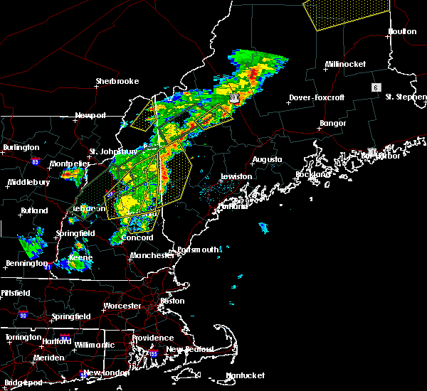 The severe thunderstorm warning for carroll, southeastern coos, southeastern grafton and northwestern belknap counties will expire at 715 pm edt, the storms which prompted the warning have moved out of the area. therefore the warning will be allowed to expire. The severe thunderstorm warning for carroll, southeastern coos, southeastern grafton and northwestern belknap counties will expire at 715 pm edt, the storms which prompted the warning have moved out of the area. therefore the warning will be allowed to expire.
|
| 8/3/2015 6:55 PM EDT |
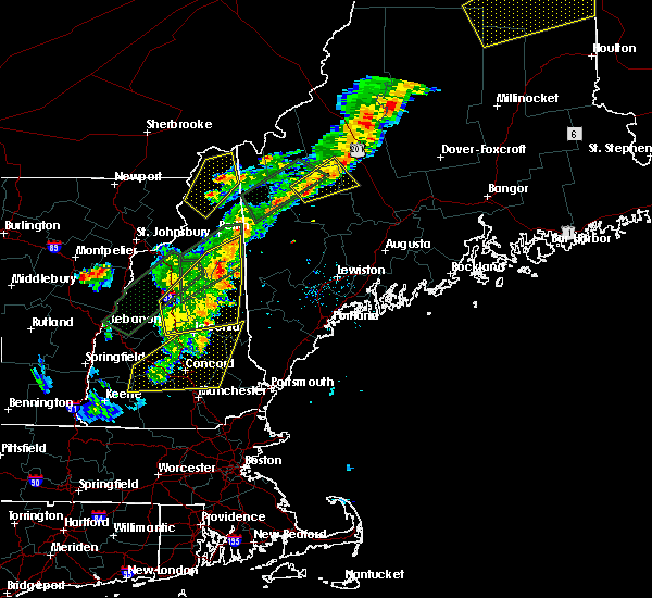 At 655 pm edt, doppler radar indicated a line of severe thunderstorms capable of producing quarter size hail and damaging winds in excess of 60 mph. these storms were located along a line extending from 8 miles west of mount washington to 10 miles northwest of tamworth to meredith, and moving east at 50 mph. At 655 pm edt, doppler radar indicated a line of severe thunderstorms capable of producing quarter size hail and damaging winds in excess of 60 mph. these storms were located along a line extending from 8 miles west of mount washington to 10 miles northwest of tamworth to meredith, and moving east at 50 mph.
|
| 8/3/2015 6:13 PM EDT |
 At 612 pm edt, doppler radar indicated a line of severe thunderstorms capable of producing quarter size hail and destructive winds in excess of 70 mph. these storms were located along a line extending from mount washington to near woodstock to near ashland, and moving east at 40 mph. At 612 pm edt, doppler radar indicated a line of severe thunderstorms capable of producing quarter size hail and destructive winds in excess of 70 mph. these storms were located along a line extending from mount washington to near woodstock to near ashland, and moving east at 40 mph.
|
| 7/19/2015 8:10 PM EDT |
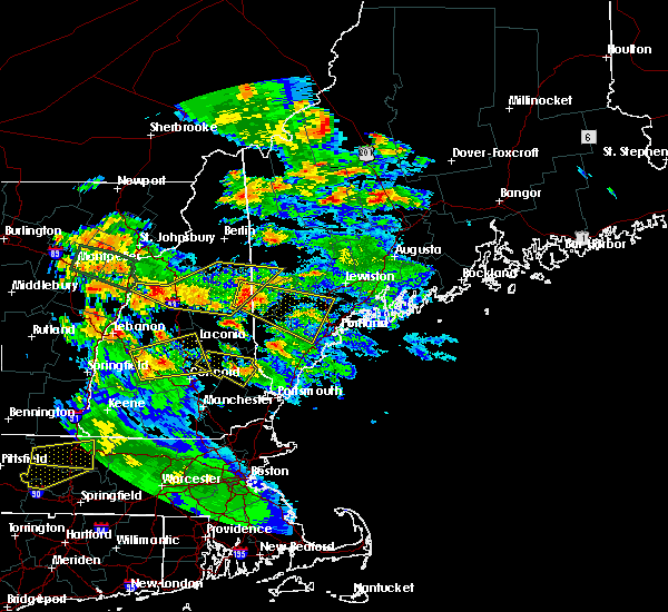 At 810 pm edt, doppler radar indicated a severe thunderstorm capable of producing half dollar size hail and damaging winds in excess of 60 mph. this storm was located near fryeburg, and moving east at 35 mph. At 810 pm edt, doppler radar indicated a severe thunderstorm capable of producing half dollar size hail and damaging winds in excess of 60 mph. this storm was located near fryeburg, and moving east at 35 mph.
|
| 7/19/2015 7:30 PM EDT |
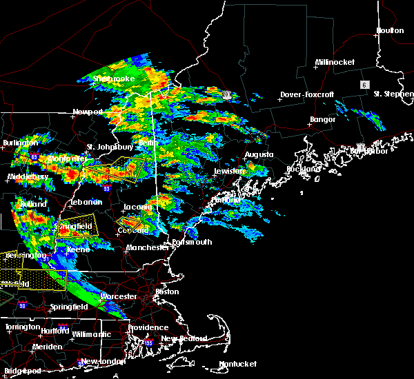 At 729 pm edt, doppler radar indicated a line of severe thunderstorms capable of producing half dollar size hail and damaging winds in excess of 60 mph. these storms were located along a line extending from near mount washington to lincoln to topsham, and moving east at 35 mph. At 729 pm edt, doppler radar indicated a line of severe thunderstorms capable of producing half dollar size hail and damaging winds in excess of 60 mph. these storms were located along a line extending from near mount washington to lincoln to topsham, and moving east at 35 mph.
|
| 5/27/2015 6:29 PM EDT | At 629 pm edt, doppler radar indicated a line of severe thunderstorms capable of producing damaging winds in excess of 60 mph. these storms were located along a line extending from near bethel to 8 miles west of waterford to 8 miles southeast of conway, moving east at 35 mph. locations impacted include, conway, bridgton, fryeburg, bethel, rumford, northwestern naples, dixfield, hiram, andover, waterford, mexico, tamworth, harrison, madison, buckfield, brownfield, freedom, hartford, denmark and lovell. |
| 5/27/2015 6:29 PM EDT | At 629 pm edt, doppler radar indicated a line of severe thunderstorms capable of producing damaging winds in excess of 60 mph. these storms were located along a line extending from near bethel to 8 miles west of waterford to 8 miles southeast of conway, moving east at 35 mph. locations impacted include, conway, bridgton, fryeburg, bethel, rumford, northwestern naples, dixfield, hiram, andover, waterford, mexico, tamworth, harrison, madison, buckfield, brownfield, freedom, hartford, denmark and lovell. |
| 5/27/2015 6:10 PM EDT | Trees and power lines down in carroll county NH, 0.5 miles NNW of Conway, NH |
| 5/27/2015 6:09 PM EDT | At 608 pm edt, doppler radar indicated a line of severe thunderstorms capable of producing damaging winds in excess of 60 mph. these storms were located along a line extending from 6 miles southeast of berlin to 8 miles north of echo lake state park to white lake state park, and moving east at 35 mph. |
| 5/27/2015 6:09 PM EDT | At 608 pm edt, doppler radar indicated a line of severe thunderstorms capable of producing damaging winds in excess of 60 mph. these storms were located along a line extending from 6 miles southeast of berlin to 8 miles north of echo lake state park to white lake state park, and moving east at 35 mph. |
| 5/27/2015 6:03 PM EDT | At 603 pm edt, doppler radar indicated a line of severe thunderstorms capable of producing damaging winds in excess of 60 mph. these storms were located along a line extending from 6 miles northeast of berlin to 10 miles northeast of pinkham notch to near echo lake state park to near sandwich, moving northeast at 50 mph. locations impacted include, conway, berlin, eastern lancaster, southwestern fryeburg, errol, mount washington, white lake state park, sandwich, pinkham notch, echo lake state park, tamworth, gorham, bartlett, madison, jefferson, jackson, albany, eaton, chatham and dummer. |
| 5/27/2015 5:31 PM EDT | At 531 pm edt, doppler radar indicated a line of severe thunderstorms capable of producing damaging winds in excess of 60 mph. these storms were located along a line extending from 8 miles south of lancaster to 8 miles east of franconia notch state park to near plymouth to near groton, and moving northeast at 50 mph. |
| 6/2/2013 4:25 PM EDT | Multiple trees down in conway in carroll county NH, 0.5 miles NNW of Conway, NH |
| 9/8/2012 8:00 PM EDT | Tree across a road in madison in carroll county NH, 6.1 miles NNE of Conway, NH |
| 1/1/0001 12:00 AM | Trees and wires down in center conway in carroll county NH, 0.5 miles NNW of Conway, NH |
| 1/1/0001 12:00 AM | Quarter sized hail reported 4.5 miles NW of Conway, NH, 1 inch hail and large trees down on cove rd along conway lake. |
| 1/1/0001 12:00 AM | 1 inch hail and large trees down on cove rd along conway lak in carroll county NH, 4.5 miles NW of Conway, NH |
| 1/1/0001 12:00 AM | Quarter sized hail reported 0.5 miles NNW of Conway, NH, quarter size hail |
| 1/1/0001 12:00 AM | Trees down on power lines at crystal lake in carroll county NH, 0.5 miles NNW of Conway, NH |
Hail Maps for Conway, NH


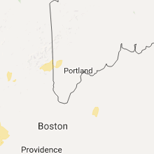


Connect with Interactive Hail Maps