

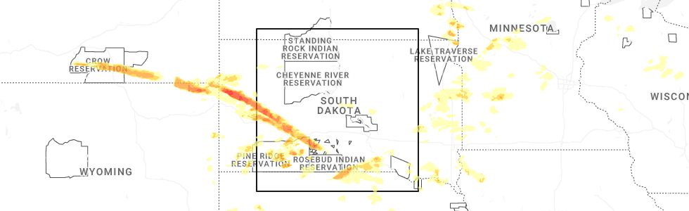
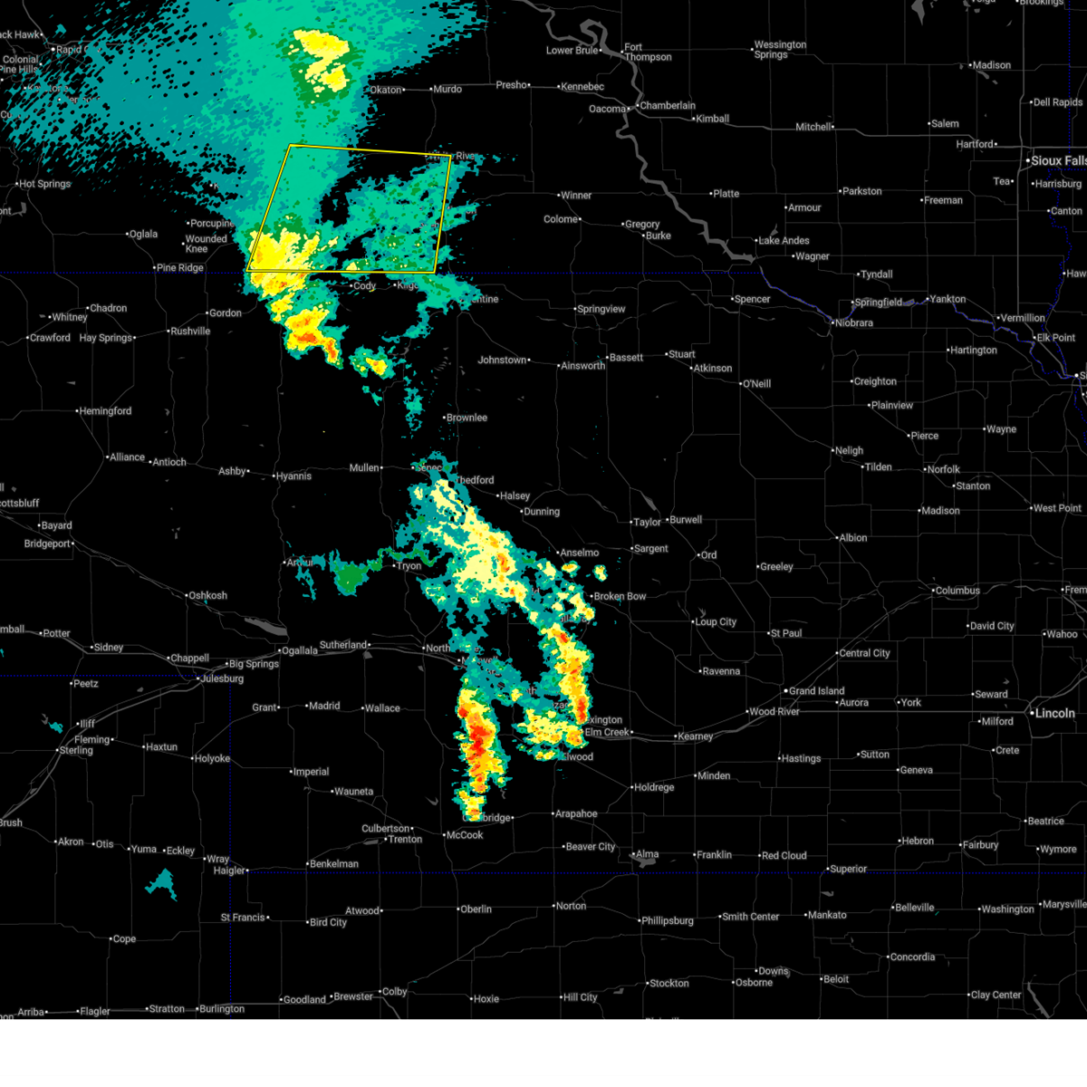
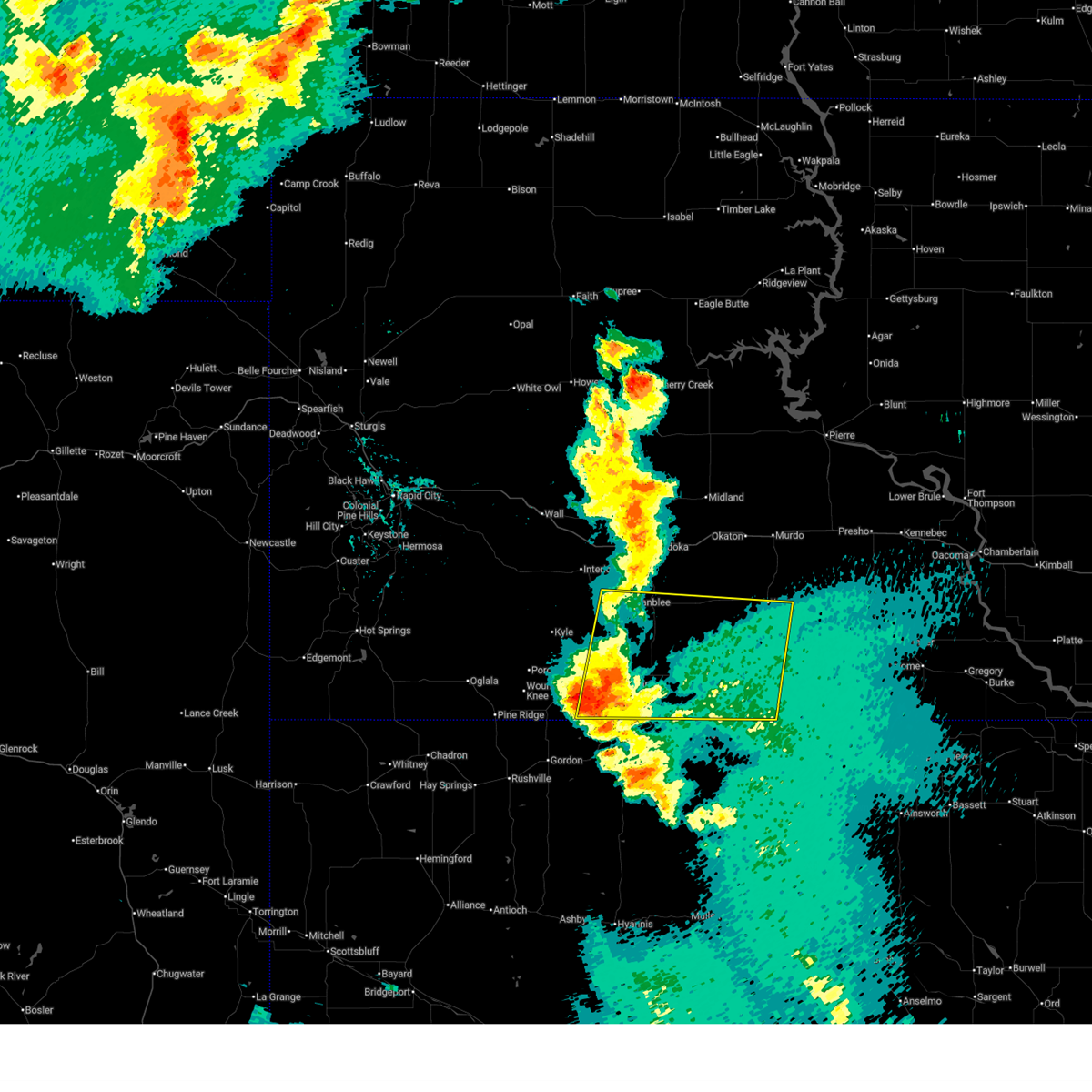
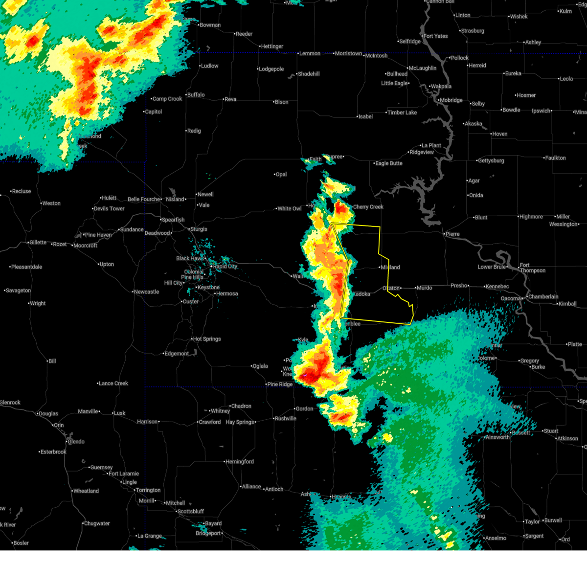
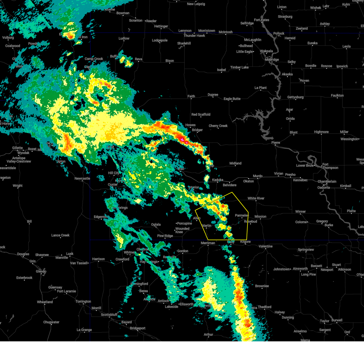
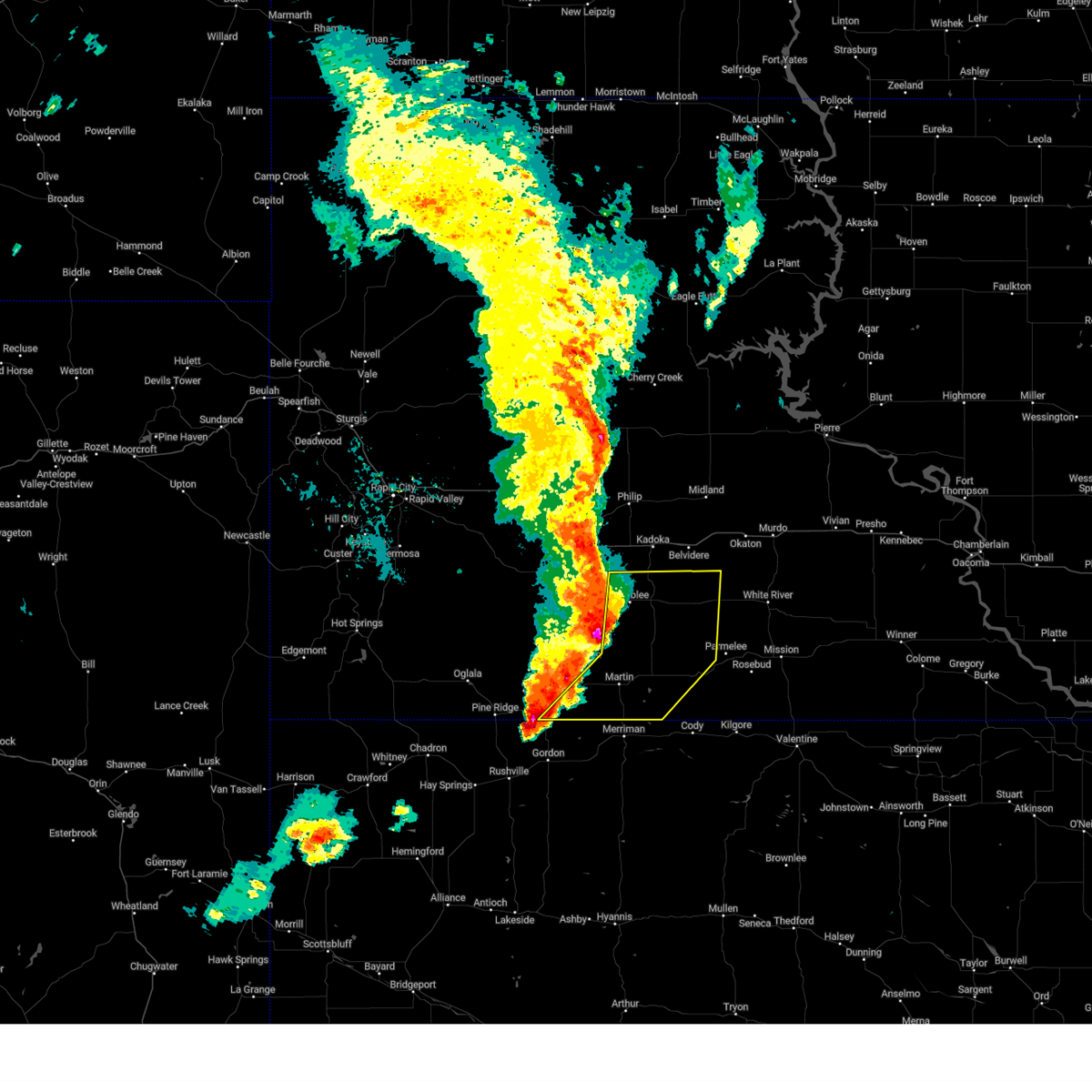
Hail Map for Corn Creek, SD
The Corn Creek, SD area has had 2 reports of on-the-ground hail by trained spotters, and has been under severe weather warnings 21 times during the past 12 months. Doppler radar has detected hail at or near Corn Creek, SD on 86 occasions, including 5 occasions during the past year.
| Name: | Corn Creek, SD |
| Where Located: | 58.5 miles NW of Valentine, NE |
| Map: | Google Map for Corn Creek, SD |
| Population: | 105 |
| Housing Units: | 29 |
| More Info: | Search Google for Corn Creek, SD |
1
The Top Recent Hail Date for Corn Creek, SD is Saturday, June 28, 2025 (13th out of 86)
Hail and Wind Damage Spotted near Corn Creek, SD
| Date / Time | Report Details |
|---|---|
| 7/1/2025 7:46 PM CDT |
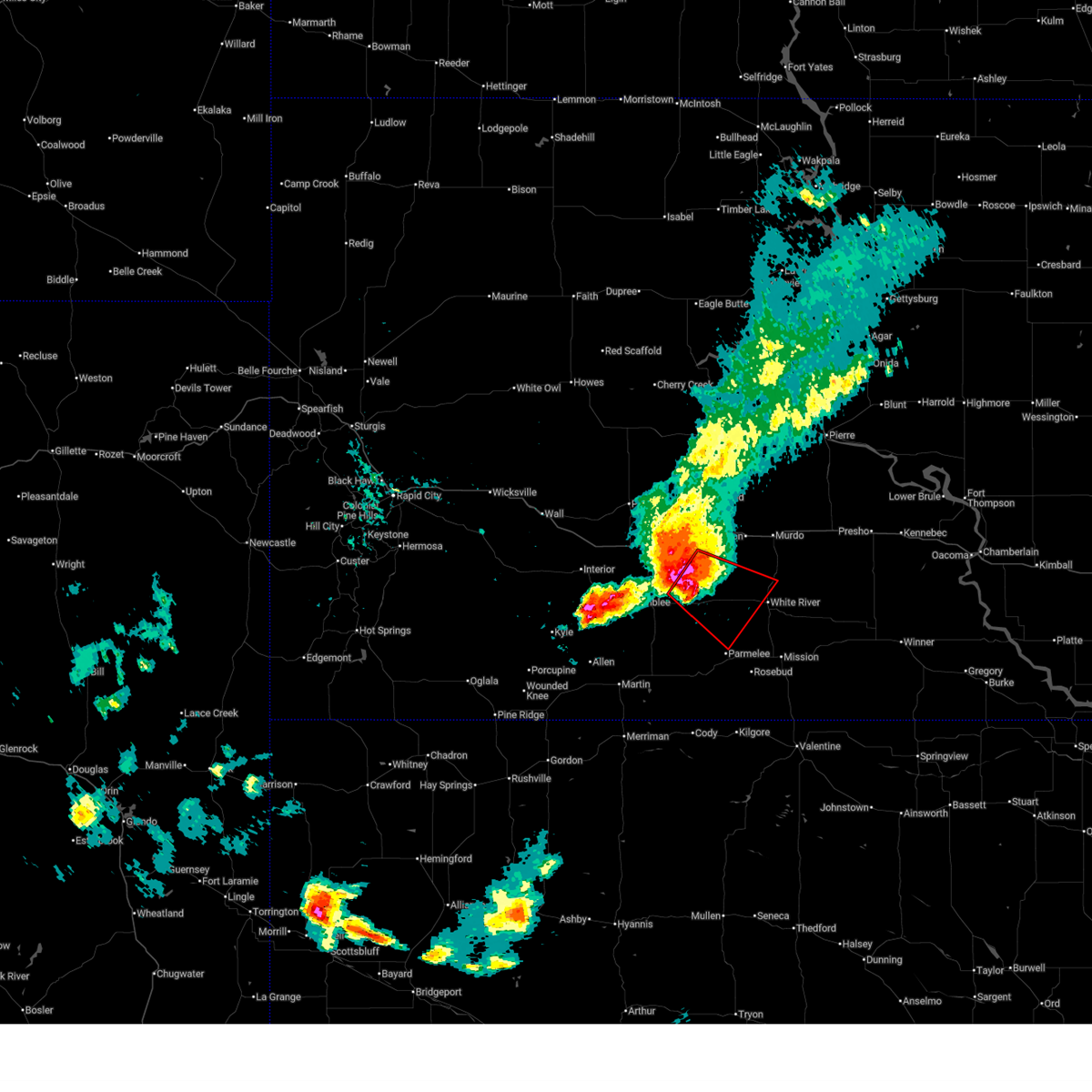
 Svrunr the national weather service in rapid city has issued a * severe thunderstorm warning for, northern todd county in south central south dakota, mellette county in south central south dakota, southeastern jackson county in southwestern south dakota, northeastern bennett county in southwestern south dakota, * until 745 pm mdt/845 pm cdt/. * at 646 pm mdt/746 pm cdt/, a severe thunderstorm was located 9 miles south of cedar butte, or 13 miles southwest of white river, moving south at 10 mph (radar indicated). Hazards include ping pong ball size hail. People and animals outdoors will be injured. Expect damage to roofs, siding, windows, and vehicles. Svrunr the national weather service in rapid city has issued a * severe thunderstorm warning for, northern todd county in south central south dakota, mellette county in south central south dakota, southeastern jackson county in southwestern south dakota, northeastern bennett county in southwestern south dakota, * until 745 pm mdt/845 pm cdt/. * at 646 pm mdt/746 pm cdt/, a severe thunderstorm was located 9 miles south of cedar butte, or 13 miles southwest of white river, moving south at 10 mph (radar indicated). Hazards include ping pong ball size hail. People and animals outdoors will be injured. Expect damage to roofs, siding, windows, and vehicles.
|
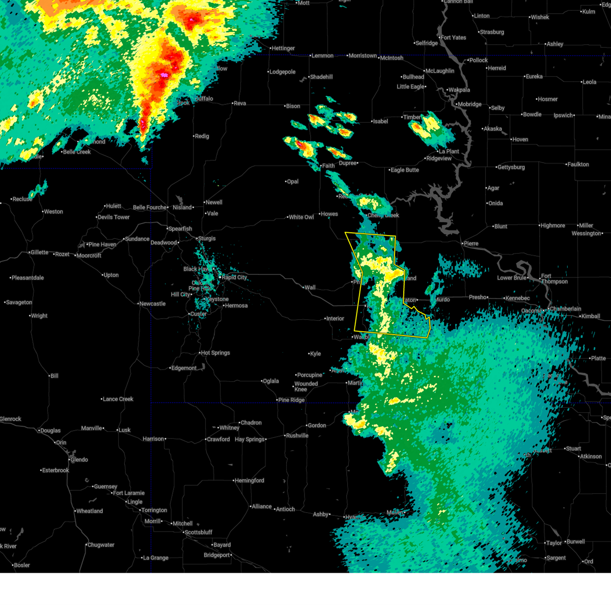
| 6/28/2025 8:54 PM CDT |
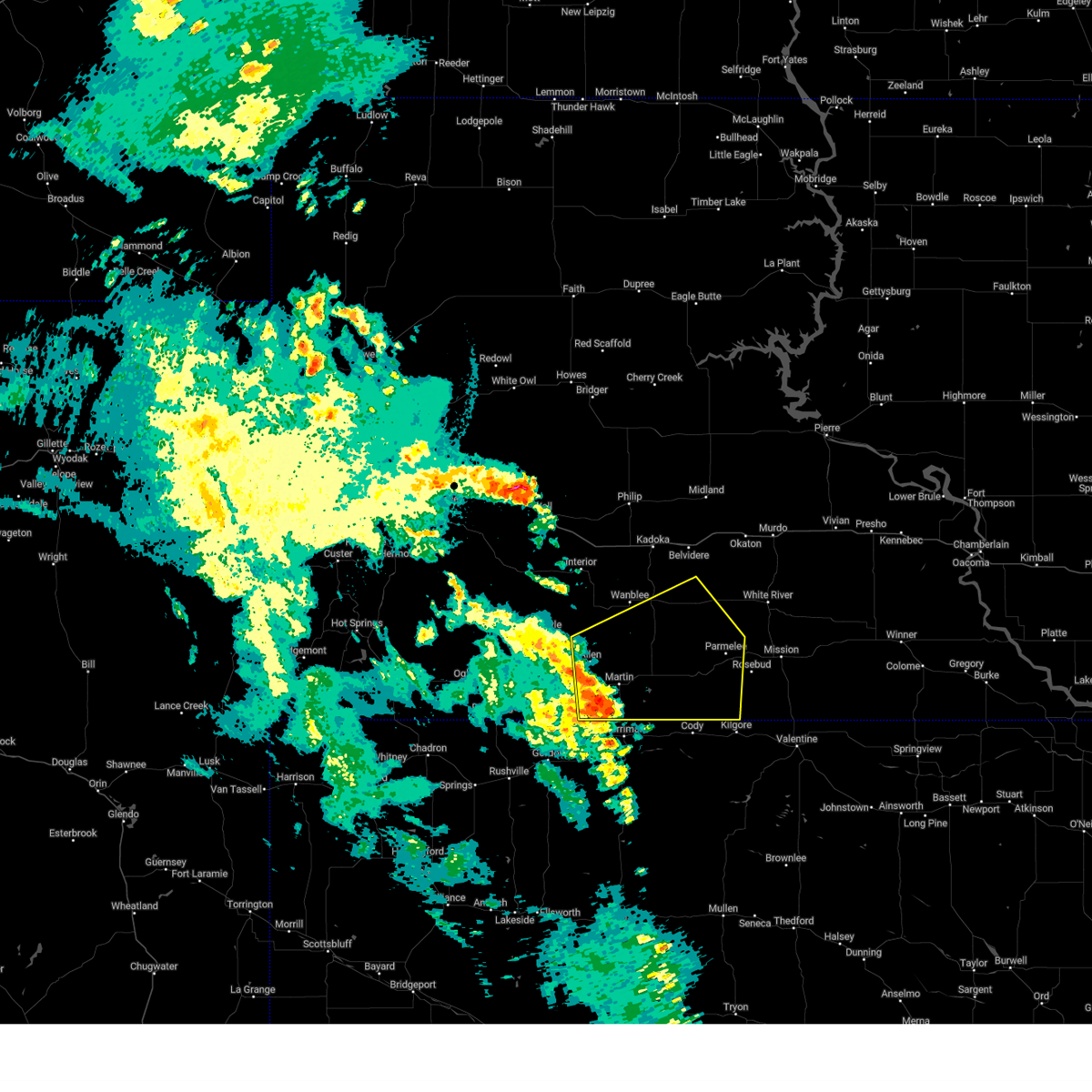
 The tornado threat has diminished and the tornado warning will be allowed to expire. however, large hail and damaging winds remain likely and a severe thunderstorm warning remains in effect for the area. a severe thunderstorm watch remains in effect until 1100 pm cdt for south central and southwestern south dakota. The tornado threat has diminished and the tornado warning will be allowed to expire. however, large hail and damaging winds remain likely and a severe thunderstorm warning remains in effect for the area. a severe thunderstorm watch remains in effect until 1100 pm cdt for south central and southwestern south dakota.
|
| 6/28/2025 8:40 PM CDT |
 At 840 pm cdt, a severe thunderstorm capable of producing a tornado was located near cedar butte, or 14 miles west of white river, moving southeast at 30 mph (radar indicated rotation). Hazards include tornado and baseball size hail. Flying debris will be dangerous to those caught without shelter. mobile homes will be damaged or destroyed. damage to roofs, windows, and vehicles will occur. tree damage is likely. This tornadic thunderstorm will remain over mainly rural areas of northern todd and western mellette counties. At 840 pm cdt, a severe thunderstorm capable of producing a tornado was located near cedar butte, or 14 miles west of white river, moving southeast at 30 mph (radar indicated rotation). Hazards include tornado and baseball size hail. Flying debris will be dangerous to those caught without shelter. mobile homes will be damaged or destroyed. damage to roofs, windows, and vehicles will occur. tree damage is likely. This tornadic thunderstorm will remain over mainly rural areas of northern todd and western mellette counties.
|
| 6/28/2025 8:40 PM CDT |
 the tornado warning has been cancelled and is no longer in effect the tornado warning has been cancelled and is no longer in effect
|
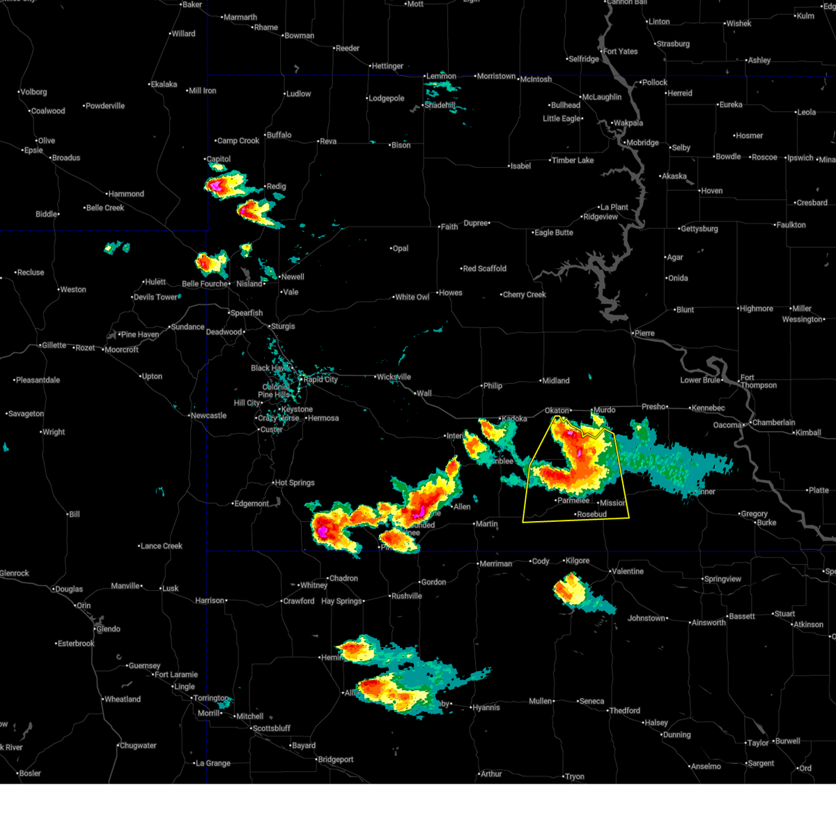
| 6/28/2025 8:14 PM CDT |
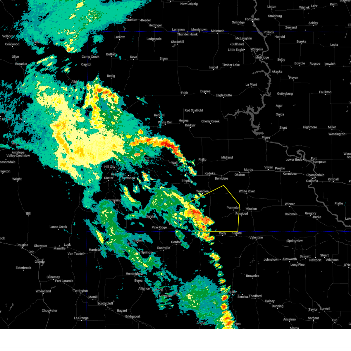
 Torunr the national weather service in rapid city has issued a * tornado warning for, northern todd county in south central south dakota, western mellette county in south central south dakota, east central jackson county in southwestern south dakota, * until 800 pm mdt/900 pm cdt/. * at 713 pm mdt/813 pm cdt/, a severe thunderstorm capable of producing a tornado was located 7 miles northwest of corn creek, or 17 miles southeast of kadoka, moving southeast at 30 mph (radar indicated rotation). Hazards include tornado and baseball size hail. Flying debris will be dangerous to those caught without shelter. mobile homes will be damaged or destroyed. damage to roofs, windows, and vehicles will occur. tree damage is likely. This dangerous storm will be near, norris, cedar butte, black pipe, and corn creek around 820 pm cdt. Torunr the national weather service in rapid city has issued a * tornado warning for, northern todd county in south central south dakota, western mellette county in south central south dakota, east central jackson county in southwestern south dakota, * until 800 pm mdt/900 pm cdt/. * at 713 pm mdt/813 pm cdt/, a severe thunderstorm capable of producing a tornado was located 7 miles northwest of corn creek, or 17 miles southeast of kadoka, moving southeast at 30 mph (radar indicated rotation). Hazards include tornado and baseball size hail. Flying debris will be dangerous to those caught without shelter. mobile homes will be damaged or destroyed. damage to roofs, windows, and vehicles will occur. tree damage is likely. This dangerous storm will be near, norris, cedar butte, black pipe, and corn creek around 820 pm cdt.
|
| 6/16/2025 12:28 AM CDT |
 Svrunr the national weather service in rapid city has issued a * severe thunderstorm warning for, southeastern haakon county in west central south dakota, todd county in south central south dakota, tripp county in south central south dakota, mellette county in south central south dakota, eastern jackson county in southwestern south dakota, eastern bennett county in southwestern south dakota, * until 1230 am mdt/130 am cdt/. * at 1127 pm mdt/1227 am cdt/, severe thunderstorms were located along a line extending from 6 miles southeast of midland to 6 miles north of nenzel, moving east at 45 mph (radar indicated). Hazards include 60 mph wind gusts. Expect damage to roofs, siding, and trees. severe thunderstorms will be near, white river, rosebud, saint francis, lakeview, grass mountain, horse creek, fairgrounds housing, ring thunder, soldier creek, and swift bear around 1235 am cdt. mission and antelope around 1240 am cdt. sicangu village around 1245 am cdt. wood, butte creek, and haystack butte around 1250 am cdt. hidden timber and littleburg around 1255 am cdt. okreek around 100 am cdt. mosher around 105 am cdt. other locations impacted by these severe thunderstorms include rosebud reservation. This includes interstate 90 in south dakota between mile markers 162 and 174. Svrunr the national weather service in rapid city has issued a * severe thunderstorm warning for, southeastern haakon county in west central south dakota, todd county in south central south dakota, tripp county in south central south dakota, mellette county in south central south dakota, eastern jackson county in southwestern south dakota, eastern bennett county in southwestern south dakota, * until 1230 am mdt/130 am cdt/. * at 1127 pm mdt/1227 am cdt/, severe thunderstorms were located along a line extending from 6 miles southeast of midland to 6 miles north of nenzel, moving east at 45 mph (radar indicated). Hazards include 60 mph wind gusts. Expect damage to roofs, siding, and trees. severe thunderstorms will be near, white river, rosebud, saint francis, lakeview, grass mountain, horse creek, fairgrounds housing, ring thunder, soldier creek, and swift bear around 1235 am cdt. mission and antelope around 1240 am cdt. sicangu village around 1245 am cdt. wood, butte creek, and haystack butte around 1250 am cdt. hidden timber and littleburg around 1255 am cdt. okreek around 100 am cdt. mosher around 105 am cdt. other locations impacted by these severe thunderstorms include rosebud reservation. This includes interstate 90 in south dakota between mile markers 162 and 174.
|
| 6/16/2025 12:20 AM CDT |
 The storms which prompted the warning have weakened below severe limits, and no longer pose an immediate threat to life or property. therefore, the warning will be allowed to expire. however, gusty winds are still possible with these thunderstorms. a severe thunderstorm watch remains in effect until 100 am mdt/200 am cdt/ for south central, southwestern and west central south dakota. The storms which prompted the warning have weakened below severe limits, and no longer pose an immediate threat to life or property. therefore, the warning will be allowed to expire. however, gusty winds are still possible with these thunderstorms. a severe thunderstorm watch remains in effect until 100 am mdt/200 am cdt/ for south central, southwestern and west central south dakota.
|
| 6/16/2025 12:08 AM CDT |
 At 1107 pm mdt/1207 am cdt/, severe thunderstorms were located along a line extending from 3 miles southwest of brown church to 3 miles south of capa to 2 miles southwest of cedar butte, moving east at 40 mph (radar indicated). Hazards include 60 mph wind gusts. Expect damage to roofs, siding, and trees. these severe thunderstorms will remain over mainly rural areas of southeastern haakon, northwestern mellette and northeastern jackson counties. This includes interstate 90 in south dakota between mile markers 147 and 174. At 1107 pm mdt/1207 am cdt/, severe thunderstorms were located along a line extending from 3 miles southwest of brown church to 3 miles south of capa to 2 miles southwest of cedar butte, moving east at 40 mph (radar indicated). Hazards include 60 mph wind gusts. Expect damage to roofs, siding, and trees. these severe thunderstorms will remain over mainly rural areas of southeastern haakon, northwestern mellette and northeastern jackson counties. This includes interstate 90 in south dakota between mile markers 147 and 174.
|
| 6/15/2025 11:56 PM CDT |
 At 1056 pm mdt/1156 pm cdt/, severe thunderstorms were located along a line extending from 3 miles north of corn creek to 7 miles northwest of cody, moving east at 40 mph (radar indicated). Hazards include 60 mph wind gusts and penny size hail. Expect damage to roofs, siding, and trees. these severe storms will be near, parmelee, spring creek, norris, cedar butte, upper cut meat, black pipe, corn creek, grass mountain, and he dog around 1200 am cdt. harrington around 1100 pm mdt. white river, rosebud, saint francis, fairgrounds housing, ring thunder, soldier creek, swift bear, and two strike around 1205 am cdt. lakeview and horse creek around 1210 am cdt. mission around 1215 am cdt. Other locations impacted by these severe thunderstorms include rosebud reservation. At 1056 pm mdt/1156 pm cdt/, severe thunderstorms were located along a line extending from 3 miles north of corn creek to 7 miles northwest of cody, moving east at 40 mph (radar indicated). Hazards include 60 mph wind gusts and penny size hail. Expect damage to roofs, siding, and trees. these severe storms will be near, parmelee, spring creek, norris, cedar butte, upper cut meat, black pipe, corn creek, grass mountain, and he dog around 1200 am cdt. harrington around 1100 pm mdt. white river, rosebud, saint francis, fairgrounds housing, ring thunder, soldier creek, swift bear, and two strike around 1205 am cdt. lakeview and horse creek around 1210 am cdt. mission around 1215 am cdt. Other locations impacted by these severe thunderstorms include rosebud reservation.
|
| 6/15/2025 10:42 PM MDT |
 Svrunr the national weather service in rapid city has issued a * severe thunderstorm warning for, western todd county in south central south dakota, southwestern mellette county in south central south dakota, southeastern jackson county in southwestern south dakota, bennett county in southwestern south dakota, * until 1130 pm mdt/1230 am cdt/. * at 1041 pm mdt/1141 pm cdt/, severe thunderstorms were located along a line extending from 2 miles north of george town to 6 miles north of merriman, moving east at 70 mph (radar indicated). Hazards include 60 mph wind gusts and quarter size hail. Hail damage to vehicles is expected. expect wind damage to roofs, siding, and trees. severe thunderstorms will be near, corn creek around 1145 pm cdt. long valley, tuthill, vetal, and lacreek wildlife refuge around 1045 pm mdt. norris and black pipe around 1150 pm cdt. harrington around 1050 pm mdt. parmelee, cedar butte, upper cut meat, and he dog around 1155 pm cdt. spring creek and grass mountain around 1200 am cdt. white river, rosebud, saint francis, horse creek, fairgrounds housing, ring thunder, soldier creek, swift bear, and two strike around 1205 am cdt. lakeview around 1210 am cdt. mission around 1215 am cdt. Other locations impacted by these severe thunderstorms include rosebud reservation and eastern pine ridge reservation. Svrunr the national weather service in rapid city has issued a * severe thunderstorm warning for, western todd county in south central south dakota, southwestern mellette county in south central south dakota, southeastern jackson county in southwestern south dakota, bennett county in southwestern south dakota, * until 1130 pm mdt/1230 am cdt/. * at 1041 pm mdt/1141 pm cdt/, severe thunderstorms were located along a line extending from 2 miles north of george town to 6 miles north of merriman, moving east at 70 mph (radar indicated). Hazards include 60 mph wind gusts and quarter size hail. Hail damage to vehicles is expected. expect wind damage to roofs, siding, and trees. severe thunderstorms will be near, corn creek around 1145 pm cdt. long valley, tuthill, vetal, and lacreek wildlife refuge around 1045 pm mdt. norris and black pipe around 1150 pm cdt. harrington around 1050 pm mdt. parmelee, cedar butte, upper cut meat, and he dog around 1155 pm cdt. spring creek and grass mountain around 1200 am cdt. white river, rosebud, saint francis, horse creek, fairgrounds housing, ring thunder, soldier creek, swift bear, and two strike around 1205 am cdt. lakeview around 1210 am cdt. mission around 1215 am cdt. Other locations impacted by these severe thunderstorms include rosebud reservation and eastern pine ridge reservation.
|
| 6/15/2025 11:40 PM CDT |
 Svrunr the national weather service in rapid city has issued a * severe thunderstorm warning for, southeastern haakon county in west central south dakota, northwestern mellette county in south central south dakota, northeastern jackson county in southwestern south dakota, * until 1130 pm mdt/1230 am cdt/. * at 1039 pm mdt/1139 pm cdt/, severe thunderstorms were located along a line extending from 3 miles east of billsburg to 8 miles northwest of nowlin to near george town, moving east at 55 mph (radar indicated). Hazards include 70 mph wind gusts. Expect considerable tree damage. damage is likely to mobile homes, roofs, and outbuildings. severe thunderstorms will be near, midland, belvidere, ottumwa, and nowlin around 1045 pm mdt. cedar butte around 1155 pm cdt. This includes interstate 90 in south dakota between mile markers 147 and 174. Svrunr the national weather service in rapid city has issued a * severe thunderstorm warning for, southeastern haakon county in west central south dakota, northwestern mellette county in south central south dakota, northeastern jackson county in southwestern south dakota, * until 1130 pm mdt/1230 am cdt/. * at 1039 pm mdt/1139 pm cdt/, severe thunderstorms were located along a line extending from 3 miles east of billsburg to 8 miles northwest of nowlin to near george town, moving east at 55 mph (radar indicated). Hazards include 70 mph wind gusts. Expect considerable tree damage. damage is likely to mobile homes, roofs, and outbuildings. severe thunderstorms will be near, midland, belvidere, ottumwa, and nowlin around 1045 pm mdt. cedar butte around 1155 pm cdt. This includes interstate 90 in south dakota between mile markers 147 and 174.
|
| 9/17/2024 8:56 PM MDT |
 The storms which prompted the warning have weakened below severe limits and no longer pose an immediate threat to life or property. therefore, the warning will be allowed to expire. however, gusty winds up to 50 mph and heavy rain are still possible with these thunderstorms. The storms which prompted the warning have weakened below severe limits and no longer pose an immediate threat to life or property. therefore, the warning will be allowed to expire. however, gusty winds up to 50 mph and heavy rain are still possible with these thunderstorms.
|
| 9/17/2024 8:33 PM MDT |
 At 832 pm mdt/932 pm cdt/, severe thunderstorms were located along a line extending from 2 miles southeast of hisle to 3 miles east of tuthill to 7 miles southeast of lacreek wildlife refuge, moving east at 50 mph (radar indicated). Hazards include 60 mph wind gusts. Expect damage to roofs, siding, and trees. Locations impacted include, upper cut meat, long valley, vetal, harrington, parmelee, spring creek, grass mountain, he dog, norris, black pipe and corn creek. At 832 pm mdt/932 pm cdt/, severe thunderstorms were located along a line extending from 2 miles southeast of hisle to 3 miles east of tuthill to 7 miles southeast of lacreek wildlife refuge, moving east at 50 mph (radar indicated). Hazards include 60 mph wind gusts. Expect damage to roofs, siding, and trees. Locations impacted include, upper cut meat, long valley, vetal, harrington, parmelee, spring creek, grass mountain, he dog, norris, black pipe and corn creek.
|
| 9/17/2024 8:17 PM MDT |
 Svrunr the national weather service in rapid city has issued a * severe thunderstorm warning for, western todd county in south central south dakota, southwestern mellette county in south central south dakota, southeastern jackson county in southwestern south dakota, bennett county in southwestern south dakota, * until 900 pm mdt/1000 pm cdt/. * at 816 pm mdt/916 pm cdt/, severe thunderstorms were located along a line extending from 4 miles south of snake butte to near sunrise housing to 6 miles north of merriman, moving northeast at 45 mph. a wind gust of 74 mph was recently observed near martin (radar and automated observations indicated). Hazards include 70 mph wind gusts. Expect considerable tree damage. damage is likely to mobile homes, roofs, and outbuildings. severe thunderstorms will be near, martin, tuthill, sunrise housing, hisle, eagle nest butte, and lacreek wildlife refuge around 820 pm mdt. vetal around 825 pm mdt. long valley and harrington around 830 pm mdt. Other locations in the path of these severe thunderstorms include upper cut meat. Svrunr the national weather service in rapid city has issued a * severe thunderstorm warning for, western todd county in south central south dakota, southwestern mellette county in south central south dakota, southeastern jackson county in southwestern south dakota, bennett county in southwestern south dakota, * until 900 pm mdt/1000 pm cdt/. * at 816 pm mdt/916 pm cdt/, severe thunderstorms were located along a line extending from 4 miles south of snake butte to near sunrise housing to 6 miles north of merriman, moving northeast at 45 mph. a wind gust of 74 mph was recently observed near martin (radar and automated observations indicated). Hazards include 70 mph wind gusts. Expect considerable tree damage. damage is likely to mobile homes, roofs, and outbuildings. severe thunderstorms will be near, martin, tuthill, sunrise housing, hisle, eagle nest butte, and lacreek wildlife refuge around 820 pm mdt. vetal around 825 pm mdt. long valley and harrington around 830 pm mdt. Other locations in the path of these severe thunderstorms include upper cut meat.
|
| 8/26/2024 6:58 PM MDT |
 The storms which prompted the warning have moved out of the area. therefore, the warning will be allowed to expire. a severe thunderstorm watch remains in effect until 1000 pm mdt/1100 pm cdt/ for south central and southwestern south dakota. remember, a severe thunderstorm warning still remains in effect for todd county and eastern bennet county until 9 pm cdt. The storms which prompted the warning have moved out of the area. therefore, the warning will be allowed to expire. a severe thunderstorm watch remains in effect until 1000 pm mdt/1100 pm cdt/ for south central and southwestern south dakota. remember, a severe thunderstorm warning still remains in effect for todd county and eastern bennet county until 9 pm cdt.
|
| 8/26/2024 6:42 PM MDT |
 At 641 pm mdt/741 pm cdt/, severe thunderstorms were located along a line extending from 9 miles southeast of intersection of highway 73 and white river to 8 miles north of vetal to 8 miles northwest of merriman, moving east at 35 mph (radar indicated). Hazards include 70 mph wind gusts and quarter size hail. Hail damage to vehicles is expected. expect considerable tree damage. wind damage is also likely to mobile homes, roofs, and outbuildings. Locations impacted include, martin, wanblee, long valley, norris, tuthill, hisle, black pipe, harrington, george town, lacreek north housing, sunrise housing, vetal, corn creek, eagle nest butte, and lacreek wildlife refuge. At 641 pm mdt/741 pm cdt/, severe thunderstorms were located along a line extending from 9 miles southeast of intersection of highway 73 and white river to 8 miles north of vetal to 8 miles northwest of merriman, moving east at 35 mph (radar indicated). Hazards include 70 mph wind gusts and quarter size hail. Hail damage to vehicles is expected. expect considerable tree damage. wind damage is also likely to mobile homes, roofs, and outbuildings. Locations impacted include, martin, wanblee, long valley, norris, tuthill, hisle, black pipe, harrington, george town, lacreek north housing, sunrise housing, vetal, corn creek, eagle nest butte, and lacreek wildlife refuge.
|
| 8/26/2024 6:42 PM MDT |
 the severe thunderstorm warning has been cancelled and is no longer in effect the severe thunderstorm warning has been cancelled and is no longer in effect
|
| 8/26/2024 5:58 PM MDT |
 Svrunr the national weather service in rapid city has issued a * severe thunderstorm warning for, southeastern oglala lakota county in southwestern south dakota, northwestern todd county in south central south dakota, southwestern mellette county in south central south dakota, southeastern jackson county in southwestern south dakota, bennett county in southwestern south dakota, * until 700 pm mdt/800 pm cdt/. * at 558 pm mdt/658 pm cdt/, severe thunderstorms were located along a line extending from 7 miles north of wanblee to 4 miles south of hisle to near wakpamni, moving east at 30 mph (radar indicated). Hazards include 70 mph wind gusts and quarter size hail. Hail damage to vehicles is expected. expect considerable tree damage. Wind damage is also likely to mobile homes, roofs, and outbuildings. Svrunr the national weather service in rapid city has issued a * severe thunderstorm warning for, southeastern oglala lakota county in southwestern south dakota, northwestern todd county in south central south dakota, southwestern mellette county in south central south dakota, southeastern jackson county in southwestern south dakota, bennett county in southwestern south dakota, * until 700 pm mdt/800 pm cdt/. * at 558 pm mdt/658 pm cdt/, severe thunderstorms were located along a line extending from 7 miles north of wanblee to 4 miles south of hisle to near wakpamni, moving east at 30 mph (radar indicated). Hazards include 70 mph wind gusts and quarter size hail. Hail damage to vehicles is expected. expect considerable tree damage. Wind damage is also likely to mobile homes, roofs, and outbuildings.
|
| 7/14/2024 1:39 AM CDT |
 Svrunr the national weather service in rapid city has issued a * severe thunderstorm warning for, northern todd county in south central south dakota, tripp county in south central south dakota, mellette county in south central south dakota, eastern jackson county in southwestern south dakota, * until 145 am mdt/245 am cdt/. * at 1239 am mdt/139 am cdt/, severe thunderstorms were located along a line extending from 6 miles southwest of murdo to 5 miles northwest of black pipe, moving east at 55 mph (radar indicated). Hazards include 60 mph wind gusts. Expect damage to roofs, siding, and trees. severe thunderstorms will be near, white river, norris, cedar butte, black pipe, horse creek, swift bear, and intersection of highway 83 and white river around 145 am cdt. parmelee around 150 am cdt. soldier creek and ring thunder around 155 am cdt. wood and butte creek around 200 am cdt. mission and antelope around 205 am cdt. mosher and haystack butte around 210 am cdt. okreek around 215 am cdt. ideal, carter, and witten around 220 am cdt. other locations impacted by these severe thunderstorms include northern rosebud reservation. This includes interstate 90 in south dakota between mile markers 162 and 173. Svrunr the national weather service in rapid city has issued a * severe thunderstorm warning for, northern todd county in south central south dakota, tripp county in south central south dakota, mellette county in south central south dakota, eastern jackson county in southwestern south dakota, * until 145 am mdt/245 am cdt/. * at 1239 am mdt/139 am cdt/, severe thunderstorms were located along a line extending from 6 miles southwest of murdo to 5 miles northwest of black pipe, moving east at 55 mph (radar indicated). Hazards include 60 mph wind gusts. Expect damage to roofs, siding, and trees. severe thunderstorms will be near, white river, norris, cedar butte, black pipe, horse creek, swift bear, and intersection of highway 83 and white river around 145 am cdt. parmelee around 150 am cdt. soldier creek and ring thunder around 155 am cdt. wood and butte creek around 200 am cdt. mission and antelope around 205 am cdt. mosher and haystack butte around 210 am cdt. okreek around 215 am cdt. ideal, carter, and witten around 220 am cdt. other locations impacted by these severe thunderstorms include northern rosebud reservation. This includes interstate 90 in south dakota between mile markers 162 and 173.
|
| 7/14/2024 1:20 AM CDT |
 At 1219 am mdt/119 am cdt/, severe thunderstorms were located along a line extending from 6 miles south of midland to 6 miles north of george town, moving east at 50 mph (radar indicated). Hazards include 70 mph wind gusts. Expect considerable tree damage. damage is likely to mobile homes, roofs, and outbuildings. locations impacted include, belvidere, corn creek, cedar butte, white river and swift bear. This includes interstate 90 in south dakota between mile markers 137 and 174. At 1219 am mdt/119 am cdt/, severe thunderstorms were located along a line extending from 6 miles south of midland to 6 miles north of george town, moving east at 50 mph (radar indicated). Hazards include 70 mph wind gusts. Expect considerable tree damage. damage is likely to mobile homes, roofs, and outbuildings. locations impacted include, belvidere, corn creek, cedar butte, white river and swift bear. This includes interstate 90 in south dakota between mile markers 137 and 174.
|
| 7/14/2024 12:51 AM CDT |
 Svrunr the national weather service in rapid city has issued a * severe thunderstorm warning for, western mellette county in south central south dakota, northern jackson county in southwestern south dakota, * until 1245 am mdt/145 am cdt/. * at 1151 pm mdt/1251 am cdt/, severe thunderstorms were located along a line extending from 4 miles east of philip to 2 miles north of cedar pass, moving southeast at 50 mph (radar indicated). Hazards include 70 mph wind gusts. Expect considerable tree damage. damage is likely to mobile homes, roofs, and outbuildings. severe thunderstorms will be near, kadoka, cedar pass, and eastern badlands national park around 1155 pm mdt. intersection of highway 73 and white river around 1200 am mdt. belvidere around 1205 am mdt. corn creek around 125 am cdt. This includes interstate 90 in south dakota between mile markers 129 and 174. Svrunr the national weather service in rapid city has issued a * severe thunderstorm warning for, western mellette county in south central south dakota, northern jackson county in southwestern south dakota, * until 1245 am mdt/145 am cdt/. * at 1151 pm mdt/1251 am cdt/, severe thunderstorms were located along a line extending from 4 miles east of philip to 2 miles north of cedar pass, moving southeast at 50 mph (radar indicated). Hazards include 70 mph wind gusts. Expect considerable tree damage. damage is likely to mobile homes, roofs, and outbuildings. severe thunderstorms will be near, kadoka, cedar pass, and eastern badlands national park around 1155 pm mdt. intersection of highway 73 and white river around 1200 am mdt. belvidere around 1205 am mdt. corn creek around 125 am cdt. This includes interstate 90 in south dakota between mile markers 129 and 174.
|
| 6/15/2024 9:40 PM CDT |
 At 940 pm cdt, a severe thunderstorm was located 4 miles east of norris, or 18 miles west of white river, moving east at 25 mph (radar indicated). Hazards include 70 mph wind gusts and quarter size hail. Hail damage to vehicles is expected. expect considerable tree damage. wind damage is also likely to mobile homes, roofs, and outbuildings. this severe storm will be near, cedar butte around 945 pm cdt. Other locations in the path of this severe thunderstorm include horse creek, swift bear and white river. At 940 pm cdt, a severe thunderstorm was located 4 miles east of norris, or 18 miles west of white river, moving east at 25 mph (radar indicated). Hazards include 70 mph wind gusts and quarter size hail. Hail damage to vehicles is expected. expect considerable tree damage. wind damage is also likely to mobile homes, roofs, and outbuildings. this severe storm will be near, cedar butte around 945 pm cdt. Other locations in the path of this severe thunderstorm include horse creek, swift bear and white river.
|
| 6/15/2024 9:32 PM CDT |
 Svrunr the national weather service in rapid city has issued a * severe thunderstorm warning for, northwestern todd county in south central south dakota, southwestern mellette county in south central south dakota, * until 1015 pm cdt. * at 931 pm cdt, a severe thunderstorm was located over black pipe, or 22 miles west of white river, moving east at 25 mph (radar indicated). Hazards include 60 mph wind gusts and quarter size hail. Hail damage to vehicles is expected. expect wind damage to roofs, siding, and trees. This severe thunderstorm will be near, cedar butte around 935 pm cdt. Svrunr the national weather service in rapid city has issued a * severe thunderstorm warning for, northwestern todd county in south central south dakota, southwestern mellette county in south central south dakota, * until 1015 pm cdt. * at 931 pm cdt, a severe thunderstorm was located over black pipe, or 22 miles west of white river, moving east at 25 mph (radar indicated). Hazards include 60 mph wind gusts and quarter size hail. Hail damage to vehicles is expected. expect wind damage to roofs, siding, and trees. This severe thunderstorm will be near, cedar butte around 935 pm cdt.
|
| 6/10/2024 6:20 PM CDT |
 Svrunr the national weather service in rapid city has issued a * severe thunderstorm warning for, mellette county in south central south dakota, southeastern jackson county in southwestern south dakota, * until 615 pm mdt/715 pm cdt/. * at 519 pm mdt/619 pm cdt/, severe thunderstorms were located along a line extending from 4 miles east of belvidere to 3 miles west of long valley, moving east at 35 mph (radar indicated). Hazards include 60 mph wind gusts and penny size hail. Expect damage to roofs, siding, and trees. severe thunderstorms will be near, norris, black pipe, and corn creek around 625 pm cdt. long valley around 525 pm mdt. cedar butte around 630 pm cdt. Swift bear around 655 pm cdt. Svrunr the national weather service in rapid city has issued a * severe thunderstorm warning for, mellette county in south central south dakota, southeastern jackson county in southwestern south dakota, * until 615 pm mdt/715 pm cdt/. * at 519 pm mdt/619 pm cdt/, severe thunderstorms were located along a line extending from 4 miles east of belvidere to 3 miles west of long valley, moving east at 35 mph (radar indicated). Hazards include 60 mph wind gusts and penny size hail. Expect damage to roofs, siding, and trees. severe thunderstorms will be near, norris, black pipe, and corn creek around 625 pm cdt. long valley around 525 pm mdt. cedar butte around 630 pm cdt. Swift bear around 655 pm cdt.
|
| 4/15/2024 8:35 PM CDT |
 The storm which prompted the warning has weakened below severe limits, and has exited the warned area. therefore, the warning will be allowed to expire. however, small hail is still possible with this thunderstorm. a severe thunderstorm watch remains in effect until 1100 pm cdt for south central south dakota. The storm which prompted the warning has weakened below severe limits, and has exited the warned area. therefore, the warning will be allowed to expire. however, small hail is still possible with this thunderstorm. a severe thunderstorm watch remains in effect until 1100 pm cdt for south central south dakota.
|
| 4/15/2024 8:24 PM CDT |
 At 824 pm cdt, a severe thunderstorm was located 5 miles southeast of corn creek, or 18 miles west of white river, moving north at 40 mph (radar indicated). Hazards include quarter size hail. Damage to vehicles is expected. This severe storm will be near, corn creek around 830 pm cdt. At 824 pm cdt, a severe thunderstorm was located 5 miles southeast of corn creek, or 18 miles west of white river, moving north at 40 mph (radar indicated). Hazards include quarter size hail. Damage to vehicles is expected. This severe storm will be near, corn creek around 830 pm cdt.
|
| 4/15/2024 8:24 PM CDT |
 the severe thunderstorm warning has been cancelled and is no longer in effect the severe thunderstorm warning has been cancelled and is no longer in effect
|
| 4/15/2024 8:13 PM CDT |
 At 712 pm mdt/812 pm cdt/, a severe thunderstorm was located 6 miles northwest of parmelee, or 20 miles southwest of white river, moving north at 40 mph (radar indicated. at 7 pm mdt ping pong ball size hail and wind gusts to 60 mph were reported 2 miles southwest of parmelee). Hazards include ping pong ball size hail and 60 mph wind gusts. People and animals outdoors will be injured. expect hail damage to roofs, siding, windows, and vehicles. expect wind damage to roofs, siding, and trees. This severe storm will be near, norris, corn creek, and black pipe around 820 pm cdt. At 712 pm mdt/812 pm cdt/, a severe thunderstorm was located 6 miles northwest of parmelee, or 20 miles southwest of white river, moving north at 40 mph (radar indicated. at 7 pm mdt ping pong ball size hail and wind gusts to 60 mph were reported 2 miles southwest of parmelee). Hazards include ping pong ball size hail and 60 mph wind gusts. People and animals outdoors will be injured. expect hail damage to roofs, siding, windows, and vehicles. expect wind damage to roofs, siding, and trees. This severe storm will be near, norris, corn creek, and black pipe around 820 pm cdt.
|
| 4/15/2024 8:04 PM CDT |
 At 704 pm mdt/804 pm cdt/, a severe thunderstorm was located over he dog, or 20 miles west of mission, moving north at 35 mph (radar indicated). Hazards include ping pong ball size hail. People and animals outdoors will be injured. expect damage to roofs, siding, windows, and vehicles. this severe storm will be near, norris and black pipe around 810 pm cdt. Corn creek around 815 pm cdt. At 704 pm mdt/804 pm cdt/, a severe thunderstorm was located over he dog, or 20 miles west of mission, moving north at 35 mph (radar indicated). Hazards include ping pong ball size hail. People and animals outdoors will be injured. expect damage to roofs, siding, windows, and vehicles. this severe storm will be near, norris and black pipe around 810 pm cdt. Corn creek around 815 pm cdt.
|
| 4/15/2024 7:52 PM CDT |
 Svrunr the national weather service in rapid city has issued a * severe thunderstorm warning for, northwestern todd county in south central south dakota, southwestern mellette county in south central south dakota, southeastern jackson county in southwestern south dakota, * until 745 pm mdt/845 pm cdt/. * at 652 pm mdt/752 pm cdt/, a severe thunderstorm was located 3 miles west of grass mountain, or 19 miles west of mission, moving north at 35 mph (radar indicated). Hazards include ping pong ball size hail. People and animals outdoors will be injured. expect damage to roofs, siding, windows, and vehicles. this severe thunderstorm will be near, parmelee, upper cut meat, and he dog around 755 pm cdt. norris and black pipe around 810 pm cdt. corn creek around 820 pm cdt. Other locations impacted by this severe thunderstorm include northwestern rosebud reservation. Svrunr the national weather service in rapid city has issued a * severe thunderstorm warning for, northwestern todd county in south central south dakota, southwestern mellette county in south central south dakota, southeastern jackson county in southwestern south dakota, * until 745 pm mdt/845 pm cdt/. * at 652 pm mdt/752 pm cdt/, a severe thunderstorm was located 3 miles west of grass mountain, or 19 miles west of mission, moving north at 35 mph (radar indicated). Hazards include ping pong ball size hail. People and animals outdoors will be injured. expect damage to roofs, siding, windows, and vehicles. this severe thunderstorm will be near, parmelee, upper cut meat, and he dog around 755 pm cdt. norris and black pipe around 810 pm cdt. corn creek around 820 pm cdt. Other locations impacted by this severe thunderstorm include northwestern rosebud reservation.
|
| 4/15/2024 6:05 PM MDT |
 Svrunr the national weather service in rapid city has issued a * severe thunderstorm warning for, southeastern haakon county in west central south dakota, northwestern mellette county in south central south dakota, eastern jackson county in southwestern south dakota, * until 645 pm mdt/745 pm cdt/. * at 605 pm mdt/705 pm cdt/, a severe thunderstorm was located over corn creek, or 21 miles west of white river, moving north at 55 mph (radar indicated). Hazards include ping pong ball size hail and 60 mph wind gusts. People and animals outdoors will be injured. expect hail damage to roofs, siding, windows, and vehicles. expect wind damage to roofs, siding, and trees. this severe thunderstorm will be near, belvidere around 615 pm mdt. nowlin around 630 pm mdt. This includes interstate 90 in south dakota between mile markers 152 and 174. Svrunr the national weather service in rapid city has issued a * severe thunderstorm warning for, southeastern haakon county in west central south dakota, northwestern mellette county in south central south dakota, eastern jackson county in southwestern south dakota, * until 645 pm mdt/745 pm cdt/. * at 605 pm mdt/705 pm cdt/, a severe thunderstorm was located over corn creek, or 21 miles west of white river, moving north at 55 mph (radar indicated). Hazards include ping pong ball size hail and 60 mph wind gusts. People and animals outdoors will be injured. expect hail damage to roofs, siding, windows, and vehicles. expect wind damage to roofs, siding, and trees. this severe thunderstorm will be near, belvidere around 615 pm mdt. nowlin around 630 pm mdt. This includes interstate 90 in south dakota between mile markers 152 and 174.
|
| 8/12/2023 8:20 PM CDT |
 At 820 pm cdt, a severe thunderstorm was located 3 miles northwest of cedar butte, or 16 miles west of white river, moving east at 15 mph (radar indicated). Hazards include 60 mph wind gusts and quarter size hail. Hail damage to vehicles is expected. expect wind damage to roofs, siding, and trees. locations impacted include, cedar butte. hail threat, radar indicated max hail size, 1. 00 in wind threat, radar indicated max wind gust, 60 mph. At 820 pm cdt, a severe thunderstorm was located 3 miles northwest of cedar butte, or 16 miles west of white river, moving east at 15 mph (radar indicated). Hazards include 60 mph wind gusts and quarter size hail. Hail damage to vehicles is expected. expect wind damage to roofs, siding, and trees. locations impacted include, cedar butte. hail threat, radar indicated max hail size, 1. 00 in wind threat, radar indicated max wind gust, 60 mph.
|
| 8/12/2023 7:59 PM CDT |
 At 759 pm cdt, a severe thunderstorm was located 6 miles northeast of corn creek, or 20 miles west of white river, moving east at 15 mph (radar indicated). Hazards include half dollar size hail. Damage to vehicles is expected. this severe thunderstorm will be near, cedar butte around 815 pm cdt. hail threat, radar indicated max hail size, 1. 25 in wind threat, radar indicated max wind gust, <50 mph. At 759 pm cdt, a severe thunderstorm was located 6 miles northeast of corn creek, or 20 miles west of white river, moving east at 15 mph (radar indicated). Hazards include half dollar size hail. Damage to vehicles is expected. this severe thunderstorm will be near, cedar butte around 815 pm cdt. hail threat, radar indicated max hail size, 1. 25 in wind threat, radar indicated max wind gust, <50 mph.
|
| 6/27/2023 8:32 PM CDT |
 At 731 pm mdt/831 pm cdt/, a severe thunderstorm was located 4 miles southeast of norris, or 21 miles southwest of white river, moving east at 45 mph (radar indicated). Hazards include 60 mph wind gusts and half dollar size hail. Hail damage to vehicles is expected. expect wind damage to roofs, siding, and trees. this severe thunderstorm will be near, parmelee around 840 pm cdt. soldier creek around 850 pm cdt. other locations in the path of this severe thunderstorm include ring thunder, mission, antelope, wood, butte creek, haystack butte, okreek and mosher. hail threat, radar indicated max hail size, 1. 25 in wind threat, radar indicated max wind gust, 60 mph. At 731 pm mdt/831 pm cdt/, a severe thunderstorm was located 4 miles southeast of norris, or 21 miles southwest of white river, moving east at 45 mph (radar indicated). Hazards include 60 mph wind gusts and half dollar size hail. Hail damage to vehicles is expected. expect wind damage to roofs, siding, and trees. this severe thunderstorm will be near, parmelee around 840 pm cdt. soldier creek around 850 pm cdt. other locations in the path of this severe thunderstorm include ring thunder, mission, antelope, wood, butte creek, haystack butte, okreek and mosher. hail threat, radar indicated max hail size, 1. 25 in wind threat, radar indicated max wind gust, 60 mph.
|
| 6/27/2023 7:25 PM MDT |
 At 724 pm mdt, a severe thunderstorm was located 7 miles northwest of hisle, or 21 miles north of martin, moving east at 50 mph (radar indicated). Hazards include 60 mph wind gusts and half dollar size hail. Hail damage to vehicles is expected. expect wind damage to roofs, siding, and trees. locations impacted include, wanblee, eagle nest butte, george town and long valley. hail threat, radar indicated max hail size, 1. 25 in wind threat, radar indicated max wind gust, 60 mph. At 724 pm mdt, a severe thunderstorm was located 7 miles northwest of hisle, or 21 miles north of martin, moving east at 50 mph (radar indicated). Hazards include 60 mph wind gusts and half dollar size hail. Hail damage to vehicles is expected. expect wind damage to roofs, siding, and trees. locations impacted include, wanblee, eagle nest butte, george town and long valley. hail threat, radar indicated max hail size, 1. 25 in wind threat, radar indicated max wind gust, 60 mph.
|
| 6/27/2023 7:04 PM MDT |
 At 704 pm mdt, severe thunderstorms were located along a line extending from 4 miles northwest of potato creek to 2 miles northwest of evergreen, moving east at 35 mph (radar indicated). Hazards include 60 mph wind gusts and half dollar size hail. Hail damage to vehicles is expected. expect wind damage to roofs, siding, and trees. severe thunderstorms will be near, potato creek around 710 pm mdt. other locations in the path of these severe thunderstorms include kyle, wanblee, yellow bear canyon, eagle nest butte, allen, george town, long valley, martin, hisle and lacreek north housing. hail threat, radar indicated max hail size, 1. 25 in wind threat, radar indicated max wind gust, 60 mph. At 704 pm mdt, severe thunderstorms were located along a line extending from 4 miles northwest of potato creek to 2 miles northwest of evergreen, moving east at 35 mph (radar indicated). Hazards include 60 mph wind gusts and half dollar size hail. Hail damage to vehicles is expected. expect wind damage to roofs, siding, and trees. severe thunderstorms will be near, potato creek around 710 pm mdt. other locations in the path of these severe thunderstorms include kyle, wanblee, yellow bear canyon, eagle nest butte, allen, george town, long valley, martin, hisle and lacreek north housing. hail threat, radar indicated max hail size, 1. 25 in wind threat, radar indicated max wind gust, 60 mph.
|
| 6/24/2023 12:42 AM CDT |
 At 1142 pm mdt/1242 am cdt/, severe thunderstorms were located along a line extending from 4 miles south of intersection of highway 83 and white river to 4 miles southeast of parmelee to 3 miles northwest of lacreek wildlife refuge, moving southeast at 35 mph (radar indicated). Hazards include 70 mph wind gusts. Expect considerable tree damage. damage is likely to mobile homes, roofs, and outbuildings. locations impacted include, white river, parmelee, soldier creek, grass mountain, swift bear, he dog, rosebud, two strike, ring thunder, horse creek, saint francis, fairgrounds housing, wood, butte creek, lakeview, mosher and okreek. thunderstorm damage threat, considerable hail threat, radar indicated max hail size, <. 75 in wind threat, observed max wind gust, 70 mph. At 1142 pm mdt/1242 am cdt/, severe thunderstorms were located along a line extending from 4 miles south of intersection of highway 83 and white river to 4 miles southeast of parmelee to 3 miles northwest of lacreek wildlife refuge, moving southeast at 35 mph (radar indicated). Hazards include 70 mph wind gusts. Expect considerable tree damage. damage is likely to mobile homes, roofs, and outbuildings. locations impacted include, white river, parmelee, soldier creek, grass mountain, swift bear, he dog, rosebud, two strike, ring thunder, horse creek, saint francis, fairgrounds housing, wood, butte creek, lakeview, mosher and okreek. thunderstorm damage threat, considerable hail threat, radar indicated max hail size, <. 75 in wind threat, observed max wind gust, 70 mph.
|
| 6/24/2023 12:15 AM CDT |
 At 1115 pm mdt/1215 am cdt/, severe thunderstorms were located along a line extending from 8 miles southwest of okaton to 4 miles south of norris to near allen, moving southeast at 35 mph (radar indicated). Hazards include 60 mph wind gusts and penny size hail. Expect damage to roofs, siding, and trees. severe thunderstorms will be near, norris and black pipe around 1220 am cdt. parmelee, upper cut meat and he dog around 1235 am cdt. martin, sunrise housing and lacreek north housing around 1135 pm mdt. other locations in the path of these severe thunderstorms include white river, soldier creek, grass mountain, swift bear, lacreek wildlife refuge, ring thunder, horse creek, tuthill, rosebud, saint francis, fairgrounds housing, two strike, wood, butte creek, lakeview and mosher. hail threat, radar indicated max hail size, 0. 75 in wind threat, radar indicated max wind gust, 60 mph. At 1115 pm mdt/1215 am cdt/, severe thunderstorms were located along a line extending from 8 miles southwest of okaton to 4 miles south of norris to near allen, moving southeast at 35 mph (radar indicated). Hazards include 60 mph wind gusts and penny size hail. Expect damage to roofs, siding, and trees. severe thunderstorms will be near, norris and black pipe around 1220 am cdt. parmelee, upper cut meat and he dog around 1235 am cdt. martin, sunrise housing and lacreek north housing around 1135 pm mdt. other locations in the path of these severe thunderstorms include white river, soldier creek, grass mountain, swift bear, lacreek wildlife refuge, ring thunder, horse creek, tuthill, rosebud, saint francis, fairgrounds housing, two strike, wood, butte creek, lakeview and mosher. hail threat, radar indicated max hail size, 0. 75 in wind threat, radar indicated max wind gust, 60 mph.
|
| 6/23/2023 8:42 PM MDT |
 At 841 pm mdt/941 pm cdt/, a severe thunderstorm was located 3 miles northeast of belvidere, or 14 miles east of kadoka, moving north at 25 mph (radar indicated). Hazards include 60 mph wind gusts and half dollar size hail. Hail damage to vehicles is expected. Expect wind damage to roofs, siding, and trees. At 841 pm mdt/941 pm cdt/, a severe thunderstorm was located 3 miles northeast of belvidere, or 14 miles east of kadoka, moving north at 25 mph (radar indicated). Hazards include 60 mph wind gusts and half dollar size hail. Hail damage to vehicles is expected. Expect wind damage to roofs, siding, and trees.
|
| 5/30/2023 10:23 PM CDT |
 The severe thunderstorm warning for todd, mellette, southeastern jackson and eastern bennett counties will expire at 930 pm mdt/1030 pm cdt/, the storms which prompted the warning have weakened below severe limits, and no longer pose an immediate threat to life or property. therefore, the warning will be allowed to expire. however gusty winds are still possible with these thunderstorms. The severe thunderstorm warning for todd, mellette, southeastern jackson and eastern bennett counties will expire at 930 pm mdt/1030 pm cdt/, the storms which prompted the warning have weakened below severe limits, and no longer pose an immediate threat to life or property. therefore, the warning will be allowed to expire. however gusty winds are still possible with these thunderstorms.
|
| 5/30/2023 9:58 PM CDT |
 At 858 pm mdt/958 pm cdt/, severe thunderstorms were located along a line extending from 8 miles northwest of cedar butte to 7 miles northeast of parmelee to 6 miles northwest of kilgore, moving east at 35 mph (radar indicated). Hazards include 60 mph wind gusts and penny size hail. Expect damage to roofs, siding, and trees. locations impacted include, soldier creek, ring thunder, lakeview, mission, sicangu village and haystack butte. hail threat, radar indicated max hail size, 0. 75 in wind threat, radar indicated max wind gust, 60 mph. At 858 pm mdt/958 pm cdt/, severe thunderstorms were located along a line extending from 8 miles northwest of cedar butte to 7 miles northeast of parmelee to 6 miles northwest of kilgore, moving east at 35 mph (radar indicated). Hazards include 60 mph wind gusts and penny size hail. Expect damage to roofs, siding, and trees. locations impacted include, soldier creek, ring thunder, lakeview, mission, sicangu village and haystack butte. hail threat, radar indicated max hail size, 0. 75 in wind threat, radar indicated max wind gust, 60 mph.
|
| 5/30/2023 9:37 PM CDT |
 At 837 pm mdt/937 pm cdt/, severe thunderstorms were located along a line extending from 10 miles south of belvidere to 3 miles south of norris to 5 miles north of cody, moving east at 35 mph (radar indicated). Hazards include 60 mph wind gusts and quarter size hail. Hail damage to vehicles is expected. expect wind damage to roofs, siding, and trees. severe thunderstorms will be near, parmelee around 950 pm cdt. spring creek around 955 pm cdt. other locations in the path of these severe thunderstorms include cedar butte, soldier creek, ring thunder, horse creek, lakeview, sicangu village and haystack butte. hail threat, radar indicated max hail size, 1. 00 in wind threat, radar indicated max wind gust, 60 mph. At 837 pm mdt/937 pm cdt/, severe thunderstorms were located along a line extending from 10 miles south of belvidere to 3 miles south of norris to 5 miles north of cody, moving east at 35 mph (radar indicated). Hazards include 60 mph wind gusts and quarter size hail. Hail damage to vehicles is expected. expect wind damage to roofs, siding, and trees. severe thunderstorms will be near, parmelee around 950 pm cdt. spring creek around 955 pm cdt. other locations in the path of these severe thunderstorms include cedar butte, soldier creek, ring thunder, horse creek, lakeview, sicangu village and haystack butte. hail threat, radar indicated max hail size, 1. 00 in wind threat, radar indicated max wind gust, 60 mph.
|
| 5/30/2023 8:21 PM MDT |
 At 821 pm mdt/921 pm cdt/, severe thunderstorms were located along a line extending from 5 miles northwest of george town to 7 miles southwest of norris to 7 miles southeast of tuthill, moving east at 30 mph (radar indicated). Hazards include 60 mph wind gusts and quarter size hail. Hail damage to vehicles is expected. expect wind damage to roofs, siding, and trees. locations impacted include, wanblee, parmelee, spring creek, long valley, norris, tuthill, upper cut meat, he dog, harrington, black pipe, george town, vetal, corn creek, eagle nest butte, intersection of highway 73 and white river and lacreek wildlife refuge. this includes interstate 90 in south dakota between mile markers 147 and 149. hail threat, radar indicated max hail size, 1. 00 in wind threat, radar indicated max wind gust, 60 mph. At 821 pm mdt/921 pm cdt/, severe thunderstorms were located along a line extending from 5 miles northwest of george town to 7 miles southwest of norris to 7 miles southeast of tuthill, moving east at 30 mph (radar indicated). Hazards include 60 mph wind gusts and quarter size hail. Hail damage to vehicles is expected. expect wind damage to roofs, siding, and trees. locations impacted include, wanblee, parmelee, spring creek, long valley, norris, tuthill, upper cut meat, he dog, harrington, black pipe, george town, vetal, corn creek, eagle nest butte, intersection of highway 73 and white river and lacreek wildlife refuge. this includes interstate 90 in south dakota between mile markers 147 and 149. hail threat, radar indicated max hail size, 1. 00 in wind threat, radar indicated max wind gust, 60 mph.
|
| 5/30/2023 7:45 PM MDT |
 At 744 pm mdt/844 pm cdt/, severe thunderstorms were located along a line extending from 5 miles northeast of potato creek to 6 miles east of hisle to 7 miles north of merriman, moving east at 35 mph (radar indicated). Hazards include 60 mph wind gusts and quarter size hail. Hail damage to vehicles is expected. Expect wind damage to roofs, siding, and trees. At 744 pm mdt/844 pm cdt/, severe thunderstorms were located along a line extending from 5 miles northeast of potato creek to 6 miles east of hisle to 7 miles north of merriman, moving east at 35 mph (radar indicated). Hazards include 60 mph wind gusts and quarter size hail. Hail damage to vehicles is expected. Expect wind damage to roofs, siding, and trees.
|
| 4/18/2023 10:20 PM CDT | The severe thunderstorm warning for northwestern todd and western mellette counties will expire at 1030 pm cdt, the storms which prompted the warning have weakened below severe limits, and no longer pose an immediate threat to life or property. therefore, the warning will be allowed to expire. however gusty winds over 50 mph are still possible with these thunderstorms. |
| 4/18/2023 10:09 PM CDT | At 1008 pm cdt, severe thunderstorms were located along a line extending from 9 miles north of corn creek to 4 miles southeast of norris to near upper cut meat, moving east at 30 mph (radar indicated). Hazards include 60 mph wind gusts and penny size hail. Expect damage to roofs, siding, and trees. locations impacted include, parmelee, norris, cedar butte, upper cut meat, he dog, black pipe and corn creek. hail threat, radar indicated max hail size, 0. 75 in wind threat, observed max wind gust, 60 mph. |
| 4/18/2023 8:48 PM MDT | At 847 pm mdt/947 pm cdt/, severe thunderstorms were located along a line extending from 5 miles east of intersection of highway 73 and white river to 3 miles south of harrington, moving east at 35 mph (radar indicated). Hazards include 60 mph wind gusts and penny size hail. Expect damage to roofs, siding, and trees. locations impacted include, spring creek. hail threat, radar indicated max hail size, 0. 75 in wind threat, observed max wind gust, 60 mph. |
| 4/18/2023 8:27 PM MDT | At 826 pm mdt/926 pm cdt/, severe thunderstorms were located along a line extending from 5 miles north of wanblee to lacreek wildlife refuge, moving east at 30 mph (radar indicated). Hazards include 60 mph wind gusts and penny size hail. Expect damage to roofs, siding, and trees. severe thunderstorms will be near, george town around 830 pm mdt. tuthill around 840 pm mdt. other locations in the path of these severe thunderstorms include harrington and spring creek. hail threat, radar indicated max hail size, 0. 75 in wind threat, radar indicated max wind gust, 60 mph. |
| 8/24/2022 8:35 PM CDT | At 734 pm mdt/834 pm cdt/, a severe thunderstorm was located over corn creek, or 23 miles southeast of kadoka, moving east at 15 mph (radar indicated). Hazards include ping pong ball size hail and 60 mph wind gusts. People and animals outdoors will be injured. expect hail damage to roofs, siding, windows, and vehicles. expect wind damage to roofs, siding, and trees. this severe thunderstorm will remain over mainly rural areas of southwestern mellette and east central jackson counties. hail threat, radar indicated max hail size, 1. 50 in wind threat, radar indicated max wind gust, 60 mph. |
| 8/24/2022 7:17 PM MDT | At 717 pm mdt/817 pm cdt/, a severe thunderstorm was located 4 miles west of corn creek, or 21 miles southeast of kadoka, moving southeast at 15 mph (radar indicated). Hazards include ping pong ball size hail and 60 mph wind gusts. People and animals outdoors will be injured. expect hail damage to roofs, siding, windows, and vehicles. expect wind damage to roofs, siding, and trees. this severe thunderstorm will be near, corn creek around 830 pm cdt. other locations in the path of this severe thunderstorm include norris and black pipe. hail threat, radar indicated max hail size, 1. 50 in wind threat, radar indicated max wind gust, 60 mph. |
| 8/4/2022 5:45 PM CDT |
 At 445 pm mdt/545 pm cdt/, a severe thunderstorm was located 3 miles south of norris, or 25 miles southwest of white river, moving northeast at 20 mph (radar indicated). Hazards include 60 mph wind gusts and quarter size hail. Hail damage to vehicles is expected. expect wind damage to roofs, siding, and trees. locations impacted include, norris, cedar butte, corn creek and black pipe. hail threat, radar indicated max hail size, 1. 00 in wind threat, radar indicated max wind gust, 60 mph. At 445 pm mdt/545 pm cdt/, a severe thunderstorm was located 3 miles south of norris, or 25 miles southwest of white river, moving northeast at 20 mph (radar indicated). Hazards include 60 mph wind gusts and quarter size hail. Hail damage to vehicles is expected. expect wind damage to roofs, siding, and trees. locations impacted include, norris, cedar butte, corn creek and black pipe. hail threat, radar indicated max hail size, 1. 00 in wind threat, radar indicated max wind gust, 60 mph.
|
| 8/4/2022 5:35 PM CDT |
 At 434 pm mdt/534 pm cdt/, a severe thunderstorm was located 6 miles southeast of long valley, or 23 miles northeast of martin, moving northeast at 15 mph (radar indicated). Hazards include tennis ball size hail. People and animals outdoors will be injured. Expect damage to roofs, siding, windows, and vehicles. At 434 pm mdt/534 pm cdt/, a severe thunderstorm was located 6 miles southeast of long valley, or 23 miles northeast of martin, moving northeast at 15 mph (radar indicated). Hazards include tennis ball size hail. People and animals outdoors will be injured. Expect damage to roofs, siding, windows, and vehicles.
|
| 7/11/2022 1:25 AM CDT |
 At 1225 am mdt/125 am cdt/, severe thunderstorms were located along a line extending from 8 miles east of belvidere to 9 miles southeast of long valley, moving east at 60 mph (radar indicated). Hazards include 60 mph wind gusts and penny size hail. Expect damage to roofs, siding, and trees. severe thunderstorms will be near, parmelee, upper cut meat and he dog around 140 am cdt. grass mountain around 145 am cdt. other locations in the path of these severe thunderstorms include rosebud, fairgrounds housing, two strike, soldier creek, ring thunder, mosher, hidden timber and witten. this includes interstate 90 in south dakota between mile markers 171 and 174. hail threat, radar indicated max hail size, 0. 75 in wind threat, observed max wind gust, 60 mph. At 1225 am mdt/125 am cdt/, severe thunderstorms were located along a line extending from 8 miles east of belvidere to 9 miles southeast of long valley, moving east at 60 mph (radar indicated). Hazards include 60 mph wind gusts and penny size hail. Expect damage to roofs, siding, and trees. severe thunderstorms will be near, parmelee, upper cut meat and he dog around 140 am cdt. grass mountain around 145 am cdt. other locations in the path of these severe thunderstorms include rosebud, fairgrounds housing, two strike, soldier creek, ring thunder, mosher, hidden timber and witten. this includes interstate 90 in south dakota between mile markers 171 and 174. hail threat, radar indicated max hail size, 0. 75 in wind threat, observed max wind gust, 60 mph.
|
| 7/5/2022 1:33 PM CDT |
 At 132 pm cdt, severe thunderstorms were located along a line extending from 7 miles south of iona to 4 miles northeast of kilgore, moving southeast at 50 mph (asos reported 61 mph winds at winner sd). Hazards include 70 mph wind gusts. Expect considerable tree damage. damage is likely to mobile homes, roofs, and outbuildings. locations impacted include, winner, mission, white river, rosebud, saint francis, parmelee, colome, okreek, spring creek, norris, ideal, wood, carter, cedar butte, millboro, mosher, keyapaha, witten, hamill and upper cut meat. thunderstorm damage threat, considerable hail threat, radar indicated max hail size, <. 75 in wind threat, observed max wind gust, 70 mph. At 132 pm cdt, severe thunderstorms were located along a line extending from 7 miles south of iona to 4 miles northeast of kilgore, moving southeast at 50 mph (asos reported 61 mph winds at winner sd). Hazards include 70 mph wind gusts. Expect considerable tree damage. damage is likely to mobile homes, roofs, and outbuildings. locations impacted include, winner, mission, white river, rosebud, saint francis, parmelee, colome, okreek, spring creek, norris, ideal, wood, carter, cedar butte, millboro, mosher, keyapaha, witten, hamill and upper cut meat. thunderstorm damage threat, considerable hail threat, radar indicated max hail size, <. 75 in wind threat, observed max wind gust, 70 mph.
|
| 7/5/2022 1:13 PM CDT |
 At 113 pm cdt, severe thunderstorms were located along a line extending from 6 miles west of iona to 2 miles southeast of spring creek, moving south southeast at 50 mph (mesonet reported 60 mph winds at witten sd). Hazards include 70 mph wind gusts. Expect considerable tree damage. damage is likely to mobile homes, roofs, and outbuildings. locations impacted include, winner, mission, white river, rosebud, saint francis, parmelee, colome, okreek, spring creek, norris, ideal, wood, carter, cedar butte, millboro, mosher, keyapaha, witten, hamill and upper cut meat. thunderstorm damage threat, considerable hail threat, radar indicated max hail size, <. 75 in wind threat, observed max wind gust, 70 mph. At 113 pm cdt, severe thunderstorms were located along a line extending from 6 miles west of iona to 2 miles southeast of spring creek, moving south southeast at 50 mph (mesonet reported 60 mph winds at witten sd). Hazards include 70 mph wind gusts. Expect considerable tree damage. damage is likely to mobile homes, roofs, and outbuildings. locations impacted include, winner, mission, white river, rosebud, saint francis, parmelee, colome, okreek, spring creek, norris, ideal, wood, carter, cedar butte, millboro, mosher, keyapaha, witten, hamill and upper cut meat. thunderstorm damage threat, considerable hail threat, radar indicated max hail size, <. 75 in wind threat, observed max wind gust, 70 mph.
|
| 7/5/2022 12:50 PM CDT |
 At 1249 pm cdt, severe thunderstorms were located along a line extending from 5 miles south of reliance to near parmelee, moving southeast at 50 mph (radar indicated). Hazards include 70 mph wind gusts. Expect considerable tree damage. Damage is likely to mobile homes, roofs, and outbuildings. At 1249 pm cdt, severe thunderstorms were located along a line extending from 5 miles south of reliance to near parmelee, moving southeast at 50 mph (radar indicated). Hazards include 70 mph wind gusts. Expect considerable tree damage. Damage is likely to mobile homes, roofs, and outbuildings.
|
| 7/3/2022 11:27 PM CDT |
 At 1027 pm mdt/1127 pm cdt/, severe thunderstorms were located along a line extending from 6 miles south of nowlin to 5 miles southeast of belvidere to 2 miles northeast of corn creek, moving east at 40 mph (radar indicated). Hazards include 60 mph wind gusts and penny size hail. Expect damage to roofs, siding, and trees. severe thunderstorms will be near, cedar butte around 1140 pm cdt. midland around 1045 pm mdt. other locations in the path of these severe thunderstorms include swift bear and white river. this includes interstate 90 in south dakota between mile markers 158 and 174. hail threat, radar indicated max hail size, 0. 75 in wind threat, radar indicated max wind gust, 60 mph. At 1027 pm mdt/1127 pm cdt/, severe thunderstorms were located along a line extending from 6 miles south of nowlin to 5 miles southeast of belvidere to 2 miles northeast of corn creek, moving east at 40 mph (radar indicated). Hazards include 60 mph wind gusts and penny size hail. Expect damage to roofs, siding, and trees. severe thunderstorms will be near, cedar butte around 1140 pm cdt. midland around 1045 pm mdt. other locations in the path of these severe thunderstorms include swift bear and white river. this includes interstate 90 in south dakota between mile markers 158 and 174. hail threat, radar indicated max hail size, 0. 75 in wind threat, radar indicated max wind gust, 60 mph.
|
| 7/1/2022 9:26 PM CDT |
 The severe thunderstorm warning for todd, mellette, southeastern jackson and eastern bennett counties will expire at 830 pm mdt/930 pm cdt/, the storms which prompted the warning have weakened below severe limits, and no longer pose an immediate threat to life or property. therefore, the warning will be allowed to expire. however gusty winds are still possible with these thunderstorms. a severe thunderstorm watch remains in effect until 1000 pm mdt/1100 pm cdt/ for southwestern south dakota. The severe thunderstorm warning for todd, mellette, southeastern jackson and eastern bennett counties will expire at 830 pm mdt/930 pm cdt/, the storms which prompted the warning have weakened below severe limits, and no longer pose an immediate threat to life or property. therefore, the warning will be allowed to expire. however gusty winds are still possible with these thunderstorms. a severe thunderstorm watch remains in effect until 1000 pm mdt/1100 pm cdt/ for southwestern south dakota.
|
| 7/1/2022 8:57 PM CDT |
 At 757 pm mdt/857 pm cdt/, severe thunderstorms were located along a line extending from 3 miles west of intersection of highway 83 and white river to 9 miles west of cody, moving east at 30 mph (radar indicated). Hazards include 60 mph wind gusts. Expect damage to roofs, siding, and trees. locations impacted include, mission, white river, rosebud, saint francis, parmelee, spring creek, norris, tuthill, wood, cedar butte, upper cut meat, soldier creek, harrington, black pipe, two strike, fairgrounds housing, horse creek, vetal, grass mountain and corn creek. hail threat, radar indicated max hail size, <. 75 in wind threat, radar indicated max wind gust, 60 mph. At 757 pm mdt/857 pm cdt/, severe thunderstorms were located along a line extending from 3 miles west of intersection of highway 83 and white river to 9 miles west of cody, moving east at 30 mph (radar indicated). Hazards include 60 mph wind gusts. Expect damage to roofs, siding, and trees. locations impacted include, mission, white river, rosebud, saint francis, parmelee, spring creek, norris, tuthill, wood, cedar butte, upper cut meat, soldier creek, harrington, black pipe, two strike, fairgrounds housing, horse creek, vetal, grass mountain and corn creek. hail threat, radar indicated max hail size, <. 75 in wind threat, radar indicated max wind gust, 60 mph.
|
| 7/1/2022 8:36 PM CDT |
 At 735 pm mdt/835 pm cdt/, severe thunderstorms were located along a line extending from 7 miles west of westover to 7 miles southeast of lacreek wildlife refuge, moving east at 25 mph (radar indicated. at 721 pm, a 61 mph gust was reported at wanblee). Hazards include 60 mph wind gusts. expect damage to roofs, siding, and trees At 735 pm mdt/835 pm cdt/, severe thunderstorms were located along a line extending from 7 miles west of westover to 7 miles southeast of lacreek wildlife refuge, moving east at 25 mph (radar indicated. at 721 pm, a 61 mph gust was reported at wanblee). Hazards include 60 mph wind gusts. expect damage to roofs, siding, and trees
|
| 6/24/2022 8:03 PM CDT |
 At 803 pm cdt, a severe thunderstorm was located 6 miles north of parmelee, or 18 miles southwest of white river, moving east at 30 mph (radar indicated). Hazards include 60 mph wind gusts and quarter size hail. Hail damage to vehicles is expected. expect wind damage to roofs, siding, and trees. locations impacted include, horse creek. hail threat, radar indicated max hail size, 1. 00 in wind threat, radar indicated max wind gust, 60 mph. At 803 pm cdt, a severe thunderstorm was located 6 miles north of parmelee, or 18 miles southwest of white river, moving east at 30 mph (radar indicated). Hazards include 60 mph wind gusts and quarter size hail. Hail damage to vehicles is expected. expect wind damage to roofs, siding, and trees. locations impacted include, horse creek. hail threat, radar indicated max hail size, 1. 00 in wind threat, radar indicated max wind gust, 60 mph.
|
| 6/24/2022 7:51 PM CDT |
 At 651 pm mdt/751 pm cdt/, a severe thunderstorm was located over norris, or 22 miles west of white river, moving east at 40 mph (radar indicated). Hazards include 60 mph wind gusts and half dollar size hail. Hail damage to vehicles is expected. expect wind damage to roofs, siding, and trees. this severe storm will be near, cedar butte around 805 pm cdt. white river, horse creek and swift bear around 825 pm cdt. hail threat, radar indicated max hail size, 1. 25 in wind threat, radar indicated max wind gust, 60 mph. At 651 pm mdt/751 pm cdt/, a severe thunderstorm was located over norris, or 22 miles west of white river, moving east at 40 mph (radar indicated). Hazards include 60 mph wind gusts and half dollar size hail. Hail damage to vehicles is expected. expect wind damage to roofs, siding, and trees. this severe storm will be near, cedar butte around 805 pm cdt. white river, horse creek and swift bear around 825 pm cdt. hail threat, radar indicated max hail size, 1. 25 in wind threat, radar indicated max wind gust, 60 mph.
|
| 6/24/2022 7:41 PM CDT |
 At 641 pm mdt/741 pm cdt/, a severe thunderstorm was located 6 miles west of black pipe, or 26 miles south of kadoka, moving east at 40 mph (radar indicated). Hazards include ping pong ball size hail and 60 mph wind gusts. People and animals outdoors will be injured. expect hail damage to roofs, siding, windows, and vehicles. expect wind damage to roofs, siding, and trees. this severe thunderstorm will be near, norris and black pipe around 750 pm cdt. corn creek around 755 pm cdt. cedar butte around 810 pm cdt. white river, horse creek and swift bear around 830 pm cdt. hail threat, radar indicated max hail size, 1. 50 in wind threat, radar indicated max wind gust, 60 mph. At 641 pm mdt/741 pm cdt/, a severe thunderstorm was located 6 miles west of black pipe, or 26 miles south of kadoka, moving east at 40 mph (radar indicated). Hazards include ping pong ball size hail and 60 mph wind gusts. People and animals outdoors will be injured. expect hail damage to roofs, siding, windows, and vehicles. expect wind damage to roofs, siding, and trees. this severe thunderstorm will be near, norris and black pipe around 750 pm cdt. corn creek around 755 pm cdt. cedar butte around 810 pm cdt. white river, horse creek and swift bear around 830 pm cdt. hail threat, radar indicated max hail size, 1. 50 in wind threat, radar indicated max wind gust, 60 mph.
|
| 6/14/2022 1:10 AM CDT |
 At 110 am cdt, a severe thunderstorm was located 5 miles south of cedar butte, or 12 miles west of white river, moving northeast at 20 mph (radar indicated). Hazards include 60 mph wind gusts and half dollar size hail. Hail damage to vehicles is expected. expect wind damage to roofs, siding, and trees. this severe thunderstorm will be near, cedar butte around 115 am cdt. other locations in the path of this severe thunderstorm include swift bear, horse creek and white river. hail threat, radar indicated max hail size, 1. 25 in wind threat, radar indicated max wind gust, 60 mph. At 110 am cdt, a severe thunderstorm was located 5 miles south of cedar butte, or 12 miles west of white river, moving northeast at 20 mph (radar indicated). Hazards include 60 mph wind gusts and half dollar size hail. Hail damage to vehicles is expected. expect wind damage to roofs, siding, and trees. this severe thunderstorm will be near, cedar butte around 115 am cdt. other locations in the path of this severe thunderstorm include swift bear, horse creek and white river. hail threat, radar indicated max hail size, 1. 25 in wind threat, radar indicated max wind gust, 60 mph.
|
| 6/12/2022 9:41 PM CDT |
 At 841 pm mdt/941 pm cdt/, severe thunderstorms were located along a line extending from 4 miles north of capa to 6 miles west of okaton to 5 miles northeast of george town, moving southeast at 35 mph (radar indicated). Hazards include tennis ball size hail and 70 mph wind gusts. People and animals outdoors will be injured. expect hail damage to roofs, siding, windows, and vehicles. expect considerable tree damage. wind damage is also likely to mobile homes, roofs, and outbuildings. locations impacted include, kadoka, white river, midland, belvidere, cedar butte, horse creek, swift bear, corn creek, nowlin and intersection of highway 73 and white river. This includes interstate 90 in south dakota between mile markers 142 and 174. At 841 pm mdt/941 pm cdt/, severe thunderstorms were located along a line extending from 4 miles north of capa to 6 miles west of okaton to 5 miles northeast of george town, moving southeast at 35 mph (radar indicated). Hazards include tennis ball size hail and 70 mph wind gusts. People and animals outdoors will be injured. expect hail damage to roofs, siding, windows, and vehicles. expect considerable tree damage. wind damage is also likely to mobile homes, roofs, and outbuildings. locations impacted include, kadoka, white river, midland, belvidere, cedar butte, horse creek, swift bear, corn creek, nowlin and intersection of highway 73 and white river. This includes interstate 90 in south dakota between mile markers 142 and 174.
|
| 6/12/2022 9:30 PM CDT |
 At 830 pm mdt/930 pm cdt/, severe thunderstorms were located along a line extending from 2 miles south of bunker to 10 miles south of midland to 6 miles southwest of intersection of highway 73 and white river, moving southeast at 35 mph (radar indicated). Hazards include two inch hail and 70 mph wind gusts. People and animals outdoors will be injured. expect hail damage to roofs, siding, windows, and vehicles. expect considerable tree damage. wind damage is also likely to mobile homes, roofs, and outbuildings. locations impacted include, corn creek. This includes interstate 90 in south dakota between mile markers 124 and 174. At 830 pm mdt/930 pm cdt/, severe thunderstorms were located along a line extending from 2 miles south of bunker to 10 miles south of midland to 6 miles southwest of intersection of highway 73 and white river, moving southeast at 35 mph (radar indicated). Hazards include two inch hail and 70 mph wind gusts. People and animals outdoors will be injured. expect hail damage to roofs, siding, windows, and vehicles. expect considerable tree damage. wind damage is also likely to mobile homes, roofs, and outbuildings. locations impacted include, corn creek. This includes interstate 90 in south dakota between mile markers 124 and 174.
|
| 6/12/2022 9:11 PM CDT |
 At 810 pm mdt/910 pm cdt/, severe thunderstorms were located along a line extending from 4 miles northeast of ottumwa to 2 miles south of nowlin to 7 miles southeast of cactus flat, moving southeast at 45 mph (radar indicated). Hazards include two inch hail and 60 mph wind gusts. People and animals outdoors will be injured. expect hail damage to roofs, siding, windows, and vehicles. expect wind damage to roofs, siding, and trees. severe thunderstorms will be near, midland and nowlin around 815 pm mdt. intersection of highway 73 and white river around 825 pm mdt. other locations in the path of these severe thunderstorms include norris, corn creek, black pipe and cedar butte. this includes interstate 90 in south dakota between mile markers 113 and 174. thunderstorm damage threat, considerable hail threat, radar indicated max hail size, 2. 00 in wind threat, radar indicated max wind gust, 60 mph. At 810 pm mdt/910 pm cdt/, severe thunderstorms were located along a line extending from 4 miles northeast of ottumwa to 2 miles south of nowlin to 7 miles southeast of cactus flat, moving southeast at 45 mph (radar indicated). Hazards include two inch hail and 60 mph wind gusts. People and animals outdoors will be injured. expect hail damage to roofs, siding, windows, and vehicles. expect wind damage to roofs, siding, and trees. severe thunderstorms will be near, midland and nowlin around 815 pm mdt. intersection of highway 73 and white river around 825 pm mdt. other locations in the path of these severe thunderstorms include norris, corn creek, black pipe and cedar butte. this includes interstate 90 in south dakota between mile markers 113 and 174. thunderstorm damage threat, considerable hail threat, radar indicated max hail size, 2. 00 in wind threat, radar indicated max wind gust, 60 mph.
|
| 6/12/2022 1:58 AM CDT |
 At 158 am cdt, a severe thunderstorm was located over black pipe, or 24 miles west of white river, moving east at 55 mph (radar indicated). Hazards include 60 mph wind gusts and quarter size hail. Hail damage to vehicles is expected. expect wind damage to roofs, siding, and trees. this severe thunderstorm will be near, parmelee around 210 am cdt. other locations in the path of this severe thunderstorm include soldier creek, ring thunder, mission, antelope, haystack butte, okreek and hidden timber. hail threat, radar indicated max hail size, 1. 00 in wind threat, radar indicated max wind gust, 60 mph. At 158 am cdt, a severe thunderstorm was located over black pipe, or 24 miles west of white river, moving east at 55 mph (radar indicated). Hazards include 60 mph wind gusts and quarter size hail. Hail damage to vehicles is expected. expect wind damage to roofs, siding, and trees. this severe thunderstorm will be near, parmelee around 210 am cdt. other locations in the path of this severe thunderstorm include soldier creek, ring thunder, mission, antelope, haystack butte, okreek and hidden timber. hail threat, radar indicated max hail size, 1. 00 in wind threat, radar indicated max wind gust, 60 mph.
|
| 6/12/2022 12:24 AM CDT |
 At 1223 am cdt, severe thunderstorms were located along a line extending from 2 miles west of vivian to 5 miles southwest of butte creek to 3 miles northeast of vetal, moving southeast at 70 mph (radar indicated). Hazards include 70 mph wind gusts and quarter size hail. Hail damage to vehicles is expected. expect considerable tree damage. wind damage is also likely to mobile homes, roofs, and outbuildings. locations impacted include, mission, white river, rosebud, saint francis, parmelee, okreek, spring creek, norris, wood, carter, cedar butte, mosher, witten, upper cut meat, soldier creek, black pipe, two strike, fairgrounds housing, horse creek and grass mountain. thunderstorm damage threat, considerable hail threat, radar indicated max hail size, 1. 00 in wind threat, radar indicated max wind gust, 70 mph. At 1223 am cdt, severe thunderstorms were located along a line extending from 2 miles west of vivian to 5 miles southwest of butte creek to 3 miles northeast of vetal, moving southeast at 70 mph (radar indicated). Hazards include 70 mph wind gusts and quarter size hail. Hail damage to vehicles is expected. expect considerable tree damage. wind damage is also likely to mobile homes, roofs, and outbuildings. locations impacted include, mission, white river, rosebud, saint francis, parmelee, okreek, spring creek, norris, wood, carter, cedar butte, mosher, witten, upper cut meat, soldier creek, black pipe, two strike, fairgrounds housing, horse creek and grass mountain. thunderstorm damage threat, considerable hail threat, radar indicated max hail size, 1. 00 in wind threat, radar indicated max wind gust, 70 mph.
|
| 6/12/2022 12:09 AM CDT |
 At 1109 pm mdt/1209 am cdt/, severe thunderstorms were located along a line extending from 8 miles northwest of draper to 4 miles southwest of swift bear to 6 miles east of hisle, moving southeast at 65 mph (radar indicated). Hazards include 70 mph wind gusts and half dollar size hail. Hail damage to vehicles is expected. expect considerable tree damage. wind damage is also likely to mobile homes, roofs, and outbuildings. locations impacted include, mission, white river, rosebud, saint francis, parmelee, okreek, spring creek, norris, midland, wood, carter, cedar butte, mosher, witten, upper cut meat, soldier creek, black pipe, two strike, fairgrounds housing and horse creek. this includes interstate 90 in south dakota between mile markers 165 and 174. thunderstorm damage threat, considerable hail threat, radar indicated max hail size, 1. 25 in wind threat, radar indicated max wind gust, 70 mph. At 1109 pm mdt/1209 am cdt/, severe thunderstorms were located along a line extending from 8 miles northwest of draper to 4 miles southwest of swift bear to 6 miles east of hisle, moving southeast at 65 mph (radar indicated). Hazards include 70 mph wind gusts and half dollar size hail. Hail damage to vehicles is expected. expect considerable tree damage. wind damage is also likely to mobile homes, roofs, and outbuildings. locations impacted include, mission, white river, rosebud, saint francis, parmelee, okreek, spring creek, norris, midland, wood, carter, cedar butte, mosher, witten, upper cut meat, soldier creek, black pipe, two strike, fairgrounds housing and horse creek. this includes interstate 90 in south dakota between mile markers 165 and 174. thunderstorm damage threat, considerable hail threat, radar indicated max hail size, 1. 25 in wind threat, radar indicated max wind gust, 70 mph.
|
| 6/11/2022 11:46 PM CDT |
 At 1046 pm mdt/1146 pm cdt/, severe thunderstorms were located along a line extending from 4 miles south of bunker to 8 miles northwest of corn creek to 4 miles southwest of potato creek, moving southeast at 65 mph (radar indicated). Hazards include golf ball size hail and 70 mph wind gusts. People and animals outdoors will be injured. expect hail damage to roofs, siding, windows, and vehicles. expect considerable tree damage. Wind damage is also likely to mobile homes, roofs, and outbuildings. At 1046 pm mdt/1146 pm cdt/, severe thunderstorms were located along a line extending from 4 miles south of bunker to 8 miles northwest of corn creek to 4 miles southwest of potato creek, moving southeast at 65 mph (radar indicated). Hazards include golf ball size hail and 70 mph wind gusts. People and animals outdoors will be injured. expect hail damage to roofs, siding, windows, and vehicles. expect considerable tree damage. Wind damage is also likely to mobile homes, roofs, and outbuildings.
|
| 8/31/2021 1:14 AM CDT |
 At 1214 am mdt/114 am cdt/, severe thunderstorms were located along a line extending from 6 miles east of westover to 7 miles north of vetal, moving southeast at 35 mph (radar indicated). Hazards include 60 mph wind gusts and quarter size hail. Hail damage to vehicles is expected. expect wind damage to roofs, siding, and trees. locations impacted include, white river, parmelee, norris, cedar butte, black pipe, horse creek, swift bear and corn creek. hail threat, radar indicated max hail size, 1. 00 in wind threat, radar indicated max wind gust, 60 mph. At 1214 am mdt/114 am cdt/, severe thunderstorms were located along a line extending from 6 miles east of westover to 7 miles north of vetal, moving southeast at 35 mph (radar indicated). Hazards include 60 mph wind gusts and quarter size hail. Hail damage to vehicles is expected. expect wind damage to roofs, siding, and trees. locations impacted include, white river, parmelee, norris, cedar butte, black pipe, horse creek, swift bear and corn creek. hail threat, radar indicated max hail size, 1. 00 in wind threat, radar indicated max wind gust, 60 mph.
|
| 8/31/2021 12:55 AM CDT |
 At 1155 pm mdt/1255 am cdt/, severe thunderstorms were located along a line extending from 3 miles southeast of murdo to 2 miles southeast of long valley, moving southeast at 35 mph (radar indicated). Hazards include 70 mph wind gusts and quarter size hail. Hail damage to vehicles is expected. expect considerable tree damage. wind damage is also likely to mobile homes, roofs, and outbuildings. locations impacted include, white river, parmelee, long valley, norris, belvidere, cedar butte, black pipe, horse creek, swift bear, corn creek and george town. this includes interstate 90 in south dakota between mile markers 160 and 174. thunderstorm damage threat, considerable hail threat, radar indicated max hail size, 1. 00 in wind threat, observed max wind gust, 70 mph. At 1155 pm mdt/1255 am cdt/, severe thunderstorms were located along a line extending from 3 miles southeast of murdo to 2 miles southeast of long valley, moving southeast at 35 mph (radar indicated). Hazards include 70 mph wind gusts and quarter size hail. Hail damage to vehicles is expected. expect considerable tree damage. wind damage is also likely to mobile homes, roofs, and outbuildings. locations impacted include, white river, parmelee, long valley, norris, belvidere, cedar butte, black pipe, horse creek, swift bear, corn creek and george town. this includes interstate 90 in south dakota between mile markers 160 and 174. thunderstorm damage threat, considerable hail threat, radar indicated max hail size, 1. 00 in wind threat, observed max wind gust, 70 mph.
|
| 8/31/2021 12:51 AM CDT |
 At 1150 pm mdt/1250 am cdt/, severe thunderstorms were located along a line extending from near murdo to near long valley, moving southeast at 40 mph (radar indicated). Hazards include 60 mph wind gusts and penny size hail. Expect damage to roofs, siding, and trees. locations impacted include, white river, parmelee, long valley, norris, belvidere, cedar butte, black pipe, horse creek, swift bear, corn creek and george town. this includes interstate 90 in south dakota between mile markers 160 and 174. hail threat, radar indicated max hail size, 0. 75 in wind threat, radar indicated max wind gust, 60 mph. At 1150 pm mdt/1250 am cdt/, severe thunderstorms were located along a line extending from near murdo to near long valley, moving southeast at 40 mph (radar indicated). Hazards include 60 mph wind gusts and penny size hail. Expect damage to roofs, siding, and trees. locations impacted include, white river, parmelee, long valley, norris, belvidere, cedar butte, black pipe, horse creek, swift bear, corn creek and george town. this includes interstate 90 in south dakota between mile markers 160 and 174. hail threat, radar indicated max hail size, 0. 75 in wind threat, radar indicated max wind gust, 60 mph.
|
| 8/31/2021 12:29 AM CDT |
 At 1129 pm mdt/1229 am cdt/, severe thunderstorms were located along a line extending from 6 miles south of van metre to 5 miles north of george town, moving southeast at 35 mph (radar indicated). Hazards include 60 mph wind gusts and penny size hail. expect damage to roofs, siding, and trees At 1129 pm mdt/1229 am cdt/, severe thunderstorms were located along a line extending from 6 miles south of van metre to 5 miles north of george town, moving southeast at 35 mph (radar indicated). Hazards include 60 mph wind gusts and penny size hail. expect damage to roofs, siding, and trees
|
| 8/23/2021 3:45 PM CDT |
 At 245 pm mdt/345 pm cdt/, severe thunderstorms were located along a line extending from 10 miles southwest of okaton to 2 miles northeast of corn creek, moving northeast at 20 mph (radar indicated). Hazards include 60 mph wind gusts and quarter size hail. Hail damage to vehicles is expected. expect wind damage to roofs, siding, and trees. these severe thunderstorms will remain over mainly rural areas of northwestern mellette and northeastern jackson counties. hail threat, radar indicated max hail size, 1. 00 in wind threat, radar indicated max wind gust, 60 mph. At 245 pm mdt/345 pm cdt/, severe thunderstorms were located along a line extending from 10 miles southwest of okaton to 2 miles northeast of corn creek, moving northeast at 20 mph (radar indicated). Hazards include 60 mph wind gusts and quarter size hail. Hail damage to vehicles is expected. expect wind damage to roofs, siding, and trees. these severe thunderstorms will remain over mainly rural areas of northwestern mellette and northeastern jackson counties. hail threat, radar indicated max hail size, 1. 00 in wind threat, radar indicated max wind gust, 60 mph.
|
| 8/6/2021 9:22 PM CDT |
 At 822 pm mdt/922 pm cdt/, severe thunderstorms were located along a line extending from 5 miles north of corn creek to 5 miles north of soldier creek to 2 miles southeast of fairgrounds housing, moving east at 25 mph (radar indicated). Hazards include 60 mph wind gusts. Expect damage to roofs, siding, and trees. locations impacted include, ring thunder, mission, antelope and horse creek. hail threat, radar indicated max hail size, <. 75 in wind threat, radar indicated max wind gust, 60 mph. At 822 pm mdt/922 pm cdt/, severe thunderstorms were located along a line extending from 5 miles north of corn creek to 5 miles north of soldier creek to 2 miles southeast of fairgrounds housing, moving east at 25 mph (radar indicated). Hazards include 60 mph wind gusts. Expect damage to roofs, siding, and trees. locations impacted include, ring thunder, mission, antelope and horse creek. hail threat, radar indicated max hail size, <. 75 in wind threat, radar indicated max wind gust, 60 mph.
|
| 8/6/2021 8:56 PM CDT |
 At 756 pm mdt/856 pm cdt/, severe thunderstorms were located along a line extending from 2 miles northwest of george town to 7 miles southeast of long valley to 8 miles northwest of cody, moving east at 35 mph (radar indicated). Hazards include 60 mph wind gusts. Expect damage to roofs, siding, and trees. severe thunderstorms will be near, norris and black pipe around 915 pm cdt. other locations in the path of these severe thunderstorms include spring creek, he dog, parmelee, corn creek, saint francis, cedar butte, soldier creek, ring thunder, lakeview, mission, white river, sicangu village, antelope, swift bear and horse creek. hail threat, radar indicated max hail size, <. 75 in wind threat, radar indicated max wind gust, 60 mph. At 756 pm mdt/856 pm cdt/, severe thunderstorms were located along a line extending from 2 miles northwest of george town to 7 miles southeast of long valley to 8 miles northwest of cody, moving east at 35 mph (radar indicated). Hazards include 60 mph wind gusts. Expect damage to roofs, siding, and trees. severe thunderstorms will be near, norris and black pipe around 915 pm cdt. other locations in the path of these severe thunderstorms include spring creek, he dog, parmelee, corn creek, saint francis, cedar butte, soldier creek, ring thunder, lakeview, mission, white river, sicangu village, antelope, swift bear and horse creek. hail threat, radar indicated max hail size, <. 75 in wind threat, radar indicated max wind gust, 60 mph.
|
| 7/16/2021 7:52 PM MDT |
 At 751 pm mdt/851 pm cdt/, severe thunderstorms were located along a line extending from 7 miles northeast of philip to 5 miles south of norris, moving east at 50 mph (radar indicated). Hazards include 60 mph wind gusts and penny size hail. Expect damage to roofs, siding, and trees. locations impacted include, nowlin and midland. This includes interstate 90 in south dakota between mile markers 140 and 174. At 751 pm mdt/851 pm cdt/, severe thunderstorms were located along a line extending from 7 miles northeast of philip to 5 miles south of norris, moving east at 50 mph (radar indicated). Hazards include 60 mph wind gusts and penny size hail. Expect damage to roofs, siding, and trees. locations impacted include, nowlin and midland. This includes interstate 90 in south dakota between mile markers 140 and 174.
|
| 7/16/2021 7:18 PM MDT |
 At 718 pm mdt/818 pm cdt/, severe thunderstorms were located along a line extending from 7 miles southwest of billsburg to 4 miles southwest of wanblee, moving east at 50 mph (radar indicated. winds were measured near 80 mph at cactus flat). Hazards include 70 mph wind gusts and half dollar size hail. Hail damage to vehicles is expected. expect considerable tree damage. wind damage is also likely to mobile homes, roofs, and outbuildings. severe thunderstorms will be near, wanblee around 725 pm mdt. george town around 730 pm mdt. other locations in the path of these severe thunderstorms include ottumwa. This includes interstate 90 in south dakota between mile markers 125 and 174. At 718 pm mdt/818 pm cdt/, severe thunderstorms were located along a line extending from 7 miles southwest of billsburg to 4 miles southwest of wanblee, moving east at 50 mph (radar indicated. winds were measured near 80 mph at cactus flat). Hazards include 70 mph wind gusts and half dollar size hail. Hail damage to vehicles is expected. expect considerable tree damage. wind damage is also likely to mobile homes, roofs, and outbuildings. severe thunderstorms will be near, wanblee around 725 pm mdt. george town around 730 pm mdt. other locations in the path of these severe thunderstorms include ottumwa. This includes interstate 90 in south dakota between mile markers 125 and 174.
|
| 6/11/2021 2:14 AM CDT |
 At 113 am mdt/213 am cdt/, severe thunderstorms were located along a line extending from 5 miles southeast of intersection of highway 83 and white river to 4 miles north of cody, moving east at 35 mph (radar indicated). Hazards include 70 mph wind gusts and nickel size hail. Expect considerable tree damage. Damage is likely to mobile homes, roofs, and outbuildings. At 113 am mdt/213 am cdt/, severe thunderstorms were located along a line extending from 5 miles southeast of intersection of highway 83 and white river to 4 miles north of cody, moving east at 35 mph (radar indicated). Hazards include 70 mph wind gusts and nickel size hail. Expect considerable tree damage. Damage is likely to mobile homes, roofs, and outbuildings.
|
| 6/11/2021 1:43 AM CDT |
 At 1215 am mdt/115 am cdt/, severe thunderstorms were located along a line extending from 4 miles south of midland to 6 miles northwest of corn creek to 10 miles northwest of merriman, moving east at 40 mph (radar indicated). Hazards include 70 mph wind gusts. Expect considerable tree damage. damage is likely to mobile homes, roofs, and outbuildings. severe thunderstorms will be near, corn creek around 120 am cdt. cedar butte around 130 am cdt. other locations in the path of these severe thunderstorms include tuthill and harrington. This includes interstate 90 in south dakota between mile markers 143 and 174. At 1215 am mdt/115 am cdt/, severe thunderstorms were located along a line extending from 4 miles south of midland to 6 miles northwest of corn creek to 10 miles northwest of merriman, moving east at 40 mph (radar indicated). Hazards include 70 mph wind gusts. Expect considerable tree damage. damage is likely to mobile homes, roofs, and outbuildings. severe thunderstorms will be near, corn creek around 120 am cdt. cedar butte around 130 am cdt. other locations in the path of these severe thunderstorms include tuthill and harrington. This includes interstate 90 in south dakota between mile markers 143 and 174.
|
| 6/11/2021 1:15 AM CDT |
 At 1215 am mdt/115 am cdt/, severe thunderstorms were located along a line extending from 4 miles south of midland to 6 miles northwest of corn creek to 10 miles northwest of merriman, moving east at 40 mph (radar indicated). Hazards include 70 mph wind gusts. Expect considerable tree damage. damage is likely to mobile homes, roofs, and outbuildings. severe thunderstorms will be near, corn creek around 120 am cdt. cedar butte around 130 am cdt. other locations in the path of these severe thunderstorms include tuthill and harrington. This includes interstate 90 in south dakota between mile markers 143 and 174. At 1215 am mdt/115 am cdt/, severe thunderstorms were located along a line extending from 4 miles south of midland to 6 miles northwest of corn creek to 10 miles northwest of merriman, moving east at 40 mph (radar indicated). Hazards include 70 mph wind gusts. Expect considerable tree damage. damage is likely to mobile homes, roofs, and outbuildings. severe thunderstorms will be near, corn creek around 120 am cdt. cedar butte around 130 am cdt. other locations in the path of these severe thunderstorms include tuthill and harrington. This includes interstate 90 in south dakota between mile markers 143 and 174.
|
| 6/11/2021 12:00 AM MDT |
 At 1200 am mdt/100 am cdt/, severe thunderstorms were located along a line extending from 6 miles southeast of ottumwa to near belvidere to 5 miles southwest of hisle, moving northeast at 60 mph (radar indicated). Hazards include 70 mph wind gusts. Expect considerable tree damage. damage is likely to mobile homes, roofs, and outbuildings. locations impacted include, philip, kadoka, wanblee, potato creek, allen, long valley, norris, midland, interior, belvidere, cedar butte, hisle, cactus flat, cedar pass, black pipe, george town, corn creek, cottonwood, eagle nest butte and snake butte. This includes interstate 90 in south dakota between mile markers 125 and 174. At 1200 am mdt/100 am cdt/, severe thunderstorms were located along a line extending from 6 miles southeast of ottumwa to near belvidere to 5 miles southwest of hisle, moving northeast at 60 mph (radar indicated). Hazards include 70 mph wind gusts. Expect considerable tree damage. damage is likely to mobile homes, roofs, and outbuildings. locations impacted include, philip, kadoka, wanblee, potato creek, allen, long valley, norris, midland, interior, belvidere, cedar butte, hisle, cactus flat, cedar pass, black pipe, george town, corn creek, cottonwood, eagle nest butte and snake butte. This includes interstate 90 in south dakota between mile markers 125 and 174.
|
| 6/10/2021 11:48 PM MDT |
 At 1148 pm mdt/1248 am cdt/, severe thunderstorms were located along a line extending from 8 miles southwest of ottumwa to 6 miles southeast of kadoka to 5 miles southwest of hisle, moving northeast at 60 mph (radar indicated). Hazards include 70 mph wind gusts. Expect considerable tree damage. damage is likely to mobile homes, roofs, and outbuildings. locations impacted include, belvidere, long valley, norris, black pipe, corn creek and cedar butte. This includes interstate 90 in south dakota between mile markers 125 and 174. At 1148 pm mdt/1248 am cdt/, severe thunderstorms were located along a line extending from 8 miles southwest of ottumwa to 6 miles southeast of kadoka to 5 miles southwest of hisle, moving northeast at 60 mph (radar indicated). Hazards include 70 mph wind gusts. Expect considerable tree damage. damage is likely to mobile homes, roofs, and outbuildings. locations impacted include, belvidere, long valley, norris, black pipe, corn creek and cedar butte. This includes interstate 90 in south dakota between mile markers 125 and 174.
|
| 6/10/2021 11:12 PM MDT |
 At 1111 pm mdt/1211 am cdt/, severe thunderstorms were located along a line extending from near delta 9 missile silo to 5 miles northwest of potato creek to 5 miles east of porcupine butte housing, moving east at 65 mph (radar indicated). Hazards include 70 mph wind gusts and nickel size hail. Expect considerable tree damage. damage is likely to mobile homes, roofs, and outbuildings. severe thunderstorms will be near, potato creek and delta 9 missile silo around 1115 pm mdt. interior and delta 1 launch facility around 1120 pm mdt. allen, cottonwood and yellow bear canyon around 1125 pm mdt. other locations in the path of these severe thunderstorms include philip, hisle, intersection of highway 73 and white river, kadoka, eagle nest butte, long valley, nowlin and belvidere. This includes interstate 90 in south dakota between mile markers 116 and 174. At 1111 pm mdt/1211 am cdt/, severe thunderstorms were located along a line extending from near delta 9 missile silo to 5 miles northwest of potato creek to 5 miles east of porcupine butte housing, moving east at 65 mph (radar indicated). Hazards include 70 mph wind gusts and nickel size hail. Expect considerable tree damage. damage is likely to mobile homes, roofs, and outbuildings. severe thunderstorms will be near, potato creek and delta 9 missile silo around 1115 pm mdt. interior and delta 1 launch facility around 1120 pm mdt. allen, cottonwood and yellow bear canyon around 1125 pm mdt. other locations in the path of these severe thunderstorms include philip, hisle, intersection of highway 73 and white river, kadoka, eagle nest butte, long valley, nowlin and belvidere. This includes interstate 90 in south dakota between mile markers 116 and 174.
|
| 8/26/2020 7:53 PM CDT |
 At 652 pm mdt/752 pm cdt/, severe thunderstorms were located along a line extending from 12 miles north of wood to 4 miles northeast of norris to 5 miles southeast of hisle, moving south at 30 mph. these are very dangerous storms (radar indicated). Hazards include baseball size hail and 60 mph wind gusts. People and animals outdoors will be severely injured. expect shattered windows, extensive damage to roofs, siding, and vehicles. locations impacted include, white river, parmelee, long valley, norris, wood, cedar butte, hisle, vetal, eagle nest butte and northeastern lacreek wildlife refuge. the storm producing the largest hail, up to baseball size, is currently northeast of norris. It is moving to the southeast toward parmelee. At 652 pm mdt/752 pm cdt/, severe thunderstorms were located along a line extending from 12 miles north of wood to 4 miles northeast of norris to 5 miles southeast of hisle, moving south at 30 mph. these are very dangerous storms (radar indicated). Hazards include baseball size hail and 60 mph wind gusts. People and animals outdoors will be severely injured. expect shattered windows, extensive damage to roofs, siding, and vehicles. locations impacted include, white river, parmelee, long valley, norris, wood, cedar butte, hisle, vetal, eagle nest butte and northeastern lacreek wildlife refuge. the storm producing the largest hail, up to baseball size, is currently northeast of norris. It is moving to the southeast toward parmelee.
|
| 8/26/2020 7:38 PM CDT |
 At 638 pm mdt/738 pm cdt/, severe thunderstorms were located along a line extending from 6 miles east of westover to 8 miles west of cedar butte to 2 miles southwest of eagle nest butte, moving southeast at 30 mph (radar indicated). Hazards include ping pong ball size hail and 60 mph wind gusts. People and animals outdoors will be injured. expect hail damage to roofs, siding, windows, and vehicles. expect wind damage to roofs, siding, and trees. Locations impacted include, white river, parmelee, long valley, norris, wood, cedar butte, hisle, vetal, eagle nest butte and northeastern lacreek wildlife refuge. At 638 pm mdt/738 pm cdt/, severe thunderstorms were located along a line extending from 6 miles east of westover to 8 miles west of cedar butte to 2 miles southwest of eagle nest butte, moving southeast at 30 mph (radar indicated). Hazards include ping pong ball size hail and 60 mph wind gusts. People and animals outdoors will be injured. expect hail damage to roofs, siding, windows, and vehicles. expect wind damage to roofs, siding, and trees. Locations impacted include, white river, parmelee, long valley, norris, wood, cedar butte, hisle, vetal, eagle nest butte and northeastern lacreek wildlife refuge.
|
| 8/26/2020 7:20 PM CDT |
 At 620 pm mdt/720 pm cdt/, severe thunderstorms were located along a line extending from 6 miles southeast of okaton to 10 miles south of belvidere to 6 miles northeast of snake butte, moving southeast at 30 mph (radar indicated). Hazards include 60 mph wind gusts and quarter size hail. Hail damage to vehicles is expected. expect wind damage to roofs, siding, and trees. severe thunderstorms will be near, cedar butte around 745 pm cdt. long valley around 750 pm cdt. white river around 810 pm cdt. Vetal around 815 pm cdt. At 620 pm mdt/720 pm cdt/, severe thunderstorms were located along a line extending from 6 miles southeast of okaton to 10 miles south of belvidere to 6 miles northeast of snake butte, moving southeast at 30 mph (radar indicated). Hazards include 60 mph wind gusts and quarter size hail. Hail damage to vehicles is expected. expect wind damage to roofs, siding, and trees. severe thunderstorms will be near, cedar butte around 745 pm cdt. long valley around 750 pm cdt. white river around 810 pm cdt. Vetal around 815 pm cdt.
|
| 8/8/2020 10:21 PM CDT |
 The severe thunderstorm warning for southeastern haakon, northwestern todd, western mellette, eastern jackson and northeastern bennett counties will expire at 930 pm mdt/1030 pm cdt/, the storms which prompted the warning have weakened below severe limits, and no longer pose an immediate threat to life or property. therefore, the warning will be allowed to expire. however gusty winds and heavy rain are still possible with these thunderstorms. a severe thunderstorm watch remains in effect until 1100 pm mdt/midnight cdt/ for south central, southwestern and west central south dakota. The severe thunderstorm warning for southeastern haakon, northwestern todd, western mellette, eastern jackson and northeastern bennett counties will expire at 930 pm mdt/1030 pm cdt/, the storms which prompted the warning have weakened below severe limits, and no longer pose an immediate threat to life or property. therefore, the warning will be allowed to expire. however gusty winds and heavy rain are still possible with these thunderstorms. a severe thunderstorm watch remains in effect until 1100 pm mdt/midnight cdt/ for south central, southwestern and west central south dakota.
|
| 8/8/2020 10:03 PM CDT |
 At 847 pm mdt/947 pm cdt/, severe thunderstorms were located along a line extending from 5 miles southeast of grindstone butte to 7 miles south of belvidere to 2 miles east of long valley, moving east at 40 mph (radar indicated). Hazards include 60 mph wind gusts and quarter size hail. Hail damage to vehicles is expected. expect wind damage to roofs, siding, and trees. these severe storms will be near, belvidere around 850 pm mdt. norris around 905 pm mdt. ottumwa around 915 pm mdt. cedar butte around 1020 pm cdt. This includes interstate 90 in south dakota between mile markers 129 and 174. At 847 pm mdt/947 pm cdt/, severe thunderstorms were located along a line extending from 5 miles southeast of grindstone butte to 7 miles south of belvidere to 2 miles east of long valley, moving east at 40 mph (radar indicated). Hazards include 60 mph wind gusts and quarter size hail. Hail damage to vehicles is expected. expect wind damage to roofs, siding, and trees. these severe storms will be near, belvidere around 850 pm mdt. norris around 905 pm mdt. ottumwa around 915 pm mdt. cedar butte around 1020 pm cdt. This includes interstate 90 in south dakota between mile markers 129 and 174.
|
| 8/8/2020 8:47 PM MDT |
 At 847 pm mdt/947 pm cdt/, severe thunderstorms were located along a line extending from 5 miles southeast of grindstone butte to 7 miles south of belvidere to 2 miles east of long valley, moving east at 40 mph (radar indicated). Hazards include 60 mph wind gusts and quarter size hail. Hail damage to vehicles is expected. expect wind damage to roofs, siding, and trees. these severe storms will be near, belvidere around 850 pm mdt. norris around 905 pm mdt. ottumwa around 915 pm mdt. cedar butte around 1020 pm cdt. This includes interstate 90 in south dakota between mile markers 129 and 174. At 847 pm mdt/947 pm cdt/, severe thunderstorms were located along a line extending from 5 miles southeast of grindstone butte to 7 miles south of belvidere to 2 miles east of long valley, moving east at 40 mph (radar indicated). Hazards include 60 mph wind gusts and quarter size hail. Hail damage to vehicles is expected. expect wind damage to roofs, siding, and trees. these severe storms will be near, belvidere around 850 pm mdt. norris around 905 pm mdt. ottumwa around 915 pm mdt. cedar butte around 1020 pm cdt. This includes interstate 90 in south dakota between mile markers 129 and 174.
|
| 8/8/2020 8:27 PM MDT |
 At 826 pm mdt/926 pm cdt/, severe thunderstorms were located along a line extending from 4 miles southeast of grindstone to 5 miles southwest of intersection of highway 73 and white river to 2 miles north of hisle, moving east at 35 mph (radar indicated). Hazards include 60 mph wind gusts and nickel size hail. Expect damage to roofs, siding, and trees. severe thunderstorms will be near, intersection of highway 73 and white river around 835 pm mdt. philip around 840 pm mdt. long valley around 845 pm mdt. belvidere around 900 pm mdt. norris around 910 pm mdt. cedar butte around 1030 pm cdt. This includes interstate 90 in south dakota between mile markers 111 and 174. At 826 pm mdt/926 pm cdt/, severe thunderstorms were located along a line extending from 4 miles southeast of grindstone to 5 miles southwest of intersection of highway 73 and white river to 2 miles north of hisle, moving east at 35 mph (radar indicated). Hazards include 60 mph wind gusts and nickel size hail. Expect damage to roofs, siding, and trees. severe thunderstorms will be near, intersection of highway 73 and white river around 835 pm mdt. philip around 840 pm mdt. long valley around 845 pm mdt. belvidere around 900 pm mdt. norris around 910 pm mdt. cedar butte around 1030 pm cdt. This includes interstate 90 in south dakota between mile markers 111 and 174.
|
| 7/31/2020 7:41 PM CDT |
 At 740 pm cdt, severe thunderstorms were located along a line extending from 6 miles north of byre lake to 9 miles west of cedar butte, moving south at 40 mph (radar indicated). Hazards include 60 mph wind gusts and penny size hail. Expect damage to roofs, siding, and trees. severe thunderstorm winds will be near, norris around 755 pm cdt. parmelee around 810 pm cdt. hamill around 825 pm cdt. Spring creek around 835 pm cdt. At 740 pm cdt, severe thunderstorms were located along a line extending from 6 miles north of byre lake to 9 miles west of cedar butte, moving south at 40 mph (radar indicated). Hazards include 60 mph wind gusts and penny size hail. Expect damage to roofs, siding, and trees. severe thunderstorm winds will be near, norris around 755 pm cdt. parmelee around 810 pm cdt. hamill around 825 pm cdt. Spring creek around 835 pm cdt.
|
| 7/24/2020 5:28 PM CDT |
 At 428 pm mdt/528 pm cdt/, severe thunderstorms were located along a line extending from 4 miles southwest of murdo to 4 miles northeast of cody, moving northeast at 35 mph (radar indicated). Hazards include 60 mph wind gusts and penny size hail. Expect damage to roofs, siding, and trees. severe thunderstorms will be near, spring creek around 550 pm cdt. saint francis around 600 pm cdt. rosebud and lakeview around 610 pm cdt. Mission around 630 pm cdt. At 428 pm mdt/528 pm cdt/, severe thunderstorms were located along a line extending from 4 miles southwest of murdo to 4 miles northeast of cody, moving northeast at 35 mph (radar indicated). Hazards include 60 mph wind gusts and penny size hail. Expect damage to roofs, siding, and trees. severe thunderstorms will be near, spring creek around 550 pm cdt. saint francis around 600 pm cdt. rosebud and lakeview around 610 pm cdt. Mission around 630 pm cdt.
|
| 7/20/2020 3:56 PM MDT |
 The severe thunderstorm warning for southwestern mellette and southeastern jackson counties will expire at 400 pm mdt/500 pm cdt/, the storm which prompted the warning has moved out of the area. therefore, the warning will be allowed to expire. a severe thunderstorm watch remains in effect until 600 pm mdt/700 pm cdt/ for south central and southwestern south dakota. The severe thunderstorm warning for southwestern mellette and southeastern jackson counties will expire at 400 pm mdt/500 pm cdt/, the storm which prompted the warning has moved out of the area. therefore, the warning will be allowed to expire. a severe thunderstorm watch remains in effect until 600 pm mdt/700 pm cdt/ for south central and southwestern south dakota.
|
| 7/20/2020 3:42 PM MDT |
 At 341 pm mdt/441 pm cdt/, a severe thunderstorm was located near norris, or 22 miles west of white river, moving southeast at 15 mph (radar indicated. this storm has a history or producing large hail and damaging winds). Hazards include golf ball size hail and 60 mph wind gusts. People and animals outdoors will be injured. expect hail damage to roofs, siding, windows, and vehicles. expect wind damage to roofs, siding, and trees. This severe thunderstorm will remain over mainly rural areas of southwestern mellette and southeastern jackson counties, east of wanblee. At 341 pm mdt/441 pm cdt/, a severe thunderstorm was located near norris, or 22 miles west of white river, moving southeast at 15 mph (radar indicated. this storm has a history or producing large hail and damaging winds). Hazards include golf ball size hail and 60 mph wind gusts. People and animals outdoors will be injured. expect hail damage to roofs, siding, windows, and vehicles. expect wind damage to roofs, siding, and trees. This severe thunderstorm will remain over mainly rural areas of southwestern mellette and southeastern jackson counties, east of wanblee.
|
| 7/20/2020 3:30 PM MDT | Ping Pong Ball sized hail reported 5.6 miles NE of Corn Creek, SD |
| 7/20/2020 3:30 PM MDT | Storm damage reported in jackson county SD, 5.6 miles NE of Corn Creek, SD |
| 7/20/2020 3:30 PM MDT | Baseball sized hail reported 4.1 miles NE of Corn Creek, SD |
| 7/20/2020 3:22 PM MDT |
 At 322 pm mdt/422 pm cdt/, a severe thunderstorm was located 7 miles northwest of norris, or 22 miles southeast of kadoka, moving southeast at 10 mph (radar indicated). Hazards include golf ball size hail and 60 mph wind gusts. People and animals outdoors will be injured. expect hail damage to roofs, siding, windows, and vehicles. expect wind damage to roofs, siding, and trees. This severe thunderstorm will remain over mainly rural areas of southwestern mellette and southeastern jackson counties, northeast of long valley. At 322 pm mdt/422 pm cdt/, a severe thunderstorm was located 7 miles northwest of norris, or 22 miles southeast of kadoka, moving southeast at 10 mph (radar indicated). Hazards include golf ball size hail and 60 mph wind gusts. People and animals outdoors will be injured. expect hail damage to roofs, siding, windows, and vehicles. expect wind damage to roofs, siding, and trees. This severe thunderstorm will remain over mainly rural areas of southwestern mellette and southeastern jackson counties, northeast of long valley.
|
| 7/20/2020 3:10 PM MDT |
 At 309 pm mdt/409 pm cdt/, a severe thunderstorm was located 9 miles north of norris, or 20 miles southeast of kadoka, moving east at 5 mph (radar indicated). Hazards include 60 mph wind gusts and penny size hail. Expect damage to roofs, siding, and trees. This severe thunderstorm will remain over mainly rural areas of southwestern mellette and southeastern jackson counties, east of wanblee. At 309 pm mdt/409 pm cdt/, a severe thunderstorm was located 9 miles north of norris, or 20 miles southeast of kadoka, moving east at 5 mph (radar indicated). Hazards include 60 mph wind gusts and penny size hail. Expect damage to roofs, siding, and trees. This severe thunderstorm will remain over mainly rural areas of southwestern mellette and southeastern jackson counties, east of wanblee.
|
| 7/20/2020 2:57 PM MDT |
 The national weather service in rapid city has issued a * severe thunderstorm warning for. southwestern mellette county in south central south dakota. southeastern jackson county in southwestern south dakota. until 400 pm mdt/500 pm cdt/. At 256 pm mdt/356 pm cdt/, a severe thunderstorm was located 10. The national weather service in rapid city has issued a * severe thunderstorm warning for. southwestern mellette county in south central south dakota. southeastern jackson county in southwestern south dakota. until 400 pm mdt/500 pm cdt/. At 256 pm mdt/356 pm cdt/, a severe thunderstorm was located 10.
|
| 7/19/2020 9:45 PM MDT |
 At 944 pm mdt, a severe thunderstorm was located over long valley, or 21 miles northeast of martin, moving northeast at 30 mph (radar indicated). Hazards include ping pong ball size hail. People and animals outdoors will be injured. expect damage to roofs, siding, windows, and vehicles. This severe thunderstorm will remain over mainly rural areas of southeastern jackson county, east of highway 73 and south of highway 44. At 944 pm mdt, a severe thunderstorm was located over long valley, or 21 miles northeast of martin, moving northeast at 30 mph (radar indicated). Hazards include ping pong ball size hail. People and animals outdoors will be injured. expect damage to roofs, siding, windows, and vehicles. This severe thunderstorm will remain over mainly rural areas of southeastern jackson county, east of highway 73 and south of highway 44.
|
| 7/19/2020 9:25 PM MDT |
 At 925 pm mdt, a severe thunderstorm was located over hisle, or 14 miles north of martin, moving northeast at 30 mph (radar indicated). Hazards include golf ball size hail. People and animals outdoors will be injured. expect damage to roofs, siding, windows, and vehicles. this severe thunderstorm will be near, eagle nest butte around 935 pm mdt. Long valley around 950 pm mdt. At 925 pm mdt, a severe thunderstorm was located over hisle, or 14 miles north of martin, moving northeast at 30 mph (radar indicated). Hazards include golf ball size hail. People and animals outdoors will be injured. expect damage to roofs, siding, windows, and vehicles. this severe thunderstorm will be near, eagle nest butte around 935 pm mdt. Long valley around 950 pm mdt.
|
| 7/12/2020 10:09 AM MDT |
 At 1009 am mdt/1109 am cdt/, a severe thunderstorm was located 4 miles south of long valley, or 19 miles northeast of martin, moving east at 25 mph (radar indicated). Hazards include 60 mph wind gusts and quarter size hail. Hail damage to vehicles is expected. expect wind damage to roofs, siding, and trees. This severe thunderstorm will be near, norris around 1145 am cdt. At 1009 am mdt/1109 am cdt/, a severe thunderstorm was located 4 miles south of long valley, or 19 miles northeast of martin, moving east at 25 mph (radar indicated). Hazards include 60 mph wind gusts and quarter size hail. Hail damage to vehicles is expected. expect wind damage to roofs, siding, and trees. This severe thunderstorm will be near, norris around 1145 am cdt.
|
| 7/6/2020 11:14 PM CDT |
 At 1011 pm mdt/1111 pm cdt/, severe thunderstorms were located along a line extending from 3 miles southeast of okaton to 4 miles southeast of swett, moving southeast at 35 mph (radar indicated). Hazards include 70 mph wind gusts and quarter size hail. Hail damage to vehicles is expected. expect considerable tree damage. wind damage is also likely to mobile homes, roofs, and outbuildings. severe thunderstorms will be near, lacreek wildlife refuge and white river around 1130 pm cdt. Saint francis, mission, and wood around 1205 am cdt. At 1011 pm mdt/1111 pm cdt/, severe thunderstorms were located along a line extending from 3 miles southeast of okaton to 4 miles southeast of swett, moving southeast at 35 mph (radar indicated). Hazards include 70 mph wind gusts and quarter size hail. Hail damage to vehicles is expected. expect considerable tree damage. wind damage is also likely to mobile homes, roofs, and outbuildings. severe thunderstorms will be near, lacreek wildlife refuge and white river around 1130 pm cdt. Saint francis, mission, and wood around 1205 am cdt.
|
| 7/6/2020 9:59 PM MDT |
 At 958 pm mdt/1058 pm cdt/, severe thunderstorms were located along a line extending from 6 miles north of wendte to 5 miles east of wanblee, moving east at 40 mph (radar indicated. at 950 pm a 70 mph wind gust was reported near midland). Hazards include 70 mph wind gusts and quarter size hail. Hail damage to vehicles is expected. expect considerable tree damage. wind damage is also likely to mobile homes, roofs, and outbuildings. these severe storms will be near, norris around 1130 pm cdt. This includes interstate 90 in south dakota between mile markers 146 and 174. At 958 pm mdt/1058 pm cdt/, severe thunderstorms were located along a line extending from 6 miles north of wendte to 5 miles east of wanblee, moving east at 40 mph (radar indicated. at 950 pm a 70 mph wind gust was reported near midland). Hazards include 70 mph wind gusts and quarter size hail. Hail damage to vehicles is expected. expect considerable tree damage. wind damage is also likely to mobile homes, roofs, and outbuildings. these severe storms will be near, norris around 1130 pm cdt. This includes interstate 90 in south dakota between mile markers 146 and 174.
|
| 7/6/2020 9:24 PM MDT |
 At 923 pm mdt/1023 pm cdt/, severe thunderstorms were located along a line extending from 3 miles northwest of brown church to 4 miles south of interior, moving east at 40 mph (radar indicated). Hazards include 70 mph wind gusts and quarter size hail. Hail damage to vehicles is expected. expect considerable tree damage. wind damage is also likely to mobile homes, roofs, and outbuildings. severe thunderstorms will be near, wanblee around 950 pm mdt. norris around 1125 pm cdt. This includes interstate 90 in south dakota between mile markers 133 and 174. At 923 pm mdt/1023 pm cdt/, severe thunderstorms were located along a line extending from 3 miles northwest of brown church to 4 miles south of interior, moving east at 40 mph (radar indicated). Hazards include 70 mph wind gusts and quarter size hail. Hail damage to vehicles is expected. expect considerable tree damage. wind damage is also likely to mobile homes, roofs, and outbuildings. severe thunderstorms will be near, wanblee around 950 pm mdt. norris around 1125 pm cdt. This includes interstate 90 in south dakota between mile markers 133 and 174.
|
| 6/6/2020 9:26 PM CDT |
 At 826 pm mdt/926 pm cdt/, severe thunderstorms were located along a line extending from 8 miles north of kadoka to 7 miles east of norris to 6 miles north of kilgore, moving east at 45 mph (radar indicated). Hazards include 70 mph wind gusts. Expect considerable tree damage. damage is likely to mobile homes, roofs, and outbuildings. severe thunderstorms will be near, saint francis and cedar butte around 930 pm cdt. lakeview around 940 pm cdt. white river around 945 pm cdt. littleburg around 1000 pm cdt. wood around 1005 pm cdt. mosher around 1015 pm cdt. This includes interstate 90 in south dakota between mile markers 151 and 174. At 826 pm mdt/926 pm cdt/, severe thunderstorms were located along a line extending from 8 miles north of kadoka to 7 miles east of norris to 6 miles north of kilgore, moving east at 45 mph (radar indicated). Hazards include 70 mph wind gusts. Expect considerable tree damage. damage is likely to mobile homes, roofs, and outbuildings. severe thunderstorms will be near, saint francis and cedar butte around 930 pm cdt. lakeview around 940 pm cdt. white river around 945 pm cdt. littleburg around 1000 pm cdt. wood around 1005 pm cdt. mosher around 1015 pm cdt. This includes interstate 90 in south dakota between mile markers 151 and 174.
|
| 6/6/2020 9:21 PM CDT |
 At 820 pm mdt/920 pm cdt/, severe thunderstorms were located along a line extending from 8 miles northeast of kadoka to 8 miles south of cedar butte to 6 miles northeast of kilgore, moving east at 60 mph (radar indicated. at 805 pm mdt a 74 mph wind gust was reported 7 miles east of wanblee). Hazards include 70 mph wind gusts. Expect considerable tree damage. damage is likely to mobile homes, roofs, and outbuildings. these severe storms will be near, belvidere and lakeview around 930 pm cdt. This includes interstate 90 in south dakota between mile markers 134 and 174. At 820 pm mdt/920 pm cdt/, severe thunderstorms were located along a line extending from 8 miles northeast of kadoka to 8 miles south of cedar butte to 6 miles northeast of kilgore, moving east at 60 mph (radar indicated. at 805 pm mdt a 74 mph wind gust was reported 7 miles east of wanblee). Hazards include 70 mph wind gusts. Expect considerable tree damage. damage is likely to mobile homes, roofs, and outbuildings. these severe storms will be near, belvidere and lakeview around 930 pm cdt. This includes interstate 90 in south dakota between mile markers 134 and 174.
|
| 6/6/2020 8:01 PM MDT |
 At 800 pm mdt/900 pm cdt/, severe thunderstorms were located along a line extending from 2 miles east of cottonwood to 3 miles east of long valley to 7 miles northwest of cody, moving east at 55 mph (radar indicated. at 753 pm mdt a 70 mph wind gust was reported 8 miles southeast of interior). Hazards include 70 mph wind gusts. Expect considerable tree damage. damage is likely to mobile homes, roofs, and outbuildings. these severe storms will be near, norris around 815 pm mdt. spring creek around 920 pm cdt. saint francis and cedar butte around 925 pm cdt. lakeview around 935 pm cdt. This includes interstate 90 in south dakota between mile markers 114 and 174. At 800 pm mdt/900 pm cdt/, severe thunderstorms were located along a line extending from 2 miles east of cottonwood to 3 miles east of long valley to 7 miles northwest of cody, moving east at 55 mph (radar indicated. at 753 pm mdt a 70 mph wind gust was reported 8 miles southeast of interior). Hazards include 70 mph wind gusts. Expect considerable tree damage. damage is likely to mobile homes, roofs, and outbuildings. these severe storms will be near, norris around 815 pm mdt. spring creek around 920 pm cdt. saint francis and cedar butte around 925 pm cdt. lakeview around 935 pm cdt. This includes interstate 90 in south dakota between mile markers 114 and 174.
|
| 6/6/2020 7:55 PM MDT |
 At 754 pm mdt/854 pm cdt/, severe thunderstorms were located along a line extending from near minuteman missile visitors center to 3 miles east of wanblee to 7 miles southwest of harrington, moving east at 60 mph (radar indicated). Hazards include 70 mph wind gusts. Expect considerable tree damage. damage is likely to mobile homes, roofs, and outbuildings. these severe storms will be near, harrington around 800 pm mdt. spring creek around 810 pm mdt. kadoka and saint francis around 915 pm cdt. rosebud, cedar butte and lakeview around 920 pm cdt. belvidere around 925 pm cdt. This includes interstate 90 in south dakota between mile markers 113 and 174. At 754 pm mdt/854 pm cdt/, severe thunderstorms were located along a line extending from near minuteman missile visitors center to 3 miles east of wanblee to 7 miles southwest of harrington, moving east at 60 mph (radar indicated). Hazards include 70 mph wind gusts. Expect considerable tree damage. damage is likely to mobile homes, roofs, and outbuildings. these severe storms will be near, harrington around 800 pm mdt. spring creek around 810 pm mdt. kadoka and saint francis around 915 pm cdt. rosebud, cedar butte and lakeview around 920 pm cdt. belvidere around 925 pm cdt. This includes interstate 90 in south dakota between mile markers 113 and 174.
|
| 6/6/2020 7:43 PM MDT |
 At 742 pm mdt/842 pm cdt/, severe thunderstorms were located along a line extending from 4 miles south of pinnacles ranger station to 6 miles northeast of snake butte to 5 miles south of lacreek wildlife refuge, moving east at 45 mph (radar indicated). Hazards include 70 mph wind gusts. Expect considerable tree damage. damage is likely to mobile homes, roofs, and outbuildings. these severe storms will be near, wanblee, tuthill and eagle nest butte around 755 pm mdt. cedar pass around 800 pm mdt. long valley, cactus flat, cottonwood and minuteman missile visitors center around 805 pm mdt. harrington around 810 pm mdt. spring creek around 825 pm mdt. saint francis around 930 pm cdt. rosebud, cedar butte and lakeview around 940 pm cdt. This includes interstate 90 in south dakota between mile markers 113 and 174. At 742 pm mdt/842 pm cdt/, severe thunderstorms were located along a line extending from 4 miles south of pinnacles ranger station to 6 miles northeast of snake butte to 5 miles south of lacreek wildlife refuge, moving east at 45 mph (radar indicated). Hazards include 70 mph wind gusts. Expect considerable tree damage. damage is likely to mobile homes, roofs, and outbuildings. these severe storms will be near, wanblee, tuthill and eagle nest butte around 755 pm mdt. cedar pass around 800 pm mdt. long valley, cactus flat, cottonwood and minuteman missile visitors center around 805 pm mdt. harrington around 810 pm mdt. spring creek around 825 pm mdt. saint francis around 930 pm cdt. rosebud, cedar butte and lakeview around 940 pm cdt. This includes interstate 90 in south dakota between mile markers 113 and 174.
|
| 6/6/2020 7:28 PM MDT |
 At 728 pm mdt/828 pm cdt/, severe thunderstorms were located along a line extending from badlands national park to 3 miles northeast of kyle to 8 miles northwest of merriman, moving east at 85 mph (radar indicated). Hazards include 70 mph wind gusts. Expect considerable tree damage. damage is likely to mobile homes, roofs, and outbuildings. severe thunderstorms will be near, potato creek, lacreek wildlife refuge and snake butte around 735 pm mdt. tuthill around 740 pm mdt. wanblee, vetal and eagle nest butte around 745 pm mdt. harrington and pinnacles ranger station around 750 pm mdt. spring creek and cedar pass around 755 pm mdt. parmelee, cactus flat, cottonwood, minuteman missile visitors center and delta 1 launch facility around 800 pm mdt. rosebud around 805 pm mdt. This includes interstate 90 in south dakota between mile markers 113 and 174. At 728 pm mdt/828 pm cdt/, severe thunderstorms were located along a line extending from badlands national park to 3 miles northeast of kyle to 8 miles northwest of merriman, moving east at 85 mph (radar indicated). Hazards include 70 mph wind gusts. Expect considerable tree damage. damage is likely to mobile homes, roofs, and outbuildings. severe thunderstorms will be near, potato creek, lacreek wildlife refuge and snake butte around 735 pm mdt. tuthill around 740 pm mdt. wanblee, vetal and eagle nest butte around 745 pm mdt. harrington and pinnacles ranger station around 750 pm mdt. spring creek and cedar pass around 755 pm mdt. parmelee, cactus flat, cottonwood, minuteman missile visitors center and delta 1 launch facility around 800 pm mdt. rosebud around 805 pm mdt. This includes interstate 90 in south dakota between mile markers 113 and 174.
|
| 9/20/2019 9:20 PM MDT |
 The severe thunderstorm warning for western todd, southwestern mellette, southern jackson and bennett counties will expire at 930 pm mdt/1030 pm cdt/, the storms which prompted the warning have weakened below severe limits, and no longer pose an immediate threat to life or property. therefore, the warning will be allowed to expire. however gusty winds and heavy rain are still possible with these thunderstorms. a severe thunderstorm watch remains in effect until 100 am mdt/200 am cdt/ for south central and southwestern south dakota. The severe thunderstorm warning for western todd, southwestern mellette, southern jackson and bennett counties will expire at 930 pm mdt/1030 pm cdt/, the storms which prompted the warning have weakened below severe limits, and no longer pose an immediate threat to life or property. therefore, the warning will be allowed to expire. however gusty winds and heavy rain are still possible with these thunderstorms. a severe thunderstorm watch remains in effect until 100 am mdt/200 am cdt/ for south central and southwestern south dakota.
|
| 9/20/2019 8:49 PM MDT |
 At 849 pm mdt/949 pm cdt/, severe thunderstorms were located along a line extending from 3 miles west of wanblee to 6 miles south of long valley to 5 miles northeast of merriman, moving northeast at 45 mph (radar indicated). Hazards include 60 mph wind gusts. Expect damage to roofs, siding, and trees. Locations impacted include, martin, wanblee, long valley, norris, tuthill, hisle, harrington, vetal, eagle nest butte and lacreek wildlife refuge. At 849 pm mdt/949 pm cdt/, severe thunderstorms were located along a line extending from 3 miles west of wanblee to 6 miles south of long valley to 5 miles northeast of merriman, moving northeast at 45 mph (radar indicated). Hazards include 60 mph wind gusts. Expect damage to roofs, siding, and trees. Locations impacted include, martin, wanblee, long valley, norris, tuthill, hisle, harrington, vetal, eagle nest butte and lacreek wildlife refuge.
|
| 9/20/2019 8:25 PM MDT |
 At 824 pm mdt/924 pm cdt/, severe thunderstorms were located along a line extending from 3 miles northwest of snake butte to 5 miles northwest of martin to 10 miles southwest of merriman, moving northeast at 45 mph (radar indicated). Hazards include 60 mph wind gusts. expect damage to roofs, siding, and trees At 824 pm mdt/924 pm cdt/, severe thunderstorms were located along a line extending from 3 miles northwest of snake butte to 5 miles northwest of martin to 10 miles southwest of merriman, moving northeast at 45 mph (radar indicated). Hazards include 60 mph wind gusts. expect damage to roofs, siding, and trees
|
| 8/26/2019 12:57 AM CDT |
 The severe thunderstorm warning for southeastern haakon, mellette and eastern jackson counties will expire at midnight mdt/100 am cdt/, the storms which prompted the warning have weakened below severe limits, and no longer pose an immediate threat to life or property. therefore, the warning will be allowed to expire. however small hail and gusty winds are still possible with these thunderstorms. a severe thunderstorm watch remains in effect until 100 am mdt/200 am cdt/ for south central, southwestern and west central south dakota. The severe thunderstorm warning for southeastern haakon, mellette and eastern jackson counties will expire at midnight mdt/100 am cdt/, the storms which prompted the warning have weakened below severe limits, and no longer pose an immediate threat to life or property. therefore, the warning will be allowed to expire. however small hail and gusty winds are still possible with these thunderstorms. a severe thunderstorm watch remains in effect until 100 am mdt/200 am cdt/ for south central, southwestern and west central south dakota.
|
| 8/26/2019 12:41 AM CDT |
 At 1141 pm mdt/1241 am cdt/, severe thunderstorms were located along a line extending from 7 miles east of hayes to 6 miles northeast of parmelee, moving east at 40 mph (radar indicated). Hazards include 60 mph wind gusts and penny size hail. Expect damage to roofs, siding, and trees. locations impacted include, white river, norris, midland and cedar butte. This includes interstate 90 in south dakota between mile markers 167 and 174. At 1141 pm mdt/1241 am cdt/, severe thunderstorms were located along a line extending from 7 miles east of hayes to 6 miles northeast of parmelee, moving east at 40 mph (radar indicated). Hazards include 60 mph wind gusts and penny size hail. Expect damage to roofs, siding, and trees. locations impacted include, white river, norris, midland and cedar butte. This includes interstate 90 in south dakota between mile markers 167 and 174.
|
| 8/26/2019 12:25 AM CDT |
 At 1125 pm mdt/1225 am cdt/, severe thunderstorms were located along a line extending from 2 miles north of brown church to 6 miles northwest of parmelee, moving east at 40 mph (radar indicated). Hazards include 60 mph wind gusts and penny size hail. Expect damage to roofs, siding, and trees. locations impacted include, kadoka, white river, long valley, norris, midland, belvidere, cedar butte, nowlin and intersection of highway 73 and white river. This includes interstate 90 in south dakota between mile markers 148 and 174. At 1125 pm mdt/1225 am cdt/, severe thunderstorms were located along a line extending from 2 miles north of brown church to 6 miles northwest of parmelee, moving east at 40 mph (radar indicated). Hazards include 60 mph wind gusts and penny size hail. Expect damage to roofs, siding, and trees. locations impacted include, kadoka, white river, long valley, norris, midland, belvidere, cedar butte, nowlin and intersection of highway 73 and white river. This includes interstate 90 in south dakota between mile markers 148 and 174.
|
| 8/26/2019 12:04 AM CDT |
 At 1103 pm mdt/1203 am cdt/, severe thunderstorms were located along a line extending from 5 miles south of kirley to 7 miles southwest of norris, moving east at 40 mph (radar indicated). Hazards include 60 mph wind gusts and penny size hail. expect damage to roofs, siding, and trees At 1103 pm mdt/1203 am cdt/, severe thunderstorms were located along a line extending from 5 miles south of kirley to 7 miles southwest of norris, moving east at 40 mph (radar indicated). Hazards include 60 mph wind gusts and penny size hail. expect damage to roofs, siding, and trees
|
| 8/17/2019 5:21 PM CDT |
 The national weather service in rapid city has issued a * severe thunderstorm warning for. northwestern mellette county in south central south dakota. until 615 pm cdt. At 521 pm cdt, a severe thunderstorm was located 7 miles northwest of cedar butte, or 19 miles west of white river, moving east at 10. The national weather service in rapid city has issued a * severe thunderstorm warning for. northwestern mellette county in south central south dakota. until 615 pm cdt. At 521 pm cdt, a severe thunderstorm was located 7 miles northwest of cedar butte, or 19 miles west of white river, moving east at 10.
|
| 8/4/2019 4:15 PM MDT |
 At 414 pm mdt/514 pm cdt/, severe thunderstorms were located along a line extending from 5 miles northeast of wanblee to 6 miles southeast of long valley to 9 miles northwest of merriman, moving east at 25 mph (radar indicated). Hazards include 60 mph wind gusts. expect damage to roofs, siding, and trees At 414 pm mdt/514 pm cdt/, severe thunderstorms were located along a line extending from 5 miles northeast of wanblee to 6 miles southeast of long valley to 9 miles northwest of merriman, moving east at 25 mph (radar indicated). Hazards include 60 mph wind gusts. expect damage to roofs, siding, and trees
|
| 7/16/2019 10:45 PM CDT |
 At 944 pm mdt/1044 pm cdt/, severe thunderstorms were located along a line extending from 6 miles northwest of wendte to 4 miles northeast of murdo to 10 miles south of white river, moving northeast at 55 mph. at 929 pm mdt/1029 pm cdt, an 80 mph wind gust was reported 8 miles north-northeast of belvidere. these are very dangerous storms (radar indicated). Hazards include 80 mph wind gusts and penny size hail. Flying debris will be dangerous to those caught without shelter. mobile homes will be heavily damaged. expect considerable damage to roofs, windows, and vehicles. extensive tree damage and power outages are likely. locations impacted include, white river, rosebud, saint francis, parmelee, spring creek, norris, midland, tuthill, cedar butte, harrington, vetal, nowlin and lacreek wildlife refuge. This includes interstate 90 in south dakota between mile markers 164 and 174. At 944 pm mdt/1044 pm cdt/, severe thunderstorms were located along a line extending from 6 miles northwest of wendte to 4 miles northeast of murdo to 10 miles south of white river, moving northeast at 55 mph. at 929 pm mdt/1029 pm cdt, an 80 mph wind gust was reported 8 miles north-northeast of belvidere. these are very dangerous storms (radar indicated). Hazards include 80 mph wind gusts and penny size hail. Flying debris will be dangerous to those caught without shelter. mobile homes will be heavily damaged. expect considerable damage to roofs, windows, and vehicles. extensive tree damage and power outages are likely. locations impacted include, white river, rosebud, saint francis, parmelee, spring creek, norris, midland, tuthill, cedar butte, harrington, vetal, nowlin and lacreek wildlife refuge. This includes interstate 90 in south dakota between mile markers 164 and 174.
|
| 7/16/2019 10:23 PM CDT |
 At 922 pm mdt/1022 pm cdt/, severe thunderstorms were located along a line extending from 3 miles south of bunker to 7 miles southwest of okaton to 7 miles west of parmelee, moving northeast at 55 mph (radar indicated. at 905 pm, a 60 mph wind gust was measured at wanblee). Hazards include 60 mph wind gusts and penny size hail. Expect damage to roofs, siding, and trees. locations impacted include, martin, kadoka, white river, rosebud, saint francis, parmelee, spring creek, long valley, norris, midland, tuthill, belvidere, cedar butte, harrington, vetal, nowlin, eagle nest butte, intersection of highway 73 and white river and lacreek wildlife refuge. This includes interstate 90 in south dakota between mile markers 148 and 174. At 922 pm mdt/1022 pm cdt/, severe thunderstorms were located along a line extending from 3 miles south of bunker to 7 miles southwest of okaton to 7 miles west of parmelee, moving northeast at 55 mph (radar indicated. at 905 pm, a 60 mph wind gust was measured at wanblee). Hazards include 60 mph wind gusts and penny size hail. Expect damage to roofs, siding, and trees. locations impacted include, martin, kadoka, white river, rosebud, saint francis, parmelee, spring creek, long valley, norris, midland, tuthill, belvidere, cedar butte, harrington, vetal, nowlin, eagle nest butte, intersection of highway 73 and white river and lacreek wildlife refuge. This includes interstate 90 in south dakota between mile markers 148 and 174.
|
| 7/16/2019 10:03 PM CDT |
 At 902 pm mdt/1002 pm cdt/, severe thunderstorms were located along a line extending from 7 miles west of nowlin to 9 miles south of belvidere to 2 miles north of tuthill, moving northeast at 55 mph (radar indicated). Hazards include 60 mph wind gusts and penny size hail. expect damage to roofs, siding, and trees At 902 pm mdt/1002 pm cdt/, severe thunderstorms were located along a line extending from 7 miles west of nowlin to 9 miles south of belvidere to 2 miles north of tuthill, moving northeast at 55 mph (radar indicated). Hazards include 60 mph wind gusts and penny size hail. expect damage to roofs, siding, and trees
|
| 7/5/2019 12:36 AM CDT |
 At 1136 pm mdt/1236 am cdt/, severe thunderstorms were located along a line extending from 4 miles southeast of capa to 7 miles southeast of belvidere, moving east at 40 mph (radar indicated). Hazards include 60 mph wind gusts. Expect damage to roofs, siding, and trees. Locations impacted include, white river and cedar butte. At 1136 pm mdt/1236 am cdt/, severe thunderstorms were located along a line extending from 4 miles southeast of capa to 7 miles southeast of belvidere, moving east at 40 mph (radar indicated). Hazards include 60 mph wind gusts. Expect damage to roofs, siding, and trees. Locations impacted include, white river and cedar butte.
|
| 7/5/2019 12:27 AM CDT |
 At 1127 pm mdt/1227 am cdt/, severe thunderstorms were located along a line extending from 6 miles northeast of ottumwa to near midland to 4 miles southeast of intersection of highway 73 and white river, moving east at 45 mph (radar indicated). Hazards include 60 mph wind gusts. Expect damage to roofs, siding, and trees. locations impacted include, white river, midland, belvidere and cedar butte. This includes interstate 90 in south dakota between mile markers 157 and 174. At 1127 pm mdt/1227 am cdt/, severe thunderstorms were located along a line extending from 6 miles northeast of ottumwa to near midland to 4 miles southeast of intersection of highway 73 and white river, moving east at 45 mph (radar indicated). Hazards include 60 mph wind gusts. Expect damage to roofs, siding, and trees. locations impacted include, white river, midland, belvidere and cedar butte. This includes interstate 90 in south dakota between mile markers 157 and 174.
|
| 7/5/2019 12:11 AM CDT |
 At 1108 pm mdt/1208 am cdt/, severe thunderstorms were located along a line extending from 7 miles southwest of brown church to 5 miles southeast of kadoka to 4 miles northwest of long valley, moving east at 40 mph. a 79 mph wind gust was recently observed at philip airport. these are very dangerous storms (satellite and lightning indicated). Hazards include 80 mph wind gusts. Flying debris will be dangerous to those caught without shelter. mobile homes will be heavily damaged. expect considerable damage to roofs, windows, and vehicles. extensive tree damage and power outages are likely. locations impacted include, kadoka, long valley, norris, midland, belvidere, cedar butte, hisle, ottumwa, and nowlin. This includes interstate 90 in south dakota between mile markers 149 and 174. At 1108 pm mdt/1208 am cdt/, severe thunderstorms were located along a line extending from 7 miles southwest of brown church to 5 miles southeast of kadoka to 4 miles northwest of long valley, moving east at 40 mph. a 79 mph wind gust was recently observed at philip airport. these are very dangerous storms (satellite and lightning indicated). Hazards include 80 mph wind gusts. Flying debris will be dangerous to those caught without shelter. mobile homes will be heavily damaged. expect considerable damage to roofs, windows, and vehicles. extensive tree damage and power outages are likely. locations impacted include, kadoka, long valley, norris, midland, belvidere, cedar butte, hisle, ottumwa, and nowlin. This includes interstate 90 in south dakota between mile markers 149 and 174.
|
| 7/4/2019 11:58 PM CDT |
 At 1058 pm mdt/1158 pm cdt/, severe thunderstorms were located along a line extending from 7 miles north of ottumwa to 2 miles southeast of kadoka to 2 miles north of eagle nest butte, moving east at 40 mph. these are very dangerous storms (radar indicated). Hazards include 80 mph wind gusts. Flying debris will be dangerous to those caught without shelter. mobile homes will be heavily damaged. expect considerable damage to roofs, windows, and vehicles. Extensive tree damage and power outages are likely. At 1058 pm mdt/1158 pm cdt/, severe thunderstorms were located along a line extending from 7 miles north of ottumwa to 2 miles southeast of kadoka to 2 miles north of eagle nest butte, moving east at 40 mph. these are very dangerous storms (radar indicated). Hazards include 80 mph wind gusts. Flying debris will be dangerous to those caught without shelter. mobile homes will be heavily damaged. expect considerable damage to roofs, windows, and vehicles. Extensive tree damage and power outages are likely.
|
| 6/30/2019 6:56 PM CDT |
 At 656 pm cdt, severe thunderstorms were located along a line extending from 5 miles southwest of okaton to 6 miles south of cedar butte, moving east at 30 mph (radar indicated). Hazards include 70 mph wind gusts and quarter size hail. Hail damage to vehicles is expected. expect considerable tree damage. wind damage is also likely to mobile homes, roofs, and outbuildings. Locations impacted include, white river, norris, cedar butte and intersection of highway 83 and white river. At 656 pm cdt, severe thunderstorms were located along a line extending from 5 miles southwest of okaton to 6 miles south of cedar butte, moving east at 30 mph (radar indicated). Hazards include 70 mph wind gusts and quarter size hail. Hail damage to vehicles is expected. expect considerable tree damage. wind damage is also likely to mobile homes, roofs, and outbuildings. Locations impacted include, white river, norris, cedar butte and intersection of highway 83 and white river.
|
| 6/30/2019 6:37 PM CDT |
 At 537 pm mdt/637 pm cdt/, severe thunderstorms were located along a line extending from 5 miles east of belvidere to norris, moving east at 30 mph (radar indicated). Hazards include 70 mph wind gusts and ping pong ball size hail. People and animals outdoors will be injured. expect hail damage to roofs, siding, windows, and vehicles. expect considerable tree damage. wind damage is also likely to mobile homes, roofs, and outbuildings. locations impacted include, white river, norris, belvidere, cedar butte and intersection of highway 83 and white river. This includes interstate 90 in south dakota between mile markers 160 and 174. At 537 pm mdt/637 pm cdt/, severe thunderstorms were located along a line extending from 5 miles east of belvidere to norris, moving east at 30 mph (radar indicated). Hazards include 70 mph wind gusts and ping pong ball size hail. People and animals outdoors will be injured. expect hail damage to roofs, siding, windows, and vehicles. expect considerable tree damage. wind damage is also likely to mobile homes, roofs, and outbuildings. locations impacted include, white river, norris, belvidere, cedar butte and intersection of highway 83 and white river. This includes interstate 90 in south dakota between mile markers 160 and 174.
|
| 6/30/2019 6:14 PM CDT |
 At 514 pm mdt/614 pm cdt/, a severe thunderstorm was located 6 miles southeast of intersection of highway 73 and white river, or 9 miles southeast of kadoka, moving east at 30 mph (radar indicated). Hazards include 70 mph wind gusts and half dollar size hail. Hail damage to vehicles is expected. expect considerable tree damage. Wind damage is also likely to mobile homes, roofs, and outbuildings. At 514 pm mdt/614 pm cdt/, a severe thunderstorm was located 6 miles southeast of intersection of highway 73 and white river, or 9 miles southeast of kadoka, moving east at 30 mph (radar indicated). Hazards include 70 mph wind gusts and half dollar size hail. Hail damage to vehicles is expected. expect considerable tree damage. Wind damage is also likely to mobile homes, roofs, and outbuildings.
|
| 6/2/2019 6:27 PM CDT |
 At 527 pm mdt/627 pm cdt/, a severe thunderstorm was located 5 miles west of cedar butte, or 19 miles west of white river, moving southeast at 20 mph (radar indicated). Hazards include quarter size hail. Damage to vehicles is expected. Locations impacted include, norris and cedar butte. At 527 pm mdt/627 pm cdt/, a severe thunderstorm was located 5 miles west of cedar butte, or 19 miles west of white river, moving southeast at 20 mph (radar indicated). Hazards include quarter size hail. Damage to vehicles is expected. Locations impacted include, norris and cedar butte.
|
| 6/2/2019 6:07 PM CDT |
 At 506 pm mdt/606 pm cdt/, a severe thunderstorm was located 9 miles north of norris, or 20 miles southeast of kadoka, moving southeast at 20 mph (radar indicated). Hazards include half dollar size hail. damage to vehicles is expected At 506 pm mdt/606 pm cdt/, a severe thunderstorm was located 9 miles north of norris, or 20 miles southeast of kadoka, moving southeast at 20 mph (radar indicated). Hazards include half dollar size hail. damage to vehicles is expected
|
| 8/23/2018 5:05 PM MDT |
 At 505 pm mdt/605 pm cdt/, a severe thunderstorm was located 10 miles north of long valley, or 16 miles south of kadoka, moving east at 30 mph (radar indicated). Hazards include two inch hail and 60 mph wind gusts. People and animals outdoors will be injured. expect hail damage to roofs, siding, windows, and vehicles. expect wind damage to roofs, siding, and trees. Locations impacted include, norris and cedar butte. At 505 pm mdt/605 pm cdt/, a severe thunderstorm was located 10 miles north of long valley, or 16 miles south of kadoka, moving east at 30 mph (radar indicated). Hazards include two inch hail and 60 mph wind gusts. People and animals outdoors will be injured. expect hail damage to roofs, siding, windows, and vehicles. expect wind damage to roofs, siding, and trees. Locations impacted include, norris and cedar butte.
|
| 8/23/2018 4:55 PM MDT |
 At 455 pm mdt/555 pm cdt/, a severe thunderstorm was located 7 miles east of wanblee, or 16 miles south of kadoka, moving east at 20 mph (radar indicated). Hazards include ping pong ball size hail and 60 mph wind gusts. People and animals outdoors will be injured. expect hail damage to roofs, siding, windows, and vehicles. Expect wind damage to roofs, siding, and trees. At 455 pm mdt/555 pm cdt/, a severe thunderstorm was located 7 miles east of wanblee, or 16 miles south of kadoka, moving east at 20 mph (radar indicated). Hazards include ping pong ball size hail and 60 mph wind gusts. People and animals outdoors will be injured. expect hail damage to roofs, siding, windows, and vehicles. Expect wind damage to roofs, siding, and trees.
|
| 6/13/2018 11:38 AM CDT |
 At 1037 am mdt/1137 am cdt/, a severe thunderstorm was located 6 miles north of norris, or 23 miles west of white river, moving northeast at 30 mph (radar indicated). Hazards include 60 mph wind gusts and quarter size hail. Hail damage to vehicles is expected. Expect wind damage to roofs, siding, and trees. At 1037 am mdt/1137 am cdt/, a severe thunderstorm was located 6 miles north of norris, or 23 miles west of white river, moving northeast at 30 mph (radar indicated). Hazards include 60 mph wind gusts and quarter size hail. Hail damage to vehicles is expected. Expect wind damage to roofs, siding, and trees.
|
| 6/8/2018 6:52 PM CDT |
 At 552 pm mdt/652 pm cdt/, a severe thunderstorm was located near norris, or 20 miles southwest of white river, moving southeast at 20 mph (radar indicated). Hazards include 60 mph wind gusts and quarter size hail. Hail damage to vehicles is expected. expect wind damage to roofs, siding, and trees. Locations impacted include, norris and cedar butte. At 552 pm mdt/652 pm cdt/, a severe thunderstorm was located near norris, or 20 miles southwest of white river, moving southeast at 20 mph (radar indicated). Hazards include 60 mph wind gusts and quarter size hail. Hail damage to vehicles is expected. expect wind damage to roofs, siding, and trees. Locations impacted include, norris and cedar butte.
|
| 6/8/2018 5:19 PM MDT |
 At 518 pm mdt/618 pm cdt/, a severe thunderstorm was located near norris, or 25 miles southeast of kadoka, moving southeast at 20 mph (radar indicated. at 518 pm mdt golf ball size hail was reported 3 miles east of long valley). Hazards include tennis ball size hail. People and animals outdoors will be injured. expect damage to roofs, siding, windows, and vehicles. Locations impacted include, norris and cedar butte. At 518 pm mdt/618 pm cdt/, a severe thunderstorm was located near norris, or 25 miles southeast of kadoka, moving southeast at 20 mph (radar indicated. at 518 pm mdt golf ball size hail was reported 3 miles east of long valley). Hazards include tennis ball size hail. People and animals outdoors will be injured. expect damage to roofs, siding, windows, and vehicles. Locations impacted include, norris and cedar butte.
|
| 6/8/2018 4:57 PM MDT |
 At 456 pm mdt/556 pm cdt/, a severe thunderstorm was located 10 miles northeast of long valley, or 18 miles southeast of kadoka, moving southeast at 20 mph (radar indicated). Hazards include two inch hail. People and animals outdoors will be injured. Expect damage to roofs, siding, windows, and vehicles. At 456 pm mdt/556 pm cdt/, a severe thunderstorm was located 10 miles northeast of long valley, or 18 miles southeast of kadoka, moving southeast at 20 mph (radar indicated). Hazards include two inch hail. People and animals outdoors will be injured. Expect damage to roofs, siding, windows, and vehicles.
|
| 8/26/2017 6:52 PM CDT |
 At 651 pm cdt, a severe thunderstorm was located near norris, or 20 miles west of white river, moving southeast at 35 mph. this is a very dangerous storm (radar indicated). Hazards include baseball size hail and 60 mph wind gusts. People and animals outdoors will be severely injured. expect shattered windows, extensive damage to roofs, siding, and vehicles. Locations impacted include, rosebud, saint francis, parmelee, spring creek and norris. At 651 pm cdt, a severe thunderstorm was located near norris, or 20 miles west of white river, moving southeast at 35 mph. this is a very dangerous storm (radar indicated). Hazards include baseball size hail and 60 mph wind gusts. People and animals outdoors will be severely injured. expect shattered windows, extensive damage to roofs, siding, and vehicles. Locations impacted include, rosebud, saint francis, parmelee, spring creek and norris.
|
| 8/26/2017 6:37 PM CDT |
 At 536 pm mdt/636 pm cdt/, a severe thunderstorm was located 8 miles north of norris, or 22 miles southeast of kadoka, moving south at 35 mph. this is a very dangerous storm (radar indicated). Hazards include baseball size hail and 60 mph wind gusts. People and animals outdoors will be severely injured. Expect shattered windows, extensive damage to roofs, siding, and vehicles. At 536 pm mdt/636 pm cdt/, a severe thunderstorm was located 8 miles north of norris, or 22 miles southeast of kadoka, moving south at 35 mph. this is a very dangerous storm (radar indicated). Hazards include baseball size hail and 60 mph wind gusts. People and animals outdoors will be severely injured. Expect shattered windows, extensive damage to roofs, siding, and vehicles.
|
| 7/7/2017 8:40 PM MDT |
 At 840 pm mdt/940 pm cdt/, a severe thunderstorm was located 9 miles northeast of long valley, or 17 miles south of kadoka, moving southeast at 35 mph (radar indicated). Hazards include 60 mph wind gusts. Expect damage to roofs, siding, and trees. Locations impacted include, kadoka, wanblee, long valley and intersection of highway 73, and white river. At 840 pm mdt/940 pm cdt/, a severe thunderstorm was located 9 miles northeast of long valley, or 17 miles south of kadoka, moving southeast at 35 mph (radar indicated). Hazards include 60 mph wind gusts. Expect damage to roofs, siding, and trees. Locations impacted include, kadoka, wanblee, long valley and intersection of highway 73, and white river.
|
| 7/7/2017 8:13 PM MDT |
 At 813 pm mdt/913 pm cdt/, a severe thunderstorm was located over intersection of highway 73 and white river, or 7 miles southwest of kadoka, moving southeast at 30 mph (radar indicated). Hazards include 60 mph wind gusts. expect damage to roofs, siding, and trees At 813 pm mdt/913 pm cdt/, a severe thunderstorm was located over intersection of highway 73 and white river, or 7 miles southwest of kadoka, moving southeast at 30 mph (radar indicated). Hazards include 60 mph wind gusts. expect damage to roofs, siding, and trees
|
| 6/13/2017 12:11 AM MDT |
 At 1210 am mdt/110 am cdt/, a severe thunderstorm was located 8 miles southeast of long valley, or 20 miles northeast of martin, moving northeast at 30 mph (radar indicated). Hazards include 60 mph wind gusts and penny size hail. Expect damage to roofs, siding, and trees. locations impacted include, long valley and norris. A tornado watch remains in effect until 200 am mdt/300 am cdt/ for south central and southwestern south dakota. At 1210 am mdt/110 am cdt/, a severe thunderstorm was located 8 miles southeast of long valley, or 20 miles northeast of martin, moving northeast at 30 mph (radar indicated). Hazards include 60 mph wind gusts and penny size hail. Expect damage to roofs, siding, and trees. locations impacted include, long valley and norris. A tornado watch remains in effect until 200 am mdt/300 am cdt/ for south central and southwestern south dakota.
|
| 6/12/2017 11:53 PM MDT |
 At 1152 pm mdt/1252 am cdt/, a severe thunderstorm was located near tuthill, or 11 miles east of martin, moving northeast at 35 mph (radar indicated). Hazards include ping pong ball size hail and 60 mph wind gusts. People and animals outdoors will be injured. expect hail damage to roofs, siding, windows, and vehicles. Expect wind damage to roofs, siding, and trees. At 1152 pm mdt/1252 am cdt/, a severe thunderstorm was located near tuthill, or 11 miles east of martin, moving northeast at 35 mph (radar indicated). Hazards include ping pong ball size hail and 60 mph wind gusts. People and animals outdoors will be injured. expect hail damage to roofs, siding, windows, and vehicles. Expect wind damage to roofs, siding, and trees.
|
| 6/13/2017 12:31 AM CDT |
 At 1131 pm mdt/1231 am cdt/, severe thunderstorms were located along a line extending from lake oahe to near van metre to 9 miles northeast of parmelee to 8 miles east of merriman, moving northeast at 40 mph (radar indicated). Hazards include 60 mph wind gusts and penny size hail. Expect damage to roofs, siding, and trees. locations impacted include, mission, white river, rosebud, saint francis, parmelee, spring creek, norris, tuthill, wood, cedar butte, lakeview, harrington, vetal and lacreek wildlife refuge. A tornado watch remains in effect until 200 am mdt/300 am cdt/ for south central and southwestern south dakota. At 1131 pm mdt/1231 am cdt/, severe thunderstorms were located along a line extending from lake oahe to near van metre to 9 miles northeast of parmelee to 8 miles east of merriman, moving northeast at 40 mph (radar indicated). Hazards include 60 mph wind gusts and penny size hail. Expect damage to roofs, siding, and trees. locations impacted include, mission, white river, rosebud, saint francis, parmelee, spring creek, norris, tuthill, wood, cedar butte, lakeview, harrington, vetal and lacreek wildlife refuge. A tornado watch remains in effect until 200 am mdt/300 am cdt/ for south central and southwestern south dakota.
|
| 6/13/2017 12:14 AM CDT |
 At 1114 pm mdt/1214 am cdt/, severe thunderstorms were located along a line extending from 13 miles southeast of intersection of highway 63 and county road 8 to near capa to near parmelee to 7 miles west of cody, moving northeast at 40 mph (radar indicated). Hazards include 60 mph wind gusts and quarter size hail. Hail damage to vehicles is expected. Expect wind damage to roofs, siding, and trees. At 1114 pm mdt/1214 am cdt/, severe thunderstorms were located along a line extending from 13 miles southeast of intersection of highway 63 and county road 8 to near capa to near parmelee to 7 miles west of cody, moving northeast at 40 mph (radar indicated). Hazards include 60 mph wind gusts and quarter size hail. Hail damage to vehicles is expected. Expect wind damage to roofs, siding, and trees.
|
| 6/12/2017 10:56 PM MDT |
 At 1056 pm mdt/1156 pm cdt/, severe thunderstorms were located along a line extending from 6 miles southeast of billsburg to near midland to 6 miles west of cedar butte, moving northeast at 45 mph (radar indicated). Hazards include 70 mph wind gusts and quarter size hail. Hail damage to vehicles is expected. expect considerable tree damage. wind damage is also likely to mobile homes, roofs, and outbuildings. locations impacted include, philip, parmelee, spring creek, long valley, norris, midland, tuthill, belvidere, cedar butte, ottumwa, harrington, vetal, nowlin and lacreek wildlife refuge. A tornado watch remains in effect until 200 am mdt/300 am cdt/ for south central, southwestern and west central south dakota. At 1056 pm mdt/1156 pm cdt/, severe thunderstorms were located along a line extending from 6 miles southeast of billsburg to near midland to 6 miles west of cedar butte, moving northeast at 45 mph (radar indicated). Hazards include 70 mph wind gusts and quarter size hail. Hail damage to vehicles is expected. expect considerable tree damage. wind damage is also likely to mobile homes, roofs, and outbuildings. locations impacted include, philip, parmelee, spring creek, long valley, norris, midland, tuthill, belvidere, cedar butte, ottumwa, harrington, vetal, nowlin and lacreek wildlife refuge. A tornado watch remains in effect until 200 am mdt/300 am cdt/ for south central, southwestern and west central south dakota.
|
| 6/12/2017 10:32 PM MDT |
 At 1032 pm mdt/1132 pm cdt/, severe thunderstorms were located along a line extending from 6 miles south of grindstone butte to 7 miles northwest of belvidere to 7 miles southwest of norris, moving northeast at 45 mph (radar indicated). Hazards include 70 mph wind gusts and quarter size hail. Hail damage to vehicles is expected. expect considerable tree damage. wind damage is also likely to mobile homes, roofs, and outbuildings. locations impacted include, philip, kadoka, parmelee, spring creek, long valley, norris, midland, tuthill, belvidere, cedar butte, cactus flat, ottumwa, harrington, billsburg, vetal, cottonwood, grindstone butte, nowlin, intersection of highway 73 and white river and lacreek wildlife refuge. A tornado watch remains in effect until 200 am mdt/300 am cdt/ for south central, southwestern and west central south dakota. At 1032 pm mdt/1132 pm cdt/, severe thunderstorms were located along a line extending from 6 miles south of grindstone butte to 7 miles northwest of belvidere to 7 miles southwest of norris, moving northeast at 45 mph (radar indicated). Hazards include 70 mph wind gusts and quarter size hail. Hail damage to vehicles is expected. expect considerable tree damage. wind damage is also likely to mobile homes, roofs, and outbuildings. locations impacted include, philip, kadoka, parmelee, spring creek, long valley, norris, midland, tuthill, belvidere, cedar butte, cactus flat, ottumwa, harrington, billsburg, vetal, cottonwood, grindstone butte, nowlin, intersection of highway 73 and white river and lacreek wildlife refuge. A tornado watch remains in effect until 200 am mdt/300 am cdt/ for south central, southwestern and west central south dakota.
|
| 6/12/2017 9:59 PM MDT |
 At 958 pm mdt/1058 pm cdt/, severe thunderstorms were located along a line extending from near minuteman missile site to 6 miles northeast of wanblee to near lacreek wildlife refuge, moving northeast at 45 mph (radar indicated). Hazards include 70 mph wind gusts and quarter size hail. Hail damage to vehicles is expected. expect considerable tree damage. Wind damage is also likely to mobile homes, roofs, and outbuildings. At 958 pm mdt/1058 pm cdt/, severe thunderstorms were located along a line extending from near minuteman missile site to 6 miles northeast of wanblee to near lacreek wildlife refuge, moving northeast at 45 mph (radar indicated). Hazards include 70 mph wind gusts and quarter size hail. Hail damage to vehicles is expected. expect considerable tree damage. Wind damage is also likely to mobile homes, roofs, and outbuildings.
|
| 10/3/2016 7:17 PM CDT |
 At 716 pm cdt, severe thunderstorms were located along a line extending from 7 miles west of cedar butte to near parmelee to near spring creek, moving northeast at 35 mph (radar indicated). Hazards include 60 mph wind gusts and penny size hail. Expect damage to roofs. siding. and trees. Locations impacted include, rosebud, saint francis, parmelee, spring creek, norris, cedar butte and lakeview. At 716 pm cdt, severe thunderstorms were located along a line extending from 7 miles west of cedar butte to near parmelee to near spring creek, moving northeast at 35 mph (radar indicated). Hazards include 60 mph wind gusts and penny size hail. Expect damage to roofs. siding. and trees. Locations impacted include, rosebud, saint francis, parmelee, spring creek, norris, cedar butte and lakeview.
|
| 10/3/2016 6:40 PM CDT |
 At 539 pm mdt/639 pm cdt/, severe thunderstorms were located along a line extending from near long valley to near vetal to 6 miles northwest of cody, moving east at 30 mph (radar indicated). Hazards include 60 mph wind gusts and nickel size hail. Expect damage to roofs. siding. And trees. At 539 pm mdt/639 pm cdt/, severe thunderstorms were located along a line extending from near long valley to near vetal to 6 miles northwest of cody, moving east at 30 mph (radar indicated). Hazards include 60 mph wind gusts and nickel size hail. Expect damage to roofs. siding. And trees.
|
| 9/4/2016 8:10 PM CDT |
 At 710 pm mdt/810 pm cdt/, severe thunderstorms were located along a line extending from 12 miles northwest of norris to near parmelee to 6 miles north of kilgore, moving east at 55 mph (radar indicated). Hazards include 60 to 70 mph wind gusts. Expect damage to roofs. siding. and trees. Locations impacted include, mission, white river, rosebud, saint francis, parmelee, spring creek, long valley, norris, cedar butte and lakeview. At 710 pm mdt/810 pm cdt/, severe thunderstorms were located along a line extending from 12 miles northwest of norris to near parmelee to 6 miles north of kilgore, moving east at 55 mph (radar indicated). Hazards include 60 to 70 mph wind gusts. Expect damage to roofs. siding. and trees. Locations impacted include, mission, white river, rosebud, saint francis, parmelee, spring creek, long valley, norris, cedar butte and lakeview.
|
| 9/4/2016 7:31 PM CDT |
 At 630 pm mdt/730 pm cdt/, severe thunderstorms were located along a line extending from 6 miles northwest of wanblee to 7 miles southeast of hisle to 6 miles northeast of merriman, moving east at 45 mph (radar indicated). Hazards include 60 mph wind gusts and penny size hail. Expect damage to roofs. siding. And trees. At 630 pm mdt/730 pm cdt/, severe thunderstorms were located along a line extending from 6 miles northwest of wanblee to 7 miles southeast of hisle to 6 miles northeast of merriman, moving east at 45 mph (radar indicated). Hazards include 60 mph wind gusts and penny size hail. Expect damage to roofs. siding. And trees.
|
| 9/4/2016 5:28 PM CDT |
 At 528 pm cdt, a severe thunderstorm was located over cedar butte, or 13 miles west of white river, moving east at 35 mph (radar indicated). Hazards include 60 mph wind gusts and half dollar size hail. Hail damage to vehicles is expected. expect wind damage to roofs, siding, and trees. Locations impacted include, white river and cedar butte. At 528 pm cdt, a severe thunderstorm was located over cedar butte, or 13 miles west of white river, moving east at 35 mph (radar indicated). Hazards include 60 mph wind gusts and half dollar size hail. Hail damage to vehicles is expected. expect wind damage to roofs, siding, and trees. Locations impacted include, white river and cedar butte.
|
| 9/4/2016 5:00 PM CDT |
 At 500 pm cdt, a severe thunderstorm was located 8 miles northwest of norris, or 20 miles southeast of kadoka, moving east at 40 mph (radar indicated). Hazards include golf ball size hail and 60 mph wind gusts. People and animals outdoors will be injured. expect hail damage to roofs, siding, windows, and vehicles. Expect wind damage to roofs, siding, and trees. At 500 pm cdt, a severe thunderstorm was located 8 miles northwest of norris, or 20 miles southeast of kadoka, moving east at 40 mph (radar indicated). Hazards include golf ball size hail and 60 mph wind gusts. People and animals outdoors will be injured. expect hail damage to roofs, siding, windows, and vehicles. Expect wind damage to roofs, siding, and trees.
|
| 8/11/2016 5:39 PM MDT |
 At 539 pm mdt/639 pm cdt/, a severe thunderstorm was located 10 miles south of belvidere, or 16 miles southeast of kadoka, moving east at 20 mph (radar indicated). Hazards include 60 mph wind gusts and quarter size hail. Hail damage to vehicles is expected. expect wind damage to roofs, siding, and trees. Locations impacted include, intersection of highway 73 and white river. At 539 pm mdt/639 pm cdt/, a severe thunderstorm was located 10 miles south of belvidere, or 16 miles southeast of kadoka, moving east at 20 mph (radar indicated). Hazards include 60 mph wind gusts and quarter size hail. Hail damage to vehicles is expected. expect wind damage to roofs, siding, and trees. Locations impacted include, intersection of highway 73 and white river.
|
| 8/11/2016 5:12 PM MDT |
 At 512 pm mdt/612 pm cdt/, a severe thunderstorm was located near intersection of highway 73 and white river, or 9 miles southeast of kadoka, moving east at 20 mph (radar indicated). Hazards include 60 mph wind gusts and quarter size hail. Hail damage to vehicles is expected. Expect wind damage to roofs, siding, and trees. At 512 pm mdt/612 pm cdt/, a severe thunderstorm was located near intersection of highway 73 and white river, or 9 miles southeast of kadoka, moving east at 20 mph (radar indicated). Hazards include 60 mph wind gusts and quarter size hail. Hail damage to vehicles is expected. Expect wind damage to roofs, siding, and trees.
|
| 8/10/2016 7:45 PM CDT |
 At 645 pm mdt/745 pm cdt/, a severe thunderstorm was located over norris, or 21 miles west of white river, moving northeast at 20 mph (radar indicated). Hazards include 60 mph wind gusts and quarter size hail. Hail damage to vehicles is expected. expect wind damage to roofs, siding, and trees. Locations impacted include, norris. At 645 pm mdt/745 pm cdt/, a severe thunderstorm was located over norris, or 21 miles west of white river, moving northeast at 20 mph (radar indicated). Hazards include 60 mph wind gusts and quarter size hail. Hail damage to vehicles is expected. expect wind damage to roofs, siding, and trees. Locations impacted include, norris.
|
| 8/10/2016 7:17 PM CDT |
 At 617 pm mdt/717 pm cdt/, a severe thunderstorm was located near norris, or 28 miles northeast of martin, moving northeast at 15 mph (radar indicated). Hazards include 60 mph wind gusts and quarter size hail. Hail damage to vehicles is expected. Expect wind damage to roofs, siding, and trees. At 617 pm mdt/717 pm cdt/, a severe thunderstorm was located near norris, or 28 miles northeast of martin, moving northeast at 15 mph (radar indicated). Hazards include 60 mph wind gusts and quarter size hail. Hail damage to vehicles is expected. Expect wind damage to roofs, siding, and trees.
|
| 8/8/2016 8:58 PM MDT | The severe thunderstorm warning for northeastern jackson and southeastern haakon counties will expire at 900 pm mdt, the storms which prompted the warning is moving out of the area. therefore the warning will be allowed to expire. |
| 8/8/2016 8:40 PM MDT |
 At 840 pm mdt, severe thunderstorms were located along a line extending from near milesville to near ottumwa to near kadoka, moving east at 35 mph (radar indicated). Hazards include 70 mph wind gusts and quarter size hail. Hail damage to vehicles is expected. expect considerable tree damage. wind damage is also likely to mobile homes, roofs, and outbuildings. Locations impacted include, kadoka, midland, belvidere and ottumwa. At 840 pm mdt, severe thunderstorms were located along a line extending from near milesville to near ottumwa to near kadoka, moving east at 35 mph (radar indicated). Hazards include 70 mph wind gusts and quarter size hail. Hail damage to vehicles is expected. expect considerable tree damage. wind damage is also likely to mobile homes, roofs, and outbuildings. Locations impacted include, kadoka, midland, belvidere and ottumwa.
|
| 8/8/2016 8:22 PM MDT |
 At 822 pm mdt, severe thunderstorms were located along a line extending from near billsburg to 11 miles north of philip to 6 miles west of kadoka, moving east at 35 mph (radar indicated). Hazards include 70 mph wind gusts and quarter size hail. Hail damage to vehicles is expected. expect considerable tree damage. wind damage is also likely to mobile homes, roofs, and outbuildings. Locations impacted include, philip, kadoka, wanblee, midland, belvidere and ottumwa. At 822 pm mdt, severe thunderstorms were located along a line extending from near billsburg to 11 miles north of philip to 6 miles west of kadoka, moving east at 35 mph (radar indicated). Hazards include 70 mph wind gusts and quarter size hail. Hail damage to vehicles is expected. expect considerable tree damage. wind damage is also likely to mobile homes, roofs, and outbuildings. Locations impacted include, philip, kadoka, wanblee, midland, belvidere and ottumwa.
|
| 8/8/2016 7:56 PM MDT |
 At 754 pm mdt, severe thunderstorms were located along a line extending from 8 miles northeast of creighton to grindstone to badlands national park, moving east at 35 mph (radar indicated). Hazards include 70 mph wind gusts and quarter size hail. Hail damage to vehicles is expected. expect considerable tree damage. wind damage is also likely to mobile homes, roofs, and outbuildings. Locations impacted include, philip, kadoka, potato creek, wanblee, midland, interior, quinn, belvidere, grindstone, cedar pass, ottumwa, cactus flat, cottonwood and minuteman missile site. At 754 pm mdt, severe thunderstorms were located along a line extending from 8 miles northeast of creighton to grindstone to badlands national park, moving east at 35 mph (radar indicated). Hazards include 70 mph wind gusts and quarter size hail. Hail damage to vehicles is expected. expect considerable tree damage. wind damage is also likely to mobile homes, roofs, and outbuildings. Locations impacted include, philip, kadoka, potato creek, wanblee, midland, interior, quinn, belvidere, grindstone, cedar pass, ottumwa, cactus flat, cottonwood and minuteman missile site.
|
| 8/8/2016 7:29 PM MDT |
 At 729 pm mdt, severe thunderstorms were located along a line extending from 7 miles east of elm springs to 6 miles north of wall to 12 miles south of pinnacles ranger station, moving east at 35 mph. these are very dangerous storms (radar indicated). Hazards include 80 mph wind gusts and quarter size hail. Flying debris will be dangerous to those caught without shelter. mobile homes will be heavily damaged. expect considerable damage to roofs, windows, and vehicles. Extensive tree damage and power outages are likely. At 729 pm mdt, severe thunderstorms were located along a line extending from 7 miles east of elm springs to 6 miles north of wall to 12 miles south of pinnacles ranger station, moving east at 35 mph. these are very dangerous storms (radar indicated). Hazards include 80 mph wind gusts and quarter size hail. Flying debris will be dangerous to those caught without shelter. mobile homes will be heavily damaged. expect considerable damage to roofs, windows, and vehicles. Extensive tree damage and power outages are likely.
|
| 7/31/2016 12:51 AM CDT |
 The severe thunderstorm warning for todd, mellette and east central jackson counties will expire at midnight mdt/100 am cdt/, the storms which prompted the warning have weakened below severe limits, and no longer pose an immediate threat to life or property. therefore the warning will be allowed to expire. however gusty winds are still possible with these thunderstorms. a severe thunderstorm watch remains in effect until 300 am mdt/400 am cdt/ for south central and southwestern south dakota. The severe thunderstorm warning for todd, mellette and east central jackson counties will expire at midnight mdt/100 am cdt/, the storms which prompted the warning have weakened below severe limits, and no longer pose an immediate threat to life or property. therefore the warning will be allowed to expire. however gusty winds are still possible with these thunderstorms. a severe thunderstorm watch remains in effect until 300 am mdt/400 am cdt/ for south central and southwestern south dakota.
|
| 7/31/2016 12:40 AM CDT |
 At 1139 pm mdt/1239 am cdt/, severe thunderstorms were located along a line extending from okaton to 6 miles northwest of mission to near kilgore to near medicine lake, moving east at 40 mph (radar indicated). Hazards include 60 mph wind gusts and penny size hail. Expect damage to roofs. siding. and trees. Locations impacted include, mission, white river, rosebud, saint francis, parmelee, okreek, spring creek, norris, wood, cedar butte, mosher, lakeview, littleburg and hidden timber. At 1139 pm mdt/1239 am cdt/, severe thunderstorms were located along a line extending from okaton to 6 miles northwest of mission to near kilgore to near medicine lake, moving east at 40 mph (radar indicated). Hazards include 60 mph wind gusts and penny size hail. Expect damage to roofs. siding. and trees. Locations impacted include, mission, white river, rosebud, saint francis, parmelee, okreek, spring creek, norris, wood, cedar butte, mosher, lakeview, littleburg and hidden timber.
|
| 7/31/2016 12:28 AM CDT |
 At 1128 pm mdt/1228 am cdt/, severe thunderstorms were located along a line extending from near okaton to 8 miles northeast of parmelee to nenzel to near medicine lake, moving east at 40 mph (radar indicated). Hazards include 60 mph wind gusts and penny size hail. Expect damage to roofs. siding. and trees. Locations impacted include, mission, white river, rosebud, saint francis, parmelee, okreek, spring creek, norris, tuthill, wood, belvidere, cedar butte, mosher, lakeview, littleburg, harrington, vetal, hidden timber and lacreek wildlife refuge. At 1128 pm mdt/1228 am cdt/, severe thunderstorms were located along a line extending from near okaton to 8 miles northeast of parmelee to nenzel to near medicine lake, moving east at 40 mph (radar indicated). Hazards include 60 mph wind gusts and penny size hail. Expect damage to roofs. siding. and trees. Locations impacted include, mission, white river, rosebud, saint francis, parmelee, okreek, spring creek, norris, tuthill, wood, belvidere, cedar butte, mosher, lakeview, littleburg, harrington, vetal, hidden timber and lacreek wildlife refuge.
|
| 7/31/2016 12:07 AM CDT |
 At 1107 pm mdt/1207 am cdt/, severe thunderstorms were located along a line extending from okaton to 7 miles north of parmelee to 7 miles north of cody to 8 miles southwest of merriman, moving east at 50 mph (radar indicated). Hazards include 70 mph wind gusts and penny size hail. Expect considerable tree damage. Damage is likely to mobile homes, roofs, and outbuildings. At 1107 pm mdt/1207 am cdt/, severe thunderstorms were located along a line extending from okaton to 7 miles north of parmelee to 7 miles north of cody to 8 miles southwest of merriman, moving east at 50 mph (radar indicated). Hazards include 70 mph wind gusts and penny size hail. Expect considerable tree damage. Damage is likely to mobile homes, roofs, and outbuildings.
|
| 7/30/2016 10:50 PM MDT |
 At 1049 pm mdt/1149 pm cdt/, severe thunderstorms were located along a line extending from 7 miles south of belvidere to 9 miles north of vetal to near merriman to near gordon, moving southeast at 50 mph (radar indicated). Hazards include 70 mph wind gusts and penny size hail. Expect considerable tree damage. damage is likely to mobile homes, roofs, and outbuildings. Locations impacted include, mission, martin, kadoka, rosebud, porcupine, kyle, potato creek, wanblee, saint francis, parmelee, allen, wounded knee, spring creek, long valley, norris, batesland, interior, tuthill, cedar butte and lakeview. At 1049 pm mdt/1149 pm cdt/, severe thunderstorms were located along a line extending from 7 miles south of belvidere to 9 miles north of vetal to near merriman to near gordon, moving southeast at 50 mph (radar indicated). Hazards include 70 mph wind gusts and penny size hail. Expect considerable tree damage. damage is likely to mobile homes, roofs, and outbuildings. Locations impacted include, mission, martin, kadoka, rosebud, porcupine, kyle, potato creek, wanblee, saint francis, parmelee, allen, wounded knee, spring creek, long valley, norris, batesland, interior, tuthill, cedar butte and lakeview.
|
| 7/30/2016 10:32 PM MDT |
 At 1030 pm mdt/1130 pm cdt/, severe thunderstorms were located along a line extending from near kadoka to near long valley to 9 miles southwest of martin to 8 miles west of gordon, moving east at 50 mph (radar indicated. at 1025 pm mdt a 69 mph wind gust was reported at batesland and a 55 mph wind gust was reported at cactus flats). Hazards include 70 mph wind gusts and penny size hail. Expect considerable tree damage. damage is likely to mobile homes, roofs, and outbuildings. Locations impacted include, mission, martin, philip, kadoka, rosebud, porcupine, kyle, potato creek, wanblee, saint francis, parmelee, allen, wounded knee, spring creek, long valley, norris, batesland, interior, tuthill and cedar butte. At 1030 pm mdt/1130 pm cdt/, severe thunderstorms were located along a line extending from near kadoka to near long valley to 9 miles southwest of martin to 8 miles west of gordon, moving east at 50 mph (radar indicated. at 1025 pm mdt a 69 mph wind gust was reported at batesland and a 55 mph wind gust was reported at cactus flats). Hazards include 70 mph wind gusts and penny size hail. Expect considerable tree damage. damage is likely to mobile homes, roofs, and outbuildings. Locations impacted include, mission, martin, philip, kadoka, rosebud, porcupine, kyle, potato creek, wanblee, saint francis, parmelee, allen, wounded knee, spring creek, long valley, norris, batesland, interior, tuthill and cedar butte.
|
| 7/30/2016 9:57 PM MDT |
 At 957 pm mdt/1057 pm cdt/, severe thunderstorms were located along a line extending from 10 miles northwest of kadoka to near interior to near batesland to 7 miles southwest of white clay, moving southeast at 50 mph (trained weather spotters). Hazards include 70 mph wind gusts and penny size hail. Expect considerable tree damage. Damage is likely to mobile homes, roofs, and outbuildings. At 957 pm mdt/1057 pm cdt/, severe thunderstorms were located along a line extending from 10 miles northwest of kadoka to near interior to near batesland to 7 miles southwest of white clay, moving southeast at 50 mph (trained weather spotters). Hazards include 70 mph wind gusts and penny size hail. Expect considerable tree damage. Damage is likely to mobile homes, roofs, and outbuildings.
|
| 7/30/2016 6:29 PM MDT |
 At 628 pm mdt/728 pm cdt/, severe thunderstorms were located along a line extending from 7 miles northeast of parmelee to near batesland, moving southeast at 25 mph (trained weather spotters. at 554 pm mdt...60 mph wind gusts were reported at sharps corner in oglala lakota county). Hazards include 60 mph wind gusts and quarter size hail. Hail damage to vehicles is expected. expect wind damage to roofs, siding, and trees. Locations impacted include, mission, martin, rosebud, porcupine, parmelee, allen, long valley, norris, batesland, tuthill, cedar butte, swett, harrington, vetal, hisle and northeastern lacreek wildlife refuge. At 628 pm mdt/728 pm cdt/, severe thunderstorms were located along a line extending from 7 miles northeast of parmelee to near batesland, moving southeast at 25 mph (trained weather spotters. at 554 pm mdt...60 mph wind gusts were reported at sharps corner in oglala lakota county). Hazards include 60 mph wind gusts and quarter size hail. Hail damage to vehicles is expected. expect wind damage to roofs, siding, and trees. Locations impacted include, mission, martin, rosebud, porcupine, parmelee, allen, long valley, norris, batesland, tuthill, cedar butte, swett, harrington, vetal, hisle and northeastern lacreek wildlife refuge.
|
| 7/30/2016 5:56 PM MDT |
 At 554 pm mdt/654 pm cdt/, severe thunderstorms were located along a line extending from white river to near sharps corner, moving southeast at 35 mph (trained weather spotters. at 550 pm mdt...60 mph wind gusts were reported 2 miles southeast of kyle). Hazards include 60 mph wind gusts and quarter size hail. Hail damage to vehicles is expected. expect wind damage to roofs, siding, and trees. Locations impacted include, mission, martin, white river, rosebud, porcupine, kyle, wanblee, parmelee, allen, okreek, long valley, norris, batesland, tuthill, wood, cedar butte, swett, harrington, vetal and hisle. At 554 pm mdt/654 pm cdt/, severe thunderstorms were located along a line extending from white river to near sharps corner, moving southeast at 35 mph (trained weather spotters. at 550 pm mdt...60 mph wind gusts were reported 2 miles southeast of kyle). Hazards include 60 mph wind gusts and quarter size hail. Hail damage to vehicles is expected. expect wind damage to roofs, siding, and trees. Locations impacted include, mission, martin, white river, rosebud, porcupine, kyle, wanblee, parmelee, allen, okreek, long valley, norris, batesland, tuthill, wood, cedar butte, swett, harrington, vetal and hisle.
|
| 7/30/2016 5:44 PM MDT |
 At 543 pm mdt/643 pm cdt/, severe thunderstorms were located along a line extending from 7 miles northeast of cedar butte to sharps corner, moving east at 45 mph (law enforcement. at 530 pm mdt...a 60 mph wind gust was reported in wanblee). Hazards include 60 mph wind gusts and quarter size hail. Hail damage to vehicles is expected. Expect wind damage to roofs, siding, and trees. At 543 pm mdt/643 pm cdt/, severe thunderstorms were located along a line extending from 7 miles northeast of cedar butte to sharps corner, moving east at 45 mph (law enforcement. at 530 pm mdt...a 60 mph wind gust was reported in wanblee). Hazards include 60 mph wind gusts and quarter size hail. Hail damage to vehicles is expected. Expect wind damage to roofs, siding, and trees.
|
| 6/29/2016 7:53 PM CDT |
 At 652 pm mdt/752 pm cdt/, severe thunderstorms were located along a line extending from near white river to 8 miles south of norris to near kyle, moving southeast at 45 mph (radar indicated). Hazards include 70 mph wind gusts and nickel size hail. Expect considerable tree damage. damage is likely to mobile homes, roofs, and outbuildings. Locations impacted include, white river, potato creek, wanblee, long valley, norris, wood, cedar butte and hisle. At 652 pm mdt/752 pm cdt/, severe thunderstorms were located along a line extending from near white river to 8 miles south of norris to near kyle, moving southeast at 45 mph (radar indicated). Hazards include 70 mph wind gusts and nickel size hail. Expect considerable tree damage. damage is likely to mobile homes, roofs, and outbuildings. Locations impacted include, white river, potato creek, wanblee, long valley, norris, wood, cedar butte and hisle.
|
| 6/29/2016 7:39 PM CDT |
 At 638 pm mdt/738 pm cdt/, severe thunderstorms were located along a line extending from near westover to near norris to 7 miles north of kyle, moving southeast at 65 mph (radar indicated. this line of storms has a history of producing 65 to 75 mph wind gusts). Hazards include 75 mph wind gusts and nickel size hail. Expect considerable tree damage. damage is likely to mobile homes, roofs, and outbuildings. Locations impacted include, kadoka, white river, kyle, potato creek, wanblee, long valley, norris, interior, wood, belvidere, cedar butte, cedar pass, cactus flat, hisle and minuteman missile site. At 638 pm mdt/738 pm cdt/, severe thunderstorms were located along a line extending from near westover to near norris to 7 miles north of kyle, moving southeast at 65 mph (radar indicated. this line of storms has a history of producing 65 to 75 mph wind gusts). Hazards include 75 mph wind gusts and nickel size hail. Expect considerable tree damage. damage is likely to mobile homes, roofs, and outbuildings. Locations impacted include, kadoka, white river, kyle, potato creek, wanblee, long valley, norris, interior, wood, belvidere, cedar butte, cedar pass, cactus flat, hisle and minuteman missile site.
|
| 6/29/2016 7:25 PM CDT |
 At 624 pm mdt/724 pm cdt/, severe thunderstorms were located along a line extending from 8 miles southwest of okaton to 9 miles southeast of badlands national park, moving southeast at 45 mph (radar indicated. a 77 mph wind gust was reported at 610 pm mdt (710 pm cdt) at belvidere). Hazards include 75 mph wind gusts and nickel size hail. Expect considerable tree damage. damage is likely to mobile homes, roofs, and outbuildings. Locations impacted include, kadoka, white river, kyle, potato creek, wanblee, long valley, norris, interior, wood, belvidere, cedar butte, hisle, cedar pass, cactus flat, minuteman missile site, pinnacles ranger station and eastern badlands national park. At 624 pm mdt/724 pm cdt/, severe thunderstorms were located along a line extending from 8 miles southwest of okaton to 9 miles southeast of badlands national park, moving southeast at 45 mph (radar indicated. a 77 mph wind gust was reported at 610 pm mdt (710 pm cdt) at belvidere). Hazards include 75 mph wind gusts and nickel size hail. Expect considerable tree damage. damage is likely to mobile homes, roofs, and outbuildings. Locations impacted include, kadoka, white river, kyle, potato creek, wanblee, long valley, norris, interior, wood, belvidere, cedar butte, hisle, cedar pass, cactus flat, minuteman missile site, pinnacles ranger station and eastern badlands national park.
|
| 6/29/2016 7:03 PM CDT |
 At 603 pm mdt/703 pm cdt/, severe thunderstorms were located along a line extending from 7 miles southeast of midland to badlands national park, moving southeast at 45 mph (radar indicated. this line of storms has a history of producing 60 to 75 mph wind gusts). Hazards include 70 mph wind gusts and nickel size hail. Expect considerable tree damage. Damage is likely to mobile homes, roofs, and outbuildings. At 603 pm mdt/703 pm cdt/, severe thunderstorms were located along a line extending from 7 miles southeast of midland to badlands national park, moving southeast at 45 mph (radar indicated. this line of storms has a history of producing 60 to 75 mph wind gusts). Hazards include 70 mph wind gusts and nickel size hail. Expect considerable tree damage. Damage is likely to mobile homes, roofs, and outbuildings.
|
| 6/13/2016 7:15 PM MDT |
 At 715 pm mdt/815 pm cdt/, severe thunderstorms were located along a line extending from wanblee to 8 miles north of vetal to 6 miles southeast of lacreek wildlife refuge, moving east at 30 mph (radar indicated). Hazards include golf ball size hail and 60 mph wind gusts. People and animals outdoors will be injured. expect hail damage to roofs, siding, windows, and vehicles. expect wind damage to roofs, siding, and trees. Locations impacted include, martin, wanblee, parmelee, spring creek, long valley, norris, tuthill, cedar butte, harrington, hisle, vetal and lacreek wildlife refuge. At 715 pm mdt/815 pm cdt/, severe thunderstorms were located along a line extending from wanblee to 8 miles north of vetal to 6 miles southeast of lacreek wildlife refuge, moving east at 30 mph (radar indicated). Hazards include golf ball size hail and 60 mph wind gusts. People and animals outdoors will be injured. expect hail damage to roofs, siding, windows, and vehicles. expect wind damage to roofs, siding, and trees. Locations impacted include, martin, wanblee, parmelee, spring creek, long valley, norris, tuthill, cedar butte, harrington, hisle, vetal and lacreek wildlife refuge.
|
| 6/13/2016 6:46 PM MDT |
 At 646 pm mdt/746 pm cdt/, severe thunderstorms were located along a line extending from 7 miles northeast of potato creek to 6 miles southeast of hisle to 8 miles south of martin, moving east at 25 mph (radar indicated). Hazards include 60 mph wind gusts and half dollar size hail. Hail damage to vehicles is expected. Expect wind damage to roofs, siding, and trees. At 646 pm mdt/746 pm cdt/, severe thunderstorms were located along a line extending from 7 miles northeast of potato creek to 6 miles southeast of hisle to 8 miles south of martin, moving east at 25 mph (radar indicated). Hazards include 60 mph wind gusts and half dollar size hail. Hail damage to vehicles is expected. Expect wind damage to roofs, siding, and trees.
|
| 6/13/2016 6:12 PM MDT |
 At 612 pm mdt/712 pm cdt/, severe thunderstorms were located along a line extending from near grindstone to near potato creek, moving east at 20 mph (radar indicated). Hazards include 60 mph wind gusts and quarter size hail. Hail damage to vehicles is expected. expect wind damage to roofs, siding, and trees. Locations impacted include, philip, kadoka, wall, potato creek, wanblee, long valley, norris, midland, interior, quinn, belvidere, cedar butte, grindstone, cedar pass, creighton, ottumwa, cactus flat, cottonwood, minuteman missile site and pinnacles ranger station. At 612 pm mdt/712 pm cdt/, severe thunderstorms were located along a line extending from near grindstone to near potato creek, moving east at 20 mph (radar indicated). Hazards include 60 mph wind gusts and quarter size hail. Hail damage to vehicles is expected. expect wind damage to roofs, siding, and trees. Locations impacted include, philip, kadoka, wall, potato creek, wanblee, long valley, norris, midland, interior, quinn, belvidere, cedar butte, grindstone, cedar pass, creighton, ottumwa, cactus flat, cottonwood, minuteman missile site and pinnacles ranger station.
|
| 6/13/2016 5:32 PM MDT |
 At 531 pm mdt/631 pm cdt/, severe thunderstorms were located along a line extending from elm springs to near wasta to badlands national park, moving east at 40 mph (radar indicated). Hazards include 70 mph wind gusts and ping pong ball size hail. People and animals outdoors will be injured. expect hail damage to roofs, siding, windows, and vehicles. expect considerable tree damage. wind damage is also likely to mobile homes, roofs, and outbuildings. Locations impacted include, philip, kadoka, wall, potato creek, wanblee, milesville, long valley, norris, midland, interior, wasta, scenic, quinn, belvidere, cedar butte, owanka, elm springs, grindstone, wicksville and cedar pass. At 531 pm mdt/631 pm cdt/, severe thunderstorms were located along a line extending from elm springs to near wasta to badlands national park, moving east at 40 mph (radar indicated). Hazards include 70 mph wind gusts and ping pong ball size hail. People and animals outdoors will be injured. expect hail damage to roofs, siding, windows, and vehicles. expect considerable tree damage. wind damage is also likely to mobile homes, roofs, and outbuildings. Locations impacted include, philip, kadoka, wall, potato creek, wanblee, milesville, long valley, norris, midland, interior, wasta, scenic, quinn, belvidere, cedar butte, owanka, elm springs, grindstone, wicksville and cedar pass.
|
| 6/13/2016 5:14 PM MDT |
 At 514 pm mdt/614 pm cdt/, severe thunderstorms were located along a line extending from 7 miles southeast of hereford to wicksville to badlands national park, moving east at 50 mph. these are very dangerous storms (radar indicated). Hazards include 100 mph wind gusts and ping pong ball size hail. You are in a life-threatening situation. flying debris may be deadly to those caught without shelter. mobile homes will be destroyed. expect considerable damage to homes and businesses. Expect extensive tree damage and power outages. At 514 pm mdt/614 pm cdt/, severe thunderstorms were located along a line extending from 7 miles southeast of hereford to wicksville to badlands national park, moving east at 50 mph. these are very dangerous storms (radar indicated). Hazards include 100 mph wind gusts and ping pong ball size hail. You are in a life-threatening situation. flying debris may be deadly to those caught without shelter. mobile homes will be destroyed. expect considerable damage to homes and businesses. Expect extensive tree damage and power outages.
|
| 5/22/2016 9:49 PM CDT |
 At 848 pm mdt/948 pm cdt/, severe thunderstorms were located along a line extending from near norris to near parmelee to near saint francis, moving northeast at 50 mph (trained weather spotters. at 835 pm mdt 70 mph wind gusts were reported 1 mile east of vetal). Hazards include 70 mph wind gusts. Expect considerable tree damage. damage is likely to mobile homes, roofs, and outbuildings. locations impacted include, mission, white river, rosebud, saint francis, parmelee, okreek, spring creek, norris, wood, cedar butte and mosher. A tornado watch remains in effect until 900 pm mdt/1000 pm cdt/ for southwestern south dakota. At 848 pm mdt/948 pm cdt/, severe thunderstorms were located along a line extending from near norris to near parmelee to near saint francis, moving northeast at 50 mph (trained weather spotters. at 835 pm mdt 70 mph wind gusts were reported 1 mile east of vetal). Hazards include 70 mph wind gusts. Expect considerable tree damage. damage is likely to mobile homes, roofs, and outbuildings. locations impacted include, mission, white river, rosebud, saint francis, parmelee, okreek, spring creek, norris, wood, cedar butte and mosher. A tornado watch remains in effect until 900 pm mdt/1000 pm cdt/ for southwestern south dakota.
|
| 5/22/2016 9:28 PM CDT |
 The national weather service in rapid city has issued a * severe thunderstorm warning for. todd county in south central south dakota. eastern bennett county in southwestern south dakota. mellette county in south central south dakota. Southeastern jackson county in southwestern south dakota. The national weather service in rapid city has issued a * severe thunderstorm warning for. todd county in south central south dakota. eastern bennett county in southwestern south dakota. mellette county in south central south dakota. Southeastern jackson county in southwestern south dakota.
|
| 8/8/2015 9:06 PM CDT |
 At 805 pm mdt /905 pm cdt/, severe thunderstorms were located along a line extending from 11 miles southeast of philip to 6 miles south of kadoka, moving east at 35 mph (radar indicated). Hazards include 70 mph wind gusts and half dollar size hail. Hail damage to vehicles is expected. expect considerable tree damage. Wind damage is also likely to mobile homes, roofs and outbuildings. At 805 pm mdt /905 pm cdt/, severe thunderstorms were located along a line extending from 11 miles southeast of philip to 6 miles south of kadoka, moving east at 35 mph (radar indicated). Hazards include 70 mph wind gusts and half dollar size hail. Hail damage to vehicles is expected. expect considerable tree damage. Wind damage is also likely to mobile homes, roofs and outbuildings.
|
| 7/28/2015 12:03 AM CDT |
 At 1102 pm mdt /1202 am cdt/, severe thunderstorms were located along a line extending from near murdo to 7 miles southeast of white river, moving east at 50 mph (radar indicated). Hazards include 60 mph wind gusts and quarter size hail. Hail damage to vehicles is expected. expect wind damage to roofs, siding and trees. Locations impacted include, mission, white river, rosebud, parmelee, okreek, norris, wood, cedar butte and mosher. At 1102 pm mdt /1202 am cdt/, severe thunderstorms were located along a line extending from near murdo to 7 miles southeast of white river, moving east at 50 mph (radar indicated). Hazards include 60 mph wind gusts and quarter size hail. Hail damage to vehicles is expected. expect wind damage to roofs, siding and trees. Locations impacted include, mission, white river, rosebud, parmelee, okreek, norris, wood, cedar butte and mosher.
|
| 7/27/2015 11:36 PM CDT |
 At 1036 pm mdt /1136 pm cdt/, severe thunderstorms were located along a line extending from near okaton to near parmelee, moving east at 30 mph (radar indicated). Hazards include 70 mph wind gusts and quarter size hail. Hail damage to vehicles is expected. expect considerable tree damage. Wind damage is also likely to mobile homes, roofs and outbuildings. At 1036 pm mdt /1136 pm cdt/, severe thunderstorms were located along a line extending from near okaton to near parmelee, moving east at 30 mph (radar indicated). Hazards include 70 mph wind gusts and quarter size hail. Hail damage to vehicles is expected. expect considerable tree damage. Wind damage is also likely to mobile homes, roofs and outbuildings.
|
| 7/27/2015 10:28 PM MDT |
 At 1027 pm mdt /1127 pm cdt/, severe thunderstorms were located along a line extending from 9 miles southeast of kadoka to 8 miles south of long valley, moving east at 40 mph (radar indicated). Hazards include 70 mph wind gusts and quarter size hail. Hail damage to vehicles is expected. expect considerable tree damage. wind damage is also likely to mobile homes, roofs and outbuildings. locations impacted include, wanblee, long valley, belvidere and hisle. This includes interstate 90 in south dakota between mile markers 163 and 167. At 1027 pm mdt /1127 pm cdt/, severe thunderstorms were located along a line extending from 9 miles southeast of kadoka to 8 miles south of long valley, moving east at 40 mph (radar indicated). Hazards include 70 mph wind gusts and quarter size hail. Hail damage to vehicles is expected. expect considerable tree damage. wind damage is also likely to mobile homes, roofs and outbuildings. locations impacted include, wanblee, long valley, belvidere and hisle. This includes interstate 90 in south dakota between mile markers 163 and 167.
|
| 7/27/2015 10:13 PM MDT |
 At 1012 pm mdt /1112 pm cdt/, severe thunderstorms were located along a line extending from 7 miles north of wanblee to 6 miles south of hisle, moving east at 45 mph (radar indicated). Hazards include 70 mph wind gusts and quarter size hail. Hail damage to vehicles is expected. expect considerable tree damage. wind damage is also likely to mobile homes, roofs and outbuildings. locations impacted include, wanblee, long valley, belvidere and hisle. This includes interstate 90 in south dakota between mile markers 163 and 167. At 1012 pm mdt /1112 pm cdt/, severe thunderstorms were located along a line extending from 7 miles north of wanblee to 6 miles south of hisle, moving east at 45 mph (radar indicated). Hazards include 70 mph wind gusts and quarter size hail. Hail damage to vehicles is expected. expect considerable tree damage. wind damage is also likely to mobile homes, roofs and outbuildings. locations impacted include, wanblee, long valley, belvidere and hisle. This includes interstate 90 in south dakota between mile markers 163 and 167.
|
| 7/27/2015 9:58 PM MDT |
 At 957 pm mdt /1057 pm cdt/, severe thunderstorms were located along a line extending from 8 miles southeast of interior to near allen, moving east at 40 mph (radar indicated). Hazards include 60 mph wind gusts and quarter size hail. Hail damage to vehicles is expected. Expect wind damage to roofs, siding and trees. At 957 pm mdt /1057 pm cdt/, severe thunderstorms were located along a line extending from 8 miles southeast of interior to near allen, moving east at 40 mph (radar indicated). Hazards include 60 mph wind gusts and quarter size hail. Hail damage to vehicles is expected. Expect wind damage to roofs, siding and trees.
|
| 7/27/2015 10:26 PM CDT |
 At 926 pm mdt /1026 pm cdt/, severe thunderstorms were located along a line extending from 6 miles west of westover to near norris, moving east at 50 mph (radar indicated). Hazards include 70 mph wind gusts and quarter size hail. Hail damage to vehicles is expected. expect considerable tree damage. wind damage is also likely to mobile homes, roofs and outbuildings. locations impacted include, white river, parmelee, long valley, norris, belvidere and cedar butte. This includes interstate 90 in south dakota between mile markers 164 and 174. At 926 pm mdt /1026 pm cdt/, severe thunderstorms were located along a line extending from 6 miles west of westover to near norris, moving east at 50 mph (radar indicated). Hazards include 70 mph wind gusts and quarter size hail. Hail damage to vehicles is expected. expect considerable tree damage. wind damage is also likely to mobile homes, roofs and outbuildings. locations impacted include, white river, parmelee, long valley, norris, belvidere and cedar butte. This includes interstate 90 in south dakota between mile markers 164 and 174.
|
| 7/27/2015 10:07 PM CDT |
 At 907 pm mdt /1007 pm cdt/, severe thunderstorms were located along a line extending from 6 miles northwest of sansarc to near capa to 9 miles north of vetal, moving northeast at 55 mph (radar indicated). Hazards include 70 mph wind gusts and quarter size hail. Hail damage to vehicles is expected. expect considerable tree damage. wind damage is also likely to mobile homes, roofs and outbuildings. locations impacted include, white river, parmelee, long valley, norris, midland, belvidere, cedar butte, kirley and ottumwa. This includes interstate 90 in south dakota between mile markers 155 and 174. At 907 pm mdt /1007 pm cdt/, severe thunderstorms were located along a line extending from 6 miles northwest of sansarc to near capa to 9 miles north of vetal, moving northeast at 55 mph (radar indicated). Hazards include 70 mph wind gusts and quarter size hail. Hail damage to vehicles is expected. expect considerable tree damage. wind damage is also likely to mobile homes, roofs and outbuildings. locations impacted include, white river, parmelee, long valley, norris, midland, belvidere, cedar butte, kirley and ottumwa. This includes interstate 90 in south dakota between mile markers 155 and 174.
|
| 7/27/2015 9:43 PM CDT |
 At 843 pm mdt /943 pm cdt/, severe thunderstorms were located along a line extending from 8 miles southwest of kirley to midland to near martin, moving northeast at 55 mph (radar indicated). Hazards include 70 mph wind gusts and nickel size hail. Expect considerable tree damage. Damage is likely to mobile homes, roofs and outbuildings. At 843 pm mdt /943 pm cdt/, severe thunderstorms were located along a line extending from 8 miles southwest of kirley to midland to near martin, moving northeast at 55 mph (radar indicated). Hazards include 70 mph wind gusts and nickel size hail. Expect considerable tree damage. Damage is likely to mobile homes, roofs and outbuildings.
|
| 7/25/2015 7:05 AM CDT |
 At 603 am mdt /703 am cdt/, a severe thunderstorm was located 10 miles east of philip, moving southeast at 45 mph (radar indicated. at 558 am mdt...a 61 mph gust was reported at the philip airport). Hazards include 60 mph wind gusts and nickel size hail. Expect damage to roofs. Siding and trees. At 603 am mdt /703 am cdt/, a severe thunderstorm was located 10 miles east of philip, moving southeast at 45 mph (radar indicated. at 558 am mdt...a 61 mph gust was reported at the philip airport). Hazards include 60 mph wind gusts and nickel size hail. Expect damage to roofs. Siding and trees.
|
| 7/5/2015 6:47 PM CDT |
 At 547 pm mdt /647 pm cdt/, severe thunderstorms were located along a line extending from near cedar butte to 6 miles north of vetal, moving east at 20 mph. these are very dangerous storms (radar indicated). Hazards include baseball size hail and 70 mph wind gusts. People and animals outdoors will be severely injured. expect shattered windows, extensive damage to roofs, siding and vehicles. Locations impacted include, parmelee, long valley, norris and cedar butte. At 547 pm mdt /647 pm cdt/, severe thunderstorms were located along a line extending from near cedar butte to 6 miles north of vetal, moving east at 20 mph. these are very dangerous storms (radar indicated). Hazards include baseball size hail and 70 mph wind gusts. People and animals outdoors will be severely injured. expect shattered windows, extensive damage to roofs, siding and vehicles. Locations impacted include, parmelee, long valley, norris and cedar butte.
|
| 7/5/2015 5:19 PM MDT |
 At 518 pm mdt /618 pm cdt/, a severe thunderstorm was located near long valley, or 22 miles south of kadoka, moving east at 20 mph (radar indicated). Hazards include 60 mph wind gusts and half dollar size hail. Hail damage to vehicles is expected. Expect wind damage to roofs, siding and trees. At 518 pm mdt /618 pm cdt/, a severe thunderstorm was located near long valley, or 22 miles south of kadoka, moving east at 20 mph (radar indicated). Hazards include 60 mph wind gusts and half dollar size hail. Hail damage to vehicles is expected. Expect wind damage to roofs, siding and trees.
|
| 7/4/2015 6:37 PM MDT |
 At 637 pm mdt /737 pm cdt/, a severe thunderstorm was located near norris, or 24 miles southeast of kadoka, moving south at 10 mph (radar indicated). Hazards include tennis ball size hail and 60 mph wind gusts. People and animals outdoors will be injured. expect hail damage to roofs, siding, windows and vehicles. Expect wind damage to roofs, siding and trees. At 637 pm mdt /737 pm cdt/, a severe thunderstorm was located near norris, or 24 miles southeast of kadoka, moving south at 10 mph (radar indicated). Hazards include tennis ball size hail and 60 mph wind gusts. People and animals outdoors will be injured. expect hail damage to roofs, siding, windows and vehicles. Expect wind damage to roofs, siding and trees.
|
| 7/4/2015 7:18 PM CDT |
 At 617 pm mdt /717 pm cdt/, a severe thunderstorm was located near norris, or 23 miles southeast of kadoka, moving southeast at 10 mph (radar indicated). Hazards include ping pong ball size hail and 60 mph wind gusts. People and animals outdoors will be injured. expect hail damage to roofs, siding, windows and vehicles. expect wind damage to roofs, siding and trees. Locations impacted include, norris. At 617 pm mdt /717 pm cdt/, a severe thunderstorm was located near norris, or 23 miles southeast of kadoka, moving southeast at 10 mph (radar indicated). Hazards include ping pong ball size hail and 60 mph wind gusts. People and animals outdoors will be injured. expect hail damage to roofs, siding, windows and vehicles. expect wind damage to roofs, siding and trees. Locations impacted include, norris.
|
| 7/4/2015 6:02 PM MDT |
 At 601 pm mdt /701 pm cdt/, a severe thunderstorm was located 10 miles northwest of norris, or 19 miles southeast of kadoka, moving southeast at 15 mph (radar indicated). Hazards include tennis ball size hail and 60 mph wind gusts. People and animals outdoors will be injured. expect hail damage to roofs, siding, windows and vehicles. expect wind damage to roofs, siding and trees. Locations impacted include, junction 44 and 63, and norris. At 601 pm mdt /701 pm cdt/, a severe thunderstorm was located 10 miles northwest of norris, or 19 miles southeast of kadoka, moving southeast at 15 mph (radar indicated). Hazards include tennis ball size hail and 60 mph wind gusts. People and animals outdoors will be injured. expect hail damage to roofs, siding, windows and vehicles. expect wind damage to roofs, siding and trees. Locations impacted include, junction 44 and 63, and norris.
|
| 7/4/2015 5:55 PM MDT |
 At 554 pm mdt /654 pm cdt/, a severe thunderstorm was located 11 miles northwest of norris, or 17 miles southeast of kadoka, moving east at 15 mph (radar indicated). Hazards include ping pong ball size hail and 60 mph wind gusts. People and animals outdoors will be injured. expect hail damage to roofs, siding, windows and vehicles. expect wind damage to roofs, siding and trees. This severe thunderstorm will remain over mainly rural areas of southeastern jackson and southwestern mellette counties between belvidere and norris. At 554 pm mdt /654 pm cdt/, a severe thunderstorm was located 11 miles northwest of norris, or 17 miles southeast of kadoka, moving east at 15 mph (radar indicated). Hazards include ping pong ball size hail and 60 mph wind gusts. People and animals outdoors will be injured. expect hail damage to roofs, siding, windows and vehicles. expect wind damage to roofs, siding and trees. This severe thunderstorm will remain over mainly rural areas of southeastern jackson and southwestern mellette counties between belvidere and norris.
|
| 6/22/2015 3:06 AM CDT |
 At 303 am cdt, a severe thunderstorm was located near white river, moving east at 45 mph (radar indicated winds of 70 mph are possible well in advance of the storm). Hazards include 70 mph wind gusts and nickel size hail. Expect considerable tree damage. damage is likely to mobile homes, roofs and outbuildings. Locations impacted include, white river, norris, wood, cedar butte and mosher. At 303 am cdt, a severe thunderstorm was located near white river, moving east at 45 mph (radar indicated winds of 70 mph are possible well in advance of the storm). Hazards include 70 mph wind gusts and nickel size hail. Expect considerable tree damage. damage is likely to mobile homes, roofs and outbuildings. Locations impacted include, white river, norris, wood, cedar butte and mosher.
|
| 6/22/2015 2:22 AM CDT |
 At 121 am mdt /221 am cdt/, a severe thunderstorm was located over bunker, or 28 miles northeast of philip, moving east at 70 mph. * this severe storm is pruducing 70 mph winds ahead and to the south of the storm itself (radar indicated). Hazards include 70 mph wind gusts and nickel size hail. Expect considerable tree damage. Damage is likely to mobile homes, roofs and outbuildings. At 121 am mdt /221 am cdt/, a severe thunderstorm was located over bunker, or 28 miles northeast of philip, moving east at 70 mph. * this severe storm is pruducing 70 mph winds ahead and to the south of the storm itself (radar indicated). Hazards include 70 mph wind gusts and nickel size hail. Expect considerable tree damage. Damage is likely to mobile homes, roofs and outbuildings.
|
| 6/19/2015 11:57 PM MDT |
 At 1156 pm mdt /1256 am cdt/, severe thunderstorms were located along a line extending from 10 miles southwest of ottumwa to near kadoka to near cactus flat, moving east at 60 mph (radar indicated). Hazards include golf ball size hail and 70 mph wind gusts. People and animals outdoors will be injured. expect hail damage to roofs, siding, windows and vehicles. expect considerable tree damage. wind damage is also likely to mobile homes, roofs and outbuildings. locations impacted include, philip, kadoka, midland, interior, belvidere, cedar pass, cactus flat, cottonwood and minuteman missile site. This includes interstate 90 in south dakota between mile markers 125 and 174. At 1156 pm mdt /1256 am cdt/, severe thunderstorms were located along a line extending from 10 miles southwest of ottumwa to near kadoka to near cactus flat, moving east at 60 mph (radar indicated). Hazards include golf ball size hail and 70 mph wind gusts. People and animals outdoors will be injured. expect hail damage to roofs, siding, windows and vehicles. expect considerable tree damage. wind damage is also likely to mobile homes, roofs and outbuildings. locations impacted include, philip, kadoka, midland, interior, belvidere, cedar pass, cactus flat, cottonwood and minuteman missile site. This includes interstate 90 in south dakota between mile markers 125 and 174.
|
| 6/19/2015 11:38 PM MDT |
 The severe thunderstorm warning for jackson, southern haakon, southeastern pennington and northwestern mellette counties will expire at 1145 pm mdt, the storms which prompted the warning have moved out of the area, therefore the warning will be allowed to expire. a severe thunderstorm warning still remains in effect for jackson, southern haakon, southeastern pennington, and western melette counties until 1230 am mdt/130 am cdt. a severe thunderstorm watch remains in effect until 300 am mdt/400 am cdt/ for southwestern south dakota. The severe thunderstorm warning for jackson, southern haakon, southeastern pennington and northwestern mellette counties will expire at 1145 pm mdt, the storms which prompted the warning have moved out of the area, therefore the warning will be allowed to expire. a severe thunderstorm warning still remains in effect for jackson, southern haakon, southeastern pennington, and western melette counties until 1230 am mdt/130 am cdt. a severe thunderstorm watch remains in effect until 300 am mdt/400 am cdt/ for southwestern south dakota.
|
| 6/19/2015 11:31 PM MDT |
 At 1131 pm mdt /1231 am cdt/, severe thunderstorms were located along a line extending from quinn to near pinnacles ranger station to badlands national park, moving east at 65 mph (radar indicated). Hazards include golf ball size hail and 70 mph wind gusts. People and animals outdoors will be injured. expect hail damage to roofs, siding, windows and vehicles. expect considerable tree damage. Wind damage is also likely to mobile homes, roofs and outbuildings. At 1131 pm mdt /1231 am cdt/, severe thunderstorms were located along a line extending from quinn to near pinnacles ranger station to badlands national park, moving east at 65 mph (radar indicated). Hazards include golf ball size hail and 70 mph wind gusts. People and animals outdoors will be injured. expect hail damage to roofs, siding, windows and vehicles. expect considerable tree damage. Wind damage is also likely to mobile homes, roofs and outbuildings.
|
| 6/19/2015 10:46 PM MDT |
 At 1045 pm mdt /1145 pm cdt/, severe thunderstorms were located along a line extending from near ottumwa to near interior, moving east at 25 mph (radar indicated). Hazards include golf ball size hail and 70 mph wind gusts. People and animals outdoors will be injured. expect hail damage to roofs, siding, windows and vehicles. expect considerable tree damage. Wind damage is also likely to mobile homes, roofs and outbuildings. At 1045 pm mdt /1145 pm cdt/, severe thunderstorms were located along a line extending from near ottumwa to near interior, moving east at 25 mph (radar indicated). Hazards include golf ball size hail and 70 mph wind gusts. People and animals outdoors will be injured. expect hail damage to roofs, siding, windows and vehicles. expect considerable tree damage. Wind damage is also likely to mobile homes, roofs and outbuildings.
|
| 8/2/2012 10:30 PM CDT | Wind shook neighbors house in mellette county SD, 9.7 miles W of Corn Creek, SD |
| 1/1/0001 12:00 AM | Storm damage reported in mellette county SD, 4.1 miles W of Corn Creek, SD |
| 1/1/0001 12:00 AM | Storm damage reported in jackson county SD, 5.1 miles NE of Corn Creek, SD |
| 1/1/0001 12:00 AM | Storm damage reported in jackson county SD, 4.7 miles NE of Corn Creek, SD |
Hail Maps for Corn Creek, SD
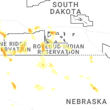
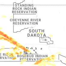
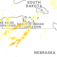


Connect with Interactive Hail Maps