

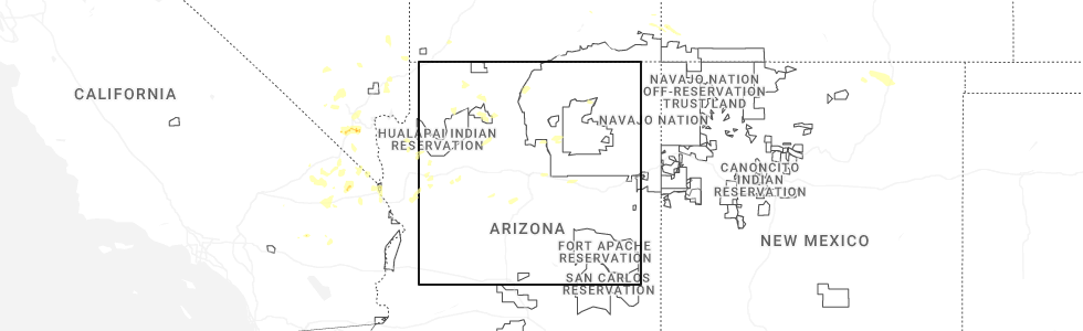
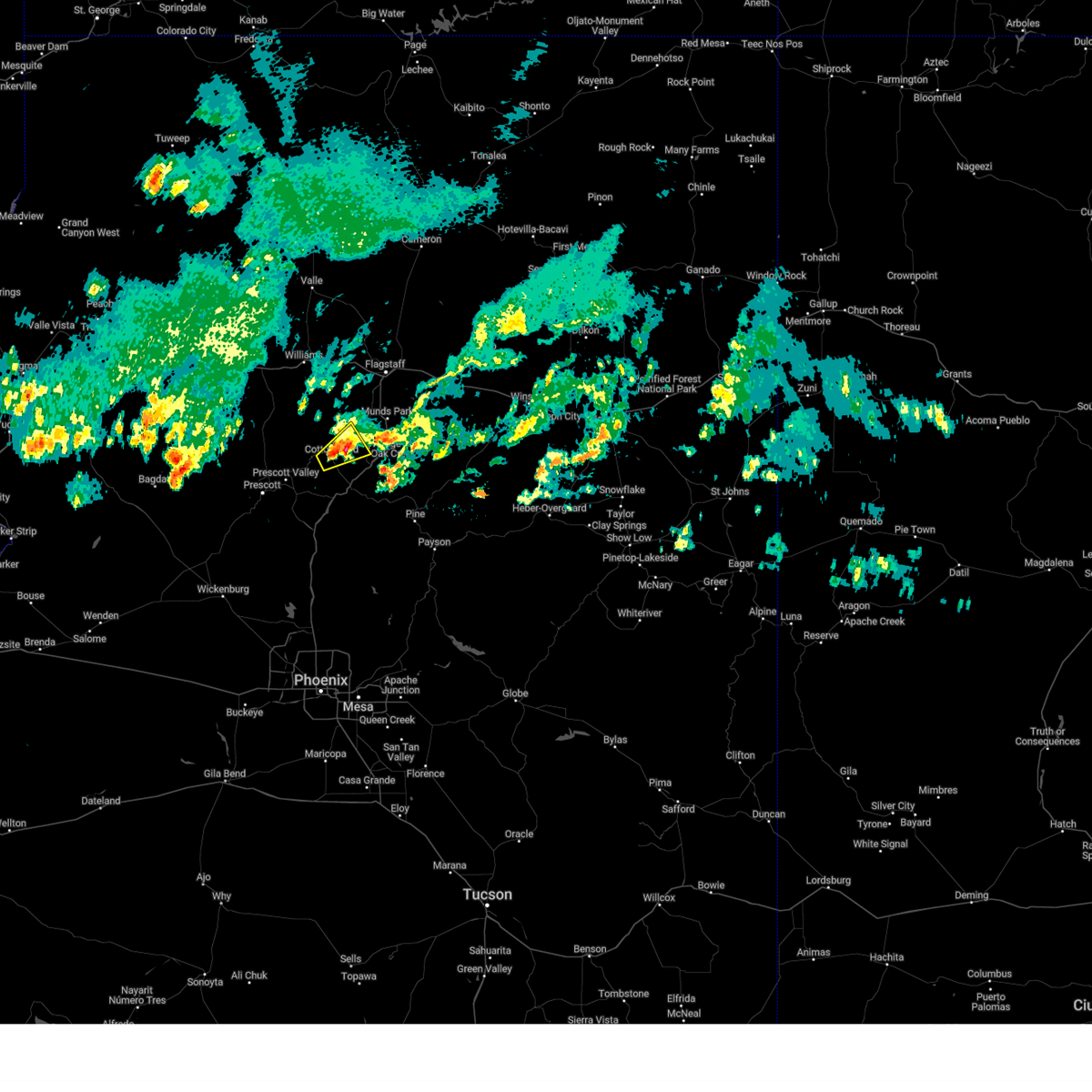
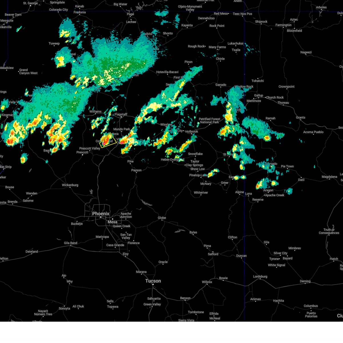
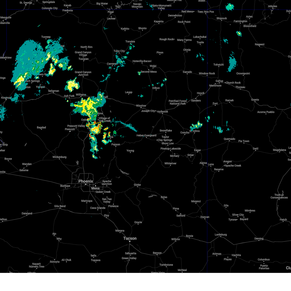
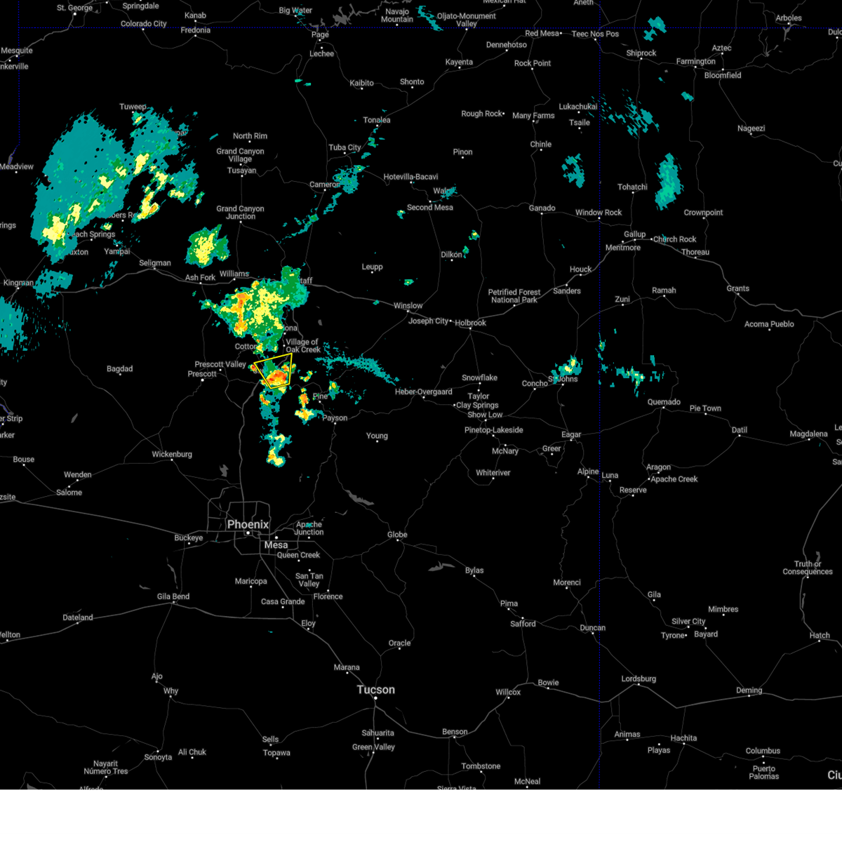
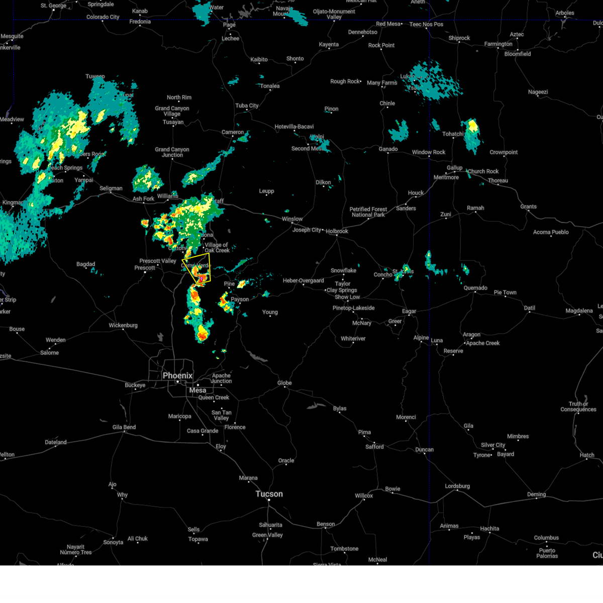
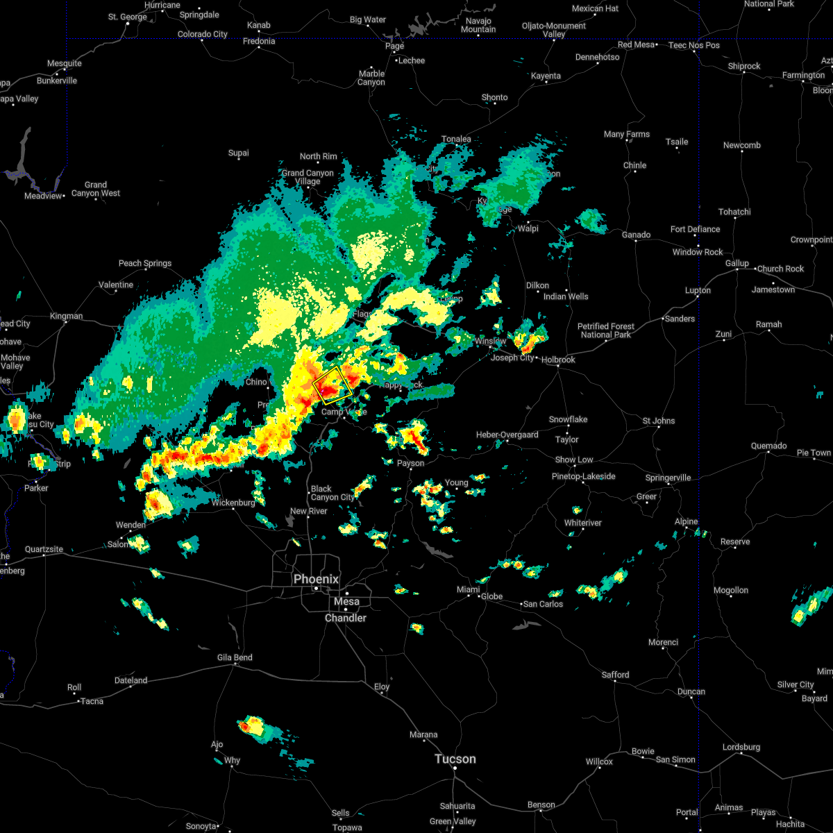
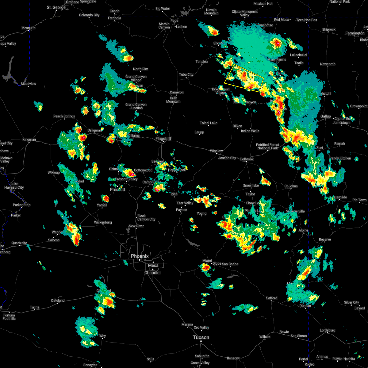
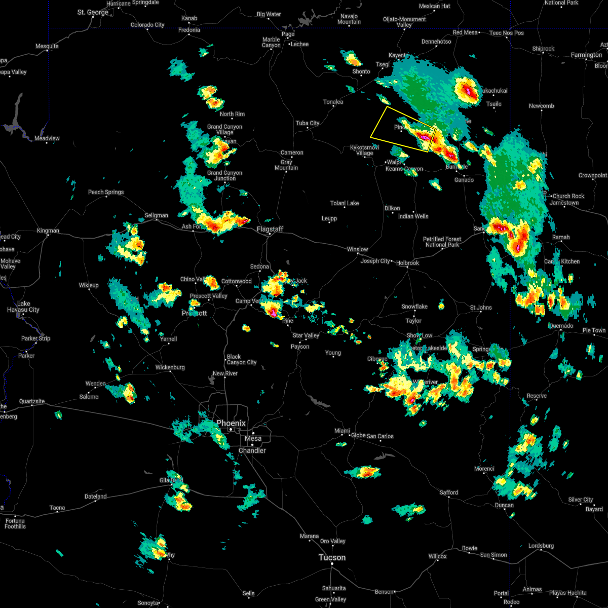
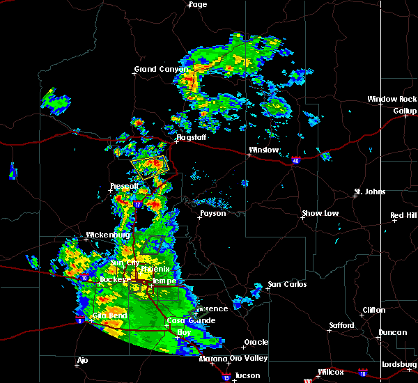
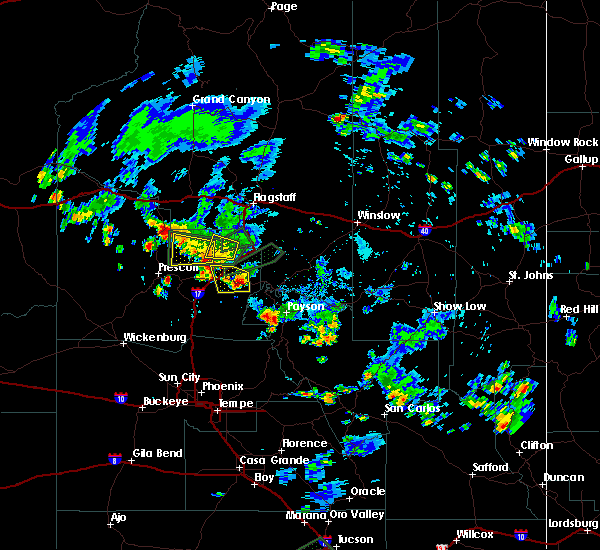
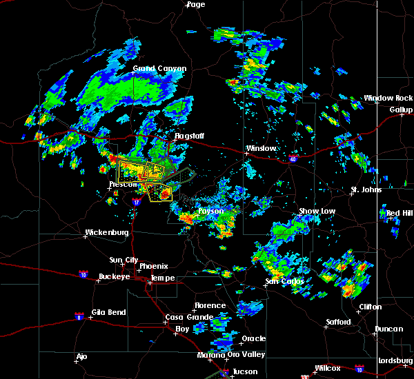
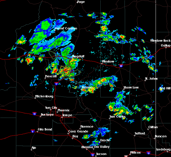
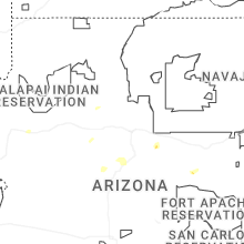
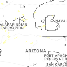
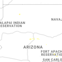
Hail Map for Cottonwood, AZ
The Cottonwood, AZ area has had 4 reports of on-the-ground hail by trained spotters, and has been under severe weather warnings 11 times during the past 12 months. Doppler radar has detected hail at or near Cottonwood, AZ on 70 occasions, including 5 occasions during the past year.
| Name: | Cottonwood, AZ |
| Where Located: | 38.6 miles SSW of Flagstaff, AZ |
| Map: | Google Map for Cottonwood, AZ |
| Population: | 11265 |
| Housing Units: | 5866 |
| More Info: | Search Google for Cottonwood, AZ |
3
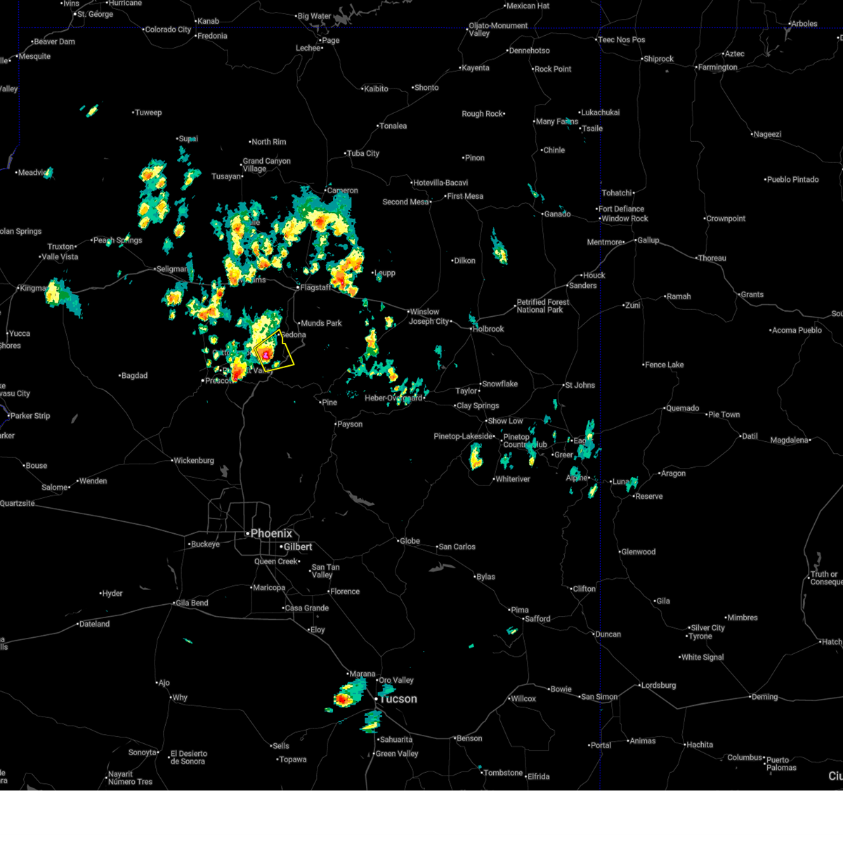
The Top Recent Hail Date for Cottonwood, AZ is Tuesday, June 3, 2025 (10th out of 70)
Hail and Wind Damage Spotted near Cottonwood, AZ
| Date / Time | Report Details |
|---|---|
| 7/3/2025 1:53 PM MST |
 Svrfgz the national weather service in flagstaff has issued a * severe thunderstorm warning for, yavapai county in west central arizona, * until 245 pm mst. * at 153 pm mst, a severe thunderstorm was located over cornville, or 10 miles north of camp verde, moving east at 10 mph (radar indicated). Hazards include 60 mph wind gusts and quarter size hail. Hail damage to vehicles is expected. Expect wind damage to roofs, siding, and trees. Svrfgz the national weather service in flagstaff has issued a * severe thunderstorm warning for, yavapai county in west central arizona, * until 245 pm mst. * at 153 pm mst, a severe thunderstorm was located over cornville, or 10 miles north of camp verde, moving east at 10 mph (radar indicated). Hazards include 60 mph wind gusts and quarter size hail. Hail damage to vehicles is expected. Expect wind damage to roofs, siding, and trees.
|
| 6/9/2025 6:27 PM MST |
 The thunderstorm over the central verde valley that was capable of producing severe wind gusts has weakened. light showers and wind gusts to 40 mph will persist through 7 pm mst. the warning will be allowed to expire. The thunderstorm over the central verde valley that was capable of producing severe wind gusts has weakened. light showers and wind gusts to 40 mph will persist through 7 pm mst. the warning will be allowed to expire.
|
| 6/9/2025 6:00 PM MST |
 Svrfgz the national weather service in flagstaff has issued a * severe thunderstorm warning for, yavapai county in west central arizona, * until 630 pm mst. * at 558 pm mst, a severe thunderstorm was located over cornville, or 11 miles northwest of camp verde, moving north at 15 mph (radar indicated). Hazards include 60 mph wind gusts. expect damage to roofs, siding, and trees Svrfgz the national weather service in flagstaff has issued a * severe thunderstorm warning for, yavapai county in west central arizona, * until 630 pm mst. * at 558 pm mst, a severe thunderstorm was located over cornville, or 11 miles northwest of camp verde, moving north at 15 mph (radar indicated). Hazards include 60 mph wind gusts. expect damage to roofs, siding, and trees
|
| 6/3/2025 7:39 PM MST |
 the severe thunderstorm warning has been cancelled and is no longer in effect the severe thunderstorm warning has been cancelled and is no longer in effect
|
| 6/3/2025 7:10 PM MST |
 Svrfgz the national weather service in flagstaff has issued a * severe thunderstorm warning for, east central yavapai county in west central arizona, * until 800 pm mst. * at 709 pm mst, a severe thunderstorm was located over cottonwood, or 12 miles northwest of camp verde, moving northeast at 15 mph (radar indicated). Hazards include quarter size hail. damage to vehicles is expected Svrfgz the national weather service in flagstaff has issued a * severe thunderstorm warning for, east central yavapai county in west central arizona, * until 800 pm mst. * at 709 pm mst, a severe thunderstorm was located over cottonwood, or 12 miles northwest of camp verde, moving northeast at 15 mph (radar indicated). Hazards include quarter size hail. damage to vehicles is expected
|
| 8/10/2024 8:32 PM MST |
 the severe thunderstorm warning has been cancelled and is no longer in effect the severe thunderstorm warning has been cancelled and is no longer in effect
|
| 8/10/2024 8:20 PM MST |
 At 819 pm mst, a severe thunderstorm was located over fort verde state historic park, or over camp verde, moving north at 20 mph (radar indicated). Hazards include 60 mph wind gusts and nickel size hail. Expect damage to roofs, siding, and trees. locations impacted include, verde lakes, camp verde, montezuma airport, beaverhead flat, wet beaver creek day use area, rockin' river ranch state park, montezuma castle national monument, mcguireville, out of africa wildlife park, fort verde state historic park, rimrock airport, mountain view estates, montezuma well, crane petroglyph heritage site, rimrock, lawrence crossing, middle verde, lake montezuma, bignotti, and cottonwood. this includes the following highways, interstate 17 between mile markers 284 and 302. state route 260 between mile markers 211 and 230. State route 179 between mile markers 299 and 301. At 819 pm mst, a severe thunderstorm was located over fort verde state historic park, or over camp verde, moving north at 20 mph (radar indicated). Hazards include 60 mph wind gusts and nickel size hail. Expect damage to roofs, siding, and trees. locations impacted include, verde lakes, camp verde, montezuma airport, beaverhead flat, wet beaver creek day use area, rockin' river ranch state park, montezuma castle national monument, mcguireville, out of africa wildlife park, fort verde state historic park, rimrock airport, mountain view estates, montezuma well, crane petroglyph heritage site, rimrock, lawrence crossing, middle verde, lake montezuma, bignotti, and cottonwood. this includes the following highways, interstate 17 between mile markers 284 and 302. state route 260 between mile markers 211 and 230. State route 179 between mile markers 299 and 301.
|
| 8/10/2024 8:05 PM MST |
 Svrfgz the national weather service in flagstaff has issued a * severe thunderstorm warning for, yavapai county in west central arizona, * until 845 pm mst. * at 804 pm mst, a severe thunderstorm was located over verde lakes, or near camp verde, moving north at 15 mph (radar indicated). Hazards include 60 mph wind gusts and quarter size hail. Hail damage to vehicles is expected. Expect wind damage to roofs, siding, and trees. Svrfgz the national weather service in flagstaff has issued a * severe thunderstorm warning for, yavapai county in west central arizona, * until 845 pm mst. * at 804 pm mst, a severe thunderstorm was located over verde lakes, or near camp verde, moving north at 15 mph (radar indicated). Hazards include 60 mph wind gusts and quarter size hail. Hail damage to vehicles is expected. Expect wind damage to roofs, siding, and trees.
|
| 7/25/2024 4:43 PM MST |
 The storm which prompted the warning has weakened below severe limits, and no longer poses an immediate threat to life or property. therefore, the warning will be allowed to expire. however, gusty winds and heavy rain are still possible with this thunderstorm. The storm which prompted the warning has weakened below severe limits, and no longer poses an immediate threat to life or property. therefore, the warning will be allowed to expire. however, gusty winds and heavy rain are still possible with this thunderstorm.
|
| 7/25/2024 4:33 PM MST |
 At 433 pm mst, a severe thunderstorm was located 7 miles southwest of flower pot, or 14 miles southwest of camp verde, moving southeast at 20 mph (radar indicated). Hazards include 60 mph wind gusts and penny size hail. Expect damage to roofs, siding, and trees. locations impacted include, bullpen day use area, verde lakes, cordes junction, camp verde, cordes lakes, arcosanti, cherry, montezuma airport, rockin' river ranch state park, cedar bench wilderness, out of africa wildlife park, spring valley, cedar mill, fort verde state historic park, mountain view estates, middle verde, flower pot, dugas, mayer, and montezuma castle national monument. this includes the following highways, interstate 17 between mile markers 257 and 290. state route 260 between mile markers 212 and 236. State route 69 between mile markers 263 and 270. At 433 pm mst, a severe thunderstorm was located 7 miles southwest of flower pot, or 14 miles southwest of camp verde, moving southeast at 20 mph (radar indicated). Hazards include 60 mph wind gusts and penny size hail. Expect damage to roofs, siding, and trees. locations impacted include, bullpen day use area, verde lakes, cordes junction, camp verde, cordes lakes, arcosanti, cherry, montezuma airport, rockin' river ranch state park, cedar bench wilderness, out of africa wildlife park, spring valley, cedar mill, fort verde state historic park, mountain view estates, middle verde, flower pot, dugas, mayer, and montezuma castle national monument. this includes the following highways, interstate 17 between mile markers 257 and 290. state route 260 between mile markers 212 and 236. State route 69 between mile markers 263 and 270.
|
| 7/25/2024 4:16 PM MST |
 Svrfgz the national weather service in flagstaff has issued a * severe thunderstorm warning for, yavapai county from nea cherry to cordes junction in west central arizona, * until 445 pm mst. * at 415 pm mst, a severe thunderstorm was located near flower pot, or 8 miles west of camp verde, moving southeast at 20 mph (radar indicated). Hazards include 60 mph wind gusts and penny size hail. expect damage to roofs, siding, and trees Svrfgz the national weather service in flagstaff has issued a * severe thunderstorm warning for, yavapai county from nea cherry to cordes junction in west central arizona, * until 445 pm mst. * at 415 pm mst, a severe thunderstorm was located near flower pot, or 8 miles west of camp verde, moving southeast at 20 mph (radar indicated). Hazards include 60 mph wind gusts and penny size hail. expect damage to roofs, siding, and trees
|
| 9/13/2023 5:43 PM MST | Quarter sized hail reported 151.7 miles NE of Cottonwood, AZ, hail... very heavy rain... and local flooding in area. quarter sized hail reported. |
| 9/13/2023 5:43 PM MST |
 At 541 pm mst, a severe thunderstorm was located over bignotti, or 8 miles northwest of camp verde, and is nearly stationary (radar indicated). Hazards include 60 mph wind gusts and half dollar size hail. Hail damage to vehicles is expected. expect wind damage to roofs, siding, and trees. locations impacted include, verde village, bridgeport, cottonwood, bignotti, jordan, cornville, tissaw trailhead, hayfield draw ohv area, cottonwood airport, mormons crossing swimming hole, deadhorse ranch state park, and mcguireville. this includes the following highways, state route 260 between mile markers 207 and 213. state route 89a between mile markers 352 and 358. hail threat, radar indicated max hail size, 1. 25 in wind threat, radar indicated max wind gust, 60 mph. At 541 pm mst, a severe thunderstorm was located over bignotti, or 8 miles northwest of camp verde, and is nearly stationary (radar indicated). Hazards include 60 mph wind gusts and half dollar size hail. Hail damage to vehicles is expected. expect wind damage to roofs, siding, and trees. locations impacted include, verde village, bridgeport, cottonwood, bignotti, jordan, cornville, tissaw trailhead, hayfield draw ohv area, cottonwood airport, mormons crossing swimming hole, deadhorse ranch state park, and mcguireville. this includes the following highways, state route 260 between mile markers 207 and 213. state route 89a between mile markers 352 and 358. hail threat, radar indicated max hail size, 1. 25 in wind threat, radar indicated max wind gust, 60 mph.
|
| 9/13/2023 5:35 PM MST |
 At 535 pm mst, a severe thunderstorm was located over verde village, or 9 miles northwest of camp verde, and is nearly stationary (radar indicated). Hazards include 60 mph wind gusts and quarter size hail. Hail damage to vehicles is expected. Expect wind damage to roofs, siding, and trees. At 535 pm mst, a severe thunderstorm was located over verde village, or 9 miles northwest of camp verde, and is nearly stationary (radar indicated). Hazards include 60 mph wind gusts and quarter size hail. Hail damage to vehicles is expected. Expect wind damage to roofs, siding, and trees.
|
| 5/19/2023 1:36 PM MST |
 At 136 pm mst, a severe thunderstorm was located over verde village, or 9 miles northwest of camp verde, and is nearly stationary (radar indicated). Hazards include 60 mph wind gusts and quarter size hail. Hail damage to vehicles is expected. Expect wind damage to roofs, siding, and trees. At 136 pm mst, a severe thunderstorm was located over verde village, or 9 miles northwest of camp verde, and is nearly stationary (radar indicated). Hazards include 60 mph wind gusts and quarter size hail. Hail damage to vehicles is expected. Expect wind damage to roofs, siding, and trees.
|
| 10/3/2022 2:45 PM MST |
 At 244 pm mst, a severe thunderstorm was located over bridgeport, or 12 miles northwest of camp verde, moving northeast at 10 mph (radar indicated). Hazards include 60 mph wind gusts and nickel size hail. expect damage to roofs, siding, and trees At 244 pm mst, a severe thunderstorm was located over bridgeport, or 12 miles northwest of camp verde, moving northeast at 10 mph (radar indicated). Hazards include 60 mph wind gusts and nickel size hail. expect damage to roofs, siding, and trees
|
| 10/3/2022 2:38 PM MST |
 The severe thunderstorm warning for coconino and yavapai counties will expire at 245 pm mst, the severe thunderstorm which prompted the warning has weakened. therefore, the warning will be allowed to expire. however heavy rain is still possible with this thunderstorm. The severe thunderstorm warning for coconino and yavapai counties will expire at 245 pm mst, the severe thunderstorm which prompted the warning has weakened. therefore, the warning will be allowed to expire. however heavy rain is still possible with this thunderstorm.
|
| 10/3/2022 2:07 PM MST |
 At 207 pm mst, a severe thunderstorm was located near perkinsville, or 14 miles east of chino valley, moving east at 20 mph (radar indicated). Hazards include 60 mph wind gusts and quarter size hail. Hail damage to vehicles is expected. Expect wind damage to roofs, siding, and trees. At 207 pm mst, a severe thunderstorm was located near perkinsville, or 14 miles east of chino valley, moving east at 20 mph (radar indicated). Hazards include 60 mph wind gusts and quarter size hail. Hail damage to vehicles is expected. Expect wind damage to roofs, siding, and trees.
|
| 8/23/2022 4:54 PM MST | Quarter sized hail reported 151.3 miles NE of Cottonwood, AZ, public reports quarter size hail. size ranged from quarter to penny. |
| 8/23/2022 3:51 PM MST | The severe thunderstorm warning for yavapai county will expire at 400 pm mst, the storm which prompted the warning has weakened below severe limits, and no longer poses an immediate threat to life or property. therefore, the warning will be allowed to expire. however small hail is still possible with this thunderstorm. |
| 8/23/2022 3:40 PM MST | Quarter sized hail reported 151.3 miles NE of Cottonwood, AZ, corrects previous hail report from 1 nne cottonwood. public reports quarter size hail. size ranged from quarter to penny. |
| 8/23/2022 3:40 PM MST | The severe thunderstorm warning for yavapai county will expire at 345 pm mst, the storm which prompted the warning has weakened below severe limits, and has exited the warned area. therefore, the warning will be allowed to expire. however small hail is still possible with this thunderstorm. remember, a severe thunderstorm warning still remains in effect for areas near cottonwood arizona. |
| 8/23/2022 3:36 PM MST | At 336 pm mst, a severe thunderstorm was located near verde village, or 11 miles northwest of camp verde, moving southwest at 10 mph (radar indicated). Hazards include 60 mph wind gusts and half dollar size hail. Hail damage to vehicles is expected. Expect wind damage to roofs, siding, and trees. |
| 8/23/2022 3:30 PM MST | Trained weather spotter reported a 61 mph thunderstorm wind gust measured using his davis weather station as well as pea size hail and torrential rainfal in yavapai county AZ, 152.6 miles NE of Cottonwood, AZ |
| 8/23/2022 3:30 PM MST | Quarter sized hail reported 151.3 miles NE of Cottonwood, AZ, public report of 1.00 inch... quarter size hail. |
| 8/23/2022 3:17 PM MST | At 317 pm mst, a severe thunderstorm was located over verde village, or 10 miles northwest of camp verde, moving southwest at 10 mph (radar indicated). Hazards include 60 mph wind gusts and half dollar size hail. Hail damage to vehicles is expected. Expect wind damage to roofs, siding, and trees. |
| 8/21/2022 4:15 PM MST |
 At 413 pm mst, a severe thunderstorm was located near cherry, west of camp verde, moving south at 5 to 10 mph, bringing hazardous travel conditions to portions of i-17 and highway 169 (radar indicated). Hazards include up to 60 mph wind gusts, quarter size hail, and heavy rainfall. Hail damage to vehicles is expected. expect wind damage to roofs, siding, and trees. locations impacted include, camp verde, cherry and powell springs campground. hail threat, radar indicated max hail size, 1. 00 in wind threat, radar indicated max wind gust, 60 mph. At 413 pm mst, a severe thunderstorm was located near cherry, west of camp verde, moving south at 5 to 10 mph, bringing hazardous travel conditions to portions of i-17 and highway 169 (radar indicated). Hazards include up to 60 mph wind gusts, quarter size hail, and heavy rainfall. Hail damage to vehicles is expected. expect wind damage to roofs, siding, and trees. locations impacted include, camp verde, cherry and powell springs campground. hail threat, radar indicated max hail size, 1. 00 in wind threat, radar indicated max wind gust, 60 mph.
|
| 8/21/2022 3:50 PM MST |
 At 349 pm mst, a severe thunderstorm was located over cherry, or 8 miles west of camp verde, moving south at 5 mph (radar indicated). Hazards include up to 50 mph wind gusts, quarter size hail, and heavy rainfall. Hail damage to vehicles is expected. Expect wind damage to roofs, siding, and trees. At 349 pm mst, a severe thunderstorm was located over cherry, or 8 miles west of camp verde, moving south at 5 mph (radar indicated). Hazards include up to 50 mph wind gusts, quarter size hail, and heavy rainfall. Hail damage to vehicles is expected. Expect wind damage to roofs, siding, and trees.
|
| 8/3/2022 3:11 PM MST |
 At 311 pm mst, a severe thunderstorm was located near jerome, or 12 miles northeast of prescott valley, moving southwest at 5 mph (radar indicated). Hazards include 60 mph wind gusts and quarter size hail. Hail damage to vehicles is expected. Expect wind damage to roofs, siding, and trees. At 311 pm mst, a severe thunderstorm was located near jerome, or 12 miles northeast of prescott valley, moving southwest at 5 mph (radar indicated). Hazards include 60 mph wind gusts and quarter size hail. Hail damage to vehicles is expected. Expect wind damage to roofs, siding, and trees.
|
| 7/17/2022 4:41 PM MST |
 The severe thunderstorm warning for yavapai county will expire at 445 pm mst, the storm which prompted the warning has weakened below severe limits, and has exited the warned area. therefore, the warning will be allowed to expire. however small hail, gusty winds and heavy rain are still possible with this thunderstorm. The severe thunderstorm warning for yavapai county will expire at 445 pm mst, the storm which prompted the warning has weakened below severe limits, and has exited the warned area. therefore, the warning will be allowed to expire. however small hail, gusty winds and heavy rain are still possible with this thunderstorm.
|
| 7/17/2022 4:01 PM MST |
 At 400 pm mst, a severe thunderstorm was located over montezuma castle national monument, or near camp verde, moving northwest at 15 mph (radar indicated). Hazards include 60 mph wind gusts and quarter size hail. Hail damage to vehicles is expected. Expect wind damage to roofs, siding, and trees. At 400 pm mst, a severe thunderstorm was located over montezuma castle national monument, or near camp verde, moving northwest at 15 mph (radar indicated). Hazards include 60 mph wind gusts and quarter size hail. Hail damage to vehicles is expected. Expect wind damage to roofs, siding, and trees.
|
| 8/5/2021 3:52 PM MST |
 The severe thunderstorm warning for yavapai county will expire at 400 pm mst, the storm near jerome which prompted the severe thunderstorm warning has weakened below severe limits. therefore, the warning will be allowed to expire at 400 pm mst. this storm produced over an inch of rainfall just south of jerome and minor flows may be observed in blowout creek and oak wash this afternoon. The severe thunderstorm warning for yavapai county will expire at 400 pm mst, the storm near jerome which prompted the severe thunderstorm warning has weakened below severe limits. therefore, the warning will be allowed to expire at 400 pm mst. this storm produced over an inch of rainfall just south of jerome and minor flows may be observed in blowout creek and oak wash this afternoon.
|
| 8/5/2021 3:36 PM MST |
 At 334 pm mst, a severe thunderstorm was located near jerome and is nearly stationary (radar indicated). Hazards include 60 mph wind gusts and quarter size hail. Hail damage to vehicles is expected. Expect wind damage to roofs, siding, and trees. At 334 pm mst, a severe thunderstorm was located near jerome and is nearly stationary (radar indicated). Hazards include 60 mph wind gusts and quarter size hail. Hail damage to vehicles is expected. Expect wind damage to roofs, siding, and trees.
|
| 7/29/2021 2:41 PM MDT |
 The severe thunderstorm warning for apache and navajo counties will expire at 145 pm mst/245 pm mdt/, the thunderstorm which prompted the severe thunderstorm warning near salina has weakened. therefore, the warning will be allowed to expire. however, small hail and very heavy rain are still possible with this thunderstorm from salina to areas west of pinon. The severe thunderstorm warning for apache and navajo counties will expire at 145 pm mst/245 pm mdt/, the thunderstorm which prompted the severe thunderstorm warning near salina has weakened. therefore, the warning will be allowed to expire. however, small hail and very heavy rain are still possible with this thunderstorm from salina to areas west of pinon.
|
| 7/29/2021 2:07 PM MDT |
 At 106 pm mst/206 pm mdt/, a severe thunderstorm was located near whippoorwill chapter house, or 19 miles northeast of keams canyon, moving northwest at 35 mph (radar indicated). Hazards include 60 mph wind gusts and half dollar size hail. Hail damage to vehicles is expected. Expect wind damage to roofs, siding, and trees. At 106 pm mst/206 pm mdt/, a severe thunderstorm was located near whippoorwill chapter house, or 19 miles northeast of keams canyon, moving northwest at 35 mph (radar indicated). Hazards include 60 mph wind gusts and half dollar size hail. Hail damage to vehicles is expected. Expect wind damage to roofs, siding, and trees.
|
| 7/16/2021 4:18 PM MST |
 At 417 pm mst, a severe thunderstorm was located over cornville, or 9 miles north of camp verde, and is nearly stationary (radar indicated). Hazards include 50 mph wind gusts and quarter size hail. hail damage to vehicles is expected At 417 pm mst, a severe thunderstorm was located over cornville, or 9 miles north of camp verde, and is nearly stationary (radar indicated). Hazards include 50 mph wind gusts and quarter size hail. hail damage to vehicles is expected
|
| 7/9/2021 3:02 PM MST |
 At 300 pm mst, a severe thunderstorm was located near cherry, or 14 miles west of camp verde, and is nearly stationary (radar indicated). Hazards include 60 mph wind gusts and quarter size hail. Hail damage to vehicles is expected. Expect wind damage to roofs, siding, and trees. At 300 pm mst, a severe thunderstorm was located near cherry, or 14 miles west of camp verde, and is nearly stationary (radar indicated). Hazards include 60 mph wind gusts and quarter size hail. Hail damage to vehicles is expected. Expect wind damage to roofs, siding, and trees.
|
| 5/15/2021 3:28 PM MDT |
 The severe thunderstorm warning for apache and navajo counties will expire at 330 pm mdt, the severe thunderstorm near salina and cottonwood, in apache county, has weakened below severe limits, and no longer poses an immediate threat to life or property. therefore, the warning will be allowed to expire. gusty winds to 45 mph and light showers remain possible in this area until 4 pm mdt. The severe thunderstorm warning for apache and navajo counties will expire at 330 pm mdt, the severe thunderstorm near salina and cottonwood, in apache county, has weakened below severe limits, and no longer poses an immediate threat to life or property. therefore, the warning will be allowed to expire. gusty winds to 45 mph and light showers remain possible in this area until 4 pm mdt.
|
| 5/15/2021 3:03 PM MDT |
 At 302 pm mdt, a severe thunderstorm was located near low mountain, or 14 miles northeast of keams canyon, moving northeast at 30 mph (radar indicated). Hazards include 60 mph wind gusts. Expect damage to roofs, siding, and trees. this severe thunderstorm will be near, salina around 320 pm mdt. tselani-cottonwood around 325 pm mdt. Blue gap chapter house around 330 pm mdt. At 302 pm mdt, a severe thunderstorm was located near low mountain, or 14 miles northeast of keams canyon, moving northeast at 30 mph (radar indicated). Hazards include 60 mph wind gusts. Expect damage to roofs, siding, and trees. this severe thunderstorm will be near, salina around 320 pm mdt. tselani-cottonwood around 325 pm mdt. Blue gap chapter house around 330 pm mdt.
|
| 8/23/2020 4:10 PM MST |
 The severe thunderstorm warning for yavapai county will expire at 415 pm mst, the storm which prompted the warning has weakened below severe limits, and no longer poses an immediate threat to life or property. therefore, the warning will be allowed to expire. however gusty winds and heavy rain are still occurring with this thunderstorm. The severe thunderstorm warning for yavapai county will expire at 415 pm mst, the storm which prompted the warning has weakened below severe limits, and no longer poses an immediate threat to life or property. therefore, the warning will be allowed to expire. however gusty winds and heavy rain are still occurring with this thunderstorm.
|
| 8/23/2020 3:48 PM MST |
 At 348 pm mst, a severe thunderstorm was located near middle verde, or near camp verde, moving north at 10 mph (radar indicated). Hazards include 60 mph wind gusts and quarter size hail. Hail damage to vehicles is expected. Expect wind damage to roofs, siding, and trees. At 348 pm mst, a severe thunderstorm was located near middle verde, or near camp verde, moving north at 10 mph (radar indicated). Hazards include 60 mph wind gusts and quarter size hail. Hail damage to vehicles is expected. Expect wind damage to roofs, siding, and trees.
|
| 8/21/2020 5:22 PM MST |
 At 459 pm mst, a severe thunderstorm was located near cherry and cottonwood and is nearly stationary (radar indicated). Hazards include 60 mph wind gusts and quarter size hail. Hail damage to vehicles is expected. expect wind damage to roofs, siding, and trees. Locations impacted include, camp verde, prescott valley, clarkdale, verde village, cherry, bridgeport, cottonwood, middle verde, jerome, mingus mountain campground, playground group campground, potato patch campground and powell springs campground. At 459 pm mst, a severe thunderstorm was located near cherry and cottonwood and is nearly stationary (radar indicated). Hazards include 60 mph wind gusts and quarter size hail. Hail damage to vehicles is expected. expect wind damage to roofs, siding, and trees. Locations impacted include, camp verde, prescott valley, clarkdale, verde village, cherry, bridgeport, cottonwood, middle verde, jerome, mingus mountain campground, playground group campground, potato patch campground and powell springs campground.
|
| 8/21/2020 5:00 PM MST |
 At 459 pm mst, a severe thunderstorm was located near cherry and cottonwood and is nearly stationary (radar indicated). Hazards include 60 mph wind gusts and quarter size hail. Hail damage to vehicles is expected. expect wind damage to roofs, siding, and trees. Locations impacted include, camp verde, prescott valley, clarkdale, verde village, cherry, bridgeport, cottonwood, middle verde, jerome, mingus mountain campground, playground group campground, potato patch campground and powell springs campground. At 459 pm mst, a severe thunderstorm was located near cherry and cottonwood and is nearly stationary (radar indicated). Hazards include 60 mph wind gusts and quarter size hail. Hail damage to vehicles is expected. expect wind damage to roofs, siding, and trees. Locations impacted include, camp verde, prescott valley, clarkdale, verde village, cherry, bridgeport, cottonwood, middle verde, jerome, mingus mountain campground, playground group campground, potato patch campground and powell springs campground.
|
| 8/21/2020 4:46 PM MST |
 At 445 pm mst, a severe thunderstorm was located near cottonwood, or 15 miles northwest of camp verde, and is nearly stationary (radar indicated. this storm has a history of nickel size hail and strong winds). Hazards include 60 mph wind gusts and quarter size hail. Hail damage to vehicles is expected. Expect wind damage to roofs, siding, and trees. At 445 pm mst, a severe thunderstorm was located near cottonwood, or 15 miles northwest of camp verde, and is nearly stationary (radar indicated. this storm has a history of nickel size hail and strong winds). Hazards include 60 mph wind gusts and quarter size hail. Hail damage to vehicles is expected. Expect wind damage to roofs, siding, and trees.
|
| 8/21/2020 4:37 PM MST |
 At 437 pm mst, a severe thunderstorm was located near yavapai county fairgrounds, or 11 miles northeast of prescott valley, moving southwest at 10 mph (trained weather spotters reported nickel sized hail and estimated 60 mph winds). Hazards include 60 mph wind gusts and quarter size hail. Hail damage to vehicles is expected. expect wind damage to roofs, siding, and trees. Locations impacted include, clarkdale, verde village, cottonwood, jerome, mingus mountain campground, playground group campground and potato patch campground. At 437 pm mst, a severe thunderstorm was located near yavapai county fairgrounds, or 11 miles northeast of prescott valley, moving southwest at 10 mph (trained weather spotters reported nickel sized hail and estimated 60 mph winds). Hazards include 60 mph wind gusts and quarter size hail. Hail damage to vehicles is expected. expect wind damage to roofs, siding, and trees. Locations impacted include, clarkdale, verde village, cottonwood, jerome, mingus mountain campground, playground group campground and potato patch campground.
|
| 8/21/2020 4:34 PM MST | Nickel sized hail... strong winds and heavy rai in yavapai county AZ, 154.8 miles NE of Cottonwood, AZ |
| 8/21/2020 4:19 PM MST |
 At 419 pm mst, a severe thunderstorm was located 7 miles east of yavapai county fairgrounds, or 14 miles northeast of prescott valley, moving southwest at 10 mph (radar indicated). Hazards include 60 mph wind gusts and quarter size hail. Hail damage to vehicles is expected. Expect wind damage to roofs, siding, and trees. At 419 pm mst, a severe thunderstorm was located 7 miles east of yavapai county fairgrounds, or 14 miles northeast of prescott valley, moving southwest at 10 mph (radar indicated). Hazards include 60 mph wind gusts and quarter size hail. Hail damage to vehicles is expected. Expect wind damage to roofs, siding, and trees.
|
| 8/3/2019 2:53 PM MST |
 At 252 pm mst, a severe thunderstorm was located over bridgeport, or 13 miles northwest of camp verde, moving northeast at 10 mph (radar indicated). Hazards include 60 mph wind gusts and quarter size hail. Hail damage to vehicles is expected. expect wind damage to roofs, siding, and trees. Locations impacted include, clarkdale, verde village, bridgeport, cottonwood, cornville, dead horse ranch state park and tuzigoot national monument. At 252 pm mst, a severe thunderstorm was located over bridgeport, or 13 miles northwest of camp verde, moving northeast at 10 mph (radar indicated). Hazards include 60 mph wind gusts and quarter size hail. Hail damage to vehicles is expected. expect wind damage to roofs, siding, and trees. Locations impacted include, clarkdale, verde village, bridgeport, cottonwood, cornville, dead horse ranch state park and tuzigoot national monument.
|
| 8/3/2019 2:30 PM MST |
 At 229 pm mst, a severe thunderstorm was located near verde village, or 12 miles northwest of camp verde, moving southeast at 10 mph (radar indicated). Hazards include 60 mph wind gusts and quarter size hail. Hail damage to vehicles is expected. Expect wind damage to roofs, siding, and trees. At 229 pm mst, a severe thunderstorm was located near verde village, or 12 miles northwest of camp verde, moving southeast at 10 mph (radar indicated). Hazards include 60 mph wind gusts and quarter size hail. Hail damage to vehicles is expected. Expect wind damage to roofs, siding, and trees.
|
| 8/2/2019 5:02 PM MST |
 At 502 pm mst, severe thunderstorms were located along a line extending from cornville to near strawberry, and are nearly stationary (radar indicated). Hazards include 60 mph wind gusts and quarter size hail. Hail damage to vehicles is expected. expect wind damage to roofs, siding, and trees. Locations impacted include, camp verde, verde village, mcguireville, montezuma well, montezuma castle national monument, rimrock, middle verde, lake montezuma, cornville, cottonwood and clear creek campgrounds. At 502 pm mst, severe thunderstorms were located along a line extending from cornville to near strawberry, and are nearly stationary (radar indicated). Hazards include 60 mph wind gusts and quarter size hail. Hail damage to vehicles is expected. expect wind damage to roofs, siding, and trees. Locations impacted include, camp verde, verde village, mcguireville, montezuma well, montezuma castle national monument, rimrock, middle verde, lake montezuma, cornville, cottonwood and clear creek campgrounds.
|
| 8/2/2019 4:50 PM MST |
 At 449 pm mst, severe thunderstorms were located along a line extending from cornville to 6 miles northeast of strawberry, moving east at 55 mph (radar indicated). Hazards include 60 mph wind gusts and quarter size hail. Hail damage to vehicles is expected. Expect wind damage to roofs, siding, and trees. At 449 pm mst, severe thunderstorms were located along a line extending from cornville to 6 miles northeast of strawberry, moving east at 55 mph (radar indicated). Hazards include 60 mph wind gusts and quarter size hail. Hail damage to vehicles is expected. Expect wind damage to roofs, siding, and trees.
|
| 8/26/2018 3:38 PM MST |
 The severe thunderstorm warning for yavapai county will expire at 345 pm mst, the storm which prompted the warning has weakened below severe limits, and no longer pose an immediate threat to life or property. therefore the warning will be allowed to expire. however small hail and heavy rain are still likely with this thunderstorm which could lead to areas of flash flooding. The severe thunderstorm warning for yavapai county will expire at 345 pm mst, the storm which prompted the warning has weakened below severe limits, and no longer pose an immediate threat to life or property. therefore the warning will be allowed to expire. however small hail and heavy rain are still likely with this thunderstorm which could lead to areas of flash flooding.
|
| 8/26/2018 3:30 PM MST |
 At 330 pm mst, a severe thunderstorm was located over verde village, or 12 miles northwest of camp verde, moving east at 10 mph (radar indicated). Hazards include 60 mph wind gusts and penny size hail. Expect damage to roofs, siding, and trees. locations impacted include, clarkdale, verde village, bridgeport, cottonwood, cornville, jerome, dead horse ranch state park, mingus mountain campground and playground group campground. this includes the following highways, state route 260 between mile markers 207 and 215. State route 89a near mile marker 340, and between mile markers 342 and 359. At 330 pm mst, a severe thunderstorm was located over verde village, or 12 miles northwest of camp verde, moving east at 10 mph (radar indicated). Hazards include 60 mph wind gusts and penny size hail. Expect damage to roofs, siding, and trees. locations impacted include, clarkdale, verde village, bridgeport, cottonwood, cornville, jerome, dead horse ranch state park, mingus mountain campground and playground group campground. this includes the following highways, state route 260 between mile markers 207 and 215. State route 89a near mile marker 340, and between mile markers 342 and 359.
|
| 8/26/2018 3:19 PM MST |
 At 319 pm mst, a severe thunderstorm was located near verde village, or 13 miles northwest of camp verde, moving east at 10 mph (radar indicated). Hazards include 60 mph wind gusts and quarter size hail. Hail damage to vehicles is expected. Expect wind damage to roofs, siding, and trees. At 319 pm mst, a severe thunderstorm was located near verde village, or 13 miles northwest of camp verde, moving east at 10 mph (radar indicated). Hazards include 60 mph wind gusts and quarter size hail. Hail damage to vehicles is expected. Expect wind damage to roofs, siding, and trees.
|
| 8/23/2018 2:39 PM MST |
 At 238 pm mst, a severe thunderstorm was located near jerome and was moving east at 20 mph (radar indicated). Hazards include quarter size hail. damage to vehicles is expected At 238 pm mst, a severe thunderstorm was located near jerome and was moving east at 20 mph (radar indicated). Hazards include quarter size hail. damage to vehicles is expected
|
| 8/20/2018 2:36 PM MST |
 At 235 pm mst, a severe thunderstorm was located near cherry, or 15 miles west of camp verde, moving north at 10 mph (radar indicated). Hazards include golf ball size hail and 60 mph wind gusts. People and animals outdoors will be injured. expect hail damage to roofs, siding, windows, and vehicles. Expect wind damage to roofs, siding, and trees. At 235 pm mst, a severe thunderstorm was located near cherry, or 15 miles west of camp verde, moving north at 10 mph (radar indicated). Hazards include golf ball size hail and 60 mph wind gusts. People and animals outdoors will be injured. expect hail damage to roofs, siding, windows, and vehicles. Expect wind damage to roofs, siding, and trees.
|
| 8/18/2018 4:08 PM MST |
 At 408 pm mst, a severe thunderstorm was located near clarkdale, or 12 miles west of sedona, moving southeast at 20 mph (radar indicated). Hazards include 60 mph wind gusts and penny size hail. expect damage to roofs, siding, and trees At 408 pm mst, a severe thunderstorm was located near clarkdale, or 12 miles west of sedona, moving southeast at 20 mph (radar indicated). Hazards include 60 mph wind gusts and penny size hail. expect damage to roofs, siding, and trees
|
| 8/13/2018 3:23 PM MST |
 At 321 pm mst, a severe thunderstorm was located near sedona, moving southwest at 15 mph (radar indicated). Hazards include 60 mph wind gusts and quarter size hail. Hail damage to vehicles is expected. Expect wind damage to roofs, siding, and trees. At 321 pm mst, a severe thunderstorm was located near sedona, moving southwest at 15 mph (radar indicated). Hazards include 60 mph wind gusts and quarter size hail. Hail damage to vehicles is expected. Expect wind damage to roofs, siding, and trees.
|
| 8/8/2018 3:07 PM MST |
 At 306 pm mst, a severe thunderstorm was located 7 miles northwest of page springs, or 8 miles west of sedona, moving southwest at 15 mph. this storm should be affecting the cottonwood area by 350 pm mst (radar indicated). Hazards include 70 mph wind gusts and quarter size hail. Hail damage to vehicles is expected. expect considerable tree damage. Wind damage is also likely to mobile homes, roofs, and outbuildings. At 306 pm mst, a severe thunderstorm was located 7 miles northwest of page springs, or 8 miles west of sedona, moving southwest at 15 mph. this storm should be affecting the cottonwood area by 350 pm mst (radar indicated). Hazards include 70 mph wind gusts and quarter size hail. Hail damage to vehicles is expected. expect considerable tree damage. Wind damage is also likely to mobile homes, roofs, and outbuildings.
|
| 8/8/2018 2:48 PM MST |
 At 248 pm mst, a severe thunderstorm was located 8 miles west of sedona, moving southwest at 15 mph (radar indicated). Hazards include 70 mph wind gusts and quarter size hail. Hail damage to vehicles is expected. expect considerable tree damage. Wind damage is also likely to mobile homes, roofs, and outbuildings. At 248 pm mst, a severe thunderstorm was located 8 miles west of sedona, moving southwest at 15 mph (radar indicated). Hazards include 70 mph wind gusts and quarter size hail. Hail damage to vehicles is expected. expect considerable tree damage. Wind damage is also likely to mobile homes, roofs, and outbuildings.
|
| 7/28/2018 5:10 PM MST |
 The severe thunderstorm warning for yavapai and coconino counties will expire at 515 pm mst, the storms which prompted the warning from jerome to near perkinsville have weakened below severe limits, and no longer pose an immediate threat to life or property. therefore the warning will be allowed to expire. however heavy rain is still occurring with these thunderstorms. The severe thunderstorm warning for yavapai and coconino counties will expire at 515 pm mst, the storms which prompted the warning from jerome to near perkinsville have weakened below severe limits, and no longer pose an immediate threat to life or property. therefore the warning will be allowed to expire. however heavy rain is still occurring with these thunderstorms.
|
| 7/28/2018 4:39 PM MST |
 At 437 pm mst, severe thunderstorms were located along a line extending from near perkinsville to jerome, moving southeast at 20 mph (radar indicated). Hazards include 60 mph wind gusts and half dollar size hail. Hail damage to vehicles is expected. Expect wind damage to roofs, siding, and trees. At 437 pm mst, severe thunderstorms were located along a line extending from near perkinsville to jerome, moving southeast at 20 mph (radar indicated). Hazards include 60 mph wind gusts and half dollar size hail. Hail damage to vehicles is expected. Expect wind damage to roofs, siding, and trees.
|
| 7/27/2018 6:25 PM MST |
 The severe thunderstorm warning for yavapai county will expire at 630 pm mst, the storms which prompted the warning have weakened below severe limits, and no longer pose an immediate threat to life or property. therefore the warning will be allowed to expire. however heavy rain is still possible with these thunderstorms. The severe thunderstorm warning for yavapai county will expire at 630 pm mst, the storms which prompted the warning have weakened below severe limits, and no longer pose an immediate threat to life or property. therefore the warning will be allowed to expire. however heavy rain is still possible with these thunderstorms.
|
| 7/27/2018 5:47 PM MST |
 At 546 pm mst, severe thunderstorms were located along a line extending from near stoneman lake to near cherry, moving south at 20 mph (radar indicated). Hazards include 60 mph wind gusts and quarter size hail. Hail damage to vehicles is expected. Expect wind damage to roofs, siding, and trees. At 546 pm mst, severe thunderstorms were located along a line extending from near stoneman lake to near cherry, moving south at 20 mph (radar indicated). Hazards include 60 mph wind gusts and quarter size hail. Hail damage to vehicles is expected. Expect wind damage to roofs, siding, and trees.
|
| 7/26/2018 4:23 PM MST |
 At 419 pm mst, a severe thunderstorm was located near camp verde, moving southeast at 10 mph. a station located in camp verde reported a wind gust of 72 mph (radar indicated). Hazards include 70 mph wind gusts and quarter size hail. Hail damage to vehicles is expected. expect wind damage to roofs, siding, and trees. locations impacted include, camp verde, montezuma castle national monument, middle verde, mcguireville, lake montezuma and clear creek campgrounds. this includes the following highways, interstate 17 between mile markers 282 and 296. State route 260 between mile markers 213 and 234. At 419 pm mst, a severe thunderstorm was located near camp verde, moving southeast at 10 mph. a station located in camp verde reported a wind gust of 72 mph (radar indicated). Hazards include 70 mph wind gusts and quarter size hail. Hail damage to vehicles is expected. expect wind damage to roofs, siding, and trees. locations impacted include, camp verde, montezuma castle national monument, middle verde, mcguireville, lake montezuma and clear creek campgrounds. this includes the following highways, interstate 17 between mile markers 282 and 296. State route 260 between mile markers 213 and 234.
|
| 7/26/2018 3:56 PM MST |
 At 355 pm mst, a severe thunderstorm was located near camp verde, moving southeast at 10 mph (radar indicated). Hazards include 60 mph wind gusts and quarter size hail. Hail damage to vehicles is expected. Expect wind damage to roofs, siding, and trees. At 355 pm mst, a severe thunderstorm was located near camp verde, moving southeast at 10 mph (radar indicated). Hazards include 60 mph wind gusts and quarter size hail. Hail damage to vehicles is expected. Expect wind damage to roofs, siding, and trees.
|
| 7/18/2018 2:58 PM MST |
 At 255 pm mst, a severe thunderstorm was located near cottonwood. this storm was nearly stationary or building slowly east and north (radar indicated). Hazards include 60 mph wind gusts and quarter size hail. Hail damage to vehicles is expected. Expect wind damage to roofs, siding, and trees. At 255 pm mst, a severe thunderstorm was located near cottonwood. this storm was nearly stationary or building slowly east and north (radar indicated). Hazards include 60 mph wind gusts and quarter size hail. Hail damage to vehicles is expected. Expect wind damage to roofs, siding, and trees.
|
| 7/9/2018 5:49 PM MST |
 At 548 pm mst, a severe thunderstorm was located near sedona, moving west at 25 mph (radar indicated). Hazards include 60 mph wind gusts and penny size hail. expect damage to roofs, siding, and trees At 548 pm mst, a severe thunderstorm was located near sedona, moving west at 25 mph (radar indicated). Hazards include 60 mph wind gusts and penny size hail. expect damage to roofs, siding, and trees
|
| 7/23/2017 3:43 PM MST |
 At 342 pm mst, a severe thunderstorm was located over verde village, or 12 miles northwest of camp verde, moving south at 10 mph (radar indicated). Hazards include 60 mph wind gusts and penny size hail. Expect damage to roofs, siding, and trees. locations impacted include, clarkdale, verde village, bridgeport, perkinsville, cottonwood, jerome, dead horse ranch state park, mingus mountain campground, playground group campground, potato patch campground and tuzigoot national monument. this includes the following highways, state route 260 between mile markers 207 and 209. State route 89a between mile markers 329 and 359. At 342 pm mst, a severe thunderstorm was located over verde village, or 12 miles northwest of camp verde, moving south at 10 mph (radar indicated). Hazards include 60 mph wind gusts and penny size hail. Expect damage to roofs, siding, and trees. locations impacted include, clarkdale, verde village, bridgeport, perkinsville, cottonwood, jerome, dead horse ranch state park, mingus mountain campground, playground group campground, potato patch campground and tuzigoot national monument. this includes the following highways, state route 260 between mile markers 207 and 209. State route 89a between mile markers 329 and 359.
|
| 7/23/2017 3:38 PM MST |
 The severe thunderstorm warning for yavapai and coconino counties will expire at 345 pm mst, the storm which prompted the warning has weakened below severe limits, and no longer poses an immediate threat to life or property. therefore the warning will be allowed to expire. however heavy rain continues and a flash flood warning remains in effect for the area at this time. continue to monitor flash flood warnings. to report severe weather, contact your nearest law enforcement agency. they will relay your report to the national weather service flagstaff. The severe thunderstorm warning for yavapai and coconino counties will expire at 345 pm mst, the storm which prompted the warning has weakened below severe limits, and no longer poses an immediate threat to life or property. therefore the warning will be allowed to expire. however heavy rain continues and a flash flood warning remains in effect for the area at this time. continue to monitor flash flood warnings. to report severe weather, contact your nearest law enforcement agency. they will relay your report to the national weather service flagstaff.
|
| 7/23/2017 3:33 PM MST |
 At 332 pm mst, a severe thunderstorm was located 9 miles southeast of camp verde, moving west at 25 mph (radar indicated). Hazards include 60 mph wind gusts and quarter size hail. Hail damage to vehicles is expected. Expect wind damage to roofs, siding, and trees. At 332 pm mst, a severe thunderstorm was located 9 miles southeast of camp verde, moving west at 25 mph (radar indicated). Hazards include 60 mph wind gusts and quarter size hail. Hail damage to vehicles is expected. Expect wind damage to roofs, siding, and trees.
|
| 7/23/2017 3:32 PM MST |
 At 331 pm mst, a severe thunderstorm was located over page springs, or near sedona, moving west at 10 mph (radar indicated). Hazards include 60 mph wind gusts and penny size hail. Expect damage to roofs, siding, and trees. locations impacted include, sedona, page springs, village at oak creek, cornville, cottonwood and red rock state park. this includes the following highways, state route 179 near mile marker 303, and between mile markers 305 and 313. State route 89a between mile markers 357 and 374. At 331 pm mst, a severe thunderstorm was located over page springs, or near sedona, moving west at 10 mph (radar indicated). Hazards include 60 mph wind gusts and penny size hail. Expect damage to roofs, siding, and trees. locations impacted include, sedona, page springs, village at oak creek, cornville, cottonwood and red rock state park. this includes the following highways, state route 179 near mile marker 303, and between mile markers 305 and 313. State route 89a between mile markers 357 and 374.
|
| 7/23/2017 3:10 PM MST |
 At 309 pm mst, a severe thunderstorm was located near clarkdale, or 15 miles west of sedona, moving east at 10 mph (radar indicated). Hazards include 60 mph wind gusts and quarter size hail. Hail damage to vehicles is expected. Expect wind damage to roofs, siding, and trees. At 309 pm mst, a severe thunderstorm was located near clarkdale, or 15 miles west of sedona, moving east at 10 mph (radar indicated). Hazards include 60 mph wind gusts and quarter size hail. Hail damage to vehicles is expected. Expect wind damage to roofs, siding, and trees.
|
| 7/23/2017 2:56 PM MST |
 At 256 pm mst, a severe thunderstorm was located over village at oak creek, or near sedona, moving west at 10 mph (radar indicated). Hazards include 60 mph wind gusts and quarter size hail. Hail damage to vehicles is expected. Expect wind damage to roofs, siding, and trees. At 256 pm mst, a severe thunderstorm was located over village at oak creek, or near sedona, moving west at 10 mph (radar indicated). Hazards include 60 mph wind gusts and quarter size hail. Hail damage to vehicles is expected. Expect wind damage to roofs, siding, and trees.
|
| 7/21/2017 3:20 PM MST | Wind damage: tree trunk greater than 12" in diameter snapped in front of the clemenceau heritage museum. wind speed estimated 55 mph. hail: penny size - 0.75" heavy rai in yavapai county AZ, 151.3 miles NE of Cottonwood, AZ |
| 7/9/2017 5:47 PM MST |
 At 546 pm mst, a severe thunderstorm was located 2 miles west of camp verde, moving southeast at 15 mph (radar indicated). Hazards include 60 mph wind gusts and nickel size hail. Expect damage to roofs, siding, and trees. locations impacted include, camp verde, middle verde and montezuma castle national monument. this includes the following highways, interstate 17 between mile markers 279 and 291. State route 260 between mile markers 212 and 224. At 546 pm mst, a severe thunderstorm was located 2 miles west of camp verde, moving southeast at 15 mph (radar indicated). Hazards include 60 mph wind gusts and nickel size hail. Expect damage to roofs, siding, and trees. locations impacted include, camp verde, middle verde and montezuma castle national monument. this includes the following highways, interstate 17 between mile markers 279 and 291. State route 260 between mile markers 212 and 224.
|
| 7/9/2017 5:27 PM MST |
 At 526 pm mst, a severe thunderstorm was located near middle verde, or near camp verde, moving southeast at 15 mph (radar indicated). Hazards include 60 mph wind gusts and quarter size hail. Hail damage to vehicles is expected. Expect wind damage to roofs, siding, and trees. At 526 pm mst, a severe thunderstorm was located near middle verde, or near camp verde, moving southeast at 15 mph (radar indicated). Hazards include 60 mph wind gusts and quarter size hail. Hail damage to vehicles is expected. Expect wind damage to roofs, siding, and trees.
|
| 8/24/2016 3:23 PM MST |
 At 322 pm mst, doppler radar indicated a severe thunderstorm capable of producing quarter size hail. this storm was located near cherry, or 13 miles northwest of camp verde, and moving south at 10 mph. At 322 pm mst, doppler radar indicated a severe thunderstorm capable of producing quarter size hail. this storm was located near cherry, or 13 miles northwest of camp verde, and moving south at 10 mph.
|
| 7/29/2016 4:10 PM MST |
 At 409 pm mst, doppler radar indicated a severe thunderstorm capable of producing damaging winds in excess of 60 mph. this storm was located over cottonwood, or 13 miles northwest of camp verde. this storm was nearly stationary. nickel size hail may also accompany the damaging winds. At 409 pm mst, doppler radar indicated a severe thunderstorm capable of producing damaging winds in excess of 60 mph. this storm was located over cottonwood, or 13 miles northwest of camp verde. this storm was nearly stationary. nickel size hail may also accompany the damaging winds.
|
| 8/26/2015 2:02 PM MST |
 At 201 pm mst, doppler radar indicated a severe thunderstorm capable of producing quarter size hail. this storm was located near verde village, or 10 miles northwest of camp verde, and moving east at 10 mph. At 201 pm mst, doppler radar indicated a severe thunderstorm capable of producing quarter size hail. this storm was located near verde village, or 10 miles northwest of camp verde, and moving east at 10 mph.
|
| 8/11/2015 12:04 PM MST | High wind blew through central portion of city... trees down... power lines down... lots of lightning in yavapai county AZ, 1.4 miles SE of Cottonwood, AZ |
| 7/3/2015 6:57 PM MST | The severe thunderstorm warning for east central yavapai county will expire at 700 pm mst, the storm which prompted the warning near cornville has weakened below severe limits, and no longer poses an immediate threat to life or property. therefore the warning will be allowed to expire. however gusty winds and heavy rain are still possible with this thunderstorm. |
| 7/3/2015 6:36 PM MST |
 At 634 pm mst, doppler radar indicated a severe thunderstorm capable of producing damaging winds in excess of 60 mph. this storm was located over cornville, or near cottonwood-verde village, and moving southwest at 15 mph. At 634 pm mst, doppler radar indicated a severe thunderstorm capable of producing damaging winds in excess of 60 mph. this storm was located over cornville, or near cottonwood-verde village, and moving southwest at 15 mph.
|
| 6/26/2015 7:10 PM MST | The severe thunderstorm warning for central yavapai county will expire at 715 pm mst, the storm which prompted the warning has weakened below severe limits, and no longer poses an immediate threat to life or property. therefore the warning will be allowed to expire. however gusty winds are still possible with this thunderstorm south of the cottonwood area. |
| 6/26/2015 6:44 PM MST | At 643 pm mst, doppler radar indicated a severe thunderstorm capable of producing damaging winds in excess of 60 mph. this storm was located over cottonwood and clarkdale, moving south at 5 mph. penny size hail may also accompany the damaging winds. |
Hail Maps for Cottonwood, AZ


Connect with Interactive Hail Maps