

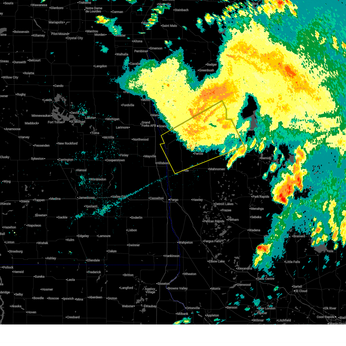
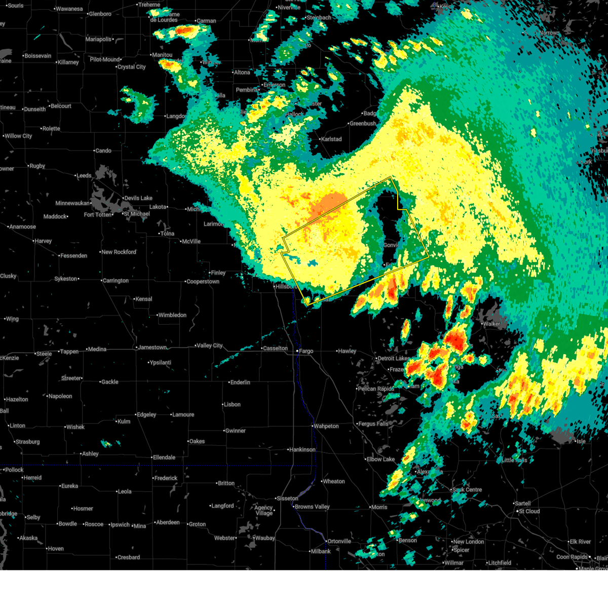
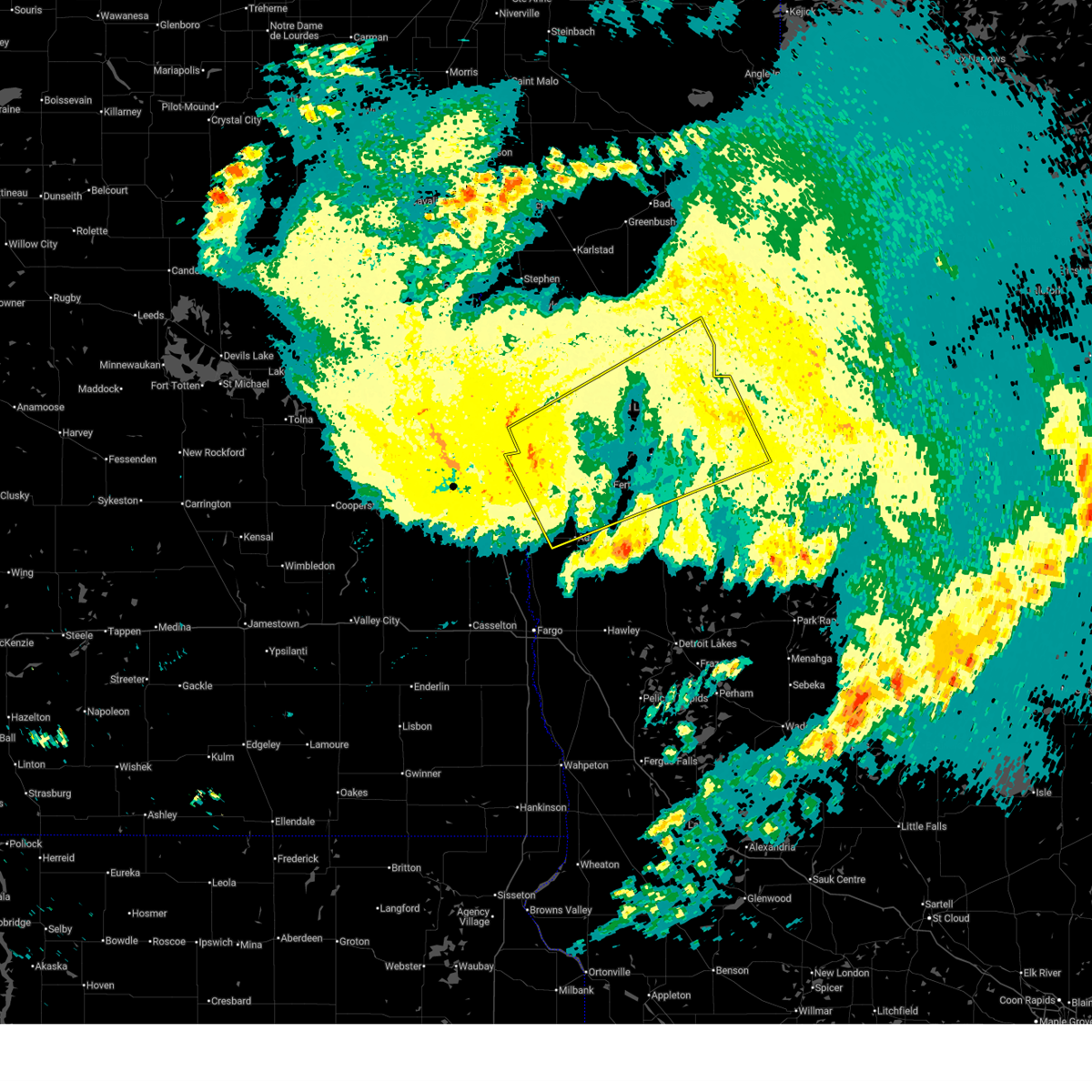
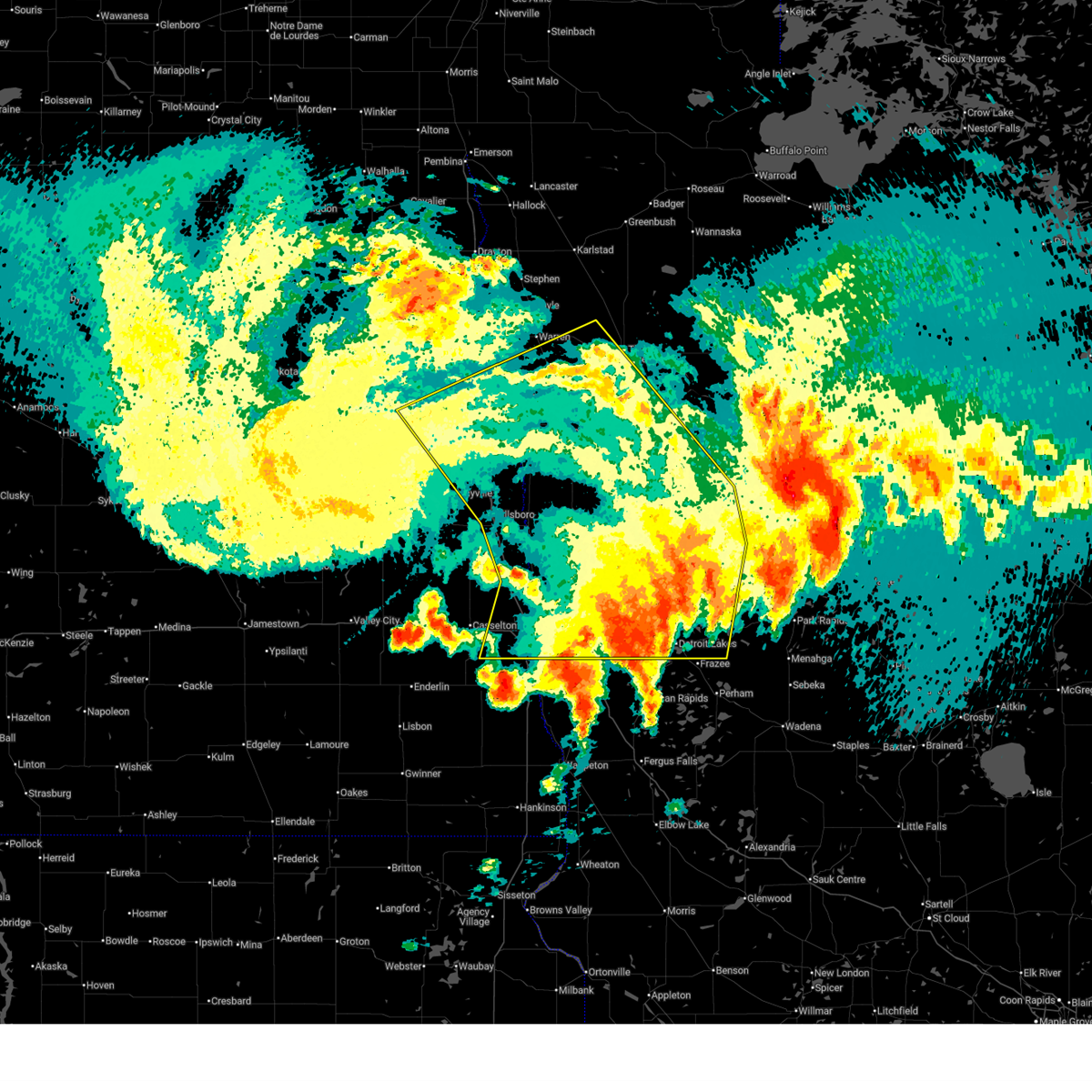
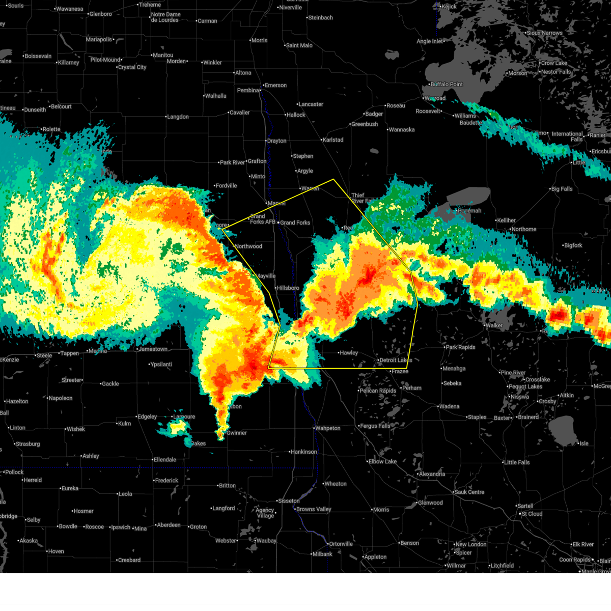
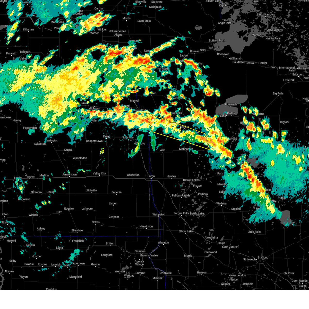
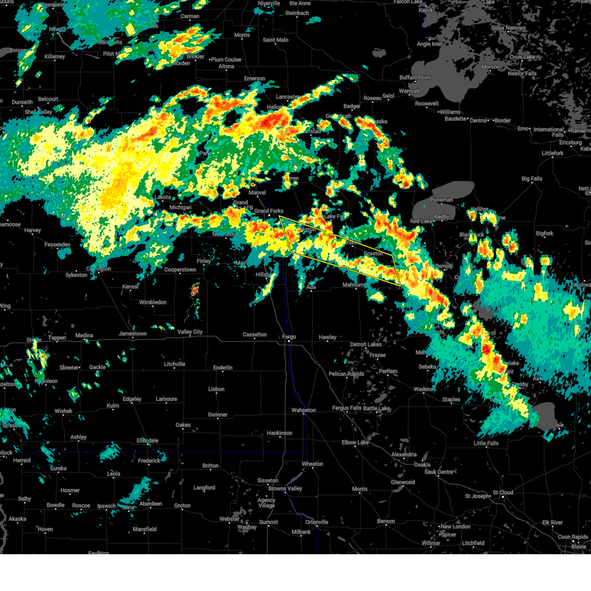
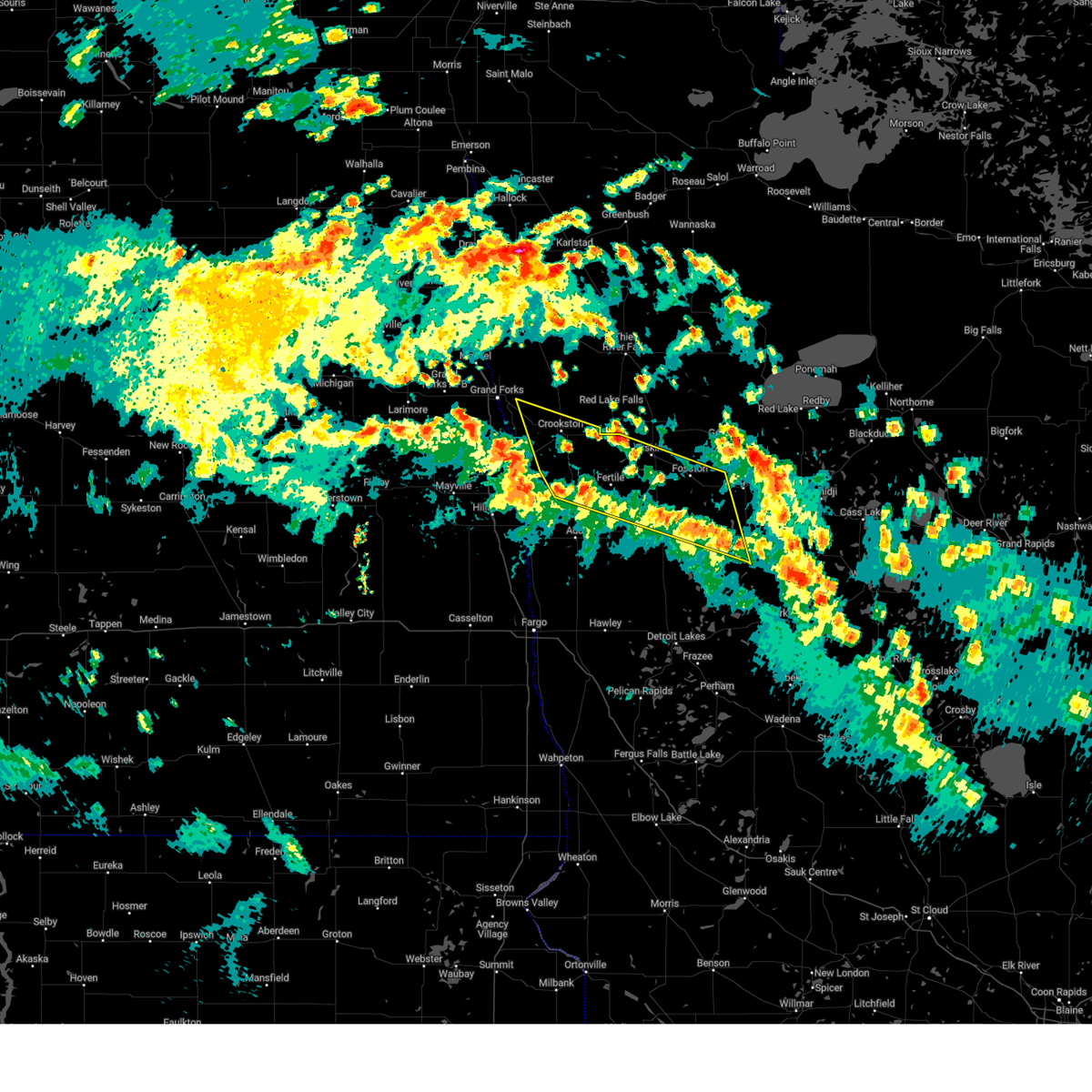
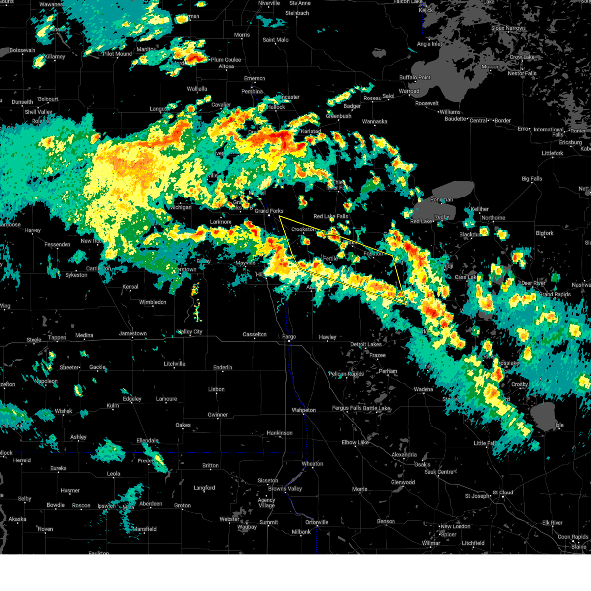
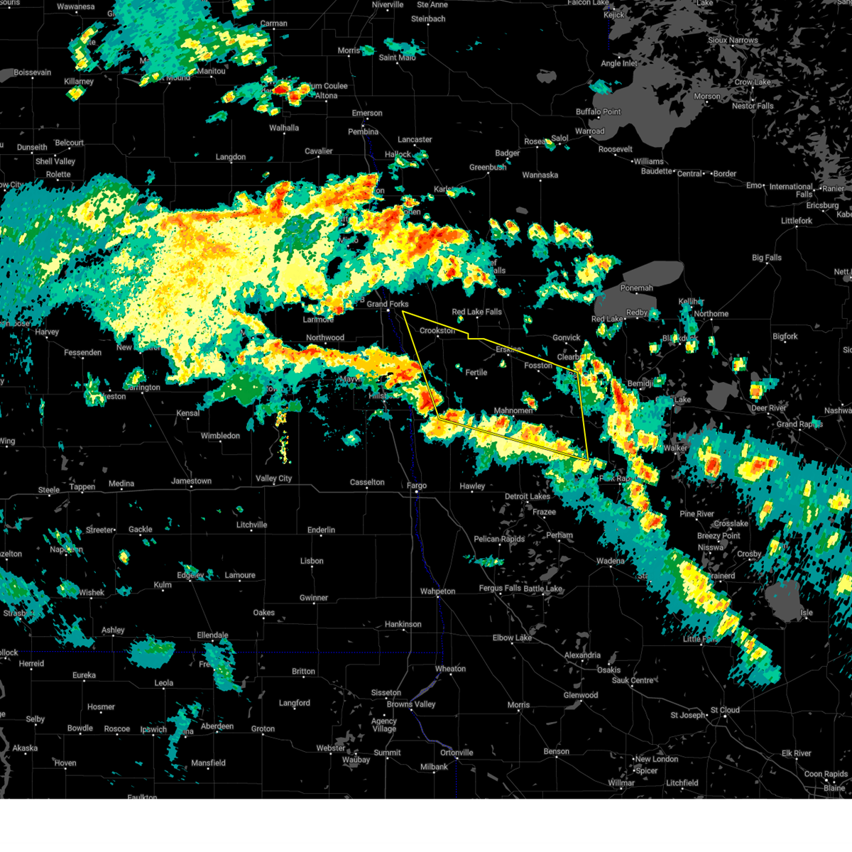
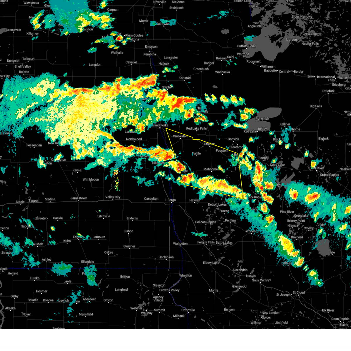
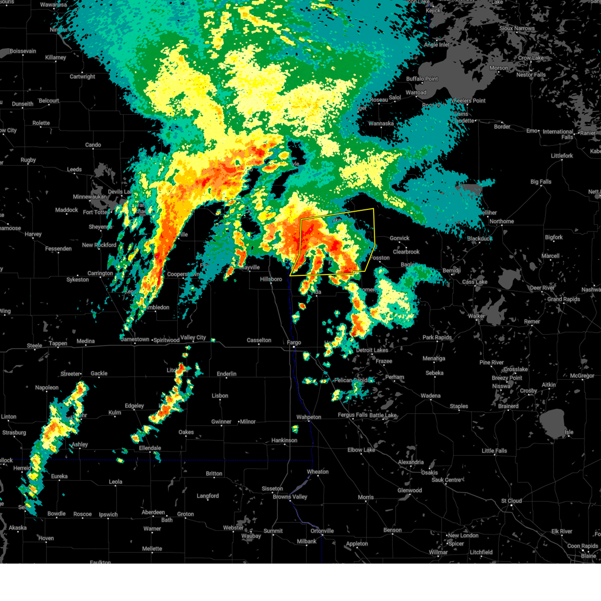
Hail Map for Crookston, MN
The Crookston, MN area has had 23 reports of on-the-ground hail by trained spotters, and has been under severe weather warnings 16 times during the past 12 months. Doppler radar has detected hail at or near Crookston, MN on 37 occasions, including 2 occasions during the past year.
| Name: | Crookston, MN |
| Where Located: | 62.9 miles N of Fargo, ND |
| Map: | Google Map for Crookston, MN |
| Population: | 7891 |
| Housing Units: | 3303 |
| More Info: | Search Google for Crookston, MN |
0
The Top Recent Hail Date for Crookston, MN is Thursday, August 22, 2024 (37th out of 37)

Hail and Wind Damage Spotted near Crookston, MN
| Date / Time | Report Details |
|---|---|
| 6/21/2025 2:59 AM CDT |
 A tornado watch remains in effect until 300 am cdt for northwestern minnesota, and southeastern and northeastern north dakota. a severe thunderstorm watch remains in effect until 700 am cdt for north central and northwestern minnesota. to report severe weather, contact your nearest law enforcement agency. they will relay your report to the national weather service grand forks. remember, a severe thunderstorm warning still remains in effect for polk and red lake counties. A tornado watch remains in effect until 300 am cdt for northwestern minnesota, and southeastern and northeastern north dakota. a severe thunderstorm watch remains in effect until 700 am cdt for north central and northwestern minnesota. to report severe weather, contact your nearest law enforcement agency. they will relay your report to the national weather service grand forks. remember, a severe thunderstorm warning still remains in effect for polk and red lake counties.
|
| 6/21/2025 2:23 AM CDT |
 At 223 am cdt, severe thunderstorms were located along a line extending from near huot to near fertile, moving northeast at 60 mph (public). Hazards include 70 mph wind gusts. Expect considerable tree damage. damage is likely to mobile homes, roofs, and outbuildings. these severe storms will be near, maple bay, gentilly, and rindal around 225 am cdt. red lake falls, erskine, and winger around 230 am cdt. mcintosh, st. hilaire, and terrebonne around 235 am cdt. plummer, brooks, and hazel around 240 am cdt. oklee around 245 am cdt. Other locations impacted by these severe thunderstorms include thief river falls airport. At 223 am cdt, severe thunderstorms were located along a line extending from near huot to near fertile, moving northeast at 60 mph (public). Hazards include 70 mph wind gusts. Expect considerable tree damage. damage is likely to mobile homes, roofs, and outbuildings. these severe storms will be near, maple bay, gentilly, and rindal around 225 am cdt. red lake falls, erskine, and winger around 230 am cdt. mcintosh, st. hilaire, and terrebonne around 235 am cdt. plummer, brooks, and hazel around 240 am cdt. oklee around 245 am cdt. Other locations impacted by these severe thunderstorms include thief river falls airport.
|
| 6/21/2025 2:07 AM CDT |
 Svrfgf the national weather service in grand forks has issued a * severe thunderstorm warning for, southeastern marshall county in northwestern minnesota, red lake county in northwestern minnesota, northern norman county in northwestern minnesota, polk county in northwestern minnesota, northwestern mahnomen county in northwestern minnesota, pennington county in northwestern minnesota, northern clearwater county in northwestern minnesota, northeastern traill county in southeastern north dakota, * until 300 am cdt. * at 205 am cdt, severe thunderstorms were located along a line extending from fisher to near lockhart, moving northeast at 60 mph. these are destructive storms for northwest minnesota (public. at 1:50pm ndawn sensors reported wind gusts over 80). Hazards include 80 mph wind gusts. Flying debris will be dangerous to those caught without shelter. mobile homes will be heavily damaged. expect considerable damage to roofs, windows, and vehicles. extensive tree damage and power outages are likely. severe thunderstorms will be near, crookston, beltrami, and greenview around 210 am cdt. fertile, gentilly, and melvin around 215 am cdt. maple bay, rindal, and huot around 220 am cdt. red lake falls, mentor, and wylie around 225 am cdt. erskine, winger, and terrebonne around 230 am cdt. Other locations impacted by these severe thunderstorms include thief river falls airport. Svrfgf the national weather service in grand forks has issued a * severe thunderstorm warning for, southeastern marshall county in northwestern minnesota, red lake county in northwestern minnesota, northern norman county in northwestern minnesota, polk county in northwestern minnesota, northwestern mahnomen county in northwestern minnesota, pennington county in northwestern minnesota, northern clearwater county in northwestern minnesota, northeastern traill county in southeastern north dakota, * until 300 am cdt. * at 205 am cdt, severe thunderstorms were located along a line extending from fisher to near lockhart, moving northeast at 60 mph. these are destructive storms for northwest minnesota (public. at 1:50pm ndawn sensors reported wind gusts over 80). Hazards include 80 mph wind gusts. Flying debris will be dangerous to those caught without shelter. mobile homes will be heavily damaged. expect considerable damage to roofs, windows, and vehicles. extensive tree damage and power outages are likely. severe thunderstorms will be near, crookston, beltrami, and greenview around 210 am cdt. fertile, gentilly, and melvin around 215 am cdt. maple bay, rindal, and huot around 220 am cdt. red lake falls, mentor, and wylie around 225 am cdt. erskine, winger, and terrebonne around 230 am cdt. Other locations impacted by these severe thunderstorms include thief river falls airport.
|
| 6/21/2025 12:48 AM CDT |
 The storms which prompted the warning have weakened below severe limits, and have exited the warned area. therefore, the warning has been allowed to expire. however, gusty winds are still possible with these thunderstorms. there is another area of extremely strong winds that will likely move into the central red river valley. be prepared to shelter and prepare for these winds in the next hour or two. a tornado watch remains in effect until 300 am cdt for northwestern minnesota, and southeastern and northeastern north dakota. a severe thunderstorm watch remains in effect until 700 am cdt for northwestern minnesota. The storms which prompted the warning have weakened below severe limits, and have exited the warned area. therefore, the warning has been allowed to expire. however, gusty winds are still possible with these thunderstorms. there is another area of extremely strong winds that will likely move into the central red river valley. be prepared to shelter and prepare for these winds in the next hour or two. a tornado watch remains in effect until 300 am cdt for northwestern minnesota, and southeastern and northeastern north dakota. a severe thunderstorm watch remains in effect until 700 am cdt for northwestern minnesota.
|
| 6/20/2025 11:49 PM CDT |
 Svrfgf the national weather service in grand forks has issued a * severe thunderstorm warning for, south central marshall county in northwestern minnesota, red lake county in northwestern minnesota, clay county in northwestern minnesota, norman county in northwestern minnesota, polk county in northwestern minnesota, mahnomen county in northwestern minnesota, becker county in northwestern minnesota, western pennington county in northwestern minnesota, southwestern clearwater county in northwestern minnesota, southern grand forks county in northeastern north dakota, eastern cass county in southeastern north dakota, traill county in southeastern north dakota, * until 1245 am cdt. * at 1149 pm cdt, severe thunderstorms were located along a line extending from near kempton to near hillsboro to near gardner to near mapleton, moving east at 80 mph. these are destructive storms for eastern north dakota and northwest minnesota (public). Hazards include 80 mph wind gusts. Flying debris will be dangerous to those caught without shelter. mobile homes will be heavily damaged. expect considerable damage to roofs, windows, and vehicles. extensive tree damage and power outages are likely. severe thunderstorms will be near, fargo, west fargo, and hillsboro around 1150 pm cdt. moorhead, dilworth, and halstad around 1155 pm cdt. glyndon, thompson, and climax around 1200 am cdt. grand forks, east grand forks, and ada around 1205 am cdt. hawley, twin valley, and ulen around 1210 am cdt. other locations impacted by these severe thunderstorms include thief river falls airport, american crystal sugar, grand forks airport, moorhead airport, and west argusville. this includes the following highways, interstate 29 between mile markers 57 and 149. interstate 94 in north dakota between mile markers 337 and 15. Interstate 94 in minnesota between mile markers 337 and 15. Svrfgf the national weather service in grand forks has issued a * severe thunderstorm warning for, south central marshall county in northwestern minnesota, red lake county in northwestern minnesota, clay county in northwestern minnesota, norman county in northwestern minnesota, polk county in northwestern minnesota, mahnomen county in northwestern minnesota, becker county in northwestern minnesota, western pennington county in northwestern minnesota, southwestern clearwater county in northwestern minnesota, southern grand forks county in northeastern north dakota, eastern cass county in southeastern north dakota, traill county in southeastern north dakota, * until 1245 am cdt. * at 1149 pm cdt, severe thunderstorms were located along a line extending from near kempton to near hillsboro to near gardner to near mapleton, moving east at 80 mph. these are destructive storms for eastern north dakota and northwest minnesota (public). Hazards include 80 mph wind gusts. Flying debris will be dangerous to those caught without shelter. mobile homes will be heavily damaged. expect considerable damage to roofs, windows, and vehicles. extensive tree damage and power outages are likely. severe thunderstorms will be near, fargo, west fargo, and hillsboro around 1150 pm cdt. moorhead, dilworth, and halstad around 1155 pm cdt. glyndon, thompson, and climax around 1200 am cdt. grand forks, east grand forks, and ada around 1205 am cdt. hawley, twin valley, and ulen around 1210 am cdt. other locations impacted by these severe thunderstorms include thief river falls airport, american crystal sugar, grand forks airport, moorhead airport, and west argusville. this includes the following highways, interstate 29 between mile markers 57 and 149. interstate 94 in north dakota between mile markers 337 and 15. Interstate 94 in minnesota between mile markers 337 and 15.
|
| 5/15/2025 5:07 PM CDT |
 The storms which prompted the warning have weakened below severe limits, and no longer pose an immediate threat to life or property. therefore, the warning will be allowed to expire. however, gusty winds and heavy rain are still possible with these thunderstorms. The storms which prompted the warning have weakened below severe limits, and no longer pose an immediate threat to life or property. therefore, the warning will be allowed to expire. however, gusty winds and heavy rain are still possible with these thunderstorms.
|
| 5/15/2025 5:04 PM CDT |
 the severe thunderstorm warning has been cancelled and is no longer in effect the severe thunderstorm warning has been cancelled and is no longer in effect
|
| 5/15/2025 5:04 PM CDT |
 At 504 pm cdt, severe thunderstorms were located along a line extending from near crookston to lengby, moving north at 55 mph (radar indicated). Hazards include 60 mph wind gusts and penny size hail. Expect damage to roofs, siding, and trees. Locations impacted include, crookston, fosston, fertile, mcintosh, erskine, fisher, and island lake in mahnomen county. At 504 pm cdt, severe thunderstorms were located along a line extending from near crookston to lengby, moving north at 55 mph (radar indicated). Hazards include 60 mph wind gusts and penny size hail. Expect damage to roofs, siding, and trees. Locations impacted include, crookston, fosston, fertile, mcintosh, erskine, fisher, and island lake in mahnomen county.
|
| 5/15/2025 4:48 PM CDT |
 the severe thunderstorm warning has been cancelled and is no longer in effect the severe thunderstorm warning has been cancelled and is no longer in effect
|
| 5/15/2025 4:48 PM CDT |
 At 448 pm cdt, severe thunderstorms were located along a line extending from near greenview to white earth nation, moving northwest at 65 mph (radar indicated). Hazards include 60 mph wind gusts and penny size hail. Expect damage to roofs, siding, and trees. Locations impacted include, crookston, fosston, fertile, mcintosh, erskine, fisher, and island lake in mahnomen county. At 448 pm cdt, severe thunderstorms were located along a line extending from near greenview to white earth nation, moving northwest at 65 mph (radar indicated). Hazards include 60 mph wind gusts and penny size hail. Expect damage to roofs, siding, and trees. Locations impacted include, crookston, fosston, fertile, mcintosh, erskine, fisher, and island lake in mahnomen county.
|
| 5/15/2025 4:36 PM CDT |
 the severe thunderstorm warning has been cancelled and is no longer in effect the severe thunderstorm warning has been cancelled and is no longer in effect
|
| 5/15/2025 4:36 PM CDT |
 At 436 pm cdt, severe thunderstorms were located along a line extending from near beltrami to white earth nation, moving north at 55 mph (radar indicated). Hazards include 60 mph wind gusts and penny size hail. Expect damage to roofs, siding, and trees. Locations impacted include, crookston, ada, fosston, bagley, mahnomen, fertile, and twin valley. At 436 pm cdt, severe thunderstorms were located along a line extending from near beltrami to white earth nation, moving north at 55 mph (radar indicated). Hazards include 60 mph wind gusts and penny size hail. Expect damage to roofs, siding, and trees. Locations impacted include, crookston, ada, fosston, bagley, mahnomen, fertile, and twin valley.
|
| 5/15/2025 4:25 PM CDT |
 Svrfgf the national weather service in grand forks has issued a * severe thunderstorm warning for, northeastern clay county in northwestern minnesota, norman county in northwestern minnesota, southern polk county in northwestern minnesota, mahnomen county in northwestern minnesota, northern becker county in northwestern minnesota, southwestern clearwater county in northwestern minnesota, * until 515 pm cdt. * at 424 pm cdt, severe thunderstorms were located along a line extending from hadler to white earth nation, moving north at 55 mph (radar indicated). Hazards include 60 mph wind gusts and penny size hail. expect damage to roofs, siding, and trees Svrfgf the national weather service in grand forks has issued a * severe thunderstorm warning for, northeastern clay county in northwestern minnesota, norman county in northwestern minnesota, southern polk county in northwestern minnesota, mahnomen county in northwestern minnesota, northern becker county in northwestern minnesota, southwestern clearwater county in northwestern minnesota, * until 515 pm cdt. * at 424 pm cdt, severe thunderstorms were located along a line extending from hadler to white earth nation, moving north at 55 mph (radar indicated). Hazards include 60 mph wind gusts and penny size hail. expect damage to roofs, siding, and trees
|
| 8/29/2024 4:45 AM CDT |
 Svrfgf the national weather service in grand forks has issued a * severe thunderstorm warning for, red lake county in northwestern minnesota, northern norman county in northwestern minnesota, southeastern polk county in northwestern minnesota, south central pennington county in northwestern minnesota, * until 530 am cdt. * at 445 am cdt, severe thunderstorms were located along a line extending from near crookston to near greenview to near nielsville, moving east at 35 mph (radar indicated). Hazards include 60 mph wind gusts and quarter size hail. Hail damage to vehicles is expected. Expect wind damage to roofs, siding, and trees. Svrfgf the national weather service in grand forks has issued a * severe thunderstorm warning for, red lake county in northwestern minnesota, northern norman county in northwestern minnesota, southeastern polk county in northwestern minnesota, south central pennington county in northwestern minnesota, * until 530 am cdt. * at 445 am cdt, severe thunderstorms were located along a line extending from near crookston to near greenview to near nielsville, moving east at 35 mph (radar indicated). Hazards include 60 mph wind gusts and quarter size hail. Hail damage to vehicles is expected. Expect wind damage to roofs, siding, and trees.
|
| 8/29/2024 4:24 AM CDT |
 The storm which prompted the warning has weakened below severe limits, and no longer poses an immediate threat to life or property. therefore, the warning will be allowed to expire. however, small hail, gusty winds and heavy rain are still possible with this thunderstorm. The storm which prompted the warning has weakened below severe limits, and no longer poses an immediate threat to life or property. therefore, the warning will be allowed to expire. however, small hail, gusty winds and heavy rain are still possible with this thunderstorm.
|
| 8/29/2024 3:34 AM CDT |
 Svrfgf the national weather service in grand forks has issued a * severe thunderstorm warning for, southwestern polk county in northwestern minnesota, southeastern grand forks county in northeastern north dakota, northern traill county in southeastern north dakota, * until 430 am cdt. * at 334 am cdt, a severe thunderstorm was located over hatton, or 27 miles southwest of grand forks, moving northeast at 35 mph (radar indicated). Hazards include 70 mph wind gusts. Expect considerable tree damage. Damage is likely to mobile homes, roofs, and outbuildings. Svrfgf the national weather service in grand forks has issued a * severe thunderstorm warning for, southwestern polk county in northwestern minnesota, southeastern grand forks county in northeastern north dakota, northern traill county in southeastern north dakota, * until 430 am cdt. * at 334 am cdt, a severe thunderstorm was located over hatton, or 27 miles southwest of grand forks, moving northeast at 35 mph (radar indicated). Hazards include 70 mph wind gusts. Expect considerable tree damage. Damage is likely to mobile homes, roofs, and outbuildings.
|
| 8/29/2024 3:15 AM CDT | Kckn awos peak wind gus in polk county MN, 3.5 miles S of Crookston, MN |
| 8/29/2024 3:05 AM CDT | Crookston ndawn 3 meter wind gus in polk county MN, 2.8 miles S of Crookston, MN |
| 6/18/2024 3:36 AM CDT |
 The storms which prompted the warning have weakened below severe limits, and no longer pose an immediate threat to life or property. therefore, the warning will be allowed to expire. however, gusty winds are still possible with these thunderstorms. a severe thunderstorm watch remains in effect until 900 am cdt for northwestern minnesota. The storms which prompted the warning have weakened below severe limits, and no longer pose an immediate threat to life or property. therefore, the warning will be allowed to expire. however, gusty winds are still possible with these thunderstorms. a severe thunderstorm watch remains in effect until 900 am cdt for northwestern minnesota.
|
| 6/18/2024 3:14 AM CDT |
 At 314 am cdt, severe thunderstorms were located along a line extending from near warren to dakota junction to near terrebonne, moving northeast at 30 mph (radar indicated). Hazards include 60 mph wind gusts. Expect damage to roofs, siding, and trees. Locations impacted include, thief river falls, crookston, red lake falls, erskine, oklee, newfolden, and middle river. At 314 am cdt, severe thunderstorms were located along a line extending from near warren to dakota junction to near terrebonne, moving northeast at 30 mph (radar indicated). Hazards include 60 mph wind gusts. Expect damage to roofs, siding, and trees. Locations impacted include, thief river falls, crookston, red lake falls, erskine, oklee, newfolden, and middle river.
|
| 6/18/2024 2:42 AM CDT |
 Svrfgf the national weather service in grand forks has issued a * severe thunderstorm warning for, marshall county in northwestern minnesota, red lake county in northwestern minnesota, northern polk county in northwestern minnesota, pennington county in northwestern minnesota, * until 345 am cdt. * at 241 am cdt, severe thunderstorms were located along a line extending from near alvarado to 7 miles north of dorothy to harold, moving northeast at 30 mph (radar indicated). Hazards include 60 mph wind gusts and nickel size hail. expect damage to roofs, siding, and trees Svrfgf the national weather service in grand forks has issued a * severe thunderstorm warning for, marshall county in northwestern minnesota, red lake county in northwestern minnesota, northern polk county in northwestern minnesota, pennington county in northwestern minnesota, * until 345 am cdt. * at 241 am cdt, severe thunderstorms were located along a line extending from near alvarado to 7 miles north of dorothy to harold, moving northeast at 30 mph (radar indicated). Hazards include 60 mph wind gusts and nickel size hail. expect damage to roofs, siding, and trees
|
| 6/18/2024 2:26 AM CDT |
 At 226 am cdt, severe thunderstorms were located along a line extending from viking to near wylie to near eldred, moving east at 40 mph (radar indicated). Hazards include 60 mph wind gusts. Expect damage to roofs, siding, and trees. locations impacted include, grand forks, thief river falls, east grand forks, crookston, grand forks afb, warren, and red lake falls. This includes interstate 29 between mile markers 124 and 160. At 226 am cdt, severe thunderstorms were located along a line extending from viking to near wylie to near eldred, moving east at 40 mph (radar indicated). Hazards include 60 mph wind gusts. Expect damage to roofs, siding, and trees. locations impacted include, grand forks, thief river falls, east grand forks, crookston, grand forks afb, warren, and red lake falls. This includes interstate 29 between mile markers 124 and 160.
|
| 6/18/2024 1:54 AM CDT |
 Svrfgf the national weather service in grand forks has issued a * severe thunderstorm warning for, southwestern marshall county in northwestern minnesota, western red lake county in northwestern minnesota, northwestern polk county in northwestern minnesota, western pennington county in northwestern minnesota, grand forks county in northeastern north dakota, * until 245 am cdt. * at 154 am cdt, severe thunderstorms were located along a line extending from near march to near key west to reynolds, moving east at 40 mph (radar indicated). Hazards include 60 mph wind gusts. expect damage to roofs, siding, and trees Svrfgf the national weather service in grand forks has issued a * severe thunderstorm warning for, southwestern marshall county in northwestern minnesota, western red lake county in northwestern minnesota, northwestern polk county in northwestern minnesota, western pennington county in northwestern minnesota, grand forks county in northeastern north dakota, * until 245 am cdt. * at 154 am cdt, severe thunderstorms were located along a line extending from near march to near key west to reynolds, moving east at 40 mph (radar indicated). Hazards include 60 mph wind gusts. expect damage to roofs, siding, and trees
|
| 9/5/2023 12:50 AM CDT | Awos station kckn crookston ap m in polk county MN, 4.9 miles S of Crookston, MN |
| 8/1/2023 5:10 PM CDT |
 The severe thunderstorm warning for western polk, southeastern grand forks and northeastern traill counties will expire at 515 pm cdt, the storm which prompted the warning has weakened below severe limits, and no longer poses an immediate threat to life or property. therefore, the warning will be allowed to expire. however small hail and gusty winds are still possible with this thunderstorm. a severe thunderstorm watch remains in effect until midnight cdt for northwestern minnesota, and southeastern and northeastern north dakota. The severe thunderstorm warning for western polk, southeastern grand forks and northeastern traill counties will expire at 515 pm cdt, the storm which prompted the warning has weakened below severe limits, and no longer poses an immediate threat to life or property. therefore, the warning will be allowed to expire. however small hail and gusty winds are still possible with this thunderstorm. a severe thunderstorm watch remains in effect until midnight cdt for northwestern minnesota, and southeastern and northeastern north dakota.
|
| 8/1/2023 4:20 PM CDT |
 At 419 pm cdt, a severe thunderstorm was located over davidson, or 10 miles east of grand forks, moving south at 20 mph (radar indicated). Hazards include 70 mph wind gusts and ping pong ball size hail. People and animals outdoors will be injured. expect hail damage to roofs, siding, windows, and vehicles. expect considerable tree damage. Wind damage is also likely to mobile homes, roofs, and outbuildings. At 419 pm cdt, a severe thunderstorm was located over davidson, or 10 miles east of grand forks, moving south at 20 mph (radar indicated). Hazards include 70 mph wind gusts and ping pong ball size hail. People and animals outdoors will be injured. expect hail damage to roofs, siding, windows, and vehicles. expect considerable tree damage. Wind damage is also likely to mobile homes, roofs, and outbuildings.
|
| 8/1/2023 4:03 PM CDT |
 At 403 pm cdt, a severe thunderstorm was located near key west, or 9 miles northeast of grand forks, moving east at 15 mph (radar indicated). Hazards include 60 mph wind gusts and half dollar size hail. Hail damage to vehicles is expected. Expect wind damage to roofs, siding, and trees. At 403 pm cdt, a severe thunderstorm was located near key west, or 9 miles northeast of grand forks, moving east at 15 mph (radar indicated). Hazards include 60 mph wind gusts and half dollar size hail. Hail damage to vehicles is expected. Expect wind damage to roofs, siding, and trees.
|
| 7/26/2023 1:00 AM CDT |
 At 100 am cdt, a severe thunderstorm was located near crookston, or 22 miles east of grand forks, moving southeast at 40 mph (radar indicated). Hazards include 70 mph wind gusts and penny size hail. Expect considerable tree damage. damage is likely to mobile homes, roofs, and outbuildings. locations impacted include, crookston, red lake falls, fisher, climax, euclid, gentilly and eldred. thunderstorm damage threat, considerable hail threat, radar indicated max hail size, 0. 75 in wind threat, radar indicated max wind gust, 70 mph. At 100 am cdt, a severe thunderstorm was located near crookston, or 22 miles east of grand forks, moving southeast at 40 mph (radar indicated). Hazards include 70 mph wind gusts and penny size hail. Expect considerable tree damage. damage is likely to mobile homes, roofs, and outbuildings. locations impacted include, crookston, red lake falls, fisher, climax, euclid, gentilly and eldred. thunderstorm damage threat, considerable hail threat, radar indicated max hail size, 0. 75 in wind threat, radar indicated max wind gust, 70 mph.
|
| 7/26/2023 12:39 AM CDT |
 At 1239 am cdt, a severe thunderstorm was located over sherack, or 16 miles northeast of grand forks, moving southeast at 30 mph (radar indicated). Hazards include 70 mph wind gusts and penny size hail. Expect considerable tree damage. Damage is likely to mobile homes, roofs, and outbuildings. At 1239 am cdt, a severe thunderstorm was located over sherack, or 16 miles northeast of grand forks, moving southeast at 30 mph (radar indicated). Hazards include 70 mph wind gusts and penny size hail. Expect considerable tree damage. Damage is likely to mobile homes, roofs, and outbuildings.
|
| 6/1/2023 6:30 PM CDT |
 At 630 pm cdt, a severe thunderstorm was located over eldred, or 19 miles southeast of grand forks, moving north at 15 mph (radar indicated). Hazards include 60 mph wind gusts and nickel size hail. Expect damage to roofs, siding, and trees. locations impacted include, climax, nielsville, eldred, greenview and harold. hail threat, radar indicated max hail size, 0. 88 in wind threat, observed max wind gust, 60 mph. At 630 pm cdt, a severe thunderstorm was located over eldred, or 19 miles southeast of grand forks, moving north at 15 mph (radar indicated). Hazards include 60 mph wind gusts and nickel size hail. Expect damage to roofs, siding, and trees. locations impacted include, climax, nielsville, eldred, greenview and harold. hail threat, radar indicated max hail size, 0. 88 in wind threat, observed max wind gust, 60 mph.
|
| 6/1/2023 5:56 PM CDT |
 The severe thunderstorm warning for southwestern polk and northeastern traill counties will expire at 600 pm cdt, the severe thunderstorm which prompted the warning has remained in the area but warranted a new warning. therefore, the warning will be allowed to expire. remember, a severe thunderstorm warning still remains in effect for sw polk and ne traill until 700 pm. The severe thunderstorm warning for southwestern polk and northeastern traill counties will expire at 600 pm cdt, the severe thunderstorm which prompted the warning has remained in the area but warranted a new warning. therefore, the warning will be allowed to expire. remember, a severe thunderstorm warning still remains in effect for sw polk and ne traill until 700 pm.
|
| 6/1/2023 5:54 PM CDT |
 At 554 pm cdt, a severe thunderstorm was located over climax, or 24 miles southeast of grand forks, moving north at 10 mph (radar indicated). Hazards include 60 mph wind gusts and quarter size hail. Hail damage to vehicles is expected. Expect wind damage to roofs, siding, and trees. At 554 pm cdt, a severe thunderstorm was located over climax, or 24 miles southeast of grand forks, moving north at 10 mph (radar indicated). Hazards include 60 mph wind gusts and quarter size hail. Hail damage to vehicles is expected. Expect wind damage to roofs, siding, and trees.
|
| 6/1/2023 5:42 PM CDT |
 At 542 pm cdt, a severe thunderstorm was located over eldred, or 22 miles southeast of grand forks, and is nearly stationary (radar indicated). Hazards include 60 mph wind gusts and nickel size hail. Expect damage to roofs, siding, and trees. locations impacted include, climax, nielsville, eldred, greenview and harold. hail threat, radar indicated max hail size, 0. 88 in wind threat, observed max wind gust, 60 mph. At 542 pm cdt, a severe thunderstorm was located over eldred, or 22 miles southeast of grand forks, and is nearly stationary (radar indicated). Hazards include 60 mph wind gusts and nickel size hail. Expect damage to roofs, siding, and trees. locations impacted include, climax, nielsville, eldred, greenview and harold. hail threat, radar indicated max hail size, 0. 88 in wind threat, observed max wind gust, 60 mph.
|
| 6/1/2023 5:17 PM CDT |
 At 517 pm cdt, a severe thunderstorm was located over climax, or 22 miles southeast of grand forks, and is nearly stationary (radar indicated). Hazards include 60 mph wind gusts and nickel size hail. expect damage to roofs, siding, and trees At 517 pm cdt, a severe thunderstorm was located over climax, or 22 miles southeast of grand forks, and is nearly stationary (radar indicated). Hazards include 60 mph wind gusts and nickel size hail. expect damage to roofs, siding, and trees
|
| 7/23/2022 1:18 AM CDT |
 At 117 am cdt, severe thunderstorms were located along a line extending from near hazel to maple bay to 7 miles southwest of hadler, moving east at 85 mph (radar indicated). Hazards include 70 mph wind gusts and quarter size hail. Hail damage to vehicles is expected. expect considerable tree damage. wind damage is also likely to mobile homes, roofs, and outbuildings. locations impacted include, mentor, maple bay, hazel, erskine, high landing, winger, mcintosh, twin valley, gary, red lake nation, olga, faith, weme, mahnomen and gonvick. This includes interstate 29 between mile markers 94 and 159. At 117 am cdt, severe thunderstorms were located along a line extending from near hazel to maple bay to 7 miles southwest of hadler, moving east at 85 mph (radar indicated). Hazards include 70 mph wind gusts and quarter size hail. Hail damage to vehicles is expected. expect considerable tree damage. wind damage is also likely to mobile homes, roofs, and outbuildings. locations impacted include, mentor, maple bay, hazel, erskine, high landing, winger, mcintosh, twin valley, gary, red lake nation, olga, faith, weme, mahnomen and gonvick. This includes interstate 29 between mile markers 94 and 159.
|
| 7/23/2022 1:15 AM CDT | Storm damage reported in polk county MN, 0.6 miles N of Crookston, MN |
| 7/23/2022 12:43 AM CDT |
 At 1243 am cdt, severe thunderstorms were located along a line extending from 6 miles south of alvarado to near reynolds to 6 miles northeast of hope, moving east at 85 mph. these are destructive storms (radar indicated). Hazards include 80 mph wind gusts and quarter size hail. Flying debris will be dangerous to those caught without shelter. mobile homes will be heavily damaged. expect considerable damage to roofs, windows, and vehicles. extensive tree damage and power outages are likely. severe thunderstorms will be near, reynolds, buxton and thompson around 1245 am cdt. tabor, sherack and roseville around 1250 am cdt. eldred, angus and blanchard around 1255 am cdt. hillsboro around 100 am cdt. other locations in the path of these severe thunderstorms include harold, kelso and greenview. This includes interstate 29 between mile markers 94 and 159. At 1243 am cdt, severe thunderstorms were located along a line extending from 6 miles south of alvarado to near reynolds to 6 miles northeast of hope, moving east at 85 mph. these are destructive storms (radar indicated). Hazards include 80 mph wind gusts and quarter size hail. Flying debris will be dangerous to those caught without shelter. mobile homes will be heavily damaged. expect considerable damage to roofs, windows, and vehicles. extensive tree damage and power outages are likely. severe thunderstorms will be near, reynolds, buxton and thompson around 1245 am cdt. tabor, sherack and roseville around 1250 am cdt. eldred, angus and blanchard around 1255 am cdt. hillsboro around 100 am cdt. other locations in the path of these severe thunderstorms include harold, kelso and greenview. This includes interstate 29 between mile markers 94 and 159.
|
| 7/10/2022 8:38 AM CDT |
 At 838 am cdt, severe thunderstorms were located along a line extending from 6 miles northeast of halma to near thief river falls to near maple bay, moving east at 55 mph (radar indicated). Hazards include 60 mph wind gusts and quarter size hail. Hail damage to vehicles is expected. expect wind damage to roofs, siding, and trees. these severe storms will be near, maple bay, hazel and thief river falls around 840 am cdt. other locations in the path of these severe thunderstorms include mentor, leo, mavie, high landing, erskine, greenbush, mcintosh and badger. hail threat, radar indicated max hail size, 1. 00 in wind threat, radar indicated max wind gust, 60 mph. At 838 am cdt, severe thunderstorms were located along a line extending from 6 miles northeast of halma to near thief river falls to near maple bay, moving east at 55 mph (radar indicated). Hazards include 60 mph wind gusts and quarter size hail. Hail damage to vehicles is expected. expect wind damage to roofs, siding, and trees. these severe storms will be near, maple bay, hazel and thief river falls around 840 am cdt. other locations in the path of these severe thunderstorms include mentor, leo, mavie, high landing, erskine, greenbush, mcintosh and badger. hail threat, radar indicated max hail size, 1. 00 in wind threat, radar indicated max wind gust, 60 mph.
|
| 7/10/2022 8:22 AM CDT |
 At 822 am cdt, severe thunderstorms were located along a line extending from 6 miles west of lake bronson to near carpenters corner to greenview, moving east at 55 mph (radar indicated). Hazards include 60 mph wind gusts and quarter size hail. Hail damage to vehicles is expected. expect wind damage to roofs, siding, and trees. severe thunderstorms will be near, harold and carpenters corner around 825 am cdt. melvin and rosewood around 830 am cdt. thief river falls, st. hilaire and dakota junction around 835 am cdt. maple bay, hazel and dugdale around 840 am cdt. other locations in the path of these severe thunderstorms include mavie and mentor. hail threat, radar indicated max hail size, 1. 00 in wind threat, radar indicated max wind gust, 60 mph. At 822 am cdt, severe thunderstorms were located along a line extending from 6 miles west of lake bronson to near carpenters corner to greenview, moving east at 55 mph (radar indicated). Hazards include 60 mph wind gusts and quarter size hail. Hail damage to vehicles is expected. expect wind damage to roofs, siding, and trees. severe thunderstorms will be near, harold and carpenters corner around 825 am cdt. melvin and rosewood around 830 am cdt. thief river falls, st. hilaire and dakota junction around 835 am cdt. maple bay, hazel and dugdale around 840 am cdt. other locations in the path of these severe thunderstorms include mavie and mentor. hail threat, radar indicated max hail size, 1. 00 in wind threat, radar indicated max wind gust, 60 mph.
|
| 7/10/2022 8:07 AM CDT |
 At 806 am cdt, severe thunderstorms were located along a line extending from near donaldson to near key west to near nielsville, moving east at 55 mph (radar indicated). Hazards include 60 mph wind gusts and quarter size hail. Hail damage to vehicles is expected. expect wind damage to roofs, siding, and trees. locations impacted include, euclid, dorothy, englund, florian, wylie, beltrami, greenview, strandquist, st. hilaire, red lake falls, fertile and hazel. this includes interstate 29 between mile markers 114 and 181. hail threat, radar indicated max hail size, 1. 00 in wind threat, radar indicated max wind gust, 60 mph. At 806 am cdt, severe thunderstorms were located along a line extending from near donaldson to near key west to near nielsville, moving east at 55 mph (radar indicated). Hazards include 60 mph wind gusts and quarter size hail. Hail damage to vehicles is expected. expect wind damage to roofs, siding, and trees. locations impacted include, euclid, dorothy, englund, florian, wylie, beltrami, greenview, strandquist, st. hilaire, red lake falls, fertile and hazel. this includes interstate 29 between mile markers 114 and 181. hail threat, radar indicated max hail size, 1. 00 in wind threat, radar indicated max wind gust, 60 mph.
|
| 7/10/2022 7:35 AM CDT |
 At 734 am cdt, severe thunderstorms were located along a line extending from near mandt to near arvilla to near sherbrooke, moving east at 55 mph (radar indicated). Hazards include 60 mph wind gusts and quarter size hail. Hail damage to vehicles is expected. expect wind damage to roofs, siding, and trees. severe thunderstorms will be near, emerado, grand forks afb and mekinock around 740 am cdt. portland, mayville and grand forks around 750 am cdt. other locations in the path of these severe thunderstorms include cashel, mallory, east grand forks, bygland, davidson, cummings and hillsboro. this includes interstate 29 between mile markers 97 and 181. hail threat, radar indicated max hail size, 1. 00 in wind threat, radar indicated max wind gust, 60 mph. At 734 am cdt, severe thunderstorms were located along a line extending from near mandt to near arvilla to near sherbrooke, moving east at 55 mph (radar indicated). Hazards include 60 mph wind gusts and quarter size hail. Hail damage to vehicles is expected. expect wind damage to roofs, siding, and trees. severe thunderstorms will be near, emerado, grand forks afb and mekinock around 740 am cdt. portland, mayville and grand forks around 750 am cdt. other locations in the path of these severe thunderstorms include cashel, mallory, east grand forks, bygland, davidson, cummings and hillsboro. this includes interstate 29 between mile markers 97 and 181. hail threat, radar indicated max hail size, 1. 00 in wind threat, radar indicated max wind gust, 60 mph.
|
| 6/24/2022 8:10 PM CDT |
 At 810 pm cdt, severe thunderstorms were located along a line extending from near mentor to near flaming, moving east at 40 mph (radar indicated). Hazards include 70 mph wind gusts and quarter size hail. Hail damage to vehicles is expected. expect considerable tree damage. wind damage is also likely to mobile homes, roofs, and outbuildings. severe thunderstorms will be near, mentor around 815 pm cdt. erskine around 820 pm cdt. ranum and rindal around 825 pm cdt. northern white earth nation and mcintosh around 830 pm cdt. Other locations in the path of these severe thunderstorms include bejou and winger. At 810 pm cdt, severe thunderstorms were located along a line extending from near mentor to near flaming, moving east at 40 mph (radar indicated). Hazards include 70 mph wind gusts and quarter size hail. Hail damage to vehicles is expected. expect considerable tree damage. wind damage is also likely to mobile homes, roofs, and outbuildings. severe thunderstorms will be near, mentor around 815 pm cdt. erskine around 820 pm cdt. ranum and rindal around 825 pm cdt. northern white earth nation and mcintosh around 830 pm cdt. Other locations in the path of these severe thunderstorms include bejou and winger.
|
| 6/24/2022 7:53 PM CDT |
 At 753 pm cdt, severe thunderstorms were located along a line extending from near strandquist to hazel to near perault, moving east at 15 mph. these are destructive storms (radar indicated). Hazards include 80 mph wind gusts and half dollar size hail. Flying debris will be dangerous to those caught without shelter. mobile homes will be heavily damaged. expect considerable damage to roofs, windows, and vehicles. extensive tree damage and power outages are likely. severe thunderstorms will be near, hazel and thief river falls around 755 pm cdt. red lake falls around 805 pm cdt. Other locations in the path of these severe thunderstorms include middle river, mavie, strathcona and terrebonne. At 753 pm cdt, severe thunderstorms were located along a line extending from near strandquist to hazel to near perault, moving east at 15 mph. these are destructive storms (radar indicated). Hazards include 80 mph wind gusts and half dollar size hail. Flying debris will be dangerous to those caught without shelter. mobile homes will be heavily damaged. expect considerable damage to roofs, windows, and vehicles. extensive tree damage and power outages are likely. severe thunderstorms will be near, hazel and thief river falls around 755 pm cdt. red lake falls around 805 pm cdt. Other locations in the path of these severe thunderstorms include middle river, mavie, strathcona and terrebonne.
|
| 6/24/2022 7:40 PM CDT |
 At 739 pm cdt, severe thunderstorms were located along a line extending from near donaldson to dorothy, moving northeast at 25 mph. these are destructive storms (radar indicated). Hazards include 80 mph wind gusts and half dollar size hail. Flying debris will be dangerous to those caught without shelter. mobile homes will be heavily damaged. expect considerable damage to roofs, windows, and vehicles. extensive tree damage and power outages are likely. locations impacted include, dorothy, huot, donaldson, wylie, kennedy, red lake falls, st. Hilaire and hazel. At 739 pm cdt, severe thunderstorms were located along a line extending from near donaldson to dorothy, moving northeast at 25 mph. these are destructive storms (radar indicated). Hazards include 80 mph wind gusts and half dollar size hail. Flying debris will be dangerous to those caught without shelter. mobile homes will be heavily damaged. expect considerable damage to roofs, windows, and vehicles. extensive tree damage and power outages are likely. locations impacted include, dorothy, huot, donaldson, wylie, kennedy, red lake falls, st. Hilaire and hazel.
|
| 6/24/2022 7:19 PM CDT |
 At 719 pm cdt, severe thunderstorms were located along a line extending from near robbin to 6 miles north of crookston, moving northeast at 25 mph. these are destructive storms for thief river falls and karlstad (radar indicated). Hazards include 90 mph wind gusts and half dollar size hail. You are in a life-threatening situation. flying debris may be deadly to those caught without shelter. mobile homes will be heavily damaged or destroyed. homes and businesses will have substantial roof and window damage. expect extensive tree damage and power outages. these severe storms will be near, euclid and gentilly around 725 pm cdt. other locations in the path of these severe thunderstorms include dorothy, huot, donaldson, wylie, kennedy, red lake falls and st. hilaire. This includes interstate 29 between mile markers 168 and 184. At 719 pm cdt, severe thunderstorms were located along a line extending from near robbin to 6 miles north of crookston, moving northeast at 25 mph. these are destructive storms for thief river falls and karlstad (radar indicated). Hazards include 90 mph wind gusts and half dollar size hail. You are in a life-threatening situation. flying debris may be deadly to those caught without shelter. mobile homes will be heavily damaged or destroyed. homes and businesses will have substantial roof and window damage. expect extensive tree damage and power outages. these severe storms will be near, euclid and gentilly around 725 pm cdt. other locations in the path of these severe thunderstorms include dorothy, huot, donaldson, wylie, kennedy, red lake falls and st. hilaire. This includes interstate 29 between mile markers 168 and 184.
|
| 6/24/2022 7:11 PM CDT |
 At 710 pm cdt, severe thunderstorms were located along a line extending from near harold to near caledonia to colgate, moving east at 30 mph. high wind gusts will occur prior to the arrival of thunderstorms (radar indicated). Hazards include 70 mph wind gusts and nickel size hail. Expect considerable tree damage. damage is likely to mobile homes, roofs, and outbuildings. severe thunderstorms will be near, caledonia and harold around 715 pm cdt. halstad, shelly and marcoux around 720 pm cdt. dugdale around 725 pm cdt. maple bay and galesburg around 730 pm cdt. other locations in the path of these severe thunderstorms include mentor. this includes interstate 29 between mile markers 79 and 131. thunderstorm damage threat, considerable hail threat, radar indicated max hail size, 0. 88 in wind threat, radar indicated max wind gust, 70 mph. At 710 pm cdt, severe thunderstorms were located along a line extending from near harold to near caledonia to colgate, moving east at 30 mph. high wind gusts will occur prior to the arrival of thunderstorms (radar indicated). Hazards include 70 mph wind gusts and nickel size hail. Expect considerable tree damage. damage is likely to mobile homes, roofs, and outbuildings. severe thunderstorms will be near, caledonia and harold around 715 pm cdt. halstad, shelly and marcoux around 720 pm cdt. dugdale around 725 pm cdt. maple bay and galesburg around 730 pm cdt. other locations in the path of these severe thunderstorms include mentor. this includes interstate 29 between mile markers 79 and 131. thunderstorm damage threat, considerable hail threat, radar indicated max hail size, 0. 88 in wind threat, radar indicated max wind gust, 70 mph.
|
| 6/24/2022 7:07 PM CDT |
 At 706 pm cdt, severe thunderstorms were located along a line extending from herrick to near crookston, moving northeast at 25 mph. these are destructive storms for thief river falls and old mill state park (radar indicated). Hazards include 90 mph wind gusts and half dollar size hail. You are in a life-threatening situation. flying debris may be deadly to those caught without shelter. mobile homes will be heavily damaged or destroyed. homes and businesses will have substantial roof and window damage. expect extensive tree damage and power outages. severe thunderstorms will be near, crookston around 710 pm cdt. robbin and euclid around 720 pm cdt. other locations in the path of these severe thunderstorms include huot, dorothy and donaldson. this includes interstate 29 between mile markers 168 and 184. thunderstorm damage threat, destructive hail threat, radar indicated max hail size, 1. 25 in wind threat, observed max wind gust, 90 mph. At 706 pm cdt, severe thunderstorms were located along a line extending from herrick to near crookston, moving northeast at 25 mph. these are destructive storms for thief river falls and old mill state park (radar indicated). Hazards include 90 mph wind gusts and half dollar size hail. You are in a life-threatening situation. flying debris may be deadly to those caught without shelter. mobile homes will be heavily damaged or destroyed. homes and businesses will have substantial roof and window damage. expect extensive tree damage and power outages. severe thunderstorms will be near, crookston around 710 pm cdt. robbin and euclid around 720 pm cdt. other locations in the path of these severe thunderstorms include huot, dorothy and donaldson. this includes interstate 29 between mile markers 168 and 184. thunderstorm damage threat, destructive hail threat, radar indicated max hail size, 1. 25 in wind threat, observed max wind gust, 90 mph.
|
| 6/24/2022 6:59 PM CDT |
 At 659 pm cdt, severe thunderstorms were located along a line extending from eldred to colgate, moving southeast at 25 mph (radar indicated). Hazards include 70 mph wind gusts and nickel size hail. Expect considerable tree damage. damage is likely to mobile homes, roofs, and outbuildings. locations impacted include, eldred, climax and greenview. this includes interstate 29 between mile markers 99 and 136. thunderstorm damage threat, considerable hail threat, radar indicated max hail size, 0. 88 in wind threat, radar indicated max wind gust, 70 mph. At 659 pm cdt, severe thunderstorms were located along a line extending from eldred to colgate, moving southeast at 25 mph (radar indicated). Hazards include 70 mph wind gusts and nickel size hail. Expect considerable tree damage. damage is likely to mobile homes, roofs, and outbuildings. locations impacted include, eldred, climax and greenview. this includes interstate 29 between mile markers 99 and 136. thunderstorm damage threat, considerable hail threat, radar indicated max hail size, 0. 88 in wind threat, radar indicated max wind gust, 70 mph.
|
| 6/24/2022 6:30 PM CDT |
 At 629 pm cdt, severe thunderstorms were located along a line extending from near argyle to mallory, moving east at 40 mph. at 620 pm cdt, a 62 mph gust was reported 4 north-northwest of grand forks (radar indicated). Hazards include 70 mph wind gusts and quarter size hail. Hail damage to vehicles is expected. expect considerable tree damage. wind damage is also likely to mobile homes, roofs, and outbuildings. these severe storms will be near, key west around 635 pm cdt. euclid around 645 pm cdt. other locations in the path of these severe thunderstorms include old mill state park, crookston, dorothy, gentilly, huot and wylie. This includes interstate 29 between mile markers 138 and 174. At 629 pm cdt, severe thunderstorms were located along a line extending from near argyle to mallory, moving east at 40 mph. at 620 pm cdt, a 62 mph gust was reported 4 north-northwest of grand forks (radar indicated). Hazards include 70 mph wind gusts and quarter size hail. Hail damage to vehicles is expected. expect considerable tree damage. wind damage is also likely to mobile homes, roofs, and outbuildings. these severe storms will be near, key west around 635 pm cdt. euclid around 645 pm cdt. other locations in the path of these severe thunderstorms include old mill state park, crookston, dorothy, gentilly, huot and wylie. This includes interstate 29 between mile markers 138 and 174.
|
| 6/24/2022 6:27 PM CDT |
 At 627 pm cdt, severe thunderstorms were located along a line extending from near argyle to davidson, moving east at 40 mph (radar indicated). Hazards include 70 mph wind gusts and quarter size hail. Hail damage to vehicles is expected. expect considerable tree damage. wind damage is also likely to mobile homes, roofs, and outbuildings. severe thunderstorms will be near, key west around 635 pm cdt. old mill state park, crookston and euclid around 645 pm cdt. other locations in the path of these severe thunderstorms include huot, dorothy, gentilly, newfolden, wylie, red lake falls, perault and marcoux. This includes interstate 29 between mile markers 138 and 174. At 627 pm cdt, severe thunderstorms were located along a line extending from near argyle to davidson, moving east at 40 mph (radar indicated). Hazards include 70 mph wind gusts and quarter size hail. Hail damage to vehicles is expected. expect considerable tree damage. wind damage is also likely to mobile homes, roofs, and outbuildings. severe thunderstorms will be near, key west around 635 pm cdt. old mill state park, crookston and euclid around 645 pm cdt. other locations in the path of these severe thunderstorms include huot, dorothy, gentilly, newfolden, wylie, red lake falls, perault and marcoux. This includes interstate 29 between mile markers 138 and 174.
|
| 6/24/2022 6:10 PM CDT |
 At 608 pm cdt, severe thunderstorms were located along a line extending from near merrifield to 6 miles southeast of cooperstown, moving southeast at 25 mph. at 600 pm cdt, a 54 mph gust was reported 6 miles southeast of kempton prior to the arrival of thunderstorms. additionally, high winds are creating blowing dust and leading to significantly reduced visibility (radar indicated). Hazards include 60 mph wind gusts and nickel size hail. Expect damage to roofs, siding, and trees. severe thunderstorms will be near, merrifield and grand forks around 615 pm cdt. thompson around 620 pm cdt. other locations in the path of these severe thunderstorms include blabon, bygland and hope. this includes interstate 29 between mile markers 99 and 136. hail threat, radar indicated max hail size, 0. 88 in wind threat, radar indicated max wind gust, 60 mph. At 608 pm cdt, severe thunderstorms were located along a line extending from near merrifield to 6 miles southeast of cooperstown, moving southeast at 25 mph. at 600 pm cdt, a 54 mph gust was reported 6 miles southeast of kempton prior to the arrival of thunderstorms. additionally, high winds are creating blowing dust and leading to significantly reduced visibility (radar indicated). Hazards include 60 mph wind gusts and nickel size hail. Expect damage to roofs, siding, and trees. severe thunderstorms will be near, merrifield and grand forks around 615 pm cdt. thompson around 620 pm cdt. other locations in the path of these severe thunderstorms include blabon, bygland and hope. this includes interstate 29 between mile markers 99 and 136. hail threat, radar indicated max hail size, 0. 88 in wind threat, radar indicated max wind gust, 60 mph.
|
| 6/20/2022 4:28 PM CDT |
 At 427 pm cdt, a severe thunderstorm was located near st. hilaire, or 10 miles southwest of thief river falls, moving northeast at 65 mph (radar indicated). Hazards include two inch hail and 70 mph wind gusts. People and animals outdoors will be injured. expect hail damage to roofs, siding, windows, and vehicles. expect considerable tree damage. wind damage is also likely to mobile homes, roofs, and outbuildings. this severe storm will be near, st. hilaire around 430 pm cdt. hazel around 435 pm cdt. Other locations in the path of this severe thunderstorm include thief river falls. At 427 pm cdt, a severe thunderstorm was located near st. hilaire, or 10 miles southwest of thief river falls, moving northeast at 65 mph (radar indicated). Hazards include two inch hail and 70 mph wind gusts. People and animals outdoors will be injured. expect hail damage to roofs, siding, windows, and vehicles. expect considerable tree damage. wind damage is also likely to mobile homes, roofs, and outbuildings. this severe storm will be near, st. hilaire around 430 pm cdt. hazel around 435 pm cdt. Other locations in the path of this severe thunderstorm include thief river falls.
|
| 6/20/2022 4:15 PM CDT |
 At 414 pm cdt, a severe thunderstorm was located over gentilly, or 25 miles southwest of thief river falls, moving northeast at 65 mph (radar indicated). Hazards include two inch hail and 70 mph wind gusts. People and animals outdoors will be injured. expect hail damage to roofs, siding, windows, and vehicles. expect considerable tree damage. wind damage is also likely to mobile homes, roofs, and outbuildings. this severe storm will be near, marcoux around 415 pm cdt. other locations in the path of this severe thunderstorm include huot, perault, dorothy, wylie, red lake falls, st. hilaire and hazel. thunderstorm damage threat, considerable hail threat, radar indicated max hail size, 2. 00 in wind threat, radar indicated max wind gust, 70 mph. At 414 pm cdt, a severe thunderstorm was located over gentilly, or 25 miles southwest of thief river falls, moving northeast at 65 mph (radar indicated). Hazards include two inch hail and 70 mph wind gusts. People and animals outdoors will be injured. expect hail damage to roofs, siding, windows, and vehicles. expect considerable tree damage. wind damage is also likely to mobile homes, roofs, and outbuildings. this severe storm will be near, marcoux around 415 pm cdt. other locations in the path of this severe thunderstorm include huot, perault, dorothy, wylie, red lake falls, st. hilaire and hazel. thunderstorm damage threat, considerable hail threat, radar indicated max hail size, 2. 00 in wind threat, radar indicated max wind gust, 70 mph.
|
| 6/20/2022 3:56 PM CDT |
 At 355 pm cdt, a severe thunderstorm was located over beltrami, or 33 miles southeast of grand forks, moving northeast at 40 mph (radar indicated). Hazards include two inch hail and 70 mph wind gusts. People and animals outdoors will be injured. expect hail damage to roofs, siding, windows, and vehicles. expect considerable tree damage. wind damage is also likely to mobile homes, roofs, and outbuildings. this severe thunderstorm will be near, melvin around 400 pm cdt. harold around 405 pm cdt. gentilly around 410 pm cdt. huot, perault and marcoux around 415 pm cdt. other locations in the path of this severe thunderstorm include red lake falls and dorothy. thunderstorm damage threat, considerable hail threat, radar indicated max hail size, 2. 00 in wind threat, radar indicated max wind gust, 70 mph. At 355 pm cdt, a severe thunderstorm was located over beltrami, or 33 miles southeast of grand forks, moving northeast at 40 mph (radar indicated). Hazards include two inch hail and 70 mph wind gusts. People and animals outdoors will be injured. expect hail damage to roofs, siding, windows, and vehicles. expect considerable tree damage. wind damage is also likely to mobile homes, roofs, and outbuildings. this severe thunderstorm will be near, melvin around 400 pm cdt. harold around 405 pm cdt. gentilly around 410 pm cdt. huot, perault and marcoux around 415 pm cdt. other locations in the path of this severe thunderstorm include red lake falls and dorothy. thunderstorm damage threat, considerable hail threat, radar indicated max hail size, 2. 00 in wind threat, radar indicated max wind gust, 70 mph.
|
| 5/18/2022 2:17 PM CDT |
 At 216 pm cdt, a severe thunderstorm was located over climax, or 22 miles southeast of grand forks, moving east at 55 mph (broadcast media reported semi trailer overturned near reynolds due to very high winds). Hazards include 60 mph wind gusts. expect damage to roofs, siding, and trees At 216 pm cdt, a severe thunderstorm was located over climax, or 22 miles southeast of grand forks, moving east at 55 mph (broadcast media reported semi trailer overturned near reynolds due to very high winds). Hazards include 60 mph wind gusts. expect damage to roofs, siding, and trees
|
| 4/23/2022 5:50 PM CDT |
 At 550 pm cdt, a severe thunderstorm was located near fisher, or 18 miles southeast of grand forks, moving north at 30 mph (trained weather spotters). Hazards include ping pong ball size hail. People and animals outdoors will be injured. expect damage to roofs, siding, windows, and vehicles. this severe storm will be near, fisher around 555 pm cdt. other locations in the path of this severe thunderstorm include davidson and key west. hail threat, observed max hail size, 1. 50 in wind threat, radar indicated max wind gust, <50 mph. At 550 pm cdt, a severe thunderstorm was located near fisher, or 18 miles southeast of grand forks, moving north at 30 mph (trained weather spotters). Hazards include ping pong ball size hail. People and animals outdoors will be injured. expect damage to roofs, siding, windows, and vehicles. this severe storm will be near, fisher around 555 pm cdt. other locations in the path of this severe thunderstorm include davidson and key west. hail threat, observed max hail size, 1. 50 in wind threat, radar indicated max wind gust, <50 mph.
|
| 4/23/2022 5:49 PM CDT | Ping Pong Ball sized hail reported 6.4 miles NNE of Crookston, MN |
| 4/23/2022 5:47 PM CDT |
 At 546 pm cdt, a severe thunderstorm was located near eldred, or 20 miles southeast of grand forks, moving north at 30 mph (radar indicated). Hazards include quarter size hail. Damage to vehicles is expected. this severe storm will be near, fisher and crookston around 555 pm cdt. other locations in the path of this severe thunderstorm include davidson and key west. hail threat, radar indicated max hail size, 1. 00 in wind threat, radar indicated max wind gust, <50 mph. At 546 pm cdt, a severe thunderstorm was located near eldred, or 20 miles southeast of grand forks, moving north at 30 mph (radar indicated). Hazards include quarter size hail. Damage to vehicles is expected. this severe storm will be near, fisher and crookston around 555 pm cdt. other locations in the path of this severe thunderstorm include davidson and key west. hail threat, radar indicated max hail size, 1. 00 in wind threat, radar indicated max wind gust, <50 mph.
|
| 4/23/2022 5:36 PM CDT |
 At 536 pm cdt, a severe thunderstorm was located near eldred, or 24 miles southeast of grand forks, moving north at 30 mph (radar indicated). Hazards include quarter size hail. Damage to vehicles is expected. this severe thunderstorm will be near, eldred around 545 pm cdt. crookston around 555 pm cdt. other locations in the path of this severe thunderstorm include fisher and davidson. hail threat, radar indicated max hail size, 1. 00 in wind threat, radar indicated max wind gust, <50 mph. At 536 pm cdt, a severe thunderstorm was located near eldred, or 24 miles southeast of grand forks, moving north at 30 mph (radar indicated). Hazards include quarter size hail. Damage to vehicles is expected. this severe thunderstorm will be near, eldred around 545 pm cdt. crookston around 555 pm cdt. other locations in the path of this severe thunderstorm include fisher and davidson. hail threat, radar indicated max hail size, 1. 00 in wind threat, radar indicated max wind gust, <50 mph.
|
| 10/8/2021 6:10 PM CDT |
 The severe thunderstorm warning for western red lake, central polk and southwestern pennington counties will expire at 615 pm cdt, the storm which prompted the warning has moved out of the area. therefore, the warning will be allowed to expire. remember, a severe thunderstorm warning still remains in effect for western red lake, central polk, and southwestern pennington counties until 700 pm cdt. The severe thunderstorm warning for western red lake, central polk and southwestern pennington counties will expire at 615 pm cdt, the storm which prompted the warning has moved out of the area. therefore, the warning will be allowed to expire. remember, a severe thunderstorm warning still remains in effect for western red lake, central polk, and southwestern pennington counties until 700 pm cdt.
|
| 10/8/2021 5:38 PM CDT |
 At 538 pm cdt, a severe thunderstorm was located near huot, or 24 miles east of grand forks, moving northeast at 15 mph (radar indicated). Hazards include 60 mph wind gusts and quarter size hail. Hail damage to vehicles is expected. expect wind damage to roofs, siding, and trees. locations impacted include, red lake falls, gentilly, terrebonne, huot, dorothy, wylie and perault. hail threat, radar indicated max hail size, 1. 00 in wind threat, radar indicated max wind gust, 60 mph. At 538 pm cdt, a severe thunderstorm was located near huot, or 24 miles east of grand forks, moving northeast at 15 mph (radar indicated). Hazards include 60 mph wind gusts and quarter size hail. Hail damage to vehicles is expected. expect wind damage to roofs, siding, and trees. locations impacted include, red lake falls, gentilly, terrebonne, huot, dorothy, wylie and perault. hail threat, radar indicated max hail size, 1. 00 in wind threat, radar indicated max wind gust, 60 mph.
|
| 10/8/2021 5:16 PM CDT |
 At 516 pm cdt, a severe thunderstorm was located over crookston, or 20 miles east of grand forks, moving northeast at 15 mph (radar indicated). Hazards include 60 mph wind gusts and quarter size hail. Hail damage to vehicles is expected. Expect wind damage to roofs, siding, and trees. At 516 pm cdt, a severe thunderstorm was located over crookston, or 20 miles east of grand forks, moving northeast at 15 mph (radar indicated). Hazards include 60 mph wind gusts and quarter size hail. Hail damage to vehicles is expected. Expect wind damage to roofs, siding, and trees.
|
| 9/15/2021 11:56 PM CDT |
 At 1155 pm cdt, a severe thunderstorm was located over climax, or 23 miles southeast of grand forks, moving east at 40 mph (radar indicated). Hazards include 60 mph wind gusts and quarter size hail. Hail damage to vehicles is expected. expect wind damage to roofs, siding, and trees. locations impacted include, greenview, beltrami, harold and melvin. hail threat, radar indicated max hail size, 1. 00 in wind threat, radar indicated max wind gust, 60 mph. At 1155 pm cdt, a severe thunderstorm was located over climax, or 23 miles southeast of grand forks, moving east at 40 mph (radar indicated). Hazards include 60 mph wind gusts and quarter size hail. Hail damage to vehicles is expected. expect wind damage to roofs, siding, and trees. locations impacted include, greenview, beltrami, harold and melvin. hail threat, radar indicated max hail size, 1. 00 in wind threat, radar indicated max wind gust, 60 mph.
|
| 9/15/2021 11:45 PM CDT |
 At 1145 pm cdt, a severe thunderstorm was located near climax, or 21 miles south of grand forks, moving east at 40 mph (radar indicated). Hazards include 60 mph wind gusts and quarter size hail. Hail damage to vehicles is expected. expect wind damage to roofs, siding, and trees. this severe thunderstorm will be near, climax and nielsville around 1150 pm cdt. eldred around 1155 pm cdt. other locations in the path of this severe thunderstorm include greenview, beltrami, harold and melvin. hail threat, radar indicated max hail size, 1. 00 in wind threat, radar indicated max wind gust, 60 mph. At 1145 pm cdt, a severe thunderstorm was located near climax, or 21 miles south of grand forks, moving east at 40 mph (radar indicated). Hazards include 60 mph wind gusts and quarter size hail. Hail damage to vehicles is expected. expect wind damage to roofs, siding, and trees. this severe thunderstorm will be near, climax and nielsville around 1150 pm cdt. eldred around 1155 pm cdt. other locations in the path of this severe thunderstorm include greenview, beltrami, harold and melvin. hail threat, radar indicated max hail size, 1. 00 in wind threat, radar indicated max wind gust, 60 mph.
|
| 8/20/2021 5:26 PM CDT |
 At 526 pm cdt, a severe thunderstorm was located near fisher, or 13 miles southeast of grand forks, moving northeast at 45 mph (trained weather spotters). Hazards include 70 mph wind gusts. Expect considerable tree damage. damage is likely to mobile homes, roofs, and outbuildings. this severe storm will be near, fisher around 530 pm cdt. other locations in the path of this severe thunderstorm include davidson, mallory, key west, euclid, sherack and angus. This includes interstate 29 between mile markers 123 and 126. At 526 pm cdt, a severe thunderstorm was located near fisher, or 13 miles southeast of grand forks, moving northeast at 45 mph (trained weather spotters). Hazards include 70 mph wind gusts. Expect considerable tree damage. damage is likely to mobile homes, roofs, and outbuildings. this severe storm will be near, fisher around 530 pm cdt. other locations in the path of this severe thunderstorm include davidson, mallory, key west, euclid, sherack and angus. This includes interstate 29 between mile markers 123 and 126.
|
| 8/20/2021 5:13 PM CDT |
 At 512 pm cdt, a severe thunderstorm was located near climax, or 19 miles south of grand forks, moving northeast at 45 mph (trained weather spotters). Hazards include 70 mph wind gusts. Expect considerable tree damage. damage is likely to mobile homes, roofs, and outbuildings. this severe thunderstorm will be near, climax around 515 pm cdt. eldred around 520 pm cdt. fisher and bygland around 530 pm cdt. other locations in the path of this severe thunderstorm include davidson, mallory and key west. this includes interstate 29 between mile markers 106 and 126. thunderstorm damage threat, considerable hail threat, radar indicated max hail size, <. 75 in wind threat, radar indicated max wind gust, 70 mph. At 512 pm cdt, a severe thunderstorm was located near climax, or 19 miles south of grand forks, moving northeast at 45 mph (trained weather spotters). Hazards include 70 mph wind gusts. Expect considerable tree damage. damage is likely to mobile homes, roofs, and outbuildings. this severe thunderstorm will be near, climax around 515 pm cdt. eldred around 520 pm cdt. fisher and bygland around 530 pm cdt. other locations in the path of this severe thunderstorm include davidson, mallory and key west. this includes interstate 29 between mile markers 106 and 126. thunderstorm damage threat, considerable hail threat, radar indicated max hail size, <. 75 in wind threat, radar indicated max wind gust, 70 mph.
|
| 8/9/2021 11:13 PM CDT |
 At 1112 pm cdt, severe thunderstorms were located along a line extending from near carpenters corner to near crookston to near eldred, moving east at 35 mph (radar indicated). Hazards include 70 mph wind gusts and quarter size hail. Hail damage to vehicles is expected. expect considerable tree damage. wind damage is also likely to mobile homes, roofs, and outbuildings. Locations impacted include, carpenters corner, huot, dorothy and gentilly. At 1112 pm cdt, severe thunderstorms were located along a line extending from near carpenters corner to near crookston to near eldred, moving east at 35 mph (radar indicated). Hazards include 70 mph wind gusts and quarter size hail. Hail damage to vehicles is expected. expect considerable tree damage. wind damage is also likely to mobile homes, roofs, and outbuildings. Locations impacted include, carpenters corner, huot, dorothy and gentilly.
|
| 8/9/2021 10:57 PM CDT |
 At 1056 pm cdt, severe thunderstorms were located along a line extending from near tabor to fisher to near cummings, moving east at 30 mph (radar indicated). Hazards include 70 mph wind gusts and quarter size hail. Hail damage to vehicles is expected. expect considerable tree damage. wind damage is also likely to mobile homes, roofs, and outbuildings. these severe storms will be near, fisher, sherack and eldred around 1100 pm cdt. Other locations in the path of these severe thunderstorms include angus, crookston, shelly, nielsville, harold, gentilly, carpenters corner and huot. At 1056 pm cdt, severe thunderstorms were located along a line extending from near tabor to fisher to near cummings, moving east at 30 mph (radar indicated). Hazards include 70 mph wind gusts and quarter size hail. Hail damage to vehicles is expected. expect considerable tree damage. wind damage is also likely to mobile homes, roofs, and outbuildings. these severe storms will be near, fisher, sherack and eldred around 1100 pm cdt. Other locations in the path of these severe thunderstorms include angus, crookston, shelly, nielsville, harold, gentilly, carpenters corner and huot.
|
| 8/9/2021 10:42 PM CDT |
 At 1041 pm cdt, severe thunderstorms were located along a line extending from 6 miles east of manvel to near thompson to near mayville, moving east at 20 mph (radar indicated). Hazards include 70 mph wind gusts and quarter size hail. Hail damage to vehicles is expected. expect considerable tree damage. wind damage is also likely to mobile homes, roofs, and outbuildings. severe thunderstorms will be near, bygland around 1055 pm cdt. mallory around 1100 pm cdt. other locations in the path of these severe thunderstorms include tabor, cummings, davidson, fisher, hillsboro and sherack. This includes interstate 29 between mile markers 103 and 150. At 1041 pm cdt, severe thunderstorms were located along a line extending from 6 miles east of manvel to near thompson to near mayville, moving east at 20 mph (radar indicated). Hazards include 70 mph wind gusts and quarter size hail. Hail damage to vehicles is expected. expect considerable tree damage. wind damage is also likely to mobile homes, roofs, and outbuildings. severe thunderstorms will be near, bygland around 1055 pm cdt. mallory around 1100 pm cdt. other locations in the path of these severe thunderstorms include tabor, cummings, davidson, fisher, hillsboro and sherack. This includes interstate 29 between mile markers 103 and 150.
|
| 6/11/2021 6:08 AM CDT |
 The severe thunderstorm warning for northern clay, norman, western pennington, western marshall, red lake, polk, western mahnomen, northwestern becker, grand forks, southeastern walsh, northeastern nelson, northeastern cass, traill and northeastern steele counties will expire at 615 am cdt, the storms which prompted the warning have weakened below severe limits, and no longer pose an immediate threat to life or property. therefore, the warning will be allowed to expire. however small hail and gusty winds are still possible with these thunderstorms. a severe thunderstorm watch remains in effect until 700 am cdt for northwestern minnesota, and southeastern and northeastern north dakota. The severe thunderstorm warning for northern clay, norman, western pennington, western marshall, red lake, polk, western mahnomen, northwestern becker, grand forks, southeastern walsh, northeastern nelson, northeastern cass, traill and northeastern steele counties will expire at 615 am cdt, the storms which prompted the warning have weakened below severe limits, and no longer pose an immediate threat to life or property. therefore, the warning will be allowed to expire. however small hail and gusty winds are still possible with these thunderstorms. a severe thunderstorm watch remains in effect until 700 am cdt for northwestern minnesota, and southeastern and northeastern north dakota.
|
| 6/11/2021 5:41 AM CDT |
 At 541 am cdt, severe thunderstorms were located along a line extending from near big woods to ada, moving east at 40 mph (radar indicated). Hazards include 60 mph wind gusts and quarter size hail. Hail damage to vehicles is expected. expect wind damage to roofs, siding, and trees. Locations impacted include, grand forks, east grand forks, crookston, grand forks afb, mayville, ada and hillsboro. At 541 am cdt, severe thunderstorms were located along a line extending from near big woods to ada, moving east at 40 mph (radar indicated). Hazards include 60 mph wind gusts and quarter size hail. Hail damage to vehicles is expected. expect wind damage to roofs, siding, and trees. Locations impacted include, grand forks, east grand forks, crookston, grand forks afb, mayville, ada and hillsboro.
|
| 6/11/2021 5:18 AM CDT |
 At 518 am cdt, severe thunderstorms were located along a line extending from near ardoch to near hendrum, moving east at 40 mph (radar indicated). Hazards include 70 mph wind gusts and quarter size hail. Hail damage to vehicles is expected. expect considerable tree damage. wind damage is also likely to mobile homes, roofs, and outbuildings. Locations impacted include, grand forks, east grand forks, crookston, grand forks afb, mayville, ada and hillsboro. At 518 am cdt, severe thunderstorms were located along a line extending from near ardoch to near hendrum, moving east at 40 mph (radar indicated). Hazards include 70 mph wind gusts and quarter size hail. Hail damage to vehicles is expected. expect considerable tree damage. wind damage is also likely to mobile homes, roofs, and outbuildings. Locations impacted include, grand forks, east grand forks, crookston, grand forks afb, mayville, ada and hillsboro.
|
| 6/11/2021 5:07 AM CDT |
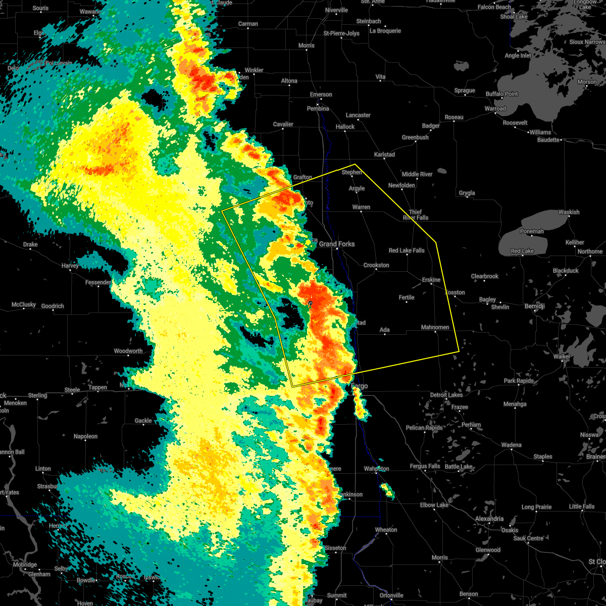 At 507 am cdt, severe thunderstorms were located along a line extending from forest river to near gardner, moving east at 40 mph (radar indicated). Hazards include 70 mph wind gusts. Expect considerable tree damage. damage is likely to mobile homes, roofs, and outbuildings. severe thunderstorms will be near, gardner and grandin around 510 am cdt. perley, poland and hendrum around 520 am cdt. warsaw around 525 am cdt. Other locations in the path of these severe thunderstorms include oslo, big woods and alvarado. At 507 am cdt, severe thunderstorms were located along a line extending from forest river to near gardner, moving east at 40 mph (radar indicated). Hazards include 70 mph wind gusts. Expect considerable tree damage. damage is likely to mobile homes, roofs, and outbuildings. severe thunderstorms will be near, gardner and grandin around 510 am cdt. perley, poland and hendrum around 520 am cdt. warsaw around 525 am cdt. Other locations in the path of these severe thunderstorms include oslo, big woods and alvarado.
|
| 6/11/2021 4:19 AM CDT |
 At 419 am cdt, severe thunderstorms were located along a line extending from mapes to 7 miles north of oriska, moving east at 70 mph. these are very dangerous storms (radar indicated). Hazards include 80 mph wind gusts. Flying debris will be dangerous to those caught without shelter. mobile homes will be heavily damaged. expect considerable damage to roofs, windows, and vehicles. Extensive tree damage and power outages are likely. At 419 am cdt, severe thunderstorms were located along a line extending from mapes to 7 miles north of oriska, moving east at 70 mph. these are very dangerous storms (radar indicated). Hazards include 80 mph wind gusts. Flying debris will be dangerous to those caught without shelter. mobile homes will be heavily damaged. expect considerable damage to roofs, windows, and vehicles. Extensive tree damage and power outages are likely.
|
| 6/7/2021 5:55 PM CDT |
 At 555 pm cdt, a severe thunderstorm was located over eldred, or 17 miles southeast of grand forks, moving east at 45 mph (radar indicated). Hazards include 60 mph wind gusts and half dollar size hail. Hail damage to vehicles is expected. expect wind damage to roofs, siding, and trees. this severe storm will be near, crookston around 610 pm cdt. Other locations in the path of this severe thunderstorm include harold. At 555 pm cdt, a severe thunderstorm was located over eldred, or 17 miles southeast of grand forks, moving east at 45 mph (radar indicated). Hazards include 60 mph wind gusts and half dollar size hail. Hail damage to vehicles is expected. expect wind damage to roofs, siding, and trees. this severe storm will be near, crookston around 610 pm cdt. Other locations in the path of this severe thunderstorm include harold.
|
| 6/7/2021 5:51 PM CDT |
 At 551 pm cdt, a severe thunderstorm was located near eldred, or 15 miles southeast of grand forks, moving east at 45 mph (radar indicated). Hazards include 60 mph wind gusts and quarter size hail. Hail damage to vehicles is expected. expect wind damage to roofs, siding, and trees. this severe thunderstorm will be near, eldred around 555 pm cdt. crookston around 610 pm cdt. Other locations in the path of this severe thunderstorm include harold. At 551 pm cdt, a severe thunderstorm was located near eldred, or 15 miles southeast of grand forks, moving east at 45 mph (radar indicated). Hazards include 60 mph wind gusts and quarter size hail. Hail damage to vehicles is expected. expect wind damage to roofs, siding, and trees. this severe thunderstorm will be near, eldred around 555 pm cdt. crookston around 610 pm cdt. Other locations in the path of this severe thunderstorm include harold.
|
| 6/4/2021 8:12 PM CDT |
 At 812 pm cdt, a severe thunderstorm was located near crookston, or 23 miles southeast of grand forks, moving east at 35 mph (public). Hazards include 60 mph wind gusts. Expect damage to roofs, siding, and trees. Locations impacted include, greenview and harold. At 812 pm cdt, a severe thunderstorm was located near crookston, or 23 miles southeast of grand forks, moving east at 35 mph (public). Hazards include 60 mph wind gusts. Expect damage to roofs, siding, and trees. Locations impacted include, greenview and harold.
|
| 6/4/2021 7:49 PM CDT |
 At 749 pm cdt, a severe thunderstorm was located near bygland, or 11 miles southeast of grand forks, moving east at 35 mph (public). Hazards include 60 mph wind gusts. Expect damage to roofs, siding, and trees. this severe thunderstorm will be near, fisher around 755 pm cdt. eldred around 800 pm cdt. Other locations in the path of this severe thunderstorm include crookston, greenview and harold. At 749 pm cdt, a severe thunderstorm was located near bygland, or 11 miles southeast of grand forks, moving east at 35 mph (public). Hazards include 60 mph wind gusts. Expect damage to roofs, siding, and trees. this severe thunderstorm will be near, fisher around 755 pm cdt. eldred around 800 pm cdt. Other locations in the path of this severe thunderstorm include crookston, greenview and harold.
|
| 9/2/2020 9:13 PM CDT |
 At 913 pm cdt, severe thunderstorms were located along a line extending from near mavie to near grandin, moving east at 70 mph (radar indicated). Hazards include 60 mph wind gusts. Expect damage to roofs, siding, and trees. locations impacted include, thief river falls, crookston, ada, hillsboro, red lake falls, fertile and halstad. This includes interstate 29 between mile markers 75 and 119. At 913 pm cdt, severe thunderstorms were located along a line extending from near mavie to near grandin, moving east at 70 mph (radar indicated). Hazards include 60 mph wind gusts. Expect damage to roofs, siding, and trees. locations impacted include, thief river falls, crookston, ada, hillsboro, red lake falls, fertile and halstad. This includes interstate 29 between mile markers 75 and 119.
|
| 9/2/2020 8:35 PM CDT |
 At 835 pm cdt, severe thunderstorms were located along a line extending from near alvarado to near pillsbury, moving east at 70 mph (radar indicated). Hazards include 60 mph wind gusts. expect damage to roofs, siding, and trees At 835 pm cdt, severe thunderstorms were located along a line extending from near alvarado to near pillsbury, moving east at 70 mph (radar indicated). Hazards include 60 mph wind gusts. expect damage to roofs, siding, and trees
|
| 8/19/2020 6:44 AM CDT |
 At 644 am cdt, a severe thunderstorm was located over gentilly, or 24 miles southwest of thief river falls, moving east at 30 mph (radar indicated). Hazards include quarter size hail. damage to vehicles is expected At 644 am cdt, a severe thunderstorm was located over gentilly, or 24 miles southwest of thief river falls, moving east at 30 mph (radar indicated). Hazards include quarter size hail. damage to vehicles is expected
|
| 8/19/2020 6:13 AM CDT |
 The severe thunderstorm warning for northwestern red lake, central polk and southwestern pennington counties will expire at 615 am cdt, the storms which prompted the warning have moved out of the warned area. therefore, the warning will be allowed to expire. however small hail is still possible with these thunderstorms. The severe thunderstorm warning for northwestern red lake, central polk and southwestern pennington counties will expire at 615 am cdt, the storms which prompted the warning have moved out of the warned area. therefore, the warning will be allowed to expire. however small hail is still possible with these thunderstorms.
|
| 8/19/2020 6:02 AM CDT |
 At 601 am cdt, severe thunderstorms were located along a line extending from 6 miles north of wylie to near eldred, moving southeast at 20 mph (radar indicated). Hazards include ping pong ball size hail. People and animals outdoors will be injured. expect damage to roofs, siding, windows, and vehicles. Locations impacted include, crookston, gentilly, huot, dorothy and wylie. At 601 am cdt, severe thunderstorms were located along a line extending from 6 miles north of wylie to near eldred, moving southeast at 20 mph (radar indicated). Hazards include ping pong ball size hail. People and animals outdoors will be injured. expect damage to roofs, siding, windows, and vehicles. Locations impacted include, crookston, gentilly, huot, dorothy and wylie.
|
| 8/19/2020 5:26 AM CDT |
 At 526 am cdt, severe thunderstorms were located along a line extending from 6 miles west of carpenters corner to bygland, moving southeast at 20 mph. this storm has a history of producing quarter to half dollar sized hail (radar indicated). Hazards include half dollar size hail. damage to vehicles is expected At 526 am cdt, severe thunderstorms were located along a line extending from 6 miles west of carpenters corner to bygland, moving southeast at 20 mph. this storm has a history of producing quarter to half dollar sized hail (radar indicated). Hazards include half dollar size hail. damage to vehicles is expected
|
| 8/14/2020 9:15 AM CDT |
 At 915 am cdt, a severe thunderstorm was located over nielsville, or 28 miles southeast of grand forks, moving northeast at 40 mph (radar indicated). Hazards include 60 mph wind gusts and half dollar size hail. Hail damage to vehicles is expected. Expect wind damage to roofs, siding, and trees. At 915 am cdt, a severe thunderstorm was located over nielsville, or 28 miles southeast of grand forks, moving northeast at 40 mph (radar indicated). Hazards include 60 mph wind gusts and half dollar size hail. Hail damage to vehicles is expected. Expect wind damage to roofs, siding, and trees.
|
| 8/9/2020 3:12 PM CDT |
 At 312 pm cdt, severe thunderstorms were located along a line extending from near huot to near nielsville, moving east at 40 mph (radar indicated). Hazards include 70 mph wind gusts and nickel size hail. Expect considerable tree damage. damage is likely to mobile homes, roofs, and outbuildings. severe thunderstorms will be near, huot, dorothy and perault around 315 pm cdt. red lake falls around 320 pm cdt. beltrami and terrebonne around 330 pm cdt. plummer and brooks around 335 pm cdt. Melvin around 340 pm cdt. At 312 pm cdt, severe thunderstorms were located along a line extending from near huot to near nielsville, moving east at 40 mph (radar indicated). Hazards include 70 mph wind gusts and nickel size hail. Expect considerable tree damage. damage is likely to mobile homes, roofs, and outbuildings. severe thunderstorms will be near, huot, dorothy and perault around 315 pm cdt. red lake falls around 320 pm cdt. beltrami and terrebonne around 330 pm cdt. plummer and brooks around 335 pm cdt. Melvin around 340 pm cdt.
|
| 8/9/2020 2:45 PM CDT |
 At 245 pm cdt, severe thunderstorms were located along a line extending from near huot to near eldred to 6 miles south of holmes, moving southeast at 20 mph (radar indicated). Hazards include 60 mph wind gusts and quarter size hail. Hail damage to vehicles is expected. expect wind damage to roofs, siding, and trees. locations impacted include, crookston, red lake falls, thompson, fisher, buxton, reynolds and climax. This includes interstate 29 between mile markers 108 and 133. At 245 pm cdt, severe thunderstorms were located along a line extending from near huot to near eldred to 6 miles south of holmes, moving southeast at 20 mph (radar indicated). Hazards include 60 mph wind gusts and quarter size hail. Hail damage to vehicles is expected. expect wind damage to roofs, siding, and trees. locations impacted include, crookston, red lake falls, thompson, fisher, buxton, reynolds and climax. This includes interstate 29 between mile markers 108 and 133.
|
| 8/9/2020 2:10 PM CDT |
 At 210 pm cdt, severe thunderstorms were located along a line extending from near key west to near thompson to near northwood, moving southeast at 20 mph (radar indicated). Hazards include 60 mph wind gusts and quarter size hail. Hail damage to vehicles is expected. Expect wind damage to roofs, siding, and trees. At 210 pm cdt, severe thunderstorms were located along a line extending from near key west to near thompson to near northwood, moving southeast at 20 mph (radar indicated). Hazards include 60 mph wind gusts and quarter size hail. Hail damage to vehicles is expected. Expect wind damage to roofs, siding, and trees.
|
| 7/24/2020 10:54 PM CDT |
 The severe thunderstorm warning for western marshall, northwestern red lake, northwestern polk, southwestern pennington and eastern grand forks counties will expire at 1100 pm cdt, the storms which prompted the warning have moved out of the area. therefore, the warning will be allowed to expire. a severe thunderstorm watch remains in effect until 1100 pm cdt for northeastern north dakota. The severe thunderstorm warning for western marshall, northwestern red lake, northwestern polk, southwestern pennington and eastern grand forks counties will expire at 1100 pm cdt, the storms which prompted the warning have moved out of the area. therefore, the warning will be allowed to expire. a severe thunderstorm watch remains in effect until 1100 pm cdt for northeastern north dakota.
|
| 7/24/2020 10:34 PM CDT |
 At 1033 pm cdt, severe thunderstorms were located along a line extending from near tabor to sherack to near key west, moving northeast at 60 mph (radar indicated). Hazards include 70 mph wind gusts and nickel size hail. Expect considerable tree damage. damage is likely to mobile homes, roofs, and outbuildings. locations impacted include, grand forks, east grand forks, grand forks afb, warren, thompson, argyle and fisher. This includes interstate 29 between mile markers 123 and 156. At 1033 pm cdt, severe thunderstorms were located along a line extending from near tabor to sherack to near key west, moving northeast at 60 mph (radar indicated). Hazards include 70 mph wind gusts and nickel size hail. Expect considerable tree damage. damage is likely to mobile homes, roofs, and outbuildings. locations impacted include, grand forks, east grand forks, grand forks afb, warren, thompson, argyle and fisher. This includes interstate 29 between mile markers 123 and 156.
|
| 7/24/2020 10:14 PM CDT |
 At 1013 pm cdt, severe thunderstorms were located along a line extending from johnstown to near thompson, moving northeast at 40 mph (radar indicated). Hazards include 60 mph wind gusts and quarter size hail. Hail damage to vehicles is expected. Expect wind damage to roofs, siding, and trees. At 1013 pm cdt, severe thunderstorms were located along a line extending from johnstown to near thompson, moving northeast at 40 mph (radar indicated). Hazards include 60 mph wind gusts and quarter size hail. Hail damage to vehicles is expected. Expect wind damage to roofs, siding, and trees.
|
| 7/17/2020 5:34 PM CDT |
 At 533 pm cdt, severe thunderstorms were located along a line extending from dakota junction to beltrami, moving southeast at 50 mph (radar indicated). Hazards include 70 mph wind gusts and quarter size hail. Hail damage to vehicles is expected. expect considerable tree damage. wind damage is also likely to mobile homes, roofs, and outbuildings. these severe storms will be near, thief river falls and dakota junction around 535 pm cdt. melvin and hazel around 540 pm cdt. fertile and mavie around 545 pm cdt. flaming around 550 pm cdt. high landing, ranum and rindal around 555 pm cdt. Other locations impacted by these severe thunderstorms include thief river falls airport. At 533 pm cdt, severe thunderstorms were located along a line extending from dakota junction to beltrami, moving southeast at 50 mph (radar indicated). Hazards include 70 mph wind gusts and quarter size hail. Hail damage to vehicles is expected. expect considerable tree damage. wind damage is also likely to mobile homes, roofs, and outbuildings. these severe storms will be near, thief river falls and dakota junction around 535 pm cdt. melvin and hazel around 540 pm cdt. fertile and mavie around 545 pm cdt. flaming around 550 pm cdt. high landing, ranum and rindal around 555 pm cdt. Other locations impacted by these severe thunderstorms include thief river falls airport.
|
| 7/17/2020 4:58 PM CDT |
 At 457 pm cdt, severe thunderstorms were located along a line extending from near argyle to near reynolds, moving southeast at 50 mph (radar indicated). Hazards include 70 mph wind gusts and quarter size hail. Hail damage to vehicles is expected. expect considerable tree damage. wind damage is also likely to mobile homes, roofs, and outbuildings. severe thunderstorms will be near, warren around 500 pm cdt. radium around 505 pm cdt. climax and eldred around 515 pm cdt. viking and carpenters corner around 520 pm cdt. rosewood around 525 pm cdt. other locations impacted by these severe thunderstorms include thief river falls airport. This includes interstate 29 between mile markers 120 and 138. At 457 pm cdt, severe thunderstorms were located along a line extending from near argyle to near reynolds, moving southeast at 50 mph (radar indicated). Hazards include 70 mph wind gusts and quarter size hail. Hail damage to vehicles is expected. expect considerable tree damage. wind damage is also likely to mobile homes, roofs, and outbuildings. severe thunderstorms will be near, warren around 500 pm cdt. radium around 505 pm cdt. climax and eldred around 515 pm cdt. viking and carpenters corner around 520 pm cdt. rosewood around 525 pm cdt. other locations impacted by these severe thunderstorms include thief river falls airport. This includes interstate 29 between mile markers 120 and 138.
|
| 6/17/2020 9:33 PM CDT |
 At 932 pm cdt, severe thunderstorms were located along a line extending from big woods to near dorothy, moving northeast at 55 mph (radar indicated). Hazards include 70 mph wind gusts and penny size hail. Expect considerable tree damage. damage is likely to mobile homes, roofs, and outbuildings. these severe storms will be near, dorothy and huot around 935 pm cdt. wylie around 940 pm cdt. stephen and argyle around 945 pm cdt. st. hilaire and carpenters corner around 950 pm cdt. dakota junction, thief river falls and rosewood around 955 pm cdt. other locations impacted by these severe thunderstorms include thief river falls airport. This includes interstate 29 between mile markers 142 and 159. At 932 pm cdt, severe thunderstorms were located along a line extending from big woods to near dorothy, moving northeast at 55 mph (radar indicated). Hazards include 70 mph wind gusts and penny size hail. Expect considerable tree damage. damage is likely to mobile homes, roofs, and outbuildings. these severe storms will be near, dorothy and huot around 935 pm cdt. wylie around 940 pm cdt. stephen and argyle around 945 pm cdt. st. hilaire and carpenters corner around 950 pm cdt. dakota junction, thief river falls and rosewood around 955 pm cdt. other locations impacted by these severe thunderstorms include thief river falls airport. This includes interstate 29 between mile markers 142 and 159.
|
| 6/17/2020 9:19 PM CDT |
 At 918 pm cdt, severe thunderstorms were located along a line extending from poland to near crookston, moving northeast at 55 mph (radar indicated). Hazards include 70 mph wind gusts and penny size hail. Expect considerable tree damage. damage is likely to mobile homes, roofs, and outbuildings. severe thunderstorms will be near, crookston around 920 pm cdt. euclid and huot around 930 pm cdt. dorothy around 935 pm cdt. wylie and argyle around 940 pm cdt. stephen, st. hilaire and carpenters corner around 945 pm cdt. other locations impacted by these severe thunderstorms include thief river falls airport. This includes interstate 29 between mile markers 142 and 159. At 918 pm cdt, severe thunderstorms were located along a line extending from poland to near crookston, moving northeast at 55 mph (radar indicated). Hazards include 70 mph wind gusts and penny size hail. Expect considerable tree damage. damage is likely to mobile homes, roofs, and outbuildings. severe thunderstorms will be near, crookston around 920 pm cdt. euclid and huot around 930 pm cdt. dorothy around 935 pm cdt. wylie and argyle around 940 pm cdt. stephen, st. hilaire and carpenters corner around 945 pm cdt. other locations impacted by these severe thunderstorms include thief river falls airport. This includes interstate 29 between mile markers 142 and 159.
|
| 6/17/2020 9:09 PM CDT |
 At 909 pm cdt, severe thunderstorms were located along a line extending from near newfolden to near melvin, moving northeast at 55 mph (radar indicated). Hazards include 70 mph wind gusts and penny size hail. Expect considerable tree damage. damage is likely to mobile homes, roofs, and outbuildings. Locations impacted include, thief river falls, crookston, red lake falls, halstad, fisher, newfolden and middle river. At 909 pm cdt, severe thunderstorms were located along a line extending from near newfolden to near melvin, moving northeast at 55 mph (radar indicated). Hazards include 70 mph wind gusts and penny size hail. Expect considerable tree damage. damage is likely to mobile homes, roofs, and outbuildings. Locations impacted include, thief river falls, crookston, red lake falls, halstad, fisher, newfolden and middle river.
|
| 6/17/2020 8:55 PM CDT | Storm damage reported in polk county MN, 0.6 miles N of Crookston, MN |
| 6/17/2020 8:39 PM CDT |
 At 839 pm cdt, severe thunderstorms were located along a line extending from near warren to near caledonia, moving northeast at 40 mph (radar indicated). Hazards include 70 mph wind gusts and penny size hail. Expect considerable tree damage. Damage is likely to mobile homes, roofs, and outbuildings. At 839 pm cdt, severe thunderstorms were located along a line extending from near warren to near caledonia, moving northeast at 40 mph (radar indicated). Hazards include 70 mph wind gusts and penny size hail. Expect considerable tree damage. Damage is likely to mobile homes, roofs, and outbuildings.
|
| 6/17/2020 8:10 PM CDT |
 At 809 pm cdt, a severe thunderstorm was located near hillsboro, or 37 miles northwest of fargo, moving northeast at 40 mph (radar indicated). Hazards include 70 mph wind gusts and penny size hail. Expect considerable tree damage. Damage is likely to mobile homes, roofs, and outbuildings. At 809 pm cdt, a severe thunderstorm was located near hillsboro, or 37 miles northwest of fargo, moving northeast at 40 mph (radar indicated). Hazards include 70 mph wind gusts and penny size hail. Expect considerable tree damage. Damage is likely to mobile homes, roofs, and outbuildings.
|
| 6/7/2020 10:22 PM CDT |
 At 1019 pm cdt, severe thunderstorms were located along a line extending from oklee to near callaway, moving east at 60 mph (airport observation. a wind gust of 71 mph was reported at the fargo airport at 1015 pm). Hazards include 70 mph wind gusts. Expect considerable tree damage. damage is likely to mobile homes, roofs, and outbuildings. these severe thunderstorms will remain over mainly rural areas of red lake, clay, norman, western polk, western pennington, southeastern grand forks, eastern cass and eastern traill counties, including the following locations, thief river falls airport, casselton airport, american crystal sugar, moorhead airport and west argusville. this includes the following highways, interstate 29 between mile markers 49 and 124. interstate 94 in north dakota between mile markers 331 and 352. Interstate 94 in minnesota between mile markers 1 and 27. At 1019 pm cdt, severe thunderstorms were located along a line extending from oklee to near callaway, moving east at 60 mph (airport observation. a wind gust of 71 mph was reported at the fargo airport at 1015 pm). Hazards include 70 mph wind gusts. Expect considerable tree damage. damage is likely to mobile homes, roofs, and outbuildings. these severe thunderstorms will remain over mainly rural areas of red lake, clay, norman, western polk, western pennington, southeastern grand forks, eastern cass and eastern traill counties, including the following locations, thief river falls airport, casselton airport, american crystal sugar, moorhead airport and west argusville. this includes the following highways, interstate 29 between mile markers 49 and 124. interstate 94 in north dakota between mile markers 331 and 352. Interstate 94 in minnesota between mile markers 1 and 27.
|
| 6/7/2020 10:02 PM CDT | Peak winds measured at the crookston airport /kckn in polk county MN, 3 miles ESE of Crookston, MN |
| 6/7/2020 9:23 PM CDT |
 At 923 pm cdt, severe thunderstorms were located along a line extending from near reynolds to mapleton, moving east at 60 mph (radar indicated). Hazards include 70 mph wind gusts. Expect considerable tree damage. damage is likely to mobile homes, roofs, and outbuildings. severe thunderstorms will be near, west fargo around 925 pm cdt. reile`s acres, harwood and prairie rose around 930 pm cdt. moorhead, fargo and oakport around 935 pm cdt. dilworth and kragnes around 940 pm cdt. averill, glyndon and harold around 945 pm cdt. other locations impacted by these severe thunderstorms include thief river falls airport, casselton airport, american crystal sugar, moorhead airport and west argusville. this includes the following highways, interstate 29 between mile markers 49 and 124. interstate 94 in north dakota between mile markers 331 and 352. Interstate 94 in minnesota between mile markers 1 and 27. At 923 pm cdt, severe thunderstorms were located along a line extending from near reynolds to mapleton, moving east at 60 mph (radar indicated). Hazards include 70 mph wind gusts. Expect considerable tree damage. damage is likely to mobile homes, roofs, and outbuildings. severe thunderstorms will be near, west fargo around 925 pm cdt. reile`s acres, harwood and prairie rose around 930 pm cdt. moorhead, fargo and oakport around 935 pm cdt. dilworth and kragnes around 940 pm cdt. averill, glyndon and harold around 945 pm cdt. other locations impacted by these severe thunderstorms include thief river falls airport, casselton airport, american crystal sugar, moorhead airport and west argusville. this includes the following highways, interstate 29 between mile markers 49 and 124. interstate 94 in north dakota between mile markers 331 and 352. Interstate 94 in minnesota between mile markers 1 and 27.
|
| 6/7/2020 3:10 PM CDT | Quarter sized hail reported 6.9 miles W of Crookston, MN, report and photo posted via social media. time estimated based on radar. |
| 6/7/2020 3:02 PM CDT |
 At 302 pm cdt, a severe thunderstorm was located near harold, or 29 miles southwest of thief river falls, moving northeast at 55 mph (radar indicated). Hazards include 60 mph wind gusts and half dollar size hail. Hail damage to vehicles is expected. expect wind damage to roofs, siding, and trees. this severe thunderstorm will be near, gentilly around 305 pm cdt. perault, marcoux and huot around 310 pm cdt. red lake falls around 315 pm cdt. wylie and terrebonne around 320 pm cdt. st. hilaire and plummer around 325 pm cdt. Other locations impacted by this severe thunderstorm include thief river falls airport. At 302 pm cdt, a severe thunderstorm was located near harold, or 29 miles southwest of thief river falls, moving northeast at 55 mph (radar indicated). Hazards include 60 mph wind gusts and half dollar size hail. Hail damage to vehicles is expected. expect wind damage to roofs, siding, and trees. this severe thunderstorm will be near, gentilly around 305 pm cdt. perault, marcoux and huot around 310 pm cdt. red lake falls around 315 pm cdt. wylie and terrebonne around 320 pm cdt. st. hilaire and plummer around 325 pm cdt. Other locations impacted by this severe thunderstorm include thief river falls airport.
|
| 9/20/2019 9:55 PM CDT |
 At 955 pm cdt, a severe thunderstorm was located over gentilly, or 26 miles southwest of thief river falls, moving northeast at 40 mph (radar indicated). Hazards include 60 mph wind gusts and penny size hail. expect damage to roofs, siding, and trees At 955 pm cdt, a severe thunderstorm was located over gentilly, or 26 miles southwest of thief river falls, moving northeast at 40 mph (radar indicated). Hazards include 60 mph wind gusts and penny size hail. expect damage to roofs, siding, and trees
|
| 9/20/2019 9:41 PM CDT |
 At 940 pm cdt, severe thunderstorms were located along a line extending from viking to near huot, moving northeast at 15 mph (radar indicated). Hazards include 70 mph wind gusts and penny size hail. Expect considerable tree damage. damage is likely to mobile homes, roofs, and outbuildings. these severe storms will be near, viking and carpenters corner around 945 pm cdt. rosewood around 950 pm cdt. newfolden and holt around 1000 pm cdt. Other locations impacted by these severe thunderstorms include thief river falls airport. At 940 pm cdt, severe thunderstorms were located along a line extending from viking to near huot, moving northeast at 15 mph (radar indicated). Hazards include 70 mph wind gusts and penny size hail. Expect considerable tree damage. damage is likely to mobile homes, roofs, and outbuildings. these severe storms will be near, viking and carpenters corner around 945 pm cdt. rosewood around 950 pm cdt. newfolden and holt around 1000 pm cdt. Other locations impacted by these severe thunderstorms include thief river falls airport.
|
| 9/20/2019 9:12 PM CDT |
 At 912 pm cdt, severe thunderstorms were located along a line extending from near middle river to gentilly, moving northeast at 60 mph (radar indicated). Hazards include 60 mph wind gusts and nickel size hail. Expect damage to roofs, siding, and trees. severe thunderstorms will be near, middle river around 915 pm cdt. wylie around 925 pm cdt. st. hilaire around 930 pm cdt. thief river falls and hazel around 935 pm cdt. dakota junction around 940 pm cdt. Other locations impacted by these severe thunderstorms include thief river falls airport. At 912 pm cdt, severe thunderstorms were located along a line extending from near middle river to gentilly, moving northeast at 60 mph (radar indicated). Hazards include 60 mph wind gusts and nickel size hail. Expect damage to roofs, siding, and trees. severe thunderstorms will be near, middle river around 915 pm cdt. wylie around 925 pm cdt. st. hilaire around 930 pm cdt. thief river falls and hazel around 935 pm cdt. dakota junction around 940 pm cdt. Other locations impacted by these severe thunderstorms include thief river falls airport.
|
| 9/20/2019 8:38 PM CDT |
 At 838 pm cdt, severe thunderstorms were located along a line extending from 6 miles east of manvel to near fisher, moving northeast at 40 mph (radar indicated). Hazards include 70 mph wind gusts and nickel size hail. Expect considerable tree damage. damage is likely to mobile homes, roofs, and outbuildings. these severe storms will be near, crookston and tabor around 850 pm cdt. euclid around 900 pm cdt. warren and huot around 905 pm cdt. dorothy and radium around 910 pm cdt. Wylie and old mill state park around 915 pm cdt. At 838 pm cdt, severe thunderstorms were located along a line extending from 6 miles east of manvel to near fisher, moving northeast at 40 mph (radar indicated). Hazards include 70 mph wind gusts and nickel size hail. Expect considerable tree damage. damage is likely to mobile homes, roofs, and outbuildings. these severe storms will be near, crookston and tabor around 850 pm cdt. euclid around 900 pm cdt. warren and huot around 905 pm cdt. dorothy and radium around 910 pm cdt. Wylie and old mill state park around 915 pm cdt.
|
| 9/20/2019 8:28 PM CDT |
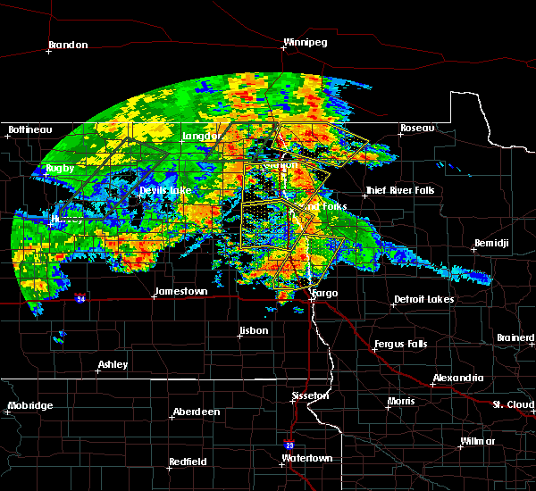 At 828 pm cdt, severe thunderstorms were located along a line extending from near manvel to near eldred, moving northeast at 40 mph (radar indicated). Hazards include 70 mph wind gusts and nickel size hail. Expect considerable tree damage. damage is likely to mobile homes, roofs, and outbuildings. severe thunderstorms will be near, eldred and east grand forks around 830 pm cdt. fisher around 840 pm cdt. tabor around 845 pm cdt. crookston around 850 pm cdt. Warren and euclid around 900 pm cdt. At 828 pm cdt, severe thunderstorms were located along a line extending from near manvel to near eldred, moving northeast at 40 mph (radar indicated). Hazards include 70 mph wind gusts and nickel size hail. Expect considerable tree damage. damage is likely to mobile homes, roofs, and outbuildings. severe thunderstorms will be near, eldred and east grand forks around 830 pm cdt. fisher around 840 pm cdt. tabor around 845 pm cdt. crookston around 850 pm cdt. Warren and euclid around 900 pm cdt.
|
| 7/8/2019 8:43 PM CDT |
 At 843 pm cdt, severe thunderstorms were located along a line extending from near dugdale to 6 miles northeast of ada to near harwood, moving east at 35 mph (radar indicated). Hazards include 60 mph wind gusts. expect damage to roofs, siding, and trees At 843 pm cdt, severe thunderstorms were located along a line extending from near dugdale to 6 miles northeast of ada to near harwood, moving east at 35 mph (radar indicated). Hazards include 60 mph wind gusts. expect damage to roofs, siding, and trees
|
| 7/8/2019 8:43 PM CDT |
 The national weather service in grand forks has issued a * severe thunderstorm warning for. clay county in northwestern minnesota. norman county in northwestern minnesota. southeastern polk county in northwestern minnesota. Mahnomen county in northwestern minnesota. The national weather service in grand forks has issued a * severe thunderstorm warning for. clay county in northwestern minnesota. norman county in northwestern minnesota. southeastern polk county in northwestern minnesota. Mahnomen county in northwestern minnesota.
|
| 7/8/2019 8:15 PM CDT |
 At 814 pm cdt, severe thunderstorms were located along a line extending from near euclid to near greenview to grandin, moving east at 40 mph (radar indicated). Hazards include 60 mph wind gusts. Expect damage to roofs, siding, and trees. locations impacted include, thief river falls, crookston, ada, hillsboro, red lake falls, fertile and halstad. This includes interstate 29 between mile markers 85 and 111. At 814 pm cdt, severe thunderstorms were located along a line extending from near euclid to near greenview to grandin, moving east at 40 mph (radar indicated). Hazards include 60 mph wind gusts. Expect damage to roofs, siding, and trees. locations impacted include, thief river falls, crookston, ada, hillsboro, red lake falls, fertile and halstad. This includes interstate 29 between mile markers 85 and 111.
|
| 7/8/2019 8:04 PM CDT | Metal roofing blown off of machine shed near euclid via facebook photo in polk county MN, 13.3 miles S of Crookston, MN |
| 7/8/2019 7:51 PM CDT |
 At 751 pm cdt, severe thunderstorms were located along a line extending from tabor to 6 miles northwest of climax to near roseville, moving east at 40 mph (radar indicated). Hazards include 70 mph wind gusts and penny size hail. Expect considerable tree damage. Damage is likely to mobile homes, roofs, and outbuildings. At 751 pm cdt, severe thunderstorms were located along a line extending from tabor to 6 miles northwest of climax to near roseville, moving east at 40 mph (radar indicated). Hazards include 70 mph wind gusts and penny size hail. Expect considerable tree damage. Damage is likely to mobile homes, roofs, and outbuildings.
|
| 7/8/2019 7:38 PM CDT |
 At 738 pm cdt, severe thunderstorms were located along a line extending from near manvel to merrifield to 6 miles northeast of mayville, moving east at 50 mph (radar indicated). Hazards include 70 mph wind gusts and penny size hail. Expect considerable tree damage. damage is likely to mobile homes, roofs, and outbuildings. locations impacted include, grand forks, east grand forks, crookston, grand forks afb, mayville, warren and red lake falls. This includes interstate 29 between mile markers 110 and 166. At 738 pm cdt, severe thunderstorms were located along a line extending from near manvel to merrifield to 6 miles northeast of mayville, moving east at 50 mph (radar indicated). Hazards include 70 mph wind gusts and penny size hail. Expect considerable tree damage. damage is likely to mobile homes, roofs, and outbuildings. locations impacted include, grand forks, east grand forks, crookston, grand forks afb, mayville, warren and red lake falls. This includes interstate 29 between mile markers 110 and 166.
|
| 7/8/2019 7:07 PM CDT |
 The national weather service in grand forks has issued a * severe thunderstorm warning for. southwestern marshall county in northwestern minnesota. western red lake county in northwestern minnesota. polk county in northwestern minnesota. Western pennington county in northwestern minnesota. The national weather service in grand forks has issued a * severe thunderstorm warning for. southwestern marshall county in northwestern minnesota. western red lake county in northwestern minnesota. polk county in northwestern minnesota. Western pennington county in northwestern minnesota.
|
| 7/8/2019 7:07 PM CDT |
 At 707 pm cdt, severe thunderstorms were located along a line extending from near orr to near kempton to near sherbrooke, moving east at 65 mph. these are very dangerous storms (radar indicated). Hazards include 80 mph wind gusts and nickel size hail. Flying debris will be dangerous to those caught without shelter. mobile homes will be heavily damaged. expect considerable damage to roofs, windows, and vehicles. Extensive tree damage and power outages are likely. At 707 pm cdt, severe thunderstorms were located along a line extending from near orr to near kempton to near sherbrooke, moving east at 65 mph. these are very dangerous storms (radar indicated). Hazards include 80 mph wind gusts and nickel size hail. Flying debris will be dangerous to those caught without shelter. mobile homes will be heavily damaged. expect considerable damage to roofs, windows, and vehicles. Extensive tree damage and power outages are likely.
|
| 6/8/2019 2:07 PM CDT |
 At 206 pm cdt, a severe thunderstorm was located near euclid, or 17 miles west of thief river falls, moving north at 25 mph. another severe thunderstorm is near crookston moving north northeast at 25 mph (radar indicated). Hazards include 60 mph wind gusts and quarter size hail. Hail damage to vehicles is expected. expect wind damage to roofs, siding, and trees. this severe storm will be near, carpenters corner around 230 pm cdt. Viking and rosewood around 240 pm cdt. At 206 pm cdt, a severe thunderstorm was located near euclid, or 17 miles west of thief river falls, moving north at 25 mph. another severe thunderstorm is near crookston moving north northeast at 25 mph (radar indicated). Hazards include 60 mph wind gusts and quarter size hail. Hail damage to vehicles is expected. expect wind damage to roofs, siding, and trees. this severe storm will be near, carpenters corner around 230 pm cdt. Viking and rosewood around 240 pm cdt.
|
| 6/8/2019 1:44 PM CDT |
 At 144 pm cdt, a severe thunderstorm was located near euclid, or 21 miles east of grand forks, moving north at 25 mph (radar indicated). Hazards include 60 mph wind gusts and quarter size hail. Hail damage to vehicles is expected. expect wind damage to roofs, siding, and trees. this severe thunderstorm will be near, euclid and dorothy around 155 pm cdt. carpenters corner around 230 pm cdt. rosewood around 240 pm cdt. Viking around 245 pm cdt. At 144 pm cdt, a severe thunderstorm was located near euclid, or 21 miles east of grand forks, moving north at 25 mph (radar indicated). Hazards include 60 mph wind gusts and quarter size hail. Hail damage to vehicles is expected. expect wind damage to roofs, siding, and trees. this severe thunderstorm will be near, euclid and dorothy around 155 pm cdt. carpenters corner around 230 pm cdt. rosewood around 240 pm cdt. Viking around 245 pm cdt.
|
| 5/24/2019 8:07 PM CDT |
 At 807 pm cdt, severe thunderstorms were located along a line extending from near dorothy to near dugdale, moving east at 65 mph (radar indicated). Hazards include 70 mph wind gusts and half dollar size hail. Hail damage to vehicles is expected. expect considerable tree damage. wind damage is also likely to mobile homes, roofs, and outbuildings. these severe storms will be near, maple bay and marcoux around 810 pm cdt. Red lake falls around 815 pm cdt. At 807 pm cdt, severe thunderstorms were located along a line extending from near dorothy to near dugdale, moving east at 65 mph (radar indicated). Hazards include 70 mph wind gusts and half dollar size hail. Hail damage to vehicles is expected. expect considerable tree damage. wind damage is also likely to mobile homes, roofs, and outbuildings. these severe storms will be near, maple bay and marcoux around 810 pm cdt. Red lake falls around 815 pm cdt.
|
| 5/24/2019 7:52 PM CDT |
 At 752 pm cdt, severe thunderstorms were located along a line extending from near key west to greenview, moving east at 65 mph (radar indicated). Hazards include 70 mph wind gusts and half dollar size hail. Hail damage to vehicles is expected. expect considerable tree damage. wind damage is also likely to mobile homes, roofs, and outbuildings. severe thunderstorms will be near, crookston and harold around 755 pm cdt. melvin around 800 pm cdt. dorothy, dugdale and maple bay around 805 pm cdt. Wylie and red lake falls around 810 pm cdt. At 752 pm cdt, severe thunderstorms were located along a line extending from near key west to greenview, moving east at 65 mph (radar indicated). Hazards include 70 mph wind gusts and half dollar size hail. Hail damage to vehicles is expected. expect considerable tree damage. wind damage is also likely to mobile homes, roofs, and outbuildings. severe thunderstorms will be near, crookston and harold around 755 pm cdt. melvin around 800 pm cdt. dorothy, dugdale and maple bay around 805 pm cdt. Wylie and red lake falls around 810 pm cdt.
|
| 8/31/2018 9:55 PM CDT |
 At 955 pm cdt, a severe thunderstorm was located near fisher, or 18 miles southeast of grand forks, moving east at 35 mph (radar indicated). Hazards include quarter size hail. Damage to vehicles is expected. this severe thunderstorm will be near, crookston around 1005 pm cdt. gentilly and harold around 1015 pm cdt. huot around 1020 pm cdt. perault, marcoux and red lake falls around 1030 pm cdt. Dugdale around 1035 pm cdt. At 955 pm cdt, a severe thunderstorm was located near fisher, or 18 miles southeast of grand forks, moving east at 35 mph (radar indicated). Hazards include quarter size hail. Damage to vehicles is expected. this severe thunderstorm will be near, crookston around 1005 pm cdt. gentilly and harold around 1015 pm cdt. huot around 1020 pm cdt. perault, marcoux and red lake falls around 1030 pm cdt. Dugdale around 1035 pm cdt.
|
| 7/8/2018 5:38 AM CDT |
 At 537 am cdt, a severe thunderstorm was located near sherack, or 16 miles east of grand forks, moving east at 45 mph (radar indicated). Hazards include 60 mph wind gusts and quarter size hail. Hail damage to vehicles is expected. expect wind damage to roofs, siding, and trees. this severe thunderstorm will be near, euclid and angus around 540 am cdt. dorothy around 555 am cdt. wylie around 600 am cdt. st. hilaire around 605 am cdt. thief river falls and dakota junction around 610 am cdt. Other locations impacted by this severe thunderstorm include thief river falls airport. At 537 am cdt, a severe thunderstorm was located near sherack, or 16 miles east of grand forks, moving east at 45 mph (radar indicated). Hazards include 60 mph wind gusts and quarter size hail. Hail damage to vehicles is expected. expect wind damage to roofs, siding, and trees. this severe thunderstorm will be near, euclid and angus around 540 am cdt. dorothy around 555 am cdt. wylie around 600 am cdt. st. hilaire around 605 am cdt. thief river falls and dakota junction around 610 am cdt. Other locations impacted by this severe thunderstorm include thief river falls airport.
|
| 7/8/2018 5:31 AM CDT |
 At 530 am cdt, a severe thunderstorm was located over grand forks and east grand forks, moving east at 50 mph (radar indicated). Hazards include 70 mph wind gusts and quarter size hail. Hail damage to vehicles is expected. expect considerable tree damage. wind damage is also likely to mobile homes, roofs, and outbuildings. this severe storm will be near, tabor around 535 am cdt. sherack and key west around 540 am cdt. euclid and angus around 545 am cdt. other locations impacted by this severe thunderstorm include grand forks airport. This includes interstate 29 between mile markers 124 and 160. At 530 am cdt, a severe thunderstorm was located over grand forks and east grand forks, moving east at 50 mph (radar indicated). Hazards include 70 mph wind gusts and quarter size hail. Hail damage to vehicles is expected. expect considerable tree damage. wind damage is also likely to mobile homes, roofs, and outbuildings. this severe storm will be near, tabor around 535 am cdt. sherack and key west around 540 am cdt. euclid and angus around 545 am cdt. other locations impacted by this severe thunderstorm include grand forks airport. This includes interstate 29 between mile markers 124 and 160.
|
| 7/8/2018 5:12 AM CDT |
 At 512 am cdt, a severe thunderstorm was located near emerado, or 8 miles west of grand forks, moving east at 50 mph. this is a very dangerous storm (trained weather spotters). Hazards include 80 mph wind gusts and nickel size hail. Flying debris will be dangerous to those caught without shelter. mobile homes will be heavily damaged. expect considerable damage to roofs, windows, and vehicles. extensive tree damage and power outages are likely. this severe storm will be near, grand forks and merrifield around 520 am cdt. east grand forks around 525 am cdt. mallory around 530 am cdt. davidson and tabor around 535 am cdt. sherack and key west around 540 am cdt. other locations impacted by this severe thunderstorm include grand forks airport. This includes interstate 29 between mile markers 124 and 160. At 512 am cdt, a severe thunderstorm was located near emerado, or 8 miles west of grand forks, moving east at 50 mph. this is a very dangerous storm (trained weather spotters). Hazards include 80 mph wind gusts and nickel size hail. Flying debris will be dangerous to those caught without shelter. mobile homes will be heavily damaged. expect considerable damage to roofs, windows, and vehicles. extensive tree damage and power outages are likely. this severe storm will be near, grand forks and merrifield around 520 am cdt. east grand forks around 525 am cdt. mallory around 530 am cdt. davidson and tabor around 535 am cdt. sherack and key west around 540 am cdt. other locations impacted by this severe thunderstorm include grand forks airport. This includes interstate 29 between mile markers 124 and 160.
|
| 7/8/2018 4:52 AM CDT |
 At 451 am cdt, a severe thunderstorm was located over kempton, or 24 miles west of grand forks, moving east at 55 mph. this is a very dangerous storm (trained weather spotters and radar). Hazards include 80 mph wind gusts and nickel size hail. Flying debris will be dangerous to those caught without shelter. mobile homes will be heavily damaged. expect considerable damage to roofs, windows, and vehicles. extensive tree damage and power outages are likely. this severe thunderstorm will be near, arvilla and turtle river state park around 500 am cdt. emerado around 505 am cdt. grand forks afb around 510 am cdt. grand forks and merrifield around 520 am cdt. east grand forks and mallory around 530 am cdt. other locations impacted by this severe thunderstorm include grand forks airport. This includes interstate 29 between mile markers 124 and 160. At 451 am cdt, a severe thunderstorm was located over kempton, or 24 miles west of grand forks, moving east at 55 mph. this is a very dangerous storm (trained weather spotters and radar). Hazards include 80 mph wind gusts and nickel size hail. Flying debris will be dangerous to those caught without shelter. mobile homes will be heavily damaged. expect considerable damage to roofs, windows, and vehicles. extensive tree damage and power outages are likely. this severe thunderstorm will be near, arvilla and turtle river state park around 500 am cdt. emerado around 505 am cdt. grand forks afb around 510 am cdt. grand forks and merrifield around 520 am cdt. east grand forks and mallory around 530 am cdt. other locations impacted by this severe thunderstorm include grand forks airport. This includes interstate 29 between mile markers 124 and 160.
|
| 7/4/2018 4:25 AM CDT |
 The severe thunderstorm warning for western red lake, clay, norman, southwestern polk, northeastern wilkin, southeastern grand forks, cass, traill and eastern steele counties will expire at 430 am cdt, the storms which prompted the warning have weakened. therefore, the warning will be allowed to expire. however gusty winds are still possible with these thunderstorms. a severe thunderstorm watch remains in effect until 900 am cdt for northwestern and west central minnesota, and southeastern and northeastern north dakota. The severe thunderstorm warning for western red lake, clay, norman, southwestern polk, northeastern wilkin, southeastern grand forks, cass, traill and eastern steele counties will expire at 430 am cdt, the storms which prompted the warning have weakened. therefore, the warning will be allowed to expire. however gusty winds are still possible with these thunderstorms. a severe thunderstorm watch remains in effect until 900 am cdt for northwestern and west central minnesota, and southeastern and northeastern north dakota.
|
| 7/4/2018 3:51 AM CDT |
 At 350 am cdt, severe thunderstorms were located along a line extending from near grand forks to near leonard, moving east at 50 mph (radar indicated). Hazards include 60 mph wind gusts and quarter size hail. Hail damage to vehicles is expected. expect wind damage to roofs, siding, and trees. these severe storms will be near, east grand forks and mallory around 355 am cdt. davidson around 400 am cdt. key west, west fargo, and horace around 405 am cdt. fargo, hickson, and wild rice around 410 am cdt. comstock and rustad around 415 am cdt. other locations impacted by these severe thunderstorms include casselton airport, american crystal sugar, moorhead airport, grand forks airport and west argusville. this includes the following highways, interstate 29 between mile markers 49 and 143. interstate 94 in north dakota between mile markers 318 and 352. Interstate 94 in minnesota between mile markers 1 and 27. At 350 am cdt, severe thunderstorms were located along a line extending from near grand forks to near leonard, moving east at 50 mph (radar indicated). Hazards include 60 mph wind gusts and quarter size hail. Hail damage to vehicles is expected. expect wind damage to roofs, siding, and trees. these severe storms will be near, east grand forks and mallory around 355 am cdt. davidson around 400 am cdt. key west, west fargo, and horace around 405 am cdt. fargo, hickson, and wild rice around 410 am cdt. comstock and rustad around 415 am cdt. other locations impacted by these severe thunderstorms include casselton airport, american crystal sugar, moorhead airport, grand forks airport and west argusville. this includes the following highways, interstate 29 between mile markers 49 and 143. interstate 94 in north dakota between mile markers 318 and 352. Interstate 94 in minnesota between mile markers 1 and 27.
|
| 7/4/2018 3:24 AM CDT |
 The national weather service in grand forks has issued a * severe thunderstorm warning for. western red lake county in northwestern minnesota. clay county in northwestern minnesota. norman county in northwestern minnesota. Southwestern polk county in northwestern minnesota. The national weather service in grand forks has issued a * severe thunderstorm warning for. western red lake county in northwestern minnesota. clay county in northwestern minnesota. norman county in northwestern minnesota. Southwestern polk county in northwestern minnesota.
|
| 7/4/2018 3:24 AM CDT |
 At 324 am cdt, severe thunderstorms were located along a line extending from near turtle river state park to near sheldon, moving east at 60 mph (radar indicated). Hazards include 60 mph wind gusts and quarter size hail. Hail damage to vehicles is expected. expect wind damage to roofs, siding, and trees. severe thunderstorms will be near, grand forks afb, leonard and emerado around 330 am cdt. davenport, grand forks and merrifield around 340 am cdt. east grand forks and kindred around 345 am cdt. hickson, mallory and davidson around 350 am cdt. comstock, key west and oxbow around 355 am cdt. other locations impacted by these severe thunderstorms include casselton airport, american crystal sugar, moorhead airport, grand forks airport and west argusville. this includes the following highways, interstate 29 between mile markers 49 and 143. interstate 94 in north dakota between mile markers 318 and 352. Interstate 94 in minnesota between mile markers 1 and 27. At 324 am cdt, severe thunderstorms were located along a line extending from near turtle river state park to near sheldon, moving east at 60 mph (radar indicated). Hazards include 60 mph wind gusts and quarter size hail. Hail damage to vehicles is expected. expect wind damage to roofs, siding, and trees. severe thunderstorms will be near, grand forks afb, leonard and emerado around 330 am cdt. davenport, grand forks and merrifield around 340 am cdt. east grand forks and kindred around 345 am cdt. hickson, mallory and davidson around 350 am cdt. comstock, key west and oxbow around 355 am cdt. other locations impacted by these severe thunderstorms include casselton airport, american crystal sugar, moorhead airport, grand forks airport and west argusville. this includes the following highways, interstate 29 between mile markers 49 and 143. interstate 94 in north dakota between mile markers 318 and 352. Interstate 94 in minnesota between mile markers 1 and 27.
|
| 6/29/2018 4:42 AM CDT |
 At 424 am cdt, severe thunderstorms were located along a line extending from near ardoch to near key west to 6 miles northwest of lockhart, moving east at 70 mph. these are very dangerous storms (radar indicated). Hazards include 80 mph wind gusts and quarter size hail. Flying debris will be dangerous to those caught without shelter. mobile homes will be heavily damaged. expect considerable damage to roofs, windows, and vehicles. extensive tree damage and power outages are likely. severe thunderstorms will be near, key west, sherack and angus around 425 am cdt. beltrami, euclid and greenview around 430 am cdt. big woods, melvin and dorothy around 435 am cdt. fertile and wylie around 440 am cdt. argyle, st. hilaire and maple bay around 445 am cdt. other locations impacted by these severe thunderstorms include thief river falls airport. This includes interstate 29 between mile markers 142 and 174. At 424 am cdt, severe thunderstorms were located along a line extending from near ardoch to near key west to 6 miles northwest of lockhart, moving east at 70 mph. these are very dangerous storms (radar indicated). Hazards include 80 mph wind gusts and quarter size hail. Flying debris will be dangerous to those caught without shelter. mobile homes will be heavily damaged. expect considerable damage to roofs, windows, and vehicles. extensive tree damage and power outages are likely. severe thunderstorms will be near, key west, sherack and angus around 425 am cdt. beltrami, euclid and greenview around 430 am cdt. big woods, melvin and dorothy around 435 am cdt. fertile and wylie around 440 am cdt. argyle, st. hilaire and maple bay around 445 am cdt. other locations impacted by these severe thunderstorms include thief river falls airport. This includes interstate 29 between mile markers 142 and 174.
|
| 6/29/2018 4:26 AM CDT |
 At 425 am cdt, severe thunderstorms were located along a line extending from crookston to near lockhart to brooktree park, moving east at 65 mph. these are very dangerous storms (public). Hazards include 80 mph wind gusts and penny size hail. Flying debris will be dangerous to those caught without shelter. mobile homes will be heavily damaged. expect considerable damage to roofs, windows, and vehicles. extensive tree damage and power outages are likely. these severe storms will be near, lockhart, crookston and harold around 430 am cdt. felton and borup around 445 am cdt. other locations impacted by these severe thunderstorms include west argusville and american crystal sugar. this includes interstate 29 between mile markers 71 and 116. This storm has a history of producing wind damage. At 425 am cdt, severe thunderstorms were located along a line extending from crookston to near lockhart to brooktree park, moving east at 65 mph. these are very dangerous storms (public). Hazards include 80 mph wind gusts and penny size hail. Flying debris will be dangerous to those caught without shelter. mobile homes will be heavily damaged. expect considerable damage to roofs, windows, and vehicles. extensive tree damage and power outages are likely. these severe storms will be near, lockhart, crookston and harold around 430 am cdt. felton and borup around 445 am cdt. other locations impacted by these severe thunderstorms include west argusville and american crystal sugar. this includes interstate 29 between mile markers 71 and 116. This storm has a history of producing wind damage.
|
| 6/29/2018 4:25 AM CDT |
 At 424 am cdt, severe thunderstorms were located along a line extending from near ardoch to near key west to 6 miles northwest of lockhart, moving east at 70 mph. these are very dangerous storms (radar indicated). Hazards include 80 mph wind gusts and quarter size hail. Flying debris will be dangerous to those caught without shelter. mobile homes will be heavily damaged. expect considerable damage to roofs, windows, and vehicles. extensive tree damage and power outages are likely. severe thunderstorms will be near, key west, sherack and angus around 425 am cdt. beltrami, euclid and greenview around 430 am cdt. big woods, melvin and dorothy around 435 am cdt. fertile and wylie around 440 am cdt. argyle, st. hilaire and maple bay around 445 am cdt. other locations impacted by these severe thunderstorms include thief river falls airport. This includes interstate 29 between mile markers 142 and 174. At 424 am cdt, severe thunderstorms were located along a line extending from near ardoch to near key west to 6 miles northwest of lockhart, moving east at 70 mph. these are very dangerous storms (radar indicated). Hazards include 80 mph wind gusts and quarter size hail. Flying debris will be dangerous to those caught without shelter. mobile homes will be heavily damaged. expect considerable damage to roofs, windows, and vehicles. extensive tree damage and power outages are likely. severe thunderstorms will be near, key west, sherack and angus around 425 am cdt. beltrami, euclid and greenview around 430 am cdt. big woods, melvin and dorothy around 435 am cdt. fertile and wylie around 440 am cdt. argyle, st. hilaire and maple bay around 445 am cdt. other locations impacted by these severe thunderstorms include thief river falls airport. This includes interstate 29 between mile markers 142 and 174.
|
| 6/29/2018 4:11 AM CDT |
 At 410 am cdt, severe thunderstorms were located along a line extending from near reynolds to kelso to amenia, moving east at 60 mph. these are very dangerous storms (radar indicated). Hazards include 80 mph wind gusts and penny size hail. Flying debris will be dangerous to those caught without shelter. mobile homes will be heavily damaged. expect considerable damage to roofs, windows, and vehicles. extensive tree damage and power outages are likely. these severe storms will be near, halstad, hendrum and climax around 420 am cdt. brooktree park, argusville and harwood around 425 am cdt. georgetown, kragnes and north river around 430 am cdt. ada, hadler and harold around 435 am cdt. averill around 440 am cdt. other locations impacted by these severe thunderstorms include west argusville and american crystal sugar. This includes interstate 29 between mile markers 70 and 130. At 410 am cdt, severe thunderstorms were located along a line extending from near reynolds to kelso to amenia, moving east at 60 mph. these are very dangerous storms (radar indicated). Hazards include 80 mph wind gusts and penny size hail. Flying debris will be dangerous to those caught without shelter. mobile homes will be heavily damaged. expect considerable damage to roofs, windows, and vehicles. extensive tree damage and power outages are likely. these severe storms will be near, halstad, hendrum and climax around 420 am cdt. brooktree park, argusville and harwood around 425 am cdt. georgetown, kragnes and north river around 430 am cdt. ada, hadler and harold around 435 am cdt. averill around 440 am cdt. other locations impacted by these severe thunderstorms include west argusville and american crystal sugar. This includes interstate 29 between mile markers 70 and 130.
|
| 6/29/2018 3:51 AM CDT |
 At 350 am cdt, severe thunderstorms were located along a line extending from near hatton to galesburg to near tower city, moving east at 60 mph (radar indicated). Hazards include 70 mph wind gusts and penny size hail. Expect considerable tree damage. damage is likely to mobile homes, roofs, and outbuildings. severe thunderstorms will be near, holmes, blanchard and hunter around 400 am cdt. amenia, kelso and reynolds around 410 am cdt. bygland around 415 am cdt. hendrum, prosper and halstad around 420 am cdt. brooktree park, harwood and eldred around 425 am cdt. other locations impacted by these severe thunderstorms include west argusville and american crystal sugar. This includes interstate 29 between mile markers 70 and 131. At 350 am cdt, severe thunderstorms were located along a line extending from near hatton to galesburg to near tower city, moving east at 60 mph (radar indicated). Hazards include 70 mph wind gusts and penny size hail. Expect considerable tree damage. damage is likely to mobile homes, roofs, and outbuildings. severe thunderstorms will be near, holmes, blanchard and hunter around 400 am cdt. amenia, kelso and reynolds around 410 am cdt. bygland around 415 am cdt. hendrum, prosper and halstad around 420 am cdt. brooktree park, harwood and eldred around 425 am cdt. other locations impacted by these severe thunderstorms include west argusville and american crystal sugar. This includes interstate 29 between mile markers 70 and 131.
|
| 6/28/2018 2:08 PM CDT |
 At 208 pm cdt, a severe thunderstorm was located near nielsville, or 32 miles southeast of grand forks, moving southeast at 25 mph (radar indicated). Hazards include 60 mph wind gusts and quarter size hail. Hail damage to vehicles is expected. expect wind damage to roofs, siding, and trees. Locations impacted include, shelly, nielsville, caledonia and crookston. At 208 pm cdt, a severe thunderstorm was located near nielsville, or 32 miles southeast of grand forks, moving southeast at 25 mph (radar indicated). Hazards include 60 mph wind gusts and quarter size hail. Hail damage to vehicles is expected. expect wind damage to roofs, siding, and trees. Locations impacted include, shelly, nielsville, caledonia and crookston.
|
| 6/28/2018 2:06 PM CDT |
 At 205 pm cdt, a severe thunderstorm was located over perault, or 23 miles south of thief river falls, moving east at 30 mph (radar indicated). Hazards include 60 mph wind gusts and half dollar size hail. Hail damage to vehicles is expected. expect wind damage to roofs, siding, and trees. Locations impacted include, crookston, red lake falls, maple bay, gentilly, terrebonne, huot and harold. At 205 pm cdt, a severe thunderstorm was located over perault, or 23 miles south of thief river falls, moving east at 30 mph (radar indicated). Hazards include 60 mph wind gusts and half dollar size hail. Hail damage to vehicles is expected. expect wind damage to roofs, siding, and trees. Locations impacted include, crookston, red lake falls, maple bay, gentilly, terrebonne, huot and harold.
|
| 6/28/2018 1:53 PM CDT |
 At 140 pm cdt, a severe thunderstorm was located near cummings, or 25 miles south of grand forks, moving east at 25 mph (radar indicated). Hazards include 60 mph wind gusts and half dollar size hail. Hail damage to vehicles is expected. Expect wind damage to roofs, siding, and trees. At 140 pm cdt, a severe thunderstorm was located near cummings, or 25 miles south of grand forks, moving east at 25 mph (radar indicated). Hazards include 60 mph wind gusts and half dollar size hail. Hail damage to vehicles is expected. Expect wind damage to roofs, siding, and trees.
|
| 6/28/2018 1:53 PM CDT |
 At 153 pm cdt, a severe thunderstorm was located near climax, or 25 miles south of grand forks, moving east at 25 mph (radar indicated). Hazards include 60 mph wind gusts and quarter size hail. Hail damage to vehicles is expected. expect wind damage to roofs, siding, and trees. Locations impacted include, climax, shelly, nielsville, caledonia, eldred and crookston. At 153 pm cdt, a severe thunderstorm was located near climax, or 25 miles south of grand forks, moving east at 25 mph (radar indicated). Hazards include 60 mph wind gusts and quarter size hail. Hail damage to vehicles is expected. expect wind damage to roofs, siding, and trees. Locations impacted include, climax, shelly, nielsville, caledonia, eldred and crookston.
|
| 6/28/2018 1:45 PM CDT | Quarter sized hail reported 0.6 miles N of Crookston, MN |
| 6/28/2018 1:45 PM CDT |
 At 145 pm cdt, a severe thunderstorm was located near gentilly, or 25 miles southwest of thief river falls, moving east at 30 mph (radar indicated). Hazards include two inch hail and 60 mph wind gusts. People and animals outdoors will be injured. expect hail damage to roofs, siding, windows, and vehicles. expect wind damage to roofs, siding, and trees. this severe storm will be near, dorothy around 150 pm cdt. gentilly, huot and harold around 155 pm cdt. perault and red lake falls around 210 pm cdt. Marcoux, dugdale and terrebonne around 215 pm cdt. At 145 pm cdt, a severe thunderstorm was located near gentilly, or 25 miles southwest of thief river falls, moving east at 30 mph (radar indicated). Hazards include two inch hail and 60 mph wind gusts. People and animals outdoors will be injured. expect hail damage to roofs, siding, windows, and vehicles. expect wind damage to roofs, siding, and trees. this severe storm will be near, dorothy around 150 pm cdt. gentilly, huot and harold around 155 pm cdt. perault and red lake falls around 210 pm cdt. Marcoux, dugdale and terrebonne around 215 pm cdt.
|
| 6/28/2018 1:41 PM CDT |
 At 140 pm cdt, a severe thunderstorm was located near cummings, or 25 miles south of grand forks, moving east at 25 mph (radar indicated). Hazards include 60 mph wind gusts and half dollar size hail. Hail damage to vehicles is expected. Expect wind damage to roofs, siding, and trees. At 140 pm cdt, a severe thunderstorm was located near cummings, or 25 miles south of grand forks, moving east at 25 mph (radar indicated). Hazards include 60 mph wind gusts and half dollar size hail. Hail damage to vehicles is expected. Expect wind damage to roofs, siding, and trees.
|
| 6/28/2018 1:40 PM CDT | Quarter sized hail reported 1.5 miles S of Crookston, MN |
| 6/28/2018 1:27 PM CDT |
 At 127 pm cdt, a severe thunderstorm was located near fisher, or 17 miles east of grand forks, moving east at 30 mph (radar indicated). Hazards include ping pong ball size hail and 60 mph wind gusts. People and animals outdoors will be injured. expect hail damage to roofs, siding, windows, and vehicles. expect wind damage to roofs, siding, and trees. this severe thunderstorm will be near, crookston around 140 pm cdt. dorothy around 150 pm cdt. gentilly, huot and harold around 155 pm cdt. perault and red lake falls around 210 pm cdt. Marcoux, dugdale and terrebonne around 215 pm cdt. At 127 pm cdt, a severe thunderstorm was located near fisher, or 17 miles east of grand forks, moving east at 30 mph (radar indicated). Hazards include ping pong ball size hail and 60 mph wind gusts. People and animals outdoors will be injured. expect hail damage to roofs, siding, windows, and vehicles. expect wind damage to roofs, siding, and trees. this severe thunderstorm will be near, crookston around 140 pm cdt. dorothy around 150 pm cdt. gentilly, huot and harold around 155 pm cdt. perault and red lake falls around 210 pm cdt. Marcoux, dugdale and terrebonne around 215 pm cdt.
|
| 6/9/2018 6:20 PM CDT | Quarter sized hail reported 15 miles WNW of Crookston, MN |
| 6/8/2018 5:20 PM CDT |
 At 520 pm cdt, severe thunderstorms were located along a line extending from near key west to near greenview, moving east at 40 mph (radar indicated). Hazards include 60 mph wind gusts and quarter size hail. Hail damage to vehicles is expected. expect wind damage to roofs, siding, and trees. severe thunderstorms will be near, harold around 530 pm cdt. Gentilly, dorothy and huot around 535 pm cdt. At 520 pm cdt, severe thunderstorms were located along a line extending from near key west to near greenview, moving east at 40 mph (radar indicated). Hazards include 60 mph wind gusts and quarter size hail. Hail damage to vehicles is expected. expect wind damage to roofs, siding, and trees. severe thunderstorms will be near, harold around 530 pm cdt. Gentilly, dorothy and huot around 535 pm cdt.
|
| 6/8/2018 4:56 PM CDT |
 At 455 pm cdt, a severe thunderstorm was located near fisher, or 18 miles southeast of grand forks, moving east at 30 mph (radar indicated). Hazards include 60 mph wind gusts and quarter size hail. Hail damage to vehicles is expected. expect wind damage to roofs, siding, and trees. Locations impacted include, crookston, fisher, eldred and harold. At 455 pm cdt, a severe thunderstorm was located near fisher, or 18 miles southeast of grand forks, moving east at 30 mph (radar indicated). Hazards include 60 mph wind gusts and quarter size hail. Hail damage to vehicles is expected. expect wind damage to roofs, siding, and trees. Locations impacted include, crookston, fisher, eldred and harold.
|
| 6/8/2018 4:23 PM CDT |
 At 423 pm cdt, a severe thunderstorm was located over reynolds, or 16 miles south of grand forks, moving east at 30 mph (radar indicated). Hazards include 60 mph wind gusts and quarter size hail. Hail damage to vehicles is expected. Expect wind damage to roofs, siding, and trees. At 423 pm cdt, a severe thunderstorm was located over reynolds, or 16 miles south of grand forks, moving east at 30 mph (radar indicated). Hazards include 60 mph wind gusts and quarter size hail. Hail damage to vehicles is expected. Expect wind damage to roofs, siding, and trees.
|
| 5/24/2018 9:41 PM CDT | Quarter sized hail reported 2.3 miles WNW of Crookston, MN |
| 5/24/2018 9:05 PM CDT | Quarter sized hail reported 0.6 miles N of Crookston, MN |
| 5/24/2018 8:54 PM CDT |
 At 854 pm cdt, a severe thunderstorm was located over crookston, or 22 miles southeast of grand forks, moving northeast at 25 mph (radar indicated). Hazards include quarter size hail. Damage to vehicles is expected. this severe thunderstorm will be near, harold around 900 pm cdt. crookston around 905 pm cdt. gentilly around 915 pm cdt. huot around 925 pm cdt. dorothy and perault around 930 pm cdt. Other locations impacted by this severe thunderstorm include thief river falls airport. At 854 pm cdt, a severe thunderstorm was located over crookston, or 22 miles southeast of grand forks, moving northeast at 25 mph (radar indicated). Hazards include quarter size hail. Damage to vehicles is expected. this severe thunderstorm will be near, harold around 900 pm cdt. crookston around 905 pm cdt. gentilly around 915 pm cdt. huot around 925 pm cdt. dorothy and perault around 930 pm cdt. Other locations impacted by this severe thunderstorm include thief river falls airport.
|
| 7/31/2017 8:22 PM CDT | Quarter sized hail reported 9 miles SSE of Crookston, MN |
| 7/31/2017 8:17 PM CDT | Quarter sized hail reported 9 miles SSE of Crookston, MN |
| 7/31/2017 7:57 PM CDT |
 At 756 pm cdt, a severe thunderstorm was located over euclid, or 19 miles east of grand forks, moving southeast at 20 mph. a wall cloud was observed with this storm (radar indicated). Hazards include ping pong ball size hail and 60 mph wind gusts. People and animals outdoors will be injured. expect hail damage to roofs, siding, windows, and vehicles. expect wind damage to roofs, siding, and trees. this severe storm will be near, euclid around 805 pm cdt. dorothy around 825 pm cdt. Crookston and huot around 830 pm cdt. At 756 pm cdt, a severe thunderstorm was located over euclid, or 19 miles east of grand forks, moving southeast at 20 mph. a wall cloud was observed with this storm (radar indicated). Hazards include ping pong ball size hail and 60 mph wind gusts. People and animals outdoors will be injured. expect hail damage to roofs, siding, windows, and vehicles. expect wind damage to roofs, siding, and trees. this severe storm will be near, euclid around 805 pm cdt. dorothy around 825 pm cdt. Crookston and huot around 830 pm cdt.
|
| 7/31/2017 7:29 PM CDT |
 At 728 pm cdt, a severe thunderstorm was located near tabor, or 18 miles northeast of grand forks, moving southeast at 25 mph (radar indicated). Hazards include ping pong ball size hail. People and animals outdoors will be injured. expect damage to roofs, siding, windows, and vehicles. this severe thunderstorm will be near, angus and sherack around 740 pm cdt. euclid around 755 pm cdt. dorothy around 820 pm cdt. Huot around 830 pm cdt. At 728 pm cdt, a severe thunderstorm was located near tabor, or 18 miles northeast of grand forks, moving southeast at 25 mph (radar indicated). Hazards include ping pong ball size hail. People and animals outdoors will be injured. expect damage to roofs, siding, windows, and vehicles. this severe thunderstorm will be near, angus and sherack around 740 pm cdt. euclid around 755 pm cdt. dorothy around 820 pm cdt. Huot around 830 pm cdt.
|
| 7/4/2017 9:29 PM CDT |
 A severe thunderstorm warning remains in effect until 945 pm cdt for western red lake. northwestern norman. southwestern polk. southwestern pennington. southeastern grand forks and northeastern traill counties. At 928 pm cdt, severe thunderstorms were located along a line extending from near plummer to near kelso, moving southeast at 35. A severe thunderstorm warning remains in effect until 945 pm cdt for western red lake. northwestern norman. southwestern polk. southwestern pennington. southeastern grand forks and northeastern traill counties. At 928 pm cdt, severe thunderstorms were located along a line extending from near plummer to near kelso, moving southeast at 35.
|
| 7/4/2017 9:20 PM CDT | Ping Pong Ball sized hail reported 3.9 miles WSW of Crookston, MN, report and photo posted via social media. hail between gentilly and crookston... along the bypass. time estimated based on radar. |
| 7/4/2017 8:58 PM CDT |
 The national weather service in grand forks has issued a * severe thunderstorm warning for. western red lake county in northwestern minnesota. northwestern clay county in northwestern minnesota. norman county in northwestern minnesota. Polk county in northwestern minnesota. The national weather service in grand forks has issued a * severe thunderstorm warning for. western red lake county in northwestern minnesota. northwestern clay county in northwestern minnesota. norman county in northwestern minnesota. Polk county in northwestern minnesota.
|
| 7/4/2017 8:48 PM CDT |
 At 847 pm cdt, severe thunderstorms were located along a line extending from near mavie to eldred, moving southeast at 40 mph (trained weather spotters. at 842 pm, spotters reported ping pong size hail in euclid). Hazards include ping pong ball size hail and 60 mph wind gusts. People and animals outdoors will be injured. expect hail damage to roofs, siding, windows, and vehicles. expect wind damage to roofs, siding, and trees. locations impacted include, thief river falls, crookston, red lake falls, fisher, plummer, st. Hilaire and euclid. At 847 pm cdt, severe thunderstorms were located along a line extending from near mavie to eldred, moving southeast at 40 mph (trained weather spotters. at 842 pm, spotters reported ping pong size hail in euclid). Hazards include ping pong ball size hail and 60 mph wind gusts. People and animals outdoors will be injured. expect hail damage to roofs, siding, windows, and vehicles. expect wind damage to roofs, siding, and trees. locations impacted include, thief river falls, crookston, red lake falls, fisher, plummer, st. Hilaire and euclid.
|
| 7/4/2017 8:42 PM CDT | Ping Pong Ball sized hail reported 13.3 miles S of Crookston, MN |
| 7/4/2017 8:25 PM CDT |
 At 825 pm cdt, severe thunderstorms were located along a line extending from near holt to near thompson, moving southeast at 40 mph (radar indicated). Hazards include 60 mph wind gusts and quarter size hail. Hail damage to vehicles is expected. Expect wind damage to roofs, siding, and trees. At 825 pm cdt, severe thunderstorms were located along a line extending from near holt to near thompson, moving southeast at 40 mph (radar indicated). Hazards include 60 mph wind gusts and quarter size hail. Hail damage to vehicles is expected. Expect wind damage to roofs, siding, and trees.
|
| 6/13/2017 9:55 PM CDT |
 At 954 pm cdt, severe thunderstorms were located along a line extending from 6 miles northeast of northwood to melvin, moving north at 60 mph (radar indicated). Hazards include 60 mph wind gusts and penny size hail. Expect damage to roofs, siding, and trees. these severe storms will be near, kempton around 955 pm cdt. harold and dugdale around 1000 pm cdt. arvilla, emerado and grand forks afb around 1005 pm cdt. mekinock, honeyford and gentilly around 1010 pm cdt. gilby, red lake falls and huot around 1015 pm cdt. This includes interstate 29 between mile markers 106 and 153. At 954 pm cdt, severe thunderstorms were located along a line extending from 6 miles northeast of northwood to melvin, moving north at 60 mph (radar indicated). Hazards include 60 mph wind gusts and penny size hail. Expect damage to roofs, siding, and trees. these severe storms will be near, kempton around 955 pm cdt. harold and dugdale around 1000 pm cdt. arvilla, emerado and grand forks afb around 1005 pm cdt. mekinock, honeyford and gentilly around 1010 pm cdt. gilby, red lake falls and huot around 1015 pm cdt. This includes interstate 29 between mile markers 106 and 153.
|
| 6/13/2017 9:24 PM CDT |
 At 923 pm cdt, severe thunderstorms were located along a line extending from near clifford to near borup, moving north at 60 mph (radar indicated). Hazards include 60 mph wind gusts and penny size hail. Expect damage to roofs, siding, and trees. severe thunderstorms will be near, clifford around 925 pm cdt. twin valley and roseville around 930 pm cdt. ada, portland and golden lake around 935 pm cdt. gary, hadler and lockhart around 940 pm cdt. hatton and flaming around 945 pm cdt. This includes interstate 29 between mile markers 85 and 153. At 923 pm cdt, severe thunderstorms were located along a line extending from near clifford to near borup, moving north at 60 mph (radar indicated). Hazards include 60 mph wind gusts and penny size hail. Expect damage to roofs, siding, and trees. severe thunderstorms will be near, clifford around 925 pm cdt. twin valley and roseville around 930 pm cdt. ada, portland and golden lake around 935 pm cdt. gary, hadler and lockhart around 940 pm cdt. hatton and flaming around 945 pm cdt. This includes interstate 29 between mile markers 85 and 153.
|
| 6/2/2017 10:31 PM CDT |
 At 1030 pm cdt, a severe thunderstorm was located near tabor, or 10 miles north of grand forks, moving northeast at 45 mph. strongest of the winds likely passed near the grand forks airport to near manvel where wind gusts over 60 mph were likely. similar conditions nw polk county (radar indicated). Hazards include 60 mph wind gusts and quarter size hail. Hail damage to vehicles is expected. expect wind damage to roofs, siding, and trees. locations impacted include, grand forks, east grand forks, crookston, grand forks afb, warren, thompson and fisher. This includes interstate 29 between mile markers 125 and 164. At 1030 pm cdt, a severe thunderstorm was located near tabor, or 10 miles north of grand forks, moving northeast at 45 mph. strongest of the winds likely passed near the grand forks airport to near manvel where wind gusts over 60 mph were likely. similar conditions nw polk county (radar indicated). Hazards include 60 mph wind gusts and quarter size hail. Hail damage to vehicles is expected. expect wind damage to roofs, siding, and trees. locations impacted include, grand forks, east grand forks, crookston, grand forks afb, warren, thompson and fisher. This includes interstate 29 between mile markers 125 and 164.
|
| 6/2/2017 10:07 PM CDT |
 At 1006 pm cdt, a severe thunderstorm was located over emerado, or 12 miles west of grand forks, moving northeast at 50 mph. a second severe thunderstorm was 5 miles west of thompson moving north at 50 mph (radar indicated). Hazards include 60 mph wind gusts and quarter size hail. Hail damage to vehicles is expected. Expect wind damage to trees. At 1006 pm cdt, a severe thunderstorm was located over emerado, or 12 miles west of grand forks, moving northeast at 50 mph. a second severe thunderstorm was 5 miles west of thompson moving north at 50 mph (radar indicated). Hazards include 60 mph wind gusts and quarter size hail. Hail damage to vehicles is expected. Expect wind damage to trees.
|
| 8/3/2016 11:18 PM CDT |
 At 1118 pm cdt, severe thunderstorms were located along a line extending from 13 miles north of berner to melvin, moving east at 40 mph (radar indicated). Hazards include 60 mph wind gusts and nickel size hail. Expect damage to roofs. siding. and trees. these severe storms will be near, mentor around 1130 pm cdt. Also includes interstate 29 between mile markers 132 and 145. At 1118 pm cdt, severe thunderstorms were located along a line extending from 13 miles north of berner to melvin, moving east at 40 mph (radar indicated). Hazards include 60 mph wind gusts and nickel size hail. Expect damage to roofs. siding. and trees. these severe storms will be near, mentor around 1130 pm cdt. Also includes interstate 29 between mile markers 132 and 145.
|
| 8/3/2016 10:50 PM CDT |
 At 1048 pm cdt, severe thunderstorms were located along a line extending from near high landing to fisher, moving east at 40 mph (radar indicated. at 1042 pm...62 mph wind gusts were reported at the grand forks air force base). Hazards include 60 mph wind gusts and nickel size hail. Expect damage to roofs. siding. and trees. these severe storms will be near, goodridge, high landing and mavie around 1050 pm cdt. roland around 1055 pm cdt. crookston around 1100 pm cdt. harold, gentilly and greenview around 1110 pm cdt. melvin around 1120 pm cdt. also includes interstate 29 between mile markers 131 and 153. A tornado watch remains in effect until 1100 pm cdt for northwestern minnesota, and northeastern north dakota. At 1048 pm cdt, severe thunderstorms were located along a line extending from near high landing to fisher, moving east at 40 mph (radar indicated. at 1042 pm...62 mph wind gusts were reported at the grand forks air force base). Hazards include 60 mph wind gusts and nickel size hail. Expect damage to roofs. siding. and trees. these severe storms will be near, goodridge, high landing and mavie around 1050 pm cdt. roland around 1055 pm cdt. crookston around 1100 pm cdt. harold, gentilly and greenview around 1110 pm cdt. melvin around 1120 pm cdt. also includes interstate 29 between mile markers 131 and 153. A tornado watch remains in effect until 1100 pm cdt for northwestern minnesota, and northeastern north dakota.
|
| 8/3/2016 10:29 PM CDT |
 At 1029 pm cdt, severe thunderstorms were located along a line extending from near thief river falls to near thompson, moving east at 40 mph (radar indicated). Hazards include 60 mph wind gusts and nickel size hail. Expect damage to roofs. siding. and trees. severe thunderstorms will be near, hazel around 1035 pm cdt. mavie around 1040 pm cdt. goodridge around 1045 pm cdt. high landing and eldred around 1050 pm cdt. roland around 1055 pm cdt. also includes interstate 29 between mile markers 131 and 153. A tornado watch remains in effect until 1100 pm cdt for northwestern minnesota, and northeastern north dakota. At 1029 pm cdt, severe thunderstorms were located along a line extending from near thief river falls to near thompson, moving east at 40 mph (radar indicated). Hazards include 60 mph wind gusts and nickel size hail. Expect damage to roofs. siding. and trees. severe thunderstorms will be near, hazel around 1035 pm cdt. mavie around 1040 pm cdt. goodridge around 1045 pm cdt. high landing and eldred around 1050 pm cdt. roland around 1055 pm cdt. also includes interstate 29 between mile markers 131 and 153. A tornado watch remains in effect until 1100 pm cdt for northwestern minnesota, and northeastern north dakota.
|
| 7/20/2016 11:41 PM CDT |
 At 1141 pm cdt, severe thunderstorms were located along a line extending from near dugdale to near hendrum, moving east at 60 mph (radar indicated). Hazards include 60 mph wind gusts and penny size hail. Expect damage to roofs. siding. and trees. these severe storms will be near, maple bay and dugdale around 1145 pm cdt. mentor around 1150 pm cdt. ada around 1155 pm cdt. twin valley around 1205 am cdt. Also includes interstate 29 between mile markers 102 and 112. At 1141 pm cdt, severe thunderstorms were located along a line extending from near dugdale to near hendrum, moving east at 60 mph (radar indicated). Hazards include 60 mph wind gusts and penny size hail. Expect damage to roofs. siding. and trees. these severe storms will be near, maple bay and dugdale around 1145 pm cdt. mentor around 1150 pm cdt. ada around 1155 pm cdt. twin valley around 1205 am cdt. Also includes interstate 29 between mile markers 102 and 112.
|
| 7/20/2016 11:26 PM CDT |
 At 1125 pm cdt, severe thunderstorms were located along a line extending from near radium to 6 miles southwest of carpenters corner to near dorothy to near climax, moving east at 40 mph (tabor rwis recorded 64 mph wind gust). Hazards include 70 mph wind gusts and penny size hail. Expect considerable tree damage. damage is likely to mobile homes, roofs, and outbuildings. severe thunderstorms will be near, dorothy and carpenters corner around 1130 pm cdt. huot, greenview and gentilly around 1135 pm cdt. wylie around 1140 pm cdt. red lake falls, viking and newfolden around 1145 pm cdt. st. Hilaire and rosewood around 1150 pm cdt. At 1125 pm cdt, severe thunderstorms were located along a line extending from near radium to 6 miles southwest of carpenters corner to near dorothy to near climax, moving east at 40 mph (tabor rwis recorded 64 mph wind gust). Hazards include 70 mph wind gusts and penny size hail. Expect considerable tree damage. damage is likely to mobile homes, roofs, and outbuildings. severe thunderstorms will be near, dorothy and carpenters corner around 1130 pm cdt. huot, greenview and gentilly around 1135 pm cdt. wylie around 1140 pm cdt. red lake falls, viking and newfolden around 1145 pm cdt. st. Hilaire and rosewood around 1150 pm cdt.
|
| 7/20/2016 11:13 PM CDT |
 At 1112 pm cdt, a severe thunderstorm was located near reynolds, or 20 miles south of grand forks, moving east at 55 mph (radar indicated). Hazards include 60 mph wind gusts and penny size hail. Expect damage to roofs. siding. and trees. this severe thunderstorm will be near, reynolds around 1115 pm cdt. buxton and cummings around 1120 pm cdt. climax around 1130 pm cdt. shelly, nielsville and eldred around 1135 pm cdt. greenview around 1145 pm cdt. Also includes interstate 29 between mile markers 102 and 132. At 1112 pm cdt, a severe thunderstorm was located near reynolds, or 20 miles south of grand forks, moving east at 55 mph (radar indicated). Hazards include 60 mph wind gusts and penny size hail. Expect damage to roofs. siding. and trees. this severe thunderstorm will be near, reynolds around 1115 pm cdt. buxton and cummings around 1120 pm cdt. climax around 1130 pm cdt. shelly, nielsville and eldred around 1135 pm cdt. greenview around 1145 pm cdt. Also includes interstate 29 between mile markers 102 and 132.
|
| 7/19/2016 8:54 PM CDT |
 At 853 pm cdt, a severe thunderstorm capable of producing a tornado was located near dorothy, or 21 miles southwest of thief river falls, moving southeast at 20 mph (radar indicated rotation). Hazards include tornado. Flying debris will be dangerous to those caught without shelter. mobile homes will be damaged or destroyed. damage to roofs, windows, and vehicles will occur. tree damage is likely. this dangerous storm will be near, dorothy around 900 pm cdt. huot around 910 pm cdt. crookston around 915 pm cdt. gentilly around 925 pm cdt. Perault around 930 pm cdt. At 853 pm cdt, a severe thunderstorm capable of producing a tornado was located near dorothy, or 21 miles southwest of thief river falls, moving southeast at 20 mph (radar indicated rotation). Hazards include tornado. Flying debris will be dangerous to those caught without shelter. mobile homes will be damaged or destroyed. damage to roofs, windows, and vehicles will occur. tree damage is likely. this dangerous storm will be near, dorothy around 900 pm cdt. huot around 910 pm cdt. crookston around 915 pm cdt. gentilly around 925 pm cdt. Perault around 930 pm cdt.
|
| 7/19/2016 7:59 PM CDT |
 At 757 pm cdt, a severe thunderstorm was located over grand forks, moving south at 40 mph (public. this storm has a history of snapped trees and 70 mph winds). Hazards include 70 mph wind gusts and ping pong ball size hail. People and animals outdoors will be injured. expect hail damage to roofs, siding, windows, and vehicles. expect considerable tree damage. wind damage is also likely to mobile homes, roofs, and outbuildings. this severe thunderstorm will be near, east grand forks around 800 pm cdt. grand forks and merrifield around 805 pm cdt. thompson and bygland around 815 pm cdt. reynolds around 825 pm cdt. buxton around 835 pm cdt. Also includes interstate 29 between mile markers 112 and 152. At 757 pm cdt, a severe thunderstorm was located over grand forks, moving south at 40 mph (public. this storm has a history of snapped trees and 70 mph winds). Hazards include 70 mph wind gusts and ping pong ball size hail. People and animals outdoors will be injured. expect hail damage to roofs, siding, windows, and vehicles. expect considerable tree damage. wind damage is also likely to mobile homes, roofs, and outbuildings. this severe thunderstorm will be near, east grand forks around 800 pm cdt. grand forks and merrifield around 805 pm cdt. thompson and bygland around 815 pm cdt. reynolds around 825 pm cdt. buxton around 835 pm cdt. Also includes interstate 29 between mile markers 112 and 152.
|
| 7/19/2016 7:44 PM CDT |
 A severe thunderstorm warning remains in effect until 800 pm cdt for northwestern polk. southwestern marshall. southeastern walsh and grand forks counties. at 743 pm cdt. a severe thunderstorm was located near manvel. or 8 miles north of grand forks. moving south at 50 mph. hazard. Tennis ball size hail and 70 mph wind gusts. A severe thunderstorm warning remains in effect until 800 pm cdt for northwestern polk. southwestern marshall. southeastern walsh and grand forks counties. at 743 pm cdt. a severe thunderstorm was located near manvel. or 8 miles north of grand forks. moving south at 50 mph. hazard. Tennis ball size hail and 70 mph wind gusts.
|
| 7/19/2016 7:44 PM CDT |
 At 743 pm cdt, a severe thunderstorm was located near manvel, or 8 miles north of grand forks, moving south at 50 mph (public. numerous reports of snapped trees and winds up to 70 mph). Hazards include tennis ball size hail and 70 mph wind gusts. People and animals outdoors will be injured. expect hail damage to roofs, siding, windows, and vehicles. expect considerable tree damage. wind damage is also likely to mobile homes, roofs, and outbuildings. this severe storm will be near, grand forks and east grand forks around 755 pm cdt. thompson, merrifield and bygland around 800 pm cdt. Also includes interstate 29 between mile markers 124 and 169. At 743 pm cdt, a severe thunderstorm was located near manvel, or 8 miles north of grand forks, moving south at 50 mph (public. numerous reports of snapped trees and winds up to 70 mph). Hazards include tennis ball size hail and 70 mph wind gusts. People and animals outdoors will be injured. expect hail damage to roofs, siding, windows, and vehicles. expect considerable tree damage. wind damage is also likely to mobile homes, roofs, and outbuildings. this severe storm will be near, grand forks and east grand forks around 755 pm cdt. thompson, merrifield and bygland around 800 pm cdt. Also includes interstate 29 between mile markers 124 and 169.
|
| 7/19/2016 7:25 PM CDT |
 At 723 pm cdt, a severe thunderstorm was located near johnstown, or 19 miles northwest of grand forks, moving southeast at 60 mph (public. have received several reports of snapped trees and wind gusts up to 70 mph). Hazards include tennis ball size hail and 70 mph wind gusts. People and animals outdoors will be injured. expect hail damage to roofs, siding, windows, and vehicles. expect considerable tree damage. wind damage is also likely to mobile homes, roofs, and outbuildings. this severe storm will be near, mekinock, manvel and honeyford around 730 pm cdt. grand forks afb and emerado around 735 pm cdt. grand forks and merrifield around 745 pm cdt. thompson around 750 pm cdt. Also includes interstate 29 between mile markers 124 and 169. At 723 pm cdt, a severe thunderstorm was located near johnstown, or 19 miles northwest of grand forks, moving southeast at 60 mph (public. have received several reports of snapped trees and wind gusts up to 70 mph). Hazards include tennis ball size hail and 70 mph wind gusts. People and animals outdoors will be injured. expect hail damage to roofs, siding, windows, and vehicles. expect considerable tree damage. wind damage is also likely to mobile homes, roofs, and outbuildings. this severe storm will be near, mekinock, manvel and honeyford around 730 pm cdt. grand forks afb and emerado around 735 pm cdt. grand forks and merrifield around 745 pm cdt. thompson around 750 pm cdt. Also includes interstate 29 between mile markers 124 and 169.
|
| 7/19/2016 7:00 PM CDT |
 At 658 pm cdt, a severe thunderstorm was located over voss, or 8 miles south of grafton, moving southeast at 55 mph (public. multiple trees have been reported to have been snapped in the grafton area). Hazards include tennis ball size hail and 70 mph wind gusts. People and animals outdoors will be injured. expect hail damage to roofs, siding, windows, and vehicles. expect considerable tree damage. wind damage is also likely to mobile homes, roofs, and outbuildings. this severe thunderstorm will be near, minto around 700 pm cdt. forest river and ardoch around 705 pm cdt. johnstown and poland around 710 pm cdt. gilby around 715 pm cdt. manvel and mekinock around 720 pm cdt. Also includes interstate 29 between mile markers 124 and 175. At 658 pm cdt, a severe thunderstorm was located over voss, or 8 miles south of grafton, moving southeast at 55 mph (public. multiple trees have been reported to have been snapped in the grafton area). Hazards include tennis ball size hail and 70 mph wind gusts. People and animals outdoors will be injured. expect hail damage to roofs, siding, windows, and vehicles. expect considerable tree damage. wind damage is also likely to mobile homes, roofs, and outbuildings. this severe thunderstorm will be near, minto around 700 pm cdt. forest river and ardoch around 705 pm cdt. johnstown and poland around 710 pm cdt. gilby around 715 pm cdt. manvel and mekinock around 720 pm cdt. Also includes interstate 29 between mile markers 124 and 175.
|
| 6/17/2016 8:15 AM CDT |
 At 813 am cdt, severe thunderstorms were located along a line extending from near park river to near tabor to greenview, moving northeast at 45 mph. these are very dangerous storms (winds of 70 to 80 mph winds and have been reported). Hazards include 80 mph wind gusts and quarter size hail. Flying debris will be dangerous to those caught without shelter. mobile homes will be heavily damaged. expect considerable damage to roofs, windows, and vehicles. extensive tree damage and power outages are likely. severe thunderstorms will be near, beltrami and greenview around 815 am cdt. tabor, harold and sherack around 820 am cdt. nash and melvin around 825 am cdt. warren, auburn and angus around 830 am cdt. st. thomas, maple bay and dugdale around 835 am cdt. Also includes interstate 29 between mile markers 157 and 196. At 813 am cdt, severe thunderstorms were located along a line extending from near park river to near tabor to greenview, moving northeast at 45 mph. these are very dangerous storms (winds of 70 to 80 mph winds and have been reported). Hazards include 80 mph wind gusts and quarter size hail. Flying debris will be dangerous to those caught without shelter. mobile homes will be heavily damaged. expect considerable damage to roofs, windows, and vehicles. extensive tree damage and power outages are likely. severe thunderstorms will be near, beltrami and greenview around 815 am cdt. tabor, harold and sherack around 820 am cdt. nash and melvin around 825 am cdt. warren, auburn and angus around 830 am cdt. st. thomas, maple bay and dugdale around 835 am cdt. Also includes interstate 29 between mile markers 157 and 196.
|
| 6/17/2016 8:02 AM CDT | At 800 am cdt, severe thunderstorms were located along a line extending from near park river to near mekinock to near reynolds, moving east at 60 mph. these are very dangerous storms (radar indicated. this storm has a history of producing 70 to 80 mph winds). Hazards include 80 mph wind gusts and quarter size hail. Flying debris will be dangerous to those caught without shelter. mobile homes will be heavily damaged. expect considerable damage to roofs, windows, and vehicles. extensive tree damage and power outages are likely. these severe storms will be near, manvel and bygland around 805 am cdt. fisher, alvarado and voss around 815 am cdt. grafton, crookston and tabor around 820 am cdt. warren, oakwood and angus around 825 am cdt. Also includes interstate 29 between mile markers 125 and 181. |
| 6/17/2016 8:02 AM CDT | At 800 am cdt, severe thunderstorms were located along a line extending from near park river to near mekinock to near reynolds, moving east at 60 mph. these are very dangerous storms (radar indicated. this storm has a history of producing 70 to 80 mph winds). Hazards include 80 mph wind gusts and quarter size hail. Flying debris will be dangerous to those caught without shelter. mobile homes will be heavily damaged. expect considerable damage to roofs, windows, and vehicles. extensive tree damage and power outages are likely. these severe storms will be near, manvel and bygland around 805 am cdt. fisher, alvarado and voss around 815 am cdt. grafton, crookston and tabor around 820 am cdt. warren, oakwood and angus around 825 am cdt. Also includes interstate 29 between mile markers 125 and 181. |
| 6/17/2016 7:33 AM CDT | At 731 am cdt, severe thunderstorms were located along a line extending from near lawton to near niagara to golden lake, moving east at 60 mph. these are very dangerous storms (radar indicated). Hazards include 80 mph wind gusts and quarter size hail. Flying debris will be dangerous to those caught without shelter. mobile homes will be heavily damaged. expect considerable damage to roofs, windows, and vehicles. extensive tree damage and power outages are likely. severe thunderstorms will be near, hatton, larimore and mccanna around 740 am cdt. arvilla, honeyford and lankin around 750 am cdt. mekinock, grand forks afb and gilby around 755 am cdt. thompson and pisek around 800 am cdt. grand forks, manvel and veseleyville around 805 am cdt. Also includes interstate 29 between mile markers 125 and 181. |
| 6/17/2016 7:33 AM CDT | At 731 am cdt, severe thunderstorms were located along a line extending from near lawton to near niagara to golden lake, moving east at 60 mph. these are very dangerous storms (radar indicated). Hazards include 80 mph wind gusts and quarter size hail. Flying debris will be dangerous to those caught without shelter. mobile homes will be heavily damaged. expect considerable damage to roofs, windows, and vehicles. extensive tree damage and power outages are likely. severe thunderstorms will be near, hatton, larimore and mccanna around 740 am cdt. arvilla, honeyford and lankin around 750 am cdt. mekinock, grand forks afb and gilby around 755 am cdt. thompson and pisek around 800 am cdt. grand forks, manvel and veseleyville around 805 am cdt. Also includes interstate 29 between mile markers 125 and 181. |
| 6/10/2016 4:22 AM CDT |
 The severe thunderstorm warning for western red lake, western polk, northwestern norman, south central marshall, western pennington and east central traill counties will expire at 430 am cdt, the storms which prompted the warning have weakened below severe limits, and no longer pose an immediate threat to life or property. therefore the warning will be allowed to expire. a severe thunderstorm watch remains in effect until 600 am cdt for southeastern north dakota. The severe thunderstorm warning for western red lake, western polk, northwestern norman, south central marshall, western pennington and east central traill counties will expire at 430 am cdt, the storms which prompted the warning have weakened below severe limits, and no longer pose an immediate threat to life or property. therefore the warning will be allowed to expire. a severe thunderstorm watch remains in effect until 600 am cdt for southeastern north dakota.
|
| 6/10/2016 4:08 AM CDT |
 At 343 am cdt, severe thunderstorms were located along a line extending from near big woods to near blanchard, moving east at 35 mph (radar indicated). Hazards include 60 mph wind gusts and penny size hail. Expect damage to roofs. siding. and trees. severe thunderstorms will be near, alvarado around 345 am cdt. argyle and march around 355 am cdt. hillsboro and kelso around 400 am cdt. warren around 405 am cdt. caledonia around 410 am cdt. Also includes interstate 29 between mile markers 96 and 151. At 343 am cdt, severe thunderstorms were located along a line extending from near big woods to near blanchard, moving east at 35 mph (radar indicated). Hazards include 60 mph wind gusts and penny size hail. Expect damage to roofs. siding. and trees. severe thunderstorms will be near, alvarado around 345 am cdt. argyle and march around 355 am cdt. hillsboro and kelso around 400 am cdt. warren around 405 am cdt. caledonia around 410 am cdt. Also includes interstate 29 between mile markers 96 and 151.
|
| 6/10/2016 4:08 AM CDT |
 At 408 am cdt, severe thunderstorms were located along a line extending from near radium to fisher to near hillsboro, moving east at 40 mph (radar indicated). Hazards include 60 mph wind gusts and penny size hail. Expect damage to roofs. siding. and trees. these severe storms will be near, warren around 410 am cdt. radium around 415 am cdt. halstad and shelly around 420 am cdt. viking, ada and carpenters corner around 430 am cdt. Also includes interstate 29 between mile markers 101 and 103. At 408 am cdt, severe thunderstorms were located along a line extending from near radium to fisher to near hillsboro, moving east at 40 mph (radar indicated). Hazards include 60 mph wind gusts and penny size hail. Expect damage to roofs. siding. and trees. these severe storms will be near, warren around 410 am cdt. radium around 415 am cdt. halstad and shelly around 420 am cdt. viking, ada and carpenters corner around 430 am cdt. Also includes interstate 29 between mile markers 101 and 103.
|
| 6/10/2016 3:44 AM CDT |
 At 343 am cdt, severe thunderstorms were located along a line extending from near big woods to near blanchard, moving east at 35 mph (radar indicated). Hazards include 60 mph wind gusts and penny size hail. Expect damage to roofs. siding. and trees. severe thunderstorms will be near, alvarado around 345 am cdt. argyle and march around 355 am cdt. hillsboro and kelso around 400 am cdt. warren around 405 am cdt. caledonia around 410 am cdt. Also includes interstate 29 between mile markers 96 and 151. At 343 am cdt, severe thunderstorms were located along a line extending from near big woods to near blanchard, moving east at 35 mph (radar indicated). Hazards include 60 mph wind gusts and penny size hail. Expect damage to roofs. siding. and trees. severe thunderstorms will be near, alvarado around 345 am cdt. argyle and march around 355 am cdt. hillsboro and kelso around 400 am cdt. warren around 405 am cdt. caledonia around 410 am cdt. Also includes interstate 29 between mile markers 96 and 151.
|
| 6/10/2016 3:24 AM CDT |
 At 324 am cdt, severe thunderstorms were located along a line extending from near voss to near emerado to near hope, moving east at 45 mph (radar indicated). Hazards include 60 mph wind gusts. Expect damage to roofs. siding. and trees. these severe storms will be near, forest river, emerado and grand forks afb around 325 am cdt. minto and ardoch around 330 am cdt. grand forks, warsaw and merrifield around 335 am cdt. poland around 340 am cdt. east grand forks, oslo and alvarado around 345 am cdt. Also includes interstate 29 between mile markers 102 and 168. At 324 am cdt, severe thunderstorms were located along a line extending from near voss to near emerado to near hope, moving east at 45 mph (radar indicated). Hazards include 60 mph wind gusts. Expect damage to roofs. siding. and trees. these severe storms will be near, forest river, emerado and grand forks afb around 325 am cdt. minto and ardoch around 330 am cdt. grand forks, warsaw and merrifield around 335 am cdt. poland around 340 am cdt. east grand forks, oslo and alvarado around 345 am cdt. Also includes interstate 29 between mile markers 102 and 168.
|
| 6/10/2016 2:56 AM CDT |
 At 254 am cdt, severe thunderstorms were located along a line extending from near whitman to near logan center to near dazey, moving east at 50 mph (radar indicated). Hazards include 60 mph wind gusts. Expect damage to roofs. siding. and trees. severe thunderstorms will be near, logan center and mccanna around 300 am cdt. larimore and kempton around 305 am cdt. fordville, arvilla and forest river colony around 310 am cdt. emerado, grand forks afb and conway around 315 am cdt. forest river, voss and johnstown around 320 am cdt. Also includes interstate 29 between mile markers 102 and 168. At 254 am cdt, severe thunderstorms were located along a line extending from near whitman to near logan center to near dazey, moving east at 50 mph (radar indicated). Hazards include 60 mph wind gusts. Expect damage to roofs. siding. and trees. severe thunderstorms will be near, logan center and mccanna around 300 am cdt. larimore and kempton around 305 am cdt. fordville, arvilla and forest river colony around 310 am cdt. emerado, grand forks afb and conway around 315 am cdt. forest river, voss and johnstown around 320 am cdt. Also includes interstate 29 between mile markers 102 and 168.
|
| 5/30/2016 6:51 PM CDT |
 The severe thunderstorm warning for central polk county will expire at 700 pm cdt, the storm which prompted the warning has weakened below severe limits, and no longer pose an immediate threat to life or property. therefore the warning will be allowed to expire. a severe thunderstorm watch remains in effect until 1000 pm cdt for northwestern minnesota. The severe thunderstorm warning for central polk county will expire at 700 pm cdt, the storm which prompted the warning has weakened below severe limits, and no longer pose an immediate threat to life or property. therefore the warning will be allowed to expire. a severe thunderstorm watch remains in effect until 1000 pm cdt for northwestern minnesota.
|
| 5/30/2016 6:39 PM CDT |
 At 639 pm cdt, a severe thunderstorm was located near gentilly, or 25 miles southwest of thief river falls, moving northeast at 10 mph (radar indicated). Hazards include quarter size hail. Damage to vehicles is expected. This severe thunderstorm will remain over mainly rural areas of central polk county. At 639 pm cdt, a severe thunderstorm was located near gentilly, or 25 miles southwest of thief river falls, moving northeast at 10 mph (radar indicated). Hazards include quarter size hail. Damage to vehicles is expected. This severe thunderstorm will remain over mainly rural areas of central polk county.
|
| 5/30/2016 6:25 PM CDT | Quarter sized hail reported 4.2 miles W of Crookston, MN, mostly pea to dime size. |
| 5/30/2016 6:16 PM CDT |
 At 615 pm cdt, a severe thunderstorm was located over crookston, or 25 miles east of grand forks, moving east at 5 mph (radar indicated). Hazards include quarter size hail. Damage to vehicles is expected. This severe thunderstorm will be near, gentilly around 645 pm cdt. At 615 pm cdt, a severe thunderstorm was located over crookston, or 25 miles east of grand forks, moving east at 5 mph (radar indicated). Hazards include quarter size hail. Damage to vehicles is expected. This severe thunderstorm will be near, gentilly around 645 pm cdt.
|
| 5/30/2016 5:58 PM CDT |
 At 555 pm cdt, a severe thunderstorm was located near crookston, or 22 miles east of grand forks, moving northeast at 5 mph (public reports of quarter sized hail have been received around crookston). Hazards include quarter size hail. Damage to vehicles is expected. Locations impacted include, crookston. At 555 pm cdt, a severe thunderstorm was located near crookston, or 22 miles east of grand forks, moving northeast at 5 mph (public reports of quarter sized hail have been received around crookston). Hazards include quarter size hail. Damage to vehicles is expected. Locations impacted include, crookston.
|
| 5/30/2016 5:50 PM CDT | Quarter sized hail reported 2.7 miles WSW of Crookston, MN, hailed multiple times with a lot of pea to dime sized hail. |
| 5/30/2016 5:45 PM CDT | Tennis Ball sized hail reported 0.6 miles N of Crookston, MN, photo via social media of two large hail stones...possibly formed from several smaller stones aloft. |
| 5/30/2016 5:41 PM CDT | Quarter sized hail reported 0.6 miles N of Crookston, MN, dime size hail beginning to cover ground with some stones to quarter size. |
| 5/30/2016 5:40 PM CDT |
 At 540 pm cdt, a severe thunderstorm was located over crookston, or 23 miles southeast of grand forks, moving northeast at 5 mph (radar indicated). Hazards include quarter size hail. Damage to vehicles is expected. This severe thunderstorm will remain over mainly rural areas of central polk county. At 540 pm cdt, a severe thunderstorm was located over crookston, or 23 miles southeast of grand forks, moving northeast at 5 mph (radar indicated). Hazards include quarter size hail. Damage to vehicles is expected. This severe thunderstorm will remain over mainly rural areas of central polk county.
|
| 5/30/2016 4:46 PM CDT |
 At 444 pm cdt, a severe thunderstorm was located over bygland, or 11 miles southeast of grand forks, moving east at 15 mph (radar indicated). Hazards include quarter size hail. Damage to vehicles is expected. this severe storm will be near, davidson around 500 pm cdt. fisher around 505 pm cdt. Crookston around 515 pm cdt. At 444 pm cdt, a severe thunderstorm was located over bygland, or 11 miles southeast of grand forks, moving east at 15 mph (radar indicated). Hazards include quarter size hail. Damage to vehicles is expected. this severe storm will be near, davidson around 500 pm cdt. fisher around 505 pm cdt. Crookston around 515 pm cdt.
|
| 5/30/2016 4:32 PM CDT |
 At 432 pm cdt, a severe thunderstorm was located over bygland, or 9 miles southeast of grand forks, moving northeast at 15 mph (radar indicated). Hazards include quarter size hail. Damage to vehicles is expected. this severe thunderstorm will be near, bygland around 435 pm cdt. mallory around 450 pm cdt. fisher and davidson around 500 pm cdt. Crookston and key west around 515 pm cdt. At 432 pm cdt, a severe thunderstorm was located over bygland, or 9 miles southeast of grand forks, moving northeast at 15 mph (radar indicated). Hazards include quarter size hail. Damage to vehicles is expected. this severe thunderstorm will be near, bygland around 435 pm cdt. mallory around 450 pm cdt. fisher and davidson around 500 pm cdt. Crookston and key west around 515 pm cdt.
|
| 5/22/2016 11:24 PM CDT |
 At 1123 pm cdt, severe thunderstorms were located along a line extending from viking to near ada, moving east at 40 mph (radar indicated). Hazards include 60 mph wind gusts and penny size hail. Expect damage to roofs. siding. and trees. severe thunderstorms will be near, thief river falls and dakota junction around 1130 pm cdt. Goodridge and mavie around 1140 pm cdt. At 1123 pm cdt, severe thunderstorms were located along a line extending from viking to near ada, moving east at 40 mph (radar indicated). Hazards include 60 mph wind gusts and penny size hail. Expect damage to roofs. siding. and trees. severe thunderstorms will be near, thief river falls and dakota junction around 1130 pm cdt. Goodridge and mavie around 1140 pm cdt.
|
| 7/23/2015 11:48 PM CDT |
 At 1147 pm cdt, severe thunderstorms were located along a line extending from near mekinock to near clifford to kathryn, moving east at 50 mph. the radar indicates 80 mph winds or greater will pass near mayville by midnight (radar indicated). Hazards include 70 mph wind gusts and penny size hail. Expect considerable tree damage. damage is likely to mobile homes, roofs and outbuildings. these severe storms will be near, grand forks afb, mekinock, galesburg, emerado, clifford and roseville around 1150 pm cdt. grand forks, blanchard and fingal around 1200 am cdt. east grand forks and lucca around 1205 am cdt. hillsboro, kelso and mallory around 1210 am cdt. sherack, key west and alice around 1215 am cdt. Also includes interstate 29 between mile markers 49 and 150. At 1147 pm cdt, severe thunderstorms were located along a line extending from near mekinock to near clifford to kathryn, moving east at 50 mph. the radar indicates 80 mph winds or greater will pass near mayville by midnight (radar indicated). Hazards include 70 mph wind gusts and penny size hail. Expect considerable tree damage. damage is likely to mobile homes, roofs and outbuildings. these severe storms will be near, grand forks afb, mekinock, galesburg, emerado, clifford and roseville around 1150 pm cdt. grand forks, blanchard and fingal around 1200 am cdt. east grand forks and lucca around 1205 am cdt. hillsboro, kelso and mallory around 1210 am cdt. sherack, key west and alice around 1215 am cdt. Also includes interstate 29 between mile markers 49 and 150.
|
| 7/23/2015 11:40 PM CDT |
 At 1140 pm cdt, severe thunderstorms were located along a line extending from mekinock to 6 miles west of clifford to hastings, moving east at 50 mph (radar indicated). Hazards include 70 mph wind gusts and penny size hail. Expect considerable tree damage. damage is likely to mobile homes, roofs and outbuildings. severe thunderstorms will be near, mekinock, grand forks afb and emerado around 1145 pm cdt. galesburg, clifford and roseville around 1150 pm cdt. grand forks, nome and fingal around 1155 pm cdt. east grand forks, blanchard and lucca around 1200 am cdt. mallory around 1205 am cdt. Also includes interstate 29 between mile markers 49 and 150. At 1140 pm cdt, severe thunderstorms were located along a line extending from mekinock to 6 miles west of clifford to hastings, moving east at 50 mph (radar indicated). Hazards include 70 mph wind gusts and penny size hail. Expect considerable tree damage. damage is likely to mobile homes, roofs and outbuildings. severe thunderstorms will be near, mekinock, grand forks afb and emerado around 1145 pm cdt. galesburg, clifford and roseville around 1150 pm cdt. grand forks, nome and fingal around 1155 pm cdt. east grand forks, blanchard and lucca around 1200 am cdt. mallory around 1205 am cdt. Also includes interstate 29 between mile markers 49 and 150.
|
| 7/12/2015 7:13 PM CDT |
 At 713 pm cdt, severe thunderstorms were located along a line extending from near mavie to huot to near gentilly to near harold to near climax, moving east at 35 mph (radar indicated). Hazards include ping pong ball size hail and 60 mph wind gusts. People and animals outdoors will be injured. expect hail damage to roofs, siding, windows and vehicles. expect wind damage to roofs, siding and trees. severe thunderstorms will be near, mavie and wylie around 720 pm cdt. red lake falls around 725 pm cdt. goodridge and perault around 730 pm cdt. marcoux around 735 pm cdt. Espelie, melvin and hazel around 740 pm cdt. At 713 pm cdt, severe thunderstorms were located along a line extending from near mavie to huot to near gentilly to near harold to near climax, moving east at 35 mph (radar indicated). Hazards include ping pong ball size hail and 60 mph wind gusts. People and animals outdoors will be injured. expect hail damage to roofs, siding, windows and vehicles. expect wind damage to roofs, siding and trees. severe thunderstorms will be near, mavie and wylie around 720 pm cdt. red lake falls around 725 pm cdt. goodridge and perault around 730 pm cdt. marcoux around 735 pm cdt. Espelie, melvin and hazel around 740 pm cdt.
|
| 6/27/2015 6:50 PM CDT | Quarter sized hail reported 14.6 miles S of Crookston, MN |
| 6/7/2015 5:03 PM CDT | At 502 pm cdt, a severe thunderstorm was located near east grand forks, or near grand forks, moving southeast at 20 mph (radar indicated). Hazards include quarter size hail. Damage to vehicles is expected. this severe storm will be near, mallory around 510 pm cdt. davidson around 535 pm cdt. Key west around 545 pm cdt. |
| 6/7/2015 5:03 PM CDT | At 502 pm cdt, a severe thunderstorm was located near east grand forks, or near grand forks, moving southeast at 20 mph (radar indicated). Hazards include quarter size hail. Damage to vehicles is expected. this severe storm will be near, mallory around 510 pm cdt. davidson around 535 pm cdt. Key west around 545 pm cdt. |
| 6/7/2015 4:39 PM CDT | At 439 pm cdt, a severe thunderstorm was located over east grand forks, or near grand forks, moving southeast at 25 mph (radar indicated). Hazards include quarter size hail. Damage to vehicles is expected. this severe thunderstorm will be near, mallory around 450 pm cdt. davidson, bygland and key west around 455 pm cdt. fisher around 510 pm cdt. crookston and eldred around 525 pm cdt. Harold and greenview around 545 pm cdt. |
| 6/7/2015 4:39 PM CDT | At 439 pm cdt, a severe thunderstorm was located over east grand forks, or near grand forks, moving southeast at 25 mph (radar indicated). Hazards include quarter size hail. Damage to vehicles is expected. this severe thunderstorm will be near, mallory around 450 pm cdt. davidson, bygland and key west around 455 pm cdt. fisher around 510 pm cdt. crookston and eldred around 525 pm cdt. Harold and greenview around 545 pm cdt. |
| 6/7/2015 3:16 PM CDT | Quarter sized hail reported 0.6 miles N of Crookston, MN |
| 6/7/2015 3:13 PM CDT | At 312 pm cdt, a severe thunderstorm was located near crookston, or 27 miles southeast of grand forks, moving southeast at 20 mph (radar indicated). Hazards include half dollar size hail. Damage to vehicles is expected. this severe thunderstorm will be near, harold around 320 pm cdt. greenview around 325 pm cdt. melvin around 340 pm cdt. maple bay around 355 pm cdt. Fertile around 400 pm cdt. |
| 7/21/2014 9:30 PM CDT | 4 inch diameter tree branches down.storm window blown off hous in polk county MN, 7.4 miles W of Crookston, MN |
| 7/21/2014 9:20 PM CDT | Personal weather station reported at least 80 mph. multiple 8 inch diameter trees dow in polk county MN, 0.6 miles N of Crookston, MN |
| 7/6/2013 5:42 PM CDT | Quarter sized hail reported 15.3 miles S of Crookston, MN, mostly pea size hail with a few stones the size of nickels and quarters. |
| 7/6/2013 5:37 PM CDT | Quarter sized hail reported 14.7 miles S of Crookston, MN |
| 8/3/2012 6:40 PM CDT | Large branckes broken down in farmyar in polk county MN, 4.2 miles W of Crookston, MN |
| 1/1/0001 12:00 AM | Large tree branches down throughout the city. door blown in at hugos. estimated winds 50 to 70 mp in polk county MN, 0.6 miles N of Crookston, MN |
| 1/1/0001 12:00 AM | Half Dollar sized hail reported 10.1 miles WSW of Crookston, MN, hail fell in drifts across a farmyard...and left divits completely covering cedar decking. |
| 1/1/0001 12:00 AM | Golf Ball sized hail reported 13.2 miles S of Crookston, MN |
| 1/1/0001 12:00 AM | Quarter sized hail reported 11.8 miles S of Crookston, MN |
| 1/1/0001 12:00 AM | Golf Ball sized hail reported 13.7 miles SSW of Crookston, MN |
| 1/1/0001 12:00 AM | Medium to large tree branches down in city of crooksto in polk county MN, 0.6 miles N of Crookston, MN |
| 1/1/0001 12:00 AM | Reports of power poles down...big trees down...and a shed possibly destroye in polk county MN, 0.6 miles N of Crookston, MN |
| 1/1/0001 12:00 AM | Many reports of damage across the city...powerlines down...trees down...and street signs blown ove in polk county MN, 0.6 miles N of Crookston, MN |
Hail Maps for Crookston, MN


Connect with Interactive Hail Maps