

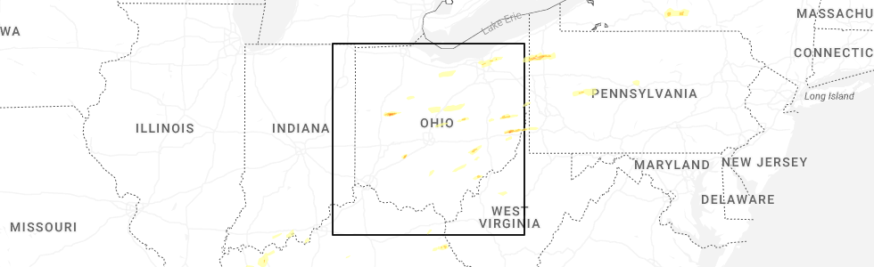
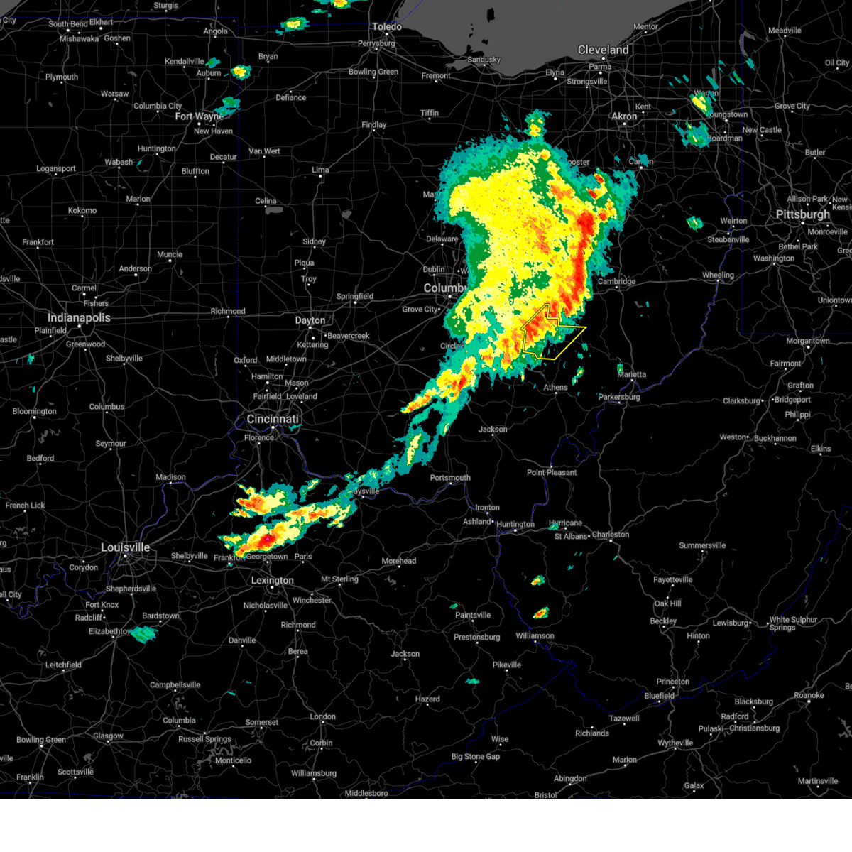
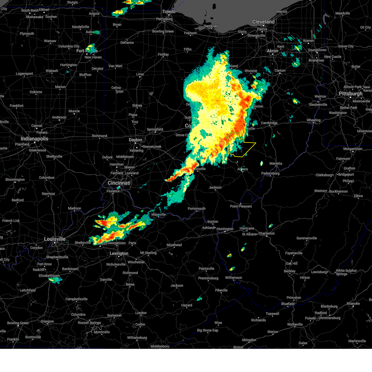
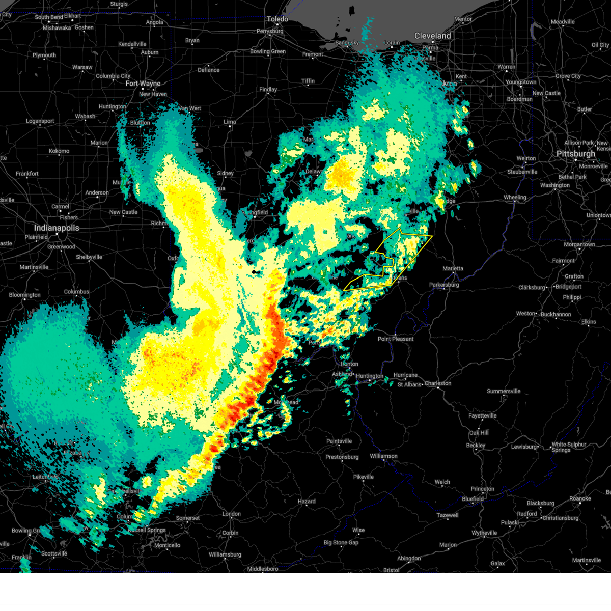
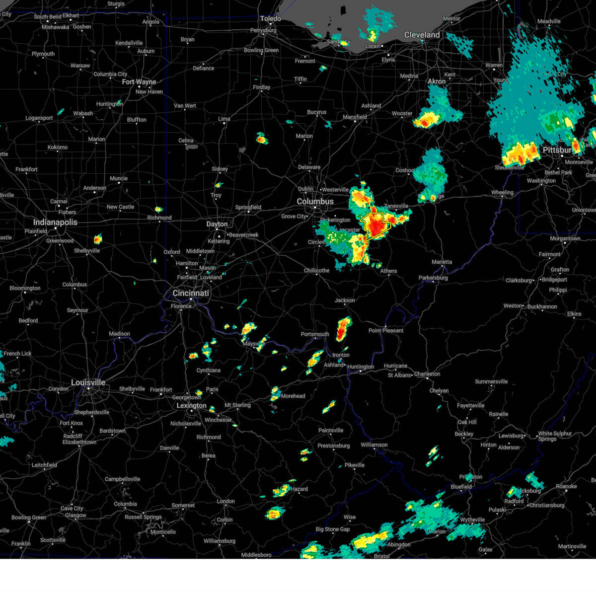
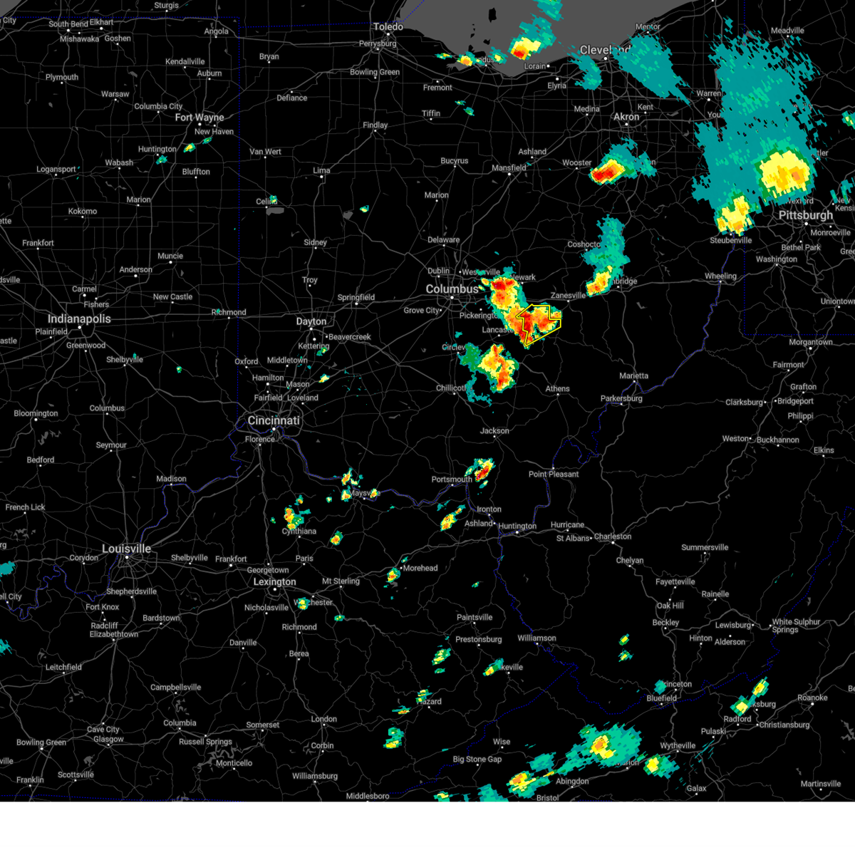
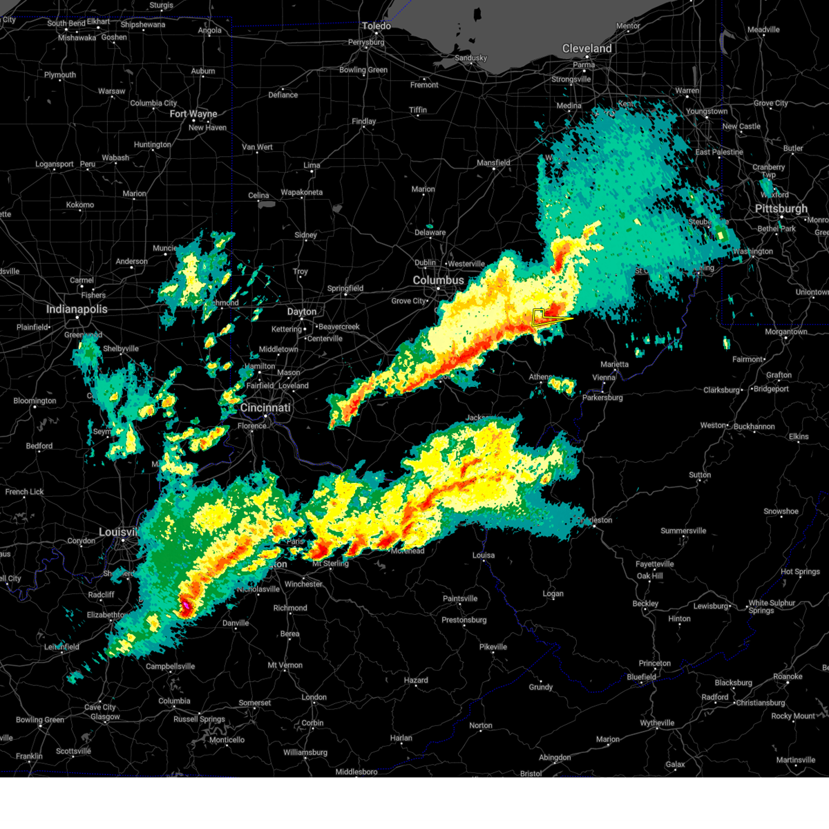
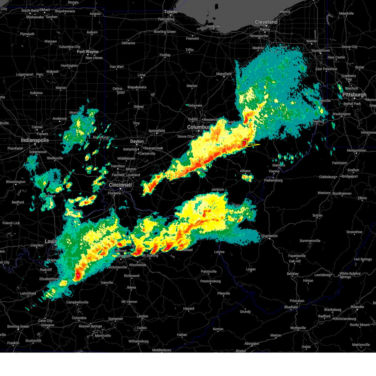
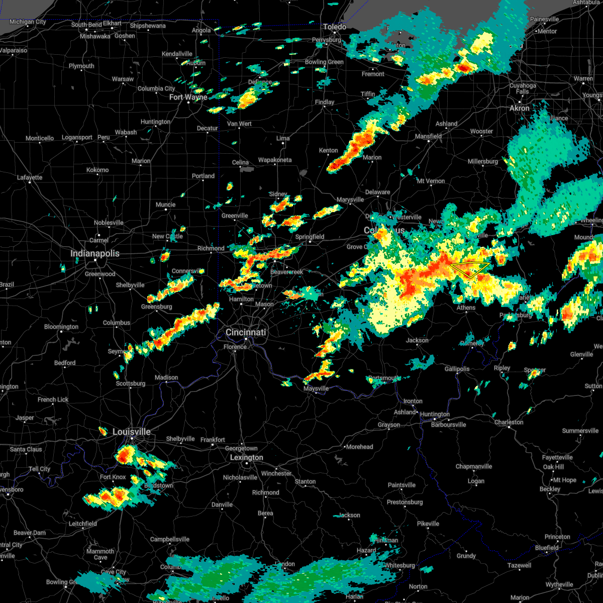
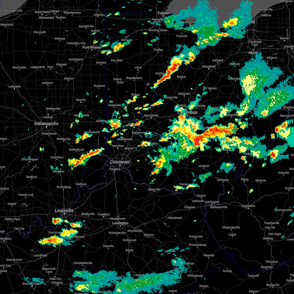
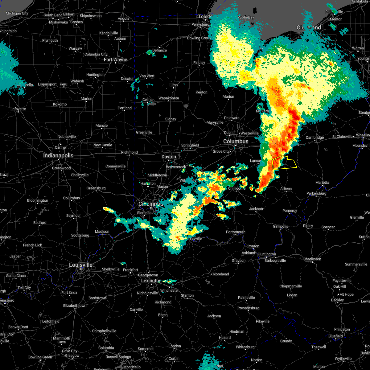
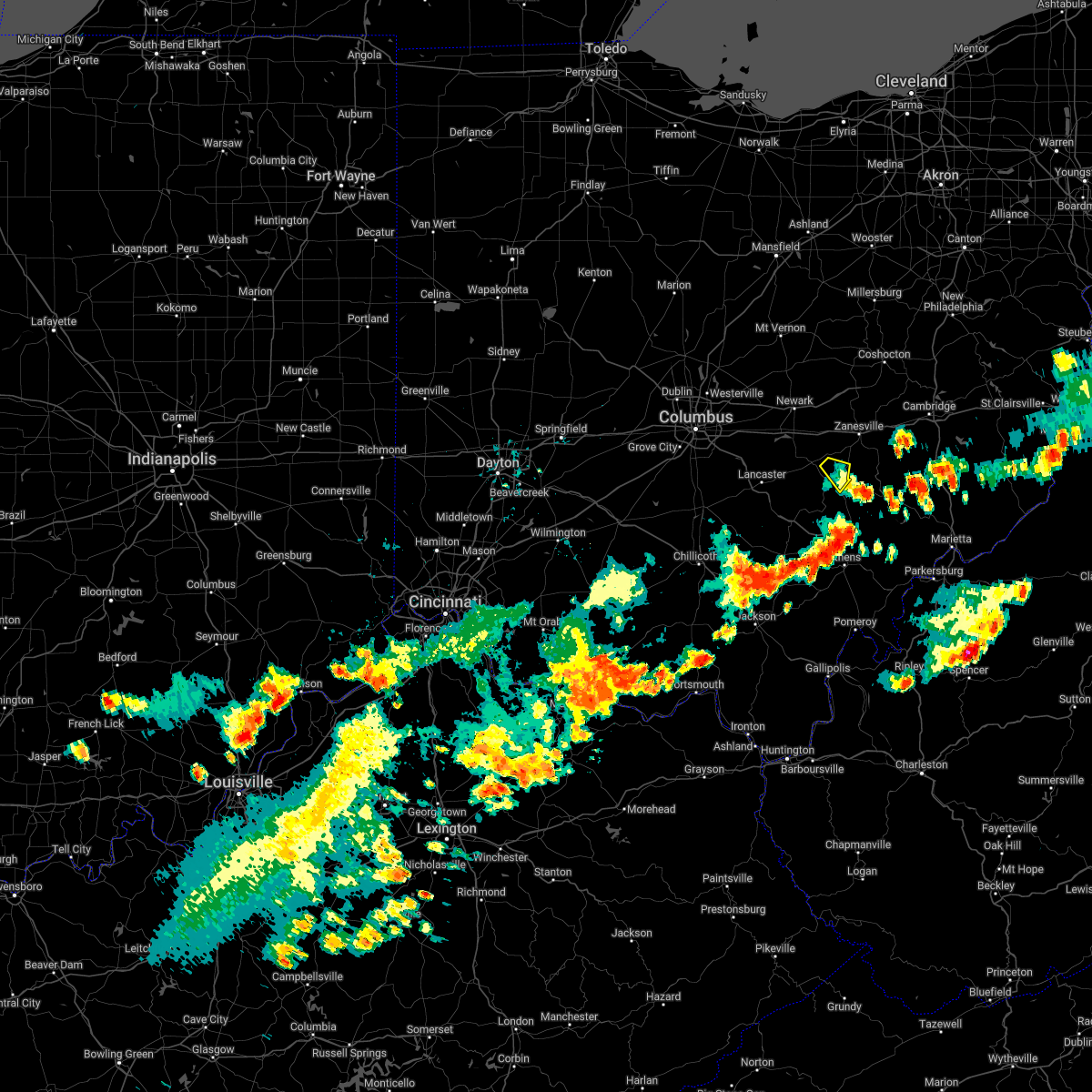
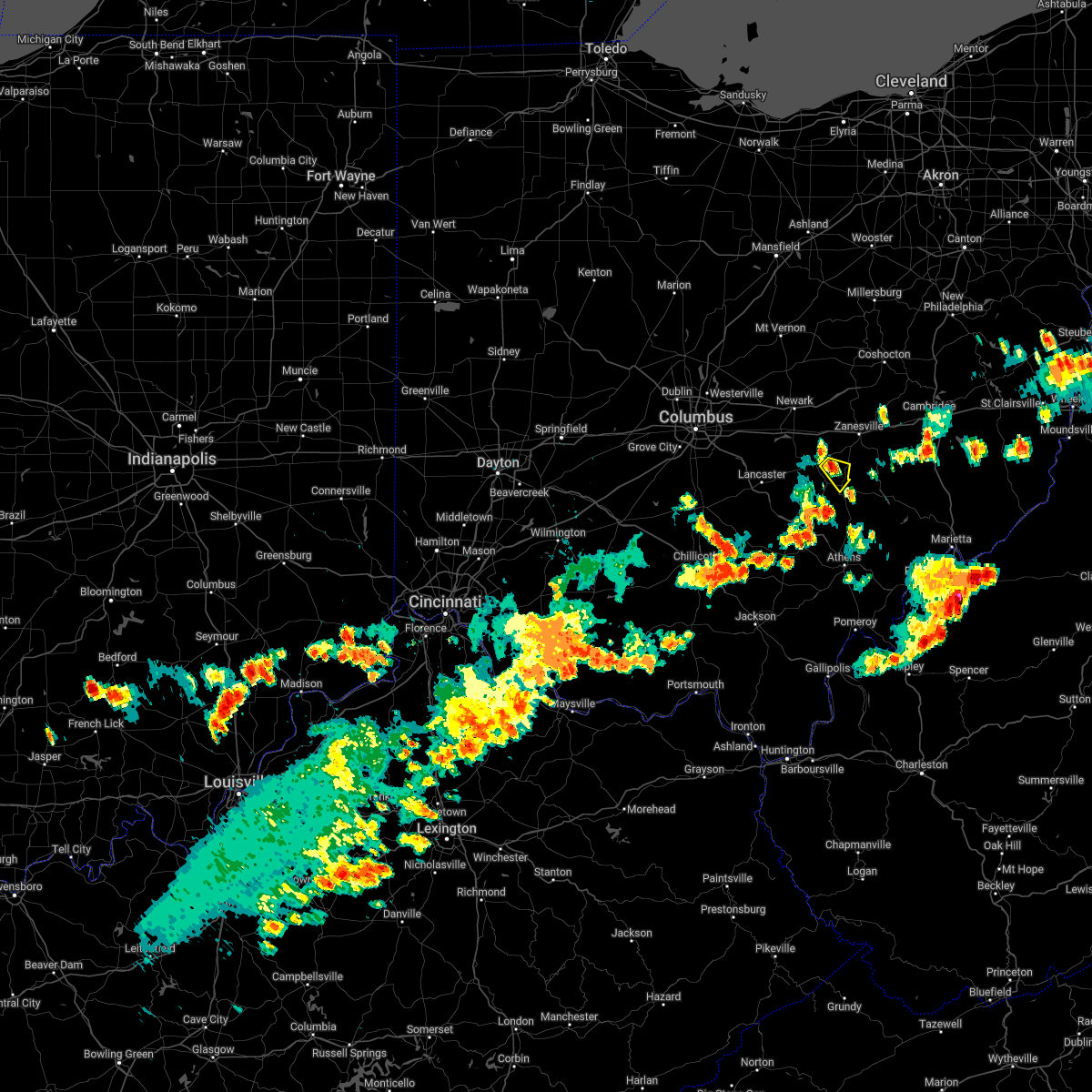
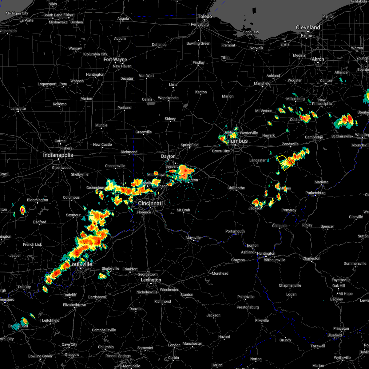
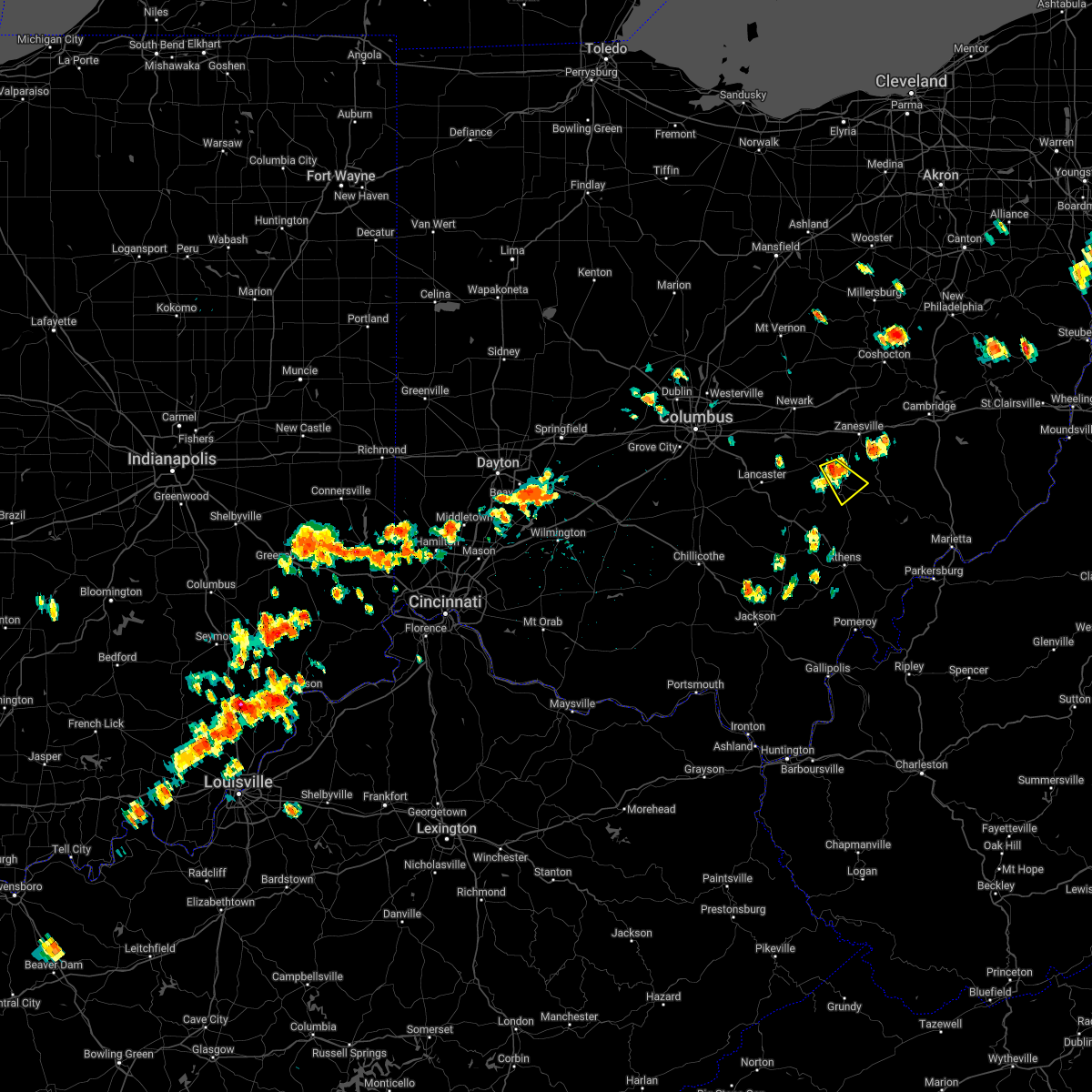
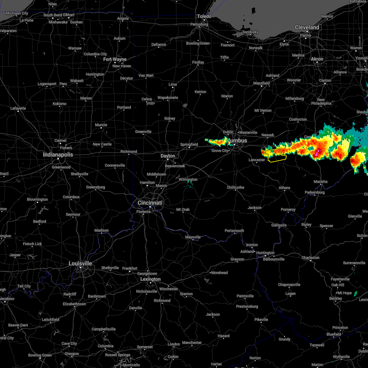
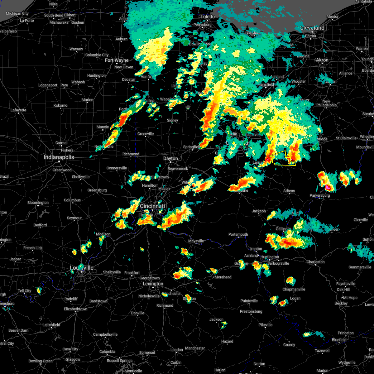
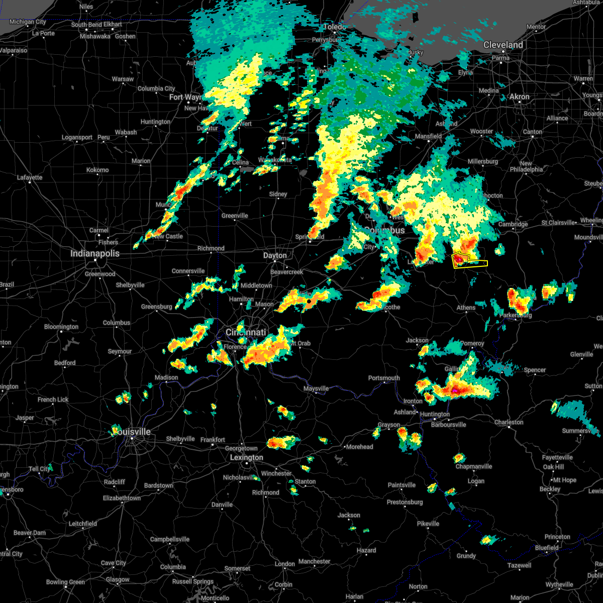
Hail Map for Crooksville, OH
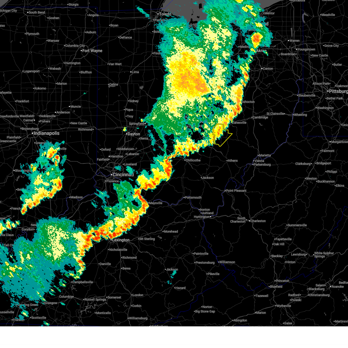
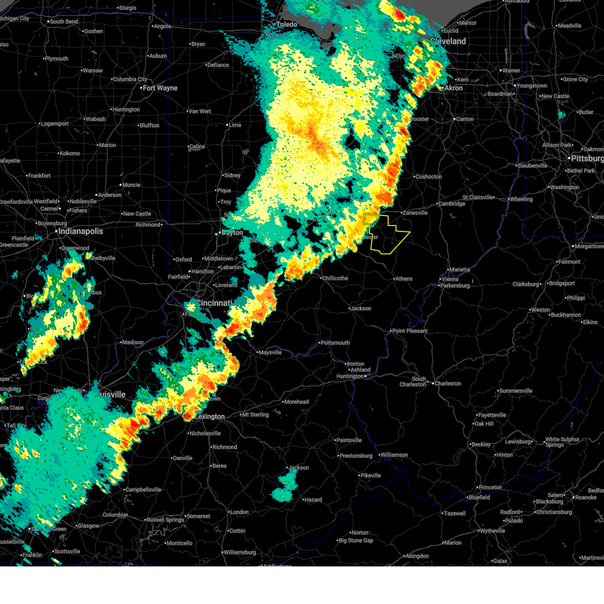
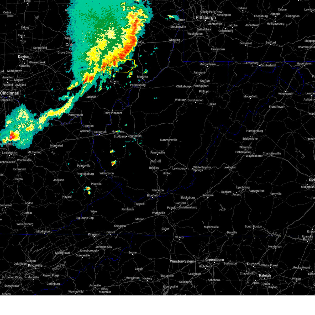
The Crooksville, OH area has had 1 report of on-the-ground hail by trained spotters, and has been under severe weather warnings 19 times during the past 12 months. Doppler radar has detected hail at or near Crooksville, OH on 39 occasions, including 1 occasion during the past year.
| Name: | Crooksville, OH |
| Where Located: | 50.3 miles ESE of Columbus, OH |
| Map: | Google Map for Crooksville, OH |
| Population: | 2534 |
| Housing Units: | 1094 |
| More Info: | Search Google for Crooksville, OH |
0
The Top Recent Hail Date for Crooksville, OH is Friday, May 2, 2025 (39th out of 39)
Hail and Wind Damage Spotted near Crooksville, OH
| Date / Time | Report Details |
|---|---|
| 6/18/2025 9:30 PM EDT |
 The storms which prompted the warning have weakened below severe limits, and no longer pose an immediate threat to life or property. therefore, the warning has been allowed to expire. however, gusty winds are still possible with these thunderstorms. a severe thunderstorm watch remains in effect until 300 am edt for southeastern ohio. to report severe weather, contact your nearest law enforcement agency. they will relay your report to the national weather service charleston west virginia. The storms which prompted the warning have weakened below severe limits, and no longer pose an immediate threat to life or property. therefore, the warning has been allowed to expire. however, gusty winds are still possible with these thunderstorms. a severe thunderstorm watch remains in effect until 300 am edt for southeastern ohio. to report severe weather, contact your nearest law enforcement agency. they will relay your report to the national weather service charleston west virginia.
|
| 6/18/2025 9:23 PM EDT | At 923 pm edt, severe thunderstorms were located along a line extending from zanesville to 6 miles west of logan, moving east at 45 mph (radar indicated). Hazards include 60 mph wind gusts. Expect damage to roofs, siding, and trees. Locations impacted include, new lexington, somerset, shawnee, perry state forest, crooksville, junction city, new straitsville, and glenford. |
| 6/18/2025 9:06 PM EDT |
 Svrrlx the national weather service in charleston west virginia has issued a * severe thunderstorm warning for, perry county in southeastern ohio, northwestern morgan county in southeastern ohio, * until 930 pm edt. * at 905 pm edt, severe thunderstorms were located along a line extending from 7 miles east of thornport to 8 miles northeast of kingston, moving east at 45 mph (radar indicated). Hazards include 60 mph wind gusts. expect damage to roofs, siding, and trees Svrrlx the national weather service in charleston west virginia has issued a * severe thunderstorm warning for, perry county in southeastern ohio, northwestern morgan county in southeastern ohio, * until 930 pm edt. * at 905 pm edt, severe thunderstorms were located along a line extending from 7 miles east of thornport to 8 miles northeast of kingston, moving east at 45 mph (radar indicated). Hazards include 60 mph wind gusts. expect damage to roofs, siding, and trees
|
| 5/16/2025 11:11 PM EDT | The storms which prompted the warning have weakened below severe limits, and no longer pose an immediate threat to life or property. therefore, the warning will be allowed to expire. however, small hail and gusty winds are still possible with these thunderstorms. a tornado watch remains in effect until 300 am edt for southeastern ohio. |
| 5/16/2025 11:00 PM EDT | At 1059 pm edt, severe thunderstorms were located along a line extending from near south zanesville to bremen, moving east at 60 mph (radar indicated). Hazards include 60 mph wind gusts and quarter size hail. Hail damage to vehicles is expected. expect wind damage to roofs, siding, and trees. Locations impacted include, new lexington, somerset, perry state forest, crooksville, thornville, junction city, and glenford. |
| 5/16/2025 10:45 PM EDT | Svrrlx the national weather service in charleston west virginia has issued a * severe thunderstorm warning for, perry county in southeastern ohio, * until 1115 pm edt. * at 1044 pm edt, severe thunderstorms were located along a line extending from near pleasantville to 8 miles southwest of lancaster, moving northeast at 60 mph (radar indicated). Hazards include 60 mph wind gusts and quarter size hail. Hail damage to vehicles is expected. Expect wind damage to roofs, siding, and trees. |
| 4/29/2025 3:57 PM EDT |
 Svrrlx the national weather service in charleston west virginia has issued a * severe thunderstorm warning for, southeastern perry county in southeastern ohio, morgan county in southeastern ohio, * until 430 pm edt. * at 356 pm edt, severe thunderstorms were located along a line extending from 8 miles southeast of south zanesville to near shawnee, moving east at 50 mph (radar indicated). Hazards include 60 mph wind gusts. expect damage to roofs, siding, and trees Svrrlx the national weather service in charleston west virginia has issued a * severe thunderstorm warning for, southeastern perry county in southeastern ohio, morgan county in southeastern ohio, * until 430 pm edt. * at 356 pm edt, severe thunderstorms were located along a line extending from 8 miles southeast of south zanesville to near shawnee, moving east at 50 mph (radar indicated). Hazards include 60 mph wind gusts. expect damage to roofs, siding, and trees
|
| 4/29/2025 3:50 PM EDT | Tree damage resulting in over 500 customers without powe in perry county OH, 6.6 miles NNE of Crooksville, OH |
| 4/29/2025 3:49 PM EDT | At 349 pm edt, severe thunderstorms were located along a line extending from 9 miles south of south zanesville to near logan, moving southeast at 30 mph (radar indicated). Hazards include 60 mph wind gusts. Expect damage to roofs, siding, and trees. Locations impacted include, eagleport, junction city, perry state forest, hemlock, shawnee, new straitsville, rendville, crooksville, new lexington, and corning. |
| 4/29/2025 3:42 PM EDT |
 At 341 pm edt, severe thunderstorms were located along a line extending from 7 miles south of south zanesville to near logan, moving southeast at 30 mph (radar indicated). Hazards include 60 mph wind gusts. Expect damage to roofs, siding, and trees. Locations impacted include, eagleport, junction city, perry state forest, hemlock, shawnee, new straitsville, rendville, crooksville, somerset, new lexington, and corning. At 341 pm edt, severe thunderstorms were located along a line extending from 7 miles south of south zanesville to near logan, moving southeast at 30 mph (radar indicated). Hazards include 60 mph wind gusts. Expect damage to roofs, siding, and trees. Locations impacted include, eagleport, junction city, perry state forest, hemlock, shawnee, new straitsville, rendville, crooksville, somerset, new lexington, and corning.
|
| 4/29/2025 3:30 PM EDT |
 Svrrlx the national weather service in charleston west virginia has issued a * severe thunderstorm warning for, perry county in southeastern ohio, northwestern morgan county in southeastern ohio, * until 400 pm edt. * at 329 pm edt, severe thunderstorms were located along a line extending from 7 miles north of somerset to 7 miles northeast of kingston, moving east at 60 mph (radar indicated). Hazards include 60 mph wind gusts. expect damage to roofs, siding, and trees Svrrlx the national weather service in charleston west virginia has issued a * severe thunderstorm warning for, perry county in southeastern ohio, northwestern morgan county in southeastern ohio, * until 400 pm edt. * at 329 pm edt, severe thunderstorms were located along a line extending from 7 miles north of somerset to 7 miles northeast of kingston, moving east at 60 mph (radar indicated). Hazards include 60 mph wind gusts. expect damage to roofs, siding, and trees
|
| 4/3/2025 2:55 AM EDT |
 Svrrlx the national weather service in charleston west virginia has issued a * severe thunderstorm warning for, southeastern perry county in southeastern ohio, northern washington county in southeastern ohio, morgan county in southeastern ohio, northern athens county in southeastern ohio, * until 330 am edt. * at 254 am edt, severe thunderstorms were located along a line extending from 8 miles south of south zanesville to buchtel, moving east at 60 mph (radar indicated). Hazards include 60 mph wind gusts. expect damage to roofs, siding, and trees Svrrlx the national weather service in charleston west virginia has issued a * severe thunderstorm warning for, southeastern perry county in southeastern ohio, northern washington county in southeastern ohio, morgan county in southeastern ohio, northern athens county in southeastern ohio, * until 330 am edt. * at 254 am edt, severe thunderstorms were located along a line extending from 8 miles south of south zanesville to buchtel, moving east at 60 mph (radar indicated). Hazards include 60 mph wind gusts. expect damage to roofs, siding, and trees
|
| 4/3/2025 2:16 AM EDT | Svrrlx the national weather service in charleston west virginia has issued a * severe thunderstorm warning for, perry county in southeastern ohio, western morgan county in southeastern ohio, northwestern vinton county in southeastern ohio, northwestern athens county in southeastern ohio, * until 300 am edt. * at 215 am edt, severe thunderstorms were located along a line extending from beechwood trails to 8 miles west of lancaster to 6 miles south of kingston, moving east at 75 mph (radar indicated). Hazards include 60 mph wind gusts. expect damage to roofs, siding, and trees |
| 4/2/2025 11:41 AM EDT |
 Svrrlx the national weather service in charleston west virginia has issued a * severe thunderstorm warning for, southeastern perry county in southeastern ohio, morgan county in southeastern ohio, northwestern athens county in southeastern ohio, * until 1215 pm edt. * at 1141 am edt, a severe thunderstorm was located near shawnee, moving northeast at 70 mph (radar indicated). Hazards include 60 mph wind gusts and half dollar size hail. Hail damage to vehicles is expected. Expect wind damage to roofs, siding, and trees. Svrrlx the national weather service in charleston west virginia has issued a * severe thunderstorm warning for, southeastern perry county in southeastern ohio, morgan county in southeastern ohio, northwestern athens county in southeastern ohio, * until 1215 pm edt. * at 1141 am edt, a severe thunderstorm was located near shawnee, moving northeast at 70 mph (radar indicated). Hazards include 60 mph wind gusts and half dollar size hail. Hail damage to vehicles is expected. Expect wind damage to roofs, siding, and trees.
|
| 3/30/2025 11:45 PM EDT |
 The storms which prompted the warning have weakened below severe limits, and have exited the warned area. therefore, the warning has been allowed to expire. however, gusty winds are still possible with these thunderstorms. a severe thunderstorm watch remains in effect until 300 am edt for southeastern ohio. to report severe weather, contact your nearest law enforcement agency. they will relay your report to the national weather service charleston west virginia. The storms which prompted the warning have weakened below severe limits, and have exited the warned area. therefore, the warning has been allowed to expire. however, gusty winds are still possible with these thunderstorms. a severe thunderstorm watch remains in effect until 300 am edt for southeastern ohio. to report severe weather, contact your nearest law enforcement agency. they will relay your report to the national weather service charleston west virginia.
|
| 3/30/2025 11:27 PM EDT | At 1127 pm edt, severe thunderstorms were located along a line extending from near south zanesville to nelsonville, moving east at 45 mph (radar indicated). Hazards include 60 mph wind gusts and penny size hail. Expect damage to roofs, siding, and trees. Locations impacted include, lake hope state park, chauncey, creola, buchtel, shawnee, new straitsville, burr oak state park, mcconnelsville, rendville, new lexington, malta, eagleport, nelsonville, allensville, trimble, hemlock, glouster, jacksonville, crooksville, and the plains. |
| 3/30/2025 11:14 PM EDT |
 The storms which prompted the warning have weakened below severe limits, and have exited the warned area. therefore, the warning will be allowed to expire. however, gusty winds and heavy rain are still possible with these thunderstorms. a severe thunderstorm watch remains in effect until 300 am edt for southeastern ohio. to report severe weather, contact your nearest law enforcement agency. they will relay your report to the national weather service charleston west virginia. The storms which prompted the warning have weakened below severe limits, and have exited the warned area. therefore, the warning will be allowed to expire. however, gusty winds and heavy rain are still possible with these thunderstorms. a severe thunderstorm watch remains in effect until 300 am edt for southeastern ohio. to report severe weather, contact your nearest law enforcement agency. they will relay your report to the national weather service charleston west virginia.
|
| 3/30/2025 10:53 PM EDT |
 Svrrlx the national weather service in charleston west virginia has issued a * severe thunderstorm warning for, perry county in southeastern ohio, western morgan county in southeastern ohio, northern vinton county in southeastern ohio, northwestern athens county in southeastern ohio, * until 1145 pm edt. * at 1052 pm edt, severe thunderstorms were located along a line extending from near bremen to 10 miles southwest of hocking hills state park, moving east at 45 mph (radar indicated). Hazards include 60 mph wind gusts and penny size hail. expect damage to roofs, siding, and trees Svrrlx the national weather service in charleston west virginia has issued a * severe thunderstorm warning for, perry county in southeastern ohio, western morgan county in southeastern ohio, northern vinton county in southeastern ohio, northwestern athens county in southeastern ohio, * until 1145 pm edt. * at 1052 pm edt, severe thunderstorms were located along a line extending from near bremen to 10 miles southwest of hocking hills state park, moving east at 45 mph (radar indicated). Hazards include 60 mph wind gusts and penny size hail. expect damage to roofs, siding, and trees
|
| 3/30/2025 10:28 PM EDT |
 Svrrlx the national weather service in charleston west virginia has issued a * severe thunderstorm warning for, northern perry county in southeastern ohio, * until 1115 pm edt. * at 1027 pm edt, severe thunderstorms were located along a line extending from reynoldsburg to 6 miles southeast of circleville, moving east at 50 mph (radar indicated). Hazards include 60 mph wind gusts and penny size hail. expect damage to roofs, siding, and trees Svrrlx the national weather service in charleston west virginia has issued a * severe thunderstorm warning for, northern perry county in southeastern ohio, * until 1115 pm edt. * at 1027 pm edt, severe thunderstorms were located along a line extending from reynoldsburg to 6 miles southeast of circleville, moving east at 50 mph (radar indicated). Hazards include 60 mph wind gusts and penny size hail. expect damage to roofs, siding, and trees
|
| 3/16/2025 11:39 AM EDT |
 Svrrlx the national weather service in charleston west virginia has issued a * severe thunderstorm warning for, southeastern perry county in southeastern ohio, northwestern washington county in southeastern ohio, morgan county in southeastern ohio, central athens county in southeastern ohio, * until 1215 pm edt. * at 1139 am edt, severe thunderstorms were located along a line extending from near south zanesville to 7 miles east of new lexington to near glouster to 6 miles southeast of buchtel, moving east at 60 mph (radar indicated). Hazards include 60 mph wind gusts. expect damage to roofs, siding, and trees Svrrlx the national weather service in charleston west virginia has issued a * severe thunderstorm warning for, southeastern perry county in southeastern ohio, northwestern washington county in southeastern ohio, morgan county in southeastern ohio, central athens county in southeastern ohio, * until 1215 pm edt. * at 1139 am edt, severe thunderstorms were located along a line extending from near south zanesville to 7 miles east of new lexington to near glouster to 6 miles southeast of buchtel, moving east at 60 mph (radar indicated). Hazards include 60 mph wind gusts. expect damage to roofs, siding, and trees
|
| 7/15/2024 6:28 PM EDT | Svrrlx the national weather service in charleston west virginia has issued a * severe thunderstorm warning for, east central perry county in southeastern ohio, morgan county in southeastern ohio, * until 700 pm edt. * at 628 pm edt, a severe thunderstorm was located 8 miles east of new lexington, moving east at 35 mph (radar indicated). Hazards include 60 mph wind gusts. expect damage to roofs, siding, and trees |
| 7/15/2024 6:06 PM EDT |
 At 605 pm edt, severe thunderstorms were located along a line extending from 7 miles northeast of somerset to hide-a-way hills, moving east at 40 mph (radar indicated). Hazards include 60 mph wind gusts and penny size hail. Expect damage to roofs, siding, and trees. Locations impacted include, new lexington, somerset, shawnee, perry state forest, crooksville, junction city, new straitsville, corning, glenford, hemlock, rendville, and eagleport. At 605 pm edt, severe thunderstorms were located along a line extending from 7 miles northeast of somerset to hide-a-way hills, moving east at 40 mph (radar indicated). Hazards include 60 mph wind gusts and penny size hail. Expect damage to roofs, siding, and trees. Locations impacted include, new lexington, somerset, shawnee, perry state forest, crooksville, junction city, new straitsville, corning, glenford, hemlock, rendville, and eagleport.
|
| 7/15/2024 5:44 PM EDT | Svrrlx the national weather service in charleston west virginia has issued a * severe thunderstorm warning for, perry county in southeastern ohio, northwestern morgan county in southeastern ohio, * until 630 pm edt. * at 543 pm edt, severe thunderstorms were located along a line extending from harbor hills to near lancaster, moving east at 45 mph (radar indicated). Hazards include 60 mph wind gusts and penny size hail. expect damage to roofs, siding, and trees |
| 6/17/2024 5:39 PM EDT |
 The storm which prompted the warning has moved out of the area. therefore, the warning will be allowed to expire. however, gusty winds are still possible with this thunderstorm. The storm which prompted the warning has moved out of the area. therefore, the warning will be allowed to expire. however, gusty winds are still possible with this thunderstorm.
|
| 6/17/2024 5:30 PM EDT | Trees dow in perry county OH, 2.6 miles NNE of Crooksville, OH |
| 6/17/2024 5:29 PM EDT |
 Svrrlx the national weather service in charleston west virginia has issued a * severe thunderstorm warning for, east central perry county in southeastern ohio, northwestern morgan county in southeastern ohio, * until 600 pm edt. * at 528 pm edt, a severe thunderstorm was located near perry state forest, moving east at 35 mph (radar indicated). Hazards include 70 mph wind gusts. Expect considerable tree damage. Damage is likely to mobile homes, roofs, and outbuildings. Svrrlx the national weather service in charleston west virginia has issued a * severe thunderstorm warning for, east central perry county in southeastern ohio, northwestern morgan county in southeastern ohio, * until 600 pm edt. * at 528 pm edt, a severe thunderstorm was located near perry state forest, moving east at 35 mph (radar indicated). Hazards include 70 mph wind gusts. Expect considerable tree damage. Damage is likely to mobile homes, roofs, and outbuildings.
|
| 6/17/2024 5:28 PM EDT | Trees dow in perry county OH, 1.5 miles SSW of Crooksville, OH |
| 6/17/2024 5:24 PM EDT |
 At 524 pm edt, a severe thunderstorm was located over perry state forest, moving northeast at 25 mph (radar indicated). Hazards include 70 mph wind gusts. Expect considerable tree damage. damage is likely to mobile homes, roofs, and outbuildings. Locations impacted include, new lexington, somerset, perry state forest, crooksville, and junction city. At 524 pm edt, a severe thunderstorm was located over perry state forest, moving northeast at 25 mph (radar indicated). Hazards include 70 mph wind gusts. Expect considerable tree damage. damage is likely to mobile homes, roofs, and outbuildings. Locations impacted include, new lexington, somerset, perry state forest, crooksville, and junction city.
|
| 6/17/2024 5:20 PM EDT |
 At 520 pm edt, a severe thunderstorm was located over perry state forest, moving northeast at 25 mph (radar indicated). Hazards include 60 mph wind gusts. Expect damage to roofs, siding, and trees. Locations impacted include, new lexington, somerset, perry state forest, crooksville, junction city, and glenford. At 520 pm edt, a severe thunderstorm was located over perry state forest, moving northeast at 25 mph (radar indicated). Hazards include 60 mph wind gusts. Expect damage to roofs, siding, and trees. Locations impacted include, new lexington, somerset, perry state forest, crooksville, junction city, and glenford.
|
| 6/17/2024 5:02 PM EDT |
 Svrrlx the national weather service in charleston west virginia has issued a * severe thunderstorm warning for, northern perry county in southeastern ohio, * until 545 pm edt. * at 502 pm edt, a severe thunderstorm was located near somerset, moving northeast at 30 mph (radar indicated). Hazards include 60 mph wind gusts. expect damage to roofs, siding, and trees Svrrlx the national weather service in charleston west virginia has issued a * severe thunderstorm warning for, northern perry county in southeastern ohio, * until 545 pm edt. * at 502 pm edt, a severe thunderstorm was located near somerset, moving northeast at 30 mph (radar indicated). Hazards include 60 mph wind gusts. expect damage to roofs, siding, and trees
|
| 5/26/2024 4:51 PM EDT |
 The storms which prompted the warning have moved out of the warned area. therefore, the warning will be allowed to expire. a severe thunderstorm watch remains in effect until 800 pm edt for southeastern ohio. a severe thunderstorm watch also remains in effect until 900 pm edt for southeastern ohio. The storms which prompted the warning have moved out of the warned area. therefore, the warning will be allowed to expire. a severe thunderstorm watch remains in effect until 800 pm edt for southeastern ohio. a severe thunderstorm watch also remains in effect until 900 pm edt for southeastern ohio.
|
| 5/26/2024 4:42 PM EDT |
 At 441 pm edt, severe thunderstorms were located along a line extending from near perry state forest to 6 miles northeast of athens, moving northeast at 30 mph (radar indicated). Hazards include 60 mph wind gusts and penny size hail. Expect damage to roofs, siding, and trees. Locations impacted include, glouster, mcconnelsville, chesterhill, crooksville, malta, corning, stockport, jacksonville, trimble, bristol, rendville, burr oak state park, and eagleport. At 441 pm edt, severe thunderstorms were located along a line extending from near perry state forest to 6 miles northeast of athens, moving northeast at 30 mph (radar indicated). Hazards include 60 mph wind gusts and penny size hail. Expect damage to roofs, siding, and trees. Locations impacted include, glouster, mcconnelsville, chesterhill, crooksville, malta, corning, stockport, jacksonville, trimble, bristol, rendville, burr oak state park, and eagleport.
|
| 5/26/2024 4:42 PM EDT |
 the severe thunderstorm warning has been cancelled and is no longer in effect the severe thunderstorm warning has been cancelled and is no longer in effect
|
| 5/26/2024 4:19 PM EDT |
 Svrrlx the national weather service in charleston west virginia has issued a * severe thunderstorm warning for, perry county in southeastern ohio, northwestern washington county in southeastern ohio, morgan county in southeastern ohio, north central athens county in southeastern ohio, * until 500 pm edt. * at 419 pm edt, a severe thunderstorm was located near bremen, or 8 miles northwest of shawnee, moving east at 45 mph (radar indicated). Hazards include 60 mph wind gusts and penny size hail. expect damage to roofs, siding, and trees Svrrlx the national weather service in charleston west virginia has issued a * severe thunderstorm warning for, perry county in southeastern ohio, northwestern washington county in southeastern ohio, morgan county in southeastern ohio, north central athens county in southeastern ohio, * until 500 pm edt. * at 419 pm edt, a severe thunderstorm was located near bremen, or 8 miles northwest of shawnee, moving east at 45 mph (radar indicated). Hazards include 60 mph wind gusts and penny size hail. expect damage to roofs, siding, and trees
|
| 4/17/2024 7:17 PM EDT |
 At 715 pm edt, severe thunderstorms were located along a line extending from 7 miles northwest of mcconnelsville to 6 miles southeast of bremen, moving east at 35 mph (radar indicated). Hazards include 60 mph wind gusts and quarter size hail. Hail damage to vehicles is expected. expect wind damage to roofs, siding, and trees. Locations impacted include, new lexington, mcconnelsville, shawnee, malta, corning, bristol, hemlock, rendville, and eagleport. At 715 pm edt, severe thunderstorms were located along a line extending from 7 miles northwest of mcconnelsville to 6 miles southeast of bremen, moving east at 35 mph (radar indicated). Hazards include 60 mph wind gusts and quarter size hail. Hail damage to vehicles is expected. expect wind damage to roofs, siding, and trees. Locations impacted include, new lexington, mcconnelsville, shawnee, malta, corning, bristol, hemlock, rendville, and eagleport.
|
| 4/17/2024 6:55 PM EDT |
 Svrrlx the national weather service in charleston west virginia has issued a * severe thunderstorm warning for, perry county in southeastern ohio, northern morgan county in southeastern ohio, * until 730 pm edt. * at 654 pm edt, severe thunderstorms were located along a line extending from near perry state forest to near lancaster, moving east at 40 mph (radar indicated). Hazards include 60 mph wind gusts and quarter size hail. Hail damage to vehicles is expected. Expect wind damage to roofs, siding, and trees. Svrrlx the national weather service in charleston west virginia has issued a * severe thunderstorm warning for, perry county in southeastern ohio, northern morgan county in southeastern ohio, * until 730 pm edt. * at 654 pm edt, severe thunderstorms were located along a line extending from near perry state forest to near lancaster, moving east at 40 mph (radar indicated). Hazards include 60 mph wind gusts and quarter size hail. Hail damage to vehicles is expected. Expect wind damage to roofs, siding, and trees.
|
| 4/17/2024 6:41 PM EDT |
 At 641 pm edt, a severe thunderstorm was located near somerset, moving east at 35 mph (radar indicated). Hazards include 60 mph wind gusts and quarter size hail. Hail damage to vehicles is expected. expect wind damage to roofs, siding, and trees. Locations impacted include, new lexington, somerset, perry state forest, crooksville, junction city, corning, glenford, and rendville. At 641 pm edt, a severe thunderstorm was located near somerset, moving east at 35 mph (radar indicated). Hazards include 60 mph wind gusts and quarter size hail. Hail damage to vehicles is expected. expect wind damage to roofs, siding, and trees. Locations impacted include, new lexington, somerset, perry state forest, crooksville, junction city, corning, glenford, and rendville.
|
| 4/17/2024 6:28 PM EDT |
 Svrrlx the national weather service in charleston west virginia has issued a * severe thunderstorm warning for, perry county in southeastern ohio, * until 700 pm edt. * at 627 pm edt, a severe thunderstorm was located over pleasantville, or 7 miles northeast of lancaster, moving east at 35 mph (radar indicated). Hazards include 60 mph wind gusts and quarter size hail. Hail damage to vehicles is expected. Expect wind damage to roofs, siding, and trees. Svrrlx the national weather service in charleston west virginia has issued a * severe thunderstorm warning for, perry county in southeastern ohio, * until 700 pm edt. * at 627 pm edt, a severe thunderstorm was located over pleasantville, or 7 miles northeast of lancaster, moving east at 35 mph (radar indicated). Hazards include 60 mph wind gusts and quarter size hail. Hail damage to vehicles is expected. Expect wind damage to roofs, siding, and trees.
|
| 4/2/2024 8:45 PM EDT |
 the tornado warning has been cancelled and is no longer in effect the tornado warning has been cancelled and is no longer in effect
|
| 4/2/2024 8:44 PM EDT |
 The storm which prompted the warning has moved out of the area. therefore, the warning will be allowed to expire. however, small hail, gusty winds and heavy rain are still possible with this thunderstorm. a tornado watch remains in effect until 200 am edt for southeastern ohio. to report severe weather, contact your nearest law enforcement agency. they will relay your report to the national weather service charleston west virginia. remember, a tornado warning still remains in effect for portions of perry county. The storm which prompted the warning has moved out of the area. therefore, the warning will be allowed to expire. however, small hail, gusty winds and heavy rain are still possible with this thunderstorm. a tornado watch remains in effect until 200 am edt for southeastern ohio. to report severe weather, contact your nearest law enforcement agency. they will relay your report to the national weather service charleston west virginia. remember, a tornado warning still remains in effect for portions of perry county.
|
| 4/2/2024 8:31 PM EDT |
 Torrlx the national weather service in charleston west virginia has issued a * tornado warning for, northern perry county in southeastern ohio, * until 900 pm edt. * at 830 pm edt, a severe thunderstorm capable of producing a tornado was located over somerset, moving east at 45 mph (radar indicated rotation). Hazards include tornado. Flying debris will be dangerous to those caught without shelter. mobile homes will be damaged or destroyed. damage to roofs, windows, and vehicles will occur. tree damage is likely. this dangerous storm will be near, new lexington and perry state forest around 835 pm edt. Other locations impacted by this tornadic thunderstorm include glenford, crooksville, and junction city. Torrlx the national weather service in charleston west virginia has issued a * tornado warning for, northern perry county in southeastern ohio, * until 900 pm edt. * at 830 pm edt, a severe thunderstorm capable of producing a tornado was located over somerset, moving east at 45 mph (radar indicated rotation). Hazards include tornado. Flying debris will be dangerous to those caught without shelter. mobile homes will be damaged or destroyed. damage to roofs, windows, and vehicles will occur. tree damage is likely. this dangerous storm will be near, new lexington and perry state forest around 835 pm edt. Other locations impacted by this tornadic thunderstorm include glenford, crooksville, and junction city.
|
| 4/2/2024 8:00 PM EDT |
 Svrrlx the national weather service in charleston west virginia has issued a * severe thunderstorm warning for, perry county in southeastern ohio, * until 845 pm edt. * at 759 pm edt, a severe thunderstorm was located 7 miles southeast of canal winchester, or 8 miles west of lancaster, moving northeast at 45 mph (radar indicated). Hazards include 60 mph wind gusts and quarter size hail. Hail damage to vehicles is expected. Expect wind damage to roofs, siding, and trees. Svrrlx the national weather service in charleston west virginia has issued a * severe thunderstorm warning for, perry county in southeastern ohio, * until 845 pm edt. * at 759 pm edt, a severe thunderstorm was located 7 miles southeast of canal winchester, or 8 miles west of lancaster, moving northeast at 45 mph (radar indicated). Hazards include 60 mph wind gusts and quarter size hail. Hail damage to vehicles is expected. Expect wind damage to roofs, siding, and trees.
|
| 3/30/2024 7:15 PM EDT |
 The storm which prompted the warning has moved out of northern perry county. however, a new warning has been issued for the storm to include southeastern perry and morgan counties. a severe thunderstorm watch remains in effect until 1000 pm edt for southeastern ohio. The storm which prompted the warning has moved out of northern perry county. however, a new warning has been issued for the storm to include southeastern perry and morgan counties. a severe thunderstorm watch remains in effect until 1000 pm edt for southeastern ohio.
|
| 3/30/2024 7:12 PM EDT |
 Svrrlx the national weather service in charleston west virginia has issued a * severe thunderstorm warning for, southeastern perry county in southeastern ohio, morgan county in southeastern ohio, * until 800 pm edt. * at 712 pm edt, a severe thunderstorm was located over new lexington, moving east at 45 mph (radar indicated). Hazards include 60 mph wind gusts and quarter size hail. Hail damage to vehicles is expected. Expect wind damage to roofs, siding, and trees. Svrrlx the national weather service in charleston west virginia has issued a * severe thunderstorm warning for, southeastern perry county in southeastern ohio, morgan county in southeastern ohio, * until 800 pm edt. * at 712 pm edt, a severe thunderstorm was located over new lexington, moving east at 45 mph (radar indicated). Hazards include 60 mph wind gusts and quarter size hail. Hail damage to vehicles is expected. Expect wind damage to roofs, siding, and trees.
|
| 3/30/2024 6:54 PM EDT |
 At 653 pm edt, a severe thunderstorm was located near somerset, moving east at 45 mph (radar indicated). Hazards include 60 mph wind gusts and quarter size hail. Hail damage to vehicles is expected. expect wind damage to roofs, siding, and trees. Locations impacted include, new lexington, somerset, perry state forest, crooksville, thornville, junction city, glenford, and rendville. At 653 pm edt, a severe thunderstorm was located near somerset, moving east at 45 mph (radar indicated). Hazards include 60 mph wind gusts and quarter size hail. Hail damage to vehicles is expected. expect wind damage to roofs, siding, and trees. Locations impacted include, new lexington, somerset, perry state forest, crooksville, thornville, junction city, glenford, and rendville.
|
| 3/30/2024 6:34 PM EDT |
 Svrrlx the national weather service in charleston west virginia has issued a * severe thunderstorm warning for, perry county in southeastern ohio, northwestern morgan county in southeastern ohio, * until 715 pm edt. * at 633 pm edt, a severe thunderstorm was located over hebron, or near heath, moving southeast at 60 mph (radar indicated). Hazards include 60 mph wind gusts and quarter size hail. Hail damage to vehicles is expected. Expect wind damage to roofs, siding, and trees. Svrrlx the national weather service in charleston west virginia has issued a * severe thunderstorm warning for, perry county in southeastern ohio, northwestern morgan county in southeastern ohio, * until 715 pm edt. * at 633 pm edt, a severe thunderstorm was located over hebron, or near heath, moving southeast at 60 mph (radar indicated). Hazards include 60 mph wind gusts and quarter size hail. Hail damage to vehicles is expected. Expect wind damage to roofs, siding, and trees.
|
| 3/14/2024 11:45 PM EDT |
 The storms which prompted the warning have weakened below severe limits, and no longer pose an immediate threat to life or property. therefore, the warning will be allowed to expire. however, small hail, gusty winds and heavy rain are still possible with these thunderstorms. a tornado watch remains in effect until 100 am edt for southeastern ohio. to report severe weather, contact your nearest law enforcement agency. they will relay your report to the national weather service charleston west virginia. remember, a tornado warning still remains in effect for perry and morgan counties until 1 am edt. The storms which prompted the warning have weakened below severe limits, and no longer pose an immediate threat to life or property. therefore, the warning will be allowed to expire. however, small hail, gusty winds and heavy rain are still possible with these thunderstorms. a tornado watch remains in effect until 100 am edt for southeastern ohio. to report severe weather, contact your nearest law enforcement agency. they will relay your report to the national weather service charleston west virginia. remember, a tornado warning still remains in effect for perry and morgan counties until 1 am edt.
|
| 3/14/2024 11:28 PM EDT |
 At 1128 pm edt, severe thunderstorms were located along a line extending from near south zanesville to 9 miles east of perry state forest to near shawnee, moving east at 60 mph (radar indicated). Hazards include 60 mph wind gusts and penny size hail. Expect damage to roofs, siding, and trees. Locations impacted include, new lexington, mcconnelsville, shawnee, crooksville, new straitsville, malta, corning, bristol, hemlock, rendville, and eagleport. At 1128 pm edt, severe thunderstorms were located along a line extending from near south zanesville to 9 miles east of perry state forest to near shawnee, moving east at 60 mph (radar indicated). Hazards include 60 mph wind gusts and penny size hail. Expect damage to roofs, siding, and trees. Locations impacted include, new lexington, mcconnelsville, shawnee, crooksville, new straitsville, malta, corning, bristol, hemlock, rendville, and eagleport.
|
| 3/14/2024 11:12 PM EDT |
 Svrrlx the national weather service in charleston west virginia has issued a * severe thunderstorm warning for, perry county in southeastern ohio, northern morgan county in southeastern ohio, * until 1145 pm edt. * at 1112 pm edt, severe thunderstorms were located along a line extending from 9 miles east of thornport to somerset to 8 miles southwest of lancaster, moving east at 60 mph (radar indicated). Hazards include 60 mph wind gusts and nickel size hail. expect damage to roofs, siding, and trees Svrrlx the national weather service in charleston west virginia has issued a * severe thunderstorm warning for, perry county in southeastern ohio, northern morgan county in southeastern ohio, * until 1145 pm edt. * at 1112 pm edt, severe thunderstorms were located along a line extending from 9 miles east of thornport to somerset to 8 miles southwest of lancaster, moving east at 60 mph (radar indicated). Hazards include 60 mph wind gusts and nickel size hail. expect damage to roofs, siding, and trees
|
| 2/28/2024 6:39 AM EST |
 The storm which prompted the warning has moved out of the area. therefore, the warning will be allowed to expire. a tornado watch remains in effect until 1000 am est for southeastern ohio. The storm which prompted the warning has moved out of the area. therefore, the warning will be allowed to expire. a tornado watch remains in effect until 1000 am est for southeastern ohio.
|
| 2/28/2024 6:30 AM EST |
 Svrrlx the national weather service in charleston west virginia has issued a * severe thunderstorm warning for, east central perry county in southeastern ohio, northwestern morgan county in southeastern ohio, * until 645 am est. * at 630 am est, a severe thunderstorm was located near south zanesville, or 8 miles south of zanesville, moving east at 60 mph (radar indicated). Hazards include 60 mph wind gusts and quarter size hail. Hail damage to vehicles is expected. Expect wind damage to roofs, siding, and trees. Svrrlx the national weather service in charleston west virginia has issued a * severe thunderstorm warning for, east central perry county in southeastern ohio, northwestern morgan county in southeastern ohio, * until 645 am est. * at 630 am est, a severe thunderstorm was located near south zanesville, or 8 miles south of zanesville, moving east at 60 mph (radar indicated). Hazards include 60 mph wind gusts and quarter size hail. Hail damage to vehicles is expected. Expect wind damage to roofs, siding, and trees.
|
| 2/28/2024 6:16 AM EST |
 At 616 am est, a severe thunderstorm capable of producing a tornado was located near somerset, moving east at 65 mph (radar indicated rotation). Hazards include tornado and quarter size hail. Flying debris will be dangerous to those caught without shelter. mobile homes will be damaged or destroyed. damage to roofs, windows, and vehicles will occur. tree damage is likely. this dangerous storm will be near, perry state forest around 620 am est. Other locations impacted by this tornadic thunderstorm include junction city, glenford, crooksville, and thornville. At 616 am est, a severe thunderstorm capable of producing a tornado was located near somerset, moving east at 65 mph (radar indicated rotation). Hazards include tornado and quarter size hail. Flying debris will be dangerous to those caught without shelter. mobile homes will be damaged or destroyed. damage to roofs, windows, and vehicles will occur. tree damage is likely. this dangerous storm will be near, perry state forest around 620 am est. Other locations impacted by this tornadic thunderstorm include junction city, glenford, crooksville, and thornville.
|
| 2/28/2024 6:02 AM EST |
 Torrlx the national weather service in charleston west virginia has issued a * tornado warning for, northern perry county in southeastern ohio, northwestern morgan county in southeastern ohio, * until 630 am est. * at 600 am est, a severe thunderstorm capable of producing a tornado was located over pleasantville, or 8 miles northeast of lancaster, moving east at 65 mph (radar indicated rotation). Hazards include tornado. Flying debris will be dangerous to those caught without shelter. mobile homes will be damaged or destroyed. damage to roofs, windows, and vehicles will occur. tree damage is likely. this dangerous storm will be near, somerset, harbor hills, and thornport around 605 am est. perry state forest around 615 am est. Other locations impacted by this tornadic thunderstorm include junction city, glenford, crooksville, and thornville. Torrlx the national weather service in charleston west virginia has issued a * tornado warning for, northern perry county in southeastern ohio, northwestern morgan county in southeastern ohio, * until 630 am est. * at 600 am est, a severe thunderstorm capable of producing a tornado was located over pleasantville, or 8 miles northeast of lancaster, moving east at 65 mph (radar indicated rotation). Hazards include tornado. Flying debris will be dangerous to those caught without shelter. mobile homes will be damaged or destroyed. damage to roofs, windows, and vehicles will occur. tree damage is likely. this dangerous storm will be near, somerset, harbor hills, and thornport around 605 am est. perry state forest around 615 am est. Other locations impacted by this tornadic thunderstorm include junction city, glenford, crooksville, and thornville.
|
| 7/28/2023 2:13 PM EDT |
 The severe thunderstorm warning for central perry and northwestern morgan counties will expire at 215 pm edt, the storm which prompted the warning has weakened below severe limits, and no longer poses an immediate threat to life or property. therefore, the warning will be allowed to expire. however gusty winds are still possible with this thunderstorm. The severe thunderstorm warning for central perry and northwestern morgan counties will expire at 215 pm edt, the storm which prompted the warning has weakened below severe limits, and no longer poses an immediate threat to life or property. therefore, the warning will be allowed to expire. however gusty winds are still possible with this thunderstorm.
|
| 7/28/2023 1:55 PM EDT |
 At 155 pm edt, a severe thunderstorm was located over new lexington, moving east at 35 mph (radar indicated). Hazards include 60 mph wind gusts and penny size hail. Expect damage to roofs, siding, and trees. locations impacted include, new lexington, somerset, shawnee, perry state forest, crooksville, junction city, corning, hemlock, and rendville. hail threat, radar indicated max hail size, 0. 75 in wind threat, radar indicated max wind gust, 60 mph. At 155 pm edt, a severe thunderstorm was located over new lexington, moving east at 35 mph (radar indicated). Hazards include 60 mph wind gusts and penny size hail. Expect damage to roofs, siding, and trees. locations impacted include, new lexington, somerset, shawnee, perry state forest, crooksville, junction city, corning, hemlock, and rendville. hail threat, radar indicated max hail size, 0. 75 in wind threat, radar indicated max wind gust, 60 mph.
|
| 7/28/2023 1:33 PM EDT |
 At 131 pm edt, a thunderstorm was located over hide-a-way hills, or 7 miles north of logan, moving east at 35 mph. this storm is likely to become severe as it moves into perry county (radar indicated). Hazards include 60 mph wind gusts and quarter size hail. Hail damage to vehicles is expected. Expect wind damage to roofs, siding, and trees. At 131 pm edt, a thunderstorm was located over hide-a-way hills, or 7 miles north of logan, moving east at 35 mph. this storm is likely to become severe as it moves into perry county (radar indicated). Hazards include 60 mph wind gusts and quarter size hail. Hail damage to vehicles is expected. Expect wind damage to roofs, siding, and trees.
|
| 7/20/2023 10:51 PM EDT |
 The severe thunderstorm warning for perry, northwestern morgan and north central athens counties will expire at 1100 pm edt, the storm which prompted the warning has weakened below severe limits, and no longer poses an immediate threat to life or property. therefore, the warning will be allowed to expire. The severe thunderstorm warning for perry, northwestern morgan and north central athens counties will expire at 1100 pm edt, the storm which prompted the warning has weakened below severe limits, and no longer poses an immediate threat to life or property. therefore, the warning will be allowed to expire.
|
| 7/20/2023 10:42 PM EDT |
 The severe thunderstorm warning for perry, northwestern morgan and north central athens counties will expire at 1045 pm edt, the storm which prompted the warning has weakened below severe limits, and no longer poses an immediate threat to life or property. therefore, the warning will be allowed to expire. The severe thunderstorm warning for perry, northwestern morgan and north central athens counties will expire at 1045 pm edt, the storm which prompted the warning has weakened below severe limits, and no longer poses an immediate threat to life or property. therefore, the warning will be allowed to expire.
|
| 7/20/2023 9:39 PM EDT |
 At 938 pm edt, a severe thunderstorm was located near reynoldsburg, moving southeast at 45 mph (radar indicated). Hazards include 60 mph wind gusts. expect damage to roofs, siding, and trees At 938 pm edt, a severe thunderstorm was located near reynoldsburg, moving southeast at 45 mph (radar indicated). Hazards include 60 mph wind gusts. expect damage to roofs, siding, and trees
|
| 7/20/2023 9:35 PM EDT |
 At 933 pm edt, a severe thunderstorm was located over reynoldsburg, moving southeast at 45 mph (radar indicated). Hazards include 60 mph wind gusts. expect damage to roofs, siding, and trees At 933 pm edt, a severe thunderstorm was located over reynoldsburg, moving southeast at 45 mph (radar indicated). Hazards include 60 mph wind gusts. expect damage to roofs, siding, and trees
|
| 4/1/2023 2:45 AM EDT | Tree into power line in perry county OH, 4.8 miles NNW of Crooksville, OH |
| 8/21/2022 5:20 PM EDT |
 The severe thunderstorm warning for east central perry and northwestern morgan counties will expire at 530 pm edt, the storm which prompted the warning has weakened below severe limits, and no longer poses an immediate threat to life or property. therefore, the warning will be allowed to expire. however gusty winds and heavy rain are still possible with this thunderstorm. The severe thunderstorm warning for east central perry and northwestern morgan counties will expire at 530 pm edt, the storm which prompted the warning has weakened below severe limits, and no longer poses an immediate threat to life or property. therefore, the warning will be allowed to expire. however gusty winds and heavy rain are still possible with this thunderstorm.
|
| 8/21/2022 5:06 PM EDT |
 At 506 pm edt, a severe thunderstorm was located 7 miles east of new lexington, moving northeast at 25 mph (radar indicated). Hazards include 60 mph wind gusts and quarter size hail. Hail damage to vehicles is expected. Expect wind damage to roofs, siding, and trees. At 506 pm edt, a severe thunderstorm was located 7 miles east of new lexington, moving northeast at 25 mph (radar indicated). Hazards include 60 mph wind gusts and quarter size hail. Hail damage to vehicles is expected. Expect wind damage to roofs, siding, and trees.
|
| 8/20/2022 7:58 PM EDT |
 At 758 pm edt, a severe thunderstorm was located over new lexington, moving east at 15 mph (radar indicated). Hazards include 60 mph wind gusts and nickel size hail. expect damage to roofs, siding, and trees At 758 pm edt, a severe thunderstorm was located over new lexington, moving east at 15 mph (radar indicated). Hazards include 60 mph wind gusts and nickel size hail. expect damage to roofs, siding, and trees
|
| 7/20/2022 11:49 PM EDT |
 At 1149 pm edt, a severe thunderstorm was located near new lexington, moving southeast at 30 mph (radar indicated). Hazards include 60 mph wind gusts. Expect damage to roofs, siding, and trees. locations impacted include, new lexington, somerset, shawnee, perry state forest, crooksville, junction city, new straitsville, corning, hemlock and rendville. hail threat, radar indicated max hail size, <. 75 in wind threat, radar indicated max wind gust, 60 mph. At 1149 pm edt, a severe thunderstorm was located near new lexington, moving southeast at 30 mph (radar indicated). Hazards include 60 mph wind gusts. Expect damage to roofs, siding, and trees. locations impacted include, new lexington, somerset, shawnee, perry state forest, crooksville, junction city, new straitsville, corning, hemlock and rendville. hail threat, radar indicated max hail size, <. 75 in wind threat, radar indicated max wind gust, 60 mph.
|
| 7/20/2022 11:34 PM EDT |
 At 1133 pm edt, a severe thunderstorm was located near bremen, or 7 miles west of somerset, moving southeast at 30 mph (radar indicated). Hazards include 60 mph wind gusts. expect damage to roofs, siding, and trees At 1133 pm edt, a severe thunderstorm was located near bremen, or 7 miles west of somerset, moving southeast at 30 mph (radar indicated). Hazards include 60 mph wind gusts. expect damage to roofs, siding, and trees
|
| 7/6/2022 12:56 AM EDT |
 The severe thunderstorm warning for northern perry county will expire at 100 am edt, the storms which prompted the warning have weakened below severe limits, and no longer pose an immediate threat to life or property. therefore, the warning will be allowed to expire. however small hail, gusty winds and heavy rain are still possible with these thunderstorms. to report severe weather, contact your nearest law enforcement agency. they will relay your report to the national weather service charleston west virginia. The severe thunderstorm warning for northern perry county will expire at 100 am edt, the storms which prompted the warning have weakened below severe limits, and no longer pose an immediate threat to life or property. therefore, the warning will be allowed to expire. however small hail, gusty winds and heavy rain are still possible with these thunderstorms. to report severe weather, contact your nearest law enforcement agency. they will relay your report to the national weather service charleston west virginia.
|
| 7/6/2022 12:47 AM EDT |
 At 1245 am edt, severe thunderstorms were located along a line extending from 8 miles south of marne to near pleasantville, moving east at 30 mph. while the shifty storms has weakened a bit, they could still re-intensify (radar indicated). Hazards include 60 mph wind gusts and quarter size hail. Hail damage to vehicles is expected. expect wind damage to roofs, siding, and trees. locations impacted include, new lexington, somerset, perry state forest, crooksville, thornville, junction city and glenford. hail threat, radar indicated max hail size, 1. 00 in wind threat, radar indicated max wind gust, 60 mph. At 1245 am edt, severe thunderstorms were located along a line extending from 8 miles south of marne to near pleasantville, moving east at 30 mph. while the shifty storms has weakened a bit, they could still re-intensify (radar indicated). Hazards include 60 mph wind gusts and quarter size hail. Hail damage to vehicles is expected. expect wind damage to roofs, siding, and trees. locations impacted include, new lexington, somerset, perry state forest, crooksville, thornville, junction city and glenford. hail threat, radar indicated max hail size, 1. 00 in wind threat, radar indicated max wind gust, 60 mph.
|
| 7/6/2022 12:31 AM EDT |
 At 1230 am edt, severe thunderstorms were located along a line extending from near harbor hills to near pickerington, moving southeast at 30 mph (radar indicated). Hazards include 60 mph wind gusts and quarter size hail. Hail damage to vehicles is expected. Expect wind damage to roofs, siding, and trees. At 1230 am edt, severe thunderstorms were located along a line extending from near harbor hills to near pickerington, moving southeast at 30 mph (radar indicated). Hazards include 60 mph wind gusts and quarter size hail. Hail damage to vehicles is expected. Expect wind damage to roofs, siding, and trees.
|
| 6/22/2022 6:21 PM EDT |
 The severe thunderstorm warning for east central perry county will expire at 630 pm edt, the storm which prompted the warning has weakened below severe limits, and has exited the warned area. therefore, the warning will be allowed to expire. a severe thunderstorm watch remains in effect until 1000 pm edt for southeastern ohio. The severe thunderstorm warning for east central perry county will expire at 630 pm edt, the storm which prompted the warning has weakened below severe limits, and has exited the warned area. therefore, the warning will be allowed to expire. a severe thunderstorm watch remains in effect until 1000 pm edt for southeastern ohio.
|
| 6/22/2022 5:56 PM EDT |
 At 556 pm edt, a severe thunderstorm was located over perry state forest, moving southeast at 20 mph (radar indicated). Hazards include 60 mph wind gusts and penny size hail. expect damage to roofs, siding, and trees At 556 pm edt, a severe thunderstorm was located over perry state forest, moving southeast at 20 mph (radar indicated). Hazards include 60 mph wind gusts and penny size hail. expect damage to roofs, siding, and trees
|
| 6/22/2022 4:06 PM EDT |
 The severe thunderstorm warning for southeastern perry and northwestern morgan counties will expire at 415 pm edt, the storm which prompted the warning has weakened below severe limits, and has exited the warned area. therefore, the warning will be allowed to expire. however gusty winds are still possible with this thunderstorm. a severe thunderstorm watch remains in effect until 1000 pm edt for southeastern ohio. The severe thunderstorm warning for southeastern perry and northwestern morgan counties will expire at 415 pm edt, the storm which prompted the warning has weakened below severe limits, and has exited the warned area. therefore, the warning will be allowed to expire. however gusty winds are still possible with this thunderstorm. a severe thunderstorm watch remains in effect until 1000 pm edt for southeastern ohio.
|
| 6/22/2022 3:40 PM EDT |
 At 340 pm edt, a severe thunderstorm was located over perry state forest, moving southeast at 10 mph (radar indicated). Hazards include 60 mph wind gusts and penny size hail. expect damage to roofs, siding, and trees At 340 pm edt, a severe thunderstorm was located over perry state forest, moving southeast at 10 mph (radar indicated). Hazards include 60 mph wind gusts and penny size hail. expect damage to roofs, siding, and trees
|
| 6/16/2022 8:04 PM EDT |
 At 804 pm edt, a severe thunderstorm was located near bremen, or 7 miles west of somerset, moving southeast at 35 mph (radar indicated). Hazards include 60 mph wind gusts and quarter size hail. Hail damage to vehicles is expected. Expect wind damage to roofs, siding, and trees. At 804 pm edt, a severe thunderstorm was located near bremen, or 7 miles west of somerset, moving southeast at 35 mph (radar indicated). Hazards include 60 mph wind gusts and quarter size hail. Hail damage to vehicles is expected. Expect wind damage to roofs, siding, and trees.
|
| 6/16/2022 6:52 PM EDT |
 At 652 pm edt, severe thunderstorms were located along a line extending from near south zanesville to near pleasantville, moving east at 25 mph (radar indicated). Hazards include 60 mph wind gusts and quarter size hail. Hail damage to vehicles is expected. Expect wind damage to roofs, siding, and trees. At 652 pm edt, severe thunderstorms were located along a line extending from near south zanesville to near pleasantville, moving east at 25 mph (radar indicated). Hazards include 60 mph wind gusts and quarter size hail. Hail damage to vehicles is expected. Expect wind damage to roofs, siding, and trees.
|
| 6/14/2022 4:21 AM EDT |
 At 420 am edt, severe thunderstorms were located along a line extending from near north zanesville to near granville south, moving southeast at 50 mph (radar indicated). Hazards include 60 mph wind gusts and nickel size hail. expect damage to roofs, siding, and trees At 420 am edt, severe thunderstorms were located along a line extending from near north zanesville to near granville south, moving southeast at 50 mph (radar indicated). Hazards include 60 mph wind gusts and nickel size hail. expect damage to roofs, siding, and trees
|
| 6/14/2022 12:33 AM EDT |
 At 1232 am edt, severe thunderstorms were located along a line extending from 8 miles north of mcconnelsville to near new lexington to near lancaster, moving southeast at 55 mph (radar indicated). Hazards include 60 mph wind gusts and penny size hail. Expect damage to roofs, siding, and trees. locations impacted include, new lexington, mcconnelsville, somerset, shawnee, perry state forest, crooksville, junction city, new straitsville, malta, corning, bristol, hemlock, rendville, burr oak state park, hackney and eagleport. hail threat, radar indicated max hail size, 0. 75 in wind threat, radar indicated max wind gust, 60 mph. At 1232 am edt, severe thunderstorms were located along a line extending from 8 miles north of mcconnelsville to near new lexington to near lancaster, moving southeast at 55 mph (radar indicated). Hazards include 60 mph wind gusts and penny size hail. Expect damage to roofs, siding, and trees. locations impacted include, new lexington, mcconnelsville, somerset, shawnee, perry state forest, crooksville, junction city, new straitsville, malta, corning, bristol, hemlock, rendville, burr oak state park, hackney and eagleport. hail threat, radar indicated max hail size, 0. 75 in wind threat, radar indicated max wind gust, 60 mph.
|
| 6/14/2022 12:11 AM EDT |
 At 1210 am edt, severe thunderstorms were located along a line extending from near north zanesville to near pickerington, moving southeast at 55 mph (radar indicated). Hazards include 70 mph wind gusts and penny size hail. Expect considerable tree damage. Damage is likely to mobile homes, roofs, and outbuildings. At 1210 am edt, severe thunderstorms were located along a line extending from near north zanesville to near pickerington, moving southeast at 55 mph (radar indicated). Hazards include 70 mph wind gusts and penny size hail. Expect considerable tree damage. Damage is likely to mobile homes, roofs, and outbuildings.
|
| 6/8/2022 7:00 PM EDT |
 At 700 pm edt, a severe thunderstorm was located near pleasantville, or 8 miles west of somerset, moving east at 30 mph (radar indicated). Hazards include 60 mph wind gusts and quarter size hail. Hail damage to vehicles is expected. Expect wind damage to roofs, siding, and trees. At 700 pm edt, a severe thunderstorm was located near pleasantville, or 8 miles west of somerset, moving east at 30 mph (radar indicated). Hazards include 60 mph wind gusts and quarter size hail. Hail damage to vehicles is expected. Expect wind damage to roofs, siding, and trees.
|
| 6/8/2022 6:47 PM EDT |
 At 646 pm edt, a severe thunderstorm was located over perry state forest, moving east at 30 mph (radar indicated). Hazards include 60 mph wind gusts and quarter size hail. Hail damage to vehicles is expected. Expect wind damage to roofs, siding, and trees. At 646 pm edt, a severe thunderstorm was located over perry state forest, moving east at 30 mph (radar indicated). Hazards include 60 mph wind gusts and quarter size hail. Hail damage to vehicles is expected. Expect wind damage to roofs, siding, and trees.
|
| 6/8/2022 6:46 PM EDT |
 At 645 pm edt, a severe thunderstorm was located over perry state forest, moving east at 30 mph (radar indicated). Hazards include 60 mph wind gusts and quarter size hail. Hail damage to vehicles is expected. Expect wind damage to roofs, siding, and trees. At 645 pm edt, a severe thunderstorm was located over perry state forest, moving east at 30 mph (radar indicated). Hazards include 60 mph wind gusts and quarter size hail. Hail damage to vehicles is expected. Expect wind damage to roofs, siding, and trees.
|
| 11/15/2020 1:18 PM EST |
 At 117 pm est, severe thunderstorms were located along a line extending from near farmerstown to near chesterhill to 6 miles southwest of rio grande, moving east at 50 mph (radar indicated. at severe wind gust of 58 mph was recorded at the ohio university airport with this line of storms). Hazards include 60 mph wind gusts. Expect damage to roofs, siding, and trees. Locations impacted include, athens, marietta, belpre, jackson, wellston, glouster, mcconnelsville, beverly, albany, coolville, rutland, chesterhill, tuppers plains, washington, crooksville, chester, chauncey, malta, corning and lowell. At 117 pm est, severe thunderstorms were located along a line extending from near farmerstown to near chesterhill to 6 miles southwest of rio grande, moving east at 50 mph (radar indicated. at severe wind gust of 58 mph was recorded at the ohio university airport with this line of storms). Hazards include 60 mph wind gusts. Expect damage to roofs, siding, and trees. Locations impacted include, athens, marietta, belpre, jackson, wellston, glouster, mcconnelsville, beverly, albany, coolville, rutland, chesterhill, tuppers plains, washington, crooksville, chester, chauncey, malta, corning and lowell.
|
| 11/15/2020 12:51 PM EST |
 At 1249 pm est, severe thunderstorms were located along a line extending from near danville to near logan to clarktown, moving east at 50 mph (radar indicated). Hazards include 60 mph wind gusts. Expect damage to roofs, siding, and trees. Locations impacted include, athens, marietta, belpre, jackson, wellston, nelsonville, new lexington, glouster, mcconnelsville, mcarthur, somerset, beverly, albany, shawnee, coolville, rutland, chesterhill, perry state forest, lake hope state park and tuppers plains. At 1249 pm est, severe thunderstorms were located along a line extending from near danville to near logan to clarktown, moving east at 50 mph (radar indicated). Hazards include 60 mph wind gusts. Expect damage to roofs, siding, and trees. Locations impacted include, athens, marietta, belpre, jackson, wellston, nelsonville, new lexington, glouster, mcconnelsville, mcarthur, somerset, beverly, albany, shawnee, coolville, rutland, chesterhill, perry state forest, lake hope state park and tuppers plains.
|
| 11/15/2020 12:25 PM EST |
 At 1224 pm est, severe thunderstorms were located along a line extending from chesterville to 10 miles northeast of kingston to 10 miles southeast of peebles, moving east at 50 mph. sporadic severe wind gusts are likely with this line of thunderstorms (radar indicated). Hazards include 60 mph wind gusts. expect damage to roofs, siding, and trees At 1224 pm est, severe thunderstorms were located along a line extending from chesterville to 10 miles northeast of kingston to 10 miles southeast of peebles, moving east at 50 mph. sporadic severe wind gusts are likely with this line of thunderstorms (radar indicated). Hazards include 60 mph wind gusts. expect damage to roofs, siding, and trees
|
| 10/4/2020 4:55 PM EDT |
 At 453 pm edt, a severe thunderstorm was located over somerset, moving east at 35 mph (radar indicated). Hazards include 60 mph wind gusts. Expect damage to roofs, siding, and trees. Locations impacted include, new lexington, somerset, perry state forest, crooksville, thornville, junction city and glenford. At 453 pm edt, a severe thunderstorm was located over somerset, moving east at 35 mph (radar indicated). Hazards include 60 mph wind gusts. Expect damage to roofs, siding, and trees. Locations impacted include, new lexington, somerset, perry state forest, crooksville, thornville, junction city and glenford.
|
| 10/4/2020 4:42 PM EDT |
 At 441 pm edt, a severe thunderstorm was located near pleasantville, or near somerset, moving east at 35 mph (radar indicated). Hazards include 60 mph wind gusts. expect damage to roofs, siding, and trees At 441 pm edt, a severe thunderstorm was located near pleasantville, or near somerset, moving east at 35 mph (radar indicated). Hazards include 60 mph wind gusts. expect damage to roofs, siding, and trees
|
| 8/25/2020 4:52 PM EDT |
 The severe thunderstorm warning for southeastern perry, morgan and north central athens counties will expire at 500 pm edt, the storm which prompted the warning has weakened below severe limits, and has exited the warned area. therefore, the warning will be allowed to expire. a severe thunderstorm watch remains in effect until 1100 pm edt for southeastern ohio. The severe thunderstorm warning for southeastern perry, morgan and north central athens counties will expire at 500 pm edt, the storm which prompted the warning has weakened below severe limits, and has exited the warned area. therefore, the warning will be allowed to expire. a severe thunderstorm watch remains in effect until 1100 pm edt for southeastern ohio.
|
| 8/25/2020 4:15 PM EDT |
 At 415 pm edt, a severe thunderstorm was located near new lexington, moving southeast at 20 mph (radar indicated). Hazards include 60 mph wind gusts and penny size hail. Expect damage to roofs, siding, and trees. Locations impacted include, new lexington, glouster, mcconnelsville, shawnee, chesterhill, crooksville, malta, corning, stockport, jacksonville, trimble, bristol, hemlock, rendville, burr oak state park, hackney and eagleport. At 415 pm edt, a severe thunderstorm was located near new lexington, moving southeast at 20 mph (radar indicated). Hazards include 60 mph wind gusts and penny size hail. Expect damage to roofs, siding, and trees. Locations impacted include, new lexington, glouster, mcconnelsville, shawnee, chesterhill, crooksville, malta, corning, stockport, jacksonville, trimble, bristol, hemlock, rendville, burr oak state park, hackney and eagleport.
|
| 8/25/2020 3:55 PM EDT |
 At 355 pm edt, a severe thunderstorm was located over perry state forest, moving southeast at 20 mph (radar indicated). Hazards include 60 mph wind gusts and penny size hail. expect damage to roofs, siding, and trees At 355 pm edt, a severe thunderstorm was located over perry state forest, moving southeast at 20 mph (radar indicated). Hazards include 60 mph wind gusts and penny size hail. expect damage to roofs, siding, and trees
|
| 8/25/2020 3:53 PM EDT |
 The severe thunderstorm warning for perry, northwestern morgan and north central athens counties will expire at 400 pm edt, the storm which prompted the warning has weakened below severe limits, and no longer poses an immediate threat to life or property. therefore, the warning will be allowed to expire. however gusty winds are still possible with this thunderstorm. a severe thunderstorm watch remains in effect until 1100 pm edt for southeastern ohio. The severe thunderstorm warning for perry, northwestern morgan and north central athens counties will expire at 400 pm edt, the storm which prompted the warning has weakened below severe limits, and no longer poses an immediate threat to life or property. therefore, the warning will be allowed to expire. however gusty winds are still possible with this thunderstorm. a severe thunderstorm watch remains in effect until 1100 pm edt for southeastern ohio.
|
| 8/25/2020 3:14 PM EDT |
 At 314 pm edt, a severe thunderstorm was located near somerset, moving southeast at 30 mph (radar indicated). Hazards include 60 mph wind gusts and penny size hail. expect damage to roofs, siding, and trees At 314 pm edt, a severe thunderstorm was located near somerset, moving southeast at 30 mph (radar indicated). Hazards include 60 mph wind gusts and penny size hail. expect damage to roofs, siding, and trees
|
| 7/27/2020 7:07 PM EDT |
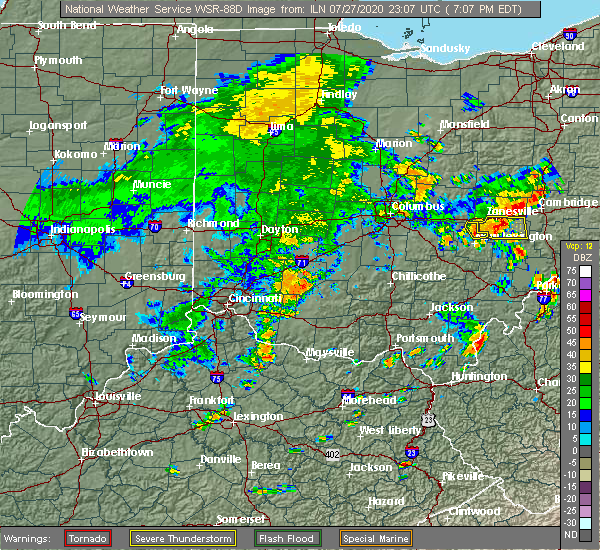 The severe thunderstorm warning for northeastern perry county will expire at 715 pm edt, the storm which prompted the warning has moved out of the area. therefore, the warning will be allowed to expire. The severe thunderstorm warning for northeastern perry county will expire at 715 pm edt, the storm which prompted the warning has moved out of the area. therefore, the warning will be allowed to expire.
|
| 7/27/2020 6:57 PM EDT |
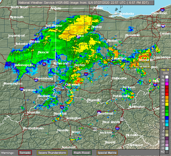 At 656 pm edt, a severe thunderstorm was located near perry state forest, moving east at 30 mph (radar indicated). Hazards include 60 mph wind gusts. Expect damage to roofs, siding, and trees. Locations impacted include, perry state forest and crooksville. At 656 pm edt, a severe thunderstorm was located near perry state forest, moving east at 30 mph (radar indicated). Hazards include 60 mph wind gusts. Expect damage to roofs, siding, and trees. Locations impacted include, perry state forest and crooksville.
|
| 7/27/2020 6:39 PM EDT |
 At 639 pm edt, a severe thunderstorm was located over somerset, moving east at 30 mph (radar indicated). Hazards include 60 mph wind gusts. expect damage to roofs, siding, and trees At 639 pm edt, a severe thunderstorm was located over somerset, moving east at 30 mph (radar indicated). Hazards include 60 mph wind gusts. expect damage to roofs, siding, and trees
|
| 7/19/2020 6:38 PM EDT |
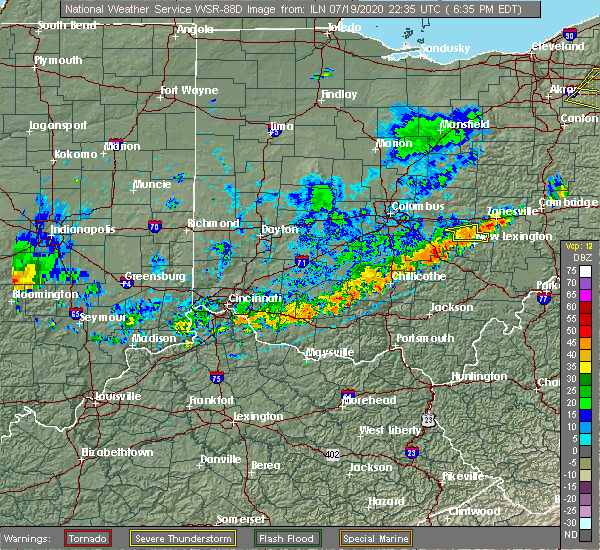 At 638 pm edt, a severe thunderstorm was located over perry state forest, moving east at 35 mph (radar indicated). Hazards include 60 mph wind gusts. Expect damage to roofs, siding, and trees. Locations impacted include, somerset, perry state forest and crooksville. At 638 pm edt, a severe thunderstorm was located over perry state forest, moving east at 35 mph (radar indicated). Hazards include 60 mph wind gusts. Expect damage to roofs, siding, and trees. Locations impacted include, somerset, perry state forest and crooksville.
|
| 7/19/2020 6:24 PM EDT |
 At 624 pm edt, a severe thunderstorm was located over somerset, moving east at 35 mph (radar indicated). Hazards include 60 mph wind gusts. expect damage to roofs, siding, and trees At 624 pm edt, a severe thunderstorm was located over somerset, moving east at 35 mph (radar indicated). Hazards include 60 mph wind gusts. expect damage to roofs, siding, and trees
|
| 6/10/2020 7:35 PM EDT |
 At 733 pm edt, severe thunderstorms were located along a line extending from near north zanesville to near nelsonville to 7 miles southwest of albany, moving northeast at 60 mph (radar indicated). Hazards include 60 mph wind gusts. Expect damage to roofs, siding, and trees. Locations impacted include, athens, jackson, wellston, nelsonville, new lexington, glouster, mcarthur, shawnee, chesterhill, lake hope state park, perry state forest, crooksville, chauncey, hamden, junction city, new straitsville, corning, buchtel, jacksonville and coalton. At 733 pm edt, severe thunderstorms were located along a line extending from near north zanesville to near nelsonville to 7 miles southwest of albany, moving northeast at 60 mph (radar indicated). Hazards include 60 mph wind gusts. Expect damage to roofs, siding, and trees. Locations impacted include, athens, jackson, wellston, nelsonville, new lexington, glouster, mcarthur, shawnee, chesterhill, lake hope state park, perry state forest, crooksville, chauncey, hamden, junction city, new straitsville, corning, buchtel, jacksonville and coalton.
|
| 6/10/2020 6:44 PM EDT |
 At 643 pm edt, severe thunderstorms were located along a line extending from 9 miles southwest of lancaster to near piketon to 6 miles east of rome, moving northeast at 60 mph (radar indicated). Hazards include 60 mph wind gusts. expect damage to roofs, siding, and trees At 643 pm edt, severe thunderstorms were located along a line extending from 9 miles southwest of lancaster to near piketon to 6 miles east of rome, moving northeast at 60 mph (radar indicated). Hazards include 60 mph wind gusts. expect damage to roofs, siding, and trees
|
| 5/10/2020 5:56 PM EDT |
 The severe thunderstorm warning for northern perry county will expire at 600 pm edt, the storms which prompted the warning have weakened below severe limits, and no longer pose an immediate threat to life or property. therefore, the warning will be allowed to expire. however, wind gusts to 50 mph are still possible with these thunderstorms. to report severe weather, contact your nearest law enforcement agency. they will relay your report to the national weather service charleston west virginia. The severe thunderstorm warning for northern perry county will expire at 600 pm edt, the storms which prompted the warning have weakened below severe limits, and no longer pose an immediate threat to life or property. therefore, the warning will be allowed to expire. however, wind gusts to 50 mph are still possible with these thunderstorms. to report severe weather, contact your nearest law enforcement agency. they will relay your report to the national weather service charleston west virginia.
|
| 5/10/2020 5:47 PM EDT |
 At 545 pm edt, severe thunderstorms were located along a line extending from 6 miles south of hanover to somerset, moving east at 45 mph (trained weather spotters). Hazards include 60 mph wind gusts. Expect damage to roofs, siding, and trees. Locations impacted include, new lexington, somerset, perry state forest, crooksville, thornville, junction city and glenford. At 545 pm edt, severe thunderstorms were located along a line extending from 6 miles south of hanover to somerset, moving east at 45 mph (trained weather spotters). Hazards include 60 mph wind gusts. Expect damage to roofs, siding, and trees. Locations impacted include, new lexington, somerset, perry state forest, crooksville, thornville, junction city and glenford.
|
| 5/10/2020 5:32 PM EDT |
 At 531 pm edt, severe thunderstorms were located along a line extending from near heath to pleasantville, moving east at 50 mph (radar indicated). Hazards include 60 mph wind gusts. expect damage to roofs, siding, and trees At 531 pm edt, severe thunderstorms were located along a line extending from near heath to pleasantville, moving east at 50 mph (radar indicated). Hazards include 60 mph wind gusts. expect damage to roofs, siding, and trees
|
| 8/8/2019 4:57 PM EDT |
 At 456 pm edt, a severe thunderstorm was located over perry state forest, moving southeast at 45 mph (radar indicated). Hazards include 60 mph wind gusts and quarter size hail. Hail damage to vehicles is expected. expect wind damage to roofs, siding, and trees. Locations impacted include, new lexington, somerset, shawnee, perry state forest, crooksville, thornville, junction city, new straitsville, glenford, hemlock, rendville and eagleport. At 456 pm edt, a severe thunderstorm was located over perry state forest, moving southeast at 45 mph (radar indicated). Hazards include 60 mph wind gusts and quarter size hail. Hail damage to vehicles is expected. expect wind damage to roofs, siding, and trees. Locations impacted include, new lexington, somerset, shawnee, perry state forest, crooksville, thornville, junction city, new straitsville, glenford, hemlock, rendville and eagleport.
|
| 8/8/2019 4:36 PM EDT |
 At 436 pm edt, a severe thunderstorm was located over thornport, or 7 miles south of heath, moving southeast at 45 mph (radar indicated). Hazards include 60 mph wind gusts and quarter size hail. Hail damage to vehicles is expected. Expect wind damage to roofs, siding, and trees. At 436 pm edt, a severe thunderstorm was located over thornport, or 7 miles south of heath, moving southeast at 45 mph (radar indicated). Hazards include 60 mph wind gusts and quarter size hail. Hail damage to vehicles is expected. Expect wind damage to roofs, siding, and trees.
|
| 8/8/2019 3:48 PM EDT |
 At 347 pm edt, a severe thunderstorm was located near bremen, or near somerset, moving southeast at 30 mph (radar indicated). Hazards include 60 mph wind gusts and quarter size hail. Hail damage to vehicles is expected. Expect wind damage to roofs, siding, and trees. At 347 pm edt, a severe thunderstorm was located near bremen, or near somerset, moving southeast at 30 mph (radar indicated). Hazards include 60 mph wind gusts and quarter size hail. Hail damage to vehicles is expected. Expect wind damage to roofs, siding, and trees.
|
| 7/11/2019 6:09 PM EDT |
 The severe thunderstorm warning for southeastern perry. northwestern morgan and north central athens counties will expire at 615 pm edt. the storm which prompted the warning has weakened below severe limits, and no longer poses an immediate threat to life or property. therefore, the warning will be allowed to expire. However gusty. The severe thunderstorm warning for southeastern perry. northwestern morgan and north central athens counties will expire at 615 pm edt. the storm which prompted the warning has weakened below severe limits, and no longer poses an immediate threat to life or property. therefore, the warning will be allowed to expire. However gusty.
|
| 7/11/2019 5:35 PM EDT |
 The national weather service in charleston west virginia has issued a * severe thunderstorm warning for. southeastern perry county in southeastern ohio. northwestern morgan county in southeastern ohio. north central athens county in southeastern ohio. Until 615 pm edt. The national weather service in charleston west virginia has issued a * severe thunderstorm warning for. southeastern perry county in southeastern ohio. northwestern morgan county in southeastern ohio. north central athens county in southeastern ohio. Until 615 pm edt.
|
| 7/11/2019 5:24 PM EDT |
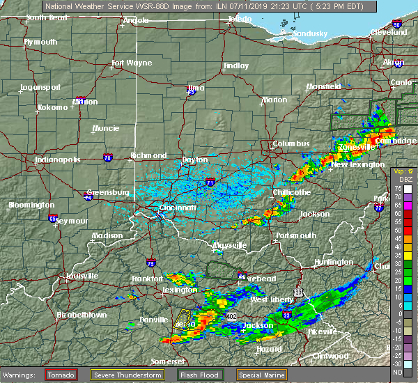 At 501 pm edt, a severe thunderstorm was located near somerset, moving southeast at 20 mph (radar indicated). Hazards include 60 mph wind gusts and penny size hail. expect damage to roofs, siding, and trees At 501 pm edt, a severe thunderstorm was located near somerset, moving southeast at 20 mph (radar indicated). Hazards include 60 mph wind gusts and penny size hail. expect damage to roofs, siding, and trees
|
| 7/2/2019 7:38 PM EDT |
 At 737 pm edt, severe thunderstorms were located along a line extending from near frazeysburg to near somerset to near hide-a-way hills, moving east at 25 mph (radar indicated). Hazards include 60 mph wind gusts. Expect damage to roofs, siding, and trees. Locations impacted include, new lexington, somerset, shawnee, perry state forest, crooksville, thornville, junction city, new straitsville, corning, glenford, hemlock and rendville. At 737 pm edt, severe thunderstorms were located along a line extending from near frazeysburg to near somerset to near hide-a-way hills, moving east at 25 mph (radar indicated). Hazards include 60 mph wind gusts. Expect damage to roofs, siding, and trees. Locations impacted include, new lexington, somerset, shawnee, perry state forest, crooksville, thornville, junction city, new straitsville, corning, glenford, hemlock and rendville.
|
| 7/2/2019 7:17 PM EDT |
 At 714 pm edt, severe thunderstorms were located along a line extending from 8 miles east of utica to thornport to near lancaster, moving southeast at 30 mph (radar indicated). Hazards include 60 mph wind gusts. expect damage to roofs, siding, and trees At 714 pm edt, severe thunderstorms were located along a line extending from 8 miles east of utica to thornport to near lancaster, moving southeast at 30 mph (radar indicated). Hazards include 60 mph wind gusts. expect damage to roofs, siding, and trees
|
| 6/24/2019 4:17 PM EDT |
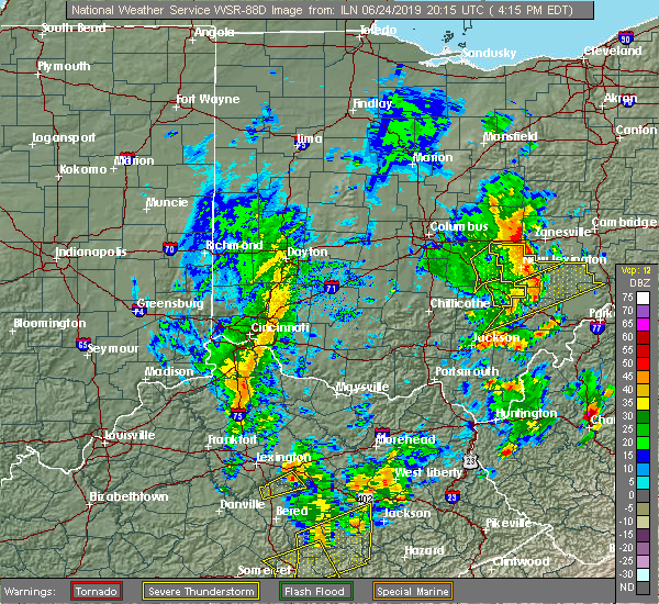 At 417 pm edt, severe thunderstorms were located along a line extending from 6 miles east of thornport to shawnee, moving northeast at 50 mph (radar indicated). Hazards include 60 mph wind gusts. expect damage to roofs, siding, and trees At 417 pm edt, severe thunderstorms were located along a line extending from 6 miles east of thornport to shawnee, moving northeast at 50 mph (radar indicated). Hazards include 60 mph wind gusts. expect damage to roofs, siding, and trees
|
| 6/24/2019 3:50 PM EDT |
 At 349 pm edt, severe thunderstorms were located along a line extending from near millersport to near bremen to near hide-a-way hills, moving northeast at 45 mph (radar indicated). Hazards include 60 mph wind gusts. expect damage to roofs, siding, and trees At 349 pm edt, severe thunderstorms were located along a line extending from near millersport to near bremen to near hide-a-way hills, moving northeast at 45 mph (radar indicated). Hazards include 60 mph wind gusts. expect damage to roofs, siding, and trees
|
| 5/28/2019 1:45 AM EDT |
 At 145 am edt, a severe thunderstorm was located near mcconnelsville, moving southeast at 40 mph (radar indicated). Hazards include 65 mph wind gusts and quarter size hail. Hail damage to vehicles is expected. expect considerable tree damage. Wind damage is also likely to mobile homes, roofs, and outbuildings. At 145 am edt, a severe thunderstorm was located near mcconnelsville, moving southeast at 40 mph (radar indicated). Hazards include 65 mph wind gusts and quarter size hail. Hail damage to vehicles is expected. expect considerable tree damage. Wind damage is also likely to mobile homes, roofs, and outbuildings.
|
| 5/28/2019 1:33 AM EDT |
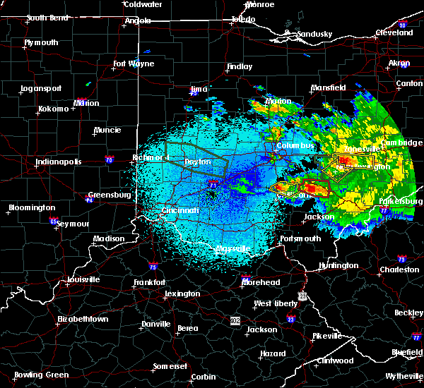 At 132 am edt, a severe thunderstorm was located near perry state forest, moving southeast at 35 mph (radar indicated). Hazards include 70 mph wind gusts and quarter size hail. Hail damage to vehicles is expected. expect considerable tree damage. wind damage is also likely to mobile homes, roofs, and outbuildings. Locations impacted include, new lexington, shawnee, perry state forest, crooksville, junction city and hemlock. At 132 am edt, a severe thunderstorm was located near perry state forest, moving southeast at 35 mph (radar indicated). Hazards include 70 mph wind gusts and quarter size hail. Hail damage to vehicles is expected. expect considerable tree damage. wind damage is also likely to mobile homes, roofs, and outbuildings. Locations impacted include, new lexington, shawnee, perry state forest, crooksville, junction city and hemlock.
|
| 5/28/2019 1:18 AM EDT |
 At 118 am edt, a severe thunderstorm was located over somerset, moving southeast at 35 mph (radar indicated). Hazards include 75 mph wind gusts and quarter size hail. Hail damage to vehicles is expected. expect considerable tree damage. wind damage is also likely to mobile homes, roofs, and outbuildings. Locations impacted include, new lexington, somerset, shawnee, perry state forest, crooksville, thornville, junction city, glenford and hemlock. At 118 am edt, a severe thunderstorm was located over somerset, moving southeast at 35 mph (radar indicated). Hazards include 75 mph wind gusts and quarter size hail. Hail damage to vehicles is expected. expect considerable tree damage. wind damage is also likely to mobile homes, roofs, and outbuildings. Locations impacted include, new lexington, somerset, shawnee, perry state forest, crooksville, thornville, junction city, glenford and hemlock.
|
| 5/28/2019 1:11 AM EDT |
 At 110 am edt, a severe thunderstorm was located near somerset, moving southeast at 35 mph (radar indicated). Hazards include 65 mph wind gusts and quarter size hail. Hail damage to vehicles is expected. Expect wind damage to roofs, siding, and trees. At 110 am edt, a severe thunderstorm was located near somerset, moving southeast at 35 mph (radar indicated). Hazards include 65 mph wind gusts and quarter size hail. Hail damage to vehicles is expected. Expect wind damage to roofs, siding, and trees.
|
| 5/28/2019 1:07 AM EDT |
 The tornado warning for northeastern perry and northwestern morgan counties will expire at 115 am edt, the storm which prompted the warning has moved out of the area. therefore, the warning will be allowed to expire. a tornado watch remains in effect until 400 am edt for southeastern ohio. The tornado warning for northeastern perry and northwestern morgan counties will expire at 115 am edt, the storm which prompted the warning has moved out of the area. therefore, the warning will be allowed to expire. a tornado watch remains in effect until 400 am edt for southeastern ohio.
|
| 5/28/2019 12:50 AM EDT |
 At 1249 am edt, a severe thunderstorm capable of producing a tornado was located near perry state forest, moving east at 40 mph. spotters have observed rotation with this storm (radar indicated rotation). Hazards include tornado and quarter size hail. Flying debris will be dangerous to those caught without shelter. mobile homes will be damaged or destroyed. damage to roofs, windows, and vehicles will occur. tree damage is likely. This tornadic thunderstorm will remain over mainly rural areas of northeastern perry and northwestern morgan counties, including the following locations, crooksville. At 1249 am edt, a severe thunderstorm capable of producing a tornado was located near perry state forest, moving east at 40 mph. spotters have observed rotation with this storm (radar indicated rotation). Hazards include tornado and quarter size hail. Flying debris will be dangerous to those caught without shelter. mobile homes will be damaged or destroyed. damage to roofs, windows, and vehicles will occur. tree damage is likely. This tornadic thunderstorm will remain over mainly rural areas of northeastern perry and northwestern morgan counties, including the following locations, crooksville.
|
| 5/28/2019 12:24 AM EDT |
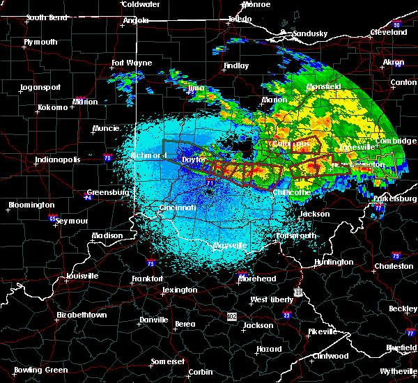 At 1222 am edt, a severe thunderstorm capable of producing a tornado was located near bremen, or 7 miles west of somerset, moving east at 40 mph. spotters have observed rotation with this storm (radar indicated rotation). Hazards include tornado and quarter size hail. Flying debris will be dangerous to those caught without shelter. mobile homes will be damaged or destroyed. damage to roofs, windows, and vehicles will occur. tree damage is likely. this dangerous storm will be near, somerset around 1235 am edt. new lexington and perry state forest around 1240 am edt. Other locations impacted by this tornadic thunderstorm include crooksville and junction city. At 1222 am edt, a severe thunderstorm capable of producing a tornado was located near bremen, or 7 miles west of somerset, moving east at 40 mph. spotters have observed rotation with this storm (radar indicated rotation). Hazards include tornado and quarter size hail. Flying debris will be dangerous to those caught without shelter. mobile homes will be damaged or destroyed. damage to roofs, windows, and vehicles will occur. tree damage is likely. this dangerous storm will be near, somerset around 1235 am edt. new lexington and perry state forest around 1240 am edt. Other locations impacted by this tornadic thunderstorm include crooksville and junction city.
|
| 3/14/2019 10:37 PM EDT |
 At 1036 pm edt, a severe thunderstorm was located near logan, moving northeast at 55 mph (radar indicated). Hazards include 60 mph wind gusts. expect damage to roofs, siding, and trees At 1036 pm edt, a severe thunderstorm was located near logan, moving northeast at 55 mph (radar indicated). Hazards include 60 mph wind gusts. expect damage to roofs, siding, and trees
|
| 3/14/2019 9:39 PM EDT |
 At 937 pm edt, a severe thunderstorm was located near new lexington, moving northeast at 55 mph (radar indicated). Hazards include 60 mph wind gusts. Expect damage to roofs, siding, and trees. Locations impacted include, new lexington, mcconnelsville, crooksville, corning, bristol, hemlock, rendville and eagleport. At 937 pm edt, a severe thunderstorm was located near new lexington, moving northeast at 55 mph (radar indicated). Hazards include 60 mph wind gusts. Expect damage to roofs, siding, and trees. Locations impacted include, new lexington, mcconnelsville, crooksville, corning, bristol, hemlock, rendville and eagleport.
|
| 3/14/2019 9:18 PM EDT |
 At 917 pm edt, a severe thunderstorm was located over logan, moving northeast at 55 mph (radar indicated). Hazards include 60 mph wind gusts. expect damage to roofs, siding, and trees At 917 pm edt, a severe thunderstorm was located over logan, moving northeast at 55 mph (radar indicated). Hazards include 60 mph wind gusts. expect damage to roofs, siding, and trees
|
| 8/10/2018 5:12 PM EDT |
 The severe thunderstorm warning for perry and northwestern morgan counties will expire at 515 pm edt. the storm which prompted the warning has weakened below severe limits. therefore, the warning will be allowed to expire. However winds of 30 to 40 mph are still possible with this thunderstorm. The severe thunderstorm warning for perry and northwestern morgan counties will expire at 515 pm edt. the storm which prompted the warning has weakened below severe limits. therefore, the warning will be allowed to expire. However winds of 30 to 40 mph are still possible with this thunderstorm.
|
| 8/10/2018 4:53 PM EDT |
 At 453 pm edt, a severe thunderstorm was located near perry state forest, moving southeast at 15 mph (radar indicated). Hazards include 60 mph wind gusts. Expect damage to roofs, siding, and trees. Locations impacted include, new lexington, somerset, shawnee, perry state forest, crooksville, junction city and new straitsville. At 453 pm edt, a severe thunderstorm was located near perry state forest, moving southeast at 15 mph (radar indicated). Hazards include 60 mph wind gusts. Expect damage to roofs, siding, and trees. Locations impacted include, new lexington, somerset, shawnee, perry state forest, crooksville, junction city and new straitsville.
|
| 8/10/2018 4:33 PM EDT |
 At 433 pm edt, a severe thunderstorm was located near somerset, moving southeast at 15 mph (radar indicated). Hazards include 60 mph wind gusts. expect damage to roofs, siding, and trees At 433 pm edt, a severe thunderstorm was located near somerset, moving southeast at 15 mph (radar indicated). Hazards include 60 mph wind gusts. expect damage to roofs, siding, and trees
|
| 5/15/2018 5:53 PM EDT |
 The severe thunderstorm warning for southeastern perry and northwestern morgan counties will expire at 600 pm edt, the storms which prompted the warning have moved out of the area. therefore the warning will be allowed to expire. remember, a severe thunderstorm warning still remains in effect for central and eastern morgan county until 5:15 pm. The severe thunderstorm warning for southeastern perry and northwestern morgan counties will expire at 600 pm edt, the storms which prompted the warning have moved out of the area. therefore the warning will be allowed to expire. remember, a severe thunderstorm warning still remains in effect for central and eastern morgan county until 5:15 pm.
|
| 5/15/2018 5:32 PM EDT |
 At 532 pm edt, severe thunderstorms were located along a line extending from near south zanesville to 8 miles east of new lexington to near shawnee, moving east at 25 mph (radar indicated). Hazards include 60 mph wind gusts and quarter size hail. Hail damage to vehicles is expected. expect wind damage to roofs, siding, and trees. locations impacted include, crooksville, corning, hemlock, rendville and eagleport. At 532 pm edt, severe thunderstorms were located along a line extending from near south zanesville to 8 miles east of new lexington to near shawnee, moving east at 25 mph (radar indicated). Hazards include 60 mph wind gusts and quarter size hail. Hail damage to vehicles is expected. expect wind damage to roofs, siding, and trees. locations impacted include, crooksville, corning, hemlock, rendville and eagleport.
|
| 5/15/2018 5:30 PM EDT | Trees reported down in the crooksville are in perry county OH, 0.6 miles SSW of Crooksville, OH |
| 5/15/2018 5:27 PM EDT | Trees reported down. time estimated from rada in perry county OH, 0.6 miles SSW of Crooksville, OH |
| 5/15/2018 5:23 PM EDT |
 At 523 pm edt, severe thunderstorms were located along a line extending from 6 miles southwest of south zanesville to near new lexington to near shawnee, moving east at 25 mph (radar indicated). Hazards include 60 mph wind gusts. expect damage to roofs, siding, and trees At 523 pm edt, severe thunderstorms were located along a line extending from 6 miles southwest of south zanesville to near new lexington to near shawnee, moving east at 25 mph (radar indicated). Hazards include 60 mph wind gusts. expect damage to roofs, siding, and trees
|
| 5/14/2018 1:43 PM EDT |
 At 142 pm edt, severe thunderstorms were located along a line extending from 8 miles east of perry state forest to near logan, moving east at 30 mph (radar indicated). Hazards include 60 mph wind gusts and quarter size hail. Hail damage to vehicles is expected. Expect wind damage to roofs, siding, and trees. At 142 pm edt, severe thunderstorms were located along a line extending from 8 miles east of perry state forest to near logan, moving east at 30 mph (radar indicated). Hazards include 60 mph wind gusts and quarter size hail. Hail damage to vehicles is expected. Expect wind damage to roofs, siding, and trees.
|
| 5/14/2018 1:20 PM EDT |
 At 120 pm edt, severe thunderstorms were located along a line extending from perry state forest to near hide-a-way hills, moving east at 35 mph (radar indicated). Hazards include 70 mph wind gusts and half dollar size hail. Hail damage to vehicles is expected. expect considerable tree damage. Wind damage is also likely to mobile homes, roofs, and outbuildings. At 120 pm edt, severe thunderstorms were located along a line extending from perry state forest to near hide-a-way hills, moving east at 35 mph (radar indicated). Hazards include 70 mph wind gusts and half dollar size hail. Hail damage to vehicles is expected. expect considerable tree damage. Wind damage is also likely to mobile homes, roofs, and outbuildings.
|
| 5/13/2018 5:30 PM EDT |
 At 513 pm edt, a severe thunderstorm was located near thornport, or 7 miles west of somerset, moving east at 30 mph (radar indicated). Hazards include 60 mph wind gusts and quarter size hail. Hail damage to vehicles is expected. Expect wind damage to roofs, siding, and trees. At 513 pm edt, a severe thunderstorm was located near thornport, or 7 miles west of somerset, moving east at 30 mph (radar indicated). Hazards include 60 mph wind gusts and quarter size hail. Hail damage to vehicles is expected. Expect wind damage to roofs, siding, and trees.
|
| 5/13/2018 5:13 PM EDT |
 At 513 pm edt, a severe thunderstorm was located near thornport, or 7 miles west of somerset, moving east at 30 mph (radar indicated). Hazards include 60 mph wind gusts and quarter size hail. Hail damage to vehicles is expected. Expect wind damage to roofs, siding, and trees. At 513 pm edt, a severe thunderstorm was located near thornport, or 7 miles west of somerset, moving east at 30 mph (radar indicated). Hazards include 60 mph wind gusts and quarter size hail. Hail damage to vehicles is expected. Expect wind damage to roofs, siding, and trees.
|
| 5/12/2018 4:53 PM EDT |
 At 453 pm edt, a severe thunderstorm was located near perry state forest, moving east at 45 mph (radar indicated). Hazards include 60 mph wind gusts and quarter size hail. Hail damage to vehicles is expected. Expect wind damage to roofs, siding, and trees. At 453 pm edt, a severe thunderstorm was located near perry state forest, moving east at 45 mph (radar indicated). Hazards include 60 mph wind gusts and quarter size hail. Hail damage to vehicles is expected. Expect wind damage to roofs, siding, and trees.
|
| 4/3/2018 6:30 PM EDT | Dispatcher states multiple trees and powerlines down in the area in perry county OH, 0.6 miles SSW of Crooksville, OH |
| 4/3/2018 6:25 PM EDT |
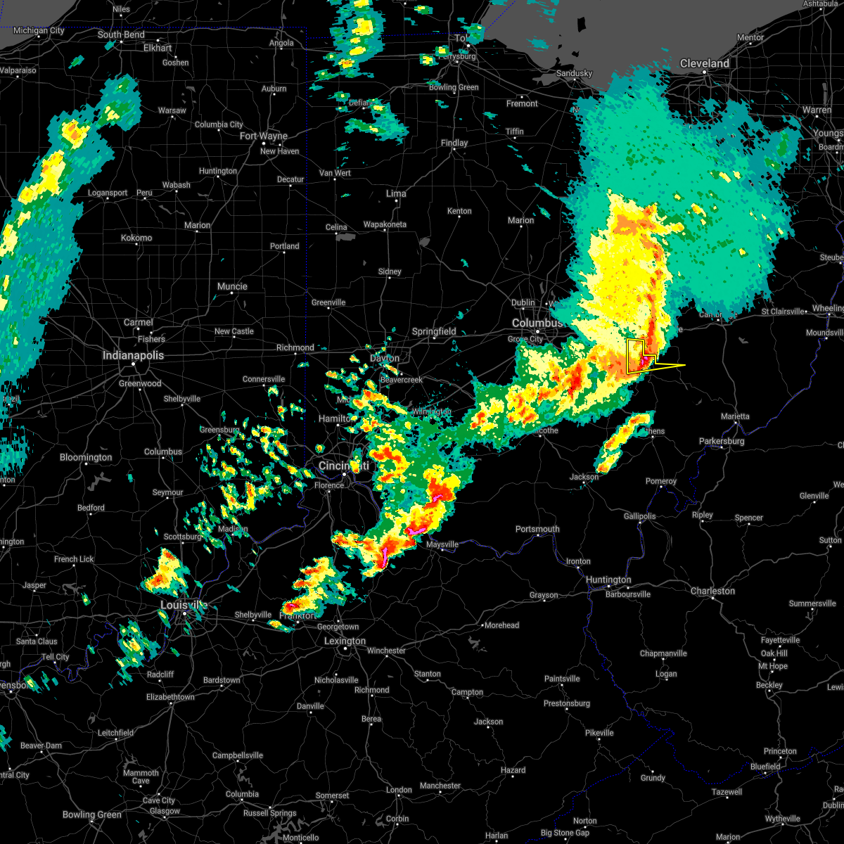 At 625 pm edt, a severe thunderstorm was located near south zanesville, or near zanesville, moving east at 60 mph (radar indicated). Hazards include 60 mph wind gusts and quarter size hail. Hail damage to vehicles is expected. expect wind damage to roofs, siding, and trees. locations impacted include, new lexington, somerset, perry state forest, crooksville and junction city. At 625 pm edt, a severe thunderstorm was located near south zanesville, or near zanesville, moving east at 60 mph (radar indicated). Hazards include 60 mph wind gusts and quarter size hail. Hail damage to vehicles is expected. expect wind damage to roofs, siding, and trees. locations impacted include, new lexington, somerset, perry state forest, crooksville and junction city.
|
| 4/3/2018 6:03 PM EDT |
 At 601 pm edt, a severe thunderstorm was located over pleasantville, or 8 miles northeast of lancaster, moving east at 60 mph (radar indicated). Hazards include 60 mph wind gusts and quarter size hail. Hail damage to vehicles is expected. Expect wind damage to roofs, siding, and trees. At 601 pm edt, a severe thunderstorm was located over pleasantville, or 8 miles northeast of lancaster, moving east at 60 mph (radar indicated). Hazards include 60 mph wind gusts and quarter size hail. Hail damage to vehicles is expected. Expect wind damage to roofs, siding, and trees.
|
| 11/5/2017 8:11 PM EST |
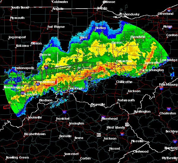 The severe thunderstorm warning for east central perry county will expire at 815 pm est, the storms which prompted the warning have weakened below severe limits, and no longer pose an immediate threat to life or property. therefore the warning will be allowed to expire. The severe thunderstorm warning for east central perry county will expire at 815 pm est, the storms which prompted the warning have weakened below severe limits, and no longer pose an immediate threat to life or property. therefore the warning will be allowed to expire.
|
| 11/5/2017 8:00 PM EST |
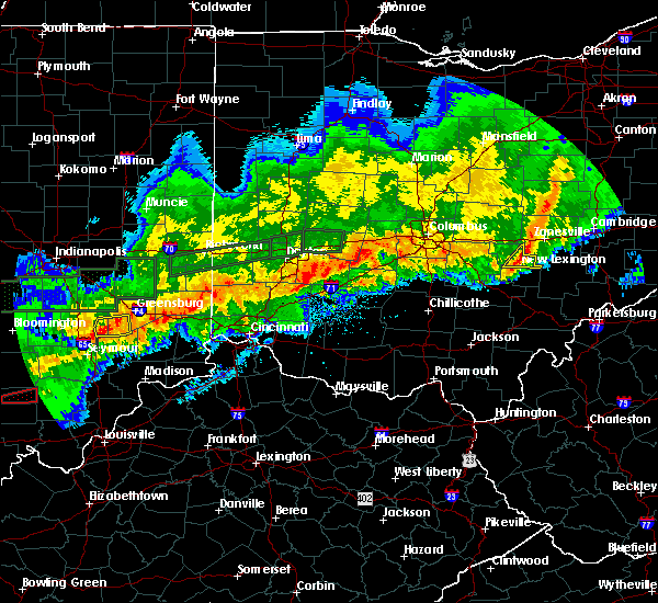 At 759 pm est, severe thunderstorms were located along a line extending from 8 miles south of killbuck to 6 miles west of north zanesville to bremen, moving east at 45 mph (radar indicated). Hazards include 60 mph wind gusts. Expect damage to roofs, siding, and trees. locations impacted include, new lexington, perry state forest, crooksville and junction city. At 759 pm est, severe thunderstorms were located along a line extending from 8 miles south of killbuck to 6 miles west of north zanesville to bremen, moving east at 45 mph (radar indicated). Hazards include 60 mph wind gusts. Expect damage to roofs, siding, and trees. locations impacted include, new lexington, perry state forest, crooksville and junction city.
|
| 11/5/2017 7:20 PM EST |
 At 720 pm est, severe thunderstorms were located along a line extending from mount vernon to near hebron to 6 miles east of ashville, moving east at 45 mph (radar indicated). Hazards include 60 mph wind gusts. expect damage to roofs, siding, and trees At 720 pm est, severe thunderstorms were located along a line extending from mount vernon to near hebron to 6 miles east of ashville, moving east at 45 mph (radar indicated). Hazards include 60 mph wind gusts. expect damage to roofs, siding, and trees
|
| 7/10/2017 4:43 PM EDT |
 The severe thunderstorm warning for northern perry county will expire at 445 pm edt, the storm which prompted the warning has weakened below severe limits, but is still strong with gusty winds and heavy rain possible. the warning will be allowed to expire. The severe thunderstorm warning for northern perry county will expire at 445 pm edt, the storm which prompted the warning has weakened below severe limits, but is still strong with gusty winds and heavy rain possible. the warning will be allowed to expire.
|
| 7/10/2017 4:17 PM EDT |
 At 416 pm edt, a severe thunderstorm was located near south zanesville, or 8 miles south of zanesville, moving east at 50 mph (radar indicated). Hazards include 60 mph wind gusts and quarter size hail. Hail damage to vehicles is expected. expect wind damage to roofs, siding, and trees. locations impacted include, somerset, thornport, harbor hills, crooksville, thornville and glenford. At 416 pm edt, a severe thunderstorm was located near south zanesville, or 8 miles south of zanesville, moving east at 50 mph (radar indicated). Hazards include 60 mph wind gusts and quarter size hail. Hail damage to vehicles is expected. expect wind damage to roofs, siding, and trees. locations impacted include, somerset, thornport, harbor hills, crooksville, thornville and glenford.
|
| 7/10/2017 3:51 PM EDT |
 At 349 pm edt, a severe thunderstorm was located over fairfield beach, or 8 miles south of heath, moving east at 40 mph (radar indicated). Hazards include 60 mph wind gusts and quarter size hail. Hail damage to vehicles is expected. Expect wind damage to roofs, siding, and trees. At 349 pm edt, a severe thunderstorm was located over fairfield beach, or 8 miles south of heath, moving east at 40 mph (radar indicated). Hazards include 60 mph wind gusts and quarter size hail. Hail damage to vehicles is expected. Expect wind damage to roofs, siding, and trees.
|
| 7/7/2017 2:39 PM EDT |
 The severe thunderstorm warning for central perry and northwestern morgan counties will expire at 245 pm edt, the storm which prompted the warning has moved out of the area. therefore the warning will be allowed to expire. however gusty winds and heavy rain are still possible with this thunderstorm. a severe thunderstorm watch remains in effect until 900 pm edt for southeastern ohio. The severe thunderstorm warning for central perry and northwestern morgan counties will expire at 245 pm edt, the storm which prompted the warning has moved out of the area. therefore the warning will be allowed to expire. however gusty winds and heavy rain are still possible with this thunderstorm. a severe thunderstorm watch remains in effect until 900 pm edt for southeastern ohio.
|
| 7/7/2017 2:27 PM EDT |
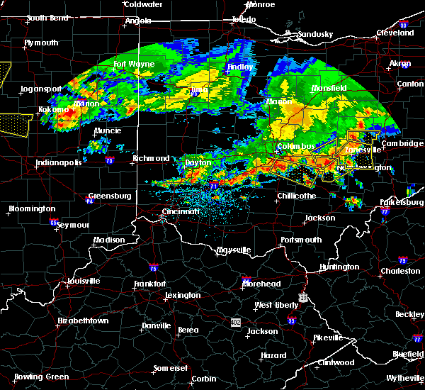 At 226 pm edt, a severe thunderstorm was located near new lexington, moving southeast at 40 mph (radar indicated). Hazards include 60 mph wind gusts. Expect damage to roofs, siding, and trees. locations impacted include, new lexington, somerset, shawnee, perry state forest, crooksville and junction city. At 226 pm edt, a severe thunderstorm was located near new lexington, moving southeast at 40 mph (radar indicated). Hazards include 60 mph wind gusts. Expect damage to roofs, siding, and trees. locations impacted include, new lexington, somerset, shawnee, perry state forest, crooksville and junction city.
|
| 7/7/2017 2:12 PM EDT |
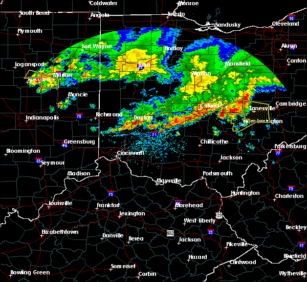 At 211 pm edt, a severe thunderstorm was located near somerset, moving southeast at 40 mph (radar indicated). Hazards include 60 mph wind gusts. expect damage to roofs, siding, and trees At 211 pm edt, a severe thunderstorm was located near somerset, moving southeast at 40 mph (radar indicated). Hazards include 60 mph wind gusts. expect damage to roofs, siding, and trees
|
| 5/19/2017 7:04 PM EDT |
 At 703 pm edt, severe thunderstorms were located along a line extending from 6 miles west of new concord to near mcarthur, moving east at 35 mph (radar indicated). Hazards include 60 mph wind gusts and quarter size hail. Hail damage to vehicles is expected. expect wind damage to roofs, siding, and trees. locations impacted include, nelsonville, new lexington, glouster, mcconnelsville, somerset, shawnee, perry state forest, crooksville, chauncey, junction city, new straitsville, malta, corning, buchtel, jacksonville, murray city, trimble, glenford, hemlock and rendville. At 703 pm edt, severe thunderstorms were located along a line extending from 6 miles west of new concord to near mcarthur, moving east at 35 mph (radar indicated). Hazards include 60 mph wind gusts and quarter size hail. Hail damage to vehicles is expected. expect wind damage to roofs, siding, and trees. locations impacted include, nelsonville, new lexington, glouster, mcconnelsville, somerset, shawnee, perry state forest, crooksville, chauncey, junction city, new straitsville, malta, corning, buchtel, jacksonville, murray city, trimble, glenford, hemlock and rendville.
|
| 5/19/2017 6:48 PM EDT |
 At 647 pm edt, severe thunderstorms were located along a line extending from near north zanesville to 13 miles northwest of wellston, moving east at 35 mph (radar indicated). Hazards include 60 mph wind gusts and quarter size hail. Hail damage to vehicles is expected. expect wind damage to roofs, siding, and trees. locations impacted include, athens, wellston, nelsonville, new lexington, glouster, mcconnelsville, mcarthur, somerset, albany, shawnee, lake hope state park, perry state forest, crooksville, chauncey, hamden, junction city, new straitsville, malta, corning and buchtel. At 647 pm edt, severe thunderstorms were located along a line extending from near north zanesville to 13 miles northwest of wellston, moving east at 35 mph (radar indicated). Hazards include 60 mph wind gusts and quarter size hail. Hail damage to vehicles is expected. expect wind damage to roofs, siding, and trees. locations impacted include, athens, wellston, nelsonville, new lexington, glouster, mcconnelsville, mcarthur, somerset, albany, shawnee, lake hope state park, perry state forest, crooksville, chauncey, hamden, junction city, new straitsville, malta, corning and buchtel.
|
| 5/19/2017 6:19 PM EDT |
 At 618 pm edt, severe thunderstorms were located along a line extending from near thornport to 6 miles northwest of waverly, moving east at 35 mph (radar indicated). Hazards include 60 mph wind gusts and quarter size hail. Hail damage to vehicles is expected. Expect wind damage to roofs, siding, and trees. At 618 pm edt, severe thunderstorms were located along a line extending from near thornport to 6 miles northwest of waverly, moving east at 35 mph (radar indicated). Hazards include 60 mph wind gusts and quarter size hail. Hail damage to vehicles is expected. Expect wind damage to roofs, siding, and trees.
|
| 6/23/2016 1:51 AM EDT |
 At 151 am edt, a severe thunderstorm was located 8 miles south of south zanesville, or 10 miles east of perry state forest, moving east at 45 mph (radar indicated). Hazards include 60 mph wind gusts and quarter size hail. Hail damage to vehicles is expected. expect wind damage to roofs, siding, and trees. Locations impacted include, mcconnelsville, crooksville, bristol and eagleport. At 151 am edt, a severe thunderstorm was located 8 miles south of south zanesville, or 10 miles east of perry state forest, moving east at 45 mph (radar indicated). Hazards include 60 mph wind gusts and quarter size hail. Hail damage to vehicles is expected. expect wind damage to roofs, siding, and trees. Locations impacted include, mcconnelsville, crooksville, bristol and eagleport.
|
| 6/23/2016 1:37 AM EDT |
 At 136 am edt, a severe thunderstorm was located near somerset, moving east at 45 mph (radar indicated). Hazards include 60 mph wind gusts and quarter size hail. Hail damage to vehicles is expected. Expect wind damage to roofs, siding, and trees. At 136 am edt, a severe thunderstorm was located near somerset, moving east at 45 mph (radar indicated). Hazards include 60 mph wind gusts and quarter size hail. Hail damage to vehicles is expected. Expect wind damage to roofs, siding, and trees.
|
| 4/26/2016 2:34 PM EDT | Quarter sized hail reported 0.6 miles SSW of Crooksville, OH, currently falling |
| 4/26/2016 2:21 PM EDT |
 At 221 pm edt, a severe thunderstorm was located over perry state forest, moving southeast at 25 mph (radar indicated). Hazards include 60 mph wind gusts and quarter size hail. Hail damage to vehicles is expected. Expect wind damage to roofs, siding, and trees. At 221 pm edt, a severe thunderstorm was located over perry state forest, moving southeast at 25 mph (radar indicated). Hazards include 60 mph wind gusts and quarter size hail. Hail damage to vehicles is expected. Expect wind damage to roofs, siding, and trees.
|
| 7/14/2015 3:12 PM EDT |
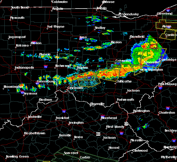 At 311 pm edt, doppler radar indicated a line of severe thunderstorms capable of producing damaging winds in excess of 60 mph. these storms were located along a line extending from near somerset to near lancaster, moving southeast at 35 mph. these severe storms will be near, somerset around 315 pm edt. perry state forest around 320 pm edt. new lexington around 325 pm edt. other locations impacted by these severe thunderstorms include crooksville and junction city. At 311 pm edt, doppler radar indicated a line of severe thunderstorms capable of producing damaging winds in excess of 60 mph. these storms were located along a line extending from near somerset to near lancaster, moving southeast at 35 mph. these severe storms will be near, somerset around 315 pm edt. perry state forest around 320 pm edt. new lexington around 325 pm edt. other locations impacted by these severe thunderstorms include crooksville and junction city.
|
| 7/14/2015 2:34 PM EDT |
 At 233 pm edt, doppler radar indicated a line of severe thunderstorms capable of producing damaging winds in excess of 60 mph. these storms were located along a line extending from pataskala to near grove city, and moving southeast at 35 mph. * severe thunderstorms will be near, harbor hills around 250 pm edt. somerset around 310 pm edt. new lexington and perry state forest around 320 pm edt. other locations impacted by these severe thunderstorms include crooksville, thornville, glenford and junction city. At 233 pm edt, doppler radar indicated a line of severe thunderstorms capable of producing damaging winds in excess of 60 mph. these storms were located along a line extending from pataskala to near grove city, and moving southeast at 35 mph. * severe thunderstorms will be near, harbor hills around 250 pm edt. somerset around 310 pm edt. new lexington and perry state forest around 320 pm edt. other locations impacted by these severe thunderstorms include crooksville, thornville, glenford and junction city.
|
| 5/11/2015 6:49 PM EDT | At 647 pm edt, national weather service doppler radar continued to indicate a line of severe thunderstorms capable of producing damaging winds in excess of 60 mph. these storms were located along a line extending from eagleport to chesterhill to 6 miles southeast of dexter, or along a line extending from 9 miles north of mcconnelsville to chesterhill to rutland, moving east at 35 mph. other locations in the warning include but are not limited to malta, darwin, stockport, bartlett, bristol, hackney, beverly, fleming, marietta, macksburg, lower salem, lowell and devola this will impact the following interstate, i-77 between mile markers 1 and 17 in ohio. very heavy rain will also fall from this line of severe thunderstorms, and will cause water to pond on roads and quickly fill roadside ditches and small streams. a severe thunderstorm watch remains in effect until 1000 pm edt monday evening for central kentucky and southeast ohio and central west virginia. a severe thunderstorm watch also remains in effect until 100 am edt tuesday morning for central west virginia. please report severe weather to the national weather service by calling toll free, 800-401-9535, when you can do so safely. you may also report severe weather by posting your report to the charleston west virginia national weather service facebook page, or by using the twitter hashtag, nwsrlx. |
| 5/11/2015 6:19 PM EDT | At 617 pm edt, national weather service doppler radar indicated a line of severe thunderstorms capable of producing damaging winds in excess of 60 mph. these storms were located along a line extending from 23 miles northwest of mcconnelsville to 7 miles west of glouster to 18 miles southwest of albany, or along a line extending from 8 miles southwest of zanesville to nelsonville to 9 miles north of rio grande, moving northeast at 55 mph. * other locations in the warning include but are not limited to stroud run state park, salem center, harrisonville, hackney, fleming, eagleport, dyesville, dexter, darwin, carpenter, burr oak state park, bristol, bartlett, vinton, stockport, malta, macksburg, lower salem, lowell, devola, trimble, the plains, jacksonville, chauncey, amesville, rendville and corning. this will impact the following interstate, i-77 between mile markers 1 and 17 in ohio. very heavy rain will also fall from this line of severe thunderstorms, and will cause water to pond on roads and quickly fill roadside ditches and small streams. a severe thunderstorm watch remains in effect until 1000 pm edt monday evening for central kentucky and southeast ohio and central west virginia. a severe thunderstorm watch also remains in effect until 100 am edt tuesday morning for central west virginia. please report hail or strong wind to the national weather service by calling toll free, 800-401-9535, when you can do so safely. you may also report severe weather by posting your report to the charleston west virginia national weather service facebook page, or by using the twitter hashtag, nwsrlx. |
| 5/11/2015 6:03 PM EDT | At 602 pm edt, national weather service doppler radar continued to indicate a line of severe thunderstorms capable of producing quarter size hail, and damaging winds in excess of 60 mph. these storms were located along a line extending from glenford to 10 miles west of new straitsville to 7 miles southwest of mabee, or along a line extending from 8 miles northwest of somerset to logan to 13 miles northeast of portsmouth, moving east at 35 mph. other locations in the warning include but are not limited to coalton, jackson, junction city, creola, mcarthur, hamden, wellston, zaleski, perry state forest, new lexington, lake hope state park, oak hill, shawnee, nelsonville, hemlock, radcliffe, buchtel, crooksville, wilkesville and gallia in addition to large hail and damaging winds, continuous cloud to ground lightning is occurring with this storm. move indoors immediately! lightning is one of natures number one killers. remember, if you can hear thunder, you are close enough to be struck by lightning. very heavy rain will also fall from this line of severe thunderstorms, and will cause water to pond on roads and quickly fill roadside ditches and small streams. a severe thunderstorm watch remains in effect until 1000 pm edt monday evening for central kentucky and southeast ohio and central west virginia. a severe thunderstorm watch also remains in effect until 100 am edt tuesday morning for central west virginia. please report severe weather to the national weather service by calling toll free, 800-401-9535, when you can do so safely. you may also report severe weather by posting your report to the charleston west virginia national weather service facebook page, or by using the twitter hashtag, nwsrlx. |
| 5/11/2015 5:25 PM EDT | At 522 pm edt, national weather service doppler radar indicated a line of severe thunderstorms capable of producing quarter size. |
| 4/9/2015 3:28 PM EDT | A severe thunderstorm warning remains in effect until 345 pm edt for southeastern perry and western morgan counties. at 326 pm edt. national weather service doppler radar continued to indicate a severe thunderstorm capable of producing ping pong ball size hail. and damaging winds in excess of 60 mph. this storm was located near rendville. or 8 miles west of mcconnelsville. Moving. |
| 4/9/2015 3:07 PM EDT | The national weather service in charleston has issued a * severe thunderstorm warning for. northwestern athens county in southeast ohio. this includes the cities of. nelsonville. glouster. western morgan county in southeast ohio. This includes the city of mcconnelsville. |
| 8/9/2012 7:10 PM EDT | Tree down along county route 8 in morgan county OH, 1.9 miles WSW of Crooksville, OH |
Hail Maps for Crooksville, OH


Connect with Interactive Hail Maps