

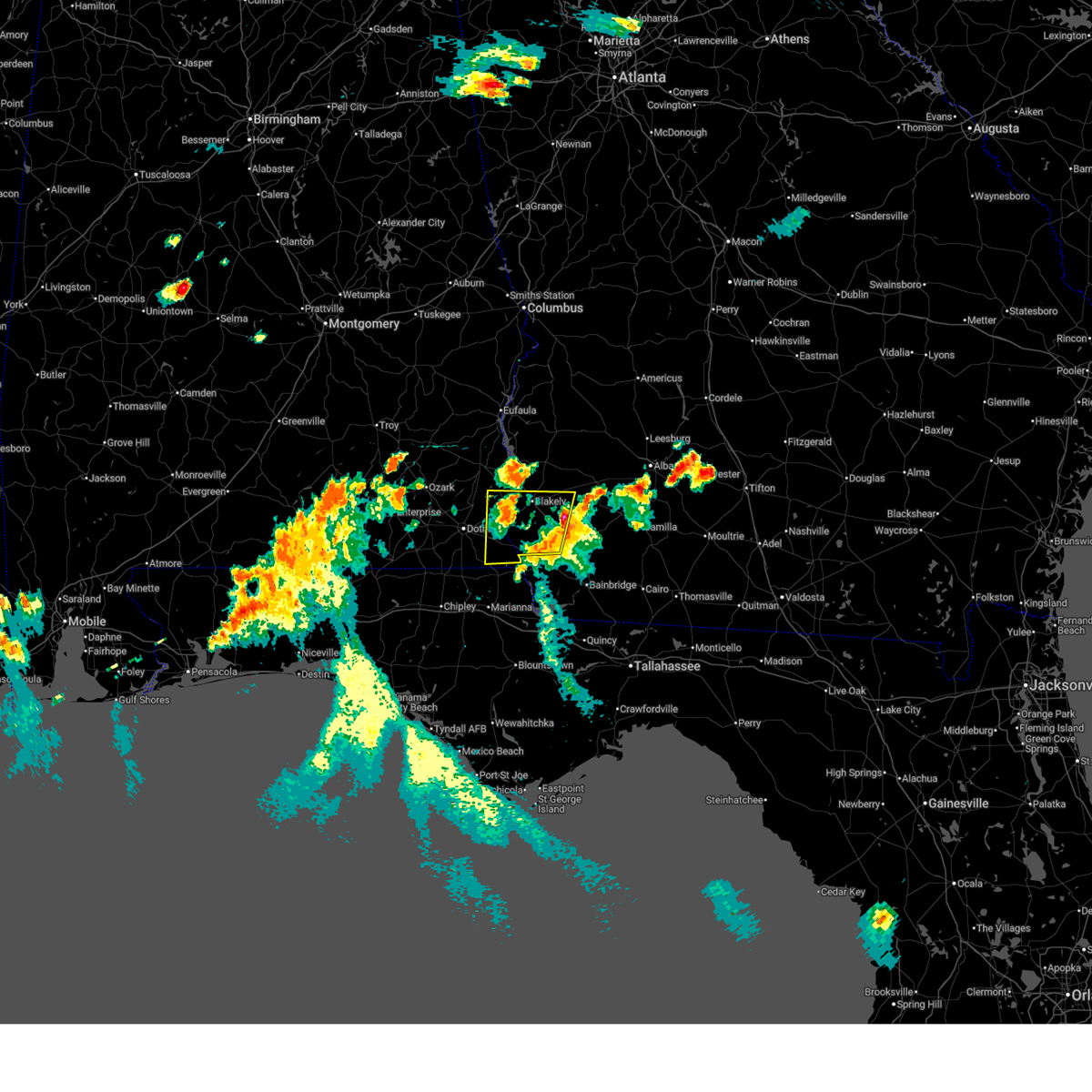
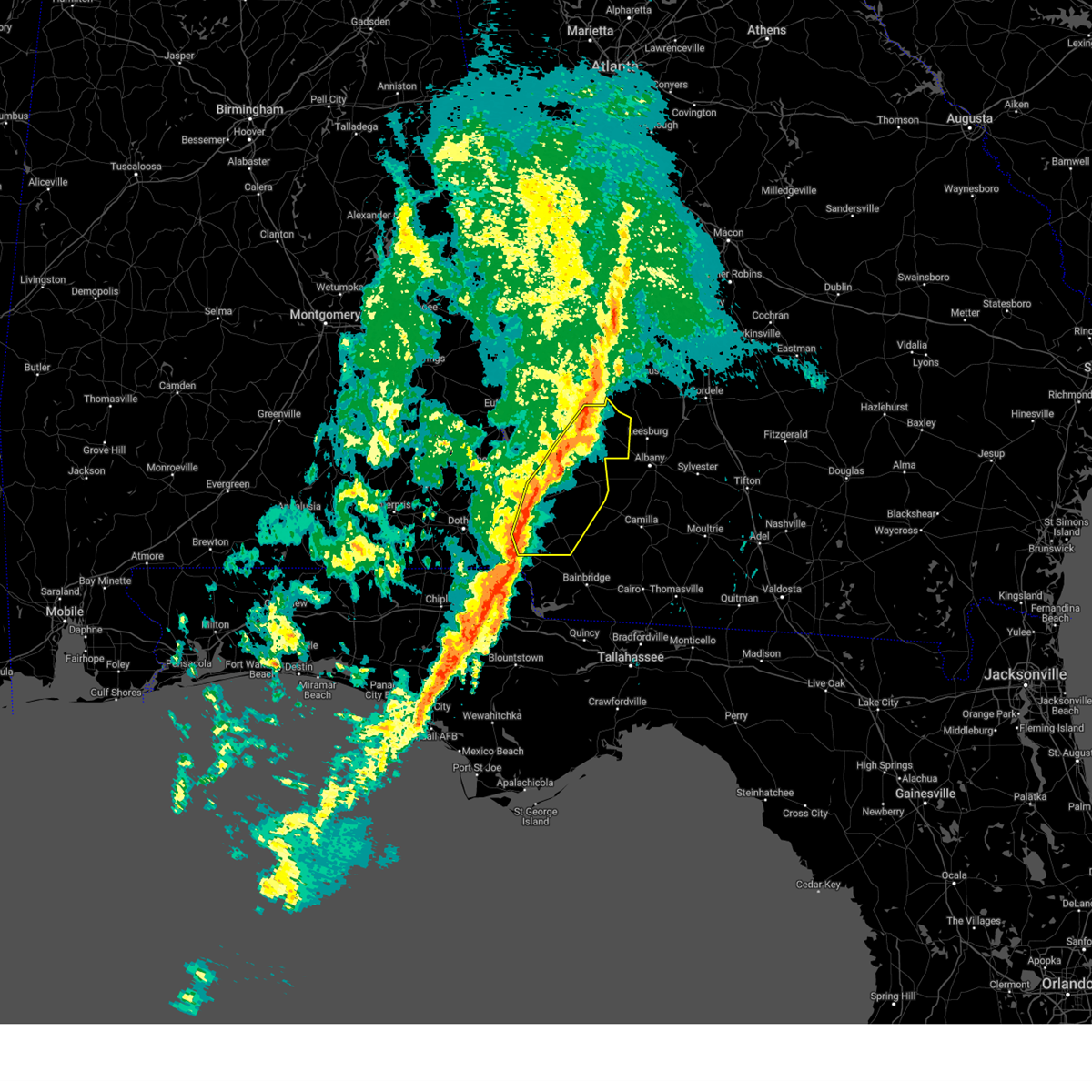
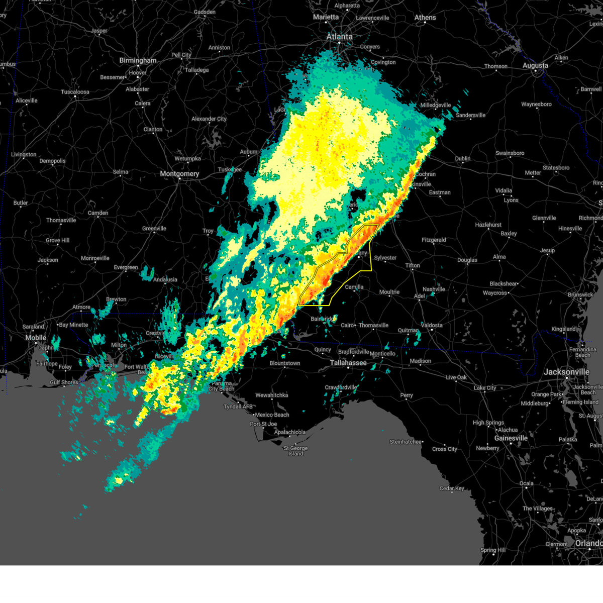
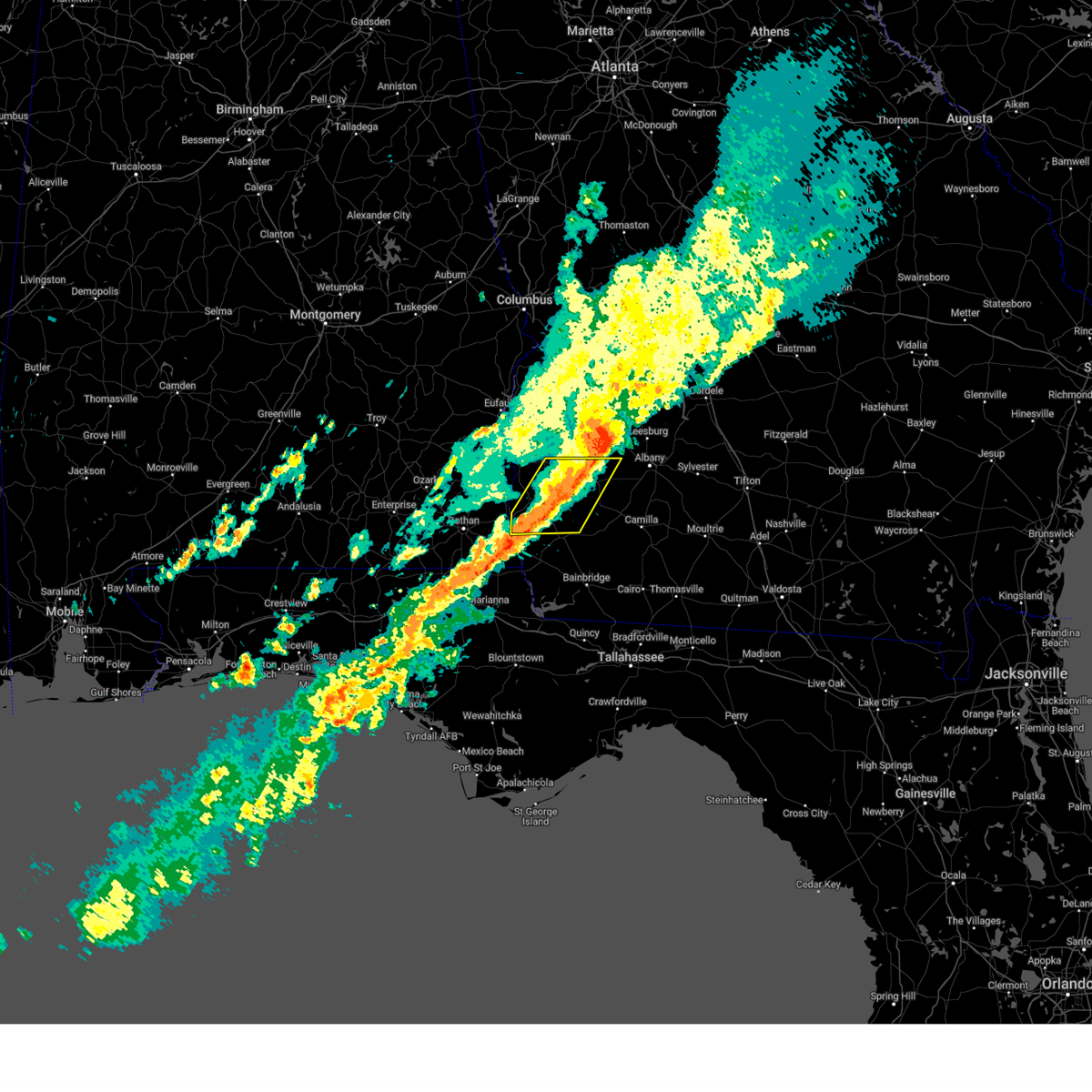
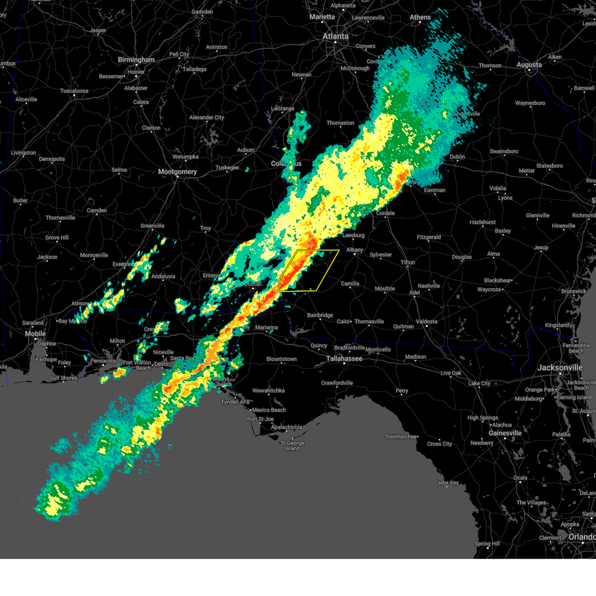
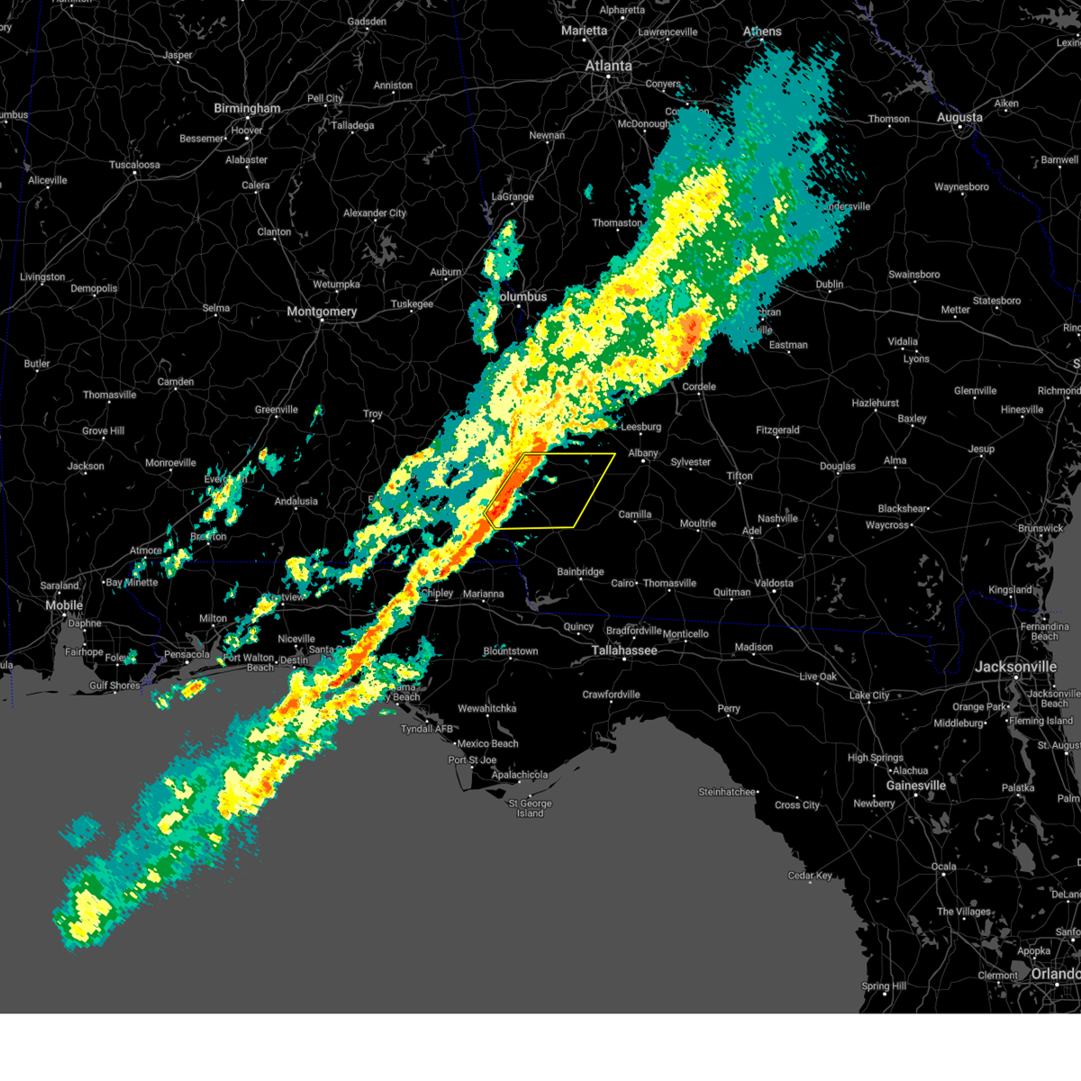
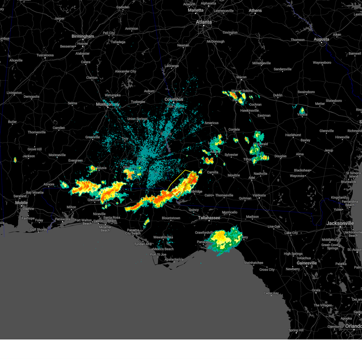
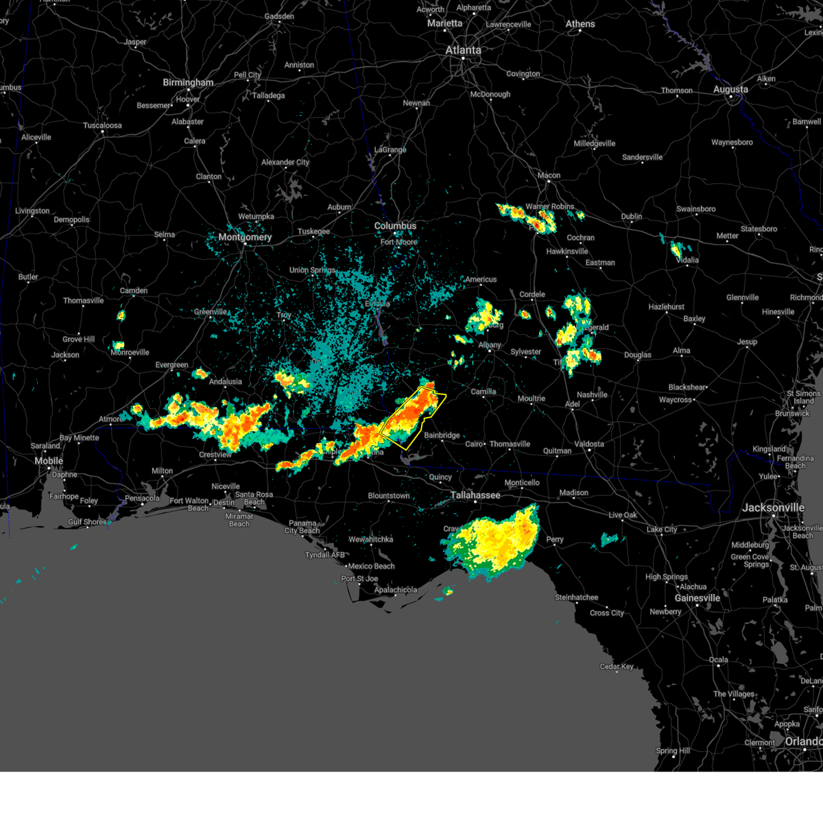
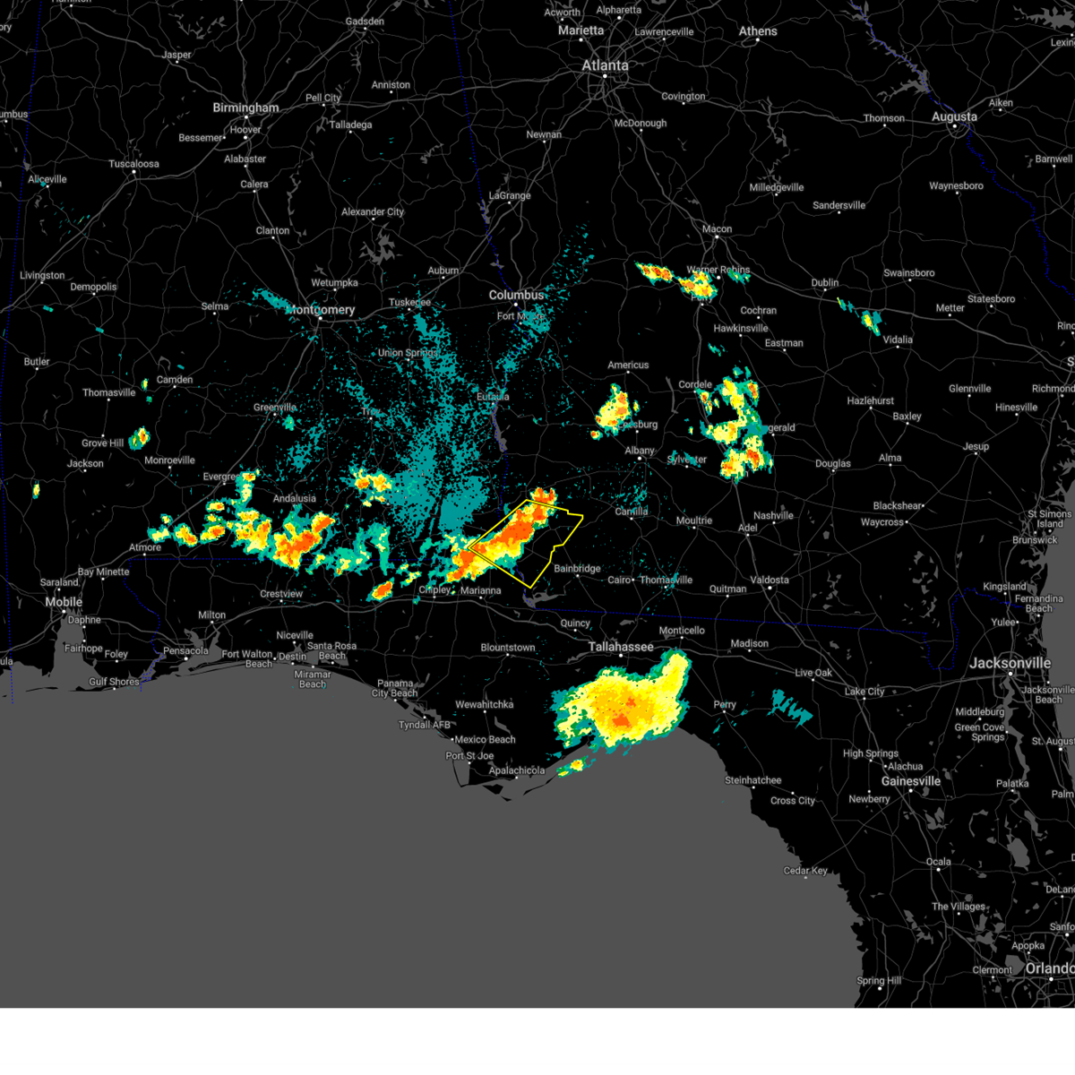
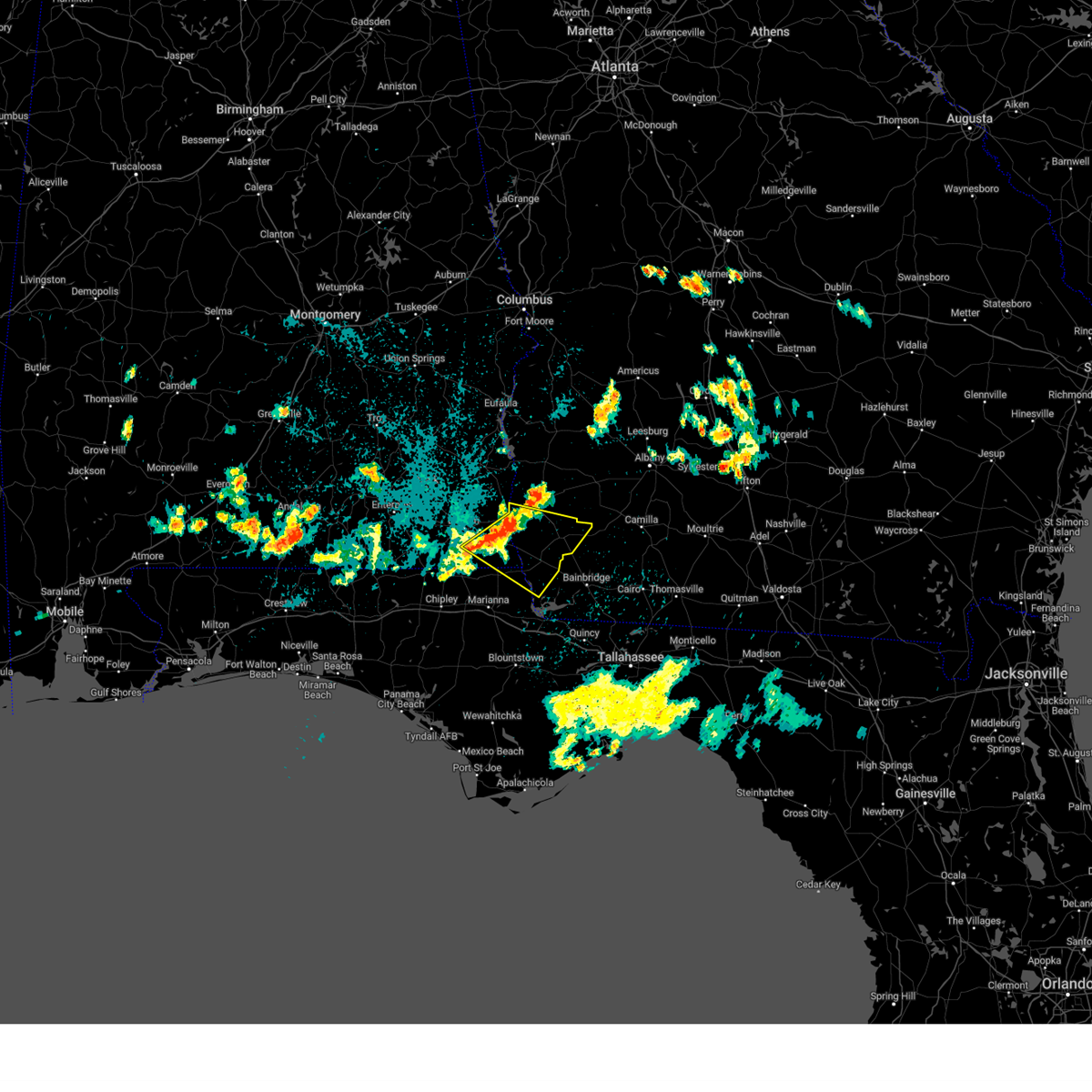
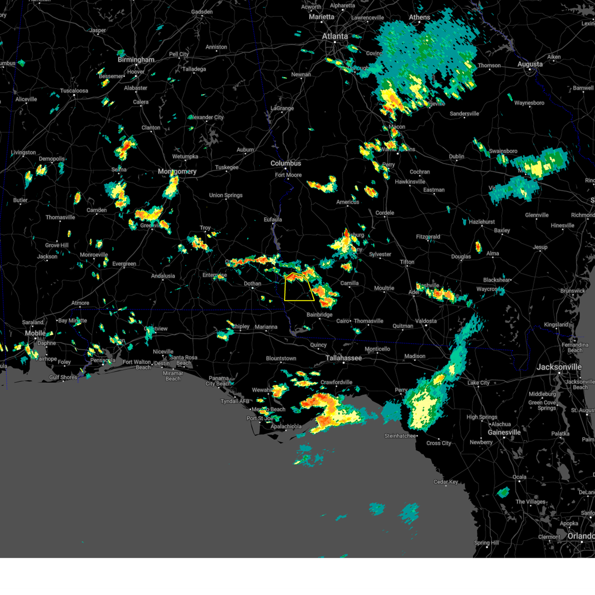
Hail Map for Damascus, GA
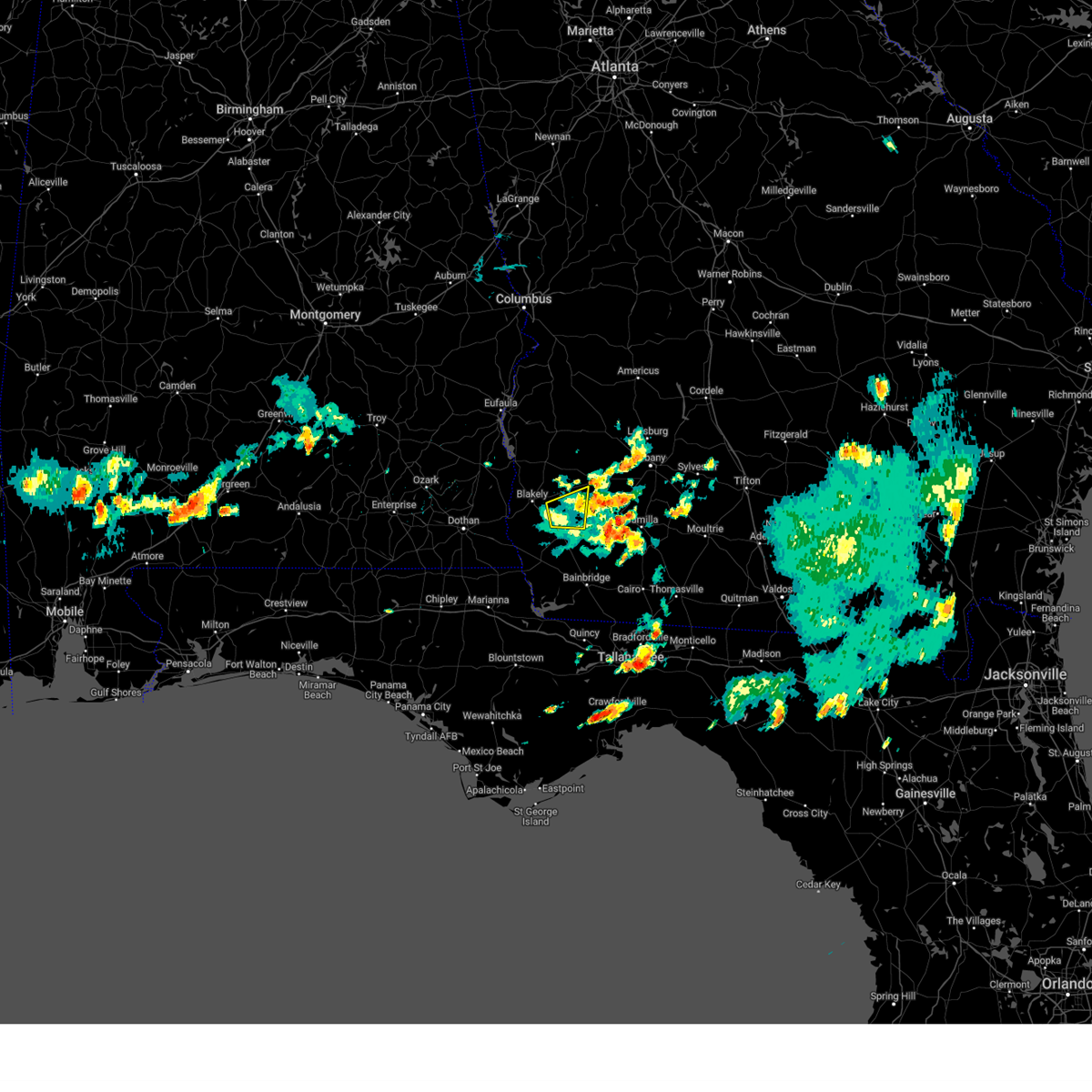
The Damascus, GA area has had 0 reports of on-the-ground hail by trained spotters, and has been under severe weather warnings 41 times during the past 12 months. Doppler radar has detected hail at or near Damascus, GA on 56 occasions, including 1 occasion during the past year.
| Name: | Damascus, GA |
| Where Located: | 64.6 miles NNW of Tallahassee, FL |
| Map: | Google Map for Damascus, GA |
| Population: | 254 |
| Housing Units: | 118 |
| More Info: | Search Google for Damascus, GA |
5
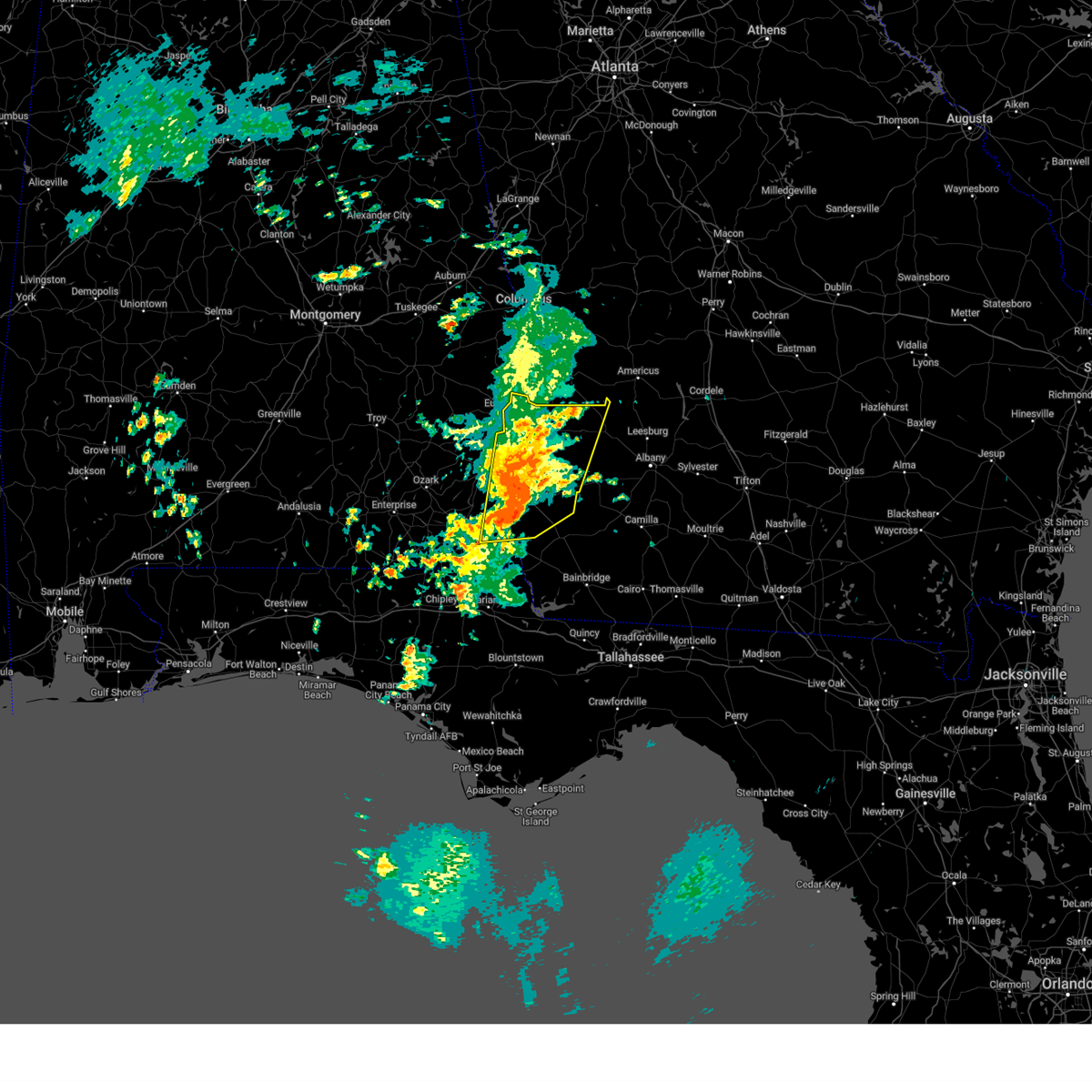
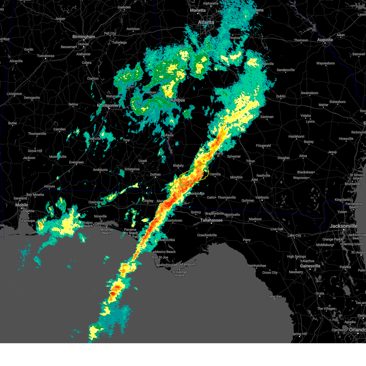
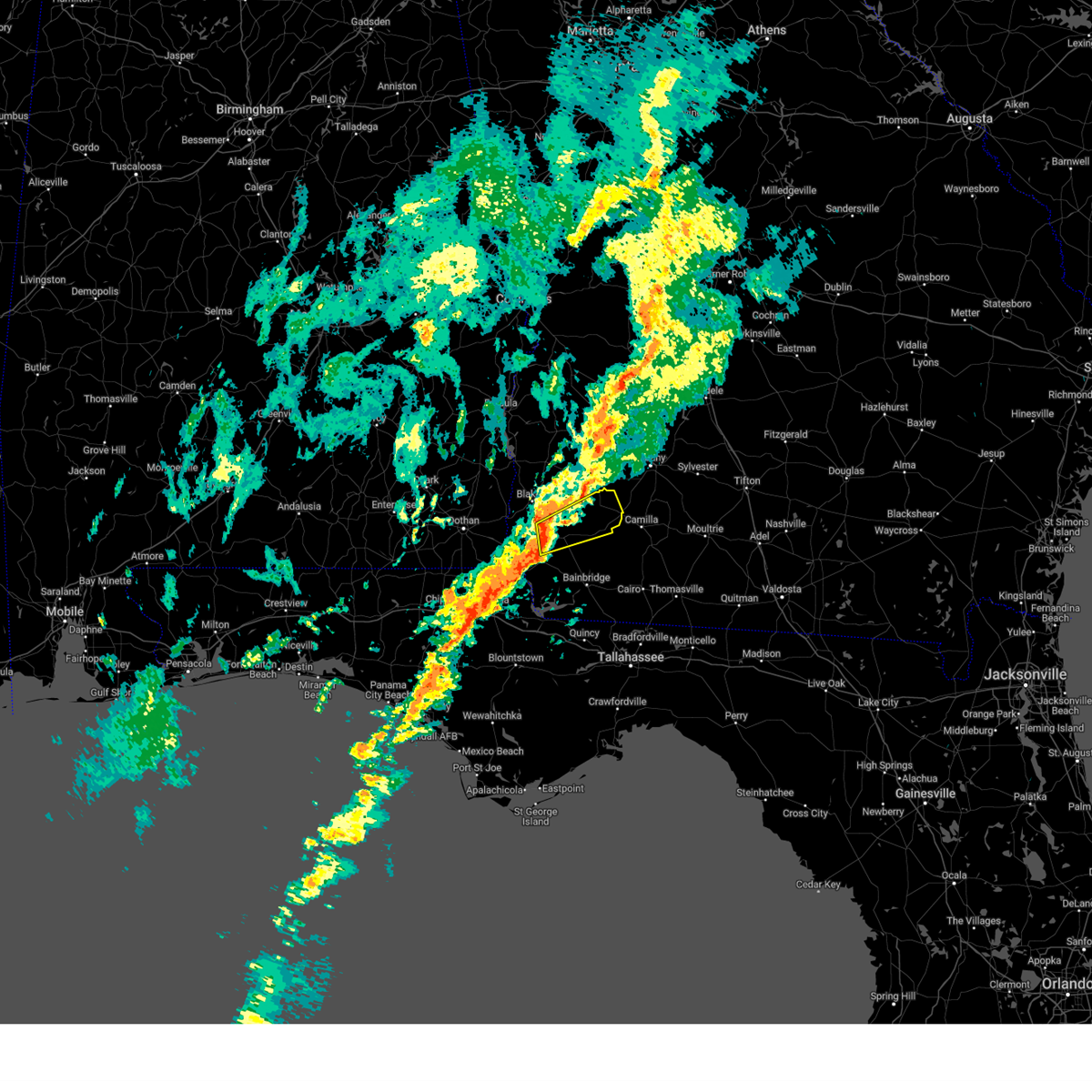
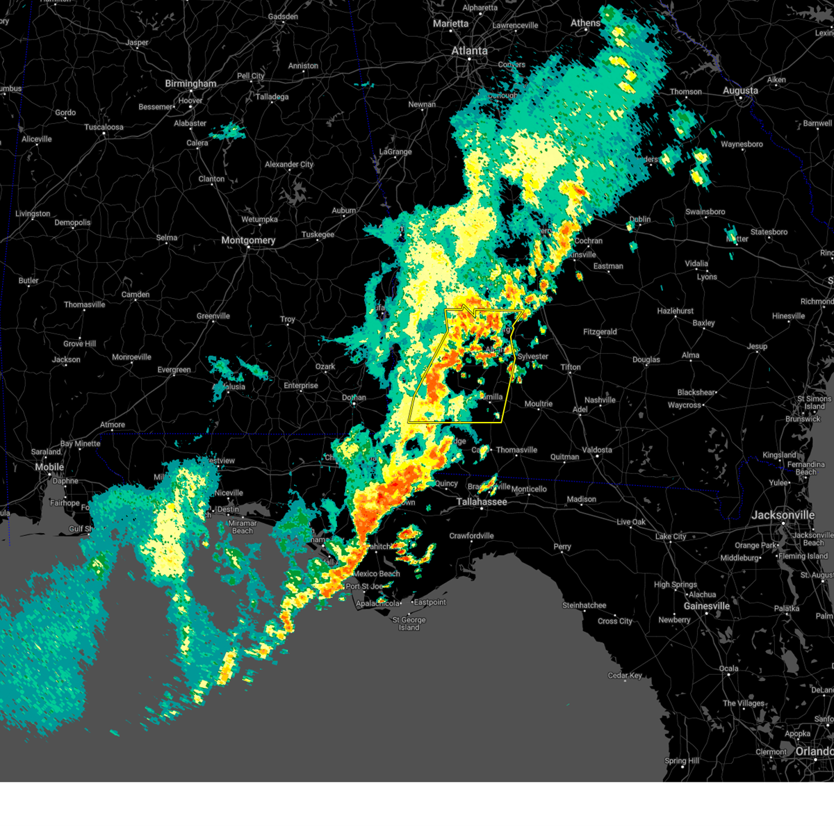
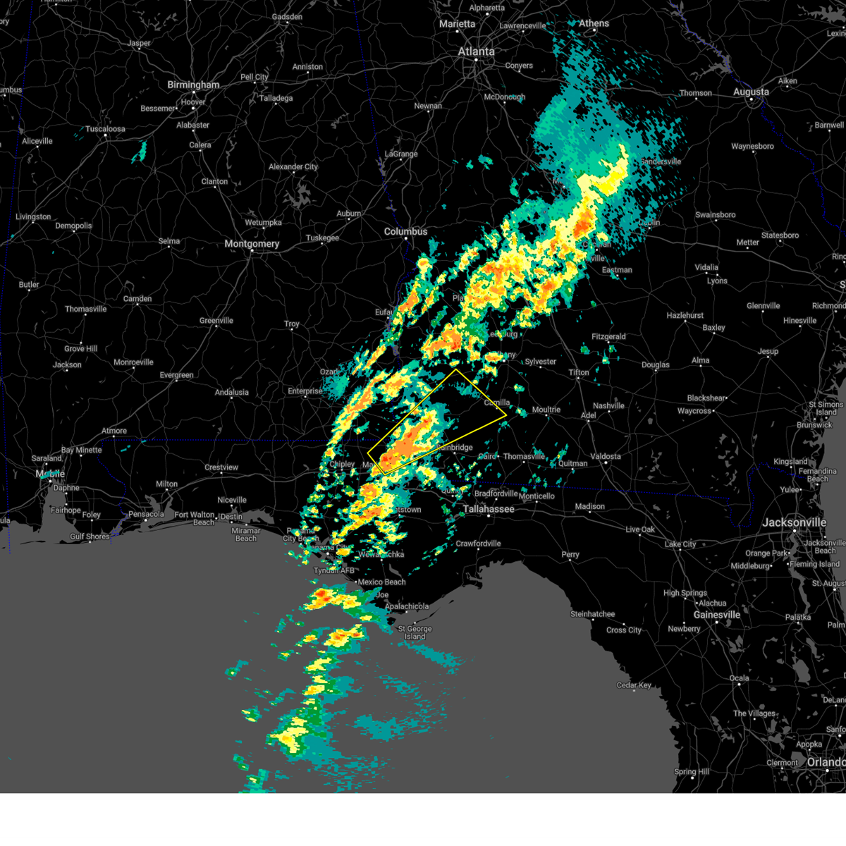
The Top Recent Hail Date for Damascus, GA is Wednesday, June 25, 2025 (7th out of 56)

Hail and Wind Damage Spotted near Damascus, GA
| Date / Time | Report Details |
|---|---|
| 6/25/2025 8:38 PM EDT |
 the severe thunderstorm warning has been cancelled and is no longer in effect the severe thunderstorm warning has been cancelled and is no longer in effect
|
| 6/25/2025 8:38 PM EDT |
 At 838 pm edt/738 pm cdt/, a severe thunderstorm was located near blakely, moving west at 25 mph (radar indicated). Hazards include 60 mph wind gusts. Expect damage to roofs, siding, and trees. Locations impacted include, colquitt, blakely, ashford, arlington, columbia, douglasville, centerville, gordon, damascus, jakin, haleburg, saffold, pansey, crosby, sigma, grandberry crossroads, mayhaw, rock hill, barber, and pleasant plains. At 838 pm edt/738 pm cdt/, a severe thunderstorm was located near blakely, moving west at 25 mph (radar indicated). Hazards include 60 mph wind gusts. Expect damage to roofs, siding, and trees. Locations impacted include, colquitt, blakely, ashford, arlington, columbia, douglasville, centerville, gordon, damascus, jakin, haleburg, saffold, pansey, crosby, sigma, grandberry crossroads, mayhaw, rock hill, barber, and pleasant plains.
|
| 6/25/2025 8:06 PM EDT |
 Svrtae the national weather service in tallahassee has issued a * severe thunderstorm warning for, southeastern henry county in southeastern alabama, eastern houston county in southeastern alabama, miller county in southwestern georgia, western baker county in southwestern georgia, early county in southwestern georgia, * until 930 pm edt/830 pm cdt/. * at 806 pm edt/706 pm cdt/, a severe thunderstorm was located near colquitt, moving west at 20 mph (radar indicated). Hazards include 60 mph wind gusts. expect damage to roofs, siding, and trees Svrtae the national weather service in tallahassee has issued a * severe thunderstorm warning for, southeastern henry county in southeastern alabama, eastern houston county in southeastern alabama, miller county in southwestern georgia, western baker county in southwestern georgia, early county in southwestern georgia, * until 930 pm edt/830 pm cdt/. * at 806 pm edt/706 pm cdt/, a severe thunderstorm was located near colquitt, moving west at 20 mph (radar indicated). Hazards include 60 mph wind gusts. expect damage to roofs, siding, and trees
|
| 6/25/2025 7:59 PM EDT |
 At 758 pm edt, a severe thunderstorm was located 9 miles east of colquitt, moving west at 20 mph (radar indicated). Hazards include 60 mph wind gusts and quarter size hail. Hail damage to vehicles is expected. expect wind damage to roofs, siding, and trees. Locations impacted include, colquitt, donalsonville, douglasville, iron city, damascus, brinson, ausmac, babcock, crestview, hoggard mill, eldorendo, steinham store, boykin, hawkinstown, mimsville, harmony church rd/hwy 45, old damascus, jeterville, cooktown, and bethany. At 758 pm edt, a severe thunderstorm was located 9 miles east of colquitt, moving west at 20 mph (radar indicated). Hazards include 60 mph wind gusts and quarter size hail. Hail damage to vehicles is expected. expect wind damage to roofs, siding, and trees. Locations impacted include, colquitt, donalsonville, douglasville, iron city, damascus, brinson, ausmac, babcock, crestview, hoggard mill, eldorendo, steinham store, boykin, hawkinstown, mimsville, harmony church rd/hwy 45, old damascus, jeterville, cooktown, and bethany.
|
| 6/25/2025 7:59 PM EDT |
 the severe thunderstorm warning has been cancelled and is no longer in effect the severe thunderstorm warning has been cancelled and is no longer in effect
|
| 6/25/2025 7:41 PM EDT | the severe thunderstorm warning has been cancelled and is no longer in effect |
| 6/25/2025 7:41 PM EDT | At 741 pm edt, a severe thunderstorm was located 13 miles south of newton, moving west at 20 mph (radar indicated). Hazards include 60 mph wind gusts and quarter size hail. Hail damage to vehicles is expected. expect wind damage to roofs, siding, and trees. Locations impacted include, colquitt, newton, camilla, donalsonville, douglasville, iron city, damascus, brinson, ausmac, babcock, harrells still, boykin, mimsville, branchville, bellview, vada, hopeful, crestview, hoggard mill, and eldorendo. |
| 6/25/2025 7:01 PM EDT |
 Svrtae the national weather service in tallahassee has issued a * severe thunderstorm warning for, northeastern decatur county in southwestern georgia, miller county in southwestern georgia, northern grady county in southwestern georgia, mitchell county in southwestern georgia, southwestern baker county in southwestern georgia, northwestern thomas county in south central georgia, east central early county in southwestern georgia, northeastern seminole county in southwestern georgia, * until 815 pm edt. * at 701 pm edt, a severe thunderstorm was located near pelham, moving west at 15 mph (radar indicated). Hazards include 60 mph wind gusts and quarter size hail. Hail damage to vehicles is expected. Expect wind damage to roofs, siding, and trees. Svrtae the national weather service in tallahassee has issued a * severe thunderstorm warning for, northeastern decatur county in southwestern georgia, miller county in southwestern georgia, northern grady county in southwestern georgia, mitchell county in southwestern georgia, southwestern baker county in southwestern georgia, northwestern thomas county in south central georgia, east central early county in southwestern georgia, northeastern seminole county in southwestern georgia, * until 815 pm edt. * at 701 pm edt, a severe thunderstorm was located near pelham, moving west at 15 mph (radar indicated). Hazards include 60 mph wind gusts and quarter size hail. Hail damage to vehicles is expected. Expect wind damage to roofs, siding, and trees.
|
| 6/9/2025 2:57 PM EDT |
 The storm which prompted the warning has weakened below severe limits, and no longer poses an immediate threat to life or property. therefore, the warning will be allowed to expire. The storm which prompted the warning has weakened below severe limits, and no longer poses an immediate threat to life or property. therefore, the warning will be allowed to expire.
|
| 6/9/2025 2:43 PM EDT |
 At 243 pm edt, a severe thunderstorm was located 8 miles north of colquitt, moving east at 30 mph (radar indicated). Hazards include 60 mph wind gusts. Expect damage to roofs, siding, and trees. Locations impacted include, douglasville, damascus, iveys mill, crestview, harmony church rd/hwy 45, old damascus, jeterville, bethany, and rowena. At 243 pm edt, a severe thunderstorm was located 8 miles north of colquitt, moving east at 30 mph (radar indicated). Hazards include 60 mph wind gusts. Expect damage to roofs, siding, and trees. Locations impacted include, douglasville, damascus, iveys mill, crestview, harmony church rd/hwy 45, old damascus, jeterville, bethany, and rowena.
|
| 6/9/2025 2:23 PM EDT |
 Svrtae the national weather service in tallahassee has issued a * severe thunderstorm warning for, northern miller county in southwestern georgia, northwestern baker county in southwestern georgia, south central calhoun county in southwestern georgia, central early county in southwestern georgia, * until 300 pm edt. * at 223 pm edt, a severe thunderstorm was located 8 miles south of blakely, moving east at 30 mph (radar indicated). Hazards include 60 mph wind gusts and penny size hail. expect damage to roofs, siding, and trees Svrtae the national weather service in tallahassee has issued a * severe thunderstorm warning for, northern miller county in southwestern georgia, northwestern baker county in southwestern georgia, south central calhoun county in southwestern georgia, central early county in southwestern georgia, * until 300 pm edt. * at 223 pm edt, a severe thunderstorm was located 8 miles south of blakely, moving east at 30 mph (radar indicated). Hazards include 60 mph wind gusts and penny size hail. expect damage to roofs, siding, and trees
|
| 5/10/2025 2:33 PM EDT |
 Svrtae the national weather service in tallahassee has issued a * severe thunderstorm warning for, eastern henry county in southeastern alabama, northeastern houston county in southeastern alabama, northwestern miller county in southwestern georgia, clay county in southwestern georgia, randolph county in southwestern georgia, calhoun county in southwestern georgia, early county in southwestern georgia, quitman county in southwestern georgia, western terrell county in southwestern georgia, * until 330 pm edt/230 pm cdt/. * at 233 pm edt/133 pm cdt/, severe thunderstorms were located along a line extending from 7 miles southeast of fort gaines to near columbia, moving northeast at 25 mph (radar indicated). Hazards include 60 mph wind gusts and quarter size hail. Hail damage to vehicles is expected. Expect wind damage to roofs, siding, and trees. Svrtae the national weather service in tallahassee has issued a * severe thunderstorm warning for, eastern henry county in southeastern alabama, northeastern houston county in southeastern alabama, northwestern miller county in southwestern georgia, clay county in southwestern georgia, randolph county in southwestern georgia, calhoun county in southwestern georgia, early county in southwestern georgia, quitman county in southwestern georgia, western terrell county in southwestern georgia, * until 330 pm edt/230 pm cdt/. * at 233 pm edt/133 pm cdt/, severe thunderstorms were located along a line extending from 7 miles southeast of fort gaines to near columbia, moving northeast at 25 mph (radar indicated). Hazards include 60 mph wind gusts and quarter size hail. Hail damage to vehicles is expected. Expect wind damage to roofs, siding, and trees.
|
| 4/7/2025 8:30 AM EDT |
 the severe thunderstorm warning has been cancelled and is no longer in effect the severe thunderstorm warning has been cancelled and is no longer in effect
|
| 4/7/2025 7:53 AM EDT |
 Svrtae the national weather service in tallahassee has issued a * severe thunderstorm warning for, miller county in southwestern georgia, baker county in southwestern georgia, east central early county in southwestern georgia, * until 845 am edt. * at 752 am edt, a severe thunderstorm was located near colquitt, moving northeast at 30 mph (radar indicated). Hazards include 60 mph wind gusts. expect damage to roofs, siding, and trees Svrtae the national weather service in tallahassee has issued a * severe thunderstorm warning for, miller county in southwestern georgia, baker county in southwestern georgia, east central early county in southwestern georgia, * until 845 am edt. * at 752 am edt, a severe thunderstorm was located near colquitt, moving northeast at 30 mph (radar indicated). Hazards include 60 mph wind gusts. expect damage to roofs, siding, and trees
|
| 3/31/2025 2:37 PM EDT |
 the severe thunderstorm warning has been cancelled and is no longer in effect the severe thunderstorm warning has been cancelled and is no longer in effect
|
| 3/31/2025 2:37 PM EDT |
 At 236 pm edt, severe thunderstorms were located along a line extending from near smithville to near morgan to 6 miles east of donalsonville, moving east at 45 mph (radar indicated). Hazards include 60 mph wind gusts and penny size hail. Expect damage to roofs, siding, and trees. Locations impacted include, iveys mill, stocks, radium springs, smithville, parrott, dawson municipal a/p, lester, chambliss, neyami, greenough, chickasawhatchee, arlington, bellview, rowena, albany, hopeful, hoggard mill, walker, pecan city, and herod. At 236 pm edt, severe thunderstorms were located along a line extending from near smithville to near morgan to 6 miles east of donalsonville, moving east at 45 mph (radar indicated). Hazards include 60 mph wind gusts and penny size hail. Expect damage to roofs, siding, and trees. Locations impacted include, iveys mill, stocks, radium springs, smithville, parrott, dawson municipal a/p, lester, chambliss, neyami, greenough, chickasawhatchee, arlington, bellview, rowena, albany, hopeful, hoggard mill, walker, pecan city, and herod.
|
| 3/31/2025 1:58 PM EDT |
 Svrtae the national weather service in tallahassee has issued a * severe thunderstorm warning for, southeastern henry county in southeastern alabama, northeastern houston county in southeastern alabama, miller county in southwestern georgia, dougherty county in southwestern georgia, clay county in southwestern georgia, randolph county in southwestern georgia, mitchell county in southwestern georgia, lee county in southwestern georgia, baker county in southwestern georgia, calhoun county in southwestern georgia, early county in southwestern georgia, terrell county in southwestern georgia, * until 300 pm edt/200 pm cdt/. * at 158 pm edt/1258 pm cdt/, severe thunderstorms were located along a line extending from near cuthbert to 9 miles northwest of blakely to near cottonwood, moving east at 45 mph (radar indicated). Hazards include 60 mph wind gusts and penny size hail. expect damage to roofs, siding, and trees Svrtae the national weather service in tallahassee has issued a * severe thunderstorm warning for, southeastern henry county in southeastern alabama, northeastern houston county in southeastern alabama, miller county in southwestern georgia, dougherty county in southwestern georgia, clay county in southwestern georgia, randolph county in southwestern georgia, mitchell county in southwestern georgia, lee county in southwestern georgia, baker county in southwestern georgia, calhoun county in southwestern georgia, early county in southwestern georgia, terrell county in southwestern georgia, * until 300 pm edt/200 pm cdt/. * at 158 pm edt/1258 pm cdt/, severe thunderstorms were located along a line extending from near cuthbert to 9 miles northwest of blakely to near cottonwood, moving east at 45 mph (radar indicated). Hazards include 60 mph wind gusts and penny size hail. expect damage to roofs, siding, and trees
|
| 3/16/2025 4:26 AM EDT |
 Svrtae the national weather service in tallahassee has issued a * severe thunderstorm warning for, southeastern houston county in southeastern alabama, northeastern jackson county in the panhandle of florida, northeastern decatur county in southwestern georgia, miller county in southwestern georgia, southwestern mitchell county in southwestern georgia, baker county in southwestern georgia, southeastern calhoun county in southwestern georgia, seminole county in southwestern georgia, central early county in southwestern georgia, * until 515 am edt/415 am cdt/. * at 425 am edt/325 am cdt/, a severe thunderstorm was located 11 miles northeast of marianna, moving northeast at 60 mph (radar indicated). Hazards include 60 mph wind gusts and quarter size hail. Hail damage to vehicles is expected. Expect wind damage to roofs, siding, and trees. Svrtae the national weather service in tallahassee has issued a * severe thunderstorm warning for, southeastern houston county in southeastern alabama, northeastern jackson county in the panhandle of florida, northeastern decatur county in southwestern georgia, miller county in southwestern georgia, southwestern mitchell county in southwestern georgia, baker county in southwestern georgia, southeastern calhoun county in southwestern georgia, seminole county in southwestern georgia, central early county in southwestern georgia, * until 515 am edt/415 am cdt/. * at 425 am edt/325 am cdt/, a severe thunderstorm was located 11 miles northeast of marianna, moving northeast at 60 mph (radar indicated). Hazards include 60 mph wind gusts and quarter size hail. Hail damage to vehicles is expected. Expect wind damage to roofs, siding, and trees.
|
| 3/5/2025 3:10 AM EST | Dispatch reported a tree down near hwy-20 in baker county GA, 5.2 miles W of Damascus, GA |
| 3/5/2025 2:53 AM EST |
 Svrtae the national weather service in tallahassee has issued a * severe thunderstorm warning for, miller county in southwestern georgia, dougherty county in southwestern georgia, southeastern randolph county in southwestern georgia, mitchell county in southwestern georgia, lee county in southwestern georgia, baker county in southwestern georgia, calhoun county in southwestern georgia, eastern early county in southwestern georgia, western colquitt county in south central georgia, terrell county in southwestern georgia, worth county in south central georgia, * until 430 am est. * at 253 am est, severe thunderstorms were located along a line extending from 8 miles north of dawson to near donalsonville, moving east at 40 mph (radar indicated). Hazards include 60 mph wind gusts. expect damage to roofs, siding, and trees Svrtae the national weather service in tallahassee has issued a * severe thunderstorm warning for, miller county in southwestern georgia, dougherty county in southwestern georgia, southeastern randolph county in southwestern georgia, mitchell county in southwestern georgia, lee county in southwestern georgia, baker county in southwestern georgia, calhoun county in southwestern georgia, eastern early county in southwestern georgia, western colquitt county in south central georgia, terrell county in southwestern georgia, worth county in south central georgia, * until 430 am est. * at 253 am est, severe thunderstorms were located along a line extending from 8 miles north of dawson to near donalsonville, moving east at 40 mph (radar indicated). Hazards include 60 mph wind gusts. expect damage to roofs, siding, and trees
|
| 3/5/2025 2:42 AM EST |
 At 242 am est, severe thunderstorms were located along a line extending from 7 miles southwest of plains to 7 miles northwest of donalsonville, moving east at 40 mph (radar indicated). Hazards include 60 mph wind gusts. Expect damage to roofs, siding, and trees. Locations impacted include, iveys mill, parksville, carnegie, parrott, bluffton, dawson municipal a/p, chambliss, suttons corner, chickasawhatchee, arlington, rowena, howards mill, herod, centerville, yeomans, blakely, graves, fountain bridge, goffs mill, and commissary hill. At 242 am est, severe thunderstorms were located along a line extending from 7 miles southwest of plains to 7 miles northwest of donalsonville, moving east at 40 mph (radar indicated). Hazards include 60 mph wind gusts. Expect damage to roofs, siding, and trees. Locations impacted include, iveys mill, parksville, carnegie, parrott, bluffton, dawson municipal a/p, chambliss, suttons corner, chickasawhatchee, arlington, rowena, howards mill, herod, centerville, yeomans, blakely, graves, fountain bridge, goffs mill, and commissary hill.
|
| 3/5/2025 2:15 AM EST |
 the severe thunderstorm warning has been cancelled and is no longer in effect the severe thunderstorm warning has been cancelled and is no longer in effect
|
| 3/5/2025 2:15 AM EST |
 At 215 am est, severe thunderstorms were located along a line extending from 9 miles south of lumpkin to near ashford, moving east at 50 mph (radar indicated). Hazards include 60 mph wind gusts. Expect damage to roofs, siding, and trees. Locations impacted include, iveys mill, parksville, carnegie, watson crossroads, parrott, bluffton, pecan, rock hill, dawson municipal a/p, bellville, chambliss, bethel, suttons corner, springvale, fort gaines-clay airport, chickasawhatchee, arlington, wades, rowena, and howards mill. At 215 am est, severe thunderstorms were located along a line extending from 9 miles south of lumpkin to near ashford, moving east at 50 mph (radar indicated). Hazards include 60 mph wind gusts. Expect damage to roofs, siding, and trees. Locations impacted include, iveys mill, parksville, carnegie, watson crossroads, parrott, bluffton, pecan, rock hill, dawson municipal a/p, bellville, chambliss, bethel, suttons corner, springvale, fort gaines-clay airport, chickasawhatchee, arlington, wades, rowena, and howards mill.
|
| 3/5/2025 1:30 AM EST |
 Svrtae the national weather service in tallahassee has issued a * severe thunderstorm warning for, miller county in southwestern georgia, clay county in southwestern georgia, randolph county in southwestern georgia, northwestern baker county in southwestern georgia, calhoun county in southwestern georgia, early county in southwestern georgia, quitman county in southwestern georgia, terrell county in southwestern georgia, * until 300 am est. * at 129 am est, severe thunderstorms were located along a line extending from near blue springs to near geneva, moving east at 45 mph (radar indicated). Hazards include 60 mph wind gusts. expect damage to roofs, siding, and trees Svrtae the national weather service in tallahassee has issued a * severe thunderstorm warning for, miller county in southwestern georgia, clay county in southwestern georgia, randolph county in southwestern georgia, northwestern baker county in southwestern georgia, calhoun county in southwestern georgia, early county in southwestern georgia, quitman county in southwestern georgia, terrell county in southwestern georgia, * until 300 am est. * at 129 am est, severe thunderstorms were located along a line extending from near blue springs to near geneva, moving east at 45 mph (radar indicated). Hazards include 60 mph wind gusts. expect damage to roofs, siding, and trees
|
| 2/16/2025 6:34 AM EST |
 At 634 am est, severe thunderstorms were located along a line extending from 9 miles southeast of desoto to 6 miles east of donalsonville, moving east at 50 mph (radar indicated). Hazards include 60 mph wind gusts. Expect damage to roofs, siding, and trees. Locations impacted include, colquitt, newton, albany, leesburg, putney, leary, east albany, marine corps logistics base, turner city, walker, douglasville, damascus, iveys mill, stocks, radium springs, bellview, hoggard mill, pecan city, bermuda, and cooktown. At 634 am est, severe thunderstorms were located along a line extending from 9 miles southeast of desoto to 6 miles east of donalsonville, moving east at 50 mph (radar indicated). Hazards include 60 mph wind gusts. Expect damage to roofs, siding, and trees. Locations impacted include, colquitt, newton, albany, leesburg, putney, leary, east albany, marine corps logistics base, turner city, walker, douglasville, damascus, iveys mill, stocks, radium springs, bellview, hoggard mill, pecan city, bermuda, and cooktown.
|
| 2/16/2025 6:34 AM EST |
 the severe thunderstorm warning has been cancelled and is no longer in effect the severe thunderstorm warning has been cancelled and is no longer in effect
|
| 2/16/2025 5:26 AM EST | Svrtae the national weather service in tallahassee has issued a * severe thunderstorm warning for, miller county in southwestern georgia, dougherty county in southwestern georgia, lee county in southwestern georgia, baker county in southwestern georgia, calhoun county in southwestern georgia, early county in southwestern georgia, terrell county in southwestern georgia, * until 700 am est. * at 526 am est, severe thunderstorms were located along a line extending from 10 miles southwest of lumpkin to hartford, moving east at 50 mph (radar indicated). Hazards include 60 mph wind gusts. expect damage to roofs, siding, and trees |
| 2/13/2025 6:07 AM EST |
 The storms which prompted the warning have weakened below severe limits, and no longer pose an immediate threat to life or property. therefore, the warning will be allowed to expire. however, gusty winds and heavy rain are still possible with these thunderstorms. to report severe weather, contact your nearest law enforcement agency. they will relay your report to the national weather service tallahassee. The storms which prompted the warning have weakened below severe limits, and no longer pose an immediate threat to life or property. therefore, the warning will be allowed to expire. however, gusty winds and heavy rain are still possible with these thunderstorms. to report severe weather, contact your nearest law enforcement agency. they will relay your report to the national weather service tallahassee.
|
| 2/13/2025 5:42 AM EST |
 the severe thunderstorm warning has been cancelled and is no longer in effect the severe thunderstorm warning has been cancelled and is no longer in effect
|
| 2/13/2025 5:42 AM EST |
 At 542 am est, severe thunderstorms were located along a line extending from edison to 6 miles south of blakely, moving east at 50 mph (radar indicated). Hazards include 60 mph wind gusts and nickel size hail. Expect damage to roofs, siding, and trees. Locations impacted include, morgan, blakely, edison, arlington, leary, douglasville, centerville, damascus, bluffton, iveys mill, parksville, holt, rock hill, early co a/p, hentown, suttons corner, hilton, rowena, harrisons mill, and milford. At 542 am est, severe thunderstorms were located along a line extending from edison to 6 miles south of blakely, moving east at 50 mph (radar indicated). Hazards include 60 mph wind gusts and nickel size hail. Expect damage to roofs, siding, and trees. Locations impacted include, morgan, blakely, edison, arlington, leary, douglasville, centerville, damascus, bluffton, iveys mill, parksville, holt, rock hill, early co a/p, hentown, suttons corner, hilton, rowena, harrisons mill, and milford.
|
| 2/13/2025 5:28 AM EST |
 Svrtae the national weather service in tallahassee has issued a * severe thunderstorm warning for, southeastern henry county in southeastern alabama, northeastern houston county in southeastern alabama, northern miller county in southwestern georgia, northwestern dougherty county in southwestern georgia, southeastern clay county in southwestern georgia, northwestern baker county in southwestern georgia, calhoun county in southwestern georgia, early county in southwestern georgia, * until 615 am est/515 am cst/. * at 528 am est/428 am cst/, severe thunderstorms were located along a line extending from 9 miles southeast of fort gaines to near columbia, moving east at 50 mph (radar indicated). Hazards include 60 mph wind gusts and nickel size hail. expect damage to roofs, siding, and trees Svrtae the national weather service in tallahassee has issued a * severe thunderstorm warning for, southeastern henry county in southeastern alabama, northeastern houston county in southeastern alabama, northern miller county in southwestern georgia, northwestern dougherty county in southwestern georgia, southeastern clay county in southwestern georgia, northwestern baker county in southwestern georgia, calhoun county in southwestern georgia, early county in southwestern georgia, * until 615 am est/515 am cst/. * at 528 am est/428 am cst/, severe thunderstorms were located along a line extending from 9 miles southeast of fort gaines to near columbia, moving east at 50 mph (radar indicated). Hazards include 60 mph wind gusts and nickel size hail. expect damage to roofs, siding, and trees
|
| 8/19/2024 2:14 AM EDT |
 the severe thunderstorm warning has been cancelled and is no longer in effect the severe thunderstorm warning has been cancelled and is no longer in effect
|
| 8/19/2024 1:56 AM EDT |
 At 156 am edt/1256 am cdt/, severe thunderstorms were located along a line extending from near colquitt to 11 miles southwest of donalsonville, moving southeast at 35 mph (radar indicated). Hazards include 60 mph wind gusts. Expect damage to roofs, siding, and trees. Locations impacted include, colquitt, donalsonville, iron city, damascus, jakin, little hope, mayhaw, boykin, riverturn, sharphagen, hornsville, donaldsonville a/p, steam mill, desser, davis park, lela, haynes, killarney, chattahoochee sp, and enterprise. At 156 am edt/1256 am cdt/, severe thunderstorms were located along a line extending from near colquitt to 11 miles southwest of donalsonville, moving southeast at 35 mph (radar indicated). Hazards include 60 mph wind gusts. Expect damage to roofs, siding, and trees. Locations impacted include, colquitt, donalsonville, iron city, damascus, jakin, little hope, mayhaw, boykin, riverturn, sharphagen, hornsville, donaldsonville a/p, steam mill, desser, davis park, lela, haynes, killarney, chattahoochee sp, and enterprise.
|
| 8/19/2024 1:39 AM EDT |
 At 139 am edt/1239 am cdt/, severe thunderstorms were located along a line extending from 9 miles northwest of colquitt to 7 miles east of cottonwood, moving east at 35 mph (radar indicated). Hazards include 60 mph wind gusts. Expect damage to roofs, siding, and trees. Locations impacted include, colquitt, cottonwood, donalsonville, centerville, gordon, iron city, damascus, jakin, saffold, pansey, crosby, little hope, mayhaw, boykin, riverturn, sharphagen, hornsville, donaldsonville a/p, hentown, and steam mill. At 139 am edt/1239 am cdt/, severe thunderstorms were located along a line extending from 9 miles northwest of colquitt to 7 miles east of cottonwood, moving east at 35 mph (radar indicated). Hazards include 60 mph wind gusts. Expect damage to roofs, siding, and trees. Locations impacted include, colquitt, cottonwood, donalsonville, centerville, gordon, iron city, damascus, jakin, saffold, pansey, crosby, little hope, mayhaw, boykin, riverturn, sharphagen, hornsville, donaldsonville a/p, hentown, and steam mill.
|
| 8/19/2024 1:23 AM EDT |
 At 122 am edt/1222 am cdt/, severe thunderstorms were located along a line extending from near columbia to near cottonwood, moving southeast at 35 mph (radar indicated). Hazards include 60 mph wind gusts. Expect damage to roofs, siding, and trees. Locations impacted include, colquitt, cottonwood, donalsonville, ashford, cowarts, columbia, centerville, avon, gordon, iron city, damascus, jakin, memphis, saffold, pansey, crosby, little hope, wilson mill, mayhaw, and rock hill. At 122 am edt/1222 am cdt/, severe thunderstorms were located along a line extending from near columbia to near cottonwood, moving southeast at 35 mph (radar indicated). Hazards include 60 mph wind gusts. Expect damage to roofs, siding, and trees. Locations impacted include, colquitt, cottonwood, donalsonville, ashford, cowarts, columbia, centerville, avon, gordon, iron city, damascus, jakin, memphis, saffold, pansey, crosby, little hope, wilson mill, mayhaw, and rock hill.
|
| 8/19/2024 1:23 AM EDT |
 the severe thunderstorm warning has been cancelled and is no longer in effect the severe thunderstorm warning has been cancelled and is no longer in effect
|
| 8/19/2024 1:10 AM EDT |
 Svrtae the national weather service in tallahassee has issued a * severe thunderstorm warning for, southeastern henry county in southeastern alabama, houston county in southeastern alabama, northeastern jackson county in the panhandle of florida, miller county in southwestern georgia, seminole county in southwestern georgia, southern early county in southwestern georgia, * until 230 am edt/130 am cdt/. * at 109 am edt/1209 am cdt/, severe thunderstorms were located along a line extending from near columbia to near taylor, moving southeast at 35 mph (radar indicated). Hazards include 60 mph wind gusts. expect damage to roofs, siding, and trees Svrtae the national weather service in tallahassee has issued a * severe thunderstorm warning for, southeastern henry county in southeastern alabama, houston county in southeastern alabama, northeastern jackson county in the panhandle of florida, miller county in southwestern georgia, seminole county in southwestern georgia, southern early county in southwestern georgia, * until 230 am edt/130 am cdt/. * at 109 am edt/1209 am cdt/, severe thunderstorms were located along a line extending from near columbia to near taylor, moving southeast at 35 mph (radar indicated). Hazards include 60 mph wind gusts. expect damage to roofs, siding, and trees
|
| 7/31/2024 7:08 PM EDT | the severe thunderstorm warning has been cancelled and is no longer in effect |
| 7/31/2024 7:08 PM EDT | At 707 pm edt, a severe thunderstorm was located 13 miles east of colquitt, moving south at 10 mph (radar indicated). Hazards include 60 mph wind gusts and quarter size hail. Hail damage to vehicles is expected. expect wind damage to roofs, siding, and trees. Locations impacted include, colquitt, newton, pelham, camilla, arlington, douglasville, damascus, babcock, cotton, boykin, mimsville, branchville, bellview, rowena, hopeful, crestview, hoggard mill, laney, hawkinstown, and mitchell co a/p. |
| 7/31/2024 6:28 PM EDT | Svrtae the national weather service in tallahassee has issued a * severe thunderstorm warning for, miller county in southwestern georgia, southwestern dougherty county in southwestern georgia, mitchell county in southwestern georgia, baker county in southwestern georgia, southeastern calhoun county in southwestern georgia, northeastern early county in southwestern georgia, * until 730 pm edt. * at 628 pm edt, a severe thunderstorm was located 9 miles west of newton, moving south at 10 mph (radar indicated). Hazards include 60 mph wind gusts and quarter size hail. Hail damage to vehicles is expected. Expect wind damage to roofs, siding, and trees. |
| 7/31/2024 5:41 PM EDT |
 Svrtae the national weather service in tallahassee has issued a * severe thunderstorm warning for, dougherty county in southwestern georgia, southeastern clay county in southwestern georgia, northeastern mitchell county in southwestern georgia, baker county in southwestern georgia, calhoun county in southwestern georgia, northeastern early county in southwestern georgia, * until 630 pm edt. * at 540 pm edt, severe thunderstorms were located along a line extending from 6 miles west of putney to near morgan to near blakely, moving south at 25 mph (radar indicated). Hazards include 60 mph wind gusts and penny size hail. expect damage to roofs, siding, and trees Svrtae the national weather service in tallahassee has issued a * severe thunderstorm warning for, dougherty county in southwestern georgia, southeastern clay county in southwestern georgia, northeastern mitchell county in southwestern georgia, baker county in southwestern georgia, calhoun county in southwestern georgia, northeastern early county in southwestern georgia, * until 630 pm edt. * at 540 pm edt, severe thunderstorms were located along a line extending from 6 miles west of putney to near morgan to near blakely, moving south at 25 mph (radar indicated). Hazards include 60 mph wind gusts and penny size hail. expect damage to roofs, siding, and trees
|
| 7/29/2024 4:26 PM EDT |
 Svrtae the national weather service in tallahassee has issued a * severe thunderstorm warning for, western miller county in southwestern georgia, central early county in southwestern georgia, * until 500 pm edt. * at 426 pm edt, a severe thunderstorm was located near blakely, moving southeast at 20 mph (radar indicated). Hazards include 60 mph wind gusts. expect damage to roofs, siding, and trees Svrtae the national weather service in tallahassee has issued a * severe thunderstorm warning for, western miller county in southwestern georgia, central early county in southwestern georgia, * until 500 pm edt. * at 426 pm edt, a severe thunderstorm was located near blakely, moving southeast at 20 mph (radar indicated). Hazards include 60 mph wind gusts. expect damage to roofs, siding, and trees
|
| 5/18/2024 10:36 AM EDT |
 At 1035 am edt, a severe thunderstorm was located 8 miles east of colquitt, moving east at 30 mph (radar indicated). Hazards include 60 mph wind gusts. Expect damage to roofs, siding, and trees. Locations impacted include, colquitt, newton, pelham, camilla, arlington, baconton, douglasville, sale city, damascus, babcock, iveys mill, flint, cotton, boykin, lester, mimsville, branchville, greenough, bellview, and rowena. At 1035 am edt, a severe thunderstorm was located 8 miles east of colquitt, moving east at 30 mph (radar indicated). Hazards include 60 mph wind gusts. Expect damage to roofs, siding, and trees. Locations impacted include, colquitt, newton, pelham, camilla, arlington, baconton, douglasville, sale city, damascus, babcock, iveys mill, flint, cotton, boykin, lester, mimsville, branchville, greenough, bellview, and rowena.
|
| 5/18/2024 10:36 AM EDT |
 the severe thunderstorm warning has been cancelled and is no longer in effect the severe thunderstorm warning has been cancelled and is no longer in effect
|
| 5/18/2024 10:23 AM EDT |
 Svrtae the national weather service in tallahassee has issued a * severe thunderstorm warning for, miller county in southwestern georgia, dougherty county in southwestern georgia, mitchell county in southwestern georgia, baker county in southwestern georgia, calhoun county in southwestern georgia, northwestern thomas county in south central georgia, northeastern early county in southwestern georgia, * until 1115 am edt. * at 1023 am edt, a severe thunderstorm was located near colquitt, moving east at 30 mph (radar indicated). Hazards include 60 mph wind gusts. expect damage to roofs, siding, and trees Svrtae the national weather service in tallahassee has issued a * severe thunderstorm warning for, miller county in southwestern georgia, dougherty county in southwestern georgia, mitchell county in southwestern georgia, baker county in southwestern georgia, calhoun county in southwestern georgia, northwestern thomas county in south central georgia, northeastern early county in southwestern georgia, * until 1115 am edt. * at 1023 am edt, a severe thunderstorm was located near colquitt, moving east at 30 mph (radar indicated). Hazards include 60 mph wind gusts. expect damage to roofs, siding, and trees
|
| 5/18/2024 10:01 AM EDT |
 Svrtae the national weather service in tallahassee has issued a * severe thunderstorm warning for, northeastern houston county in southeastern alabama, northwestern decatur county in southwestern georgia, miller county in southwestern georgia, northern seminole county in southwestern georgia, southern early county in southwestern georgia, * until 1030 am edt/930 am cdt/. * at 1000 am edt/900 am cdt/, a severe thunderstorm was located near ashford, or 10 miles northeast of cottonwood, moving east at 25 mph (radar indicated). Hazards include 60 mph wind gusts. expect damage to roofs, siding, and trees Svrtae the national weather service in tallahassee has issued a * severe thunderstorm warning for, northeastern houston county in southeastern alabama, northwestern decatur county in southwestern georgia, miller county in southwestern georgia, northern seminole county in southwestern georgia, southern early county in southwestern georgia, * until 1030 am edt/930 am cdt/. * at 1000 am edt/900 am cdt/, a severe thunderstorm was located near ashford, or 10 miles northeast of cottonwood, moving east at 25 mph (radar indicated). Hazards include 60 mph wind gusts. expect damage to roofs, siding, and trees
|
| 5/18/2024 9:46 AM EDT |
 Svrtae the national weather service in tallahassee has issued a * severe thunderstorm warning for, southeastern henry county in southeastern alabama, southeastern clay county in southwestern georgia, western calhoun county in southwestern georgia, early county in southwestern georgia, * until 1030 am edt/930 am cdt/. * at 945 am edt/845 am cdt/, a severe thunderstorm was located near columbia, or near blakely, moving east at 25 mph (radar indicated). Hazards include 60 mph wind gusts. expect damage to roofs, siding, and trees Svrtae the national weather service in tallahassee has issued a * severe thunderstorm warning for, southeastern henry county in southeastern alabama, southeastern clay county in southwestern georgia, western calhoun county in southwestern georgia, early county in southwestern georgia, * until 1030 am edt/930 am cdt/. * at 945 am edt/845 am cdt/, a severe thunderstorm was located near columbia, or near blakely, moving east at 25 mph (radar indicated). Hazards include 60 mph wind gusts. expect damage to roofs, siding, and trees
|
| 5/10/2024 3:46 AM CDT |
 Svrtae the national weather service in tallahassee has issued a * severe thunderstorm warning for, dale county in southeastern alabama, henry county in southeastern alabama, geneva county in southeastern alabama, houston county in southeastern alabama, miller county in southwestern georgia, clay county in southwestern georgia, randolph county in southwestern georgia, calhoun county in southwestern georgia, northern seminole county in southwestern georgia, early county in southwestern georgia, quitman county in southwestern georgia, * until 545 am edt/445 am cdt/. * at 446 am edt/346 am cdt/, severe thunderstorms were located along a line extending from 6 miles south of georgetown to 7 miles west of blakely to 10 miles southeast of ashford, moving northeast at 50 mph (radar indicated). Hazards include 60 mph wind gusts and quarter size hail. Hail damage to vehicles is expected. Expect wind damage to roofs, siding, and trees. Svrtae the national weather service in tallahassee has issued a * severe thunderstorm warning for, dale county in southeastern alabama, henry county in southeastern alabama, geneva county in southeastern alabama, houston county in southeastern alabama, miller county in southwestern georgia, clay county in southwestern georgia, randolph county in southwestern georgia, calhoun county in southwestern georgia, northern seminole county in southwestern georgia, early county in southwestern georgia, quitman county in southwestern georgia, * until 545 am edt/445 am cdt/. * at 446 am edt/346 am cdt/, severe thunderstorms were located along a line extending from 6 miles south of georgetown to 7 miles west of blakely to 10 miles southeast of ashford, moving northeast at 50 mph (radar indicated). Hazards include 60 mph wind gusts and quarter size hail. Hail damage to vehicles is expected. Expect wind damage to roofs, siding, and trees.
|
| 4/3/2024 5:43 AM EDT |
 Svrtae the national weather service in tallahassee has issued a * severe thunderstorm warning for, miller county in southwestern georgia, mitchell county in southwestern georgia, baker county in southwestern georgia, eastern early county in southwestern georgia, * until 645 am edt. * at 543 am edt, a severe thunderstorm was located 9 miles northeast of colquitt, moving east at 55 mph (radar indicated). Hazards include 60 mph wind gusts. expect damage to roofs, siding, and trees Svrtae the national weather service in tallahassee has issued a * severe thunderstorm warning for, miller county in southwestern georgia, mitchell county in southwestern georgia, baker county in southwestern georgia, eastern early county in southwestern georgia, * until 645 am edt. * at 543 am edt, a severe thunderstorm was located 9 miles northeast of colquitt, moving east at 55 mph (radar indicated). Hazards include 60 mph wind gusts. expect damage to roofs, siding, and trees
|
| 3/9/2024 6:41 AM EST |
 the severe thunderstorm warning has been cancelled and is no longer in effect the severe thunderstorm warning has been cancelled and is no longer in effect
|
| 3/9/2024 6:41 AM EST |
 At 640 am est/540 am cst/, severe thunderstorms were located along a line extending from 11 miles west of newton to 6 miles northwest of marianna, moving east at 45 mph (radar indicated). Hazards include 60 mph wind gusts. Expect damage to roofs, siding, and trees. Locations impacted include, colquitt, newton, bainbridge, donalsonville, pelham, marianna, camilla, west bainbridge, chattahoochee, malone, sneads, cottondale, grand ridge, greenwood, sale city, iron city, damascus, brinson, jakin, and bascom. At 640 am est/540 am cst/, severe thunderstorms were located along a line extending from 11 miles west of newton to 6 miles northwest of marianna, moving east at 45 mph (radar indicated). Hazards include 60 mph wind gusts. Expect damage to roofs, siding, and trees. Locations impacted include, colquitt, newton, bainbridge, donalsonville, pelham, marianna, camilla, west bainbridge, chattahoochee, malone, sneads, cottondale, grand ridge, greenwood, sale city, iron city, damascus, brinson, jakin, and bascom.
|
| 3/9/2024 5:14 AM CST |
 Svrtae the national weather service in tallahassee has issued a * severe thunderstorm warning for, southeastern houston county in southeastern alabama, jackson county in the panhandle of florida, decatur county in southwestern georgia, northwestern grady county in southwestern georgia, miller county in southwestern georgia, mitchell county in southwestern georgia, southwestern baker county in southwestern georgia, southern early county in southwestern georgia, seminole county in southwestern georgia, * until 745 am est/645 am cst/. * at 614 am est/514 am cst/, severe thunderstorms were located along a line extending from 8 miles southeast of blakely to 6 miles south of graceville, moving east at 50 mph (radar indicated). Hazards include 60 mph wind gusts. expect damage to roofs, siding, and trees Svrtae the national weather service in tallahassee has issued a * severe thunderstorm warning for, southeastern houston county in southeastern alabama, jackson county in the panhandle of florida, decatur county in southwestern georgia, northwestern grady county in southwestern georgia, miller county in southwestern georgia, mitchell county in southwestern georgia, southwestern baker county in southwestern georgia, southern early county in southwestern georgia, seminole county in southwestern georgia, * until 745 am est/645 am cst/. * at 614 am est/514 am cst/, severe thunderstorms were located along a line extending from 8 miles southeast of blakely to 6 miles south of graceville, moving east at 50 mph (radar indicated). Hazards include 60 mph wind gusts. expect damage to roofs, siding, and trees
|
| 1/9/2024 10:03 AM EST |
 At 1003 am est, severe thunderstorms were located along a line extending from near plains to 6 miles southeast of colquitt, moving east at 40 mph (radar indicated). Hazards include 70 mph wind gusts. Expect considerable tree damage. damage is likely to mobile homes, roofs, and outbuildings. Locations impacted include, colquitt, morgan, dawson, arlington, shellman, leary, douglasville, sasser, damascus, bronwood, parrott, babcock, iveys mill, holt, clarks mill, boykin, dawson municipal a/p, mimsville, aycock mill, and chambliss. At 1003 am est, severe thunderstorms were located along a line extending from near plains to 6 miles southeast of colquitt, moving east at 40 mph (radar indicated). Hazards include 70 mph wind gusts. Expect considerable tree damage. damage is likely to mobile homes, roofs, and outbuildings. Locations impacted include, colquitt, morgan, dawson, arlington, shellman, leary, douglasville, sasser, damascus, bronwood, parrott, babcock, iveys mill, holt, clarks mill, boykin, dawson municipal a/p, mimsville, aycock mill, and chambliss.
|
| 1/9/2024 9:43 AM EST |
 At 943 am est, a severe thunderstorm capable of producing a tornado was located 7 miles southwest of arlington, or 8 miles east of blakely, moving northeast at 65 mph (radar indicated rotation). Hazards include tornado. Flying debris will be dangerous to those caught without shelter. mobile homes will be damaged or destroyed. damage to roofs, windows, and vehicles will occur. tree damage is likely. this dangerous storm will be near, arlington around 950 am est. Other locations impacted by this tornadic thunderstorm include cuba, commissary hill, iveys mill, turman, damascus, crestview, douglasville, old damascus, bethany, and hentown. At 943 am est, a severe thunderstorm capable of producing a tornado was located 7 miles southwest of arlington, or 8 miles east of blakely, moving northeast at 65 mph (radar indicated rotation). Hazards include tornado. Flying debris will be dangerous to those caught without shelter. mobile homes will be damaged or destroyed. damage to roofs, windows, and vehicles will occur. tree damage is likely. this dangerous storm will be near, arlington around 950 am est. Other locations impacted by this tornadic thunderstorm include cuba, commissary hill, iveys mill, turman, damascus, crestview, douglasville, old damascus, bethany, and hentown.
|
| 1/9/2024 9:36 AM EST |
 At 936 am est, a severe thunderstorm capable of producing a tornado was located 9 miles southeast of blakely, moving northeast at 55 mph (radar indicated rotation). Hazards include tornado. Flying debris will be dangerous to those caught without shelter. mobile homes will be damaged or destroyed. damage to roofs, windows, and vehicles will occur. tree damage is likely. this dangerous storm will be near, arlington around 950 am est. Other locations impacted by this tornadic thunderstorm include iveys mill, damascus, crestview, douglasville, mayhaw, centerville, cuba, commissary hill, turman, and harmony church rd/hwy 45. At 936 am est, a severe thunderstorm capable of producing a tornado was located 9 miles southeast of blakely, moving northeast at 55 mph (radar indicated rotation). Hazards include tornado. Flying debris will be dangerous to those caught without shelter. mobile homes will be damaged or destroyed. damage to roofs, windows, and vehicles will occur. tree damage is likely. this dangerous storm will be near, arlington around 950 am est. Other locations impacted by this tornadic thunderstorm include iveys mill, damascus, crestview, douglasville, mayhaw, centerville, cuba, commissary hill, turman, and harmony church rd/hwy 45.
|
| 1/9/2024 9:25 AM EST |
 At 925 am est/825 am cst/, severe thunderstorms were located along a line extending from 8 miles south of lumpkin to 6 miles southeast of cottonwood, moving east at 30 mph (radar indicated). Hazards include 70 mph wind gusts. Expect considerable tree damage. damage is likely to mobile homes, roofs, and outbuildings. Locations impacted include, colquitt, cottonwood, fort gaines, morgan, blakely, dawson, cuthbert, ashford, edison, arlington, shellman, columbia, leary, douglasville, centerville, avon, gordon, sasser, damascus, and bronwood. At 925 am est/825 am cst/, severe thunderstorms were located along a line extending from 8 miles south of lumpkin to 6 miles southeast of cottonwood, moving east at 30 mph (radar indicated). Hazards include 70 mph wind gusts. Expect considerable tree damage. damage is likely to mobile homes, roofs, and outbuildings. Locations impacted include, colquitt, cottonwood, fort gaines, morgan, blakely, dawson, cuthbert, ashford, edison, arlington, shellman, columbia, leary, douglasville, centerville, avon, gordon, sasser, damascus, and bronwood.
|
| 1/9/2024 8:54 AM EST |
 At 854 am est/754 am cst/, severe thunderstorms were located along a line extending from 9 miles northeast of lakepoint resort state park to graceville, moving northeast at 65 mph (radar indicated). Hazards include 60 mph wind gusts. expect damage to roofs, siding, and trees At 854 am est/754 am cst/, severe thunderstorms were located along a line extending from 9 miles northeast of lakepoint resort state park to graceville, moving northeast at 65 mph (radar indicated). Hazards include 60 mph wind gusts. expect damage to roofs, siding, and trees
|
| 1/9/2024 8:07 AM EST |
 At 807 am est, a severe thunderstorm capable of producing a tornado was located 7 miles west of colquitt, moving northeast at 55 mph (radar indicated rotation). Hazards include tornado. Flying debris will be dangerous to those caught without shelter. mobile homes will be damaged or destroyed. damage to roofs, windows, and vehicles will occur. tree damage is likely. this dangerous storm will be near, colquitt around 810 am est. Other locations impacted by this tornadic thunderstorm include killarney, enterprise, harmony church rd/hwy 45, old damascus, jeterville, mayhaw, hentown, and damascus. At 807 am est, a severe thunderstorm capable of producing a tornado was located 7 miles west of colquitt, moving northeast at 55 mph (radar indicated rotation). Hazards include tornado. Flying debris will be dangerous to those caught without shelter. mobile homes will be damaged or destroyed. damage to roofs, windows, and vehicles will occur. tree damage is likely. this dangerous storm will be near, colquitt around 810 am est. Other locations impacted by this tornadic thunderstorm include killarney, enterprise, harmony church rd/hwy 45, old damascus, jeterville, mayhaw, hentown, and damascus.
|
| 1/9/2024 8:00 AM EST |
 At 800 am est, a severe thunderstorm capable of producing a tornado was located near donalsonville, moving northeast at 55 mph (radar indicated rotation). Hazards include tornado. Flying debris will be dangerous to those caught without shelter. mobile homes will be damaged or destroyed. damage to roofs, windows, and vehicles will occur. tree damage is likely. this dangerous storm will be near, colquitt around 810 am est. Other locations impacted by this tornadic thunderstorm include davis park, little hope, mayhaw, killarney, sharphagen, donaldsonville a/p, enterprise, harmony church rd/hwy 45, jakin, and old damascus. At 800 am est, a severe thunderstorm capable of producing a tornado was located near donalsonville, moving northeast at 55 mph (radar indicated rotation). Hazards include tornado. Flying debris will be dangerous to those caught without shelter. mobile homes will be damaged or destroyed. damage to roofs, windows, and vehicles will occur. tree damage is likely. this dangerous storm will be near, colquitt around 810 am est. Other locations impacted by this tornadic thunderstorm include davis park, little hope, mayhaw, killarney, sharphagen, donaldsonville a/p, enterprise, harmony church rd/hwy 45, jakin, and old damascus.
|
| 1/9/2024 7:52 AM EST |
 At 752 am est/652 am cst/, a severe thunderstorm capable of producing a tornado was located near donalsonville, moving northeast at 55 mph (radar indicated rotation). Hazards include tornado. Flying debris will be dangerous to those caught without shelter. mobile homes will be damaged or destroyed. damage to roofs, windows, and vehicles will occur. tree damage is likely. this dangerous storm will be near, donalsonville around 800 am est. colquitt around 810 am est. Other locations impacted by this tornadic thunderstorm include steam mill, davis park, little hope, lela, mayhaw, killarney, riverturn, sharphagen, donaldsonville a/p, and iron city. At 752 am est/652 am cst/, a severe thunderstorm capable of producing a tornado was located near donalsonville, moving northeast at 55 mph (radar indicated rotation). Hazards include tornado. Flying debris will be dangerous to those caught without shelter. mobile homes will be damaged or destroyed. damage to roofs, windows, and vehicles will occur. tree damage is likely. this dangerous storm will be near, donalsonville around 800 am est. colquitt around 810 am est. Other locations impacted by this tornadic thunderstorm include steam mill, davis park, little hope, lela, mayhaw, killarney, riverturn, sharphagen, donaldsonville a/p, and iron city.
|
| 12/10/2023 8:22 AM EST |
 At 822 am est, a severe thunderstorm was located over colquitt, moving east at 30 mph (radar indicated). Hazards include 60 mph wind gusts. Expect damage to roofs, siding, and trees. locations impacted include, colquitt, damascus, babcock, milford, hopeful, crestview, hoggard mill, boykin, hawkinstown, mimsville, harmony church rd/hwy 45, old damascus, jeterville, cooktown, elmodel wma, bethany, patmos, and bellview. hail threat, radar indicated max hail size, <. 75 in wind threat, radar indicated max wind gust, 60 mph. At 822 am est, a severe thunderstorm was located over colquitt, moving east at 30 mph (radar indicated). Hazards include 60 mph wind gusts. Expect damage to roofs, siding, and trees. locations impacted include, colquitt, damascus, babcock, milford, hopeful, crestview, hoggard mill, boykin, hawkinstown, mimsville, harmony church rd/hwy 45, old damascus, jeterville, cooktown, elmodel wma, bethany, patmos, and bellview. hail threat, radar indicated max hail size, <. 75 in wind threat, radar indicated max wind gust, 60 mph.
|
| 12/10/2023 8:00 AM EST |
 At 759 am est, a severe thunderstorm was located near donalsonville, moving east at 30 mph (radar indicated). Hazards include 60 mph wind gusts. expect damage to roofs, siding, and trees At 759 am est, a severe thunderstorm was located near donalsonville, moving east at 30 mph (radar indicated). Hazards include 60 mph wind gusts. expect damage to roofs, siding, and trees
|
| 8/15/2023 5:24 PM EDT |
 At 524 pm edt, a severe thunderstorm was located near arlington, or 8 miles southwest of morgan, moving east at 20 mph (radar indicated). Hazards include 60 mph wind gusts. expect damage to roofs, siding, and trees At 524 pm edt, a severe thunderstorm was located near arlington, or 8 miles southwest of morgan, moving east at 20 mph (radar indicated). Hazards include 60 mph wind gusts. expect damage to roofs, siding, and trees
|
| 8/8/2023 5:45 PM EDT |
 At 545 pm edt, severe thunderstorms were located along a line extending from 11 miles southeast of arlington to near donalsonville, moving east at 40 mph (radar indicated). Hazards include 60 mph wind gusts. Expect damage to roofs, siding, and trees. locations impacted include, colquitt, newton, donalsonville, camilla, arlington, douglasville, iron city, damascus, brinson, iveys mill, donaldsonville a/p, bellview, rowena, vada, hopeful, hoggard mill, eldorendo, mitchell co a/p, cooktown and bethany. hail threat, radar indicated max hail size, <. 75 in wind threat, radar indicated max wind gust, 60 mph. At 545 pm edt, severe thunderstorms were located along a line extending from 11 miles southeast of arlington to near donalsonville, moving east at 40 mph (radar indicated). Hazards include 60 mph wind gusts. Expect damage to roofs, siding, and trees. locations impacted include, colquitt, newton, donalsonville, camilla, arlington, douglasville, iron city, damascus, brinson, iveys mill, donaldsonville a/p, bellview, rowena, vada, hopeful, hoggard mill, eldorendo, mitchell co a/p, cooktown and bethany. hail threat, radar indicated max hail size, <. 75 in wind threat, radar indicated max wind gust, 60 mph.
|
| 8/8/2023 4:56 PM EDT |
 At 456 pm edt/356 pm cdt/, severe thunderstorms were located along a line extending from near blakely to near slocomb, moving east at 30 mph (radar indicated). Hazards include 60 mph wind gusts. expect damage to roofs, siding, and trees At 456 pm edt/356 pm cdt/, severe thunderstorms were located along a line extending from near blakely to near slocomb, moving east at 30 mph (radar indicated). Hazards include 60 mph wind gusts. expect damage to roofs, siding, and trees
|
| 8/6/2023 8:52 PM EDT |
 At 851 pm edt, severe thunderstorms were located along a line extending from 9 miles northwest of cuthbert to near headland, moving southeast at 40 mph (radar indicated). Hazards include 60 mph wind gusts. expect damage to roofs, siding, and trees At 851 pm edt, severe thunderstorms were located along a line extending from 9 miles northwest of cuthbert to near headland, moving southeast at 40 mph (radar indicated). Hazards include 60 mph wind gusts. expect damage to roofs, siding, and trees
|
| 7/22/2023 1:21 PM EDT |
 At 121 pm edt, severe thunderstorms were located along a line extending from near newton to 9 miles north of donalsonville, moving southeast at 45 mph (radar indicated). Hazards include 60 mph wind gusts and penny size hail. expect damage to roofs, siding, and trees At 121 pm edt, severe thunderstorms were located along a line extending from near newton to 9 miles north of donalsonville, moving southeast at 45 mph (radar indicated). Hazards include 60 mph wind gusts and penny size hail. expect damage to roofs, siding, and trees
|
| 7/22/2023 1:11 PM EDT |
 At 111 pm edt, severe thunderstorms were located along a line extending from 7 miles east of marine corps logistics base to near baconton to 10 miles south of leary to 8 miles south of arlington, moving southeast at 20 mph (radar indicated). Hazards include 60 mph wind gusts and penny size hail. Expect damage to roofs, siding, and trees. locations impacted include, colquitt, newton, albany, ashburn, sylvester, pelham, putney, camilla, tifton, baconton, poulan, doerun, ty ty, east albany, marine corps logistics base, turner city, walker, douglasville, terrell and sycamore. hail threat, radar indicated max hail size, 0. 75 in wind threat, radar indicated max wind gust, 60 mph. At 111 pm edt, severe thunderstorms were located along a line extending from 7 miles east of marine corps logistics base to near baconton to 10 miles south of leary to 8 miles south of arlington, moving southeast at 20 mph (radar indicated). Hazards include 60 mph wind gusts and penny size hail. Expect damage to roofs, siding, and trees. locations impacted include, colquitt, newton, albany, ashburn, sylvester, pelham, putney, camilla, tifton, baconton, poulan, doerun, ty ty, east albany, marine corps logistics base, turner city, walker, douglasville, terrell and sycamore. hail threat, radar indicated max hail size, 0. 75 in wind threat, radar indicated max wind gust, 60 mph.
|
| 7/22/2023 12:52 PM EDT |
 At 1252 pm edt, severe thunderstorms were located along a line extending from 7 miles northeast of marine corps logistics base to 8 miles northwest of baconton to 7 miles south of leary to 7 miles southwest of arlington, moving southeast at 20 mph (radar indicated). Hazards include 60 mph wind gusts and penny size hail. expect damage to roofs, siding, and trees At 1252 pm edt, severe thunderstorms were located along a line extending from 7 miles northeast of marine corps logistics base to 8 miles northwest of baconton to 7 miles south of leary to 7 miles southwest of arlington, moving southeast at 20 mph (radar indicated). Hazards include 60 mph wind gusts and penny size hail. expect damage to roofs, siding, and trees
|
| 7/21/2023 11:42 PM EDT |
 At 1142 pm edt, severe thunderstorms were located along a line extending from near putney to 6 miles south of arlington to near taylor, moving southeast at 10 mph (radar indicated). Hazards include 60 mph wind gusts and penny size hail. Expect damage to roofs, siding, and trees. locations impacted include, colquitt, newton, blakely, putney, albany, arlington, leary, walker, douglasville, centerville, gordon, damascus, jakin, saffold, iveys mill, radium springs, lockett crossing, south albany, southwest ga regional a/p and holt. hail threat, radar indicated max hail size, 0. 75 in wind threat, observed max wind gust, 60 mph. At 1142 pm edt, severe thunderstorms were located along a line extending from near putney to 6 miles south of arlington to near taylor, moving southeast at 10 mph (radar indicated). Hazards include 60 mph wind gusts and penny size hail. Expect damage to roofs, siding, and trees. locations impacted include, colquitt, newton, blakely, putney, albany, arlington, leary, walker, douglasville, centerville, gordon, damascus, jakin, saffold, iveys mill, radium springs, lockett crossing, south albany, southwest ga regional a/p and holt. hail threat, radar indicated max hail size, 0. 75 in wind threat, observed max wind gust, 60 mph.
|
| 7/21/2023 11:16 PM EDT |
 At 1115 pm edt, severe thunderstorms were located along a line extending from 6 miles southwest of albany to near arlington to near taylor, moving southeast at 10 mph (radar indicated). Hazards include 60 mph wind gusts and penny size hail. expect damage to roofs, siding, and trees At 1115 pm edt, severe thunderstorms were located along a line extending from 6 miles southwest of albany to near arlington to near taylor, moving southeast at 10 mph (radar indicated). Hazards include 60 mph wind gusts and penny size hail. expect damage to roofs, siding, and trees
|
| 7/16/2023 4:05 PM EDT |
 At 405 pm edt, a severe thunderstorm was located 7 miles north of colquitt, moving southeast at 25 mph (radar indicated). Hazards include 60 mph wind gusts. expect damage to roofs, siding, and trees At 405 pm edt, a severe thunderstorm was located 7 miles north of colquitt, moving southeast at 25 mph (radar indicated). Hazards include 60 mph wind gusts. expect damage to roofs, siding, and trees
|
| 7/15/2023 6:54 PM EDT |
 At 654 pm edt/554 pm cdt/, severe thunderstorms were located along a line extending from 8 miles north of colquitt to 13 miles northwest of chattahoochee, moving east at 40 mph (radar indicated). Hazards include 60 mph wind gusts. Expect damage to roofs, siding, and trees. locations impacted include, colquitt, newton, donalsonville, bainbridge, centerville, iron city, damascus, brinson, hanover, ausmac, babcock, reynoldsville, little hope, mayhaw, decatur co a/p, boykin, riverturn, mimsville, sharphagen and donaldsonville a/p. hail threat, radar indicated max hail size, <. 75 in wind threat, radar indicated max wind gust, 60 mph. At 654 pm edt/554 pm cdt/, severe thunderstorms were located along a line extending from 8 miles north of colquitt to 13 miles northwest of chattahoochee, moving east at 40 mph (radar indicated). Hazards include 60 mph wind gusts. Expect damage to roofs, siding, and trees. locations impacted include, colquitt, newton, donalsonville, bainbridge, centerville, iron city, damascus, brinson, hanover, ausmac, babcock, reynoldsville, little hope, mayhaw, decatur co a/p, boykin, riverturn, mimsville, sharphagen and donaldsonville a/p. hail threat, radar indicated max hail size, <. 75 in wind threat, radar indicated max wind gust, 60 mph.
|
| 7/15/2023 6:44 PM EDT |
 At 644 pm edt/544 pm cdt/, severe thunderstorms were located along a line extending from 6 miles southeast of blakely to 10 miles northeast of marianna, moving east at 35 mph (radar indicated). Hazards include 60 mph wind gusts. Expect damage to roofs, siding, and trees. locations impacted include, colquitt, newton, donalsonville, bainbridge, columbia, centerville, gordon, iron city, damascus, brinson, jakin, rock hill, lovedale, donaldsonville a/p, buena vista, bellview, howards mill, hoggard mill, eldorendo and two egg. hail threat, radar indicated max hail size, <. 75 in wind threat, radar indicated max wind gust, 60 mph. At 644 pm edt/544 pm cdt/, severe thunderstorms were located along a line extending from 6 miles southeast of blakely to 10 miles northeast of marianna, moving east at 35 mph (radar indicated). Hazards include 60 mph wind gusts. Expect damage to roofs, siding, and trees. locations impacted include, colquitt, newton, donalsonville, bainbridge, columbia, centerville, gordon, iron city, damascus, brinson, jakin, rock hill, lovedale, donaldsonville a/p, buena vista, bellview, howards mill, hoggard mill, eldorendo and two egg. hail threat, radar indicated max hail size, <. 75 in wind threat, radar indicated max wind gust, 60 mph.
|
| 7/15/2023 6:35 PM EDT |
 At 635 pm edt/535 pm cdt/, severe thunderstorms were located along a line extending from near blakely to 9 miles north of marianna, moving east at 30 mph (radar indicated). Hazards include 60 mph wind gusts. Expect damage to roofs, siding, and trees. locations impacted include, colquitt, newton, donalsonville, bainbridge, columbia, centerville, malone, greenwood, gordon, iron city, damascus, brinson, jakin, bascom, rock hill, lovedale, donaldsonville a/p, buena vista, bellview and howards mill. hail threat, radar indicated max hail size, <. 75 in wind threat, radar indicated max wind gust, 60 mph. At 635 pm edt/535 pm cdt/, severe thunderstorms were located along a line extending from near blakely to 9 miles north of marianna, moving east at 30 mph (radar indicated). Hazards include 60 mph wind gusts. Expect damage to roofs, siding, and trees. locations impacted include, colquitt, newton, donalsonville, bainbridge, columbia, centerville, malone, greenwood, gordon, iron city, damascus, brinson, jakin, bascom, rock hill, lovedale, donaldsonville a/p, buena vista, bellview and howards mill. hail threat, radar indicated max hail size, <. 75 in wind threat, radar indicated max wind gust, 60 mph.
|
| 7/15/2023 6:10 PM EDT |
 At 609 pm edt/509 pm cdt/, severe thunderstorms were located along a line extending from near columbia to near graceville, moving east at 35 mph (radar indicated). Hazards include 60 mph wind gusts. expect damage to roofs, siding, and trees At 609 pm edt/509 pm cdt/, severe thunderstorms were located along a line extending from near columbia to near graceville, moving east at 35 mph (radar indicated). Hazards include 60 mph wind gusts. expect damage to roofs, siding, and trees
|
| 6/19/2023 7:20 AM CDT |
 At 820 am edt/720 am cdt/, severe thunderstorms were located along a line extending from 8 miles southeast of colquitt to 13 miles southwest of donalsonville to chipley, moving east at 45 mph (radar indicated). Hazards include 60 mph wind gusts. Expect damage to roofs, siding, and trees. locations impacted include, colquitt, donalsonville, marianna, malone, cottondale, greenwood, iron city, damascus, jakin, bascom, little hope, blue spring, mayhaw, lovedale, dellwood, riverturn, sharphagen, hornsville, donaldsonville a/p and hentown. hail threat, radar indicated max hail size, <. 75 in wind threat, radar indicated max wind gust, 60 mph. At 820 am edt/720 am cdt/, severe thunderstorms were located along a line extending from 8 miles southeast of colquitt to 13 miles southwest of donalsonville to chipley, moving east at 45 mph (radar indicated). Hazards include 60 mph wind gusts. Expect damage to roofs, siding, and trees. locations impacted include, colquitt, donalsonville, marianna, malone, cottondale, greenwood, iron city, damascus, jakin, bascom, little hope, blue spring, mayhaw, lovedale, dellwood, riverturn, sharphagen, hornsville, donaldsonville a/p and hentown. hail threat, radar indicated max hail size, <. 75 in wind threat, radar indicated max wind gust, 60 mph.
|
| 6/19/2023 7:07 AM CDT |
 At 807 am edt/707 am cdt/, severe thunderstorms were located along a line extending from near colquitt to 10 miles southeast of cottonwood to near bonifay, moving east at 45 mph (radar indicated). Hazards include 60 mph wind gusts. Expect damage to roofs, siding, and trees. locations impacted include, colquitt, cottonwood, donalsonville, marianna, graceville, chipley, bonifay, ashford, malone, cottondale, greenwood, avon, madrid, gordon, iron city, campbellton, jakin, bascom, crosby and grangeburg. hail threat, radar indicated max hail size, <. 75 in wind threat, radar indicated max wind gust, 60 mph. At 807 am edt/707 am cdt/, severe thunderstorms were located along a line extending from near colquitt to 10 miles southeast of cottonwood to near bonifay, moving east at 45 mph (radar indicated). Hazards include 60 mph wind gusts. Expect damage to roofs, siding, and trees. locations impacted include, colquitt, cottonwood, donalsonville, marianna, graceville, chipley, bonifay, ashford, malone, cottondale, greenwood, avon, madrid, gordon, iron city, campbellton, jakin, bascom, crosby and grangeburg. hail threat, radar indicated max hail size, <. 75 in wind threat, radar indicated max wind gust, 60 mph.
|
| 6/19/2023 8:00 AM EDT | At 759 am edt, severe thunderstorms were located along a line extending from near dawson to 6 miles southwest of leary to 7 miles southwest of arlington to 7 miles northwest of donalsonville, moving east at 45 mph (radar indicated). Hazards include 60 mph wind gusts. expect damage to roofs, siding, and trees |
| 6/19/2023 7:38 AM EDT |
 At 738 am edt/638 am cdt/, severe thunderstorms were located along a line extending from near weston to near shellman to near fort gaines, moving northeast at 60 mph (radar indicated). Hazards include 60 mph wind gusts. Expect damage to roofs, siding, and trees. locations impacted include, morgan, blakely, dawson, cuthbert, edison, arlington, webb, shellman, columbia, leary, douglasville, centerville, damascus, bronwood, parrott, bellville, haleburg, bluffton, iveys mill and parksville. hail threat, radar indicated max hail size, <. 75 in wind threat, radar indicated max wind gust, 60 mph. At 738 am edt/638 am cdt/, severe thunderstorms were located along a line extending from near weston to near shellman to near fort gaines, moving northeast at 60 mph (radar indicated). Hazards include 60 mph wind gusts. Expect damage to roofs, siding, and trees. locations impacted include, morgan, blakely, dawson, cuthbert, edison, arlington, webb, shellman, columbia, leary, douglasville, centerville, damascus, bronwood, parrott, bellville, haleburg, bluffton, iveys mill and parksville. hail threat, radar indicated max hail size, <. 75 in wind threat, radar indicated max wind gust, 60 mph.
|
| 6/19/2023 6:25 AM CDT |
 At 725 am edt/625 am cdt/, severe thunderstorms were located along a line extending from near webb to near hartford to 9 miles southwest of samson, moving southeast at 45 mph (radar indicated). Hazards include 60 mph wind gusts. expect damage to roofs, siding, and trees At 725 am edt/625 am cdt/, severe thunderstorms were located along a line extending from near webb to near hartford to 9 miles southwest of samson, moving southeast at 45 mph (radar indicated). Hazards include 60 mph wind gusts. expect damage to roofs, siding, and trees
|
| 6/19/2023 7:15 AM EDT |
 At 715 am edt/615 am cdt/, severe thunderstorms were located along a line extending from near georgetown to near fort gaines to near headland, moving northeast at 60 mph (radar indicated). Hazards include 60 mph wind gusts. expect damage to roofs, siding, and trees At 715 am edt/615 am cdt/, severe thunderstorms were located along a line extending from near georgetown to near fort gaines to near headland, moving northeast at 60 mph (radar indicated). Hazards include 60 mph wind gusts. expect damage to roofs, siding, and trees
|
| 6/18/2023 4:49 PM EDT |
 At 449 pm edt, a severe thunderstorm was located 9 miles northwest of donalsonville, moving southeast at 35 mph (radar indicated). Hazards include 60 mph wind gusts. Expect damage to roofs, siding, and trees. locations impacted include, colquitt, donalsonville, gordon, iron city, damascus, jakin, saffold, howards mill, davis park, lela, mayhaw, killarney, sharphagen, donaldsonville a/p, enterprise, harmony church rd/hwy 45, cedar springs, jeterville and bethany. hail threat, radar indicated max hail size, <. 75 in wind threat, radar indicated max wind gust, 60 mph. At 449 pm edt, a severe thunderstorm was located 9 miles northwest of donalsonville, moving southeast at 35 mph (radar indicated). Hazards include 60 mph wind gusts. Expect damage to roofs, siding, and trees. locations impacted include, colquitt, donalsonville, gordon, iron city, damascus, jakin, saffold, howards mill, davis park, lela, mayhaw, killarney, sharphagen, donaldsonville a/p, enterprise, harmony church rd/hwy 45, cedar springs, jeterville and bethany. hail threat, radar indicated max hail size, <. 75 in wind threat, radar indicated max wind gust, 60 mph.
|
| 6/18/2023 4:22 PM EDT |
 At 421 pm edt/321 pm cdt/, a severe thunderstorm was located near columbia, or 9 miles east of headland, moving southeast at 35 mph (radar indicated). Hazards include 60 mph wind gusts. expect damage to roofs, siding, and trees At 421 pm edt/321 pm cdt/, a severe thunderstorm was located near columbia, or 9 miles east of headland, moving southeast at 35 mph (radar indicated). Hazards include 60 mph wind gusts. expect damage to roofs, siding, and trees
|
| 6/15/2023 6:39 AM EDT |
 The severe thunderstorm warning for miller, dougherty, mitchell, baker, calhoun and eastern early counties in southwestern georgia will expire at 645 am edt, the storms which prompted the warning have weakened below severe limits, and no longer pose an immediate threat to life or property. therefore, the warning will be allowed to expire. however gusty winds and heavy rain are still possible with these thunderstorms. to report severe weather, contact your nearest law enforcement agency. they will relay your report to the national weather service tallahassee. The severe thunderstorm warning for miller, dougherty, mitchell, baker, calhoun and eastern early counties in southwestern georgia will expire at 645 am edt, the storms which prompted the warning have weakened below severe limits, and no longer pose an immediate threat to life or property. therefore, the warning will be allowed to expire. however gusty winds and heavy rain are still possible with these thunderstorms. to report severe weather, contact your nearest law enforcement agency. they will relay your report to the national weather service tallahassee.
|
| 6/15/2023 6:01 AM EDT |
 At 601 am edt, severe thunderstorms were located along a line extending from near morgan to 9 miles northeast of colquitt to near donalsonville, moving east at 65 mph (radar indicated). Hazards include 60 mph wind gusts and quarter size hail. Hail damage to vehicles is expected. Expect wind damage to roofs, siding, and trees. At 601 am edt, severe thunderstorms were located along a line extending from near morgan to 9 miles northeast of colquitt to near donalsonville, moving east at 65 mph (radar indicated). Hazards include 60 mph wind gusts and quarter size hail. Hail damage to vehicles is expected. Expect wind damage to roofs, siding, and trees.
|
| 6/14/2023 7:02 PM EDT |
 At 702 pm edt, severe thunderstorms were located along a line extending from near blakely to 7 miles east of camilla, moving southeast at 40 mph (radar indicated). Hazards include 60 mph wind gusts. expect damage to roofs, siding, and trees At 702 pm edt, severe thunderstorms were located along a line extending from near blakely to 7 miles east of camilla, moving southeast at 40 mph (radar indicated). Hazards include 60 mph wind gusts. expect damage to roofs, siding, and trees
|
| 6/14/2023 6:21 PM EDT |
 At 621 pm edt/521 pm cdt/, severe thunderstorms were located along a line extending from near texasville to marine corps logistics base, moving southeast at 50 mph (radar indicated). Hazards include 60 mph wind gusts. expect damage to roofs, siding, and trees At 621 pm edt/521 pm cdt/, severe thunderstorms were located along a line extending from near texasville to marine corps logistics base, moving southeast at 50 mph (radar indicated). Hazards include 60 mph wind gusts. expect damage to roofs, siding, and trees
|
| 6/14/2023 2:21 PM EDT |
 At 221 pm edt, a confirmed large and extremely dangerous tornado was located near arlington, or 9 miles east of blakely, moving east at 35 mph. this is a particularly dangerous situation. take cover now! (radar confirmed tornado). Hazards include damaging tornado. You are in a life-threatening situation. flying debris may be deadly to those caught without shelter. mobile homes will be destroyed. considerable damage to homes, businesses, and vehicles is likely and complete destruction is possible. the tornado will be near, arlington around 230 pm edt. Other locations impacted by this tornadic thunderstorm include douglasville, old damascus, damascus and rowena. At 221 pm edt, a confirmed large and extremely dangerous tornado was located near arlington, or 9 miles east of blakely, moving east at 35 mph. this is a particularly dangerous situation. take cover now! (radar confirmed tornado). Hazards include damaging tornado. You are in a life-threatening situation. flying debris may be deadly to those caught without shelter. mobile homes will be destroyed. considerable damage to homes, businesses, and vehicles is likely and complete destruction is possible. the tornado will be near, arlington around 230 pm edt. Other locations impacted by this tornadic thunderstorm include douglasville, old damascus, damascus and rowena.
|
| 6/14/2023 2:18 PM EDT |
 At 218 pm edt, a confirmed tornado was located near arlington, or 7 miles east of blakely, moving east at 35 mph (radar confirmed tornado). Hazards include damaging tornado and two inch hail. Flying debris will be dangerous to those caught without shelter. mobile homes will be damaged or destroyed. damage to roofs, windows, and vehicles will occur. tree damage is likely. this tornado will be near, arlington around 230 pm edt. Other locations impacted by this tornadic thunderstorm include cuba, early co a/p, douglasville, old damascus, damascus and rowena. At 218 pm edt, a confirmed tornado was located near arlington, or 7 miles east of blakely, moving east at 35 mph (radar confirmed tornado). Hazards include damaging tornado and two inch hail. Flying debris will be dangerous to those caught without shelter. mobile homes will be damaged or destroyed. damage to roofs, windows, and vehicles will occur. tree damage is likely. this tornado will be near, arlington around 230 pm edt. Other locations impacted by this tornadic thunderstorm include cuba, early co a/p, douglasville, old damascus, damascus and rowena.
|
| 6/14/2023 2:12 PM EDT |
 At 211 pm edt, a severe thunderstorm capable of producing a tornado was located near blakely, moving east at 30 mph (radar indicated rotation). Hazards include tornado and two inch hail. Flying debris will be dangerous to those caught without shelter. mobile homes will be damaged or destroyed. damage to roofs, windows, and vehicles will occur. tree damage is likely. this dangerous storm will be near, arlington around 230 pm edt. Other locations impacted by this tornadic thunderstorm include cuba, early co a/p, douglasville, old damascus, damascus and rowena. At 211 pm edt, a severe thunderstorm capable of producing a tornado was located near blakely, moving east at 30 mph (radar indicated rotation). Hazards include tornado and two inch hail. Flying debris will be dangerous to those caught without shelter. mobile homes will be damaged or destroyed. damage to roofs, windows, and vehicles will occur. tree damage is likely. this dangerous storm will be near, arlington around 230 pm edt. Other locations impacted by this tornadic thunderstorm include cuba, early co a/p, douglasville, old damascus, damascus and rowena.
|
| 6/14/2023 1:57 PM EDT |
 At 157 pm edt, a severe thunderstorm capable of producing a tornado was located near blakely, moving east at 35 mph (radar indicated rotation). Hazards include tornado and quarter size hail. Flying debris will be dangerous to those caught without shelter. mobile homes will be damaged or destroyed. damage to roofs, windows, and vehicles will occur. tree damage is likely. this dangerous storm will be near, blakely around 205 pm edt. arlington around 230 pm edt. Other locations impacted by this tornadic thunderstorm include cuba, damascus, early co a/p, douglasville, old damascus, rock hill and rowena. At 157 pm edt, a severe thunderstorm capable of producing a tornado was located near blakely, moving east at 35 mph (radar indicated rotation). Hazards include tornado and quarter size hail. Flying debris will be dangerous to those caught without shelter. mobile homes will be damaged or destroyed. damage to roofs, windows, and vehicles will occur. tree damage is likely. this dangerous storm will be near, blakely around 205 pm edt. arlington around 230 pm edt. Other locations impacted by this tornadic thunderstorm include cuba, damascus, early co a/p, douglasville, old damascus, rock hill and rowena.
|
| 6/13/2023 4:36 PM EDT |
 The severe thunderstorm warning for northwestern miller, south central dougherty, baker and northeastern early counties will expire at 445 pm edt, the storm which prompted the warning has weakened below severe limits, and has exited the warned area. therefore, the warning will be allowed to expire. a severe thunderstorm watch remains in effect until 800 pm edt for southwestern georgia. The severe thunderstorm warning for northwestern miller, south central dougherty, baker and northeastern early counties will expire at 445 pm edt, the storm which prompted the warning has weakened below severe limits, and has exited the warned area. therefore, the warning will be allowed to expire. a severe thunderstorm watch remains in effect until 800 pm edt for southwestern georgia.
|
| 6/13/2023 3:55 PM EDT |
 At 354 pm edt, a severe thunderstorm was located 8 miles southeast of blakely, moving northeast at 35 mph (radar indicated). Hazards include 60 mph wind gusts and quarter size hail. Hail damage to vehicles is expected. expect wind damage to roofs, siding, and trees. locations impacted include, newton, blakely, arlington, douglasville, centerville, damascus, iveys mill, milford, red store crossroads, crestview, mayhaw, cuba, harmony church rd/hwy 45, old damascus, jeterville, elmodel wma, bethany, hentown, patmos and rowena. hail threat, radar indicated max hail size, 1. 00 in wind threat, radar indicated max wind gust, 60 mph. At 354 pm edt, a severe thunderstorm was located 8 miles southeast of blakely, moving northeast at 35 mph (radar indicated). Hazards include 60 mph wind gusts and quarter size hail. Hail damage to vehicles is expected. expect wind damage to roofs, siding, and trees. locations impacted include, newton, blakely, arlington, douglasville, centerville, damascus, iveys mill, milford, red store crossroads, crestview, mayhaw, cuba, harmony church rd/hwy 45, old damascus, jeterville, elmodel wma, bethany, hentown, patmos and rowena. hail threat, radar indicated max hail size, 1. 00 in wind threat, radar indicated max wind gust, 60 mph.
|
| 6/13/2023 3:50 PM EDT | At 350 pm edt, a severe thunderstorm was located 7 miles southeast of blakely, moving northeast at 35 mph (radar indicated). Hazards include 60 mph wind gusts and quarter size hail. Hail damage to vehicles is expected. Expect wind damage to roofs, siding, and trees. |
| 6/12/2023 6:36 AM EDT |
 At 636 am edt, severe thunderstorms were located along a line extending from near doerun to near arlington, moving east at 30 mph (radar indicated). Hazards include 60 mph wind gusts and penny size hail. Expect damage to roofs, siding, and trees. locations impacted include, newton, moultrie, pelham, camilla, norman park, baconton, doerun, riverside, douglasville, schley, funston, sale city, damascus, iveys mill, flint, cotton, south moultrie, lester, sigsbee and pritchetts. hail threat, radar indicated max hail size, 0. 75 in wind threat, radar indicated max wind gust, 60 mph. At 636 am edt, severe thunderstorms were located along a line extending from near doerun to near arlington, moving east at 30 mph (radar indicated). Hazards include 60 mph wind gusts and penny size hail. Expect damage to roofs, siding, and trees. locations impacted include, newton, moultrie, pelham, camilla, norman park, baconton, doerun, riverside, douglasville, schley, funston, sale city, damascus, iveys mill, flint, cotton, south moultrie, lester, sigsbee and pritchetts. hail threat, radar indicated max hail size, 0. 75 in wind threat, radar indicated max wind gust, 60 mph.
|
| 6/12/2023 5:54 AM EDT |
 At 554 am edt, severe thunderstorms were located along a line extending from near newton to near blakely, moving east at 30 mph (radar indicated). Hazards include 60 mph wind gusts and penny size hail. expect damage to roofs, siding, and trees At 554 am edt, severe thunderstorms were located along a line extending from near newton to near blakely, moving east at 30 mph (radar indicated). Hazards include 60 mph wind gusts and penny size hail. expect damage to roofs, siding, and trees
|
| 3/25/2023 4:58 PM EDT |
 At 457 pm edt, a severe thunderstorm was located near blakely, moving east at 30 mph (radar indicated). Hazards include 60 mph wind gusts and quarter size hail. Hail damage to vehicles is expected. Expect wind damage to roofs, siding, and trees. At 457 pm edt, a severe thunderstorm was located near blakely, moving east at 30 mph (radar indicated). Hazards include 60 mph wind gusts and quarter size hail. Hail damage to vehicles is expected. Expect wind damage to roofs, siding, and trees.
|
| 3/12/2023 12:56 PM EDT |
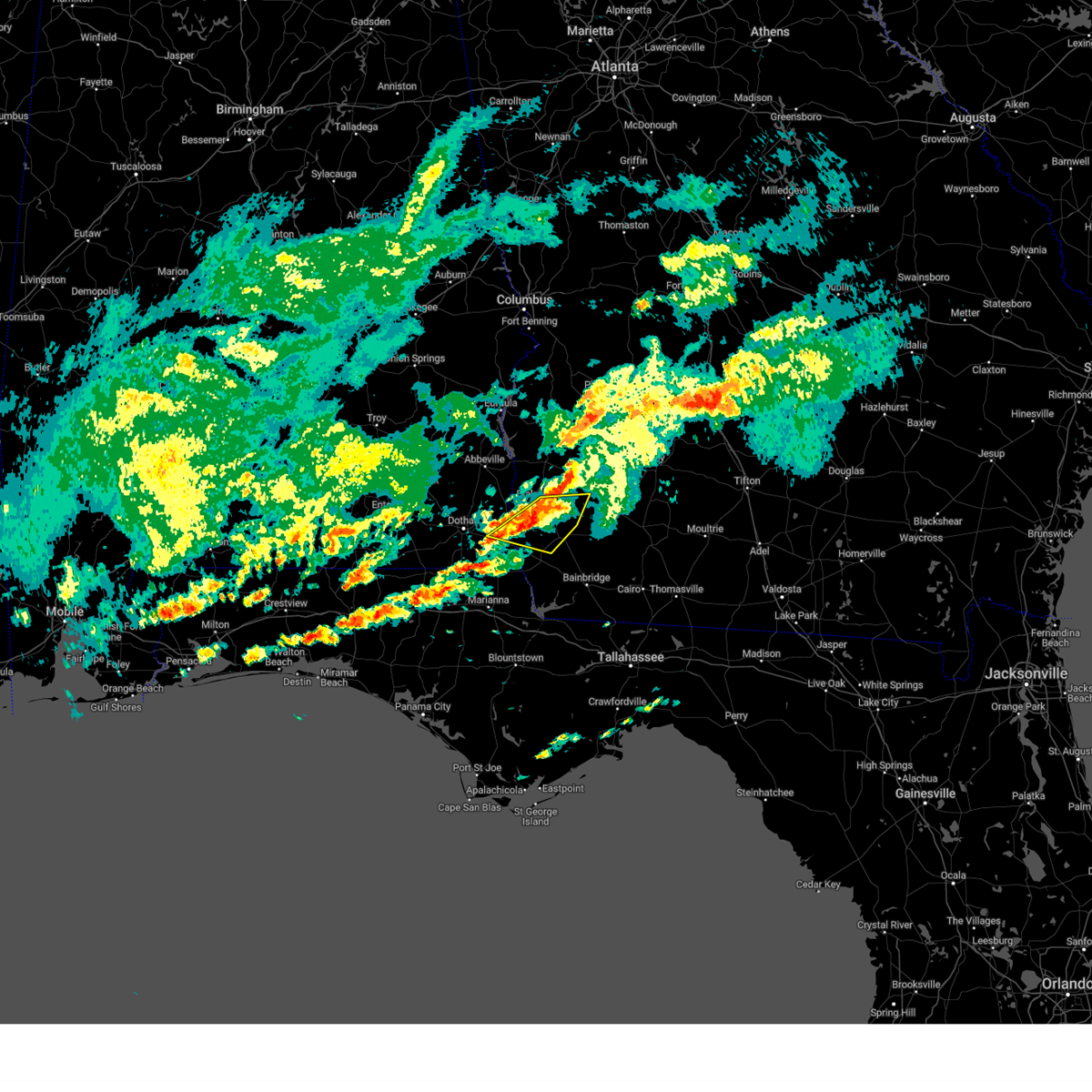 At 1255 pm edt/1155 am cdt/, severe thunderstorms were located along a line extending from near blakely to 13 miles northwest of colquitt to 7 miles southeast of columbia, moving east at 40 mph (radar indicated). Hazards include 60 mph wind gusts and penny size hail. Expect damage to roofs, siding, and trees. Locations impacted include, colquitt, blakely, ashford, douglasville, centerville, gordon, damascus, iveys mill, howards mill, crestview, mayhaw, cuba, killarney, enterprise, harmony church rd/hwy 45, farley nuclear plant, cedar springs, old damascus, jeterville and hentown. At 1255 pm edt/1155 am cdt/, severe thunderstorms were located along a line extending from near blakely to 13 miles northwest of colquitt to 7 miles southeast of columbia, moving east at 40 mph (radar indicated). Hazards include 60 mph wind gusts and penny size hail. Expect damage to roofs, siding, and trees. Locations impacted include, colquitt, blakely, ashford, douglasville, centerville, gordon, damascus, iveys mill, howards mill, crestview, mayhaw, cuba, killarney, enterprise, harmony church rd/hwy 45, farley nuclear plant, cedar springs, old damascus, jeterville and hentown.
|
| 3/12/2023 12:42 PM EDT |
 At 1242 pm edt/1142 am cdt/, severe thunderstorms were located along a line extending from 7 miles southwest of blakely to near columbia to near ashford, moving east at 40 mph (radar indicated). Hazards include 60 mph wind gusts and penny size hail. expect damage to roofs, siding, and trees At 1242 pm edt/1142 am cdt/, severe thunderstorms were located along a line extending from 7 miles southwest of blakely to near columbia to near ashford, moving east at 40 mph (radar indicated). Hazards include 60 mph wind gusts and penny size hail. expect damage to roofs, siding, and trees
|
| 3/12/2023 12:42 PM EDT |
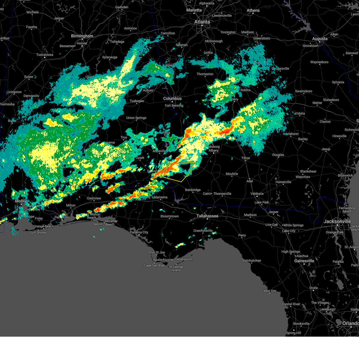 At 1242 pm edt/1142 am cdt/, severe thunderstorms were located along a line extending from 7 miles southwest of blakely to near columbia to near ashford, moving east at 40 mph (radar indicated). Hazards include 60 mph wind gusts and penny size hail. expect damage to roofs, siding, and trees At 1242 pm edt/1142 am cdt/, severe thunderstorms were located along a line extending from 7 miles southwest of blakely to near columbia to near ashford, moving east at 40 mph (radar indicated). Hazards include 60 mph wind gusts and penny size hail. expect damage to roofs, siding, and trees
|
| 1/12/2023 7:54 PM EST |
 At 753 pm est/653 pm cst/, severe thunderstorms were located along a line extending from near marine corps logistics base to 9 miles south of cottonwood, moving east at 25 mph (radar indicated). Hazards include 60 mph wind gusts and quarter size hail. Hail damage to vehicles is expected. Expect wind damage to roofs, siding, and trees. At 753 pm est/653 pm cst/, severe thunderstorms were located along a line extending from near marine corps logistics base to 9 miles south of cottonwood, moving east at 25 mph (radar indicated). Hazards include 60 mph wind gusts and quarter size hail. Hail damage to vehicles is expected. Expect wind damage to roofs, siding, and trees.
|
| 1/12/2023 7:36 PM EST |
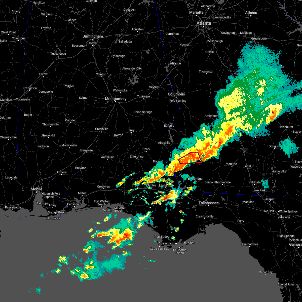 The tornado warning for northern miller, northwestern baker and east central early counties will expire at 745 pm est, the storm which prompted the warning has weakened below severe limits, and has exited the warned area. therefore, the warning will be allowed to expire. however small hail and gusty winds are still possible with this thunderstorm. a tornado watch remains in effect until 900 pm est for southwestern georgia. remember, a severe thunderstorm warning still remains in effect. The tornado warning for northern miller, northwestern baker and east central early counties will expire at 745 pm est, the storm which prompted the warning has weakened below severe limits, and has exited the warned area. therefore, the warning will be allowed to expire. however small hail and gusty winds are still possible with this thunderstorm. a tornado watch remains in effect until 900 pm est for southwestern georgia. remember, a severe thunderstorm warning still remains in effect.
|
| 1/12/2023 7:19 PM EST |
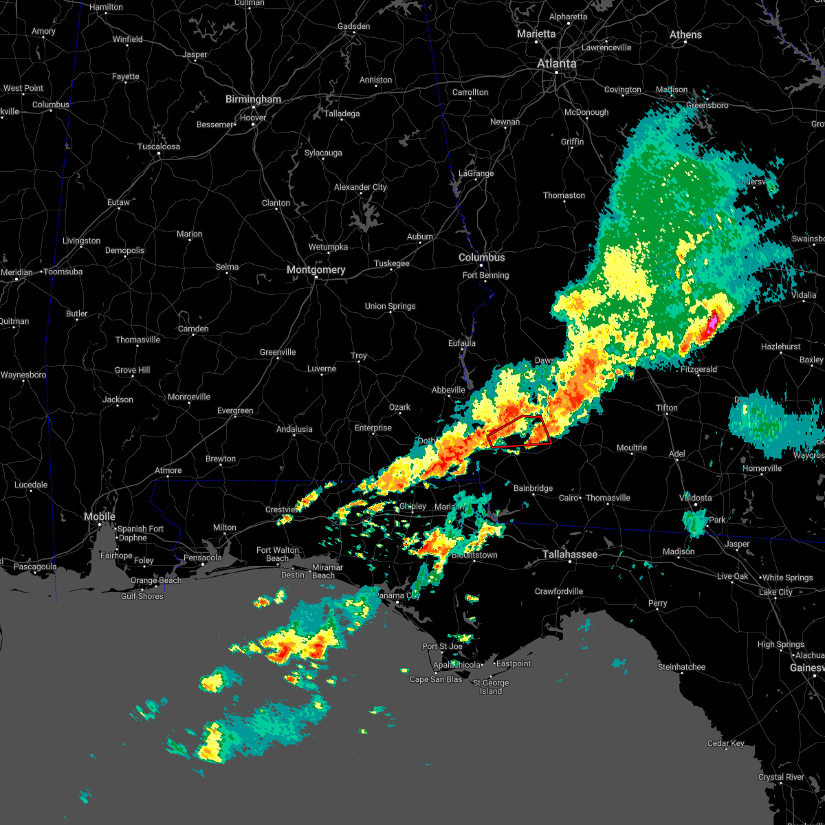 At 719 pm est, a severe thunderstorm capable of producing a tornado was located 8 miles southeast of blakely, moving east at 45 mph (radar indicated rotation). Hazards include tornado and quarter size hail. Flying debris will be dangerous to those caught without shelter. mobile homes will be damaged or destroyed. damage to roofs, windows, and vehicles will occur. tree damage is likely. This tornadic thunderstorm will remain over mainly rural areas of northern miller, northwestern baker and east central early counties, including the following locations, iveys mill, milford, damascus, crestview, douglasville, centerville, cuba, hawkinstown, mimsville and harmony church rd/hwy 45. At 719 pm est, a severe thunderstorm capable of producing a tornado was located 8 miles southeast of blakely, moving east at 45 mph (radar indicated rotation). Hazards include tornado and quarter size hail. Flying debris will be dangerous to those caught without shelter. mobile homes will be damaged or destroyed. damage to roofs, windows, and vehicles will occur. tree damage is likely. This tornadic thunderstorm will remain over mainly rural areas of northern miller, northwestern baker and east central early counties, including the following locations, iveys mill, milford, damascus, crestview, douglasville, centerville, cuba, hawkinstown, mimsville and harmony church rd/hwy 45.
|
| 1/12/2023 7:15 PM EST |
 At 715 pm est/615 pm cst/, severe thunderstorms were located along a line extending from near arlington to 8 miles south of blakely to near graceville, moving east at 45 mph (radar indicated). Hazards include 60 mph wind gusts and quarter size hail. Hail damage to vehicles is expected. Expect wind damage to roofs, siding, and trees. At 715 pm est/615 pm cst/, severe thunderstorms were located along a line extending from near arlington to 8 miles south of blakely to near graceville, moving east at 45 mph (radar indicated). Hazards include 60 mph wind gusts and quarter size hail. Hail damage to vehicles is expected. Expect wind damage to roofs, siding, and trees.
|
| 11/30/2022 6:45 AM CST |
 At 745 am est/645 am cst/, severe thunderstorms were located along a line extending from 8 miles southeast of fort gaines to columbia to near slocomb to 8 miles south of geneva, moving southeast at 40 mph (radar indicated). Hazards include 60 mph wind gusts. expect damage to roofs, siding, and trees At 745 am est/645 am cst/, severe thunderstorms were located along a line extending from 8 miles southeast of fort gaines to columbia to near slocomb to 8 miles south of geneva, moving southeast at 40 mph (radar indicated). Hazards include 60 mph wind gusts. expect damage to roofs, siding, and trees
|
| 8/10/2022 4:56 PM EDT |
 At 456 pm edt, a severe thunderstorm was located near west bainbridge, or near bainbridge, moving north at 20 mph (radar indicated). Hazards include 60 mph wind gusts. expect damage to roofs, siding, and trees At 456 pm edt, a severe thunderstorm was located near west bainbridge, or near bainbridge, moving north at 20 mph (radar indicated). Hazards include 60 mph wind gusts. expect damage to roofs, siding, and trees
|
| 6/14/2022 5:45 PM EDT | Tree down across bean avenue in early county georgi in early county GA, 4.3 miles NW of Damascus, GA |
| 6/14/2022 4:53 PM EDT |
 At 453 pm edt, severe thunderstorms were located along a line extending from near arlington to near pelham, moving southwest at 15 mph (radar indicated). Hazards include 60 mph wind gusts. expect damage to roofs, siding, and trees At 453 pm edt, severe thunderstorms were located along a line extending from near arlington to near pelham, moving southwest at 15 mph (radar indicated). Hazards include 60 mph wind gusts. expect damage to roofs, siding, and trees
|
| 5/23/2022 5:41 AM EDT |
 The tornado warning for northwestern miller and central early counties will expire at 545 am edt, the storm which prompted the warning has weakened below severe limits, and no longer appears capable of producing a tornado. therefore, the warning will be allowed to expire. however gusty winds are still possible with this thunderstorm. The tornado warning for northwestern miller and central early counties will expire at 545 am edt, the storm which prompted the warning has weakened below severe limits, and no longer appears capable of producing a tornado. therefore, the warning will be allowed to expire. however gusty winds are still possible with this thunderstorm.
|
| 5/23/2022 5:36 AM EDT |
 At 536 am edt, a severe thunderstorm capable of producing a tornado was located 8 miles southeast of blakely, moving northeast at 35 mph (radar indicated rotation). Hazards include tornado. Flying debris will be dangerous to those caught without shelter. mobile homes will be damaged or destroyed. damage to roofs, windows, and vehicles will occur. tree damage is likely. Locations impacted include, centerville, damascus, cuba, early co a/p, old damascus, mayhaw and hentown. At 536 am edt, a severe thunderstorm capable of producing a tornado was located 8 miles southeast of blakely, moving northeast at 35 mph (radar indicated rotation). Hazards include tornado. Flying debris will be dangerous to those caught without shelter. mobile homes will be damaged or destroyed. damage to roofs, windows, and vehicles will occur. tree damage is likely. Locations impacted include, centerville, damascus, cuba, early co a/p, old damascus, mayhaw and hentown.
|
| 5/23/2022 5:22 AM EDT |
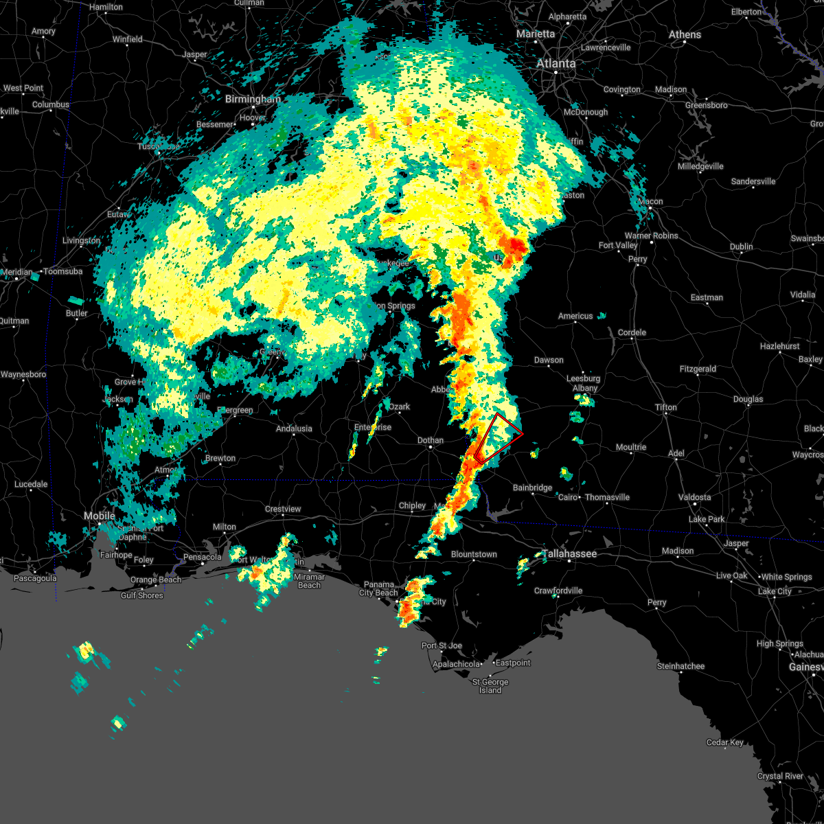 At 521 am edt, a severe thunderstorm capable of producing a tornado was located 10 miles northwest of donalsonville, moving northeast at 35 mph (radar indicated rotation). Hazards include tornado. Flying debris will be dangerous to those caught without shelter. mobile homes will be damaged or destroyed. damage to roofs, windows, and vehicles will occur. tree damage is likely. This tornadic thunderstorm will remain over mainly rural areas of northwestern miller and central early counties, including the following locations, cuba, killarney, damascus, howards mill, early co a/p, old damascus, mayhaw, hentown and centerville. At 521 am edt, a severe thunderstorm capable of producing a tornado was located 10 miles northwest of donalsonville, moving northeast at 35 mph (radar indicated rotation). Hazards include tornado. Flying debris will be dangerous to those caught without shelter. mobile homes will be damaged or destroyed. damage to roofs, windows, and vehicles will occur. tree damage is likely. This tornadic thunderstorm will remain over mainly rural areas of northwestern miller and central early counties, including the following locations, cuba, killarney, damascus, howards mill, early co a/p, old damascus, mayhaw, hentown and centerville.
|
| 4/5/2022 3:45 PM EDT |
 At 344 pm edt/244 pm cdt/, severe thunderstorms were located along a line extending from 8 miles southeast of hawkinsville to 7 miles west of newton, moving east at 90 mph (radar indicated). Hazards include 70 mph wind gusts. Expect considerable tree damage. damage is likely to mobile homes, roofs, and outbuildings. Locations impacted include, colquitt, morgan, donalsonville, leesburg, albany, arlington, leary, walker, douglasville, iron city, sasser, damascus, jakin, iveys mill, crosby, donaldsonville a/p, neyami, rowena, howards mill and scrutchins. At 344 pm edt/244 pm cdt/, severe thunderstorms were located along a line extending from 8 miles southeast of hawkinsville to 7 miles west of newton, moving east at 90 mph (radar indicated). Hazards include 70 mph wind gusts. Expect considerable tree damage. damage is likely to mobile homes, roofs, and outbuildings. Locations impacted include, colquitt, morgan, donalsonville, leesburg, albany, arlington, leary, walker, douglasville, iron city, sasser, damascus, jakin, iveys mill, crosby, donaldsonville a/p, neyami, rowena, howards mill and scrutchins.
|
| 4/5/2022 3:35 PM EDT |
 At 334 pm edt, a severe thunderstorm capable of producing a tornado was located 9 miles southeast of arlington, or 11 miles northeast of colquitt, moving east at 55 mph (radar indicated rotation). Hazards include tornado. Flying debris will be dangerous to those caught without shelter. mobile homes will be damaged or destroyed. damage to roofs, windows, and vehicles will occur. tree damage is likely. this dangerous storm will be near, newton around 355 pm edt. Other locations impacted by this tornadic thunderstorm include hawkinstown, iveys mill, milford, mimsville, damascus, crestview, douglasville, old damascus, elmodel wma and bethany. At 334 pm edt, a severe thunderstorm capable of producing a tornado was located 9 miles southeast of arlington, or 11 miles northeast of colquitt, moving east at 55 mph (radar indicated rotation). Hazards include tornado. Flying debris will be dangerous to those caught without shelter. mobile homes will be damaged or destroyed. damage to roofs, windows, and vehicles will occur. tree damage is likely. this dangerous storm will be near, newton around 355 pm edt. Other locations impacted by this tornadic thunderstorm include hawkinstown, iveys mill, milford, mimsville, damascus, crestview, douglasville, old damascus, elmodel wma and bethany.
|
| 4/5/2022 3:29 PM EDT |
 At 328 pm edt/228 pm cdt/, severe thunderstorms were located along a line extending from near vienna to 6 miles west of colquitt, moving east at 90 mph (radar indicated). Hazards include up to 70 mph wind gusts. Expect considerable tree damage. damage is likely to mobile homes, roofs, and outbuildings. Locations impacted include, colquitt, morgan, donalsonville, leesburg, dawson, blakely, albany, edison, arlington, leary, smithville, walker, douglasville, centerville, gordon, iron city, sasser, damascus, jakin and iveys mill. At 328 pm edt/228 pm cdt/, severe thunderstorms were located along a line extending from near vienna to 6 miles west of colquitt, moving east at 90 mph (radar indicated). Hazards include up to 70 mph wind gusts. Expect considerable tree damage. damage is likely to mobile homes, roofs, and outbuildings. Locations impacted include, colquitt, morgan, donalsonville, leesburg, dawson, blakely, albany, edison, arlington, leary, smithville, walker, douglasville, centerville, gordon, iron city, sasser, damascus, jakin and iveys mill.
|
| 4/5/2022 3:26 PM EDT |
 At 326 pm edt, a confirmed large and extremely dangerous tornado was located 9 miles south of arlington, or 10 miles southeast of blakely, moving east at 50 mph. this is a particularly dangerous situation. take cover now! (radar confirmed tornado). Hazards include damaging tornado. You are in a life-threatening situation. flying debris may be deadly to those caught without shelter. mobile homes will be destroyed. considerable damage to homes, businesses, and vehicles is likely and complete destruction is possible. the tornado will be near, newton around 400 pm edt. Other locations impacted by this tornadic thunderstorm include hawkinstown, iveys mill, milford, mimsville, damascus, crestview, douglasville, old damascus, elmodel wma and bethany. At 326 pm edt, a confirmed large and extremely dangerous tornado was located 9 miles south of arlington, or 10 miles southeast of blakely, moving east at 50 mph. this is a particularly dangerous situation. take cover now! (radar confirmed tornado). Hazards include damaging tornado. You are in a life-threatening situation. flying debris may be deadly to those caught without shelter. mobile homes will be destroyed. considerable damage to homes, businesses, and vehicles is likely and complete destruction is possible. the tornado will be near, newton around 400 pm edt. Other locations impacted by this tornadic thunderstorm include hawkinstown, iveys mill, milford, mimsville, damascus, crestview, douglasville, old damascus, elmodel wma and bethany.
|
| 4/5/2022 3:25 PM EDT | At 324 pm edt, a confirmed tornado was located near colquitt, moving east at 60 mph (radar confirmed tornado). Hazards include damaging tornado. Flying debris will be dangerous to those caught without shelter. mobile homes will be damaged or destroyed. damage to roofs, windows, and vehicles will occur. tree damage is likely. Locations impacted include, colquitt, damascus, harmony church rd/hwy 45, old damascus, jeterville, cooktown, hentown and bellview. |
| 4/5/2022 3:22 PM EDT | At 321 pm edt, a severe thunderstorm capable of producing a tornado was located near blakely, moving east at 55 mph (radar indicated rotation). Hazards include tornado. Flying debris will be dangerous to those caught without shelter. mobile homes will be damaged or destroyed. damage to roofs, windows, and vehicles will occur. tree damage is likely. this dangerous storm will be near, arlington around 330 pm edt. newton around 355 pm edt. Other locations impacted by this tornadic thunderstorm include iveys mill, milford, damascus, crestview, douglasville, centerville, cuba, hawkinstown, mimsville and early co a/p. |
| 4/5/2022 3:17 PM EDT |
 At 317 pm edt, a confirmed tornado was located 8 miles south of blakely, moving east at 55 mph (radar confirmed tornado). Hazards include damaging tornado. Flying debris will be dangerous to those caught without shelter. mobile homes will be damaged or destroyed. damage to roofs, windows, and vehicles will occur. tree damage is likely. This tornadic thunderstorm will remain over mainly rural areas of northern miller and central early counties, including the following locations, cuba, damascus, harmony church rd/hwy 45, old damascus, jeterville, cooktown, hentown, bellview and centerville. At 317 pm edt, a confirmed tornado was located 8 miles south of blakely, moving east at 55 mph (radar confirmed tornado). Hazards include damaging tornado. Flying debris will be dangerous to those caught without shelter. mobile homes will be damaged or destroyed. damage to roofs, windows, and vehicles will occur. tree damage is likely. This tornadic thunderstorm will remain over mainly rural areas of northern miller and central early counties, including the following locations, cuba, damascus, harmony church rd/hwy 45, old damascus, jeterville, cooktown, hentown, bellview and centerville.
|
| 4/5/2022 3:15 PM EDT | Trained spotter reported trees and powerlines down around 16480 damascus-hilton road in early county. estimated time at 3:15pm. possible tornad in early county GA, 4.9 miles E of Damascus, GA |
| 4/5/2022 3:15 PM EDT |
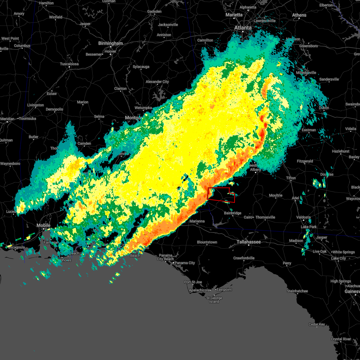 At 314 pm edt, a severe thunderstorm capable of producing a tornado was located 8 miles south of blakely, moving east at 60 mph (radar indicated rotation). Hazards include tornado. Flying debris will be dangerous to those caught without shelter. mobile homes will be damaged or destroyed. damage to roofs, windows, and vehicles will occur. tree damage is likely. this dangerous storm will be near, colquitt around 325 pm edt. Other locations impacted by this tornadic thunderstorm include damascus, howards mill, mayhaw, centerville, cuba, harmony church rd/hwy 45, old damascus, jeterville, cooktown and hentown. At 314 pm edt, a severe thunderstorm capable of producing a tornado was located 8 miles south of blakely, moving east at 60 mph (radar indicated rotation). Hazards include tornado. Flying debris will be dangerous to those caught without shelter. mobile homes will be damaged or destroyed. damage to roofs, windows, and vehicles will occur. tree damage is likely. this dangerous storm will be near, colquitt around 325 pm edt. Other locations impacted by this tornadic thunderstorm include damascus, howards mill, mayhaw, centerville, cuba, harmony church rd/hwy 45, old damascus, jeterville, cooktown and hentown.
|
| 4/5/2022 3:07 PM EDT |
 At 307 pm edt/207 pm cdt/, severe thunderstorms were located along a line extending from near smithville to cottonwood, moving east at 95 mph (radar indicated). Hazards include 60 mph wind gusts. expect damage to roofs, siding, and trees At 307 pm edt/207 pm cdt/, severe thunderstorms were located along a line extending from near smithville to cottonwood, moving east at 95 mph (radar indicated). Hazards include 60 mph wind gusts. expect damage to roofs, siding, and trees
|
| 3/18/2022 2:16 PM EDT |
 At 216 pm edt/116 pm cdt/, severe thunderstorms were located along a line extending from near morgan to 8 miles southwest of donalsonville, moving east at 30 mph (radar indicated). Hazards include 60 mph wind gusts. Expect damage to roofs, siding, and trees. Locations impacted include, colquitt, newton, morgan, albany, donalsonville, bainbridge, edison, arlington, leary, west bainbridge, walker, douglasville, centerville, malone, gordon, iron city, damascus, brinson, jakin and bascom. At 216 pm edt/116 pm cdt/, severe thunderstorms were located along a line extending from near morgan to 8 miles southwest of donalsonville, moving east at 30 mph (radar indicated). Hazards include 60 mph wind gusts. Expect damage to roofs, siding, and trees. Locations impacted include, colquitt, newton, morgan, albany, donalsonville, bainbridge, edison, arlington, leary, west bainbridge, walker, douglasville, centerville, malone, gordon, iron city, damascus, brinson, jakin and bascom.
|
| 3/18/2022 1:53 PM EDT |
 At 153 pm edt/1253 pm cdt/, severe thunderstorms were located along a line extending from 8 miles northwest of edison to 6 miles southeast of cottonwood, moving southeast at 25 mph (radar indicated). Hazards include 60 mph wind gusts. expect damage to roofs, siding, and trees At 153 pm edt/1253 pm cdt/, severe thunderstorms were located along a line extending from 8 miles northwest of edison to 6 miles southeast of cottonwood, moving southeast at 25 mph (radar indicated). Hazards include 60 mph wind gusts. expect damage to roofs, siding, and trees
|
| 1/2/2022 4:03 PM EST |
 At 403 pm est, severe thunderstorms were located along a line extending from near leary to near donalsonville, moving east at 45 mph (radar indicated). Hazards include 60 mph wind gusts. Expect damage to roofs, siding, and trees. locations impacted include, colquitt, donalsonville, leary, douglasville, centerville, iron city, damascus, brinson, jakin, babcock, iveys mill, little hope, mayhaw, holt, boykin, riverturn, sharphagen, donaldsonville a/p, hentown and rowena. hail threat, radar indicated max hail size, <. 75 in wind threat, radar indicated max wind gust, 60 mph. At 403 pm est, severe thunderstorms were located along a line extending from near leary to near donalsonville, moving east at 45 mph (radar indicated). Hazards include 60 mph wind gusts. Expect damage to roofs, siding, and trees. locations impacted include, colquitt, donalsonville, leary, douglasville, centerville, iron city, damascus, brinson, jakin, babcock, iveys mill, little hope, mayhaw, holt, boykin, riverturn, sharphagen, donaldsonville a/p, hentown and rowena. hail threat, radar indicated max hail size, <. 75 in wind threat, radar indicated max wind gust, 60 mph.
|
| 1/2/2022 4:00 PM EST |
 At 400 pm est/300 pm cst/, severe thunderstorms were located along a line extending from leary to near donalsonville, moving northeast at 35 mph (radar indicated). Hazards include 60 mph wind gusts. expect damage to roofs, siding, and trees At 400 pm est/300 pm cst/, severe thunderstorms were located along a line extending from leary to near donalsonville, moving northeast at 35 mph (radar indicated). Hazards include 60 mph wind gusts. expect damage to roofs, siding, and trees
|
| 1/2/2022 3:26 PM EST |
 At 326 pm est, severe thunderstorms were located along a line extending from 6 miles northwest of blakely to 6 miles east of cottonwood, moving northeast at 45 mph (radar indicated). Hazards include 60 mph wind gusts. expect damage to roofs, siding, and trees At 326 pm est, severe thunderstorms were located along a line extending from 6 miles northwest of blakely to 6 miles east of cottonwood, moving northeast at 45 mph (radar indicated). Hazards include 60 mph wind gusts. expect damage to roofs, siding, and trees
|
| 1/2/2022 2:34 PM EST |
 At 233 pm est, a severe thunderstorm was located near webb, or 7 miles east of headland, moving east at 45 mph (radar indicated). Hazards include 60 mph wind gusts. expect damage to roofs, siding, and trees At 233 pm est, a severe thunderstorm was located near webb, or 7 miles east of headland, moving east at 45 mph (radar indicated). Hazards include 60 mph wind gusts. expect damage to roofs, siding, and trees
|
| 5/4/2021 10:36 PM EDT |
 At 1035 pm edt, severe thunderstorms were located along a line extending from near baconton to 10 miles northwest of donalsonville, moving southeast at 40 mph (radar indicated). Hazards include 60 mph wind gusts. Expect damage to roofs, siding, and trees. Locations impacted include, colquitt, newton, donalsonville, pelham, putney, camilla, albany, baconton, columbia, east albany, marine corps logistics base, turner city, douglasville, centerville, sale city, gordon, iron city, damascus, jakin and iveys mill. At 1035 pm edt, severe thunderstorms were located along a line extending from near baconton to 10 miles northwest of donalsonville, moving southeast at 40 mph (radar indicated). Hazards include 60 mph wind gusts. Expect damage to roofs, siding, and trees. Locations impacted include, colquitt, newton, donalsonville, pelham, putney, camilla, albany, baconton, columbia, east albany, marine corps logistics base, turner city, douglasville, centerville, sale city, gordon, iron city, damascus, jakin and iveys mill.
|
| 5/4/2021 9:52 PM EDT |
 At 952 pm edt, severe thunderstorms were located along a line extending from near morgan to near columbia, moving southeast at 55 mph (radar indicated). Hazards include 60 mph wind gusts. expect damage to roofs, siding, and trees At 952 pm edt, severe thunderstorms were located along a line extending from near morgan to near columbia, moving southeast at 55 mph (radar indicated). Hazards include 60 mph wind gusts. expect damage to roofs, siding, and trees
|
| 4/24/2021 4:51 PM EDT |
 At 451 pm edt, severe thunderstorms were located along a line extending from 9 miles northeast of leary to 10 miles west of newton to 7 miles southeast of blakely, moving east at 55 mph (radar indicated). Hazards include 70 mph wind gusts and quarter size hail. Hail damage to vehicles is expected. expect considerable tree damage. wind damage is also likely to mobile homes, roofs, and outbuildings. Locations impacted include, colquitt, newton, morgan, albany, arlington, leary, walker, douglasville, damascus, iveys mill, lockett crossing, south albany, southwest ga regional a/p, holt, mimsville, hentown, rowena, milford, red store crossroads and crestview. At 451 pm edt, severe thunderstorms were located along a line extending from 9 miles northeast of leary to 10 miles west of newton to 7 miles southeast of blakely, moving east at 55 mph (radar indicated). Hazards include 70 mph wind gusts and quarter size hail. Hail damage to vehicles is expected. expect considerable tree damage. wind damage is also likely to mobile homes, roofs, and outbuildings. Locations impacted include, colquitt, newton, morgan, albany, arlington, leary, walker, douglasville, damascus, iveys mill, lockett crossing, south albany, southwest ga regional a/p, holt, mimsville, hentown, rowena, milford, red store crossroads and crestview.
|
| 4/24/2021 4:34 PM EDT |
 At 434 pm edt, severe thunderstorms were located along a line extending from near morgan to 7 miles southwest of arlington to near columbia, moving east at 30 mph (radar indicated). Hazards include 60 mph wind gusts and quarter size hail. Hail damage to vehicles is expected. Expect wind damage to roofs, siding, and trees. At 434 pm edt, severe thunderstorms were located along a line extending from near morgan to 7 miles southwest of arlington to near columbia, moving east at 30 mph (radar indicated). Hazards include 60 mph wind gusts and quarter size hail. Hail damage to vehicles is expected. Expect wind damage to roofs, siding, and trees.
|
| 4/24/2021 3:49 PM EDT |
 At 349 pm edt/249 pm cdt/, a severe thunderstorm was located near headland, moving east at 45 mph (radar indicated). Hazards include 60 mph wind gusts. expect damage to roofs, siding, and trees At 349 pm edt/249 pm cdt/, a severe thunderstorm was located near headland, moving east at 45 mph (radar indicated). Hazards include 60 mph wind gusts. expect damage to roofs, siding, and trees
|
| 4/24/2021 9:10 AM EDT |
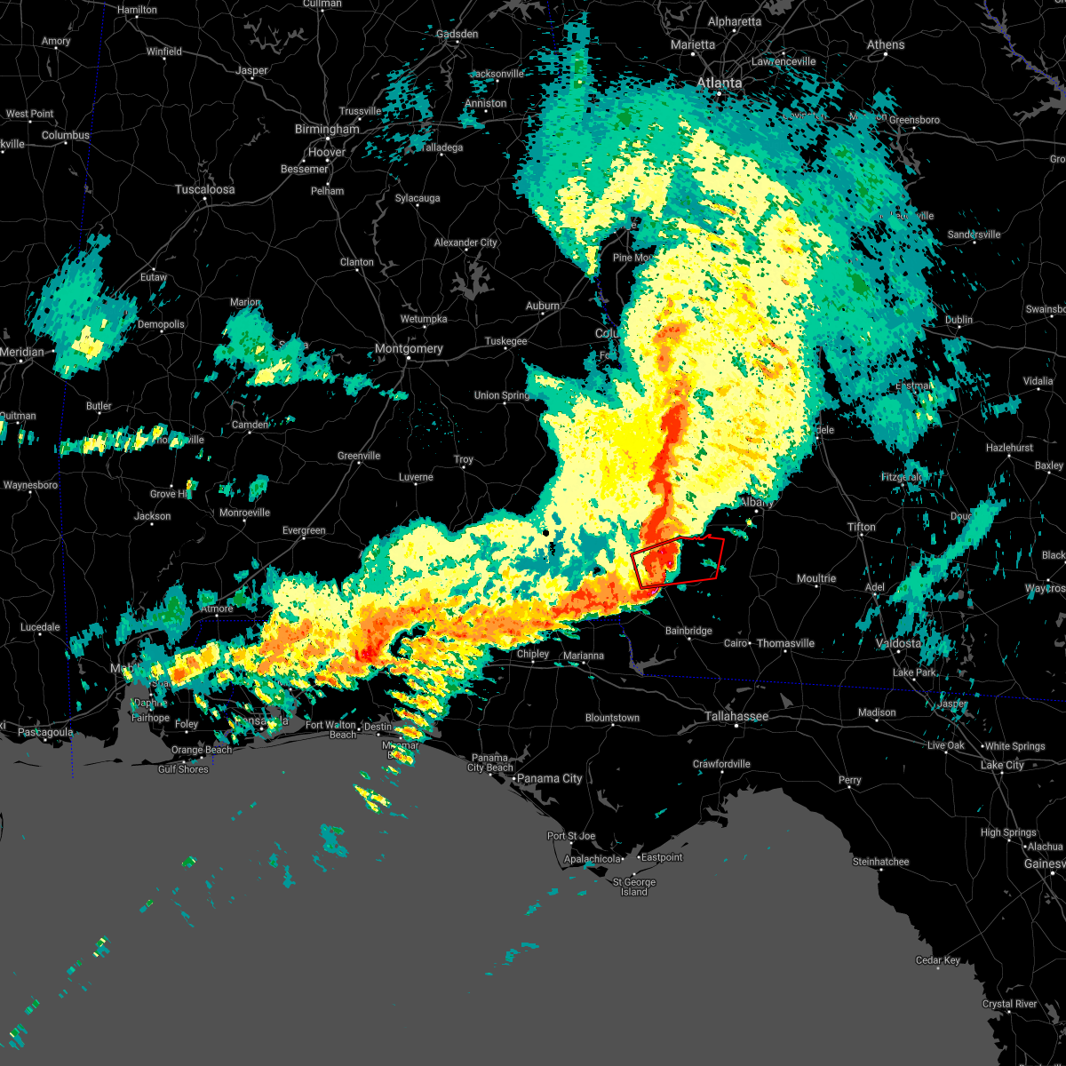 At 910 am edt, a severe thunderstorm capable of producing a tornado was located 8 miles southeast of blakely, moving east at 60 mph (radar indicated rotation). Hazards include tornado. Flying debris will be dangerous to those caught without shelter. mobile homes will be damaged or destroyed. damage to roofs, windows, and vehicles will occur. tree damage is likely. This tornadic thunderstorm will remain over mainly rural areas of northern miller, baker and east central early counties, including the following locations, iveys mill, milford, damascus, crestview, hoggard mill, douglasville, centerville, cuba, hawkinstown and mimsville. At 910 am edt, a severe thunderstorm capable of producing a tornado was located 8 miles southeast of blakely, moving east at 60 mph (radar indicated rotation). Hazards include tornado. Flying debris will be dangerous to those caught without shelter. mobile homes will be damaged or destroyed. damage to roofs, windows, and vehicles will occur. tree damage is likely. This tornadic thunderstorm will remain over mainly rural areas of northern miller, baker and east central early counties, including the following locations, iveys mill, milford, damascus, crestview, hoggard mill, douglasville, centerville, cuba, hawkinstown and mimsville.
|
| 4/24/2021 9:03 AM EDT |
 At 903 am edt, a confirmed tornado was located 7 miles south of blakely, moving east at 60 mph (radar confirmed tornado). Hazards include damaging tornado. Flying debris will be dangerous to those caught without shelter. mobile homes will be damaged or destroyed. damage to roofs, windows, and vehicles will occur. tree damage is likely. this tornado will be near, arlington around 920 am edt. Other locations impacted by this tornadic thunderstorm include damascus, howards mill, mayhaw, rock hill, centerville, cuba, harmony church rd/hwy 45, cedar springs, old damascus and jeterville. At 903 am edt, a confirmed tornado was located 7 miles south of blakely, moving east at 60 mph (radar confirmed tornado). Hazards include damaging tornado. Flying debris will be dangerous to those caught without shelter. mobile homes will be damaged or destroyed. damage to roofs, windows, and vehicles will occur. tree damage is likely. this tornado will be near, arlington around 920 am edt. Other locations impacted by this tornadic thunderstorm include damascus, howards mill, mayhaw, rock hill, centerville, cuba, harmony church rd/hwy 45, cedar springs, old damascus and jeterville.
|
| 4/24/2021 8:54 AM EDT |
 At 854 am edt/754 am cdt/, a confirmed tornado was located near columbia, or 10 miles southwest of blakely, moving east at 70 mph (radar confirmed tornado). Hazards include damaging tornado. Flying debris will be dangerous to those caught without shelter. mobile homes will be damaged or destroyed. damage to roofs, windows, and vehicles will occur. tree damage is likely. this tornado will be near, blakely around 900 am edt. arlington around 915 am edt. Other locations impacted by this tornadic thunderstorm include gordon, pansey, damascus, howards mill, sigma, pearce, mayhaw, rock hill, centerville and barber. At 854 am edt/754 am cdt/, a confirmed tornado was located near columbia, or 10 miles southwest of blakely, moving east at 70 mph (radar confirmed tornado). Hazards include damaging tornado. Flying debris will be dangerous to those caught without shelter. mobile homes will be damaged or destroyed. damage to roofs, windows, and vehicles will occur. tree damage is likely. this tornado will be near, blakely around 900 am edt. arlington around 915 am edt. Other locations impacted by this tornadic thunderstorm include gordon, pansey, damascus, howards mill, sigma, pearce, mayhaw, rock hill, centerville and barber.
|
| 4/24/2021 8:48 AM EDT |
 At 848 am edt/748 am cdt/, a severe thunderstorm capable of producing a tornado was located near ashford, or 13 miles southeast of headland, moving east at 70 mph (radar indicated rotation). Hazards include tornado. Flying debris will be dangerous to those caught without shelter. mobile homes will be damaged or destroyed. damage to roofs, windows, and vehicles will occur. tree damage is likely. this dangerous storm will be near, blakely around 900 am edt. arlington around 915 am edt. Other locations impacted by this tornadic thunderstorm include gordon, pansey, damascus, howards mill, sigma, pearce, mayhaw, rock hill, centerville and barber. At 848 am edt/748 am cdt/, a severe thunderstorm capable of producing a tornado was located near ashford, or 13 miles southeast of headland, moving east at 70 mph (radar indicated rotation). Hazards include tornado. Flying debris will be dangerous to those caught without shelter. mobile homes will be damaged or destroyed. damage to roofs, windows, and vehicles will occur. tree damage is likely. this dangerous storm will be near, blakely around 900 am edt. arlington around 915 am edt. Other locations impacted by this tornadic thunderstorm include gordon, pansey, damascus, howards mill, sigma, pearce, mayhaw, rock hill, centerville and barber.
|
| 4/24/2021 8:40 AM EDT |
 At 839 am edt, severe thunderstorms were located along a line extending from 6 miles southwest of richards crossroads to 7 miles north of graceville, moving east at 60 mph (radar indicated). Hazards include 70 mph wind gusts. Expect considerable tree damage. Damage is likely to mobile homes, roofs, and outbuildings. At 839 am edt, severe thunderstorms were located along a line extending from 6 miles southwest of richards crossroads to 7 miles north of graceville, moving east at 60 mph (radar indicated). Hazards include 70 mph wind gusts. Expect considerable tree damage. Damage is likely to mobile homes, roofs, and outbuildings.
|
| 3/31/2021 6:54 PM EDT |
 The national weather service in tallahassee has issued a * severe thunderstorm warning for. southeastern houston county in southeastern alabama. northeastern jackson county in the panhandle of florida. northwestern gadsden county in big bend of florida. Decatur county in southwestern georgia. The national weather service in tallahassee has issued a * severe thunderstorm warning for. southeastern houston county in southeastern alabama. northeastern jackson county in the panhandle of florida. northwestern gadsden county in big bend of florida. Decatur county in southwestern georgia.
|
| 3/31/2021 6:54 PM EDT |
 At 654 pm edt/554 pm cdt/, severe thunderstorms were located along a line extending from near leary to near colquitt to near cottonwood, moving east at 55 mph (radar indicated). Hazards include 60 mph wind gusts. expect damage to roofs, siding, and trees At 654 pm edt/554 pm cdt/, severe thunderstorms were located along a line extending from near leary to near colquitt to near cottonwood, moving east at 55 mph (radar indicated). Hazards include 60 mph wind gusts. expect damage to roofs, siding, and trees
|
| 3/28/2021 5:25 PM EDT |
 At 525 pm edt, severe thunderstorms were located along a line extending from 12 miles southeast of arlington to 6 miles south of colquitt, moving east at 55 mph (radar indicated). Hazards include 60 mph wind gusts. Expect damage to roofs, siding, and trees. Locations impacted include, colquitt, donalsonville, damascus, jakin, ausmac, babcock, crestview, eldorendo, mayhaw, decatur co a/p, boykin, killarney, mimsville, enterprise, harmony church rd/hwy 45, old damascus, jeterville, cooktown, elmodel wma and bethany. At 525 pm edt, severe thunderstorms were located along a line extending from 12 miles southeast of arlington to 6 miles south of colquitt, moving east at 55 mph (radar indicated). Hazards include 60 mph wind gusts. Expect damage to roofs, siding, and trees. Locations impacted include, colquitt, donalsonville, damascus, jakin, ausmac, babcock, crestview, eldorendo, mayhaw, decatur co a/p, boykin, killarney, mimsville, enterprise, harmony church rd/hwy 45, old damascus, jeterville, cooktown, elmodel wma and bethany.
|
| 3/28/2021 5:15 PM EDT |
 At 515 pm edt/415 pm cdt/, severe thunderstorms were located along a line extending from 8 miles north of colquitt to 7 miles south of cottonwood, moving east at 30 mph (radar indicated). Hazards include 60 mph wind gusts. Expect damage to roofs, siding, and trees. Locations impacted include, colquitt, donalsonville, bainbridge, malone, gordon, iron city, damascus, brinson, jakin, bascom, hanover, saffold, ausmac, babcock, crosby, grangeburg, little hope, mayhaw, decatur co a/p and boykin. At 515 pm edt/415 pm cdt/, severe thunderstorms were located along a line extending from 8 miles north of colquitt to 7 miles south of cottonwood, moving east at 30 mph (radar indicated). Hazards include 60 mph wind gusts. Expect damage to roofs, siding, and trees. Locations impacted include, colquitt, donalsonville, bainbridge, malone, gordon, iron city, damascus, brinson, jakin, bascom, hanover, saffold, ausmac, babcock, crosby, grangeburg, little hope, mayhaw, decatur co a/p and boykin.
|
| 3/28/2021 4:57 PM EDT |
 The national weather service in tallahassee has issued a * severe thunderstorm warning for. southeastern houston county in southeastern alabama. northeastern jackson county in the panhandle of florida. north central decatur county in southwestern georgia. Miller county in southwestern georgia. The national weather service in tallahassee has issued a * severe thunderstorm warning for. southeastern houston county in southeastern alabama. northeastern jackson county in the panhandle of florida. north central decatur county in southwestern georgia. Miller county in southwestern georgia.
|
| 3/28/2021 4:57 PM EDT |
 At 457 pm edt/357 pm cdt/, severe thunderstorms were located along a line extending from near columbia to near cottonwood, moving east at 35 mph (radar indicated). Hazards include 60 mph wind gusts. expect damage to roofs, siding, and trees At 457 pm edt/357 pm cdt/, severe thunderstorms were located along a line extending from near columbia to near cottonwood, moving east at 35 mph (radar indicated). Hazards include 60 mph wind gusts. expect damage to roofs, siding, and trees
|
| 3/28/2021 4:57 PM EDT |
 The national weather service in tallahassee has issued a * severe thunderstorm warning for. southeastern houston county in southeastern alabama. northeastern jackson county in the panhandle of florida. north central decatur county in southwestern georgia. Miller county in southwestern georgia. The national weather service in tallahassee has issued a * severe thunderstorm warning for. southeastern houston county in southeastern alabama. northeastern jackson county in the panhandle of florida. north central decatur county in southwestern georgia. Miller county in southwestern georgia.
|
| 3/18/2021 7:56 AM EDT |
 At 756 am edt, severe thunderstorms were located along a line extending from 8 miles west of cuthbert to near arlington, moving northeast at 60 mph (radar indicated). Hazards include 60 mph wind gusts. Expect damage to roofs, siding, and trees. Locations impacted include, newton, morgan, dawson, cuthbert, edison, arlington, shellman, leary, douglasville, sasser, damascus, bronwood, parrott, bellville, bluffton, iveys mill, parksville, carnegie, dawson municipal a/p and chambliss. At 756 am edt, severe thunderstorms were located along a line extending from 8 miles west of cuthbert to near arlington, moving northeast at 60 mph (radar indicated). Hazards include 60 mph wind gusts. Expect damage to roofs, siding, and trees. Locations impacted include, newton, morgan, dawson, cuthbert, edison, arlington, shellman, leary, douglasville, sasser, damascus, bronwood, parrott, bellville, bluffton, iveys mill, parksville, carnegie, dawson municipal a/p and chambliss.
|
| 3/18/2021 7:32 AM EDT |
 At 732 am edt, a severe thunderstorm capable of producing a tornado was located near blakely, moving east at 40 mph (radar indicated rotation). Hazards include tornado. Flying debris will be dangerous to those caught without shelter. mobile homes will be damaged or destroyed. damage to roofs, windows, and vehicles will occur. tree damage is likely. this dangerous storm will be near, blakely around 735 am edt. arlington around 755 am edt. Other locations impacted by this tornadic thunderstorm include cuba, damascus, early co a/p, douglasville, old damascus, hentown, rock hill, centerville, rowena and sawhatchee. At 732 am edt, a severe thunderstorm capable of producing a tornado was located near blakely, moving east at 40 mph (radar indicated rotation). Hazards include tornado. Flying debris will be dangerous to those caught without shelter. mobile homes will be damaged or destroyed. damage to roofs, windows, and vehicles will occur. tree damage is likely. this dangerous storm will be near, blakely around 735 am edt. arlington around 755 am edt. Other locations impacted by this tornadic thunderstorm include cuba, damascus, early co a/p, douglasville, old damascus, hentown, rock hill, centerville, rowena and sawhatchee.
|
| 2/15/2021 4:42 PM EST |
 At 442 pm est, a confirmed large and extremely dangerous tornado was located 7 miles southeast of arlington, or 12 miles north of colquitt, moving northeast at 60 mph. this is a particularly dangerous situation. take cover now! (radar confirmed tornado). Hazards include damaging tornado. You are in a life-threatening situation. flying debris may be deadly to those caught without shelter. mobile homes will be destroyed. considerable damage to homes, businesses, and vehicles is likely and complete destruction is possible. the tornado will be near, morgan and leary around 455 pm est. Other locations impacted by this tornadic thunderstorm include commissary hill, iveys mill, milford, crestview, bermuda, douglasville, holt, patmos and damascus. At 442 pm est, a confirmed large and extremely dangerous tornado was located 7 miles southeast of arlington, or 12 miles north of colquitt, moving northeast at 60 mph. this is a particularly dangerous situation. take cover now! (radar confirmed tornado). Hazards include damaging tornado. You are in a life-threatening situation. flying debris may be deadly to those caught without shelter. mobile homes will be destroyed. considerable damage to homes, businesses, and vehicles is likely and complete destruction is possible. the tornado will be near, morgan and leary around 455 pm est. Other locations impacted by this tornadic thunderstorm include commissary hill, iveys mill, milford, crestview, bermuda, douglasville, holt, patmos and damascus.
|
| 2/15/2021 4:39 PM EST |
 At 439 pm est, a confirmed tornado was located 8 miles south of arlington, or 10 miles north of colquitt, moving northeast at 65 mph (radar confirmed tornado). Hazards include damaging tornado and quarter size hail. Flying debris will be dangerous to those caught without shelter. mobile homes will be damaged or destroyed. damage to roofs, windows, and vehicles will occur. tree damage is likely. This tornadic thunderstorm will remain over mainly rural areas of north central miller, northwestern baker, south central calhoun and east central early counties in southwestern georgia, including the following locations, commissary hill, iveys mill, milford, damascus, crestview, harmony church rd/hwy 45, douglasville, old damascus, jeterville and bethany. At 439 pm est, a confirmed tornado was located 8 miles south of arlington, or 10 miles north of colquitt, moving northeast at 65 mph (radar confirmed tornado). Hazards include damaging tornado and quarter size hail. Flying debris will be dangerous to those caught without shelter. mobile homes will be damaged or destroyed. damage to roofs, windows, and vehicles will occur. tree damage is likely. This tornadic thunderstorm will remain over mainly rural areas of north central miller, northwestern baker, south central calhoun and east central early counties in southwestern georgia, including the following locations, commissary hill, iveys mill, milford, damascus, crestview, harmony church rd/hwy 45, douglasville, old damascus, jeterville and bethany.
|
| 2/15/2021 4:30 PM EST |
 At 430 pm est, a severe thunderstorm capable of producing a tornado was located near colquitt, moving northeast at 60 mph (radar indicated rotation). Hazards include tornado and quarter size hail. Flying debris will be dangerous to those caught without shelter. mobile homes will be damaged or destroyed. damage to roofs, windows, and vehicles will occur. tree damage is likely. this dangerous storm will be near, colquitt around 435 pm est. Other locations impacted by this tornadic thunderstorm include iveys mill, damascus, crestview, douglasville, mayhaw, hawkinstown, commissary hill, mimsville, enterprise and harmony church rd/hwy 45. At 430 pm est, a severe thunderstorm capable of producing a tornado was located near colquitt, moving northeast at 60 mph (radar indicated rotation). Hazards include tornado and quarter size hail. Flying debris will be dangerous to those caught without shelter. mobile homes will be damaged or destroyed. damage to roofs, windows, and vehicles will occur. tree damage is likely. this dangerous storm will be near, colquitt around 435 pm est. Other locations impacted by this tornadic thunderstorm include iveys mill, damascus, crestview, douglasville, mayhaw, hawkinstown, commissary hill, mimsville, enterprise and harmony church rd/hwy 45.
|
| 2/15/2021 4:01 PM EST |
 At 401 pm est/301 pm cst/, severe thunderstorms were located along a line extending from 6 miles west of fort gaines to 7 miles east of cottonwood, moving northeast at 75 mph (radar indicated). Hazards include 60 mph wind gusts and quarter size hail. Hail damage to vehicles is expected. Expect wind damage to roofs, siding, and trees. At 401 pm est/301 pm cst/, severe thunderstorms were located along a line extending from 6 miles west of fort gaines to 7 miles east of cottonwood, moving northeast at 75 mph (radar indicated). Hazards include 60 mph wind gusts and quarter size hail. Hail damage to vehicles is expected. Expect wind damage to roofs, siding, and trees.
|
| 11/26/2020 1:19 PM EST |
 At 119 pm est, a severe thunderstorm was located near blakely, moving east at 25 mph (radar indicated). Hazards include 60 mph wind gusts and penny size hail. expect damage to roofs, siding, and trees At 119 pm est, a severe thunderstorm was located near blakely, moving east at 25 mph (radar indicated). Hazards include 60 mph wind gusts and penny size hail. expect damage to roofs, siding, and trees
|
| 8/19/2020 6:56 PM EDT |
 At 656 pm edt, a severe thunderstorm was located near colquitt, moving southeast at 15 mph (radar indicated). Hazards include 60 mph wind gusts and penny size hail. expect damage to roofs, siding, and trees At 656 pm edt, a severe thunderstorm was located near colquitt, moving southeast at 15 mph (radar indicated). Hazards include 60 mph wind gusts and penny size hail. expect damage to roofs, siding, and trees
|
| 6/23/2020 2:57 PM EDT |
 At 257 pm edt, severe thunderstorms were located along a line extending from near morgan to near colquitt, moving east at 35 mph (radar indicated). Hazards include 60 mph wind gusts. Expect damage to roofs, siding, and trees. Locations impacted include, colquitt, newton, morgan, albany, leary, walker, douglasville, damascus, iveys mill, lockett crossing, holt, mimsville, bellview, milford, hopeful, crestview, hoggard mill, ducker, cordrays mill and hawkinstown. At 257 pm edt, severe thunderstorms were located along a line extending from near morgan to near colquitt, moving east at 35 mph (radar indicated). Hazards include 60 mph wind gusts. Expect damage to roofs, siding, and trees. Locations impacted include, colquitt, newton, morgan, albany, leary, walker, douglasville, damascus, iveys mill, lockett crossing, holt, mimsville, bellview, milford, hopeful, crestview, hoggard mill, ducker, cordrays mill and hawkinstown.
|
| 6/23/2020 2:27 PM EDT |
 At 226 pm edt, severe thunderstorms were located along a line extending from 6 miles west of edison to 9 miles southeast of columbia, moving east at 35 mph (radar indicated). Hazards include 60 mph wind gusts. expect damage to roofs, siding, and trees At 226 pm edt, severe thunderstorms were located along a line extending from 6 miles west of edison to 9 miles southeast of columbia, moving east at 35 mph (radar indicated). Hazards include 60 mph wind gusts. expect damage to roofs, siding, and trees
|
| 5/22/2020 3:45 PM EDT |
 At 345 pm edt, a severe thunderstorm was located near colquitt, moving northeast at 20 mph (radar indicated). Hazards include 60 mph wind gusts and quarter size hail. Hail damage to vehicles is expected. Expect wind damage to roofs, siding, and trees. At 345 pm edt, a severe thunderstorm was located near colquitt, moving northeast at 20 mph (radar indicated). Hazards include 60 mph wind gusts and quarter size hail. Hail damage to vehicles is expected. Expect wind damage to roofs, siding, and trees.
|
| 4/23/2020 4:06 PM CDT |
 At 506 pm edt/406 pm cdt/, severe thunderstorms were located along a line extending from near columbia to near marianna to 11 miles southwest of panama city, moving east at 55 mph (radar indicated). Hazards include 60 mph wind gusts and quarter size hail. Hail damage to vehicles is expected. Expect wind damage to roofs, siding, and trees. At 506 pm edt/406 pm cdt/, severe thunderstorms were located along a line extending from near columbia to near marianna to 11 miles southwest of panama city, moving east at 55 mph (radar indicated). Hazards include 60 mph wind gusts and quarter size hail. Hail damage to vehicles is expected. Expect wind damage to roofs, siding, and trees.
|
| 4/23/2020 11:36 AM EDT |
 At 1135 am edt/1035 am cdt/, severe thunderstorms were located along a line extending from 8 miles southeast of arlington to 7 miles northeast of colquitt to 14 miles east of marianna, moving east at 55 mph (radar indicated). Hazards include 60 mph wind gusts and penny size hail. Expect damage to roofs, siding, and trees. Locations impacted include, colquitt, newton, donalsonville, marianna, bainbridge, arlington, douglasville, centerville, malone, greenwood, iron city, damascus, brinson, jakin, bascom, iveys mill, crosby, lovedale, dellwood and donaldsonville a/p. At 1135 am edt/1035 am cdt/, severe thunderstorms were located along a line extending from 8 miles southeast of arlington to 7 miles northeast of colquitt to 14 miles east of marianna, moving east at 55 mph (radar indicated). Hazards include 60 mph wind gusts and penny size hail. Expect damage to roofs, siding, and trees. Locations impacted include, colquitt, newton, donalsonville, marianna, bainbridge, arlington, douglasville, centerville, malone, greenwood, iron city, damascus, brinson, jakin, bascom, iveys mill, crosby, lovedale, dellwood and donaldsonville a/p.
|
| 4/23/2020 11:19 AM EDT |
 At 1118 am edt/1018 am cdt/, severe thunderstorms were located along a line extending from near blakely to 9 miles northwest of colquitt to 7 miles north of marianna, moving east at 55 mph (radar indicated). Hazards include 60 mph wind gusts and penny size hail. Expect damage to roofs, siding, and trees. Locations impacted include, colquitt, cottonwood, newton, blakely, donalsonville, marianna, bainbridge, ashford, arlington, columbia, douglasville, centerville, malone, greenwood, avon, madrid, gordon, iron city, damascus and campbellton. At 1118 am edt/1018 am cdt/, severe thunderstorms were located along a line extending from near blakely to 9 miles northwest of colquitt to 7 miles north of marianna, moving east at 55 mph (radar indicated). Hazards include 60 mph wind gusts and penny size hail. Expect damage to roofs, siding, and trees. Locations impacted include, colquitt, cottonwood, newton, blakely, donalsonville, marianna, bainbridge, ashford, arlington, columbia, douglasville, centerville, malone, greenwood, avon, madrid, gordon, iron city, damascus and campbellton.
|
| 4/23/2020 10:58 AM EDT |
 At 1057 am edt/957 am cdt/, severe thunderstorms were located along a line extending from 12 miles east of headland to near columbia to near graceville, moving east at 55 mph (radar indicated). Hazards include 60 mph wind gusts and quarter size hail. Hail damage to vehicles is expected. Expect wind damage to roofs, siding, and trees. At 1057 am edt/957 am cdt/, severe thunderstorms were located along a line extending from 12 miles east of headland to near columbia to near graceville, moving east at 55 mph (radar indicated). Hazards include 60 mph wind gusts and quarter size hail. Hail damage to vehicles is expected. Expect wind damage to roofs, siding, and trees.
|
| 4/20/2020 1:16 AM EDT |
 At 116 am edt, a severe thunderstorm capable of producing a tornado was located 7 miles southeast of blakely, moving east at 45 mph (radar indicated rotation). Hazards include tornado. Flying debris will be dangerous to those caught without shelter. mobile homes will be damaged or destroyed. damage to roofs, windows, and vehicles will occur. tree damage is likely. this dangerous storm will be near, arlington around 125 am edt. Other locations impacted by this tornadic thunderstorm include cuba, damascus, early co a/p, douglasville, old damascus, hentown, centerville and rowena. At 116 am edt, a severe thunderstorm capable of producing a tornado was located 7 miles southeast of blakely, moving east at 45 mph (radar indicated rotation). Hazards include tornado. Flying debris will be dangerous to those caught without shelter. mobile homes will be damaged or destroyed. damage to roofs, windows, and vehicles will occur. tree damage is likely. this dangerous storm will be near, arlington around 125 am edt. Other locations impacted by this tornadic thunderstorm include cuba, damascus, early co a/p, douglasville, old damascus, hentown, centerville and rowena.
|
| 4/20/2020 1:05 AM EDT |
 At 105 am edt, severe thunderstorms were located along a line extending from near lumpkin to 6 miles west of edison to near blakely, moving east at 50 mph (radar indicated). Hazards include 70 mph wind gusts. Expect considerable tree damage. Damage is likely to mobile homes, roofs, and outbuildings. At 105 am edt, severe thunderstorms were located along a line extending from near lumpkin to 6 miles west of edison to near blakely, moving east at 50 mph (radar indicated). Hazards include 70 mph wind gusts. Expect considerable tree damage. Damage is likely to mobile homes, roofs, and outbuildings.
|
| 4/20/2020 1:02 AM EDT |
 At 102 am edt, a severe thunderstorm capable of producing a tornado was located near blakely, moving east at 45 mph (radar indicated rotation). Hazards include tornado. Flying debris will be dangerous to those caught without shelter. mobile homes will be damaged or destroyed. damage to roofs, windows, and vehicles will occur. tree damage is likely. this dangerous storm will be near, blakely around 105 am edt. arlington around 125 am edt. Other locations impacted by this tornadic thunderstorm include cuba, damascus, early co a/p, douglasville, old damascus, hentown, rock hill, centerville, hilton and rowena. At 102 am edt, a severe thunderstorm capable of producing a tornado was located near blakely, moving east at 45 mph (radar indicated rotation). Hazards include tornado. Flying debris will be dangerous to those caught without shelter. mobile homes will be damaged or destroyed. damage to roofs, windows, and vehicles will occur. tree damage is likely. this dangerous storm will be near, blakely around 105 am edt. arlington around 125 am edt. Other locations impacted by this tornadic thunderstorm include cuba, damascus, early co a/p, douglasville, old damascus, hentown, rock hill, centerville, hilton and rowena.
|
| 4/13/2020 4:59 AM EDT |
 At 458 am edt, a severe thunderstorm was located 7 miles southwest of newton, moving east at 55 mph (radar indicated). Hazards include 60 mph wind gusts. Expect damage to roofs, siding, and trees. Locations impacted include, colquitt, newton, albany, pelham, putney, camilla, baconton, east albany, marine corps logistics base, turner city, walker, sale city, damascus, jakin, iveys mill, radium springs, lester, greenough, bellview and hopeful. At 458 am edt, a severe thunderstorm was located 7 miles southwest of newton, moving east at 55 mph (radar indicated). Hazards include 60 mph wind gusts. Expect damage to roofs, siding, and trees. Locations impacted include, colquitt, newton, albany, pelham, putney, camilla, baconton, east albany, marine corps logistics base, turner city, walker, sale city, damascus, jakin, iveys mill, radium springs, lester, greenough, bellview and hopeful.
|
| 4/13/2020 4:05 AM EDT |
 At 405 am edt, a severe thunderstorm was located near ashford, or 10 miles northeast of cottonwood, moving east at 45 mph (radar indicated). Hazards include 60 mph wind gusts. expect damage to roofs, siding, and trees At 405 am edt, a severe thunderstorm was located near ashford, or 10 miles northeast of cottonwood, moving east at 45 mph (radar indicated). Hazards include 60 mph wind gusts. expect damage to roofs, siding, and trees
|
| 3/31/2020 1:31 PM EDT |
 At 131 pm edt/1231 pm cdt/, severe thunderstorms were located along a line extending from 8 miles south of plains to morgan to near ashford, moving east at 55 mph (radar indicated). Hazards include 60 mph wind gusts. Expect damage to roofs, siding, and trees. Locations impacted include, colquitt, cottonwood, morgan, blakely, dawson, dothan, donalsonville, geneva, hartford, taylor, ashford, slocomb, cowarts, edison, arlington, webb, shellman, columbia, leary and smithville. At 131 pm edt/1231 pm cdt/, severe thunderstorms were located along a line extending from 8 miles south of plains to morgan to near ashford, moving east at 55 mph (radar indicated). Hazards include 60 mph wind gusts. Expect damage to roofs, siding, and trees. Locations impacted include, colquitt, cottonwood, morgan, blakely, dawson, dothan, donalsonville, geneva, hartford, taylor, ashford, slocomb, cowarts, edison, arlington, webb, shellman, columbia, leary and smithville.
|
| 3/31/2020 1:05 PM EDT |
 At 105 pm edt/1205 pm cdt/, severe thunderstorms were located along a line extending from 8 miles north of cuthbert to 8 miles north of blakely to near taylor, moving east at 55 mph (radar indicated). Hazards include 60 mph wind gusts. expect damage to roofs, siding, and trees At 105 pm edt/1205 pm cdt/, severe thunderstorms were located along a line extending from 8 miles north of cuthbert to 8 miles north of blakely to near taylor, moving east at 55 mph (radar indicated). Hazards include 60 mph wind gusts. expect damage to roofs, siding, and trees
|
| 3/31/2020 12:50 PM EDT |
 At 1249 pm edt/1149 am cdt/, severe thunderstorms were located along a line extending from 8 miles northeast of georgetown to 7 miles south of abbeville to near daleville, moving east at 50 mph (radar indicated). Hazards include 60 mph wind gusts. expect damage to roofs, siding, and trees At 1249 pm edt/1149 am cdt/, severe thunderstorms were located along a line extending from 8 miles northeast of georgetown to 7 miles south of abbeville to near daleville, moving east at 50 mph (radar indicated). Hazards include 60 mph wind gusts. expect damage to roofs, siding, and trees
|
| 3/4/2020 10:32 AM EST |
 At 1032 am est, severe thunderstorms were located along a line extending from 6 miles west of arlington to 6 miles southeast of blakely, moving east at 50 mph (radar indicated). Hazards include 60 mph wind gusts. expect damage to roofs, siding, and trees At 1032 am est, severe thunderstorms were located along a line extending from 6 miles west of arlington to 6 miles southeast of blakely, moving east at 50 mph (radar indicated). Hazards include 60 mph wind gusts. expect damage to roofs, siding, and trees
|
| 2/6/2020 2:58 PM EST |
 At 258 pm est/158 pm cst/, severe thunderstorms were located along a line extending from 8 miles south of arlington to 11 miles northwest of blountstown, moving east at 25 mph (radar indicated). Hazards include 60 mph wind gusts. expect damage to roofs, siding, and trees At 258 pm est/158 pm cst/, severe thunderstorms were located along a line extending from 8 miles south of arlington to 11 miles northwest of blountstown, moving east at 25 mph (radar indicated). Hazards include 60 mph wind gusts. expect damage to roofs, siding, and trees
|
| 1/11/2020 7:07 PM EST |
 At 707 pm est, severe thunderstorms were located along a line extending from 6 miles southwest of shellman to near donalsonville, moving east at 40 mph (radar indicated). Hazards include 60 mph wind gusts. Expect damage to roofs, siding, and trees. Locations impacted include, colquitt, newton, morgan, albany, edison, arlington, leary, walker, douglasville, centerville, damascus, jakin, babcock, iveys mill, parksville, mayhaw, holt, boykin, mimsville and hentown. At 707 pm est, severe thunderstorms were located along a line extending from 6 miles southwest of shellman to near donalsonville, moving east at 40 mph (radar indicated). Hazards include 60 mph wind gusts. Expect damage to roofs, siding, and trees. Locations impacted include, colquitt, newton, morgan, albany, edison, arlington, leary, walker, douglasville, centerville, damascus, jakin, babcock, iveys mill, parksville, mayhaw, holt, boykin, mimsville and hentown.
|
| 1/11/2020 6:46 PM EST |
 At 646 pm est, severe thunderstorms were located along a line extending from 8 miles northwest of edison to 12 miles west of donalsonville, moving northeast at 40 mph (radar indicated). Hazards include 60 mph wind gusts. expect damage to roofs, siding, and trees At 646 pm est, severe thunderstorms were located along a line extending from 8 miles northwest of edison to 12 miles west of donalsonville, moving northeast at 40 mph (radar indicated). Hazards include 60 mph wind gusts. expect damage to roofs, siding, and trees
|
| 12/17/2019 10:03 AM EST |
 At 1002 am est/902 am cst/, a severe thunderstorm was located 9 miles south of columbia, or 13 miles northwest of donalsonville, moving northeast at 45 mph (radar indicated). Hazards include 60 mph wind gusts. expect damage to roofs, siding, and trees At 1002 am est/902 am cst/, a severe thunderstorm was located 9 miles south of columbia, or 13 miles northwest of donalsonville, moving northeast at 45 mph (radar indicated). Hazards include 60 mph wind gusts. expect damage to roofs, siding, and trees
|
| 12/17/2019 9:11 AM EST |
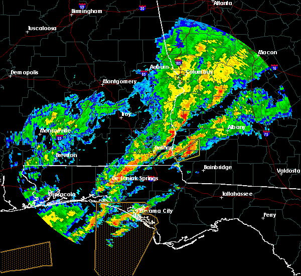 At 911 am est, a severe thunderstorm was located 5 miles northwest of colquitt, moving northeast at 45 mph (radar indicated). Hazards include 60 mph wind gusts and quarter size hail. Hail damage to vehicles is expected. expect wind damage to roofs, siding, and trees. Locations impacted include, colquitt, douglasville, centerville, damascus, cuba, harmony church rd/hwy 45, old damascus, jeterville, mayhaw, hentown and rowena. At 911 am est, a severe thunderstorm was located 5 miles northwest of colquitt, moving northeast at 45 mph (radar indicated). Hazards include 60 mph wind gusts and quarter size hail. Hail damage to vehicles is expected. expect wind damage to roofs, siding, and trees. Locations impacted include, colquitt, douglasville, centerville, damascus, cuba, harmony church rd/hwy 45, old damascus, jeterville, mayhaw, hentown and rowena.
|
| 12/17/2019 8:57 AM EST |
 At 857 am est, a severe thunderstorm was located 9 miles northwest of donalsonville, moving northeast at 45 mph (radar indicated). Hazards include 60 mph wind gusts and quarter size hail. Hail damage to vehicles is expected. Expect wind damage to roofs, siding, and trees. At 857 am est, a severe thunderstorm was located 9 miles northwest of donalsonville, moving northeast at 45 mph (radar indicated). Hazards include 60 mph wind gusts and quarter size hail. Hail damage to vehicles is expected. Expect wind damage to roofs, siding, and trees.
|
| 6/20/2019 8:40 PM EDT |
 The severe thunderstorm warning for northeastern decatur, miller, southwestern mitchell, southwestern baker, southern early and seminole counties will expire at 845 pm edt, the storm which prompted the warning has weakened below severe limits, and no longer poses an immediate threat to life or property. therefore, the warning will be allowed to expire. a severe thunderstorm watch remains in effect until 1000 pm edt for southeastern alabama, the panhandle of florida, and southwestern georgia. to report severe weather, contact your nearest law enforcement agency. they will relay your report to the national weather service tallahassee. The severe thunderstorm warning for northeastern decatur, miller, southwestern mitchell, southwestern baker, southern early and seminole counties will expire at 845 pm edt, the storm which prompted the warning has weakened below severe limits, and no longer poses an immediate threat to life or property. therefore, the warning will be allowed to expire. a severe thunderstorm watch remains in effect until 1000 pm edt for southeastern alabama, the panhandle of florida, and southwestern georgia. to report severe weather, contact your nearest law enforcement agency. they will relay your report to the national weather service tallahassee.
|
| 6/20/2019 7:46 PM EDT |
 At 746 pm edt, a severe thunderstorm was located 8 miles west of colquitt, moving southeast at 35 mph (radar indicated). Hazards include 60 mph wind gusts. expect damage to roofs, siding, and trees At 746 pm edt, a severe thunderstorm was located 8 miles west of colquitt, moving southeast at 35 mph (radar indicated). Hazards include 60 mph wind gusts. expect damage to roofs, siding, and trees
|
| 6/20/2019 7:20 PM EDT |
 The severe thunderstorm warning for southeastern dougherty, northeastern mitchell, baker and central early counties will expire at 730 pm edt, the storms which prompted the warning have weakened below severe limits, and no longer pose an immediate threat to life or property. therefore, the warning will be allowed to expire. a severe thunderstorm watch remains in effect until 1000 pm edt for south central and southwestern georgia. to report severe weather, contact your nearest law enforcement agency. they will relay your report to the national weather service tallahassee. The severe thunderstorm warning for southeastern dougherty, northeastern mitchell, baker and central early counties will expire at 730 pm edt, the storms which prompted the warning have weakened below severe limits, and no longer pose an immediate threat to life or property. therefore, the warning will be allowed to expire. a severe thunderstorm watch remains in effect until 1000 pm edt for south central and southwestern georgia. to report severe weather, contact your nearest law enforcement agency. they will relay your report to the national weather service tallahassee.
|
| 6/20/2019 7:07 PM EDT |
 At 706 pm edt, severe thunderstorms were located along a line extending from 7 miles north of colquitt to near baconton, moving southeast at 50 mph (radar indicated). Hazards include 60 mph wind gusts. Expect damage to roofs, siding, and trees. Locations impacted include, newton, putney, blakely, baconton, douglasville, centerville, sale city, damascus, iveys mill, flint, rock hill, lester, williamsburg, greenough, hentown, hilton, rowena, milford, red store crossroads and crestview. At 706 pm edt, severe thunderstorms were located along a line extending from 7 miles north of colquitt to near baconton, moving southeast at 50 mph (radar indicated). Hazards include 60 mph wind gusts. Expect damage to roofs, siding, and trees. Locations impacted include, newton, putney, blakely, baconton, douglasville, centerville, sale city, damascus, iveys mill, flint, rock hill, lester, williamsburg, greenough, hentown, hilton, rowena, milford, red store crossroads and crestview.
|
| 6/20/2019 6:28 PM EDT |
 At 628 pm edt, doppler radar indicated a line of severe thunderstorms capable of producing damaging winds in excess of 60 mph. these storms were located along a line extending from near blakely to 9 miles east of leary, and moving east at 30 mph. At 628 pm edt, doppler radar indicated a line of severe thunderstorms capable of producing damaging winds in excess of 60 mph. these storms were located along a line extending from near blakely to 9 miles east of leary, and moving east at 30 mph.
|
| 5/12/2019 1:04 PM EDT |
 At 102 pm edt, severe thunderstorms were located along a line extending from near shellman to 8 miles south of dawson to 7 miles northwest of newton, moving northeast at 40 mph (radar indicated). Hazards include 60 mph wind gusts. Expect damage to roofs, siding, and trees. Locations impacted include, newton, morgan, edison, arlington, leary, douglasville, damascus, iveys mill, parksville, carnegie, holt, clarks mill, mimsville, aycock mill, martins crossroads, chickasawhatchee, rowena, milford, crestview and moye. At 102 pm edt, severe thunderstorms were located along a line extending from near shellman to 8 miles south of dawson to 7 miles northwest of newton, moving northeast at 40 mph (radar indicated). Hazards include 60 mph wind gusts. Expect damage to roofs, siding, and trees. Locations impacted include, newton, morgan, edison, arlington, leary, douglasville, damascus, iveys mill, parksville, carnegie, holt, clarks mill, mimsville, aycock mill, martins crossroads, chickasawhatchee, rowena, milford, crestview and moye.
|
| 5/12/2019 12:42 PM EDT |
 At 1241 pm edt, severe thunderstorms were located along a line extending from 7 miles south of shellman to 9 miles west of newton to near bainbridge, moving east at 45 mph (radar indicated). Hazards include 60 mph wind gusts and penny size hail. expect damage to roofs, siding, and trees At 1241 pm edt, severe thunderstorms were located along a line extending from 7 miles south of shellman to 9 miles west of newton to near bainbridge, moving east at 45 mph (radar indicated). Hazards include 60 mph wind gusts and penny size hail. expect damage to roofs, siding, and trees
|
| 5/12/2019 12:28 PM EDT |
 At 1228 pm edt, severe thunderstorms were located along a line extending from 6 miles east of fort gaines to near arlington to near colquitt, moving northeast at 40 mph (radar indicated). Hazards include 60 mph wind gusts. expect damage to roofs, siding, and trees At 1228 pm edt, severe thunderstorms were located along a line extending from 6 miles east of fort gaines to near arlington to near colquitt, moving northeast at 40 mph (radar indicated). Hazards include 60 mph wind gusts. expect damage to roofs, siding, and trees
|
| 5/12/2019 11:55 AM EDT |
 At 1155 am edt/1055 am cdt/, severe thunderstorms were located along a line extending from 6 miles south of texasville to 9 miles west of blakely to 7 miles south of columbia, moving east at 50 mph (radar indicated). Hazards include 70 mph wind gusts and penny size hail. Expect considerable tree damage. Damage is likely to mobile homes, roofs, and outbuildings. At 1155 am edt/1055 am cdt/, severe thunderstorms were located along a line extending from 6 miles south of texasville to 9 miles west of blakely to 7 miles south of columbia, moving east at 50 mph (radar indicated). Hazards include 70 mph wind gusts and penny size hail. Expect considerable tree damage. Damage is likely to mobile homes, roofs, and outbuildings.
|
| 4/14/2019 12:06 PM EDT | 3 trees down near phillipsburg rd. time estimated by rada in miller county GA, 5.2 miles NW of Damascus, GA |
| 4/14/2019 11:38 AM EDT |
 At 1138 am edt, severe thunderstorms were located along a line extending from 7 miles south of arlington to near colquitt to near donalsonville, moving northeast at 50 mph (radar indicated). Hazards include 60 mph wind gusts. expect damage to roofs, siding, and trees At 1138 am edt, severe thunderstorms were located along a line extending from 7 miles south of arlington to near colquitt to near donalsonville, moving northeast at 50 mph (radar indicated). Hazards include 60 mph wind gusts. expect damage to roofs, siding, and trees
|
| 3/3/2019 6:49 PM EST |
 At 648 pm est, severe thunderstorms were located along a line extending from 11 miles north of sylvester to 6 miles west of donalsonville, moving east at 30 mph (radar indicated). Hazards include 60 mph wind gusts. Expect damage to roofs, siding, and trees. locations impacted include, colquitt, newton, albany, donalsonville, pelham, putney, camilla, baconton, east albany, marine corps logistics base, turner city, walker, douglasville, centerville, warwick, iron city, damascus, brinson, jakin and iveys mill. A tornado watch remains in effect until 1000 pm est for southeastern alabama, and south central and southwestern georgia. At 648 pm est, severe thunderstorms were located along a line extending from 11 miles north of sylvester to 6 miles west of donalsonville, moving east at 30 mph (radar indicated). Hazards include 60 mph wind gusts. Expect damage to roofs, siding, and trees. locations impacted include, colquitt, newton, albany, donalsonville, pelham, putney, camilla, baconton, east albany, marine corps logistics base, turner city, walker, douglasville, centerville, warwick, iron city, damascus, brinson, jakin and iveys mill. A tornado watch remains in effect until 1000 pm est for southeastern alabama, and south central and southwestern georgia.
|
| 3/3/2019 6:37 PM EST |
 At 637 pm est/537 pm cst/, a severe thunderstorm capable of producing a tornado was located 10 miles west of donalsonville, moving east at 45 mph (radar indicated rotation). Hazards include tornado. Flying debris will be dangerous to those caught without shelter. mobile homes will be damaged or destroyed. damage to roofs, windows, and vehicles will occur. tree damage is likely. this dangerous storm will be near, donalsonville around 650 pm est. colquitt around 700 pm est. Other locations impacted by this tornadic thunderstorm include gordon, saffold, brinson, crosby, howards mill, davis park, little hope, mayhaw, boykin and killarney. At 637 pm est/537 pm cst/, a severe thunderstorm capable of producing a tornado was located 10 miles west of donalsonville, moving east at 45 mph (radar indicated rotation). Hazards include tornado. Flying debris will be dangerous to those caught without shelter. mobile homes will be damaged or destroyed. damage to roofs, windows, and vehicles will occur. tree damage is likely. this dangerous storm will be near, donalsonville around 650 pm est. colquitt around 700 pm est. Other locations impacted by this tornadic thunderstorm include gordon, saffold, brinson, crosby, howards mill, davis park, little hope, mayhaw, boykin and killarney.
|
| 3/3/2019 6:27 PM EST |
 At 627 pm est/527 pm cst/, severe thunderstorms were located along a line extending from near arabi to 11 miles west of donalsonville, moving east at 60 mph (radar indicated). Hazards include 60 mph wind gusts. expect damage to roofs, siding, and trees At 627 pm est/527 pm cst/, severe thunderstorms were located along a line extending from near arabi to 11 miles west of donalsonville, moving east at 60 mph (radar indicated). Hazards include 60 mph wind gusts. expect damage to roofs, siding, and trees
|
| 3/3/2019 6:16 PM EST |
 At 615 pm est/515 pm cst/, severe thunderstorms were located along a line extending from 7 miles southeast of shellman to near cottonwood, moving east at 55 mph (radar indicated). Hazards include 60 mph wind gusts and penny size hail. Expect damage to roofs, siding, and trees. locations impacted include, cottonwood, morgan, blakely, ashford, edison, arlington, columbia, leary, douglasville, centerville, madrid, gordon, damascus, jakin, saffold, pansey, crosby, grangeburg, parksville and mayhaw. A tornado watch remains in effect until 800 pm est/700 pm cst/ for southeastern alabama, the panhandle of florida, and southwestern georgia. At 615 pm est/515 pm cst/, severe thunderstorms were located along a line extending from 7 miles southeast of shellman to near cottonwood, moving east at 55 mph (radar indicated). Hazards include 60 mph wind gusts and penny size hail. Expect damage to roofs, siding, and trees. locations impacted include, cottonwood, morgan, blakely, ashford, edison, arlington, columbia, leary, douglasville, centerville, madrid, gordon, damascus, jakin, saffold, pansey, crosby, grangeburg, parksville and mayhaw. A tornado watch remains in effect until 800 pm est/700 pm cst/ for southeastern alabama, the panhandle of florida, and southwestern georgia.
|
| 3/3/2019 6:04 PM EST |
 At 604 pm est/504 pm cst/, severe thunderstorms were located along a line extending from near shellman to 6 miles northeast of graceville, moving east at 35 mph (radar indicated). Hazards include 60 mph wind gusts and penny size hail. Expect damage to roofs, siding, and trees. locations impacted include, cottonwood, morgan, blakely, dothan, taylor, ashford, cowarts, edison, arlington, webb, columbia, leary, kinsey, douglasville, centerville, malvern, rehobeth, avon, madrid and gordon. A tornado watch remains in effect until 800 pm est/700 pm cst/ for southeastern alabama, the panhandle of florida, and southwestern georgia. At 604 pm est/504 pm cst/, severe thunderstorms were located along a line extending from near shellman to 6 miles northeast of graceville, moving east at 35 mph (radar indicated). Hazards include 60 mph wind gusts and penny size hail. Expect damage to roofs, siding, and trees. locations impacted include, cottonwood, morgan, blakely, dothan, taylor, ashford, cowarts, edison, arlington, webb, columbia, leary, kinsey, douglasville, centerville, malvern, rehobeth, avon, madrid and gordon. A tornado watch remains in effect until 800 pm est/700 pm cst/ for southeastern alabama, the panhandle of florida, and southwestern georgia.
|
| 3/3/2019 5:39 PM EST |
 At 538 pm est/438 pm cst/, severe thunderstorms were located along a line extending from 6 miles southwest of cuthbert to near hartford, moving east at 70 mph (radar indicated). Hazards include 60 mph wind gusts and penny size hail. expect damage to roofs, siding, and trees At 538 pm est/438 pm cst/, severe thunderstorms were located along a line extending from 6 miles southwest of cuthbert to near hartford, moving east at 70 mph (radar indicated). Hazards include 60 mph wind gusts and penny size hail. expect damage to roofs, siding, and trees
|
| 3/3/2019 3:05 PM EST |
 At 304 pm est, a severe thunderstorm was located near blakely, moving east at 45 mph (radar indicated). Hazards include 60 mph wind gusts and quarter size hail. Hail damage to vehicles is expected. Expect wind damage to roofs, siding, and trees. At 304 pm est, a severe thunderstorm was located near blakely, moving east at 45 mph (radar indicated). Hazards include 60 mph wind gusts and quarter size hail. Hail damage to vehicles is expected. Expect wind damage to roofs, siding, and trees.
|
| 12/28/2018 12:58 PM EST |
 The severe thunderstorm warning for southwestern calhoun and northeastern early counties in southwestern georgia will expire at 100 pm est. the storm which prompted the warning has weakened below severe limits, and has exited the warned area. therefore, the warning will be allowed to expire. However gusty winds are still possible with. The severe thunderstorm warning for southwestern calhoun and northeastern early counties in southwestern georgia will expire at 100 pm est. the storm which prompted the warning has weakened below severe limits, and has exited the warned area. therefore, the warning will be allowed to expire. However gusty winds are still possible with.
|
| 12/28/2018 12:47 PM EST |
 At 1246 pm est, a severe thunderstorm was located 7 miles east of blakely, moving east at 20 mph (radar indicated). Hazards include 60 mph wind gusts. Expect damage to roofs, siding, and trees. Locations impacted include, arlington, douglasville, damascus, cuba, commissary hill, turman, old damascus and rowena. At 1246 pm est, a severe thunderstorm was located 7 miles east of blakely, moving east at 20 mph (radar indicated). Hazards include 60 mph wind gusts. Expect damage to roofs, siding, and trees. Locations impacted include, arlington, douglasville, damascus, cuba, commissary hill, turman, old damascus and rowena.
|
| 12/28/2018 12:21 PM EST |
 At 1220 pm est, a severe thunderstorm was located near blakely, moving east at 35 mph (radar indicated). Hazards include 60 mph wind gusts. expect damage to roofs, siding, and trees At 1220 pm est, a severe thunderstorm was located near blakely, moving east at 35 mph (radar indicated). Hazards include 60 mph wind gusts. expect damage to roofs, siding, and trees
|
| 9/4/2018 4:10 PM EDT |
 At 410 pm edt/310 pm cdt/, a severe thunderstorm was located near arlington, or near blakely, moving west at 30 mph (radar indicated). Hazards include 60 mph wind gusts. expect damage to roofs, siding, and trees At 410 pm edt/310 pm cdt/, a severe thunderstorm was located near arlington, or near blakely, moving west at 30 mph (radar indicated). Hazards include 60 mph wind gusts. expect damage to roofs, siding, and trees
|
| 9/3/2018 3:20 PM EDT |
 At 320 pm edt, a severe thunderstorm was located 7 miles south of arlington, or 11 miles north of colquitt, moving west at 35 mph (radar indicated). Hazards include 60 mph wind gusts. expect damage to roofs, siding, and trees At 320 pm edt, a severe thunderstorm was located 7 miles south of arlington, or 11 miles north of colquitt, moving west at 35 mph (radar indicated). Hazards include 60 mph wind gusts. expect damage to roofs, siding, and trees
|
| 8/31/2018 5:56 PM EDT |
 At 556 pm edt, severe thunderstorms were located along a line extending from 9 miles north of donalsonville to 14 miles south of newton, moving northwest at 20 mph (radar indicated). Hazards include 60 mph wind gusts. expect damage to roofs, siding, and trees At 556 pm edt, severe thunderstorms were located along a line extending from 9 miles north of donalsonville to 14 miles south of newton, moving northwest at 20 mph (radar indicated). Hazards include 60 mph wind gusts. expect damage to roofs, siding, and trees
|
| 8/6/2018 9:01 PM EDT |
 At 901 pm edt/801 pm cdt/, severe thunderstorms were located along a line extending from near richards crossroads to near west bainbridge, moving southwest at 20 mph (radar indicated). Hazards include 60 mph wind gusts. Expect damage to roofs, siding, and trees. Locations impacted include, abbeville, colquitt, fort gaines, bainbridge, donalsonville, blakely, columbia, west bainbridge, centerville, gordon, iron city, damascus, brinson, jakin, haleburg, bluffton, shorterville, crosby, hayes and watson crossroads. At 901 pm edt/801 pm cdt/, severe thunderstorms were located along a line extending from near richards crossroads to near west bainbridge, moving southwest at 20 mph (radar indicated). Hazards include 60 mph wind gusts. Expect damage to roofs, siding, and trees. Locations impacted include, abbeville, colquitt, fort gaines, bainbridge, donalsonville, blakely, columbia, west bainbridge, centerville, gordon, iron city, damascus, brinson, jakin, haleburg, bluffton, shorterville, crosby, hayes and watson crossroads.
|
| 8/6/2018 8:32 PM EDT |
 At 832 pm edt/732 pm cdt/, severe thunderstorms were located along a line extending from near georgetown to 15 miles southwest of newton, moving southwest at 10 mph (radar indicated). Hazards include 60 mph wind gusts. expect damage to roofs, siding, and trees At 832 pm edt/732 pm cdt/, severe thunderstorms were located along a line extending from near georgetown to 15 miles southwest of newton, moving southwest at 10 mph (radar indicated). Hazards include 60 mph wind gusts. expect damage to roofs, siding, and trees
|
| 8/6/2018 8:32 PM EDT |
 The national weather service in tallahassee has issued a * severe thunderstorm warning for. eastern henry county in southeastern alabama. eastern houston county in southeastern alabama. northern decatur county in southwestern georgia. Miller county in southwestern georgia. The national weather service in tallahassee has issued a * severe thunderstorm warning for. eastern henry county in southeastern alabama. eastern houston county in southeastern alabama. northern decatur county in southwestern georgia. Miller county in southwestern georgia.
|
| 8/6/2018 8:06 PM EDT |
 At 805 pm edt, a severe thunderstorm was located over edison, or 9 miles west of morgan, moving southwest at 20 mph (radar indicated). Hazards include 60 mph wind gusts. expect damage to roofs, siding, and trees At 805 pm edt, a severe thunderstorm was located over edison, or 9 miles west of morgan, moving southwest at 20 mph (radar indicated). Hazards include 60 mph wind gusts. expect damage to roofs, siding, and trees
|
| 7/22/2018 4:09 PM EDT |
 A severe thunderstorm warning remains in effect until 430 pm edt/330 pm cdt/ for southeastern henry county in southeastern alabama. southern clay. south central randolph. western calhoun and northern early counties in southwestern georgia. At 409 pm edt/309 pm cdt/, a severe thunderstorm was located near blakely, moving east at 40 mph. A severe thunderstorm warning remains in effect until 430 pm edt/330 pm cdt/ for southeastern henry county in southeastern alabama. southern clay. south central randolph. western calhoun and northern early counties in southwestern georgia. At 409 pm edt/309 pm cdt/, a severe thunderstorm was located near blakely, moving east at 40 mph.
|
| 7/21/2018 10:41 PM EDT |
 At 1012 pm edt, doppler radar indicated a severe thunderstorm capable of producing quarter size hail and damaging winds in excess of 60 mph. this storm was located 8 miles northeast of colquitt, and moving southeast at 50 mph. At 1012 pm edt, doppler radar indicated a severe thunderstorm capable of producing quarter size hail and damaging winds in excess of 60 mph. this storm was located 8 miles northeast of colquitt, and moving southeast at 50 mph.
|
| 7/21/2018 10:13 PM EDT |
 At 1013 pm edt, severe thunderstorms were located along a line extending from near newton to 15 miles east of colquitt, moving southeast at 45 mph (radar indicated). Hazards include 60 mph wind gusts and quarter size hail. Hail damage to vehicles is expected. expect wind damage to roofs, siding, and trees. Locations impacted include, newton, camilla, arlington, douglasville, damascus, iveys mill, milford, hopeful, red store crossroads, crestview, hoggard mill, hawkinstown, commissary hill, mimsville, mitchell co a/p, branchville, old damascus, jeterville, cooktown and elmodel wma. At 1013 pm edt, severe thunderstorms were located along a line extending from near newton to 15 miles east of colquitt, moving southeast at 45 mph (radar indicated). Hazards include 60 mph wind gusts and quarter size hail. Hail damage to vehicles is expected. expect wind damage to roofs, siding, and trees. Locations impacted include, newton, camilla, arlington, douglasville, damascus, iveys mill, milford, hopeful, red store crossroads, crestview, hoggard mill, hawkinstown, commissary hill, mimsville, mitchell co a/p, branchville, old damascus, jeterville, cooktown and elmodel wma.
|
| 7/21/2018 10:12 PM EDT |
 At 1012 pm edt, doppler radar indicated a severe thunderstorm capable of producing quarter size hail and damaging winds in excess of 60 mph. this storm was located 8 miles northeast of colquitt, and moving southeast at 50 mph. At 1012 pm edt, doppler radar indicated a severe thunderstorm capable of producing quarter size hail and damaging winds in excess of 60 mph. this storm was located 8 miles northeast of colquitt, and moving southeast at 50 mph.
|
| 7/21/2018 9:54 PM EDT |
 At 954 pm edt, severe thunderstorms were located along a line extending from 7 miles east of leary to 9 miles southeast of arlington, moving southeast at 40 mph (radar indicated). Hazards include 60 mph wind gusts and quarter size hail. Hail damage to vehicles is expected. expect wind damage to roofs, siding, and trees. Locations impacted include, newton, morgan, pelham, camilla, edison, arlington, baconton, leary, walker, douglasville, damascus, iveys mill, flint, parksville, cotton, holt, mimsville, branchville, greenough and bellview. At 954 pm edt, severe thunderstorms were located along a line extending from 7 miles east of leary to 9 miles southeast of arlington, moving southeast at 40 mph (radar indicated). Hazards include 60 mph wind gusts and quarter size hail. Hail damage to vehicles is expected. expect wind damage to roofs, siding, and trees. Locations impacted include, newton, morgan, pelham, camilla, edison, arlington, baconton, leary, walker, douglasville, damascus, iveys mill, flint, parksville, cotton, holt, mimsville, branchville, greenough and bellview.
|
| 7/21/2018 9:39 PM EDT |
 At 939 pm edt, severe thunderstorms were located along a line extending from 11 miles south of dawson to near morgan, moving southeast at 45 mph (radar indicated). Hazards include 60 mph wind gusts and quarter size hail. Hail damage to vehicles is expected. Expect wind damage to roofs, siding, and trees. At 939 pm edt, severe thunderstorms were located along a line extending from 11 miles south of dawson to near morgan, moving southeast at 45 mph (radar indicated). Hazards include 60 mph wind gusts and quarter size hail. Hail damage to vehicles is expected. Expect wind damage to roofs, siding, and trees.
|
| 7/21/2018 11:48 AM EDT |
 At 1148 am edt/1048 am cdt/, severe thunderstorms were located along a line extending from 6 miles east of leary to 11 miles southeast of columbia, moving southeast at 45 mph (radar indicated). Hazards include 60 mph wind gusts and nickel size hail. Expect damage to roofs, siding, and trees. Locations impacted include, colquitt, newton, morgan, donalsonville, camilla, blakely, arlington, leary, douglasville, centerville, gordon, iron city, damascus, brinson, jakin, iveys mill, donaldsonville a/p, bellview, rowena and vada. At 1148 am edt/1048 am cdt/, severe thunderstorms were located along a line extending from 6 miles east of leary to 11 miles southeast of columbia, moving southeast at 45 mph (radar indicated). Hazards include 60 mph wind gusts and nickel size hail. Expect damage to roofs, siding, and trees. Locations impacted include, colquitt, newton, morgan, donalsonville, camilla, blakely, arlington, leary, douglasville, centerville, gordon, iron city, damascus, brinson, jakin, iveys mill, donaldsonville a/p, bellview, rowena and vada.
|
| 7/21/2018 11:25 AM EDT |
 At 1124 am edt/1024 am cdt/, severe thunderstorms were located along a line extending from near edison to webb, moving southeast at 45 mph (radar indicated). Hazards include 60 mph wind gusts and nickel size hail. expect damage to roofs, siding, and trees At 1124 am edt/1024 am cdt/, severe thunderstorms were located along a line extending from near edison to webb, moving southeast at 45 mph (radar indicated). Hazards include 60 mph wind gusts and nickel size hail. expect damage to roofs, siding, and trees
|
| 7/6/2018 9:05 PM EDT |
 The national weather service in tallahassee has issued a * severe thunderstorm warning for. northeastern miller county in southwestern georgia. southwestern dougherty county in southwestern georgia. central mitchell county in southwestern georgia. Baker county in southwestern georgia. The national weather service in tallahassee has issued a * severe thunderstorm warning for. northeastern miller county in southwestern georgia. southwestern dougherty county in southwestern georgia. central mitchell county in southwestern georgia. Baker county in southwestern georgia.
|
| 7/3/2018 9:03 PM EDT |
 At 903 pm edt, a severe thunderstorm was located over arlington, or 10 miles southwest of morgan, moving west at 25 mph (radar indicated). Hazards include 60 mph wind gusts. expect damage to roofs, siding, and trees At 903 pm edt, a severe thunderstorm was located over arlington, or 10 miles southwest of morgan, moving west at 25 mph (radar indicated). Hazards include 60 mph wind gusts. expect damage to roofs, siding, and trees
|
| 6/2/2018 6:04 PM EDT |
 At 604 pm edt, a severe thunderstorm was located 8 miles north of donalsonville, moving southeast at 35 mph (radar indicated). Hazards include 60 mph wind gusts. expect damage to roofs, siding, and trees At 604 pm edt, a severe thunderstorm was located 8 miles north of donalsonville, moving southeast at 35 mph (radar indicated). Hazards include 60 mph wind gusts. expect damage to roofs, siding, and trees
|
| 5/20/2018 3:35 PM EDT |
 The severe thunderstorm warning for northern miller, northwestern baker, southern calhoun and northeastern early counties in southwestern georgia will expire at 345 pm edt, the storm which prompted the warning has weakened below severe limits, and no longer poses an immediate threat to life or property. therefore, the warning will be allowed to expire. The severe thunderstorm warning for northern miller, northwestern baker, southern calhoun and northeastern early counties in southwestern georgia will expire at 345 pm edt, the storm which prompted the warning has weakened below severe limits, and no longer poses an immediate threat to life or property. therefore, the warning will be allowed to expire.
|
| 5/20/2018 2:58 PM EDT |
 The national weather service in tallahassee has issued a * severe thunderstorm warning for. northern miller county in southwestern georgia. northwestern baker county in southwestern georgia. southern calhoun county in southwestern georgia. Northeastern early county in southwestern georgia. The national weather service in tallahassee has issued a * severe thunderstorm warning for. northern miller county in southwestern georgia. northwestern baker county in southwestern georgia. southern calhoun county in southwestern georgia. Northeastern early county in southwestern georgia.
|
| 4/22/2018 8:20 PM EDT |
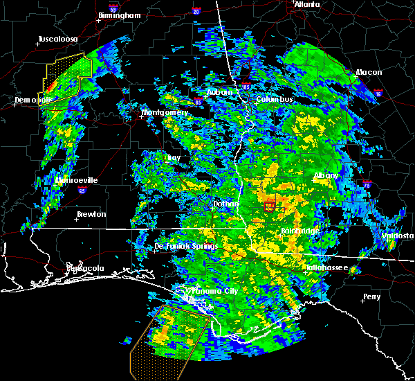 The tornado warning for north central miller and east central early counties will expire at 830 pm edt, the storm which prompted the warning has weakened below severe limits, and no longer appears capable of producing a tornado. therefore, the warning will be allowed to expire. a tornado watch remains in effect until 1000 pm edt for southwestern georgia. to report severe weather, contact your nearest law enforcement agency. they will relay your report to the national weather service tallahassee. The tornado warning for north central miller and east central early counties will expire at 830 pm edt, the storm which prompted the warning has weakened below severe limits, and no longer appears capable of producing a tornado. therefore, the warning will be allowed to expire. a tornado watch remains in effect until 1000 pm edt for southwestern georgia. to report severe weather, contact your nearest law enforcement agency. they will relay your report to the national weather service tallahassee.
|
| 4/22/2018 8:12 PM EDT |
 At 812 pm edt, a severe thunderstorm capable of producing a tornado was located near colquitt, moving northeast at 25 mph (radar indicated rotation). Hazards include tornado. Flying debris will be dangerous to those caught without shelter. mobile homes will be damaged or destroyed. damage to roofs, windows, and vehicles will occur. tree damage is likely. Locations impacted include, damascus, harmony church rd/hwy 45, jeterville and old damascus. At 812 pm edt, a severe thunderstorm capable of producing a tornado was located near colquitt, moving northeast at 25 mph (radar indicated rotation). Hazards include tornado. Flying debris will be dangerous to those caught without shelter. mobile homes will be damaged or destroyed. damage to roofs, windows, and vehicles will occur. tree damage is likely. Locations impacted include, damascus, harmony church rd/hwy 45, jeterville and old damascus.
|
| 4/22/2018 8:04 PM EDT |
 At 804 pm edt, a severe thunderstorm capable of producing a tornado was located near colquitt, moving northeast at 20 mph (radar indicated rotation). Hazards include tornado. Flying debris will be dangerous to those caught without shelter. mobile homes will be damaged or destroyed. damage to roofs, windows, and vehicles will occur. tree damage is likely. Locations impacted include, colquitt, damascus, harmony church rd/hwy 45, old damascus and jeterville. At 804 pm edt, a severe thunderstorm capable of producing a tornado was located near colquitt, moving northeast at 20 mph (radar indicated rotation). Hazards include tornado. Flying debris will be dangerous to those caught without shelter. mobile homes will be damaged or destroyed. damage to roofs, windows, and vehicles will occur. tree damage is likely. Locations impacted include, colquitt, damascus, harmony church rd/hwy 45, old damascus and jeterville.
|
| 4/22/2018 7:55 PM EDT |
 At 755 pm edt, a severe thunderstorm capable of producing a tornado was located over colquitt, moving northeast at 25 mph (radar indicated rotation). Hazards include tornado. Flying debris will be dangerous to those caught without shelter. mobile homes will be damaged or destroyed. damage to roofs, windows, and vehicles will occur. tree damage is likely. This tornadic thunderstorm will remain over mainly rural areas of north central miller and east central early counties, including the following locations, harmony church rd/hwy 45, old damascus, jeterville and damascus. At 755 pm edt, a severe thunderstorm capable of producing a tornado was located over colquitt, moving northeast at 25 mph (radar indicated rotation). Hazards include tornado. Flying debris will be dangerous to those caught without shelter. mobile homes will be damaged or destroyed. damage to roofs, windows, and vehicles will occur. tree damage is likely. This tornadic thunderstorm will remain over mainly rural areas of north central miller and east central early counties, including the following locations, harmony church rd/hwy 45, old damascus, jeterville and damascus.
|
| 7/8/2017 5:11 PM EDT |
 At 511 pm edt, a severe thunderstorm was located near columbia, or 7 miles west of blakely, moving east at 30 mph (radar indicated). Hazards include 60 mph wind gusts and quarter size hail. Hail damage to vehicles is expected. Expect wind damage to roofs, siding, and trees. At 511 pm edt, a severe thunderstorm was located near columbia, or 7 miles west of blakely, moving east at 30 mph (radar indicated). Hazards include 60 mph wind gusts and quarter size hail. Hail damage to vehicles is expected. Expect wind damage to roofs, siding, and trees.
|
| 4/3/2017 12:59 PM EDT |
 At 1258 pm edt, doppler radar indicated a line of severe thunderstorms capable of producing damaging winds in excess of 60 mph. these storms were located along a line extending from morgan to near colquitt, and moving east at 45 mph. At 1258 pm edt, doppler radar indicated a line of severe thunderstorms capable of producing damaging winds in excess of 60 mph. these storms were located along a line extending from morgan to near colquitt, and moving east at 45 mph.
|
| 4/3/2017 12:28 PM EDT |
 At 1228 pm edt/1128 am cdt/, severe thunderstorms were located along a line extending from columbia to 6 miles east of cottonwood to 9 miles north of marianna to near chipley, moving east at 35 mph (radar indicated). Hazards include 60 mph wind gusts. expect damage to roofs, siding, and trees At 1228 pm edt/1128 am cdt/, severe thunderstorms were located along a line extending from columbia to 6 miles east of cottonwood to 9 miles north of marianna to near chipley, moving east at 35 mph (radar indicated). Hazards include 60 mph wind gusts. expect damage to roofs, siding, and trees
|
| 3/10/2017 7:29 AM EST |
 At 728 am est/628 am cst/, a severe thunderstorm was located 8 miles southeast of arlington, or 13 miles south of morgan, moving east at 80 mph (radar indicated). Hazards include 60 mph wind gusts. Expect damage to roofs, siding, and trees. Locations impacted include, ashford, cowarts, arlington, douglasville, centerville, avon, gordon, damascus, saffold, pansey, howards mill, crestview, enon, lovetown, cuba, farley nuclear plant, cedar springs, old damascus, hentown and hilton. At 728 am est/628 am cst/, a severe thunderstorm was located 8 miles southeast of arlington, or 13 miles south of morgan, moving east at 80 mph (radar indicated). Hazards include 60 mph wind gusts. Expect damage to roofs, siding, and trees. Locations impacted include, ashford, cowarts, arlington, douglasville, centerville, avon, gordon, damascus, saffold, pansey, howards mill, crestview, enon, lovetown, cuba, farley nuclear plant, cedar springs, old damascus, hentown and hilton.
|
| 3/10/2017 7:18 AM EST |
 At 717 am est/617 am cst/, a severe thunderstorm was located near blakely, moving east at 50 mph (radar indicated). Hazards include 60 mph wind gusts. expect damage to roofs, siding, and trees At 717 am est/617 am cst/, a severe thunderstorm was located near blakely, moving east at 50 mph (radar indicated). Hazards include 60 mph wind gusts. expect damage to roofs, siding, and trees
|
| 2/7/2017 6:23 PM EST |
 At 622 pm est, severe thunderstorms were located along a line extending from 9 miles northeast of colquitt to 10 miles north of west bainbridge to 6 miles south of bainbridge, moving east at 55 mph (radar indicated). Hazards include 60 mph wind gusts. expect damage to roofs, siding, and trees At 622 pm est, severe thunderstorms were located along a line extending from 9 miles northeast of colquitt to 10 miles north of west bainbridge to 6 miles south of bainbridge, moving east at 55 mph (radar indicated). Hazards include 60 mph wind gusts. expect damage to roofs, siding, and trees
|
| 2/7/2017 6:15 PM EST |
 At 615 pm est/515 pm cst/, severe thunderstorms were located along a line extending from 7 miles north of colquitt to 10 miles north of west bainbridge to 8 miles southwest of bainbridge, moving east at 55 mph (radar indicated). Hazards include 70 mph wind gusts. Expect considerable tree damage. damage is likely to mobile homes, roofs, and outbuildings. Locations impacted include, colquitt, newton, cairo, bainbridge, donalsonville, whigham, west bainbridge, chattahoochee, douglasville, centerville, attapulgus, iron city, climax, damascus, brinson, cuba, sharphagen, vada, branchville and harrells still. At 615 pm est/515 pm cst/, severe thunderstorms were located along a line extending from 7 miles north of colquitt to 10 miles north of west bainbridge to 8 miles southwest of bainbridge, moving east at 55 mph (radar indicated). Hazards include 70 mph wind gusts. Expect considerable tree damage. damage is likely to mobile homes, roofs, and outbuildings. Locations impacted include, colquitt, newton, cairo, bainbridge, donalsonville, whigham, west bainbridge, chattahoochee, douglasville, centerville, attapulgus, iron city, climax, damascus, brinson, cuba, sharphagen, vada, branchville and harrells still.
|
| 2/7/2017 5:46 PM EST |
 At 545 pm est/445 pm cst/, severe thunderstorms were located along a line extending from near columbia to 9 miles west of donalsonville to 11 miles east of marianna, moving east at 55 mph (radar indicated). Hazards include 70 mph wind gusts. Expect considerable tree damage. Damage is likely to mobile homes, roofs, and outbuildings. At 545 pm est/445 pm cst/, severe thunderstorms were located along a line extending from near columbia to 9 miles west of donalsonville to 11 miles east of marianna, moving east at 55 mph (radar indicated). Hazards include 70 mph wind gusts. Expect considerable tree damage. Damage is likely to mobile homes, roofs, and outbuildings.
|
| 1/22/2017 2:54 PM EST |
 At 254 pm est, a severe thunderstorm capable of producing a tornado was located 7 miles north of colquitt, moving northeast at 65 mph (radar indicated rotation). Hazards include tornado. Flying debris will be dangerous to those caught without shelter. mobile homes will be damaged or destroyed. damage to roofs, windows, and vehicles will occur. tree damage is likely. Locations impacted include, arlington, douglasville, damascus, old damascus, patmos, bethany, rowena, milford, jeterville, commissary hill, iveys mill, harmony church rd/hwy 45, elmodel wma and crestview. At 254 pm est, a severe thunderstorm capable of producing a tornado was located 7 miles north of colquitt, moving northeast at 65 mph (radar indicated rotation). Hazards include tornado. Flying debris will be dangerous to those caught without shelter. mobile homes will be damaged or destroyed. damage to roofs, windows, and vehicles will occur. tree damage is likely. Locations impacted include, arlington, douglasville, damascus, old damascus, patmos, bethany, rowena, milford, jeterville, commissary hill, iveys mill, harmony church rd/hwy 45, elmodel wma and crestview.
|
| 1/22/2017 2:45 PM EST |
 At 245 pm est, a severe thunderstorm capable of producing a tornado was located 7 miles west of colquitt, moving northeast at 65 mph (radar indicated rotation). Hazards include tornado. Flying debris will be dangerous to those caught without shelter. mobile homes will be damaged or destroyed. damage to roofs, windows, and vehicles will occur. tree damage is likely. Locations impacted include, colquitt, arlington, douglasville, damascus, jakin, old damascus, patmos, cuba, bethany, rowena, milford, jeterville, commissary hill, howards mill, enterprise, hentown, iveys mill, harmony church rd/hwy 45, mimsville and elmodel wma. At 245 pm est, a severe thunderstorm capable of producing a tornado was located 7 miles west of colquitt, moving northeast at 65 mph (radar indicated rotation). Hazards include tornado. Flying debris will be dangerous to those caught without shelter. mobile homes will be damaged or destroyed. damage to roofs, windows, and vehicles will occur. tree damage is likely. Locations impacted include, colquitt, arlington, douglasville, damascus, jakin, old damascus, patmos, cuba, bethany, rowena, milford, jeterville, commissary hill, howards mill, enterprise, hentown, iveys mill, harmony church rd/hwy 45, mimsville and elmodel wma.
|
| 1/22/2017 2:39 PM EST |
 At 238 pm est/138 pm cst/, a severe thunderstorm capable of producing a tornado was located near donalsonville, moving northeast at 65 mph (radar indicated rotation). Hazards include tornado. Flying debris will be dangerous to those caught without shelter. mobile homes will be damaged or destroyed. damage to roofs, windows, and vehicles will occur. Tree damage is likely. At 238 pm est/138 pm cst/, a severe thunderstorm capable of producing a tornado was located near donalsonville, moving northeast at 65 mph (radar indicated rotation). Hazards include tornado. Flying debris will be dangerous to those caught without shelter. mobile homes will be damaged or destroyed. damage to roofs, windows, and vehicles will occur. Tree damage is likely.
|
| 1/22/2017 10:06 AM EST |
 At 1006 am est, a severe thunderstorm was located 10 miles northeast of colquitt, moving northeast at 45 mph (radar indicated). Hazards include ping pong ball size hail and 60 mph wind gusts. People and animals outdoors will be injured. expect hail damage to roofs, siding, windows, and vehicles. Expect wind damage to roofs, siding, and trees. At 1006 am est, a severe thunderstorm was located 10 miles northeast of colquitt, moving northeast at 45 mph (radar indicated). Hazards include ping pong ball size hail and 60 mph wind gusts. People and animals outdoors will be injured. expect hail damage to roofs, siding, windows, and vehicles. Expect wind damage to roofs, siding, and trees.
|
| 1/22/2017 3:32 AM EST |
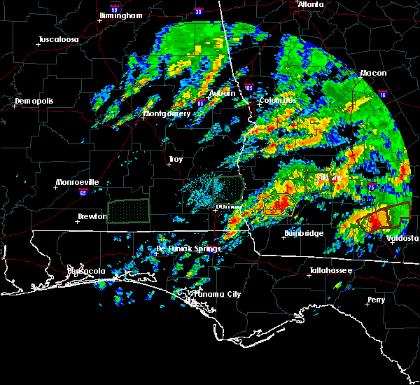 At 331 am est, a severe thunderstorm was located 11 miles south of leary, or 11 miles west of newton, moving east at 60 mph (radar indicated). Hazards include 70 mph wind gusts and nickel size hail. Expect considerable tree damage. damage is likely to mobile homes, roofs, and outbuildings. locations impacted include, colquitt, douglasville, damascus, old damascus, patmos, bethany, rowena, milford, jeterville, hoggard mill, iveys mill, harmony church rd/hwy 45, hawkinstown, mimsville, elmodel wma, cooktown and crestview. A tornado watch remains in effect until 1000 am est for southwestern georgia. At 331 am est, a severe thunderstorm was located 11 miles south of leary, or 11 miles west of newton, moving east at 60 mph (radar indicated). Hazards include 70 mph wind gusts and nickel size hail. Expect considerable tree damage. damage is likely to mobile homes, roofs, and outbuildings. locations impacted include, colquitt, douglasville, damascus, old damascus, patmos, bethany, rowena, milford, jeterville, hoggard mill, iveys mill, harmony church rd/hwy 45, hawkinstown, mimsville, elmodel wma, cooktown and crestview. A tornado watch remains in effect until 1000 am est for southwestern georgia.
|
| 1/22/2017 3:14 AM EST |
 At 314 am est, a severe thunderstorm was located 7 miles northwest of colquitt, moving east at 60 mph (radar indicated). Hazards include 70 mph wind gusts and nickel size hail. Expect considerable tree damage. damage is likely to mobile homes, roofs, and outbuildings. locations impacted include, colquitt, blakely, columbia, douglasville, centerville, gordon, damascus, jakin, patmos, cedar springs, cuba, bethany, rowena, jeterville, hoggard mill, mimsville, elmodel wma, cooktown, boykin and hilton. A tornado watch remains in effect until 400 am est for southeastern alabama, and southwestern georgia. At 314 am est, a severe thunderstorm was located 7 miles northwest of colquitt, moving east at 60 mph (radar indicated). Hazards include 70 mph wind gusts and nickel size hail. Expect considerable tree damage. damage is likely to mobile homes, roofs, and outbuildings. locations impacted include, colquitt, blakely, columbia, douglasville, centerville, gordon, damascus, jakin, patmos, cedar springs, cuba, bethany, rowena, jeterville, hoggard mill, mimsville, elmodel wma, cooktown, boykin and hilton. A tornado watch remains in effect until 400 am est for southeastern alabama, and southwestern georgia.
|
| 1/22/2017 2:59 AM EST |
 At 259 am est/159 am cst/, a severe thunderstorm was located 7 miles southeast of columbia, or 14 miles southwest of blakely, moving east at 60 mph (radar indicated). Hazards include 60 mph wind gusts and penny size hail. expect damage to roofs, siding, and trees At 259 am est/159 am cst/, a severe thunderstorm was located 7 miles southeast of columbia, or 14 miles southwest of blakely, moving east at 60 mph (radar indicated). Hazards include 60 mph wind gusts and penny size hail. expect damage to roofs, siding, and trees
|
| 1/21/2017 12:25 PM EST |
 At 1225 pm est, severe thunderstorms were located along a line extending from 6 miles south of leary to 6 miles southeast of donalsonville, moving east at 55 mph (radar indicated). Hazards include 60 mph wind gusts. expect damage to roofs, siding, and trees At 1225 pm est, severe thunderstorms were located along a line extending from 6 miles south of leary to 6 miles southeast of donalsonville, moving east at 55 mph (radar indicated). Hazards include 60 mph wind gusts. expect damage to roofs, siding, and trees
|
| 1/21/2017 11:55 AM EST |
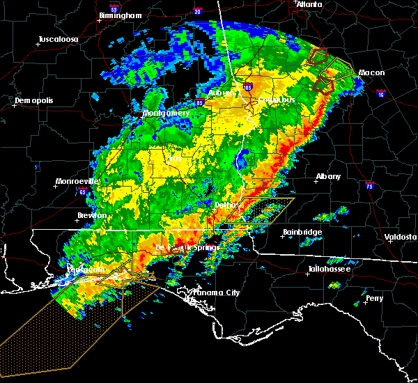 At 1155 am est/1055 am cst/, a severe thunderstorm was located 8 miles southeast of columbia, or 9 miles south of blakely, moving east at 60 mph (radar indicated). Hazards include 60 mph wind gusts. expect damage to roofs, siding, and trees At 1155 am est/1055 am cst/, a severe thunderstorm was located 8 miles southeast of columbia, or 9 miles south of blakely, moving east at 60 mph (radar indicated). Hazards include 60 mph wind gusts. expect damage to roofs, siding, and trees
|
| 1/2/2017 9:23 PM EST |
 At 922 pm est/822 pm cst/, severe thunderstorms were located along a line extending from arlington to near donalsonville, moving northeast at 55 mph (radar indicated). Hazards include 70 mph wind gusts. Expect considerable tree damage. damage is likely to mobile homes, roofs, and outbuildings. locations impacted include, colquitt, morgan, blakely, donalsonville, bainbridge, edison, arlington, columbia, leary, west bainbridge, douglasville, centerville, gordon, iron city, damascus, brinson, jakin, bluffton, cedar springs and cuba. A tornado watch remains in effect until 1100 pm est/1000 pm cst/ for southeastern alabama, the panhandle of florida, and southwestern georgia. At 922 pm est/822 pm cst/, severe thunderstorms were located along a line extending from arlington to near donalsonville, moving northeast at 55 mph (radar indicated). Hazards include 70 mph wind gusts. Expect considerable tree damage. damage is likely to mobile homes, roofs, and outbuildings. locations impacted include, colquitt, morgan, blakely, donalsonville, bainbridge, edison, arlington, columbia, leary, west bainbridge, douglasville, centerville, gordon, iron city, damascus, brinson, jakin, bluffton, cedar springs and cuba. A tornado watch remains in effect until 1100 pm est/1000 pm cst/ for southeastern alabama, the panhandle of florida, and southwestern georgia.
|
| 1/2/2017 9:23 PM EST |
 At 923 pm est, a tornado producing storm was located 7 miles southeast of blakely, moving northeast at 40 mph (radar confirmed tornado). Hazards include damaging tornado. Flying debris will be dangerous to those caught without shelter. mobile homes will be damaged or destroyed. damage to roofs, windows, and vehicles will occur. tree damage is likely. this tornadic storm will be near, arlington around 945 pm est. Other locations impacted by this tornadic thunderstorm include old damascus, cuba, bethany, hentown, rowena, damascus, douglasville, commissary hill and crestview. At 923 pm est, a tornado producing storm was located 7 miles southeast of blakely, moving northeast at 40 mph (radar confirmed tornado). Hazards include damaging tornado. Flying debris will be dangerous to those caught without shelter. mobile homes will be damaged or destroyed. damage to roofs, windows, and vehicles will occur. tree damage is likely. this tornadic storm will be near, arlington around 945 pm est. Other locations impacted by this tornadic thunderstorm include old damascus, cuba, bethany, hentown, rowena, damascus, douglasville, commissary hill and crestview.
|
| 1/2/2017 9:08 PM EST |
 At 908 pm est, a severe thunderstorm capable of producing a tornado was located near donalsonville, moving northeast at 50 mph (radar indicated rotation). Hazards include tornado. Flying debris will be dangerous to those caught without shelter. mobile homes will be damaged or destroyed. damage to roofs, windows, and vehicles will occur. tree damage is likely. this dangerous storm will be near, colquitt around 925 pm est. Other locations impacted by this tornadic thunderstorm include old damascus, enterprise, damascus, harmony church rd/hwy 45, boykin, mayhaw, jakin, killarney, jeterville and babcock. At 908 pm est, a severe thunderstorm capable of producing a tornado was located near donalsonville, moving northeast at 50 mph (radar indicated rotation). Hazards include tornado. Flying debris will be dangerous to those caught without shelter. mobile homes will be damaged or destroyed. damage to roofs, windows, and vehicles will occur. tree damage is likely. this dangerous storm will be near, colquitt around 925 pm est. Other locations impacted by this tornadic thunderstorm include old damascus, enterprise, damascus, harmony church rd/hwy 45, boykin, mayhaw, jakin, killarney, jeterville and babcock.
|
| 1/2/2017 8:45 PM EST |
 At 844 pm est/744 pm cst/, severe thunderstorms were located along a line extending from near webb to near marianna, moving northeast at 65 mph (radar indicated). Hazards include 70 mph wind gusts. Expect considerable tree damage. Damage is likely to mobile homes, roofs, and outbuildings. At 844 pm est/744 pm cst/, severe thunderstorms were located along a line extending from near webb to near marianna, moving northeast at 65 mph (radar indicated). Hazards include 70 mph wind gusts. Expect considerable tree damage. Damage is likely to mobile homes, roofs, and outbuildings.
|
| 8/14/2016 6:19 PM EDT |
 At 619 pm edt, a severe thunderstorm was located 9 miles north of colquitt, moving west at 35 mph (radar indicated). Hazards include 60 mph wind gusts. Expect damage to roofs. siding. And trees. At 619 pm edt, a severe thunderstorm was located 9 miles north of colquitt, moving west at 35 mph (radar indicated). Hazards include 60 mph wind gusts. Expect damage to roofs. siding. And trees.
|
| 7/31/2016 2:34 PM EDT |
 At 234 pm edt, severe thunderstorms were located along a line extending from 9 miles south of leary to near colquitt, moving southeast at 10 mph (radar indicated). Hazards include 60 mph wind gusts and penny size hail. Expect damage to roofs. siding. And trees. At 234 pm edt, severe thunderstorms were located along a line extending from 9 miles south of leary to near colquitt, moving southeast at 10 mph (radar indicated). Hazards include 60 mph wind gusts and penny size hail. Expect damage to roofs. siding. And trees.
|
| 7/11/2016 2:56 PM EDT |
 At 255 pm edt, a severe thunderstorm was located near blakely, moving northeast at 40 mph (radar indicated). Hazards include 60 mph wind gusts. Expect damage to roofs. siding. And trees. At 255 pm edt, a severe thunderstorm was located near blakely, moving northeast at 40 mph (radar indicated). Hazards include 60 mph wind gusts. Expect damage to roofs. siding. And trees.
|
| 7/10/2016 3:06 PM EDT |
 At 306 pm edt/206 pm cdt/, a severe thunderstorm was located 7 miles south of blakely, moving northeast at 30 mph (radar indicated). Hazards include 60 mph wind gusts and penny size hail. Expect damage to roofs. siding. And trees. At 306 pm edt/206 pm cdt/, a severe thunderstorm was located 7 miles south of blakely, moving northeast at 30 mph (radar indicated). Hazards include 60 mph wind gusts and penny size hail. Expect damage to roofs. siding. And trees.
|
| 7/10/2016 3:06 PM EDT |
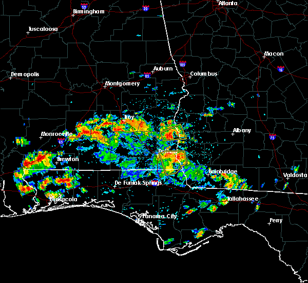 At 306 pm edt/206 pm cdt/, a severe thunderstorm was located 7 miles south of blakely, moving northeast at 30 mph (radar indicated). Hazards include 60 mph wind gusts and penny size hail. Expect damage to roofs. siding. And trees. At 306 pm edt/206 pm cdt/, a severe thunderstorm was located 7 miles south of blakely, moving northeast at 30 mph (radar indicated). Hazards include 60 mph wind gusts and penny size hail. Expect damage to roofs. siding. And trees.
|
| 7/9/2016 5:56 PM EDT |
 At 555 pm edt, a severe thunderstorm was located over colquitt, moving northeast at 15 mph (radar indicated). Hazards include 60 mph wind gusts and penny size hail. Expect damage to roofs. siding. And trees. At 555 pm edt, a severe thunderstorm was located over colquitt, moving northeast at 15 mph (radar indicated). Hazards include 60 mph wind gusts and penny size hail. Expect damage to roofs. siding. And trees.
|
| 6/17/2016 8:47 PM EDT |
 At 846 pm edt/746 pm cdt/, severe thunderstorms were located along a line extending from 6 miles south of dawson to 8 miles northwest of bonifay, moving southeast at 50 mph (trained weather spotters). Hazards include 70 mph wind gusts and quarter size hail. Hail damage to vehicles is expected. expect considerable tree damage. wind damage is also likely to mobile homes, roofs, and outbuildings. Locations impacted include, daleville, abbeville, cottonwood, fort gaines, morgan, blakely, cuthbert, geneva, dothan, headland, hartford, taylor, midland city, kinsey, ashford, slocomb, cowarts, edison, newton and arlington. At 846 pm edt/746 pm cdt/, severe thunderstorms were located along a line extending from 6 miles south of dawson to 8 miles northwest of bonifay, moving southeast at 50 mph (trained weather spotters). Hazards include 70 mph wind gusts and quarter size hail. Hail damage to vehicles is expected. expect considerable tree damage. wind damage is also likely to mobile homes, roofs, and outbuildings. Locations impacted include, daleville, abbeville, cottonwood, fort gaines, morgan, blakely, cuthbert, geneva, dothan, headland, hartford, taylor, midland city, kinsey, ashford, slocomb, cowarts, edison, newton and arlington.
|
| 6/17/2016 8:12 PM EDT |
 At 812 pm edt/712 pm cdt/, severe thunderstorms were located along a line extending from 8 miles south of lumpkin to 7 miles west of samson, moving southeast at 50 mph (radar indicated). Hazards include 70 mph wind gusts and quarter size hail. Hail damage to vehicles is expected. expect considerable tree damage. Wind damage is also likely to mobile homes, roofs, and outbuildings. At 812 pm edt/712 pm cdt/, severe thunderstorms were located along a line extending from 8 miles south of lumpkin to 7 miles west of samson, moving southeast at 50 mph (radar indicated). Hazards include 70 mph wind gusts and quarter size hail. Hail damage to vehicles is expected. expect considerable tree damage. Wind damage is also likely to mobile homes, roofs, and outbuildings.
|
| 5/3/2016 10:05 PM EDT | Tree down on highway 200 near damascu in early county GA, 0.2 miles SE of Damascus, GA |
| 5/3/2016 10:01 PM EDT |
 At 1001 pm edt, a severe thunderstorm was located 7 miles south of arlington, or 10 miles north of colquitt, moving northeast at 40 mph (radar indicated). Hazards include golf ball size hail and 60 mph wind gusts. People and animals outdoors will be injured. expect hail damage to roofs, siding, windows, and vehicles. expect wind damage to roofs, siding, and trees. Locations impacted include, arlington, douglasville, damascus, old damascus, patmos, bethany, nicholasville, rowena, iveys mill, milford and crestview. At 1001 pm edt, a severe thunderstorm was located 7 miles south of arlington, or 10 miles north of colquitt, moving northeast at 40 mph (radar indicated). Hazards include golf ball size hail and 60 mph wind gusts. People and animals outdoors will be injured. expect hail damage to roofs, siding, windows, and vehicles. expect wind damage to roofs, siding, and trees. Locations impacted include, arlington, douglasville, damascus, old damascus, patmos, bethany, nicholasville, rowena, iveys mill, milford and crestview.
|
| 5/3/2016 9:45 PM EDT |
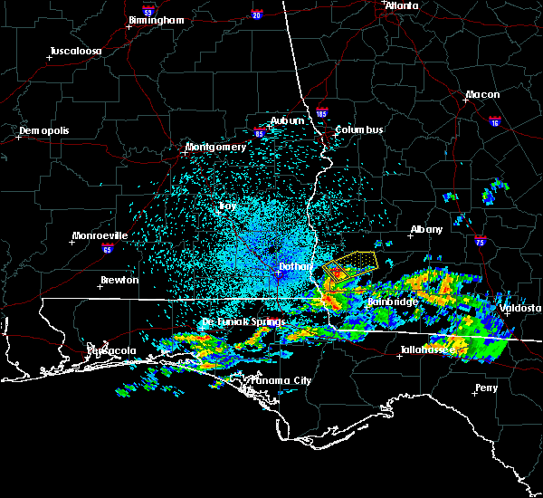 At 944 pm edt, a severe thunderstorm was located 8 miles south of blakely, moving northeast at 40 mph (radar indicated). Hazards include ping pong ball size hail and 60 mph wind gusts. People and animals outdoors will be injured. expect hail damage to roofs, siding, windows, and vehicles. Expect wind damage to roofs, siding, and trees. At 944 pm edt, a severe thunderstorm was located 8 miles south of blakely, moving northeast at 40 mph (radar indicated). Hazards include ping pong ball size hail and 60 mph wind gusts. People and animals outdoors will be injured. expect hail damage to roofs, siding, windows, and vehicles. Expect wind damage to roofs, siding, and trees.
|
| 3/24/2016 5:40 PM EDT |
 At 540 pm edt, severe thunderstorms were located along a line extending from fort gaines to 14 miles east of abbeville to 12 miles northeast of columbia to near blakely, moving east at 40 mph (radar indicated). Hazards include 60 mph wind gusts. Expect damage to roofs. siding. and trees. locations impacted include, fort gaines, blakely, edison, arlington, douglasville, damascus. A tornado watch remains in effect until 800 pm edt for southeastern alabama. At 540 pm edt, severe thunderstorms were located along a line extending from fort gaines to 14 miles east of abbeville to 12 miles northeast of columbia to near blakely, moving east at 40 mph (radar indicated). Hazards include 60 mph wind gusts. Expect damage to roofs. siding. and trees. locations impacted include, fort gaines, blakely, edison, arlington, douglasville, damascus. A tornado watch remains in effect until 800 pm edt for southeastern alabama.
|
| 3/24/2016 5:26 PM EDT |
 At 525 pm edt/425 pm cdt/, severe thunderstorms were located along a line extending from near abbeville to 8 miles southwest of fort gaines to near columbia, moving east at 40 mph (radar indicated). Hazards include 60 mph wind gusts. Expect damage to roofs. siding. And trees. At 525 pm edt/425 pm cdt/, severe thunderstorms were located along a line extending from near abbeville to 8 miles southwest of fort gaines to near columbia, moving east at 40 mph (radar indicated). Hazards include 60 mph wind gusts. Expect damage to roofs. siding. And trees.
|
| 2/24/2016 1:41 AM EST |
 At 140 am est, severe thunderstorms were located along a line extending from 6 miles northeast of newton to 10 miles west of west bainbridge, moving northeast at 70 mph (radar indicated). Hazards include 60 mph wind gusts. Expect damage to roofs. Siding and trees. At 140 am est, severe thunderstorms were located along a line extending from 6 miles northeast of newton to 10 miles west of west bainbridge, moving northeast at 70 mph (radar indicated). Hazards include 60 mph wind gusts. Expect damage to roofs. Siding and trees.
|
| 2/24/2016 1:10 AM EST |
 At 109 am est, severe thunderstorms were located along a line extending from near smithville to 6 miles southwest of albany to 9 miles west of newton, moving east at 45 mph (radar indicated). Hazards include 70 mph wind gusts and penny size hail. Expect considerable tree damage. Damage is likely to mobile homes, roofs and outbuildings. At 109 am est, severe thunderstorms were located along a line extending from near smithville to 6 miles southwest of albany to 9 miles west of newton, moving east at 45 mph (radar indicated). Hazards include 70 mph wind gusts and penny size hail. Expect considerable tree damage. Damage is likely to mobile homes, roofs and outbuildings.
|
| 2/24/2016 12:38 AM EST |
 At 1237 am est /1137 pm cst/, severe thunderstorms were located along a line extending from 7 miles west of edison to 9 miles southeast of blakely to 8 miles north of marianna, moving northeast at 90 mph (radar indicated). Hazards include 70 mph wind gusts and penny size hail. Expect considerable tree damage. Damage is likely to mobile homes, roofs and outbuildings. At 1237 am est /1137 pm cst/, severe thunderstorms were located along a line extending from 7 miles west of edison to 9 miles southeast of blakely to 8 miles north of marianna, moving northeast at 90 mph (radar indicated). Hazards include 70 mph wind gusts and penny size hail. Expect considerable tree damage. Damage is likely to mobile homes, roofs and outbuildings.
|
| 2/24/2016 12:27 AM EST |
 At 1226 am est, severe thunderstorms were located along a line extending from near shellman to morgan to near arlington to 9 miles west of colquitt, moving east at 55 mph (radar indicated). Hazards include 70 mph wind gusts and penny size hail. Expect considerable tree damage. damage is likely to mobile homes, roofs and outbuildings. locations impacted include, newton, morgan, edison, arlington, shellman, leary, walker, douglasville, damascus, suttons corner, patmos, bethany, cordrays mill, moye, rowena, oak hill, parksville, turman, clarks mill and shivers mill. A tornado watch remains in effect until 400 am est for southwestern georgia. At 1226 am est, severe thunderstorms were located along a line extending from near shellman to morgan to near arlington to 9 miles west of colquitt, moving east at 55 mph (radar indicated). Hazards include 70 mph wind gusts and penny size hail. Expect considerable tree damage. damage is likely to mobile homes, roofs and outbuildings. locations impacted include, newton, morgan, edison, arlington, shellman, leary, walker, douglasville, damascus, suttons corner, patmos, bethany, cordrays mill, moye, rowena, oak hill, parksville, turman, clarks mill and shivers mill. A tornado watch remains in effect until 400 am est for southwestern georgia.
|
| 2/24/2016 12:19 AM EST |
 At 1219 am est, severe thunderstorms were located along a line extending from 6 miles southeast of cuthbert to near edison to 6 miles southeast of blakely to 11 miles southeast of columbia, moving east at 55 mph (radar indicated). Hazards include 70 mph wind gusts and penny size hail. Expect considerable tree damage. Damage is likely to mobile homes, roofs and outbuildings. At 1219 am est, severe thunderstorms were located along a line extending from 6 miles southeast of cuthbert to near edison to 6 miles southeast of blakely to 11 miles southeast of columbia, moving east at 55 mph (radar indicated). Hazards include 70 mph wind gusts and penny size hail. Expect considerable tree damage. Damage is likely to mobile homes, roofs and outbuildings.
|
| 2/15/2016 9:18 PM EST |
 At 918 pm est /818 pm cst/, severe thunderstorms were located along a line extending from 9 miles northeast of colquitt to 12 miles west of chattahoochee, moving northeast at 50 mph (radar indicated). Hazards include 60 mph wind gusts. Expect damage to roofs. Siding and trees. At 918 pm est /818 pm cst/, severe thunderstorms were located along a line extending from 9 miles northeast of colquitt to 12 miles west of chattahoochee, moving northeast at 50 mph (radar indicated). Hazards include 60 mph wind gusts. Expect damage to roofs. Siding and trees.
|
| 2/15/2016 9:16 PM EST |
 At 915 pm est /815 pm cst/, severe thunderstorms were located along a line extending from near dawson to 11 miles south of donalsonville, moving east at 40 mph (radar indicated). Hazards include 60 mph wind gusts. Expect damage to roofs. siding and trees. locations impacted include, colquitt, morgan, donalsonville, dawson, edison, arlington, shellman, leary, douglasville, centerville, iron city, sasser, damascus, bronwood, parrott, jakin, dawson municipal a/p, cuba, cordrays mill and oak hill. a tornado watch remains in effect until 1000 pm est/900 pm cst/ for southeastern alabama and central florida. A tornado watch also remains in effect until 100 am est/midnight cst/ for southwestern georgia. At 915 pm est /815 pm cst/, severe thunderstorms were located along a line extending from near dawson to 11 miles south of donalsonville, moving east at 40 mph (radar indicated). Hazards include 60 mph wind gusts. Expect damage to roofs. siding and trees. locations impacted include, colquitt, morgan, donalsonville, dawson, edison, arlington, shellman, leary, douglasville, centerville, iron city, sasser, damascus, bronwood, parrott, jakin, dawson municipal a/p, cuba, cordrays mill and oak hill. a tornado watch remains in effect until 1000 pm est/900 pm cst/ for southeastern alabama and central florida. A tornado watch also remains in effect until 100 am est/midnight cst/ for southwestern georgia.
|
| 2/15/2016 8:36 PM EST |
 At 835 pm est /735 pm cst/, severe thunderstorms were located along a line extending from 10 miles southwest of lumpkin to near cottonwood, moving east at 40 mph (radar indicated). Hazards include 60 mph wind gusts. Expect damage to roofs. Siding and trees. At 835 pm est /735 pm cst/, severe thunderstorms were located along a line extending from 10 miles southwest of lumpkin to near cottonwood, moving east at 40 mph (radar indicated). Hazards include 60 mph wind gusts. Expect damage to roofs. Siding and trees.
|
| 11/2/2015 1:38 PM EST |
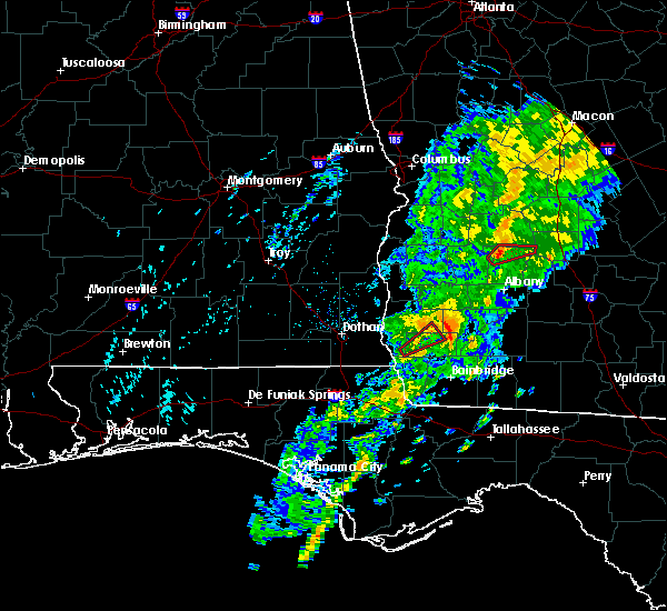 The tornado warning for southeastern early and northern miller counties will expire at 145 pm est, the storm which prompted the warning has weakened below severe limits, and no longer appears capable of producing a tornado. therefore the warning will be allowed to expire. a tornado watch remains in effect until 700 pm est for southwestern georgia. The tornado warning for southeastern early and northern miller counties will expire at 145 pm est, the storm which prompted the warning has weakened below severe limits, and no longer appears capable of producing a tornado. therefore the warning will be allowed to expire. a tornado watch remains in effect until 700 pm est for southwestern georgia.
|
| 11/2/2015 1:08 PM EST |
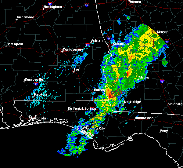 At 107 pm est, a severe thunderstorm capable of producing a tornado was located near donalsonville, moving northeast at 40 mph (radar indicated rotation). Hazards include tornado. Flying debris will be dangerous to those caught without shelter. mobile homes will be damaged or destroyed. damage to roofs, windows and vehicles will occur. tree damage is likely. this dangerous storm will be near, colquitt around 120 pm est. Other locations impacted by this tornadic thunderstorm include old damascus, enterprise, macedonia, damascus, harmony church rd/hwy 45, mayhaw, killarney and jeterville. At 107 pm est, a severe thunderstorm capable of producing a tornado was located near donalsonville, moving northeast at 40 mph (radar indicated rotation). Hazards include tornado. Flying debris will be dangerous to those caught without shelter. mobile homes will be damaged or destroyed. damage to roofs, windows and vehicles will occur. tree damage is likely. this dangerous storm will be near, colquitt around 120 pm est. Other locations impacted by this tornadic thunderstorm include old damascus, enterprise, macedonia, damascus, harmony church rd/hwy 45, mayhaw, killarney and jeterville.
|
| 7/23/2015 3:41 PM EDT |
 At 341 pm edt, the national weather service has detected a severe thunderstorm capable of producing quarter size hail and damaging winds in excess of 60 mph. this storm was located 9 miles southeast of arlington, or 11 miles south of morgan, and moving east at 20 mph. At 341 pm edt, the national weather service has detected a severe thunderstorm capable of producing quarter size hail and damaging winds in excess of 60 mph. this storm was located 9 miles southeast of arlington, or 11 miles south of morgan, and moving east at 20 mph.
|
| 7/23/2015 3:32 PM EDT |
 At 331 pm edt, doppler radar indicated a line of severe thunderstorms capable of producing damaging winds in excess of 60 mph. these storms were located along a line extending from near blakely to near arlington, moving east at 20 mph. locations impacted include, blakely, arlington, douglasville, centerville, damascus, old damascus, cuba, nicholasville, rowena, ferrell crossroads, early co a/p, colomokee, hentown, rock hill and kolomoki mounds sp. At 331 pm edt, doppler radar indicated a line of severe thunderstorms capable of producing damaging winds in excess of 60 mph. these storms were located along a line extending from near blakely to near arlington, moving east at 20 mph. locations impacted include, blakely, arlington, douglasville, centerville, damascus, old damascus, cuba, nicholasville, rowena, ferrell crossroads, early co a/p, colomokee, hentown, rock hill and kolomoki mounds sp.
|
| 7/23/2015 3:07 PM EDT |
 At 307 pm edt /207 pm cdt/, the national weather service has detected a line of severe thunderstorms capable of producing damaging winds in excess of 60 mph. these storms were located along a line extending from 8 miles north of headland to near blakely, and moving east at 15 mph. At 307 pm edt /207 pm cdt/, the national weather service has detected a line of severe thunderstorms capable of producing damaging winds in excess of 60 mph. these storms were located along a line extending from 8 miles north of headland to near blakely, and moving east at 15 mph.
|
| 7/21/2015 4:50 PM EDT |
 At 449 pm edt, doppler radar indicated a severe thunderstorm capable of producing damaging winds in excess of 60 mph. this storm was located near blakely, moving southeast at 30 mph. locations impacted include, centerville, damascus, old damascus, cuba and hentown. At 449 pm edt, doppler radar indicated a severe thunderstorm capable of producing damaging winds in excess of 60 mph. this storm was located near blakely, moving southeast at 30 mph. locations impacted include, centerville, damascus, old damascus, cuba and hentown.
|
| 7/21/2015 4:25 PM EDT |
 At 425 pm edt, the national weather service has detected a severe thunderstorm capable of producing damaging winds in excess of 60 mph. this storm was located near blakely, and moving southeast at 30 mph. At 425 pm edt, the national weather service has detected a severe thunderstorm capable of producing damaging winds in excess of 60 mph. this storm was located near blakely, and moving southeast at 30 mph.
|
| 7/5/2015 10:17 AM EDT |
 At 1017 am edt, doppler radar indicated a line of severe thunderstorms capable of producing damaging winds in excess of 60 mph. these storms were located along a line extending from 7 miles northwest of blakely to 11 miles west of donalsonville, moving east at 40 mph. locations impacted include, colquitt, blakely, donalsonville, arlington, columbia, leary, douglasville, centerville, gordon, iron city, damascus, jakin, patmos, cedar springs, cuba, bethany, rowena, sharphagen, early co a/p and jones crossroads. At 1017 am edt, doppler radar indicated a line of severe thunderstorms capable of producing damaging winds in excess of 60 mph. these storms were located along a line extending from 7 miles northwest of blakely to 11 miles west of donalsonville, moving east at 40 mph. locations impacted include, colquitt, blakely, donalsonville, arlington, columbia, leary, douglasville, centerville, gordon, iron city, damascus, jakin, patmos, cedar springs, cuba, bethany, rowena, sharphagen, early co a/p and jones crossroads.
|
| 7/5/2015 9:55 AM EDT |
 At 955 am edt /855 am cdt/, the national weather service has detected a line of severe thunderstorms capable of producing damaging winds in excess of 60 mph. these storms were located along a line extending from 9 miles northwest of columbia to near cottonwood, and moving east at 40 mph. At 955 am edt /855 am cdt/, the national weather service has detected a line of severe thunderstorms capable of producing damaging winds in excess of 60 mph. these storms were located along a line extending from 9 miles northwest of columbia to near cottonwood, and moving east at 40 mph.
|
| 7/2/2015 2:49 PM EDT |
 At 249 pm edt, doppler radar indicated a line of severe thunderstorms capable of producing damaging winds in excess of 60 mph. these storms were located along a line extending from near morgan to 6 miles east of chattahoochee, moving east at 40 mph. locations impacted include, colquitt, newton, bainbridge, camilla, arlington, leary, whigham, west bainbridge, douglasville, attapulgus, climax, damascus, brinson, vada, branchville, harrells still, lynn, amsterdam, macedonia and hoggard mill. At 249 pm edt, doppler radar indicated a line of severe thunderstorms capable of producing damaging winds in excess of 60 mph. these storms were located along a line extending from near morgan to 6 miles east of chattahoochee, moving east at 40 mph. locations impacted include, colquitt, newton, bainbridge, camilla, arlington, leary, whigham, west bainbridge, douglasville, attapulgus, climax, damascus, brinson, vada, branchville, harrells still, lynn, amsterdam, macedonia and hoggard mill.
|
| 7/2/2015 2:23 PM EDT |
 At 223 pm edt /123 pm cdt/, the national weather service has detected a line of severe thunderstorms capable of producing damaging winds in excess of 60 mph. these storms were located along a line extending from 8 miles north of blakely to 10 miles west of chattahoochee, and moving east at 35 mph. At 223 pm edt /123 pm cdt/, the national weather service has detected a line of severe thunderstorms capable of producing damaging winds in excess of 60 mph. these storms were located along a line extending from 8 miles north of blakely to 10 miles west of chattahoochee, and moving east at 35 mph.
|
| 7/2/2015 2:09 PM EDT |
 At 209 pm edt /109 pm cdt/, doppler radar indicated a line of severe thunderstorms capable of producing damaging winds in excess of 60 mph. these storms were located along a line extending from near blakely to near marianna, moving east at 45 mph. locations impacted include, colquitt, blakely, donalsonville, marianna, ashford, columbia, centerville, malone, sneads, grand ridge, greenwood, gordon, iron city, damascus, jakin, bascom, cedar springs, cuba, crosby and grangeburg. At 209 pm edt /109 pm cdt/, doppler radar indicated a line of severe thunderstorms capable of producing damaging winds in excess of 60 mph. these storms were located along a line extending from near blakely to near marianna, moving east at 45 mph. locations impacted include, colquitt, blakely, donalsonville, marianna, ashford, columbia, centerville, malone, sneads, grand ridge, greenwood, gordon, iron city, damascus, jakin, bascom, cedar springs, cuba, crosby and grangeburg.
|
| 7/2/2015 12:48 PM CDT |
 At 148 pm edt /1248 pm cdt/, the national weather service has detected a line of severe thunderstorms capable of producing damaging winds in excess of 60 mph. these storms were located along a line extending from 7 miles northeast of headland to 9 miles southeast of graceville, and moving east at 45 mph. At 148 pm edt /1248 pm cdt/, the national weather service has detected a line of severe thunderstorms capable of producing damaging winds in excess of 60 mph. these storms were located along a line extending from 7 miles northeast of headland to 9 miles southeast of graceville, and moving east at 45 mph.
|
| 6/12/2015 4:46 PM EDT |
 At 445 pm edt, doppler radar indicated a severe thunderstorm capable of producing damaging winds in excess of 60 mph. this storm was located near arlington, or 9 miles east of blakely, moving northeast at 30 mph. locations impacted include, arlington, douglasville, damascus, old damascus, cuba, nicholasville, hentown and rowena. At 445 pm edt, doppler radar indicated a severe thunderstorm capable of producing damaging winds in excess of 60 mph. this storm was located near arlington, or 9 miles east of blakely, moving northeast at 30 mph. locations impacted include, arlington, douglasville, damascus, old damascus, cuba, nicholasville, hentown and rowena.
|
| 6/12/2015 4:36 PM EDT |
 At 436 pm edt, the national weather service has detected a severe thunderstorm capable of producing damaging winds in excess of 60 mph. this storm was located 8 miles southeast of blakely, and moving northeast at 30 mph. At 436 pm edt, the national weather service has detected a severe thunderstorm capable of producing damaging winds in excess of 60 mph. this storm was located 8 miles southeast of blakely, and moving northeast at 30 mph.
|
| 5/31/2015 4:06 PM EDT | At 405 pm edt, doppler radar indicated a line of severe thunderstorms capable of producing damaging winds in excess of 60 mph. these storms were located along a line extending from 6 miles northeast of colquitt to near riverside, moving northeast at 25 mph. some trees have been blown down in mitchell and colquitt counties with these storms. locations impacted include, colquitt, newton, camilla, pelham, moultrie, baconton, doerun, riverside, schley, funston, sale city, damascus, cotton, new elm, branchville, ticknor, livingston, tempy, macedonia and hoggard mill. |
| 5/31/2015 3:37 PM EDT | At 337 pm edt, the national weather service has detected a line of severe thunderstorms capable of producing damaging winds in excess of 60 mph. these storms were located along a line extending from near colquitt to 7 miles west of riverside, and moving northeast at 35 mph. |
| 4/25/2015 7:39 PM EDT | The severe thunderstorm warning for southeastern clay, northeastern early, calhoun, baker and miller counties in southwestern georgia will expire at 745 pm edt, the storms which prompted the warning have moved out of the area. therefore the warning will be allowed to expire. however gusty winds are still possible through 8 pm edt. to report severe weather, contact your nearest law enforcement agency. they will relay your report to the national weather service tallahassee. &&. |
| 4/25/2015 7:21 PM EDT | At 720 pm edt, doppler radar indicated a line of severe thunderstorms capable of producing destructive winds in excess of 70 mph. these storms were located along a line extending from near edison to colquitt, moving east at 60 mph. locations impacted include, colquitt, morgan, edison, arlington, leary, douglasville, damascus, patmos, bethany, cordrays mill, moye, rowena, oak hill, parksville, turman, jeterville, macedonia, hoggard mill, mimsville and elmodel wma. |
| 4/25/2015 6:45 PM EDT | At 644 pm edt, the national weather service has detected a line of severe thunderstorms capable of producing destructive winds in excess of 70 mph. these storms were located along a line extending from 8 miles south of abbeville to cottonwood, and moving east at 55 mph. |
| 8/30/2013 7:20 PM EDT | Trees down near hwy 4 in early county GA, 1.3 miles N of Damascus, GA |
Hail Maps for Damascus, GA


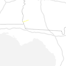


Connect with Interactive Hail Maps