

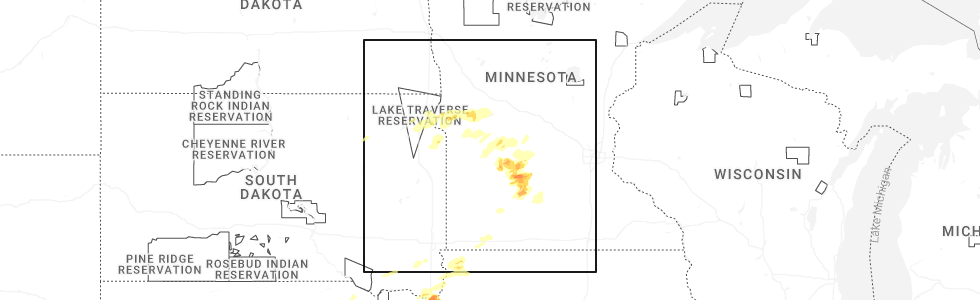
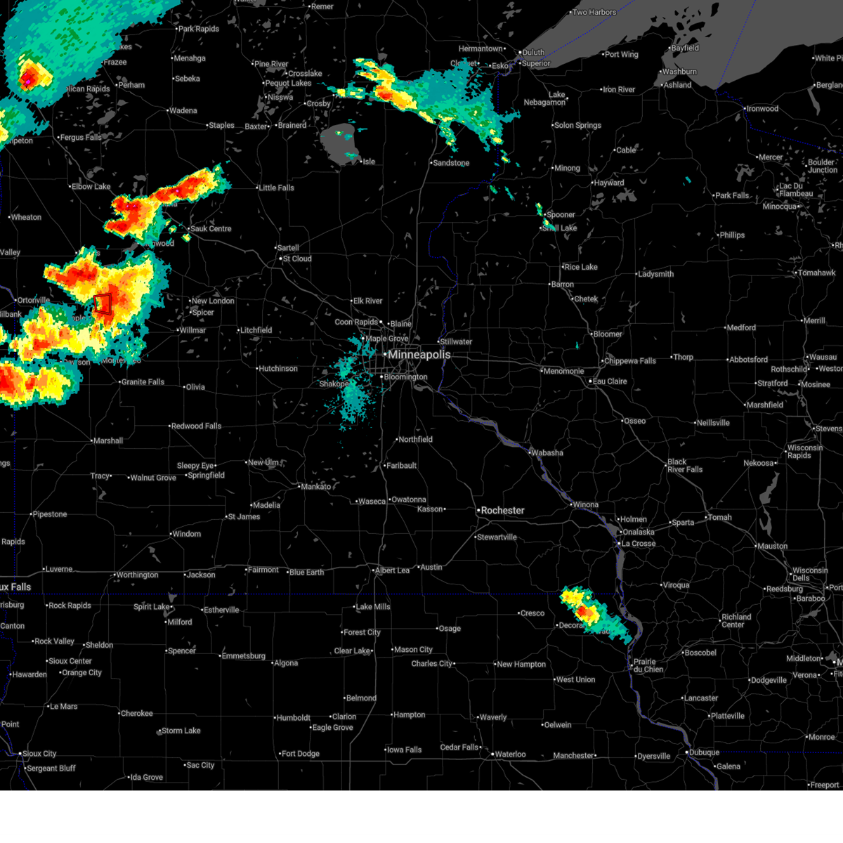
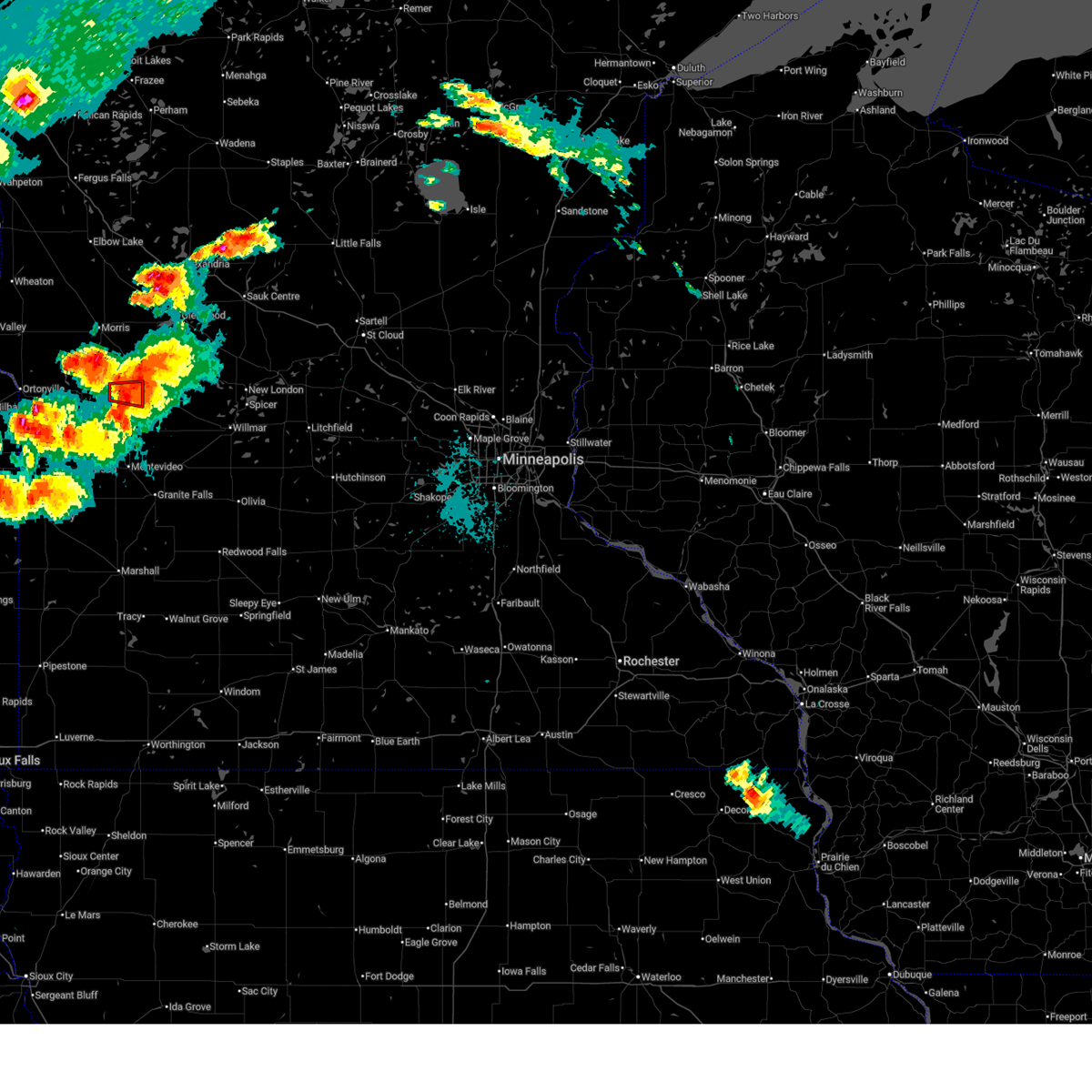
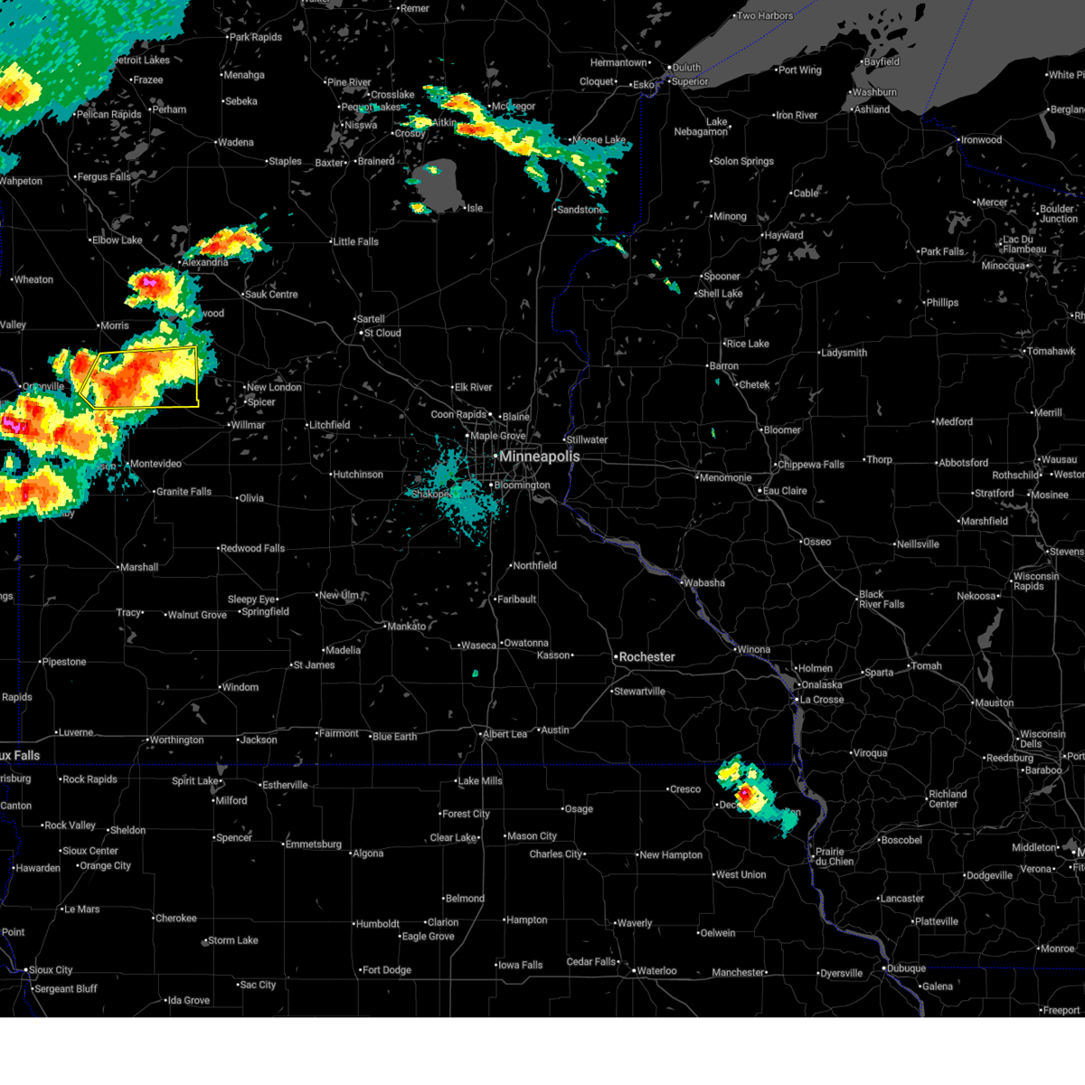
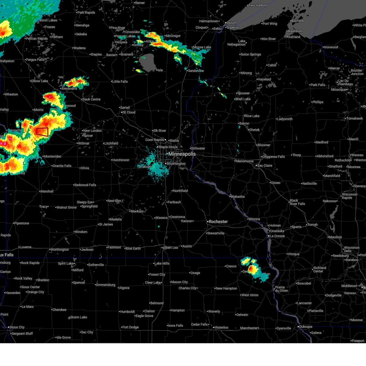
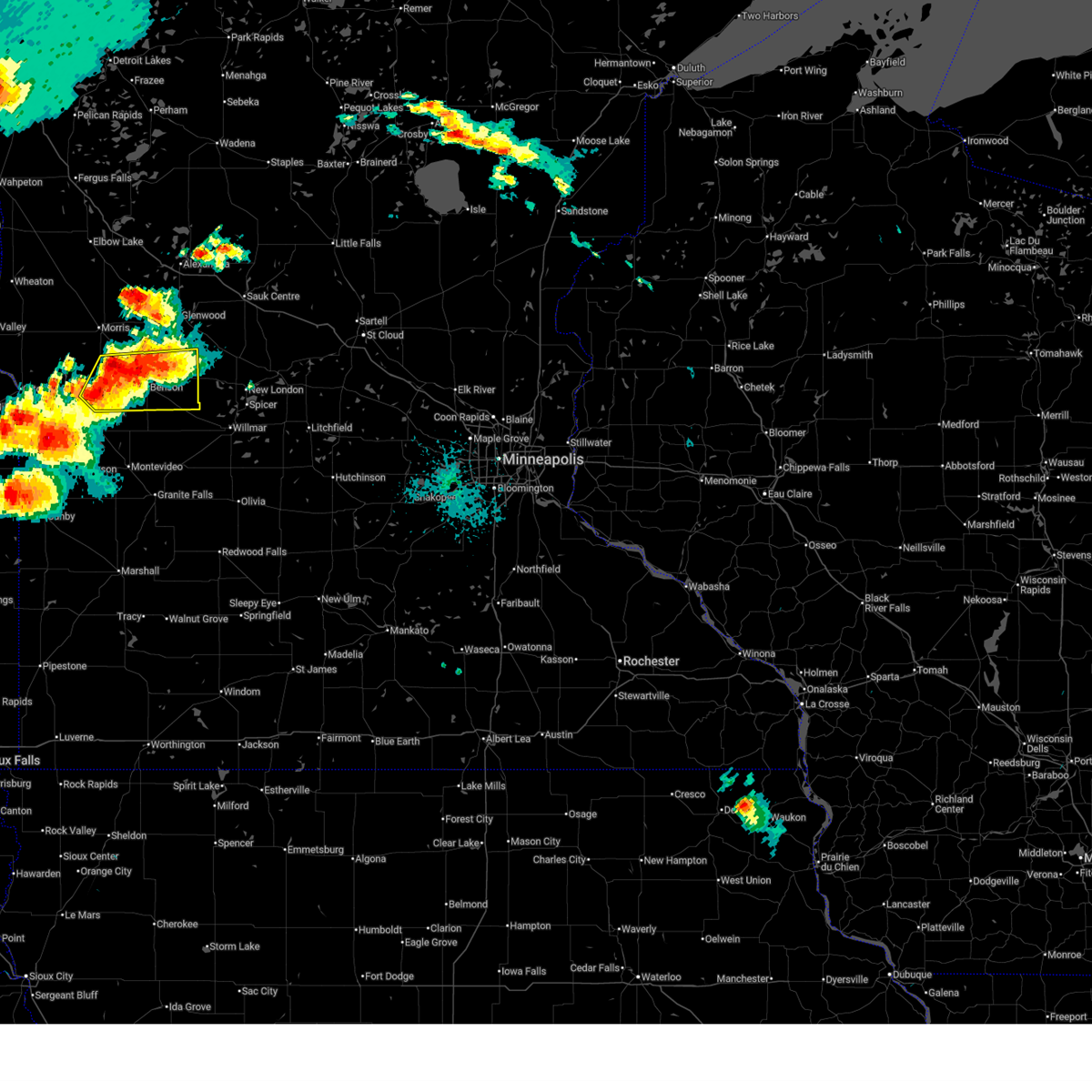
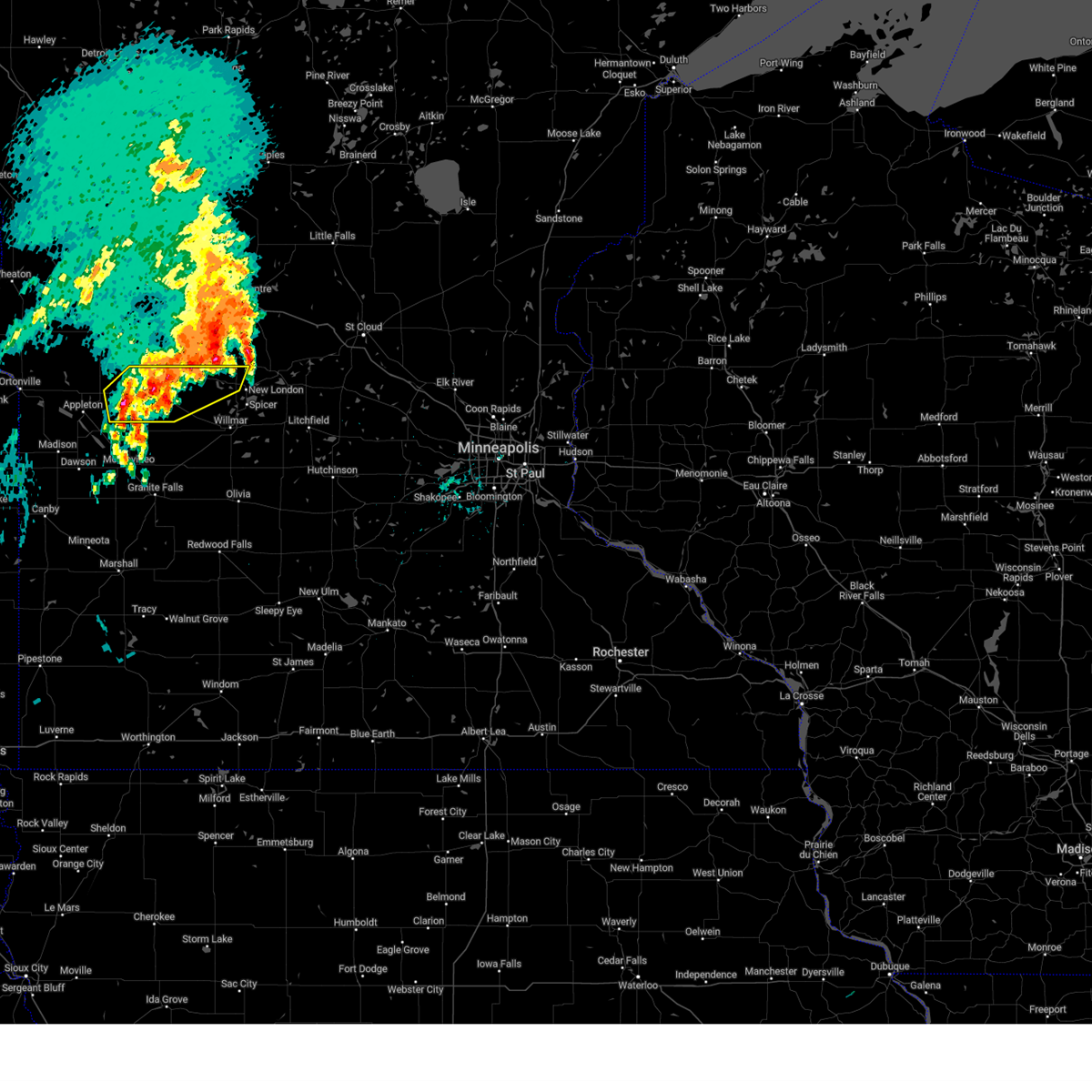
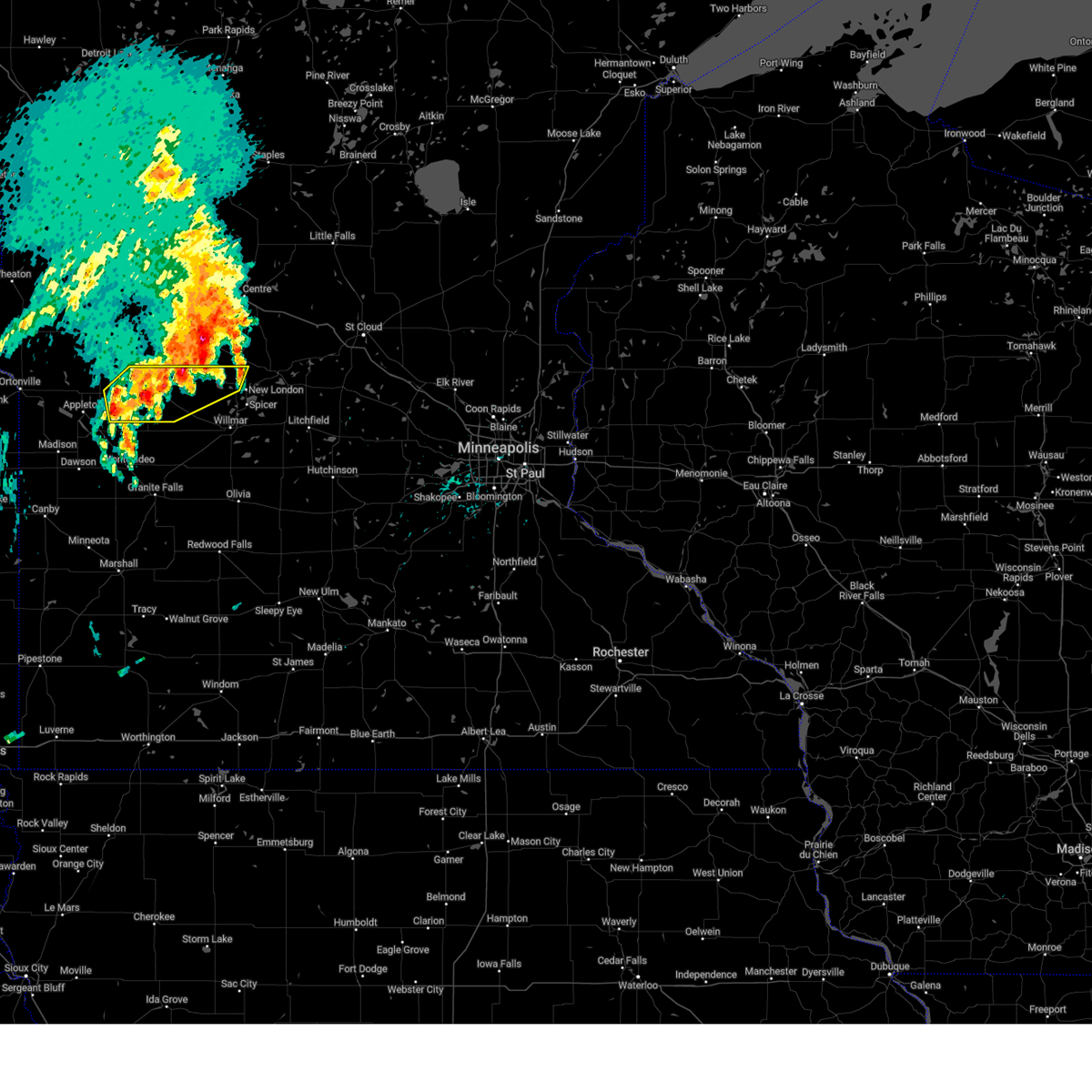
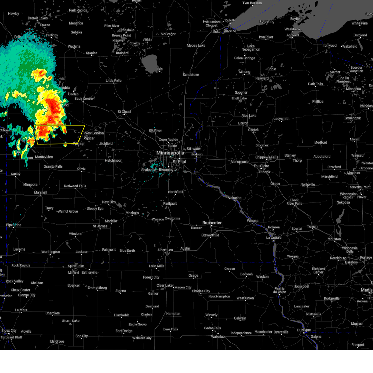
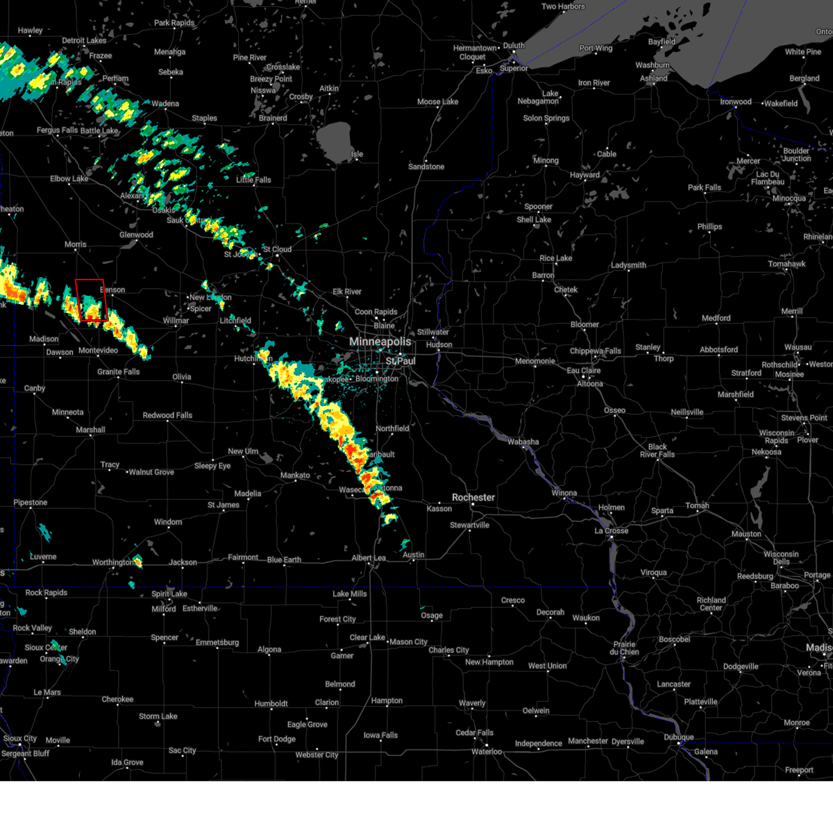
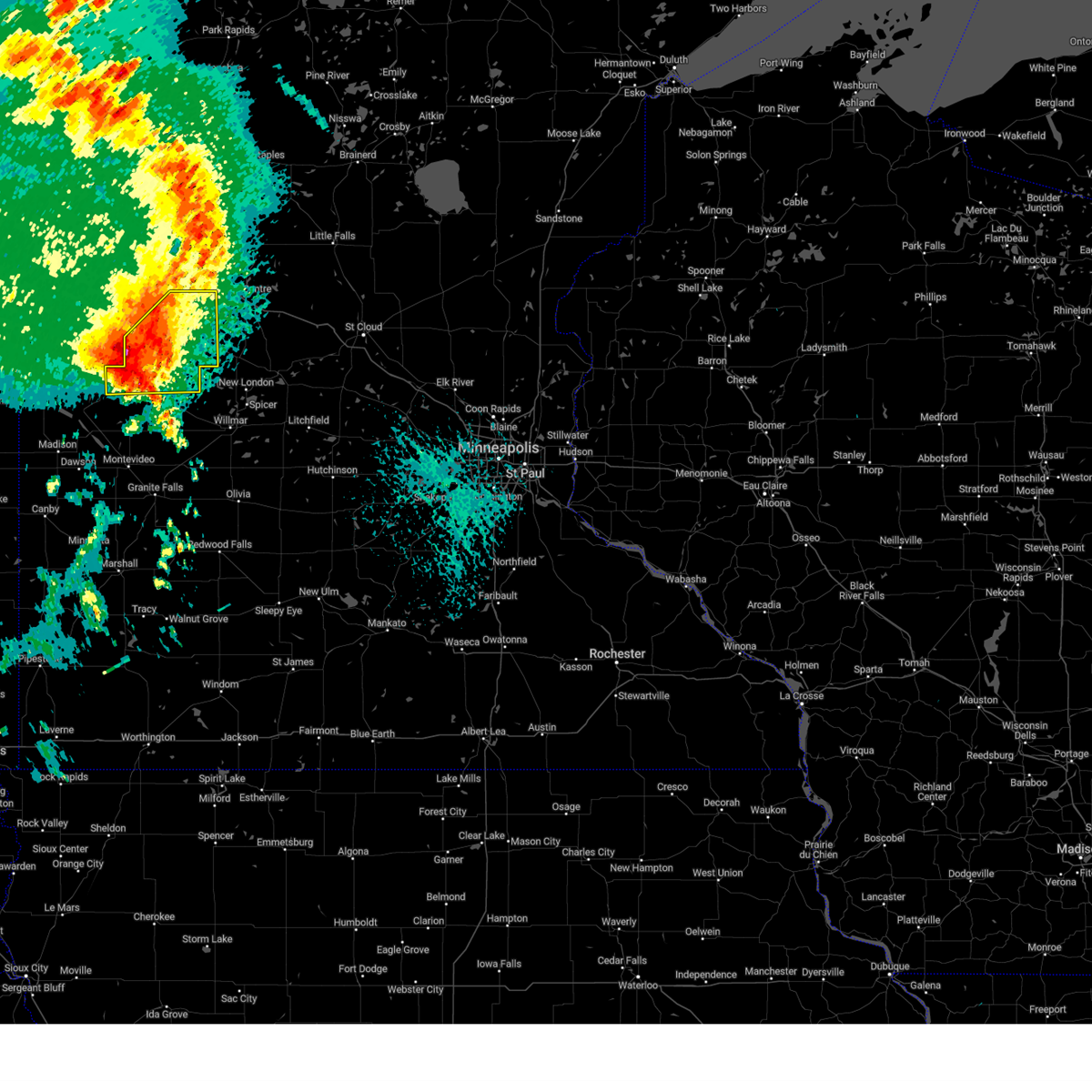
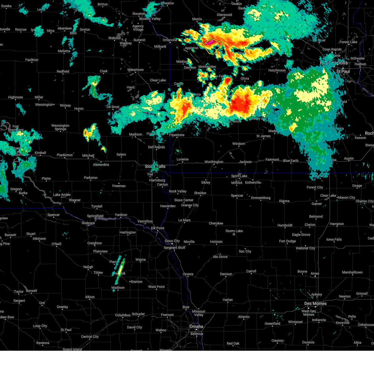
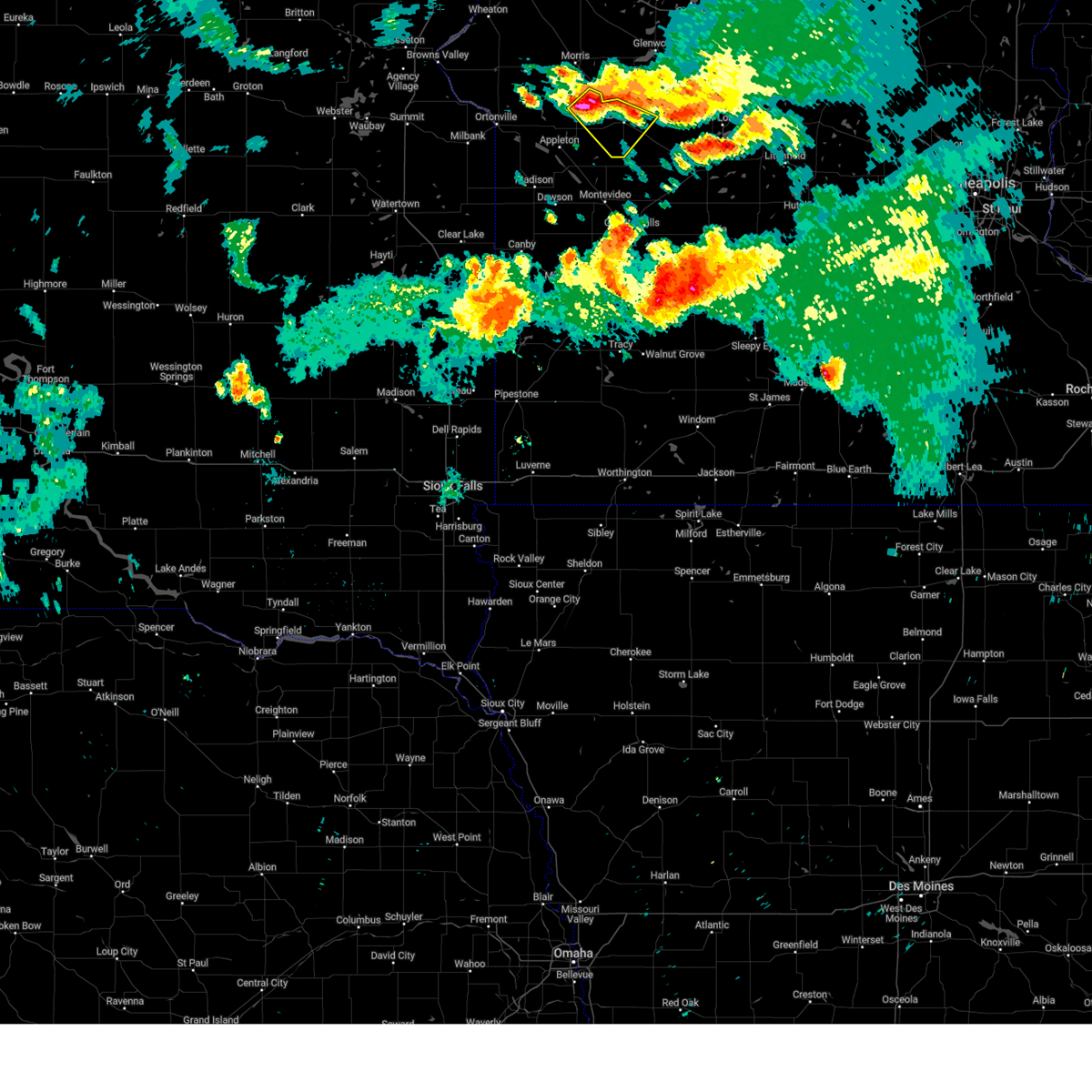
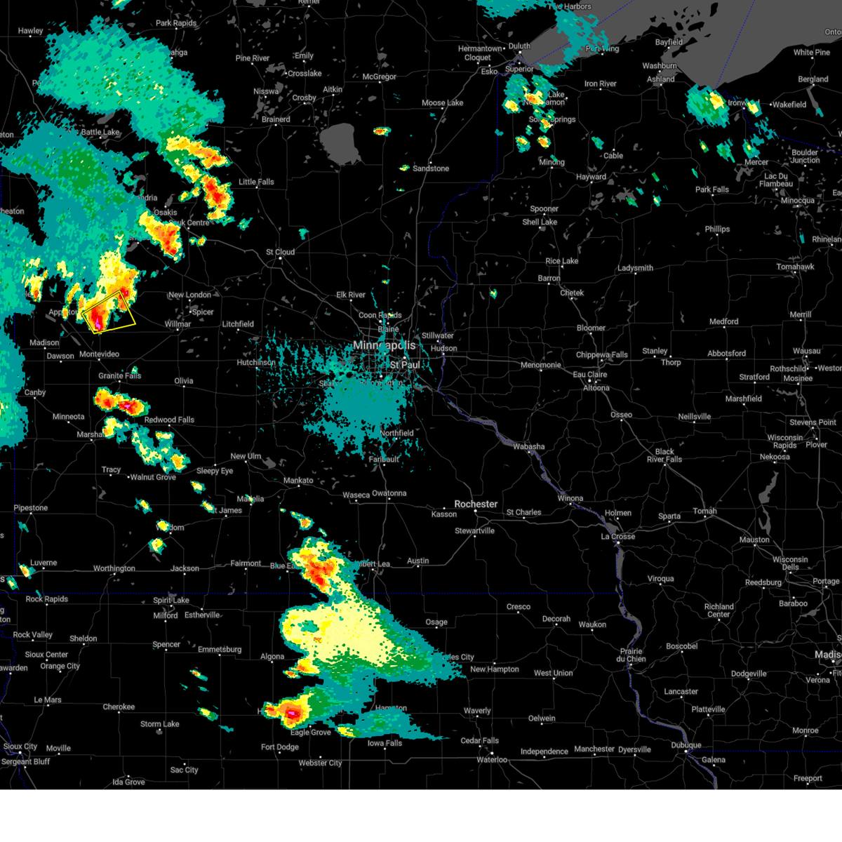
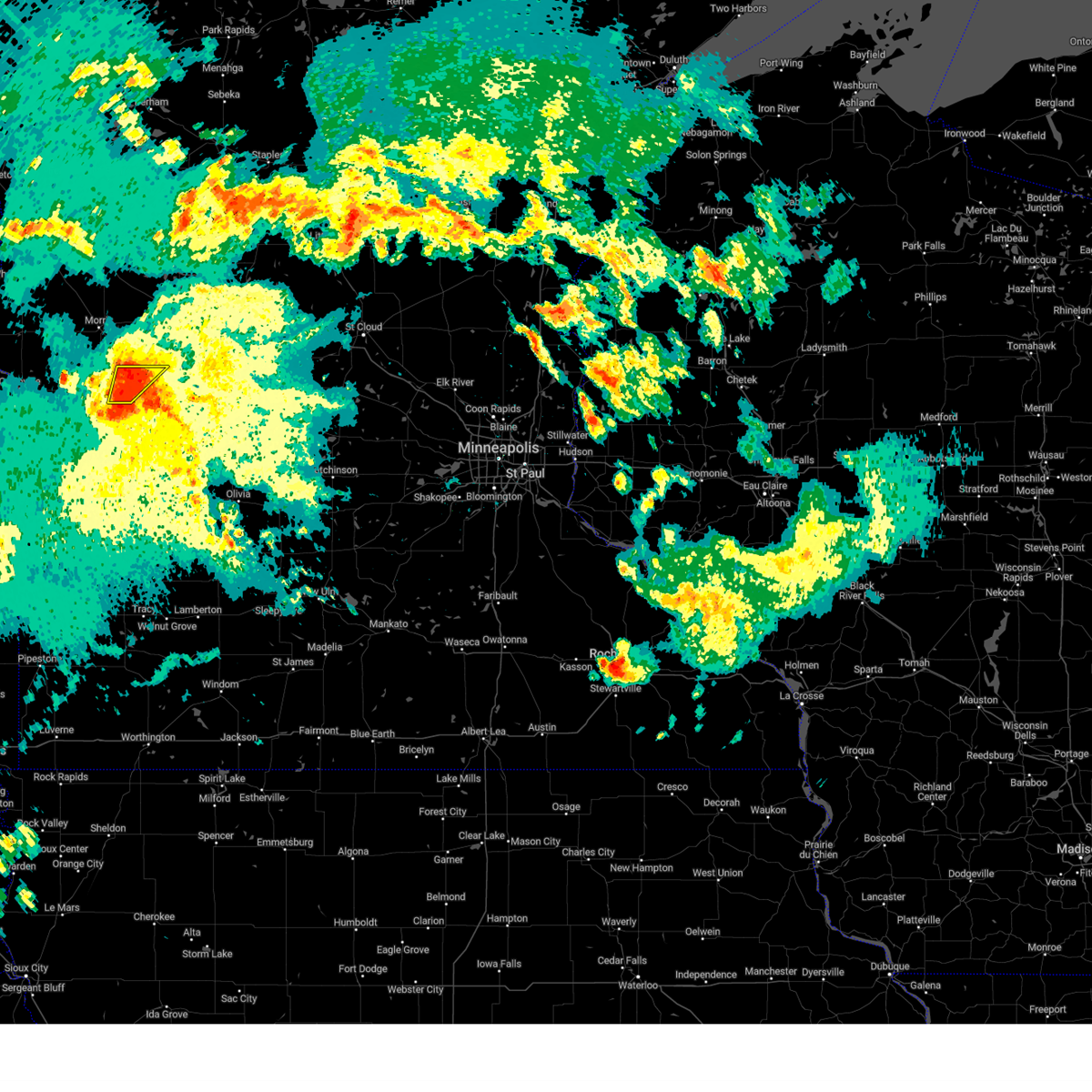
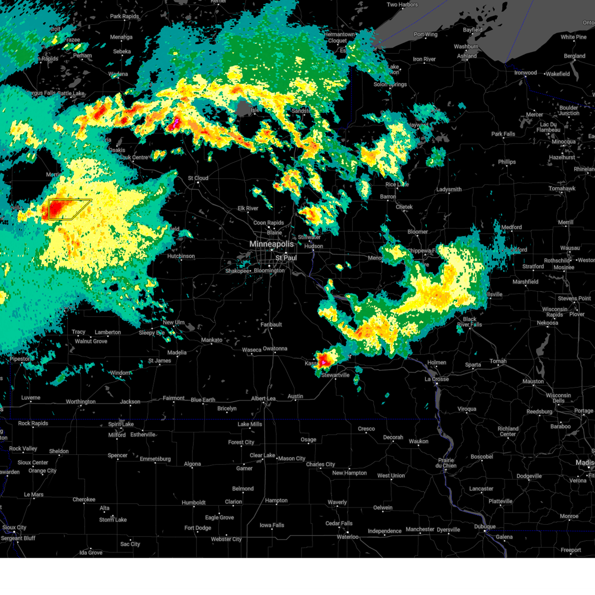
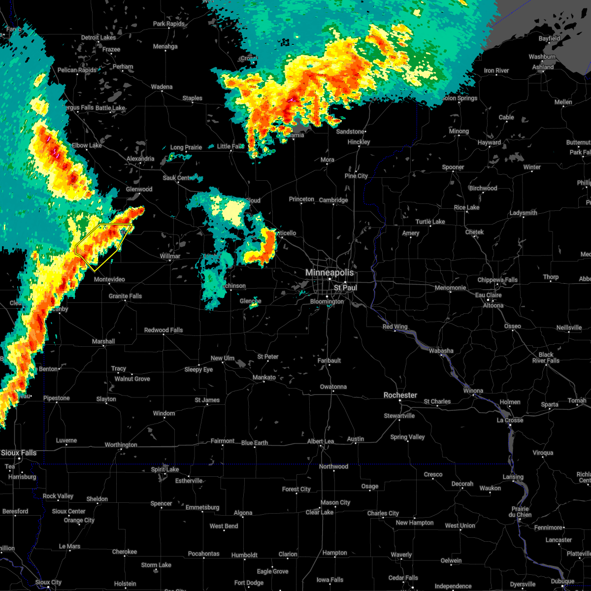
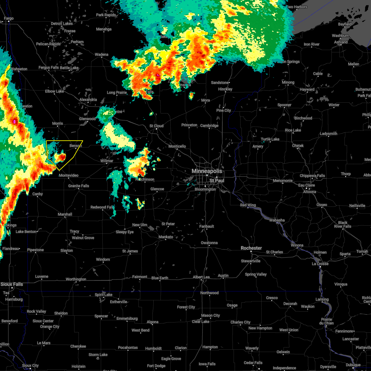
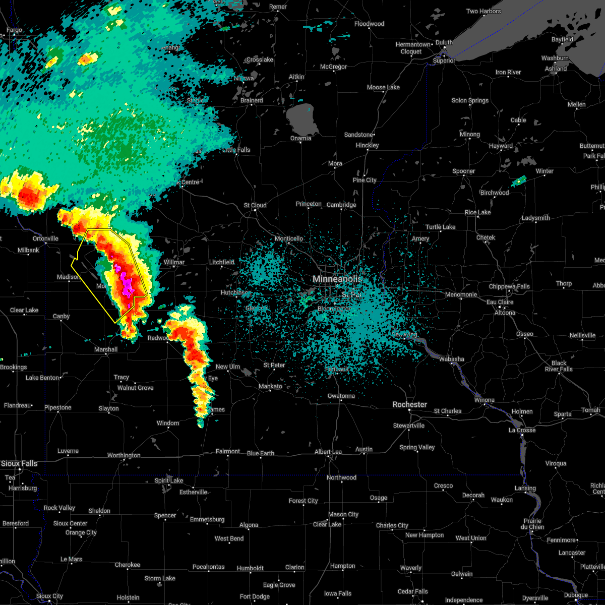
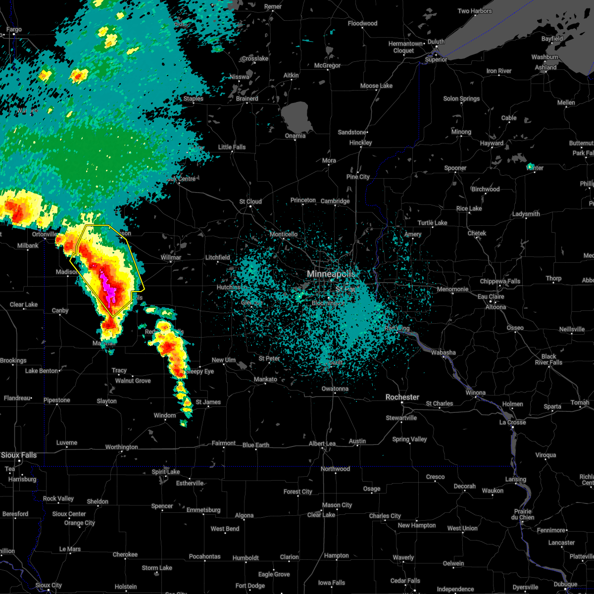
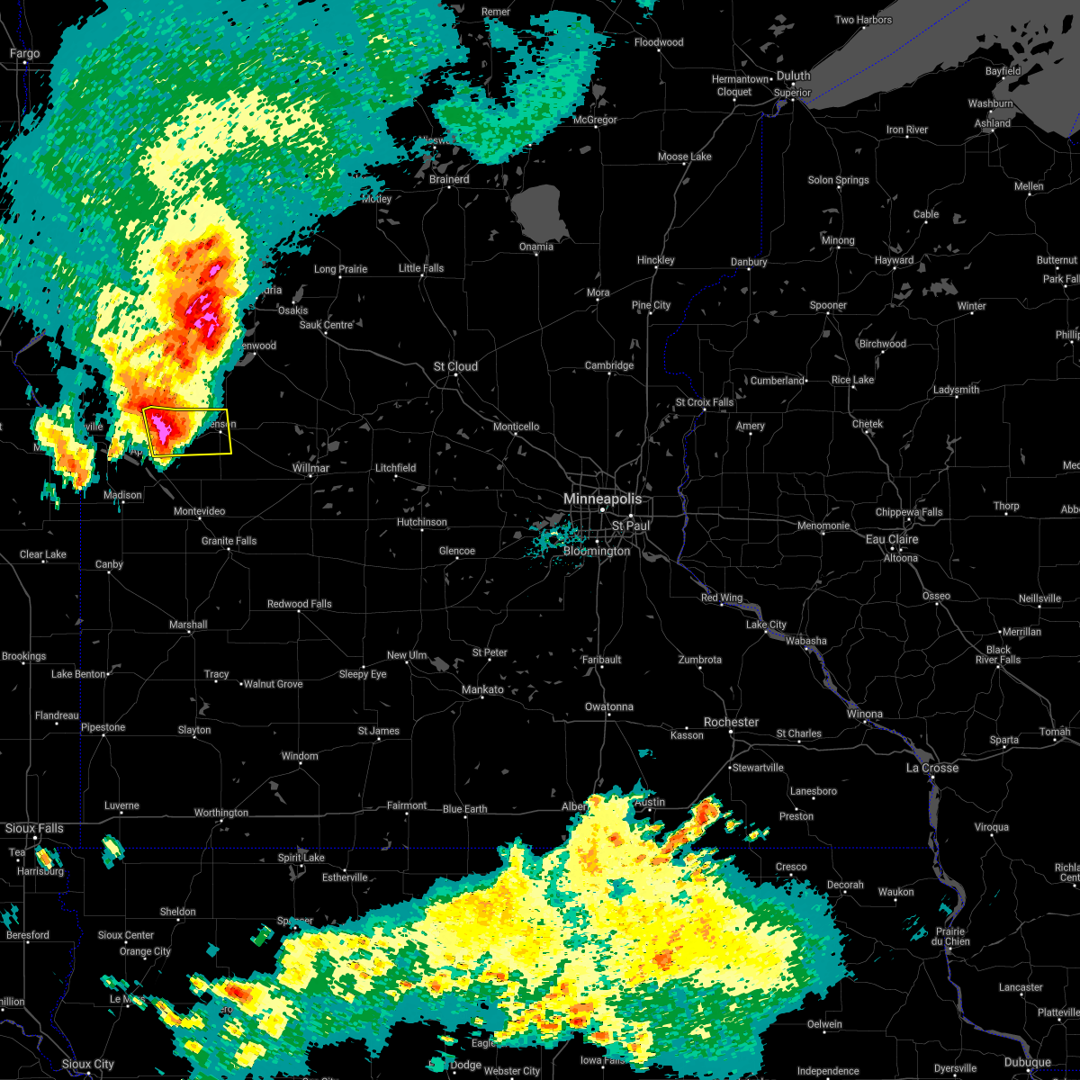
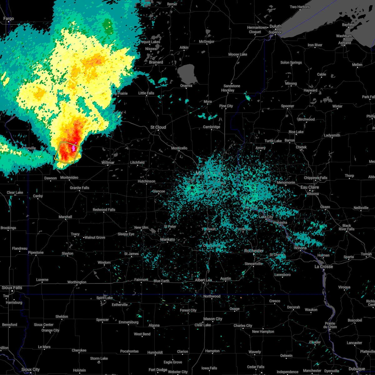
Hail Map for Danvers, MN
The Danvers, MN area has had 3 reports of on-the-ground hail by trained spotters, and has been under severe weather warnings 20 times during the past 12 months. Doppler radar has detected hail at or near Danvers, MN on 58 occasions, including 6 occasions during the past year.
| Name: | Danvers, MN |
| Where Located: | 22.9 miles N of Montevideo, MN |
| Map: | Google Map for Danvers, MN |
| Population: | 97 |
| Housing Units: | 45 |
| More Info: | Search Google for Danvers, MN |
1
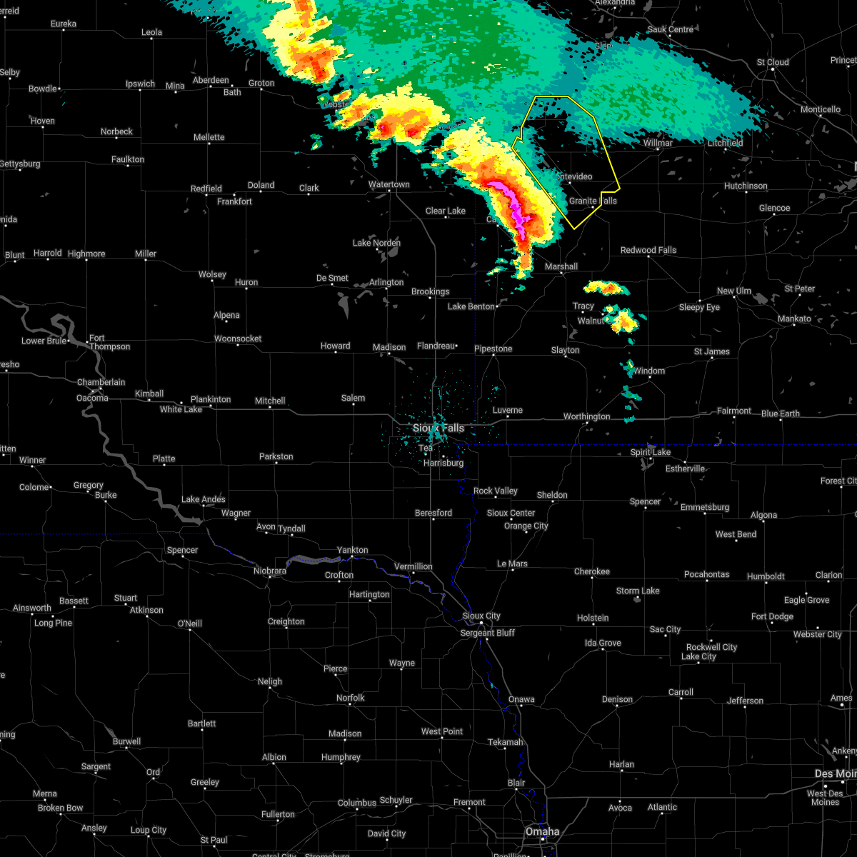
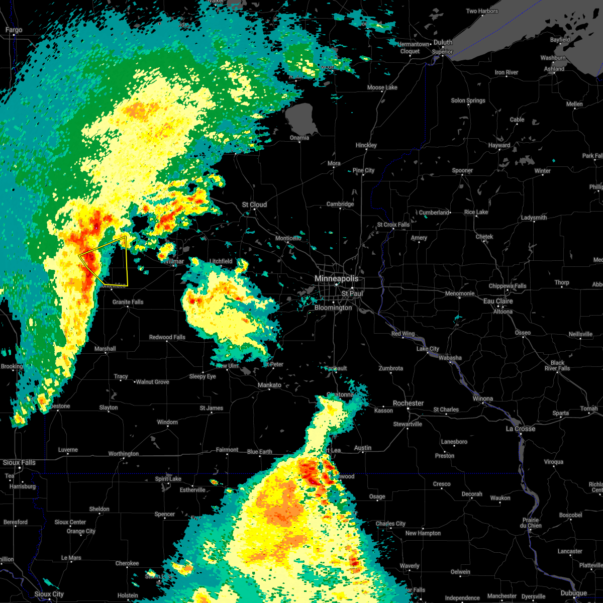
The Top Recent Hail Date for Danvers, MN is Monday, June 2, 2025 (19th out of 58)
Hail and Wind Damage Spotted near Danvers, MN
| Date / Time | Report Details |
|---|---|
| 6/28/2025 8:09 PM CDT |
 At 809 pm cdt, a severe thunderstorm was located 11 miles north of murdock, or 24 miles northwest of willmar, moving east at 20 mph (radar indicated). Hazards include 60 mph wind gusts and quarter size hail. Hail damage to vehicles is expected. expect wind damage to roofs, siding, and trees. Locations impacted include, benson, murdock, lake hassel, gilchrist, clontarf, de graff, danvers, benson airport, swift falls and monson lake state park. At 809 pm cdt, a severe thunderstorm was located 11 miles north of murdock, or 24 miles northwest of willmar, moving east at 20 mph (radar indicated). Hazards include 60 mph wind gusts and quarter size hail. Hail damage to vehicles is expected. expect wind damage to roofs, siding, and trees. Locations impacted include, benson, murdock, lake hassel, gilchrist, clontarf, de graff, danvers, benson airport, swift falls and monson lake state park.
|
| 6/28/2025 8:07 PM CDT |
 The storm which prompted the warning has weakened below severe limits, and no longer appears capable of producing a tornado. therefore, the warning will be allowed to expire. however, heavy rain is still possible with this thunderstorm. a tornado watch remains in effect until 100 am cdt for a portion of west central minnesota. The storm which prompted the warning has weakened below severe limits, and no longer appears capable of producing a tornado. therefore, the warning will be allowed to expire. however, heavy rain is still possible with this thunderstorm. a tornado watch remains in effect until 100 am cdt for a portion of west central minnesota.
|
| 6/28/2025 8:03 PM CDT |
 At 803 pm cdt, a severe thunderstorm capable of producing a tornado was located 7 miles southwest of benson, or 22 miles north of montevideo, moving east at 15 mph (radar indicated rotation). Hazards include tornado and quarter size hail. Flying debris will be dangerous to those caught without shelter. mobile homes will be damaged or destroyed. damage to roofs, windows and vehicles will occur. tree damage is likely. Locations impacted include, danvers and benson airport. At 803 pm cdt, a severe thunderstorm capable of producing a tornado was located 7 miles southwest of benson, or 22 miles north of montevideo, moving east at 15 mph (radar indicated rotation). Hazards include tornado and quarter size hail. Flying debris will be dangerous to those caught without shelter. mobile homes will be damaged or destroyed. damage to roofs, windows and vehicles will occur. tree damage is likely. Locations impacted include, danvers and benson airport.
|
| 6/28/2025 8:01 PM CDT |
 At 801 pm cdt, a severe thunderstorm was located 8 miles east of lake hassel, or 26 miles northwest of willmar, moving east at 25 mph (radar indicated). Hazards include 60 mph wind gusts and half dollar size hail. Hail damage to vehicles is expected. expect wind damage to roofs, siding, and trees. Locations impacted include, benson, murdock, lake hassel, gilchrist, clontarf, de graff, danvers, holloway, benson airport, swift falls and monson lake state park. At 801 pm cdt, a severe thunderstorm was located 8 miles east of lake hassel, or 26 miles northwest of willmar, moving east at 25 mph (radar indicated). Hazards include 60 mph wind gusts and half dollar size hail. Hail damage to vehicles is expected. expect wind damage to roofs, siding, and trees. Locations impacted include, benson, murdock, lake hassel, gilchrist, clontarf, de graff, danvers, holloway, benson airport, swift falls and monson lake state park.
|
| 6/28/2025 7:57 PM CDT |
 At 757 pm cdt, a confirmed tornado was located 8 miles west of benson, or 22 miles north of montevideo, moving east at 20 mph (emergency management confirmed tornado at 753 pm, emergency management reported a tornado in progress 4 miles west of danvers). Hazards include damaging tornado and quarter size hail. Flying debris will be dangerous to those caught without shelter. mobile homes will be damaged or destroyed. damage to roofs, windows and vehicles will occur. tree damage is likely. Locations impacted include, danvers and benson airport. At 757 pm cdt, a confirmed tornado was located 8 miles west of benson, or 22 miles north of montevideo, moving east at 20 mph (emergency management confirmed tornado at 753 pm, emergency management reported a tornado in progress 4 miles west of danvers). Hazards include damaging tornado and quarter size hail. Flying debris will be dangerous to those caught without shelter. mobile homes will be damaged or destroyed. damage to roofs, windows and vehicles will occur. tree damage is likely. Locations impacted include, danvers and benson airport.
|
| 6/28/2025 7:51 PM CDT |
 At 751 pm cdt, a severe thunderstorm was located 7 miles east of lake hassel, or 26 miles southeast of morris, moving east at 20 mph (radar indicated). Hazards include 60 mph wind gusts and half dollar size hail. Hail damage to vehicles is expected. expect wind damage to roofs, siding, and trees. Locations impacted include, benson, murdock, lake hassel, gilchrist, clontarf, de graff, danvers, holloway, benson airport, swift falls and monson lake state park. At 751 pm cdt, a severe thunderstorm was located 7 miles east of lake hassel, or 26 miles southeast of morris, moving east at 20 mph (radar indicated). Hazards include 60 mph wind gusts and half dollar size hail. Hail damage to vehicles is expected. expect wind damage to roofs, siding, and trees. Locations impacted include, benson, murdock, lake hassel, gilchrist, clontarf, de graff, danvers, holloway, benson airport, swift falls and monson lake state park.
|
| 6/28/2025 7:47 PM CDT |
 Tormpx the national weather service in the twin cities has issued a * tornado warning for, central swift county in west central minnesota, * until 815 pm cdt. * at 747 pm cdt, a severe thunderstorm capable of producing a tornado was located 12 miles northeast of milan, or 22 miles south of morris, moving east at 20 mph (radar indicated rotation). Hazards include tornado and quarter size hail. Flying debris will be dangerous to those caught without shelter. mobile homes will be damaged or destroyed. damage to roofs, windows and vehicles will occur. Tree damage is likely. Tormpx the national weather service in the twin cities has issued a * tornado warning for, central swift county in west central minnesota, * until 815 pm cdt. * at 747 pm cdt, a severe thunderstorm capable of producing a tornado was located 12 miles northeast of milan, or 22 miles south of morris, moving east at 20 mph (radar indicated rotation). Hazards include tornado and quarter size hail. Flying debris will be dangerous to those caught without shelter. mobile homes will be damaged or destroyed. damage to roofs, windows and vehicles will occur. Tree damage is likely.
|
| 6/28/2025 7:31 PM CDT |
 Svrmpx the national weather service in the twin cities has issued a * severe thunderstorm warning for, southern pope county in west central minnesota, southeastern stevens county in west central minnesota, swift county in west central minnesota, * until 830 pm cdt. * at 731 pm cdt, a severe thunderstorm was located over lake hassel, or 21 miles southeast of morris, moving east at 20 mph (radar indicated). Hazards include 60 mph wind gusts and half dollar size hail. Hail damage to vehicles is expected. Expect wind damage to roofs, siding, and trees. Svrmpx the national weather service in the twin cities has issued a * severe thunderstorm warning for, southern pope county in west central minnesota, southeastern stevens county in west central minnesota, swift county in west central minnesota, * until 830 pm cdt. * at 731 pm cdt, a severe thunderstorm was located over lake hassel, or 21 miles southeast of morris, moving east at 20 mph (radar indicated). Hazards include 60 mph wind gusts and half dollar size hail. Hail damage to vehicles is expected. Expect wind damage to roofs, siding, and trees.
|
| 6/2/2025 3:00 PM CDT |
 However, gusty winds and heavy rain are still possible with this thunderstorm. to report severe weather, contact your nearest law enforcement agency. they will send your report to the national weather service office. a severe thunderstorm watch remains in effect until 700 pm cdt for a portion of central minnesota. However, gusty winds and heavy rain are still possible with this thunderstorm. to report severe weather, contact your nearest law enforcement agency. they will send your report to the national weather service office. a severe thunderstorm watch remains in effect until 700 pm cdt for a portion of central minnesota.
|
| 6/2/2025 2:52 PM CDT |
 At 252 pm cdt, a severe thunderstorm was located 10 miles northeast of murdock, or 20 miles northwest of willmar, moving east at 45 mph (radar indicated). Hazards include 60 mph wind gusts and small hail. Expect damage to roofs, siding, and trees. Locations impacted include, benson, kerkhoven, murdock, lake hassel, norway lake, clontarf, hagen, de graff, sunburg, danvers, swift falls, monson lake state park, benson airport and sibley state park. At 252 pm cdt, a severe thunderstorm was located 10 miles northeast of murdock, or 20 miles northwest of willmar, moving east at 45 mph (radar indicated). Hazards include 60 mph wind gusts and small hail. Expect damage to roofs, siding, and trees. Locations impacted include, benson, kerkhoven, murdock, lake hassel, norway lake, clontarf, hagen, de graff, sunburg, danvers, swift falls, monson lake state park, benson airport and sibley state park.
|
| 6/2/2025 2:22 PM CDT |
 Svrmpx the national weather service in the twin cities has issued a * severe thunderstorm warning for, northwestern kandiyohi county in central minnesota, swift county in west central minnesota, * until 300 pm cdt. * at 222 pm cdt, a severe thunderstorm was located over benson, or 23 miles southeast of morris, moving east at 50 mph (trained spotters reported). Hazards include 60 mph wind gusts and small hail. expect damage to roofs, siding, and trees Svrmpx the national weather service in the twin cities has issued a * severe thunderstorm warning for, northwestern kandiyohi county in central minnesota, swift county in west central minnesota, * until 300 pm cdt. * at 222 pm cdt, a severe thunderstorm was located over benson, or 23 miles southeast of morris, moving east at 50 mph (trained spotters reported). Hazards include 60 mph wind gusts and small hail. expect damage to roofs, siding, and trees
|
| 5/15/2025 1:39 PM CDT |
 The tornado warning that was previously in effect has been reissued for swift county and is in effect until 215 pm cdt. please refer to that bulletin for the latest severe weather information. a tornado watch remains in effect until 800 pm cdt thursday for a portion of west central minnesota. The tornado warning that was previously in effect has been reissued for swift county and is in effect until 215 pm cdt. please refer to that bulletin for the latest severe weather information. a tornado watch remains in effect until 800 pm cdt thursday for a portion of west central minnesota.
|
| 5/15/2025 1:37 PM CDT |
 Tormpx the national weather service in the twin cities has issued a * tornado warning for, southwestern pope county in west central minnesota, southeastern stevens county in west central minnesota, eastern swift county in west central minnesota, * until 215 pm cdt. * at 137 pm cdt, a severe thunderstorm capable of producing a tornado was located near benson, or 24 miles northeast of montevideo, moving north at 40 mph (radar indicated rotation). Hazards include tornado. Flying debris will be dangerous to those caught without shelter. mobile homes will be damaged or destroyed. damage to roofs, windows and vehicles will occur. Tree damage is likely. Tormpx the national weather service in the twin cities has issued a * tornado warning for, southwestern pope county in west central minnesota, southeastern stevens county in west central minnesota, eastern swift county in west central minnesota, * until 215 pm cdt. * at 137 pm cdt, a severe thunderstorm capable of producing a tornado was located near benson, or 24 miles northeast of montevideo, moving north at 40 mph (radar indicated rotation). Hazards include tornado. Flying debris will be dangerous to those caught without shelter. mobile homes will be damaged or destroyed. damage to roofs, windows and vehicles will occur. Tree damage is likely.
|
| 5/15/2025 1:27 PM CDT |
 At 127 pm cdt, a confirmed tornado was located 8 miles west of benson, or 21 miles south of morris, moving north at 35 mph (weather spotters confirmed brief tornado touchdown that has since lifted. this storm is still capable of producing a tornado). Hazards include damaging tornado. Flying debris will be dangerous to those caught without shelter. mobile homes will be damaged or destroyed. damage to roofs, windows and vehicles will occur. tree damage is likely. Locations impacted include, clontarf and danvers. At 127 pm cdt, a confirmed tornado was located 8 miles west of benson, or 21 miles south of morris, moving north at 35 mph (weather spotters confirmed brief tornado touchdown that has since lifted. this storm is still capable of producing a tornado). Hazards include damaging tornado. Flying debris will be dangerous to those caught without shelter. mobile homes will be damaged or destroyed. damage to roofs, windows and vehicles will occur. tree damage is likely. Locations impacted include, clontarf and danvers.
|
| 5/15/2025 1:17 PM CDT |
 Tormpx the national weather service in the twin cities has issued a * tornado warning for, central swift county in west central minnesota, * until 145 pm cdt. * at 117 pm cdt, a severe thunderstorm capable of producing a tornado was located 10 miles northeast of milan, or 19 miles north of montevideo, moving north at 40 mph (radar indicated rotation). Hazards include tornado. Flying debris will be dangerous to those caught without shelter. mobile homes will be damaged or destroyed. damage to roofs, windows and vehicles will occur. Tree damage is likely. Tormpx the national weather service in the twin cities has issued a * tornado warning for, central swift county in west central minnesota, * until 145 pm cdt. * at 117 pm cdt, a severe thunderstorm capable of producing a tornado was located 10 miles northeast of milan, or 19 miles north of montevideo, moving north at 40 mph (radar indicated rotation). Hazards include tornado. Flying debris will be dangerous to those caught without shelter. mobile homes will be damaged or destroyed. damage to roofs, windows and vehicles will occur. Tree damage is likely.
|
| 7/31/2024 2:14 PM CDT |
 Svrmpx the national weather service in the twin cities has issued a * severe thunderstorm warning for, pope county in west central minnesota, northeastern swift county in west central minnesota, * until 300 pm cdt. * at 214 pm cdt, severe thunderstorms were located along a line extending from lowry to near hancock to benson, moving northeast at 35 mph (radar indicated). Hazards include 60 mph wind gusts and penny size hail. expect damage to roofs, siding, and trees Svrmpx the national weather service in the twin cities has issued a * severe thunderstorm warning for, pope county in west central minnesota, northeastern swift county in west central minnesota, * until 300 pm cdt. * at 214 pm cdt, severe thunderstorms were located along a line extending from lowry to near hancock to benson, moving northeast at 35 mph (radar indicated). Hazards include 60 mph wind gusts and penny size hail. expect damage to roofs, siding, and trees
|
| 7/15/2024 6:42 AM CDT |
 the severe thunderstorm warning has been cancelled and is no longer in effect the severe thunderstorm warning has been cancelled and is no longer in effect
|
| 7/15/2024 6:42 AM CDT |
 At 642 am cdt, a severe thunderstorm was located over benson, or 23 miles southeast of morris, moving southeast at 45 mph (radar indicated). Hazards include 60 mph wind gusts and quarter size hail. Hail damage to vehicles is expected. expect wind damage to roofs, siding, and trees. Locations impacted include, benson, de graff, danvers, and benson airport. At 642 am cdt, a severe thunderstorm was located over benson, or 23 miles southeast of morris, moving southeast at 45 mph (radar indicated). Hazards include 60 mph wind gusts and quarter size hail. Hail damage to vehicles is expected. expect wind damage to roofs, siding, and trees. Locations impacted include, benson, de graff, danvers, and benson airport.
|
| 7/15/2024 6:30 AM CDT |
 Svrmpx the national weather service in the twin cities has issued a * severe thunderstorm warning for, southeastern stevens county in west central minnesota, swift county in west central minnesota, * until 700 am cdt. * at 630 am cdt, a severe thunderstorm was located 8 miles south of hancock, or 15 miles south of morris, moving southeast at 45 mph (radar indicated). Hazards include 60 mph wind gusts and quarter size hail. Hail damage to vehicles is expected. Expect wind damage to roofs, siding, and trees. Svrmpx the national weather service in the twin cities has issued a * severe thunderstorm warning for, southeastern stevens county in west central minnesota, swift county in west central minnesota, * until 700 am cdt. * at 630 am cdt, a severe thunderstorm was located 8 miles south of hancock, or 15 miles south of morris, moving southeast at 45 mph (radar indicated). Hazards include 60 mph wind gusts and quarter size hail. Hail damage to vehicles is expected. Expect wind damage to roofs, siding, and trees.
|
| 7/6/2024 6:28 PM CDT |
 Svrmpx the national weather service in the twin cities has issued a * severe thunderstorm warning for, north central chippewa county in west central minnesota, central swift county in west central minnesota, * until 715 pm cdt. * at 627 pm cdt, a severe thunderstorm was located 9 miles northeast of milan, or 16 miles north of montevideo, moving east at 20 mph (radar indicated). Hazards include 60 mph wind gusts and quarter size hail. Hail damage to vehicles is expected. Expect wind damage to roofs, siding, and trees. Svrmpx the national weather service in the twin cities has issued a * severe thunderstorm warning for, north central chippewa county in west central minnesota, central swift county in west central minnesota, * until 715 pm cdt. * at 627 pm cdt, a severe thunderstorm was located 9 miles northeast of milan, or 16 miles north of montevideo, moving east at 20 mph (radar indicated). Hazards include 60 mph wind gusts and quarter size hail. Hail damage to vehicles is expected. Expect wind damage to roofs, siding, and trees.
|
| 6/2/2024 10:02 PM CDT |
 At 1002 pm cdt, a severe thunderstorm was located near benson, or 20 miles southeast of morris, moving east at 25 mph (radar indicated). Hazards include 60 mph wind gusts and half dollar size hail. Hail damage to vehicles is expected. expect wind damage to roofs, siding, and trees. Locations impacted include, benson, lake hassel, clontarf, danvers, and benson airport. At 1002 pm cdt, a severe thunderstorm was located near benson, or 20 miles southeast of morris, moving east at 25 mph (radar indicated). Hazards include 60 mph wind gusts and half dollar size hail. Hail damage to vehicles is expected. expect wind damage to roofs, siding, and trees. Locations impacted include, benson, lake hassel, clontarf, danvers, and benson airport.
|
| 6/2/2024 9:33 PM CDT |
 Svrmpx the national weather service in the twin cities has issued a * severe thunderstorm warning for, northwestern swift county in west central minnesota, * until 1015 pm cdt. * at 933 pm cdt, a severe thunderstorm was located 7 miles east of lake oliver, or 17 miles south of morris, moving east at 15 mph (radar indicated). Hazards include 60 mph wind gusts and half dollar size hail. Hail damage to vehicles is expected. Expect wind damage to roofs, siding, and trees. Svrmpx the national weather service in the twin cities has issued a * severe thunderstorm warning for, northwestern swift county in west central minnesota, * until 1015 pm cdt. * at 933 pm cdt, a severe thunderstorm was located 7 miles east of lake oliver, or 17 miles south of morris, moving east at 15 mph (radar indicated). Hazards include 60 mph wind gusts and half dollar size hail. Hail damage to vehicles is expected. Expect wind damage to roofs, siding, and trees.
|
| 7/25/2023 10:40 PM CDT |
 The severe thunderstorm warning for eastern stevens and western swift counties will expire at 1045 pm cdt, the storm which prompted the warning has moved out of the area. therefore, the warning will be allowed to expire. however gusty winds are still possible with this thunderstorm. a severe thunderstorm watch remains in effect until 400 am cdt for west central minnesota. The severe thunderstorm warning for eastern stevens and western swift counties will expire at 1045 pm cdt, the storm which prompted the warning has moved out of the area. therefore, the warning will be allowed to expire. however gusty winds are still possible with this thunderstorm. a severe thunderstorm watch remains in effect until 400 am cdt for west central minnesota.
|
| 7/25/2023 10:18 PM CDT |
 At 1018 pm cdt, a severe thunderstorm was located 6 miles southeast of hancock, or 14 miles southeast of morris, moving southeast at 55 mph (morris airport measured 60 mph winds). Hazards include 60 mph wind gusts and quarter size hail. Hail damage to vehicles is expected. expect wind damage to roofs, siding, and trees. locations impacted include, morris, appleton, hancock, lake oliver, artichoke lake, hagen, danders, holloway and appleton airport. hail threat, radar indicated max hail size, 1. 00 in wind threat, radar indicated max wind gust, 60 mph. At 1018 pm cdt, a severe thunderstorm was located 6 miles southeast of hancock, or 14 miles southeast of morris, moving southeast at 55 mph (morris airport measured 60 mph winds). Hazards include 60 mph wind gusts and quarter size hail. Hail damage to vehicles is expected. expect wind damage to roofs, siding, and trees. locations impacted include, morris, appleton, hancock, lake oliver, artichoke lake, hagen, danders, holloway and appleton airport. hail threat, radar indicated max hail size, 1. 00 in wind threat, radar indicated max wind gust, 60 mph.
|
| 7/25/2023 9:59 PM CDT |
 At 959 pm cdt, a severe thunderstorm was located 7 miles southwest of hancock, or 9 miles south of morris, moving southeast at 50 mph (radar indicated). Hazards include 60 mph wind gusts and quarter size hail. Hail damage to vehicles is expected. expect wind damage to roofs, siding, and trees. this severe thunderstorm will remain over mainly rural areas of southeastern stevens and western swift counties, including the following locations, danvers, hagen, appleton airport and holloway. hail threat, radar indicated max hail size, 1. 00 in wind threat, radar indicated max wind gust, 60 mph. At 959 pm cdt, a severe thunderstorm was located 7 miles southwest of hancock, or 9 miles south of morris, moving southeast at 50 mph (radar indicated). Hazards include 60 mph wind gusts and quarter size hail. Hail damage to vehicles is expected. expect wind damage to roofs, siding, and trees. this severe thunderstorm will remain over mainly rural areas of southeastern stevens and western swift counties, including the following locations, danvers, hagen, appleton airport and holloway. hail threat, radar indicated max hail size, 1. 00 in wind threat, radar indicated max wind gust, 60 mph.
|
| 7/23/2022 9:24 AM CDT |
 The severe thunderstorm warning for eastern lac qui parle, northwestern chippewa and southwestern swift counties will expire at 930 am cdt, the storms which prompted the warning have weakened below severe limits, and no longer pose an immediate threat to life or property. therefore, the warning will be allowed to expire. however gusty winds are still possible with these thunderstorms and the storm could strengthen again. we will be watching closely. a severe thunderstorm watch remains in effect until 200 pm cdt for west central minnesota. The severe thunderstorm warning for eastern lac qui parle, northwestern chippewa and southwestern swift counties will expire at 930 am cdt, the storms which prompted the warning have weakened below severe limits, and no longer pose an immediate threat to life or property. therefore, the warning will be allowed to expire. however gusty winds are still possible with these thunderstorms and the storm could strengthen again. we will be watching closely. a severe thunderstorm watch remains in effect until 200 pm cdt for west central minnesota.
|
| 7/23/2022 9:22 AM CDT |
 At 921 am cdt, severe thunderstorms were located along a line extending from 9 miles east of lake oliver to near milan to 6 miles southwest of dawson, moving east at 45 mph (radar indicated). Hazards include 60 mph wind gusts and nickel size hail. Expect damage to roofs, siding, and trees. locations impacted include, madison, dawson, appleton, milan, cerro gordo, hagen, danvers, holloway, appleton airport and madison airport. hail threat, radar indicated max hail size, 0. 88 in wind threat, radar indicated max wind gust, 60 mph. At 921 am cdt, severe thunderstorms were located along a line extending from 9 miles east of lake oliver to near milan to 6 miles southwest of dawson, moving east at 45 mph (radar indicated). Hazards include 60 mph wind gusts and nickel size hail. Expect damage to roofs, siding, and trees. locations impacted include, madison, dawson, appleton, milan, cerro gordo, hagen, danvers, holloway, appleton airport and madison airport. hail threat, radar indicated max hail size, 0. 88 in wind threat, radar indicated max wind gust, 60 mph.
|
| 7/23/2022 9:09 AM CDT |
 At 909 am cdt, severe thunderstorms were located along a line extending from lake oliver to 6 miles south of appleton to 8 miles northeast of gary, moving east at 45 mph (radar indicated). Hazards include 60 mph wind gusts and nickel size hail. Expect damage to roofs, siding, and trees. locations impacted include, madison, dawson, appleton, milan, bellingham, marietta, lake oliver, cerro gordo, clontarf, hagen, danvers and holloway. hail threat, radar indicated max hail size, 0. 88 in wind threat, radar indicated max wind gust, 60 mph. At 909 am cdt, severe thunderstorms were located along a line extending from lake oliver to 6 miles south of appleton to 8 miles northeast of gary, moving east at 45 mph (radar indicated). Hazards include 60 mph wind gusts and nickel size hail. Expect damage to roofs, siding, and trees. locations impacted include, madison, dawson, appleton, milan, bellingham, marietta, lake oliver, cerro gordo, clontarf, hagen, danvers and holloway. hail threat, radar indicated max hail size, 0. 88 in wind threat, radar indicated max wind gust, 60 mph.
|
| 7/23/2022 9:00 AM CDT |
 At 859 am cdt, severe thunderstorms were located along a line extending from artichoke lake to 5 miles east of bellingham to near gary, moving east at 45 mph (radar indicated). Hazards include 70 mph wind gusts and quarter size hail. Hail damage to vehicles is expected. expect considerable tree damage. wind damage is also likely to mobile homes, roofs, and outbuildings. locations impacted include, appleton, lake oliver, milan and dawson. thunderstorm damage threat, considerable hail threat, radar indicated max hail size, 1. 00 in wind threat, radar indicated max wind gust, 70 mph. At 859 am cdt, severe thunderstorms were located along a line extending from artichoke lake to 5 miles east of bellingham to near gary, moving east at 45 mph (radar indicated). Hazards include 70 mph wind gusts and quarter size hail. Hail damage to vehicles is expected. expect considerable tree damage. wind damage is also likely to mobile homes, roofs, and outbuildings. locations impacted include, appleton, lake oliver, milan and dawson. thunderstorm damage threat, considerable hail threat, radar indicated max hail size, 1. 00 in wind threat, radar indicated max wind gust, 70 mph.
|
| 7/23/2022 8:39 AM CDT |
 At 838 am cdt, severe thunderstorms were located along a line extending from near ortonville to near albee to near tunerville, moving east at 45 mph (radar indicated). Hazards include 70 mph wind gusts and quarter size hail. Hail damage to vehicles is expected. expect considerable tree damage. wind damage is also likely to mobile homes, roofs, and outbuildings. severe thunderstorms will be near, marietta around 845 am cdt. bellingham around 855 am cdt. other locations in the path of these severe thunderstorms include madison, lake oliver, appleton, milan and dawson. thunderstorm damage threat, considerable hail threat, radar indicated max hail size, 1. 00 in wind threat, radar indicated max wind gust, 70 mph. At 838 am cdt, severe thunderstorms were located along a line extending from near ortonville to near albee to near tunerville, moving east at 45 mph (radar indicated). Hazards include 70 mph wind gusts and quarter size hail. Hail damage to vehicles is expected. expect considerable tree damage. wind damage is also likely to mobile homes, roofs, and outbuildings. severe thunderstorms will be near, marietta around 845 am cdt. bellingham around 855 am cdt. other locations in the path of these severe thunderstorms include madison, lake oliver, appleton, milan and dawson. thunderstorm damage threat, considerable hail threat, radar indicated max hail size, 1. 00 in wind threat, radar indicated max wind gust, 70 mph.
|
| 6/20/2022 11:12 PM CDT |
 At 1112 pm cdt, severe thunderstorms were located along a line extending from near lake hassel to appleton, moving northeast at 55 mph (radar indicated. at 1104 pm, a 60 mph wind gust was measured at appleton airport). Hazards include 60 mph wind gusts. Expect damage to roofs, siding, and trees. locations impacted include, benson, appleton, milan, lake hassel, clontarf, hagen, danvers, holloway, benson airport, big bend city and appleton airport. hail threat, radar indicated max hail size, <. 75 in wind threat, observed max wind gust, 60 mph. At 1112 pm cdt, severe thunderstorms were located along a line extending from near lake hassel to appleton, moving northeast at 55 mph (radar indicated. at 1104 pm, a 60 mph wind gust was measured at appleton airport). Hazards include 60 mph wind gusts. Expect damage to roofs, siding, and trees. locations impacted include, benson, appleton, milan, lake hassel, clontarf, hagen, danvers, holloway, benson airport, big bend city and appleton airport. hail threat, radar indicated max hail size, <. 75 in wind threat, observed max wind gust, 60 mph.
|
| 6/20/2022 10:45 PM CDT |
 At 1044 pm cdt, a severe thunderstorm was located near madison, or 20 miles southeast of ortonville, moving northeast at 45 mph (radar indicated. at 1043 pm, a 61 mph gust was measured at madison airport). Hazards include 60 mph wind gusts. Expect damage to roofs, siding, and trees. this severe thunderstorm will be near, appleton and milan around 1100 pm cdt. other locations in the path of this severe thunderstorm include lake hassel. hail threat, radar indicated max hail size, <. 75 in wind threat, observed max wind gust, 60 mph. At 1044 pm cdt, a severe thunderstorm was located near madison, or 20 miles southeast of ortonville, moving northeast at 45 mph (radar indicated. at 1043 pm, a 61 mph gust was measured at madison airport). Hazards include 60 mph wind gusts. Expect damage to roofs, siding, and trees. this severe thunderstorm will be near, appleton and milan around 1100 pm cdt. other locations in the path of this severe thunderstorm include lake hassel. hail threat, radar indicated max hail size, <. 75 in wind threat, observed max wind gust, 60 mph.
|
| 5/30/2022 3:47 PM CDT |
 At 347 pm cdt, severe thunderstorms capable of producing a tornado were located along a line extending from near artichoke to near lake oliver to 6 miles north of appleton, moving north at 75 mph (radar indicated rotation). Hazards include tornado and quarter size hail. Flying debris will be dangerous to those caught without shelter. mobile homes will be damaged or destroyed. damage to roofs, windows, and vehicles will occur. tree damage is likely. these dangerous storms will be near, chokio and lake hattie around 355 pm cdt. hancock around 400 pm cdt. morris and donnelly around 405 pm cdt. Other locations impacted by these tornadic storms include danvers, fish lake, alberta, holloway and morris airport. At 347 pm cdt, severe thunderstorms capable of producing a tornado were located along a line extending from near artichoke to near lake oliver to 6 miles north of appleton, moving north at 75 mph (radar indicated rotation). Hazards include tornado and quarter size hail. Flying debris will be dangerous to those caught without shelter. mobile homes will be damaged or destroyed. damage to roofs, windows, and vehicles will occur. tree damage is likely. these dangerous storms will be near, chokio and lake hattie around 355 pm cdt. hancock around 400 pm cdt. morris and donnelly around 405 pm cdt. Other locations impacted by these tornadic storms include danvers, fish lake, alberta, holloway and morris airport.
|
| 5/12/2022 6:36 PM CDT |
 At 635 pm cdt, severe thunderstorms were located along a line extending from near johnson to 5 miles southwest of hancock to 5 miles west of raymond, moving north at 75 mph. these are destructive storms for benson and morris (radar indicated). Hazards include 90 mph wind gusts. You are in a life-threatening situation. flying debris may be deadly to those caught without shelter. mobile homes will be heavily damaged or destroyed. homes and businesses will have substantial roof and window damage. expect extensive tree damage and power outages. these severe storms will be near, hancock and chokio around 640 pm cdt. morris, cyrus and murdock around 645 pm cdt. donnelly around 650 pm cdt. brooten around 700 pm cdt. thunderstorm damage threat, destructive hail threat, radar indicated max hail size, <. 75 in wind threat, radar indicated max wind gust, 90 mph. At 635 pm cdt, severe thunderstorms were located along a line extending from near johnson to 5 miles southwest of hancock to 5 miles west of raymond, moving north at 75 mph. these are destructive storms for benson and morris (radar indicated). Hazards include 90 mph wind gusts. You are in a life-threatening situation. flying debris may be deadly to those caught without shelter. mobile homes will be heavily damaged or destroyed. homes and businesses will have substantial roof and window damage. expect extensive tree damage and power outages. these severe storms will be near, hancock and chokio around 640 pm cdt. morris, cyrus and murdock around 645 pm cdt. donnelly around 650 pm cdt. brooten around 700 pm cdt. thunderstorm damage threat, destructive hail threat, radar indicated max hail size, <. 75 in wind threat, radar indicated max wind gust, 90 mph.
|
| 5/12/2022 6:16 PM CDT |
 At 615 pm cdt, severe thunderstorms were located along a line extending from near milbank to 6 miles southwest of appleton to near hanley falls, moving northeast at 85 mph. these are destructive storms for appleton and benson (radar indicated. at 608 pm cdt, madison airport reported a gust of 94 mph). Hazards include 100 mph wind gusts. You are in a life-threatening situation. flying debris may be deadly to those caught without shelter. mobile homes will be destroyed. expect considerable damage to homes and businesses. expect extensive tree damage and power outages. severe thunderstorms will be near, granite falls and appleton around 620 pm cdt. maynard and lake oliver around 625 pm cdt. clara city around 630 pm cdt. hancock and raymond around 635 pm cdt. kerkhoven, chokio and cyrus around 640 pm cdt. thunderstorm damage threat, destructive hail threat, radar indicated max hail size, <. 75 in wind threat, observed max wind gust, 100 mph. At 615 pm cdt, severe thunderstorms were located along a line extending from near milbank to 6 miles southwest of appleton to near hanley falls, moving northeast at 85 mph. these are destructive storms for appleton and benson (radar indicated. at 608 pm cdt, madison airport reported a gust of 94 mph). Hazards include 100 mph wind gusts. You are in a life-threatening situation. flying debris may be deadly to those caught without shelter. mobile homes will be destroyed. expect considerable damage to homes and businesses. expect extensive tree damage and power outages. severe thunderstorms will be near, granite falls and appleton around 620 pm cdt. maynard and lake oliver around 625 pm cdt. clara city around 630 pm cdt. hancock and raymond around 635 pm cdt. kerkhoven, chokio and cyrus around 640 pm cdt. thunderstorm damage threat, destructive hail threat, radar indicated max hail size, <. 75 in wind threat, observed max wind gust, 100 mph.
|
| 5/9/2022 7:37 AM CDT |
 The severe thunderstorm warning for eastern lac qui parle, chippewa, northeastern yellow medicine and western swift counties will expire at 745 am cdt, the storms which prompted the warning have moved out of the area. therefore, the warning will be allowed to expire. to report severe weather, contact your nearest law enforcement agency. they will relay your report to the national weather service the twin cities. The severe thunderstorm warning for eastern lac qui parle, chippewa, northeastern yellow medicine and western swift counties will expire at 745 am cdt, the storms which prompted the warning have moved out of the area. therefore, the warning will be allowed to expire. to report severe weather, contact your nearest law enforcement agency. they will relay your report to the national weather service the twin cities.
|
| 5/9/2022 7:24 AM CDT |
 At 723 am cdt, severe thunderstorms were located along a line extending from near milan to near montevideo to near clarkfield, moving northeast at 65 mph. these are destructive storms for montevideo and granite falls (radar indicated). Hazards include baseball size hail and 60 mph wind gusts. People and animals outdoors will be severely injured. expect shattered windows, extensive damage to roofs, siding, and vehicles. these severe storms will be near, maynard around 735 am cdt. benson and clara city around 745 am cdt. other locations impacted by these severe thunderstorms include asbury, benson airport, danvers, hagen, big bend city, appleton airport, hazel run, montevideo airport, cerro gordo and gluek. thunderstorm damage threat, destructive hail threat, radar indicated max hail size, 2. 75 in wind threat, radar indicated max wind gust, 60 mph. At 723 am cdt, severe thunderstorms were located along a line extending from near milan to near montevideo to near clarkfield, moving northeast at 65 mph. these are destructive storms for montevideo and granite falls (radar indicated). Hazards include baseball size hail and 60 mph wind gusts. People and animals outdoors will be severely injured. expect shattered windows, extensive damage to roofs, siding, and vehicles. these severe storms will be near, maynard around 735 am cdt. benson and clara city around 745 am cdt. other locations impacted by these severe thunderstorms include asbury, benson airport, danvers, hagen, big bend city, appleton airport, hazel run, montevideo airport, cerro gordo and gluek. thunderstorm damage threat, destructive hail threat, radar indicated max hail size, 2. 75 in wind threat, radar indicated max wind gust, 60 mph.
|
| 5/9/2022 7:05 AM CDT |
 At 704 am cdt, severe thunderstorms were located along a line extending from near madison to 7 miles south of dawson to 5 miles north of taunton, moving northeast at 70 mph. these are destructive storms for montevideo (radar indicated). Hazards include baseball size hail and 60 mph wind gusts. People and animals outdoors will be severely injured. expect shattered windows, extensive damage to roofs, siding, and vehicles. severe thunderstorms will be near, clarkfield around 715 am cdt. appleton, milan and watson around 720 am cdt. montevideo around 725 am cdt. benson around 740 am cdt. other locations impacted by these severe thunderstorms include asbury, benson airport, danvers, hagen, big bend city, appleton airport, hazel run, montevideo airport, cerro gordo and gluek. thunderstorm damage threat, destructive hail threat, radar indicated max hail size, 2. 75 in wind threat, radar indicated max wind gust, 60 mph. At 704 am cdt, severe thunderstorms were located along a line extending from near madison to 7 miles south of dawson to 5 miles north of taunton, moving northeast at 70 mph. these are destructive storms for montevideo (radar indicated). Hazards include baseball size hail and 60 mph wind gusts. People and animals outdoors will be severely injured. expect shattered windows, extensive damage to roofs, siding, and vehicles. severe thunderstorms will be near, clarkfield around 715 am cdt. appleton, milan and watson around 720 am cdt. montevideo around 725 am cdt. benson around 740 am cdt. other locations impacted by these severe thunderstorms include asbury, benson airport, danvers, hagen, big bend city, appleton airport, hazel run, montevideo airport, cerro gordo and gluek. thunderstorm damage threat, destructive hail threat, radar indicated max hail size, 2. 75 in wind threat, radar indicated max wind gust, 60 mph.
|
| 8/28/2021 10:24 AM CDT | Baseball sized hail reported 1.3 miles SSW of Danvers, MN, in addition to high winds and heavy rain. relayed via law enforcement. |
| 8/28/2021 10:11 AM CDT |
 At 1011 am cdt, a severe thunderstorm was located 8 miles east of lake oliver, or 17 miles south of morris, moving east at 40 mph (radar indicated). Hazards include two inch hail and 60 mph wind gusts. People and animals outdoors will be injured. expect hail damage to roofs, siding, windows, and vehicles. expect wind damage to roofs, siding, and trees. this severe storm will be near, benson around 1030 am cdt. lake hassel around 1035 am cdt. other locations impacted by this severe thunderstorm include benson airport, danvers, appleton airport, clontarf and holloway. thunderstorm damage threat, considerable hail threat, radar indicated max hail size, 2. 00 in wind threat, radar indicated max wind gust, 60 mph. At 1011 am cdt, a severe thunderstorm was located 8 miles east of lake oliver, or 17 miles south of morris, moving east at 40 mph (radar indicated). Hazards include two inch hail and 60 mph wind gusts. People and animals outdoors will be injured. expect hail damage to roofs, siding, windows, and vehicles. expect wind damage to roofs, siding, and trees. this severe storm will be near, benson around 1030 am cdt. lake hassel around 1035 am cdt. other locations impacted by this severe thunderstorm include benson airport, danvers, appleton airport, clontarf and holloway. thunderstorm damage threat, considerable hail threat, radar indicated max hail size, 2. 00 in wind threat, radar indicated max wind gust, 60 mph.
|
| 8/28/2021 9:54 AM CDT |
 At 954 am cdt, a severe thunderstorm was located near artichoke lake, or 16 miles east of ortonville, moving east at 40 mph (radar indicated). Hazards include ping pong ball size hail and 60 mph wind gusts. People and animals outdoors will be injured. expect hail damage to roofs, siding, windows, and vehicles. Expect wind damage to roofs, siding, and trees. At 954 am cdt, a severe thunderstorm was located near artichoke lake, or 16 miles east of ortonville, moving east at 40 mph (radar indicated). Hazards include ping pong ball size hail and 60 mph wind gusts. People and animals outdoors will be injured. expect hail damage to roofs, siding, windows, and vehicles. Expect wind damage to roofs, siding, and trees.
|
| 8/26/2021 11:38 AM CDT |
 The severe thunderstorm warning for northwestern chippewa and southwestern swift counties will expire at 1145 am cdt, the storm which prompted the warning has moved out of the area. therefore, the warning will be allowed to expire. however gusty winds and heavy rain are still possible with this thunderstorm. a severe thunderstorm watch remains in effect until 300 pm cdt for west central minnesota. The severe thunderstorm warning for northwestern chippewa and southwestern swift counties will expire at 1145 am cdt, the storm which prompted the warning has moved out of the area. therefore, the warning will be allowed to expire. however gusty winds and heavy rain are still possible with this thunderstorm. a severe thunderstorm watch remains in effect until 300 pm cdt for west central minnesota.
|
| 8/26/2021 11:05 AM CDT |
 At 1105 am cdt, a severe thunderstorm was located near appleton, or 19 miles northwest of montevideo, moving east at 35 mph (radar indicated). Hazards include 60 mph wind gusts and quarter size hail. Hail damage to vehicles is expected. Expect wind damage to roofs, siding, and trees. At 1105 am cdt, a severe thunderstorm was located near appleton, or 19 miles northwest of montevideo, moving east at 35 mph (radar indicated). Hazards include 60 mph wind gusts and quarter size hail. Hail damage to vehicles is expected. Expect wind damage to roofs, siding, and trees.
|
| 8/24/2021 4:15 AM CDT |
 At 415 am cdt, a severe thunderstorm was located near appleton, or 22 miles northwest of montevideo, moving east at 30 mph (radar indicated). Hazards include 60 mph wind gusts and half dollar size hail. Hail damage to vehicles is expected. expect wind damage to roofs, siding, and trees. this severe thunderstorm will remain over mainly rural areas of southeastern lac qui parle, western chippewa, northeastern yellow medicine and western swift counties, including the following locations, danvers, hagen, montevideo airport, big bend city, appleton airport and holloway. hail threat, radar indicated max hail size, 1. 25 in wind threat, radar indicated max wind gust, 60 mph. At 415 am cdt, a severe thunderstorm was located near appleton, or 22 miles northwest of montevideo, moving east at 30 mph (radar indicated). Hazards include 60 mph wind gusts and half dollar size hail. Hail damage to vehicles is expected. expect wind damage to roofs, siding, and trees. this severe thunderstorm will remain over mainly rural areas of southeastern lac qui parle, western chippewa, northeastern yellow medicine and western swift counties, including the following locations, danvers, hagen, montevideo airport, big bend city, appleton airport and holloway. hail threat, radar indicated max hail size, 1. 25 in wind threat, radar indicated max wind gust, 60 mph.
|
| 8/24/2021 3:52 AM CDT |
 At 351 am cdt, a severe thunderstorm was located near correll, or 14 miles southeast of ortonville, moving east at 30 mph (radar indicated). Hazards include 60 mph wind gusts and half dollar size hail. Hail damage to vehicles is expected. expect wind damage to roofs, siding, and trees. this severe thunderstorm will be near, appleton around 410 am cdt. other locations in the path of this severe thunderstorm include milan. hail threat, radar indicated max hail size, 1. 25 in wind threat, radar indicated max wind gust, 60 mph. At 351 am cdt, a severe thunderstorm was located near correll, or 14 miles southeast of ortonville, moving east at 30 mph (radar indicated). Hazards include 60 mph wind gusts and half dollar size hail. Hail damage to vehicles is expected. expect wind damage to roofs, siding, and trees. this severe thunderstorm will be near, appleton around 410 am cdt. other locations in the path of this severe thunderstorm include milan. hail threat, radar indicated max hail size, 1. 25 in wind threat, radar indicated max wind gust, 60 mph.
|
| 6/11/2021 6:38 AM CDT |
 The severe thunderstorm warning for northwestern chippewa, stevens and western swift counties will expire at 645 am cdt, the storms which prompted the warning have weakened below severe limits, and no longer pose an immediate threat to life or property. therefore, the warning will be allowed to expire. however gusty winds are still possible with these thunderstorms. The severe thunderstorm warning for northwestern chippewa, stevens and western swift counties will expire at 645 am cdt, the storms which prompted the warning have weakened below severe limits, and no longer pose an immediate threat to life or property. therefore, the warning will be allowed to expire. however gusty winds are still possible with these thunderstorms.
|
| 6/11/2021 5:55 AM CDT |
 At 555 am cdt, severe thunderstorms were located along a line extending from near elbow lake to near milbank, moving east at 50 mph (radar indicated). Hazards include 60 mph wind gusts. expect damage to roofs, siding, and trees At 555 am cdt, severe thunderstorms were located along a line extending from near elbow lake to near milbank, moving east at 50 mph (radar indicated). Hazards include 60 mph wind gusts. expect damage to roofs, siding, and trees
|
| 8/24/2020 2:45 AM CDT |
 At 244 am cdt, a severe thunderstorm was located near lake oliver, or 18 miles south of morris, moving southeast at 35 mph. this is a very dangerous storm (radar indicated. at 740 am, a 79 mph wind gust was reported in benson). Hazards include 80 mph wind gusts and quarter size hail. Flying debris will be dangerous to those caught without shelter. mobile homes will be heavily damaged. expect considerable damage to roofs, windows, and vehicles. extensive tree damage and power outages are likely. this severe storm will be near, benson around 310 am cdt. Other locations impacted by this severe thunderstorm include danvers, hagen, clontarf and holloway. At 244 am cdt, a severe thunderstorm was located near lake oliver, or 18 miles south of morris, moving southeast at 35 mph. this is a very dangerous storm (radar indicated. at 740 am, a 79 mph wind gust was reported in benson). Hazards include 80 mph wind gusts and quarter size hail. Flying debris will be dangerous to those caught without shelter. mobile homes will be heavily damaged. expect considerable damage to roofs, windows, and vehicles. extensive tree damage and power outages are likely. this severe storm will be near, benson around 310 am cdt. Other locations impacted by this severe thunderstorm include danvers, hagen, clontarf and holloway.
|
| 8/24/2020 2:21 AM CDT |
 At 220 am cdt, a severe thunderstorm was located over artichoke, or 15 miles northeast of ortonville, moving southeast at 35 mph (radar indicated). Hazards include ping pong ball size hail and 60 mph wind gusts. People and animals outdoors will be injured. expect hail damage to roofs, siding, windows, and vehicles. expect wind damage to roofs, siding, and trees. this severe thunderstorm will be near, lake oliver around 235 am cdt. benson around 310 am cdt. Other locations impacted by this severe thunderstorm include danvers, hagen, appleton airport, clontarf and holloway. At 220 am cdt, a severe thunderstorm was located over artichoke, or 15 miles northeast of ortonville, moving southeast at 35 mph (radar indicated). Hazards include ping pong ball size hail and 60 mph wind gusts. People and animals outdoors will be injured. expect hail damage to roofs, siding, windows, and vehicles. expect wind damage to roofs, siding, and trees. this severe thunderstorm will be near, lake oliver around 235 am cdt. benson around 310 am cdt. Other locations impacted by this severe thunderstorm include danvers, hagen, appleton airport, clontarf and holloway.
|
| 8/21/2020 7:09 PM CDT |
 At 707 pm cdt, a severe thunderstorm was located near benson, or 18 miles southeast of morris, moving east at 30 mph. several other storms, some severe, are located along the leading edge of the main thunderstorm complex that extended from morris, southward to danvers (radar indicated). Hazards include 70 mph wind gusts and quarter size hail. Hail damage to vehicles is expected. expect considerable tree damage. wind damage is also likely to mobile homes, roofs, and outbuildings. this severe storm will be near, benson around 715 pm cdt. lake hassel around 720 pm cdt. Other locations impacted by this severe thunderstorm include benson airport, danvers, swift falls, lake emily, appleton airport, clontarf, de graff, holloway and morris airport. At 707 pm cdt, a severe thunderstorm was located near benson, or 18 miles southeast of morris, moving east at 30 mph. several other storms, some severe, are located along the leading edge of the main thunderstorm complex that extended from morris, southward to danvers (radar indicated). Hazards include 70 mph wind gusts and quarter size hail. Hail damage to vehicles is expected. expect considerable tree damage. wind damage is also likely to mobile homes, roofs, and outbuildings. this severe storm will be near, benson around 715 pm cdt. lake hassel around 720 pm cdt. Other locations impacted by this severe thunderstorm include benson airport, danvers, swift falls, lake emily, appleton airport, clontarf, de graff, holloway and morris airport.
|
| 8/21/2020 6:53 PM CDT |
 At 645 pm cdt, a severe thunderstorm was located 7 miles southwest of hancock, or 11 miles south of morris, moving east at 35 mph (radar indicated). Hazards include 70 mph wind gusts and half dollar size hail. Hail damage to vehicles is expected. expect considerable tree damage. wind damage is also likely to mobile homes, roofs, and outbuildings. this severe storm will be near, hancock around 655 pm cdt. lake hassel around 715 pm cdt. Other locations impacted by this severe thunderstorm include benson airport, danvers, swift falls, lake emily, appleton airport, clontarf, de graff, holloway and morris airport. At 645 pm cdt, a severe thunderstorm was located 7 miles southwest of hancock, or 11 miles south of morris, moving east at 35 mph (radar indicated). Hazards include 70 mph wind gusts and half dollar size hail. Hail damage to vehicles is expected. expect considerable tree damage. wind damage is also likely to mobile homes, roofs, and outbuildings. this severe storm will be near, hancock around 655 pm cdt. lake hassel around 715 pm cdt. Other locations impacted by this severe thunderstorm include benson airport, danvers, swift falls, lake emily, appleton airport, clontarf, de graff, holloway and morris airport.
|
| 8/21/2020 6:45 PM CDT |
 At 645 pm cdt, a severe thunderstorm was located 7 miles southwest of hancock, or 11 miles south of morris, moving east at 35 mph (radar indicated). Hazards include 70 mph wind gusts and half dollar size hail. Hail damage to vehicles is expected. expect considerable tree damage. wind damage is also likely to mobile homes, roofs, and outbuildings. this severe storm will be near, hancock around 655 pm cdt. lake hassel around 715 pm cdt. Other locations impacted by this severe thunderstorm include benson airport, danvers, swift falls, lake emily, appleton airport, clontarf, de graff, holloway and morris airport. At 645 pm cdt, a severe thunderstorm was located 7 miles southwest of hancock, or 11 miles south of morris, moving east at 35 mph (radar indicated). Hazards include 70 mph wind gusts and half dollar size hail. Hail damage to vehicles is expected. expect considerable tree damage. wind damage is also likely to mobile homes, roofs, and outbuildings. this severe storm will be near, hancock around 655 pm cdt. lake hassel around 715 pm cdt. Other locations impacted by this severe thunderstorm include benson airport, danvers, swift falls, lake emily, appleton airport, clontarf, de graff, holloway and morris airport.
|
| 8/21/2020 6:39 PM CDT |
 At 639 pm cdt, a severe thunderstorm was located near lake oliver, or 12 miles south of morris, moving east at 35 mph (radar indicated). Hazards include 60 mph wind gusts and quarter size hail. Hail damage to vehicles is expected. expect wind damage to roofs, siding, and trees. this severe thunderstorm will be near, hancock around 655 pm cdt. benson and lake hassel around 710 pm cdt. Other locations impacted by this severe thunderstorm include benson airport, danvers, swift falls, lake emily, appleton airport, clontarf, de graff, holloway and morris airport. At 639 pm cdt, a severe thunderstorm was located near lake oliver, or 12 miles south of morris, moving east at 35 mph (radar indicated). Hazards include 60 mph wind gusts and quarter size hail. Hail damage to vehicles is expected. expect wind damage to roofs, siding, and trees. this severe thunderstorm will be near, hancock around 655 pm cdt. benson and lake hassel around 710 pm cdt. Other locations impacted by this severe thunderstorm include benson airport, danvers, swift falls, lake emily, appleton airport, clontarf, de graff, holloway and morris airport.
|
| 7/11/2020 11:17 AM CDT |
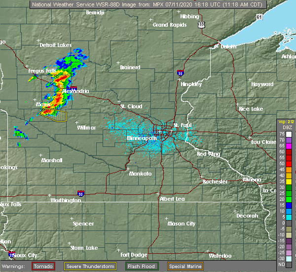 At 1116 am cdt, a severe thunderstorm was located near benson, or 19 miles southeast of morris, moving east at 30 mph (radar indicated). Hazards include 60 mph wind gusts and quarter size hail. Hail damage to vehicles is expected. Expect wind damage to roofs, siding, and trees. At 1116 am cdt, a severe thunderstorm was located near benson, or 19 miles southeast of morris, moving east at 30 mph (radar indicated). Hazards include 60 mph wind gusts and quarter size hail. Hail damage to vehicles is expected. Expect wind damage to roofs, siding, and trees.
|
| 9/2/2019 8:38 PM CDT |
 At 837 pm cdt, severe thunderstorms were located along a line extending from 7 miles east of lake osakis to near brooten to near murdock to 7 miles east of appleton, moving east at 45 mph (law enforcement). Hazards include 70 mph wind gusts and quarter size hail. Hail damage to vehicles is expected. expect considerable tree damage. wind damage is also likely to mobile homes, roofs, and outbuildings. Locations impacted include, willmar, sauk centre, melrose, benson, glenwood, albany, paynesville, appleton, new london, spicer, kerkhoven and brooten. At 837 pm cdt, severe thunderstorms were located along a line extending from 7 miles east of lake osakis to near brooten to near murdock to 7 miles east of appleton, moving east at 45 mph (law enforcement). Hazards include 70 mph wind gusts and quarter size hail. Hail damage to vehicles is expected. expect considerable tree damage. wind damage is also likely to mobile homes, roofs, and outbuildings. Locations impacted include, willmar, sauk centre, melrose, benson, glenwood, albany, paynesville, appleton, new london, spicer, kerkhoven and brooten.
|
| 9/2/2019 8:20 PM CDT |
 At 819 pm cdt, severe thunderstorms were located along a line extending from near lake osakis to near glenwood to near benson to near correll, moving east at 45 mph (radar indicated). Hazards include 70 mph wind gusts and quarter size hail. Hail damage to vehicles is expected. expect considerable tree damage. Wind damage is also likely to mobile homes, roofs, and outbuildings. At 819 pm cdt, severe thunderstorms were located along a line extending from near lake osakis to near glenwood to near benson to near correll, moving east at 45 mph (radar indicated). Hazards include 70 mph wind gusts and quarter size hail. Hail damage to vehicles is expected. expect considerable tree damage. Wind damage is also likely to mobile homes, roofs, and outbuildings.
|
| 6/6/2018 2:45 AM CDT |
 At 244 am cdt, severe thunderstorms were located along a line extending from near lowry to hancock to appleton, moving east at 50 mph (radar indicated). Hazards include 60 mph wind gusts and penny size hail. Expect damage to roofs, siding, and trees. these severe storms will be near, lowry around 250 am cdt. starbuck around 300 am cdt. benson and glenwood around 310 am cdt. murdock around 315 am cdt. Other locations impacted by these severe thunderstorms include westport, swift falls, alberta, grove lake, de graff, villard, and lake minnewaska. At 244 am cdt, severe thunderstorms were located along a line extending from near lowry to hancock to appleton, moving east at 50 mph (radar indicated). Hazards include 60 mph wind gusts and penny size hail. Expect damage to roofs, siding, and trees. these severe storms will be near, lowry around 250 am cdt. starbuck around 300 am cdt. benson and glenwood around 310 am cdt. murdock around 315 am cdt. Other locations impacted by these severe thunderstorms include westport, swift falls, alberta, grove lake, de graff, villard, and lake minnewaska.
|
| 6/6/2018 2:18 AM CDT |
 At 217 am cdt, severe thunderstorms were located along a line extending from near donnelly to 7 miles northwest of artichoke to 6 miles southwest of big stone national wildlife refuge, moving east at 50 mph (radar indicated). Hazards include 60 mph wind gusts and penny size hail. Expect damage to roofs, siding, and trees. severe thunderstorms will be near, donnelly around 220 am cdt. chokio around 225 am cdt. lake hattie around 230 am cdt. morris and lowry around 240 am cdt. appleton and hancock around 245 am cdt. cyrus around 250 am cdt. Other locations impacted by these severe thunderstorms include westport, swift falls, alberta, grove lake, de graff, villard, fish lake and lake minnewaska. At 217 am cdt, severe thunderstorms were located along a line extending from near donnelly to 7 miles northwest of artichoke to 6 miles southwest of big stone national wildlife refuge, moving east at 50 mph (radar indicated). Hazards include 60 mph wind gusts and penny size hail. Expect damage to roofs, siding, and trees. severe thunderstorms will be near, donnelly around 220 am cdt. chokio around 225 am cdt. lake hattie around 230 am cdt. morris and lowry around 240 am cdt. appleton and hancock around 245 am cdt. cyrus around 250 am cdt. Other locations impacted by these severe thunderstorms include westport, swift falls, alberta, grove lake, de graff, villard, fish lake and lake minnewaska.
|
| 7/9/2017 8:11 PM CDT |
 At 811 pm cdt, a severe thunderstorm capable of producing a tornado was located over lake oliver, or 18 miles east of ortonville, moving southeast at 25 mph (radar indicated rotation). Hazards include tornado and ping pong ball size hail. Flying debris will be dangerous to those caught without shelter. mobile homes will be damaged or destroyed. damage to roofs, windows, and vehicles will occur. tree damage is likely. this dangerous storm will be near, lake oliver around 815 pm cdt. Other locations impacted by this tornadic thunderstorm include danvers and holloway. At 811 pm cdt, a severe thunderstorm capable of producing a tornado was located over lake oliver, or 18 miles east of ortonville, moving southeast at 25 mph (radar indicated rotation). Hazards include tornado and ping pong ball size hail. Flying debris will be dangerous to those caught without shelter. mobile homes will be damaged or destroyed. damage to roofs, windows, and vehicles will occur. tree damage is likely. this dangerous storm will be near, lake oliver around 815 pm cdt. Other locations impacted by this tornadic thunderstorm include danvers and holloway.
|
| 7/9/2017 8:02 PM CDT |
 At 801 pm cdt, a severe thunderstorm was located near lake oliver, or 14 miles south of morris, moving southeast at 30 mph (radar indicated). Hazards include ping pong ball size hail and 60 mph wind gusts. People and animals outdoors will be injured. expect hail damage to roofs, siding, windows, and vehicles. expect wind damage to roofs, siding, and trees. locations impacted include, southern stevens and northwest swift county. A tornado watch remains in effect until 100 am cdt for west central minnesota. At 801 pm cdt, a severe thunderstorm was located near lake oliver, or 14 miles south of morris, moving southeast at 30 mph (radar indicated). Hazards include ping pong ball size hail and 60 mph wind gusts. People and animals outdoors will be injured. expect hail damage to roofs, siding, windows, and vehicles. expect wind damage to roofs, siding, and trees. locations impacted include, southern stevens and northwest swift county. A tornado watch remains in effect until 100 am cdt for west central minnesota.
|
| 7/9/2017 7:57 PM CDT |
 The national weather service in the twin cities has issued a * tornado warning for. southwestern stevens county in west central minnesota. western swift county in west central minnesota. Until 845 pm cdt * at 756 pm cdt, a severe thunderstorm capable of producing a tornado. The national weather service in the twin cities has issued a * tornado warning for. southwestern stevens county in west central minnesota. western swift county in west central minnesota. Until 845 pm cdt * at 756 pm cdt, a severe thunderstorm capable of producing a tornado.
|
| 7/9/2017 7:35 PM CDT |
 At 734 pm cdt, a severe thunderstorm was located near chokio, or 14 miles southwest of morris, moving southeast at 50 mph (radar indicated). Hazards include ping pong ball size hail and 60 mph wind gusts. People and animals outdoors will be injured. expect hail damage to roofs, siding, windows, and vehicles. expect wind damage to roofs, siding, and trees. this severe thunderstorm will be near, lake hattie around 740 pm cdt. lake oliver around 750 pm cdt. other locations impacted by this severe thunderstorm include danvers, alberta, morris airport and holloway. this includes the following highways, u. s. highway 12 between mile markers 24 and 34. u. s. highway 59 between mile markers 143 and 168. A tornado watch remains in effect until 100 am cdt for west central minnesota. At 734 pm cdt, a severe thunderstorm was located near chokio, or 14 miles southwest of morris, moving southeast at 50 mph (radar indicated). Hazards include ping pong ball size hail and 60 mph wind gusts. People and animals outdoors will be injured. expect hail damage to roofs, siding, windows, and vehicles. expect wind damage to roofs, siding, and trees. this severe thunderstorm will be near, lake hattie around 740 pm cdt. lake oliver around 750 pm cdt. other locations impacted by this severe thunderstorm include danvers, alberta, morris airport and holloway. this includes the following highways, u. s. highway 12 between mile markers 24 and 34. u. s. highway 59 between mile markers 143 and 168. A tornado watch remains in effect until 100 am cdt for west central minnesota.
|
| 6/13/2017 6:08 PM CDT |
 At 607 pm cdt, a severe thunderstorm capable of producing a tornado was located over holloway, or 21 miles north of montevideo, moving north at 30 mph (radar indicated rotation). Hazards include tornado and baseball size hail. Flying debris will be dangerous to those caught without shelter. mobile homes will be damaged or destroyed. damage to roofs, windows, and vehicles will occur. tree damage is likely. This tornadic thunderstorm will remain over mainly rural areas of southwestern swift county, including the following locations: danvers and holloway. At 607 pm cdt, a severe thunderstorm capable of producing a tornado was located over holloway, or 21 miles north of montevideo, moving north at 30 mph (radar indicated rotation). Hazards include tornado and baseball size hail. Flying debris will be dangerous to those caught without shelter. mobile homes will be damaged or destroyed. damage to roofs, windows, and vehicles will occur. tree damage is likely. This tornadic thunderstorm will remain over mainly rural areas of southwestern swift county, including the following locations: danvers and holloway.
|
| 6/13/2017 6:00 PM CDT |
 At 600 pm cdt, a severe thunderstorm capable of producing a tornado was located near holloway, or 18 miles northwest of montevideo, moving north at 30 mph (radar indicated rotation). Hazards include tornado and ping pong ball size hail. Flying debris will be dangerous to those caught without shelter. mobile homes will be damaged or destroyed. damage to roofs, windows, and vehicles will occur. tree damage is likely. This tornadic thunderstorm will remain over mainly rural areas of southwestern swift county, including the following locations: danvers and holloway. At 600 pm cdt, a severe thunderstorm capable of producing a tornado was located near holloway, or 18 miles northwest of montevideo, moving north at 30 mph (radar indicated rotation). Hazards include tornado and ping pong ball size hail. Flying debris will be dangerous to those caught without shelter. mobile homes will be damaged or destroyed. damage to roofs, windows, and vehicles will occur. tree damage is likely. This tornadic thunderstorm will remain over mainly rural areas of southwestern swift county, including the following locations: danvers and holloway.
|
| 6/13/2017 5:45 PM CDT |
 At 545 pm cdt, a severe thunderstorm capable of producing a tornado was located over milan, or 14 miles northwest of montevideo, moving north at 25 mph (radar indicated rotation). Hazards include tornado and ping pong ball size hail. Flying debris will be dangerous to those caught without shelter. mobile homes will be damaged or destroyed. damage to roofs, windows, and vehicles will occur. tree damage is likely. this tornadic thunderstorm will remain over mainly rural areas of northwestern chippewa and southwestern swift counties, including the following locations: benson airport, danvers, hagen and holloway. this includes the following highways, u. s. highway 12 between mile markers 24 and 40. u. s. Highway 59 between mile markers 138 and 148. At 545 pm cdt, a severe thunderstorm capable of producing a tornado was located over milan, or 14 miles northwest of montevideo, moving north at 25 mph (radar indicated rotation). Hazards include tornado and ping pong ball size hail. Flying debris will be dangerous to those caught without shelter. mobile homes will be damaged or destroyed. damage to roofs, windows, and vehicles will occur. tree damage is likely. this tornadic thunderstorm will remain over mainly rural areas of northwestern chippewa and southwestern swift counties, including the following locations: benson airport, danvers, hagen and holloway. this includes the following highways, u. s. highway 12 between mile markers 24 and 40. u. s. Highway 59 between mile markers 138 and 148.
|
| 6/11/2017 6:42 AM CDT |
 At 642 am cdt, severe thunderstorms were located along a line extending from danvers to near montevideo, moving northeast at 50 mph (law enforcement). Hazards include 70 mph wind gusts and quarter size hail. Hail damage to vehicles is expected. expect considerable tree damage. wind damage is also likely to mobile homes, roofs, and outbuildings. these severe storms will be near, benson and maynard around 650 am cdt. clara city and lake hassel around 655 am cdt. kerkhoven around 710 am cdt. Other locations impacted by these severe thunderstorms include asbury, benson airport, danvers, swift falls, hagen, big bend city, clontarf, de graff, gluek and holloway. At 642 am cdt, severe thunderstorms were located along a line extending from danvers to near montevideo, moving northeast at 50 mph (law enforcement). Hazards include 70 mph wind gusts and quarter size hail. Hail damage to vehicles is expected. expect considerable tree damage. wind damage is also likely to mobile homes, roofs, and outbuildings. these severe storms will be near, benson and maynard around 650 am cdt. clara city and lake hassel around 655 am cdt. kerkhoven around 710 am cdt. Other locations impacted by these severe thunderstorms include asbury, benson airport, danvers, swift falls, hagen, big bend city, clontarf, de graff, gluek and holloway.
|
| 6/11/2017 6:24 AM CDT |
 At 624 am cdt, severe thunderstorms were located along a line extending from appleton airport to boyd, moving northeast at 50 mph (radar indicated). Hazards include 70 mph wind gusts and quarter size hail. Hail damage to vehicles is expected. expect considerable tree damage. wind damage is also likely to mobile homes, roofs, and outbuildings. severe thunderstorms will be near, maynard around 645 am cdt. benson around 650 am cdt. clara city and lake hassel around 655 am cdt. kerkhoven around 705 am cdt. other locations impacted by these severe thunderstorms include asbury, benson airport, danvers, swift falls, hagen, big bend city, clontarf, de graff, gluek and holloway. this includes the following highways, u. s. highway 12 between mile markers 22 and 62. u. s. highway 212 near mile marker 52. u. s. Highway 59 between mile markers 139 and 153. At 624 am cdt, severe thunderstorms were located along a line extending from appleton airport to boyd, moving northeast at 50 mph (radar indicated). Hazards include 70 mph wind gusts and quarter size hail. Hail damage to vehicles is expected. expect considerable tree damage. wind damage is also likely to mobile homes, roofs, and outbuildings. severe thunderstorms will be near, maynard around 645 am cdt. benson around 650 am cdt. clara city and lake hassel around 655 am cdt. kerkhoven around 705 am cdt. other locations impacted by these severe thunderstorms include asbury, benson airport, danvers, swift falls, hagen, big bend city, clontarf, de graff, gluek and holloway. this includes the following highways, u. s. highway 12 between mile markers 22 and 62. u. s. highway 212 near mile marker 52. u. s. Highway 59 between mile markers 139 and 153.
|
| 8/10/2016 4:26 PM CDT |
 At 425 pm cdt, severe thunderstorms were located along a line extending from near bellingham to near hagen, moving north at 20 mph (radar indicated). Hazards include 60 mph wind gusts and quarter size hail. Hail damage to vehicles is expected. expect wind damage to roofs, siding, and trees. severe thunderstorms will be near, benson around 455 pm cdt. lake hassel and artichoke lake around 500 pm cdt. other locations impacted by these severe thunderstorms include clontarf, louisburg, holloway, big bend city, big stone national wildlife refuge, benson airport, hagen, swift falls, danvers and appleton airport. this includes the following highways, u. s. highway 12 between mile markers 17 and 48. u. s. highway 75 between mile markers 116 and 127. u. s. Highway 59 between mile markers 136 and 152. At 425 pm cdt, severe thunderstorms were located along a line extending from near bellingham to near hagen, moving north at 20 mph (radar indicated). Hazards include 60 mph wind gusts and quarter size hail. Hail damage to vehicles is expected. expect wind damage to roofs, siding, and trees. severe thunderstorms will be near, benson around 455 pm cdt. lake hassel and artichoke lake around 500 pm cdt. other locations impacted by these severe thunderstorms include clontarf, louisburg, holloway, big bend city, big stone national wildlife refuge, benson airport, hagen, swift falls, danvers and appleton airport. this includes the following highways, u. s. highway 12 between mile markers 17 and 48. u. s. highway 75 between mile markers 116 and 127. u. s. Highway 59 between mile markers 136 and 152.
|
| 7/23/2016 8:21 AM CDT |
 At 820 am cdt, a severe thunderstorm was located near milan, or 17 miles northwest of montevideo, moving north at 40 mph (radar indicated). Hazards include 60 mph wind gusts and penny size hail. Expect damage to roofs. siding. and trees. This severe thunderstorm will remain over mainly rural areas of western swift, eastern lac qui parle and northwestern chippewa counties, including the following locations: louisburg, holloway, montevideo airport, big bend city, cerro gordo, hagen, appleton airport and danvers. At 820 am cdt, a severe thunderstorm was located near milan, or 17 miles northwest of montevideo, moving north at 40 mph (radar indicated). Hazards include 60 mph wind gusts and penny size hail. Expect damage to roofs. siding. and trees. This severe thunderstorm will remain over mainly rural areas of western swift, eastern lac qui parle and northwestern chippewa counties, including the following locations: louisburg, holloway, montevideo airport, big bend city, cerro gordo, hagen, appleton airport and danvers.
|
| 7/23/2016 7:57 AM CDT |
 At 756 am cdt, a severe thunderstorm was located over madison airport, or 20 miles west of montevideo, moving northeast at 55 mph (radar indicated). Hazards include 60 mph wind gusts and penny size hail. Expect damage to roofs. siding. and trees. this severe thunderstorm will be near, appleton and milan around 810 am cdt. other locations impacted by this severe thunderstorm include louisburg, holloway, montevideo airport, madison airport, big bend city, cerro gordo, hagen, appleton airport and danvers. this includes the following highways, u. s. highway 12 between mile markers 17 and 34. u. s. highway 212 between mile markers 14 and 36. u. s. highway 75 between mile markers 105 and 117. u. s. Highway 59 between mile markers 105 and 148. At 756 am cdt, a severe thunderstorm was located over madison airport, or 20 miles west of montevideo, moving northeast at 55 mph (radar indicated). Hazards include 60 mph wind gusts and penny size hail. Expect damage to roofs. siding. and trees. this severe thunderstorm will be near, appleton and milan around 810 am cdt. other locations impacted by this severe thunderstorm include louisburg, holloway, montevideo airport, madison airport, big bend city, cerro gordo, hagen, appleton airport and danvers. this includes the following highways, u. s. highway 12 between mile markers 17 and 34. u. s. highway 212 between mile markers 14 and 36. u. s. highway 75 between mile markers 105 and 117. u. s. Highway 59 between mile markers 105 and 148.
|
| 7/5/2016 3:41 PM CDT |
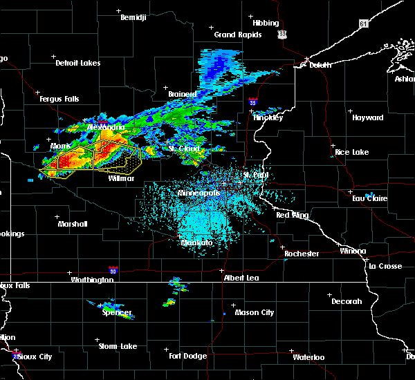 At 341 pm cdt, a severe thunderstorm was located near murdock, or 17 miles northeast of montevideo, moving east at 35 mph (radar indicated). Hazards include 60 mph wind gusts and quarter size hail. Hail damage to vehicles is expected. expect wind damage to roofs, siding, and trees. this severe thunderstorm will be near, murdock around 350 pm cdt. kerkhoven around 355 pm cdt. raymond around 410 pm cdt. willmar around 415 pm cdt. other locations impacted by this severe thunderstorm include priam, pennock, de graff, big bend city, willmar airport, hagen and gluek. this includes the following highways, u. s. highway 12 between mile markers 44 and 63, and between mile markers 67 and 74. u. s. highway 71 between mile markers 118 and 123. A tornado watch remains in effect until 900 pm cdt for west central and central minnesota. At 341 pm cdt, a severe thunderstorm was located near murdock, or 17 miles northeast of montevideo, moving east at 35 mph (radar indicated). Hazards include 60 mph wind gusts and quarter size hail. Hail damage to vehicles is expected. expect wind damage to roofs, siding, and trees. this severe thunderstorm will be near, murdock around 350 pm cdt. kerkhoven around 355 pm cdt. raymond around 410 pm cdt. willmar around 415 pm cdt. other locations impacted by this severe thunderstorm include priam, pennock, de graff, big bend city, willmar airport, hagen and gluek. this includes the following highways, u. s. highway 12 between mile markers 44 and 63, and between mile markers 67 and 74. u. s. highway 71 between mile markers 118 and 123. A tornado watch remains in effect until 900 pm cdt for west central and central minnesota.
|
| 7/5/2016 3:27 PM CDT |
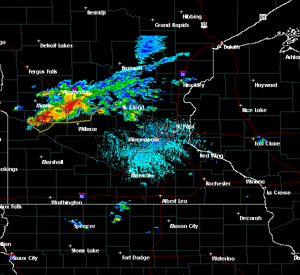 At 327 pm cdt, a severe thunderstorm was located over hagen, or 16 miles north of montevideo, moving southeast at 40 mph (radar indicated). Hazards include 70 mph wind gusts and quarter size hail. Hail damage to vehicles is expected. expect considerable tree damage. wind damage is also likely to mobile homes, roofs, and outbuildings. this severe thunderstorm will remain over mainly rural areas of south central swift county, including the following locations: hagen and danvers. this includes u. s. highway 12 between mile markers 32 and 34. A tornado watch remains in effect until 900 pm cdt for west central minnesota. At 327 pm cdt, a severe thunderstorm was located over hagen, or 16 miles north of montevideo, moving southeast at 40 mph (radar indicated). Hazards include 70 mph wind gusts and quarter size hail. Hail damage to vehicles is expected. expect considerable tree damage. wind damage is also likely to mobile homes, roofs, and outbuildings. this severe thunderstorm will remain over mainly rural areas of south central swift county, including the following locations: hagen and danvers. this includes u. s. highway 12 between mile markers 32 and 34. A tornado watch remains in effect until 900 pm cdt for west central minnesota.
|
| 7/5/2016 3:19 PM CDT |
 At 318 pm cdt, a severe thunderstorm was located near murdock, or 17 miles northwest of willmar, moving southeast at 35 mph (radar indicated). Hazards include 60 mph wind gusts and quarter size hail. Hail damage to vehicles is expected. expect wind damage to roofs, siding, and trees. this severe thunderstorm will remain over mainly rural areas of eastern swift and south central pope counties, including the following locations: clontarf, benson airport, swift falls, de graff, danvers and sunburg. A tornado watch remains in effect until 900 pm cdt for west central and central minnesota. At 318 pm cdt, a severe thunderstorm was located near murdock, or 17 miles northwest of willmar, moving southeast at 35 mph (radar indicated). Hazards include 60 mph wind gusts and quarter size hail. Hail damage to vehicles is expected. expect wind damage to roofs, siding, and trees. this severe thunderstorm will remain over mainly rural areas of eastern swift and south central pope counties, including the following locations: clontarf, benson airport, swift falls, de graff, danvers and sunburg. A tornado watch remains in effect until 900 pm cdt for west central and central minnesota.
|
| 7/5/2016 3:15 PM CDT |
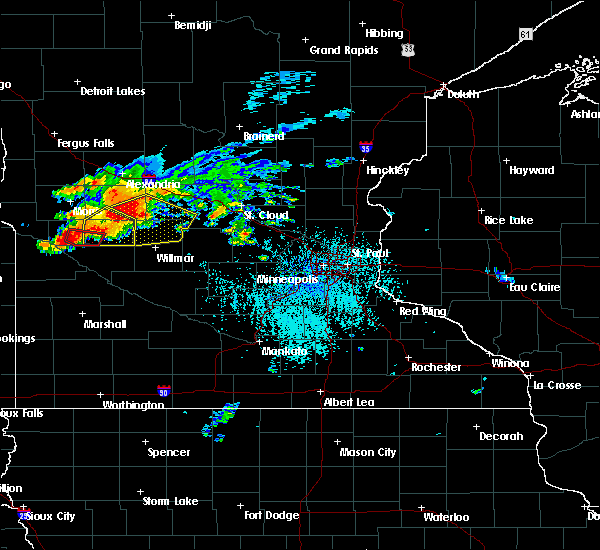 At 315 pm cdt, a severe thunderstorm capable of producing a tornado was located near hagen, or 18 miles north of montevideo, moving east at 30 mph (radar indicated rotation). Hazards include tornado and quarter size hail. Flying debris will be dangerous to those caught without shelter. mobile homes will be damaged or destroyed. damage to roofs, windows, and vehicles will occur. tree damage is likely. Locations impacted include, danvers. At 315 pm cdt, a severe thunderstorm capable of producing a tornado was located near hagen, or 18 miles north of montevideo, moving east at 30 mph (radar indicated rotation). Hazards include tornado and quarter size hail. Flying debris will be dangerous to those caught without shelter. mobile homes will be damaged or destroyed. damage to roofs, windows, and vehicles will occur. tree damage is likely. Locations impacted include, danvers.
|
| 7/5/2016 3:10 PM CDT |
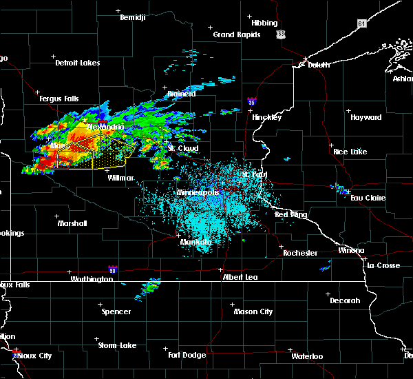 At 310 pm cdt, a severe thunderstorm capable of producing a tornado was located near holloway, or 19 miles north of montevideo, moving east at 30 mph (radar indicated rotation). Hazards include tornado and quarter size hail. Flying debris will be dangerous to those caught without shelter. mobile homes will be damaged or destroyed. damage to roofs, windows, and vehicles will occur. tree damage is likely. Locations impacted include, hagen, danvers and holloway. At 310 pm cdt, a severe thunderstorm capable of producing a tornado was located near holloway, or 19 miles north of montevideo, moving east at 30 mph (radar indicated rotation). Hazards include tornado and quarter size hail. Flying debris will be dangerous to those caught without shelter. mobile homes will be damaged or destroyed. damage to roofs, windows, and vehicles will occur. tree damage is likely. Locations impacted include, hagen, danvers and holloway.
|
| 7/5/2016 3:00 PM CDT |
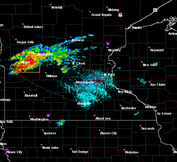 At 300 pm cdt, a severe thunderstorm was located near de graff, or 23 miles northwest of willmar, moving southeast at 45 mph (radar indicated). Hazards include 60 mph wind gusts and quarter size hail. Hail damage to vehicles is expected. expect wind damage to roofs, siding, and trees. this severe storm will be near, murdock around 310 pm cdt. kerkhoven around 315 pm cdt. other locations impacted by this severe thunderstorm include clontarf, benson airport, swift falls, de graff, danvers and sunburg. A tornado watch remains in effect until 900 pm cdt for west central and central minnesota. At 300 pm cdt, a severe thunderstorm was located near de graff, or 23 miles northwest of willmar, moving southeast at 45 mph (radar indicated). Hazards include 60 mph wind gusts and quarter size hail. Hail damage to vehicles is expected. expect wind damage to roofs, siding, and trees. this severe storm will be near, murdock around 310 pm cdt. kerkhoven around 315 pm cdt. other locations impacted by this severe thunderstorm include clontarf, benson airport, swift falls, de graff, danvers and sunburg. A tornado watch remains in effect until 900 pm cdt for west central and central minnesota.
|
| 7/5/2016 2:58 PM CDT |
 At 258 pm cdt, a confirmed tornado was located over holloway, or 22 miles northwest of montevideo, moving east at 30 mph (public confirmed tornado). Hazards include damaging tornado. Flying debris will be dangerous to those caught without shelter. mobile homes will be damaged or destroyed. damage to roofs, windows, and vehicles will occur. tree damage is likely. this tornadic thunderstorm will remain over mainly rural areas of southwestern swift county, including the following locations: holloway, hagen, danvers and appleton airport. this includes the following highways, u. s. highway 12 between mile markers 22 and 36. u. s. Highway 59 between mile markers 138 and 146. At 258 pm cdt, a confirmed tornado was located over holloway, or 22 miles northwest of montevideo, moving east at 30 mph (public confirmed tornado). Hazards include damaging tornado. Flying debris will be dangerous to those caught without shelter. mobile homes will be damaged or destroyed. damage to roofs, windows, and vehicles will occur. tree damage is likely. this tornadic thunderstorm will remain over mainly rural areas of southwestern swift county, including the following locations: holloway, hagen, danvers and appleton airport. this includes the following highways, u. s. highway 12 between mile markers 22 and 36. u. s. Highway 59 between mile markers 138 and 146.
|
| 7/5/2016 2:49 PM CDT |
 At 248 pm cdt, a severe thunderstorm was located over holloway, or 22 miles south of morris, moving east at 35 mph (radar indicated). Hazards include 60 mph wind gusts and quarter size hail. Hail damage to vehicles is expected. expect wind damage to roofs, siding, and trees. this severe thunderstorm will remain over mainly rural areas of western swift county, including the following locations: holloway, hagen, danvers and appleton airport. A tornado watch remains in effect until 900 pm cdt for west central minnesota. At 248 pm cdt, a severe thunderstorm was located over holloway, or 22 miles south of morris, moving east at 35 mph (radar indicated). Hazards include 60 mph wind gusts and quarter size hail. Hail damage to vehicles is expected. expect wind damage to roofs, siding, and trees. this severe thunderstorm will remain over mainly rural areas of western swift county, including the following locations: holloway, hagen, danvers and appleton airport. A tornado watch remains in effect until 900 pm cdt for west central minnesota.
|
| 7/5/2016 2:40 PM CDT |
 At 239 pm cdt, a severe thunderstorm was located near clontarf, or 13 miles southeast of morris, moving southeast at 45 mph (radar indicated). Hazards include 60 mph wind gusts and quarter size hail. Hail damage to vehicles is expected. expect wind damage to roofs, siding, and trees. this severe thunderstorm will be near, lake hassel around 250 pm cdt. benson around 255 pm cdt. murdock around 310 pm cdt. kerkhoven around 315 pm cdt. other locations impacted by this severe thunderstorm include clontarf, de graff, lake emily, benson airport, swift falls, danvers and sunburg. this includes u. s. highway 12 between mile markers 35 and 63. A tornado watch remains in effect until 900 pm cdt for west central and central minnesota. At 239 pm cdt, a severe thunderstorm was located near clontarf, or 13 miles southeast of morris, moving southeast at 45 mph (radar indicated). Hazards include 60 mph wind gusts and quarter size hail. Hail damage to vehicles is expected. expect wind damage to roofs, siding, and trees. this severe thunderstorm will be near, lake hassel around 250 pm cdt. benson around 255 pm cdt. murdock around 310 pm cdt. kerkhoven around 315 pm cdt. other locations impacted by this severe thunderstorm include clontarf, de graff, lake emily, benson airport, swift falls, danvers and sunburg. this includes u. s. highway 12 between mile markers 35 and 63. A tornado watch remains in effect until 900 pm cdt for west central and central minnesota.
|
| 7/5/2016 2:17 PM CDT |
 At 216 pm cdt, a severe thunderstorm was located near artichoke lake, or 12 miles east of ortonville, moving east at 50 mph (radar indicated). Hazards include 60 mph wind gusts and quarter size hail. Hail damage to vehicles is expected. expect wind damage to roofs, siding, and trees. this severe thunderstorm will be near, lake oliver around 225 pm cdt. appleton around 230 pm cdt. other locations impacted by this severe thunderstorm include holloway, hagen, danvers and appleton airport. this includes the following highways, u. s. highway 12 between mile markers 17 and 36. u. s. highway 59 between mile markers 136 and 153. A tornado watch remains in effect until 900 pm cdt for west central minnesota. At 216 pm cdt, a severe thunderstorm was located near artichoke lake, or 12 miles east of ortonville, moving east at 50 mph (radar indicated). Hazards include 60 mph wind gusts and quarter size hail. Hail damage to vehicles is expected. expect wind damage to roofs, siding, and trees. this severe thunderstorm will be near, lake oliver around 225 pm cdt. appleton around 230 pm cdt. other locations impacted by this severe thunderstorm include holloway, hagen, danvers and appleton airport. this includes the following highways, u. s. highway 12 between mile markers 17 and 36. u. s. highway 59 between mile markers 136 and 153. A tornado watch remains in effect until 900 pm cdt for west central minnesota.
|
| 6/19/2016 7:39 PM CDT |
 At 739 pm cdt, a severe thunderstorm capable of producing a tornado was located near holloway, or 21 miles south of morris, moving east at 35 mph (radar indicated rotation). Hazards include tornado and half dollar size hail. Flying debris will be dangerous to those caught without shelter. mobile homes will be damaged or destroyed. damage to roofs, windows, and vehicles will occur. tree damage is likely. this dangerous storm will be near, benson around 800 pm cdt. other locations impacted by this tornadic thunderstorm include benson airport, holloway, swift falls, de graff, danvers and clontarf. this includes the following highways, u. s. highway 12 between mile markers 27 and 53. u. s. Highway 59 between mile markers 142 and 146. At 739 pm cdt, a severe thunderstorm capable of producing a tornado was located near holloway, or 21 miles south of morris, moving east at 35 mph (radar indicated rotation). Hazards include tornado and half dollar size hail. Flying debris will be dangerous to those caught without shelter. mobile homes will be damaged or destroyed. damage to roofs, windows, and vehicles will occur. tree damage is likely. this dangerous storm will be near, benson around 800 pm cdt. other locations impacted by this tornadic thunderstorm include benson airport, holloway, swift falls, de graff, danvers and clontarf. this includes the following highways, u. s. highway 12 between mile markers 27 and 53. u. s. Highway 59 between mile markers 142 and 146.
|
| 7/17/2015 10:27 PM CDT |
 At 1027 pm cdt, severe thunderstorms were located along a line extending from near belgrade to pennock to near asbury, moving east at 45 mph (law enforcement). Hazards include 70 mph wind gusts and quarter size hail. Hail damage to vehicles is expected. expect considerable tree damage. wind damage is also likely to mobile homes, roofs and outbuildings. these severe storms will be near, willmar around 1035 pm cdt. new london, raymond and prinsburg around 1045 pm cdt. other locations impacted by these severe thunderstorms include montevideo airport, benson airport, norway lake, willmar airport, hagen, danvers, asbury, clontarf, priam and pennock. this includes the following highways, u. s. highway 12 between mile markers 35 and 74. u. s. highway 212 between mile markers 30 and 39. u. s. highway 8 in minnesota near mile marker 6. u. s. Highway 71 between mile markers 126 and 144. At 1027 pm cdt, severe thunderstorms were located along a line extending from near belgrade to pennock to near asbury, moving east at 45 mph (law enforcement). Hazards include 70 mph wind gusts and quarter size hail. Hail damage to vehicles is expected. expect considerable tree damage. wind damage is also likely to mobile homes, roofs and outbuildings. these severe storms will be near, willmar around 1035 pm cdt. new london, raymond and prinsburg around 1045 pm cdt. other locations impacted by these severe thunderstorms include montevideo airport, benson airport, norway lake, willmar airport, hagen, danvers, asbury, clontarf, priam and pennock. this includes the following highways, u. s. highway 12 between mile markers 35 and 74. u. s. highway 212 between mile markers 30 and 39. u. s. highway 8 in minnesota near mile marker 6. u. s. Highway 71 between mile markers 126 and 144.
|
| 7/17/2015 10:02 PM CDT |
 At 1002 pm cdt, severe thunderstorms were located along a line extending from swift falls to 9 miles east of big bend city to near boyd, moving east at 60 mph (law enforcement). Hazards include 70 mph wind gusts and quarter size hail. Hail damage to vehicles is expected. expect considerable tree damage. wind damage is also likely to mobile homes, roofs and outbuildings. these severe storms will be near, lake hassel around 1005 pm cdt. kerkhoven and murdock around 1015 pm cdt. willmar and maynard around 1025 pm cdt. clara city around 1030 pm cdt. new london around 1035 pm cdt. raymond and prinsburg around 1040 pm cdt. other locations impacted by these severe thunderstorms include montevideo airport, benson airport, norway lake, willmar airport, hagen, danvers, asbury, clontarf, priam and pennock. this includes the following highways, u. s. highway 12 between mile markers 30 and 74. u. s. highway 212 between mile markers 14 and 39. u. s. highway 75 near mile marker 102. u. s. highway 8 in minnesota near mile marker 6. u. s. highway 59 between mile markers 106 and 107. u. s. Highway 71 between mile markers 126 and 144. At 1002 pm cdt, severe thunderstorms were located along a line extending from swift falls to 9 miles east of big bend city to near boyd, moving east at 60 mph (law enforcement). Hazards include 70 mph wind gusts and quarter size hail. Hail damage to vehicles is expected. expect considerable tree damage. wind damage is also likely to mobile homes, roofs and outbuildings. these severe storms will be near, lake hassel around 1005 pm cdt. kerkhoven and murdock around 1015 pm cdt. willmar and maynard around 1025 pm cdt. clara city around 1030 pm cdt. new london around 1035 pm cdt. raymond and prinsburg around 1040 pm cdt. other locations impacted by these severe thunderstorms include montevideo airport, benson airport, norway lake, willmar airport, hagen, danvers, asbury, clontarf, priam and pennock. this includes the following highways, u. s. highway 12 between mile markers 30 and 74. u. s. highway 212 between mile markers 14 and 39. u. s. highway 75 near mile marker 102. u. s. highway 8 in minnesota near mile marker 6. u. s. highway 59 between mile markers 106 and 107. u. s. Highway 71 between mile markers 126 and 144.
|
| 7/17/2015 10:00 PM CDT |
 At 1000 pm cdt, severe thunderstorms were located along a line extending from near lake emily to near lake hassel to near montevideo airport, moving east at 55 mph (radar indicated). Hazards include 70 mph wind gusts and quarter size hail. Hail damage to vehicles is expected. expect considerable tree damage. wind damage is also likely to mobile homes, roofs and outbuildings. these severe thunderstorms will remain over mainly rural areas of southeastern stevens, southwestern pope, northwestern chippewa and swift counties, including the following locations, glenwood airport, morris airport, benson airport, long beach, hagen, swift falls, danvers, clontarf, holloway and lake minnewaska. this includes the following highways, u. s. highway 12 between mile markers 18 and 52. u. s. Highway 59 between mile markers 136 and 172. At 1000 pm cdt, severe thunderstorms were located along a line extending from near lake emily to near lake hassel to near montevideo airport, moving east at 55 mph (radar indicated). Hazards include 70 mph wind gusts and quarter size hail. Hail damage to vehicles is expected. expect considerable tree damage. wind damage is also likely to mobile homes, roofs and outbuildings. these severe thunderstorms will remain over mainly rural areas of southeastern stevens, southwestern pope, northwestern chippewa and swift counties, including the following locations, glenwood airport, morris airport, benson airport, long beach, hagen, swift falls, danvers, clontarf, holloway and lake minnewaska. this includes the following highways, u. s. highway 12 between mile markers 18 and 52. u. s. Highway 59 between mile markers 136 and 172.
|
| 7/17/2015 9:50 PM CDT |
 At 949 pm cdt, severe thunderstorms were located along a line extending from near cyrus to clontarf to near milan, moving east at 55 mph (radar indicated). Hazards include 70 mph wind gusts and quarter size hail. Hail damage to vehicles is expected. expect considerable tree damage. wind damage is also likely to mobile homes, roofs and outbuildings. these severe storms will be near, benson and lake hassel around 955 pm cdt. starbuck around 1005 pm cdt. other locations impacted by these severe thunderstorms include glenwood airport, morris airport, benson airport, long beach, hagen, swift falls, danvers, clontarf, holloway and lake minnewaska. this includes the following highways, u. s. highway 12 between mile markers 18 and 52. u. s. Highway 59 between mile markers 136 and 172. At 949 pm cdt, severe thunderstorms were located along a line extending from near cyrus to clontarf to near milan, moving east at 55 mph (radar indicated). Hazards include 70 mph wind gusts and quarter size hail. Hail damage to vehicles is expected. expect considerable tree damage. wind damage is also likely to mobile homes, roofs and outbuildings. these severe storms will be near, benson and lake hassel around 955 pm cdt. starbuck around 1005 pm cdt. other locations impacted by these severe thunderstorms include glenwood airport, morris airport, benson airport, long beach, hagen, swift falls, danvers, clontarf, holloway and lake minnewaska. this includes the following highways, u. s. highway 12 between mile markers 18 and 52. u. s. Highway 59 between mile markers 136 and 172.
|
| 7/17/2015 9:44 PM CDT |
 At 944 pm cdt, severe thunderstorms were located along a line extending from near clontarf to milan to near dawson, moving east at 50 mph (law enforcement). Hazards include 70 mph wind gusts and quarter size hail. Hail damage to vehicles is expected. expect considerable tree damage. wind damage is also likely to mobile homes, roofs and outbuildings. severe thunderstorms will be near, benson around 950 pm cdt. lake hassel around 955 pm cdt. montevideo around 1005 pm cdt. kerkhoven and murdock around 1020 pm cdt. raymond around 1040 pm cdt. willmar and new london around 1045 pm cdt. other locations impacted by these severe thunderstorms include montevideo airport, benson airport, norway lake, willmar airport, hagen, danvers, asbury, clontarf, priam and pennock. this includes the following highways, u. s. highway 12 between mile markers 30 and 74. u. s. highway 212 between mile markers 14 and 39. u. s. highway 75 near mile marker 102. u. s. highway 8 in minnesota near mile marker 6. u. s. highway 59 between mile markers 106 and 107. u. s. Highway 71 between mile markers 126 and 144. At 944 pm cdt, severe thunderstorms were located along a line extending from near clontarf to milan to near dawson, moving east at 50 mph (law enforcement). Hazards include 70 mph wind gusts and quarter size hail. Hail damage to vehicles is expected. expect considerable tree damage. wind damage is also likely to mobile homes, roofs and outbuildings. severe thunderstorms will be near, benson around 950 pm cdt. lake hassel around 955 pm cdt. montevideo around 1005 pm cdt. kerkhoven and murdock around 1020 pm cdt. raymond around 1040 pm cdt. willmar and new london around 1045 pm cdt. other locations impacted by these severe thunderstorms include montevideo airport, benson airport, norway lake, willmar airport, hagen, danvers, asbury, clontarf, priam and pennock. this includes the following highways, u. s. highway 12 between mile markers 30 and 74. u. s. highway 212 between mile markers 14 and 39. u. s. highway 75 near mile marker 102. u. s. highway 8 in minnesota near mile marker 6. u. s. highway 59 between mile markers 106 and 107. u. s. Highway 71 between mile markers 126 and 144.
|
| 7/17/2015 9:28 PM CDT |
 At 927 pm cdt, severe thunderstorms were located along a line extending from morris to near cerro gordo, moving east at 45 mph (radar indicated). Hazards include 70 mph wind gusts and quarter size hail. Hail damage to vehicles is expected. expect considerable tree damage. wind damage is also likely to mobile homes, roofs and outbuildings. severe thunderstorms will be near, morris around 935 pm cdt. cyrus around 940 pm cdt. starbuck around 955 pm cdt. glenwood around 1005 pm cdt. other locations impacted by these severe thunderstorms include glenwood airport, morris airport, benson airport, long beach, hagen, swift falls, danvers, clontarf, holloway and lake minnewaska. this includes the following highways, u. s. highway 12 between mile markers 18 and 52. u. s. Highway 59 between mile markers 136 and 172. At 927 pm cdt, severe thunderstorms were located along a line extending from morris to near cerro gordo, moving east at 45 mph (radar indicated). Hazards include 70 mph wind gusts and quarter size hail. Hail damage to vehicles is expected. expect considerable tree damage. wind damage is also likely to mobile homes, roofs and outbuildings. severe thunderstorms will be near, morris around 935 pm cdt. cyrus around 940 pm cdt. starbuck around 955 pm cdt. glenwood around 1005 pm cdt. other locations impacted by these severe thunderstorms include glenwood airport, morris airport, benson airport, long beach, hagen, swift falls, danvers, clontarf, holloway and lake minnewaska. this includes the following highways, u. s. highway 12 between mile markers 18 and 52. u. s. Highway 59 between mile markers 136 and 172.
|
| 6/9/2015 6:22 PM CDT |
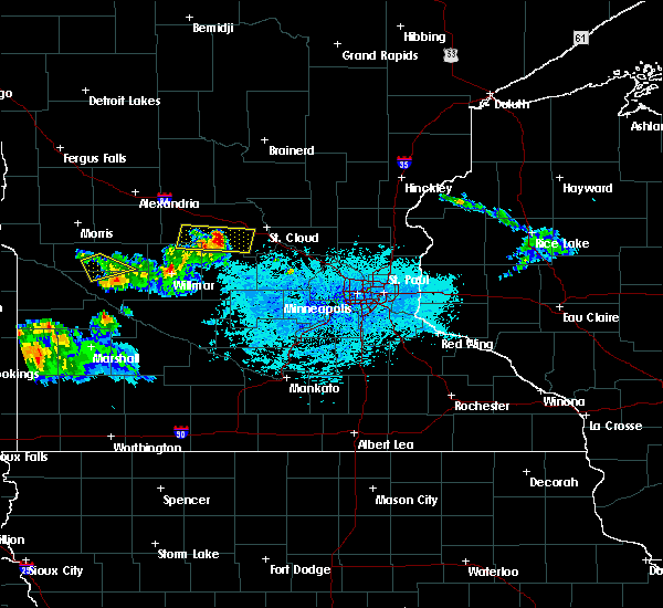 The severe thunderstorm warning for north central chippewa and south central swift counties will expire at 630 pm cdt, the storm which prompted the warning has weakened below severe limits and exited the warned area. therefore the warning will be allowed to expire. a severe thunderstorm watch remains in effect until midnight cdt for west central minnesota. The severe thunderstorm warning for north central chippewa and south central swift counties will expire at 630 pm cdt, the storm which prompted the warning has weakened below severe limits and exited the warned area. therefore the warning will be allowed to expire. a severe thunderstorm watch remains in effect until midnight cdt for west central minnesota.
|
| 6/9/2015 6:08 PM CDT |
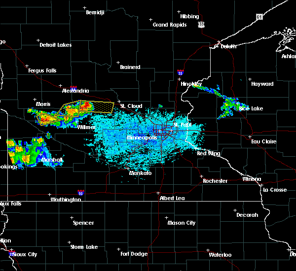 At 607 pm cdt, a severe thunderstorm was located 7 miles southwest of de graff, or 18 miles north of montevideo, moving southeast at 35 mph (radar indicated). Hazards include 60 mph wind gusts and quarter size hail. Hail damage to vehicles is expected. expect wind damage to roofs, siding and trees. This severe thunderstorm will remain over mainly rural areas of north central chippewa and south central swift counties, including the following locations, big bend city, hagen and danvers. At 607 pm cdt, a severe thunderstorm was located 7 miles southwest of de graff, or 18 miles north of montevideo, moving southeast at 35 mph (radar indicated). Hazards include 60 mph wind gusts and quarter size hail. Hail damage to vehicles is expected. expect wind damage to roofs, siding and trees. This severe thunderstorm will remain over mainly rural areas of north central chippewa and south central swift counties, including the following locations, big bend city, hagen and danvers.
|
| 6/9/2015 5:52 PM CDT | Spotter reported multiple tree limbs blown down by strong wind along with dime size hai in swift county MN, 0.6 miles ENE of Danvers, MN |
| 6/9/2015 5:44 PM CDT |
 At 544 pm cdt, a severe thunderstorm was located near danvers, or 18 miles south of morris, moving southeast at 35 mph (radar indicated). Hazards include ping pong ball size hail and 60 mph wind gusts. People and animals outdoors will be injured. expect hail damage to roofs, siding, windows and vehicles. expect wind damage to roofs, siding and trees. this severe thunderstorm will be near, benson around 600 pm cdt. murdock around 625 pm cdt. kerkhoven around 630 pm cdt. Other locations impacted by this severe thunderstorm include clontarf, holloway, de graff, big bend city, benson airport, hagen and danvers. At 544 pm cdt, a severe thunderstorm was located near danvers, or 18 miles south of morris, moving southeast at 35 mph (radar indicated). Hazards include ping pong ball size hail and 60 mph wind gusts. People and animals outdoors will be injured. expect hail damage to roofs, siding, windows and vehicles. expect wind damage to roofs, siding and trees. this severe thunderstorm will be near, benson around 600 pm cdt. murdock around 625 pm cdt. kerkhoven around 630 pm cdt. Other locations impacted by this severe thunderstorm include clontarf, holloway, de graff, big bend city, benson airport, hagen and danvers.
|
| 6/21/2013 1:30 AM CDT | Numerous trees down...including some on houses and vehicle in swift county MN, 0.4 miles WNW of Danvers, MN |
| 8/23/2012 1:10 PM CDT | Quarter sized hail reported 9.3 miles SSE of Danvers, MN, hailed for about 15 minutes. leaves stripped from corn and beans. |
| 8/23/2012 1:10 PM CDT | Quarter sized hail reported 9.7 miles SSE of Danvers, MN, hailed for about 15 minutes. leaves stripped from corn and beans. |
Hail Maps for Danvers, MN


Connect with Interactive Hail Maps