

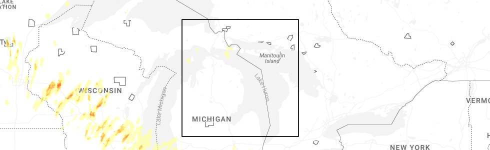
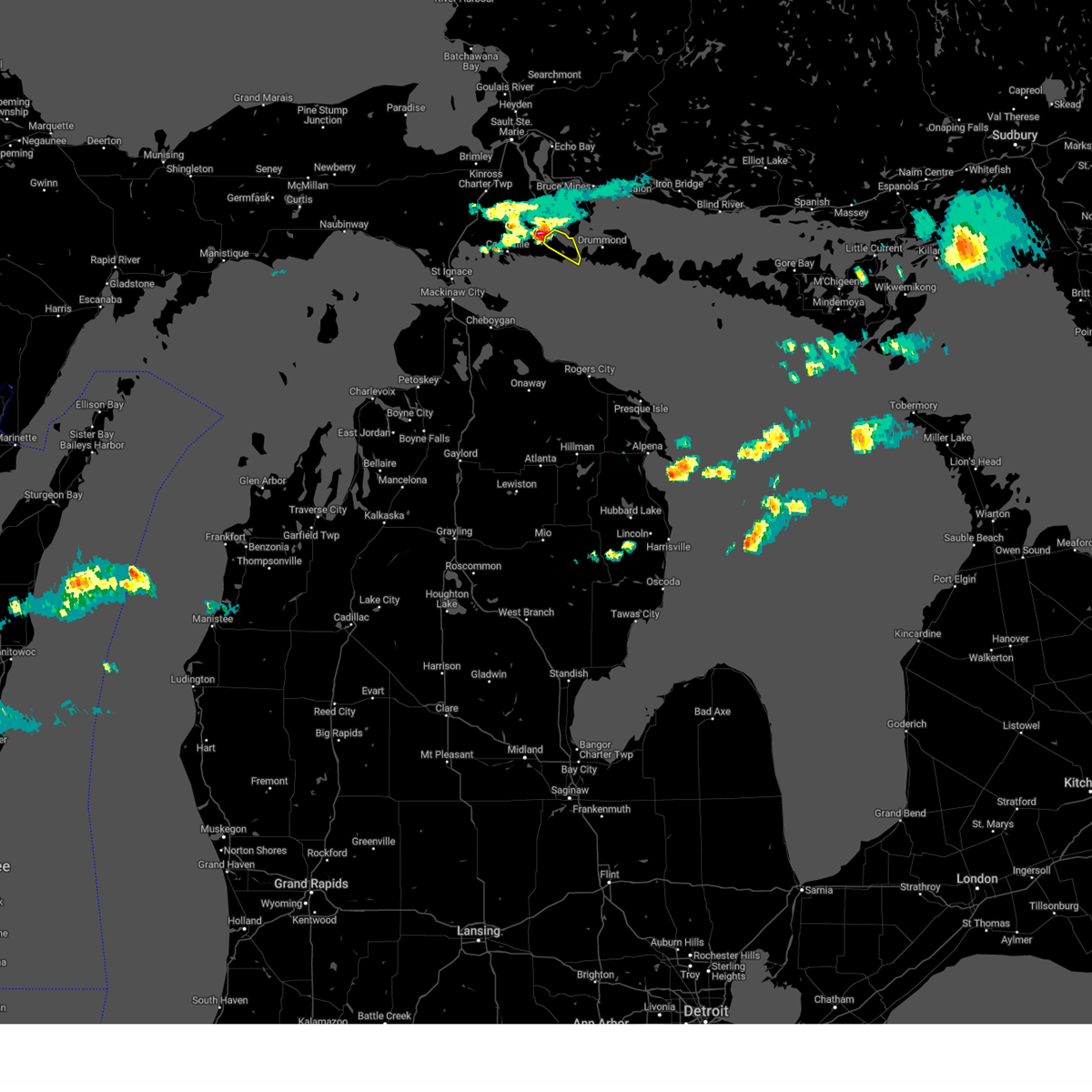
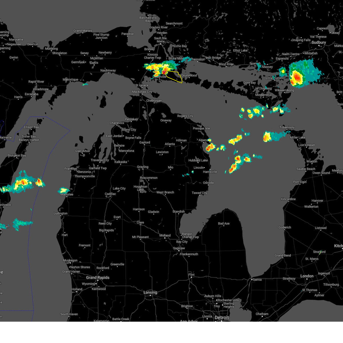
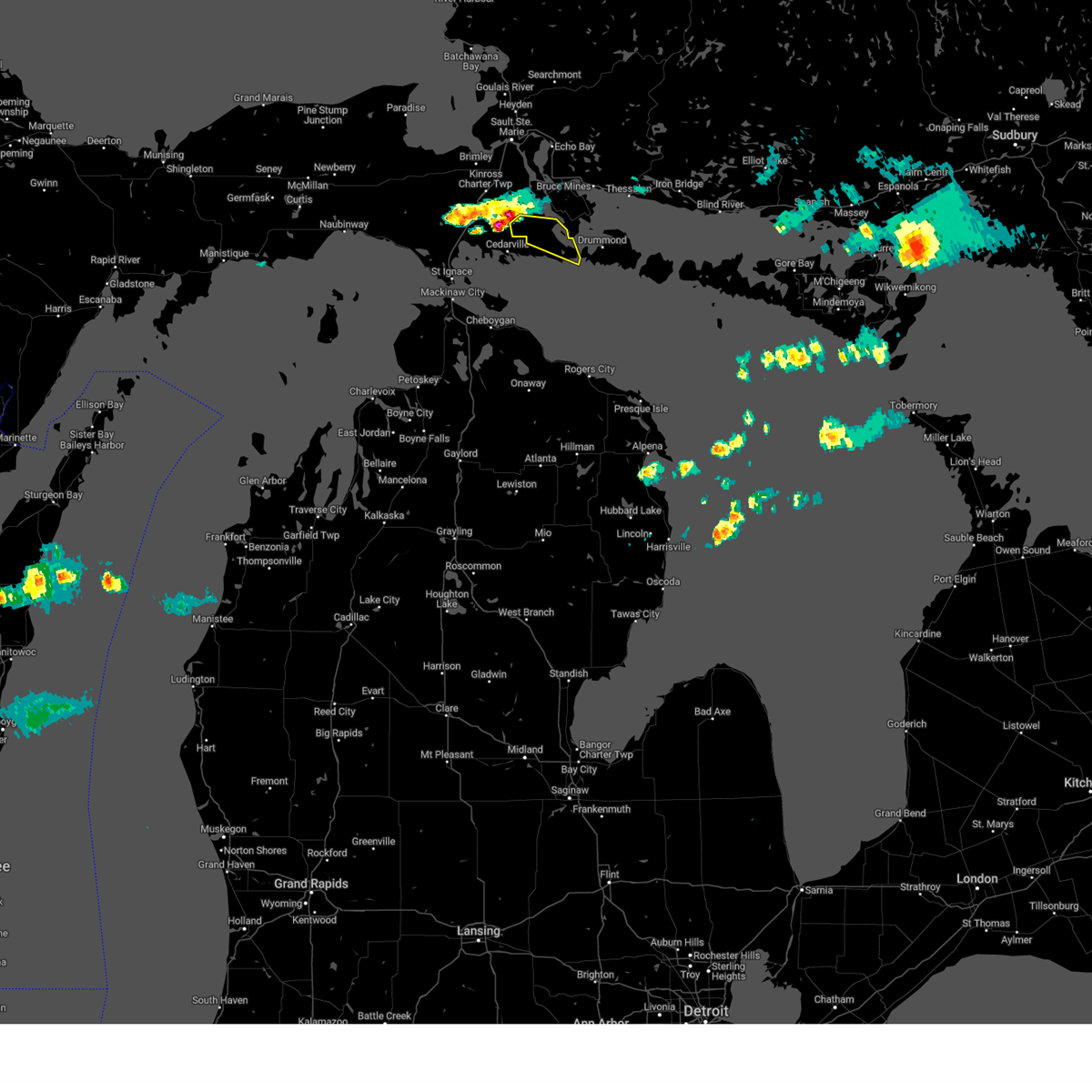
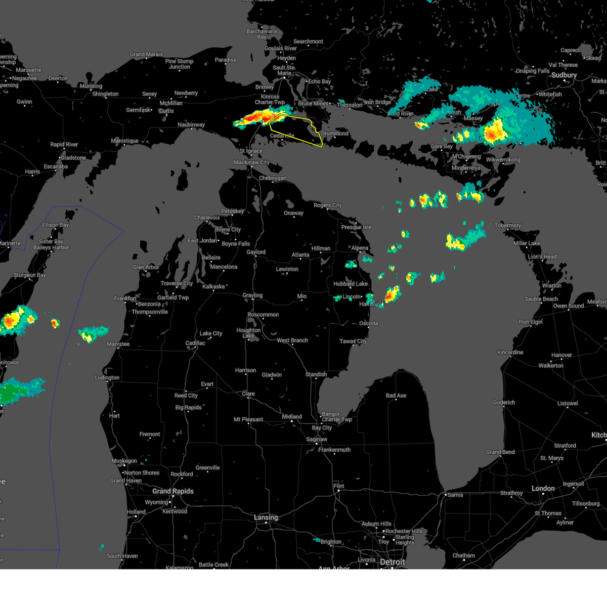
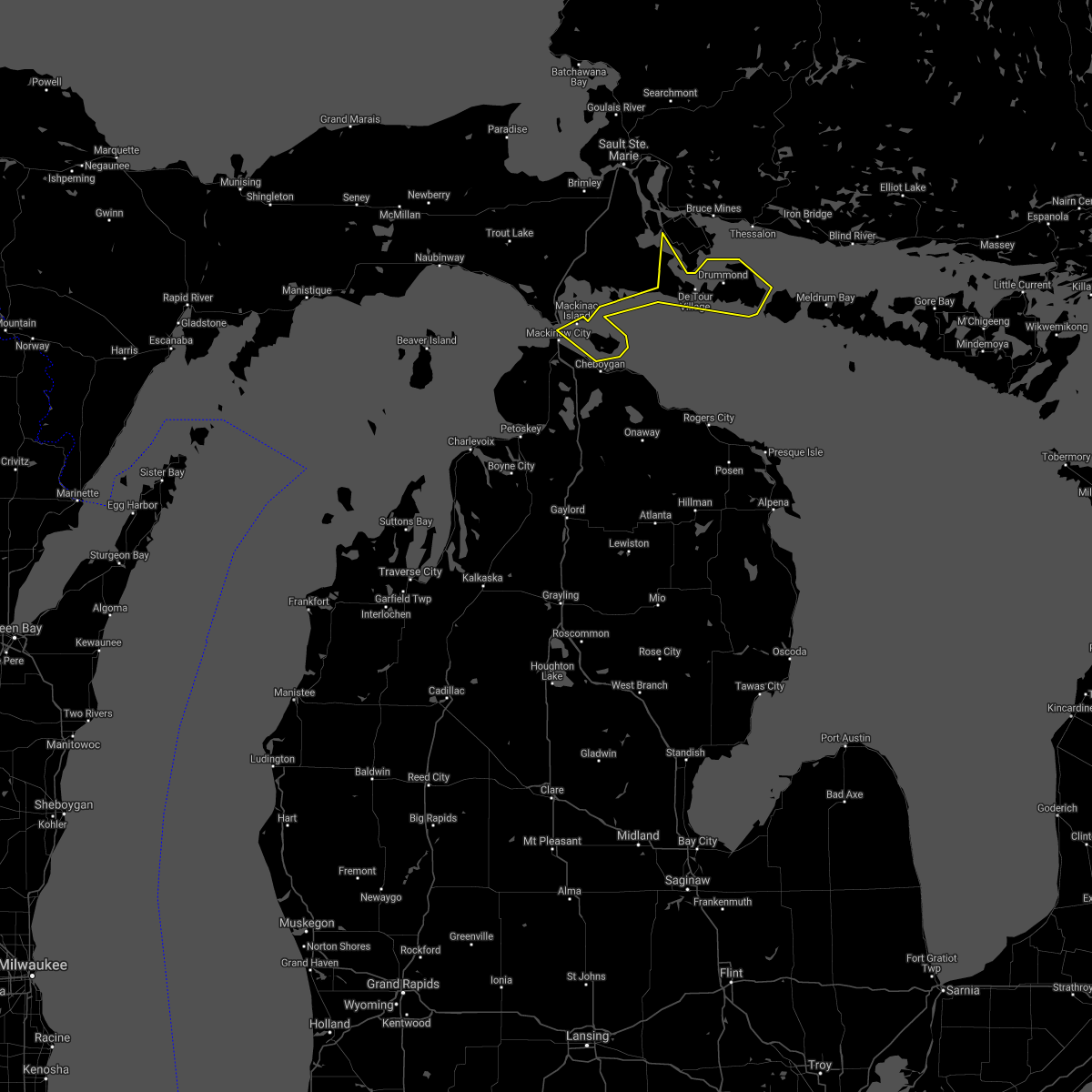
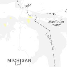
Hail Map for De Tour Village, MI
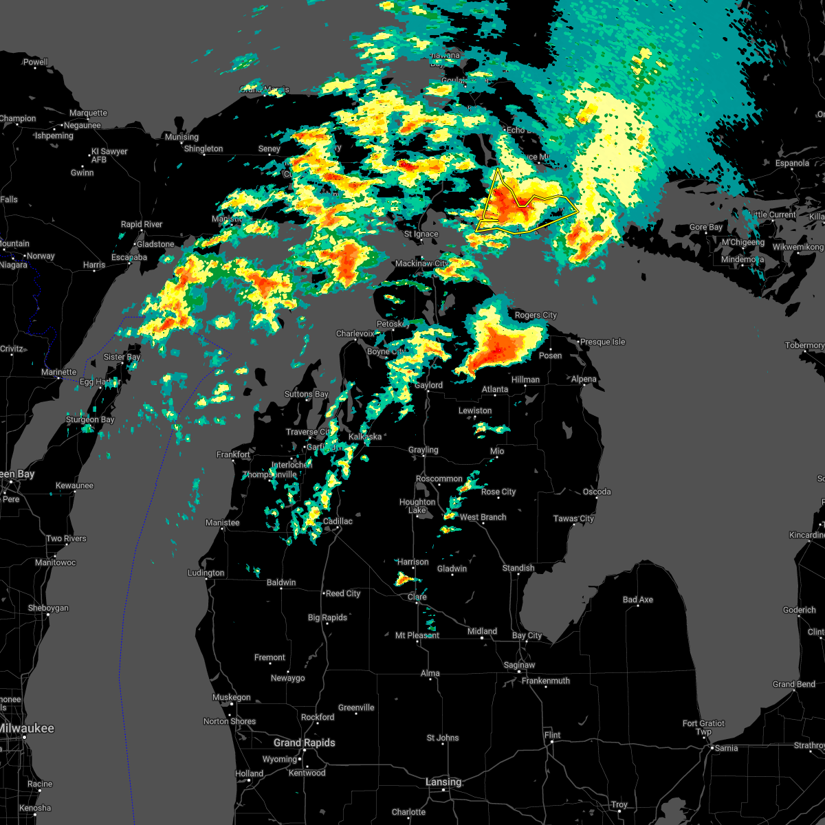
The De Tour Village, MI area has had 1 report of on-the-ground hail by trained spotters, and has been under severe weather warnings 4 times during the past 12 months. Doppler radar has detected hail at or near De Tour Village, MI on 7 occasions, including 1 occasion during the past year.
| Name: | De Tour Village, MI |
| Where Located: | 40.4 miles SSE of Sault Sainte Marie, MI |
| Map: | Google Map for De Tour Village, MI |
| Population: | 325 |
| Housing Units: | 307 |
| More Info: | Search Google for De Tour Village, MI |
3
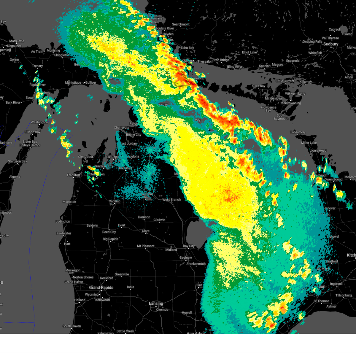
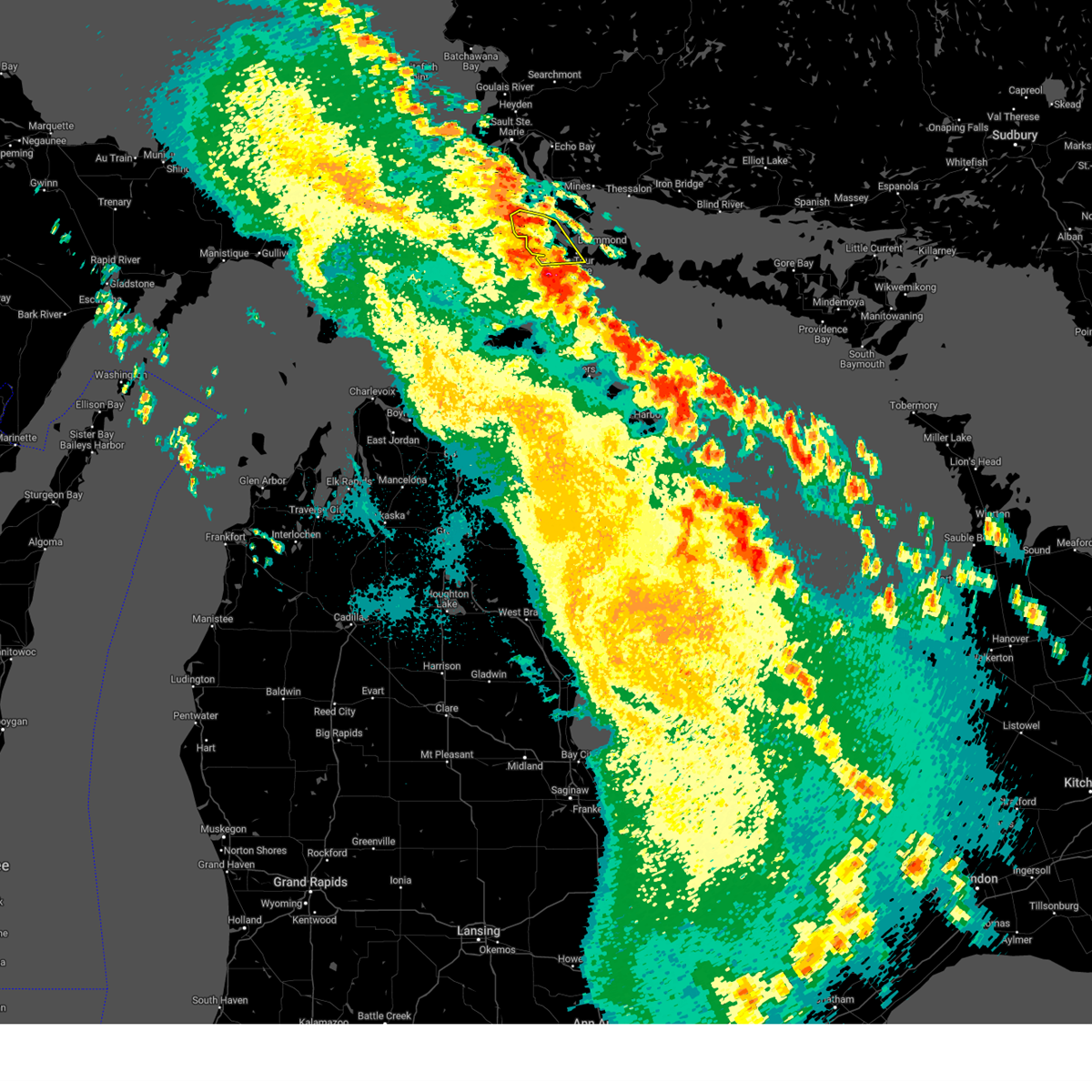
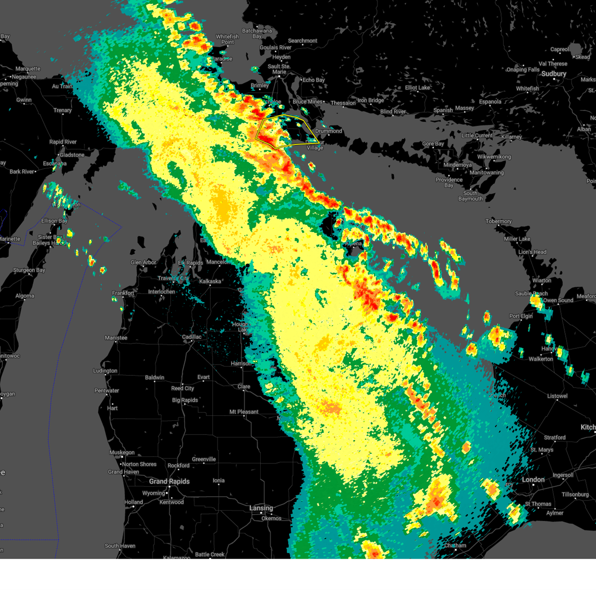
The Top Recent Hail Date for De Tour Village, MI is Thursday, May 15, 2025 (4th out of 7)
Hail and Wind Damage Spotted near De Tour Village, MI
| Date / Time | Report Details |
|---|---|
| 5/16/2025 2:13 AM EDT |
 The storms which prompted the warning have moved out of the area. therefore, the warning will be allowed to expire. The storms which prompted the warning have moved out of the area. therefore, the warning will be allowed to expire.
|
| 5/16/2025 2:03 AM EDT |
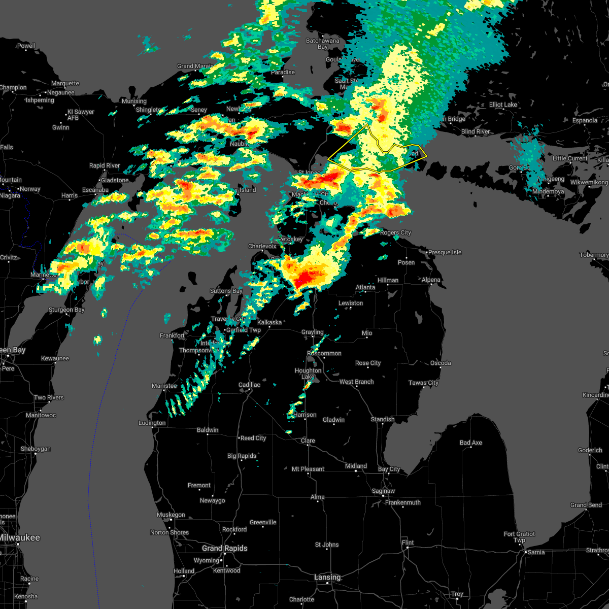
 At 201 am edt, severe thunderstorms were located along a line extending from kelden to near stalwart to near goetzville, moving northeast at 35 mph (radar indicated). Hazards include 60 mph wind gusts and quarter size hail. Hail damage to vehicles is expected. expect wind damage to roofs, siding, and trees. these severe storms will be near, goetzville around 205 am edt. Other locations impacted by these severe thunderstorms include raber. At 201 am edt, severe thunderstorms were located along a line extending from kelden to near stalwart to near goetzville, moving northeast at 35 mph (radar indicated). Hazards include 60 mph wind gusts and quarter size hail. Hail damage to vehicles is expected. expect wind damage to roofs, siding, and trees. these severe storms will be near, goetzville around 205 am edt. Other locations impacted by these severe thunderstorms include raber.
|
| 5/16/2025 2:03 AM EDT |
 the severe thunderstorm warning has been cancelled and is no longer in effect the severe thunderstorm warning has been cancelled and is no longer in effect
|
| 5/16/2025 1:35 AM EDT |
 Svrapx the national weather service in gaylord has issued a * severe thunderstorm warning for, south central chippewa county in eastern michigan, northeastern mackinac county in eastern michigan, * until 215 am edt. * at 134 am edt, severe thunderstorms were located along a line extending from near hessel to cedarville, moving northeast at 35 mph (radar indicated). Hazards include 60 mph wind gusts and quarter size hail. Hail damage to vehicles is expected. expect wind damage to roofs, siding, and trees. severe thunderstorms will be near, pickford and stalwart around 145 am edt. goetzville around 150 am edt. Other locations impacted by these severe thunderstorms include raber and marquette island. Svrapx the national weather service in gaylord has issued a * severe thunderstorm warning for, south central chippewa county in eastern michigan, northeastern mackinac county in eastern michigan, * until 215 am edt. * at 134 am edt, severe thunderstorms were located along a line extending from near hessel to cedarville, moving northeast at 35 mph (radar indicated). Hazards include 60 mph wind gusts and quarter size hail. Hail damage to vehicles is expected. expect wind damage to roofs, siding, and trees. severe thunderstorms will be near, pickford and stalwart around 145 am edt. goetzville around 150 am edt. Other locations impacted by these severe thunderstorms include raber and marquette island.
|
| 8/9/2023 6:46 PM EDT |
 At 646 pm edt, a severe thunderstorm was located near goetzville, or 7 miles west of potagannissing bay, moving east southeast at 35 mph (radar indicated). Hazards include quarter size hail. Damage to vehicles is expected. locations impacted include, saint marys river, goetzville and detour village. hail threat, radar indicated max hail size, 1. 00 in wind threat, radar indicated max wind gust, <50 mph. At 646 pm edt, a severe thunderstorm was located near goetzville, or 7 miles west of potagannissing bay, moving east southeast at 35 mph (radar indicated). Hazards include quarter size hail. Damage to vehicles is expected. locations impacted include, saint marys river, goetzville and detour village. hail threat, radar indicated max hail size, 1. 00 in wind threat, radar indicated max wind gust, <50 mph.
|
| 8/9/2023 6:35 PM EDT |
 At 635 pm edt, a severe thunderstorm was located over goetzville, or 13 miles west of potagannissing bay, moving east southeast at 30 mph (radar indicated). Hazards include quarter size hail. Damage to vehicles is expected. locations impacted include, saint marys river, detour village, goetzville and raber. hail threat, radar indicated max hail size, 1. 00 in wind threat, radar indicated max wind gust, <50 mph. At 635 pm edt, a severe thunderstorm was located over goetzville, or 13 miles west of potagannissing bay, moving east southeast at 30 mph (radar indicated). Hazards include quarter size hail. Damage to vehicles is expected. locations impacted include, saint marys river, detour village, goetzville and raber. hail threat, radar indicated max hail size, 1. 00 in wind threat, radar indicated max wind gust, <50 mph.
|
| 8/9/2023 6:23 PM EDT |
 At 623 pm edt, a severe thunderstorm was located over stalwart, or 19 miles west of potagannissing bay, moving east southeast at 30 mph (radar indicated). Hazards include quarter size hail. Damage to vehicles is expected. locations impacted include, saint marys river, detour village, stalwart, goetzville and raber. hail threat, radar indicated max hail size, 1. 00 in wind threat, radar indicated max wind gust, <50 mph. At 623 pm edt, a severe thunderstorm was located over stalwart, or 19 miles west of potagannissing bay, moving east southeast at 30 mph (radar indicated). Hazards include quarter size hail. Damage to vehicles is expected. locations impacted include, saint marys river, detour village, stalwart, goetzville and raber. hail threat, radar indicated max hail size, 1. 00 in wind threat, radar indicated max wind gust, <50 mph.
|
| 8/9/2023 6:08 PM EDT |
 At 608 pm edt, a severe thunderstorm was located near pickford, or 21 miles northeast of mackinac island, moving east southeast at 30 mph (radar indicated). Hazards include quarter size hail. damage to vehicles is expected At 608 pm edt, a severe thunderstorm was located near pickford, or 21 miles northeast of mackinac island, moving east southeast at 30 mph (radar indicated). Hazards include quarter size hail. damage to vehicles is expected
|
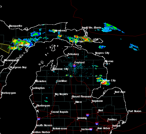
| 8/3/2023 3:51 PM EDT | Golf Ball sized hail reported 17.5 miles ENE of De Tour Village, MI, delayed...report relayed via social media of mainly dime sized hail... but a few golf-ball sized hail stones aboard joseph l. block... 5mi w of martin reef light... se |
| 5/20/2022 4:13 PM EDT |
 At 412 pm edt, a severe thunderstorm was located 13 miles north of drummond island, moving northeast at 85 mph (radar indicated). Hazards include 60 mph wind gusts and quarter size hail. Hail damage to vehicles is expected. expect wind damage to roofs, siding, and trees. this severe thunderstorm will remain over mainly rural areas of southeastern chippewa county, including the following locations, raber. hail threat, radar indicated max hail size, 1. 00 in wind threat, radar indicated max wind gust, 60 mph. At 412 pm edt, a severe thunderstorm was located 13 miles north of drummond island, moving northeast at 85 mph (radar indicated). Hazards include 60 mph wind gusts and quarter size hail. Hail damage to vehicles is expected. expect wind damage to roofs, siding, and trees. this severe thunderstorm will remain over mainly rural areas of southeastern chippewa county, including the following locations, raber. hail threat, radar indicated max hail size, 1. 00 in wind threat, radar indicated max wind gust, 60 mph.
|
| 5/20/2022 3:37 PM EDT |
 At 337 pm edt, a severe thunderstorm was located near mackinac island, moving northeast at 85 mph (radar indicated). Hazards include 60 mph wind gusts and quarter size hail. Hail damage to vehicles is expected. expect wind damage to roofs, siding, and trees. this severe thunderstorm will be near, cedarville and hessel around 345 pm edt. stalwart around 350 pm edt. goetzville around 355 pm edt. other locations in the path of this severe thunderstorm include potagannissing bay and detour village. hail threat, radar indicated max hail size, 1. 00 in wind threat, radar indicated max wind gust, 60 mph. At 337 pm edt, a severe thunderstorm was located near mackinac island, moving northeast at 85 mph (radar indicated). Hazards include 60 mph wind gusts and quarter size hail. Hail damage to vehicles is expected. expect wind damage to roofs, siding, and trees. this severe thunderstorm will be near, cedarville and hessel around 345 pm edt. stalwart around 350 pm edt. goetzville around 355 pm edt. other locations in the path of this severe thunderstorm include potagannissing bay and detour village. hail threat, radar indicated max hail size, 1. 00 in wind threat, radar indicated max wind gust, 60 mph.
|
| 8/29/2021 2:03 PM EDT |
 At 203 pm edt, severe thunderstorms were located along a line extending from 7 miles northeast of barbeau to near pickford to mackinac island, moving northeast at 45 mph (radar indicated). Hazards include 60 mph wind gusts. Expect damage to roofs, siding, and trees. locations impacted include, kelden, munuscong, cedarville, hessel, stalwart and goetzville. hail threat, radar indicated max hail size, <. 75 in wind threat, radar indicated max wind gust, 60 mph. At 203 pm edt, severe thunderstorms were located along a line extending from 7 miles northeast of barbeau to near pickford to mackinac island, moving northeast at 45 mph (radar indicated). Hazards include 60 mph wind gusts. Expect damage to roofs, siding, and trees. locations impacted include, kelden, munuscong, cedarville, hessel, stalwart and goetzville. hail threat, radar indicated max hail size, <. 75 in wind threat, radar indicated max wind gust, 60 mph.
|
| 8/29/2021 1:39 PM EDT |
 At 138 pm edt, severe thunderstorms were located along a line extending from near kinross to 8 miles east of allenville to near wilderness state park, moving northeast at 45 mph (radar indicated). Hazards include 60 mph wind gusts. Expect damage to roofs, siding, and trees. severe thunderstorms will be near, barbeau and donaldson around 150 pm edt. straits state park around 155 pm edt. other locations in the path of these severe thunderstorms include st. ignace, mackinac island, evergreen shores, pickford, kelden, munuscong, hessel and cedarville. hail threat, radar indicated max hail size, <. 75 in wind threat, radar indicated max wind gust, 60 mph. At 138 pm edt, severe thunderstorms were located along a line extending from near kinross to 8 miles east of allenville to near wilderness state park, moving northeast at 45 mph (radar indicated). Hazards include 60 mph wind gusts. Expect damage to roofs, siding, and trees. severe thunderstorms will be near, barbeau and donaldson around 150 pm edt. straits state park around 155 pm edt. other locations in the path of these severe thunderstorms include st. ignace, mackinac island, evergreen shores, pickford, kelden, munuscong, hessel and cedarville. hail threat, radar indicated max hail size, <. 75 in wind threat, radar indicated max wind gust, 60 mph.
|
| 8/11/2021 4:45 PM EDT |
 At 443 pm edt, severe thunderstorms were located along a line extending from 7 miles southeast of false detour channel to 24 miles southeast of drummond island to near forty mile point, moving southeast at 45 mph. this storm produced a measured 60 mph wind gust on neebish island (radar indicated). Hazards include 60 mph wind gusts and penny size hail. Expect damage to roofs, siding, and trees. locations impacted include, drummond island, false detour channel, saint marys river, potagannissing bay, detour village, goetzville and raber. hail threat, radar indicated max hail size, 0. 75 in wind threat, observed max wind gust, 60 mph. At 443 pm edt, severe thunderstorms were located along a line extending from 7 miles southeast of false detour channel to 24 miles southeast of drummond island to near forty mile point, moving southeast at 45 mph. this storm produced a measured 60 mph wind gust on neebish island (radar indicated). Hazards include 60 mph wind gusts and penny size hail. Expect damage to roofs, siding, and trees. locations impacted include, drummond island, false detour channel, saint marys river, potagannissing bay, detour village, goetzville and raber. hail threat, radar indicated max hail size, 0. 75 in wind threat, observed max wind gust, 60 mph.
|
| 8/11/2021 4:32 PM EDT |
 At 431 pm edt, severe thunderstorms were located along a line extending from near drummond island to 14 miles southeast of saint marys river to nine mile point, moving southeast at 45 mph (radar indicated). Hazards include 60 mph wind gusts and penny size hail. Expect damage to roofs, siding, and trees. locations impacted include, false detour channel. hail threat, radar indicated max hail size, 0. 75 in wind threat, radar indicated max wind gust, 60 mph. At 431 pm edt, severe thunderstorms were located along a line extending from near drummond island to 14 miles southeast of saint marys river to nine mile point, moving southeast at 45 mph (radar indicated). Hazards include 60 mph wind gusts and penny size hail. Expect damage to roofs, siding, and trees. locations impacted include, false detour channel. hail threat, radar indicated max hail size, 0. 75 in wind threat, radar indicated max wind gust, 60 mph.
|
| 8/11/2021 4:11 PM EDT |
 At 410 pm edt, severe thunderstorms were located along a line extending from 10 miles southeast of munuscong to 6 miles south of goetzville to near mackinac island, moving southeast at 50 mph (radar indicated). Hazards include 60 mph wind gusts and penny size hail. Expect damage to roofs, siding, and trees. severe thunderstorms will be near, saint marys river and detour village around 415 pm edt. potagannissing bay around 420 pm edt. drummond island around 425 pm edt. other locations in the path of these severe thunderstorms include false detour channel. hail threat, radar indicated max hail size, 0. 75 in wind threat, radar indicated max wind gust, 60 mph. At 410 pm edt, severe thunderstorms were located along a line extending from 10 miles southeast of munuscong to 6 miles south of goetzville to near mackinac island, moving southeast at 50 mph (radar indicated). Hazards include 60 mph wind gusts and penny size hail. Expect damage to roofs, siding, and trees. severe thunderstorms will be near, saint marys river and detour village around 415 pm edt. potagannissing bay around 420 pm edt. drummond island around 425 pm edt. other locations in the path of these severe thunderstorms include false detour channel. hail threat, radar indicated max hail size, 0. 75 in wind threat, radar indicated max wind gust, 60 mph.
|
| 6/11/2017 5:20 PM EDT |
 At 519 pm edt, severe thunderstorms were located along a line extending from 20 miles northeast of potagannissing bay to near drummond island to 16 miles southwest of false detour channel to 8 miles north of forty mile point, moving east at 50 mph (radar indicated). Hazards include 70 mph wind gusts and penny size hail. Expect considerable tree damage. damage is likely to mobile homes, roofs, and outbuildings. Locations impacted include, drummond island, false detour channel, saint marys river, potagannissing bay and detour village. At 519 pm edt, severe thunderstorms were located along a line extending from 20 miles northeast of potagannissing bay to near drummond island to 16 miles southwest of false detour channel to 8 miles north of forty mile point, moving east at 50 mph (radar indicated). Hazards include 70 mph wind gusts and penny size hail. Expect considerable tree damage. damage is likely to mobile homes, roofs, and outbuildings. Locations impacted include, drummond island, false detour channel, saint marys river, potagannissing bay and detour village.
|
| 6/11/2017 5:07 PM EDT |
 At 507 pm edt, severe thunderstorms were located along a line extending from 7 miles east of munuscong to near saint marys river to 12 miles east of nine mile point to onaway, moving east at 50 mph (radar indicated). Hazards include 70 mph wind gusts and penny size hail. Expect considerable tree damage. damage is likely to mobile homes, roofs, and outbuildings. Locations impacted include, cheboygan, drummond island, false detour channel, saint marys river, potagannissing bay, cheboygan state park, detour village, goetzville, nine mile point and raber. At 507 pm edt, severe thunderstorms were located along a line extending from 7 miles east of munuscong to near saint marys river to 12 miles east of nine mile point to onaway, moving east at 50 mph (radar indicated). Hazards include 70 mph wind gusts and penny size hail. Expect considerable tree damage. damage is likely to mobile homes, roofs, and outbuildings. Locations impacted include, cheboygan, drummond island, false detour channel, saint marys river, potagannissing bay, cheboygan state park, detour village, goetzville, nine mile point and raber.
|
| 6/11/2017 5:03 PM EDT | Over 25 trees reported down in raber. time estimate in chippewa county MI, 11.7 miles SE of De Tour Village, MI |
| 6/11/2017 4:58 PM EDT | Trees uprooted... camper moved... and some damage to shingles on s maple point rd in pickford. time estimate in chippewa county MI, 17.7 miles SE of De Tour Village, MI |
| 6/11/2017 4:57 PM EDT | Large tree down on vehicle. time estimate in chippewa county MI, 12.2 miles E of De Tour Village, MI |
| 6/11/2017 4:48 PM EDT |
 At 447 pm edt, severe thunderstorms were located along a line extending from near kinross to 7 miles south of cedarville to near cheboygan state park, moving east at 55 mph (radar indicated. at 438 pm edt...60 mph wind was reported on mackinac island). Hazards include 70 mph wind gusts and penny size hail. Expect considerable tree damage. Damage is likely to mobile homes, roofs, and outbuildings. At 447 pm edt, severe thunderstorms were located along a line extending from near kinross to 7 miles south of cedarville to near cheboygan state park, moving east at 55 mph (radar indicated. at 438 pm edt...60 mph wind was reported on mackinac island). Hazards include 70 mph wind gusts and penny size hail. Expect considerable tree damage. Damage is likely to mobile homes, roofs, and outbuildings.
|
| 8/14/2015 2:16 PM EDT |
 At 215 pm edt, a severe thunderstorm was located near stalwart, or 15 miles west of saint marys river, moving southeast at 15 mph (radar indicated). Hazards include 60 mph wind gusts and quarter size hail. Hail damage to vehicles is expected. expect wind damage to roofs, siding and trees. Locations impacted include, goetzville, stalwart and raber. At 215 pm edt, a severe thunderstorm was located near stalwart, or 15 miles west of saint marys river, moving southeast at 15 mph (radar indicated). Hazards include 60 mph wind gusts and quarter size hail. Hail damage to vehicles is expected. expect wind damage to roofs, siding and trees. Locations impacted include, goetzville, stalwart and raber.
|
| 8/14/2015 1:59 PM EDT |
 At 158 pm edt, a severe thunderstorm was located near stalwart, or 15 miles northwest of saint marys river, moving southeast at 20 mph (radar indicated). Hazards include 60 mph wind gusts and quarter size hail. Hail damage to vehicles is expected. Expect wind damage to roofs, siding, and trees. At 158 pm edt, a severe thunderstorm was located near stalwart, or 15 miles northwest of saint marys river, moving southeast at 20 mph (radar indicated). Hazards include 60 mph wind gusts and quarter size hail. Hail damage to vehicles is expected. Expect wind damage to roofs, siding, and trees.
|
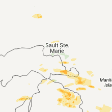
Hail Maps for De Tour Village, MI


Connect with Interactive Hail Maps