

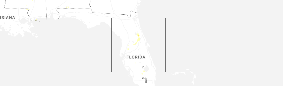
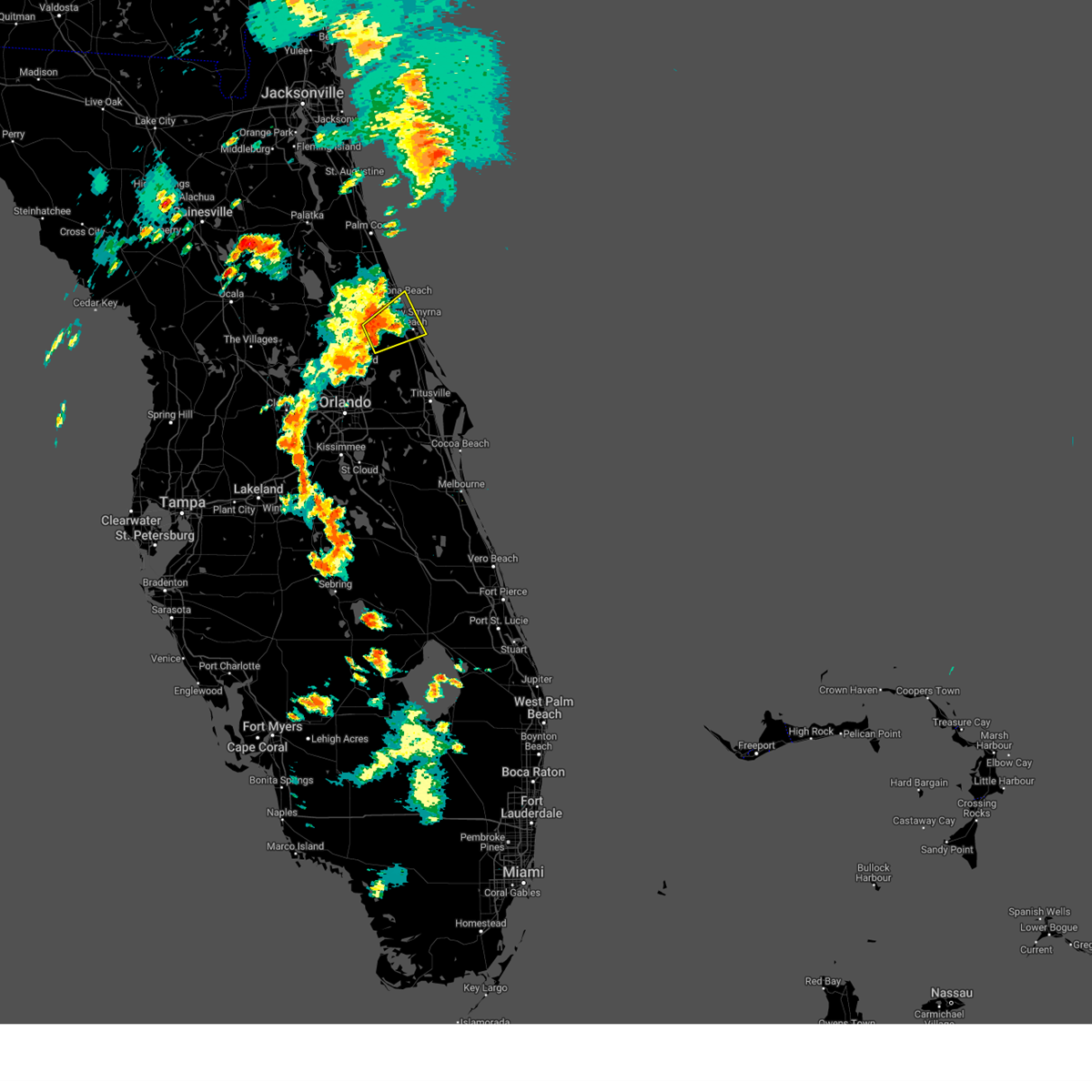
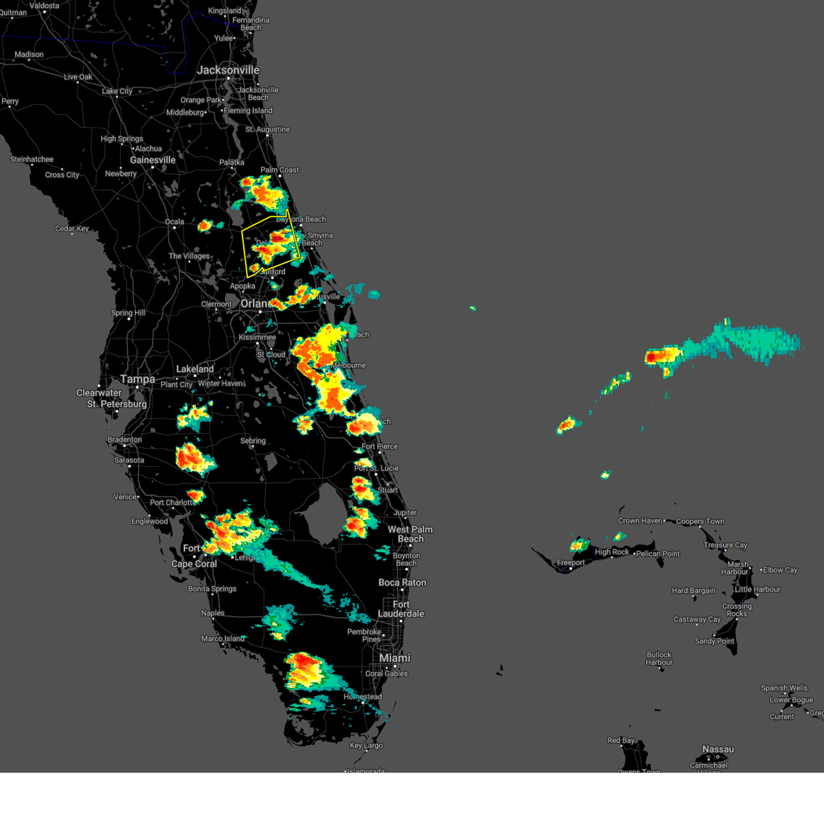
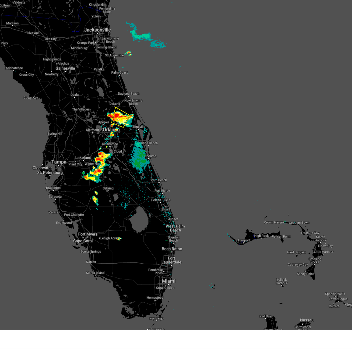
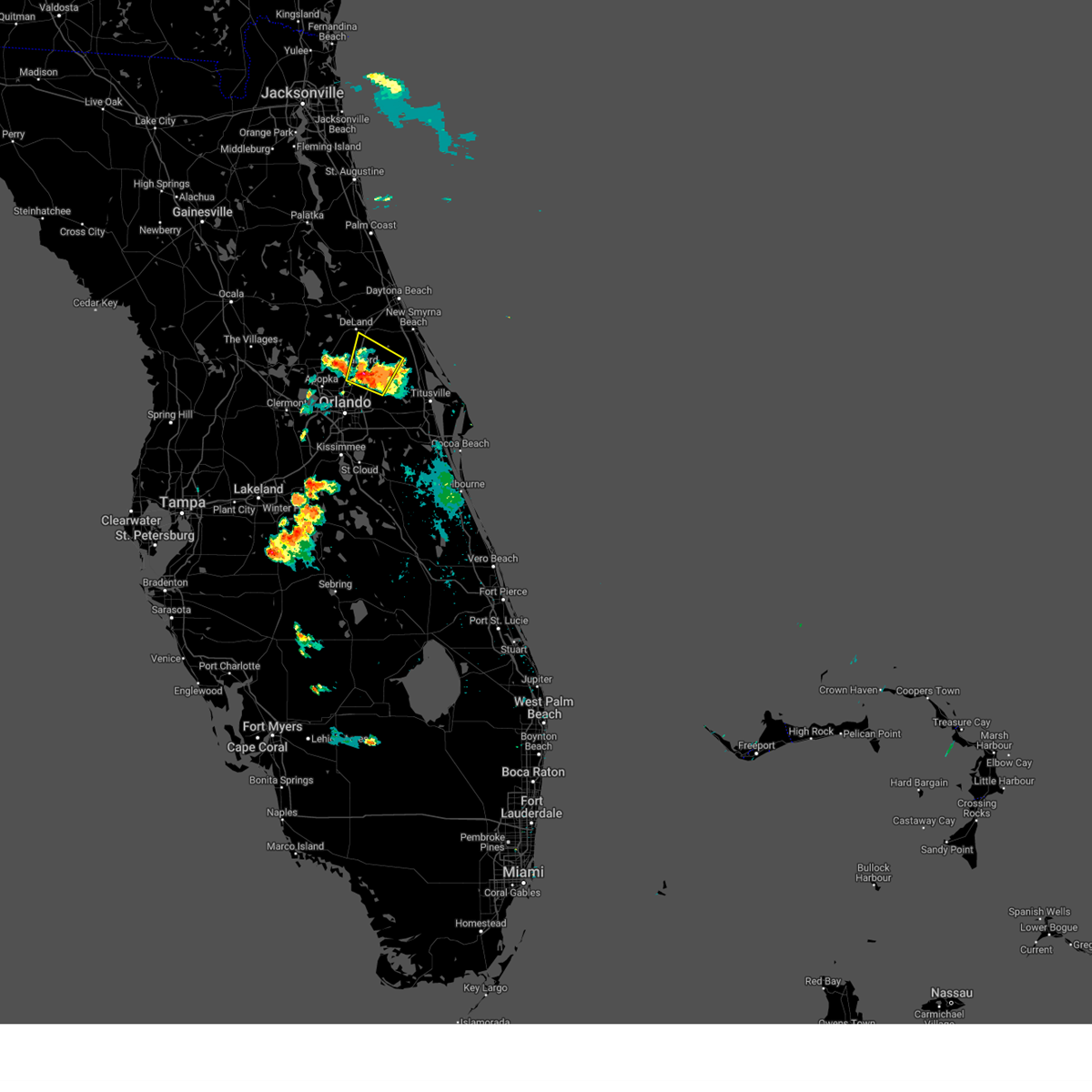
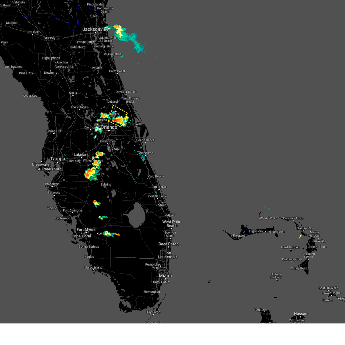
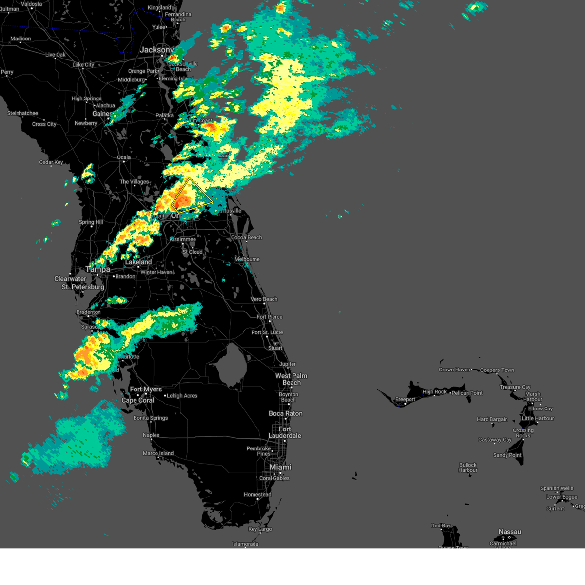
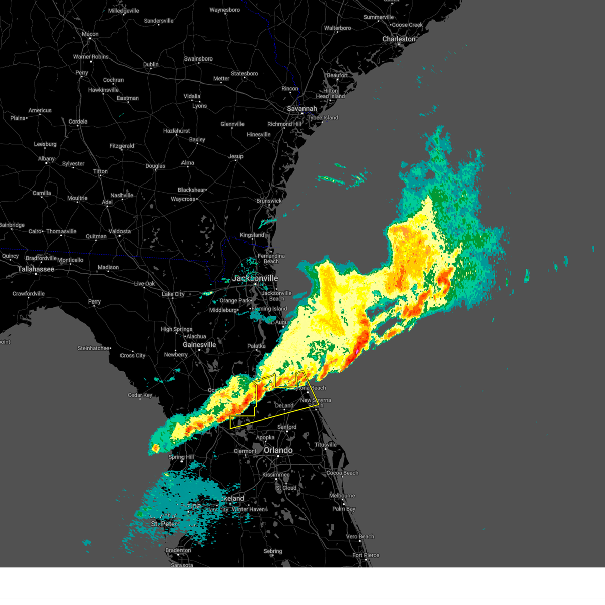
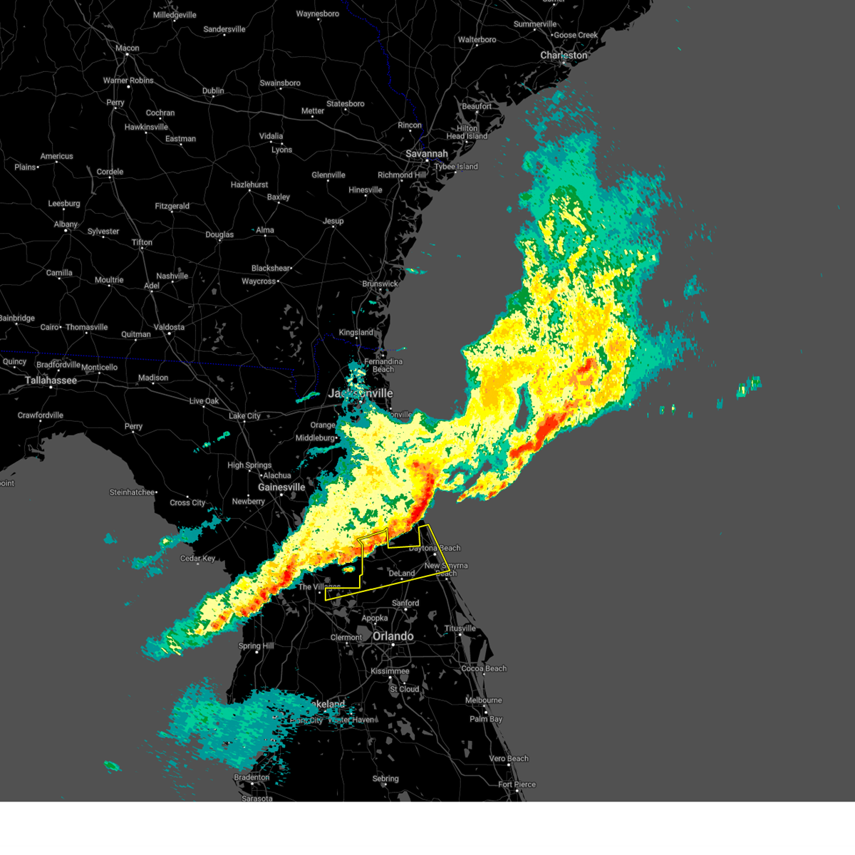
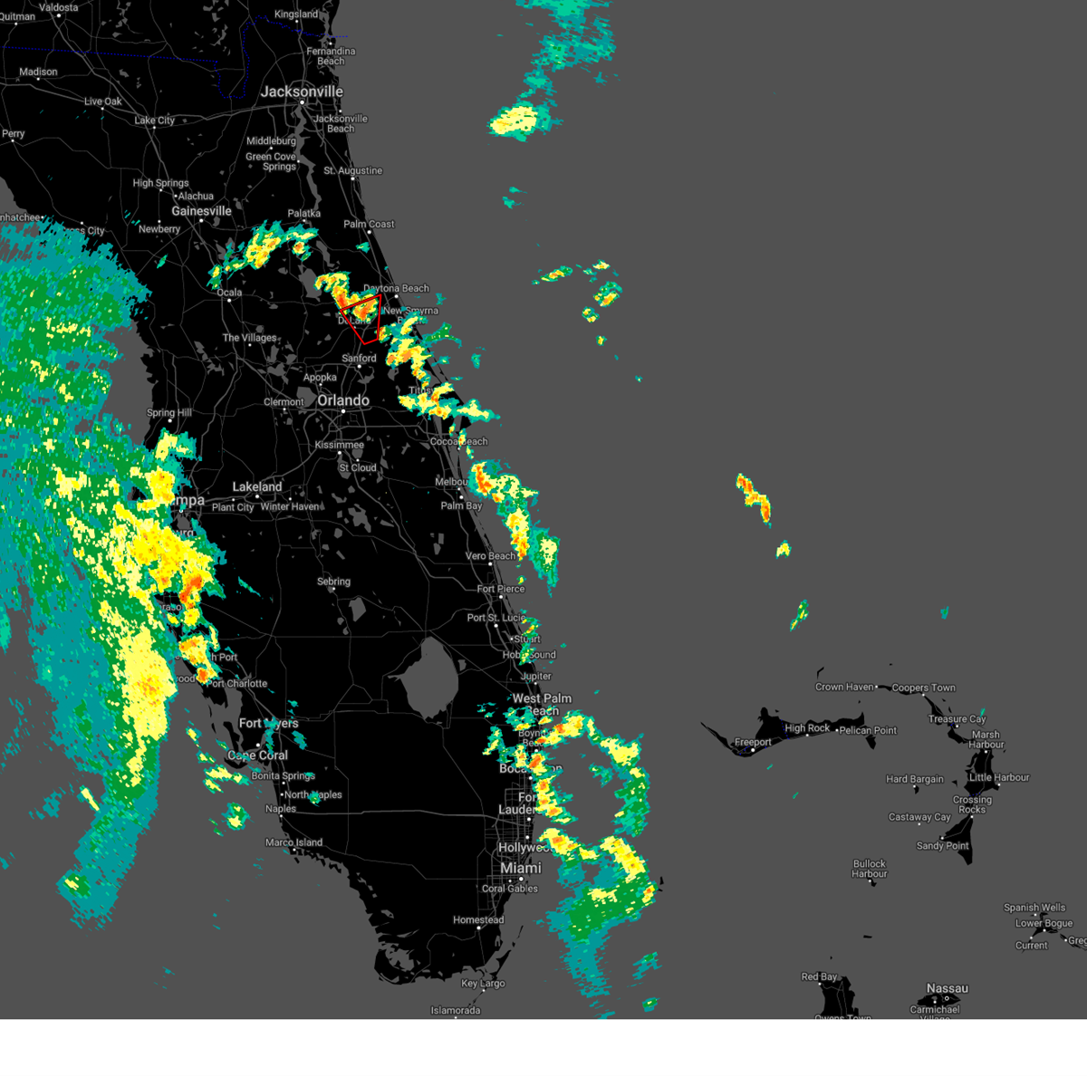
Hail Map for DeLand, FL
The DeLand, FL area has had 4 reports of on-the-ground hail by trained spotters, and has been under severe weather warnings 17 times during the past 12 months. Doppler radar has detected hail at or near DeLand, FL on 94 occasions, including 4 occasions during the past year.
| Name: | DeLand, FL |
| Where Located: | 33.8 miles N of Orlando, FL |
| Map: | Google Map for DeLand, FL |
| Population: | 27031 |
| Housing Units: | 12610 |
| More Info: | Search Google for DeLand, FL |
2
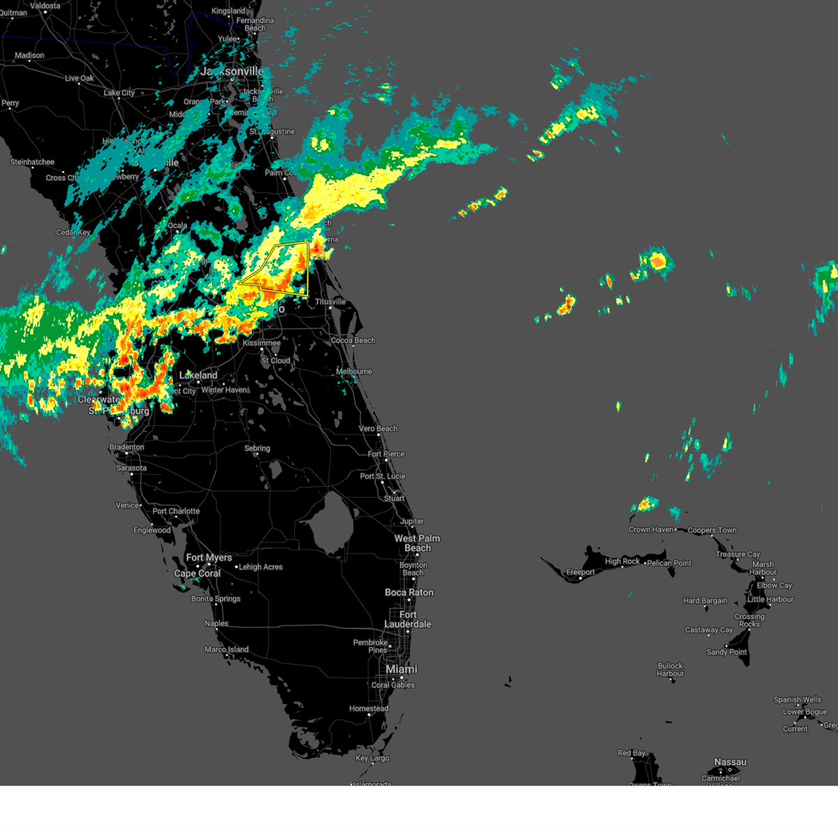
The Top Recent Hail Date for DeLand, FL is Tuesday, May 27, 2025 (10th out of 94)
Hail and Wind Damage Spotted near DeLand, FL
| Date / Time | Report Details |
|---|---|
| 5/31/2025 6:13 AM EDT |
 The storm which prompted the warning has weakened below severe limits, and no longer poses an immediate threat to life or property. therefore, the warning will be allowed to expire. however gusty winds are still possible with this thunderstorm. to report severe weather, contact your nearest law enforcement agency. they will relay your report to the national weather service melbourne. The storm which prompted the warning has weakened below severe limits, and no longer poses an immediate threat to life or property. therefore, the warning will be allowed to expire. however gusty winds are still possible with this thunderstorm. to report severe weather, contact your nearest law enforcement agency. they will relay your report to the national weather service melbourne.
|
| 5/31/2025 5:52 AM EDT |
 At 552 am edt, a severe thunderstorm was located over debary, moving east at 40 mph (radar indicated). Hazards include 60 mph wind gusts. Expect damage to roofs, siding, and trees. Locations impacted include, deltona, port orange, sanford, deland, and new smyrna beach. At 552 am edt, a severe thunderstorm was located over debary, moving east at 40 mph (radar indicated). Hazards include 60 mph wind gusts. Expect damage to roofs, siding, and trees. Locations impacted include, deltona, port orange, sanford, deland, and new smyrna beach.
|
| 5/31/2025 5:39 AM EDT |
 Svrmlb the national weather service in melbourne has issued a * severe thunderstorm warning for, central seminole county in east central florida, northeastern lake county in east central florida, central volusia county in east central florida, * until 615 am edt. * at 539 am edt, a severe thunderstorm was located over cassia, moving east at 40 mph (radar indicated). Hazards include 60 mph wind gusts. expect damage to roofs, siding, and trees Svrmlb the national weather service in melbourne has issued a * severe thunderstorm warning for, central seminole county in east central florida, northeastern lake county in east central florida, central volusia county in east central florida, * until 615 am edt. * at 539 am edt, a severe thunderstorm was located over cassia, moving east at 40 mph (radar indicated). Hazards include 60 mph wind gusts. expect damage to roofs, siding, and trees
|
| 5/29/2025 6:24 PM EDT |
 Svrmlb the national weather service in melbourne has issued a * severe thunderstorm warning for, central volusia county in east central florida, * until 730 pm edt. * at 623 pm edt, a severe thunderstorm was located near lake helen, moving northeast at 15 mph (radar indicated). Hazards include 60 mph wind gusts and quarter size hail. Hail damage to vehicles is expected. Expect wind damage to roofs, siding, and trees. Svrmlb the national weather service in melbourne has issued a * severe thunderstorm warning for, central volusia county in east central florida, * until 730 pm edt. * at 623 pm edt, a severe thunderstorm was located near lake helen, moving northeast at 15 mph (radar indicated). Hazards include 60 mph wind gusts and quarter size hail. Hail damage to vehicles is expected. Expect wind damage to roofs, siding, and trees.
|
| 5/29/2025 5:52 PM EDT |
 Svrmlb the national weather service in melbourne has issued a * severe thunderstorm warning for, central volusia county in east central florida, * until 615 pm edt. * at 552 pm edt, a severe thunderstorm was located over lake helen, moving northeast at 10 mph (radar indicated). Hazards include 60 mph wind gusts and quarter size hail. Hail damage to vehicles is expected. Expect wind damage to roofs, siding, and trees. Svrmlb the national weather service in melbourne has issued a * severe thunderstorm warning for, central volusia county in east central florida, * until 615 pm edt. * at 552 pm edt, a severe thunderstorm was located over lake helen, moving northeast at 10 mph (radar indicated). Hazards include 60 mph wind gusts and quarter size hail. Hail damage to vehicles is expected. Expect wind damage to roofs, siding, and trees.
|
| 5/24/2025 4:54 PM EDT |
 The storms which prompted the warning have weakened below severe limits, and no longer poses an immediate threat to life or property. therefore, the warning will be allowed to expire. however small hail and gusty winds are still possible with these thunderstorms. The storms which prompted the warning have weakened below severe limits, and no longer poses an immediate threat to life or property. therefore, the warning will be allowed to expire. however small hail and gusty winds are still possible with these thunderstorms.
|
| 5/24/2025 4:38 PM EDT |
 At 436 pm edt, a severe thunderstorm was located northeast of deland airport, or 7 miles northeast of deland, moving northeast at 5 mph. another strong storm within the severe weather warning was located just west of deland with very little movement (radar indicated). Hazards include 60 mph wind gusts and quarter size hail. Hail damage to vehicles is expected. expect wind damage to roofs, siding, and trees. Locations impacted include, deltona, daytona beach, deland, orange city, and lake helen. At 436 pm edt, a severe thunderstorm was located northeast of deland airport, or 7 miles northeast of deland, moving northeast at 5 mph. another strong storm within the severe weather warning was located just west of deland with very little movement (radar indicated). Hazards include 60 mph wind gusts and quarter size hail. Hail damage to vehicles is expected. expect wind damage to roofs, siding, and trees. Locations impacted include, deltona, daytona beach, deland, orange city, and lake helen.
|
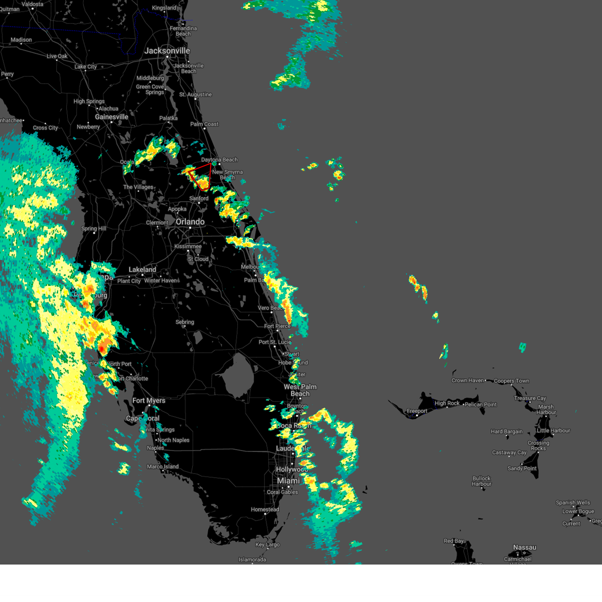
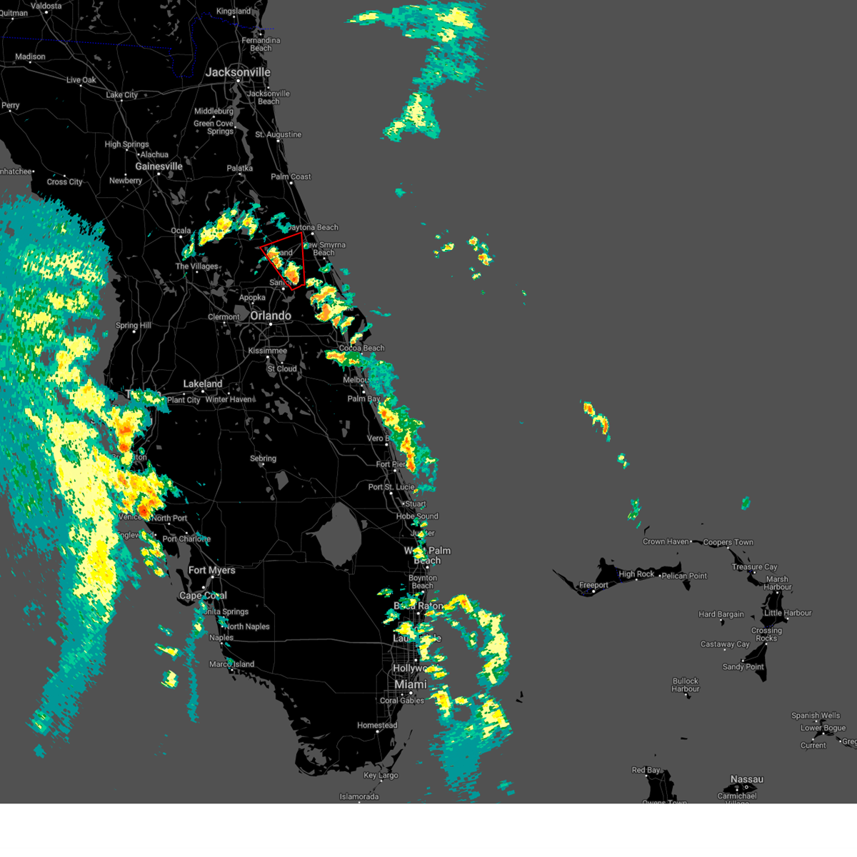
| 5/24/2025 4:32 PM EDT | Quarter sized hail reported 7.4 miles SSW of DeLand, FL, image submitted via social media of several hailstones... one of which measuring near 1 inch in diameter. |
| 5/24/2025 4:23 PM EDT |
 Svrmlb the national weather service in melbourne has issued a * severe thunderstorm warning for, northeastern lake county in east central florida, central volusia county in east central florida, * until 500 pm edt. * at 422 pm edt, a severe thunderstorm was located near deland airport, or near deland. movement was nearly stationary (radar indicated). Hazards include 60 mph wind gusts and quarter size hail. Hail damage to vehicles is expected. Expect wind damage to roofs, siding, and trees. Svrmlb the national weather service in melbourne has issued a * severe thunderstorm warning for, northeastern lake county in east central florida, central volusia county in east central florida, * until 500 pm edt. * at 422 pm edt, a severe thunderstorm was located near deland airport, or near deland. movement was nearly stationary (radar indicated). Hazards include 60 mph wind gusts and quarter size hail. Hail damage to vehicles is expected. Expect wind damage to roofs, siding, and trees.
|
| 4/1/2025 8:29 PM EDT |
 The storm which prompted the warning has weakened below severe limits, and no longer poses an immediate threat to life or property. therefore, the warning will be allowed to expire. however gusty winds are still possible with this thunderstorm. to report severe weather, contact your nearest law enforcement agency. they will relay your report to the national weather service melbourne. The storm which prompted the warning has weakened below severe limits, and no longer poses an immediate threat to life or property. therefore, the warning will be allowed to expire. however gusty winds are still possible with this thunderstorm. to report severe weather, contact your nearest law enforcement agency. they will relay your report to the national weather service melbourne.
|
| 4/1/2025 8:08 PM EDT |
 At 808 pm edt, a severe thunderstorm was located over sanford, moving northeast at 15 mph (radar indicated). Hazards include 60 mph wind gusts and quarter size hail. Hail damage to vehicles is expected. expect wind damage to roofs, siding, and trees. Locations impacted include, lake harney, osteen, orange city, farmton, and geneva. At 808 pm edt, a severe thunderstorm was located over sanford, moving northeast at 15 mph (radar indicated). Hazards include 60 mph wind gusts and quarter size hail. Hail damage to vehicles is expected. expect wind damage to roofs, siding, and trees. Locations impacted include, lake harney, osteen, orange city, farmton, and geneva.
|
| 4/1/2025 7:58 PM EDT |
 Svrmlb the national weather service in melbourne has issued a * severe thunderstorm warning for, seminole county in east central florida, south central volusia county in east central florida, * until 830 pm edt. * at 758 pm edt, a severe thunderstorm was located over sanford, moving northeast at 20 mph (radar indicated). Hazards include 60 mph wind gusts and quarter size hail. Hail damage to vehicles is expected. Expect wind damage to roofs, siding, and trees. Svrmlb the national weather service in melbourne has issued a * severe thunderstorm warning for, seminole county in east central florida, south central volusia county in east central florida, * until 830 pm edt. * at 758 pm edt, a severe thunderstorm was located over sanford, moving northeast at 20 mph (radar indicated). Hazards include 60 mph wind gusts and quarter size hail. Hail damage to vehicles is expected. Expect wind damage to roofs, siding, and trees.
|
| 3/10/2025 9:32 AM EDT |
 Svrmlb the national weather service in melbourne has issued a * severe thunderstorm warning for, seminole county in east central florida, east central lake county in east central florida, northwestern orange county in east central florida, south central volusia county in east central florida, * until 1000 am edt. * at 932 am edt, a severe thunderstorm was located over wekiva springs, or near altamonte springs, moving northeast at 35 mph (radar indicated). Hazards include 60 mph wind gusts. expect damage to roofs, siding, and trees Svrmlb the national weather service in melbourne has issued a * severe thunderstorm warning for, seminole county in east central florida, east central lake county in east central florida, northwestern orange county in east central florida, south central volusia county in east central florida, * until 1000 am edt. * at 932 am edt, a severe thunderstorm was located over wekiva springs, or near altamonte springs, moving northeast at 35 mph (radar indicated). Hazards include 60 mph wind gusts. expect damage to roofs, siding, and trees
|
| 1/19/2025 8:51 AM EST |
 Svrmlb the national weather service in melbourne has issued a * severe thunderstorm warning for, northern lake county in east central florida, northern volusia county in east central florida, * until 930 am est. * at 850 am est, a severe thunderstorm was located near the villages, moving east at 55 mph (radar indicated). Hazards include 60 mph wind gusts and penny size hail. expect damage to roofs, siding, and trees Svrmlb the national weather service in melbourne has issued a * severe thunderstorm warning for, northern lake county in east central florida, northern volusia county in east central florida, * until 930 am est. * at 850 am est, a severe thunderstorm was located near the villages, moving east at 55 mph (radar indicated). Hazards include 60 mph wind gusts and penny size hail. expect damage to roofs, siding, and trees
|
| 1/19/2025 8:12 AM EST |
 Svrmlb the national weather service in melbourne has issued a * severe thunderstorm warning for, northern lake county in east central florida, northern volusia county in east central florida, * until 900 am est. * at 811 am est, a severe thunderstorm was located near moss bluff, or near juniper springs, moving east at 50 mph (radar indicated). Hazards include 60 mph wind gusts and penny size hail. expect damage to roofs, siding, and trees Svrmlb the national weather service in melbourne has issued a * severe thunderstorm warning for, northern lake county in east central florida, northern volusia county in east central florida, * until 900 am est. * at 811 am est, a severe thunderstorm was located near moss bluff, or near juniper springs, moving east at 50 mph (radar indicated). Hazards include 60 mph wind gusts and penny size hail. expect damage to roofs, siding, and trees
|
| 9/26/2024 4:44 PM EDT |
 The tornadic thunderstorm which prompted the warning has weakened. therefore, the warning will be allowed to expire. a tornado watch remains in effect until 800 pm edt for east central florida. The tornadic thunderstorm which prompted the warning has weakened. therefore, the warning will be allowed to expire. a tornado watch remains in effect until 800 pm edt for east central florida.
|
| 9/26/2024 4:36 PM EDT |
 At 435 pm edt, a severe thunderstorm capable of producing a tornado was located over lake helen, moving north at 55 mph (radar indicated rotation). Hazards include tornado. Flying debris will be dangerous to those caught without shelter. mobile homes will be damaged or destroyed. damage to roofs, windows, and vehicles will occur. tree damage is likely. this dangerous storm will be near, deland, lake helen, and deland airport around 440 pm edt. Other locations impacted by this tornadic thunderstorm include cassadaga. At 435 pm edt, a severe thunderstorm capable of producing a tornado was located over lake helen, moving north at 55 mph (radar indicated rotation). Hazards include tornado. Flying debris will be dangerous to those caught without shelter. mobile homes will be damaged or destroyed. damage to roofs, windows, and vehicles will occur. tree damage is likely. this dangerous storm will be near, deland, lake helen, and deland airport around 440 pm edt. Other locations impacted by this tornadic thunderstorm include cassadaga.
|
| 9/26/2024 4:25 PM EDT |
 Tormlb the national weather service in melbourne has issued a * tornado warning for, central volusia county in east central florida, * until 445 pm edt. * at 425 pm edt, a severe thunderstorm capable of producing a tornado was located over osteen, or near deltona, moving north at 45 mph (radar indicated rotation). Hazards include tornado. Flying debris will be dangerous to those caught without shelter. mobile homes will be damaged or destroyed. damage to roofs, windows, and vehicles will occur. tree damage is likely. this dangerous storm will be near, deltona, deland, and orange city around 430 pm edt. deland airport around 440 pm edt. Other locations impacted by this tornadic thunderstorm include cassadaga. Tormlb the national weather service in melbourne has issued a * tornado warning for, central volusia county in east central florida, * until 445 pm edt. * at 425 pm edt, a severe thunderstorm capable of producing a tornado was located over osteen, or near deltona, moving north at 45 mph (radar indicated rotation). Hazards include tornado. Flying debris will be dangerous to those caught without shelter. mobile homes will be damaged or destroyed. damage to roofs, windows, and vehicles will occur. tree damage is likely. this dangerous storm will be near, deltona, deland, and orange city around 430 pm edt. deland airport around 440 pm edt. Other locations impacted by this tornadic thunderstorm include cassadaga.
|
| 6/6/2024 6:08 PM EDT |
 Svrmlb the national weather service in melbourne has issued a * severe thunderstorm warning for, northeastern lake county in east central florida, west central volusia county in east central florida, * until 645 pm edt. * at 607 pm edt, a severe thunderstorm was located 7 miles southwest of barberville, moving east at 20 mph (radar indicated). Hazards include 60 mph wind gusts and quarter size hail. Hail damage to vehicles is expected. Expect wind damage to roofs, siding, and trees. Svrmlb the national weather service in melbourne has issued a * severe thunderstorm warning for, northeastern lake county in east central florida, west central volusia county in east central florida, * until 645 pm edt. * at 607 pm edt, a severe thunderstorm was located 7 miles southwest of barberville, moving east at 20 mph (radar indicated). Hazards include 60 mph wind gusts and quarter size hail. Hail damage to vehicles is expected. Expect wind damage to roofs, siding, and trees.
|
| 5/18/2024 4:26 PM EDT |
 Svrmlb the national weather service in melbourne has issued a * severe thunderstorm warning for, northeastern lake county in east central florida, northwestern volusia county in east central florida, * until 515 pm edt. * at 426 pm edt, a severe thunderstorm was located near barberville, moving northeast at 30 mph (radar indicated). Hazards include 60 mph wind gusts and quarter size hail. Hail damage to vehicles is expected. Expect wind damage to roofs, siding, and trees. Svrmlb the national weather service in melbourne has issued a * severe thunderstorm warning for, northeastern lake county in east central florida, northwestern volusia county in east central florida, * until 515 pm edt. * at 426 pm edt, a severe thunderstorm was located near barberville, moving northeast at 30 mph (radar indicated). Hazards include 60 mph wind gusts and quarter size hail. Hail damage to vehicles is expected. Expect wind damage to roofs, siding, and trees.
|
| 5/18/2024 4:14 PM EDT |
 At 414 pm edt, a severe thunderstorm was located near paisley, moving northeast at 25 mph (radar indicated). Hazards include 60 mph wind gusts and quarter size hail. Hail damage to vehicles is expected. expect wind damage to roofs, siding, and trees. Locations impacted include, deland, deleon springs, barberville, paisley, and pittman. At 414 pm edt, a severe thunderstorm was located near paisley, moving northeast at 25 mph (radar indicated). Hazards include 60 mph wind gusts and quarter size hail. Hail damage to vehicles is expected. expect wind damage to roofs, siding, and trees. Locations impacted include, deland, deleon springs, barberville, paisley, and pittman.
|
| 5/18/2024 3:57 PM EDT |
 Svrmlb the national weather service in melbourne has issued a * severe thunderstorm warning for, northeastern lake county in east central florida, west central volusia county in east central florida, * until 430 pm edt. * at 357 pm edt, a severe thunderstorm was located over pittman, or near paisley, moving northeast at 25 mph (radar indicated). Hazards include 60 mph wind gusts and quarter size hail. Hail damage to vehicles is expected. Expect wind damage to roofs, siding, and trees. Svrmlb the national weather service in melbourne has issued a * severe thunderstorm warning for, northeastern lake county in east central florida, west central volusia county in east central florida, * until 430 pm edt. * at 357 pm edt, a severe thunderstorm was located over pittman, or near paisley, moving northeast at 25 mph (radar indicated). Hazards include 60 mph wind gusts and quarter size hail. Hail damage to vehicles is expected. Expect wind damage to roofs, siding, and trees.
|
| 5/15/2024 6:44 AM EDT |
 The storm which prompted the warning has weakened below severe limits, and no longer poses an immediate threat to life or property. therefore, the warning will be allowed to expire. however small hail, gusty winds and heavy rain are still possible with this thunderstorm. a tornado watch remains in effect until 1100 am edt for east central florida. The storm which prompted the warning has weakened below severe limits, and no longer poses an immediate threat to life or property. therefore, the warning will be allowed to expire. however small hail, gusty winds and heavy rain are still possible with this thunderstorm. a tornado watch remains in effect until 1100 am edt for east central florida.
|
| 5/15/2024 6:35 AM EDT |
 At 634 am edt, a severe thunderstorm was located over deland, moving northeast at 30 mph (radar indicated). Hazards include 60 mph wind gusts and quarter size hail. Hail damage to vehicles is expected. expect wind damage to roofs, siding, and trees. Locations impacted include, deltona, deland, mount dora, orange city, and lake helen. At 634 am edt, a severe thunderstorm was located over deland, moving northeast at 30 mph (radar indicated). Hazards include 60 mph wind gusts and quarter size hail. Hail damage to vehicles is expected. expect wind damage to roofs, siding, and trees. Locations impacted include, deltona, deland, mount dora, orange city, and lake helen.
|
| 5/15/2024 6:09 AM EDT |
 Svrmlb the national weather service in melbourne has issued a * severe thunderstorm warning for, northeastern lake county in east central florida, central volusia county in east central florida, * until 645 am edt. * at 609 am edt, a severe thunderstorm was located near cassia, moving east at 45 mph (radar indicated). Hazards include 60 mph wind gusts and quarter size hail. Hail damage to vehicles is expected. Expect wind damage to roofs, siding, and trees. Svrmlb the national weather service in melbourne has issued a * severe thunderstorm warning for, northeastern lake county in east central florida, central volusia county in east central florida, * until 645 am edt. * at 609 am edt, a severe thunderstorm was located near cassia, moving east at 45 mph (radar indicated). Hazards include 60 mph wind gusts and quarter size hail. Hail damage to vehicles is expected. Expect wind damage to roofs, siding, and trees.
|
| 1/9/2024 5:55 PM EST |
 The national weather service in melbourne has issued a * severe thunderstorm warning for. seminole county in east central florida. orange county in east central florida. central volusia county in east central florida. northwestern osceola county in east central florida. Until 645 pm est. The national weather service in melbourne has issued a * severe thunderstorm warning for. seminole county in east central florida. orange county in east central florida. central volusia county in east central florida. northwestern osceola county in east central florida. Until 645 pm est.
|
| 1/9/2024 5:44 PM EST |
 At 543 pm est, severe thunderstorms were located along a line extending from near flagler beach to orange city to ocoee, moving northeast at 70 mph (radar indicated). Hazards include 60 mph wind gusts. Expect damage to roofs, siding, and trees. Locations impacted include, orlando, deltona, daytona beach, kissimmee, and port orange. At 543 pm est, severe thunderstorms were located along a line extending from near flagler beach to orange city to ocoee, moving northeast at 70 mph (radar indicated). Hazards include 60 mph wind gusts. Expect damage to roofs, siding, and trees. Locations impacted include, orlando, deltona, daytona beach, kissimmee, and port orange.
|
| 1/9/2024 5:21 PM EST |
 The national weather service in melbourne has issued a * severe thunderstorm warning for. seminole county in east central florida. central lake county in east central florida. orange county in east central florida. Volusia county in east central florida. The national weather service in melbourne has issued a * severe thunderstorm warning for. seminole county in east central florida. central lake county in east central florida. orange county in east central florida. Volusia county in east central florida.
|
| 10/12/2023 5:23 AM EDT |
 At 522 am edt, a severe thunderstorm capable of producing a tornado was located over ormond-by-the-sea, moving east at 40 mph. an additional thunderstorm capable of producing a tornado was located near lake woodruff (radar indicated rotation). Hazards include tornado. Flying debris will be dangerous to those caught without shelter. mobile homes will be damaged or destroyed. damage to roofs, windows, and vehicles will occur. tree damage is likely. this dangerous storm will be near, ormond-by-the-sea around 530 am edt. Other locations impacted by this tornadic thunderstorm include ormond beach airport. At 522 am edt, a severe thunderstorm capable of producing a tornado was located over ormond-by-the-sea, moving east at 40 mph. an additional thunderstorm capable of producing a tornado was located near lake woodruff (radar indicated rotation). Hazards include tornado. Flying debris will be dangerous to those caught without shelter. mobile homes will be damaged or destroyed. damage to roofs, windows, and vehicles will occur. tree damage is likely. this dangerous storm will be near, ormond-by-the-sea around 530 am edt. Other locations impacted by this tornadic thunderstorm include ormond beach airport.
|
| 10/12/2023 5:10 AM EDT |
 At 509 am edt, a severe thunderstorm capable of producing a tornado was located 7 miles northeast of deleon springs. another severe thunderstorm capable of producing a tornado was located near lake woodruff. both were moving northeast at 40 mph (radar indicated rotation). Hazards include tornado. Flying debris will be dangerous to those caught without shelter. mobile homes will be damaged or destroyed. damage to roofs, windows, and vehicles will occur. tree damage is likely. this dangerous storm will be near, daytona beach around 510 am edt. ormond beach, holly hill, and ormond-by-the-sea around 520 am edt. Other locations impacted by this tornadic thunderstorm include spruce creek. At 509 am edt, a severe thunderstorm capable of producing a tornado was located 7 miles northeast of deleon springs. another severe thunderstorm capable of producing a tornado was located near lake woodruff. both were moving northeast at 40 mph (radar indicated rotation). Hazards include tornado. Flying debris will be dangerous to those caught without shelter. mobile homes will be damaged or destroyed. damage to roofs, windows, and vehicles will occur. tree damage is likely. this dangerous storm will be near, daytona beach around 510 am edt. ormond beach, holly hill, and ormond-by-the-sea around 520 am edt. Other locations impacted by this tornadic thunderstorm include spruce creek.
|
| 10/12/2023 4:56 AM EDT |
 At 456 am edt, a severe thunderstorm capable of producing a tornado was located over deleon springs, moving east at 30 mph (radar indicated rotation). Hazards include tornado. Flying debris will be dangerous to those caught without shelter. mobile homes will be damaged or destroyed. damage to roofs, windows, and vehicles will occur. tree damage is likely. this dangerous storm will be near, deland and deleon springs around 500 am edt. daytona beach around 510 am edt. daytona beach airport and daytona international speedway around 520 am edt. port orange, ormond beach, and south daytona around 530 am edt. Other locations impacted by this tornadic thunderstorm include spruce creek. At 456 am edt, a severe thunderstorm capable of producing a tornado was located over deleon springs, moving east at 30 mph (radar indicated rotation). Hazards include tornado. Flying debris will be dangerous to those caught without shelter. mobile homes will be damaged or destroyed. damage to roofs, windows, and vehicles will occur. tree damage is likely. this dangerous storm will be near, deland and deleon springs around 500 am edt. daytona beach around 510 am edt. daytona beach airport and daytona international speedway around 520 am edt. port orange, ormond beach, and south daytona around 530 am edt. Other locations impacted by this tornadic thunderstorm include spruce creek.
|
| 10/12/2023 4:45 AM EDT |
 At 445 am edt, a severe thunderstorm capable of producing a tornado was located near barberville, moving northeast at 55 mph (radar indicated rotation). Hazards include tornado. Flying debris will be dangerous to those caught without shelter. mobile homes will be damaged or destroyed. damage to roofs, windows, and vehicles will occur. tree damage is likely. this dangerous storm will be near, deleon springs and barberville around 450 am edt. Other locations impacted by this tornadic thunderstorm include eldridge. At 445 am edt, a severe thunderstorm capable of producing a tornado was located near barberville, moving northeast at 55 mph (radar indicated rotation). Hazards include tornado. Flying debris will be dangerous to those caught without shelter. mobile homes will be damaged or destroyed. damage to roofs, windows, and vehicles will occur. tree damage is likely. this dangerous storm will be near, deleon springs and barberville around 450 am edt. Other locations impacted by this tornadic thunderstorm include eldridge.
|
| 10/12/2023 4:37 AM EDT |
 At 436 am edt, a severe thunderstorm capable of producing a tornado was located near paisley, moving northeast at 55 mph. another storm capable of producing a tornado is near lake yale (radar indicated rotation). Hazards include tornado. Flying debris will be dangerous to those caught without shelter. mobile homes will be damaged or destroyed. damage to roofs, windows, and vehicles will occur. tree damage is likely. this dangerous storm will be near, deleon springs and paisley around 440 am edt. barberville around 450 am edt. Other locations impacted by this tornadic thunderstorm include eldridge. At 436 am edt, a severe thunderstorm capable of producing a tornado was located near paisley, moving northeast at 55 mph. another storm capable of producing a tornado is near lake yale (radar indicated rotation). Hazards include tornado. Flying debris will be dangerous to those caught without shelter. mobile homes will be damaged or destroyed. damage to roofs, windows, and vehicles will occur. tree damage is likely. this dangerous storm will be near, deleon springs and paisley around 440 am edt. barberville around 450 am edt. Other locations impacted by this tornadic thunderstorm include eldridge.
|
| 10/12/2023 4:26 AM EDT |
 At 425 am edt, a severe thunderstorm capable of producing a tornado was located over leesburg airport, or over lake griffin, moving northeast at 60 mph (radar indicated rotation). Hazards include tornado. Flying debris will be dangerous to those caught without shelter. mobile homes will be damaged or destroyed. damage to roofs, windows, and vehicles will occur. tree damage is likely. this dangerous storm will be near, eustis, tavares, and lisbon around 430 am edt. paisley and pittman around 440 am edt. deleon springs around 450 am edt. barberville around 500 am edt. Other locations impacted by this tornadic thunderstorm include pine lakes. At 425 am edt, a severe thunderstorm capable of producing a tornado was located over leesburg airport, or over lake griffin, moving northeast at 60 mph (radar indicated rotation). Hazards include tornado. Flying debris will be dangerous to those caught without shelter. mobile homes will be damaged or destroyed. damage to roofs, windows, and vehicles will occur. tree damage is likely. this dangerous storm will be near, eustis, tavares, and lisbon around 430 am edt. paisley and pittman around 440 am edt. deleon springs around 450 am edt. barberville around 500 am edt. Other locations impacted by this tornadic thunderstorm include pine lakes.
|
| 9/11/2023 7:57 PM EDT |
 The severe thunderstorm warning for east central lake and central volusia counties will expire at 800 pm edt, the storm which prompted the warning has weakened below severe limits, and no longer poses an immediate threat to life or property. therefore, the warning will be allowed to expire. however gusty winds and heavy rain are still possible with this thunderstorm. The severe thunderstorm warning for east central lake and central volusia counties will expire at 800 pm edt, the storm which prompted the warning has weakened below severe limits, and no longer poses an immediate threat to life or property. therefore, the warning will be allowed to expire. however gusty winds and heavy rain are still possible with this thunderstorm.
|
| 9/11/2023 7:34 PM EDT |
 At 734 pm edt, a severe thunderstorm was located near cassia, moving southeast at 10 mph (radar indicated). Hazards include 60 mph wind gusts and quarter size hail. Hail damage to vehicles is expected. expect wind damage to roofs, siding, and trees. Locations impacted include, deltona, deland, orange city, debary, and west deland. At 734 pm edt, a severe thunderstorm was located near cassia, moving southeast at 10 mph (radar indicated). Hazards include 60 mph wind gusts and quarter size hail. Hail damage to vehicles is expected. expect wind damage to roofs, siding, and trees. Locations impacted include, deltona, deland, orange city, debary, and west deland.
|
| 9/11/2023 7:15 PM EDT |
 At 714 pm edt, a severe thunderstorm was located 7 miles east of paisley, moving east at 10 mph (radar indicated). Hazards include 60 mph wind gusts and quarter size hail. Hail damage to vehicles is expected. Expect wind damage to roofs, siding, and trees. At 714 pm edt, a severe thunderstorm was located 7 miles east of paisley, moving east at 10 mph (radar indicated). Hazards include 60 mph wind gusts and quarter size hail. Hail damage to vehicles is expected. Expect wind damage to roofs, siding, and trees.
|
| 6/22/2023 3:31 PM EDT |
 At 331 pm edt, a severe thunderstorm was located near maytown, or near oak hill, moving northeast at 30 mph (radar indicated). Hazards include 60 mph wind gusts. expect damage to roofs, siding, and trees At 331 pm edt, a severe thunderstorm was located near maytown, or near oak hill, moving northeast at 30 mph (radar indicated). Hazards include 60 mph wind gusts. expect damage to roofs, siding, and trees
|
| 5/18/2023 4:59 PM EDT |
 At 458 pm edt, a severe thunderstorm was located near deleon springs, moving east at 10 mph (radar indicated). Hazards include 60 mph wind gusts and quarter size hail. Hail damage to vehicles is expected. Expect wind damage to roofs, siding, and trees. At 458 pm edt, a severe thunderstorm was located near deleon springs, moving east at 10 mph (radar indicated). Hazards include 60 mph wind gusts and quarter size hail. Hail damage to vehicles is expected. Expect wind damage to roofs, siding, and trees.
|
| 4/30/2023 7:07 AM EDT |
 At 707 am edt, a severe thunderstorm was located over deltona, moving northeast at 45 mph (radar indicated). Hazards include 60 mph wind gusts. expect damage to roofs, siding, and trees At 707 am edt, a severe thunderstorm was located over deltona, moving northeast at 45 mph (radar indicated). Hazards include 60 mph wind gusts. expect damage to roofs, siding, and trees
|
| 4/26/2023 3:53 PM EDT |
 At 353 pm edt, a severe thunderstorm was located near cassia, moving southeast at 25 mph (radar indicated). Hazards include 60 mph wind gusts and quarter size hail. Hail damage to vehicles is expected. Expect wind damage to roofs, siding, and trees. At 353 pm edt, a severe thunderstorm was located near cassia, moving southeast at 25 mph (radar indicated). Hazards include 60 mph wind gusts and quarter size hail. Hail damage to vehicles is expected. Expect wind damage to roofs, siding, and trees.
|
| 4/26/2023 3:21 PM EDT |
 At 321 pm edt, a severe thunderstorm was located near paisley, moving southeast at 25 mph (radar indicated). Hazards include 60 mph wind gusts and quarter size hail. Hail damage to vehicles is expected. Expect wind damage to roofs, siding, and trees. At 321 pm edt, a severe thunderstorm was located near paisley, moving southeast at 25 mph (radar indicated). Hazards include 60 mph wind gusts and quarter size hail. Hail damage to vehicles is expected. Expect wind damage to roofs, siding, and trees.
|
| 3/13/2023 12:26 PM EDT |
 The severe thunderstorm warning for east central volusia county will expire at 1230 pm edt, the storm which prompted the warning has moved out of the area. therefore, the warning will be allowed to expire. however gusty winds and heavy rain are still possible with this thunderstorm. The severe thunderstorm warning for east central volusia county will expire at 1230 pm edt, the storm which prompted the warning has moved out of the area. therefore, the warning will be allowed to expire. however gusty winds and heavy rain are still possible with this thunderstorm.
|
| 3/13/2023 12:03 PM EDT |
 At 1202 pm edt, a severe thunderstorm was located over new smyrna beach, moving east at 40 mph (radar indicated). Hazards include 60 mph wind gusts and penny size hail. Expect damage to roofs, siding, and trees. locations impacted include, deltona, port orange, deland, new smyrna beach and edgewater. hail threat, radar indicated max hail size, 0. 75 in wind threat, radar indicated max wind gust, 60 mph. At 1202 pm edt, a severe thunderstorm was located over new smyrna beach, moving east at 40 mph (radar indicated). Hazards include 60 mph wind gusts and penny size hail. Expect damage to roofs, siding, and trees. locations impacted include, deltona, port orange, deland, new smyrna beach and edgewater. hail threat, radar indicated max hail size, 0. 75 in wind threat, radar indicated max wind gust, 60 mph.
|
| 3/13/2023 11:51 AM EDT |
 At 1151 am edt, a severe thunderstorm was located near lake helen, moving east at 25 mph (radar indicated). Hazards include 60 mph wind gusts and penny size hail. expect damage to roofs, siding, and trees At 1151 am edt, a severe thunderstorm was located near lake helen, moving east at 25 mph (radar indicated). Hazards include 60 mph wind gusts and penny size hail. expect damage to roofs, siding, and trees
|
| 8/17/2022 1:17 PM EDT |
 At 116 pm edt, a severe thunderstorm was located near orange city, moving east at 15 mph (radar indicated). Hazards include 60 mph wind gusts and penny size hail. Expect damage to roofs, siding, and trees. locations impacted include, deltona, deland, orange city, lake helen and debary. hail threat, radar indicated max hail size, 0. 75 in wind threat, radar indicated max wind gust, 60 mph. At 116 pm edt, a severe thunderstorm was located near orange city, moving east at 15 mph (radar indicated). Hazards include 60 mph wind gusts and penny size hail. Expect damage to roofs, siding, and trees. locations impacted include, deltona, deland, orange city, lake helen and debary. hail threat, radar indicated max hail size, 0. 75 in wind threat, radar indicated max wind gust, 60 mph.
|
| 8/17/2022 1:05 PM EDT |
 At 105 pm edt, a severe thunderstorm was located near orange city, moving east at 15 mph (radar indicated). Hazards include 60 mph wind gusts and penny size hail. expect damage to roofs, siding, and trees At 105 pm edt, a severe thunderstorm was located near orange city, moving east at 15 mph (radar indicated). Hazards include 60 mph wind gusts and penny size hail. expect damage to roofs, siding, and trees
|
| 6/6/2022 2:35 PM EDT |
 The severe thunderstorm warning for north central volusia county will expire at 245 pm edt, the storm which prompted the warning has weakened below severe limits, and has exited the warned area. therefore, the warning will be allowed to expire. however small hail, gusty winds and heavy rain are still possible with this thunderstorm. The severe thunderstorm warning for north central volusia county will expire at 245 pm edt, the storm which prompted the warning has weakened below severe limits, and has exited the warned area. therefore, the warning will be allowed to expire. however small hail, gusty winds and heavy rain are still possible with this thunderstorm.
|
| 6/6/2022 2:20 PM EDT |
 At 219 pm edt, a severe thunderstorm was located 10 miles northeast of deleon springs, moving north at 5 to 10 mph (radar indicated). Hazards include 60 mph wind gusts and quarter size hail. Hail damage to vehicles is expected. expect wind damage to roofs, siding, and trees. locations impacted include, daytona beach, deland and deleon springs. hail threat, radar indicated max hail size, 1. 00 in wind threat, radar indicated max wind gust, 60 mph. At 219 pm edt, a severe thunderstorm was located 10 miles northeast of deleon springs, moving north at 5 to 10 mph (radar indicated). Hazards include 60 mph wind gusts and quarter size hail. Hail damage to vehicles is expected. expect wind damage to roofs, siding, and trees. locations impacted include, daytona beach, deland and deleon springs. hail threat, radar indicated max hail size, 1. 00 in wind threat, radar indicated max wind gust, 60 mph.
|
| 6/6/2022 2:03 PM EDT |
 At 202 pm edt, a severe thunderstorm was located 7 miles northeast of deleon springs, and is nearly stationary (radar indicated). Hazards include 60 mph wind gusts and quarter size hail. Hail damage to vehicles is expected. Expect wind damage to roofs, siding, and trees. At 202 pm edt, a severe thunderstorm was located 7 miles northeast of deleon springs, and is nearly stationary (radar indicated). Hazards include 60 mph wind gusts and quarter size hail. Hail damage to vehicles is expected. Expect wind damage to roofs, siding, and trees.
|
| 5/21/2022 7:09 PM EDT |
 The severe thunderstorm warning for north central volusia county will expire at 715 pm edt, the storm which prompted the warning has weakened below severe limits, and no longer poses an immediate threat to life or property. therefore, the warning will be allowed to expire. however small hail, gusty winds and heavy rain are still possible with this thunderstorm. to report severe weather, contact your nearest law enforcement agency. they will relay your report to the national weather service melbourne. The severe thunderstorm warning for north central volusia county will expire at 715 pm edt, the storm which prompted the warning has weakened below severe limits, and no longer poses an immediate threat to life or property. therefore, the warning will be allowed to expire. however small hail, gusty winds and heavy rain are still possible with this thunderstorm. to report severe weather, contact your nearest law enforcement agency. they will relay your report to the national weather service melbourne.
|
| 5/21/2022 7:01 PM EDT |
 At 700 pm edt, a severe thunderstorm was located near deleon springs, moving north at 25 mph (radar indicated). Hazards include 60 mph wind gusts and quarter size hail. Hail damage to vehicles is expected. expect wind damage to roofs, siding, and trees. locations impacted include, daytona beach, deland, deleon springs, deland airport and glenwood. hail threat, radar indicated max hail size, 1. 00 in wind threat, radar indicated max wind gust, 60 mph. At 700 pm edt, a severe thunderstorm was located near deleon springs, moving north at 25 mph (radar indicated). Hazards include 60 mph wind gusts and quarter size hail. Hail damage to vehicles is expected. expect wind damage to roofs, siding, and trees. locations impacted include, daytona beach, deland, deleon springs, deland airport and glenwood. hail threat, radar indicated max hail size, 1. 00 in wind threat, radar indicated max wind gust, 60 mph.
|
| 5/21/2022 6:56 PM EDT |
 At 656 pm edt, a severe thunderstorm was located near orange city, moving north at 25 mph (radar indicated). Hazards include 60 mph wind gusts and quarter size hail. Hail damage to vehicles is expected. Expect wind damage to roofs, siding, and trees. At 656 pm edt, a severe thunderstorm was located near orange city, moving north at 25 mph (radar indicated). Hazards include 60 mph wind gusts and quarter size hail. Hail damage to vehicles is expected. Expect wind damage to roofs, siding, and trees.
|
| 5/21/2022 6:45 PM EDT | Quarter sized hail reported 1.2 miles SSE of DeLand, FL, public reports quarter sized hail near the intersection of n arlington and e pennsylvania ave in deland. |
| 5/21/2022 6:39 PM EDT |
 At 639 pm edt, a severe thunderstorm was located over deltona, moving north at 30 mph (radar indicated). Hazards include 60 mph wind gusts and quarter size hail. Hail damage to vehicles is expected. expect wind damage to roofs, siding, and trees. locations impacted include, deltona, sanford, deland, lake mary and orange city. hail threat, radar indicated max hail size, 1. 00 in wind threat, radar indicated max wind gust, 60 mph. At 639 pm edt, a severe thunderstorm was located over deltona, moving north at 30 mph (radar indicated). Hazards include 60 mph wind gusts and quarter size hail. Hail damage to vehicles is expected. expect wind damage to roofs, siding, and trees. locations impacted include, deltona, sanford, deland, lake mary and orange city. hail threat, radar indicated max hail size, 1. 00 in wind threat, radar indicated max wind gust, 60 mph.
|
| 5/21/2022 6:37 PM EDT |
 At 636 pm edt, a severe thunderstorm was located over deland, moving north at 25 mph (radar indicated). Hazards include 60 mph wind gusts and quarter size hail. Hail damage to vehicles is expected. Expect wind damage to roofs, siding, and trees. At 636 pm edt, a severe thunderstorm was located over deland, moving north at 25 mph (radar indicated). Hazards include 60 mph wind gusts and quarter size hail. Hail damage to vehicles is expected. Expect wind damage to roofs, siding, and trees.
|
| 5/21/2022 6:30 PM EDT | Half Dollar sized hail reported 3 miles N of DeLand, FL, report of half dollar hail near the intersection of highway 17 and mcgregor rd in deland relayed by broadcast media. time estimated via radar. |
| 5/21/2022 6:26 PM EDT | Quarter sized hail reported 4.3 miles NNE of DeLand, FL, public reports quarter sized hail near the intersection of 20th st and lolita st in orange city. |
| 5/21/2022 6:13 PM EDT |
 At 612 pm edt, a severe thunderstorm was located over lake jessup, moving north at 30 mph (radar indicated). Hazards include 60 mph wind gusts and quarter size hail. Hail damage to vehicles is expected. Expect wind damage to roofs, siding, and trees. At 612 pm edt, a severe thunderstorm was located over lake jessup, moving north at 30 mph (radar indicated). Hazards include 60 mph wind gusts and quarter size hail. Hail damage to vehicles is expected. Expect wind damage to roofs, siding, and trees.
|
| 4/2/2022 2:56 PM EDT |
 At 256 pm edt, severe thunderstorms were located along a line extending from ormond-by-the-sea to near daytona international speedway to near lake helen, moving east at 20 mph (radar indicated). Hazards include 60 mph wind gusts and half dollar size hail. Hail damage to vehicles is expected. expect wind damage to roofs, siding, and trees. locations impacted include, daytona beach, port orange, ormond beach, deland and new smyrna beach. hail threat, radar indicated max hail size, 1. 25 in wind threat, radar indicated max wind gust, 60 mph. At 256 pm edt, severe thunderstorms were located along a line extending from ormond-by-the-sea to near daytona international speedway to near lake helen, moving east at 20 mph (radar indicated). Hazards include 60 mph wind gusts and half dollar size hail. Hail damage to vehicles is expected. expect wind damage to roofs, siding, and trees. locations impacted include, daytona beach, port orange, ormond beach, deland and new smyrna beach. hail threat, radar indicated max hail size, 1. 25 in wind threat, radar indicated max wind gust, 60 mph.
|
| 4/2/2022 2:50 PM EDT |
 At 249 pm edt, a severe thunderstorm was located over lake helen, moving east at 15 mph (radar indicated). Hazards include 60 mph wind gusts and half dollar size hail. Hail damage to vehicles is expected. Expect wind damage to roofs, siding, and trees. At 249 pm edt, a severe thunderstorm was located over lake helen, moving east at 15 mph (radar indicated). Hazards include 60 mph wind gusts and half dollar size hail. Hail damage to vehicles is expected. Expect wind damage to roofs, siding, and trees.
|
| 4/2/2022 2:41 PM EDT |
 At 240 pm edt, severe thunderstorms were located along a line extending from 10 miles northeast of deleon springs to near deland airport to near deland, moving east at 30 mph (radar indicated). Hazards include 60 mph wind gusts and penny size hail. Expect damage to roofs, siding, and trees. locations impacted include, daytona beach, port orange, ormond beach, deland and new smyrna beach. hail threat, radar indicated max hail size, 0. 75 in wind threat, radar indicated max wind gust, 60 mph. At 240 pm edt, severe thunderstorms were located along a line extending from 10 miles northeast of deleon springs to near deland airport to near deland, moving east at 30 mph (radar indicated). Hazards include 60 mph wind gusts and penny size hail. Expect damage to roofs, siding, and trees. locations impacted include, daytona beach, port orange, ormond beach, deland and new smyrna beach. hail threat, radar indicated max hail size, 0. 75 in wind threat, radar indicated max wind gust, 60 mph.
|
| 4/2/2022 2:30 PM EDT |
 At 229 pm edt, severe thunderstorms were located along a line extending from near barberville to near deland airport to 6 miles west of orange city, moving east at 25 mph (radar indicated). Hazards include 60 mph wind gusts and penny size hail. expect damage to roofs, siding, and trees At 229 pm edt, severe thunderstorms were located along a line extending from near barberville to near deland airport to 6 miles west of orange city, moving east at 25 mph (radar indicated). Hazards include 60 mph wind gusts and penny size hail. expect damage to roofs, siding, and trees
|
| 3/12/2022 9:49 AM EST |
 At 948 am est, severe thunderstorms were located along a line extending from near ormond beach to altamonte springs to near lake louisa, moving east at 35 mph (radar indicated). Hazards include 60 mph wind gusts and penny size hail. Expect damage to roofs, siding, and trees. Locations impacted include, orlando, deltona, daytona beach, port orange and sanford. At 948 am est, severe thunderstorms were located along a line extending from near ormond beach to altamonte springs to near lake louisa, moving east at 35 mph (radar indicated). Hazards include 60 mph wind gusts and penny size hail. Expect damage to roofs, siding, and trees. Locations impacted include, orlando, deltona, daytona beach, port orange and sanford.
|
| 3/12/2022 9:30 AM EST |
 At 930 am est, severe thunderstorms were located along a line extending from 6 miles northeast of ormond-by-the-sea to near ocoee to 9 miles southwest of lake louisa, moving east at 60 mph (radar indicated). Hazards include 60 mph wind gusts and penny size hail. expect damage to roofs, siding, and trees At 930 am est, severe thunderstorms were located along a line extending from 6 miles northeast of ormond-by-the-sea to near ocoee to 9 miles southwest of lake louisa, moving east at 60 mph (radar indicated). Hazards include 60 mph wind gusts and penny size hail. expect damage to roofs, siding, and trees
|
| 3/12/2022 8:43 AM EST |
 At 842 am est, severe thunderstorms were located along a line extending from near lake george to near lady lake and into sumter county, moving east at 55 mph (radar indicated). Hazards include 60 mph wind gusts and penny size hail. expect damage to roofs, siding, and trees At 842 am est, severe thunderstorms were located along a line extending from near lake george to near lady lake and into sumter county, moving east at 55 mph (radar indicated). Hazards include 60 mph wind gusts and penny size hail. expect damage to roofs, siding, and trees
|
| 3/9/2022 1:51 PM EST | City of deland reports tree down across garfield ave... north of minnesota ave. road is blocke in volusia county FL, 1.2 miles SSE of DeLand, FL |
| 8/6/2021 7:47 PM EDT |
 At 746 pm edt, a severe thunderstorm was located over orange city, and is nearly stationary (radar indicated). Hazards include 60 mph wind gusts and nickel size hail. expect damage to roofs, siding, and trees At 746 pm edt, a severe thunderstorm was located over orange city, and is nearly stationary (radar indicated). Hazards include 60 mph wind gusts and nickel size hail. expect damage to roofs, siding, and trees
|
| 4/25/2021 9:07 AM EDT |
 The severe thunderstorm warning for northwestern seminole, east central lake and central volusia counties will expire at 915 am edt, the storm which prompted the warning has weakened below severe limits, and no longer poses an immediate threat to life or property. therefore, the warning will be allowed to expire. however gusty winds, frequent lightning, and heavy rain are still possible with this thunderstorm. The severe thunderstorm warning for northwestern seminole, east central lake and central volusia counties will expire at 915 am edt, the storm which prompted the warning has weakened below severe limits, and no longer poses an immediate threat to life or property. therefore, the warning will be allowed to expire. however gusty winds, frequent lightning, and heavy rain are still possible with this thunderstorm.
|
| 4/25/2021 8:54 AM EDT |
 At 854 am edt, a severe thunderstorm was located over cassia, moving east at 30 mph (radar indicated). Hazards include 60 mph wind gusts and penny size hail. Expect damage to roofs, siding, and trees. Locations impacted include, deltona, sanford, lake mary, orange city and cassia. At 854 am edt, a severe thunderstorm was located over cassia, moving east at 30 mph (radar indicated). Hazards include 60 mph wind gusts and penny size hail. Expect damage to roofs, siding, and trees. Locations impacted include, deltona, sanford, lake mary, orange city and cassia.
|
| 4/25/2021 8:39 AM EDT |
 The national weather service in melbourne has issued a * severe thunderstorm warning for. northwestern seminole county in east central florida. east central lake county in east central florida. central volusia county in east central florida. Until 915 am edt. The national weather service in melbourne has issued a * severe thunderstorm warning for. northwestern seminole county in east central florida. east central lake county in east central florida. central volusia county in east central florida. Until 915 am edt.
|
| 8/21/2020 4:29 PM EDT |
 At 429 pm edt, a severe thunderstorm was located over osteen, or near deltona, moving northeast at 20 mph (radar indicated). Hazards include 60 mph wind gusts. Expect damage to roofs, siding, and trees. Locations impacted include, deltona, sanford, deland, orange city and lake helen. At 429 pm edt, a severe thunderstorm was located over osteen, or near deltona, moving northeast at 20 mph (radar indicated). Hazards include 60 mph wind gusts. Expect damage to roofs, siding, and trees. Locations impacted include, deltona, sanford, deland, orange city and lake helen.
|
| 8/21/2020 4:16 PM EDT |
 At 415 pm edt, a severe thunderstorm was located over sanford, moving northeast at 20 mph. a 58 mph wind gust was measured at the sanford airport (radar indicated). Hazards include 60 mph wind gusts and nickel size hail. Expect damage to roofs, siding, and trees. Locations impacted include, deltona, sanford, altamonte springs, oviedo and winter springs. At 415 pm edt, a severe thunderstorm was located over sanford, moving northeast at 20 mph. a 58 mph wind gust was measured at the sanford airport (radar indicated). Hazards include 60 mph wind gusts and nickel size hail. Expect damage to roofs, siding, and trees. Locations impacted include, deltona, sanford, altamonte springs, oviedo and winter springs.
|
| 8/21/2020 4:09 PM EDT |
 At 408 pm edt, a severe thunderstorm was located over lake mary, moving northeast at 25 mph. at 408 pm a wind gust of 56 mph was measured at the sanford airport (radar indicated). Hazards include 60 mph wind gusts and nickel size hail. Expect damage to roofs, siding, and trees. Locations impacted include, deltona, sanford, apopka, altamonte springs and oviedo. At 408 pm edt, a severe thunderstorm was located over lake mary, moving northeast at 25 mph. at 408 pm a wind gust of 56 mph was measured at the sanford airport (radar indicated). Hazards include 60 mph wind gusts and nickel size hail. Expect damage to roofs, siding, and trees. Locations impacted include, deltona, sanford, apopka, altamonte springs and oviedo.
|
| 8/21/2020 3:57 PM EDT |
 At 357 pm edt, a severe thunderstorm was located near lake mary, moving northeast at 20 mph (radar indicated). Hazards include 60 mph wind gusts and nickel size hail. expect damage to roofs, siding, and trees At 357 pm edt, a severe thunderstorm was located near lake mary, moving northeast at 20 mph (radar indicated). Hazards include 60 mph wind gusts and nickel size hail. expect damage to roofs, siding, and trees
|
| 8/20/2020 6:44 PM EDT |
 At 644 pm edt, a severe thunderstorm was located over deland airport, or near deland, moving north at 20 mph (radar indicated). Hazards include 60 mph wind gusts. expect damage to roofs, siding, and trees At 644 pm edt, a severe thunderstorm was located over deland airport, or near deland, moving north at 20 mph (radar indicated). Hazards include 60 mph wind gusts. expect damage to roofs, siding, and trees
|
| 8/20/2020 6:35 PM EDT | Awos at deland municipal airport measured a peak wind gust of 63kt or 73mph from the ss in volusia county FL, 3.3 miles SSW of DeLand, FL |
| 8/18/2020 4:09 PM EDT |
 At 408 pm edt, a severe thunderstorm capable of producing a tornado was located east of deland airport, or near deland, moving northeast at 20 mph (radar indicated rotation). Hazards include tornado. Flying debris will be dangerous to those caught without shelter. mobile homes will be damaged or destroyed. damage to roofs, windows, and vehicles will occur. tree damage is likely. Locations impacted include, deland, deland airport, deland highlands and north deland. At 408 pm edt, a severe thunderstorm capable of producing a tornado was located east of deland airport, or near deland, moving northeast at 20 mph (radar indicated rotation). Hazards include tornado. Flying debris will be dangerous to those caught without shelter. mobile homes will be damaged or destroyed. damage to roofs, windows, and vehicles will occur. tree damage is likely. Locations impacted include, deland, deland airport, deland highlands and north deland.
|
| 8/18/2020 3:52 PM EDT | Numerous pictures and reports of structural damage along with large trees snapped in north deland. possible tornado. time estimated from rada in volusia county FL, 1.2 miles SSE of DeLand, FL |
| 8/18/2020 3:52 PM EDT |
 At 352 pm edt, a severe thunderstorm capable of producing a tornado was located over deland, moving east at 20 mph (radar indicated rotation). Hazards include tornado and quarter size hail. Flying debris will be dangerous to those caught without shelter. mobile homes will be damaged or destroyed. damage to roofs, windows, and vehicles will occur. Tree damage is likely. At 352 pm edt, a severe thunderstorm capable of producing a tornado was located over deland, moving east at 20 mph (radar indicated rotation). Hazards include tornado and quarter size hail. Flying debris will be dangerous to those caught without shelter. mobile homes will be damaged or destroyed. damage to roofs, windows, and vehicles will occur. Tree damage is likely.
|
| 8/9/2020 4:38 PM EDT |
 At 438 pm edt, a severe thunderstorm was located over deltona, moving south at 5 mph (trained weather spotters). Hazards include 60 mph wind gusts and quarter size hail. Hail damage to vehicles is expected. expect wind damage to roofs, siding, and trees. Locations impacted include, deltona, deland, orange city, lake helen and debary. At 438 pm edt, a severe thunderstorm was located over deltona, moving south at 5 mph (trained weather spotters). Hazards include 60 mph wind gusts and quarter size hail. Hail damage to vehicles is expected. expect wind damage to roofs, siding, and trees. Locations impacted include, deltona, deland, orange city, lake helen and debary.
|
| 8/9/2020 4:15 PM EDT |
 At 415 pm edt, a severe thunderstorm was located over deltona, moving south at 5 mph (radar indicated). Hazards include 60 mph wind gusts and quarter size hail. Hail damage to vehicles is expected. Expect wind damage to roofs, siding, and trees. At 415 pm edt, a severe thunderstorm was located over deltona, moving south at 5 mph (radar indicated). Hazards include 60 mph wind gusts and quarter size hail. Hail damage to vehicles is expected. Expect wind damage to roofs, siding, and trees.
|
| 7/4/2020 4:22 PM EDT |
 The severe thunderstorm warning for central volusia county will expire at 430 pm edt, the storm which prompted the warning has weakened below severe limits, and no longer poses an immediate threat to life or property. therefore, the warning will be allowed to expire. however gusty winds and heavy rain are still possible with this thunderstorm. The severe thunderstorm warning for central volusia county will expire at 430 pm edt, the storm which prompted the warning has weakened below severe limits, and no longer poses an immediate threat to life or property. therefore, the warning will be allowed to expire. however gusty winds and heavy rain are still possible with this thunderstorm.
|
| 7/4/2020 3:56 PM EDT |
 At 355 pm edt, a severe thunderstorm was located near lake helen, moving northeast at 15 mph (radar indicated). Hazards include 60 mph wind gusts. Expect damage to roofs, siding, and trees. Locations impacted include, deltona, daytona beach, port orange, deland and new smyrna beach. At 355 pm edt, a severe thunderstorm was located near lake helen, moving northeast at 15 mph (radar indicated). Hazards include 60 mph wind gusts. Expect damage to roofs, siding, and trees. Locations impacted include, deltona, daytona beach, port orange, deland and new smyrna beach.
|
| 7/4/2020 3:35 PM EDT |
 At 335 pm edt, a severe thunderstorm was located over orange city, moving northeast at 20 mph (radar indicated). Hazards include 60 mph wind gusts. expect damage to roofs, siding, and trees At 335 pm edt, a severe thunderstorm was located over orange city, moving northeast at 20 mph (radar indicated). Hazards include 60 mph wind gusts. expect damage to roofs, siding, and trees
|
| 6/7/2020 8:22 PM EDT |
 At 820 pm edt, a severe thunderstorm was located near lake helen, moving northeast at 30 mph (radar indicated). Hazards include 60 mph wind gusts. expect damage to roofs, siding, and trees At 820 pm edt, a severe thunderstorm was located near lake helen, moving northeast at 30 mph (radar indicated). Hazards include 60 mph wind gusts. expect damage to roofs, siding, and trees
|
| 6/6/2020 8:45 PM EDT |
 At 844 pm edt, a severe thunderstorm was located over lake helen, moving north at 25 mph (radar indicated). Hazards include 60 mph wind gusts. expect damage to roofs, siding, and trees At 844 pm edt, a severe thunderstorm was located over lake helen, moving north at 25 mph (radar indicated). Hazards include 60 mph wind gusts. expect damage to roofs, siding, and trees
|
| 6/6/2020 8:31 PM EDT |
 At 830 pm edt, a severe thunderstorm capable of producing a tornado was located over debary, moving north at 20 mph (radar indicated rotation). Hazards include tornado. Flying debris will be dangerous to those caught without shelter. mobile homes will be damaged or destroyed. damage to roofs, windows, and vehicles will occur. tree damage is likely. Locations impacted include, deltona, sanford, orange city, lake helen and debary. At 830 pm edt, a severe thunderstorm capable of producing a tornado was located over debary, moving north at 20 mph (radar indicated rotation). Hazards include tornado. Flying debris will be dangerous to those caught without shelter. mobile homes will be damaged or destroyed. damage to roofs, windows, and vehicles will occur. tree damage is likely. Locations impacted include, deltona, sanford, orange city, lake helen and debary.
|
| 6/6/2020 8:25 PM EDT |
 At 824 pm edt, a severe thunderstorm capable of producing a tornado was located over lake monroe, moving north at 15 mph. the storm will move north into the debary and deltona areas shortly (radar indicated rotation). Hazards include tornado. Flying debris will be dangerous to those caught without shelter. mobile homes will be damaged or destroyed. damage to roofs, windows, and vehicles will occur. tree damage is likely. Locations impacted include, deltona, sanford, lake mary, orange city and lake helen. At 824 pm edt, a severe thunderstorm capable of producing a tornado was located over lake monroe, moving north at 15 mph. the storm will move north into the debary and deltona areas shortly (radar indicated rotation). Hazards include tornado. Flying debris will be dangerous to those caught without shelter. mobile homes will be damaged or destroyed. damage to roofs, windows, and vehicles will occur. tree damage is likely. Locations impacted include, deltona, sanford, lake mary, orange city and lake helen.
|
| 6/6/2020 8:19 PM EDT |
 At 819 pm edt, a severe thunderstorm capable of producing a tornado was located over deleon springs, moving north at 25 mph (radar indicated rotation). Hazards include tornado. Flying debris will be dangerous to those caught without shelter. mobile homes will be damaged or destroyed. damage to roofs, windows, and vehicles will occur. tree damage is likely. Locations impacted include, deland, deleon springs, glenwood and lake woodruff. At 819 pm edt, a severe thunderstorm capable of producing a tornado was located over deleon springs, moving north at 25 mph (radar indicated rotation). Hazards include tornado. Flying debris will be dangerous to those caught without shelter. mobile homes will be damaged or destroyed. damage to roofs, windows, and vehicles will occur. tree damage is likely. Locations impacted include, deland, deleon springs, glenwood and lake woodruff.
|
| 6/6/2020 8:14 PM EDT |
 At 813 pm edt, a severe thunderstorm capable of producing a tornado was located over sanford, moving north at 15 mph. this storm has a history of producing a tornado (radar indicated rotation). Hazards include tornado. Flying debris will be dangerous to those caught without shelter. mobile homes will be damaged or destroyed. damage to roofs, windows, and vehicles will occur. Tree damage is likely. At 813 pm edt, a severe thunderstorm capable of producing a tornado was located over sanford, moving north at 15 mph. this storm has a history of producing a tornado (radar indicated rotation). Hazards include tornado. Flying debris will be dangerous to those caught without shelter. mobile homes will be damaged or destroyed. damage to roofs, windows, and vehicles will occur. Tree damage is likely.
|
| 6/6/2020 8:07 PM EDT |
 At 806 pm edt, a severe thunderstorm capable of producing a tornado was located near deland, moving north at 20 mph (radar indicated rotation). Hazards include tornado. Flying debris will be dangerous to those caught without shelter. mobile homes will be damaged or destroyed. damage to roofs, windows, and vehicles will occur. tree damage is likely. Locations impacted include, deland, deleon springs, deland airport, west deland and glenwood. At 806 pm edt, a severe thunderstorm capable of producing a tornado was located near deland, moving north at 20 mph (radar indicated rotation). Hazards include tornado. Flying debris will be dangerous to those caught without shelter. mobile homes will be damaged or destroyed. damage to roofs, windows, and vehicles will occur. tree damage is likely. Locations impacted include, deland, deleon springs, deland airport, west deland and glenwood.
|
| 6/6/2020 8:01 PM EDT |
 At 800 pm edt, a severe thunderstorm capable of producing a tornado was located near deland, moving north at 15 mph (radar indicated rotation). Hazards include tornado. Flying debris will be dangerous to those caught without shelter. mobile homes will be damaged or destroyed. damage to roofs, windows, and vehicles will occur. Tree damage is likely. At 800 pm edt, a severe thunderstorm capable of producing a tornado was located near deland, moving north at 15 mph (radar indicated rotation). Hazards include tornado. Flying debris will be dangerous to those caught without shelter. mobile homes will be damaged or destroyed. damage to roofs, windows, and vehicles will occur. Tree damage is likely.
|
| 5/28/2020 5:21 PM EDT |
 The severe thunderstorm warning for northeastern seminole and south central volusia counties will expire at 530 pm edt, the storm which prompted the warning has weakened below severe limits, and has exited the warned area. therefore, the warning will be allowed to expire. however gusty winds are still possible with this thunderstorm. The severe thunderstorm warning for northeastern seminole and south central volusia counties will expire at 530 pm edt, the storm which prompted the warning has weakened below severe limits, and has exited the warned area. therefore, the warning will be allowed to expire. however gusty winds are still possible with this thunderstorm.
|
| 5/28/2020 5:12 PM EDT |
 At 512 pm edt, a severe thunderstorm was located near lake helen, moving west at 5 mph (radar indicated). Hazards include 60 mph wind gusts. Expect damage to roofs, siding, and trees. Locations impacted include, deltona, sanford, deland, orange city and lake helen. At 512 pm edt, a severe thunderstorm was located near lake helen, moving west at 5 mph (radar indicated). Hazards include 60 mph wind gusts. Expect damage to roofs, siding, and trees. Locations impacted include, deltona, sanford, deland, orange city and lake helen.
|
| 5/28/2020 4:56 PM EDT |
 At 455 pm edt, a severe thunderstorm was located near deltona, moving west at 5 mph (radar indicated). Hazards include 60 mph wind gusts. expect damage to roofs, siding, and trees At 455 pm edt, a severe thunderstorm was located near deltona, moving west at 5 mph (radar indicated). Hazards include 60 mph wind gusts. expect damage to roofs, siding, and trees
|
| 4/24/2020 6:25 AM EDT |
 The severe thunderstorm warning for lake and northwestern volusia counties will expire at 630 am edt, the storms which prompted the warning have weakened below severe limits, and are exiting the warned area. therefore, the warning will be allowed to expire. however gusty winds and heavy rain are still possible with these thunderstorms. a tornado watch remains in effect until 1100 am edt for east central florida. to report severe weather, contact your nearest law enforcement agency. they will relay your report to the national weather service melbourne. The severe thunderstorm warning for lake and northwestern volusia counties will expire at 630 am edt, the storms which prompted the warning have weakened below severe limits, and are exiting the warned area. therefore, the warning will be allowed to expire. however gusty winds and heavy rain are still possible with these thunderstorms. a tornado watch remains in effect until 1100 am edt for east central florida. to report severe weather, contact your nearest law enforcement agency. they will relay your report to the national weather service melbourne.
|
| 4/24/2020 5:59 AM EDT |
 At 559 am edt, severe thunderstorms were located along a line extending from near daytona international speedway to paisley to near mascotte, moving northeast at 45 mph (radar indicated). Hazards include 60 mph wind gusts. Expect damage to roofs, siding, and trees. Locations impacted include, daytona beach, port orange, ormond beach, deland and leesburg. At 559 am edt, severe thunderstorms were located along a line extending from near daytona international speedway to paisley to near mascotte, moving northeast at 45 mph (radar indicated). Hazards include 60 mph wind gusts. Expect damage to roofs, siding, and trees. Locations impacted include, daytona beach, port orange, ormond beach, deland and leesburg.
|
| 4/24/2020 5:35 AM EDT |
 At 535 am edt, severe thunderstorms were located along a line extending from 8 miles west of ormond beach to near pittman to near bushnell, moving east at 35 mph (radar indicated). Hazards include 60 mph wind gusts. expect damage to roofs, siding, and trees At 535 am edt, severe thunderstorms were located along a line extending from 8 miles west of ormond beach to near pittman to near bushnell, moving east at 35 mph (radar indicated). Hazards include 60 mph wind gusts. expect damage to roofs, siding, and trees
|
| 4/20/2020 11:47 AM EDT | Em city of deland reported tree limbs and power lines dow in volusia county FL, 2.1 miles SSE of DeLand, FL |
| 4/20/2020 11:42 AM EDT |
 The tornado warning for central volusia county will expire at 1145 am edt, the storm which prompted the warning has weakened. therefore, the tornado warning will be allowed to expire. however small hail, gusty winds and heavy rain are still possible with this thunderstorm. a severe thunderstorm watch remains in effect until 300 pm edt for east central florida. remember, a severe thunderstorm warning still remains in effect for portions of volusia county until 12 noon. The tornado warning for central volusia county will expire at 1145 am edt, the storm which prompted the warning has weakened. therefore, the tornado warning will be allowed to expire. however small hail, gusty winds and heavy rain are still possible with this thunderstorm. a severe thunderstorm watch remains in effect until 300 pm edt for east central florida. remember, a severe thunderstorm warning still remains in effect for portions of volusia county until 12 noon.
|
| 4/20/2020 11:13 AM EDT |
 At 1113 am edt, a severe thunderstorm capable of producing a tornado was located over lake helen, moving east-southeast at 40 mph (radar indicated rotation). Hazards include tornado. Flying debris will be dangerous to those caught without shelter. mobile homes will be damaged or destroyed. damage to roofs, windows, and vehicles will occur. tree damage is likely. this dangerous storm will be near, edgewater around 1140 am edt. Other locations impacted by this tornadic thunderstorm include cassadaga. At 1113 am edt, a severe thunderstorm capable of producing a tornado was located over lake helen, moving east-southeast at 40 mph (radar indicated rotation). Hazards include tornado. Flying debris will be dangerous to those caught without shelter. mobile homes will be damaged or destroyed. damage to roofs, windows, and vehicles will occur. tree damage is likely. this dangerous storm will be near, edgewater around 1140 am edt. Other locations impacted by this tornadic thunderstorm include cassadaga.
|
| 4/20/2020 11:10 AM EDT |
 At 1109 am edt, a severe thunderstorm was located over lake helen, moving east-southeast at 45 mph (radar indicated). Hazards include 60 mph wind gusts and nickel size hail. expect damage to roofs, siding, and trees At 1109 am edt, a severe thunderstorm was located over lake helen, moving east-southeast at 45 mph (radar indicated). Hazards include 60 mph wind gusts and nickel size hail. expect damage to roofs, siding, and trees
|
| 4/20/2020 10:59 AM EDT |
 At 1058 am edt, a severe thunderstorm capable of producing a tornado was located over deland, moving east-southeast at 40 mph (radar indicated rotation). Hazards include tornado. Flying debris will be dangerous to those caught without shelter. mobile homes will be damaged or destroyed. damage to roofs, windows, and vehicles will occur. tree damage is likely. this dangerous storm will be near, deland, orange city and deland airport around 1100 am edt. deltona and lake helen around 1110 am edt. Other locations impacted by this tornadic thunderstorm include cassadaga. At 1058 am edt, a severe thunderstorm capable of producing a tornado was located over deland, moving east-southeast at 40 mph (radar indicated rotation). Hazards include tornado. Flying debris will be dangerous to those caught without shelter. mobile homes will be damaged or destroyed. damage to roofs, windows, and vehicles will occur. tree damage is likely. this dangerous storm will be near, deland, orange city and deland airport around 1100 am edt. deltona and lake helen around 1110 am edt. Other locations impacted by this tornadic thunderstorm include cassadaga.
|
| 4/20/2020 10:49 AM EDT |
 At 1049 am edt, a severe thunderstorm capable of producing a tornado was located 7 miles southwest of deleon springs, moving east at 40 mph (radar indicated rotation). Hazards include tornado. Flying debris will be dangerous to those caught without shelter. mobile homes will be damaged or destroyed. damage to roofs, windows, and vehicles will occur. tree damage is likely. this dangerous storm will be near, deland, orange city and deland airport around 1100 am edt. deltona and lake helen around 1110 am edt. Other locations impacted by this tornadic thunderstorm include cassadaga. At 1049 am edt, a severe thunderstorm capable of producing a tornado was located 7 miles southwest of deleon springs, moving east at 40 mph (radar indicated rotation). Hazards include tornado. Flying debris will be dangerous to those caught without shelter. mobile homes will be damaged or destroyed. damage to roofs, windows, and vehicles will occur. tree damage is likely. this dangerous storm will be near, deland, orange city and deland airport around 1100 am edt. deltona and lake helen around 1110 am edt. Other locations impacted by this tornadic thunderstorm include cassadaga.
|
| 4/20/2020 10:44 AM EDT |
 At 1044 am edt, a severe thunderstorm was located over deleon springs, moving east at 50 mph (radar indicated). Hazards include 60 mph wind gusts and quarter size hail. Hail damage to vehicles is expected. expect wind damage to roofs, siding, and trees. Locations impacted include, daytona beach, port orange, ormond beach, deland and new smyrna beach. At 1044 am edt, a severe thunderstorm was located over deleon springs, moving east at 50 mph (radar indicated). Hazards include 60 mph wind gusts and quarter size hail. Hail damage to vehicles is expected. expect wind damage to roofs, siding, and trees. Locations impacted include, daytona beach, port orange, ormond beach, deland and new smyrna beach.
|
| 4/20/2020 10:42 AM EDT |
 At 1041 am edt, a severe thunderstorm was located 8 miles northeast of bushnell, moving east at 45 to 50 mph (radar indicated). Hazards include 60 mph wind gusts and quarter size hail. Hail damage to vehicles is expected. Expect wind damage to roofs, siding, and trees. At 1041 am edt, a severe thunderstorm was located 8 miles northeast of bushnell, moving east at 45 to 50 mph (radar indicated). Hazards include 60 mph wind gusts and quarter size hail. Hail damage to vehicles is expected. Expect wind damage to roofs, siding, and trees.
|
| 4/20/2020 10:12 AM EDT |
 At 1011 am edt, a severe thunderstorm was located over moss bluff, or 8 miles south of lynne, moving east at 40 to 45 mph (radar indicated). Hazards include 60 mph wind gusts and quarter size hail. Hail damage to vehicles is expected. Expect wind damage to roofs, siding, and trees. At 1011 am edt, a severe thunderstorm was located over moss bluff, or 8 miles south of lynne, moving east at 40 to 45 mph (radar indicated). Hazards include 60 mph wind gusts and quarter size hail. Hail damage to vehicles is expected. Expect wind damage to roofs, siding, and trees.
|
| 2/7/2020 12:07 AM EST |
 At 1206 am est, severe thunderstorms were located along a line extending from 10 miles east of daytona beach shores to near lone cabbage fish camp, moving east at 50 mph (radar indicated). Hazards include 60 mph wind gusts. expect damage to roofs, siding, and trees At 1206 am est, severe thunderstorms were located along a line extending from 10 miles east of daytona beach shores to near lone cabbage fish camp, moving east at 50 mph (radar indicated). Hazards include 60 mph wind gusts. expect damage to roofs, siding, and trees
|
| 2/7/2020 12:00 AM EST |
 At 1157 pm est, severe thunderstorms were located along a line extending from 9 miles northeast of deleon springs to near debary to near lake apopka to near four corners, moving east at 55 mph. severe storms will cross the attractions area shortly, and are expected to produce damaging wind gusts!! take shelter in a sturdy building now!! (radar indicated). Hazards include 70 mph wind gusts. Expect considerable tree damage. damage is likely to mobile homes, roofs, and outbuildings. Locations impacted include, orlando, deltona, daytona beach, sanford and apopka. At 1157 pm est, severe thunderstorms were located along a line extending from 9 miles northeast of deleon springs to near debary to near lake apopka to near four corners, moving east at 55 mph. severe storms will cross the attractions area shortly, and are expected to produce damaging wind gusts!! take shelter in a sturdy building now!! (radar indicated). Hazards include 70 mph wind gusts. Expect considerable tree damage. damage is likely to mobile homes, roofs, and outbuildings. Locations impacted include, orlando, deltona, daytona beach, sanford and apopka.
|
| 2/6/2020 11:46 PM EST |
 At 1146 pm est, severe thunderstorms were located along a line extending from 6 miles northeast of barberville to 10 miles southwest of lake louisa, moving east at 50 mph (radar indicated). Hazards include 70 mph wind gusts. Expect considerable tree damage. damage is likely to mobile homes, roofs, and outbuildings. Locations impacted include, orlando, deltona, daytona beach, sanford and apopka. At 1146 pm est, severe thunderstorms were located along a line extending from 6 miles northeast of barberville to 10 miles southwest of lake louisa, moving east at 50 mph (radar indicated). Hazards include 70 mph wind gusts. Expect considerable tree damage. damage is likely to mobile homes, roofs, and outbuildings. Locations impacted include, orlando, deltona, daytona beach, sanford and apopka.
|
| 2/6/2020 11:18 PM EST |
 At 1117 pm est, severe thunderstorms were located along a line extending from near pierson to 9 miles west of four corners, moving east at 50 mph (radar indicated). Hazards include 70 mph wind gusts. Expect considerable tree damage. Damage is likely to mobile homes, roofs, and outbuildings. At 1117 pm est, severe thunderstorms were located along a line extending from near pierson to 9 miles west of four corners, moving east at 50 mph (radar indicated). Hazards include 70 mph wind gusts. Expect considerable tree damage. Damage is likely to mobile homes, roofs, and outbuildings.
|
| 1/4/2020 11:16 AM EST |
 At 1115 am est, a severe thunderstorm was located near paisley, moving northeast at 35 mph (radar indicated). Hazards include 60 mph wind gusts and a brief tornado. expect damage to roofs, siding, and trees At 1115 am est, a severe thunderstorm was located near paisley, moving northeast at 35 mph (radar indicated). Hazards include 60 mph wind gusts and a brief tornado. expect damage to roofs, siding, and trees
|
| 9/18/2019 3:55 PM EDT |
 The severe thunderstorm warning for central volusia county will expire at 400 pm edt, the storm which prompted the warning has weakened below severe limits, and no longer poses an immediate threat to life or property. therefore, the warning will be allowed to expire. however gusty winds and dangerous lightning are still possible with this thunderstorm. The severe thunderstorm warning for central volusia county will expire at 400 pm edt, the storm which prompted the warning has weakened below severe limits, and no longer poses an immediate threat to life or property. therefore, the warning will be allowed to expire. however gusty winds and dangerous lightning are still possible with this thunderstorm.
|
| 9/18/2019 3:43 PM EDT |
 At 326 pm edt, a severe thunderstorm was located over daytona beach airport, or near daytona beach, moving southwest at 20 mph (radar indicated). Hazards include 60 mph wind gusts. expect damage to roofs, siding, and trees At 326 pm edt, a severe thunderstorm was located over daytona beach airport, or near daytona beach, moving southwest at 20 mph (radar indicated). Hazards include 60 mph wind gusts. expect damage to roofs, siding, and trees
|
| 9/18/2019 3:26 PM EDT |
 At 326 pm edt, a severe thunderstorm was located over daytona beach airport, or near daytona beach, moving southwest at 20 mph (radar indicated). Hazards include 60 mph wind gusts. expect damage to roofs, siding, and trees At 326 pm edt, a severe thunderstorm was located over daytona beach airport, or near daytona beach, moving southwest at 20 mph (radar indicated). Hazards include 60 mph wind gusts. expect damage to roofs, siding, and trees
|
| 5/5/2019 2:49 PM EDT |
 At 248 pm edt, a line of severe thunderstorm were located from deland to deltona, moving northeast at 50 mph (radar indicated). Hazards include 60 mph wind gusts and nickel size hail. Expect damage to roofs, siding, and trees. Locations impacted include, deltona, daytona beach, port orange, sanford and ormond beach. At 248 pm edt, a line of severe thunderstorm were located from deland to deltona, moving northeast at 50 mph (radar indicated). Hazards include 60 mph wind gusts and nickel size hail. Expect damage to roofs, siding, and trees. Locations impacted include, deltona, daytona beach, port orange, sanford and ormond beach.
|
| 5/5/2019 2:33 PM EDT |
 At 232 pm edt, a line of severe thunderstorm was located from lake george south to sanford, also near deltona, moving northeast at 50 mph (radar indicated). Hazards include 60 mph wind gusts and nickel size hail. expect damage to roofs, siding, and trees At 232 pm edt, a line of severe thunderstorm was located from lake george south to sanford, also near deltona, moving northeast at 50 mph (radar indicated). Hazards include 60 mph wind gusts and nickel size hail. expect damage to roofs, siding, and trees
|
| 4/19/2019 1:51 PM EDT |
 At 149 pm edt, severe thunderstorms were located along a line extending from lake george to eustis to near mascotte, moving northeast at 60 mph (radar indicated). Hazards include 60 mph wind gusts. Expect damage to roofs, siding, and trees. Locations impacted include, apopka, ocoee, winter garden, leesburg and eustis. At 149 pm edt, severe thunderstorms were located along a line extending from lake george to eustis to near mascotte, moving northeast at 60 mph (radar indicated). Hazards include 60 mph wind gusts. Expect damage to roofs, siding, and trees. Locations impacted include, apopka, ocoee, winter garden, leesburg and eustis.
|
| 4/19/2019 1:30 PM EDT |
 At 128 pm edt, severe thunderstorms were located along a line extending from ocala south to tarrytown in southern sumter county, moving northeast at 60 mph (radar indicated). Hazards include 60 mph wind gusts. expect damage to roofs, siding, and trees At 128 pm edt, severe thunderstorms were located along a line extending from ocala south to tarrytown in southern sumter county, moving northeast at 60 mph (radar indicated). Hazards include 60 mph wind gusts. expect damage to roofs, siding, and trees
|
| 4/6/2019 8:52 PM EDT |
 At 852 pm edt, a severe thunderstorm was located near osteen, or near deltona, moving southeast at 15 mph (radar indicated). Hazards include 60 mph wind gusts and quarter size hail. Hail damage to vehicles is expected. Expect wind damage to roofs, siding, and trees. At 852 pm edt, a severe thunderstorm was located near osteen, or near deltona, moving southeast at 15 mph (radar indicated). Hazards include 60 mph wind gusts and quarter size hail. Hail damage to vehicles is expected. Expect wind damage to roofs, siding, and trees.
|
| 1/24/2019 5:34 AM EST |
 At 533 am est, severe thunderstorms were located along a line extending from near altoona to fruitland park to near mascotte to 9 miles east of dade city, moving east-northeast at 55 mph (radar indicated). Hazards include 60 mph wind gusts. expect damage to roofs, siding, and trees At 533 am est, severe thunderstorms were located along a line extending from near altoona to fruitland park to near mascotte to 9 miles east of dade city, moving east-northeast at 55 mph (radar indicated). Hazards include 60 mph wind gusts. expect damage to roofs, siding, and trees
|
| 11/2/2018 5:45 PM EDT |
 At 543 pm edt, a line of severe thunderstorm was located from deland to mims, to cocoa, moving northeast at 45 mph (radar indicated). Hazards include 60 mph wind gusts. Expect damage to roofs, siding, and trees. Locations impacted include, deltona, daytona beach, ormond beach, mims, titusville, port saint john, and cocoa. At 543 pm edt, a line of severe thunderstorm was located from deland to mims, to cocoa, moving northeast at 45 mph (radar indicated). Hazards include 60 mph wind gusts. Expect damage to roofs, siding, and trees. Locations impacted include, deltona, daytona beach, ormond beach, mims, titusville, port saint john, and cocoa.
|
| 11/2/2018 5:33 PM EDT |
 At 533 pm edt, a line of severe thunderstorms was located from deland, to deltona, to east of sanford, to christmas, to northeastern osceola county, moving northeast at 45 mph (radar indicated). Hazards include 60 mph wind gusts. expect damage to roofs, siding, and trees At 533 pm edt, a line of severe thunderstorms was located from deland, to deltona, to east of sanford, to christmas, to northeastern osceola county, moving northeast at 45 mph (radar indicated). Hazards include 60 mph wind gusts. expect damage to roofs, siding, and trees
|
| 8/16/2018 6:25 PM EDT |
 At 613 pm edt, a severe thunderstorm was located 7 miles northeast of paisley, moving northwest at 10 mph (radar indicated). Hazards include 60 mph wind gusts and quarter size hail. Hail damage to vehicles is expected. Expect wind damage to roofs, siding, and trees. At 613 pm edt, a severe thunderstorm was located 7 miles northeast of paisley, moving northwest at 10 mph (radar indicated). Hazards include 60 mph wind gusts and quarter size hail. Hail damage to vehicles is expected. Expect wind damage to roofs, siding, and trees.
|
| 8/16/2018 6:13 PM EDT |
 At 613 pm edt, a severe thunderstorm was located 7 miles northeast of paisley, moving northwest at 10 mph (radar indicated). Hazards include 60 mph wind gusts and quarter size hail. Hail damage to vehicles is expected. Expect wind damage to roofs, siding, and trees. At 613 pm edt, a severe thunderstorm was located 7 miles northeast of paisley, moving northwest at 10 mph (radar indicated). Hazards include 60 mph wind gusts and quarter size hail. Hail damage to vehicles is expected. Expect wind damage to roofs, siding, and trees.
|
| 8/13/2018 6:31 PM EDT |
 At 631 pm edt, a severe thunderstorm was located over sanford, moving northeast at 15 mph (radar indicated). Hazards include 60 mph wind gusts. Expect damage to roofs, siding, and trees. Locations impacted include, deltona, sanford, deland, orange city and lake helen. At 631 pm edt, a severe thunderstorm was located over sanford, moving northeast at 15 mph (radar indicated). Hazards include 60 mph wind gusts. Expect damage to roofs, siding, and trees. Locations impacted include, deltona, sanford, deland, orange city and lake helen.
|
| 8/13/2018 6:18 PM EDT |
 At 618 pm edt, a severe thunderstorm was located over sanford, moving north at 15 mph (radar indicated). Hazards include 60 mph wind gusts. expect damage to roofs, siding, and trees At 618 pm edt, a severe thunderstorm was located over sanford, moving north at 15 mph (radar indicated). Hazards include 60 mph wind gusts. expect damage to roofs, siding, and trees
|
| 7/22/2018 3:23 PM EDT |
 The severe thunderstorm warning for northeastern lake and central volusia counties will expire at 330 pm edt, the storm which prompted the warning has weakened below severe limits, and has exited the warned area. therefore, the warning will be allowed to expire. a severe thunderstorm watch remains in effect until 800 pm edt for east central florida. to report severe weather, contact your nearest law enforcement agency. they will relay your report to the national weather service melbourne. The severe thunderstorm warning for northeastern lake and central volusia counties will expire at 330 pm edt, the storm which prompted the warning has weakened below severe limits, and has exited the warned area. therefore, the warning will be allowed to expire. a severe thunderstorm watch remains in effect until 800 pm edt for east central florida. to report severe weather, contact your nearest law enforcement agency. they will relay your report to the national weather service melbourne.
|
| 7/22/2018 3:03 PM EDT |
 At 303 pm edt, a severe thunderstorm was located near debary, moving east at 30 mph (radar indicated). Hazards include 60 mph wind gusts. Expect damage to roofs, siding, and trees. Locations impacted include, deltona, sanford, deland, orange city and lake helen. At 303 pm edt, a severe thunderstorm was located near debary, moving east at 30 mph (radar indicated). Hazards include 60 mph wind gusts. Expect damage to roofs, siding, and trees. Locations impacted include, deltona, sanford, deland, orange city and lake helen.
|
| 7/22/2018 2:46 PM EDT |
 At 245 pm edt, a severe thunderstorm was located near paisley, moving east at 30 mph (radar indicated). Hazards include 60 mph wind gusts. expect damage to roofs, siding, and trees At 245 pm edt, a severe thunderstorm was located near paisley, moving east at 30 mph (radar indicated). Hazards include 60 mph wind gusts. expect damage to roofs, siding, and trees
|
| 5/16/2018 5:14 PM EDT |
 At 513 pm edt, a severe thunderstorm was located near deleon springs, moving northeast at 30 mph (radar indicated). Hazards include 60 mph wind gusts. expect damage to roofs, siding, and trees At 513 pm edt, a severe thunderstorm was located near deleon springs, moving northeast at 30 mph (radar indicated). Hazards include 60 mph wind gusts. expect damage to roofs, siding, and trees
|
| 5/15/2018 5:07 PM EDT |
 The severe thunderstorm warning for central seminole and central volusia counties will expire at 515 pm edt, the storm which prompted the warning has weakened below severe limits, and has exited the warned area. therefore, the warning will be allowed to expire. to report severe weather, contact your nearest law enforcement agency. they will relay your report to the national weather service melbourne. The severe thunderstorm warning for central seminole and central volusia counties will expire at 515 pm edt, the storm which prompted the warning has weakened below severe limits, and has exited the warned area. therefore, the warning will be allowed to expire. to report severe weather, contact your nearest law enforcement agency. they will relay your report to the national weather service melbourne.
|
| 5/15/2018 4:48 PM EDT |
 At 447 pm edt, a severe thunderstorm was located over osteen, just southwest of near deltona, moving north at 20 mph (radar indicated). Hazards include 60 mph wind gusts and quarter size hail. Hail damage to vehicles is expected. expect wind damage to roofs, siding, and trees. Locations impacted include, deltona, sanford, oviedo, winter springs and deland. At 447 pm edt, a severe thunderstorm was located over osteen, just southwest of near deltona, moving north at 20 mph (radar indicated). Hazards include 60 mph wind gusts and quarter size hail. Hail damage to vehicles is expected. expect wind damage to roofs, siding, and trees. Locations impacted include, deltona, sanford, oviedo, winter springs and deland.
|
| 5/15/2018 4:33 PM EDT |
 At 433 pm edt, a severe thunderstorm was located over sanford, moving north at 20 mph (radar indicated). Hazards include 60 mph wind gusts and quarter size hail. Hail damage to vehicles is expected. Expect wind damage to roofs, siding, and trees. At 433 pm edt, a severe thunderstorm was located over sanford, moving north at 20 mph (radar indicated). Hazards include 60 mph wind gusts and quarter size hail. Hail damage to vehicles is expected. Expect wind damage to roofs, siding, and trees.
|
| 4/15/2018 3:56 PM EDT |
 At 355 pm edt, severe thunderstorms were located along a line extending from near ormond-by-the-sea to 7 miles east of deland airport, moving northeast at 45 mph (radar indicated). Hazards include 70 mph wind gusts. Expect considerable tree damage. damage is likely to mobile homes, roofs, and outbuildings. Locations impacted include, daytona beach, ormond beach, deland, holly hill and ormond-by-the-sea. At 355 pm edt, severe thunderstorms were located along a line extending from near ormond-by-the-sea to 7 miles east of deland airport, moving northeast at 45 mph (radar indicated). Hazards include 70 mph wind gusts. Expect considerable tree damage. damage is likely to mobile homes, roofs, and outbuildings. Locations impacted include, daytona beach, ormond beach, deland, holly hill and ormond-by-the-sea.
|
| 4/15/2018 3:48 PM EDT |
 At 347 pm edt, severe thunderstorms were located along a line extending from lake helen to near geneva, moving north-northeast at 50 mph. these are very dangerous storms (radar indicated). Hazards include 70 to 80 mph wind gusts. Flying debris will be dangerous to those caught without shelter. mobile homes will be heavily damaged. expect considerable damage to roofs, windows, and vehicles. extensive tree damage and power outages are likely. Locations impacted include, deltona, daytona beach, port orange, sanford and oviedo. At 347 pm edt, severe thunderstorms were located along a line extending from lake helen to near geneva, moving north-northeast at 50 mph. these are very dangerous storms (radar indicated). Hazards include 70 to 80 mph wind gusts. Flying debris will be dangerous to those caught without shelter. mobile homes will be heavily damaged. expect considerable damage to roofs, windows, and vehicles. extensive tree damage and power outages are likely. Locations impacted include, deltona, daytona beach, port orange, sanford and oviedo.
|
| 4/15/2018 3:43 PM EDT |
 At 341 pm edt, severe thunderstorms were located along a line extending from near andalusia to deland airport, moving northeast at 45 mph (radar indicated). Hazards include 70 mph wind gusts. Expect considerable tree damage. damage is likely to mobile homes, roofs, and outbuildings. Locations impacted include, deleon springs, barberville, deland, daytona beach, ormond beach, holly hill and orange city. At 341 pm edt, severe thunderstorms were located along a line extending from near andalusia to deland airport, moving northeast at 45 mph (radar indicated). Hazards include 70 mph wind gusts. Expect considerable tree damage. damage is likely to mobile homes, roofs, and outbuildings. Locations impacted include, deleon springs, barberville, deland, daytona beach, ormond beach, holly hill and orange city.
|
| 4/15/2018 3:41 PM EDT |
 At 341 pm edt, severe thunderstorms were located along a line extending from near orange city to lake jessup, moving north at 65 mph (radar indicated). Hazards include 70 mph wind gusts. Expect considerable tree damage. Damage is likely to mobile homes, roofs, and outbuildings. At 341 pm edt, severe thunderstorms were located along a line extending from near orange city to lake jessup, moving north at 65 mph (radar indicated). Hazards include 70 mph wind gusts. Expect considerable tree damage. Damage is likely to mobile homes, roofs, and outbuildings.
|
| 4/15/2018 3:20 PM EDT |
 At 320 pm edt, severe thunderstorms were located along a line extending from near lake george to near cassia, moving northeast at 45 mph (radar indicated). Hazards include 60 mph wind gusts. expect damage to roofs, siding, and trees At 320 pm edt, severe thunderstorms were located along a line extending from near lake george to near cassia, moving northeast at 45 mph (radar indicated). Hazards include 60 mph wind gusts. expect damage to roofs, siding, and trees
|
| 3/20/2018 5:32 PM EDT |
 At 532 pm edt, a severe thunderstorm was located over deland airport, or near deleon springs, moving northeast at 55 mph (radar indicated). Hazards include 70 mph wind gusts and half dollar size hail. Hail damage to vehicles is expected. expect considerable tree damage. Wind damage is also likely to mobile homes, roofs, and outbuildings. At 532 pm edt, a severe thunderstorm was located over deland airport, or near deleon springs, moving northeast at 55 mph (radar indicated). Hazards include 70 mph wind gusts and half dollar size hail. Hail damage to vehicles is expected. expect considerable tree damage. Wind damage is also likely to mobile homes, roofs, and outbuildings.
|
| 3/20/2018 9:39 AM EDT |
 At 939 am edt, a severe thunderstorm capable of producing a tornado was located over deleon springs, moving east at 35 mph (radar indicated rotation). Hazards include tornado. Flying debris will be dangerous to those caught without shelter. mobile homes will be damaged or destroyed. damage to roofs, windows, and vehicles will occur. Tree damage is likely. At 939 am edt, a severe thunderstorm capable of producing a tornado was located over deleon springs, moving east at 35 mph (radar indicated rotation). Hazards include tornado. Flying debris will be dangerous to those caught without shelter. mobile homes will be damaged or destroyed. damage to roofs, windows, and vehicles will occur. Tree damage is likely.
|
| 3/20/2018 9:30 AM EDT |
 At 928 am edt, a severe thunderstorm was located over deleon springs, moving east at 40 mph (radar indicated). Hazards include 60 mph wind gusts. expect damage to roofs, siding, and trees At 928 am edt, a severe thunderstorm was located over deleon springs, moving east at 40 mph (radar indicated). Hazards include 60 mph wind gusts. expect damage to roofs, siding, and trees
|
| 11/23/2017 9:49 AM EST | Media report of damage to mobile homes at the raintree village mobile home park in deland. also... a resident reported the roof of a shell gas station on us-17 and us-1 in volusia county FL, 4 miles SSE of DeLand, FL |
| 9/10/2017 10:35 PM EDT |
 At 1034 pm edt, a severe thunderstorm capable of producing a tornado was located near klondike beach, or 8 miles northeast of haulover canal, moving northwest at 65 mph (radar indicated rotation). Hazards include tornado. Flying debris will be dangerous to those caught without shelter. mobile homes will be damaged or destroyed. damage to roofs, windows, and vehicles will occur. Tree damage is likely. At 1034 pm edt, a severe thunderstorm capable of producing a tornado was located near klondike beach, or 8 miles northeast of haulover canal, moving northwest at 65 mph (radar indicated rotation). Hazards include tornado. Flying debris will be dangerous to those caught without shelter. mobile homes will be damaged or destroyed. damage to roofs, windows, and vehicles will occur. Tree damage is likely.
|
| 9/10/2017 9:34 PM EDT |
 At 933 pm edt, a severe thunderstorm capable of producing a tornado was located 8 miles southwest of daytona international speedway, or 9 miles northeast of lake helen, moving west at 60 mph (radar indicated rotation). Hazards include tornado. Flying debris will be dangerous to those caught without shelter. mobile homes will be damaged or destroyed. damage to roofs, windows, and vehicles will occur. Tree damage is likely. At 933 pm edt, a severe thunderstorm capable of producing a tornado was located 8 miles southwest of daytona international speedway, or 9 miles northeast of lake helen, moving west at 60 mph (radar indicated rotation). Hazards include tornado. Flying debris will be dangerous to those caught without shelter. mobile homes will be damaged or destroyed. damage to roofs, windows, and vehicles will occur. Tree damage is likely.
|
| 6/17/2017 5:38 PM EDT |
 The severe thunderstorm warning for central volusia county will expire at 545 pm edt, the storm which prompted the warning, currently near the tiger bay state forest, has weakened below severe limits and therefore the warning will be allowed to expire. however small hail and gusty winds are still possible with this thunderstorm. The severe thunderstorm warning for central volusia county will expire at 545 pm edt, the storm which prompted the warning, currently near the tiger bay state forest, has weakened below severe limits and therefore the warning will be allowed to expire. however small hail and gusty winds are still possible with this thunderstorm.
|
| 6/17/2017 5:21 PM EDT |
 At 520 pm edt, a severe thunderstorm was located 1 mile northeast of deland airport, moving southeast at 5 mph (radar indicated). Hazards include 60 mph wind gusts and quarter size hail. Hail damage to vehicles is possible. expect wind damage to roofs, siding, and trees. Locations impacted include, deland highlands and north deland. At 520 pm edt, a severe thunderstorm was located 1 mile northeast of deland airport, moving southeast at 5 mph (radar indicated). Hazards include 60 mph wind gusts and quarter size hail. Hail damage to vehicles is possible. expect wind damage to roofs, siding, and trees. Locations impacted include, deland highlands and north deland.
|
| 6/17/2017 5:05 PM EDT |
 At 504 pm edt, a severe thunderstorm was located 4 miles to the northeast of deleon springs, moving southeast at 5 mph (radar indicated). Hazards include 60 mph wind gusts and quarter size hail. Hail damage to vehicles is expected. Expect wind damage to roofs, siding, and trees. At 504 pm edt, a severe thunderstorm was located 4 miles to the northeast of deleon springs, moving southeast at 5 mph (radar indicated). Hazards include 60 mph wind gusts and quarter size hail. Hail damage to vehicles is expected. Expect wind damage to roofs, siding, and trees.
|
| 5/24/2017 4:12 PM EDT |
 At 410 pm edt, severe thunderstorms were located along a line extending from near cassia to oviedo to near lake hart, moving northeast at 45 mph. other strong to severe storms were moving into saint cloud and southern orange county near orlando international airport (radar indicated). Hazards include 60 mph wind gusts. Expect damage to roofs, siding, and trees. Locations impacted include, orlando, deltona, saint cloud and sanford. At 410 pm edt, severe thunderstorms were located along a line extending from near cassia to oviedo to near lake hart, moving northeast at 45 mph. other strong to severe storms were moving into saint cloud and southern orange county near orlando international airport (radar indicated). Hazards include 60 mph wind gusts. Expect damage to roofs, siding, and trees. Locations impacted include, orlando, deltona, saint cloud and sanford.
|
| 5/24/2017 3:48 PM EDT |
 At 347 pm edt, severe thunderstorms were located along a line extending from near lake apopka to near oak ridge to near west lake toho, moving northeast at 45 mph (radar indicated). Hazards include 60 mph wind gusts. expect damage to roofs, siding, and trees At 347 pm edt, severe thunderstorms were located along a line extending from near lake apopka to near oak ridge to near west lake toho, moving northeast at 45 mph (radar indicated). Hazards include 60 mph wind gusts. expect damage to roofs, siding, and trees
|
| 2/15/2017 4:25 PM EST |
 At 425 pm est, a severe thunderstorm was located near cassia, moving east at 45 mph (radar indicated). Hazards include 60 mph wind gusts and nickel size hail. expect damage to roofs, siding, and trees At 425 pm est, a severe thunderstorm was located near cassia, moving east at 45 mph (radar indicated). Hazards include 60 mph wind gusts and nickel size hail. expect damage to roofs, siding, and trees
|
| 1/22/2017 7:53 PM EST |
 At 752 pm est, a line of severe thunderstorms was located from pierson to eustis, moving northeast at 65 mph (radar indicated). Hazards include 60 mph wind gusts and quarter size hail. Hail damage to vehicles is expected. Expect wind damage to roofs, siding, and trees. At 752 pm est, a line of severe thunderstorms was located from pierson to eustis, moving northeast at 65 mph (radar indicated). Hazards include 60 mph wind gusts and quarter size hail. Hail damage to vehicles is expected. Expect wind damage to roofs, siding, and trees.
|
| 1/22/2017 7:29 PM EST |
 At 728 pm est, another severe thunderstorm capable of producing a tornado was located near deland, moving northeast at 60 mph (radar indicated rotation). Hazards include tornado and quarter size hail. Flying debris will be dangerous to those caught without shelter. mobile homes will be damaged or destroyed. damage to roofs, windows, and vehicles will occur. tree damage is likely. this dangerous storm will be near, deland and deland airport around 730 pm est. ormond beach, holly hill and daytona international speedway around 750 pm est. Other locations impacted by this tornadic thunderstorm include blue spring state park. At 728 pm est, another severe thunderstorm capable of producing a tornado was located near deland, moving northeast at 60 mph (radar indicated rotation). Hazards include tornado and quarter size hail. Flying debris will be dangerous to those caught without shelter. mobile homes will be damaged or destroyed. damage to roofs, windows, and vehicles will occur. tree damage is likely. this dangerous storm will be near, deland and deland airport around 730 pm est. ormond beach, holly hill and daytona international speedway around 750 pm est. Other locations impacted by this tornadic thunderstorm include blue spring state park.
|
| 1/22/2017 7:19 PM EST |
 At 718 pm est, severe thunderstorms capable of producing a tornado was located over winter park and near sanford, moving northeast at 55 mph (radar indicated rotation). Hazards include tornado and quarter size hail. Flying debris will be dangerous to those caught without shelter. mobile homes will be damaged or destroyed. damage to roofs, windows, and vehicles will occur. tree damage is likely. these dangerous storms will be near, goldenrod, azalea park and fern park around 720 pm est. oviedo, winter springs and lake jessup around 730 pm est. maytown around 750 pm est. oak hill and apollo beach around 800 pm est. Other locations impacted by this tornadic thunderstorm include spruce creek. At 718 pm est, severe thunderstorms capable of producing a tornado was located over winter park and near sanford, moving northeast at 55 mph (radar indicated rotation). Hazards include tornado and quarter size hail. Flying debris will be dangerous to those caught without shelter. mobile homes will be damaged or destroyed. damage to roofs, windows, and vehicles will occur. tree damage is likely. these dangerous storms will be near, goldenrod, azalea park and fern park around 720 pm est. oviedo, winter springs and lake jessup around 730 pm est. maytown around 750 pm est. oak hill and apollo beach around 800 pm est. Other locations impacted by this tornadic thunderstorm include spruce creek.
|
| 1/22/2017 7:12 PM EST |
 At 709 pm est, two strong and dangerous tornadoes were indicated by radar. the first was located 7 miles northeast of deland airport, and rapidly approaching daytona beach. the second was near umatilla moving toward pine lake and lake mack. movement was northeast at 60 mph. this is a particularly dangerous situation. take cover now! (radar indicated rotation). Hazards include damaging tornadoes. You are in a life-threatening situation. flying debris may be deadly to those caught without shelter. mobile homes will be destroyed. considerable damage to homes, businesses, and vehicles is likely and complete destruction is possible. the tornadoes will be near, ormond beach, holly hill and daytona beach shores around 720 pm est. near pine lake and lack mack between 720 and 725 pm. Other locations impacted by this tornadic thunderstorm include lake woodruff. At 709 pm est, two strong and dangerous tornadoes were indicated by radar. the first was located 7 miles northeast of deland airport, and rapidly approaching daytona beach. the second was near umatilla moving toward pine lake and lake mack. movement was northeast at 60 mph. this is a particularly dangerous situation. take cover now! (radar indicated rotation). Hazards include damaging tornadoes. You are in a life-threatening situation. flying debris may be deadly to those caught without shelter. mobile homes will be destroyed. considerable damage to homes, businesses, and vehicles is likely and complete destruction is possible. the tornadoes will be near, ormond beach, holly hill and daytona beach shores around 720 pm est. near pine lake and lack mack between 720 and 725 pm. Other locations impacted by this tornadic thunderstorm include lake woodruff.
|
| 1/22/2017 6:58 PM EST |
 At 657 pm est, a strong tornado was indicated by radar over deland, moving northeast at 60 mph. this is a particularly dangerous situation. take cover now! (radar indicated rotation). Hazards include damaging tornado. You are in a life-threatening situation. flying debris may be deadly to those caught without shelter. mobile homes will be destroyed. considerable damage to homes, businesses, and vehicles is likely and complete destruction is possible. the tornado will be near, deland and deland airport around 700 pm est. daytona beach, daytona international speedway and daytona beach airport around 720 pm est. ormond beach, holly hill and daytona beach shores around 730 pm est. Other locations impacted by this tornadic thunderstorm include lake woodruff. At 657 pm est, a strong tornado was indicated by radar over deland, moving northeast at 60 mph. this is a particularly dangerous situation. take cover now! (radar indicated rotation). Hazards include damaging tornado. You are in a life-threatening situation. flying debris may be deadly to those caught without shelter. mobile homes will be destroyed. considerable damage to homes, businesses, and vehicles is likely and complete destruction is possible. the tornado will be near, deland and deland airport around 700 pm est. daytona beach, daytona international speedway and daytona beach airport around 720 pm est. ormond beach, holly hill and daytona beach shores around 730 pm est. Other locations impacted by this tornadic thunderstorm include lake woodruff.
|
| 1/22/2017 6:44 PM EST |
 At 644 pm est, a severe thunderstorm capable of producing a tornado was located near paisley, moving northeast at 60 mph (radar indicated rotation). Hazards include tornado and quarter size hail. Flying debris will be dangerous to those caught without shelter. mobile homes will be damaged or destroyed. damage to roofs, windows, and vehicles will occur. tree damage is likely. this dangerous storm will be near, deland airport around 700 pm est. ormond beach, holly hill and daytona beach shores around 720 pm est. Other locations impacted by this tornadic thunderstorm include lake woodruff. At 644 pm est, a severe thunderstorm capable of producing a tornado was located near paisley, moving northeast at 60 mph (radar indicated rotation). Hazards include tornado and quarter size hail. Flying debris will be dangerous to those caught without shelter. mobile homes will be damaged or destroyed. damage to roofs, windows, and vehicles will occur. tree damage is likely. this dangerous storm will be near, deland airport around 700 pm est. ormond beach, holly hill and daytona beach shores around 720 pm est. Other locations impacted by this tornadic thunderstorm include lake woodruff.
|
| 1/22/2017 6:39 PM EST |
 At 637 pm est, severe thunderstorms were located near cassia, mount dora, and mount plymouth, moving northeast at 40 to 50 mph (radar indicated). Hazards include 70 mph wind gusts and quarter size hail. Hail damage to vehicles is expected. expect considerable tree damage. Wind damage is also likely to mobile homes, roofs, and outbuildings. At 637 pm est, severe thunderstorms were located near cassia, mount dora, and mount plymouth, moving northeast at 40 to 50 mph (radar indicated). Hazards include 70 mph wind gusts and quarter size hail. Hail damage to vehicles is expected. expect considerable tree damage. Wind damage is also likely to mobile homes, roofs, and outbuildings.
|
| 1/7/2017 6:29 AM EST |
 At 628 am est, strong to severe thunderstorms were located near eustis, cassia, and deland, moving northeast at 45 to 50 mph (radar indicated). Hazards include 60 mph wind gusts and penny size hail. Expect damage to roofs, siding, and trees. Locations impacted include, deltona, deland, eustis, tavares and mount dora. At 628 am est, strong to severe thunderstorms were located near eustis, cassia, and deland, moving northeast at 45 to 50 mph (radar indicated). Hazards include 60 mph wind gusts and penny size hail. Expect damage to roofs, siding, and trees. Locations impacted include, deltona, deland, eustis, tavares and mount dora.
|
| 1/7/2017 6:09 AM EST |
 At 608 am est, a severe thunderstorm was located near eustis, moving northeast at 50 mph (radar indicated). Hazards include 60 mph wind gusts and penny size hail. expect damage to roofs, siding, and trees At 608 am est, a severe thunderstorm was located near eustis, moving northeast at 50 mph (radar indicated). Hazards include 60 mph wind gusts and penny size hail. expect damage to roofs, siding, and trees
|
| 9/1/2016 3:36 PM EDT |
 At 336 pm edt, severe thunderstorms were located along a line extending from near cassia to near lake mary, moving north at 35 mph (radar indicated). Hazards include 60 mph wind gusts. Expect damage to roofs. siding. And trees. At 336 pm edt, severe thunderstorms were located along a line extending from near cassia to near lake mary, moving north at 35 mph (radar indicated). Hazards include 60 mph wind gusts. Expect damage to roofs. siding. And trees.
|
| 7/6/2016 8:49 PM EDT |
 At 847 pm edt, a severe thunderstorm was located over deland, near the deland airport, moving east-southeast at 10 mph. another strong storm was approaching the western outskirts of daytona beach (radar indicated). Hazards include quarter size hail. Damage to vehicles is expected. Locations impacted include, daytona beach, deland, lake helen, deland airport and deland highlands. At 847 pm edt, a severe thunderstorm was located over deland, near the deland airport, moving east-southeast at 10 mph. another strong storm was approaching the western outskirts of daytona beach (radar indicated). Hazards include quarter size hail. Damage to vehicles is expected. Locations impacted include, daytona beach, deland, lake helen, deland airport and deland highlands.
|
| 7/6/2016 8:35 PM EDT |
 At 835 pm edt, a severe thunderstorm was located over deleon springs, moving east-southeast at 10 mph (radar indicated). Hazards include quarter size hail. Damage to vehicles is expected. Locations impacted include, deland, lake helen, deleon springs and deland airport. At 835 pm edt, a severe thunderstorm was located over deleon springs, moving east-southeast at 10 mph (radar indicated). Hazards include quarter size hail. Damage to vehicles is expected. Locations impacted include, deland, lake helen, deleon springs and deland airport.
|
| 7/6/2016 8:20 PM EDT |
 At 820 pm edt, a severe thunderstorm was located over deleon springs, moving southeast at 10 mph (radar indicated). Hazards include quarter size hail. damage to vehicles is expected At 820 pm edt, a severe thunderstorm was located over deleon springs, moving southeast at 10 mph (radar indicated). Hazards include quarter size hail. damage to vehicles is expected
|
| 3/26/2016 7:57 PM EDT | The severe thunderstorm warning for east central lake, northwestern seminole and south central volusia counties will expire at 800 pm edt, the storm which prompted the warning has weakened just below severe limits and will be allowed to expire. however, small hail, gusty winds and heavy rain are still possible with this thunderstorm. |
| 3/26/2016 7:28 PM EDT |
 At 727 pm edt, a severe thunderstorm was located near mount plymouth, moving east at 15 mph (radar indicated). Hazards include 60 mph wind gusts and quarter size hail. Hail damage to vehicles is expected. expect wind damage to roofs, siding, and trees. Locations impacted include, deltona, sanford, deland, eustis and mount dora. At 727 pm edt, a severe thunderstorm was located near mount plymouth, moving east at 15 mph (radar indicated). Hazards include 60 mph wind gusts and quarter size hail. Hail damage to vehicles is expected. expect wind damage to roofs, siding, and trees. Locations impacted include, deltona, sanford, deland, eustis and mount dora.
|
| 3/26/2016 6:59 PM EDT |
 At 658 pm edt, a severe thunderstorm was located near sorrento, or near mount plymouth, moving east-northeast at 25 mph (radar indicated). Hazards include 60 mph wind gusts and quarter size hail. Hail damage to vehicles is expected. Expect wind damage to roofs, siding, and trees. At 658 pm edt, a severe thunderstorm was located near sorrento, or near mount plymouth, moving east-northeast at 25 mph (radar indicated). Hazards include 60 mph wind gusts and quarter size hail. Hail damage to vehicles is expected. Expect wind damage to roofs, siding, and trees.
|
| 1/22/2016 10:34 AM EST | The national weather service in melbourne has issued a * severe thunderstorm warning for. northwestern orange county in east central florida. east central lake county in east central florida. northwestern seminole county in east central florida. Central volusia county in east central florida. |
| 7/6/2015 4:18 PM EDT |
 At 417 pm edt, doppler radar indicated a severe thunderstorm capable of producing quarter size hail and damaging winds in excess of 60 mph. this storm was located over barberville, and moving east to northeast at 10 mph. At 417 pm edt, doppler radar indicated a severe thunderstorm capable of producing quarter size hail and damaging winds in excess of 60 mph. this storm was located over barberville, and moving east to northeast at 10 mph.
|
| 7/5/2015 4:12 PM EDT |
 At 411 pm edt, doppler radar indicated a severe thunderstorm capable of producing quarter size hail and damaging winds in excess of 60 mph. this storm was located near lake helen, and moving south at 10 mph. At 411 pm edt, doppler radar indicated a severe thunderstorm capable of producing quarter size hail and damaging winds in excess of 60 mph. this storm was located near lake helen, and moving south at 10 mph.
|
| 7/4/2015 5:21 PM EDT |
 At 520 pm edt, doppler radar indicated a severe thunderstorm capable of producing damaging winds in excess of 60 mph. this storm was located 7 miles southwest of deleon springs. this storm was nearly stationary and was increasing in both size and intensity. At 520 pm edt, doppler radar indicated a severe thunderstorm capable of producing damaging winds in excess of 60 mph. this storm was located 7 miles southwest of deleon springs. this storm was nearly stationary and was increasing in both size and intensity.
|
| 6/24/2015 7:35 PM EDT |
 A severe thunderstorm warning remains in effect until 815 pm edt for south central volusia and northwestern seminole counties. at 732 pm edt. doppler radar indicated a severe thunderstorm capable of producing damaging winds in excess of 60 mph. this storm was located over lake helen. moving northeast at 35 mph. Locations impacted include. A severe thunderstorm warning remains in effect until 815 pm edt for south central volusia and northwestern seminole counties. at 732 pm edt. doppler radar indicated a severe thunderstorm capable of producing damaging winds in excess of 60 mph. this storm was located over lake helen. moving northeast at 35 mph. Locations impacted include.
|
| 6/24/2015 7:13 PM EDT |
 At 713 pm edt, doppler radar indicated a severe thunderstorm capable of producing damaging winds in excess of 60 mph. this storm was located near sanford, and moving northeast at 35 mph. At 713 pm edt, doppler radar indicated a severe thunderstorm capable of producing damaging winds in excess of 60 mph. this storm was located near sanford, and moving northeast at 35 mph.
|
| 6/1/2015 3:28 PM EDT | At 327 pm edt, doppler radar indicated a severe thunderstorm capable of producing quarter size hail and damaging winds in excess of 60 mph. this storm was located over debary, and moving south at 5 to 10 mph. |
| 6/1/2015 2:49 PM EDT | At 249 pm edt, doppler radar indicated a severe thunderstorm capable of producing quarter size hail and damaging winds in excess of 60 mph. this storm was located over deland, and moving southeast at 5 to 10 mph. * this severe thunderstorm will be near, orange city around 250 pm edt. lake helen around 300 pm edt. deltona around 310 pm edt. other locations impacted by this severe thunderstorm include blue spring state park. |
| 5/20/2015 5:56 PM EDT | At 554 pm edt, doppler radar indicated a severe thunderstorm capable of producing quarter size hail and damaging winds in excess of 60 mph. this storm was located near osteen, or near deltona, moving east to southeast at 15 mph. locations impacted include, deltona, osteen and farmton. |
| 5/20/2015 5:43 PM EDT | At 542 pm edt, doppler radar indicated a severe thunderstorm capable of producing quarter size hail and damaging winds in excess of 60 mph. this storm was located near deltona, and moving east at 15 mph. |
| 1/1/0001 12:00 AM | Large tree fell on a mobile home and parked ca in volusia county FL, 4.6 miles S of DeLand, FL |
| 1/1/0001 12:00 AM | Reports of multiple power lines down around de land and daytona parks estate in volusia county FL, 1.2 miles SSE of DeLand, FL |
| 1/1/0001 12:00 AM | Large tree down across roadway and on a car at n boundary and w wisconsin. time estimated from radar. report relayed from broacast media and law enforcemen in volusia county FL, 2 miles SE of DeLand, FL |
| 1/1/0001 12:00 AM | Large tree down. specific location unknown. time estimated from radar. report relayed from broacast medi in volusia county FL, 1.2 miles SSE of DeLand, FL |
| 1/1/0001 12:00 AM | Tree down partially blocking road on 2nd street at cyprus s in volusia county FL, 1.2 miles SSE of DeLand, FL |
| 1/1/0001 12:00 AM | *** 1 inj *** tree fell on house on kentucky ave in d in volusia county FL, 2.6 miles NW of DeLand, FL |
| 1/1/0001 12:00 AM | Tree fell on vehicle in the 2400 block of east new york ave. multiple reports of power lines down and nearly 500 customers without powe in volusia county FL, 2.7 miles W of DeLand, FL |
Hail Maps for DeLand, FL

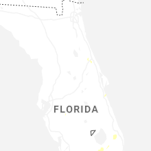


Connect with Interactive Hail Maps