

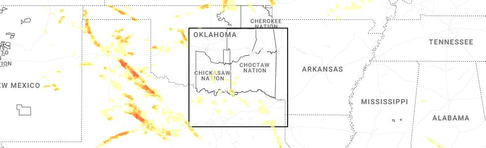
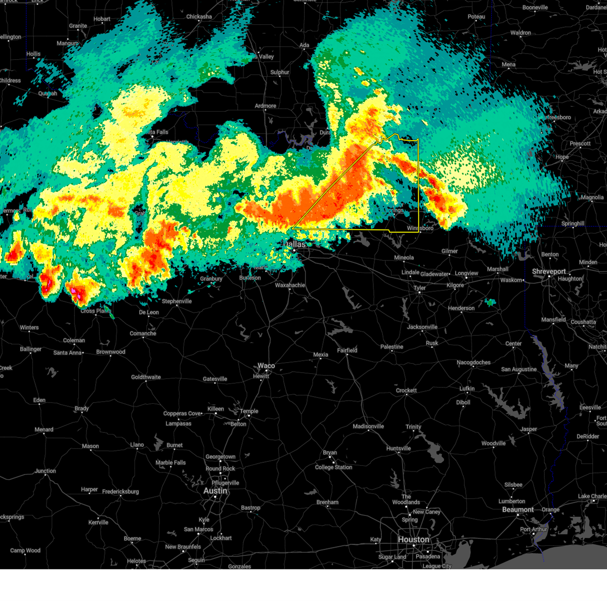
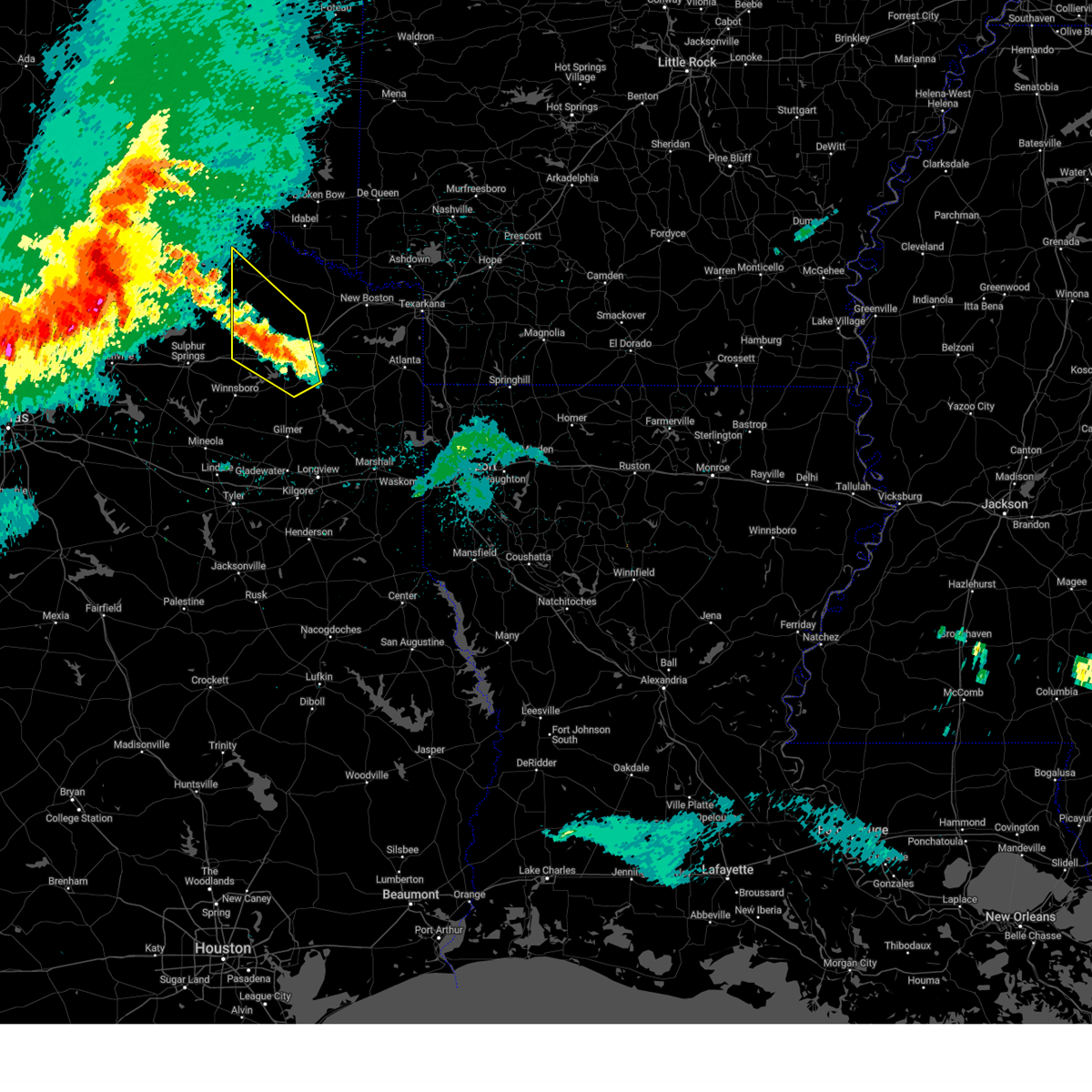
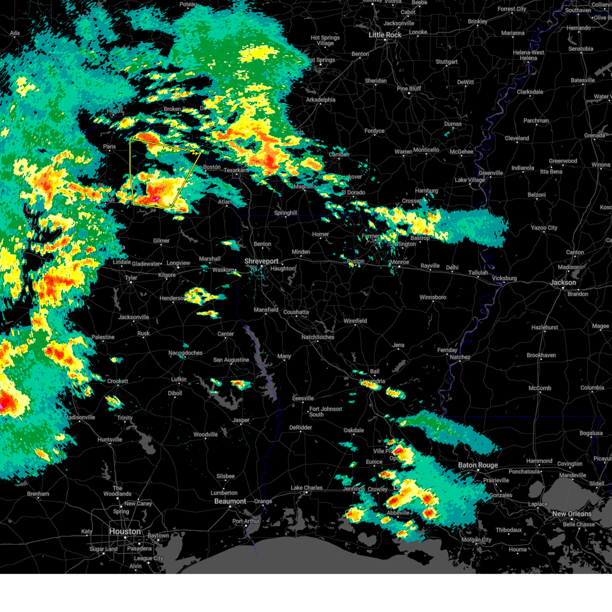
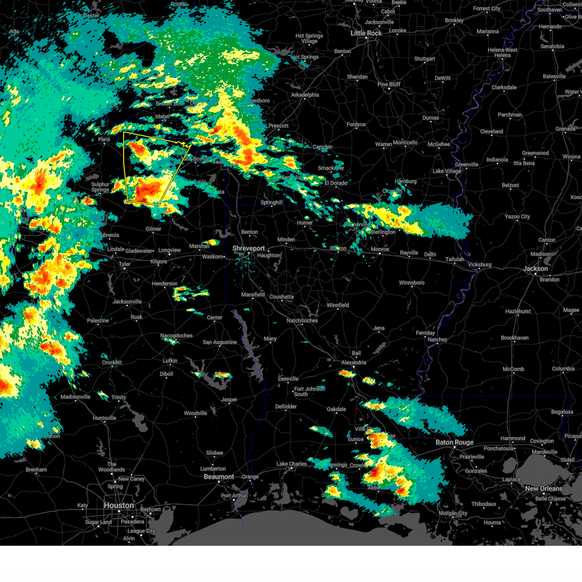
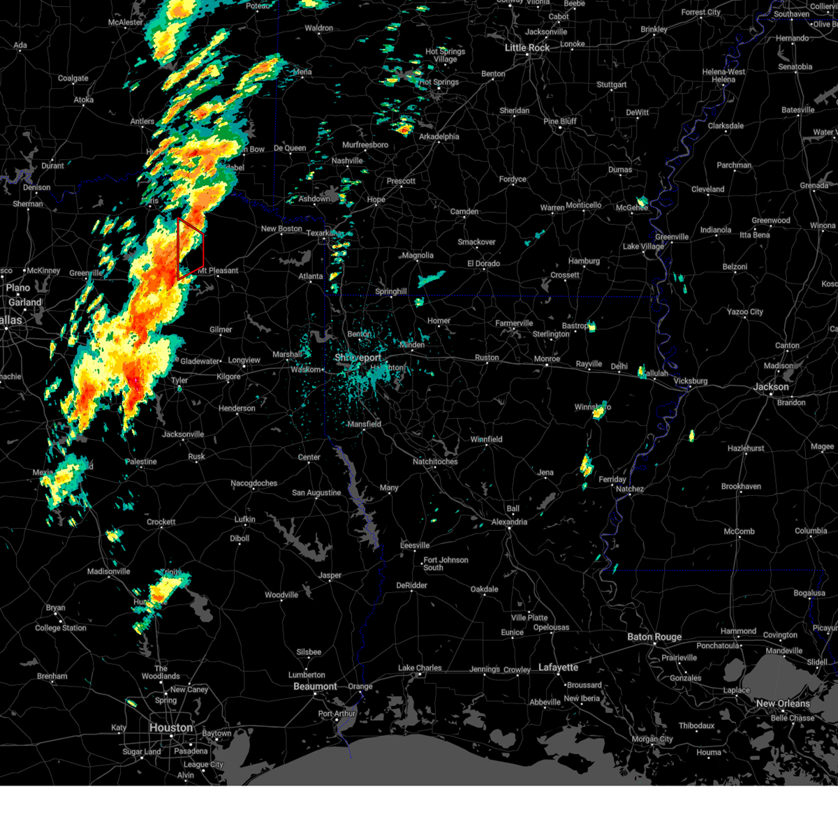
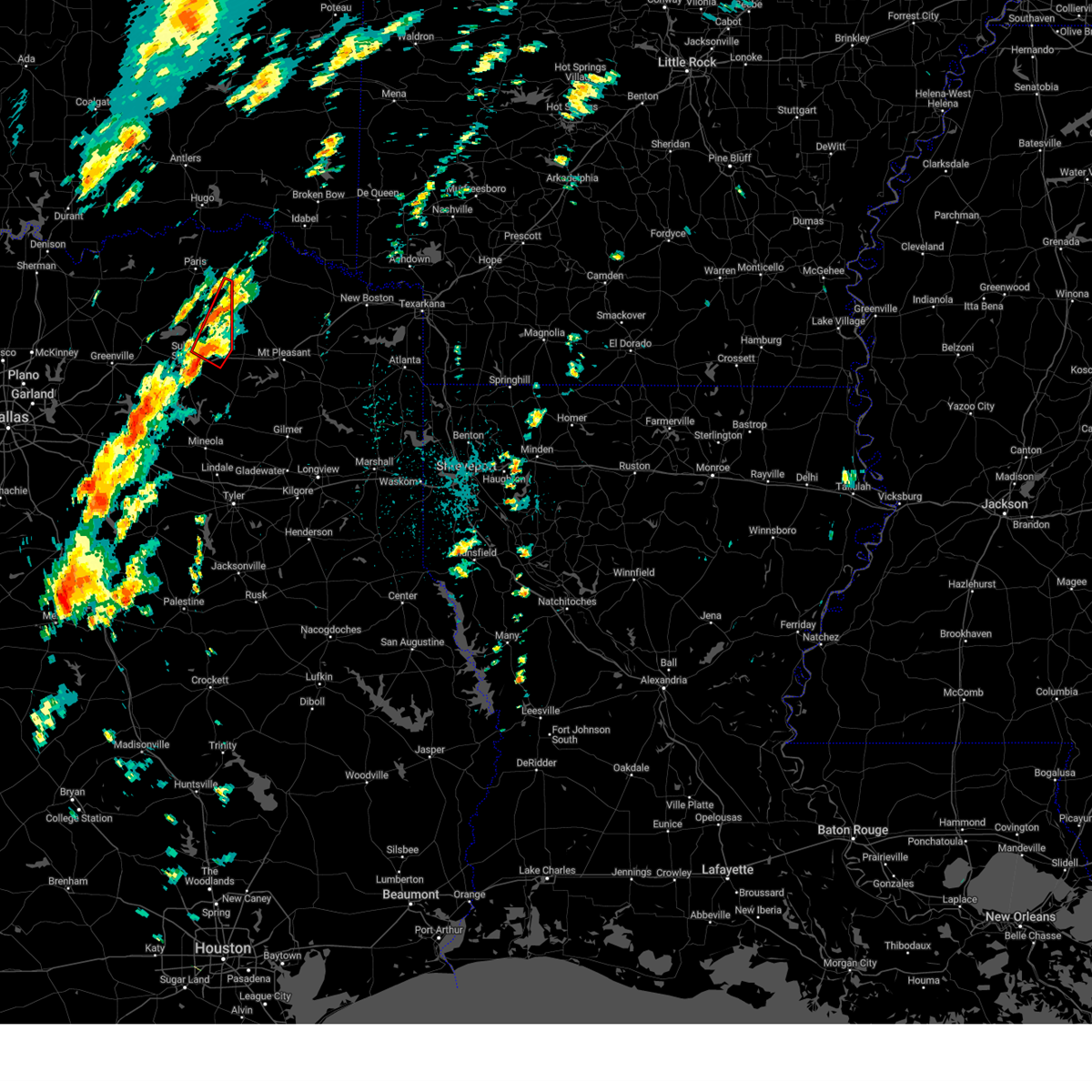
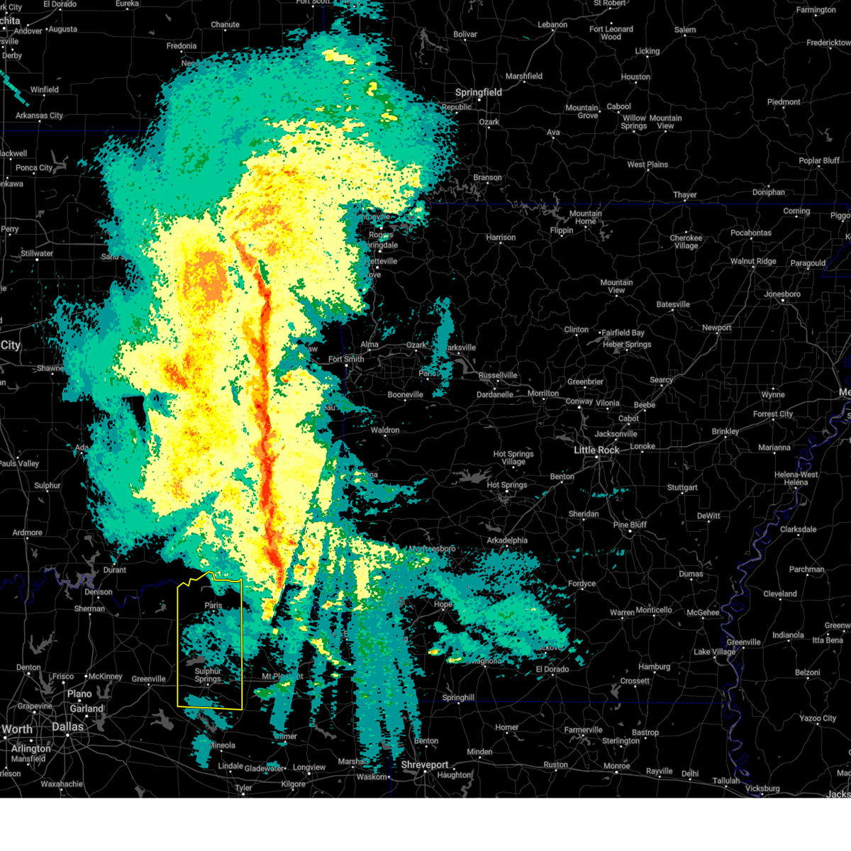
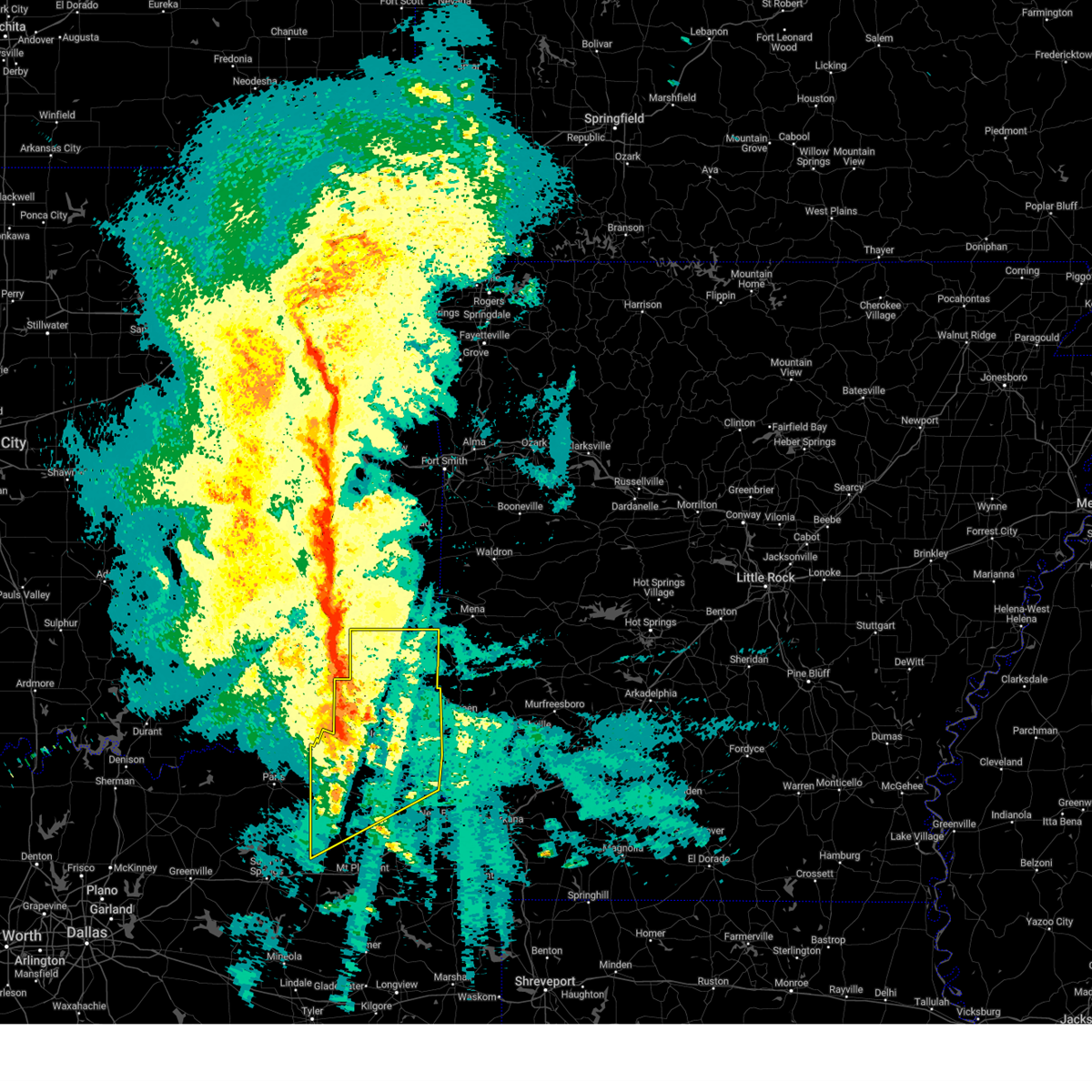
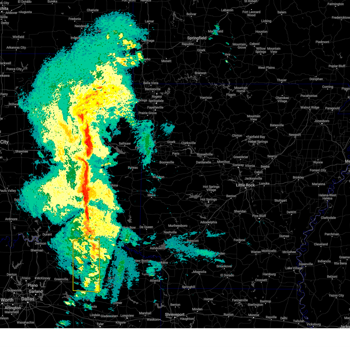
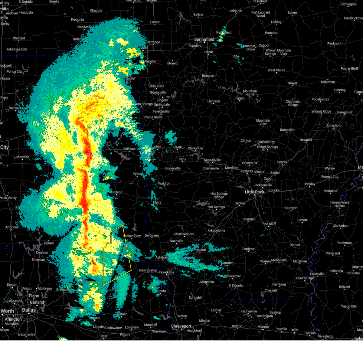
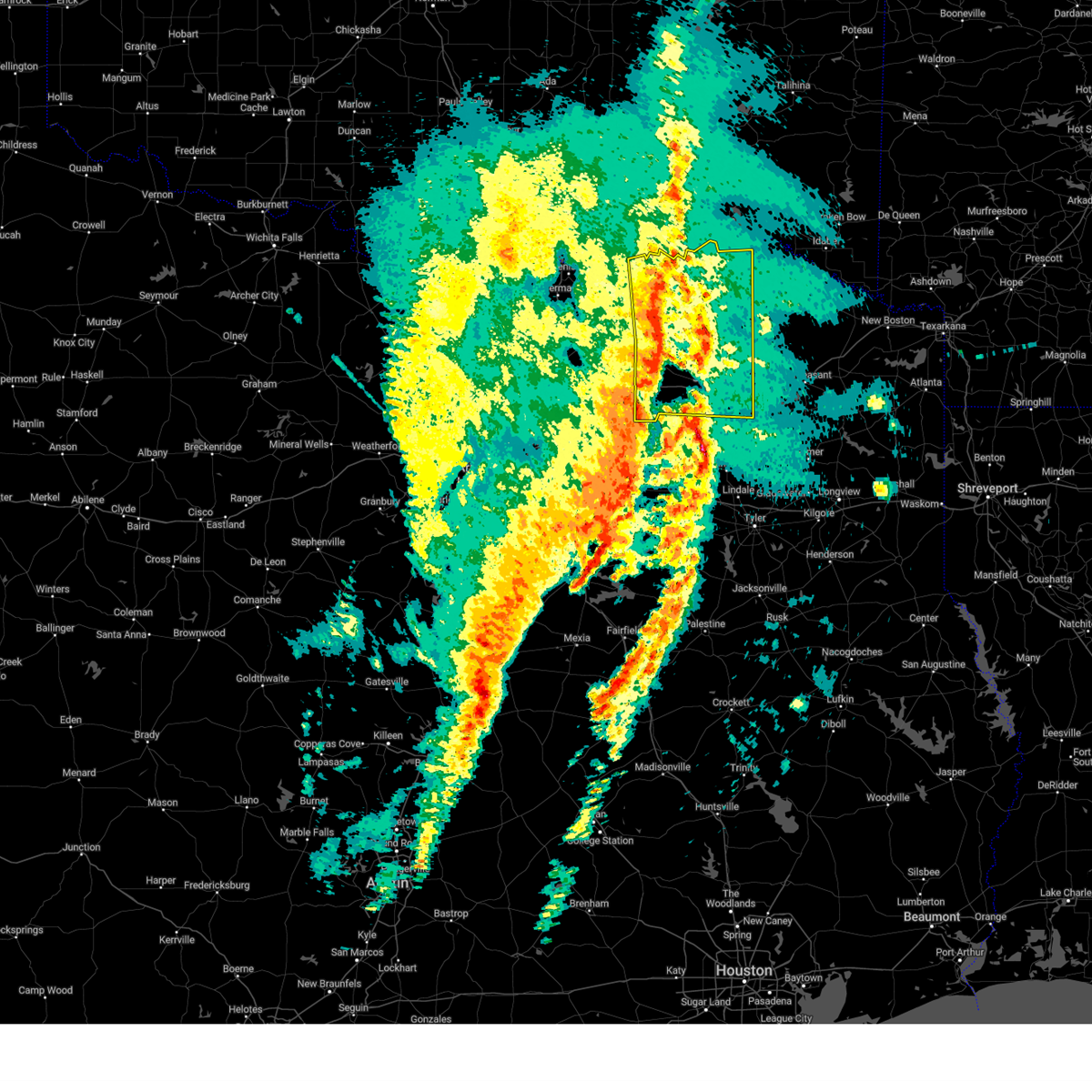
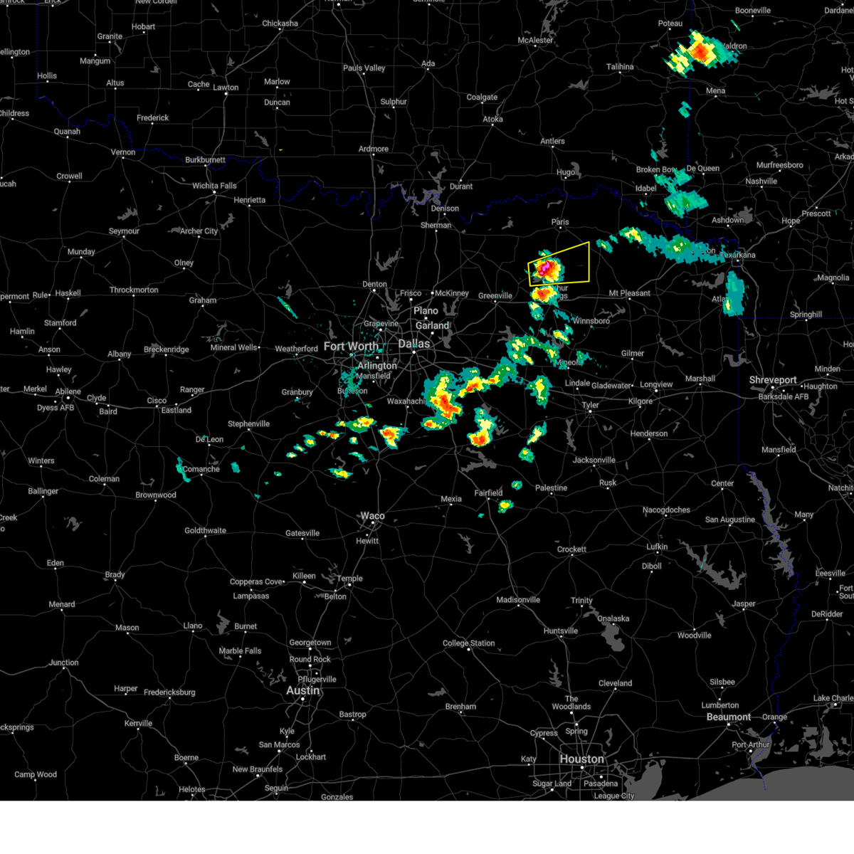
Hail Map for Deport, TX
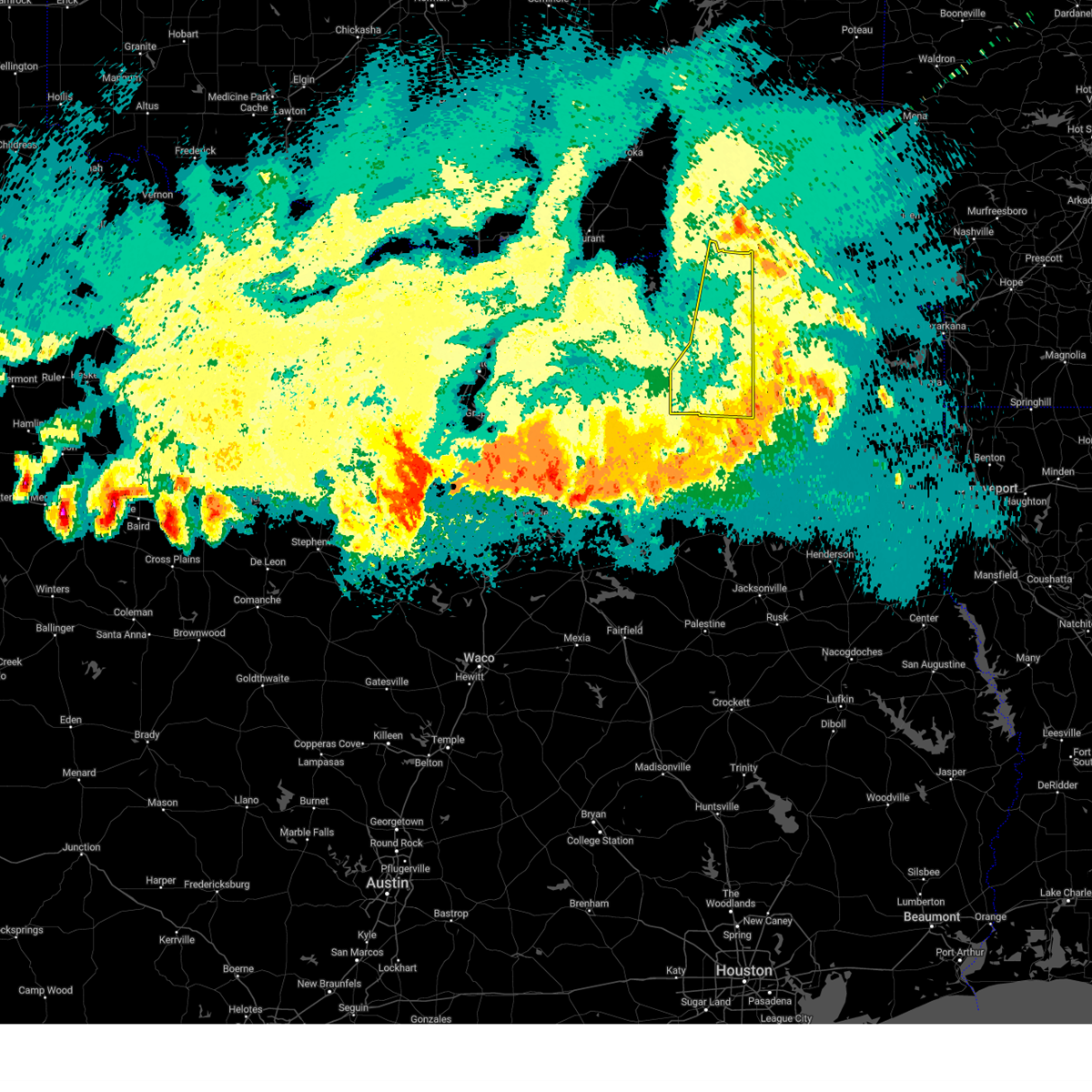
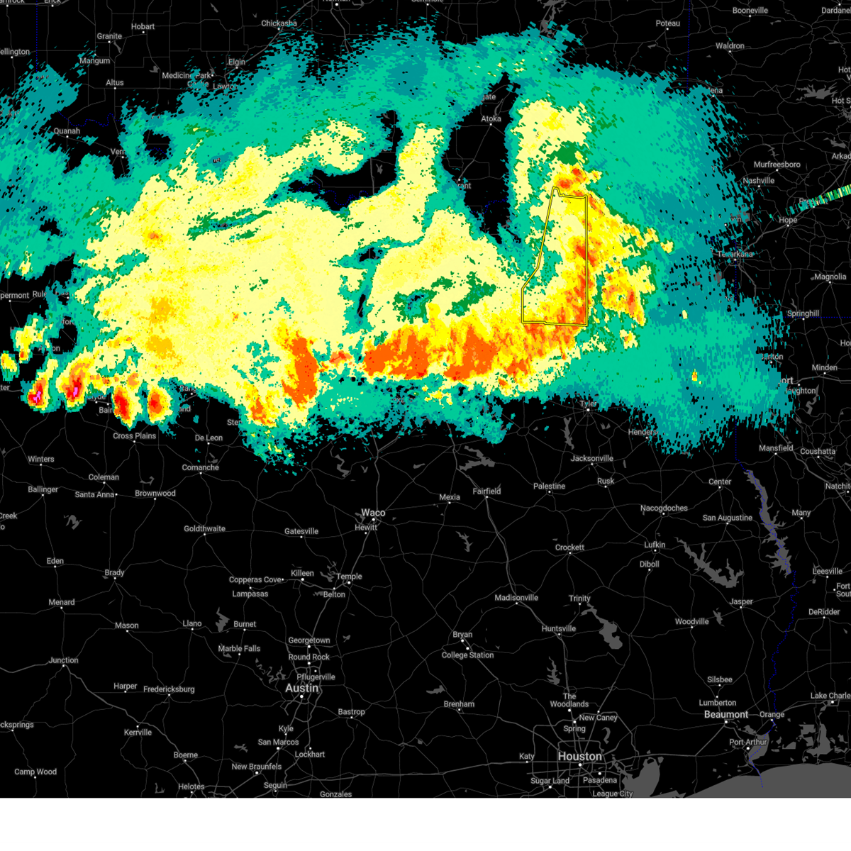
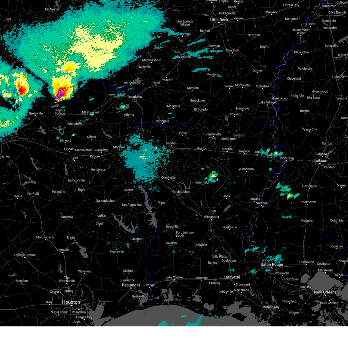
The Deport, TX area has had 8 reports of on-the-ground hail by trained spotters, and has been under severe weather warnings 30 times during the past 12 months. Doppler radar has detected hail at or near Deport, TX on 70 occasions, including 2 occasions during the past year.
| Name: | Deport, TX |
| Where Located: | 75.2 miles SE of Atoka, OK |
| Map: | Google Map for Deport, TX |
| Population: | 578 |
| Housing Units: | 307 |
| More Info: | Search Google for Deport, TX |
0
The Top Recent Hail Date for Deport, TX is Sunday, June 8, 2025 (70th out of 70)
Hail and Wind Damage Spotted near Deport, TX
| Date / Time | Report Details |
|---|---|
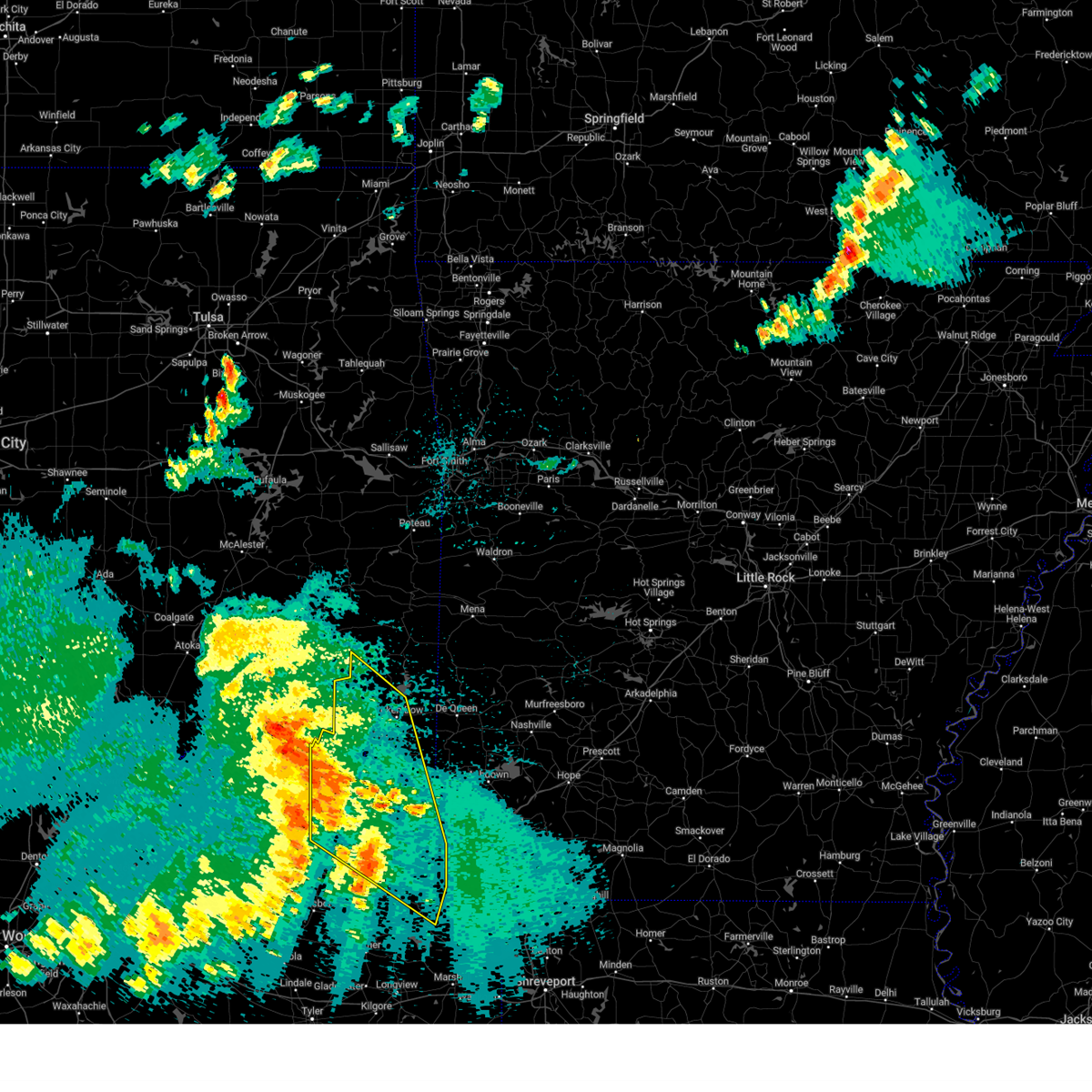
| 6/8/2025 11:34 PM CDT |
 the severe thunderstorm warning has been cancelled and is no longer in effect the severe thunderstorm warning has been cancelled and is no longer in effect
|
| 6/8/2025 11:22 PM CDT |
 At 1121 pm cdt, severe thunderstorms were located along a line extending from near bogata to near point, moving southeast at 45 mph (radar indicated). Hazards include 70 mph wind gusts. Expect considerable tree damage. damage is likely to mobile homes, roofs, and outbuildings. These severe thunderstorms will impact areas of hopkins, delta and lamar counties, including the following locations, new birthright, ridgeway, glory, pacio, midcity, minter, taylor town, nelta, sun valley, and novice. At 1121 pm cdt, severe thunderstorms were located along a line extending from near bogata to near point, moving southeast at 45 mph (radar indicated). Hazards include 70 mph wind gusts. Expect considerable tree damage. damage is likely to mobile homes, roofs, and outbuildings. These severe thunderstorms will impact areas of hopkins, delta and lamar counties, including the following locations, new birthright, ridgeway, glory, pacio, midcity, minter, taylor town, nelta, sun valley, and novice.
|
| 6/8/2025 11:22 PM CDT |
 the severe thunderstorm warning has been cancelled and is no longer in effect the severe thunderstorm warning has been cancelled and is no longer in effect
|
| 6/8/2025 11:11 PM CDT |
 Svrshv the national weather service in shreveport has issued a * severe thunderstorm warning for, central mccurtain county in southeastern oklahoma, western cass county in northeastern texas, northern franklin county in northeastern texas, western bowie county in northeastern texas, morris county in northeastern texas, titus county in northeastern texas, red river county in northeastern texas, * until 1230 am cdt. * at 1111 pm cdt, severe thunderstorms were located along a line extending from near raymond gary state park to near mount vernon, moving east at 50 mph (radar indicated). Hazards include 60 mph wind gusts and quarter size hail. Hail damage to vehicles is expected. Expect wind damage to roofs, siding, and trees. Svrshv the national weather service in shreveport has issued a * severe thunderstorm warning for, central mccurtain county in southeastern oklahoma, western cass county in northeastern texas, northern franklin county in northeastern texas, western bowie county in northeastern texas, morris county in northeastern texas, titus county in northeastern texas, red river county in northeastern texas, * until 1230 am cdt. * at 1111 pm cdt, severe thunderstorms were located along a line extending from near raymond gary state park to near mount vernon, moving east at 50 mph (radar indicated). Hazards include 60 mph wind gusts and quarter size hail. Hail damage to vehicles is expected. Expect wind damage to roofs, siding, and trees.
|
| 6/8/2025 10:58 PM CDT | At 1057 pm cdt, severe thunderstorms were located along a line extending from near paris to near greenville club lake, moving east at 55 mph (radar indicated). Hazards include 70 mph wind gusts and penny size hail. Expect considerable tree damage. damage is likely to mobile homes, roofs, and outbuildings. These severe thunderstorms will impact areas of northern hunt, hopkins, delta and lamar counties, including the following locations, neylandville, new birthright, ridgeway, pacio, midcity, taylor town, sun valley, peerless, dike, and atlas. |
| 6/8/2025 10:58 PM CDT | the severe thunderstorm warning has been cancelled and is no longer in effect |
| 6/8/2025 10:28 PM CDT |
 Svrfwd the national weather service in fort worth has issued a * severe thunderstorm warning for, hunt county in north central texas, hopkins county in north central texas, delta county in north central texas, lamar county in north central texas, southeastern collin county in north central texas, southern fannin county in north central texas, * until 1145 pm cdt. * at 1026 pm cdt, severe thunderstorms were located along a line extending from near dodd city to fairview, moving southeast at 45 mph (radar indicated). Hazards include 70 mph wind gusts and penny size hail. Expect considerable tree damage. damage is likely to mobile homes, roofs, and outbuildings. these severe thunderstorms will affect areas from plano to blue ridge to wolfe city to paris, including the following locations, neylandville, new birthright, ridgeway, pacio, nobility, midcity, direct, forest hill, taylor town, and floyd. This includes interstate 30 between mile markers 82 and 142. Svrfwd the national weather service in fort worth has issued a * severe thunderstorm warning for, hunt county in north central texas, hopkins county in north central texas, delta county in north central texas, lamar county in north central texas, southeastern collin county in north central texas, southern fannin county in north central texas, * until 1145 pm cdt. * at 1026 pm cdt, severe thunderstorms were located along a line extending from near dodd city to fairview, moving southeast at 45 mph (radar indicated). Hazards include 70 mph wind gusts and penny size hail. Expect considerable tree damage. damage is likely to mobile homes, roofs, and outbuildings. these severe thunderstorms will affect areas from plano to blue ridge to wolfe city to paris, including the following locations, neylandville, new birthright, ridgeway, pacio, nobility, midcity, direct, forest hill, taylor town, and floyd. This includes interstate 30 between mile markers 82 and 142.
|
| 6/8/2025 10:14 PM CDT |
 Svrshv the national weather service in shreveport has issued a * severe thunderstorm warning for, franklin county in northeastern texas, northwestern morris county in northeastern texas, titus county in northeastern texas, northwestern camp county in northeastern texas, southwestern red river county in northeastern texas, * until 1115 pm cdt. * at 1013 pm cdt, a severe thunderstorm was located 8 miles northeast of mount vernon, or 8 miles southeast of hagansport, moving southeast at 35 mph (radar indicated). Hazards include 60 mph wind gusts and half dollar size hail. Hail damage to vehicles is expected. Expect wind damage to roofs, siding, and trees. Svrshv the national weather service in shreveport has issued a * severe thunderstorm warning for, franklin county in northeastern texas, northwestern morris county in northeastern texas, titus county in northeastern texas, northwestern camp county in northeastern texas, southwestern red river county in northeastern texas, * until 1115 pm cdt. * at 1013 pm cdt, a severe thunderstorm was located 8 miles northeast of mount vernon, or 8 miles southeast of hagansport, moving southeast at 35 mph (radar indicated). Hazards include 60 mph wind gusts and half dollar size hail. Hail damage to vehicles is expected. Expect wind damage to roofs, siding, and trees.
|
| 5/19/2025 11:11 PM CDT | Svrfwd the national weather service in fort worth has issued a * severe thunderstorm warning for, lamar county in north central texas, * until 1215 am cdt. * at 1110 pm cdt, a severe thunderstorm was located near lake gibbons, or 9 miles west of paris, moving east at 30 mph (radar indicated). Hazards include 65 mph wind gusts and quarter size hail. Hail damage to vehicles is expected. expect wind damage to roofs, siding, and trees. this severe thunderstorm will be near, paris and lake gibbons around 1115 pm cdt. lake crook around 1120 pm cdt. reno around 1130 pm cdt. blossom around 1140 pm cdt. pattonville around 1145 pm cdt. Other locations impacted by this severe thunderstorm include toco, atlas, noble, glory, forest chapel, broadway junction, midcity, garretts bluff, deport, and biardstown. |
| 5/6/2025 12:05 PM CDT | At 1205 pm cdt, a severe thunderstorm was located 7 miles southeast of clarksville, moving north at 35 mph (radar indicated). Hazards include golf ball size hail and 60 mph wind gusts. People and animals outdoors will be injured. expect hail damage to roofs, siding, windows, and vehicles. expect wind damage to roofs, siding, and trees. Locations impacted include, clarksville, boxelder, hagansport, de kalb, bogata, wilkerson, bagwell, dalby springs, detroit, talco, avery, annona, cuthand, harts bluff, english, johntown, lydia, beaverdams and almont. |
| 5/6/2025 11:40 AM CDT |
 At 1140 am cdt, a severe thunderstorm was located 6 miles west of wilkerson, or 11 miles east of hagansport, moving north at 35 mph (radar indicated). Hazards include golf ball size hail and 60 mph wind gusts. People and animals outdoors will be injured. expect hail damage to roofs, siding, windows, and vehicles. expect wind damage to roofs, siding, and trees. Locations impacted include, mount pleasant, clarksville, boxelder, hagansport, mount vernon, de kalb, bogata, wilkerson, dalby springs, us 259 and i 30 intersection, cookville, bagwell, detroit, winfield, talco, avery, annona, miller's cove, harts bluff and cuthand. At 1140 am cdt, a severe thunderstorm was located 6 miles west of wilkerson, or 11 miles east of hagansport, moving north at 35 mph (radar indicated). Hazards include golf ball size hail and 60 mph wind gusts. People and animals outdoors will be injured. expect hail damage to roofs, siding, windows, and vehicles. expect wind damage to roofs, siding, and trees. Locations impacted include, mount pleasant, clarksville, boxelder, hagansport, mount vernon, de kalb, bogata, wilkerson, dalby springs, us 259 and i 30 intersection, cookville, bagwell, detroit, winfield, talco, avery, annona, miller's cove, harts bluff and cuthand.
|
| 5/6/2025 11:40 AM CDT |
 the severe thunderstorm warning has been cancelled and is no longer in effect the severe thunderstorm warning has been cancelled and is no longer in effect
|
| 5/6/2025 11:29 AM CDT |
 Svrshv the national weather service in shreveport has issued a * severe thunderstorm warning for, northwestern bowie county in northeastern texas, northwestern camp county in northeastern texas, franklin county in northeastern texas, northwestern morris county in northeastern texas, red river county in northeastern texas, titus county in northeastern texas, * until 1215 pm cdt. * at 1129 am cdt, a severe thunderstorm was located 7 miles northwest of mount pleasant, moving north at 35 mph (radar indicated). Hazards include 60 mph wind gusts and quarter size hail. Hail damage to vehicles is expected. Expect wind damage to roofs, siding, and trees. Svrshv the national weather service in shreveport has issued a * severe thunderstorm warning for, northwestern bowie county in northeastern texas, northwestern camp county in northeastern texas, franklin county in northeastern texas, northwestern morris county in northeastern texas, red river county in northeastern texas, titus county in northeastern texas, * until 1215 pm cdt. * at 1129 am cdt, a severe thunderstorm was located 7 miles northwest of mount pleasant, moving north at 35 mph (radar indicated). Hazards include 60 mph wind gusts and quarter size hail. Hail damage to vehicles is expected. Expect wind damage to roofs, siding, and trees.
|
| 4/4/2025 3:34 PM CDT |
 Torshv the national weather service in shreveport has issued a * tornado warning for, northern franklin county in northeastern texas, northwestern titus county in northeastern texas, southwestern red river county in northeastern texas, * until 415 pm cdt. * at 334 pm cdt, a severe thunderstorm capable of producing a tornado was located 9 miles north of como, or 10 miles east of sulphur springs, moving northeast at 35 mph (radar indicated rotation). Hazards include tornado and half dollar size hail. Flying debris will be dangerous to those caught without shelter. mobile homes will be damaged or destroyed. damage to roofs, windows, and vehicles will occur. tree damage is likely. this dangerous storm will be near, hagansport around 355 pm cdt. Other locations impacted by this tornadic thunderstorm include johntown, talco, and deport. Torshv the national weather service in shreveport has issued a * tornado warning for, northern franklin county in northeastern texas, northwestern titus county in northeastern texas, southwestern red river county in northeastern texas, * until 415 pm cdt. * at 334 pm cdt, a severe thunderstorm capable of producing a tornado was located 9 miles north of como, or 10 miles east of sulphur springs, moving northeast at 35 mph (radar indicated rotation). Hazards include tornado and half dollar size hail. Flying debris will be dangerous to those caught without shelter. mobile homes will be damaged or destroyed. damage to roofs, windows, and vehicles will occur. tree damage is likely. this dangerous storm will be near, hagansport around 355 pm cdt. Other locations impacted by this tornadic thunderstorm include johntown, talco, and deport.
|
| 4/4/2025 2:59 PM CDT | At 258 pm cdt, a severe thunderstorm capable of producing a tornado was located 8 miles west of hagansport, or 5 miles south of cunningham, moving northeast at 35 mph (radar indicated rotation). Hazards include tornado and two inch hail. Flying debris will be dangerous to those caught without shelter. mobile homes will be damaged or destroyed. damage to roofs, windows, and vehicles will occur. tree damage is likely. Locations impacted include, milton, cunningham, minter, deport, and pattonville. |
| 4/4/2025 2:52 PM CDT |
 At 252 pm cdt, a severe thunderstorm capable of producing a tornado was located 10 miles west of hagansport, moving northeast at 35 mph (radar indicated rotation). Hazards include tornado and quarter size hail. Flying debris will be dangerous to those caught without shelter. mobile homes will be damaged or destroyed. damage to roofs, windows, and vehicles will occur. tree damage is likely. This tornadic thunderstorm will remain over mainly rural areas of northeastern hopkins, east central delta and southeastern lamar counties, including the following locations, milton, cunningham, flora, minter, and deport. At 252 pm cdt, a severe thunderstorm capable of producing a tornado was located 10 miles west of hagansport, moving northeast at 35 mph (radar indicated rotation). Hazards include tornado and quarter size hail. Flying debris will be dangerous to those caught without shelter. mobile homes will be damaged or destroyed. damage to roofs, windows, and vehicles will occur. tree damage is likely. This tornadic thunderstorm will remain over mainly rural areas of northeastern hopkins, east central delta and southeastern lamar counties, including the following locations, milton, cunningham, flora, minter, and deport.
|
| 4/4/2025 2:46 PM CDT |
 Torshv the national weather service in shreveport has issued a * tornado warning for, northwestern franklin county in northeastern texas, western red river county in northeastern texas, * until 330 pm cdt. * at 246 pm cdt, a severe thunderstorm capable of producing a tornado was located 11 miles east of cooper lake state park, or 12 miles west of hagansport, moving northeast at 55 mph (radar indicated rotation). Hazards include tornado and half dollar size hail. Flying debris will be dangerous to those caught without shelter. mobile homes will be damaged or destroyed. damage to roofs, windows, and vehicles will occur. tree damage is likely. this dangerous storm will be near, manchester around 325 pm cdt. Other locations impacted by this tornadic thunderstorm include silver city, detroit, negley, johntown, albion, bryarly, and deport. Torshv the national weather service in shreveport has issued a * tornado warning for, northwestern franklin county in northeastern texas, western red river county in northeastern texas, * until 330 pm cdt. * at 246 pm cdt, a severe thunderstorm capable of producing a tornado was located 11 miles east of cooper lake state park, or 12 miles west of hagansport, moving northeast at 55 mph (radar indicated rotation). Hazards include tornado and half dollar size hail. Flying debris will be dangerous to those caught without shelter. mobile homes will be damaged or destroyed. damage to roofs, windows, and vehicles will occur. tree damage is likely. this dangerous storm will be near, manchester around 325 pm cdt. Other locations impacted by this tornadic thunderstorm include silver city, detroit, negley, johntown, albion, bryarly, and deport.
|
| 4/4/2025 2:42 PM CDT |
 Svrshv the national weather service in shreveport has issued a * severe thunderstorm warning for, northern franklin county in northeastern texas, northwestern titus county in northeastern texas, red river county in northeastern texas, * until 330 pm cdt. * at 242 pm cdt, a severe thunderstorm was located 9 miles east of cooper lake state park, or 11 miles northeast of sulphur springs, moving northeast at 55 mph (radar indicated). Hazards include 60 mph wind gusts and half dollar size hail. Hail damage to vehicles is expected. Expect wind damage to roofs, siding, and trees. Svrshv the national weather service in shreveport has issued a * severe thunderstorm warning for, northern franklin county in northeastern texas, northwestern titus county in northeastern texas, red river county in northeastern texas, * until 330 pm cdt. * at 242 pm cdt, a severe thunderstorm was located 9 miles east of cooper lake state park, or 11 miles northeast of sulphur springs, moving northeast at 55 mph (radar indicated). Hazards include 60 mph wind gusts and half dollar size hail. Hail damage to vehicles is expected. Expect wind damage to roofs, siding, and trees.
|
| 4/4/2025 2:42 PM CDT |
 Torfwd the national weather service in fort worth has issued a * tornado warning for, northeastern hopkins county in north central texas, northeastern delta county in north central texas, southeastern lamar county in north central texas, * until 315 pm cdt. * at 242 pm cdt, a severe thunderstorm capable of producing a tornado was located 10 miles northeast of sulphur springs, moving northeast at 40 mph (radar indicated rotation). Hazards include tornado and quarter size hail. Flying debris will be dangerous to those caught without shelter. mobile homes will be damaged or destroyed. damage to roofs, windows, and vehicles will occur. tree damage is likely. this tornadic thunderstorm will remain over mainly rural areas of northeastern hopkins, northeastern delta and southeastern lamar counties, including the following locations, weaver, flora, nelta, milton, cunningham, dike, minter, deport, and pine forest. This includes interstate 30 between mile markers 133 and 140. Torfwd the national weather service in fort worth has issued a * tornado warning for, northeastern hopkins county in north central texas, northeastern delta county in north central texas, southeastern lamar county in north central texas, * until 315 pm cdt. * at 242 pm cdt, a severe thunderstorm capable of producing a tornado was located 10 miles northeast of sulphur springs, moving northeast at 40 mph (radar indicated rotation). Hazards include tornado and quarter size hail. Flying debris will be dangerous to those caught without shelter. mobile homes will be damaged or destroyed. damage to roofs, windows, and vehicles will occur. tree damage is likely. this tornadic thunderstorm will remain over mainly rural areas of northeastern hopkins, northeastern delta and southeastern lamar counties, including the following locations, weaver, flora, nelta, milton, cunningham, dike, minter, deport, and pine forest. This includes interstate 30 between mile markers 133 and 140.
|
| 4/3/2025 2:36 PM CDT |
 The storm which prompted the warning has weakened below severe limits, and no longer poses an immediate threat to life or property. therefore, the warning will be allowed to expire. a tornado watch remains in effect until 1000 pm cdt for northeastern texas. a severe thunderstorm watch remains in effect until 1000 pm cdt for southeastern oklahoma, and northeastern texas. The storm which prompted the warning has weakened below severe limits, and no longer poses an immediate threat to life or property. therefore, the warning will be allowed to expire. a tornado watch remains in effect until 1000 pm cdt for northeastern texas. a severe thunderstorm watch remains in effect until 1000 pm cdt for southeastern oklahoma, and northeastern texas.
|
| 4/3/2025 2:19 PM CDT |
 the severe thunderstorm warning has been cancelled and is no longer in effect the severe thunderstorm warning has been cancelled and is no longer in effect
|
| 4/3/2025 2:19 PM CDT |
 At 218 pm cdt, a severe thunderstorm was located near bagwell, or near clarksville, moving northeast at 40 mph (radar indicated). Hazards include 60 mph wind gusts and quarter size hail. Hail damage to vehicles is expected. expect wind damage to roofs, siding, and trees. Locations impacted include, detroit, clarksville, negley, cuthand, annona, woodland, silver city, english, bagwell, kanawha, bogata, manchester, kiomatia, bryarly, and deport. At 218 pm cdt, a severe thunderstorm was located near bagwell, or near clarksville, moving northeast at 40 mph (radar indicated). Hazards include 60 mph wind gusts and quarter size hail. Hail damage to vehicles is expected. expect wind damage to roofs, siding, and trees. Locations impacted include, detroit, clarksville, negley, cuthand, annona, woodland, silver city, english, bagwell, kanawha, bogata, manchester, kiomatia, bryarly, and deport.
|
| 4/3/2025 1:55 PM CDT |
 Svrshv the national weather service in shreveport has issued a * severe thunderstorm warning for, northern franklin county in northeastern texas, northwestern titus county in northeastern texas, red river county in northeastern texas, * until 245 pm cdt. * at 154 pm cdt, a severe thunderstorm was located near hagansport, moving northeast at 35 mph (radar indicated). Hazards include 60 mph wind gusts and quarter size hail. Hail damage to vehicles is expected. Expect wind damage to roofs, siding, and trees. Svrshv the national weather service in shreveport has issued a * severe thunderstorm warning for, northern franklin county in northeastern texas, northwestern titus county in northeastern texas, red river county in northeastern texas, * until 245 pm cdt. * at 154 pm cdt, a severe thunderstorm was located near hagansport, moving northeast at 35 mph (radar indicated). Hazards include 60 mph wind gusts and quarter size hail. Hail damage to vehicles is expected. Expect wind damage to roofs, siding, and trees.
|
| 3/4/2025 7:30 AM CST |
 The storms which prompted the warning have moved out of the area. therefore the warning has been allowed to expire. however gusty winds are still possible with these thunderstorms. a tornado watch remains in effect until 1100 am cst for north central texas. The storms which prompted the warning have moved out of the area. therefore the warning has been allowed to expire. however gusty winds are still possible with these thunderstorms. a tornado watch remains in effect until 1100 am cst for north central texas.
|
| 3/4/2025 7:24 AM CST |
 Svrshv the national weather service in shreveport has issued a * severe thunderstorm warning for, northwestern little river county in southwestern arkansas, northwestern sevier county in southwestern arkansas, mccurtain county in southeastern oklahoma, northwestern bowie county in northeastern texas, northern franklin county in northeastern texas, red river county in northeastern texas, northwestern titus county in northeastern texas, * until 815 am cst. * at 724 am cst, severe thunderstorms were located along a line from 10 miles northwest of idabel to 6 miles northeast of mount vernon, or along a line from 25 miles north of clarksville to 10 miles west of mount pleasant, moving east at 50 mph (radar indicated). Hazards include 60 mph wind gusts and quarter size hail. Hail damage to vehicles is expected. Expect wind damage to roofs, siding, and trees. Svrshv the national weather service in shreveport has issued a * severe thunderstorm warning for, northwestern little river county in southwestern arkansas, northwestern sevier county in southwestern arkansas, mccurtain county in southeastern oklahoma, northwestern bowie county in northeastern texas, northern franklin county in northeastern texas, red river county in northeastern texas, northwestern titus county in northeastern texas, * until 815 am cst. * at 724 am cst, severe thunderstorms were located along a line from 10 miles northwest of idabel to 6 miles northeast of mount vernon, or along a line from 25 miles north of clarksville to 10 miles west of mount pleasant, moving east at 50 mph (radar indicated). Hazards include 60 mph wind gusts and quarter size hail. Hail damage to vehicles is expected. Expect wind damage to roofs, siding, and trees.
|
| 3/4/2025 6:51 AM CST |
 the severe thunderstorm warning has been cancelled and is no longer in effect the severe thunderstorm warning has been cancelled and is no longer in effect
|
| 3/4/2025 6:51 AM CST |
 At 650 am cst, severe thunderstorms were located along a line extending from paris to sulphur springs, moving east at 55 mph (radar indicated). Hazards include 65 mph wind gusts and quarter size hail. Hail damage to vehicles is expected. expect wind damage to roofs, siding, and trees. Locations impacted include, new birthright, ridgeway, pacio, como, midcity, direct, forest hill, cooper lake, taylor town, sun valley, peerless, dike, atlas, weaver, tira, noble, forest chapel, pine forest, broadway junction, and garretts bluff. At 650 am cst, severe thunderstorms were located along a line extending from paris to sulphur springs, moving east at 55 mph (radar indicated). Hazards include 65 mph wind gusts and quarter size hail. Hail damage to vehicles is expected. expect wind damage to roofs, siding, and trees. Locations impacted include, new birthright, ridgeway, pacio, como, midcity, direct, forest hill, cooper lake, taylor town, sun valley, peerless, dike, atlas, weaver, tira, noble, forest chapel, pine forest, broadway junction, and garretts bluff.
|
| 3/4/2025 6:45 AM CST |
 Svrshv the national weather service in shreveport has issued a * severe thunderstorm warning for, southwestern mccurtain county in southeastern oklahoma, northern franklin county in northeastern texas, red river county in northeastern texas, northwestern titus county in northeastern texas, * until 730 am cst. * at 645 am cst, severe thunderstorms were located along a line from 21 miles west of manchester to 13 miles west of hagansport, or along a line from 33 miles northwest of clarksville to 13 miles west of hagansport, moving northeast at 60 mph (radar indicated). Hazards include 60 mph wind gusts and quarter size hail. Hail damage to vehicles is expected. Expect wind damage to roofs, siding, and trees. Svrshv the national weather service in shreveport has issued a * severe thunderstorm warning for, southwestern mccurtain county in southeastern oklahoma, northern franklin county in northeastern texas, red river county in northeastern texas, northwestern titus county in northeastern texas, * until 730 am cst. * at 645 am cst, severe thunderstorms were located along a line from 21 miles west of manchester to 13 miles west of hagansport, or along a line from 33 miles northwest of clarksville to 13 miles west of hagansport, moving northeast at 60 mph (radar indicated). Hazards include 60 mph wind gusts and quarter size hail. Hail damage to vehicles is expected. Expect wind damage to roofs, siding, and trees.
|
| 3/4/2025 6:31 AM CST |
 At 629 am cst, severe thunderstorms were located along a line extending from near crockett lake to pecan gap to cumby, moving east at 60 mph. several reports of wind damage have been received with this line of storms (emergency management). Hazards include 65 mph wind gusts and quarter size hail. Hail damage to vehicles is expected. expect wind damage to roofs, siding, and trees. These severe thunderstorms will move over most of hunt, hopkins, delta, lamar and eastern fannin counties, including the following locations, neylandville, new birthright, ridgeway, pacio, midcity, direct, forest hill, taylor town, sun valley, and gober. At 629 am cst, severe thunderstorms were located along a line extending from near crockett lake to pecan gap to cumby, moving east at 60 mph. several reports of wind damage have been received with this line of storms (emergency management). Hazards include 65 mph wind gusts and quarter size hail. Hail damage to vehicles is expected. expect wind damage to roofs, siding, and trees. These severe thunderstorms will move over most of hunt, hopkins, delta, lamar and eastern fannin counties, including the following locations, neylandville, new birthright, ridgeway, pacio, midcity, direct, forest hill, taylor town, sun valley, and gober.
|
| 3/4/2025 6:19 AM CST | Svrfwd the national weather service in fort worth has issued a * severe thunderstorm warning for, eastern hunt county in north central texas, hopkins county in north central texas, delta county in north central texas, lamar county in north central texas, eastern fannin county in north central texas, * until 730 am cst. * at 618 am cst, severe thunderstorms were located along a line extending from near dodd city to wolfe city to near greenville, moving east at 60 mph (radar indicated). Hazards include 65 mph wind gusts and quarter size hail. Hail damage to vehicles is expected. expect wind damage to roofs, siding, and trees. other locations impacted by this severe thunderstorm include neylandville, new birthright, ridgeway, pacio, midcity, direct, forest hill, taylor town, sun valley, and gober. This includes interstate 30 between mile markers 95 and 142. |
| 6/4/2024 5:21 AM CDT |
 the severe thunderstorm warning has been cancelled and is no longer in effect the severe thunderstorm warning has been cancelled and is no longer in effect
|
| 6/4/2024 4:42 AM CDT |
 Svrfwd the national weather service in fort worth has issued a * severe thunderstorm warning for, lamar county in north central texas, northeastern fannin county in north central texas, * until 545 am cdt. * at 442 am cdt, severe thunderstorms were located along a line extending from near monkstown to near hugo, moving southeast at 45 mph (radar indicated). Hazards include 60 mph wind gusts. Expect damage to roofs, siding, and trees. severe thunderstorms will be near, pat mayse lake around 445 am cdt. camp maxey, arthur city, and sumner around 450 am cdt. paris, powderly, and lake gibbons around 455 am cdt. lake crook around 500 am cdt. reno around 505 am cdt. blossom around 510 am cdt. pattonville around 515 am cdt. Other locations impacted by these severe thunderstorms include east direct, toco, monkstown, atlas, glory, forest chapel, midcity, direct, garretts bluff, and minter. Svrfwd the national weather service in fort worth has issued a * severe thunderstorm warning for, lamar county in north central texas, northeastern fannin county in north central texas, * until 545 am cdt. * at 442 am cdt, severe thunderstorms were located along a line extending from near monkstown to near hugo, moving southeast at 45 mph (radar indicated). Hazards include 60 mph wind gusts. Expect damage to roofs, siding, and trees. severe thunderstorms will be near, pat mayse lake around 445 am cdt. camp maxey, arthur city, and sumner around 450 am cdt. paris, powderly, and lake gibbons around 455 am cdt. lake crook around 500 am cdt. reno around 505 am cdt. blossom around 510 am cdt. pattonville around 515 am cdt. Other locations impacted by these severe thunderstorms include east direct, toco, monkstown, atlas, glory, forest chapel, midcity, direct, garretts bluff, and minter.
|
| 6/2/2024 6:37 PM CDT |
 Svrshv the national weather service in shreveport has issued a * severe thunderstorm warning for, southern mccurtain county in southeastern oklahoma, northern franklin county in northeastern texas, northwestern bowie county in northeastern texas, northwestern morris county in northeastern texas, northern titus county in northeastern texas, red river county in northeastern texas, * until 715 pm cdt. * at 636 pm cdt, severe thunderstorms were located along a line extending from near raymond gary state park to clarksville to 10 miles east of cooper lake state park, moving east at 40 mph (radar indicated). Hazards include 60 mph wind gusts and nickel size hail. expect damage to roofs, siding, and trees Svrshv the national weather service in shreveport has issued a * severe thunderstorm warning for, southern mccurtain county in southeastern oklahoma, northern franklin county in northeastern texas, northwestern bowie county in northeastern texas, northwestern morris county in northeastern texas, northern titus county in northeastern texas, red river county in northeastern texas, * until 715 pm cdt. * at 636 pm cdt, severe thunderstorms were located along a line extending from near raymond gary state park to clarksville to 10 miles east of cooper lake state park, moving east at 40 mph (radar indicated). Hazards include 60 mph wind gusts and nickel size hail. expect damage to roofs, siding, and trees
|
| 5/24/2024 7:13 PM CDT |
 the severe thunderstorm warning has been cancelled and is no longer in effect the severe thunderstorm warning has been cancelled and is no longer in effect
|
| 5/24/2024 6:43 PM CDT |
 Svrfwd the national weather service in fort worth has issued a * severe thunderstorm warning for, northeastern hopkins county in north central texas, northeastern delta county in north central texas, southeastern lamar county in north central texas, * until 730 pm cdt. * at 642 pm cdt, a severe thunderstorm was located near cooper lake state park, or 14 miles north of sulphur springs, moving northeast at 30 mph (radar indicated). Hazards include 60 mph wind gusts and quarter size hail. Hail damage to vehicles is expected. expect wind damage to roofs, siding, and trees. this severe thunderstorm will remain over mainly rural areas of northeastern hopkins, northeastern delta and southeastern lamar counties, including the following locations, weaver, tira, new birthright, pacio, minter, deport, biardstown, taylor town, flora, and nelta. This includes interstate 30 between mile markers 137 and 141. Svrfwd the national weather service in fort worth has issued a * severe thunderstorm warning for, northeastern hopkins county in north central texas, northeastern delta county in north central texas, southeastern lamar county in north central texas, * until 730 pm cdt. * at 642 pm cdt, a severe thunderstorm was located near cooper lake state park, or 14 miles north of sulphur springs, moving northeast at 30 mph (radar indicated). Hazards include 60 mph wind gusts and quarter size hail. Hail damage to vehicles is expected. expect wind damage to roofs, siding, and trees. this severe thunderstorm will remain over mainly rural areas of northeastern hopkins, northeastern delta and southeastern lamar counties, including the following locations, weaver, tira, new birthright, pacio, minter, deport, biardstown, taylor town, flora, and nelta. This includes interstate 30 between mile markers 137 and 141.
|
| 5/22/2024 8:42 PM CDT |
 The storm which prompted the warning has weakened below severe limits. therefore the warning will be allowed to expire. however small hail is still possible with this thunderstorm. The storm which prompted the warning has weakened below severe limits. therefore the warning will be allowed to expire. however small hail is still possible with this thunderstorm.
|
| 5/22/2024 8:42 PM CDT |
 the severe thunderstorm warning has been cancelled and is no longer in effect the severe thunderstorm warning has been cancelled and is no longer in effect
|
| 5/22/2024 8:42 PM CDT |
 At 841 pm cdt, a severe thunderstorm was located near clarksville, moving east at 35 mph (radar indicated). Hazards include ping pong ball size hail and 60 mph wind gusts. People and animals outdoors will be injured. expect hail damage to roofs, siding, windows, and vehicles. expect wind damage to roofs, siding, and trees. Locations impacted include, clarksville, hagansport, boxelder, bogata, wilkerson, deport, talco, annona, english, harts bluff, johntown, and cuthand. At 841 pm cdt, a severe thunderstorm was located near clarksville, moving east at 35 mph (radar indicated). Hazards include ping pong ball size hail and 60 mph wind gusts. People and animals outdoors will be injured. expect hail damage to roofs, siding, windows, and vehicles. expect wind damage to roofs, siding, and trees. Locations impacted include, clarksville, hagansport, boxelder, bogata, wilkerson, deport, talco, annona, english, harts bluff, johntown, and cuthand.
|
| 5/22/2024 8:19 PM CDT |
 At 818 pm cdt, a severe thunderstorm was located over cooper, or 15 miles north of sulphur springs, moving east at 25 mph (radar indicated). Hazards include golf ball size hail and 65 mph wind gusts. People and animals outdoors will be injured. expect hail damage to roofs, siding, windows, and vehicles. expect wind damage to roofs, siding, and trees. Locations impacted include, paris, cooper, blossom, roxton, cooper lake, lake crook, lake gibbons, big creek lake, cooper lake state park, pattonville, klondike, powderly, sumner, camp maxey, forest hill, deport, tira, pecan gap, novice, and toco. At 818 pm cdt, a severe thunderstorm was located over cooper, or 15 miles north of sulphur springs, moving east at 25 mph (radar indicated). Hazards include golf ball size hail and 65 mph wind gusts. People and animals outdoors will be injured. expect hail damage to roofs, siding, windows, and vehicles. expect wind damage to roofs, siding, and trees. Locations impacted include, paris, cooper, blossom, roxton, cooper lake, lake crook, lake gibbons, big creek lake, cooper lake state park, pattonville, klondike, powderly, sumner, camp maxey, forest hill, deport, tira, pecan gap, novice, and toco.
|
| 5/22/2024 8:11 PM CDT |
 Svrshv the national weather service in shreveport has issued a * severe thunderstorm warning for, southwestern mccurtain county in southeastern oklahoma, northern franklin county in northeastern texas, northwestern morris county in northeastern texas, northern titus county in northeastern texas, red river county in northeastern texas, * until 900 pm cdt. * at 810 pm cdt, a severe thunderstorm was located over blossom, or 11 miles east of paris, moving east at 35 mph (radar indicated). Hazards include ping pong ball size hail and 60 mph wind gusts. People and animals outdoors will be injured. expect hail damage to roofs, siding, windows, and vehicles. Expect wind damage to roofs, siding, and trees. Svrshv the national weather service in shreveport has issued a * severe thunderstorm warning for, southwestern mccurtain county in southeastern oklahoma, northern franklin county in northeastern texas, northwestern morris county in northeastern texas, northern titus county in northeastern texas, red river county in northeastern texas, * until 900 pm cdt. * at 810 pm cdt, a severe thunderstorm was located over blossom, or 11 miles east of paris, moving east at 35 mph (radar indicated). Hazards include ping pong ball size hail and 60 mph wind gusts. People and animals outdoors will be injured. expect hail damage to roofs, siding, windows, and vehicles. Expect wind damage to roofs, siding, and trees.
|
| 5/22/2024 7:57 PM CDT |
 Svrfwd the national weather service in fort worth has issued a * severe thunderstorm warning for, hopkins county in north central texas, delta county in north central texas, lamar county in north central texas, * until 845 pm cdt. * at 757 pm cdt, a severe thunderstorm was located near sulphur springs, moving east at 40 mph. another severe storm was located just south of paris, moving east at 40 mph (radar indicated). Hazards include ping pong ball size hail and 65 mph wind gusts. People and animals outdoors will be injured. expect hail damage to roofs, siding, windows, and vehicles. expect wind damage to roofs, siding, and trees. this severe thunderstorm will remain over mainly rural areas of hopkins, delta and lamar counties, including the following locations, new birthright, glory, pacio, minter, forest hill, petty, taylor town, globe, pecan gap, and nelta. This includes interstate 30 between mile markers 120 and 142. Svrfwd the national weather service in fort worth has issued a * severe thunderstorm warning for, hopkins county in north central texas, delta county in north central texas, lamar county in north central texas, * until 845 pm cdt. * at 757 pm cdt, a severe thunderstorm was located near sulphur springs, moving east at 40 mph. another severe storm was located just south of paris, moving east at 40 mph (radar indicated). Hazards include ping pong ball size hail and 65 mph wind gusts. People and animals outdoors will be injured. expect hail damage to roofs, siding, windows, and vehicles. expect wind damage to roofs, siding, and trees. this severe thunderstorm will remain over mainly rural areas of hopkins, delta and lamar counties, including the following locations, new birthright, glory, pacio, minter, forest hill, petty, taylor town, globe, pecan gap, and nelta. This includes interstate 30 between mile markers 120 and 142.
|
| 5/21/2024 5:39 PM CDT |
 The storm which prompted the warning has weakened below severe limits and has exited the warned area. therefore, the warning will be allowed to expire. The storm which prompted the warning has weakened below severe limits and has exited the warned area. therefore, the warning will be allowed to expire.
|
| 5/21/2024 5:13 PM CDT |
 Svrfwd the national weather service in fort worth has issued a * severe thunderstorm warning for, northern hopkins county in north central texas, delta county in north central texas, southeastern lamar county in north central texas, * until 545 pm cdt. * at 512 pm cdt, a severe thunderstorm was located over cooper, or 15 miles north of sulphur springs, moving east at 65 mph (radar indicated). Hazards include quarter size hail. Damage to vehicles is possible. This severe thunderstorm will remain over mainly rural areas of northern hopkins, delta and southeastern lamar counties, including the following locations, tira, new birthright, pacio, minter, deport, taylor town, nelta, milton, cunningham, and peerless. Svrfwd the national weather service in fort worth has issued a * severe thunderstorm warning for, northern hopkins county in north central texas, delta county in north central texas, southeastern lamar county in north central texas, * until 545 pm cdt. * at 512 pm cdt, a severe thunderstorm was located over cooper, or 15 miles north of sulphur springs, moving east at 65 mph (radar indicated). Hazards include quarter size hail. Damage to vehicles is possible. This severe thunderstorm will remain over mainly rural areas of northern hopkins, delta and southeastern lamar counties, including the following locations, tira, new birthright, pacio, minter, deport, taylor town, nelta, milton, cunningham, and peerless.
|
| 5/9/2024 5:06 PM CDT |
 the tornado warning has been cancelled and is no longer in effect the tornado warning has been cancelled and is no longer in effect
|
| 5/9/2024 5:01 PM CDT |
 At 500 pm cdt, a severe thunderstorm was located near pattonville, moving east at 35 mph (trained weather spotters). Hazards include two inch hail and 60 mph wind gusts. People and animals outdoors will be injured. expect damage to roofs, siding, windows, and vehicles. This severe thunderstorm will remain over mainly rural areas of southeastern lamar county, including the following locations, taylor town, clardy, milton, minter, and deport. At 500 pm cdt, a severe thunderstorm was located near pattonville, moving east at 35 mph (trained weather spotters). Hazards include two inch hail and 60 mph wind gusts. People and animals outdoors will be injured. expect damage to roofs, siding, windows, and vehicles. This severe thunderstorm will remain over mainly rural areas of southeastern lamar county, including the following locations, taylor town, clardy, milton, minter, and deport.
|
| 5/9/2024 5:01 PM CDT |
 the severe thunderstorm warning has been cancelled and is no longer in effect the severe thunderstorm warning has been cancelled and is no longer in effect
|
| 5/9/2024 4:59 PM CDT |
 Torshv the national weather service in shreveport has issued a * tornado warning for, northern franklin county in northeastern texas, northern titus county in northeastern texas, southern red river county in northeastern texas, * until 545 pm cdt. * at 458 pm cdt, a confirmed tornado was located just southwest of bogata, moving east at 45 mph (weather spotters confirmed tornado). Hazards include damaging tornado and tennis ball size hail. Flying debris will be dangerous to those caught without shelter. mobile homes will be damaged or destroyed. damage to roofs, windows, and vehicles will occur. tree damage is likely. the tornado will be near, bogata around 505 pm cdt. wilkerson around 520 pm cdt. Other locations impacted by this tornadic thunderstorm include johntown, cuthand, talco, harts bluff, and deport. Torshv the national weather service in shreveport has issued a * tornado warning for, northern franklin county in northeastern texas, northern titus county in northeastern texas, southern red river county in northeastern texas, * until 545 pm cdt. * at 458 pm cdt, a confirmed tornado was located just southwest of bogata, moving east at 45 mph (weather spotters confirmed tornado). Hazards include damaging tornado and tennis ball size hail. Flying debris will be dangerous to those caught without shelter. mobile homes will be damaged or destroyed. damage to roofs, windows, and vehicles will occur. tree damage is likely. the tornado will be near, bogata around 505 pm cdt. wilkerson around 520 pm cdt. Other locations impacted by this tornadic thunderstorm include johntown, cuthand, talco, harts bluff, and deport.
|
| 5/9/2024 4:54 PM CDT |
 Torfwd the national weather service in fort worth has issued a * tornado warning for, northeastern delta county in north central texas, southeastern lamar county in north central texas, * until 530 pm cdt. * at 454 pm cdt, a confirmed tornado was located 8 miles south of pattonville, moving east at 25 mph (weather spotters confirmed tornado). Hazards include damaging tornado and hail up to two inches in diameter. Flying debris will be dangerous to those caught without shelter. mobile homes will be damaged or destroyed. damage to roofs, windows, and vehicles will occur. tree damage is likely. This tornadic thunderstorm will remain over mainly rural areas of northeastern delta and southeastern lamar counties, including the following locations, clardy, taylor town, milton, cunningham, minter, and deport. Torfwd the national weather service in fort worth has issued a * tornado warning for, northeastern delta county in north central texas, southeastern lamar county in north central texas, * until 530 pm cdt. * at 454 pm cdt, a confirmed tornado was located 8 miles south of pattonville, moving east at 25 mph (weather spotters confirmed tornado). Hazards include damaging tornado and hail up to two inches in diameter. Flying debris will be dangerous to those caught without shelter. mobile homes will be damaged or destroyed. damage to roofs, windows, and vehicles will occur. tree damage is likely. This tornadic thunderstorm will remain over mainly rural areas of northeastern delta and southeastern lamar counties, including the following locations, clardy, taylor town, milton, cunningham, minter, and deport.
|
| 5/9/2024 4:50 PM CDT |
 Svrshv the national weather service in shreveport has issued a * severe thunderstorm warning for, northern franklin county in northeastern texas, northwestern morris county in northeastern texas, titus county in northeastern texas, southern red river county in northeastern texas, * until 545 pm cdt. * at 450 pm cdt, a severe thunderstorm was located 7 miles south of pattonville, or 11 miles northwest of hagansport, moving east southeast at 45 mph (radar indicated). Hazards include tennis ball size hail and 60 mph wind gusts. People and animals outdoors will be injured. expect hail damage to roofs, siding, windows, and vehicles. Expect wind damage to roofs, siding, and trees. Svrshv the national weather service in shreveport has issued a * severe thunderstorm warning for, northern franklin county in northeastern texas, northwestern morris county in northeastern texas, titus county in northeastern texas, southern red river county in northeastern texas, * until 545 pm cdt. * at 450 pm cdt, a severe thunderstorm was located 7 miles south of pattonville, or 11 miles northwest of hagansport, moving east southeast at 45 mph (radar indicated). Hazards include tennis ball size hail and 60 mph wind gusts. People and animals outdoors will be injured. expect hail damage to roofs, siding, windows, and vehicles. Expect wind damage to roofs, siding, and trees.
|
| 5/9/2024 4:35 PM CDT |
 At 435 pm cdt, a severe thunderstorm was located 9 miles east of roxton, moving east at 35 mph (trained weather spotters). Hazards include tennis ball size hail and 60 mph wind gusts. People and animals outdoors will be injured. expect damage to roofs, siding, windows, and vehicles. this severe storm will be near, pattonville around 445 pm cdt. Other locations impacted by this severe thunderstorm include biardstown, howland, taylor town, glory, clardy, milton, pacio, gadston, broadway junction, and minter. At 435 pm cdt, a severe thunderstorm was located 9 miles east of roxton, moving east at 35 mph (trained weather spotters). Hazards include tennis ball size hail and 60 mph wind gusts. People and animals outdoors will be injured. expect damage to roofs, siding, windows, and vehicles. this severe storm will be near, pattonville around 445 pm cdt. Other locations impacted by this severe thunderstorm include biardstown, howland, taylor town, glory, clardy, milton, pacio, gadston, broadway junction, and minter.
|
| 5/9/2024 4:18 PM CDT |
 Svrfwd the national weather service in fort worth has issued a * severe thunderstorm warning for, northwestern delta county in north central texas, southern lamar county in north central texas, * until 515 pm cdt. * at 418 pm cdt, a severe thunderstorm was located near roxton, moving northeast at 35 mph (radar indicated). Hazards include ping pong ball size hail and 60 mph wind gusts. People and animals outdoors will be injured. expect hail damage to roofs, siding, windows, and vehicles. expect wind damage to roofs, siding, and trees. this severe thunderstorm will be near, pattonville around 450 pm cdt. Other locations impacted by this severe thunderstorm include glory, pacio, broadway junction, minter, deport, biardstown, howland, taylor town, ben franklin, and pecan gap. Svrfwd the national weather service in fort worth has issued a * severe thunderstorm warning for, northwestern delta county in north central texas, southern lamar county in north central texas, * until 515 pm cdt. * at 418 pm cdt, a severe thunderstorm was located near roxton, moving northeast at 35 mph (radar indicated). Hazards include ping pong ball size hail and 60 mph wind gusts. People and animals outdoors will be injured. expect hail damage to roofs, siding, windows, and vehicles. expect wind damage to roofs, siding, and trees. this severe thunderstorm will be near, pattonville around 450 pm cdt. Other locations impacted by this severe thunderstorm include glory, pacio, broadway junction, minter, deport, biardstown, howland, taylor town, ben franklin, and pecan gap.
|
| 3/14/2024 10:25 PM CDT |
 The storms which prompted the warning have moved out of the area. therefore the warning will be allowed to expire. however small hail, gusty winds and heavy rain are still possible with these thunderstorms. a severe thunderstorm watch remains in effect until midnight cdt for north central texas. The storms which prompted the warning have moved out of the area. therefore the warning will be allowed to expire. however small hail, gusty winds and heavy rain are still possible with these thunderstorms. a severe thunderstorm watch remains in effect until midnight cdt for north central texas.
|
| 3/14/2024 10:04 PM CDT |
 At 1002 pm cdt, severe thunderstorms were located along a line extending from 7 miles southwest of raymond gary state park to big creek lake, moving east at 35 mph (radar indicated). Hazards include 60 mph wind gusts and half dollar size hail. Hail damage to vehicles is expected. expect wind damage to roofs, siding, and trees. Locations impacted include, paris, cooper, blossom, roxton, lake crook, cooper lake, powderly, sumner, lake gibbons, big creek lake, pattonville, arthur city, camp maxey, klondike, pat mayse lake, cooper lake state park, forest hill, deport, pecan gap, and novice. At 1002 pm cdt, severe thunderstorms were located along a line extending from 7 miles southwest of raymond gary state park to big creek lake, moving east at 35 mph (radar indicated). Hazards include 60 mph wind gusts and half dollar size hail. Hail damage to vehicles is expected. expect wind damage to roofs, siding, and trees. Locations impacted include, paris, cooper, blossom, roxton, lake crook, cooper lake, powderly, sumner, lake gibbons, big creek lake, pattonville, arthur city, camp maxey, klondike, pat mayse lake, cooper lake state park, forest hill, deport, pecan gap, and novice.
|
| 3/14/2024 10:04 PM CDT |
 the severe thunderstorm warning has been cancelled and is no longer in effect the severe thunderstorm warning has been cancelled and is no longer in effect
|
| 3/14/2024 10:01 PM CDT |
 Svrshv the national weather service in shreveport has issued a * severe thunderstorm warning for, west central little river county in southwestern arkansas, southern mccurtain county in southeastern oklahoma, northwestern franklin county in northeastern texas, northwestern bowie county in northeastern texas, red river county in northeastern texas, * until 1045 pm cdt. * at 1000 pm cdt, a severe thunderstorm was located over blossom, or 10 miles east of paris, moving northeast at 50 mph (radar indicated). Hazards include 60 mph wind gusts and half dollar size hail. Hail damage to vehicles is expected. Expect wind damage to roofs, siding, and trees. Svrshv the national weather service in shreveport has issued a * severe thunderstorm warning for, west central little river county in southwestern arkansas, southern mccurtain county in southeastern oklahoma, northwestern franklin county in northeastern texas, northwestern bowie county in northeastern texas, red river county in northeastern texas, * until 1045 pm cdt. * at 1000 pm cdt, a severe thunderstorm was located over blossom, or 10 miles east of paris, moving northeast at 50 mph (radar indicated). Hazards include 60 mph wind gusts and half dollar size hail. Hail damage to vehicles is expected. Expect wind damage to roofs, siding, and trees.
|
| 3/14/2024 9:35 PM CDT |
 Svrfwd the national weather service in fort worth has issued a * severe thunderstorm warning for, northeastern hunt county in north central texas, delta county in north central texas, lamar county in north central texas, southeastern fannin county in north central texas, * until 1030 pm cdt. * at 934 pm cdt, severe thunderstorms were located along a line extending from pat mayse lake to near wolfe city, moving east at 35 mph (radar indicated). Hazards include 60 mph wind gusts and half dollar size hail. Hail damage to vehicles is expected. Expect wind damage to roofs, siding, and trees. Svrfwd the national weather service in fort worth has issued a * severe thunderstorm warning for, northeastern hunt county in north central texas, delta county in north central texas, lamar county in north central texas, southeastern fannin county in north central texas, * until 1030 pm cdt. * at 934 pm cdt, severe thunderstorms were located along a line extending from pat mayse lake to near wolfe city, moving east at 35 mph (radar indicated). Hazards include 60 mph wind gusts and half dollar size hail. Hail damage to vehicles is expected. Expect wind damage to roofs, siding, and trees.
|
| 7/16/2023 12:34 PM CDT |
 At 1233 pm cdt, severe thunderstorms were located along a line extending from near manchester to near mount pleasant to near hawkins, moving east at 30 mph (radar indicated). Hazards include 60 mph wind gusts and quarter size hail. Hail damage to vehicles is expected. Expect wind damage to roofs, siding, and trees. At 1233 pm cdt, severe thunderstorms were located along a line extending from near manchester to near mount pleasant to near hawkins, moving east at 30 mph (radar indicated). Hazards include 60 mph wind gusts and quarter size hail. Hail damage to vehicles is expected. Expect wind damage to roofs, siding, and trees.
|
| 7/16/2023 11:57 AM CDT |
 At 1157 am cdt, a severe thunderstorm was located over pattonville, or 9 miles southeast of paris, moving east at 45 mph (radar indicated). Hazards include 60 mph wind gusts and penny size hail. expect damage to roofs, siding, and trees At 1157 am cdt, a severe thunderstorm was located over pattonville, or 9 miles southeast of paris, moving east at 45 mph (radar indicated). Hazards include 60 mph wind gusts and penny size hail. expect damage to roofs, siding, and trees
|
| 7/16/2023 11:48 AM CDT |
 At 1148 am cdt, a severe thunderstorm was located over paris, moving east at 35 mph (radar indicated). Hazards include 60 mph wind gusts and penny size hail. Expect damage to roofs, siding, and trees. locations impacted include, paris, commerce, cooper, honey grove, blossom, roxton, campbell, cooper lake, pat mayse lake, lake crook, powderly, sumner, lake gibbons, big creek lake, cooper lake state park, pattonville, arthur city, camp maxey, klondike and forest hill. hail threat, radar indicated max hail size, 0. 75 in wind threat, radar indicated max wind gust, 60 mph. At 1148 am cdt, a severe thunderstorm was located over paris, moving east at 35 mph (radar indicated). Hazards include 60 mph wind gusts and penny size hail. Expect damage to roofs, siding, and trees. locations impacted include, paris, commerce, cooper, honey grove, blossom, roxton, campbell, cooper lake, pat mayse lake, lake crook, powderly, sumner, lake gibbons, big creek lake, cooper lake state park, pattonville, arthur city, camp maxey, klondike and forest hill. hail threat, radar indicated max hail size, 0. 75 in wind threat, radar indicated max wind gust, 60 mph.
|
| 7/16/2023 11:38 AM CDT |
 At 1138 am cdt, severe thunderstorms were located along a line extending from near arthur city to 10 miles northeast of big creek lake to near lake sulphur springs, moving east at 40 mph (radar indicated). Hazards include 60 mph wind gusts and quarter size hail. Hail damage to vehicles is expected. Expect wind damage to roofs, siding, and trees. At 1138 am cdt, severe thunderstorms were located along a line extending from near arthur city to 10 miles northeast of big creek lake to near lake sulphur springs, moving east at 40 mph (radar indicated). Hazards include 60 mph wind gusts and quarter size hail. Hail damage to vehicles is expected. Expect wind damage to roofs, siding, and trees.
|
| 7/16/2023 11:22 AM CDT |
 At 1122 am cdt, a severe thunderstorm was located 7 miles northwest of roxton, or 13 miles west of paris, moving east at 35 mph (radar indicated). Hazards include 60 mph wind gusts and penny size hail. expect damage to roofs, siding, and trees At 1122 am cdt, a severe thunderstorm was located 7 miles northwest of roxton, or 13 miles west of paris, moving east at 35 mph (radar indicated). Hazards include 60 mph wind gusts and penny size hail. expect damage to roofs, siding, and trees
|
| 7/3/2023 8:42 PM CDT |
 The severe thunderstorm warning for delta and southern lamar counties will expire at 845 pm cdt, the storms which prompted the warning have weakened below severe limits. therefore the warning will be allowed to expire. however gusty winds are still possible with these thunderstorms. The severe thunderstorm warning for delta and southern lamar counties will expire at 845 pm cdt, the storms which prompted the warning have weakened below severe limits. therefore the warning will be allowed to expire. however gusty winds are still possible with these thunderstorms.
|
| 7/3/2023 8:13 PM CDT |
 At 813 pm cdt, severe thunderstorms were located along a line extending from near klondike to lake gibbons, moving southeast at 15 mph (radar indicated). Hazards include 60 mph wind gusts. Expect damage to roofs, siding, and trees. locations impacted include, paris, cooper, blossom, roxton, lake crook, cooper lake, sumner, lake gibbons, big creek lake, pattonville, klondike, cooper lake state park, deport, pecan gap, toco, sun valley, glory, pacio, minter and taylor town. hail threat, radar indicated max hail size, <. 75 in wind threat, radar indicated max wind gust, 60 mph. At 813 pm cdt, severe thunderstorms were located along a line extending from near klondike to lake gibbons, moving southeast at 15 mph (radar indicated). Hazards include 60 mph wind gusts. Expect damage to roofs, siding, and trees. locations impacted include, paris, cooper, blossom, roxton, lake crook, cooper lake, sumner, lake gibbons, big creek lake, pattonville, klondike, cooper lake state park, deport, pecan gap, toco, sun valley, glory, pacio, minter and taylor town. hail threat, radar indicated max hail size, <. 75 in wind threat, radar indicated max wind gust, 60 mph.
|
| 7/3/2023 7:52 PM CDT |
 At 752 pm cdt, severe thunderstorms were located along a line extending from 8 miles west of big creek lake to near sumner, moving southeast at 10 mph (radar indicated). Hazards include 60 mph wind gusts and quarter size hail. Hail damage to vehicles is expected. Expect wind damage to roofs, siding, and trees. At 752 pm cdt, severe thunderstorms were located along a line extending from 8 miles west of big creek lake to near sumner, moving southeast at 10 mph (radar indicated). Hazards include 60 mph wind gusts and quarter size hail. Hail damage to vehicles is expected. Expect wind damage to roofs, siding, and trees.
|
| 6/18/2023 3:35 AM CDT |
 At 335 am cdt, a severe thunderstorm was located near pattonville, or 13 miles west of clarksville, moving east at 40 mph (radar indicated). Hazards include 60 mph wind gusts and half dollar size hail. Hail damage to vehicles is expected. Expect wind damage to roofs, siding, and trees. At 335 am cdt, a severe thunderstorm was located near pattonville, or 13 miles west of clarksville, moving east at 40 mph (radar indicated). Hazards include 60 mph wind gusts and half dollar size hail. Hail damage to vehicles is expected. Expect wind damage to roofs, siding, and trees.
|
| 6/18/2023 3:29 AM CDT |
 At 329 am cdt, a severe thunderstorm was located near paris, moving east at 50 mph (radar indicated). Hazards include half dollar size hail. damage to vehicles is possible At 329 am cdt, a severe thunderstorm was located near paris, moving east at 50 mph (radar indicated). Hazards include half dollar size hail. damage to vehicles is possible
|
| 6/18/2023 12:23 AM CDT |
 At 1223 am cdt, severe thunderstorms were located along a line extending from whitesboro to 7 miles east of arthur city, moving east at 40 mph (radar indicated). Hazards include 70 mph wind gusts and nickel size hail. Expect considerable tree damage. damage is likely to mobile homes, roofs, and outbuildings. locations impacted include, de queen, clarksville, horatio, foreman, boxelder, idabel, broken bow, de kalb, bogata, gillham, arkinda, bagwell, manchester, wright city, valliant, detroit, deport, avery, millerton and annona. thunderstorm damage threat, considerable hail threat, radar indicated max hail size, 0. 88 in wind threat, radar indicated max wind gust, 70 mph. At 1223 am cdt, severe thunderstorms were located along a line extending from whitesboro to 7 miles east of arthur city, moving east at 40 mph (radar indicated). Hazards include 70 mph wind gusts and nickel size hail. Expect considerable tree damage. damage is likely to mobile homes, roofs, and outbuildings. locations impacted include, de queen, clarksville, horatio, foreman, boxelder, idabel, broken bow, de kalb, bogata, gillham, arkinda, bagwell, manchester, wright city, valliant, detroit, deport, avery, millerton and annona. thunderstorm damage threat, considerable hail threat, radar indicated max hail size, 0. 88 in wind threat, radar indicated max wind gust, 70 mph.
|
| 6/18/2023 12:21 AM CDT |
 At 1221 am cdt, a severe thunderstorm was located 9 miles east of powderly, or 13 miles northeast of paris, moving east at 35 mph (radar indicated). Hazards include 65 mph wind gusts and half dollar size hail. Hail damage to vehicles is expected. expect wind damage to roofs, siding, and trees. locations impacted include, paris, blossom, lake crook, pattonville, arthur city, powderly, sumner, lake gibbons, camp maxey, pat mayse lake, deport, novice, toco, sun valley, forest chapel, midcity, biardstown, chicota, faught and clardy. hail threat, radar indicated max hail size, 1. 25 in wind threat, radar indicated max wind gust, 65 mph. At 1221 am cdt, a severe thunderstorm was located 9 miles east of powderly, or 13 miles northeast of paris, moving east at 35 mph (radar indicated). Hazards include 65 mph wind gusts and half dollar size hail. Hail damage to vehicles is expected. expect wind damage to roofs, siding, and trees. locations impacted include, paris, blossom, lake crook, pattonville, arthur city, powderly, sumner, lake gibbons, camp maxey, pat mayse lake, deport, novice, toco, sun valley, forest chapel, midcity, biardstown, chicota, faught and clardy. hail threat, radar indicated max hail size, 1. 25 in wind threat, radar indicated max wind gust, 65 mph.
|
| 6/18/2023 12:08 AM CDT |
 At 1208 am cdt, a severe thunderstorm was located over lake gibbons, or near paris, moving east at 30 mph (radar indicated). Hazards include 65 mph wind gusts and half dollar size hail. Hail damage to vehicles is expected. expect wind damage to roofs, siding, and trees. locations impacted include, paris, blossom, roxton, lake crook, powderly, sumner, lake gibbons, pattonville, arthur city, camp maxey, pat mayse lake, forest hill, deport, novice, toco, sun valley, glory, pacio, direct and midcity. hail threat, radar indicated max hail size, 1. 25 in wind threat, radar indicated max wind gust, 65 mph. At 1208 am cdt, a severe thunderstorm was located over lake gibbons, or near paris, moving east at 30 mph (radar indicated). Hazards include 65 mph wind gusts and half dollar size hail. Hail damage to vehicles is expected. expect wind damage to roofs, siding, and trees. locations impacted include, paris, blossom, roxton, lake crook, powderly, sumner, lake gibbons, pattonville, arthur city, camp maxey, pat mayse lake, forest hill, deport, novice, toco, sun valley, glory, pacio, direct and midcity. hail threat, radar indicated max hail size, 1. 25 in wind threat, radar indicated max wind gust, 65 mph.
|
| 6/17/2023 11:59 PM CDT |
 At 1158 pm cdt, severe thunderstorms were located along a line extending from near tuskahoma to near sumner, moving east at 40 mph (radar indicated). Hazards include 60 mph wind gusts and nickel size hail. expect damage to roofs, siding, and trees At 1158 pm cdt, severe thunderstorms were located along a line extending from near tuskahoma to near sumner, moving east at 40 mph (radar indicated). Hazards include 60 mph wind gusts and nickel size hail. expect damage to roofs, siding, and trees
|
| 6/17/2023 11:50 PM CDT |
 At 1150 pm cdt, a severe thunderstorm was located near sumner, or 15 miles northwest of paris, moving east at 30 mph (radar indicated). Hazards include 65 mph wind gusts and half dollar size hail. Hail damage to vehicles is expected. Expect wind damage to roofs, siding, and trees. At 1150 pm cdt, a severe thunderstorm was located near sumner, or 15 miles northwest of paris, moving east at 30 mph (radar indicated). Hazards include 65 mph wind gusts and half dollar size hail. Hail damage to vehicles is expected. Expect wind damage to roofs, siding, and trees.
|
| 6/16/2023 12:08 AM CDT |
 At 1207 am cdt, severe thunderstorms were located along a line extending from near wilkerson to rosewood, moving east at 50 mph. these are destructive storms for mount pleasant, pittsburg, and gilmer (radar indicated). Hazards include 80 mph wind gusts and ping pong ball size hail. Flying debris will be dangerous to those caught without shelter. mobile homes will be heavily damaged. expect considerable damage to roofs, windows, and vehicles. extensive tree damage and power outages are likely. Locations impacted include, mount pleasant, gilmer, pittsburg, winnsboro, leesburg, hagansport, mount vernon, naples, bogata, omaha, cason, us 259 and i 30 intersection, cookville, scroggins, pleasant grove, rosewood, wilkerson, newsome, purley and dalby springs. At 1207 am cdt, severe thunderstorms were located along a line extending from near wilkerson to rosewood, moving east at 50 mph. these are destructive storms for mount pleasant, pittsburg, and gilmer (radar indicated). Hazards include 80 mph wind gusts and ping pong ball size hail. Flying debris will be dangerous to those caught without shelter. mobile homes will be heavily damaged. expect considerable damage to roofs, windows, and vehicles. extensive tree damage and power outages are likely. Locations impacted include, mount pleasant, gilmer, pittsburg, winnsboro, leesburg, hagansport, mount vernon, naples, bogata, omaha, cason, us 259 and i 30 intersection, cookville, scroggins, pleasant grove, rosewood, wilkerson, newsome, purley and dalby springs.
|
| 6/15/2023 11:43 PM CDT |
 At 1142 pm cdt, severe thunderstorms were located along a line extending from 7 miles southwest of hagansport to west tawakoni, moving southeast at 25 mph (radar indicated). Hazards include 70 mph wind gusts and ping pong ball size hail. People and animals outdoors will be injured. expect hail damage to roofs, siding, windows, and vehicles. expect considerable tree damage. wind damage is also likely to mobile homes, roofs, and outbuildings. locations impacted include, greenville, terrell, sulphur springs, wills point, grand saline, west tawakoni, edgewood, quinlan, caddo mills, emory, east tawakoni, point, cumby, como, campbell, hawk cove, fruitvale, lake tawakoni, greenville club lake and new terrell city lake. thunderstorm damage threat, considerable hail threat, radar indicated max hail size, 1. 50 in wind threat, radar indicated max wind gust, 70 mph. At 1142 pm cdt, severe thunderstorms were located along a line extending from 7 miles southwest of hagansport to west tawakoni, moving southeast at 25 mph (radar indicated). Hazards include 70 mph wind gusts and ping pong ball size hail. People and animals outdoors will be injured. expect hail damage to roofs, siding, windows, and vehicles. expect considerable tree damage. wind damage is also likely to mobile homes, roofs, and outbuildings. locations impacted include, greenville, terrell, sulphur springs, wills point, grand saline, west tawakoni, edgewood, quinlan, caddo mills, emory, east tawakoni, point, cumby, como, campbell, hawk cove, fruitvale, lake tawakoni, greenville club lake and new terrell city lake. thunderstorm damage threat, considerable hail threat, radar indicated max hail size, 1. 50 in wind threat, radar indicated max wind gust, 70 mph.
|
| 6/15/2023 11:43 PM CDT |
 At 1142 pm cdt, severe thunderstorms were located along a line extending from near hagansport to near quitman, moving southeast at 45 mph. these are destructive storms for bogata, talco, mount vernon, mount pleasant, and winnsboro (radar indicated). Hazards include 80 mph wind gusts and ping pong ball size hail. Flying debris will be dangerous to those caught without shelter. mobile homes will be heavily damaged. expect considerable damage to roofs, windows, and vehicles. Extensive tree damage and power outages are likely. At 1142 pm cdt, severe thunderstorms were located along a line extending from near hagansport to near quitman, moving southeast at 45 mph. these are destructive storms for bogata, talco, mount vernon, mount pleasant, and winnsboro (radar indicated). Hazards include 80 mph wind gusts and ping pong ball size hail. Flying debris will be dangerous to those caught without shelter. mobile homes will be heavily damaged. expect considerable damage to roofs, windows, and vehicles. Extensive tree damage and power outages are likely.
|
| 6/15/2023 11:34 PM CDT |
 At 1133 pm cdt, severe thunderstorms were located along a line extending from near bogata to near como, moving east at 45 mph (radar indicated). Hazards include 70 mph wind gusts and ping pong ball size hail. People and animals outdoors will be injured. expect hail damage to roofs, siding, windows, and vehicles. expect considerable tree damage. wind damage is also likely to mobile homes, roofs, and outbuildings. Locations impacted include, clarksville, hagansport, mount vernon, bogata, purley, deport, talco, cypress, johntown and cuthand. At 1133 pm cdt, severe thunderstorms were located along a line extending from near bogata to near como, moving east at 45 mph (radar indicated). Hazards include 70 mph wind gusts and ping pong ball size hail. People and animals outdoors will be injured. expect hail damage to roofs, siding, windows, and vehicles. expect considerable tree damage. wind damage is also likely to mobile homes, roofs, and outbuildings. Locations impacted include, clarksville, hagansport, mount vernon, bogata, purley, deport, talco, cypress, johntown and cuthand.
|
| 6/15/2023 11:23 PM CDT |
 At 1122 pm cdt, severe thunderstorms were located along a line extending from 12 miles northeast of cooper lake state park to near quinlan, moving southeast at 30 mph (radar indicated). Hazards include 70 mph wind gusts and ping pong ball size hail. People and animals outdoors will be injured. expect hail damage to roofs, siding, windows, and vehicles. expect considerable tree damage. wind damage is also likely to mobile homes, roofs, and outbuildings. locations impacted include, rowlett, wylie, rockwall, greenville, terrell, sulphur springs, forney, commerce, wills point, royse city, heath, fate, farmersville, grand saline, crandall, cooper, west tawakoni, talty, edgewood and quinlan. thunderstorm damage threat, considerable hail threat, radar indicated max hail size, 1. 50 in wind threat, radar indicated max wind gust, 70 mph. At 1122 pm cdt, severe thunderstorms were located along a line extending from 12 miles northeast of cooper lake state park to near quinlan, moving southeast at 30 mph (radar indicated). Hazards include 70 mph wind gusts and ping pong ball size hail. People and animals outdoors will be injured. expect hail damage to roofs, siding, windows, and vehicles. expect considerable tree damage. wind damage is also likely to mobile homes, roofs, and outbuildings. locations impacted include, rowlett, wylie, rockwall, greenville, terrell, sulphur springs, forney, commerce, wills point, royse city, heath, fate, farmersville, grand saline, crandall, cooper, west tawakoni, talty, edgewood and quinlan. thunderstorm damage threat, considerable hail threat, radar indicated max hail size, 1. 50 in wind threat, radar indicated max wind gust, 70 mph.
|
| 6/15/2023 11:11 PM CDT |
 At 1110 pm cdt, a severe thunderstorm was located 10 miles northeast of cooper lake state park, or 16 miles west of hagansport, moving southeast at 30 mph (radar indicated). Hazards include 60 mph wind gusts and half dollar size hail. Hail damage to vehicles is expected. Expect wind damage to roofs, siding, and trees. At 1110 pm cdt, a severe thunderstorm was located 10 miles northeast of cooper lake state park, or 16 miles west of hagansport, moving southeast at 30 mph (radar indicated). Hazards include 60 mph wind gusts and half dollar size hail. Hail damage to vehicles is expected. Expect wind damage to roofs, siding, and trees.
|
| 6/15/2023 10:57 PM CDT |
 At 1056 pm cdt, severe thunderstorms were located along a line extending from near roxton to near caddo mills, moving southeast at 25 mph (radar indicated). Hazards include two inch hail and 70 mph wind gusts. People and animals outdoors will be injured. expect hail damage to roofs, siding, windows, and vehicles. expect considerable tree damage. Wind damage is also likely to mobile homes, roofs, and outbuildings. At 1056 pm cdt, severe thunderstorms were located along a line extending from near roxton to near caddo mills, moving southeast at 25 mph (radar indicated). Hazards include two inch hail and 70 mph wind gusts. People and animals outdoors will be injured. expect hail damage to roofs, siding, windows, and vehicles. expect considerable tree damage. Wind damage is also likely to mobile homes, roofs, and outbuildings.
|
| 6/15/2023 10:26 PM CDT |
 At 1025 pm cdt, severe thunderstorms were located along a line extending from 6 miles northwest of roxton to near wolfe city, moving southeast at 30 mph (radar indicated). Hazards include 65 mph wind gusts and quarter size hail. Hail damage to vehicles is expected. Expect wind damage to roofs, siding, and trees. At 1025 pm cdt, severe thunderstorms were located along a line extending from 6 miles northwest of roxton to near wolfe city, moving southeast at 30 mph (radar indicated). Hazards include 65 mph wind gusts and quarter size hail. Hail damage to vehicles is expected. Expect wind damage to roofs, siding, and trees.
|
| 6/14/2023 11:38 AM CDT |
 At 1137 am cdt, a severe thunderstorm was located over bogata, or 10 miles north of hagansport, moving east at 45 mph (radar indicated). Hazards include golf ball size hail and 70 mph wind gusts. People and animals outdoors will be injured. expect hail damage to roofs, siding, windows, and vehicles. expect considerable tree damage. wind damage is also likely to mobile homes, roofs, and outbuildings. locations impacted include, clarksville, boxelder, bogata, wilkerson, bagwell, detroit, deport, talco, avery, annona, harts bluff, lydia, cuthand, english and johntown. thunderstorm damage threat, considerable hail threat, radar indicated max hail size, 1. 75 in wind threat, radar indicated max wind gust, 70 mph. At 1137 am cdt, a severe thunderstorm was located over bogata, or 10 miles north of hagansport, moving east at 45 mph (radar indicated). Hazards include golf ball size hail and 70 mph wind gusts. People and animals outdoors will be injured. expect hail damage to roofs, siding, windows, and vehicles. expect considerable tree damage. wind damage is also likely to mobile homes, roofs, and outbuildings. locations impacted include, clarksville, boxelder, bogata, wilkerson, bagwell, detroit, deport, talco, avery, annona, harts bluff, lydia, cuthand, english and johntown. thunderstorm damage threat, considerable hail threat, radar indicated max hail size, 1. 75 in wind threat, radar indicated max wind gust, 70 mph.
|
| 6/14/2023 11:37 AM CDT | Golf Ball sized hail reported 0.3 miles E of Deport, TX, report of golf ball (1.75 in.) size hail in deport... tx. |
| 6/14/2023 11:35 AM CDT |
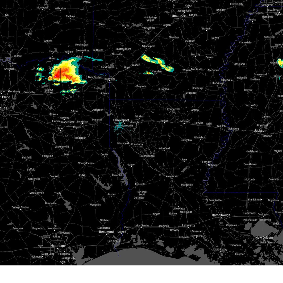 At 1135 am cdt, a severe thunderstorm was located near bogata, or 7 miles northwest of hagansport, moving east at 45 mph (radar indicated). Hazards include golf ball size hail and 60 mph wind gusts. People and animals outdoors will be injured. expect hail damage to roofs, siding, windows, and vehicles. expect wind damage to roofs, siding, and trees. locations impacted include, paris, blossom, pattonville, deport, biardstown, taylor town, clardy, milton, cunningham and minter. thunderstorm damage threat, considerable hail threat, radar indicated max hail size, 1. 75 in wind threat, radar indicated max wind gust, 60 mph. At 1135 am cdt, a severe thunderstorm was located near bogata, or 7 miles northwest of hagansport, moving east at 45 mph (radar indicated). Hazards include golf ball size hail and 60 mph wind gusts. People and animals outdoors will be injured. expect hail damage to roofs, siding, windows, and vehicles. expect wind damage to roofs, siding, and trees. locations impacted include, paris, blossom, pattonville, deport, biardstown, taylor town, clardy, milton, cunningham and minter. thunderstorm damage threat, considerable hail threat, radar indicated max hail size, 1. 75 in wind threat, radar indicated max wind gust, 60 mph.
|
| 6/14/2023 11:28 AM CDT |
 At 1127 am cdt, a severe thunderstorm was located 7 miles south of pattonville, or 13 miles northwest of hagansport, moving east at 50 mph (radar indicated). Hazards include golf ball size hail and 60 mph wind gusts. People and animals outdoors will be injured. expect hail damage to roofs, siding, windows, and vehicles. Expect wind damage to roofs, siding, and trees. At 1127 am cdt, a severe thunderstorm was located 7 miles south of pattonville, or 13 miles northwest of hagansport, moving east at 50 mph (radar indicated). Hazards include golf ball size hail and 60 mph wind gusts. People and animals outdoors will be injured. expect hail damage to roofs, siding, windows, and vehicles. Expect wind damage to roofs, siding, and trees.
|
| 6/14/2023 11:20 AM CDT |
 At 1120 am cdt, severe thunderstorms were located along a line extending from near blossom to 7 miles west of pattonville, moving east at 45 mph (radar indicated). Hazards include ping pong ball size hail and 60 mph wind gusts. People and animals outdoors will be injured. expect hail damage to roofs, siding, windows, and vehicles. expect wind damage to roofs, siding, and trees. locations impacted include, paris, blossom, roxton, lake crook, pattonville, lake gibbons, deport, novice, toco, sun valley, atlas, glory, broadway junction, minter, howland, biardstown, taylor town, faught, clardy and milton. hail threat, radar indicated max hail size, 1. 50 in wind threat, radar indicated max wind gust, 60 mph. At 1120 am cdt, severe thunderstorms were located along a line extending from near blossom to 7 miles west of pattonville, moving east at 45 mph (radar indicated). Hazards include ping pong ball size hail and 60 mph wind gusts. People and animals outdoors will be injured. expect hail damage to roofs, siding, windows, and vehicles. expect wind damage to roofs, siding, and trees. locations impacted include, paris, blossom, roxton, lake crook, pattonville, lake gibbons, deport, novice, toco, sun valley, atlas, glory, broadway junction, minter, howland, biardstown, taylor town, faught, clardy and milton. hail threat, radar indicated max hail size, 1. 50 in wind threat, radar indicated max wind gust, 60 mph.
|
| 6/14/2023 11:19 AM CDT |
 At 1118 am cdt, a severe thunderstorm was located over blossom, or 9 miles east of paris, moving east at 55 mph (radar indicated). Hazards include golf ball size hail and 60 mph wind gusts. People and animals outdoors will be injured. expect hail damage to roofs, siding, windows, and vehicles. Expect wind damage to roofs, siding, and trees. At 1118 am cdt, a severe thunderstorm was located over blossom, or 9 miles east of paris, moving east at 55 mph (radar indicated). Hazards include golf ball size hail and 60 mph wind gusts. People and animals outdoors will be injured. expect hail damage to roofs, siding, windows, and vehicles. Expect wind damage to roofs, siding, and trees.
|
| 6/14/2023 11:11 AM CDT |
 At 1110 am cdt, severe thunderstorms were located along a line extending from blossom to near roxton, moving east at 50 mph (radar indicated). Hazards include ping pong ball size hail and 60 mph wind gusts. People and animals outdoors will be injured. expect hail damage to roofs, siding, windows, and vehicles. expect wind damage to roofs, siding, and trees. locations impacted include, paris, blossom, roxton, lake crook, lake gibbons, pattonville, powderly, sumner, camp maxey, forest hill, deport, novice, toco, sun valley, glory, minter, petty, taylor town, brookston and cunningham. hail threat, observed max hail size, 1. 50 in wind threat, radar indicated max wind gust, 60 mph. At 1110 am cdt, severe thunderstorms were located along a line extending from blossom to near roxton, moving east at 50 mph (radar indicated). Hazards include ping pong ball size hail and 60 mph wind gusts. People and animals outdoors will be injured. expect hail damage to roofs, siding, windows, and vehicles. expect wind damage to roofs, siding, and trees. locations impacted include, paris, blossom, roxton, lake crook, lake gibbons, pattonville, powderly, sumner, camp maxey, forest hill, deport, novice, toco, sun valley, glory, minter, petty, taylor town, brookston and cunningham. hail threat, observed max hail size, 1. 50 in wind threat, radar indicated max wind gust, 60 mph.
|
| 6/14/2023 11:05 AM CDT |
 At 1105 am cdt, severe thunderstorms were located along a line extending from near paris to near roxton, moving east at 45 mph (radar indicated). Hazards include golf ball size hail and 60 mph wind gusts. People and animals outdoors will be injured. expect hail damage to roofs, siding, windows, and vehicles. expect wind damage to roofs, siding, and trees. locations impacted include, paris, blossom, roxton, lake crook, powderly, sumner, lake gibbons, pattonville, arthur city, camp maxey, pat mayse lake, forest hill, deport, novice, toco, sun valley, glory, direct, midcity and minter. thunderstorm damage threat, considerable hail threat, observed max hail size, 1. 75 in wind threat, radar indicated max wind gust, 60 mph. At 1105 am cdt, severe thunderstorms were located along a line extending from near paris to near roxton, moving east at 45 mph (radar indicated). Hazards include golf ball size hail and 60 mph wind gusts. People and animals outdoors will be injured. expect hail damage to roofs, siding, windows, and vehicles. expect wind damage to roofs, siding, and trees. locations impacted include, paris, blossom, roxton, lake crook, powderly, sumner, lake gibbons, pattonville, arthur city, camp maxey, pat mayse lake, forest hill, deport, novice, toco, sun valley, glory, direct, midcity and minter. thunderstorm damage threat, considerable hail threat, observed max hail size, 1. 75 in wind threat, radar indicated max wind gust, 60 mph.
|
| 6/14/2023 11:00 AM CDT |
 At 1059 am cdt, severe thunderstorms were located along a line extending from paris to near honey grove, moving east at 45 mph (radar indicated). Hazards include golf ball size hail and 60 mph wind gusts. People and animals outdoors will be injured. expect hail damage to roofs, siding, windows, and vehicles. expect wind damage to roofs, siding, and trees. locations impacted include, paris, honey grove, blossom, roxton, dodd city, lake crook, powderly, sumner, lake gibbons, pattonville, arthur city, camp maxey, pat mayse lake, forest hill, deport, windom, novice, toco, sun valley and glory. thunderstorm damage threat, considerable hail threat, observed max hail size, 1. 75 in wind threat, radar indicated max wind gust, 60 mph. At 1059 am cdt, severe thunderstorms were located along a line extending from paris to near honey grove, moving east at 45 mph (radar indicated). Hazards include golf ball size hail and 60 mph wind gusts. People and animals outdoors will be injured. expect hail damage to roofs, siding, windows, and vehicles. expect wind damage to roofs, siding, and trees. locations impacted include, paris, honey grove, blossom, roxton, dodd city, lake crook, powderly, sumner, lake gibbons, pattonville, arthur city, camp maxey, pat mayse lake, forest hill, deport, windom, novice, toco, sun valley and glory. thunderstorm damage threat, considerable hail threat, observed max hail size, 1. 75 in wind threat, radar indicated max wind gust, 60 mph.
|
| 6/14/2023 10:58 AM CDT |
 At 1058 am cdt, severe thunderstorms were located along a line extending from paris to near honey grove, moving east at 45 mph (radar indicated). Hazards include 60 mph wind gusts and half dollar size hail. Hail damage to vehicles is expected. expect wind damage to roofs, siding, and trees. locations impacted include, paris, honey grove, blossom, roxton, dodd city, lake crook, powderly, sumner, lake gibbons, pattonville, arthur city, camp maxey, pat mayse lake, forest hill, deport, windom, novice, toco, sun valley and glory. hail threat, radar indicated max hail size, 1. 25 in wind threat, radar indicated max wind gust, 60 mph. At 1058 am cdt, severe thunderstorms were located along a line extending from paris to near honey grove, moving east at 45 mph (radar indicated). Hazards include 60 mph wind gusts and half dollar size hail. Hail damage to vehicles is expected. expect wind damage to roofs, siding, and trees. locations impacted include, paris, honey grove, blossom, roxton, dodd city, lake crook, powderly, sumner, lake gibbons, pattonville, arthur city, camp maxey, pat mayse lake, forest hill, deport, windom, novice, toco, sun valley and glory. hail threat, radar indicated max hail size, 1. 25 in wind threat, radar indicated max wind gust, 60 mph.
|
| 6/14/2023 10:48 AM CDT |
 At 1048 am cdt, severe thunderstorms were located along a line extending from lake gibbons to near coffee mill lake, moving east at 55 mph (radar indicated). Hazards include 60 mph wind gusts and half dollar size hail. Hail damage to vehicles is expected. expect wind damage to roofs, siding, and trees. locations impacted include, paris, honey grove, blossom, roxton, dodd city, lake crook, powderly, sumner, lake gibbons, pattonville, arthur city, camp maxey, pat mayse lake, forest hill, deport, windom, novice, toco, sun valley and glory. hail threat, radar indicated max hail size, 1. 25 in wind threat, radar indicated max wind gust, 60 mph. At 1048 am cdt, severe thunderstorms were located along a line extending from lake gibbons to near coffee mill lake, moving east at 55 mph (radar indicated). Hazards include 60 mph wind gusts and half dollar size hail. Hail damage to vehicles is expected. expect wind damage to roofs, siding, and trees. locations impacted include, paris, honey grove, blossom, roxton, dodd city, lake crook, powderly, sumner, lake gibbons, pattonville, arthur city, camp maxey, pat mayse lake, forest hill, deport, windom, novice, toco, sun valley and glory. hail threat, radar indicated max hail size, 1. 25 in wind threat, radar indicated max wind gust, 60 mph.
|
| 6/14/2023 10:42 AM CDT |
 At 1042 am cdt, severe thunderstorms were located along a line extending from near crockett lake to near coffee mill lake, moving east at 45 mph (radar indicated). Hazards include 60 mph wind gusts and quarter size hail. Hail damage to vehicles is expected. expect wind damage to roofs, siding, and trees. locations impacted include, paris, bonham, honey grove, blossom, roxton, dodd city, lake bonham, pat mayse lake, lake crook, powderly, sumner, lake gibbons, pattonville, arthur city, camp maxey, forest hill, boyd, deport, windom and novice. hail threat, radar indicated max hail size, 1. 00 in wind threat, radar indicated max wind gust, 60 mph. At 1042 am cdt, severe thunderstorms were located along a line extending from near crockett lake to near coffee mill lake, moving east at 45 mph (radar indicated). Hazards include 60 mph wind gusts and quarter size hail. Hail damage to vehicles is expected. expect wind damage to roofs, siding, and trees. locations impacted include, paris, bonham, honey grove, blossom, roxton, dodd city, lake bonham, pat mayse lake, lake crook, powderly, sumner, lake gibbons, pattonville, arthur city, camp maxey, forest hill, boyd, deport, windom and novice. hail threat, radar indicated max hail size, 1. 00 in wind threat, radar indicated max wind gust, 60 mph.
|
| 6/14/2023 10:37 AM CDT |
 At 1037 am cdt, severe thunderstorms were located along a line extending from near crockett lake to near lake bonham, moving east at 45 mph (radar indicated). Hazards include quarter size hail. damage to vehicles is possible At 1037 am cdt, severe thunderstorms were located along a line extending from near crockett lake to near lake bonham, moving east at 45 mph (radar indicated). Hazards include quarter size hail. damage to vehicles is possible
|
| 6/13/2023 4:41 PM CDT |
 The severe thunderstorm warning for southeastern lamar county will expire at 445 pm cdt, the storm which prompted the warning has moved out of the area. therefore the warning will be allowed to expire. a severe thunderstorm watch remains in effect until 900 pm cdt for north central texas. The severe thunderstorm warning for southeastern lamar county will expire at 445 pm cdt, the storm which prompted the warning has moved out of the area. therefore the warning will be allowed to expire. a severe thunderstorm watch remains in effect until 900 pm cdt for north central texas.
|
| 6/13/2023 4:27 PM CDT |
 At 426 pm cdt, a severe thunderstorm was located near pattonville, or near paris, moving northeast at 35 mph (radar indicated). Hazards include quarter size hail. damage to vehicles is possible At 426 pm cdt, a severe thunderstorm was located near pattonville, or near paris, moving northeast at 35 mph (radar indicated). Hazards include quarter size hail. damage to vehicles is possible
|
| 6/13/2023 4:15 PM CDT |
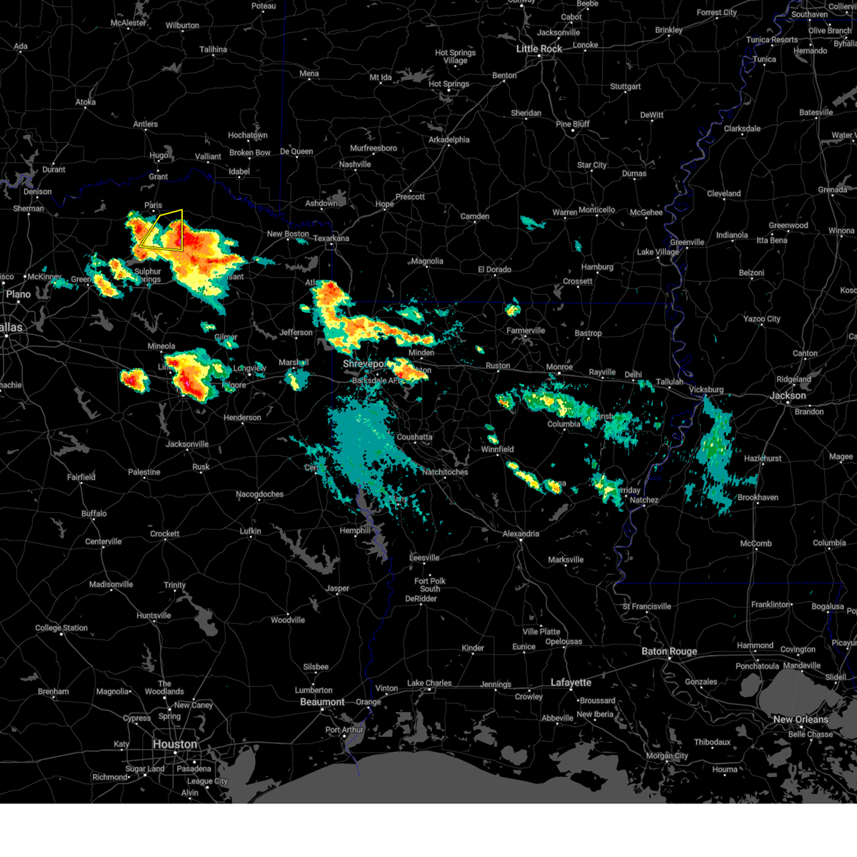 At 414 pm cdt, a severe thunderstorm was located 9 miles east of roxton, or 10 miles south of paris, moving east at 45 mph (radar indicated). Hazards include quarter size hail. Damage to vehicles is possible. locations impacted include, paris, blossom, pattonville, deport, glory, pacio, minter, biardstown, taylor town, clardy, milton, cunningham, gadston and broadway junction. hail threat, radar indicated max hail size, 1. 00 in wind threat, radar indicated max wind gust, <50 mph. At 414 pm cdt, a severe thunderstorm was located 9 miles east of roxton, or 10 miles south of paris, moving east at 45 mph (radar indicated). Hazards include quarter size hail. Damage to vehicles is possible. locations impacted include, paris, blossom, pattonville, deport, glory, pacio, minter, biardstown, taylor town, clardy, milton, cunningham, gadston and broadway junction. hail threat, radar indicated max hail size, 1. 00 in wind threat, radar indicated max wind gust, <50 mph.
|
| 6/13/2023 4:04 PM CDT |
 At 404 pm cdt, a severe thunderstorm was located 9 miles northwest of hagansport, moving northeast at 50 mph (radar indicated). Hazards include 60 mph wind gusts and half dollar size hail. Hail damage to vehicles is expected. Expect wind damage to roofs, siding, and trees. At 404 pm cdt, a severe thunderstorm was located 9 miles northwest of hagansport, moving northeast at 50 mph (radar indicated). Hazards include 60 mph wind gusts and half dollar size hail. Hail damage to vehicles is expected. Expect wind damage to roofs, siding, and trees.
|
| 6/13/2023 4:02 PM CDT |
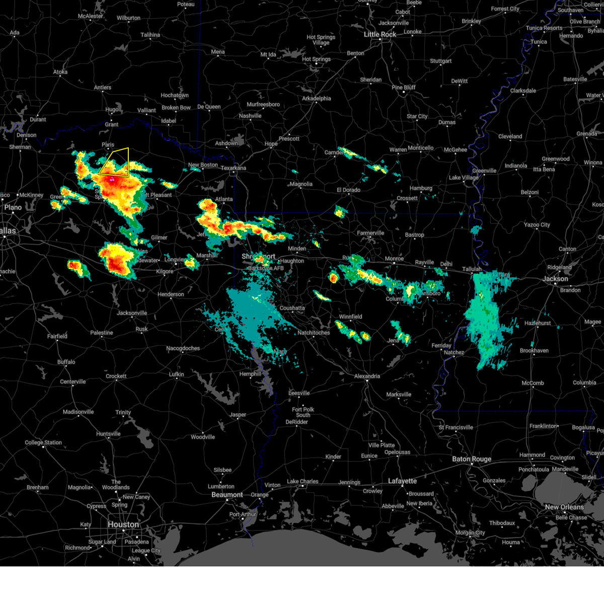 At 401 pm cdt, a severe thunderstorm was located 7 miles south of pattonville, or 10 miles northwest of hagansport, moving northeast at 50 mph (trained weather spotters). Hazards include quarter size hail. Damage to vehicles is possible. locations impacted include, paris, blossom, pattonville, deport, glory, pacio, minter, biardstown, taylor town, clardy, milton, cunningham, gadston and broadway junction. hail threat, observed max hail size, 1. 00 in wind threat, radar indicated max wind gust, <50 mph. At 401 pm cdt, a severe thunderstorm was located 7 miles south of pattonville, or 10 miles northwest of hagansport, moving northeast at 50 mph (trained weather spotters). Hazards include quarter size hail. Damage to vehicles is possible. locations impacted include, paris, blossom, pattonville, deport, glory, pacio, minter, biardstown, taylor town, clardy, milton, cunningham, gadston and broadway junction. hail threat, observed max hail size, 1. 00 in wind threat, radar indicated max wind gust, <50 mph.
|
| 6/13/2023 3:46 PM CDT |
 At 345 pm cdt, a severe thunderstorm was located near cooper, or 16 miles north of sulphur springs, moving northeast at 50 mph (trained weather spotters). Hazards include golf ball size hail. People and animals outdoors will be injured. Expect damage to roofs, siding, windows, and vehicles. At 345 pm cdt, a severe thunderstorm was located near cooper, or 16 miles north of sulphur springs, moving northeast at 50 mph (trained weather spotters). Hazards include golf ball size hail. People and animals outdoors will be injured. Expect damage to roofs, siding, windows, and vehicles.
|
| 6/13/2023 6:08 AM CDT |
 At 607 am cdt, a severe thunderstorm was located near cooper lake state park, or 14 miles north of sulphur springs, moving southeast at 40 mph (radar indicated). Hazards include ping pong ball size hail and 60 mph wind gusts. People and animals outdoors will be injured. expect hail damage to roofs, siding, windows, and vehicles. Expect wind damage to roofs, siding, and trees. At 607 am cdt, a severe thunderstorm was located near cooper lake state park, or 14 miles north of sulphur springs, moving southeast at 40 mph (radar indicated). Hazards include ping pong ball size hail and 60 mph wind gusts. People and animals outdoors will be injured. expect hail damage to roofs, siding, windows, and vehicles. Expect wind damage to roofs, siding, and trees.
|
| 6/13/2023 5:59 AM CDT |
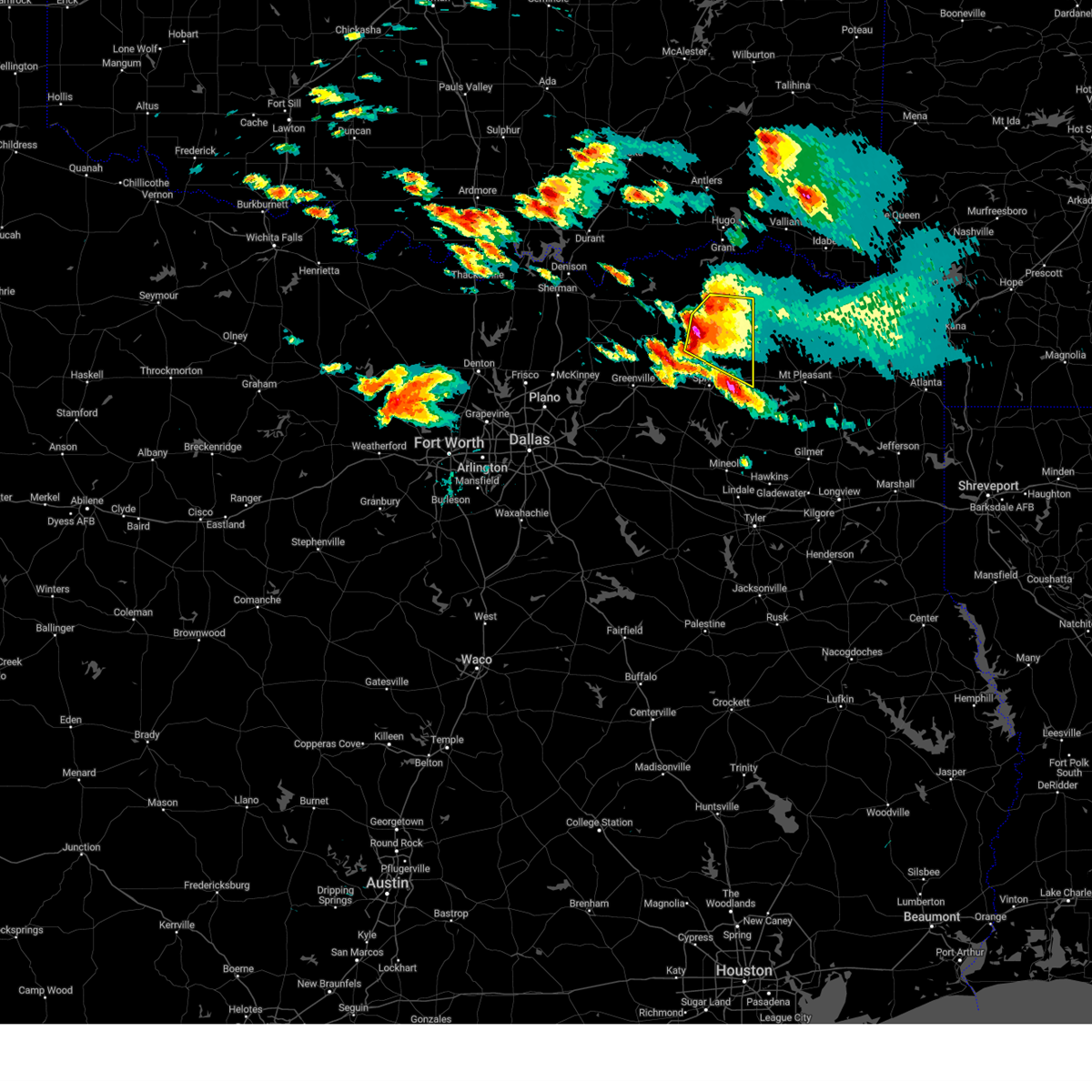 At 558 am cdt, a severe thunderstorm was located near big creek lake, or 17 miles south of paris, moving east at 35 mph (radar indicated). Hazards include golf ball size hail and 60 mph wind gusts. People and animals outdoors will be injured. expect hail damage to roofs, siding, windows, and vehicles. expect wind damage to roofs, siding, and trees. locations impacted include, paris, cooper, cooper lake, big creek lake, cooper lake state park, pattonville, klondike, deport, tira, new birthright, glory, pacio, minter, taylor town, nelta, cunningham, dike, atlas, broadway junction and howland. thunderstorm damage threat, considerable hail threat, radar indicated max hail size, 1. 75 in wind threat, radar indicated max wind gust, 60 mph. At 558 am cdt, a severe thunderstorm was located near big creek lake, or 17 miles south of paris, moving east at 35 mph (radar indicated). Hazards include golf ball size hail and 60 mph wind gusts. People and animals outdoors will be injured. expect hail damage to roofs, siding, windows, and vehicles. expect wind damage to roofs, siding, and trees. locations impacted include, paris, cooper, cooper lake, big creek lake, cooper lake state park, pattonville, klondike, deport, tira, new birthright, glory, pacio, minter, taylor town, nelta, cunningham, dike, atlas, broadway junction and howland. thunderstorm damage threat, considerable hail threat, radar indicated max hail size, 1. 75 in wind threat, radar indicated max wind gust, 60 mph.
|
| 6/13/2023 5:48 AM CDT |
 At 548 am cdt, a severe thunderstorm was located near roxton, or 17 miles north of commerce, moving southeast at 25 mph (radar indicated). Hazards include 60 mph wind gusts and half dollar size hail. Hail damage to vehicles is expected. Expect wind damage to roofs, siding, and trees. At 548 am cdt, a severe thunderstorm was located near roxton, or 17 miles north of commerce, moving southeast at 25 mph (radar indicated). Hazards include 60 mph wind gusts and half dollar size hail. Hail damage to vehicles is expected. Expect wind damage to roofs, siding, and trees.
|
| 6/11/2023 10:58 PM CDT |
 The severe thunderstorm warning for northeastern hopkins, northeastern delta and southeastern lamar counties will expire at 1100 pm cdt, the storm which prompted the warning has moved out of the area. therefore the warning will be allowed to expire. however gusty winds and heavy rain are still possible with this thunderstorm. The severe thunderstorm warning for northeastern hopkins, northeastern delta and southeastern lamar counties will expire at 1100 pm cdt, the storm which prompted the warning has moved out of the area. therefore the warning will be allowed to expire. however gusty winds and heavy rain are still possible with this thunderstorm.
|
| 6/11/2023 10:45 PM CDT |
 At 1045 pm cdt, a severe thunderstorm was located 10 miles northwest of hagansport, moving southeast at 25 mph (radar indicated). Hazards include golf ball size hail and 60 mph wind gusts. People and animals outdoors will be injured. expect hail damage to roofs, siding, windows, and vehicles. Expect wind damage to roofs, siding, and trees. At 1045 pm cdt, a severe thunderstorm was located 10 miles northwest of hagansport, moving southeast at 25 mph (radar indicated). Hazards include golf ball size hail and 60 mph wind gusts. People and animals outdoors will be injured. expect hail damage to roofs, siding, windows, and vehicles. Expect wind damage to roofs, siding, and trees.
|
| 6/11/2023 10:42 PM CDT |
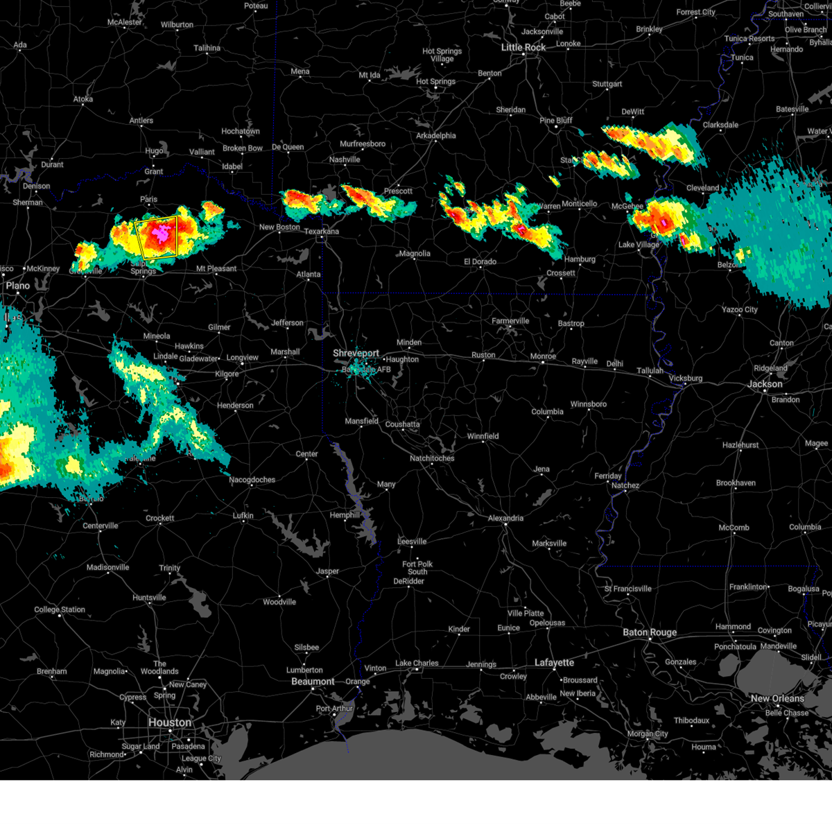 At 1042 pm cdt, a severe thunderstorm was located 10 miles south of pattonville, or 12 miles northwest of hagansport, moving southeast at 20 mph (radar indicated). Hazards include golf ball size hail and 60 mph wind gusts. People and animals outdoors will be injured. expect hail damage to roofs, siding, windows, and vehicles. expect wind damage to roofs, siding, and trees. locations impacted include, pattonville, cooper lake state park, cooper lake, deport, tira, new birthright, glory, pacio, broadway junction, minter, howland, biardstown, taylor town, nelta, clardy, milton, cunningham and gadston. thunderstorm damage threat, considerable hail threat, radar indicated max hail size, 1. 75 in wind threat, radar indicated max wind gust, 60 mph. At 1042 pm cdt, a severe thunderstorm was located 10 miles south of pattonville, or 12 miles northwest of hagansport, moving southeast at 20 mph (radar indicated). Hazards include golf ball size hail and 60 mph wind gusts. People and animals outdoors will be injured. expect hail damage to roofs, siding, windows, and vehicles. expect wind damage to roofs, siding, and trees. locations impacted include, pattonville, cooper lake state park, cooper lake, deport, tira, new birthright, glory, pacio, broadway junction, minter, howland, biardstown, taylor town, nelta, clardy, milton, cunningham and gadston. thunderstorm damage threat, considerable hail threat, radar indicated max hail size, 1. 75 in wind threat, radar indicated max wind gust, 60 mph.
|
| 6/11/2023 10:30 PM CDT |
 At 1029 pm cdt, a severe thunderstorm was located 11 miles east of big creek lake, or 14 miles south of paris, moving southeast at 25 mph (radar indicated). Hazards include golf ball size hail and 60 mph wind gusts. People and animals outdoors will be injured. expect hail damage to roofs, siding, windows, and vehicles. expect wind damage to roofs, siding, and trees. locations impacted include, cooper, cooper lake, big creek lake, cooper lake state park, klondike, pattonville, deport, tira, pecan gap, new birthright, glory, pacio, minter, taylor town, nelta, cunningham, peerless, broadway junction, howland and biardstown. thunderstorm damage threat, considerable hail threat, radar indicated max hail size, 1. 75 in wind threat, radar indicated max wind gust, 60 mph. At 1029 pm cdt, a severe thunderstorm was located 11 miles east of big creek lake, or 14 miles south of paris, moving southeast at 25 mph (radar indicated). Hazards include golf ball size hail and 60 mph wind gusts. People and animals outdoors will be injured. expect hail damage to roofs, siding, windows, and vehicles. expect wind damage to roofs, siding, and trees. locations impacted include, cooper, cooper lake, big creek lake, cooper lake state park, klondike, pattonville, deport, tira, pecan gap, new birthright, glory, pacio, minter, taylor town, nelta, cunningham, peerless, broadway junction, howland and biardstown. thunderstorm damage threat, considerable hail threat, radar indicated max hail size, 1. 75 in wind threat, radar indicated max wind gust, 60 mph.
|
| 6/11/2023 10:04 PM CDT |
 At 1004 pm cdt, severe thunderstorms were located along a line extending from near pattonville to 6 miles southeast of honey grove to near randolph, moving southeast at 20 mph (radar indicated). Hazards include 60 mph wind gusts and quarter size hail. Hail damage to vehicles is expected. Expect wind damage to roofs, siding, and trees. At 1004 pm cdt, severe thunderstorms were located along a line extending from near pattonville to 6 miles southeast of honey grove to near randolph, moving southeast at 20 mph (radar indicated). Hazards include 60 mph wind gusts and quarter size hail. Hail damage to vehicles is expected. Expect wind damage to roofs, siding, and trees.
|
| 6/11/2023 8:10 PM CDT |
 At 810 pm cdt, a severe thunderstorm was located near sumner, or 7 miles northwest of paris, moving south at 25 mph (radar indicated). Hazards include 60 mph wind gusts and half dollar size hail. Hail damage to vehicles is expected. Expect wind damage to roofs, siding, and trees. At 810 pm cdt, a severe thunderstorm was located near sumner, or 7 miles northwest of paris, moving south at 25 mph (radar indicated). Hazards include 60 mph wind gusts and half dollar size hail. Hail damage to vehicles is expected. Expect wind damage to roofs, siding, and trees.
|
| 6/10/2023 9:51 AM CDT |
 At 950 am cdt, severe thunderstorms were located along a line extending from 6 miles northwest of broken bow to 6 miles north of clarksville to near pattonville, moving east at 35 mph (radar indicated). Hazards include 60 mph wind gusts and quarter size hail. Hail damage to vehicles is expected. Expect wind damage to roofs, siding, and trees. At 950 am cdt, severe thunderstorms were located along a line extending from 6 miles northwest of broken bow to 6 miles north of clarksville to near pattonville, moving east at 35 mph (radar indicated). Hazards include 60 mph wind gusts and quarter size hail. Hail damage to vehicles is expected. Expect wind damage to roofs, siding, and trees.
|
| 5/7/2023 12:16 AM CDT |
 At 1216 am cdt, a severe thunderstorm was located near manchester, or 19 miles northwest of clarksville, moving northeast at 50 mph (radar indicated). Hazards include 60 mph wind gusts and quarter size hail. Hail damage to vehicles is expected. Expect wind damage to roofs, siding, and trees. At 1216 am cdt, a severe thunderstorm was located near manchester, or 19 miles northwest of clarksville, moving northeast at 50 mph (radar indicated). Hazards include 60 mph wind gusts and quarter size hail. Hail damage to vehicles is expected. Expect wind damage to roofs, siding, and trees.
|
| 5/4/2023 11:02 PM CDT |
 At 1102 pm cdt, a severe thunderstorm was located over paris, moving east at 35 mph (radar indicated). Hazards include 60 mph wind gusts and quarter size hail. Hail damage to vehicles is expected. expect wind damage to roofs, siding, and trees. locations impacted include, paris, blossom, roxton, lake crook, pattonville, lake gibbons, sumner, forest hill, deport, toco, sun valley, atlas, noble, glory, broadway junction, minter, biardstown, howland, petty and brookston. hail threat, radar indicated max hail size, 1. 00 in wind threat, radar indicated max wind gust, 60 mph. At 1102 pm cdt, a severe thunderstorm was located over paris, moving east at 35 mph (radar indicated). Hazards include 60 mph wind gusts and quarter size hail. Hail damage to vehicles is expected. expect wind damage to roofs, siding, and trees. locations impacted include, paris, blossom, roxton, lake crook, pattonville, lake gibbons, sumner, forest hill, deport, toco, sun valley, atlas, noble, glory, broadway junction, minter, biardstown, howland, petty and brookston. hail threat, radar indicated max hail size, 1. 00 in wind threat, radar indicated max wind gust, 60 mph.
|
| 5/4/2023 10:54 PM CDT |
 At 1053 pm cdt, severe thunderstorms were located along a line extending from near sawyer to 8 miles northwest of bagwell to near pattonville, moving east at 45 mph (radar indicated). Hazards include 60 mph wind gusts. expect damage to roofs, siding, and trees At 1053 pm cdt, severe thunderstorms were located along a line extending from near sawyer to 8 miles northwest of bagwell to near pattonville, moving east at 45 mph (radar indicated). Hazards include 60 mph wind gusts. expect damage to roofs, siding, and trees
|
| 5/4/2023 10:40 PM CDT |
 At 1039 pm cdt, a cluster of severe thunderstorms was located near roxton, or 13 miles west of paris, moving east at 35 mph (radar indicated). Hazards include 60 mph wind gusts and quarter size hail. Hail damage to vehicles is expected. Expect wind damage to roofs, siding, and trees. At 1039 pm cdt, a cluster of severe thunderstorms was located near roxton, or 13 miles west of paris, moving east at 35 mph (radar indicated). Hazards include 60 mph wind gusts and quarter size hail. Hail damage to vehicles is expected. Expect wind damage to roofs, siding, and trees.
|
| 4/20/2023 5:12 PM CDT |
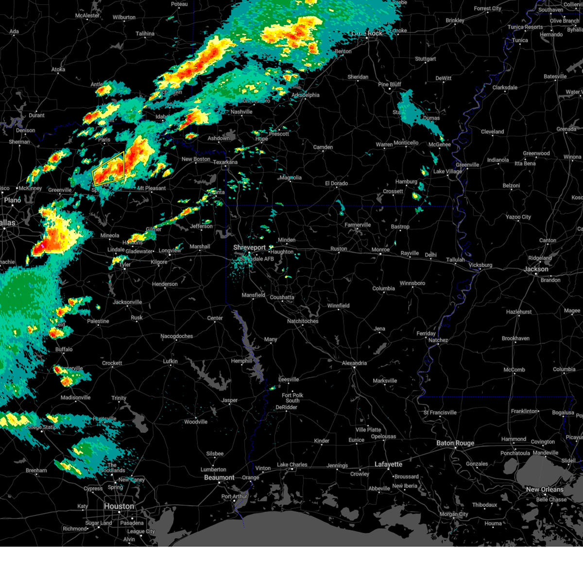 At 512 pm cdt, a severe thunderstorm was located near bogata, or near hagansport, moving east at 30 mph (radar indicated). Hazards include 60 mph wind gusts and quarter size hail. Hail damage to vehicles is expected. expect wind damage to roofs, siding, and trees. locations impacted include, cooper, cooper lake state park, cooper lake, deport, tira, new birthright, pacio, minter, taylor town, nelta, milton and cunningham. hail threat, radar indicated max hail size, 1. 00 in wind threat, radar indicated max wind gust, 60 mph. At 512 pm cdt, a severe thunderstorm was located near bogata, or near hagansport, moving east at 30 mph (radar indicated). Hazards include 60 mph wind gusts and quarter size hail. Hail damage to vehicles is expected. expect wind damage to roofs, siding, and trees. locations impacted include, cooper, cooper lake state park, cooper lake, deport, tira, new birthright, pacio, minter, taylor town, nelta, milton and cunningham. hail threat, radar indicated max hail size, 1. 00 in wind threat, radar indicated max wind gust, 60 mph.
|
| 4/20/2023 4:59 PM CDT |
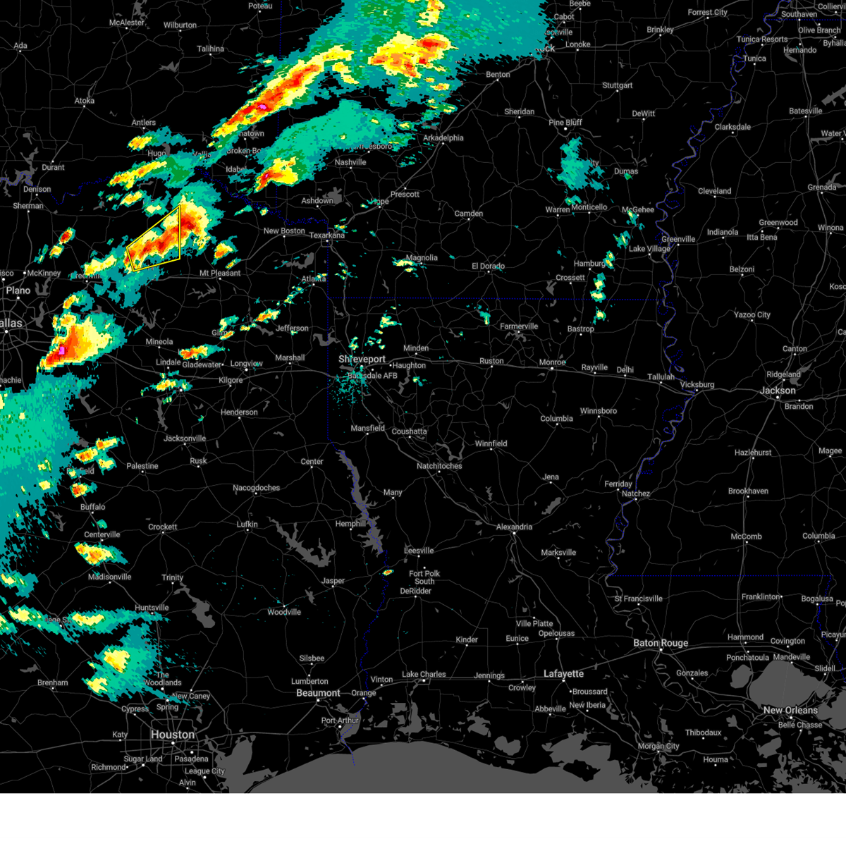 At 458 pm cdt, a severe thunderstorm was located 11 miles west of hagansport, moving east at 30 mph (radar indicated). Hazards include 60 mph wind gusts and quarter size hail. Hail damage to vehicles is expected. Expect wind damage to roofs, siding, and trees. At 458 pm cdt, a severe thunderstorm was located 11 miles west of hagansport, moving east at 30 mph (radar indicated). Hazards include 60 mph wind gusts and quarter size hail. Hail damage to vehicles is expected. Expect wind damage to roofs, siding, and trees.
|
| 4/20/2023 4:37 PM CDT |
 At 436 pm cdt, a severe thunderstorm was located near pattonville, or 12 miles northwest of hagansport, moving east at 35 mph (radar indicated). Hazards include 60 mph wind gusts and half dollar size hail. Hail damage to vehicles is expected. Expect wind damage to roofs, siding, and trees. At 436 pm cdt, a severe thunderstorm was located near pattonville, or 12 miles northwest of hagansport, moving east at 35 mph (radar indicated). Hazards include 60 mph wind gusts and half dollar size hail. Hail damage to vehicles is expected. Expect wind damage to roofs, siding, and trees.
|
| 3/2/2023 8:36 PM CST |
 The severe thunderstorm warning for northeastern delta and eastern lamar counties will expire at 845 pm cst, the storms which prompted the warning have moved out of the area. therefore the warning will be allowed to expire. however gusty winds are still possible with these thunderstorms. a tornado watch remains in effect until 1000 pm cst for north central texas. The severe thunderstorm warning for northeastern delta and eastern lamar counties will expire at 845 pm cst, the storms which prompted the warning have moved out of the area. therefore the warning will be allowed to expire. however gusty winds are still possible with these thunderstorms. a tornado watch remains in effect until 1000 pm cst for north central texas.
|
| 3/2/2023 8:33 PM CST |
 At 832 pm cst, severe thunderstorms were located along a line extending from 13 miles southeast of albion to 14 miles northeast of fort towson to 7 miles southeast of raymond gary state park to near manchester to near bogata to near hagansport, moving east at 30 mph (radar indicated). Hazards include 60 mph wind gusts and quarter size hail. Hail damage to vehicles is expected. expect wind damage to roofs, siding, and trees. Locations impacted include, clarksville, hagansport, boxelder, idabel, broken bow, de kalb, bogata, us 259 and i 30 intersection, dalby springs, wilkerson, bagwell, manchester, wright city, valliant, detroit, deport, talco, avery, millerton and annona. At 832 pm cst, severe thunderstorms were located along a line extending from 13 miles southeast of albion to 14 miles northeast of fort towson to 7 miles southeast of raymond gary state park to near manchester to near bogata to near hagansport, moving east at 30 mph (radar indicated). Hazards include 60 mph wind gusts and quarter size hail. Hail damage to vehicles is expected. expect wind damage to roofs, siding, and trees. Locations impacted include, clarksville, hagansport, boxelder, idabel, broken bow, de kalb, bogata, us 259 and i 30 intersection, dalby springs, wilkerson, bagwell, manchester, wright city, valliant, detroit, deport, talco, avery, millerton and annona.
|
| 3/2/2023 8:25 PM CST |
 At 823 pm cst, severe thunderstorms were located along a line extending from the red river to blossom to sulfur bluf, moving east at 50 mph (radar indicated). Hazards include 60 mph wind gusts. Expect damage to roofs, siding, and trees. locations impacted include, paris, blossom, lake crook, powderly, pattonville, arthur city, camp maxey, pat mayse lake, deport, novice, sun valley, glory, pacio, midcity, minter, taylor town, cunningham, broadway junction, biardstown and chicota. hail threat, radar indicated max hail size, <. 75 in wind threat, observed max wind gust, 60 mph. At 823 pm cst, severe thunderstorms were located along a line extending from the red river to blossom to sulfur bluf, moving east at 50 mph (radar indicated). Hazards include 60 mph wind gusts. Expect damage to roofs, siding, and trees. locations impacted include, paris, blossom, lake crook, powderly, pattonville, arthur city, camp maxey, pat mayse lake, deport, novice, sun valley, glory, pacio, midcity, minter, taylor town, cunningham, broadway junction, biardstown and chicota. hail threat, radar indicated max hail size, <. 75 in wind threat, observed max wind gust, 60 mph.
|
| 3/2/2023 8:03 PM CST |
 At 803 pm cst, severe thunderstorms were located along a line extending from near nashoba to near hugo lake state park to near powderly to 10 miles northeast of big creek lake, moving east at 40 mph (radar indicated). Hazards include 60 mph wind gusts and quarter size hail. Hail damage to vehicles is expected. Expect wind damage to roofs, siding, and trees. At 803 pm cst, severe thunderstorms were located along a line extending from near nashoba to near hugo lake state park to near powderly to 10 miles northeast of big creek lake, moving east at 40 mph (radar indicated). Hazards include 60 mph wind gusts and quarter size hail. Hail damage to vehicles is expected. Expect wind damage to roofs, siding, and trees.
|
| 3/2/2023 8:03 PM CST |
 At 803 pm cst, severe thunderstorms were located along a line extending from arthur city to paris to cooper lake state park, moving east at 50 mph (radar indicated). Hazards include 70 mph wind gusts. Expect considerable tree damage. damage is likely to mobile homes, roofs, and outbuildings. locations impacted include, paris, cooper, blossom, roxton, cooper lake, pat mayse lake, lake crook, powderly, sumner, lake gibbons, big creek lake, pattonville, arthur city, camp maxey, klondike, cooper lake state park, forest hill, deport, pecan gap and novice. thunderstorm damage threat, considerable hail threat, radar indicated max hail size, <. 75 in wind threat, observed max wind gust, 70 mph. At 803 pm cst, severe thunderstorms were located along a line extending from arthur city to paris to cooper lake state park, moving east at 50 mph (radar indicated). Hazards include 70 mph wind gusts. Expect considerable tree damage. damage is likely to mobile homes, roofs, and outbuildings. locations impacted include, paris, cooper, blossom, roxton, cooper lake, pat mayse lake, lake crook, powderly, sumner, lake gibbons, big creek lake, pattonville, arthur city, camp maxey, klondike, cooper lake state park, forest hill, deport, pecan gap and novice. thunderstorm damage threat, considerable hail threat, radar indicated max hail size, <. 75 in wind threat, observed max wind gust, 70 mph.
|
| 3/2/2023 8:03 PM CST |
 At 803 pm cst, severe thunderstorms were located along a line extending from near nashoba to near hugo lake state park to near powderly to 10 miles northeast of big creek lake, moving east at 40 mph (radar indicated). Hazards include 60 mph wind gusts and quarter size hail. Hail damage to vehicles is expected. Expect wind damage to roofs, siding, and trees. At 803 pm cst, severe thunderstorms were located along a line extending from near nashoba to near hugo lake state park to near powderly to 10 miles northeast of big creek lake, moving east at 40 mph (radar indicated). Hazards include 60 mph wind gusts and quarter size hail. Hail damage to vehicles is expected. Expect wind damage to roofs, siding, and trees.
|
| 3/2/2023 8:03 PM CST |
 At 803 pm cst, severe thunderstorms were located along a line extending from near nashoba to near hugo lake state park to near powderly to 10 miles northeast of big creek lake, moving east at 40 mph (radar indicated). Hazards include 60 mph wind gusts and quarter size hail. Hail damage to vehicles is expected. Expect wind damage to roofs, siding, and trees. At 803 pm cst, severe thunderstorms were located along a line extending from near nashoba to near hugo lake state park to near powderly to 10 miles northeast of big creek lake, moving east at 40 mph (radar indicated). Hazards include 60 mph wind gusts and quarter size hail. Hail damage to vehicles is expected. Expect wind damage to roofs, siding, and trees.
|
| 3/2/2023 7:29 PM CST |
 At 727 pm cst, severe thunderstorms were located along a line extending from the red river to near commerce, moving east at 45 mph (radar indicated). Hazards include 70 mph wind gusts. Expect considerable tree damage. Damage is likely to mobile homes, roofs, and outbuildings. At 727 pm cst, severe thunderstorms were located along a line extending from the red river to near commerce, moving east at 45 mph (radar indicated). Hazards include 70 mph wind gusts. Expect considerable tree damage. Damage is likely to mobile homes, roofs, and outbuildings.
|
| 12/13/2022 11:31 AM CST |
 At 1131 am cst, severe thunderstorms were located along a line extending from 6 miles east of blossom to near deport to 10 miles east of cooper lake park south sulphur to 6 miles west of como to near emory, moving east at 25 mph (radar indicated). Hazards include 60 mph wind gusts and quarter size hail. Hail damage to vehicles is expected. Expect wind damage to roofs, siding, and trees. At 1131 am cst, severe thunderstorms were located along a line extending from 6 miles east of blossom to near deport to 10 miles east of cooper lake park south sulphur to 6 miles west of como to near emory, moving east at 25 mph (radar indicated). Hazards include 60 mph wind gusts and quarter size hail. Hail damage to vehicles is expected. Expect wind damage to roofs, siding, and trees.
|
| 12/13/2022 11:24 AM CST |
 At 1124 am cst, severe thunderstorms were located along a line extending from near pattonville to near east tawakoni, moving east at 40 mph (radar indicated). Hazards include 60 mph wind gusts and quarter size hail. Hail damage to vehicles is expected. Expect wind damage to roofs, siding, and trees. At 1124 am cst, severe thunderstorms were located along a line extending from near pattonville to near east tawakoni, moving east at 40 mph (radar indicated). Hazards include 60 mph wind gusts and quarter size hail. Hail damage to vehicles is expected. Expect wind damage to roofs, siding, and trees.
|
| 12/13/2022 10:29 AM CST |
 At 1028 am cst, severe thunderstorms were located along a line extending from near honey grove to greenville club lake, moving east at 55 mph (radar indicated). Hazards include 60 mph wind gusts and half dollar size hail. Hail damage to vehicles is expected. Expect wind damage to roofs, siding, and trees. At 1028 am cst, severe thunderstorms were located along a line extending from near honey grove to greenville club lake, moving east at 55 mph (radar indicated). Hazards include 60 mph wind gusts and half dollar size hail. Hail damage to vehicles is expected. Expect wind damage to roofs, siding, and trees.
|
| 11/4/2022 6:17 PM CDT |
 At 617 pm cdt, a confirmed tornado was located near bagwell, or 7 miles west of clarksville, moving northeast at 50 mph (law enforcement confirmed tornado). Hazards include damaging tornado and quarter size hail. Flying debris will be dangerous to those caught without shelter. mobile homes will be damaged or destroyed. damage to roofs, windows, and vehicles will occur. tree damage is likely. this tornado will be near, bagwell around 620 pm cdt. clarksville around 625 pm cdt. Other locations impacted by this tornadic thunderstorm include negley and detroit. At 617 pm cdt, a confirmed tornado was located near bagwell, or 7 miles west of clarksville, moving northeast at 50 mph (law enforcement confirmed tornado). Hazards include damaging tornado and quarter size hail. Flying debris will be dangerous to those caught without shelter. mobile homes will be damaged or destroyed. damage to roofs, windows, and vehicles will occur. tree damage is likely. this tornado will be near, bagwell around 620 pm cdt. clarksville around 625 pm cdt. Other locations impacted by this tornadic thunderstorm include negley and detroit.
|
| 11/4/2022 6:03 PM CDT |
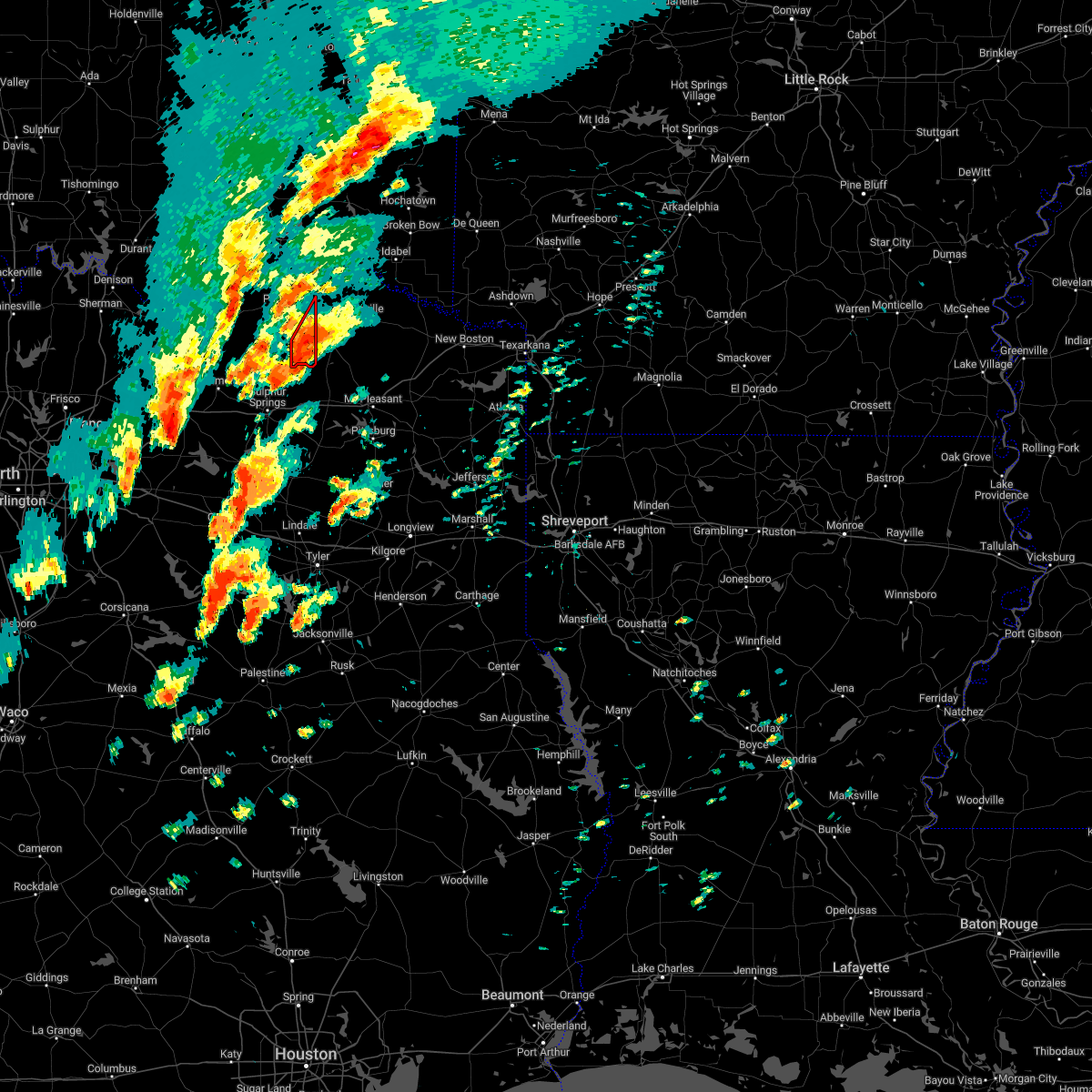 At 603 pm cdt, a severe thunderstorm capable of producing a tornado was located near bogata, or 11 miles northwest of hagansport, moving northeast at 50 mph (radar indicated rotation). Hazards include tornado and golf ball size hail. Flying debris will be dangerous to those caught without shelter. mobile homes will be damaged or destroyed. damage to roofs, windows, and vehicles will occur. tree damage is likely. Locations impacted include, pattonville, deport, taylor town, clardy, milton, cunningham and minter. At 603 pm cdt, a severe thunderstorm capable of producing a tornado was located near bogata, or 11 miles northwest of hagansport, moving northeast at 50 mph (radar indicated rotation). Hazards include tornado and golf ball size hail. Flying debris will be dangerous to those caught without shelter. mobile homes will be damaged or destroyed. damage to roofs, windows, and vehicles will occur. tree damage is likely. Locations impacted include, pattonville, deport, taylor town, clardy, milton, cunningham and minter.
|
| 11/4/2022 5:53 PM CDT |
 At 553 pm cdt, a severe thunderstorm capable of producing a tornado was located 11 miles west of hagansport, moving northeast at 50 mph (radar indicated rotation). Hazards include tornado and quarter size hail. Flying debris will be dangerous to those caught without shelter. mobile homes will be damaged or destroyed. damage to roofs, windows, and vehicles will occur. tree damage is likely. this dangerous storm will be near, bogata around 610 pm cdt. bagwell around 620 pm cdt. clarksville around 625 pm cdt. Other locations impacted by this tornadic thunderstorm include negley and detroit. At 553 pm cdt, a severe thunderstorm capable of producing a tornado was located 11 miles west of hagansport, moving northeast at 50 mph (radar indicated rotation). Hazards include tornado and quarter size hail. Flying debris will be dangerous to those caught without shelter. mobile homes will be damaged or destroyed. damage to roofs, windows, and vehicles will occur. tree damage is likely. this dangerous storm will be near, bogata around 610 pm cdt. bagwell around 620 pm cdt. clarksville around 625 pm cdt. Other locations impacted by this tornadic thunderstorm include negley and detroit.
|
| 11/4/2022 5:48 PM CDT |
 At 547 pm cdt, a severe thunderstorm capable of producing a tornado was located 11 miles northeast of cooper lake state park, or 13 miles west of hagansport, moving northeast at 55 mph (radar indicated rotation). Hazards include tornado and golf ball size hail. Flying debris will be dangerous to those caught without shelter. mobile homes will be damaged or destroyed. damage to roofs, windows, and vehicles will occur. tree damage is likely. Locations impacted include, pattonville, deport, tira, taylor town, nelta, clardy, milton, cunningham and minter. At 547 pm cdt, a severe thunderstorm capable of producing a tornado was located 11 miles northeast of cooper lake state park, or 13 miles west of hagansport, moving northeast at 55 mph (radar indicated rotation). Hazards include tornado and golf ball size hail. Flying debris will be dangerous to those caught without shelter. mobile homes will be damaged or destroyed. damage to roofs, windows, and vehicles will occur. tree damage is likely. Locations impacted include, pattonville, deport, tira, taylor town, nelta, clardy, milton, cunningham and minter.
|
| 11/4/2022 5:40 PM CDT |
 At 539 pm cdt, a severe thunderstorm capable of producing a tornado was located near cooper lake state park, or 11 miles northeast of sulphur springs, moving northeast at 60 mph. this storm has a history of producing tornadoes (radar indicated rotation). Hazards include tornado and golf ball size hail. Flying debris will be dangerous to those caught without shelter. mobile homes will be damaged or destroyed. damage to roofs, windows, and vehicles will occur. Tree damage is likely. At 539 pm cdt, a severe thunderstorm capable of producing a tornado was located near cooper lake state park, or 11 miles northeast of sulphur springs, moving northeast at 60 mph. this storm has a history of producing tornadoes (radar indicated rotation). Hazards include tornado and golf ball size hail. Flying debris will be dangerous to those caught without shelter. mobile homes will be damaged or destroyed. damage to roofs, windows, and vehicles will occur. Tree damage is likely.
|
| 11/4/2022 5:37 PM CDT |
 At 536 pm cdt, severe thunderstorms were located along a line extending from 9 miles south of bennington to near wolfe city, moving northeast at 45 mph (radar indicated). Hazards include 60 mph wind gusts and quarter size hail. Hail damage to vehicles is expected. Expect wind damage to roofs, siding, and trees. At 536 pm cdt, severe thunderstorms were located along a line extending from 9 miles south of bennington to near wolfe city, moving northeast at 45 mph (radar indicated). Hazards include 60 mph wind gusts and quarter size hail. Hail damage to vehicles is expected. Expect wind damage to roofs, siding, and trees.
|
| 5/15/2022 9:57 PM CDT |
 At 957 pm cdt, a severe thunderstorm was located 7 miles southeast of honey grove, or 17 miles north of commerce, moving southeast at 45 mph (radar indicated). Hazards include 65 mph wind gusts and quarter size hail. Hail damage to vehicles is expected. Expect wind damage to roofs, siding, and trees. At 957 pm cdt, a severe thunderstorm was located 7 miles southeast of honey grove, or 17 miles north of commerce, moving southeast at 45 mph (radar indicated). Hazards include 65 mph wind gusts and quarter size hail. Hail damage to vehicles is expected. Expect wind damage to roofs, siding, and trees.
|
| 5/5/2022 1:10 PM CDT |
 The severe thunderstorm warning for southern lamar and northeastern delta counties will expire at 115 pm cdt, the storm which prompted the warning has weakened below severe limits, and has exited the warned area. therefore, the warning will be allowed to expire. however small hail and gusty winds are still possible with this thunderstorm. The severe thunderstorm warning for southern lamar and northeastern delta counties will expire at 115 pm cdt, the storm which prompted the warning has weakened below severe limits, and has exited the warned area. therefore, the warning will be allowed to expire. however small hail and gusty winds are still possible with this thunderstorm.
|
| 5/5/2022 12:42 PM CDT |
 At 1241 pm cdt, a severe thunderstorm was located 9 miles west of deport, or 9 miles south of paris, moving northeast at 70 mph (radar indicated). Hazards include 60 mph wind gusts and quarter size hail. Hail damage to vehicles is expected. expect wind damage to roofs, siding, and trees. locations impacted include, paris, blossom, deport, roxton and sun valley. hail threat, radar indicated max hail size, 1. 00 in wind threat, radar indicated max wind gust, 60 mph. At 1241 pm cdt, a severe thunderstorm was located 9 miles west of deport, or 9 miles south of paris, moving northeast at 70 mph (radar indicated). Hazards include 60 mph wind gusts and quarter size hail. Hail damage to vehicles is expected. expect wind damage to roofs, siding, and trees. locations impacted include, paris, blossom, deport, roxton and sun valley. hail threat, radar indicated max hail size, 1. 00 in wind threat, radar indicated max wind gust, 60 mph.
|
| 5/5/2022 12:21 PM CDT |
 At 1221 pm cdt, a severe thunderstorm was located over cooper, or 13 miles northeast of commerce, moving northeast at 50 mph (radar indicated). Hazards include 60 mph wind gusts and quarter size hail. Hail damage to vehicles is expected. Expect wind damage to roofs, siding, and trees. At 1221 pm cdt, a severe thunderstorm was located over cooper, or 13 miles northeast of commerce, moving northeast at 50 mph (radar indicated). Hazards include 60 mph wind gusts and quarter size hail. Hail damage to vehicles is expected. Expect wind damage to roofs, siding, and trees.
|
| 4/13/2022 12:47 PM CDT |
 At 1247 pm cdt, severe thunderstorms were located along a line extending from near deport to east tawakoni, moving east at 40 mph (radar indicated). Hazards include 60 mph wind gusts and quarter size hail. Hail damage to vehicles is expected. Expect wind damage to roofs, siding, and trees. At 1247 pm cdt, severe thunderstorms were located along a line extending from near deport to east tawakoni, moving east at 40 mph (radar indicated). Hazards include 60 mph wind gusts and quarter size hail. Hail damage to vehicles is expected. Expect wind damage to roofs, siding, and trees.
|
| 4/13/2022 12:41 PM CDT |
 At 1240 pm cdt, a severe thunderstorm was located near cumby, or 7 miles west of sulphur springs, moving east at 35 mph (law enforcement). Hazards include 60 mph wind gusts and quarter size hail. Hail damage to vehicles is expected. expect wind damage to roofs, siding, and trees. locations impacted include, paris, sulphur springs, cooper, blossom, cumby, como, deport, cooper lake park south sulphur, cooper lake park doctors creek, tira and sun valley. hail threat, observed max hail size, 1. 00 in wind threat, radar indicated max wind gust, 60 mph. At 1240 pm cdt, a severe thunderstorm was located near cumby, or 7 miles west of sulphur springs, moving east at 35 mph (law enforcement). Hazards include 60 mph wind gusts and quarter size hail. Hail damage to vehicles is expected. expect wind damage to roofs, siding, and trees. locations impacted include, paris, sulphur springs, cooper, blossom, cumby, como, deport, cooper lake park south sulphur, cooper lake park doctors creek, tira and sun valley. hail threat, observed max hail size, 1. 00 in wind threat, radar indicated max wind gust, 60 mph.
|
| 4/13/2022 12:21 PM CDT |
 At 1220 pm cdt, a severe thunderstorm was located near commerce, moving east at 40 mph (radar indicated). Hazards include 60 mph wind gusts and quarter size hail. Hail damage to vehicles is expected. Expect wind damage to roofs, siding, and trees. At 1220 pm cdt, a severe thunderstorm was located near commerce, moving east at 40 mph (radar indicated). Hazards include 60 mph wind gusts and quarter size hail. Hail damage to vehicles is expected. Expect wind damage to roofs, siding, and trees.
|
| 4/4/2022 11:07 PM CDT |
 At 1106 pm cdt, severe thunderstorms were located along a line extending from 9 miles southwest of deport to 6 miles northeast of sulphur springs, moving east at 45 mph (radar indicated). Hazards include 60 mph wind gusts and quarter size hail. Hail damage to vehicles is expected. Expect wind damage to roofs, siding, and trees. At 1106 pm cdt, severe thunderstorms were located along a line extending from 9 miles southwest of deport to 6 miles northeast of sulphur springs, moving east at 45 mph (radar indicated). Hazards include 60 mph wind gusts and quarter size hail. Hail damage to vehicles is expected. Expect wind damage to roofs, siding, and trees.
|
| 4/4/2022 10:55 PM CDT | Metal roof partially torn off of building in deport. time estimated from rada in lamar county TX, 0.3 miles E of Deport, TX |
| 4/4/2022 10:39 PM CDT |
 At 1039 pm cdt, a severe thunderstorm was located over cooper lake park doctors creek, or 12 miles north of sulphur springs, moving east at 35 mph (radar indicated). Hazards include 65 mph wind gusts and quarter size hail. Hail damage to vehicles is expected. expect wind damage to roofs, siding, and trees. locations impacted include, sulphur springs, cooper, cumby, deport, cooper lake park south sulphur, cooper lake park doctors creek, tira and pecan gap. hail threat, radar indicated max hail size, 1. 00 in wind threat, radar indicated max wind gust, 65 mph. At 1039 pm cdt, a severe thunderstorm was located over cooper lake park doctors creek, or 12 miles north of sulphur springs, moving east at 35 mph (radar indicated). Hazards include 65 mph wind gusts and quarter size hail. Hail damage to vehicles is expected. expect wind damage to roofs, siding, and trees. locations impacted include, sulphur springs, cooper, cumby, deport, cooper lake park south sulphur, cooper lake park doctors creek, tira and pecan gap. hail threat, radar indicated max hail size, 1. 00 in wind threat, radar indicated max wind gust, 65 mph.
|
| 4/4/2022 10:23 PM CDT |
 At 1022 pm cdt, a severe thunderstorm was located near commerce, moving east at 45 mph (radar indicated). Hazards include 65 mph wind gusts and quarter size hail. Hail damage to vehicles is expected. expect wind damage to roofs, siding, and trees. locations impacted include, sulphur springs, commerce, cooper, cumby, campbell, deport, cooper lake park south sulphur, cooper lake park doctors creek, roxton, ladonia, tira, pecan gap and neylandville. hail threat, radar indicated max hail size, 1. 00 in wind threat, radar indicated max wind gust, 65 mph. At 1022 pm cdt, a severe thunderstorm was located near commerce, moving east at 45 mph (radar indicated). Hazards include 65 mph wind gusts and quarter size hail. Hail damage to vehicles is expected. expect wind damage to roofs, siding, and trees. locations impacted include, sulphur springs, commerce, cooper, cumby, campbell, deport, cooper lake park south sulphur, cooper lake park doctors creek, roxton, ladonia, tira, pecan gap and neylandville. hail threat, radar indicated max hail size, 1. 00 in wind threat, radar indicated max wind gust, 65 mph.
|
| 4/4/2022 10:06 PM CDT |
 At 1005 pm cdt, a severe thunderstorm was located over wolfe city, or 10 miles northwest of commerce, moving east at 40 mph (radar indicated). Hazards include 65 mph wind gusts and half dollar size hail. Hail damage to vehicles is expected. Expect wind damage to roofs, siding, and trees. At 1005 pm cdt, a severe thunderstorm was located over wolfe city, or 10 miles northwest of commerce, moving east at 40 mph (radar indicated). Hazards include 65 mph wind gusts and half dollar size hail. Hail damage to vehicles is expected. Expect wind damage to roofs, siding, and trees.
|
| 3/30/2022 6:12 AM CDT |
 The severe thunderstorm warning for north central hopkins, eastern lamar and northeastern delta counties will expire at 615 am cdt, the storm which prompted the warning has moved out of the area. therefore the warning will be allowed to expire. however gusty winds are still possible with this thunderstorm. a tornado watch remains in effect until 700 am cdt for north central texas. The severe thunderstorm warning for north central hopkins, eastern lamar and northeastern delta counties will expire at 615 am cdt, the storm which prompted the warning has moved out of the area. therefore the warning will be allowed to expire. however gusty winds are still possible with this thunderstorm. a tornado watch remains in effect until 700 am cdt for north central texas.
|
| 3/30/2022 6:06 AM CDT |
 At 605 am cdt, severe thunderstorms were located along a line extending from 6 miles north of blossom to near deport to 7 miles northeast of sulphur springs, moving northeast at 60 mph (radar indicated). Hazards include 60 mph wind gusts and penny size hail. expect damage to roofs, siding, and trees At 605 am cdt, severe thunderstorms were located along a line extending from 6 miles north of blossom to near deport to 7 miles northeast of sulphur springs, moving northeast at 60 mph (radar indicated). Hazards include 60 mph wind gusts and penny size hail. expect damage to roofs, siding, and trees
|
| 3/30/2022 6:02 AM CDT |
 At 601 am cdt, a cluster of severe thunderstorms was located from near paris to tira, moving northeast at 55 mph (radar indicated). Hazards include 60 mph wind gusts. Expect damage to roofs, siding, and trees. locations impacted include, paris, blossom, deport, tira and sun valley. hail threat, radar indicated max hail size, <. 75 in wind threat, radar indicated max wind gust, 60 mph. At 601 am cdt, a cluster of severe thunderstorms was located from near paris to tira, moving northeast at 55 mph (radar indicated). Hazards include 60 mph wind gusts. Expect damage to roofs, siding, and trees. locations impacted include, paris, blossom, deport, tira and sun valley. hail threat, radar indicated max hail size, <. 75 in wind threat, radar indicated max wind gust, 60 mph.
|
| 3/30/2022 5:51 AM CDT |
 At 550 am cdt, a cluster of severe thunderstorms was located from near paris to north of sulphur springs , moving northeast at 55 mph (radar indicated). Hazards include 60 mph wind gusts. Expect damage to roofs, siding, and trees. locations impacted include, paris, cooper, blossom, deport, cooper lake park south sulphur, cooper lake park doctors creek, tira, toco and sun valley. hail threat, radar indicated max hail size, <. 75 in wind threat, radar indicated max wind gust, 60 mph. At 550 am cdt, a cluster of severe thunderstorms was located from near paris to north of sulphur springs , moving northeast at 55 mph (radar indicated). Hazards include 60 mph wind gusts. Expect damage to roofs, siding, and trees. locations impacted include, paris, cooper, blossom, deport, cooper lake park south sulphur, cooper lake park doctors creek, tira, toco and sun valley. hail threat, radar indicated max hail size, <. 75 in wind threat, radar indicated max wind gust, 60 mph.
|
| 3/30/2022 5:38 AM CDT |
 At 538 am cdt, a severe thunderstorm was located 5 miles northwest of sulphur springs, moving northeast at 55 mph (radar indicated). Hazards include 60 mph wind gusts. Expect damage to roofs, siding, and trees. locations impacted include, paris, cooper, blossom, cumby, deport, cooper lake park south sulphur, cooper lake park doctors creek, roxton, tira, pecan gap, toco and sun valley. hail threat, radar indicated max hail size, <. 75 in wind threat, radar indicated max wind gust, 60 mph. At 538 am cdt, a severe thunderstorm was located 5 miles northwest of sulphur springs, moving northeast at 55 mph (radar indicated). Hazards include 60 mph wind gusts. Expect damage to roofs, siding, and trees. locations impacted include, paris, cooper, blossom, cumby, deport, cooper lake park south sulphur, cooper lake park doctors creek, roxton, tira, pecan gap, toco and sun valley. hail threat, radar indicated max hail size, <. 75 in wind threat, radar indicated max wind gust, 60 mph.
|
| 3/30/2022 5:19 AM CDT |
 At 518 am cdt, a line of severe thunderstorms was located from honey grove to commerce, moving northeast at 55 mph (radar indicated). Hazards include 60 mph wind gusts. expect damage to roofs, siding, and trees At 518 am cdt, a line of severe thunderstorms was located from honey grove to commerce, moving northeast at 55 mph (radar indicated). Hazards include 60 mph wind gusts. expect damage to roofs, siding, and trees
|
| 3/21/2022 9:42 PM CDT |
 At 942 pm cdt, a severe thunderstorm was located near clarksville, moving northeast at 65 mph (radar indicated). Hazards include 60 mph wind gusts and penny size hail. expect damage to roofs, siding, and trees At 942 pm cdt, a severe thunderstorm was located near clarksville, moving northeast at 65 mph (radar indicated). Hazards include 60 mph wind gusts and penny size hail. expect damage to roofs, siding, and trees
|
| 3/21/2022 8:59 PM CDT |
 At 859 pm cdt, severe thunderstorms were located along a line extending from 11 miles southeast of goodland to 10 miles south of paris, moving northeast at 65 mph (radar indicated). Hazards include 60 mph wind gusts and quarter size hail. Hail damage to vehicles is expected. Expect wind damage to roofs, siding, and trees. At 859 pm cdt, severe thunderstorms were located along a line extending from 11 miles southeast of goodland to 10 miles south of paris, moving northeast at 65 mph (radar indicated). Hazards include 60 mph wind gusts and quarter size hail. Hail damage to vehicles is expected. Expect wind damage to roofs, siding, and trees.
|
| 2/22/2022 5:38 AM CST |
 The severe thunderstorm warning for southern lamar and delta counties will expire at 545 am cst, the storm which prompted the warning has moved out of the area. therefore the warning will be allowed to expire. The severe thunderstorm warning for southern lamar and delta counties will expire at 545 am cst, the storm which prompted the warning has moved out of the area. therefore the warning will be allowed to expire.
|
| 2/22/2022 5:14 AM CST |
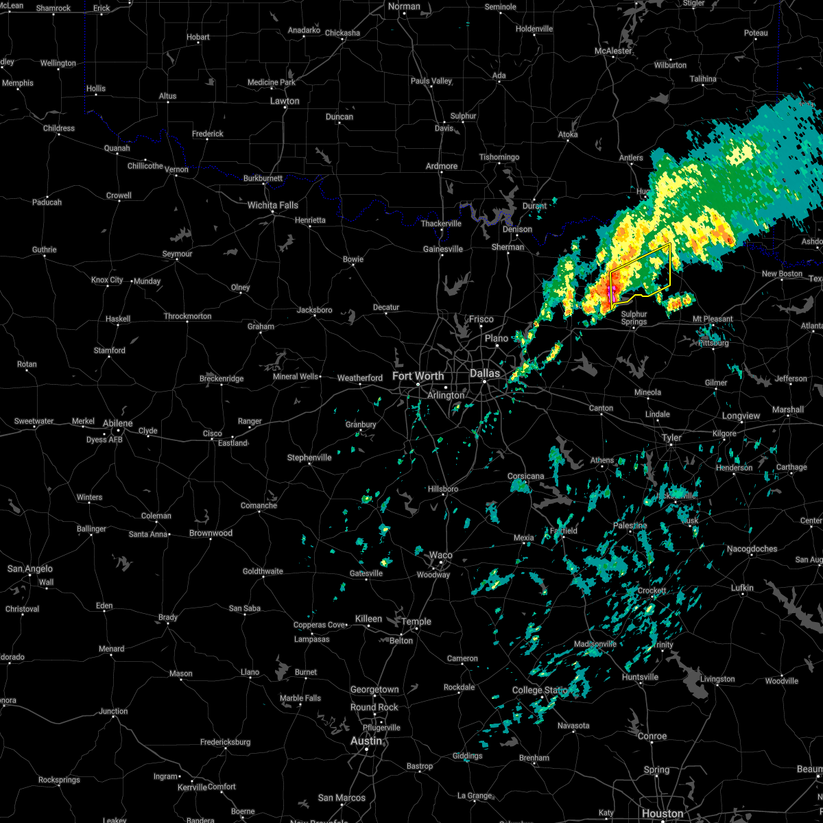 At 513 am cst, a severe thunderstorm was located over cooper, moving northeast at 55 mph (radar indicated). Hazards include half dollar size hail. Damage to vehicles is possible. locations impacted include, paris, cooper, blossom, deport, cooper lake park doctors creek and roxton. hail threat, radar indicated max hail size, 1. 25 in wind threat, radar indicated max wind gust, <50 mph. At 513 am cst, a severe thunderstorm was located over cooper, moving northeast at 55 mph (radar indicated). Hazards include half dollar size hail. Damage to vehicles is possible. locations impacted include, paris, cooper, blossom, deport, cooper lake park doctors creek and roxton. hail threat, radar indicated max hail size, 1. 25 in wind threat, radar indicated max wind gust, <50 mph.
|
| 2/22/2022 5:04 AM CST |
 At 503 am cst, a severe thunderstorm was located 5 miles north of commerce, moving northeast at 55 mph (radar indicated). Hazards include half dollar size hail. damage to vehicles is possible At 503 am cst, a severe thunderstorm was located 5 miles north of commerce, moving northeast at 55 mph (radar indicated). Hazards include half dollar size hail. damage to vehicles is possible
|
| 12/10/2021 6:15 PM CST |
 At 615 pm cst, a severe thunderstorm was located near deport, or 7 miles northwest of hagansport, moving northeast at 55 mph (radar indicated). Hazards include 60 mph wind gusts and quarter size hail. Hail damage to vehicles is expected. Expect wind damage to roofs, siding, and trees. At 615 pm cst, a severe thunderstorm was located near deport, or 7 miles northwest of hagansport, moving northeast at 55 mph (radar indicated). Hazards include 60 mph wind gusts and quarter size hail. Hail damage to vehicles is expected. Expect wind damage to roofs, siding, and trees.
|
| 10/11/2021 12:10 AM CDT |
 The severe thunderstorm warning for southeastern hunt, northwestern van zandt, hopkins, rains, southeastern lamar and delta counties will expire at 1215 am cdt, the storms which prompted the warning have moved out of the area. therefore the warning will be allowed to expire. a tornado watch remains in effect until 200 am cdt for north central texas. The severe thunderstorm warning for southeastern hunt, northwestern van zandt, hopkins, rains, southeastern lamar and delta counties will expire at 1215 am cdt, the storms which prompted the warning have moved out of the area. therefore the warning will be allowed to expire. a tornado watch remains in effect until 200 am cdt for north central texas.
|
| 10/10/2021 11:28 PM CDT |
 At 1126 pm cdt, severe thunderstorms were located along a line extending from near paris to near wills point, moving east at 40 mph (radar indicated). Hazards include 60 mph wind gusts. expect damage to roofs, siding, and trees At 1126 pm cdt, severe thunderstorms were located along a line extending from near paris to near wills point, moving east at 40 mph (radar indicated). Hazards include 60 mph wind gusts. expect damage to roofs, siding, and trees
|
| 10/10/2021 11:24 PM CDT |
 At 1123 pm cdt, severe thunderstorms were located along a line extending from near raymond gary state park to 7 miles southeast of paris to 6 miles northwest of sulphur springs, moving east at 45 mph (radar indicated). Hazards include 60 mph wind gusts and quarter size hail. Hail damage to vehicles is expected. Expect wind damage to roofs, siding, and trees. At 1123 pm cdt, severe thunderstorms were located along a line extending from near raymond gary state park to 7 miles southeast of paris to 6 miles northwest of sulphur springs, moving east at 45 mph (radar indicated). Hazards include 60 mph wind gusts and quarter size hail. Hail damage to vehicles is expected. Expect wind damage to roofs, siding, and trees.
|
| 10/10/2021 10:34 PM CDT |
 At 1034 pm cdt, severe thunderstorms were located along a line extending from 11 miles southeast of albany to near greenville to near combine, moving east at 60 mph (radar indicated). Hazards include 60 mph wind gusts and penny size hail. expect damage to roofs, siding, and trees At 1034 pm cdt, severe thunderstorms were located along a line extending from 11 miles southeast of albany to near greenville to near combine, moving east at 60 mph (radar indicated). Hazards include 60 mph wind gusts and penny size hail. expect damage to roofs, siding, and trees
|
| 5/3/2021 11:28 PM CDT |
 The severe thunderstorm warning for hopkins, rains, southeastern lamar and delta counties will expire at 1130 pm cdt, the storms which prompted the warning have moved out of the area. therefore the warning will be allowed to expire. however gusty winds and heavy rain are still possible with these thunderstorms. a severe thunderstorm watch remains in effect until 300 am cdt for north central texas. The severe thunderstorm warning for hopkins, rains, southeastern lamar and delta counties will expire at 1130 pm cdt, the storms which prompted the warning have moved out of the area. therefore the warning will be allowed to expire. however gusty winds and heavy rain are still possible with these thunderstorms. a severe thunderstorm watch remains in effect until 300 am cdt for north central texas.
|
| 5/3/2021 11:09 PM CDT |
 At 1108 pm cdt, severe thunderstorms were extending along a line from tira to sulphur springs to yantis, moving east at 35 mph. at 1104pm cdt, 87 mph wind gusts were observed at sulphur springs airport. these are very dangerous storms (radar indicated). Hazards include 80 mph wind gusts and quarter size hail. Flying debris will be dangerous to those caught without shelter. mobile homes will be heavily damaged. expect considerable damage to roofs, windows, and vehicles. extensive tree damage and power outages are likely. Locations impacted include, sulphur springs, cooper, emory, cumby, como, deport, cooper lake park south sulphur, cooper lake park doctors creek and tira. At 1108 pm cdt, severe thunderstorms were extending along a line from tira to sulphur springs to yantis, moving east at 35 mph. at 1104pm cdt, 87 mph wind gusts were observed at sulphur springs airport. these are very dangerous storms (radar indicated). Hazards include 80 mph wind gusts and quarter size hail. Flying debris will be dangerous to those caught without shelter. mobile homes will be heavily damaged. expect considerable damage to roofs, windows, and vehicles. extensive tree damage and power outages are likely. Locations impacted include, sulphur springs, cooper, emory, cumby, como, deport, cooper lake park south sulphur, cooper lake park doctors creek and tira.
|
| 5/3/2021 11:05 PM CDT |
 At 1104 pm cdt, a severe thunderstorm was located over sulphur springs, moving northeast at 40 mph (radar indicated). Hazards include 60 mph wind gusts and quarter size hail. Hail damage to vehicles is expected. expect wind damage to roofs, siding, and trees. Locations impacted include, sulphur springs, cooper, emory, cumby, como, deport, cooper lake park south sulphur, cooper lake park doctors creek and tira. At 1104 pm cdt, a severe thunderstorm was located over sulphur springs, moving northeast at 40 mph (radar indicated). Hazards include 60 mph wind gusts and quarter size hail. Hail damage to vehicles is expected. expect wind damage to roofs, siding, and trees. Locations impacted include, sulphur springs, cooper, emory, cumby, como, deport, cooper lake park south sulphur, cooper lake park doctors creek and tira.
|
| 5/3/2021 10:36 PM CDT |
 At 1036 pm cdt, a severe thunderstorm was located near cumby, or 8 miles south of commerce, moving northeast at 40 mph (radar indicated). Hazards include 60 mph wind gusts and quarter size hail. Hail damage to vehicles is expected. Expect wind damage to roofs, siding, and trees. At 1036 pm cdt, a severe thunderstorm was located near cumby, or 8 miles south of commerce, moving northeast at 40 mph (radar indicated). Hazards include 60 mph wind gusts and quarter size hail. Hail damage to vehicles is expected. Expect wind damage to roofs, siding, and trees.
|
| 4/28/2021 9:39 PM CDT |
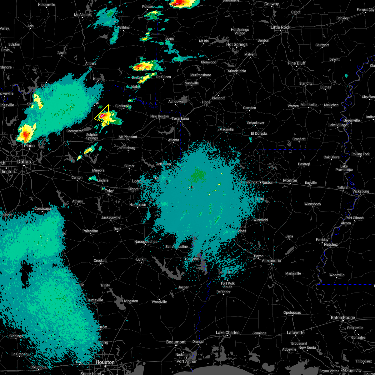 At 939 pm cdt, a severe thunderstorm was located near deport, or 15 miles southeast of paris, moving northeast at 45 mph (radar indicated). Hazards include quarter size hail. Damage to vehicles is possible. locations impacted include, deport. A tornado watch remains in effect until 200 am cdt for north central texas. At 939 pm cdt, a severe thunderstorm was located near deport, or 15 miles southeast of paris, moving northeast at 45 mph (radar indicated). Hazards include quarter size hail. Damage to vehicles is possible. locations impacted include, deport. A tornado watch remains in effect until 200 am cdt for north central texas.
|
| 4/28/2021 9:33 PM CDT |
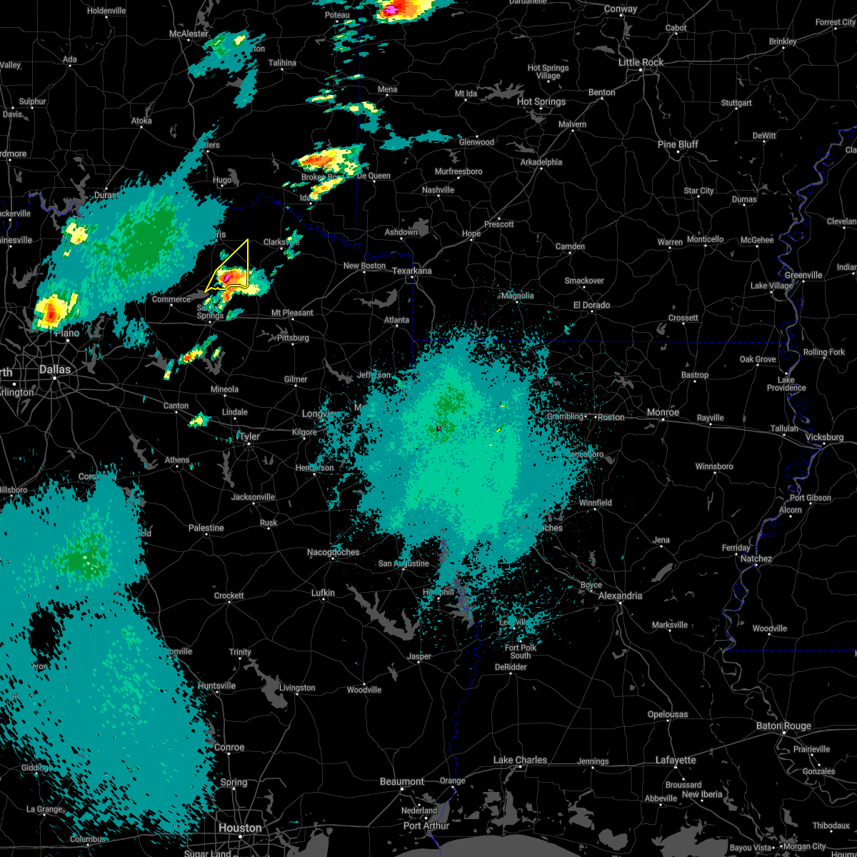 At 932 pm cdt, a severe thunderstorm was located 10 miles east of cooper lake park doctors creek, or 15 miles west of hagansport, moving northeast at 45 mph (radar indicated). Hazards include 60 mph wind gusts and quarter size hail. Hail damage to vehicles is expected. expect wind damage to roofs, siding, and trees. locations impacted include, deport. A tornado watch remains in effect until 200 am cdt for north central texas. At 932 pm cdt, a severe thunderstorm was located 10 miles east of cooper lake park doctors creek, or 15 miles west of hagansport, moving northeast at 45 mph (radar indicated). Hazards include 60 mph wind gusts and quarter size hail. Hail damage to vehicles is expected. expect wind damage to roofs, siding, and trees. locations impacted include, deport. A tornado watch remains in effect until 200 am cdt for north central texas.
|
| 4/28/2021 9:16 PM CDT |
 At 916 pm cdt, a severe thunderstorm was located near cooper lake park south sulphur, or 5 miles north of sulphur springs, moving northeast at 45 mph (radar indicated). Hazards include 60 mph wind gusts and quarter size hail. Hail damage to vehicles is expected. Expect wind damage to roofs, siding, and trees. At 916 pm cdt, a severe thunderstorm was located near cooper lake park south sulphur, or 5 miles north of sulphur springs, moving northeast at 45 mph (radar indicated). Hazards include 60 mph wind gusts and quarter size hail. Hail damage to vehicles is expected. Expect wind damage to roofs, siding, and trees.
|
| 4/9/2021 10:48 PM CDT |
 At 1047 pm cdt, severe thunderstorms were located along a line extending from 9 miles northeast of broken bow to near bogata, moving southeast at 50 mph. in addition, severe thunderstorms ahead of this line were located north of dekalb texas to southwest of horatio, moving east near 25 mph (radar indicated). Hazards include 60 mph wind gusts and half dollar size hail. Hail damage to vehicles is expected. Expect wind damage to roofs, siding, and trees. At 1047 pm cdt, severe thunderstorms were located along a line extending from 9 miles northeast of broken bow to near bogata, moving southeast at 50 mph. in addition, severe thunderstorms ahead of this line were located north of dekalb texas to southwest of horatio, moving east near 25 mph (radar indicated). Hazards include 60 mph wind gusts and half dollar size hail. Hail damage to vehicles is expected. Expect wind damage to roofs, siding, and trees.
|
| 4/9/2021 10:37 PM CDT |
 At 1037 pm cdt, severe thunderstorms were located along a line extending from near idabel to near campbell, moving southeast at 55 mph (radar indicated). Hazards include 60 mph wind gusts. Expect damage to roofs, siding, and trees. Locations impacted include, paris, honey grove, blossom, deport, roxton, ladonia, pecan gap, toco and sun valley. At 1037 pm cdt, severe thunderstorms were located along a line extending from near idabel to near campbell, moving southeast at 55 mph (radar indicated). Hazards include 60 mph wind gusts. Expect damage to roofs, siding, and trees. Locations impacted include, paris, honey grove, blossom, deport, roxton, ladonia, pecan gap, toco and sun valley.
|
| 4/9/2021 10:21 PM CDT |
 At 1021 pm cdt, severe thunderstorms were located along a line extending from near powderly to leonard, moving southeast at 50 mph (radar indicated). Hazards include 60 mph wind gusts and penny size hail. Expect damage to roofs, siding, and trees. Locations impacted include, paris, bonham, leonard, honey grove, blossom, deport, dodd city, bailey, bonham state park, roxton, ladonia, pecan gap, windom, toco and sun valley. At 1021 pm cdt, severe thunderstorms were located along a line extending from near powderly to leonard, moving southeast at 50 mph (radar indicated). Hazards include 60 mph wind gusts and penny size hail. Expect damage to roofs, siding, and trees. Locations impacted include, paris, bonham, leonard, honey grove, blossom, deport, dodd city, bailey, bonham state park, roxton, ladonia, pecan gap, windom, toco and sun valley.
|
| 4/9/2021 10:03 PM CDT |
 At 1003 pm cdt, severe thunderstorms were located along a line extending from fort towson to whitewright, moving southeast at 45 mph (radar indicated). Hazards include 60 mph wind gusts and penny size hail. Expect damage to roofs, siding, and trees. Locations impacted include, paris, bonham, leonard, honey grove, whitewright, blossom, savoy, ector, deport, dodd city, bailey, ravenna, bonham state park, roxton, trenton, ladonia, pecan gap, windom, toco and sun valley. At 1003 pm cdt, severe thunderstorms were located along a line extending from fort towson to whitewright, moving southeast at 45 mph (radar indicated). Hazards include 60 mph wind gusts and penny size hail. Expect damage to roofs, siding, and trees. Locations impacted include, paris, bonham, leonard, honey grove, whitewright, blossom, savoy, ector, deport, dodd city, bailey, ravenna, bonham state park, roxton, trenton, ladonia, pecan gap, windom, toco and sun valley.
|
| 4/9/2021 9:42 PM CDT |
 At 941 pm cdt, severe thunderstorms were located along a line extending from near savoy to telephone to antlers, moving southeast at 55 mph (radar indicated). Hazards include 60 mph wind gusts and penny size hail. expect damage to roofs, siding, and trees At 941 pm cdt, severe thunderstorms were located along a line extending from near savoy to telephone to antlers, moving southeast at 55 mph (radar indicated). Hazards include 60 mph wind gusts and penny size hail. expect damage to roofs, siding, and trees
|
| 4/9/2021 11:48 AM CDT | Golf Ball sized hail reported 0.3 miles E of Deport, TX, report from mping: golf ball (1.75 in.). |
| 11/24/2020 9:43 PM CST |
 At 942 pm cst, a severe thunderstorm was located 7 miles southwest of paris, moving east at 55 mph (radar indicated). Hazards include 60 mph wind gusts. Expect damage to roofs, siding, and trees. Locations impacted include, paris, cooper, blossom, deport, cooper lake park doctors creek, roxton, pecan gap, toco and sun valley. At 942 pm cst, a severe thunderstorm was located 7 miles southwest of paris, moving east at 55 mph (radar indicated). Hazards include 60 mph wind gusts. Expect damage to roofs, siding, and trees. Locations impacted include, paris, cooper, blossom, deport, cooper lake park doctors creek, roxton, pecan gap, toco and sun valley.
|
| 11/24/2020 9:14 PM CST |
 At 914 pm cst, a severe thunderstorm was located near bailey, or 9 miles southeast of bonham, moving east at 55 mph (radar indicated). Hazards include 60 mph wind gusts. expect damage to roofs, siding, and trees At 914 pm cst, a severe thunderstorm was located near bailey, or 9 miles southeast of bonham, moving east at 55 mph (radar indicated). Hazards include 60 mph wind gusts. expect damage to roofs, siding, and trees
|
| 9/27/2020 11:35 PM CDT | Quarter sized hail reported 6.1 miles W of Deport, TX, reported by trained spotter on highway 37 between bogata and clarksville. |
| 9/27/2020 11:29 PM CDT |
 At 1129 pm cdt, a severe thunderstorm was located near deport, or 12 miles north of hagansport, moving east at 20 mph (radar indicated). Hazards include 60 mph wind gusts and quarter size hail. Hail damage to vehicles is expected. Expect wind damage to roofs, siding, and trees. At 1129 pm cdt, a severe thunderstorm was located near deport, or 12 miles north of hagansport, moving east at 20 mph (radar indicated). Hazards include 60 mph wind gusts and quarter size hail. Hail damage to vehicles is expected. Expect wind damage to roofs, siding, and trees.
|
| 9/27/2020 11:14 PM CDT |
 At 1114 pm cdt, severe thunderstorms were located along a line extending from near deport to 8 miles southwest of honey grove, moving southeast at 35 mph (radar indicated). Hazards include 60 mph wind gusts and quarter size hail. Hail damage to vehicles is expected. Expect wind damage to roofs, siding, and trees. At 1114 pm cdt, severe thunderstorms were located along a line extending from near deport to 8 miles southwest of honey grove, moving southeast at 35 mph (radar indicated). Hazards include 60 mph wind gusts and quarter size hail. Hail damage to vehicles is expected. Expect wind damage to roofs, siding, and trees.
|
| 9/27/2020 10:49 PM CDT |
 At 1048 pm cdt, severe thunderstorms were located along a line extending from a bonham to paris line, moving southwest at 25 mph (radar indicated). Hazards include 60 mph wind gusts and quarter size hail. Hail damage to vehicles is expected. expect wind damage to roofs, siding, and trees. these severe storms will be near, bonham, dodd city, ravenna and bonham state park around 1055 pm cdt. honey grove around 1105 pm cdt. Other locations impacted by these severe thunderstorms include toco, roxton, sun valley, ladonia, windom and pecan gap. At 1048 pm cdt, severe thunderstorms were located along a line extending from a bonham to paris line, moving southwest at 25 mph (radar indicated). Hazards include 60 mph wind gusts and quarter size hail. Hail damage to vehicles is expected. expect wind damage to roofs, siding, and trees. these severe storms will be near, bonham, dodd city, ravenna and bonham state park around 1055 pm cdt. honey grove around 1105 pm cdt. Other locations impacted by these severe thunderstorms include toco, roxton, sun valley, ladonia, windom and pecan gap.
|
| 9/27/2020 10:13 PM CDT |
 At 1012 pm cdt, severe thunderstorms were located along a line extending from near boswell to 12 miles southeast of bennington to near ravenna, moving southeast at 30 mph (radar indicated). Hazards include 65 mph wind gusts and quarter size hail. Hail damage to vehicles is expected. expect wind damage to roofs, siding, and trees. severe thunderstorms will be near, bonham state park around 1035 pm cdt. dodd city around 1040 pm cdt. paris and honey grove around 1050 pm cdt. blossom around 1110 pm cdt. Other locations impacted by these severe thunderstorms include direct, camp maxey, toco, powderly, roxton, sun valley, ladonia, windom and pecan gap. At 1012 pm cdt, severe thunderstorms were located along a line extending from near boswell to 12 miles southeast of bennington to near ravenna, moving southeast at 30 mph (radar indicated). Hazards include 65 mph wind gusts and quarter size hail. Hail damage to vehicles is expected. expect wind damage to roofs, siding, and trees. severe thunderstorms will be near, bonham state park around 1035 pm cdt. dodd city around 1040 pm cdt. paris and honey grove around 1050 pm cdt. blossom around 1110 pm cdt. Other locations impacted by these severe thunderstorms include direct, camp maxey, toco, powderly, roxton, sun valley, ladonia, windom and pecan gap.
|
| 5/24/2020 5:02 PM CDT |
 At 502 pm cdt, severe thunderstorms were located along a line extending from near bogata to 7 miles west of boxelder to 12 miles east of clarksville to near de kalb, moving north at 60 mph (radar indicated). Hazards include 60 mph wind gusts and nickel size hail. Expect damage to roofs, siding, and trees. Locations impacted include, clarksville, hagansport, boxelder, de kalb, bogata, wilkerson, bagwell, manchester, dalby springs, detroit, talco, avery, annona, beaverdams, harts bluff, lydia, negley, cuthand, woodland and english. At 502 pm cdt, severe thunderstorms were located along a line extending from near bogata to 7 miles west of boxelder to 12 miles east of clarksville to near de kalb, moving north at 60 mph (radar indicated). Hazards include 60 mph wind gusts and nickel size hail. Expect damage to roofs, siding, and trees. Locations impacted include, clarksville, hagansport, boxelder, de kalb, bogata, wilkerson, bagwell, manchester, dalby springs, detroit, talco, avery, annona, beaverdams, harts bluff, lydia, negley, cuthand, woodland and english.
|
| 5/24/2020 4:21 PM CDT |
 At 421 pm cdt, severe thunderstorms were located along a line extending from near scroggins to near pittsburg to near rocky branch, moving north at 45 mph (radar indicated. large hail and damaging winds have been reported throughout upshur county with these storms). Hazards include 60 mph wind gusts and quarter size hail. Hail damage to vehicles is expected. Expect wind damage to roofs, siding, and trees. At 421 pm cdt, severe thunderstorms were located along a line extending from near scroggins to near pittsburg to near rocky branch, moving north at 45 mph (radar indicated. large hail and damaging winds have been reported throughout upshur county with these storms). Hazards include 60 mph wind gusts and quarter size hail. Hail damage to vehicles is expected. Expect wind damage to roofs, siding, and trees.
|
| 5/8/2020 4:45 AM CDT |
 At 444 am cdt, severe thunderstorms were located along a line extending from 8 miles northwest of cooper to near leonard to gunter, moving southeast at 35 mph (radar indicated). Hazards include 60 mph wind gusts and quarter size hail. Hail damage to vehicles is expected. expect wind damage to roofs, siding, and trees. Locations impacted include, mckinney, frisco, denton, sherman, greenville, paris, sulphur springs, bonham, commerce, prosper, anna, princeton, celina, pilot point, farmersville, van alstyne, howe, aubrey, leonard and cooper. At 444 am cdt, severe thunderstorms were located along a line extending from 8 miles northwest of cooper to near leonard to gunter, moving southeast at 35 mph (radar indicated). Hazards include 60 mph wind gusts and quarter size hail. Hail damage to vehicles is expected. expect wind damage to roofs, siding, and trees. Locations impacted include, mckinney, frisco, denton, sherman, greenville, paris, sulphur springs, bonham, commerce, prosper, anna, princeton, celina, pilot point, farmersville, van alstyne, howe, aubrey, leonard and cooper.
|
| 5/8/2020 4:34 AM CDT |
 At 433 am cdt, severe thunderstorms were located along a line extending from 8 miles southwest of new boston to near dalby springs to near wilkerson to 8 miles southwest of deport, moving southeast at 55 mph (radar indicated). Hazards include 60 mph wind gusts and quarter size hail. Hail damage to vehicles is expected. expect wind damage to roofs, siding, and trees. Locations impacted include, mount pleasant, pittsburg, winnsboro, clarksville, leesburg, hagansport, boxelder, mount vernon, daingerfield, hughes springs, naples, bogata, omaha, cason, us 259 and i 30 intersection, cookville, scroggins, rocky branch, wilkerson and jenkins. At 433 am cdt, severe thunderstorms were located along a line extending from 8 miles southwest of new boston to near dalby springs to near wilkerson to 8 miles southwest of deport, moving southeast at 55 mph (radar indicated). Hazards include 60 mph wind gusts and quarter size hail. Hail damage to vehicles is expected. expect wind damage to roofs, siding, and trees. Locations impacted include, mount pleasant, pittsburg, winnsboro, clarksville, leesburg, hagansport, boxelder, mount vernon, daingerfield, hughes springs, naples, bogata, omaha, cason, us 259 and i 30 intersection, cookville, scroggins, rocky branch, wilkerson and jenkins.
|
| 5/8/2020 4:08 AM CDT |
 At 407 am cdt, severe thunderstorms were located along a line extending from near blossom to 7 miles north of dodd city to 6 miles west of knollwood to lindsay, moving southeast at 30 mph (radar indicated). Hazards include 60 mph wind gusts and quarter size hail. Hail damage to vehicles is expected. Expect wind damage to roofs, siding, and trees. At 407 am cdt, severe thunderstorms were located along a line extending from near blossom to 7 miles north of dodd city to 6 miles west of knollwood to lindsay, moving southeast at 30 mph (radar indicated). Hazards include 60 mph wind gusts and quarter size hail. Hail damage to vehicles is expected. Expect wind damage to roofs, siding, and trees.
|
| 5/8/2020 4:06 AM CDT | Quarter sized hail reported 0.3 miles E of Deport, TX, report from mping: quarter (1.00 in.). |
| 5/8/2020 3:58 AM CDT |
 At 358 am cdt, a severe thunderstorm was located near clarksville, moving southeast at 60 mph (radar indicated). Hazards include 60 mph wind gusts and quarter size hail. Hail damage to vehicles is expected. Expect wind damage to roofs, siding, and trees. At 358 am cdt, a severe thunderstorm was located near clarksville, moving southeast at 60 mph (radar indicated). Hazards include 60 mph wind gusts and quarter size hail. Hail damage to vehicles is expected. Expect wind damage to roofs, siding, and trees.
|
| 5/8/2020 3:50 AM CDT |
 At 349 am cdt, severe thunderstorms were located along a line extending from 8 miles west of broken bow to near clarksville to near paris to near ravenna, moving southeast at 50 mph (radar indicated). Hazards include 70 mph wind gusts and quarter size hail. Hail damage to vehicles is expected. expect considerable tree damage. wind damage is also likely to mobile homes, roofs, and outbuildings. Locations impacted include, greenville, paris, sulphur springs, bonham, commerce, leonard, cooper, honey grove, whitewright, blossom, wolfe city, savoy, celeste, ector, campbell, deport, dodd city, bailey, ravenna and bonham state park. At 349 am cdt, severe thunderstorms were located along a line extending from 8 miles west of broken bow to near clarksville to near paris to near ravenna, moving southeast at 50 mph (radar indicated). Hazards include 70 mph wind gusts and quarter size hail. Hail damage to vehicles is expected. expect considerable tree damage. wind damage is also likely to mobile homes, roofs, and outbuildings. Locations impacted include, greenville, paris, sulphur springs, bonham, commerce, leonard, cooper, honey grove, whitewright, blossom, wolfe city, savoy, celeste, ector, campbell, deport, dodd city, bailey, ravenna and bonham state park.
|
| 5/8/2020 3:13 AM CDT |
 At 312 am cdt, severe thunderstorms were located along a line extending from 7 miles southeast of kosoma to 7 miles south of soper to near durant, moving southeast at 65 mph (radar indicated). Hazards include 70 mph wind gusts and quarter size hail. Hail damage to vehicles is expected. expect considerable tree damage. Wind damage is also likely to mobile homes, roofs, and outbuildings. At 312 am cdt, severe thunderstorms were located along a line extending from 7 miles southeast of kosoma to 7 miles south of soper to near durant, moving southeast at 65 mph (radar indicated). Hazards include 70 mph wind gusts and quarter size hail. Hail damage to vehicles is expected. expect considerable tree damage. Wind damage is also likely to mobile homes, roofs, and outbuildings.
|
| 4/28/2020 11:25 PM CDT |
 At 1124 pm cdt, severe thunderstorms were located along a line extending from near blevins to near hope to 6 miles southwest of fulton to near new boston to near boxelder to near bogata, moving south at 40 mph (radar indicated). Hazards include 70 mph wind gusts and quarter size hail. Hail damage to vehicles is expected. expect considerable tree damage. wind damage is also likely to mobile homes, roofs, and outbuildings. Locations impacted include, texarkana, wake village, ashdown, nashville, new boston, clarksville, mineral springs, foreman, boxelder, nash, hooks, de kalb, bogata, redwater, maud, red lick, wilton, blevins, tollette and fulton. At 1124 pm cdt, severe thunderstorms were located along a line extending from near blevins to near hope to 6 miles southwest of fulton to near new boston to near boxelder to near bogata, moving south at 40 mph (radar indicated). Hazards include 70 mph wind gusts and quarter size hail. Hail damage to vehicles is expected. expect considerable tree damage. wind damage is also likely to mobile homes, roofs, and outbuildings. Locations impacted include, texarkana, wake village, ashdown, nashville, new boston, clarksville, mineral springs, foreman, boxelder, nash, hooks, de kalb, bogata, redwater, maud, red lick, wilton, blevins, tollette and fulton.
|
| 4/28/2020 11:18 PM CDT |
 At 1118 pm cdt, severe thunderstorms were located along a line extending from deport to near celina, moving south at 40 mph (radar indicated). Hazards include 60 mph wind gusts and quarter size hail. Hail damage to vehicles is expected. expect wind damage to roofs, siding, and trees. Locations impacted include, paris, bonham, van alstyne, leonard, honey grove, whitewright, blossom, tom bean, ector, deport, dodd city, bailey, bonham state park, roxton, trenton, ladonia, pecan gap, windom, toco and sun valley. At 1118 pm cdt, severe thunderstorms were located along a line extending from deport to near celina, moving south at 40 mph (radar indicated). Hazards include 60 mph wind gusts and quarter size hail. Hail damage to vehicles is expected. expect wind damage to roofs, siding, and trees. Locations impacted include, paris, bonham, van alstyne, leonard, honey grove, whitewright, blossom, tom bean, ector, deport, dodd city, bailey, bonham state park, roxton, trenton, ladonia, pecan gap, windom, toco and sun valley.
|
| 4/28/2020 11:05 PM CDT |
 At 1105 pm cdt, severe thunderstorms were located along a line extending from near deport to 9 miles south of honey grove to mckinney, moving southeast at 30 mph (radar indicated). Hazards include 60 mph wind gusts and quarter size hail. Hail damage to vehicles is expected. Expect wind damage to roofs, siding, and trees. At 1105 pm cdt, severe thunderstorms were located along a line extending from near deport to 9 miles south of honey grove to mckinney, moving southeast at 30 mph (radar indicated). Hazards include 60 mph wind gusts and quarter size hail. Hail damage to vehicles is expected. Expect wind damage to roofs, siding, and trees.
|
| 4/28/2020 11:01 PM CDT |
 The national weather service in shreveport has issued a * severe thunderstorm warning for. little river county in southwestern arkansas. central hempstead county in southwestern arkansas. northwestern miller county in southwestern arkansas. Southeastern sevier county in southwestern arkansas. The national weather service in shreveport has issued a * severe thunderstorm warning for. little river county in southwestern arkansas. central hempstead county in southwestern arkansas. northwestern miller county in southwestern arkansas. Southeastern sevier county in southwestern arkansas.
|
| 4/28/2020 11:01 PM CDT |
 At 1100 pm cdt, severe thunderstorms were located along a line extending from near corinth to near ben lomond to near foreman to 12 miles south of idabel to near bagwell, moving southeast at 45 mph (radar indicated). Hazards include 70 mph wind gusts and quarter size hail. Hail damage to vehicles is expected. expect considerable tree damage. Wind damage is also likely to mobile homes, roofs, and outbuildings. At 1100 pm cdt, severe thunderstorms were located along a line extending from near corinth to near ben lomond to near foreman to 12 miles south of idabel to near bagwell, moving southeast at 45 mph (radar indicated). Hazards include 70 mph wind gusts and quarter size hail. Hail damage to vehicles is expected. expect considerable tree damage. Wind damage is also likely to mobile homes, roofs, and outbuildings.
|
| 4/28/2020 10:32 PM CDT |
 At 1031 pm cdt, severe thunderstorms were located along a line extending from sawyer to lake texoma, moving south at 40 mph (radar indicated). Hazards include 60 mph wind gusts and quarter size hail. Hail damage to vehicles is expected. Expect wind damage to roofs, siding, and trees. At 1031 pm cdt, severe thunderstorms were located along a line extending from sawyer to lake texoma, moving south at 40 mph (radar indicated). Hazards include 60 mph wind gusts and quarter size hail. Hail damage to vehicles is expected. Expect wind damage to roofs, siding, and trees.
|
| 4/28/2020 10:25 PM CDT |
 At 1025 pm cdt, severe thunderstorms were located along a line extending from near albert pike recreation area to 7 miles northeast of manchester, moving southeast at 60 mph (radar indicated). Hazards include 70 mph wind gusts and quarter size hail. Hail damage to vehicles is expected. expect considerable tree damage. Wind damage is also likely to mobile homes, roofs, and outbuildings. At 1025 pm cdt, severe thunderstorms were located along a line extending from near albert pike recreation area to 7 miles northeast of manchester, moving southeast at 60 mph (radar indicated). Hazards include 70 mph wind gusts and quarter size hail. Hail damage to vehicles is expected. expect considerable tree damage. Wind damage is also likely to mobile homes, roofs, and outbuildings.
|
| 4/28/2020 9:46 PM CDT |
 At 945 pm cdt, a severe thunderstorm was located near deport, or 13 miles west of clarksville, moving east at 40 mph (radar indicated). Hazards include 60 mph wind gusts and half dollar size hail. Hail damage to vehicles is expected. Expect wind damage to roofs, siding, and trees. At 945 pm cdt, a severe thunderstorm was located near deport, or 13 miles west of clarksville, moving east at 40 mph (radar indicated). Hazards include 60 mph wind gusts and half dollar size hail. Hail damage to vehicles is expected. Expect wind damage to roofs, siding, and trees.
|
| 4/24/2020 8:09 PM CDT |
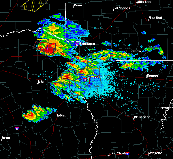 The tornado warning for southeastern lamar county will expire at 815 pm cdt, the storm which prompted the warning has moved out of the area. therefore the warning will be allowed to expire. The tornado warning for southeastern lamar county will expire at 815 pm cdt, the storm which prompted the warning has moved out of the area. therefore the warning will be allowed to expire.
|
| 4/24/2020 8:03 PM CDT |
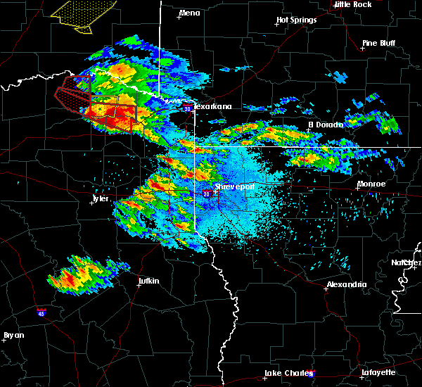 At 803 pm cdt, a severe thunderstorm capable of producing a tornado was located near hagansport, moving southeast at 40 mph (radar indicated rotation). Hazards include tornado and two inch hail. Flying debris will be dangerous to those caught without shelter. mobile homes will be damaged or destroyed. damage to roofs, windows, and vehicles will occur. tree damage is likely. This tornadic thunderstorm will remain over mainly rural areas of southeastern lamar county. At 803 pm cdt, a severe thunderstorm capable of producing a tornado was located near hagansport, moving southeast at 40 mph (radar indicated rotation). Hazards include tornado and two inch hail. Flying debris will be dangerous to those caught without shelter. mobile homes will be damaged or destroyed. damage to roofs, windows, and vehicles will occur. tree damage is likely. This tornadic thunderstorm will remain over mainly rural areas of southeastern lamar county.
|
| 4/24/2020 7:53 PM CDT |
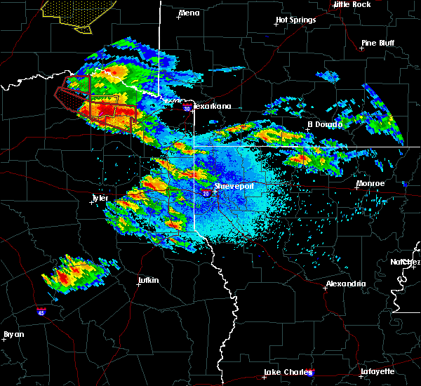 At 752 pm cdt, a severe thunderstorm capable of producing a tornado was located near bogata, or near hagansport, moving east at 35 mph (radar indicated rotation). Hazards include tornado and two inch hail. Flying debris will be dangerous to those caught without shelter. mobile homes will be damaged or destroyed. damage to roofs, windows, and vehicles will occur. tree damage is likely. this dangerous storm will be near, wilkerson around 815 pm cdt. boxelder around 820 pm cdt. Other locations impacted by this tornadic thunderstorm include lydia, johntown, cuthand, talco and harts bluff. At 752 pm cdt, a severe thunderstorm capable of producing a tornado was located near bogata, or near hagansport, moving east at 35 mph (radar indicated rotation). Hazards include tornado and two inch hail. Flying debris will be dangerous to those caught without shelter. mobile homes will be damaged or destroyed. damage to roofs, windows, and vehicles will occur. tree damage is likely. this dangerous storm will be near, wilkerson around 815 pm cdt. boxelder around 820 pm cdt. Other locations impacted by this tornadic thunderstorm include lydia, johntown, cuthand, talco and harts bluff.
|
| 4/24/2020 7:40 PM CDT |
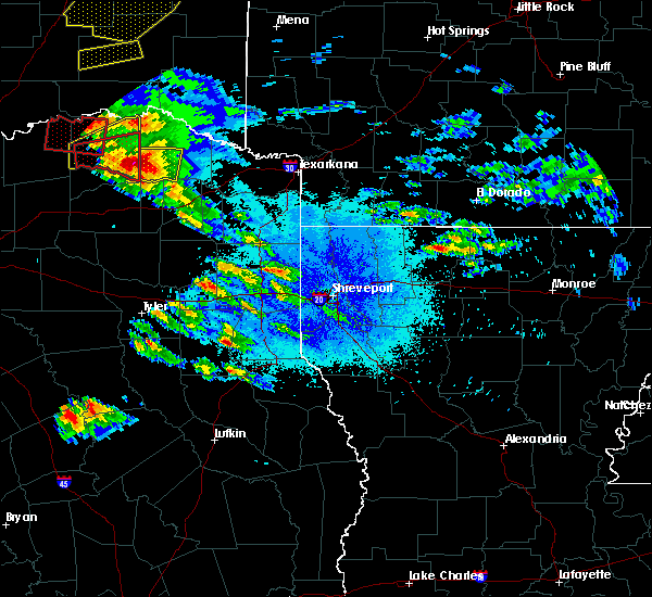 At 740 pm cdt, a severe thunderstorm capable of producing a tornado was located near deport, or 8 miles northwest of hagansport, moving east at 35 mph (radar indicated rotation). Hazards include tornado and golf ball size hail. Flying debris will be dangerous to those caught without shelter. mobile homes will be damaged or destroyed. damage to roofs, windows, and vehicles will occur. tree damage is likely. this dangerous storm will be near, bogata around 745 pm cdt. hagansport around 750 pm cdt. wilkerson around 815 pm cdt. boxelder around 820 pm cdt. Other locations impacted by this tornadic thunderstorm include lydia, johntown, cuthand, talco and harts bluff. At 740 pm cdt, a severe thunderstorm capable of producing a tornado was located near deport, or 8 miles northwest of hagansport, moving east at 35 mph (radar indicated rotation). Hazards include tornado and golf ball size hail. Flying debris will be dangerous to those caught without shelter. mobile homes will be damaged or destroyed. damage to roofs, windows, and vehicles will occur. tree damage is likely. this dangerous storm will be near, bogata around 745 pm cdt. hagansport around 750 pm cdt. wilkerson around 815 pm cdt. boxelder around 820 pm cdt. Other locations impacted by this tornadic thunderstorm include lydia, johntown, cuthand, talco and harts bluff.
|
| 4/24/2020 7:38 PM CDT |
 At 737 pm cdt, a thunderstorm with a history of producing tornadoes was located near paris, moving east at 35 mph (weather spotters confirmed tornado). Hazards include damaging tornado and hail up to two inches in diameter. Flying debris will be dangerous to those caught without shelter. mobile homes will be damaged or destroyed. damage to roofs, windows, and vehicles will occur. tree damage is likely. the tornado will be near, paris around 745 pm cdt. blossom around 800 pm cdt. deport around 810 pm cdt. Other locations impacted by this tornadic thunderstorm include toco and sun valley. At 737 pm cdt, a thunderstorm with a history of producing tornadoes was located near paris, moving east at 35 mph (weather spotters confirmed tornado). Hazards include damaging tornado and hail up to two inches in diameter. Flying debris will be dangerous to those caught without shelter. mobile homes will be damaged or destroyed. damage to roofs, windows, and vehicles will occur. tree damage is likely. the tornado will be near, paris around 745 pm cdt. blossom around 800 pm cdt. deport around 810 pm cdt. Other locations impacted by this tornadic thunderstorm include toco and sun valley.
|
| 4/24/2020 7:33 PM CDT |
 At 732 pm cdt, a severe thunderstorm was located over deport, or 14 miles northwest of hagansport, moving east at 35 mph (radar indicated). Hazards include golf ball size hail and 70 mph wind gusts. People and animals outdoors will be injured. expect hail damage to roofs, siding, windows, and vehicles. expect considerable tree damage. wind damage is also likely to mobile homes, roofs, and outbuildings. Locations impacted include, clarksville, bogata, johntown and cuthand. At 732 pm cdt, a severe thunderstorm was located over deport, or 14 miles northwest of hagansport, moving east at 35 mph (radar indicated). Hazards include golf ball size hail and 70 mph wind gusts. People and animals outdoors will be injured. expect hail damage to roofs, siding, windows, and vehicles. expect considerable tree damage. wind damage is also likely to mobile homes, roofs, and outbuildings. Locations impacted include, clarksville, bogata, johntown and cuthand.
|
| 4/24/2020 7:09 PM CDT |
 At 708 pm cdt, a confirmed tornado was located 8 miles south of paris, moving east at 35 mph (weather spotters confirmed tornado). Hazards include damaging tornado and golf ball size hail. Flying debris will be dangerous to those caught without shelter. mobile homes will be damaged or destroyed. damage to roofs, windows, and vehicles will occur. tree damage is likely. this tornado will be near, deport around 735 pm cdt. Other locations impacted by this tornadic thunderstorm include toco, roxton and sun valley. At 708 pm cdt, a confirmed tornado was located 8 miles south of paris, moving east at 35 mph (weather spotters confirmed tornado). Hazards include damaging tornado and golf ball size hail. Flying debris will be dangerous to those caught without shelter. mobile homes will be damaged or destroyed. damage to roofs, windows, and vehicles will occur. tree damage is likely. this tornado will be near, deport around 735 pm cdt. Other locations impacted by this tornadic thunderstorm include toco, roxton and sun valley.
|
| 4/24/2020 7:08 PM CDT |
 At 708 pm cdt, a severe thunderstorm was located near paris, moving east at 35 mph (radar indicated). Hazards include golf ball size hail and 60 mph wind gusts. People and animals outdoors will be injured. expect hail damage to roofs, siding, windows, and vehicles. Expect wind damage to roofs, siding, and trees. At 708 pm cdt, a severe thunderstorm was located near paris, moving east at 35 mph (radar indicated). Hazards include golf ball size hail and 60 mph wind gusts. People and animals outdoors will be injured. expect hail damage to roofs, siding, windows, and vehicles. Expect wind damage to roofs, siding, and trees.
|
| 4/24/2020 6:54 PM CDT |
 At 653 pm cdt, a severe thunderstorm capable of producing a tornado was located 10 miles east of honey grove, or 11 miles southwest of paris, moving east at 30 mph (radar indicated rotation). Hazards include tornado and golf ball size hail. Flying debris will be dangerous to those caught without shelter. mobile homes will be damaged or destroyed. damage to roofs, windows, and vehicles will occur. tree damage is likely. this dangerous storm will be near, blossom around 735 pm cdt. deport around 740 pm cdt. Other locations impacted by this tornadic thunderstorm include toco, roxton and sun valley. At 653 pm cdt, a severe thunderstorm capable of producing a tornado was located 10 miles east of honey grove, or 11 miles southwest of paris, moving east at 30 mph (radar indicated rotation). Hazards include tornado and golf ball size hail. Flying debris will be dangerous to those caught without shelter. mobile homes will be damaged or destroyed. damage to roofs, windows, and vehicles will occur. tree damage is likely. this dangerous storm will be near, blossom around 735 pm cdt. deport around 740 pm cdt. Other locations impacted by this tornadic thunderstorm include toco, roxton and sun valley.
|
| 4/24/2020 6:45 PM CDT |
 At 645 pm cdt, a severe thunderstorm was located near honey grove, or 15 miles west of paris, moving east at 20 mph (radar indicated). Hazards include 60 mph wind gusts and quarter size hail. Hail damage to vehicles is expected. Expect wind damage to roofs, siding, and trees. At 645 pm cdt, a severe thunderstorm was located near honey grove, or 15 miles west of paris, moving east at 20 mph (radar indicated). Hazards include 60 mph wind gusts and quarter size hail. Hail damage to vehicles is expected. Expect wind damage to roofs, siding, and trees.
|
| 4/19/2020 3:52 PM CDT |
 At 351 pm cdt, a severe thunderstorm was located near deport, or 13 miles southeast of paris, moving east at 60 mph (radar indicated). Hazards include quarter size hail. Damage to vehicles is possible. Locations impacted include, paris, blossom, deport and sun valley. At 351 pm cdt, a severe thunderstorm was located near deport, or 13 miles southeast of paris, moving east at 60 mph (radar indicated). Hazards include quarter size hail. Damage to vehicles is possible. Locations impacted include, paris, blossom, deport and sun valley.
|
| 4/19/2020 3:42 PM CDT |
 At 342 pm cdt, a severe thunderstorm was located 9 miles south of paris, moving east at 50 mph (radar indicated). Hazards include quarter size hail. damage to vehicles is possible At 342 pm cdt, a severe thunderstorm was located 9 miles south of paris, moving east at 50 mph (radar indicated). Hazards include quarter size hail. damage to vehicles is possible
|
| 1/10/2020 6:16 PM CST |
 At 615 pm cst, a severe thunderstorm capable of producing a tornado was located near cooper, moving northeast at 45 mph (radar indicated rotation). Hazards include tornado and quarter size hail. Flying debris will be dangerous to those caught without shelter. mobile homes will be damaged or destroyed. damage to roofs, windows, and vehicles will occur. tree damage is likely. This potentially tornadic circulation has tightened up and could produce a tornado at any time in central portions of delta county. At 615 pm cst, a severe thunderstorm capable of producing a tornado was located near cooper, moving northeast at 45 mph (radar indicated rotation). Hazards include tornado and quarter size hail. Flying debris will be dangerous to those caught without shelter. mobile homes will be damaged or destroyed. damage to roofs, windows, and vehicles will occur. tree damage is likely. This potentially tornadic circulation has tightened up and could produce a tornado at any time in central portions of delta county.
|
| 1/10/2020 6:04 PM CST |
 At 604 pm cst, a severe thunderstorm capable of producing a tornado was located near commerce, moving northeast at 50 mph (radar indicated rotation). Hazards include tornado and quarter size hail. Flying debris will be dangerous to those caught without shelter. mobile homes will be damaged or destroyed. damage to roofs, windows, and vehicles will occur. tree damage is likely. this dangerous storm will be near, cooper, cooper lake park doctors creek and cooper lake park south sulphur around 615 pm cst. deport around 645 pm cst. Other locations impacted by this tornadic thunderstorm include tira. At 604 pm cst, a severe thunderstorm capable of producing a tornado was located near commerce, moving northeast at 50 mph (radar indicated rotation). Hazards include tornado and quarter size hail. Flying debris will be dangerous to those caught without shelter. mobile homes will be damaged or destroyed. damage to roofs, windows, and vehicles will occur. tree damage is likely. this dangerous storm will be near, cooper, cooper lake park doctors creek and cooper lake park south sulphur around 615 pm cst. deport around 645 pm cst. Other locations impacted by this tornadic thunderstorm include tira.
|
| 11/30/2019 8:13 AM CST |
 The severe thunderstorm warning for lamar, northwestern delta and southeastern fannin counties will expire at 815 am cst, the storm which prompted the warning has weakened below severe limits. therefore the warning will be allowed to expire. however heavy rain is still possible with this thunderstorm. The severe thunderstorm warning for lamar, northwestern delta and southeastern fannin counties will expire at 815 am cst, the storm which prompted the warning has weakened below severe limits. therefore the warning will be allowed to expire. however heavy rain is still possible with this thunderstorm.
|
| 11/30/2019 7:36 AM CST |
 At 735 am cst, a severe thunderstorm was located 8 miles south of honey grove, or 16 miles north of commerce, moving northeast at 50 mph (radar indicated). Hazards include quarter size hail. damage to vehicles is possible At 735 am cst, a severe thunderstorm was located 8 miles south of honey grove, or 16 miles north of commerce, moving northeast at 50 mph (radar indicated). Hazards include quarter size hail. damage to vehicles is possible
|
| 10/21/2019 1:39 AM CDT |
 At 138 am cdt, a severe thunderstorm was located 10 miles north of sulphur springs, moving east at 40 mph (radar indicated). Hazards include 60 mph wind gusts. Expect damage to roofs, siding, and trees. locations impacted include, greenville, sulphur springs, commerce, cooper, caddo mills, cumby, campbell, deport, cooper lake park south sulphur, cooper lake park doctors creek, tira and neylandville. A tornado watch remains in effect until 200 am cdt for north central texas. At 138 am cdt, a severe thunderstorm was located 10 miles north of sulphur springs, moving east at 40 mph (radar indicated). Hazards include 60 mph wind gusts. Expect damage to roofs, siding, and trees. locations impacted include, greenville, sulphur springs, commerce, cooper, caddo mills, cumby, campbell, deport, cooper lake park south sulphur, cooper lake park doctors creek, tira and neylandville. A tornado watch remains in effect until 200 am cdt for north central texas.
|
| 10/21/2019 1:35 AM CDT |
 At 135 am cdt, severe thunderstorms were located along a line extending from 9 miles west of manchester to 7 miles southwest of deport to hawk cove, moving east at 50 mph (radar indicated). Hazards include 60 mph wind gusts and quarter size hail. Hail damage to vehicles is expected. Expect wind damage to roofs, siding, and trees. At 135 am cdt, severe thunderstorms were located along a line extending from 9 miles west of manchester to 7 miles southwest of deport to hawk cove, moving east at 50 mph (radar indicated). Hazards include 60 mph wind gusts and quarter size hail. Hail damage to vehicles is expected. Expect wind damage to roofs, siding, and trees.
|
| 10/21/2019 1:04 AM CDT |
 At 104 am cdt, a line of severe thunderstorms extends from wolfe city to greenville, moving east at 40 mph (radar indicated). Hazards include 65 mph wind gusts. expect damage to roofs, siding, and trees At 104 am cdt, a line of severe thunderstorms extends from wolfe city to greenville, moving east at 40 mph (radar indicated). Hazards include 65 mph wind gusts. expect damage to roofs, siding, and trees
|
| 10/20/2019 11:28 PM CDT | 3 inch size tree limbs and a few power poles down in depor in lamar county TX, 0.8 miles NNE of Deport, TX |
| 10/20/2019 11:16 PM CDT |
 At 1116 pm cdt, severe thunderstorms were located along a line extending from near broken bow to near idabel to near clarksville to 10 miles west of hagansport, moving east at 45 mph (radar indicated. power lines were downed near valliant oklahoma with these storms, and a roof was removed off of a building). Hazards include 60 mph wind gusts. expect damage to roofs, siding, and trees At 1116 pm cdt, severe thunderstorms were located along a line extending from near broken bow to near idabel to near clarksville to 10 miles west of hagansport, moving east at 45 mph (radar indicated. power lines were downed near valliant oklahoma with these storms, and a roof was removed off of a building). Hazards include 60 mph wind gusts. expect damage to roofs, siding, and trees
|
| 6/23/2019 7:45 PM CDT |
 At 745 pm cdt, severe thunderstorms were located along a line extending from 7 miles south of albert pike recreation area to 11 miles northeast of cooper lake park doctors creek, moving east at 30 mph (radar indicated). Hazards include 60 mph wind gusts and quarter size hail. Hail damage to vehicles is expected. Expect wind damage to roofs, siding, and trees. At 745 pm cdt, severe thunderstorms were located along a line extending from 7 miles south of albert pike recreation area to 11 miles northeast of cooper lake park doctors creek, moving east at 30 mph (radar indicated). Hazards include 60 mph wind gusts and quarter size hail. Hail damage to vehicles is expected. Expect wind damage to roofs, siding, and trees.
|
| 6/23/2019 7:05 PM CDT |
 At 704 pm cdt, severe thunderstorms were located along a line extending from near hartley to near blossom, moving northeast at 25 mph (radar indicated). Hazards include 60 mph wind gusts and quarter size hail. Hail damage to vehicles is expected. Expect wind damage to roofs, siding, and trees. At 704 pm cdt, severe thunderstorms were located along a line extending from near hartley to near blossom, moving northeast at 25 mph (radar indicated). Hazards include 60 mph wind gusts and quarter size hail. Hail damage to vehicles is expected. Expect wind damage to roofs, siding, and trees.
|
| 6/23/2019 7:05 PM CDT |
 The national weather service in shreveport has issued a * severe thunderstorm warning for. northwestern sevier county in southwestern arkansas. central mccurtain county in southeastern oklahoma. northern red river county in northeastern texas. Until 745 pm cdt. The national weather service in shreveport has issued a * severe thunderstorm warning for. northwestern sevier county in southwestern arkansas. central mccurtain county in southeastern oklahoma. northern red river county in northeastern texas. Until 745 pm cdt.
|
| 6/23/2019 7:05 PM CDT |
 At 704 pm cdt, severe thunderstorms were located along a line extending from near hartley to near blossom, moving northeast at 25 mph (radar indicated). Hazards include 60 mph wind gusts and quarter size hail. Hail damage to vehicles is expected. Expect wind damage to roofs, siding, and trees. At 704 pm cdt, severe thunderstorms were located along a line extending from near hartley to near blossom, moving northeast at 25 mph (radar indicated). Hazards include 60 mph wind gusts and quarter size hail. Hail damage to vehicles is expected. Expect wind damage to roofs, siding, and trees.
|
| 6/19/2019 11:54 PM CDT |
 The severe thunderstorm warning for southeastern lamar county will expire at midnight cdt, the storm which prompted the warning has weakened below severe limits, and has exited the warned area. therefore, the warning will be allowed to expire. The severe thunderstorm warning for southeastern lamar county will expire at midnight cdt, the storm which prompted the warning has weakened below severe limits, and has exited the warned area. therefore, the warning will be allowed to expire.
|
| 6/19/2019 11:45 PM CDT |
 At 1145 pm cdt, a severe thunderstorm was located near deport, or 14 miles west of clarksville, moving east at 40 mph (radar indicated). Hazards include 60 mph wind gusts and quarter size hail. Hail damage to vehicles is expected. Expect wind damage to roofs, siding, and trees. At 1145 pm cdt, a severe thunderstorm was located near deport, or 14 miles west of clarksville, moving east at 40 mph (radar indicated). Hazards include 60 mph wind gusts and quarter size hail. Hail damage to vehicles is expected. Expect wind damage to roofs, siding, and trees.
|
| 6/19/2019 11:41 PM CDT |
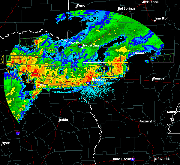 At 1141 pm cdt, a severe thunderstorm was located near deport, or 12 miles southeast of paris, moving east at 40 mph (radar indicated). Hazards include quarter size hail. damage to vehicles is possible At 1141 pm cdt, a severe thunderstorm was located near deport, or 12 miles southeast of paris, moving east at 40 mph (radar indicated). Hazards include quarter size hail. damage to vehicles is possible
|
| 6/19/2019 7:49 PM CDT | Quarter sized hail reported 0.8 miles NNE of Deport, TX, mping report of quarter size hail. |
| 6/19/2019 6:19 PM CDT |
 At 618 pm cdt, severe thunderstorms were located near blossom and near paris, moving northeast at 30 mph (radar indicated). Hazards include 60 mph wind gusts and quarter size hail. Hail damage to vehicles is expected. expect wind damage to roofs, siding, and trees. locations impacted include, paris, blossom, deport and sun valley. A tornado watch remains in effect until midnight cdt for north central texas. At 618 pm cdt, severe thunderstorms were located near blossom and near paris, moving northeast at 30 mph (radar indicated). Hazards include 60 mph wind gusts and quarter size hail. Hail damage to vehicles is expected. expect wind damage to roofs, siding, and trees. locations impacted include, paris, blossom, deport and sun valley. A tornado watch remains in effect until midnight cdt for north central texas.
|
| 6/19/2019 6:13 PM CDT |
 At 612 pm cdt, a severe thunderstorm was located near deport, or 9 miles west of clarksville, moving east at 35 mph. another severe thunderstorm was located near frogville, moving east northeast near 35 mph (radar indicated). Hazards include 60 mph wind gusts and quarter size hail. Hail damage to vehicles is expected. Expect wind damage to roofs, siding, and trees. At 612 pm cdt, a severe thunderstorm was located near deport, or 9 miles west of clarksville, moving east at 35 mph. another severe thunderstorm was located near frogville, moving east northeast near 35 mph (radar indicated). Hazards include 60 mph wind gusts and quarter size hail. Hail damage to vehicles is expected. Expect wind damage to roofs, siding, and trees.
|
| 6/19/2019 5:57 PM CDT |
 At 557 pm cdt, a severe thunderstorm was located over paris, moving northeast at 30 mph (radar indicated). Hazards include 60 mph wind gusts and quarter size hail. Hail damage to vehicles is expected. Expect wind damage to roofs, siding, and trees. At 557 pm cdt, a severe thunderstorm was located over paris, moving northeast at 30 mph (radar indicated). Hazards include 60 mph wind gusts and quarter size hail. Hail damage to vehicles is expected. Expect wind damage to roofs, siding, and trees.
|
| 6/19/2019 5:33 PM CDT |
 The national weather service in shreveport has issued a * severe thunderstorm warning for. northern red river county in northeastern texas. until 615 pm cdt. At 532 pm cdt, a severe thunderstorm was located over blossom, or 8 miles east of paris, moving northeast at 30 mph. The national weather service in shreveport has issued a * severe thunderstorm warning for. northern red river county in northeastern texas. until 615 pm cdt. At 532 pm cdt, a severe thunderstorm was located over blossom, or 8 miles east of paris, moving northeast at 30 mph.
|
| 6/19/2019 5:00 PM CDT |
 At 500 pm cdt, a severe thunderstorm was located 8 miles north of cooper, or 15 miles southwest of paris, moving northeast at 30 mph (radar indicated). Hazards include 60 mph wind gusts and quarter size hail. Hail damage to vehicles is expected. Expect wind damage to roofs, siding, and trees. At 500 pm cdt, a severe thunderstorm was located 8 miles north of cooper, or 15 miles southwest of paris, moving northeast at 30 mph (radar indicated). Hazards include 60 mph wind gusts and quarter size hail. Hail damage to vehicles is expected. Expect wind damage to roofs, siding, and trees.
|
| 5/18/2019 4:54 PM CDT |
 At 454 pm cdt, severe thunderstorms were located along a line extending from 11 miles west of hagansport to 6 miles northwest of purley to near winnsboro, moving east at 55 mph (radar indicated). Hazards include 70 mph wind gusts and quarter size hail. Hail damage to vehicles is expected. expect considerable tree damage. Wind damage is also likely to mobile homes, roofs, and outbuildings. At 454 pm cdt, severe thunderstorms were located along a line extending from 11 miles west of hagansport to 6 miles northwest of purley to near winnsboro, moving east at 55 mph (radar indicated). Hazards include 70 mph wind gusts and quarter size hail. Hail damage to vehicles is expected. expect considerable tree damage. Wind damage is also likely to mobile homes, roofs, and outbuildings.
|
| 5/18/2019 4:52 PM CDT |
 At 451 pm cdt, severe thunderstorms were located along a line extending from near cooper lake park south sulphur to near como, moving northeast at 55 mph (radar indicated). Hazards include 65 mph wind gusts and penny size hail. Expect damage to roofs, siding, and trees. locations impacted include, sulphur springs, como, deport and tira. A tornado watch remains in effect until 500 pm cdt for north central texas. At 451 pm cdt, severe thunderstorms were located along a line extending from near cooper lake park south sulphur to near como, moving northeast at 55 mph (radar indicated). Hazards include 65 mph wind gusts and penny size hail. Expect damage to roofs, siding, and trees. locations impacted include, sulphur springs, como, deport and tira. A tornado watch remains in effect until 500 pm cdt for north central texas.
|
| 5/18/2019 4:34 PM CDT |
 At 433 pm cdt, severe thunderstorms were located along a line extending from near cumby to 9 miles east of emory, moving northeast at 55 mph. these storms have a history of producing wind damage. these are very dangerous storms (trained weather spotters). Hazards include 80 mph wind gusts. Flying debris will be dangerous to those caught without shelter. mobile homes will be heavily damaged. expect considerable damage to roofs, windows, and vehicles. extensive tree damage and power outages are likely. locations impacted include, sulphur springs, como, deport and tira. A tornado watch remains in effect until 500 pm cdt for north central texas. At 433 pm cdt, severe thunderstorms were located along a line extending from near cumby to 9 miles east of emory, moving northeast at 55 mph. these storms have a history of producing wind damage. these are very dangerous storms (trained weather spotters). Hazards include 80 mph wind gusts. Flying debris will be dangerous to those caught without shelter. mobile homes will be heavily damaged. expect considerable damage to roofs, windows, and vehicles. extensive tree damage and power outages are likely. locations impacted include, sulphur springs, como, deport and tira. A tornado watch remains in effect until 500 pm cdt for north central texas.
|
| 5/18/2019 4:24 PM CDT |
 The national weather service in fort worth has issued a * severe thunderstorm warning for. hopkins county in north central texas. southeastern lamar county in north central texas. northeastern delta county in north central texas. Until 530 pm cdt. The national weather service in fort worth has issued a * severe thunderstorm warning for. hopkins county in north central texas. southeastern lamar county in north central texas. northeastern delta county in north central texas. Until 530 pm cdt.
|
| 5/1/2019 9:08 PM CDT |
 At 908 pm cdt, severe thunderstorms were located along a line extending from 9 miles northeast of manchester to near bogata to 6 miles east of cooper lake park south sulphur, moving northeast at 40 mph (radar indicated). Hazards include quarter size hail. damage to vehicles is expected At 908 pm cdt, severe thunderstorms were located along a line extending from 9 miles northeast of manchester to near bogata to 6 miles east of cooper lake park south sulphur, moving northeast at 40 mph (radar indicated). Hazards include quarter size hail. damage to vehicles is expected
|
| 5/1/2019 8:50 PM CDT |
 At 850 pm cdt, a severe thunderstorm was located over bogata, or 7 miles north of hagansport, moving northeast at 55 mph (radar indicated). Hazards include 60 mph wind gusts and quarter size hail. Hail damage to vehicles is expected. Expect wind damage to roofs, siding, and trees. At 850 pm cdt, a severe thunderstorm was located over bogata, or 7 miles north of hagansport, moving northeast at 55 mph (radar indicated). Hazards include 60 mph wind gusts and quarter size hail. Hail damage to vehicles is expected. Expect wind damage to roofs, siding, and trees.
|
| 3/13/2019 6:38 AM CDT |
 At 637 am cdt, severe thunderstorms were located along a line extending from north of paris to near sulphur springs to canton, moving east at 45 mph (radar indicated). Hazards include 60 mph wind gusts. Expect damage to roofs, siding, and trees. Locations impacted include, paris, sulphur springs, canton, grand saline, van, cooper, blossom, edgewood, emory, como, deport, fruitvale, edom, cooper lake park south sulphur, cooper lake park doctors creek, roxton, tira, toco and sun valley. At 637 am cdt, severe thunderstorms were located along a line extending from north of paris to near sulphur springs to canton, moving east at 45 mph (radar indicated). Hazards include 60 mph wind gusts. Expect damage to roofs, siding, and trees. Locations impacted include, paris, sulphur springs, canton, grand saline, van, cooper, blossom, edgewood, emory, como, deport, fruitvale, edom, cooper lake park south sulphur, cooper lake park doctors creek, roxton, tira, toco and sun valley.
|
| 3/13/2019 6:06 AM CDT |
 At 605 am cdt, severe thunderstorms were located along a line extending from the red river north of honey grove to commerce to kemp, moving east at 45 mph (radar indicated). Hazards include 60 mph wind gusts. expect damage to roofs, siding, and trees At 605 am cdt, severe thunderstorms were located along a line extending from the red river north of honey grove to commerce to kemp, moving east at 45 mph (radar indicated). Hazards include 60 mph wind gusts. expect damage to roofs, siding, and trees
|
| 3/9/2019 7:12 AM CST |
 The severe thunderstorm warning for lamar county will expire at 715 am cst, the storm which prompted the warning has moved out of the area. therefore the warning will be allowed to expire. a severe thunderstorm watch remains in effect until 1100 am cst for north central texas. The severe thunderstorm warning for lamar county will expire at 715 am cst, the storm which prompted the warning has moved out of the area. therefore the warning will be allowed to expire. a severe thunderstorm watch remains in effect until 1100 am cst for north central texas.
|
| 3/9/2019 6:56 AM CST |
 At 655 am cst, a severe thunderstorm was located over blossom, or 9 miles east of paris, moving northeast at 60 mph (radar indicated). Hazards include quarter size hail. Damage to vehicles is possible. Locations impacted include, paris, blossom, deport, roxton, toco and sun valley. At 655 am cst, a severe thunderstorm was located over blossom, or 9 miles east of paris, moving northeast at 60 mph (radar indicated). Hazards include quarter size hail. Damage to vehicles is possible. Locations impacted include, paris, blossom, deport, roxton, toco and sun valley.
|
| 3/9/2019 6:29 AM CST |
 At 629 am cst, a severe thunderstorm was located 10 miles south of honey grove, or 14 miles north of commerce, moving northeast at 70 mph (radar indicated). Hazards include quarter size hail. damage to vehicles is possible At 629 am cst, a severe thunderstorm was located 10 miles south of honey grove, or 14 miles north of commerce, moving northeast at 70 mph (radar indicated). Hazards include quarter size hail. damage to vehicles is possible
|
| 4/6/2018 4:43 PM CDT |
 At 443 pm cdt, a severe thunderstorm was located near hagansport, moving southeast at 45 mph (radar indicated). Hazards include golf ball size hail and 60 mph wind gusts. People and animals outdoors will be injured. expect hail damage to roofs, siding, windows, and vehicles. expect wind damage to roofs, siding, and trees. locations impacted include, hagansport, boxelder, bogata, wilkerson, winfield, talco, miller`s cove, harts bluff, johntown, cuthand and monticello. A tornado watch remains in effect until 1100 pm cdt for northeastern texas. At 443 pm cdt, a severe thunderstorm was located near hagansport, moving southeast at 45 mph (radar indicated). Hazards include golf ball size hail and 60 mph wind gusts. People and animals outdoors will be injured. expect hail damage to roofs, siding, windows, and vehicles. expect wind damage to roofs, siding, and trees. locations impacted include, hagansport, boxelder, bogata, wilkerson, winfield, talco, miller`s cove, harts bluff, johntown, cuthand and monticello. A tornado watch remains in effect until 1100 pm cdt for northeastern texas.
|
| 4/6/2018 4:43 PM CDT |
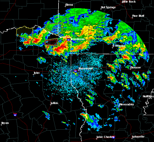 At 441 pm cdt, a severe thunderstorm was located near deport, or 14 miles southeast of paris, moving southeast at 35 mph (radar indicated). Hazards include 60 mph wind gusts and quarter size hail. Hail damage to vehicles is expected. expect wind damage to roofs, siding, and trees. although the severe thunderstorm that prompted the warning has moved into red river county, this next storm will remain in lamar county through 5 pm. It will take a similar track to its predecessor. At 441 pm cdt, a severe thunderstorm was located near deport, or 14 miles southeast of paris, moving southeast at 35 mph (radar indicated). Hazards include 60 mph wind gusts and quarter size hail. Hail damage to vehicles is expected. expect wind damage to roofs, siding, and trees. although the severe thunderstorm that prompted the warning has moved into red river county, this next storm will remain in lamar county through 5 pm. It will take a similar track to its predecessor.
|
| 4/6/2018 4:29 PM CDT |
 At 429 pm cdt, a severe thunderstorm was located over deport, or 12 miles northwest of hagansport, moving southeast at 25 mph (radar indicated). Hazards include 60 mph wind gusts and half dollar size hail. Hail damage to vehicles is expected. Expect wind damage to roofs, siding, and trees. At 429 pm cdt, a severe thunderstorm was located over deport, or 12 miles northwest of hagansport, moving southeast at 25 mph (radar indicated). Hazards include 60 mph wind gusts and half dollar size hail. Hail damage to vehicles is expected. Expect wind damage to roofs, siding, and trees.
|
| 4/6/2018 4:26 PM CDT |
 At 425 pm cdt, a severe thunderstorm was located over deport, or 13 miles northwest of hagansport, moving east at 30 mph (radar indicated). Hazards include 60 mph wind gusts and quarter size hail. Hail damage to vehicles is expected. Expect wind damage to roofs, siding, and trees. At 425 pm cdt, a severe thunderstorm was located over deport, or 13 miles northwest of hagansport, moving east at 30 mph (radar indicated). Hazards include 60 mph wind gusts and quarter size hail. Hail damage to vehicles is expected. Expect wind damage to roofs, siding, and trees.
|
| 4/6/2018 4:03 PM CDT |
 At 400 pm cdt, a severe thunderstorm was located just east of paris, moving east at 25 mph (radar indicated). Hazards include 60 mph wind gusts and quarter size hail. Hail damage to vehicles is expected. expect wind damage to roofs, siding, and trees. this severe storm will be near, blossom around 415 pm cdt. Quarter size hail was reported at the paris justice center. At 400 pm cdt, a severe thunderstorm was located just east of paris, moving east at 25 mph (radar indicated). Hazards include 60 mph wind gusts and quarter size hail. Hail damage to vehicles is expected. expect wind damage to roofs, siding, and trees. this severe storm will be near, blossom around 415 pm cdt. Quarter size hail was reported at the paris justice center.
|
| 4/6/2018 3:44 PM CDT |
 At 342 pm cdt, a severe thunderstorm was located near paris, moving east at 30 mph (radar indicated). Hazards include 60 mph wind gusts and quarter size hail. Hail damage to vehicles is expected. expect wind damage to roofs, siding, and trees. The hail core will move over northern portions of the city of paris. At 342 pm cdt, a severe thunderstorm was located near paris, moving east at 30 mph (radar indicated). Hazards include 60 mph wind gusts and quarter size hail. Hail damage to vehicles is expected. expect wind damage to roofs, siding, and trees. The hail core will move over northern portions of the city of paris.
|
| 4/6/2018 3:25 PM CDT |
 At 324 pm cdt, a severe thunderstorm was located 12 miles northeast of honey grove, or 12 miles west of paris, moving east at 25 mph (radar indicated). Hazards include 60 mph wind gusts and quarter size hail. Hail damage to vehicles is expected. Expect wind damage to roofs, siding, and trees. At 324 pm cdt, a severe thunderstorm was located 12 miles northeast of honey grove, or 12 miles west of paris, moving east at 25 mph (radar indicated). Hazards include 60 mph wind gusts and quarter size hail. Hail damage to vehicles is expected. Expect wind damage to roofs, siding, and trees.
|
| 7/23/2017 8:51 PM CDT |
 At 850 pm cdt, severe thunderstorms were located along a line extending from near manchester to 9 miles southeast of honey grove to near bonham state park to gunter, moving south at 40 mph (radar indicated). Hazards include 65 mph wind gusts and penny size hail. Expect damage to roofs, siding, and trees. Locations impacted include, paris, van alstyne, howe, leonard, whitewright, gunter, blossom, tom bean, deport, bailey, dorchester, roxton, trenton, ladonia, pecan gap and sun valley. At 850 pm cdt, severe thunderstorms were located along a line extending from near manchester to 9 miles southeast of honey grove to near bonham state park to gunter, moving south at 40 mph (radar indicated). Hazards include 65 mph wind gusts and penny size hail. Expect damage to roofs, siding, and trees. Locations impacted include, paris, van alstyne, howe, leonard, whitewright, gunter, blossom, tom bean, deport, bailey, dorchester, roxton, trenton, ladonia, pecan gap and sun valley.
|
| 7/23/2017 8:17 PM CDT |
 At 816 pm cdt, severe thunderstorms were located along a line extending from near raymond gary state park to near dorchester, moving south at 40 mph (radar indicated). Hazards include 60 mph wind gusts and hail to penny size. expect damage to roofs, siding, and trees At 816 pm cdt, severe thunderstorms were located along a line extending from near raymond gary state park to near dorchester, moving south at 40 mph (radar indicated). Hazards include 60 mph wind gusts and hail to penny size. expect damage to roofs, siding, and trees
|
| 7/3/2017 4:40 AM CDT |
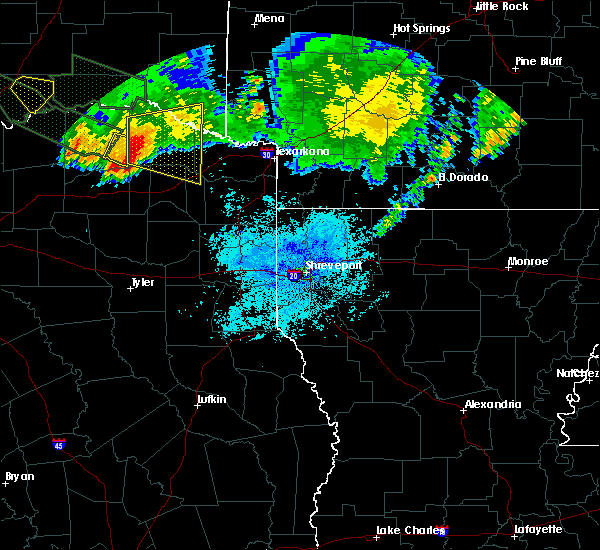 The severe thunderstorm warning for southeastern lamar county will expire at 445 am cdt, the storms which prompted the warning have weakened below severe limits. therefore the warning will be allowed to expire. however, small hail, gusty winds and heavy rainfall producing localized flooding remain possible as thunderstorms continue moving across the area. The severe thunderstorm warning for southeastern lamar county will expire at 445 am cdt, the storms which prompted the warning have weakened below severe limits. therefore the warning will be allowed to expire. however, small hail, gusty winds and heavy rainfall producing localized flooding remain possible as thunderstorms continue moving across the area.
|
| 7/3/2017 4:25 AM CDT |
 At 425 am cdt, a severe thunderstorm was located near bagwell, or 9 miles west of clarksville, moving east at 25 mph (radar indicated). Hazards include 60 mph wind gusts and quarter size hail. Hail damage to vehicles is expected. expect wind damage to roofs, siding, and trees. Locations impacted include, clarksville, boxelder, idabel, bogata, us 259 and i 30 intersection, wilkerson, bagwell, dalby springs, detroit, talco, avery, annona, harts bluff, lydia, negley, harris, cuthand, english, johntown and bryarly. At 425 am cdt, a severe thunderstorm was located near bagwell, or 9 miles west of clarksville, moving east at 25 mph (radar indicated). Hazards include 60 mph wind gusts and quarter size hail. Hail damage to vehicles is expected. expect wind damage to roofs, siding, and trees. Locations impacted include, clarksville, boxelder, idabel, bogata, us 259 and i 30 intersection, wilkerson, bagwell, dalby springs, detroit, talco, avery, annona, harts bluff, lydia, negley, harris, cuthand, english, johntown and bryarly.
|
| 7/3/2017 4:06 AM CDT |
 At 405 am cdt, a severe thunderstorm was located near deport, or 12 miles southeast of paris, moving east at 25 mph (radar indicated). Hazards include 60 mph wind gusts and quarter size hail. Hail damage to vehicles is expected. Expect wind damage to roofs, siding, and trees. At 405 am cdt, a severe thunderstorm was located near deport, or 12 miles southeast of paris, moving east at 25 mph (radar indicated). Hazards include 60 mph wind gusts and quarter size hail. Hail damage to vehicles is expected. Expect wind damage to roofs, siding, and trees.
|
| 7/3/2017 3:58 AM CDT |
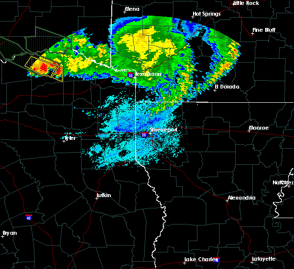 At 358 am cdt, a severe thunderstorm was located near deport, or 12 miles southeast of paris, moving east at 20 mph (radar indicated). Hazards include 60 mph wind gusts and half dollar size hail. Hail damage to vehicles is expected. Expect wind damage to roofs, siding, and trees. At 358 am cdt, a severe thunderstorm was located near deport, or 12 miles southeast of paris, moving east at 20 mph (radar indicated). Hazards include 60 mph wind gusts and half dollar size hail. Hail damage to vehicles is expected. Expect wind damage to roofs, siding, and trees.
|
| 7/3/2017 1:28 AM CDT |
 The severe thunderstorm warning for southeastern lamar and northeastern delta counties will expire at 130 am cdt, the severe thunderstorm which prompted the warning is moving out of the warned area and has weakened. therefore, the warning will be allowed to expire on time. however gusty winds to 35 mph and heavy rain are still possible with this thunderstorm. some minor flooding of typical low-lying areas and smaller creeks may be ongoing. to report severe weather, contact your nearest law enforcement agency. they will relay your report to the national weather service fort worth. The severe thunderstorm warning for southeastern lamar and northeastern delta counties will expire at 130 am cdt, the severe thunderstorm which prompted the warning is moving out of the warned area and has weakened. therefore, the warning will be allowed to expire on time. however gusty winds to 35 mph and heavy rain are still possible with this thunderstorm. some minor flooding of typical low-lying areas and smaller creeks may be ongoing. to report severe weather, contact your nearest law enforcement agency. they will relay your report to the national weather service fort worth.
|
| 7/3/2017 1:13 AM CDT |
 At 1257 am cdt, a severe thunderstorm was located near paris, moving east at 50 mph (radar indicated). Hazards include 60 mph wind gusts and dime size hail. Expect damage to roofs, siding, and trees. Locations impacted include, paris, blossom, deport, roxton, toco and sun valley. At 1257 am cdt, a severe thunderstorm was located near paris, moving east at 50 mph (radar indicated). Hazards include 60 mph wind gusts and dime size hail. Expect damage to roofs, siding, and trees. Locations impacted include, paris, blossom, deport, roxton, toco and sun valley.
|
| 7/3/2017 12:58 AM CDT |
 At 1257 am cdt, a severe thunderstorm was located near paris, moving east at 50 mph (radar indicated). Hazards include 60 mph wind gusts and dime size hail. Expect damage to roofs, siding, and trees. Locations impacted include, paris, blossom, deport, roxton, toco and sun valley. At 1257 am cdt, a severe thunderstorm was located near paris, moving east at 50 mph (radar indicated). Hazards include 60 mph wind gusts and dime size hail. Expect damage to roofs, siding, and trees. Locations impacted include, paris, blossom, deport, roxton, toco and sun valley.
|
| 7/3/2017 12:38 AM CDT |
 At 1237 am cdt, a severe thunderstorm was located 7 miles east of honey grove, or 14 miles west of paris, moving east at 40 mph (radar indicated). Hazards include 60 mph wind gusts. expect damage to roofs, siding, and trees At 1237 am cdt, a severe thunderstorm was located 7 miles east of honey grove, or 14 miles west of paris, moving east at 40 mph (radar indicated). Hazards include 60 mph wind gusts. expect damage to roofs, siding, and trees
|
| 5/11/2017 5:13 PM CDT |
 At 512 pm cdt, a severe thunderstorm was located near deport, or 14 miles southeast of paris, moving northeast at 45 mph (radar indicated). Hazards include quarter size hail. Damage to vehicles is possible. Locations impacted include, deport. At 512 pm cdt, a severe thunderstorm was located near deport, or 14 miles southeast of paris, moving northeast at 45 mph (radar indicated). Hazards include quarter size hail. Damage to vehicles is possible. Locations impacted include, deport.
|
| 5/11/2017 4:57 PM CDT |
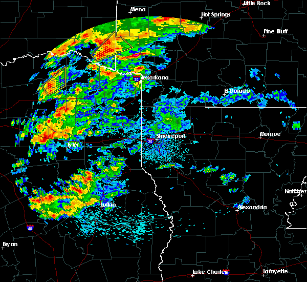 At 457 pm cdt, a severe thunderstorm was located near cooper lake park south sulphur, or 14 miles north of sulphur springs, moving northeast at 40 mph (radar indicated). Hazards include quarter size hail. damage to vehicles is possible At 457 pm cdt, a severe thunderstorm was located near cooper lake park south sulphur, or 14 miles north of sulphur springs, moving northeast at 40 mph (radar indicated). Hazards include quarter size hail. damage to vehicles is possible
|
| 4/29/2017 8:18 PM CDT |
 At 817 pm cdt, a severe thunderstorm was located over bogata, or 10 miles north of hagansport, moving northeast at 50 mph (radar indicated). Hazards include 60 mph wind gusts and nickel size hail. expect damage to roofs, siding, and trees At 817 pm cdt, a severe thunderstorm was located over bogata, or 10 miles north of hagansport, moving northeast at 50 mph (radar indicated). Hazards include 60 mph wind gusts and nickel size hail. expect damage to roofs, siding, and trees
|
| 4/29/2017 8:13 PM CDT |
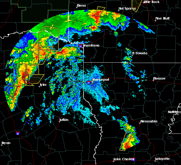 At 813 pm cdt, a severe thunderstorm was located over deport, or 14 miles southeast of paris, moving northeast at 60 mph (radar indicated). Hazards include 70 mph wind gusts and quarter size hail. Hail damage to vehicles is expected. expect considerable tree damage. wind damage is also likely to mobile homes, roofs, and outbuildings. locations impacted include, deport. A tornado watch remains in effect until 1000 pm cdt for north central texas. At 813 pm cdt, a severe thunderstorm was located over deport, or 14 miles southeast of paris, moving northeast at 60 mph (radar indicated). Hazards include 70 mph wind gusts and quarter size hail. Hail damage to vehicles is expected. expect considerable tree damage. wind damage is also likely to mobile homes, roofs, and outbuildings. locations impacted include, deport. A tornado watch remains in effect until 1000 pm cdt for north central texas.
|
| 4/29/2017 7:59 PM CDT |
 At 759 pm cdt, a severe thunderstorm was located 8 miles west of hagansport, moving northeast at 45 mph (radar indicated). Hazards include 65 mph wind gusts and quarter size hail. Hail damage to vehicles is expected. Expect wind damage to roofs, siding, and trees. At 759 pm cdt, a severe thunderstorm was located 8 miles west of hagansport, moving northeast at 45 mph (radar indicated). Hazards include 65 mph wind gusts and quarter size hail. Hail damage to vehicles is expected. Expect wind damage to roofs, siding, and trees.
|
| 4/26/2017 7:45 AM CDT |
 At 745 am cdt, a severe thunderstorm was located 9 miles south of paris, moving northeast at 50 mph (radar indicated). Hazards include half dollar size hail. damage to vehicles is possible At 745 am cdt, a severe thunderstorm was located 9 miles south of paris, moving northeast at 50 mph (radar indicated). Hazards include half dollar size hail. damage to vehicles is possible
|
| 4/21/2017 9:12 PM CDT |
 At 912 pm cdt, a severe thunderstorm was located 10 miles north of honey grove, or 17 miles west of paris, moving southeast at 35 mph (radar indicated). Hazards include 60 mph wind gusts and quarter size hail. Hail damage to vehicles is expected. Expect wind damage to roofs, siding, and trees. At 912 pm cdt, a severe thunderstorm was located 10 miles north of honey grove, or 17 miles west of paris, moving southeast at 35 mph (radar indicated). Hazards include 60 mph wind gusts and quarter size hail. Hail damage to vehicles is expected. Expect wind damage to roofs, siding, and trees.
|
| 4/4/2017 9:52 PM CDT |
 The severe thunderstorm warning for east central lamar county will expire at 1000 pm cdt, the storm which prompted the warning has moved out of the area. therefore the warning will be allowed to expire. The severe thunderstorm warning for east central lamar county will expire at 1000 pm cdt, the storm which prompted the warning has moved out of the area. therefore the warning will be allowed to expire.
|
| 4/4/2017 9:47 PM CDT |
 At 947 pm cdt, a severe thunderstorm was located near deport, or 12 miles west of clarksville, moving northeast at 55 mph (radar indicated). Hazards include quarter size hail. Damage to vehicles is possible. This severe thunderstorm will remain over mainly rural areas of east central lamar county. At 947 pm cdt, a severe thunderstorm was located near deport, or 12 miles west of clarksville, moving northeast at 55 mph (radar indicated). Hazards include quarter size hail. Damage to vehicles is possible. This severe thunderstorm will remain over mainly rural areas of east central lamar county.
|
| 4/4/2017 9:45 PM CDT |
 At 944 pm cdt, a severe thunderstorm was located over deport, or 13 miles west of clarksville, moving northeast at 50 mph (radar indicated). Hazards include quarter size hail. damage to vehicles is expected At 944 pm cdt, a severe thunderstorm was located over deport, or 13 miles west of clarksville, moving northeast at 50 mph (radar indicated). Hazards include quarter size hail. damage to vehicles is expected
|
| 4/4/2017 9:33 PM CDT |
 At 933 pm cdt, a severe thunderstorm was located 9 miles west of deport, or 11 miles south of paris, moving northeast at 50 mph (radar indicated). Hazards include ping pong ball size hail. People and animals outdoors will be injured. expect damage to roofs, siding, windows, and vehicles. this severe thunderstorm will be near, blossom and deport around 945 pm cdt. Other locations impacted by this severe thunderstorm include sun valley. At 933 pm cdt, a severe thunderstorm was located 9 miles west of deport, or 11 miles south of paris, moving northeast at 50 mph (radar indicated). Hazards include ping pong ball size hail. People and animals outdoors will be injured. expect damage to roofs, siding, windows, and vehicles. this severe thunderstorm will be near, blossom and deport around 945 pm cdt. Other locations impacted by this severe thunderstorm include sun valley.
|
| 4/4/2017 8:50 PM CDT |
 At 848 pm cdt, a severe thunderstorm was located near paris, moving northeast at 50 mph (radar indicated). Hazards include golf ball size hail and 60 mph wind gusts. People and animals outdoors will be injured. expect hail damage to roofs, siding, windows, and vehicles. expect wind damage to roofs, siding, and trees. locations impacted include, paris, blossom, deport, roxton, toco and sun valley. Another storm just southwest of roxton may produce quarter size hail. At 848 pm cdt, a severe thunderstorm was located near paris, moving northeast at 50 mph (radar indicated). Hazards include golf ball size hail and 60 mph wind gusts. People and animals outdoors will be injured. expect hail damage to roofs, siding, windows, and vehicles. expect wind damage to roofs, siding, and trees. locations impacted include, paris, blossom, deport, roxton, toco and sun valley. Another storm just southwest of roxton may produce quarter size hail.
|
| 4/4/2017 8:36 PM CDT |
 At 836 pm cdt, a severe thunderstorm was located 10 miles north of cooper, or 13 miles southwest of paris, moving northeast at 50 mph (radar indicated). Hazards include half dollar size hail. Damage to vehicles is possible. Locations impacted include, paris, blossom, deport, roxton, pecan gap, toco and sun valley. At 836 pm cdt, a severe thunderstorm was located 10 miles north of cooper, or 13 miles southwest of paris, moving northeast at 50 mph (radar indicated). Hazards include half dollar size hail. Damage to vehicles is possible. Locations impacted include, paris, blossom, deport, roxton, pecan gap, toco and sun valley.
|
| 4/4/2017 8:24 PM CDT |
 At 824 pm cdt, a severe thunderstorm was located 9 miles south of honey grove, or 15 miles north of commerce, moving northeast at 50 mph (radar indicated). Hazards include quarter size hail. damage to vehicles is possible At 824 pm cdt, a severe thunderstorm was located 9 miles south of honey grove, or 15 miles north of commerce, moving northeast at 50 mph (radar indicated). Hazards include quarter size hail. damage to vehicles is possible
|
| 3/27/2017 12:48 AM CDT |
 At 1248 am cdt, a severe thunderstorm was located over bogata, or near hagansport, moving northeast at 50 mph (radar indicated). Hazards include 60 mph wind gusts and quarter size hail. Hail damage to vehicles is expected. Expect wind damage to roofs, siding, and trees. At 1248 am cdt, a severe thunderstorm was located over bogata, or near hagansport, moving northeast at 50 mph (radar indicated). Hazards include 60 mph wind gusts and quarter size hail. Hail damage to vehicles is expected. Expect wind damage to roofs, siding, and trees.
|
| 3/26/2017 11:31 PM CDT |
 At 1131 pm cdt, a severe thunderstorm was located near blossom, or 14 miles east of paris, moving east at 30 mph (radar indicated). Hazards include 60 mph wind gusts and quarter size hail. Hail damage to vehicles is expected. Expect wind damage to roofs, siding, and trees. At 1131 pm cdt, a severe thunderstorm was located near blossom, or 14 miles east of paris, moving east at 30 mph (radar indicated). Hazards include 60 mph wind gusts and quarter size hail. Hail damage to vehicles is expected. Expect wind damage to roofs, siding, and trees.
|
| 3/26/2017 11:12 PM CDT |
 At 1111 pm cdt, a severe thunderstorm was located 9 miles north of cooper, or 14 miles southwest of paris, moving northeast at 25 mph (radar indicated). Hazards include 60 mph wind gusts and quarter size hail. Hail damage to vehicles is expected. expect wind damage to roofs, siding, and trees. This severe thunderstorm will remain over mainly rural areas of lamar and delta counties, including the following locations: toco, roxton, sun valley and pecan gap. At 1111 pm cdt, a severe thunderstorm was located 9 miles north of cooper, or 14 miles southwest of paris, moving northeast at 25 mph (radar indicated). Hazards include 60 mph wind gusts and quarter size hail. Hail damage to vehicles is expected. expect wind damage to roofs, siding, and trees. This severe thunderstorm will remain over mainly rural areas of lamar and delta counties, including the following locations: toco, roxton, sun valley and pecan gap.
|
| 3/26/2017 10:45 PM CDT |
 At 1043 pm cdt, a severe thunderstorm was located 8 miles south of honey grove near ladonia, with another strong storm near roxton, both moving east at 35 mph (radar indicated). Hazards include golf ball size hail and 60 mph wind gusts. People and animals outdoors will be injured. expect hail damage to roofs, siding, windows, and vehicles. expect wind damage to roofs, siding, and trees. this severe storm will be near, blossom and deport around 1130 pm cdt. other locations impacted by this severe thunderstorm include toco, roxton, sun valley, ladonia, windom and pecan gap. A tornado watch remains in effect until 1100 pm cdt for north central texas. At 1043 pm cdt, a severe thunderstorm was located 8 miles south of honey grove near ladonia, with another strong storm near roxton, both moving east at 35 mph (radar indicated). Hazards include golf ball size hail and 60 mph wind gusts. People and animals outdoors will be injured. expect hail damage to roofs, siding, windows, and vehicles. expect wind damage to roofs, siding, and trees. this severe storm will be near, blossom and deport around 1130 pm cdt. other locations impacted by this severe thunderstorm include toco, roxton, sun valley, ladonia, windom and pecan gap. A tornado watch remains in effect until 1100 pm cdt for north central texas.
|
| 3/26/2017 10:28 PM CDT |
 At 1025 pm cdt, a severe thunderstorm was located near ladonia with another severe storm near bailey. these storms are moving east- northeast at 40 mph (radar indicated). Hazards include ping pong ball to golf ball size hail and 60 mph wind gusts. People and animals outdoors will be injured. expect hail damage to roofs, siding, windows, and vehicles. expect wind damage to roofs, siding, and trees. this severe storm will be near, reno around 1100 pm cdt. blossom around 1110 pm cdt. other locations impacted by this severe thunderstorm include toco, ladonia, windom, pecan gap, roxton, sun valley and trenton. A tornado watch remains in effect until 1100 pm cdt for north central texas. At 1025 pm cdt, a severe thunderstorm was located near ladonia with another severe storm near bailey. these storms are moving east- northeast at 40 mph (radar indicated). Hazards include ping pong ball to golf ball size hail and 60 mph wind gusts. People and animals outdoors will be injured. expect hail damage to roofs, siding, windows, and vehicles. expect wind damage to roofs, siding, and trees. this severe storm will be near, reno around 1100 pm cdt. blossom around 1110 pm cdt. other locations impacted by this severe thunderstorm include toco, ladonia, windom, pecan gap, roxton, sun valley and trenton. A tornado watch remains in effect until 1100 pm cdt for north central texas.
|
| 3/26/2017 10:11 PM CDT |
 At 1010 pm cdt, a severe thunderstorm was located near wolfe city, or 11 miles northwest of commerce, moving northeast at 35 mph (radar indicated). Hazards include 60 mph wind gusts and half dollar size hail. Hail damage to vehicles is expected. expect wind damage to roofs, siding, and trees. this severe thunderstorm will be near, reno around 1100 pm cdt. blossom around 1110 pm cdt. other locations impacted by this severe thunderstorm include toco, ladonia, windom, pecan gap, roxton, sun valley and trenton. A tornado watch remains in effect until 1100 pm cdt for north central texas. At 1010 pm cdt, a severe thunderstorm was located near wolfe city, or 11 miles northwest of commerce, moving northeast at 35 mph (radar indicated). Hazards include 60 mph wind gusts and half dollar size hail. Hail damage to vehicles is expected. expect wind damage to roofs, siding, and trees. this severe thunderstorm will be near, reno around 1100 pm cdt. blossom around 1110 pm cdt. other locations impacted by this severe thunderstorm include toco, ladonia, windom, pecan gap, roxton, sun valley and trenton. A tornado watch remains in effect until 1100 pm cdt for north central texas.
|
| 5/9/2016 9:24 PM CDT |
 The severe thunderstorm warning for southeastern lamar county will expire at 930 pm cdt, the storm which prompted the warning has moved out of the area. therefore the warning will be allowed to expire. a tornado watch remains in effect until 1100 pm cdt for north central texas. The severe thunderstorm warning for southeastern lamar county will expire at 930 pm cdt, the storm which prompted the warning has moved out of the area. therefore the warning will be allowed to expire. a tornado watch remains in effect until 1100 pm cdt for north central texas.
|
| 5/9/2016 9:06 PM CDT |
 At 905 pm cdt, a severe thunderstorm was located near blossom, or near paris, moving east at 30 mph (radar indicated). Hazards include golf ball size hail and 60 mph wind gusts. People and animals outdoors will be injured. expect hail damage to roofs, siding, windows, and vehicles. expect wind damage to roofs, siding, and trees. this severe storm will be near, blossom around 915 pm cdt. other locations impacted by this severe thunderstorm include sun valley. A tornado watch remains in effect until 1100 pm cdt for north central texas. At 905 pm cdt, a severe thunderstorm was located near blossom, or near paris, moving east at 30 mph (radar indicated). Hazards include golf ball size hail and 60 mph wind gusts. People and animals outdoors will be injured. expect hail damage to roofs, siding, windows, and vehicles. expect wind damage to roofs, siding, and trees. this severe storm will be near, blossom around 915 pm cdt. other locations impacted by this severe thunderstorm include sun valley. A tornado watch remains in effect until 1100 pm cdt for north central texas.
|
| 5/9/2016 8:52 PM CDT |
 At 850 pm cdt, a severe thunderstorm was located near paris, moving east at 25 mph (radar indicated). Hazards include golf ball size hail and 70 mph wind gusts. People and animals outdoors will be injured. expect hail damage to roofs, siding, windows, and vehicles. expect considerable tree damage. wind damage is also likely to mobile homes, roofs, and outbuildings. this severe storm will be near, blossom around 915 pm cdt. other locations impacted by this severe thunderstorm include sun valley and toco. A tornado watch remains in effect until 900 pm cdt for north central texas. At 850 pm cdt, a severe thunderstorm was located near paris, moving east at 25 mph (radar indicated). Hazards include golf ball size hail and 70 mph wind gusts. People and animals outdoors will be injured. expect hail damage to roofs, siding, windows, and vehicles. expect considerable tree damage. wind damage is also likely to mobile homes, roofs, and outbuildings. this severe storm will be near, blossom around 915 pm cdt. other locations impacted by this severe thunderstorm include sun valley and toco. A tornado watch remains in effect until 900 pm cdt for north central texas.
|
| 5/9/2016 8:26 PM CDT |
 At 825 pm cdt, a severe thunderstorm was located 8 miles east of honey grove, or 13 miles southwest of paris, moving east at 25 mph (radar indicated). Hazards include golf ball size hail and 70 mph wind gusts. People and animals outdoors will be injured. expect hail damage to roofs, siding, windows, and vehicles. expect considerable tree damage. wind damage is also likely to mobile homes, roofs, and outbuildings. this severe thunderstorm will be near, reno around 900 pm cdt. blossom around 915 pm cdt. other locations impacted by this severe thunderstorm include sun valley, roxton and toco. A tornado watch remains in effect until 900 pm cdt for north central texas. At 825 pm cdt, a severe thunderstorm was located 8 miles east of honey grove, or 13 miles southwest of paris, moving east at 25 mph (radar indicated). Hazards include golf ball size hail and 70 mph wind gusts. People and animals outdoors will be injured. expect hail damage to roofs, siding, windows, and vehicles. expect considerable tree damage. wind damage is also likely to mobile homes, roofs, and outbuildings. this severe thunderstorm will be near, reno around 900 pm cdt. blossom around 915 pm cdt. other locations impacted by this severe thunderstorm include sun valley, roxton and toco. A tornado watch remains in effect until 900 pm cdt for north central texas.
|
| 4/29/2016 3:57 PM CDT | The severe thunderstorm warning for eastern lamar county will expire at 400 pm cdt, the severe thunderstorm which prompted the warning has moved out of the warned area. therefore the warning will be allowed to expire. a tornado watch remains in effect until 1000 pm cdt for north central texas. |
| 4/29/2016 3:07 PM CDT |
 At 307 pm cdt, a severe thunderstorm was located 8 miles southwest of blossom, or 8 miles southeast of paris, moving northeast at 40 mph (radar indicated). Hazards include 60 mph wind gusts. Expect damage to roofs. siding. and trees. this severe thunderstorm will be near, blossom around 320 pm cdt. other locations impacted by this severe thunderstorm include sun valley. A tornado watch remains in effect until 1000 pm cdt for north central texas. At 307 pm cdt, a severe thunderstorm was located 8 miles southwest of blossom, or 8 miles southeast of paris, moving northeast at 40 mph (radar indicated). Hazards include 60 mph wind gusts. Expect damage to roofs. siding. and trees. this severe thunderstorm will be near, blossom around 320 pm cdt. other locations impacted by this severe thunderstorm include sun valley. A tornado watch remains in effect until 1000 pm cdt for north central texas.
|
| 3/24/2016 12:19 AM CDT |
 At 1217 am cdt, severe thunderstorms were located along a line extending from 11 miles west of deport to near sulphur springs to 6 miles southeast of emory, moving east at 55 mph (radar indicated). Hazards include 70 mph wind gusts and quarter size hail. Hail damage to vehicles is expected. expect considerable tree damage. wind damage is also likely to mobile homes, roofs, and outbuildings. Locations impacted include, sulphur springs, cooper, emory, east tawakoni, cumby, como, deport, cooper lake park south sulphur, cooper lake park doctors creek, point, tira and pecan gap. At 1217 am cdt, severe thunderstorms were located along a line extending from 11 miles west of deport to near sulphur springs to 6 miles southeast of emory, moving east at 55 mph (radar indicated). Hazards include 70 mph wind gusts and quarter size hail. Hail damage to vehicles is expected. expect considerable tree damage. wind damage is also likely to mobile homes, roofs, and outbuildings. Locations impacted include, sulphur springs, cooper, emory, east tawakoni, cumby, como, deport, cooper lake park south sulphur, cooper lake park doctors creek, point, tira and pecan gap.
|
| 3/24/2016 12:00 AM CDT |
 At 1159 pm cdt, severe thunderstorms were located along a line extending from near cooper to near cumby to near edgewood, moving east at 55 mph (radar indicated). Hazards include 60 mph wind gusts and quarter size hail. Hail damage to vehicles is expected. expect wind damage to roofs, siding, and trees. Locations impacted include, sulphur springs, commerce, wills point, cooper, west tawakoni, edgewood, emory, east tawakoni, cumby, como, campbell, deport, fruitvale, lake tawakoni state park, cooper lake park south sulphur, cooper lake park doctors creek, point, lone oak, tira and pecan gap. At 1159 pm cdt, severe thunderstorms were located along a line extending from near cooper to near cumby to near edgewood, moving east at 55 mph (radar indicated). Hazards include 60 mph wind gusts and quarter size hail. Hail damage to vehicles is expected. expect wind damage to roofs, siding, and trees. Locations impacted include, sulphur springs, commerce, wills point, cooper, west tawakoni, edgewood, emory, east tawakoni, cumby, como, campbell, deport, fruitvale, lake tawakoni state park, cooper lake park south sulphur, cooper lake park doctors creek, point, lone oak, tira and pecan gap.
|
| 3/23/2016 11:55 PM CDT |
 At 1154 pm cdt, severe thunderstorms were located along a line extending from near cooper to near cumby to near edgewood, moving east at 55 mph (radar indicated). Hazards include 60 mph wind gusts and quarter size hail. Hail damage to vehicles is expected. Expect wind damage to roofs, siding, and trees. At 1154 pm cdt, severe thunderstorms were located along a line extending from near cooper to near cumby to near edgewood, moving east at 55 mph (radar indicated). Hazards include 60 mph wind gusts and quarter size hail. Hail damage to vehicles is expected. Expect wind damage to roofs, siding, and trees.
|
| 3/17/2016 1:52 PM CDT |
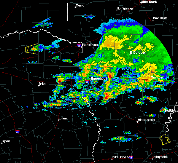 The severe thunderstorm warning for northeastern hopkins, northeastern delta and southeastern lamar counties will expire at 200 pm cdt, the storm which prompted the warning has weakened below severe limits, and no longer pose an immediate threat to life or property. therefore the warning will be allowed to expire. The severe thunderstorm warning for northeastern hopkins, northeastern delta and southeastern lamar counties will expire at 200 pm cdt, the storm which prompted the warning has weakened below severe limits, and no longer pose an immediate threat to life or property. therefore the warning will be allowed to expire.
|
| 3/17/2016 1:35 PM CDT |
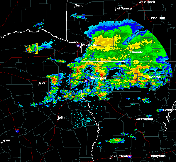 At 133 pm cdt, a severe thunderstorm was located near cooper, or 16 miles north of sulphur springs, moving east at 25 mph (radar indicated). Hazards include quarter size hail. Damage to vehicles is expected. Locations impacted include, deport, cooper lake park doctors creek, cooper lake park south sulphur and tira. At 133 pm cdt, a severe thunderstorm was located near cooper, or 16 miles north of sulphur springs, moving east at 25 mph (radar indicated). Hazards include quarter size hail. Damage to vehicles is expected. Locations impacted include, deport, cooper lake park doctors creek, cooper lake park south sulphur and tira.
|
| 3/17/2016 1:13 PM CDT |
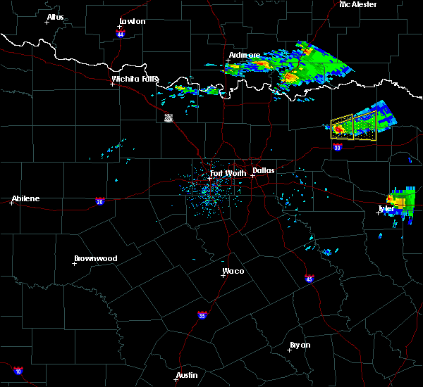 At 112 pm cdt, a severe thunderstorm was located near cooper, or 10 miles northeast of commerce, moving east at 25 mph (radar indicated). Hazards include quarter size hail. damage to vehicles is expected At 112 pm cdt, a severe thunderstorm was located near cooper, or 10 miles northeast of commerce, moving east at 25 mph (radar indicated). Hazards include quarter size hail. damage to vehicles is expected
|
| 3/8/2016 10:18 AM CST |
 At 1017 am cst, a severe thunderstorm was located near honey grove, or 20 miles west of paris, moving northeast at 50 mph (radar indicated). Hazards include 60 mph wind gusts. Expect damage to roofs. siding. and trees. this severe thunderstorm will be near, paris and reno around 1040 am cst. Other locations impacted by this severe thunderstorm include sun valley, toco and roxton. At 1017 am cst, a severe thunderstorm was located near honey grove, or 20 miles west of paris, moving northeast at 50 mph (radar indicated). Hazards include 60 mph wind gusts. Expect damage to roofs. siding. and trees. this severe thunderstorm will be near, paris and reno around 1040 am cst. Other locations impacted by this severe thunderstorm include sun valley, toco and roxton.
|
| 12/23/2015 5:34 AM CST |
 At 532 am cst, a severe thunderstorm was located near paris, moving northeast at 45 mph (radar indicated). Hazards include 60 mph wind gusts and quarter size hail. Hail damage to vehicles is expected. expect wind damage to roofs, siding and trees. Locations impacted include, paris, blossom, deport, roxton, toco and sun valley. At 532 am cst, a severe thunderstorm was located near paris, moving northeast at 45 mph (radar indicated). Hazards include 60 mph wind gusts and quarter size hail. Hail damage to vehicles is expected. expect wind damage to roofs, siding and trees. Locations impacted include, paris, blossom, deport, roxton, toco and sun valley.
|
| 12/23/2015 5:13 AM CST |
 At 513 am cst, a severe thunderstorm was located near raymond gary state park, or 12 miles southeast of hugo, moving northeast at 60 mph. another severe thunderstorm was indicated 10 miles west of paris, also moving northeast at 60 mph. this storm will affect northern and western red river county after 530 am (radar indicated). Hazards include 60 mph wind gusts and half dollar size hail. Hail damage to vehicles is expected. Expect wind damage to roofs, siding, and trees. At 513 am cst, a severe thunderstorm was located near raymond gary state park, or 12 miles southeast of hugo, moving northeast at 60 mph. another severe thunderstorm was indicated 10 miles west of paris, also moving northeast at 60 mph. this storm will affect northern and western red river county after 530 am (radar indicated). Hazards include 60 mph wind gusts and half dollar size hail. Hail damage to vehicles is expected. Expect wind damage to roofs, siding, and trees.
|
| 12/23/2015 5:07 AM CST |
 At 506 am cst, a severe thunderstorm was located 9 miles southwest of paris, moving northeast at 50 mph (radar indicated). Hazards include 60 mph wind gusts and quarter size hail. Hail damage to vehicles is expected. Expect wind damage to roofs, siding and trees. At 506 am cst, a severe thunderstorm was located 9 miles southwest of paris, moving northeast at 50 mph (radar indicated). Hazards include 60 mph wind gusts and quarter size hail. Hail damage to vehicles is expected. Expect wind damage to roofs, siding and trees.
|
| 12/12/2015 5:03 PM CST |
 At 503 pm cst, a severe thunderstorm capable of producing a tornado was located near bogata, or near hagansport, moving north at 40 mph (radar indicated rotation). Hazards include tornado. Flying debris will be dangerous to those caught without shelter. mobile homes will be damaged or destroyed. damage to roofs, windows, and vehicles will occur. tree damage is likely. this dangerous storm will be near, bagwell around 530 pm cst. Other locations impacted by this tornadic thunderstorm include woodland, negley, detroit and johntown. At 503 pm cst, a severe thunderstorm capable of producing a tornado was located near bogata, or near hagansport, moving north at 40 mph (radar indicated rotation). Hazards include tornado. Flying debris will be dangerous to those caught without shelter. mobile homes will be damaged or destroyed. damage to roofs, windows, and vehicles will occur. tree damage is likely. this dangerous storm will be near, bagwell around 530 pm cst. Other locations impacted by this tornadic thunderstorm include woodland, negley, detroit and johntown.
|
| 11/17/2015 5:27 AM CST |
 At 525 am cst, severe thunderstorms were located along a line extending from 14 miles north of honey grove to 6 miles southeast of wolfe city, moving east at 35 mph (radar indicated. this storm has produced wind damage). Hazards include 60 mph wind gusts and penny size hail. Expect damage to roofs. Siding and trees. At 525 am cst, severe thunderstorms were located along a line extending from 14 miles north of honey grove to 6 miles southeast of wolfe city, moving east at 35 mph (radar indicated. this storm has produced wind damage). Hazards include 60 mph wind gusts and penny size hail. Expect damage to roofs. Siding and trees.
|
| 6/21/2015 4:53 PM CDT |
 At 453 pm cdt, severe thunderstorms were located along a line extending from near bagwell to 7 miles northeast of clarksville to 7 miles northwest of de kalb, moving northeast at 20 mph (radar indicated). Hazards include 60 mph wind gusts. Expect damage to roofs. Siding and trees. At 453 pm cdt, severe thunderstorms were located along a line extending from near bagwell to 7 miles northeast of clarksville to 7 miles northwest of de kalb, moving northeast at 20 mph (radar indicated). Hazards include 60 mph wind gusts. Expect damage to roofs. Siding and trees.
|
| 5/25/2015 4:46 PM CDT | At 446 pm cdt, severe thunderstorms were located along a line extending from 9 miles northeast of cooper to 9 miles southwest of como to near canton, moving east at 85 mph (radar indicated). Hazards include 60 mph wind gusts and quarter size hail. Hail damage to vehicles is expected. Expect wind damage to roofs, siding and trees. |
| 5/25/2015 4:46 PM CDT | At 446 pm cdt, severe thunderstorms were located along a line extending from 9 miles northeast of cooper to 9 miles southwest of como to near canton, moving east at 85 mph (radar indicated). Hazards include 60 mph wind gusts and quarter size hail. Hail damage to vehicles is expected. Expect wind damage to roofs, siding and trees. |
| 3/25/2015 7:54 AM CDT | The national weather service in fort worth has issued a * severe thunderstorm warning for. eastern lamar county in northeastern texas. until 830 am cdt * at 753 am cdt. Doppler radar indicated a severe thunderstorm capable of producing half dollar size hail and damaging winds in. |
| 3/28/2014 5:28 PM CDT | Quarter sized hail reported 1.4 miles N of Deport, TX |
| 3/28/2014 5:24 PM CDT | Quarter sized hail reported 4.7 miles NE of Deport, TX |
| 4/3/2012 4:06 PM CDT | Golf Ball sized hail reported 5.9 miles NNE of Deport, TX |
Hail Maps for Deport, TX


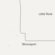


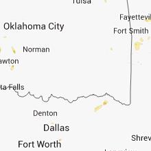


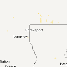


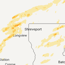

Connect with Interactive Hail Maps