

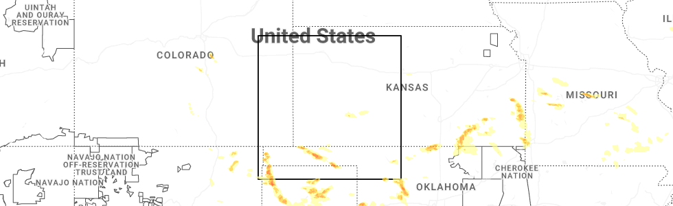
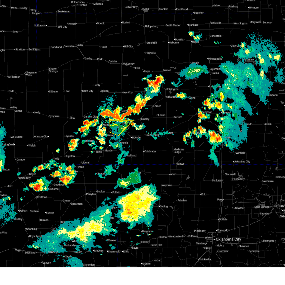
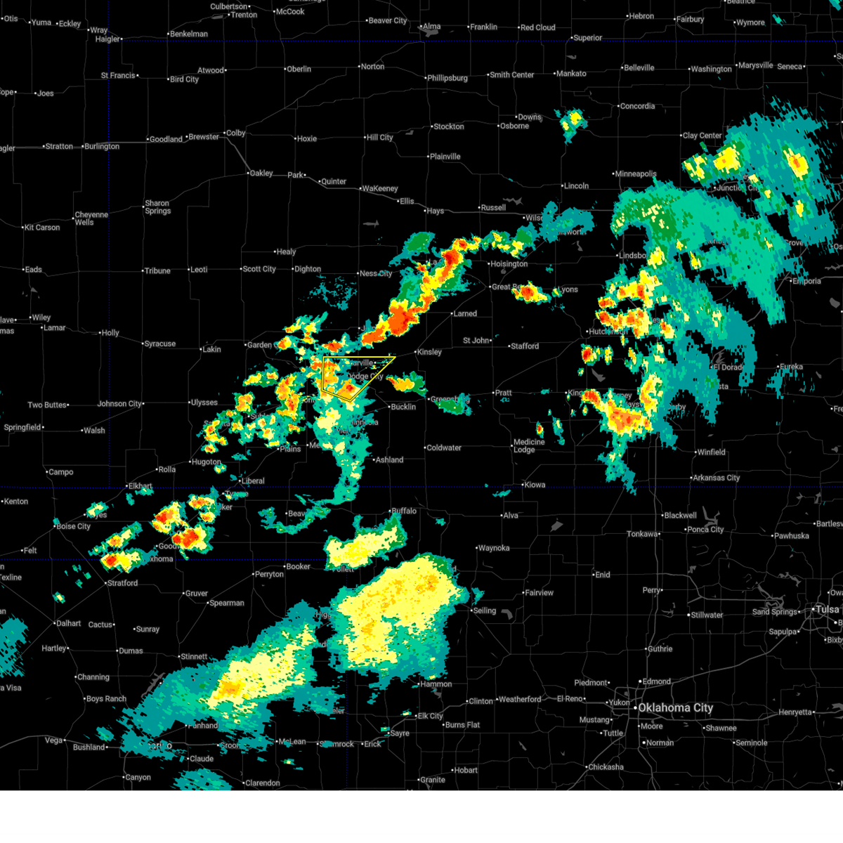
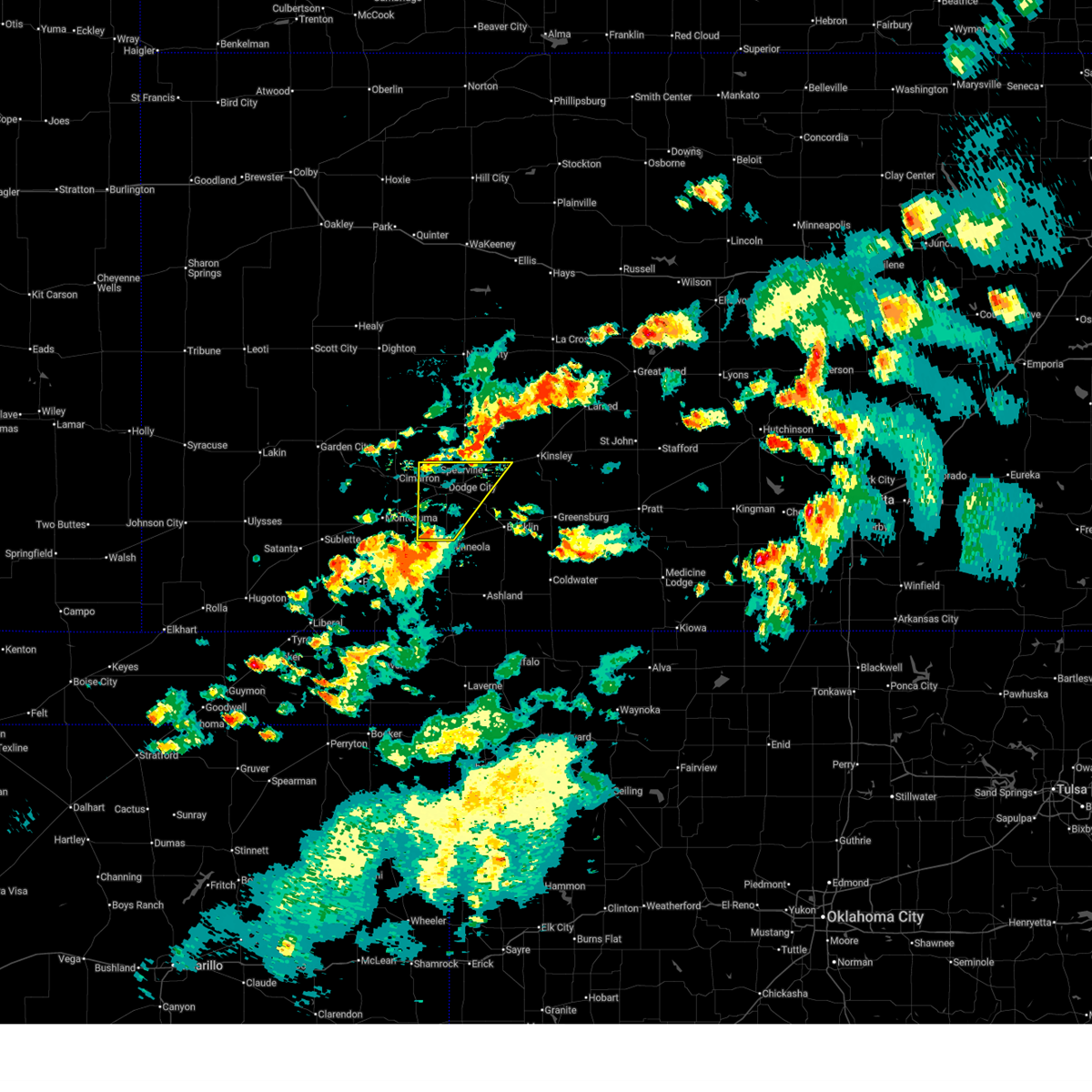
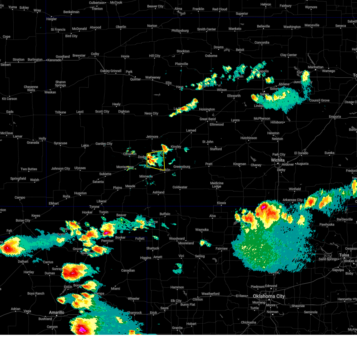
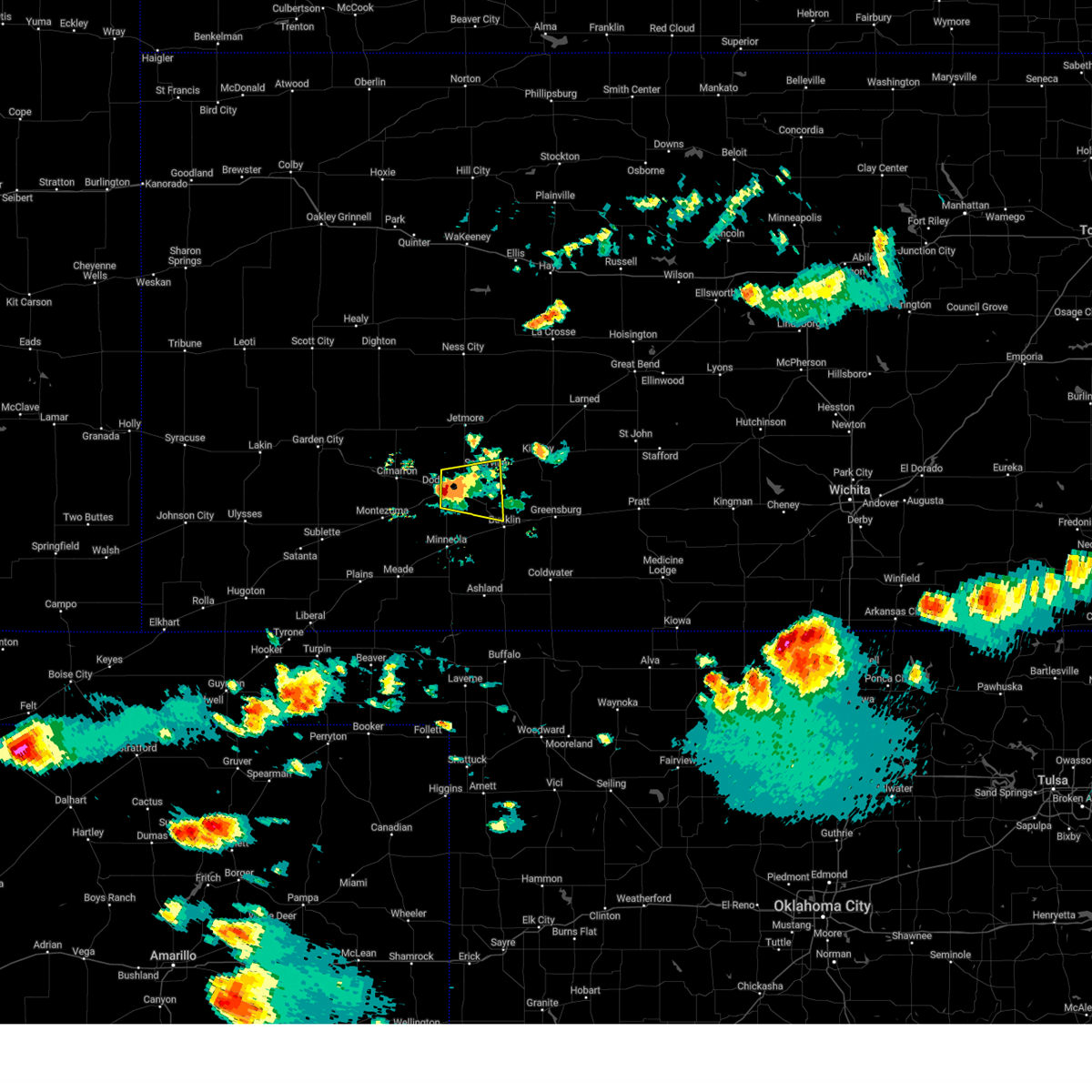
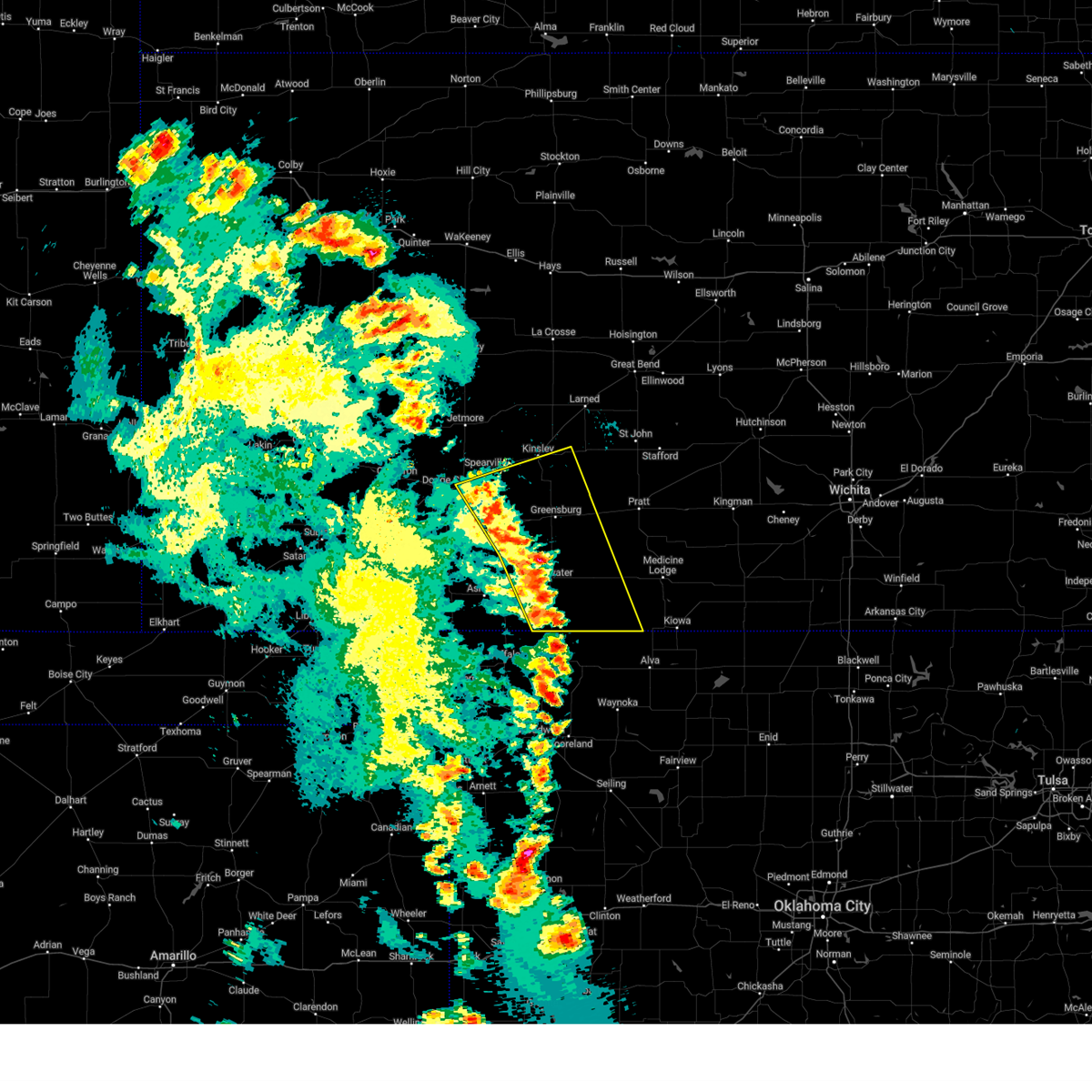
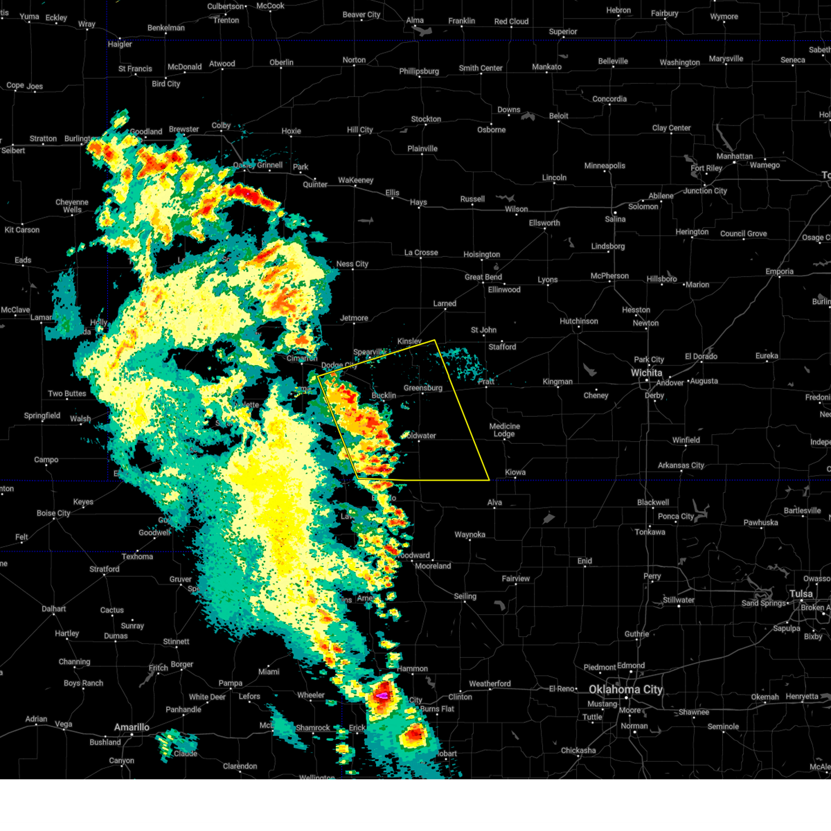
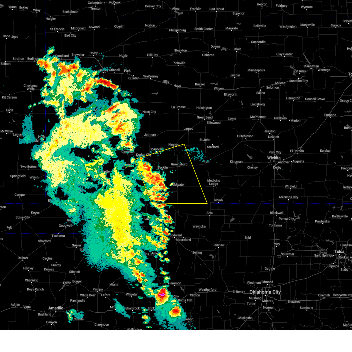
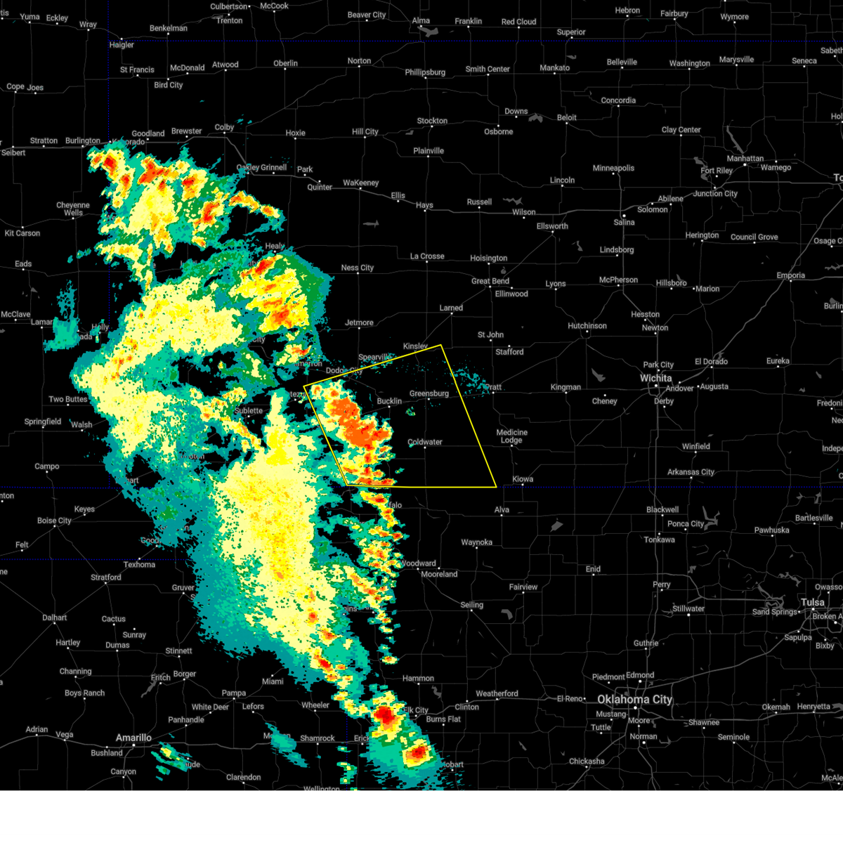
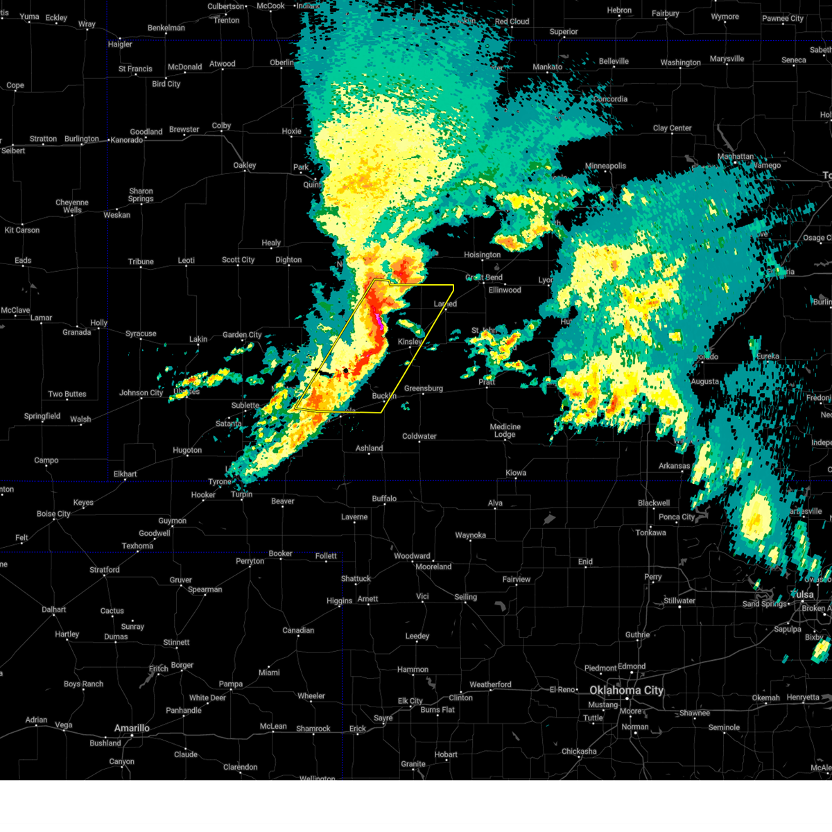
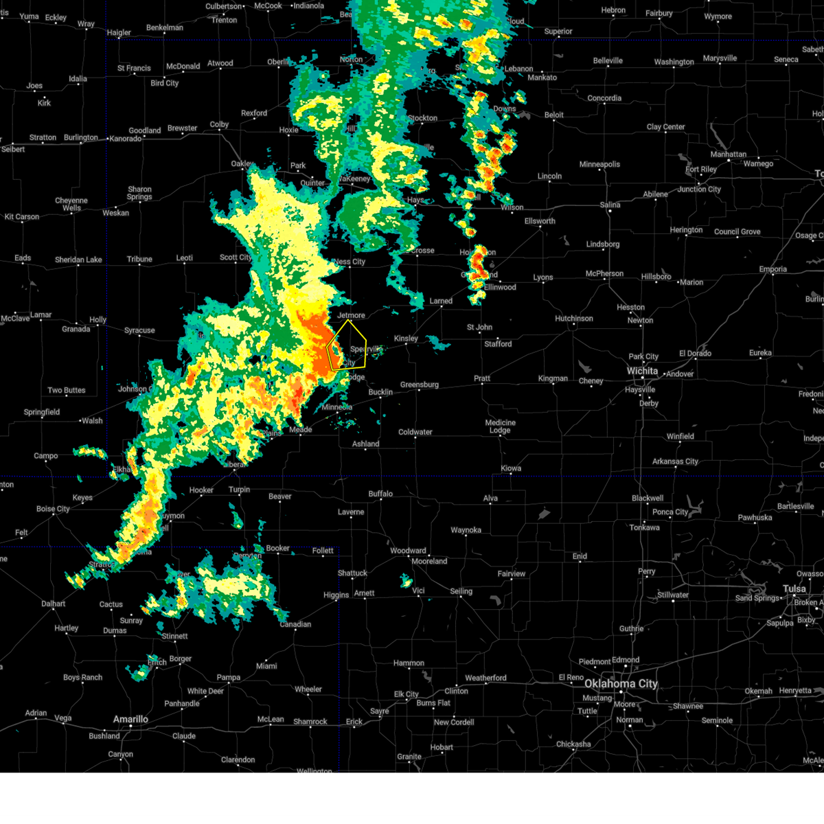
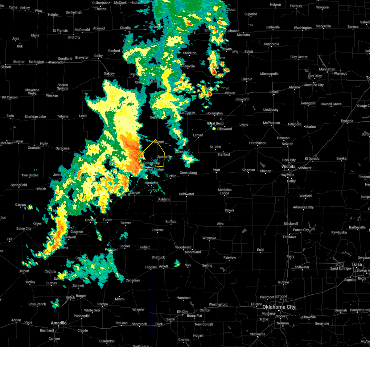
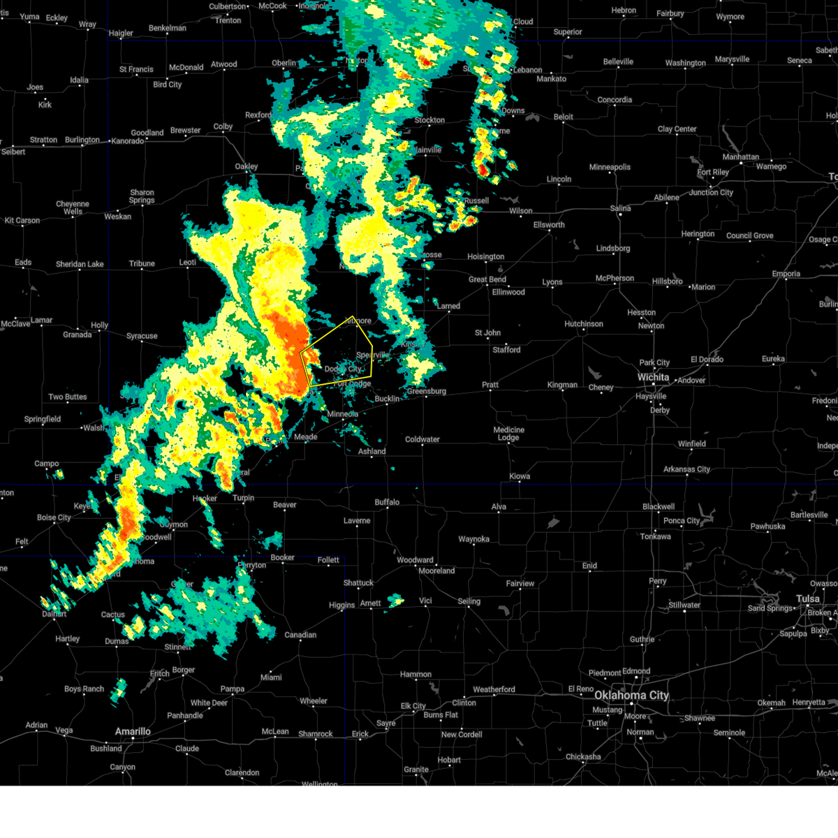
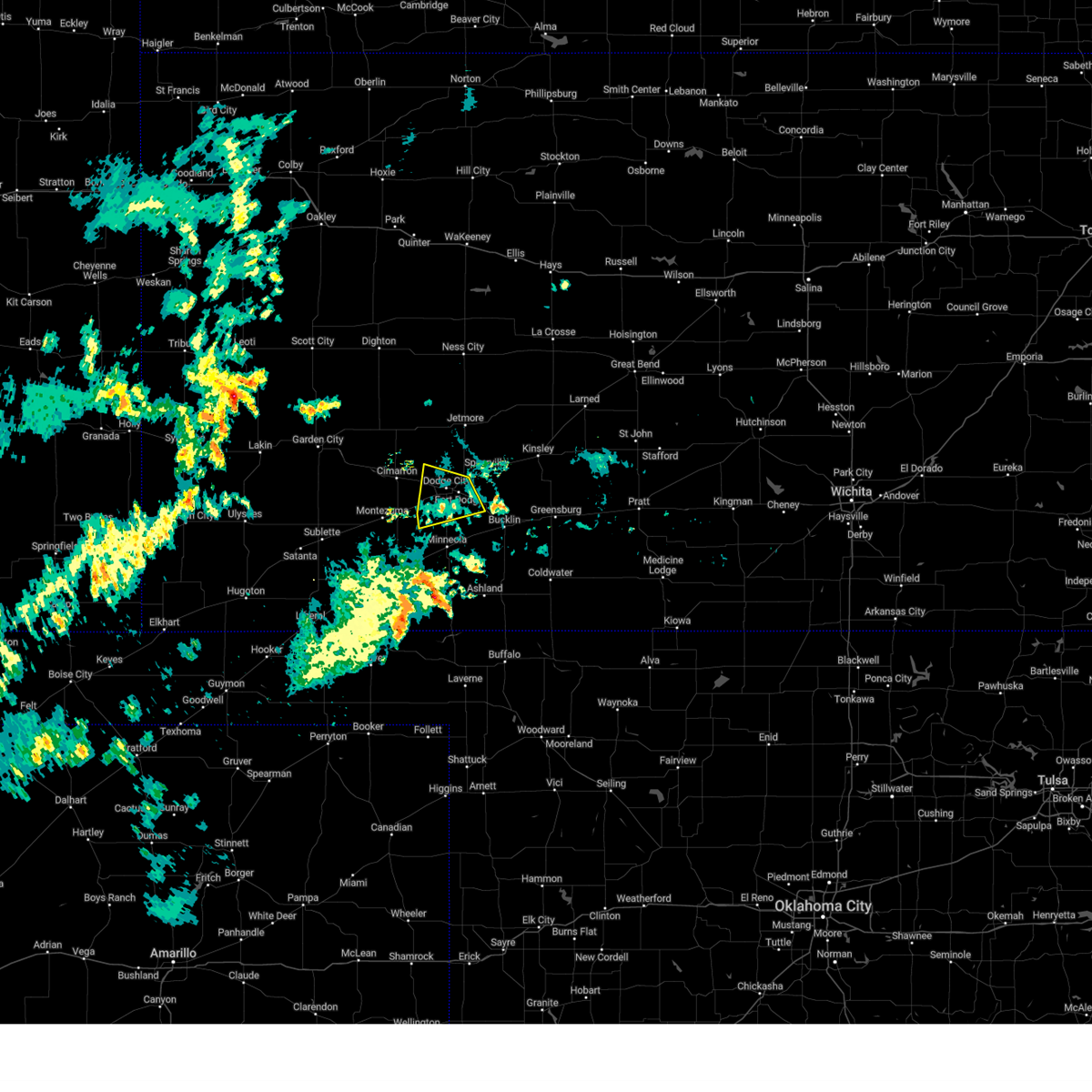
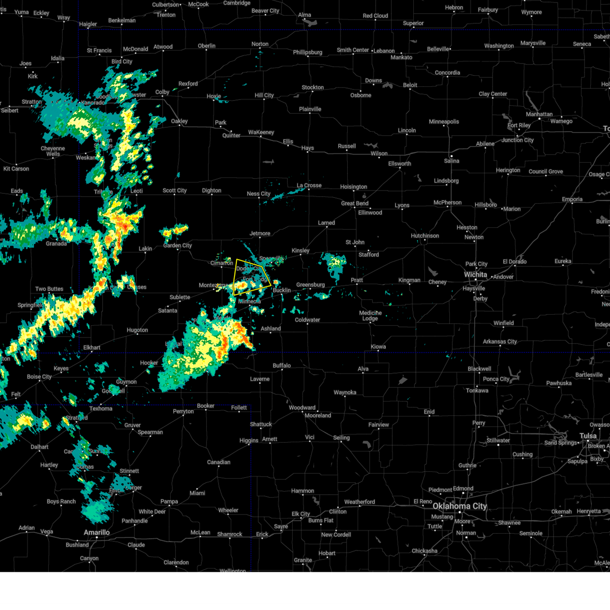
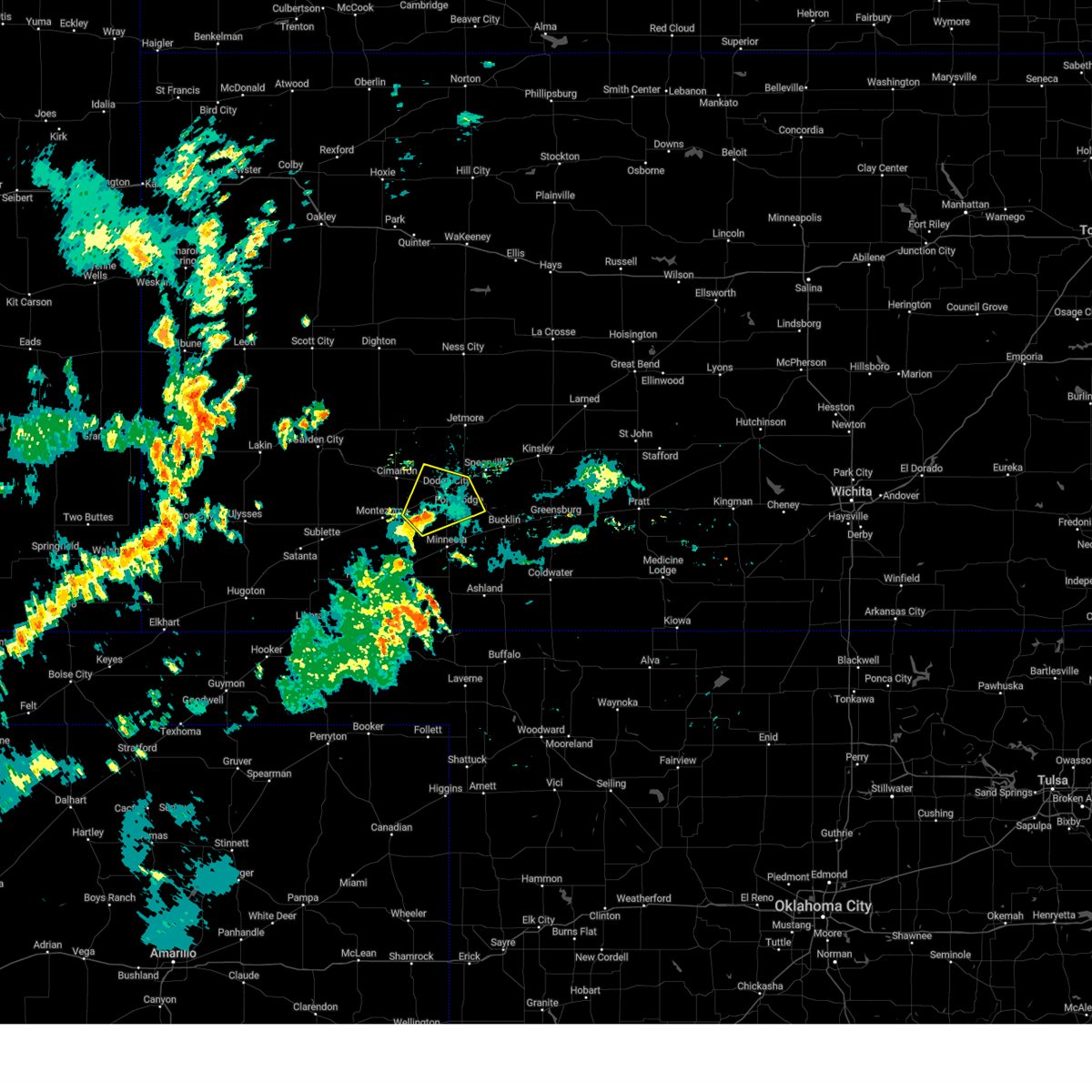
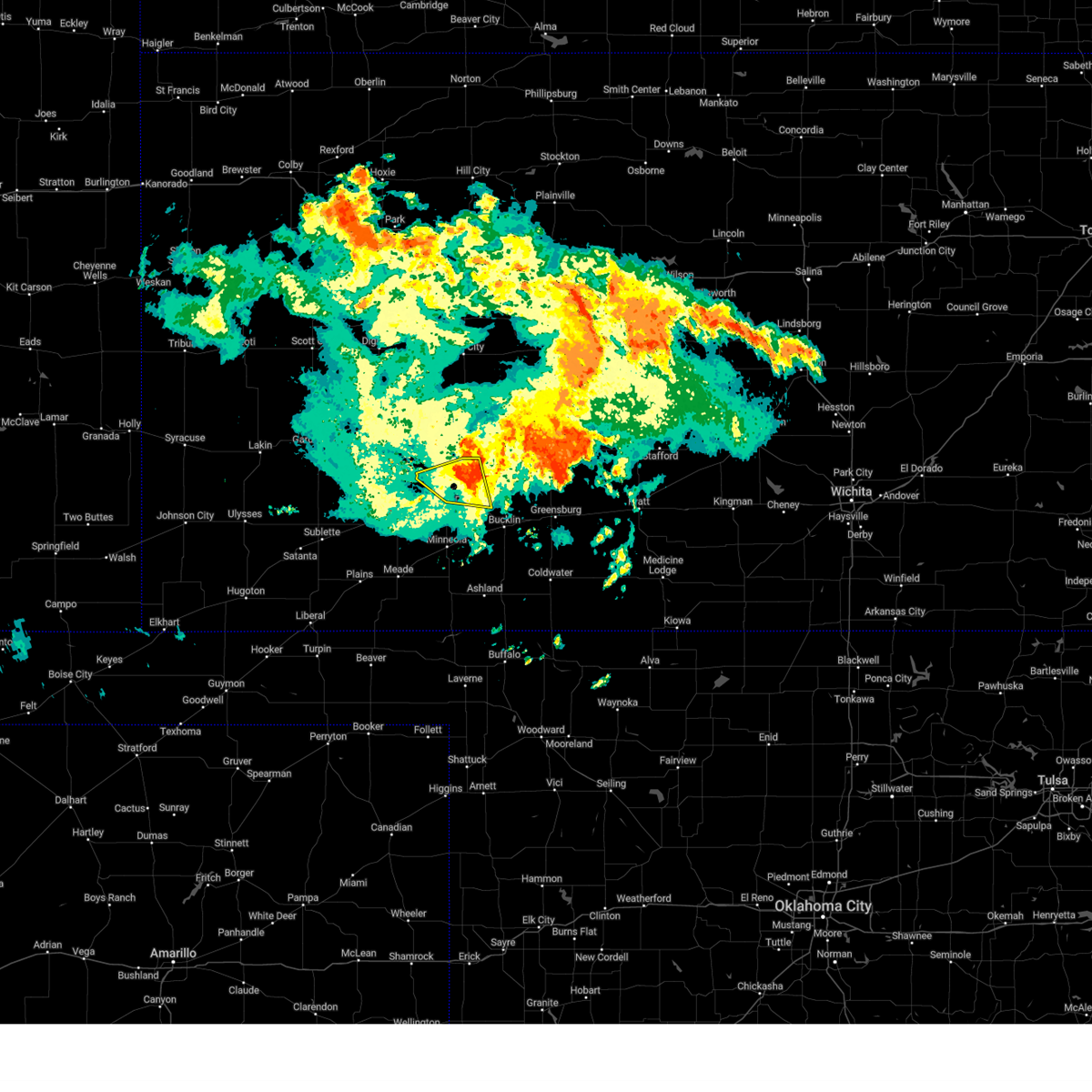
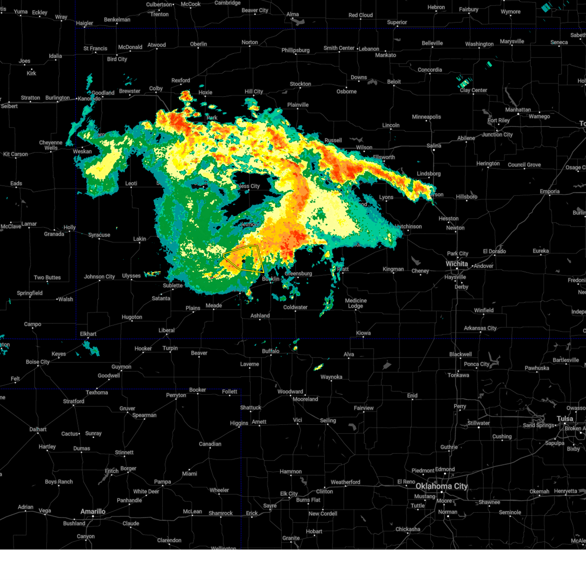
Hail Map for Dodge City, KS
The Dodge City, KS area has had 101 reports of on-the-ground hail by trained spotters, and has been under severe weather warnings 28 times during the past 12 months. Doppler radar has detected hail at or near Dodge City, KS on 110 occasions, including 7 occasions during the past year.
| Name: | Dodge City, KS |
| Where Located: | 49.7 miles ESE of Garden City, KS |
| Map: | Google Map for Dodge City, KS |
| Population: | 27340 |
| Housing Units: | 9378 |
| More Info: | Search Google for Dodge City, KS |
1
The Top Recent Hail Date for Dodge City, KS is Sunday, June 8, 2025 (30th out of 110)
Hail and Wind Damage Spotted near Dodge City, KS
| Date / Time | Report Details |
|---|---|
| 6/23/2025 6:39 PM CDT |
 The storm which prompted the warning has weakened below severe limits, and no longer poses an immediate threat to life or property. therefore, the warning will be allowed to expire. The storm which prompted the warning has weakened below severe limits, and no longer poses an immediate threat to life or property. therefore, the warning will be allowed to expire.
|
| 6/23/2025 6:29 PM CDT | Asos station kddc dodge city regional airpor in ford county KS, 2.2 miles WSW of Dodge City, KS |
| 6/23/2025 6:20 PM CDT |
 At 618 pm cdt, a severe thunderstorm was located very near dodge city, moving north at 30 mph (radar indicated and automated weather station. at 615 pm, a 59 mph wind gust was recorded at the dodge city airport). Hazards include 60 mph wind gusts. Expect damage to roofs, siding, and trees. locations impacted include, dodge city, spearville, wright, howell, ft. Dodge, and bellefont. At 618 pm cdt, a severe thunderstorm was located very near dodge city, moving north at 30 mph (radar indicated and automated weather station. at 615 pm, a 59 mph wind gust was recorded at the dodge city airport). Hazards include 60 mph wind gusts. Expect damage to roofs, siding, and trees. locations impacted include, dodge city, spearville, wright, howell, ft. Dodge, and bellefont.
|
| 6/23/2025 6:19 PM CDT | Asos station kddc dodge city regional airpor in ford county KS, 2.2 miles WSW of Dodge City, KS |
| 6/23/2025 5:49 PM CDT |
 Svrddc the national weather service in dodge city has issued a * severe thunderstorm warning for, ford county in southwestern kansas, * until 645 pm cdt. * at 549 pm cdt, a severe thunderstorm was located 7 miles northwest of minneola, moving north at 30 mph (radar indicated). Hazards include 60 mph wind gusts. expect damage to roofs, siding, and trees Svrddc the national weather service in dodge city has issued a * severe thunderstorm warning for, ford county in southwestern kansas, * until 645 pm cdt. * at 549 pm cdt, a severe thunderstorm was located 7 miles northwest of minneola, moving north at 30 mph (radar indicated). Hazards include 60 mph wind gusts. expect damage to roofs, siding, and trees
|
| 6/8/2025 4:00 PM CDT |
 the severe thunderstorm warning has been cancelled and is no longer in effect the severe thunderstorm warning has been cancelled and is no longer in effect
|
| 6/8/2025 3:46 PM CDT | At 345 pm cdt, a severe thunderstorm was located near wright, moving east at 20 mph (radar indicated). Hazards include quarter size hail. Damage to vehicles is expected. This severe thunderstorm will remain over mainly rural areas of central ford county. |
| 6/8/2025 3:39 PM CDT |
 Svrddc the national weather service in dodge city has issued a * severe thunderstorm warning for, central ford county in southwestern kansas, * until 430 pm cdt. * at 338 pm cdt, a severe thunderstorm was located very near ft. dodge, moving east at 20 mph (radar indicated). Hazards include quarter size hail. Damage to vehicles is expected. This severe thunderstorm will be near, wright around 345 pm cdt. Svrddc the national weather service in dodge city has issued a * severe thunderstorm warning for, central ford county in southwestern kansas, * until 430 pm cdt. * at 338 pm cdt, a severe thunderstorm was located very near ft. dodge, moving east at 20 mph (radar indicated). Hazards include quarter size hail. Damage to vehicles is expected. This severe thunderstorm will be near, wright around 345 pm cdt.
|
| 6/8/2025 3:35 PM CDT | Quarter sized hail reported 0.4 miles SE of Dodge City, KS |
| 6/8/2025 3:35 PM CDT | Quarter sized hail reported 3.6 miles E of Dodge City, KS, report and photo of approximately quarter sized hail via social media. |
| 6/2/2025 7:41 PM CDT |
 At 740 pm cdt, severe thunderstorms were located along a line extending from 7 miles south of kinsley to near aetna, moving east at 50 mph (radar indicated). Hazards include 60 mph wind gusts. Expect damage to roofs, siding, and trees. Locations impacted include, haviland, sun city, belvidere, centerview, fellsburg, croft and wellsford. At 740 pm cdt, severe thunderstorms were located along a line extending from 7 miles south of kinsley to near aetna, moving east at 50 mph (radar indicated). Hazards include 60 mph wind gusts. Expect damage to roofs, siding, and trees. Locations impacted include, haviland, sun city, belvidere, centerview, fellsburg, croft and wellsford.
|
| 6/2/2025 7:22 PM CDT |
 At 722 pm cdt, severe thunderstorms were located along a line extending from near wright to near buttermilk, moving east at 50 mph (radar indicated). Hazards include 60 mph wind gusts. Expect damage to roofs, siding, and trees. these severe storms will be near, coldwater, mullinville, windhorst, and lake coldwater around 725 pm cdt. wilmore around 730 pm cdt. Other locations in the path of these severe thunderstorms include greensburg, aetna, belvidere, haviland, sun city, centerview, fellsburg, croft and wellsford. At 722 pm cdt, severe thunderstorms were located along a line extending from near wright to near buttermilk, moving east at 50 mph (radar indicated). Hazards include 60 mph wind gusts. Expect damage to roofs, siding, and trees. these severe storms will be near, coldwater, mullinville, windhorst, and lake coldwater around 725 pm cdt. wilmore around 730 pm cdt. Other locations in the path of these severe thunderstorms include greensburg, aetna, belvidere, haviland, sun city, centerview, fellsburg, croft and wellsford.
|
| 6/2/2025 7:22 PM CDT |
 the severe thunderstorm warning has been cancelled and is no longer in effect the severe thunderstorm warning has been cancelled and is no longer in effect
|
| 6/2/2025 7:19 PM CDT | Asos station kddc dodge city regional airpor in ford county KS, 2.2 miles WSW of Dodge City, KS |
| 6/2/2025 7:12 PM CDT |
 Svrddc the national weather service in dodge city has issued a * severe thunderstorm warning for, ford county in southwestern kansas, kiowa county in south central kansas, northeastern meade county in southwestern kansas, western barber county in south central kansas, comanche county in south central kansas, southeastern gray county in southwestern kansas, southern edwards county in south central kansas, southwestern pratt county in south central kansas, clark county in southwestern kansas, * until 800 pm cdt. * at 712 pm cdt, severe thunderstorms were located along a line extending from near ft. dodge to near buttermilk, moving east at 50 mph (radar indicated). Hazards include 60 mph wind gusts. Expect damage to roofs, siding, and trees. severe thunderstorms will be near, coldwater, bucklin, protection, ford, wright, and buttermilk around 715 pm cdt. lake coldwater around 720 pm cdt. mullinville and windhorst around 725 pm cdt. wilmore around 730 pm cdt. Other locations in the path of these severe thunderstorms include greensburg, aetna, belvidere, haviland, sun city, centerview and croft. Svrddc the national weather service in dodge city has issued a * severe thunderstorm warning for, ford county in southwestern kansas, kiowa county in south central kansas, northeastern meade county in southwestern kansas, western barber county in south central kansas, comanche county in south central kansas, southeastern gray county in southwestern kansas, southern edwards county in south central kansas, southwestern pratt county in south central kansas, clark county in southwestern kansas, * until 800 pm cdt. * at 712 pm cdt, severe thunderstorms were located along a line extending from near ft. dodge to near buttermilk, moving east at 50 mph (radar indicated). Hazards include 60 mph wind gusts. Expect damage to roofs, siding, and trees. severe thunderstorms will be near, coldwater, bucklin, protection, ford, wright, and buttermilk around 715 pm cdt. lake coldwater around 720 pm cdt. mullinville and windhorst around 725 pm cdt. wilmore around 730 pm cdt. Other locations in the path of these severe thunderstorms include greensburg, aetna, belvidere, haviland, sun city, centerview and croft.
|
| 5/25/2025 5:06 AM CDT |
 At 506 am cdt, severe thunderstorms were located along a line extending from 8 miles south of nekoma to 7 miles north of minneola, moving east at 50 mph (radar indicated). Hazards include 70 mph wind gusts and penny size hail. Expect considerable tree damage. damage is likely to mobile homes, roofs, and outbuildings. Locations impacted include, spearville, burdett, rozel, bellefont, ford, offerle, windhorst, kinsley, ash valley, kingsdown, sanford, bucklin, garfield and frizell. At 506 am cdt, severe thunderstorms were located along a line extending from 8 miles south of nekoma to 7 miles north of minneola, moving east at 50 mph (radar indicated). Hazards include 70 mph wind gusts and penny size hail. Expect considerable tree damage. damage is likely to mobile homes, roofs, and outbuildings. Locations impacted include, spearville, burdett, rozel, bellefont, ford, offerle, windhorst, kinsley, ash valley, kingsdown, sanford, bucklin, garfield and frizell.
|
| 5/25/2025 4:39 AM CDT |
 Svrddc the national weather service in dodge city has issued a * severe thunderstorm warning for, ford county in southwestern kansas, northwestern kiowa county in south central kansas, southeastern ness county in west central kansas, hodgeman county in southwestern kansas, pawnee county in south central kansas, gray county in southwestern kansas, western edwards county in south central kansas, * until 530 am cdt. * at 439 am cdt, severe thunderstorms were located along a line extending from near ness city to near montezuma, moving east at 50 mph (radar indicated). Hazards include 60 mph wind gusts and penny size hail. Expect damage to roofs, siding, and trees. severe thunderstorms will be near, jetmore, ensign, howell, and the haggard elev around 445 am cdt. dodge city around 450 am cdt. hanston around 455 am cdt. other locations in the path of these severe thunderstorms include gray, burdett, wright, ft. Dodge, spearville, ford, rozel, bellefont, offerle, bloom, ash valley, windhorst, sanford, kinsley and kingsdown. Svrddc the national weather service in dodge city has issued a * severe thunderstorm warning for, ford county in southwestern kansas, northwestern kiowa county in south central kansas, southeastern ness county in west central kansas, hodgeman county in southwestern kansas, pawnee county in south central kansas, gray county in southwestern kansas, western edwards county in south central kansas, * until 530 am cdt. * at 439 am cdt, severe thunderstorms were located along a line extending from near ness city to near montezuma, moving east at 50 mph (radar indicated). Hazards include 60 mph wind gusts and penny size hail. Expect damage to roofs, siding, and trees. severe thunderstorms will be near, jetmore, ensign, howell, and the haggard elev around 445 am cdt. dodge city around 450 am cdt. hanston around 455 am cdt. other locations in the path of these severe thunderstorms include gray, burdett, wright, ft. Dodge, spearville, ford, rozel, bellefont, offerle, bloom, ash valley, windhorst, sanford, kinsley and kingsdown.
|
| 9/18/2024 1:10 AM CDT |
 the severe thunderstorm warning has been cancelled and is no longer in effect the severe thunderstorm warning has been cancelled and is no longer in effect
|
| 9/18/2024 1:10 AM CDT |
 At 109 am cdt, a severe thunderstorm was located near wright, moving northeast at 50 mph (radar indicated). Hazards include 60 mph wind gusts. Expect damage to roofs, siding, and trees. This severe thunderstorm will remain over mainly rural areas of northwestern ford and south central hodgeman counties. At 109 am cdt, a severe thunderstorm was located near wright, moving northeast at 50 mph (radar indicated). Hazards include 60 mph wind gusts. Expect damage to roofs, siding, and trees. This severe thunderstorm will remain over mainly rural areas of northwestern ford and south central hodgeman counties.
|
| 9/18/2024 1:02 AM CDT |
 At 101 am cdt, a severe thunderstorm was located 4 miles west of dodge city, moving east at 45 mph (radar indicated). Hazards include 60 mph wind gusts. Expect damage to roofs, siding, and trees. This severe storm will be near, dodge city around 105 am cdt. At 101 am cdt, a severe thunderstorm was located 4 miles west of dodge city, moving east at 45 mph (radar indicated). Hazards include 60 mph wind gusts. Expect damage to roofs, siding, and trees. This severe storm will be near, dodge city around 105 am cdt.
|
| 9/18/2024 12:51 AM CDT |
 Svrddc the national weather service in dodge city has issued a * severe thunderstorm warning for, northwestern ford county in southwestern kansas, southwestern hodgeman county in southwestern kansas, northeastern gray county in southwestern kansas, * until 130 am cdt. * at 1250 am cdt, a severe thunderstorm was located near howell, moving northeast at 50 mph (radar indicated). Hazards include 60 mph wind gusts. Expect damage to roofs, siding, and trees. This severe thunderstorm will be near, howell around 1255 am cdt. Svrddc the national weather service in dodge city has issued a * severe thunderstorm warning for, northwestern ford county in southwestern kansas, southwestern hodgeman county in southwestern kansas, northeastern gray county in southwestern kansas, * until 130 am cdt. * at 1250 am cdt, a severe thunderstorm was located near howell, moving northeast at 50 mph (radar indicated). Hazards include 60 mph wind gusts. Expect damage to roofs, siding, and trees. This severe thunderstorm will be near, howell around 1255 am cdt.
|
| 8/25/2024 9:36 PM CDT |
 the severe thunderstorm warning has been cancelled and is no longer in effect the severe thunderstorm warning has been cancelled and is no longer in effect
|
| 8/25/2024 9:23 PM CDT |
 the severe thunderstorm warning has been cancelled and is no longer in effect the severe thunderstorm warning has been cancelled and is no longer in effect
|
| 8/25/2024 9:23 PM CDT |
 At 922 pm cdt, a severe thunderstorm was located 7 miles east of ensign, moving northeast at 20 mph (radar indicated). Hazards include 60 mph wind gusts. Expect damage to roofs, siding, and trees. locations impacted include, dodge city, wright, howell, and ft. Dodge. At 922 pm cdt, a severe thunderstorm was located 7 miles east of ensign, moving northeast at 20 mph (radar indicated). Hazards include 60 mph wind gusts. Expect damage to roofs, siding, and trees. locations impacted include, dodge city, wright, howell, and ft. Dodge.
|
| 8/25/2024 9:07 PM CDT |
 Svrddc the national weather service in dodge city has issued a * severe thunderstorm warning for, western ford county in southwestern kansas, east central gray county in southwestern kansas, * until 1015 pm cdt. * at 907 pm cdt, a severe thunderstorm was located near ensign, moving northeast at 20 mph (radar indicated). Hazards include 60 mph wind gusts and penny size hail. expect damage to roofs, siding, and trees Svrddc the national weather service in dodge city has issued a * severe thunderstorm warning for, western ford county in southwestern kansas, east central gray county in southwestern kansas, * until 1015 pm cdt. * at 907 pm cdt, a severe thunderstorm was located near ensign, moving northeast at 20 mph (radar indicated). Hazards include 60 mph wind gusts and penny size hail. expect damage to roofs, siding, and trees
|
| 8/13/2024 2:13 AM CDT |
 the severe thunderstorm warning has been cancelled and is no longer in effect the severe thunderstorm warning has been cancelled and is no longer in effect
|
| 8/13/2024 2:09 AM CDT |
 At 209 am cdt, a severe thunderstorm was located near wright, moving east at 30 mph (radar indicated). Hazards include 60 mph wind gusts. Expect damage to roofs, siding, and trees. This severe thunderstorm will remain over mainly rural areas of northwestern ford county. At 209 am cdt, a severe thunderstorm was located near wright, moving east at 30 mph (radar indicated). Hazards include 60 mph wind gusts. Expect damage to roofs, siding, and trees. This severe thunderstorm will remain over mainly rural areas of northwestern ford county.
|
| 8/13/2024 2:09 AM CDT |
 the severe thunderstorm warning has been cancelled and is no longer in effect the severe thunderstorm warning has been cancelled and is no longer in effect
|
| 8/13/2024 1:56 AM CDT |
 Svrddc the national weather service in dodge city has issued a * severe thunderstorm warning for, northwestern ford county in southwestern kansas, east central gray county in southwestern kansas, * until 230 am cdt. * at 156 am cdt, a severe thunderstorm was located near howell, moving east at 25 mph (radar indicated). Hazards include 60 mph wind gusts. Expect damage to roofs, siding, and trees. This severe thunderstorm will be near, dodge city around 200 am cdt. Svrddc the national weather service in dodge city has issued a * severe thunderstorm warning for, northwestern ford county in southwestern kansas, east central gray county in southwestern kansas, * until 230 am cdt. * at 156 am cdt, a severe thunderstorm was located near howell, moving east at 25 mph (radar indicated). Hazards include 60 mph wind gusts. Expect damage to roofs, siding, and trees. This severe thunderstorm will be near, dodge city around 200 am cdt.
|
| 7/16/2024 10:07 PM CDT |
 The storms which prompted the warning have weakened below severe limits, and no longer pose an immediate threat to life or property. therefore, the warning will be allowed to expire. however, gusty winds are still possible with these thunderstorms. a severe thunderstorm watch remains in effect until 100 am cdt for southwestern kansas. The storms which prompted the warning have weakened below severe limits, and no longer pose an immediate threat to life or property. therefore, the warning will be allowed to expire. however, gusty winds are still possible with these thunderstorms. a severe thunderstorm watch remains in effect until 100 am cdt for southwestern kansas.
|
| 7/16/2024 10:01 PM CDT |
 At 1001 pm cdt, severe thunderstorms were located along a line extending from near howell to near minneola to near acres, moving southeast at 35 mph (radar indicated). Hazards include 60 mph wind gusts. Expect damage to roofs, siding, and trees. Locations impacted include, minneola, dodge city, bloom, clark state lake and kingsdown. At 1001 pm cdt, severe thunderstorms were located along a line extending from near howell to near minneola to near acres, moving southeast at 35 mph (radar indicated). Hazards include 60 mph wind gusts. Expect damage to roofs, siding, and trees. Locations impacted include, minneola, dodge city, bloom, clark state lake and kingsdown.
|
| 7/16/2024 9:32 PM CDT |
 Svrddc the national weather service in dodge city has issued a * severe thunderstorm warning for, ford county in southwestern kansas, northern meade county in southwestern kansas, southern gray county in southwestern kansas, northern clark county in southwestern kansas, * until 1015 pm cdt. * at 931 pm cdt, severe thunderstorms were located along a line extending from near charleston to near the haggard elev to near meade, moving east at 40 mph. another severe thunderstorm was located near ford, moving south at 20 mph (radar indicated). Hazards include 60 mph wind gusts. Expect damage to roofs, siding, and trees. severe thunderstorms will be near, cimarron, fowler, ingalls, ensign, and the haggard elev around 935 pm cdt. howell around 945 pm cdt. minneola around 950 pm cdt. other locations in the path of these severe thunderstorms include dodge city, bloom and ft. Dodge. Svrddc the national weather service in dodge city has issued a * severe thunderstorm warning for, ford county in southwestern kansas, northern meade county in southwestern kansas, southern gray county in southwestern kansas, northern clark county in southwestern kansas, * until 1015 pm cdt. * at 931 pm cdt, severe thunderstorms were located along a line extending from near charleston to near the haggard elev to near meade, moving east at 40 mph. another severe thunderstorm was located near ford, moving south at 20 mph (radar indicated). Hazards include 60 mph wind gusts. Expect damage to roofs, siding, and trees. severe thunderstorms will be near, cimarron, fowler, ingalls, ensign, and the haggard elev around 935 pm cdt. howell around 945 pm cdt. minneola around 950 pm cdt. other locations in the path of these severe thunderstorms include dodge city, bloom and ft. Dodge.
|
| 7/6/2024 8:24 PM CDT | Asos station kddc dodge city regional airpor in ford county KS, 2.2 miles WSW of Dodge City, KS |
| 7/6/2024 8:07 PM CDT |
 Svrddc the national weather service in dodge city has issued a * severe thunderstorm warning for, ford county in southwestern kansas, northern kiowa county in south central kansas, northern meade county in southwestern kansas, gray county in southwestern kansas, edwards county in south central kansas, northwestern clark county in southwestern kansas, * until 915 pm cdt. * at 807 pm cdt, severe thunderstorms were located along a line extending from 7 miles south of burdett to near ensign, moving southeast at 40 mph (radar indicated). Hazards include 60 mph wind gusts and penny size hail. Expect damage to roofs, siding, and trees. severe thunderstorms will be near, dodge city, spearville, offerle, wright, ft. dodge, and bellefont around 815 pm cdt. kinsley around 820 pm cdt. lewis and windhorst around 825 pm cdt. Other locations in the path of these severe thunderstorms include ford, bloom, centerview, bucklin, kingsdown, fellsburg, mullinville, trousdale and greensburg. Svrddc the national weather service in dodge city has issued a * severe thunderstorm warning for, ford county in southwestern kansas, northern kiowa county in south central kansas, northern meade county in southwestern kansas, gray county in southwestern kansas, edwards county in south central kansas, northwestern clark county in southwestern kansas, * until 915 pm cdt. * at 807 pm cdt, severe thunderstorms were located along a line extending from 7 miles south of burdett to near ensign, moving southeast at 40 mph (radar indicated). Hazards include 60 mph wind gusts and penny size hail. Expect damage to roofs, siding, and trees. severe thunderstorms will be near, dodge city, spearville, offerle, wright, ft. dodge, and bellefont around 815 pm cdt. kinsley around 820 pm cdt. lewis and windhorst around 825 pm cdt. Other locations in the path of these severe thunderstorms include ford, bloom, centerview, bucklin, kingsdown, fellsburg, mullinville, trousdale and greensburg.
|
| 6/18/2024 8:24 PM CDT |
 the severe thunderstorm warning has been cancelled and is no longer in effect the severe thunderstorm warning has been cancelled and is no longer in effect
|
| 6/18/2024 8:24 PM CDT |
 At 823 pm cdt, a severe thunderstorm was located 7 miles west of centerview, moving east at 30 mph (radar indicated). Hazards include 60 mph wind gusts and penny size hail. Expect damage to roofs, siding, and trees. This severe thunderstorm will remain over mainly rural areas of ford, northwestern kiowa, southeastern hodgeman and southwestern edwards counties. At 823 pm cdt, a severe thunderstorm was located 7 miles west of centerview, moving east at 30 mph (radar indicated). Hazards include 60 mph wind gusts and penny size hail. Expect damage to roofs, siding, and trees. This severe thunderstorm will remain over mainly rural areas of ford, northwestern kiowa, southeastern hodgeman and southwestern edwards counties.
|
| 6/18/2024 7:53 PM CDT |
 Svrddc the national weather service in dodge city has issued a * severe thunderstorm warning for, ford county in southwestern kansas, northwestern kiowa county in south central kansas, southeastern hodgeman county in southwestern kansas, south central pawnee county in south central kansas, edwards county in south central kansas, * until 845 pm cdt. * at 753 pm cdt, a severe thunderstorm was located near windhorst, moving east at 30 mph (radar indicated). Hazards include 70 mph wind gusts and quarter size hail. Hail damage to vehicles is expected. expect considerable tree damage. wind damage is also likely to mobile homes, roofs, and outbuildings. this severe thunderstorm will be near, windhorst around 800 pm cdt. Other locations in the path of this severe thunderstorm include centerview. Svrddc the national weather service in dodge city has issued a * severe thunderstorm warning for, ford county in southwestern kansas, northwestern kiowa county in south central kansas, southeastern hodgeman county in southwestern kansas, south central pawnee county in south central kansas, edwards county in south central kansas, * until 845 pm cdt. * at 753 pm cdt, a severe thunderstorm was located near windhorst, moving east at 30 mph (radar indicated). Hazards include 70 mph wind gusts and quarter size hail. Hail damage to vehicles is expected. expect considerable tree damage. wind damage is also likely to mobile homes, roofs, and outbuildings. this severe thunderstorm will be near, windhorst around 800 pm cdt. Other locations in the path of this severe thunderstorm include centerview.
|
| 6/18/2024 7:41 PM CDT |
 At 740 pm cdt, a severe thunderstorm was located near ft. dodge, moving east at 25 mph. this is a destructive storm for east-central ford county, southwest edwards county, and northwest kiowa county (radar indicated). Hazards include 80 mph wind gusts and quarter size hail. Flying debris will be dangerous to those caught without shelter. mobile homes will be heavily damaged. expect considerable damage to roofs, windows, and vehicles. extensive tree damage and power outages are likely. Locations impacted include, ford. At 740 pm cdt, a severe thunderstorm was located near ft. dodge, moving east at 25 mph. this is a destructive storm for east-central ford county, southwest edwards county, and northwest kiowa county (radar indicated). Hazards include 80 mph wind gusts and quarter size hail. Flying debris will be dangerous to those caught without shelter. mobile homes will be heavily damaged. expect considerable damage to roofs, windows, and vehicles. extensive tree damage and power outages are likely. Locations impacted include, ford.
|
| 6/18/2024 7:25 PM CDT | Quarter sized hail reported 2 miles W of Dodge City, KS |
| 6/18/2024 7:23 PM CDT |
 At 723 pm cdt, a severe thunderstorm was located near ft. dodge, moving east at 25 mph (radar indicated). Hazards include 70 mph wind gusts and half dollar size hail. Hail damage to vehicles is expected. expect considerable tree damage. wind damage is also likely to mobile homes, roofs, and outbuildings. this severe storm will be near, ft. dodge around 730 pm cdt. Other locations in the path of this severe thunderstorm include ford. At 723 pm cdt, a severe thunderstorm was located near ft. dodge, moving east at 25 mph (radar indicated). Hazards include 70 mph wind gusts and half dollar size hail. Hail damage to vehicles is expected. expect considerable tree damage. wind damage is also likely to mobile homes, roofs, and outbuildings. this severe storm will be near, ft. dodge around 730 pm cdt. Other locations in the path of this severe thunderstorm include ford.
|
| 6/18/2024 7:23 PM CDT |
 The storm which prompted the warning has weakened below severe limits, and no longer appears capable of producing a tornado. therefore, the warning will be allowed to expire. however, small hail, gusty winds and heavy rain are still possible with this thunderstorm. a severe thunderstorm watch remains in effect until 1000 pm cdt for southwestern kansas. remember, a severe thunderstorm warning still remains in effect for ford county until 800 pm cdt. The storm which prompted the warning has weakened below severe limits, and no longer appears capable of producing a tornado. therefore, the warning will be allowed to expire. however, small hail, gusty winds and heavy rain are still possible with this thunderstorm. a severe thunderstorm watch remains in effect until 1000 pm cdt for southwestern kansas. remember, a severe thunderstorm warning still remains in effect for ford county until 800 pm cdt.
|
| 6/18/2024 7:20 PM CDT | Ping Pong Ball sized hail reported 1.7 miles NE of Dodge City, KS |
| 6/18/2024 7:20 PM CDT | Quarter sized hail reported 0.9 miles WNW of Dodge City, KS |
| 6/18/2024 7:19 PM CDT |
 Svrddc the national weather service in dodge city has issued a * severe thunderstorm warning for, ford county in southwestern kansas, northwestern kiowa county in south central kansas, southwestern edwards county in south central kansas, * until 800 pm cdt. * at 719 pm cdt, a severe thunderstorm was located near dodge city, moving east at 25 mph (radar indicated). Hazards include 70 mph wind gusts and penny size hail. Expect considerable tree damage. damage is likely to mobile homes, roofs, and outbuildings. this severe thunderstorm will be near, dodge city and ft. dodge around 725 pm cdt. Other locations in the path of this severe thunderstorm include ford. Svrddc the national weather service in dodge city has issued a * severe thunderstorm warning for, ford county in southwestern kansas, northwestern kiowa county in south central kansas, southwestern edwards county in south central kansas, * until 800 pm cdt. * at 719 pm cdt, a severe thunderstorm was located near dodge city, moving east at 25 mph (radar indicated). Hazards include 70 mph wind gusts and penny size hail. Expect considerable tree damage. damage is likely to mobile homes, roofs, and outbuildings. this severe thunderstorm will be near, dodge city and ft. dodge around 725 pm cdt. Other locations in the path of this severe thunderstorm include ford.
|
| 6/18/2024 7:03 PM CDT |
 At 703 pm cdt, a severe thunderstorm capable of producing a tornado was located near dodge city, moving east at 25 mph (radar indicated rotation). Hazards include tornado. Flying debris will be dangerous to those caught without shelter. mobile homes will be damaged or destroyed. damage to roofs, windows, and vehicles will occur. tree damage is likely. this dangerous storm will be near, dodge city around 710 pm cdt. ft. Dodge around 715 pm cdt. At 703 pm cdt, a severe thunderstorm capable of producing a tornado was located near dodge city, moving east at 25 mph (radar indicated rotation). Hazards include tornado. Flying debris will be dangerous to those caught without shelter. mobile homes will be damaged or destroyed. damage to roofs, windows, and vehicles will occur. tree damage is likely. this dangerous storm will be near, dodge city around 710 pm cdt. ft. Dodge around 715 pm cdt.
|
| 6/18/2024 6:58 PM CDT |
 At 658 pm cdt, a severe thunderstorm capable of producing a tornado was located 7 miles east of ensign, moving east at 25 mph (radar indicated rotation). Hazards include tornado. Flying debris will be dangerous to those caught without shelter. mobile homes will be damaged or destroyed. damage to roofs, windows, and vehicles will occur. tree damage is likely. this dangerous storm will be near, dodge city around 705 pm cdt. other locations in the path of this tornadic thunderstorm include ft. Dodge and wright. At 658 pm cdt, a severe thunderstorm capable of producing a tornado was located 7 miles east of ensign, moving east at 25 mph (radar indicated rotation). Hazards include tornado. Flying debris will be dangerous to those caught without shelter. mobile homes will be damaged or destroyed. damage to roofs, windows, and vehicles will occur. tree damage is likely. this dangerous storm will be near, dodge city around 705 pm cdt. other locations in the path of this tornadic thunderstorm include ft. Dodge and wright.
|
| 6/18/2024 6:58 PM CDT |
 the tornado warning has been cancelled and is no longer in effect the tornado warning has been cancelled and is no longer in effect
|
| 6/18/2024 6:46 PM CDT |
 Torddc the national weather service in dodge city has issued a * tornado warning for, northwestern ford county in southwestern kansas, east central gray county in southwestern kansas, * until 730 pm cdt. * at 646 pm cdt, a severe thunderstorm capable of producing a tornado was located near ensign, moving east at 25 mph (radar indicated rotation). Hazards include tornado. Flying debris will be dangerous to those caught without shelter. mobile homes will be damaged or destroyed. damage to roofs, windows, and vehicles will occur. tree damage is likely. this dangerous storm will be near, dodge city around 705 pm cdt. other locations in the path of this tornadic thunderstorm include ft. Dodge. Torddc the national weather service in dodge city has issued a * tornado warning for, northwestern ford county in southwestern kansas, east central gray county in southwestern kansas, * until 730 pm cdt. * at 646 pm cdt, a severe thunderstorm capable of producing a tornado was located near ensign, moving east at 25 mph (radar indicated rotation). Hazards include tornado. Flying debris will be dangerous to those caught without shelter. mobile homes will be damaged or destroyed. damage to roofs, windows, and vehicles will occur. tree damage is likely. this dangerous storm will be near, dodge city around 705 pm cdt. other locations in the path of this tornadic thunderstorm include ft. Dodge.
|
| 6/18/2024 6:38 PM CDT |
 Svrddc the national weather service in dodge city has issued a * severe thunderstorm warning for, ford county in southwestern kansas, northwestern kiowa county in south central kansas, southeastern ness county in west central kansas, hodgeman county in southwestern kansas, pawnee county in south central kansas, northeastern gray county in southwestern kansas, edwards county in south central kansas, * until 730 pm cdt. * at 638 pm cdt, severe thunderstorms were located along a line extending from 8 miles south of alexander to near offerle to near ensign, moving east at 20 mph (radar indicated). Hazards include 60 mph wind gusts and nickel size hail. Expect damage to roofs, siding, and trees. severe thunderstorms will be near, dodge city, spearville, offerle, rozel, wright, ft. dodge, and bellefont around 645 pm cdt. kinsley around 650 pm cdt. Other locations in the path of these severe thunderstorms include windhorst, sanford, garfield, ash valley and lewis. Svrddc the national weather service in dodge city has issued a * severe thunderstorm warning for, ford county in southwestern kansas, northwestern kiowa county in south central kansas, southeastern ness county in west central kansas, hodgeman county in southwestern kansas, pawnee county in south central kansas, northeastern gray county in southwestern kansas, edwards county in south central kansas, * until 730 pm cdt. * at 638 pm cdt, severe thunderstorms were located along a line extending from 8 miles south of alexander to near offerle to near ensign, moving east at 20 mph (radar indicated). Hazards include 60 mph wind gusts and nickel size hail. Expect damage to roofs, siding, and trees. severe thunderstorms will be near, dodge city, spearville, offerle, rozel, wright, ft. dodge, and bellefont around 645 pm cdt. kinsley around 650 pm cdt. Other locations in the path of these severe thunderstorms include windhorst, sanford, garfield, ash valley and lewis.
|
| 6/18/2024 5:49 PM CDT |
 Svrddc the national weather service in dodge city has issued a * severe thunderstorm warning for, northern ford county in southwestern kansas, eastern finney county in southwestern kansas, southeastern ness county in west central kansas, hodgeman county in southwestern kansas, northwestern pawnee county in south central kansas, northern gray county in southwestern kansas, northwestern edwards county in south central kansas, * until 645 pm cdt. * at 549 pm cdt, severe thunderstorms were located along a line extending from 7 miles south of bazine to near howell, moving east at 15 mph (radar indicated). Hazards include 60 mph wind gusts and penny size hail. Expect damage to roofs, siding, and trees. severe thunderstorms will be near, jetmore and howell around 555 pm cdt. Other locations in the path of these severe thunderstorms include dodge city and hanston. Svrddc the national weather service in dodge city has issued a * severe thunderstorm warning for, northern ford county in southwestern kansas, eastern finney county in southwestern kansas, southeastern ness county in west central kansas, hodgeman county in southwestern kansas, northwestern pawnee county in south central kansas, northern gray county in southwestern kansas, northwestern edwards county in south central kansas, * until 645 pm cdt. * at 549 pm cdt, severe thunderstorms were located along a line extending from 7 miles south of bazine to near howell, moving east at 15 mph (radar indicated). Hazards include 60 mph wind gusts and penny size hail. Expect damage to roofs, siding, and trees. severe thunderstorms will be near, jetmore and howell around 555 pm cdt. Other locations in the path of these severe thunderstorms include dodge city and hanston.
|
| 6/15/2024 7:25 PM CDT |
 Svrddc the national weather service in dodge city has issued a * severe thunderstorm warning for, northeastern ford county in southwestern kansas, southeastern hodgeman county in southwestern kansas, * until 815 pm cdt. * at 725 pm cdt, a severe thunderstorm was located 10 miles north of dodge city, moving northeast at 35 mph (radar indicated). Hazards include 60 mph wind gusts and quarter size hail. Hail damage to vehicles is expected. expect wind damage to roofs, siding, and trees. This severe thunderstorm will remain over mainly rural areas of northeastern ford and southeastern hodgeman counties. Svrddc the national weather service in dodge city has issued a * severe thunderstorm warning for, northeastern ford county in southwestern kansas, southeastern hodgeman county in southwestern kansas, * until 815 pm cdt. * at 725 pm cdt, a severe thunderstorm was located 10 miles north of dodge city, moving northeast at 35 mph (radar indicated). Hazards include 60 mph wind gusts and quarter size hail. Hail damage to vehicles is expected. expect wind damage to roofs, siding, and trees. This severe thunderstorm will remain over mainly rural areas of northeastern ford and southeastern hodgeman counties.
|
| 6/13/2024 6:50 PM CDT |
 The storms which prompted the warning have moved out of the area. therefore, the warning will be allowed to expire. however, small hail and gusty winds are still possible with these thunderstorms. a severe thunderstorm watch remains in effect until 1100 pm cdt for southwestern kansas. The storms which prompted the warning have moved out of the area. therefore, the warning will be allowed to expire. however, small hail and gusty winds are still possible with these thunderstorms. a severe thunderstorm watch remains in effect until 1100 pm cdt for southwestern kansas.
|
| 6/13/2024 6:39 PM CDT | Quarter sized hail reported 0.4 miles SE of Dodge City, KS, report from mping: quarter (1.00 in.). |
| 6/13/2024 6:32 PM CDT | Kddc aso in ford county KS, 2.2 miles WSW of Dodge City, KS |
| 6/13/2024 6:31 PM CDT | Visibility was reported to be one-quarter mile in blowing dust with the high wind. report was relayed by e in ford county KS, 8.2 miles SSE of Dodge City, KS |
| 6/13/2024 6:20 PM CDT |
 the severe thunderstorm warning has been cancelled and is no longer in effect the severe thunderstorm warning has been cancelled and is no longer in effect
|
| 6/13/2024 6:20 PM CDT |
 At 619 pm cdt, severe thunderstorms were located along a line extending from near jetmore to near montezuma, moving southeast at 30 mph (radar indicated). Hazards include 60 mph wind gusts. Expect damage to roofs, siding, and trees. locations impacted include, dodge city, cimarron, montezuma, jetmore, spearville, ford, ensign, howell, wright, bellefont, windhorst, the haggard elev, and ft. Dodge. At 619 pm cdt, severe thunderstorms were located along a line extending from near jetmore to near montezuma, moving southeast at 30 mph (radar indicated). Hazards include 60 mph wind gusts. Expect damage to roofs, siding, and trees. locations impacted include, dodge city, cimarron, montezuma, jetmore, spearville, ford, ensign, howell, wright, bellefont, windhorst, the haggard elev, and ft. Dodge.
|
| 6/13/2024 6:05 PM CDT |
 At 605 pm cdt, severe thunderstorms were located along a line extending from 11 miles northeast of kalvesta to 7 miles northwest of montezuma, moving southeast at 30 mph (radar indicated). Hazards include 60 mph wind gusts. Expect damage to roofs, siding, and trees. locations impacted include, dodge city, cimarron, montezuma, jetmore, spearville, ingalls, ford, ensign, howell, wright, kalvesta, bellefont, windhorst, the haggard elev, and ft. Dodge. At 605 pm cdt, severe thunderstorms were located along a line extending from 11 miles northeast of kalvesta to 7 miles northwest of montezuma, moving southeast at 30 mph (radar indicated). Hazards include 60 mph wind gusts. Expect damage to roofs, siding, and trees. locations impacted include, dodge city, cimarron, montezuma, jetmore, spearville, ingalls, ford, ensign, howell, wright, kalvesta, bellefont, windhorst, the haggard elev, and ft. Dodge.
|
| 6/13/2024 6:05 PM CDT |
 the severe thunderstorm warning has been cancelled and is no longer in effect the severe thunderstorm warning has been cancelled and is no longer in effect
|
| 6/13/2024 5:47 PM CDT |
 Svrddc the national weather service in dodge city has issued a * severe thunderstorm warning for, ford county in southwestern kansas, eastern finney county in southwestern kansas, hodgeman county in southwestern kansas, gray county in southwestern kansas, northeastern haskell county in southwestern kansas, * until 700 pm cdt. * at 547 pm cdt, severe thunderstorms were located along a line extending from 10 miles north of kalvesta to 8 miles south of pierceville, moving southeast at 35 mph (radar indicated). Hazards include 60 mph wind gusts. expect damage to roofs, siding, and trees Svrddc the national weather service in dodge city has issued a * severe thunderstorm warning for, ford county in southwestern kansas, eastern finney county in southwestern kansas, hodgeman county in southwestern kansas, gray county in southwestern kansas, northeastern haskell county in southwestern kansas, * until 700 pm cdt. * at 547 pm cdt, severe thunderstorms were located along a line extending from 10 miles north of kalvesta to 8 miles south of pierceville, moving southeast at 35 mph (radar indicated). Hazards include 60 mph wind gusts. expect damage to roofs, siding, and trees
|
| 6/9/2024 12:51 AM CDT | Public pictures of a tree uproote in ford county KS, 1.8 miles SSE of Dodge City, KS |
| 6/8/2024 11:40 PM CDT | Storm damage reported in ford county KS, 2.5 miles W of Dodge City, KS |
| 6/8/2024 11:40 PM CDT |
 At 1139 pm cdt, severe thunderstorms were located along a line extending from 9 miles north of jetmore to wright to near bloom, moving east at 35 mph (70 mph winds at the dodge city airport at 1135 pm cdt). Hazards include 70 mph wind gusts and nickel size hail. Expect considerable tree damage. damage is likely to mobile homes, roofs, and outbuildings. Locations impacted include, jetmore, spearville, ford, kingsdown, hanston, bucklin, bellefont, windhorst and gray. At 1139 pm cdt, severe thunderstorms were located along a line extending from 9 miles north of jetmore to wright to near bloom, moving east at 35 mph (70 mph winds at the dodge city airport at 1135 pm cdt). Hazards include 70 mph wind gusts and nickel size hail. Expect considerable tree damage. damage is likely to mobile homes, roofs, and outbuildings. Locations impacted include, jetmore, spearville, ford, kingsdown, hanston, bucklin, bellefont, windhorst and gray.
|
| 6/8/2024 11:40 PM CDT |
 the severe thunderstorm warning has been cancelled and is no longer in effect the severe thunderstorm warning has been cancelled and is no longer in effect
|
| 6/8/2024 11:16 PM CDT |
 At 1116 pm cdt, severe thunderstorms were located along a line extending from 13 miles southeast of beeler to 8 miles northeast of cimarron to near plains, moving east at 30 mph (doppler radar). Hazards include 80 mph wind gusts and quarter size hail. Flying debris will be dangerous to those caught without shelter. mobile homes will be heavily damaged. expect considerable damage to roofs, windows, and vehicles. extensive tree damage and power outages are likely. Locations impacted include, montezuma, the haggard elev, ensign, howell, missler and dodge city. At 1116 pm cdt, severe thunderstorms were located along a line extending from 13 miles southeast of beeler to 8 miles northeast of cimarron to near plains, moving east at 30 mph (doppler radar). Hazards include 80 mph wind gusts and quarter size hail. Flying debris will be dangerous to those caught without shelter. mobile homes will be heavily damaged. expect considerable damage to roofs, windows, and vehicles. extensive tree damage and power outages are likely. Locations impacted include, montezuma, the haggard elev, ensign, howell, missler and dodge city.
|
| 6/8/2024 11:10 PM CDT |
 Svrddc the national weather service in dodge city has issued a * severe thunderstorm warning for, ford county in southwestern kansas, northeastern finney county in southwestern kansas, hodgeman county in southwestern kansas, eastern gray county in southwestern kansas, * until midnight cdt. * at 1107 pm cdt, severe thunderstorms were located along a line extending from 12 miles south of beeler to 8 miles south of kalvesta to near the haggard elev, moving east at 35 mph. these are destructive storms for rural areas in northeast gray, northeast finney, northern ford, and southern hodgeman counties (radar indicated). Hazards include 80 mph wind gusts and quarter size hail. Flying debris will be dangerous to those caught without shelter. mobile homes will be heavily damaged. expect considerable damage to roofs, windows, and vehicles. extensive tree damage and power outages are likely. severe thunderstorms will be near, ensign and howell around 1115 pm cdt. dodge city around 1125 pm cdt. other locations in the path of these severe thunderstorms include jetmore, ft. Dodge and wright. Svrddc the national weather service in dodge city has issued a * severe thunderstorm warning for, ford county in southwestern kansas, northeastern finney county in southwestern kansas, hodgeman county in southwestern kansas, eastern gray county in southwestern kansas, * until midnight cdt. * at 1107 pm cdt, severe thunderstorms were located along a line extending from 12 miles south of beeler to 8 miles south of kalvesta to near the haggard elev, moving east at 35 mph. these are destructive storms for rural areas in northeast gray, northeast finney, northern ford, and southern hodgeman counties (radar indicated). Hazards include 80 mph wind gusts and quarter size hail. Flying debris will be dangerous to those caught without shelter. mobile homes will be heavily damaged. expect considerable damage to roofs, windows, and vehicles. extensive tree damage and power outages are likely. severe thunderstorms will be near, ensign and howell around 1115 pm cdt. dodge city around 1125 pm cdt. other locations in the path of these severe thunderstorms include jetmore, ft. Dodge and wright.
|
| 6/8/2024 10:50 PM CDT |
 At 1049 pm cdt, severe thunderstorms were located along a line extending from 13 miles north of kalvesta to near ingalls to satanta, moving east at 30 mph. these are destructive storms for ingalls and cimarron (public report of 93 mph wind gust at 1040 pm cdt 10 miles northwest of kalvesta). Hazards include 90 mph wind gusts and golf ball size hail. You are in a life-threatening situation. flying debris may be deadly to those caught without shelter. mobile homes will be heavily damaged or destroyed. homes and businesses will have substantial roof and window damage. expect extensive tree damage and power outages. these severe storms will be near, sublette, ingalls, and kalvesta around 1055 pm cdt. Other locations in the path of these severe thunderstorms include cimarron, copeland, tice, montezuma, howell, the haggard elev, dodge city and ensign. At 1049 pm cdt, severe thunderstorms were located along a line extending from 13 miles north of kalvesta to near ingalls to satanta, moving east at 30 mph. these are destructive storms for ingalls and cimarron (public report of 93 mph wind gust at 1040 pm cdt 10 miles northwest of kalvesta). Hazards include 90 mph wind gusts and golf ball size hail. You are in a life-threatening situation. flying debris may be deadly to those caught without shelter. mobile homes will be heavily damaged or destroyed. homes and businesses will have substantial roof and window damage. expect extensive tree damage and power outages. these severe storms will be near, sublette, ingalls, and kalvesta around 1055 pm cdt. Other locations in the path of these severe thunderstorms include cimarron, copeland, tice, montezuma, howell, the haggard elev, dodge city and ensign.
|
| 6/8/2024 10:39 PM CDT |
 Svrddc the national weather service in dodge city has issued a * severe thunderstorm warning for, western ford county in southwestern kansas, northern seward county in southwestern kansas, eastern finney county in southwestern kansas, western hodgeman county in southwestern kansas, northern meade county in southwestern kansas, gray county in southwestern kansas, haskell county in southwestern kansas, * until 1130 pm cdt. * at 1038 pm cdt, severe thunderstorms were located along a line extending from 12 miles south of alamota to near charleston to near hickok, moving east at 35 mph. these are destructive storms for charleston, ingalls, kalvesta and cimarron (trained weather spotters reported 83 mph winds in garden city at 1034 cdt). Hazards include 80 mph wind gusts and golf ball size hail. Flying debris will be dangerous to those caught without shelter. mobile homes will be heavily damaged. expect considerable damage to roofs, windows, and vehicles. extensive tree damage and power outages are likely. severe thunderstorms will be near, charleston around 1045 pm cdt. ingalls and kalvesta around 1050 pm cdt. Other locations in the path of these severe thunderstorms include cimarron and sublette. Svrddc the national weather service in dodge city has issued a * severe thunderstorm warning for, western ford county in southwestern kansas, northern seward county in southwestern kansas, eastern finney county in southwestern kansas, western hodgeman county in southwestern kansas, northern meade county in southwestern kansas, gray county in southwestern kansas, haskell county in southwestern kansas, * until 1130 pm cdt. * at 1038 pm cdt, severe thunderstorms were located along a line extending from 12 miles south of alamota to near charleston to near hickok, moving east at 35 mph. these are destructive storms for charleston, ingalls, kalvesta and cimarron (trained weather spotters reported 83 mph winds in garden city at 1034 cdt). Hazards include 80 mph wind gusts and golf ball size hail. Flying debris will be dangerous to those caught without shelter. mobile homes will be heavily damaged. expect considerable damage to roofs, windows, and vehicles. extensive tree damage and power outages are likely. severe thunderstorms will be near, charleston around 1045 pm cdt. ingalls and kalvesta around 1050 pm cdt. Other locations in the path of these severe thunderstorms include cimarron and sublette.
|
| 6/3/2024 4:25 AM CDT |
 At 424 am cdt, severe thunderstorms were located along a line extending from near gray to 9 miles south of minneola, moving east at 45 mph (automated equipment. the dodge city airport measured a wind gust of 67 mph at 420 am cdt. this storm has a history of damaging winds, and damaging winds are expected). Hazards include 70 mph wind gusts and nickel size hail. Expect considerable tree damage. damage is likely to mobile homes, roofs, and outbuildings. these severe storms will be near, burdett, ford, bloom, kingsdown, bellefont, clark state lake, and windhorst around 430 am cdt. offerle and rozel around 435 am cdt. Other locations in the path of these severe thunderstorms include bucklin, kinsley, sanford and mullinville. At 424 am cdt, severe thunderstorms were located along a line extending from near gray to 9 miles south of minneola, moving east at 45 mph (automated equipment. the dodge city airport measured a wind gust of 67 mph at 420 am cdt. this storm has a history of damaging winds, and damaging winds are expected). Hazards include 70 mph wind gusts and nickel size hail. Expect considerable tree damage. damage is likely to mobile homes, roofs, and outbuildings. these severe storms will be near, burdett, ford, bloom, kingsdown, bellefont, clark state lake, and windhorst around 430 am cdt. offerle and rozel around 435 am cdt. Other locations in the path of these severe thunderstorms include bucklin, kinsley, sanford and mullinville.
|
| 6/3/2024 4:23 AM CDT | Asos station kddc dodge city regional airpor in ford county KS, 2.2 miles WSW of Dodge City, KS |
| 6/3/2024 4:17 AM CDT |
 Svrddc the national weather service in dodge city has issued a * severe thunderstorm warning for, ford county in southwestern kansas, western kiowa county in south central kansas, eastern hodgeman county in southwestern kansas, northeastern meade county in southwestern kansas, northwestern comanche county in south central kansas, central pawnee county in south central kansas, edwards county in south central kansas, northern clark county in southwestern kansas, * until 500 am cdt. * at 416 am cdt, severe thunderstorms were located along a line extending from near gray to 9 miles south of minneola, moving east at 45 mph (radar indicated). Hazards include 70 mph wind gusts and nickel size hail. Expect considerable tree damage. damage is likely to mobile homes, roofs, and outbuildings. severe thunderstorms will be near, gray, spearville, hanston, and bloom around 420 am cdt. burdett, ford, kingsdown, and bellefont around 425 am cdt. offerle, clark state lake, and windhorst around 430 am cdt. bucklin and rozel around 435 am cdt. Other locations in the path of these severe thunderstorms include kinsley, sanford, mullinville, lewis, garfield and frizell. Svrddc the national weather service in dodge city has issued a * severe thunderstorm warning for, ford county in southwestern kansas, western kiowa county in south central kansas, eastern hodgeman county in southwestern kansas, northeastern meade county in southwestern kansas, northwestern comanche county in south central kansas, central pawnee county in south central kansas, edwards county in south central kansas, northern clark county in southwestern kansas, * until 500 am cdt. * at 416 am cdt, severe thunderstorms were located along a line extending from near gray to 9 miles south of minneola, moving east at 45 mph (radar indicated). Hazards include 70 mph wind gusts and nickel size hail. Expect considerable tree damage. damage is likely to mobile homes, roofs, and outbuildings. severe thunderstorms will be near, gray, spearville, hanston, and bloom around 420 am cdt. burdett, ford, kingsdown, and bellefont around 425 am cdt. offerle, clark state lake, and windhorst around 430 am cdt. bucklin and rozel around 435 am cdt. Other locations in the path of these severe thunderstorms include kinsley, sanford, mullinville, lewis, garfield and frizell.
|
| 6/3/2024 4:10 AM CDT |
 At 409 am cdt, severe thunderstorms were located along a line extending from 9 miles northwest of gray to near fowler, moving east at 30 mph (radar indicated). Hazards include 70 mph wind gusts. Expect considerable tree damage. damage is likely to mobile homes, roofs, and outbuildings. locations impacted include, dodge city, gray, jetmore, spearville, minneola, fowler, burdett, ford, hanston, ensign, rozel, bloom, howell, wright, bellefont, the haggard elev, and ft. Dodge. At 409 am cdt, severe thunderstorms were located along a line extending from 9 miles northwest of gray to near fowler, moving east at 30 mph (radar indicated). Hazards include 70 mph wind gusts. Expect considerable tree damage. damage is likely to mobile homes, roofs, and outbuildings. locations impacted include, dodge city, gray, jetmore, spearville, minneola, fowler, burdett, ford, hanston, ensign, rozel, bloom, howell, wright, bellefont, the haggard elev, and ft. Dodge.
|
| 6/3/2024 4:00 AM CDT |
 At 359 am cdt, severe thunderstorms were located along a line extending from near hanston to near meade, moving east at 35 mph (law enforcement, emergency management. these storms have a history of producing wind damage around garden city and ingalls). Hazards include 60 mph wind gusts and nickel size hail. Expect damage to roofs, siding, and trees. locations impacted include, gray, spearville, minneola, hanston, wright, ft. Dodge, burdett, ford, bloom, bellefont and rozel. At 359 am cdt, severe thunderstorms were located along a line extending from near hanston to near meade, moving east at 35 mph (law enforcement, emergency management. these storms have a history of producing wind damage around garden city and ingalls). Hazards include 60 mph wind gusts and nickel size hail. Expect damage to roofs, siding, and trees. locations impacted include, gray, spearville, minneola, hanston, wright, ft. Dodge, burdett, ford, bloom, bellefont and rozel.
|
| 6/3/2024 3:40 AM CDT |
 Svrddc the national weather service in dodge city has issued a * severe thunderstorm warning for, ford county in southwestern kansas, hodgeman county in southwestern kansas, northeastern meade county in southwestern kansas, west central pawnee county in south central kansas, southeastern gray county in southwestern kansas, northwestern edwards county in south central kansas, northwestern clark county in southwestern kansas, * until 430 am cdt. * at 339 am cdt, severe thunderstorms were located along a line extending from 10 miles northwest of jetmore to near plains, moving southeast at 25 mph (law enforcement, emergency management. these storms have a history of producing wind damage). Hazards include 70 mph wind gusts and nickel size hail. Expect considerable tree damage. damage is likely to mobile homes, roofs, and outbuildings. severe thunderstorms will be near, ensign, howell, and the haggard elev around 345 am cdt. jetmore around 350 am cdt. dodge city around 355 am cdt. other locations in the path of these severe thunderstorms include fowler, wright and ft. Dodge. Svrddc the national weather service in dodge city has issued a * severe thunderstorm warning for, ford county in southwestern kansas, hodgeman county in southwestern kansas, northeastern meade county in southwestern kansas, west central pawnee county in south central kansas, southeastern gray county in southwestern kansas, northwestern edwards county in south central kansas, northwestern clark county in southwestern kansas, * until 430 am cdt. * at 339 am cdt, severe thunderstorms were located along a line extending from 10 miles northwest of jetmore to near plains, moving southeast at 25 mph (law enforcement, emergency management. these storms have a history of producing wind damage). Hazards include 70 mph wind gusts and nickel size hail. Expect considerable tree damage. damage is likely to mobile homes, roofs, and outbuildings. severe thunderstorms will be near, ensign, howell, and the haggard elev around 345 am cdt. jetmore around 350 am cdt. dodge city around 355 am cdt. other locations in the path of these severe thunderstorms include fowler, wright and ft. Dodge.
|
| 5/31/2024 7:22 PM CDT | Quarter sized hail reported 14.3 miles NNW of Dodge City, KS |
| 5/28/2024 3:38 PM CDT |
 At 338 pm cdt, severe thunderstorms were located along a line extending from 8 miles north of offerle to near spearville to 6 miles north of wright, moving south at 40 mph (radar indicated). Hazards include 60 mph wind gusts and nickel size hail. Expect damage to roofs, siding, and trees. these severe storms will be near, spearville, wright, and bellefont around 345 pm cdt. ft. Dodge around 350 pm cdt. At 338 pm cdt, severe thunderstorms were located along a line extending from 8 miles north of offerle to near spearville to 6 miles north of wright, moving south at 40 mph (radar indicated). Hazards include 60 mph wind gusts and nickel size hail. Expect damage to roofs, siding, and trees. these severe storms will be near, spearville, wright, and bellefont around 345 pm cdt. ft. Dodge around 350 pm cdt.
|
| 5/28/2024 3:30 PM CDT |
 At 330 pm cdt, severe thunderstorms were located along a line extending from near hanston to 8 miles northwest of spearville to 11 miles north of dodge city, moving southeast at 35 mph (radar indicated). Hazards include 60 mph wind gusts and nickel size hail. Expect damage to roofs, siding, and trees. these severe storms will be near, spearville around 335 pm cdt. dodge city, wright, and bellefont around 340 pm cdt. other locations in the path of these severe thunderstorms include ft. Dodge. At 330 pm cdt, severe thunderstorms were located along a line extending from near hanston to 8 miles northwest of spearville to 11 miles north of dodge city, moving southeast at 35 mph (radar indicated). Hazards include 60 mph wind gusts and nickel size hail. Expect damage to roofs, siding, and trees. these severe storms will be near, spearville around 335 pm cdt. dodge city, wright, and bellefont around 340 pm cdt. other locations in the path of these severe thunderstorms include ft. Dodge.
|
| 5/28/2024 3:21 PM CDT |
 At 320 pm cdt, severe thunderstorms were located along a line extending from near hanston to near jetmore to 9 miles southeast of kalvesta, moving south at 40 mph (law enforcement). Hazards include 60 mph wind gusts and nickel size hail. Expect damage to roofs, siding, and trees. these severe storms will be near, hanston around 325 pm cdt. dodge city around 335 pm cdt. other locations in the path of these severe thunderstorms include spearville, wright, ft. Dodge and bellefont. At 320 pm cdt, severe thunderstorms were located along a line extending from near hanston to near jetmore to 9 miles southeast of kalvesta, moving south at 40 mph (law enforcement). Hazards include 60 mph wind gusts and nickel size hail. Expect damage to roofs, siding, and trees. these severe storms will be near, hanston around 325 pm cdt. dodge city around 335 pm cdt. other locations in the path of these severe thunderstorms include spearville, wright, ft. Dodge and bellefont.
|
| 5/28/2024 3:17 PM CDT |
 At 316 pm cdt, severe thunderstorms were located along a line extending from 7 miles northwest of hanston to near jetmore to 7 miles east of kalvesta, moving south at 40 mph (radar indicated). Hazards include 60 mph wind gusts and nickel size hail. Expect damage to roofs, siding, and trees. these severe storms will be near, jetmore around 320 pm cdt. hanston around 325 pm cdt. other locations in the path of these severe thunderstorms include dodge city, spearville, wright, ft. Dodge and bellefont. At 316 pm cdt, severe thunderstorms were located along a line extending from 7 miles northwest of hanston to near jetmore to 7 miles east of kalvesta, moving south at 40 mph (radar indicated). Hazards include 60 mph wind gusts and nickel size hail. Expect damage to roofs, siding, and trees. these severe storms will be near, jetmore around 320 pm cdt. hanston around 325 pm cdt. other locations in the path of these severe thunderstorms include dodge city, spearville, wright, ft. Dodge and bellefont.
|
| 5/28/2024 3:17 PM CDT |
 the severe thunderstorm warning has been cancelled and is no longer in effect the severe thunderstorm warning has been cancelled and is no longer in effect
|
| 5/28/2024 3:05 PM CDT |
 Svrddc the national weather service in dodge city has issued a * severe thunderstorm warning for, northern ford county in southwestern kansas, southeastern ness county in west central kansas, hodgeman county in southwestern kansas, west central edwards county in south central kansas, * until 400 pm cdt. * at 305 pm cdt, severe thunderstorms were located along a line extending from 11 miles south of ness city to near jetmore to 7 miles northeast of kalvesta, moving south at 40 mph (radar indicated). Hazards include 60 mph wind gusts and nickel size hail. Expect damage to roofs, siding, and trees. severe thunderstorms will be near, jetmore around 310 pm cdt. hanston around 320 pm cdt. other locations in the path of these severe thunderstorms include dodge city, spearville, wright, ft. Dodge and bellefont. Svrddc the national weather service in dodge city has issued a * severe thunderstorm warning for, northern ford county in southwestern kansas, southeastern ness county in west central kansas, hodgeman county in southwestern kansas, west central edwards county in south central kansas, * until 400 pm cdt. * at 305 pm cdt, severe thunderstorms were located along a line extending from 11 miles south of ness city to near jetmore to 7 miles northeast of kalvesta, moving south at 40 mph (radar indicated). Hazards include 60 mph wind gusts and nickel size hail. Expect damage to roofs, siding, and trees. severe thunderstorms will be near, jetmore around 310 pm cdt. hanston around 320 pm cdt. other locations in the path of these severe thunderstorms include dodge city, spearville, wright, ft. Dodge and bellefont.
|
| 5/19/2024 5:26 PM CDT | Asos station kddc dodge city regional airpor in ford county KS, 2.2 miles WSW of Dodge City, KS |
| 5/19/2024 5:10 PM CDT |
 Svrddc the national weather service in dodge city has issued a * severe thunderstorm warning for, ford county in southwestern kansas, western kiowa county in south central kansas, northeastern meade county in southwestern kansas, northwestern comanche county in south central kansas, southwestern edwards county in south central kansas, northern clark county in southwestern kansas, * until 600 pm cdt. * at 510 pm cdt, severe thunderstorms were located along a line extending from howell to near fowler, moving east at 50 mph (radar indicated). Hazards include 70 mph wind gusts. Expect considerable tree damage. damage is likely to mobile homes, roofs, and outbuildings. severe thunderstorms will be near, dodge city and minneola around 515 pm cdt. ft. dodge around 520 pm cdt. bloom and wright around 525 pm cdt. kingsdown and clark state lake around 530 pm cdt. Other locations in the path of these severe thunderstorms include spearville, ford, bucklin, windhorst and mullinville. Svrddc the national weather service in dodge city has issued a * severe thunderstorm warning for, ford county in southwestern kansas, western kiowa county in south central kansas, northeastern meade county in southwestern kansas, northwestern comanche county in south central kansas, southwestern edwards county in south central kansas, northern clark county in southwestern kansas, * until 600 pm cdt. * at 510 pm cdt, severe thunderstorms were located along a line extending from howell to near fowler, moving east at 50 mph (radar indicated). Hazards include 70 mph wind gusts. Expect considerable tree damage. damage is likely to mobile homes, roofs, and outbuildings. severe thunderstorms will be near, dodge city and minneola around 515 pm cdt. ft. dodge around 520 pm cdt. bloom and wright around 525 pm cdt. kingsdown and clark state lake around 530 pm cdt. Other locations in the path of these severe thunderstorms include spearville, ford, bucklin, windhorst and mullinville.
|
| 5/3/2024 9:50 PM CDT |
 The storms which prompted the warning have weakened below severe limits, and no longer pose an immediate threat to life or property. therefore, the warning will be allowed to expire. however, gusty winds are still possible with these thunderstorms. a severe thunderstorm watch remains in effect until 1100 pm cdt for southwestern kansas. The storms which prompted the warning have weakened below severe limits, and no longer pose an immediate threat to life or property. therefore, the warning will be allowed to expire. however, gusty winds are still possible with these thunderstorms. a severe thunderstorm watch remains in effect until 1100 pm cdt for southwestern kansas.
|
| 5/3/2024 9:31 PM CDT |
 Svrddc the national weather service in dodge city has issued a * severe thunderstorm warning for, northern ford county in southwestern kansas, east central finney county in southwestern kansas, hodgeman county in southwestern kansas, northeastern gray county in southwestern kansas, * until 1000 pm cdt. * at 931 pm cdt, severe thunderstorms were located along a line extending from 13 miles south of beeler to 7 miles south of ft. dodge, moving east at 15 mph (radar indicated). Hazards include 60 mph wind gusts and penny size hail. Expect damage to roofs, siding, and trees. severe thunderstorms will be near, dodge city and ft. dodge around 935 pm cdt. Wright around 940 pm cdt. Svrddc the national weather service in dodge city has issued a * severe thunderstorm warning for, northern ford county in southwestern kansas, east central finney county in southwestern kansas, hodgeman county in southwestern kansas, northeastern gray county in southwestern kansas, * until 1000 pm cdt. * at 931 pm cdt, severe thunderstorms were located along a line extending from 13 miles south of beeler to 7 miles south of ft. dodge, moving east at 15 mph (radar indicated). Hazards include 60 mph wind gusts and penny size hail. Expect damage to roofs, siding, and trees. severe thunderstorms will be near, dodge city and ft. dodge around 935 pm cdt. Wright around 940 pm cdt.
|
| 10/1/2023 3:19 PM CDT |
 At 318 pm cdt, a severe thunderstorm was located near dodge city, moving north at 35 mph (radar indicated). Hazards include 60 mph wind gusts. Expect damage to roofs, siding, and trees. locations impacted include, dodge city. hail threat, radar indicated max hail size, <. 75 in wind threat, radar indicated max wind gust, 60 mph. At 318 pm cdt, a severe thunderstorm was located near dodge city, moving north at 35 mph (radar indicated). Hazards include 60 mph wind gusts. Expect damage to roofs, siding, and trees. locations impacted include, dodge city. hail threat, radar indicated max hail size, <. 75 in wind threat, radar indicated max wind gust, 60 mph.
|
| 10/1/2023 3:04 PM CDT |
 At 304 pm cdt, a severe thunderstorm was located near ensign, moving north at 35 mph (radar indicated). Hazards include 60 mph wind gusts. Expect damage to roofs, siding, and trees. this severe thunderstorm will be near, howell around 315 pm cdt. hail threat, radar indicated max hail size, <. 75 in wind threat, radar indicated max wind gust, 60 mph. At 304 pm cdt, a severe thunderstorm was located near ensign, moving north at 35 mph (radar indicated). Hazards include 60 mph wind gusts. Expect damage to roofs, siding, and trees. this severe thunderstorm will be near, howell around 315 pm cdt. hail threat, radar indicated max hail size, <. 75 in wind threat, radar indicated max wind gust, 60 mph.
|
| 9/19/2023 7:10 PM CDT | Golf Ball sized hail reported 11.1 miles NNE of Dodge City, KS |
| 9/19/2023 6:47 PM CDT | Quarter sized hail reported 11.2 miles NE of Dodge City, KS |
| 9/19/2023 6:19 PM CDT |
 At 618 pm cdt, a severe thunderstorm was located near ensign, moving west at 5 mph (radar indicated). Hazards include 60 mph wind gusts and quarter size hail. Hail damage to vehicles is expected. Expect wind damage to roofs, siding, and trees. At 618 pm cdt, a severe thunderstorm was located near ensign, moving west at 5 mph (radar indicated). Hazards include 60 mph wind gusts and quarter size hail. Hail damage to vehicles is expected. Expect wind damage to roofs, siding, and trees.
|
| 9/19/2023 5:26 PM CDT | Quarter sized hail reported 6 miles N of Dodge City, KS |
| 9/19/2023 5:22 PM CDT | 3-inch tree limbs and power poles broke in ford county KS, 6 miles N of Dodge City, KS |
| 7/20/2023 6:26 PM CDT | Asos station kddc dodge city regional airpor in ford county KS, 2.2 miles WSW of Dodge City, KS |
| 7/20/2023 6:14 PM CDT |
 At 614 pm cdt, severe thunderstorms were located along a line extending from near gray to 6 miles southwest of dodge city, moving east at 30 mph (radar indicated). Hazards include 70 mph wind gusts and quarter size hail. Hail damage to vehicles is expected. expect considerable tree damage. wind damage is also likely to mobile homes, roofs, and outbuildings. these severe thunderstorms will remain over mainly rural areas of northern ford, southeastern hodgeman and west central edwards counties. thunderstorm damage threat, considerable hail threat, radar indicated max hail size, 1. 00 in wind threat, radar indicated max wind gust, 70 mph. At 614 pm cdt, severe thunderstorms were located along a line extending from near gray to 6 miles southwest of dodge city, moving east at 30 mph (radar indicated). Hazards include 70 mph wind gusts and quarter size hail. Hail damage to vehicles is expected. expect considerable tree damage. wind damage is also likely to mobile homes, roofs, and outbuildings. these severe thunderstorms will remain over mainly rural areas of northern ford, southeastern hodgeman and west central edwards counties. thunderstorm damage threat, considerable hail threat, radar indicated max hail size, 1. 00 in wind threat, radar indicated max wind gust, 70 mph.
|
| 7/20/2023 6:05 PM CDT | Storm damage reported in ford county KS, 3 miles SE of Dodge City, KS |
| 7/20/2023 5:58 PM CDT |
 At 557 pm cdt, severe thunderstorms were located along a line extending from near hanston to near ensign, moving east at 30 mph (radar indicated). Hazards include 70 mph wind gusts and quarter size hail. Hail damage to vehicles is expected. expect considerable tree damage. wind damage is also likely to mobile homes, roofs, and outbuildings. these severe storms will be near, hanston around 605 pm cdt. other locations in the path of these severe thunderstorms include ft. dodge and kinsley. thunderstorm damage threat, considerable hail threat, radar indicated max hail size, 1. 00 in wind threat, radar indicated max wind gust, 70 mph. At 557 pm cdt, severe thunderstorms were located along a line extending from near hanston to near ensign, moving east at 30 mph (radar indicated). Hazards include 70 mph wind gusts and quarter size hail. Hail damage to vehicles is expected. expect considerable tree damage. wind damage is also likely to mobile homes, roofs, and outbuildings. these severe storms will be near, hanston around 605 pm cdt. other locations in the path of these severe thunderstorms include ft. dodge and kinsley. thunderstorm damage threat, considerable hail threat, radar indicated max hail size, 1. 00 in wind threat, radar indicated max wind gust, 70 mph.
|
| 7/20/2023 5:51 PM CDT |
 At 551 pm cdt, severe thunderstorms were located along a line extending from near hanston to near ensign, moving east at 30 mph (radar indicated). Hazards include 70 mph wind gusts and quarter size hail. Hail damage to vehicles is expected. expect considerable tree damage. wind damage is also likely to mobile homes, roofs, and outbuildings. these severe storms will be near, jetmore around 555 pm cdt. hanston around 600 pm cdt. other locations in the path of these severe thunderstorms include ft. dodge and kinsley. thunderstorm damage threat, considerable hail threat, radar indicated max hail size, 1. 00 in wind threat, radar indicated max wind gust, 70 mph. At 551 pm cdt, severe thunderstorms were located along a line extending from near hanston to near ensign, moving east at 30 mph (radar indicated). Hazards include 70 mph wind gusts and quarter size hail. Hail damage to vehicles is expected. expect considerable tree damage. wind damage is also likely to mobile homes, roofs, and outbuildings. these severe storms will be near, jetmore around 555 pm cdt. hanston around 600 pm cdt. other locations in the path of these severe thunderstorms include ft. dodge and kinsley. thunderstorm damage threat, considerable hail threat, radar indicated max hail size, 1. 00 in wind threat, radar indicated max wind gust, 70 mph.
|
| 7/20/2023 5:42 PM CDT |
 At 542 pm cdt, severe thunderstorms were located along a line extending from near jetmore to near cimarron, moving east at 30 mph (radar indicated). Hazards include two inch hail and 70 mph wind gusts. People and animals outdoors will be injured. expect hail damage to roofs, siding, windows, and vehicles. expect considerable tree damage. wind damage is also likely to mobile homes, roofs, and outbuildings. severe thunderstorms will be near, jetmore around 545 pm cdt. hanston around 555 pm cdt. other locations in the path of these severe thunderstorms include ft. dodge and kinsley. thunderstorm damage threat, considerable hail threat, radar indicated max hail size, 2. 00 in wind threat, radar indicated max wind gust, 70 mph. At 542 pm cdt, severe thunderstorms were located along a line extending from near jetmore to near cimarron, moving east at 30 mph (radar indicated). Hazards include two inch hail and 70 mph wind gusts. People and animals outdoors will be injured. expect hail damage to roofs, siding, windows, and vehicles. expect considerable tree damage. wind damage is also likely to mobile homes, roofs, and outbuildings. severe thunderstorms will be near, jetmore around 545 pm cdt. hanston around 555 pm cdt. other locations in the path of these severe thunderstorms include ft. dodge and kinsley. thunderstorm damage threat, considerable hail threat, radar indicated max hail size, 2. 00 in wind threat, radar indicated max wind gust, 70 mph.
|
| 7/20/2023 5:17 PM CDT |
 At 517 pm cdt, a severe thunderstorm was located near kalvesta, moving southeast at 25 mph (radar indicated). Hazards include ping pong ball size hail and 60 mph wind gusts. People and animals outdoors will be injured. expect hail damage to roofs, siding, windows, and vehicles. expect wind damage to roofs, siding, and trees. this severe thunderstorm will remain over mainly rural areas of northwestern ford, eastern finney, southwestern hodgeman and northeastern gray counties. hail threat, radar indicated max hail size, 1. 50 in wind threat, radar indicated max wind gust, 60 mph. At 517 pm cdt, a severe thunderstorm was located near kalvesta, moving southeast at 25 mph (radar indicated). Hazards include ping pong ball size hail and 60 mph wind gusts. People and animals outdoors will be injured. expect hail damage to roofs, siding, windows, and vehicles. expect wind damage to roofs, siding, and trees. this severe thunderstorm will remain over mainly rural areas of northwestern ford, eastern finney, southwestern hodgeman and northeastern gray counties. hail threat, radar indicated max hail size, 1. 50 in wind threat, radar indicated max wind gust, 60 mph.
|
| 7/20/2023 12:24 AM CDT |
 At 1223 am cdt, a severe thunderstorm was located near howell, moving east at 30 mph (radar indicated). Hazards include 60 mph wind gusts. Expect damage to roofs, siding, and trees. this severe storm will be near, dodge city around 1240 am cdt. ft. dodge around 1245 am cdt. wright around 1250 am cdt. hail threat, radar indicated max hail size, <. 75 in wind threat, radar indicated max wind gust, 60 mph. At 1223 am cdt, a severe thunderstorm was located near howell, moving east at 30 mph (radar indicated). Hazards include 60 mph wind gusts. Expect damage to roofs, siding, and trees. this severe storm will be near, dodge city around 1240 am cdt. ft. dodge around 1245 am cdt. wright around 1250 am cdt. hail threat, radar indicated max hail size, <. 75 in wind threat, radar indicated max wind gust, 60 mph.
|
| 7/20/2023 12:12 AM CDT |
 At 1212 am cdt, a severe thunderstorm was located near howell, moving east at 25 mph (radar indicated). Hazards include 60 mph wind gusts. expect damage to roofs, siding, and trees At 1212 am cdt, a severe thunderstorm was located near howell, moving east at 25 mph (radar indicated). Hazards include 60 mph wind gusts. expect damage to roofs, siding, and trees
|
| 6/27/2023 9:30 PM CDT | Asos station kddc dodge city regional airpor in ford county KS, 2.2 miles WSW of Dodge City, KS |
| 6/27/2023 9:08 PM CDT | Asos station kddc dodge city regional airpor in ford county KS, 2.2 miles WSW of Dodge City, KS |
| 6/27/2023 9:03 PM CDT |
 At 903 pm cdt, severe thunderstorms were located along a line extending from near wright to 6 miles south of sitka, moving northeast at 35 mph (radar indicated). Hazards include 70 mph wind gusts. Expect considerable tree damage. damage is likely to mobile homes, roofs, and outbuildings. locations impacted include, dodge city, ashland, coldwater, bucklin, spearville, minneola, protection, mullinville, ford, offerle, bloom, englewood, sitka, clark state lake, kingsdown, howell, wright, lake coldwater, bellefont and windhorst. thunderstorm damage threat, considerable hail threat, radar indicated max hail size, <. 75 in wind threat, radar indicated max wind gust, 70 mph. At 903 pm cdt, severe thunderstorms were located along a line extending from near wright to 6 miles south of sitka, moving northeast at 35 mph (radar indicated). Hazards include 70 mph wind gusts. Expect considerable tree damage. damage is likely to mobile homes, roofs, and outbuildings. locations impacted include, dodge city, ashland, coldwater, bucklin, spearville, minneola, protection, mullinville, ford, offerle, bloom, englewood, sitka, clark state lake, kingsdown, howell, wright, lake coldwater, bellefont and windhorst. thunderstorm damage threat, considerable hail threat, radar indicated max hail size, <. 75 in wind threat, radar indicated max wind gust, 70 mph.
|
| 6/27/2023 8:38 PM CDT |
 At 838 pm cdt, severe thunderstorms were located along a line extending from 6 miles east of ensign to near englewood, moving northeast at 35 mph (radar indicated). Hazards include 70 mph wind gusts. Expect considerable tree damage. Damage is likely to mobile homes, roofs, and outbuildings. At 838 pm cdt, severe thunderstorms were located along a line extending from 6 miles east of ensign to near englewood, moving northeast at 35 mph (radar indicated). Hazards include 70 mph wind gusts. Expect considerable tree damage. Damage is likely to mobile homes, roofs, and outbuildings.
|
| 6/23/2023 10:33 PM CDT | Quarter sized hail reported 2 miles W of Dodge City, KS |
| 6/17/2023 8:52 PM CDT | Asos station kddc dodge city regional airpor in ford county KS, 2.2 miles WSW of Dodge City, KS |
| 6/17/2023 8:15 PM CDT | Storm damage reported in ford county KS, 2.5 miles W of Dodge City, KS |
| 6/17/2023 8:15 PM CDT | Tree limbs down on north side of town. reported through social medi in ford county KS, 0.4 miles SE of Dodge City, KS |
| 6/17/2023 8:15 PM CDT | Mesonet station cw9785 dodge cit in ford county KS, 1.7 miles S of Dodge City, KS |
| 6/15/2023 5:42 PM CDT |
 At 541 pm cdt, severe thunderstorms were located along a line extending from 10 miles west of jetmore to near dodge city, moving northeast at 30 mph (automated weather observation. at 539 pm, a 69 mph wind gust was recorded at the dodge city airport). Hazards include 70 mph wind gusts and penny size hail. Expect considerable tree damage. damage is likely to mobile homes, roofs, and outbuildings. locations impacted include, dodge city, spearville, wright, howell and ft. dodge. thunderstorm damage threat, considerable hail threat, radar indicated max hail size, 0. 75 in wind threat, observed max wind gust, 70 mph. At 541 pm cdt, severe thunderstorms were located along a line extending from 10 miles west of jetmore to near dodge city, moving northeast at 30 mph (automated weather observation. at 539 pm, a 69 mph wind gust was recorded at the dodge city airport). Hazards include 70 mph wind gusts and penny size hail. Expect considerable tree damage. damage is likely to mobile homes, roofs, and outbuildings. locations impacted include, dodge city, spearville, wright, howell and ft. dodge. thunderstorm damage threat, considerable hail threat, radar indicated max hail size, 0. 75 in wind threat, observed max wind gust, 70 mph.
|
| 6/15/2023 5:39 PM CDT | Asos station kddc dodge city regional airpor in ford county KS, 2.2 miles WSW of Dodge City, KS |
| 6/15/2023 5:14 PM CDT |
 At 514 pm cdt, severe thunderstorms were located along a line extending from near kalvesta to near ensign, moving northeast at 25 mph (radar indicated). Hazards include 60 mph wind gusts and penny size hail. expect damage to roofs, siding, and trees At 514 pm cdt, severe thunderstorms were located along a line extending from near kalvesta to near ensign, moving northeast at 25 mph (radar indicated). Hazards include 60 mph wind gusts and penny size hail. expect damage to roofs, siding, and trees
|
| 5/30/2023 10:22 PM CDT |
 The severe thunderstorm warning for western ford, northern seward, southern finney, northern meade, gray, northwestern clark and haskell counties will expire at 1030 pm cdt, the storms which prompted the warning have weakened below severe limits, and no longer pose an immediate threat to life or property. therefore, the warning will be allowed to expire. however gusty winds are still possible with these thunderstorms. a severe thunderstorm watch remains in effect until 1100 pm cdt for southwestern kansas. The severe thunderstorm warning for western ford, northern seward, southern finney, northern meade, gray, northwestern clark and haskell counties will expire at 1030 pm cdt, the storms which prompted the warning have weakened below severe limits, and no longer pose an immediate threat to life or property. therefore, the warning will be allowed to expire. however gusty winds are still possible with these thunderstorms. a severe thunderstorm watch remains in effect until 1100 pm cdt for southwestern kansas.
|
| 5/30/2023 10:21 PM CDT |
 The severe thunderstorm warning for northeastern ford, southeastern ness, hodgeman, western pawnee and western edwards counties will expire at 1030 pm cdt, the storms which prompted the warning have weakened below severe limits, and no longer pose an immediate threat to life or property. therefore, the warning will be allowed to expire. however gusty winds are still possible with these thunderstorms. a severe thunderstorm watch remains in effect until 1100 pm cdt for south central, southwestern and west central kansas. The severe thunderstorm warning for northeastern ford, southeastern ness, hodgeman, western pawnee and western edwards counties will expire at 1030 pm cdt, the storms which prompted the warning have weakened below severe limits, and no longer pose an immediate threat to life or property. therefore, the warning will be allowed to expire. however gusty winds are still possible with these thunderstorms. a severe thunderstorm watch remains in effect until 1100 pm cdt for south central, southwestern and west central kansas.
|
| 5/30/2023 10:05 PM CDT |
 At 1004 pm cdt, severe thunderstorms were located along a line extending from 6 miles north of gray to 6 miles southeast of jetmore to near dodge city, moving southeast at 40 mph (radar indicated). Hazards include 60 mph wind gusts and penny size hail. Expect damage to roofs, siding, and trees. locations impacted include, gray, spearville, burdett, rozel, bellefont, offerle, ford, sanford, kinsley, windhorst, garfield and frizell. hail threat, radar indicated max hail size, 0. 75 in wind threat, radar indicated max wind gust, 60 mph. At 1004 pm cdt, severe thunderstorms were located along a line extending from 6 miles north of gray to 6 miles southeast of jetmore to near dodge city, moving southeast at 40 mph (radar indicated). Hazards include 60 mph wind gusts and penny size hail. Expect damage to roofs, siding, and trees. locations impacted include, gray, spearville, burdett, rozel, bellefont, offerle, ford, sanford, kinsley, windhorst, garfield and frizell. hail threat, radar indicated max hail size, 0. 75 in wind threat, radar indicated max wind gust, 60 mph.
|
| 5/30/2023 10:04 PM CDT |
 At 1004 pm cdt, severe thunderstorms were located along a line extending from dodge city to montezuma to near sublette, moving southeast at 40 mph (radar indicated). Hazards include 60 mph wind gusts and penny size hail. Expect damage to roofs, siding, and trees. locations impacted include, dodge city, the haggard elev, fowler, kismet and plains. hail threat, radar indicated max hail size, 0. 75 in wind threat, radar indicated max wind gust, 60 mph. At 1004 pm cdt, severe thunderstorms were located along a line extending from dodge city to montezuma to near sublette, moving southeast at 40 mph (radar indicated). Hazards include 60 mph wind gusts and penny size hail. Expect damage to roofs, siding, and trees. locations impacted include, dodge city, the haggard elev, fowler, kismet and plains. hail threat, radar indicated max hail size, 0. 75 in wind threat, radar indicated max wind gust, 60 mph.
|
| 5/30/2023 9:46 PM CDT |
 At 945 pm cdt, severe thunderstorms were located along a line extending from 10 miles south of ness city to 8 miles west of jetmore to 8 miles northeast of cimarron, moving southeast at 40 mph (radar indicated). Hazards include 60 mph wind gusts and penny size hail. Expect damage to roofs, siding, and trees. severe thunderstorms will be near, jetmore around 1000 pm cdt. other locations in the path of these severe thunderstorms include gray, dodge city, spearville, burdett, wright, ft. dodge, rozel, bellefont, kinsley, ford, offerle and sanford. hail threat, radar indicated max hail size, 0. 75 in wind threat, radar indicated max wind gust, 60 mph. At 945 pm cdt, severe thunderstorms were located along a line extending from 10 miles south of ness city to 8 miles west of jetmore to 8 miles northeast of cimarron, moving southeast at 40 mph (radar indicated). Hazards include 60 mph wind gusts and penny size hail. Expect damage to roofs, siding, and trees. severe thunderstorms will be near, jetmore around 1000 pm cdt. other locations in the path of these severe thunderstorms include gray, dodge city, spearville, burdett, wright, ft. dodge, rozel, bellefont, kinsley, ford, offerle and sanford. hail threat, radar indicated max hail size, 0. 75 in wind threat, radar indicated max wind gust, 60 mph.
|
| 5/30/2023 9:43 PM CDT |
 At 943 pm cdt, severe thunderstorms were located along a line extending from 8 miles north of howell to 9 miles south of charleston to 9 miles north of ryus, moving southeast at 40 mph (radar indicated). Hazards include 70 mph wind gusts and penny size hail. Expect considerable tree damage. damage is likely to mobile homes, roofs, and outbuildings. severe thunderstorms will be near, howell around 955 pm cdt. satanta around 1000 pm cdt. other locations in the path of these severe thunderstorms include dodge city, sublette, montezuma, the haggard elev, tice, fowler, kismet and plains. thunderstorm damage threat, considerable hail threat, radar indicated max hail size, 0. 75 in wind threat, radar indicated max wind gust, 70 mph. At 943 pm cdt, severe thunderstorms were located along a line extending from 8 miles north of howell to 9 miles south of charleston to 9 miles north of ryus, moving southeast at 40 mph (radar indicated). Hazards include 70 mph wind gusts and penny size hail. Expect considerable tree damage. damage is likely to mobile homes, roofs, and outbuildings. severe thunderstorms will be near, howell around 955 pm cdt. satanta around 1000 pm cdt. other locations in the path of these severe thunderstorms include dodge city, sublette, montezuma, the haggard elev, tice, fowler, kismet and plains. thunderstorm damage threat, considerable hail threat, radar indicated max hail size, 0. 75 in wind threat, radar indicated max wind gust, 70 mph.
|
| 5/30/2023 9:20 PM CDT |
 At 919 pm cdt, severe thunderstorms were located along a line extending from 13 miles north of kalvesta to 6 miles north of charleston to 8 miles west of plymell, moving southeast at 40 mph (radar indicated). Hazards include 70 mph wind gusts and penny size hail. Expect considerable tree damage. damage is likely to mobile homes, roofs, and outbuildings. severe thunderstorms will be near, pierceville around 925 pm cdt. plymell around 930 pm cdt. charleston around 935 pm cdt. other locations in the path of these severe thunderstorms include cimarron, ingalls and kalvesta. thunderstorm damage threat, considerable hail threat, radar indicated max hail size, 0. 75 in wind threat, radar indicated max wind gust, 70 mph. At 919 pm cdt, severe thunderstorms were located along a line extending from 13 miles north of kalvesta to 6 miles north of charleston to 8 miles west of plymell, moving southeast at 40 mph (radar indicated). Hazards include 70 mph wind gusts and penny size hail. Expect considerable tree damage. damage is likely to mobile homes, roofs, and outbuildings. severe thunderstorms will be near, pierceville around 925 pm cdt. plymell around 930 pm cdt. charleston around 935 pm cdt. other locations in the path of these severe thunderstorms include cimarron, ingalls and kalvesta. thunderstorm damage threat, considerable hail threat, radar indicated max hail size, 0. 75 in wind threat, radar indicated max wind gust, 70 mph.
|
| 5/9/2023 6:24 PM CDT | Storm damage reported in ford county KS, 2.2 miles WSW of Dodge City, KS |
| 2/26/2023 6:19 PM CST |
 At 618 pm cst, severe thunderstorms were located along a line extending from near hanston to 8 miles west of ashland, moving east at 45 mph (radar indicated). Hazards include 70 mph wind gusts and half dollar size hail. Hail damage to vehicles is expected. expect considerable tree damage. wind damage is also likely to mobile homes, roofs, and outbuildings. Locations impacted include, gray, hanston, rozel, sanford, coldwater, frizell and lake coldwater. At 618 pm cst, severe thunderstorms were located along a line extending from near hanston to 8 miles west of ashland, moving east at 45 mph (radar indicated). Hazards include 70 mph wind gusts and half dollar size hail. Hail damage to vehicles is expected. expect considerable tree damage. wind damage is also likely to mobile homes, roofs, and outbuildings. Locations impacted include, gray, hanston, rozel, sanford, coldwater, frizell and lake coldwater.
|
| 2/26/2023 5:57 PM CST |
 At 555 pm cst, severe thunderstorms were located along a line extending from 6 miles west of jetmore to 12 miles southeast of meade, moving east at 45 mph (radar indicated). Hazards include 70 mph wind gusts and half dollar size hail. Hail damage to vehicles is expected. expect considerable tree damage. wind damage is also likely to mobile homes, roofs, and outbuildings. severe thunderstorms will be near, jetmore around 605 pm cst. Other locations in the path of these severe thunderstorms include hanston, gray, ashland, sitka, rozel, protection and sanford. At 555 pm cst, severe thunderstorms were located along a line extending from 6 miles west of jetmore to 12 miles southeast of meade, moving east at 45 mph (radar indicated). Hazards include 70 mph wind gusts and half dollar size hail. Hail damage to vehicles is expected. expect considerable tree damage. wind damage is also likely to mobile homes, roofs, and outbuildings. severe thunderstorms will be near, jetmore around 605 pm cst. Other locations in the path of these severe thunderstorms include hanston, gray, ashland, sitka, rozel, protection and sanford.
|
| 2/26/2023 5:46 PM CST |
 At 546 pm cst, a severe thunderstorm capable of producing a tornado was located very near howell, moving northeast at 50 mph (radar indicated rotation). Hazards include tornado and ping pong ball size hail. Flying debris will be dangerous to those caught without shelter. mobile homes will be damaged or destroyed. damage to roofs, windows, and vehicles will occur. tree damage is likely. This tornadic thunderstorm will remain over mainly rural areas of northwestern ford and south central hodgeman counties. At 546 pm cst, a severe thunderstorm capable of producing a tornado was located very near howell, moving northeast at 50 mph (radar indicated rotation). Hazards include tornado and ping pong ball size hail. Flying debris will be dangerous to those caught without shelter. mobile homes will be damaged or destroyed. damage to roofs, windows, and vehicles will occur. tree damage is likely. This tornadic thunderstorm will remain over mainly rural areas of northwestern ford and south central hodgeman counties.
|
| 2/26/2023 5:44 PM CST |
 At 544 pm cst, severe thunderstorms were located along a line extending from near kalvesta to 7 miles southeast of meade state park, moving northeast at 45 mph (radar indicated). Hazards include 70 mph wind gusts and quarter size hail. Hail damage to vehicles is expected. expect considerable tree damage. wind damage is also likely to mobile homes, roofs, and outbuildings. These severe thunderstorms will remain over mainly rural areas of western ford, southwestern hodgeman, meade, eastern gray and western clark counties. At 544 pm cst, severe thunderstorms were located along a line extending from near kalvesta to 7 miles southeast of meade state park, moving northeast at 45 mph (radar indicated). Hazards include 70 mph wind gusts and quarter size hail. Hail damage to vehicles is expected. expect considerable tree damage. wind damage is also likely to mobile homes, roofs, and outbuildings. These severe thunderstorms will remain over mainly rural areas of western ford, southwestern hodgeman, meade, eastern gray and western clark counties.
|
| 2/26/2023 5:44 PM CST |
 At 543 pm cst, a severe thunderstorm capable of producing a tornado was located very near howell, moving northeast at 55 mph (radar indicated rotation). Hazards include tornado and ping pong ball size hail. Flying debris will be dangerous to those caught without shelter. mobile homes will be damaged or destroyed. damage to roofs, windows, and vehicles will occur. tree damage is likely. This dangerous storm will be near, dodge city around 555 pm cst. At 543 pm cst, a severe thunderstorm capable of producing a tornado was located very near howell, moving northeast at 55 mph (radar indicated rotation). Hazards include tornado and ping pong ball size hail. Flying debris will be dangerous to those caught without shelter. mobile homes will be damaged or destroyed. damage to roofs, windows, and vehicles will occur. tree damage is likely. This dangerous storm will be near, dodge city around 555 pm cst.
|
| 2/26/2023 5:08 PM CST |
 At 508 pm cst, severe thunderstorms were located along a line extending from near pierceville to near floris, moving northeast at 60 mph (radar indicated). Hazards include 70 mph wind gusts and quarter size hail. Hail damage to vehicles is expected. expect considerable tree damage. wind damage is also likely to mobile homes, roofs, and outbuildings. severe thunderstorms will be near, charleston around 515 pm cst. Other locations in the path of these severe thunderstorms include meade state park and minneola. At 508 pm cst, severe thunderstorms were located along a line extending from near pierceville to near floris, moving northeast at 60 mph (radar indicated). Hazards include 70 mph wind gusts and quarter size hail. Hail damage to vehicles is expected. expect considerable tree damage. wind damage is also likely to mobile homes, roofs, and outbuildings. severe thunderstorms will be near, charleston around 515 pm cst. Other locations in the path of these severe thunderstorms include meade state park and minneola.
|
| 9/15/2022 7:33 PM CDT | Report from mping: 3-inch tree limbs broken; power poles broke in ford county KS, 0.9 miles WNW of Dodge City, KS |
| 9/1/2022 8:12 PM CDT |
 The severe thunderstorm warning for southwestern ford county will expire at 815 pm cdt, the storm which prompted the warning has weakened below severe limits, and no longer poses an immediate threat to life or property. therefore, the warning will be allowed to expire. however small hail, gusty winds of 50 to 55 mph and heavy rain are still possible with this thunderstorm. to report severe weather, contact your nearest law enforcement agency. they will relay your report to the national weather service dodge city. The severe thunderstorm warning for southwestern ford county will expire at 815 pm cdt, the storm which prompted the warning has weakened below severe limits, and no longer poses an immediate threat to life or property. therefore, the warning will be allowed to expire. however small hail, gusty winds of 50 to 55 mph and heavy rain are still possible with this thunderstorm. to report severe weather, contact your nearest law enforcement agency. they will relay your report to the national weather service dodge city.
|
| 9/1/2022 7:59 PM CDT |
 At 758 pm cdt, a severe thunderstorm was located near dodge city, moving southwest at 20 mph (radar indicated). Hazards include 60 mph wind gusts and penny size hail. Expect damage to roofs, siding, and trees. locations impacted include, dodge city. hail threat, radar indicated max hail size, 0. 75 in wind threat, radar indicated max wind gust, 60 mph. At 758 pm cdt, a severe thunderstorm was located near dodge city, moving southwest at 20 mph (radar indicated). Hazards include 60 mph wind gusts and penny size hail. Expect damage to roofs, siding, and trees. locations impacted include, dodge city. hail threat, radar indicated max hail size, 0. 75 in wind threat, radar indicated max wind gust, 60 mph.
|
| 9/1/2022 7:45 PM CDT | A couple of large 12 inch diameter tree branches brok in ford county KS, 1.7 miles NE of Dodge City, KS |
| 9/1/2022 7:44 PM CDT | Power lines dow in ford county KS, 2.6 miles NNE of Dodge City, KS |
| 9/1/2022 7:44 PM CDT |
 At 743 pm cdt, a severe thunderstorm was located near dodge city, moving southwest at 20 mph (radar indicated). Hazards include 60 mph wind gusts and penny size hail. Expect damage to roofs, siding, and trees. this severe thunderstorm will remain over mainly rural areas of southwestern ford county. hail threat, radar indicated max hail size, 0. 75 in wind threat, radar indicated max wind gust, 60 mph. At 743 pm cdt, a severe thunderstorm was located near dodge city, moving southwest at 20 mph (radar indicated). Hazards include 60 mph wind gusts and penny size hail. Expect damage to roofs, siding, and trees. this severe thunderstorm will remain over mainly rural areas of southwestern ford county. hail threat, radar indicated max hail size, 0. 75 in wind threat, radar indicated max wind gust, 60 mph.
|
| 9/1/2022 7:40 PM CDT | Report of a roof being blown off a buildin in ford county KS, 1.7 miles NE of Dodge City, KS |
| 6/6/2022 8:48 PM CDT |
 At 848 pm cdt, a severe thunderstorm was located very near ft. dodge, moving east at 40 mph (radar indicated). Hazards include two inch hail and 60 mph wind gusts. People and animals outdoors will be injured. expect hail damage to roofs, siding, windows, and vehicles. expect wind damage to roofs, siding, and trees. locations impacted include, ford and windhorst. thunderstorm damage threat, considerable hail threat, radar indicated max hail size, 2. 00 in wind threat, radar indicated max wind gust, 60 mph. At 848 pm cdt, a severe thunderstorm was located very near ft. dodge, moving east at 40 mph (radar indicated). Hazards include two inch hail and 60 mph wind gusts. People and animals outdoors will be injured. expect hail damage to roofs, siding, windows, and vehicles. expect wind damage to roofs, siding, and trees. locations impacted include, ford and windhorst. thunderstorm damage threat, considerable hail threat, radar indicated max hail size, 2. 00 in wind threat, radar indicated max wind gust, 60 mph.
|
| 6/6/2022 8:37 PM CDT | At 837 pm cdt, a severe thunderstorm was located near dodge city, moving east at 40 mph (radar indicated). Hazards include 60 mph wind gusts. Expect damage to roofs, siding, and trees. this severe thunderstorm will be near, ft. dodge around 850 pm cdt. wright around 855 pm cdt. other locations in the path of this severe thunderstorm include ford, windhorst and bucklin. hail threat, radar indicated max hail size, <. 75 in wind threat, radar indicated max wind gust, 60 mph. |
| 6/6/2022 8:26 PM CDT |
 At 826 pm cdt, a severe thunderstorm was located near montezuma, moving east at 30 mph (radar indicated). Hazards include 60 mph wind gusts and penny size hail. Expect damage to roofs, siding, and trees. locations impacted include, cimarron, the haggard elev, ensign and howell. hail threat, radar indicated max hail size, 0. 75 in wind threat, radar indicated max wind gust, 60 mph. At 826 pm cdt, a severe thunderstorm was located near montezuma, moving east at 30 mph (radar indicated). Hazards include 60 mph wind gusts and penny size hail. Expect damage to roofs, siding, and trees. locations impacted include, cimarron, the haggard elev, ensign and howell. hail threat, radar indicated max hail size, 0. 75 in wind threat, radar indicated max wind gust, 60 mph.
|
| 6/6/2022 8:10 PM CDT |
 At 810 pm cdt, a severe thunderstorm was located 9 miles north of copeland, moving east at 30 mph (radar indicated). Hazards include 60 mph wind gusts and penny size hail. Expect damage to roofs, siding, and trees. this severe thunderstorm will be near, montezuma around 825 pm cdt. other locations in the path of this severe thunderstorm include the haggard elev, ensign and howell. hail threat, radar indicated max hail size, 0. 75 in wind threat, radar indicated max wind gust, 60 mph. At 810 pm cdt, a severe thunderstorm was located 9 miles north of copeland, moving east at 30 mph (radar indicated). Hazards include 60 mph wind gusts and penny size hail. Expect damage to roofs, siding, and trees. this severe thunderstorm will be near, montezuma around 825 pm cdt. other locations in the path of this severe thunderstorm include the haggard elev, ensign and howell. hail threat, radar indicated max hail size, 0. 75 in wind threat, radar indicated max wind gust, 60 mph.
|
| 5/18/2022 11:15 PM CDT |
 At 1115 pm cdt, severe thunderstorms were located along a line extending from 7 miles north of wright to near bloom to near knowles, moving east at 30 mph (radar indicated). Hazards include 70 mph wind gusts. Expect considerable tree damage. damage is likely to mobile homes, roofs, and outbuildings. locations impacted include, clark state lake, kingsdown, spearville, bellefont and windhorst. thunderstorm damage threat, considerable hail threat, radar indicated max hail size, <. 75 in wind threat, radar indicated max wind gust, 70 mph. At 1115 pm cdt, severe thunderstorms were located along a line extending from 7 miles north of wright to near bloom to near knowles, moving east at 30 mph (radar indicated). Hazards include 70 mph wind gusts. Expect considerable tree damage. damage is likely to mobile homes, roofs, and outbuildings. locations impacted include, clark state lake, kingsdown, spearville, bellefont and windhorst. thunderstorm damage threat, considerable hail threat, radar indicated max hail size, <. 75 in wind threat, radar indicated max wind gust, 70 mph.
|
| 5/18/2022 10:52 PM CDT | Asos station kddc dodge city regional airpor in ford county KS, 2.2 miles WSW of Dodge City, KS |
| 5/18/2022 10:42 PM CDT | Storm damage reported in ford county KS, 2 miles W of Dodge City, KS |
| 5/18/2022 10:42 PM CDT |
 At 1041 pm cdt, severe thunderstorms were located along a line extending from 9 miles southeast of kalvesta to 7 miles north of fowler to 7 miles northeast of forgan, moving east at 30 mph (radar indicated). Hazards include 70 mph wind gusts. Expect considerable tree damage. damage is likely to mobile homes, roofs, and outbuildings. severe thunderstorms will be near, fowler around 1045 pm cdt. minneola around 1100 pm cdt. other locations in the path of these severe thunderstorms include dodge city, bloom, kingsdown, wright, clark state lake, spearville and bellefont. thunderstorm damage threat, considerable hail threat, radar indicated max hail size, <. 75 in wind threat, radar indicated max wind gust, 70 mph. At 1041 pm cdt, severe thunderstorms were located along a line extending from 9 miles southeast of kalvesta to 7 miles north of fowler to 7 miles northeast of forgan, moving east at 30 mph (radar indicated). Hazards include 70 mph wind gusts. Expect considerable tree damage. damage is likely to mobile homes, roofs, and outbuildings. severe thunderstorms will be near, fowler around 1045 pm cdt. minneola around 1100 pm cdt. other locations in the path of these severe thunderstorms include dodge city, bloom, kingsdown, wright, clark state lake, spearville and bellefont. thunderstorm damage threat, considerable hail threat, radar indicated max hail size, <. 75 in wind threat, radar indicated max wind gust, 70 mph.
|
| 5/18/2022 10:30 PM CDT |
 At 1030 pm cdt, severe thunderstorms were located along a line extending from near kalvesta to 8 miles southeast of montezuma, moving east at 35 mph (radar indicated). Hazards include 70 mph wind gusts. Expect considerable tree damage. damage is likely to mobile homes, roofs, and outbuildings. locations impacted include, dodge city, cimarron, montezuma, copeland, ingalls, ensign, charleston, tice, howell, wright, the haggard elev and ft. dodge. thunderstorm damage threat, considerable hail threat, radar indicated max hail size, <. 75 in wind threat, radar indicated max wind gust, 70 mph. At 1030 pm cdt, severe thunderstorms were located along a line extending from near kalvesta to 8 miles southeast of montezuma, moving east at 35 mph (radar indicated). Hazards include 70 mph wind gusts. Expect considerable tree damage. damage is likely to mobile homes, roofs, and outbuildings. locations impacted include, dodge city, cimarron, montezuma, copeland, ingalls, ensign, charleston, tice, howell, wright, the haggard elev and ft. dodge. thunderstorm damage threat, considerable hail threat, radar indicated max hail size, <. 75 in wind threat, radar indicated max wind gust, 70 mph.
|
| 5/18/2022 10:02 PM CDT |
 At 1002 pm cdt, severe thunderstorms were located along a line extending from 9 miles northeast of charleston to near copeland, moving east at 30 mph (radar indicated). Hazards include 70 mph wind gusts. Expect considerable tree damage. damage is likely to mobile homes, roofs, and outbuildings. these severe thunderstorms will remain over mainly rural areas of western ford, south central finney, southwestern hodgeman, northwestern meade, gray and northern haskell counties. thunderstorm damage threat, considerable hail threat, radar indicated max hail size, <. 75 in wind threat, radar indicated max wind gust, 70 mph. At 1002 pm cdt, severe thunderstorms were located along a line extending from 9 miles northeast of charleston to near copeland, moving east at 30 mph (radar indicated). Hazards include 70 mph wind gusts. Expect considerable tree damage. damage is likely to mobile homes, roofs, and outbuildings. these severe thunderstorms will remain over mainly rural areas of western ford, south central finney, southwestern hodgeman, northwestern meade, gray and northern haskell counties. thunderstorm damage threat, considerable hail threat, radar indicated max hail size, <. 75 in wind threat, radar indicated max wind gust, 70 mph.
|
| 5/2/2022 3:06 PM CDT | Golf Ball sized hail reported 14.7 miles NNW of Dodge City, KS, a few golfball size hail stones but most were smaller. time estimated by radar. |
| 5/2/2022 2:30 PM CDT | Golf Ball sized hail reported 14.7 miles NNW of Dodge City, KS, corrects previous hail report from 5 n bloom. a few golfball size hail stones but most were smaller. time estimated by radar. |
| 4/27/2022 8:46 PM CDT |
 At 846 pm cdt, a severe thunderstorm was located very near ft. dodge, moving east at 25 mph (radar indicated). Hazards include 60 mph wind gusts. Expect damage to roofs, siding, and trees. locations impacted include, wright. hail threat, radar indicated max hail size, <. 75 in wind threat, radar indicated max wind gust, 60 mph. At 846 pm cdt, a severe thunderstorm was located very near ft. dodge, moving east at 25 mph (radar indicated). Hazards include 60 mph wind gusts. Expect damage to roofs, siding, and trees. locations impacted include, wright. hail threat, radar indicated max hail size, <. 75 in wind threat, radar indicated max wind gust, 60 mph.
|
| 4/27/2022 8:34 PM CDT |
 At 834 pm cdt, a severe thunderstorm was located very near dodge city, moving east at 25 mph (radar indicated). Hazards include 60 mph wind gusts. Expect damage to roofs, siding, and trees. this severe thunderstorm will be near, ft. dodge around 850 pm cdt. other locations in the path of this severe thunderstorm include wright and spearville. hail threat, radar indicated max hail size, <. 75 in wind threat, radar indicated max wind gust, 60 mph. At 834 pm cdt, a severe thunderstorm was located very near dodge city, moving east at 25 mph (radar indicated). Hazards include 60 mph wind gusts. Expect damage to roofs, siding, and trees. this severe thunderstorm will be near, ft. dodge around 850 pm cdt. other locations in the path of this severe thunderstorm include wright and spearville. hail threat, radar indicated max hail size, <. 75 in wind threat, radar indicated max wind gust, 60 mph.
|
| 4/23/2022 3:52 AM CDT | Asos station kddc dodge city regional airpor in ford county KS, 2.2 miles WSW of Dodge City, KS |
| 4/23/2022 3:33 AM CDT |
 At 333 am cdt, severe thunderstorms were located along a line extending from 8 miles north of rozel to wright, moving east at 35 mph (radar indicated). Hazards include 60 mph wind gusts. Expect damage to roofs, siding, and trees. locations impacted include, dodge city, gray, larned, kinsley, jetmore, spearville, lewis, burdett, hanston, offerle, garfield, rozel, belpre, ash valley, fellsburg, wright, sanford, frizell, bellefont and windhorst. hail threat, radar indicated max hail size, <. 75 in wind threat, radar indicated max wind gust, 60 mph. At 333 am cdt, severe thunderstorms were located along a line extending from 8 miles north of rozel to wright, moving east at 35 mph (radar indicated). Hazards include 60 mph wind gusts. Expect damage to roofs, siding, and trees. locations impacted include, dodge city, gray, larned, kinsley, jetmore, spearville, lewis, burdett, hanston, offerle, garfield, rozel, belpre, ash valley, fellsburg, wright, sanford, frizell, bellefont and windhorst. hail threat, radar indicated max hail size, <. 75 in wind threat, radar indicated max wind gust, 60 mph.
|
| 4/23/2022 3:32 AM CDT |
 At 332 am cdt, severe thunderstorms were located along a line extending from near windhorst to near englewood, moving east at 45 mph (radar indicated). Hazards include 60 mph wind gusts. Expect damage to roofs, siding, and trees. locations impacted include, ashland, sitka and protection. hail threat, radar indicated max hail size, <. 75 in wind threat, radar indicated max wind gust, 60 mph. At 332 am cdt, severe thunderstorms were located along a line extending from near windhorst to near englewood, moving east at 45 mph (radar indicated). Hazards include 60 mph wind gusts. Expect damage to roofs, siding, and trees. locations impacted include, ashland, sitka and protection. hail threat, radar indicated max hail size, <. 75 in wind threat, radar indicated max wind gust, 60 mph.
|
| 4/23/2022 2:44 AM CDT |
 At 244 am cdt, severe thunderstorms were located along a line extending from 12 miles south of ness city to 6 miles southwest of cimarron, moving east at 35 mph (radar indicated). Hazards include 60 mph wind gusts. expect damage to roofs, siding, and trees At 244 am cdt, severe thunderstorms were located along a line extending from 12 miles south of ness city to 6 miles southwest of cimarron, moving east at 35 mph (radar indicated). Hazards include 60 mph wind gusts. expect damage to roofs, siding, and trees
|
| 10/26/2021 8:36 PM CDT |
 The severe thunderstorm warning for north central ford and south central hodgeman counties will expire at 845 pm cdt, the storms which prompted the warning have weakened below severe limits, and have exited the warned area. therefore, the warning will be allowed to expire. a tornado watch remains in effect until 100 am cdt for southwestern kansas. The severe thunderstorm warning for north central ford and south central hodgeman counties will expire at 845 pm cdt, the storms which prompted the warning have weakened below severe limits, and have exited the warned area. therefore, the warning will be allowed to expire. a tornado watch remains in effect until 100 am cdt for southwestern kansas.
|
| 10/26/2021 8:24 PM CDT |
 At 824 pm cdt, severe thunderstorms were located along a line extending from 9 miles south of jetmore to near ft. dodge, moving northeast at 40 mph (radar indicated). Hazards include 60 mph wind gusts and quarter size hail. Hail damage to vehicles is expected. expect wind damage to roofs, siding, and trees. locations impacted include, dodge city, wright and ft. dodge. hail threat, radar indicated max hail size, 1. 00 in wind threat, radar indicated max wind gust, 60 mph. At 824 pm cdt, severe thunderstorms were located along a line extending from 9 miles south of jetmore to near ft. dodge, moving northeast at 40 mph (radar indicated). Hazards include 60 mph wind gusts and quarter size hail. Hail damage to vehicles is expected. expect wind damage to roofs, siding, and trees. locations impacted include, dodge city, wright and ft. dodge. hail threat, radar indicated max hail size, 1. 00 in wind threat, radar indicated max wind gust, 60 mph.
|
| 10/26/2021 8:12 PM CDT |
 At 811 pm cdt, severe thunderstorms were located along a line extending from 7 miles northwest of wright to 9 miles north of minneola, moving northeast at 35 mph (radar indicated). Hazards include 60 mph wind gusts and quarter size hail. Hail damage to vehicles is expected. expect wind damage to roofs, siding, and trees. locations impacted include, ft. dodge, dodge city and wright. hail threat, radar indicated max hail size, 1. 00 in wind threat, radar indicated max wind gust, 60 mph. At 811 pm cdt, severe thunderstorms were located along a line extending from 7 miles northwest of wright to 9 miles north of minneola, moving northeast at 35 mph (radar indicated). Hazards include 60 mph wind gusts and quarter size hail. Hail damage to vehicles is expected. expect wind damage to roofs, siding, and trees. locations impacted include, ft. dodge, dodge city and wright. hail threat, radar indicated max hail size, 1. 00 in wind threat, radar indicated max wind gust, 60 mph.
|
| 10/26/2021 7:57 PM CDT |
 At 757 pm cdt, severe thunderstorms were located along a line extending from near dodge city to 6 miles northwest of minneola, moving northeast at 40 mph (radar indicated). Hazards include 60 mph wind gusts and quarter size hail. Hail damage to vehicles is expected. expect wind damage to roofs, siding, and trees. severe thunderstorms will be near, dodge city around 800 pm cdt. other locations in the path of these severe thunderstorms include ft. dodge and wright. hail threat, radar indicated max hail size, 1. 00 in wind threat, radar indicated max wind gust, 60 mph. At 757 pm cdt, severe thunderstorms were located along a line extending from near dodge city to 6 miles northwest of minneola, moving northeast at 40 mph (radar indicated). Hazards include 60 mph wind gusts and quarter size hail. Hail damage to vehicles is expected. expect wind damage to roofs, siding, and trees. severe thunderstorms will be near, dodge city around 800 pm cdt. other locations in the path of these severe thunderstorms include ft. dodge and wright. hail threat, radar indicated max hail size, 1. 00 in wind threat, radar indicated max wind gust, 60 mph.
|
| 10/12/2021 10:36 PM CDT |
 The tornado warning for northwestern ford county will expire at 1045 pm cdt, the tornado threat has diminished and the tornado warning has been cancelled. however, large hail and damaging winds remain likely and a severe thunderstorm warning remains in effect for the area. however heavy rain is still possible with this thunderstorm. a tornado watch remains in effect until 500 am cdt for southwestern kansas. The tornado warning for northwestern ford county will expire at 1045 pm cdt, the tornado threat has diminished and the tornado warning has been cancelled. however, large hail and damaging winds remain likely and a severe thunderstorm warning remains in effect for the area. however heavy rain is still possible with this thunderstorm. a tornado watch remains in effect until 500 am cdt for southwestern kansas.
|
| 10/12/2021 10:30 PM CDT |
 At 1029 pm cdt, a severe thunderstorm capable of producing a tornado was located 7 miles north of dodge city, moving northeast at 40 mph (radar indicated rotation). Hazards include tornado. Flying debris will be dangerous to those caught without shelter. mobile homes will be damaged or destroyed. damage to roofs, windows, and vehicles will occur. tree damage is likely. Locations impacted include, dodge city. At 1029 pm cdt, a severe thunderstorm capable of producing a tornado was located 7 miles north of dodge city, moving northeast at 40 mph (radar indicated rotation). Hazards include tornado. Flying debris will be dangerous to those caught without shelter. mobile homes will be damaged or destroyed. damage to roofs, windows, and vehicles will occur. tree damage is likely. Locations impacted include, dodge city.
|
| 10/12/2021 10:23 PM CDT |
 At 1023 pm cdt, a confirmed tornado was located 5 miles northwest of dodge city, moving northeast at 40 mph (broadcast media confirmed tornado). Hazards include damaging tornado. Flying debris will be dangerous to those caught without shelter. mobile homes will be damaged or destroyed. damage to roofs, windows, and vehicles will occur. tree damage is likely. This tornadic thunderstorm will remain over mainly rural areas of northwestern ford county. At 1023 pm cdt, a confirmed tornado was located 5 miles northwest of dodge city, moving northeast at 40 mph (broadcast media confirmed tornado). Hazards include damaging tornado. Flying debris will be dangerous to those caught without shelter. mobile homes will be damaged or destroyed. damage to roofs, windows, and vehicles will occur. tree damage is likely. This tornadic thunderstorm will remain over mainly rural areas of northwestern ford county.
|
| 10/12/2021 10:22 PM CDT |
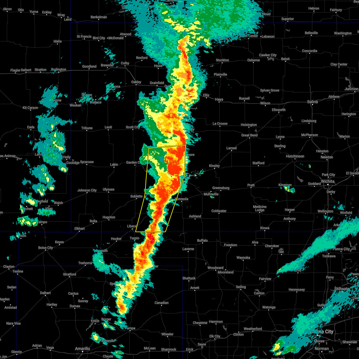 The severe thunderstorm warning for western ford, eastern seward, eastern finney, western hodgeman, meade, gray and eastern haskell counties will expire at 1030 pm cdt, the storms which prompted the warning have moved out of the area. therefore, the warning will be allowed to expire. a tornado watch remains in effect until 1100 pm cdt for southwestern kansas. a tornado watch also remains in effect until 500 am cdt for southwestern kansas. The severe thunderstorm warning for western ford, eastern seward, eastern finney, western hodgeman, meade, gray and eastern haskell counties will expire at 1030 pm cdt, the storms which prompted the warning have moved out of the area. therefore, the warning will be allowed to expire. a tornado watch remains in effect until 1100 pm cdt for southwestern kansas. a tornado watch also remains in effect until 500 am cdt for southwestern kansas.
|
| 10/12/2021 10:20 PM CDT |
 At 1019 pm cdt, severe thunderstorms were located along a line extending from 13 miles north of jetmore to 8 miles east of ensign to 7 miles northeast of forgan, moving northeast at 60 mph (radar indicated). Hazards include 70 mph wind gusts and quarter size hail. Hail damage to vehicles is expected. expect considerable tree damage. wind damage is also likely to mobile homes, roofs, and outbuildings. severe thunderstorms will be near, dodge city and ft. dodge around 1030 pm cdt. wright around 1035 pm cdt. Other locations in the path of these severe thunderstorms include ford, spearville, windhorst, bellefont and ashland. At 1019 pm cdt, severe thunderstorms were located along a line extending from 13 miles north of jetmore to 8 miles east of ensign to 7 miles northeast of forgan, moving northeast at 60 mph (radar indicated). Hazards include 70 mph wind gusts and quarter size hail. Hail damage to vehicles is expected. expect considerable tree damage. wind damage is also likely to mobile homes, roofs, and outbuildings. severe thunderstorms will be near, dodge city and ft. dodge around 1030 pm cdt. wright around 1035 pm cdt. Other locations in the path of these severe thunderstorms include ford, spearville, windhorst, bellefont and ashland.
|
| 10/12/2021 10:14 PM CDT |
 At 1014 pm cdt, severe thunderstorms capable of producing both tornadoes and extensive straight line wind damage were located near howell, moving east at 40 mph (radar indicated rotation). Hazards include tornado and quarter size hail. Flying debris will be dangerous to those caught without shelter. mobile homes will be damaged or destroyed. damage to roofs, windows, and vehicles will occur. tree damage is likely. these dangerous storms will be near, dodge city and ft. dodge around 1030 pm cdt. Other locations in the path of this tornadic thunderstorm include wright. At 1014 pm cdt, severe thunderstorms capable of producing both tornadoes and extensive straight line wind damage were located near howell, moving east at 40 mph (radar indicated rotation). Hazards include tornado and quarter size hail. Flying debris will be dangerous to those caught without shelter. mobile homes will be damaged or destroyed. damage to roofs, windows, and vehicles will occur. tree damage is likely. these dangerous storms will be near, dodge city and ft. dodge around 1030 pm cdt. Other locations in the path of this tornadic thunderstorm include wright.
|
| 10/12/2021 10:08 PM CDT |
 At 1008 pm cdt, severe thunderstorms were located along a line extending from 12 miles south of beeler to near howell to near meade state park, moving northeast at 55 mph (radar indicated). Hazards include 70 mph wind gusts and nickel size hail. Expect considerable tree damage. damage is likely to mobile homes, roofs, and outbuildings. Locations impacted include, howell, dodge city and meade. At 1008 pm cdt, severe thunderstorms were located along a line extending from 12 miles south of beeler to near howell to near meade state park, moving northeast at 55 mph (radar indicated). Hazards include 70 mph wind gusts and nickel size hail. Expect considerable tree damage. damage is likely to mobile homes, roofs, and outbuildings. Locations impacted include, howell, dodge city and meade.
|
| 10/12/2021 9:46 PM CDT |
 At 946 pm cdt, severe thunderstorms were located along a line extending from 9 miles northwest of kalvesta to near montezuma to 6 miles southeast of hayne, moving northeast at 55 mph (radar indicated). Hazards include 70 mph wind gusts and nickel size hail. Expect considerable tree damage. damage is likely to mobile homes, roofs, and outbuildings. severe thunderstorms will be near, montezuma around 950 pm cdt. the haggard elev around 955 pm cdt. ensign around 1000 pm cdt. Other locations in the path of these severe thunderstorms include meade state park, howell, dodge city and meade. At 946 pm cdt, severe thunderstorms were located along a line extending from 9 miles northwest of kalvesta to near montezuma to 6 miles southeast of hayne, moving northeast at 55 mph (radar indicated). Hazards include 70 mph wind gusts and nickel size hail. Expect considerable tree damage. damage is likely to mobile homes, roofs, and outbuildings. severe thunderstorms will be near, montezuma around 950 pm cdt. the haggard elev around 955 pm cdt. ensign around 1000 pm cdt. Other locations in the path of these severe thunderstorms include meade state park, howell, dodge city and meade.
|
| 8/10/2021 7:30 PM CDT |
 At 730 pm cdt, a severe thunderstorm was located near ensign, moving northeast at 15 mph (radar indicated). Hazards include quarter size hail. Damage to vehicles is expected. locations impacted include, dodge city. hail threat, radar indicated max hail size, 1. 00 in wind threat, radar indicated max wind gust, <50 mph. At 730 pm cdt, a severe thunderstorm was located near ensign, moving northeast at 15 mph (radar indicated). Hazards include quarter size hail. Damage to vehicles is expected. locations impacted include, dodge city. hail threat, radar indicated max hail size, 1. 00 in wind threat, radar indicated max wind gust, <50 mph.
|
| 8/10/2021 7:10 PM CDT |
 At 710 pm cdt, a severe thunderstorm was located very near ensign, moving northeast at 15 mph (radar indicated). Hazards include quarter size hail. Damage to vehicles is expected. this severe storm will be near, ensign around 715 pm cdt. other locations in the path of this severe thunderstorm include howell and dodge city. hail threat, radar indicated max hail size, 1. 00 in wind threat, radar indicated max wind gust, <50 mph. At 710 pm cdt, a severe thunderstorm was located very near ensign, moving northeast at 15 mph (radar indicated). Hazards include quarter size hail. Damage to vehicles is expected. this severe storm will be near, ensign around 715 pm cdt. other locations in the path of this severe thunderstorm include howell and dodge city. hail threat, radar indicated max hail size, 1. 00 in wind threat, radar indicated max wind gust, <50 mph.
|
| 8/10/2021 6:55 PM CDT |
 At 655 pm cdt, a severe thunderstorm was located near the haggard elev, moving northeast at 15 mph (radar indicated). Hazards include quarter size hail. Damage to vehicles is expected. this severe thunderstorm will be near, the haggard elev around 700 pm cdt. ensign around 715 pm cdt. other locations in the path of this severe thunderstorm include howell. hail threat, radar indicated max hail size, 1. 00 in wind threat, radar indicated max wind gust, <50 mph. At 655 pm cdt, a severe thunderstorm was located near the haggard elev, moving northeast at 15 mph (radar indicated). Hazards include quarter size hail. Damage to vehicles is expected. this severe thunderstorm will be near, the haggard elev around 700 pm cdt. ensign around 715 pm cdt. other locations in the path of this severe thunderstorm include howell. hail threat, radar indicated max hail size, 1. 00 in wind threat, radar indicated max wind gust, <50 mph.
|
| 8/10/2021 5:09 PM CDT |
 At 509 pm cdt, a severe thunderstorm was located near wright, moving northeast at 10 mph (trained weather spotters). Hazards include 60 mph wind gusts and half dollar size hail. Hail damage to vehicles is expected. expect wind damage to roofs, siding, and trees. this severe thunderstorm will remain over mainly rural areas of central ford county. hail threat, radar indicated max hail size, 1. 25 in wind threat, radar indicated max wind gust, 60 mph. At 509 pm cdt, a severe thunderstorm was located near wright, moving northeast at 10 mph (trained weather spotters). Hazards include 60 mph wind gusts and half dollar size hail. Hail damage to vehicles is expected. expect wind damage to roofs, siding, and trees. this severe thunderstorm will remain over mainly rural areas of central ford county. hail threat, radar indicated max hail size, 1. 25 in wind threat, radar indicated max wind gust, 60 mph.
|
| 8/10/2021 4:59 PM CDT |
 At 459 pm cdt, a severe thunderstorm was located near ft. dodge, moving northeast at 10 mph (trained weather spotters). Hazards include 60 mph wind gusts and half dollar size hail. Hail damage to vehicles is expected. expect wind damage to roofs, siding, and trees. this severe storm will be near, wright around 510 pm cdt. hail threat, radar indicated max hail size, 1. 25 in wind threat, radar indicated max wind gust, 60 mph. At 459 pm cdt, a severe thunderstorm was located near ft. dodge, moving northeast at 10 mph (trained weather spotters). Hazards include 60 mph wind gusts and half dollar size hail. Hail damage to vehicles is expected. expect wind damage to roofs, siding, and trees. this severe storm will be near, wright around 510 pm cdt. hail threat, radar indicated max hail size, 1. 25 in wind threat, radar indicated max wind gust, 60 mph.
|
| 8/10/2021 4:52 PM CDT | Quarter sized hail reported 5.8 miles WNW of Dodge City, KS, reports of quarter size hail. |
| 8/10/2021 4:51 PM CDT |
 At 450 pm cdt, a severe thunderstorm was located near ft. dodge, moving northeast at 10 mph (trained weather spotters). Hazards include 60 mph wind gusts and quarter size hail. Hail damage to vehicles is expected. expect wind damage to roofs, siding, and trees. this severe thunderstorm will be near, wright around 510 pm cdt. hail threat, radar indicated max hail size, 1. 00 in wind threat, radar indicated max wind gust, 60 mph. At 450 pm cdt, a severe thunderstorm was located near ft. dodge, moving northeast at 10 mph (trained weather spotters). Hazards include 60 mph wind gusts and quarter size hail. Hail damage to vehicles is expected. expect wind damage to roofs, siding, and trees. this severe thunderstorm will be near, wright around 510 pm cdt. hail threat, radar indicated max hail size, 1. 00 in wind threat, radar indicated max wind gust, 60 mph.
|
| 8/10/2021 4:45 PM CDT | Quarter sized hail reported 5 miles WNW of Dodge City, KS |
| 8/10/2021 4:45 PM CDT | Half Dollar sized hail reported 5.8 miles WNW of Dodge City, KS, report from mping: half dollar (1.25 in.). |
| 8/10/2021 4:42 PM CDT | Quarter sized hail reported 5.8 miles WNW of Dodge City, KS, report from mping: quarter (1.00 in.). |
| 8/7/2021 8:55 PM CDT |
 At 855 pm cdt, a severe thunderstorm was located near ford, moving east at 40 mph (radar indicated). Hazards include 60 mph wind gusts and penny size hail. Expect damage to roofs, siding, and trees. locations impacted include, windhorst. hail threat, radar indicated max hail size, 0. 75 in wind threat, radar indicated max wind gust, 60 mph. At 855 pm cdt, a severe thunderstorm was located near ford, moving east at 40 mph (radar indicated). Hazards include 60 mph wind gusts and penny size hail. Expect damage to roofs, siding, and trees. locations impacted include, windhorst. hail threat, radar indicated max hail size, 0. 75 in wind threat, radar indicated max wind gust, 60 mph.
|
| 8/7/2021 8:30 PM CDT |
 At 830 pm cdt, a severe thunderstorm was located 7 miles southwest of dodge city, moving east at 40 mph (radar indicated). Hazards include 60 mph wind gusts and half dollar size hail. Hail damage to vehicles is expected. expect wind damage to roofs, siding, and trees. this severe thunderstorm will be near, dodge city around 840 pm cdt. ft. dodge around 845 pm cdt. wright around 850 pm cdt. other locations in the path of this severe thunderstorm include ford and windhorst. hail threat, radar indicated max hail size, 1. 25 in wind threat, radar indicated max wind gust, 60 mph. At 830 pm cdt, a severe thunderstorm was located 7 miles southwest of dodge city, moving east at 40 mph (radar indicated). Hazards include 60 mph wind gusts and half dollar size hail. Hail damage to vehicles is expected. expect wind damage to roofs, siding, and trees. this severe thunderstorm will be near, dodge city around 840 pm cdt. ft. dodge around 845 pm cdt. wright around 850 pm cdt. other locations in the path of this severe thunderstorm include ford and windhorst. hail threat, radar indicated max hail size, 1. 25 in wind threat, radar indicated max wind gust, 60 mph.
|
| 8/7/2021 7:07 PM CDT |
 At 706 pm cdt, severe thunderstorms were located along a line extending from 9 miles north of gray to near jetmore to near howell, moving east at 45 mph (radar indicated). Hazards include 60 mph wind gusts and half dollar size hail. Hail damage to vehicles is expected. expect wind damage to roofs, siding, and trees. severe thunderstorms will be near, burdett around 715 pm cdt. hanston around 720 pm cdt. dodge city, gray and rozel around 725 pm cdt. other locations in the path of these severe thunderstorms include wright, spearville, ash valley, larned, garfield, windhorst and bellefont. hail threat, radar indicated max hail size, 1. 25 in wind threat, radar indicated max wind gust, 60 mph. At 706 pm cdt, severe thunderstorms were located along a line extending from 9 miles north of gray to near jetmore to near howell, moving east at 45 mph (radar indicated). Hazards include 60 mph wind gusts and half dollar size hail. Hail damage to vehicles is expected. expect wind damage to roofs, siding, and trees. severe thunderstorms will be near, burdett around 715 pm cdt. hanston around 720 pm cdt. dodge city, gray and rozel around 725 pm cdt. other locations in the path of these severe thunderstorms include wright, spearville, ash valley, larned, garfield, windhorst and bellefont. hail threat, radar indicated max hail size, 1. 25 in wind threat, radar indicated max wind gust, 60 mph.
|
| 7/25/2021 1:28 PM CDT |
 At 127 pm cdt, a severe thunderstorm was located very near wright, moving south at 15 mph (emergency management reported power lines down 3 miles northeast of wright at 122 pm). Hazards include 70 mph wind gusts. Expect considerable tree damage. damage is likely to mobile homes, roofs, and outbuildings. locations impacted include, dodge city, spearville, wright, windhorst and ft. Dodge. At 127 pm cdt, a severe thunderstorm was located very near wright, moving south at 15 mph (emergency management reported power lines down 3 miles northeast of wright at 122 pm). Hazards include 70 mph wind gusts. Expect considerable tree damage. damage is likely to mobile homes, roofs, and outbuildings. locations impacted include, dodge city, spearville, wright, windhorst and ft. Dodge.
|
| 7/25/2021 1:07 PM CDT |
 At 106 pm cdt, a severe thunderstorm was located near wright, moving southeast at 15 mph (radar indicated). Hazards include 70 mph wind gusts. Expect considerable tree damage. damage is likely to mobile homes, roofs, and outbuildings. locations impacted include, dodge city, spearville, wright, windhorst and ft. Dodge. At 106 pm cdt, a severe thunderstorm was located near wright, moving southeast at 15 mph (radar indicated). Hazards include 70 mph wind gusts. Expect considerable tree damage. damage is likely to mobile homes, roofs, and outbuildings. locations impacted include, dodge city, spearville, wright, windhorst and ft. Dodge.
|
| 7/25/2021 12:54 PM CDT |
 At 1254 pm cdt, a severe thunderstorm was located near wright, moving southeast at 10 mph (radar indicated). Hazards include 70 mph wind gusts. Expect considerable tree damage. Damage is likely to mobile homes, roofs, and outbuildings. At 1254 pm cdt, a severe thunderstorm was located near wright, moving southeast at 10 mph (radar indicated). Hazards include 70 mph wind gusts. Expect considerable tree damage. Damage is likely to mobile homes, roofs, and outbuildings.
|
| 7/25/2021 12:52 PM CDT | Asos station kddc dodge city regional airpor in ford county KS, 2.2 miles WSW of Dodge City, KS |
| 7/25/2021 12:48 PM CDT |
 At 1248 pm cdt, a severe thunderstorm was located near wright, moving southeast at 10 mph (at 1244 pm dodge city aiport reported 60 mph winds). Hazards include 70 mph wind gusts. Expect considerable tree damage. damage is likely to mobile homes, roofs, and outbuildings. this severe storm will be near, dodge city around 105 pm cdt. other locations in the path of this severe thunderstorm include wright and ft. Dodge. At 1248 pm cdt, a severe thunderstorm was located near wright, moving southeast at 10 mph (at 1244 pm dodge city aiport reported 60 mph winds). Hazards include 70 mph wind gusts. Expect considerable tree damage. damage is likely to mobile homes, roofs, and outbuildings. this severe storm will be near, dodge city around 105 pm cdt. other locations in the path of this severe thunderstorm include wright and ft. Dodge.
|
| 7/25/2021 12:46 PM CDT |
 At 1245 pm cdt, a severe thunderstorm was located near wright, moving southeast at 15 mph (dodge city airport reported 60 mph winds at 1244 pm). Hazards include 60 mph wind gusts. Expect damage to roofs, siding, and trees. locations impacted include, wright and ft. Dodge. At 1245 pm cdt, a severe thunderstorm was located near wright, moving southeast at 15 mph (dodge city airport reported 60 mph winds at 1244 pm). Hazards include 60 mph wind gusts. Expect damage to roofs, siding, and trees. locations impacted include, wright and ft. Dodge.
|
| 7/25/2021 12:35 PM CDT | Tree blown over onto hot tub and roof of house. damage to roof and hot tub. tree was partially dea in ford county KS, 5.1 miles S of Dodge City, KS |
| 7/25/2021 12:31 PM CDT |
 At 1231 pm cdt, a severe thunderstorm with strong winds was located near wright, moving southeast at 15 mph. another area of strong winds is located 10 miles south of jetmore moving southeast at 15 mph (radar indicated). Hazards include 60 mph wind gusts. Expect damage to roofs, siding, and trees. this severe thunderstorm will be near, dodge city around 1245 pm cdt. other locations in the path of this severe thunderstorm include wright and ft. Dodge. At 1231 pm cdt, a severe thunderstorm with strong winds was located near wright, moving southeast at 15 mph. another area of strong winds is located 10 miles south of jetmore moving southeast at 15 mph (radar indicated). Hazards include 60 mph wind gusts. Expect damage to roofs, siding, and trees. this severe thunderstorm will be near, dodge city around 1245 pm cdt. other locations in the path of this severe thunderstorm include wright and ft. Dodge.
|
| 6/25/2021 7:45 PM CDT |
 At 744 pm cdt, a severe thunderstorm was located very near ensign, moving northeast at 35 mph (radar indicated). Hazards include 60 mph wind gusts and penny size hail. Expect damage to roofs, siding, and trees. This severe thunderstorm will be near, howell around 800 pm cdt. At 744 pm cdt, a severe thunderstorm was located very near ensign, moving northeast at 35 mph (radar indicated). Hazards include 60 mph wind gusts and penny size hail. Expect damage to roofs, siding, and trees. This severe thunderstorm will be near, howell around 800 pm cdt.
|
| 6/25/2021 7:22 PM CDT |
 At 720 pm cdt, a severe thunderstorm was located very near minneola, moving north at 35 mph (radar indicated). Hazards include 60 mph wind gusts and quarter size hail. Hail damage to vehicles is expected. expect wind damage to roofs, siding, and trees. this severe thunderstorm will be near, bloom around 725 pm cdt. other locations in the path of this severe thunderstorm include ft. Dodge and dodge city. At 720 pm cdt, a severe thunderstorm was located very near minneola, moving north at 35 mph (radar indicated). Hazards include 60 mph wind gusts and quarter size hail. Hail damage to vehicles is expected. expect wind damage to roofs, siding, and trees. this severe thunderstorm will be near, bloom around 725 pm cdt. other locations in the path of this severe thunderstorm include ft. Dodge and dodge city.
|
| 5/26/2021 7:41 PM CDT |
 At 741 pm cdt, a severe thunderstorm was located near howell, moving northeast at 35 mph (radar indicated). Hazards include 60 mph wind gusts and quarter size hail. Hail damage to vehicles is expected. expect wind damage to roofs, siding, and trees. locations impacted include, dodge city, ford, wright, ft. Dodge and howell. At 741 pm cdt, a severe thunderstorm was located near howell, moving northeast at 35 mph (radar indicated). Hazards include 60 mph wind gusts and quarter size hail. Hail damage to vehicles is expected. expect wind damage to roofs, siding, and trees. locations impacted include, dodge city, ford, wright, ft. Dodge and howell.
|
| 5/26/2021 7:30 PM CDT |
 At 730 pm cdt, a severe thunderstorm was located near ensign, moving northeast at 25 mph (radar indicated). Hazards include golf ball size hail and 60 mph wind gusts. People and animals outdoors will be injured. expect hail damage to roofs, siding, windows, and vehicles. Expect wind damage to roofs, siding, and trees. At 730 pm cdt, a severe thunderstorm was located near ensign, moving northeast at 25 mph (radar indicated). Hazards include golf ball size hail and 60 mph wind gusts. People and animals outdoors will be injured. expect hail damage to roofs, siding, windows, and vehicles. Expect wind damage to roofs, siding, and trees.
|
| 5/14/2021 11:20 PM CDT |
 At 1120 pm cdt, severe thunderstorms were located along a line extending from near olmitz to 6 miles southwest of jetmore, moving southeast at 35 mph (radar indicated). Hazards include 60 mph wind gusts and quarter size hail. Hail damage to vehicles is expected. expect wind damage to roofs, siding, and trees. These severe thunderstorms will remain over mainly rural areas of northwestern ford, hodgeman, pawnee, southeastern rush and northwestern edwards counties. At 1120 pm cdt, severe thunderstorms were located along a line extending from near olmitz to 6 miles southwest of jetmore, moving southeast at 35 mph (radar indicated). Hazards include 60 mph wind gusts and quarter size hail. Hail damage to vehicles is expected. expect wind damage to roofs, siding, and trees. These severe thunderstorms will remain over mainly rural areas of northwestern ford, hodgeman, pawnee, southeastern rush and northwestern edwards counties.
|
| 5/14/2021 11:05 PM CDT |
 At 1104 pm cdt, severe thunderstorms were located along a line extending from near otis to 7 miles east of kalvesta, moving southeast at 35 mph (radar indicated). Hazards include 60 mph wind gusts and quarter size hail. Hail damage to vehicles is expected. expect wind damage to roofs, siding, and trees. severe thunderstorms will be near, otis, bison, timken and shaffer around 1110 pm cdt. Other locations in the path of these severe thunderstorms include jetmore. At 1104 pm cdt, severe thunderstorms were located along a line extending from near otis to 7 miles east of kalvesta, moving southeast at 35 mph (radar indicated). Hazards include 60 mph wind gusts and quarter size hail. Hail damage to vehicles is expected. expect wind damage to roofs, siding, and trees. severe thunderstorms will be near, otis, bison, timken and shaffer around 1110 pm cdt. Other locations in the path of these severe thunderstorms include jetmore.
|
| 5/5/2021 5:46 PM CDT |
 At 545 pm cdt, a severe thunderstorm was located near dodge city, moving southeast at 30 mph (radar indicated and automated weather station report. a 62 mph wind gust was recorded at dodge city airport at 539 pm). Hazards include 60 mph wind gusts and half dollar size hail. Hail damage to vehicles is expected. expect wind damage to roofs, siding, and trees. locations impacted include, dodge city, ensign and ft. Dodge. At 545 pm cdt, a severe thunderstorm was located near dodge city, moving southeast at 30 mph (radar indicated and automated weather station report. a 62 mph wind gust was recorded at dodge city airport at 539 pm). Hazards include 60 mph wind gusts and half dollar size hail. Hail damage to vehicles is expected. expect wind damage to roofs, siding, and trees. locations impacted include, dodge city, ensign and ft. Dodge.
|
| 5/5/2021 5:41 PM CDT |
 At 539 pm cdt, a severe thunderstorm was located 7 miles southeast of ensign, moving southeast at 25 mph (radar indicated and spotter reported. quarter size hail was reported 2 miles northwest of dodge city at 532 pm). Hazards include 60 mph wind gusts and half dollar size hail. Hail damage to vehicles is expected. Expect wind damage to roofs, siding, and trees. At 539 pm cdt, a severe thunderstorm was located 7 miles southeast of ensign, moving southeast at 25 mph (radar indicated and spotter reported. quarter size hail was reported 2 miles northwest of dodge city at 532 pm). Hazards include 60 mph wind gusts and half dollar size hail. Hail damage to vehicles is expected. Expect wind damage to roofs, siding, and trees.
|
| 5/5/2021 5:39 PM CDT | Asos station kddc dodge city regional airpor in ford county KS, 2.2 miles WSW of Dodge City, KS |
| 5/5/2021 5:35 PM CDT | Golf Ball sized hail reported 1.8 miles SSE of Dodge City, KS, social media report of ping pong to golf ball sized hail. |
| 5/5/2021 5:32 PM CDT | Quarter sized hail reported 2.5 miles SE of Dodge City, KS |
| 5/5/2021 5:10 PM CDT |
 At 510 pm cdt, a severe thunderstorm was located 8 miles north of howell, moving southeast at 30 mph (radar indicated). Hazards include 60 mph wind gusts and quarter size hail. Hail damage to vehicles is expected. Expect wind damage to roofs, siding, and trees. At 510 pm cdt, a severe thunderstorm was located 8 miles north of howell, moving southeast at 30 mph (radar indicated). Hazards include 60 mph wind gusts and quarter size hail. Hail damage to vehicles is expected. Expect wind damage to roofs, siding, and trees.
|
| 5/2/2021 10:09 PM CDT |
 The severe thunderstorm warning for ford, southern hodgeman, eastern meade and clark counties will expire at 1015 pm cdt, the storms which prompted the warning have weakened below severe limits, and no longer pose an immediate threat to life or property. therefore, the warning will be allowed to expire. however gusty winds are still possible with these thunderstorms. a severe thunderstorm watch remains in effect until midnight cdt for southwestern kansas. The severe thunderstorm warning for ford, southern hodgeman, eastern meade and clark counties will expire at 1015 pm cdt, the storms which prompted the warning have weakened below severe limits, and no longer pose an immediate threat to life or property. therefore, the warning will be allowed to expire. however gusty winds are still possible with these thunderstorms. a severe thunderstorm watch remains in effect until midnight cdt for southwestern kansas.
|
| 5/2/2021 9:57 PM CDT |
 At 956 pm cdt, severe thunderstorms were located along a line extending from 9 miles south of jetmore to near englewood, moving east at 35 mph (radar indicated). Hazards include 60 mph wind gusts and quarter size hail. Hail damage to vehicles is expected. expect wind damage to roofs, siding, and trees. locations impacted include, dodge city, ashland, bucklin, spearville, minneola, fowler, ford, bloom, englewood, sitka, clark state lake, kingsdown, wright, bellefont, windhorst, acres and ft. Dodge. At 956 pm cdt, severe thunderstorms were located along a line extending from 9 miles south of jetmore to near englewood, moving east at 35 mph (radar indicated). Hazards include 60 mph wind gusts and quarter size hail. Hail damage to vehicles is expected. expect wind damage to roofs, siding, and trees. locations impacted include, dodge city, ashland, bucklin, spearville, minneola, fowler, ford, bloom, englewood, sitka, clark state lake, kingsdown, wright, bellefont, windhorst, acres and ft. Dodge.
|
| 5/2/2021 9:36 PM CDT |
 At 936 pm cdt, severe thunderstorms were located along a line extending from 10 miles southeast of kalvesta to 11 miles west of englewood, moving east at 35 mph (radar indicated). Hazards include 60 mph wind gusts and penny size hail. expect damage to roofs, siding, and trees At 936 pm cdt, severe thunderstorms were located along a line extending from 10 miles southeast of kalvesta to 11 miles west of englewood, moving east at 35 mph (radar indicated). Hazards include 60 mph wind gusts and penny size hail. expect damage to roofs, siding, and trees
|
| 8/29/2020 2:04 AM CDT | Asos station kddc dodge city regional airpor in ford county KS, 2.2 miles WSW of Dodge City, KS |
| 8/29/2020 1:58 AM CDT | Asos station kddc dodge city regional airpor in ford county KS, 2.2 miles WSW of Dodge City, KS |
| 8/29/2020 1:40 AM CDT |
 At 140 am cdt, a severe thunderstorm was located 11 miles northeast of howell, moving east at 30 mph (radar indicated). Hazards include 60 mph wind gusts and quarter size hail. Hail damage to vehicles is expected. expect wind damage to roofs, siding, and trees. locations impacted include, dodge city, jetmore, spearville, ford, howell, bellefont, wright, windhorst and ft. Dodge. At 140 am cdt, a severe thunderstorm was located 11 miles northeast of howell, moving east at 30 mph (radar indicated). Hazards include 60 mph wind gusts and quarter size hail. Hail damage to vehicles is expected. expect wind damage to roofs, siding, and trees. locations impacted include, dodge city, jetmore, spearville, ford, howell, bellefont, wright, windhorst and ft. Dodge.
|
| 8/29/2020 1:38 AM CDT |
 At 138 am cdt, a severe thunderstorm was located 9 miles southeast of kalvesta, moving east at 30 mph (radar indicated). Hazards include 60 mph wind gusts and quarter size hail. Hail damage to vehicles is expected. expect wind damage to roofs, siding, and trees. Locations impacted include, dodge city, cimarron and howell. At 138 am cdt, a severe thunderstorm was located 9 miles southeast of kalvesta, moving east at 30 mph (radar indicated). Hazards include 60 mph wind gusts and quarter size hail. Hail damage to vehicles is expected. expect wind damage to roofs, siding, and trees. Locations impacted include, dodge city, cimarron and howell.
|
| 8/29/2020 1:25 AM CDT |
 At 124 am cdt, a severe thunderstorm was located 8 miles north of cimarron, moving east at 30 mph (radar indicated). Hazards include 60 mph wind gusts and quarter size hail. Hail damage to vehicles is expected. expect wind damage to roofs, siding, and trees. Locations impacted include, dodge city, cimarron, ingalls and howell. At 124 am cdt, a severe thunderstorm was located 8 miles north of cimarron, moving east at 30 mph (radar indicated). Hazards include 60 mph wind gusts and quarter size hail. Hail damage to vehicles is expected. expect wind damage to roofs, siding, and trees. Locations impacted include, dodge city, cimarron, ingalls and howell.
|
| 8/29/2020 1:12 AM CDT |
 At 112 am cdt, a severe thunderstorm was located near ingalls, moving east at 30 mph (radar indicated). Hazards include 60 mph wind gusts and quarter size hail. Hail damage to vehicles is expected. Expect wind damage to roofs, siding, and trees. At 112 am cdt, a severe thunderstorm was located near ingalls, moving east at 30 mph (radar indicated). Hazards include 60 mph wind gusts and quarter size hail. Hail damage to vehicles is expected. Expect wind damage to roofs, siding, and trees.
|
| 8/10/2020 5:06 PM CDT |
 The severe thunderstorm warning for northeastern ford and south central hodgeman counties will expire at 515 pm cdt, the storm which prompted the warning has weakened below severe limits, and no longer poses an immediate threat to life or property. therefore, the warning will be allowed to expire. The severe thunderstorm warning for northeastern ford and south central hodgeman counties will expire at 515 pm cdt, the storm which prompted the warning has weakened below severe limits, and no longer poses an immediate threat to life or property. therefore, the warning will be allowed to expire.
|
| 8/10/2020 4:45 PM CDT |
 At 444 pm cdt, a severe thunderstorm was located near wright, moving northeast at 20 mph (radar indicated). Hazards include 60 mph wind gusts and half dollar size hail. Hail damage to vehicles is expected. expect wind damage to roofs, siding, and trees. Locations impacted include, dodge city, spearville and wright. At 444 pm cdt, a severe thunderstorm was located near wright, moving northeast at 20 mph (radar indicated). Hazards include 60 mph wind gusts and half dollar size hail. Hail damage to vehicles is expected. expect wind damage to roofs, siding, and trees. Locations impacted include, dodge city, spearville and wright.
|
| 8/10/2020 4:34 PM CDT |
 At 434 pm cdt, a severe thunderstorm was located near dodge city, moving northeast at 15 mph (trained weather spotters). Hazards include ping pong ball size hail. People and animals outdoors will be injured. expect damage to roofs, siding, windows, and vehicles. Locations impacted include, dodge city, spearville and wright. At 434 pm cdt, a severe thunderstorm was located near dodge city, moving northeast at 15 mph (trained weather spotters). Hazards include ping pong ball size hail. People and animals outdoors will be injured. expect damage to roofs, siding, windows, and vehicles. Locations impacted include, dodge city, spearville and wright.
|
| 8/10/2020 4:28 PM CDT |
 At 427 pm cdt, a severe thunderstorm was located near dodge city, moving northeast at 15 mph. quarter sized hail was reported in dodge city at 4:26 pm (trained weather spotters). Hazards include quarter size hail. damage to vehicles is expected At 427 pm cdt, a severe thunderstorm was located near dodge city, moving northeast at 15 mph. quarter sized hail was reported in dodge city at 4:26 pm (trained weather spotters). Hazards include quarter size hail. damage to vehicles is expected
|
| 8/10/2020 4:27 PM CDT | Half Dollar sized hail reported 2.1 miles SE of Dodge City, KS |
| 8/10/2020 4:25 PM CDT | Half Dollar sized hail reported 2.5 miles SSE of Dodge City, KS |
| 7/29/2020 7:33 PM CDT |
 At 732 pm cdt, the leading edge of severe thunderstorms were located along a line extending from near howell to near ensign to 7 miles south of montezuma, moving southeast at 50 mph (radar indicated). Hazards include 60 mph wind gusts and penny size hail. expect damage to roofs, siding, and trees At 732 pm cdt, the leading edge of severe thunderstorms were located along a line extending from near howell to near ensign to 7 miles south of montezuma, moving southeast at 50 mph (radar indicated). Hazards include 60 mph wind gusts and penny size hail. expect damage to roofs, siding, and trees
|
| 7/15/2020 12:41 AM CDT |
 The severe thunderstorm warning for western ford, central finney, northwestern meade, gray and northeastern haskell counties will expire at 1245 am cdt, the storms which prompted the warning has weakened below severe limits, and moved out of the warned area. therefore, the warning will be allowed to expire. heavy rainfall and wind gusts to near 50 mph will continue for the next hour. a severe thunderstorm watch remains in effect until 300 am cdt for southwestern kansas. The severe thunderstorm warning for western ford, central finney, northwestern meade, gray and northeastern haskell counties will expire at 1245 am cdt, the storms which prompted the warning has weakened below severe limits, and moved out of the warned area. therefore, the warning will be allowed to expire. heavy rainfall and wind gusts to near 50 mph will continue for the next hour. a severe thunderstorm watch remains in effect until 300 am cdt for southwestern kansas.
|
| 7/15/2020 12:20 AM CDT |
 At 1219 am cdt, severe thunderstorms were located along a line extending from 10 miles north of charleston to 9 miles northwest of acres, moving northeast at 25 mph (radar indicated). Hazards include 60 mph wind gusts. Expect damage to roofs, siding, and trees. locations impacted include, dodge city, garden city, cimarron, montezuma, pierceville, copeland, ingalls, ford, ensign, charleston, howell, wright, plymell, kalvesta, the haggard elev, ft. Dodge and tice. At 1219 am cdt, severe thunderstorms were located along a line extending from 10 miles north of charleston to 9 miles northwest of acres, moving northeast at 25 mph (radar indicated). Hazards include 60 mph wind gusts. Expect damage to roofs, siding, and trees. locations impacted include, dodge city, garden city, cimarron, montezuma, pierceville, copeland, ingalls, ford, ensign, charleston, howell, wright, plymell, kalvesta, the haggard elev, ft. Dodge and tice.
|
| 7/14/2020 11:58 PM CDT |
 At 1158 pm cdt, severe thunderstorms were located along a line extending from near garden city to 10 miles southeast of meade state park, moving east at 25 mph (radar indicated). Hazards include 60 mph wind gusts and penny size hail. expect damage to roofs, siding, and trees At 1158 pm cdt, severe thunderstorms were located along a line extending from near garden city to 10 miles southeast of meade state park, moving east at 25 mph (radar indicated). Hazards include 60 mph wind gusts and penny size hail. expect damage to roofs, siding, and trees
|
| 7/13/2020 12:17 AM CDT |
 At 1217 am cdt, a severe thunderstorm was located near cimarron, moving southeast at 15 mph (radar indicated). Hazards include 60 mph wind gusts and penny size hail. Expect damage to roofs, siding, and trees. locations impacted include, dodge city, cimarron, montezuma, copeland, ford, ensign, howell, wright, the haggard elev and ft. Dodge. At 1217 am cdt, a severe thunderstorm was located near cimarron, moving southeast at 15 mph (radar indicated). Hazards include 60 mph wind gusts and penny size hail. Expect damage to roofs, siding, and trees. locations impacted include, dodge city, cimarron, montezuma, copeland, ford, ensign, howell, wright, the haggard elev and ft. Dodge.
|
| 7/12/2020 11:39 PM CDT |
 At 1139 pm cdt, a severe thunderstorm was located 9 miles north of ingalls, moving southeast at 15 mph (radar indicated). Hazards include 60 mph wind gusts and quarter size hail. Hail damage to vehicles is expected. Expect wind damage to roofs, siding, and trees. At 1139 pm cdt, a severe thunderstorm was located 9 miles north of ingalls, moving southeast at 15 mph (radar indicated). Hazards include 60 mph wind gusts and quarter size hail. Hail damage to vehicles is expected. Expect wind damage to roofs, siding, and trees.
|
| 6/21/2020 6:27 PM CDT |
 The severe thunderstorm warning for ford, southwestern hodgeman and central gray counties will expire at 630 pm cdt, the storms which prompted the warning have weakened below severe limits, and no longer pose an immediate threat to life or property. therefore, the warning will be allowed to expire. however heavy rain is still possible with these thunderstorms. a severe thunderstorm watch remains in effect until 1000 pm cdt for southwestern kansas. The severe thunderstorm warning for ford, southwestern hodgeman and central gray counties will expire at 630 pm cdt, the storms which prompted the warning have weakened below severe limits, and no longer pose an immediate threat to life or property. therefore, the warning will be allowed to expire. however heavy rain is still possible with these thunderstorms. a severe thunderstorm watch remains in effect until 1000 pm cdt for southwestern kansas.
|
| 6/21/2020 5:46 PM CDT |
 At 546 pm cdt, severe thunderstorms were located along a line extending from near windhorst to near the haggard elev, moving southeast at 15 mph (radar indicated). Hazards include 60 mph wind gusts and quarter size hail. Hail damage to vehicles is expected. Expect wind damage to roofs, siding, and trees. At 546 pm cdt, severe thunderstorms were located along a line extending from near windhorst to near the haggard elev, moving southeast at 15 mph (radar indicated). Hazards include 60 mph wind gusts and quarter size hail. Hail damage to vehicles is expected. Expect wind damage to roofs, siding, and trees.
|
| 6/21/2020 5:30 PM CDT | Power pole was downe in ford county KS, 2.6 miles NNE of Dodge City, KS |
| 6/21/2020 5:26 PM CDT | Asos station kddc dodge city regional airpor in ford county KS, 2.2 miles WSW of Dodge City, KS |
| 6/21/2020 5:26 PM CDT | Wind gust of 69 mph on the kddc aso in ford county KS, 2 miles W of Dodge City, KS |
| 6/21/2020 5:22 PM CDT |
 At 522 pm cdt, severe thunderstorms were located along a line extending from near spearville to near the haggard elev, moving southeast at 25 mph. these are very dangerous storms (radar indicated). Hazards include 80 mph wind gusts and two inch hail. Flying debris will be dangerous to those caught without shelter. mobile homes will be heavily damaged. expect considerable damage to roofs, windows, and vehicles. extensive tree damage and power outages are likely. locations impacted include, dodge city, cimarron, spearville, pierceville, ingalls, ensign, charleston, howell, wright, bellefont, windhorst, the haggard elev and ft. Dodge. At 522 pm cdt, severe thunderstorms were located along a line extending from near spearville to near the haggard elev, moving southeast at 25 mph. these are very dangerous storms (radar indicated). Hazards include 80 mph wind gusts and two inch hail. Flying debris will be dangerous to those caught without shelter. mobile homes will be heavily damaged. expect considerable damage to roofs, windows, and vehicles. extensive tree damage and power outages are likely. locations impacted include, dodge city, cimarron, spearville, pierceville, ingalls, ensign, charleston, howell, wright, bellefont, windhorst, the haggard elev and ft. Dodge.
|
| 6/21/2020 5:20 PM CDT | Mesonet station cw9785 dodge cit in ford county KS, 1.7 miles S of Dodge City, KS |
| 6/21/2020 5:20 PM CDT | Storm damage reported in ford county KS, 4.8 miles ENE of Dodge City, KS |
| 6/21/2020 5:15 PM CDT | Travel trailer camper was blown over in the village square mall parking lot. time estimated from rada in ford county KS, 1.8 miles SSE of Dodge City, KS |
| 6/21/2020 4:52 PM CDT |
 At 452 pm cdt, severe thunderstorms were located along a line extending from near burdett to near charleston, moving southeast at 35 mph (radar indicated). Hazards include two inch hail and 70 mph wind gusts. People and animals outdoors will be injured. expect hail damage to roofs, siding, windows, and vehicles. expect considerable tree damage. Wind damage is also likely to mobile homes, roofs, and outbuildings. At 452 pm cdt, severe thunderstorms were located along a line extending from near burdett to near charleston, moving southeast at 35 mph (radar indicated). Hazards include two inch hail and 70 mph wind gusts. People and animals outdoors will be injured. expect hail damage to roofs, siding, windows, and vehicles. expect considerable tree damage. Wind damage is also likely to mobile homes, roofs, and outbuildings.
|
| 6/21/2020 4:42 PM CDT |
 At 442 pm cdt, a severe thunderstorm was located 7 miles northeast of howell, moving east at 20 mph (radar indicated). Hazards include two inch hail. People and animals outdoors will be injured. expect damage to roofs, siding, windows, and vehicles. This severe thunderstorm will remain over mainly rural areas of northwestern ford and southwestern hodgeman counties. At 442 pm cdt, a severe thunderstorm was located 7 miles northeast of howell, moving east at 20 mph (radar indicated). Hazards include two inch hail. People and animals outdoors will be injured. expect damage to roofs, siding, windows, and vehicles. This severe thunderstorm will remain over mainly rural areas of northwestern ford and southwestern hodgeman counties.
|
| 6/21/2020 12:15 AM CDT |
 At 1215 am cdt, a severe thunderstorm was located 8 miles east of ensign, moving south at 20 mph (radar indicated). Hazards include half dollar size hail. Damage to vehicles is expected. locations impacted include, dodge city, wright, ft. Dodge and howell. At 1215 am cdt, a severe thunderstorm was located 8 miles east of ensign, moving south at 20 mph (radar indicated). Hazards include half dollar size hail. Damage to vehicles is expected. locations impacted include, dodge city, wright, ft. Dodge and howell.
|
| 6/21/2020 12:04 AM CDT |
 At 1203 am cdt, a severe thunderstorm was located 7 miles southwest of dodge city, moving south at 30 mph (radar indicated). Hazards include quarter size hail. Damage to vehicles is expected. locations impacted include, dodge city, wright, ft. Dodge and howell. At 1203 am cdt, a severe thunderstorm was located 7 miles southwest of dodge city, moving south at 30 mph (radar indicated). Hazards include quarter size hail. Damage to vehicles is expected. locations impacted include, dodge city, wright, ft. Dodge and howell.
|
| 6/20/2020 11:48 PM CDT |
 At 1148 pm cdt, a severe thunderstorm was located near dodge city, moving south at 25 mph (radar indicated). Hazards include quarter size hail. damage to vehicles is expected At 1148 pm cdt, a severe thunderstorm was located near dodge city, moving south at 25 mph (radar indicated). Hazards include quarter size hail. damage to vehicles is expected
|
| 6/20/2020 11:34 PM CDT |
 At 1133 pm cdt, a severe thunderstorm was located near ford, moving southeast at 25 mph (radar indicated. at 1115 pm...quarter size hail was observed at the dodge city airport). Hazards include 60 mph wind gusts and half dollar size hail. Hail damage to vehicles is expected. expect wind damage to roofs, siding, and trees. locations impacted include, dodge city, bucklin, minneola, ford, bloom, kingsdown, wright and ft. Dodge. At 1133 pm cdt, a severe thunderstorm was located near ford, moving southeast at 25 mph (radar indicated. at 1115 pm...quarter size hail was observed at the dodge city airport). Hazards include 60 mph wind gusts and half dollar size hail. Hail damage to vehicles is expected. expect wind damage to roofs, siding, and trees. locations impacted include, dodge city, bucklin, minneola, ford, bloom, kingsdown, wright and ft. Dodge.
|
| 6/20/2020 11:22 PM CDT | Half Dollar sized hail reported 3.7 miles WNW of Dodge City, KS |
| 6/20/2020 11:15 PM CDT | Quarter sized hail reported 2 miles W of Dodge City, KS |
| 6/20/2020 11:10 PM CDT | Storm damage reported in ford county KS, 5.2 miles S of Dodge City, KS |
| 6/20/2020 11:06 PM CDT |
 At 1105 pm cdt, a severe thunderstorm was located very near ft. dodge, moving southeast at 35 mph (radar indicated). Hazards include two inch hail and 60 mph wind gusts. People and animals outdoors will be injured. expect hail damage to roofs, siding, windows, and vehicles. Expect wind damage to roofs, siding, and trees. At 1105 pm cdt, a severe thunderstorm was located very near ft. dodge, moving southeast at 35 mph (radar indicated). Hazards include two inch hail and 60 mph wind gusts. People and animals outdoors will be injured. expect hail damage to roofs, siding, windows, and vehicles. Expect wind damage to roofs, siding, and trees.
|
| 6/20/2020 10:48 PM CDT |
 At 1048 pm cdt, a severe thunderstorm was located 10 miles north of dodge city, moving south at 15 mph (radar indicated). Hazards include two inch hail and 60 mph wind gusts. People and animals outdoors will be injured. expect hail damage to roofs, siding, windows, and vehicles. Expect wind damage to roofs, siding, and trees. At 1048 pm cdt, a severe thunderstorm was located 10 miles north of dodge city, moving south at 15 mph (radar indicated). Hazards include two inch hail and 60 mph wind gusts. People and animals outdoors will be injured. expect hail damage to roofs, siding, windows, and vehicles. Expect wind damage to roofs, siding, and trees.
|
| 6/11/2020 5:55 PM CDT | Quarter sized hail reported 6.6 miles WNW of Dodge City, KS |
| 5/24/2020 10:12 PM CDT |
 The severe thunderstorm warning for northwestern ford, southwestern hodgeman and southeastern gray counties will expire at 1015 pm cdt, the storms which prompted the warning have weakened below severe limits, and no longer pose an immediate threat to life or property. therefore, the warning will be allowed to expire. however gusty winds and heavy rain are still possible with these thunderstorms. a severe thunderstorm watch remains in effect until midnight cdt for southwestern kansas. The severe thunderstorm warning for northwestern ford, southwestern hodgeman and southeastern gray counties will expire at 1015 pm cdt, the storms which prompted the warning have weakened below severe limits, and no longer pose an immediate threat to life or property. therefore, the warning will be allowed to expire. however gusty winds and heavy rain are still possible with these thunderstorms. a severe thunderstorm watch remains in effect until midnight cdt for southwestern kansas.
|
| 5/24/2020 10:02 PM CDT |
 At 1002 pm cdt, severe thunderstorms were located along a line extending from 7 miles southwest of jetmore to near dodge city to near the haggard elev, moving east at 20 mph (radar indicated). Hazards include 60 mph wind gusts and nickel size hail. Expect damage to roofs, siding, and trees. locations impacted include, dodge city, montezuma, ensign, the haggard elev, ft. Dodge and howell. At 1002 pm cdt, severe thunderstorms were located along a line extending from 7 miles southwest of jetmore to near dodge city to near the haggard elev, moving east at 20 mph (radar indicated). Hazards include 60 mph wind gusts and nickel size hail. Expect damage to roofs, siding, and trees. locations impacted include, dodge city, montezuma, ensign, the haggard elev, ft. Dodge and howell.
|
| 5/24/2020 9:36 PM CDT |
 At 936 pm cdt, severe thunderstorms were located along a line extending from 8 miles southeast of kalvesta to near howell to 6 miles north of montezuma, moving southeast at 15 mph (radar indicated). Hazards include golf ball size hail and 60 mph wind gusts. People and animals outdoors will be injured. expect hail damage to roofs, siding, windows, and vehicles. Expect wind damage to roofs, siding, and trees. At 936 pm cdt, severe thunderstorms were located along a line extending from 8 miles southeast of kalvesta to near howell to 6 miles north of montezuma, moving southeast at 15 mph (radar indicated). Hazards include golf ball size hail and 60 mph wind gusts. People and animals outdoors will be injured. expect hail damage to roofs, siding, windows, and vehicles. Expect wind damage to roofs, siding, and trees.
|
| 5/24/2020 7:57 PM CDT |
 At 756 pm cdt, a severe thunderstorm was located 7 miles south of windhorst, moving north at 25 mph (radar indicated). Hazards include two inch hail. People and animals outdoors will be injured. Expect damage to roofs, siding, windows, and vehicles. At 756 pm cdt, a severe thunderstorm was located 7 miles south of windhorst, moving north at 25 mph (radar indicated). Hazards include two inch hail. People and animals outdoors will be injured. Expect damage to roofs, siding, windows, and vehicles.
|
| 5/21/2020 10:31 PM CDT |
 At 1031 pm cdt, severe thunderstorms were located along a line extending from near cimarron to near copeland, moving east at 25 mph (radar indicated). Hazards include 60 mph wind gusts and quarter size hail. Hail damage to vehicles is expected. Expect wind damage to roofs, siding, and trees. At 1031 pm cdt, severe thunderstorms were located along a line extending from near cimarron to near copeland, moving east at 25 mph (radar indicated). Hazards include 60 mph wind gusts and quarter size hail. Hail damage to vehicles is expected. Expect wind damage to roofs, siding, and trees.
|
| 8/13/2019 8:43 PM CDT |
 At 842 pm cdt, severe thunderstorms were located along a line extending from near belpre to 12 miles northwest of coldwater to near fowler, moving southeast at 55 mph (radar indicated). Hazards include 70 mph wind gusts. Expect considerable tree damage. damage is likely to mobile homes, roofs, and outbuildings. Locations impacted include, dodge city, kinsley, ashland, coldwater, bucklin, greensburg, minneola, haviland, fowler, protection, mullinville, ford, offerle, bloom, englewood, sitka, wilmore, fellsburg, wright and wellsford. At 842 pm cdt, severe thunderstorms were located along a line extending from near belpre to 12 miles northwest of coldwater to near fowler, moving southeast at 55 mph (radar indicated). Hazards include 70 mph wind gusts. Expect considerable tree damage. damage is likely to mobile homes, roofs, and outbuildings. Locations impacted include, dodge city, kinsley, ashland, coldwater, bucklin, greensburg, minneola, haviland, fowler, protection, mullinville, ford, offerle, bloom, englewood, sitka, wilmore, fellsburg, wright and wellsford.
|
| 8/13/2019 8:16 PM CDT |
 At 815 pm cdt, severe thunderstorms were located along a line extending from near kinsley to near ford to near ensign, moving southeast at 50 mph (radar indicated). Hazards include 70 mph wind gusts and half dollar size hail. Hail damage to vehicles is expected. expect considerable tree damage. Wind damage is also likely to mobile homes, roofs, and outbuildings. At 815 pm cdt, severe thunderstorms were located along a line extending from near kinsley to near ford to near ensign, moving southeast at 50 mph (radar indicated). Hazards include 70 mph wind gusts and half dollar size hail. Hail damage to vehicles is expected. expect considerable tree damage. Wind damage is also likely to mobile homes, roofs, and outbuildings.
|
| 8/13/2019 8:11 PM CDT | Asos station kddc dodge city regional airpor in ford county KS, 2.2 miles WSW of Dodge City, KS |
| 8/13/2019 8:09 PM CDT |
 At 808 pm cdt, severe thunderstorms were located along a line extending from near burdett to near spearville to near ensign, moving south at 50 mph. these are very dangerous storms (radar indicated). Hazards include 80 mph wind gusts and half dollar size hail. Flying debris will be dangerous to those caught without shelter. mobile homes will be heavily damaged. expect considerable damage to roofs, windows, and vehicles. extensive tree damage and power outages are likely. Locations impacted include, dodge city, gray, cimarron, kinsley, jetmore, spearville, lewis, bazine, burdett, ford, hanston, offerle, garfield, mccracken, ensign, rozel, alexander, howell, wright and sanford. At 808 pm cdt, severe thunderstorms were located along a line extending from near burdett to near spearville to near ensign, moving south at 50 mph. these are very dangerous storms (radar indicated). Hazards include 80 mph wind gusts and half dollar size hail. Flying debris will be dangerous to those caught without shelter. mobile homes will be heavily damaged. expect considerable damage to roofs, windows, and vehicles. extensive tree damage and power outages are likely. Locations impacted include, dodge city, gray, cimarron, kinsley, jetmore, spearville, lewis, bazine, burdett, ford, hanston, offerle, garfield, mccracken, ensign, rozel, alexander, howell, wright and sanford.
|
| 8/13/2019 7:29 PM CDT |
 At 728 pm cdt, severe thunderstorms were located along a line extending from near mccracken to 8 miles south of ness city to 8 miles northwest of kalvesta, moving south at 50 mph. these are very dangerous storms (radar indicated). Hazards include 80 mph wind gusts and ping pong ball size hail. Flying debris will be dangerous to those caught without shelter. mobile homes will be heavily damaged. expect considerable damage to roofs, windows, and vehicles. Extensive tree damage and power outages are likely. At 728 pm cdt, severe thunderstorms were located along a line extending from near mccracken to 8 miles south of ness city to 8 miles northwest of kalvesta, moving south at 50 mph. these are very dangerous storms (radar indicated). Hazards include 80 mph wind gusts and ping pong ball size hail. Flying debris will be dangerous to those caught without shelter. mobile homes will be heavily damaged. expect considerable damage to roofs, windows, and vehicles. Extensive tree damage and power outages are likely.
|
| 7/5/2019 7:30 PM CDT |
 At 730 pm cdt, a severe thunderstorm was located 7 miles northeast of ingalls, moving southeast at 15 mph (radar indicated). Hazards include 70 mph wind gusts and penny size hail. Expect considerable tree damage. Damage is likely to mobile homes, roofs, and outbuildings. At 730 pm cdt, a severe thunderstorm was located 7 miles northeast of ingalls, moving southeast at 15 mph (radar indicated). Hazards include 70 mph wind gusts and penny size hail. Expect considerable tree damage. Damage is likely to mobile homes, roofs, and outbuildings.
|
| 6/23/2019 2:06 AM CDT |
 The severe thunderstorm warning for western ford and east central gray counties will expire at 215 am cdt, the severe thunderstorm which prompted the warning will be moving out of the warned area. therefore, the warning will be allowed to expire at 2:15 am cdt. a severe thunderstorm watch remains in effect until 500 am cdt for southwestern kansas. The severe thunderstorm warning for western ford and east central gray counties will expire at 215 am cdt, the severe thunderstorm which prompted the warning will be moving out of the warned area. therefore, the warning will be allowed to expire at 2:15 am cdt. a severe thunderstorm watch remains in effect until 500 am cdt for southwestern kansas.
|
| 6/23/2019 1:55 AM CDT |
 At 153 am cdt, a severe thunderstorm was located very near dodge city, moving northeast at 35 mph (trained spotters. trained spotters have reported quarter size hail with this storm. large accumulations of small hail are possible). Hazards include 60 mph wind gusts and quarter size hail. Hail damage to vehicles is expected. Expect wind damage to roofs, siding, and trees. At 153 am cdt, a severe thunderstorm was located very near dodge city, moving northeast at 35 mph (trained spotters. trained spotters have reported quarter size hail with this storm. large accumulations of small hail are possible). Hazards include 60 mph wind gusts and quarter size hail. Hail damage to vehicles is expected. Expect wind damage to roofs, siding, and trees.
|
| 6/23/2019 1:48 AM CDT |
 At 147 am cdt, a severe thunderstorm was located near dodge city, moving east at 35 mph (emergency management. emergency management reported quarter size hail and winds to 60 mph at ensign from this storm. large accumulations of small hail are possible). Hazards include 60 mph wind gusts and quarter size hail. Hail damage to vehicles is expected. expect wind damage to roofs, siding, and trees. locations impacted include, dodge city, ft. Dodge and howell. At 147 am cdt, a severe thunderstorm was located near dodge city, moving east at 35 mph (emergency management. emergency management reported quarter size hail and winds to 60 mph at ensign from this storm. large accumulations of small hail are possible). Hazards include 60 mph wind gusts and quarter size hail. Hail damage to vehicles is expected. expect wind damage to roofs, siding, and trees. locations impacted include, dodge city, ft. Dodge and howell.
|
| 6/23/2019 1:40 AM CDT |
 At 139 am cdt, a severe thunderstorm was located near ensign, moving east at 20 mph (emergency management. emergency management reported quarter size hail and winds near 60 mph at ensign at 1:40 am cdt). Hazards include 60 mph wind gusts and half dollar size hail. Hail damage to vehicles is expected. expect wind damage to roofs, siding, and trees. locations impacted include, dodge city, ensign, ft. Dodge and howell. At 139 am cdt, a severe thunderstorm was located near ensign, moving east at 20 mph (emergency management. emergency management reported quarter size hail and winds near 60 mph at ensign at 1:40 am cdt). Hazards include 60 mph wind gusts and half dollar size hail. Hail damage to vehicles is expected. expect wind damage to roofs, siding, and trees. locations impacted include, dodge city, ensign, ft. Dodge and howell.
|
| 6/23/2019 1:37 AM CDT |
 At 136 am cdt, a severe thunderstorm was located near ensign, moving east at 25 mph (radar indicated). Hazards include 60 mph wind gusts and half dollar size hail. large accumulations of hail are possible. Hail damage to vehicles is expected. expect wind damage to roofs, siding, and trees. locations impacted include, dodge city, ensign, ft. Dodge and howell. At 136 am cdt, a severe thunderstorm was located near ensign, moving east at 25 mph (radar indicated). Hazards include 60 mph wind gusts and half dollar size hail. large accumulations of hail are possible. Hail damage to vehicles is expected. expect wind damage to roofs, siding, and trees. locations impacted include, dodge city, ensign, ft. Dodge and howell.
|
| 6/23/2019 1:28 AM CDT |
 At 128 am cdt, a severe thunderstorm was located very near ensign, moving northeast at 30 mph (radar indicated). Hazards include 60 mph wind gusts and half dollar size hail. Hail damage to vehicles is expected. Expect wind damage to roofs, siding, and trees. At 128 am cdt, a severe thunderstorm was located very near ensign, moving northeast at 30 mph (radar indicated). Hazards include 60 mph wind gusts and half dollar size hail. Hail damage to vehicles is expected. Expect wind damage to roofs, siding, and trees.
|
| 6/19/2019 5:30 PM CDT | Tea Cup sized hail reported 14.2 miles N of Dodge City, KS |
| 6/19/2019 5:01 PM CDT |
 At 500 pm cdt, a severe thunderstorm was located near ensign, moving southeast at 20 mph (public. the public has reported quarter size hail from this storm). Hazards include 60 mph wind gusts and quarter size hail. Hail damage to vehicles is expected. expect wind damage to roofs, siding, and trees. locations impacted include, dodge city, ensign and ft. Dodge. At 500 pm cdt, a severe thunderstorm was located near ensign, moving southeast at 20 mph (public. the public has reported quarter size hail from this storm). Hazards include 60 mph wind gusts and quarter size hail. Hail damage to vehicles is expected. expect wind damage to roofs, siding, and trees. locations impacted include, dodge city, ensign and ft. Dodge.
|
| 6/19/2019 5:00 PM CDT | Quarter sized hail reported 2.4 miles S of Dodge City, KS, reported through social media. |
| 6/19/2019 4:55 PM CDT | Quarter sized hail reported 1.4 miles ESE of Dodge City, KS |
| 6/19/2019 4:50 PM CDT |
 At 449 pm cdt, a severe thunderstorm was located near howell, moving east at 25 mph (public. the public has reported has reported quarter size hail in dodge city). Hazards include quarter size hail. damage to vehicles is expected At 449 pm cdt, a severe thunderstorm was located near howell, moving east at 25 mph (public. the public has reported has reported quarter size hail in dodge city). Hazards include quarter size hail. damage to vehicles is expected
|
| 6/19/2019 4:49 PM CDT | Quarter sized hail reported 3.4 miles SE of Dodge City, KS |
| 6/14/2019 10:34 PM CDT |
 At 1023 pm cdt, a severe thunderstorm was located near minneola, moving east at 40 mph (radar indicated). Hazards include 60 mph wind gusts and quarter size hail. Hail damage to vehicles is expected. expect wind damage to roofs, siding, and trees. Locations impacted include, dodge city, meade, ashland, minneola, fowler, ensign, bloom, clark state lake and the haggard elev. At 1023 pm cdt, a severe thunderstorm was located near minneola, moving east at 40 mph (radar indicated). Hazards include 60 mph wind gusts and quarter size hail. Hail damage to vehicles is expected. expect wind damage to roofs, siding, and trees. Locations impacted include, dodge city, meade, ashland, minneola, fowler, ensign, bloom, clark state lake and the haggard elev.
|
| 6/14/2019 10:33 PM CDT |
 At 1033 pm cdt, a severe thunderstorm was located near ford, moving east at 40 mph (radar indicated). Hazards include 60 mph wind gusts and quarter size hail. Hail damage to vehicles is expected. Expect wind damage to roofs, siding, and trees. At 1033 pm cdt, a severe thunderstorm was located near ford, moving east at 40 mph (radar indicated). Hazards include 60 mph wind gusts and quarter size hail. Hail damage to vehicles is expected. Expect wind damage to roofs, siding, and trees.
|
| 6/14/2019 10:24 PM CDT |
 At 1023 pm cdt, a severe thunderstorm was located near minneola, moving east at 40 mph (radar indicated). Hazards include 60 mph wind gusts and quarter size hail. Hail damage to vehicles is expected. expect wind damage to roofs, siding, and trees. Locations impacted include, dodge city, meade, ashland, minneola, fowler, ensign, bloom, clark state lake and the haggard elev. At 1023 pm cdt, a severe thunderstorm was located near minneola, moving east at 40 mph (radar indicated). Hazards include 60 mph wind gusts and quarter size hail. Hail damage to vehicles is expected. expect wind damage to roofs, siding, and trees. Locations impacted include, dodge city, meade, ashland, minneola, fowler, ensign, bloom, clark state lake and the haggard elev.
|
| 6/14/2019 10:12 PM CDT |
 The severe thunderstorm warning for northern ford, southern hodgeman and northeastern gray counties will expire at 1015 pm cdt, the storm which prompted the warning has weakened below severe limits, and has exited the warned area. therefore, the warning will be allowed to expire. however gusty winds are still possible with this thunderstorm. The severe thunderstorm warning for northern ford, southern hodgeman and northeastern gray counties will expire at 1015 pm cdt, the storm which prompted the warning has weakened below severe limits, and has exited the warned area. therefore, the warning will be allowed to expire. however gusty winds are still possible with this thunderstorm.
|
| 6/14/2019 10:08 PM CDT |
 At 1008 pm cdt, a severe thunderstorm was located near fowler, moving east at 40 mph (radar indicated). Hazards include 60 mph wind gusts and quarter size hail. Hail damage to vehicles is expected. Expect wind damage to roofs, siding, and trees. At 1008 pm cdt, a severe thunderstorm was located near fowler, moving east at 40 mph (radar indicated). Hazards include 60 mph wind gusts and quarter size hail. Hail damage to vehicles is expected. Expect wind damage to roofs, siding, and trees.
|
| 6/14/2019 9:40 PM CDT | This report was at the expo cente in ford county KS, 2.6 miles NNE of Dodge City, KS |
| 6/14/2019 9:21 PM CDT |
 The national weather service in dodge city has issued a * severe thunderstorm warning for. northern ford county in southwestern kansas. southern hodgeman county in southwestern kansas. northeastern gray county in southwestern kansas. Until 1015 pm cdt. The national weather service in dodge city has issued a * severe thunderstorm warning for. northern ford county in southwestern kansas. southern hodgeman county in southwestern kansas. northeastern gray county in southwestern kansas. Until 1015 pm cdt.
|
| 5/26/2019 11:22 PM CDT |
 The severe thunderstorm warning for ford county will expire at 1130 pm cdt, the storm which prompted the warning has moved out of the area. therefore, the warning will be allowed to expire. however gusty winds are still possible with this thunderstorm. a severe thunderstorm watch remains in effect until 200 am cdt for south central and southwestern kansas. remember, a severe thunderstorm warning still remains in effect for eastern ford county until midnight. The severe thunderstorm warning for ford county will expire at 1130 pm cdt, the storm which prompted the warning has moved out of the area. therefore, the warning will be allowed to expire. however gusty winds are still possible with this thunderstorm. a severe thunderstorm watch remains in effect until 200 am cdt for south central and southwestern kansas. remember, a severe thunderstorm warning still remains in effect for eastern ford county until midnight.
|
| 5/26/2019 11:12 PM CDT |
 At 1111 pm cdt, a severe thunderstorm was located near wright, moving northeast at 55 mph (radar indicated). Hazards include 70 mph wind gusts and nickel size hail. Expect considerable tree damage. damage is likely to mobile homes, roofs, and outbuildings. locations impacted include, dodge city, spearville, ford, howell, bellefont, wright, windhorst and ft. Dodge. At 1111 pm cdt, a severe thunderstorm was located near wright, moving northeast at 55 mph (radar indicated). Hazards include 70 mph wind gusts and nickel size hail. Expect considerable tree damage. damage is likely to mobile homes, roofs, and outbuildings. locations impacted include, dodge city, spearville, ford, howell, bellefont, wright, windhorst and ft. Dodge.
|
| 5/26/2019 10:49 PM CDT |
 At 1048 pm cdt, a severe thunderstorm was located near ensign, moving east at 45 mph (radar indicated). Hazards include 70 mph wind gusts and nickel size hail. Expect considerable tree damage. damage is likely to mobile homes, roofs, and outbuildings. locations impacted include, dodge city, cimarron, montezuma, spearville, ingalls, ford, ensign, charleston, howell, wright, bellefont, windhorst, the haggard elev and ft. Dodge. At 1048 pm cdt, a severe thunderstorm was located near ensign, moving east at 45 mph (radar indicated). Hazards include 70 mph wind gusts and nickel size hail. Expect considerable tree damage. damage is likely to mobile homes, roofs, and outbuildings. locations impacted include, dodge city, cimarron, montezuma, spearville, ingalls, ford, ensign, charleston, howell, wright, bellefont, windhorst, the haggard elev and ft. Dodge.
|
| 5/26/2019 10:35 PM CDT |
 At 1035 pm cdt, a severe thunderstorm was located near montezuma, moving northeast at 50 mph (radar indicated). Hazards include 60 mph wind gusts and nickel size hail. expect damage to roofs, siding, and trees At 1035 pm cdt, a severe thunderstorm was located near montezuma, moving northeast at 50 mph (radar indicated). Hazards include 60 mph wind gusts and nickel size hail. expect damage to roofs, siding, and trees
|
| 5/26/2019 5:55 PM CDT | Ed oneal reported high winds over 60mph while driving near garnett and 108 r in ford county KS, 6.2 miles SE of Dodge City, KS |
| 5/25/2019 5:35 PM CDT |
 At 535 pm cdt, a severe thunderstorm was located 7 miles northwest of bloom, moving northeast at 20 mph (radar indicated). Hazards include 60 mph wind gusts and nickel size hail. expect damage to roofs, siding, and trees At 535 pm cdt, a severe thunderstorm was located 7 miles northwest of bloom, moving northeast at 20 mph (radar indicated). Hazards include 60 mph wind gusts and nickel size hail. expect damage to roofs, siding, and trees
|
| 5/23/2019 7:04 PM CDT |
 At 704 pm cdt, a severe thunderstorm was located 9 miles north of wright, moving northeast at 35 mph (radar indicated). Hazards include 70 mph wind gusts and quarter size hail. Hail damage to vehicles is expected. expect considerable tree damage. wind damage is also likely to mobile homes, roofs, and outbuildings. Locations impacted include, dodge city, jetmore, hanston and wright. At 704 pm cdt, a severe thunderstorm was located 9 miles north of wright, moving northeast at 35 mph (radar indicated). Hazards include 70 mph wind gusts and quarter size hail. Hail damage to vehicles is expected. expect considerable tree damage. wind damage is also likely to mobile homes, roofs, and outbuildings. Locations impacted include, dodge city, jetmore, hanston and wright.
|
| 5/23/2019 6:52 PM CDT |
 The severe thunderstorm warning for northwestern ford county will expire at 700 pm cdt, the storm which prompted the warning has moved out of the area. therefore, the warning will be allowed to expire. a severe thunderstorm watch remains in effect until 1000 pm cdt for southwestern kansas. remember, a severe thunderstorm warning still remains in effect for northern ford county and southern hodgeman county until 7:30 pm. The severe thunderstorm warning for northwestern ford county will expire at 700 pm cdt, the storm which prompted the warning has moved out of the area. therefore, the warning will be allowed to expire. a severe thunderstorm watch remains in effect until 1000 pm cdt for southwestern kansas. remember, a severe thunderstorm warning still remains in effect for northern ford county and southern hodgeman county until 7:30 pm.
|
| 5/23/2019 6:47 PM CDT | Quarter sized hail reported 0.4 miles SE of Dodge City, KS |
| 5/23/2019 6:47 PM CDT |
 At 646 pm cdt, a severe thunderstorm was located near dodge city, moving north at 30 mph (radar indicated). Hazards include 60 mph wind gusts and half dollar size hail. Hail damage to vehicles is expected. Expect wind damage to roofs, siding, and trees. At 646 pm cdt, a severe thunderstorm was located near dodge city, moving north at 30 mph (radar indicated). Hazards include 60 mph wind gusts and half dollar size hail. Hail damage to vehicles is expected. Expect wind damage to roofs, siding, and trees.
|
| 5/23/2019 6:42 PM CDT |
 At 641 pm cdt, a severe thunderstorm was located near dodge city, moving north at 30 mph (radar indicated). Hazards include 70 mph wind gusts and quarter size hail. Hail damage to vehicles is expected. expect considerable tree damage. wind damage is also likely to mobile homes, roofs, and outbuildings. Locations impacted include, dodge city and wright. At 641 pm cdt, a severe thunderstorm was located near dodge city, moving north at 30 mph (radar indicated). Hazards include 70 mph wind gusts and quarter size hail. Hail damage to vehicles is expected. expect considerable tree damage. wind damage is also likely to mobile homes, roofs, and outbuildings. Locations impacted include, dodge city and wright.
|
| 5/23/2019 6:31 PM CDT |
 At 630 pm cdt, a severe thunderstorm was located near dodge city, moving northeast at 25 mph (radar indicated). Hazards include golf ball size hail and 70 mph wind gusts. People and animals outdoors will be injured. expect hail damage to roofs, siding, windows, and vehicles. expect considerable tree damage. wind damage is also likely to mobile homes, roofs, and outbuildings. locations impacted include, dodge city, wright and ft. Dodge. At 630 pm cdt, a severe thunderstorm was located near dodge city, moving northeast at 25 mph (radar indicated). Hazards include golf ball size hail and 70 mph wind gusts. People and animals outdoors will be injured. expect hail damage to roofs, siding, windows, and vehicles. expect considerable tree damage. wind damage is also likely to mobile homes, roofs, and outbuildings. locations impacted include, dodge city, wright and ft. Dodge.
|
| 5/23/2019 6:26 PM CDT |
 At 626 pm cdt, a severe thunderstorm was located 7 miles southwest of dodge city, moving north at 45 mph (radar indicated). Hazards include two inch hail and 60 mph wind gusts. People and animals outdoors will be injured. expect hail damage to roofs, siding, windows, and vehicles. expect wind damage to roofs, siding, and trees. locations impacted include, dodge city, wright and ft. Dodge. At 626 pm cdt, a severe thunderstorm was located 7 miles southwest of dodge city, moving north at 45 mph (radar indicated). Hazards include two inch hail and 60 mph wind gusts. People and animals outdoors will be injured. expect hail damage to roofs, siding, windows, and vehicles. expect wind damage to roofs, siding, and trees. locations impacted include, dodge city, wright and ft. Dodge.
|
| 5/23/2019 6:07 PM CDT |
 At 606 pm cdt, a severe thunderstorm was located near fowler, moving northeast at 40 mph (radar indicated). Hazards include golf ball size hail and 60 mph wind gusts. People and animals outdoors will be injured. expect hail damage to roofs, siding, windows, and vehicles. Expect wind damage to roofs, siding, and trees. At 606 pm cdt, a severe thunderstorm was located near fowler, moving northeast at 40 mph (radar indicated). Hazards include golf ball size hail and 60 mph wind gusts. People and animals outdoors will be injured. expect hail damage to roofs, siding, windows, and vehicles. Expect wind damage to roofs, siding, and trees.
|
| 5/23/2019 4:03 PM CDT |
 At 402 pm cdt, a severe thunderstorm was located near wright, moving north at 60 mph (radar indicated. at 356 pm, half dollar size hail was reported at the dodge city airport). Hazards include ping pong ball size hail and 60 mph wind gusts. People and animals outdoors will be injured. expect hail damage to roofs, siding, windows, and vehicles. expect wind damage to roofs, siding, and trees. locations impacted include, dodge city, gray, kinsley, jetmore, bucklin, spearville, ford, hanston, offerle, howell, wright, bellefont, windhorst and ft. Dodge. At 402 pm cdt, a severe thunderstorm was located near wright, moving north at 60 mph (radar indicated. at 356 pm, half dollar size hail was reported at the dodge city airport). Hazards include ping pong ball size hail and 60 mph wind gusts. People and animals outdoors will be injured. expect hail damage to roofs, siding, windows, and vehicles. expect wind damage to roofs, siding, and trees. locations impacted include, dodge city, gray, kinsley, jetmore, bucklin, spearville, ford, hanston, offerle, howell, wright, bellefont, windhorst and ft. Dodge.
|
| 5/23/2019 3:56 PM CDT | Half Dollar sized hail reported 2 miles W of Dodge City, KS, at the nws office. |
| 5/23/2019 3:45 PM CDT |
 At 344 pm cdt, a severe thunderstorm was located 8 miles northwest of bloom, moving north at 50 mph. this replaces the previous warning for ford county (radar indicated). Hazards include ping pong ball size hail and 60 mph wind gusts. People and animals outdoors will be injured. expect hail damage to roofs, siding, windows, and vehicles. Expect wind damage to roofs, siding, and trees. At 344 pm cdt, a severe thunderstorm was located 8 miles northwest of bloom, moving north at 50 mph. this replaces the previous warning for ford county (radar indicated). Hazards include ping pong ball size hail and 60 mph wind gusts. People and animals outdoors will be injured. expect hail damage to roofs, siding, windows, and vehicles. Expect wind damage to roofs, siding, and trees.
|
| 5/18/2019 6:15 PM CDT |
 At 615 pm cdt, severe thunderstorms were located along a line extending from 7 miles northeast of ingalls to near fowler, moving southeast at 30 mph (radar indicated). Hazards include 60 mph wind gusts and quarter size hail. Hail damage to vehicles is expected. expect wind damage to roofs, siding, and trees. Locations impacted include, dodge city, cimarron, meade, montezuma, minneola, fowler, pierceville, ingalls, ensign, charleston, howell and the haggard elev. At 615 pm cdt, severe thunderstorms were located along a line extending from 7 miles northeast of ingalls to near fowler, moving southeast at 30 mph (radar indicated). Hazards include 60 mph wind gusts and quarter size hail. Hail damage to vehicles is expected. expect wind damage to roofs, siding, and trees. Locations impacted include, dodge city, cimarron, meade, montezuma, minneola, fowler, pierceville, ingalls, ensign, charleston, howell and the haggard elev.
|
| 5/18/2019 5:39 PM CDT |
 At 538 pm cdt, severe thunderstorms were located along a line extending from near pierceville to near meade, moving northeast at 30 mph (radar indicated). Hazards include 60 mph wind gusts and quarter size hail. Hail damage to vehicles is expected. Expect wind damage to roofs, siding, and trees. At 538 pm cdt, severe thunderstorms were located along a line extending from near pierceville to near meade, moving northeast at 30 mph (radar indicated). Hazards include 60 mph wind gusts and quarter size hail. Hail damage to vehicles is expected. Expect wind damage to roofs, siding, and trees.
|
| 5/17/2019 9:12 PM CDT |
 At 911 pm cdt, a confirmed large and extremely dangerous tornado was located 7 miles southwest of ford, moving northeast at 40 mph. this is a particularly dangerous situation. take cover now! (law enforcement confirmed tornado). Hazards include damaging tornado. You are in a life-threatening situation. flying debris may be deadly to those caught without shelter. mobile homes will be destroyed. considerable damage to homes, businesses, and vehicles is likely and complete destruction is possible. the tornado will be near, ford around 920 pm cdt. spearville and windhorst around 930 pm cdt. bellefont around 935 pm cdt. Offerle around 940 pm cdt. At 911 pm cdt, a confirmed large and extremely dangerous tornado was located 7 miles southwest of ford, moving northeast at 40 mph. this is a particularly dangerous situation. take cover now! (law enforcement confirmed tornado). Hazards include damaging tornado. You are in a life-threatening situation. flying debris may be deadly to those caught without shelter. mobile homes will be destroyed. considerable damage to homes, businesses, and vehicles is likely and complete destruction is possible. the tornado will be near, ford around 920 pm cdt. spearville and windhorst around 930 pm cdt. bellefont around 935 pm cdt. Offerle around 940 pm cdt.
|
| 5/17/2019 8:37 PM CDT |
 At 837 pm cdt, a severe thunderstorm capable of producing a tornado was located near fowler, moving northeast at 40 mph (weather spotters reported funnel cloud). Hazards include tornado and tennis ball size hail. Flying debris will be dangerous to those caught without shelter. mobile homes will be damaged or destroyed. damage to roofs, windows, and vehicles will occur. tree damage is likely. This dangerous storm will be near, dodge city around 905 pm cdt. At 837 pm cdt, a severe thunderstorm capable of producing a tornado was located near fowler, moving northeast at 40 mph (weather spotters reported funnel cloud). Hazards include tornado and tennis ball size hail. Flying debris will be dangerous to those caught without shelter. mobile homes will be damaged or destroyed. damage to roofs, windows, and vehicles will occur. tree damage is likely. This dangerous storm will be near, dodge city around 905 pm cdt.
|
| 5/17/2019 7:57 PM CDT |
 The national weather service in dodge city has issued a * severe thunderstorm warning for. western ford county in southwestern kansas. northeastern meade county in southwestern kansas. southeastern gray county in southwestern kansas. Northwestern clark county in southwestern kansas. The national weather service in dodge city has issued a * severe thunderstorm warning for. western ford county in southwestern kansas. northeastern meade county in southwestern kansas. southeastern gray county in southwestern kansas. Northwestern clark county in southwestern kansas.
|
| 5/6/2019 10:41 PM CDT |
 At 1041 pm cdt, severe thunderstorms were located along a line extending from near hanston to near mullinville to near bucklin, moving east at 50 mph (radar indicated). Hazards include 70 mph wind gusts and quarter size hail. Hail damage to vehicles is expected. expect considerable tree damage. wind damage is also likely to mobile homes, roofs, and outbuildings. locations impacted include, dodge city, gray, kinsley, jetmore, bucklin, greensburg, spearville, mullinville, burdett, ford, hanston, offerle, bloom, clark state lake, kingsdown, wright, bellefont, windhorst and ft. Dodge. At 1041 pm cdt, severe thunderstorms were located along a line extending from near hanston to near mullinville to near bucklin, moving east at 50 mph (radar indicated). Hazards include 70 mph wind gusts and quarter size hail. Hail damage to vehicles is expected. expect considerable tree damage. wind damage is also likely to mobile homes, roofs, and outbuildings. locations impacted include, dodge city, gray, kinsley, jetmore, bucklin, greensburg, spearville, mullinville, burdett, ford, hanston, offerle, bloom, clark state lake, kingsdown, wright, bellefont, windhorst and ft. Dodge.
|
| 5/6/2019 10:13 PM CDT |
 At 1013 pm cdt, severe thunderstorms were located along a line extending from 11 miles northeast of kalvesta to near wright to near bloom, moving east at 70 mph (radar indicated). Hazards include 60 mph wind gusts and quarter size hail. Hail damage to vehicles is expected. Expect wind damage to roofs, siding, and trees. At 1013 pm cdt, severe thunderstorms were located along a line extending from 11 miles northeast of kalvesta to near wright to near bloom, moving east at 70 mph (radar indicated). Hazards include 60 mph wind gusts and quarter size hail. Hail damage to vehicles is expected. Expect wind damage to roofs, siding, and trees.
|
| 5/6/2019 9:32 PM CDT |
 The national weather service in dodge city has issued a * severe thunderstorm warning for. ford county in southwestern kansas. northeastern finney county in southwestern kansas. hodgeman county in southwestern kansas. Northern meade county in southwestern kansas. The national weather service in dodge city has issued a * severe thunderstorm warning for. ford county in southwestern kansas. northeastern finney county in southwestern kansas. hodgeman county in southwestern kansas. Northern meade county in southwestern kansas.
|
| 5/5/2019 6:52 PM CDT |
 The severe thunderstorm warning for eastern ford county will expire at 700 pm cdt, the severe thunderstorm which prompted the warning has weakened. therefore, the warning will be allowed to expire. however gusty winds and heavy rain are still possible with this thunderstorm. a severe thunderstorm watch remains in effect until 1100 pm cdt for southwestern kansas. The severe thunderstorm warning for eastern ford county will expire at 700 pm cdt, the severe thunderstorm which prompted the warning has weakened. therefore, the warning will be allowed to expire. however gusty winds and heavy rain are still possible with this thunderstorm. a severe thunderstorm watch remains in effect until 1100 pm cdt for southwestern kansas.
|
| 5/5/2019 6:39 PM CDT |
 At 639 pm cdt, a severe thunderstorm was located very near ft. dodge, moving southeast at 15 mph (radar indicated). Hazards include 60 mph wind gusts and quarter size hail. Hail damage to vehicles is expected. expect wind damage to roofs, siding, and trees. locations impacted include, dodge city, bucklin, ford, wright, kingsdown and ft. Dodge. At 639 pm cdt, a severe thunderstorm was located very near ft. dodge, moving southeast at 15 mph (radar indicated). Hazards include 60 mph wind gusts and quarter size hail. Hail damage to vehicles is expected. expect wind damage to roofs, siding, and trees. locations impacted include, dodge city, bucklin, ford, wright, kingsdown and ft. Dodge.
|
| 5/5/2019 6:28 PM CDT |
 At 628 pm cdt, a severe thunderstorm was located very near the haggard elev, moving southeast at 15 mph (radar indicated). Hazards include 60 mph wind gusts and half dollar size hail. Hail damage to vehicles is expected. expect wind damage to roofs, siding, and trees. Locations impacted include, dodge city, ensign, bloom, the haggard elev and howell. At 628 pm cdt, a severe thunderstorm was located very near the haggard elev, moving southeast at 15 mph (radar indicated). Hazards include 60 mph wind gusts and half dollar size hail. Hail damage to vehicles is expected. expect wind damage to roofs, siding, and trees. Locations impacted include, dodge city, ensign, bloom, the haggard elev and howell.
|
| 5/5/2019 6:19 PM CDT |
 At 619 pm cdt, a severe thunderstorm was located near dodge city, moving south at 15 mph (radar indicated). Hazards include ping pong ball size hail and 60 mph wind gusts. People and animals outdoors will be injured. expect hail damage to roofs, siding, windows, and vehicles. Expect wind damage to roofs, siding, and trees. At 619 pm cdt, a severe thunderstorm was located near dodge city, moving south at 15 mph (radar indicated). Hazards include ping pong ball size hail and 60 mph wind gusts. People and animals outdoors will be injured. expect hail damage to roofs, siding, windows, and vehicles. Expect wind damage to roofs, siding, and trees.
|
| 5/5/2019 6:10 PM CDT |
 At 609 pm cdt, a severe thunderstorm was located near the haggard elev, moving southeast at 15 mph (radar indicated). Hazards include golf ball size hail and 60 mph wind gusts. People and animals outdoors will be injured. expect hail damage to roofs, siding, windows, and vehicles. Expect wind damage to roofs, siding, and trees. At 609 pm cdt, a severe thunderstorm was located near the haggard elev, moving southeast at 15 mph (radar indicated). Hazards include golf ball size hail and 60 mph wind gusts. People and animals outdoors will be injured. expect hail damage to roofs, siding, windows, and vehicles. Expect wind damage to roofs, siding, and trees.
|
| 5/5/2019 5:56 PM CDT |
 At 556 pm cdt, severe thunderstorms were located along a line extending from near bellefont to near cimarron, moving southeast at 15 mph (radar indicated). Hazards include ping pong ball size hail and 60 mph wind gusts. People and animals outdoors will be injured. expect hail damage to roofs, siding, windows, and vehicles. expect wind damage to roofs, siding, and trees. locations impacted include, dodge city, spearville, offerle, howell, bellefont, wright, windhorst and ft. Dodge. At 556 pm cdt, severe thunderstorms were located along a line extending from near bellefont to near cimarron, moving southeast at 15 mph (radar indicated). Hazards include ping pong ball size hail and 60 mph wind gusts. People and animals outdoors will be injured. expect hail damage to roofs, siding, windows, and vehicles. expect wind damage to roofs, siding, and trees. locations impacted include, dodge city, spearville, offerle, howell, bellefont, wright, windhorst and ft. Dodge.
|
| 5/5/2019 5:54 PM CDT |
 The tornado warning for northwestern ford county will expire at 600 pm cdt, the tornado threat has diminished and the tornado warning has been cancelled. however, large hail and damaging winds remain likely and a severe thunderstorm warning remains in effect for the area. however small hail is still possible with this thunderstorm. a severe thunderstorm watch remains in effect until 1100 pm cdt for southwestern kansas. remember, a severe thunderstorm warning still remains in effect for northwestern ford county until 615 pm cdt. The tornado warning for northwestern ford county will expire at 600 pm cdt, the tornado threat has diminished and the tornado warning has been cancelled. however, large hail and damaging winds remain likely and a severe thunderstorm warning remains in effect for the area. however small hail is still possible with this thunderstorm. a severe thunderstorm watch remains in effect until 1100 pm cdt for southwestern kansas. remember, a severe thunderstorm warning still remains in effect for northwestern ford county until 615 pm cdt.
|
| 5/5/2019 5:37 PM CDT |
 At 537 pm cdt, a confirmed tornado was located 8 miles northeast of howell, moving east at 20 mph (public confirmed tornado). Hazards include damaging tornado and golf ball size hail. Flying debris will be dangerous to those caught without shelter. mobile homes will be damaged or destroyed. damage to roofs, windows, and vehicles will occur. tree damage is likely. This tornadic thunderstorm will remain over mainly rural areas of northwestern ford county. At 537 pm cdt, a confirmed tornado was located 8 miles northeast of howell, moving east at 20 mph (public confirmed tornado). Hazards include damaging tornado and golf ball size hail. Flying debris will be dangerous to those caught without shelter. mobile homes will be damaged or destroyed. damage to roofs, windows, and vehicles will occur. tree damage is likely. This tornadic thunderstorm will remain over mainly rural areas of northwestern ford county.
|
| 5/5/2019 5:32 PM CDT |
 At 532 pm cdt, severe thunderstorms were located along a line extending from 7 miles southeast of jetmore to 7 miles northwest of howell, moving east at 20 mph (radar indicated). Hazards include ping pong ball size hail and 60 mph wind gusts. People and animals outdoors will be injured. expect hail damage to roofs, siding, windows, and vehicles. Expect wind damage to roofs, siding, and trees. At 532 pm cdt, severe thunderstorms were located along a line extending from 7 miles southeast of jetmore to 7 miles northwest of howell, moving east at 20 mph (radar indicated). Hazards include ping pong ball size hail and 60 mph wind gusts. People and animals outdoors will be injured. expect hail damage to roofs, siding, windows, and vehicles. Expect wind damage to roofs, siding, and trees.
|
| 9/1/2018 2:34 AM CDT |
 At 234 am cdt, a severe thunderstorm was located very near dodge city, moving northeast at 35 mph (radar indicated). Hazards include 60 mph wind gusts. Expect damage to roofs, siding, and trees. locations impacted include, dodge city, jetmore, spearville, ensign, howell, wright, windhorst and ft. Dodge. At 234 am cdt, a severe thunderstorm was located very near dodge city, moving northeast at 35 mph (radar indicated). Hazards include 60 mph wind gusts. Expect damage to roofs, siding, and trees. locations impacted include, dodge city, jetmore, spearville, ensign, howell, wright, windhorst and ft. Dodge.
|
| 9/1/2018 2:22 AM CDT |
 At 220 am cdt, a severe thunderstorm was located 4 miles northeast of ensign, moving northeast at 35 mph (radar indicated). Hazards include 60 mph wind gusts. expect damage to roofs, siding, and trees At 220 am cdt, a severe thunderstorm was located 4 miles northeast of ensign, moving northeast at 35 mph (radar indicated). Hazards include 60 mph wind gusts. expect damage to roofs, siding, and trees
|
| 7/29/2018 1:37 AM CDT |
 At 137 am cdt, a severe thunderstorm was located 12 miles northwest of kalvesta. a second severe thunderstorm was located 2 miles southeast of jetmore. both storms were moving east at 25 mph (radar indicated). Hazards include 60 mph wind gusts and quarter size hail. Hail damage to vehicles is expected. expect wind damage to roofs, siding, and trees. Locations impacted include, gray, cimarron, jetmore, spearville, hanston, kalvesta and bellefont. At 137 am cdt, a severe thunderstorm was located 12 miles northwest of kalvesta. a second severe thunderstorm was located 2 miles southeast of jetmore. both storms were moving east at 25 mph (radar indicated). Hazards include 60 mph wind gusts and quarter size hail. Hail damage to vehicles is expected. expect wind damage to roofs, siding, and trees. Locations impacted include, gray, cimarron, jetmore, spearville, hanston, kalvesta and bellefont.
|
| 7/29/2018 1:09 AM CDT |
 At 108 am cdt, a severe thunderstorm was located 15 miles southeast of friend, moving east at 25 mph. several other strong to severe thunderstorms extended from near horsethief reservoir to 5 miles south of kalvesta (radar indicated). Hazards include 60 mph wind gusts and quarter size hail. Hail damage to vehicles is expected. Expect wind damage to roofs, siding, and trees. At 108 am cdt, a severe thunderstorm was located 15 miles southeast of friend, moving east at 25 mph. several other strong to severe thunderstorms extended from near horsethief reservoir to 5 miles south of kalvesta (radar indicated). Hazards include 60 mph wind gusts and quarter size hail. Hail damage to vehicles is expected. Expect wind damage to roofs, siding, and trees.
|
| 7/29/2018 12:45 AM CDT | Power pole and several tree branches were blown down at 117 road and lariat way. time was estimated from rada in ford county KS, 6.5 miles NW of Dodge City, KS |
| 7/29/2018 12:39 AM CDT |
 At 1239 am cdt, a severe thunderstorm was located very near ft. dodge, moving east at 25 mph (radar indicated). Hazards include 60 mph wind gusts and penny size hail. expect damage to roofs, siding, and trees At 1239 am cdt, a severe thunderstorm was located very near ft. dodge, moving east at 25 mph (radar indicated). Hazards include 60 mph wind gusts and penny size hail. expect damage to roofs, siding, and trees
|
| 7/25/2018 10:07 PM CDT |
 The severe thunderstorm warning for ford, kiowa, eastern meade, comanche, southwestern edwards and clark counties will expire at 1015 pm cdt, the storms which prompted the warning have weakened below severe limits, and no longer pose an immediate threat to life or property. therefore, the warning will be allowed to expire. however gusty winds and heavy rain are still possible with these thunderstorms. a severe thunderstorm watch remains in effect until 100 am cdt for south central and southwestern kansas. The severe thunderstorm warning for ford, kiowa, eastern meade, comanche, southwestern edwards and clark counties will expire at 1015 pm cdt, the storms which prompted the warning have weakened below severe limits, and no longer pose an immediate threat to life or property. therefore, the warning will be allowed to expire. however gusty winds and heavy rain are still possible with these thunderstorms. a severe thunderstorm watch remains in effect until 100 am cdt for south central and southwestern kansas.
|
| 7/25/2018 9:39 PM CDT |
 At 938 pm cdt, severe thunderstorms were located along a line extending from 6 miles southwest of centerview to 3 miles northwest of bucklin to 4 miles west of dodge city, moving south at 45 mph (radar indicated). Hazards include 70 mph wind gusts and penny size hail. Expect considerable tree damage. damage is likely to mobile homes, roofs, and outbuildings. Locations impacted include, dodge city, ashland, coldwater, bucklin, greensburg, minneola, fowler, protection, mullinville, ford, bloom, englewood, sitka, wilmore, clark state lake, kingsdown, wright, lake coldwater, windhorst and acres. At 938 pm cdt, severe thunderstorms were located along a line extending from 6 miles southwest of centerview to 3 miles northwest of bucklin to 4 miles west of dodge city, moving south at 45 mph (radar indicated). Hazards include 70 mph wind gusts and penny size hail. Expect considerable tree damage. damage is likely to mobile homes, roofs, and outbuildings. Locations impacted include, dodge city, ashland, coldwater, bucklin, greensburg, minneola, fowler, protection, mullinville, ford, bloom, englewood, sitka, wilmore, clark state lake, kingsdown, wright, lake coldwater, windhorst and acres.
|
| 7/25/2018 9:24 PM CDT | Asos station ddc... dodge city regional airpor in ford county KS, 2.2 miles WSW of Dodge City, KS |
| 7/25/2018 9:09 PM CDT |
 The national weather service in dodge city has issued a * severe thunderstorm warning for. ford county in southwestern kansas. kiowa county in south central kansas. eastern meade county in southwestern kansas. Comanche county in south central kansas. The national weather service in dodge city has issued a * severe thunderstorm warning for. ford county in southwestern kansas. kiowa county in south central kansas. eastern meade county in southwestern kansas. Comanche county in south central kansas.
|
| 7/25/2018 9:01 PM CDT |
 At 852 pm cdt, severe thunderstorms were located along a line extending from 6 miles southeast of burdett to 7 miles southeast of jetmore to 6 miles east of kalvesta, moving south at 40 mph. these are very dangerous storms (radar indicated). Hazards include 80 mph wind gusts and nickel size hail. Flying debris will be dangerous to those caught without shelter. mobile homes will be heavily damaged. expect considerable damage to roofs, windows, and vehicles. extensive tree damage and power outages are likely. Locations impacted include, dodge city, gray, kinsley, jetmore, spearville, burdett, hanston, offerle, howell, bellefont, wright and windhorst. At 852 pm cdt, severe thunderstorms were located along a line extending from 6 miles southeast of burdett to 7 miles southeast of jetmore to 6 miles east of kalvesta, moving south at 40 mph. these are very dangerous storms (radar indicated). Hazards include 80 mph wind gusts and nickel size hail. Flying debris will be dangerous to those caught without shelter. mobile homes will be heavily damaged. expect considerable damage to roofs, windows, and vehicles. extensive tree damage and power outages are likely. Locations impacted include, dodge city, gray, kinsley, jetmore, spearville, burdett, hanston, offerle, howell, bellefont, wright and windhorst.
|
| 7/25/2018 8:53 PM CDT |
 At 852 pm cdt, severe thunderstorms were located along a line extending from 6 miles southeast of burdett to 7 miles southeast of jetmore to 6 miles east of kalvesta, moving south at 40 mph. these are very dangerous storms (radar indicated). Hazards include 80 mph wind gusts and nickel size hail. Flying debris will be dangerous to those caught without shelter. mobile homes will be heavily damaged. expect considerable damage to roofs, windows, and vehicles. extensive tree damage and power outages are likely. Locations impacted include, dodge city, gray, kinsley, jetmore, spearville, burdett, hanston, offerle, howell, bellefont, wright and windhorst. At 852 pm cdt, severe thunderstorms were located along a line extending from 6 miles southeast of burdett to 7 miles southeast of jetmore to 6 miles east of kalvesta, moving south at 40 mph. these are very dangerous storms (radar indicated). Hazards include 80 mph wind gusts and nickel size hail. Flying debris will be dangerous to those caught without shelter. mobile homes will be heavily damaged. expect considerable damage to roofs, windows, and vehicles. extensive tree damage and power outages are likely. Locations impacted include, dodge city, gray, kinsley, jetmore, spearville, burdett, hanston, offerle, howell, bellefont, wright and windhorst.
|
| 7/25/2018 8:41 PM CDT |
 At 840 pm cdt, severe thunderstorms were located along a line extending from 3 miles east of burdett to 4 miles northeast of jetmore to 9 miles northeast of kalvesta, moving south at 40 mph (radar indicated). Hazards include 70 mph wind gusts and nickel size hail. Expect considerable tree damage. damage is likely to mobile homes, roofs, and outbuildings. Locations impacted include, dodge city, gray, kinsley, jetmore, spearville, burdett, hanston, offerle, howell, bellefont, wright and windhorst. At 840 pm cdt, severe thunderstorms were located along a line extending from 3 miles east of burdett to 4 miles northeast of jetmore to 9 miles northeast of kalvesta, moving south at 40 mph (radar indicated). Hazards include 70 mph wind gusts and nickel size hail. Expect considerable tree damage. damage is likely to mobile homes, roofs, and outbuildings. Locations impacted include, dodge city, gray, kinsley, jetmore, spearville, burdett, hanston, offerle, howell, bellefont, wright and windhorst.
|
| 7/25/2018 8:27 PM CDT |
 At 826 pm cdt, severe thunderstorms were located along a line extending from 9 miles south of alexander to 11 miles north of jetmore to 11 miles north of kalvesta, moving south at 30 mph (radar indicated). Hazards include 60 mph wind gusts. expect damage to roofs, siding, and trees At 826 pm cdt, severe thunderstorms were located along a line extending from 9 miles south of alexander to 11 miles north of jetmore to 11 miles north of kalvesta, moving south at 30 mph (radar indicated). Hazards include 60 mph wind gusts. expect damage to roofs, siding, and trees
|
| 7/19/2018 6:22 PM CDT |
 At 621 pm cdt, a severe thunderstorm was located 4 miles west of spearville, moving east at 10 mph (radar indicated). Hazards include 60 mph wind gusts and quarter size hail. Hail damage to vehicles is expected. expect wind damage to roofs, siding, and trees. Locations impacted include, spearville, wright and windhorst. At 621 pm cdt, a severe thunderstorm was located 4 miles west of spearville, moving east at 10 mph (radar indicated). Hazards include 60 mph wind gusts and quarter size hail. Hail damage to vehicles is expected. expect wind damage to roofs, siding, and trees. Locations impacted include, spearville, wright and windhorst.
|
| 7/19/2018 6:07 PM CDT |
 At 607 pm cdt, a severe thunderstorm was located 5 miles north of wright, moving east at 10 mph (radar indicated). Hazards include quarter size hail. damage to vehicles is expected At 607 pm cdt, a severe thunderstorm was located 5 miles north of wright, moving east at 10 mph (radar indicated). Hazards include quarter size hail. damage to vehicles is expected
|
| 7/13/2018 10:20 PM CDT |
 The severe thunderstorm warning for northwestern ford county will expire at 1030 pm cdt, the storm which prompted the warning has weakened below severe limits, and has exited the warned area. therefore, the warning will be allowed to expire. however small hail, gusty winds and heavy rain are still possible with this thunderstorm. The severe thunderstorm warning for northwestern ford county will expire at 1030 pm cdt, the storm which prompted the warning has weakened below severe limits, and has exited the warned area. therefore, the warning will be allowed to expire. however small hail, gusty winds and heavy rain are still possible with this thunderstorm.
|
| 7/13/2018 10:02 PM CDT |
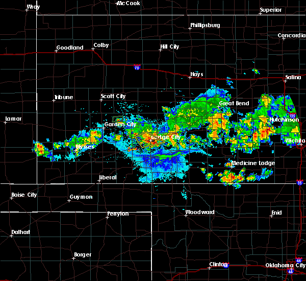 At 1002 pm cdt, a severe thunderstorm was located very near ft. dodge, moving southeast at 25 mph (radar indicated). Hazards include 60 mph wind gusts. Expect damage to roofs, siding, and trees. locations impacted include, dodge city, wright and ft. Dodge. At 1002 pm cdt, a severe thunderstorm was located very near ft. dodge, moving southeast at 25 mph (radar indicated). Hazards include 60 mph wind gusts. Expect damage to roofs, siding, and trees. locations impacted include, dodge city, wright and ft. Dodge.
|
| 7/13/2018 9:54 PM CDT | Storm damage reported in ford county KS, 3.4 miles ESE of Dodge City, KS |
| 7/13/2018 9:33 PM CDT |
 At 933 pm cdt, a severe thunderstorm was located 4 miles northeast of howell, moving southeast at 20 mph (radar indicated). Hazards include 60 mph wind gusts. expect damage to roofs, siding, and trees At 933 pm cdt, a severe thunderstorm was located 4 miles northeast of howell, moving southeast at 20 mph (radar indicated). Hazards include 60 mph wind gusts. expect damage to roofs, siding, and trees
|
| 6/24/2018 11:08 PM CDT | Asos station ddc... dodge city regional airpor in ford county KS, 2.2 miles WSW of Dodge City, KS |
| 6/24/2018 11:00 PM CDT | North winds estimated to be gusting to 60-65 mp in ford county KS, 3 miles SE of Dodge City, KS |
| 6/24/2018 9:52 PM CDT | 50 knot from dodge city aso in ford county KS, 2 miles W of Dodge City, KS |
| 6/24/2018 9:52 PM CDT | 50 knot from dodge city aso in ford county KS, 2 miles W of Dodge City, KS |
| 6/24/2018 9:37 PM CDT |
 At 937 pm cdt, severe thunderstorms were located along a line extending from 5 miles north of jetmore to 4 miles south of dodge city, moving east at 70 mph (radar indicated). Hazards include 70 mph wind gusts and ping pong ball size hail. People and animals outdoors will be injured. expect hail damage to roofs, siding, windows, and vehicles. expect considerable tree damage. Wind damage is also likely to mobile homes, roofs, and outbuildings. At 937 pm cdt, severe thunderstorms were located along a line extending from 5 miles north of jetmore to 4 miles south of dodge city, moving east at 70 mph (radar indicated). Hazards include 70 mph wind gusts and ping pong ball size hail. People and animals outdoors will be injured. expect hail damage to roofs, siding, windows, and vehicles. expect considerable tree damage. Wind damage is also likely to mobile homes, roofs, and outbuildings.
|
| 6/24/2018 9:13 PM CDT |
 At 913 pm cdt, severe thunderstorms were located along a line extending from 13 miles north of kalvesta to 5 miles north of howell to near montezuma, moving east at 40 mph (radar indicated). Hazards include 70 mph wind gusts and penny size hail. Expect considerable tree damage. damage is likely to mobile homes, roofs, and outbuildings. Locations impacted include, dodge city, gray, cimarron, montezuma, jetmore, spearville, copeland, ingalls, ford, hanston, ensign, bloom, kingsdown, howell, wright, tice, kalvesta, bellefont, windhorst and the haggard elev. At 913 pm cdt, severe thunderstorms were located along a line extending from 13 miles north of kalvesta to 5 miles north of howell to near montezuma, moving east at 40 mph (radar indicated). Hazards include 70 mph wind gusts and penny size hail. Expect considerable tree damage. damage is likely to mobile homes, roofs, and outbuildings. Locations impacted include, dodge city, gray, cimarron, montezuma, jetmore, spearville, copeland, ingalls, ford, hanston, ensign, bloom, kingsdown, howell, wright, tice, kalvesta, bellefont, windhorst and the haggard elev.
|
| 6/24/2018 8:47 PM CDT |
 At 847 pm cdt, severe thunderstorms were located along a line extending from 14 miles south of dighton to 4 miles northeast of charleston to 6 miles north of tice, moving east at 45 mph (radar indicated). Hazards include 70 mph wind gusts and penny size hail. Expect considerable tree damage. Damage is likely to mobile homes, roofs, and outbuildings. At 847 pm cdt, severe thunderstorms were located along a line extending from 14 miles south of dighton to 4 miles northeast of charleston to 6 miles north of tice, moving east at 45 mph (radar indicated). Hazards include 70 mph wind gusts and penny size hail. Expect considerable tree damage. Damage is likely to mobile homes, roofs, and outbuildings.
|
| 6/24/2018 6:27 AM CDT |
 At 627 am cdt, a severe thunderstorm was located 4 miles north of the haggard elev, moving southeast at 35 mph (radar indicated). Hazards include half dollar size hail. Damage to vehicles is expected. Locations impacted include, dodge city, cimarron, montezuma, ingalls, ensign, charleston, howell and the haggard elev. At 627 am cdt, a severe thunderstorm was located 4 miles north of the haggard elev, moving southeast at 35 mph (radar indicated). Hazards include half dollar size hail. Damage to vehicles is expected. Locations impacted include, dodge city, cimarron, montezuma, ingalls, ensign, charleston, howell and the haggard elev.
|
| 6/24/2018 5:58 AM CDT |
 At 557 am cdt, a severe thunderstorm was located near charleston, moving east at 30 mph (radar indicated). Hazards include 60 mph wind gusts and quarter size hail. Hail damage to vehicles is expected. Expect wind damage to roofs, siding, and trees. At 557 am cdt, a severe thunderstorm was located near charleston, moving east at 30 mph (radar indicated). Hazards include 60 mph wind gusts and quarter size hail. Hail damage to vehicles is expected. Expect wind damage to roofs, siding, and trees.
|
| 6/23/2018 11:16 PM CDT |
 At 1116 pm cdt, severe thunderstorms were located along a line extending from near hanston to 2 miles southeast of ford to near minneola, moving east at 40 mph (radar indicated). Hazards include 70 mph wind gusts and penny size hail. Expect considerable tree damage. Damage is likely to mobile homes, roofs, and outbuildings. At 1116 pm cdt, severe thunderstorms were located along a line extending from near hanston to 2 miles southeast of ford to near minneola, moving east at 40 mph (radar indicated). Hazards include 70 mph wind gusts and penny size hail. Expect considerable tree damage. Damage is likely to mobile homes, roofs, and outbuildings.
|
| 6/23/2018 11:05 PM CDT | Asos station ddc... dodge city regional airpor in ford county KS, 2.2 miles WSW of Dodge City, KS |
| 6/23/2018 11:02 PM CDT |
 At 1102 pm cdt, severe thunderstorms were located along a line extending from 10 miles north of jetmore to 4 miles west of spearville to 7 miles east of ensign, moving east at 45 mph (radar indicated). Hazards include 70 mph wind gusts and penny size hail. Expect considerable tree damage. damage is likely to mobile homes, roofs, and outbuildings. locations impacted include, dodge city, gray, kinsley, jetmore, bucklin, spearville, mullinville, burdett, ford, hanston, offerle, ensign, rozel, bloom, kingsdown, howell, wright, bellefont, windhorst and ft. Dodge. At 1102 pm cdt, severe thunderstorms were located along a line extending from 10 miles north of jetmore to 4 miles west of spearville to 7 miles east of ensign, moving east at 45 mph (radar indicated). Hazards include 70 mph wind gusts and penny size hail. Expect considerable tree damage. damage is likely to mobile homes, roofs, and outbuildings. locations impacted include, dodge city, gray, kinsley, jetmore, bucklin, spearville, mullinville, burdett, ford, hanston, offerle, ensign, rozel, bloom, kingsdown, howell, wright, bellefont, windhorst and ft. Dodge.
|
| 6/23/2018 10:58 PM CDT | Corrects previous tstm wnd gst report from 2 wnw dodge city. winds were estimated from 65 to 70 mp in ford county KS, 3 miles SE of Dodge City, KS |
| 6/23/2018 10:57 PM CDT | Asos station ddc... dodge city regional airpor in ford county KS, 2.2 miles WSW of Dodge City, KS |
| 6/23/2018 10:42 PM CDT |
 At 1042 pm cdt, severe thunderstorms were located along a line extending from near ness city to 8 miles north of dodge city to 3 miles north of the haggard elev, moving east at 40 mph (radar indicated). Hazards include 70 mph wind gusts and nickel size hail. Expect considerable tree damage. Damage is likely to mobile homes, roofs, and outbuildings. At 1042 pm cdt, severe thunderstorms were located along a line extending from near ness city to 8 miles north of dodge city to 3 miles north of the haggard elev, moving east at 40 mph (radar indicated). Hazards include 70 mph wind gusts and nickel size hail. Expect considerable tree damage. Damage is likely to mobile homes, roofs, and outbuildings.
|
| 6/23/2018 10:39 PM CDT | Storm damage reported in ford county KS, 2.1 miles SE of Dodge City, KS |
| 6/23/2018 10:20 PM CDT |
 At 1017 pm cdt, severe thunderstorms were located along a line extending from 6 miles southeast of beeler to 6 miles northeast of cimarron to 10 miles south of plymell, moving southeast at 40 mph (radar indicated. at 940 pm, a 62 mph wind gust was reported 3 miles south-southeast of dighton). Hazards include 60 mph wind gusts and quarter size hail. Hail damage to vehicles is expected. expect wind damage to roofs, siding, and trees. Locations impacted include, dodge city, cimarron, sublette, satanta, montezuma, jetmore, pierceville, copeland, ingalls, ensign, alamota, charleston, howell, beeler, pendennis, plymell, tice, kalvesta and the haggard elev. At 1017 pm cdt, severe thunderstorms were located along a line extending from 6 miles southeast of beeler to 6 miles northeast of cimarron to 10 miles south of plymell, moving southeast at 40 mph (radar indicated. at 940 pm, a 62 mph wind gust was reported 3 miles south-southeast of dighton). Hazards include 60 mph wind gusts and quarter size hail. Hail damage to vehicles is expected. expect wind damage to roofs, siding, and trees. Locations impacted include, dodge city, cimarron, sublette, satanta, montezuma, jetmore, pierceville, copeland, ingalls, ensign, alamota, charleston, howell, beeler, pendennis, plymell, tice, kalvesta and the haggard elev.
|
| 6/23/2018 9:55 PM CDT |
 The national weather service in dodge city has issued a * severe thunderstorm warning for. northwestern ford county in southwestern kansas. central finney county in southwestern kansas. southwestern ness county in west central kansas. Western hodgeman county in southwestern kansas. The national weather service in dodge city has issued a * severe thunderstorm warning for. northwestern ford county in southwestern kansas. central finney county in southwestern kansas. southwestern ness county in west central kansas. Western hodgeman county in southwestern kansas.
|
| 6/23/2018 10:58 AM CDT | Winds were estimated from 65 to 70 mp in ford county KS, 3 miles SE of Dodge City, KS |
| 6/22/2018 7:02 PM CDT | Measured at the dodge city airpor in ford county KS, 2 miles W of Dodge City, KS |
| 6/22/2018 7:00 PM CDT | Tree damage reported via social medi in ford county KS, 0.9 miles ESE of Dodge City, KS |
| 6/22/2018 7:00 PM CDT |
 At 700 pm cdt, severe thunderstorms were located along a line extending from 5 miles southwest of garfield to 8 miles southeast of ensign, moving southeast at 45 mph (radar indicated). Hazards include 70 mph wind gusts and penny size hail. Expect considerable tree damage. damage is likely to mobile homes, roofs, and outbuildings. Locations impacted include, dodge city, kinsley, bucklin, greensburg, spearville, minneola, lewis, mullinville, ford, offerle, garfield, ensign, bloom, belpre, fellsburg, clark state lake, kingsdown, howell, wright and bellefont. At 700 pm cdt, severe thunderstorms were located along a line extending from 5 miles southwest of garfield to 8 miles southeast of ensign, moving southeast at 45 mph (radar indicated). Hazards include 70 mph wind gusts and penny size hail. Expect considerable tree damage. damage is likely to mobile homes, roofs, and outbuildings. Locations impacted include, dodge city, kinsley, bucklin, greensburg, spearville, minneola, lewis, mullinville, ford, offerle, garfield, ensign, bloom, belpre, fellsburg, clark state lake, kingsdown, howell, wright and bellefont.
|
| 6/22/2018 6:43 PM CDT |
 At 643 pm cdt, severe thunderstorms were located along a line extending from near rozel to 4 miles northwest of ensign, moving southeast at 50 mph (radar indicated). Hazards include 70 mph wind gusts and nickel size hail. Expect considerable tree damage. damage is likely to mobile homes, roofs, and outbuildings. Locations impacted include, dodge city, gray, cimarron, kinsley, jetmore, bucklin, greensburg, spearville, minneola, lewis, mullinville, burdett, ford, hanston, offerle, garfield, ensign, rozel, bloom and belpre. At 643 pm cdt, severe thunderstorms were located along a line extending from near rozel to 4 miles northwest of ensign, moving southeast at 50 mph (radar indicated). Hazards include 70 mph wind gusts and nickel size hail. Expect considerable tree damage. damage is likely to mobile homes, roofs, and outbuildings. Locations impacted include, dodge city, gray, cimarron, kinsley, jetmore, bucklin, greensburg, spearville, minneola, lewis, mullinville, burdett, ford, hanston, offerle, garfield, ensign, rozel, bloom and belpre.
|
| 6/22/2018 6:19 PM CDT |
 At 618 pm cdt, severe thunderstorms were located along a line extending from 6 miles south of bazine to 5 miles north of ingalls, moving southeast at 45 mph (radar indicated). Hazards include 70 mph wind gusts and quarter size hail. Hail damage to vehicles is expected. expect considerable tree damage. Wind damage is also likely to mobile homes, roofs, and outbuildings. At 618 pm cdt, severe thunderstorms were located along a line extending from 6 miles south of bazine to 5 miles north of ingalls, moving southeast at 45 mph (radar indicated). Hazards include 70 mph wind gusts and quarter size hail. Hail damage to vehicles is expected. expect considerable tree damage. Wind damage is also likely to mobile homes, roofs, and outbuildings.
|
| 6/19/2018 10:51 PM CDT | Storm damage reported in ford county KS, 2 miles W of Dodge City, KS |
| 6/19/2018 10:31 PM CDT |
 At 1030 pm cdt, severe thunderstorms were located along a line extending from 2 miles northwest of ransom to 7 miles west of jetmore to near ensign, moving east at 50 mph (radar indicated). Hazards include 70 mph wind gusts and penny size hail. Expect considerable tree damage. Damage is likely to mobile homes, roofs, and outbuildings. At 1030 pm cdt, severe thunderstorms were located along a line extending from 2 miles northwest of ransom to 7 miles west of jetmore to near ensign, moving east at 50 mph (radar indicated). Hazards include 70 mph wind gusts and penny size hail. Expect considerable tree damage. Damage is likely to mobile homes, roofs, and outbuildings.
|
| 6/19/2018 10:17 PM CDT |
 At 1016 pm cdt, the leading edge of severe thunderstorms were located along a line extending from 4 miles north of jetmore to 3 miles west of howell to 3 miles north of satanta, moving south at 55 mph (radar indicated). Hazards include 70 mph wind gusts and penny size hail. Expect considerable tree damage. damage is likely to mobile homes, roofs, and outbuildings. Locations impacted include, dodge city, cimarron, sublette, ness city, montezuma, jetmore, pierceville, copeland, ingalls, ransom, ensign, charleston, howell, beeler, plymell, arnold and kalvesta. At 1016 pm cdt, the leading edge of severe thunderstorms were located along a line extending from 4 miles north of jetmore to 3 miles west of howell to 3 miles north of satanta, moving south at 55 mph (radar indicated). Hazards include 70 mph wind gusts and penny size hail. Expect considerable tree damage. damage is likely to mobile homes, roofs, and outbuildings. Locations impacted include, dodge city, cimarron, sublette, ness city, montezuma, jetmore, pierceville, copeland, ingalls, ransom, ensign, charleston, howell, beeler, plymell, arnold and kalvesta.
|
| 6/19/2018 9:51 PM CDT |
 At 949 pm cdt, severe thunderstorms were located along a line extending from 2 miles northeast of arnold to 4 miles northwest of kalvesta to 11 miles southwest of plymell, moving southeast at 40 mph (radar indicated and winds measured by automated weather stations). Hazards include 70 mph wind gusts and penny size hail. Expect considerable tree damage. damage is likely to mobile homes, roofs, and outbuildings. locations impacted include, dodge city, garden city, cimarron, holcomb, sublette, ness city, dighton, montezuma, jetmore, pierceville, copeland, ingalls, ransom, ensign, utica, alamota, charleston, howell, shields and beeler. At 935 pm cdt, a 65 mph wind gust was measured by a mesonet station in garden city. At 949 pm cdt, severe thunderstorms were located along a line extending from 2 miles northeast of arnold to 4 miles northwest of kalvesta to 11 miles southwest of plymell, moving southeast at 40 mph (radar indicated and winds measured by automated weather stations). Hazards include 70 mph wind gusts and penny size hail. Expect considerable tree damage. damage is likely to mobile homes, roofs, and outbuildings. locations impacted include, dodge city, garden city, cimarron, holcomb, sublette, ness city, dighton, montezuma, jetmore, pierceville, copeland, ingalls, ransom, ensign, utica, alamota, charleston, howell, shields and beeler. At 935 pm cdt, a 65 mph wind gust was measured by a mesonet station in garden city.
|
| 6/19/2018 9:25 PM CDT |
 At 924 pm cdt, the leading edge of severe thunderstorms were located along a line extending from 5 miles north of shields to 15 miles southeast of friend to 2 miles southeast of lakin, moving southeast at 55 mph (radar indicated and measured winds from automated weather stations). Hazards include 70 mph wind gusts and penny size hail. Expect considerable tree damage. Damage is likely to mobile homes, roofs, and outbuildings. At 924 pm cdt, the leading edge of severe thunderstorms were located along a line extending from 5 miles north of shields to 15 miles southeast of friend to 2 miles southeast of lakin, moving southeast at 55 mph (radar indicated and measured winds from automated weather stations). Hazards include 70 mph wind gusts and penny size hail. Expect considerable tree damage. Damage is likely to mobile homes, roofs, and outbuildings.
|
| 6/7/2018 2:05 AM CDT | Propane tank and grill slammed against the wall. heavy glass patio table flipped and shattered. chairs blown somewhere to the eas in ford county KS, 3 miles SE of Dodge City, KS |
| 5/29/2018 5:38 PM CDT | Grapefruit sized hail reported 12.2 miles NNW of Dodge City, KS |
| 5/29/2018 5:35 PM CDT | Baseball sized hail reported 12.2 miles NNW of Dodge City, KS |
| 5/29/2018 5:02 PM CDT | Half Dollar sized hail reported 9.4 miles N of Dodge City, KS, half dollar hail. |
| 5/29/2018 5:00 PM CDT | Golf Ball sized hail reported 9.7 miles E of Dodge City, KS, golf ball hail 102 rd/hwy 50. |
| 5/29/2018 4:58 PM CDT |
 At 458 pm cdt, a severe thunderstorm was located 4 miles southeast of cimarron, moving northeast at 15 mph (radar indicated). Hazards include two inch hail and 60 mph wind gusts. People and animals outdoors will be injured. expect hail damage to roofs, siding, windows, and vehicles. expect wind damage to roofs, siding, and trees. Locations impacted include, dodge city, ensign and howell. At 458 pm cdt, a severe thunderstorm was located 4 miles southeast of cimarron, moving northeast at 15 mph (radar indicated). Hazards include two inch hail and 60 mph wind gusts. People and animals outdoors will be injured. expect hail damage to roofs, siding, windows, and vehicles. expect wind damage to roofs, siding, and trees. Locations impacted include, dodge city, ensign and howell.
|
| 5/29/2018 4:36 PM CDT |
 At 436 pm cdt, a severe thunderstorm was located 5 miles north of the haggard elev, moving northeast at 15 mph (radar indicated). Hazards include two inch hail and 60 mph wind gusts. People and animals outdoors will be injured. expect hail damage to roofs, siding, windows, and vehicles. Expect wind damage to roofs, siding, and trees. At 436 pm cdt, a severe thunderstorm was located 5 miles north of the haggard elev, moving northeast at 15 mph (radar indicated). Hazards include two inch hail and 60 mph wind gusts. People and animals outdoors will be injured. expect hail damage to roofs, siding, windows, and vehicles. Expect wind damage to roofs, siding, and trees.
|
| 5/28/2018 9:10 PM CDT |
 At 909 pm cdt, a line of severe thunderstorm was located from 8 miles north of howell to near larned, moving east at 45 mph (radar indicated). Hazards include 60 mph wind gusts and quarter size hail. Hail damage to vehicles is expected. expect wind damage to roofs, siding, and trees. locations impacted include, dodge city, gray, larned, kinsley, jetmore, spearville, lewis, burdett, hanston, offerle, garfield, rozel, belpre, ash valley, howell, wright, sanford, frizell, bellefont and windhorst. A tornado watch remains in effect until 1000 pm cdt for central kansas. At 909 pm cdt, a line of severe thunderstorm was located from 8 miles north of howell to near larned, moving east at 45 mph (radar indicated). Hazards include 60 mph wind gusts and quarter size hail. Hail damage to vehicles is expected. expect wind damage to roofs, siding, and trees. locations impacted include, dodge city, gray, larned, kinsley, jetmore, spearville, lewis, burdett, hanston, offerle, garfield, rozel, belpre, ash valley, howell, wright, sanford, frizell, bellefont and windhorst. A tornado watch remains in effect until 1000 pm cdt for central kansas.
|
| 5/28/2018 8:55 PM CDT |
 At 854 pm cdt, a line of severe thunderstorms was located from very near cimarron to near jetmore to near burdett , moving northeast at 40 mph (radar indicated). Hazards include 70 mph wind gusts and quarter size hail. Hail damage to vehicles is expected. expect considerable tree damage. wind damage is also likely to mobile homes, roofs, and outbuildings. locations impacted include, dodge city, gray, larned, cimarron, kinsley, montezuma, jetmore, spearville, lewis, ingalls, burdett, hanston, offerle, garfield, ensign, rozel, belpre, charleston, ash valley and howell. A tornado watch remains in effect until 1000 pm cdt for central kansas. At 854 pm cdt, a line of severe thunderstorms was located from very near cimarron to near jetmore to near burdett , moving northeast at 40 mph (radar indicated). Hazards include 70 mph wind gusts and quarter size hail. Hail damage to vehicles is expected. expect considerable tree damage. wind damage is also likely to mobile homes, roofs, and outbuildings. locations impacted include, dodge city, gray, larned, cimarron, kinsley, montezuma, jetmore, spearville, lewis, ingalls, burdett, hanston, offerle, garfield, ensign, rozel, belpre, charleston, ash valley and howell. A tornado watch remains in effect until 1000 pm cdt for central kansas.
|
| 5/28/2018 8:40 PM CDT |
 The severe thunderstorm warning for northwestern ford, finney, southern ness, hodgeman, western pawnee, southeastern lane, northern gray, northwestern edwards and northeastern haskell counties will expire at 845 pm cdt, a tornado watch remains in effect until 1000 pm cdt for west central kansas. a severe thunderstorm watch remains in effect until 1000 pm cdt for south central and southwestern kansas. a severe thunderstorm warning has replaced this warning and is in effect for finney, gray, hodgeman, pawnee, ford, and edwards counties until 9:45 pm. The severe thunderstorm warning for northwestern ford, finney, southern ness, hodgeman, western pawnee, southeastern lane, northern gray, northwestern edwards and northeastern haskell counties will expire at 845 pm cdt, a tornado watch remains in effect until 1000 pm cdt for west central kansas. a severe thunderstorm watch remains in effect until 1000 pm cdt for south central and southwestern kansas. a severe thunderstorm warning has replaced this warning and is in effect for finney, gray, hodgeman, pawnee, ford, and edwards counties until 9:45 pm.
|
| 5/28/2018 8:38 PM CDT |
 At 837 pm cdt, a line of severe thunderstorms was located 5 miles southwest of ingalls, moving east at 35 mph. another line of severe thunderstorms was located from cimarron to jetmore, moving east at 35 mph (radar indicated). Hazards include 70 mph wind gusts and half dollar size hail. Hail damage to vehicles is expected. expect considerable tree damage. Wind damage is also likely to mobile homes, roofs, and outbuildings. At 837 pm cdt, a line of severe thunderstorms was located 5 miles southwest of ingalls, moving east at 35 mph. another line of severe thunderstorms was located from cimarron to jetmore, moving east at 35 mph (radar indicated). Hazards include 70 mph wind gusts and half dollar size hail. Hail damage to vehicles is expected. expect considerable tree damage. Wind damage is also likely to mobile homes, roofs, and outbuildings.
|
| 5/28/2018 8:17 PM CDT |
 At 817 pm cdt, severe thunderstorms were located along a line extending from 12 miles northwest of hanston to 4 miles west of howell, moving east at 55 mph (radar indicated). Hazards include 70 mph wind gusts and half dollar size hail. Hail damage to vehicles is expected. expect considerable tree damage. wind damage is also likely to mobile homes, roofs, and outbuildings. locations impacted include, garden city, gray, cimarron, jetmore, pierceville, ingalls, burdett, hanston, rozel, charleston, howell, plymell and kalvesta. A tornado watch remains in effect until 1000 pm cdt for west central kansas. At 817 pm cdt, severe thunderstorms were located along a line extending from 12 miles northwest of hanston to 4 miles west of howell, moving east at 55 mph (radar indicated). Hazards include 70 mph wind gusts and half dollar size hail. Hail damage to vehicles is expected. expect considerable tree damage. wind damage is also likely to mobile homes, roofs, and outbuildings. locations impacted include, garden city, gray, cimarron, jetmore, pierceville, ingalls, burdett, hanston, rozel, charleston, howell, plymell and kalvesta. A tornado watch remains in effect until 1000 pm cdt for west central kansas.
|
| 5/28/2018 7:51 PM CDT |
 At 751 pm cdt, severe thunderstorms were located along a line extending from 13 miles south of beeler to 7 miles north of copeland, moving east at 30 mph (radar indicated). Hazards include 70 mph wind gusts and quarter size hail. Hail damage to vehicles is expected. expect considerable tree damage. Wind damage is also likely to mobile homes, roofs, and outbuildings. At 751 pm cdt, severe thunderstorms were located along a line extending from 13 miles south of beeler to 7 miles north of copeland, moving east at 30 mph (radar indicated). Hazards include 70 mph wind gusts and quarter size hail. Hail damage to vehicles is expected. expect considerable tree damage. Wind damage is also likely to mobile homes, roofs, and outbuildings.
|
| 5/18/2018 7:35 PM CDT |
 At 734 pm cdt, a severe thunderstorm was located 4 miles southwest of ford, moving north at 35 mph (radar indicated). Hazards include golf ball size hail and 70 mph wind gusts. People and animals outdoors will be injured. expect hail damage to roofs, siding, windows, and vehicles. expect considerable tree damage. wind damage is also likely to mobile homes, roofs, and outbuildings. At 730 pm, a suspected microburst caused roof damage 3 miles east of dodge city. At 734 pm cdt, a severe thunderstorm was located 4 miles southwest of ford, moving north at 35 mph (radar indicated). Hazards include golf ball size hail and 70 mph wind gusts. People and animals outdoors will be injured. expect hail damage to roofs, siding, windows, and vehicles. expect considerable tree damage. wind damage is also likely to mobile homes, roofs, and outbuildings. At 730 pm, a suspected microburst caused roof damage 3 miles east of dodge city.
|
| 5/18/2018 7:19 PM CDT | Storm damage reported in ford county KS, 2 miles W of Dodge City, KS |
| 5/18/2018 7:12 PM CDT |
 At 711 pm cdt, a severe thunderstorm was located 5 miles south of minneola, moving northeast at 40 mph (radar indicated). Hazards include ping pong ball size hail and 60 mph wind gusts. People and animals outdoors will be injured. expect hail damage to roofs, siding, windows, and vehicles. expect wind damage to roofs, siding, and trees. Locations impacted include, minneola, ford, bloom and clark state lake. At 711 pm cdt, a severe thunderstorm was located 5 miles south of minneola, moving northeast at 40 mph (radar indicated). Hazards include ping pong ball size hail and 60 mph wind gusts. People and animals outdoors will be injured. expect hail damage to roofs, siding, windows, and vehicles. expect wind damage to roofs, siding, and trees. Locations impacted include, minneola, ford, bloom and clark state lake.
|
| 5/18/2018 6:46 PM CDT |
 At 646 pm cdt, a severe thunderstorm was located 12 miles southeast of fowler, moving north at 35 mph (radar indicated). Hazards include ping pong ball size hail and 60 mph wind gusts. People and animals outdoors will be injured. expect hail damage to roofs, siding, windows, and vehicles. Expect wind damage to roofs, siding, and trees. At 646 pm cdt, a severe thunderstorm was located 12 miles southeast of fowler, moving north at 35 mph (radar indicated). Hazards include ping pong ball size hail and 60 mph wind gusts. People and animals outdoors will be injured. expect hail damage to roofs, siding, windows, and vehicles. Expect wind damage to roofs, siding, and trees.
|
| 5/14/2018 10:18 PM CDT |
 At 1016 pm cdt, a severe thunderstorm was located 10 miles south of jetmore, moving east at 40 mph. outflow moving south from this severe thunderstorm will move across northeastern ford county (radar indicated). Hazards include 60 mph wind gusts. expect damage to roofs, siding, and trees At 1016 pm cdt, a severe thunderstorm was located 10 miles south of jetmore, moving east at 40 mph. outflow moving south from this severe thunderstorm will move across northeastern ford county (radar indicated). Hazards include 60 mph wind gusts. expect damage to roofs, siding, and trees
|
| 5/9/2018 10:53 PM CDT |
 At 1053 pm cdt, severe thunderstorms were located along a line extending from 5 miles south of burdett to 10 miles southwest of jetmore, moving southeast at 25 mph (radar indicated). Hazards include 60 mph wind gusts and nickel size hail. Expect damage to roofs, siding, and trees. Locations impacted include, dodge city, gray, kinsley, jetmore, spearville, burdett, hanston, offerle, garfield, rozel, howell, wright, bellefont and zook. At 1053 pm cdt, severe thunderstorms were located along a line extending from 5 miles south of burdett to 10 miles southwest of jetmore, moving southeast at 25 mph (radar indicated). Hazards include 60 mph wind gusts and nickel size hail. Expect damage to roofs, siding, and trees. Locations impacted include, dodge city, gray, kinsley, jetmore, spearville, burdett, hanston, offerle, garfield, rozel, howell, wright, bellefont and zook.
|
| 5/9/2018 10:36 PM CDT |
 At 1035 pm cdt, severe thunderstorms were located along a line extending from near gray to 11 miles east of kalvesta, moving southeast at 25 mph (radar indicated). Hazards include 60 mph wind gusts and penny size hail. expect damage to roofs, siding, and trees At 1035 pm cdt, severe thunderstorms were located along a line extending from near gray to 11 miles east of kalvesta, moving southeast at 25 mph (radar indicated). Hazards include 60 mph wind gusts and penny size hail. expect damage to roofs, siding, and trees
|
| 10/6/2017 7:12 PM CDT |
 The severe thunderstorm warning for northern ford, hodgeman, northwestern pawnee and northwestern edwards counties will expire at 715 pm cdt, the storms which prompted the warning have moved out of the area. therefore the warning will be allowed to expire. however small hail, gusty winds and heavy rain are still possible with these thunderstorms. a severe thunderstorm watch remains in effect until 1100 pm cdt for south central, central, southwestern and west central kansas. The severe thunderstorm warning for northern ford, hodgeman, northwestern pawnee and northwestern edwards counties will expire at 715 pm cdt, the storms which prompted the warning have moved out of the area. therefore the warning will be allowed to expire. however small hail, gusty winds and heavy rain are still possible with these thunderstorms. a severe thunderstorm watch remains in effect until 1100 pm cdt for south central, central, southwestern and west central kansas.
|
| 10/6/2017 7:03 PM CDT |
 At 703 pm cdt, severe thunderstorms were located along a line extending from 4 miles northwest of burdett to 2 miles south of wright, moving east at 50 mph (radar indicated). Hazards include 70 mph wind gusts and quarter size hail. Hail damage to vehicles is expected. expect considerable tree damage. wind damage is also likely to mobile homes, roofs, and outbuildings. locations impacted include, dodge city, jetmore, spearville, burdett, hanston, offerle, fort dodge, wright, rozel, bellefont, gray, sanford, windhorst, willroads garden, rolling hill estates, dodge city regional airport, boot hill casino, hodgeman state lake, ford state lake and jetmore city lake. A weak, brief tornado is possible along the leading edge of this line of storms. At 703 pm cdt, severe thunderstorms were located along a line extending from 4 miles northwest of burdett to 2 miles south of wright, moving east at 50 mph (radar indicated). Hazards include 70 mph wind gusts and quarter size hail. Hail damage to vehicles is expected. expect considerable tree damage. wind damage is also likely to mobile homes, roofs, and outbuildings. locations impacted include, dodge city, jetmore, spearville, burdett, hanston, offerle, fort dodge, wright, rozel, bellefont, gray, sanford, windhorst, willroads garden, rolling hill estates, dodge city regional airport, boot hill casino, hodgeman state lake, ford state lake and jetmore city lake. A weak, brief tornado is possible along the leading edge of this line of storms.
|
| 10/6/2017 6:52 PM CDT |
 At 651 pm cdt, severe thunderstorms were located along a line extending from 8 miles northwest of hanston to 3 miles southwest of dodge city, moving east at 40 mph (radar indicated). Hazards include 60 mph wind gusts and quarter size hail. Hail damage to vehicles is expected. expect wind damage to roofs, siding, and trees. Locations impacted include, dodge city, jetmore, spearville, burdett, hanston, offerle, fort dodge, wright, rozel, bellefont, gray, sanford, windhorst, willroads garden, rolling hill estates, dodge city regional airport, boot hill casino, hodgeman state lake, ford state lake and jetmore city lake. At 651 pm cdt, severe thunderstorms were located along a line extending from 8 miles northwest of hanston to 3 miles southwest of dodge city, moving east at 40 mph (radar indicated). Hazards include 60 mph wind gusts and quarter size hail. Hail damage to vehicles is expected. expect wind damage to roofs, siding, and trees. Locations impacted include, dodge city, jetmore, spearville, burdett, hanston, offerle, fort dodge, wright, rozel, bellefont, gray, sanford, windhorst, willroads garden, rolling hill estates, dodge city regional airport, boot hill casino, hodgeman state lake, ford state lake and jetmore city lake.
|
| 10/6/2017 6:22 PM CDT |
 At 622 pm cdt, severe thunderstorms were located along a line extending from 8 miles northeast of kalvesta to near ingalls, moving east at 50 mph (radar indicated). Hazards include ping pong ball size hail and 60 mph wind gusts. People and animals outdoors will be injured. expect hail damage to roofs, siding, windows, and vehicles. Expect wind damage to roofs, siding, and trees. At 622 pm cdt, severe thunderstorms were located along a line extending from 8 miles northeast of kalvesta to near ingalls, moving east at 50 mph (radar indicated). Hazards include ping pong ball size hail and 60 mph wind gusts. People and animals outdoors will be injured. expect hail damage to roofs, siding, windows, and vehicles. Expect wind damage to roofs, siding, and trees.
|
| 6/22/2017 8:31 PM CDT |
 At 829 pm cdt, a severe thunderstorm was located 3 miles southwest of windhorst, or 17 miles east of dodge city, moving east at 20 mph (radar indicated). Hazards include 60 mph wind gusts and penny size hail. Expect damage to roofs, siding, and trees. Locations impacted include, dodge city, kinsley, greensburg, spearville, bucklin, haviland, lewis, mullinville, ford, offerle, fort dodge, wright, belpre, wellsford, trousdale, belvidere, bellefont, kingsdown, centerview and fellsburg. At 829 pm cdt, a severe thunderstorm was located 3 miles southwest of windhorst, or 17 miles east of dodge city, moving east at 20 mph (radar indicated). Hazards include 60 mph wind gusts and penny size hail. Expect damage to roofs, siding, and trees. Locations impacted include, dodge city, kinsley, greensburg, spearville, bucklin, haviland, lewis, mullinville, ford, offerle, fort dodge, wright, belpre, wellsford, trousdale, belvidere, bellefont, kingsdown, centerview and fellsburg.
|
| 6/22/2017 8:16 PM CDT | Storm damage reported in ford county KS, 2.5 miles SW of Dodge City, KS |
| 6/22/2017 8:13 PM CDT |
 At 812 pm cdt, a severe thunderstorm was located 4 miles east of wright, or 11 miles east of dodge city, moving east at 30 mph (radar indicated). Hazards include 70 mph wind gusts and penny size hail. Expect considerable tree damage. Damage is likely to mobile homes, roofs, and outbuildings. At 812 pm cdt, a severe thunderstorm was located 4 miles east of wright, or 11 miles east of dodge city, moving east at 30 mph (radar indicated). Hazards include 70 mph wind gusts and penny size hail. Expect considerable tree damage. Damage is likely to mobile homes, roofs, and outbuildings.
|
| 6/22/2017 8:07 PM CDT |
 At 805 pm cdt, a severe thunderstorm was located 3 miles northwest of wright, or 5 miles northeast of dodge city, moving east at 35 mph (radar indicated. at 8 pm the asos at the dodge city airport reported winds gusting to 62 mph). Hazards include 60 mph wind gusts and penny size hail. Expect damage to roofs, siding, and trees. Locations impacted include, dodge city, spearville, ford, fort dodge, wright, bellefont, windhorst, willroads garden, rolling hill estates, dodge city regional airport, boot hill casino, ford state lake and hain state lake. At 805 pm cdt, a severe thunderstorm was located 3 miles northwest of wright, or 5 miles northeast of dodge city, moving east at 35 mph (radar indicated. at 8 pm the asos at the dodge city airport reported winds gusting to 62 mph). Hazards include 60 mph wind gusts and penny size hail. Expect damage to roofs, siding, and trees. Locations impacted include, dodge city, spearville, ford, fort dodge, wright, bellefont, windhorst, willroads garden, rolling hill estates, dodge city regional airport, boot hill casino, ford state lake and hain state lake.
|
| 6/22/2017 8:06 PM CDT | Storm damage reported in ford county KS, 1.7 miles S of Dodge City, KS |
| 6/22/2017 8:01 PM CDT | Ddc aso in ford county KS, 2.2 miles WSW of Dodge City, KS |
| 6/22/2017 7:31 PM CDT |
 The national weather service in dodge city has issued a * severe thunderstorm warning for. ford county in southwestern kansas. southern hodgeman county in southwestern kansas. Until 815 pm cdt * at 730 pm cdt, a severe thunderstorm was located 4 miles northwest. The national weather service in dodge city has issued a * severe thunderstorm warning for. ford county in southwestern kansas. southern hodgeman county in southwestern kansas. Until 815 pm cdt * at 730 pm cdt, a severe thunderstorm was located 4 miles northwest.
|
| 6/21/2017 7:01 PM CDT |
 At 700 pm cdt, severe thunderstorms were located along a line extending from 9 miles north of dodge city to 6 miles southeast of montezuma, moving southeast at 30 mph (radar indicated). Hazards include 60 mph wind gusts and nickel size hail. expect damage to roofs, siding, and trees At 700 pm cdt, severe thunderstorms were located along a line extending from 9 miles north of dodge city to 6 miles southeast of montezuma, moving southeast at 30 mph (radar indicated). Hazards include 60 mph wind gusts and nickel size hail. expect damage to roofs, siding, and trees
|
| 6/13/2017 7:55 PM CDT |
 At 754 pm cdt, a severe thunderstorm was located 6 miles north of dodge city, moving northeast at 40 mph (radar indicated). Hazards include quarter size hail. Damage to vehicles is expected. Locations impacted include, dodge city, fort dodge, wright, howell, rolling hill estates, boot hill casino, dodge city regional airport and ford state lake. At 754 pm cdt, a severe thunderstorm was located 6 miles north of dodge city, moving northeast at 40 mph (radar indicated). Hazards include quarter size hail. Damage to vehicles is expected. Locations impacted include, dodge city, fort dodge, wright, howell, rolling hill estates, boot hill casino, dodge city regional airport and ford state lake.
|
| 6/13/2017 7:41 PM CDT |
 At 740 pm cdt, a severe thunderstorm was located 4 miles southeast of howell, or 5 miles west of dodge city, moving northeast at 40 mph (radar indicated). Hazards include 60 mph wind gusts and quarter size hail. Hail damage to vehicles is expected. Expect wind damage to roofs, siding, and trees. At 740 pm cdt, a severe thunderstorm was located 4 miles southeast of howell, or 5 miles west of dodge city, moving northeast at 40 mph (radar indicated). Hazards include 60 mph wind gusts and quarter size hail. Hail damage to vehicles is expected. Expect wind damage to roofs, siding, and trees.
|
| 6/13/2017 7:40 PM CDT | Quarter sized hail reported 2 miles W of Dodge City, KS |
| 6/13/2017 7:17 PM CDT |
 At 717 pm cdt, a severe thunderstorm was located 7 miles south of hanston, or 12 miles east of jetmore, moving northeast at 50 mph (radar indicated). Hazards include ping pong ball size hail and 60 mph wind gusts. People and animals outdoors will be injured. expect hail damage to roofs, siding, windows, and vehicles. expect wind damage to roofs, siding, and trees. Locations impacted include, jetmore, spearville, burdett, hanston, offerle, garfield, fort dodge, wright, rozel, bellefont, gray, sanford, rolling hill estates, dodge city regional airport, hodgeman state lake, ford state lake and hain state lake. At 717 pm cdt, a severe thunderstorm was located 7 miles south of hanston, or 12 miles east of jetmore, moving northeast at 50 mph (radar indicated). Hazards include ping pong ball size hail and 60 mph wind gusts. People and animals outdoors will be injured. expect hail damage to roofs, siding, windows, and vehicles. expect wind damage to roofs, siding, and trees. Locations impacted include, jetmore, spearville, burdett, hanston, offerle, garfield, fort dodge, wright, rozel, bellefont, gray, sanford, rolling hill estates, dodge city regional airport, hodgeman state lake, ford state lake and hain state lake.
|
| 6/13/2017 7:16 PM CDT | Storm damage reported in ford county KS, 9 miles NW of Dodge City, KS |
| 6/13/2017 6:56 PM CDT |
 At 656 pm cdt, a severe thunderstorm was located 5 miles northwest of wright, or 8 miles northeast of dodge city, moving northeast at 50 mph (radar indicated). Hazards include up to ping pong ball size hail and 60 mph wind gusts. People and animals outdoors will be injured. expect hail damage to roofs, siding, windows, and vehicles. Expect wind damage to roofs, siding, and trees. At 656 pm cdt, a severe thunderstorm was located 5 miles northwest of wright, or 8 miles northeast of dodge city, moving northeast at 50 mph (radar indicated). Hazards include up to ping pong ball size hail and 60 mph wind gusts. People and animals outdoors will be injured. expect hail damage to roofs, siding, windows, and vehicles. Expect wind damage to roofs, siding, and trees.
|
| 6/13/2017 6:54 PM CDT | Half Dollar sized hail reported 3 miles SE of Dodge City, KS, via social media. |
| 6/13/2017 6:49 PM CDT |
 At 649 pm cdt, a severe thunderstorm was located very near dodge city, moving northeast at 50 mph (radar indicated). Hazards include up to ping pong ball size hail and 60 mph wind gusts. People and animals outdoors will be injured. expect hail damage to roofs, siding, windows, and vehicles. expect wind damage to roofs, siding, and trees. Locations impacted include, dodge city, wright, rolling hill estates, boot hill casino, dodge city regional airport and ford state lake. At 649 pm cdt, a severe thunderstorm was located very near dodge city, moving northeast at 50 mph (radar indicated). Hazards include up to ping pong ball size hail and 60 mph wind gusts. People and animals outdoors will be injured. expect hail damage to roofs, siding, windows, and vehicles. expect wind damage to roofs, siding, and trees. Locations impacted include, dodge city, wright, rolling hill estates, boot hill casino, dodge city regional airport and ford state lake.
|
| 6/13/2017 6:47 PM CDT | Quarter sized hail reported 2.1 miles SE of Dodge City, KS, reported by former nws employee. |
| 6/13/2017 6:47 PM CDT | Half Dollar sized hail reported 1.4 miles ESE of Dodge City, KS, mostly quarters with some half dollar. |
| 6/13/2017 6:45 PM CDT | Quarter sized hail reported 2.1 miles SE of Dodge City, KS |
| 6/13/2017 6:33 PM CDT |
 At 633 pm cdt, a severe thunderstorm was located near ensign, or 13 miles southwest of dodge city, moving northeast at 50 mph (radar indicated). Hazards include up to ping pong ball size hail and 60 mph wind gusts. People and animals outdoors will be injured. expect hail damage to roofs, siding, windows, and vehicles. Expect wind damage to roofs, siding, and trees. At 633 pm cdt, a severe thunderstorm was located near ensign, or 13 miles southwest of dodge city, moving northeast at 50 mph (radar indicated). Hazards include up to ping pong ball size hail and 60 mph wind gusts. People and animals outdoors will be injured. expect hail damage to roofs, siding, windows, and vehicles. Expect wind damage to roofs, siding, and trees.
|
| 6/13/2017 4:25 PM CDT |
 At 424 pm cdt, a severe thunderstorm was located 4 miles west of spearville, or 12 miles northeast of dodge city, moving northeast at 55 mph (radar indicated). Hazards include ping pong ball size hail and 60 mph wind gusts. People and animals outdoors will be injured. expect hail damage to roofs, siding, windows, and vehicles. expect wind damage to roofs, siding, and trees. Locations impacted include, dodge city, kinsley, spearville, offerle, fort dodge, wright, bellefont, windhorst, willroads garden, rolling hill estates, dodge city regional airport, hodgeman state lake, ford state lake and hain state lake. At 424 pm cdt, a severe thunderstorm was located 4 miles west of spearville, or 12 miles northeast of dodge city, moving northeast at 55 mph (radar indicated). Hazards include ping pong ball size hail and 60 mph wind gusts. People and animals outdoors will be injured. expect hail damage to roofs, siding, windows, and vehicles. expect wind damage to roofs, siding, and trees. Locations impacted include, dodge city, kinsley, spearville, offerle, fort dodge, wright, bellefont, windhorst, willroads garden, rolling hill estates, dodge city regional airport, hodgeman state lake, ford state lake and hain state lake.
|
| 6/13/2017 4:09 PM CDT |
 At 409 pm cdt, a severe thunderstorm was located 3 miles southwest of fort dodge, or 5 miles southeast of dodge city, moving northeast at 55 mph (radar indicated). Hazards include ping pong ball size hail and 60 mph wind gusts. People and animals outdoors will be injured. expect hail damage to roofs, siding, windows, and vehicles. Expect wind damage to roofs, siding, and trees. At 409 pm cdt, a severe thunderstorm was located 3 miles southwest of fort dodge, or 5 miles southeast of dodge city, moving northeast at 55 mph (radar indicated). Hazards include ping pong ball size hail and 60 mph wind gusts. People and animals outdoors will be injured. expect hail damage to roofs, siding, windows, and vehicles. Expect wind damage to roofs, siding, and trees.
|
| 5/25/2017 7:54 PM CDT |
 At 753 pm cdt, a severe thunderstorm was located 9 miles northwest of wright, or 10 miles north of dodge city, moving east at 40 mph (radar indicated). Hazards include 60 mph wind gusts and quarter size hail. Hail damage to vehicles is expected. expect wind damage to roofs, siding, and trees. Locations impacted include, dodge city, spearville, ford, fort dodge, wright, bellefont, windhorst, willroads garden, rolling hill estates, dodge city regional airport, boot hill casino, ford state lake and hain state lake. At 753 pm cdt, a severe thunderstorm was located 9 miles northwest of wright, or 10 miles north of dodge city, moving east at 40 mph (radar indicated). Hazards include 60 mph wind gusts and quarter size hail. Hail damage to vehicles is expected. expect wind damage to roofs, siding, and trees. Locations impacted include, dodge city, spearville, ford, fort dodge, wright, bellefont, windhorst, willroads garden, rolling hill estates, dodge city regional airport, boot hill casino, ford state lake and hain state lake.
|
| 5/25/2017 7:49 PM CDT | Golf Ball sized hail reported 8.7 miles S of Dodge City, KS |
| 5/25/2017 7:40 PM CDT |
 At 739 pm cdt, a severe thunderstorm was located 4 miles north of howell, or 9 miles northwest of dodge city, moving southeast at 30 mph (radar indicated). Hazards include 60 mph wind gusts and quarter size hail. Hail damage to vehicles is expected. Expect wind damage to roofs, siding, and trees. At 739 pm cdt, a severe thunderstorm was located 4 miles north of howell, or 9 miles northwest of dodge city, moving southeast at 30 mph (radar indicated). Hazards include 60 mph wind gusts and quarter size hail. Hail damage to vehicles is expected. Expect wind damage to roofs, siding, and trees.
|
| 5/18/2017 6:02 PM CDT |
 At 602 pm cdt, a severe thunderstorm was located near dodge city, moving north at 35 mph (radar indicated). Hazards include 60 mph wind gusts and quarter size hail. Hail damage to vehicles is expected. expect wind damage to roofs, siding, and trees. locations impacted include, dodge city, fort dodge, wright, willroads garden, rolling hill estates, boot hill casino, dodge city regional airport, ford state lake and hain state lake. A tornado watch remains in effect until 1100 pm cdt for southwestern kansas. At 602 pm cdt, a severe thunderstorm was located near dodge city, moving north at 35 mph (radar indicated). Hazards include 60 mph wind gusts and quarter size hail. Hail damage to vehicles is expected. expect wind damage to roofs, siding, and trees. locations impacted include, dodge city, fort dodge, wright, willroads garden, rolling hill estates, boot hill casino, dodge city regional airport, ford state lake and hain state lake. A tornado watch remains in effect until 1100 pm cdt for southwestern kansas.
|
| 5/18/2017 5:58 PM CDT | Quarter sized hail reported 3.1 miles ESE of Dodge City, KS |
| 5/18/2017 5:58 PM CDT | Hen Egg sized hail reported 3.1 miles ESE of Dodge City, KS, holes in gutters as well. |
| 5/18/2017 5:57 PM CDT | Quarter sized hail reported 0.9 miles ESE of Dodge City, KS, reported at 900th block of 5th ave... dodge city. |
| 5/18/2017 5:56 PM CDT | Half Dollar sized hail reported 1 miles SSW of Dodge City, KS |
| 5/18/2017 5:56 PM CDT | Quarter sized hail reported 1.8 miles SSE of Dodge City, KS |
| 5/18/2017 5:54 PM CDT | Quarter sized hail reported 0.9 miles ESE of Dodge City, KS |
| 5/18/2017 5:54 PM CDT |
 At 554 pm cdt, a severe thunderstorm was located 4 miles south of dodge city, moving north at 30 mph (radar indicated). Hazards include 60 mph wind gusts and quarter size hail. Hail damage to vehicles is expected. Expect wind damage to roofs, siding, and trees. At 554 pm cdt, a severe thunderstorm was located 4 miles south of dodge city, moving north at 30 mph (radar indicated). Hazards include 60 mph wind gusts and quarter size hail. Hail damage to vehicles is expected. Expect wind damage to roofs, siding, and trees.
|
| 5/18/2017 5:48 PM CDT | Hen Egg sized hail reported 2.2 miles NE of Dodge City, KS, via social media. |
| 5/16/2017 6:16 PM CDT | Quarter sized hail reported 5.3 miles NW of Dodge City, KS |
| 5/16/2017 5:40 PM CDT |
 At 540 pm cdt, a severe thunderstorm was located 8 miles northwest of bloom, or 13 miles south of dodge city, moving northeast at 15 mph (radar indicated). Hazards include 60 mph wind gusts and quarter size hail. Hail damage to vehicles is expected. expect wind damage to roofs, siding, and trees. locations impacted include, dodge city, ford, fort dodge, wright, willroads garden, dodge city regional airport and ford state lake. A tornado watch remains in effect until 1000 pm cdt for southwestern kansas. At 540 pm cdt, a severe thunderstorm was located 8 miles northwest of bloom, or 13 miles south of dodge city, moving northeast at 15 mph (radar indicated). Hazards include 60 mph wind gusts and quarter size hail. Hail damage to vehicles is expected. expect wind damage to roofs, siding, and trees. locations impacted include, dodge city, ford, fort dodge, wright, willroads garden, dodge city regional airport and ford state lake. A tornado watch remains in effect until 1000 pm cdt for southwestern kansas.
|
| 5/16/2017 5:29 PM CDT |
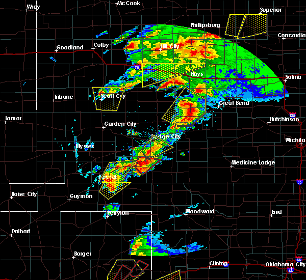 At 529 pm cdt, a severe thunderstorm was located 7 miles north of minneola, or 15 miles south of dodge city, moving northeast at 15 mph (radar indicated). Hazards include 60 mph wind gusts and half dollar size hail. Hail damage to vehicles is expected. Expect wind damage to roofs, siding, and trees. At 529 pm cdt, a severe thunderstorm was located 7 miles north of minneola, or 15 miles south of dodge city, moving northeast at 15 mph (radar indicated). Hazards include 60 mph wind gusts and half dollar size hail. Hail damage to vehicles is expected. Expect wind damage to roofs, siding, and trees.
|
| 5/16/2017 4:41 PM CDT |
 At 441 pm cdt, a severe thunderstorm was located very near wright, or 8 miles east of dodge city, moving northeast at 25 mph (radar indicated). Hazards include 70 mph wind gusts and quarter size hail. Hail damage to vehicles is expected. expect considerable tree damage. wind damage is also likely to mobile homes, roofs, and outbuildings. locations impacted include, spearville, bucklin, ford, offerle, fort dodge, wright, bellefont, windhorst, willroads garden, dodge city regional airport, ford state lake and hain state lake. A tornado watch remains in effect until 1000 pm cdt for south central and southwestern kansas. At 441 pm cdt, a severe thunderstorm was located very near wright, or 8 miles east of dodge city, moving northeast at 25 mph (radar indicated). Hazards include 70 mph wind gusts and quarter size hail. Hail damage to vehicles is expected. expect considerable tree damage. wind damage is also likely to mobile homes, roofs, and outbuildings. locations impacted include, spearville, bucklin, ford, offerle, fort dodge, wright, bellefont, windhorst, willroads garden, dodge city regional airport, ford state lake and hain state lake. A tornado watch remains in effect until 1000 pm cdt for south central and southwestern kansas.
|
| 5/16/2017 4:24 PM CDT |
 The national weather service in dodge city has issued a * severe thunderstorm warning for. ford county in southwestern kansas. northwestern kiowa county in south central kansas. southeastern hodgeman county in southwestern kansas. Southwestern edwards county in south central kansas. The national weather service in dodge city has issued a * severe thunderstorm warning for. ford county in southwestern kansas. northwestern kiowa county in south central kansas. southeastern hodgeman county in southwestern kansas. Southwestern edwards county in south central kansas.
|
| 5/16/2017 3:07 PM CDT |
 At 306 pm cdt, a severe thunderstorm was located 5 miles west of ensign, or 6 miles east of montezuma, moving north at 35 mph (radar indicated). Hazards include two inch hail and 60 mph wind gusts. People and animals outdoors will be injured. expect hail damage to roofs, siding, windows, and vehicles. expect wind damage to roofs, siding, and trees. locations impacted include, dodge city, cimarron, montezuma, ingalls, ensign, charleston, howell, rolling hill estates, dodge city regional airport, boot hill casino, the haggard elevator, ford state lake and hain state lake. A tornado watch remains in effect until 1000 pm cdt for southwestern kansas. At 306 pm cdt, a severe thunderstorm was located 5 miles west of ensign, or 6 miles east of montezuma, moving north at 35 mph (radar indicated). Hazards include two inch hail and 60 mph wind gusts. People and animals outdoors will be injured. expect hail damage to roofs, siding, windows, and vehicles. expect wind damage to roofs, siding, and trees. locations impacted include, dodge city, cimarron, montezuma, ingalls, ensign, charleston, howell, rolling hill estates, dodge city regional airport, boot hill casino, the haggard elevator, ford state lake and hain state lake. A tornado watch remains in effect until 1000 pm cdt for southwestern kansas.
|
| 5/16/2017 2:49 PM CDT |
 At 249 pm cdt, a severe thunderstorm was located 8 miles southeast of montezuma, moving northeast at 40 mph (radar indicated). Hazards include tennis ball size hail and 60 mph wind gusts. People and animals outdoors will be injured. expect hail damage to roofs, siding, windows, and vehicles. Expect wind damage to roofs, siding, and trees. At 249 pm cdt, a severe thunderstorm was located 8 miles southeast of montezuma, moving northeast at 40 mph (radar indicated). Hazards include tennis ball size hail and 60 mph wind gusts. People and animals outdoors will be injured. expect hail damage to roofs, siding, windows, and vehicles. Expect wind damage to roofs, siding, and trees.
|
| 5/14/2017 9:52 PM CDT | Reports of power lines down on numerous vehicles at highway 56 and trail s in ford county KS, 1.4 miles WNW of Dodge City, KS |
| 3/24/2017 1:04 AM CDT |
 At 101 am cdt, a severe thunderstorm was located 3 miles southeast of wright, or 10 miles east of dodge city, moving east at 40 mph (radar indicated. at 12:49 am a wind gust of 67 mph was reported at the dodge city airport). Hazards include 60 mph wind gusts. Expect damage to roofs, siding, and trees. Locations impacted include, dodge city, jetmore, spearville, bucklin, mullinville, ford, fort dodge, wright, windhorst, willroads garden, rolling hill estates, dodge city regional airport, boot hill casino, ford state lake, jetmore city lake and hain state lake. At 101 am cdt, a severe thunderstorm was located 3 miles southeast of wright, or 10 miles east of dodge city, moving east at 40 mph (radar indicated. at 12:49 am a wind gust of 67 mph was reported at the dodge city airport). Hazards include 60 mph wind gusts. Expect damage to roofs, siding, and trees. Locations impacted include, dodge city, jetmore, spearville, bucklin, mullinville, ford, fort dodge, wright, windhorst, willroads garden, rolling hill estates, dodge city regional airport, boot hill casino, ford state lake, jetmore city lake and hain state lake.
|
| 3/24/2017 1:00 AM CDT | . in ford county KS, 1.3 miles SE of Dodge City, KS |
| 3/24/2017 12:53 AM CDT |
 At 1253 am cdt, a severe thunderstorm was located 3 miles southeast of fort dodge, or 8 miles southeast of dodge city, moving northeast at 40 mph (radar indicated). Hazards include 70 mph wind gusts. Expect considerable tree damage. Damage is likely to mobile homes, roofs, and outbuildings. At 1253 am cdt, a severe thunderstorm was located 3 miles southeast of fort dodge, or 8 miles southeast of dodge city, moving northeast at 40 mph (radar indicated). Hazards include 70 mph wind gusts. Expect considerable tree damage. Damage is likely to mobile homes, roofs, and outbuildings.
|
| 12/25/2016 10:05 AM CST |
 At 1005 am cst, a severe thunderstorm was located 5 miles northwest of wright, or 7 miles northeast of dodge city, moving northeast at 50 mph (radar indicated). Hazards include 70 mph wind gusts and penny size hail. Expect considerable tree damage. Damage is likely to mobile homes, roofs, and outbuildings. At 1005 am cst, a severe thunderstorm was located 5 miles northwest of wright, or 7 miles northeast of dodge city, moving northeast at 50 mph (radar indicated). Hazards include 70 mph wind gusts and penny size hail. Expect considerable tree damage. Damage is likely to mobile homes, roofs, and outbuildings.
|
| 12/25/2016 10:02 AM CST | Storm damage reported in ford county KS, 2.5 miles W of Dodge City, KS |
| 12/25/2016 9:58 AM CST |
 At 957 am cst, a severe thunderstorm was located 7 miles east of ensign, or 9 miles southwest of dodge city, moving northeast at 30 mph (radar indicated). Hazards include 70 mph wind gusts and nickel size hail. Expect considerable tree damage. damage is likely to mobile homes, roofs, and outbuildings. Locations impacted include, dodge city, fort dodge, wright, kingsdown, willroads garden, rolling hill estates, boot hill casino, dodge city regional airport, hain state lake and ford state lake. At 957 am cst, a severe thunderstorm was located 7 miles east of ensign, or 9 miles southwest of dodge city, moving northeast at 30 mph (radar indicated). Hazards include 70 mph wind gusts and nickel size hail. Expect considerable tree damage. damage is likely to mobile homes, roofs, and outbuildings. Locations impacted include, dodge city, fort dodge, wright, kingsdown, willroads garden, rolling hill estates, boot hill casino, dodge city regional airport, hain state lake and ford state lake.
|
| 12/25/2016 9:46 AM CST |
 At 945 am cst, a severe thunderstorm was located 6 miles southeast of ensign, or 14 miles east of montezuma, moving northeast at 30 mph (radar indicated). Hazards include 70 mph wind gusts and nickel size hail. Expect considerable tree damage. Damage is likely to mobile homes, roofs, and outbuildings. At 945 am cst, a severe thunderstorm was located 6 miles southeast of ensign, or 14 miles east of montezuma, moving northeast at 30 mph (radar indicated). Hazards include 70 mph wind gusts and nickel size hail. Expect considerable tree damage. Damage is likely to mobile homes, roofs, and outbuildings.
|
| 8/4/2016 5:06 PM CDT |
 At 506 pm cdt, a severe thunderstorm was located 3 miles northwest of dodge city, moving east at 20 mph (radar indicated). Hazards include 70 mph wind gusts and penny size hail. Expect considerable tree damage. damage is likely to mobile homes, roofs, and outbuildings. locations impacted include, dodge city, wright and ft. Dodge. At 506 pm cdt, a severe thunderstorm was located 3 miles northwest of dodge city, moving east at 20 mph (radar indicated). Hazards include 70 mph wind gusts and penny size hail. Expect considerable tree damage. damage is likely to mobile homes, roofs, and outbuildings. locations impacted include, dodge city, wright and ft. Dodge.
|
| 8/4/2016 4:52 PM CDT | Power pole dow in ford county KS, 9.7 miles E of Dodge City, KS |
| 8/4/2016 4:52 PM CDT |
 At 452 pm cdt, a severe thunderstorm was located near howell, moving east at 15 mph (radar indicated). Hazards include 70 mph wind gusts and quarter size hail. Hail damage to vehicles is expected. expect considerable tree damage. Wind damage is also likely to mobile homes, roofs, and outbuildings. At 452 pm cdt, a severe thunderstorm was located near howell, moving east at 15 mph (radar indicated). Hazards include 70 mph wind gusts and quarter size hail. Hail damage to vehicles is expected. expect considerable tree damage. Wind damage is also likely to mobile homes, roofs, and outbuildings.
|
| 8/4/2016 4:50 PM CDT | Several 10 to 12 inch tree limbs dow in ford county KS, 9.7 miles E of Dodge City, KS |
| 7/27/2016 5:43 PM CDT |
 At 543 pm cdt, a severe thunderstorm was located very near ft. dodge, moving south at 5 mph (radar indicated). Hazards include 60 mph wind gusts and quarter size hail. Hail damage to vehicles is expected. Expect wind damage to roofs, siding, and trees. At 543 pm cdt, a severe thunderstorm was located very near ft. dodge, moving south at 5 mph (radar indicated). Hazards include 60 mph wind gusts and quarter size hail. Hail damage to vehicles is expected. Expect wind damage to roofs, siding, and trees.
|
| 7/15/2016 6:32 PM CDT |
 At 631 pm cdt, a severe thunderstorm was located near dodge city, moving south at 20 mph (radar indicated and numerous spotter reports). Hazards include 70 mph wind gusts and quarter size hail. Hail damage to vehicles is expected. expect considerable tree damage. wind damage is also likely to mobile homes, roofs, and outbuildings. locations impacted include, dodge city, howell and ft. Dodge. At 631 pm cdt, a severe thunderstorm was located near dodge city, moving south at 20 mph (radar indicated and numerous spotter reports). Hazards include 70 mph wind gusts and quarter size hail. Hail damage to vehicles is expected. expect considerable tree damage. wind damage is also likely to mobile homes, roofs, and outbuildings. locations impacted include, dodge city, howell and ft. Dodge.
|
| 7/15/2016 6:20 PM CDT | Law enforcement reported a semi was blown over on highway 5 in ford county KS, 2.5 miles SE of Dodge City, KS |
| 7/15/2016 6:15 PM CDT | Lost window too in ford county KS, 2.5 miles SE of Dodge City, KS |
| 7/15/2016 6:12 PM CDT |
 At 610 pm cdt, a severe thunderstorm was located 5 miles northeast of howell, moving south at 20 mph (radar indicated). Hazards include golf ball size hail and 70 mph wind gusts. People and animals outdoors will be injured. expect hail damage to roofs, siding, windows, and vehicles. expect considerable tree damage. wind damage is also likely to mobile homes, roofs, and outbuildings. locations impacted include, dodge city, howell, ft. dodge and wright. The most significant threat for widespread damage with high winds and hail will most likely impact the western portions of dodge city as the storm continues to move due south. At 610 pm cdt, a severe thunderstorm was located 5 miles northeast of howell, moving south at 20 mph (radar indicated). Hazards include golf ball size hail and 70 mph wind gusts. People and animals outdoors will be injured. expect hail damage to roofs, siding, windows, and vehicles. expect considerable tree damage. wind damage is also likely to mobile homes, roofs, and outbuildings. locations impacted include, dodge city, howell, ft. dodge and wright. The most significant threat for widespread damage with high winds and hail will most likely impact the western portions of dodge city as the storm continues to move due south.
|
| 7/15/2016 6:00 PM CDT |
 At 559 pm cdt, a severe thunderstorm was located 8 miles northeast of howell, moving south at 25 mph. this is a very dangerous storm (radar indicated). Hazards include 80 mph wind gusts and tennis ball size hail. Flying debris will be dangerous to those caught without shelter. mobile homes will be heavily damaged. expect considerable damage to roofs, windows, and vehicles. extensive tree damage and power outages are likely. locations impacted include, dodge city, ford, howell, ft. dodge, wright and kingsdown. Dodge city is in the path of this significant severe thunderstorm!. At 559 pm cdt, a severe thunderstorm was located 8 miles northeast of howell, moving south at 25 mph. this is a very dangerous storm (radar indicated). Hazards include 80 mph wind gusts and tennis ball size hail. Flying debris will be dangerous to those caught without shelter. mobile homes will be heavily damaged. expect considerable damage to roofs, windows, and vehicles. extensive tree damage and power outages are likely. locations impacted include, dodge city, ford, howell, ft. dodge, wright and kingsdown. Dodge city is in the path of this significant severe thunderstorm!.
|
| 7/15/2016 5:45 PM CDT |
 At 544 pm cdt, a severe thunderstorm was located 12 miles southeast of kalvesta, moving south at 25 mph (radar indicated). Hazards include tennis ball size hail and 70 mph wind gusts. People and animals outdoors will be injured. expect hail damage to roofs, siding, windows, and vehicles. expect considerable tree damage. Wind damage is also likely to mobile homes, roofs, and outbuildings. At 544 pm cdt, a severe thunderstorm was located 12 miles southeast of kalvesta, moving south at 25 mph (radar indicated). Hazards include tennis ball size hail and 70 mph wind gusts. People and animals outdoors will be injured. expect hail damage to roofs, siding, windows, and vehicles. expect considerable tree damage. Wind damage is also likely to mobile homes, roofs, and outbuildings.
|
| 7/2/2016 4:26 PM CDT | Quarter sized hail reported 10.6 miles SSE of Dodge City, KS, . |
| 5/26/2016 5:46 PM CDT |
 At 546 pm cdt, a severe thunderstorm was located very near dodge city, moving north at 40 mph (radar indicated). Hazards include 60 mph wind gusts and quarter size hail. Hail damage to vehicles is expected. expect wind damage to roofs, siding and trees. locations impacted include, dodge city, howell, wright and ft. dodge. A tornado watch remains in effect until 1000 pm cdt for southwestern kansas. At 546 pm cdt, a severe thunderstorm was located very near dodge city, moving north at 40 mph (radar indicated). Hazards include 60 mph wind gusts and quarter size hail. Hail damage to vehicles is expected. expect wind damage to roofs, siding and trees. locations impacted include, dodge city, howell, wright and ft. dodge. A tornado watch remains in effect until 1000 pm cdt for southwestern kansas.
|
| 5/26/2016 5:40 PM CDT | Golf Ball sized hail reported 9 miles SE of Dodge City, KS |
| 5/26/2016 5:39 PM CDT |
 At 539 pm cdt, a severe thunderstorm was located 11 miles southwest of jetmore, moving northeast at 25 mph (radar indicated). Hazards include 60 mph wind gusts and quarter size hail. Hail damage to vehicles is expected. expect wind damage to roofs, siding and trees. this severe thunderstorm will remain over mainly rural areas of north central ford and southwestern hodgeman counties. A tornado watch remains in effect until 1000 pm cdt for southwestern kansas. At 539 pm cdt, a severe thunderstorm was located 11 miles southwest of jetmore, moving northeast at 25 mph (radar indicated). Hazards include 60 mph wind gusts and quarter size hail. Hail damage to vehicles is expected. expect wind damage to roofs, siding and trees. this severe thunderstorm will remain over mainly rural areas of north central ford and southwestern hodgeman counties. A tornado watch remains in effect until 1000 pm cdt for southwestern kansas.
|
| 5/26/2016 5:36 PM CDT |
 At 534 pm cdt, a severe thunderstorm was located 9 miles south of dodge city, moving north at 40 mph (radar indicated). Hazards include 60 mph wind gusts and quarter size hail. Hail damage to vehicles is expected. Expect wind damage to roofs, siding and trees. At 534 pm cdt, a severe thunderstorm was located 9 miles south of dodge city, moving north at 40 mph (radar indicated). Hazards include 60 mph wind gusts and quarter size hail. Hail damage to vehicles is expected. Expect wind damage to roofs, siding and trees.
|
| 5/26/2016 5:30 PM CDT |
 At 529 pm cdt, a severe thunderstorm was located 7 miles northeast of howell, moving northeast at 25 mph (radar indicated). Hazards include quarter size hail. Damage to vehicles is expected. locations impacted include, dodge city. A tornado watch remains in effect until 1000 pm cdt for southwestern kansas. At 529 pm cdt, a severe thunderstorm was located 7 miles northeast of howell, moving northeast at 25 mph (radar indicated). Hazards include quarter size hail. Damage to vehicles is expected. locations impacted include, dodge city. A tornado watch remains in effect until 1000 pm cdt for southwestern kansas.
|
| 5/26/2016 5:26 PM CDT |
 At 526 pm cdt, a severe thunderstorm was located 9 miles northeast of howell, moving northeast at 25 mph (radar indicated). Hazards include quarter size hail. Damage to vehicles is expected. this severe thunderstorm will remain over mainly rural areas of northwestern ford and southwestern hodgeman counties. A tornado watch remains in effect until 1000 pm cdt for southwestern kansas. At 526 pm cdt, a severe thunderstorm was located 9 miles northeast of howell, moving northeast at 25 mph (radar indicated). Hazards include quarter size hail. Damage to vehicles is expected. this severe thunderstorm will remain over mainly rural areas of northwestern ford and southwestern hodgeman counties. A tornado watch remains in effect until 1000 pm cdt for southwestern kansas.
|
| 5/26/2016 5:24 PM CDT |
 At 524 pm cdt, a severe thunderstorm was located 4 miles northeast of howell, moving north at 45 mph (radar indicated). Hazards include quarter size hail. Damage to vehicles is expected. locations impacted include, dodge city and howell. A tornado watch remains in effect until 1000 pm cdt for southwestern kansas. At 524 pm cdt, a severe thunderstorm was located 4 miles northeast of howell, moving north at 45 mph (radar indicated). Hazards include quarter size hail. Damage to vehicles is expected. locations impacted include, dodge city and howell. A tornado watch remains in effect until 1000 pm cdt for southwestern kansas.
|
| 5/26/2016 5:18 PM CDT |
 At 518 pm cdt, a severe thunderstorm was located very near dodge city, moving northeast at 25 mph (radar indicated). Hazards include half dollar size hail. hail to quarter size hail near dodge city. hail to half dollars near howell. Damage to vehicles is expected. locations impacted include, dodge city, howell, wright and ft. dodge. A tornado watch remains in effect until 1000 pm cdt for southwestern kansas. At 518 pm cdt, a severe thunderstorm was located very near dodge city, moving northeast at 25 mph (radar indicated). Hazards include half dollar size hail. hail to quarter size hail near dodge city. hail to half dollars near howell. Damage to vehicles is expected. locations impacted include, dodge city, howell, wright and ft. dodge. A tornado watch remains in effect until 1000 pm cdt for southwestern kansas.
|
| 5/26/2016 5:12 PM CDT |
 At 511 pm cdt, a severe thunderstorm was located very near dodge city, moving northeast at 25 mph (radar indicated). Hazards include quarter size hail. Damage to vehicles is expected. locations impacted include, dodge city, ensign, howell, wright and ft. dodge. A tornado watch remains in effect until 1000 pm cdt for southwestern kansas. At 511 pm cdt, a severe thunderstorm was located very near dodge city, moving northeast at 25 mph (radar indicated). Hazards include quarter size hail. Damage to vehicles is expected. locations impacted include, dodge city, ensign, howell, wright and ft. dodge. A tornado watch remains in effect until 1000 pm cdt for southwestern kansas.
|
| 5/26/2016 5:04 PM CDT |
 At 503 pm cdt, a severe thunderstorm was located 8 miles southwest of dodge city, moving northeast at 25 mph (radar indicated). Hazards include quarter size hail. damage to vehicles is expected At 503 pm cdt, a severe thunderstorm was located 8 miles southwest of dodge city, moving northeast at 25 mph (radar indicated). Hazards include quarter size hail. damage to vehicles is expected
|
| 5/24/2016 7:27 PM CDT | Tennis Ball sized hail reported 6.5 miles S of Dodge City, KS |
| 5/24/2016 7:25 PM CDT | Baseball sized hail reported 3 miles NE of Dodge City, KS |
| 5/24/2016 7:15 PM CDT | The national weather service in dodge city has issued a * severe thunderstorm warning for. central ford county in southwestern kansas. until 800 pm cdt * at 715 pm cdt. a severe thunderstorm was located 5 miles south of dodge city. Moving northeast at 20 mph. |
| 5/24/2016 6:40 PM CDT | Tea Cup sized hail reported 1.7 miles SE of Dodge City, KS |
| 5/24/2016 6:35 PM CDT | Tea Cup sized hail reported 2.5 miles SSE of Dodge City, KS |
| 5/24/2016 6:30 PM CDT | Half Dollar sized hail reported 1.4 miles ESE of Dodge City, KS |
| 5/24/2016 6:26 PM CDT | Quarter sized hail reported 3 miles NE of Dodge City, KS |
| 5/24/2016 5:55 PM CDT | A tornado warning remains in effect until 615 pm cdt for southwestern ford county. at 554 pm cdt. a confirmed large and extremely dangerous tornado was located 9 miles northwest of minneola. moving northeast at 35 mph. this is a particularly dangerous situation. hazard. Damaging tornado. |
| 11/16/2015 9:36 PM CST |
 At 934 pm cst, severe thunderstorms were located along a line extending from 7 miles west of jetmore to 6 miles north of bloom, moving northeast at 60 mph (radar indicated. at 930 pm, a wind gusts at 62 mph was recorded at the national weather service office on the eastern extremity of dodge city). Hazards include 60 mph wind gusts and penny size hail. Expect damage to roofs. siding and trees. locations impacted include, dodge city, jetmore, spearville, ford, hanston, bellefont, wright, ft. dodge and windhorst. A tornado watch remains in effect until 300 am cst for southwestern kansas. At 934 pm cst, severe thunderstorms were located along a line extending from 7 miles west of jetmore to 6 miles north of bloom, moving northeast at 60 mph (radar indicated. at 930 pm, a wind gusts at 62 mph was recorded at the national weather service office on the eastern extremity of dodge city). Hazards include 60 mph wind gusts and penny size hail. Expect damage to roofs. siding and trees. locations impacted include, dodge city, jetmore, spearville, ford, hanston, bellefont, wright, ft. dodge and windhorst. A tornado watch remains in effect until 300 am cst for southwestern kansas.
|
| 11/16/2015 9:30 PM CST | Storm damage reported in ford county KS, 2 miles W of Dodge City, KS |
| 11/16/2015 9:29 PM CST | The severe thunderstorm warning for east central gray, western ford, northwestern clark, northeastern meade and southwestern hodgeman counties will expire at 930 pm cst, the storm which prompted the warning has moved out of the area. therefore the warning will be allowed to expire. however gusty winds are still possible with this thunderstorm. a tornado watch remains in effect until 300 am cst for southwestern kansas. |
| 11/16/2015 9:24 PM CST |
 At 924 pm cst, severe thunderstorms were located along a line extending from 9 miles southeast of kalvesta to 5 miles northwest of minneola, moving northeast at 45 mph (radar indicated). Hazards include 60 mph wind gusts and penny size hail. Expect damage to roofs. Siding and trees. At 924 pm cst, severe thunderstorms were located along a line extending from 9 miles southeast of kalvesta to 5 miles northwest of minneola, moving northeast at 45 mph (radar indicated). Hazards include 60 mph wind gusts and penny size hail. Expect damage to roofs. Siding and trees.
|
| 11/16/2015 9:21 PM CST |
 At 921 pm cst, a severe thunderstorm was located 5 miles northeast of ensign, moving east at 50 mph (radar indicated). Hazards include 60 mph wind gusts and penny size hail. Expect damage to roofs. siding and trees. locations impacted include, dodge city, ensign and howell. A tornado watch remains in effect until 300 am cst for southwestern kansas. At 921 pm cst, a severe thunderstorm was located 5 miles northeast of ensign, moving east at 50 mph (radar indicated). Hazards include 60 mph wind gusts and penny size hail. Expect damage to roofs. siding and trees. locations impacted include, dodge city, ensign and howell. A tornado watch remains in effect until 300 am cst for southwestern kansas.
|
| 11/16/2015 9:06 PM CST |
 At 906 pm cst, a severe thunderstorm was located 4 miles south of the haggard elev, moving northeast at 70 mph (radar indicated). Hazards include 60 mph wind gusts and penny size hail. Expect damage to roofs. siding and trees. locations impacted include, dodge city, meade, montezuma, fowler, ensign, howell and the haggard elev. A tornado watch remains in effect until 300 am cst for southwestern kansas. At 906 pm cst, a severe thunderstorm was located 4 miles south of the haggard elev, moving northeast at 70 mph (radar indicated). Hazards include 60 mph wind gusts and penny size hail. Expect damage to roofs. siding and trees. locations impacted include, dodge city, meade, montezuma, fowler, ensign, howell and the haggard elev. A tornado watch remains in effect until 300 am cst for southwestern kansas.
|
| 11/16/2015 8:56 PM CST |
 At 856 pm cst, a severe thunderstorm was located 7 miles north of missler, moving northeast at 70 mph (radar indicated). Hazards include 60 mph wind gusts and penny size hail. Expect damage to roofs. Siding and trees. At 856 pm cst, a severe thunderstorm was located 7 miles north of missler, moving northeast at 70 mph (radar indicated). Hazards include 60 mph wind gusts and penny size hail. Expect damage to roofs. Siding and trees.
|
| 11/16/2015 6:59 PM CST |
 At 659 pm cst, a large and extremely dangerous tornado was located very near ensign, moving northeast at 40 mph. this is a particularly dangerous situation (radar indicated rotation). Hazards include damaging tornado. Flying debris will be dangerous to those caught without shelter. mobile homes will be damaged or destroyed. damage to roofs, windows and vehicles will occur. tree damage is likely. the tornado will be near, howell around 710 pm cst. Dodge city around 715 pm cst. At 659 pm cst, a large and extremely dangerous tornado was located very near ensign, moving northeast at 40 mph. this is a particularly dangerous situation (radar indicated rotation). Hazards include damaging tornado. Flying debris will be dangerous to those caught without shelter. mobile homes will be damaged or destroyed. damage to roofs, windows and vehicles will occur. tree damage is likely. the tornado will be near, howell around 710 pm cst. Dodge city around 715 pm cst.
|
| 11/16/2015 6:42 PM CST |
 At 641 pm cst, a confirmed large and extremely dangerous tornado was located 6 miles southeast of montezuma, moving northeast at 40 mph. this is a particularly dangerous situation (law enforcement confirmed tornado). Hazards include damaging tornado. Flying debris will be dangerous to those caught without shelter. mobile homes will be damaged or destroyed. damage to roofs, windows and vehicles will occur. tree damage is likely. the tornado will be near, the haggard elev around 650 pm cst. ensign around 700 pm cst. howell around 710 pm cst. Dodge city around 715 pm cst. At 641 pm cst, a confirmed large and extremely dangerous tornado was located 6 miles southeast of montezuma, moving northeast at 40 mph. this is a particularly dangerous situation (law enforcement confirmed tornado). Hazards include damaging tornado. Flying debris will be dangerous to those caught without shelter. mobile homes will be damaged or destroyed. damage to roofs, windows and vehicles will occur. tree damage is likely. the tornado will be near, the haggard elev around 650 pm cst. ensign around 700 pm cst. howell around 710 pm cst. Dodge city around 715 pm cst.
|
| 11/4/2015 10:15 PM CST |
 At 1014 pm cst, severe thunderstorms were located along a line extending from 7 miles north of wright to 10 miles southwest of ft. dodge, moving east at 35 mph (radar indicated). Hazards include 60 mph wind gusts. Expect damage to roofs. siding and trees. locations impacted include, dodge city, spearville, ford, wright and ft. Dodge. At 1014 pm cst, severe thunderstorms were located along a line extending from 7 miles north of wright to 10 miles southwest of ft. dodge, moving east at 35 mph (radar indicated). Hazards include 60 mph wind gusts. Expect damage to roofs. siding and trees. locations impacted include, dodge city, spearville, ford, wright and ft. Dodge.
|
| 11/4/2015 9:43 PM CST |
 At 943 pm cst, a severe thunderstorm was located very near the haggard elev, moving northeast at 45 mph (radar indicated). Hazards include 60 mph wind gusts. Expect damage to roofs. Siding and trees. At 943 pm cst, a severe thunderstorm was located very near the haggard elev, moving northeast at 45 mph (radar indicated). Hazards include 60 mph wind gusts. Expect damage to roofs. Siding and trees.
|
| 10/20/2015 4:56 PM CDT |
 At 456 pm cdt, severe thunderstorms were located along a line extending from 2 miles west of charleston to 3 miles west of howell to 3 miles east of ensign, moving northeast at 30 mph (radar indicated). Hazards include 60 mph wind gusts and penny size hail. Expect damage to roofs. siding and trees. locations impacted include, dodge city, cimarron, pierceville, ingalls, charleston, howell, wright, ft. Dodge and kalvesta. At 456 pm cdt, severe thunderstorms were located along a line extending from 2 miles west of charleston to 3 miles west of howell to 3 miles east of ensign, moving northeast at 30 mph (radar indicated). Hazards include 60 mph wind gusts and penny size hail. Expect damage to roofs. siding and trees. locations impacted include, dodge city, cimarron, pierceville, ingalls, charleston, howell, wright, ft. Dodge and kalvesta.
|
| 10/20/2015 4:45 PM CDT |
 At 444 pm cdt, severe thunderstorms were located along a line extending from 5 miles south of pierceville to 6 miles south of cimarron to 4 miles south of ensign, moving northeast at 30 mph (radar indicated). Hazards include 60 mph wind gusts and quarter size hail. Hail damage to vehicles is expected. Expect wind damage to roofs, siding and trees. At 444 pm cdt, severe thunderstorms were located along a line extending from 5 miles south of pierceville to 6 miles south of cimarron to 4 miles south of ensign, moving northeast at 30 mph (radar indicated). Hazards include 60 mph wind gusts and quarter size hail. Hail damage to vehicles is expected. Expect wind damage to roofs, siding and trees.
|
| 8/27/2015 9:18 PM CDT |
 At 917 pm cdt, a severe thunderstorm was located 6 miles northeast of howell, moving east at 15 mph (radar indicated). Hazards include 60 mph wind gusts and penny size hail. Expect damage to roofs. siding and trees. Locations impacted include, dodge city. At 917 pm cdt, a severe thunderstorm was located 6 miles northeast of howell, moving east at 15 mph (radar indicated). Hazards include 60 mph wind gusts and penny size hail. Expect damage to roofs. siding and trees. Locations impacted include, dodge city.
|
| 8/27/2015 8:56 PM CDT |
 At 855 pm cdt, a severe thunderstorm was located 4 miles north of howell, moving east at 15 mph (radar indicated). Hazards include 70 mph wind gusts and nickel size hail. Expect considerable tree damage. Damage is likely to mobile homes, roofs and outbuildings. At 855 pm cdt, a severe thunderstorm was located 4 miles north of howell, moving east at 15 mph (radar indicated). Hazards include 70 mph wind gusts and nickel size hail. Expect considerable tree damage. Damage is likely to mobile homes, roofs and outbuildings.
|
| 8/4/2015 8:35 PM CDT | Half Dollar sized hail reported 4 miles ENE of Dodge City, KS |
| 8/4/2015 8:24 PM CDT |
 At 824 pm cdt, a severe thunderstorm was located 3 miles east of howell, moving southeast at 30 mph. this is a very dangerous storm (radar indicated). Hazards include 80 mph wind gusts and two inch hail. Flying debris will be dangerous to those caught without shelter. mobile homes will be heavily damaged. expect considerable damage to roofs, windows and vehicles. Extensive tree damage and power outages are likely. At 824 pm cdt, a severe thunderstorm was located 3 miles east of howell, moving southeast at 30 mph. this is a very dangerous storm (radar indicated). Hazards include 80 mph wind gusts and two inch hail. Flying debris will be dangerous to those caught without shelter. mobile homes will be heavily damaged. expect considerable damage to roofs, windows and vehicles. Extensive tree damage and power outages are likely.
|
| 8/4/2015 8:20 PM CDT | Half Dollar sized hail reported 10 miles ESE of Dodge City, KS |
| 8/4/2015 8:12 PM CDT |
 At 810 pm cdt, a severe thunderstorm was located 6 miles north of howell, moving southeast at 30 mph (radar indicated). Hazards include two inch hail and 70 mph wind gusts. People and animals outdoors will be injured. expect hail damage to roofs, siding, windows and vehicles. expect considerable tree damage. wind damage is also likely to mobile homes, roofs and outbuildings. locations impacted include, dodge city, ensign and howell. This storm is on a direct path toward dodge city!. At 810 pm cdt, a severe thunderstorm was located 6 miles north of howell, moving southeast at 30 mph (radar indicated). Hazards include two inch hail and 70 mph wind gusts. People and animals outdoors will be injured. expect hail damage to roofs, siding, windows and vehicles. expect considerable tree damage. wind damage is also likely to mobile homes, roofs and outbuildings. locations impacted include, dodge city, ensign and howell. This storm is on a direct path toward dodge city!.
|
| 8/4/2015 7:44 PM CDT |
 At 744 pm cdt, a severe thunderstorm was located near kalvesta, moving southeast at 45 mph. this is a very dangerous storm (radar indicated). Hazards include 80 mph wind gusts and tennis ball size hail. Flying debris will be dangerous to those caught without shelter. mobile homes will be heavily damaged. expect considerable damage to roofs, windows and vehicles. extensive tree damage and power outages are likely. Locations impacted include, dodge city, cimarron, ensign, howell and kalvesta. At 744 pm cdt, a severe thunderstorm was located near kalvesta, moving southeast at 45 mph. this is a very dangerous storm (radar indicated). Hazards include 80 mph wind gusts and tennis ball size hail. Flying debris will be dangerous to those caught without shelter. mobile homes will be heavily damaged. expect considerable damage to roofs, windows and vehicles. extensive tree damage and power outages are likely. Locations impacted include, dodge city, cimarron, ensign, howell and kalvesta.
|
| 8/4/2015 7:24 PM CDT |
 At 723 pm cdt, severe thunderstorms were located along a line extending from 12 miles northwest of jetmore to 4 miles west of kalvesta to 14 miles north of pierceville, moving south at 30 mph (radar indicated). Hazards include 70 mph wind gusts and ping pong ball size hail. People and animals outdoors will be injured. expect hail damage to roofs, siding, windows and vehicles. expect considerable tree damage. Wind damage is also likely to mobile homes, roofs and outbuildings. At 723 pm cdt, severe thunderstorms were located along a line extending from 12 miles northwest of jetmore to 4 miles west of kalvesta to 14 miles north of pierceville, moving south at 30 mph (radar indicated). Hazards include 70 mph wind gusts and ping pong ball size hail. People and animals outdoors will be injured. expect hail damage to roofs, siding, windows and vehicles. expect considerable tree damage. Wind damage is also likely to mobile homes, roofs and outbuildings.
|
| 7/19/2015 11:06 PM CDT |
 The severe thunderstorm warning for hodgeman and ford counties will expire at 1115 pm cdt, the line of storms which prompted the warning have weakened below severe limits, and no longer pose an immediate threat to life or property. therefore the warning will be allowed to expire. The severe thunderstorm warning for hodgeman and ford counties will expire at 1115 pm cdt, the line of storms which prompted the warning have weakened below severe limits, and no longer pose an immediate threat to life or property. therefore the warning will be allowed to expire.
|
| 7/19/2015 10:14 PM CDT |
 At 1013 pm cdt, the leading front of severe thunderstorms was located along a line extending from 11 miles north of jetmore to near fowler, moving east at 45 mph (radar indicated). Hazards include 60 mph wind gusts. Expect damage to roofs. Siding and trees. At 1013 pm cdt, the leading front of severe thunderstorms was located along a line extending from 11 miles north of jetmore to near fowler, moving east at 45 mph (radar indicated). Hazards include 60 mph wind gusts. Expect damage to roofs. Siding and trees.
|
| 7/19/2015 9:50 PM CDT |
 At 950 pm cdt, severe thunderstorms were located along a line extending from 9 miles north of charleston to 7 miles southeast of copeland, moving east at 45 mph. these are very dangerous storms (radar indicated). Hazards include 80 mph wind gusts and nickel size hail. Flying debris will be dangerous to those caught without shelter. mobile homes will be heavily damaged. expect considerable damage to roofs, windows and vehicles. extensive tree damage and power outages are likely. Locations impacted include, dodge city, cimarron, montezuma, pierceville, copeland, ingalls, ensign, charleston, howell, the haggard elev and kalvesta. At 950 pm cdt, severe thunderstorms were located along a line extending from 9 miles north of charleston to 7 miles southeast of copeland, moving east at 45 mph. these are very dangerous storms (radar indicated). Hazards include 80 mph wind gusts and nickel size hail. Flying debris will be dangerous to those caught without shelter. mobile homes will be heavily damaged. expect considerable damage to roofs, windows and vehicles. extensive tree damage and power outages are likely. Locations impacted include, dodge city, cimarron, montezuma, pierceville, copeland, ingalls, ensign, charleston, howell, the haggard elev and kalvesta.
|
| 7/19/2015 9:34 PM CDT |
 At 933 pm cdt, severe thunderstorms were located along a line extending from 15 miles south of dighton to 5 miles north of copeland, moving east at 45 mph (radar indicated). Hazards include 60 mph wind gusts and nickel size hail. Expect damage to roofs. Siding and trees. At 933 pm cdt, severe thunderstorms were located along a line extending from 15 miles south of dighton to 5 miles north of copeland, moving east at 45 mph (radar indicated). Hazards include 60 mph wind gusts and nickel size hail. Expect damage to roofs. Siding and trees.
|
| 7/15/2015 9:07 PM CDT |
 At 907 pm cdt, severe thunderstorms were located along a line extending from 7 miles northeast of charleston to 10 miles northeast of cimarron to 5 miles southeast of howell, moving northeast at 35 mph (radar indicated). Hazards include 60 mph wind gusts and nickel size hail. Expect damage to roofs. Siding and trees. At 907 pm cdt, severe thunderstorms were located along a line extending from 7 miles northeast of charleston to 10 miles northeast of cimarron to 5 miles southeast of howell, moving northeast at 35 mph (radar indicated). Hazards include 60 mph wind gusts and nickel size hail. Expect damage to roofs. Siding and trees.
|
| 7/14/2015 1:34 AM CDT |
 At 134 am cdt, a severe thunderstorm was located 9 miles south of jetmore, moving east at 30 mph (radar indicated). Hazards include 60 mph wind gusts. Expect damage to roofs. siding and trees. Locations impacted include, dodge city, jetmore, spearville, bellefont and wright. At 134 am cdt, a severe thunderstorm was located 9 miles south of jetmore, moving east at 30 mph (radar indicated). Hazards include 60 mph wind gusts. Expect damage to roofs. siding and trees. Locations impacted include, dodge city, jetmore, spearville, bellefont and wright.
|
| 7/14/2015 1:16 AM CDT |
 At 116 am cdt, a severe thunderstorm was located 11 miles southeast of kalvesta, moving east at 25 mph (radar indicated). Hazards include 70 mph wind gusts. Expect considerable tree damage. Damage is likely to mobile homes, roofs and outbuildings. At 116 am cdt, a severe thunderstorm was located 11 miles southeast of kalvesta, moving east at 25 mph (radar indicated). Hazards include 70 mph wind gusts. Expect considerable tree damage. Damage is likely to mobile homes, roofs and outbuildings.
|
| 7/13/2015 11:58 PM CDT |
 At 1156 pm cdt, a severe thunderstorm was located 7 miles south of jetmore, moving east at 30 mph (trained weather spotters. at 1148 pm cdt a 60 mph thunderstorm wind gust was reported in jetmore). Hazards include 60 mph wind gusts. Expect damage to roofs. siding and trees. Locations impacted include, gray, jetmore, spearville, hanston and wright. At 1156 pm cdt, a severe thunderstorm was located 7 miles south of jetmore, moving east at 30 mph (trained weather spotters. at 1148 pm cdt a 60 mph thunderstorm wind gust was reported in jetmore). Hazards include 60 mph wind gusts. Expect damage to roofs. siding and trees. Locations impacted include, gray, jetmore, spearville, hanston and wright.
|
| 7/13/2015 11:40 PM CDT |
 At 1140 pm cdt, a severe thunderstorm was located 10 miles south of jetmore, moving east at 30 mph (radar indicated). Hazards include 70 mph wind gusts and quarter size hail. Hail damage to vehicles is expected. expect considerable tree damage. wind damage is also likely to mobile homes, roofs and outbuildings. Locations impacted include, dodge city, gray, jetmore, spearville, hanston and wright. At 1140 pm cdt, a severe thunderstorm was located 10 miles south of jetmore, moving east at 30 mph (radar indicated). Hazards include 70 mph wind gusts and quarter size hail. Hail damage to vehicles is expected. expect considerable tree damage. wind damage is also likely to mobile homes, roofs and outbuildings. Locations impacted include, dodge city, gray, jetmore, spearville, hanston and wright.
|
| 7/13/2015 11:18 PM CDT |
 At 1117 pm cdt, a severe thunderstorm was located 11 miles southeast of kalvesta, moving east at 30 mph (radar indicated). Hazards include 70 mph wind gusts and quarter size hail. Hail damage to vehicles is expected. expect considerable tree damage. Wind damage is also likely to mobile homes, roofs and outbuildings. At 1117 pm cdt, a severe thunderstorm was located 11 miles southeast of kalvesta, moving east at 30 mph (radar indicated). Hazards include 70 mph wind gusts and quarter size hail. Hail damage to vehicles is expected. expect considerable tree damage. Wind damage is also likely to mobile homes, roofs and outbuildings.
|
| 6/25/2015 7:05 PM CDT |
 The severe thunderstorm warning for west central ford and east central gray counties will expire at 715 pm cdt, the storm which prompted the warning has moved out of the area. therefore the warning will be allowed to expire. The severe thunderstorm warning for west central ford and east central gray counties will expire at 715 pm cdt, the storm which prompted the warning has moved out of the area. therefore the warning will be allowed to expire.
|
| 6/25/2015 6:49 PM CDT |
 At 649 pm cdt, a severe thunderstorm was located 5 miles northwest of ensign, moving east at 20 mph (radar indicated). Hazards include 60 mph wind gusts and half dollar size hail. Hail damage to vehicles is expected. Expect wind damage to roofs, siding and trees. At 649 pm cdt, a severe thunderstorm was located 5 miles northwest of ensign, moving east at 20 mph (radar indicated). Hazards include 60 mph wind gusts and half dollar size hail. Hail damage to vehicles is expected. Expect wind damage to roofs, siding and trees.
|
| 5/27/2015 9:16 PM CDT | Storm damage reported in ford county KS, 2 miles W of Dodge City, KS |
| 5/27/2015 9:16 PM CDT | At 916 pm cdt, a severe thunderstorm was located near dodge city, moving east at 30 mph (radar indicated). Hazards include 60 mph wind gusts. Expect damage to roofs. Siding and trees. |
| 5/27/2015 9:12 PM CDT | Power out in downtown dodge cit in ford county KS, 0.9 miles ESE of Dodge City, KS |
| 5/27/2015 8:38 PM CDT | At 838 pm cdt, a severe thunderstorm was located near ensign, moving east at 35 mph (radar indicated). Hazards include 60 mph wind gusts and quarter size hail. Hail damage to vehicles is expected. Expect wind damage to roofs, siding and trees. |
| 5/25/2015 2:16 AM CDT | At 215 am cdt, a severe thunderstorm was located 9 miles southwest of ft. dodge, moving northeast at 35 mph (radar indicated). Hazards include 60 mph wind gusts and quarter size hail. Hail damage to vehicles is expected. expect wind damage to roofs, siding and trees. locations impacted include, dodge city, ensign, wright, ft. dodge and howell. A tornado watch remains in effect until 300 am cdt for southwestern kansas. |
| 5/25/2015 2:00 AM CDT | At 200 am cdt, a severe thunderstorm was located 6 miles south of ensign, moving northeast at 35 mph (radar indicated). Hazards include 60 mph wind gusts and quarter size hail. Hail damage to vehicles is expected. expect wind damage to roofs, siding and trees. locations impacted include, dodge city, ensign, wright, howell, ft. dodge and the haggard elev. A tornado watch remains in effect until 300 am cdt for southwestern kansas. |
| 5/25/2015 1:40 AM CDT | At 139 am cdt, a severe thunderstorm was located 8 miles south of montezuma, moving northeast at 35 mph (radar indicated). Hazards include 60 mph wind gusts and quarter size hail. Hail damage to vehicles is expected. Expect wind damage to roofs, siding and trees. |
| 5/25/2015 1:12 AM CDT | At 112 am cdt, severe thunderstorms were located along a line extending from 6 miles east of ensign to 4 miles northwest of fowler, moving east at 25 mph (radar indicated). Hazards include 60 mph wind gusts and quarter size hail. Hail damage to vehicles is expected. expect wind damage to roofs, siding and trees. locations impacted include, dodge city, montezuma, copeland, ensign and the haggard elev. A tornado watch remains in effect until 300 am cdt for southwestern kansas. |
| 5/25/2015 1:06 AM CDT | At 105 am cdt, severe thunderstorms were located along a line extending from 4 miles east of ensign to 5 miles northwest of fowler, moving east at 25 mph (radar indicated). Hazards include 60 mph wind gusts and quarter size hail. Hail damage to vehicles is expected. expect wind damage to roofs, siding and trees. locations impacted include, dodge city, montezuma, copeland, ensign and the haggard elev. A tornado watch remains in effect until 300 am cdt for southwestern kansas. |
| 5/25/2015 1:05 AM CDT | At 104 am cdt, a severe thunderstorm was located 3 miles east of wright, moving east at 25 mph (radar indicated). Hazards include 60 mph wind gusts and quarter size hail. Hail damage to vehicles is expected. expect wind damage to roofs, siding and trees. locations impacted include, dodge city, spearville, mullinville, ford, offerle, bellefont, wright, ft. dodge and windhorst. A tornado watch remains in effect until 300 am cdt for southwestern kansas. |
| 5/25/2015 12:53 AM CDT | At 1252 am cdt, severe thunderstorms were located along a line extending from near ensign to 5 miles northeast of missler, moving east at 25 mph (radar indicated). Hazards include 60 mph wind gusts and quarter size hail. Hail damage to vehicles is expected. Expect wind damage to roofs, siding and trees. |
| 5/25/2015 12:50 AM CDT | At 1250 am cdt, a severe thunderstorm was located very near ft. dodge, moving east at 25 mph (radar indicated). Hazards include 60 mph wind gusts and quarter size hail. Hail damage to vehicles is expected. Expect wind damage to roofs, siding and trees. |
| 5/25/2015 12:40 AM CDT | At 1239 am cdt, severe thunderstorms were located along a line extending from 3 miles northeast of dodge city to 3 miles northwest of missler, moving east at 15 mph (radar indicated). Hazards include 60 mph wind gusts and quarter size hail. Hail damage to vehicles is expected. expect wind damage to roofs, siding and trees. locations impacted include, dodge city, montezuma, spearville, ensign, wright, howell, ft. dodge and the haggard elev. A tornado watch remains in effect until 100 am cdt for southwestern kansas. |
| 5/25/2015 12:16 AM CDT | At 1216 am cdt, a severe thunderstorm capable of producing a tornado was located 5 miles east of ensign, moving northeast at 15 mph (radar indicated rotation). Hazards include tornado. Flying debris will be dangerous to those caught without shelter. mobile homes will be damaged or destroyed. damage to roofs, windows and vehicles will occur. tree damage is likely. this dangerous storm will be near, dodge city and ft. Dodge around 1245 am cdt. |
| 5/25/2015 12:14 AM CDT | At 1213 am cdt, severe thunderstorms were located along a line extending from 2 miles northwest of dodge city to 3 miles north of plains, moving east at 15 mph (radar indicated). Hazards include 60 mph wind gusts and quarter size hail. Hail damage to vehicles is expected. Expect wind damage to roofs, siding and trees. |
| 5/7/2015 4:24 PM CDT | At 423 pm cdt, a line of severe thunderstorms was located 7 miles northwest of wright, moving northeast at 30 mph (radar indicated). Hazards include half dollar size hail. damage to vehicles is expected |
| 5/7/2015 4:17 PM CDT | Golf Ball sized hail reported 3.8 miles SSE of Dodge City, KS |
| 9/23/2014 10:10 PM CDT | Quarter sized hail reported 0.4 miles SE of Dodge City, KS |
| 9/23/2014 10:00 PM CDT | Quarter sized hail reported 4 miles ENE of Dodge City, KS |
| 9/23/2014 10:00 PM CDT | Storm damage reported in ford county KS, 4 miles ENE of Dodge City, KS |
| 8/31/2014 7:51 PM CDT | Storm damage reported in ford county KS, 2.1 miles SE of Dodge City, KS |
| 8/9/2014 11:00 PM CDT | A semi-trailer was blown over on highway 400... 2 miles west of dodge cit in ford county KS, 2.5 miles E of Dodge City, KS |
| 8/9/2014 10:44 PM CDT | Storm damage reported in ford county KS, 2.5 miles SW of Dodge City, KS |
| 8/7/2014 11:16 PM CDT | Storm damage reported in ford county KS, 1.9 miles SSW of Dodge City, KS |
| 6/22/2014 5:30 PM CDT | Quarter sized hail reported 14.2 miles NE of Dodge City, KS, four inch diameter tree limbs were also downed. |
| 6/22/2014 5:20 PM CDT | Ping Pong Ball sized hail reported 8.3 miles ENE of Dodge City, KS |
| 6/22/2014 5:20 PM CDT | Ping pong ball size hail was also reporte in ford county KS, 8.3 miles ENE of Dodge City, KS |
| 6/22/2014 5:15 PM CDT | Quarter sized hail reported 3 miles NE of Dodge City, KS |
| 6/22/2014 4:50 PM CDT | Storm damage reported in ford county KS, 0.9 miles ENE of Dodge City, KS |
| 6/18/2014 6:50 PM CDT | At 205 and c roads... a barn was destroyed in addition to 5 high voltage power lines. time estimated from rada in hodgeman county KS, 15 miles SSE of Dodge City, KS |
| 6/1/2014 7:09 PM CDT | Large transmission power line dow in ford county KS, 4 miles ENE of Dodge City, KS |
| 6/1/2014 7:06 PM CDT | Report from dodge city aso in ford county KS, 2.2 miles WSW of Dodge City, KS |
| 6/1/2014 7:01 PM CDT | Quarter sized hail reported 0.4 miles SE of Dodge City, KS |
| 6/1/2014 7:00 PM CDT | Power pole blown dow in ford county KS, 3.3 miles NNE of Dodge City, KS |
| 6/1/2014 6:58 PM CDT | Awning of a porch was torn from the roofing in the 1300 block of sunnysid in ford county KS, 0.4 miles SE of Dodge City, KS |
| 6/1/2014 6:45 PM CDT | Storm damage reported in ford county KS, 5.7 miles ESE of Dodge City, KS |
| 6/1/2014 6:35 PM CDT | Esitmated wind sustained 40-50 mph... and gusts to 65 mp in ford county KS, 9.5 miles SSE of Dodge City, KS |
| 5/11/2014 6:00 PM CDT | Ping Pong Ball sized hail reported 2 miles W of Dodge City, KS, measured at the nws office |
| 5/11/2014 5:59 PM CDT | Hen Egg sized hail reported 1 miles SSE of Dodge City, KS |
| 5/11/2014 5:58 PM CDT | Quarter sized hail reported 0.4 miles SE of Dodge City, KS, numerous reports of quarter size hail in dodge city |
| 5/11/2014 4:47 PM CDT | Quarter sized hail reported 2.5 miles SE of Dodge City, KS |
| 5/11/2014 4:46 PM CDT | Quarter sized hail reported 1.7 miles SE of Dodge City, KS |
| 5/11/2014 4:34 PM CDT | Quarter sized hail reported 0.4 miles SE of Dodge City, KS |
| 5/11/2014 3:55 PM CDT | Quarter sized hail reported 3 miles NE of Dodge City, KS |
| 5/11/2014 3:22 PM CDT | Golf Ball sized hail reported 1 miles SSE of Dodge City, KS |
| 5/11/2014 3:22 PM CDT | Quarter sized hail reported 0.4 miles SE of Dodge City, KS |
| 5/11/2014 3:20 PM CDT | Golf Ball sized hail reported 1 miles SSE of Dodge City, KS |
| 5/11/2014 3:16 PM CDT | Quarter sized hail reported 1 miles SSE of Dodge City, KS, nickel to quarter |
| 5/11/2014 3:14 PM CDT | Quarter sized hail reported 4 miles ENE of Dodge City, KS |
| 5/11/2014 2:44 PM CDT | Half Dollar sized hail reported 3 miles SE of Dodge City, KS |
| 5/11/2014 2:42 PM CDT | Ping Pong Ball sized hail reported 5.7 miles E of Dodge City, KS |
| 4/23/2014 6:10 PM CDT | Quarter sized hail reported 11.5 miles ESE of Dodge City, KS, the hail lasted only about two minutes. |
| 8/12/2013 9:30 PM CDT | At the boot hill m in ford county KS, 0.4 miles SE of Dodge City, KS |
| 8/12/2013 8:56 PM CDT | At the boot hill m in ford county KS, 0.4 miles SE of Dodge City, KS |
| 8/12/2013 8:56 AM CDT | At the boot hill m in ford county KS, 0.4 miles SE of Dodge City, KS |
| 7/31/2013 3:36 PM CDT | Quarter sized hail reported 10.3 miles ESE of Dodge City, KS |
| 7/22/2013 6:15 PM CDT | Storm damage reported in ford county KS, 0.4 miles SE of Dodge City, KS |
| 6/27/2013 4:35 PM CDT | Surface observation from dodge city measured 60 mph win in ford county KS, 2 miles WNW of Dodge City, KS |
| 6/27/2013 4:31 PM CDT | Storm damage reported in ford county KS, 2.5 miles SE of Dodge City, KS |
| 6/24/2013 8:11 PM CDT | Quarter sized hail reported 9 miles NW of Dodge City, KS |
| 6/24/2013 7:55 PM CDT | Golf Ball sized hail reported 8.7 miles NNE of Dodge City, KS, the hail ranged from quarter to golf ball size. |
| 6/24/2013 6:50 PM CDT | Quarter sized hail reported 12 miles NNE of Dodge City, KS |
| 6/24/2013 6:08 PM CDT | Quarter sized hail reported 1.4 miles ESE of Dodge City, KS |
| 6/16/2013 9:59 PM CDT | Storm damage reported in ford county KS, 2.2 miles WSW of Dodge City, KS |
| 6/16/2013 9:49 PM CDT | Storm damage reported in ford county KS, 2.2 miles WSW of Dodge City, KS |
| 6/16/2013 9:47 PM CDT | Storm damage reported in ford county KS, 5.1 miles S of Dodge City, KS |
| 6/16/2013 9:46 PM CDT | Storm damage reported in ford county KS, 3.6 miles E of Dodge City, KS |
| 6/16/2013 12:21 AM CDT | Measured from ddc aso in ford county KS, 3 miles SW of Dodge City, KS |
| 6/8/2013 5:20 PM CDT | Ping Pong Ball sized hail reported 11.7 miles NNW of Dodge City, KS |
| 6/8/2013 4:54 PM CDT | Quarter sized hail reported 2 miles W of Dodge City, KS, quarter size hail at nws ddc |
| 6/8/2013 4:48 PM CDT | Quarter sized hail reported 8.6 miles SSE of Dodge City, KS |
| 6/8/2013 4:35 PM CDT | Quarter sized hail reported 2.5 miles SSE of Dodge City, KS |
| 5/8/2013 8:00 PM CDT | Storm damage reported in ford county KS, 6.7 miles N of Dodge City, KS |
| 5/8/2013 7:48 PM CDT | Wind gust reported at dodge city airpor in ford county KS, 2.5 miles SW of Dodge City, KS |
| 5/8/2013 6:05 PM CDT | Quarter sized hail reported 11.2 miles SE of Dodge City, KS |
| 5/7/2013 7:35 PM CDT | Quarter sized hail reported 0.4 miles SE of Dodge City, KS |
| 5/7/2013 7:30 PM CDT | Quarter sized hail reported 0.4 miles SE of Dodge City, KS, quarter size hail was falling on the north side of dodge city. |
| 11/10/2012 4:41 PM CST | Storm damage reported in ford county KS, 0.4 miles SE of Dodge City, KS |
| 9/6/2012 7:30 PM CDT | Quarter sized hail reported 9.8 miles NNW of Dodge City, KS |
| 8/18/2012 8:22 AM CDT | Storm damage reported in ford county KS, 3 miles SE of Dodge City, KS |
| 8/18/2012 8:20 AM CDT | Storm damage reported in ford county KS, 0.4 miles SE of Dodge City, KS |
| 8/18/2012 8:15 AM CDT | A 4 inch diameter tree limb was downed on the north side of tow in ford county KS, 0.4 miles SE of Dodge City, KS |
| 8/3/2012 9:47 PM CDT | Storm damage reported in ford county KS, 0.4 miles SE of Dodge City, KS |
| 8/3/2012 9:40 PM CDT | Quarter sized hail reported 11.7 miles NNW of Dodge City, KS |
| 8/3/2012 9:40 PM CDT | The wind gust was recorded by the dodge city airport aso in ford county KS, 2.4 miles S of Dodge City, KS |
| 5/30/2012 8:00 PM CDT | Quarter sized hail reported 6.5 miles SSE of Dodge City, KS |
| 5/26/2012 5:08 PM CDT | Storm damage reported in ford county KS, 8.7 miles S of Dodge City, KS |
| 4/30/2012 5:59 PM CDT | Ping Pong Ball sized hail reported 11.1 miles SSW of Dodge City, KS |
| 4/14/2012 7:40 PM CDT | Hen Egg sized hail reported 5.3 miles NW of Dodge City, KS |
| 4/14/2012 1:40 PM CDT | Quarter sized hail reported 9.7 miles E of Dodge City, KS |
| 1/1/0001 12:00 AM | A 16 inch diameter tree was blown down on 14th ave 2 blocks north of wyatt ear in ford county KS, 0.4 miles SE of Dodge City, KS |
| 1/1/0001 12:00 AM | Tree was blown dow in ford county KS, 1.7 miles NE of Dodge City, KS |
| 1/1/0001 12:00 AM | 12 power poles were blown down across 111 road between garnett and ross blvd. powerlines fell across one vehicle with a person trapped inside who was eventually rescued in ford county KS, 3.8 miles SSE of Dodge City, KS |
| 1/1/0001 12:00 AM | Storm damage reported in ford county KS, 7.1 miles NNE of Dodge City, KS |
| 1/1/0001 12:00 AM | Winds were estimated by the homeowner between 55 and 65 mp in ford county KS, 8.1 miles NNE of Dodge City, KS |
| 1/1/0001 12:00 AM | Golf Ball sized hail reported 4.4 miles S of Dodge City, KS |
| 1/1/0001 12:00 AM | Storm damage reported in ford county KS, 2 miles W of Dodge City, KS |
| 1/1/0001 12:00 AM | Storm damage reported in ford county KS, 10.5 miles ESE of Dodge City, KS |
| 1/1/0001 12:00 AM | A 7-8 inch diameter tree limb was blown dow in ford county KS, 1 miles SSE of Dodge City, KS |
| 1/1/0001 12:00 AM | Storm damage reported in ford county KS, 3 miles NE of Dodge City, KS |
| 1/1/0001 12:00 AM | Golf Ball sized hail reported 0.4 miles SE of Dodge City, KS |
| 1/1/0001 12:00 AM | Quarter sized hail reported 0.4 miles SE of Dodge City, KS, numerous reports of quarter size hail across dodge city from 850 to 855 pm. |
| 1/1/0001 12:00 AM | Small tree branch blown dow in ford county KS, 2.4 miles S of Dodge City, KS |
Hail Maps for Dodge City, KS
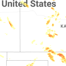


Connect with Interactive Hail Maps