

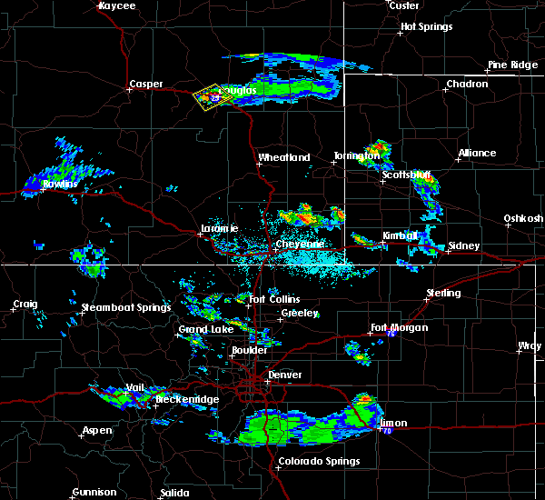
Hail Map for Douglas, WY
The Douglas, WY area has had 48 reports of on-the-ground hail by trained spotters, and has been under severe weather warnings 15 times during the past 12 months. Doppler radar has detected hail at or near Douglas, WY on 33 occasions, including 2 occasions during the past year.
| Name: | Douglas, WY |
| Where Located: | 48.5 miles E of Casper, WY |
| Map: | Google Map for Douglas, WY |
| Population: | 6120 |
| Housing Units: | 2788 |
| More Info: | Search Google for Douglas, WY |
3
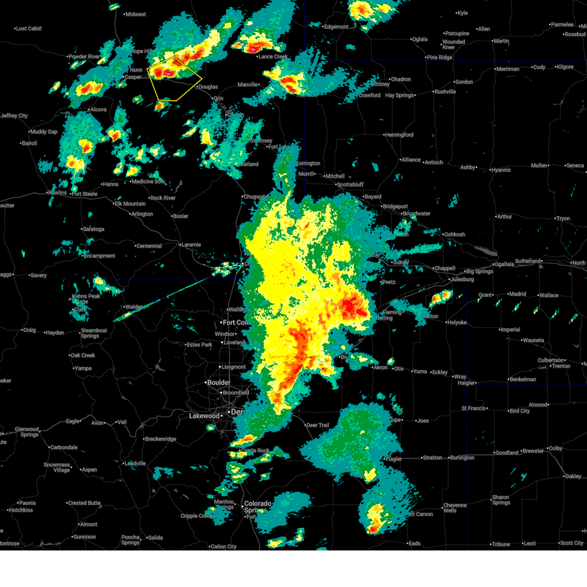
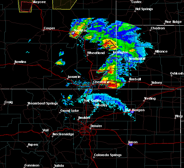
The Top Recent Hail Date for Douglas, WY is Monday, June 16, 2025 (2nd out of 33)
Hail and Wind Damage Spotted near Douglas, WY
| Date / Time | Report Details |
|---|---|
| 7/4/2025 7:24 PM MDT | Corrects previous tstm wnd gst report from 8 ne bill to add staion information. umrb station dcmw4 (bill 8ne in converse county WY, 38.8 miles SSW of Douglas, WY |
| 7/4/2025 6:35 PM MDT |
 Svrcys the national weather service in cheyenne has issued a * severe thunderstorm warning for, northern converse county in east central wyoming, * until 745 pm mdt. * at 634 pm mdt, severe thunderstorms were located along a line extending from 19 miles north of rolling hills to near boxelder, moving northeast at 30 mph (radar indicated). Hazards include 60 mph wind gusts. expect damage to roofs, siding, and trees Svrcys the national weather service in cheyenne has issued a * severe thunderstorm warning for, northern converse county in east central wyoming, * until 745 pm mdt. * at 634 pm mdt, severe thunderstorms were located along a line extending from 19 miles north of rolling hills to near boxelder, moving northeast at 30 mph (radar indicated). Hazards include 60 mph wind gusts. expect damage to roofs, siding, and trees
|
| 7/1/2025 3:16 PM MDT | Asos station kdgw douglas airport - dg in converse county WY, 3.2 miles S of Douglas, WY |
| 6/17/2025 4:27 PM MDT | The storm which prompted the warning has weakened below severe limits, and no longer poses an immediate threat to life or property. therefore, the warning will be allowed to expire. however, gusty winds are still possible with this thunderstorm. a severe thunderstorm watch remains in effect until 500 pm mdt for southeastern and east central wyoming. |
| 6/17/2025 4:09 PM MDT | At 408 pm mdt, a severe thunderstorm was located near douglas, moving east at 35 mph (radar indicated). Hazards include 60 mph wind gusts and quarter size hail. Hail damage to vehicles is expected. expect wind damage to roofs, siding, and trees. Locations impacted include, douglas, orin, and converse county airport. |
| 6/17/2025 3:43 PM MDT |
 Svrcys the national weather service in cheyenne has issued a * severe thunderstorm warning for, northwestern platte county in southeastern wyoming, southeastern converse county in east central wyoming, * until 430 pm mdt. * at 343 pm mdt, a severe thunderstorm was located near laprele reservoir, or 7 miles west of douglas, moving southeast at 25 mph (radar indicated). Hazards include ping pong ball size hail and 60 mph wind gusts. People and animals outdoors will be injured. expect hail damage to roofs, siding, windows, and vehicles. Expect wind damage to roofs, siding, and trees. Svrcys the national weather service in cheyenne has issued a * severe thunderstorm warning for, northwestern platte county in southeastern wyoming, southeastern converse county in east central wyoming, * until 430 pm mdt. * at 343 pm mdt, a severe thunderstorm was located near laprele reservoir, or 7 miles west of douglas, moving southeast at 25 mph (radar indicated). Hazards include ping pong ball size hail and 60 mph wind gusts. People and animals outdoors will be injured. expect hail damage to roofs, siding, windows, and vehicles. Expect wind damage to roofs, siding, and trees.
|
| 6/17/2025 3:38 PM MDT |
 At 338 pm mdt, a severe thunderstorm was located near laprele reservoir, or 10 miles west of douglas, moving southeast at 25 mph (radar indicated). Hazards include ping pong ball size hail and 60 mph wind gusts. People and animals outdoors will be injured. expect hail damage to roofs, siding, windows, and vehicles. expect wind damage to roofs, siding, and trees. Locations impacted include, laprele reservoir, deer creek, converse county airport, and fort fetterman historic site. At 338 pm mdt, a severe thunderstorm was located near laprele reservoir, or 10 miles west of douglas, moving southeast at 25 mph (radar indicated). Hazards include ping pong ball size hail and 60 mph wind gusts. People and animals outdoors will be injured. expect hail damage to roofs, siding, windows, and vehicles. expect wind damage to roofs, siding, and trees. Locations impacted include, laprele reservoir, deer creek, converse county airport, and fort fetterman historic site.
|
| 6/17/2025 3:17 PM MDT |
 At 317 pm mdt, a severe thunderstorm was located over deer creek, or 21 miles west of douglas, moving southeast at 15 mph (radar indicated). Hazards include ping pong ball size hail and 60 mph wind gusts. People and animals outdoors will be injured. expect hail damage to roofs, siding, windows, and vehicles. expect wind damage to roofs, siding, and trees. Locations impacted include, glenrock, rolling hills, laprele reservoir, deer creek, converse county airport, and fort fetterman historic site. At 317 pm mdt, a severe thunderstorm was located over deer creek, or 21 miles west of douglas, moving southeast at 15 mph (radar indicated). Hazards include ping pong ball size hail and 60 mph wind gusts. People and animals outdoors will be injured. expect hail damage to roofs, siding, windows, and vehicles. expect wind damage to roofs, siding, and trees. Locations impacted include, glenrock, rolling hills, laprele reservoir, deer creek, converse county airport, and fort fetterman historic site.
|
| 6/17/2025 3:06 PM MDT |
 Svrcys the national weather service in cheyenne has issued a * severe thunderstorm warning for, west central converse county in east central wyoming, * until 400 pm mdt. * at 306 pm mdt, a severe thunderstorm was located over glenrock, or 23 miles west of douglas, moving southeast at 20 mph (radar indicated). Hazards include ping pong ball size hail and 60 mph wind gusts. People and animals outdoors will be injured. expect hail damage to roofs, siding, windows, and vehicles. Expect wind damage to roofs, siding, and trees. Svrcys the national weather service in cheyenne has issued a * severe thunderstorm warning for, west central converse county in east central wyoming, * until 400 pm mdt. * at 306 pm mdt, a severe thunderstorm was located over glenrock, or 23 miles west of douglas, moving southeast at 20 mph (radar indicated). Hazards include ping pong ball size hail and 60 mph wind gusts. People and animals outdoors will be injured. expect hail damage to roofs, siding, windows, and vehicles. Expect wind damage to roofs, siding, and trees.
|
| 6/16/2025 10:29 PM MDT |
 At 1023 pm mdt, severe thunderstorms were located along a line extending from douglas to 11 miles west of orin to near curtis gulch campground, moving east at 25 mph (radar indicated). Hazards include 60 mph wind gusts and quarter size hail. Hail damage to vehicles is expected. expect wind damage to roofs, siding, and trees. Locations impacted include, douglas, orin, esterbrook campground, esterbrook, curtis gulch campground, harris park, and shawnee. At 1023 pm mdt, severe thunderstorms were located along a line extending from douglas to 11 miles west of orin to near curtis gulch campground, moving east at 25 mph (radar indicated). Hazards include 60 mph wind gusts and quarter size hail. Hail damage to vehicles is expected. expect wind damage to roofs, siding, and trees. Locations impacted include, douglas, orin, esterbrook campground, esterbrook, curtis gulch campground, harris park, and shawnee.
|
| 6/16/2025 9:57 PM MDT |
 Svrcys the national weather service in cheyenne has issued a * severe thunderstorm warning for, northeastern albany county in southeastern wyoming, northwestern platte county in southeastern wyoming, southern converse county in east central wyoming, * until 1100 pm mdt. * at 957 pm mdt, severe thunderstorms were located along a line extending from near laprele reservoir to 13 miles east of boxelder to near campbell creek campground, moving east at 35 mph (radar indicated). Hazards include 60 mph wind gusts and quarter size hail. Hail damage to vehicles is expected. Expect wind damage to roofs, siding, and trees. Svrcys the national weather service in cheyenne has issued a * severe thunderstorm warning for, northeastern albany county in southeastern wyoming, northwestern platte county in southeastern wyoming, southern converse county in east central wyoming, * until 1100 pm mdt. * at 957 pm mdt, severe thunderstorms were located along a line extending from near laprele reservoir to 13 miles east of boxelder to near campbell creek campground, moving east at 35 mph (radar indicated). Hazards include 60 mph wind gusts and quarter size hail. Hail damage to vehicles is expected. Expect wind damage to roofs, siding, and trees.
|
| 6/16/2025 5:49 PM MDT | the severe thunderstorm warning has been cancelled and is no longer in effect |
| 6/16/2025 5:30 PM MDT | Quarter sized hail reported 0.6 miles SE of Douglas, WY |
| 6/16/2025 5:23 PM MDT |
 At 523 pm mdt, a severe thunderstorm was located over converse county airport, or near douglas, moving northeast at 35 mph (radar indicated). Hazards include ping pong ball size hail and 60 mph wind gusts. People and animals outdoors will be injured. expect hail damage to roofs, siding, windows, and vehicles. expect wind damage to roofs, siding, and trees. Locations impacted include, douglas, converse county airport, and fort fetterman historic site. At 523 pm mdt, a severe thunderstorm was located over converse county airport, or near douglas, moving northeast at 35 mph (radar indicated). Hazards include ping pong ball size hail and 60 mph wind gusts. People and animals outdoors will be injured. expect hail damage to roofs, siding, windows, and vehicles. expect wind damage to roofs, siding, and trees. Locations impacted include, douglas, converse county airport, and fort fetterman historic site.
|
| 6/16/2025 5:15 PM MDT | Quarter sized hail reported 2.3 miles SE of Douglas, WY, consistently hailing to quarter size. |
| 6/16/2025 5:06 PM MDT |
 At 506 pm mdt, a severe thunderstorm was located near laprele reservoir, or near douglas, moving northeast at 25 mph (radar indicated). Hazards include two inch hail and 60 mph wind gusts. People and animals outdoors will be injured. expect hail damage to roofs, siding, windows, and vehicles. expect wind damage to roofs, siding, and trees. Locations impacted include, douglas, laprele reservoir, converse county airport, and fort fetterman historic site. At 506 pm mdt, a severe thunderstorm was located near laprele reservoir, or near douglas, moving northeast at 25 mph (radar indicated). Hazards include two inch hail and 60 mph wind gusts. People and animals outdoors will be injured. expect hail damage to roofs, siding, windows, and vehicles. expect wind damage to roofs, siding, and trees. Locations impacted include, douglas, laprele reservoir, converse county airport, and fort fetterman historic site.
|
| 6/16/2025 4:58 PM MDT |
 Svrcys the national weather service in cheyenne has issued a * severe thunderstorm warning for, central converse county in east central wyoming, * until 600 pm mdt. * at 458 pm mdt, a severe thunderstorm was located near laprele reservoir, or 10 miles southwest of douglas, moving northeast at 25 mph (radar indicated). Hazards include ping pong ball size hail and 60 mph wind gusts. People and animals outdoors will be injured. expect hail damage to roofs, siding, windows, and vehicles. Expect wind damage to roofs, siding, and trees. Svrcys the national weather service in cheyenne has issued a * severe thunderstorm warning for, central converse county in east central wyoming, * until 600 pm mdt. * at 458 pm mdt, a severe thunderstorm was located near laprele reservoir, or 10 miles southwest of douglas, moving northeast at 25 mph (radar indicated). Hazards include ping pong ball size hail and 60 mph wind gusts. People and animals outdoors will be injured. expect hail damage to roofs, siding, windows, and vehicles. Expect wind damage to roofs, siding, and trees.
|
| 7/27/2024 6:21 PM MDT |
 The storm which prompted the warning has moved out of the area. therefore, the warning will be allowed to expire. however, gusty winds and heavy rain are still possible with this thunderstorm. remember, a severe thunderstorm warning still remains in effect for far eastern converse county, northeast platte county, and muchof niobrara county until 645 pm. The storm which prompted the warning has moved out of the area. therefore, the warning will be allowed to expire. however, gusty winds and heavy rain are still possible with this thunderstorm. remember, a severe thunderstorm warning still remains in effect for far eastern converse county, northeast platte county, and muchof niobrara county until 645 pm.
|
| 7/27/2024 5:53 PM MDT | Asos station kdgw douglas airport - dg in converse county WY, 3.2 miles S of Douglas, WY |
| 7/27/2024 5:47 PM MDT |
 Svrcys the national weather service in cheyenne has issued a * severe thunderstorm warning for, west central niobrara county in east central wyoming, northwestern platte county in southeastern wyoming, central converse county in east central wyoming, * until 630 pm mdt. * at 546 pm mdt, a severe thunderstorm was located near douglas, moving northeast at 40 mph (public). Hazards include 60 mph wind gusts. expect damage to roofs, siding, and trees Svrcys the national weather service in cheyenne has issued a * severe thunderstorm warning for, west central niobrara county in east central wyoming, northwestern platte county in southeastern wyoming, central converse county in east central wyoming, * until 630 pm mdt. * at 546 pm mdt, a severe thunderstorm was located near douglas, moving northeast at 40 mph (public). Hazards include 60 mph wind gusts. expect damage to roofs, siding, and trees
|
| 7/27/2024 5:40 PM MDT | Mesonet station dw7426 dougla in converse county WY, 6 miles ENE of Douglas, WY |
| 7/1/2024 6:30 PM MDT | Quarter sized hail reported 44.6 miles SSE of Douglas, WY |
| 9/9/2023 9:25 PM MDT | Half Dollar sized hail reported 4.8 miles ENE of Douglas, WY, report from mping: half dollar (1.25 in.). |
| 9/9/2023 9:02 PM MDT |
 At 900 pm mdt, a severe thunderstorm was located near douglas, moving southeast at 35 mph. at 900 pm mdt, the public reported golfball to baseball size hail 1/2 mile southwest of douglas (radar indicated). Hazards include golf ball size hail and 60 mph wind gusts. People and animals outdoors will be injured. expect hail damage to roofs, siding, windows, and vehicles. expect wind damage to roofs, siding, and trees. this severe thunderstorm will remain over mainly rural areas of western niobrara, northwestern platte and southeastern converse counties, including the following locations, lost springs. this includes interstate 25 in wyoming between mile markers 112 and 144. thunderstorm damage threat, considerable hail threat, observed max hail size, 1. 75 in wind threat, radar indicated max wind gust, 60 mph. At 900 pm mdt, a severe thunderstorm was located near douglas, moving southeast at 35 mph. at 900 pm mdt, the public reported golfball to baseball size hail 1/2 mile southwest of douglas (radar indicated). Hazards include golf ball size hail and 60 mph wind gusts. People and animals outdoors will be injured. expect hail damage to roofs, siding, windows, and vehicles. expect wind damage to roofs, siding, and trees. this severe thunderstorm will remain over mainly rural areas of western niobrara, northwestern platte and southeastern converse counties, including the following locations, lost springs. this includes interstate 25 in wyoming between mile markers 112 and 144. thunderstorm damage threat, considerable hail threat, observed max hail size, 1. 75 in wind threat, radar indicated max wind gust, 60 mph.
|
| 9/9/2023 9:00 PM MDT | Golf Ball sized hail reported 1 miles ENE of Douglas, WY, golfball to baseball sized hail. |
| 9/9/2023 8:58 PM MDT | Ping Pong Ball sized hail reported 1.7 miles NNE of Douglas, WY, report from mping: ping pong ball (1.50 in.). |
| 9/9/2023 8:39 PM MDT |
 At 838 pm mdt, a severe thunderstorm was located 10 miles northwest of douglas, moving southeast at 35 mph (radar indicated). Hazards include 60 mph wind gusts and nickel size hail. Expect damage to roofs, siding, and trees. this severe thunderstorm will be near, douglas around 845 pm mdt. other locations impacted by this severe thunderstorm include lost springs. this includes interstate 25 in wyoming between mile markers 112 and 159. hail threat, radar indicated max hail size, 0. 88 in wind threat, radar indicated max wind gust, 60 mph. At 838 pm mdt, a severe thunderstorm was located 10 miles northwest of douglas, moving southeast at 35 mph (radar indicated). Hazards include 60 mph wind gusts and nickel size hail. Expect damage to roofs, siding, and trees. this severe thunderstorm will be near, douglas around 845 pm mdt. other locations impacted by this severe thunderstorm include lost springs. this includes interstate 25 in wyoming between mile markers 112 and 159. hail threat, radar indicated max hail size, 0. 88 in wind threat, radar indicated max wind gust, 60 mph.
|
| 7/26/2023 5:58 PM MDT |
 The severe thunderstorm warning for east central carbon, central albany and southwestern converse counties will expire at 600 pm mdt, the storms which prompted the warning have weakened below severe limits, and have exited the warned area. therefore, the warning will be allowed to expire. The severe thunderstorm warning for east central carbon, central albany and southwestern converse counties will expire at 600 pm mdt, the storms which prompted the warning have weakened below severe limits, and have exited the warned area. therefore, the warning will be allowed to expire.
|
| 7/26/2023 5:24 PM MDT |
 At 520 pm mdt, outflow wind gusts from severe thunderstorms were located along a line extending from 14 miles north of rolling hills to near boxelder to 6 miles southwest of garrett to 10 miles north of lake hattie reservoir, moving east at 25 mph (severe wind gusts reported east of casper and along i-80 west of laramie). Hazards include 60 mph wind gusts. expect damage to roofs, siding, and trees At 520 pm mdt, outflow wind gusts from severe thunderstorms were located along a line extending from 14 miles north of rolling hills to near boxelder to 6 miles southwest of garrett to 10 miles north of lake hattie reservoir, moving east at 25 mph (severe wind gusts reported east of casper and along i-80 west of laramie). Hazards include 60 mph wind gusts. expect damage to roofs, siding, and trees
|
| 7/8/2023 7:22 PM MDT | Half Dollar sized hail reported 14.3 miles WNW of Douglas, WY |
| 7/8/2023 6:39 PM MDT | Quarter sized hail reported 24.4 miles SW of Douglas, WY, social media report of quarter size hail that shredded trees/plants and broke a window. |
| 7/8/2023 5:55 PM MDT | Golf Ball sized hail reported 32.1 miles S of Douglas, WY |
| 7/6/2023 10:27 PM MDT |
 The severe thunderstorm warning for northwestern platte and east central converse counties will expire at 1030 pm mdt, the storm which prompted the warning has weakened below severe limits, and no longer poses an immediate threat to life or property. therefore, the warning will be allowed to expire. however gusty winds are still possible with this thunderstorm. a severe thunderstorm watch remains in effect until 300 am mdt for southeastern and east central wyoming. to report severe weather, contact your nearest law enforcement agency. they will relay your report to the national weather service cheyenne. The severe thunderstorm warning for northwestern platte and east central converse counties will expire at 1030 pm mdt, the storm which prompted the warning has weakened below severe limits, and no longer poses an immediate threat to life or property. therefore, the warning will be allowed to expire. however gusty winds are still possible with this thunderstorm. a severe thunderstorm watch remains in effect until 300 am mdt for southeastern and east central wyoming. to report severe weather, contact your nearest law enforcement agency. they will relay your report to the national weather service cheyenne.
|
| 7/6/2023 10:18 PM MDT |
 At 1017 pm mdt, a severe thunderstorm was located 8 miles east of douglas, moving east at 40 mph (radar indicated). Hazards include 60 mph wind gusts. Expect damage to roofs, siding, and trees. locations impacted include, douglas. this includes interstate 25 in wyoming between mile markers 120 and 141. hail threat, radar indicated max hail size, <. 75 in wind threat, radar indicated max wind gust, 60 mph. At 1017 pm mdt, a severe thunderstorm was located 8 miles east of douglas, moving east at 40 mph (radar indicated). Hazards include 60 mph wind gusts. Expect damage to roofs, siding, and trees. locations impacted include, douglas. this includes interstate 25 in wyoming between mile markers 120 and 141. hail threat, radar indicated max hail size, <. 75 in wind threat, radar indicated max wind gust, 60 mph.
|
| 7/6/2023 10:13 PM MDT | Asos station kdgw douglas airport - dg in converse county WY, 3.2 miles S of Douglas, WY |
| 7/6/2023 9:59 PM MDT |
 At 959 pm mdt, a severe thunderstorm was located near douglas, moving southeast at 30 mph (radar indicated). Hazards include 70 mph wind gusts and quarter size hail. Hail damage to vehicles is expected. expect considerable tree damage. wind damage is also likely to mobile homes, roofs, and outbuildings. locations impacted include, douglas. This includes interstate 25 in wyoming between mile markers 120 and 150. At 959 pm mdt, a severe thunderstorm was located near douglas, moving southeast at 30 mph (radar indicated). Hazards include 70 mph wind gusts and quarter size hail. Hail damage to vehicles is expected. expect considerable tree damage. wind damage is also likely to mobile homes, roofs, and outbuildings. locations impacted include, douglas. This includes interstate 25 in wyoming between mile markers 120 and 150.
|
| 7/6/2023 9:46 PM MDT |
 At 946 pm mdt, a severe thunderstorm was located 9 miles east of deer creek, or 11 miles northwest of douglas, moving southeast at 30 mph (radar indicated). Hazards include 70 mph wind gusts and quarter size hail. Hail damage to vehicles is expected. expect considerable tree damage. Wind damage is also likely to mobile homes, roofs, and outbuildings. At 946 pm mdt, a severe thunderstorm was located 9 miles east of deer creek, or 11 miles northwest of douglas, moving southeast at 30 mph (radar indicated). Hazards include 70 mph wind gusts and quarter size hail. Hail damage to vehicles is expected. expect considerable tree damage. Wind damage is also likely to mobile homes, roofs, and outbuildings.
|
| 7/3/2023 8:10 PM MDT | Spotter estimated 50 to 60 mph wind gus in converse county WY, 32.1 miles S of Douglas, WY |
| 7/3/2023 7:43 PM MDT |
 At 742 pm mdt, severe thunderstorms were located along a line extending from 19 miles south of pine tree junction to near bill to 6 miles south of manning ranch to 7 miles southwest of keeline, moving northeast at 45 mph (radar indicated). Hazards include 70 mph wind gusts. Expect considerable tree damage. Damage is likely to mobile homes, roofs, and outbuildings. At 742 pm mdt, severe thunderstorms were located along a line extending from 19 miles south of pine tree junction to near bill to 6 miles south of manning ranch to 7 miles southwest of keeline, moving northeast at 45 mph (radar indicated). Hazards include 70 mph wind gusts. Expect considerable tree damage. Damage is likely to mobile homes, roofs, and outbuildings.
|
| 7/3/2023 7:37 PM MDT |
 At 737 pm mdt, severe thunderstorms were located along a line extending from 20 miles east of teapot rock to 17 miles northeast of rolling hills to 8 miles east of douglas, moving northeast at 30 mph. these are destructive storms for central and eastern converse county including douglas and bill! (trained weather spotters. these storms have a history of producing widespread wind gusts of 60 to 80 mph!). Hazards include 80 mph wind gusts and quarter size hail. Flying debris will be dangerous to those caught without shelter. mobile homes will be heavily damaged. expect considerable damage to roofs, windows, and vehicles. extensive tree damage and power outages are likely. locations impacted include, douglas, glenrock, rolling hills, rolling hills estates, laprele reservoir, deer creek, boxelder, bill, dull center and manning ranch. this includes interstate 25 in wyoming between mile markers 133 and 175. thunderstorm damage threat, destructive hail threat, radar indicated max hail size, 1. 00 in wind threat, radar indicated max wind gust, 80 mph. At 737 pm mdt, severe thunderstorms were located along a line extending from 20 miles east of teapot rock to 17 miles northeast of rolling hills to 8 miles east of douglas, moving northeast at 30 mph. these are destructive storms for central and eastern converse county including douglas and bill! (trained weather spotters. these storms have a history of producing widespread wind gusts of 60 to 80 mph!). Hazards include 80 mph wind gusts and quarter size hail. Flying debris will be dangerous to those caught without shelter. mobile homes will be heavily damaged. expect considerable damage to roofs, windows, and vehicles. extensive tree damage and power outages are likely. locations impacted include, douglas, glenrock, rolling hills, rolling hills estates, laprele reservoir, deer creek, boxelder, bill, dull center and manning ranch. this includes interstate 25 in wyoming between mile markers 133 and 175. thunderstorm damage threat, destructive hail threat, radar indicated max hail size, 1. 00 in wind threat, radar indicated max wind gust, 80 mph.
|
| 7/3/2023 7:32 PM MDT | Asos station kdgw douglas airport - dg in converse county WY, 3.2 miles S of Douglas, WY |
| 7/3/2023 7:19 PM MDT |
 At 717 pm mdt, severe thunderstorms were located along a line extending from 9 miles east of teapot rock to 8 miles northeast of rolling hills to near douglas, moving northeast at 30 mph. these are destructive storms for converse county including douglas, glenrock, deer creek, and bill! (trained weather spotters. wind gusts to 82 mph have been confirmed by automated weather observations along interstate 25 near deer creek!). Hazards include 80 mph wind gusts and quarter size hail. Flying debris will be dangerous to those caught without shelter. mobile homes will be heavily damaged. expect considerable damage to roofs, windows, and vehicles. extensive tree damage and power outages are likely. locations impacted include, douglas, glenrock, rolling hills, rolling hills estates, laprele reservoir, deer creek, boxelder, bill, dull center and manning ranch. this includes interstate 25 in wyoming between mile markers 133 and 175. thunderstorm damage threat, destructive hail threat, radar indicated max hail size, 1. 00 in wind threat, radar indicated max wind gust, 80 mph. At 717 pm mdt, severe thunderstorms were located along a line extending from 9 miles east of teapot rock to 8 miles northeast of rolling hills to near douglas, moving northeast at 30 mph. these are destructive storms for converse county including douglas, glenrock, deer creek, and bill! (trained weather spotters. wind gusts to 82 mph have been confirmed by automated weather observations along interstate 25 near deer creek!). Hazards include 80 mph wind gusts and quarter size hail. Flying debris will be dangerous to those caught without shelter. mobile homes will be heavily damaged. expect considerable damage to roofs, windows, and vehicles. extensive tree damage and power outages are likely. locations impacted include, douglas, glenrock, rolling hills, rolling hills estates, laprele reservoir, deer creek, boxelder, bill, dull center and manning ranch. this includes interstate 25 in wyoming between mile markers 133 and 175. thunderstorm damage threat, destructive hail threat, radar indicated max hail size, 1. 00 in wind threat, radar indicated max wind gust, 80 mph.
|
| 7/3/2023 7:15 PM MDT | Mesonet station ew6313 dougla in converse county WY, 5.9 miles N of Douglas, WY |
| 7/3/2023 7:04 PM MDT |
 At 702 pm mdt, severe thunderstorms were located along a line extending from 15 miles northwest of teapot rock to 13 miles east of antelope hills to 7 miles south of laprele reservoir, moving northeast at 50 mph. these are destructive storms for converse county including douglas, glenrock, and bill! (trained weather spotters. wind gusts in excess of 80 mph have been confirmed by highway observations along the converse and natrona county line!). Hazards include 80 mph wind gusts and quarter size hail. Flying debris will be dangerous to those caught without shelter. mobile homes will be heavily damaged. expect considerable damage to roofs, windows, and vehicles. Extensive tree damage and power outages are likely. At 702 pm mdt, severe thunderstorms were located along a line extending from 15 miles northwest of teapot rock to 13 miles east of antelope hills to 7 miles south of laprele reservoir, moving northeast at 50 mph. these are destructive storms for converse county including douglas, glenrock, and bill! (trained weather spotters. wind gusts in excess of 80 mph have been confirmed by highway observations along the converse and natrona county line!). Hazards include 80 mph wind gusts and quarter size hail. Flying debris will be dangerous to those caught without shelter. mobile homes will be heavily damaged. expect considerable damage to roofs, windows, and vehicles. Extensive tree damage and power outages are likely.
|
| 7/3/2023 6:34 PM MDT |
 At 633 pm mdt, severe thunderstorms were located along a line extending from red wall to 8 miles northwest of antelope hills to near campbell creek campground, moving east at 50 mph (trained weather spotters. these storms have a history of producing widespread wind gusts in excess of 70 mph!). Hazards include 70 mph wind gusts and half dollar size hail. Hail damage to vehicles is expected. expect considerable tree damage. Wind damage is also likely to mobile homes, roofs, and outbuildings. At 633 pm mdt, severe thunderstorms were located along a line extending from red wall to 8 miles northwest of antelope hills to near campbell creek campground, moving east at 50 mph (trained weather spotters. these storms have a history of producing widespread wind gusts in excess of 70 mph!). Hazards include 70 mph wind gusts and half dollar size hail. Hail damage to vehicles is expected. expect considerable tree damage. Wind damage is also likely to mobile homes, roofs, and outbuildings.
|
| 6/29/2023 1:19 PM MDT | Quarter sized hail reported 18.8 miles NE of Douglas, WY, video from social media shows hailstones ranging from dimes to quarters. |
| 6/26/2023 9:30 PM MDT | Tennis Ball sized hail reported 23.1 miles SSW of Douglas, WY, facebook message with pictures of large hail. 2 to 2.5 inches... with a few bigger stones. |
| 6/20/2023 8:27 PM MDT | Half Dollar sized hail reported 41.6 miles S of Douglas, WY |
| 5/30/2023 5:53 PM MDT | Asos station kdgw douglas airport - dg in converse county WY, 3.2 miles S of Douglas, WY |
| 5/27/2023 3:15 PM MDT |
 At 315 pm mdt, severe thunderstorms were located along a line extending from 14 miles southwest of bill to 7 miles east of douglas, moving northeast at 25 mph (radar indicated). Hazards include 60 mph wind gusts and quarter size hail. Hail damage to vehicles is expected. Expect wind damage to roofs, siding, and trees. At 315 pm mdt, severe thunderstorms were located along a line extending from 14 miles southwest of bill to 7 miles east of douglas, moving northeast at 25 mph (radar indicated). Hazards include 60 mph wind gusts and quarter size hail. Hail damage to vehicles is expected. Expect wind damage to roofs, siding, and trees.
|
| 5/27/2023 3:02 PM MDT |
 At 302 pm mdt, severe thunderstorms were located along a line extending from 16 miles southwest of bill to 7 miles east of douglas to near harris park, moving northeast at 25 mph (radar indicated). Hazards include 60 mph wind gusts and quarter size hail. Hail damage to vehicles is expected. expect wind damage to roofs, siding, and trees. locations impacted include, douglas, glendo, esterbrook campground, esterbrook, sibley peak, glendo reservoir, two moon campground, laramie peak and harris park. This includes interstate 25 in wyoming between mile markers 97 and 150. At 302 pm mdt, severe thunderstorms were located along a line extending from 16 miles southwest of bill to 7 miles east of douglas to near harris park, moving northeast at 25 mph (radar indicated). Hazards include 60 mph wind gusts and quarter size hail. Hail damage to vehicles is expected. expect wind damage to roofs, siding, and trees. locations impacted include, douglas, glendo, esterbrook campground, esterbrook, sibley peak, glendo reservoir, two moon campground, laramie peak and harris park. This includes interstate 25 in wyoming between mile markers 97 and 150.
|
| 5/27/2023 2:58 PM MDT |
 The tornado warning for central converse county will expire at 300 pm mdt, the storm which prompted the warning has weakened, and no longer appears capable of producing a tornado. therefore, the warning will be allowed to expire. however large hail is still possible with this thunderstorm. a severe thunderstorm watch remains in effect until 900 pm mdt for east central wyoming. to report severe weather, contact your nearest law enforcement agency. they will relay your report to the national weather service cheyenne. remember, a severe thunderstorm warning still remains in effect for much of central converse county until 315 pm mdt. The tornado warning for central converse county will expire at 300 pm mdt, the storm which prompted the warning has weakened, and no longer appears capable of producing a tornado. therefore, the warning will be allowed to expire. however large hail is still possible with this thunderstorm. a severe thunderstorm watch remains in effect until 900 pm mdt for east central wyoming. to report severe weather, contact your nearest law enforcement agency. they will relay your report to the national weather service cheyenne. remember, a severe thunderstorm warning still remains in effect for much of central converse county until 315 pm mdt.
|
| 5/27/2023 2:50 PM MDT | Quarter sized hail reported 0.6 miles SE of Douglas, WY, facebook post. north 4th st in douglas. |
| 5/27/2023 2:43 PM MDT |
 At 242 pm mdt, a severe thunderstorm capable of producing a tornado was located near douglas, moving northeast at 10 mph (radar indicated rotation). Hazards include tornado and two inch hail. Flying debris will be dangerous to those caught without shelter. mobile homes will be damaged or destroyed. damage to roofs, windows, and vehicles will occur. tree damage is likely. locations impacted include, douglas. This includes interstate 25 in wyoming between mile markers 127 and 149. At 242 pm mdt, a severe thunderstorm capable of producing a tornado was located near douglas, moving northeast at 10 mph (radar indicated rotation). Hazards include tornado and two inch hail. Flying debris will be dangerous to those caught without shelter. mobile homes will be damaged or destroyed. damage to roofs, windows, and vehicles will occur. tree damage is likely. locations impacted include, douglas. This includes interstate 25 in wyoming between mile markers 127 and 149.
|
| 5/27/2023 2:28 PM MDT |
 At 227 pm mdt, a severe thunderstorm capable of producing a tornado was located near laprele reservoir, or 7 miles southwest of douglas, moving northeast at 10 mph (weather spotters reported funnel cloud). Hazards include tornado and quarter size hail. Flying debris will be dangerous to those caught without shelter. mobile homes will be damaged or destroyed. damage to roofs, windows, and vehicles will occur. Tree damage is likely. At 227 pm mdt, a severe thunderstorm capable of producing a tornado was located near laprele reservoir, or 7 miles southwest of douglas, moving northeast at 10 mph (weather spotters reported funnel cloud). Hazards include tornado and quarter size hail. Flying debris will be dangerous to those caught without shelter. mobile homes will be damaged or destroyed. damage to roofs, windows, and vehicles will occur. Tree damage is likely.
|
| 5/27/2023 2:16 PM MDT |
 At 215 pm mdt, severe thunderstorms were located along a line extending from near rolling hills to near harris park, moving northeast at 20 mph (radar indicated). Hazards include 60 mph wind gusts and quarter size hail. Hail damage to vehicles is expected. Expect wind damage to roofs, siding, and trees. At 215 pm mdt, severe thunderstorms were located along a line extending from near rolling hills to near harris park, moving northeast at 20 mph (radar indicated). Hazards include 60 mph wind gusts and quarter size hail. Hail damage to vehicles is expected. Expect wind damage to roofs, siding, and trees.
|
| 4/27/2023 2:57 PM MDT |
 The severe thunderstorm warning for north central albany and southwestern converse counties will expire at 300 pm mdt, the storms which prompted the warning have weakened below severe limits, and no longer pose an immediate threat to life or property. therefore, the warning will be allowed to expire. however gusty winds are still possible with these thunderstorms. The severe thunderstorm warning for north central albany and southwestern converse counties will expire at 300 pm mdt, the storms which prompted the warning have weakened below severe limits, and no longer pose an immediate threat to life or property. therefore, the warning will be allowed to expire. however gusty winds are still possible with these thunderstorms.
|
| 4/27/2023 2:31 PM MDT |
 At 230 pm mdt, severe thunderstorms were located along a line extending from near glenrock to 8 miles west of boxelder, moving southeast at 60 mph (radar indicated). Hazards include 60 mph wind gusts. expect damage to roofs, siding, and trees At 230 pm mdt, severe thunderstorms were located along a line extending from near glenrock to 8 miles west of boxelder, moving southeast at 60 mph (radar indicated). Hazards include 60 mph wind gusts. expect damage to roofs, siding, and trees
|
| 8/25/2022 5:50 PM MDT | Golf Ball sized hail reported 21.3 miles SSW of Douglas, WY, social media post shows video of ping pong to golf ball size hail with accumulation along state highway 39. traffic was at a stand still. |
| 8/6/2021 3:29 PM MDT |
 At 328 pm mdt, severe thunderstorms were located along a line extending from 12 miles west of bill to 6 miles east of esterbrook campground, moving northeast at 45 mph (radar indicated). Hazards include 70 mph wind gusts and penny size hail. Expect considerable tree damage. damage is likely to mobile homes, roofs, and outbuildings. severe thunderstorms will be near, glendo reservoir and two moon campground around 345 pm mdt. dull center around 405 pm mdt. keeline around 410 pm mdt. manville around 420 pm mdt. other locations impacted by these severe thunderstorms include lost springs. this includes interstate 25 in wyoming between mile markers 104 and 143. thunderstorm damage threat, considerable hail threat, radar indicated max hail size, 0. 75 in wind threat, radar indicated max wind gust, 70 mph. At 328 pm mdt, severe thunderstorms were located along a line extending from 12 miles west of bill to 6 miles east of esterbrook campground, moving northeast at 45 mph (radar indicated). Hazards include 70 mph wind gusts and penny size hail. Expect considerable tree damage. damage is likely to mobile homes, roofs, and outbuildings. severe thunderstorms will be near, glendo reservoir and two moon campground around 345 pm mdt. dull center around 405 pm mdt. keeline around 410 pm mdt. manville around 420 pm mdt. other locations impacted by these severe thunderstorms include lost springs. this includes interstate 25 in wyoming between mile markers 104 and 143. thunderstorm damage threat, considerable hail threat, radar indicated max hail size, 0. 75 in wind threat, radar indicated max wind gust, 70 mph.
|
| 5/1/2021 5:46 PM MDT | Asos station kdgw douglas airport - dgw. another reported gust of 63 at 553 pm md in converse county WY, 3.2 miles S of Douglas, WY |
| 7/19/2020 6:46 PM MDT | Golf Ball sized hail reported 49.7 miles SSW of Douglas, WY, lasted less than 5 minutes.... |
| 7/5/2020 4:43 PM MDT |
 At 443 pm mdt, severe thunderstorms were located along a line extending from 10 miles east of antelope hills to near laprele reservoir, moving northeast at 40 mph (radar indicated). Hazards include 60 mph wind gusts and quarter size hail. Hail damage to vehicles is expected. Expect wind damage to roofs, siding, and trees. At 443 pm mdt, severe thunderstorms were located along a line extending from 10 miles east of antelope hills to near laprele reservoir, moving northeast at 40 mph (radar indicated). Hazards include 60 mph wind gusts and quarter size hail. Hail damage to vehicles is expected. Expect wind damage to roofs, siding, and trees.
|
| 6/25/2020 3:46 PM MDT | Dgw airport wind gust of 50 knot in converse county WY, 2.5 miles S of Douglas, WY |
| 6/6/2020 4:52 PM MDT | Mesonet station estw4 23 s douglas - esterbrook raws - eb in converse county WY, 23.1 miles N of Douglas, WY |
| 6/6/2020 4:42 PM MDT |
 The severe thunderstorm warning for northeastern albany, platte and southern converse counties will expire at 445 pm mdt, the storms which prompted the warning have moved out of the area. therefore, the warning will be allowed to expire. however gusty winds are still possible with these thunderstorms. a severe thunderstorm watch remains in effect until 800 pm mdt for south central, southeastern and east central wyoming. The severe thunderstorm warning for northeastern albany, platte and southern converse counties will expire at 445 pm mdt, the storms which prompted the warning have moved out of the area. therefore, the warning will be allowed to expire. however gusty winds are still possible with these thunderstorms. a severe thunderstorm watch remains in effect until 800 pm mdt for south central, southeastern and east central wyoming.
|
| 6/6/2020 4:35 PM MDT | Corrects previous tstm wnd gst report from 3 nne douglas. kdg in converse county WY, 2.5 miles S of Douglas, WY |
| 6/6/2020 4:33 PM MDT |
 At 429 pm mdt, an area of strong winds located along a line of storms extending from 16 miles north of douglas to lakeview north, moving northeast at 60 mph (douglas wyoming automated weather station reported at gust of 71 mph at 429 pm). Hazards include 60 mph wind gusts. Expect damage to roofs, siding, and trees. locations impacted include, douglas, wheatland, glenrock, glendo, esterbrook, chugcreek, lakeview north, sibley peak, bordeaux, westview circle, y-o ranch, friend park campground, curtis gulch campground, laramie peak, esterbrook campground, laprele reservoir, windy peak, deer creek, boxelder and garrett. This includes interstate 25 in wyoming between mile markers 70 and 166. At 429 pm mdt, an area of strong winds located along a line of storms extending from 16 miles north of douglas to lakeview north, moving northeast at 60 mph (douglas wyoming automated weather station reported at gust of 71 mph at 429 pm). Hazards include 60 mph wind gusts. Expect damage to roofs, siding, and trees. locations impacted include, douglas, wheatland, glenrock, glendo, esterbrook, chugcreek, lakeview north, sibley peak, bordeaux, westview circle, y-o ranch, friend park campground, curtis gulch campground, laramie peak, esterbrook campground, laprele reservoir, windy peak, deer creek, boxelder and garrett. This includes interstate 25 in wyoming between mile markers 70 and 166.
|
| 6/6/2020 4:12 PM MDT |
 At 410 pm mdt, severe thunderstorms were located along a line extending from near laprele reservoir to 9 miles southeast of garrett, moving northeast at 65 mph. at 406 pm mdt, deer creek wydot sensor along interstate 25 reported 60 mph wind gust (wydot road sensor). Hazards include 70 mph wind gusts. Expect considerable tree damage. damage is likely to mobile homes, roofs, and outbuildings. locations impacted include, douglas, wheatland, glenrock, glendo, esterbrook, chugcreek, lakeview north, sibley peak, bordeaux, westview circle, y-o ranch, friend park campground, curtis gulch campground, laramie peak, esterbrook campground, laprele reservoir, windy peak, deer creek, boxelder and garrett. This includes interstate 25 in wyoming between mile markers 70 and 166. At 410 pm mdt, severe thunderstorms were located along a line extending from near laprele reservoir to 9 miles southeast of garrett, moving northeast at 65 mph. at 406 pm mdt, deer creek wydot sensor along interstate 25 reported 60 mph wind gust (wydot road sensor). Hazards include 70 mph wind gusts. Expect considerable tree damage. damage is likely to mobile homes, roofs, and outbuildings. locations impacted include, douglas, wheatland, glenrock, glendo, esterbrook, chugcreek, lakeview north, sibley peak, bordeaux, westview circle, y-o ranch, friend park campground, curtis gulch campground, laramie peak, esterbrook campground, laprele reservoir, windy peak, deer creek, boxelder and garrett. This includes interstate 25 in wyoming between mile markers 70 and 166.
|
| 6/6/2020 3:40 PM MDT |
 At 339 pm mdt, severe thunderstorms were located along a line extending from near little medicine school to 9 miles east of rock river, moving northeast at 65 mph (radar indicated). Hazards include 70 mph wind gusts. Expect considerable tree damage. Damage is likely to mobile homes, roofs, and outbuildings. At 339 pm mdt, severe thunderstorms were located along a line extending from near little medicine school to 9 miles east of rock river, moving northeast at 65 mph (radar indicated). Hazards include 70 mph wind gusts. Expect considerable tree damage. Damage is likely to mobile homes, roofs, and outbuildings.
|
| 5/29/2020 7:53 PM MDT |
 At 753 pm mdt, a severe thunderstorm was located over douglas, moving southeast at 25 mph (radar indicated). Hazards include 60 mph wind gusts and quarter size hail. Hail damage to vehicles is expected. expect wind damage to roofs, siding, and trees. this severe thunderstorm will remain over mainly rural areas of central converse county. This includes interstate 25 in wyoming between mile markers 134 and 152. At 753 pm mdt, a severe thunderstorm was located over douglas, moving southeast at 25 mph (radar indicated). Hazards include 60 mph wind gusts and quarter size hail. Hail damage to vehicles is expected. expect wind damage to roofs, siding, and trees. this severe thunderstorm will remain over mainly rural areas of central converse county. This includes interstate 25 in wyoming between mile markers 134 and 152.
|
| 5/29/2020 7:35 PM MDT |
 At 734 pm mdt, a severe thunderstorm was located 8 miles northwest of douglas, moving southeast at 25 mph (radar indicated). Hazards include 60 mph wind gusts and quarter size hail. Hail damage to vehicles is expected. expect wind damage to roofs, siding, and trees. this severe thunderstorm will be near, douglas around 800 pm mdt. This includes interstate 25 in wyoming between mile markers 134 and 153. At 734 pm mdt, a severe thunderstorm was located 8 miles northwest of douglas, moving southeast at 25 mph (radar indicated). Hazards include 60 mph wind gusts and quarter size hail. Hail damage to vehicles is expected. expect wind damage to roofs, siding, and trees. this severe thunderstorm will be near, douglas around 800 pm mdt. This includes interstate 25 in wyoming between mile markers 134 and 153.
|
| 5/20/2020 3:57 PM MDT | Half Dollar sized hail reported 0.6 miles SE of Douglas, WY, via twitter. |
| 5/20/2020 3:41 PM MDT | Quarter sized hail reported 16.3 miles SSE of Douglas, WY, reported at converse co... wy mping report. |
| 5/20/2020 3:40 PM MDT |
 The severe thunderstorm warning for east central converse county will expire at 345 pm mdt, the storm which prompted the warning has weakened below severe limits, and no longer poses an immediate threat to life or property. therefore, the warning will be allowed to expire. however small hail and gusty winds are still possible with this thunderstorm. a severe thunderstorm watch remains in effect until 1000 pm mdt for east central wyoming. The severe thunderstorm warning for east central converse county will expire at 345 pm mdt, the storm which prompted the warning has weakened below severe limits, and no longer poses an immediate threat to life or property. therefore, the warning will be allowed to expire. however small hail and gusty winds are still possible with this thunderstorm. a severe thunderstorm watch remains in effect until 1000 pm mdt for east central wyoming.
|
| 5/20/2020 3:32 PM MDT |
 At 332 pm mdt, a severe thunderstorm was located near douglas, moving northeast at 25 mph (radar indicated). Hazards include 60 mph wind gusts and quarter size hail. Hail damage to vehicles is expected. expect wind damage to roofs, siding, and trees. locations impacted include, douglas. This includes interstate 25 in wyoming between mile markers 127 and 144. At 332 pm mdt, a severe thunderstorm was located near douglas, moving northeast at 25 mph (radar indicated). Hazards include 60 mph wind gusts and quarter size hail. Hail damage to vehicles is expected. expect wind damage to roofs, siding, and trees. locations impacted include, douglas. This includes interstate 25 in wyoming between mile markers 127 and 144.
|
| 5/20/2020 3:22 PM MDT | Hen Egg sized hail reported 0.7 miles WNW of Douglas, WY, report from mping: hen egg (2.00 in.). |
| 5/20/2020 3:21 PM MDT |
 At 319 pm mdt, a severe thunderstorm was located over douglas, moving north at 30 mph. this is a new severe thunderstorm (trained weather spotters). Hazards include golf ball size hail and 60 mph wind gusts. People and animals outdoors will be injured. expect hail damage to roofs, siding, windows, and vehicles. expect wind damage to roofs, siding, and trees. locations impacted include, douglas. This includes interstate 25 in wyoming between mile markers 127 and 146. At 319 pm mdt, a severe thunderstorm was located over douglas, moving north at 30 mph. this is a new severe thunderstorm (trained weather spotters). Hazards include golf ball size hail and 60 mph wind gusts. People and animals outdoors will be injured. expect hail damage to roofs, siding, windows, and vehicles. expect wind damage to roofs, siding, and trees. locations impacted include, douglas. This includes interstate 25 in wyoming between mile markers 127 and 146.
|
| 5/20/2020 3:06 PM MDT |
 At 305 pm mdt, a severe thunderstorm was located over douglas, moving north at 35 mph (trained weather spotters. golf ball sized hail was reported in douglas with this storm). Hazards include golf ball size hail and 60 mph wind gusts. People and animals outdoors will be injured. expect hail damage to roofs, siding, windows, and vehicles. expect wind damage to roofs, siding, and trees. locations impacted include, douglas. This includes interstate 25 in wyoming between mile markers 127 and 146. At 305 pm mdt, a severe thunderstorm was located over douglas, moving north at 35 mph (trained weather spotters. golf ball sized hail was reported in douglas with this storm). Hazards include golf ball size hail and 60 mph wind gusts. People and animals outdoors will be injured. expect hail damage to roofs, siding, windows, and vehicles. expect wind damage to roofs, siding, and trees. locations impacted include, douglas. This includes interstate 25 in wyoming between mile markers 127 and 146.
|
| 5/20/2020 3:05 PM MDT | Golf Ball sized hail reported 0.6 miles SE of Douglas, WY |
| 5/20/2020 3:05 PM MDT | Quarter sized hail reported 1 miles ENE of Douglas, WY, report from mping: dime (0.75 in.). |
| 5/20/2020 2:53 PM MDT |
 At 253 pm mdt, a severe thunderstorm was located over douglas, moving north at 35 mph (radar indicated). Hazards include 60 mph wind gusts and quarter size hail. Hail damage to vehicles is expected. Expect wind damage to roofs, siding, and trees. At 253 pm mdt, a severe thunderstorm was located over douglas, moving north at 35 mph (radar indicated). Hazards include 60 mph wind gusts and quarter size hail. Hail damage to vehicles is expected. Expect wind damage to roofs, siding, and trees.
|
| 9/6/2019 5:52 PM MDT | Trained spotter 24 nw douglas reported shed roof was torn off and 20 ft long stock panels weighting 250 lbs were knocked over. wind estimated at 80 mph lasting for 10 s in converse county WY, 24.7 miles SSE of Douglas, WY |
| 8/20/2019 6:06 PM MDT |
 The severe thunderstorm warning for east central converse county will expire at 615 pm mdt, the storm which prompted the warning has weakened below severe limits, and no longer poses an immediate threat to life or property. therefore, the warning will be allowed to expire. The severe thunderstorm warning for east central converse county will expire at 615 pm mdt, the storm which prompted the warning has weakened below severe limits, and no longer poses an immediate threat to life or property. therefore, the warning will be allowed to expire.
|
| 8/20/2019 5:47 PM MDT | Quarter sized hail reported 0.6 miles SE of Douglas, WY |
| 8/20/2019 5:47 PM MDT |
 At 546 pm mdt, a severe thunderstorm was located near douglas, moving east at 10 mph (radar indicated). Hazards include half dollar size hail. damage to vehicles is expected At 546 pm mdt, a severe thunderstorm was located near douglas, moving east at 10 mph (radar indicated). Hazards include half dollar size hail. damage to vehicles is expected
|
| 8/20/2019 5:22 PM MDT | Quarter sized hail reported 1.7 miles NNE of Douglas, WY, report from mping: quarter (1.00 in.). |
| 8/15/2019 9:50 PM MDT |
 At 949 pm mdt, a severe thunderstorm was located 8 miles north of douglas, moving southeast at 35 mph (radar indicated). Hazards include ping pong ball size hail and 60 mph wind gusts. People and animals outdoors will be injured. expect hail damage to roofs, siding, windows, and vehicles. expect wind damage to roofs, siding, and trees. locations impacted include, douglas and manning ranch. This includes interstate 25 in wyoming between mile markers 122 and 145. At 949 pm mdt, a severe thunderstorm was located 8 miles north of douglas, moving southeast at 35 mph (radar indicated). Hazards include ping pong ball size hail and 60 mph wind gusts. People and animals outdoors will be injured. expect hail damage to roofs, siding, windows, and vehicles. expect wind damage to roofs, siding, and trees. locations impacted include, douglas and manning ranch. This includes interstate 25 in wyoming between mile markers 122 and 145.
|
| 8/15/2019 9:29 PM MDT |
 At 928 pm mdt, a severe thunderstorm was located 10 miles northeast of rolling hills, or 20 miles northwest of douglas, moving southeast at 30 mph (radar indicated). Hazards include ping pong ball size hail and 60 mph wind gusts. People and animals outdoors will be injured. expect hail damage to roofs, siding, windows, and vehicles. Expect wind damage to roofs, siding, and trees. At 928 pm mdt, a severe thunderstorm was located 10 miles northeast of rolling hills, or 20 miles northwest of douglas, moving southeast at 30 mph (radar indicated). Hazards include ping pong ball size hail and 60 mph wind gusts. People and animals outdoors will be injured. expect hail damage to roofs, siding, windows, and vehicles. Expect wind damage to roofs, siding, and trees.
|
| 8/11/2019 2:23 PM MDT |
 At 223 pm mdt, a severe thunderstorm was located near deer creek, or 23 miles west of douglas, moving east at 40 mph (radar indicated). Hazards include 60 mph wind gusts and quarter size hail. Hail damage to vehicles is expected. Expect wind damage to roofs, siding, and trees. At 223 pm mdt, a severe thunderstorm was located near deer creek, or 23 miles west of douglas, moving east at 40 mph (radar indicated). Hazards include 60 mph wind gusts and quarter size hail. Hail damage to vehicles is expected. Expect wind damage to roofs, siding, and trees.
|
| 8/5/2019 7:55 PM MDT | Caller reported a riding lawn mover had been blown over and damaged by strong wind gust in converse county WY, 26.5 miles N of Douglas, WY |
| 8/4/2019 8:33 PM MDT |
 At 832 pm mdt, a severe thunderstorm was located 8 miles northeast of douglas, moving southeast at 20 mph. at 8:28pm automated weather sensors reported a wind gust to 63 mph at the converse county airport. dangerous damaging winds will be possible with this storm (radar indicated). Hazards include 60 mph wind gusts and quarter size hail. Hail damage to vehicles is expected. expect wind damage to roofs, siding, and trees. locations impacted include, douglas and lost springs. This includes interstate 25 in wyoming between mile markers 121 and 137. At 832 pm mdt, a severe thunderstorm was located 8 miles northeast of douglas, moving southeast at 20 mph. at 8:28pm automated weather sensors reported a wind gust to 63 mph at the converse county airport. dangerous damaging winds will be possible with this storm (radar indicated). Hazards include 60 mph wind gusts and quarter size hail. Hail damage to vehicles is expected. expect wind damage to roofs, siding, and trees. locations impacted include, douglas and lost springs. This includes interstate 25 in wyoming between mile markers 121 and 137.
|
| 8/4/2019 8:28 PM MDT | Asos measured wind gust of 56 kts in converse county WY, 3.2 miles S of Douglas, WY |
| 8/4/2019 8:24 PM MDT | 54 knot wind gust from asos in converse county WY, 3.2 miles S of Douglas, WY |
| 8/4/2019 8:20 PM MDT | Measured wind gust at 820pm of 50 kts in converse county WY, 3.2 miles S of Douglas, WY |
| 8/4/2019 8:18 PM MDT |
 At 818 pm mdt, a severe thunderstorm was located 8 miles north of douglas, moving southeast at 20 mph (radar indicated). Hazards include 60 mph wind gusts and quarter size hail. Hail damage to vehicles is expected. Expect wind damage to roofs, siding, and trees. At 818 pm mdt, a severe thunderstorm was located 8 miles north of douglas, moving southeast at 20 mph (radar indicated). Hazards include 60 mph wind gusts and quarter size hail. Hail damage to vehicles is expected. Expect wind damage to roofs, siding, and trees.
|
| 7/4/2019 8:44 PM MDT | Quarter sized hail reported 26.5 miles N of Douglas, WY |
| 7/2/2019 3:28 PM MDT |
 The severe thunderstorm warning for northwestern platte and south central converse counties will expire at 330 pm mdt, the storm which prompted the warning has weakened below severe limits, and no longer poses an immediate threat to life or property. therefore, the warning will be allowed to expire. however small hail is still possible with this thunderstorm. The severe thunderstorm warning for northwestern platte and south central converse counties will expire at 330 pm mdt, the storm which prompted the warning has weakened below severe limits, and no longer poses an immediate threat to life or property. therefore, the warning will be allowed to expire. however small hail is still possible with this thunderstorm.
|
| 7/2/2019 3:16 PM MDT |
 At 316 pm mdt, a severe thunderstorm was located 8 miles north of esterbrook, or 16 miles south of douglas, moving east at 15 mph (radar indicated). Hazards include 60 mph wind gusts and quarter size hail. Hail damage to vehicles is expected. expect wind damage to roofs, siding, and trees. locations impacted include, esterbrook. This includes interstate 25 in wyoming between mile markers 124 and 135. At 316 pm mdt, a severe thunderstorm was located 8 miles north of esterbrook, or 16 miles south of douglas, moving east at 15 mph (radar indicated). Hazards include 60 mph wind gusts and quarter size hail. Hail damage to vehicles is expected. expect wind damage to roofs, siding, and trees. locations impacted include, esterbrook. This includes interstate 25 in wyoming between mile markers 124 and 135.
|
| 7/2/2019 2:57 PM MDT |
 At 256 pm mdt, a severe thunderstorm was located 10 miles northeast of curtis gulch campground, or 16 miles south of douglas, moving east at 15 mph (radar indicated). Hazards include 60 mph wind gusts and quarter size hail. Hail damage to vehicles is expected. Expect wind damage to roofs, siding, and trees. At 256 pm mdt, a severe thunderstorm was located 10 miles northeast of curtis gulch campground, or 16 miles south of douglas, moving east at 15 mph (radar indicated). Hazards include 60 mph wind gusts and quarter size hail. Hail damage to vehicles is expected. Expect wind damage to roofs, siding, and trees.
|
| 7/1/2019 4:10 PM MDT | Golf Ball sized hail reported 30.7 miles SSW of Douglas, WY |
| 7/1/2019 3:50 PM MDT | Dime sized hail and heavy rainfall as wel in converse county WY, 32.1 miles S of Douglas, WY |
| 7/1/2019 3:40 PM MDT | Quarter sized hail reported 40.6 miles SSW of Douglas, WY |
| 6/19/2019 7:45 PM MDT | Half Dollar sized hail reported 33.4 miles S of Douglas, WY, a trained spotter reported quarter to half dollar size hail and branches down in their parking lot as of 745 pm. |
| 7/28/2018 4:52 PM MDT | Esterbrook raws sit in converse county WY, 23.8 miles N of Douglas, WY |
| 7/28/2018 4:06 PM MDT |
 At 406 pm mdt, a confirmed tornado was located 10 miles southeast of laprele reservoir, or 11 miles south of douglas, moving southeast at 35 mph (weather spotters confirmed tornado). Hazards include damaging tornado and golf ball size hail. Flying debris will be dangerous to those caught without shelter. mobile homes will be damaged or destroyed. damage to roofs, windows, and vehicles will occur. tree damage is likely. this tornado will be near, esterbrook around 425 pm mdt. esterbrook campground and harris park around 430 pm mdt. This includes interstate 25 in wyoming between mile markers 113 and 138. At 406 pm mdt, a confirmed tornado was located 10 miles southeast of laprele reservoir, or 11 miles south of douglas, moving southeast at 35 mph (weather spotters confirmed tornado). Hazards include damaging tornado and golf ball size hail. Flying debris will be dangerous to those caught without shelter. mobile homes will be damaged or destroyed. damage to roofs, windows, and vehicles will occur. tree damage is likely. this tornado will be near, esterbrook around 425 pm mdt. esterbrook campground and harris park around 430 pm mdt. This includes interstate 25 in wyoming between mile markers 113 and 138.
|
| 7/28/2018 3:59 PM MDT |
 At 359 pm mdt, a confirmed tornado was located near douglas, moving southeast at 30 mph (weather spotters confirmed tornado). Hazards include damaging tornado and golf ball size hail. Flying debris will be dangerous to those caught without shelter. mobile homes will be damaged or destroyed. damage to roofs, windows, and vehicles will occur. tree damage is likely. this tornado will be near, esterbrook campground around 430 pm mdt. This includes interstate 25 in wyoming between mile markers 113 and 146. At 359 pm mdt, a confirmed tornado was located near douglas, moving southeast at 30 mph (weather spotters confirmed tornado). Hazards include damaging tornado and golf ball size hail. Flying debris will be dangerous to those caught without shelter. mobile homes will be damaged or destroyed. damage to roofs, windows, and vehicles will occur. tree damage is likely. this tornado will be near, esterbrook campground around 430 pm mdt. This includes interstate 25 in wyoming between mile markers 113 and 146.
|
| 7/28/2018 3:49 PM MDT |
 At 347 pm mdt, a severe thunderstorm capable of producing a tornado was located near laprele reservoir, or 8 miles west of douglas, moving southeast at 30 mph (radar indicated rotation. this storm has a history of producing tornadoes. a new tornado may develop at any time!). Hazards include tornado and golf ball size hail. Flying debris will be dangerous to those caught without shelter. mobile homes will be damaged or destroyed. damage to roofs, windows, and vehicles will occur. tree damage is likely. this dangerous storm will be near, douglas around 405 pm mdt. this includes interstate 25 in wyoming between mile markers 113 and 154. This replaces the tornado warning which was previously in effect for the warned area. At 347 pm mdt, a severe thunderstorm capable of producing a tornado was located near laprele reservoir, or 8 miles west of douglas, moving southeast at 30 mph (radar indicated rotation. this storm has a history of producing tornadoes. a new tornado may develop at any time!). Hazards include tornado and golf ball size hail. Flying debris will be dangerous to those caught without shelter. mobile homes will be damaged or destroyed. damage to roofs, windows, and vehicles will occur. tree damage is likely. this dangerous storm will be near, douglas around 405 pm mdt. this includes interstate 25 in wyoming between mile markers 113 and 154. This replaces the tornado warning which was previously in effect for the warned area.
|
| 7/28/2018 3:45 PM MDT |
 At 344 pm mdt, a severe thunderstorm with a history of producing tornadoes was located near laprele reservoir, or 9 miles west of douglas, moving southeast at 35 mph (radar indicated rotation. this storm has a history of producing tornadoes!). Hazards include tornado and ping pong ball size hail. Flying debris will be dangerous to those caught without shelter. mobile homes will be damaged or destroyed. damage to roofs, windows, and vehicles will occur. tree damage is likely. this dangerous storm will be near, douglas around 400 pm mdt. If in the douglas area, seek shelter immediately! this includes interstate 25 in wyoming between mile markers 139 and 159. At 344 pm mdt, a severe thunderstorm with a history of producing tornadoes was located near laprele reservoir, or 9 miles west of douglas, moving southeast at 35 mph (radar indicated rotation. this storm has a history of producing tornadoes!). Hazards include tornado and ping pong ball size hail. Flying debris will be dangerous to those caught without shelter. mobile homes will be damaged or destroyed. damage to roofs, windows, and vehicles will occur. tree damage is likely. this dangerous storm will be near, douglas around 400 pm mdt. If in the douglas area, seek shelter immediately! this includes interstate 25 in wyoming between mile markers 139 and 159.
|
| 7/28/2018 3:34 PM MDT |
 At 333 pm mdt, a severe thunderstorm capable of producing a tornado was located near deer creek, or 16 miles northwest of douglas, moving southeast at 35 mph (radar indicated rotation). Hazards include tornado and ping pong ball size hail. Flying debris will be dangerous to those caught without shelter. mobile homes will be damaged or destroyed. damage to roofs, windows, and vehicles will occur. tree damage is likely. this dangerous storm will be near, laprele reservoir around 350 pm mdt. douglas around 400 pm mdt. This includes interstate 25 in wyoming between mile markers 139 and 166. At 333 pm mdt, a severe thunderstorm capable of producing a tornado was located near deer creek, or 16 miles northwest of douglas, moving southeast at 35 mph (radar indicated rotation). Hazards include tornado and ping pong ball size hail. Flying debris will be dangerous to those caught without shelter. mobile homes will be damaged or destroyed. damage to roofs, windows, and vehicles will occur. tree damage is likely. this dangerous storm will be near, laprele reservoir around 350 pm mdt. douglas around 400 pm mdt. This includes interstate 25 in wyoming between mile markers 139 and 166.
|
| 7/28/2018 3:12 PM MDT |
 At 312 pm mdt, a severe thunderstorm capable of producing a tornado was located 7 miles north of rolling hills, or 26 miles northeast of casper, moving southeast at 35 mph (radar indicated rotation). Hazards include tornado and golf ball size hail. Flying debris will be dangerous to those caught without shelter. mobile homes will be damaged or destroyed. damage to roofs, windows, and vehicles will occur. tree damage is likely. this dangerous storm will be near, rolling hills and rolling hills estates around 320 pm mdt. glenrock around 325 pm mdt. deer creek around 330 pm mdt. laprele reservoir around 350 pm mdt. douglas around 400 pm mdt. This includes interstate 25 in wyoming between mile markers 139 and 172. At 312 pm mdt, a severe thunderstorm capable of producing a tornado was located 7 miles north of rolling hills, or 26 miles northeast of casper, moving southeast at 35 mph (radar indicated rotation). Hazards include tornado and golf ball size hail. Flying debris will be dangerous to those caught without shelter. mobile homes will be damaged or destroyed. damage to roofs, windows, and vehicles will occur. tree damage is likely. this dangerous storm will be near, rolling hills and rolling hills estates around 320 pm mdt. glenrock around 325 pm mdt. deer creek around 330 pm mdt. laprele reservoir around 350 pm mdt. douglas around 400 pm mdt. This includes interstate 25 in wyoming between mile markers 139 and 172.
|
| 7/28/2018 3:02 PM MDT |
 At 302 pm mdt, a severe thunderstorm was located 14 miles north of rolling hills estates, or 26 miles northeast of casper, moving southeast at 35 mph (radar indicated). Hazards include golf ball size hail and 60 mph wind gusts. People and animals outdoors will be injured. expect hail damage to roofs, siding, windows, and vehicles. Expect wind damage to roofs, siding, and trees. At 302 pm mdt, a severe thunderstorm was located 14 miles north of rolling hills estates, or 26 miles northeast of casper, moving southeast at 35 mph (radar indicated). Hazards include golf ball size hail and 60 mph wind gusts. People and animals outdoors will be injured. expect hail damage to roofs, siding, windows, and vehicles. Expect wind damage to roofs, siding, and trees.
|
| 7/17/2018 9:08 PM MDT |
 At 908 pm mdt, severe thunderstorms were located along a line extending from near manning ranch to near curtis gulch campground, moving southeast at 30 mph (trained weather spotters). Hazards include 60 mph wind gusts and quarter size hail. Hail damage to vehicles is expected. expect wind damage to roofs, siding, and trees. locations impacted include, douglas, esterbrook campground, esterbrook, lance creek, harris park, manning ranch and lost springs. This includes interstate 25 in wyoming between mile markers 115 and 145. At 908 pm mdt, severe thunderstorms were located along a line extending from near manning ranch to near curtis gulch campground, moving southeast at 30 mph (trained weather spotters). Hazards include 60 mph wind gusts and quarter size hail. Hail damage to vehicles is expected. expect wind damage to roofs, siding, and trees. locations impacted include, douglas, esterbrook campground, esterbrook, lance creek, harris park, manning ranch and lost springs. This includes interstate 25 in wyoming between mile markers 115 and 145.
|
| 7/17/2018 8:43 PM MDT |
 At 843 pm mdt, severe thunderstorms were located along a line extending from 7 miles southeast of bill to near campbell creek campground, moving southeast at 30 mph (trained weather spotters reported a 66 mph wind gust near douglas ). Hazards include 60 mph wind gusts and quarter size hail. Hail damage to vehicles is expected. Expect wind damage to roofs, siding, and trees. At 843 pm mdt, severe thunderstorms were located along a line extending from 7 miles southeast of bill to near campbell creek campground, moving southeast at 30 mph (trained weather spotters reported a 66 mph wind gust near douglas ). Hazards include 60 mph wind gusts and quarter size hail. Hail damage to vehicles is expected. Expect wind damage to roofs, siding, and trees.
|
| 7/17/2018 8:42 PM MDT | Storm damage reported in converse county WY, 5.3 miles ENE of Douglas, WY |
| 7/17/2018 8:25 PM MDT | Quarter sized hail reported 49.7 miles SSW of Douglas, WY, flooded basement with two broken windows |
| 8/14/2017 6:15 PM MDT | Tree limbs dow in converse county WY, 50.1 miles SSW of Douglas, WY |
| 6/12/2017 8:37 PM MDT |
 The severe thunderstorm warning for northern platte and eastern converse counties will expire at 845 pm mdt, the storms which prompted the warning have weakened below severe limits, and no longer pose an immediate threat to life or property. therefore the warning will be allowed to expire. however small hail and gusty winds are still possible with these thunderstorms. a tornado watch remains in effect until 900 pm mdt for east central wyoming. The severe thunderstorm warning for northern platte and eastern converse counties will expire at 845 pm mdt, the storms which prompted the warning have weakened below severe limits, and no longer pose an immediate threat to life or property. therefore the warning will be allowed to expire. however small hail and gusty winds are still possible with these thunderstorms. a tornado watch remains in effect until 900 pm mdt for east central wyoming.
|
| 6/12/2017 8:17 PM MDT |
 At 816 pm mdt, severe thunderstorms were located along a line extending from 14 miles southwest of bill to 8 miles southwest of sibley peak, moving northeast at 20 mph (radar indicated). Hazards include 60 mph wind gusts and quarter size hail. Hail damage to vehicles is expected. expect wind damage to roofs, siding, and trees. locations impacted include, douglas, glendo, bill, sibley peak, glendo reservoir and two moon campground. this includes interstate 25 in wyoming between mile markers 94 and 138. A tornado watch remains in effect until 900 pm mdt for east central wyoming. At 816 pm mdt, severe thunderstorms were located along a line extending from 14 miles southwest of bill to 8 miles southwest of sibley peak, moving northeast at 20 mph (radar indicated). Hazards include 60 mph wind gusts and quarter size hail. Hail damage to vehicles is expected. expect wind damage to roofs, siding, and trees. locations impacted include, douglas, glendo, bill, sibley peak, glendo reservoir and two moon campground. this includes interstate 25 in wyoming between mile markers 94 and 138. A tornado watch remains in effect until 900 pm mdt for east central wyoming.
|
| 6/12/2017 7:54 PM MDT |
 At 753 pm mdt, severe thunderstorms were located along a line extending from 14 miles northeast of rolling hills to near harris park, moving northeast at 20 mph (radar indicated). Hazards include 60 mph wind gusts and quarter size hail. Hail damage to vehicles is expected. Expect wind damage to roofs, siding, and trees. At 753 pm mdt, severe thunderstorms were located along a line extending from 14 miles northeast of rolling hills to near harris park, moving northeast at 20 mph (radar indicated). Hazards include 60 mph wind gusts and quarter size hail. Hail damage to vehicles is expected. Expect wind damage to roofs, siding, and trees.
|
| 6/12/2017 5:20 PM MDT | Hen Egg sized hail reported 1.7 miles WSW of Douglas, WY |
| 6/12/2017 5:17 PM MDT |
 At 516 pm mdt, a severe thunderstorm was located near douglas, moving northeast at 40 mph. this is a very dangerous storm (radar indicated). Hazards include softball size hail. People and animals outdoors will be severely injured. expect shattered windows, extensive damage to roofs, siding, and vehicles. locations impacted include, douglas. this includes interstate 25 in wyoming between mile markers 128 and 141. A tornado watch remains in effect until 800 pm mdt for east central wyoming. At 516 pm mdt, a severe thunderstorm was located near douglas, moving northeast at 40 mph. this is a very dangerous storm (radar indicated). Hazards include softball size hail. People and animals outdoors will be severely injured. expect shattered windows, extensive damage to roofs, siding, and vehicles. locations impacted include, douglas. this includes interstate 25 in wyoming between mile markers 128 and 141. A tornado watch remains in effect until 800 pm mdt for east central wyoming.
|
| 6/12/2017 5:05 PM MDT | Grapefruit sized hail reported 7.9 miles N of Douglas, WY |
| 6/12/2017 5:03 PM MDT |
 At 503 pm mdt, a severe thunderstorm was located near douglas, moving northeast at 40 mph (radar indicated). Hazards include golf ball size hail. People and animals outdoors will be injured. Expect damage to roofs, siding, windows, and vehicles. At 503 pm mdt, a severe thunderstorm was located near douglas, moving northeast at 40 mph (radar indicated). Hazards include golf ball size hail. People and animals outdoors will be injured. Expect damage to roofs, siding, windows, and vehicles.
|
| 6/12/2017 4:00 PM MDT |
 At 359 pm mdt, a severe thunderstorm was located 10 miles northeast of douglas, moving north at 45 mph (radar indicated). Hazards include golf ball size hail and 60 mph wind gusts. People and animals outdoors will be injured. expect hail damage to roofs, siding, windows, and vehicles. expect wind damage to roofs, siding, and trees. locations impacted include, douglas. this includes interstate 25 in wyoming near mile marker 140. A tornado watch remains in effect until 800 pm mdt for east central wyoming. At 359 pm mdt, a severe thunderstorm was located 10 miles northeast of douglas, moving north at 45 mph (radar indicated). Hazards include golf ball size hail and 60 mph wind gusts. People and animals outdoors will be injured. expect hail damage to roofs, siding, windows, and vehicles. expect wind damage to roofs, siding, and trees. locations impacted include, douglas. this includes interstate 25 in wyoming near mile marker 140. A tornado watch remains in effect until 800 pm mdt for east central wyoming.
|
| 6/12/2017 3:50 PM MDT | Golf Ball sized hail reported 0.6 miles SE of Douglas, WY, quarter to golf ball sized hail estimated. |
| 6/12/2017 3:46 PM MDT | Ping Pong Ball sized hail reported 2.7 miles W of Douglas, WY, car dents and broken house windows. |
| 6/12/2017 3:40 PM MDT |
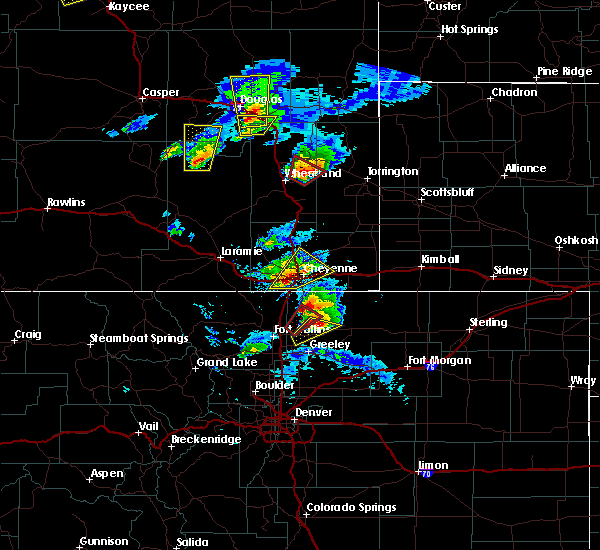 At 338 pm mdt, a severe thunderstorm was located 9 miles southeast of douglas, moving north at 45 mph (radar indicated). Hazards include golf ball size hail and 60 mph wind gusts. People and animals outdoors will be injured. expect hail damage to roofs, siding, windows, and vehicles. Expect wind damage to roofs, siding, and trees. At 338 pm mdt, a severe thunderstorm was located 9 miles southeast of douglas, moving north at 45 mph (radar indicated). Hazards include golf ball size hail and 60 mph wind gusts. People and animals outdoors will be injured. expect hail damage to roofs, siding, windows, and vehicles. Expect wind damage to roofs, siding, and trees.
|
| 7/27/2016 7:00 PM MDT | Quarter sized hail reported 50.5 miles SSW of Douglas, WY |
| 7/6/2016 7:04 PM MDT |
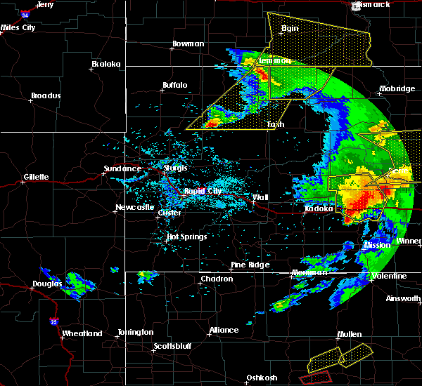 At 702 pm mdt, a line of showers and thunderstorms extended from 15 miles south of pine tree junction to 7 miles southeast of douglas, moving northeast at 60 mph. law enforcement in converse county is reporting 60 to 70 mph winds with these storms (law enforcement). Hazards include 70 mph wind gusts. Expect tree damage. Damage is possible to mobile homes, roofs, and outbuildings. At 702 pm mdt, a line of showers and thunderstorms extended from 15 miles south of pine tree junction to 7 miles southeast of douglas, moving northeast at 60 mph. law enforcement in converse county is reporting 60 to 70 mph winds with these storms (law enforcement). Hazards include 70 mph wind gusts. Expect tree damage. Damage is possible to mobile homes, roofs, and outbuildings.
|
| 7/6/2016 6:50 PM MDT | Dry thunderstorm winds quickly spread 4 grass fires in southwestern converse count in converse county WY, 0.6 miles SE of Douglas, WY |
| 6/28/2016 4:36 PM MDT |
 The severe thunderstorm warning for southeastern converse and northwestern platte counties will expire at 445 pm mdt, the storm which prompted the warning has moved out of the area. therefore the warning will be allowed to expire. a severe thunderstorm watch remains in effect until 900 pm mdt for southeastern wyoming. The severe thunderstorm warning for southeastern converse and northwestern platte counties will expire at 445 pm mdt, the storm which prompted the warning has moved out of the area. therefore the warning will be allowed to expire. a severe thunderstorm watch remains in effect until 900 pm mdt for southeastern wyoming.
|
| 6/28/2016 4:33 PM MDT | Quarter sized hail reported 32.1 miles S of Douglas, WY |
| 6/28/2016 4:29 PM MDT |
 At 429 pm mdt, a severe thunderstorm was located 8 miles northwest of glendo, or 17 miles southeast of douglas, moving east at 50 mph (public). Hazards include 60 mph wind gusts and penny size hail. Expect damage to roofs. siding. and trees. this severe thunderstorm will remain over mainly rural areas of southeastern converse and northwestern platte counties. This includes interstate 25 in wyoming between mile markers 120 and 137. At 429 pm mdt, a severe thunderstorm was located 8 miles northwest of glendo, or 17 miles southeast of douglas, moving east at 50 mph (public). Hazards include 60 mph wind gusts and penny size hail. Expect damage to roofs. siding. and trees. this severe thunderstorm will remain over mainly rural areas of southeastern converse and northwestern platte counties. This includes interstate 25 in wyoming between mile markers 120 and 137.
|
| 6/28/2016 4:01 PM MDT |
 At 400 pm mdt, severe thunderstorms were located along a line extending from 15 miles northeast of rolling hills to 7 miles northwest of curtis gulch campground, moving east at 40 mph (public). Hazards include 70 mph wind gusts. Expect considerable tree damage. Damage is likely to mobile homes, roofs, and outbuildings. At 400 pm mdt, severe thunderstorms were located along a line extending from 15 miles northeast of rolling hills to 7 miles northwest of curtis gulch campground, moving east at 40 mph (public). Hazards include 70 mph wind gusts. Expect considerable tree damage. Damage is likely to mobile homes, roofs, and outbuildings.
|
| 6/13/2016 12:54 PM MDT |
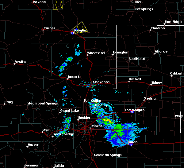 At 1254 pm mdt, a severe thunderstorm was located near douglas, moving northeast at 20 mph (radar indicated). Hazards include 60 mph wind gusts and quarter size hail. Hail damage to vehicles is expected. expect wind damage to roofs, siding, and trees. This severe thunderstorm will remain over mainly rural areas of east central converse county. At 1254 pm mdt, a severe thunderstorm was located near douglas, moving northeast at 20 mph (radar indicated). Hazards include 60 mph wind gusts and quarter size hail. Hail damage to vehicles is expected. expect wind damage to roofs, siding, and trees. This severe thunderstorm will remain over mainly rural areas of east central converse county.
|
| 6/13/2016 12:37 PM MDT |
 At 1237 pm mdt, a severe thunderstorm was located over douglas, moving northeast at 20 mph (radar indicated). Hazards include 60 mph wind gusts and quarter size hail. Hail damage to vehicles is expected. Expect wind damage to roofs, siding, and trees. At 1237 pm mdt, a severe thunderstorm was located over douglas, moving northeast at 20 mph (radar indicated). Hazards include 60 mph wind gusts and quarter size hail. Hail damage to vehicles is expected. Expect wind damage to roofs, siding, and trees.
|
| 7/15/2015 6:53 PM MDT | Storm damage reported in converse county WY, 0.6 miles SE of Douglas, WY |
| 6/25/2015 9:18 AM MDT | Quarter sized hail reported 16.6 miles SW of Douglas, WY |
| 6/24/2015 7:25 PM MDT | Half Dollar sized hail reported 15.4 miles NE of Douglas, WY |
| 6/16/2015 4:43 PM MDT |
 At 443 pm mdt, a severe thunderstorm was located near douglas, moving east at 35 mph (radar indicated). Hazards include quarter size hail and 60 mph wind gusts. Hail damage to vehicles is expected. Expect wind damage to roofs, siding and trees. At 443 pm mdt, a severe thunderstorm was located near douglas, moving east at 35 mph (radar indicated). Hazards include quarter size hail and 60 mph wind gusts. Hail damage to vehicles is expected. Expect wind damage to roofs, siding and trees.
|
| 6/16/2015 3:41 PM MDT |
 At 340 pm mdt, a severe thunderstorm was located 8 miles south of douglas, moving east at 35 mph (radar indicated). Hazards include golf ball size hail and 60 mph wind gusts. People and animals outdoors will be injured. expect hail damage to roofs, siding, windows and vehicles. Expect wind damage to roofs, siding and trees. At 340 pm mdt, a severe thunderstorm was located 8 miles south of douglas, moving east at 35 mph (radar indicated). Hazards include golf ball size hail and 60 mph wind gusts. People and animals outdoors will be injured. expect hail damage to roofs, siding, windows and vehicles. Expect wind damage to roofs, siding and trees.
|
| 6/16/2015 3:00 PM MDT |
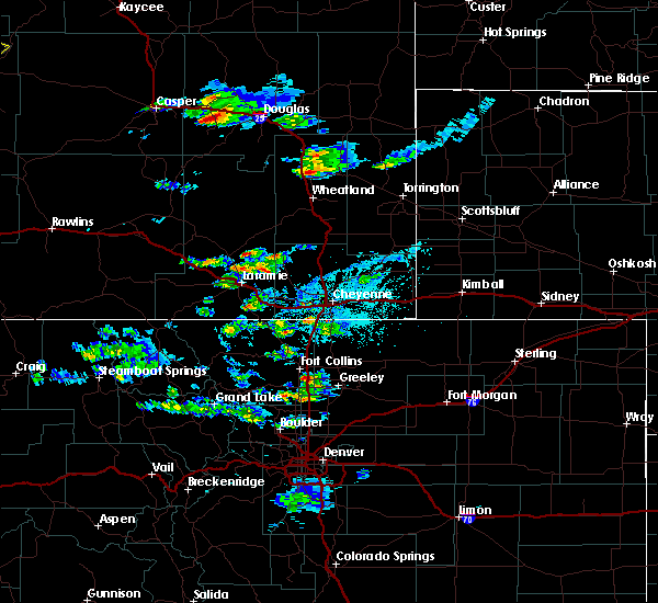 At 300 pm mdt, a severe thunderstorm was located near deer creek, or 20 miles west of douglas, moving east at 30 mph (radar indicated). Hazards include quarter size hail and 60 mph wind gusts. Hail damage to vehicles is expected. expect wind damage to roofs, siding and trees. this severe thunderstorm will be near, laprele reservoir around 320 pm mdt. douglas around 345 pm mdt. This includes interstate 25 in wyoming between mile markers 132 and 162. At 300 pm mdt, a severe thunderstorm was located near deer creek, or 20 miles west of douglas, moving east at 30 mph (radar indicated). Hazards include quarter size hail and 60 mph wind gusts. Hail damage to vehicles is expected. expect wind damage to roofs, siding and trees. this severe thunderstorm will be near, laprele reservoir around 320 pm mdt. douglas around 345 pm mdt. This includes interstate 25 in wyoming between mile markers 132 and 162.
|
| 6/4/2015 6:09 PM MDT | At 608 pm mdt, severe thunderstorms were located along a line extending from 8 miles north of laprele reservoir to 9 miles east of douglas, moving north at 20 mph (radar indicated). Hazards include ping pong ball size hail. People and animals outdoors will be injured. expect damage to roofs, siding, windows and vehicles. locations impacted include, douglas and laprele reservoir. This includes interstate 25 in wyoming between mile markers 130 and 154. |
| 6/4/2015 5:44 PM MDT | At 544 pm mdt, severe thunderstorms were located along a line extending from laprele reservoir to 6 miles southeast of douglas, moving north at 20 mph (radar indicated). Hazards include quarter size hail. damage to vehicles is expected |
| 8/17/2014 4:06 PM MDT | Measured at douglas airpor in converse county WY, 3.2 miles S of Douglas, WY |
| 7/15/2014 8:32 PM MDT | Golf Ball sized hail reported 32.1 miles S of Douglas, WY |
| 7/15/2014 8:23 PM MDT | Golf Ball sized hail reported 32.1 miles S of Douglas, WY |
| 5/31/2014 6:30 PM MDT | Quarter sized hail reported 50.1 miles SSW of Douglas, WY, mostly dime sized. a few quarter. |
| 5/20/2014 3:14 PM MDT | Quarter sized hail reported 7.5 miles NE of Douglas, WY, all hail... no rain. |
| 7/21/2013 5:44 PM MDT | Baseball sized hail reported 32.1 miles S of Douglas, WY, hail up to baseball size between 544 and 549 pm mdt. |
| 7/5/2013 7:50 PM MDT | Quarter sized hail reported 44.6 miles SSE of Douglas, WY, trained spotter reported hail sizes ranging from marble to quarter size |
| 6/21/2013 8:43 PM MDT | Quarter sized hail reported 0.6 miles SE of Douglas, WY, mostly pea sized. |
| 6/21/2013 7:50 PM MDT | Ping Pong Ball sized hail reported 10.8 miles SW of Douglas, WY, mile marker 12 on highway 59. vehicles stopped on highway due to large hail and heavy rain. |
| 7/20/2012 6:08 PM MDT | Storm damage reported in converse county WY, 0.6 miles SE of Douglas, WY |
| 6/25/2012 4:00 PM MDT | Quarter sized hail reported 38.7 miles SSW of Douglas, WY, hail ranged from 1/2 to 1 inch. |
| 6/25/2012 3:43 PM MDT | Quarter sized hail reported 32.1 miles S of Douglas, WY, ranged from 3/4 inch to 1 inch. |
| 6/25/2012 2:38 PM MDT | Storm damage reported in converse county WY, 0.6 miles SE of Douglas, WY |
| 1/1/0001 12:00 AM | Storm damage reported in converse county WY, 0.6 miles SE of Douglas, WY |
| 1/1/0001 12:00 AM | Ping Pong Ball sized hail reported 50.1 miles SSW of Douglas, WY, late report. largest stones were up to ping pong ball size. |
| 1/1/0001 12:00 AM | Half Dollar sized hail reported 50.5 miles SSW of Douglas, WY |
| 1/1/0001 12:00 AM | Quarter sized hail reported 13.9 miles NE of Douglas, WY, a few stones up to one inch in diameter. |
Hail Maps for Douglas, WY
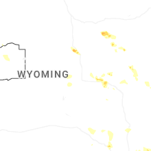
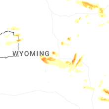


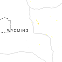


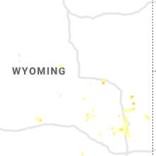


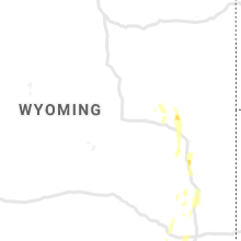


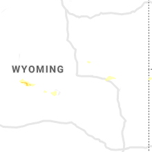


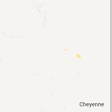


Connect with Interactive Hail Maps