

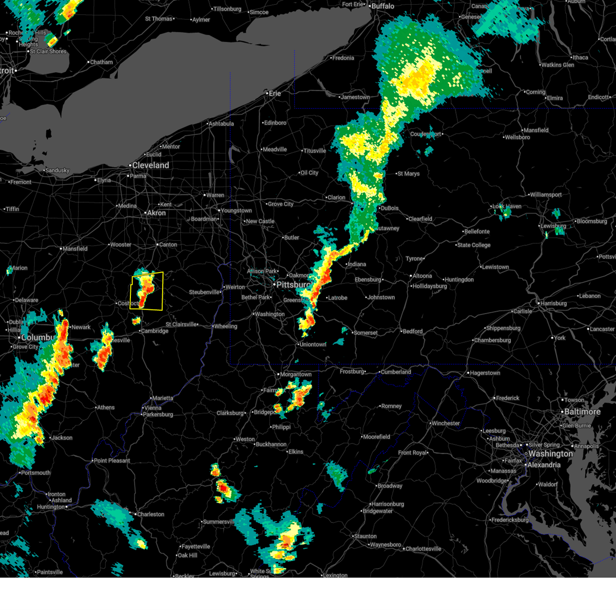
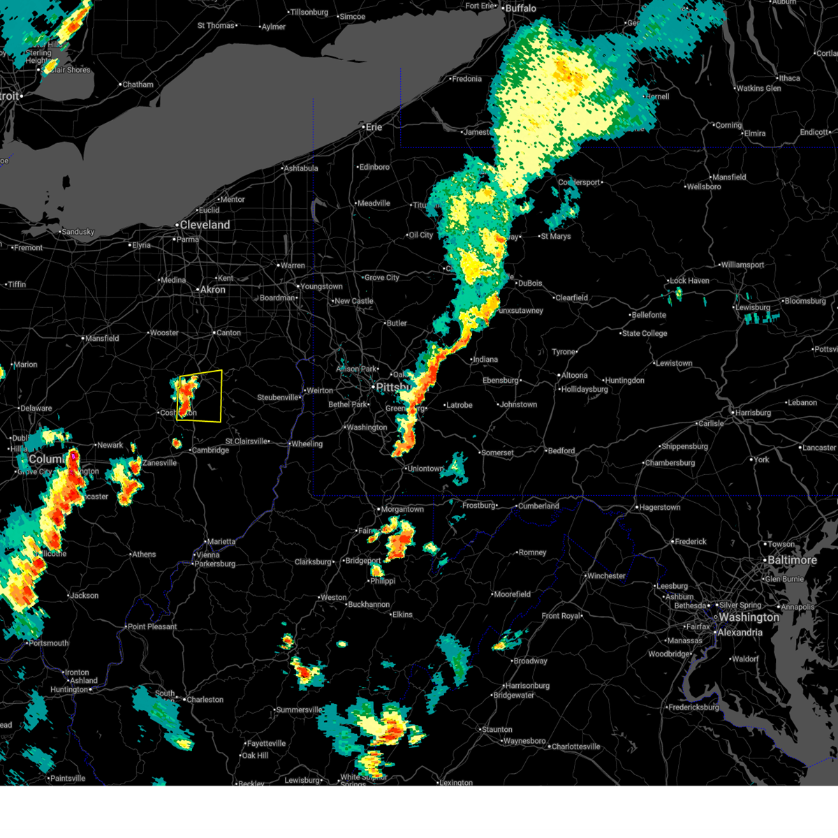
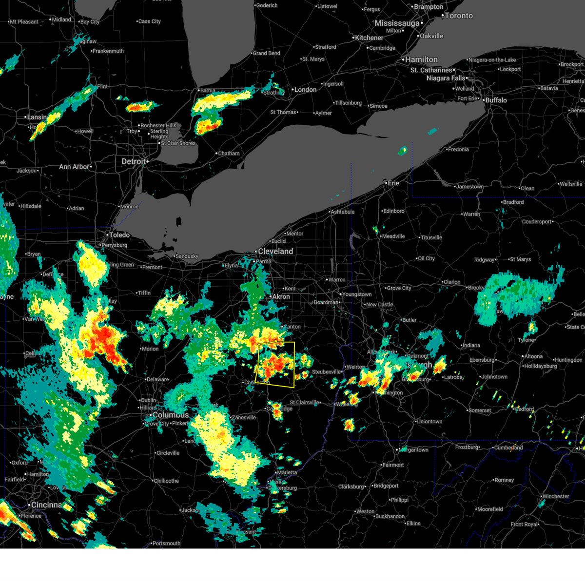
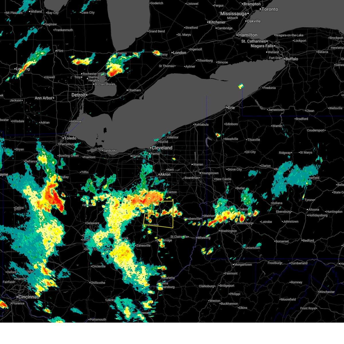
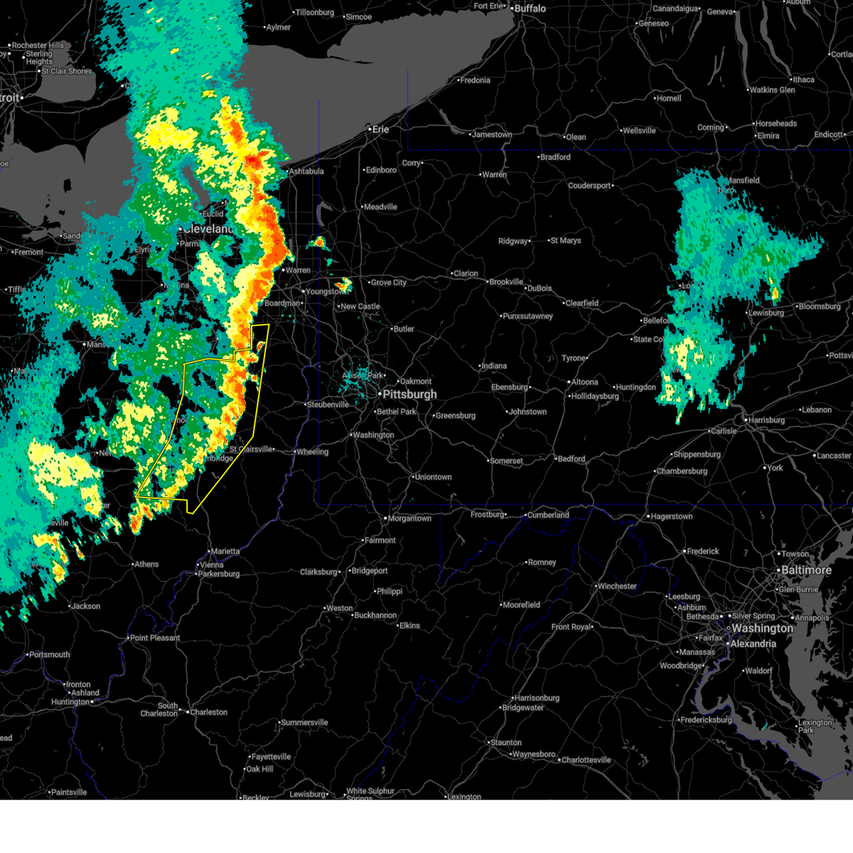
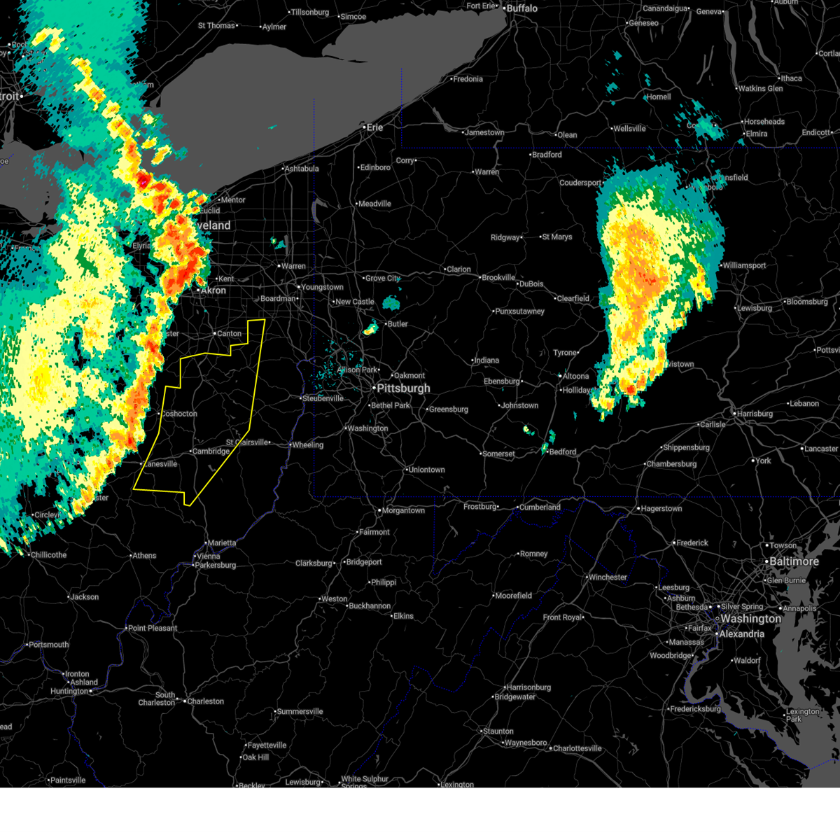
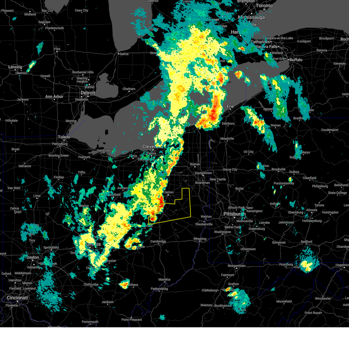
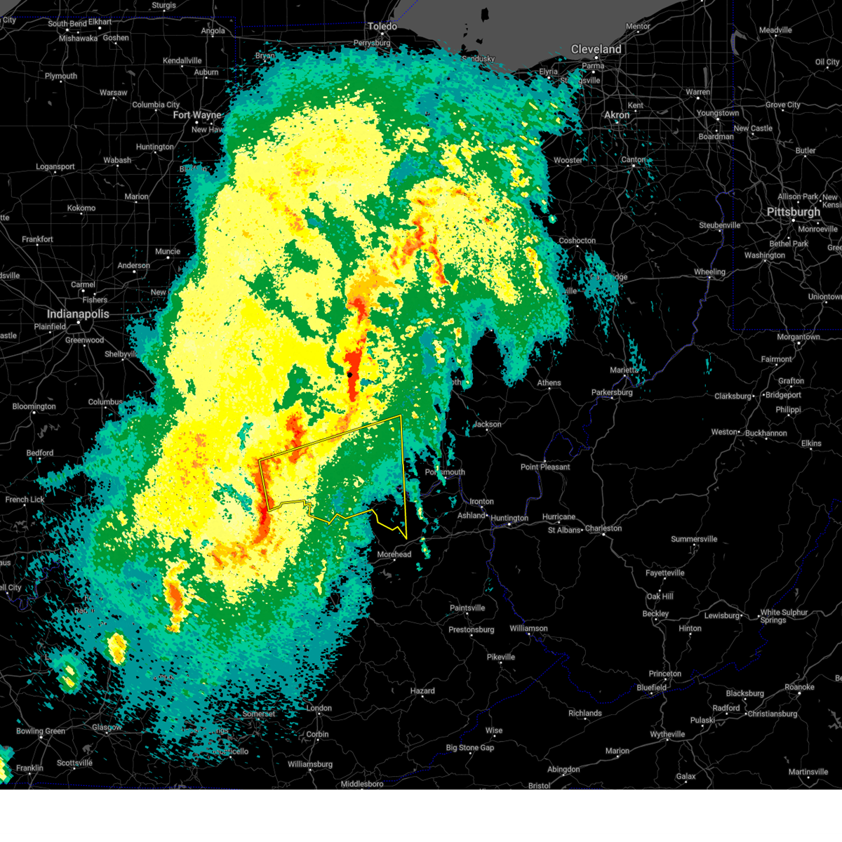
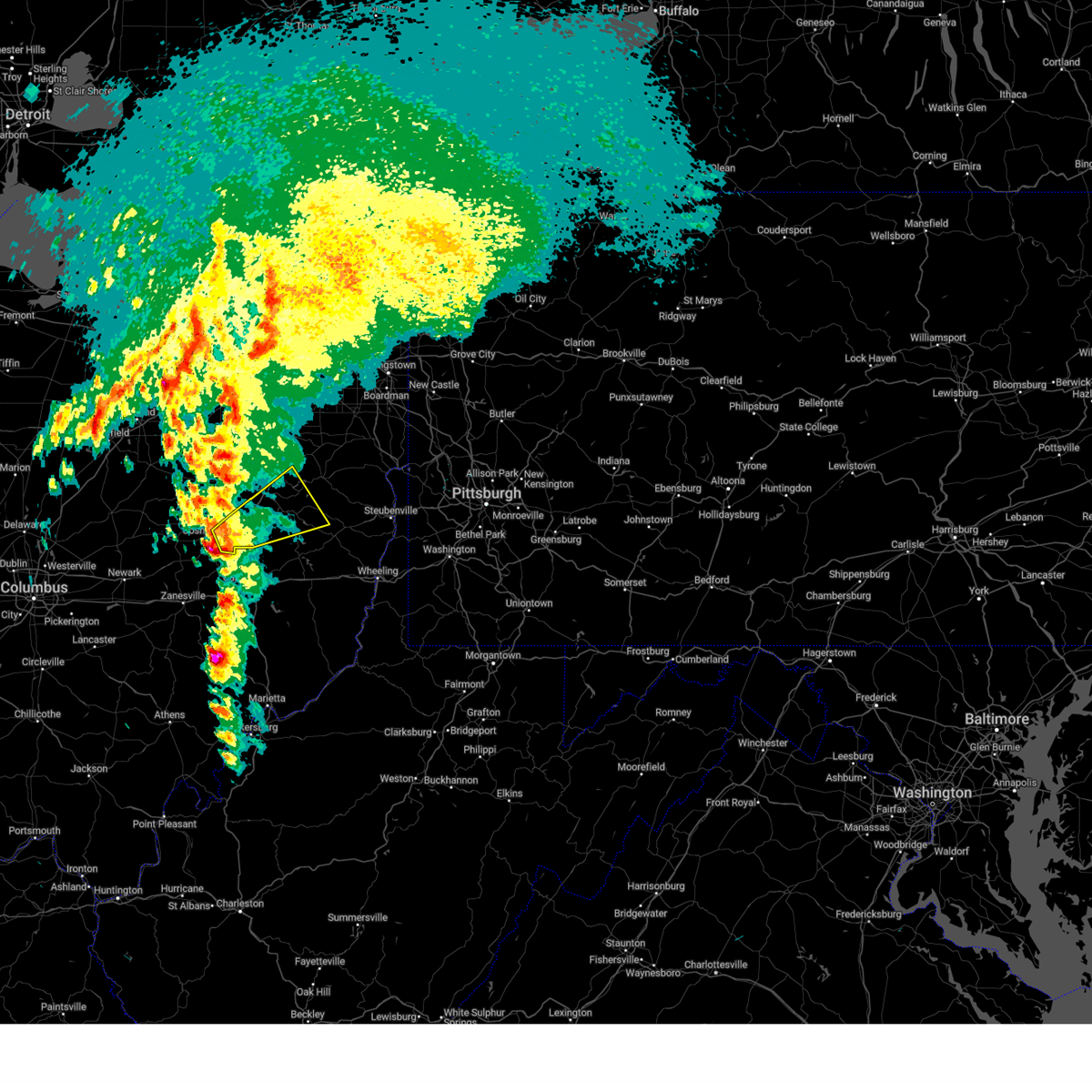
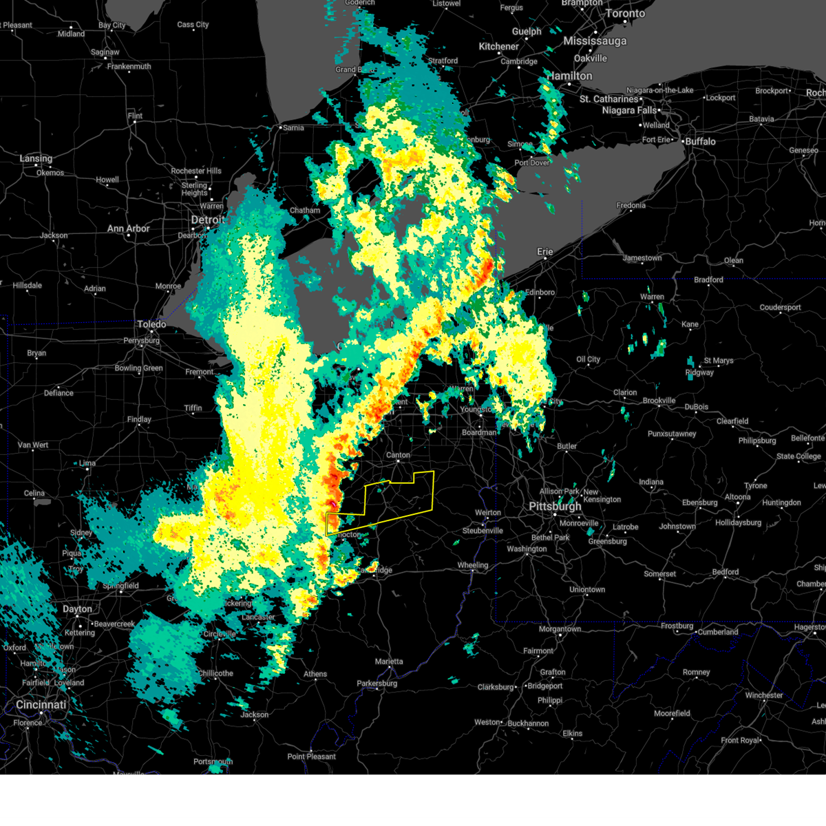
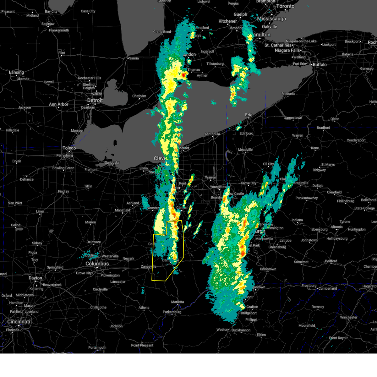
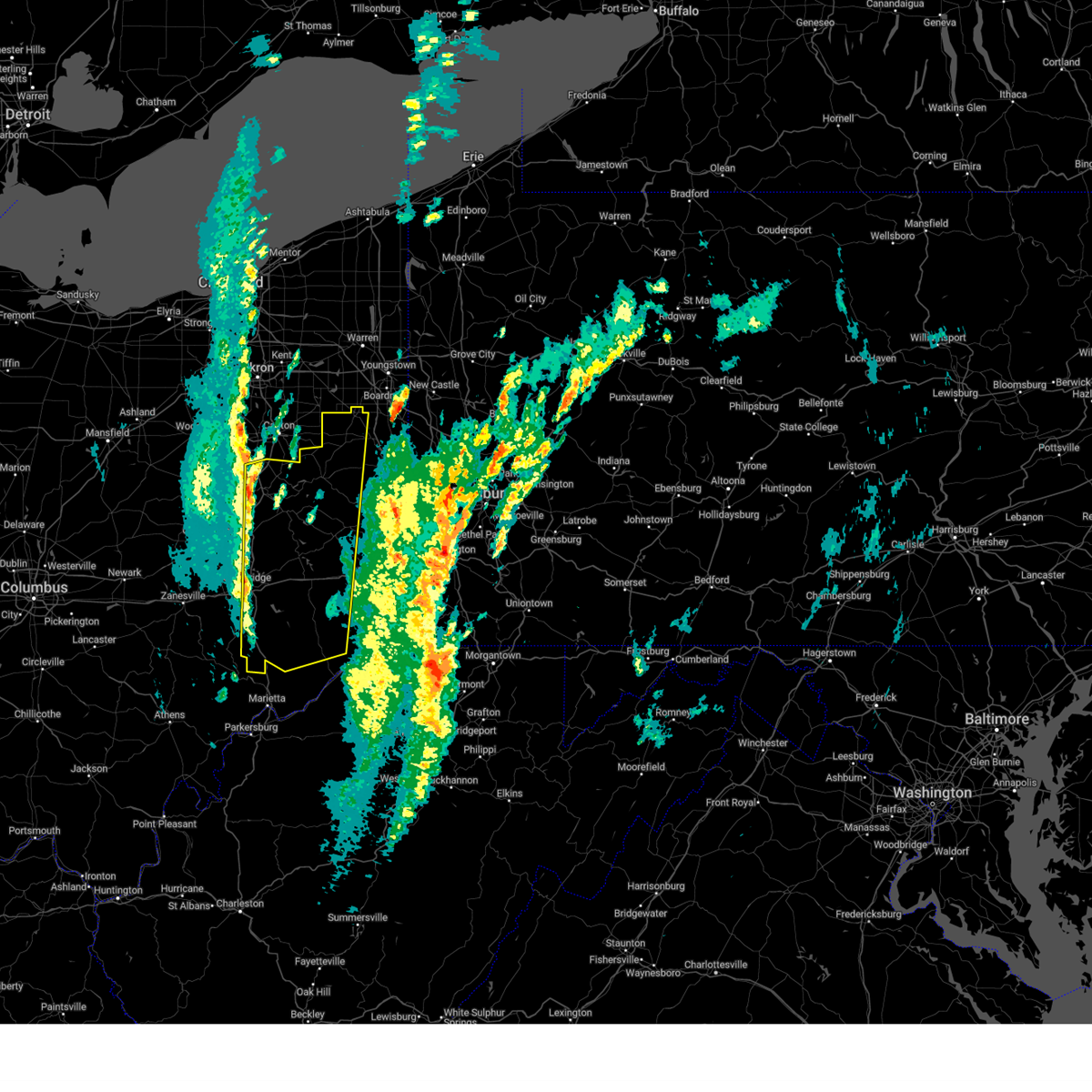
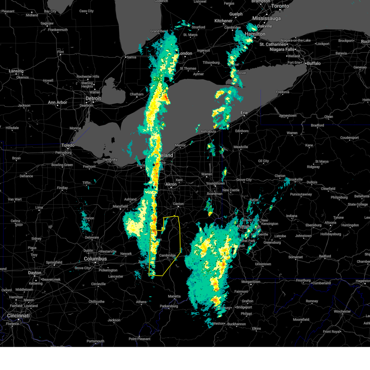
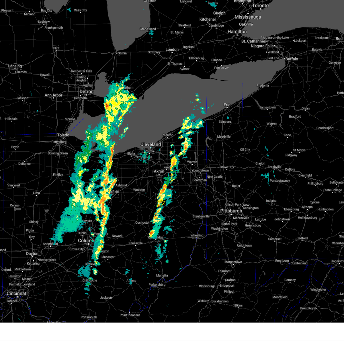
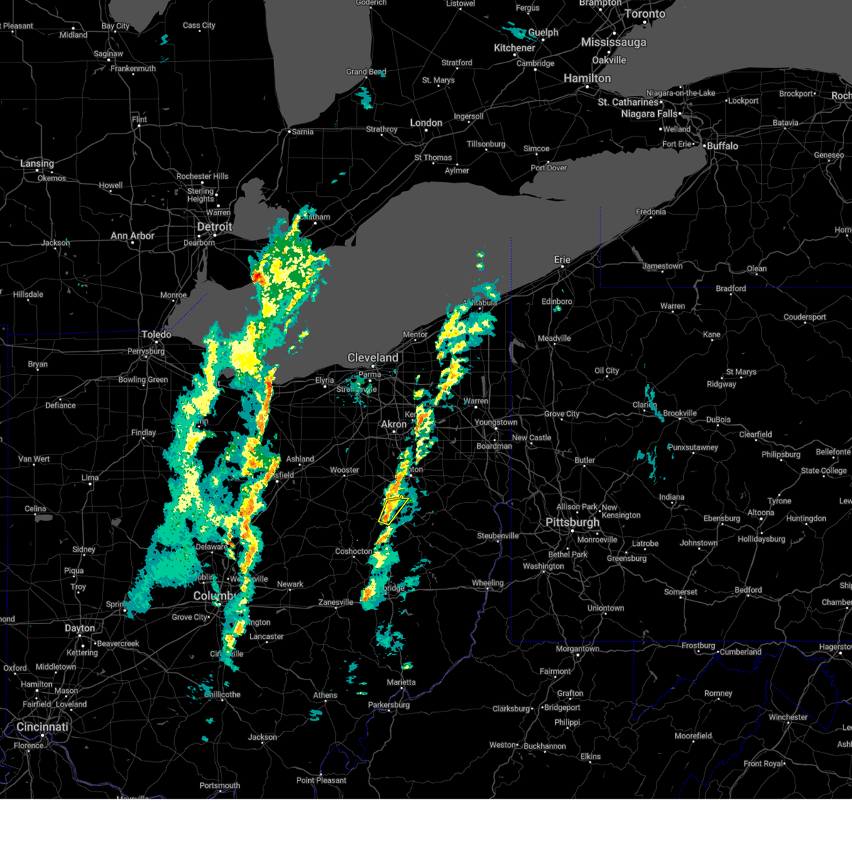
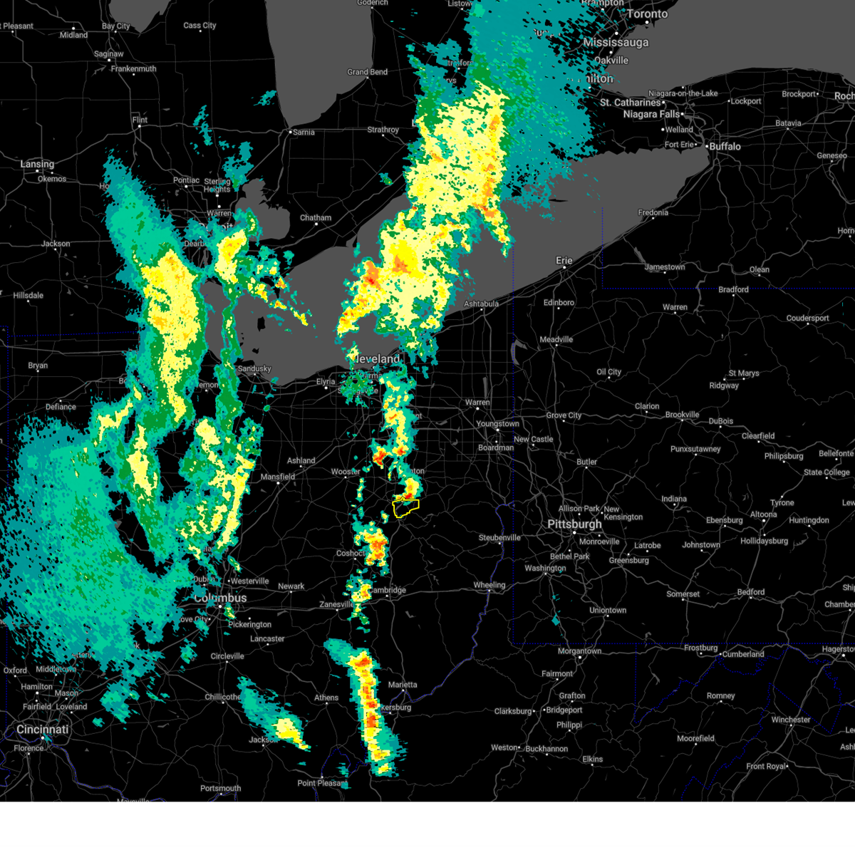
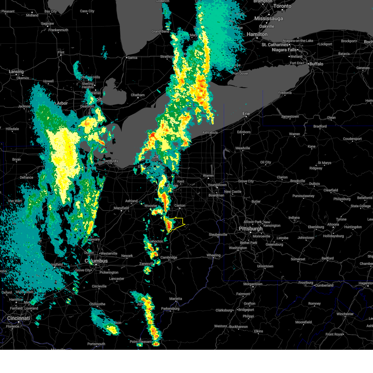
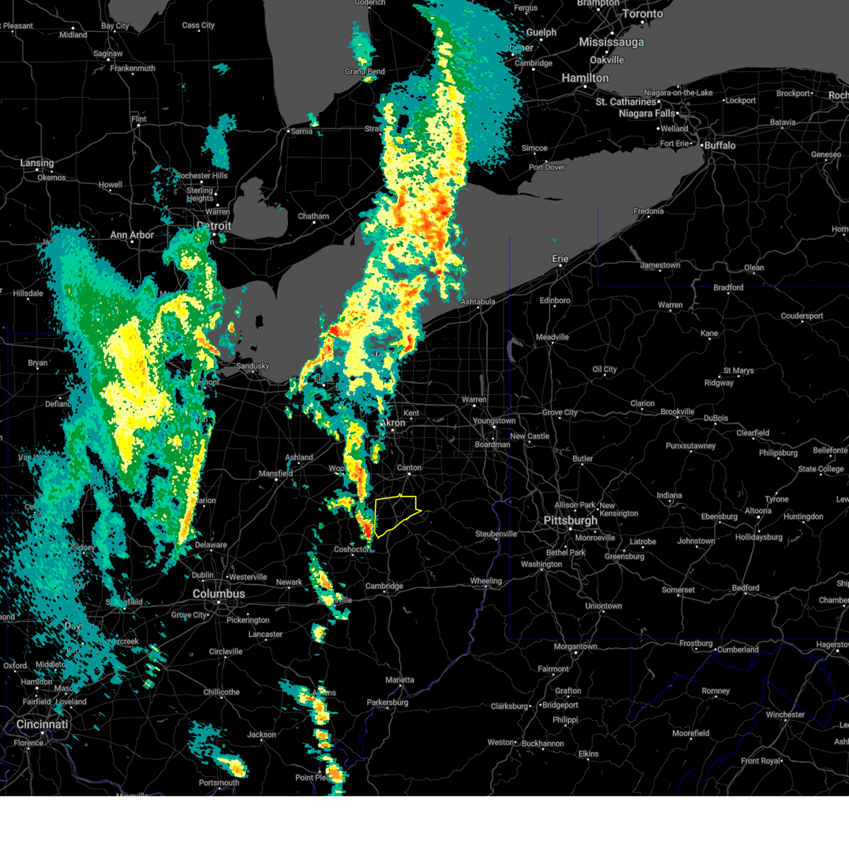
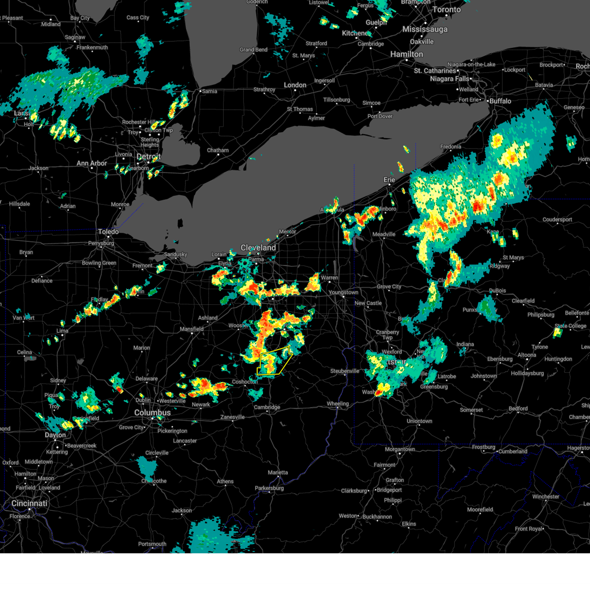
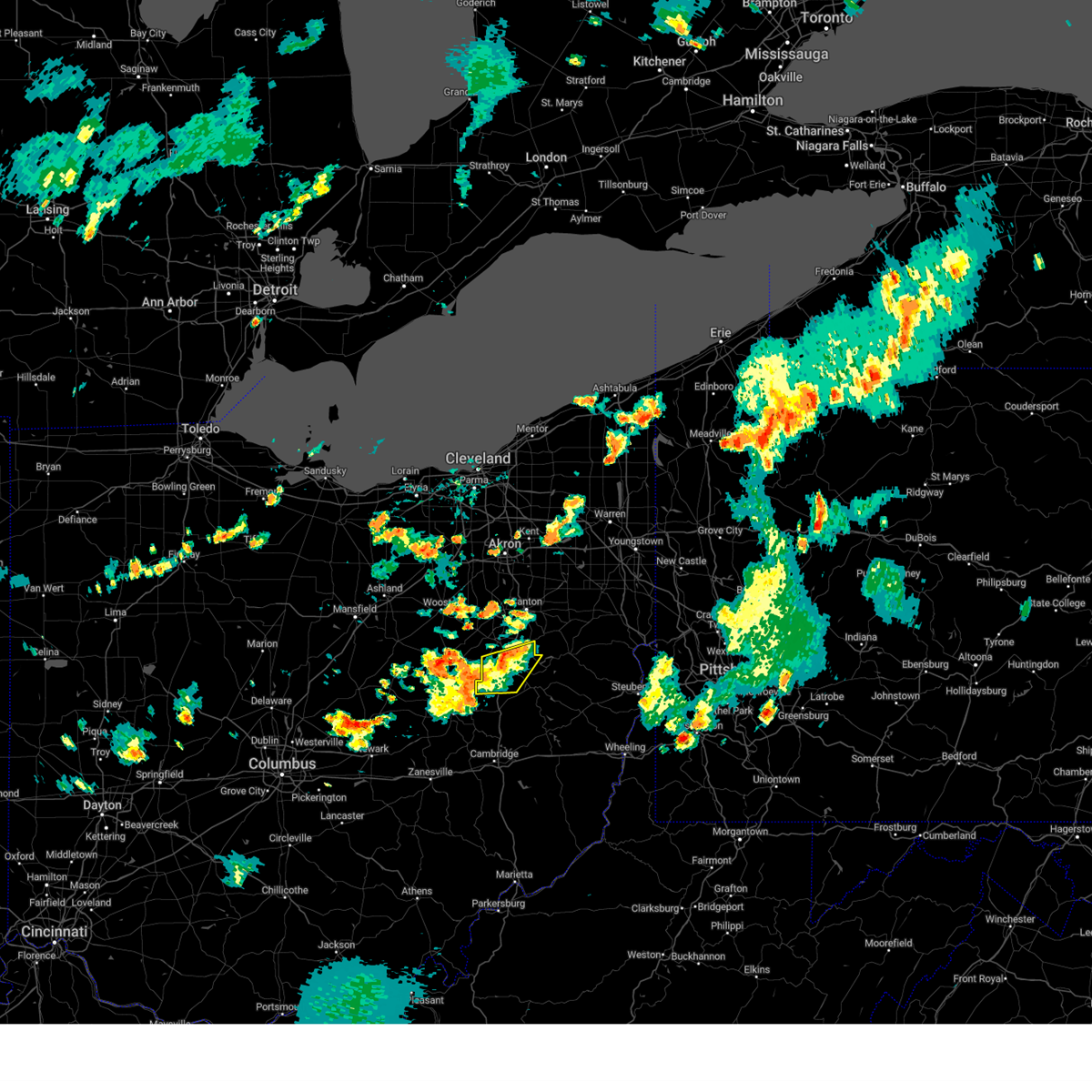
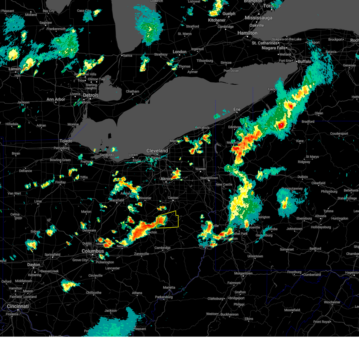
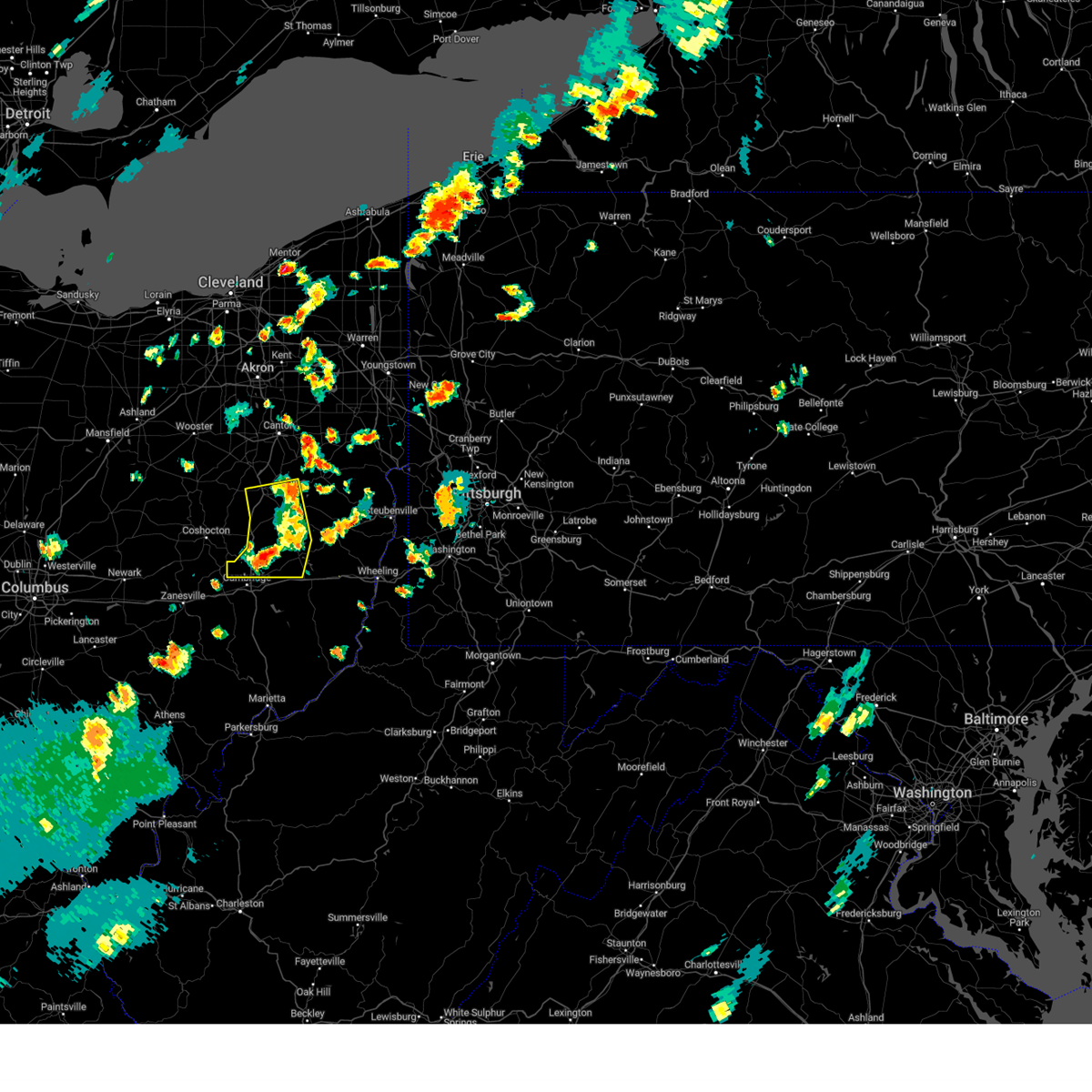
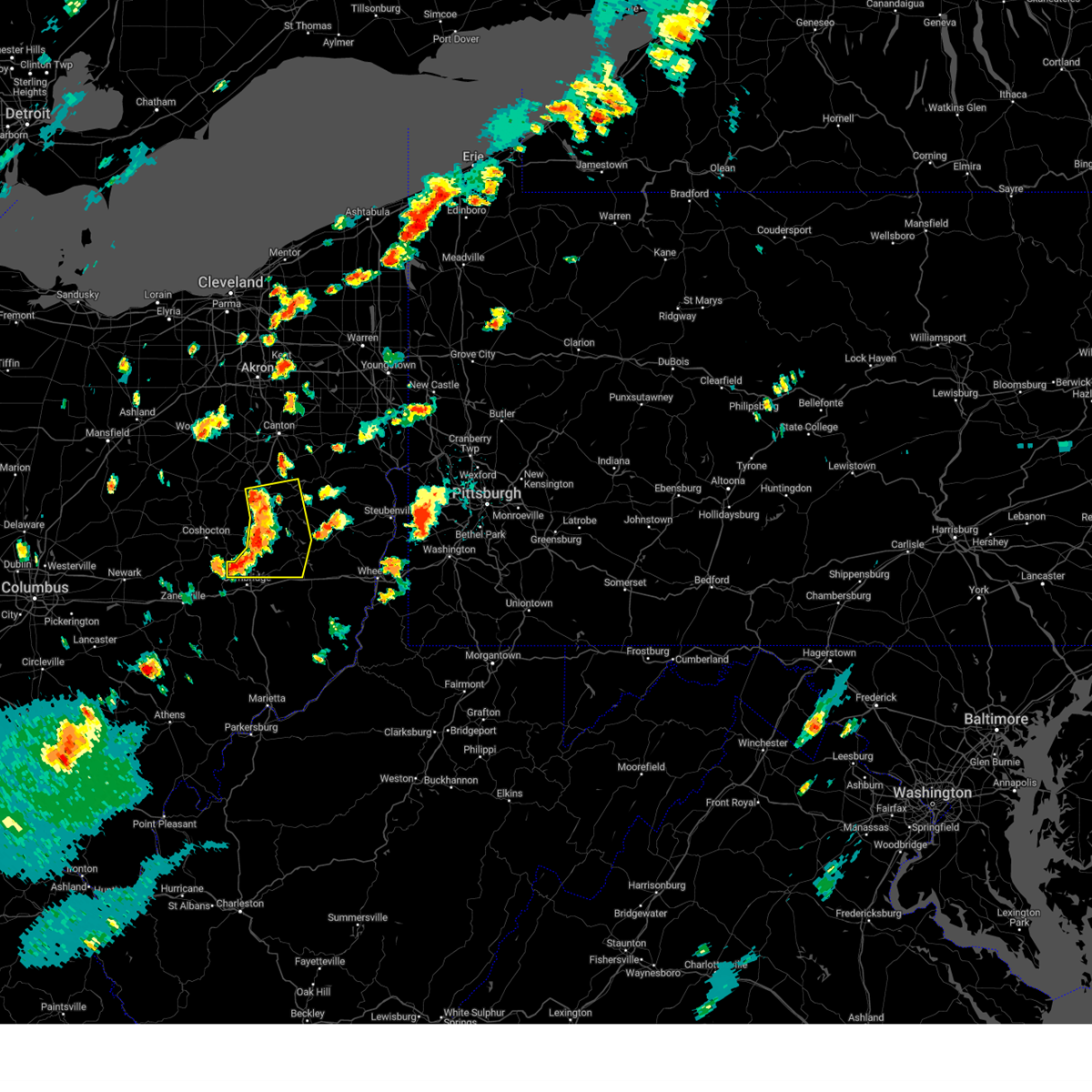
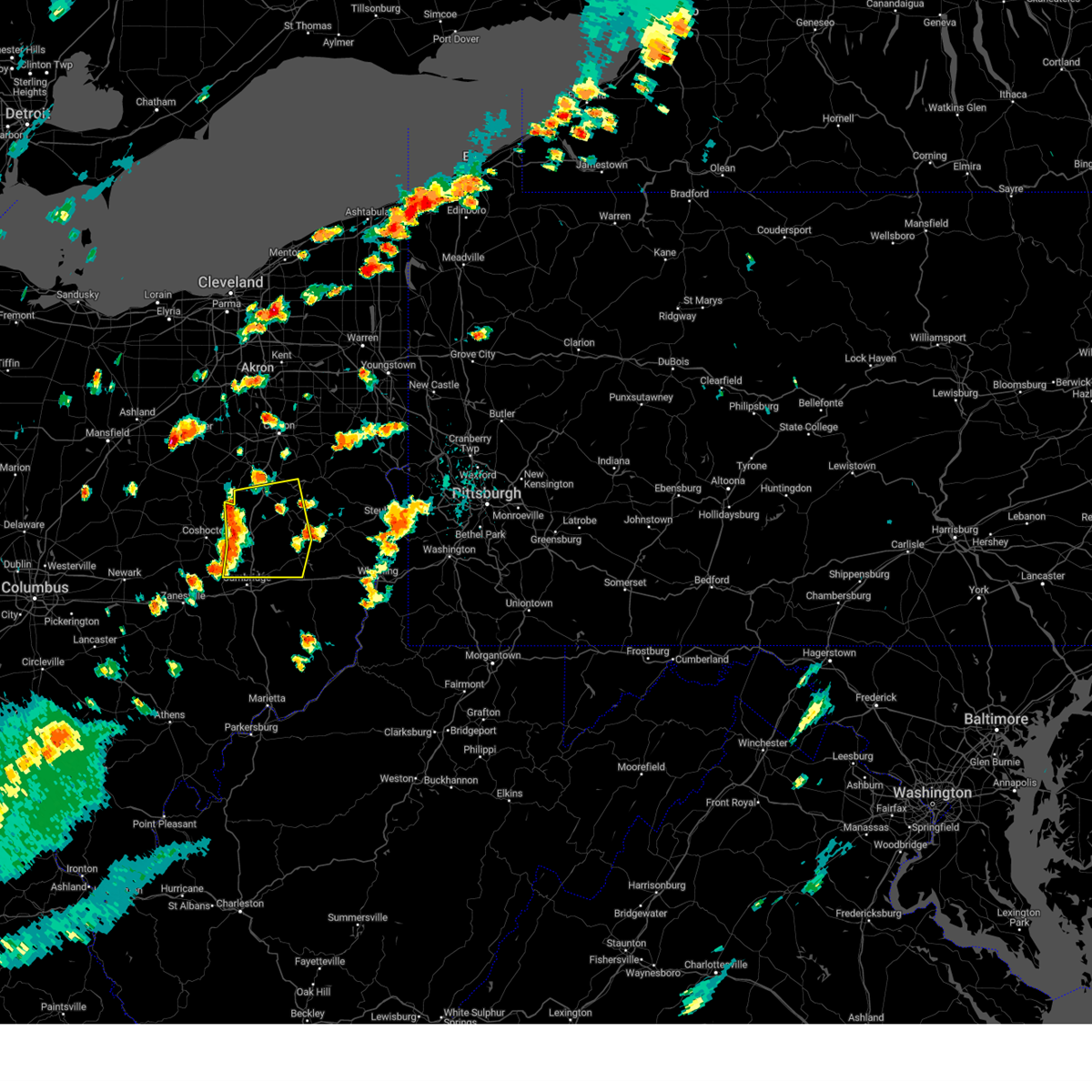
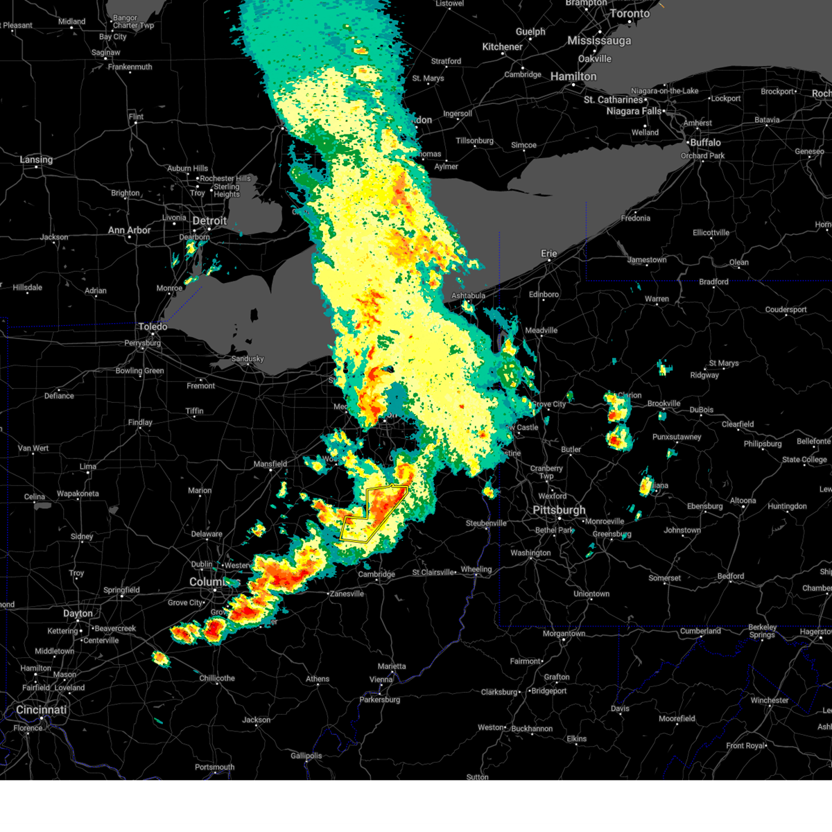
Hail Map for Dover, OH
The Dover, OH area has had 16 reports of on-the-ground hail by trained spotters, and has been under severe weather warnings 74 times during the past 12 months. Doppler radar has detected hail at or near Dover, OH on 79 occasions, including 3 occasions during the past year.
| Name: | Dover, OH |
| Where Located: | 68.2 miles S of Cleveland, OH |
| Map: | Google Map for Dover, OH |
| Population: | 12826 |
| Housing Units: | 5578 |
| More Info: | Search Google for Dover, OH |
1
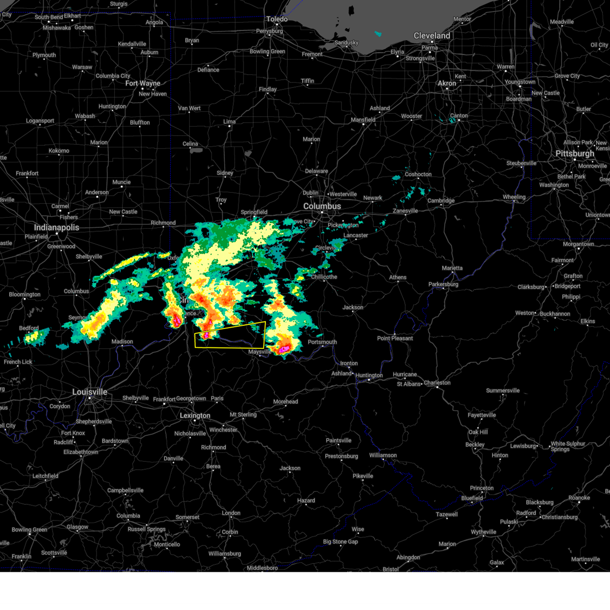
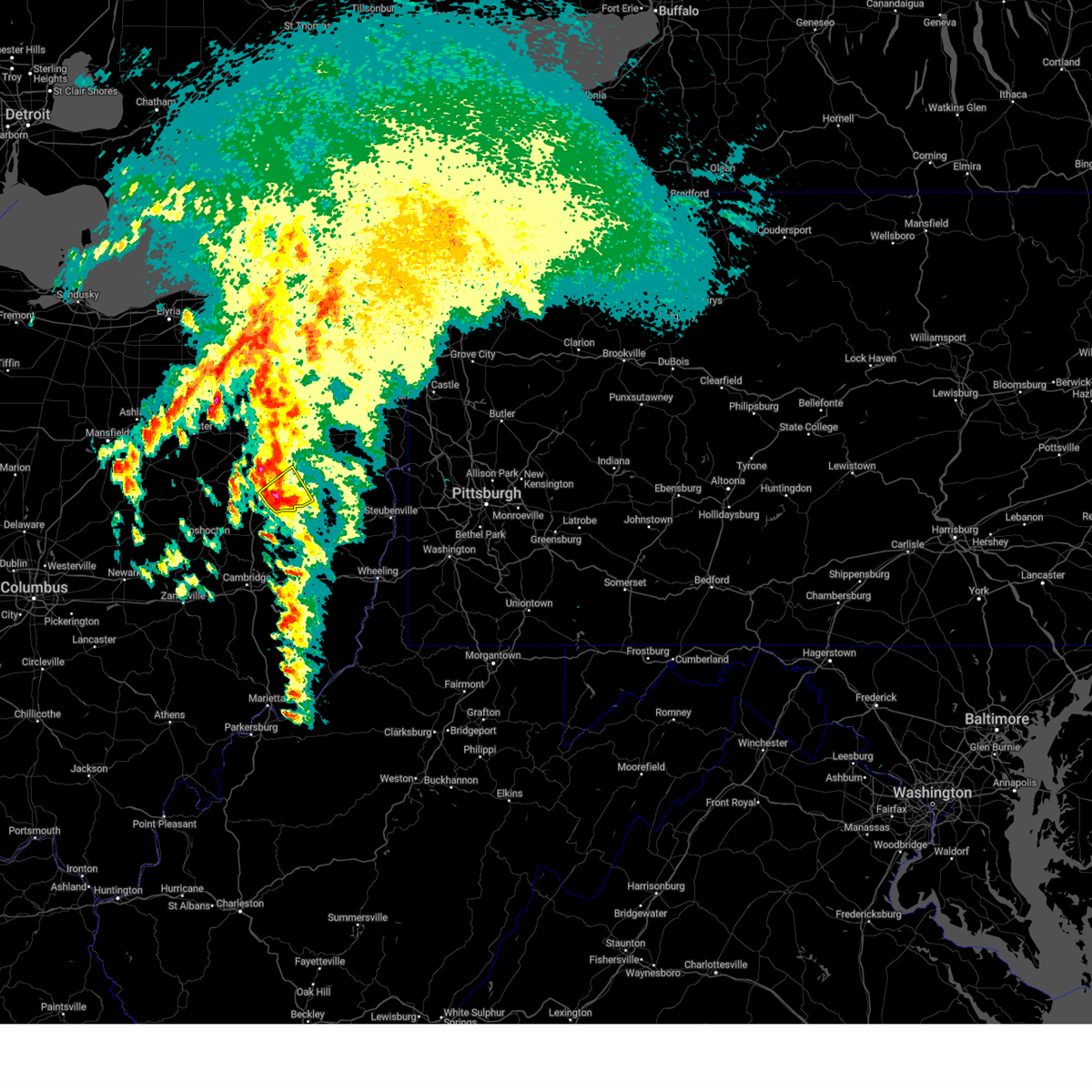
The Top Recent Hail Date for Dover, OH is Wednesday, April 2, 2025 (16th out of 79)

Hail and Wind Damage Spotted near Dover, OH
| Date / Time | Report Details |
|---|---|
| 6/27/2025 7:12 PM EDT |
 The storm which prompted the warning has weakened below severe limits, and no longer poses an immediate threat to life or property. therefore, the warning will be allowed to expire. however, gusty winds and heavy rain are still possible with this thunderstorm. The storm which prompted the warning has weakened below severe limits, and no longer poses an immediate threat to life or property. therefore, the warning will be allowed to expire. however, gusty winds and heavy rain are still possible with this thunderstorm.
|
| 6/27/2025 6:51 PM EDT |
 Svrpbz the national weather service in pittsburgh has issued a * severe thunderstorm warning for, east central coshocton county in east central ohio, west central harrison county in east central ohio, tuscarawas county in east central ohio, * until 715 pm edt. * at 651 pm edt, a severe thunderstorm was located 7 miles north of newcomerstown, or 11 miles southwest of new philadelphia, moving east at 20 mph (radar indicated). Hazards include 60 mph wind gusts. expect damage to roofs, siding, and trees Svrpbz the national weather service in pittsburgh has issued a * severe thunderstorm warning for, east central coshocton county in east central ohio, west central harrison county in east central ohio, tuscarawas county in east central ohio, * until 715 pm edt. * at 651 pm edt, a severe thunderstorm was located 7 miles north of newcomerstown, or 11 miles southwest of new philadelphia, moving east at 20 mph (radar indicated). Hazards include 60 mph wind gusts. expect damage to roofs, siding, and trees
|
| 6/26/2025 6:39 PM EDT | The storm which prompted the warning has weakened below severe limits, and no longer poses an immediate threat to life or property. therefore, the warning will be allowed to expire. however, heavy rain is still possible with this thunderstorm. |
| 6/26/2025 6:24 PM EDT |
 At 624 pm edt, a severe thunderstorm was located over uhrichsville, moving east at 15 mph (radar indicated). Hazards include 60 mph wind gusts. Expect damage to roofs, siding, and trees. Locations impacted include, new philadelphia, dover, uhrichsville, newcomerstown, dennison, strasburg, sugarcreek, gnadenhutten, tuscarawas, bolivar, midvale, mineral city, port washington, barnhill, sherrodsville, roswell, parral, stone creek, zoar and gilmore. At 624 pm edt, a severe thunderstorm was located over uhrichsville, moving east at 15 mph (radar indicated). Hazards include 60 mph wind gusts. Expect damage to roofs, siding, and trees. Locations impacted include, new philadelphia, dover, uhrichsville, newcomerstown, dennison, strasburg, sugarcreek, gnadenhutten, tuscarawas, bolivar, midvale, mineral city, port washington, barnhill, sherrodsville, roswell, parral, stone creek, zoar and gilmore.
|
| 6/26/2025 6:01 PM EDT |
 Svrpbz the national weather service in pittsburgh has issued a * severe thunderstorm warning for, western carroll county in east central ohio, northeastern coshocton county in east central ohio, western harrison county in east central ohio, tuscarawas county in east central ohio, * until 645 pm edt. * at 601 pm edt, a severe thunderstorm was located over new philadelphia, moving east at 10 mph (radar indicated). Hazards include 60 mph wind gusts. expect damage to roofs, siding, and trees Svrpbz the national weather service in pittsburgh has issued a * severe thunderstorm warning for, western carroll county in east central ohio, northeastern coshocton county in east central ohio, western harrison county in east central ohio, tuscarawas county in east central ohio, * until 645 pm edt. * at 601 pm edt, a severe thunderstorm was located over new philadelphia, moving east at 10 mph (radar indicated). Hazards include 60 mph wind gusts. expect damage to roofs, siding, and trees
|
| 6/18/2025 10:13 PM EDT |
 The storms which prompted the warning were moving out of the warned area. therefore, the warning will be allowed to expire. however, a severe thunderstorm warning has been issued for portions of the area to the east. a severe thunderstorm watch remains in effect until 300 am edt thursday for a portion of east central ohio. The storms which prompted the warning were moving out of the warned area. therefore, the warning will be allowed to expire. however, a severe thunderstorm warning has been issued for portions of the area to the east. a severe thunderstorm watch remains in effect until 300 am edt thursday for a portion of east central ohio.
|
| 6/18/2025 9:53 PM EDT |
 At 953 pm edt, severe thunderstorms were located along a line from 15 miles northeast of strasburg to 12 miles south of south zanesville, or along a line from 16 miles northwest of carrollton to 16 miles south of zanesville, moving east at 40 mph (radar indicated). Hazards include 60 mph wind gusts. Expect damage to roofs, siding, and trees. Locations impacted include, new philadelphia, dover, cambridge, uhrichsville, carrollton, caldwell, freeport, newcomerstown, dennison, strasburg, new concord, byesville, sugarcreek, augusta, gnadenhutten, antrim, malvern, tuscarawas, bolivar and scio. At 953 pm edt, severe thunderstorms were located along a line from 15 miles northeast of strasburg to 12 miles south of south zanesville, or along a line from 16 miles northwest of carrollton to 16 miles south of zanesville, moving east at 40 mph (radar indicated). Hazards include 60 mph wind gusts. Expect damage to roofs, siding, and trees. Locations impacted include, new philadelphia, dover, cambridge, uhrichsville, carrollton, caldwell, freeport, newcomerstown, dennison, strasburg, new concord, byesville, sugarcreek, augusta, gnadenhutten, antrim, malvern, tuscarawas, bolivar and scio.
|
| 6/18/2025 9:52 PM EDT | Trees and power lines down in dover... o in tuscarawas county OH, 175.9 miles SW of Dover, OH |
| 6/18/2025 9:46 PM EDT |
 At 946 pm edt, severe thunderstorms were located along a line from 11 miles northeast of strasburg to 13 miles southwest of south zanesville, or along a line from 15 miles north of dover to 17 miles south of zanesville, moving east at 40 mph (radar indicated). Hazards include 60 mph wind gusts. Expect damage to roofs, siding, and trees. locations impacted include, zanesville, new philadelphia, dover, coshocton, cambridge, uhrichsville, carrollton, caldwell, freeport, newcomerstown, dennison, strasburg, new concord, byesville, west lafayette, sugarcreek, augusta, gnadenhutten, antrim and malvern. These storms have had a history of producing wind damage across central ohio. At 946 pm edt, severe thunderstorms were located along a line from 11 miles northeast of strasburg to 13 miles southwest of south zanesville, or along a line from 15 miles north of dover to 17 miles south of zanesville, moving east at 40 mph (radar indicated). Hazards include 60 mph wind gusts. Expect damage to roofs, siding, and trees. locations impacted include, zanesville, new philadelphia, dover, coshocton, cambridge, uhrichsville, carrollton, caldwell, freeport, newcomerstown, dennison, strasburg, new concord, byesville, west lafayette, sugarcreek, augusta, gnadenhutten, antrim and malvern. These storms have had a history of producing wind damage across central ohio.
|
| 6/18/2025 9:34 PM EDT |
 At 934 pm edt, severe thunderstorms were located along a line from 10 miles north of strasburg to 18 miles southwest of south zanesville, or along a line from 15 miles north of dover to 21 miles southwest of zanesville, moving east at 40 mph (radar indicated). Hazards include 60 mph wind gusts. Expect damage to roofs, siding, and trees. locations impacted include, zanesville, new philadelphia, dover, coshocton, cambridge, uhrichsville, carrollton, caldwell, freeport, newcomerstown, dennison, strasburg, new concord, byesville, west lafayette, sugarcreek, augusta, gnadenhutten, antrim and malvern. These storms have had a history of producing wind damage across central ohio. At 934 pm edt, severe thunderstorms were located along a line from 10 miles north of strasburg to 18 miles southwest of south zanesville, or along a line from 15 miles north of dover to 21 miles southwest of zanesville, moving east at 40 mph (radar indicated). Hazards include 60 mph wind gusts. Expect damage to roofs, siding, and trees. locations impacted include, zanesville, new philadelphia, dover, coshocton, cambridge, uhrichsville, carrollton, caldwell, freeport, newcomerstown, dennison, strasburg, new concord, byesville, west lafayette, sugarcreek, augusta, gnadenhutten, antrim and malvern. These storms have had a history of producing wind damage across central ohio.
|
| 6/18/2025 9:17 PM EDT |
 Svrpbz the national weather service in pittsburgh has issued a * severe thunderstorm warning for, northwestern belmont county in east central ohio, carroll county in east central ohio, northwestern columbiana county in east central ohio, eastern coshocton county in east central ohio, guernsey county in east central ohio, western harrison county in east central ohio, eastern muskingum county in east central ohio, western noble county in east central ohio, tuscarawas county in east central ohio, * until 1015 pm edt. * at 917 pm edt, severe thunderstorms were located along a line from 18 miles northwest of sugarcreek to 28 miles southwest of south zanesville, or along a line from 22 miles northwest of dover to 30 miles southwest of zanesville, moving east at 40 mph (radar indicated). Hazards include 60 mph wind gusts. expect damage to roofs, siding, and trees Svrpbz the national weather service in pittsburgh has issued a * severe thunderstorm warning for, northwestern belmont county in east central ohio, carroll county in east central ohio, northwestern columbiana county in east central ohio, eastern coshocton county in east central ohio, guernsey county in east central ohio, western harrison county in east central ohio, eastern muskingum county in east central ohio, western noble county in east central ohio, tuscarawas county in east central ohio, * until 1015 pm edt. * at 917 pm edt, severe thunderstorms were located along a line from 18 miles northwest of sugarcreek to 28 miles southwest of south zanesville, or along a line from 22 miles northwest of dover to 30 miles southwest of zanesville, moving east at 40 mph (radar indicated). Hazards include 60 mph wind gusts. expect damage to roofs, siding, and trees
|
| 5/16/2025 11:52 PM EDT | The storms which prompted the warning have moved out of the area. therefore, the warning will be allowed to expire. to report severe weather, contact your nearest law enforcement agency. they will send your report to the national weather service office. a severe thunderstorm watch remains in effect until 400 am edt saturday for a portion of east central ohio. |
| 5/16/2025 11:33 PM EDT |
 the severe thunderstorm warning has been cancelled and is no longer in effect the severe thunderstorm warning has been cancelled and is no longer in effect
|
| 5/16/2025 11:33 PM EDT |
 At 1133 pm edt, severe thunderstorms were located along a line from 10 miles northeast of strasburg to 9 miles northeast of cambridge, or along a line from 14 miles north of dover to 9 miles northeast of cambridge, moving east at 40 mph (radar indicated). Hazards include 60 mph wind gusts. Expect damage to roofs, siding, and trees. Locations impacted include, new philadelphia, dover, uhrichsville, carrollton, freeport, newcomerstown, dennison, strasburg, sugarcreek, gnadenhutten, malvern, tuscarawas, bolivar, baltic, midvale, mineral city, port washington, bowerston, barnhill and dellroy. At 1133 pm edt, severe thunderstorms were located along a line from 10 miles northeast of strasburg to 9 miles northeast of cambridge, or along a line from 14 miles north of dover to 9 miles northeast of cambridge, moving east at 40 mph (radar indicated). Hazards include 60 mph wind gusts. Expect damage to roofs, siding, and trees. Locations impacted include, new philadelphia, dover, uhrichsville, carrollton, freeport, newcomerstown, dennison, strasburg, sugarcreek, gnadenhutten, malvern, tuscarawas, bolivar, baltic, midvale, mineral city, port washington, bowerston, barnhill and dellroy.
|
| 5/16/2025 11:17 PM EDT | Svrpbz the national weather service in pittsburgh has issued a * severe thunderstorm warning for, western carroll county in east central ohio, eastern coshocton county in east central ohio, northern guernsey county in east central ohio, western harrison county in east central ohio, northeastern muskingum county in east central ohio, tuscarawas county in east central ohio, * until midnight edt. * at 1117 pm edt, severe thunderstorms were located along a line from 8 miles northwest of strasburg to 7 miles north of new concord, or along a line from 13 miles northwest of dover to 9 miles northwest of cambridge, moving east at 40 mph (radar indicated). Hazards include 60 mph wind gusts. expect damage to roofs, siding, and trees |
| 5/2/2025 3:39 PM EDT |
 Svrpbz the national weather service in pittsburgh has issued a * severe thunderstorm warning for, southwestern carroll county in east central ohio, east central tuscarawas county in east central ohio, * until 430 pm edt. * at 339 pm edt, a severe thunderstorm was located 6 miles southwest of dover, or near new philadelphia, moving east at 25 mph (radar indicated). Hazards include quarter size hail. damage to vehicles is expected Svrpbz the national weather service in pittsburgh has issued a * severe thunderstorm warning for, southwestern carroll county in east central ohio, east central tuscarawas county in east central ohio, * until 430 pm edt. * at 339 pm edt, a severe thunderstorm was located 6 miles southwest of dover, or near new philadelphia, moving east at 25 mph (radar indicated). Hazards include quarter size hail. damage to vehicles is expected
|
| 5/1/2025 5:07 PM EDT |
 At 507 pm edt, severe thunderstorms were located along a line from 18 miles northeast of strasburg to near new philadelphia, or along a line from 22 miles north of dover to over new philadelphia, moving east at 30 mph (radar indicated). Hazards include 60 mph wind gusts. Expect damage to roofs, siding, and trees. Locations impacted include, new philadelphia, dover, carrollton, strasburg, sugarcreek, augusta, malvern, bolivar, midvale, mineral city, hanoverton, barnhill, dellroy, sherrodsville, roswell, parral, stone creek, zoar, leesville and mechanicstown. At 507 pm edt, severe thunderstorms were located along a line from 18 miles northeast of strasburg to near new philadelphia, or along a line from 22 miles north of dover to over new philadelphia, moving east at 30 mph (radar indicated). Hazards include 60 mph wind gusts. Expect damage to roofs, siding, and trees. Locations impacted include, new philadelphia, dover, carrollton, strasburg, sugarcreek, augusta, malvern, bolivar, midvale, mineral city, hanoverton, barnhill, dellroy, sherrodsville, roswell, parral, stone creek, zoar, leesville and mechanicstown.
|
| 5/1/2025 5:07 PM EDT |
 the severe thunderstorm warning has been cancelled and is no longer in effect the severe thunderstorm warning has been cancelled and is no longer in effect
|
| 5/1/2025 4:55 PM EDT |
 Svrpbz the national weather service in pittsburgh has issued a * severe thunderstorm warning for, carroll county in east central ohio, northwestern columbiana county in east central ohio, northeastern coshocton county in east central ohio, north central harrison county in east central ohio, northwestern jefferson oh county in east central ohio, tuscarawas county in east central ohio, * until 600 pm edt. * at 455 pm edt, severe thunderstorms were located along a line from 11 miles north of strasburg to 8 miles north of newcomerstown, or along a line from 16 miles north of dover to 11 miles southwest of new philadelphia, moving east at 30 mph (radar indicated). Hazards include 60 mph wind gusts. expect damage to roofs, siding, and trees Svrpbz the national weather service in pittsburgh has issued a * severe thunderstorm warning for, carroll county in east central ohio, northwestern columbiana county in east central ohio, northeastern coshocton county in east central ohio, north central harrison county in east central ohio, northwestern jefferson oh county in east central ohio, tuscarawas county in east central ohio, * until 600 pm edt. * at 455 pm edt, severe thunderstorms were located along a line from 11 miles north of strasburg to 8 miles north of newcomerstown, or along a line from 16 miles north of dover to 11 miles southwest of new philadelphia, moving east at 30 mph (radar indicated). Hazards include 60 mph wind gusts. expect damage to roofs, siding, and trees
|
| 4/29/2025 4:10 PM EDT | At 409 pm edt, severe thunderstorms were located along a line extending from near east sparta to 6 miles northwest of freeport to near byesville, moving east at 60 mph. these are destructive storms for southern tuscarawas and harrison counties (radar indicated). Hazards include 80 mph wind gusts. Extensive tree damage and widespread power outages. mobile homes will be heavily damaged. expect considerable damage to roofs, windows and vehicles. Locations impacted include, new philadelphia, dover, cambridge, uhrichsville, barnesville, carrollton, freeport, minerva, dennison, strasburg, byesville, gnadenhutten, antrim, malvern, tuscarawas, bolivar, flushing, scio, midvale, and mineral city. |
| 4/29/2025 4:10 PM EDT | the severe thunderstorm warning has been cancelled and is no longer in effect |
| 4/29/2025 4:03 PM EDT | Shed damage on south james stree in tuscarawas county OH, 177 miles SW of Dover, OH |
| 4/29/2025 3:44 PM EDT | Svrpbz the national weather service in pittsburgh has issued a * severe thunderstorm warning for, harrison county in east central ohio, guernsey county in east central ohio, eastern coshocton county in east central ohio, eastern muskingum county in east central ohio, western carroll county in east central ohio, northwestern belmont county in east central ohio, tuscarawas county in east central ohio, * until 430 pm edt. * at 343 pm edt, severe thunderstorms were located along a line extending from near berlin to 9 miles south of coshocton to 7 miles east of south zanesville, moving east at 55 mph. these are destructive storms for cambridge and new philadelphia (radar indicated). Hazards include 80 mph wind gusts. Extensive tree damage and widespread power outages. mobile homes will be heavily damaged. Expect considerable damage to roofs, windows and vehicles. |
| 4/14/2025 5:14 PM EDT |
 At 513 pm edt, a severe thunderstorm was located over higginsport, moving east at 60 mph (radar indicated). Hazards include 60 mph wind gusts and quarter size hail. Minor hail damage to vehicles is possible. expect wind damage to trees and power lines. Locations impacted include, trinity, aberdeen, dunkinsville, bradysville, may hill, russellville, germantown, locust grove, decatur, bentonville, rome, seaman, feesburg, emerald, south ripley, chatham, state route 32 at us route 62, tuckahoe, cedar mills, and georgetown. At 513 pm edt, a severe thunderstorm was located over higginsport, moving east at 60 mph (radar indicated). Hazards include 60 mph wind gusts and quarter size hail. Minor hail damage to vehicles is possible. expect wind damage to trees and power lines. Locations impacted include, trinity, aberdeen, dunkinsville, bradysville, may hill, russellville, germantown, locust grove, decatur, bentonville, rome, seaman, feesburg, emerald, south ripley, chatham, state route 32 at us route 62, tuckahoe, cedar mills, and georgetown.
|
| 4/14/2025 5:14 PM EDT |
 the severe thunderstorm warning has been cancelled and is no longer in effect the severe thunderstorm warning has been cancelled and is no longer in effect
|
| 4/14/2025 5:11 PM EDT |
 Svriln the national weather service in wilmington has issued a * severe thunderstorm warning for, northern mason county in northern kentucky, northwestern lewis county in northeastern kentucky, central bracken county in northern kentucky, southeastern clermont county in southwestern ohio, brown county in southwestern ohio, adams county in south central ohio, * until 545 pm edt. * at 511 pm edt, a severe thunderstorm was located over felicity, moving east at 60 mph (radar indicated). Hazards include 60 mph wind gusts and quarter size hail. Minor hail damage to vehicles is possible. Expect wind damage to trees and power lines. Svriln the national weather service in wilmington has issued a * severe thunderstorm warning for, northern mason county in northern kentucky, northwestern lewis county in northeastern kentucky, central bracken county in northern kentucky, southeastern clermont county in southwestern ohio, brown county in southwestern ohio, adams county in south central ohio, * until 545 pm edt. * at 511 pm edt, a severe thunderstorm was located over felicity, moving east at 60 mph (radar indicated). Hazards include 60 mph wind gusts and quarter size hail. Minor hail damage to vehicles is possible. Expect wind damage to trees and power lines.
|
| 4/14/2025 4:04 PM EDT |
 At 402 pm edt, a severe thunderstorm was located over neville, moving east at 65 mph (radar indicated). Hazards include 60 mph wind gusts and half dollar size hail. Minor hail damage to vehicles is possible. expect wind damage to trees and power lines. Locations impacted include, bradford, willow grove, russellville, decatur, point isabel, feesburg, johnsville, south ripley, utopia, georgetown, augusta, redoak, chilo, lake waynoka, dover, ripley, felicity, higginsport, foster, and neville. At 402 pm edt, a severe thunderstorm was located over neville, moving east at 65 mph (radar indicated). Hazards include 60 mph wind gusts and half dollar size hail. Minor hail damage to vehicles is possible. expect wind damage to trees and power lines. Locations impacted include, bradford, willow grove, russellville, decatur, point isabel, feesburg, johnsville, south ripley, utopia, georgetown, augusta, redoak, chilo, lake waynoka, dover, ripley, felicity, higginsport, foster, and neville.
|
| 4/14/2025 4:04 PM EDT |
 the severe thunderstorm warning has been cancelled and is no longer in effect the severe thunderstorm warning has been cancelled and is no longer in effect
|
| 4/14/2025 3:51 PM EDT |
 Svriln the national weather service in wilmington has issued a * severe thunderstorm warning for, northwestern mason county in northern kentucky, northern bracken county in northern kentucky, southern kenton county in northern kentucky, southern campbell county in northern kentucky, northern pendleton county in northern kentucky, southeastern clermont county in southwestern ohio, southern brown county in southwestern ohio, * until 430 pm edt. * at 351 pm edt, a severe thunderstorm was located over butler, moving east at 65 mph (radar indicated). Hazards include 60 mph wind gusts and quarter size hail. Minor hail damage to vehicles is possible. Expect wind damage to trees and power lines. Svriln the national weather service in wilmington has issued a * severe thunderstorm warning for, northwestern mason county in northern kentucky, northern bracken county in northern kentucky, southern kenton county in northern kentucky, southern campbell county in northern kentucky, northern pendleton county in northern kentucky, southeastern clermont county in southwestern ohio, southern brown county in southwestern ohio, * until 430 pm edt. * at 351 pm edt, a severe thunderstorm was located over butler, moving east at 65 mph (radar indicated). Hazards include 60 mph wind gusts and quarter size hail. Minor hail damage to vehicles is possible. Expect wind damage to trees and power lines.
|
| 4/14/2025 3:33 PM EDT |
 the severe thunderstorm warning has been cancelled and is no longer in effect the severe thunderstorm warning has been cancelled and is no longer in effect
|
| 4/14/2025 3:33 PM EDT |
 At 332 pm edt, a severe thunderstorm was located over ripley, moving east at 65 mph (radar indicated). Hazards include 60 mph wind gusts and quarter size hail. Minor hail damage to vehicles is possible. expect wind damage to trees and power lines. Locations impacted include, trinity, aberdeen, dunkinsville, vanceburg, bradysville, decatur, bentonville, rome, south ripley, tuckahoe, cedar mills, minerva, maysville, sandy springs, redoak, moranburg, concord, carrs, state route 348 at state route 125, and wamsley. At 332 pm edt, a severe thunderstorm was located over ripley, moving east at 65 mph (radar indicated). Hazards include 60 mph wind gusts and quarter size hail. Minor hail damage to vehicles is possible. expect wind damage to trees and power lines. Locations impacted include, trinity, aberdeen, dunkinsville, vanceburg, bradysville, decatur, bentonville, rome, south ripley, tuckahoe, cedar mills, minerva, maysville, sandy springs, redoak, moranburg, concord, carrs, state route 348 at state route 125, and wamsley.
|
| 4/14/2025 3:21 PM EDT |
 Svriln the national weather service in wilmington has issued a * severe thunderstorm warning for, central mason county in northern kentucky, northwestern lewis county in northeastern kentucky, bracken county in northern kentucky, south central clermont county in southwestern ohio, southern brown county in southwestern ohio, adams county in south central ohio, west central scioto county in south central ohio, * until 400 pm edt. * at 321 pm edt, a severe thunderstorm was located over brooksville, moving east at 65 mph (radar indicated). Hazards include 60 mph wind gusts and quarter size hail. Minor hail damage to vehicles is possible. Expect wind damage to trees and power lines. Svriln the national weather service in wilmington has issued a * severe thunderstorm warning for, central mason county in northern kentucky, northwestern lewis county in northeastern kentucky, bracken county in northern kentucky, south central clermont county in southwestern ohio, southern brown county in southwestern ohio, adams county in south central ohio, west central scioto county in south central ohio, * until 400 pm edt. * at 321 pm edt, a severe thunderstorm was located over brooksville, moving east at 65 mph (radar indicated). Hazards include 60 mph wind gusts and quarter size hail. Minor hail damage to vehicles is possible. Expect wind damage to trees and power lines.
|
| 4/3/2025 3:14 AM EDT | A severe thunderstorm warning still remains in effect. a severe thunderstorm watch remains in effect until 700 am edt thursday for a portion of east central ohio. |
| 4/3/2025 3:13 AM EDT | Svrpbz the national weather service in pittsburgh has issued a * severe thunderstorm warning for, belmont county in east central ohio, carroll county in east central ohio, columbiana county in east central ohio, southeastern coshocton county in east central ohio, guernsey county in east central ohio, harrison county in east central ohio, western jefferson oh county in east central ohio, monroe county in east central ohio, eastern muskingum county in east central ohio, noble county in east central ohio, tuscarawas county in east central ohio, * until 415 am edt. * at 313 am edt, severe thunderstorms were located along a line from 9 miles northeast of strasburg to 13 miles south of new concord, or along a line from 12 miles north of dover to 12 miles west of caldwell, moving east at 50 mph (radar indicated). Hazards include 60 mph wind gusts. expect damage to roofs, siding, and trees |
| 4/3/2025 3:07 AM EDT | At 307 am edt, a severe thunderstorm capable of producing a tornado was located near newcomerstown, or 12 miles northeast of coshocton, moving east at 60 mph (radar indicated rotation). Hazards include tornado. Flying debris will be dangerous to those caught without shelter. mobile homes will be damaged or destroyed. damage to roofs, windows and vehicles will occur. tree damage is likely. Locations impacted include, new philadelphia, newcomerstown, west lafayette, gnadenhutten, port washington, stone creek, gilmore and bakersville. |
| 4/3/2025 2:57 AM EDT | At 257 am edt, a severe thunderstorm capable of producing a tornado was located over coshocton, moving east at 60 mph (radar indicated rotation). Hazards include tornado. Flying debris will be dangerous to those caught without shelter. mobile homes will be damaged or destroyed. damage to roofs, windows and vehicles will occur. tree damage is likely. Locations impacted include, new philadelphia, coshocton, newcomerstown, west lafayette, gnadenhutten, baltic, port washington, stone creek, gilmore, bakersville and chili. |
| 4/3/2025 2:48 AM EDT | At 248 am edt, a severe thunderstorm capable of producing a tornado was located 9 miles north of dresden, or 8 miles west of coshocton, moving east at 60 mph (radar indicated rotation). Hazards include tornado. Flying debris will be dangerous to those caught without shelter. mobile homes will be damaged or destroyed. damage to roofs, windows and vehicles will occur. tree damage is likely. Locations impacted include, new philadelphia, coshocton, newcomerstown, west lafayette, gnadenhutten, baltic, warsaw, port washington, stone creek, gilmore, chili, bakersville and cooperdale. |
| 4/3/2025 2:42 AM EDT | Torpbz the national weather service in pittsburgh has issued a * tornado warning for, central coshocton county in east central ohio, southwestern tuscarawas county in east central ohio, * until 315 am edt. * at 242 am edt, a severe thunderstorm capable of producing a tornado was located 7 miles north of frazeysburg, or 14 miles west of coshocton, moving east at 60 mph (radar indicated rotation). Hazards include tornado. Flying debris will be dangerous to those caught without shelter. mobile homes will be damaged or destroyed. damage to roofs, windows and vehicles will occur. Tree damage is likely. |
| 4/3/2025 2:23 AM EDT | Svrpbz the national weather service in pittsburgh has issued a * severe thunderstorm warning for, western guernsey county in east central ohio, coshocton county in east central ohio, muskingum county in east central ohio, northwestern carroll county in east central ohio, tuscarawas county in east central ohio, northwestern noble county in east central ohio, * until 315 am edt. * at 221 am edt, severe thunderstorms were located along a line extending from 8 miles northeast of hayesville to 10 miles south of lancaster, moving east at 60 mph (radar indicated). Hazards include 60 mph wind gusts. expect damage to trees and power lines, resulting in some power outages |
| 4/3/2025 1:59 AM EDT | At 159 am edt, a severe thunderstorm capable of producing a tornado was located near winchester, moving east at 75 mph (radar indicated rotation). Hazards include tornado. Flying debris will be dangerous to those caught without shelter. mobile homes will be damaged or destroyed. damage to roofs, windows, and vehicles will occur. tree damage is likely. Locations impacted include, minerva, redoak, lake waynoka, dover, russellville, ripley, decatur, bentonville, cherry fork, seaman, emerald, fincastle, south ripley, state route 32 at us route 62, tuckahoe, winchester, west union, georgetown, aberdeen, and maysville. |
| 4/3/2025 1:55 AM EDT |
 the severe thunderstorm warning has been cancelled and is no longer in effect the severe thunderstorm warning has been cancelled and is no longer in effect
|
| 4/3/2025 1:55 AM EDT |
 At 155 am edt, a severe thunderstorm was located near ripley, moving east at 75 mph (radar indicated). Hazards include 60 mph wind gusts. Expect damage to trees and power lines. Locations impacted include, trinity, aberdeen, burika, stonewall, mays lick, may hill, rectorville, locust grove, ribolt, charters, rome, belfast, seaman, petersville, stricklett, helena, state route 32 at us route 62, tuckahoe, new hope, and piqua. At 155 am edt, a severe thunderstorm was located near ripley, moving east at 75 mph (radar indicated). Hazards include 60 mph wind gusts. Expect damage to trees and power lines. Locations impacted include, trinity, aberdeen, burika, stonewall, mays lick, may hill, rectorville, locust grove, ribolt, charters, rome, belfast, seaman, petersville, stricklett, helena, state route 32 at us route 62, tuckahoe, new hope, and piqua.
|
| 4/3/2025 1:51 AM EDT |
 Toriln the national weather service in wilmington has issued a * tornado warning for, northwestern mason county in northern kentucky, southern brown county in southwestern ohio, northwestern adams county in south central ohio, * until 215 am edt. * at 151 am edt, a severe thunderstorm capable of producing a tornado was located over georgetown, moving east at 75 mph (radar indicated rotation). Hazards include tornado. Flying debris will be dangerous to those caught without shelter. mobile homes will be damaged or destroyed. damage to roofs, windows, and vehicles will occur. Tree damage is likely. Toriln the national weather service in wilmington has issued a * tornado warning for, northwestern mason county in northern kentucky, southern brown county in southwestern ohio, northwestern adams county in south central ohio, * until 215 am edt. * at 151 am edt, a severe thunderstorm capable of producing a tornado was located over georgetown, moving east at 75 mph (radar indicated rotation). Hazards include tornado. Flying debris will be dangerous to those caught without shelter. mobile homes will be damaged or destroyed. damage to roofs, windows, and vehicles will occur. Tree damage is likely.
|
| 4/3/2025 1:44 AM EDT | the severe thunderstorm warning has been cancelled and is no longer in effect |
| 4/3/2025 1:44 AM EDT | At 144 am edt, a severe thunderstorm was located over brooksville, moving east at 75 mph (radar indicated). Hazards include 60 mph wind gusts. Expect damage to trees and power lines. Locations impacted include, bradford, stonewall, mays lick, may hill, rectorville, petersville, stricklett, helena, georgetown, hittville, woolcutt, carrs, california, lenoxburg, santa fe, cherry fork, rock springs, somo, winchester, and herron hill. |
| 4/3/2025 1:28 AM EDT |
 Svriln the national weather service in wilmington has issued a * severe thunderstorm warning for, mason county in northern kentucky, robertson county in northern kentucky, western lewis county in northeastern kentucky, bracken county in northern kentucky, southern kenton county in northern kentucky, southern campbell county in northern kentucky, eastern grant county in northern kentucky, pendleton county in northern kentucky, southern clermont county in southwestern ohio, brown county in southwestern ohio, adams county in south central ohio, southern highland county in south central ohio, * until 215 am edt. * at 127 am edt, a severe thunderstorm was located 7 miles southwest of falmouth, moving east at 75 mph (radar indicated). Hazards include 60 mph wind gusts. expect damage to trees and power lines Svriln the national weather service in wilmington has issued a * severe thunderstorm warning for, mason county in northern kentucky, robertson county in northern kentucky, western lewis county in northeastern kentucky, bracken county in northern kentucky, southern kenton county in northern kentucky, southern campbell county in northern kentucky, eastern grant county in northern kentucky, pendleton county in northern kentucky, southern clermont county in southwestern ohio, brown county in southwestern ohio, adams county in south central ohio, southern highland county in south central ohio, * until 215 am edt. * at 127 am edt, a severe thunderstorm was located 7 miles southwest of falmouth, moving east at 75 mph (radar indicated). Hazards include 60 mph wind gusts. expect damage to trees and power lines
|
| 4/2/2025 12:34 PM EDT |
 the severe thunderstorm warning has been cancelled and is no longer in effect the severe thunderstorm warning has been cancelled and is no longer in effect
|
| 4/2/2025 12:34 PM EDT |
 At 1234 pm edt, a severe thunderstorm was located near new philadelphia, moving northeast at 65 mph (radar indicated). Hazards include quarter size hail. Damage to vehicles is expected. Locations impacted include, new philadelphia, dover, uhrichsville, dennison, tuscarawas, midvale, barnhill, sherrodsville, roswell, leesville, atwood lake and leesville lake park. At 1234 pm edt, a severe thunderstorm was located near new philadelphia, moving northeast at 65 mph (radar indicated). Hazards include quarter size hail. Damage to vehicles is expected. Locations impacted include, new philadelphia, dover, uhrichsville, dennison, tuscarawas, midvale, barnhill, sherrodsville, roswell, leesville, atwood lake and leesville lake park.
|
| 4/2/2025 12:23 PM EDT |
 the severe thunderstorm warning has been cancelled and is no longer in effect the severe thunderstorm warning has been cancelled and is no longer in effect
|
| 4/2/2025 12:23 PM EDT |
 At 1223 pm edt, a severe thunderstorm was located 7 miles northeast of newcomerstown, or 8 miles southwest of uhrichsville, moving northeast at 60 mph (radar indicated). Hazards include quarter size hail. Damage to vehicles is expected. Locations impacted include, new philadelphia, dover, uhrichsville, newcomerstown, dennison, gnadenhutten, tuscarawas, scio, midvale, port washington, bowerston, barnhill, sherrodsville, roswell, stone creek, leesville, stillwater, gilmore, atwood lake and leesville lake park. At 1223 pm edt, a severe thunderstorm was located 7 miles northeast of newcomerstown, or 8 miles southwest of uhrichsville, moving northeast at 60 mph (radar indicated). Hazards include quarter size hail. Damage to vehicles is expected. Locations impacted include, new philadelphia, dover, uhrichsville, newcomerstown, dennison, gnadenhutten, tuscarawas, scio, midvale, port washington, bowerston, barnhill, sherrodsville, roswell, stone creek, leesville, stillwater, gilmore, atwood lake and leesville lake park.
|
| 4/2/2025 12:10 PM EDT |
 Svrpbz the national weather service in pittsburgh has issued a * severe thunderstorm warning for, southwestern carroll county in east central ohio, southeastern coshocton county in east central ohio, northwestern harrison county in east central ohio, tuscarawas county in east central ohio, * until 100 pm edt. * at 1210 pm edt, a severe thunderstorm was located near west lafayette, or 8 miles east of coshocton, moving northeast at 60 mph (radar indicated). Hazards include quarter size hail. damage to vehicles is expected Svrpbz the national weather service in pittsburgh has issued a * severe thunderstorm warning for, southwestern carroll county in east central ohio, southeastern coshocton county in east central ohio, northwestern harrison county in east central ohio, tuscarawas county in east central ohio, * until 100 pm edt. * at 1210 pm edt, a severe thunderstorm was located near west lafayette, or 8 miles east of coshocton, moving northeast at 60 mph (radar indicated). Hazards include quarter size hail. damage to vehicles is expected
|
| 3/30/2025 11:53 PM EDT |
 The storms which prompted the warning have moved out of the area. therefore, the warning will be allowed to expire. a severe thunderstorm watch remains in effect until 300 am edt for a portion of east central ohio. The storms which prompted the warning have moved out of the area. therefore, the warning will be allowed to expire. a severe thunderstorm watch remains in effect until 300 am edt for a portion of east central ohio.
|
| 3/30/2025 11:44 PM EDT |
 At 1144 pm edt, severe thunderstorms were located along a line from 23 miles northeast of strasburg to near new philadelphia, or along a line from 26 miles west of salem to near new philadelphia, moving northeast at 55 mph (radar indicated). Hazards include 60 mph wind gusts and small hail. Expect damage to roofs, siding, and trees. Locations impacted include, new philadelphia, dover, carrollton, malvern, bolivar, mineral city, dellroy, zoar and atwood lake. At 1144 pm edt, severe thunderstorms were located along a line from 23 miles northeast of strasburg to near new philadelphia, or along a line from 26 miles west of salem to near new philadelphia, moving northeast at 55 mph (radar indicated). Hazards include 60 mph wind gusts and small hail. Expect damage to roofs, siding, and trees. Locations impacted include, new philadelphia, dover, carrollton, malvern, bolivar, mineral city, dellroy, zoar and atwood lake.
|
| 3/30/2025 11:34 PM EDT |
 the severe thunderstorm warning has been cancelled and is no longer in effect the severe thunderstorm warning has been cancelled and is no longer in effect
|
| 3/30/2025 11:34 PM EDT |
 At 1134 pm edt, severe thunderstorms were located along a line from 17 miles north of strasburg to near sugarcreek, or along a line from 22 miles north of dover to 8 miles southwest of dover, moving northeast at 60 mph (radar indicated). Hazards include 60 mph wind gusts and small hail. Expect damage to roofs, siding, and trees. Locations impacted include, new philadelphia, dover, uhrichsville, carrollton, strasburg, sugarcreek, malvern, bolivar, baltic, midvale, mineral city, barnhill, dellroy, sherrodsville, roswell, parral, stone creek, zoar, leesville and atwood lake. At 1134 pm edt, severe thunderstorms were located along a line from 17 miles north of strasburg to near sugarcreek, or along a line from 22 miles north of dover to 8 miles southwest of dover, moving northeast at 60 mph (radar indicated). Hazards include 60 mph wind gusts and small hail. Expect damage to roofs, siding, and trees. Locations impacted include, new philadelphia, dover, uhrichsville, carrollton, strasburg, sugarcreek, malvern, bolivar, baltic, midvale, mineral city, barnhill, dellroy, sherrodsville, roswell, parral, stone creek, zoar, leesville and atwood lake.
|
| 3/30/2025 11:18 PM EDT |
 Svrpbz the national weather service in pittsburgh has issued a * severe thunderstorm warning for, western carroll county in east central ohio, northeastern coshocton county in east central ohio, tuscarawas county in east central ohio, * until midnight edt. * at 1118 pm edt, severe thunderstorms were located along a line from 18 miles northwest of sugarcreek to 7 miles north of coshocton, or along a line from 22 miles northwest of dover to 7 miles north of coshocton, moving northeast at 60 mph (radar indicated). Hazards include 70 mph wind gusts and quarter size hail. Hail damage to vehicles is expected. expect considerable tree damage. Wind damage is also likely to mobile homes, roofs, and outbuildings. Svrpbz the national weather service in pittsburgh has issued a * severe thunderstorm warning for, western carroll county in east central ohio, northeastern coshocton county in east central ohio, tuscarawas county in east central ohio, * until midnight edt. * at 1118 pm edt, severe thunderstorms were located along a line from 18 miles northwest of sugarcreek to 7 miles north of coshocton, or along a line from 22 miles northwest of dover to 7 miles north of coshocton, moving northeast at 60 mph (radar indicated). Hazards include 70 mph wind gusts and quarter size hail. Hail damage to vehicles is expected. expect considerable tree damage. Wind damage is also likely to mobile homes, roofs, and outbuildings.
|
| 3/30/2025 11:13 PM EDT | Svriln the national weather service in wilmington has issued a * severe thunderstorm warning for, mason county in northern kentucky, robertson county in northern kentucky, lewis county in northeastern kentucky, southeastern brown county in southwestern ohio, adams county in south central ohio, * until 1215 am edt. * at 1111 pm edt, severe thunderstorms were located along a line extending from near falmouth to near georgetown, moving northeast at 70 mph (radar indicated). Hazards include 60 mph wind gusts and quarter size hail. Minor hail damage to vehicles is possible. Expect wind damage to trees and power lines. |
| 3/16/2025 12:20 PM EDT |
 The severe thunderstorm warning that was previously in effect has been reissued for tuscarawas, guernsey, and noble counties and is in effect until 115 pm edt. please refer to that bulletin for the latest severe weather information. a tornado watch remains in effect until 400 pm edt for a portion of east central ohio. The severe thunderstorm warning that was previously in effect has been reissued for tuscarawas, guernsey, and noble counties and is in effect until 115 pm edt. please refer to that bulletin for the latest severe weather information. a tornado watch remains in effect until 400 pm edt for a portion of east central ohio.
|
| 3/16/2025 12:17 PM EDT | 911 center reported downed trees and powerlines in the area. time estimated based on rada in tuscarawas county OH, 177.2 miles SW of Dover, OH |
| 3/16/2025 12:17 PM EDT |
 Svrpbz the national weather service in pittsburgh has issued a * severe thunderstorm warning for, belmont county in east central ohio, carroll county in east central ohio, western columbiana county in east central ohio, guernsey county in east central ohio, harrison county in east central ohio, western jefferson oh county in east central ohio, monroe county in east central ohio, noble county in east central ohio, tuscarawas county in east central ohio, * until 115 pm edt. * at 1217 pm edt, severe thunderstorms were located along a line from 19 miles north of strasburg to near caldwell, or along a line from 24 miles north of dover to near caldwell, moving northeast at 55 mph. these are destructive storms for tuscarawas and guernsey counties into locations east of interstate 70 (law enforcement reported. widespread downed trees and powerlines have been reported from coshocton and muskingum counties where the line previously passed). Hazards include 80 mph wind gusts. Flying debris will be dangerous to those caught without shelter. mobile homes will be heavily damaged. expect considerable damage to roofs, windows, and vehicles. Extensive tree damage and power outages are likely. Svrpbz the national weather service in pittsburgh has issued a * severe thunderstorm warning for, belmont county in east central ohio, carroll county in east central ohio, western columbiana county in east central ohio, guernsey county in east central ohio, harrison county in east central ohio, western jefferson oh county in east central ohio, monroe county in east central ohio, noble county in east central ohio, tuscarawas county in east central ohio, * until 115 pm edt. * at 1217 pm edt, severe thunderstorms were located along a line from 19 miles north of strasburg to near caldwell, or along a line from 24 miles north of dover to near caldwell, moving northeast at 55 mph. these are destructive storms for tuscarawas and guernsey counties into locations east of interstate 70 (law enforcement reported. widespread downed trees and powerlines have been reported from coshocton and muskingum counties where the line previously passed). Hazards include 80 mph wind gusts. Flying debris will be dangerous to those caught without shelter. mobile homes will be heavily damaged. expect considerable damage to roofs, windows, and vehicles. Extensive tree damage and power outages are likely.
|
| 3/16/2025 12:03 PM EDT |
 At 1203 pm edt, severe thunderstorms were located along a line from 23 miles northwest of strasburg to 12 miles south of new concord, or along a line from 28 miles northwest of dover to 11 miles northwest of caldwell, moving northeast at 55 mph. these are destructive storms for eastern coshocton county into tuscarawas and guernsey counties (public reported. at 1152am, the zanesville airport measured a peak thunderstorm gust of 76 mph). Hazards include 80 mph wind gusts. Flying debris will be dangerous to those caught without shelter. mobile homes will be heavily damaged. expect considerable damage to roofs, windows, and vehicles. extensive tree damage and power outages are likely. Locations impacted include, new philadelphia, dover, coshocton, cambridge, uhrichsville, newcomerstown, strasburg, new concord, byesville, west lafayette, sugarcreek, gnadenhutten, antrim, tuscarawas, bolivar, baltic, midvale, philo, port washington and pleasant grove. At 1203 pm edt, severe thunderstorms were located along a line from 23 miles northwest of strasburg to 12 miles south of new concord, or along a line from 28 miles northwest of dover to 11 miles northwest of caldwell, moving northeast at 55 mph. these are destructive storms for eastern coshocton county into tuscarawas and guernsey counties (public reported. at 1152am, the zanesville airport measured a peak thunderstorm gust of 76 mph). Hazards include 80 mph wind gusts. Flying debris will be dangerous to those caught without shelter. mobile homes will be heavily damaged. expect considerable damage to roofs, windows, and vehicles. extensive tree damage and power outages are likely. Locations impacted include, new philadelphia, dover, coshocton, cambridge, uhrichsville, newcomerstown, strasburg, new concord, byesville, west lafayette, sugarcreek, gnadenhutten, antrim, tuscarawas, bolivar, baltic, midvale, philo, port washington and pleasant grove.
|
| 3/16/2025 11:50 AM EDT |
 Svrpbz the national weather service in pittsburgh has issued a * severe thunderstorm warning for, eastern coshocton county in east central ohio, guernsey county in east central ohio, eastern muskingum county in east central ohio, northwestern noble county in east central ohio, tuscarawas county in east central ohio, * until 1230 pm edt. * at 1150 am edt, severe thunderstorms were located along a line from 21 miles northwest of sugarcreek to 12 miles southeast of south zanesville, or along a line from 25 miles northwest of dover to 14 miles southeast of zanesville, moving northeast at 55 mph (radar indicated). Hazards include 60 mph wind gusts. expect damage to roofs, siding, and trees Svrpbz the national weather service in pittsburgh has issued a * severe thunderstorm warning for, eastern coshocton county in east central ohio, guernsey county in east central ohio, eastern muskingum county in east central ohio, northwestern noble county in east central ohio, tuscarawas county in east central ohio, * until 1230 pm edt. * at 1150 am edt, severe thunderstorms were located along a line from 21 miles northwest of sugarcreek to 12 miles southeast of south zanesville, or along a line from 25 miles northwest of dover to 14 miles southeast of zanesville, moving northeast at 55 mph (radar indicated). Hazards include 60 mph wind gusts. expect damage to roofs, siding, and trees
|
| 3/16/2025 10:37 AM EDT |
 At 1037 am edt, a severe thunderstorm was located near strasburg, or 9 miles north of dover, moving northeast at 55 mph (radar indicated). Hazards include 60 mph wind gusts and small hail. Expect damage to roofs, siding, and trees. Locations impacted include, dover, strasburg, bolivar, parral and zoar. At 1037 am edt, a severe thunderstorm was located near strasburg, or 9 miles north of dover, moving northeast at 55 mph (radar indicated). Hazards include 60 mph wind gusts and small hail. Expect damage to roofs, siding, and trees. Locations impacted include, dover, strasburg, bolivar, parral and zoar.
|
| 3/16/2025 10:29 AM EDT |
 Svrpbz the national weather service in pittsburgh has issued a * severe thunderstorm warning for, northwestern tuscarawas county in east central ohio, * until 1100 am edt. * at 1029 am edt, a severe thunderstorm was located near strasburg, or near dover, moving northeast at 55 mph (radar indicated). Hazards include 60 mph wind gusts and small hail. expect damage to roofs, siding, and trees Svrpbz the national weather service in pittsburgh has issued a * severe thunderstorm warning for, northwestern tuscarawas county in east central ohio, * until 1100 am edt. * at 1029 am edt, a severe thunderstorm was located near strasburg, or near dover, moving northeast at 55 mph (radar indicated). Hazards include 60 mph wind gusts and small hail. expect damage to roofs, siding, and trees
|
| 3/15/2025 8:45 AM EDT |
 the severe thunderstorm warning has been cancelled and is no longer in effect the severe thunderstorm warning has been cancelled and is no longer in effect
|
| 3/15/2025 8:38 AM EDT |
 At 838 am edt, a severe thunderstorm was located 7 miles northeast of dover, moving northeast at 50 mph (radar indicated). Hazards include quarter size hail. Damage to vehicles is expected. Locations impacted include, dover, strasburg, bolivar, mineral city, parral and zoar. At 838 am edt, a severe thunderstorm was located 7 miles northeast of dover, moving northeast at 50 mph (radar indicated). Hazards include quarter size hail. Damage to vehicles is expected. Locations impacted include, dover, strasburg, bolivar, mineral city, parral and zoar.
|
| 3/15/2025 8:27 AM EDT |
 At 827 am edt, a severe thunderstorm was located over dover, moving northeast at 50 mph (radar indicated). Hazards include quarter size hail. Damage to vehicles is expected. Locations impacted include, new philadelphia, dover, strasburg, sugarcreek, bolivar, mineral city, parral and zoar. At 827 am edt, a severe thunderstorm was located over dover, moving northeast at 50 mph (radar indicated). Hazards include quarter size hail. Damage to vehicles is expected. Locations impacted include, new philadelphia, dover, strasburg, sugarcreek, bolivar, mineral city, parral and zoar.
|
| 3/15/2025 8:20 AM EDT |
 At 820 am edt, a severe thunderstorm was located near sugarcreek, or 9 miles southwest of dover, moving northeast at 50 mph (radar indicated). Hazards include quarter size hail. Damage to vehicles is expected. Locations impacted include, new philadelphia, dover, strasburg, sugarcreek, bolivar, mineral city, parral and zoar. At 820 am edt, a severe thunderstorm was located near sugarcreek, or 9 miles southwest of dover, moving northeast at 50 mph (radar indicated). Hazards include quarter size hail. Damage to vehicles is expected. Locations impacted include, new philadelphia, dover, strasburg, sugarcreek, bolivar, mineral city, parral and zoar.
|
| 3/15/2025 8:20 AM EDT |
 the severe thunderstorm warning has been cancelled and is no longer in effect the severe thunderstorm warning has been cancelled and is no longer in effect
|
| 3/15/2025 8:08 AM EDT | Svrpbz the national weather service in pittsburgh has issued a * severe thunderstorm warning for, northeastern coshocton county in east central ohio, tuscarawas county in east central ohio, * until 900 am edt. * at 808 am edt, a severe thunderstorm was located 6 miles north of west lafayette, or 8 miles northeast of coshocton, moving northeast at 50 mph (radar indicated). Hazards include quarter size hail. damage to vehicles is expected |
| 8/17/2024 6:35 PM EDT |
 The storm which prompted the warning has weakened below severe limits, and no longer poses an immediate threat to life or property. therefore, the warning has been allowed to expire. however, heavy rain is still possible with this thunderstorm. The storm which prompted the warning has weakened below severe limits, and no longer poses an immediate threat to life or property. therefore, the warning has been allowed to expire. however, heavy rain is still possible with this thunderstorm.
|
| 8/17/2024 6:12 PM EDT |
 At 612 pm edt, a severe thunderstorm was located over dover, moving northeast at 15 mph (radar indicated). Hazards include 60 mph wind gusts. Expect damage to roofs, siding, and trees. Locations impacted include, new philadelphia, dover, strasburg, sugarcreek, baltic, midvale, mineral city, roswell, parral, stone creek and zoar. At 612 pm edt, a severe thunderstorm was located over dover, moving northeast at 15 mph (radar indicated). Hazards include 60 mph wind gusts. Expect damage to roofs, siding, and trees. Locations impacted include, new philadelphia, dover, strasburg, sugarcreek, baltic, midvale, mineral city, roswell, parral, stone creek and zoar.
|
| 8/17/2024 5:51 PM EDT |
 Svrpbz the national weather service in pittsburgh has issued a * severe thunderstorm warning for, central tuscarawas county in east central ohio, * until 630 pm edt. * at 551 pm edt, a severe thunderstorm was located near sugarcreek, or 7 miles southwest of dover, moving east at 20 mph. numerous strong to severe thunderstorms extended back toward the southwest over coshocton county (radar indicated). Hazards include 60 mph wind gusts and quarter size hail. Hail damage to vehicles is expected. Expect wind damage to roofs, siding, and trees. Svrpbz the national weather service in pittsburgh has issued a * severe thunderstorm warning for, central tuscarawas county in east central ohio, * until 630 pm edt. * at 551 pm edt, a severe thunderstorm was located near sugarcreek, or 7 miles southwest of dover, moving east at 20 mph. numerous strong to severe thunderstorms extended back toward the southwest over coshocton county (radar indicated). Hazards include 60 mph wind gusts and quarter size hail. Hail damage to vehicles is expected. Expect wind damage to roofs, siding, and trees.
|
| 8/17/2024 3:42 PM EDT |
 The severe thunderstorm warning that was previously in effect has been reissued for harrison, guernsey, belmont, and tuscarawas counties and is in effect until 430 pm edt. please refer to that bulletin for the latest severe weather information. to report severe weather, contact your nearest law enforcement agency. they will send your report to the national weather service office. The severe thunderstorm warning that was previously in effect has been reissued for harrison, guernsey, belmont, and tuscarawas counties and is in effect until 430 pm edt. please refer to that bulletin for the latest severe weather information. to report severe weather, contact your nearest law enforcement agency. they will send your report to the national weather service office.
|
| 8/17/2024 3:23 PM EDT |
 the severe thunderstorm warning has been cancelled and is no longer in effect the severe thunderstorm warning has been cancelled and is no longer in effect
|
| 8/17/2024 3:23 PM EDT |
 At 323 pm edt, severe thunderstorms were located along a line from near new philadelphia to near cambridge, moving east at 35 mph (radar indicated). Hazards include 60 mph wind gusts. Expect damage to roofs, siding, and trees. Locations impacted include, new philadelphia, dover, uhrichsville, freeport, newcomerstown, dennison, gnadenhutten, antrim, tuscarawas, midvale, port washington, barnhill, sherrodsville, roswell, stone creek, leesville, gilmore, stillwater, tippecanoe and piedmont. At 323 pm edt, severe thunderstorms were located along a line from near new philadelphia to near cambridge, moving east at 35 mph (radar indicated). Hazards include 60 mph wind gusts. Expect damage to roofs, siding, and trees. Locations impacted include, new philadelphia, dover, uhrichsville, freeport, newcomerstown, dennison, gnadenhutten, antrim, tuscarawas, midvale, port washington, barnhill, sherrodsville, roswell, stone creek, leesville, gilmore, stillwater, tippecanoe and piedmont.
|
| 8/17/2024 3:07 PM EDT |
 Svrpbz the national weather service in pittsburgh has issued a * severe thunderstorm warning for, northwestern belmont county in east central ohio, southwestern carroll county in east central ohio, eastern coshocton county in east central ohio, northern guernsey county in east central ohio, western harrison county in east central ohio, northeastern muskingum county in east central ohio, tuscarawas county in east central ohio, * until 345 pm edt. * at 307 pm edt, severe thunderstorms were located along a line from 5 miles south of sugarcreek to near new concord, or along a line from 11 miles southwest of dover to near cambridge, moving east at 35 mph (radar indicated). Hazards include 60 mph wind gusts. expect damage to roofs, siding, and trees Svrpbz the national weather service in pittsburgh has issued a * severe thunderstorm warning for, northwestern belmont county in east central ohio, southwestern carroll county in east central ohio, eastern coshocton county in east central ohio, northern guernsey county in east central ohio, western harrison county in east central ohio, northeastern muskingum county in east central ohio, tuscarawas county in east central ohio, * until 345 pm edt. * at 307 pm edt, severe thunderstorms were located along a line from 5 miles south of sugarcreek to near new concord, or along a line from 11 miles southwest of dover to near cambridge, moving east at 35 mph (radar indicated). Hazards include 60 mph wind gusts. expect damage to roofs, siding, and trees
|
| 5/26/2024 6:15 PM EDT |
 The storms which prompted the warning have moved out of portions of the warned area. a severe thunderstorm warning remains in effect for other portions on the area. gusty winds are still a threat. a severe thunderstorm watch remains in effect until 1100 pm edt for east central ohio. The storms which prompted the warning have moved out of portions of the warned area. a severe thunderstorm warning remains in effect for other portions on the area. gusty winds are still a threat. a severe thunderstorm watch remains in effect until 1100 pm edt for east central ohio.
|
| 5/26/2024 6:10 PM EDT |
 Svrpbz the national weather service in pittsburgh has issued a * severe thunderstorm warning for, harrison county in east central ohio, jefferson county in east central ohio, western columbiana county in east central ohio, carroll county in east central ohio, northwestern belmont county in east central ohio, northeastern tuscarawas county in east central ohio, * until 715 pm edt. * at 610 pm edt, severe thunderstorms were located along a line extending from new philadelphia to 6 miles north of freeport to near barnesville, moving northeast at 40 mph (law enforcement reported trees down). Hazards include 60 mph wind gusts. expect damage to trees and power lines, resulting in some power outages Svrpbz the national weather service in pittsburgh has issued a * severe thunderstorm warning for, harrison county in east central ohio, jefferson county in east central ohio, western columbiana county in east central ohio, carroll county in east central ohio, northwestern belmont county in east central ohio, northeastern tuscarawas county in east central ohio, * until 715 pm edt. * at 610 pm edt, severe thunderstorms were located along a line extending from new philadelphia to 6 miles north of freeport to near barnesville, moving northeast at 40 mph (law enforcement reported trees down). Hazards include 60 mph wind gusts. expect damage to trees and power lines, resulting in some power outages
|
| 5/26/2024 6:06 PM EDT |
 At 605 pm edt, severe thunderstorms were located along a line extending from new philadelphia to dennison to 6 miles northeast of freeport to 8 miles north of barnesville, moving northeast at 45 mph (law enforcement reported trees down). Hazards include 60 mph wind gusts. Expect damage to trees and power lines, resulting in some power outages. Locations impacted include, new philadelphia, dover, uhrichsville, barnesville, cadiz, carrollton, freeport, minerva, dennison, gnadenhutten, bethesda, malvern, tuscarawas, hopedale, flushing, scio, adena, midvale, mineral city, and jewett. At 605 pm edt, severe thunderstorms were located along a line extending from new philadelphia to dennison to 6 miles northeast of freeport to 8 miles north of barnesville, moving northeast at 45 mph (law enforcement reported trees down). Hazards include 60 mph wind gusts. Expect damage to trees and power lines, resulting in some power outages. Locations impacted include, new philadelphia, dover, uhrichsville, barnesville, cadiz, carrollton, freeport, minerva, dennison, gnadenhutten, bethesda, malvern, tuscarawas, hopedale, flushing, scio, adena, midvale, mineral city, and jewett.
|
| 5/26/2024 6:06 PM EDT |
 the severe thunderstorm warning has been cancelled and is no longer in effect the severe thunderstorm warning has been cancelled and is no longer in effect
|
| 5/26/2024 5:52 PM EDT |
 At 551 pm edt, severe thunderstorm located along a line extending from near newcomerstown to 8 miles southwest of uhrichsville to near freeport to near barnesville, moving northeast at 45 mph (police have reported tress down within these storms). Hazards include 60 mph wind gusts. Expect damage to trees and power lines, resulting in some power outages. Locations impacted include, new philadelphia, dover, uhrichsville, barnesville, cadiz, carrollton, freeport, minerva, dennison, gnadenhutten, bethesda, antrim, malvern, tuscarawas, hopedale, flushing, scio, adena, midvale, and mineral city. At 551 pm edt, severe thunderstorm located along a line extending from near newcomerstown to 8 miles southwest of uhrichsville to near freeport to near barnesville, moving northeast at 45 mph (police have reported tress down within these storms). Hazards include 60 mph wind gusts. Expect damage to trees and power lines, resulting in some power outages. Locations impacted include, new philadelphia, dover, uhrichsville, barnesville, cadiz, carrollton, freeport, minerva, dennison, gnadenhutten, bethesda, antrim, malvern, tuscarawas, hopedale, flushing, scio, adena, midvale, and mineral city.
|
| 5/26/2024 5:35 PM EDT |
 Svrpbz the national weather service in pittsburgh has issued a * severe thunderstorm warning for, harrison county in east central ohio, western columbiana county in east central ohio, guernsey county in east central ohio, southeastern coshocton county in east central ohio, carroll county in east central ohio, northwestern belmont county in east central ohio, tuscarawas county in east central ohio, northeastern noble county in east central ohio, * until 615 pm edt. * at 534 pm edt, severe thunderstorms were located along a line extending from near west lafayette to near newcomerstown to 6 miles northeast of byesville to 8 miles northeast of caldwell, moving northeast at 45 mph (police reported trees down in this line). Hazards include 60 mph wind gusts. expect damage to trees and power lines, resulting in some power outages Svrpbz the national weather service in pittsburgh has issued a * severe thunderstorm warning for, harrison county in east central ohio, western columbiana county in east central ohio, guernsey county in east central ohio, southeastern coshocton county in east central ohio, carroll county in east central ohio, northwestern belmont county in east central ohio, tuscarawas county in east central ohio, northeastern noble county in east central ohio, * until 615 pm edt. * at 534 pm edt, severe thunderstorms were located along a line extending from near west lafayette to near newcomerstown to 6 miles northeast of byesville to 8 miles northeast of caldwell, moving northeast at 45 mph (police reported trees down in this line). Hazards include 60 mph wind gusts. expect damage to trees and power lines, resulting in some power outages
|
| 5/26/2024 2:10 PM EDT |
 The storms which prompted the warning have moved out of the area. therefore, the warning will be allowed to expire. a severe thunderstorm watch remains in effect until 800 pm edt for northern and northeastern kentucky, and south central and southwestern ohio. please report previous wind damage or hail to the national weather service by going to our website at weather.gov/iln and submitting your report via social media. remember, a severe thunderstorm warning still remains in effect for northeast hamilton, northern clermont, brown, and adams county!. The storms which prompted the warning have moved out of the area. therefore, the warning will be allowed to expire. a severe thunderstorm watch remains in effect until 800 pm edt for northern and northeastern kentucky, and south central and southwestern ohio. please report previous wind damage or hail to the national weather service by going to our website at weather.gov/iln and submitting your report via social media. remember, a severe thunderstorm warning still remains in effect for northeast hamilton, northern clermont, brown, and adams county!.
|
| 5/26/2024 1:59 PM EDT |
 the severe thunderstorm warning has been cancelled and is no longer in effect the severe thunderstorm warning has been cancelled and is no longer in effect
|
| 5/26/2024 1:59 PM EDT |
 At 159 pm edt, severe thunderstorms were located along a line extending from near ross to near felicity, moving northeast at 50 mph (radar indicated). Hazards include 60 mph wind gusts and penny size hail. Expect damage to trees and power lines. locations impacted include, cincinnati, fairfield, covington, norwood, forest park, fort thomas, newport, sharonville, blue ash, springdale, reading, montgomery, north college hill, maysville, madeira, edgewood, alexandria, wyoming, cheviot, and fort mitchell. this includes the following interstates, i-71 in ohio between mile markers 0 and 15. i-74 in ohio between mile markers 8 and 19. i-75 in kentucky between mile markers 186 and 191. I-75 in ohio between mile markers 0 and 16. At 159 pm edt, severe thunderstorms were located along a line extending from near ross to near felicity, moving northeast at 50 mph (radar indicated). Hazards include 60 mph wind gusts and penny size hail. Expect damage to trees and power lines. locations impacted include, cincinnati, fairfield, covington, norwood, forest park, fort thomas, newport, sharonville, blue ash, springdale, reading, montgomery, north college hill, maysville, madeira, edgewood, alexandria, wyoming, cheviot, and fort mitchell. this includes the following interstates, i-71 in ohio between mile markers 0 and 15. i-74 in ohio between mile markers 8 and 19. i-75 in kentucky between mile markers 186 and 191. I-75 in ohio between mile markers 0 and 16.
|
| 5/26/2024 1:44 PM EDT |
 At 144 pm edt, severe thunderstorms were located along a line extending from bright to near neville, moving northeast at 50 mph (radar indicated). Hazards include 60 mph wind gusts and penny size hail. Expect damage to trees and power lines. locations impacted include, cincinnati, fairfield, covington, florence, independence, norwood, forest park, erlanger, fort thomas, newport, sharonville, blue ash, springdale, reading, montgomery, north college hill, maysville, madeira, edgewood, and alexandria. this includes the following interstates, i-71 in ohio between mile markers 0 and 15. i-74 in ohio between mile markers 7 and 19. i-75 in kentucky between mile markers 174 and 191. I-75 in ohio between mile markers 0 and 16. At 144 pm edt, severe thunderstorms were located along a line extending from bright to near neville, moving northeast at 50 mph (radar indicated). Hazards include 60 mph wind gusts and penny size hail. Expect damage to trees and power lines. locations impacted include, cincinnati, fairfield, covington, florence, independence, norwood, forest park, erlanger, fort thomas, newport, sharonville, blue ash, springdale, reading, montgomery, north college hill, maysville, madeira, edgewood, and alexandria. this includes the following interstates, i-71 in ohio between mile markers 0 and 15. i-74 in ohio between mile markers 7 and 19. i-75 in kentucky between mile markers 174 and 191. I-75 in ohio between mile markers 0 and 16.
|
| 5/26/2024 1:44 PM EDT |
 the severe thunderstorm warning has been cancelled and is no longer in effect the severe thunderstorm warning has been cancelled and is no longer in effect
|
| 5/26/2024 1:16 PM EDT |
 At 116 pm edt, severe thunderstorms were located along a line extending from near dillsboro to 10 miles northwest of cynthiana, moving northeast at 50 mph (radar indicated). Hazards include 60 mph wind gusts and penny size hail. Expect damage to trees and power lines. locations impacted include, cincinnati, fairfield, covington, florence, independence, norwood, forest park, erlanger, fort thomas, newport, sharonville, blue ash, springdale, reading, montgomery, harrison, north college hill, maysville, madeira, and edgewood. this includes the following interstates, i-71 in kentucky between mile markers 70 and 77. i-71 in ohio between mile markers 0 and 15. i-74 in ohio between mile markers 1 and 19. i-75 in kentucky between mile markers 160 and 191. I-75 in ohio between mile markers 0 and 16. At 116 pm edt, severe thunderstorms were located along a line extending from near dillsboro to 10 miles northwest of cynthiana, moving northeast at 50 mph (radar indicated). Hazards include 60 mph wind gusts and penny size hail. Expect damage to trees and power lines. locations impacted include, cincinnati, fairfield, covington, florence, independence, norwood, forest park, erlanger, fort thomas, newport, sharonville, blue ash, springdale, reading, montgomery, harrison, north college hill, maysville, madeira, and edgewood. this includes the following interstates, i-71 in kentucky between mile markers 70 and 77. i-71 in ohio between mile markers 0 and 15. i-74 in ohio between mile markers 1 and 19. i-75 in kentucky between mile markers 160 and 191. I-75 in ohio between mile markers 0 and 16.
|
| 5/26/2024 1:01 PM EDT |
 Svriln the national weather service in wilmington has issued a * severe thunderstorm warning for, mason county in northern kentucky, robertson county in northern kentucky, kenton county in northern kentucky, boone county in northern kentucky, bracken county in northern kentucky, campbell county in northern kentucky, northeastern grant county in northern kentucky, pendleton county in northern kentucky, eastern gallatin county in northern kentucky, southwestern butler county in southwestern ohio, clermont county in southwestern ohio, hamilton county in southwestern ohio, brown county in southwestern ohio, southwestern adams county in south central ohio, * until 215 pm edt. * at 100 pm edt, severe thunderstorms were located along a line extending from 8 miles northeast of madison to 8 miles north of georgetown, moving northeast at 50 mph (radar indicated). Hazards include 70 mph wind gusts and penny size hail. Expect considerable tree damage. Damage is likely to mobile homes, roofs, and outbuildings. Svriln the national weather service in wilmington has issued a * severe thunderstorm warning for, mason county in northern kentucky, robertson county in northern kentucky, kenton county in northern kentucky, boone county in northern kentucky, bracken county in northern kentucky, campbell county in northern kentucky, northeastern grant county in northern kentucky, pendleton county in northern kentucky, eastern gallatin county in northern kentucky, southwestern butler county in southwestern ohio, clermont county in southwestern ohio, hamilton county in southwestern ohio, brown county in southwestern ohio, southwestern adams county in south central ohio, * until 215 pm edt. * at 100 pm edt, severe thunderstorms were located along a line extending from 8 miles northeast of madison to 8 miles north of georgetown, moving northeast at 50 mph (radar indicated). Hazards include 70 mph wind gusts and penny size hail. Expect considerable tree damage. Damage is likely to mobile homes, roofs, and outbuildings.
|
| 4/17/2024 6:14 PM EDT |
 At 614 pm edt, severe thunderstorms were located along a line extending from near waynesburg to new philadelphia to near newcomerstown, moving east at 40 mph (radar indicated). Hazards include 70 mph wind gusts and quarter size hail. Minor hail damage to vehicles is possible. trees snapped and uprooted. power outages can be expected. Locations impacted include, new philadelphia, dover, east liverpool, uhrichsville, east palestine, wellsville, cadiz, carrollton, calcutta, newcomerstown, minerva, lisbon, dennison, strasburg, new waterford, big beaver, augusta, new beaver, salineville, and gnadenhutten. At 614 pm edt, severe thunderstorms were located along a line extending from near waynesburg to new philadelphia to near newcomerstown, moving east at 40 mph (radar indicated). Hazards include 70 mph wind gusts and quarter size hail. Minor hail damage to vehicles is possible. trees snapped and uprooted. power outages can be expected. Locations impacted include, new philadelphia, dover, east liverpool, uhrichsville, east palestine, wellsville, cadiz, carrollton, calcutta, newcomerstown, minerva, lisbon, dennison, strasburg, new waterford, big beaver, augusta, new beaver, salineville, and gnadenhutten.
|
| 4/17/2024 6:11 PM EDT |
 A new severe thunderstorm warning replaces a portion of this warning. a tornado watch remains in effect until midnight edt for east central ohio. A new severe thunderstorm warning replaces a portion of this warning. a tornado watch remains in effect until midnight edt for east central ohio.
|
| 4/17/2024 6:06 PM EDT |
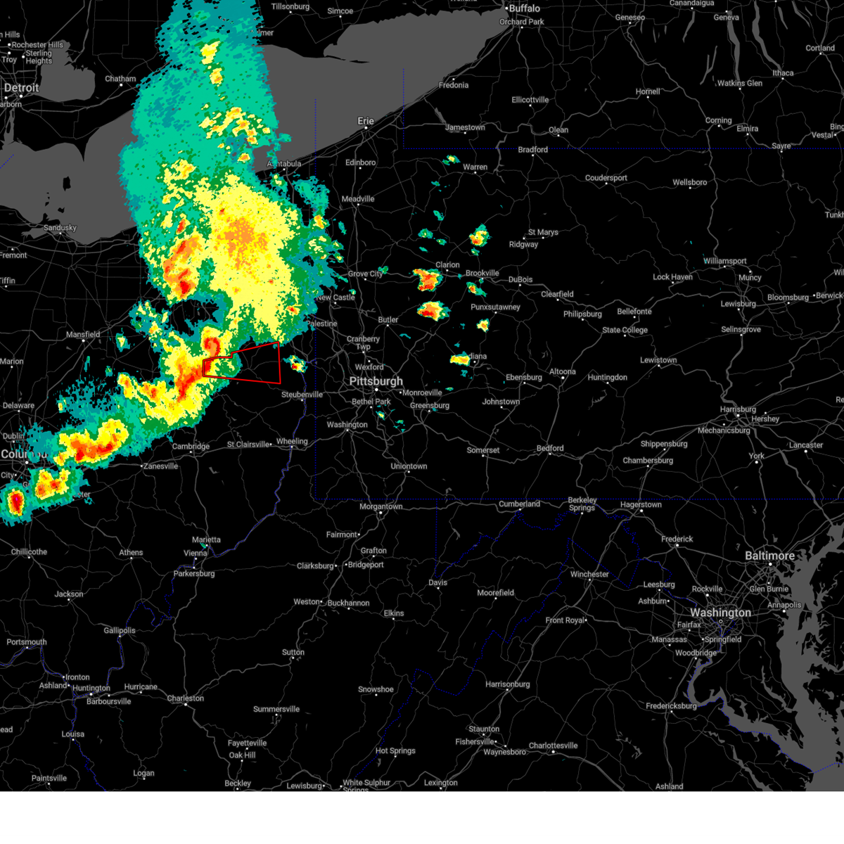 Torpbz the national weather service in pittsburgh has issued a * tornado warning for, northwestern jefferson county in east central ohio, southwestern columbiana county in east central ohio, carroll county in east central ohio, northeastern tuscarawas county in east central ohio, * until 645 pm edt. * at 605 pm edt, a severe thunderstorm capable of producing a tornado was located near east sparta, or near dover, moving east at 45 mph (radar indicated rotation). Hazards include tornado and quarter size hail. Flying debris will be dangerous to those caught without shelter. mobile homes will be damaged or destroyed. damage to roofs, windows, and vehicles will occur. tree damage is likely. this dangerous storm will be near, carrollton around 620 pm edt. Other locations impacted by this tornadic thunderstorm include augusta, atwood lake, bergholz, mineral city, harlem springs, salineville, zoar, malvern, dellroy, and summitville. Torpbz the national weather service in pittsburgh has issued a * tornado warning for, northwestern jefferson county in east central ohio, southwestern columbiana county in east central ohio, carroll county in east central ohio, northeastern tuscarawas county in east central ohio, * until 645 pm edt. * at 605 pm edt, a severe thunderstorm capable of producing a tornado was located near east sparta, or near dover, moving east at 45 mph (radar indicated rotation). Hazards include tornado and quarter size hail. Flying debris will be dangerous to those caught without shelter. mobile homes will be damaged or destroyed. damage to roofs, windows, and vehicles will occur. tree damage is likely. this dangerous storm will be near, carrollton around 620 pm edt. Other locations impacted by this tornadic thunderstorm include augusta, atwood lake, bergholz, mineral city, harlem springs, salineville, zoar, malvern, dellroy, and summitville.
|
| 4/17/2024 6:02 PM EDT |
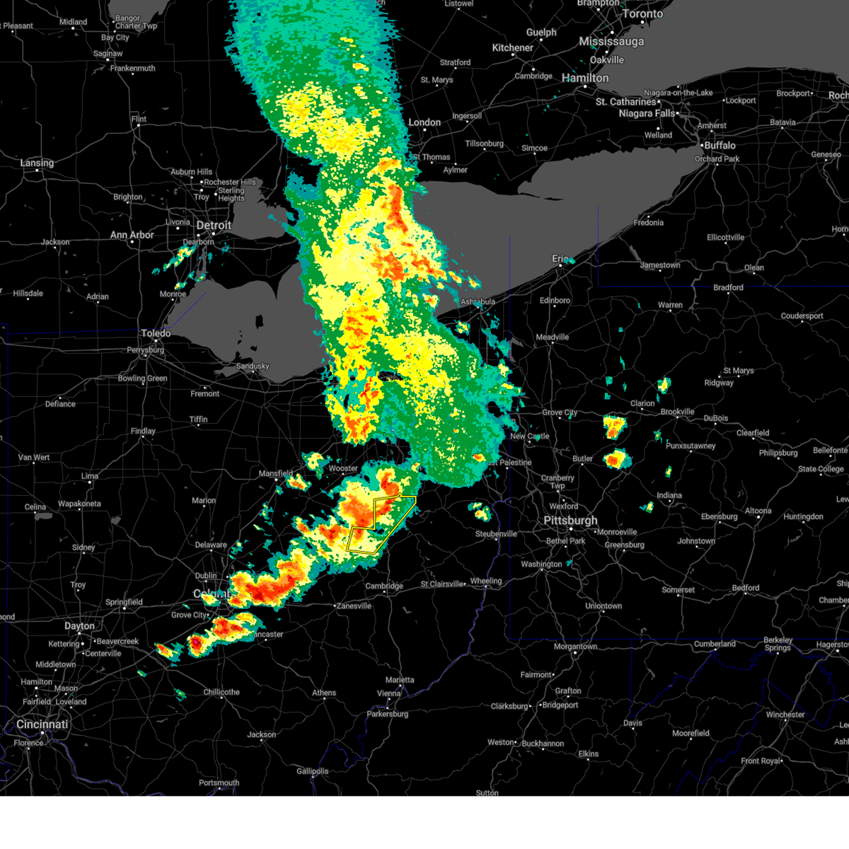 At 601 pm edt, severe thunderstorms were located along a line extending from near navarre to near strasburg to 6 miles southwest of farmerstown, moving east at 45 mph (radar indicated). Hazards include 70 mph wind gusts and quarter size hail. Minor hail damage to vehicles is possible. trees snapped and uprooted. power outages can be expected. Locations impacted include, new philadelphia, dover, strasburg, west lafayette, sugarcreek, bolivar, baltic, mineral city, parral, stone creek, zoar, chili, and bakersville. At 601 pm edt, severe thunderstorms were located along a line extending from near navarre to near strasburg to 6 miles southwest of farmerstown, moving east at 45 mph (radar indicated). Hazards include 70 mph wind gusts and quarter size hail. Minor hail damage to vehicles is possible. trees snapped and uprooted. power outages can be expected. Locations impacted include, new philadelphia, dover, strasburg, west lafayette, sugarcreek, bolivar, baltic, mineral city, parral, stone creek, zoar, chili, and bakersville.
|
| 4/17/2024 6:00 PM EDT |
 Svrpbz the national weather service in pittsburgh has issued a * severe thunderstorm warning for, northern harrison county in east central ohio, northern jefferson county in east central ohio, columbiana county in east central ohio, northeastern coshocton county in east central ohio, carroll county in east central ohio, tuscarawas county in east central ohio, south central lawrence county in western pennsylvania, hancock county in northern west virginia, * until 700 pm edt. * at 600 pm edt, severe thunderstorms were located along a line extending from near east sparta to near sugarcreek to near west lafayette, moving east at 40 mph (radar indicated). Hazards include 70 mph wind gusts and quarter size hail. Minor hail damage to vehicles is possible. trees snapped and uprooted. Power outages can be expected. Svrpbz the national weather service in pittsburgh has issued a * severe thunderstorm warning for, northern harrison county in east central ohio, northern jefferson county in east central ohio, columbiana county in east central ohio, northeastern coshocton county in east central ohio, carroll county in east central ohio, tuscarawas county in east central ohio, south central lawrence county in western pennsylvania, hancock county in northern west virginia, * until 700 pm edt. * at 600 pm edt, severe thunderstorms were located along a line extending from near east sparta to near sugarcreek to near west lafayette, moving east at 40 mph (radar indicated). Hazards include 70 mph wind gusts and quarter size hail. Minor hail damage to vehicles is possible. trees snapped and uprooted. Power outages can be expected.
|
| 4/17/2024 5:50 PM EDT |
 At 549 pm edt, severe thunderstorms were located along a line extending from brewster to walnut creek to 8 miles south of killbuck, moving east at 45 mph. these are destructive storms for northern tuscarawas county (radar indicated). Hazards include 80 mph wind gusts and quarter size hail. Extensive tree damage and widespread power outages. mobile homes will be heavily damaged. expect considerable damage to roofs, windows and vehicles. Locations impacted include, new philadelphia, dover, strasburg, west lafayette, sugarcreek, bolivar, baltic, mineral city, warsaw, parral, stone creek, zoar, nellie, chili, walhonding, layland, bakersville, and blissfield. At 549 pm edt, severe thunderstorms were located along a line extending from brewster to walnut creek to 8 miles south of killbuck, moving east at 45 mph. these are destructive storms for northern tuscarawas county (radar indicated). Hazards include 80 mph wind gusts and quarter size hail. Extensive tree damage and widespread power outages. mobile homes will be heavily damaged. expect considerable damage to roofs, windows and vehicles. Locations impacted include, new philadelphia, dover, strasburg, west lafayette, sugarcreek, bolivar, baltic, mineral city, warsaw, parral, stone creek, zoar, nellie, chili, walhonding, layland, bakersville, and blissfield.
|
| 4/17/2024 5:41 PM EDT |
 At 541 pm edt, severe thunderstorms were located along a line extending from near mount eaton to near berlin to 10 miles south of glenmont, moving east at 40 mph (radar indicated). Hazards include 70 mph wind gusts and quarter size hail. Minor hail damage to vehicles is possible. trees snapped and uprooted. power outages can be expected. Locations impacted include, new philadelphia, dover, strasburg, west lafayette, sugarcreek, bolivar, baltic, mineral city, warsaw, parral, stone creek, zoar, nellie, chili, walhonding, layland, bakersville, and blissfield. At 541 pm edt, severe thunderstorms were located along a line extending from near mount eaton to near berlin to 10 miles south of glenmont, moving east at 40 mph (radar indicated). Hazards include 70 mph wind gusts and quarter size hail. Minor hail damage to vehicles is possible. trees snapped and uprooted. power outages can be expected. Locations impacted include, new philadelphia, dover, strasburg, west lafayette, sugarcreek, bolivar, baltic, mineral city, warsaw, parral, stone creek, zoar, nellie, chili, walhonding, layland, bakersville, and blissfield.
|
| 4/17/2024 5:32 PM EDT |
 At 531 pm edt, severe thunderstorms were located along a line extending from near orrville to near millersburg to near danville, moving east at 45 mph (radar indicated). Hazards include 70 mph wind gusts and quarter size hail. Minor hail damage to vehicles is possible. trees snapped and uprooted. power outages can be expected. Locations impacted include, new philadelphia, dover, strasburg, west lafayette, sugarcreek, bolivar, baltic, mineral city, warsaw, parral, stone creek, zoar, nellie, chili, walhonding, layland, bakersville, and blissfield. At 531 pm edt, severe thunderstorms were located along a line extending from near orrville to near millersburg to near danville, moving east at 45 mph (radar indicated). Hazards include 70 mph wind gusts and quarter size hail. Minor hail damage to vehicles is possible. trees snapped and uprooted. power outages can be expected. Locations impacted include, new philadelphia, dover, strasburg, west lafayette, sugarcreek, bolivar, baltic, mineral city, warsaw, parral, stone creek, zoar, nellie, chili, walhonding, layland, bakersville, and blissfield.
|
| 4/17/2024 5:21 PM EDT |
 At 520 pm edt, severe thunderstorms were located along a line extending from near wooster to near nashville to near danville, moving east at 45 mph (radar indicated). Hazards include 60 mph wind gusts and quarter size hail. Minor hail damage to vehicles is possible. expect wind damage to trees and power lines, resulting in some power outages. Locations impacted include, new philadelphia, dover, strasburg, west lafayette, sugarcreek, bolivar, baltic, mineral city, warsaw, parral, stone creek, zoar, nellie, chili, walhonding, layland, bakersville, and blissfield. At 520 pm edt, severe thunderstorms were located along a line extending from near wooster to near nashville to near danville, moving east at 45 mph (radar indicated). Hazards include 60 mph wind gusts and quarter size hail. Minor hail damage to vehicles is possible. expect wind damage to trees and power lines, resulting in some power outages. Locations impacted include, new philadelphia, dover, strasburg, west lafayette, sugarcreek, bolivar, baltic, mineral city, warsaw, parral, stone creek, zoar, nellie, chili, walhonding, layland, bakersville, and blissfield.
|
| 4/17/2024 5:12 PM EDT |
 Svrpbz the national weather service in pittsburgh has issued a * severe thunderstorm warning for, northern coshocton county in east central ohio, northern tuscarawas county in east central ohio, * until 615 pm edt. * at 511 pm edt, severe thunderstorms were located along a line extending from near shreve to near nashville to near gambier, moving east at 45 mph (radar indicated). Hazards include 60 mph wind gusts and quarter size hail. Minor hail damage to vehicles is possible. Expect wind damage to trees and power lines, resulting in some power outages. Svrpbz the national weather service in pittsburgh has issued a * severe thunderstorm warning for, northern coshocton county in east central ohio, northern tuscarawas county in east central ohio, * until 615 pm edt. * at 511 pm edt, severe thunderstorms were located along a line extending from near shreve to near nashville to near gambier, moving east at 45 mph (radar indicated). Hazards include 60 mph wind gusts and quarter size hail. Minor hail damage to vehicles is possible. Expect wind damage to trees and power lines, resulting in some power outages.
|
| 4/2/2024 7:42 PM EDT |
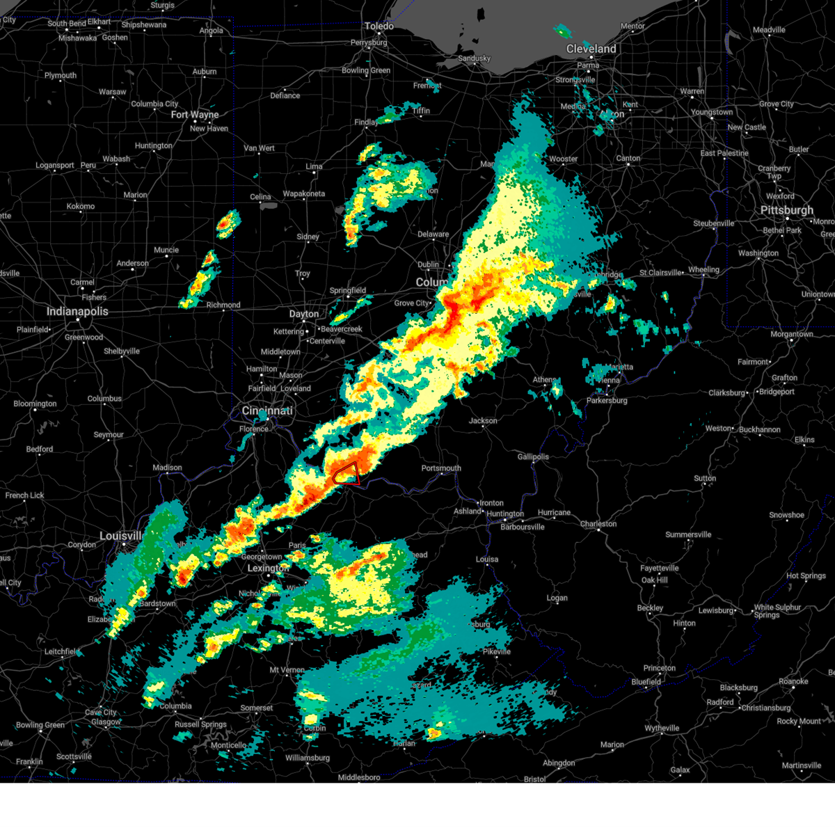 The storm which prompted the warning has moved out of the area. therefore, the warning will be allowed to expire. a tornado watch remains in effect until 1000 pm edt for northern kentucky, and southwestern ohio. please report previous tornadoes, wind damage or hail to the national weather service by going to our website at weather.gov/iln and submitting your report via social media. The storm which prompted the warning has moved out of the area. therefore, the warning will be allowed to expire. a tornado watch remains in effect until 1000 pm edt for northern kentucky, and southwestern ohio. please report previous tornadoes, wind damage or hail to the national weather service by going to our website at weather.gov/iln and submitting your report via social media.
|
| 4/2/2024 7:36 PM EDT |
 Svriln the national weather service in wilmington has issued a * severe thunderstorm warning for, mason county in northern kentucky, robertson county in northern kentucky, southeastern bracken county in northern kentucky, lewis county in northeastern kentucky, southeastern brown county in southwestern ohio, adams county in south central ohio, southern pike county in south central ohio, scioto county in south central ohio, * until 845 pm edt. * at 735 pm edt, severe thunderstorms were located along a line extending from near seaman to 10 miles west of fairview, moving east at 45 mph (radar indicated). Hazards include 60 mph wind gusts and quarter size hail. Minor hail damage to vehicles is possible. Expect wind damage to trees and power lines. Svriln the national weather service in wilmington has issued a * severe thunderstorm warning for, mason county in northern kentucky, robertson county in northern kentucky, southeastern bracken county in northern kentucky, lewis county in northeastern kentucky, southeastern brown county in southwestern ohio, adams county in south central ohio, southern pike county in south central ohio, scioto county in south central ohio, * until 845 pm edt. * at 735 pm edt, severe thunderstorms were located along a line extending from near seaman to 10 miles west of fairview, moving east at 45 mph (radar indicated). Hazards include 60 mph wind gusts and quarter size hail. Minor hail damage to vehicles is possible. Expect wind damage to trees and power lines.
|
| 4/2/2024 7:30 PM EDT |
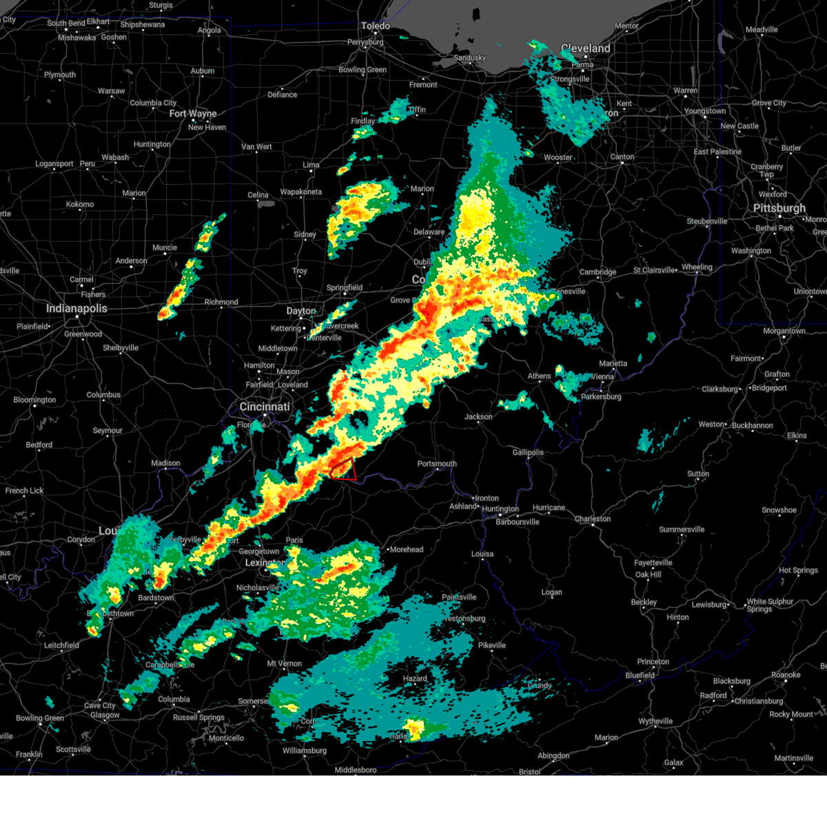 At 730 pm edt, a confirmed tornado was located over ripley, moving east at 45 mph (radar confirmed tornado. radar shows tornado debris in the air). Hazards include damaging tornado and quarter size hail. Flying debris will be dangerous to those caught without shelter. mobile homes will be damaged or destroyed. damage to roofs, windows, and vehicles will occur. tree damage is likely. Locations impacted include, maysville, ripley, aberdeen, dover, minerva, moranburg, south ripley, and tuckahoe. At 730 pm edt, a confirmed tornado was located over ripley, moving east at 45 mph (radar confirmed tornado. radar shows tornado debris in the air). Hazards include damaging tornado and quarter size hail. Flying debris will be dangerous to those caught without shelter. mobile homes will be damaged or destroyed. damage to roofs, windows, and vehicles will occur. tree damage is likely. Locations impacted include, maysville, ripley, aberdeen, dover, minerva, moranburg, south ripley, and tuckahoe.
|
| 4/2/2024 7:27 PM EDT |
 At 727 pm edt, a severe thunderstorm capable of producing a tornado was located near ripley, moving east at 50 mph (radar indicated rotation). Hazards include tornado and quarter size hail. Flying debris will be dangerous to those caught without shelter. mobile homes will be damaged or destroyed. damage to roofs, windows, and vehicles will occur. tree damage is likely. Locations impacted include, maysville, ripley, aberdeen, dover, minerva, moranburg, south ripley, and tuckahoe. At 727 pm edt, a severe thunderstorm capable of producing a tornado was located near ripley, moving east at 50 mph (radar indicated rotation). Hazards include tornado and quarter size hail. Flying debris will be dangerous to those caught without shelter. mobile homes will be damaged or destroyed. damage to roofs, windows, and vehicles will occur. tree damage is likely. Locations impacted include, maysville, ripley, aberdeen, dover, minerva, moranburg, south ripley, and tuckahoe.
|
| 4/2/2024 7:27 PM EDT |
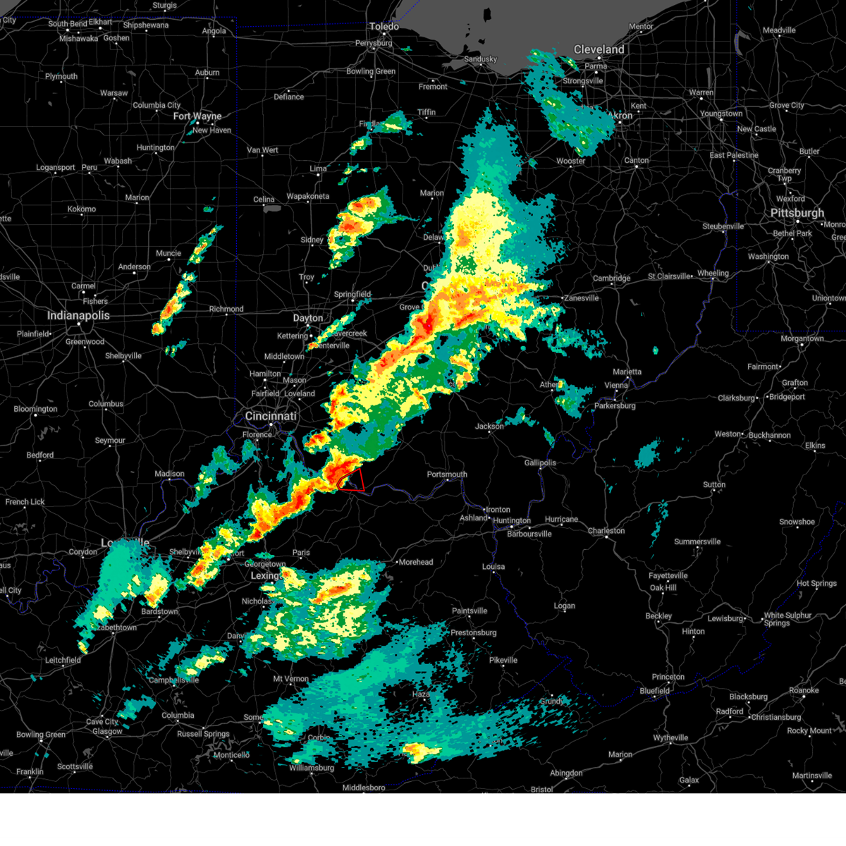 the tornado warning has been cancelled and is no longer in effect the tornado warning has been cancelled and is no longer in effect
|
| 4/2/2024 7:20 PM EDT |
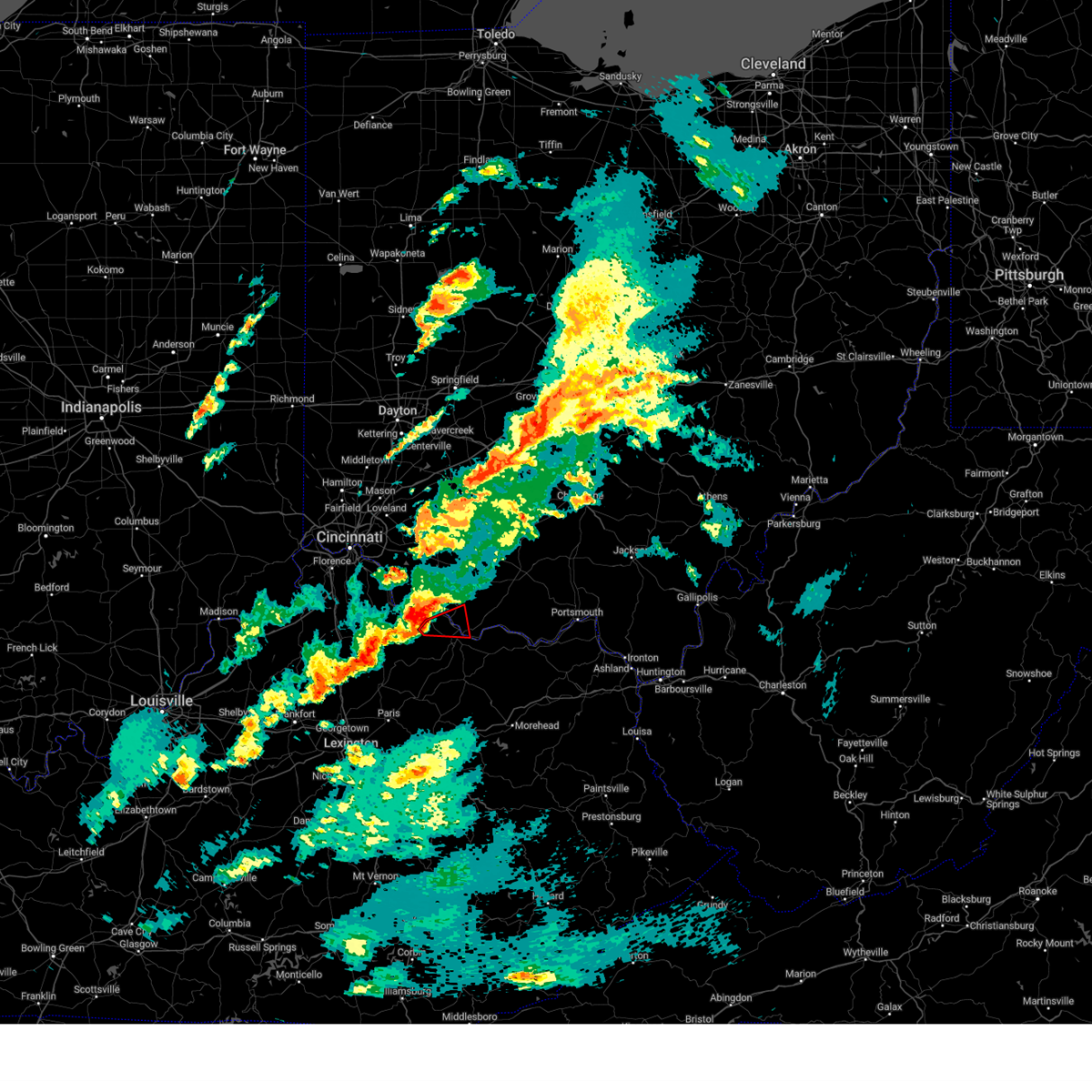 At 720 pm edt, a severe thunderstorm capable of producing a tornado was located near brooksville, moving east at 50 mph (radar indicated rotation). Hazards include tornado and quarter size hail. Flying debris will be dangerous to those caught without shelter. mobile homes will be damaged or destroyed. damage to roofs, windows, and vehicles will occur. tree damage is likely. Locations impacted include, maysville, ripley, aberdeen, dover, germantown, minerva, moranburg, south ripley, tuckahoe, parina, and chatham. At 720 pm edt, a severe thunderstorm capable of producing a tornado was located near brooksville, moving east at 50 mph (radar indicated rotation). Hazards include tornado and quarter size hail. Flying debris will be dangerous to those caught without shelter. mobile homes will be damaged or destroyed. damage to roofs, windows, and vehicles will occur. tree damage is likely. Locations impacted include, maysville, ripley, aberdeen, dover, germantown, minerva, moranburg, south ripley, tuckahoe, parina, and chatham.
|
| 4/2/2024 7:15 PM EDT |
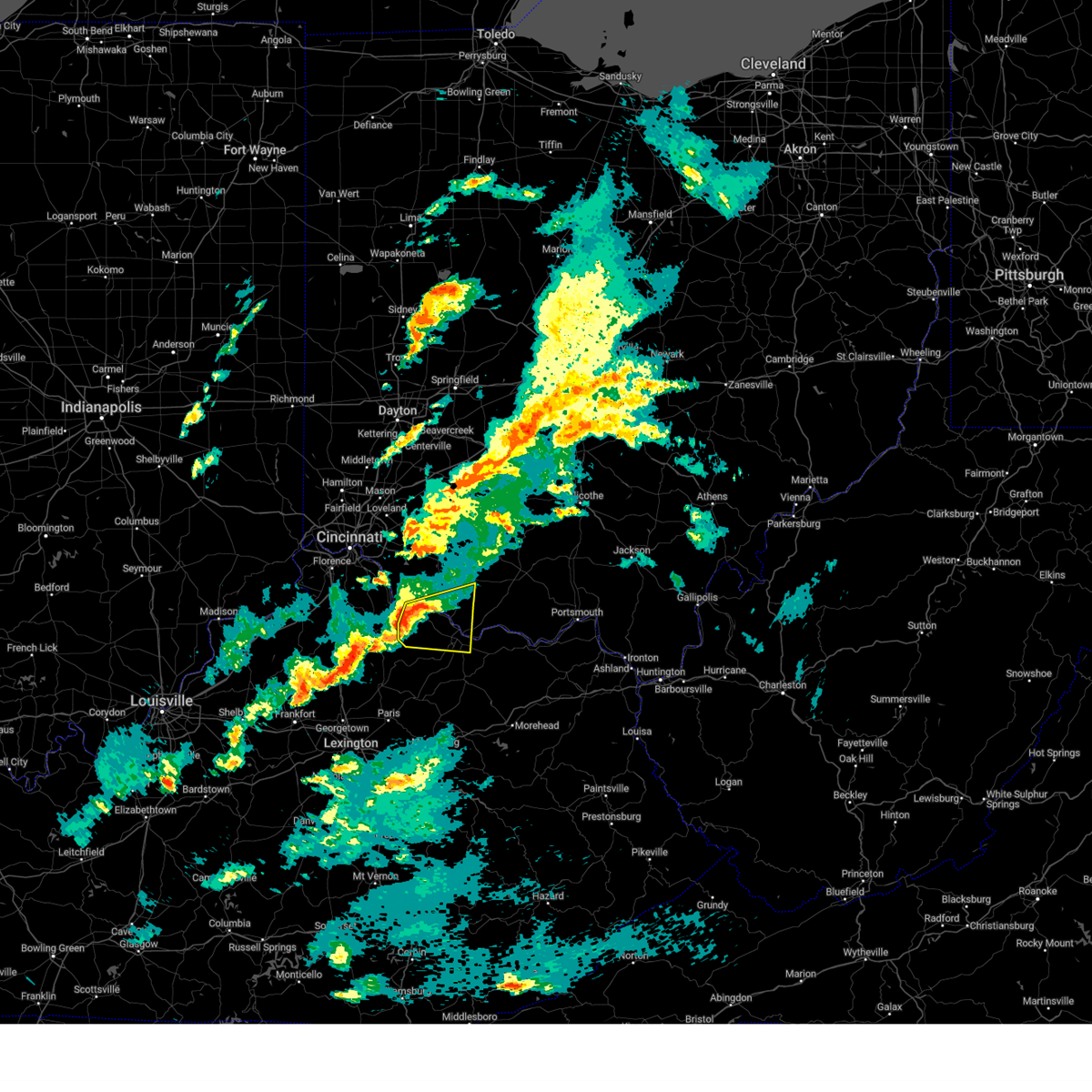 At 715 pm edt, a severe thunderstorm was located over brooksville, moving east at 55 mph (radar indicated). Hazards include 60 mph wind gusts and quarter size hail. Minor hail damage to vehicles is possible. expect wind damage to trees and power lines. Locations impacted include, maysville, georgetown, washington, ripley, aberdeen, augusta, brooksville, decatur, russellville, dover, higginsport, germantown, chilo, bradford, stonewall, powersville, johnsville, south ripley, chatham, and utopia. At 715 pm edt, a severe thunderstorm was located over brooksville, moving east at 55 mph (radar indicated). Hazards include 60 mph wind gusts and quarter size hail. Minor hail damage to vehicles is possible. expect wind damage to trees and power lines. Locations impacted include, maysville, georgetown, washington, ripley, aberdeen, augusta, brooksville, decatur, russellville, dover, higginsport, germantown, chilo, bradford, stonewall, powersville, johnsville, south ripley, chatham, and utopia.
|
| 4/2/2024 7:15 PM EDT |
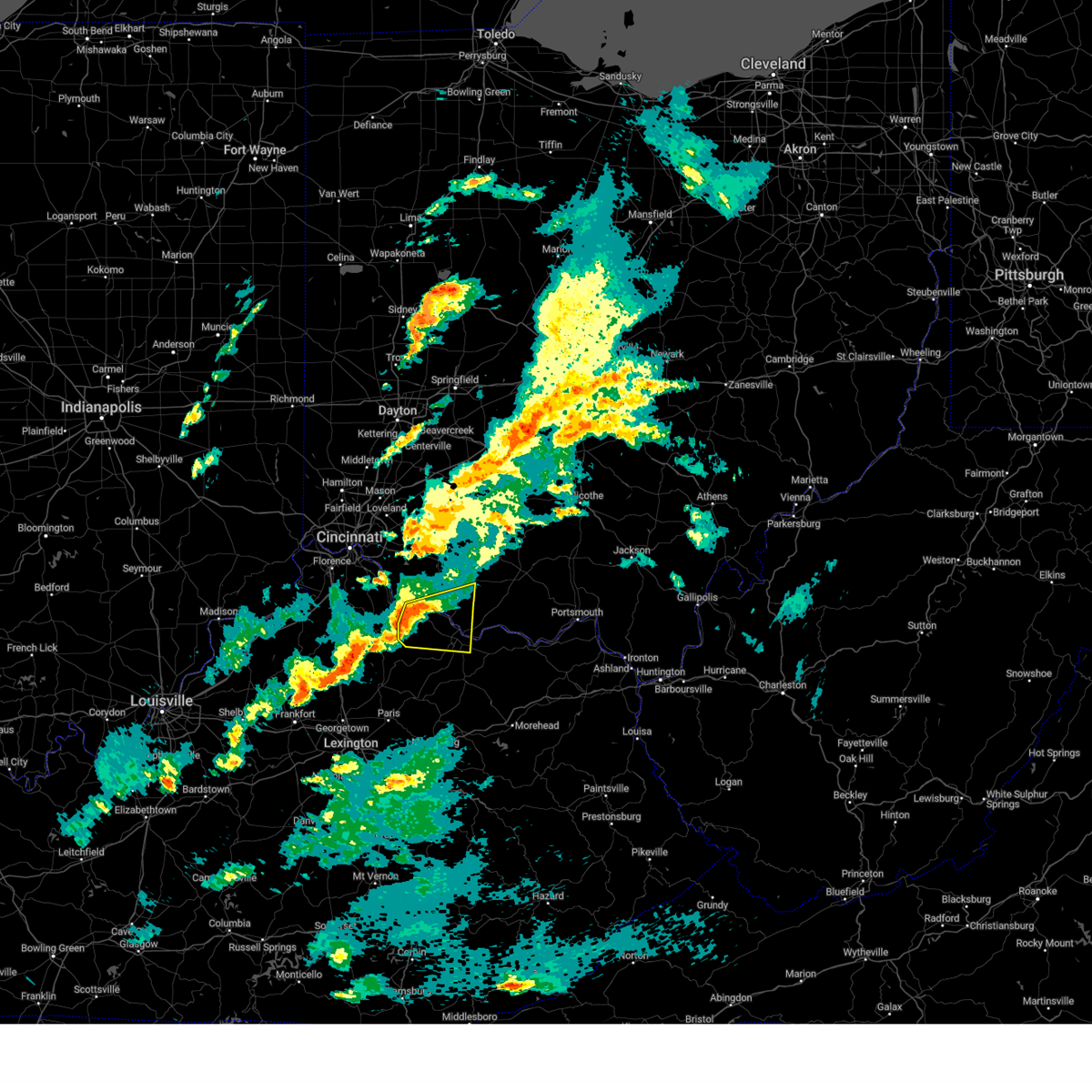 the severe thunderstorm warning has been cancelled and is no longer in effect the severe thunderstorm warning has been cancelled and is no longer in effect
|
| 4/2/2024 7:12 PM EDT |
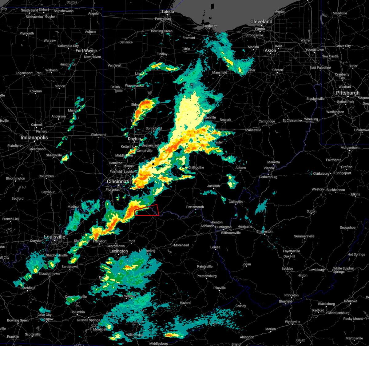 Toriln the national weather service in wilmington has issued a * tornado warning for, northwestern mason county in northern kentucky, central bracken county in northern kentucky, southeastern brown county in southwestern ohio, * until 745 pm edt. * at 711 pm edt, a severe thunderstorm capable of producing a tornado was located near brooksville, moving east at 55 mph (radar indicated rotation). Hazards include tornado and quarter size hail. Flying debris will be dangerous to those caught without shelter. mobile homes will be damaged or destroyed. damage to roofs, windows, and vehicles will occur. Tree damage is likely. Toriln the national weather service in wilmington has issued a * tornado warning for, northwestern mason county in northern kentucky, central bracken county in northern kentucky, southeastern brown county in southwestern ohio, * until 745 pm edt. * at 711 pm edt, a severe thunderstorm capable of producing a tornado was located near brooksville, moving east at 55 mph (radar indicated rotation). Hazards include tornado and quarter size hail. Flying debris will be dangerous to those caught without shelter. mobile homes will be damaged or destroyed. damage to roofs, windows, and vehicles will occur. Tree damage is likely.
|
| 4/2/2024 7:06 PM EDT |
 Svriln the national weather service in wilmington has issued a * severe thunderstorm warning for, central mason county in northern kentucky, robertson county in northern kentucky, bracken county in northern kentucky, southeastern pendleton county in northern kentucky, south central clermont county in southwestern ohio, southern brown county in southwestern ohio, * until 745 pm edt. * at 705 pm edt, a severe thunderstorm was located near falmouth, moving east at 55 mph (radar indicated). Hazards include 60 mph wind gusts and quarter size hail. Minor hail damage to vehicles is possible. Expect wind damage to trees and power lines. Svriln the national weather service in wilmington has issued a * severe thunderstorm warning for, central mason county in northern kentucky, robertson county in northern kentucky, bracken county in northern kentucky, southeastern pendleton county in northern kentucky, south central clermont county in southwestern ohio, southern brown county in southwestern ohio, * until 745 pm edt. * at 705 pm edt, a severe thunderstorm was located near falmouth, moving east at 55 mph (radar indicated). Hazards include 60 mph wind gusts and quarter size hail. Minor hail damage to vehicles is possible. Expect wind damage to trees and power lines.
|
| 4/2/2024 8:34 AM EDT |
 At 833 am edt, a severe thunderstorm was located near ripley, moving east at 40 mph (radar indicated). Hazards include 60 mph wind gusts. Expect damage to trees and power lines. Locations impacted include, west union, peebles, ripley, winchester, seaman, emerald, blue creek, decatur, russellville, dover, cherry fork, sinking spring, dunkinsville, may hill, locust grove, bentonville, fincastle, south ripley, state route 32 at us route 62, and cedar mills. At 833 am edt, a severe thunderstorm was located near ripley, moving east at 40 mph (radar indicated). Hazards include 60 mph wind gusts. Expect damage to trees and power lines. Locations impacted include, west union, peebles, ripley, winchester, seaman, emerald, blue creek, decatur, russellville, dover, cherry fork, sinking spring, dunkinsville, may hill, locust grove, bentonville, fincastle, south ripley, state route 32 at us route 62, and cedar mills.
|
| 4/2/2024 8:34 AM EDT |
 the severe thunderstorm warning has been cancelled and is no longer in effect the severe thunderstorm warning has been cancelled and is no longer in effect
|
| 4/2/2024 8:19 AM EDT |
 Svriln the national weather service in wilmington has issued a * severe thunderstorm warning for, north central mason county in northern kentucky, northeastern bracken county in northern kentucky, southern brown county in southwestern ohio, adams county in south central ohio, west central pike county in south central ohio, southeastern highland county in south central ohio, * until 900 am edt. * at 819 am edt, a severe thunderstorm was located over higginsport, moving east at 60 mph (radar indicated). Hazards include 60 mph wind gusts. expect damage to trees and power lines Svriln the national weather service in wilmington has issued a * severe thunderstorm warning for, north central mason county in northern kentucky, northeastern bracken county in northern kentucky, southern brown county in southwestern ohio, adams county in south central ohio, west central pike county in south central ohio, southeastern highland county in south central ohio, * until 900 am edt. * at 819 am edt, a severe thunderstorm was located over higginsport, moving east at 60 mph (radar indicated). Hazards include 60 mph wind gusts. expect damage to trees and power lines
|
| 8/12/2023 7:08 PM EDT |
 At 708 pm edt, a severe thunderstorm was located near sugarcreek, or near dover, moving east at 30 mph (radar indicated). Hazards include 60 mph wind gusts and quarter size hail. Minor hail damage to vehicles is possible. expect wind damage to trees and power lines, resulting in some power outages. locations impacted include, new philadelphia, dover, sugarcreek, gnadenhutten, tuscarawas, baltic, midvale, port washington, barnhill, roswell, stone creek, gilmore, bakersville, and chili. hail threat, radar indicated max hail size, 1. 00 in wind threat, radar indicated max wind gust, 60 mph. At 708 pm edt, a severe thunderstorm was located near sugarcreek, or near dover, moving east at 30 mph (radar indicated). Hazards include 60 mph wind gusts and quarter size hail. Minor hail damage to vehicles is possible. expect wind damage to trees and power lines, resulting in some power outages. locations impacted include, new philadelphia, dover, sugarcreek, gnadenhutten, tuscarawas, baltic, midvale, port washington, barnhill, roswell, stone creek, gilmore, bakersville, and chili. hail threat, radar indicated max hail size, 1. 00 in wind threat, radar indicated max wind gust, 60 mph.
|
| 8/12/2023 7:00 PM EDT |
 At 700 pm edt, severe thunderstorms were located along a line extending from 7 miles northeast of minerva to near carrollton to 7 miles southeast of farmerstown, moving east at 45 mph (radar indicated). Hazards include 60 mph wind gusts and quarter size hail. Minor hail damage to vehicles is possible. Expect wind damage to trees and power lines, resulting in some power outages. At 700 pm edt, severe thunderstorms were located along a line extending from 7 miles northeast of minerva to near carrollton to 7 miles southeast of farmerstown, moving east at 45 mph (radar indicated). Hazards include 60 mph wind gusts and quarter size hail. Minor hail damage to vehicles is possible. Expect wind damage to trees and power lines, resulting in some power outages.
|
| 8/12/2023 6:41 PM EDT |
 At 641 pm edt, a severe thunderstorm was located over berlin, or near millersburg, moving east at 30 mph (radar indicated). Hazards include 60 mph wind gusts and penny size hail. expect damage to trees and power lines, resulting in some power outages At 641 pm edt, a severe thunderstorm was located over berlin, or near millersburg, moving east at 30 mph (radar indicated). Hazards include 60 mph wind gusts and penny size hail. expect damage to trees and power lines, resulting in some power outages
|
| 8/12/2023 4:44 PM EDT |
 At 444 pm edt, a severe thunderstorm was located near new philadelphia, moving east at 25 mph (radar indicated). Hazards include ping pong ball size hail and 60 mph wind gusts. People and animals outdoors will be injured. expect hail damage to roofs, siding, windows, and vehicles. expect wind damage to trees and power lines, resulting in some power outages. Locations impacted include, new philadelphia, dover, uhrichsville, dennison, strasburg, midvale, bowerston, barnhill, dellroy, sherrodsville, roswell, parral, leesville, atwood lake, leesville lake park, and tappan lake. At 444 pm edt, a severe thunderstorm was located near new philadelphia, moving east at 25 mph (radar indicated). Hazards include ping pong ball size hail and 60 mph wind gusts. People and animals outdoors will be injured. expect hail damage to roofs, siding, windows, and vehicles. expect wind damage to trees and power lines, resulting in some power outages. Locations impacted include, new philadelphia, dover, uhrichsville, dennison, strasburg, midvale, bowerston, barnhill, dellroy, sherrodsville, roswell, parral, leesville, atwood lake, leesville lake park, and tappan lake.
|
| 8/12/2023 4:42 PM EDT | Wires down on state route 800. time estimate in tuscarawas county OH, 178 miles SW of Dover, OH |
| 8/12/2023 4:28 PM EDT | Quarter sized hail reported 176.4 miles SW of Dover, OH |
| 8/12/2023 4:23 PM EDT |
 At 423 pm edt, a severe thunderstorm was located near dover, moving east at 25 mph (radar indicated). Hazards include golf ball size hail and 60 mph wind gusts. People and animals outdoors will be injured. expect hail damage to roofs, siding, windows, and vehicles. expect wind damage to trees and power lines, resulting in some power outages. locations impacted include, new philadelphia, dover, uhrichsville, dennison, strasburg, sugarcreek, gnadenhutten, tuscarawas, midvale, bowerston, barnhill, dellroy, sherrodsville, roswell, parral, leesville, stillwater, atwood lake, leesville lake park, and tappan lake. thunderstorm damage threat, considerable hail threat, radar indicated max hail size, 1. 75 in wind threat, radar indicated max wind gust, 60 mph. At 423 pm edt, a severe thunderstorm was located near dover, moving east at 25 mph (radar indicated). Hazards include golf ball size hail and 60 mph wind gusts. People and animals outdoors will be injured. expect hail damage to roofs, siding, windows, and vehicles. expect wind damage to trees and power lines, resulting in some power outages. locations impacted include, new philadelphia, dover, uhrichsville, dennison, strasburg, sugarcreek, gnadenhutten, tuscarawas, midvale, bowerston, barnhill, dellroy, sherrodsville, roswell, parral, leesville, stillwater, atwood lake, leesville lake park, and tappan lake. thunderstorm damage threat, considerable hail threat, radar indicated max hail size, 1. 75 in wind threat, radar indicated max wind gust, 60 mph.
|
| 8/12/2023 4:10 PM EDT |
 At 410 pm edt, a severe thunderstorm was located over sugarcreek, or 8 miles west of dover, moving east at 25 mph (radar indicated). Hazards include 60 mph wind gusts and quarter size hail. Minor hail damage to vehicles is possible. expect wind damage to trees and power lines, resulting in some power outages. locations impacted include, new philadelphia, dover, uhrichsville, dennison, strasburg, sugarcreek, gnadenhutten, tuscarawas, midvale, bowerston, barnhill, dellroy, sherrodsville, roswell, parral, leesville, stillwater, atwood lake, leesville lake park, and tappan lake. hail threat, radar indicated max hail size, 1. 00 in wind threat, radar indicated max wind gust, 60 mph. At 410 pm edt, a severe thunderstorm was located over sugarcreek, or 8 miles west of dover, moving east at 25 mph (radar indicated). Hazards include 60 mph wind gusts and quarter size hail. Minor hail damage to vehicles is possible. expect wind damage to trees and power lines, resulting in some power outages. locations impacted include, new philadelphia, dover, uhrichsville, dennison, strasburg, sugarcreek, gnadenhutten, tuscarawas, midvale, bowerston, barnhill, dellroy, sherrodsville, roswell, parral, leesville, stillwater, atwood lake, leesville lake park, and tappan lake. hail threat, radar indicated max hail size, 1. 00 in wind threat, radar indicated max wind gust, 60 mph.
|
| 8/12/2023 3:58 PM EDT |
 At 357 pm edt, a severe thunderstorm was located over walnut creek, or 8 miles east of millersburg, moving east at 25 mph (radar indicated). Hazards include 60 mph wind gusts and quarter size hail. Minor hail damage to vehicles is possible. Expect wind damage to trees and power lines, resulting in some power outages. At 357 pm edt, a severe thunderstorm was located over walnut creek, or 8 miles east of millersburg, moving east at 25 mph (radar indicated). Hazards include 60 mph wind gusts and quarter size hail. Minor hail damage to vehicles is possible. Expect wind damage to trees and power lines, resulting in some power outages.
|
| 8/12/2023 3:52 PM EDT |
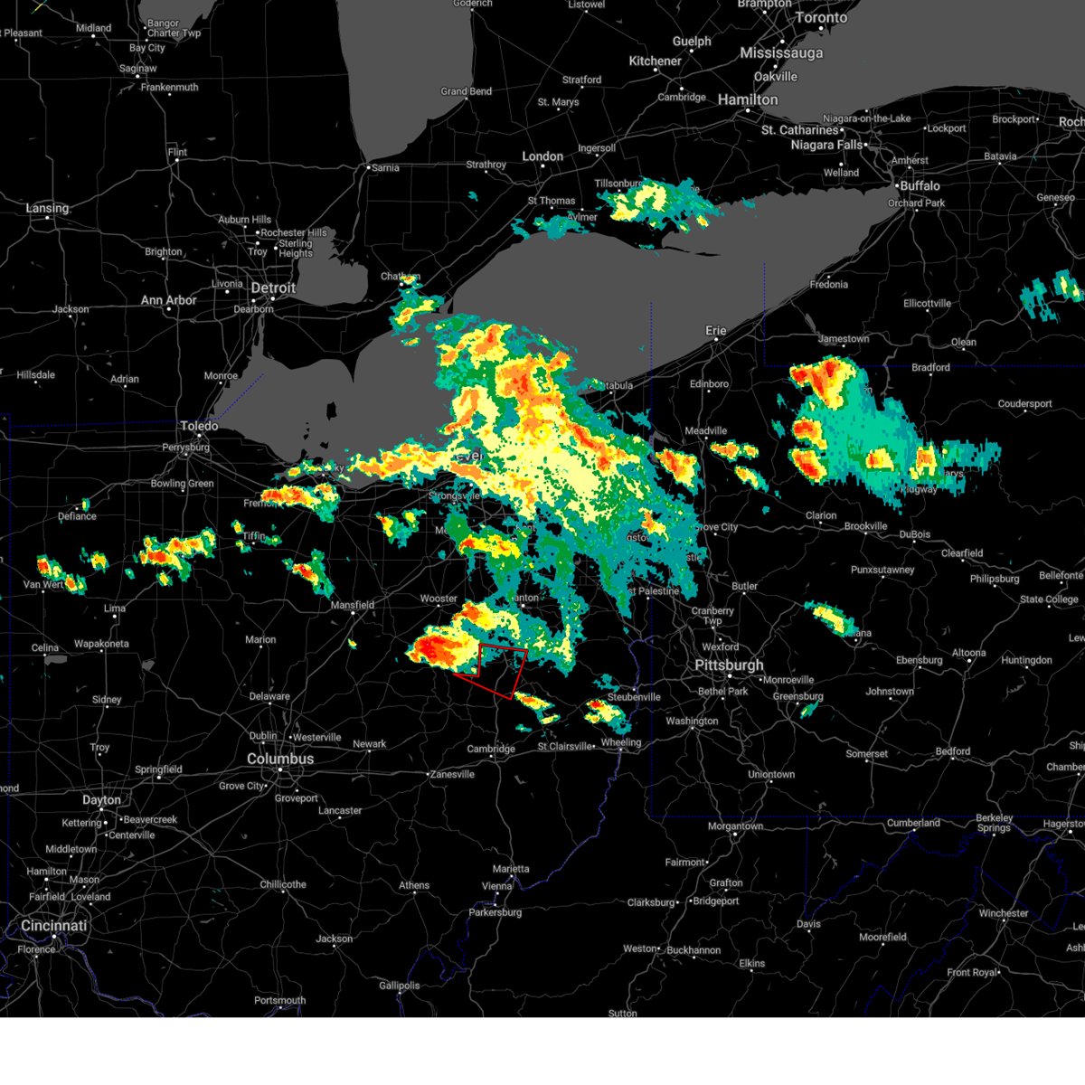 At 351 pm edt, a severe thunderstorm capable of producing a tornado was located near farmerstown, or 7 miles southeast of millersburg, moving east at 30 mph (radar indicated rotation). Hazards include tornado and half dollar size hail. Flying debris will be dangerous to those caught without shelter. mobile homes will be damaged or destroyed. damage to roofs, windows, and vehicles will occur. tree damage is likely. Locations impacted include, new philadelphia, dover, strasburg, sugarcreek, gnadenhutten, baltic, parral, and stone creek. At 351 pm edt, a severe thunderstorm capable of producing a tornado was located near farmerstown, or 7 miles southeast of millersburg, moving east at 30 mph (radar indicated rotation). Hazards include tornado and half dollar size hail. Flying debris will be dangerous to those caught without shelter. mobile homes will be damaged or destroyed. damage to roofs, windows, and vehicles will occur. tree damage is likely. Locations impacted include, new philadelphia, dover, strasburg, sugarcreek, gnadenhutten, baltic, parral, and stone creek.
|
| 8/12/2023 3:37 PM EDT |
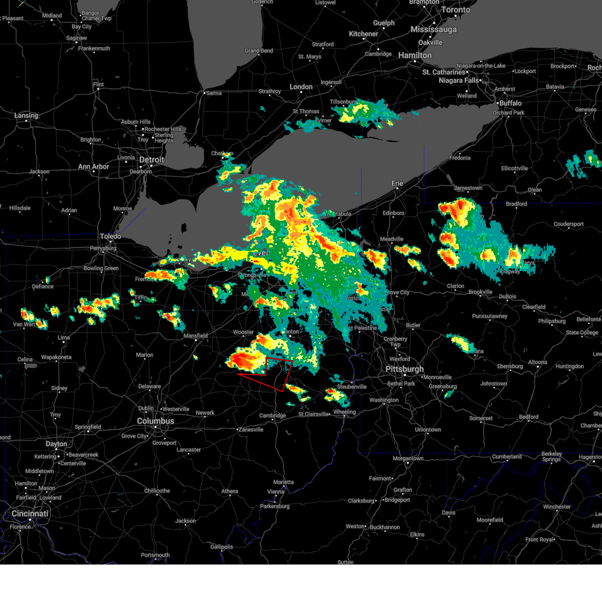 At 336 pm edt, a severe thunderstorm capable of producing a tornado was located over millersburg, moving east at 30 mph (radar indicated rotation). Hazards include tornado and half dollar size hail. Flying debris will be dangerous to those caught without shelter. mobile homes will be damaged or destroyed. damage to roofs, windows, and vehicles will occur. tree damage is likely. This tornadic thunderstorm will remain over mainly rural areas of northeastern coshocton and central tuscarawas counties, including the following locations, chili, stone creek, bakersville, port washington, parral, layland, baltic, and gnadenhutten. At 336 pm edt, a severe thunderstorm capable of producing a tornado was located over millersburg, moving east at 30 mph (radar indicated rotation). Hazards include tornado and half dollar size hail. Flying debris will be dangerous to those caught without shelter. mobile homes will be damaged or destroyed. damage to roofs, windows, and vehicles will occur. tree damage is likely. This tornadic thunderstorm will remain over mainly rural areas of northeastern coshocton and central tuscarawas counties, including the following locations, chili, stone creek, bakersville, port washington, parral, layland, baltic, and gnadenhutten.
|
| 7/29/2023 6:36 AM EDT |
 The severe thunderstorm warning for northwestern guernsey, eastern coshocton, northeastern muskingum, west central carroll and tuscarawas counties will expire at 645 am edt, the storms which prompted the warning have weakened below severe limits, and no longer pose an immediate threat to life or property. therefore, the warning will be allowed to expire. however, gusty winds and heavy rain are still possible with these thunderstorms. a severe thunderstorm watch remains in effect until 1100 am edt for east central ohio. The severe thunderstorm warning for northwestern guernsey, eastern coshocton, northeastern muskingum, west central carroll and tuscarawas counties will expire at 645 am edt, the storms which prompted the warning have weakened below severe limits, and no longer pose an immediate threat to life or property. therefore, the warning will be allowed to expire. however, gusty winds and heavy rain are still possible with these thunderstorms. a severe thunderstorm watch remains in effect until 1100 am edt for east central ohio.
|
| 7/29/2023 6:23 AM EDT |
 At 622 am edt, severe thunderstorms were located along a line extending from 6 miles west of green to sugarcreek to near coshocton, moving east at 45 mph (radar indicated). Hazards include 60 mph wind gusts. Expect damage to trees and power lines, resulting in some power outages. locations impacted include, new philadelphia, dover, coshocton, uhrichsville, newcomerstown, strasburg, west lafayette, sugarcreek, gnadenhutten, tuscarawas, bolivar, baltic, midvale, mineral city, port washington, barnhill, conesville, roswell, parral, and stone creek. hail threat, radar indicated max hail size, <. 75 in wind threat, radar indicated max wind gust, 60 mph. At 622 am edt, severe thunderstorms were located along a line extending from 6 miles west of green to sugarcreek to near coshocton, moving east at 45 mph (radar indicated). Hazards include 60 mph wind gusts. Expect damage to trees and power lines, resulting in some power outages. locations impacted include, new philadelphia, dover, coshocton, uhrichsville, newcomerstown, strasburg, west lafayette, sugarcreek, gnadenhutten, tuscarawas, bolivar, baltic, midvale, mineral city, port washington, barnhill, conesville, roswell, parral, and stone creek. hail threat, radar indicated max hail size, <. 75 in wind threat, radar indicated max wind gust, 60 mph.
|
| 7/29/2023 6:12 AM EDT |
 At 612 am edt, severe thunderstorms were located along a line extending from near doylestown to near walnut creek to near dresden, moving east at 45 mph (radar indicated). Hazards include 60 mph wind gusts. Expect damage to trees and power lines, resulting in some power outages. locations impacted include, new philadelphia, dover, coshocton, cambridge, uhrichsville, newcomerstown, strasburg, west lafayette, sugarcreek, dresden, gnadenhutten, tuscarawas, bolivar, baltic, midvale, mineral city, warsaw, port washington, barnhill, and conesville. hail threat, radar indicated max hail size, <. 75 in wind threat, radar indicated max wind gust, 60 mph. At 612 am edt, severe thunderstorms were located along a line extending from near doylestown to near walnut creek to near dresden, moving east at 45 mph (radar indicated). Hazards include 60 mph wind gusts. Expect damage to trees and power lines, resulting in some power outages. locations impacted include, new philadelphia, dover, coshocton, cambridge, uhrichsville, newcomerstown, strasburg, west lafayette, sugarcreek, dresden, gnadenhutten, tuscarawas, bolivar, baltic, midvale, mineral city, warsaw, port washington, barnhill, and conesville. hail threat, radar indicated max hail size, <. 75 in wind threat, radar indicated max wind gust, 60 mph.
|
| 7/29/2023 6:00 AM EDT |
 At 600 am edt, severe thunderstorms were located along a line extending from near creston to killbuck to 6 miles north of frazeysburg, moving east at 45 mph (radar indicated). Hazards include 60 mph wind gusts. Expect damage to trees and power lines, resulting in some power outages. locations impacted include, new philadelphia, dover, coshocton, cambridge, uhrichsville, newcomerstown, strasburg, west lafayette, sugarcreek, dresden, frazeysburg, gnadenhutten, tuscarawas, bolivar, baltic, midvale, mineral city, warsaw, port washington, and barnhill. hail threat, radar indicated max hail size, <. 75 in wind threat, radar indicated max wind gust, 60 mph. At 600 am edt, severe thunderstorms were located along a line extending from near creston to killbuck to 6 miles north of frazeysburg, moving east at 45 mph (radar indicated). Hazards include 60 mph wind gusts. Expect damage to trees and power lines, resulting in some power outages. locations impacted include, new philadelphia, dover, coshocton, cambridge, uhrichsville, newcomerstown, strasburg, west lafayette, sugarcreek, dresden, frazeysburg, gnadenhutten, tuscarawas, bolivar, baltic, midvale, mineral city, warsaw, port washington, and barnhill. hail threat, radar indicated max hail size, <. 75 in wind threat, radar indicated max wind gust, 60 mph.
|
| 7/29/2023 5:50 AM EDT |
 At 550 am edt, severe thunderstorms were located along a line extending from near west salem to glenmont to 8 miles north of hanover, moving east at 45 mph (radar indicated). Hazards include 60 mph wind gusts. Expect damage to trees and power lines, resulting in some power outages. locations impacted include, new philadelphia, dover, coshocton, cambridge, uhrichsville, newcomerstown, strasburg, west lafayette, sugarcreek, dresden, frazeysburg, gnadenhutten, tuscarawas, bolivar, baltic, midvale, mineral city, warsaw, port washington, and barnhill. hail threat, radar indicated max hail size, <. 75 in wind threat, radar indicated max wind gust, 60 mph. At 550 am edt, severe thunderstorms were located along a line extending from near west salem to glenmont to 8 miles north of hanover, moving east at 45 mph (radar indicated). Hazards include 60 mph wind gusts. Expect damage to trees and power lines, resulting in some power outages. locations impacted include, new philadelphia, dover, coshocton, cambridge, uhrichsville, newcomerstown, strasburg, west lafayette, sugarcreek, dresden, frazeysburg, gnadenhutten, tuscarawas, bolivar, baltic, midvale, mineral city, warsaw, port washington, and barnhill. hail threat, radar indicated max hail size, <. 75 in wind threat, radar indicated max wind gust, 60 mph.
|
| 7/29/2023 5:40 AM EDT |
 At 538 am edt, severe thunderstorms were located along a line extending from polk to 6 miles north of danville to utica, moving east at 45 mph (radar indicated). Hazards include 60 mph wind gusts. expect damage to trees and power lines, resulting in some power outages At 538 am edt, severe thunderstorms were located along a line extending from polk to 6 miles north of danville to utica, moving east at 45 mph (radar indicated). Hazards include 60 mph wind gusts. expect damage to trees and power lines, resulting in some power outages
|
| 7/24/2023 7:26 PM EDT |
 At 726 pm edt, a severe thunderstorm was located near brooksville, moving southeast at 30 mph (radar indicated). Hazards include 60 mph wind gusts and quarter size hail. Minor hail damage to vehicles is possible. expect wind damage to trees and power lines. locations impacted include, maysville, ripley, augusta, brooksville, dover, germantown, minerva, woolcutt, neave, berlin, stonewall, parina, powersville, lowell, johnsville, rock springs, petra, south ripley, chatham and tuckahoe. hail threat, radar indicated max hail size, 1. 00 in wind threat, radar indicated max wind gust, 60 mph. At 726 pm edt, a severe thunderstorm was located near brooksville, moving southeast at 30 mph (radar indicated). Hazards include 60 mph wind gusts and quarter size hail. Minor hail damage to vehicles is possible. expect wind damage to trees and power lines. locations impacted include, maysville, ripley, augusta, brooksville, dover, germantown, minerva, woolcutt, neave, berlin, stonewall, parina, powersville, lowell, johnsville, rock springs, petra, south ripley, chatham and tuckahoe. hail threat, radar indicated max hail size, 1. 00 in wind threat, radar indicated max wind gust, 60 mph.
|
| 7/24/2023 7:26 PM EDT |
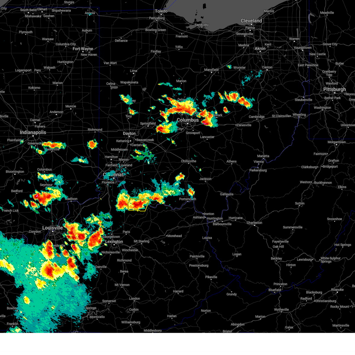 At 726 pm edt, a severe thunderstorm was located near brooksville, moving southeast at 30 mph (radar indicated). Hazards include 60 mph wind gusts and quarter size hail. Minor hail damage to vehicles is possible. expect wind damage to trees and power lines. locations impacted include, maysville, ripley, augusta, brooksville, dover, germantown, minerva, woolcutt, neave, berlin, stonewall, parina, powersville, lowell, johnsville, rock springs, petra, south ripley, chatham and tuckahoe. hail threat, radar indicated max hail size, 1. 00 in wind threat, radar indicated max wind gust, 60 mph. At 726 pm edt, a severe thunderstorm was located near brooksville, moving southeast at 30 mph (radar indicated). Hazards include 60 mph wind gusts and quarter size hail. Minor hail damage to vehicles is possible. expect wind damage to trees and power lines. locations impacted include, maysville, ripley, augusta, brooksville, dover, germantown, minerva, woolcutt, neave, berlin, stonewall, parina, powersville, lowell, johnsville, rock springs, petra, south ripley, chatham and tuckahoe. hail threat, radar indicated max hail size, 1. 00 in wind threat, radar indicated max wind gust, 60 mph.
|
| 7/24/2023 7:09 PM EDT |
 At 709 pm edt, severe thunderstorms were located along a line extending from near felicity to 6 miles west of brooksville, moving east at 35 mph (radar indicated). Hazards include 60 mph wind gusts and quarter size hail. Minor hail damage to vehicles is possible. Expect wind damage to trees and power lines. At 709 pm edt, severe thunderstorms were located along a line extending from near felicity to 6 miles west of brooksville, moving east at 35 mph (radar indicated). Hazards include 60 mph wind gusts and quarter size hail. Minor hail damage to vehicles is possible. Expect wind damage to trees and power lines.
|
| 7/24/2023 7:09 PM EDT |
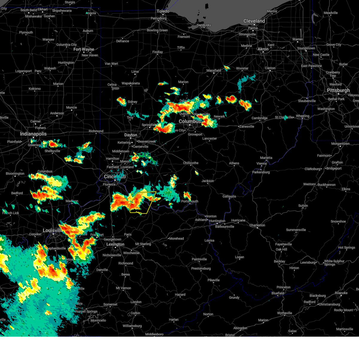 At 709 pm edt, severe thunderstorms were located along a line extending from near felicity to 6 miles west of brooksville, moving east at 35 mph (radar indicated). Hazards include 60 mph wind gusts and quarter size hail. Minor hail damage to vehicles is possible. Expect wind damage to trees and power lines. At 709 pm edt, severe thunderstorms were located along a line extending from near felicity to 6 miles west of brooksville, moving east at 35 mph (radar indicated). Hazards include 60 mph wind gusts and quarter size hail. Minor hail damage to vehicles is possible. Expect wind damage to trees and power lines.
|
| 7/20/2023 8:59 PM EDT |
 At 858 pm edt, severe thunderstorms were located along a line extending from near wooster to 6 miles east of east palestine, moving south at 30 mph (radar indicated). Hazards include 70 mph wind gusts. Trees snapped and uprooted. power outages can be expected. locations impacted include, dover, salem, columbiana, east palestine, carrollton, calcutta, minerva, ohioville, lisbon, strasburg, leetonia, industry, new waterford, augusta, malvern, bolivar, mineral city, hanoverton, rogers, and parral. thunderstorm damage threat, considerable hail threat, radar indicated max hail size, <. 75 in wind threat, radar indicated max wind gust, 70 mph. At 858 pm edt, severe thunderstorms were located along a line extending from near wooster to 6 miles east of east palestine, moving south at 30 mph (radar indicated). Hazards include 70 mph wind gusts. Trees snapped and uprooted. power outages can be expected. locations impacted include, dover, salem, columbiana, east palestine, carrollton, calcutta, minerva, ohioville, lisbon, strasburg, leetonia, industry, new waterford, augusta, malvern, bolivar, mineral city, hanoverton, rogers, and parral. thunderstorm damage threat, considerable hail threat, radar indicated max hail size, <. 75 in wind threat, radar indicated max wind gust, 70 mph.
|
| 7/20/2023 8:39 PM EDT |
 At 839 pm edt, severe thunderstorms were located along a line extending from 6 miles southeast of west salem to 8 miles north of east palestine, moving south at 20 mph (radar indicated). Hazards include 60 mph wind gusts. expect damage to trees and power lines, resulting in some power outages At 839 pm edt, severe thunderstorms were located along a line extending from 6 miles southeast of west salem to 8 miles north of east palestine, moving south at 20 mph (radar indicated). Hazards include 60 mph wind gusts. expect damage to trees and power lines, resulting in some power outages
|
| 7/18/2023 5:27 PM EDT |
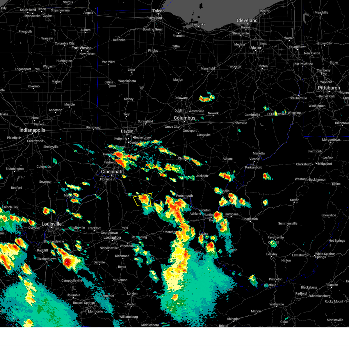 The severe thunderstorm warning for northern mason, east central bracken and southeastern brown counties will expire at 530 pm edt, the storm which prompted the warning has weakened below severe limits, and no longer poses an immediate threat to life or property. therefore, the warning will be allowed to expire. however heavy rain is still possible with this thunderstorm. please report previous wind damage or hail to the national weather service by going to our website at weather.gov/iln and submitting your report via social media. The severe thunderstorm warning for northern mason, east central bracken and southeastern brown counties will expire at 530 pm edt, the storm which prompted the warning has weakened below severe limits, and no longer poses an immediate threat to life or property. therefore, the warning will be allowed to expire. however heavy rain is still possible with this thunderstorm. please report previous wind damage or hail to the national weather service by going to our website at weather.gov/iln and submitting your report via social media.
|
| 7/18/2023 5:27 PM EDT |
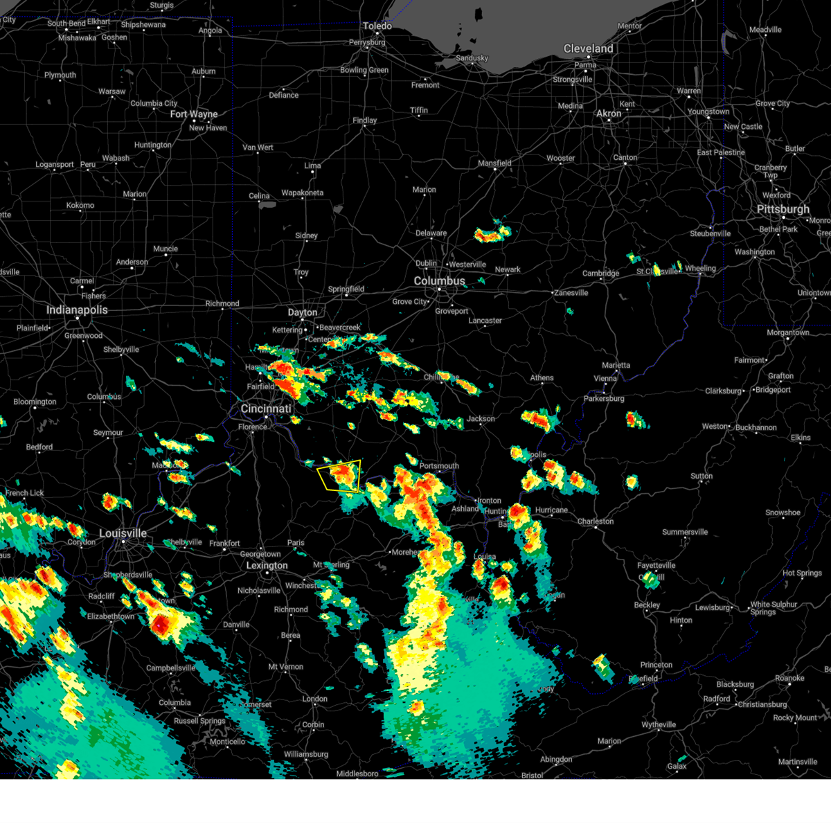 The severe thunderstorm warning for northern mason, east central bracken and southeastern brown counties will expire at 530 pm edt, the storm which prompted the warning has weakened below severe limits, and no longer poses an immediate threat to life or property. therefore, the warning will be allowed to expire. however heavy rain is still possible with this thunderstorm. please report previous wind damage or hail to the national weather service by going to our website at weather.gov/iln and submitting your report via social media. The severe thunderstorm warning for northern mason, east central bracken and southeastern brown counties will expire at 530 pm edt, the storm which prompted the warning has weakened below severe limits, and no longer poses an immediate threat to life or property. therefore, the warning will be allowed to expire. however heavy rain is still possible with this thunderstorm. please report previous wind damage or hail to the national weather service by going to our website at weather.gov/iln and submitting your report via social media.
|
| 7/18/2023 5:15 PM EDT |
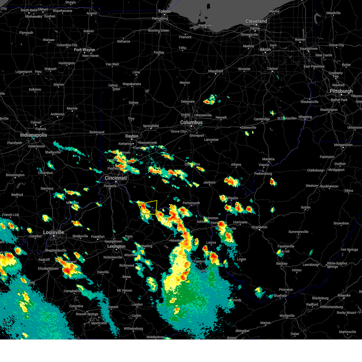 At 515 pm edt, a severe thunderstorm was located near ripley, moving east at 35 mph (radar indicated). Hazards include 60 mph wind gusts and quarter size hail. Minor hail damage to vehicles is possible. expect wind damage to trees and power lines. locations impacted include, maysville, washington, ripley, aberdeen, augusta, dover, germantown, minerva, moranburg, somo, south ripley, chatham, tuckahoe, stoney point and aa highway at state route 19. hail threat, radar indicated max hail size, 1. 00 in wind threat, radar indicated max wind gust, 60 mph. At 515 pm edt, a severe thunderstorm was located near ripley, moving east at 35 mph (radar indicated). Hazards include 60 mph wind gusts and quarter size hail. Minor hail damage to vehicles is possible. expect wind damage to trees and power lines. locations impacted include, maysville, washington, ripley, aberdeen, augusta, dover, germantown, minerva, moranburg, somo, south ripley, chatham, tuckahoe, stoney point and aa highway at state route 19. hail threat, radar indicated max hail size, 1. 00 in wind threat, radar indicated max wind gust, 60 mph.
|
| 7/18/2023 5:15 PM EDT |
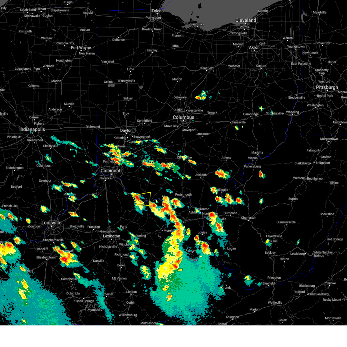 At 515 pm edt, a severe thunderstorm was located near ripley, moving east at 35 mph (radar indicated). Hazards include 60 mph wind gusts and quarter size hail. Minor hail damage to vehicles is possible. expect wind damage to trees and power lines. locations impacted include, maysville, washington, ripley, aberdeen, augusta, dover, germantown, minerva, moranburg, somo, south ripley, chatham, tuckahoe, stoney point and aa highway at state route 19. hail threat, radar indicated max hail size, 1. 00 in wind threat, radar indicated max wind gust, 60 mph. At 515 pm edt, a severe thunderstorm was located near ripley, moving east at 35 mph (radar indicated). Hazards include 60 mph wind gusts and quarter size hail. Minor hail damage to vehicles is possible. expect wind damage to trees and power lines. locations impacted include, maysville, washington, ripley, aberdeen, augusta, dover, germantown, minerva, moranburg, somo, south ripley, chatham, tuckahoe, stoney point and aa highway at state route 19. hail threat, radar indicated max hail size, 1. 00 in wind threat, radar indicated max wind gust, 60 mph.
|
| 7/18/2023 5:04 PM EDT |
 At 503 pm edt, a severe thunderstorm was located over brooksville, moving east at 35 mph (radar indicated). Hazards include 60 mph wind gusts and quarter size hail. Minor hail damage to vehicles is possible. expect wind damage to trees and power lines. locations impacted include, maysville, washington, ripley, aberdeen, augusta, lewisburg, brooksville, dover, germantown, murphysville, stonewall, powersville, south ripley, chatham, tuckahoe, hittville, minerva, us route 62 at state route 875, abigail and woolcutt. hail threat, radar indicated max hail size, 1. 00 in wind threat, radar indicated max wind gust, 60 mph. At 503 pm edt, a severe thunderstorm was located over brooksville, moving east at 35 mph (radar indicated). Hazards include 60 mph wind gusts and quarter size hail. Minor hail damage to vehicles is possible. expect wind damage to trees and power lines. locations impacted include, maysville, washington, ripley, aberdeen, augusta, lewisburg, brooksville, dover, germantown, murphysville, stonewall, powersville, south ripley, chatham, tuckahoe, hittville, minerva, us route 62 at state route 875, abigail and woolcutt. hail threat, radar indicated max hail size, 1. 00 in wind threat, radar indicated max wind gust, 60 mph.
|
| 7/18/2023 5:04 PM EDT |
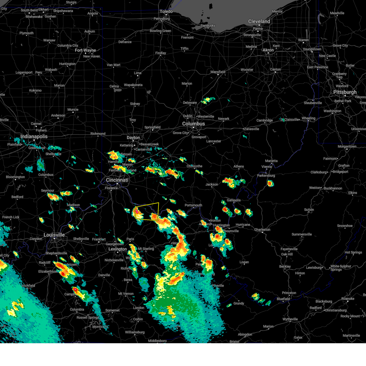 At 503 pm edt, a severe thunderstorm was located over brooksville, moving east at 35 mph (radar indicated). Hazards include 60 mph wind gusts and quarter size hail. Minor hail damage to vehicles is possible. expect wind damage to trees and power lines. locations impacted include, maysville, washington, ripley, aberdeen, augusta, lewisburg, brooksville, dover, germantown, murphysville, stonewall, powersville, south ripley, chatham, tuckahoe, hittville, minerva, us route 62 at state route 875, abigail and woolcutt. hail threat, radar indicated max hail size, 1. 00 in wind threat, radar indicated max wind gust, 60 mph. At 503 pm edt, a severe thunderstorm was located over brooksville, moving east at 35 mph (radar indicated). Hazards include 60 mph wind gusts and quarter size hail. Minor hail damage to vehicles is possible. expect wind damage to trees and power lines. locations impacted include, maysville, washington, ripley, aberdeen, augusta, lewisburg, brooksville, dover, germantown, murphysville, stonewall, powersville, south ripley, chatham, tuckahoe, hittville, minerva, us route 62 at state route 875, abigail and woolcutt. hail threat, radar indicated max hail size, 1. 00 in wind threat, radar indicated max wind gust, 60 mph.
|
| 7/18/2023 4:45 PM EDT |
 At 445 pm edt, a severe thunderstorm was located near falmouth, moving east at 35 mph (radar indicated). Hazards include 60 mph wind gusts and quarter size hail. Minor hail damage to vehicles is possible. Expect wind damage to trees and power lines. At 445 pm edt, a severe thunderstorm was located near falmouth, moving east at 35 mph (radar indicated). Hazards include 60 mph wind gusts and quarter size hail. Minor hail damage to vehicles is possible. Expect wind damage to trees and power lines.
|
| 7/18/2023 4:45 PM EDT |
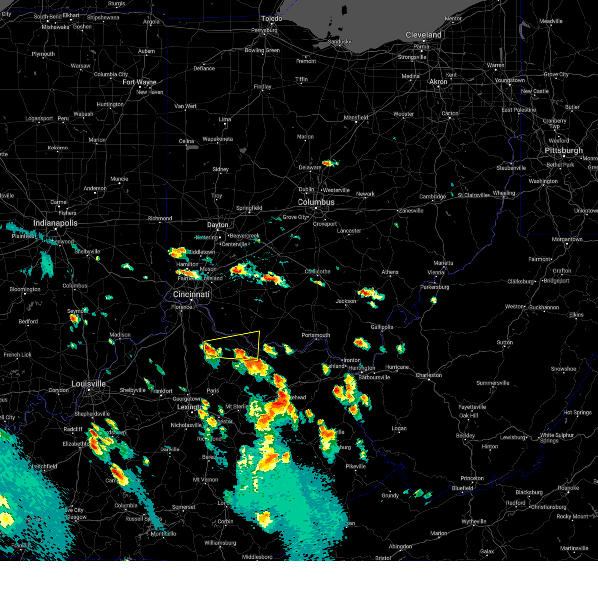 At 445 pm edt, a severe thunderstorm was located near falmouth, moving east at 35 mph (radar indicated). Hazards include 60 mph wind gusts and quarter size hail. Minor hail damage to vehicles is possible. Expect wind damage to trees and power lines. At 445 pm edt, a severe thunderstorm was located near falmouth, moving east at 35 mph (radar indicated). Hazards include 60 mph wind gusts and quarter size hail. Minor hail damage to vehicles is possible. Expect wind damage to trees and power lines.
|
| 7/2/2023 4:56 PM EDT |
 At 456 pm edt, a severe thunderstorm was located near manchester, moving east at 50 mph (radar indicated). Hazards include 60 mph wind gusts and penny size hail. Expect damage to trees and power lines. locations impacted include, maysville, west union, manchester, ripley, aberdeen, seaman, decatur, russellville, dover, cherry fork, germantown, minerva, redoak, trinity, moranburg, bradysville, bentonville, south ripley and tuckahoe. hail threat, radar indicated max hail size, 0. 75 in wind threat, radar indicated max wind gust, 60 mph. At 456 pm edt, a severe thunderstorm was located near manchester, moving east at 50 mph (radar indicated). Hazards include 60 mph wind gusts and penny size hail. Expect damage to trees and power lines. locations impacted include, maysville, west union, manchester, ripley, aberdeen, seaman, decatur, russellville, dover, cherry fork, germantown, minerva, redoak, trinity, moranburg, bradysville, bentonville, south ripley and tuckahoe. hail threat, radar indicated max hail size, 0. 75 in wind threat, radar indicated max wind gust, 60 mph.
|
| 7/2/2023 4:37 PM EDT |
 At 437 pm edt, a severe thunderstorm was located over higginsport, moving east at 50 mph (radar indicated). Hazards include 60 mph wind gusts. expect damage to trees and power lines At 437 pm edt, a severe thunderstorm was located over higginsport, moving east at 50 mph (radar indicated). Hazards include 60 mph wind gusts. expect damage to trees and power lines
|
| 6/15/2023 10:42 PM EDT |
 At 1041 pm edt, severe thunderstorms were located along a line extending from 6 miles south of waynesburg to near dennison to 8 miles southwest of uhrichsville to near newcomerstown, moving east at 50 mph (radar indicated). Hazards include 60 mph wind gusts and half dollar size hail. Minor hail damage to vehicles is possible. Expect wind damage to trees and power lines, resulting in some power outages. At 1041 pm edt, severe thunderstorms were located along a line extending from 6 miles south of waynesburg to near dennison to 8 miles southwest of uhrichsville to near newcomerstown, moving east at 50 mph (radar indicated). Hazards include 60 mph wind gusts and half dollar size hail. Minor hail damage to vehicles is possible. Expect wind damage to trees and power lines, resulting in some power outages.
|
| 6/15/2023 10:26 PM EDT |
 At 1026 pm edt, severe thunderstorms were located along a line extending from near east sparta to sugarcreek to near farmerstown to killbuck, moving southeast at 35 mph (radar indicated). Hazards include 60 mph wind gusts and half dollar size hail. Minor hail damage to vehicles is possible. expect wind damage to trees and power lines, resulting in some power outages. locations impacted include, new philadelphia, dover, uhrichsville, dennison, strasburg, sugarcreek, gnadenhutten, tuscarawas, bolivar, baltic, midvale, and mineral city. hail threat, radar indicated max hail size, 1. 25 in wind threat, radar indicated max wind gust, 60 mph. At 1026 pm edt, severe thunderstorms were located along a line extending from near east sparta to sugarcreek to near farmerstown to killbuck, moving southeast at 35 mph (radar indicated). Hazards include 60 mph wind gusts and half dollar size hail. Minor hail damage to vehicles is possible. expect wind damage to trees and power lines, resulting in some power outages. locations impacted include, new philadelphia, dover, uhrichsville, dennison, strasburg, sugarcreek, gnadenhutten, tuscarawas, bolivar, baltic, midvale, and mineral city. hail threat, radar indicated max hail size, 1. 25 in wind threat, radar indicated max wind gust, 60 mph.
|
| 6/15/2023 10:25 PM EDT | Quarter sized hail reported 175.6 miles SW of Dover, OH |
| 6/15/2023 10:09 PM EDT |
 At 1008 pm edt, severe thunderstorms were located along a line extending from near navarre to near berlin to near millersburg to near glenmont, moving southeast at 35 mph (radar indicated). Hazards include 60 mph wind gusts and quarter size hail. Minor hail damage to vehicles is possible. Expect wind damage to trees and power lines, resulting in some power outages. At 1008 pm edt, severe thunderstorms were located along a line extending from near navarre to near berlin to near millersburg to near glenmont, moving southeast at 35 mph (radar indicated). Hazards include 60 mph wind gusts and quarter size hail. Minor hail damage to vehicles is possible. Expect wind damage to trees and power lines, resulting in some power outages.
|
| 4/21/2023 4:37 PM EDT |
 At 437 pm edt, a severe thunderstorm was located near ripley, moving northeast at 50 mph (radar indicated). Hazards include 60 mph wind gusts and quarter size hail. Minor hail damage to vehicles is possible. Expect wind damage to trees and power lines. At 437 pm edt, a severe thunderstorm was located near ripley, moving northeast at 50 mph (radar indicated). Hazards include 60 mph wind gusts and quarter size hail. Minor hail damage to vehicles is possible. Expect wind damage to trees and power lines.
|
| 4/5/2023 7:04 PM EDT |
 At 704 pm edt, a severe thunderstorm was located 10 miles southeast of carrollton, moving northeast at 65 mph (radar indicated). Hazards include 60 mph wind gusts. Expect damage to trees and power lines, resulting in some power outages. locations impacted include, weirton, steubenville, new philadelphia, salem, east liverpool, columbiana, uhrichsville, east palestine, wellsville, cadiz, carrollton, and freeport. hail threat, radar indicated max hail size, <. 75 in wind threat, observed max wind gust, 60 mph. At 704 pm edt, a severe thunderstorm was located 10 miles southeast of carrollton, moving northeast at 65 mph (radar indicated). Hazards include 60 mph wind gusts. Expect damage to trees and power lines, resulting in some power outages. locations impacted include, weirton, steubenville, new philadelphia, salem, east liverpool, columbiana, uhrichsville, east palestine, wellsville, cadiz, carrollton, and freeport. hail threat, radar indicated max hail size, <. 75 in wind threat, observed max wind gust, 60 mph.
|
| 4/5/2023 6:54 PM EDT |
 At 654 pm edt, a severe thunderstorm was located near waynesburg, or 8 miles northwest of carrollton, moving northeast at 55 mph (radar indicated). Hazards include 60 mph wind gusts and nickel size hail. Expect damage to trees and power lines, resulting in some power outages. locations impacted include, new philadelphia, dover, uhrichsville, carrollton, freeport, dennison, strasburg, gnadenhutten, malvern, tuscarawas, bolivar, and scio. hail threat, radar indicated max hail size, 0. 88 in wind threat, radar indicated max wind gust, 60 mph. At 654 pm edt, a severe thunderstorm was located near waynesburg, or 8 miles northwest of carrollton, moving northeast at 55 mph (radar indicated). Hazards include 60 mph wind gusts and nickel size hail. Expect damage to trees and power lines, resulting in some power outages. locations impacted include, new philadelphia, dover, uhrichsville, carrollton, freeport, dennison, strasburg, gnadenhutten, malvern, tuscarawas, bolivar, and scio. hail threat, radar indicated max hail size, 0. 88 in wind threat, radar indicated max wind gust, 60 mph.
|
| 4/5/2023 6:54 PM EDT |
 At 653 pm edt, a severe thunderstorm was located 9 miles east of dennison, or 10 miles east of uhrichsville, moving northeast at 65 mph (radar indicated). Hazards include 60 mph wind gusts. expect damage to trees and power lines, resulting in some power outages At 653 pm edt, a severe thunderstorm was located 9 miles east of dennison, or 10 miles east of uhrichsville, moving northeast at 65 mph (radar indicated). Hazards include 60 mph wind gusts. expect damage to trees and power lines, resulting in some power outages
|
| 4/5/2023 6:47 PM EDT |
 At 647 pm edt, a severe thunderstorm was located near east sparta, or 10 miles northeast of dover, moving northeast at 55 mph (radar indicated). Hazards include 60 mph wind gusts and nickel size hail. Expect damage to trees and power lines, resulting in some power outages. locations impacted include, new philadelphia, dover, uhrichsville, carrollton, freeport, dennison, strasburg, sugarcreek, gnadenhutten, malvern, tuscarawas, and bolivar. hail threat, radar indicated max hail size, 0. 88 in wind threat, radar indicated max wind gust, 60 mph. At 647 pm edt, a severe thunderstorm was located near east sparta, or 10 miles northeast of dover, moving northeast at 55 mph (radar indicated). Hazards include 60 mph wind gusts and nickel size hail. Expect damage to trees and power lines, resulting in some power outages. locations impacted include, new philadelphia, dover, uhrichsville, carrollton, freeport, dennison, strasburg, sugarcreek, gnadenhutten, malvern, tuscarawas, and bolivar. hail threat, radar indicated max hail size, 0. 88 in wind threat, radar indicated max wind gust, 60 mph.
|
| 4/5/2023 6:41 PM EDT |
 At 641 pm edt, a severe thunderstorm was located near dover, moving northeast at 55 mph (radar indicated). Hazards include 60 mph wind gusts and nickel size hail. Expect damage to trees and power lines, resulting in some power outages. locations impacted include, new philadelphia, dover, uhrichsville, carrollton, freeport, dennison, strasburg, sugarcreek, gnadenhutten, malvern, tuscarawas, and bolivar. hail threat, radar indicated max hail size, 0. 88 in wind threat, radar indicated max wind gust, 60 mph. At 641 pm edt, a severe thunderstorm was located near dover, moving northeast at 55 mph (radar indicated). Hazards include 60 mph wind gusts and nickel size hail. Expect damage to trees and power lines, resulting in some power outages. locations impacted include, new philadelphia, dover, uhrichsville, carrollton, freeport, dennison, strasburg, sugarcreek, gnadenhutten, malvern, tuscarawas, and bolivar. hail threat, radar indicated max hail size, 0. 88 in wind threat, radar indicated max wind gust, 60 mph.
|
| 4/5/2023 6:30 PM EDT |
 At 630 pm edt, a severe thunderstorm was located over sugarcreek, or near dover, moving northeast at 55 mph (radar indicated). Hazards include 60 mph wind gusts and nickel size hail. Expect damage to trees and power lines, resulting in some power outages. locations impacted include, new philadelphia, dover, uhrichsville, carrollton, freeport, dennison, strasburg, sugarcreek, gnadenhutten, malvern, tuscarawas, and bolivar. hail threat, radar indicated max hail size, 0. 88 in wind threat, radar indicated max wind gust, 60 mph. At 630 pm edt, a severe thunderstorm was located over sugarcreek, or near dover, moving northeast at 55 mph (radar indicated). Hazards include 60 mph wind gusts and nickel size hail. Expect damage to trees and power lines, resulting in some power outages. locations impacted include, new philadelphia, dover, uhrichsville, carrollton, freeport, dennison, strasburg, sugarcreek, gnadenhutten, malvern, tuscarawas, and bolivar. hail threat, radar indicated max hail size, 0. 88 in wind threat, radar indicated max wind gust, 60 mph.
|
| 4/5/2023 6:21 PM EDT |
 At 620 pm edt, a severe thunderstorm was located near farmerstown, or 12 miles southeast of millersburg, moving northeast at 55 mph (radar indicated). Hazards include 60 mph wind gusts and nickel size hail. expect damage to trees and power lines, resulting in some power outages At 620 pm edt, a severe thunderstorm was located near farmerstown, or 12 miles southeast of millersburg, moving northeast at 55 mph (radar indicated). Hazards include 60 mph wind gusts and nickel size hail. expect damage to trees and power lines, resulting in some power outages
|
| 4/1/2023 12:40 PM EDT | Widespread trees power lines down in dover... mineral city and sherrodsville. some trees on houses in these locations. no injuries reporte in tuscarawas county OH, 177.2 miles SW of Dover, OH |
| 4/1/2023 12:33 PM EDT |
 At 1232 pm edt, severe thunderstorms were located along a line extending from near barberton to near newcomerstown, moving northeast at 60 mph (radar indicated). Hazards include 60 mph wind gusts. Expect damage to trees and power lines, resulting in some power outages. locations impacted include, new philadelphia, dover, cambridge, uhrichsville, st. clairsville, barnesville, cadiz, carrollton, freeport, newcomerstown, minerva, and dennison. hail threat, radar indicated max hail size, <. 75 in wind threat, radar indicated max wind gust, 60 mph. At 1232 pm edt, severe thunderstorms were located along a line extending from near barberton to near newcomerstown, moving northeast at 60 mph (radar indicated). Hazards include 60 mph wind gusts. Expect damage to trees and power lines, resulting in some power outages. locations impacted include, new philadelphia, dover, cambridge, uhrichsville, st. clairsville, barnesville, cadiz, carrollton, freeport, newcomerstown, minerva, and dennison. hail threat, radar indicated max hail size, <. 75 in wind threat, radar indicated max wind gust, 60 mph.
|
| 4/1/2023 12:13 PM EDT |
 At 1212 pm edt, severe thunderstorms were located along a line extending from near creston to near dresden, moving east at 90 mph (radar indicated). Hazards include 60 mph wind gusts. expect damage to trees and power lines, resulting in some power outages At 1212 pm edt, severe thunderstorms were located along a line extending from near creston to near dresden, moving east at 90 mph (radar indicated). Hazards include 60 mph wind gusts. expect damage to trees and power lines, resulting in some power outages
|
| 3/3/2023 5:37 PM EST |
 At 536 pm est, severe thunderstorms were located along a line extending from near wilmington to near sardinia, moving northeast at 50 mph (radar indicated). Hazards include 70 mph wind gusts. Expect considerable tree damage. damage is likely to mobile homes, roofs, and outbuildings. locations impacted include, maysville, georgetown, mount orab, ripley, aberdeen, sardinia, new market, decatur, russellville, mowrystown, fayetteville, dover, st. martin, chasetown, danville in highland county, state route 32 at us route 68, fincastle, south ripley, state route 32 at us route 62 and tuckahoe. thunderstorm damage threat, considerable hail threat, radar indicated max hail size, <. 75 in wind threat, radar indicated max wind gust, 70 mph. At 536 pm est, severe thunderstorms were located along a line extending from near wilmington to near sardinia, moving northeast at 50 mph (radar indicated). Hazards include 70 mph wind gusts. Expect considerable tree damage. damage is likely to mobile homes, roofs, and outbuildings. locations impacted include, maysville, georgetown, mount orab, ripley, aberdeen, sardinia, new market, decatur, russellville, mowrystown, fayetteville, dover, st. martin, chasetown, danville in highland county, state route 32 at us route 68, fincastle, south ripley, state route 32 at us route 62 and tuckahoe. thunderstorm damage threat, considerable hail threat, radar indicated max hail size, <. 75 in wind threat, radar indicated max wind gust, 70 mph.
|
| 3/3/2023 5:24 PM EST |
 At 524 pm est, severe thunderstorms were located along a line extending from blanchester to georgetown, moving northeast at 50 mph (radar indicated). Hazards include 70 mph wind gusts. Expect considerable tree damage. damage is likely to mobile homes, roofs, and outbuildings. locations impacted include, loveland, maysville, georgetown, amelia, mount orab, bethel, williamsburg, ripley, aberdeen, batavia, augusta, sardinia, felicity, brooksville, woodville, new market, owensville, decatur, russellville and hamersville. thunderstorm damage threat, considerable hail threat, radar indicated max hail size, <. 75 in wind threat, radar indicated max wind gust, 70 mph. At 524 pm est, severe thunderstorms were located along a line extending from blanchester to georgetown, moving northeast at 50 mph (radar indicated). Hazards include 70 mph wind gusts. Expect considerable tree damage. damage is likely to mobile homes, roofs, and outbuildings. locations impacted include, loveland, maysville, georgetown, amelia, mount orab, bethel, williamsburg, ripley, aberdeen, batavia, augusta, sardinia, felicity, brooksville, woodville, new market, owensville, decatur, russellville and hamersville. thunderstorm damage threat, considerable hail threat, radar indicated max hail size, <. 75 in wind threat, radar indicated max wind gust, 70 mph.
|
| 3/3/2023 5:00 PM EST |
 At 500 pm est, severe thunderstorms were located along a line extending terrace park to falmouth, moving northeast at 50 mph (radar indicated). Hazards include 70 mph wind gusts. Expect considerable tree damage. Damage is likely to mobile homes, roofs, and outbuildings. At 500 pm est, severe thunderstorms were located along a line extending terrace park to falmouth, moving northeast at 50 mph (radar indicated). Hazards include 70 mph wind gusts. Expect considerable tree damage. Damage is likely to mobile homes, roofs, and outbuildings.
|
| 1/12/2023 10:22 AM EST |
 The severe thunderstorm warning for mason, robertson and southeastern brown counties will expire at 1030 am est, the storm which prompted the warning has moved out of the area. therefore, the warning will be allowed to expire. a severe thunderstorm watch remains in effect until 400 pm est for northern kentucky, and southwestern ohio. please report previous wind damage or hail to the national weather service by going to our website at weather.gov/iln and submitting your report via social media. remember, a severe thunderstorm warning still remains in effect for part of mason county until 1045 am est. The severe thunderstorm warning for mason, robertson and southeastern brown counties will expire at 1030 am est, the storm which prompted the warning has moved out of the area. therefore, the warning will be allowed to expire. a severe thunderstorm watch remains in effect until 400 pm est for northern kentucky, and southwestern ohio. please report previous wind damage or hail to the national weather service by going to our website at weather.gov/iln and submitting your report via social media. remember, a severe thunderstorm warning still remains in effect for part of mason county until 1045 am est.
|
| 1/12/2023 10:09 AM EST |
 At 1009 am est, a severe thunderstorm was located near ripley, moving northeast at 55 mph (radar indicated). Hazards include 60 mph wind gusts. Expect damage to trees and power lines. locations impacted include, maysville, washington, ripley, aberdeen, decatur, mount olivet, dover, sardis, minerva, blue licks battlefield, abigail, redoak, murphysville, moranburg, burika, alhambra, mays lick, mitchells mill, lowell and south ripley. hail threat, radar indicated max hail size, <. 75 in wind threat, radar indicated max wind gust, 60 mph. At 1009 am est, a severe thunderstorm was located near ripley, moving northeast at 55 mph (radar indicated). Hazards include 60 mph wind gusts. Expect damage to trees and power lines. locations impacted include, maysville, washington, ripley, aberdeen, decatur, mount olivet, dover, sardis, minerva, blue licks battlefield, abigail, redoak, murphysville, moranburg, burika, alhambra, mays lick, mitchells mill, lowell and south ripley. hail threat, radar indicated max hail size, <. 75 in wind threat, radar indicated max wind gust, 60 mph.
|
| 1/12/2023 10:01 AM EST |
 At 1001 am est, a severe thunderstorm was located near brooksville, moving northeast at 55 mph (radar indicated). Hazards include 60 mph wind gusts. Expect damage to trees and power lines. locations impacted include, maysville, washington, ripley, aberdeen, augusta, brooksville, decatur, mount olivet, dover, higginsport, germantown, sardis, blue licks battlefield, murphysville, burika, alhambra, stonewall, mays lick, mitchells mill and south ripley. hail threat, radar indicated max hail size, <. 75 in wind threat, radar indicated max wind gust, 60 mph. At 1001 am est, a severe thunderstorm was located near brooksville, moving northeast at 55 mph (radar indicated). Hazards include 60 mph wind gusts. Expect damage to trees and power lines. locations impacted include, maysville, washington, ripley, aberdeen, augusta, brooksville, decatur, mount olivet, dover, higginsport, germantown, sardis, blue licks battlefield, murphysville, burika, alhambra, stonewall, mays lick, mitchells mill and south ripley. hail threat, radar indicated max hail size, <. 75 in wind threat, radar indicated max wind gust, 60 mph.
|
| 1/12/2023 9:47 AM EST |
 At 947 am est, a severe thunderstorm was located 9 miles southwest of brooksville, moving northeast at 55 mph (radar indicated). Hazards include 60 mph wind gusts. expect damage to trees and power lines At 947 am est, a severe thunderstorm was located 9 miles southwest of brooksville, moving northeast at 55 mph (radar indicated). Hazards include 60 mph wind gusts. expect damage to trees and power lines
|
| 8/20/2022 9:05 PM EDT |
 At 905 pm edt, a severe thunderstorm was located 8 miles southwest of carrollton, moving east at 30 mph (radar indicated). Hazards include 60 mph wind gusts. Expect damage to trees and power lines, resulting in some power outages. locations impacted include, new philadelphia, dover, uhrichsville, carrollton, dennison, strasburg, sugarcreek, gnadenhutten, malvern, tuscarawas, scio, and midvale. hail threat, radar indicated max hail size, <. 75 in wind threat, radar indicated max wind gust, 60 mph. At 905 pm edt, a severe thunderstorm was located 8 miles southwest of carrollton, moving east at 30 mph (radar indicated). Hazards include 60 mph wind gusts. Expect damage to trees and power lines, resulting in some power outages. locations impacted include, new philadelphia, dover, uhrichsville, carrollton, dennison, strasburg, sugarcreek, gnadenhutten, malvern, tuscarawas, scio, and midvale. hail threat, radar indicated max hail size, <. 75 in wind threat, radar indicated max wind gust, 60 mph.
|
| 8/20/2022 8:53 PM EDT | Trees down in downtown dover... oh in tuscarawas county OH, 177.2 miles SW of Dover, OH |
| 8/20/2022 8:41 PM EDT |
 The severe thunderstorm warning for northwestern guernsey, coshocton and tuscarawas counties will expire at 845 pm edt, the storm which prompted the warning has moved out of the area. therefore, the warning will be allowed to expire. however gusty winds and heavy rain are still possible with this thunderstorm. remember, a severe thunderstorm warning still remains in effect for tuscarawas county until 930 pm. The severe thunderstorm warning for northwestern guernsey, coshocton and tuscarawas counties will expire at 845 pm edt, the storm which prompted the warning has moved out of the area. therefore, the warning will be allowed to expire. however gusty winds and heavy rain are still possible with this thunderstorm. remember, a severe thunderstorm warning still remains in effect for tuscarawas county until 930 pm.
|
| 8/20/2022 8:40 PM EDT |
 At 840 pm edt, a severe thunderstorm was located over new philadelphia, moving east at 30 mph (radar indicated). Hazards include 60 mph wind gusts. expect damage to trees and power lines, resulting in some power outages At 840 pm edt, a severe thunderstorm was located over new philadelphia, moving east at 30 mph (radar indicated). Hazards include 60 mph wind gusts. expect damage to trees and power lines, resulting in some power outages
|
| 8/20/2022 8:21 PM EDT |
 At 820 pm edt, a severe thunderstorm was located over newcomerstown, or 13 miles southwest of uhrichsville, moving east at 55 mph (radar indicated). Hazards include 60 mph wind gusts and quarter size hail. Minor hail damage to vehicles is possible. expect wind damage to trees and power lines, resulting in some power outages. locations impacted include, new philadelphia, dover, coshocton, uhrichsville, newcomerstown, dennison, strasburg, west lafayette, sugarcreek, gnadenhutten, tuscarawas, and baltic. hail threat, radar indicated max hail size, 1. 00 in wind threat, radar indicated max wind gust, 60 mph. At 820 pm edt, a severe thunderstorm was located over newcomerstown, or 13 miles southwest of uhrichsville, moving east at 55 mph (radar indicated). Hazards include 60 mph wind gusts and quarter size hail. Minor hail damage to vehicles is possible. expect wind damage to trees and power lines, resulting in some power outages. locations impacted include, new philadelphia, dover, coshocton, uhrichsville, newcomerstown, dennison, strasburg, west lafayette, sugarcreek, gnadenhutten, tuscarawas, and baltic. hail threat, radar indicated max hail size, 1. 00 in wind threat, radar indicated max wind gust, 60 mph.
|
| 8/20/2022 8:01 PM EDT |
 At 801 pm edt, a severe thunderstorm was located near coshocton, moving east at 55 mph (radar indicated). Hazards include 60 mph wind gusts and quarter size hail. Minor hail damage to vehicles is possible. Expect wind damage to trees and power lines, resulting in some power outages. At 801 pm edt, a severe thunderstorm was located near coshocton, moving east at 55 mph (radar indicated). Hazards include 60 mph wind gusts and quarter size hail. Minor hail damage to vehicles is possible. Expect wind damage to trees and power lines, resulting in some power outages.
|
| 7/23/2022 1:11 PM EDT |
 At 110 pm edt, a severe thunderstorm was located near new philadelphia, moving east at 40 mph (radar indicated). Hazards include 60 mph wind gusts. expect damage to trees and power lines, resulting in some power outages At 110 pm edt, a severe thunderstorm was located near new philadelphia, moving east at 40 mph (radar indicated). Hazards include 60 mph wind gusts. expect damage to trees and power lines, resulting in some power outages
|
| 7/20/2022 9:54 PM EDT |
 At 954 pm edt, severe thunderstorms were located along a line extending from 6 miles south of waynesburg to near farmerstown to near danville, moving east at 40 mph (radar indicated). Hazards include 60 mph wind gusts and quarter size hail. Minor hail damage to vehicles is possible. Expect wind damage to trees and power lines, resulting in some power outages. At 954 pm edt, severe thunderstorms were located along a line extending from 6 miles south of waynesburg to near farmerstown to near danville, moving east at 40 mph (radar indicated). Hazards include 60 mph wind gusts and quarter size hail. Minor hail damage to vehicles is possible. Expect wind damage to trees and power lines, resulting in some power outages.
|
| 7/20/2022 9:34 PM EDT |
 At 933 pm edt, a severe thunderstorm was centered near sugarcreek, or 8 miles west of dover, moving east at 35 mph (radar indicated). Hazards include 60 mph wind gusts and quarter size hail. Minor hail damage to vehicles is possible. expect wind damage to trees and power lines, resulting in some power outages. locations impacted include, new philadelphia, dover, uhrichsville, dennison, strasburg, sugarcreek, gnadenhutten, tuscarawas, bolivar, baltic, midvale, and mineral city. hail threat, radar indicated max hail size, 1. 00 in wind threat, radar indicated max wind gust, 60 mph. At 933 pm edt, a severe thunderstorm was centered near sugarcreek, or 8 miles west of dover, moving east at 35 mph (radar indicated). Hazards include 60 mph wind gusts and quarter size hail. Minor hail damage to vehicles is possible. expect wind damage to trees and power lines, resulting in some power outages. locations impacted include, new philadelphia, dover, uhrichsville, dennison, strasburg, sugarcreek, gnadenhutten, tuscarawas, bolivar, baltic, midvale, and mineral city. hail threat, radar indicated max hail size, 1. 00 in wind threat, radar indicated max wind gust, 60 mph.
|
| 7/20/2022 9:17 PM EDT |
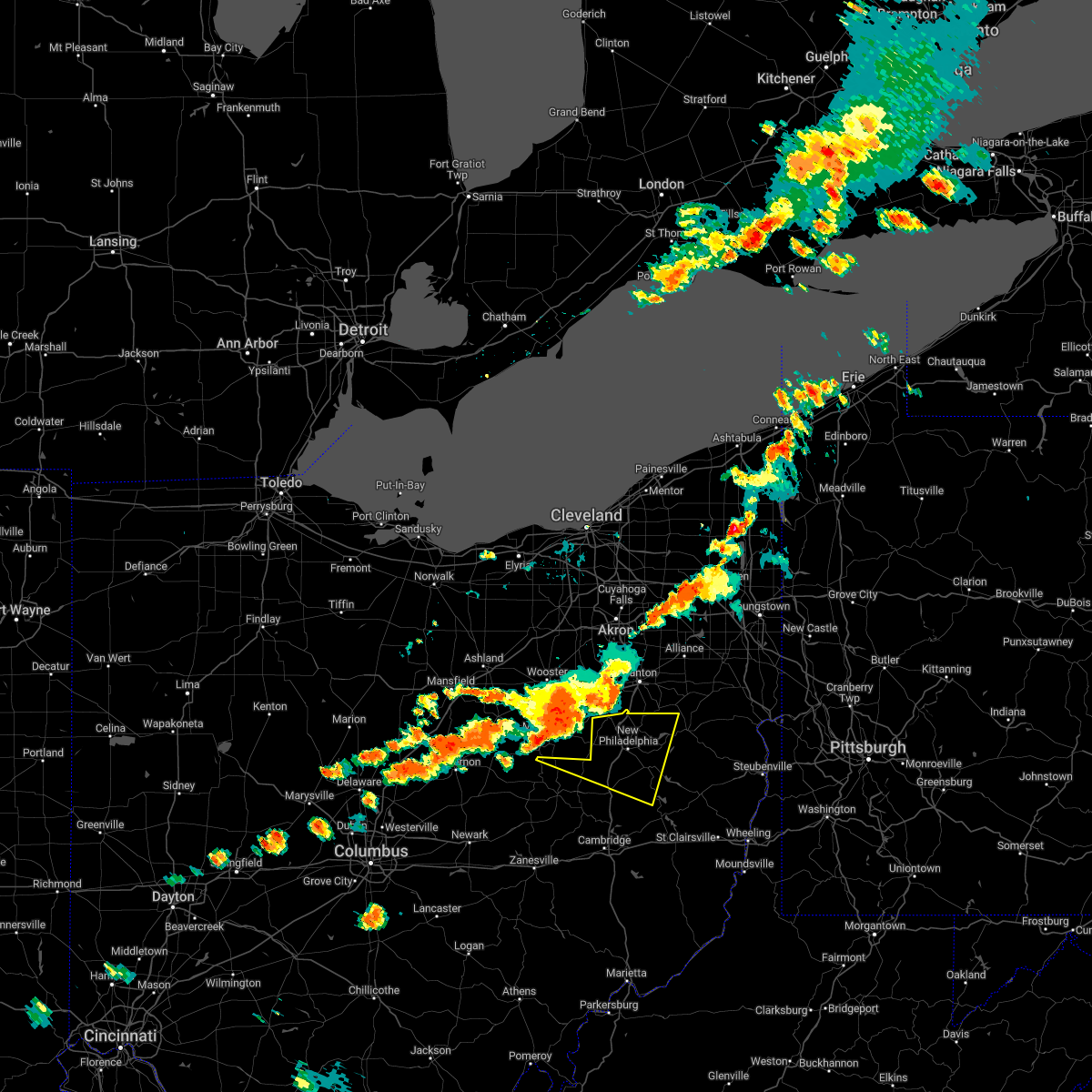 At 917 pm edt, a severe thunderstorm was located over berlin, or near millersburg, moving east at 40 mph (radar indicated). Hazards include 60 mph wind gusts and quarter size hail. Minor hail damage to vehicles is possible. Expect wind damage to trees and power lines, resulting in some power outages. At 917 pm edt, a severe thunderstorm was located over berlin, or near millersburg, moving east at 40 mph (radar indicated). Hazards include 60 mph wind gusts and quarter size hail. Minor hail damage to vehicles is possible. Expect wind damage to trees and power lines, resulting in some power outages.
|
| 6/22/2022 6:23 PM EDT |
 The severe thunderstorm warning for north central mason, southeastern brown and west central adams counties will expire at 630 pm edt, the storm which prompted the warning has moved out of the area. therefore, the warning will be allowed to expire. however gusty winds and heavy rain are still possible with this thunderstorm. a severe thunderstorm watch remains in effect until 800 pm edt for northern kentucky, and southwestern ohio. please report previous wind damage or hail to the national weather service by going to our website at weather.gov/iln and submitting your report via social media. remember, a severe thunderstorm warning still remains in effect for southern adams and eastern mason counties until 700 pm. The severe thunderstorm warning for north central mason, southeastern brown and west central adams counties will expire at 630 pm edt, the storm which prompted the warning has moved out of the area. therefore, the warning will be allowed to expire. however gusty winds and heavy rain are still possible with this thunderstorm. a severe thunderstorm watch remains in effect until 800 pm edt for northern kentucky, and southwestern ohio. please report previous wind damage or hail to the national weather service by going to our website at weather.gov/iln and submitting your report via social media. remember, a severe thunderstorm warning still remains in effect for southern adams and eastern mason counties until 700 pm.
|
| 6/22/2022 6:10 PM EDT |
 At 610 pm edt, a cluster of severe thunderstorms was located near manchester, moving southeast at 20 mph (radar indicated). Hazards include 60 mph wind gusts. Expect damage to trees and power lines. locations impacted include, maysville, west union, ripley, aberdeen, decatur, dover, bentonville, redoak, moranburg, bradysville, south ripley and tuckahoe. hail threat, radar indicated max hail size, <. 75 in wind threat, radar indicated max wind gust, 60 mph. At 610 pm edt, a cluster of severe thunderstorms was located near manchester, moving southeast at 20 mph (radar indicated). Hazards include 60 mph wind gusts. Expect damage to trees and power lines. locations impacted include, maysville, west union, ripley, aberdeen, decatur, dover, bentonville, redoak, moranburg, bradysville, south ripley and tuckahoe. hail threat, radar indicated max hail size, <. 75 in wind threat, radar indicated max wind gust, 60 mph.
|
| 6/22/2022 5:58 PM EDT |
 At 558 pm edt, a severe thunderstorm was located 8 miles northeast of ripley, moving southeast at 30 mph (radar indicated). Hazards include 60 mph wind gusts. Expect damage to trees and power lines. locations impacted include, maysville, georgetown, west union, ripley, aberdeen, decatur, russellville, dover, redoak, moranburg, lake waynoka, bradysville, bentonville, south ripley and tuckahoe. hail threat, radar indicated max hail size, <. 75 in wind threat, radar indicated max wind gust, 60 mph. At 558 pm edt, a severe thunderstorm was located 8 miles northeast of ripley, moving southeast at 30 mph (radar indicated). Hazards include 60 mph wind gusts. Expect damage to trees and power lines. locations impacted include, maysville, georgetown, west union, ripley, aberdeen, decatur, russellville, dover, redoak, moranburg, lake waynoka, bradysville, bentonville, south ripley and tuckahoe. hail threat, radar indicated max hail size, <. 75 in wind threat, radar indicated max wind gust, 60 mph.
|
| 6/22/2022 5:49 PM EDT |
 At 548 pm edt, a cluster of severe thunderstorms was located near georgetown, moving southeast at 25 mph (radar indicated). Hazards include 60 mph wind gusts. Expect damage to trees and power lines. locations impacted include, maysville, georgetown, west union, ripley, aberdeen, sardinia, decatur, russellville, hamersville, dover, redoak, moranburg, lake waynoka, bradysville, bentonville, south ripley, tuckahoe and new hope. hail threat, radar indicated max hail size, <. 75 in wind threat, radar indicated max wind gust, 60 mph. At 548 pm edt, a cluster of severe thunderstorms was located near georgetown, moving southeast at 25 mph (radar indicated). Hazards include 60 mph wind gusts. Expect damage to trees and power lines. locations impacted include, maysville, georgetown, west union, ripley, aberdeen, sardinia, decatur, russellville, hamersville, dover, redoak, moranburg, lake waynoka, bradysville, bentonville, south ripley, tuckahoe and new hope. hail threat, radar indicated max hail size, <. 75 in wind threat, radar indicated max wind gust, 60 mph.
|
| 6/22/2022 5:40 PM EDT |
 At 539 pm edt, a severe thunderstorm was located near mount orab, moving southeast at 25 mph (radar indicated). Hazards include 60 mph wind gusts. expect damage to trees and power lines At 539 pm edt, a severe thunderstorm was located near mount orab, moving southeast at 25 mph (radar indicated). Hazards include 60 mph wind gusts. expect damage to trees and power lines
|
| 6/16/2022 4:03 PM EDT |
 At 402 pm edt, a severe thunderstorm was located 8 miles east of new philadelphia, moving east at 30 mph (radar indicated). Hazards include golf ball size hail and 60 mph wind gusts. People and animals outdoors will be injured. expect hail damage to roofs, siding, windows, and vehicles. expect wind damage to trees and power lines, resulting in some power outages. locations impacted include, new philadelphia, dover, uhrichsville, cadiz, carrollton, dennison, scio, midvale, jewett, bergholz, amsterdam, and bowerston. thunderstorm damage threat, considerable hail threat, observed max hail size, 1. 75 in wind threat, radar indicated max wind gust, 60 mph. At 402 pm edt, a severe thunderstorm was located 8 miles east of new philadelphia, moving east at 30 mph (radar indicated). Hazards include golf ball size hail and 60 mph wind gusts. People and animals outdoors will be injured. expect hail damage to roofs, siding, windows, and vehicles. expect wind damage to trees and power lines, resulting in some power outages. locations impacted include, new philadelphia, dover, uhrichsville, cadiz, carrollton, dennison, scio, midvale, jewett, bergholz, amsterdam, and bowerston. thunderstorm damage threat, considerable hail threat, observed max hail size, 1. 75 in wind threat, radar indicated max wind gust, 60 mph.
|
| 6/16/2022 4:00 PM EDT | Quarter sized hail reported 177.2 miles SW of Dover, OH |
| 6/16/2022 3:46 PM EDT |
 At 346 pm edt, a severe thunderstorm was located over dover, moving east at 30 mph (radar indicated). Hazards include two inch hail and 60 mph wind gusts. People and animals outdoors will be injured. expect hail damage to roofs, siding, windows, and vehicles. Expect wind damage to trees and power lines, resulting in some power outages. At 346 pm edt, a severe thunderstorm was located over dover, moving east at 30 mph (radar indicated). Hazards include two inch hail and 60 mph wind gusts. People and animals outdoors will be injured. expect hail damage to roofs, siding, windows, and vehicles. Expect wind damage to trees and power lines, resulting in some power outages.
|
| 6/16/2022 3:45 PM EDT | Report of multiple trees down around dover. damage not considered excessiv in tuscarawas county OH, 177.2 miles SW of Dover, OH |
| 6/16/2022 3:37 PM EDT | Tree down across n. crater ave. near e. 7th street in tuscarawas county OH, 177.2 miles SW of Dover, OH |
| 6/16/2022 3:34 PM EDT |
 At 334 pm edt, a severe thunderstorm was located over glenmont, or 10 miles west of millersburg, moving east at 25 mph (radar indicated). Hazards include 60 mph wind gusts and half dollar size hail. Minor hail damage to vehicles is possible. Expect wind damage to trees and power lines, resulting in some power outages. At 334 pm edt, a severe thunderstorm was located over glenmont, or 10 miles west of millersburg, moving east at 25 mph (radar indicated). Hazards include 60 mph wind gusts and half dollar size hail. Minor hail damage to vehicles is possible. Expect wind damage to trees and power lines, resulting in some power outages.
|
| 6/16/2022 3:25 PM EDT |
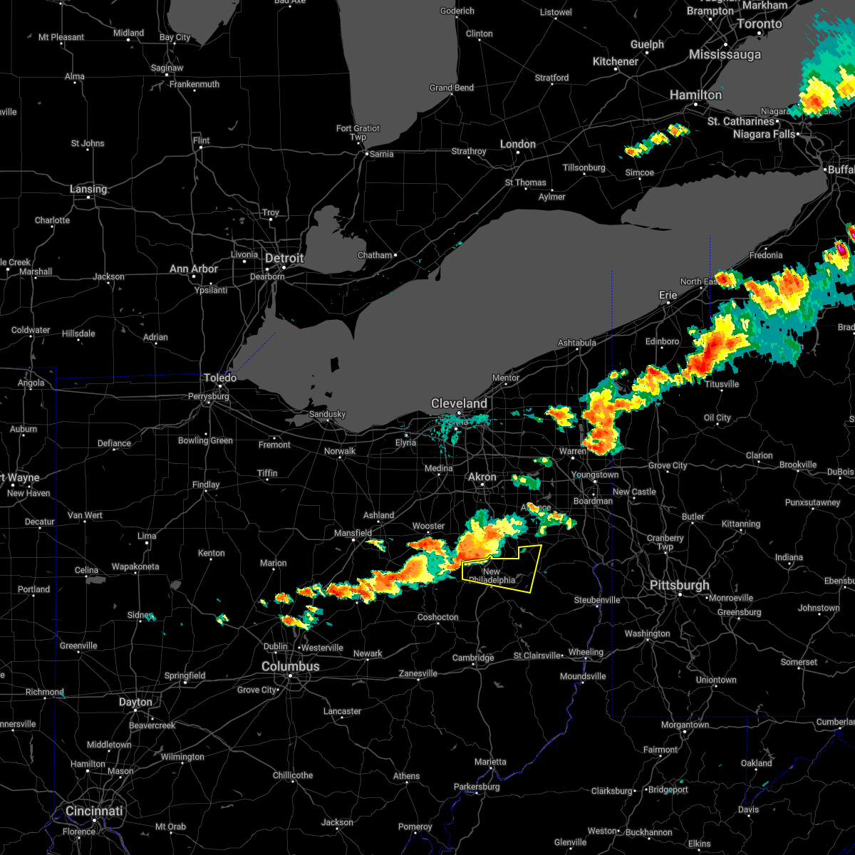 At 325 pm edt, a severe thunderstorm was located near brewster, or 10 miles northwest of dover, moving east at 40 mph (radar indicated). Hazards include two inch hail and 60 mph wind gusts. People and animals outdoors will be injured. expect hail damage to roofs, siding, windows, and vehicles. expect wind damage to trees and power lines, resulting in some power outages. locations impacted include, new philadelphia, dover, strasburg, malvern, bolivar, mineral city, dellroy, sherrodsville, parral, zoar, atwood lake, and leesville lake park. thunderstorm damage threat, considerable hail threat, radar indicated max hail size, 2. 00 in wind threat, radar indicated max wind gust, 60 mph. At 325 pm edt, a severe thunderstorm was located near brewster, or 10 miles northwest of dover, moving east at 40 mph (radar indicated). Hazards include two inch hail and 60 mph wind gusts. People and animals outdoors will be injured. expect hail damage to roofs, siding, windows, and vehicles. expect wind damage to trees and power lines, resulting in some power outages. locations impacted include, new philadelphia, dover, strasburg, malvern, bolivar, mineral city, dellroy, sherrodsville, parral, zoar, atwood lake, and leesville lake park. thunderstorm damage threat, considerable hail threat, radar indicated max hail size, 2. 00 in wind threat, radar indicated max wind gust, 60 mph.
|
| 6/16/2022 3:15 PM EDT |
 At 315 pm edt, a severe thunderstorm was located over mount eaton, or 15 miles northeast of millersburg, moving east at 40 mph (radar indicated). Hazards include 60 mph wind gusts and half dollar size hail. Minor hail damage to vehicles is possible. expect wind damage to trees and power lines, resulting in some power outages. locations impacted include, new philadelphia, dover, strasburg, malvern, bolivar, mineral city, dellroy, sherrodsville, parral, zoar, atwood lake, and leesville lake park. hail threat, radar indicated max hail size, 1. 25 in wind threat, radar indicated max wind gust, 60 mph. At 315 pm edt, a severe thunderstorm was located over mount eaton, or 15 miles northeast of millersburg, moving east at 40 mph (radar indicated). Hazards include 60 mph wind gusts and half dollar size hail. Minor hail damage to vehicles is possible. expect wind damage to trees and power lines, resulting in some power outages. locations impacted include, new philadelphia, dover, strasburg, malvern, bolivar, mineral city, dellroy, sherrodsville, parral, zoar, atwood lake, and leesville lake park. hail threat, radar indicated max hail size, 1. 25 in wind threat, radar indicated max wind gust, 60 mph.
|
| 6/16/2022 3:07 PM EDT |
 At 307 pm edt, a severe thunderstorm was located near mount eaton, or 10 miles southeast of wooster, moving east at 40 mph (radar indicated). Hazards include 60 mph wind gusts and quarter size hail. Minor hail damage to vehicles is possible. Expect wind damage to trees and power lines, resulting in some power outages. At 307 pm edt, a severe thunderstorm was located near mount eaton, or 10 miles southeast of wooster, moving east at 40 mph (radar indicated). Hazards include 60 mph wind gusts and quarter size hail. Minor hail damage to vehicles is possible. Expect wind damage to trees and power lines, resulting in some power outages.
|
| 6/14/2022 4:11 AM EDT |
 At 410 am edt, severe thunderstorms were located along a line extending from near dover to near newcomerstown to near coshocton to frazeysburg to newark, moving southeast at 70 mph (radar indicated). Hazards include 60 mph wind gusts and nickel size hail. Expect damage to trees and power lines, resulting in some power outages. locations impacted include, zanesville, new philadelphia, dover, coshocton, cambridge, uhrichsville, newcomerstown, dennison, strasburg, new concord, west lafayette, and sugarcreek. hail threat, radar indicated max hail size, 0. 88 in wind threat, observed max wind gust, 60 mph. At 410 am edt, severe thunderstorms were located along a line extending from near dover to near newcomerstown to near coshocton to frazeysburg to newark, moving southeast at 70 mph (radar indicated). Hazards include 60 mph wind gusts and nickel size hail. Expect damage to trees and power lines, resulting in some power outages. locations impacted include, zanesville, new philadelphia, dover, coshocton, cambridge, uhrichsville, newcomerstown, dennison, strasburg, new concord, west lafayette, and sugarcreek. hail threat, radar indicated max hail size, 0. 88 in wind threat, observed max wind gust, 60 mph.
|
| 6/14/2022 3:42 AM EDT |
 At 341 am edt, severe thunderstorms were located along a line extending from near wooster to near nashville to 9 miles southeast of bellville to near mount vernon to 7 miles north of sunbury, moving southeast at 60 mph (radar indicated). Hazards include 60 mph wind gusts and penny size hail. expect damage to trees and power lines, resulting in some power outages At 341 am edt, severe thunderstorms were located along a line extending from near wooster to near nashville to 9 miles southeast of bellville to near mount vernon to 7 miles north of sunbury, moving southeast at 60 mph (radar indicated). Hazards include 60 mph wind gusts and penny size hail. expect damage to trees and power lines, resulting in some power outages
|
| 6/14/2022 1:04 AM EDT |
 At 104 am edt, severe thunderstorms were located along a line extending from 12 miles southeast of carrollton to 7 miles southeast of cadiz to 6 miles east of barnesville, moving east at 60 mph (radar indicated). Hazards include 70 mph wind gusts and quarter size hail. Minor hail damage to vehicles is possible. trees snapped and uprooted. power outages can be expected. locations impacted include, new philadelphia, dover, uhrichsville, st. clairsville, cadiz, dennison, gnadenhutten, bethesda, tuscarawas, hopedale, flushing, and smithfield. thunderstorm damage threat, considerable hail threat, radar indicated max hail size, 1. 00 in wind threat, radar indicated max wind gust, 70 mph. At 104 am edt, severe thunderstorms were located along a line extending from 12 miles southeast of carrollton to 7 miles southeast of cadiz to 6 miles east of barnesville, moving east at 60 mph (radar indicated). Hazards include 70 mph wind gusts and quarter size hail. Minor hail damage to vehicles is possible. trees snapped and uprooted. power outages can be expected. locations impacted include, new philadelphia, dover, uhrichsville, st. clairsville, cadiz, dennison, gnadenhutten, bethesda, tuscarawas, hopedale, flushing, and smithfield. thunderstorm damage threat, considerable hail threat, radar indicated max hail size, 1. 00 in wind threat, radar indicated max wind gust, 70 mph.
|
| 6/14/2022 12:53 AM EDT |
 At 1253 am edt, a severe thunderstorm was located near carrollton, moving east at 65 mph (radar indicated). Hazards include 70 mph wind gusts and quarter size hail. Minor hail damage to vehicles is possible. trees snapped and uprooted. Power outages can be expected. At 1253 am edt, a severe thunderstorm was located near carrollton, moving east at 65 mph (radar indicated). Hazards include 70 mph wind gusts and quarter size hail. Minor hail damage to vehicles is possible. trees snapped and uprooted. Power outages can be expected.
|
| 6/14/2022 12:34 AM EDT |
 At 1233 am edt, severe thunderstorms were located along a line extending from near east sparta to near uhrichsville to near cambridge, moving east at 60 mph. these are destructive storms! (radar indicated). Hazards include 80 mph wind gusts and quarter size hail. Extensive tree damage and widespread power outages. mobile homes will be heavily damaged. Expect considerable damage to roofs, windows and vehicles. At 1233 am edt, severe thunderstorms were located along a line extending from near east sparta to near uhrichsville to near cambridge, moving east at 60 mph. these are destructive storms! (radar indicated). Hazards include 80 mph wind gusts and quarter size hail. Extensive tree damage and widespread power outages. mobile homes will be heavily damaged. Expect considerable damage to roofs, windows and vehicles.
|
| 6/14/2022 12:24 AM EDT |
 At 1223 am edt, severe thunderstorms were located along a line extending from massillon to near west lafayette to 8 miles west of south zanesville, moving southeast at 50 mph (radar indicated). Hazards include 70 mph wind gusts and quarter size hail. Minor hail damage to vehicles is possible. trees snapped and uprooted. power outages can be expected. Locations impacted include, zanesville, new philadelphia, dover, coshocton, cambridge, uhrichsville, newcomerstown, minerva, dennison, strasburg, new concord, and byesville. At 1223 am edt, severe thunderstorms were located along a line extending from massillon to near west lafayette to 8 miles west of south zanesville, moving southeast at 50 mph (radar indicated). Hazards include 70 mph wind gusts and quarter size hail. Minor hail damage to vehicles is possible. trees snapped and uprooted. power outages can be expected. Locations impacted include, zanesville, new philadelphia, dover, coshocton, cambridge, uhrichsville, newcomerstown, minerva, dennison, strasburg, new concord, and byesville.
|
| 6/13/2022 11:43 PM EDT |
 At 1143 pm edt, severe thunderstorms were located along a line extending from lodi to 6 miles south of loudonville to near johnstown, moving southeast at 50 mph (radar indicated). Hazards include 70 mph wind gusts and nickel size hail. Trees snapped and uprooted. Power outages can be expected. At 1143 pm edt, severe thunderstorms were located along a line extending from lodi to 6 miles south of loudonville to near johnstown, moving southeast at 50 mph (radar indicated). Hazards include 70 mph wind gusts and nickel size hail. Trees snapped and uprooted. Power outages can be expected.
|
| 6/1/2022 7:18 PM EDT |
 At 718 pm edt, a severe thunderstorm was located over new philadelphia, moving east at 30 mph (radar indicated). Hazards include 60 mph wind gusts and penny size hail. Expect damage to trees and power lines, resulting in some power outages. locations impacted include, new philadelphia, dover, uhrichsville, dennison, gnadenhutten, tuscarawas, baltic, midvale, port washington, barnhill, roswell, and parral. hail threat, radar indicated max hail size, 0. 75 in wind threat, radar indicated max wind gust, 60 mph. At 718 pm edt, a severe thunderstorm was located over new philadelphia, moving east at 30 mph (radar indicated). Hazards include 60 mph wind gusts and penny size hail. Expect damage to trees and power lines, resulting in some power outages. locations impacted include, new philadelphia, dover, uhrichsville, dennison, gnadenhutten, tuscarawas, baltic, midvale, port washington, barnhill, roswell, and parral. hail threat, radar indicated max hail size, 0. 75 in wind threat, radar indicated max wind gust, 60 mph.
|
| 6/1/2022 7:07 PM EDT |
 At 707 pm edt, a severe thunderstorm was located near dover, moving east at 30 mph (radar indicated). Hazards include 60 mph wind gusts and penny size hail. Expect damage to trees and power lines, resulting in some power outages. locations impacted include, new philadelphia, dover, uhrichsville, dennison, sugarcreek, gnadenhutten, tuscarawas, baltic, midvale, port washington, barnhill, and roswell. hail threat, radar indicated max hail size, 0. 75 in wind threat, radar indicated max wind gust, 60 mph. At 707 pm edt, a severe thunderstorm was located near dover, moving east at 30 mph (radar indicated). Hazards include 60 mph wind gusts and penny size hail. Expect damage to trees and power lines, resulting in some power outages. locations impacted include, new philadelphia, dover, uhrichsville, dennison, sugarcreek, gnadenhutten, tuscarawas, baltic, midvale, port washington, barnhill, and roswell. hail threat, radar indicated max hail size, 0. 75 in wind threat, radar indicated max wind gust, 60 mph.
|
| 6/1/2022 6:58 PM EDT |
 At 658 pm edt, a severe thunderstorm was located over sugarcreek, or 8 miles west of dover, moving east at 30 mph (radar indicated). Hazards include 60 mph wind gusts and penny size hail. expect damage to trees and power lines, resulting in some power outages At 658 pm edt, a severe thunderstorm was located over sugarcreek, or 8 miles west of dover, moving east at 30 mph (radar indicated). Hazards include 60 mph wind gusts and penny size hail. expect damage to trees and power lines, resulting in some power outages
|
| 5/20/2022 12:06 AM EDT |
 At 1206 am edt, a severe thunderstorm was located near ripley, moving east at 30 mph (radar indicated). Hazards include 60 mph wind gusts and half dollar size hail. Minor hail damage to vehicles is possible. expect wind damage to trees and power lines. locations impacted include, maysville, washington, ripley, aberdeen, brooksville, decatur, dover, germantown, minerva, abigail, redoak, moranburg, stonewall, parina, santa fe, lowell, south ripley, chatham, tuckahoe and stoney point. hail threat, radar indicated max hail size, 1. 25 in wind threat, radar indicated max wind gust, 60 mph. At 1206 am edt, a severe thunderstorm was located near ripley, moving east at 30 mph (radar indicated). Hazards include 60 mph wind gusts and half dollar size hail. Minor hail damage to vehicles is possible. expect wind damage to trees and power lines. locations impacted include, maysville, washington, ripley, aberdeen, brooksville, decatur, dover, germantown, minerva, abigail, redoak, moranburg, stonewall, parina, santa fe, lowell, south ripley, chatham, tuckahoe and stoney point. hail threat, radar indicated max hail size, 1. 25 in wind threat, radar indicated max wind gust, 60 mph.
|
| 5/19/2022 11:53 PM EDT |
 At 1153 pm edt, a severe thunderstorm was located near brooksville, moving east at 35 mph (radar indicated). Hazards include ping pong ball size hail and 60 mph wind gusts. People and animals outdoors will be injured. expect hail damage to roofs, siding, windows, and vehicles. expect wind damage to trees and power lines. locations impacted include, maysville, washington, ripley, aberdeen, augusta, brooksville, decatur, russellville, dover, higginsport, germantown, stonewall, powersville, south ripley, tuckahoe, hittville, minerva and abigail. hail threat, radar indicated max hail size, 1. 50 in wind threat, radar indicated max wind gust, 60 mph. At 1153 pm edt, a severe thunderstorm was located near brooksville, moving east at 35 mph (radar indicated). Hazards include ping pong ball size hail and 60 mph wind gusts. People and animals outdoors will be injured. expect hail damage to roofs, siding, windows, and vehicles. expect wind damage to trees and power lines. locations impacted include, maysville, washington, ripley, aberdeen, augusta, brooksville, decatur, russellville, dover, higginsport, germantown, stonewall, powersville, south ripley, tuckahoe, hittville, minerva and abigail. hail threat, radar indicated max hail size, 1. 50 in wind threat, radar indicated max wind gust, 60 mph.
|
| 5/19/2022 11:45 PM EDT |
 At 1144 pm edt, a severe thunderstorm was located over brooksville, moving east at 30 mph (radar indicated). Hazards include ping pong ball size hail and 60 mph wind gusts. People and animals outdoors will be injured. expect hail damage to roofs, siding, windows, and vehicles. expect wind damage to trees and power lines. locations impacted include, maysville, georgetown, washington, ripley, aberdeen, augusta, lewisburg, brooksville, decatur, russellville, mount olivet, dover, higginsport, germantown, sardis, murphysville, stonewall, powersville, johnsville and south ripley. hail threat, radar indicated max hail size, 1. 50 in wind threat, radar indicated max wind gust, 60 mph. At 1144 pm edt, a severe thunderstorm was located over brooksville, moving east at 30 mph (radar indicated). Hazards include ping pong ball size hail and 60 mph wind gusts. People and animals outdoors will be injured. expect hail damage to roofs, siding, windows, and vehicles. expect wind damage to trees and power lines. locations impacted include, maysville, georgetown, washington, ripley, aberdeen, augusta, lewisburg, brooksville, decatur, russellville, mount olivet, dover, higginsport, germantown, sardis, murphysville, stonewall, powersville, johnsville and south ripley. hail threat, radar indicated max hail size, 1. 50 in wind threat, radar indicated max wind gust, 60 mph.
|
| 5/19/2022 11:35 PM EDT |
 At 1134 pm edt, a severe thunderstorm was located 7 miles west of brooksville, moving east at 25 mph (radar indicated). Hazards include ping pong ball size hail and 60 mph wind gusts. People and animals outdoors will be injured. expect hail damage to roofs, siding, windows, and vehicles. Expect wind damage to trees and power lines. At 1134 pm edt, a severe thunderstorm was located 7 miles west of brooksville, moving east at 25 mph (radar indicated). Hazards include ping pong ball size hail and 60 mph wind gusts. People and animals outdoors will be injured. expect hail damage to roofs, siding, windows, and vehicles. Expect wind damage to trees and power lines.
|
| 4/25/2022 7:35 PM EDT |
 At 734 pm edt, a severe thunderstorm was located near newcomerstown, or 12 miles southwest of uhrichsville, moving northeast at 40 mph (radar indicated). Hazards include 60 mph wind gusts. Expect damage to trees and power lines, resulting in some power outages. locations impacted include, new philadelphia, uhrichsville, freeport, newcomerstown, dennison, gnadenhutten, tuscarawas, midvale, port washington, barnhill, stone creek, and gilmore. hail threat, radar indicated max hail size, <. 75 in wind threat, radar indicated max wind gust, 60 mph. At 734 pm edt, a severe thunderstorm was located near newcomerstown, or 12 miles southwest of uhrichsville, moving northeast at 40 mph (radar indicated). Hazards include 60 mph wind gusts. Expect damage to trees and power lines, resulting in some power outages. locations impacted include, new philadelphia, uhrichsville, freeport, newcomerstown, dennison, gnadenhutten, tuscarawas, midvale, port washington, barnhill, stone creek, and gilmore. hail threat, radar indicated max hail size, <. 75 in wind threat, radar indicated max wind gust, 60 mph.
|
| 4/25/2022 7:22 PM EDT |
 At 722 pm edt, a severe thunderstorm was located near newcomerstown, or 11 miles east of coshocton, moving northeast at 40 mph (radar indicated). Hazards include 60 mph wind gusts and penny size hail. expect damage to trees and power lines, resulting in some power outages At 722 pm edt, a severe thunderstorm was located near newcomerstown, or 11 miles east of coshocton, moving northeast at 40 mph (radar indicated). Hazards include 60 mph wind gusts and penny size hail. expect damage to trees and power lines, resulting in some power outages
|
| 4/13/2022 10:25 PM EDT |
 The severe thunderstorm warning for mason county will expire at 1030 pm edt, the storm which prompted the warning has moved out of the area. therefore, the warning will be allowed to expire. please report previous wind damage or hail to the national weather service by going to our website at weather.gov/iln and submitting your report via social media. The severe thunderstorm warning for mason county will expire at 1030 pm edt, the storm which prompted the warning has moved out of the area. therefore, the warning will be allowed to expire. please report previous wind damage or hail to the national weather service by going to our website at weather.gov/iln and submitting your report via social media.
|
| 4/13/2022 10:22 PM EDT |
 The tornado warning for northwestern mason and southeastern brown counties will expire at 1030 pm edt, the storm which prompted the warning has weakened and no longer appears capable of producing a tornado. therefore, the warning will be allowed to expire. a severe thunderstorm warning remains in effect for portions of mason and brown counties until 1100 pm. please report previous tornadoes, wind damage or hail to the national weather service by going to our website at weather.gov/iln and submitting your report via social media. The tornado warning for northwestern mason and southeastern brown counties will expire at 1030 pm edt, the storm which prompted the warning has weakened and no longer appears capable of producing a tornado. therefore, the warning will be allowed to expire. a severe thunderstorm warning remains in effect for portions of mason and brown counties until 1100 pm. please report previous tornadoes, wind damage or hail to the national weather service by going to our website at weather.gov/iln and submitting your report via social media.
|
| 4/13/2022 10:12 PM EDT |
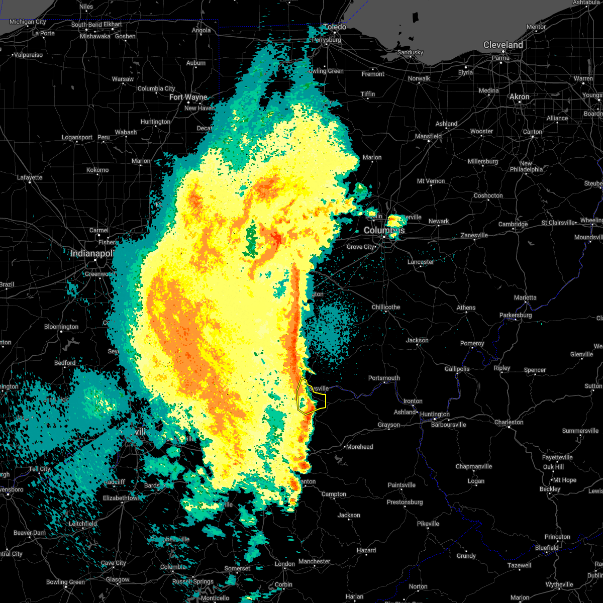 At 1012 pm edt, a severe thunderstorm was located over washington, moving northeast at 60 mph (radar indicated). Hazards include 60 mph wind gusts. Expect damage to trees and power lines. Locations impacted include, maysville, washington, lewisburg, dover, minerva, murphysville, moranburg, mays lick, rectorville, peed, fleming-mason airport, lowell, orangeburg, helena, somo, south ripley and tuckahoe. At 1012 pm edt, a severe thunderstorm was located over washington, moving northeast at 60 mph (radar indicated). Hazards include 60 mph wind gusts. Expect damage to trees and power lines. Locations impacted include, maysville, washington, lewisburg, dover, minerva, murphysville, moranburg, mays lick, rectorville, peed, fleming-mason airport, lowell, orangeburg, helena, somo, south ripley and tuckahoe.
|
| 4/13/2022 10:11 PM EDT |
 At 1011 pm edt, a severe thunderstorm capable of producing a tornado was located near ripley, moving east at 55 mph (radar indicated rotation). Hazards include tornado. Flying debris will be dangerous to those caught without shelter. mobile homes will be damaged or destroyed. damage to roofs, windows, and vehicles will occur. tree damage is likely. Locations impacted include, maysville, georgetown, ripley, aberdeen, decatur, russellville, dover, minerva, redoak, moranburg, south ripley and tuckahoe. At 1011 pm edt, a severe thunderstorm capable of producing a tornado was located near ripley, moving east at 55 mph (radar indicated rotation). Hazards include tornado. Flying debris will be dangerous to those caught without shelter. mobile homes will be damaged or destroyed. damage to roofs, windows, and vehicles will occur. tree damage is likely. Locations impacted include, maysville, georgetown, ripley, aberdeen, decatur, russellville, dover, minerva, redoak, moranburg, south ripley and tuckahoe.
|
| 4/13/2022 10:11 PM EDT |
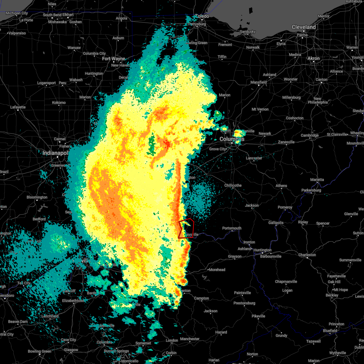 At 1011 pm edt, a severe thunderstorm capable of producing a tornado was located near ripley, moving east at 55 mph (radar indicated rotation). Hazards include tornado. Flying debris will be dangerous to those caught without shelter. mobile homes will be damaged or destroyed. damage to roofs, windows, and vehicles will occur. tree damage is likely. Locations impacted include, maysville, georgetown, ripley, aberdeen, decatur, russellville, dover, minerva, redoak, moranburg, south ripley and tuckahoe. At 1011 pm edt, a severe thunderstorm capable of producing a tornado was located near ripley, moving east at 55 mph (radar indicated rotation). Hazards include tornado. Flying debris will be dangerous to those caught without shelter. mobile homes will be damaged or destroyed. damage to roofs, windows, and vehicles will occur. tree damage is likely. Locations impacted include, maysville, georgetown, ripley, aberdeen, decatur, russellville, dover, minerva, redoak, moranburg, south ripley and tuckahoe.
|
| 4/13/2022 10:06 PM EDT |
 At 1006 pm edt, a severe thunderstorm was located near fairview, moving northeast at 50 mph (radar indicated). Hazards include 60 mph wind gusts. Expect damage to trees and power lines. Locations impacted include, maysville, washington, ripley, augusta, lewisburg, brooksville, mount olivet, dover, germantown, sardis, murphysville, alhambra, stonewall, mays lick, rectorville, peed, helena, south ripley, chatham and tuckahoe. At 1006 pm edt, a severe thunderstorm was located near fairview, moving northeast at 50 mph (radar indicated). Hazards include 60 mph wind gusts. Expect damage to trees and power lines. Locations impacted include, maysville, washington, ripley, augusta, lewisburg, brooksville, mount olivet, dover, germantown, sardis, murphysville, alhambra, stonewall, mays lick, rectorville, peed, helena, south ripley, chatham and tuckahoe.
|
| 4/13/2022 10:04 PM EDT |
 At 1004 pm edt, a severe thunderstorm capable of producing a tornado was located near brooksville, moving east at 50 mph (radar indicated rotation). Hazards include tornado. Flying debris will be dangerous to those caught without shelter. mobile homes will be damaged or destroyed. damage to roofs, windows, and vehicles will occur. tree damage is likely. Locations impacted include, maysville, georgetown, ripley, aberdeen, augusta, brooksville, decatur, russellville, dover, higginsport, germantown, minerva, redoak, moranburg, parina, south ripley, chatham, tuckahoe, stoney point and aa highway at state route 19. At 1004 pm edt, a severe thunderstorm capable of producing a tornado was located near brooksville, moving east at 50 mph (radar indicated rotation). Hazards include tornado. Flying debris will be dangerous to those caught without shelter. mobile homes will be damaged or destroyed. damage to roofs, windows, and vehicles will occur. tree damage is likely. Locations impacted include, maysville, georgetown, ripley, aberdeen, augusta, brooksville, decatur, russellville, dover, higginsport, germantown, minerva, redoak, moranburg, parina, south ripley, chatham, tuckahoe, stoney point and aa highway at state route 19.
|
| 4/13/2022 10:04 PM EDT |
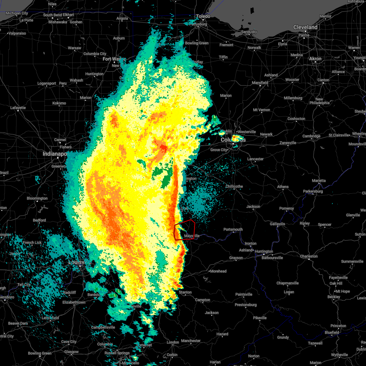 At 1004 pm edt, a severe thunderstorm capable of producing a tornado was located near brooksville, moving east at 50 mph (radar indicated rotation). Hazards include tornado. Flying debris will be dangerous to those caught without shelter. mobile homes will be damaged or destroyed. damage to roofs, windows, and vehicles will occur. tree damage is likely. Locations impacted include, maysville, georgetown, ripley, aberdeen, augusta, brooksville, decatur, russellville, dover, higginsport, germantown, minerva, redoak, moranburg, parina, south ripley, chatham, tuckahoe, stoney point and aa highway at state route 19. At 1004 pm edt, a severe thunderstorm capable of producing a tornado was located near brooksville, moving east at 50 mph (radar indicated rotation). Hazards include tornado. Flying debris will be dangerous to those caught without shelter. mobile homes will be damaged or destroyed. damage to roofs, windows, and vehicles will occur. tree damage is likely. Locations impacted include, maysville, georgetown, ripley, aberdeen, augusta, brooksville, decatur, russellville, dover, higginsport, germantown, minerva, redoak, moranburg, parina, south ripley, chatham, tuckahoe, stoney point and aa highway at state route 19.
|
| 4/13/2022 9:55 PM EDT |
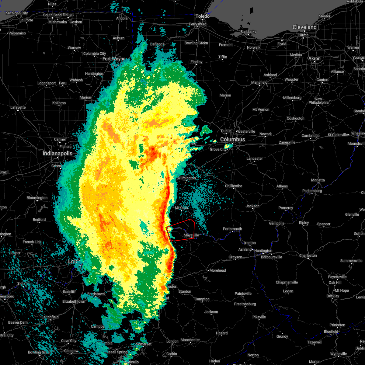 At 955 pm edt, a severe thunderstorm capable of producing a tornado was located near brooksville, moving east at 60 mph (radar indicated rotation). Hazards include tornado. Flying debris will be dangerous to those caught without shelter. mobile homes will be damaged or destroyed. damage to roofs, windows, and vehicles will occur. Tree damage is likely. At 955 pm edt, a severe thunderstorm capable of producing a tornado was located near brooksville, moving east at 60 mph (radar indicated rotation). Hazards include tornado. Flying debris will be dangerous to those caught without shelter. mobile homes will be damaged or destroyed. damage to roofs, windows, and vehicles will occur. Tree damage is likely.
|
| 4/13/2022 9:48 PM EDT |
 At 948 pm edt, a severe thunderstorm was located 9 miles northeast of cynthiana, moving east at 55 mph (radar indicated). Hazards include 60 mph wind gusts. expect damage to trees and power lines At 948 pm edt, a severe thunderstorm was located 9 miles northeast of cynthiana, moving east at 55 mph (radar indicated). Hazards include 60 mph wind gusts. expect damage to trees and power lines
|
| 3/23/2022 8:09 PM EDT |
 The severe thunderstorm warning for west central columbiana, northwestern carroll and northeastern tuscarawas counties will expire at 815 pm edt, the storm which prompted the warning has weakened below severe limits, and has exited the warned area. therefore, the warning will be allowed to expire. however heavy rain is still possible with this thunderstorm. a tornado watch remains in effect until 1000 pm edt for east central ohio. The severe thunderstorm warning for west central columbiana, northwestern carroll and northeastern tuscarawas counties will expire at 815 pm edt, the storm which prompted the warning has weakened below severe limits, and has exited the warned area. therefore, the warning will be allowed to expire. however heavy rain is still possible with this thunderstorm. a tornado watch remains in effect until 1000 pm edt for east central ohio.
|
| 3/23/2022 8:04 PM EDT |
 At 804 pm edt, a severe thunderstorm was located near waynesburg, or near canton, moving northeast at 55 mph (radar indicated). Hazards include 60 mph wind gusts and quarter size hail. Minor hail damage to vehicles is possible. expect wind damage to trees and power lines, resulting in some power outages. locations impacted include, new philadelphia, dover, minerva, malvern, bolivar, mineral city, zoar, and east rochester. hail threat, radar indicated max hail size, 1. 00 in wind threat, radar indicated max wind gust, 60 mph. At 804 pm edt, a severe thunderstorm was located near waynesburg, or near canton, moving northeast at 55 mph (radar indicated). Hazards include 60 mph wind gusts and quarter size hail. Minor hail damage to vehicles is possible. expect wind damage to trees and power lines, resulting in some power outages. locations impacted include, new philadelphia, dover, minerva, malvern, bolivar, mineral city, zoar, and east rochester. hail threat, radar indicated max hail size, 1. 00 in wind threat, radar indicated max wind gust, 60 mph.
|
| 3/23/2022 7:56 PM EDT |
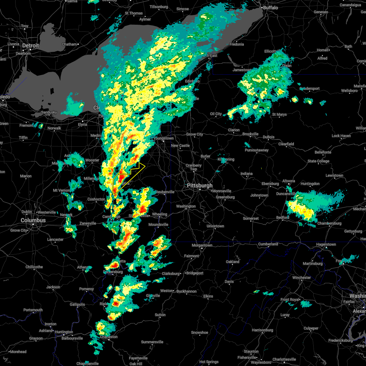 At 756 pm edt, a severe thunderstorm was located over east sparta, or 10 miles northeast of dover, moving northeast at 55 mph (radar indicated). Hazards include 60 mph wind gusts and quarter size hail. Minor hail damage to vehicles is possible. expect wind damage to trees and power lines, resulting in some power outages. locations impacted include, new philadelphia, dover, minerva, strasburg, malvern, bolivar, mineral city, parral, stone creek, zoar, and east rochester. hail threat, radar indicated max hail size, 1. 00 in wind threat, radar indicated max wind gust, 60 mph. At 756 pm edt, a severe thunderstorm was located over east sparta, or 10 miles northeast of dover, moving northeast at 55 mph (radar indicated). Hazards include 60 mph wind gusts and quarter size hail. Minor hail damage to vehicles is possible. expect wind damage to trees and power lines, resulting in some power outages. locations impacted include, new philadelphia, dover, minerva, strasburg, malvern, bolivar, mineral city, parral, stone creek, zoar, and east rochester. hail threat, radar indicated max hail size, 1. 00 in wind threat, radar indicated max wind gust, 60 mph.
|
| 3/23/2022 7:42 PM EDT |
 At 741 pm edt, a severe thunderstorm was located near dover, moving northeast at 55 mph (radar indicated). Hazards include 60 mph wind gusts and nickel size hail. expect damage to trees and power lines, resulting in some power outages At 741 pm edt, a severe thunderstorm was located near dover, moving northeast at 55 mph (radar indicated). Hazards include 60 mph wind gusts and nickel size hail. expect damage to trees and power lines, resulting in some power outages
|
| 12/11/2021 3:41 AM EST |
 At 340 am est, a severe thunderstorm was located near ripley, moving northeast at 45 mph (radar indicated). Hazards include 60 mph wind gusts. expect damage to trees and power lines At 340 am est, a severe thunderstorm was located near ripley, moving northeast at 45 mph (radar indicated). Hazards include 60 mph wind gusts. expect damage to trees and power lines
|
| 10/21/2021 5:42 PM EDT |
 At 541 pm edt, a severe thunderstorm was located near sugarcreek, or 10 miles southwest of dover, moving northeast at 45 mph (radar indicated). Hazards include 60 mph wind gusts. Expect damage to trees and power lines, resulting in some power outages. locations impacted include, new philadelphia, dover, uhrichsville, newcomerstown, dennison, strasburg, west lafayette, sugarcreek, gnadenhutten, tuscarawas, bolivar, and baltic. hail threat, radar indicated max hail size, <. 75 in wind threat, radar indicated max wind gust, 60 mph. At 541 pm edt, a severe thunderstorm was located near sugarcreek, or 10 miles southwest of dover, moving northeast at 45 mph (radar indicated). Hazards include 60 mph wind gusts. Expect damage to trees and power lines, resulting in some power outages. locations impacted include, new philadelphia, dover, uhrichsville, newcomerstown, dennison, strasburg, west lafayette, sugarcreek, gnadenhutten, tuscarawas, bolivar, and baltic. hail threat, radar indicated max hail size, <. 75 in wind threat, radar indicated max wind gust, 60 mph.
|
| 10/21/2021 5:24 PM EDT |
 At 523 pm edt, a severe thunderstorm was located 8 miles southeast of killbuck, or 8 miles north of coshocton, moving northeast at 45 mph (radar indicated). Hazards include 60 mph wind gusts. Expect damage to trees and power lines, resulting in some power outages. locations impacted include, new philadelphia, dover, coshocton, uhrichsville, newcomerstown, dennison, strasburg, west lafayette, sugarcreek, gnadenhutten, tuscarawas, and bolivar. hail threat, radar indicated max hail size, <. 75 in wind threat, radar indicated max wind gust, 60 mph. At 523 pm edt, a severe thunderstorm was located 8 miles southeast of killbuck, or 8 miles north of coshocton, moving northeast at 45 mph (radar indicated). Hazards include 60 mph wind gusts. Expect damage to trees and power lines, resulting in some power outages. locations impacted include, new philadelphia, dover, coshocton, uhrichsville, newcomerstown, dennison, strasburg, west lafayette, sugarcreek, gnadenhutten, tuscarawas, and bolivar. hail threat, radar indicated max hail size, <. 75 in wind threat, radar indicated max wind gust, 60 mph.
|
| 10/21/2021 5:16 PM EDT |
 At 515 pm edt, a severe thunderstorm was located 10 miles northwest of coshocton, moving east at 45 mph (radar indicated). Hazards include 60 mph wind gusts. expect damage to trees and power lines, resulting in some power outages At 515 pm edt, a severe thunderstorm was located 10 miles northwest of coshocton, moving east at 45 mph (radar indicated). Hazards include 60 mph wind gusts. expect damage to trees and power lines, resulting in some power outages
|
| 8/10/2021 11:44 AM EDT |
 At 1144 am edt, a severe thunderstorm was located near west lafayette, or near coshocton, moving east at 25 mph (radar). Hazards include wind gusts to 60 mph. Expect damage to trees and power lines, resulting in some power outages. Locations impacted include, new philadelphia, newcomerstown, sugarcreek, gnadenhutten, tuscarawas, port washington, stone creek, gilmore, chili, bakersville, this includes interstate 77 in ohio between mile markers 65 and 81. At 1144 am edt, a severe thunderstorm was located near west lafayette, or near coshocton, moving east at 25 mph (radar). Hazards include wind gusts to 60 mph. Expect damage to trees and power lines, resulting in some power outages. Locations impacted include, new philadelphia, newcomerstown, sugarcreek, gnadenhutten, tuscarawas, port washington, stone creek, gilmore, chili, bakersville, this includes interstate 77 in ohio between mile markers 65 and 81.
|
| 8/10/2021 11:40 AM EDT |
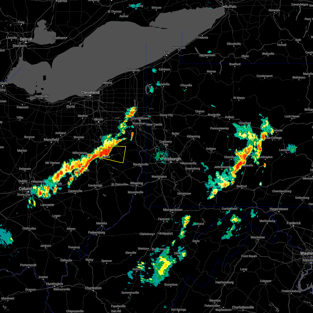 At 1140 am edt, a severe thunderstorm was located over dover, moving east at 20 mph (radar). Hazards include wind gusts to 60 mph and quarter-size hail. Minor hail damage to vehicles is possible. expect wind damage to trees and power lines, resulting in some power outages. Locations impacted include, new philadelphia, dover, carrollton, augusta, malvern, bolivar, mineral city, dellroy, sherrodsville, parral, zoar, atwood lake, this includes interstate 77 in ohio between mile markers 83 and 85, and between mile markers 90 and 94. At 1140 am edt, a severe thunderstorm was located over dover, moving east at 20 mph (radar). Hazards include wind gusts to 60 mph and quarter-size hail. Minor hail damage to vehicles is possible. expect wind damage to trees and power lines, resulting in some power outages. Locations impacted include, new philadelphia, dover, carrollton, augusta, malvern, bolivar, mineral city, dellroy, sherrodsville, parral, zoar, atwood lake, this includes interstate 77 in ohio between mile markers 83 and 85, and between mile markers 90 and 94.
|
| 8/10/2021 11:30 AM EDT |
 At 1130 am edt, a severe thunderstorm was located 7 miles southwest of farmerstown, or 10 miles north of coshocton, moving east at 30 mph (radar indicated). Hazards include 60 mph wind gusts. expect damage to trees and power lines, resulting in some power outages At 1130 am edt, a severe thunderstorm was located 7 miles southwest of farmerstown, or 10 miles north of coshocton, moving east at 30 mph (radar indicated). Hazards include 60 mph wind gusts. expect damage to trees and power lines, resulting in some power outages
|
| 8/10/2021 11:28 AM EDT |
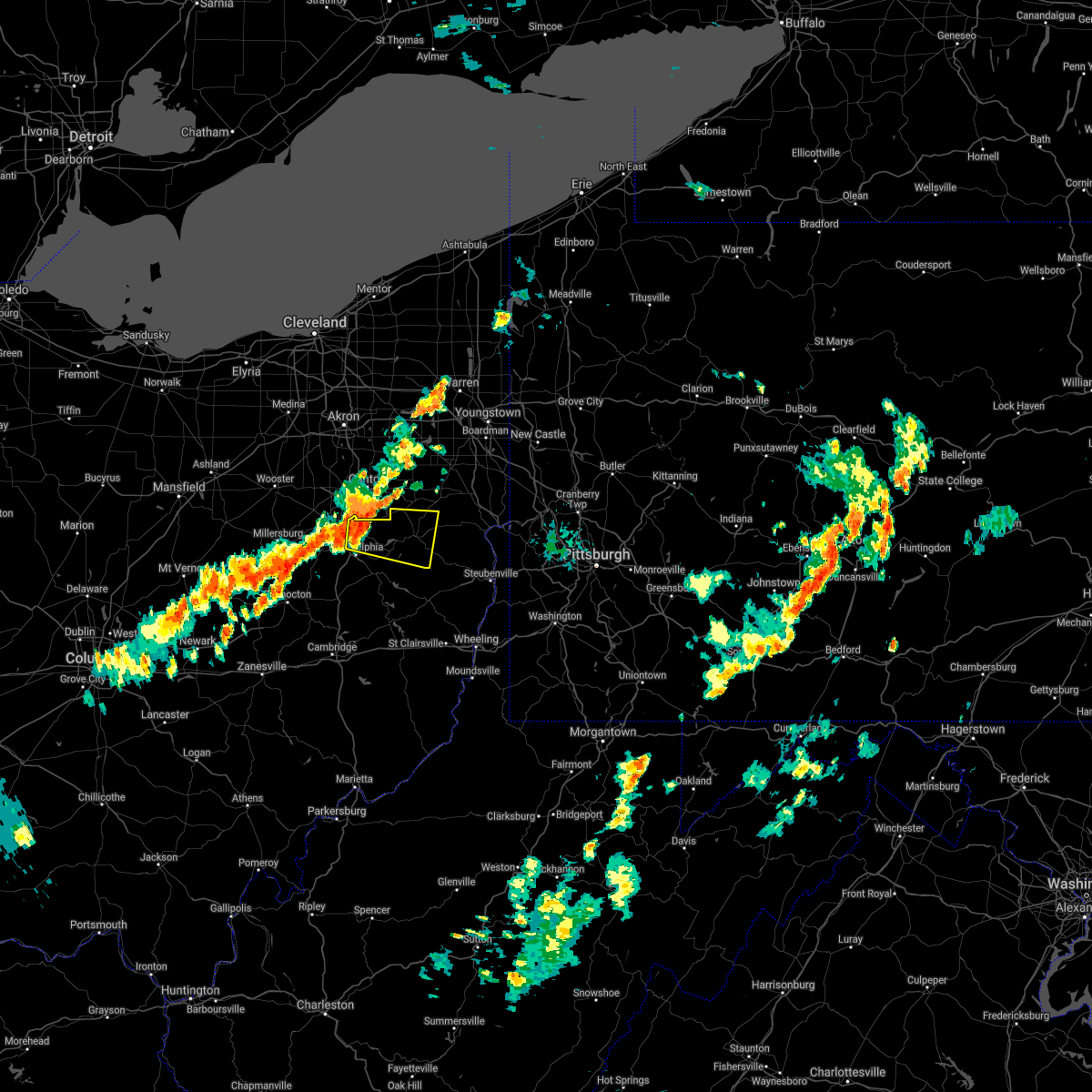 At 1128 am edt, a severe thunderstorm was located near east sparta, or near dover, moving east at 30 mph (radar indicated). Hazards include 60 mph wind gusts. expect damage to trees and power lines, resulting in some power outages At 1128 am edt, a severe thunderstorm was located near east sparta, or near dover, moving east at 30 mph (radar indicated). Hazards include 60 mph wind gusts. expect damage to trees and power lines, resulting in some power outages
|
| 8/10/2021 11:18 AM EDT |
 At 1117 am edt, a severe thunderstorm was located near strasburg, or 7 miles north of dover, moving east at 35 mph (radar). Hazards include wind gusts to 60 mph. Expect damage to trees and power lines, resulting in some power outages. Locations impacted include, dover, strasburg, bolivar, mineral city, parral, zoar, atwood lake, this includes interstate 77 in ohio between mile markers 84 and 94. At 1117 am edt, a severe thunderstorm was located near strasburg, or 7 miles north of dover, moving east at 35 mph (radar). Hazards include wind gusts to 60 mph. Expect damage to trees and power lines, resulting in some power outages. Locations impacted include, dover, strasburg, bolivar, mineral city, parral, zoar, atwood lake, this includes interstate 77 in ohio between mile markers 84 and 94.
|
| 8/10/2021 11:05 AM EDT |
 At 1104 am edt, a severe thunderstorm was located over wilmot, or 11 miles northwest of dover, moving east at 35 mph (radar indicated). Hazards include 60 mph wind gusts. expect damage to trees and power lines, resulting in some power outages At 1104 am edt, a severe thunderstorm was located over wilmot, or 11 miles northwest of dover, moving east at 35 mph (radar indicated). Hazards include 60 mph wind gusts. expect damage to trees and power lines, resulting in some power outages
|
| 7/16/2021 5:29 PM EDT |
 At 529 pm edt, severe thunderstorms were located along a line extending from near strasburg to near freeport, moving east at 40 mph (radar). Hazards include wind gusts to 60 mph. Expect damage to trees and power lines, resulting in some power outages. Locations impacted include, new philadelphia, dover, uhrichsville, freeport, newcomerstown, dennison, strasburg, sugarcreek, gnadenhutten, antrim, tuscarawas, bolivar, this includes interstate 77 in ohio between mile markers 54 and 94. At 529 pm edt, severe thunderstorms were located along a line extending from near strasburg to near freeport, moving east at 40 mph (radar). Hazards include wind gusts to 60 mph. Expect damage to trees and power lines, resulting in some power outages. Locations impacted include, new philadelphia, dover, uhrichsville, freeport, newcomerstown, dennison, strasburg, sugarcreek, gnadenhutten, antrim, tuscarawas, bolivar, this includes interstate 77 in ohio between mile markers 54 and 94.
|
| 7/16/2021 5:08 PM EDT |
 At 508 pm edt, severe thunderstorms were located along a line extending from farmerstown to 7 miles north of cambridge, moving northeast at 40 mph (radar). Hazards include wind gusts to 60 mph. expect damage to trees and power lines, resulting in some power outages At 508 pm edt, severe thunderstorms were located along a line extending from farmerstown to 7 miles north of cambridge, moving northeast at 40 mph (radar). Hazards include wind gusts to 60 mph. expect damage to trees and power lines, resulting in some power outages
|
| 7/7/2021 3:26 PM EDT |
 The severe thunderstorm warning for eastern tuscarawas county will expire at 330 pm edt, the storm which prompted the warning has weakened below severe limits, and no longer poses an immediate threat to life or property. therefore, the warning will be allowed to expire. however gusty winds are still possible with this thunderstorm. The severe thunderstorm warning for eastern tuscarawas county will expire at 330 pm edt, the storm which prompted the warning has weakened below severe limits, and no longer poses an immediate threat to life or property. therefore, the warning will be allowed to expire. however gusty winds are still possible with this thunderstorm.
|
| 7/7/2021 3:21 PM EDT |
 At 320 pm edt, a severe thunderstorm was located near new philadelphia, moving northeast at 20 mph (radar). Hazards include wind gusts to 60 mph. Expect damage to trees and power lines, resulting in some power outages. Locations impacted include, new philadelphia, dover, uhrichsville, dennison, gnadenhutten, tuscarawas, midvale, barnhill, roswell, atwood lake, this includes interstate 77 in ohio between mile markers 78 and 81. At 320 pm edt, a severe thunderstorm was located near new philadelphia, moving northeast at 20 mph (radar). Hazards include wind gusts to 60 mph. Expect damage to trees and power lines, resulting in some power outages. Locations impacted include, new philadelphia, dover, uhrichsville, dennison, gnadenhutten, tuscarawas, midvale, barnhill, roswell, atwood lake, this includes interstate 77 in ohio between mile markers 78 and 81.
|
| 7/7/2021 3:14 PM EDT |
 At 313 pm edt, a severe thunderstorm was located over new philadelphia, moving northeast at 20 mph (radar). Hazards include wind gusts to 60 mph. Expect damage to trees and power lines, resulting in some power outages. Locations impacted include, new philadelphia, dover, uhrichsville, dennison, sugarcreek, gnadenhutten, tuscarawas, midvale, mineral city, barnhill, roswell, parral, this includes interstate 77 in ohio between mile markers 73 and 86. At 313 pm edt, a severe thunderstorm was located over new philadelphia, moving northeast at 20 mph (radar). Hazards include wind gusts to 60 mph. Expect damage to trees and power lines, resulting in some power outages. Locations impacted include, new philadelphia, dover, uhrichsville, dennison, sugarcreek, gnadenhutten, tuscarawas, midvale, mineral city, barnhill, roswell, parral, this includes interstate 77 in ohio between mile markers 73 and 86.
|
| 7/7/2021 2:56 PM EDT |
 At 255 pm edt, a severe thunderstorm was located near new philadelphia, moving northeast at 20 mph (radar). Hazards include wind gusts to 60 mph. Expect damage to trees and power lines, resulting in some power outages. Locations impacted include, new philadelphia, dover, uhrichsville, newcomerstown, dennison, sugarcreek, gnadenhutten, tuscarawas, midvale, mineral city, port washington, barnhill, this includes interstate 77 in ohio between mile markers 66 and 86. At 255 pm edt, a severe thunderstorm was located near new philadelphia, moving northeast at 20 mph (radar). Hazards include wind gusts to 60 mph. Expect damage to trees and power lines, resulting in some power outages. Locations impacted include, new philadelphia, dover, uhrichsville, newcomerstown, dennison, sugarcreek, gnadenhutten, tuscarawas, midvale, mineral city, port washington, barnhill, this includes interstate 77 in ohio between mile markers 66 and 86.
|
| 7/7/2021 2:49 PM EDT |
 At 249 pm edt, a severe thunderstorm was located 7 miles southeast of sugarcreek, or 7 miles southwest of new philadelphia, moving northeast at 20 mph (radar). Hazards include wind gusts to 60 mph. expect damage to trees and power lines, resulting in some power outages At 249 pm edt, a severe thunderstorm was located 7 miles southeast of sugarcreek, or 7 miles southwest of new philadelphia, moving northeast at 20 mph (radar). Hazards include wind gusts to 60 mph. expect damage to trees and power lines, resulting in some power outages
|
| 6/18/2021 10:41 PM EDT |
 The severe thunderstorm warning for mason, robertson, lewis, bracken, southeastern pendleton, south central clermont, southern brown, adams and western scioto counties will expire at 1045 pm edt, an additional severe thunderstorm warning remains in effect until 1115 pm for mason, robertson, lewis, adams, and scioto counties. a tornado watch remains in effect until 1100 pm edt for southwestern ohio. a severe thunderstorm watch remains in effect until 300 am edt for northern and northeastern kentucky, and southwestern ohio. please report previous wind damage or hail to the national weather service by going to our website at weather.gov/iln and submitting your report via social media. The severe thunderstorm warning for mason, robertson, lewis, bracken, southeastern pendleton, south central clermont, southern brown, adams and western scioto counties will expire at 1045 pm edt, an additional severe thunderstorm warning remains in effect until 1115 pm for mason, robertson, lewis, adams, and scioto counties. a tornado watch remains in effect until 1100 pm edt for southwestern ohio. a severe thunderstorm watch remains in effect until 300 am edt for northern and northeastern kentucky, and southwestern ohio. please report previous wind damage or hail to the national weather service by going to our website at weather.gov/iln and submitting your report via social media.
|
| 6/18/2021 10:24 PM EDT |
 At 1023 pm edt, severe thunderstorms were located along a line extending from vanceburg to near washington, moving southeast at 50 mph (radar indicated). Hazards include 70 mph wind gusts and penny size hail. Expect considerable tree damage. damage is likely to mobile homes, roofs, and outbuildings. locations impacted include, portsmouth, maysville, georgetown, washington, west union, manchester, ripley, aberdeen, vanceburg, augusta, lewisburg, brooksville, camp dix, head of grassy, rome, foxport, tollesboro, blue creek, decatur and russellville. A tornado watch remains in effect until 1100 pm edt for southwestern ohio. At 1023 pm edt, severe thunderstorms were located along a line extending from vanceburg to near washington, moving southeast at 50 mph (radar indicated). Hazards include 70 mph wind gusts and penny size hail. Expect considerable tree damage. damage is likely to mobile homes, roofs, and outbuildings. locations impacted include, portsmouth, maysville, georgetown, washington, west union, manchester, ripley, aberdeen, vanceburg, augusta, lewisburg, brooksville, camp dix, head of grassy, rome, foxport, tollesboro, blue creek, decatur and russellville. A tornado watch remains in effect until 1100 pm edt for southwestern ohio.
|
| 6/18/2021 9:49 PM EDT |
 At 948 pm edt, severe thunderstorms were located along a line extending from seaman to near felicity, moving southeast at 50 mph (radar indicated). Hazards include 70 mph wind gusts and penny size hail. Expect considerable tree damage. Damage is likely to mobile homes, roofs, and outbuildings. At 948 pm edt, severe thunderstorms were located along a line extending from seaman to near felicity, moving southeast at 50 mph (radar indicated). Hazards include 70 mph wind gusts and penny size hail. Expect considerable tree damage. Damage is likely to mobile homes, roofs, and outbuildings.
|
| 3/25/2021 11:13 PM EDT |
 At 1113 pm edt, a severe thunderstorm was located over brooksville, moving northeast at 75 mph (radar indicated). Hazards include quarter size hail. Minor damage to vehicles is possible. Locations impacted include, maysville, georgetown, mount orab, ripley, augusta, sardinia, felicity, brooksville, decatur, russellville, hamersville, dover, higginsport, germantown, chilo, bradford, stonewall, powersville, feesburg and johnsville. At 1113 pm edt, a severe thunderstorm was located over brooksville, moving northeast at 75 mph (radar indicated). Hazards include quarter size hail. Minor damage to vehicles is possible. Locations impacted include, maysville, georgetown, mount orab, ripley, augusta, sardinia, felicity, brooksville, decatur, russellville, hamersville, dover, higginsport, germantown, chilo, bradford, stonewall, powersville, feesburg and johnsville.
|
| 3/25/2021 11:13 PM EDT |
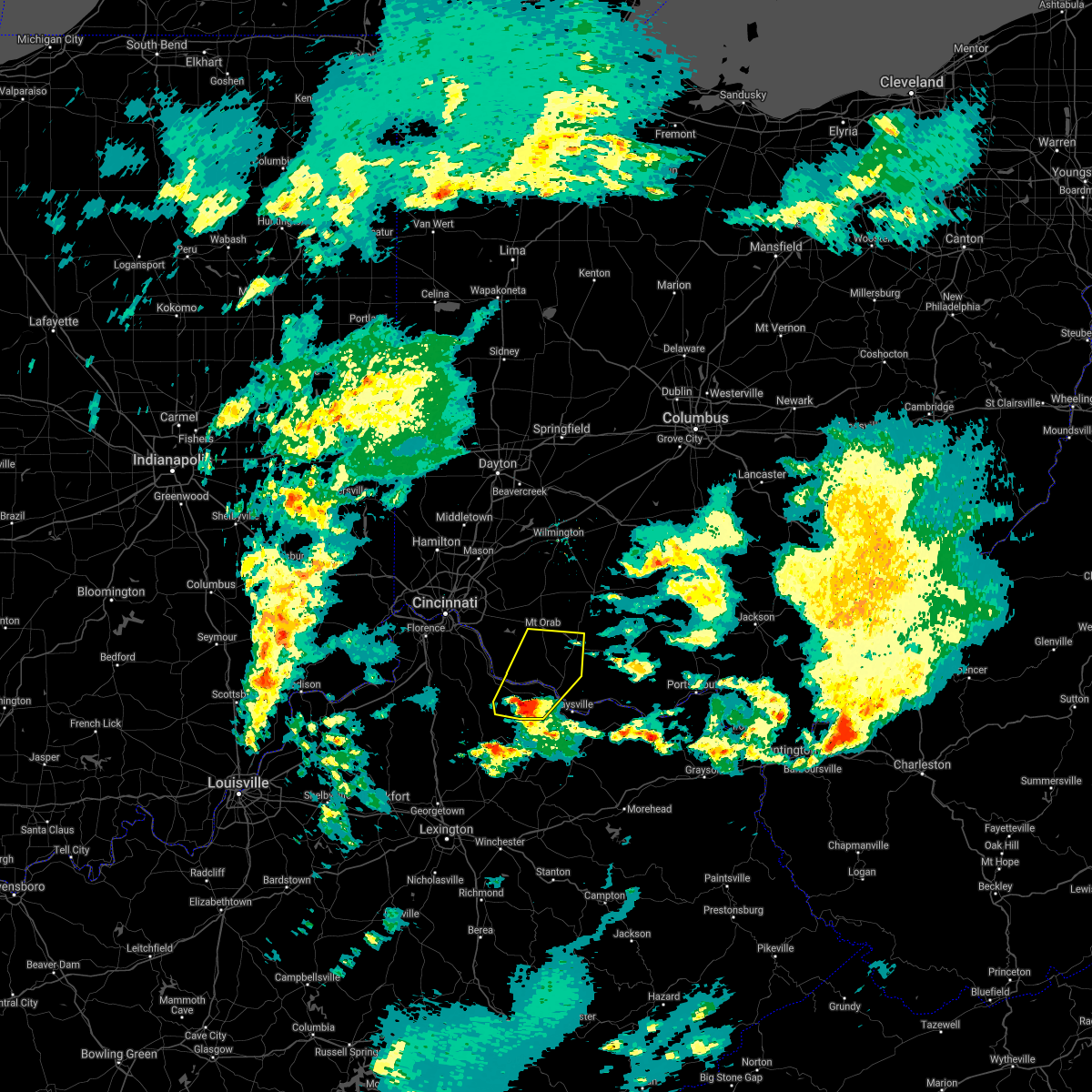 At 1113 pm edt, a severe thunderstorm was located over brooksville, moving northeast at 75 mph (radar indicated). Hazards include quarter size hail. Minor damage to vehicles is possible. Locations impacted include, maysville, georgetown, mount orab, ripley, augusta, sardinia, felicity, brooksville, decatur, russellville, hamersville, dover, higginsport, germantown, chilo, bradford, stonewall, powersville, feesburg and johnsville. At 1113 pm edt, a severe thunderstorm was located over brooksville, moving northeast at 75 mph (radar indicated). Hazards include quarter size hail. Minor damage to vehicles is possible. Locations impacted include, maysville, georgetown, mount orab, ripley, augusta, sardinia, felicity, brooksville, decatur, russellville, hamersville, dover, higginsport, germantown, chilo, bradford, stonewall, powersville, feesburg and johnsville.
|
| 3/25/2021 11:01 PM EDT |
 At 1100 pm edt, a severe thunderstorm was located near cynthiana, moving northeast at 80 mph (radar indicated). Hazards include half dollar size hail. minor damage to vehicles is possible At 1100 pm edt, a severe thunderstorm was located near cynthiana, moving northeast at 80 mph (radar indicated). Hazards include half dollar size hail. minor damage to vehicles is possible
|
| 11/15/2020 1:28 PM EST | Report of power poles bent and slight property damage to hom in tuscarawas county OH, 177.2 miles SW of Dover, OH |
| 11/15/2020 1:23 PM EST |
 At 122 pm est, severe thunderstorms were located along a line extending from mount eaton to 9 miles southeast of south zanesville, and are nearly stationary (radar). Hazards include wind gusts to 60 mph. Expect damage to trees and power lines, resulting in some power outages. locations impacted include, new philadelphia, dover, cambridge, uhrichsville, caldwell, freeport, newcomerstown, dennison, strasburg, new concord, byesville, west lafayette, this includes the following highways, interstate 70 in ohio between mile markers 166 and 196. Interstate 77 in ohio between mile markers 18 and 95. At 122 pm est, severe thunderstorms were located along a line extending from mount eaton to 9 miles southeast of south zanesville, and are nearly stationary (radar). Hazards include wind gusts to 60 mph. Expect damage to trees and power lines, resulting in some power outages. locations impacted include, new philadelphia, dover, cambridge, uhrichsville, caldwell, freeport, newcomerstown, dennison, strasburg, new concord, byesville, west lafayette, this includes the following highways, interstate 70 in ohio between mile markers 166 and 196. Interstate 77 in ohio between mile markers 18 and 95.
|
| 11/15/2020 1:07 PM EST |
 At 107 pm est, severe thunderstorms were located along a line extending from mount eaton to 9 miles southeast of south zanesville, moving east at 45 mph (radar). Hazards include wind gusts to 70 mph. Trees snapped and uprooted. Power outages can be expected. At 107 pm est, severe thunderstorms were located along a line extending from mount eaton to 9 miles southeast of south zanesville, moving east at 45 mph (radar). Hazards include wind gusts to 70 mph. Trees snapped and uprooted. Power outages can be expected.
|
| 8/28/2020 3:07 PM EDT |
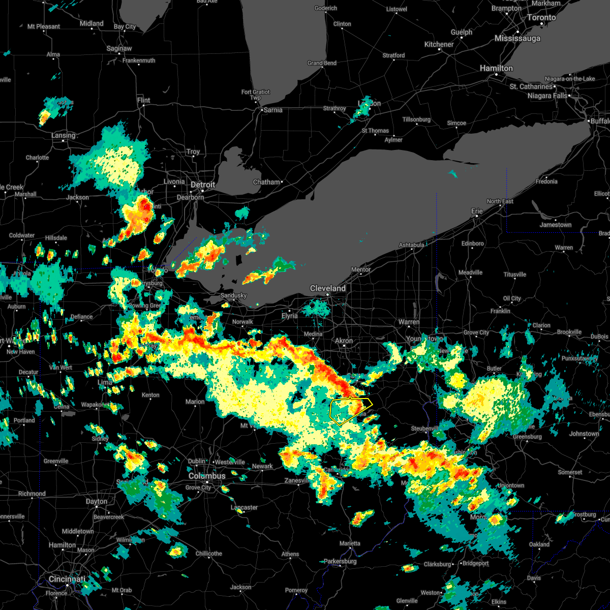 At 307 pm edt, a severe thunderstorm was located near east sparta, or 9 miles northeast of dover, moving northeast at 40 mph (radar). Hazards include wind gusts to 60 mph. Expect damage to trees and power lines, resulting in some power outages. Locations impacted include, new philadelphia, dover, strasburg, sugarcreek, bolivar, mineral city, parral, zoar, this includes interstate 77 in ohio between mile markers 79 and 94. At 307 pm edt, a severe thunderstorm was located near east sparta, or 9 miles northeast of dover, moving northeast at 40 mph (radar). Hazards include wind gusts to 60 mph. Expect damage to trees and power lines, resulting in some power outages. Locations impacted include, new philadelphia, dover, strasburg, sugarcreek, bolivar, mineral city, parral, zoar, this includes interstate 77 in ohio between mile markers 79 and 94.
|
| 8/28/2020 2:50 PM EDT |
 At 250 pm edt, a severe thunderstorm was located near sugarcreek, or near dover, moving northeast at 25 mph (radar). Hazards include wind gusts to 60 mph. expect damage to trees and power lines, resulting in some power outages At 250 pm edt, a severe thunderstorm was located near sugarcreek, or near dover, moving northeast at 25 mph (radar). Hazards include wind gusts to 60 mph. expect damage to trees and power lines, resulting in some power outages
|
| 8/27/2020 8:11 PM EDT |
 At 811 pm edt, a severe thunderstorm was located over new philadelphia, moving southeast at 35 mph (radar). Hazards include wind gusts to 60 mph and quarter-size hail. Minor hail damage to vehicles is possible. Expect wind damage to trees and power lines, resulting in some power outages. At 811 pm edt, a severe thunderstorm was located over new philadelphia, moving southeast at 35 mph (radar). Hazards include wind gusts to 60 mph and quarter-size hail. Minor hail damage to vehicles is possible. Expect wind damage to trees and power lines, resulting in some power outages.
|
| 7/10/2020 12:44 PM EDT | Trees and power lines down in the area of ky 8 near dove in mason county KY, 0.3 miles SW of Dover, OH |
| 7/7/2020 3:49 PM EDT |
 At 349 pm edt, a severe thunderstorm was located near new philadelphia, and is nearly stationary (radar). Hazards include wind gusts to 60 mph and quarter-size hail. Minor hail damage to vehicles is possible. expect wind damage to trees and power lines, resulting in some power outages. Locations impacted include, new philadelphia, dover, mineral city, roswell, parral, zoar, atwood lake, this includes interstate 77 in ohio between mile markers 82 and 85. At 349 pm edt, a severe thunderstorm was located near new philadelphia, and is nearly stationary (radar). Hazards include wind gusts to 60 mph and quarter-size hail. Minor hail damage to vehicles is possible. expect wind damage to trees and power lines, resulting in some power outages. Locations impacted include, new philadelphia, dover, mineral city, roswell, parral, zoar, atwood lake, this includes interstate 77 in ohio between mile markers 82 and 85.
|
| 7/7/2020 3:35 PM EDT |
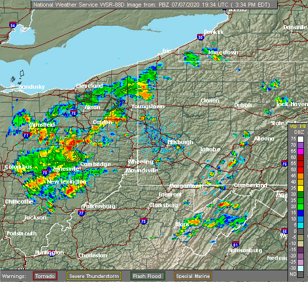 At 335 pm edt, a severe thunderstorm was located over new philadelphia, moving northeast at 5 mph (radar). Hazards include wind gusts to 60 mph and quarter-size hail. Minor hail damage to vehicles is possible. Expect wind damage to trees and power lines, resulting in some power outages. At 335 pm edt, a severe thunderstorm was located over new philadelphia, moving northeast at 5 mph (radar). Hazards include wind gusts to 60 mph and quarter-size hail. Minor hail damage to vehicles is possible. Expect wind damage to trees and power lines, resulting in some power outages.
|
| 6/10/2020 8:24 PM EDT |
 At 823 pm edt, severe thunderstorms were located along a line extending from near wilmot to near caldwell, moving northeast at 65 mph (radar). Hazards include wind gusts to 60 mph and quarter-size hail. Minor hail damage to vehicles is possible. Expect wind damage to trees and power lines, resulting in some power outages. At 823 pm edt, severe thunderstorms were located along a line extending from near wilmot to near caldwell, moving northeast at 65 mph (radar). Hazards include wind gusts to 60 mph and quarter-size hail. Minor hail damage to vehicles is possible. Expect wind damage to trees and power lines, resulting in some power outages.
|
| 6/10/2020 5:41 PM EDT |
 At 541 pm edt, severe thunderstorms were located along a line extending from lynchburg to near brooksville, moving northeast at 40 mph (radar indicated). Hazards include 77 mph wind gusts and penny size hail. Expect considerable tree damage. damage is likely to mobile homes, roofs, and outbuildings. Locations impacted include, maysville, hillsboro, greenfield, georgetown, washington, mount orab, west union, manchester, peebles, ripley, aberdeen, lynchburg, leesburg, new vienna, augusta, winchester, marshall, sardinia, seaman and lewisburg. At 541 pm edt, severe thunderstorms were located along a line extending from lynchburg to near brooksville, moving northeast at 40 mph (radar indicated). Hazards include 77 mph wind gusts and penny size hail. Expect considerable tree damage. damage is likely to mobile homes, roofs, and outbuildings. Locations impacted include, maysville, hillsboro, greenfield, georgetown, washington, mount orab, west union, manchester, peebles, ripley, aberdeen, lynchburg, leesburg, new vienna, augusta, winchester, marshall, sardinia, seaman and lewisburg.
|
| 6/10/2020 5:37 PM EDT |
 At 537 pm edt, severe thunderstorms were located along a line extending from near lynchburg to 6 miles south of brooksville, moving northeast at 40 mph (radar indicated). Hazards include 75 mph wind gusts and penny size hail. Expect considerable tree damage. damage is likely to mobile homes, roofs, and outbuildings. Locations impacted include, maysville, hillsboro, greenfield, georgetown, washington, mount orab, west union, manchester, peebles, ripley, aberdeen, lynchburg, leesburg, new vienna, augusta, winchester, marshall, sardinia, seaman and lewisburg. At 537 pm edt, severe thunderstorms were located along a line extending from near lynchburg to 6 miles south of brooksville, moving northeast at 40 mph (radar indicated). Hazards include 75 mph wind gusts and penny size hail. Expect considerable tree damage. damage is likely to mobile homes, roofs, and outbuildings. Locations impacted include, maysville, hillsboro, greenfield, georgetown, washington, mount orab, west union, manchester, peebles, ripley, aberdeen, lynchburg, leesburg, new vienna, augusta, winchester, marshall, sardinia, seaman and lewisburg.
|
| 6/10/2020 5:25 PM EDT |
 At 524 pm edt, severe thunderstorms were located along a line extending from near mount orab to 11 miles northeast of cynthiana, moving northeast at 40 mph (radar indicated). Hazards include 60 mph wind gusts and penny size hail. expect damage to trees and power lines At 524 pm edt, severe thunderstorms were located along a line extending from near mount orab to 11 miles northeast of cynthiana, moving northeast at 40 mph (radar indicated). Hazards include 60 mph wind gusts and penny size hail. expect damage to trees and power lines
|
| 6/4/2020 2:57 PM EDT |
 At 256 pm edt, severe thunderstorms were located along a line extending from near navarre to near new philadelphia, moving east at 35 mph (radar). Hazards include wind gusts to 60 mph and quarter-size hail. Minor hail damage to vehicles is possible. expect wind damage to trees and power lines, resulting in some power outages. Locations impacted include, new philadelphia, dover, uhrichsville, carrollton, minerva, dennison, gnadenhutten, malvern, tuscarawas, bolivar, scio, midvale, this includes interstate 77 in ohio between mile markers 93 and 94. At 256 pm edt, severe thunderstorms were located along a line extending from near navarre to near new philadelphia, moving east at 35 mph (radar). Hazards include wind gusts to 60 mph and quarter-size hail. Minor hail damage to vehicles is possible. expect wind damage to trees and power lines, resulting in some power outages. Locations impacted include, new philadelphia, dover, uhrichsville, carrollton, minerva, dennison, gnadenhutten, malvern, tuscarawas, bolivar, scio, midvale, this includes interstate 77 in ohio between mile markers 93 and 94.
|
| 6/4/2020 2:46 PM EDT |
 At 245 pm edt, severe thunderstorms were located along a line extending from navarre to 6 miles southwest of new philadelphia, moving east at 35 mph (radar). Hazards include wind gusts to 60 mph and quarter-size hail. Minor hail damage to vehicles is possible. expect wind damage to trees and power lines, resulting in some power outages. Locations impacted include, new philadelphia, dover, uhrichsville, carrollton, minerva, dennison, strasburg, gnadenhutten, malvern, tuscarawas, bolivar, scio, this includes interstate 77 in ohio between mile markers 69 and 94. At 245 pm edt, severe thunderstorms were located along a line extending from navarre to 6 miles southwest of new philadelphia, moving east at 35 mph (radar). Hazards include wind gusts to 60 mph and quarter-size hail. Minor hail damage to vehicles is possible. expect wind damage to trees and power lines, resulting in some power outages. Locations impacted include, new philadelphia, dover, uhrichsville, carrollton, minerva, dennison, strasburg, gnadenhutten, malvern, tuscarawas, bolivar, scio, this includes interstate 77 in ohio between mile markers 69 and 94.
|
| 6/4/2020 2:18 PM EDT |
 At 217 pm edt, severe thunderstorms were located along a line extending from near holmesville to 7 miles north of coshocton, moving east at 35 mph (radar). Hazards include wind gusts to 60 mph. expect damage to trees and power lines, resulting in some power outages At 217 pm edt, severe thunderstorms were located along a line extending from near holmesville to 7 miles north of coshocton, moving east at 35 mph (radar). Hazards include wind gusts to 60 mph. expect damage to trees and power lines, resulting in some power outages
|
| 5/29/2020 3:20 PM EDT |
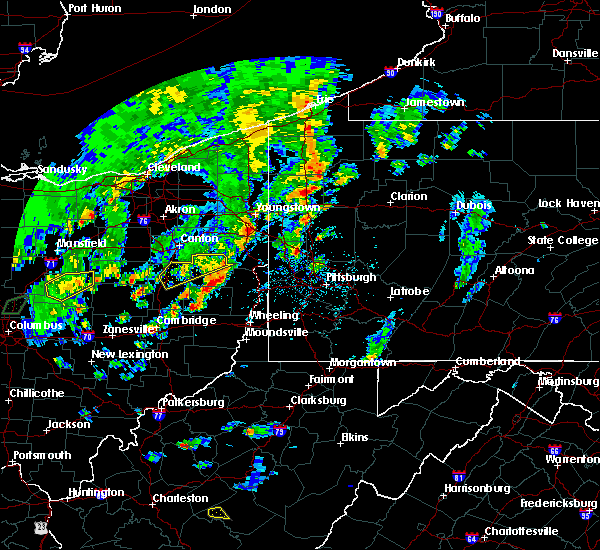 The severe thunderstorm warning for northern carroll and northeastern tuscarawas counties will expire at 330 pm edt, the storm which prompted the warning has weakened below severe limits, and has exited the warned area. therefore, the warning will be allowed to expire. however gusty winds are still possible with this thunderstorm. The severe thunderstorm warning for northern carroll and northeastern tuscarawas counties will expire at 330 pm edt, the storm which prompted the warning has weakened below severe limits, and has exited the warned area. therefore, the warning will be allowed to expire. however gusty winds are still possible with this thunderstorm.
|
| 5/29/2020 3:07 PM EDT |
 At 307 pm edt, a severe thunderstorm was located near waynesburg, or 10 miles northeast of dover, moving northeast at 35 mph (radar). Hazards include wind gusts to 60 mph. Expect damage to trees and power lines, resulting in some power outages. Locations impacted include, new philadelphia, dover, carrollton, minerva, augusta, malvern, bolivar, midvale, mineral city, barnhill, dellroy, sherrodsville, this includes interstate 77 in ohio between mile markers 77 and 86, and between mile markers 91 and 93. At 307 pm edt, a severe thunderstorm was located near waynesburg, or 10 miles northeast of dover, moving northeast at 35 mph (radar). Hazards include wind gusts to 60 mph. Expect damage to trees and power lines, resulting in some power outages. Locations impacted include, new philadelphia, dover, carrollton, minerva, augusta, malvern, bolivar, midvale, mineral city, barnhill, dellroy, sherrodsville, this includes interstate 77 in ohio between mile markers 77 and 86, and between mile markers 91 and 93.
|
| 5/29/2020 2:49 PM EDT |
 At 249 pm edt, a severe thunderstorm was located over dover, moving northeast at 35 mph (radar). Hazards include wind gusts to 60 mph. expect damage to trees and power lines, resulting in some power outages At 249 pm edt, a severe thunderstorm was located over dover, moving northeast at 35 mph (radar). Hazards include wind gusts to 60 mph. expect damage to trees and power lines, resulting in some power outages
|
| 5/10/2020 6:51 PM EDT |
 The severe thunderstorm warning for guernsey, eastern coshocton, northeastern muskingum and tuscarawas counties will expire at 700 pm edt, the storm which prompted the warning has weakened below severe limits, and has exited the warned area. therefore, the warning will be allowed to expire. The severe thunderstorm warning for guernsey, eastern coshocton, northeastern muskingum and tuscarawas counties will expire at 700 pm edt, the storm which prompted the warning has weakened below severe limits, and has exited the warned area. therefore, the warning will be allowed to expire.
|
| 5/10/2020 6:35 PM EDT |
 At 633 pm edt, a severe thunderstorm was located near new philadelphia, moving east at 45 mph (radar). Hazards include wind gusts to 60 mph and quarter-size hail. Minor hail damage to vehicles is possible. expect wind damage to trees and power lines, resulting in some power outages. locations impacted include, new philadelphia, dover, cambridge, uhrichsville, newcomerstown, dennison, strasburg, new concord, byesville, sugarcreek, gnadenhutten, antrim, this includes the following highways, interstate 70 in ohio between mile markers 170 and 194. Interstate 77 in ohio between mile markers 41 and 88. At 633 pm edt, a severe thunderstorm was located near new philadelphia, moving east at 45 mph (radar). Hazards include wind gusts to 60 mph and quarter-size hail. Minor hail damage to vehicles is possible. expect wind damage to trees and power lines, resulting in some power outages. locations impacted include, new philadelphia, dover, cambridge, uhrichsville, newcomerstown, dennison, strasburg, new concord, byesville, sugarcreek, gnadenhutten, antrim, this includes the following highways, interstate 70 in ohio between mile markers 170 and 194. Interstate 77 in ohio between mile markers 41 and 88.
|
| 5/10/2020 6:09 PM EDT |
 At 609 pm edt, a severe thunderstorm was located near west lafayette, or near coshocton, moving east at 45 mph (radar). Hazards include wind gusts to 60 mph and quarter-size hail. Minor hail damage to vehicles is possible. Expect wind damage to trees and power lines, resulting in some power outages. At 609 pm edt, a severe thunderstorm was located near west lafayette, or near coshocton, moving east at 45 mph (radar). Hazards include wind gusts to 60 mph and quarter-size hail. Minor hail damage to vehicles is possible. Expect wind damage to trees and power lines, resulting in some power outages.
|
| 4/8/2020 11:13 PM EDT |
 At 1113 pm edt, a severe squall line capable of producing both tornadoes and extensive straight line wind damage was located near brooksville, moving east at 50 mph (radar indicated rotation). Hazards include tornado and quarter size hail. Flying debris will be dangerous to those caught without shelter. mobile homes will be damaged or destroyed. damage to roofs, windows, and vehicles will occur. tree damage is likely. Locations impacted include, maysville, georgetown, washington, ripley, aberdeen, augusta, winchester, seaman, lewisburg, brooksville, decatur, russellville, mount olivet, dover, higginsport, cherry fork, germantown, sardis, stonewall and mays lick. At 1113 pm edt, a severe squall line capable of producing both tornadoes and extensive straight line wind damage was located near brooksville, moving east at 50 mph (radar indicated rotation). Hazards include tornado and quarter size hail. Flying debris will be dangerous to those caught without shelter. mobile homes will be damaged or destroyed. damage to roofs, windows, and vehicles will occur. tree damage is likely. Locations impacted include, maysville, georgetown, washington, ripley, aberdeen, augusta, winchester, seaman, lewisburg, brooksville, decatur, russellville, mount olivet, dover, higginsport, cherry fork, germantown, sardis, stonewall and mays lick.
|
| 4/8/2020 11:06 PM EDT |
 At 1106 pm edt, severe thunderstorms were located along a line extending from near mount orab to 7 miles southeast of falmouth, moving east at 65 mph (radar indicated). Hazards include 60 mph wind gusts and quarter size hail. Minor hail damage to vehicles is possible. Expect wind damage to trees and power lines. At 1106 pm edt, severe thunderstorms were located along a line extending from near mount orab to 7 miles southeast of falmouth, moving east at 65 mph (radar indicated). Hazards include 60 mph wind gusts and quarter size hail. Minor hail damage to vehicles is possible. Expect wind damage to trees and power lines.
|
| 4/8/2020 11:03 PM EDT |
 At 1102 pm edt, severe thunderstorms capable of producing both tornadoes and extensive straight line wind damage were located near brooksville, moving east at 50 mph (radar indicated rotation). Hazards include tornado and quarter size hail. Flying debris will be dangerous to those caught without shelter. mobile homes will be damaged or destroyed. damage to roofs, windows, and vehicles will occur. Tree damage is likely. At 1102 pm edt, severe thunderstorms capable of producing both tornadoes and extensive straight line wind damage were located near brooksville, moving east at 50 mph (radar indicated rotation). Hazards include tornado and quarter size hail. Flying debris will be dangerous to those caught without shelter. mobile homes will be damaged or destroyed. damage to roofs, windows, and vehicles will occur. Tree damage is likely.
|
| 4/8/2020 1:07 AM EDT |
 At 107 am edt, a severe thunderstorm was located near new philadelphia, moving southeast at 55 mph (radar). Hazards include wind gusts to 60 mph and quarter-size hail. Minor hail damage to vehicles is possible. Expect wind damage to trees and power lines, resulting in some power outages. At 107 am edt, a severe thunderstorm was located near new philadelphia, moving southeast at 55 mph (radar). Hazards include wind gusts to 60 mph and quarter-size hail. Minor hail damage to vehicles is possible. Expect wind damage to trees and power lines, resulting in some power outages.
|
| 3/20/2020 1:57 PM EDT |
 The severe thunderstorm warning for west central jefferson, carroll and northeastern tuscarawas counties will expire at 200 pm edt, the storm that prompted the warning has weakened below severe limits and no longer pose an immediate threat to life and property. therefore, the warning will be allowed to expire. however gusty winds are still possible with this thunderstorm. The severe thunderstorm warning for west central jefferson, carroll and northeastern tuscarawas counties will expire at 200 pm edt, the storm that prompted the warning has weakened below severe limits and no longer pose an immediate threat to life and property. therefore, the warning will be allowed to expire. however gusty winds are still possible with this thunderstorm.
|
| 3/20/2020 1:45 PM EDT |
 At 145 pm edt, a severe thunderstorm was located near carrollton, moving east at 55 mph (radar). Hazards include wind gusts to 60 mph. Expect damage to trees and power lines, resulting in some power outages. Locations impacted include, new philadelphia, dover, carrollton, bolivar, mineral city, dellroy, sherrodsville, roswell, parral, zoar, leesville, mechanicstown, this includes interstate 77 in ohio between mile markers 80 and 84, and between mile markers 90 and 94. At 145 pm edt, a severe thunderstorm was located near carrollton, moving east at 55 mph (radar). Hazards include wind gusts to 60 mph. Expect damage to trees and power lines, resulting in some power outages. Locations impacted include, new philadelphia, dover, carrollton, bolivar, mineral city, dellroy, sherrodsville, roswell, parral, zoar, leesville, mechanicstown, this includes interstate 77 in ohio between mile markers 80 and 84, and between mile markers 90 and 94.
|
| 3/20/2020 1:30 PM EDT | Trees reported down in tuscarawas county OH, 175.4 miles SW of Dover, OH |
| 3/20/2020 1:29 PM EDT |
 At 128 pm edt, a severe thunderstorm was located over dover, moving east at 55 mph (radar). Hazards include wind gusts to 60 mph. expect damage to trees and power lines, resulting in some power outages At 128 pm edt, a severe thunderstorm was located over dover, moving east at 55 mph (radar). Hazards include wind gusts to 60 mph. expect damage to trees and power lines, resulting in some power outages
|
| 8/20/2019 8:12 PM EDT |
 At 812 pm edt, a severe thunderstorm was located over new philadelphia, moving east at 20 mph (radar). Hazards include wind gusts to 60 mph and quarter-size hail. Minor hail damage to vehicles is possible. expect wind damage to trees and power lines, resulting in some power outages. Locations impacted include, new philadelphia, dover, uhrichsville, dennison, gnadenhutten, tuscarawas, midvale, bowerston, barnhill, dellroy, sherrodsville, roswell, this includes interstate 77 in ohio between mile markers 75 and 82. At 812 pm edt, a severe thunderstorm was located over new philadelphia, moving east at 20 mph (radar). Hazards include wind gusts to 60 mph and quarter-size hail. Minor hail damage to vehicles is possible. expect wind damage to trees and power lines, resulting in some power outages. Locations impacted include, new philadelphia, dover, uhrichsville, dennison, gnadenhutten, tuscarawas, midvale, bowerston, barnhill, dellroy, sherrodsville, roswell, this includes interstate 77 in ohio between mile markers 75 and 82.
|
| 8/20/2019 8:10 PM EDT |
 At 810 pm edt, a severe thunderstorm was located near new philadelphia, moving east at 20 mph (radar). Hazards include wind gusts to 60 mph and quarter-size hail. Minor hail damage to vehicles is possible. Expect wind damage to trees and power lines, resulting in some power outages. At 810 pm edt, a severe thunderstorm was located near new philadelphia, moving east at 20 mph (radar). Hazards include wind gusts to 60 mph and quarter-size hail. Minor hail damage to vehicles is possible. Expect wind damage to trees and power lines, resulting in some power outages.
|
| 8/20/2019 7:55 PM EDT |
 At 755 pm edt, a severe thunderstorm was located near new philadelphia, moving east at 25 mph (radar). Hazards include wind gusts to 60 mph and quarter-size hail. Minor hail damage to vehicles is possible. expect wind damage to trees and power lines, resulting in some power outages. Locations impacted include, new philadelphia, dover, uhrichsville, dennison, gnadenhutten, tuscarawas, midvale, bowerston, barnhill, sherrodsville, roswell, stone creek, this includes interstate 77 in ohio between mile markers 69 and 83. At 755 pm edt, a severe thunderstorm was located near new philadelphia, moving east at 25 mph (radar). Hazards include wind gusts to 60 mph and quarter-size hail. Minor hail damage to vehicles is possible. expect wind damage to trees and power lines, resulting in some power outages. Locations impacted include, new philadelphia, dover, uhrichsville, dennison, gnadenhutten, tuscarawas, midvale, bowerston, barnhill, sherrodsville, roswell, stone creek, this includes interstate 77 in ohio between mile markers 69 and 83.
|
| 8/20/2019 7:32 PM EDT |
 The national weather service in pittsburgh has issued a * severe thunderstorm warning for. northwestern harrison county in east central ohio. southwestern carroll county in east central ohio. central tuscarawas county in east central ohio. Until 815 pm edt. The national weather service in pittsburgh has issued a * severe thunderstorm warning for. northwestern harrison county in east central ohio. southwestern carroll county in east central ohio. central tuscarawas county in east central ohio. Until 815 pm edt.
|
| 7/21/2019 12:46 PM EDT |
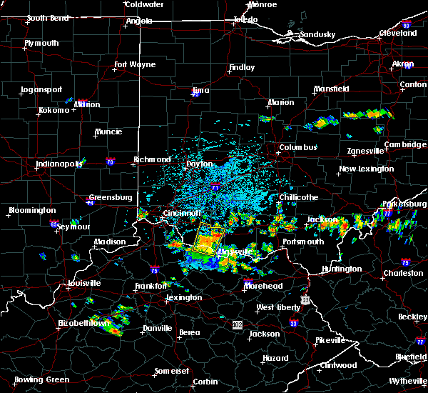 At 1245 pm edt, a severe thunderstorm was located over sardinia, moving north at 35 mph (law enforcement reported trees down in augusta). Hazards include 60 mph wind gusts. Expect damage to trees and power lines. Locations impacted include, maysville, georgetown, mount orab, ripley, augusta, sardinia, russellville, hamersville, dover, higginsport, state route 32 at us route 68, feesburg, fincastle, south ripley, utopia, chatham, state route 32 at us route 62, tuckahoe, new hope and minerva. At 1245 pm edt, a severe thunderstorm was located over sardinia, moving north at 35 mph (law enforcement reported trees down in augusta). Hazards include 60 mph wind gusts. Expect damage to trees and power lines. Locations impacted include, maysville, georgetown, mount orab, ripley, augusta, sardinia, russellville, hamersville, dover, higginsport, state route 32 at us route 68, feesburg, fincastle, south ripley, utopia, chatham, state route 32 at us route 62, tuckahoe, new hope and minerva.
|
| 7/21/2019 12:24 PM EDT |
 At 1224 pm edt, a severe thunderstorm was located near higginsport, moving north at 35 mph (radar indicated). Hazards include 60 mph wind gusts. expect damage to trees and power lines At 1224 pm edt, a severe thunderstorm was located near higginsport, moving north at 35 mph (radar indicated). Hazards include 60 mph wind gusts. expect damage to trees and power lines
|
| 7/21/2019 12:24 PM EDT |
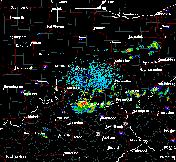 At 1224 pm edt, a severe thunderstorm was located near higginsport, moving north at 35 mph (radar indicated). Hazards include 60 mph wind gusts. expect damage to trees and power lines At 1224 pm edt, a severe thunderstorm was located near higginsport, moving north at 35 mph (radar indicated). Hazards include 60 mph wind gusts. expect damage to trees and power lines
|
| 7/16/2019 10:43 PM EDT |
 At 1043 pm edt, a severe thunderstorm was located near waynesburg, or 9 miles west of carrollton, moving east at 30 mph (radar). Hazards include wind gusts to 60 mph. Expect damage to trees and power lines, resulting in some power outages. Locations impacted include, new philadelphia, dover, salem, carrollton, minerva, strasburg, sugarcreek, leetonia, augusta, malvern, bolivar, mineral city, this includes interstate 77 in ohio between mile markers 80 and 94. At 1043 pm edt, a severe thunderstorm was located near waynesburg, or 9 miles west of carrollton, moving east at 30 mph (radar). Hazards include wind gusts to 60 mph. Expect damage to trees and power lines, resulting in some power outages. Locations impacted include, new philadelphia, dover, salem, carrollton, minerva, strasburg, sugarcreek, leetonia, augusta, malvern, bolivar, mineral city, this includes interstate 77 in ohio between mile markers 80 and 94.
|
| 7/16/2019 10:14 PM EDT |
 At 1014 pm edt, a severe thunderstorm was located over strasburg, or near dover, moving east at 35 mph (radar). Hazards include wind gusts to 60 mph. expect damage to trees and power lines, resulting in some power outages At 1014 pm edt, a severe thunderstorm was located over strasburg, or near dover, moving east at 35 mph (radar). Hazards include wind gusts to 60 mph. expect damage to trees and power lines, resulting in some power outages
|
| 7/11/2019 3:52 PM EDT |
 At 351 pm edt, a severe thunderstorm was located near carrollton, moving east at 40 mph (radar). Hazards include wind gusts to 60 mph and quarter-size hail. Minor hail damage to vehicles is possible. expect wind damage to trees and power lines, resulting in some power outages. Locations impacted include, new philadelphia, dover, uhrichsville, carrollton, dennison, gnadenhutten, tuscarawas, midvale, mineral city, barnhill, dellroy, sherrodsville,. At 351 pm edt, a severe thunderstorm was located near carrollton, moving east at 40 mph (radar). Hazards include wind gusts to 60 mph and quarter-size hail. Minor hail damage to vehicles is possible. expect wind damage to trees and power lines, resulting in some power outages. Locations impacted include, new philadelphia, dover, uhrichsville, carrollton, dennison, gnadenhutten, tuscarawas, midvale, mineral city, barnhill, dellroy, sherrodsville,.
|
| 7/11/2019 3:29 PM EDT |
 At 329 pm edt, a severe thunderstorm was located near strasburg, or near dover, moving southeast at 30 mph (radar). Hazards include wind gusts to 60 mph and quarter-size hail. Minor hail damage to vehicles is possible. expect wind damage to trees and power lines, resulting in some power outages. Locations impacted include, new philadelphia, dover, uhrichsville, carrollton, dennison, strasburg, gnadenhutten, tuscarawas, bolivar, midvale, mineral city, barnhill, this includes interstate 77 in ohio between mile markers 77 and 94. At 329 pm edt, a severe thunderstorm was located near strasburg, or near dover, moving southeast at 30 mph (radar). Hazards include wind gusts to 60 mph and quarter-size hail. Minor hail damage to vehicles is possible. expect wind damage to trees and power lines, resulting in some power outages. Locations impacted include, new philadelphia, dover, uhrichsville, carrollton, dennison, strasburg, gnadenhutten, tuscarawas, bolivar, midvale, mineral city, barnhill, this includes interstate 77 in ohio between mile markers 77 and 94.
|
| 7/11/2019 3:19 PM EDT |
 At 318 pm edt, a severe thunderstorm was located over waynesburg, or 9 miles southeast of canton, moving east at 45 mph (radar). Hazards include wind gusts to 60 mph and half dollar-size hail. Minor hail damage to vehicles is possible. Expect wind damage to trees and power lines, resulting in some power outages. At 318 pm edt, a severe thunderstorm was located over waynesburg, or 9 miles southeast of canton, moving east at 45 mph (radar). Hazards include wind gusts to 60 mph and half dollar-size hail. Minor hail damage to vehicles is possible. Expect wind damage to trees and power lines, resulting in some power outages.
|
| 7/2/2019 6:28 PM EDT |
 At 628 pm edt, severe thunderstorms were located along a line extending from near minerva to near waynesburg to near dover, moving southeast at 20 mph (radar). Hazards include wind gusts to 60 mph and quarter-size hail. Minor hail damage to vehicles is possible. expect wind damage to trees and power lines, resulting in some power outages. Locations impacted include, new philadelphia, dover, uhrichsville, carrollton, minerva, lisbon, dennison, strasburg, sugarcreek, augusta, salineville, gnadenhutten,. At 628 pm edt, severe thunderstorms were located along a line extending from near minerva to near waynesburg to near dover, moving southeast at 20 mph (radar). Hazards include wind gusts to 60 mph and quarter-size hail. Minor hail damage to vehicles is possible. expect wind damage to trees and power lines, resulting in some power outages. Locations impacted include, new philadelphia, dover, uhrichsville, carrollton, minerva, lisbon, dennison, strasburg, sugarcreek, augusta, salineville, gnadenhutten,.
|
| 7/2/2019 6:23 PM EDT | Tree down on a house in tuscarawas county OH, 177.2 miles SW of Dover, OH |
| 7/2/2019 6:23 PM EDT | Trees and wires down in tuscarawas county OH, 177.2 miles SW of Dover, OH |
| 7/2/2019 6:20 PM EDT |
 At 619 pm edt, a cluster of severe thunderstorms was located along a line extending from near minerva to waynesburg to near dover, moving southeast at 20 mph (radar). Hazards include wind gusts to 60 mph and quarter-size hail. Minor hail damage to vehicles is possible. Expect wind damage to trees and power lines, resulting in some power outages. At 619 pm edt, a cluster of severe thunderstorms was located along a line extending from near minerva to waynesburg to near dover, moving southeast at 20 mph (radar). Hazards include wind gusts to 60 mph and quarter-size hail. Minor hail damage to vehicles is possible. Expect wind damage to trees and power lines, resulting in some power outages.
|
| 6/24/2019 5:45 PM EDT |
 At 544 pm edt, a severe thunderstorm was located near dennison, or 7 miles north of uhrichsville, moving northeast at 40 mph (radar). Hazards include wind gusts to 60 mph. expect damage to trees and power lines, resulting in some power outages At 544 pm edt, a severe thunderstorm was located near dennison, or 7 miles north of uhrichsville, moving northeast at 40 mph (radar). Hazards include wind gusts to 60 mph. expect damage to trees and power lines, resulting in some power outages
|
| 6/24/2019 5:27 PM EDT |
 At 526 pm edt, severe thunderstorms were located along a line extending from near newcomerstown to 8 miles west of freeport to 8 miles west of barnesville, moving northeast at 45 mph (radar). Hazards include wind gusts to 60 mph. Expect damage to trees and power lines, resulting in some power outages. Locations impacted include, new philadelphia, dover, uhrichsville, newcomerstown, dennison, gnadenhutten, antrim, tuscarawas, baltic, midvale, mineral city, port washington,. At 526 pm edt, severe thunderstorms were located along a line extending from near newcomerstown to 8 miles west of freeport to 8 miles west of barnesville, moving northeast at 45 mph (radar). Hazards include wind gusts to 60 mph. Expect damage to trees and power lines, resulting in some power outages. Locations impacted include, new philadelphia, dover, uhrichsville, newcomerstown, dennison, gnadenhutten, antrim, tuscarawas, baltic, midvale, mineral city, port washington,.
|
| 6/24/2019 5:05 PM EDT |
 At 502 pm edt, severe thunderstorms were located along a line extending from near coshocton to 7 miles northwest of cambridge to near byesville, moving northeast at 45 mph (radar). Hazards include wind gusts to 60 mph. expect damage to trees and power lines, resulting in some power outages At 502 pm edt, severe thunderstorms were located along a line extending from near coshocton to 7 miles northwest of cambridge to near byesville, moving northeast at 45 mph (radar). Hazards include wind gusts to 60 mph. expect damage to trees and power lines, resulting in some power outages
|
| 6/17/2019 9:11 PM EDT |
 At 911 pm edt, a severe thunderstorm was located over ripley, moving east at 35 mph (radar indicated). Hazards include 60 mph wind gusts. expect damage to trees and power lines At 911 pm edt, a severe thunderstorm was located over ripley, moving east at 35 mph (radar indicated). Hazards include 60 mph wind gusts. expect damage to trees and power lines
|
| 6/16/2019 7:35 AM EDT |
 At 735 am edt, a severe thunderstorm was located near washington, moving east at 45 mph (radar indicated). Hazards include 60 mph wind gusts. expect damage to trees and power lines At 735 am edt, a severe thunderstorm was located near washington, moving east at 45 mph (radar indicated). Hazards include 60 mph wind gusts. expect damage to trees and power lines
|
| 6/5/2019 7:58 PM EDT |
 At 758 pm edt, a severe thunderstorm was located near ripley, moving east at 30 mph (radar indicated). Hazards include 60 mph wind gusts. expect damage to trees and power lines At 758 pm edt, a severe thunderstorm was located near ripley, moving east at 30 mph (radar indicated). Hazards include 60 mph wind gusts. expect damage to trees and power lines
|
| 5/28/2019 6:23 PM EDT |
 The severe thunderstorm warning for western carroll and northeastern tuscarawas counties will expire at 630 pm edt, the storm that prompted the warning has weakened below severe limits and has exited the warned area. therefore, the warning will be allowed to expire. however gusty winds and heavy rain are still possible with this thunderstorm. a tornado watch remains in effect until 1000 pm edt for east central ohio. The severe thunderstorm warning for western carroll and northeastern tuscarawas counties will expire at 630 pm edt, the storm that prompted the warning has weakened below severe limits and has exited the warned area. therefore, the warning will be allowed to expire. however gusty winds and heavy rain are still possible with this thunderstorm. a tornado watch remains in effect until 1000 pm edt for east central ohio.
|
| 5/28/2019 6:10 PM EDT |
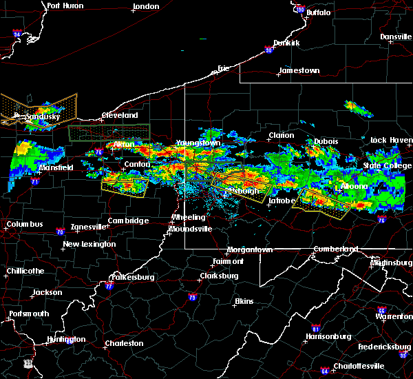 At 610 pm edt, a severe thunderstorm was located 7 miles south of east sparta, or 7 miles northeast of new philadelphia, moving east at 35 mph (radar). Hazards include wind gusts to 60 mph. Expect damage to trees and power lines, resulting in some power outages. locations impacted include, dover, carrollton, strasburg, bolivar, mineral city, dellroy, sherrodsville, parral, zoar, atwood lake, leesville lake park, this includes interstate 77 in ohio between mile markers 87 and 94. A tornado watch remains in effect until 1000 pm edt for east central ohio. At 610 pm edt, a severe thunderstorm was located 7 miles south of east sparta, or 7 miles northeast of new philadelphia, moving east at 35 mph (radar). Hazards include wind gusts to 60 mph. Expect damage to trees and power lines, resulting in some power outages. locations impacted include, dover, carrollton, strasburg, bolivar, mineral city, dellroy, sherrodsville, parral, zoar, atwood lake, leesville lake park, this includes interstate 77 in ohio between mile markers 87 and 94. A tornado watch remains in effect until 1000 pm edt for east central ohio.
|
| 5/28/2019 5:39 PM EDT |
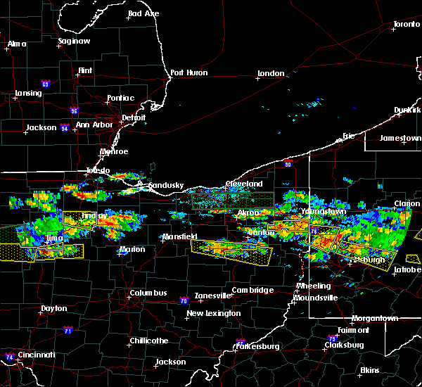 At 539 pm edt, a severe thunderstorm was located over winesburg, or 12 miles northwest of dover, moving east at 35 mph (radar). Hazards include wind gusts to 60 mph and quarter-size hail. Minor hail damage to vehicles is possible. Expect wind damage to trees and power lines, resulting in some power outages. At 539 pm edt, a severe thunderstorm was located over winesburg, or 12 miles northwest of dover, moving east at 35 mph (radar). Hazards include wind gusts to 60 mph and quarter-size hail. Minor hail damage to vehicles is possible. Expect wind damage to trees and power lines, resulting in some power outages.
|
| 5/25/2019 6:41 PM EDT |
 At 641 pm edt, severe thunderstorms were located along a line extending from 6 miles west of lisbon to near dennison, moving east at 50 mph (radar). Hazards include wind gusts to 60 mph. Expect damage to trees and power lines, resulting in some power outages. locations impacted include, new philadelphia, dover, east liverpool, uhrichsville, east palestine, wellsville, carrollton, calcutta, minerva, ohioville, lisbon, dennison, this includes the following highways, pennsylvania turnpike between mile markers 10 and 13. interstate 77 in ohio between mile markers 75 and 85. Interstate 376 in pennsylvania near mile marker 31. At 641 pm edt, severe thunderstorms were located along a line extending from 6 miles west of lisbon to near dennison, moving east at 50 mph (radar). Hazards include wind gusts to 60 mph. Expect damage to trees and power lines, resulting in some power outages. locations impacted include, new philadelphia, dover, east liverpool, uhrichsville, east palestine, wellsville, carrollton, calcutta, minerva, ohioville, lisbon, dennison, this includes the following highways, pennsylvania turnpike between mile markers 10 and 13. interstate 77 in ohio between mile markers 75 and 85. Interstate 376 in pennsylvania near mile marker 31.
|
| 5/25/2019 6:24 PM EDT |
 At 623 pm edt, severe thunderstorms were located along a line extending from near minerva to near sugarcreek, moving east at 50 mph (radar). Hazards include wind gusts to 60 mph. expect damage to trees and power lines, resulting in some power outages At 623 pm edt, severe thunderstorms were located along a line extending from near minerva to near sugarcreek, moving east at 50 mph (radar). Hazards include wind gusts to 60 mph. expect damage to trees and power lines, resulting in some power outages
|
| 5/25/2019 4:31 PM EDT |
 At 431 pm edt, a severe thunderstorm was located near newcomerstown, or 12 miles southwest of new philadelphia, moving east at 35 mph (radar). Hazards include wind gusts to 60 mph and quarter-size hail. Minor hail damage to vehicles is possible. Expect wind damage to trees and power lines, resulting in some power outages. At 431 pm edt, a severe thunderstorm was located near newcomerstown, or 12 miles southwest of new philadelphia, moving east at 35 mph (radar). Hazards include wind gusts to 60 mph and quarter-size hail. Minor hail damage to vehicles is possible. Expect wind damage to trees and power lines, resulting in some power outages.
|
| 5/23/2019 7:07 PM EDT |
 At 707 pm edt, a severe thunderstorm was located near ripley, moving east at 45 mph (radar indicated). Hazards include 60 mph wind gusts and half dollar size hail. Minor hail damage to vehicles is possible. expect wind damage to trees and power lines. Locations impacted include, maysville, west union, manchester, ripley, aberdeen, tollesboro, rome, decatur, russellville, dover, cherry fork, concord, redoak, trinity, moranburg, dunkinsville, carrs, bradysville, state route 348 at state route 125 and ribolt. At 707 pm edt, a severe thunderstorm was located near ripley, moving east at 45 mph (radar indicated). Hazards include 60 mph wind gusts and half dollar size hail. Minor hail damage to vehicles is possible. expect wind damage to trees and power lines. Locations impacted include, maysville, west union, manchester, ripley, aberdeen, tollesboro, rome, decatur, russellville, dover, cherry fork, concord, redoak, trinity, moranburg, dunkinsville, carrs, bradysville, state route 348 at state route 125 and ribolt.
|
| 5/23/2019 6:58 PM EDT |
 At 658 pm edt, a severe thunderstorm was located near georgetown, moving east at 40 mph (radar indicated). Hazards include 60 mph wind gusts and quarter size hail. Minor hail damage to vehicles is possible. Expect wind damage to trees and power lines. At 658 pm edt, a severe thunderstorm was located near georgetown, moving east at 40 mph (radar indicated). Hazards include 60 mph wind gusts and quarter size hail. Minor hail damage to vehicles is possible. Expect wind damage to trees and power lines.
|
| 5/17/2019 6:23 PM EDT |
 The severe thunderstorm warning for northwestern mason, northeastern bracken and southwestern brown counties will expire at 630 pm edt, an additional severe thunderstorm warning remains in effect for portions of brown and mason counties until 700 pm. a severe thunderstorm watch remains in effect until 1100 pm edt for northern kentucky, and southwestern ohio. please report previous wind damage or hail to the national weather service by going to our website at weather.gov/iln and submitting your report via social media. The severe thunderstorm warning for northwestern mason, northeastern bracken and southwestern brown counties will expire at 630 pm edt, an additional severe thunderstorm warning remains in effect for portions of brown and mason counties until 700 pm. a severe thunderstorm watch remains in effect until 1100 pm edt for northern kentucky, and southwestern ohio. please report previous wind damage or hail to the national weather service by going to our website at weather.gov/iln and submitting your report via social media.
|
| 5/17/2019 6:23 PM EDT |
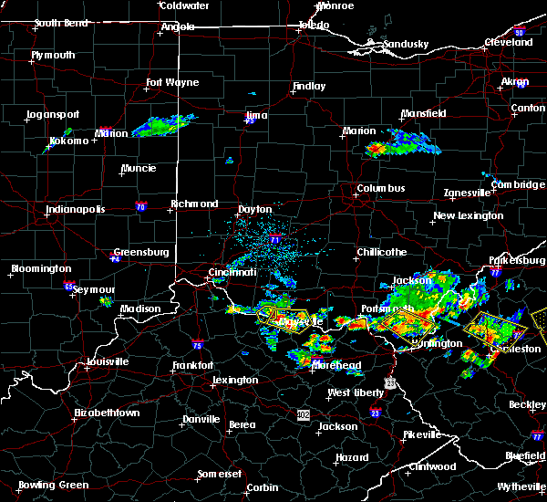 The severe thunderstorm warning for northwestern mason, northeastern bracken and southwestern brown counties will expire at 630 pm edt, an additional severe thunderstorm warning remains in effect for portions of brown and mason counties until 700 pm. a severe thunderstorm watch remains in effect until 1100 pm edt for northern kentucky, and southwestern ohio. please report previous wind damage or hail to the national weather service by going to our website at weather.gov/iln and submitting your report via social media. The severe thunderstorm warning for northwestern mason, northeastern bracken and southwestern brown counties will expire at 630 pm edt, an additional severe thunderstorm warning remains in effect for portions of brown and mason counties until 700 pm. a severe thunderstorm watch remains in effect until 1100 pm edt for northern kentucky, and southwestern ohio. please report previous wind damage or hail to the national weather service by going to our website at weather.gov/iln and submitting your report via social media.
|
| 5/17/2019 6:16 PM EDT |
 At 616 pm edt, a severe thunderstorm was located over ripley, moving east at 20 mph (radar indicated). Hazards include 60 mph wind gusts and quarter size hail. Minor hail damage to vehicles is possible. expect wind damage to trees and power lines. Locations impacted include, georgetown, ripley, augusta, dover, higginsport, minerva, south ripley and stoney point. At 616 pm edt, a severe thunderstorm was located over ripley, moving east at 20 mph (radar indicated). Hazards include 60 mph wind gusts and quarter size hail. Minor hail damage to vehicles is possible. expect wind damage to trees and power lines. Locations impacted include, georgetown, ripley, augusta, dover, higginsport, minerva, south ripley and stoney point.
|
| 5/17/2019 6:16 PM EDT |
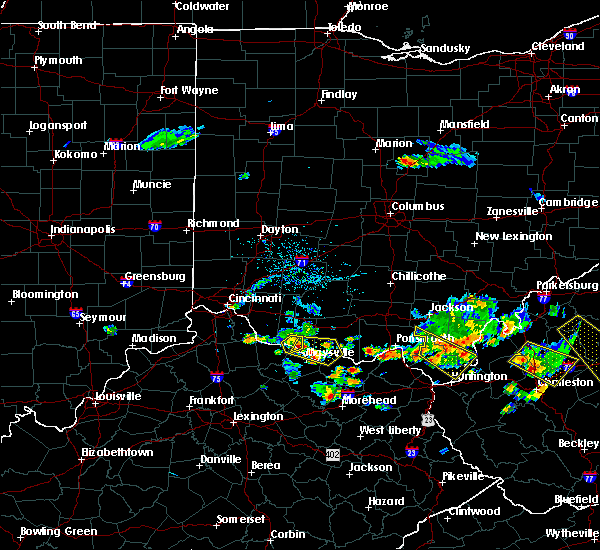 At 616 pm edt, a severe thunderstorm was located over ripley, moving east at 20 mph (radar indicated). Hazards include 60 mph wind gusts and quarter size hail. Minor hail damage to vehicles is possible. expect wind damage to trees and power lines. Locations impacted include, georgetown, ripley, augusta, dover, higginsport, minerva, south ripley and stoney point. At 616 pm edt, a severe thunderstorm was located over ripley, moving east at 20 mph (radar indicated). Hazards include 60 mph wind gusts and quarter size hail. Minor hail damage to vehicles is possible. expect wind damage to trees and power lines. Locations impacted include, georgetown, ripley, augusta, dover, higginsport, minerva, south ripley and stoney point.
|
| 5/17/2019 6:10 PM EDT |
 At 610 pm edt, a severe thunderstorm was located over ripley, moving east at 30 mph (radar indicated). Hazards include 60 mph wind gusts and quarter size hail. Minor hail damage to vehicles is possible. Expect wind damage to trees and power lines. At 610 pm edt, a severe thunderstorm was located over ripley, moving east at 30 mph (radar indicated). Hazards include 60 mph wind gusts and quarter size hail. Minor hail damage to vehicles is possible. Expect wind damage to trees and power lines.
|
| 5/17/2019 6:07 PM EDT | Tree fell on house on market street. time estimated from rada in mason county KY, 0.3 miles SW of Dover, OH |
| 5/17/2019 6:05 PM EDT |
 At 605 pm edt, a severe thunderstorm was located over higginsport, moving east at 45 mph (radar indicated). Hazards include 60 mph wind gusts and quarter size hail. Minor hail damage to vehicles is possible. expect wind damage to trees and power lines. Locations impacted include, georgetown, ripley, augusta, felicity, dover, higginsport, chilo, minerva, woolcutt, willow grove, bradford, feesburg, johnsville, rock springs, south ripley, utopia, chatham, stoney point and aa highway at state route 19. At 605 pm edt, a severe thunderstorm was located over higginsport, moving east at 45 mph (radar indicated). Hazards include 60 mph wind gusts and quarter size hail. Minor hail damage to vehicles is possible. expect wind damage to trees and power lines. Locations impacted include, georgetown, ripley, augusta, felicity, dover, higginsport, chilo, minerva, woolcutt, willow grove, bradford, feesburg, johnsville, rock springs, south ripley, utopia, chatham, stoney point and aa highway at state route 19.
|
| 5/17/2019 6:04 PM EDT | Trees down on route 8 near the county line. time estimated from rada in bracken county KY, 2.3 miles ENE of Dover, OH |
| 5/17/2019 5:48 PM EDT |
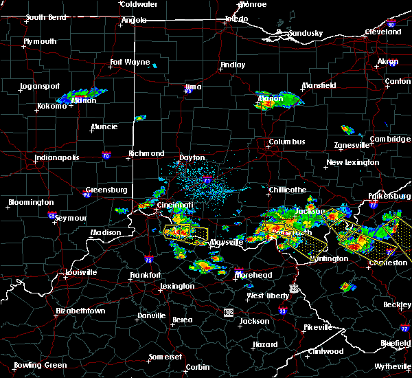 At 548 pm edt, a severe thunderstorm was located over neville, moving east at 20 mph (radar indicated). Hazards include 60 mph wind gusts and quarter size hail. Minor hail damage to vehicles is possible. Expect wind damage to trees and power lines. At 548 pm edt, a severe thunderstorm was located over neville, moving east at 20 mph (radar indicated). Hazards include 60 mph wind gusts and quarter size hail. Minor hail damage to vehicles is possible. Expect wind damage to trees and power lines.
|
| 5/2/2019 2:58 PM EDT |
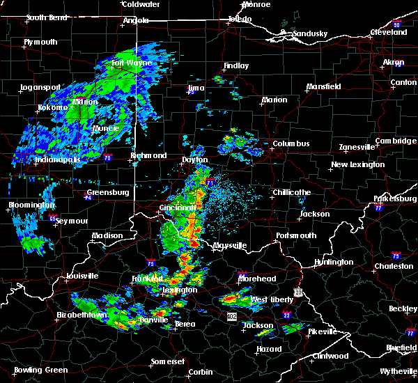 At 258 pm edt, a severe thunderstorm was located over brooksville, moving east at 15 mph (radar indicated). Hazards include 60 mph wind gusts and quarter size hail. Minor hail damage to vehicles is possible. Expect wind damage to trees and power lines. At 258 pm edt, a severe thunderstorm was located over brooksville, moving east at 15 mph (radar indicated). Hazards include 60 mph wind gusts and quarter size hail. Minor hail damage to vehicles is possible. Expect wind damage to trees and power lines.
|
| 4/14/2019 6:05 PM EDT |
 At 604 pm edt, severe thunderstorms were located along a line extending from near salem to 10 miles west of wellsville, moving east at 60 mph (radar). Hazards include wind gusts to 60 mph and quarter-size hail. Minor hail damage to vehicles is possible. expect wind damage to trees and power lines, resulting in some power outages. locations impacted include, new philadelphia, dover, salem, carrollton, minerva, leetonia, augusta, salineville, malvern, bolivar, mineral city, hanoverton, this includes interstate 77 in ohio between mile markers 80 and 82, and between mile markers 91 and 94. A tornado watch remains in effect until 900 pm edt for east central ohio. At 604 pm edt, severe thunderstorms were located along a line extending from near salem to 10 miles west of wellsville, moving east at 60 mph (radar). Hazards include wind gusts to 60 mph and quarter-size hail. Minor hail damage to vehicles is possible. expect wind damage to trees and power lines, resulting in some power outages. locations impacted include, new philadelphia, dover, salem, carrollton, minerva, leetonia, augusta, salineville, malvern, bolivar, mineral city, hanoverton, this includes interstate 77 in ohio between mile markers 80 and 82, and between mile markers 91 and 94. A tornado watch remains in effect until 900 pm edt for east central ohio.
|
| 4/14/2019 5:58 PM EDT |
 At 558 pm edt, severe thunderstorms were located along a line extending from near newcomerstown to 11 miles southwest of uhrichsville to 10 miles north of cambridge, moving northeast at 55 mph (radar). Hazards include wind gusts to 60 mph and quarter-size hail. Minor hail damage to vehicles is possible. Expect wind damage to trees and power lines, resulting in some power outages. At 558 pm edt, severe thunderstorms were located along a line extending from near newcomerstown to 11 miles southwest of uhrichsville to 10 miles north of cambridge, moving northeast at 55 mph (radar). Hazards include wind gusts to 60 mph and quarter-size hail. Minor hail damage to vehicles is possible. Expect wind damage to trees and power lines, resulting in some power outages.
|
| 4/14/2019 5:57 PM EDT |
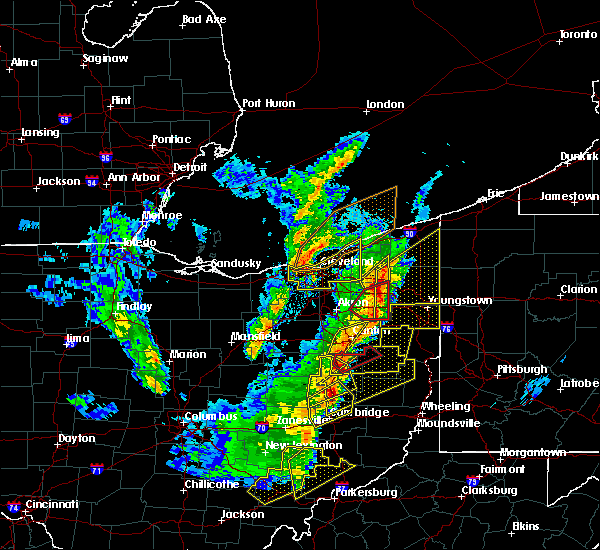 At 556 pm edt, a severe thunderstorm capable of producing a tornado was located over dover, moving northeast at 35 mph (radar indicated rotation). Hazards include tornado and quarter-size hail. Flying debris will be dangerous to those caught without shelter. mobile homes will be damaged or destroyed. damage to roofs, windows, and vehicles will occur. tree damage is likely. this tornadic thunderstorm will remain over mainly rural areas of northwestern carroll and northeastern tuscarawas counties, including the following locations, mineral city, zoar, parral, bolivar and malvern. This includes interstate 77 in ohio between mile markers 82 and 94. At 556 pm edt, a severe thunderstorm capable of producing a tornado was located over dover, moving northeast at 35 mph (radar indicated rotation). Hazards include tornado and quarter-size hail. Flying debris will be dangerous to those caught without shelter. mobile homes will be damaged or destroyed. damage to roofs, windows, and vehicles will occur. tree damage is likely. this tornadic thunderstorm will remain over mainly rural areas of northwestern carroll and northeastern tuscarawas counties, including the following locations, mineral city, zoar, parral, bolivar and malvern. This includes interstate 77 in ohio between mile markers 82 and 94.
|
| 4/14/2019 5:54 PM EDT |
 At 554 pm edt, severe thunderstorms were located along a line extending from near sebring to near carrollton, moving east at 60 mph (radar). Hazards include wind gusts to 60 mph and quarter-size hail. Minor hail damage to vehicles is possible. expect wind damage to trees and power lines, resulting in some power outages. locations impacted include, new philadelphia, dover, salem, carrollton, minerva, strasburg, leetonia, augusta, salineville, malvern, bolivar, mineral city, this includes interstate 77 in ohio between mile markers 79 and 94. A tornado watch remains in effect until 900 pm edt for east central ohio. At 554 pm edt, severe thunderstorms were located along a line extending from near sebring to near carrollton, moving east at 60 mph (radar). Hazards include wind gusts to 60 mph and quarter-size hail. Minor hail damage to vehicles is possible. expect wind damage to trees and power lines, resulting in some power outages. locations impacted include, new philadelphia, dover, salem, carrollton, minerva, strasburg, leetonia, augusta, salineville, malvern, bolivar, mineral city, this includes interstate 77 in ohio between mile markers 79 and 94. A tornado watch remains in effect until 900 pm edt for east central ohio.
|
| 4/14/2019 5:49 PM EDT |
 At 549 pm edt, a severe thunderstorm capable of producing a tornado was located near sugarcreek, or near dover, moving northeast at 35 mph (radar indicated rotation). Hazards include tornado and quarter size hail. Flying debris will be dangerous to those caught without shelter. mobile homes will be damaged or destroyed. damage to roofs, windows, and vehicles will occur. tree damage is likely. this dangerous storm will be near, new philadelphia, dover and strasburg around 600 pm edt. other locations impacted by this tornadic thunderstorm include mineral city, zoar, parral, bolivar and malvern. this includes interstate 77 in ohio between mile markers 79 and 94. Please report severe weather by calling 412-262-1988, posting to the nws pittsburgh facebook page, or using twitter @nwspittsburgh. At 549 pm edt, a severe thunderstorm capable of producing a tornado was located near sugarcreek, or near dover, moving northeast at 35 mph (radar indicated rotation). Hazards include tornado and quarter size hail. Flying debris will be dangerous to those caught without shelter. mobile homes will be damaged or destroyed. damage to roofs, windows, and vehicles will occur. tree damage is likely. this dangerous storm will be near, new philadelphia, dover and strasburg around 600 pm edt. other locations impacted by this tornadic thunderstorm include mineral city, zoar, parral, bolivar and malvern. this includes interstate 77 in ohio between mile markers 79 and 94. Please report severe weather by calling 412-262-1988, posting to the nws pittsburgh facebook page, or using twitter @nwspittsburgh.
|
| 4/14/2019 5:45 PM EDT |
 At 545 pm edt, a severe thunderstorm was located near newcomerstown, or 11 miles east of coshocton, moving northeast at 35 mph (radar). Hazards include wind gusts to 60 mph and half dollar-size hail. Minor hail damage to vehicles is possible. expect wind damage to trees and power lines, resulting in some power outages. locations impacted include, new philadelphia, dover, uhrichsville, newcomerstown, strasburg, west lafayette, sugarcreek, gnadenhutten, tuscarawas, baltic, midvale, port washington, this includes interstate 77 in ohio between mile markers 61 and 89. A tornado watch remains in effect until 900 pm edt for east central ohio. At 545 pm edt, a severe thunderstorm was located near newcomerstown, or 11 miles east of coshocton, moving northeast at 35 mph (radar). Hazards include wind gusts to 60 mph and half dollar-size hail. Minor hail damage to vehicles is possible. expect wind damage to trees and power lines, resulting in some power outages. locations impacted include, new philadelphia, dover, uhrichsville, newcomerstown, strasburg, west lafayette, sugarcreek, gnadenhutten, tuscarawas, baltic, midvale, port washington, this includes interstate 77 in ohio between mile markers 61 and 89. A tornado watch remains in effect until 900 pm edt for east central ohio.
|
| 4/14/2019 5:31 PM EDT |
 At 531 pm edt, a severe thunderstorm was located over west lafayette, or near coshocton, moving east at 35 mph (radar). Hazards include wind gusts to 60 mph and quarter-size hail. Minor hail damage to vehicles is possible. expect wind damage to trees and power lines, resulting in some power outages. locations impacted include, new philadelphia, dover, coshocton, uhrichsville, newcomerstown, strasburg, west lafayette, sugarcreek, gnadenhutten, tuscarawas, baltic, midvale, this includes interstate 77 in ohio between mile markers 61 and 89. A tornado watch remains in effect until 900 pm edt for east central ohio. At 531 pm edt, a severe thunderstorm was located over west lafayette, or near coshocton, moving east at 35 mph (radar). Hazards include wind gusts to 60 mph and quarter-size hail. Minor hail damage to vehicles is possible. expect wind damage to trees and power lines, resulting in some power outages. locations impacted include, new philadelphia, dover, coshocton, uhrichsville, newcomerstown, strasburg, west lafayette, sugarcreek, gnadenhutten, tuscarawas, baltic, midvale, this includes interstate 77 in ohio between mile markers 61 and 89. A tornado watch remains in effect until 900 pm edt for east central ohio.
|
| 4/14/2019 5:29 PM EDT |
 At 529 pm edt, severe thunderstorms were located along a line extending from near north canton to dover, moving east at 60 mph (radar). Hazards include wind gusts to 60 mph and quarter-size hail. Minor hail damage to vehicles is possible. Expect wind damage to trees and power lines, resulting in some power outages. At 529 pm edt, severe thunderstorms were located along a line extending from near north canton to dover, moving east at 60 mph (radar). Hazards include wind gusts to 60 mph and quarter-size hail. Minor hail damage to vehicles is possible. Expect wind damage to trees and power lines, resulting in some power outages.
|
| 4/14/2019 5:22 PM EDT |
 At 522 pm edt, a severe thunderstorm was located over farmerstown, or 11 miles southeast of millersburg, moving northeast at 40 mph (radar). Hazards include wind gusts to 60 mph and quarter-size hail. Minor hail damage to vehicles is possible. expect wind damage to trees and power lines, resulting in some power outages. locations impacted include, new philadelphia, sugarcreek, tuscarawas, baltic, stone creek, chili, bakersville, this includes interstate 77 in ohio between mile markers 70 and 80. A tornado watch remains in effect until 900 pm edt for east central ohio. At 522 pm edt, a severe thunderstorm was located over farmerstown, or 11 miles southeast of millersburg, moving northeast at 40 mph (radar). Hazards include wind gusts to 60 mph and quarter-size hail. Minor hail damage to vehicles is possible. expect wind damage to trees and power lines, resulting in some power outages. locations impacted include, new philadelphia, sugarcreek, tuscarawas, baltic, stone creek, chili, bakersville, this includes interstate 77 in ohio between mile markers 70 and 80. A tornado watch remains in effect until 900 pm edt for east central ohio.
|
| 4/14/2019 5:20 PM EDT |
 At 520 pm edt, a severe thunderstorm was located near coshocton, moving northeast at 35 mph (radar). Hazards include wind gusts to 60 mph and quarter-size hail. Minor hail damage to vehicles is possible. Expect wind damage to trees and power lines, resulting in some power outages. At 520 pm edt, a severe thunderstorm was located near coshocton, moving northeast at 35 mph (radar). Hazards include wind gusts to 60 mph and quarter-size hail. Minor hail damage to vehicles is possible. Expect wind damage to trees and power lines, resulting in some power outages.
|
| 4/14/2019 5:04 PM EDT |
 At 503 pm edt, a severe thunderstorm was located 7 miles south of killbuck, or 9 miles northwest of coshocton, moving northeast at 40 mph (radar). Hazards include wind gusts to 60 mph and quarter-size hail. Minor hail damage to vehicles is possible. expect wind damage to trees and power lines, resulting in some power outages. locations impacted include, new philadelphia, sugarcreek, tuscarawas, baltic, warsaw, stone creek, chili, layland, bakersville, blissfield, this includes interstate 77 in ohio between mile markers 70 and 80. A tornado watch remains in effect until 900 pm edt for east central ohio. At 503 pm edt, a severe thunderstorm was located 7 miles south of killbuck, or 9 miles northwest of coshocton, moving northeast at 40 mph (radar). Hazards include wind gusts to 60 mph and quarter-size hail. Minor hail damage to vehicles is possible. expect wind damage to trees and power lines, resulting in some power outages. locations impacted include, new philadelphia, sugarcreek, tuscarawas, baltic, warsaw, stone creek, chili, layland, bakersville, blissfield, this includes interstate 77 in ohio between mile markers 70 and 80. A tornado watch remains in effect until 900 pm edt for east central ohio.
|
| 4/14/2019 4:52 PM EDT |
 At 452 pm edt, a severe thunderstorm was located 12 miles west of coshocton, moving northeast at 40 mph (radar). Hazards include wind gusts to 60 mph and quarter-size hail. Minor hail damage to vehicles is possible. Expect wind damage to trees and power lines, resulting in some power outages. At 452 pm edt, a severe thunderstorm was located 12 miles west of coshocton, moving northeast at 40 mph (radar). Hazards include wind gusts to 60 mph and quarter-size hail. Minor hail damage to vehicles is possible. Expect wind damage to trees and power lines, resulting in some power outages.
|
| 3/14/2019 10:36 PM EDT |
 At 1036 pm edt, severe thunderstorms were located along a line extending from north folk village to near ripley, moving east at 65 mph (radar indicated). Hazards include 60 mph wind gusts. Expect damage to trees and power lines. Locations impacted include, chillicothe, west union, peebles, ripley, winchester, marshall, seaman, bainbridge, kincaid springs, belfast, cynthiana, north folk village, decatur, russellville, dover, cherry fork, sinking spring, may hill, locust grove and knockemstiff. At 1036 pm edt, severe thunderstorms were located along a line extending from north folk village to near ripley, moving east at 65 mph (radar indicated). Hazards include 60 mph wind gusts. Expect damage to trees and power lines. Locations impacted include, chillicothe, west union, peebles, ripley, winchester, marshall, seaman, bainbridge, kincaid springs, belfast, cynthiana, north folk village, decatur, russellville, dover, cherry fork, sinking spring, may hill, locust grove and knockemstiff.
|
| 3/14/2019 10:25 PM EDT |
 The severe thunderstorm warning for northwestern mason, robertson, bracken, southeastern pendleton, central brown, northwestern adams and southeastern highland counties will expire at 1030 pm edt, the storms which prompted the warning have moved out of the area. therefore, the warning will be allowed to expire. however gusty winds and heavy rain are still possible with these thunderstorms. a severe thunderstorm warning has been reissued for parts of the area. please report previous wind damage or hail to the national weather service by going to our website at weather.gov/iln and submitting your report via social media. The severe thunderstorm warning for northwestern mason, robertson, bracken, southeastern pendleton, central brown, northwestern adams and southeastern highland counties will expire at 1030 pm edt, the storms which prompted the warning have moved out of the area. therefore, the warning will be allowed to expire. however gusty winds and heavy rain are still possible with these thunderstorms. a severe thunderstorm warning has been reissued for parts of the area. please report previous wind damage or hail to the national weather service by going to our website at weather.gov/iln and submitting your report via social media.
|
| 3/14/2019 10:24 PM EDT |
 At 1024 pm edt, severe thunderstorms were located along a line extending from near bainbridge to near brooksville, moving east at 65 mph (radar indicated). Hazards include 60 mph wind gusts. Expect damage to trees and power lines. Locations impacted include, chillicothe, maysville, georgetown, west union, peebles, ripley, aberdeen, augusta, winchester, marshall, seaman, bainbridge, brooksville, belfast, highland holiday, kincaid springs, rocky fork point, cynthiana, north folk village and emerald. At 1024 pm edt, severe thunderstorms were located along a line extending from near bainbridge to near brooksville, moving east at 65 mph (radar indicated). Hazards include 60 mph wind gusts. Expect damage to trees and power lines. Locations impacted include, chillicothe, maysville, georgetown, west union, peebles, ripley, aberdeen, augusta, winchester, marshall, seaman, bainbridge, brooksville, belfast, highland holiday, kincaid springs, rocky fork point, cynthiana, north folk village and emerald.
|
| 3/14/2019 10:19 PM EDT |
 At 1018 pm edt, severe thunderstorms were located along a line extending from near cynthiana to near brooksville, moving northeast at 70 mph (radar indicated). Hazards include 60 mph wind gusts. Expect damage to trees and power lines. Locations impacted include, georgetown, ripley, augusta, winchester, sardinia, seaman, brooksville, emerald, russellville, dover, higginsport, germantown, browning corner, stonewall, may hill, powersville, fincastle, south ripley, chatham and state route 32 at us route 62. At 1018 pm edt, severe thunderstorms were located along a line extending from near cynthiana to near brooksville, moving northeast at 70 mph (radar indicated). Hazards include 60 mph wind gusts. Expect damage to trees and power lines. Locations impacted include, georgetown, ripley, augusta, winchester, sardinia, seaman, brooksville, emerald, russellville, dover, higginsport, germantown, browning corner, stonewall, may hill, powersville, fincastle, south ripley, chatham and state route 32 at us route 62.
|
| 3/14/2019 10:15 PM EDT |
 At 1015 pm edt, severe thunderstorms were located along a line extending from near highland holiday to 6 miles southeast of falmouth, moving east at 65 mph (radar indicated). Hazards include 60 mph wind gusts. expect damage to trees and power lines At 1015 pm edt, severe thunderstorms were located along a line extending from near highland holiday to 6 miles southeast of falmouth, moving east at 65 mph (radar indicated). Hazards include 60 mph wind gusts. expect damage to trees and power lines
|
| 3/14/2019 10:02 PM EDT |
 At 1001 pm edt, severe thunderstorms were located along a line extending from near sardinia to 7 miles southeast of williamstown, moving northeast at 70 mph (radar indicated). Hazards include 60 mph wind gusts. Expect damage to trees and power lines. Locations impacted include, georgetown, falmouth, ripley, augusta, winchester, sardinia, seaman, felicity, brooksville, morgan, emerald, russellville, hamersville, dover, higginsport, germantown, neville, chilo, browning corner and bradford. At 1001 pm edt, severe thunderstorms were located along a line extending from near sardinia to 7 miles southeast of williamstown, moving northeast at 70 mph (radar indicated). Hazards include 60 mph wind gusts. Expect damage to trees and power lines. Locations impacted include, georgetown, falmouth, ripley, augusta, winchester, sardinia, seaman, felicity, brooksville, morgan, emerald, russellville, hamersville, dover, higginsport, germantown, neville, chilo, browning corner and bradford.
|
| 3/14/2019 9:53 PM EDT |
 At 953 pm edt, severe thunderstorms were located along a line extending from near mount orab to 10 miles south of williamstown, moving northeast at 70 mph (radar indicated). Hazards include 60 mph wind gusts. expect damage to trees and power lines At 953 pm edt, severe thunderstorms were located along a line extending from near mount orab to 10 miles south of williamstown, moving northeast at 70 mph (radar indicated). Hazards include 60 mph wind gusts. expect damage to trees and power lines
|
| 3/14/2019 8:21 PM EDT |
 At 821 pm edt, a severe thunderstorm was located over east sparta, or 9 miles northeast of dover, moving northeast at 60 mph (radar). Hazards include wind gusts to 60 mph and half dollar-size hail. Minor hail damage to vehicles is possible. expect wind damage to trees and power lines, resulting in some power outages. Locations impacted include, new philadelphia, dover, strasburg, bolivar, mineral city, parral, zoar, this includes interstate 77 in ohio between mile markers 78 and 94. At 821 pm edt, a severe thunderstorm was located over east sparta, or 9 miles northeast of dover, moving northeast at 60 mph (radar). Hazards include wind gusts to 60 mph and half dollar-size hail. Minor hail damage to vehicles is possible. expect wind damage to trees and power lines, resulting in some power outages. Locations impacted include, new philadelphia, dover, strasburg, bolivar, mineral city, parral, zoar, this includes interstate 77 in ohio between mile markers 78 and 94.
|
| 3/14/2019 8:06 PM EDT |
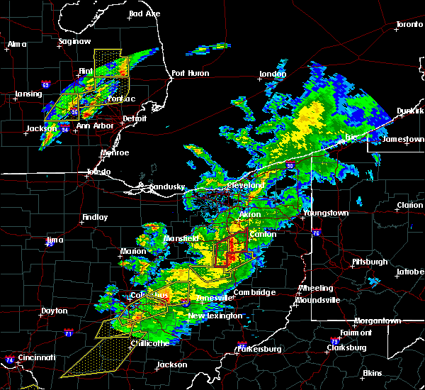 At 806 pm edt, a severe thunderstorm was located over sugarcreek, or 7 miles west of dover, moving northeast at 70 mph (radar). Hazards include wind gusts to 60 mph and quarter-size hail. Minor hail damage to vehicles is possible. expect wind damage to trees and power lines, resulting in some power outages. Locations impacted include, new philadelphia, dover, strasburg, sugarcreek, bolivar, baltic, mineral city, parral, zoar, this includes interstate 77 in ohio between mile markers 79 and 94. At 806 pm edt, a severe thunderstorm was located over sugarcreek, or 7 miles west of dover, moving northeast at 70 mph (radar). Hazards include wind gusts to 60 mph and quarter-size hail. Minor hail damage to vehicles is possible. expect wind damage to trees and power lines, resulting in some power outages. Locations impacted include, new philadelphia, dover, strasburg, sugarcreek, bolivar, baltic, mineral city, parral, zoar, this includes interstate 77 in ohio between mile markers 79 and 94.
|
| 3/14/2019 8:00 PM EDT |
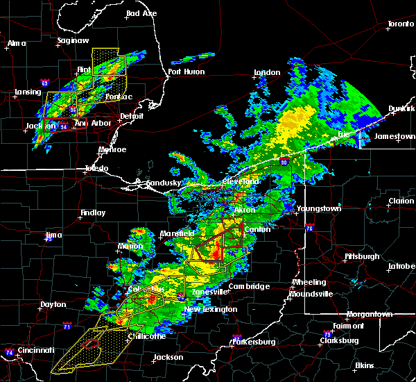 At 800 pm edt, a severe thunderstorm was located over farmerstown, or 9 miles southeast of millersburg, moving northeast at 65 mph (radar). Hazards include wind gusts to 60 mph and quarter-size hail. Minor hail damage to vehicles is possible. expect wind damage to trees and power lines, resulting in some power outages. Locations impacted include, new philadelphia, dover, strasburg, sugarcreek, bolivar, baltic, mineral city, parral, zoar, this includes interstate 77 in ohio between mile markers 79 and 94. At 800 pm edt, a severe thunderstorm was located over farmerstown, or 9 miles southeast of millersburg, moving northeast at 65 mph (radar). Hazards include wind gusts to 60 mph and quarter-size hail. Minor hail damage to vehicles is possible. expect wind damage to trees and power lines, resulting in some power outages. Locations impacted include, new philadelphia, dover, strasburg, sugarcreek, bolivar, baltic, mineral city, parral, zoar, this includes interstate 77 in ohio between mile markers 79 and 94.
|
| 3/14/2019 7:55 PM EDT |
 At 755 pm edt, a severe thunderstorm was located near killbuck, or near millersburg, moving northeast at 65 mph (radar). Hazards include wind gusts to 60 mph. expect damage to trees and power lines, resulting in some power outages At 755 pm edt, a severe thunderstorm was located near killbuck, or near millersburg, moving northeast at 65 mph (radar). Hazards include wind gusts to 60 mph. expect damage to trees and power lines, resulting in some power outages
|
| 10/2/2018 5:16 PM EDT |
 At 516 pm edt, a severe thunderstorm was located near sugarcreek, or near dover, moving east at 40 mph (radar). Hazards include wind gusts to 60 mph and quarter-size hail. Hail damage to vehicles. damage to trees and power lines. Locations impacted include, new philadelphia, dover, uhrichsville, sugarcreek, midvale, barnhill, roswell, parral, this includes interstate 77 in ohio between mile markers 76 and 85. At 516 pm edt, a severe thunderstorm was located near sugarcreek, or near dover, moving east at 40 mph (radar). Hazards include wind gusts to 60 mph and quarter-size hail. Hail damage to vehicles. damage to trees and power lines. Locations impacted include, new philadelphia, dover, uhrichsville, sugarcreek, midvale, barnhill, roswell, parral, this includes interstate 77 in ohio between mile markers 76 and 85.
|
| 10/2/2018 5:04 PM EDT |
 At 504 pm edt, a severe thunderstorm was located near sugarcreek, or 9 miles west of dover, moving east at 45 mph (radar). Hazards include wind gusts to 60 mph and quarter-size hail. Hail damage to vehicles. Damage to trees and power lines. At 504 pm edt, a severe thunderstorm was located near sugarcreek, or 9 miles west of dover, moving east at 45 mph (radar). Hazards include wind gusts to 60 mph and quarter-size hail. Hail damage to vehicles. Damage to trees and power lines.
|
| 9/21/2018 6:35 PM EDT | Tree and wires down in dover township in tuscarawas county OH, 177.1 miles SW of Dover, OH |
| 9/21/2018 6:33 PM EDT |
 The national weather service in pittsburgh has issued a * severe thunderstorm warning for. northwestern harrison county in east central ohio. east central coshocton county in east central ohio. southwestern carroll county in east central ohio. Tuscarawas county in east central ohio. The national weather service in pittsburgh has issued a * severe thunderstorm warning for. northwestern harrison county in east central ohio. east central coshocton county in east central ohio. southwestern carroll county in east central ohio. Tuscarawas county in east central ohio.
|
| 9/21/2018 5:45 PM EDT |
 At 545 pm edt, a severe thunderstorm was located over navarre, or 11 miles southwest of canton, moving east at 45 mph (radar). Hazards include wind gusts to 60 mph. expect damage to trees and power lines, resulting in some power outages At 545 pm edt, a severe thunderstorm was located over navarre, or 11 miles southwest of canton, moving east at 45 mph (radar). Hazards include wind gusts to 60 mph. expect damage to trees and power lines, resulting in some power outages
|
| 5/31/2018 4:44 PM EDT |
 At 444 pm edt, severe thunderstorms were located along a line extending from 7 miles south of winchester to near lewisburg, moving east at 40 mph (radar indicated). Hazards include 60 mph wind gusts. Expect damage to trees and power lines. Locations impacted include, maysville, washington, west union, manchester, ripley, aberdeen, lewisburg, tollesboro, decatur, russellville, dover, cherry fork, sardis, trinity, murphysville, bradysville, mays lick, rectorville, epworth and ribolt. At 444 pm edt, severe thunderstorms were located along a line extending from 7 miles south of winchester to near lewisburg, moving east at 40 mph (radar indicated). Hazards include 60 mph wind gusts. Expect damage to trees and power lines. Locations impacted include, maysville, washington, west union, manchester, ripley, aberdeen, lewisburg, tollesboro, decatur, russellville, dover, cherry fork, sardis, trinity, murphysville, bradysville, mays lick, rectorville, epworth and ribolt.
|
| 5/31/2018 4:24 PM EDT |
 At 424 pm edt, severe thunderstorms were located along a line extending from near georgetown to near fairview, moving east at 40 mph (radar indicated). Hazards include 60 mph wind gusts. expect damage to trees and power lines At 424 pm edt, severe thunderstorms were located along a line extending from near georgetown to near fairview, moving east at 40 mph (radar indicated). Hazards include 60 mph wind gusts. expect damage to trees and power lines
|
| 5/26/2018 7:05 PM EDT | Trees and power lines down and barn-roof damage immediately north of dove in tuscarawas county OH, 177.2 miles SW of Dover, OH |
| 5/22/2018 6:00 PM EDT | Quarter sized hail reported 177.2 miles SW of Dover, OH |
| 5/22/2018 6:00 PM EDT |
 At 559 pm edt, a severe thunderstorm was located over new philadelphia, moving southeast at 35 mph (radar). Hazards include wind gusts to 60 mph and half dollar-size hail. Hail damage to vehicles. damage to trees and power lines. Locations impacted include, new philadelphia, dover, uhrichsville, dennison, gnadenhutten, tuscarawas, midvale, barnhill, sherrodsville, roswell, leesville, atwood lake, this includes interstate 77 in ohio between mile markers 75 and 84. At 559 pm edt, a severe thunderstorm was located over new philadelphia, moving southeast at 35 mph (radar). Hazards include wind gusts to 60 mph and half dollar-size hail. Hail damage to vehicles. damage to trees and power lines. Locations impacted include, new philadelphia, dover, uhrichsville, dennison, gnadenhutten, tuscarawas, midvale, barnhill, sherrodsville, roswell, leesville, atwood lake, this includes interstate 77 in ohio between mile markers 75 and 84.
|
| 5/22/2018 5:54 PM EDT | Several trees down on house in tuscarawas county OH, 177.2 miles SW of Dover, OH |
| 5/22/2018 5:50 PM EDT |
 At 549 pm edt, a severe thunderstorm was located near dover, moving southeast at 35 mph (radar). Hazards include wind gusts to 60 mph and quarter-size hail. Hail damage to vehicles. damage to trees and power lines. Locations impacted include, new philadelphia, dover, uhrichsville, dennison, strasburg, sugarcreek, gnadenhutten, tuscarawas, midvale, mineral city, barnhill, sherrodsville, this includes interstate 77 in ohio between mile markers 74 and 88. At 549 pm edt, a severe thunderstorm was located near dover, moving southeast at 35 mph (radar). Hazards include wind gusts to 60 mph and quarter-size hail. Hail damage to vehicles. damage to trees and power lines. Locations impacted include, new philadelphia, dover, uhrichsville, dennison, strasburg, sugarcreek, gnadenhutten, tuscarawas, midvale, mineral city, barnhill, sherrodsville, this includes interstate 77 in ohio between mile markers 74 and 88.
|
| 5/22/2018 5:37 PM EDT |
 At 536 pm edt, a severe thunderstorm was located near walnut creek, or 10 miles west of dover, moving southeast at 40 mph (radar). Hazards include wind gusts to 60 mph and quarter-size hail. Hail damage to vehicles. Damage to trees and power lines. At 536 pm edt, a severe thunderstorm was located near walnut creek, or 10 miles west of dover, moving southeast at 40 mph (radar). Hazards include wind gusts to 60 mph and quarter-size hail. Hail damage to vehicles. Damage to trees and power lines.
|
| 4/3/2018 6:19 PM EDT |
 At 619 pm edt, a severe thunderstorm was located near augusta, moving east at 50 mph (radar indicated). Hazards include 60 mph wind gusts and half dollar size hail. Minor hail damage to vehicles is possible. Expect wind damage to trees and power lines. At 619 pm edt, a severe thunderstorm was located near augusta, moving east at 50 mph (radar indicated). Hazards include 60 mph wind gusts and half dollar size hail. Minor hail damage to vehicles is possible. Expect wind damage to trees and power lines.
|
| 11/5/2017 8:40 PM EST | Multiple trees and power lines dow in tuscarawas county OH, 177.2 miles SW of Dover, OH |
| 11/5/2017 8:28 PM EST |
 At 828 pm est, severe thunderstorms were located along a line extending from near strasburg to 7 miles west of uhrichsville to near cambridge, moving east at 45 mph (radar). Hazards include 60 mph wind gusts. expect damage to trees and power lines, resulting in some power outages At 828 pm est, severe thunderstorms were located along a line extending from near strasburg to 7 miles west of uhrichsville to near cambridge, moving east at 45 mph (radar). Hazards include 60 mph wind gusts. expect damage to trees and power lines, resulting in some power outages
|
| 11/5/2017 7:05 PM EDT |
 At 604 pm est, severe thunderstorms were located along a line extending from barberton to near dalton to near berlin, moving east at 50 mph (radar). Hazards include 60 mph wind gusts. expect damage to trees and power lines, resulting in some power outages At 604 pm est, severe thunderstorms were located along a line extending from barberton to near dalton to near berlin, moving east at 50 mph (radar). Hazards include 60 mph wind gusts. expect damage to trees and power lines, resulting in some power outages
|
| 8/19/2017 2:30 PM EDT |
 At 229 pm edt, a severe thunderstorm was located near new philadelphia, moving east at 30 mph (public). Hazards include quarter-size hail. Minor damage to vehicles is possible. Locations impacted include, new philadelphia, dover, uhrichsville, carrollton, dennison, tuscarawas, scio, midvale, bowerston, barnhill, dellroy, sherrodsville, this includes interstate 77 in ohio between mile markers 74 and 84. At 229 pm edt, a severe thunderstorm was located near new philadelphia, moving east at 30 mph (public). Hazards include quarter-size hail. Minor damage to vehicles is possible. Locations impacted include, new philadelphia, dover, uhrichsville, carrollton, dennison, tuscarawas, scio, midvale, bowerston, barnhill, dellroy, sherrodsville, this includes interstate 77 in ohio between mile markers 74 and 84.
|
| 8/19/2017 2:14 PM EDT |
 At 214 pm edt, a severe thunderstorm was located near new philadelphia, moving east at 25 mph (radar). Hazards include 60 mph wind gusts and quarter-size hail. Minor hail damage to vehicles is possible. Expect wind damage to trees and power lines, resulting in some power outages. At 214 pm edt, a severe thunderstorm was located near new philadelphia, moving east at 25 mph (radar). Hazards include 60 mph wind gusts and quarter-size hail. Minor hail damage to vehicles is possible. Expect wind damage to trees and power lines, resulting in some power outages.
|
| 7/22/2017 9:29 PM EDT |
 At 928 pm edt, a severe thunderstorm was located over ripley, moving east at 30 mph (radar indicated). Hazards include 60 mph wind gusts. Expect damage to trees and power lines. Locations impacted include, maysville, washington, manchester, ripley, aberdeen, decatur, dover, germantown, minerva, redoak, moranburg, bradysville, bentonville, south ripley, tuckahoe and stoney point. At 928 pm edt, a severe thunderstorm was located over ripley, moving east at 30 mph (radar indicated). Hazards include 60 mph wind gusts. Expect damage to trees and power lines. Locations impacted include, maysville, washington, manchester, ripley, aberdeen, decatur, dover, germantown, minerva, redoak, moranburg, bradysville, bentonville, south ripley, tuckahoe and stoney point.
|
| 7/22/2017 9:11 PM EDT |
 At 911 pm edt, a severe thunderstorm was located over augusta, moving east at 30 mph (radar indicated). Hazards include 60 mph wind gusts. expect damage to trees and power lines At 911 pm edt, a severe thunderstorm was located over augusta, moving east at 30 mph (radar indicated). Hazards include 60 mph wind gusts. expect damage to trees and power lines
|
| 5/1/2017 1:20 PM EDT | Many trees down on boulevard st. rt. 800 in dove in tuscarawas county OH, 177.2 miles SW of Dover, OH |
| 5/1/2017 1:08 PM EDT |
 At 108 pm edt, severe thunderstorms were located along a line extending from near canton to near dennison, moving northeast at 45 mph (radar). Hazards include 60 mph wind gusts. Expect damage to trees and power lines, resulting in some power outages. locations impacted include, new philadelphia, dover, uhrichsville, carrollton, minerva, dennison, strasburg, augusta, salineville, gnadenhutten, malvern, tuscarawas, this includes interstate 77 in ohio between mile markers 76 and 94. A tornado watch remains in effect until 700 pm edt for east central ohio. At 108 pm edt, severe thunderstorms were located along a line extending from near canton to near dennison, moving northeast at 45 mph (radar). Hazards include 60 mph wind gusts. Expect damage to trees and power lines, resulting in some power outages. locations impacted include, new philadelphia, dover, uhrichsville, carrollton, minerva, dennison, strasburg, augusta, salineville, gnadenhutten, malvern, tuscarawas, this includes interstate 77 in ohio between mile markers 76 and 94. A tornado watch remains in effect until 700 pm edt for east central ohio.
|
| 5/1/2017 12:42 PM EDT |
 At 1242 pm edt, severe thunderstorms were located along a line extending from near wilmot to near newcomerstown, moving northeast at 45 mph (radar). Hazards include 60 mph wind gusts. expect damage to trees and power lines, resulting in some power outages At 1242 pm edt, severe thunderstorms were located along a line extending from near wilmot to near newcomerstown, moving northeast at 45 mph (radar). Hazards include 60 mph wind gusts. expect damage to trees and power lines, resulting in some power outages
|
| 5/1/2017 12:29 PM EDT |
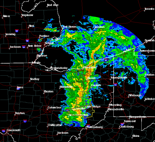 At 1229 pm edt, severe thunderstorms were located along a line extending from near millersburg to near west lafayette, moving northeast at 45 mph (radar). Hazards include 60 mph wind gusts. Expect damage to trees and power lines, resulting in some power outages. Locations impacted include, new philadelphia, dover, coshocton, newcomerstown, strasburg, west lafayette, sugarcreek, gnadenhutten, baltic, port washington, conesville, parral, this includes interstate 77 in ohio between mile markers 53 and 88. At 1229 pm edt, severe thunderstorms were located along a line extending from near millersburg to near west lafayette, moving northeast at 45 mph (radar). Hazards include 60 mph wind gusts. Expect damage to trees and power lines, resulting in some power outages. Locations impacted include, new philadelphia, dover, coshocton, newcomerstown, strasburg, west lafayette, sugarcreek, gnadenhutten, baltic, port washington, conesville, parral, this includes interstate 77 in ohio between mile markers 53 and 88.
|
| 5/1/2017 11:58 AM EDT |
 At 1158 am edt, severe thunderstorms were located along a line extending from danville to near frazeysburg, moving northeast at 45 mph (radar). Hazards include 60 mph wind gusts. expect damage to trees and power lines, resulting in some power outages At 1158 am edt, severe thunderstorms were located along a line extending from danville to near frazeysburg, moving northeast at 45 mph (radar). Hazards include 60 mph wind gusts. expect damage to trees and power lines, resulting in some power outages
|
| 4/30/2017 3:37 PM EDT |
 The severe thunderstorm warning for eastern coshocton and central tuscarawas counties will expire at 345 pm edt, the storm that prompted the warning has weakened below severe limits and no longer pose an immediate threat to life and property. therefore, the warning will be allowed to expire. however small hail and gusty winds are still possible with this thunderstorm. The severe thunderstorm warning for eastern coshocton and central tuscarawas counties will expire at 345 pm edt, the storm that prompted the warning has weakened below severe limits and no longer pose an immediate threat to life and property. therefore, the warning will be allowed to expire. however small hail and gusty winds are still possible with this thunderstorm.
|
| 4/30/2017 3:17 PM EDT |
 At 317 pm edt, a severe thunderstorm was located near west lafayette, or near coshocton, moving northeast at 50 mph. another strong to severe thunderstorm was located near new philadelphia (radar). Hazards include 60 mph wind gusts. Expect damage to trees and power lines, resulting in some power outages. Locations impacted include, new philadelphia, dover, coshocton, uhrichsville, newcomerstown, dennison, west lafayette, sugarcreek, gnadenhutten, tuscarawas, baltic, midvale, this includes interstate 77 in ohio between mile markers 66 and 87. At 317 pm edt, a severe thunderstorm was located near west lafayette, or near coshocton, moving northeast at 50 mph. another strong to severe thunderstorm was located near new philadelphia (radar). Hazards include 60 mph wind gusts. Expect damage to trees and power lines, resulting in some power outages. Locations impacted include, new philadelphia, dover, coshocton, uhrichsville, newcomerstown, dennison, west lafayette, sugarcreek, gnadenhutten, tuscarawas, baltic, midvale, this includes interstate 77 in ohio between mile markers 66 and 87.
|
| 4/30/2017 3:02 PM EDT |
 At 301 pm edt, a severe thunderstorm was located 7 miles north of dresden, or 7 miles southwest of coshocton, moving northeast at 50 mph (radar). Hazards include 60 mph wind gusts. expect damage to trees and power lines, resulting in some power outages At 301 pm edt, a severe thunderstorm was located 7 miles north of dresden, or 7 miles southwest of coshocton, moving northeast at 50 mph (radar). Hazards include 60 mph wind gusts. expect damage to trees and power lines, resulting in some power outages
|
| 4/29/2017 2:27 AM EDT |
 The severe thunderstorm warning for western mason. robertson and bracken counties will expire at 230 am edt. the storm which prompted the warning has moved out of the area. therefore, the warning will be allowed to expire. however gusty winds and heavy rain are still possible with this thunderstorm. Please report previous wind damage or hail to the national weather. The severe thunderstorm warning for western mason. robertson and bracken counties will expire at 230 am edt. the storm which prompted the warning has moved out of the area. therefore, the warning will be allowed to expire. however gusty winds and heavy rain are still possible with this thunderstorm. Please report previous wind damage or hail to the national weather.
|
| 4/29/2017 1:59 AM EDT |
 At 158 am edt, a severe thunderstorm was located over brooksville, moving east at 30 mph (radar indicated). Hazards include 60 mph wind gusts and quarter size hail. Hail damage to vehicles is expected. expect wind damage to roofs, siding, and trees. Locations impacted include, maysville, washington, ripley, augusta, brooksville, mount olivet, dover, germantown, sardis, murphysville, stonewall, mays lick, powersville, south ripley, chatham, tuckahoe, hittville, minerva, us route 62 at state route 875 and abigail. At 158 am edt, a severe thunderstorm was located over brooksville, moving east at 30 mph (radar indicated). Hazards include 60 mph wind gusts and quarter size hail. Hail damage to vehicles is expected. expect wind damage to roofs, siding, and trees. Locations impacted include, maysville, washington, ripley, augusta, brooksville, mount olivet, dover, germantown, sardis, murphysville, stonewall, mays lick, powersville, south ripley, chatham, tuckahoe, hittville, minerva, us route 62 at state route 875 and abigail.
|
| 4/29/2017 1:42 AM EDT |
 At 142 am edt, a severe thunderstorm was located near falmouth, moving east at 35 mph (radar indicated). Hazards include 60 mph wind gusts and quarter size hail. Hail damage to vehicles is expected. Expect wind damage to roofs, siding, and trees. At 142 am edt, a severe thunderstorm was located near falmouth, moving east at 35 mph (radar indicated). Hazards include 60 mph wind gusts and quarter size hail. Hail damage to vehicles is expected. Expect wind damage to roofs, siding, and trees.
|
| 4/5/2017 7:56 PM EDT |
 The severe thunderstorm warning for northwestern mason, bracken, southeastern clermont, brown, adams and southwestern highland counties will expire at 800 pm edt, the storm which prompted the warning has moved out of the area. therefore, the warning will be allowed to expire. a severe thunderstorm watch remains in effect until 900 pm edt for northern kentucky, and southwestern ohio. please report previous wind damage or hail to the national weather service by going to our website at weather.gov/iln and submitting your report via social media. The severe thunderstorm warning for northwestern mason, bracken, southeastern clermont, brown, adams and southwestern highland counties will expire at 800 pm edt, the storm which prompted the warning has moved out of the area. therefore, the warning will be allowed to expire. a severe thunderstorm watch remains in effect until 900 pm edt for northern kentucky, and southwestern ohio. please report previous wind damage or hail to the national weather service by going to our website at weather.gov/iln and submitting your report via social media.
|
| 4/5/2017 7:39 PM EDT |
 At 739 pm edt, a severe thunderstorm was located near winchester, moving northeast at 50 mph (radar indicated). Hazards include 60 mph wind gusts and quarter size hail. Hail damage to vehicles is expected. expect wind damage to roofs, siding, and trees. Locations impacted include, maysville, georgetown, mount orab, west union, manchester, ripley, aberdeen, augusta, winchester, sardinia, seaman, felicity, brooksville, belfast, emerald, decatur, russellville, hamersville, mowrystown and dover. At 739 pm edt, a severe thunderstorm was located near winchester, moving northeast at 50 mph (radar indicated). Hazards include 60 mph wind gusts and quarter size hail. Hail damage to vehicles is expected. expect wind damage to roofs, siding, and trees. Locations impacted include, maysville, georgetown, mount orab, west union, manchester, ripley, aberdeen, augusta, winchester, sardinia, seaman, felicity, brooksville, belfast, emerald, decatur, russellville, hamersville, mowrystown and dover.
|
| 4/5/2017 7:09 PM EDT |
 At 709 pm edt, a severe thunderstorm was located near neville, moving east at 50 mph (radar indicated). Hazards include 70 mph wind gusts and half dollar size hail. Hail damage to vehicles is expected. expect considerable tree damage. Wind damage is also likely to mobile homes, roofs, and outbuildings. At 709 pm edt, a severe thunderstorm was located near neville, moving east at 50 mph (radar indicated). Hazards include 70 mph wind gusts and half dollar size hail. Hail damage to vehicles is expected. expect considerable tree damage. Wind damage is also likely to mobile homes, roofs, and outbuildings.
|
| 3/1/2017 7:47 AM EST |
 At 747 am est, severe thunderstorms were located along a line extending from near winchester to 6 miles southwest of washington, moving east at 50 mph (radar indicated). Hazards include 70 mph wind gusts and penny size hail. Expect considerable tree damage. damage is likely to mobile homes, roofs, and outbuildings. locations impacted include, maysville, washington, west union, manchester, peebles, ripley, aberdeen, vanceburg, winchester, sardinia, seaman, lewisburg, rome, tollesboro, emerald, blue creek, decatur, russellville, mount olivet and dover. A tornado watch remains in effect until 1100 am est for northern and northeastern kentucky, and southwestern ohio. At 747 am est, severe thunderstorms were located along a line extending from near winchester to 6 miles southwest of washington, moving east at 50 mph (radar indicated). Hazards include 70 mph wind gusts and penny size hail. Expect considerable tree damage. damage is likely to mobile homes, roofs, and outbuildings. locations impacted include, maysville, washington, west union, manchester, peebles, ripley, aberdeen, vanceburg, winchester, sardinia, seaman, lewisburg, rome, tollesboro, emerald, blue creek, decatur, russellville, mount olivet and dover. A tornado watch remains in effect until 1100 am est for northern and northeastern kentucky, and southwestern ohio.
|
| 3/1/2017 7:30 AM EST |
 At 730 am est, severe thunderstorms were located along a line extending from mount orab to 7 miles southwest of brooksville, moving east at 60 mph (radar indicated). Hazards include 70 mph wind gusts and penny size hail. Expect considerable tree damage. damage is likely to mobile homes, roofs, and outbuildings. locations impacted include, maysville, georgetown, washington, mount orab, west union, manchester, peebles, ripley, aberdeen, vanceburg, augusta, winchester, sardinia, seaman, lewisburg, rome, tollesboro, emerald, blue creek and decatur. A tornado watch remains in effect until 1100 am est for northern and northeastern kentucky, and southwestern ohio. At 730 am est, severe thunderstorms were located along a line extending from mount orab to 7 miles southwest of brooksville, moving east at 60 mph (radar indicated). Hazards include 70 mph wind gusts and penny size hail. Expect considerable tree damage. damage is likely to mobile homes, roofs, and outbuildings. locations impacted include, maysville, georgetown, washington, mount orab, west union, manchester, peebles, ripley, aberdeen, vanceburg, augusta, winchester, sardinia, seaman, lewisburg, rome, tollesboro, emerald, blue creek and decatur. A tornado watch remains in effect until 1100 am est for northern and northeastern kentucky, and southwestern ohio.
|
| 3/1/2017 7:22 AM EST |
 At 721 am est, severe thunderstorms were located along a line extending from near williamsburg to 10 miles south of falmouth, moving east at 70 mph (radar indicated). Hazards include 70 mph wind gusts. Expect considerable tree damage. Damage is likely to mobile homes, roofs, and outbuildings. At 721 am est, severe thunderstorms were located along a line extending from near williamsburg to 10 miles south of falmouth, moving east at 70 mph (radar indicated). Hazards include 70 mph wind gusts. Expect considerable tree damage. Damage is likely to mobile homes, roofs, and outbuildings.
|
| 1/12/2017 2:14 PM EST |
 At 213 pm est, a severe thunderstorm was located over strasburg, or near dover, moving east at 55 mph (radar indicated). Hazards include 60 mph wind gusts. expect damage to trees and power lines, resulting in some power outages At 213 pm est, a severe thunderstorm was located over strasburg, or near dover, moving east at 55 mph (radar indicated). Hazards include 60 mph wind gusts. expect damage to trees and power lines, resulting in some power outages
|
| 10/19/2016 8:42 PM EDT |
 At 841 pm edt, a severe thunderstorm was located near georgetown, moving east at 25 mph (radar indicated). Hazards include 60 mph wind gusts and quarter size hail. Hail damage to vehicles is expected. Expect wind damage to roofs, siding, and trees. At 841 pm edt, a severe thunderstorm was located near georgetown, moving east at 25 mph (radar indicated). Hazards include 60 mph wind gusts and quarter size hail. Hail damage to vehicles is expected. Expect wind damage to roofs, siding, and trees.
|
| 10/19/2016 8:30 PM EDT |
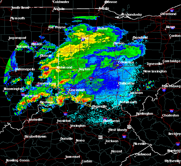 At 829 pm edt, a severe thunderstorm was located near higginsport, moving east at 25 mph (radar indicated). Hazards include 60 mph wind gusts and quarter size hail. Hail damage to vehicles is expected. expect wind damage to roofs, siding, and trees. Locations impacted include, georgetown, bethel, ripley, augusta, felicity, hamersville, dover, higginsport, south ripley, new hope, utopia, feesburg, stoney point and lake waynoka. At 829 pm edt, a severe thunderstorm was located near higginsport, moving east at 25 mph (radar indicated). Hazards include 60 mph wind gusts and quarter size hail. Hail damage to vehicles is expected. expect wind damage to roofs, siding, and trees. Locations impacted include, georgetown, bethel, ripley, augusta, felicity, hamersville, dover, higginsport, south ripley, new hope, utopia, feesburg, stoney point and lake waynoka.
|
| 10/19/2016 8:10 PM EDT |
 At 809 pm edt, a severe thunderstorm was located near felicity, moving east at 25 mph (radar indicated). Hazards include 60 mph wind gusts and quarter size hail. Hail damage to vehicles is expected. Expect wind damage to roofs, siding, and trees. At 809 pm edt, a severe thunderstorm was located near felicity, moving east at 25 mph (radar indicated). Hazards include 60 mph wind gusts and quarter size hail. Hail damage to vehicles is expected. Expect wind damage to roofs, siding, and trees.
|
| 7/14/2016 7:05 PM EDT |
 At 704 pm edt, a severe thunderstorm was located over augusta, moving east at 45 mph (radar indicated). Hazards include 60 mph wind gusts and penny size hail. Expect damage to roofs. siding. and trees. Locations impacted include, maysville, georgetown, manchester, ripley, aberdeen, augusta, winchester, decatur, russellville, hamersville, dover, higginsport, cherry fork, lake waynoka, redoak, bradysville, bentonville, feesburg and aa highway at state route 19. At 704 pm edt, a severe thunderstorm was located over augusta, moving east at 45 mph (radar indicated). Hazards include 60 mph wind gusts and penny size hail. Expect damage to roofs. siding. and trees. Locations impacted include, maysville, georgetown, manchester, ripley, aberdeen, augusta, winchester, decatur, russellville, hamersville, dover, higginsport, cherry fork, lake waynoka, redoak, bradysville, bentonville, feesburg and aa highway at state route 19.
|
| 7/14/2016 6:53 PM EDT |
 At 653 pm edt, a severe thunderstorm was located over felicity, moving east at 45 mph (radar indicated). Hazards include 60 mph wind gusts and penny size hail. Expect damage to roofs. siding. And trees. At 653 pm edt, a severe thunderstorm was located over felicity, moving east at 45 mph (radar indicated). Hazards include 60 mph wind gusts and penny size hail. Expect damage to roofs. siding. And trees.
|
| 6/16/2016 2:23 PM EDT |
 At 223 pm edt, severe thunderstorms were located along a line extending from 6 miles north of alliance to near dalton, moving east at 25 mph (radar indicated). Hazards include 60 mph wind gusts and penny size hail. Expect damage to trees and power lines. Resulting in some power outages. At 223 pm edt, severe thunderstorms were located along a line extending from 6 miles north of alliance to near dalton, moving east at 25 mph (radar indicated). Hazards include 60 mph wind gusts and penny size hail. Expect damage to trees and power lines. Resulting in some power outages.
|
| 6/16/2016 8:45 AM EDT |
 At 844 am edt, a severe thunderstorm was located near strasburg, or near dover, moving southeast at 30 mph (radar indicated). Hazards include 60 mph wind gusts and quarter size hail. Hail damage to vehicles is expected. Expect wind damage to trees and power lines, resulting in some power outages. At 844 am edt, a severe thunderstorm was located near strasburg, or near dover, moving southeast at 30 mph (radar indicated). Hazards include 60 mph wind gusts and quarter size hail. Hail damage to vehicles is expected. Expect wind damage to trees and power lines, resulting in some power outages.
|
| 5/2/2016 2:31 AM EDT |
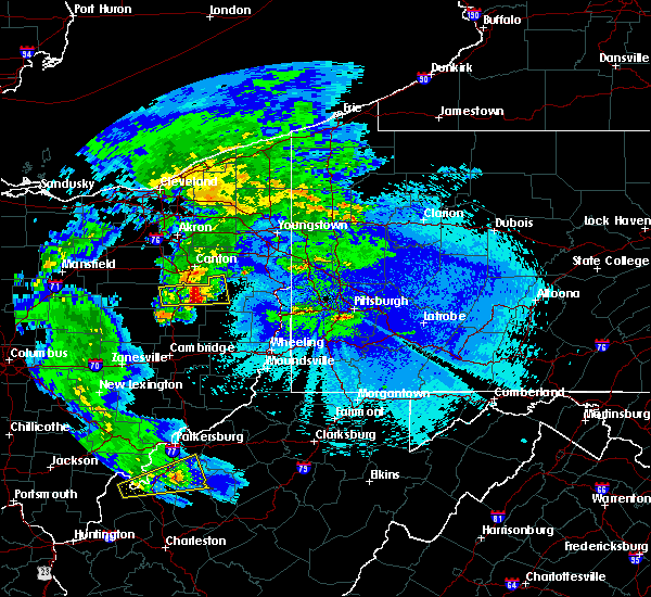 At 231 am edt, a severe thunderstorm was located near east sparta, or 9 miles northeast of dover, moving east at 40 mph (radar indicated). Hazards include 60 mph wind gusts and half dollar size hail. Hail damage to vehicles is expected. expect wind damage to trees and power lines, resulting in some power outages. locations impacted include, new philadelphia, dover, carrollton, minerva, malvern, mineral city, dellroy, sherrodsville, zoar and atwood lake. Please report severe weather by calling 4 1 2, 2 6 2, 1 9 8 8, posting to the nws pittsburgh facebook page, or using twitter @nwspittsburgh. At 231 am edt, a severe thunderstorm was located near east sparta, or 9 miles northeast of dover, moving east at 40 mph (radar indicated). Hazards include 60 mph wind gusts and half dollar size hail. Hail damage to vehicles is expected. expect wind damage to trees and power lines, resulting in some power outages. locations impacted include, new philadelphia, dover, carrollton, minerva, malvern, mineral city, dellroy, sherrodsville, zoar and atwood lake. Please report severe weather by calling 4 1 2, 2 6 2, 1 9 8 8, posting to the nws pittsburgh facebook page, or using twitter @nwspittsburgh.
|
| 5/2/2016 2:18 AM EDT | Quarter sized hail reported 177.2 miles SW of Dover, OH |
| 5/2/2016 2:14 AM EDT |
 At 214 am edt, a severe thunderstorm was located over strasburg, or near dover, moving east at 40 mph (radar indicated). Hazards include 60 mph wind gusts and half dollar size hail. Hail damage to vehicles is expected. Expect wind damage to trees and power lines, resulting in some power outages. At 214 am edt, a severe thunderstorm was located over strasburg, or near dover, moving east at 40 mph (radar indicated). Hazards include 60 mph wind gusts and half dollar size hail. Hail damage to vehicles is expected. Expect wind damage to trees and power lines, resulting in some power outages.
|
| 5/1/2016 5:29 PM EDT |
 At 529 pm edt, a severe thunderstorm was located over brooksville, moving northeast at 5 mph (radar indicated). Hazards include 60 mph wind gusts and quarter size hail. Hail damage to vehicles is expected. expect wind damage to roofs, siding, and trees. Locations impacted include, ripley, augusta, brooksville, dover, germantown, us route 62 at state route 875, hittville and aa highway at state route 19. At 529 pm edt, a severe thunderstorm was located over brooksville, moving northeast at 5 mph (radar indicated). Hazards include 60 mph wind gusts and quarter size hail. Hail damage to vehicles is expected. expect wind damage to roofs, siding, and trees. Locations impacted include, ripley, augusta, brooksville, dover, germantown, us route 62 at state route 875, hittville and aa highway at state route 19.
|
| 5/1/2016 5:02 PM EDT |
 At 502 pm edt, a severe thunderstorm was located near brooksville, moving northeast at 20 mph (radar indicated). Hazards include 60 mph wind gusts and quarter size hail. Hail damage to vehicles is expected. Expect wind damage to roofs, siding, and trees. At 502 pm edt, a severe thunderstorm was located near brooksville, moving northeast at 20 mph (radar indicated). Hazards include 60 mph wind gusts and quarter size hail. Hail damage to vehicles is expected. Expect wind damage to roofs, siding, and trees.
|
| 12/23/2015 10:25 PM EST | At 1024 pm est, severe thunderstorms were located along a line extending from 6 miles southeast of farmerstown to near newcomerstown to 7 miles northwest of cambridge, moving northeast at 55 mph (radar indicated). Hazards include 60 mph wind gusts. Expect damage to trees and some power outages locations impacted include, new philadelphia, dover, uhrichsville, freeport, newcomerstown, dennison, sugarcreek, gnadenhutten, antrim, tuscarawas, midvale, port washington, barnhill, roswell, stone creek, plainfield, gilmore, stillwater, otsego and tippecanoe. This includes interstate 77 in ohio between mile markers 51 and 84. |
| 12/23/2015 10:02 PM EST | At 1001 pm est, severe thunderstorms were located along a line extending from 6 miles west of coshocton to near dresden to near south zanesville, moving east at 55 mph (radar indicated). Hazards include 60 mph wind gusts. expect damage to trees and some power outages |
| 12/23/2015 8:36 PM EST | At 836 pm est, radar indicated severe thunderstorms located along a line extending from sardinia to near ripley, moving northeast at 65 mph. storm hazards include, winds to 60 mph, frequent cloud to ground lightning, locations impacted include, maysville, hillsboro, georgetown, mount orab, west union, peebles, ripley, aberdeen, augusta, winchester, marshall, sardinia, seaman, brooksville, belfast, new market, emerald, decatur, russellville and mowrystown. |
| 12/23/2015 8:36 PM EST | At 836 pm est, radar indicated severe thunderstorms located along a line extending from sardinia to near ripley, moving northeast at 65 mph. storm hazards include, winds to 60 mph, frequent cloud to ground lightning, locations impacted include, maysville, hillsboro, georgetown, mount orab, west union, peebles, ripley, aberdeen, augusta, winchester, marshall, sardinia, seaman, brooksville, belfast, new market, emerald, decatur, russellville and mowrystown. |
| 12/23/2015 8:24 PM EST | At 824 pm est, radar indicated severe thunderstorms located along a line extending from near bethel to near brooksville, moving east at 70 mph. storm hazards include, damaging winds to 70 mph, penny size hail, frequent cloud to ground lightning, locations impacted include, maysville, hillsboro, georgetown, mount orab, west union, bethel, williamsburg, peebles, ripley, aberdeen, augusta, winchester, marshall, sardinia, seaman, felicity, brooksville, belfast, new market and emerald. |
| 12/23/2015 8:24 PM EST | At 824 pm est, radar indicated severe thunderstorms located along a line extending from near bethel to near brooksville, moving east at 70 mph. storm hazards include, damaging winds to 70 mph, penny size hail, frequent cloud to ground lightning, locations impacted include, maysville, hillsboro, georgetown, mount orab, west union, bethel, williamsburg, peebles, ripley, aberdeen, augusta, winchester, marshall, sardinia, seaman, felicity, brooksville, belfast, new market and emerald. |
| 12/23/2015 8:12 PM EST | At 812 pm est, radar indicated severe thunderstorms located along a line extending from near new richmond to near falmouth, moving east at 70 mph. storm hazards include, damaging winds to 70 mph, penny size hail, frequent cloud to ground lightning, very heavy rain which may cause minor flooding,. |
| 12/23/2015 8:12 PM EST | At 812 pm est, radar indicated severe thunderstorms located along a line extending from near new richmond to near falmouth, moving east at 70 mph. storm hazards include, damaging winds to 70 mph, penny size hail, frequent cloud to ground lightning, very heavy rain which may cause minor flooding,. |
| 8/3/2015 8:02 PM EDT |
 At 802 pm edt, radar indicated a severe thunderstorm located near ripley, moving southeast at 30 mph. storm hazards include, winds to 60 mph, ping pong ball size hail,. At 802 pm edt, radar indicated a severe thunderstorm located near ripley, moving southeast at 30 mph. storm hazards include, winds to 60 mph, ping pong ball size hail,.
|
| 8/3/2015 7:51 PM EDT |
 At 750 pm edt, radar indicated a severe thunderstorm located near ripley, moving southeast at 35 mph. storm hazards include, winds to 60 mph, quarter size hail, locations impacted include, georgetown, ripley, augusta, dover, higginsport, chilo, utopia, feesburg, aa highway at state route 19 and redoak. At 750 pm edt, radar indicated a severe thunderstorm located near ripley, moving southeast at 35 mph. storm hazards include, winds to 60 mph, quarter size hail, locations impacted include, georgetown, ripley, augusta, dover, higginsport, chilo, utopia, feesburg, aa highway at state route 19 and redoak.
|
| 8/3/2015 7:44 PM EDT |
 At 744 pm edt, radar indicated a severe thunderstorm located near augusta, moving southeast at 35 mph. storm hazards include, winds to 60 mph, ping pong ball size hail, locations impacted include, georgetown, ripley, augusta, felicity, dover, higginsport, moscow, neville, chilo, saltair, utopia, feesburg, point isabel, aa highway at state route 19 and redoak. At 744 pm edt, radar indicated a severe thunderstorm located near augusta, moving southeast at 35 mph. storm hazards include, winds to 60 mph, ping pong ball size hail, locations impacted include, georgetown, ripley, augusta, felicity, dover, higginsport, moscow, neville, chilo, saltair, utopia, feesburg, point isabel, aa highway at state route 19 and redoak.
|
| 8/3/2015 7:26 PM EDT |
 At 726 pm edt, radar indicated a severe thunderstorm located near felicity, moving southeast at 35 mph. storm hazards include, winds to 60 mph, quarter size hail,. At 726 pm edt, radar indicated a severe thunderstorm located near felicity, moving southeast at 35 mph. storm hazards include, winds to 60 mph, quarter size hail,.
|
| 7/14/2015 4:48 PM EDT |
 At 448 pm edt, radar indicated severe thunderstorms located along a line extending from 6 miles east of west union to near georgetown, moving southeast at 30 mph. storm hazards include, winds to 60 mph, quarter size hail, locations impacted include, maysville, georgetown, washington, west union, manchester, ripley, aberdeen, vanceburg, concord, tollesboro, decatur, russellville, dover, higginsport, rome, sandy springs, redoak, bradysville, dunkinsville and ribolt. At 448 pm edt, radar indicated severe thunderstorms located along a line extending from 6 miles east of west union to near georgetown, moving southeast at 30 mph. storm hazards include, winds to 60 mph, quarter size hail, locations impacted include, maysville, georgetown, washington, west union, manchester, ripley, aberdeen, vanceburg, concord, tollesboro, decatur, russellville, dover, higginsport, rome, sandy springs, redoak, bradysville, dunkinsville and ribolt.
|
| 7/14/2015 4:29 PM EDT |
 At 429 pm edt, radar indicated a severe thunderstorm located near winchester, moving southeast at 35 mph. storm hazards include, winds to 60 mph, quarter size hail,. At 429 pm edt, radar indicated a severe thunderstorm located near winchester, moving southeast at 35 mph. storm hazards include, winds to 60 mph, quarter size hail,.
|
| 7/13/2015 2:21 PM EDT |
 At 221 pm edt, radar indicated that the severe thunderstorms had strengthened. these storms were located along a line extending from near winchester to 9 miles west of owenton, moving southeast at 50 mph. storm hazards include, damaging winds to 70 mph, penny size hail, locations impacted include, maysville, georgetown, williamstown, falmouth, washington, crittenden, dry ridge, manchester, ripley, aberdeen, owenton, augusta, felicity, lewisburg, brooksville, butler, foxport, tollesboro, decatur and russellville. At 221 pm edt, radar indicated that the severe thunderstorms had strengthened. these storms were located along a line extending from near winchester to 9 miles west of owenton, moving southeast at 50 mph. storm hazards include, damaging winds to 70 mph, penny size hail, locations impacted include, maysville, georgetown, williamstown, falmouth, washington, crittenden, dry ridge, manchester, ripley, aberdeen, owenton, augusta, felicity, lewisburg, brooksville, butler, foxport, tollesboro, decatur and russellville.
|
| 7/13/2015 1:58 PM EDT |
 At 157 pm edt, radar indicated severe thunderstorms located along a line extending from near sardinia to near carrollton, moving southeast at 55 mph. storm hazards include, winds to 60 mph, penny size hail,. At 157 pm edt, radar indicated severe thunderstorms located along a line extending from near sardinia to near carrollton, moving southeast at 55 mph. storm hazards include, winds to 60 mph, penny size hail,.
|
| 6/30/2015 3:33 PM EDT |
 At 333 pm edt, a severe thunderstorm was located over west lafayette, or 7 miles east of coshocton, moving northeast at 30 mph (radar indicated). Hazards include 60 mph wind gusts and quarter size hail. Hail damage to vehicles is expected. Expect wind damage to roofs, siding and trees. At 333 pm edt, a severe thunderstorm was located over west lafayette, or 7 miles east of coshocton, moving northeast at 30 mph (radar indicated). Hazards include 60 mph wind gusts and quarter size hail. Hail damage to vehicles is expected. Expect wind damage to roofs, siding and trees.
|
| 6/26/2015 7:57 PM EDT | The severe thunderstorm warning for southeastern brown, bracken, extreme eastern pendleton and northwestern mason counties will expire at 800 pm edt, the storm has moved out of the warned area and weakened below severe limits, therefore the severe thunderstorm warning will be allowed to expire. gusty winds and heavy rain are still possible with this storm. please report previous wind damage or hail to the national weather service by going to our website at weather.gov/iln and submitting your report via social media. |
| 6/26/2015 7:57 PM EDT | The severe thunderstorm warning for southeastern brown. bracken. extreme eastern pendleton and northwestern mason counties will expire at 800 pm edt. the storm has moved out of the warned area and weakened below severe limits. Therefore the severe thunderstorm warning will be allowed to expire. |
| 6/26/2015 7:14 PM EDT | At 712 pm edt, radar indicated a severe thunderstorm located near berlin, moving east at 30 mph. storm hazards include, winds to 60 mph, quarter size hail,. |
| 6/26/2015 7:14 PM EDT | At 712 pm edt, radar indicated a severe thunderstorm located near berlin, moving east at 30 mph. storm hazards include, winds to 60 mph, quarter size hail,. |
| 6/12/2015 5:25 PM EDT |
 The severe thunderstorm warning for muskingum, eastern coshocton, western guernsey and southern tuscarawas counties will expire at 530 pm edt, the storms which prompted the warning have weakened below severe limits, and no longer pose an immediate threat to life or property. therefore the warning will be allowed to expire. however gusty winds are still possible with these thunderstorms. a severe thunderstorm watch remains in effect until 900 pm edt for east central ohio. The severe thunderstorm warning for muskingum, eastern coshocton, western guernsey and southern tuscarawas counties will expire at 530 pm edt, the storms which prompted the warning have weakened below severe limits, and no longer pose an immediate threat to life or property. therefore the warning will be allowed to expire. however gusty winds are still possible with these thunderstorms. a severe thunderstorm watch remains in effect until 900 pm edt for east central ohio.
|
| 6/12/2015 5:03 PM EDT |
 At 503 pm edt, severe thunderstorms were located along a line extending from near dover to near newcomerstown to near bremen, moving east at 35 mph (radar indicated). Hazards include 60 mph wind gusts and penny size hail. Expect damage to roofs. siding and trees. Locations impacted include, zanesville, new philadelphia, coshocton, cambridge, uhrichsville, newcomerstown, dennison, new concord, byesville, west lafayette, sugarcreek, south zanesville, north zanesville, dresden, gnadenhutten, tuscarawas, baltic, midvale, philo and port washington. At 503 pm edt, severe thunderstorms were located along a line extending from near dover to near newcomerstown to near bremen, moving east at 35 mph (radar indicated). Hazards include 60 mph wind gusts and penny size hail. Expect damage to roofs. siding and trees. Locations impacted include, zanesville, new philadelphia, coshocton, cambridge, uhrichsville, newcomerstown, dennison, new concord, byesville, west lafayette, sugarcreek, south zanesville, north zanesville, dresden, gnadenhutten, tuscarawas, baltic, midvale, philo and port washington.
|
| 6/12/2015 4:49 PM EDT |
 At 449 pm edt, severe thunderstorms were located along a line extending from near farmerstown to near coshocton to near lancaster, moving east at 40 mph (radar indicated). Hazards include 60 mph wind gusts and penny size hail. Expect damage to roofs. siding and trees. Locations impacted include, zanesville, new philadelphia, coshocton, cambridge, uhrichsville, newcomerstown, dennison, new concord, byesville, west lafayette, sugarcreek, south zanesville, north zanesville, dresden, gnadenhutten, tuscarawas, baltic, midvale, philo and port washington. At 449 pm edt, severe thunderstorms were located along a line extending from near farmerstown to near coshocton to near lancaster, moving east at 40 mph (radar indicated). Hazards include 60 mph wind gusts and penny size hail. Expect damage to roofs. siding and trees. Locations impacted include, zanesville, new philadelphia, coshocton, cambridge, uhrichsville, newcomerstown, dennison, new concord, byesville, west lafayette, sugarcreek, south zanesville, north zanesville, dresden, gnadenhutten, tuscarawas, baltic, midvale, philo and port washington.
|
| 6/12/2015 4:42 PM EDT |
 At 442 pm edt, severe thunderstorms were located along a line extending from near alliance to near waynesburg to near east sparta, moving east at 45 mph (radar indicated). Hazards include 60 mph wind gusts and nickel size hail. Expect damage to roofs. siding and trees. Locations impacted include, dover, salem, columbiana, carrollton, minerva, lisbon, strasburg, leetonia, augusta, salineville, malvern, bolivar, mineral city, hanoverton, dellroy, parral, zoar, summitville, mechanicstown and winona. At 442 pm edt, severe thunderstorms were located along a line extending from near alliance to near waynesburg to near east sparta, moving east at 45 mph (radar indicated). Hazards include 60 mph wind gusts and nickel size hail. Expect damage to roofs. siding and trees. Locations impacted include, dover, salem, columbiana, carrollton, minerva, lisbon, strasburg, leetonia, augusta, salineville, malvern, bolivar, mineral city, hanoverton, dellroy, parral, zoar, summitville, mechanicstown and winona.
|
| 6/12/2015 4:39 PM EDT |
 At 439 pm edt, severe thunderstorms were located along a line extending from near farmerstown to near dresden to lancaster, moving east at 35 mph (radar indicated). Hazards include 60 mph wind gusts and penny size hail. Expect damage to roofs. Siding and trees. At 439 pm edt, severe thunderstorms were located along a line extending from near farmerstown to near dresden to lancaster, moving east at 35 mph (radar indicated). Hazards include 60 mph wind gusts and penny size hail. Expect damage to roofs. Siding and trees.
|
| 6/12/2015 4:32 PM EDT |
 At 432 pm edt, severe thunderstorms were located along a line extending from near louisville to near east sparta to near strasburg, moving east at 45 mph (radar indicated). Hazards include 60 mph wind gusts and nickel size hail. Expect damage to roofs. Siding and trees. At 432 pm edt, severe thunderstorms were located along a line extending from near louisville to near east sparta to near strasburg, moving east at 45 mph (radar indicated). Hazards include 60 mph wind gusts and nickel size hail. Expect damage to roofs. Siding and trees.
|
| 5/26/2015 10:41 PM EDT | The severe thunderstorm warning for harrison, southwestern carroll, tuscarawas and northwestern belmont counties will expire at 1045 pm edt, the storm which prompted the warning has weakened below severe limits and exited the warned area. therefore the warning will be allowed to expire. |
| 5/26/2015 10:20 PM EDT | At 1020 pm edt, a severe thunderstorm was located near freeport, moving northeast at 45 mph (radar indicated). Hazards include 60 mph wind gusts. Expect damage to roofs. siding and trees. Locations impacted include, new philadelphia, dover, uhrichsville, cadiz, freeport, newcomerstown, dennison, gnadenhutten, tuscarawas, hopedale, scio, midvale, mineral city, jewett, port washington, bowerston, barnhill, holloway, sherrodsville and roswell. |
| 5/26/2015 10:01 PM EDT | At 1001 pm edt, a severe thunderstorm was located 9 miles northeast of cambridge, moving northeast at 45 mph (radar indicated). Hazards include 60 mph wind gusts. Expect damage to roofs. Siding and trees. |
| 5/26/2015 9:27 PM EDT | At 927 pm edt, a severe thunderstorm was located 7 miles south of coshocton, moving north at 50 mph (radar indicated). Hazards include 60 mph wind gusts and penny size hail. Expect damage to roofs. Siding and trees. |
| 5/11/2015 6:54 PM EDT | The severe thunderstorm warning for northeastern muskingum, eastern coshocton, northwestern guernsey and western tuscarawas counties will expire at 700 pm edt, the storms which prompted the warning have weakened. therefore the warning will be allowed to expire. a severe thunderstorm watch remains in effect until 1000 pm edt for east central ohio. |
| 5/11/2015 6:34 PM EDT | At 633 pm edt, severe thunderstorms were located along a line extending from farmerstown to 6 miles southwest of west lafayette, moving northeast at 45 mph (radar indicated). Hazards include 60 mph wind gusts. Expect damage to roofs. siding and trees. locations impacted include, new philadelphia, dover, coshocton, newcomerstown, strasburg, west lafayette, sugarcreek, bolivar, baltic, port washington, parral, stone creek, zoar, plainfield, adamsville, otsego, gilmore, chili, boden and bakersville. 75in. |
| 5/11/2015 6:29 PM EDT | At 628 pm edt, severe thunderstorms were located along a line extending from near farmerstown to 6 miles east of dresden, moving northeast at 20 mph (radar indicated). Hazards include 60 mph wind gusts. Expect damage to roofs. Siding and trees. |
| 5/11/2015 4:25 PM EDT | At 422 pm edt, radar indicated a severe thunderstorm located near decatur, moving northeast at 45 mph. storm hazards include, winds to 60 mph,. |
| 5/11/2015 4:25 PM EDT | At 422 pm edt, radar indicated a severe thunderstorm located near decatur, moving northeast at 45 mph. storm hazards include, winds to 60 mph,. |
| 4/9/2015 4:48 PM EDT | The national weather service in pittsburgh has issued a * severe thunderstorm warning for. noble county in east central ohio. western jefferson county in east central ohio. northeastern coshocton county in east central ohio. Guernsey county in east central ohio. |
| 4/8/2015 6:59 PM EDT | A severe thunderstorm warning remains in effect until 715 pm edt for southeastern brown. southwestern adams. northwestern mason and northwestern lewis counties. at 656 pm edt. radar continued to indicate a severe thunderstorm located near bradysville. moving northeast at 30 mph. Storm hazards include. |
| 4/8/2015 6:59 PM EDT | A severe thunderstorm warning remains in effect until 715 pm edt for southeastern brown. southwestern adams. northwestern mason and northwestern lewis counties. at 656 pm edt. radar continued to indicate a severe thunderstorm located near bradysville. moving northeast at 30 mph. Storm hazards include. |
| 4/8/2015 6:45 PM EDT | Hen Egg sized hail reported 0.3 miles SW of Dover, OH |
| 4/8/2015 6:33 PM EDT | The national weather service in wilmington has issued a * severe thunderstorm warning for. southeastern brown county in southwest ohio. southwestern adams county in southwest ohio. eastern bracken county in northern kentucky. Northern mason county in northern kentucky. |
| 4/8/2015 6:33 PM EDT | The national weather service in wilmington has issued a * severe thunderstorm warning for. southeastern brown county in southwest ohio. southwestern adams county in southwest ohio. eastern bracken county in northern kentucky. Northern mason county in northern kentucky. |
| 4/8/2015 11:49 AM EDT | The national weather service in wilmington has issued a * severe thunderstorm warning for. southern clermont county in southwest ohio. southern brown county in southwest ohio. southern adams county in southwest ohio. Bracken county in northern kentucky. |
| 4/8/2015 11:49 AM EDT | The national weather service in wilmington has issued a * severe thunderstorm warning for. southern clermont county in southwest ohio. southern brown county in southwest ohio. southern adams county in southwest ohio. Bracken county in northern kentucky. |
| 5/14/2014 5:47 PM EDT | Quarter sized hail reported 176.7 miles SW of Dover, OH |
| 5/14/2014 5:10 PM EDT | Quarter sized hail reported 177.2 miles SW of Dover, OH |
| 7/10/2013 4:50 PM EDT | Trees dow in tuscarawas county OH, 0.2 miles SW of Dover, OH |
| 4/10/2013 5:18 PM EDT | Large tree blown down onto residence in tuscarawas county OH, 0.2 miles SW of Dover, OH |
| 4/10/2013 5:15 PM EDT | Ping Pong Ball sized hail reported 177.2 miles SW of Dover, OH |
| 4/10/2013 5:15 PM EDT | Quarter sized hail reported 177.2 miles SW of Dover, OH |
| 4/10/2013 5:12 PM EDT | Quarter sized hail reported 177.2 miles SW of Dover, OH |
| 7/26/2012 2:55 PM EDT | Quarter sized hail reported 178.5 miles SW of Dover, OH, event occurred between 240 pm 07/26/2012 and 255 pm 07/26/2012 |
| 7/3/2012 1:24 PM EDT | Tree reported down on power line in tuscarawas county OH, 1.9 miles WSW of Dover, OH |
| 6/18/2012 6:10 PM EDT | Tree down on schilling hill road between dover and sugarcree in tuscarawas county OH, 1.6 miles ENE of Dover, OH |
| 6/4/2011 7:30 PM EDT | Quarter sized hail reported 177.1 miles SW of Dover, OH |
| 6/4/2011 7:15 PM EDT | Golf Ball sized hail reported 177.2 miles SW of Dover, OH, quarter size to golf ball size hail. |
| 6/4/2011 7:10 PM EDT | Quarter sized hail reported 177.1 miles SW of Dover, OH |
| 1/1/0001 12:00 AM | In the town of dover. three houses have trees downed on the in mason county KY, 0.4 miles ESE of Dover, OH |
| 1/1/0001 12:00 AM | Ping Pong Ball sized hail reported 177.1 miles SW of Dover, OH |
Hail Maps for Dover, OH


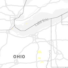


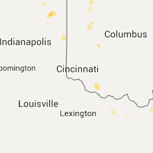


Connect with Interactive Hail Maps