

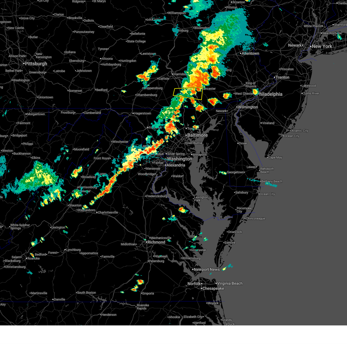
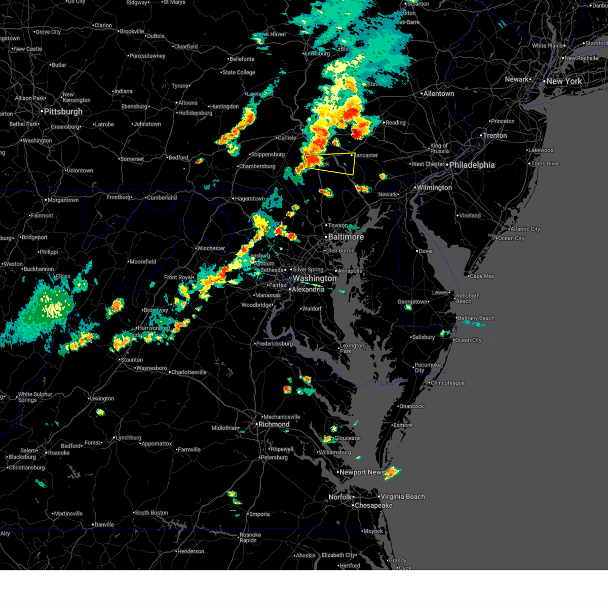
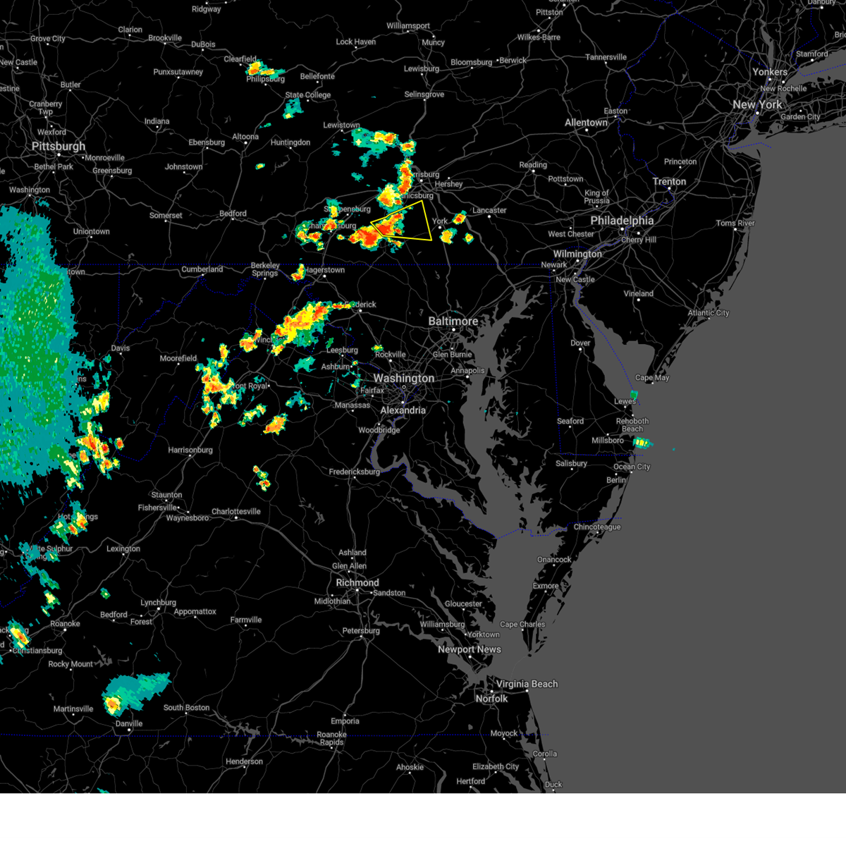
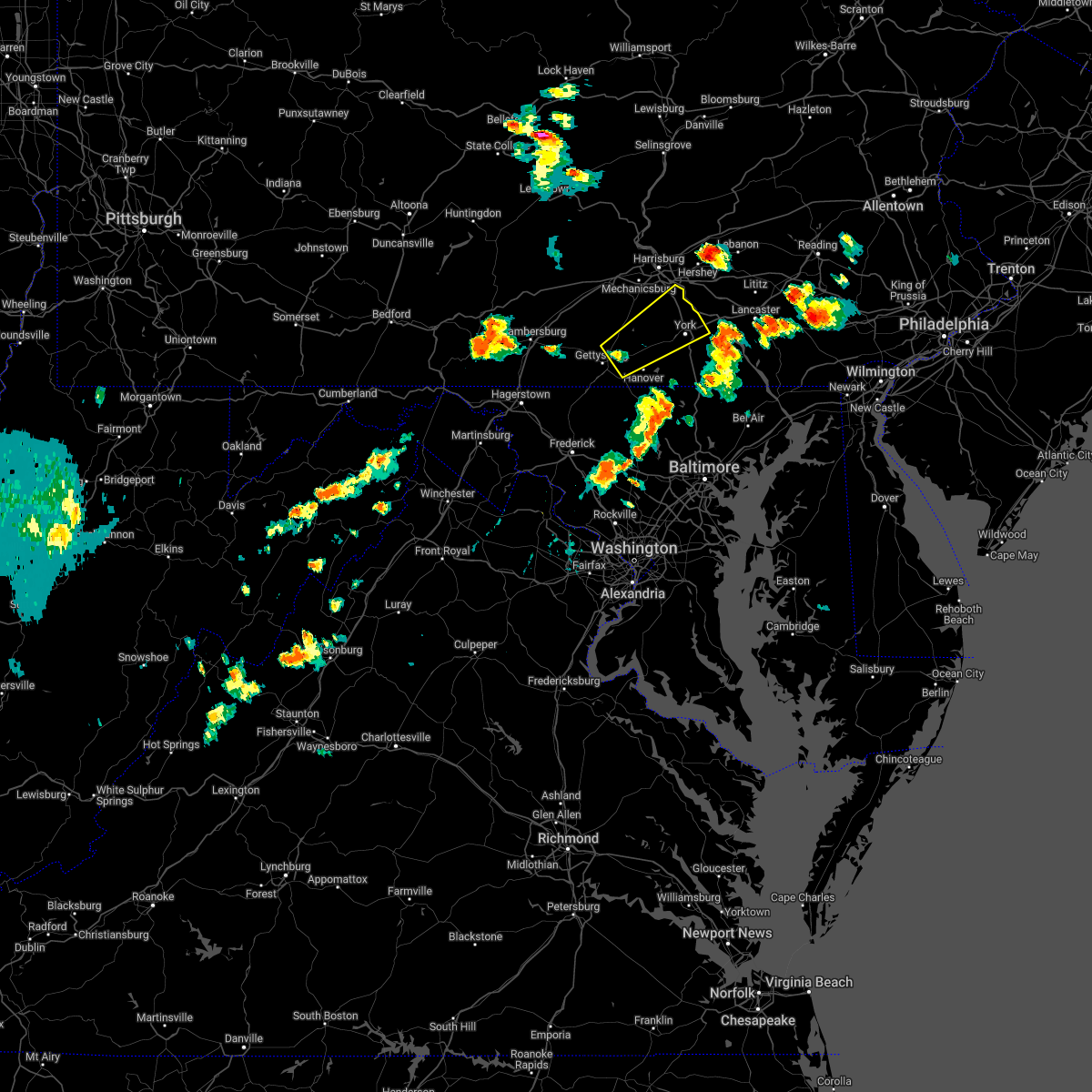
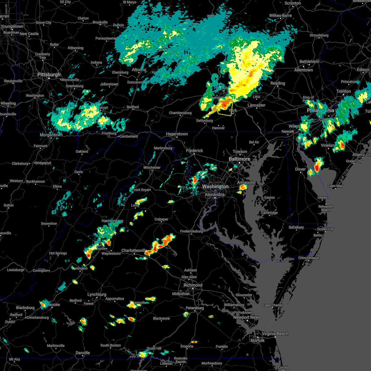
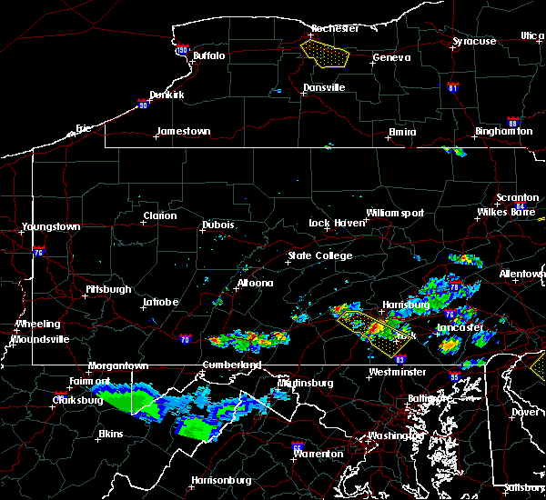
Hail Map for Dover, PA
The Dover, PA area has had 1 report of on-the-ground hail by trained spotters, and has been under severe weather warnings 7 times during the past 12 months. Doppler radar has detected hail at or near Dover, PA on 43 occasions, including 2 occasions during the past year.
| Name: | Dover, PA |
| Where Located: | 50.8 miles NNW of Baltimore, MD |
| Map: | Google Map for Dover, PA |
| Population: | 2007 |
| Housing Units: | 854 |
| More Info: | Search Google for Dover, PA |
0
The Top Recent Hail Date for Dover, PA is Sunday, March 16, 2025 (15th out of 43)

Hail and Wind Damage Spotted near Dover, PA
| Date / Time | Report Details |
|---|---|
| 7/14/2025 5:12 PM EDT | Tree down blocking the road at oriole l in york county PA, 2.9 miles SE of Dover, PA |
| 7/14/2025 5:12 PM EDT | Power lines dow in york county PA, 3 miles ESE of Dover, PA |
| 7/8/2025 4:24 PM EDT |
 The storm which prompted the warning has moved out of the area. therefore, the warning will be allowed to expire. a severe thunderstorm watch remains in effect until 900 pm edt for south central pennsylvania. remember, a severe thunderstorm warning still remains in effect for northeastern lancaster county. The storm which prompted the warning has moved out of the area. therefore, the warning will be allowed to expire. a severe thunderstorm watch remains in effect until 900 pm edt for south central pennsylvania. remember, a severe thunderstorm warning still remains in effect for northeastern lancaster county.
|
| 7/8/2025 3:52 PM EDT |
 Svrctp the national weather service in state college pa has issued a * severe thunderstorm warning for, central lancaster county in south central pennsylvania, central york county in south central pennsylvania, * until 430 pm edt. * at 351 pm edt, a severe thunderstorm was located over north york, moving east at 35 mph (radar indicated). Hazards include 60 mph wind gusts and penny size hail. expect damage to roofs, siding, and trees Svrctp the national weather service in state college pa has issued a * severe thunderstorm warning for, central lancaster county in south central pennsylvania, central york county in south central pennsylvania, * until 430 pm edt. * at 351 pm edt, a severe thunderstorm was located over north york, moving east at 35 mph (radar indicated). Hazards include 60 mph wind gusts and penny size hail. expect damage to roofs, siding, and trees
|
| 6/25/2025 6:06 PM EDT | Svrctp the national weather service in state college pa has issued a * severe thunderstorm warning for, northeastern adams county in south central pennsylvania, central cumberland county in south central pennsylvania, northwestern york county in south central pennsylvania, * until 645 pm edt. * at 606 pm edt, a severe thunderstorm was located over dillsburg, moving east at 25 mph (radar indicated). Hazards include 60 mph wind gusts and penny size hail. expect damage to roofs, siding, and trees |
| 5/16/2025 5:51 PM EDT | At 550 pm edt, severe thunderstorms were located along a line extending from brogue to sunnyburn to jarrettsville, moving east at 25 mph (radar indicated). Hazards include 60 mph wind gusts and quarter size hail. Hail damage to vehicles is expected. expect wind damage to roofs, siding, and trees. locations impacted include, york, hanover, weigelstown, parkville, red lion, spry, dallastown, shiloh, east york, stonybrook-wilshire, west york, and shrewsbury. This includes interstate 83 from mile markers 0 to 24. |
| 5/16/2025 5:51 PM EDT | the severe thunderstorm warning has been cancelled and is no longer in effect |
| 5/16/2025 5:01 PM EDT |
 Svrctp the national weather service in state college pa has issued a * severe thunderstorm warning for, eastern adams county in south central pennsylvania, york county in south central pennsylvania, * until 630 pm edt. * at 501 pm edt, multiple severe thunderstorms were located along a line extending from spring grove to codorus to manchester, moving east at 25 mph (radar indicated). Hazards include 60 mph wind gusts and quarter size hail. Hail damage to vehicles is expected. Expect wind damage to roofs, siding, and trees. Svrctp the national weather service in state college pa has issued a * severe thunderstorm warning for, eastern adams county in south central pennsylvania, york county in south central pennsylvania, * until 630 pm edt. * at 501 pm edt, multiple severe thunderstorms were located along a line extending from spring grove to codorus to manchester, moving east at 25 mph (radar indicated). Hazards include 60 mph wind gusts and quarter size hail. Hail damage to vehicles is expected. Expect wind damage to roofs, siding, and trees.
|
| 7/16/2024 6:48 PM EDT |
 Svrctp the national weather service in state college pa has issued a * severe thunderstorm warning for, lancaster county in south central pennsylvania, central york county in south central pennsylvania, * until 730 pm edt. * at 647 pm edt, severe thunderstorms were located along a line extending from reamstown to landisville to york, moving slowly southeast at 5 mph (radar indicated). Hazards include 60 mph wind gusts. expect damage to roofs, siding, and trees Svrctp the national weather service in state college pa has issued a * severe thunderstorm warning for, lancaster county in south central pennsylvania, central york county in south central pennsylvania, * until 730 pm edt. * at 647 pm edt, severe thunderstorms were located along a line extending from reamstown to landisville to york, moving slowly southeast at 5 mph (radar indicated). Hazards include 60 mph wind gusts. expect damage to roofs, siding, and trees
|
| 6/29/2024 7:26 PM EDT |
 The storm which prompted the warning has weakened below severe limits, and has exited the warned area. therefore, the warning will be allowed to expire. a tornado watch remains in effect until 800 pm edt for south central pennsylvania. The storm which prompted the warning has weakened below severe limits, and has exited the warned area. therefore, the warning will be allowed to expire. a tornado watch remains in effect until 800 pm edt for south central pennsylvania.
|
| 6/29/2024 7:13 PM EDT | Multiple trees downed along and across roads near dove in york county PA, 0.2 miles NNE of Dover, PA |
| 6/29/2024 7:05 PM EDT |
 At 704 pm edt, a severe thunderstorm was located over dover, moving east at 50 mph (radar indicated). Hazards include 60 mph wind gusts and quarter size hail. Hail damage to vehicles is expected. expect wind damage to roofs, siding, and trees. locations impacted include, york, weigelstown, hampton, shiloh, west york, grantley, manchester, emigsville, dillsburg, lake meade, dover, and north york. This includes interstate 83 from mile markers 21 to 32. At 704 pm edt, a severe thunderstorm was located over dover, moving east at 50 mph (radar indicated). Hazards include 60 mph wind gusts and quarter size hail. Hail damage to vehicles is expected. expect wind damage to roofs, siding, and trees. locations impacted include, york, weigelstown, hampton, shiloh, west york, grantley, manchester, emigsville, dillsburg, lake meade, dover, and north york. This includes interstate 83 from mile markers 21 to 32.
|
| 6/29/2024 7:05 PM EDT |
 the severe thunderstorm warning has been cancelled and is no longer in effect the severe thunderstorm warning has been cancelled and is no longer in effect
|
| 6/29/2024 6:44 PM EDT |
 Svrctp the national weather service in state college pa has issued a * severe thunderstorm warning for, northeastern adams county in south central pennsylvania, central cumberland county in south central pennsylvania, southeastern dauphin county in south central pennsylvania, northwestern york county in south central pennsylvania, * until 730 pm edt. * at 644 pm edt, a severe thunderstorm was located over dillsburg, moving east at 25 mph (radar indicated). Hazards include 60 mph wind gusts and quarter size hail. Hail damage to vehicles is expected. Expect wind damage to roofs, siding, and trees. Svrctp the national weather service in state college pa has issued a * severe thunderstorm warning for, northeastern adams county in south central pennsylvania, central cumberland county in south central pennsylvania, southeastern dauphin county in south central pennsylvania, northwestern york county in south central pennsylvania, * until 730 pm edt. * at 644 pm edt, a severe thunderstorm was located over dillsburg, moving east at 25 mph (radar indicated). Hazards include 60 mph wind gusts and quarter size hail. Hail damage to vehicles is expected. Expect wind damage to roofs, siding, and trees.
|
| 6/26/2024 10:14 PM EDT |
 At 1014 pm edt, severe thunderstorms were located along a line extending from near lake meade to hanover, moving northeast at 45 mph (radar indicated). Hazards include 60 mph wind gusts. Expect damage to roofs, siding, and trees. these severe storms will be near, weigelstown, york airport, and lake meade around 1020 pm edt. york, lower allen, and new cumberland around 1030 pm edt. other locations impacted by these severe thunderstorms include seven valleys, abbottstown, franklintown, york springs, and gardners. this includes the following interstates, the pennsylvania turnpike from mile markers 237 to 245. Interstate 83 from mile markers 5 to 42. At 1014 pm edt, severe thunderstorms were located along a line extending from near lake meade to hanover, moving northeast at 45 mph (radar indicated). Hazards include 60 mph wind gusts. Expect damage to roofs, siding, and trees. these severe storms will be near, weigelstown, york airport, and lake meade around 1020 pm edt. york, lower allen, and new cumberland around 1030 pm edt. other locations impacted by these severe thunderstorms include seven valleys, abbottstown, franklintown, york springs, and gardners. this includes the following interstates, the pennsylvania turnpike from mile markers 237 to 245. Interstate 83 from mile markers 5 to 42.
|
| 6/26/2024 9:57 PM EDT |
 Svrctp the national weather service in state college pa has issued a * severe thunderstorm warning for, adams county in south central pennsylvania, southeastern cumberland county in south central pennsylvania, york county in south central pennsylvania, * until 1030 pm edt. * at 957 pm edt, severe thunderstorms were located along a line extending from cashtown to taneytown, moving northeast at 50 mph (radar indicated). Hazards include 60 mph wind gusts. Expect damage to roofs, siding, and trees. severe thunderstorms will be near, hanover, gettysburg, and littlestown around 1000 pm edt. parkville, hampton, and lake meade around 1010 pm edt. weigelstown, york airport, and dover around 1020 pm edt. york and west york around 1030 pm edt. other locations impacted by these severe thunderstorms include arendtsville, gardners, glenville, heidlersburg, and biglerville. this includes the following interstates, the pennsylvania turnpike from mile markers 237 to 245. Interstate 83 from mile markers 5 to 42. Svrctp the national weather service in state college pa has issued a * severe thunderstorm warning for, adams county in south central pennsylvania, southeastern cumberland county in south central pennsylvania, york county in south central pennsylvania, * until 1030 pm edt. * at 957 pm edt, severe thunderstorms were located along a line extending from cashtown to taneytown, moving northeast at 50 mph (radar indicated). Hazards include 60 mph wind gusts. Expect damage to roofs, siding, and trees. severe thunderstorms will be near, hanover, gettysburg, and littlestown around 1000 pm edt. parkville, hampton, and lake meade around 1010 pm edt. weigelstown, york airport, and dover around 1020 pm edt. york and west york around 1030 pm edt. other locations impacted by these severe thunderstorms include arendtsville, gardners, glenville, heidlersburg, and biglerville. this includes the following interstates, the pennsylvania turnpike from mile markers 237 to 245. Interstate 83 from mile markers 5 to 42.
|
| 6/26/2024 5:31 PM EDT |
 Svrctp the national weather service in state college pa has issued a * severe thunderstorm warning for, dauphin county in south central pennsylvania, northwestern lancaster county in south central pennsylvania, lebanon county in south central pennsylvania, schuylkill county in central pennsylvania, northwestern york county in south central pennsylvania, * until 615 pm edt. * at 531 pm edt, severe thunderstorms were located along a line extending from lykens to dehart dam to hershey to dover, moving northeast at 40 mph (radar indicated). Hazards include 60 mph wind gusts. expect damage to roofs, siding, and trees Svrctp the national weather service in state college pa has issued a * severe thunderstorm warning for, dauphin county in south central pennsylvania, northwestern lancaster county in south central pennsylvania, lebanon county in south central pennsylvania, schuylkill county in central pennsylvania, northwestern york county in south central pennsylvania, * until 615 pm edt. * at 531 pm edt, severe thunderstorms were located along a line extending from lykens to dehart dam to hershey to dover, moving northeast at 40 mph (radar indicated). Hazards include 60 mph wind gusts. expect damage to roofs, siding, and trees
|
| 9/7/2023 3:55 PM EDT | Trees and wires down on conewago road in dover tw in york county PA, 3.8 miles E of Dover, PA |
| 9/7/2023 3:42 PM EDT |
 At 342 pm edt, severe thunderstorms were located along a line extending from lower allen to new oxford to near manchester, moving northeast at 25 mph (radar indicated). Hazards include 60 mph wind gusts and quarter size hail. Hail damage to vehicles is expected. Expect wind damage to roofs, siding, and trees. At 342 pm edt, severe thunderstorms were located along a line extending from lower allen to new oxford to near manchester, moving northeast at 25 mph (radar indicated). Hazards include 60 mph wind gusts and quarter size hail. Hail damage to vehicles is expected. Expect wind damage to roofs, siding, and trees.
|
| 8/7/2023 5:10 PM EDT |
 At 509 pm edt, severe thunderstorms were located along a line extending from dillsburg to codorus to near hampstead, moving east at 45 mph (radar indicated). Hazards include 70 mph wind gusts and quarter size hail. Hail damage to vehicles is expected. expect considerable tree damage. Wind damage is also likely to mobile homes, roofs, and outbuildings. At 509 pm edt, severe thunderstorms were located along a line extending from dillsburg to codorus to near hampstead, moving east at 45 mph (radar indicated). Hazards include 70 mph wind gusts and quarter size hail. Hail damage to vehicles is expected. expect considerable tree damage. Wind damage is also likely to mobile homes, roofs, and outbuildings.
|
| 7/28/2023 6:13 PM EDT | Multiple trees down on wire in york county PA, 0.8 miles SE of Dover, PA |
| 7/28/2023 5:40 PM EDT |
 At 540 pm edt, a severe thunderstorm was located over aspers, moving east at 20 mph (radar indicated). Hazards include 60 mph wind gusts. expect damage to roofs, siding, and trees At 540 pm edt, a severe thunderstorm was located over aspers, moving east at 20 mph (radar indicated). Hazards include 60 mph wind gusts. expect damage to roofs, siding, and trees
|
| 7/21/2023 1:05 AM EDT |
 At 104 am edt, severe thunderstorms were located along a line extending from lykens to rockville to wertzville to mount holly springs to carroll valley, moving east at 30 mph (radar indicated). Hazards include 60 mph wind gusts and penny size hail. expect damage to roofs, siding, and trees At 104 am edt, severe thunderstorms were located along a line extending from lykens to rockville to wertzville to mount holly springs to carroll valley, moving east at 30 mph (radar indicated). Hazards include 60 mph wind gusts and penny size hail. expect damage to roofs, siding, and trees
|
| 6/26/2023 8:20 PM EDT |
 At 820 pm edt, a severe thunderstorm was located over bainbridge, moving north at 30 mph (radar indicated). Hazards include 60 mph wind gusts and half dollar size hail. Hail damage to vehicles is expected. Expect wind damage to roofs, siding, and trees. At 820 pm edt, a severe thunderstorm was located over bainbridge, moving north at 30 mph (radar indicated). Hazards include 60 mph wind gusts and half dollar size hail. Hail damage to vehicles is expected. Expect wind damage to roofs, siding, and trees.
|
| 4/22/2023 3:42 PM EDT | Trees and wires dow in york county PA, 6.7 miles SSW of Dover, PA |
| 4/22/2023 2:33 PM EDT |
 At 233 pm edt, a severe thunderstorm was located over codorus, moving north at 50 mph (radar indicated). Hazards include 60 mph wind gusts and quarter size hail. Hail damage to vehicles is expected. expect wind damage to roofs, siding, and trees. this severe thunderstorm will be near, york airport and jacobus around 240 pm edt. weigelstown, york and spry around 250 pm edt. manchester, mount wolf and valley green around 300 pm edt. other locations impacted by this severe thunderstorm include york haven, seven valleys, capital city airport, glenville and loganville. this includes the following interstates, the pennsylvania turnpike from mile markers 242 to 245. interstate 83 from mile markers 11 to 39. hail threat, radar indicated max hail size, 1. 00 in wind threat, radar indicated max wind gust, 60 mph. At 233 pm edt, a severe thunderstorm was located over codorus, moving north at 50 mph (radar indicated). Hazards include 60 mph wind gusts and quarter size hail. Hail damage to vehicles is expected. expect wind damage to roofs, siding, and trees. this severe thunderstorm will be near, york airport and jacobus around 240 pm edt. weigelstown, york and spry around 250 pm edt. manchester, mount wolf and valley green around 300 pm edt. other locations impacted by this severe thunderstorm include york haven, seven valleys, capital city airport, glenville and loganville. this includes the following interstates, the pennsylvania turnpike from mile markers 242 to 245. interstate 83 from mile markers 11 to 39. hail threat, radar indicated max hail size, 1. 00 in wind threat, radar indicated max wind gust, 60 mph.
|
| 4/1/2023 5:33 PM EDT |
 At 531 pm edt, severe thunderstorms were located along a line extending from myerstown to east petersburg to spring grove, moving east at 60 mph (radar indicated). Hazards include 60 mph wind gusts. Expect damage to roofs, siding, and trees. locations impacted include, lancaster, york, lebanon, hanover, ephrata, weigelstown, elizabethtown, columbia, lititz, millersville, willow street and mount joy. this includes the following interstates, the pennsylvania turnpike from mile markers 253 to 295. interstate 78 from mile markers 0 to 8. interstate 81 from mile markers 86 to 102. interstate 83 from mile markers 1 to 32. hail threat, radar indicated max hail size, <. 75 in wind threat, radar indicated max wind gust, 60 mph. At 531 pm edt, severe thunderstorms were located along a line extending from myerstown to east petersburg to spring grove, moving east at 60 mph (radar indicated). Hazards include 60 mph wind gusts. Expect damage to roofs, siding, and trees. locations impacted include, lancaster, york, lebanon, hanover, ephrata, weigelstown, elizabethtown, columbia, lititz, millersville, willow street and mount joy. this includes the following interstates, the pennsylvania turnpike from mile markers 253 to 295. interstate 78 from mile markers 0 to 8. interstate 81 from mile markers 86 to 102. interstate 83 from mile markers 1 to 32. hail threat, radar indicated max hail size, <. 75 in wind threat, radar indicated max wind gust, 60 mph.
|
| 4/1/2023 5:16 PM EDT |
 At 516 pm edt, severe thunderstorms were located along a line extending from pine grove to bonneauville, moving east at 40 mph (radar indicated). Hazards include 60 mph wind gusts. expect damage to roofs, siding, and trees At 516 pm edt, severe thunderstorms were located along a line extending from pine grove to bonneauville, moving east at 40 mph (radar indicated). Hazards include 60 mph wind gusts. expect damage to roofs, siding, and trees
|
| 7/12/2022 3:27 PM EDT |
 At 327 pm edt, a severe thunderstorm was located over mount holly springs, moving east at 35 mph (radar indicated). Hazards include 60 mph wind gusts and nickel size hail. expect damage to roofs, siding, and trees At 327 pm edt, a severe thunderstorm was located over mount holly springs, moving east at 35 mph (radar indicated). Hazards include 60 mph wind gusts and nickel size hail. expect damage to roofs, siding, and trees
|
| 7/1/2022 2:42 PM EDT |
 At 241 pm edt, a severe thunderstorm was located over new oxford, moving northeast at 25 mph (radar indicated). Hazards include 60 mph wind gusts and quarter size hail. Hail damage to vehicles is expected. expect wind damage to roofs, siding, and trees. this severe thunderstorm will be near, hampton around 250 pm edt. east berlin and lake meade around 300 pm edt. york airport and spring grove around 310 pm edt. weigelstown, dover and shiloh around 320 pm edt. york, emigsville and manchester around 330 pm edt. other locations impacted by this severe thunderstorm include york haven, heidlersburg, abbottstown, new salem and lewisberry. this includes interstate 83 from mile markers 15 to 34. hail threat, radar indicated max hail size, 1. 00 in wind threat, radar indicated max wind gust, 60 mph. At 241 pm edt, a severe thunderstorm was located over new oxford, moving northeast at 25 mph (radar indicated). Hazards include 60 mph wind gusts and quarter size hail. Hail damage to vehicles is expected. expect wind damage to roofs, siding, and trees. this severe thunderstorm will be near, hampton around 250 pm edt. east berlin and lake meade around 300 pm edt. york airport and spring grove around 310 pm edt. weigelstown, dover and shiloh around 320 pm edt. york, emigsville and manchester around 330 pm edt. other locations impacted by this severe thunderstorm include york haven, heidlersburg, abbottstown, new salem and lewisberry. this includes interstate 83 from mile markers 15 to 34. hail threat, radar indicated max hail size, 1. 00 in wind threat, radar indicated max wind gust, 60 mph.
|
| 6/16/2022 10:23 PM EDT |
 At 1022 pm edt, a severe thunderstorm was located over valley green, moving southeast at 25 mph (radar indicated). Hazards include 60 mph wind gusts and quarter size hail. Hail damage to vehicles is expected. expect wind damage to roofs, siding, and trees. locations impacted include, york, weigelstown, shiloh, maytown, valley green, manchester, emigsville, marietta, dover, mount wolf, bainbridge and goldsboro. this includes interstate 83 from mile markers 22 to 34. hail threat, radar indicated max hail size, 1. 00 in wind threat, radar indicated max wind gust, 60 mph. At 1022 pm edt, a severe thunderstorm was located over valley green, moving southeast at 25 mph (radar indicated). Hazards include 60 mph wind gusts and quarter size hail. Hail damage to vehicles is expected. expect wind damage to roofs, siding, and trees. locations impacted include, york, weigelstown, shiloh, maytown, valley green, manchester, emigsville, marietta, dover, mount wolf, bainbridge and goldsboro. this includes interstate 83 from mile markers 22 to 34. hail threat, radar indicated max hail size, 1. 00 in wind threat, radar indicated max wind gust, 60 mph.
|
| 6/16/2022 9:59 PM EDT |
 At 959 pm edt, a severe thunderstorm was located over wormleysburg, moving southeast at 20 mph (radar indicated). Hazards include 60 mph wind gusts and quarter size hail. Hail damage to vehicles is expected. Expect wind damage to roofs, siding, and trees. At 959 pm edt, a severe thunderstorm was located over wormleysburg, moving southeast at 20 mph (radar indicated). Hazards include 60 mph wind gusts and quarter size hail. Hail damage to vehicles is expected. Expect wind damage to roofs, siding, and trees.
|
| 6/14/2022 5:27 AM EDT |
 At 527 am edt, severe thunderstorms were located along a line extending from siddonsburg to near dover to east berlin to manchester, moving east at 35 mph (radar indicated). Hazards include 60 mph wind gusts and nickel size hail. Expect damage to roofs, siding, and trees. locations impacted include, york, hanover, weigelstown, parkville, spry, dallastown, hampton, shiloh, east york, west york, littlestown and shrewsbury. this includes interstate 83 from mile markers 6 to 24. hail threat, radar indicated max hail size, 0. 88 in wind threat, radar indicated max wind gust, 60 mph. At 527 am edt, severe thunderstorms were located along a line extending from siddonsburg to near dover to east berlin to manchester, moving east at 35 mph (radar indicated). Hazards include 60 mph wind gusts and nickel size hail. Expect damage to roofs, siding, and trees. locations impacted include, york, hanover, weigelstown, parkville, spry, dallastown, hampton, shiloh, east york, west york, littlestown and shrewsbury. this includes interstate 83 from mile markers 6 to 24. hail threat, radar indicated max hail size, 0. 88 in wind threat, radar indicated max wind gust, 60 mph.
|
| 6/14/2022 4:57 AM EDT |
 At 456 am edt, severe thunderstorms were located along a line extending from walnut bottom to pine grove furnace to gettysburg to emmitsburg, moving east at 30 mph (radar indicated). Hazards include 60 mph wind gusts and nickel size hail. expect damage to roofs, siding, and trees At 456 am edt, severe thunderstorms were located along a line extending from walnut bottom to pine grove furnace to gettysburg to emmitsburg, moving east at 30 mph (radar indicated). Hazards include 60 mph wind gusts and nickel size hail. expect damage to roofs, siding, and trees
|
| 5/27/2022 1:27 PM EDT |
 The severe thunderstorm warning for york county will expire at 130 pm edt, the storm which prompted the warning has moved out of the area. therefore, the warning will be allowed to expire. a severe thunderstorm watch remains in effect until 700 pm edt for south central pennsylvania. to report severe weather, contact your nearest law enforcement agency. they will relay your report to the national weather service state college pa. The severe thunderstorm warning for york county will expire at 130 pm edt, the storm which prompted the warning has moved out of the area. therefore, the warning will be allowed to expire. a severe thunderstorm watch remains in effect until 700 pm edt for south central pennsylvania. to report severe weather, contact your nearest law enforcement agency. they will relay your report to the national weather service state college pa.
|
| 5/27/2022 12:33 PM EDT |
 At 1233 pm edt, a severe thunderstorm was located over new oxford, moving northeast at 50 mph (radar indicated). Hazards include 60 mph wind gusts. expect damage to roofs, siding, and trees At 1233 pm edt, a severe thunderstorm was located over new oxford, moving northeast at 50 mph (radar indicated). Hazards include 60 mph wind gusts. expect damage to roofs, siding, and trees
|
| 5/20/2022 1:58 PM EDT |
 At 157 pm edt, a severe thunderstorm was located over lake meade, moving east at 40 mph (radar indicated). Hazards include 60 mph wind gusts and quarter size hail. Hail damage to vehicles is expected. expect wind damage to roofs, siding, and trees. this severe thunderstorm will be near, york airport around 200 pm edt. weigelstown, dover and shiloh around 210 pm edt. york, manchester and mount wolf around 220 pm edt. elizabethtown, maytown and rheems around 230 pm edt. mount joy, manheim and columbia around 240 pm edt. other locations impacted by this severe thunderstorm include york haven, washington boro, lewisberry, franklintown and goldsboro. this includes the following interstates, the pennsylvania turnpike from mile markers 265 to 267. Interstate 83 from mile markers 18 to 34. At 157 pm edt, a severe thunderstorm was located over lake meade, moving east at 40 mph (radar indicated). Hazards include 60 mph wind gusts and quarter size hail. Hail damage to vehicles is expected. expect wind damage to roofs, siding, and trees. this severe thunderstorm will be near, york airport around 200 pm edt. weigelstown, dover and shiloh around 210 pm edt. york, manchester and mount wolf around 220 pm edt. elizabethtown, maytown and rheems around 230 pm edt. mount joy, manheim and columbia around 240 pm edt. other locations impacted by this severe thunderstorm include york haven, washington boro, lewisberry, franklintown and goldsboro. this includes the following interstates, the pennsylvania turnpike from mile markers 265 to 267. Interstate 83 from mile markers 18 to 34.
|
| 5/20/2022 1:18 PM EDT |
 At 118 pm edt, a severe thunderstorm was located over cashtown, moving northeast at 55 mph (radar indicated). Hazards include 60 mph wind gusts. Expect damage to roofs, siding, and trees. this severe thunderstorm will be near, cashtown and orrtanna around 120 pm edt. aspers, pine grove furnace and mount holly springs around 130 pm edt. dillsburg, lake meade and siddonsburg around 140 pm edt. valley green, manchester and mount wolf around 150 pm edt. other locations impacted by this severe thunderstorm include arendtsville, york haven, franklintown, york springs and gardners. this includes the following interstates, the pennsylvania turnpike from mile markers 236 to 245. interstate 81 from mile markers 19 to 20. Interstate 83 from mile markers 25 to 40. At 118 pm edt, a severe thunderstorm was located over cashtown, moving northeast at 55 mph (radar indicated). Hazards include 60 mph wind gusts. Expect damage to roofs, siding, and trees. this severe thunderstorm will be near, cashtown and orrtanna around 120 pm edt. aspers, pine grove furnace and mount holly springs around 130 pm edt. dillsburg, lake meade and siddonsburg around 140 pm edt. valley green, manchester and mount wolf around 150 pm edt. other locations impacted by this severe thunderstorm include arendtsville, york haven, franklintown, york springs and gardners. this includes the following interstates, the pennsylvania turnpike from mile markers 236 to 245. interstate 81 from mile markers 19 to 20. Interstate 83 from mile markers 25 to 40.
|
| 3/31/2022 7:54 PM EDT |
 The severe thunderstorm warning for southeastern adams, southeastern dauphin, lancaster, southern lebanon and york counties will expire at 800 pm edt, the storms which prompted the warning have moved out of the area. therefore, the warning will be allowed to expire. however gusty winds and heavy rain are still possible with these thunderstorms. a severe thunderstorm watch remains in effect until 1000 pm edt for south central pennsylvania. remember, a severe thunderstorm warning still remains in effect for eastern york, northern lancaster, and southern lebanon counties. The severe thunderstorm warning for southeastern adams, southeastern dauphin, lancaster, southern lebanon and york counties will expire at 800 pm edt, the storms which prompted the warning have moved out of the area. therefore, the warning will be allowed to expire. however gusty winds and heavy rain are still possible with these thunderstorms. a severe thunderstorm watch remains in effect until 1000 pm edt for south central pennsylvania. remember, a severe thunderstorm warning still remains in effect for eastern york, northern lancaster, and southern lebanon counties.
|
| 3/31/2022 7:39 PM EDT |
 At 738 pm edt, severe thunderstorms were located along a line extending from strausstown to glen rock, moving northeast at 65 mph (radar indicated). Hazards include 60 mph wind gusts and nickel size hail. Expect damage to roofs, siding, and trees. locations impacted include, lancaster, york, lebanon, hanover, ephrata, weigelstown, elizabethtown, columbia, lititz, millersville, mount joy and palmyra. this includes the following interstates, the pennsylvania turnpike from mile markers 255 to 291. interstate 78 from mile markers 6 to 7. Interstate 83 from mile markers 0 to 29. At 738 pm edt, severe thunderstorms were located along a line extending from strausstown to glen rock, moving northeast at 65 mph (radar indicated). Hazards include 60 mph wind gusts and nickel size hail. Expect damage to roofs, siding, and trees. locations impacted include, lancaster, york, lebanon, hanover, ephrata, weigelstown, elizabethtown, columbia, lititz, millersville, mount joy and palmyra. this includes the following interstates, the pennsylvania turnpike from mile markers 255 to 291. interstate 78 from mile markers 6 to 7. Interstate 83 from mile markers 0 to 29.
|
| 3/31/2022 7:20 PM EDT |
 At 720 pm edt, severe thunderstorms were located along a line extending from fredericksburg to littlestown, moving northeast at 65 mph (radar indicated). Hazards include 60 mph wind gusts and nickel size hail. expect damage to roofs, siding, and trees At 720 pm edt, severe thunderstorms were located along a line extending from fredericksburg to littlestown, moving northeast at 65 mph (radar indicated). Hazards include 60 mph wind gusts and nickel size hail. expect damage to roofs, siding, and trees
|
| 3/31/2022 7:05 PM EDT |
 At 704 pm edt, severe thunderstorms were located along a line extending from branchdale to pine grove to fredericksburg to harper tavern to hummelstown to near lake meade, moving northeast at 65 mph (radar indicated). Hazards include 60 mph wind gusts and penny size hail. Expect damage to roofs, siding, and trees. locations impacted include, harrisburg, york, lebanon, hanover, hershey, weigelstown, elizabethtown, mechanicsburg, middletown, camp hill, gettysburg and mount joy. this includes the following interstates, the pennsylvania turnpike from mile markers 234 to 271. interstate 78 from mile markers 0 to 8. interstate 81 near mile marker 60, and from mile markers 64 to 97. interstate 83 from mile markers 14 to 50. interstate 283 from mile markers 0 to 2. hail threat, radar indicated max hail size, 0. 75 in wind threat, radar indicated max wind gust, 60 mph. At 704 pm edt, severe thunderstorms were located along a line extending from branchdale to pine grove to fredericksburg to harper tavern to hummelstown to near lake meade, moving northeast at 65 mph (radar indicated). Hazards include 60 mph wind gusts and penny size hail. Expect damage to roofs, siding, and trees. locations impacted include, harrisburg, york, lebanon, hanover, hershey, weigelstown, elizabethtown, mechanicsburg, middletown, camp hill, gettysburg and mount joy. this includes the following interstates, the pennsylvania turnpike from mile markers 234 to 271. interstate 78 from mile markers 0 to 8. interstate 81 near mile marker 60, and from mile markers 64 to 97. interstate 83 from mile markers 14 to 50. interstate 283 from mile markers 0 to 2. hail threat, radar indicated max hail size, 0. 75 in wind threat, radar indicated max wind gust, 60 mph.
|
| 3/31/2022 6:33 PM EDT |
 At 632 pm edt, severe thunderstorms were located along a line extending from near rockville to harrisburg to shiremanstown to boiling springs to aspers to rouzerville, moving northeast at 65 mph (radar indicated). Hazards include 60 mph wind gusts and penny size hail. expect damage to roofs, siding, and trees At 632 pm edt, severe thunderstorms were located along a line extending from near rockville to harrisburg to shiremanstown to boiling springs to aspers to rouzerville, moving northeast at 65 mph (radar indicated). Hazards include 60 mph wind gusts and penny size hail. expect damage to roofs, siding, and trees
|
| 3/7/2022 7:33 PM EST |
 At 733 pm est, severe thunderstorms were located along a line extending from steelton to bonneauville, moving east at 55 mph (radar indicated). Hazards include 60 mph wind gusts. expect damage to roofs, siding, and trees At 733 pm est, severe thunderstorms were located along a line extending from steelton to bonneauville, moving east at 55 mph (radar indicated). Hazards include 60 mph wind gusts. expect damage to roofs, siding, and trees
|
| 8/18/2021 6:47 PM EDT |
 At 646 pm edt, severe thunderstorms were located along a line extending from near new buffalo to near dehart dam to linglestown to highspire to near emigsville to spring grove to hanover to near taneytown, moving northeast at 35 mph (radar indicated). Hazards include 60 mph wind gusts. Expect damage to roofs, siding, and trees. severe thunderstorms will be near, middletown, york, hummelstown, linglestown, weigelstown, colonial park, steelton, progress, emigsville and skyline view around 650 pm edt. spry, hershey, elizabethtown, tyler run-queens gate, valley view, fort indiantown gap, penn national race course, east york, grantley and bainbridge around 700 pm edt. mount joy, palmyra, yorkana, lickdale, maytown, jacobus, rheems, yorklyn, harper tavern and marietta around 710 pm edt. dallastown, cornwall, lebanon, red lion, columbia, annville, lebanon south, salunga-landisville, yoe and quentin around 720 pm edt. other locations impacted by these severe thunderstorms include york haven, ravine, three mile island, east prospect, mount gretna, glenville, newtown, ono, schoeneck and loganville. this includes the following interstates, the pennsylvania turnpike from mile markers 243 to 281. interstate 78 from mile markers 0 to 8. interstate 81 from mile markers 69 to 113. interstate 83 between mile markers 2 and 37, and from mile markers 44 to 50. Interstate 283 from mile markers 0 to 2. At 646 pm edt, severe thunderstorms were located along a line extending from near new buffalo to near dehart dam to linglestown to highspire to near emigsville to spring grove to hanover to near taneytown, moving northeast at 35 mph (radar indicated). Hazards include 60 mph wind gusts. Expect damage to roofs, siding, and trees. severe thunderstorms will be near, middletown, york, hummelstown, linglestown, weigelstown, colonial park, steelton, progress, emigsville and skyline view around 650 pm edt. spry, hershey, elizabethtown, tyler run-queens gate, valley view, fort indiantown gap, penn national race course, east york, grantley and bainbridge around 700 pm edt. mount joy, palmyra, yorkana, lickdale, maytown, jacobus, rheems, yorklyn, harper tavern and marietta around 710 pm edt. dallastown, cornwall, lebanon, red lion, columbia, annville, lebanon south, salunga-landisville, yoe and quentin around 720 pm edt. other locations impacted by these severe thunderstorms include york haven, ravine, three mile island, east prospect, mount gretna, glenville, newtown, ono, schoeneck and loganville. this includes the following interstates, the pennsylvania turnpike from mile markers 243 to 281. interstate 78 from mile markers 0 to 8. interstate 81 from mile markers 69 to 113. interstate 83 between mile markers 2 and 37, and from mile markers 44 to 50. Interstate 283 from mile markers 0 to 2.
|
| 8/18/2021 6:13 PM EDT |
 At 612 pm edt, severe thunderstorms were located along a line extending from near shermansdale to hogestown to near dillsburg to near lake meade to hampton to near mcsherrystown to near lake heritage to emmitsburg, moving east at 35 mph (radar indicated). Hazards include 60 mph wind gusts. Expect damage to roofs, siding, and trees. severe thunderstorms will be near, hanover, mechanicsburg, camp hill, east berlin, shiremanstown, siddonsburg, wertzville, hogestown, dillsburg and new kingstown around 620 pm edt. new cumberland, lemoyne, steelton, enola, lower allen, harrisburg, progress, marysville, rockville and penbrook around 630 pm edt. middletown, linglestown, parkville, york, hummelstown, colonial park, weigelstown, west york, shiloh and royalton around 640 pm edt. hershey, dallastown, spry, elizabethtown, codorus, stonybrook-wilshire, yorklyn, skyline view, yoe and jacobus around 650 pm edt. other locations impacted by these severe thunderstorms include york haven, three mile island, dauphin, glenville, loganville, new salem, lewisberry, goldsboro, newberrytown and seven valleys. this includes the following interstates, the pennsylvania turnpike from mile markers 227 to 258. interstate 81 from mile markers 51 to 81. interstate 83 from mile markers 0 to 50. Interstate 283 from mile markers 0 to 2. At 612 pm edt, severe thunderstorms were located along a line extending from near shermansdale to hogestown to near dillsburg to near lake meade to hampton to near mcsherrystown to near lake heritage to emmitsburg, moving east at 35 mph (radar indicated). Hazards include 60 mph wind gusts. Expect damage to roofs, siding, and trees. severe thunderstorms will be near, hanover, mechanicsburg, camp hill, east berlin, shiremanstown, siddonsburg, wertzville, hogestown, dillsburg and new kingstown around 620 pm edt. new cumberland, lemoyne, steelton, enola, lower allen, harrisburg, progress, marysville, rockville and penbrook around 630 pm edt. middletown, linglestown, parkville, york, hummelstown, colonial park, weigelstown, west york, shiloh and royalton around 640 pm edt. hershey, dallastown, spry, elizabethtown, codorus, stonybrook-wilshire, yorklyn, skyline view, yoe and jacobus around 650 pm edt. other locations impacted by these severe thunderstorms include york haven, three mile island, dauphin, glenville, loganville, new salem, lewisberry, goldsboro, newberrytown and seven valleys. this includes the following interstates, the pennsylvania turnpike from mile markers 227 to 258. interstate 81 from mile markers 51 to 81. interstate 83 from mile markers 0 to 50. Interstate 283 from mile markers 0 to 2.
|
| 8/18/2021 5:10 PM EDT |
 At 510 pm edt, severe thunderstorms were located along a line extending from near newville to walnut bottom to near scotland to mont alto to rouzerville, moving northeast at 45 mph (radar indicated). Hazards include 60 mph wind gusts. Expect damage to roofs, siding, and trees. severe thunderstorms will be near, carlisle, schlusser, plainfield, bloserville, loysville and colonel denning state park around 520 pm edt. mount holly springs, duncannon, boiling springs, carlisle springs, new kingstown, newport, new bloomfield, shermansdale and lake meade around 530 pm edt. camp hill, mechanicsburg, enola, lower allen, lemoyne, harrisburg, new cumberland, siddonsburg, marysville and west fairview around 540 pm edt. other locations impacted by these severe thunderstorms include arendtsville, gardners, heidlersburg, biglerville, millerstown, lewisberry, idaville, mcknightstown, bendersville and hunterstown. this includes the following interstates, the pennsylvania turnpike from mile markers 202 to 242. interstate 81 from mile markers 28 to 65. Interstate 83 from mile markers 38 to 42. At 510 pm edt, severe thunderstorms were located along a line extending from near newville to walnut bottom to near scotland to mont alto to rouzerville, moving northeast at 45 mph (radar indicated). Hazards include 60 mph wind gusts. Expect damage to roofs, siding, and trees. severe thunderstorms will be near, carlisle, schlusser, plainfield, bloserville, loysville and colonel denning state park around 520 pm edt. mount holly springs, duncannon, boiling springs, carlisle springs, new kingstown, newport, new bloomfield, shermansdale and lake meade around 530 pm edt. camp hill, mechanicsburg, enola, lower allen, lemoyne, harrisburg, new cumberland, siddonsburg, marysville and west fairview around 540 pm edt. other locations impacted by these severe thunderstorms include arendtsville, gardners, heidlersburg, biglerville, millerstown, lewisberry, idaville, mcknightstown, bendersville and hunterstown. this includes the following interstates, the pennsylvania turnpike from mile markers 202 to 242. interstate 81 from mile markers 28 to 65. Interstate 83 from mile markers 38 to 42.
|
| 8/18/2021 3:36 PM EDT |
 At 336 pm edt, severe thunderstorms were located along a line extending from siddonsburg to 6 miles northwest of weigelstown to near dover to east berlin, moving east at 40 mph (radar indicated). Hazards include 60 mph wind gusts. expect damage to roofs, siding, and trees At 336 pm edt, severe thunderstorms were located along a line extending from siddonsburg to 6 miles northwest of weigelstown to near dover to east berlin, moving east at 40 mph (radar indicated). Hazards include 60 mph wind gusts. expect damage to roofs, siding, and trees
|
| 8/13/2021 4:33 PM EDT |
 At 432 pm edt, severe thunderstorms were located along a line extending from yorklyn to near codorus, moving east at 20 mph (radar indicated). Hazards include 60 mph wind gusts and quarter size hail. Hail damage to vehicles is expected. expect wind damage to roofs, siding, and trees. locations impacted include, york, weigelstown, columbia, millersville, mount joy, parkville, red lion, spry, east petersburg, dallastown, shiloh, east york, stonybrook-wilshire, west york, salunga-landisville, maytown, shrewsbury, codorus, grantley and tyler run-queens gate. this includes interstate 83 from mile markers 0 to 29. hail threat, radar indicated max hail size, 1. 00 in wind threat, radar indicated max wind gust, 60 mph. At 432 pm edt, severe thunderstorms were located along a line extending from yorklyn to near codorus, moving east at 20 mph (radar indicated). Hazards include 60 mph wind gusts and quarter size hail. Hail damage to vehicles is expected. expect wind damage to roofs, siding, and trees. locations impacted include, york, weigelstown, columbia, millersville, mount joy, parkville, red lion, spry, east petersburg, dallastown, shiloh, east york, stonybrook-wilshire, west york, salunga-landisville, maytown, shrewsbury, codorus, grantley and tyler run-queens gate. this includes interstate 83 from mile markers 0 to 29. hail threat, radar indicated max hail size, 1. 00 in wind threat, radar indicated max wind gust, 60 mph.
|
| 8/10/2021 6:29 PM EDT |
 At 629 pm edt, severe thunderstorms were located along a line extending from near bainbridge to west york to near parkville, moving east at 15 mph (radar indicated). Hazards include 60 mph wind gusts. expect damage to roofs, siding, and trees At 629 pm edt, severe thunderstorms were located along a line extending from near bainbridge to west york to near parkville, moving east at 15 mph (radar indicated). Hazards include 60 mph wind gusts. expect damage to roofs, siding, and trees
|
| 7/17/2021 8:20 PM EDT |
 The severe thunderstorm warning for york county will expire at 830 pm edt, the storms which prompted the warning have weakened below severe limits, and no longer pose an immediate threat to life or property. therefore, the warning will be allowed to expire. however heavy rain is still possible with these thunderstorms. a severe thunderstorm watch remains in effect until 1100 pm edt for south central pennsylvania. The severe thunderstorm warning for york county will expire at 830 pm edt, the storms which prompted the warning have weakened below severe limits, and no longer pose an immediate threat to life or property. therefore, the warning will be allowed to expire. however heavy rain is still possible with these thunderstorms. a severe thunderstorm watch remains in effect until 1100 pm edt for south central pennsylvania.
|
| 7/17/2021 8:04 PM EDT |
 At 804 pm edt, severe thunderstorms were located along a line extending from near east berlin to near spring grove to near codorus, moving northeast at 40 mph (radar indicated). Hazards include 60 mph wind gusts. Expect damage to roofs, siding, and trees. locations impacted include, york, weigelstown, red lion, spry, dallastown, shiloh, east york, stonybrook-wilshire, west york, shrewsbury, codorus, grantley, tyler run-queens gate, manchester, hallam, emigsville, wrightsville, spring grove, stewartstown and glen rock. This includes interstate 83 from mile markers 0 to 26. At 804 pm edt, severe thunderstorms were located along a line extending from near east berlin to near spring grove to near codorus, moving northeast at 40 mph (radar indicated). Hazards include 60 mph wind gusts. Expect damage to roofs, siding, and trees. locations impacted include, york, weigelstown, red lion, spry, dallastown, shiloh, east york, stonybrook-wilshire, west york, shrewsbury, codorus, grantley, tyler run-queens gate, manchester, hallam, emigsville, wrightsville, spring grove, stewartstown and glen rock. This includes interstate 83 from mile markers 0 to 26.
|
| 7/17/2021 7:34 PM EDT |
 At 734 pm edt, severe thunderstorms were located along a line extending from near gettysburg to 6 miles south of taneytown, moving northeast at 45 mph (radar indicated). Hazards include 60 mph wind gusts. expect damage to roofs, siding, and trees At 734 pm edt, severe thunderstorms were located along a line extending from near gettysburg to 6 miles south of taneytown, moving northeast at 45 mph (radar indicated). Hazards include 60 mph wind gusts. expect damage to roofs, siding, and trees
|
| 7/17/2021 6:44 PM EDT |
 At 644 pm edt, a severe thunderstorm was located near hampton, moving northeast at 35 mph (radar indicated). Hazards include 60 mph wind gusts and penny size hail. expect damage to roofs, siding, and trees At 644 pm edt, a severe thunderstorm was located near hampton, moving northeast at 35 mph (radar indicated). Hazards include 60 mph wind gusts and penny size hail. expect damage to roofs, siding, and trees
|
| 7/17/2021 6:09 PM EDT |
 At 609 pm edt, a severe thunderstorm was located near mount holly springs, moving northeast at 35 mph (radar indicated). Hazards include 60 mph wind gusts and quarter size hail. Hail damage to vehicles is expected. Expect wind damage to roofs, siding, and trees. At 609 pm edt, a severe thunderstorm was located near mount holly springs, moving northeast at 35 mph (radar indicated). Hazards include 60 mph wind gusts and quarter size hail. Hail damage to vehicles is expected. Expect wind damage to roofs, siding, and trees.
|
| 7/12/2021 4:42 PM EDT |
 At 442 pm edt, severe thunderstorms were located along a line extending from hershey to royalton to near mount wolf to dover, moving southeast at 25 mph (radar indicated). Hazards include 60 mph wind gusts and penny size hail. Expect damage to roofs, siding, and trees. severe thunderstorms will be near, elizabethtown, palmyra, bainbridge, mount wolf, manchester and campbelltown around 450 pm edt. york, annville, west york, north york, rheems, lawn and emigsville around 500 pm edt. mount joy, spry, cornwall, valley view, tyler run-queens gate, east york, wrightsville, marietta, grantley and stonybrook-wilshire around 510 pm edt. red lion, columbia, dallastown, salunga-landisville, yoe and yorkana around 520 pm edt. other locations impacted by these severe thunderstorms include york haven, buck, three mile island, east prospect, mount gretna, rawlinsville, schoeneck, loganville, new salem and goldsboro. this includes the following interstates, the pennsylvania turnpike from mile markers 249 to 286. interstate 81 from mile markers 76 to 77. Interstate 83 from mile markers 9 to 32. At 442 pm edt, severe thunderstorms were located along a line extending from hershey to royalton to near mount wolf to dover, moving southeast at 25 mph (radar indicated). Hazards include 60 mph wind gusts and penny size hail. Expect damage to roofs, siding, and trees. severe thunderstorms will be near, elizabethtown, palmyra, bainbridge, mount wolf, manchester and campbelltown around 450 pm edt. york, annville, west york, north york, rheems, lawn and emigsville around 500 pm edt. mount joy, spry, cornwall, valley view, tyler run-queens gate, east york, wrightsville, marietta, grantley and stonybrook-wilshire around 510 pm edt. red lion, columbia, dallastown, salunga-landisville, yoe and yorkana around 520 pm edt. other locations impacted by these severe thunderstorms include york haven, buck, three mile island, east prospect, mount gretna, rawlinsville, schoeneck, loganville, new salem and goldsboro. this includes the following interstates, the pennsylvania turnpike from mile markers 249 to 286. interstate 81 from mile markers 76 to 77. Interstate 83 from mile markers 9 to 32.
|
| 7/12/2021 4:11 PM EDT |
 At 411 pm edt, severe thunderstorms were located along a line extending from near elizabethville to near linglestown to progress to lower allen to siddonsburg, moving east at 30 mph (radar indicated). Hazards include 60 mph wind gusts and quarter size hail. Hail damage to vehicles is expected. expect wind damage to roofs, siding, and trees. severe thunderstorms will be near, rutherford, valley green, lawnton, skyline view and highspire around 420 pm edt. hummelstown, middletown, hershey, weigelstown, penn national race course, fort indiantown gap, royalton and dover around 430 pm edt. palmyra, elizabethtown, annville, york, mount wolf, manchester, emigsville, campbelltown, bainbridge and harper tavern around 440 pm edt. other locations impacted by these severe thunderstorms include york haven, three mile island, franklintown, capital city airport, wellsville, enders, ono, lewisberry, goldsboro and newberrytown. this includes the following interstates, the pennsylvania turnpike from mile markers 235 to 263. interstate 78 from mile markers 0 to 2. interstate 81 from mile markers 64 to 95. interstate 83 from mile markers 16 to 50. Interstate 283 from mile markers 0 to 2. At 411 pm edt, severe thunderstorms were located along a line extending from near elizabethville to near linglestown to progress to lower allen to siddonsburg, moving east at 30 mph (radar indicated). Hazards include 60 mph wind gusts and quarter size hail. Hail damage to vehicles is expected. expect wind damage to roofs, siding, and trees. severe thunderstorms will be near, rutherford, valley green, lawnton, skyline view and highspire around 420 pm edt. hummelstown, middletown, hershey, weigelstown, penn national race course, fort indiantown gap, royalton and dover around 430 pm edt. palmyra, elizabethtown, annville, york, mount wolf, manchester, emigsville, campbelltown, bainbridge and harper tavern around 440 pm edt. other locations impacted by these severe thunderstorms include york haven, three mile island, franklintown, capital city airport, wellsville, enders, ono, lewisberry, goldsboro and newberrytown. this includes the following interstates, the pennsylvania turnpike from mile markers 235 to 263. interstate 78 from mile markers 0 to 2. interstate 81 from mile markers 64 to 95. interstate 83 from mile markers 16 to 50. Interstate 283 from mile markers 0 to 2.
|
| 7/12/2021 3:59 PM EDT |
 At 359 pm edt, a severe thunderstorm was located near new kingstown, moving east at 20 mph (radar indicated). Hazards include 60 mph wind gusts. Expect damage to roofs, siding, and trees. this severe thunderstorm will be near, hogestown around 400 pm edt. mechanicsburg and dillsburg around 410 pm edt. lower allen, camp hill, siddonsburg, shiremanstown and wormleysburg around 420 pm edt. new cumberland and lemoyne around 430 pm edt. other locations impacted by this severe thunderstorm include franklintown, lewisberry, goldsboro, capital city airport, newberrytown, wellsville, city island, messiah college, ski roundtop ski area and york haven. this includes the following interstates, the pennsylvania turnpike from mile markers 227 to 245. interstate 81 from mile markers 51 to 58. Interstate 83 from mile markers 25 to 42. At 359 pm edt, a severe thunderstorm was located near new kingstown, moving east at 20 mph (radar indicated). Hazards include 60 mph wind gusts. Expect damage to roofs, siding, and trees. this severe thunderstorm will be near, hogestown around 400 pm edt. mechanicsburg and dillsburg around 410 pm edt. lower allen, camp hill, siddonsburg, shiremanstown and wormleysburg around 420 pm edt. new cumberland and lemoyne around 430 pm edt. other locations impacted by this severe thunderstorm include franklintown, lewisberry, goldsboro, capital city airport, newberrytown, wellsville, city island, messiah college, ski roundtop ski area and york haven. this includes the following interstates, the pennsylvania turnpike from mile markers 227 to 245. interstate 81 from mile markers 51 to 58. Interstate 83 from mile markers 25 to 42.
|
| 7/8/2021 4:24 PM EDT |
 At 421 pm edt, severe thunderstorms were located about 15 miles either side of a line extending from near walnut bottom to near dehart dam to near fort indiantown gap, moving north at 15 mph (radar indicated). Hazards include 60 mph wind gusts and penny size hail. Expect damage to roofs, siding, and trees. locations impacted include, harrisburg, carlisle, lower allen, hanover, hershey, colonial park, weigelstown, waynesboro, progress, mechanicsburg, middletown, camp hill, gettysburg, new cumberland, linglestown, enola, steelton, lemoyne, hummelstown and hampton. this includes the following interstates, the pennsylvania turnpike from mile markers 213 to 253. interstate 81 from mile markers 30 to 80. interstate 83 from mile markers 25 to 50. Interstate 283 from mile markers 0 to 2. At 421 pm edt, severe thunderstorms were located about 15 miles either side of a line extending from near walnut bottom to near dehart dam to near fort indiantown gap, moving north at 15 mph (radar indicated). Hazards include 60 mph wind gusts and penny size hail. Expect damage to roofs, siding, and trees. locations impacted include, harrisburg, carlisle, lower allen, hanover, hershey, colonial park, weigelstown, waynesboro, progress, mechanicsburg, middletown, camp hill, gettysburg, new cumberland, linglestown, enola, steelton, lemoyne, hummelstown and hampton. this includes the following interstates, the pennsylvania turnpike from mile markers 213 to 253. interstate 81 from mile markers 30 to 80. interstate 83 from mile markers 25 to 50. Interstate 283 from mile markers 0 to 2.
|
| 7/8/2021 3:17 PM EDT |
 At 316 pm edt, the leading edge of an area of severe thunderstorms were located along a line extending from near mont alto to highspire to middletown, moving north at 15 mph (radar indicated). Hazards include 60 mph wind gusts and nickel size hail. expect damage to roofs, siding, and trees At 316 pm edt, the leading edge of an area of severe thunderstorms were located along a line extending from near mont alto to highspire to middletown, moving north at 15 mph (radar indicated). Hazards include 60 mph wind gusts and nickel size hail. expect damage to roofs, siding, and trees
|
| 7/1/2021 1:15 PM EDT |
 At 115 pm edt, a severe thunderstorm was located over manchester, moving east at 30 mph (radar indicated). Hazards include 60 mph wind gusts. Expect damage to roofs, siding, and trees. this severe thunderstorm will be near, york, mount wolf, manchester, valley view and grantley around 120 pm edt. bainbridge, hallam, yorklyn, stonybrook-wilshire, east york and tyler run-queens gate around 130 pm edt. mount joy, wrightsville, marietta, maytown, yorkana and rheems around 140 pm edt. columbia, mountville and salunga-landisville around 150 pm edt. other locations impacted by this severe thunderstorm include york haven, washington boro, east prospect, newberrytown, york college of pennsylvania and penn state york. This includes interstate 83 from mile markers 14 to 32. At 115 pm edt, a severe thunderstorm was located over manchester, moving east at 30 mph (radar indicated). Hazards include 60 mph wind gusts. Expect damage to roofs, siding, and trees. this severe thunderstorm will be near, york, mount wolf, manchester, valley view and grantley around 120 pm edt. bainbridge, hallam, yorklyn, stonybrook-wilshire, east york and tyler run-queens gate around 130 pm edt. mount joy, wrightsville, marietta, maytown, yorkana and rheems around 140 pm edt. columbia, mountville and salunga-landisville around 150 pm edt. other locations impacted by this severe thunderstorm include york haven, washington boro, east prospect, newberrytown, york college of pennsylvania and penn state york. This includes interstate 83 from mile markers 14 to 32.
|
| 7/1/2021 1:10 PM EDT |
 At 109 pm edt, a severe thunderstorm was located over dover, moving east at 30 mph (radar indicated). Hazards include 60 mph wind gusts. Expect damage to roofs, siding, and trees. locations impacted include, york, weigelstown, shiloh, west york, dover, lewisberry, wellsville, newberrytown and ski roundtop ski area. This includes interstate 83 from mile markers 25 to 32. At 109 pm edt, a severe thunderstorm was located over dover, moving east at 30 mph (radar indicated). Hazards include 60 mph wind gusts. Expect damage to roofs, siding, and trees. locations impacted include, york, weigelstown, shiloh, west york, dover, lewisberry, wellsville, newberrytown and ski roundtop ski area. This includes interstate 83 from mile markers 25 to 32.
|
| 7/1/2021 12:56 PM EDT |
 At 1256 pm edt, severe thunderstorms were located along a line extending from near valley green to near lake meade to aspers, moving east at 15 mph (radar indicated). Hazards include 60 mph wind gusts. Expect damage to roofs, siding, and trees. locations impacted include, york, weigelstown, shiloh, west york, dillsburg, lake meade, dover, york springs, franklintown, lewisberry, wellsville, idaville, gardners, newberrytown and ski roundtop ski area. This includes interstate 83 from mile markers 25 to 32. At 1256 pm edt, severe thunderstorms were located along a line extending from near valley green to near lake meade to aspers, moving east at 15 mph (radar indicated). Hazards include 60 mph wind gusts. Expect damage to roofs, siding, and trees. locations impacted include, york, weigelstown, shiloh, west york, dillsburg, lake meade, dover, york springs, franklintown, lewisberry, wellsville, idaville, gardners, newberrytown and ski roundtop ski area. This includes interstate 83 from mile markers 25 to 32.
|
| 7/1/2021 12:22 PM EDT |
 At 1221 pm edt, a severe thunderstorm was located near aspers, moving east at 30 mph (radar indicated). Hazards include 60 mph wind gusts. expect damage to roofs, siding, and trees At 1221 pm edt, a severe thunderstorm was located near aspers, moving east at 30 mph (radar indicated). Hazards include 60 mph wind gusts. expect damage to roofs, siding, and trees
|
| 6/21/2021 5:05 PM EDT |
 At 504 pm edt, severe thunderstorms were located along a line extending from near aspers to near lake heritage, moving northeast at 50 mph (trained weather spotters). Hazards include 70 mph wind gusts and quarter size hail. Hail damage to vehicles is expected. expect considerable tree damage. Wind damage is also likely to mobile homes, roofs, and outbuildings. At 504 pm edt, severe thunderstorms were located along a line extending from near aspers to near lake heritage, moving northeast at 50 mph (trained weather spotters). Hazards include 70 mph wind gusts and quarter size hail. Hail damage to vehicles is expected. expect considerable tree damage. Wind damage is also likely to mobile homes, roofs, and outbuildings.
|
| 11/15/2020 5:51 PM EST |
 At 551 pm est, severe thunderstorms were located along a line extending from near fort indiantown gap to bainbridge to near hanover, moving east at 40 mph (trained weather spotters). Hazards include 60 mph wind gusts. expect damage to trees, roofs, and siding At 551 pm est, severe thunderstorms were located along a line extending from near fort indiantown gap to bainbridge to near hanover, moving east at 40 mph (trained weather spotters). Hazards include 60 mph wind gusts. expect damage to trees, roofs, and siding
|
| 11/15/2020 5:27 PM EST |
 At 527 pm est, severe thunderstorms were located along a line extending from enola to near dillsburg to near gettysburg, moving east at 50 mph (radar indicated). Hazards include 60 mph wind gusts. Expect damage to trees, roofs, and siding. locations impacted include, harrisburg, carlisle, lower allen, hanover, weigelstown, mechanicsburg, camp hill, gettysburg, new cumberland, parkville, enola, shippensburg, lemoyne, hampton, shiloh, plainfield, schlusser, littlestown, carroll valley and valley green. this includes the following interstates, the pennsylvania turnpike from mile markers 207 to 245. interstate 81 from mile markers 26 to 65. Interstate 83 from mile markers 25 to 42. At 527 pm est, severe thunderstorms were located along a line extending from enola to near dillsburg to near gettysburg, moving east at 50 mph (radar indicated). Hazards include 60 mph wind gusts. Expect damage to trees, roofs, and siding. locations impacted include, harrisburg, carlisle, lower allen, hanover, weigelstown, mechanicsburg, camp hill, gettysburg, new cumberland, parkville, enola, shippensburg, lemoyne, hampton, shiloh, plainfield, schlusser, littlestown, carroll valley and valley green. this includes the following interstates, the pennsylvania turnpike from mile markers 207 to 245. interstate 81 from mile markers 26 to 65. Interstate 83 from mile markers 25 to 42.
|
| 11/15/2020 4:55 PM EST |
 At 454 pm est, severe thunderstorms were located along a line extending from near bloserville to near shippensburg to near fountainhead-orchard hills, moving northeast at 50 mph (radar indicated). Hazards include 60 mph wind gusts. expect damage to trees, roofs, and siding At 454 pm est, severe thunderstorms were located along a line extending from near bloserville to near shippensburg to near fountainhead-orchard hills, moving northeast at 50 mph (radar indicated). Hazards include 60 mph wind gusts. expect damage to trees, roofs, and siding
|
| 8/28/2020 3:24 PM EDT |
 At 323 pm edt, severe thunderstorms were located along a line extending from near mount wolf to grantley to near codorus to near pennville to 6 miles east of thurmont, moving east at 40 mph (radar indicated). Hazards include 60 mph wind gusts and penny size hail. Expect damage to trees, roofs, and siding. locations impacted include, york, hanover, weigelstown, parkville, red lion, spry, dallastown, shiloh, east york, stonybrook-wilshire, west york, littlestown, shrewsbury, codorus, grantley, valley green, tyler run-queens gate, mcsherrystown, manchester and hallam. This includes interstate 83 from mile markers 1 to 35. At 323 pm edt, severe thunderstorms were located along a line extending from near mount wolf to grantley to near codorus to near pennville to 6 miles east of thurmont, moving east at 40 mph (radar indicated). Hazards include 60 mph wind gusts and penny size hail. Expect damage to trees, roofs, and siding. locations impacted include, york, hanover, weigelstown, parkville, red lion, spry, dallastown, shiloh, east york, stonybrook-wilshire, west york, littlestown, shrewsbury, codorus, grantley, valley green, tyler run-queens gate, mcsherrystown, manchester and hallam. This includes interstate 83 from mile markers 1 to 35.
|
| 8/28/2020 3:00 PM EDT |
 At 258 pm edt, a few severe thunderstorms were located along a line extending from near dillsburg to lake meade to near new oxford to near rouzerville to near waynesboro, moving east at 45 mph (radar indicated). Hazards include 60 mph wind gusts and penny size hail. expect damage to trees, roofs, and siding At 258 pm edt, a few severe thunderstorms were located along a line extending from near dillsburg to lake meade to near new oxford to near rouzerville to near waynesboro, moving east at 45 mph (radar indicated). Hazards include 60 mph wind gusts and penny size hail. expect damage to trees, roofs, and siding
|
| 6/4/2020 6:43 PM EDT |
 At 641 pm edt, a severe thunderstorm was located over grantley, moving east at 40 mph (radar indicated). Hazards include 60 mph wind gusts and quarter size hail. Hail damage to vehicles is expected. expect wind damage to trees, roofs, and siding. locations impacted include, york, weigelstown, red lion, spry, dallastown, shiloh, east york, stonybrook-wilshire, west york, shrewsbury, codorus, grantley, tyler run-queens gate, manchester, hallam, emigsville, spring grove, glen rock, dover and north york. This includes interstate 83 from mile markers 4 to 25. At 641 pm edt, a severe thunderstorm was located over grantley, moving east at 40 mph (radar indicated). Hazards include 60 mph wind gusts and quarter size hail. Hail damage to vehicles is expected. expect wind damage to trees, roofs, and siding. locations impacted include, york, weigelstown, red lion, spry, dallastown, shiloh, east york, stonybrook-wilshire, west york, shrewsbury, codorus, grantley, tyler run-queens gate, manchester, hallam, emigsville, spring grove, glen rock, dover and north york. This includes interstate 83 from mile markers 4 to 25.
|
| 6/4/2020 6:31 PM EDT |
 At 629 pm edt, a severe thunderstorm was located over york airport, moving east at 40 mph (radar indicated). Hazards include 60 mph wind gusts and quarter size hail. Hail damage to vehicles is expected. Expect wind damage to trees, roofs, and siding. At 629 pm edt, a severe thunderstorm was located over york airport, moving east at 40 mph (radar indicated). Hazards include 60 mph wind gusts and quarter size hail. Hail damage to vehicles is expected. Expect wind damage to trees, roofs, and siding.
|
| 6/3/2020 8:15 PM EDT |
 At 814 pm edt, a severe thunderstorm was located over north york, moving southeast at 45 mph (radar indicated). Hazards include 60 mph wind gusts and quarter size hail. Hail damage to vehicles is expected. expect wind damage to trees, roofs, and siding. this severe thunderstorm will be near, spry, dallastown, east york, tyler run-queens gate, stonybrook-wilshire, yorklyn, jacobus and hallam around 820 pm edt. red lion, windsor, yoe, yorkana and cross roads around 830 pm edt. brogue, shenks ferry and safe harbor around 840 pm edt. holtwood, sunnyburn and delta around 850 pm edt. other locations impacted by this severe thunderstorm include buck, east prospect, peach bottom, rawlinsville, winterstown, fawn grove, felton, loganville, new salem and little britain. this includes interstate 83 from mile markers 8 to 29. This includes the following covid-19 test sites, manchester, old memorial hospital, rite aid, wellspan health, wellspan pediatrics/wellspan ob/gyn, windsor health center, york expo center, and york va community clinic. At 814 pm edt, a severe thunderstorm was located over north york, moving southeast at 45 mph (radar indicated). Hazards include 60 mph wind gusts and quarter size hail. Hail damage to vehicles is expected. expect wind damage to trees, roofs, and siding. this severe thunderstorm will be near, spry, dallastown, east york, tyler run-queens gate, stonybrook-wilshire, yorklyn, jacobus and hallam around 820 pm edt. red lion, windsor, yoe, yorkana and cross roads around 830 pm edt. brogue, shenks ferry and safe harbor around 840 pm edt. holtwood, sunnyburn and delta around 850 pm edt. other locations impacted by this severe thunderstorm include buck, east prospect, peach bottom, rawlinsville, winterstown, fawn grove, felton, loganville, new salem and little britain. this includes interstate 83 from mile markers 8 to 29. This includes the following covid-19 test sites, manchester, old memorial hospital, rite aid, wellspan health, wellspan pediatrics/wellspan ob/gyn, windsor health center, york expo center, and york va community clinic.
|
| 6/3/2020 8:02 PM EDT | Tree dow in york county PA, 3.7 miles SSE of Dover, PA |
| 6/3/2020 7:54 PM EDT |
 At 754 pm edt, a severe thunderstorm was located near siddonsburg, moving southeast at 40 mph (radar indicated). Hazards include 60 mph wind gusts and quarter size hail. Hail damage to vehicles is expected. expect wind damage to trees, roofs, and siding. this severe storm will be near, dover around 800 pm edt. york, weigelstown, shiloh, west york, north york, emigsville, york airport, mount wolf and manchester around 810 pm edt. spry, tyler run-queens gate, east york, jacobus, valley view, grantley, stonybrook-wilshire, yorklyn and hallam around 820 pm edt. other locations impacted by this severe thunderstorm include seven valleys, new salem, lewisberry, franklintown, wellsville, messiah college, york college of pennsylvania, penn state york, ski roundtop ski area and loganville. This includes interstate 83 from mile markers 11 to 31. At 754 pm edt, a severe thunderstorm was located near siddonsburg, moving southeast at 40 mph (radar indicated). Hazards include 60 mph wind gusts and quarter size hail. Hail damage to vehicles is expected. expect wind damage to trees, roofs, and siding. this severe storm will be near, dover around 800 pm edt. york, weigelstown, shiloh, west york, north york, emigsville, york airport, mount wolf and manchester around 810 pm edt. spry, tyler run-queens gate, east york, jacobus, valley view, grantley, stonybrook-wilshire, yorklyn and hallam around 820 pm edt. other locations impacted by this severe thunderstorm include seven valleys, new salem, lewisberry, franklintown, wellsville, messiah college, york college of pennsylvania, penn state york, ski roundtop ski area and loganville. This includes interstate 83 from mile markers 11 to 31.
|
| 6/3/2020 7:27 PM EDT |
 At 726 pm edt, a severe thunderstorm was located over carlisle, moving southeast at 30 mph (radar indicated). Hazards include 60 mph wind gusts and quarter size hail. Hail damage to vehicles is expected. expect wind damage to trees, roofs, and siding. this severe thunderstorm will be near, mechanicsburg, boiling springs, new kingstown, mount holly springs and hogestown around 740 pm edt. dillsburg and siddonsburg around 750 pm edt. dover around 810 pm edt. weigelstown, shiloh, york airport, manchester and mount wolf around 820 pm edt. other locations impacted by this severe thunderstorm include seven valleys, new salem, lewisberry, franklintown, wellsville, messiah college, penn state dickinson school of law, york college of pennsylvania, penn state york and ski roundtop ski area. this includes the following interstates, the pennsylvania turnpike from mile markers 218 to 237. interstate 81 from mile markers 41 to 55. interstate 83 from mile markers 11 to 31. This includes the following covid-19 test sites, geisinger holy spirit jennifer court, manchester, old memorial hospital, rite aid, upmc carlisle outpatient surgery center, wellspan health, wellspan pediatrics/wellspan ob/gyn, york expo center, and york va community clinic. At 726 pm edt, a severe thunderstorm was located over carlisle, moving southeast at 30 mph (radar indicated). Hazards include 60 mph wind gusts and quarter size hail. Hail damage to vehicles is expected. expect wind damage to trees, roofs, and siding. this severe thunderstorm will be near, mechanicsburg, boiling springs, new kingstown, mount holly springs and hogestown around 740 pm edt. dillsburg and siddonsburg around 750 pm edt. dover around 810 pm edt. weigelstown, shiloh, york airport, manchester and mount wolf around 820 pm edt. other locations impacted by this severe thunderstorm include seven valleys, new salem, lewisberry, franklintown, wellsville, messiah college, penn state dickinson school of law, york college of pennsylvania, penn state york and ski roundtop ski area. this includes the following interstates, the pennsylvania turnpike from mile markers 218 to 237. interstate 81 from mile markers 41 to 55. interstate 83 from mile markers 11 to 31. This includes the following covid-19 test sites, geisinger holy spirit jennifer court, manchester, old memorial hospital, rite aid, upmc carlisle outpatient surgery center, wellspan health, wellspan pediatrics/wellspan ob/gyn, york expo center, and york va community clinic.
|
| 6/3/2020 11:19 AM EDT |
 At 1119 am edt, severe thunderstorms were located along a line extending from richland to near palmyra to paxtang to near schlusser to near plainfield, moving southeast at 55 mph (radar indicated). Hazards include 60 mph wind gusts and penny size hail. Expect damage to trees, roofs, and siding. severe thunderstorms will be near, palmyra, myerstown, hershey, annville, middletown, hummelstown, richland, newmanstown, rutherford and highspire around 1120 am edt. elizabethtown, cornwall, lebanon, mount joy, quentin, siddonsburg, dillsburg, rheems, lebanon south and lawn around 1130 am edt. ephrata, east petersburg, akron, manheim, lancaster, lititz, weigelstown, bainbridge, reamstown and denver around 1140 am edt. columbia, spry, york, dallastown, millersville, red lion, new holland, stonybrook-wilshire, yorklyn and churchtown around 1150 am edt. other locations impacted by these severe thunderstorms include york haven, buck, reinholds, avon heights, blue ball, georgetown, smoketown, christiana, washington boro and white horse. this includes the following interstates, the pennsylvania turnpike from mile markers 239 to 295. interstate 81 near mile marker 69, and between mile markers 73 and 75, and near mile marker 77. interstate 83 between mile markers 12 and 39, and from mile markers 43 to 50. interstate 283 from mile markers 0 to 2. This includes the following covid-19 test sites, clipper magazine stadium, colonial park harrisburg urgent care, eastside campus, good samaritan hospital, hershey medical center, inaging center of lancaster, lancaster general hospital, lebanon va medical center, manchester, medexpress urgent care, old memorial hospital, pennsylvania college of health sciences, rite aid, upmc, upmc pinnacle, wellspan health, wellspan pediatrics/wellspan ob/gyn, windsor health center, york expo center, and york va community clinic. At 1119 am edt, severe thunderstorms were located along a line extending from richland to near palmyra to paxtang to near schlusser to near plainfield, moving southeast at 55 mph (radar indicated). Hazards include 60 mph wind gusts and penny size hail. Expect damage to trees, roofs, and siding. severe thunderstorms will be near, palmyra, myerstown, hershey, annville, middletown, hummelstown, richland, newmanstown, rutherford and highspire around 1120 am edt. elizabethtown, cornwall, lebanon, mount joy, quentin, siddonsburg, dillsburg, rheems, lebanon south and lawn around 1130 am edt. ephrata, east petersburg, akron, manheim, lancaster, lititz, weigelstown, bainbridge, reamstown and denver around 1140 am edt. columbia, spry, york, dallastown, millersville, red lion, new holland, stonybrook-wilshire, yorklyn and churchtown around 1150 am edt. other locations impacted by these severe thunderstorms include york haven, buck, reinholds, avon heights, blue ball, georgetown, smoketown, christiana, washington boro and white horse. this includes the following interstates, the pennsylvania turnpike from mile markers 239 to 295. interstate 81 near mile marker 69, and between mile markers 73 and 75, and near mile marker 77. interstate 83 between mile markers 12 and 39, and from mile markers 43 to 50. interstate 283 from mile markers 0 to 2. This includes the following covid-19 test sites, clipper magazine stadium, colonial park harrisburg urgent care, eastside campus, good samaritan hospital, hershey medical center, inaging center of lancaster, lancaster general hospital, lebanon va medical center, manchester, medexpress urgent care, old memorial hospital, pennsylvania college of health sciences, rite aid, upmc, upmc pinnacle, wellspan health, wellspan pediatrics/wellspan ob/gyn, windsor health center, york expo center, and york va community clinic.
|
| 4/13/2020 2:40 PM EDT |
 The severe thunderstorm warning for york county will expire at 245 pm edt, the storms which prompted the warning have moved out of the area. therefore, the warning will be allowed to expire. to report severe weather, contact your nearest law enforcement agency. they will relay your report to the national weather service state college pa. The severe thunderstorm warning for york county will expire at 245 pm edt, the storms which prompted the warning have moved out of the area. therefore, the warning will be allowed to expire. to report severe weather, contact your nearest law enforcement agency. they will relay your report to the national weather service state college pa.
|
| 4/13/2020 2:02 PM EDT |
 At 201 pm edt, severe thunderstorms were located along a line extending from mount wolf to yorklyn to near jacobus to hampstead, moving east at 50 mph. these are very dangerous storms (radar indicated). Hazards include 80 mph wind gusts and quarter size hail. Extensive tree damage and power outages are likely. expect considerable damage to roofs, windows, and vehicles. flying debris will be dangerous to those caught without shelter. mobile homes will be heavily damaged. locations impacted include, york, lower allen, hanover, weigelstown, parkville, red lion, spry, dallastown, shiloh, east york, stonybrook-wilshire, west york, shrewsbury, codorus, grantley, valley green, tyler run-queens gate, manchester, hallam and emigsville. this includes the following interstates, the pennsylvania turnpike from mile markers 239 to 245. Interstate 83 from mile markers 0 to 39. At 201 pm edt, severe thunderstorms were located along a line extending from mount wolf to yorklyn to near jacobus to hampstead, moving east at 50 mph. these are very dangerous storms (radar indicated). Hazards include 80 mph wind gusts and quarter size hail. Extensive tree damage and power outages are likely. expect considerable damage to roofs, windows, and vehicles. flying debris will be dangerous to those caught without shelter. mobile homes will be heavily damaged. locations impacted include, york, lower allen, hanover, weigelstown, parkville, red lion, spry, dallastown, shiloh, east york, stonybrook-wilshire, west york, shrewsbury, codorus, grantley, valley green, tyler run-queens gate, manchester, hallam and emigsville. this includes the following interstates, the pennsylvania turnpike from mile markers 239 to 245. Interstate 83 from mile markers 0 to 39.
|
| 4/13/2020 1:37 PM EDT |
 At 136 pm edt, severe thunderstorms were located along a line extending from lake meade to hampton to littlestown to 7 miles northeast of walkersville, moving east at 50 mph. these are very dangerous storms (radar indicated). Hazards include 80 mph wind gusts and quarter size hail. Extensive tree damage and power outages are likely. expect considerable damage to roofs, windows, and vehicles. flying debris will be dangerous to those caught without shelter. Mobile homes will be heavily damaged. At 136 pm edt, severe thunderstorms were located along a line extending from lake meade to hampton to littlestown to 7 miles northeast of walkersville, moving east at 50 mph. these are very dangerous storms (radar indicated). Hazards include 80 mph wind gusts and quarter size hail. Extensive tree damage and power outages are likely. expect considerable damage to roofs, windows, and vehicles. flying debris will be dangerous to those caught without shelter. Mobile homes will be heavily damaged.
|
| 10/31/2019 8:05 PM EDT |
 At 804 pm edt, severe thunderstorms were located along a line extending from fountain springs to near pine grove to harper tavern to royalton to near lake heritage, moving northeast at 50 mph (radar indicated). Hazards include 60 mph wind gusts. expect damage to trees, roofs, and siding At 804 pm edt, severe thunderstorms were located along a line extending from fountain springs to near pine grove to harper tavern to royalton to near lake heritage, moving northeast at 50 mph (radar indicated). Hazards include 60 mph wind gusts. expect damage to trees, roofs, and siding
|
| 10/31/2019 7:56 PM EDT |
 At 755 pm edt, severe thunderstorms were located along a line extending from near pine grove to near penn national race course to near valley green to near hampton to near littlestown, moving east at 30 mph (radar indicated). Hazards include 60 mph wind gusts. Expect damage to trees, roofs, and siding. Locations impacted include, harrisburg, york, lower allen, hanover, hershey, colonial park, weigelstown, progress, mechanicsburg, middletown, camp hill, gettysburg, palmyra, new cumberland, parkville, linglestown, enola, steelton, annville and lemoyne. At 755 pm edt, severe thunderstorms were located along a line extending from near pine grove to near penn national race course to near valley green to near hampton to near littlestown, moving east at 30 mph (radar indicated). Hazards include 60 mph wind gusts. Expect damage to trees, roofs, and siding. Locations impacted include, harrisburg, york, lower allen, hanover, hershey, colonial park, weigelstown, progress, mechanicsburg, middletown, camp hill, gettysburg, palmyra, new cumberland, parkville, linglestown, enola, steelton, annville and lemoyne.
|
| 10/31/2019 7:08 PM EDT |
 At 706 pm edt, severe thunderstorms were located along a line extending from 7 miles northwest of millersburg to newport to near duncannon to pine grove furnace to near mont alto, moving northeast at 65 mph (radar indicated). Hazards include 70 mph wind gusts. Expect considerable tree damage. Damage is likely to mobile homes, roofs, and outbuildings. At 706 pm edt, severe thunderstorms were located along a line extending from 7 miles northwest of millersburg to newport to near duncannon to pine grove furnace to near mont alto, moving northeast at 65 mph (radar indicated). Hazards include 70 mph wind gusts. Expect considerable tree damage. Damage is likely to mobile homes, roofs, and outbuildings.
|
| 8/15/2019 10:03 PM EDT |
 The national weather service in state college pa has issued a * severe thunderstorm warning for. northeastern adams county in south central pennsylvania. western york county in south central pennsylvania. southeastern dauphin county in south central pennsylvania. Eastern cumberland county in south central pennsylvania. The national weather service in state college pa has issued a * severe thunderstorm warning for. northeastern adams county in south central pennsylvania. western york county in south central pennsylvania. southeastern dauphin county in south central pennsylvania. Eastern cumberland county in south central pennsylvania.
|
| 7/21/2019 7:50 PM EDT | Pine trees snapped on locust point c in york county PA, 0.2 miles NNE of Dover, PA |
| 7/21/2019 7:46 PM EDT |
 At 746 pm edt, severe thunderstorms were located along a line extending from near dover to codorus, moving east at 20 mph (radar indicated). Hazards include 60 mph wind gusts and quarter size hail. Hail damage to vehicles is expected. expect wind damage to trees, roofs, and siding. locations impacted include, york, hanover, weigelstown, parkville, red lion, spry, dallastown, shiloh, east york, stonybrook-wilshire, west york, shrewsbury, codorus, grantley, tyler run-queens gate, manchester, emigsville, spring grove, stewartstown and glen rock. This includes interstate 83 from mile markers 3 to 27. At 746 pm edt, severe thunderstorms were located along a line extending from near dover to codorus, moving east at 20 mph (radar indicated). Hazards include 60 mph wind gusts and quarter size hail. Hail damage to vehicles is expected. expect wind damage to trees, roofs, and siding. locations impacted include, york, hanover, weigelstown, parkville, red lion, spry, dallastown, shiloh, east york, stonybrook-wilshire, west york, shrewsbury, codorus, grantley, tyler run-queens gate, manchester, emigsville, spring grove, stewartstown and glen rock. This includes interstate 83 from mile markers 3 to 27.
|
| 7/21/2019 7:26 PM EDT |
 At 726 pm edt, severe thunderstorms were located along a line extending from near dillsburg to hanover, moving east at 20 mph (radar indicated). Hazards include 60 mph wind gusts and quarter size hail. Hail damage to vehicles is expected. Expect wind damage to trees, roofs, and siding. At 726 pm edt, severe thunderstorms were located along a line extending from near dillsburg to hanover, moving east at 20 mph (radar indicated). Hazards include 60 mph wind gusts and quarter size hail. Hail damage to vehicles is expected. Expect wind damage to trees, roofs, and siding.
|
| 7/17/2019 5:16 PM EDT |
 At 515 pm edt, severe thunderstorms were located along a line extending from bonneauville to near pennville to near hampstead, moving northeast at 35 mph (radar indicated). Hazards include 60 mph wind gusts. expect damage to trees, roofs, and siding At 515 pm edt, severe thunderstorms were located along a line extending from bonneauville to near pennville to near hampstead, moving northeast at 35 mph (radar indicated). Hazards include 60 mph wind gusts. expect damage to trees, roofs, and siding
|
| 7/6/2019 7:24 PM EDT |
 At 724 pm edt, severe thunderstorms were located along a line extending from near churchtown to greencastle, moving east at 30 mph (radar indicated). Hazards include 60 mph wind gusts and quarter size hail. Hail damage to vehicles is expected. expect wind damage to trees, roofs, and siding. locations impacted include, york, chambersburg, hanover, weigelstown, waynesboro, gettysburg, parkville, greencastle, hampton, guilford, shiloh, west york, littlestown, carroll valley, codorus, grantley, fayetteville, mcsherrystown, manchester and emigsville. this includes the following interstates, interstate 81 from mile markers 0 to 16. Interstate 83 from mile markers 20 to 25. At 724 pm edt, severe thunderstorms were located along a line extending from near churchtown to greencastle, moving east at 30 mph (radar indicated). Hazards include 60 mph wind gusts and quarter size hail. Hail damage to vehicles is expected. expect wind damage to trees, roofs, and siding. locations impacted include, york, chambersburg, hanover, weigelstown, waynesboro, gettysburg, parkville, greencastle, hampton, guilford, shiloh, west york, littlestown, carroll valley, codorus, grantley, fayetteville, mcsherrystown, manchester and emigsville. this includes the following interstates, interstate 81 from mile markers 0 to 16. Interstate 83 from mile markers 20 to 25.
|
| 7/6/2019 6:44 PM EDT |
 At 644 pm edt, severe thunderstorms were located along a line extending from near cornwall to big cove tannery, moving east at 30 mph (radar indicated). Hazards include 60 mph wind gusts and quarter size hail. Hail damage to vehicles is expected. Expect wind damage to trees, roofs, and siding. At 644 pm edt, severe thunderstorms were located along a line extending from near cornwall to big cove tannery, moving east at 30 mph (radar indicated). Hazards include 60 mph wind gusts and quarter size hail. Hail damage to vehicles is expected. Expect wind damage to trees, roofs, and siding.
|
| 7/6/2019 5:34 PM EDT |
 At 533 pm edt, severe thunderstorms were located along a line extending from near urban to near duncannon to mount holly springs to near emmitsburg, moving east at 30 mph (radar indicated). Hazards include 60 mph wind gusts and quarter size hail. Hail damage to vehicles is expected. Expect wind damage to trees, roofs, and siding. At 533 pm edt, severe thunderstorms were located along a line extending from near urban to near duncannon to mount holly springs to near emmitsburg, moving east at 30 mph (radar indicated). Hazards include 60 mph wind gusts and quarter size hail. Hail damage to vehicles is expected. Expect wind damage to trees, roofs, and siding.
|
| 7/2/2019 5:43 PM EDT |
 At 543 pm edt, a severe thunderstorm was located over siddonsburg, moving southeast at 25 mph (radar indicated). Hazards include 60 mph wind gusts and nickel size hail. expect damage to trees, roofs, and siding At 543 pm edt, a severe thunderstorm was located over siddonsburg, moving southeast at 25 mph (radar indicated). Hazards include 60 mph wind gusts and nickel size hail. expect damage to trees, roofs, and siding
|
| 5/29/2019 5:39 PM EDT |
 The national weather service in state college pa has issued a * severe thunderstorm warning for. lancaster county in south central pennsylvania. southeastern adams county in south central pennsylvania. york county in south central pennsylvania. Southern dauphin county in south central pennsylvania. The national weather service in state college pa has issued a * severe thunderstorm warning for. lancaster county in south central pennsylvania. southeastern adams county in south central pennsylvania. york county in south central pennsylvania. Southern dauphin county in south central pennsylvania.
|
| 5/29/2019 4:58 PM EDT |
 At 458 pm edt, severe thunderstorms were located along a line extending from near perulack to near shippensburg to near st. thomas to near gamber, moving east at 65 mph (radar indicated). Hazards include 60 mph wind gusts and quarter size hail. Hail damage to vehicles is expected. expect wind damage to trees, roofs, and siding. severe thunderstorms will be near, waynesboro, pine grove furnace, bloserville, mont alto, plainfield, newville, fayetteville, wayne heights, guilford and rouzerville around 510 pm edt. carlisle, schlusser, carroll valley, boiling springs, carlisle springs, lake meade, orrtanna, hampton, aspers and new kingstown around 520 pm edt. mechanicsburg, lower allen, camp hill, gettysburg, lemoyne, siddonsburg, east berlin, york airport, dillsburg and shiremanstown around 530 pm edt. spry, dallastown, red lion, york, weigelstown, jacobus, valley green, grantley, manchester and valley view around 540 pm edt. other locations impacted by these severe thunderstorms include arendtsville, orrstown, quincy, east prospect, blain, gardners, fawn grove, glenville, heidlersburg and biglerville. this includes the following interstates, the pennsylvania turnpike from mile markers 200 to 246. interstate 81 from mile markers 7 to 58. Interstate 83 between mile markers 0 and 39, and near mile marker 41. At 458 pm edt, severe thunderstorms were located along a line extending from near perulack to near shippensburg to near st. thomas to near gamber, moving east at 65 mph (radar indicated). Hazards include 60 mph wind gusts and quarter size hail. Hail damage to vehicles is expected. expect wind damage to trees, roofs, and siding. severe thunderstorms will be near, waynesboro, pine grove furnace, bloserville, mont alto, plainfield, newville, fayetteville, wayne heights, guilford and rouzerville around 510 pm edt. carlisle, schlusser, carroll valley, boiling springs, carlisle springs, lake meade, orrtanna, hampton, aspers and new kingstown around 520 pm edt. mechanicsburg, lower allen, camp hill, gettysburg, lemoyne, siddonsburg, east berlin, york airport, dillsburg and shiremanstown around 530 pm edt. spry, dallastown, red lion, york, weigelstown, jacobus, valley green, grantley, manchester and valley view around 540 pm edt. other locations impacted by these severe thunderstorms include arendtsville, orrstown, quincy, east prospect, blain, gardners, fawn grove, glenville, heidlersburg and biglerville. this includes the following interstates, the pennsylvania turnpike from mile markers 200 to 246. interstate 81 from mile markers 7 to 58. Interstate 83 between mile markers 0 and 39, and near mile marker 41.
|
| 5/23/2019 10:23 PM EDT |
 At 1022 pm edt, a severe thunderstorm was located near valley green, moving southeast at 45 mph (radar indicated). Hazards include 60 mph wind gusts and quarter size hail. Hail damage to vehicles is expected. Expect wind damage to trees, roofs, and siding. At 1022 pm edt, a severe thunderstorm was located near valley green, moving southeast at 45 mph (radar indicated). Hazards include 60 mph wind gusts and quarter size hail. Hail damage to vehicles is expected. Expect wind damage to trees, roofs, and siding.
|
| 5/19/2019 7:32 PM EDT |
 At 732 pm edt, a severe thunderstorm was located near lake meade, moving northeast at 35 mph (radar indicated). Hazards include 60 mph wind gusts and quarter size hail. Hail damage to vehicles is expected. Expect wind damage to trees, roofs, and siding. At 732 pm edt, a severe thunderstorm was located near lake meade, moving northeast at 35 mph (radar indicated). Hazards include 60 mph wind gusts and quarter size hail. Hail damage to vehicles is expected. Expect wind damage to trees, roofs, and siding.
|
| 5/19/2019 6:34 PM EDT |
 At 634 pm edt, a severe thunderstorm capable of producing a tornado was located near manchester, moving east at 20 mph (radar indicated rotation). Hazards include tornado and half dollar size hail. Tree damage will occur. damage to roofs, windows, and vehicles is likely. flying debris will be dangerous to those caught without shelter. mobile homes will be damaged or destroyed. this dangerous storm will be near, york, emigsville, manchester, north york and grantley around 640 pm edt. spry, mount wolf, stonybrook-wilshire, valley view, east york and tyler run-queens gate around 650 pm edt. hallam, yorklyn, yorkana and wrightsville around 700 pm edt. other locations impacted by this tornadic thunderstorm include york haven, east prospect, york college of pennsylvania and penn state york. This includes interstate 83 from mile markers 15 to 31. At 634 pm edt, a severe thunderstorm capable of producing a tornado was located near manchester, moving east at 20 mph (radar indicated rotation). Hazards include tornado and half dollar size hail. Tree damage will occur. damage to roofs, windows, and vehicles is likely. flying debris will be dangerous to those caught without shelter. mobile homes will be damaged or destroyed. this dangerous storm will be near, york, emigsville, manchester, north york and grantley around 640 pm edt. spry, mount wolf, stonybrook-wilshire, valley view, east york and tyler run-queens gate around 650 pm edt. hallam, yorklyn, yorkana and wrightsville around 700 pm edt. other locations impacted by this tornadic thunderstorm include york haven, east prospect, york college of pennsylvania and penn state york. This includes interstate 83 from mile markers 15 to 31.
|
| 5/19/2019 6:10 PM EDT |
 The national weather service in state college pa has issued a * severe thunderstorm warning for. northwestern lancaster county in south central pennsylvania. northwestern york county in south central pennsylvania. southeastern dauphin county in south central pennsylvania. Southwestern lebanon county in south central pennsylvania. The national weather service in state college pa has issued a * severe thunderstorm warning for. northwestern lancaster county in south central pennsylvania. northwestern york county in south central pennsylvania. southeastern dauphin county in south central pennsylvania. Southwestern lebanon county in south central pennsylvania.
|
| 5/15/2018 5:16 PM EDT |
 At 516 pm edt, severe thunderstorms were located along a line extending from elverson to near shiloh, moving east at 55 mph (radar indicated). Hazards include 60 mph wind gusts and quarter size hail. Hail damage to vehicles is possible. expect wind damage to trees and power lines. Locations impacted include, akron, millersville, mount joy, new holland, manheim, columbia, ephrata, york, east petersburg and lancaster. At 516 pm edt, severe thunderstorms were located along a line extending from elverson to near shiloh, moving east at 55 mph (radar indicated). Hazards include 60 mph wind gusts and quarter size hail. Hail damage to vehicles is possible. expect wind damage to trees and power lines. Locations impacted include, akron, millersville, mount joy, new holland, manheim, columbia, ephrata, york, east petersburg and lancaster.
|
| 5/15/2018 5:11 PM EDT |
 At 510 pm edt, severe thunderstorms were located along a line extending from near churchtown to near york airport, moving southeast at 35 mph (radar indicated). Hazards include 60 mph wind gusts and quarter size hail. Hail damage to vehicles is possible. expect wind damage to trees and power lines. Locations impacted include, akron, cornwall, millersville, mount joy, new holland, manheim, columbia, myerstown, ephrata and york. At 510 pm edt, severe thunderstorms were located along a line extending from near churchtown to near york airport, moving southeast at 35 mph (radar indicated). Hazards include 60 mph wind gusts and quarter size hail. Hail damage to vehicles is possible. expect wind damage to trees and power lines. Locations impacted include, akron, cornwall, millersville, mount joy, new holland, manheim, columbia, myerstown, ephrata and york.
|
| 5/15/2018 4:41 PM EDT |
 At 441 pm edt, severe thunderstorms were located along a line extending from near womelsdorf to near dillsburg, moving east at 55 mph (radar indicated). Hazards include 60 mph wind gusts and quarter size hail. Hail damage to vehicles is possible. Expect wind damage to trees and power lines. At 441 pm edt, severe thunderstorms were located along a line extending from near womelsdorf to near dillsburg, moving east at 55 mph (radar indicated). Hazards include 60 mph wind gusts and quarter size hail. Hail damage to vehicles is possible. Expect wind damage to trees and power lines.
|
| 5/15/2018 4:31 PM EDT |
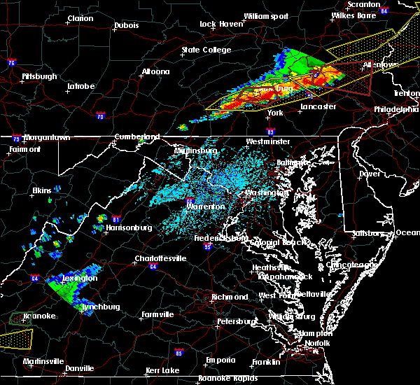 At 431 pm edt, a severe thunderstorm was located over pine grove furnace, moving east at 45 mph (radar indicated). Hazards include 70 mph wind gusts and quarter size hail. Hail damage to vehicles is possible. expect considerable tree damage. Wind damage is also likely to mobile homes, roofs, and outbuildings. At 431 pm edt, a severe thunderstorm was located over pine grove furnace, moving east at 45 mph (radar indicated). Hazards include 70 mph wind gusts and quarter size hail. Hail damage to vehicles is possible. expect considerable tree damage. Wind damage is also likely to mobile homes, roofs, and outbuildings.
|
| 5/12/2018 6:52 PM EDT |
 At 652 pm edt, severe thunderstorms were located along a line extending from columbia to hampton to near taneytown, moving east at 45 mph (radar indicated). Hazards include 60 mph wind gusts and quarter size hail. Hail damage to vehicles is possible. Expect wind damage to trees and power lines. At 652 pm edt, severe thunderstorms were located along a line extending from columbia to hampton to near taneytown, moving east at 45 mph (radar indicated). Hazards include 60 mph wind gusts and quarter size hail. Hail damage to vehicles is possible. Expect wind damage to trees and power lines.
|
| 5/12/2018 6:08 PM EDT |
 At 607 pm edt, a severe thunderstorm was located near dillsburg, moving east at 40 mph. radar indicated rotation in this storm. tornadoes sometimes occur with little or no warning (radar indicated). Hazards include 60 mph wind gusts and quarter size hail. Hail damage to vehicles is possible. Expect wind damage to trees and power lines. At 607 pm edt, a severe thunderstorm was located near dillsburg, moving east at 40 mph. radar indicated rotation in this storm. tornadoes sometimes occur with little or no warning (radar indicated). Hazards include 60 mph wind gusts and quarter size hail. Hail damage to vehicles is possible. Expect wind damage to trees and power lines.
|
| 9/5/2017 4:51 PM EDT |
 At 448 pm edt, severe thunderstorms were located along a line extending from near manchester to glen rock, moving east at 50 mph (radar indicated). Hazards include 70 mph wind gusts and penny size hail. Expect considerable tree damage. damage is likely to mobile homes, roofs, and outbuildings. Locations impacted include, parkville, red lion, spry, weigelstown, dallastown, york, lower allen, new cumberland, york airport and siddonsburg. At 448 pm edt, severe thunderstorms were located along a line extending from near manchester to glen rock, moving east at 50 mph (radar indicated). Hazards include 70 mph wind gusts and penny size hail. Expect considerable tree damage. damage is likely to mobile homes, roofs, and outbuildings. Locations impacted include, parkville, red lion, spry, weigelstown, dallastown, york, lower allen, new cumberland, york airport and siddonsburg.
|
| 9/5/2017 3:51 PM EDT |
 At 350 pm edt, severe thunderstorms were located along a line extending from near walnut bottom to carroll valley, moving east at 35 mph (radar indicated). Hazards include 60 mph wind gusts and nickel size hail. Expect damage to trees and power lines. severe thunderstorms will be near, gettysburg and pine grove furnace around 400 pm edt. aspers, bonneauville, lake heritage and mount holly springs around 410 pm edt. littlestown, mcsherrystown, lake meade, dillsburg, hampton and new oxford around 420 pm edt. parkville, hanover, pennville and siddonsburg around 430 pm edt. other locations impacted by these severe thunderstorms include arendtsville, east prospect, gardners, fawn grove, glenville, heidlersburg, biglerville, loganville, new salem and lewisberry. this includes the following interstates, the pennsylvania turnpike from mile markers 237 to 245. Interstate 83 from mile markers 0 to 40. At 350 pm edt, severe thunderstorms were located along a line extending from near walnut bottom to carroll valley, moving east at 35 mph (radar indicated). Hazards include 60 mph wind gusts and nickel size hail. Expect damage to trees and power lines. severe thunderstorms will be near, gettysburg and pine grove furnace around 400 pm edt. aspers, bonneauville, lake heritage and mount holly springs around 410 pm edt. littlestown, mcsherrystown, lake meade, dillsburg, hampton and new oxford around 420 pm edt. parkville, hanover, pennville and siddonsburg around 430 pm edt. other locations impacted by these severe thunderstorms include arendtsville, east prospect, gardners, fawn grove, glenville, heidlersburg, biglerville, loganville, new salem and lewisberry. this includes the following interstates, the pennsylvania turnpike from mile markers 237 to 245. Interstate 83 from mile markers 0 to 40.
|
| 8/19/2017 8:07 PM EDT |
 At 807 pm edt, severe thunderstorms were located along a line extending from pleasant hill to elizabethtown to emigsville to near spring grove, moving east at 45 mph (radar indicated). Hazards include 60 mph wind gusts. Expect damage to trees and power lines. severe thunderstorms will be near, mount joy, elizabethtown and rheems around 810 pm edt. manheim, columbia, east petersburg, wrightsville, jacobus, hallam, yorkana, salunga-landisville, marietta and maytown around 820 pm edt. red lion, millersville, akron, lititz, dallastown, lancaster, rothsville, mountville, windsor and yoe around 830 pm edt. willow street, new holland, ephrata, brogue, terre hill, shenks ferry, strasburg, safe harbor, leola and bareville around 840 pm edt. this includes the following interstates, the pennsylvania turnpike from mile markers 268 to 295. Interstate 83 from mile markers 7 to 30. At 807 pm edt, severe thunderstorms were located along a line extending from pleasant hill to elizabethtown to emigsville to near spring grove, moving east at 45 mph (radar indicated). Hazards include 60 mph wind gusts. Expect damage to trees and power lines. severe thunderstorms will be near, mount joy, elizabethtown and rheems around 810 pm edt. manheim, columbia, east petersburg, wrightsville, jacobus, hallam, yorkana, salunga-landisville, marietta and maytown around 820 pm edt. red lion, millersville, akron, lititz, dallastown, lancaster, rothsville, mountville, windsor and yoe around 830 pm edt. willow street, new holland, ephrata, brogue, terre hill, shenks ferry, strasburg, safe harbor, leola and bareville around 840 pm edt. this includes the following interstates, the pennsylvania turnpike from mile markers 268 to 295. Interstate 83 from mile markers 7 to 30.
|
| 8/12/2017 4:24 PM EDT |
 At 424 pm edt, a severe thunderstorm was located near siddonsburg, moving east at 10 mph (radar indicated). Hazards include 60 mph wind gusts and quarter size hail. Hail damage to vehicles is possible. Expect wind damage to trees and power lines. At 424 pm edt, a severe thunderstorm was located near siddonsburg, moving east at 10 mph (radar indicated). Hazards include 60 mph wind gusts and quarter size hail. Hail damage to vehicles is possible. Expect wind damage to trees and power lines.
|
| 8/4/2017 10:33 PM EDT |
 At 1032 pm edt, a severe thunderstorm was located over aspers, moving northeast at 25 mph (radar indicated). Hazards include 60 mph wind gusts. expect damage to trees and power lines At 1032 pm edt, a severe thunderstorm was located over aspers, moving northeast at 25 mph (radar indicated). Hazards include 60 mph wind gusts. expect damage to trees and power lines
|
| 8/4/2017 9:30 PM EDT |
 At 930 pm edt, a severe thunderstorm was located over walnut bottom, moving northeast at 30 mph (radar indicated). Hazards include 60 mph wind gusts and quarter size hail. Hail damage to vehicles is possible. Expect wind damage to trees and power lines. At 930 pm edt, a severe thunderstorm was located over walnut bottom, moving northeast at 30 mph (radar indicated). Hazards include 60 mph wind gusts and quarter size hail. Hail damage to vehicles is possible. Expect wind damage to trees and power lines.
|
| 6/19/2017 1:49 PM EDT |
 At 148 pm edt, severe thunderstorms were located along a line extending from near littlestown to royalton to penbrook to near dehart dam, moving east at 40 mph (radar indicated). Hazards include 70 mph wind gusts and quarter size hail. Hail damage to vehicles is possible. expect considerable tree damage. Wind damage is also likely to mobile homes, roofs, and outbuildings. At 148 pm edt, severe thunderstorms were located along a line extending from near littlestown to royalton to penbrook to near dehart dam, moving east at 40 mph (radar indicated). Hazards include 70 mph wind gusts and quarter size hail. Hail damage to vehicles is possible. expect considerable tree damage. Wind damage is also likely to mobile homes, roofs, and outbuildings.
|
| 6/19/2017 1:28 PM EDT |
 At 125 pm edt, severe thunderstorms were located along a line extending from new kingstown to boiling springs to near dillsburg to near lake heritage, moving northeast at 45 mph (radar indicated). Hazards include 70 mph wind gusts. Expect considerable tree damage. damage is likely to mobile homes, roofs, and outbuildings. Locations impacted include, parkville, red lion, weigelstown, dallastown, hanover, carlisle, lower allen, spry, enola and mechanicsburg. At 125 pm edt, severe thunderstorms were located along a line extending from new kingstown to boiling springs to near dillsburg to near lake heritage, moving northeast at 45 mph (radar indicated). Hazards include 70 mph wind gusts. Expect considerable tree damage. damage is likely to mobile homes, roofs, and outbuildings. Locations impacted include, parkville, red lion, weigelstown, dallastown, hanover, carlisle, lower allen, spry, enola and mechanicsburg.
|
| 6/19/2017 12:40 PM EDT |
 At 1239 pm edt, severe thunderstorms were located along a line extending from near walnut bottom to mont alto to near paramount-long meadow, moving east at 50 mph (radar indicated). Hazards include 70 mph wind gusts. Expect considerable tree damage. Damage is likely to mobile homes, roofs, and outbuildings. At 1239 pm edt, severe thunderstorms were located along a line extending from near walnut bottom to mont alto to near paramount-long meadow, moving east at 50 mph (radar indicated). Hazards include 70 mph wind gusts. Expect considerable tree damage. Damage is likely to mobile homes, roofs, and outbuildings.
|
| 3/1/2017 1:35 PM EST |
 At 129 pm est, severe thunderstorms were located along a line extending from near dillsburg to near hampton to near lake heritage, moving east at 65 mph (radar indicated). Hazards include 60 mph wind gusts. expect damage to roofs, siding, and trees At 129 pm est, severe thunderstorms were located along a line extending from near dillsburg to near hampton to near lake heritage, moving east at 65 mph (radar indicated). Hazards include 60 mph wind gusts. expect damage to roofs, siding, and trees
|
| 2/25/2017 2:37 PM EST |
 At 236 pm est, a severe thunderstorm was located near littlestown, moving northeast at 50 mph (radar indicated). Hazards include 60 mph wind gusts and quarter size hail. Hail damage to vehicles is expected. Expect wind damage to roofs, siding, and trees. At 236 pm est, a severe thunderstorm was located near littlestown, moving northeast at 50 mph (radar indicated). Hazards include 60 mph wind gusts and quarter size hail. Hail damage to vehicles is expected. Expect wind damage to roofs, siding, and trees.
|
| 10/30/2016 4:32 PM EDT |
 At 432 pm edt, severe thunderstorms were located along a line extending from near strausstown to near elizabethtown to near emmitsburg, moving east at 50 mph (radar indicated). Hazards include 60 mph wind gusts. Expect damage to roofs. siding. And trees. At 432 pm edt, severe thunderstorms were located along a line extending from near strausstown to near elizabethtown to near emmitsburg, moving east at 50 mph (radar indicated). Hazards include 60 mph wind gusts. Expect damage to roofs. siding. And trees.
|
| 10/30/2016 4:07 PM EDT |
 At 405 pm edt, severe thunderstorms were located along a line extending from near dehart dam to near shippensburg to near mercersburg to near hancock, moving east at 50 mph (radar indicated). Hazards include 60 mph wind gusts. Expect damage to roofs. siding. and trees. these severe storms will be near, linglestown, colonial park, skyline view, pine grove furnace, paxtonia and cashtown around 410 pm edt. waynesboro, palmyra, hershey, aspers and campbelltown around 420 pm edt. hampton, wayne heights, rouzerville, carroll valley, lake meade, new oxford and mont alto around 430 pm edt. hanover, parkville, weigelstown, york airport, spring grove, east berlin and dover around 440 pm edt. Other locations impacted by these severe thunderstorms include hunterstown, york haven, york springs, idaville, three mile island, newberrytown, upton, lewisberry, arendtsville and capital city airport. At 405 pm edt, severe thunderstorms were located along a line extending from near dehart dam to near shippensburg to near mercersburg to near hancock, moving east at 50 mph (radar indicated). Hazards include 60 mph wind gusts. Expect damage to roofs. siding. and trees. these severe storms will be near, linglestown, colonial park, skyline view, pine grove furnace, paxtonia and cashtown around 410 pm edt. waynesboro, palmyra, hershey, aspers and campbelltown around 420 pm edt. hampton, wayne heights, rouzerville, carroll valley, lake meade, new oxford and mont alto around 430 pm edt. hanover, parkville, weigelstown, york airport, spring grove, east berlin and dover around 440 pm edt. Other locations impacted by these severe thunderstorms include hunterstown, york haven, york springs, idaville, three mile island, newberrytown, upton, lewisberry, arendtsville and capital city airport.
|
| 10/30/2016 3:29 PM EDT |
 At 328 pm edt, severe thunderstorms were located along a line extending from near mexico to near fort littleton to near clearville to near lake gordon, moving east at 50 mph (radar indicated). Hazards include 60 mph wind gusts. Expect damage to roofs. siding. and trees. severe thunderstorms will be near, fort littleton, ickesburg and spruce hill around 330 pm edt. fannettsburg, locust grove, willow hill, new bloomfield and crystal springs around 340 pm edt. chambersburg, needmore, upper strasburg, big cove tannery, duncannon, barnes gap, inglesmith and roxbury around 350 pm edt. shippensburg, harrisburg, mercersburg, scotland, claylick, fayetteville, guilford, marysville, warfordsburg and rockville around 400 pm edt. other locations impacted by these severe thunderstorms include york springs, idaville, blain, rainsburg, shirleysburg, wellsville, new germantown, franklintown, bendersville and dauphin. this includes the following interstates, interstate 70 from mile markers 147 to 170. the pennsylvania turnpike from mile markers 151 to 258. interstate 81 from mile markers 1 to 79. interstate 83 from mile markers 22 to 50. Interstate 283 from mile markers 0 to 2. At 328 pm edt, severe thunderstorms were located along a line extending from near mexico to near fort littleton to near clearville to near lake gordon, moving east at 50 mph (radar indicated). Hazards include 60 mph wind gusts. Expect damage to roofs. siding. and trees. severe thunderstorms will be near, fort littleton, ickesburg and spruce hill around 330 pm edt. fannettsburg, locust grove, willow hill, new bloomfield and crystal springs around 340 pm edt. chambersburg, needmore, upper strasburg, big cove tannery, duncannon, barnes gap, inglesmith and roxbury around 350 pm edt. shippensburg, harrisburg, mercersburg, scotland, claylick, fayetteville, guilford, marysville, warfordsburg and rockville around 400 pm edt. other locations impacted by these severe thunderstorms include york springs, idaville, blain, rainsburg, shirleysburg, wellsville, new germantown, franklintown, bendersville and dauphin. this includes the following interstates, interstate 70 from mile markers 147 to 170. the pennsylvania turnpike from mile markers 151 to 258. interstate 81 from mile markers 1 to 79. interstate 83 from mile markers 22 to 50. Interstate 283 from mile markers 0 to 2.
|
| 8/16/2016 3:41 PM EDT |
 At 341 pm edt, a severe thunderstorm was located near manchester, moving northeast at 40 mph (radar indicated). Hazards include 60 mph wind gusts. Expect damage to roofs. siding. and trees. Locations impacted include, lower allen, camp hill, weigelstown, york, new cumberland, mechanicsburg, lemoyne, enola, harrisburg, yorklyn, valley green, dover, shiloh, grantley, mount wolf, stonybrook-wilshire, wrightsville, north york, siddonsburg and wormleysburg. At 341 pm edt, a severe thunderstorm was located near manchester, moving northeast at 40 mph (radar indicated). Hazards include 60 mph wind gusts. Expect damage to roofs. siding. and trees. Locations impacted include, lower allen, camp hill, weigelstown, york, new cumberland, mechanicsburg, lemoyne, enola, harrisburg, yorklyn, valley green, dover, shiloh, grantley, mount wolf, stonybrook-wilshire, wrightsville, north york, siddonsburg and wormleysburg.
|
| 8/16/2016 3:04 PM EDT |
 At 304 pm edt, a severe thunderstorm was located near gettysburg, moving northeast at 40 mph (radar indicated). Hazards include 60 mph wind gusts. Expect damage to roofs. siding. And trees. At 304 pm edt, a severe thunderstorm was located near gettysburg, moving northeast at 40 mph (radar indicated). Hazards include 60 mph wind gusts. Expect damage to roofs. siding. And trees.
|
| 7/25/2016 7:03 PM EDT |
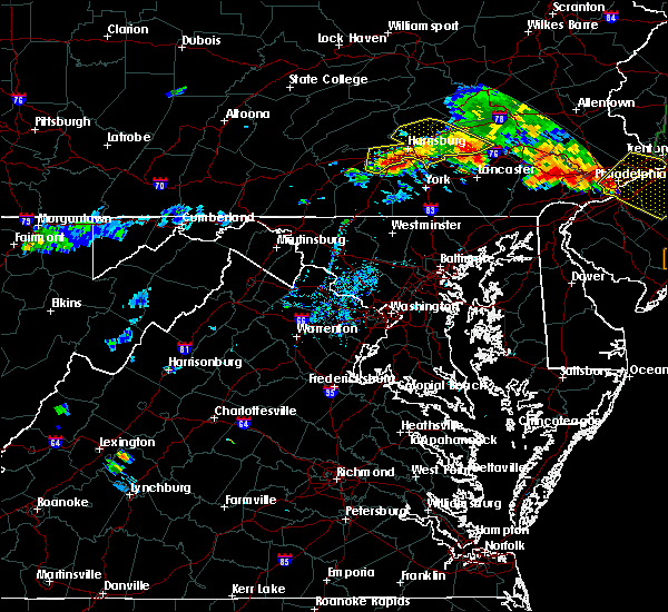 At 702 pm edt, severe thunderstorms were located along a line extending from near newmanstown to near elizabethtown to near boiling springs, moving southeast at 25 mph (radar indicated). Hazards include 60 mph wind gusts. Expect damage to roofs. siding. And trees. At 702 pm edt, severe thunderstorms were located along a line extending from near newmanstown to near elizabethtown to near boiling springs, moving southeast at 25 mph (radar indicated). Hazards include 60 mph wind gusts. Expect damage to roofs. siding. And trees.
|
| 6/28/2016 4:44 PM EDT |
 At 444 pm edt, a severe thunderstorm was located over bainbridge, moving southeast at 20 mph (radar indicated). Hazards include 60 mph wind gusts and quarter size hail. Hail damage to vehicles is expected. Expect wind damage to roofs, siding, and trees. At 444 pm edt, a severe thunderstorm was located over bainbridge, moving southeast at 20 mph (radar indicated). Hazards include 60 mph wind gusts and quarter size hail. Hail damage to vehicles is expected. Expect wind damage to roofs, siding, and trees.
|
| 6/21/2016 8:07 AM EDT |
 At 807 am edt, a severe thunderstorm was located over shiloh, moving southeast at 40 mph (law enforcement). Hazards include 70 mph wind gusts and quarter size hail. Hail damage to vehicles is expected. expect considerable tree damage. wind damage is also likely to mobile homes, roofs, and outbuildings. Locations impacted include, weigelstown, york, spry, yorklyn, west york, east york, dover, shiloh, spring grove, codorus, grantley, tyler run-queens gate, york airport, stonybrook-wilshire, emigsville, north york, hallam, manchester, east berlin and seven valleys. At 807 am edt, a severe thunderstorm was located over shiloh, moving southeast at 40 mph (law enforcement). Hazards include 70 mph wind gusts and quarter size hail. Hail damage to vehicles is expected. expect considerable tree damage. wind damage is also likely to mobile homes, roofs, and outbuildings. Locations impacted include, weigelstown, york, spry, yorklyn, west york, east york, dover, shiloh, spring grove, codorus, grantley, tyler run-queens gate, york airport, stonybrook-wilshire, emigsville, north york, hallam, manchester, east berlin and seven valleys.
|
| 6/21/2016 7:47 AM EDT |
 At 745 am edt, a severe thunderstorm was located near dillsburg, moving southeast at 40 mph (law enforcement). Hazards include 70 mph wind gusts and quarter size hail. Hail damage to vehicles is expected. expect considerable tree damage. wind damage is also likely to mobile homes, roofs, and outbuildings. Locations impacted include, weigelstown, york, spry, yorklyn, east berlin, dover, shiloh, spring grove, grantley, tyler run-queens gate, stonybrook-wilshire, dillsburg, north york, siddonsburg, west york, east york, codorus, hampton, york airport and lake meade. At 745 am edt, a severe thunderstorm was located near dillsburg, moving southeast at 40 mph (law enforcement). Hazards include 70 mph wind gusts and quarter size hail. Hail damage to vehicles is expected. expect considerable tree damage. wind damage is also likely to mobile homes, roofs, and outbuildings. Locations impacted include, weigelstown, york, spry, yorklyn, east berlin, dover, shiloh, spring grove, grantley, tyler run-queens gate, stonybrook-wilshire, dillsburg, north york, siddonsburg, west york, east york, codorus, hampton, york airport and lake meade.
|
| 6/21/2016 7:37 AM EDT |
 At 737 am edt, a severe thunderstorm was located near mount holly springs, moving southeast at 40 mph (radar indicated). Hazards include 60 mph wind gusts and quarter size hail. Hail damage to vehicles is expected. expect wind damage to roofs, siding, and trees. Locations impacted include, weigelstown, york, spry, carlisle, mount holly springs, yorklyn, east berlin, dover, shiloh, spring grove, boiling springs, grantley, tyler run-queens gate, stonybrook-wilshire, dillsburg, north york, siddonsburg, west york, east york and codorus. At 737 am edt, a severe thunderstorm was located near mount holly springs, moving southeast at 40 mph (radar indicated). Hazards include 60 mph wind gusts and quarter size hail. Hail damage to vehicles is expected. expect wind damage to roofs, siding, and trees. Locations impacted include, weigelstown, york, spry, carlisle, mount holly springs, yorklyn, east berlin, dover, shiloh, spring grove, boiling springs, grantley, tyler run-queens gate, stonybrook-wilshire, dillsburg, north york, siddonsburg, west york, east york and codorus.
|
| 6/21/2016 7:22 AM EDT |
 At 722 am edt, a severe thunderstorm was located over plainfield, moving southeast at 40 mph (radar indicated). Hazards include 60 mph wind gusts and quarter size hail. Hail damage to vehicles is expected. Expect wind damage to roofs, siding, and trees. At 722 am edt, a severe thunderstorm was located over plainfield, moving southeast at 40 mph (radar indicated). Hazards include 60 mph wind gusts and quarter size hail. Hail damage to vehicles is expected. Expect wind damage to roofs, siding, and trees.
|
| 6/5/2016 4:01 PM EDT |
 At 400 pm edt, severe thunderstorms were located along a line extending from highspire to near dover to shiloh to near pennville, moving east at 35 mph (radar indicated). Hazards include 60 mph wind gusts. Expect damage to roofs. siding. and trees. Locations impacted include, weigelstown, york, parkville, red lion, dallastown, spry, hanover, jacobus, valley green, shiloh, yorkana, wrightsville, pennville, hallam, glen rock, york airport, windsor, manchester, shrewsbury and yorklyn. At 400 pm edt, severe thunderstorms were located along a line extending from highspire to near dover to shiloh to near pennville, moving east at 35 mph (radar indicated). Hazards include 60 mph wind gusts. Expect damage to roofs. siding. and trees. Locations impacted include, weigelstown, york, parkville, red lion, dallastown, spry, hanover, jacobus, valley green, shiloh, yorkana, wrightsville, pennville, hallam, glen rock, york airport, windsor, manchester, shrewsbury and yorklyn.
|
| 6/5/2016 3:53 PM EDT |
 At 352 pm edt, severe thunderstorms were located along a line extending from steelton to near lake meade to near york airport to littlestown, moving east at 50 mph (radar indicated). Hazards include 60 mph wind gusts. Expect damage to roofs. siding. and trees. Locations impacted include, weigelstown, york, parkville, red lion, dallastown, spry, hanover, lower allen, jacobus, valley green, shiloh, littlestown, yorkana, wrightsville, mcsherrystown, siddonsburg, pennville, hallam, glen rock and york airport. At 352 pm edt, severe thunderstorms were located along a line extending from steelton to near lake meade to near york airport to littlestown, moving east at 50 mph (radar indicated). Hazards include 60 mph wind gusts. Expect damage to roofs. siding. and trees. Locations impacted include, weigelstown, york, parkville, red lion, dallastown, spry, hanover, lower allen, jacobus, valley green, shiloh, littlestown, yorkana, wrightsville, mcsherrystown, siddonsburg, pennville, hallam, glen rock and york airport.
|
| 6/5/2016 3:37 PM EDT |
 At 336 pm edt, severe thunderstorms were located along a line extending from near boiling springs to near aspers to near hampton to near emmitsburg, moving east at 40 mph (radar indicated). Hazards include 60 mph wind gusts. Expect damage to roofs. siding. And trees. At 336 pm edt, severe thunderstorms were located along a line extending from near boiling springs to near aspers to near hampton to near emmitsburg, moving east at 40 mph (radar indicated). Hazards include 60 mph wind gusts. Expect damage to roofs. siding. And trees.
|
| 2/24/2016 6:10 PM EST |
 At 607 pm est, doppler radar indicated a line of severe thunderstorms capable of producing damaging winds around 60 mph. these storms were located along a line extending from mechanicsburg to near westminster to fairland, and moving northeast at 50 mph. At 607 pm est, doppler radar indicated a line of severe thunderstorms capable of producing damaging winds around 60 mph. these storms were located along a line extending from mechanicsburg to near westminster to fairland, and moving northeast at 50 mph.
|
| 2/24/2016 5:36 PM EST |
 At 535 pm est, doppler radar indicated a line of strong to severe thunderstorms capable of producing damaging winds around 60 mph. these storms were located along a line extending from near rouzerville to near thurmont to near point of rocks, and moving northeast at 50 mph. At 535 pm est, doppler radar indicated a line of strong to severe thunderstorms capable of producing damaging winds around 60 mph. these storms were located along a line extending from near rouzerville to near thurmont to near point of rocks, and moving northeast at 50 mph.
|
| 10/9/2015 4:10 PM EDT |
 At 410 pm edt, doppler radar indicated a line of severe thunderstorms capable of producing damaging winds in excess of 60 mph. these storms were located along a line extending from near manchester to near emmitsburg, moving east at 35 mph. locations impacted include, spry, weigelstown, york, parkville, hanover, gettysburg, lake heritage, shrewsbury, jacobus, east berlin, valley green, dover, shiloh, spring grove, new freedom, bonneauville, grantley, littlestown, tyler run-queens gate and north york. At 410 pm edt, doppler radar indicated a line of severe thunderstorms capable of producing damaging winds in excess of 60 mph. these storms were located along a line extending from near manchester to near emmitsburg, moving east at 35 mph. locations impacted include, spry, weigelstown, york, parkville, hanover, gettysburg, lake heritage, shrewsbury, jacobus, east berlin, valley green, dover, shiloh, spring grove, new freedom, bonneauville, grantley, littlestown, tyler run-queens gate and north york.
|
| 10/9/2015 3:50 PM EDT |
 At 350 pm edt, doppler radar indicated a severe thunderstorm capable of producing damaging winds around 60 mph. this storm was located over orrtanna, and moving east at 45 mph. At 350 pm edt, doppler radar indicated a severe thunderstorm capable of producing damaging winds around 60 mph. this storm was located over orrtanna, and moving east at 45 mph.
|
| 8/20/2015 2:07 PM EDT |
 At 204 pm edt, doppler radar indicated a line of severe thunderstorms capable of producing damaging winds in excess of 60 mph. these storms were located along a line extending from near colonial park to dallastown, moving northeast at 25 mph. locations impacted include, camp hill, elizabethtown, enola, hanover, harrisburg, hershey, hummelstown, linglestown, mechanicsburg, middletown, palmyra, and red lion. At 204 pm edt, doppler radar indicated a line of severe thunderstorms capable of producing damaging winds in excess of 60 mph. these storms were located along a line extending from near colonial park to dallastown, moving northeast at 25 mph. locations impacted include, camp hill, elizabethtown, enola, hanover, harrisburg, hershey, hummelstown, linglestown, mechanicsburg, middletown, palmyra, and red lion.
|
| 8/20/2015 1:33 PM EDT |
 At 132 pm edt, doppler radar indicated a line of severe thunderstorms capable of producing damaging winds around 60 mph. these storms were located along a line extending from near siddonsburg to near glen rock, and moving northeast at 25 mph. At 132 pm edt, doppler radar indicated a line of severe thunderstorms capable of producing damaging winds around 60 mph. these storms were located along a line extending from near siddonsburg to near glen rock, and moving northeast at 25 mph.
|
| 7/27/2015 12:30 AM EDT |
 At 1226 am edt, doppler radar indicated a line of severe thunderstorms capable of producing quarter size hail and damaging winds in excess of 60 mph. these storms were located along a line extending from near mount wolf to near lake meade, aspers and scotland, moving southeast at 15 mph. locations impacted include, chambersburg, dallastown, gettysburg, hanover, red lion, shippensburg, spry, weigelstown, york, aspers, bonneauville, brogue, cashtown, codorus, cross roads, dillsburg, dover, east berlin, east york and emigsville. At 1226 am edt, doppler radar indicated a line of severe thunderstorms capable of producing quarter size hail and damaging winds in excess of 60 mph. these storms were located along a line extending from near mount wolf to near lake meade, aspers and scotland, moving southeast at 15 mph. locations impacted include, chambersburg, dallastown, gettysburg, hanover, red lion, shippensburg, spry, weigelstown, york, aspers, bonneauville, brogue, cashtown, codorus, cross roads, dillsburg, dover, east berlin, east york and emigsville.
|
| 7/27/2015 12:02 AM EDT |
 At 1201 am edt, doppler radar indicated a line of severe thunderstorms capable of producing quarter size hail and damaging winds around 60 mph. these storms were located along a line extending from near valley green to near pine grove furnace to near upper strasburg, and moving southeast at 25 mph. At 1201 am edt, doppler radar indicated a line of severe thunderstorms capable of producing quarter size hail and damaging winds around 60 mph. these storms were located along a line extending from near valley green to near pine grove furnace to near upper strasburg, and moving southeast at 25 mph.
|
| 7/9/2015 5:07 PM EDT |
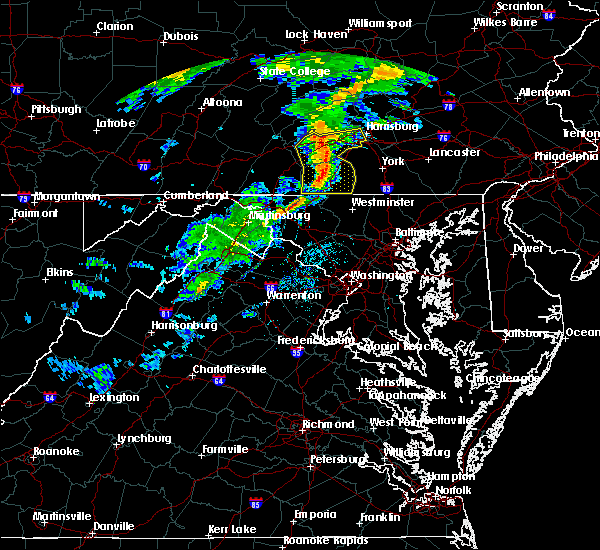 At 507 pm edt, doppler radar indicated a line of severe thunderstorms capable of producing damaging winds around 60 mph. these storms were located along a line extending from near loysville to near carroll valley, and moving east at 40 mph. At 507 pm edt, doppler radar indicated a line of severe thunderstorms capable of producing damaging winds around 60 mph. these storms were located along a line extending from near loysville to near carroll valley, and moving east at 40 mph.
|
| 6/30/2015 11:28 PM EDT |
 At 1128 pm edt, doppler radar indicated a severe thunderstorm capable of producing damaging winds in excess of 60 mph. this storm was located near the york airport, moving northeast at 30 mph. locations impacted include, dallastown, hanover, parkville, red lion, spry, weigelstown, york, codorus, cross roads, dover, east york, emigsville, glen rock, grantley, jacobus, manchester, mount wolf, new freedom, north york and pennville. At 1128 pm edt, doppler radar indicated a severe thunderstorm capable of producing damaging winds in excess of 60 mph. this storm was located near the york airport, moving northeast at 30 mph. locations impacted include, dallastown, hanover, parkville, red lion, spry, weigelstown, york, codorus, cross roads, dover, east york, emigsville, glen rock, grantley, jacobus, manchester, mount wolf, new freedom, north york and pennville.
|
| 6/30/2015 11:08 PM EDT |
 At 1107 pm edt, doppler radar indicated a severe thunderstorm capable of producing damaging winds around 60 mph. this storm was located over new oxford, and moving northeast at 30 mph. At 1107 pm edt, doppler radar indicated a severe thunderstorm capable of producing damaging winds around 60 mph. this storm was located over new oxford, and moving northeast at 30 mph.
|
| 6/23/2015 4:35 PM EDT |
 At 434 pm edt, doppler radar indicated a severe thunderstorm capable of producing quarter size hail and destructive winds in excess of 70 mph. this storm was located near dillsburg, moving east at 35 mph. locations impacted include, carlisle, dallastown, gettysburg, hanover, mechanicsburg, middletown, parkville, red lion, spry, weigelstown, york, aspers, boiling springs, bonneauville, brogue, cashtown, codorus, cross roads, delta and dillsburg. At 434 pm edt, doppler radar indicated a severe thunderstorm capable of producing quarter size hail and destructive winds in excess of 70 mph. this storm was located near dillsburg, moving east at 35 mph. locations impacted include, carlisle, dallastown, gettysburg, hanover, mechanicsburg, middletown, parkville, red lion, spry, weigelstown, york, aspers, boiling springs, bonneauville, brogue, cashtown, codorus, cross roads, delta and dillsburg.
|
| 6/23/2015 4:15 PM EDT |
 At 414 pm edt, doppler radar indicated a severe thunderstorm capable of producing quarter size hail and damaging winds of 60 to 70 mph. this storm was located near pine grove furnace, and moving east at 35 mph. At 414 pm edt, doppler radar indicated a severe thunderstorm capable of producing quarter size hail and damaging winds of 60 to 70 mph. this storm was located near pine grove furnace, and moving east at 35 mph.
|
| 6/20/2015 9:43 PM EDT |
 At 941 pm edt, doppler radar indicated a severe thunderstorm capable of producing damaging winds in excess of 60 mph. this storm was located near siddonsburg, moving northeast at 35 mph. locations impacted include, camp hill, colonial park, enola, harrisburg, hershey, hummelstown, mechanicsburg, middletown, new cumberland, steelton, dillsburg, dover, highspire, and hogestown. At 941 pm edt, doppler radar indicated a severe thunderstorm capable of producing damaging winds in excess of 60 mph. this storm was located near siddonsburg, moving northeast at 35 mph. locations impacted include, camp hill, colonial park, enola, harrisburg, hershey, hummelstown, mechanicsburg, middletown, new cumberland, steelton, dillsburg, dover, highspire, and hogestown.
|
| 6/20/2015 9:17 PM EDT |
 At 916 pm edt, doppler radar indicated a severe thunderstorm capable of producing damaging winds around 60 mph. this storm was located over lake meade, and moving northeast at 35 mph. At 916 pm edt, doppler radar indicated a severe thunderstorm capable of producing damaging winds around 60 mph. this storm was located over lake meade, and moving northeast at 35 mph.
|
| 6/8/2015 6:11 PM EDT | At 610 pm edt, doppler radar indicated a line of severe thunderstorms capable of producing damaging winds around 60 mph. these storms were located along a line extending from near campbelltown to maytown to near spring grove, and moving southeast at 35 mph. |
| 6/8/2015 5:54 PM EDT | At 553 pm edt, doppler radar indicated a line of severe thunderstorms capable of producing destructive winds in excess of 70 mph. these storms were located along a line extending from womelsdorf to shiremanstown, moving east at 35 mph. locations impacted include, akron, annville, camp hill, carlisle, colonial park, columbia, cornwall, dallastown, east petersburg, elizabethtown, enola, ephrata, harrisburg, hershey, hummelstown, lancaster, lebanon, lemoyne, linglestown and lititz. |
| 6/8/2015 5:08 PM EDT | At 508 pm edt, doppler radar indicated a line of severe thunderstorms capable of producing damaging winds of 60 to 70 mph. these storms were located along a line extending from near donaldson to near boiling springs, and moving southeast at 25 mph. |
| 5/27/2015 2:15 PM EDT | At 213 pm edt, doppler radar indicated a severe thunderstorm capable of producing quarter size hail and damaging winds in excess of 60 mph. this storm was located near york airport, moving northeast at 35 mph. locations impacted include, york, hanover, weigelstown, parkville, red lion, spry, dallastown, shiloh, east york, stonybrook-wilshire, west york, codorus, grantley, tyler run-queens gate, manchester, hallam, emigsville, wrightsville, spring grove and glen rock. |
| 5/27/2015 1:50 PM EDT | At 149 pm edt, doppler radar indicated a severe thunderstorm capable of producing quarter size hail and damaging winds around 60 mph. this storm was located near new oxford, and moving northeast at 35 mph. |
| 4/19/2013 6:46 PM EDT | Downed wire in york county PA, 0.2 miles NNE of Dover, PA |
| 8/5/2012 3:50 PM EDT | Tree fell on house in dover townsh in york county PA, 0.2 miles NNE of Dover, PA |
| 7/18/2012 2:45 PM EDT | Golf Ball sized hail reported 0.2 miles NNE of Dover, PA |
| 5/27/2012 7:45 PM EDT | Trees reported down in dove in york county PA, 0.2 miles NNE of Dover, PA |
| 1/1/0001 12:00 AM | Trees dow in york county PA, 0.2 miles NNE of Dover, PA |
Hail Maps for Dover, PA


Connect with Interactive Hail Maps