

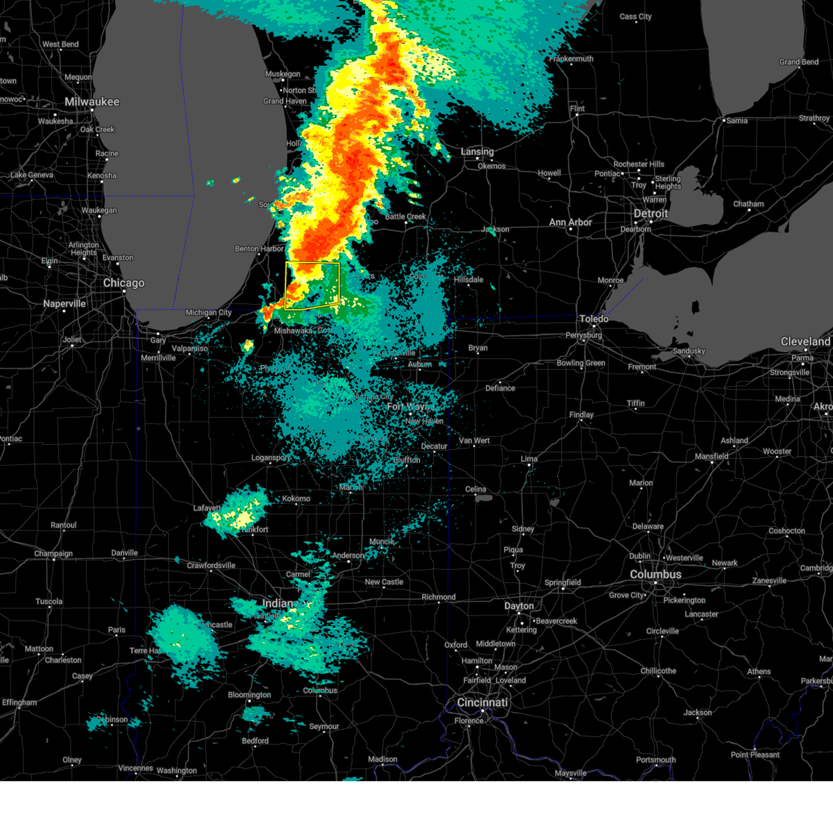
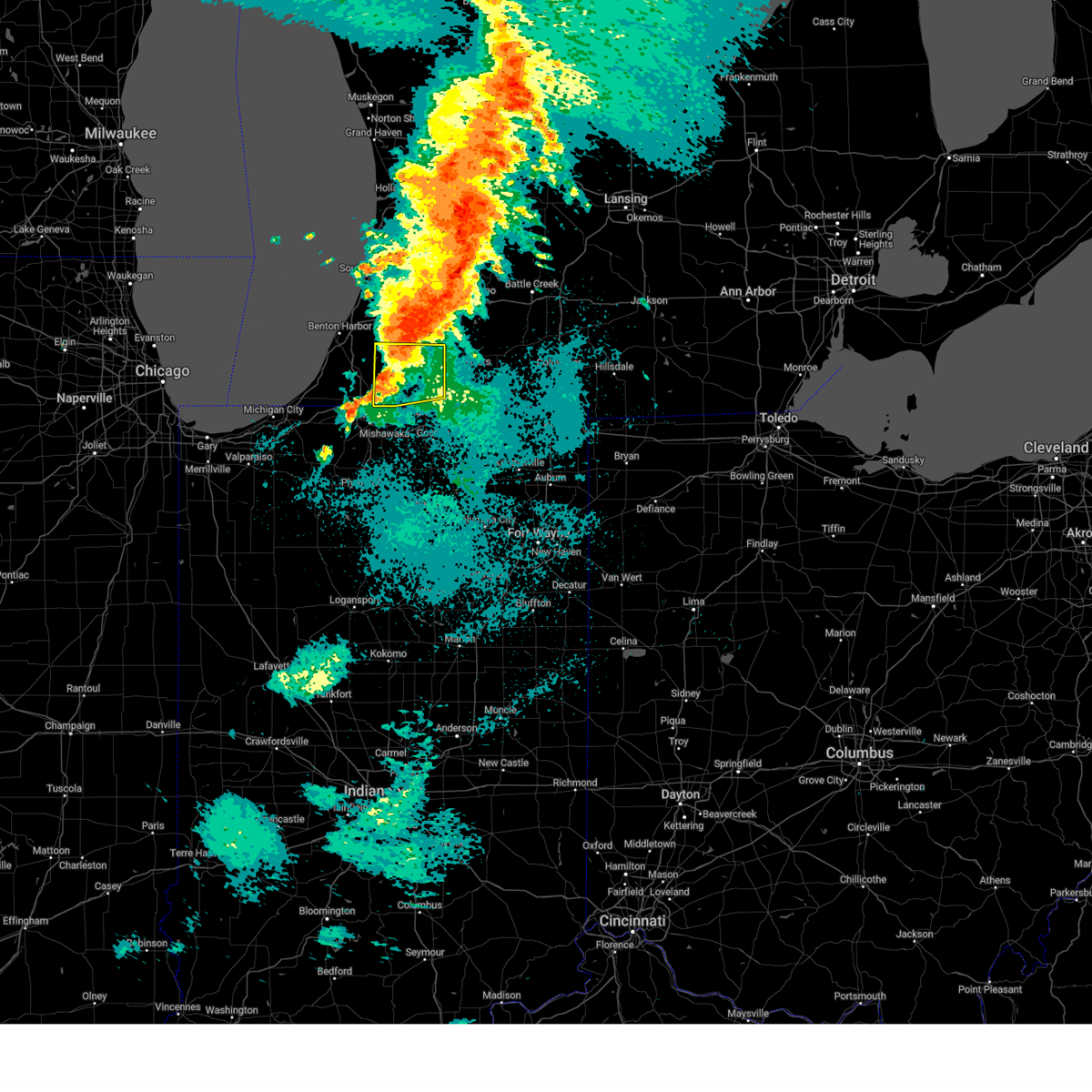
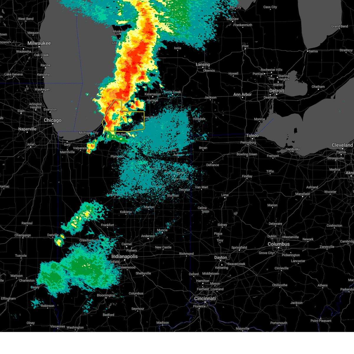
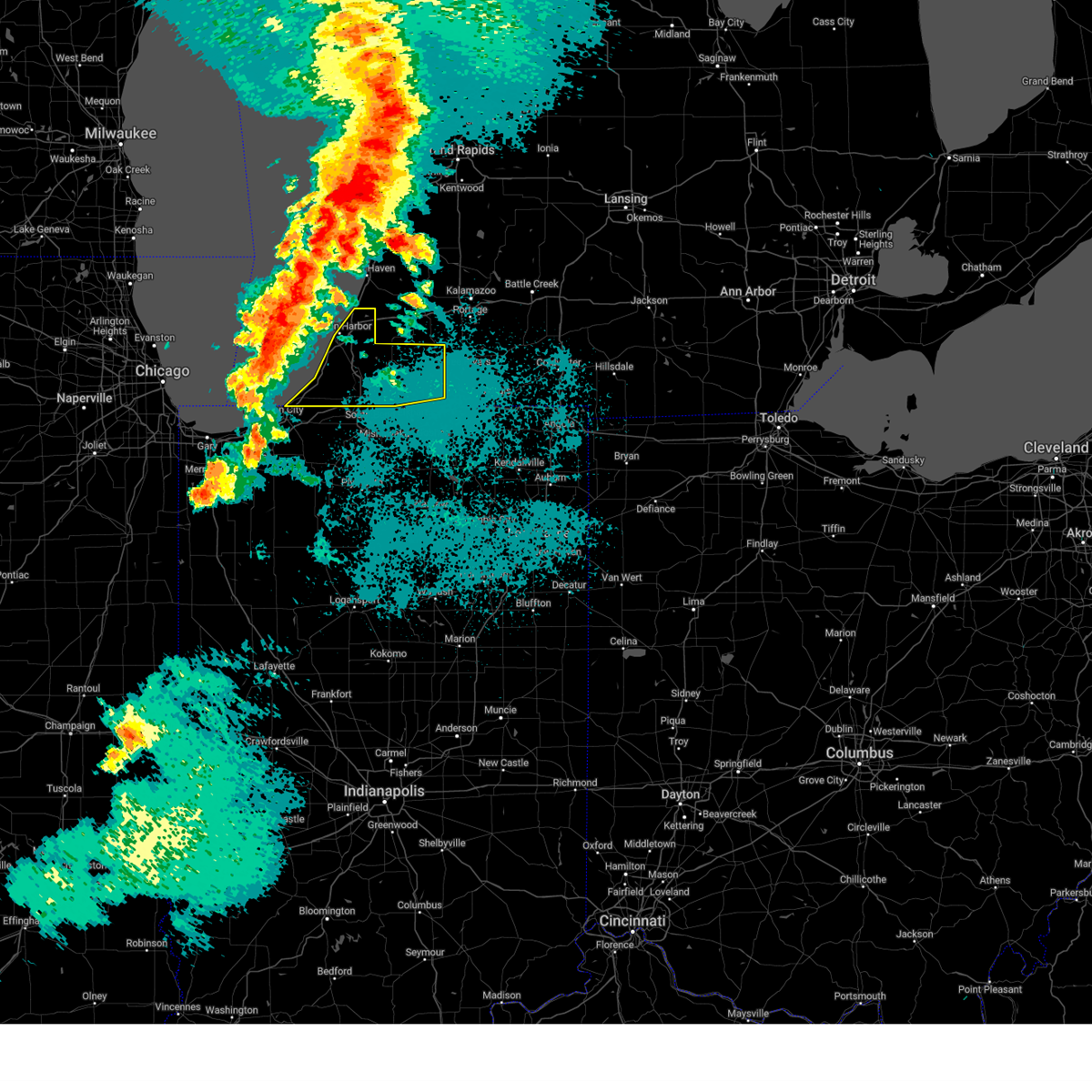
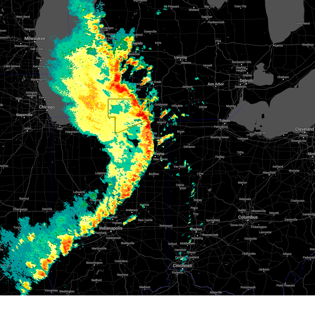
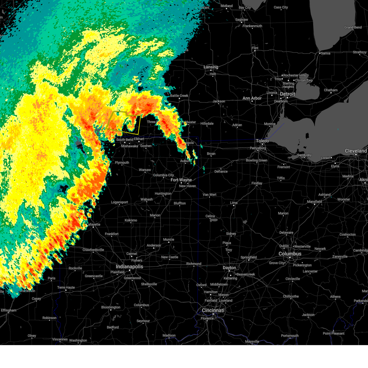
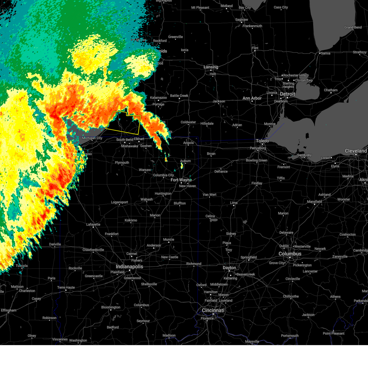
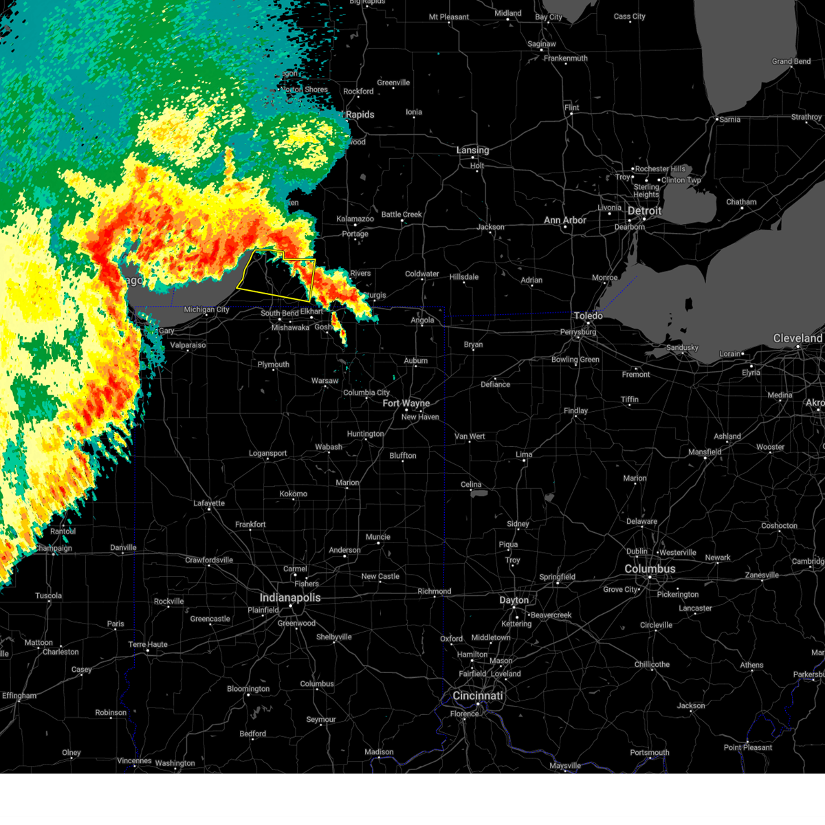
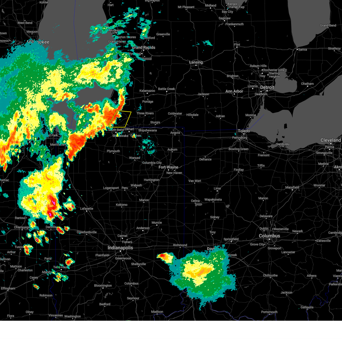
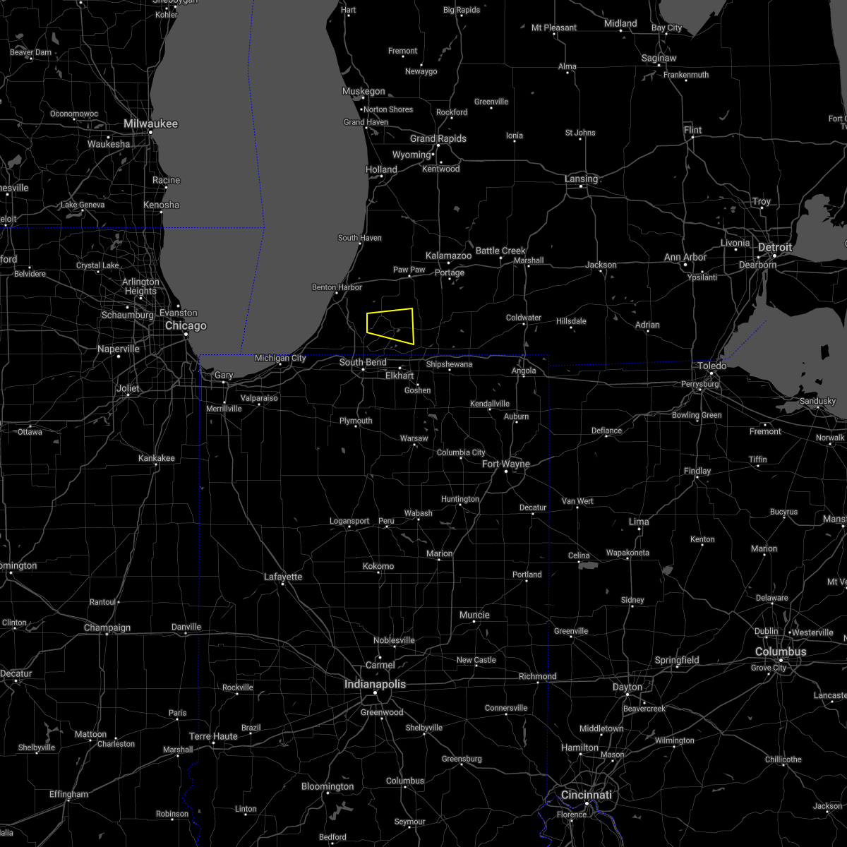
Hail Map for Dowagiac, MI
The Dowagiac, MI area has had 4 reports of on-the-ground hail by trained spotters, and has been under severe weather warnings 19 times during the past 12 months. Doppler radar has detected hail at or near Dowagiac, MI on 39 occasions, including 1 occasion during the past year.
| Name: | Dowagiac, MI |
| Where Located: | 71.5 miles SSW of Grand Rapids, MI |
| Map: | Google Map for Dowagiac, MI |
| Population: | 5879 |
| Housing Units: | 2674 |
| More Info: | Search Google for Dowagiac, MI |
0
The Top Recent Hail Date for Dowagiac, MI is Tuesday, August 27, 2024 (39th out of 39)

Hail and Wind Damage Spotted near Dowagiac, MI
| Date / Time | Report Details |
|---|---|
| 5/15/2025 10:45 PM EDT |
 the severe thunderstorm warning has been cancelled and is no longer in effect the severe thunderstorm warning has been cancelled and is no longer in effect
|
| 5/15/2025 10:45 PM EDT |
 At 1043 pm edt, severe thunderstorms were located along a line extending from near magician lake to near niles, moving east at 50 mph (radar indicated). Hazards include 60 mph wind gusts and penny size hail. Expect damage to roofs, siding, and trees. Locations impacted include, niles, dowagiac, cassopolis, edwardsburg, marcellus, union, pokagon, penn, vandalia, magician lake, dewey lake, la grange, adamsville, juno lake, donnell lake, indian lake, jones, diamond lake, shavehead lake, and wakelee. At 1043 pm edt, severe thunderstorms were located along a line extending from near magician lake to near niles, moving east at 50 mph (radar indicated). Hazards include 60 mph wind gusts and penny size hail. Expect damage to roofs, siding, and trees. Locations impacted include, niles, dowagiac, cassopolis, edwardsburg, marcellus, union, pokagon, penn, vandalia, magician lake, dewey lake, la grange, adamsville, juno lake, donnell lake, indian lake, jones, diamond lake, shavehead lake, and wakelee.
|
| 5/15/2025 10:23 PM EDT |
 At 1023 pm edt, severe thunderstorms were located along a line extending from near watervliet to near buchanan, moving east at 60 mph (radar indicated). Hazards include 60 mph wind gusts and penny size hail. Expect damage to roofs, siding, and trees. locations impacted include, niles, benton harbor, st. joseph, dowagiac, buchanan, benton heights, fair plain, bridgman, berrien springs, cassopolis, watervliet, coloma, edwardsburg, marcellus, stevensville, paw paw lake, lake michigan beach, shorewood-tower hills-harbert, union, and bertrand. this includes the following highways, interstate 196 between mile markers 0 and 7. Interstate 94 in michigan between mile markers 11 and 42. At 1023 pm edt, severe thunderstorms were located along a line extending from near watervliet to near buchanan, moving east at 60 mph (radar indicated). Hazards include 60 mph wind gusts and penny size hail. Expect damage to roofs, siding, and trees. locations impacted include, niles, benton harbor, st. joseph, dowagiac, buchanan, benton heights, fair plain, bridgman, berrien springs, cassopolis, watervliet, coloma, edwardsburg, marcellus, stevensville, paw paw lake, lake michigan beach, shorewood-tower hills-harbert, union, and bertrand. this includes the following highways, interstate 196 between mile markers 0 and 7. Interstate 94 in michigan between mile markers 11 and 42.
|
| 5/15/2025 9:53 PM EDT |
 Svriwx the national weather service in northern indiana has issued a * severe thunderstorm warning for, cass county in southwestern michigan, berrien county in southwestern michigan, * until 1100 pm edt. * at 953 pm edt, severe thunderstorms were located along a line extending from 15 miles west of stevensville to near town of pines, moving northeast at 55 mph (radar indicated). Hazards include 70 mph wind gusts and quarter size hail. Hail damage to vehicles is expected. expect considerable tree damage. Wind damage is also likely to mobile homes, roofs, and outbuildings. Svriwx the national weather service in northern indiana has issued a * severe thunderstorm warning for, cass county in southwestern michigan, berrien county in southwestern michigan, * until 1100 pm edt. * at 953 pm edt, severe thunderstorms were located along a line extending from 15 miles west of stevensville to near town of pines, moving northeast at 55 mph (radar indicated). Hazards include 70 mph wind gusts and quarter size hail. Hail damage to vehicles is expected. expect considerable tree damage. Wind damage is also likely to mobile homes, roofs, and outbuildings.
|
| 3/30/2025 5:23 PM EDT |
 The storms which prompted the warning have moved out of the area. therefore, the warning will be allowed to expire. a tornado watch remains in effect until 800 pm edt for north central and northeastern indiana, and southwestern michigan. remember, a severe thunderstorm warning still remains in effect for lagrange county, in and st joseph county, mi until 615 pm edt. The storms which prompted the warning have moved out of the area. therefore, the warning will be allowed to expire. a tornado watch remains in effect until 800 pm edt for north central and northeastern indiana, and southwestern michigan. remember, a severe thunderstorm warning still remains in effect for lagrange county, in and st joseph county, mi until 615 pm edt.
|
| 3/30/2025 5:14 PM EDT | At 513 pm edt, severe thunderstorms were located along a line extending from near decatur to near middlebury, moving northeast at 80 mph (radar indicated). Hazards include 70 mph wind gusts and nickel size hail. Expect considerable tree damage. damage is likely to mobile homes, roofs, and outbuildings. locations impacted include, dewey lake, vandalia, dowagiac, nottawa, cassopolis, adamsville, klinger lake, juno lake, donnell lake, fishers lake, sturgis, elkhart, leonidas, diamond lake, corey lake, bristol, howe, three rivers, middlebury, and wakelee. This includes interstate 80 in indiana between mile markers 88 and 128. |
| 3/30/2025 5:14 PM EDT | the severe thunderstorm warning has been cancelled and is no longer in effect |
| 3/30/2025 4:41 PM EDT | Svriwx the national weather service in northern indiana has issued a * severe thunderstorm warning for, elkhart county in north central indiana, st. joseph county in north central indiana, northwestern lagrange county in northeastern indiana, northeastern marshall county in north central indiana, cass county in southwestern michigan, st. joseph county in southwestern michigan, western branch county in southwestern michigan, southeastern berrien county in southwestern michigan, * until 530 pm edt. * at 440 pm edt, severe thunderstorms were located along a line extending from near bridgman to near lakeville, moving northeast at 55 mph (radar indicated). Hazards include 70 mph wind gusts and nickel size hail. Expect considerable tree damage. Damage is likely to mobile homes, roofs, and outbuildings. |
| 3/19/2025 8:24 PM EDT |
 The storms which prompted the warning have weakened below severe limits, and no longer pose an immediate threat to life or property. therefore, the warning will be allowed to expire. however, gusty winds and heavy rain are still possible with these thunderstorms. a severe thunderstorm watch remains in effect until 100 am edt for north central indiana, and southwestern michigan. The storms which prompted the warning have weakened below severe limits, and no longer pose an immediate threat to life or property. therefore, the warning will be allowed to expire. however, gusty winds and heavy rain are still possible with these thunderstorms. a severe thunderstorm watch remains in effect until 100 am edt for north central indiana, and southwestern michigan.
|
| 3/19/2025 8:12 PM EDT |
 the severe thunderstorm warning has been cancelled and is no longer in effect the severe thunderstorm warning has been cancelled and is no longer in effect
|
| 3/19/2025 8:12 PM EDT |
 At 812 pm edt, severe thunderstorms were located along a line extending from near van buren sp to near dowagiac to near roseland, moving northeast at 55 mph (radar indicated). Hazards include 60 mph wind gusts. Expect damage to roofs, siding, and trees. Locations impacted include, magician lake, dewey lake, dowagiac, edwardsburg, cassopolis, dailey, la grange, barron lake, sandy beach, diamond lake, pokagon, eagle lake, sumnerville, and niles. At 812 pm edt, severe thunderstorms were located along a line extending from near van buren sp to near dowagiac to near roseland, moving northeast at 55 mph (radar indicated). Hazards include 60 mph wind gusts. Expect damage to roofs, siding, and trees. Locations impacted include, magician lake, dewey lake, dowagiac, edwardsburg, cassopolis, dailey, la grange, barron lake, sandy beach, diamond lake, pokagon, eagle lake, sumnerville, and niles.
|
| 3/19/2025 7:54 PM EDT |
 Svriwx the national weather service in northern indiana has issued a * severe thunderstorm warning for, northern st. joseph county in north central indiana, western cass county in southwestern michigan, berrien county in southwestern michigan, * until 830 pm edt. * at 753 pm edt, severe thunderstorms were located along a line extending from near st. joseph to near berrien springs to near new carlisle, moving northeast at 55 mph (radar indicated). Hazards include 60 mph wind gusts and penny size hail. expect damage to roofs, siding, and trees Svriwx the national weather service in northern indiana has issued a * severe thunderstorm warning for, northern st. joseph county in north central indiana, western cass county in southwestern michigan, berrien county in southwestern michigan, * until 830 pm edt. * at 753 pm edt, severe thunderstorms were located along a line extending from near st. joseph to near berrien springs to near new carlisle, moving northeast at 55 mph (radar indicated). Hazards include 60 mph wind gusts and penny size hail. expect damage to roofs, siding, and trees
|
| 3/15/2025 4:10 AM EDT | The storms which prompted the warning have weakened below severe limits, and no longer pose an immediate threat to life or property. therefore, the warning will be allowed to expire. however, gusty winds are still possible with these thunderstorms. a severe thunderstorm watch remains in effect until 900 am edt for north central indiana, and southwestern michigan. to report severe weather, contact your nearest law enforcement agency. they will relay your report to the national weather service northern indiana. |
| 3/15/2025 4:03 AM EDT | the severe thunderstorm warning has been cancelled and is no longer in effect |
| 3/15/2025 4:03 AM EDT | At 403 am edt, severe thunderstorms were located along a line extending from near berrien springs to niles to near gulivoire park, moving northeast at 60 mph (radar indicated). Hazards include 60 mph wind gusts. Expect damage to roofs, siding, and trees. locations impacted include, magician lake, dewey lake, dowagiac, berrien springs, edwardsburg, sodus, cassopolis, la grange, adamsville, bertrand, chain-o-lakes, juno lake, indian lake, woodland, lydick, osceola, elkhart, diamond lake, pokagon, and gulivoire park. this includes the following highways, interstate 80 in indiana between mile markers 68 and 93. Interstate 94 in michigan near mile marker 29. |
| 3/15/2025 3:44 AM EDT | Svriwx the national weather service in northern indiana has issued a * severe thunderstorm warning for, northwestern elkhart county in north central indiana, st. joseph county in north central indiana, northeastern starke county in northwestern indiana, northwestern marshall county in north central indiana, northeastern la porte county in northwestern indiana, cass county in southwestern michigan, berrien county in southwestern michigan, * until 415 am edt/315 am cdt/. * at 344 am edt/244 am cdt/, severe thunderstorms were located along a line extending from near three oaks to new carlisle to koontz lake, moving northeast at 55 mph (radar indicated). Hazards include 60 mph wind gusts. expect damage to roofs, siding, and trees |
| 7/15/2024 11:41 PM EDT |
 The storm which prompted the warning has weakened below severe limits, and no longer poses an immediate threat to life or property. therefore, the warning will be allowed to expire. however, gusty winds and heavy rain are still possible with this thunderstorm. a tornado watch remains in effect until 200 am edt for southwestern michigan. remember, a tornado warning still remains in effect for southern berrien and southern cass counites until 11 pm cdt. The storm which prompted the warning has weakened below severe limits, and no longer poses an immediate threat to life or property. therefore, the warning will be allowed to expire. however, gusty winds and heavy rain are still possible with this thunderstorm. a tornado watch remains in effect until 200 am edt for southwestern michigan. remember, a tornado warning still remains in effect for southern berrien and southern cass counites until 11 pm cdt.
|
| 7/15/2024 11:14 PM EDT |
 At 1113 pm edt, a severe thunderstorm was located near berrien springs, or 8 miles southeast of fair plain, moving east at 45 mph (radar indicated). Hazards include 70 mph wind gusts. Expect considerable tree damage. damage is likely to mobile homes, roofs, and outbuildings. this severe storm will be near, dowagiac around 1120 pm edt. cassopolis around 1130 pm edt. other locations impacted by this severe thunderstorm include magician lake, dewey lake, glendora, sodus, new troy, dailey, la grange, barron lake, sumnerville, and sawyer. This includes interstate 94 in michigan between mile markers 12 and 33. At 1113 pm edt, a severe thunderstorm was located near berrien springs, or 8 miles southeast of fair plain, moving east at 45 mph (radar indicated). Hazards include 70 mph wind gusts. Expect considerable tree damage. damage is likely to mobile homes, roofs, and outbuildings. this severe storm will be near, dowagiac around 1120 pm edt. cassopolis around 1130 pm edt. other locations impacted by this severe thunderstorm include magician lake, dewey lake, glendora, sodus, new troy, dailey, la grange, barron lake, sumnerville, and sawyer. This includes interstate 94 in michigan between mile markers 12 and 33.
|
| 7/15/2024 10:59 PM EDT |
 Svriwx the national weather service in northern indiana has issued a * severe thunderstorm warning for, western cass county in southwestern michigan, southeastern berrien county in southwestern michigan, * until 1145 pm edt. * at 1059 pm edt, a severe thunderstorm was located over stevensville, or near st. joseph, moving east at 45 mph (radar indicated). Hazards include 70 mph wind gusts. Expect considerable tree damage. damage is likely to mobile homes, roofs, and outbuildings. this severe thunderstorm will be near, st. joseph, fair plain, and stevensville around 1105 pm edt. berrien springs around 1110 pm edt. dowagiac around 1120 pm edt. cassopolis around 1135 pm edt. other locations impacted by this severe thunderstorm include magician lake, dewey lake, glendora, sodus, new troy, dailey, la grange, barron lake, sumnerville, and sawyer. This includes interstate 94 in michigan between mile markers 12 and 33. Svriwx the national weather service in northern indiana has issued a * severe thunderstorm warning for, western cass county in southwestern michigan, southeastern berrien county in southwestern michigan, * until 1145 pm edt. * at 1059 pm edt, a severe thunderstorm was located over stevensville, or near st. joseph, moving east at 45 mph (radar indicated). Hazards include 70 mph wind gusts. Expect considerable tree damage. damage is likely to mobile homes, roofs, and outbuildings. this severe thunderstorm will be near, st. joseph, fair plain, and stevensville around 1105 pm edt. berrien springs around 1110 pm edt. dowagiac around 1120 pm edt. cassopolis around 1135 pm edt. other locations impacted by this severe thunderstorm include magician lake, dewey lake, glendora, sodus, new troy, dailey, la grange, barron lake, sumnerville, and sawyer. This includes interstate 94 in michigan between mile markers 12 and 33.
|
| 6/16/2024 9:57 PM EDT |
 Svriwx the national weather service in northern indiana has issued a * severe thunderstorm warning for, central cass county in southwestern michigan, * until 1030 pm edt. * at 957 pm edt, a severe thunderstorm was located over cassopolis, or 7 miles southeast of dowagiac, moving northeast at 25 mph (radar indicated). Hazards include 60 mph wind gusts and penny size hail. expect damage to roofs, siding, and trees Svriwx the national weather service in northern indiana has issued a * severe thunderstorm warning for, central cass county in southwestern michigan, * until 1030 pm edt. * at 957 pm edt, a severe thunderstorm was located over cassopolis, or 7 miles southeast of dowagiac, moving northeast at 25 mph (radar indicated). Hazards include 60 mph wind gusts and penny size hail. expect damage to roofs, siding, and trees
|
| 5/7/2024 5:50 PM EDT | Quarter sized hail reported 7.2 miles SE of Dowagiac, MI, report from mping: quarter (1.00 in.). |
| 5/7/2024 5:38 PM EDT |
 The storm which prompted the warning has moved out of the area. therefore, the warning will be allowed to expire. a tornado watch remains in effect until 900 pm edt for southwestern michigan. The storm which prompted the warning has moved out of the area. therefore, the warning will be allowed to expire. a tornado watch remains in effect until 900 pm edt for southwestern michigan.
|
| 5/7/2024 5:22 PM EDT |
 At 522 pm edt, a confirmed tornado was located near decatur, or near dowagiac, moving northeast at 45 mph (radar confirmed tornado). Hazards include damaging tornado and ping pong ball size hail. Flying debris will be dangerous to those caught without shelter. mobile homes will be damaged or destroyed. damage to roofs, windows, and vehicles will occur. tree damage is likely. Locations impacted include, dowagiac and marcellus. At 522 pm edt, a confirmed tornado was located near decatur, or near dowagiac, moving northeast at 45 mph (radar confirmed tornado). Hazards include damaging tornado and ping pong ball size hail. Flying debris will be dangerous to those caught without shelter. mobile homes will be damaged or destroyed. damage to roofs, windows, and vehicles will occur. tree damage is likely. Locations impacted include, dowagiac and marcellus.
|
| 5/7/2024 5:15 PM EDT |
 the tornado warning has been cancelled and is no longer in effect the tornado warning has been cancelled and is no longer in effect
|
| 5/7/2024 5:15 PM EDT |
 At 514 pm edt, a severe thunderstorm capable of producing a tornado was located near dowagiac, moving northeast at 45 mph (radar indicated rotation). Hazards include tornado and ping pong ball size hail. Flying debris will be dangerous to those caught without shelter. mobile homes will be damaged or destroyed. damage to roofs, windows, and vehicles will occur. tree damage is likely. Locations impacted include, dowagiac, marcellus, magician lake, dewey lake, la grange, indian lake, sandy beach, and wakelee. At 514 pm edt, a severe thunderstorm capable of producing a tornado was located near dowagiac, moving northeast at 45 mph (radar indicated rotation). Hazards include tornado and ping pong ball size hail. Flying debris will be dangerous to those caught without shelter. mobile homes will be damaged or destroyed. damage to roofs, windows, and vehicles will occur. tree damage is likely. Locations impacted include, dowagiac, marcellus, magician lake, dewey lake, la grange, indian lake, sandy beach, and wakelee.
|
| 5/7/2024 4:59 PM EDT |
 Toriwx the national weather service in northern indiana has issued a * tornado warning for, northern cass county in southwestern michigan, east central berrien county in southwestern michigan, * until 545 pm edt. * at 458 pm edt, a severe thunderstorm capable of producing a tornado was located over berrien springs, or 8 miles north of buchanan, moving northeast at 40 mph (radar indicated rotation). Hazards include tornado and hail up to two inches in diameter. Flying debris will be dangerous to those caught without shelter. mobile homes will be damaged or destroyed. damage to roofs, windows, and vehicles will occur. tree damage is likely. This tornadic thunderstorm will remain over mainly rural areas of northern cass and east central berrien counties, including the following locations, magician lake, dewey lake, sodus, eau claire, la grange, indian lake, sandy beach, and wakelee. Toriwx the national weather service in northern indiana has issued a * tornado warning for, northern cass county in southwestern michigan, east central berrien county in southwestern michigan, * until 545 pm edt. * at 458 pm edt, a severe thunderstorm capable of producing a tornado was located over berrien springs, or 8 miles north of buchanan, moving northeast at 40 mph (radar indicated rotation). Hazards include tornado and hail up to two inches in diameter. Flying debris will be dangerous to those caught without shelter. mobile homes will be damaged or destroyed. damage to roofs, windows, and vehicles will occur. tree damage is likely. This tornadic thunderstorm will remain over mainly rural areas of northern cass and east central berrien counties, including the following locations, magician lake, dewey lake, sodus, eau claire, la grange, indian lake, sandy beach, and wakelee.
|
| 2/27/2024 10:12 PM EST |
 At 1011 pm est, a severe thunderstorm was located near berrien springs, or near dowagiac, moving northeast at 55 mph (radar indicated). Hazards include quarter size hail. Damage to vehicles is expected. locations impacted include, benton harbor, st. joseph, dowagiac, fair plain, benton heights, berrien springs, watervliet, coloma, marcellus, stevensville, paw paw lake, lake michigan beach, sodus, penn, riverside, baroda, shoreham, eau claire, magician lake, and dewey lake. this includes the following highways, interstate 196 between mile markers 0 and 7. Interstate 94 in michigan between mile markers 18 and 42. At 1011 pm est, a severe thunderstorm was located near berrien springs, or near dowagiac, moving northeast at 55 mph (radar indicated). Hazards include quarter size hail. Damage to vehicles is expected. locations impacted include, benton harbor, st. joseph, dowagiac, fair plain, benton heights, berrien springs, watervliet, coloma, marcellus, stevensville, paw paw lake, lake michigan beach, sodus, penn, riverside, baroda, shoreham, eau claire, magician lake, and dewey lake. this includes the following highways, interstate 196 between mile markers 0 and 7. Interstate 94 in michigan between mile markers 18 and 42.
|
| 2/27/2024 9:55 PM EST |
 Svriwx the national weather service in northern indiana has issued a * severe thunderstorm warning for, northern cass county in southwestern michigan, berrien county in southwestern michigan, * until 1045 pm est. * at 954 pm est, a severe thunderstorm was located near shorewood-tower hills-harbert, or 7 miles west of buchanan, moving northeast at 55 mph (radar indicated). Hazards include half dollar size hail. damage to vehicles is expected Svriwx the national weather service in northern indiana has issued a * severe thunderstorm warning for, northern cass county in southwestern michigan, berrien county in southwestern michigan, * until 1045 pm est. * at 954 pm est, a severe thunderstorm was located near shorewood-tower hills-harbert, or 7 miles west of buchanan, moving northeast at 55 mph (radar indicated). Hazards include half dollar size hail. damage to vehicles is expected
|
| 7/29/2023 1:53 AM EDT |
 The severe thunderstorm warning for st. joseph, northeastern la porte, western cass and southeastern berrien counties will expire at 200 am edt/100 am cdt/, the storms which prompted the warning have moved out of the area. therefore, the warning will be allowed to expire. a severe thunderstorm watch remains in effect until 500 am edt/400 am cdt/ for north central and northwestern indiana, and southwestern michigan. The severe thunderstorm warning for st. joseph, northeastern la porte, western cass and southeastern berrien counties will expire at 200 am edt/100 am cdt/, the storms which prompted the warning have moved out of the area. therefore, the warning will be allowed to expire. a severe thunderstorm watch remains in effect until 500 am edt/400 am cdt/ for north central and northwestern indiana, and southwestern michigan.
|
| 7/29/2023 1:30 AM EDT |
 At 130 am edt/1230 am cdt/, severe thunderstorms were located along a line extending from near bangor to near niles to near south bend to koontz lake, moving east at 45 mph (radar indicated). Hazards include 70 mph wind gusts. Expect considerable tree damage. damage is likely to mobile homes, roofs, and outbuildings. locations impacted include, south bend, mishawaka, niles, dowagiac, buchanan, gulivoire park, granger, walkerton, north liberty, new carlisle, berrien springs, lakeville, roseland, koontz lake, bertrand, pokagon, dayton, eau claire, galien, and indian village. This includes interstate 80 in indiana between mile markers 60 and 83. At 130 am edt/1230 am cdt/, severe thunderstorms were located along a line extending from near bangor to near niles to near south bend to koontz lake, moving east at 45 mph (radar indicated). Hazards include 70 mph wind gusts. Expect considerable tree damage. damage is likely to mobile homes, roofs, and outbuildings. locations impacted include, south bend, mishawaka, niles, dowagiac, buchanan, gulivoire park, granger, walkerton, north liberty, new carlisle, berrien springs, lakeville, roseland, koontz lake, bertrand, pokagon, dayton, eau claire, galien, and indian village. This includes interstate 80 in indiana between mile markers 60 and 83.
|
| 7/29/2023 1:04 AM EDT |
 At 104 am edt/1204 am cdt/, severe thunderstorms were located along a line extending from 10 miles west of van buren sp to near shorewood-tower hills-harbert to near la porte to wanatah, moving east at 55 mph (radar indicated). Hazards include 70 mph wind gusts. Expect considerable tree damage. damage is likely to mobile homes, roofs, and outbuildings. locations impacted include, south bend, mishawaka, michigan city, la porte, niles, benton harbor, st. joseph, dowagiac, westville, buchanan, trail creek, gulivoire park, granger, benton heights, fair plain, bridgman, walkerton, north liberty, new buffalo, and new carlisle. this includes the following highways, interstate 196 between mile markers 0 and 7. interstate 80 in indiana between mile markers 38 and 83. interstate 94 in indiana between mile markers 33 and 45. Interstate 94 in michigan between mile markers 0 and 42. At 104 am edt/1204 am cdt/, severe thunderstorms were located along a line extending from 10 miles west of van buren sp to near shorewood-tower hills-harbert to near la porte to wanatah, moving east at 55 mph (radar indicated). Hazards include 70 mph wind gusts. Expect considerable tree damage. damage is likely to mobile homes, roofs, and outbuildings. locations impacted include, south bend, mishawaka, michigan city, la porte, niles, benton harbor, st. joseph, dowagiac, westville, buchanan, trail creek, gulivoire park, granger, benton heights, fair plain, bridgman, walkerton, north liberty, new buffalo, and new carlisle. this includes the following highways, interstate 196 between mile markers 0 and 7. interstate 80 in indiana between mile markers 38 and 83. interstate 94 in indiana between mile markers 33 and 45. Interstate 94 in michigan between mile markers 0 and 42.
|
| 7/29/2023 12:54 AM EDT |
 At 1254 am edt/1154 pm cdt/, severe thunderstorms were located along a line extending from 17 miles west of van buren sp to near new buffalo to near trail creek to near valparaiso, moving east at 45 mph (radar indicated). Hazards include 70 mph wind gusts. Expect considerable tree damage. Damage is likely to mobile homes, roofs, and outbuildings. At 1254 am edt/1154 pm cdt/, severe thunderstorms were located along a line extending from 17 miles west of van buren sp to near new buffalo to near trail creek to near valparaiso, moving east at 45 mph (radar indicated). Hazards include 70 mph wind gusts. Expect considerable tree damage. Damage is likely to mobile homes, roofs, and outbuildings.
|
| 7/28/2023 6:33 AM EDT |
 At 633 am edt, a severe thunderstorm was located near niles, moving east at 30 mph (radar indicated). Hazards include 60 mph wind gusts. Expect damage to roofs, siding, and trees. locations impacted include, niles, dowagiac, buchanan, cassopolis, edwardsburg, bertrand, pokagon, dailey, la grange, barron lake, sumnerville, and indian lake. hail threat, radar indicated max hail size, <. 75 in wind threat, radar indicated max wind gust, 60 mph. At 633 am edt, a severe thunderstorm was located near niles, moving east at 30 mph (radar indicated). Hazards include 60 mph wind gusts. Expect damage to roofs, siding, and trees. locations impacted include, niles, dowagiac, buchanan, cassopolis, edwardsburg, bertrand, pokagon, dailey, la grange, barron lake, sumnerville, and indian lake. hail threat, radar indicated max hail size, <. 75 in wind threat, radar indicated max wind gust, 60 mph.
|
| 7/28/2023 6:15 AM EDT |
 At 615 am edt, a severe thunderstorm was located near buchanan, moving east at 30 mph (radar indicated). Hazards include 60 mph wind gusts. expect damage to roofs, siding, and trees At 615 am edt, a severe thunderstorm was located near buchanan, moving east at 30 mph (radar indicated). Hazards include 60 mph wind gusts. expect damage to roofs, siding, and trees
|
| 7/26/2023 5:34 PM EDT |
 At 534 pm edt, a severe thunderstorm was located near decatur, or 8 miles northeast of dowagiac, moving east at 60 mph (radar indicated). Hazards include 60 mph wind gusts. Expect damage to roofs, siding, and trees. this severe thunderstorm will be near, marcellus around 540 pm edt. colon around 605 pm edt. Other locations impacted by this severe thunderstorm include nottawa, leonidas, moore park, howardsville, flowerfield, wasepi, clear lake, findley, mendon, and fishers lake. At 534 pm edt, a severe thunderstorm was located near decatur, or 8 miles northeast of dowagiac, moving east at 60 mph (radar indicated). Hazards include 60 mph wind gusts. Expect damage to roofs, siding, and trees. this severe thunderstorm will be near, marcellus around 540 pm edt. colon around 605 pm edt. Other locations impacted by this severe thunderstorm include nottawa, leonidas, moore park, howardsville, flowerfield, wasepi, clear lake, findley, mendon, and fishers lake.
|
| 7/12/2023 9:43 PM EDT |
 At 942 pm edt, a severe thunderstorm was located near decatur, or 7 miles northeast of dowagiac, moving east at 35 mph (radar indicated). Hazards include 60 mph wind gusts. expect damage to roofs, siding, and trees At 942 pm edt, a severe thunderstorm was located near decatur, or 7 miles northeast of dowagiac, moving east at 35 mph (radar indicated). Hazards include 60 mph wind gusts. expect damage to roofs, siding, and trees
|
| 7/12/2023 9:32 PM EDT |
 At 932 pm edt, a severe thunderstorm was located near dowagiac, moving southeast at 30 mph (radar indicated). Hazards include 60 mph wind gusts and quarter size hail. Hail damage to vehicles is expected. expect wind damage to roofs, siding, and trees. locations impacted include, dowagiac, fair plain, berrien springs, cassopolis, watervliet, coloma, marcellus, paw paw lake, sodus, penn, eau claire, vandalia, magician lake, dewey lake, la grange, paradise lake, indian lake, donnell lake, sandy beach and spinks corners. this includes interstate 94 in michigan between mile markers 29 and 30, and between mile markers 39 and 42. hail threat, radar indicated max hail size, 1. 00 in wind threat, radar indicated max wind gust, 60 mph. At 932 pm edt, a severe thunderstorm was located near dowagiac, moving southeast at 30 mph (radar indicated). Hazards include 60 mph wind gusts and quarter size hail. Hail damage to vehicles is expected. expect wind damage to roofs, siding, and trees. locations impacted include, dowagiac, fair plain, berrien springs, cassopolis, watervliet, coloma, marcellus, paw paw lake, sodus, penn, eau claire, vandalia, magician lake, dewey lake, la grange, paradise lake, indian lake, donnell lake, sandy beach and spinks corners. this includes interstate 94 in michigan between mile markers 29 and 30, and between mile markers 39 and 42. hail threat, radar indicated max hail size, 1. 00 in wind threat, radar indicated max wind gust, 60 mph.
|
| 7/12/2023 9:15 PM EDT |
 At 915 pm edt, a severe thunderstorm was located near benton heights, moving southeast at 30 mph (radar indicated). Hazards include 60 mph wind gusts and quarter size hail. Hail damage to vehicles is expected. expect wind damage to roofs, siding, and trees. locations impacted include, benton harbor, st. joseph, dowagiac, fair plain, benton heights, berrien springs, cassopolis, watervliet, coloma, marcellus, stevensville, paw paw lake, lake michigan beach, pokagon, sodus, penn, riverside, baroda, shoreham and eau claire. this includes the following highways, interstate 196 between mile markers 0 and 7. interstate 94 in michigan between mile markers 19 and 42. hail threat, radar indicated max hail size, 1. 00 in wind threat, radar indicated max wind gust, 60 mph. At 915 pm edt, a severe thunderstorm was located near benton heights, moving southeast at 30 mph (radar indicated). Hazards include 60 mph wind gusts and quarter size hail. Hail damage to vehicles is expected. expect wind damage to roofs, siding, and trees. locations impacted include, benton harbor, st. joseph, dowagiac, fair plain, benton heights, berrien springs, cassopolis, watervliet, coloma, marcellus, stevensville, paw paw lake, lake michigan beach, pokagon, sodus, penn, riverside, baroda, shoreham and eau claire. this includes the following highways, interstate 196 between mile markers 0 and 7. interstate 94 in michigan between mile markers 19 and 42. hail threat, radar indicated max hail size, 1. 00 in wind threat, radar indicated max wind gust, 60 mph.
|
| 7/12/2023 8:45 PM EDT |
 At 845 pm edt, a severe thunderstorm was located 10 miles northwest of st. joseph, moving southeast at 30 mph (radar indicated). Hazards include 60 mph wind gusts. expect damage to roofs, siding, and trees At 845 pm edt, a severe thunderstorm was located 10 miles northwest of st. joseph, moving southeast at 30 mph (radar indicated). Hazards include 60 mph wind gusts. expect damage to roofs, siding, and trees
|
| 4/5/2023 11:07 AM EDT |
 At 1106 am edt, severe thunderstorms were located along a line extending from near westwood to near edwardsburg to near lakeville, moving east at 50 mph (radar indicated). Hazards include 60 mph wind gusts and penny size hail. Expect damage to roofs, siding, and trees. locations impacted include, south bend, elkhart, mishawaka, goshen, warsaw, plymouth, three rivers, nappanee, winona lake, bremen, syracuse, gulivoire park, granger, dunlap, simonton lake, middlebury, osceola, constantine, bourbon and cassopolis. this includes interstate 80 in indiana between mile markers 79 and 111. hail threat, radar indicated max hail size, 0. 75 in wind threat, radar indicated max wind gust, 60 mph. At 1106 am edt, severe thunderstorms were located along a line extending from near westwood to near edwardsburg to near lakeville, moving east at 50 mph (radar indicated). Hazards include 60 mph wind gusts and penny size hail. Expect damage to roofs, siding, and trees. locations impacted include, south bend, elkhart, mishawaka, goshen, warsaw, plymouth, three rivers, nappanee, winona lake, bremen, syracuse, gulivoire park, granger, dunlap, simonton lake, middlebury, osceola, constantine, bourbon and cassopolis. this includes interstate 80 in indiana between mile markers 79 and 111. hail threat, radar indicated max hail size, 0. 75 in wind threat, radar indicated max wind gust, 60 mph.
|
| 4/5/2023 10:54 AM EDT |
 At 1054 am edt/954 am cdt/, severe thunderstorms were located along a line extending from near mattawan to near niles to koontz lake, moving east at 50 mph (radar indicated). Hazards include 60 mph wind gusts and penny size hail. Expect damage to roofs, siding, and trees. locations impacted include, elkhart, simonton lake, cassopolis, lakeville, bremen, wakarusa, white pigeon, three rivers, constantine, dunlap, new paris, goshen, middlebury and millersburg. this includes interstate 80 in indiana between mile markers 74 and 111. hail threat, radar indicated max hail size, 0. 75 in wind threat, radar indicated max wind gust, 60 mph. At 1054 am edt/954 am cdt/, severe thunderstorms were located along a line extending from near mattawan to near niles to koontz lake, moving east at 50 mph (radar indicated). Hazards include 60 mph wind gusts and penny size hail. Expect damage to roofs, siding, and trees. locations impacted include, elkhart, simonton lake, cassopolis, lakeville, bremen, wakarusa, white pigeon, three rivers, constantine, dunlap, new paris, goshen, middlebury and millersburg. this includes interstate 80 in indiana between mile markers 74 and 111. hail threat, radar indicated max hail size, 0. 75 in wind threat, radar indicated max wind gust, 60 mph.
|
| 4/5/2023 10:36 AM EDT |
 At 1035 am edt/935 am cdt/, severe thunderstorms were located along a line extending from near hartford to new carlisle to 7 miles east of la crosse, moving east at 50 mph (radar indicated). Hazards include 60 mph wind gusts and penny size hail. Expect damage to roofs, siding, and trees. severe thunderstorms will be near, south bend around 1045 am edt. georgetown and roseland around 1050 am edt. mishawaka, niles, walkerton and koontz lake around 1055 am edt. other locations in the path of these severe thunderstorms include plymouth, granger, north liberty, edwardsburg, elkhart, simonton lake, cassopolis, lakeville, bremen, nappanee, wakarusa and white pigeon. this includes interstate 80 in indiana between mile markers 72 and 111. hail threat, radar indicated max hail size, 0. 75 in wind threat, radar indicated max wind gust, 60 mph. At 1035 am edt/935 am cdt/, severe thunderstorms were located along a line extending from near hartford to new carlisle to 7 miles east of la crosse, moving east at 50 mph (radar indicated). Hazards include 60 mph wind gusts and penny size hail. Expect damage to roofs, siding, and trees. severe thunderstorms will be near, south bend around 1045 am edt. georgetown and roseland around 1050 am edt. mishawaka, niles, walkerton and koontz lake around 1055 am edt. other locations in the path of these severe thunderstorms include plymouth, granger, north liberty, edwardsburg, elkhart, simonton lake, cassopolis, lakeville, bremen, nappanee, wakarusa and white pigeon. this includes interstate 80 in indiana between mile markers 72 and 111. hail threat, radar indicated max hail size, 0. 75 in wind threat, radar indicated max wind gust, 60 mph.
|
| 9/20/2022 1:44 PM EDT |
 At 142 pm edt, a severe thunderstorm was located over cassopolis, or 8 miles southeast of dowagiac, moving southeast at 30 mph (radar indicated). Hazards include 60 mph wind gusts and quarter size hail. Hail damage to vehicles is expected. expect wind damage to roofs, siding, and trees. locations impacted include, dowagiac, cassopolis, marcellus, penn, vandalia, magician lake, dewey lake, dailey, la grange, paradise lake, calvin center, indian lake, donnell lake, sandy beach, jones, diamond lake, shavehead lake and wakelee. hail threat, radar indicated max hail size, 1. 00 in wind threat, radar indicated max wind gust, 60 mph. At 142 pm edt, a severe thunderstorm was located over cassopolis, or 8 miles southeast of dowagiac, moving southeast at 30 mph (radar indicated). Hazards include 60 mph wind gusts and quarter size hail. Hail damage to vehicles is expected. expect wind damage to roofs, siding, and trees. locations impacted include, dowagiac, cassopolis, marcellus, penn, vandalia, magician lake, dewey lake, dailey, la grange, paradise lake, calvin center, indian lake, donnell lake, sandy beach, jones, diamond lake, shavehead lake and wakelee. hail threat, radar indicated max hail size, 1. 00 in wind threat, radar indicated max wind gust, 60 mph.
|
| 9/20/2022 1:18 PM EDT |
 At 118 pm edt, a severe thunderstorm was located near decatur, or 7 miles north of dowagiac, moving southeast at 30 mph (radar indicated). Hazards include 60 mph wind gusts and quarter size hail. Hail damage to vehicles is expected. Expect wind damage to roofs, siding, and trees. At 118 pm edt, a severe thunderstorm was located near decatur, or 7 miles north of dowagiac, moving southeast at 30 mph (radar indicated). Hazards include 60 mph wind gusts and quarter size hail. Hail damage to vehicles is expected. Expect wind damage to roofs, siding, and trees.
|
| 8/29/2022 3:37 PM EDT |
 At 336 pm edt, severe thunderstorms were located along a line extending from cassopolis to lakeville, moving east at 45 mph (radar indicated). Hazards include 60 mph wind gusts. expect damage to roofs, siding, and trees At 336 pm edt, severe thunderstorms were located along a line extending from cassopolis to lakeville, moving east at 45 mph (radar indicated). Hazards include 60 mph wind gusts. expect damage to roofs, siding, and trees
|
| 8/29/2022 3:35 PM EDT | Lots of branches down in the city of dowagiac with power lines down in the stree in cass county MI, 0.2 miles NNW of Dowagiac, MI |
| 8/29/2022 3:27 PM EDT |
 At 326 pm edt/226 pm cdt/, severe thunderstorms were located along a line extending from near dowagiac to granger to north liberty, moving east at 40 mph (radar indicated). Hazards include 70 mph wind gusts. Expect considerable tree damage. damage is likely to mobile homes, roofs, and outbuildings. locations impacted include, south bend, mishawaka, la porte, niles, dowagiac, buchanan, georgetown, gulivoire park, granger, osceola, walkerton, north liberty, new carlisle, berrien springs, kingsford heights, edwardsburg, lakeville, roseland, bertrand and pokagon. this includes interstate 80 in indiana between mile markers 52 and 87. thunderstorm damage threat, considerable hail threat, radar indicated max hail size, <. 75 in wind threat, radar indicated max wind gust, 70 mph. At 326 pm edt/226 pm cdt/, severe thunderstorms were located along a line extending from near dowagiac to granger to north liberty, moving east at 40 mph (radar indicated). Hazards include 70 mph wind gusts. Expect considerable tree damage. damage is likely to mobile homes, roofs, and outbuildings. locations impacted include, south bend, mishawaka, la porte, niles, dowagiac, buchanan, georgetown, gulivoire park, granger, osceola, walkerton, north liberty, new carlisle, berrien springs, kingsford heights, edwardsburg, lakeville, roseland, bertrand and pokagon. this includes interstate 80 in indiana between mile markers 52 and 87. thunderstorm damage threat, considerable hail threat, radar indicated max hail size, <. 75 in wind threat, radar indicated max wind gust, 70 mph.
|
| 8/29/2022 3:05 PM EDT | At 305 pm edt/205 pm cdt/, severe thunderstorms were located along a line extending from benton heights to near buchanan to near westville, moving east at 45 mph (radar indicated). Hazards include 70 mph wind gusts and penny size hail. Expect considerable tree damage. damage is likely to mobile homes, roofs, and outbuildings. locations impacted include, south bend, mishawaka, michigan city, la porte, niles, benton harbor, st. joseph, dowagiac, westville, buchanan, georgetown, trail creek, gulivoire park, granger, benton heights, fair plain, osceola, bridgman, walkerton and north liberty. this includes the following highways, interstate 196 between mile markers 0 and 7. interstate 80 in indiana between mile markers 38 and 87. interstate 94 in indiana between mile markers 33 and 45. interstate 94 in michigan between mile markers 0 and 42. thunderstorm damage threat, considerable hail threat, radar indicated max hail size, 0. 75 in wind threat, radar indicated max wind gust, 70 mph. |
| 8/29/2022 3:05 PM EDT | At 305 pm edt/205 pm cdt/, severe thunderstorms were located along a line extending from benton heights to near buchanan to near westville, moving east at 45 mph (radar indicated). Hazards include 70 mph wind gusts and penny size hail. Expect considerable tree damage. damage is likely to mobile homes, roofs, and outbuildings. locations impacted include, south bend, mishawaka, michigan city, la porte, niles, benton harbor, st. joseph, dowagiac, westville, buchanan, georgetown, trail creek, gulivoire park, granger, benton heights, fair plain, osceola, bridgman, walkerton and north liberty. this includes the following highways, interstate 196 between mile markers 0 and 7. interstate 80 in indiana between mile markers 38 and 87. interstate 94 in indiana between mile markers 33 and 45. interstate 94 in michigan between mile markers 0 and 42. thunderstorm damage threat, considerable hail threat, radar indicated max hail size, 0. 75 in wind threat, radar indicated max wind gust, 70 mph. |
| 8/29/2022 2:39 PM EDT | At 238 pm edt/138 pm cdt/, severe thunderstorms were located along a line extending from 16 miles northwest of st. joseph to near new buffalo to near lake station, moving east at 40 mph (radar indicated). Hazards include 60 mph wind gusts and quarter size hail. Hail damage to vehicles is expected. Expect wind damage to roofs, siding, and trees. |
| 8/29/2022 2:39 PM EDT | At 238 pm edt/138 pm cdt/, severe thunderstorms were located along a line extending from 16 miles northwest of st. joseph to near new buffalo to near lake station, moving east at 40 mph (radar indicated). Hazards include 60 mph wind gusts and quarter size hail. Hail damage to vehicles is expected. Expect wind damage to roofs, siding, and trees. |
| 8/3/2022 4:40 PM EDT | Multiple tree limbs down near the twin lakes are in cass county MI, 4.5 miles SW of Dowagiac, MI |
| 8/3/2022 4:29 PM EDT | *** 1 fatal *** large tree limb onto vehicle on peavine st. near california rd. vehicle then collided with a tree. 17 year-old male driver pronounced dead at the scen in cass county MI, 3 miles ENE of Dowagiac, MI |
| 8/3/2022 4:19 PM EDT |
 At 419 pm edt, severe thunderstorms were located along a line extending from near hartford to 7 miles northwest of dowagiac to near new carlisle, moving east at 45 mph (radar indicated). Hazards include 60 mph wind gusts. expect damage to roofs, siding, and trees At 419 pm edt, severe thunderstorms were located along a line extending from near hartford to 7 miles northwest of dowagiac to near new carlisle, moving east at 45 mph (radar indicated). Hazards include 60 mph wind gusts. expect damage to roofs, siding, and trees
|
| 7/21/2022 9:07 PM EDT |
 At 907 pm edt, a severe thunderstorm was located near dowagiac, moving east at 25 mph (radar indicated). Hazards include 60 mph wind gusts and penny size hail. Expect damage to roofs, siding, and trees. Locations impacted include, dowagiac, cassopolis, marcellus, pokagon, penn, vandalia, jones, diamond lake, la grange, paradise lake, donnell lake and wakelee. At 907 pm edt, a severe thunderstorm was located near dowagiac, moving east at 25 mph (radar indicated). Hazards include 60 mph wind gusts and penny size hail. Expect damage to roofs, siding, and trees. Locations impacted include, dowagiac, cassopolis, marcellus, pokagon, penn, vandalia, jones, diamond lake, la grange, paradise lake, donnell lake and wakelee.
|
| 7/21/2022 9:04 PM EDT |
 At 904 pm edt, a severe thunderstorm was located over dowagiac, moving east at 25 mph (radar indicated). Hazards include 60 mph wind gusts and penny size hail. Expect damage to roofs, siding, and trees. Locations impacted include, dowagiac, cassopolis, marcellus, pokagon, penn, vandalia, magician lake, dewey lake, la grange, paradise lake, indian lake, donnell lake, sandy beach, jones, diamond lake and wakelee. At 904 pm edt, a severe thunderstorm was located over dowagiac, moving east at 25 mph (radar indicated). Hazards include 60 mph wind gusts and penny size hail. Expect damage to roofs, siding, and trees. Locations impacted include, dowagiac, cassopolis, marcellus, pokagon, penn, vandalia, magician lake, dewey lake, la grange, paradise lake, indian lake, donnell lake, sandy beach, jones, diamond lake and wakelee.
|
| 7/21/2022 8:56 PM EDT |
 The severe thunderstorm warning for northwestern cass and east central berrien counties will expire at 900 pm edt, the storm which prompted the warning has moved out of the area. therefore, the warning will be allowed to expire. remember, a severe thunderstorm warning still remains in effect for extreme eastern berrien county and western cass county until 945 pm edt. The severe thunderstorm warning for northwestern cass and east central berrien counties will expire at 900 pm edt, the storm which prompted the warning has moved out of the area. therefore, the warning will be allowed to expire. remember, a severe thunderstorm warning still remains in effect for extreme eastern berrien county and western cass county until 945 pm edt.
|
| 7/21/2022 8:55 PM EDT |
 At 854 pm edt, a severe thunderstorm was located over dowagiac, moving east at 25 mph (radar indicated). Hazards include 60 mph wind gusts and penny size hail. expect damage to roofs, siding, and trees At 854 pm edt, a severe thunderstorm was located over dowagiac, moving east at 25 mph (radar indicated). Hazards include 60 mph wind gusts and penny size hail. expect damage to roofs, siding, and trees
|
| 7/21/2022 8:41 PM EDT |
 At 841 pm edt, a severe thunderstorm was located near dowagiac, moving east at 30 mph (radar indicated). Hazards include 60 mph wind gusts and quarter size hail. Hail damage to vehicles is expected. expect wind damage to roofs, siding, and trees. locations impacted include, niles, dowagiac, berrien springs, pokagon, sodus, eau claire, magician lake, dewey lake, dailey, la grange, sumnerville, indian lake, sandy beach, spinks corners and millburg. hail threat, radar indicated max hail size, 1. 00 in wind threat, observed max wind gust, 60 mph. At 841 pm edt, a severe thunderstorm was located near dowagiac, moving east at 30 mph (radar indicated). Hazards include 60 mph wind gusts and quarter size hail. Hail damage to vehicles is expected. expect wind damage to roofs, siding, and trees. locations impacted include, niles, dowagiac, berrien springs, pokagon, sodus, eau claire, magician lake, dewey lake, dailey, la grange, sumnerville, indian lake, sandy beach, spinks corners and millburg. hail threat, radar indicated max hail size, 1. 00 in wind threat, observed max wind gust, 60 mph.
|
| 7/21/2022 8:26 PM EDT |
 At 824 pm edt, a severe thunderstorm was located near benton heights, moving east at 30 mph. numerous reports of downed trees and powerlines have been received near benton harbor and st. joseph via county dispatch. half inch to one inch hail reported in same area (radar indicated). Hazards include 60 mph wind gusts and quarter size hail. Hail damage to vehicles is expected. expect wind damage to roofs, siding, and trees. locations impacted include, niles, benton harbor, st. joseph, dowagiac, fair plain, benton heights, berrien springs, watervliet, coloma, stevensville, lake michigan beach, pokagon, sodus, riverside, shoreham, eau claire, magician lake, dewey lake, la grange and indian lake. this includes the following highways, interstate 196 between mile markers 0 and 4. interstate 94 in michigan between mile markers 20 and 42. hail threat, radar indicated max hail size, 1. 00 in wind threat, observed max wind gust, 60 mph. At 824 pm edt, a severe thunderstorm was located near benton heights, moving east at 30 mph. numerous reports of downed trees and powerlines have been received near benton harbor and st. joseph via county dispatch. half inch to one inch hail reported in same area (radar indicated). Hazards include 60 mph wind gusts and quarter size hail. Hail damage to vehicles is expected. expect wind damage to roofs, siding, and trees. locations impacted include, niles, benton harbor, st. joseph, dowagiac, fair plain, benton heights, berrien springs, watervliet, coloma, stevensville, lake michigan beach, pokagon, sodus, riverside, shoreham, eau claire, magician lake, dewey lake, la grange and indian lake. this includes the following highways, interstate 196 between mile markers 0 and 4. interstate 94 in michigan between mile markers 20 and 42. hail threat, radar indicated max hail size, 1. 00 in wind threat, observed max wind gust, 60 mph.
|
| 7/21/2022 8:16 PM EDT |
 At 816 pm edt, a severe thunderstorm was located near fair plain, moving east at 30 mph (radar indicated). Hazards include 60 mph wind gusts and quarter size hail. Hail damage to vehicles is expected. Expect wind damage to roofs, siding, and trees. At 816 pm edt, a severe thunderstorm was located near fair plain, moving east at 30 mph (radar indicated). Hazards include 60 mph wind gusts and quarter size hail. Hail damage to vehicles is expected. Expect wind damage to roofs, siding, and trees.
|
| 3/6/2022 1:42 AM EST |
 The severe thunderstorm warning for western cass and berrien counties will expire at 145 am est, the storms which prompted the warning have weakened below severe limits. therefore, the warning will be allowed to expire. however gusty winds of 40 to 50 mph are still possible through 215 am est. The severe thunderstorm warning for western cass and berrien counties will expire at 145 am est, the storms which prompted the warning have weakened below severe limits. therefore, the warning will be allowed to expire. however gusty winds of 40 to 50 mph are still possible through 215 am est.
|
| 3/6/2022 1:23 AM EST |
 At 123 am est, severe thunderstorms were located along a line extending from near benton harbor to near new buffalo, moving east at 65 mph (radar indicated). Hazards include 60 mph wind gusts. Expect damage to roofs, siding, and trees. locations impacted include, niles, benton harbor, st. joseph, dowagiac, buchanan, fair plain, benton heights, bridgman, new buffalo, berrien springs, watervliet, three oaks, coloma, stevensville, shorewood-tower hill, paw paw lake, shorewood-tower hills-harbert, lake michigan beach, bertrand and pokagon. this includes the following highways, interstate 196 between mile markers 0 and 7. interstate 94 in michigan between mile markers 0 and 42. hail threat, radar indicated max hail size, <. 75 in wind threat, radar indicated max wind gust, 60 mph. At 123 am est, severe thunderstorms were located along a line extending from near benton harbor to near new buffalo, moving east at 65 mph (radar indicated). Hazards include 60 mph wind gusts. Expect damage to roofs, siding, and trees. locations impacted include, niles, benton harbor, st. joseph, dowagiac, buchanan, fair plain, benton heights, bridgman, new buffalo, berrien springs, watervliet, three oaks, coloma, stevensville, shorewood-tower hill, paw paw lake, shorewood-tower hills-harbert, lake michigan beach, bertrand and pokagon. this includes the following highways, interstate 196 between mile markers 0 and 7. interstate 94 in michigan between mile markers 0 and 42. hail threat, radar indicated max hail size, <. 75 in wind threat, radar indicated max wind gust, 60 mph.
|
| 3/6/2022 1:04 AM EST |
 At 104 am est, severe thunderstorms were located along a line extending from 21 miles west of stevensville to porter, moving east at 65 mph (radar indicated). Hazards include 60 mph wind gusts. expect damage to roofs, siding, and trees At 104 am est, severe thunderstorms were located along a line extending from 21 miles west of stevensville to porter, moving east at 65 mph (radar indicated). Hazards include 60 mph wind gusts. expect damage to roofs, siding, and trees
|
| 9/14/2021 4:28 PM EDT |
 At 427 pm edt, a severe thunderstorm was located over edwardsburg, moving northeast at 45 mph (radar indicated). Hazards include 60 mph wind gusts and quarter size hail. Hail damage to vehicles is expected. Expect wind damage to roofs, siding, and trees. At 427 pm edt, a severe thunderstorm was located over edwardsburg, moving northeast at 45 mph (radar indicated). Hazards include 60 mph wind gusts and quarter size hail. Hail damage to vehicles is expected. Expect wind damage to roofs, siding, and trees.
|
| 9/7/2021 5:09 PM EDT |
 The severe thunderstorm warning for northern cass and northwestern st. joseph counties will expire at 515 pm edt, the storms which prompted the warning have weakened below severe limits, and no longer pose an immediate threat to life or property. therefore, the warning will be allowed to expire. however gusty winds and heavy rain are still possible with these thunderstorms. additional storms are moving across northern berrien county and will be monitored for potential strengthening. a severe thunderstorm watch remains in effect until 1100 pm edt for southwestern michigan. The severe thunderstorm warning for northern cass and northwestern st. joseph counties will expire at 515 pm edt, the storms which prompted the warning have weakened below severe limits, and no longer pose an immediate threat to life or property. therefore, the warning will be allowed to expire. however gusty winds and heavy rain are still possible with these thunderstorms. additional storms are moving across northern berrien county and will be monitored for potential strengthening. a severe thunderstorm watch remains in effect until 1100 pm edt for southwestern michigan.
|
| 9/7/2021 5:00 PM EDT |
 At 500 pm edt, severe thunderstorms were located along a line extending from near marcellus to 8 miles east of cassopolis, moving east at 50 mph (radar indicated). Hazards include 60 mph wind gusts and penny size hail. Expect damage to roofs, siding, and trees. these severe storms will be near, three rivers around 510 pm edt. Other locations impacted by these severe thunderstorms include magician lake, dewey lake, moore park, la grange, sandy beach, fishers lake, penn, corey lake, howardsville and flowerfield. At 500 pm edt, severe thunderstorms were located along a line extending from near marcellus to 8 miles east of cassopolis, moving east at 50 mph (radar indicated). Hazards include 60 mph wind gusts and penny size hail. Expect damage to roofs, siding, and trees. these severe storms will be near, three rivers around 510 pm edt. Other locations impacted by these severe thunderstorms include magician lake, dewey lake, moore park, la grange, sandy beach, fishers lake, penn, corey lake, howardsville and flowerfield.
|
| 9/7/2021 4:38 PM EDT |
 At 436 pm edt, severe thunderstorms were located along a line extending from 8 miles west of decatur to near dowagiac, moving east at 50 mph (radar indicated). Hazards include 60 mph wind gusts. Expect damage to roofs, siding, and trees. these severe storms will be near, marcellus around 455 pm edt. three rivers around 510 pm edt. Other locations impacted by these severe thunderstorms include magician lake, dewey lake, moore park, la grange, sandy beach, fishers lake, penn, corey lake, howardsville and flowerfield. At 436 pm edt, severe thunderstorms were located along a line extending from 8 miles west of decatur to near dowagiac, moving east at 50 mph (radar indicated). Hazards include 60 mph wind gusts. Expect damage to roofs, siding, and trees. these severe storms will be near, marcellus around 455 pm edt. three rivers around 510 pm edt. Other locations impacted by these severe thunderstorms include magician lake, dewey lake, moore park, la grange, sandy beach, fishers lake, penn, corey lake, howardsville and flowerfield.
|
| 9/7/2021 4:27 PM EDT |
 At 426 pm edt, severe thunderstorms were located along a line extending from 6 miles southeast of watervliet to 6 miles west of dowagiac, moving east at 60 mph (radar indicated). Hazards include 60 mph wind gusts. Expect damage to roofs, siding, and trees. severe thunderstorms will be near, dowagiac around 435 pm edt. marcellus around 450 pm edt. three rivers around 500 pm edt. Other locations impacted by these severe thunderstorms include magician lake, dewey lake, moore park, la grange, indian lake, sandy beach, fishers lake, penn, corey lake and howardsville. At 426 pm edt, severe thunderstorms were located along a line extending from 6 miles southeast of watervliet to 6 miles west of dowagiac, moving east at 60 mph (radar indicated). Hazards include 60 mph wind gusts. Expect damage to roofs, siding, and trees. severe thunderstorms will be near, dowagiac around 435 pm edt. marcellus around 450 pm edt. three rivers around 500 pm edt. Other locations impacted by these severe thunderstorms include magician lake, dewey lake, moore park, la grange, indian lake, sandy beach, fishers lake, penn, corey lake and howardsville.
|
| 8/24/2021 9:02 PM EDT |
 At 901 pm edt, severe thunderstorms were located along a line extending from 6 miles south of decatur to near lakeville, moving east at 40 mph (radar indicated). Hazards include 60 mph wind gusts. expect damage to roofs, siding, and trees At 901 pm edt, severe thunderstorms were located along a line extending from 6 miles south of decatur to near lakeville, moving east at 40 mph (radar indicated). Hazards include 60 mph wind gusts. expect damage to roofs, siding, and trees
|
| 8/24/2021 8:47 PM EDT |
 At 847 pm edt, a severe thunderstorm was located near decatur, or 7 miles northeast of dowagiac, moving northeast at 10 mph (radar indicated). Hazards include 60 mph wind gusts and quarter size hail. Hail damage to vehicles is expected. expect wind damage to roofs, siding, and trees. locations impacted include, dowagiac, marcellus and la grange. hail threat, radar indicated max hail size, 1. 00 in wind threat, radar indicated max wind gust, 60 mph. At 847 pm edt, a severe thunderstorm was located near decatur, or 7 miles northeast of dowagiac, moving northeast at 10 mph (radar indicated). Hazards include 60 mph wind gusts and quarter size hail. Hail damage to vehicles is expected. expect wind damage to roofs, siding, and trees. locations impacted include, dowagiac, marcellus and la grange. hail threat, radar indicated max hail size, 1. 00 in wind threat, radar indicated max wind gust, 60 mph.
|
| 8/24/2021 8:30 PM EDT |
 At 830 pm edt, a severe thunderstorm was located near decatur, or near dowagiac, moving north at 10 mph (radar indicated). Hazards include 60 mph wind gusts and quarter size hail. Hail damage to vehicles is expected. Expect wind damage to roofs, siding, and trees. At 830 pm edt, a severe thunderstorm was located near decatur, or near dowagiac, moving north at 10 mph (radar indicated). Hazards include 60 mph wind gusts and quarter size hail. Hail damage to vehicles is expected. Expect wind damage to roofs, siding, and trees.
|
| 8/10/2021 10:18 PM EDT |
 At 1018 pm edt/918 pm cdt/, a severe thunderstorm was located near kingsford heights, or 9 miles southeast of westville, moving northeast at 35 mph (radar indicated). Hazards include 60 mph wind gusts and quarter size hail. Hail damage to vehicles is expected. Expect wind damage to roofs, siding, and trees. At 1018 pm edt/918 pm cdt/, a severe thunderstorm was located near kingsford heights, or 9 miles southeast of westville, moving northeast at 35 mph (radar indicated). Hazards include 60 mph wind gusts and quarter size hail. Hail damage to vehicles is expected. Expect wind damage to roofs, siding, and trees.
|
| 8/10/2021 10:03 PM EDT |
 At 1002 pm edt, a severe thunderstorm was located over benton harbor, moving northeast at 35 mph (radar indicated). Hazards include 60 mph wind gusts and quarter size hail. Hail damage to vehicles is expected. Expect wind damage to roofs, siding, and trees. At 1002 pm edt, a severe thunderstorm was located over benton harbor, moving northeast at 35 mph (radar indicated). Hazards include 60 mph wind gusts and quarter size hail. Hail damage to vehicles is expected. Expect wind damage to roofs, siding, and trees.
|
| 8/10/2021 1:18 AM EDT |
 At 118 am edt, a severe thunderstorm was located near dowagiac, moving east at 35 mph (radar indicated). Hazards include 60 mph wind gusts and penny size hail. expect damage to roofs, siding, and trees At 118 am edt, a severe thunderstorm was located near dowagiac, moving east at 35 mph (radar indicated). Hazards include 60 mph wind gusts and penny size hail. expect damage to roofs, siding, and trees
|
| 7/29/2021 4:36 AM EDT |
 At 435 am edt, a severe thunderstorm was located near dowagiac, moving east at 45 mph (radar indicated). Hazards include 60 mph wind gusts. Expect damage to roofs, siding, and trees. locations impacted include, niles, benton harbor, st. Joseph, dowagiac, buchanan, fair plain, benton heights, bridgman, berrien springs, watervliet, coloma, stevensville, paw paw lake, lake michigan beach, bertrand, pokagon, sodus, riverside, baroda and shoreham. At 435 am edt, a severe thunderstorm was located near dowagiac, moving east at 45 mph (radar indicated). Hazards include 60 mph wind gusts. Expect damage to roofs, siding, and trees. locations impacted include, niles, benton harbor, st. Joseph, dowagiac, buchanan, fair plain, benton heights, bridgman, berrien springs, watervliet, coloma, stevensville, paw paw lake, lake michigan beach, bertrand, pokagon, sodus, riverside, baroda and shoreham.
|
| 7/29/2021 4:09 AM EDT |
 At 409 am edt, a severe thunderstorm was located near st. joseph, moving east at 45 mph (radar indicated). Hazards include 60 mph wind gusts. expect damage to roofs, siding, and trees At 409 am edt, a severe thunderstorm was located near st. joseph, moving east at 45 mph (radar indicated). Hazards include 60 mph wind gusts. expect damage to roofs, siding, and trees
|
| 6/26/2021 8:11 PM EDT |
 At 810 pm edt, severe thunderstorms were located along a line extending from near dowagiac to near cassopolis to near simonton lake, moving northeast at 55 mph (radar indicated). Hazards include 60 mph wind gusts. Expect damage to roofs, siding, and trees. these severe storms will be near, white pigeon around 820 pm edt. constantine and marcellus around 825 pm edt. three rivers around 830 pm edt. centreville around 835 pm edt. Other locations impacted by these severe thunderstorms include magician lake, dewey lake, vandalia, nottawa, la grange, adamsville, klinger lake, juno lake, indian lake and donnell lake. At 810 pm edt, severe thunderstorms were located along a line extending from near dowagiac to near cassopolis to near simonton lake, moving northeast at 55 mph (radar indicated). Hazards include 60 mph wind gusts. Expect damage to roofs, siding, and trees. these severe storms will be near, white pigeon around 820 pm edt. constantine and marcellus around 825 pm edt. three rivers around 830 pm edt. centreville around 835 pm edt. Other locations impacted by these severe thunderstorms include magician lake, dewey lake, vandalia, nottawa, la grange, adamsville, klinger lake, juno lake, indian lake and donnell lake.
|
| 6/26/2021 8:00 PM EDT | Numerous trees downe in cass county MI, 5.9 miles SSE of Dowagiac, MI |
| 6/26/2021 7:53 PM EDT |
 At 752 pm edt, severe thunderstorms were located along a line extending from near berrien springs to near roseland to near mishawaka, moving northeast at 50 mph (radar indicated). Hazards include 60 mph wind gusts. Expect damage to roofs, siding, and trees. severe thunderstorms will be near, dowagiac around 800 pm edt. elkhart, simonton lake and edwardsburg around 805 pm edt. bristol around 810 pm edt. cassopolis around 815 pm edt. constantine and white pigeon around 825 pm edt. three rivers and marcellus around 830 pm edt. centreville around 835 pm edt. colon around 845 pm edt. other locations impacted by these severe thunderstorms include magician lake, dewey lake, vandalia, nottawa, la grange, adamsville, klinger lake, juno lake, indian lake and donnell lake. This includes interstate 80 in indiana between mile markers 81 and 108. At 752 pm edt, severe thunderstorms were located along a line extending from near berrien springs to near roseland to near mishawaka, moving northeast at 50 mph (radar indicated). Hazards include 60 mph wind gusts. Expect damage to roofs, siding, and trees. severe thunderstorms will be near, dowagiac around 800 pm edt. elkhart, simonton lake and edwardsburg around 805 pm edt. bristol around 810 pm edt. cassopolis around 815 pm edt. constantine and white pigeon around 825 pm edt. three rivers and marcellus around 830 pm edt. centreville around 835 pm edt. colon around 845 pm edt. other locations impacted by these severe thunderstorms include magician lake, dewey lake, vandalia, nottawa, la grange, adamsville, klinger lake, juno lake, indian lake and donnell lake. This includes interstate 80 in indiana between mile markers 81 and 108.
|
| 6/21/2021 1:51 AM EDT |
 The tornado warning for central cass, northwestern st. joseph and eastern berrien counties will expire at 200 am edt, the rotation in the storms which prompted the tornado warning have weakend. therefore, the tornado warning will be allowed to expire at 200 am edt. however gusty winds are still possible with these thunderstorms. a severe thunderstorm watch remains in effect until 600 am edt for southwestern michigan. The tornado warning for central cass, northwestern st. joseph and eastern berrien counties will expire at 200 am edt, the rotation in the storms which prompted the tornado warning have weakend. therefore, the tornado warning will be allowed to expire at 200 am edt. however gusty winds are still possible with these thunderstorms. a severe thunderstorm watch remains in effect until 600 am edt for southwestern michigan.
|
| 6/21/2021 1:37 AM EDT |
 At 136 am edt, severe thunderstorms capable of producing tornadoes were located along a line extending from decatur to niles, moving east at 45 mph (radar indicated rotation). Hazards include tornado. Flying debris will be dangerous to those caught without shelter. mobile homes will be damaged or destroyed. damage to roofs, windows, and vehicles will occur. Tree damage is likely. At 136 am edt, severe thunderstorms capable of producing tornadoes were located along a line extending from decatur to niles, moving east at 45 mph (radar indicated rotation). Hazards include tornado. Flying debris will be dangerous to those caught without shelter. mobile homes will be damaged or destroyed. damage to roofs, windows, and vehicles will occur. Tree damage is likely.
|
| 6/21/2021 1:30 AM EDT | Several trees downed across northern part of count in cass county MI, 5.2 miles ESE of Dowagiac, MI |
| 6/21/2021 1:26 AM EDT |
 At 126 am edt, severe thunderstorms capable of producing a tornado were located along a line extending from 6 miles south of hartford to near buchanan, moving east at 45 mph (radar indicated rotation). Hazards include tornado. Flying debris will be dangerous to those caught without shelter. mobile homes will be damaged or destroyed. damage to roofs, windows, and vehicles will occur. tree damage is likely. these dangerous storms will be near, niles around 140 am edt. marcellus around 145 am edt. Other locations in the path of these tornadic storms include cassopolis. At 126 am edt, severe thunderstorms capable of producing a tornado were located along a line extending from 6 miles south of hartford to near buchanan, moving east at 45 mph (radar indicated rotation). Hazards include tornado. Flying debris will be dangerous to those caught without shelter. mobile homes will be damaged or destroyed. damage to roofs, windows, and vehicles will occur. tree damage is likely. these dangerous storms will be near, niles around 140 am edt. marcellus around 145 am edt. Other locations in the path of these tornadic storms include cassopolis.
|
| 6/21/2021 12:47 AM EDT |
 At 1247 am edt/1147 pm cdt/, severe thunderstorms were located along a line extending from near lake michigan beach to 14 miles north of long beach to griffith, moving east at 50 mph (radar indicated). Hazards include 60 mph wind gusts and quarter size hail. Hail damage to vehicles is expected. Expect wind damage to roofs, siding, and trees. At 1247 am edt/1147 pm cdt/, severe thunderstorms were located along a line extending from near lake michigan beach to 14 miles north of long beach to griffith, moving east at 50 mph (radar indicated). Hazards include 60 mph wind gusts and quarter size hail. Hail damage to vehicles is expected. Expect wind damage to roofs, siding, and trees.
|
| 6/20/2021 7:18 PM EDT | Golf Ball sized hail reported 7.2 miles SE of Dowagiac, MI, relayed by wsbt. on west side of magician lake. |
| 6/20/2021 7:11 PM EDT |
 At 710 pm edt, a severe thunderstorm was located 7 miles northwest of dowagiac, moving northeast at 40 mph. this is a very dangerous storm (radar indicated). Hazards include baseball size hail and 60 mph wind gusts. People and animals outdoors will be severely injured. expect shattered windows, extensive damage to roofs, siding, and vehicles. this severe storm will be near, watervliet and paw paw lake around 725 pm edt. Other locations impacted by this severe thunderstorm include magician lake, spinks corners, dewey lake, eau claire, sumnerville, pokagon, indian lake and sandy beach. At 710 pm edt, a severe thunderstorm was located 7 miles northwest of dowagiac, moving northeast at 40 mph. this is a very dangerous storm (radar indicated). Hazards include baseball size hail and 60 mph wind gusts. People and animals outdoors will be severely injured. expect shattered windows, extensive damage to roofs, siding, and vehicles. this severe storm will be near, watervliet and paw paw lake around 725 pm edt. Other locations impacted by this severe thunderstorm include magician lake, spinks corners, dewey lake, eau claire, sumnerville, pokagon, indian lake and sandy beach.
|
| 6/20/2021 6:58 PM EDT |
 At 657 pm edt, a severe thunderstorm was located over berrien springs, or 7 miles north of niles, moving northeast at 40 mph. this is a very dangerous storm (radar indicated). Hazards include baseball size hail and 60 mph wind gusts. People and animals outdoors will be severely injured. expect shattered windows, extensive damage to roofs, siding, and vehicles. this severe thunderstorm will be near, dowagiac around 710 pm edt. watervliet and paw paw lake around 725 pm edt. other locations impacted by this severe thunderstorm include magician lake, spinks corners, dewey lake, eau claire, sumnerville, pokagon, indian lake and sandy beach. This includes interstate 94 in michigan between mile markers 39 and 42. At 657 pm edt, a severe thunderstorm was located over berrien springs, or 7 miles north of niles, moving northeast at 40 mph. this is a very dangerous storm (radar indicated). Hazards include baseball size hail and 60 mph wind gusts. People and animals outdoors will be severely injured. expect shattered windows, extensive damage to roofs, siding, and vehicles. this severe thunderstorm will be near, dowagiac around 710 pm edt. watervliet and paw paw lake around 725 pm edt. other locations impacted by this severe thunderstorm include magician lake, spinks corners, dewey lake, eau claire, sumnerville, pokagon, indian lake and sandy beach. This includes interstate 94 in michigan between mile markers 39 and 42.
|
| 6/19/2021 8:01 PM EDT |
 At 801 pm edt, a severe thunderstorm was located over cassopolis, or near dowagiac, moving east at 25 mph (radar indicated). Hazards include 60 mph wind gusts and quarter size hail. Hail damage to vehicles is expected. expect wind damage to roofs, siding, and trees. Locations impacted include, dowagiac, cassopolis, union, penn, vandalia, dailey, la grange, paradise lake, calvin center, adamsville, juno lake, donnell lake, jones, diamond lake, shavehead lake, eagle lake and barron lake. At 801 pm edt, a severe thunderstorm was located over cassopolis, or near dowagiac, moving east at 25 mph (radar indicated). Hazards include 60 mph wind gusts and quarter size hail. Hail damage to vehicles is expected. expect wind damage to roofs, siding, and trees. Locations impacted include, dowagiac, cassopolis, union, penn, vandalia, dailey, la grange, paradise lake, calvin center, adamsville, juno lake, donnell lake, jones, diamond lake, shavehead lake, eagle lake and barron lake.
|
| 6/19/2021 7:48 PM EDT |
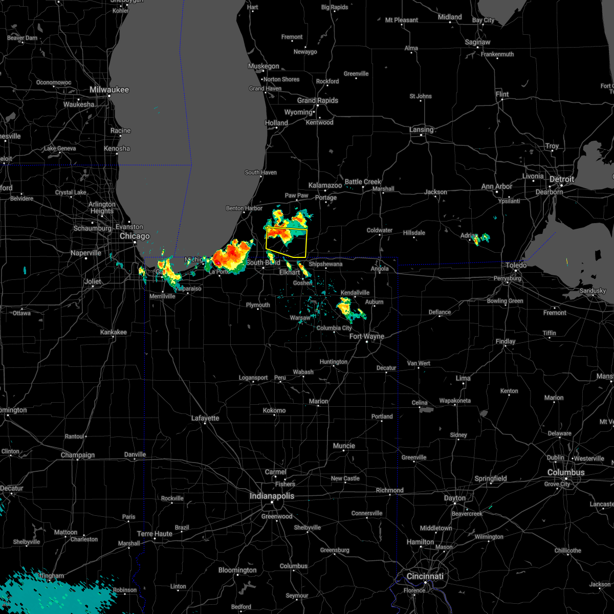 At 748 pm edt, a severe thunderstorm was located near dowagiac, moving east at 25 mph (radar indicated). Hazards include 60 mph wind gusts and quarter size hail. Hail damage to vehicles is expected. Expect wind damage to roofs, siding, and trees. At 748 pm edt, a severe thunderstorm was located near dowagiac, moving east at 25 mph (radar indicated). Hazards include 60 mph wind gusts and quarter size hail. Hail damage to vehicles is expected. Expect wind damage to roofs, siding, and trees.
|
| 11/10/2020 9:27 PM EST |
 The severe thunderstorm warning for st. joseph, northeastern starke, northwestern marshall, western cass and southeastern berrien counties will expire at 930 pm est/830 pm cst/, the storms which prompted the warning have weakened below severe limits, and no longer pose an immediate threat to life or property. therefore, the warning will be allowed to expire. however gusty winds are still possible with these thunderstorms. a severe thunderstorm watch remains in effect until midnight est/1100 pm cst/ for north central and northwestern indiana, and southwestern michigan. The severe thunderstorm warning for st. joseph, northeastern starke, northwestern marshall, western cass and southeastern berrien counties will expire at 930 pm est/830 pm cst/, the storms which prompted the warning have weakened below severe limits, and no longer pose an immediate threat to life or property. therefore, the warning will be allowed to expire. however gusty winds are still possible with these thunderstorms. a severe thunderstorm watch remains in effect until midnight est/1100 pm cst/ for north central and northwestern indiana, and southwestern michigan.
|
| 11/10/2020 9:14 PM EST |
 At 913 pm est/813 pm cst/, severe thunderstorms were located along a line extending from near watervliet to near hamlet, moving east at 35 mph (radar indicated). Hazards include 60 mph wind gusts. Expect damage to roofs, siding, and trees. Locations impacted include, south bend, mishawaka, niles, plymouth, dowagiac, buchanan, georgetown, gulivoire park, granger, osceola, walkerton, north liberty, new carlisle, berrien springs, cassopolis, watervliet, edwardsburg, hamlet, lakeville and roseland. At 913 pm est/813 pm cst/, severe thunderstorms were located along a line extending from near watervliet to near hamlet, moving east at 35 mph (radar indicated). Hazards include 60 mph wind gusts. Expect damage to roofs, siding, and trees. Locations impacted include, south bend, mishawaka, niles, plymouth, dowagiac, buchanan, georgetown, gulivoire park, granger, osceola, walkerton, north liberty, new carlisle, berrien springs, cassopolis, watervliet, edwardsburg, hamlet, lakeville and roseland.
|
| 11/10/2020 8:42 PM EST |
 The national weather service in northern indiana has issued a * severe thunderstorm warning for. st. joseph county in north central indiana. northeastern starke county in northwestern indiana. northwestern marshall county in north central indiana. La porte county in northwestern indiana. The national weather service in northern indiana has issued a * severe thunderstorm warning for. st. joseph county in north central indiana. northeastern starke county in northwestern indiana. northwestern marshall county in north central indiana. La porte county in northwestern indiana.
|
| 11/10/2020 8:42 PM EST |
 At 842 pm est/742 pm cst/, severe thunderstorms were located along a line extending from near benton harbor to wanatah, moving east at 45 mph (radar indicated). Hazards include 60 mph wind gusts. expect damage to roofs, siding, and trees At 842 pm est/742 pm cst/, severe thunderstorms were located along a line extending from near benton harbor to wanatah, moving east at 45 mph (radar indicated). Hazards include 60 mph wind gusts. expect damage to roofs, siding, and trees
|
| 8/29/2020 12:39 AM EDT |
 At 1239 am edt, severe thunderstorms were located along a line extending from marcellus to near edwardsburg to near three oaks, moving east at 45 mph (radar indicated). Hazards include 60 mph wind gusts. expect damage to roofs, siding, and trees At 1239 am edt, severe thunderstorms were located along a line extending from marcellus to near edwardsburg to near three oaks, moving east at 45 mph (radar indicated). Hazards include 60 mph wind gusts. expect damage to roofs, siding, and trees
|
| 8/29/2020 12:22 AM EDT |
 At 1222 am edt, severe thunderstorms were located along a line extending from near paw paw to near dowagiac to shorewood-tower hills-harbert, moving east at 45 mph (radar indicated). Hazards include 60 mph wind gusts. Expect damage to roofs, siding, and trees. locations impacted include, niles, benton harbor, st. Joseph, dowagiac, buchanan, fair plain, benton heights, bridgman, berrien springs, stevensville, shorewood-tower hill, shorewood-tower hills-harbert, pokagon, sodus, baroda, shoreham, eau claire, union pier, magician lake and dewey lake. At 1222 am edt, severe thunderstorms were located along a line extending from near paw paw to near dowagiac to shorewood-tower hills-harbert, moving east at 45 mph (radar indicated). Hazards include 60 mph wind gusts. Expect damage to roofs, siding, and trees. locations impacted include, niles, benton harbor, st. Joseph, dowagiac, buchanan, fair plain, benton heights, bridgman, berrien springs, stevensville, shorewood-tower hill, shorewood-tower hills-harbert, pokagon, sodus, baroda, shoreham, eau claire, union pier, magician lake and dewey lake.
|
| 8/29/2020 12:06 AM EDT |
 At 1205 am edt, severe thunderstorms were located along a line extending from lake michigan beach to near stevensville to near shorewood-tower hills-harbert, moving east at 45 mph (radar indicated). Hazards include 60 mph wind gusts. expect damage to roofs, siding, and trees At 1205 am edt, severe thunderstorms were located along a line extending from lake michigan beach to near stevensville to near shorewood-tower hills-harbert, moving east at 45 mph (radar indicated). Hazards include 60 mph wind gusts. expect damage to roofs, siding, and trees
|
| 8/10/2020 6:47 PM EDT |
 At 647 pm edt, severe thunderstorms were located along a line extending from near marcellus to elkhart to nappanee to near warsaw, moving east at 45 mph. these are very dangerous storms (radar indicated). Hazards include 80 mph wind gusts and quarter size hail. Flying debris will be dangerous to those caught without shelter. mobile homes will be heavily damaged. expect considerable damage to roofs, windows, and vehicles. extensive tree damage and power outages are likely. these severe storms will be near, marcellus around 650 pm edt. warsaw, winona lake, bristol and milford around 655 pm edt. goshen, three rivers and new paris around 700 pm edt. syracuse, middlebury, north webster, pierceton and millersburg around 705 pm edt. centreville around 710 pm edt. columbia city, ligonier and topeka around 715 pm edt. tri-lakes around 720 pm edt. sturgis, lagrange, albion and colon around 725 pm edt. Other locations impacted by these severe thunderstorms include honeyville, nottawa, atwood, juno lake, fishers lake, diamond lake, corey lake, howe, locke and wakelee. At 647 pm edt, severe thunderstorms were located along a line extending from near marcellus to elkhart to nappanee to near warsaw, moving east at 45 mph. these are very dangerous storms (radar indicated). Hazards include 80 mph wind gusts and quarter size hail. Flying debris will be dangerous to those caught without shelter. mobile homes will be heavily damaged. expect considerable damage to roofs, windows, and vehicles. extensive tree damage and power outages are likely. these severe storms will be near, marcellus around 650 pm edt. warsaw, winona lake, bristol and milford around 655 pm edt. goshen, three rivers and new paris around 700 pm edt. syracuse, middlebury, north webster, pierceton and millersburg around 705 pm edt. centreville around 710 pm edt. columbia city, ligonier and topeka around 715 pm edt. tri-lakes around 720 pm edt. sturgis, lagrange, albion and colon around 725 pm edt. Other locations impacted by these severe thunderstorms include honeyville, nottawa, atwood, juno lake, fishers lake, diamond lake, corey lake, howe, locke and wakelee.
|
| 8/10/2020 6:24 PM EDT |
 At 623 pm edt, severe thunderstorms were located along a line extending from near dowagiac to near south bend to near plymouth to argos, moving east at 45 mph. these are very dangerous storms (radar indicated). Hazards include 80 mph wind gusts and quarter size hail. Flying debris will be dangerous to those caught without shelter. mobile homes will be heavily damaged. expect considerable damage to roofs, windows, and vehicles. extensive tree damage and power outages are likely. severe thunderstorms will be near, mishawaka and dowagiac around 630 pm edt. bremen, granger, bourbon and cassopolis around 635 pm edt. osceola and mentone around 640 pm edt. elkhart, simonton lake, wakarusa and marcellus around 645 pm edt. nappanee and dunlap around 650 pm edt. warsaw, winona lake, bristol, milford and new paris around 655 pm edt. goshen, three rivers, syracuse and pierceton around 700 pm edt. middlebury, centreville, north webster and millersburg around 705 pm edt. This includes interstate 80 in indiana between mile markers 73 and 124. At 623 pm edt, severe thunderstorms were located along a line extending from near dowagiac to near south bend to near plymouth to argos, moving east at 45 mph. these are very dangerous storms (radar indicated). Hazards include 80 mph wind gusts and quarter size hail. Flying debris will be dangerous to those caught without shelter. mobile homes will be heavily damaged. expect considerable damage to roofs, windows, and vehicles. extensive tree damage and power outages are likely. severe thunderstorms will be near, mishawaka and dowagiac around 630 pm edt. bremen, granger, bourbon and cassopolis around 635 pm edt. osceola and mentone around 640 pm edt. elkhart, simonton lake, wakarusa and marcellus around 645 pm edt. nappanee and dunlap around 650 pm edt. warsaw, winona lake, bristol, milford and new paris around 655 pm edt. goshen, three rivers, syracuse and pierceton around 700 pm edt. middlebury, centreville, north webster and millersburg around 705 pm edt. This includes interstate 80 in indiana between mile markers 73 and 124.
|
| 8/10/2020 6:19 PM EDT |
 At 618 pm edt/518 pm cdt/, severe thunderstorms were located along a line extending from near dowagiac to near gulivoire park to near bremen to near culver, moving east at 60 mph. these are very dangerous storms (trained weather spotters quarter sized hail and tree branches down in baroda, michigan). Hazards include 80 mph wind gusts and quarter size hail. Flying debris will be dangerous to those caught without shelter. mobile homes will be heavily damaged. expect considerable damage to roofs, windows, and vehicles. extensive tree damage and power outages are likely. these severe storms will be near, dowagiac around 625 pm edt. osceola and bourbon around 630 pm edt. Other locations impacted by these severe thunderstorms include dewey lake, harbert, bertrand, fish lake, brems, crumstown, tyner, millburg, hibbard and tippecanoe. At 618 pm edt/518 pm cdt/, severe thunderstorms were located along a line extending from near dowagiac to near gulivoire park to near bremen to near culver, moving east at 60 mph. these are very dangerous storms (trained weather spotters quarter sized hail and tree branches down in baroda, michigan). Hazards include 80 mph wind gusts and quarter size hail. Flying debris will be dangerous to those caught without shelter. mobile homes will be heavily damaged. expect considerable damage to roofs, windows, and vehicles. extensive tree damage and power outages are likely. these severe storms will be near, dowagiac around 625 pm edt. osceola and bourbon around 630 pm edt. Other locations impacted by these severe thunderstorms include dewey lake, harbert, bertrand, fish lake, brems, crumstown, tyner, millburg, hibbard and tippecanoe.
|
| 8/10/2020 6:11 PM EDT |
 At 610 pm edt/510 pm cdt/, severe thunderstorms were located along a line extending from berrien springs to 6 miles southeast of new carlisle to 6 miles northwest of plymouth to near culver, moving east at 60 mph. these are very dangerous storms (trained weather spotters quarter sized hail and tree branches down in baroda, michigan). Hazards include 80 mph wind gusts and quarter size hail. Flying debris will be dangerous to those caught without shelter. mobile homes will be heavily damaged. expect considerable damage to roofs, windows, and vehicles. extensive tree damage and power outages are likely. these severe storms will be near, south bend and plymouth around 615 pm edt. niles, gulivoire park, lakeville and roseland around 620 pm edt. mishawaka, dowagiac, bremen and argos around 625 pm edt. osceola and bourbon around 630 pm edt. Other locations impacted by these severe thunderstorms include dewey lake, lomax, waterford, michiana shores, harbert, bertrand, fish lake, brems, crumstown and tyner. At 610 pm edt/510 pm cdt/, severe thunderstorms were located along a line extending from berrien springs to 6 miles southeast of new carlisle to 6 miles northwest of plymouth to near culver, moving east at 60 mph. these are very dangerous storms (trained weather spotters quarter sized hail and tree branches down in baroda, michigan). Hazards include 80 mph wind gusts and quarter size hail. Flying debris will be dangerous to those caught without shelter. mobile homes will be heavily damaged. expect considerable damage to roofs, windows, and vehicles. extensive tree damage and power outages are likely. these severe storms will be near, south bend and plymouth around 615 pm edt. niles, gulivoire park, lakeville and roseland around 620 pm edt. mishawaka, dowagiac, bremen and argos around 625 pm edt. osceola and bourbon around 630 pm edt. Other locations impacted by these severe thunderstorms include dewey lake, lomax, waterford, michiana shores, harbert, bertrand, fish lake, brems, crumstown and tyner.
|
| 8/10/2020 5:42 PM EDT |
 At 541 pm edt/441 pm cdt/, severe thunderstorms were located along a line extending from 9 miles northwest of new buffalo to near westville to wanatah to near dunns bridge, moving east at 60 mph. these are very dangerous storms (radar indicated). Hazards include 80 mph wind gusts and quarter size hail. Flying debris will be dangerous to those caught without shelter. mobile homes will be heavily damaged. expect considerable damage to roofs, windows, and vehicles. extensive tree damage and power outages are likely. these severe storms will be near, trail creek around 545 pm edt. new buffalo and kingsford heights around 550 pm edt. la porte, bridgman, north judson, shorewood-tower hills-harbert and shorewood-tower hill around 555 pm edt. knox, stevensville and hamlet around 600 pm edt. buchanan, walkerton, new carlisle and koontz lake around 605 pm edt. plymouth, north liberty and berrien springs around 610 pm edt. south bend, niles and culver around 615 pm edt. bremen, georgetown, gulivoire park, lakeville and roseland around 620 pm edt. Other locations impacted by these severe thunderstorms include dewey lake, lomax, waterford, michiana shores, harbert, bertrand, fish lake, brems, crumstown and tyner. At 541 pm edt/441 pm cdt/, severe thunderstorms were located along a line extending from 9 miles northwest of new buffalo to near westville to wanatah to near dunns bridge, moving east at 60 mph. these are very dangerous storms (radar indicated). Hazards include 80 mph wind gusts and quarter size hail. Flying debris will be dangerous to those caught without shelter. mobile homes will be heavily damaged. expect considerable damage to roofs, windows, and vehicles. extensive tree damage and power outages are likely. these severe storms will be near, trail creek around 545 pm edt. new buffalo and kingsford heights around 550 pm edt. la porte, bridgman, north judson, shorewood-tower hills-harbert and shorewood-tower hill around 555 pm edt. knox, stevensville and hamlet around 600 pm edt. buchanan, walkerton, new carlisle and koontz lake around 605 pm edt. plymouth, north liberty and berrien springs around 610 pm edt. south bend, niles and culver around 615 pm edt. bremen, georgetown, gulivoire park, lakeville and roseland around 620 pm edt. Other locations impacted by these severe thunderstorms include dewey lake, lomax, waterford, michiana shores, harbert, bertrand, fish lake, brems, crumstown and tyner.
|
| 8/10/2020 5:19 PM EDT |
 At 517 pm edt/417 pm cdt/, severe thunderstorms were located along a line extending from 16 miles northeast of hyde park to near gary to near crown point to near lake village, moving east at 55 mph. these are very dangerous storms (radar indicated). Hazards include 80 mph wind gusts and quarter size hail. Flying debris will be dangerous to those caught without shelter. mobile homes will be heavily damaged. expect considerable damage to roofs, windows, and vehicles. extensive tree damage and power outages are likely. severe thunderstorms will be near, wanatah and la crosse around 540 pm edt. westville and trail creek around 545 pm edt. new buffalo and kingsford heights around 550 pm edt. la porte, knox, bridgman, north judson, three oaks, hamlet, shorewood-tower hills-harbert and shorewood-tower hill around 555 pm edt. stevensville around 600 pm edt. buchanan, walkerton, new carlisle and koontz lake around 605 pm edt. plymouth, north liberty and berrien springs around 610 pm edt. south bend, niles and culver around 615 pm edt. this includes the following highways, interstate 196 between mile markers 0 and 7. interstate 80 in indiana between mile markers 38 and 87. interstate 94 in indiana between mile markers 33 and 45. Interstate 94 in michigan between mile markers 0 and 42. At 517 pm edt/417 pm cdt/, severe thunderstorms were located along a line extending from 16 miles northeast of hyde park to near gary to near crown point to near lake village, moving east at 55 mph. these are very dangerous storms (radar indicated). Hazards include 80 mph wind gusts and quarter size hail. Flying debris will be dangerous to those caught without shelter. mobile homes will be heavily damaged. expect considerable damage to roofs, windows, and vehicles. extensive tree damage and power outages are likely. severe thunderstorms will be near, wanatah and la crosse around 540 pm edt. westville and trail creek around 545 pm edt. new buffalo and kingsford heights around 550 pm edt. la porte, knox, bridgman, north judson, three oaks, hamlet, shorewood-tower hills-harbert and shorewood-tower hill around 555 pm edt. stevensville around 600 pm edt. buchanan, walkerton, new carlisle and koontz lake around 605 pm edt. plymouth, north liberty and berrien springs around 610 pm edt. south bend, niles and culver around 615 pm edt. this includes the following highways, interstate 196 between mile markers 0 and 7. interstate 80 in indiana between mile markers 38 and 87. interstate 94 in indiana between mile markers 33 and 45. Interstate 94 in michigan between mile markers 0 and 42.
|
| 6/26/2020 9:56 PM EDT |
 At 956 pm edt, severe thunderstorms were located along a line extending from near cassopolis to gulivoire park, moving east at 60 mph (radar indicated). Hazards include 60 mph wind gusts. Expect damage to roofs, siding, and trees. these severe storms will be near, osceola around 1005 pm edt. wakarusa around 1010 pm edt. constantine and white pigeon around 1015 pm edt. goshen around 1020 pm edt. Other locations impacted by these severe thunderstorms include vandalia, dailey, la grange, paradise lake, barron lake, calvin center, adamsville, sumnerville, juno lake and donnell lake. At 956 pm edt, severe thunderstorms were located along a line extending from near cassopolis to gulivoire park, moving east at 60 mph (radar indicated). Hazards include 60 mph wind gusts. Expect damage to roofs, siding, and trees. these severe storms will be near, osceola around 1005 pm edt. wakarusa around 1010 pm edt. constantine and white pigeon around 1015 pm edt. goshen around 1020 pm edt. Other locations impacted by these severe thunderstorms include vandalia, dailey, la grange, paradise lake, barron lake, calvin center, adamsville, sumnerville, juno lake and donnell lake.
|
| 6/26/2020 9:34 PM EDT |
 At 934 pm edt, severe thunderstorms were located along a line extending from berrien springs to 6 miles southwest of new carlisle, moving east at 45 mph (radar indicated). Hazards include 70 mph wind gusts. Expect considerable tree damage. damage is likely to mobile homes, roofs, and outbuildings. severe thunderstorms will be near, niles and dowagiac around 945 pm edt. cassopolis and edwardsburg around 955 pm edt. elkhart and simonton lake around 1000 pm edt. bristol around 1010 pm edt. constantine, wakarusa and white pigeon around 1015 pm edt. other locations impacted by these severe thunderstorms include vandalia, dailey, la grange, paradise lake, barron lake, calvin center, adamsville, sumnerville, juno lake and donnell lake. This includes interstate 80 in indiana between mile markers 79 and 107. At 934 pm edt, severe thunderstorms were located along a line extending from berrien springs to 6 miles southwest of new carlisle, moving east at 45 mph (radar indicated). Hazards include 70 mph wind gusts. Expect considerable tree damage. damage is likely to mobile homes, roofs, and outbuildings. severe thunderstorms will be near, niles and dowagiac around 945 pm edt. cassopolis and edwardsburg around 955 pm edt. elkhart and simonton lake around 1000 pm edt. bristol around 1010 pm edt. constantine, wakarusa and white pigeon around 1015 pm edt. other locations impacted by these severe thunderstorms include vandalia, dailey, la grange, paradise lake, barron lake, calvin center, adamsville, sumnerville, juno lake and donnell lake. This includes interstate 80 in indiana between mile markers 79 and 107.
|
| 6/22/2020 6:25 PM EDT |
 The severe thunderstorm warning for northern cass county will expire at 630 pm edt, the storm which prompted the warning has weakened below severe limits, and no longer poses an immediate threat to life or property. therefore, the warning will be allowed to expire. however heavy rain is still possible with this thunderstorm. The severe thunderstorm warning for northern cass county will expire at 630 pm edt, the storm which prompted the warning has weakened below severe limits, and no longer poses an immediate threat to life or property. therefore, the warning will be allowed to expire. however heavy rain is still possible with this thunderstorm.
|
| 6/22/2020 6:20 PM EDT |
 At 620 pm edt, a severe thunderstorm was located near dowagiac, moving northeast at 30 mph (radar indicated). Hazards include 60 mph wind gusts and quarter size hail. Hail damage to vehicles is expected. expect wind damage to roofs, siding, and trees. Locations impacted include, dowagiac, marcellus, wakelee and la grange. At 620 pm edt, a severe thunderstorm was located near dowagiac, moving northeast at 30 mph (radar indicated). Hazards include 60 mph wind gusts and quarter size hail. Hail damage to vehicles is expected. expect wind damage to roofs, siding, and trees. Locations impacted include, dowagiac, marcellus, wakelee and la grange.
|
| 6/22/2020 6:11 PM EDT |
 At 611 pm edt, a severe thunderstorm was located over dowagiac, moving northeast at 30 mph (radar indicated). Hazards include 60 mph wind gusts and quarter size hail. Hail damage to vehicles is expected. expect wind damage to roofs, siding, and trees. Locations impacted include, dowagiac, cassopolis, marcellus, penn, wakelee and la grange. At 611 pm edt, a severe thunderstorm was located over dowagiac, moving northeast at 30 mph (radar indicated). Hazards include 60 mph wind gusts and quarter size hail. Hail damage to vehicles is expected. expect wind damage to roofs, siding, and trees. Locations impacted include, dowagiac, cassopolis, marcellus, penn, wakelee and la grange.
|
| 6/22/2020 6:03 PM EDT |
 At 603 pm edt, a severe thunderstorm was located near dowagiac, moving northeast at 30 mph (radar indicated). Hazards include 60 mph wind gusts and quarter size hail. Hail damage to vehicles is expected. Expect wind damage to roofs, siding, and trees. At 603 pm edt, a severe thunderstorm was located near dowagiac, moving northeast at 30 mph (radar indicated). Hazards include 60 mph wind gusts and quarter size hail. Hail damage to vehicles is expected. Expect wind damage to roofs, siding, and trees.
|
| 6/25/2019 7:20 PM EDT |
 At 720 pm edt, a severe thunderstorm was located near dowagiac, moving east at 50 mph (radar indicated). Hazards include 60 mph wind gusts. Expect damage to roofs, siding, and trees. Locations impacted include, niles, dowagiac, buchanan, berrien springs, cassopolis, edwardsburg, marcellus, union, bertrand, pokagon, sodus, penn, eau claire, vandalia, magician lake, dewey lake, glendora, la grange, adamsville and juno lake. At 720 pm edt, a severe thunderstorm was located near dowagiac, moving east at 50 mph (radar indicated). Hazards include 60 mph wind gusts. Expect damage to roofs, siding, and trees. Locations impacted include, niles, dowagiac, buchanan, berrien springs, cassopolis, edwardsburg, marcellus, union, bertrand, pokagon, sodus, penn, eau claire, vandalia, magician lake, dewey lake, glendora, la grange, adamsville and juno lake.
|
| 6/25/2019 7:11 PM EDT |
 At 710 pm edt, a severe thunderstorm was located over berrien springs, or 9 miles north of buchanan, moving east at 50 mph (radar indicated). Hazards include 60 mph wind gusts. expect damage to roofs, siding, and trees At 710 pm edt, a severe thunderstorm was located over berrien springs, or 9 miles north of buchanan, moving east at 50 mph (radar indicated). Hazards include 60 mph wind gusts. expect damage to roofs, siding, and trees
|
| 5/19/2019 5:29 PM EDT |
 At 529 pm edt, a severe thunderstorm was located near cassopolis, or near dowagiac, moving northeast at 45 mph (radar indicated). Hazards include 60 mph wind gusts. Expect damage to roofs, siding, and trees. Locations impacted include, dowagiac, cassopolis, marcellus, penn, vandalia, diamond lake, dailey, la grange, donnell lake and wakelee. At 529 pm edt, a severe thunderstorm was located near cassopolis, or near dowagiac, moving northeast at 45 mph (radar indicated). Hazards include 60 mph wind gusts. Expect damage to roofs, siding, and trees. Locations impacted include, dowagiac, cassopolis, marcellus, penn, vandalia, diamond lake, dailey, la grange, donnell lake and wakelee.
|
| 5/19/2019 5:14 PM EDT |
 At 514 pm edt, a severe thunderstorm was located over niles, moving northeast at 40 mph (radar indicated). Hazards include 60 mph wind gusts. expect damage to roofs, siding, and trees At 514 pm edt, a severe thunderstorm was located over niles, moving northeast at 40 mph (radar indicated). Hazards include 60 mph wind gusts. expect damage to roofs, siding, and trees
|
| 3/14/2019 4:58 PM EDT |
 At 457 pm edt, severe thunderstorms were located along a line extending from marcellus to 7 miles east of cassopolis to near edwardsburg, moving northeast at 50 mph (radar indicated). Hazards include 60 mph wind gusts and quarter size hail. Hail damage to vehicles is expected. Expect wind damage to roofs, siding, and trees. At 457 pm edt, severe thunderstorms were located along a line extending from marcellus to 7 miles east of cassopolis to near edwardsburg, moving northeast at 50 mph (radar indicated). Hazards include 60 mph wind gusts and quarter size hail. Hail damage to vehicles is expected. Expect wind damage to roofs, siding, and trees.
|
| 3/14/2019 4:35 PM EDT |
 At 433 pm edt, a severe thunderstorm was located near dowagiac, moving northeast at 55 mph (public. this storm has a history of producing 1 inch hail). Hazards include 60 mph wind gusts and quarter size hail. Hail damage to vehicles is expected. expect wind damage to roofs, siding, and trees. Locations impacted include, niles, dowagiac, cassopolis, pokagon, penn, vandalia, magician lake, dewey lake, dailey, la grange, barron lake, sumnerville, indian lake, sandy beach, diamond lake and wakelee. At 433 pm edt, a severe thunderstorm was located near dowagiac, moving northeast at 55 mph (public. this storm has a history of producing 1 inch hail). Hazards include 60 mph wind gusts and quarter size hail. Hail damage to vehicles is expected. expect wind damage to roofs, siding, and trees. Locations impacted include, niles, dowagiac, cassopolis, pokagon, penn, vandalia, magician lake, dewey lake, dailey, la grange, barron lake, sumnerville, indian lake, sandy beach, diamond lake and wakelee.
|
| 3/14/2019 4:33 PM EDT | Corrects previous tstm wnd dmg report from 1 e marcellus. multiple trees blown down east of dowagiac along marcellus highwa in cass county MI, 2 miles SW of Dowagiac, MI |
| 3/14/2019 4:17 PM EDT |
 At 416 pm edt, a severe thunderstorm was located over niles, moving northeast at 55 mph (public reported quarter sized hail at hudson lake, at 411 pm edt ). Hazards include 60 mph wind gusts and quarter size hail. Hail damage to vehicles is expected. Expect wind damage to roofs, siding, and trees. At 416 pm edt, a severe thunderstorm was located over niles, moving northeast at 55 mph (public reported quarter sized hail at hudson lake, at 411 pm edt ). Hazards include 60 mph wind gusts and quarter size hail. Hail damage to vehicles is expected. Expect wind damage to roofs, siding, and trees.
|
| 9/25/2018 8:50 PM EDT |
 At 849 pm edt/749 pm cdt/, severe thunderstorms were located along a line extending from near dowagiac to georgetown to hamlet, moving east at 30 mph (radar indicated). Hazards include 60 mph wind gusts and penny size hail. Expect damage to roofs, siding, and trees. Locations impacted include, south bend, elkhart, mishawaka, niles, plymouth, dowagiac, buchanan, georgetown, gulivoire park, granger, simonton lake, osceola, walkerton, north liberty, new carlisle, cassopolis, kingsford heights, edwardsburg, hamlet and lakeville. At 849 pm edt/749 pm cdt/, severe thunderstorms were located along a line extending from near dowagiac to georgetown to hamlet, moving east at 30 mph (radar indicated). Hazards include 60 mph wind gusts and penny size hail. Expect damage to roofs, siding, and trees. Locations impacted include, south bend, elkhart, mishawaka, niles, plymouth, dowagiac, buchanan, georgetown, gulivoire park, granger, simonton lake, osceola, walkerton, north liberty, new carlisle, cassopolis, kingsford heights, edwardsburg, hamlet and lakeville.
|
| 9/25/2018 8:32 PM EDT |
 At 831 pm edt/731 pm cdt/, severe thunderstorms were located along a line extending from 7 miles northeast of berrien springs to near new carlisle to 6 miles southwest of kingsford heights, moving east at 30 mph (radar indicated). Hazards include 60 mph wind gusts and penny size hail. expect damage to roofs, siding, and trees At 831 pm edt/731 pm cdt/, severe thunderstorms were located along a line extending from 7 miles northeast of berrien springs to near new carlisle to 6 miles southwest of kingsford heights, moving east at 30 mph (radar indicated). Hazards include 60 mph wind gusts and penny size hail. expect damage to roofs, siding, and trees
|
| 9/3/2018 4:22 PM EDT | Dozens of trees down in sister lakes and scattered power outage in van buren county MI, 8.4 miles SE of Dowagiac, MI |
| 9/3/2018 4:06 PM EDT |
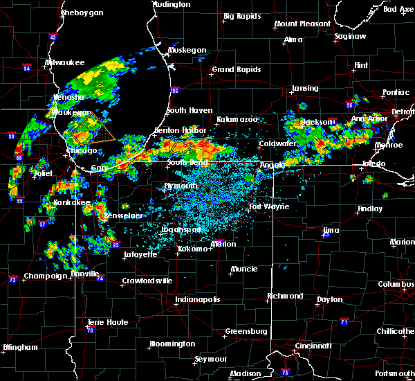 The severe thunderstorm warning for northwestern cass county will expire at 415 pm edt, the storm which prompted the warning has weakened below severe limits. therefore, the warning will be allowed to expire at 415 pm edt. however, wind gusts of around 50 mph and heavy rainfall will be possible through 430 pm edt. The severe thunderstorm warning for northwestern cass county will expire at 415 pm edt, the storm which prompted the warning has weakened below severe limits. therefore, the warning will be allowed to expire at 415 pm edt. however, wind gusts of around 50 mph and heavy rainfall will be possible through 430 pm edt.
|
| 9/3/2018 3:56 PM EDT | Wires down and arcing. pennsylvania avenu in cass county MI, 0.2 miles NNW of Dowagiac, MI |
| 9/3/2018 3:52 PM EDT | Tree down in the road. wilbur hill rd and peavine st. no information on size/health of the tre in cass county MI, 1.6 miles N of Dowagiac, MI |
| 9/3/2018 3:48 PM EDT |
 At 347 pm edt, a severe thunderstorm was located near dowagiac, moving northeast at 15 mph (radar indicated). Hazards include 60 mph wind gusts and quarter size hail. Hail damage to vehicles is expected. expect wind damage to roofs, siding, and trees. Locations impacted include, dowagiac, cassopolis, pokagon, dailey and la grange. At 347 pm edt, a severe thunderstorm was located near dowagiac, moving northeast at 15 mph (radar indicated). Hazards include 60 mph wind gusts and quarter size hail. Hail damage to vehicles is expected. expect wind damage to roofs, siding, and trees. Locations impacted include, dowagiac, cassopolis, pokagon, dailey and la grange.
|
| 9/3/2018 3:34 PM EDT | Wires down and arcing. allen road and hampshire stree in cass county MI, 6.1 miles NNE of Dowagiac, MI |
| 9/3/2018 3:34 PM EDT |
 At 331 pm edt, a severe thunderstorm was located near niles, moving northeast at 15 mph (radar indicated). Hazards include 60 mph wind gusts and quarter size hail. Hail damage to vehicles is expected. Expect wind damage to roofs, siding, and trees. At 331 pm edt, a severe thunderstorm was located near niles, moving northeast at 15 mph (radar indicated). Hazards include 60 mph wind gusts and quarter size hail. Hail damage to vehicles is expected. Expect wind damage to roofs, siding, and trees.
|
| 8/2/2018 7:10 PM EDT |
 At 710 pm edt, a severe thunderstorm was located near cassopolis, or 8 miles north of simonton lake, moving east at 20 mph (radar indicated). Hazards include 60 mph wind gusts and quarter size hail. Hail damage to vehicles is expected. expect wind damage to roofs, siding, and trees. Locations impacted include, cassopolis, edwardsburg, marcellus, union, penn, vandalia, dailey, la grange, paradise lake, calvin center, adamsville, juno lake, donnell lake, jones, diamond lake, shavehead lake, wakelee and eagle lake. At 710 pm edt, a severe thunderstorm was located near cassopolis, or 8 miles north of simonton lake, moving east at 20 mph (radar indicated). Hazards include 60 mph wind gusts and quarter size hail. Hail damage to vehicles is expected. expect wind damage to roofs, siding, and trees. Locations impacted include, cassopolis, edwardsburg, marcellus, union, penn, vandalia, dailey, la grange, paradise lake, calvin center, adamsville, juno lake, donnell lake, jones, diamond lake, shavehead lake, wakelee and eagle lake.
|
| 8/2/2018 6:52 PM EDT |
 At 651 pm edt, a severe thunderstorm was located from near edwardsburg to just west of cassopolis, moving northeast at 30 mph (radar indicated). Hazards include 60 mph wind gusts and quarter size hail. Hail damage to vehicles is expected. Expect wind damage to roofs, siding, and trees. At 651 pm edt, a severe thunderstorm was located from near edwardsburg to just west of cassopolis, moving northeast at 30 mph (radar indicated). Hazards include 60 mph wind gusts and quarter size hail. Hail damage to vehicles is expected. Expect wind damage to roofs, siding, and trees.
|
| 8/2/2018 5:43 PM EDT | 1 to 3 inch limbs down. time estimated by rada in cass county MI, 5.9 miles NE of Dowagiac, MI |
| 8/2/2018 5:40 PM EDT | 3 to 6 inch tree limbs down. time estimated based on rada in cass county MI, 3.6 miles ESE of Dowagiac, MI |
| 8/2/2018 5:21 PM EDT |
 At 521 pm edt, a severe thunderstorm was located 8 miles south of watervliet, or 8 miles southeast of benton heights, moving northeast at 60 mph (radar indicated). Hazards include 60 mph wind gusts and quarter size hail. Hail damage to vehicles is expected. Expect wind damage to roofs, siding, and trees. At 521 pm edt, a severe thunderstorm was located 8 miles south of watervliet, or 8 miles southeast of benton heights, moving northeast at 60 mph (radar indicated). Hazards include 60 mph wind gusts and quarter size hail. Hail damage to vehicles is expected. Expect wind damage to roofs, siding, and trees.
|
| 5/2/2018 10:45 PM EDT |
 A severe thunderstorm warning remains in effect until 1115 pm edt for northern cass and northwestern st. joseph counties. at 1041 pm edt, a severe thunderstorm was located near cassopolis, or 7 miles east of dowagiac, moving east at 50 mph. hazard. 60 mph wind gusts and penny size hail. source. Radar indicated. A severe thunderstorm warning remains in effect until 1115 pm edt for northern cass and northwestern st. joseph counties. at 1041 pm edt, a severe thunderstorm was located near cassopolis, or 7 miles east of dowagiac, moving east at 50 mph. hazard. 60 mph wind gusts and penny size hail. source. Radar indicated.
|
| 5/2/2018 10:24 PM EDT |
 At 1023 pm edt, a severe thunderstorm was located near berrien springs, or 8 miles north of niles, moving east at 50 mph (radar indicated). Hazards include 60 mph wind gusts and penny size hail. expect damage to roofs, siding, and trees At 1023 pm edt, a severe thunderstorm was located near berrien springs, or 8 miles north of niles, moving east at 50 mph (radar indicated). Hazards include 60 mph wind gusts and penny size hail. expect damage to roofs, siding, and trees
|
| 7/7/2017 3:59 AM EDT |
 At 359 am edt, severe thunderstorms were located along a line extending from near decatur to near berrien springs, moving southeast at 40 mph (radar indicated). Hazards include 60 mph wind gusts. expect damage to roofs, siding, and trees At 359 am edt, severe thunderstorms were located along a line extending from near decatur to near berrien springs, moving southeast at 40 mph (radar indicated). Hazards include 60 mph wind gusts. expect damage to roofs, siding, and trees
|
| 3/1/2017 1:39 AM EST |
 The severe thunderstorm warning for northern st. joseph, northeastern la porte, western cass and berrien counties will expire at 145 am est/1245 am cst/, the storms which prompted the warning have moved out of the area. therefore the warning will be allowed to expire. however gusty winds and heavy rain are still possible with these thunderstorms. a tornado watch remains in effect until 700 am est/600 am cst/ for north central and northwestern indiana. a severe thunderstorm watch remains in effect until 400 am est/300 am cst/ for southwestern michigan. The severe thunderstorm warning for northern st. joseph, northeastern la porte, western cass and berrien counties will expire at 145 am est/1245 am cst/, the storms which prompted the warning have moved out of the area. therefore the warning will be allowed to expire. however gusty winds and heavy rain are still possible with these thunderstorms. a tornado watch remains in effect until 700 am est/600 am cst/ for north central and northwestern indiana. a severe thunderstorm watch remains in effect until 400 am est/300 am cst/ for southwestern michigan.
|
| 3/1/2017 1:05 AM EST |
 At 104 am est/1204 am cst/, severe thunderstorms were located along a line extending from near fair plain to near buchanan to new carlisle, moving east at 65 mph (radar indicated). Hazards include 60 mph wind gusts and quarter size hail. Hail damage to vehicles is expected. expect wind damage to roofs, siding, and trees. trained spotters have reported quarter sized hail with this line of thunderstorms at union pier and new buffalo. locations impacted include, south bend, mishawaka, niles, dowagiac, buchanan, georgetown, granger, fair plain, new carlisle, berrien springs, cassopolis, edwardsburg, stevensville, roseland, bertrand, pokagon, dayton, sodus, penn and baroda. this includes the following highways, interstate 80 in indiana between mile markers 57 and 87. interstate 94 in michigan between mile markers 23 and 27. A tornado watch remains in effect until 700 am est/600 am cst/ for north central and northwestern indiana. At 104 am est/1204 am cst/, severe thunderstorms were located along a line extending from near fair plain to near buchanan to new carlisle, moving east at 65 mph (radar indicated). Hazards include 60 mph wind gusts and quarter size hail. Hail damage to vehicles is expected. expect wind damage to roofs, siding, and trees. trained spotters have reported quarter sized hail with this line of thunderstorms at union pier and new buffalo. locations impacted include, south bend, mishawaka, niles, dowagiac, buchanan, georgetown, granger, fair plain, new carlisle, berrien springs, cassopolis, edwardsburg, stevensville, roseland, bertrand, pokagon, dayton, sodus, penn and baroda. this includes the following highways, interstate 80 in indiana between mile markers 57 and 87. interstate 94 in michigan between mile markers 23 and 27. A tornado watch remains in effect until 700 am est/600 am cst/ for north central and northwestern indiana.
|
| 3/1/2017 12:40 AM EST |
 At 1240 am est/1140 pm cst/, severe thunderstorms were located along a line extending from 12 miles northwest of new buffalo to near long beach to near beverly shores, moving east at 65 mph (radar indicated). Hazards include 60 mph wind gusts and half dollar size hail. Hail damage to vehicles is expected. Expect wind damage to roofs, siding, and trees. At 1240 am est/1140 pm cst/, severe thunderstorms were located along a line extending from 12 miles northwest of new buffalo to near long beach to near beverly shores, moving east at 65 mph (radar indicated). Hazards include 60 mph wind gusts and half dollar size hail. Hail damage to vehicles is expected. Expect wind damage to roofs, siding, and trees.
|
| 2/28/2017 9:06 PM EST |
 At 906 pm est/806 pm cst/, severe thunderstorms were located along a line extending from near marcellus to 6 miles north of simonton lake to near south bend, moving east at 50 mph (radar indicated). Hazards include 60 mph wind gusts and nickel size hail. Expect damage to roofs, siding, and trees. locations impacted include, south bend, elkhart, mishawaka, la porte, niles, sturgis, three rivers, dowagiac, buchanan, georgetown, granger, simonton lake, constantine, new carlisle, cassopolis, bristol, white pigeon, centreville, edwardsburg and marcellus. This includes interstate 80 in indiana between mile markers 66 and 108. At 906 pm est/806 pm cst/, severe thunderstorms were located along a line extending from near marcellus to 6 miles north of simonton lake to near south bend, moving east at 50 mph (radar indicated). Hazards include 60 mph wind gusts and nickel size hail. Expect damage to roofs, siding, and trees. locations impacted include, south bend, elkhart, mishawaka, la porte, niles, sturgis, three rivers, dowagiac, buchanan, georgetown, granger, simonton lake, constantine, new carlisle, cassopolis, bristol, white pigeon, centreville, edwardsburg and marcellus. This includes interstate 80 in indiana between mile markers 66 and 108.
|
| 2/28/2017 9:00 PM EST | A few power poles downed on m5 in cass county MI, 0.2 miles NNW of Dowagiac, MI |
| 2/28/2017 8:52 PM EST |
 At 852 pm est/752 pm cst/, severe thunderstorms were located along a line extending from near dowagiac to near edwardsburg to near roseland, moving east at 50 mph (radar indicated). Hazards include 60 mph wind gusts and quarter size hail. Hail damage to vehicles is expected. expect wind damage to roofs, siding, and trees. These thunderstorms have a history of producing quarter sized hail and wind gusts to 60 mph. At 852 pm est/752 pm cst/, severe thunderstorms were located along a line extending from near dowagiac to near edwardsburg to near roseland, moving east at 50 mph (radar indicated). Hazards include 60 mph wind gusts and quarter size hail. Hail damage to vehicles is expected. expect wind damage to roofs, siding, and trees. These thunderstorms have a history of producing quarter sized hail and wind gusts to 60 mph.
|
| 2/28/2017 8:35 PM EST |
 At 835 pm est/735 pm cst/, severe thunderstorms were located along a line extending from near benton heights to near buchanan to westville, moving east at 65 mph (radar indicated). Hazards include 60 mph wind gusts and quarter size hail. Hail damage to vehicles is expected. expect wind damage to roofs, siding, and trees. locations impacted include, south bend, michigan city, la porte, niles, dowagiac, westville, buchanan, trail creek, fair plain, bridgman, new buffalo, new carlisle, berrien springs, three oaks, long beach, stevensville, pottawattamie park, shorewood-tower hill, shorewood-tower hills-harbert and bertrand. this includes the following highways, interstate 80 in indiana between mile markers 38 and 74. interstate 94 in indiana between mile markers 33 and 45. Interstate 94 in michigan between mile markers 0 and 30. At 835 pm est/735 pm cst/, severe thunderstorms were located along a line extending from near benton heights to near buchanan to westville, moving east at 65 mph (radar indicated). Hazards include 60 mph wind gusts and quarter size hail. Hail damage to vehicles is expected. expect wind damage to roofs, siding, and trees. locations impacted include, south bend, michigan city, la porte, niles, dowagiac, westville, buchanan, trail creek, fair plain, bridgman, new buffalo, new carlisle, berrien springs, three oaks, long beach, stevensville, pottawattamie park, shorewood-tower hill, shorewood-tower hills-harbert and bertrand. this includes the following highways, interstate 80 in indiana between mile markers 38 and 74. interstate 94 in indiana between mile markers 33 and 45. Interstate 94 in michigan between mile markers 0 and 30.
|
| 2/28/2017 8:06 PM EST |
 At 805 pm est/705 pm cst/, severe thunderstorms were located along a line extending from 12 miles north of long beach to near beverly shores to merrillville, moving east at 60 mph (radar indicated). Hazards include 60 mph wind gusts and quarter size hail. Hail damage to vehicles is expected. Expect wind damage to roofs, siding, and trees. At 805 pm est/705 pm cst/, severe thunderstorms were located along a line extending from 12 miles north of long beach to near beverly shores to merrillville, moving east at 60 mph (radar indicated). Hazards include 60 mph wind gusts and quarter size hail. Hail damage to vehicles is expected. Expect wind damage to roofs, siding, and trees.
|
| 8/14/2015 10:30 PM EDT |
 At 1030 pm edt, severe thunderstorms were located along a line extending from near decatur to near dowagiac to berrien springs, moving southeast at 40 mph (radar indicated). Hazards include 60 mph wind gusts. Expect damage to roofs. siding and trees. locations impacted include, dowagiac, fair plain, berrien springs, sodus, eau claire, dewey lake, magician lake, indian lake, sandy beach and sumnerville. This includes interstate 94 in michigan between mile markers 23 and 29. At 1030 pm edt, severe thunderstorms were located along a line extending from near decatur to near dowagiac to berrien springs, moving southeast at 40 mph (radar indicated). Hazards include 60 mph wind gusts. Expect damage to roofs. siding and trees. locations impacted include, dowagiac, fair plain, berrien springs, sodus, eau claire, dewey lake, magician lake, indian lake, sandy beach and sumnerville. This includes interstate 94 in michigan between mile markers 23 and 29.
|
| 8/14/2015 10:13 PM EDT |
 At 1013 pm edt, severe thunderstorms were located along a line extending from near bangor to 6 miles south of coloma to near stevensville, moving southeast at 40 mph (radar indicated). Hazards include 60 mph wind gusts. Expect damage to roofs. siding and trees. locations impacted include, benton harbor, st. joseph, dowagiac, fair plain, benton heights, berrien springs, watervliet, coloma, paw paw lake, lake michigan beach, sodus, riverside, shoreham, eau claire, spinks corners, indian lake, sumnerville, dewey lake, magician lake and sandy beach. this includes the following highways, interstate 196 between mile markers 0 and 7. Interstate 94 in michigan between mile markers 23 and 42. At 1013 pm edt, severe thunderstorms were located along a line extending from near bangor to 6 miles south of coloma to near stevensville, moving southeast at 40 mph (radar indicated). Hazards include 60 mph wind gusts. Expect damage to roofs. siding and trees. locations impacted include, benton harbor, st. joseph, dowagiac, fair plain, benton heights, berrien springs, watervliet, coloma, paw paw lake, lake michigan beach, sodus, riverside, shoreham, eau claire, spinks corners, indian lake, sumnerville, dewey lake, magician lake and sandy beach. this includes the following highways, interstate 196 between mile markers 0 and 7. Interstate 94 in michigan between mile markers 23 and 42.
|
| 8/14/2015 9:51 PM EDT |
 At 951 pm edt, severe thunderstorms were located along a line extending from near south haven to near lake michigan beach to 10 miles northwest of st. joseph, moving southeast at 40 mph (radar indicated). Hazards include 60 mph wind gusts and nickel size hail. Expect damage to roofs. Siding and trees. At 951 pm edt, severe thunderstorms were located along a line extending from near south haven to near lake michigan beach to 10 miles northwest of st. joseph, moving southeast at 40 mph (radar indicated). Hazards include 60 mph wind gusts and nickel size hail. Expect damage to roofs. Siding and trees.
|
| 7/18/2015 6:51 PM EDT |
 At 651 pm edt, severe thunderstorms were located along a line extending from lawton to edwardsburg, moving east at 40 mph (radar indicated). Hazards include 60 mph wind gusts. Expect damage to roofs. siding and trees. locations impacted include, three rivers, dowagiac, constantine, cassopolis, white pigeon, centreville, edwardsburg, marcellus, union, penn, flowerfield, mottville, vandalia, moore park, klinger lake, clear lake, donnell lake, juno lake, shavehead lake and calvin center. A tornado watch remains in effect until midnight edt for north central indiana and southwestern michigan. At 651 pm edt, severe thunderstorms were located along a line extending from lawton to edwardsburg, moving east at 40 mph (radar indicated). Hazards include 60 mph wind gusts. Expect damage to roofs. siding and trees. locations impacted include, three rivers, dowagiac, constantine, cassopolis, white pigeon, centreville, edwardsburg, marcellus, union, penn, flowerfield, mottville, vandalia, moore park, klinger lake, clear lake, donnell lake, juno lake, shavehead lake and calvin center. A tornado watch remains in effect until midnight edt for north central indiana and southwestern michigan.
|
| 7/18/2015 6:28 PM EDT |
 At 627 pm edt, severe thunderstorms were located along a line extending from near hartford to near buchanan, moving east at 35 mph (emergency management). Hazards include 60 mph wind gusts. Expect damage to roofs. Siding and trees. At 627 pm edt, severe thunderstorms were located along a line extending from near hartford to near buchanan, moving east at 35 mph (emergency management). Hazards include 60 mph wind gusts. Expect damage to roofs. Siding and trees.
|
| 7/18/2015 6:11 PM EDT |
 At 611 pm edt, severe thunderstorms were located along a line extending from lake michigan beach to near three oaks, moving east at 35 mph (radar indicated). Hazards include 60 mph wind gusts. Expect damage to roofs. siding and trees. locations impacted include, niles, benton harbor, st. joseph, dowagiac, buchanan, fair plain, benton heights, bridgman, new buffalo, berrien springs, cassopolis, watervliet, three oaks, coloma, edwardsburg, stevensville, lake michigan beach, shorewood-tower hills-harbert, paw paw lake and shorewood-tower hill. this includes the following highways, interstate 196 between mile markers 0 and 7. interstate 94 in michigan between mile markers 0 and 42. A tornado watch remains in effect until midnight edt for northwestern indiana and southwestern michigan. At 611 pm edt, severe thunderstorms were located along a line extending from lake michigan beach to near three oaks, moving east at 35 mph (radar indicated). Hazards include 60 mph wind gusts. Expect damage to roofs. siding and trees. locations impacted include, niles, benton harbor, st. joseph, dowagiac, buchanan, fair plain, benton heights, bridgman, new buffalo, berrien springs, cassopolis, watervliet, three oaks, coloma, edwardsburg, stevensville, lake michigan beach, shorewood-tower hills-harbert, paw paw lake and shorewood-tower hill. this includes the following highways, interstate 196 between mile markers 0 and 7. interstate 94 in michigan between mile markers 0 and 42. A tornado watch remains in effect until midnight edt for northwestern indiana and southwestern michigan.
|
| 7/18/2015 5:48 PM EDT |
 At 547 pm edt, severe thunderstorms were located along a line extending from 14 miles northwest of lake michigan beach to long beach, moving east at 45 mph (radar indicated). Hazards include 60 mph wind gusts. Expect damage to roofs. Siding and trees. At 547 pm edt, severe thunderstorms were located along a line extending from 14 miles northwest of lake michigan beach to long beach, moving east at 45 mph (radar indicated). Hazards include 60 mph wind gusts. Expect damage to roofs. Siding and trees.
|
| 7/17/2015 9:55 PM EDT | Half Dollar sized hail reported 0.2 miles NNW of Dowagiac, MI |
| 7/17/2015 9:40 PM EDT |
 At 940 pm edt, a severe thunderstorm was located over dowagiac, moving east at 25 mph (radar indicated). Hazards include 60 mph wind gusts and quarter size hail. Hail damage to vehicles is expected. expect wind damage to roofs, siding and trees. this severe thunderstorm will be near, dowagiac around 950 pm edt. cassopolis around 955 pm edt. marcellus around 1025 pm edt. Other locations impacted by this severe thunderstorm include penn, wakelee, la grange and vandalia. At 940 pm edt, a severe thunderstorm was located over dowagiac, moving east at 25 mph (radar indicated). Hazards include 60 mph wind gusts and quarter size hail. Hail damage to vehicles is expected. expect wind damage to roofs, siding and trees. this severe thunderstorm will be near, dowagiac around 950 pm edt. cassopolis around 955 pm edt. marcellus around 1025 pm edt. Other locations impacted by this severe thunderstorm include penn, wakelee, la grange and vandalia.
|
| 7/13/2015 8:57 AM EDT |
 At 857 am edt, a severe thunderstorm was located near niles, moving east southeast at 55 mph (radar indicated). Hazards include 60 mph wind gusts. Expect damage to roofs. siding and trees. this severe storm will be near, granger around 900 am edt. cassopolis and edwardsburg around 905 am edt. elkhart and simonton lake around 910 am edt. bristol around 920 am edt. middlebury, constantine and white pigeon around 925 am edt. other locations impacted by this severe thunderstorm include paradise lake, klinger lake, eagle lake, clear lake, diamond lake, adamsville, mottville, donnell lake, juno lake and shavehead lake. This includes interstate 80 in indiana between mile markers 74 and 113. At 857 am edt, a severe thunderstorm was located near niles, moving east southeast at 55 mph (radar indicated). Hazards include 60 mph wind gusts. Expect damage to roofs. siding and trees. this severe storm will be near, granger around 900 am edt. cassopolis and edwardsburg around 905 am edt. elkhart and simonton lake around 910 am edt. bristol around 920 am edt. middlebury, constantine and white pigeon around 925 am edt. other locations impacted by this severe thunderstorm include paradise lake, klinger lake, eagle lake, clear lake, diamond lake, adamsville, mottville, donnell lake, juno lake and shavehead lake. This includes interstate 80 in indiana between mile markers 74 and 113.
|
| 7/13/2015 8:45 AM EDT |
 At 845 am edt, a severe thunderstorm was located near buchanan, moving east southeast at 55 mph (radar indicated). Hazards include 60 mph wind gusts. Expect damage to roofs. siding and trees. this severe thunderstorm will be near, niles and georgetown around 855 am edt. granger and edwardsburg around 900 am edt. elkhart, simonton lake and cassopolis around 905 am edt. bristol around 915 am edt. middlebury, constantine and white pigeon around 925 am edt. other locations impacted by this severe thunderstorm include klinger lake, clear lake, donnell lake, juno lake, shavehead lake, sumnerville, bertrand, waterford mills, calvin center and lydick. This includes interstate 80 in indiana between mile markers 68 and 113. At 845 am edt, a severe thunderstorm was located near buchanan, moving east southeast at 55 mph (radar indicated). Hazards include 60 mph wind gusts. Expect damage to roofs. siding and trees. this severe thunderstorm will be near, niles and georgetown around 855 am edt. granger and edwardsburg around 900 am edt. elkhart, simonton lake and cassopolis around 905 am edt. bristol around 915 am edt. middlebury, constantine and white pigeon around 925 am edt. other locations impacted by this severe thunderstorm include klinger lake, clear lake, donnell lake, juno lake, shavehead lake, sumnerville, bertrand, waterford mills, calvin center and lydick. This includes interstate 80 in indiana between mile markers 68 and 113.
|
| 6/11/2015 4:58 PM EDT |
 At 457 pm edt, a severe thunderstorm was located near niles, moving north northeast at 30 mph (radar indicated). Hazards include 60 mph wind gusts and penny size hail. Expect damage to roofs. siding and trees. this severe storm will be near, cassopolis around 505 pm edt. dowagiac around 515 pm edt. Other locations impacted by this severe thunderstorm include magician lake, dewey lake, pokagon, la grange, indian lake, sandy beach, dailey, sumnerville and barron lake. At 457 pm edt, a severe thunderstorm was located near niles, moving north northeast at 30 mph (radar indicated). Hazards include 60 mph wind gusts and penny size hail. Expect damage to roofs. siding and trees. this severe storm will be near, cassopolis around 505 pm edt. dowagiac around 515 pm edt. Other locations impacted by this severe thunderstorm include magician lake, dewey lake, pokagon, la grange, indian lake, sandy beach, dailey, sumnerville and barron lake.
|
| 6/11/2015 4:41 PM EDT |
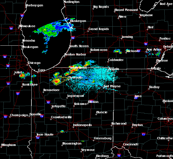 At 440 pm edt, a severe thunderstorm was located near niles, moving north northeast at 25 mph (radar indicated). Hazards include ping pong ball size hail and 60 mph wind gusts. People and animals outdoors will be injured. expect hail damage to roofs, siding, windows and vehicles. expect wind damage to roofs, siding and trees. this severe thunderstorm will be near, edwardsburg around 450 pm edt. cassopolis around 505 pm edt. dowagiac around 515 pm edt. Other locations impacted by this severe thunderstorm include dewey lake, magician lake, pokagon, la grange, indian lake, sandy beach, dailey, sumnerville, bertrand and barron lake. At 440 pm edt, a severe thunderstorm was located near niles, moving north northeast at 25 mph (radar indicated). Hazards include ping pong ball size hail and 60 mph wind gusts. People and animals outdoors will be injured. expect hail damage to roofs, siding, windows and vehicles. expect wind damage to roofs, siding and trees. this severe thunderstorm will be near, edwardsburg around 450 pm edt. cassopolis around 505 pm edt. dowagiac around 515 pm edt. Other locations impacted by this severe thunderstorm include dewey lake, magician lake, pokagon, la grange, indian lake, sandy beach, dailey, sumnerville, bertrand and barron lake.
|
| 6/30/2014 9:55 PM EDT | Reports of trees down blocking some streets in cass county MI, 2.3 miles NW of Dowagiac, MI |
| 6/23/2014 5:38 PM EDT | Storm damage reported in cass county MI, 0.2 miles NNW of Dowagiac, MI |
| 11/17/2013 3:25 PM EST | Building damage and limbs down in cass county MI, 0.2 miles NNW of Dowagiac, MI |
| 11/17/2013 3:25 PM EST | Building damage and limbs down. time estimated from rada in cass county MI, 3.2 miles W of Dowagiac, MI |
| 1/1/0001 12:00 AM | Tree down. time estimated from radar in cass county MI, 3.1 miles NW of Dowagiac, MI |
| 1/1/0001 12:00 AM | Large tree down in road near m51 and 92nd av in van buren county MI, 7.4 miles S of Dowagiac, MI |
| 1/1/0001 12:00 AM | Quarter sized hail reported 0.2 miles NNW of Dowagiac, MI, 1.00 inch hail came in bursts. hail is covering the ground. |
Hail Maps for Dowagiac, MI


Connect with Interactive Hail Maps