

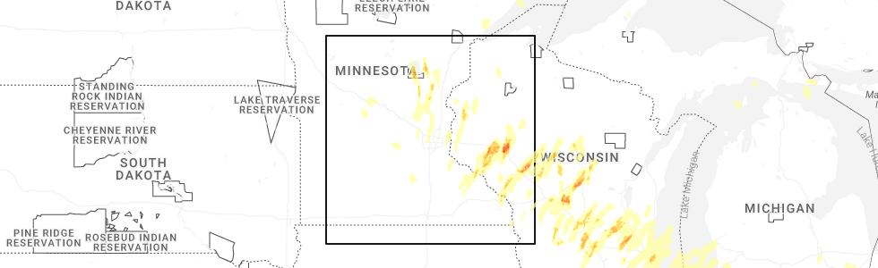
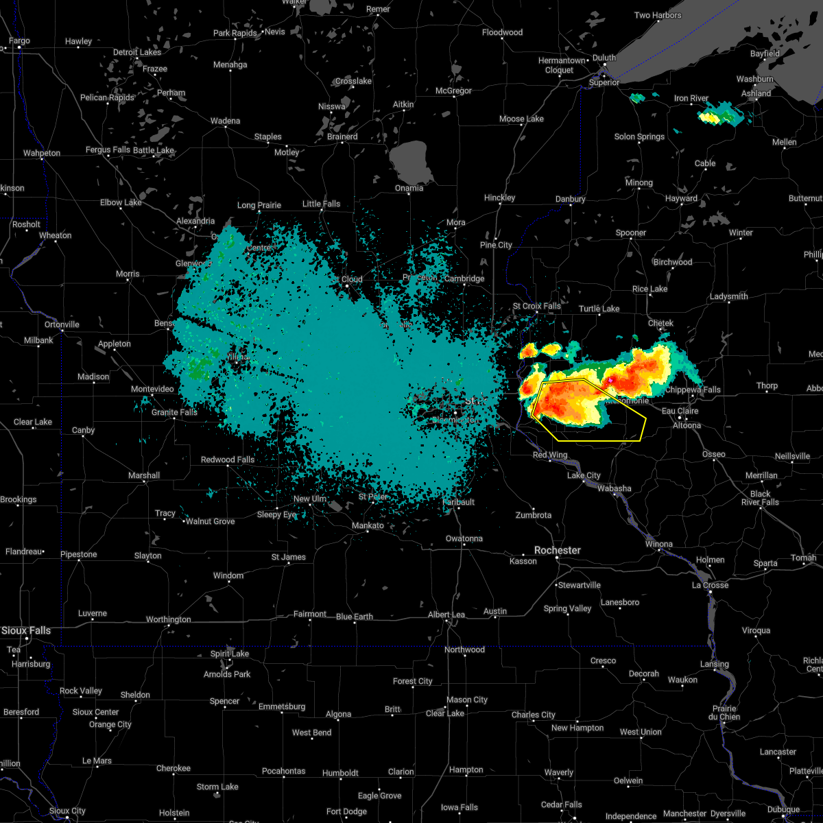
Hail Map for Downsville, WI
The Downsville, WI area has had 0 reports of on-the-ground hail by trained spotters, and has been under severe weather warnings 12 times during the past 12 months. Doppler radar has detected hail at or near Downsville, WI on 56 occasions, including 6 occasions during the past year.
| Name: | Downsville, WI |
| Where Located: | 67.4 miles ESE of Minneapolis, MN |
| Map: | Google Map for Downsville, WI |
| Population: | 146 |
| Housing Units: | 71 |
| More Info: | Search Google for Downsville, WI |
2
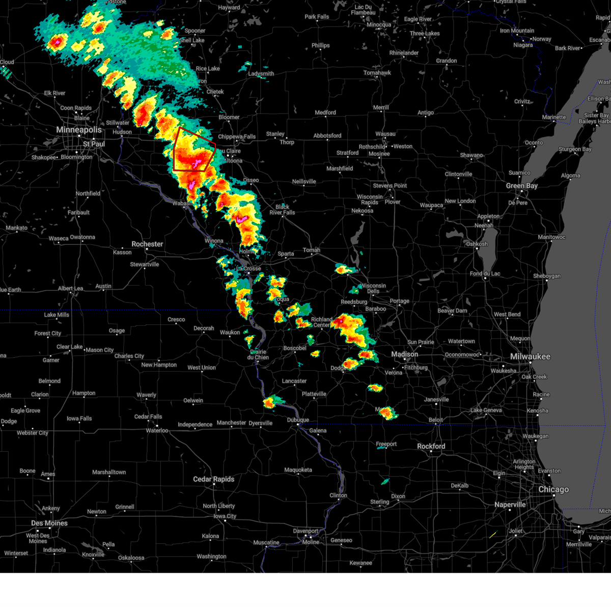
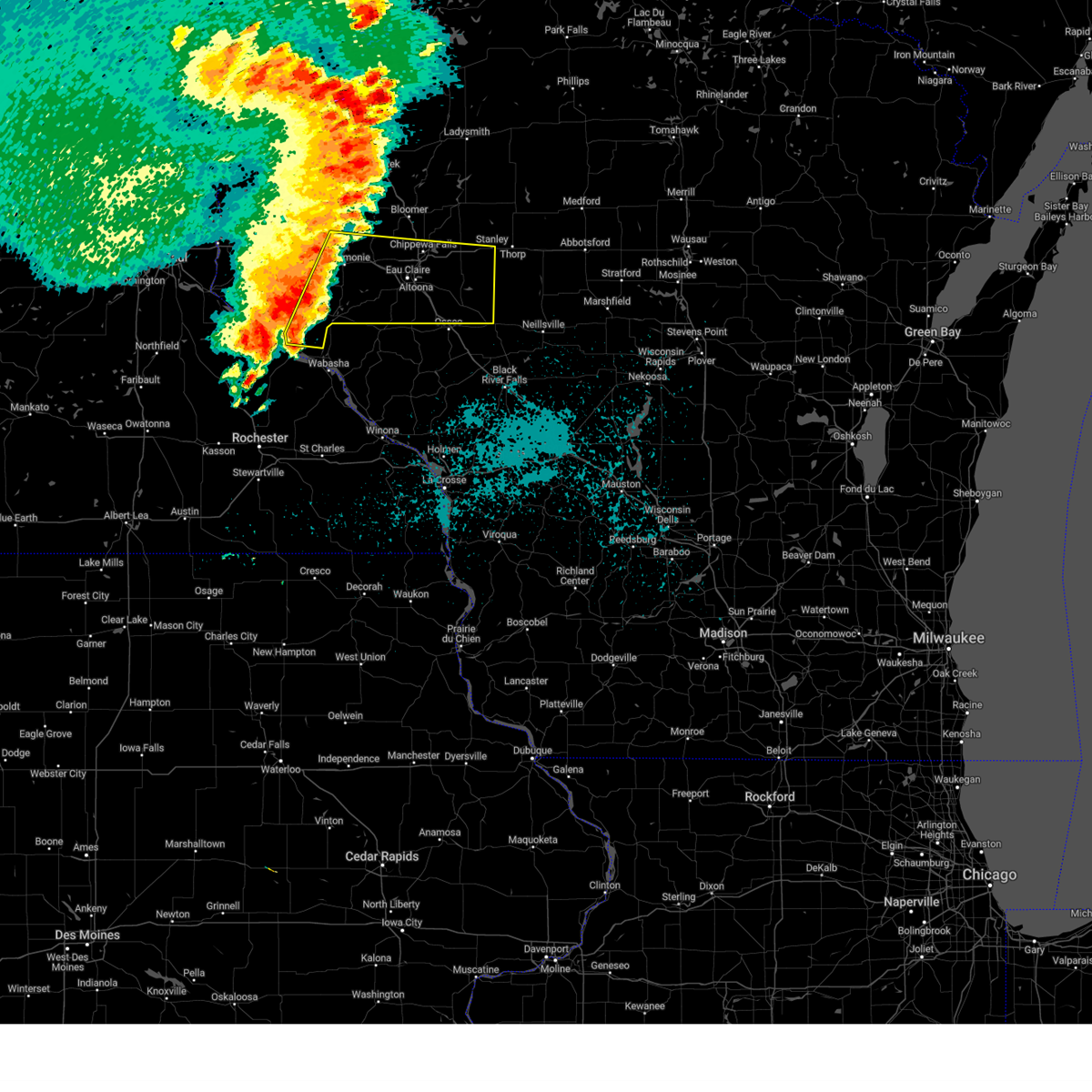
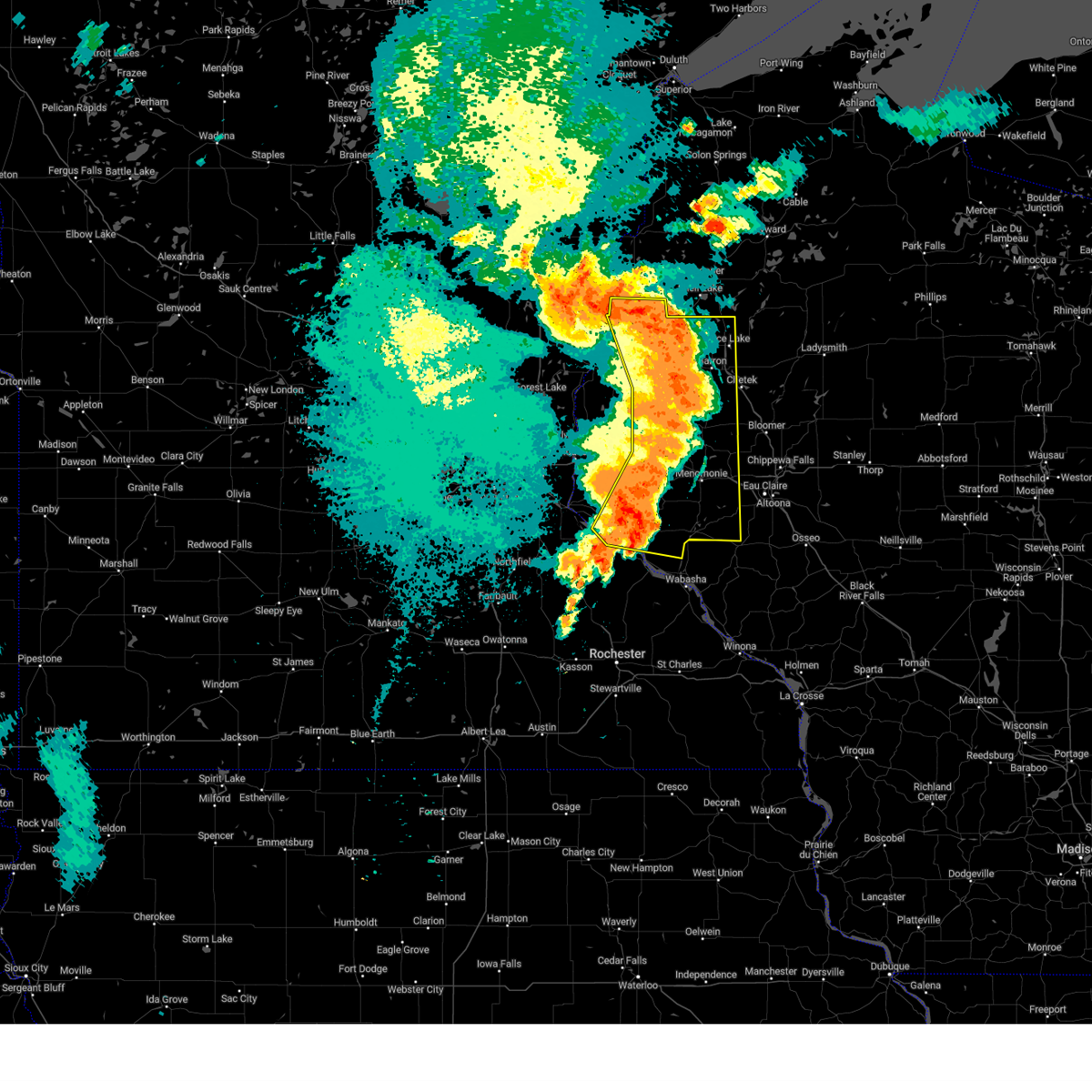
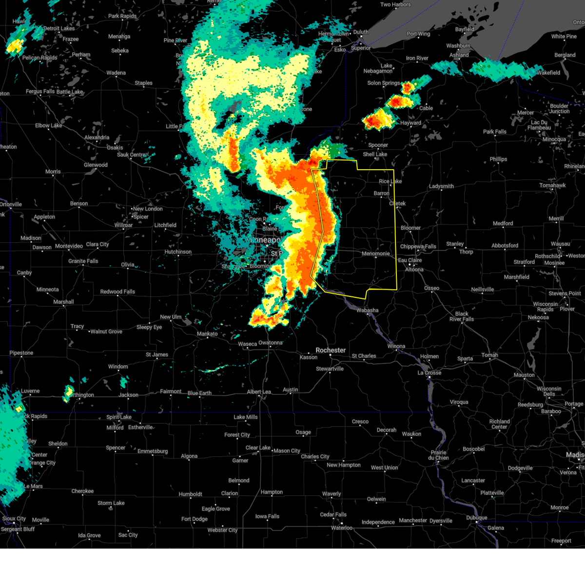
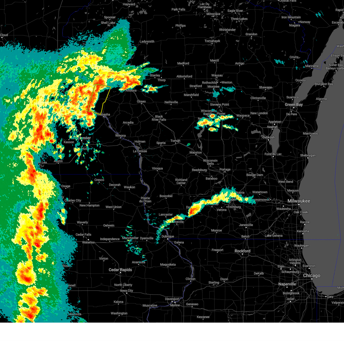
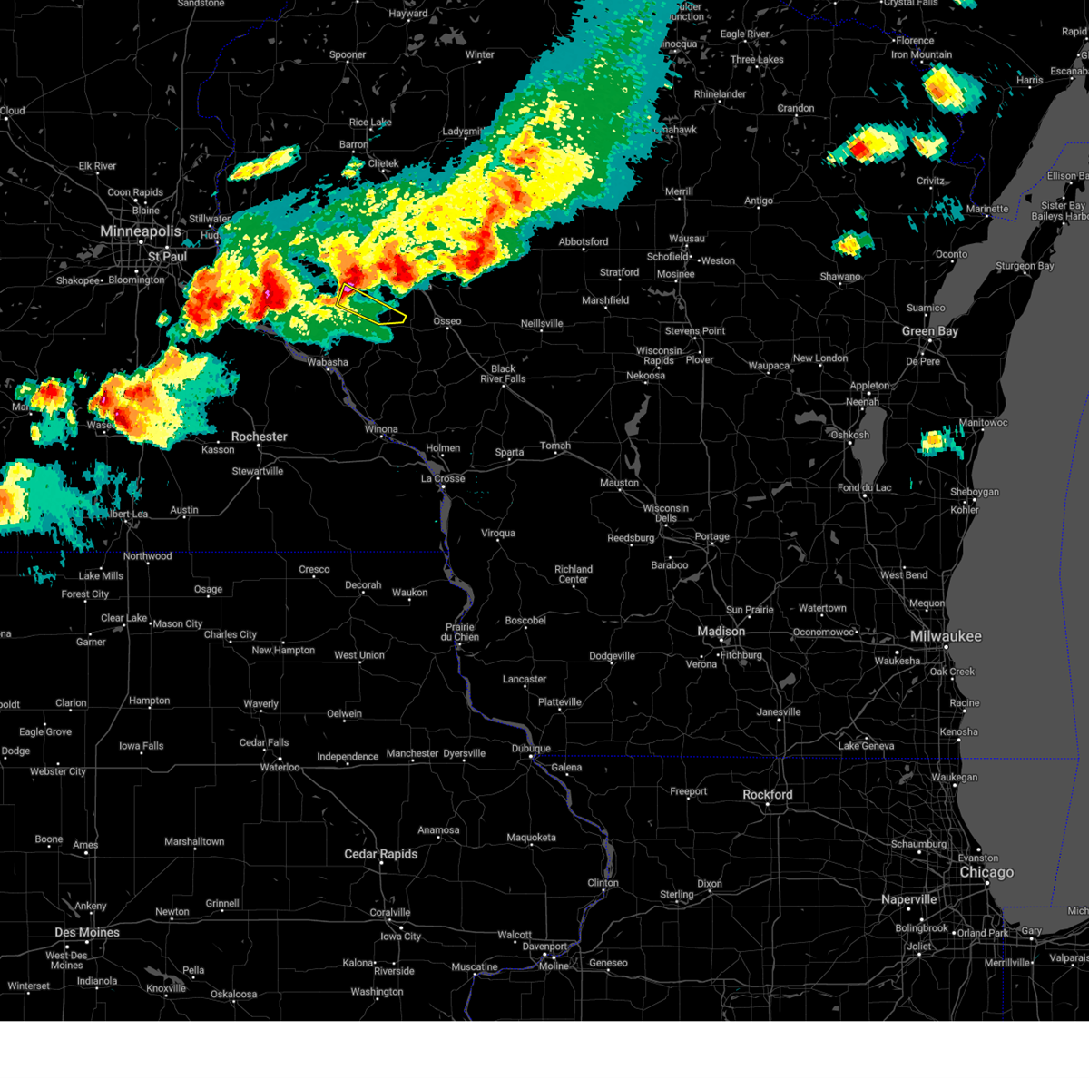
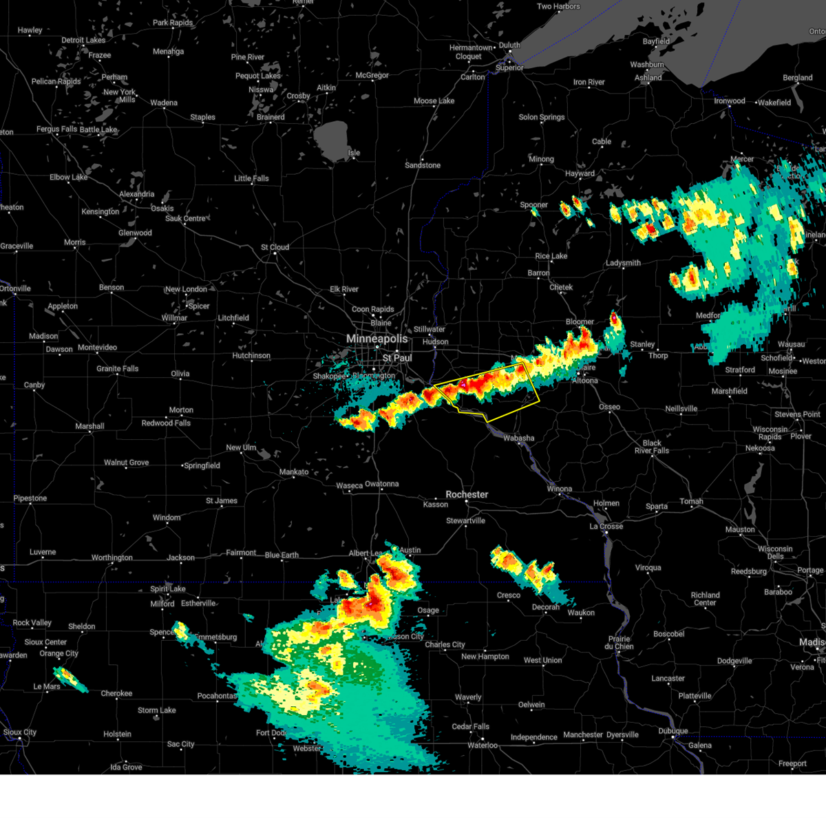
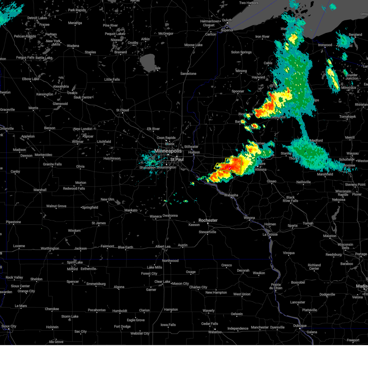
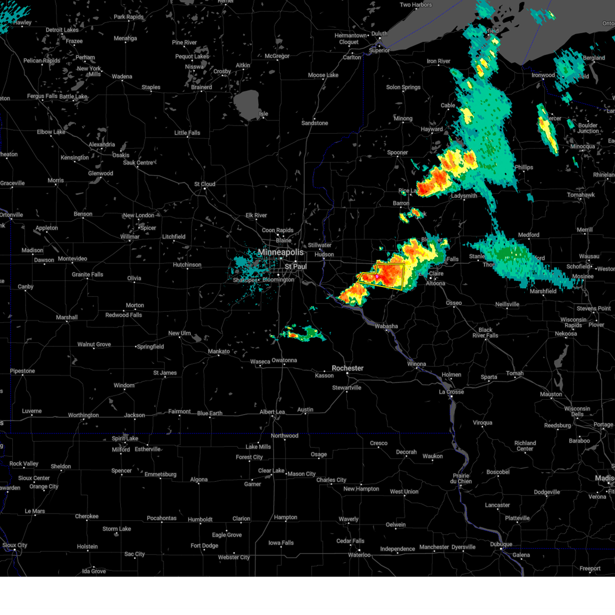
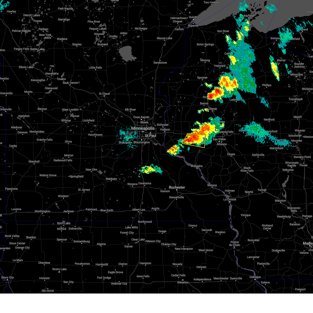
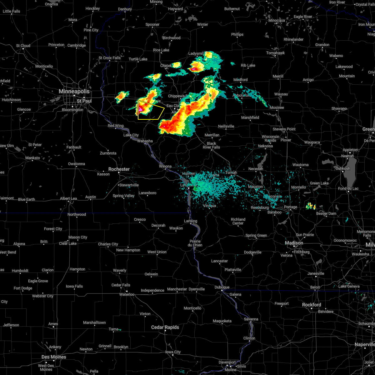
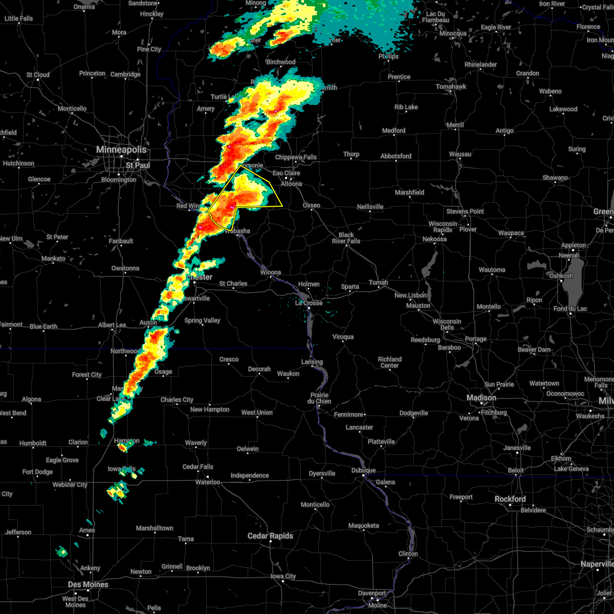
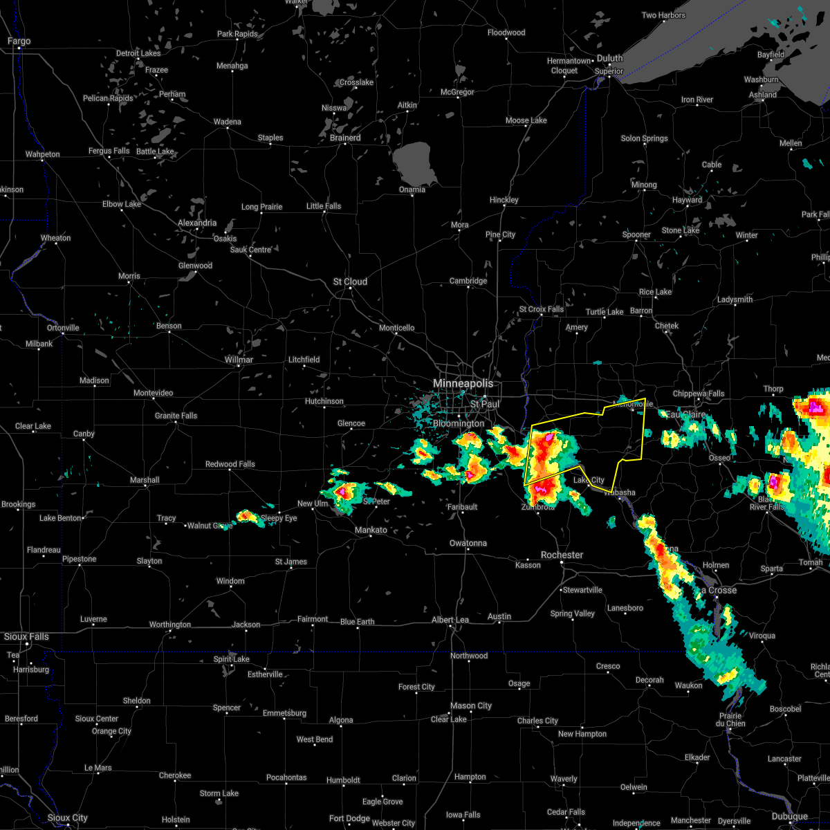
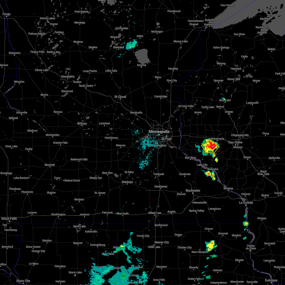
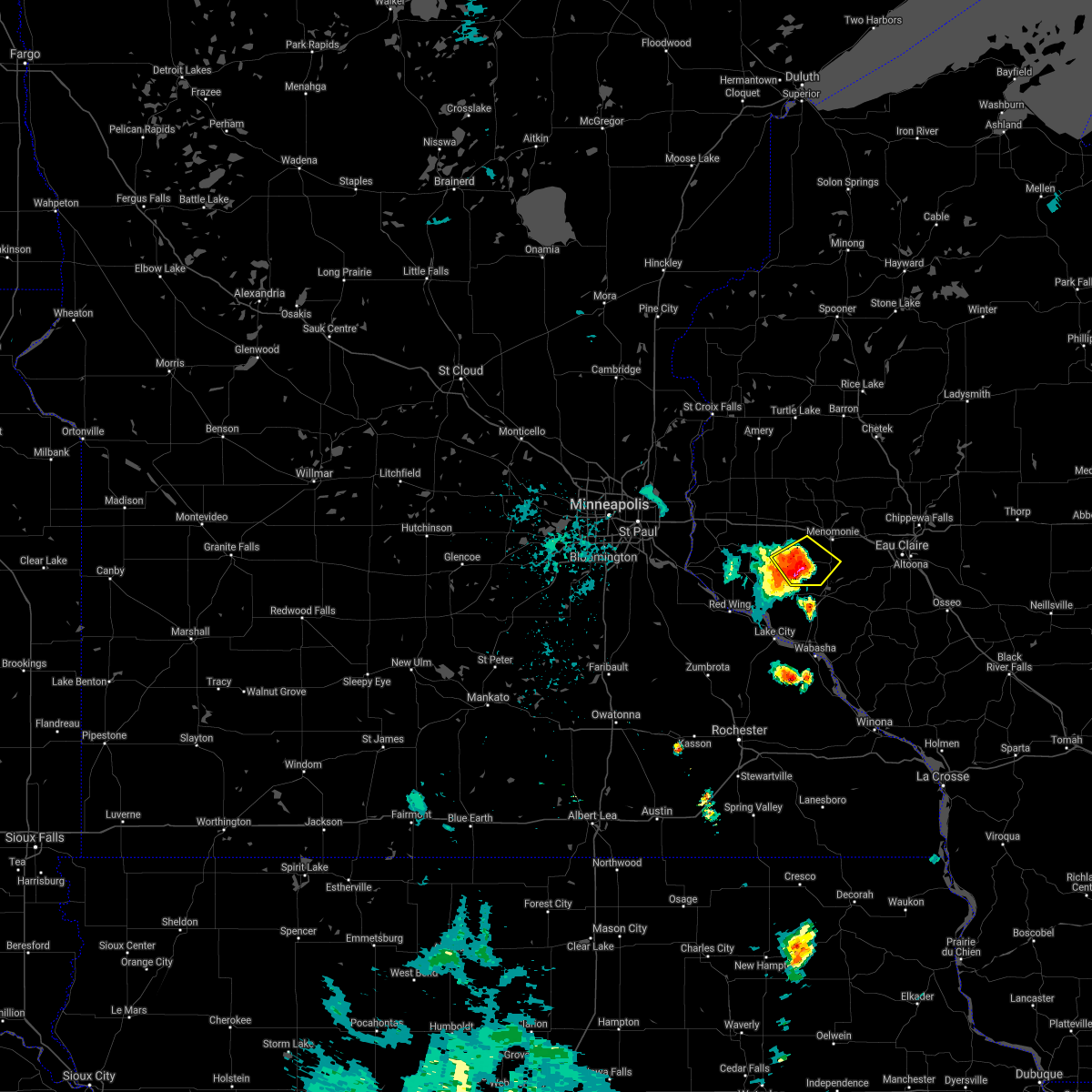
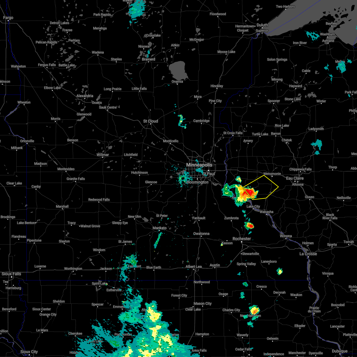
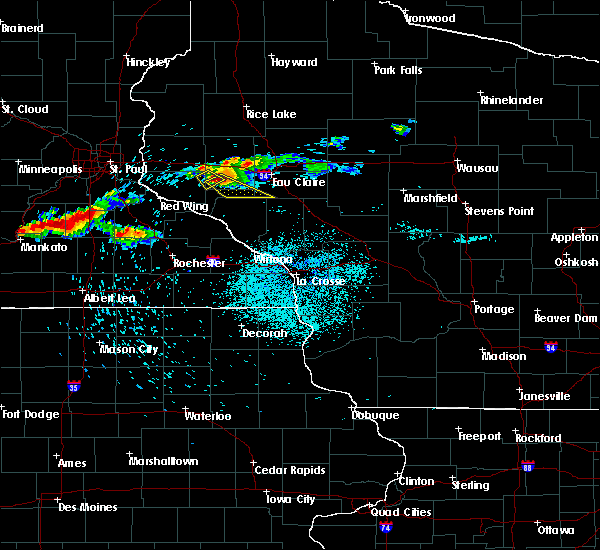
The Top Recent Hail Date for Downsville, WI is Thursday, May 15, 2025 (5th out of 56)
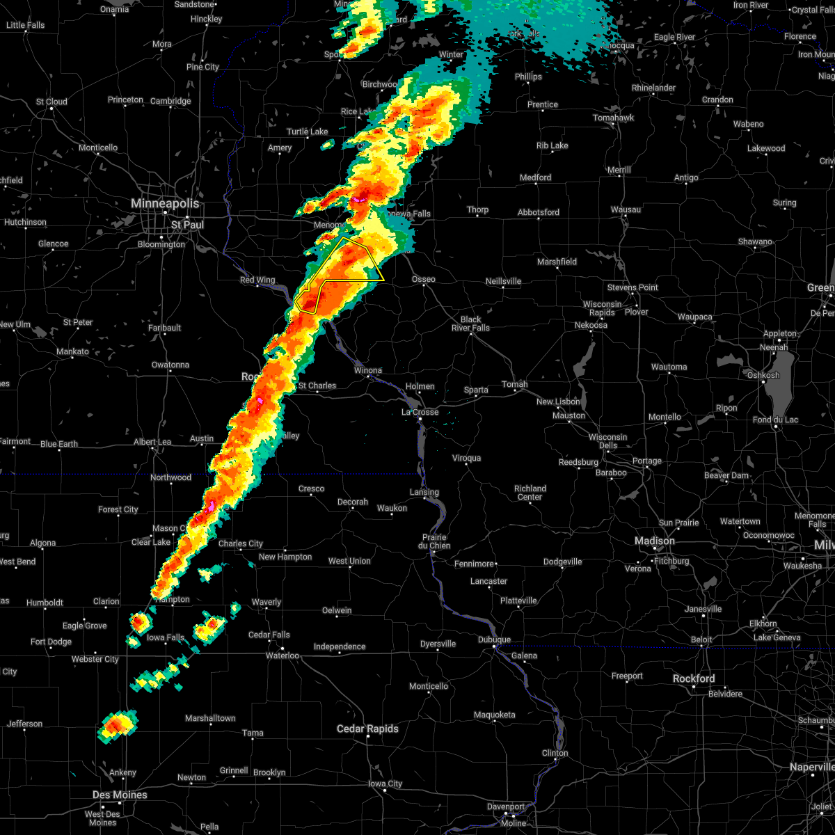
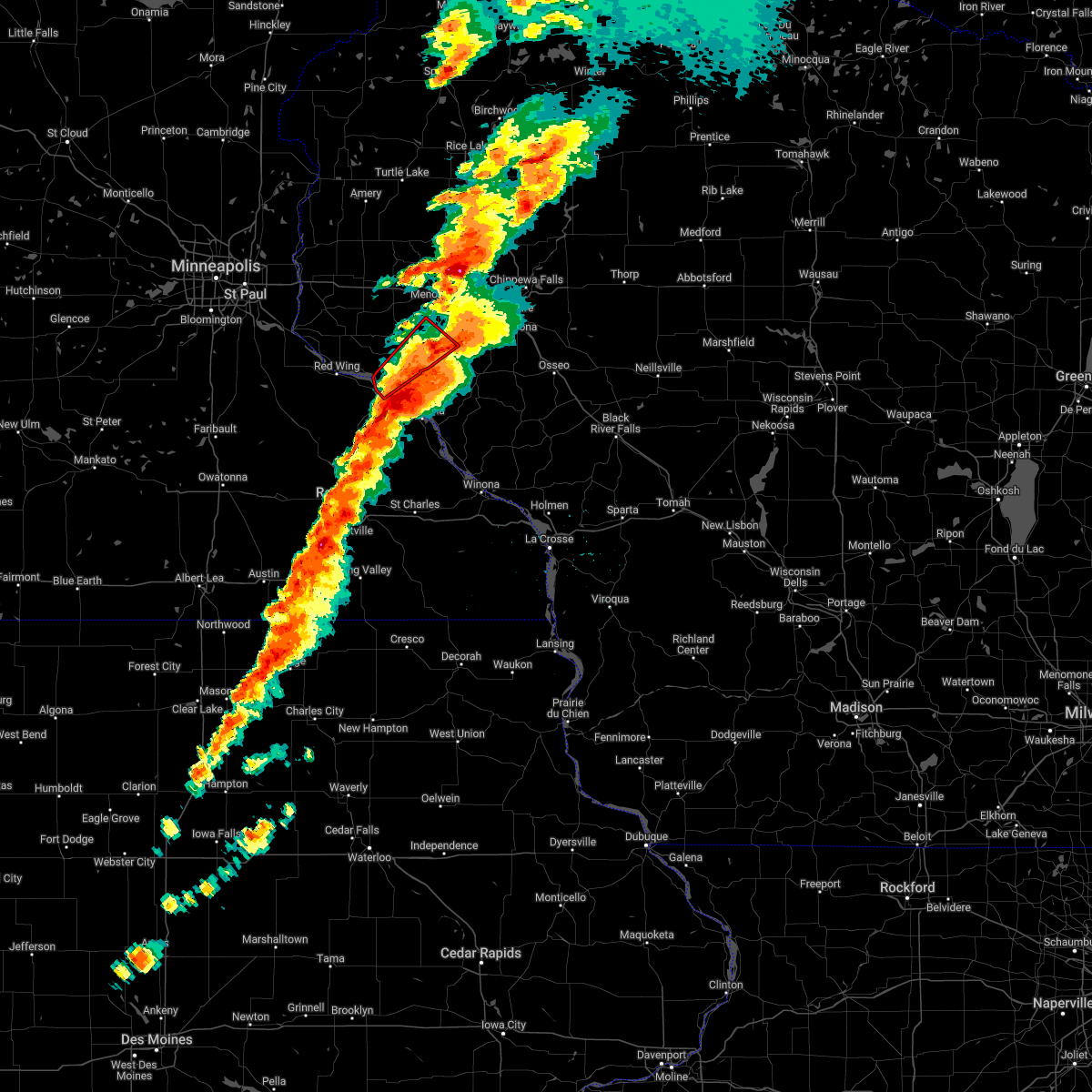
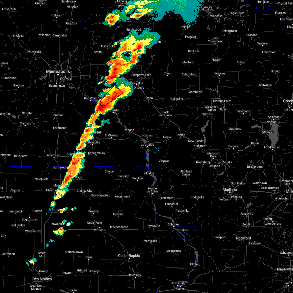
Hail and Wind Damage Spotted near Downsville, WI
| Date / Time | Report Details |
|---|---|
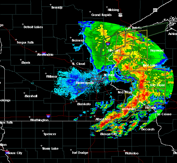
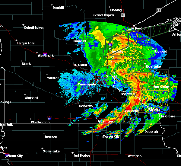
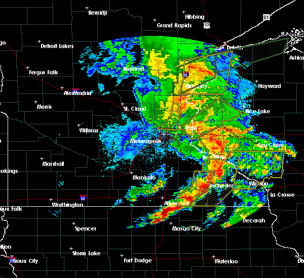
| 5/15/2025 3:43 PM CDT |
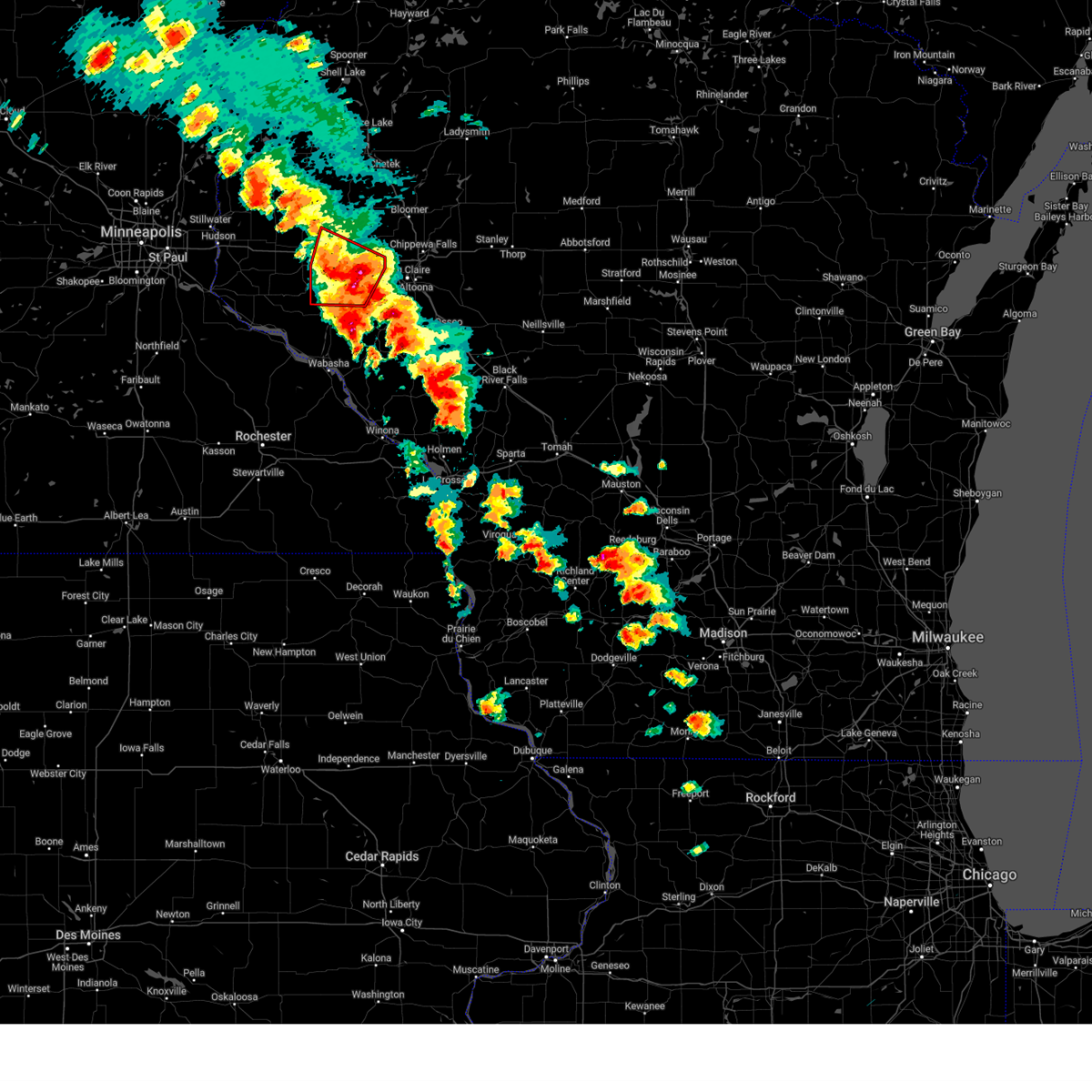 The tornado warning that was previously in effect has been reissued for dunn and is in effect until 415 pm. please refer to that bulletin for the latest severe weather information. a tornado watch remains in effect until 800 pm cdt for a portion of west central wisconsin. The tornado warning that was previously in effect has been reissued for dunn and is in effect until 415 pm. please refer to that bulletin for the latest severe weather information. a tornado watch remains in effect until 800 pm cdt for a portion of west central wisconsin.
|
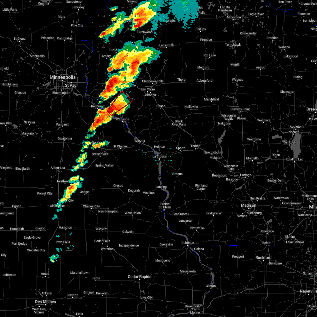
| 5/15/2025 3:38 PM CDT |
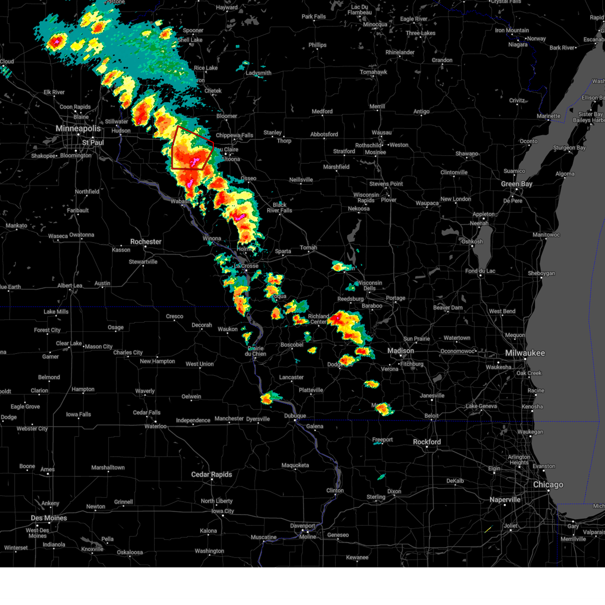 At 338 pm cdt, a severe thunderstorm capable of producing a tornado was located near menomonie, moving northeast at 50 mph (radar indicated rotation). Hazards include tornado and quarter size hail. Flying debris will be dangerous to those caught without shelter. mobile homes will be damaged or destroyed. damage to roofs, windows and vehicles will occur. tree damage is likely. Locations impacted include, menomonie, boyceville, elk mound, elmwood, eau galle, knapp, weston, downsville, menomonie airport, cedar falls and hoffman hills rec area. At 338 pm cdt, a severe thunderstorm capable of producing a tornado was located near menomonie, moving northeast at 50 mph (radar indicated rotation). Hazards include tornado and quarter size hail. Flying debris will be dangerous to those caught without shelter. mobile homes will be damaged or destroyed. damage to roofs, windows and vehicles will occur. tree damage is likely. Locations impacted include, menomonie, boyceville, elk mound, elmwood, eau galle, knapp, weston, downsville, menomonie airport, cedar falls and hoffman hills rec area.
|
| 5/15/2025 3:38 PM CDT |
 the tornado warning has been cancelled and is no longer in effect the tornado warning has been cancelled and is no longer in effect
|
| 5/15/2025 3:27 PM CDT |
 the tornado warning has been cancelled and is no longer in effect the tornado warning has been cancelled and is no longer in effect
|
| 5/15/2025 3:27 PM CDT |
 At 327 pm cdt, a severe thunderstorm capable of producing a tornado was located near eau galle, or 12 miles south of menomonie, moving northeast at 50 mph (radar indicated rotation). Hazards include tornado and quarter size hail. Flying debris will be dangerous to those caught without shelter. mobile homes will be damaged or destroyed. damage to roofs, windows and vehicles will occur. tree damage is likely. Locations impacted include, menomonie, durand, boyceville, elk mound, elmwood, eau galle, knapp, weston, downsville, menomonie airport, cedar falls, arkansaw, hoffman hills rec area and porcupine. At 327 pm cdt, a severe thunderstorm capable of producing a tornado was located near eau galle, or 12 miles south of menomonie, moving northeast at 50 mph (radar indicated rotation). Hazards include tornado and quarter size hail. Flying debris will be dangerous to those caught without shelter. mobile homes will be damaged or destroyed. damage to roofs, windows and vehicles will occur. tree damage is likely. Locations impacted include, menomonie, durand, boyceville, elk mound, elmwood, eau galle, knapp, weston, downsville, menomonie airport, cedar falls, arkansaw, hoffman hills rec area and porcupine.
|
| 5/15/2025 3:15 PM CDT |
 Tormpx the national weather service in the twin cities has issued a * tornado warning for, southern dunn county in west central wisconsin, north central pepin county in west central wisconsin, east central pierce county in west central wisconsin, * until 345 pm cdt. * at 315 pm cdt, a severe thunderstorm capable of producing a tornado was located near durand, or 21 miles south of menomonie, moving northeast at 50 mph (radar indicated rotation). Hazards include tornado and quarter size hail. Flying debris will be dangerous to those caught without shelter. mobile homes will be damaged or destroyed. damage to roofs, windows and vehicles will occur. Tree damage is likely. Tormpx the national weather service in the twin cities has issued a * tornado warning for, southern dunn county in west central wisconsin, north central pepin county in west central wisconsin, east central pierce county in west central wisconsin, * until 345 pm cdt. * at 315 pm cdt, a severe thunderstorm capable of producing a tornado was located near durand, or 21 miles south of menomonie, moving northeast at 50 mph (radar indicated rotation). Hazards include tornado and quarter size hail. Flying debris will be dangerous to those caught without shelter. mobile homes will be damaged or destroyed. damage to roofs, windows and vehicles will occur. Tree damage is likely.
|
| 5/15/2025 3:01 PM CDT |
 Tormpx the national weather service in the twin cities has issued a * tornado warning for, southwestern dunn county in west central wisconsin, pepin county in west central wisconsin, southeastern pierce county in west central wisconsin, * until 315 pm cdt. * at 301 pm cdt, a severe thunderstorm capable of producing a tornado was located 6 miles north of pepin, or 20 miles east of red wing, moving northeast at 50 mph (radar indicated rotation). Hazards include tornado. Flying debris will be dangerous to those caught without shelter. mobile homes will be damaged or destroyed. damage to roofs, windows and vehicles will occur. Tree damage is likely. Tormpx the national weather service in the twin cities has issued a * tornado warning for, southwestern dunn county in west central wisconsin, pepin county in west central wisconsin, southeastern pierce county in west central wisconsin, * until 315 pm cdt. * at 301 pm cdt, a severe thunderstorm capable of producing a tornado was located 6 miles north of pepin, or 20 miles east of red wing, moving northeast at 50 mph (radar indicated rotation). Hazards include tornado. Flying debris will be dangerous to those caught without shelter. mobile homes will be damaged or destroyed. damage to roofs, windows and vehicles will occur. Tree damage is likely.
|
| 4/28/2025 7:15 PM CDT | Svrmpx the national weather service in the twin cities has issued a * severe thunderstorm warning for, southwestern chippewa county in west central wisconsin, eastern dunn county in west central wisconsin, western eau claire county in west central wisconsin, northeastern pepin county in west central wisconsin, * until 800 pm cdt. * at 715 pm cdt, a severe thunderstorm was located 9 miles northeast of durand, or 11 miles south of menomonie, moving east at 45 mph (radar indicated). Hazards include 60 mph wind gusts and small hail. expect damage to roofs, siding, and trees |
| 8/29/2024 7:07 PM CDT |
 Svrmpx the national weather service in the twin cities has issued a * severe thunderstorm warning for, northeastern pepin county in west central wisconsin, rusk county in northwestern wisconsin, eastern dunn county in west central wisconsin, chippewa county in west central wisconsin, eau claire county in west central wisconsin, southeastern barron county in northwestern wisconsin, * until 800 pm cdt. * at 706 pm cdt, severe thunderstorms were located along a line extending from near chetek to near colfax to 5 miles south of elk mound to 5 miles northwest of mondovi, moving east at 50 mph (radar indicated). Hazards include 60 mph wind gusts. expect damage to roofs, siding, and trees Svrmpx the national weather service in the twin cities has issued a * severe thunderstorm warning for, northeastern pepin county in west central wisconsin, rusk county in northwestern wisconsin, eastern dunn county in west central wisconsin, chippewa county in west central wisconsin, eau claire county in west central wisconsin, southeastern barron county in northwestern wisconsin, * until 800 pm cdt. * at 706 pm cdt, severe thunderstorms were located along a line extending from near chetek to near colfax to 5 miles south of elk mound to 5 miles northwest of mondovi, moving east at 50 mph (radar indicated). Hazards include 60 mph wind gusts. expect damage to roofs, siding, and trees
|
| 8/26/2024 8:58 PM CDT |
 Svrmpx the national weather service in the twin cities has issued a * severe thunderstorm warning for, pepin county in west central wisconsin, southeastern pierce county in west central wisconsin, southern dunn county in west central wisconsin, southern chippewa county in west central wisconsin, eau claire county in west central wisconsin, * until 1000 pm cdt. * at 857 pm cdt, a severe thunderstorm was located 8 miles south of menomonie, moving east at 65 mph (radar indicated). Hazards include 60 mph wind gusts and penny size hail. expect damage to roofs, siding, and trees Svrmpx the national weather service in the twin cities has issued a * severe thunderstorm warning for, pepin county in west central wisconsin, southeastern pierce county in west central wisconsin, southern dunn county in west central wisconsin, southern chippewa county in west central wisconsin, eau claire county in west central wisconsin, * until 1000 pm cdt. * at 857 pm cdt, a severe thunderstorm was located 8 miles south of menomonie, moving east at 65 mph (radar indicated). Hazards include 60 mph wind gusts and penny size hail. expect damage to roofs, siding, and trees
|
| 8/26/2024 8:43 PM CDT |
 At 843 pm cdt, severe thunderstorms were located along a line extending from 6 miles west of haugen to 7 miles north of colfax to near durand, moving east at 50 mph (radar indicated). Hazards include 60 mph wind gusts and penny size hail. Expect damage to roofs, siding, and trees. Locations impacted include, menomonie, rice lake, barron, ellsworth, amery, chetek, cumberland, durand, baldwin, cameron, woodville, and glenwood city. At 843 pm cdt, severe thunderstorms were located along a line extending from 6 miles west of haugen to 7 miles north of colfax to near durand, moving east at 50 mph (radar indicated). Hazards include 60 mph wind gusts and penny size hail. Expect damage to roofs, siding, and trees. Locations impacted include, menomonie, rice lake, barron, ellsworth, amery, chetek, cumberland, durand, baldwin, cameron, woodville, and glenwood city.
|
| 8/26/2024 8:12 PM CDT |
 Svrmpx the national weather service in the twin cities has issued a * severe thunderstorm warning for, pepin county in west central wisconsin, pierce county in west central wisconsin, dunn county in west central wisconsin, st. croix county in west central wisconsin, barron county in northwestern wisconsin, polk county in northwestern wisconsin, * until 900 pm cdt. * at 812 pm cdt, severe thunderstorms were located along a line extending from luck to 6 miles northwest of glenwood city to near bay city, moving east at 55 mph (radar indicated). Hazards include 60 mph wind gusts and penny size hail. expect damage to roofs, siding, and trees Svrmpx the national weather service in the twin cities has issued a * severe thunderstorm warning for, pepin county in west central wisconsin, pierce county in west central wisconsin, dunn county in west central wisconsin, st. croix county in west central wisconsin, barron county in northwestern wisconsin, polk county in northwestern wisconsin, * until 900 pm cdt. * at 812 pm cdt, severe thunderstorms were located along a line extending from luck to 6 miles northwest of glenwood city to near bay city, moving east at 55 mph (radar indicated). Hazards include 60 mph wind gusts and penny size hail. expect damage to roofs, siding, and trees
|
| 6/17/2024 7:19 AM CDT |
 Svrmpx the national weather service in the twin cities has issued a * severe thunderstorm warning for, northeastern pepin county in west central wisconsin, southern dunn county in west central wisconsin, southwestern chippewa county in west central wisconsin, eau claire county in west central wisconsin, * until 815 am cdt. * at 718 am cdt, severe thunderstorms were located along a line extending from near modena to near plum city, moving northeast at 45 mph (radar indicated). Hazards include 60 mph wind gusts. Expect damage to roofs, siding, and trees. severe thunderstorms will be near, durand and eau galle around 725 am cdt. menomonie around 735 am cdt. eau claire and elk mound around 750 am cdt. altoona and colfax around 755 am cdt. lake hallie and fall creek around 800 am cdt. chippewa falls around 805 am cdt. other locations impacted by these severe thunderstorms include cedar falls, caryville, tainter lake, allen, arkansaw, foster, brackett, downsville, weston, and menomonie airport. this includes the following highways, interstate 94 in wisconsin between mile markers 41 and 86. u. s. Highway 53 between mile markers 86 and 99. Svrmpx the national weather service in the twin cities has issued a * severe thunderstorm warning for, northeastern pepin county in west central wisconsin, southern dunn county in west central wisconsin, southwestern chippewa county in west central wisconsin, eau claire county in west central wisconsin, * until 815 am cdt. * at 718 am cdt, severe thunderstorms were located along a line extending from near modena to near plum city, moving northeast at 45 mph (radar indicated). Hazards include 60 mph wind gusts. Expect damage to roofs, siding, and trees. severe thunderstorms will be near, durand and eau galle around 725 am cdt. menomonie around 735 am cdt. eau claire and elk mound around 750 am cdt. altoona and colfax around 755 am cdt. lake hallie and fall creek around 800 am cdt. chippewa falls around 805 am cdt. other locations impacted by these severe thunderstorms include cedar falls, caryville, tainter lake, allen, arkansaw, foster, brackett, downsville, weston, and menomonie airport. this includes the following highways, interstate 94 in wisconsin between mile markers 41 and 86. u. s. Highway 53 between mile markers 86 and 99.
|
| 5/21/2024 6:51 PM CDT |
 The storm which prompted the warning has moved out of the area. therefore, the warning will be allowed to expire. a tornado watch remains in effect until 900 pm cdt for west central wisconsin. a tornado watch also remains in effect until midnight cdt for west central wisconsin. The storm which prompted the warning has moved out of the area. therefore, the warning will be allowed to expire. a tornado watch remains in effect until 900 pm cdt for west central wisconsin. a tornado watch also remains in effect until midnight cdt for west central wisconsin.
|
| 5/21/2024 6:37 PM CDT |
 the severe thunderstorm warning has been cancelled and is no longer in effect the severe thunderstorm warning has been cancelled and is no longer in effect
|
| 5/21/2024 6:37 PM CDT |
 At 637 pm cdt, a severe thunderstorm was located over elk mound, or 9 miles northwest of eau claire, moving east at 55 mph (radar indicated). Hazards include 60 mph wind gusts. Expect damage to roofs, siding, and trees. Locations impacted include, menomonie, durand, colfax, elk mound, eau galle, rock falls, cedar falls, caryville, downsville, tainter lake, menomonie airport, and hoffman hills rec area. At 637 pm cdt, a severe thunderstorm was located over elk mound, or 9 miles northwest of eau claire, moving east at 55 mph (radar indicated). Hazards include 60 mph wind gusts. Expect damage to roofs, siding, and trees. Locations impacted include, menomonie, durand, colfax, elk mound, eau galle, rock falls, cedar falls, caryville, downsville, tainter lake, menomonie airport, and hoffman hills rec area.
|
| 5/21/2024 6:05 PM CDT |
 Svrmpx the national weather service in the twin cities has issued a * severe thunderstorm warning for, pepin county in west central wisconsin, southeastern pierce county in west central wisconsin, dunn county in west central wisconsin, * until 700 pm cdt. * at 605 pm cdt, a severe thunderstorm was located over plum city, or 20 miles southwest of menomonie, moving northeast at 55 mph (radar indicated). Hazards include 60 mph wind gusts. expect damage to roofs, siding, and trees Svrmpx the national weather service in the twin cities has issued a * severe thunderstorm warning for, pepin county in west central wisconsin, southeastern pierce county in west central wisconsin, dunn county in west central wisconsin, * until 700 pm cdt. * at 605 pm cdt, a severe thunderstorm was located over plum city, or 20 miles southwest of menomonie, moving northeast at 55 mph (radar indicated). Hazards include 60 mph wind gusts. expect damage to roofs, siding, and trees
|
| 5/21/2024 5:35 PM CDT |
 Tormpx the national weather service in the twin cities has issued a * tornado warning for, southeastern dunn county in west central wisconsin, * until 600 pm cdt. * at 535 pm cdt, a severe thunderstorm capable of producing a tornado was located 7 miles south of menomonie, moving northeast at 40 mph (radar indicated rotation). Hazards include tornado. Flying debris will be dangerous to those caught without shelter. mobile homes will be damaged or destroyed. damage to roofs, windows, and vehicles will occur. tree damage is likely. this dangerous storm will be near, menomonie around 540 pm cdt. elk mound around 550 pm cdt. colfax around 555 pm cdt. other locations impacted by this tornadic thunderstorm include cedar falls, hoffman hills rec area, downsville, tainter lake, and menomonie airport. This includes interstate 94 in wisconsin between mile markers 43 and 55. Tormpx the national weather service in the twin cities has issued a * tornado warning for, southeastern dunn county in west central wisconsin, * until 600 pm cdt. * at 535 pm cdt, a severe thunderstorm capable of producing a tornado was located 7 miles south of menomonie, moving northeast at 40 mph (radar indicated rotation). Hazards include tornado. Flying debris will be dangerous to those caught without shelter. mobile homes will be damaged or destroyed. damage to roofs, windows, and vehicles will occur. tree damage is likely. this dangerous storm will be near, menomonie around 540 pm cdt. elk mound around 550 pm cdt. colfax around 555 pm cdt. other locations impacted by this tornadic thunderstorm include cedar falls, hoffman hills rec area, downsville, tainter lake, and menomonie airport. This includes interstate 94 in wisconsin between mile markers 43 and 55.
|
| 5/21/2024 5:01 PM CDT |
 At 501 pm cdt, a severe thunderstorm was located over plum city, or 19 miles north of wabasha, moving northeast at 45 mph (radar indicated). Hazards include 60 mph wind gusts. Expect damage to roofs, siding, and trees. Locations impacted include, durand, elmwood, eau galle, plum city, weston, arkansaw, downsville, porcupine, and ella. At 501 pm cdt, a severe thunderstorm was located over plum city, or 19 miles north of wabasha, moving northeast at 45 mph (radar indicated). Hazards include 60 mph wind gusts. Expect damage to roofs, siding, and trees. Locations impacted include, durand, elmwood, eau galle, plum city, weston, arkansaw, downsville, porcupine, and ella.
|
| 5/21/2024 5:01 PM CDT |
 the severe thunderstorm warning has been cancelled and is no longer in effect the severe thunderstorm warning has been cancelled and is no longer in effect
|
| 5/21/2024 4:46 PM CDT |
 Svrmpx the national weather service in the twin cities has issued a * severe thunderstorm warning for, northeastern goodhue county in southeastern minnesota, pepin county in west central wisconsin, eastern pierce county in west central wisconsin, southwestern dunn county in west central wisconsin, * until 530 pm cdt. * at 445 pm cdt, a severe thunderstorm was located over frontenac, or 12 miles east of red wing, moving northeast at 45 mph (radar indicated). Hazards include 60 mph wind gusts. expect damage to roofs, siding, and trees Svrmpx the national weather service in the twin cities has issued a * severe thunderstorm warning for, northeastern goodhue county in southeastern minnesota, pepin county in west central wisconsin, eastern pierce county in west central wisconsin, southwestern dunn county in west central wisconsin, * until 530 pm cdt. * at 445 pm cdt, a severe thunderstorm was located over frontenac, or 12 miles east of red wing, moving northeast at 45 mph (radar indicated). Hazards include 60 mph wind gusts. expect damage to roofs, siding, and trees
|
| 8/11/2023 6:14 PM CDT |
 At 614 pm cdt, a severe thunderstorm was located 8 miles east of eau galle, or 11 miles south of menomonie, moving southeast at 40 mph (radar indicated). Hazards include ping pong ball size hail and 60 mph wind gusts. People and animals outdoors will be injured. expect hail damage to roofs, siding, windows, and vehicles. expect wind damage to roofs, siding, and trees. this severe thunderstorm will remain over mainly rural areas of northeastern pepin, southeastern dunn and southwestern eau claire counties. hail threat, radar indicated max hail size, 1. 50 in wind threat, radar indicated max wind gust, 60 mph. At 614 pm cdt, a severe thunderstorm was located 8 miles east of eau galle, or 11 miles south of menomonie, moving southeast at 40 mph (radar indicated). Hazards include ping pong ball size hail and 60 mph wind gusts. People and animals outdoors will be injured. expect hail damage to roofs, siding, windows, and vehicles. expect wind damage to roofs, siding, and trees. this severe thunderstorm will remain over mainly rural areas of northeastern pepin, southeastern dunn and southwestern eau claire counties. hail threat, radar indicated max hail size, 1. 50 in wind threat, radar indicated max wind gust, 60 mph.
|
| 7/22/2023 3:17 PM CDT |
 At 316 pm cdt, a severe thunderstorm was located over elmwood, or 15 miles southwest of menomonie, moving southeast at 25 mph (radar indicated). Hazards include 60 mph wind gusts and quarter size hail. Hail damage to vehicles is expected. expect wind damage to roofs, siding, and trees. this severe storm will be near, elmwood around 320 pm cdt. hail threat, radar indicated max hail size, 1. 00 in wind threat, radar indicated max wind gust, 60 mph. At 316 pm cdt, a severe thunderstorm was located over elmwood, or 15 miles southwest of menomonie, moving southeast at 25 mph (radar indicated). Hazards include 60 mph wind gusts and quarter size hail. Hail damage to vehicles is expected. expect wind damage to roofs, siding, and trees. this severe storm will be near, elmwood around 320 pm cdt. hail threat, radar indicated max hail size, 1. 00 in wind threat, radar indicated max wind gust, 60 mph.
|
| 7/22/2023 3:02 PM CDT |
 At 301 pm cdt, a severe thunderstorm was located near woodville, or 16 miles east of river falls, moving southeast at 25 mph (radar indicated). Hazards include 60 mph wind gusts and quarter size hail. Hail damage to vehicles is expected. expect wind damage to roofs, siding, and trees. this severe thunderstorm will be near, elmwood around 320 pm cdt. hail threat, radar indicated max hail size, 1. 00 in wind threat, radar indicated max wind gust, 60 mph. At 301 pm cdt, a severe thunderstorm was located near woodville, or 16 miles east of river falls, moving southeast at 25 mph (radar indicated). Hazards include 60 mph wind gusts and quarter size hail. Hail damage to vehicles is expected. expect wind damage to roofs, siding, and trees. this severe thunderstorm will be near, elmwood around 320 pm cdt. hail threat, radar indicated max hail size, 1. 00 in wind threat, radar indicated max wind gust, 60 mph.
|
| 7/10/2023 7:45 PM CDT |
 At 745 pm cdt, severe thunderstorms were located along a line extending from 5 miles east of elmwood to 7 miles east of prescott, moving southeast at 25 mph (radar indicated). Hazards include 60 mph wind gusts and quarter size hail. Hail damage to vehicles is expected. expect wind damage to roofs, siding, and trees. severe thunderstorms will be near, elmwood around 750 pm cdt. eau galle around 805 pm cdt. other locations in the path of these severe thunderstorms include bay city and durand. hail threat, radar indicated max hail size, 1. 00 in wind threat, radar indicated max wind gust, 60 mph. At 745 pm cdt, severe thunderstorms were located along a line extending from 5 miles east of elmwood to 7 miles east of prescott, moving southeast at 25 mph (radar indicated). Hazards include 60 mph wind gusts and quarter size hail. Hail damage to vehicles is expected. expect wind damage to roofs, siding, and trees. severe thunderstorms will be near, elmwood around 750 pm cdt. eau galle around 805 pm cdt. other locations in the path of these severe thunderstorms include bay city and durand. hail threat, radar indicated max hail size, 1. 00 in wind threat, radar indicated max wind gust, 60 mph.
|
| 6/28/2023 10:56 PM CDT |
 The severe thunderstorm warning for northeastern pierce and southwestern dunn counties will expire at 1100 pm cdt, the storm which prompted the warning has weakened below severe limits, and no longer poses an immediate threat to life or property. therefore, the warning will be allowed to expire. however small hail is still possible with this thunderstorm. a severe thunderstorm watch remains in effect until 200 am cdt for west central wisconsin. The severe thunderstorm warning for northeastern pierce and southwestern dunn counties will expire at 1100 pm cdt, the storm which prompted the warning has weakened below severe limits, and no longer poses an immediate threat to life or property. therefore, the warning will be allowed to expire. however small hail is still possible with this thunderstorm. a severe thunderstorm watch remains in effect until 200 am cdt for west central wisconsin.
|
| 6/28/2023 10:48 PM CDT |
 At 1048 pm cdt, a severe thunderstorm was located over elmwood, or 11 miles southwest of menomonie, moving east at 30 mph (radar indicated). Hazards include 60 mph wind gusts and half dollar size hail. Hail damage to vehicles is expected. expect wind damage to roofs, siding, and trees. locations impacted include, menomonie. hail threat, radar indicated max hail size, 1. 25 in wind threat, radar indicated max wind gust, 60 mph. At 1048 pm cdt, a severe thunderstorm was located over elmwood, or 11 miles southwest of menomonie, moving east at 30 mph (radar indicated). Hazards include 60 mph wind gusts and half dollar size hail. Hail damage to vehicles is expected. expect wind damage to roofs, siding, and trees. locations impacted include, menomonie. hail threat, radar indicated max hail size, 1. 25 in wind threat, radar indicated max wind gust, 60 mph.
|
| 6/28/2023 10:37 PM CDT |
 At 1036 pm cdt, a severe thunderstorm was located near elmwood, or 13 miles west of menomonie, moving east at 30 mph (radar indicated). Hazards include ping pong ball size hail and 60 mph wind gusts. People and animals outdoors will be injured. expect hail damage to roofs, siding, windows, and vehicles. expect wind damage to roofs, siding, and trees. locations impacted include, menomonie. hail threat, radar indicated max hail size, 1. 50 in wind threat, radar indicated max wind gust, 60 mph. At 1036 pm cdt, a severe thunderstorm was located near elmwood, or 13 miles west of menomonie, moving east at 30 mph (radar indicated). Hazards include ping pong ball size hail and 60 mph wind gusts. People and animals outdoors will be injured. expect hail damage to roofs, siding, windows, and vehicles. expect wind damage to roofs, siding, and trees. locations impacted include, menomonie. hail threat, radar indicated max hail size, 1. 50 in wind threat, radar indicated max wind gust, 60 mph.
|
| 6/28/2023 10:18 PM CDT |
 At 1018 pm cdt, a severe thunderstorm was located near woodville, or 14 miles east of river falls, moving east at 35 mph (radar indicated). Hazards include ping pong ball size hail and 60 mph wind gusts. People and animals outdoors will be injured. expect hail damage to roofs, siding, windows, and vehicles. expect wind damage to roofs, siding, and trees. this severe thunderstorm will be near, elmwood around 1030 pm cdt. knapp around 1035 pm cdt. other locations in the path of this severe thunderstorm include menomonie. hail threat, radar indicated max hail size, 1. 50 in wind threat, radar indicated max wind gust, 60 mph. At 1018 pm cdt, a severe thunderstorm was located near woodville, or 14 miles east of river falls, moving east at 35 mph (radar indicated). Hazards include ping pong ball size hail and 60 mph wind gusts. People and animals outdoors will be injured. expect hail damage to roofs, siding, windows, and vehicles. expect wind damage to roofs, siding, and trees. this severe thunderstorm will be near, elmwood around 1030 pm cdt. knapp around 1035 pm cdt. other locations in the path of this severe thunderstorm include menomonie. hail threat, radar indicated max hail size, 1. 50 in wind threat, radar indicated max wind gust, 60 mph.
|
| 9/20/2022 10:13 PM CDT |
 At 1012 pm cdt, a severe thunderstorm was located near elmwood, or 10 miles southwest of menomonie, moving east at 45 mph (radar indicated). Hazards include half dollar size hail. Damage to vehicles is expected. this severe thunderstorm will remain over mainly rural areas of southern dunn county, including the following locations, downsville and weston. hail threat, radar indicated max hail size, 1. 25 in wind threat, radar indicated max wind gust, <50 mph. At 1012 pm cdt, a severe thunderstorm was located near elmwood, or 10 miles southwest of menomonie, moving east at 45 mph (radar indicated). Hazards include half dollar size hail. Damage to vehicles is expected. this severe thunderstorm will remain over mainly rural areas of southern dunn county, including the following locations, downsville and weston. hail threat, radar indicated max hail size, 1. 25 in wind threat, radar indicated max wind gust, <50 mph.
|
| 9/20/2022 10:00 PM CDT |
 At 1000 pm cdt, a severe thunderstorm was located 6 miles south of woodville, or 16 miles east of river falls, moving east at 45 mph (radar indicated). Hazards include half dollar size hail. Damage to vehicles is expected. this severe thunderstorm will be near, elmwood around 1010 pm cdt. eau galle around 1020 pm cdt. hail threat, radar indicated max hail size, 1. 25 in wind threat, radar indicated max wind gust, <50 mph. At 1000 pm cdt, a severe thunderstorm was located 6 miles south of woodville, or 16 miles east of river falls, moving east at 45 mph (radar indicated). Hazards include half dollar size hail. Damage to vehicles is expected. this severe thunderstorm will be near, elmwood around 1010 pm cdt. eau galle around 1020 pm cdt. hail threat, radar indicated max hail size, 1. 25 in wind threat, radar indicated max wind gust, <50 mph.
|
| 9/20/2022 9:45 PM CDT |
 At 944 pm cdt, severe thunderstorms were located along a line extending from near lake wissota to near eau galle, moving southeast at 35 mph (radar indicated). Hazards include two inch hail. People and animals outdoors will be injured. expect damage to roofs, siding, windows, and vehicles. locations impacted include, lake wissota, cadott, boyd and stanley. thunderstorm damage threat, considerable hail threat, radar indicated max hail size, 2. 00 in wind threat, radar indicated max wind gust, <50 mph. At 944 pm cdt, severe thunderstorms were located along a line extending from near lake wissota to near eau galle, moving southeast at 35 mph (radar indicated). Hazards include two inch hail. People and animals outdoors will be injured. expect damage to roofs, siding, windows, and vehicles. locations impacted include, lake wissota, cadott, boyd and stanley. thunderstorm damage threat, considerable hail threat, radar indicated max hail size, 2. 00 in wind threat, radar indicated max wind gust, <50 mph.
|
| 9/20/2022 9:28 PM CDT |
 At 927 pm cdt, severe thunderstorms were located along a line extending from 5 miles northwest of chippewa falls to 5 miles southwest of elmwood, moving southeast at 35 mph (radar indicated). Hazards include two inch hail. People and animals outdoors will be injured. expect damage to roofs, siding, windows, and vehicles. severe thunderstorms will be near, chippewa falls around 935 pm cdt. lake wissota around 940 pm cdt. other locations in the path of these severe thunderstorms include durand, cadott, boyd and stanley. thunderstorm damage threat, considerable hail threat, radar indicated max hail size, 2. 00 in wind threat, radar indicated max wind gust, <50 mph. At 927 pm cdt, severe thunderstorms were located along a line extending from 5 miles northwest of chippewa falls to 5 miles southwest of elmwood, moving southeast at 35 mph (radar indicated). Hazards include two inch hail. People and animals outdoors will be injured. expect damage to roofs, siding, windows, and vehicles. severe thunderstorms will be near, chippewa falls around 935 pm cdt. lake wissota around 940 pm cdt. other locations in the path of these severe thunderstorms include durand, cadott, boyd and stanley. thunderstorm damage threat, considerable hail threat, radar indicated max hail size, 2. 00 in wind threat, radar indicated max wind gust, <50 mph.
|
| 9/20/2022 9:23 PM CDT |
 At 922 pm cdt, a severe thunderstorm was located over elmwood, or 16 miles southwest of menomonie, moving east at 40 mph (trained weather spotters). Hazards include two inch hail. People and animals outdoors will be injured. expect damage to roofs, siding, windows, and vehicles. locations impacted include, elmwood, eau galle, weston and downsville. thunderstorm damage threat, considerable hail threat, radar indicated max hail size, 2. 00 in wind threat, radar indicated max wind gust, <50 mph. At 922 pm cdt, a severe thunderstorm was located over elmwood, or 16 miles southwest of menomonie, moving east at 40 mph (trained weather spotters). Hazards include two inch hail. People and animals outdoors will be injured. expect damage to roofs, siding, windows, and vehicles. locations impacted include, elmwood, eau galle, weston and downsville. thunderstorm damage threat, considerable hail threat, radar indicated max hail size, 2. 00 in wind threat, radar indicated max wind gust, <50 mph.
|
| 9/20/2022 9:03 PM CDT |
 At 903 pm cdt, a severe thunderstorm was located 7 miles southwest of woodville, or 12 miles east of river falls, moving east at 40 mph (trained weather spotters). Hazards include two inch hail. People and animals outdoors will be injured. expect damage to roofs, siding, windows, and vehicles. locations impacted include, elmwood and eau galle. thunderstorm damage threat, considerable hail threat, radar indicated max hail size, 2. 00 in wind threat, radar indicated max wind gust, <50 mph. At 903 pm cdt, a severe thunderstorm was located 7 miles southwest of woodville, or 12 miles east of river falls, moving east at 40 mph (trained weather spotters). Hazards include two inch hail. People and animals outdoors will be injured. expect damage to roofs, siding, windows, and vehicles. locations impacted include, elmwood and eau galle. thunderstorm damage threat, considerable hail threat, radar indicated max hail size, 2. 00 in wind threat, radar indicated max wind gust, <50 mph.
|
| 9/20/2022 8:50 PM CDT |
 At 850 pm cdt, a severe thunderstorm was located near river falls, moving east at 40 mph (radar indicated). Hazards include two inch hail. People and animals outdoors will be injured. expect damage to roofs, siding, windows, and vehicles. this severe thunderstorm will be near, baldwin around 900 pm cdt. woodville around 905 pm cdt. other locations in the path of this severe thunderstorm include elmwood and eau galle. thunderstorm damage threat, considerable hail threat, radar indicated max hail size, 2. 00 in wind threat, radar indicated max wind gust, <50 mph. At 850 pm cdt, a severe thunderstorm was located near river falls, moving east at 40 mph (radar indicated). Hazards include two inch hail. People and animals outdoors will be injured. expect damage to roofs, siding, windows, and vehicles. this severe thunderstorm will be near, baldwin around 900 pm cdt. woodville around 905 pm cdt. other locations in the path of this severe thunderstorm include elmwood and eau galle. thunderstorm damage threat, considerable hail threat, radar indicated max hail size, 2. 00 in wind threat, radar indicated max wind gust, <50 mph.
|
| 8/3/2022 1:22 AM CDT |
 At 122 am cdt, a severe thunderstorm was located near menomonie, moving east at 55 mph (radar indicated). Hazards include 60 mph wind gusts. Expect damage to roofs, siding, and trees. locations impacted include, elk mound. hail threat, radar indicated max hail size, <. 75 in wind threat, radar indicated max wind gust, 60 mph. At 122 am cdt, a severe thunderstorm was located near menomonie, moving east at 55 mph (radar indicated). Hazards include 60 mph wind gusts. Expect damage to roofs, siding, and trees. locations impacted include, elk mound. hail threat, radar indicated max hail size, <. 75 in wind threat, radar indicated max wind gust, 60 mph.
|
| 8/3/2022 1:05 AM CDT |
 At 104 am cdt, a severe thunderstorm was located near elmwood, or 17 miles west of menomonie, moving east at 60 mph (radar indicated). Hazards include 60 mph wind gusts. Expect damage to roofs, siding, and trees. this severe thunderstorm will be near, menomonie around 120 am cdt. other locations in the path of this severe thunderstorm include elk mound. hail threat, radar indicated max hail size, <. 75 in wind threat, radar indicated max wind gust, 60 mph. At 104 am cdt, a severe thunderstorm was located near elmwood, or 17 miles west of menomonie, moving east at 60 mph (radar indicated). Hazards include 60 mph wind gusts. Expect damage to roofs, siding, and trees. this severe thunderstorm will be near, menomonie around 120 am cdt. other locations in the path of this severe thunderstorm include elk mound. hail threat, radar indicated max hail size, <. 75 in wind threat, radar indicated max wind gust, 60 mph.
|
| 5/19/2022 4:55 PM CDT |
 At 455 pm cdt, severe thunderstorms were located along a line extending from near ridgeland to near wheeler to near elmwood, moving east at 50 mph (trained weather spotters reported golf ball size hail in roberts at 440 pm cdt). Hazards include golf ball size hail and 60 mph wind gusts. People and animals outdoors will be injured. expect hail damage to roofs, siding, windows, and vehicles. expect wind damage to roofs, siding, and trees. locations impacted include, menomonie, dallas, colfax and elk mound. thunderstorm damage threat, considerable hail threat, radar indicated max hail size, 1. 75 in wind threat, radar indicated max wind gust, 60 mph. At 455 pm cdt, severe thunderstorms were located along a line extending from near ridgeland to near wheeler to near elmwood, moving east at 50 mph (trained weather spotters reported golf ball size hail in roberts at 440 pm cdt). Hazards include golf ball size hail and 60 mph wind gusts. People and animals outdoors will be injured. expect hail damage to roofs, siding, windows, and vehicles. expect wind damage to roofs, siding, and trees. locations impacted include, menomonie, dallas, colfax and elk mound. thunderstorm damage threat, considerable hail threat, radar indicated max hail size, 1. 75 in wind threat, radar indicated max wind gust, 60 mph.
|
| 5/19/2022 4:35 PM CDT |
 At 434 pm cdt, severe thunderstorms were located along a line extending from near clear lake to 5 miles north of woodville to 6 miles east of river falls, moving east at 50 mph (trained weather spotters). Hazards include ping pong ball size hail and 60 mph wind gusts. People and animals outdoors will be injured. expect hail damage to roofs, siding, windows, and vehicles. expect wind damage to roofs, siding, and trees. severe thunderstorms will be near, glenwood city around 440 pm cdt. boyceville, prairie farm and knapp around 445 pm cdt. ridgeland around 450 pm cdt. other locations in the path of these severe thunderstorms include menomonie, elmwood, dallas, wheeler, colfax, eau galle and elk mound. hail threat, radar indicated max hail size, 1. 50 in wind threat, radar indicated max wind gust, 60 mph. At 434 pm cdt, severe thunderstorms were located along a line extending from near clear lake to 5 miles north of woodville to 6 miles east of river falls, moving east at 50 mph (trained weather spotters). Hazards include ping pong ball size hail and 60 mph wind gusts. People and animals outdoors will be injured. expect hail damage to roofs, siding, windows, and vehicles. expect wind damage to roofs, siding, and trees. severe thunderstorms will be near, glenwood city around 440 pm cdt. boyceville, prairie farm and knapp around 445 pm cdt. ridgeland around 450 pm cdt. other locations in the path of these severe thunderstorms include menomonie, elmwood, dallas, wheeler, colfax, eau galle and elk mound. hail threat, radar indicated max hail size, 1. 50 in wind threat, radar indicated max wind gust, 60 mph.
|
| 5/9/2022 7:45 PM CDT |
 At 744 pm cdt, a severe thunderstorm was located near pepin, or 7 miles north of wabasha, moving northeast at 40 mph (radar indicated). Hazards include 60 mph wind gusts and half dollar size hail. Hail damage to vehicles is expected. expect wind damage to roofs, siding, and trees. This severe thunderstorm will be near, durand around 800 pm cdt. At 744 pm cdt, a severe thunderstorm was located near pepin, or 7 miles north of wabasha, moving northeast at 40 mph (radar indicated). Hazards include 60 mph wind gusts and half dollar size hail. Hail damage to vehicles is expected. expect wind damage to roofs, siding, and trees. This severe thunderstorm will be near, durand around 800 pm cdt.
|
| 5/9/2022 7:41 PM CDT |
 The tornado warning for northwestern pepin, southeastern pierce and south central dunn counties will expire at 745 pm cdt, the storm which prompted the warning has weakened below severe limits, and no longer appears capable of producing a tornado. therefore, the warning will be allowed to expire. a tornado watch remains in effect until 1000 pm cdt for southeastern minnesota, and west central wisconsin. remember, a severe thunderstorm warning still remains in effect for pepin and dunn. The tornado warning for northwestern pepin, southeastern pierce and south central dunn counties will expire at 745 pm cdt, the storm which prompted the warning has weakened below severe limits, and no longer appears capable of producing a tornado. therefore, the warning will be allowed to expire. a tornado watch remains in effect until 1000 pm cdt for southeastern minnesota, and west central wisconsin. remember, a severe thunderstorm warning still remains in effect for pepin and dunn.
|
| 5/9/2022 7:26 PM CDT |
 At 726 pm cdt, a severe thunderstorm capable of producing a tornado was located 6 miles southeast of plum city, or 15 miles north of wabasha, moving northeast at 40 mph (radar indicated rotation). Hazards include tornado and golf ball size hail. Flying debris will be dangerous to those caught without shelter. mobile homes will be damaged or destroyed. damage to roofs, windows, and vehicles will occur. tree damage is likely. Locations impacted include, durand and eau galle. At 726 pm cdt, a severe thunderstorm capable of producing a tornado was located 6 miles southeast of plum city, or 15 miles north of wabasha, moving northeast at 40 mph (radar indicated rotation). Hazards include tornado and golf ball size hail. Flying debris will be dangerous to those caught without shelter. mobile homes will be damaged or destroyed. damage to roofs, windows, and vehicles will occur. tree damage is likely. Locations impacted include, durand and eau galle.
|
| 5/9/2022 7:22 PM CDT |
 At 721 pm cdt, a severe thunderstorm was located 8 miles northeast of pepin, or 12 miles north of wabasha, moving northeast at 60 mph (radar indicated). Hazards include two inch hail and 60 mph wind gusts. People and animals outdoors will be injured. expect hail damage to roofs, siding, windows, and vehicles. expect wind damage to roofs, siding, and trees. This severe thunderstorm will be near, durand and eau galle around 730 pm cdt. At 721 pm cdt, a severe thunderstorm was located 8 miles northeast of pepin, or 12 miles north of wabasha, moving northeast at 60 mph (radar indicated). Hazards include two inch hail and 60 mph wind gusts. People and animals outdoors will be injured. expect hail damage to roofs, siding, windows, and vehicles. expect wind damage to roofs, siding, and trees. This severe thunderstorm will be near, durand and eau galle around 730 pm cdt.
|
| 5/9/2022 7:08 PM CDT |
 At 708 pm cdt, a severe thunderstorm capable of producing a tornado was located over stockholm, or 14 miles northwest of wabasha, moving northeast at 50 mph (radar indicated rotation). Hazards include tornado and golf ball size hail. Flying debris will be dangerous to those caught without shelter. mobile homes will be damaged or destroyed. damage to roofs, windows, and vehicles will occur. tree damage is likely. this dangerous storm will be near, plum city around 715 pm cdt. durand around 725 pm cdt. Other locations in the path of this tornadic thunderstorm include eau galle. At 708 pm cdt, a severe thunderstorm capable of producing a tornado was located over stockholm, or 14 miles northwest of wabasha, moving northeast at 50 mph (radar indicated rotation). Hazards include tornado and golf ball size hail. Flying debris will be dangerous to those caught without shelter. mobile homes will be damaged or destroyed. damage to roofs, windows, and vehicles will occur. tree damage is likely. this dangerous storm will be near, plum city around 715 pm cdt. durand around 725 pm cdt. Other locations in the path of this tornadic thunderstorm include eau galle.
|
| 9/20/2021 4:43 PM CDT |
 At 443 pm cdt, a severe thunderstorm capable of producing a tornado was located over plum city, or 17 miles east of red wing, moving northeast at 35 mph (radar indicated rotation). Hazards include tornado. Flying debris will be dangerous to those caught without shelter. mobile homes will be damaged or destroyed. damage to roofs, windows, and vehicles will occur. tree damage is likely. This dangerous storm will be near, eau galle around 500 pm cdt. At 443 pm cdt, a severe thunderstorm capable of producing a tornado was located over plum city, or 17 miles east of red wing, moving northeast at 35 mph (radar indicated rotation). Hazards include tornado. Flying debris will be dangerous to those caught without shelter. mobile homes will be damaged or destroyed. damage to roofs, windows, and vehicles will occur. tree damage is likely. This dangerous storm will be near, eau galle around 500 pm cdt.
|
| 7/28/2021 10:57 PM CDT |
 At 1057 pm cdt, a severe thunderstorm was located 6 miles west of plum city, or 12 miles east of red wing, moving southeast at 40 mph (radar indicated). Hazards include 70 mph wind gusts and quarter size hail. Hail damage to vehicles is expected. expect considerable tree damage. wind damage is also likely to mobile homes, roofs, and outbuildings. this severe thunderstorm will be near, plum city and frontenac around 1105 pm cdt. stockholm around 1110 pm cdt. Other locations in the path of this severe thunderstorm include pepin. At 1057 pm cdt, a severe thunderstorm was located 6 miles west of plum city, or 12 miles east of red wing, moving southeast at 40 mph (radar indicated). Hazards include 70 mph wind gusts and quarter size hail. Hail damage to vehicles is expected. expect considerable tree damage. wind damage is also likely to mobile homes, roofs, and outbuildings. this severe thunderstorm will be near, plum city and frontenac around 1105 pm cdt. stockholm around 1110 pm cdt. Other locations in the path of this severe thunderstorm include pepin.
|
| 7/28/2021 10:09 PM CDT |
 At 1008 pm cdt, a severe thunderstorm was located near woodville, or 12 miles east of river falls, moving southeast at 40 mph (radar indicated). Hazards include 70 mph wind gusts and quarter size hail. Hail damage to vehicles is expected. expect considerable tree damage. wind damage is also likely to mobile homes, roofs, and outbuildings. this severe thunderstorm will be near, elmwood around 1025 pm cdt. Other locations in the path of this severe thunderstorm include eau galle, plum city and durand. At 1008 pm cdt, a severe thunderstorm was located near woodville, or 12 miles east of river falls, moving southeast at 40 mph (radar indicated). Hazards include 70 mph wind gusts and quarter size hail. Hail damage to vehicles is expected. expect considerable tree damage. wind damage is also likely to mobile homes, roofs, and outbuildings. this severe thunderstorm will be near, elmwood around 1025 pm cdt. Other locations in the path of this severe thunderstorm include eau galle, plum city and durand.
|
| 6/17/2021 8:04 PM CDT |
 At 804 pm cdt, severe thunderstorms were located along a line extending from near ellsworth to 6 miles east of goodhue, moving east at 50 mph (radar indicated). Hazards include ping pong ball size hail and 60 mph wind gusts. People and animals outdoors will be injured. expect hail damage to roofs, siding, windows, and vehicles. expect wind damage to roofs, siding, and trees. these severe storms will be near, elmwood, plum city and stockholm around 820 pm cdt. pepin around 825 pm cdt. durand and eau galle around 830 pm cdt. Other locations impacted by these severe thunderstorms include el paso, wacouta, martel, esdaile, beldenville, arkansaw, vasa, downsville, weston and porcupine. At 804 pm cdt, severe thunderstorms were located along a line extending from near ellsworth to 6 miles east of goodhue, moving east at 50 mph (radar indicated). Hazards include ping pong ball size hail and 60 mph wind gusts. People and animals outdoors will be injured. expect hail damage to roofs, siding, windows, and vehicles. expect wind damage to roofs, siding, and trees. these severe storms will be near, elmwood, plum city and stockholm around 820 pm cdt. pepin around 825 pm cdt. durand and eau galle around 830 pm cdt. Other locations impacted by these severe thunderstorms include el paso, wacouta, martel, esdaile, beldenville, arkansaw, vasa, downsville, weston and porcupine.
|
| 6/17/2021 7:50 PM CDT |
 At 750 pm cdt, severe thunderstorms were located along a line extending from 6 miles east of prescott to near goodhue, moving east at 50 mph (radar indicated). Hazards include two inch hail and 60 mph wind gusts. People and animals outdoors will be injured. expect hail damage to roofs, siding, windows, and vehicles. expect wind damage to roofs, siding, and trees. severe thunderstorms will be near, red wing and ellsworth around 800 pm cdt. stockholm around 815 pm cdt. pepin and elmwood around 820 pm cdt. eau galle around 825 pm cdt. menomonie around 830 pm cdt. other locations impacted by these severe thunderstorms include el paso, wacouta, martel, esdaile, beldenville, arkansaw, vasa, downsville, weston and porcupine. This includes treasure island casino. At 750 pm cdt, severe thunderstorms were located along a line extending from 6 miles east of prescott to near goodhue, moving east at 50 mph (radar indicated). Hazards include two inch hail and 60 mph wind gusts. People and animals outdoors will be injured. expect hail damage to roofs, siding, windows, and vehicles. expect wind damage to roofs, siding, and trees. severe thunderstorms will be near, red wing and ellsworth around 800 pm cdt. stockholm around 815 pm cdt. pepin and elmwood around 820 pm cdt. eau galle around 825 pm cdt. menomonie around 830 pm cdt. other locations impacted by these severe thunderstorms include el paso, wacouta, martel, esdaile, beldenville, arkansaw, vasa, downsville, weston and porcupine. This includes treasure island casino.
|
| 6/11/2021 12:40 PM CDT |
 The severe thunderstorm warning for northeastern pierce and southwestern dunn counties will expire at 1245 pm cdt, the storm which prompted the warning has moved out of the area. therefore, the warning will be allowed to expire. to report severe weather, contact your nearest law enforcement agency. they will relay your report to the national weather service the twin cities. The severe thunderstorm warning for northeastern pierce and southwestern dunn counties will expire at 1245 pm cdt, the storm which prompted the warning has moved out of the area. therefore, the warning will be allowed to expire. to report severe weather, contact your nearest law enforcement agency. they will relay your report to the national weather service the twin cities.
|
| 6/11/2021 12:39 PM CDT |
 At 1238 pm cdt, a severe thunderstorm was located near menomonie, moving northeast at 35 mph (trained weather spotters). Hazards include 60 mph wind gusts and quarter size hail. Hail damage to vehicles is expected. Expect wind damage to roofs, siding, and trees. At 1238 pm cdt, a severe thunderstorm was located near menomonie, moving northeast at 35 mph (trained weather spotters). Hazards include 60 mph wind gusts and quarter size hail. Hail damage to vehicles is expected. Expect wind damage to roofs, siding, and trees.
|
| 6/11/2021 12:31 PM CDT |
 At 1231 pm cdt, a severe thunderstorm was located over elmwood, or 14 miles southwest of menomonie, moving northeast at 35 mph (radar indicated). Hazards include 60 mph wind gusts and quarter size hail. Hail damage to vehicles is expected. expect wind damage to roofs, siding, and trees. Locations impacted include, eau galle. At 1231 pm cdt, a severe thunderstorm was located over elmwood, or 14 miles southwest of menomonie, moving northeast at 35 mph (radar indicated). Hazards include 60 mph wind gusts and quarter size hail. Hail damage to vehicles is expected. expect wind damage to roofs, siding, and trees. Locations impacted include, eau galle.
|
| 6/11/2021 12:07 PM CDT |
 At 1207 pm cdt, a severe thunderstorm was located 6 miles northeast of bay city, or 11 miles northeast of red wing, moving northeast at 35 mph (radar indicated). Hazards include 60 mph wind gusts and quarter size hail. Hail damage to vehicles is expected. expect wind damage to roofs, siding, and trees. this severe thunderstorm will be near, plum city around 1220 pm cdt. Other locations in the path of this severe thunderstorm include elmwood and eau galle. At 1207 pm cdt, a severe thunderstorm was located 6 miles northeast of bay city, or 11 miles northeast of red wing, moving northeast at 35 mph (radar indicated). Hazards include 60 mph wind gusts and quarter size hail. Hail damage to vehicles is expected. expect wind damage to roofs, siding, and trees. this severe thunderstorm will be near, plum city around 1220 pm cdt. Other locations in the path of this severe thunderstorm include elmwood and eau galle.
|
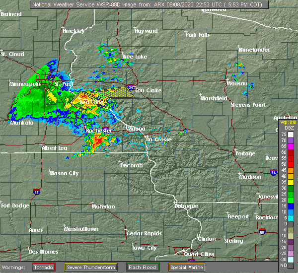
| 8/8/2020 6:26 PM CDT |
 The severe thunderstorm warning for northeastern pepin, southern dunn and southwestern eau claire counties will expire at 630 pm cdt, the storm which prompted the warning has weakened below severe limits, and no longer poses an immediate threat to life or property. therefore, the warning will be allowed to expire. however gusty winds and heavy rain are still possible with this thunderstorm. The severe thunderstorm warning for northeastern pepin, southern dunn and southwestern eau claire counties will expire at 630 pm cdt, the storm which prompted the warning has weakened below severe limits, and no longer poses an immediate threat to life or property. therefore, the warning will be allowed to expire. however gusty winds and heavy rain are still possible with this thunderstorm.
|
| 8/8/2020 6:19 PM CDT |
 At 619 pm cdt, a severe thunderstorm was located over mondovi, moving east at 45 mph (radar indicated). Hazards include 60 mph wind gusts. Expect damage to roofs, siding, and trees. Locations impacted include, durand, eau galle, rock falls, arkansaw, caryville and downsville. At 619 pm cdt, a severe thunderstorm was located over mondovi, moving east at 45 mph (radar indicated). Hazards include 60 mph wind gusts. Expect damage to roofs, siding, and trees. Locations impacted include, durand, eau galle, rock falls, arkansaw, caryville and downsville.
|
| 8/8/2020 6:12 PM CDT |
 At 612 pm cdt, a severe thunderstorm was located near mondovi, moving east at 45 mph (radar indicated). Hazards include 60 mph wind gusts. Expect damage to roofs, siding, and trees. Locations impacted include, durand, eau galle, rock falls, arkansaw, caryville, downsville, porcupine and ella. At 612 pm cdt, a severe thunderstorm was located near mondovi, moving east at 45 mph (radar indicated). Hazards include 60 mph wind gusts. Expect damage to roofs, siding, and trees. Locations impacted include, durand, eau galle, rock falls, arkansaw, caryville, downsville, porcupine and ella.
|
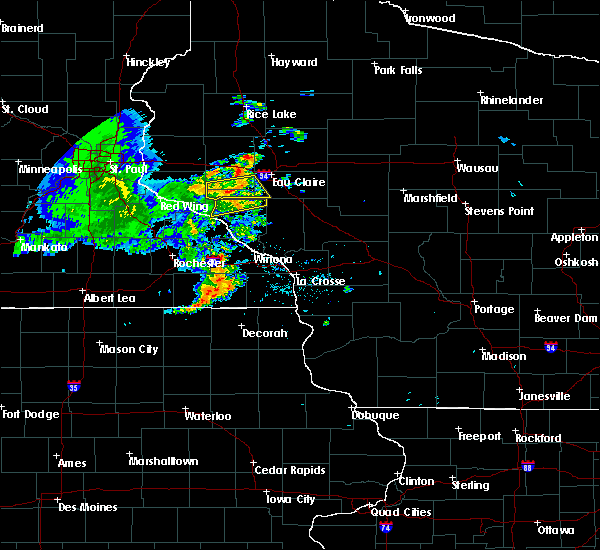
| 8/8/2020 5:53 PM CDT |
 At 553 pm cdt, a severe thunderstorm was located 7 miles north of pepin, or 11 miles north of wabasha, moving east at 45 mph. these storms have a history of producing damaging wind (law enforcement). Hazards include 60 mph wind gusts. expect damage to roofs, siding, and trees At 553 pm cdt, a severe thunderstorm was located 7 miles north of pepin, or 11 miles north of wabasha, moving east at 45 mph. these storms have a history of producing damaging wind (law enforcement). Hazards include 60 mph wind gusts. expect damage to roofs, siding, and trees
|
| 5/25/2020 9:21 AM CDT |
 The severe thunderstorm warning for south central dunn county will expire at 930 am cdt, the storm which prompted the warning has weakened below severe limits, and no longer poses an immediate threat to life or property. therefore, the warning will be allowed to expire. however small hail and heavy rain are still possible with this thunderstorm. The severe thunderstorm warning for south central dunn county will expire at 930 am cdt, the storm which prompted the warning has weakened below severe limits, and no longer poses an immediate threat to life or property. therefore, the warning will be allowed to expire. however small hail and heavy rain are still possible with this thunderstorm.
|
| 5/25/2020 9:14 AM CDT |
 At 913 am cdt, a severe thunderstorm was located 7 miles northeast of eau galle, or 8 miles south of menomonie, moving northeast at 30 mph (radar indicated). Hazards include quarter size hail. Damage to vehicles is expected. Locations impacted include, eau galle and downsville. At 913 am cdt, a severe thunderstorm was located 7 miles northeast of eau galle, or 8 miles south of menomonie, moving northeast at 30 mph (radar indicated). Hazards include quarter size hail. Damage to vehicles is expected. Locations impacted include, eau galle and downsville.
|
| 5/25/2020 8:56 AM CDT |
 At 854 am cdt, a severe thunderstorm was located over eau galle, or 17 miles south of menomonie, moving northeast at 35 mph (radar indicated). Hazards include quarter size hail. damage to vehicles is expected At 854 am cdt, a severe thunderstorm was located over eau galle, or 17 miles south of menomonie, moving northeast at 35 mph (radar indicated). Hazards include quarter size hail. damage to vehicles is expected
|
| 7/27/2019 12:10 AM CDT |
 At 1210 am cdt, a severe thunderstorm was located near eau galle, or 11 miles southwest of menomonie, moving southeast at 30 mph (radar indicated). Hazards include golf ball size hail and 60 mph wind gusts. People and animals outdoors will be injured. expect hail damage to roofs, siding, windows, and vehicles. Expect wind damage to roofs, siding, and trees. At 1210 am cdt, a severe thunderstorm was located near eau galle, or 11 miles southwest of menomonie, moving southeast at 30 mph (radar indicated). Hazards include golf ball size hail and 60 mph wind gusts. People and animals outdoors will be injured. expect hail damage to roofs, siding, windows, and vehicles. Expect wind damage to roofs, siding, and trees.
|
| 10/3/2018 7:04 PM CDT |
 At 704 pm cdt, a severe thunderstorm was located near rock falls, or 10 miles north of mondovi, moving east at 50 mph (radar indicated). Hazards include 60 mph wind gusts. Expect damage to roofs, siding, and trees. locations impacted include, eau claire, chippewa falls, altoona, lake hallie, lake wissota, durand, elk mound, pepin, eau galle, tilden, rock falls and caryville. A tornado watch remains in effect until 1100 pm cdt for west central wisconsin. At 704 pm cdt, a severe thunderstorm was located near rock falls, or 10 miles north of mondovi, moving east at 50 mph (radar indicated). Hazards include 60 mph wind gusts. Expect damage to roofs, siding, and trees. locations impacted include, eau claire, chippewa falls, altoona, lake hallie, lake wissota, durand, elk mound, pepin, eau galle, tilden, rock falls and caryville. A tornado watch remains in effect until 1100 pm cdt for west central wisconsin.
|
| 10/3/2018 6:44 PM CDT |
 At 644 pm cdt, a severe thunderstorm was located over downsville, or 10 miles south of menomonie, moving east at 50 mph (radar indicated). Hazards include 60 mph wind gusts. expect damage to roofs, siding, and trees At 644 pm cdt, a severe thunderstorm was located over downsville, or 10 miles south of menomonie, moving east at 50 mph (radar indicated). Hazards include 60 mph wind gusts. expect damage to roofs, siding, and trees
|
| 9/20/2018 7:56 PM CDT |
 At 756 pm cdt, severe thunderstorms were located along a line extending from prairie farm to colfax to near mondovi, moving northeast at 70 mph (radar indicated). Hazards include 60 mph wind gusts. Expect damage to roofs, siding, and trees. these severe storms will be near, colfax around 800 pm cdt. bloomer around 805 pm cdt. new auburn around 810 pm cdt. eau claire and altoona around 815 pm cdt. Other locations impacted by these severe thunderstorms include cedar falls, caryville, tainter lake, tilden, sand creek, downsville, menomonie airport, rock falls, hoffman hills rec area and eau claire airport. At 756 pm cdt, severe thunderstorms were located along a line extending from prairie farm to colfax to near mondovi, moving northeast at 70 mph (radar indicated). Hazards include 60 mph wind gusts. Expect damage to roofs, siding, and trees. these severe storms will be near, colfax around 800 pm cdt. bloomer around 805 pm cdt. new auburn around 810 pm cdt. eau claire and altoona around 815 pm cdt. Other locations impacted by these severe thunderstorms include cedar falls, caryville, tainter lake, tilden, sand creek, downsville, menomonie airport, rock falls, hoffman hills rec area and eau claire airport.
|
| 9/20/2018 7:50 PM CDT |
 A severe thunderstorm warning remains in effect until 815 pm cdt for northeastern pepin. dunn. northeastern st. croix. southwestern chippewa and western eau claire counties. At 750 pm cdt, severe thunderstorms were located along a line extending from near reeve to tainter lake to near the big swamp area, moving northeast at 70 mph. A severe thunderstorm warning remains in effect until 815 pm cdt for northeastern pepin. dunn. northeastern st. croix. southwestern chippewa and western eau claire counties. At 750 pm cdt, severe thunderstorms were located along a line extending from near reeve to tainter lake to near the big swamp area, moving northeast at 70 mph.
|
| 9/20/2018 7:37 PM CDT |
 At 737 pm cdt, severe thunderstorms were located along a line extending from near woodville to near weston to pepin, moving northeast at 75 mph (radar indicated). Hazards include 70 mph wind gusts. Expect considerable tree damage. damage is likely to mobile homes, roofs, and outbuildings. severe thunderstorms will be near, menomonie and knapp around 745 pm cdt. glenwood city and boyceville around 750 pm cdt. colfax and wheeler around 755 pm cdt. ridgeland around 800 pm cdt. bloomer and new auburn around 805 pm cdt. altoona and lake hallie around 810 pm cdt. eau claire and chippewa falls around 815 pm cdt. A tornado watch remains in effect until midnight cdt for west central wisconsin. At 737 pm cdt, severe thunderstorms were located along a line extending from near woodville to near weston to pepin, moving northeast at 75 mph (radar indicated). Hazards include 70 mph wind gusts. Expect considerable tree damage. damage is likely to mobile homes, roofs, and outbuildings. severe thunderstorms will be near, menomonie and knapp around 745 pm cdt. glenwood city and boyceville around 750 pm cdt. colfax and wheeler around 755 pm cdt. ridgeland around 800 pm cdt. bloomer and new auburn around 805 pm cdt. altoona and lake hallie around 810 pm cdt. eau claire and chippewa falls around 815 pm cdt. A tornado watch remains in effect until midnight cdt for west central wisconsin.
|
| 8/27/2018 6:37 PM CDT |
 The severe thunderstorm warning for north central pepin, southwestern dunn and east central st. croix counties will expire at 645 pm cdt, the storms which prompted the warning have moved out of the area. therefore, the warning will be allowed to expire. a severe thunderstorm watch remains in effect until 1000 pm cdt for west central wisconsin. to report severe weather, contact your nearest law enforcement agency. they will relay your report to the national weather service the twin cities. The severe thunderstorm warning for north central pepin, southwestern dunn and east central st. croix counties will expire at 645 pm cdt, the storms which prompted the warning have moved out of the area. therefore, the warning will be allowed to expire. a severe thunderstorm watch remains in effect until 1000 pm cdt for west central wisconsin. to report severe weather, contact your nearest law enforcement agency. they will relay your report to the national weather service the twin cities.
|
| 8/27/2018 6:33 PM CDT |
 At 633 pm cdt, severe thunderstorms were located along a line extending from near ridgeland to hoffman hills rec area to near the big swamp area, moving east at 60 mph (radar indicated). Hazards include 70 mph wind gusts. Expect considerable tree damage. damage is likely to mobile homes, roofs, and outbuildings. Locations impacted include, menomonie, durand, glenwood city, boyceville, eau galle, knapp, weston, downing, wilson, arkansaw, hersey and downsville. At 633 pm cdt, severe thunderstorms were located along a line extending from near ridgeland to hoffman hills rec area to near the big swamp area, moving east at 60 mph (radar indicated). Hazards include 70 mph wind gusts. Expect considerable tree damage. damage is likely to mobile homes, roofs, and outbuildings. Locations impacted include, menomonie, durand, glenwood city, boyceville, eau galle, knapp, weston, downing, wilson, arkansaw, hersey and downsville.
|
| 8/27/2018 6:24 PM CDT |
 At 623 pm cdt, severe thunderstorms were located along a line extending from near downing to menomonie to near maxville, moving east at 55 mph. these are very dangerous storms (radar indicated). Hazards include 80 mph wind gusts. Flying debris will be dangerous to those caught without shelter. mobile homes will be heavily damaged. expect considerable damage to roofs, windows, and vehicles. extensive tree damage and power outages are likely. these severe thunderstorms will remain over mainly rural areas of central pepin, eastern pierce, southwestern dunn and southeastern st. Croix counties, including the following locations, arkansaw, downing, hersey, downsville, weston, porcupine, menomonie airport, wilson, ella and emerald. At 623 pm cdt, severe thunderstorms were located along a line extending from near downing to menomonie to near maxville, moving east at 55 mph. these are very dangerous storms (radar indicated). Hazards include 80 mph wind gusts. Flying debris will be dangerous to those caught without shelter. mobile homes will be heavily damaged. expect considerable damage to roofs, windows, and vehicles. extensive tree damage and power outages are likely. these severe thunderstorms will remain over mainly rural areas of central pepin, eastern pierce, southwestern dunn and southeastern st. Croix counties, including the following locations, arkansaw, downing, hersey, downsville, weston, porcupine, menomonie airport, wilson, ella and emerald.
|
| 8/27/2018 6:23 PM CDT |
 A severe thunderstorm warning remains in effect until 645 pm cdt for east central goodhue. pepin. pierce. southwestern dunn and southeastern st. croix counties. At 621 pm cdt, severe thunderstorms were located along a line extending from downing to near menomonie to maxville, moving east at 55 mph. A severe thunderstorm warning remains in effect until 645 pm cdt for east central goodhue. pepin. pierce. southwestern dunn and southeastern st. croix counties. At 621 pm cdt, severe thunderstorms were located along a line extending from downing to near menomonie to maxville, moving east at 55 mph.
|
| 8/27/2018 6:23 PM CDT |
 At 609 pm cdt, severe thunderstorms were located along a line extending from hammond to near elmwood to central point, moving northeast at 60 mph. these are very dangerous storms (measured earlier at red wing airport). Hazards include 80 mph wind gusts. Flying debris will be dangerous to those caught without shelter. mobile homes will be heavily damaged. expect considerable damage to roofs, windows, and vehicles. extensive tree damage and power outages are likely. these severe storms will be near, woodville and elmwood around 615 pm cdt. knapp around 620 pm cdt. menomonie, durand, glenwood city and boyceville around 625 pm cdt. eau galle around 630 pm cdt. Other locations impacted by these severe thunderstorms include el paso, wacouta, wilson, central point, martel, esdaile, beldenville, arkansaw, downing and hersey. At 609 pm cdt, severe thunderstorms were located along a line extending from hammond to near elmwood to central point, moving northeast at 60 mph. these are very dangerous storms (measured earlier at red wing airport). Hazards include 80 mph wind gusts. Flying debris will be dangerous to those caught without shelter. mobile homes will be heavily damaged. expect considerable damage to roofs, windows, and vehicles. extensive tree damage and power outages are likely. these severe storms will be near, woodville and elmwood around 615 pm cdt. knapp around 620 pm cdt. menomonie, durand, glenwood city and boyceville around 625 pm cdt. eau galle around 630 pm cdt. Other locations impacted by these severe thunderstorms include el paso, wacouta, wilson, central point, martel, esdaile, beldenville, arkansaw, downing and hersey.
|
| 8/27/2018 6:09 PM CDT |
 At 609 pm cdt, severe thunderstorms were located along a line extending from hammond to near elmwood to central point, moving northeast at 60 mph. these are very dangerous storms (measured earlier at red wing airport). Hazards include 80 mph wind gusts. Flying debris will be dangerous to those caught without shelter. mobile homes will be heavily damaged. expect considerable damage to roofs, windows, and vehicles. extensive tree damage and power outages are likely. these severe storms will be near, woodville and elmwood around 615 pm cdt. knapp around 620 pm cdt. menomonie, durand, glenwood city and boyceville around 625 pm cdt. eau galle around 630 pm cdt. Other locations impacted by these severe thunderstorms include el paso, wacouta, wilson, central point, martel, esdaile, beldenville, arkansaw, downing and hersey. At 609 pm cdt, severe thunderstorms were located along a line extending from hammond to near elmwood to central point, moving northeast at 60 mph. these are very dangerous storms (measured earlier at red wing airport). Hazards include 80 mph wind gusts. Flying debris will be dangerous to those caught without shelter. mobile homes will be heavily damaged. expect considerable damage to roofs, windows, and vehicles. extensive tree damage and power outages are likely. these severe storms will be near, woodville and elmwood around 615 pm cdt. knapp around 620 pm cdt. menomonie, durand, glenwood city and boyceville around 625 pm cdt. eau galle around 630 pm cdt. Other locations impacted by these severe thunderstorms include el paso, wacouta, wilson, central point, martel, esdaile, beldenville, arkansaw, downing and hersey.
|
| 8/27/2018 5:57 PM CDT |
 At 556 pm cdt, severe thunderstorms were located along a line extending from near beldenville to near wacouta to bluff valley campground, moving northeast at 60 mph. these are very dangerous storms (measured at the red wing airport). Hazards include 80 mph wind gusts. Flying debris will be dangerous to those caught without shelter. mobile homes will be heavily damaged. expect considerable damage to roofs, windows, and vehicles. extensive tree damage and power outages are likely. these severe storms will be near, ellsworth and frontenac around 600 pm cdt. plum city around 610 pm cdt. baldwin, woodville, pepin and elmwood around 615 pm cdt. eau galle around 620 pm cdt. glenwood city and knapp around 625 pm cdt. menomonie and boyceville around 630 pm cdt. Other locations impacted by these severe thunderstorms include el paso, wacouta, wilson, central point, martel, esdaile, beldenville, arkansaw, bellechester and downing. At 556 pm cdt, severe thunderstorms were located along a line extending from near beldenville to near wacouta to bluff valley campground, moving northeast at 60 mph. these are very dangerous storms (measured at the red wing airport). Hazards include 80 mph wind gusts. Flying debris will be dangerous to those caught without shelter. mobile homes will be heavily damaged. expect considerable damage to roofs, windows, and vehicles. extensive tree damage and power outages are likely. these severe storms will be near, ellsworth and frontenac around 600 pm cdt. plum city around 610 pm cdt. baldwin, woodville, pepin and elmwood around 615 pm cdt. eau galle around 620 pm cdt. glenwood city and knapp around 625 pm cdt. menomonie and boyceville around 630 pm cdt. Other locations impacted by these severe thunderstorms include el paso, wacouta, wilson, central point, martel, esdaile, beldenville, arkansaw, bellechester and downing.
|
| 8/27/2018 5:57 PM CDT |
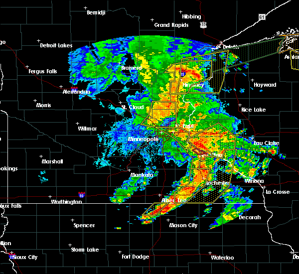 At 556 pm cdt, severe thunderstorms were located along a line extending from near beldenville to near wacouta to bluff valley campground, moving northeast at 60 mph. these are very dangerous storms (measured at the red wing airport). Hazards include 80 mph wind gusts. Flying debris will be dangerous to those caught without shelter. mobile homes will be heavily damaged. expect considerable damage to roofs, windows, and vehicles. extensive tree damage and power outages are likely. these severe storms will be near, ellsworth and frontenac around 600 pm cdt. plum city around 610 pm cdt. baldwin, woodville, pepin and elmwood around 615 pm cdt. eau galle around 620 pm cdt. glenwood city and knapp around 625 pm cdt. menomonie and boyceville around 630 pm cdt. Other locations impacted by these severe thunderstorms include el paso, wacouta, wilson, central point, martel, esdaile, beldenville, arkansaw, bellechester and downing. At 556 pm cdt, severe thunderstorms were located along a line extending from near beldenville to near wacouta to bluff valley campground, moving northeast at 60 mph. these are very dangerous storms (measured at the red wing airport). Hazards include 80 mph wind gusts. Flying debris will be dangerous to those caught without shelter. mobile homes will be heavily damaged. expect considerable damage to roofs, windows, and vehicles. extensive tree damage and power outages are likely. these severe storms will be near, ellsworth and frontenac around 600 pm cdt. plum city around 610 pm cdt. baldwin, woodville, pepin and elmwood around 615 pm cdt. eau galle around 620 pm cdt. glenwood city and knapp around 625 pm cdt. menomonie and boyceville around 630 pm cdt. Other locations impacted by these severe thunderstorms include el paso, wacouta, wilson, central point, martel, esdaile, beldenville, arkansaw, bellechester and downing.
|
| 8/27/2018 5:47 PM CDT |
 At 546 pm cdt, severe thunderstorms were located along a line extending from near prescott to near red wing to near hidden meadows r v park, moving northeast at 55 mph (radar indicated). Hazards include 60 mph wind gusts. Expect damage to roofs, siding, and trees. severe thunderstorms will be near, red wing around 550 pm cdt. bay city and frontenac around 555 pm cdt. river falls and ellsworth around 600 pm cdt. plum city around 605 pm cdt. baldwin around 610 pm cdt. Woodville, pepin, elmwood and eau galle around 615 pm cdt. At 546 pm cdt, severe thunderstorms were located along a line extending from near prescott to near red wing to near hidden meadows r v park, moving northeast at 55 mph (radar indicated). Hazards include 60 mph wind gusts. Expect damage to roofs, siding, and trees. severe thunderstorms will be near, red wing around 550 pm cdt. bay city and frontenac around 555 pm cdt. river falls and ellsworth around 600 pm cdt. plum city around 605 pm cdt. baldwin around 610 pm cdt. Woodville, pepin, elmwood and eau galle around 615 pm cdt.
|
| 8/3/2018 10:47 AM CDT |
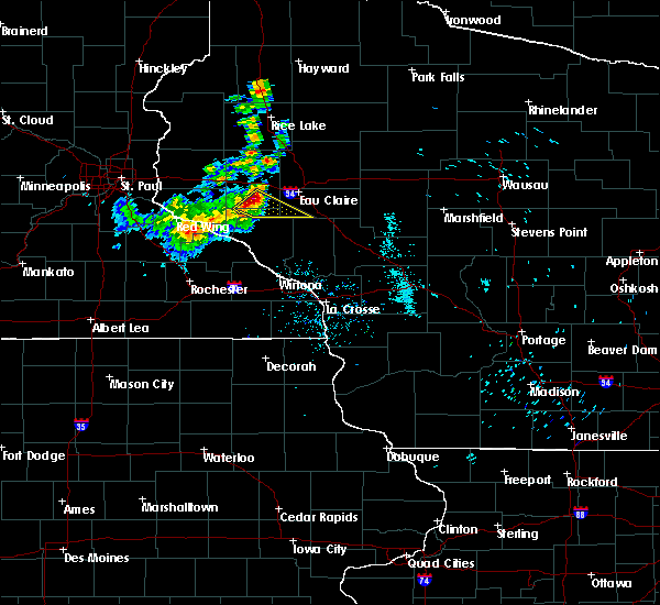 At 1047 am cdt, a severe thunderstorm was located near downsville, or 10 miles south of menomonie, moving southeast at 50 mph (radar indicated). Hazards include half dollar size hail. damage to vehicles is expected At 1047 am cdt, a severe thunderstorm was located near downsville, or 10 miles south of menomonie, moving southeast at 50 mph (radar indicated). Hazards include half dollar size hail. damage to vehicles is expected
|
| 5/25/2018 7:22 PM CDT |
 At 721 pm cdt, severe thunderstorms were located along a line extending from near menomonie airport to arkansaw, moving east at 30 mph (radar indicated). Hazards include 60 mph wind gusts and quarter size hail. Hail damage to vehicles is expected. expect wind damage to roofs, siding, and trees. these severe storms will be near, altoona around 755 pm cdt. Other locations impacted by these severe thunderstorms include arkansaw, caryville, downsville, porcupine, rock falls and seymour. At 721 pm cdt, severe thunderstorms were located along a line extending from near menomonie airport to arkansaw, moving east at 30 mph (radar indicated). Hazards include 60 mph wind gusts and quarter size hail. Hail damage to vehicles is expected. expect wind damage to roofs, siding, and trees. these severe storms will be near, altoona around 755 pm cdt. Other locations impacted by these severe thunderstorms include arkansaw, caryville, downsville, porcupine, rock falls and seymour.
|
| 5/25/2018 7:02 PM CDT |
 At 701 pm cdt, severe thunderstorms were located along a line extending from near menomonie to near plum city, moving southeast at 30 mph (radar indicated). Hazards include 60 mph wind gusts and quarter size hail. Hail damage to vehicles is expected. expect wind damage to roofs, siding, and trees. severe thunderstorms will be near, menomonie around 705 pm cdt. eau galle around 720 pm cdt. elk mound around 725 pm cdt. Durand around 730 pm cdt. At 701 pm cdt, severe thunderstorms were located along a line extending from near menomonie to near plum city, moving southeast at 30 mph (radar indicated). Hazards include 60 mph wind gusts and quarter size hail. Hail damage to vehicles is expected. expect wind damage to roofs, siding, and trees. severe thunderstorms will be near, menomonie around 705 pm cdt. eau galle around 720 pm cdt. elk mound around 725 pm cdt. Durand around 730 pm cdt.
|
| 7/12/2017 3:25 AM CDT |
 At 324 am cdt, severe thunderstorms were located along a line extending from near sand creek to tainter lake to near weston, moving southeast at 55 mph (radar indicated). Hazards include 60 mph wind gusts. Expect damage to roofs, siding, and trees. severe thunderstorms will be near, colfax around 330 am cdt. bloomer and elk mound around 340 am cdt. chippewa falls and lake hallie around 345 am cdt. Eau claire, altoona and lake wissota around 350 am cdt. At 324 am cdt, severe thunderstorms were located along a line extending from near sand creek to tainter lake to near weston, moving southeast at 55 mph (radar indicated). Hazards include 60 mph wind gusts. Expect damage to roofs, siding, and trees. severe thunderstorms will be near, colfax around 330 am cdt. bloomer and elk mound around 340 am cdt. chippewa falls and lake hallie around 345 am cdt. Eau claire, altoona and lake wissota around 350 am cdt.
|
| 7/9/2017 10:36 PM CDT |
 At 1036 pm cdt, a severe thunderstorm was located near downsville, or 12 miles south of menomonie, moving east at 35 mph (radar indicated). Hazards include 60 mph wind gusts and quarter size hail. Hail damage to vehicles is expected. Expect wind damage to roofs, siding, and trees. At 1036 pm cdt, a severe thunderstorm was located near downsville, or 12 miles south of menomonie, moving east at 35 mph (radar indicated). Hazards include 60 mph wind gusts and quarter size hail. Hail damage to vehicles is expected. Expect wind damage to roofs, siding, and trees.
|
| 7/9/2017 10:17 PM CDT |
 At 1017 pm cdt, a severe thunderstorm was located near elmwood, or 16 miles southwest of menomonie, moving east at 40 mph (radar indicated). Hazards include ping pong ball size hail and 60 mph wind gusts. People and animals outdoors will be injured. expect hail damage to roofs, siding, windows, and vehicles. expect wind damage to roofs, siding, and trees. this severe thunderstorm will be near, eau galle around 1030 pm cdt. Other locations impacted by this severe thunderstorm include downsville, rock falls and caryville. At 1017 pm cdt, a severe thunderstorm was located near elmwood, or 16 miles southwest of menomonie, moving east at 40 mph (radar indicated). Hazards include ping pong ball size hail and 60 mph wind gusts. People and animals outdoors will be injured. expect hail damage to roofs, siding, windows, and vehicles. expect wind damage to roofs, siding, and trees. this severe thunderstorm will be near, eau galle around 1030 pm cdt. Other locations impacted by this severe thunderstorm include downsville, rock falls and caryville.
|
| 6/11/2017 10:28 AM CDT |
 At 1028 am cdt, severe thunderstorms were located along a line extending from near downsville to near misha mokwa, moving east at 40 mph (radar indicated). Hazards include 60 mph wind gusts and quarter size hail. Hail damage to vehicles is expected. expect wind damage to roofs, siding, and trees. Locations impacted include, eau claire, altoona, durand, fall creek, eau galle, ludington, weston, rock falls, foster, caryville, allen and arkansaw. At 1028 am cdt, severe thunderstorms were located along a line extending from near downsville to near misha mokwa, moving east at 40 mph (radar indicated). Hazards include 60 mph wind gusts and quarter size hail. Hail damage to vehicles is expected. expect wind damage to roofs, siding, and trees. Locations impacted include, eau claire, altoona, durand, fall creek, eau galle, ludington, weston, rock falls, foster, caryville, allen and arkansaw.
|
| 6/11/2017 10:17 AM CDT |
 At 1017 am cdt, severe thunderstorms were located along a line extending from downsville to pepin, moving east at 70 mph (radar indicated). Hazards include 60 mph wind gusts and quarter size hail. Hail damage to vehicles is expected. expect wind damage to roofs, siding, and trees. Locations impacted include, eau claire, altoona, durand, fall creek, pepin, eau galle, stockholm, ludington, weston, rock falls, foster and caryville. At 1017 am cdt, severe thunderstorms were located along a line extending from downsville to pepin, moving east at 70 mph (radar indicated). Hazards include 60 mph wind gusts and quarter size hail. Hail damage to vehicles is expected. expect wind damage to roofs, siding, and trees. Locations impacted include, eau claire, altoona, durand, fall creek, pepin, eau galle, stockholm, ludington, weston, rock falls, foster and caryville.
|
| 6/11/2017 10:04 AM CDT |
 At 1003 am cdt, severe thunderstorms were located along a line extending from weston to pine island, moving east at 55 mph (radar indicated). Hazards include 60 mph wind gusts and quarter size hail. Hail damage to vehicles is expected. expect wind damage to roofs, siding, and trees. severe thunderstorms will be near, altoona around 1035 am cdt. eau claire around 1040 am cdt. other locations impacted by these severe thunderstorms include arkansaw, caryville, foster, brackett, downsville, weston, porcupine, rock falls, ludington and allen. this includes the following highways, interstate 94 in wisconsin between mile markers 60 and 84. u. s. Highway 53 between mile markers 86 and 91. At 1003 am cdt, severe thunderstorms were located along a line extending from weston to pine island, moving east at 55 mph (radar indicated). Hazards include 60 mph wind gusts and quarter size hail. Hail damage to vehicles is expected. expect wind damage to roofs, siding, and trees. severe thunderstorms will be near, altoona around 1035 am cdt. eau claire around 1040 am cdt. other locations impacted by these severe thunderstorms include arkansaw, caryville, foster, brackett, downsville, weston, porcupine, rock falls, ludington and allen. this includes the following highways, interstate 94 in wisconsin between mile markers 60 and 84. u. s. Highway 53 between mile markers 86 and 91.
|
| 3/6/2017 7:25 PM CST |
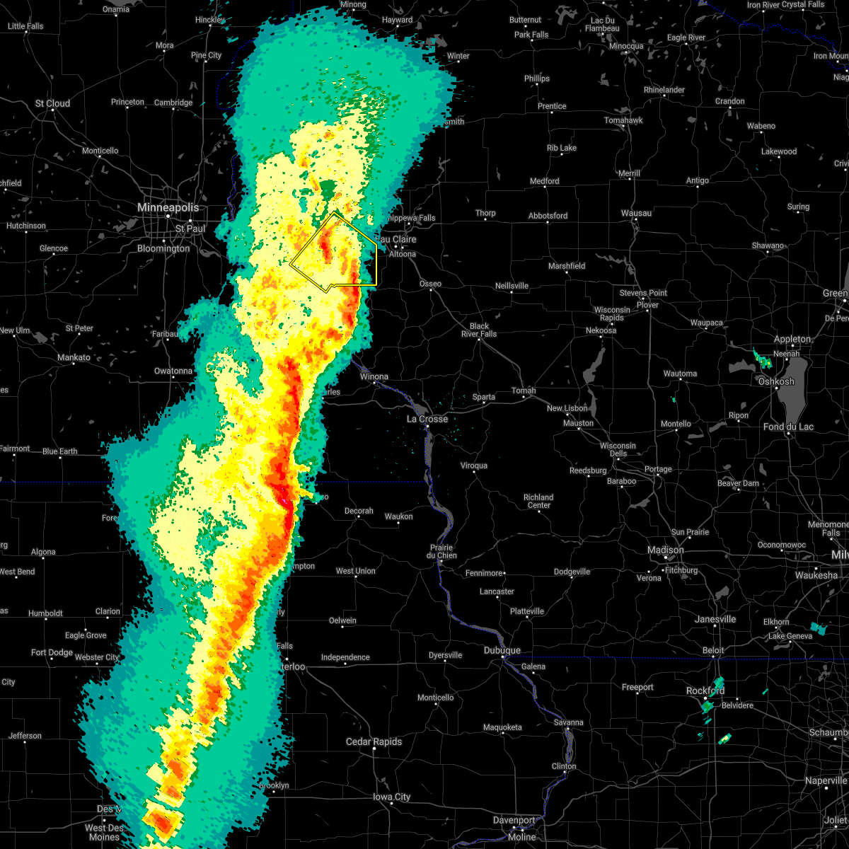 The severe thunderstorm warning for northeastern pepin, northeastern pierce and southern dunn counties will expire at 730 pm cst, the storm which prompted the warning has weakened below severe limits, and no longer pose an immediate threat to life or property. therefore the warning will be allowed to expire. a tornado watch remains in effect until 1000 pm cst for west central wisconsin. The severe thunderstorm warning for northeastern pepin, northeastern pierce and southern dunn counties will expire at 730 pm cst, the storm which prompted the warning has weakened below severe limits, and no longer pose an immediate threat to life or property. therefore the warning will be allowed to expire. a tornado watch remains in effect until 1000 pm cst for west central wisconsin.
|
| 3/6/2017 7:18 PM CST |
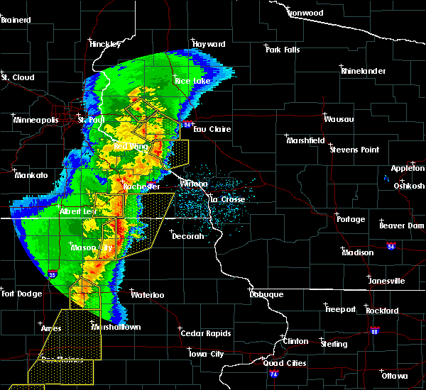 At 717 pm cst, a severe thunderstorm was located near eau galle, or 11 miles southwest of menomonie, moving northeast at 60 mph (radar indicated). Hazards include 60 mph wind gusts and penny size hail. Expect damage to roofs, siding, and trees. this severe storm will be near, menomonie around 730 pm cst. other locations impacted by this severe thunderstorm include cedar falls, arkansaw, caryville, downsville, weston, and rock falls. A tornado watch remains in effect until 1000 pm cst for west central wisconsin. At 717 pm cst, a severe thunderstorm was located near eau galle, or 11 miles southwest of menomonie, moving northeast at 60 mph (radar indicated). Hazards include 60 mph wind gusts and penny size hail. Expect damage to roofs, siding, and trees. this severe storm will be near, menomonie around 730 pm cst. other locations impacted by this severe thunderstorm include cedar falls, arkansaw, caryville, downsville, weston, and rock falls. A tornado watch remains in effect until 1000 pm cst for west central wisconsin.
|
| 3/6/2017 7:03 PM CST |
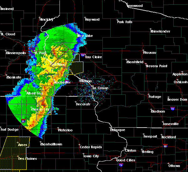 At 702 pm cst, a severe thunderstorm was located near arkansaw, or 18 miles southwest of menomonie, moving northeast at 70 mph (radar indicated). Hazards include 60 mph wind gusts and penny size hail. Expect damage to roofs, siding, and trees. this severe storm will be near, menomonie around 720 pm cst. other locations impacted by this severe thunderstorm include cedar falls, arkansaw, caryville, downsville, weston, porcupine, rock falls and ella. A tornado watch remains in effect until 1000 pm cst for southeastern minnesota, and west central wisconsin. At 702 pm cst, a severe thunderstorm was located near arkansaw, or 18 miles southwest of menomonie, moving northeast at 70 mph (radar indicated). Hazards include 60 mph wind gusts and penny size hail. Expect damage to roofs, siding, and trees. this severe storm will be near, menomonie around 720 pm cst. other locations impacted by this severe thunderstorm include cedar falls, arkansaw, caryville, downsville, weston, porcupine, rock falls and ella. A tornado watch remains in effect until 1000 pm cst for southeastern minnesota, and west central wisconsin.
|
| 3/6/2017 6:48 PM CST |
 At 647 pm cst, a severe thunderstorm was located over gilbert valley, or 11 miles southeast of red wing, moving northeast at 70 mph (radar indicated). Hazards include 60 mph wind gusts and quarter size hail. Hail damage to vehicles is expected. expect wind damage to roofs, siding, and trees. this severe thunderstorm will be near, plum city around 700 pm cst. durand, elmwood and eau galle around 705 pm cst. menomonie around 720 pm cst. other locations impacted by this severe thunderstorm include cedar falls, arkansaw, caryville, downsville, weston, porcupine, menomonie airport, wacouta, rock falls and frontenac state park. A tornado watch remains in effect until 1000 pm cst for southeastern minnesota, and west central wisconsin. At 647 pm cst, a severe thunderstorm was located over gilbert valley, or 11 miles southeast of red wing, moving northeast at 70 mph (radar indicated). Hazards include 60 mph wind gusts and quarter size hail. Hail damage to vehicles is expected. expect wind damage to roofs, siding, and trees. this severe thunderstorm will be near, plum city around 700 pm cst. durand, elmwood and eau galle around 705 pm cst. menomonie around 720 pm cst. other locations impacted by this severe thunderstorm include cedar falls, arkansaw, caryville, downsville, weston, porcupine, menomonie airport, wacouta, rock falls and frontenac state park. A tornado watch remains in effect until 1000 pm cst for southeastern minnesota, and west central wisconsin.
|
| 3/6/2017 6:48 PM CST |
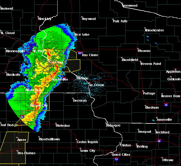 At 647 pm cst, a severe thunderstorm was located over gilbert valley, or 11 miles southeast of red wing, moving northeast at 70 mph (radar indicated). Hazards include 60 mph wind gusts and quarter size hail. Hail damage to vehicles is expected. expect wind damage to roofs, siding, and trees. this severe thunderstorm will be near, plum city around 700 pm cst. durand, elmwood and eau galle around 705 pm cst. menomonie around 720 pm cst. other locations impacted by this severe thunderstorm include cedar falls, arkansaw, caryville, downsville, weston, porcupine, menomonie airport, wacouta, rock falls and frontenac state park. A tornado watch remains in effect until 1000 pm cst for southeastern minnesota, and west central wisconsin. At 647 pm cst, a severe thunderstorm was located over gilbert valley, or 11 miles southeast of red wing, moving northeast at 70 mph (radar indicated). Hazards include 60 mph wind gusts and quarter size hail. Hail damage to vehicles is expected. expect wind damage to roofs, siding, and trees. this severe thunderstorm will be near, plum city around 700 pm cst. durand, elmwood and eau galle around 705 pm cst. menomonie around 720 pm cst. other locations impacted by this severe thunderstorm include cedar falls, arkansaw, caryville, downsville, weston, porcupine, menomonie airport, wacouta, rock falls and frontenac state park. A tornado watch remains in effect until 1000 pm cst for southeastern minnesota, and west central wisconsin.
|
| 10/17/2016 6:51 PM CDT |
 The severe thunderstorm warning for southeastern dunn county will expire at 700 pm cdt, the storms which prompted the warning have weakened below severe limits, and have exited the warned area. therefore, the severe thunderstorm warning for southeastern dunn county will be allowed to expire. The severe thunderstorm warning for southeastern dunn county will expire at 700 pm cdt, the storms which prompted the warning have weakened below severe limits, and have exited the warned area. therefore, the severe thunderstorm warning for southeastern dunn county will be allowed to expire.
|
| 10/17/2016 6:40 PM CDT |
 A severe thunderstorm warning remains in effect until 700 pm cdt for southeastern dunn county. at 639 pm cdt. severe thunderstorms were located along a line extending from near tainter lake to near menomonie airport to near eau galle. moving east at 60 mph. hazard. 60 mph wind gusts and half dollar size hail. A severe thunderstorm warning remains in effect until 700 pm cdt for southeastern dunn county. at 639 pm cdt. severe thunderstorms were located along a line extending from near tainter lake to near menomonie airport to near eau galle. moving east at 60 mph. hazard. 60 mph wind gusts and half dollar size hail.
|
| 10/17/2016 6:32 PM CDT |
 At 631 pm cdt, severe thunderstorms were located along a line extending from knapp to near weston to near arkansaw, moving east at 60 mph (radar indicated). Hazards include 60 mph wind gusts and half dollar size hail. Hail damage to vehicles is expected. expect wind damage to roofs, siding, and trees. these severe storms will be near, menomonie, durand and wheeler around 640 pm cdt. colfax and elk mound around 650 pm cdt. Other locations impacted by these severe thunderstorms include tainter lake, hoffman hills rec area, arkansaw, cedar falls, caryville, rock falls, menomonie airport, weston and downsville. At 631 pm cdt, severe thunderstorms were located along a line extending from knapp to near weston to near arkansaw, moving east at 60 mph (radar indicated). Hazards include 60 mph wind gusts and half dollar size hail. Hail damage to vehicles is expected. expect wind damage to roofs, siding, and trees. these severe storms will be near, menomonie, durand and wheeler around 640 pm cdt. colfax and elk mound around 650 pm cdt. Other locations impacted by these severe thunderstorms include tainter lake, hoffman hills rec area, arkansaw, cedar falls, caryville, rock falls, menomonie airport, weston and downsville.
|
| 10/17/2016 6:22 PM CDT |
 At 621 pm cdt, severe thunderstorms were located along a line extending from woodville to near elmwood to near plum city, moving east at 55 mph (radar indicated). Hazards include 60 mph wind gusts and half dollar size hail. Hail damage to vehicles is expected. expect wind damage to roofs, siding, and trees. these severe storms will be near, elmwood around 625 pm cdt. knapp around 630 pm cdt. menomonie, boyceville and eau galle around 635 pm cdt. durand and wheeler around 640 pm cdt. colfax and elk mound around 650 pm cdt. Other locations impacted by these severe thunderstorms include tainter lake, hoffman hills rec area, arkansaw, cedar falls, caryville, hersey, rock falls, menomonie airport, weston and downsville. At 621 pm cdt, severe thunderstorms were located along a line extending from woodville to near elmwood to near plum city, moving east at 55 mph (radar indicated). Hazards include 60 mph wind gusts and half dollar size hail. Hail damage to vehicles is expected. expect wind damage to roofs, siding, and trees. these severe storms will be near, elmwood around 625 pm cdt. knapp around 630 pm cdt. menomonie, boyceville and eau galle around 635 pm cdt. durand and wheeler around 640 pm cdt. colfax and elk mound around 650 pm cdt. Other locations impacted by these severe thunderstorms include tainter lake, hoffman hills rec area, arkansaw, cedar falls, caryville, hersey, rock falls, menomonie airport, weston and downsville.
|
| 10/17/2016 6:08 PM CDT |
 At 607 pm cdt, severe thunderstorms were located along a line extending from near hammond to near esdaile, moving east at 60 mph (radar indicated). Hazards include 60 mph wind gusts and half dollar size hail. Hail damage to vehicles is expected. expect wind damage to roofs, siding, and trees. severe thunderstorms will be near, woodville around 615 pm cdt. plum city around 620 pm cdt. boyceville, elmwood and knapp around 625 pm cdt. eau galle around 630 pm cdt. menomonie, durand and wheeler around 635 pm cdt. colfax and elk mound around 645 pm cdt. other locations impacted by these severe thunderstorms include tainter lake, hoffman hills rec area, arkansaw, caryville, rock falls, el paso, cedar falls, hersey, beldenville and martel. This includes interstate 94 in wisconsin between mile markers 12 and 56. At 607 pm cdt, severe thunderstorms were located along a line extending from near hammond to near esdaile, moving east at 60 mph (radar indicated). Hazards include 60 mph wind gusts and half dollar size hail. Hail damage to vehicles is expected. expect wind damage to roofs, siding, and trees. severe thunderstorms will be near, woodville around 615 pm cdt. plum city around 620 pm cdt. boyceville, elmwood and knapp around 625 pm cdt. eau galle around 630 pm cdt. menomonie, durand and wheeler around 635 pm cdt. colfax and elk mound around 645 pm cdt. other locations impacted by these severe thunderstorms include tainter lake, hoffman hills rec area, arkansaw, caryville, rock falls, el paso, cedar falls, hersey, beldenville and martel. This includes interstate 94 in wisconsin between mile markers 12 and 56.
|
| 8/19/2016 4:24 AM CDT |
 At 423 am cdt, severe thunderstorms were located along a line extending from near trade lake to near ridgeland to modena, moving east at 40 mph (radar indicated). Hazards include 60 mph wind gusts. Expect damage to roofs. siding. and trees. these severe storms will be near, dallas and ridgeland around 430 am cdt. new auburn around 450 am cdt. Other locations impacted by these severe thunderstorms include jim falls, arkansaw, caryville, ludington, arland, mikana, sand creek, menomonie airport, wolf creek and chippewa moraine state rec area. At 423 am cdt, severe thunderstorms were located along a line extending from near trade lake to near ridgeland to modena, moving east at 40 mph (radar indicated). Hazards include 60 mph wind gusts. Expect damage to roofs. siding. and trees. these severe storms will be near, dallas and ridgeland around 430 am cdt. new auburn around 450 am cdt. Other locations impacted by these severe thunderstorms include jim falls, arkansaw, caryville, ludington, arland, mikana, sand creek, menomonie airport, wolf creek and chippewa moraine state rec area.
|
| 8/19/2016 4:02 AM CDT |
 At 402 am cdt, severe thunderstorms were located along a line extending from near trade lake to near boyceville to near county roads f and k k, moving northeast at 45 mph (radar indicated). Hazards include 60 mph wind gusts. Expect damage to roofs. siding. and trees. severe thunderstorms will be near, boyceville and wheeler around 405 am cdt. ridgeland around 415 am cdt. dallas around 420 am cdt. new auburn around 430 am cdt. weyerhaeuser around 450 am cdt. fall creek around 455 am cdt. augusta and bruce around 500 am cdt. other locations impacted by these severe thunderstorms include jim falls, arkansaw, porcupine, caryville, ludington, arland, nye. mikana, sand creek and menomonie airport. this includes the following highways, interstate 94 in wisconsin between mile markers 20 and 87. u. s. highway 53 between mile markers 86 and 152. u. s. highway 8 in minnesota between mile markers 21 and 22. u. s. Highway 61 near mile marker 165. At 402 am cdt, severe thunderstorms were located along a line extending from near trade lake to near boyceville to near county roads f and k k, moving northeast at 45 mph (radar indicated). Hazards include 60 mph wind gusts. Expect damage to roofs. siding. and trees. severe thunderstorms will be near, boyceville and wheeler around 405 am cdt. ridgeland around 415 am cdt. dallas around 420 am cdt. new auburn around 430 am cdt. weyerhaeuser around 450 am cdt. fall creek around 455 am cdt. augusta and bruce around 500 am cdt. other locations impacted by these severe thunderstorms include jim falls, arkansaw, porcupine, caryville, ludington, arland, nye. mikana, sand creek and menomonie airport. this includes the following highways, interstate 94 in wisconsin between mile markers 20 and 87. u. s. highway 53 between mile markers 86 and 152. u. s. highway 8 in minnesota between mile markers 21 and 22. u. s. Highway 61 near mile marker 165.
|
| 8/19/2016 3:53 AM CDT |
 At 353 am cdt, severe thunderstorms were located along a line extending from near deer park to near downsville to wabasha, moving northeast at 45 mph (radar indicated). Hazards include 60 mph wind gusts. Expect damage to roofs. siding. and trees. these severe storms will be near, menomonie around 400 am cdt. Other locations impacted by these severe thunderstorms include arkansaw, porcupine, downing, houlton, cylon, ella, el paso, emerald, cedar falls and boardman. At 353 am cdt, severe thunderstorms were located along a line extending from near deer park to near downsville to wabasha, moving northeast at 45 mph (radar indicated). Hazards include 60 mph wind gusts. Expect damage to roofs. siding. and trees. these severe storms will be near, menomonie around 400 am cdt. Other locations impacted by these severe thunderstorms include arkansaw, porcupine, downing, houlton, cylon, ella, el paso, emerald, cedar falls and boardman.
|
| 8/19/2016 3:38 AM CDT |
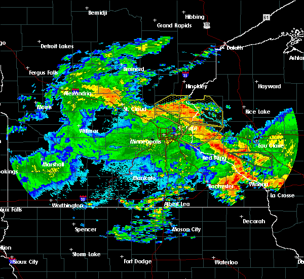 At 337 am cdt, severe thunderstorms were located along a line extending from new richmond to plum city to near millville, moving northeast at 35 mph (radar indicated). Hazards include 60 mph wind gusts. Expect damage to roofs. siding. and trees. severe thunderstorms will be near, new richmond around 345 am cdt. elmwood and eau galle around 350 am cdt. pepin around 400 am cdt. other locations impacted by these severe thunderstorms include burkhardt, arkansaw, porcupine, downing, houlton, hager city, new richmond airport, cylon, ella and el paso. This includes interstate 94 in wisconsin between mile markers 3 and 46. At 337 am cdt, severe thunderstorms were located along a line extending from new richmond to plum city to near millville, moving northeast at 35 mph (radar indicated). Hazards include 60 mph wind gusts. Expect damage to roofs. siding. and trees. severe thunderstorms will be near, new richmond around 345 am cdt. elmwood and eau galle around 350 am cdt. pepin around 400 am cdt. other locations impacted by these severe thunderstorms include burkhardt, arkansaw, porcupine, downing, houlton, hager city, new richmond airport, cylon, ella and el paso. This includes interstate 94 in wisconsin between mile markers 3 and 46.
|
| 8/10/2016 10:13 PM CDT |
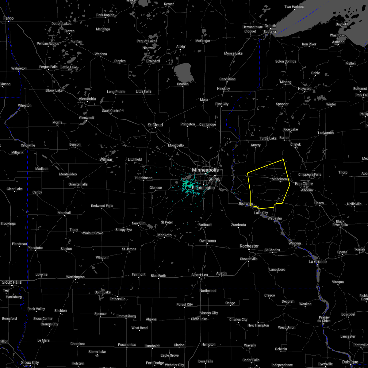 The severe thunderstorm warning for southeastern st. croix, central dunn, northwestern pepin and eastern pierce counties will expire at 1015 pm cdt, the storms which prompted the warning have weakened below severe limits, and no longer pose an immediate threat to life or property. therefore the warning will be allowed to expire. however heavy rain is still possible with these thunderstorms. The severe thunderstorm warning for southeastern st. croix, central dunn, northwestern pepin and eastern pierce counties will expire at 1015 pm cdt, the storms which prompted the warning have weakened below severe limits, and no longer pose an immediate threat to life or property. therefore the warning will be allowed to expire. however heavy rain is still possible with these thunderstorms.
|
| 8/10/2016 9:49 PM CDT |
 At 949 pm cdt, severe thunderstorms were located along a line extending from near woodville to near elmwood to near frontenac state park, moving east at 40 mph (radar indicated). Hazards include 60 mph wind gusts. Expect damage to roofs. siding. and trees. these severe storms will be near, eau galle and knapp around 1000 pm cdt. menomonie and durand around 1010 pm cdt. Other locations impacted by these severe thunderstorms include tainter lake, el paso, esdaile, arkansaw, cedar falls, porcupine, downing, hersey and martel. At 949 pm cdt, severe thunderstorms were located along a line extending from near woodville to near elmwood to near frontenac state park, moving east at 40 mph (radar indicated). Hazards include 60 mph wind gusts. Expect damage to roofs. siding. and trees. these severe storms will be near, eau galle and knapp around 1000 pm cdt. menomonie and durand around 1010 pm cdt. Other locations impacted by these severe thunderstorms include tainter lake, el paso, esdaile, arkansaw, cedar falls, porcupine, downing, hersey and martel.
|
| 8/10/2016 9:29 PM CDT |
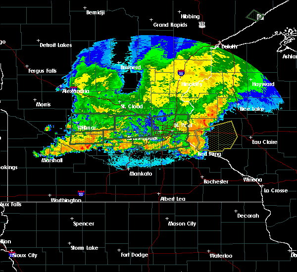 At 929 pm cdt, severe thunderstorms were located along a line extending from near roberts to ellsworth to hager city, moving east at 50 mph (radar indicated). Hazards include 60 mph wind gusts. Expect damage to roofs. siding. and trees. severe thunderstorms will be near, hammond around 935 pm cdt. baldwin around 940 pm cdt. woodville and elmwood around 945 pm cdt. plum city around 950 pm cdt. glenwood city, boyceville and knapp around 955 pm cdt. menomonie and eau galle around 1000 pm cdt. Durand and wheeler around 1005 pm cdt. At 929 pm cdt, severe thunderstorms were located along a line extending from near roberts to ellsworth to hager city, moving east at 50 mph (radar indicated). Hazards include 60 mph wind gusts. Expect damage to roofs. siding. and trees. severe thunderstorms will be near, hammond around 935 pm cdt. baldwin around 940 pm cdt. woodville and elmwood around 945 pm cdt. plum city around 950 pm cdt. glenwood city, boyceville and knapp around 955 pm cdt. menomonie and eau galle around 1000 pm cdt. Durand and wheeler around 1005 pm cdt.
|
| 7/23/2016 11:35 AM CDT |
 At 1134 am cdt, severe thunderstorms were located along a line extending from near connorsville to near hoffman hills rec area to rock falls, moving northeast at 55 mph (radar indicated). Hazards include 60 mph wind gusts. Expect damage to roofs. siding. and trees. these severe storms will be near, colfax around 1140 am cdt. Other locations impacted by these severe thunderstorms include tainter lake, hoffman hills rec area, cedar falls, caryville, downing, sand creek, rock falls, menomonie airport, connorsville and downsville. At 1134 am cdt, severe thunderstorms were located along a line extending from near connorsville to near hoffman hills rec area to rock falls, moving northeast at 55 mph (radar indicated). Hazards include 60 mph wind gusts. Expect damage to roofs. siding. and trees. these severe storms will be near, colfax around 1140 am cdt. Other locations impacted by these severe thunderstorms include tainter lake, hoffman hills rec area, cedar falls, caryville, downing, sand creek, rock falls, menomonie airport, connorsville and downsville.
|
| 7/23/2016 11:14 AM CDT |
 At 1114 am cdt, severe thunderstorms were located along a line extending from pine springs to near woodville to near the big swamp area, moving northeast at 40 mph (radar indicated). Hazards include 60 mph wind gusts. Expect damage to roofs. siding. and trees. severe thunderstorms will be near, woodville around 1120 am cdt. hudson and knapp around 1125 am cdt. glenwood city around 1130 am cdt. somerset, boyceville and elk mound around 1135 am cdt. new richmond around 1140 am cdt. wheeler around 1145 am cdt. star prairie around 1150 am cdt. ridgeland around 1155 am cdt. other locations impacted by these severe thunderstorms include arkansaw, caryville, downing, lakeland shores, birchwood, cedar falls, grant, sand creek, birchwood village and willernie. this includes the following highways, interstate 94 in minnesota between mile markers 257 and 258. interstate 94 in wisconsin between mile markers 1 and 56. u. s. Highway 61 between mile markers 154 and 156. At 1114 am cdt, severe thunderstorms were located along a line extending from pine springs to near woodville to near the big swamp area, moving northeast at 40 mph (radar indicated). Hazards include 60 mph wind gusts. Expect damage to roofs. siding. and trees. severe thunderstorms will be near, woodville around 1120 am cdt. hudson and knapp around 1125 am cdt. glenwood city around 1130 am cdt. somerset, boyceville and elk mound around 1135 am cdt. new richmond around 1140 am cdt. wheeler around 1145 am cdt. star prairie around 1150 am cdt. ridgeland around 1155 am cdt. other locations impacted by these severe thunderstorms include arkansaw, caryville, downing, lakeland shores, birchwood, cedar falls, grant, sand creek, birchwood village and willernie. this includes the following highways, interstate 94 in minnesota between mile markers 257 and 258. interstate 94 in wisconsin between mile markers 1 and 56. u. s. Highway 61 between mile markers 154 and 156.
|
| 7/23/2016 11:03 AM CDT |
 At 1103 am cdt, severe thunderstorms were located along a line extending from near lake elmo to near martel to near eau galle, moving northeast at 40 mph (radar indicated). Hazards include 60 mph wind gusts. Expect damage to roofs. siding. and trees. these severe storms will be near, eau galle around 1110 am cdt. Other locations impacted by these severe thunderstorms include lakeland, arkansaw, porcupine, lake elmo airport, afton state park, lakeland shores, st marys point, ella, lake st croix beach and st paul park. At 1103 am cdt, severe thunderstorms were located along a line extending from near lake elmo to near martel to near eau galle, moving northeast at 40 mph (radar indicated). Hazards include 60 mph wind gusts. Expect damage to roofs. siding. and trees. these severe storms will be near, eau galle around 1110 am cdt. Other locations impacted by these severe thunderstorms include lakeland, arkansaw, porcupine, lake elmo airport, afton state park, lakeland shores, st marys point, ella, lake st croix beach and st paul park.
|
| 7/23/2016 11:03 AM CDT |
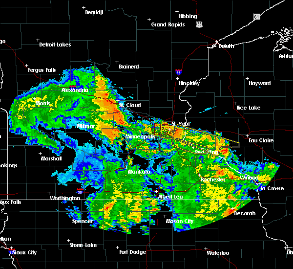 At 1103 am cdt, severe thunderstorms were located along a line extending from near lake elmo to near martel to near eau galle, moving northeast at 40 mph (radar indicated). Hazards include 60 mph wind gusts. Expect damage to roofs. siding. and trees. these severe storms will be near, eau galle around 1110 am cdt. Other locations impacted by these severe thunderstorms include lakeland, arkansaw, porcupine, lake elmo airport, afton state park, lakeland shores, st marys point, ella, lake st croix beach and st paul park. At 1103 am cdt, severe thunderstorms were located along a line extending from near lake elmo to near martel to near eau galle, moving northeast at 40 mph (radar indicated). Hazards include 60 mph wind gusts. Expect damage to roofs. siding. and trees. these severe storms will be near, eau galle around 1110 am cdt. Other locations impacted by these severe thunderstorms include lakeland, arkansaw, porcupine, lake elmo airport, afton state park, lakeland shores, st marys point, ella, lake st croix beach and st paul park.
|
| 7/23/2016 10:42 AM CDT |
 At 1041 am cdt, severe thunderstorms were located along a line extending from cottage grove to near plum city, moving northeast at 40 mph (radar indicated). Hazards include 60 mph wind gusts. Expect damage to roofs. siding. and trees. severe thunderstorms will be near, plum city around 1045 am cdt. hudson, north hudson, bayport, durand and eau galle around 1100 am cdt. river falls around 1105 am cdt. other locations impacted by these severe thunderstorms include arkansaw, porcupine, frontenac state park, afton state park, lakeland shores, ella, st paul park, diamond bluff, el paso and kinnickinnic state park. this includes the following highways, interstate 94 in minnesota between mile markers 249 and 258. interstate 94 in wisconsin between mile markers 1 and 8. u. s. highway 10 in minnesota between mile markers 300 and 302. u. s. Highway 61 near mile marker 79, near mile marker 85, and between mile markers 116 and 130. At 1041 am cdt, severe thunderstorms were located along a line extending from cottage grove to near plum city, moving northeast at 40 mph (radar indicated). Hazards include 60 mph wind gusts. Expect damage to roofs. siding. and trees. severe thunderstorms will be near, plum city around 1045 am cdt. hudson, north hudson, bayport, durand and eau galle around 1100 am cdt. river falls around 1105 am cdt. other locations impacted by these severe thunderstorms include arkansaw, porcupine, frontenac state park, afton state park, lakeland shores, ella, st paul park, diamond bluff, el paso and kinnickinnic state park. this includes the following highways, interstate 94 in minnesota between mile markers 249 and 258. interstate 94 in wisconsin between mile markers 1 and 8. u. s. highway 10 in minnesota between mile markers 300 and 302. u. s. Highway 61 near mile marker 79, near mile marker 85, and between mile markers 116 and 130.
|
| 6/10/2016 4:04 PM CDT |
 At 403 pm cdt, severe thunderstorms were located along a line extending from near elk mound to downsville, moving southeast at 35 mph (radar indicated). Hazards include 70 mph wind gusts and quarter size hail. Hail damage to vehicles is expected. expect considerable tree damage. wind damage is also likely to mobile homes, roofs, and outbuildings. locations impacted include, eau claire, menomonie, lake hallie, colfax, elk mound, hoffman hills rec area, cedar falls, eau claire airport, menomonie airport and downsville. A tornado watch remains in effect until 900 pm cdt for west central wisconsin. At 403 pm cdt, severe thunderstorms were located along a line extending from near elk mound to downsville, moving southeast at 35 mph (radar indicated). Hazards include 70 mph wind gusts and quarter size hail. Hail damage to vehicles is expected. expect considerable tree damage. wind damage is also likely to mobile homes, roofs, and outbuildings. locations impacted include, eau claire, menomonie, lake hallie, colfax, elk mound, hoffman hills rec area, cedar falls, eau claire airport, menomonie airport and downsville. A tornado watch remains in effect until 900 pm cdt for west central wisconsin.
|
| 6/10/2016 4:01 PM CDT |
 At 401 pm cdt, severe thunderstorms were located along a line extending from near elk mound to near downsville to near plum city, moving southeast at 25 mph (radar indicated). Hazards include 70 mph wind gusts and quarter size hail. Hail damage to vehicles is expected. expect considerable tree damage. Wind damage is also likely to mobile homes, roofs, and outbuildings. At 401 pm cdt, severe thunderstorms were located along a line extending from near elk mound to near downsville to near plum city, moving southeast at 25 mph (radar indicated). Hazards include 70 mph wind gusts and quarter size hail. Hail damage to vehicles is expected. expect considerable tree damage. Wind damage is also likely to mobile homes, roofs, and outbuildings.
|
| 6/10/2016 3:52 PM CDT |
 At 352 pm cdt, severe thunderstorms were located along a line extending from plum city to near goodhue, moving southeast at 20 mph (radar indicated). Hazards include ping pong ball size hail and 60 mph wind gusts. People and animals outdoors will be injured. expect hail damage to roofs, siding, windows, and vehicles. expect wind damage to roofs, siding, and trees. locations impacted include, red wing, durand, pepin, eau galle, plum city, bay city, stockholm, frontenac, wacouta, arkansaw, frontenac state park and porcupine. A tornado watch remains in effect until 900 pm cdt for west central wisconsin. At 352 pm cdt, severe thunderstorms were located along a line extending from plum city to near goodhue, moving southeast at 20 mph (radar indicated). Hazards include ping pong ball size hail and 60 mph wind gusts. People and animals outdoors will be injured. expect hail damage to roofs, siding, windows, and vehicles. expect wind damage to roofs, siding, and trees. locations impacted include, red wing, durand, pepin, eau galle, plum city, bay city, stockholm, frontenac, wacouta, arkansaw, frontenac state park and porcupine. A tornado watch remains in effect until 900 pm cdt for west central wisconsin.
|
| 6/10/2016 3:38 PM CDT |
 At 338 pm cdt, a severe thunderstorm was located near menomonie, moving east at 30 mph (radar indicated). Hazards include 70 mph wind gusts and quarter size hail. Hail damage to vehicles is expected. expect considerable tree damage. Wind damage is also likely to mobile homes, roofs, and outbuildings. At 338 pm cdt, a severe thunderstorm was located near menomonie, moving east at 30 mph (radar indicated). Hazards include 70 mph wind gusts and quarter size hail. Hail damage to vehicles is expected. expect considerable tree damage. Wind damage is also likely to mobile homes, roofs, and outbuildings.
|
| 6/10/2016 3:33 PM CDT |
 At 333 pm cdt, a severe thunderstorm was located over red wing, moving east at 30 mph (radar indicated). Hazards include ping pong ball size hail and 60 mph wind gusts. People and animals outdoors will be injured. expect hail damage to roofs, siding, windows, and vehicles. Expect wind damage to roofs, siding, and trees. At 333 pm cdt, a severe thunderstorm was located over red wing, moving east at 30 mph (radar indicated). Hazards include ping pong ball size hail and 60 mph wind gusts. People and animals outdoors will be injured. expect hail damage to roofs, siding, windows, and vehicles. Expect wind damage to roofs, siding, and trees.
|
| 7/18/2015 2:16 AM CDT |
 At 216 am cdt, severe thunderstorms were located along a line extending from near hillsdale to near tilden to near gilmanton, moving east at 55 mph (trained weather spotters). Hazards include 60 mph wind gusts. Expect damage to roofs. siding and trees. these severe storms will be near, chippewa falls and bloomer around 220 am cdt. lake wissota around 225 am cdt. cadott around 235 am cdt. boyd around 240 am cdt. stanley around 245 am cdt. fairchild around 255 am cdt. other locations impacted by these severe thunderstorms include tainter lake, hoffman hills rec area, tilden, jim falls, caryville, ludington, foster, chippewa moraine state rec area, seymour and lake eau claire county park. this includes the following highways, interstate 94 in wisconsin between mile markers 45 and 86. u. s. Highway 53 between mile markers 86 and 126. At 216 am cdt, severe thunderstorms were located along a line extending from near hillsdale to near tilden to near gilmanton, moving east at 55 mph (trained weather spotters). Hazards include 60 mph wind gusts. Expect damage to roofs. siding and trees. these severe storms will be near, chippewa falls and bloomer around 220 am cdt. lake wissota around 225 am cdt. cadott around 235 am cdt. boyd around 240 am cdt. stanley around 245 am cdt. fairchild around 255 am cdt. other locations impacted by these severe thunderstorms include tainter lake, hoffman hills rec area, tilden, jim falls, caryville, ludington, foster, chippewa moraine state rec area, seymour and lake eau claire county park. this includes the following highways, interstate 94 in wisconsin between mile markers 45 and 86. u. s. Highway 53 between mile markers 86 and 126.
|
| 7/18/2015 2:07 AM CDT |
 The tornado warning for northeastern pepin and southeastern dunn counties will expire at 215 am cdt, the storm which prompted the warning no longer appears capable of producing a tornado. therefore the warning will be allowed to expire. however gusty winds are still possible with this thunderstorm. a severe thunderstorm watch remains in effect until 700 am cdt for west central wisconsin. The tornado warning for northeastern pepin and southeastern dunn counties will expire at 215 am cdt, the storm which prompted the warning no longer appears capable of producing a tornado. therefore the warning will be allowed to expire. however gusty winds are still possible with this thunderstorm. a severe thunderstorm watch remains in effect until 700 am cdt for west central wisconsin.
|
| 7/18/2015 2:00 AM CDT |
 At 159 am cdt, severe thunderstorms were located along a line extending from clayton to tainter lake to near nelson, moving east at 55 mph (trained weather spotters). Hazards include 60 mph wind gusts. Expect damage to roofs. siding and trees. severe thunderstorms will be near, colfax around 205 am cdt. bloomer and dallas around 215 am cdt. chippewa falls around 220 am cdt. lake wissota around 225 am cdt. cadott around 235 am cdt. boyd around 240 am cdt. stanley around 245 am cdt. other locations impacted by these severe thunderstorms include tainter lake, hoffman hills rec area, tilden, jim falls, caryville, ludington, foster, chippewa moraine state rec area, seymour and lake eau claire county park. this includes the following highways, interstate 94 in wisconsin between mile markers 45 and 86. u. s. Highway 53 between mile markers 86 and 126. At 159 am cdt, severe thunderstorms were located along a line extending from clayton to tainter lake to near nelson, moving east at 55 mph (trained weather spotters). Hazards include 60 mph wind gusts. Expect damage to roofs. siding and trees. severe thunderstorms will be near, colfax around 205 am cdt. bloomer and dallas around 215 am cdt. chippewa falls around 220 am cdt. lake wissota around 225 am cdt. cadott around 235 am cdt. boyd around 240 am cdt. stanley around 245 am cdt. other locations impacted by these severe thunderstorms include tainter lake, hoffman hills rec area, tilden, jim falls, caryville, ludington, foster, chippewa moraine state rec area, seymour and lake eau claire county park. this includes the following highways, interstate 94 in wisconsin between mile markers 45 and 86. u. s. Highway 53 between mile markers 86 and 126.
|
| 7/18/2015 1:56 AM CDT |
 At 156 am cdt, severe thunderstorms were located along a line extending from clayton to near cedar falls to dumfries, moving east at 55 mph (radar indicated). Hazards include 60 mph wind gusts. Expect damage to roofs. siding and trees. these severe storms will be near, wheeler around 200 am cdt. colfax around 205 am cdt. other locations impacted by these severe thunderstorms include tainter lake, hoffman hills rec area, arkansaw, porcupine, caryville, downing, hillsdale, rock falls, ella and emerald. this includes the following highways, interstate 94 in wisconsin between mile markers 25 and 56. u. s. Highway 61 near mile marker 165. At 156 am cdt, severe thunderstorms were located along a line extending from clayton to near cedar falls to dumfries, moving east at 55 mph (radar indicated). Hazards include 60 mph wind gusts. Expect damage to roofs. siding and trees. these severe storms will be near, wheeler around 200 am cdt. colfax around 205 am cdt. other locations impacted by these severe thunderstorms include tainter lake, hoffman hills rec area, arkansaw, porcupine, caryville, downing, hillsdale, rock falls, ella and emerald. this includes the following highways, interstate 94 in wisconsin between mile markers 25 and 56. u. s. Highway 61 near mile marker 165.
|
| 7/18/2015 1:52 AM CDT |
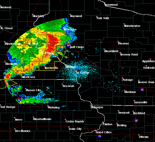 At 152 am cdt, a severe thunderstorm capable of producing a tornado was located over eau galle, or 13 miles southwest of menomonie, moving east at 45 mph (radar indicated rotation). Hazards include tornado. Flying debris will be dangerous to those caught without shelter. mobile homes will be damaged or destroyed. damage to roofs, windows and vehicles will occur. tree damage is likely. This tornadic thunderstorm will remain over mainly rural areas of northeastern pepin and southeastern dunn counties, including the following locations, caryville, downsville and rock falls. At 152 am cdt, a severe thunderstorm capable of producing a tornado was located over eau galle, or 13 miles southwest of menomonie, moving east at 45 mph (radar indicated rotation). Hazards include tornado. Flying debris will be dangerous to those caught without shelter. mobile homes will be damaged or destroyed. damage to roofs, windows and vehicles will occur. tree damage is likely. This tornadic thunderstorm will remain over mainly rural areas of northeastern pepin and southeastern dunn counties, including the following locations, caryville, downsville and rock falls.
|
| 7/18/2015 1:27 AM CDT |
 At 127 am cdt, severe thunderstorms were located along a line extending from east farmington to near martel to near mazeppa, moving east at 55 mph (radar indicated). Hazards include 60 mph wind gusts. Expect damage to roofs. siding and trees. severe thunderstorms will be near, baldwin, spring valley and woodville around 130 am cdt. knapp around 140 am cdt. amery and boyceville around 145 am cdt. menomonie and clear lake around 150 am cdt. pepin, clayton and wheeler around 155 am cdt. colfax and elk mound around 200 am cdt. other locations impacted by these severe thunderstorms include arkansaw, frontenac state park, porcupine, caryville, downing, ella, el paso, bellechester, arland and cedar falls. this includes the following highways, interstate 94 in wisconsin between mile markers 20 and 56. u. s. Highway 61 between mile markers 75 and 87, and near mile marker 165. At 127 am cdt, severe thunderstorms were located along a line extending from east farmington to near martel to near mazeppa, moving east at 55 mph (radar indicated). Hazards include 60 mph wind gusts. Expect damage to roofs. siding and trees. severe thunderstorms will be near, baldwin, spring valley and woodville around 130 am cdt. knapp around 140 am cdt. amery and boyceville around 145 am cdt. menomonie and clear lake around 150 am cdt. pepin, clayton and wheeler around 155 am cdt. colfax and elk mound around 200 am cdt. other locations impacted by these severe thunderstorms include arkansaw, frontenac state park, porcupine, caryville, downing, ella, el paso, bellechester, arland and cedar falls. this includes the following highways, interstate 94 in wisconsin between mile markers 20 and 56. u. s. Highway 61 between mile markers 75 and 87, and near mile marker 165.
|
| 7/13/2015 6:13 PM CDT |
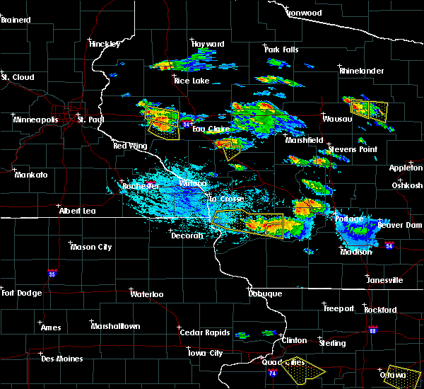 At 613 pm cdt, a severe thunderstorm was located near downsville, or 11 miles south of menomonie, moving southeast at 35 mph (radar indicated). Hazards include 60 mph wind gusts and quarter size hail. Hail damage to vehicles is expected. expect wind damage to roofs, siding and trees. Locations impacted include, eau galle, rock falls, caryville and downsville. At 613 pm cdt, a severe thunderstorm was located near downsville, or 11 miles south of menomonie, moving southeast at 35 mph (radar indicated). Hazards include 60 mph wind gusts and quarter size hail. Hail damage to vehicles is expected. expect wind damage to roofs, siding and trees. Locations impacted include, eau galle, rock falls, caryville and downsville.
|
| 7/13/2015 6:03 PM CDT |
 At 603 pm cdt, a severe thunderstorm was located over downsville, or 8 miles south of menomonie, moving southeast at 35 mph (radar indicated). Hazards include 60 mph wind gusts and quarter size hail. Hail damage to vehicles is expected. expect wind damage to roofs, siding and trees. This severe thunderstorm will remain over mainly rural areas of northeastern pepin and southeastern dunn counties, including the following locations, caryville, downsville and rock falls. At 603 pm cdt, a severe thunderstorm was located over downsville, or 8 miles south of menomonie, moving southeast at 35 mph (radar indicated). Hazards include 60 mph wind gusts and quarter size hail. Hail damage to vehicles is expected. expect wind damage to roofs, siding and trees. This severe thunderstorm will remain over mainly rural areas of northeastern pepin and southeastern dunn counties, including the following locations, caryville, downsville and rock falls.
|
| 7/13/2015 12:03 AM CDT |
 At 1203 am cdt, severe thunderstorms were located along a line extending from bloomer to near eau claire airport to near downsville, moving east at 30 mph (radar indicated). Hazards include 60 mph wind gusts and penny size hail. Expect damage to roofs. siding and trees. severe thunderstorms will be near, chippewa falls, altoona, lake hallie and bloomer around 1210 am cdt. eau claire and lake wissota around 1220 am cdt. fall creek around 1230 am cdt. cadott around 1235 am cdt. other locations impacted by these severe thunderstorms include tilden, jim falls, caryville, ludington, seymour, eagleton, eau claire airport, rock falls and bateman. This includes interstate 94 in wisconsin between mile markers 55 and 76. At 1203 am cdt, severe thunderstorms were located along a line extending from bloomer to near eau claire airport to near downsville, moving east at 30 mph (radar indicated). Hazards include 60 mph wind gusts and penny size hail. Expect damage to roofs. siding and trees. severe thunderstorms will be near, chippewa falls, altoona, lake hallie and bloomer around 1210 am cdt. eau claire and lake wissota around 1220 am cdt. fall creek around 1230 am cdt. cadott around 1235 am cdt. other locations impacted by these severe thunderstorms include tilden, jim falls, caryville, ludington, seymour, eagleton, eau claire airport, rock falls and bateman. This includes interstate 94 in wisconsin between mile markers 55 and 76.
|
| 5/3/2015 6:53 PM CDT | At 653 pm cdt, severe thunderstorms were located along a line extending from near ridgeland to hoffman hills rec area to near durand, moving east at 45 mph (radar indicated). Hazards include ping pong ball size hail and 60 mph wind gusts. People and animals outdoors will be injured. expect hail damage to roofs, siding, windows and vehicles. Expect wind damage to roofs, siding and trees. |
| 5/3/2015 6:50 PM CDT | At 650 pm cdt, severe thunderstorms were located along a line extending from near connorsville to near menomonie airport to near durand, moving east at 40 mph (radar indicated). Hazards include ping pong ball size hail and 60 mph wind gusts. People and animals outdoors will be injured. expect hail damage to roofs, siding, windows and vehicles. expect wind damage to roofs, siding and trees. locations impacted include, menomonie, boyceville, elmwood, knapp, wheeler, ridgeland, weston, downing, tainter lake, cedar falls, menomonie airport and connorsville. 1. 50in. |
| 5/3/2015 6:30 PM CDT | At 629 pm cdt, severe thunderstorms were located along a line extending from near cylon to near wilson to plum city, moving east at 40 mph (radar indicated). Hazards include ping pong ball size hail and 60 mph wind gusts. People and animals outdoors will be injured. expect hail damage to roofs, siding, windows and vehicles. expect wind damage to roofs, siding and trees. locations impacted include, menomonie, new richmond, baldwin, hammond, spring valley, woodville, glenwood city, boyceville, elmwood, eau galle, star prairie and knapp. 1. 50in. |
| 5/3/2015 6:17 PM CDT | At 616 pm cdt, severe thunderstorms were located along a line extending from near new richmond airport to woodville to near esdaile, moving east at 40 mph (radar indicated). Hazards include ping pong ball size hail and 60 mph wind gusts. People and animals outdoors will be injured. expect hail damage to roofs, siding, windows and vehicles. expect wind damage to roofs, siding and trees. locations impacted include, menomonie, river falls, hudson, new richmond, ellsworth, somerset, baldwin, hammond, roberts, spring valley, woodville and glenwood city. 1. 50in. |
| 5/3/2015 5:58 PM CDT | At 558 pm cdt, severe thunderstorms were located along a line extending from marine on st croix to lakeland shores, moving east at 40 mph (radar indicated). Hazards include ping pong ball size hail and 60 mph wind gusts. People and animals outdoors will be injured. expect hail damage to roofs, siding, windows and vehicles. Expect wind damage to roofs, siding and trees. |
| 1/1/0001 12:00 AM | Trees downed in dunn township. location and time estimate in dunn county WI, 2.3 miles SSW of Downsville, WI |
Hail Maps for Downsville, WI
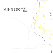


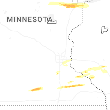


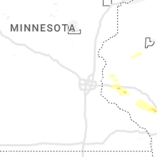


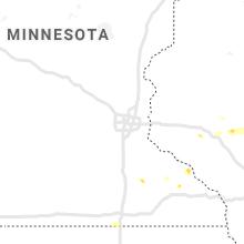

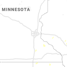
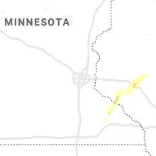


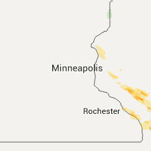


Connect with Interactive Hail Maps