

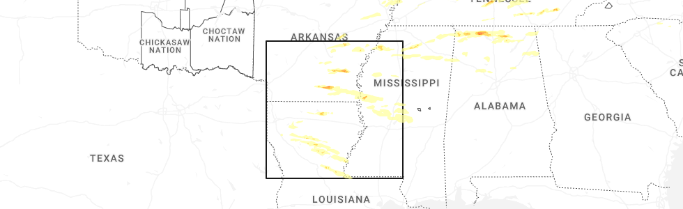
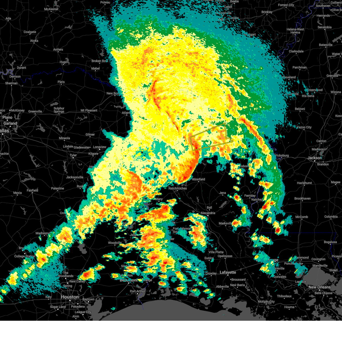
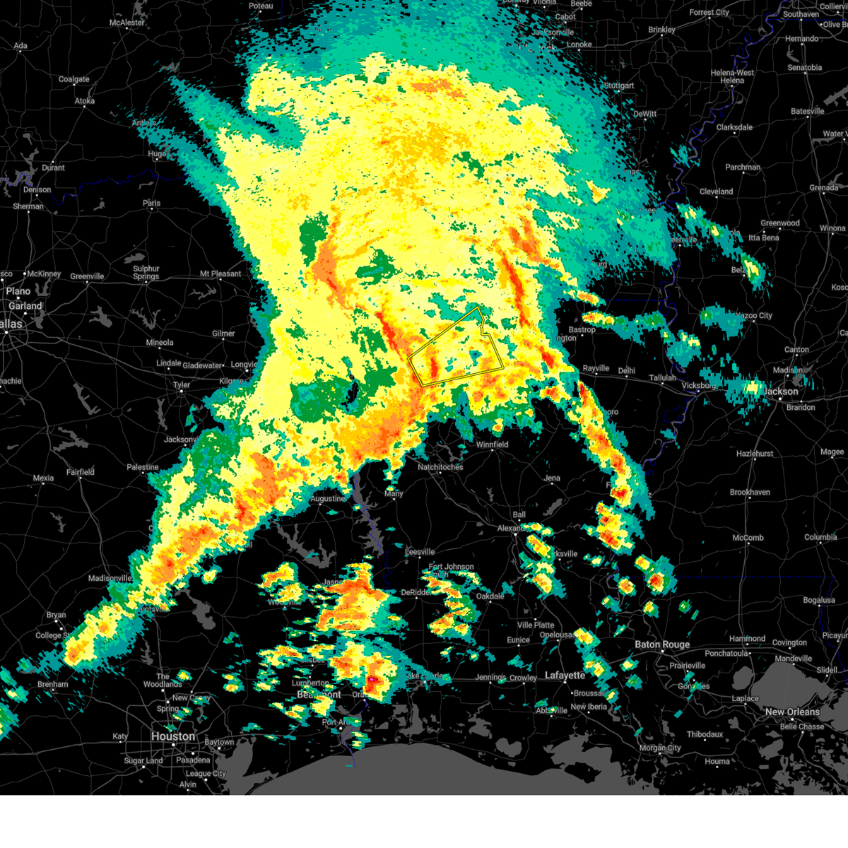
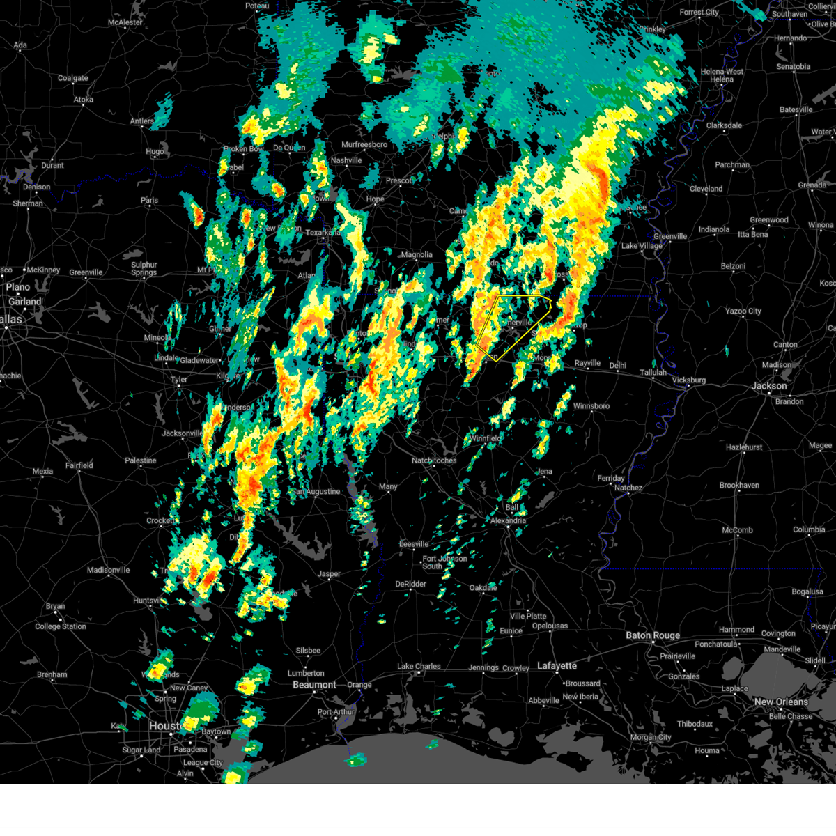
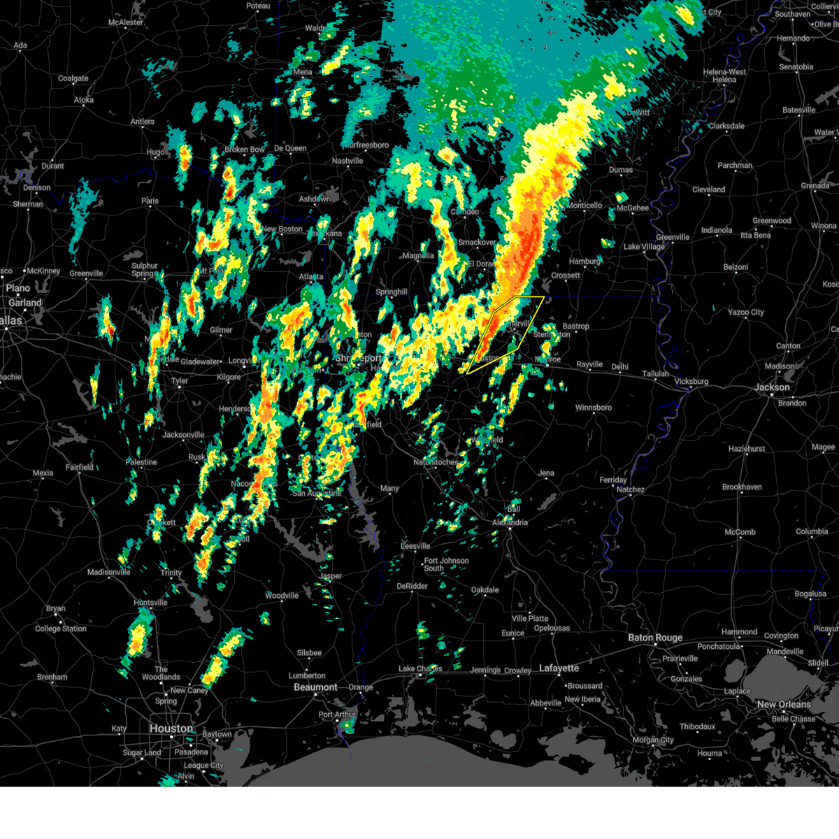
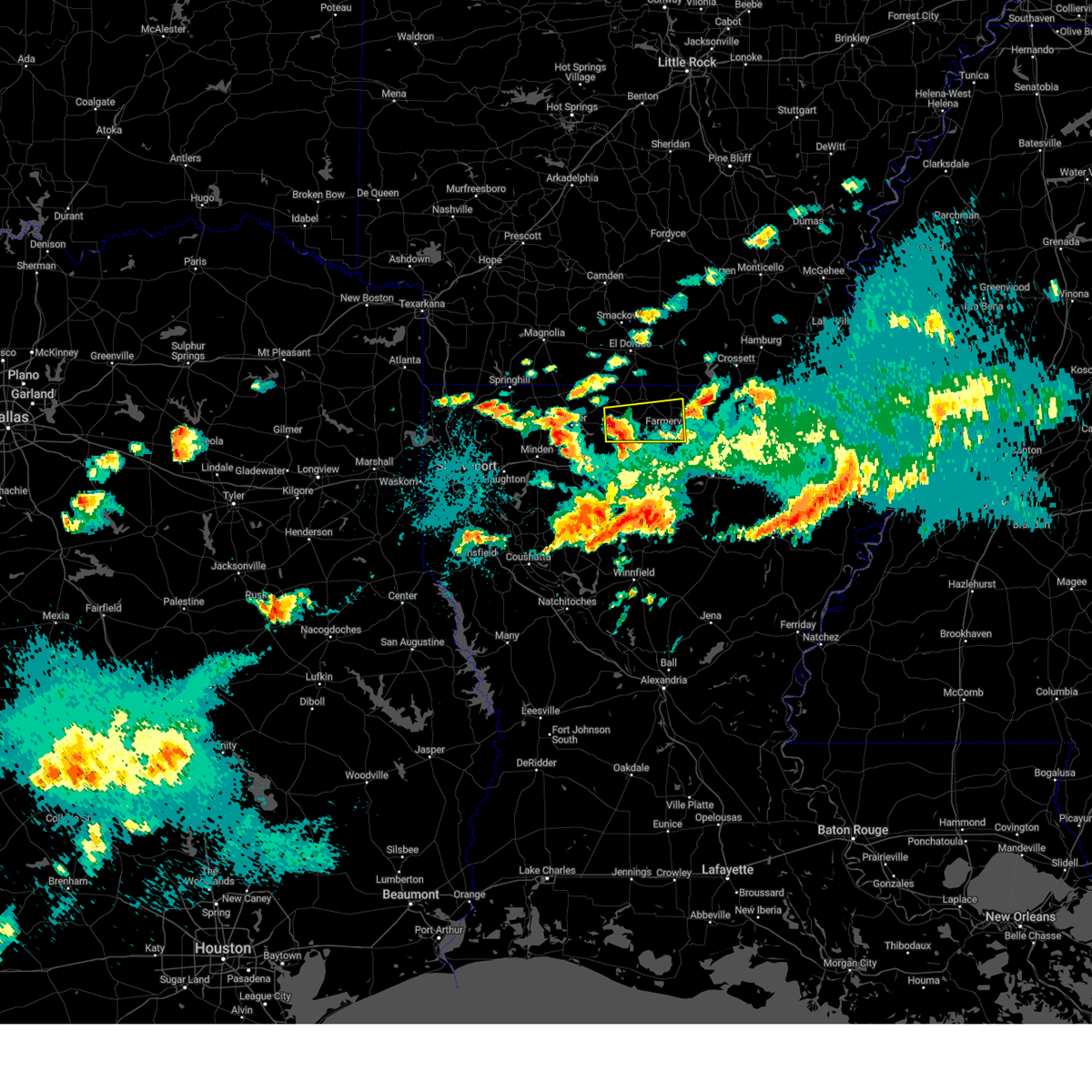
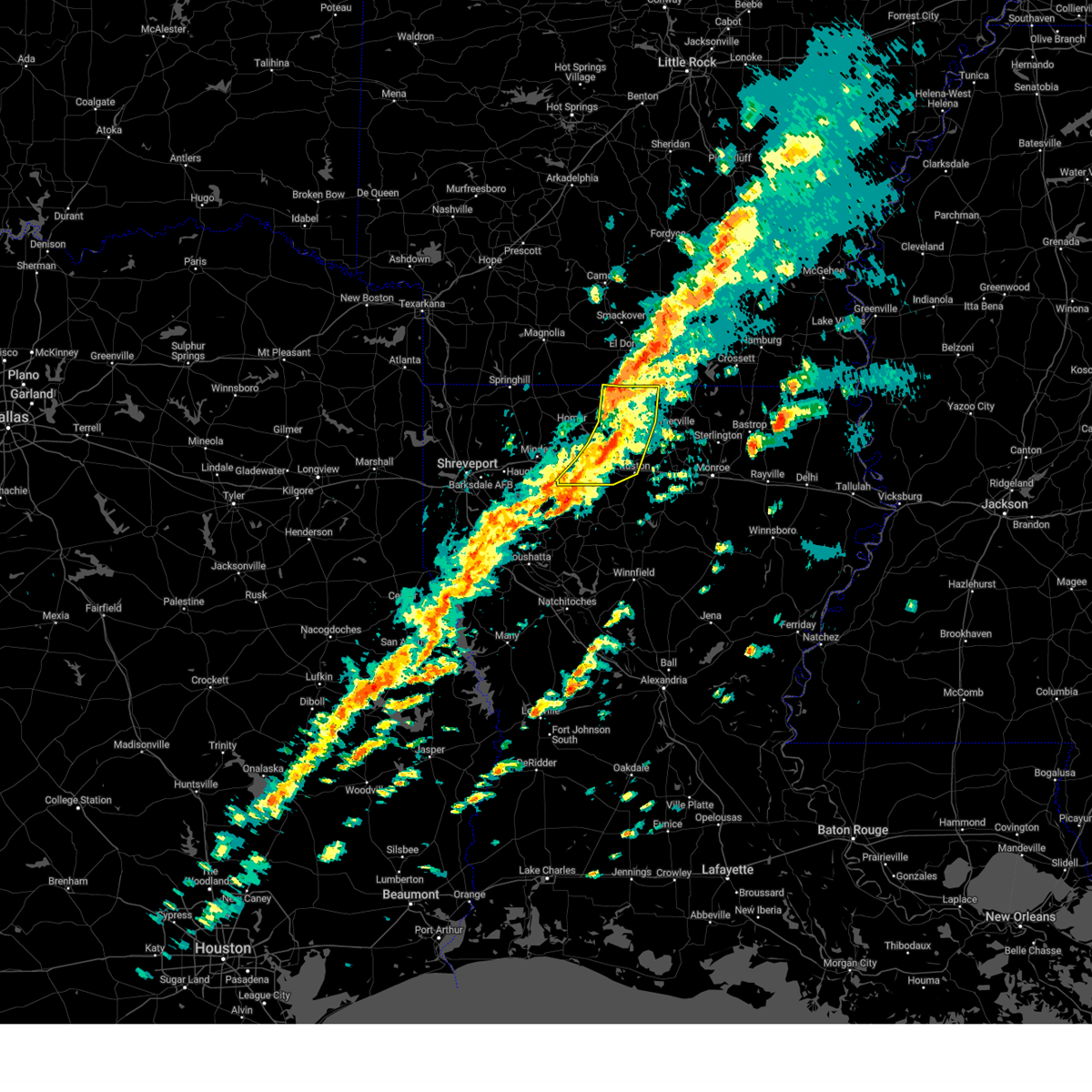
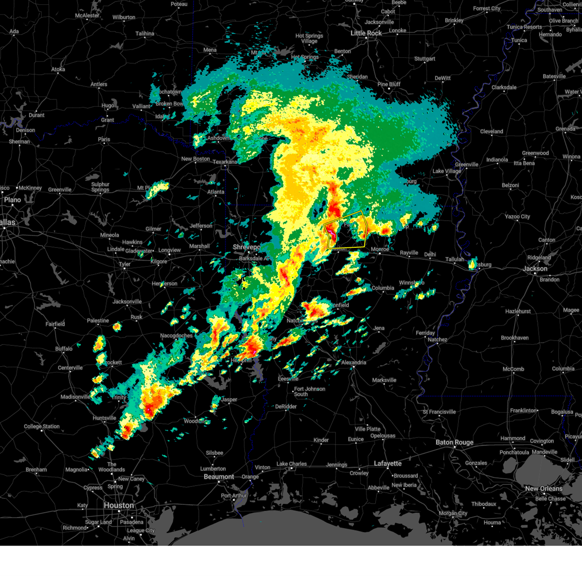
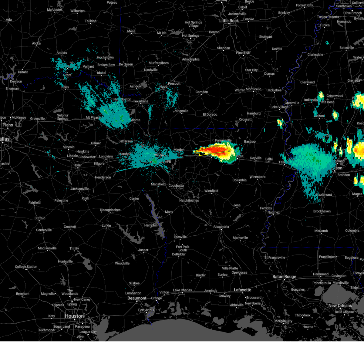
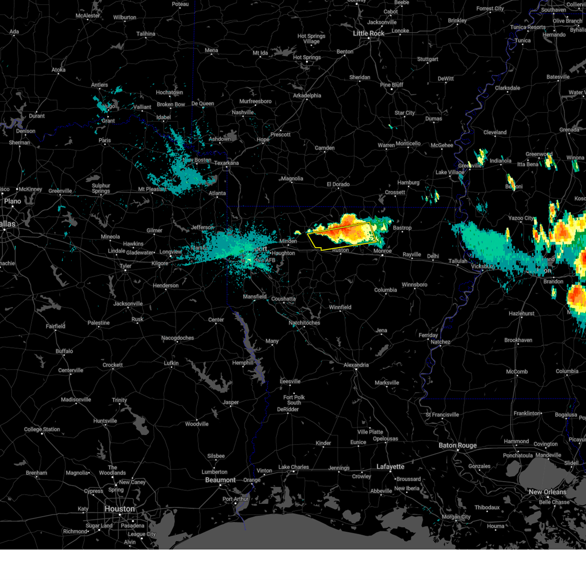
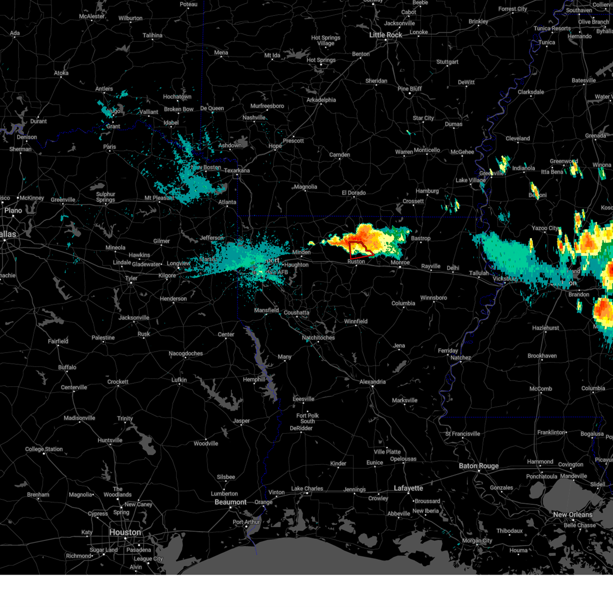
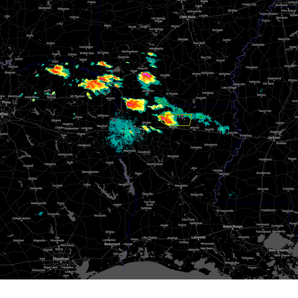
Hail Map for Dubach, LA
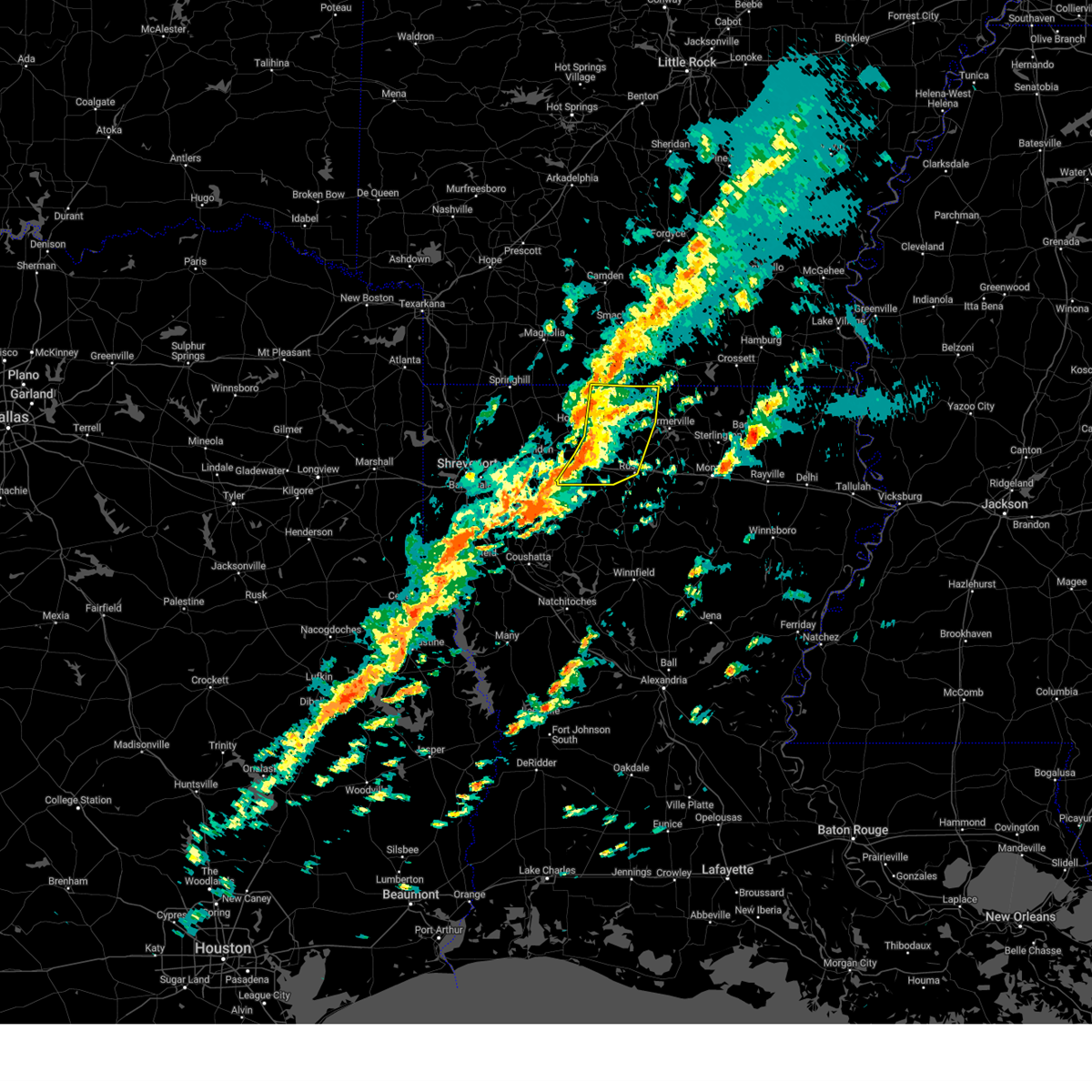
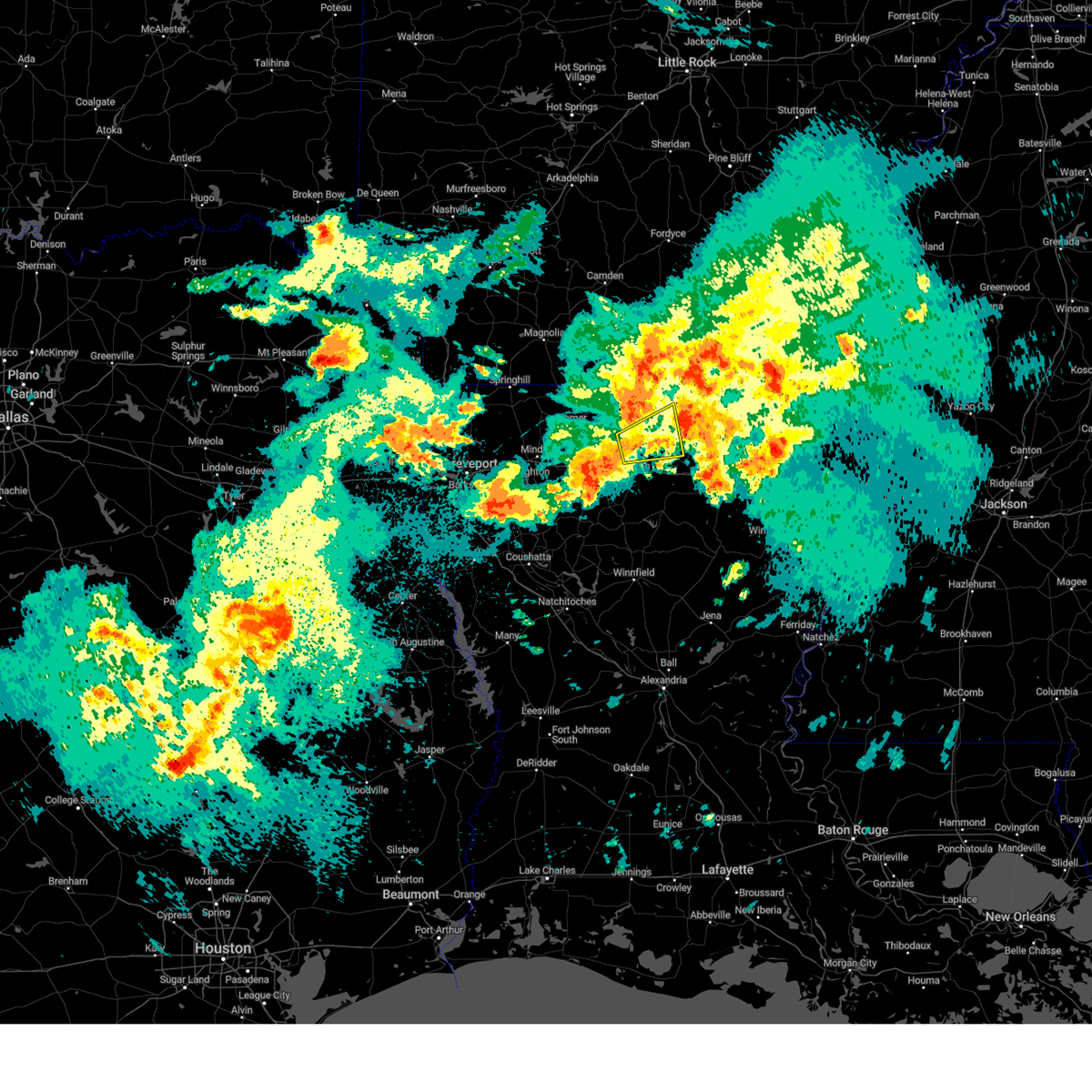
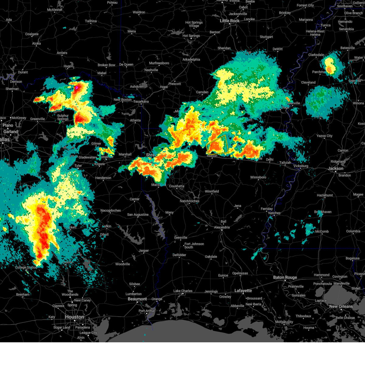
The Dubach, LA area has had 7 reports of on-the-ground hail by trained spotters, and has been under severe weather warnings 25 times during the past 12 months. Doppler radar has detected hail at or near Dubach, LA on 57 occasions, including 3 occasions during the past year.
| Name: | Dubach, LA |
| Where Located: | 43.6 miles W of Bastrop, LA |
| Map: | Google Map for Dubach, LA |
| Population: | 961 |
| Housing Units: | 464 |
| More Info: | Search Google for Dubach, LA |
2
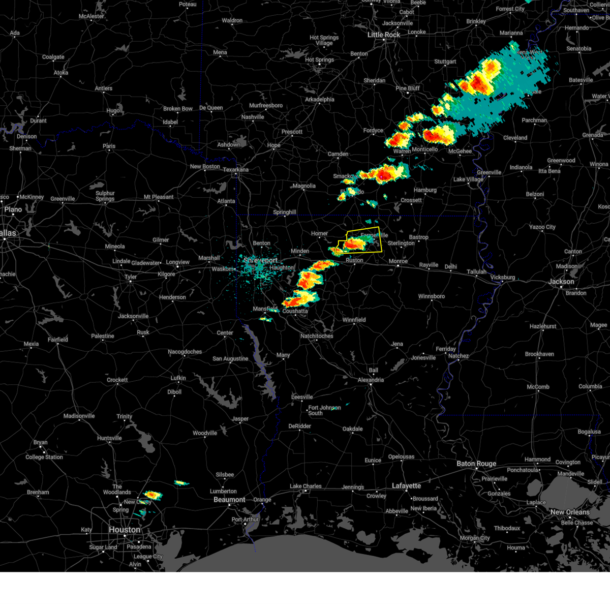
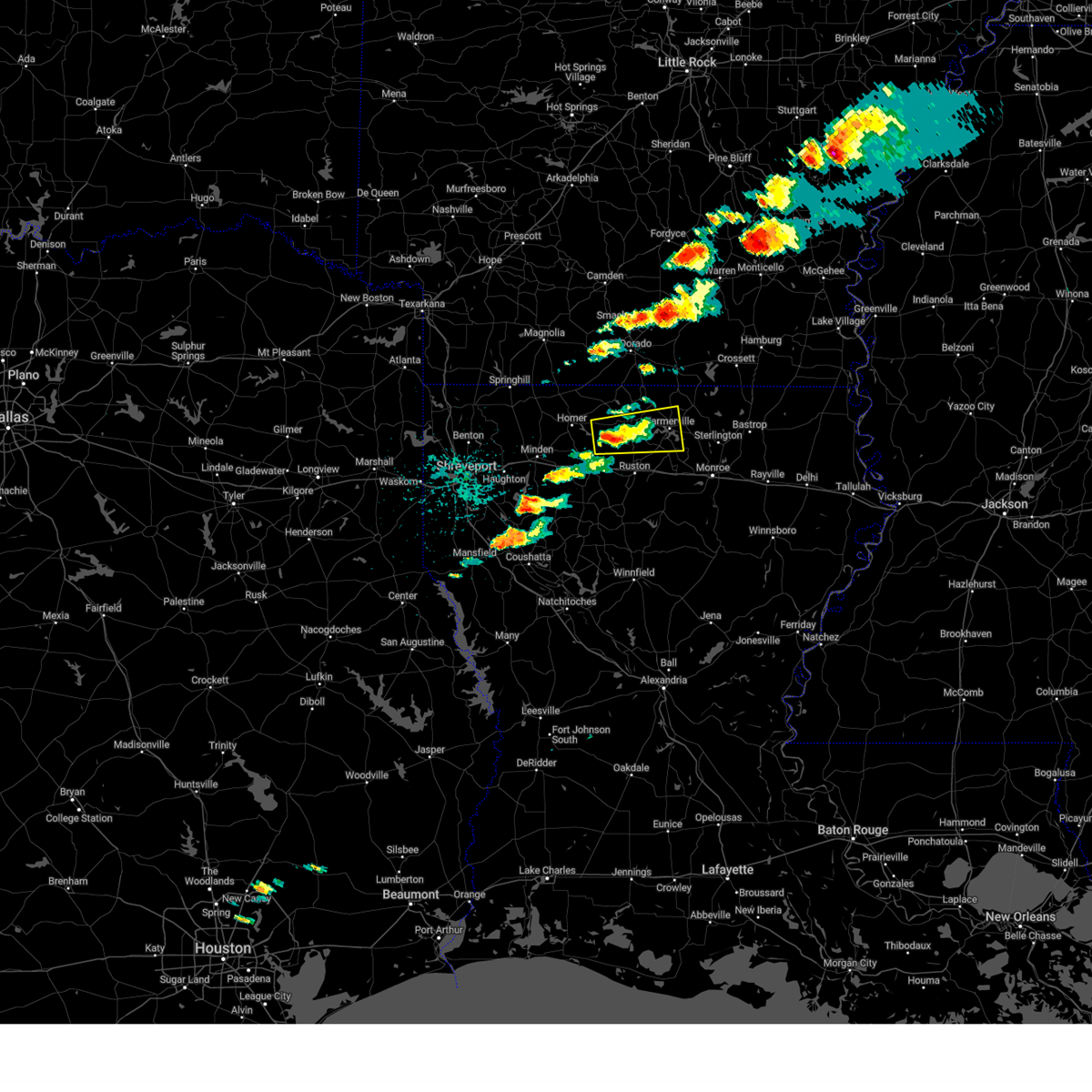
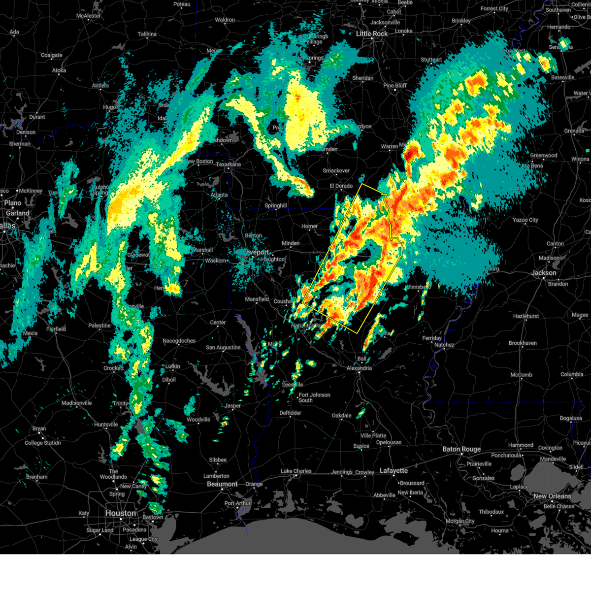
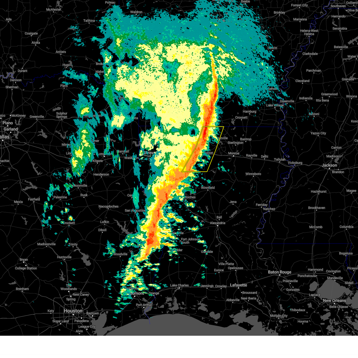
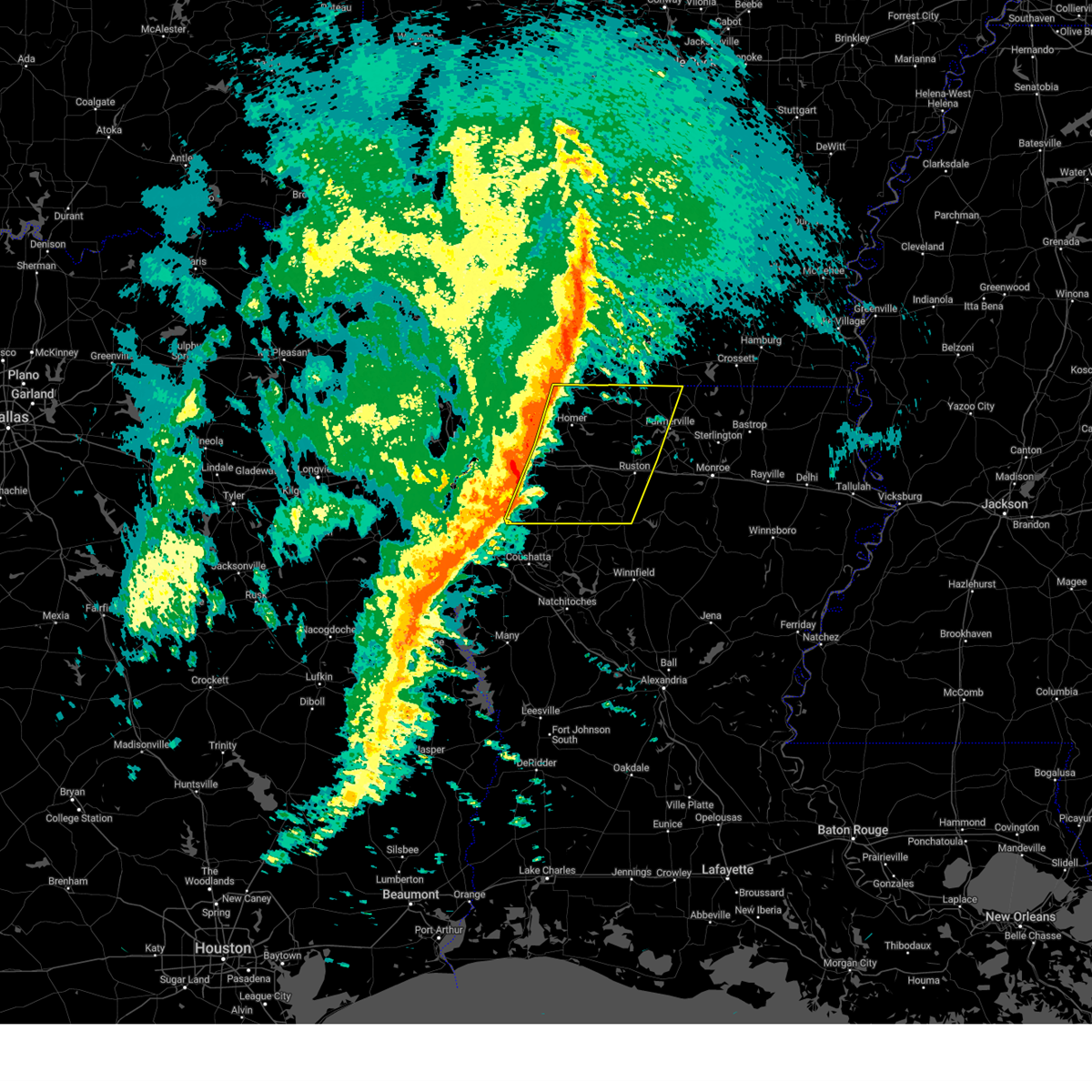
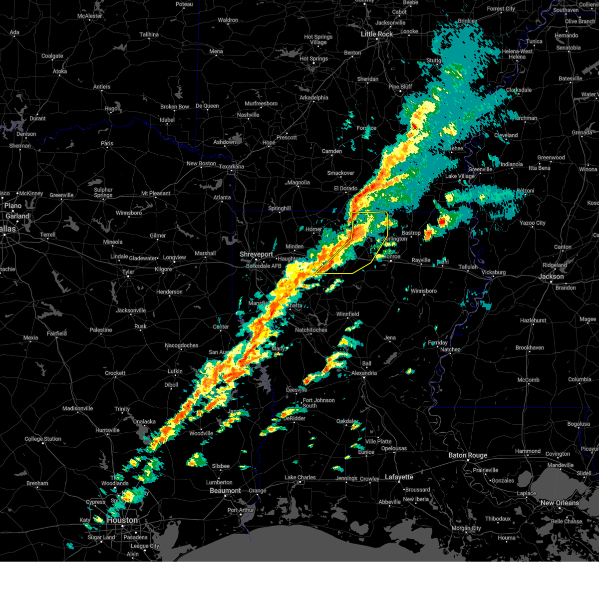
The Top Recent Hail Date for Dubach, LA is Tuesday, May 20, 2025 (15th out of 57)
Hail and Wind Damage Spotted near Dubach, LA
| Date / Time | Report Details |
|---|---|
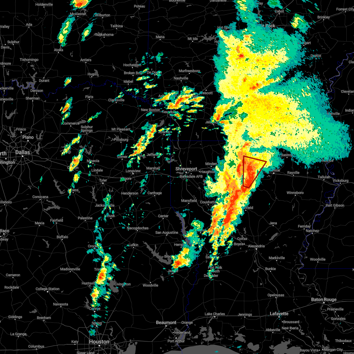
| 5/25/2025 8:57 PM CDT | Svrshv the national weather service in shreveport has issued a * severe thunderstorm warning for, southern union county in south central arkansas, southeastern columbia county in southwestern arkansas, north central webster parish in northwestern louisiana, union parish in north central louisiana, northern ouachita parish in north central louisiana, claiborne parish in northwestern louisiana, lincoln parish in north central louisiana, * until 1000 pm cdt. * at 856 pm cdt, severe thunderstorms were located along a line extending from 10 miles northwest of bastrop to bernice to 7 miles east of taylor, moving south at 30 mph (radar indicated). Hazards include 60 mph wind gusts and quarter size hail. Hail damage to vehicles is expected. Expect wind damage to roofs, siding, and trees. |
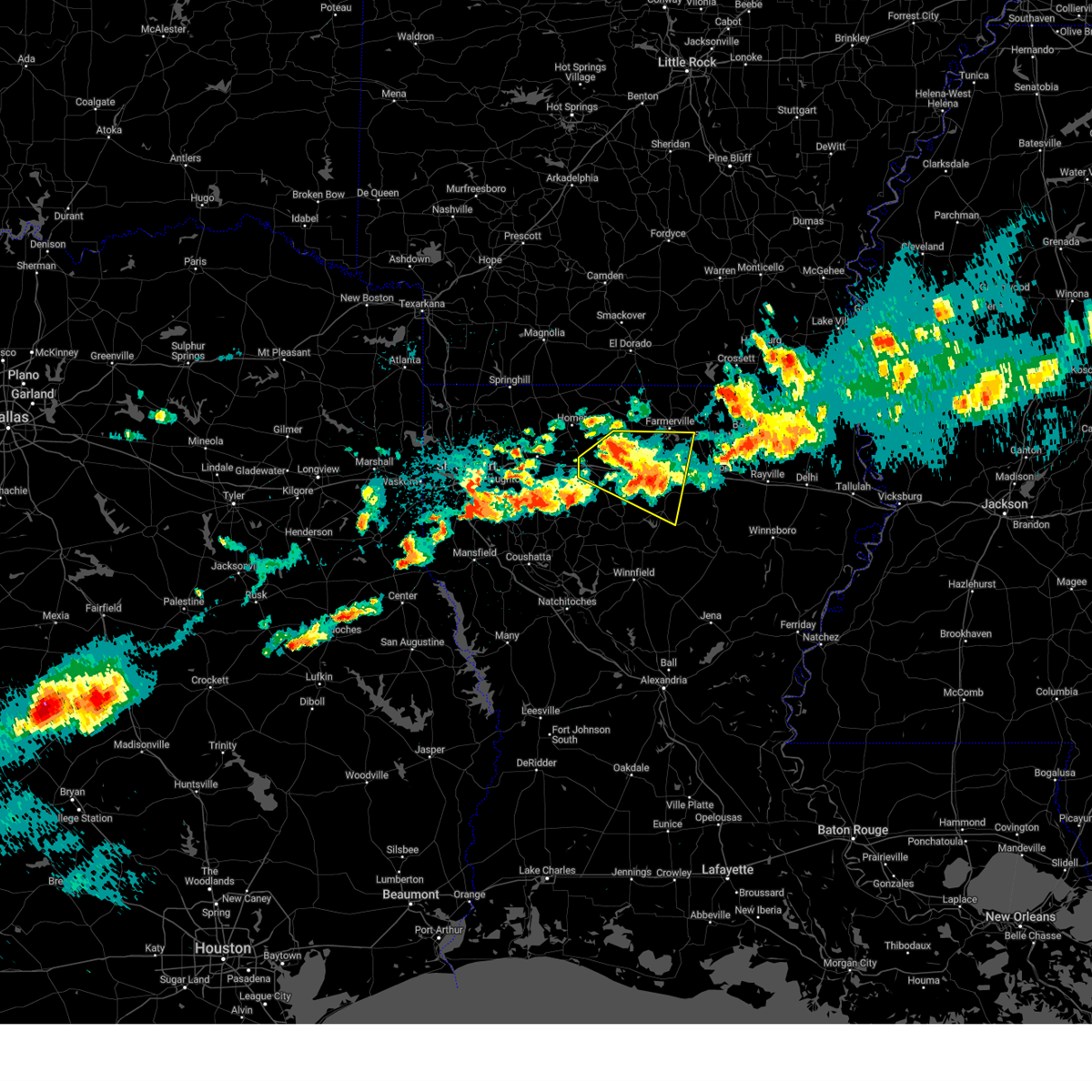
| 5/20/2025 3:34 PM CDT |
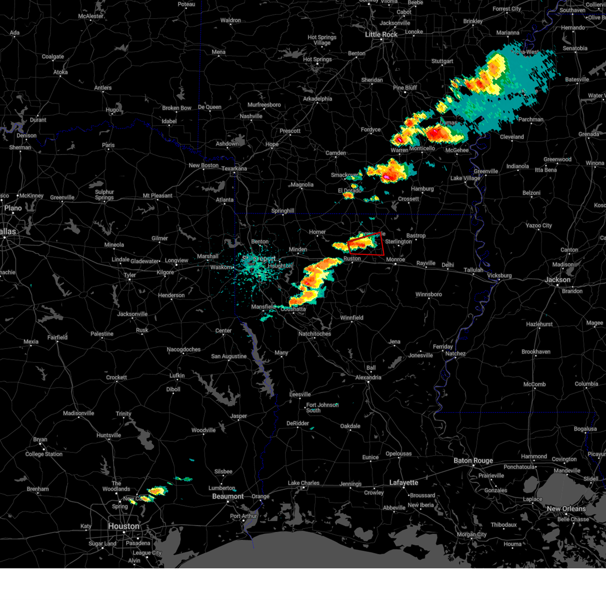 Torshv the national weather service in shreveport has issued a * tornado warning for, southwestern union parish in north central louisiana, northeastern lincoln parish in north central louisiana, * until 415 pm cdt. * at 334 pm cdt, a severe thunderstorm capable of producing a tornado was located 10 miles south of bernice, or 10 miles north of ruston, moving east at 25 mph (radar indicated rotation). Hazards include tornado. Flying debris will be dangerous to those caught without shelter. mobile homes will be damaged or destroyed. damage to roofs, windows, and vehicles will occur. tree damage is likely. this dangerous storm will be near, farmerville around 350 pm cdt. Other locations impacted by this tornadic thunderstorm include d arbonne, bayou d arbonne lake, downsville, unionville, dubach, and vienna. Torshv the national weather service in shreveport has issued a * tornado warning for, southwestern union parish in north central louisiana, northeastern lincoln parish in north central louisiana, * until 415 pm cdt. * at 334 pm cdt, a severe thunderstorm capable of producing a tornado was located 10 miles south of bernice, or 10 miles north of ruston, moving east at 25 mph (radar indicated rotation). Hazards include tornado. Flying debris will be dangerous to those caught without shelter. mobile homes will be damaged or destroyed. damage to roofs, windows, and vehicles will occur. tree damage is likely. this dangerous storm will be near, farmerville around 350 pm cdt. Other locations impacted by this tornadic thunderstorm include d arbonne, bayou d arbonne lake, downsville, unionville, dubach, and vienna.
|
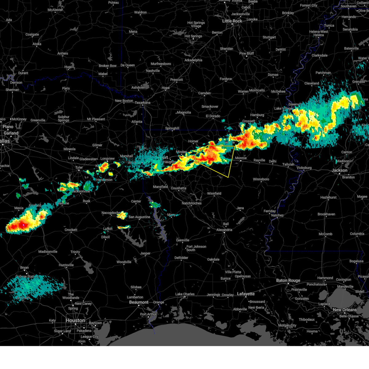
| 5/20/2025 3:25 PM CDT |
 At 325 pm cdt, a severe thunderstorm was located 7 miles south of bernice, or 13 miles north of grambling, moving east at 30 mph (radar indicated). Hazards include 60 mph wind gusts and quarter size hail. Hail damage to vehicles is expected. expect wind damage to roofs, siding, and trees. Locations impacted include, bernice, d arbonne, bayou d arbonne lake, farmerville, corinth, shiloh, mount zion, unionville, and dubach. At 325 pm cdt, a severe thunderstorm was located 7 miles south of bernice, or 13 miles north of grambling, moving east at 30 mph (radar indicated). Hazards include 60 mph wind gusts and quarter size hail. Hail damage to vehicles is expected. expect wind damage to roofs, siding, and trees. Locations impacted include, bernice, d arbonne, bayou d arbonne lake, farmerville, corinth, shiloh, mount zion, unionville, and dubach.
|
| 5/20/2025 3:25 PM CDT |
 the severe thunderstorm warning has been cancelled and is no longer in effect the severe thunderstorm warning has been cancelled and is no longer in effect
|
| 5/20/2025 3:13 PM CDT |
 Svrshv the national weather service in shreveport has issued a * severe thunderstorm warning for, southwestern union parish in north central louisiana, southeastern claiborne parish in northwestern louisiana, northern lincoln parish in north central louisiana, * until 415 pm cdt. * at 313 pm cdt, a severe thunderstorm was located 10 miles southwest of bernice, or 14 miles north of grambling, moving east at 30 mph (radar indicated). Hazards include 60 mph wind gusts and quarter size hail. Hail damage to vehicles is expected. Expect wind damage to roofs, siding, and trees. Svrshv the national weather service in shreveport has issued a * severe thunderstorm warning for, southwestern union parish in north central louisiana, southeastern claiborne parish in northwestern louisiana, northern lincoln parish in north central louisiana, * until 415 pm cdt. * at 313 pm cdt, a severe thunderstorm was located 10 miles southwest of bernice, or 14 miles north of grambling, moving east at 30 mph (radar indicated). Hazards include 60 mph wind gusts and quarter size hail. Hail damage to vehicles is expected. Expect wind damage to roofs, siding, and trees.
|
| 5/6/2025 4:52 PM CDT |
 Svrshv the national weather service in shreveport has issued a * severe thunderstorm warning for, central union parish in north central louisiana, northern ouachita parish in north central louisiana, lincoln parish in north central louisiana, * until 545 pm cdt. * at 452 pm cdt, severe thunderstorms were located along a line extending from 10 miles north of grambling to 7 miles south of ruston, moving east at 55 mph (radar indicated). Hazards include 60 mph wind gusts. expect damage to roofs, siding, and trees Svrshv the national weather service in shreveport has issued a * severe thunderstorm warning for, central union parish in north central louisiana, northern ouachita parish in north central louisiana, lincoln parish in north central louisiana, * until 545 pm cdt. * at 452 pm cdt, severe thunderstorms were located along a line extending from 10 miles north of grambling to 7 miles south of ruston, moving east at 55 mph (radar indicated). Hazards include 60 mph wind gusts. expect damage to roofs, siding, and trees
|
| 5/6/2025 4:44 PM CDT | At 444 pm cdt, severe thunderstorms were located along a line extending from 12 miles southwest of bernice to grambling, moving east at 65 mph (radar indicated). Hazards include 60 mph wind gusts. Expect damage to roofs, siding, and trees. Locations impacted include, lisbon, antioch, mount zion, summerfield, aycock, grambling, simsboro, ruston, corney lake, vienna, lake clairborne, corinth, unionville, dubach, and homer. |
| 5/6/2025 4:44 PM CDT | the severe thunderstorm warning has been cancelled and is no longer in effect |
| 5/6/2025 4:10 PM CDT |
 Svrshv the national weather service in shreveport has issued a * severe thunderstorm warning for, southeastern webster parish in northwestern louisiana, southern claiborne parish in northwestern louisiana, northeastern bienville parish in northwestern louisiana, western lincoln parish in north central louisiana, * until 500 pm cdt. * at 410 pm cdt, severe thunderstorms were located along a line extending from sibley to near heflin, moving northeast at 65 mph (radar indicated). Hazards include 70 mph wind gusts and penny size hail. Expect considerable tree damage. Damage is likely to mobile homes, roofs, and outbuildings. Svrshv the national weather service in shreveport has issued a * severe thunderstorm warning for, southeastern webster parish in northwestern louisiana, southern claiborne parish in northwestern louisiana, northeastern bienville parish in northwestern louisiana, western lincoln parish in north central louisiana, * until 500 pm cdt. * at 410 pm cdt, severe thunderstorms were located along a line extending from sibley to near heflin, moving northeast at 65 mph (radar indicated). Hazards include 70 mph wind gusts and penny size hail. Expect considerable tree damage. Damage is likely to mobile homes, roofs, and outbuildings.
|
| 5/2/2025 4:39 PM CDT | the severe thunderstorm warning has been cancelled and is no longer in effect |
| 5/2/2025 4:11 PM CDT | Reports of multiple trees down along highway 146 on both sides of the highway 563 intersectio in lincoln county LA, 6.5 miles NE of Dubach, LA |
| 5/2/2025 4:07 PM CDT | Svrshv the national weather service in shreveport has issued a * severe thunderstorm warning for, northern jackson parish in north central louisiana, lincoln parish in north central louisiana, western union parish in north central louisiana, northeastern bienville parish in northwestern louisiana, claiborne parish in northwestern louisiana, * until 445 pm cdt. * at 407 pm cdt, severe thunderstorms were located along a line from 5 miles west of gibsland to 10 miles southeast of ruston, or along a line from 10 miles southeast of minden to 10 miles southeast of ruston, moving north at 40 mph (radar indicated). Hazards include 60 mph wind gusts and small hail. expect damage to roofs, siding, and trees |
| 4/5/2025 2:40 PM CDT | the severe thunderstorm warning has been cancelled and is no longer in effect |
| 4/5/2025 2:13 PM CDT |
 Svrshv the national weather service in shreveport has issued a * severe thunderstorm warning for, union parish in north central louisiana, northeastern lincoln parish in north central louisiana, * until 300 pm cdt. * at 213 pm cdt, a severe thunderstorm was located 9 miles north of ruston, moving northeast at 40 mph (radar indicated). Hazards include 60 mph wind gusts and quarter size hail. Hail damage to vehicles is expected. Expect wind damage to roofs, siding, and trees. Svrshv the national weather service in shreveport has issued a * severe thunderstorm warning for, union parish in north central louisiana, northeastern lincoln parish in north central louisiana, * until 300 pm cdt. * at 213 pm cdt, a severe thunderstorm was located 9 miles north of ruston, moving northeast at 40 mph (radar indicated). Hazards include 60 mph wind gusts and quarter size hail. Hail damage to vehicles is expected. Expect wind damage to roofs, siding, and trees.
|
| 4/5/2025 12:58 PM CDT |
 Svrshv the national weather service in shreveport has issued a * severe thunderstorm warning for, central union parish in north central louisiana, central lincoln parish in north central louisiana, * until 200 pm cdt. * at 1258 pm cdt, severe thunderstorms were located along a line extending from 7 miles east of cooley to near ruston, moving northeast at 40 mph (radar indicated). Hazards include 60 mph wind gusts and quarter size hail. Hail damage to vehicles is expected. Expect wind damage to roofs, siding, and trees. Svrshv the national weather service in shreveport has issued a * severe thunderstorm warning for, central union parish in north central louisiana, central lincoln parish in north central louisiana, * until 200 pm cdt. * at 1258 pm cdt, severe thunderstorms were located along a line extending from 7 miles east of cooley to near ruston, moving northeast at 40 mph (radar indicated). Hazards include 60 mph wind gusts and quarter size hail. Hail damage to vehicles is expected. Expect wind damage to roofs, siding, and trees.
|
| 3/24/2025 12:09 AM CDT |
 Svrshv the national weather service in shreveport has issued a * severe thunderstorm warning for, northwestern lincoln parish in north central louisiana, northwestern union parish in north central louisiana, east central claiborne parish in northwestern louisiana, * until 100 am cdt. * at 1209 am cdt, a severe thunderstorm was located 5 miles southwest of bernice, or 16 miles south of junction city, moving east at 30 mph (radar indicated). Hazards include 60 mph wind gusts and half dollar size hail. Hail damage to vehicles is expected. Expect wind damage to roofs, siding, and trees. Svrshv the national weather service in shreveport has issued a * severe thunderstorm warning for, northwestern lincoln parish in north central louisiana, northwestern union parish in north central louisiana, east central claiborne parish in northwestern louisiana, * until 100 am cdt. * at 1209 am cdt, a severe thunderstorm was located 5 miles southwest of bernice, or 16 miles south of junction city, moving east at 30 mph (radar indicated). Hazards include 60 mph wind gusts and half dollar size hail. Hail damage to vehicles is expected. Expect wind damage to roofs, siding, and trees.
|
| 3/23/2025 10:43 PM CDT |
 The storm which prompted the warning has weakened below severe limits, and no longer poses an immediate threat to life or property. therefore, the warning will be allowed to expire. however, small hail and heavy rain are still possible with this thunderstorm. The storm which prompted the warning has weakened below severe limits, and no longer poses an immediate threat to life or property. therefore, the warning will be allowed to expire. however, small hail and heavy rain are still possible with this thunderstorm.
|
| 3/23/2025 9:42 PM CDT |
 Svrshv the national weather service in shreveport has issued a * severe thunderstorm warning for, northern jackson parish in north central louisiana, lincoln parish in north central louisiana, west central ouachita parish in north central louisiana, southwestern union parish in north central louisiana, northeastern bienville parish in northwestern louisiana, southeastern claiborne parish in northwestern louisiana, * until 1045 pm cdt. * at 942 pm cdt, a severe thunderstorm was located over grambling, moving east at 20 mph (radar indicated). Hazards include ping pong ball size hail and 60 mph wind gusts. People and animals outdoors will be injured. expect hail damage to roofs, siding, windows, and vehicles. Expect wind damage to roofs, siding, and trees. Svrshv the national weather service in shreveport has issued a * severe thunderstorm warning for, northern jackson parish in north central louisiana, lincoln parish in north central louisiana, west central ouachita parish in north central louisiana, southwestern union parish in north central louisiana, northeastern bienville parish in northwestern louisiana, southeastern claiborne parish in northwestern louisiana, * until 1045 pm cdt. * at 942 pm cdt, a severe thunderstorm was located over grambling, moving east at 20 mph (radar indicated). Hazards include ping pong ball size hail and 60 mph wind gusts. People and animals outdoors will be injured. expect hail damage to roofs, siding, windows, and vehicles. Expect wind damage to roofs, siding, and trees.
|
| 3/23/2025 8:58 PM CDT |
 Svrshv the national weather service in shreveport has issued a * severe thunderstorm warning for, central lincoln parish in north central louisiana, northeastern bienville parish in northwestern louisiana, south central claiborne parish in northwestern louisiana, * until 945 pm cdt. * at 858 pm cdt, a severe thunderstorm was located 7 miles northwest of grambling, moving east at 25 mph (radar indicated). Hazards include 60 mph wind gusts and quarter size hail. Hail damage to vehicles is expected. Expect wind damage to roofs, siding, and trees. Svrshv the national weather service in shreveport has issued a * severe thunderstorm warning for, central lincoln parish in north central louisiana, northeastern bienville parish in northwestern louisiana, south central claiborne parish in northwestern louisiana, * until 945 pm cdt. * at 858 pm cdt, a severe thunderstorm was located 7 miles northwest of grambling, moving east at 25 mph (radar indicated). Hazards include 60 mph wind gusts and quarter size hail. Hail damage to vehicles is expected. Expect wind damage to roofs, siding, and trees.
|
| 3/15/2025 7:49 AM CDT |
 Svrshv the national weather service in shreveport has issued a * severe thunderstorm warning for, southeastern union county in south central arkansas, northwestern caldwell parish in north central louisiana, north central grant parish in north central louisiana, jackson parish in north central louisiana, lincoln parish in north central louisiana, ouachita parish in north central louisiana, union parish in north central louisiana, winn parish in north central louisiana, southeastern bienville parish in northwestern louisiana, northeastern natchitoches parish in northwestern louisiana, * until 845 am cdt. * at 749 am cdt, a severe thunderstorm was located 6 miles southeast of jonesboro, moving northeast at 50 mph (radar indicated). Hazards include 60 mph wind gusts and quarter size hail. Hail damage to vehicles is expected. Expect wind damage to roofs, siding, and trees. Svrshv the national weather service in shreveport has issued a * severe thunderstorm warning for, southeastern union county in south central arkansas, northwestern caldwell parish in north central louisiana, north central grant parish in north central louisiana, jackson parish in north central louisiana, lincoln parish in north central louisiana, ouachita parish in north central louisiana, union parish in north central louisiana, winn parish in north central louisiana, southeastern bienville parish in northwestern louisiana, northeastern natchitoches parish in northwestern louisiana, * until 845 am cdt. * at 749 am cdt, a severe thunderstorm was located 6 miles southeast of jonesboro, moving northeast at 50 mph (radar indicated). Hazards include 60 mph wind gusts and quarter size hail. Hail damage to vehicles is expected. Expect wind damage to roofs, siding, and trees.
|
| 3/4/2025 10:40 AM CST |
 the severe thunderstorm warning has been cancelled and is no longer in effect the severe thunderstorm warning has been cancelled and is no longer in effect
|
| 3/4/2025 10:40 AM CST |
 At 1040 am cst, severe thunderstorms were located along a line from 6 miles east of junction city to 15 miles southeast of ringgold, or along a line from 6 miles east of junction city to 20 miles west of jonesboro, moving east at 35 mph (radar indicated). Hazards include 70 mph wind gusts and quarter size hail. Hail damage to vehicles is expected. expect considerable tree damage. wind damage is also likely to mobile homes, roofs, and outbuildings. Locations impacted include, ruston, grambling, jonesboro, farmerville, arcadia, bernice, cooley, dubach, choudrant, simsboro, junction city, hodge, north hodge, vienna, east hodge, lucky, castor, bienville, lisbon and quitman. At 1040 am cst, severe thunderstorms were located along a line from 6 miles east of junction city to 15 miles southeast of ringgold, or along a line from 6 miles east of junction city to 20 miles west of jonesboro, moving east at 35 mph (radar indicated). Hazards include 70 mph wind gusts and quarter size hail. Hail damage to vehicles is expected. expect considerable tree damage. wind damage is also likely to mobile homes, roofs, and outbuildings. Locations impacted include, ruston, grambling, jonesboro, farmerville, arcadia, bernice, cooley, dubach, choudrant, simsboro, junction city, hodge, north hodge, vienna, east hodge, lucky, castor, bienville, lisbon and quitman.
|
| 3/4/2025 10:07 AM CST |
 Svrshv the national weather service in shreveport has issued a * severe thunderstorm warning for, northwestern jackson parish in north central louisiana, lincoln parish in north central louisiana, western union parish in north central louisiana, bienville parish in northwestern louisiana, southeastern bossier parish in northwestern louisiana, claiborne parish in northwestern louisiana, southeastern webster parish in northwestern louisiana, * until 1100 am cst. * at 1007 am cst, severe thunderstorms were located along a line from 7 miles southeast of atlanta to 9 miles southwest of ringgold, or along a line from 14 miles west of junction city to 23 miles northeast of mansfield, moving east at 35 mph (radar indicated). Hazards include 70 mph wind gusts and quarter size hail. Hail damage to vehicles is expected. expect considerable tree damage. Wind damage is also likely to mobile homes, roofs, and outbuildings. Svrshv the national weather service in shreveport has issued a * severe thunderstorm warning for, northwestern jackson parish in north central louisiana, lincoln parish in north central louisiana, western union parish in north central louisiana, bienville parish in northwestern louisiana, southeastern bossier parish in northwestern louisiana, claiborne parish in northwestern louisiana, southeastern webster parish in northwestern louisiana, * until 1100 am cst. * at 1007 am cst, severe thunderstorms were located along a line from 7 miles southeast of atlanta to 9 miles southwest of ringgold, or along a line from 14 miles west of junction city to 23 miles northeast of mansfield, moving east at 35 mph (radar indicated). Hazards include 70 mph wind gusts and quarter size hail. Hail damage to vehicles is expected. expect considerable tree damage. Wind damage is also likely to mobile homes, roofs, and outbuildings.
|
| 1/5/2025 1:54 PM CST |
 Svrshv the national weather service in shreveport has issued a * severe thunderstorm warning for, northwestern jackson parish in north central louisiana, lincoln parish in north central louisiana, west central ouachita parish in north central louisiana, union parish in north central louisiana, east central bienville parish in northwestern louisiana, * until 300 pm cst. * at 154 pm cst, severe thunderstorms were located along a line from 9 miles southwest of strong to 13 miles south of arcadia, or along a line from 16 miles west of huttig to 17 miles northwest of jonesboro, moving east at 10 mph (radar indicated). Hazards include 60 mph wind gusts. expect damage to roofs, siding, and trees Svrshv the national weather service in shreveport has issued a * severe thunderstorm warning for, northwestern jackson parish in north central louisiana, lincoln parish in north central louisiana, west central ouachita parish in north central louisiana, union parish in north central louisiana, east central bienville parish in northwestern louisiana, * until 300 pm cst. * at 154 pm cst, severe thunderstorms were located along a line from 9 miles southwest of strong to 13 miles south of arcadia, or along a line from 16 miles west of huttig to 17 miles northwest of jonesboro, moving east at 10 mph (radar indicated). Hazards include 60 mph wind gusts. expect damage to roofs, siding, and trees
|
| 1/5/2025 1:34 PM CST |
 At 134 pm cst, severe thunderstorms were located along a line from near junction city to 6 miles southeast of gibsland, or along a line from near junction city to 17 miles west of grambling, moving east at 30 mph (radar indicated). Hazards include 60 mph wind gusts. Expect damage to roofs, siding, and trees. Locations impacted include, ruston, grambling, arcadia, bernice, gibsland, cooley, dubach, simsboro, junction city, vienna, lisbon, spearsville, lillie, mount lebanon, corinth, mount zion, unionville, aycock, corney lake and shiloh. At 134 pm cst, severe thunderstorms were located along a line from near junction city to 6 miles southeast of gibsland, or along a line from near junction city to 17 miles west of grambling, moving east at 30 mph (radar indicated). Hazards include 60 mph wind gusts. Expect damage to roofs, siding, and trees. Locations impacted include, ruston, grambling, arcadia, bernice, gibsland, cooley, dubach, simsboro, junction city, vienna, lisbon, spearsville, lillie, mount lebanon, corinth, mount zion, unionville, aycock, corney lake and shiloh.
|
| 1/5/2025 1:19 PM CST |
 Svrshv the national weather service in shreveport has issued a * severe thunderstorm warning for, lincoln parish in north central louisiana, northwestern union parish in north central louisiana, northeastern bienville parish in northwestern louisiana, eastern claiborne parish in northwestern louisiana, * until 200 pm cst. * at 119 pm cst, severe thunderstorms were located along a line from 5 miles west of junction city to 7 miles east of heflin, or along a line from 5 miles west of junction city to 13 miles southeast of minden, moving east at 25 mph (radar indicated). Hazards include 60 mph wind gusts. expect damage to roofs, siding, and trees Svrshv the national weather service in shreveport has issued a * severe thunderstorm warning for, lincoln parish in north central louisiana, northwestern union parish in north central louisiana, northeastern bienville parish in northwestern louisiana, eastern claiborne parish in northwestern louisiana, * until 200 pm cst. * at 119 pm cst, severe thunderstorms were located along a line from 5 miles west of junction city to 7 miles east of heflin, or along a line from 5 miles west of junction city to 13 miles southeast of minden, moving east at 25 mph (radar indicated). Hazards include 60 mph wind gusts. expect damage to roofs, siding, and trees
|
| 6/26/2024 2:10 PM CDT |
 Svrshv the national weather service in shreveport has issued a * severe thunderstorm warning for, eastern union county in south central arkansas, northwestern caldwell parish in north central louisiana, jackson parish in north central louisiana, union parish in north central louisiana, western ouachita parish in north central louisiana, southeastern bienville parish in northwestern louisiana, central lincoln parish in north central louisiana, * until 315 pm cdt. * at 209 pm cdt, severe thunderstorms were located along a line extending from 7 miles southeast of hilo to near bernice to 12 miles east of ringgold, moving east at 45 mph (radar indicated). Hazards include 60 mph wind gusts. expect damage to roofs, siding, and trees Svrshv the national weather service in shreveport has issued a * severe thunderstorm warning for, eastern union county in south central arkansas, northwestern caldwell parish in north central louisiana, jackson parish in north central louisiana, union parish in north central louisiana, western ouachita parish in north central louisiana, southeastern bienville parish in northwestern louisiana, central lincoln parish in north central louisiana, * until 315 pm cdt. * at 209 pm cdt, severe thunderstorms were located along a line extending from 7 miles southeast of hilo to near bernice to 12 miles east of ringgold, moving east at 45 mph (radar indicated). Hazards include 60 mph wind gusts. expect damage to roofs, siding, and trees
|
| 6/26/2024 2:00 PM CDT |
 the severe thunderstorm warning has been cancelled and is no longer in effect the severe thunderstorm warning has been cancelled and is no longer in effect
|
| 6/26/2024 2:00 PM CDT |
 At 159 pm cdt, severe thunderstorms were located along a line extending from near wesson to 9 miles north of arcadia to near ringgold, moving southeast at 40 mph (radar indicated). Hazards include 60 mph wind gusts. Expect damage to roofs, siding, and trees. Locations impacted include, ruston, grambling, homer, junction city, arcadia, bernice, gibsland, dubberly, heflin, wesson, cooley, dubach, simsboro, vienna, lucky, athens, bienville, lisbon, jamestown, and spearsville. At 159 pm cdt, severe thunderstorms were located along a line extending from near wesson to 9 miles north of arcadia to near ringgold, moving southeast at 40 mph (radar indicated). Hazards include 60 mph wind gusts. Expect damage to roofs, siding, and trees. Locations impacted include, ruston, grambling, homer, junction city, arcadia, bernice, gibsland, dubberly, heflin, wesson, cooley, dubach, simsboro, vienna, lucky, athens, bienville, lisbon, jamestown, and spearsville.
|
| 6/26/2024 1:24 PM CDT |
 Svrshv the national weather service in shreveport has issued a * severe thunderstorm warning for, southwestern union county in south central arkansas, southeastern columbia county in southwestern arkansas, southeastern webster parish in northwestern louisiana, northwestern union parish in north central louisiana, claiborne parish in northwestern louisiana, central bienville parish in northwestern louisiana, lincoln parish in north central louisiana, * until 230 pm cdt. * at 124 pm cdt, severe thunderstorms were located along a line extending from 6 miles southeast of village to 8 miles west of homer to near haughton, moving east at 40 mph (radar indicated). Hazards include 60 mph wind gusts. expect damage to roofs, siding, and trees Svrshv the national weather service in shreveport has issued a * severe thunderstorm warning for, southwestern union county in south central arkansas, southeastern columbia county in southwestern arkansas, southeastern webster parish in northwestern louisiana, northwestern union parish in north central louisiana, claiborne parish in northwestern louisiana, central bienville parish in northwestern louisiana, lincoln parish in north central louisiana, * until 230 pm cdt. * at 124 pm cdt, severe thunderstorms were located along a line extending from 6 miles southeast of village to 8 miles west of homer to near haughton, moving east at 40 mph (radar indicated). Hazards include 60 mph wind gusts. expect damage to roofs, siding, and trees
|
| 6/3/2024 7:17 PM CDT |
 Svrshv the national weather service in shreveport has issued a * severe thunderstorm warning for, southeastern webster parish in northwestern louisiana, jackson parish in north central louisiana, union parish in north central louisiana, northeastern red river parish in northwestern louisiana, north central natchitoches parish in northwestern louisiana, ouachita parish in north central louisiana, southeastern claiborne parish in northwestern louisiana, bienville parish in northwestern louisiana, lincoln parish in north central louisiana, northwestern winn parish in north central louisiana, * until 815 pm cdt. * at 717 pm cdt, severe thunderstorms were located along a line extending from near heflin to 9 miles southwest of bernice to 11 miles south of huttig, moving southeast at 35 mph (radar indicated. numerous trees and power lines have been downed from these storms across extreme northern louisiana). Hazards include 60 mph wind gusts and quarter size hail. Hail damage to vehicles is expected. Expect wind damage to roofs, siding, and trees. Svrshv the national weather service in shreveport has issued a * severe thunderstorm warning for, southeastern webster parish in northwestern louisiana, jackson parish in north central louisiana, union parish in north central louisiana, northeastern red river parish in northwestern louisiana, north central natchitoches parish in northwestern louisiana, ouachita parish in north central louisiana, southeastern claiborne parish in northwestern louisiana, bienville parish in northwestern louisiana, lincoln parish in north central louisiana, northwestern winn parish in north central louisiana, * until 815 pm cdt. * at 717 pm cdt, severe thunderstorms were located along a line extending from near heflin to 9 miles southwest of bernice to 11 miles south of huttig, moving southeast at 35 mph (radar indicated. numerous trees and power lines have been downed from these storms across extreme northern louisiana). Hazards include 60 mph wind gusts and quarter size hail. Hail damage to vehicles is expected. Expect wind damage to roofs, siding, and trees.
|
| 6/3/2024 6:30 PM CDT |
 Svrshv the national weather service in shreveport has issued a * severe thunderstorm warning for, union county in south central arkansas, southeastern columbia county in southwestern arkansas, northeastern webster parish in northwestern louisiana, union parish in north central louisiana, claiborne parish in northwestern louisiana, northwestern lincoln parish in north central louisiana, * until 730 pm cdt. * at 630 pm cdt, severe thunderstorms were located along a line extending from near calion to near junction city to near shongaloo, moving east at 30 mph (radar indicated. numerous trees and power lines have been downed from these storms over southwest arkansas). Hazards include 60 mph wind gusts and quarter size hail. Hail damage to vehicles is expected. Expect wind damage to roofs, siding, and trees. Svrshv the national weather service in shreveport has issued a * severe thunderstorm warning for, union county in south central arkansas, southeastern columbia county in southwestern arkansas, northeastern webster parish in northwestern louisiana, union parish in north central louisiana, claiborne parish in northwestern louisiana, northwestern lincoln parish in north central louisiana, * until 730 pm cdt. * at 630 pm cdt, severe thunderstorms were located along a line extending from near calion to near junction city to near shongaloo, moving east at 30 mph (radar indicated. numerous trees and power lines have been downed from these storms over southwest arkansas). Hazards include 60 mph wind gusts and quarter size hail. Hail damage to vehicles is expected. Expect wind damage to roofs, siding, and trees.
|
| 5/22/2024 9:09 PM CDT |
 The storm which prompted the warning has weakened below severe limits, and has exited the warned area. therefore, the warning will be allowed to expire. however, small hail, gusty winds and heavy rain are still possible with thunderstorms in these areas. a severe thunderstorm watch remains in effect until 1100 pm cdt for north central louisiana. The storm which prompted the warning has weakened below severe limits, and has exited the warned area. therefore, the warning will be allowed to expire. however, small hail, gusty winds and heavy rain are still possible with thunderstorms in these areas. a severe thunderstorm watch remains in effect until 1100 pm cdt for north central louisiana.
|
| 5/22/2024 8:16 PM CDT |
 Svrshv the national weather service in shreveport has issued a * severe thunderstorm warning for, central union parish in north central louisiana, northeastern lincoln parish in north central louisiana, * until 915 pm cdt. * at 816 pm cdt, a severe thunderstorm was located 9 miles south of bernice, or 11 miles north of ruston, moving east at 20 mph (radar indicated). Hazards include 60 mph wind gusts and half dollar size hail. Hail damage to vehicles is expected. Expect wind damage to roofs, siding, and trees. Svrshv the national weather service in shreveport has issued a * severe thunderstorm warning for, central union parish in north central louisiana, northeastern lincoln parish in north central louisiana, * until 915 pm cdt. * at 816 pm cdt, a severe thunderstorm was located 9 miles south of bernice, or 11 miles north of ruston, moving east at 20 mph (radar indicated). Hazards include 60 mph wind gusts and half dollar size hail. Hail damage to vehicles is expected. Expect wind damage to roofs, siding, and trees.
|
| 4/28/2024 7:57 PM CDT |
 Svrshv the national weather service in shreveport has issued a * severe thunderstorm warning for, southeastern lafayette county in southwestern arkansas, union county in south central arkansas, southeastern nevada county in southwestern arkansas, columbia county in southwestern arkansas, webster parish in northwestern louisiana, union parish in north central louisiana, northeastern red river parish in northwestern louisiana, ouachita parish in north central louisiana, northwestern caldwell parish in north central louisiana, jackson parish in north central louisiana, claiborne parish in northwestern louisiana, bienville parish in northwestern louisiana, eastern bossier parish in northwestern louisiana, lincoln parish in north central louisiana, * until 900 pm cdt. * at 756 pm cdt, severe thunderstorms were located along a line extending from stamps to 16 miles northwest of winnfield, moving east at 50 mph (radar indicated). Hazards include 70 mph wind gusts and nickel size hail. Expect considerable tree damage. Damage is likely to mobile homes, roofs, and outbuildings. Svrshv the national weather service in shreveport has issued a * severe thunderstorm warning for, southeastern lafayette county in southwestern arkansas, union county in south central arkansas, southeastern nevada county in southwestern arkansas, columbia county in southwestern arkansas, webster parish in northwestern louisiana, union parish in north central louisiana, northeastern red river parish in northwestern louisiana, ouachita parish in north central louisiana, northwestern caldwell parish in north central louisiana, jackson parish in north central louisiana, claiborne parish in northwestern louisiana, bienville parish in northwestern louisiana, eastern bossier parish in northwestern louisiana, lincoln parish in north central louisiana, * until 900 pm cdt. * at 756 pm cdt, severe thunderstorms were located along a line extending from stamps to 16 miles northwest of winnfield, moving east at 50 mph (radar indicated). Hazards include 70 mph wind gusts and nickel size hail. Expect considerable tree damage. Damage is likely to mobile homes, roofs, and outbuildings.
|
| 4/9/2024 5:52 PM CDT |
 Svrshv the national weather service in shreveport has issued a * severe thunderstorm warning for, northern caldwell parish in north central louisiana, eastern jackson parish in north central louisiana, southeastern union parish in north central louisiana, ouachita parish in north central louisiana, eastern lincoln parish in north central louisiana, northeastern winn parish in north central louisiana, * until 630 pm cdt. * at 552 pm cdt, severe thunderstorms were located along a line extending from near ruston to 15 miles east of grambling to 8 miles southeast of jonesboro, moving east at 45 mph (radar indicated). Hazards include 60 mph wind gusts and penny size hail. expect damage to roofs, siding, and trees Svrshv the national weather service in shreveport has issued a * severe thunderstorm warning for, northern caldwell parish in north central louisiana, eastern jackson parish in north central louisiana, southeastern union parish in north central louisiana, ouachita parish in north central louisiana, eastern lincoln parish in north central louisiana, northeastern winn parish in north central louisiana, * until 630 pm cdt. * at 552 pm cdt, severe thunderstorms were located along a line extending from near ruston to 15 miles east of grambling to 8 miles southeast of jonesboro, moving east at 45 mph (radar indicated). Hazards include 60 mph wind gusts and penny size hail. expect damage to roofs, siding, and trees
|
| 2/11/2024 10:43 AM CST |
 At 1042 am cst, severe thunderstorms were located along a line extending from 6 miles southwest of bernice to 11 miles north of ruston to grambling, moving east at 40 mph (radar indicated). Hazards include 60 mph wind gusts and quarter size hail. Hail damage to vehicles is expected. expect wind damage to roofs, siding, and trees. locations impacted include, ruston, farmerville, bernice, cooley, dubach, vienna, downsville, d arbonne, bayou d arbonne lake, shiloh, mount zion, and unionville. hail threat, radar indicated max hail size, 1. 00 in wind threat, radar indicated max wind gust, 60 mph. At 1042 am cst, severe thunderstorms were located along a line extending from 6 miles southwest of bernice to 11 miles north of ruston to grambling, moving east at 40 mph (radar indicated). Hazards include 60 mph wind gusts and quarter size hail. Hail damage to vehicles is expected. expect wind damage to roofs, siding, and trees. locations impacted include, ruston, farmerville, bernice, cooley, dubach, vienna, downsville, d arbonne, bayou d arbonne lake, shiloh, mount zion, and unionville. hail threat, radar indicated max hail size, 1. 00 in wind threat, radar indicated max wind gust, 60 mph.
|
| 2/11/2024 10:34 AM CST |
 At 1033 am cst, severe thunderstorms were located along a line extending from 9 miles southwest of bernice to 11 miles northwest of ruston to near grambling, moving east at 40 mph (radar indicated). Hazards include 60 mph wind gusts and quarter size hail. Hail damage to vehicles is expected. Expect wind damage to roofs, siding, and trees. At 1033 am cst, severe thunderstorms were located along a line extending from 9 miles southwest of bernice to 11 miles northwest of ruston to near grambling, moving east at 40 mph (radar indicated). Hazards include 60 mph wind gusts and quarter size hail. Hail damage to vehicles is expected. Expect wind damage to roofs, siding, and trees.
|
| 7/16/2023 3:58 PM CDT |
 At 357 pm cdt, severe thunderstorms were located along a line extending from 11 miles northeast of cooley to 10 miles south of farmerville to near jonesboro, moving east at 35 mph (radar indicated. multiple trees and power lines have been downed across north louisiana from these storms). Hazards include 60 mph wind gusts. expect damage to roofs, siding, and trees At 357 pm cdt, severe thunderstorms were located along a line extending from 11 miles northeast of cooley to 10 miles south of farmerville to near jonesboro, moving east at 35 mph (radar indicated. multiple trees and power lines have been downed across north louisiana from these storms). Hazards include 60 mph wind gusts. expect damage to roofs, siding, and trees
|
| 7/16/2023 3:35 PM CDT |
 At 335 pm cdt, severe thunderstorms were located along a line extending from near junction city to 8 miles northeast of ruston to 8 miles northwest of jonesboro, moving east at 65 mph (radar indicated. multiple trees and power lines have been downed across northwest louisiana from these storms). Hazards include 60 mph wind gusts. Expect damage to roofs, siding, and trees. locations impacted include, ruston, claiborne, grambling, jonesboro, farmerville, arcadia, bernice, gibsland, cooley, dubach, choudrant, simsboro, marion, junction city, chatham, hodge, north hodge, vienna, east hodge and saline. hail threat, radar indicated max hail size, <. 75 in wind threat, radar indicated max wind gust, 60 mph. At 335 pm cdt, severe thunderstorms were located along a line extending from near junction city to 8 miles northeast of ruston to 8 miles northwest of jonesboro, moving east at 65 mph (radar indicated. multiple trees and power lines have been downed across northwest louisiana from these storms). Hazards include 60 mph wind gusts. Expect damage to roofs, siding, and trees. locations impacted include, ruston, claiborne, grambling, jonesboro, farmerville, arcadia, bernice, gibsland, cooley, dubach, choudrant, simsboro, marion, junction city, chatham, hodge, north hodge, vienna, east hodge and saline. hail threat, radar indicated max hail size, <. 75 in wind threat, radar indicated max wind gust, 60 mph.
|
| 7/16/2023 3:14 PM CDT |
 At 314 pm cdt, severe thunderstorms were located along a line extending from 9 miles southeast of atlanta to 9 miles southeast of homer to 12 miles east of ringgold, moving east at 60 mph (radar indicated. numerous trees and power lines have been downed across northwest louisiana from these storms). Hazards include 60 mph wind gusts. expect damage to roofs, siding, and trees At 314 pm cdt, severe thunderstorms were located along a line extending from 9 miles southeast of atlanta to 9 miles southeast of homer to 12 miles east of ringgold, moving east at 60 mph (radar indicated. numerous trees and power lines have been downed across northwest louisiana from these storms). Hazards include 60 mph wind gusts. expect damage to roofs, siding, and trees
|
| 6/26/2023 6:28 AM CDT |
 At 627 am cdt, severe thunderstorms were located along a line extending from near ruston to near gibsland, moving southeast at 30 mph (radar indicated). Hazards include golf ball size hail and 60 mph wind gusts. People and animals outdoors will be injured. expect hail damage to roofs, siding, windows, and vehicles. expect wind damage to roofs, siding, and trees. locations impacted include, ruston, minden, grambling, arcadia, gibsland, choudrant, simsboro, vienna, athens, mount lebanon, holly springs, mount zion, aycock and ada. thunderstorm damage threat, considerable hail threat, radar indicated max hail size, 1. 75 in wind threat, radar indicated max wind gust, 60 mph. At 627 am cdt, severe thunderstorms were located along a line extending from near ruston to near gibsland, moving southeast at 30 mph (radar indicated). Hazards include golf ball size hail and 60 mph wind gusts. People and animals outdoors will be injured. expect hail damage to roofs, siding, windows, and vehicles. expect wind damage to roofs, siding, and trees. locations impacted include, ruston, minden, grambling, arcadia, gibsland, choudrant, simsboro, vienna, athens, mount lebanon, holly springs, mount zion, aycock and ada. thunderstorm damage threat, considerable hail threat, radar indicated max hail size, 1. 75 in wind threat, radar indicated max wind gust, 60 mph.
|
| 6/26/2023 5:56 AM CDT |
 At 555 am cdt, severe thunderstorms were located along a line extending from 11 miles southwest of bernice to 9 miles southeast of cotton valley, moving southeast at 25 mph (radar indicated). Hazards include 60 mph wind gusts and quarter size hail. Hail damage to vehicles is expected. Expect wind damage to roofs, siding, and trees. At 555 am cdt, severe thunderstorms were located along a line extending from 11 miles southwest of bernice to 9 miles southeast of cotton valley, moving southeast at 25 mph (radar indicated). Hazards include 60 mph wind gusts and quarter size hail. Hail damage to vehicles is expected. Expect wind damage to roofs, siding, and trees.
|
| 6/18/2023 10:32 PM CDT |
 At 1032 pm cdt, severe thunderstorms were located along a line extending from 6 miles south of farmerville to 8 miles northeast of arcadia, moving east at 20 mph (radar indicated). Hazards include 60 mph wind gusts and quarter size hail. Hail damage to vehicles is expected. expect wind damage to roofs, siding, and trees. locations impacted include, dubach, vienna, downsville, d arbonne, mount zion and unionville. hail threat, radar indicated max hail size, 1. 00 in wind threat, radar indicated max wind gust, 60 mph. At 1032 pm cdt, severe thunderstorms were located along a line extending from 6 miles south of farmerville to 8 miles northeast of arcadia, moving east at 20 mph (radar indicated). Hazards include 60 mph wind gusts and quarter size hail. Hail damage to vehicles is expected. expect wind damage to roofs, siding, and trees. locations impacted include, dubach, vienna, downsville, d arbonne, mount zion and unionville. hail threat, radar indicated max hail size, 1. 00 in wind threat, radar indicated max wind gust, 60 mph.
|
| 6/18/2023 10:05 PM CDT |
 At 1005 pm cdt, severe thunderstorms were located along a line extending from near farmerville to 9 miles southeast of homer, moving southeast at 20 mph (radar indicated). Hazards include 60 mph wind gusts and quarter size hail. Hail damage to vehicles is expected. expect wind damage to roofs, siding, and trees. locations impacted include, farmerville, dubach, vienna, downsville, spring lake, d arbonne, bayou d arbonne lake, corinth, shiloh, mount zion, unionville and aycock. hail threat, radar indicated max hail size, 1. 00 in wind threat, radar indicated max wind gust, 60 mph. At 1005 pm cdt, severe thunderstorms were located along a line extending from near farmerville to 9 miles southeast of homer, moving southeast at 20 mph (radar indicated). Hazards include 60 mph wind gusts and quarter size hail. Hail damage to vehicles is expected. expect wind damage to roofs, siding, and trees. locations impacted include, farmerville, dubach, vienna, downsville, spring lake, d arbonne, bayou d arbonne lake, corinth, shiloh, mount zion, unionville and aycock. hail threat, radar indicated max hail size, 1. 00 in wind threat, radar indicated max wind gust, 60 mph.
|
| 6/18/2023 10:03 PM CDT | Report of downed tree that fell through a hom in lincoln county LA, 0.4 miles N of Dubach, LA |
| 6/18/2023 10:00 PM CDT |
 At 1000 pm cdt, a severe thunderstorm capable of producing a tornado was located near bernice, or 14 miles north of ruston, moving south at 15 mph (radar indicated rotation). Hazards include tornado. Flying debris will be dangerous to those caught without shelter. mobile homes will be damaged or destroyed. damage to roofs, windows, and vehicles will occur. tree damage is likely. This tornadic thunderstorm will remain over mainly rural areas of northeastern lincoln parish, including the following locations, vienna, unionville and dubach. At 1000 pm cdt, a severe thunderstorm capable of producing a tornado was located near bernice, or 14 miles north of ruston, moving south at 15 mph (radar indicated rotation). Hazards include tornado. Flying debris will be dangerous to those caught without shelter. mobile homes will be damaged or destroyed. damage to roofs, windows, and vehicles will occur. tree damage is likely. This tornadic thunderstorm will remain over mainly rural areas of northeastern lincoln parish, including the following locations, vienna, unionville and dubach.
|
| 6/18/2023 9:43 PM CDT |
 At 943 pm cdt, severe thunderstorms were located along a line extending from near cooley to near homer, moving southeast at 20 mph (radar indicated). Hazards include 60 mph wind gusts and quarter size hail. Hail damage to vehicles is expected. Expect wind damage to roofs, siding, and trees. At 943 pm cdt, severe thunderstorms were located along a line extending from near cooley to near homer, moving southeast at 20 mph (radar indicated). Hazards include 60 mph wind gusts and quarter size hail. Hail damage to vehicles is expected. Expect wind damage to roofs, siding, and trees.
|
| 6/18/2023 6:57 AM CDT |
 At 656 am cdt, severe thunderstorms were located along a line extending from 11 miles northeast of cooley to near farmerville to 9 miles southeast of bernice, moving east at 55 mph (radar indicated). Hazards include 60 mph wind gusts and quarter size hail. Hail damage to vehicles is expected. expect wind damage to roofs, siding, and trees. locations impacted include, farmerville, dubach, marion, spearsville, d arbonne, loch lomon, spencer, oakland, haile, linville, taylorville, bayou d arbonne lake, rocky branch, cecil, shiloh, unionville and litroe. hail threat, radar indicated max hail size, 1. 00 in wind threat, radar indicated max wind gust, 60 mph. At 656 am cdt, severe thunderstorms were located along a line extending from 11 miles northeast of cooley to near farmerville to 9 miles southeast of bernice, moving east at 55 mph (radar indicated). Hazards include 60 mph wind gusts and quarter size hail. Hail damage to vehicles is expected. expect wind damage to roofs, siding, and trees. locations impacted include, farmerville, dubach, marion, spearsville, d arbonne, loch lomon, spencer, oakland, haile, linville, taylorville, bayou d arbonne lake, rocky branch, cecil, shiloh, unionville and litroe. hail threat, radar indicated max hail size, 1. 00 in wind threat, radar indicated max wind gust, 60 mph.
|
| 6/18/2023 6:24 AM CDT |
 At 624 am cdt, severe thunderstorms were located along a line extending from 8 miles southeast of atlanta to 13 miles west of bernice to 7 miles east of homer, moving east at 50 mph (radar indicated). Hazards include 60 mph wind gusts and quarter size hail. Hail damage to vehicles is expected. Expect wind damage to roofs, siding, and trees. At 624 am cdt, severe thunderstorms were located along a line extending from 8 miles southeast of atlanta to 13 miles west of bernice to 7 miles east of homer, moving east at 50 mph (radar indicated). Hazards include 60 mph wind gusts and quarter size hail. Hail damage to vehicles is expected. Expect wind damage to roofs, siding, and trees.
|
| 6/16/2023 2:49 AM CDT |
 At 249 am cdt, a severe thunderstorm was located near grambling, moving east at 40 mph (radar indicated). Hazards include 60 mph wind gusts and quarter size hail. Hail damage to vehicles is expected. expect wind damage to roofs, siding, and trees. locations impacted include, ruston, grambling, arcadia, dubach, choudrant, simsboro, vienna, downsville, d arbonne, mount zion, aycock, bayou d arbonne lake, corinth and unionville. hail threat, radar indicated max hail size, 1. 00 in wind threat, radar indicated max wind gust, 60 mph. At 249 am cdt, a severe thunderstorm was located near grambling, moving east at 40 mph (radar indicated). Hazards include 60 mph wind gusts and quarter size hail. Hail damage to vehicles is expected. expect wind damage to roofs, siding, and trees. locations impacted include, ruston, grambling, arcadia, dubach, choudrant, simsboro, vienna, downsville, d arbonne, mount zion, aycock, bayou d arbonne lake, corinth and unionville. hail threat, radar indicated max hail size, 1. 00 in wind threat, radar indicated max wind gust, 60 mph.
|
| 6/16/2023 2:26 AM CDT |
 At 226 am cdt, a severe thunderstorm was located near gibsland, or 12 miles east of minden, moving east at 40 mph (radar indicated). Hazards include 60 mph wind gusts and quarter size hail. Hail damage to vehicles is expected. Expect wind damage to roofs, siding, and trees. At 226 am cdt, a severe thunderstorm was located near gibsland, or 12 miles east of minden, moving east at 40 mph (radar indicated). Hazards include 60 mph wind gusts and quarter size hail. Hail damage to vehicles is expected. Expect wind damage to roofs, siding, and trees.
|
| 6/14/2023 2:15 PM CDT |
 At 215 pm cdt, a severe thunderstorm was located near homer, moving east at 50 mph (radar indicated). Hazards include golf ball size hail and 60 mph wind gusts. People and animals outdoors will be injured. expect hail damage to roofs, siding, windows, and vehicles. expect wind damage to roofs, siding, and trees. locations impacted include, ruston, grambling, homer, arcadia, bernice, dubach, simsboro, vienna, athens, lisbon, holly springs, antioch, mount zion, aycock, spring lake, lake clairborne, corinth, shiloh and unionville. thunderstorm damage threat, considerable hail threat, radar indicated max hail size, 1. 75 in wind threat, radar indicated max wind gust, 60 mph. At 215 pm cdt, a severe thunderstorm was located near homer, moving east at 50 mph (radar indicated). Hazards include golf ball size hail and 60 mph wind gusts. People and animals outdoors will be injured. expect hail damage to roofs, siding, windows, and vehicles. expect wind damage to roofs, siding, and trees. locations impacted include, ruston, grambling, homer, arcadia, bernice, dubach, simsboro, vienna, athens, lisbon, holly springs, antioch, mount zion, aycock, spring lake, lake clairborne, corinth, shiloh and unionville. thunderstorm damage threat, considerable hail threat, radar indicated max hail size, 1. 75 in wind threat, radar indicated max wind gust, 60 mph.
|
| 6/14/2023 1:59 PM CDT |
 At 157 pm cdt, a severe thunderstorm was located near cotton valley, or 11 miles north of minden, moving east at 50 mph. this is a destructive storm for northern webster and claiborne parishes including the city of homer (radar indicated). Hazards include baseball size hail and 70 mph wind gusts. People and animals outdoors will be severely injured. Expect shattered windows, extensive damage to roofs, siding, and vehicles. At 157 pm cdt, a severe thunderstorm was located near cotton valley, or 11 miles north of minden, moving east at 50 mph. this is a destructive storm for northern webster and claiborne parishes including the city of homer (radar indicated). Hazards include baseball size hail and 70 mph wind gusts. People and animals outdoors will be severely injured. Expect shattered windows, extensive damage to roofs, siding, and vehicles.
|
| 6/14/2023 3:45 AM CDT |
 At 344 am cdt, a severe thunderstorm was located near ruston, moving southeast at 35 mph (radar indicated). Hazards include 60 mph wind gusts and quarter size hail. Hail damage to vehicles is expected. Expect wind damage to roofs, siding, and trees. At 344 am cdt, a severe thunderstorm was located near ruston, moving southeast at 35 mph (radar indicated). Hazards include 60 mph wind gusts and quarter size hail. Hail damage to vehicles is expected. Expect wind damage to roofs, siding, and trees.
|
| 6/14/2023 3:37 AM CDT |
 At 336 am cdt, severe thunderstorms were located along a line extending from 6 miles northwest of sterlington to 10 miles south of farmerville to 7 miles northwest of grambling, moving southeast at 30 mph (radar indicated). Hazards include 60 mph wind gusts and penny size hail. Expect damage to roofs, siding, and trees. locations impacted include, monroe, ruston, claiborne, west monroe, grambling, swartz, brownsville-bawcom, brownsville-bawcomville, farmerville, richwood, sterlington, dubach, choudrant, simsboro, chatham, vienna, eros, downsville, drew and d arbonne. hail threat, radar indicated max hail size, 0. 75 in wind threat, radar indicated max wind gust, 60 mph. At 336 am cdt, severe thunderstorms were located along a line extending from 6 miles northwest of sterlington to 10 miles south of farmerville to 7 miles northwest of grambling, moving southeast at 30 mph (radar indicated). Hazards include 60 mph wind gusts and penny size hail. Expect damage to roofs, siding, and trees. locations impacted include, monroe, ruston, claiborne, west monroe, grambling, swartz, brownsville-bawcom, brownsville-bawcomville, farmerville, richwood, sterlington, dubach, choudrant, simsboro, chatham, vienna, eros, downsville, drew and d arbonne. hail threat, radar indicated max hail size, 0. 75 in wind threat, radar indicated max wind gust, 60 mph.
|
| 6/14/2023 2:40 AM CDT |
 At 240 am cdt, severe thunderstorms were located along a line extending from near cooley to 7 miles southwest of bernice to near homer, moving southeast at 40 mph (radar indicated). Hazards include 60 mph wind gusts and penny size hail. expect damage to roofs, siding, and trees At 240 am cdt, severe thunderstorms were located along a line extending from near cooley to 7 miles southwest of bernice to near homer, moving southeast at 40 mph (radar indicated). Hazards include 60 mph wind gusts and penny size hail. expect damage to roofs, siding, and trees
|
| 6/14/2023 12:15 AM CDT |
 At 1214 am cdt, a severe thunderstorm was located near bernice, or 16 miles south of junction city, moving east southeast at 30 mph (radar indicated). Hazards include 60 mph wind gusts and quarter size hail. Hail damage to vehicles is expected. Expect wind damage to roofs, siding, and trees. At 1214 am cdt, a severe thunderstorm was located near bernice, or 16 miles south of junction city, moving east southeast at 30 mph (radar indicated). Hazards include 60 mph wind gusts and quarter size hail. Hail damage to vehicles is expected. Expect wind damage to roofs, siding, and trees.
|
| 6/13/2023 11:27 PM CDT |
 At 1127 pm cdt, a severe thunderstorm was located near haynesville, or 9 miles northwest of homer, moving east at 45 mph (radar indicated). Hazards include tennis ball size hail and 60 mph wind gusts. People and animals outdoors will be injured. expect hail damage to roofs, siding, windows, and vehicles. Expect wind damage to roofs, siding, and trees. At 1127 pm cdt, a severe thunderstorm was located near haynesville, or 9 miles northwest of homer, moving east at 45 mph (radar indicated). Hazards include tennis ball size hail and 60 mph wind gusts. People and animals outdoors will be injured. expect hail damage to roofs, siding, windows, and vehicles. Expect wind damage to roofs, siding, and trees.
|
| 6/13/2023 10:25 PM CDT |
 At 1025 pm cdt, a severe thunderstorm was located 9 miles east of homer, moving east at 35 mph (radar indicated. quarter size hail fell earlier near homer from this storm. this storm has since strengthened). Hazards include ping pong ball size hail and 60 mph wind gusts. People and animals outdoors will be injured. expect hail damage to roofs, siding, windows, and vehicles. Expect wind damage to roofs, siding, and trees. At 1025 pm cdt, a severe thunderstorm was located 9 miles east of homer, moving east at 35 mph (radar indicated. quarter size hail fell earlier near homer from this storm. this storm has since strengthened). Hazards include ping pong ball size hail and 60 mph wind gusts. People and animals outdoors will be injured. expect hail damage to roofs, siding, windows, and vehicles. Expect wind damage to roofs, siding, and trees.
|
| 6/13/2023 9:09 PM CDT |
 At 909 pm cdt, a severe thunderstorm was located 12 miles east of homer, moving east at 40 mph (radar indicated). Hazards include ping pong ball size hail. People and animals outdoors will be injured. Expect damage to roofs, siding, windows, and vehicles. At 909 pm cdt, a severe thunderstorm was located 12 miles east of homer, moving east at 40 mph (radar indicated). Hazards include ping pong ball size hail. People and animals outdoors will be injured. Expect damage to roofs, siding, windows, and vehicles.
|
| 4/15/2023 8:41 PM CDT |
 At 841 pm cdt, a severe thunderstorm was located near bernice, or 17 miles southeast of junction city, moving east at 40 mph (radar indicated). Hazards include 60 mph wind gusts and half dollar size hail. Hail damage to vehicles is expected. expect wind damage to roofs, siding, and trees. locations impacted include, farmerville, bernice, cooley, dubach, lisbon, spearsville, lillie, mount zion, aycock, bayou d arbonne lake, lake clairborne, corinth, shiloh and unionville. hail threat, radar indicated max hail size, 1. 25 in wind threat, radar indicated max wind gust, 60 mph. At 841 pm cdt, a severe thunderstorm was located near bernice, or 17 miles southeast of junction city, moving east at 40 mph (radar indicated). Hazards include 60 mph wind gusts and half dollar size hail. Hail damage to vehicles is expected. expect wind damage to roofs, siding, and trees. locations impacted include, farmerville, bernice, cooley, dubach, lisbon, spearsville, lillie, mount zion, aycock, bayou d arbonne lake, lake clairborne, corinth, shiloh and unionville. hail threat, radar indicated max hail size, 1. 25 in wind threat, radar indicated max wind gust, 60 mph.
|
| 4/15/2023 7:58 PM CDT |
 At 758 pm cdt, a severe thunderstorm was located near homer, moving east at 40 mph (radar indicated). Hazards include 60 mph wind gusts and half dollar size hail. Hail damage to vehicles is expected. Expect wind damage to roofs, siding, and trees. At 758 pm cdt, a severe thunderstorm was located near homer, moving east at 40 mph (radar indicated). Hazards include 60 mph wind gusts and half dollar size hail. Hail damage to vehicles is expected. Expect wind damage to roofs, siding, and trees.
|
| 4/2/2023 9:04 PM CDT |
 At 904 pm cdt, severe thunderstorms were located along a line extending from near bernice to near grambling to 13 miles south of arcadia, moving east at 45 mph (radar indicated). Hazards include 60 mph wind gusts and quarter size hail. Hail damage to vehicles is expected. expect wind damage to roofs, siding, and trees. locations impacted include, ruston, grambling, farmerville, arcadia, bernice, cooley, dubach, choudrant, simsboro, vienna, bienville, lisbon, quitman, downsville, spearsville, lillie, bryceland, d arbonne, brice and mount zion. hail threat, radar indicated max hail size, 1. 00 in wind threat, radar indicated max wind gust, 60 mph. At 904 pm cdt, severe thunderstorms were located along a line extending from near bernice to near grambling to 13 miles south of arcadia, moving east at 45 mph (radar indicated). Hazards include 60 mph wind gusts and quarter size hail. Hail damage to vehicles is expected. expect wind damage to roofs, siding, and trees. locations impacted include, ruston, grambling, farmerville, arcadia, bernice, cooley, dubach, choudrant, simsboro, vienna, bienville, lisbon, quitman, downsville, spearsville, lillie, bryceland, d arbonne, brice and mount zion. hail threat, radar indicated max hail size, 1. 00 in wind threat, radar indicated max wind gust, 60 mph.
|
| 4/2/2023 8:31 PM CDT |
 At 831 pm cdt, severe thunderstorms were located along a line extending from near homer to near gibsland to 7 miles west of ringgold, moving east at 45 mph (radar indicated). Hazards include 60 mph wind gusts and quarter size hail. Hail damage to vehicles is expected. Expect wind damage to roofs, siding, and trees. At 831 pm cdt, severe thunderstorms were located along a line extending from near homer to near gibsland to 7 miles west of ringgold, moving east at 45 mph (radar indicated). Hazards include 60 mph wind gusts and quarter size hail. Hail damage to vehicles is expected. Expect wind damage to roofs, siding, and trees.
|
| 3/3/2023 1:34 AM CST |
 At 134 am cst, severe thunderstorms were located along a line extending from near calion to 6 miles west of farmerville to 6 miles south of grambling, moving east at 35 mph (radar indicated). Hazards include 60 mph wind gusts. Expect damage to roofs, siding, and trees. Locations impacted include, ruston, grambling, huttig, farmerville, bernice, strong, urbana, lawson, cooley, lapile, dubach, choudrant, simsboro, marion, vienna, eros, felsenthal, downsville, spearsville and d arbonne. At 134 am cst, severe thunderstorms were located along a line extending from near calion to 6 miles west of farmerville to 6 miles south of grambling, moving east at 35 mph (radar indicated). Hazards include 60 mph wind gusts. Expect damage to roofs, siding, and trees. Locations impacted include, ruston, grambling, huttig, farmerville, bernice, strong, urbana, lawson, cooley, lapile, dubach, choudrant, simsboro, marion, vienna, eros, felsenthal, downsville, spearsville and d arbonne.
|
| 3/3/2023 1:23 AM CST |
 The tornado warning for west central union, southeastern claiborne and northwestern lincoln parishes will expire at 130 am cst, the storm which prompted the warning has moved out of the area. therefore, the warning will be allowed to expire. a tornado watch remains in effect until 800 am cst for north central and northwestern louisiana. remember, a severe thunderstorm warning still remains in effect for claiborne, lincoln, and union parishes until 2 am cst. The tornado warning for west central union, southeastern claiborne and northwestern lincoln parishes will expire at 130 am cst, the storm which prompted the warning has moved out of the area. therefore, the warning will be allowed to expire. a tornado watch remains in effect until 800 am cst for north central and northwestern louisiana. remember, a severe thunderstorm warning still remains in effect for claiborne, lincoln, and union parishes until 2 am cst.
|
| 3/3/2023 1:07 AM CST |
 At 107 am cst, a severe thunderstorm capable of producing a tornado was located 8 miles north of arcadia, or 13 miles northwest of grambling, moving northeast at 50 mph (radar indicated rotation). Hazards include tornado. Flying debris will be dangerous to those caught without shelter. mobile homes will be damaged or destroyed. damage to roofs, windows, and vehicles will occur. tree damage is likely. Locations impacted include, dubach, corinth, mount zion, aycock and unionville. At 107 am cst, a severe thunderstorm capable of producing a tornado was located 8 miles north of arcadia, or 13 miles northwest of grambling, moving northeast at 50 mph (radar indicated rotation). Hazards include tornado. Flying debris will be dangerous to those caught without shelter. mobile homes will be damaged or destroyed. damage to roofs, windows, and vehicles will occur. tree damage is likely. Locations impacted include, dubach, corinth, mount zion, aycock and unionville.
|
| 3/3/2023 1:04 AM CST |
 At 104 am cst, severe thunderstorms were located along a line extending from norphlet to 8 miles northwest of bernice to near arcadia, moving east at 45 mph (radar indicated). Hazards include 60 mph wind gusts and penny size hail. expect damage to roofs, siding, and trees At 104 am cst, severe thunderstorms were located along a line extending from norphlet to 8 miles northwest of bernice to near arcadia, moving east at 45 mph (radar indicated). Hazards include 60 mph wind gusts and penny size hail. expect damage to roofs, siding, and trees
|
| 3/3/2023 12:54 AM CST |
 At 1254 am cst, a severe thunderstorm capable of producing a tornado was located over gibsland, or 14 miles east of minden, moving northeast at 60 mph (radar indicated rotation). Hazards include tornado. Flying debris will be dangerous to those caught without shelter. mobile homes will be damaged or destroyed. damage to roofs, windows, and vehicles will occur. tree damage is likely. This tornadic thunderstorm will remain over mainly rural areas of west central union, southeastern claiborne, north central bienville and northwestern lincoln parishes, including the following locations, corinth, mount zion, dubach, aycock, mount lebanon and unionville. At 1254 am cst, a severe thunderstorm capable of producing a tornado was located over gibsland, or 14 miles east of minden, moving northeast at 60 mph (radar indicated rotation). Hazards include tornado. Flying debris will be dangerous to those caught without shelter. mobile homes will be damaged or destroyed. damage to roofs, windows, and vehicles will occur. tree damage is likely. This tornadic thunderstorm will remain over mainly rural areas of west central union, southeastern claiborne, north central bienville and northwestern lincoln parishes, including the following locations, corinth, mount zion, dubach, aycock, mount lebanon and unionville.
|
| 1/2/2023 8:27 PM CST |
 At 827 pm cst, severe thunderstorms were located along a line extending from near junction city to 10 miles northwest of cooley to 9 miles west of bernice to 10 miles southeast of homer to near gibsland to near dubberly, moving east at 50 mph (radar indicated). Hazards include 60 mph wind gusts and penny size hail. expect damage to roofs, siding, and trees At 827 pm cst, severe thunderstorms were located along a line extending from near junction city to 10 miles northwest of cooley to 9 miles west of bernice to 10 miles southeast of homer to near gibsland to near dubberly, moving east at 50 mph (radar indicated). Hazards include 60 mph wind gusts and penny size hail. expect damage to roofs, siding, and trees
|
| 1/2/2023 5:24 PM CST |
 At 523 pm cst, a severe thunderstorm capable of producing a tornado was located 7 miles southeast of ruston, moving north at 35 mph (radar indicated rotation). Hazards include tornado. Flying debris will be dangerous to those caught without shelter. mobile homes will be damaged or destroyed. damage to roofs, windows, and vehicles will occur. tree damage is likely. this dangerous storm will be near, ruston around 545 pm cst. Other locations impacted by this tornadic thunderstorm include vienna, choudrant, d arbonne, downsville, unionville and dubach. At 523 pm cst, a severe thunderstorm capable of producing a tornado was located 7 miles southeast of ruston, moving north at 35 mph (radar indicated rotation). Hazards include tornado. Flying debris will be dangerous to those caught without shelter. mobile homes will be damaged or destroyed. damage to roofs, windows, and vehicles will occur. tree damage is likely. this dangerous storm will be near, ruston around 545 pm cst. Other locations impacted by this tornadic thunderstorm include vienna, choudrant, d arbonne, downsville, unionville and dubach.
|
| 1/2/2023 5:09 PM CST |
 At 508 pm cst, a confirmed large and extremely dangerous tornado was located 10 miles northeast of jonesboro, moving north at 30 mph. this is a particularly dangerous situation. take cover now! (radar confirmed tornado). Hazards include damaging tornado. You are in a life-threatening situation. flying debris may be deadly to those caught without shelter. mobile homes will be destroyed. considerable damage to homes, businesses, and vehicles is likely and complete destruction is possible. the tornado will be near, ruston around 535 pm cst. Other locations impacted by this tornadic thunderstorm include vienna, choudrant, d arbonne, downsville, unionville and dubach. At 508 pm cst, a confirmed large and extremely dangerous tornado was located 10 miles northeast of jonesboro, moving north at 30 mph. this is a particularly dangerous situation. take cover now! (radar confirmed tornado). Hazards include damaging tornado. You are in a life-threatening situation. flying debris may be deadly to those caught without shelter. mobile homes will be destroyed. considerable damage to homes, businesses, and vehicles is likely and complete destruction is possible. the tornado will be near, ruston around 535 pm cst. Other locations impacted by this tornadic thunderstorm include vienna, choudrant, d arbonne, downsville, unionville and dubach.
|
| 11/4/2022 11:43 PM CDT |
 At 1143 pm cdt, severe thunderstorms were located along a line extending from 10 miles east of junction city to bernice to near arcadia, moving east at 20 mph (radar indicated). Hazards include 60 mph wind gusts. expect damage to roofs, siding, and trees At 1143 pm cdt, severe thunderstorms were located along a line extending from 10 miles east of junction city to bernice to near arcadia, moving east at 20 mph (radar indicated). Hazards include 60 mph wind gusts. expect damage to roofs, siding, and trees
|
| 10/12/2022 11:22 PM CDT |
 At 1121 pm cdt, a severe thunderstorm was located 10 miles north of grambling, moving southeast at 35 mph (radar indicated). Hazards include 60 mph wind gusts and quarter size hail. Hail damage to vehicles is expected. expect wind damage to roofs, siding, and trees. locations impacted include, ruston, bernice, dubach, vienna, lisbon, corney lake, antioch, corinth, shiloh, mount zion and unionville. hail threat, radar indicated max hail size, 1. 00 in wind threat, radar indicated max wind gust, 60 mph. At 1121 pm cdt, a severe thunderstorm was located 10 miles north of grambling, moving southeast at 35 mph (radar indicated). Hazards include 60 mph wind gusts and quarter size hail. Hail damage to vehicles is expected. expect wind damage to roofs, siding, and trees. locations impacted include, ruston, bernice, dubach, vienna, lisbon, corney lake, antioch, corinth, shiloh, mount zion and unionville. hail threat, radar indicated max hail size, 1. 00 in wind threat, radar indicated max wind gust, 60 mph.
|
| 10/12/2022 10:54 PM CDT |
 At 1054 pm cdt, a severe thunderstorm was located 11 miles northeast of homer, moving southeast at 35 mph (radar indicated). Hazards include 60 mph wind gusts and quarter size hail. Hail damage to vehicles is expected. Expect wind damage to roofs, siding, and trees. At 1054 pm cdt, a severe thunderstorm was located 11 miles northeast of homer, moving southeast at 35 mph (radar indicated). Hazards include 60 mph wind gusts and quarter size hail. Hail damage to vehicles is expected. Expect wind damage to roofs, siding, and trees.
|
| 9/25/2022 4:35 PM CDT |
 At 434 pm cdt, a severe thunderstorm was located near cooley, or 8 miles southeast of junction city, moving southeast at 35 mph (radar indicated). Hazards include 60 mph wind gusts and penny size hail. expect damage to roofs, siding, and trees At 434 pm cdt, a severe thunderstorm was located near cooley, or 8 miles southeast of junction city, moving southeast at 35 mph (radar indicated). Hazards include 60 mph wind gusts and penny size hail. expect damage to roofs, siding, and trees
|
| 8/1/2022 8:01 PM CDT |
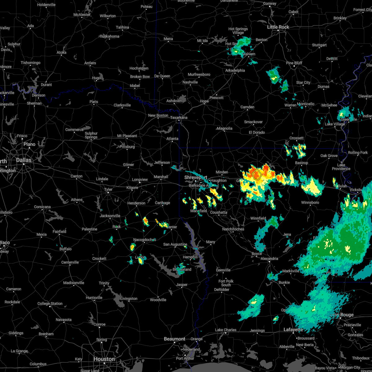 At 759 pm cdt, a severe thunderstorm was located near ruston, and is drifting the northwest at 5 mph (radar indicated). Hazards include 60 mph wind gusts and penny size hail. Expect damage to roofs, siding, and trees. locations impacted include, ruston, dubach, vienna and unionville. hail threat, radar indicated max hail size, 0. 75 in wind threat, radar indicated max wind gust, 60 mph. At 759 pm cdt, a severe thunderstorm was located near ruston, and is drifting the northwest at 5 mph (radar indicated). Hazards include 60 mph wind gusts and penny size hail. Expect damage to roofs, siding, and trees. locations impacted include, ruston, dubach, vienna and unionville. hail threat, radar indicated max hail size, 0. 75 in wind threat, radar indicated max wind gust, 60 mph.
|
| 8/1/2022 7:38 PM CDT |
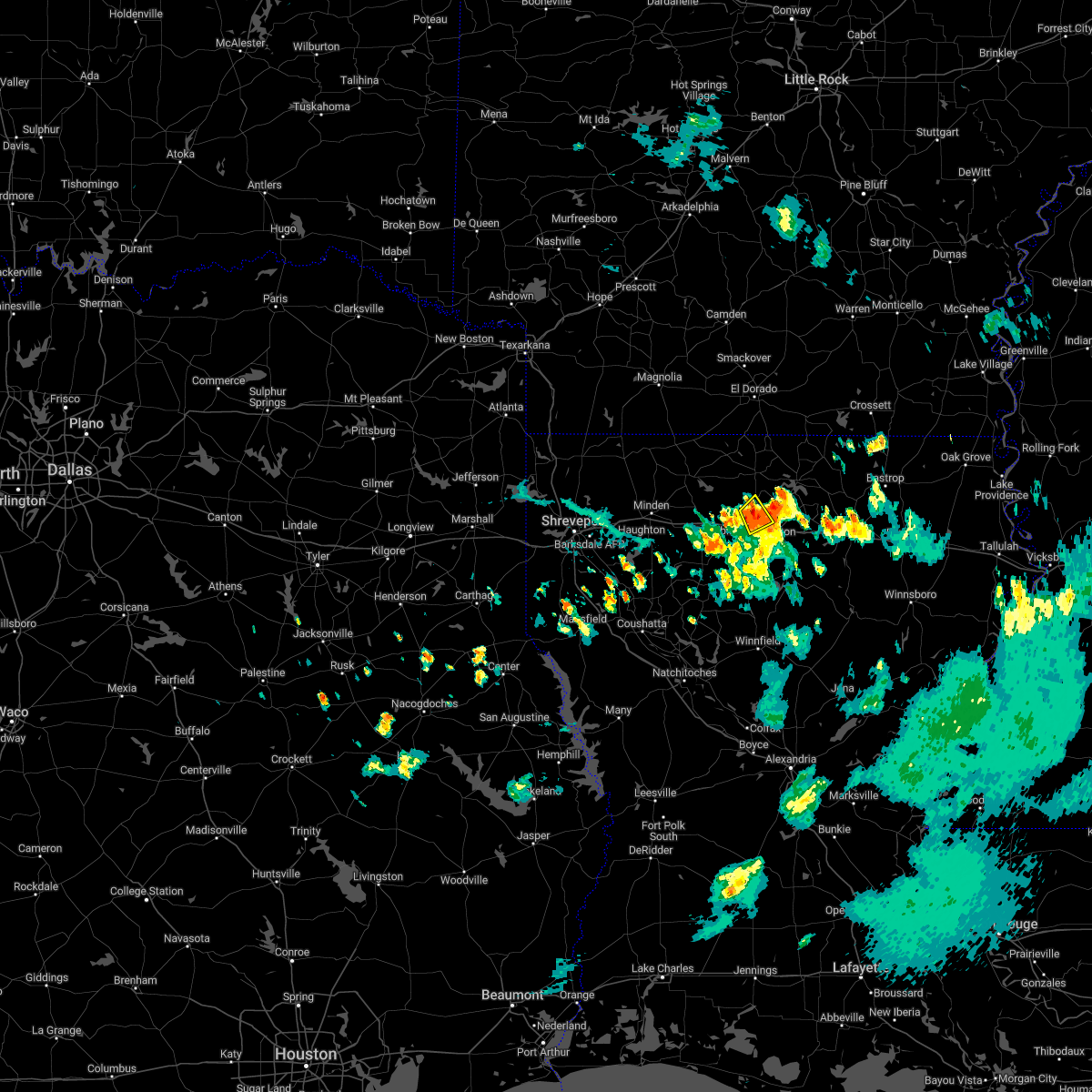 At 738 pm cdt, a severe thunderstorm was located near ruston, and is nearly stationary (radar indicated). Hazards include 60 mph wind gusts and nickel size hail. expect damage to roofs, siding, and trees At 738 pm cdt, a severe thunderstorm was located near ruston, and is nearly stationary (radar indicated). Hazards include 60 mph wind gusts and nickel size hail. expect damage to roofs, siding, and trees
|
| 6/10/2022 9:26 AM CDT |
 At 924 am cdt, severe thunderstorms were located along a line extending from near beekman to 11 miles northwest of bastrop to near farmerville to near cooley to 7 miles southwest of wesson, moving south at 40 mph. downed trees were reported earlier with this line of storms (radar indicated). Hazards include 60 mph wind gusts. expect damage to roofs, siding, and trees At 924 am cdt, severe thunderstorms were located along a line extending from near beekman to 11 miles northwest of bastrop to near farmerville to near cooley to 7 miles southwest of wesson, moving south at 40 mph. downed trees were reported earlier with this line of storms (radar indicated). Hazards include 60 mph wind gusts. expect damage to roofs, siding, and trees
|
| 4/30/2022 11:25 PM CDT |
 At 1124 pm cdt, a severe thunderstorm was located 10 miles north of ruston, moving east at 20 mph (radar indicated). Hazards include 60 mph wind gusts and quarter size hail. Hail damage to vehicles is expected. Expect wind damage to roofs, siding, and trees. At 1124 pm cdt, a severe thunderstorm was located 10 miles north of ruston, moving east at 20 mph (radar indicated). Hazards include 60 mph wind gusts and quarter size hail. Hail damage to vehicles is expected. Expect wind damage to roofs, siding, and trees.
|
| 4/17/2022 4:12 PM CDT |
 The severe thunderstorm warning for southeastern claiborne, north central bienville and western lincoln parishes will expire at 415 pm cdt, the storm which prompted the warning has weakened below severe limits, and no longer poses an immediate threat to life or property. therefore, the warning will be allowed to expire. however heavy rain is still possible with this thunderstorm. a severe thunderstorm watch remains in effect until 700 pm cdt for north central and northwestern louisiana. to report severe weather, contact your nearest law enforcement agency. they will relay your report to the national weather service shreveport. The severe thunderstorm warning for southeastern claiborne, north central bienville and western lincoln parishes will expire at 415 pm cdt, the storm which prompted the warning has weakened below severe limits, and no longer poses an immediate threat to life or property. therefore, the warning will be allowed to expire. however heavy rain is still possible with this thunderstorm. a severe thunderstorm watch remains in effect until 700 pm cdt for north central and northwestern louisiana. to report severe weather, contact your nearest law enforcement agency. they will relay your report to the national weather service shreveport.
|
| 4/17/2022 3:51 PM CDT |
 At 351 pm cdt, a severe thunderstorm was located 7 miles north of arcadia, or 12 miles northwest of grambling, moving east at 40 mph (radar indicated). Hazards include 60 mph wind gusts and quarter size hail. Hail damage to vehicles is expected. expect wind damage to roofs, siding, and trees. locations impacted include, ruston, grambling, arcadia, dubach, simsboro, vienna, mount zion, unionville and aycock. hail threat, radar indicated max hail size, 1. 00 in wind threat, radar indicated max wind gust, 60 mph. At 351 pm cdt, a severe thunderstorm was located 7 miles north of arcadia, or 12 miles northwest of grambling, moving east at 40 mph (radar indicated). Hazards include 60 mph wind gusts and quarter size hail. Hail damage to vehicles is expected. expect wind damage to roofs, siding, and trees. locations impacted include, ruston, grambling, arcadia, dubach, simsboro, vienna, mount zion, unionville and aycock. hail threat, radar indicated max hail size, 1. 00 in wind threat, radar indicated max wind gust, 60 mph.
|
| 4/17/2022 3:26 PM CDT |
 At 326 pm cdt, a severe thunderstorm was located just east of minden, moving east at 50 mph (radar indicated). Hazards include 60 mph wind gusts and half dollar size hail. Hail damage to vehicles is expected. Expect wind damage to roofs, siding, and trees. At 326 pm cdt, a severe thunderstorm was located just east of minden, moving east at 50 mph (radar indicated). Hazards include 60 mph wind gusts and half dollar size hail. Hail damage to vehicles is expected. Expect wind damage to roofs, siding, and trees.
|
| 4/13/2022 3:49 AM CDT |
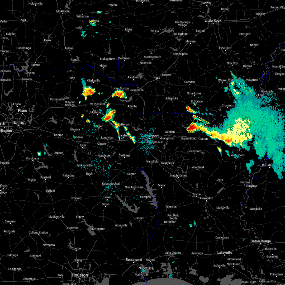 At 348 am cdt, a severe thunderstorm was located 12 miles northeast of arcadia, or 13 miles northwest of grambling, moving northeast at 35 mph (radar indicated). Hazards include 60 mph wind gusts and half dollar size hail. Hail damage to vehicles is expected. Expect wind damage to roofs, siding, and trees. At 348 am cdt, a severe thunderstorm was located 12 miles northeast of arcadia, or 13 miles northwest of grambling, moving northeast at 35 mph (radar indicated). Hazards include 60 mph wind gusts and half dollar size hail. Hail damage to vehicles is expected. Expect wind damage to roofs, siding, and trees.
|
| 4/12/2022 11:03 PM CDT |
 At 1102 pm cdt, severe thunderstorms were located along a line extending from wesson to 11 miles northeast of jonesboro, moving east at 75 mph (radar indicated). Hazards include 60 mph wind gusts and penny size hail. Expect damage to roofs, siding, and trees. Locations impacted include, ruston, grambling, farmerville, arcadia, bernice, cooley, dubach, simsboro, vienna, lisbon, downsville, spearsville, lillie, d arbonne, mount zion, aycock, bayou d arbonne lake, corinth, shiloh and unionville. At 1102 pm cdt, severe thunderstorms were located along a line extending from wesson to 11 miles northeast of jonesboro, moving east at 75 mph (radar indicated). Hazards include 60 mph wind gusts and penny size hail. Expect damage to roofs, siding, and trees. Locations impacted include, ruston, grambling, farmerville, arcadia, bernice, cooley, dubach, simsboro, vienna, lisbon, downsville, spearsville, lillie, d arbonne, mount zion, aycock, bayou d arbonne lake, corinth, shiloh and unionville.
|
| 4/12/2022 10:43 PM CDT |
 At 1043 pm cdt, severe thunderstorms were located along a line extending from near emerson to 15 miles south of gibsland, moving east at 75 mph (radar indicated). Hazards include 60 mph wind gusts and penny size hail. expect damage to roofs, siding, and trees At 1043 pm cdt, severe thunderstorms were located along a line extending from near emerson to 15 miles south of gibsland, moving east at 75 mph (radar indicated). Hazards include 60 mph wind gusts and penny size hail. expect damage to roofs, siding, and trees
|
| 4/5/2022 3:29 AM CDT |
 At 328 am cdt, severe thunderstorms were located along a line extending from near calion to near el dorado to near junction city to 9 miles west of bernice to near arcadia to 7 miles east of heflin, moving east at 45 mph (radar indicated). Hazards include 60 mph wind gusts and quarter size hail. Hail damage to vehicles is expected. Expect wind damage to roofs, siding, and trees. At 328 am cdt, severe thunderstorms were located along a line extending from near calion to near el dorado to near junction city to 9 miles west of bernice to near arcadia to 7 miles east of heflin, moving east at 45 mph (radar indicated). Hazards include 60 mph wind gusts and quarter size hail. Hail damage to vehicles is expected. Expect wind damage to roofs, siding, and trees.
|
| 3/30/2022 12:48 PM CDT |
 At 1248 pm cdt, severe thunderstorms were located along a line extending from cooley to near ruston to 8 miles east of jonesboro, moving east at 65 mph. a tornado warning is also currently in effect for some parishes in this severe thunderstorm warning (radar indicated). Hazards include 60 mph wind gusts and quarter size hail. Hail damage to vehicles is expected. Expect wind damage to roofs, siding, and trees. At 1248 pm cdt, severe thunderstorms were located along a line extending from cooley to near ruston to 8 miles east of jonesboro, moving east at 65 mph. a tornado warning is also currently in effect for some parishes in this severe thunderstorm warning (radar indicated). Hazards include 60 mph wind gusts and quarter size hail. Hail damage to vehicles is expected. Expect wind damage to roofs, siding, and trees.
|
| 6/7/2021 4:45 PM CDT |
 At 445 pm cdt, severe thunderstorms were located along a line extending from 9 miles north of farmerville to near jonesboro, moving east at 35 mph (radar indicated). Hazards include 60 mph wind gusts and penny size hail. expect damage to roofs, siding, and trees At 445 pm cdt, severe thunderstorms were located along a line extending from 9 miles north of farmerville to near jonesboro, moving east at 35 mph (radar indicated). Hazards include 60 mph wind gusts and penny size hail. expect damage to roofs, siding, and trees
|
| 6/7/2021 4:36 PM CDT | Numerous trees down across lincoln paris in lincoln county LA, 0.4 miles N of Dubach, LA |
| 6/7/2021 4:26 PM CDT |
 At 425 pm cdt, severe thunderstorms were located along a line extending from near bernice to 13 miles southwest of cooley to near grambling to 10 miles southeast of arcadia to 12 miles west of jonesboro, moving east at 45 mph (radar indicated). Hazards include 60 mph wind gusts and penny size hail. Expect damage to roofs, siding, and trees. Locations impacted include, ruston, grambling, jonesboro, farmerville, arcadia, bernice, cooley, dubach, choudrant, simsboro, chatham, hodge, north hodge, vienna, east hodge, lucky, bienville, lisbon, quitman and eros. At 425 pm cdt, severe thunderstorms were located along a line extending from near bernice to 13 miles southwest of cooley to near grambling to 10 miles southeast of arcadia to 12 miles west of jonesboro, moving east at 45 mph (radar indicated). Hazards include 60 mph wind gusts and penny size hail. Expect damage to roofs, siding, and trees. Locations impacted include, ruston, grambling, jonesboro, farmerville, arcadia, bernice, cooley, dubach, choudrant, simsboro, chatham, hodge, north hodge, vienna, east hodge, lucky, bienville, lisbon, quitman and eros.
|
| 6/7/2021 4:01 PM CDT |
 At 401 pm cdt, severe thunderstorms were located along a line extending from homer to 11 miles northwest of arcadia to near gibsland to 9 miles southeast of heflin to 6 miles southeast of ringgold, moving east at 45 mph (radar indicated). Hazards include 60 mph wind gusts and penny size hail. expect damage to roofs, siding, and trees At 401 pm cdt, severe thunderstorms were located along a line extending from homer to 11 miles northwest of arcadia to near gibsland to 9 miles southeast of heflin to 6 miles southeast of ringgold, moving east at 45 mph (radar indicated). Hazards include 60 mph wind gusts and penny size hail. expect damage to roofs, siding, and trees
|
| 5/28/2021 3:48 AM CDT |
 At 347 am cdt, severe thunderstorms were located along a line extending from 11 miles north of farmerville to grambling to 9 miles north of coushatta, moving east at 45 mph (radar indicated). Hazards include 60 mph wind gusts and penny size hail. Expect damage to roofs, siding, and trees. Locations impacted include, ruston, grambling, farmerville, dubach, choudrant, simsboro, marion, martin, vienna, hall summit, saline, lucky, ashland, castor, bienville, quitman, downsville, bryceland, d arbonne and brice. At 347 am cdt, severe thunderstorms were located along a line extending from 11 miles north of farmerville to grambling to 9 miles north of coushatta, moving east at 45 mph (radar indicated). Hazards include 60 mph wind gusts and penny size hail. Expect damage to roofs, siding, and trees. Locations impacted include, ruston, grambling, farmerville, dubach, choudrant, simsboro, marion, martin, vienna, hall summit, saline, lucky, ashland, castor, bienville, quitman, downsville, bryceland, d arbonne and brice.
|
| 5/28/2021 3:38 AM CDT |
 At 337 am cdt, severe thunderstorms were located along a line extending from 9 miles northeast of cooley to near grambling to 11 miles northwest of coushatta, moving east at 45 mph (radar indicated). Hazards include 60 mph wind gusts and penny size hail. Expect damage to roofs, siding, and trees. Locations impacted include, ruston, grambling, farmerville, arcadia, bernice, ringgold, cooley, dubach, choudrant, simsboro, marion, martin, vienna, hall summit, saline, lucky, ashland, castor, bienville and lisbon. At 337 am cdt, severe thunderstorms were located along a line extending from 9 miles northeast of cooley to near grambling to 11 miles northwest of coushatta, moving east at 45 mph (radar indicated). Hazards include 60 mph wind gusts and penny size hail. Expect damage to roofs, siding, and trees. Locations impacted include, ruston, grambling, farmerville, arcadia, bernice, ringgold, cooley, dubach, choudrant, simsboro, marion, martin, vienna, hall summit, saline, lucky, ashland, castor, bienville and lisbon.
|
| 5/28/2021 3:15 AM CDT |
 At 314 am cdt, severe thunderstorms were located along a line extending from junction city to near gibsland to 9 miles east of stonewall, moving east at 50 mph (radar indicated). Hazards include 60 mph wind gusts and penny size hail. expect damage to roofs, siding, and trees At 314 am cdt, severe thunderstorms were located along a line extending from junction city to near gibsland to 9 miles east of stonewall, moving east at 50 mph (radar indicated). Hazards include 60 mph wind gusts and penny size hail. expect damage to roofs, siding, and trees
|
| 4/9/2021 6:40 PM CDT |
 At 640 pm cdt, a severe thunderstorm was located over arcadia, or 10 miles west of grambling, moving northeast at 30 mph (radar indicated). Hazards include 60 mph wind gusts and quarter size hail. Hail damage to vehicles is expected. Expect wind damage to roofs, siding, and trees. At 640 pm cdt, a severe thunderstorm was located over arcadia, or 10 miles west of grambling, moving northeast at 30 mph (radar indicated). Hazards include 60 mph wind gusts and quarter size hail. Hail damage to vehicles is expected. Expect wind damage to roofs, siding, and trees.
|
| 4/9/2021 5:33 PM CDT |
 At 532 pm cdt, a severe thunderstorm was located 7 miles west of farmerville, or 17 miles northeast of ruston, moving northeast at 40 mph (radar indicated). Hazards include 60 mph wind gusts and quarter size hail. Hail damage to vehicles is expected. expect wind damage to roofs, siding, and trees. Locations impacted include, farmerville, bernice, dubach, vienna, downsville, d arbonne, bayou d arbonne lake, rocky branch, shiloh, spencer, unionville and eureka. At 532 pm cdt, a severe thunderstorm was located 7 miles west of farmerville, or 17 miles northeast of ruston, moving northeast at 40 mph (radar indicated). Hazards include 60 mph wind gusts and quarter size hail. Hail damage to vehicles is expected. expect wind damage to roofs, siding, and trees. Locations impacted include, farmerville, bernice, dubach, vienna, downsville, d arbonne, bayou d arbonne lake, rocky branch, shiloh, spencer, unionville and eureka.
|
| 4/9/2021 5:15 PM CDT |
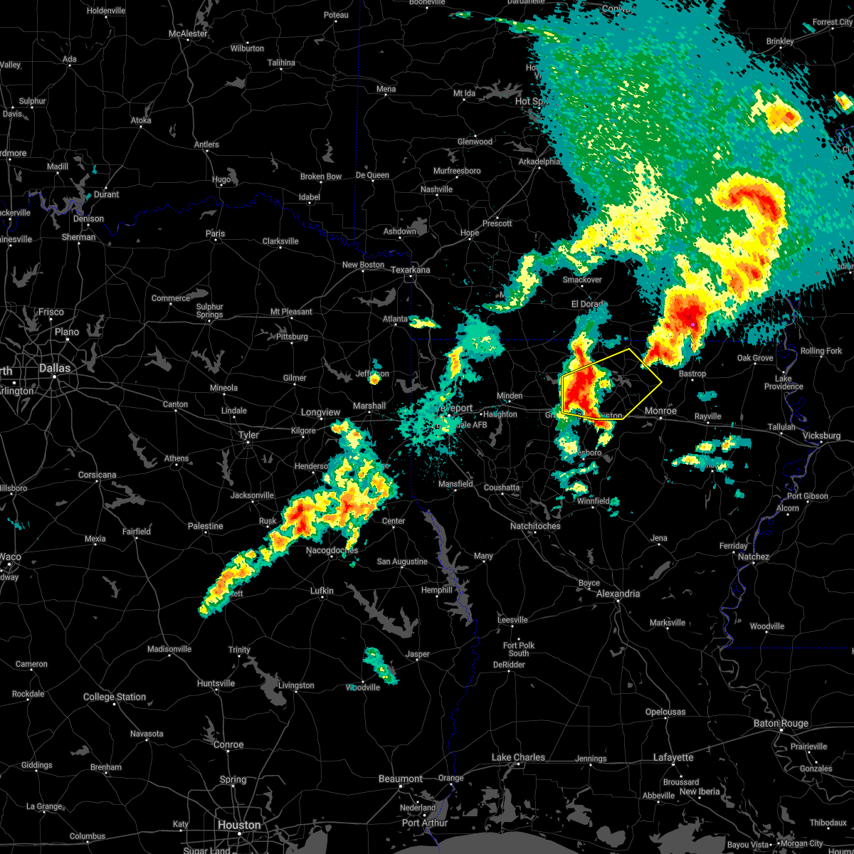 At 515 pm cdt, a severe thunderstorm was located 10 miles south of bernice, or 11 miles north of grambling, moving northeast at 40 mph (radar indicated). Hazards include 60 mph wind gusts and quarter size hail. Hail damage to vehicles is expected. Expect wind damage to roofs, siding, and trees. At 515 pm cdt, a severe thunderstorm was located 10 miles south of bernice, or 11 miles north of grambling, moving northeast at 40 mph (radar indicated). Hazards include 60 mph wind gusts and quarter size hail. Hail damage to vehicles is expected. Expect wind damage to roofs, siding, and trees.
|
| 3/17/2021 2:16 PM CDT |
 At 216 pm cdt, a severe thunderstorm was located near bernice, or 14 miles north of ruston, moving northeast at 45 mph (radar indicated). Hazards include 60 mph wind gusts and quarter size hail. Hail damage to vehicles is expected. Expect wind damage to roofs, siding, and trees. At 216 pm cdt, a severe thunderstorm was located near bernice, or 14 miles north of ruston, moving northeast at 45 mph (radar indicated). Hazards include 60 mph wind gusts and quarter size hail. Hail damage to vehicles is expected. Expect wind damage to roofs, siding, and trees.
|
| 5/8/2020 6:39 AM CDT |
 At 638 am cdt, severe thunderstorms were located along a line extending from 6 miles west of farmerville to near ruston to near grambling to 11 miles northwest of jonesboro, moving east at 55 mph (radar indicated). Hazards include 60 mph wind gusts and penny size hail. Expect damage to roofs, siding, and trees. Locations impacted include, monroe, ruston, claiborne, west monroe, grambling, swartz, brownsville-bawcom, brownsville-bawcomville, farmerville, richwood, sterlington, dubach, choudrant, simsboro, chatham, hodge, north hodge, vienna, east hodge and bienville. At 638 am cdt, severe thunderstorms were located along a line extending from 6 miles west of farmerville to near ruston to near grambling to 11 miles northwest of jonesboro, moving east at 55 mph (radar indicated). Hazards include 60 mph wind gusts and penny size hail. Expect damage to roofs, siding, and trees. Locations impacted include, monroe, ruston, claiborne, west monroe, grambling, swartz, brownsville-bawcom, brownsville-bawcomville, farmerville, richwood, sterlington, dubach, choudrant, simsboro, chatham, hodge, north hodge, vienna, east hodge and bienville.
|
| 5/8/2020 6:24 AM CDT |
 At 623 am cdt, severe thunderstorms were located along a line extending from 6 miles northwest of bernice to 10 miles southwest of cooley to 8 miles northwest of grambling to arcadia to near gibsland, moving east at 55 mph (radar indicated). Hazards include 60 mph wind gusts and penny size hail. expect damage to roofs, siding, and trees At 623 am cdt, severe thunderstorms were located along a line extending from 6 miles northwest of bernice to 10 miles southwest of cooley to 8 miles northwest of grambling to arcadia to near gibsland, moving east at 55 mph (radar indicated). Hazards include 60 mph wind gusts and penny size hail. expect damage to roofs, siding, and trees
|
| 4/29/2020 1:30 AM CDT |
 At 130 am cdt, severe thunderstorms were located along a line extending from near north crossett to 10 miles south of huttig to 10 miles southeast of bernice, moving southeast at 45 mph (radar indicated). Hazards include 60 mph wind gusts and quarter size hail. Hail damage to vehicles is expected. expect wind damage to roofs, siding, and trees. Locations impacted include, huttig, farmerville, bernice, cooley, dubach, choudrant, marion, felsenthal, downsville, d arbonne, spencer, oakland, linville, haile, bayou d arbonne lake, cecil, shiloh, unionville and litroe. At 130 am cdt, severe thunderstorms were located along a line extending from near north crossett to 10 miles south of huttig to 10 miles southeast of bernice, moving southeast at 45 mph (radar indicated). Hazards include 60 mph wind gusts and quarter size hail. Hail damage to vehicles is expected. expect wind damage to roofs, siding, and trees. Locations impacted include, huttig, farmerville, bernice, cooley, dubach, choudrant, marion, felsenthal, downsville, d arbonne, spencer, oakland, linville, haile, bayou d arbonne lake, cecil, shiloh, unionville and litroe.
|
| 4/29/2020 12:51 AM CDT |
 At 1250 am cdt, severe thunderstorms were located along a line extending from near harrell to 8 miles southeast of el dorado to 7 miles southeast of haynesville, moving southeast at 45 mph (radar indicated). Hazards include 60 mph wind gusts and quarter size hail. Hail damage to vehicles is expected. Expect wind damage to roofs, siding, and trees. At 1250 am cdt, severe thunderstorms were located along a line extending from near harrell to 8 miles southeast of el dorado to 7 miles southeast of haynesville, moving southeast at 45 mph (radar indicated). Hazards include 60 mph wind gusts and quarter size hail. Hail damage to vehicles is expected. Expect wind damage to roofs, siding, and trees.
|
| 4/12/2020 10:56 AM CDT |
 At 1055 am cdt, a tornado producing storm was located near arcadia, or 9 miles northwest of grambling, moving northeast at 35 mph (radar confirmed tornado). Hazards include damaging tornado. Flying debris will be dangerous to those caught without shelter. mobile homes will be damaged or destroyed. damage to roofs, windows, and vehicles will occur. tree damage is likely. this tornadic storm will be near, ruston around 1110 am cdt. Other locations impacted by this tornadic thunderstorm include vienna, mount zion, unionville and dubach. At 1055 am cdt, a tornado producing storm was located near arcadia, or 9 miles northwest of grambling, moving northeast at 35 mph (radar confirmed tornado). Hazards include damaging tornado. Flying debris will be dangerous to those caught without shelter. mobile homes will be damaged or destroyed. damage to roofs, windows, and vehicles will occur. tree damage is likely. this tornadic storm will be near, ruston around 1110 am cdt. Other locations impacted by this tornadic thunderstorm include vienna, mount zion, unionville and dubach.
|
| 4/12/2020 10:47 AM CDT |
 At 1047 am cdt, severe thunderstorms were located along a line extending from 7 miles west of junction city to 13 miles southwest of jonesboro, moving northeast at 60 mph (radar indicated). Hazards include 60 mph wind gusts and penny size hail. expect damage to roofs, siding, and trees At 1047 am cdt, severe thunderstorms were located along a line extending from 7 miles west of junction city to 13 miles southwest of jonesboro, moving northeast at 60 mph (radar indicated). Hazards include 60 mph wind gusts and penny size hail. expect damage to roofs, siding, and trees
|
| 3/4/2020 3:37 AM CST |
 At 337 am cst, a severe thunderstorm was located near ruston, moving east at 50 mph (radar indicated). Hazards include 60 mph wind gusts and quarter size hail. Hail damage to vehicles is expected. Expect wind damage to roofs, siding, and trees. At 337 am cst, a severe thunderstorm was located near ruston, moving east at 50 mph (radar indicated). Hazards include 60 mph wind gusts and quarter size hail. Hail damage to vehicles is expected. Expect wind damage to roofs, siding, and trees.
|
| 3/4/2020 3:27 AM CST |
 At 327 am cst, a severe thunderstorm was located over arcadia, or 10 miles west of grambling, moving east at 35 mph (radar indicated). Hazards include 60 mph wind gusts and quarter size hail. Hail damage to vehicles is expected. expect wind damage to roofs, siding, and trees. Locations impacted include, ruston, grambling, arcadia, dubach, simsboro, vienna and mount zion. At 327 am cst, a severe thunderstorm was located over arcadia, or 10 miles west of grambling, moving east at 35 mph (radar indicated). Hazards include 60 mph wind gusts and quarter size hail. Hail damage to vehicles is expected. expect wind damage to roofs, siding, and trees. Locations impacted include, ruston, grambling, arcadia, dubach, simsboro, vienna and mount zion.
|
| 3/4/2020 3:14 AM CST |
 At 314 am cst, a severe thunderstorm was located over gibsland, or 16 miles east of minden, moving east at 35 mph (radar indicated). Hazards include 60 mph wind gusts and quarter size hail. Hail damage to vehicles is expected. Expect wind damage to roofs, siding, and trees. At 314 am cst, a severe thunderstorm was located over gibsland, or 16 miles east of minden, moving east at 35 mph (radar indicated). Hazards include 60 mph wind gusts and quarter size hail. Hail damage to vehicles is expected. Expect wind damage to roofs, siding, and trees.
|
| 1/11/2020 2:16 AM CST |
 At 216 am cst, severe thunderstorms were located along a line extending from norphlet to 9 miles east of junction city to near grambling, moving east at 40 mph (radar indicated). Hazards include 60 mph wind gusts. expect damage to roofs, siding, and trees At 216 am cst, severe thunderstorms were located along a line extending from norphlet to 9 miles east of junction city to near grambling, moving east at 40 mph (radar indicated). Hazards include 60 mph wind gusts. expect damage to roofs, siding, and trees
|
| 12/16/2019 12:38 PM CST |
 At 1238 pm cst, severe thunderstorms were located along a line extending from arcadia to 12 miles south of gibsland to 7 miles southeast of ringgold, moving northeast at 35 mph (radar indicated). Hazards include 60 mph wind gusts and quarter size hail. Hail damage to vehicles is expected. Expect wind damage to roofs, siding, and trees. At 1238 pm cst, severe thunderstorms were located along a line extending from arcadia to 12 miles south of gibsland to 7 miles southeast of ringgold, moving northeast at 35 mph (radar indicated). Hazards include 60 mph wind gusts and quarter size hail. Hail damage to vehicles is expected. Expect wind damage to roofs, siding, and trees.
|
| 6/28/2019 4:49 PM CDT |
 At 448 pm cdt, a severe thunderstorm was located over farmerville, or 18 miles northwest of claiborne, moving south at 30 mph (radar indicated). Hazards include 60 mph wind gusts and quarter size hail. Hail damage to vehicles is expected. Expect wind damage to roofs, siding, and trees. At 448 pm cdt, a severe thunderstorm was located over farmerville, or 18 miles northwest of claiborne, moving south at 30 mph (radar indicated). Hazards include 60 mph wind gusts and quarter size hail. Hail damage to vehicles is expected. Expect wind damage to roofs, siding, and trees.
|
| 6/23/2019 7:19 PM CDT |
 At 719 pm cdt, severe thunderstorms were located along a line extending from near lisbon to 11 miles west of bernice, moving northeast at 40 mph (radar indicated). Hazards include 60 mph wind gusts. Expect damage to roofs, siding, and trees. Locations impacted include, junction city, lisbon, atlanta, wesson, dubach, hew hope, newell, antioch, mount zion, summerfield, aycock, marysville, cairo, three creeks, corney lake and corinth. At 719 pm cdt, severe thunderstorms were located along a line extending from near lisbon to 11 miles west of bernice, moving northeast at 40 mph (radar indicated). Hazards include 60 mph wind gusts. Expect damage to roofs, siding, and trees. Locations impacted include, junction city, lisbon, atlanta, wesson, dubach, hew hope, newell, antioch, mount zion, summerfield, aycock, marysville, cairo, three creeks, corney lake and corinth.
|
| 6/23/2019 7:09 PM CDT | Corrected time. trees down at the intersection of la hwy 146 and singleton roa in lincoln county LA, 8 miles ENE of Dubach, LA |
| 6/23/2019 7:07 PM CDT |
 At 706 pm cdt, severe thunderstorms were located along a line extending from near mount holly to 8 miles southeast of homer, moving northeast at 50 mph (radar indicated). Hazards include 60 mph wind gusts. Expect damage to roofs, siding, and trees. Locations impacted include, homer, junction city, arcadia, haynesville, gibsland, atlanta, wesson, lisbon, dubach, athens, mount lebanon, newell, mount zion, spotville, lake clairborne, corinth, hew hope, antioch, summerfield and aycock. At 706 pm cdt, severe thunderstorms were located along a line extending from near mount holly to 8 miles southeast of homer, moving northeast at 50 mph (radar indicated). Hazards include 60 mph wind gusts. Expect damage to roofs, siding, and trees. Locations impacted include, homer, junction city, arcadia, haynesville, gibsland, atlanta, wesson, lisbon, dubach, athens, mount lebanon, newell, mount zion, spotville, lake clairborne, corinth, hew hope, antioch, summerfield and aycock.
|
| 6/23/2019 7:07 PM CDT |
 A severe thunderstorm warning remains in effect until 745 pm cdt for western union and southeastern columbia counties. claiborne. northern bienville and northwestern lincoln parishes. At 706 pm cdt, severe thunderstorms were located along a line extending from near mount holly to 8 miles southeast of homer, moving northeast at 50 mph. A severe thunderstorm warning remains in effect until 745 pm cdt for western union and southeastern columbia counties. claiborne. northern bienville and northwestern lincoln parishes. At 706 pm cdt, severe thunderstorms were located along a line extending from near mount holly to 8 miles southeast of homer, moving northeast at 50 mph.
|
| 6/23/2019 6:41 PM CDT |
 The national weather service in shreveport has issued a * severe thunderstorm warning for. western union county in south central arkansas. southeastern columbia county in southwestern arkansas. eastern webster parish in northwestern louisiana. Claiborne parish in northwestern louisiana. The national weather service in shreveport has issued a * severe thunderstorm warning for. western union county in south central arkansas. southeastern columbia county in southwestern arkansas. eastern webster parish in northwestern louisiana. Claiborne parish in northwestern louisiana.
|
| 6/23/2019 6:41 PM CDT |
 At 641 pm cdt, severe thunderstorms were located along a line extending from near shongaloo to near dubberly, moving northeast at 35 mph (radar indicated). Hazards include 60 mph wind gusts. expect damage to roofs, siding, and trees At 641 pm cdt, severe thunderstorms were located along a line extending from near shongaloo to near dubberly, moving northeast at 35 mph (radar indicated). Hazards include 60 mph wind gusts. expect damage to roofs, siding, and trees
|
| 6/23/2019 7:09 AM CDT | Trees down at the intersection of la hwy 146 and singleton roa in lincoln county LA, 8 miles ENE of Dubach, LA |
| 6/20/2019 1:10 AM CDT |
 At 110 am cdt, severe thunderstorms were located along a line extending from near bernice to 9 miles south of cooley to near ruston to near grambling, moving east at 55 mph (radar indicated). Hazards include 60 mph wind gusts and quarter size hail. Hail damage to vehicles is expected. Expect wind damage to roofs, siding, and trees. At 110 am cdt, severe thunderstorms were located along a line extending from near bernice to 9 miles south of cooley to near ruston to near grambling, moving east at 55 mph (radar indicated). Hazards include 60 mph wind gusts and quarter size hail. Hail damage to vehicles is expected. Expect wind damage to roofs, siding, and trees.
|
| 6/20/2019 12:52 AM CDT |
 At 1252 am cdt, severe thunderstorms were located along a line extending from 10 miles east of homer to 10 miles northwest of grambling to near arcadia to 7 miles east of ringgold, moving east at 45 mph (radar indicated). Hazards include 60 mph wind gusts and quarter size hail. Hail damage to vehicles is expected. expect wind damage to roofs, siding, and trees. Locations impacted include, ruston, grambling, homer, arcadia, ringgold, gibsland, dubach, simsboro, vienna, lucky, castor, athens, bienville, lisbon, jamestown, bryceland, mount lebanon, brice, mount zion and liberty hill. At 1252 am cdt, severe thunderstorms were located along a line extending from 10 miles east of homer to 10 miles northwest of grambling to near arcadia to 7 miles east of ringgold, moving east at 45 mph (radar indicated). Hazards include 60 mph wind gusts and quarter size hail. Hail damage to vehicles is expected. expect wind damage to roofs, siding, and trees. Locations impacted include, ruston, grambling, homer, arcadia, ringgold, gibsland, dubach, simsboro, vienna, lucky, castor, athens, bienville, lisbon, jamestown, bryceland, mount lebanon, brice, mount zion and liberty hill.
|
| 6/20/2019 12:42 AM CDT |
 At 1241 am cdt, severe thunderstorms were located along a line extending from near homer to near arcadia to near gibsland to ringgold, moving east at 45 mph (radar indicated). Hazards include 60 mph wind gusts and quarter size hail. Hail damage to vehicles is expected. expect wind damage to roofs, siding, and trees. Locations impacted include, ruston, minden, grambling, homer, arcadia, ringgold, sibley, gibsland, dubberly, heflin, dubach, simsboro, vienna, lucky, castor, athens, bienville, lisbon, jamestown and bryceland. At 1241 am cdt, severe thunderstorms were located along a line extending from near homer to near arcadia to near gibsland to ringgold, moving east at 45 mph (radar indicated). Hazards include 60 mph wind gusts and quarter size hail. Hail damage to vehicles is expected. expect wind damage to roofs, siding, and trees. Locations impacted include, ruston, minden, grambling, homer, arcadia, ringgold, sibley, gibsland, dubberly, heflin, dubach, simsboro, vienna, lucky, castor, athens, bienville, lisbon, jamestown and bryceland.
|
| 6/20/2019 12:22 AM CDT |
 At 1222 am cdt, severe thunderstorms were located along a line extending from 10 miles east of cotton valley to near minden to near heflin to 13 miles west of ringgold, moving east at 45 mph (radar indicated). Hazards include 60 mph wind gusts and quarter size hail. Hail damage to vehicles is expected. Expect wind damage to roofs, siding, and trees. At 1222 am cdt, severe thunderstorms were located along a line extending from 10 miles east of cotton valley to near minden to near heflin to 13 miles west of ringgold, moving east at 45 mph (radar indicated). Hazards include 60 mph wind gusts and quarter size hail. Hail damage to vehicles is expected. Expect wind damage to roofs, siding, and trees.
|
| 6/20/2019 12:15 AM CDT |
 At 1215 am cdt, severe thunderstorms were located along a line extending from el dorado to 10 miles northeast of cooley to 9 miles south of bernice, moving east at 45 mph (radar indicated). Hazards include 60 mph wind gusts and quarter size hail. Hail damage to vehicles is expected. expect wind damage to roofs, siding, and trees. Locations impacted include, el dorado, huttig, junction city, farmerville, bernice, strong, wesson, lisbon, urbana, lawson, cooley, lapile, dubach, marion, felsenthal, spearsville, lillie, newell, new london and oakland. At 1215 am cdt, severe thunderstorms were located along a line extending from el dorado to 10 miles northeast of cooley to 9 miles south of bernice, moving east at 45 mph (radar indicated). Hazards include 60 mph wind gusts and quarter size hail. Hail damage to vehicles is expected. expect wind damage to roofs, siding, and trees. Locations impacted include, el dorado, huttig, junction city, farmerville, bernice, strong, wesson, lisbon, urbana, lawson, cooley, lapile, dubach, marion, felsenthal, spearsville, lillie, newell, new london and oakland.
|
| 6/19/2019 11:51 PM CDT |
 At 1151 pm cdt, severe thunderstorms were located along a line extending from near lisbon to 10 miles northeast of arcadia, moving east at 45 mph (radar indicated). Hazards include 60 mph wind gusts and quarter size hail. Hail damage to vehicles is expected. Expect wind damage to roofs, siding, and trees. At 1151 pm cdt, severe thunderstorms were located along a line extending from near lisbon to 10 miles northeast of arcadia, moving east at 45 mph (radar indicated). Hazards include 60 mph wind gusts and quarter size hail. Hail damage to vehicles is expected. Expect wind damage to roofs, siding, and trees.
|
| 6/15/2019 6:35 PM CDT |
 At 634 pm cdt, severe thunderstorms were located along a line extending from near homer to 10 miles northeast of arcadia to grambling, moving north at 30 mph (radar indicated). Hazards include 60 mph wind gusts and quarter size hail. Hail damage to vehicles is expected. expect wind damage to roofs, siding, and trees. Locations impacted include, dubach, lisbon, lake clairborne, corinth, mount zion and aycock. At 634 pm cdt, severe thunderstorms were located along a line extending from near homer to 10 miles northeast of arcadia to grambling, moving north at 30 mph (radar indicated). Hazards include 60 mph wind gusts and quarter size hail. Hail damage to vehicles is expected. expect wind damage to roofs, siding, and trees. Locations impacted include, dubach, lisbon, lake clairborne, corinth, mount zion and aycock.
|
| 6/15/2019 6:19 PM CDT |
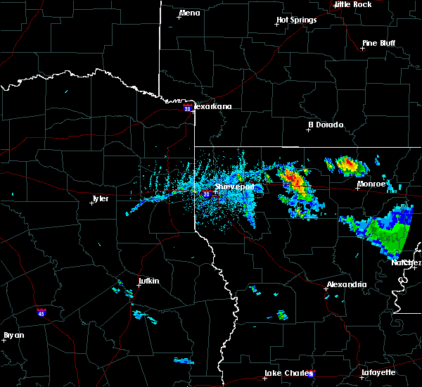 At 617 pm cdt, severe thunderstorms were located along a line extending from 8 miles north of gibsland to near arcadia to 7 miles south of grambling, moving north at 30 mph (radar indicated). Hazards include 60 mph wind gusts and quarter size hail. Hail damage to vehicles is expected. Expect wind damage to roofs, siding, and trees. At 617 pm cdt, severe thunderstorms were located along a line extending from 8 miles north of gibsland to near arcadia to 7 miles south of grambling, moving north at 30 mph (radar indicated). Hazards include 60 mph wind gusts and quarter size hail. Hail damage to vehicles is expected. Expect wind damage to roofs, siding, and trees.
|
| 5/19/2019 12:34 AM CDT |
 The national weather service in shreveport has issued a * severe thunderstorm warning for. western jackson parish in north central louisiana. western union parish in north central louisiana. southeastern red river parish in northwestern louisiana. Northern natchitoches parish in northwestern louisiana. The national weather service in shreveport has issued a * severe thunderstorm warning for. western jackson parish in north central louisiana. western union parish in north central louisiana. southeastern red river parish in northwestern louisiana. Northern natchitoches parish in northwestern louisiana.
|
| 5/8/2019 6:11 PM CDT |
 At 610 pm cdt, severe thunderstorms were located along a line extending from farmerville to 10 miles west of claiborne to 12 miles west of brownsville-bawcom to 17 miles southwest of brownsville-bawcomville to 18 miles northwest of clarks, moving east at 45 mph (radar indicated). Hazards include 60 mph wind gusts and penny size hail. Expect damage to roofs, siding, and trees. Locations impacted include, monroe, ruston, claiborne, west monroe, grambling, brownsville-bawcom, brownsville-bawcomville, farmerville, richwood, bernice, dubach, choudrant, marion, chatham, vienna, eros, downsville, drew, fondale and d arbonne. At 610 pm cdt, severe thunderstorms were located along a line extending from farmerville to 10 miles west of claiborne to 12 miles west of brownsville-bawcom to 17 miles southwest of brownsville-bawcomville to 18 miles northwest of clarks, moving east at 45 mph (radar indicated). Hazards include 60 mph wind gusts and penny size hail. Expect damage to roofs, siding, and trees. Locations impacted include, monroe, ruston, claiborne, west monroe, grambling, brownsville-bawcom, brownsville-bawcomville, farmerville, richwood, bernice, dubach, choudrant, marion, chatham, vienna, eros, downsville, drew, fondale and d arbonne.
|
| 5/8/2019 5:30 PM CDT |
 At 530 pm cdt, severe thunderstorms were located along a line extending from 10 miles east of homer to near arcadia to 11 miles southwest of grambling to 10 miles west of jonesboro to 22 miles northeast of campti, moving east at 45 mph (radar indicated). Hazards include 60 mph wind gusts and penny size hail. expect damage to roofs, siding, and trees At 530 pm cdt, severe thunderstorms were located along a line extending from 10 miles east of homer to near arcadia to 11 miles southwest of grambling to 10 miles west of jonesboro to 22 miles northeast of campti, moving east at 45 mph (radar indicated). Hazards include 60 mph wind gusts and penny size hail. expect damage to roofs, siding, and trees
|
| 5/8/2019 5:07 PM CDT |
 At 506 pm cdt, severe thunderstorms were located along a line extending from near ingalls to 8 miles west of west crossett to 7 miles southwest of huttig to near farmerville to 14 miles northeast of ruston, moving east at 55 mph (radar indicated). Hazards include 60 mph wind gusts and penny size hail. Expect damage to roofs, siding, and trees. Locations impacted include, ruston, grambling, jonesboro, homer, arcadia, bernice, ringgold, gibsland, dubberly, heflin, cooley, dubach, choudrant, simsboro, junction city, hodge, north hodge, vienna, hall summit and east hodge. At 506 pm cdt, severe thunderstorms were located along a line extending from near ingalls to 8 miles west of west crossett to 7 miles southwest of huttig to near farmerville to 14 miles northeast of ruston, moving east at 55 mph (radar indicated). Hazards include 60 mph wind gusts and penny size hail. Expect damage to roofs, siding, and trees. Locations impacted include, ruston, grambling, jonesboro, homer, arcadia, bernice, ringgold, gibsland, dubberly, heflin, cooley, dubach, choudrant, simsboro, junction city, hodge, north hodge, vienna, hall summit and east hodge.
|
| 5/8/2019 4:27 PM CDT |
 At 426 pm cdt, severe thunderstorms were located along a line extending from near atlanta to 6 miles north of homer to 6 miles northeast of minden to dubberly to near ringgold, moving east at 85 mph (radar indicated). Hazards include 60 mph wind gusts and penny size hail. expect damage to roofs, siding, and trees At 426 pm cdt, severe thunderstorms were located along a line extending from near atlanta to 6 miles north of homer to 6 miles northeast of minden to dubberly to near ringgold, moving east at 85 mph (radar indicated). Hazards include 60 mph wind gusts and penny size hail. expect damage to roofs, siding, and trees
|
| 4/13/2019 1:47 PM CDT |
 At 145 pm cdt, severe thunderstorms were located along a line extending from 11 miles north of grambling to 7 miles west of jonesboro, moving east at 40 mph. these are very dangerous storms (radar indicated). Hazards include 80 mph wind gusts and half dollar size hail. Flying debris will be dangerous to those caught without shelter. mobile homes will be heavily damaged. expect considerable damage to roofs, windows, and vehicles. Extensive tree damage and power outages are likely. At 145 pm cdt, severe thunderstorms were located along a line extending from 11 miles north of grambling to 7 miles west of jonesboro, moving east at 40 mph. these are very dangerous storms (radar indicated). Hazards include 80 mph wind gusts and half dollar size hail. Flying debris will be dangerous to those caught without shelter. mobile homes will be heavily damaged. expect considerable damage to roofs, windows, and vehicles. Extensive tree damage and power outages are likely.
|
| 4/13/2019 1:24 PM CDT |
 At 123 pm cdt, a severe thunderstorm was located 16 miles west of jonesboro, moving northeast at 30 mph. this is a very dangerous storm (radar indicated). Hazards include 80 mph wind gusts and half dollar size hail. Flying debris will be dangerous to those caught without shelter. mobile homes will be heavily damaged. expect considerable damage to roofs, windows, and vehicles. extensive tree damage and power outages are likely. Locations impacted include, ruston, grambling, arcadia, gibsland, dubach, simsboro, goldonna, vienna, saline, lucky, ashland, athens, bienville, bryceland, mount lebanon, brice, mount zion, aycock, friendship and liberty hill. At 123 pm cdt, a severe thunderstorm was located 16 miles west of jonesboro, moving northeast at 30 mph. this is a very dangerous storm (radar indicated). Hazards include 80 mph wind gusts and half dollar size hail. Flying debris will be dangerous to those caught without shelter. mobile homes will be heavily damaged. expect considerable damage to roofs, windows, and vehicles. extensive tree damage and power outages are likely. Locations impacted include, ruston, grambling, arcadia, gibsland, dubach, simsboro, goldonna, vienna, saline, lucky, ashland, athens, bienville, bryceland, mount lebanon, brice, mount zion, aycock, friendship and liberty hill.
|
| 4/13/2019 1:09 PM CDT |
 At 109 pm cdt, a severe thunderstorm was located 11 miles north of campti, or 21 miles north of natchitoches, moving north at 15 mph (radar indicated). Hazards include 60 mph wind gusts and quarter size hail. Hail damage to vehicles is expected. Expect wind damage to roofs, siding, and trees. At 109 pm cdt, a severe thunderstorm was located 11 miles north of campti, or 21 miles north of natchitoches, moving north at 15 mph (radar indicated). Hazards include 60 mph wind gusts and quarter size hail. Hail damage to vehicles is expected. Expect wind damage to roofs, siding, and trees.
|
| 4/7/2019 4:06 PM CDT |
 At 406 pm cdt, a severe thunderstorm was located over grambling, moving northeast at 20 mph (radar indicated). Hazards include 60 mph wind gusts and quarter size hail. Hail damage to vehicles is expected. expect wind damage to roofs, siding, and trees. Locations impacted include, ruston, grambling, farmerville, bernice, cooley, dubach, simsboro, vienna, quitman, spearsville, d arbonne, mount zion, bayou d arbonne lake, shiloh and unionville. At 406 pm cdt, a severe thunderstorm was located over grambling, moving northeast at 20 mph (radar indicated). Hazards include 60 mph wind gusts and quarter size hail. Hail damage to vehicles is expected. expect wind damage to roofs, siding, and trees. Locations impacted include, ruston, grambling, farmerville, bernice, cooley, dubach, simsboro, vienna, quitman, spearsville, d arbonne, mount zion, bayou d arbonne lake, shiloh and unionville.
|
| 4/7/2019 3:35 PM CDT |
 At 335 pm cdt, a severe thunderstorm was located 10 miles northwest of jonesboro, moving northeast at 20 mph (radar indicated). Hazards include golf ball size hail and 60 mph wind gusts. People and animals outdoors will be injured. expect hail damage to roofs, siding, windows, and vehicles. Expect wind damage to roofs, siding, and trees. At 335 pm cdt, a severe thunderstorm was located 10 miles northwest of jonesboro, moving northeast at 20 mph (radar indicated). Hazards include golf ball size hail and 60 mph wind gusts. People and animals outdoors will be injured. expect hail damage to roofs, siding, windows, and vehicles. Expect wind damage to roofs, siding, and trees.
|
| 3/14/2019 5:59 AM CDT |
 At 559 am cdt, severe thunderstorms were located along a line extending from near moro bay to near strong to 9 miles northeast of cooley to near bernice, moving east at 55 mph (radar indicated). Hazards include 60 mph wind gusts and penny size hail. Expect damage to roofs, siding, and trees. Locations impacted include, huttig, farmerville, bernice, strong, calion, urbana, lawson, cooley, lapile, moro bay state park, dubach, felsenthal, spearsville, lillie, new london, aurelle, oakland, taylorville, pigeon hill and hillsboro. At 559 am cdt, severe thunderstorms were located along a line extending from near moro bay to near strong to 9 miles northeast of cooley to near bernice, moving east at 55 mph (radar indicated). Hazards include 60 mph wind gusts and penny size hail. Expect damage to roofs, siding, and trees. Locations impacted include, huttig, farmerville, bernice, strong, calion, urbana, lawson, cooley, lapile, moro bay state park, dubach, felsenthal, spearsville, lillie, new london, aurelle, oakland, taylorville, pigeon hill and hillsboro.
|
| 3/14/2019 5:49 AM CDT |
 At 549 am cdt, severe thunderstorms were located along a line extending from near calion to 11 miles southwest of strong to cooley to 7 miles southwest of bernice, moving east at 55 mph (radar indicated). Hazards include 60 mph wind gusts and penny size hail. Expect damage to roofs, siding, and trees. Locations impacted include, el dorado, huttig, junction city, farmerville, bernice, strong, calion, wesson, urbana, lawson, cooley, lapile, moro bay state park, dubach, athens, lisbon, felsenthal, spearsville, lillie and newell. At 549 am cdt, severe thunderstorms were located along a line extending from near calion to 11 miles southwest of strong to cooley to 7 miles southwest of bernice, moving east at 55 mph (radar indicated). Hazards include 60 mph wind gusts and penny size hail. Expect damage to roofs, siding, and trees. Locations impacted include, el dorado, huttig, junction city, farmerville, bernice, strong, calion, wesson, urbana, lawson, cooley, lapile, moro bay state park, dubach, athens, lisbon, felsenthal, spearsville, lillie and newell.
|
| 3/14/2019 5:36 AM CDT |
 At 535 am cdt, severe thunderstorms were located along a line extending from near el dorado to near cooley to 7 miles west of bernice to 9 miles north of arcadia, moving east at 55 mph (radar indicated). Hazards include 60 mph wind gusts and penny size hail. Expect damage to roofs, siding, and trees. Locations impacted include, el dorado, norphlet, huttig, junction city, farmerville, bernice, strong, calion, wesson, urbana, lawson, cooley, lapile, moro bay state park, dubach, athens, lisbon, felsenthal, spearsville and lillie. At 535 am cdt, severe thunderstorms were located along a line extending from near el dorado to near cooley to 7 miles west of bernice to 9 miles north of arcadia, moving east at 55 mph (radar indicated). Hazards include 60 mph wind gusts and penny size hail. Expect damage to roofs, siding, and trees. Locations impacted include, el dorado, norphlet, huttig, junction city, farmerville, bernice, strong, calion, wesson, urbana, lawson, cooley, lapile, moro bay state park, dubach, athens, lisbon, felsenthal, spearsville and lillie.
|
| 3/14/2019 5:14 AM CDT |
 At 514 am cdt, severe thunderstorms were located along a line extending from near atlanta to 12 miles southeast of haynesville to near homer to near dubberly, moving east at 55 mph (radar indicated). Hazards include 60 mph wind gusts and penny size hail. expect damage to roofs, siding, and trees At 514 am cdt, severe thunderstorms were located along a line extending from near atlanta to 12 miles southeast of haynesville to near homer to near dubberly, moving east at 55 mph (radar indicated). Hazards include 60 mph wind gusts and penny size hail. expect damage to roofs, siding, and trees
|
| 8/20/2018 6:17 PM CDT |
 At 616 pm cdt, a severe thunderstorm was located 8 miles southwest of farmerville, or 14 miles northeast of ruston, moving east at 35 mph. 60 mph winds were reported earlier in the dubach area. if you live on the southern half of farmerville or between farmerville and downsville, take cover immediately (radar indicated). Hazards include 60 mph wind gusts and nickel size hail. Expect damage to roofs, siding, and trees. Locations impacted include, farmerville, dubach, vienna, downsville, d arbonne, bayou d arbonne lake, corinth, shiloh, mount zion and unionville. At 616 pm cdt, a severe thunderstorm was located 8 miles southwest of farmerville, or 14 miles northeast of ruston, moving east at 35 mph. 60 mph winds were reported earlier in the dubach area. if you live on the southern half of farmerville or between farmerville and downsville, take cover immediately (radar indicated). Hazards include 60 mph wind gusts and nickel size hail. Expect damage to roofs, siding, and trees. Locations impacted include, farmerville, dubach, vienna, downsville, d arbonne, bayou d arbonne lake, corinth, shiloh, mount zion and unionville.
|
| 8/20/2018 6:07 PM CDT | Trained weather spotter reported sustained wind gusts of 60mp in lincoln county LA, 0.4 miles N of Dubach, LA |
| 8/20/2018 5:55 PM CDT | Several trees and power lines reported down along n. white lightning r in lincoln county LA, 7.5 miles ENE of Dubach, LA |
| 8/20/2018 5:47 PM CDT |
 At 546 pm cdt, a severe thunderstorm was located 12 miles northeast of arcadia, or 14 miles east of homer, moving east at 30 mph. dubach is in the path of this severe thunderstorm (radar indicated). Hazards include 60 mph wind gusts and nickel size hail. expect damage to roofs, siding, and trees At 546 pm cdt, a severe thunderstorm was located 12 miles northeast of arcadia, or 14 miles east of homer, moving east at 30 mph. dubach is in the path of this severe thunderstorm (radar indicated). Hazards include 60 mph wind gusts and nickel size hail. expect damage to roofs, siding, and trees
|
| 4/14/2018 2:16 AM CDT |
 At 215 am cdt, severe thunderstorms were located along a line extending from near lapile to near huttig to near farmerville to 11 miles northwest of claiborne to 11 miles southeast of ruston to near jonesboro, moving east at 50 mph (radar indicated). Hazards include 60 mph wind gusts and penny size hail. Expect damage to roofs, siding, and trees. locations impacted include, monroe, ruston, claiborne, west monroe, grambling, jonesboro, huttig, swartz, brownsville-bawcom, brownsville-bawcomville, farmerville, richwood, bernice, sterlington, strong, calion, urbana, lawson, cooley and lapile. A tornado watch remains in effect until 600 am cdt for south central arkansas, and north central and northwestern louisiana. At 215 am cdt, severe thunderstorms were located along a line extending from near lapile to near huttig to near farmerville to 11 miles northwest of claiborne to 11 miles southeast of ruston to near jonesboro, moving east at 50 mph (radar indicated). Hazards include 60 mph wind gusts and penny size hail. Expect damage to roofs, siding, and trees. locations impacted include, monroe, ruston, claiborne, west monroe, grambling, jonesboro, huttig, swartz, brownsville-bawcom, brownsville-bawcomville, farmerville, richwood, bernice, sterlington, strong, calion, urbana, lawson, cooley and lapile. A tornado watch remains in effect until 600 am cdt for south central arkansas, and north central and northwestern louisiana.
|
| 4/14/2018 1:45 AM CDT |
 At 144 am cdt, severe thunderstorms were located along a line extending from near wesson to junction city to near cooley to 8 miles southwest of bernice to near arcadia to 12 miles southeast of gibsland to 16 miles west of jonesboro to 16 miles southeast of ringgold, moving east at 50 mph (radar indicated). Hazards include 60 mph wind gusts and penny size hail. expect damage to roofs, siding, and trees At 144 am cdt, severe thunderstorms were located along a line extending from near wesson to junction city to near cooley to 8 miles southwest of bernice to near arcadia to 12 miles southeast of gibsland to 16 miles west of jonesboro to 16 miles southeast of ringgold, moving east at 50 mph (radar indicated). Hazards include 60 mph wind gusts and penny size hail. expect damage to roofs, siding, and trees
|
| 4/14/2018 1:23 AM CDT |
 At 122 am cdt, severe thunderstorms were located along a line extending from 9 miles west of junction city to 9 miles west of bernice to near arcadia to 13 miles northwest of jonesboro to 9 miles north of campti to 13 miles south of coushatta, moving east at 70 mph (radar indicated). Hazards include 60 mph wind gusts and penny size hail. Expect damage to roofs, siding, and trees. locations impacted include, ruston, el dorado, minden, magnolia, grambling, jonesboro, homer, smackover, norphlet, farmerville, arcadia, haynesville, coushatta, bernice, ringgold, sibley, campti, gibsland, emerson and dubberly. A tornado watch remains in effect until 600 am cdt for south central and southwestern arkansas, and north central and northwestern louisiana. At 122 am cdt, severe thunderstorms were located along a line extending from 9 miles west of junction city to 9 miles west of bernice to near arcadia to 13 miles northwest of jonesboro to 9 miles north of campti to 13 miles south of coushatta, moving east at 70 mph (radar indicated). Hazards include 60 mph wind gusts and penny size hail. Expect damage to roofs, siding, and trees. locations impacted include, ruston, el dorado, minden, magnolia, grambling, jonesboro, homer, smackover, norphlet, farmerville, arcadia, haynesville, coushatta, bernice, ringgold, sibley, campti, gibsland, emerson and dubberly. A tornado watch remains in effect until 600 am cdt for south central and southwestern arkansas, and north central and northwestern louisiana.
|
| 4/14/2018 12:59 AM CDT |
 At 1259 am cdt, severe thunderstorms were located along a line extending from 6 miles east of taylor to near shongaloo to minden to 7 miles northwest of ringgold to 9 miles east of mansfield to 9 miles northwest of converse, moving east at 75 mph (radar indicated). Hazards include 60 mph wind gusts and penny size hail. expect damage to roofs, siding, and trees At 1259 am cdt, severe thunderstorms were located along a line extending from 6 miles east of taylor to near shongaloo to minden to 7 miles northwest of ringgold to 9 miles east of mansfield to 9 miles northwest of converse, moving east at 75 mph (radar indicated). Hazards include 60 mph wind gusts and penny size hail. expect damage to roofs, siding, and trees
|
| 4/6/2018 6:44 PM CDT |
 At 644 pm cdt, a severe thunderstorm was located between dubach and ruston, moving southeast at 35 mph (radar indicated). Hazards include 60 mph wind gusts and quarter size hail. Hail damage to vehicles is expected. Expect wind damage to roofs, siding, and trees. At 644 pm cdt, a severe thunderstorm was located between dubach and ruston, moving southeast at 35 mph (radar indicated). Hazards include 60 mph wind gusts and quarter size hail. Hail damage to vehicles is expected. Expect wind damage to roofs, siding, and trees.
|
| 4/3/2018 5:16 PM CDT |
 At 515 pm cdt, severe thunderstorms were located along a line extending from just southwest of el dorado to cooley to 9 miles north of grambling to 11 miles west of jonesboro, moving east at 60 mph (radar indicated. trees were reported down in webster parish from these storms). Hazards include 60 mph wind gusts. expect damage to roofs, siding, and trees At 515 pm cdt, severe thunderstorms were located along a line extending from just southwest of el dorado to cooley to 9 miles north of grambling to 11 miles west of jonesboro, moving east at 60 mph (radar indicated. trees were reported down in webster parish from these storms). Hazards include 60 mph wind gusts. expect damage to roofs, siding, and trees
|
| 9/5/2017 5:41 PM CDT |
 At 541 pm cdt, a severe thunderstorm was located 10 miles southwest of junction city, moving east at 10 mph (radar indicated). Hazards include 60 mph wind gusts and quarter size hail. Hail damage to vehicles is expected. expect wind damage to roofs, siding, and trees. Locations impacted include, junction city, farmerville, bernice, cooley, lisbon, downsville, spearsville, lillie, d arbonne, antioch, oakland, taylorville, summerfield, bayou d arbonne lake, corney lake, lockhart and shiloh. At 541 pm cdt, a severe thunderstorm was located 10 miles southwest of junction city, moving east at 10 mph (radar indicated). Hazards include 60 mph wind gusts and quarter size hail. Hail damage to vehicles is expected. expect wind damage to roofs, siding, and trees. Locations impacted include, junction city, farmerville, bernice, cooley, lisbon, downsville, spearsville, lillie, d arbonne, antioch, oakland, taylorville, summerfield, bayou d arbonne lake, corney lake, lockhart and shiloh.
|
| 9/5/2017 5:22 PM CDT |
 At 521 pm cdt, a severe thunderstorm was located 7 miles southwest of junction city, moving east at 20 mph (radar indicated). Hazards include 60 mph wind gusts and quarter size hail. Hail damage to vehicles is expected. Expect wind damage to roofs, siding, and trees. At 521 pm cdt, a severe thunderstorm was located 7 miles southwest of junction city, moving east at 20 mph (radar indicated). Hazards include 60 mph wind gusts and quarter size hail. Hail damage to vehicles is expected. Expect wind damage to roofs, siding, and trees.
|
| 7/14/2017 4:46 PM CDT |
 At 445 pm cdt, severe thunderstorms were located along a line extending from farmerville to near gibsland, moving south at 15 mph (radar indicated). Hazards include 60 mph wind gusts and penny size hail. Expect damage to roofs, siding, and trees. Locations impacted include, ruston, grambling, farmerville, arcadia, dubach, simsboro, vienna, downsville, d arbonne, bayou d arbonne lake, mount zion and unionville. At 445 pm cdt, severe thunderstorms were located along a line extending from farmerville to near gibsland, moving south at 15 mph (radar indicated). Hazards include 60 mph wind gusts and penny size hail. Expect damage to roofs, siding, and trees. Locations impacted include, ruston, grambling, farmerville, arcadia, dubach, simsboro, vienna, downsville, d arbonne, bayou d arbonne lake, mount zion and unionville.
|
| 7/14/2017 4:08 PM CDT |
 At 408 pm cdt, severe thunderstorms were located along a line extending from 8 miles east of cooley to 7 miles north of arcadia, and are nearly stationary (radar indicated). Hazards include 60 mph wind gusts and penny size hail. expect damage to roofs, siding, and trees At 408 pm cdt, severe thunderstorms were located along a line extending from 8 miles east of cooley to 7 miles north of arcadia, and are nearly stationary (radar indicated). Hazards include 60 mph wind gusts and penny size hail. expect damage to roofs, siding, and trees
|
| 6/23/2017 8:16 AM CDT |
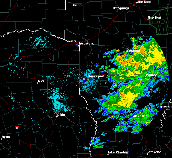 At 815 am cdt, a severe thunderstorm was located 8 miles southwest of junction city, moving southeast at 10 mph (radar indicated). Hazards include 60 mph wind gusts. expect damage to roofs, siding, and trees At 815 am cdt, a severe thunderstorm was located 8 miles southwest of junction city, moving southeast at 10 mph (radar indicated). Hazards include 60 mph wind gusts. expect damage to roofs, siding, and trees
|
| 4/26/2017 6:04 PM CDT |
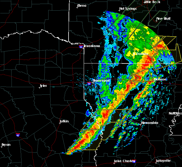 At 603 pm cdt, a severe thunderstorm was located 10 miles southeast of bernice, or 11 miles north of ruston, moving northeast at 45 mph (radar indicated). Hazards include 60 mph wind gusts and quarter size hail. Hail damage to vehicles is expected. expect wind damage to roofs, siding, and trees. locations impacted include, ruston, grambling, dubach, vienna, mount zion and unionville. A tornado watch remains in effect until 1100 pm cdt for north central louisiana. At 603 pm cdt, a severe thunderstorm was located 10 miles southeast of bernice, or 11 miles north of ruston, moving northeast at 45 mph (radar indicated). Hazards include 60 mph wind gusts and quarter size hail. Hail damage to vehicles is expected. expect wind damage to roofs, siding, and trees. locations impacted include, ruston, grambling, dubach, vienna, mount zion and unionville. A tornado watch remains in effect until 1100 pm cdt for north central louisiana.
|
| 4/26/2017 5:55 PM CDT | Sheriff repots tree down on hamilton road in dubac in lincoln county LA, 0.4 miles N of Dubach, LA |
| 4/26/2017 5:26 PM CDT |
 At 526 pm cdt, a severe thunderstorm was located 7 miles southeast of gibsland, or 16 miles west of grambling, moving northeast at 45 mph (radar indicated). Hazards include 60 mph wind gusts and quarter size hail. Hail damage to vehicles is expected. Expect wind damage to roofs, siding, and trees. At 526 pm cdt, a severe thunderstorm was located 7 miles southeast of gibsland, or 16 miles west of grambling, moving northeast at 45 mph (radar indicated). Hazards include 60 mph wind gusts and quarter size hail. Hail damage to vehicles is expected. Expect wind damage to roofs, siding, and trees.
|
| 4/2/2017 3:44 PM CDT |
 At 344 pm cdt, severe thunderstorms were located along a line extending from near lisbon to 6 miles northeast of junction city to 6 miles east of cooley to near ruston to near jonesboro, moving east at 60 mph (radar indicated). Hazards include 70 mph wind gusts and quarter size hail. Hail damage to vehicles is expected. expect considerable tree damage. wind damage is also likely to mobile homes, roofs, and outbuildings. locations impacted include, monroe, ruston, el dorado, claiborne, west monroe, grambling, jonesboro, norphlet, huttig, junction city, swartz, brownsville-bawcom, brownsville-bawcomville, farmerville, richwood, bernice, sterlington, strong, calion and wesson. A tornado watch remains in effect until 900 pm cdt for north central and northwestern louisiana. At 344 pm cdt, severe thunderstorms were located along a line extending from near lisbon to 6 miles northeast of junction city to 6 miles east of cooley to near ruston to near jonesboro, moving east at 60 mph (radar indicated). Hazards include 70 mph wind gusts and quarter size hail. Hail damage to vehicles is expected. expect considerable tree damage. wind damage is also likely to mobile homes, roofs, and outbuildings. locations impacted include, monroe, ruston, el dorado, claiborne, west monroe, grambling, jonesboro, norphlet, huttig, junction city, swartz, brownsville-bawcom, brownsville-bawcomville, farmerville, richwood, bernice, sterlington, strong, calion and wesson. A tornado watch remains in effect until 900 pm cdt for north central and northwestern louisiana.
|
| 4/2/2017 3:20 PM CDT |
 At 319 pm cdt, severe thunderstorms were located along a line extending from near macedonia to near atlanta to 7 miles east of homer to near arcadia to 16 miles southeast of ringgold, moving east at 60 mph (radar indicated). Hazards include 70 mph wind gusts and quarter size hail. Hail damage to vehicles is expected. expect considerable tree damage. Wind damage is also likely to mobile homes, roofs, and outbuildings. At 319 pm cdt, severe thunderstorms were located along a line extending from near macedonia to near atlanta to 7 miles east of homer to near arcadia to 16 miles southeast of ringgold, moving east at 60 mph (radar indicated). Hazards include 70 mph wind gusts and quarter size hail. Hail damage to vehicles is expected. expect considerable tree damage. Wind damage is also likely to mobile homes, roofs, and outbuildings.
|
| 11/29/2016 3:17 PM CST | Quarter sized hail reported 6.6 miles N of Dubach, LA, in the town of vienna |
| 11/29/2016 3:13 PM CST |
 At 312 pm cst, a severe thunderstorm was located near grambling, moving northeast at 55 mph. this storm will impact ruston !! (radar indicated). Hazards include ping pong ball size hail and 60 mph wind gusts. People and animals outdoors will be injured. expect hail damage to roofs, siding, windows, and vehicles. Expect wind damage to roofs, siding, and trees. At 312 pm cst, a severe thunderstorm was located near grambling, moving northeast at 55 mph. this storm will impact ruston !! (radar indicated). Hazards include ping pong ball size hail and 60 mph wind gusts. People and animals outdoors will be injured. expect hail damage to roofs, siding, windows, and vehicles. Expect wind damage to roofs, siding, and trees.
|
| 7/30/2016 6:45 PM CDT | Trees and power lines down at residences on kens landing road. one tree fell through roof of a hom in lincoln county LA, 6.9 miles W of Dubach, LA |
| 7/14/2016 7:40 PM CDT |
 At 740 pm cdt, a strong gust front was located along a line extending from 6 miles north of dixie inn to 7 miles southeast of huttig, moving south southeast at 35 mph. strong to severe thunderstorms were also noted behind this boundary extending from just north of cotton valley to haynesville, to spearsville and just southeast of strong, also moving south southeast at 35 mph (radar indicated). Hazards include 60 mph wind gusts. Expect damage to roofs. siding. And trees. At 740 pm cdt, a strong gust front was located along a line extending from 6 miles north of dixie inn to 7 miles southeast of huttig, moving south southeast at 35 mph. strong to severe thunderstorms were also noted behind this boundary extending from just north of cotton valley to haynesville, to spearsville and just southeast of strong, also moving south southeast at 35 mph (radar indicated). Hazards include 60 mph wind gusts. Expect damage to roofs. siding. And trees.
|
| 4/29/2016 12:53 PM CDT |
 At 1253 pm cdt, a severe thunderstorm was located 7 miles south of bernice, or 13 miles north of ruston, moving northeast at 40 mph (radar indicated). Hazards include 60 mph wind gusts and quarter size hail. Hail damage to vehicles is expected. Expect wind damage to roofs, siding, and trees. At 1253 pm cdt, a severe thunderstorm was located 7 miles south of bernice, or 13 miles north of ruston, moving northeast at 40 mph (radar indicated). Hazards include 60 mph wind gusts and quarter size hail. Hail damage to vehicles is expected. Expect wind damage to roofs, siding, and trees.
|
| 4/27/2016 7:36 AM CDT |
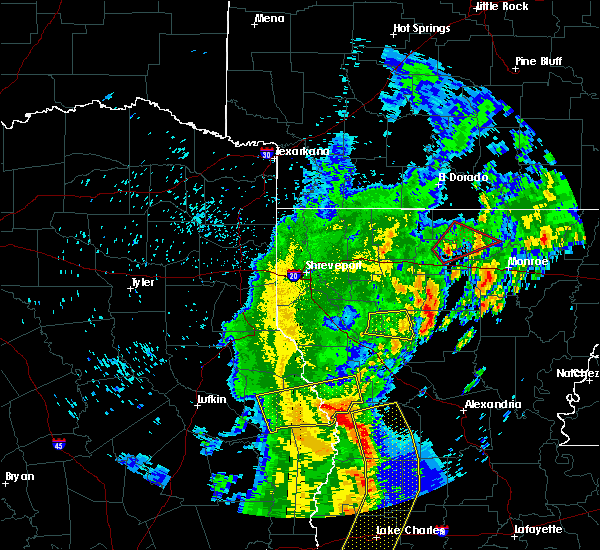 The tornado warning for central union and northeastern lincoln parishes will expire at 745 am cdt, the tornadic thunderstorm which prompted the warning has weakened, therefore the warning will be allowed to expire. The tornado warning for central union and northeastern lincoln parishes will expire at 745 am cdt, the tornadic thunderstorm which prompted the warning has weakened, therefore the warning will be allowed to expire.
|
| 4/27/2016 7:30 AM CDT |
 At 729 am cdt, a severe thunderstorm capable of producing a tornado was located 10 miles south of farmerville, or 13 miles northwest of claiborne, moving northeast at 55 mph (radar indicated rotation). Hazards include tornado and quarter size hail. Flying debris will be dangerous to those caught without shelter. mobile homes will be damaged or destroyed. damage to roofs, windows, and vehicles will occur. tree damage is likely. This tornadic thunderstorm will remain over mainly rural areas of central union and northeastern lincoln parishes, including the following locations: bayou d arbonne lake, unionville, d arbonne, dubach, shiloh, vienna and downsville. At 729 am cdt, a severe thunderstorm capable of producing a tornado was located 10 miles south of farmerville, or 13 miles northwest of claiborne, moving northeast at 55 mph (radar indicated rotation). Hazards include tornado and quarter size hail. Flying debris will be dangerous to those caught without shelter. mobile homes will be damaged or destroyed. damage to roofs, windows, and vehicles will occur. tree damage is likely. This tornadic thunderstorm will remain over mainly rural areas of central union and northeastern lincoln parishes, including the following locations: bayou d arbonne lake, unionville, d arbonne, dubach, shiloh, vienna and downsville.
|
| 4/27/2016 7:08 AM CDT |
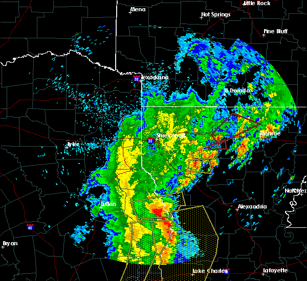 At 707 am cdt, a severe thunderstorm capable of producing a tornado was located near grambling, moving northeast at 55 mph (radar indicated rotation). Hazards include tornado and quarter size hail. Flying debris will be dangerous to those caught without shelter. mobile homes will be damaged or destroyed. damage to roofs, windows, and vehicles will occur. tree damage is likely. this dangerous storm will be near, ruston around 715 am cdt. Other locations impacted by this tornadic thunderstorm include spencer, bayou d arbonne lake, unionville, choudrant, d arbonne, mount zion, dubach, rocky branch, shiloh and vienna. At 707 am cdt, a severe thunderstorm capable of producing a tornado was located near grambling, moving northeast at 55 mph (radar indicated rotation). Hazards include tornado and quarter size hail. Flying debris will be dangerous to those caught without shelter. mobile homes will be damaged or destroyed. damage to roofs, windows, and vehicles will occur. tree damage is likely. this dangerous storm will be near, ruston around 715 am cdt. Other locations impacted by this tornadic thunderstorm include spencer, bayou d arbonne lake, unionville, choudrant, d arbonne, mount zion, dubach, rocky branch, shiloh and vienna.
|
| 4/14/2016 7:18 AM CDT |
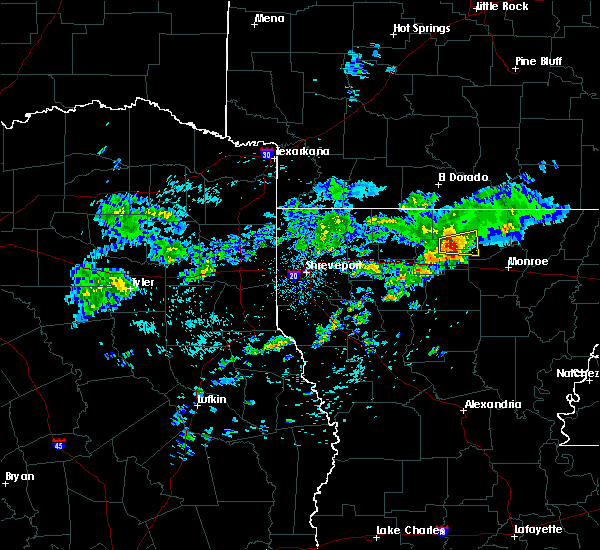 At 718 am cdt, a severe thunderstorm was located 10 miles southwest of farmerville, or 12 miles northeast of ruston, moving east at 20 mph. this storm has weakened but may reintensify in the next few minutes. thus, the severe thunderstorm warning will remain in effect until 730 am (radar indicated). Hazards include quarter size hail. Damage to vehicles is expected. Locations impacted include, farmerville, dubach, downsville, unionville, bayou d arbonne lake, d arbonne and shiloh. At 718 am cdt, a severe thunderstorm was located 10 miles southwest of farmerville, or 12 miles northeast of ruston, moving east at 20 mph. this storm has weakened but may reintensify in the next few minutes. thus, the severe thunderstorm warning will remain in effect until 730 am (radar indicated). Hazards include quarter size hail. Damage to vehicles is expected. Locations impacted include, farmerville, dubach, downsville, unionville, bayou d arbonne lake, d arbonne and shiloh.
|
| 4/14/2016 7:05 AM CDT | Sheriff reports tree down on a powerline along hwy 151 near intersection of la hwy 82 in lincoln county LA, 3.3 miles WSW of Dubach, LA |
| 4/14/2016 6:47 AM CDT |
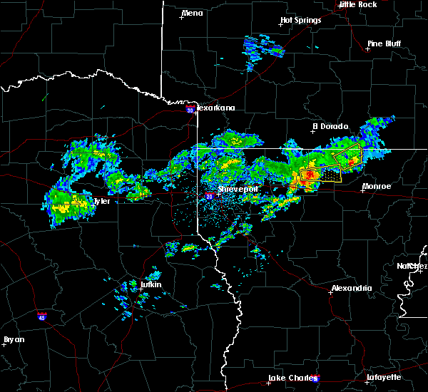 At 647 am cdt, a severe thunderstorm was located 7 miles west of dubach, or 11 miles north of grambling, moving east at 30 mph (radar indicated). Hazards include half dollar size hail. damage to vehicles is expected At 647 am cdt, a severe thunderstorm was located 7 miles west of dubach, or 11 miles north of grambling, moving east at 30 mph (radar indicated). Hazards include half dollar size hail. damage to vehicles is expected
|
| 4/11/2016 5:35 PM CDT |
 At 534 pm cdt, a severe thunderstorm was located 10 miles southeast of bernice, or 11 miles north of ruston, moving northeast at 50 mph (radar indicated). Hazards include 60 mph wind gusts and quarter size hail. Hail damage to vehicles is expected. Expect wind damage to roofs, siding, and trees. At 534 pm cdt, a severe thunderstorm was located 10 miles southeast of bernice, or 11 miles north of ruston, moving northeast at 50 mph (radar indicated). Hazards include 60 mph wind gusts and quarter size hail. Hail damage to vehicles is expected. Expect wind damage to roofs, siding, and trees.
|
| 3/30/2016 10:19 PM CDT |
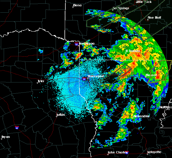 At 1016 pm cdt, a severe thunderstorm was located near vienna, moving northeast at 55 mph (radar indicated). Hazards include 60 mph wind gusts and quarter size hail. Hail damage to vehicles is expected. expect wind damage to roofs, siding, and trees. locations impacted include, ruston, grambling, dubach, simsboro, vienna, unionville, d arbonne, mount zion and shiloh. A tornado watch remains in effect until 500 am cdt for north central louisiana. At 1016 pm cdt, a severe thunderstorm was located near vienna, moving northeast at 55 mph (radar indicated). Hazards include 60 mph wind gusts and quarter size hail. Hail damage to vehicles is expected. expect wind damage to roofs, siding, and trees. locations impacted include, ruston, grambling, dubach, simsboro, vienna, unionville, d arbonne, mount zion and shiloh. A tornado watch remains in effect until 500 am cdt for north central louisiana.
|
| 3/30/2016 9:44 PM CDT |
 At 944 pm cdt, a severe thunderstorm was located near arcadia, or 8 miles west of grambling, moving east at 55 mph (radar indicated). Hazards include 60 mph wind gusts and quarter size hail. Hail damage to vehicles is expected. Expect wind damage to roofs, siding, and trees. At 944 pm cdt, a severe thunderstorm was located near arcadia, or 8 miles west of grambling, moving east at 55 mph (radar indicated). Hazards include 60 mph wind gusts and quarter size hail. Hail damage to vehicles is expected. Expect wind damage to roofs, siding, and trees.
|
| 3/30/2016 8:07 PM CDT |
 At 806 pm cdt, a severe thunderstorm was located over arcadia, or 14 miles west of grambling, moving northeast at 35 mph (radar indicated). Hazards include 60 mph wind gusts and quarter size hail. Hail damage to vehicles is expected. Expect wind damage to roofs, siding, and trees. At 806 pm cdt, a severe thunderstorm was located over arcadia, or 14 miles west of grambling, moving northeast at 35 mph (radar indicated). Hazards include 60 mph wind gusts and quarter size hail. Hail damage to vehicles is expected. Expect wind damage to roofs, siding, and trees.
|
| 3/24/2016 4:19 AM CDT |
 At 416 am cdt, severe thunderstorms were located along a line extending from smackover to near wesson to 11 miles southwest of junction city to near homer to 7 miles northwest of gibsland, moving east at 40 mph (radar indicated). Hazards include 60 mph wind gusts. Expect damage to roofs. siding. and trees. Locations impacted include, el dorado, homer, smackover, norphlet, junction city, bernice, calion, wesson, lawson, urbana, cooley, lisbon, dubach, athens, spearsville, lillie, lockhart, corney lake, lake clairborne and kenova. At 416 am cdt, severe thunderstorms were located along a line extending from smackover to near wesson to 11 miles southwest of junction city to near homer to 7 miles northwest of gibsland, moving east at 40 mph (radar indicated). Hazards include 60 mph wind gusts. Expect damage to roofs. siding. and trees. Locations impacted include, el dorado, homer, smackover, norphlet, junction city, bernice, calion, wesson, lawson, urbana, cooley, lisbon, dubach, athens, spearsville, lillie, lockhart, corney lake, lake clairborne and kenova.
|
| 3/24/2016 3:45 AM CDT |
 At 345 am cdt, severe thunderstorms were located along a line extending from stephens to emerson to near shongaloo to 6 miles northwest of dixie inn, moving east at 40 mph (radar indicated). Hazards include 60 mph wind gusts. Expect damage to roofs. siding. And trees. At 345 am cdt, severe thunderstorms were located along a line extending from stephens to emerson to near shongaloo to 6 miles northwest of dixie inn, moving east at 40 mph (radar indicated). Hazards include 60 mph wind gusts. Expect damage to roofs. siding. And trees.
|
| 3/18/2016 1:40 PM CDT |
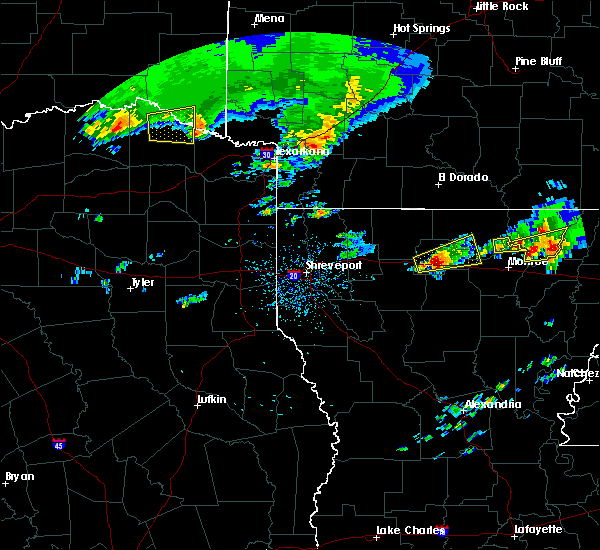 At 140 pm cdt, a severe thunderstorm was located over grambling, moving east at 30 mph (radar indicated). Hazards include two inch hail and 60 mph wind gusts. People and animals outdoors will be injured. expect hail damage to roofs, siding, windows, and vehicles. expect wind damage to roofs, siding, and trees. Locations impacted include, ruston, grambling, farmerville, dubach, choudrant, simsboro, vienna, downsville, bayou d arbonne lake, unionville, d arbonne and eureka. At 140 pm cdt, a severe thunderstorm was located over grambling, moving east at 30 mph (radar indicated). Hazards include two inch hail and 60 mph wind gusts. People and animals outdoors will be injured. expect hail damage to roofs, siding, windows, and vehicles. expect wind damage to roofs, siding, and trees. Locations impacted include, ruston, grambling, farmerville, dubach, choudrant, simsboro, vienna, downsville, bayou d arbonne lake, unionville, d arbonne and eureka.
|
| 3/18/2016 1:20 PM CDT |
 At 119 pm cdt, a severe thunderstorm was located near grambling, moving east at 30 mph (radar indicated). Hazards include 60 mph wind gusts and quarter size hail. Hail damage to vehicles is expected. Expect wind damage to roofs, siding, and trees. At 119 pm cdt, a severe thunderstorm was located near grambling, moving east at 30 mph (radar indicated). Hazards include 60 mph wind gusts and quarter size hail. Hail damage to vehicles is expected. Expect wind damage to roofs, siding, and trees.
|
| 3/12/2016 2:20 PM CST |
 At 219 pm cst, a severe thunderstorm was located 15 miles west of jonesboro, moving northeast at 35 mph (radar indicated). Hazards include 60 mph wind gusts. Expect damage to roofs. siding. And trees. At 219 pm cst, a severe thunderstorm was located 15 miles west of jonesboro, moving northeast at 35 mph (radar indicated). Hazards include 60 mph wind gusts. Expect damage to roofs. siding. And trees.
|
| 3/8/2016 11:10 PM CST |
 At 1110 pm cst, a severe thunderstorm capable of producing a tornado was located near arcadia, or 11 miles southwest of grambling, moving northeast at 35 mph (radar indicated rotation). Hazards include tornado. Flying debris will be dangerous to those caught without shelter. mobile homes will be damaged or destroyed. damage to roofs, windows, and vehicles will occur. tree damage is likely. this dangerous storm will be near, arcadia around 1115 pm cst. grambling around 1130 pm cst. ruston around 1135 pm cst. Other locations impacted by this tornadic thunderstorm include choudrant, d arbonne, mount zion, mount lebanon, simsboro, unionville, bienville, bryceland, quitman and dubach. At 1110 pm cst, a severe thunderstorm capable of producing a tornado was located near arcadia, or 11 miles southwest of grambling, moving northeast at 35 mph (radar indicated rotation). Hazards include tornado. Flying debris will be dangerous to those caught without shelter. mobile homes will be damaged or destroyed. damage to roofs, windows, and vehicles will occur. tree damage is likely. this dangerous storm will be near, arcadia around 1115 pm cst. grambling around 1130 pm cst. ruston around 1135 pm cst. Other locations impacted by this tornadic thunderstorm include choudrant, d arbonne, mount zion, mount lebanon, simsboro, unionville, bienville, bryceland, quitman and dubach.
|
| 12/28/2015 1:00 AM CST |
 At 1229 am cst, severe thunderstorms were located along a line extending from near grambling to 7 miles northeast of colfax, moving northeast at 50 mph (radar indicated). Hazards include 60 mph wind gusts. Expect damage to roofs. siding. And trees. At 1229 am cst, severe thunderstorms were located along a line extending from near grambling to 7 miles northeast of colfax, moving northeast at 50 mph (radar indicated). Hazards include 60 mph wind gusts. Expect damage to roofs. siding. And trees.
|
| 12/28/2015 1:00 AM CST |
 A severe thunderstorm warning remains in effect until 130 am cst for southern unionunion union. jackson. western caldwell. union. northern la salle. eastern lincoln. northeastern claiborne. southwestern ouachita. eastern winn and northeastern grant parishes. at 1257 am cst. Severe thunderstorms were located along a line. A severe thunderstorm warning remains in effect until 130 am cst for southern unionunion union. jackson. western caldwell. union. northern la salle. eastern lincoln. northeastern claiborne. southwestern ouachita. eastern winn and northeastern grant parishes. at 1257 am cst. Severe thunderstorms were located along a line.
|
| 12/28/2015 12:29 AM CST |
 At 1229 am cst, severe thunderstorms were located along a line extending from near grambling to 7 miles northeast of colfax, moving northeast at 50 mph (radar indicated). Hazards include 60 mph wind gusts. Expect damage to roofs. siding. And trees. At 1229 am cst, severe thunderstorms were located along a line extending from near grambling to 7 miles northeast of colfax, moving northeast at 50 mph (radar indicated). Hazards include 60 mph wind gusts. Expect damage to roofs. siding. And trees.
|
| 12/13/2015 11:37 AM CST |
 At 1137 am cst, showers containing strong winds were located along a line extending from norphlet to 6 miles north of cooley to near ruston to near jonesboro to near winnfield, moving east at 30 mph (radar indicated). Hazards include 60 mph wind gusts. Expect damage to roofs. siding. and trees. Locations impacted include, ruston, el dorado, grambling, winnfield, jonesboro, smackover, norphlet, junction city, farmerville, bernice, calion, lawson, urbana, cooley, dubach, choudrant, simsboro, chatham, hodge and north hodge. At 1137 am cst, showers containing strong winds were located along a line extending from norphlet to 6 miles north of cooley to near ruston to near jonesboro to near winnfield, moving east at 30 mph (radar indicated). Hazards include 60 mph wind gusts. Expect damage to roofs. siding. and trees. Locations impacted include, ruston, el dorado, grambling, winnfield, jonesboro, smackover, norphlet, junction city, farmerville, bernice, calion, lawson, urbana, cooley, dubach, choudrant, simsboro, chatham, hodge and north hodge.
|
| 12/13/2015 11:00 AM CST |
 At 1059 am cst, showers containing strong winds were located along a line extending from mount holly to near arcadia to 9 miles east of campti, moving east at 30 mph. these storms have produced widespread wind damage across northwest louisiana, with a 65 mph wind gust measured in gibsland louisiana in bienville parish (radar indicated). Hazards include 60 mph wind gusts. Expect damage to roofs. siding. And trees. At 1059 am cst, showers containing strong winds were located along a line extending from mount holly to near arcadia to 9 miles east of campti, moving east at 30 mph. these storms have produced widespread wind damage across northwest louisiana, with a 65 mph wind gust measured in gibsland louisiana in bienville parish (radar indicated). Hazards include 60 mph wind gusts. Expect damage to roofs. siding. And trees.
|
| 11/17/2015 2:00 PM CST | Tree down on rock corner road in lincoln county LA, 0.4 miles N of Dubach, LA |
| 11/17/2015 1:25 PM CST | Tree down hwy 151 at kings gen road in lincoln county LA, 7.3 miles ENE of Dubach, LA |
| 11/17/2015 1:15 PM CST |
 At 115 pm cst, severe thunderstorms were located along a line extending from norphlet to junction city to 8 miles north of arcadia to 11 miles south of gibsland, moving east at 30 mph (radar indicated). Hazards include 60 mph wind gusts. Expect damage to roofs, siding, and trees. A tornado watch remains in effect until 400 pm cst for south central arkansas and northwestern louisiana. At 115 pm cst, severe thunderstorms were located along a line extending from norphlet to junction city to 8 miles north of arcadia to 11 miles south of gibsland, moving east at 30 mph (radar indicated). Hazards include 60 mph wind gusts. Expect damage to roofs, siding, and trees. A tornado watch remains in effect until 400 pm cst for south central arkansas and northwestern louisiana.
|
| 11/17/2015 12:42 PM CST |
 At 1241 pm cst, severe thunderstorms were located along a line extending from near lisbon to 8 miles west of junction city to 7 miles north of gibsland to 8 miles east of ringgold, moving east at 30 mph (radar indicated). Hazards include 60 mph wind gusts. Expect damage to roofs, siding, and trees. A tornado watch remains in effect until 400 pm cst for south central arkansas and northwestern louisiana. At 1241 pm cst, severe thunderstorms were located along a line extending from near lisbon to 8 miles west of junction city to 7 miles north of gibsland to 8 miles east of ringgold, moving east at 30 mph (radar indicated). Hazards include 60 mph wind gusts. Expect damage to roofs, siding, and trees. A tornado watch remains in effect until 400 pm cst for south central arkansas and northwestern louisiana.
|
| 6/17/2015 3:38 PM CDT |
 At 338 pm cdt, a severe thunderstorm was located 8 miles west of bernice, or 14 miles east of homer, moving north at 35 mph (radar indicated). Hazards include 60 mph wind gusts. Expect damage to roofs. Siding and trees. At 338 pm cdt, a severe thunderstorm was located 8 miles west of bernice, or 14 miles east of homer, moving north at 35 mph (radar indicated). Hazards include 60 mph wind gusts. Expect damage to roofs. Siding and trees.
|
| 5/25/2015 9:52 PM CDT | At 952 pm cdt, severe thunderstorms were located along a line extending from 12 miles southwest of huttig to near farmerville to 6 miles southeast of ruston to near jonesboro to 7 miles northwest of winnfield, moving east at 65 mph (radar indicated). Hazards include 60 mph wind gusts and quarter size hail. Hail damage to vehicles is expected. expect wind damage to roofs, siding and trees. locations impacted include, monroe, ruston, claiborne, west monroe, grambling, winnfield, jonesboro, brownsville-bawcomville, brownsville-bawcom, farmerville, richwood, bernice, sterlington, cooley, dubach, choudrant, simsboro, marion, chatham and hodge. A tornado watch remains in effect until 200 am cdt for northwestern louisiana. |
| 5/25/2015 9:22 PM CDT | At 922 pm cdt, severe thunderstorms were located along a line extending from near junction city to 9 miles southwest of bernice to arcadia to 14 miles south of gibsland to 13 miles north of campti, moving east at 50 mph (radar indicated). Hazards include 60 mph wind gusts and quarter size hail. Hail damage to vehicles is expected. Expect wind damage to roofs, siding and trees. |
| 5/24/2015 2:03 PM CDT | At 203 pm cdt, severe thunderstorms were located along a line extending from 6 miles east of atlanta to 7 miles northwest of bernice to 10 miles north of grambling, moving northeast at 35 mph (radar indicated). Hazards include 60 mph wind gusts. Expect damage to roofs. siding and trees. Locations impacted include, bernice, cooley, dubach, junction city, lisbon, spearsville, lillie, mount zion, shiloh, corney lake, corinth, taylorville, summerfield and unionville. |
| 5/24/2015 1:47 PM CDT | At 146 pm cdt, severe thunderstorms were located along a line extending from 6 miles southeast of haynesville to 11 miles west of bernice to near grambling, moving northeast at 40 mph (radar indicated). Hazards include 60 mph wind gusts. Expect damage to roofs. siding and trees. Locations impacted include, bernice, cooley, dubach, simsboro, junction city, lisbon, spearsville, lillie, mount zion, shiloh, corney lake, unionville, corinth, taylorville, antioch, summerfield and aycock. |
| 5/24/2015 1:36 PM CDT | At 135 pm cdt, severe thunderstorms were located along a line extending from near homer to 8 miles north of arcadia to 7 miles southwest of grambling, moving northeast at 35 mph (radar indicated). Hazards include 60 mph wind gusts. Expect damage to roofs. Siding and trees. |
| 4/24/2015 10:52 PM CDT | At 1052 pm cdt, a severe thunderstorm was located near junction city, moving east at 50 mph (radar indicated). Hazards include 70 mph wind gusts and quarter size hail. Hail damage to vehicles is expected. expect considerable tree damage. Wind damage is also likely to mobile homes, roofs and outbuildings. |
| 4/24/2015 10:52 PM CDT | At 1052 pm cdt, a severe thunderstorm was located near junction city, moving east at 50 mph (radar indicated). Hazards include 70 mph wind gusts and quarter size hail. Hail damage to vehicles is expected. expect considerable tree damage. Wind damage is also likely to mobile homes, roofs and outbuildings. |
| 4/4/2014 2:15 AM CDT | A few trees down on mays crossing in lincoln county LA, 0.4 miles N of Dubach, LA |
| 3/28/2014 9:25 PM CDT | Quarter sized hail reported 2.3 miles W of Dubach, LA |
| 3/28/2014 7:10 PM CDT | Quarter sized hail reported 2.3 miles W of Dubach, LA, in fellowship community |
| 12/21/2013 1:50 PM CST | Several trees down in lincoln county LA, 2.3 miles W of Dubach, LA |
| 6/1/2013 8:45 PM CDT | Tree down 2 miles se of town in lincoln county LA, 2.4 miles NW of Dubach, LA |
| 6/1/2013 8:42 PM CDT | Tree down 1w of town in lincoln county LA, 0.7 miles ENE of Dubach, LA |
| 1/29/2013 7:45 PM CST | A few trees dow in lincoln county LA, 0.4 miles N of Dubach, LA |
| 4/5/2012 1:40 AM CDT | Quarter sized hail reported 0.4 miles N of Dubach, LA |
| 3/2/2012 2:45 PM CST | Golf Ball sized hail reported 4.5 miles N of Dubach, LA, golf ball sized hail coming down in sheets |
| 3/2/2012 2:35 PM CST | Quarter sized hail reported 7 miles NE of Dubach, LA, quarter sized hail near the intersection of hwy 151 and 146 |
| 3/2/2012 1:40 PM CST | Half Dollar sized hail reported 3.9 miles SE of Dubach, LA, half dollar sized hail reported near hico |
| 1/1/0001 12:00 AM | Trees down on hwy 15 in lincoln county LA, 4.7 miles SE of Dubach, LA |
| 1/1/0001 12:00 AM | Power lines down on flowers road and large trees down on airline road and holder road in d in lincoln county LA, 0.4 miles N of Dubach, LA |
| 1/1/0001 12:00 AM | Trees down blocking highway 151 in lincoln county LA, 4.8 miles ENE of Dubach, LA |
Hail Maps for Dubach, LA


Connect with Interactive Hail Maps