

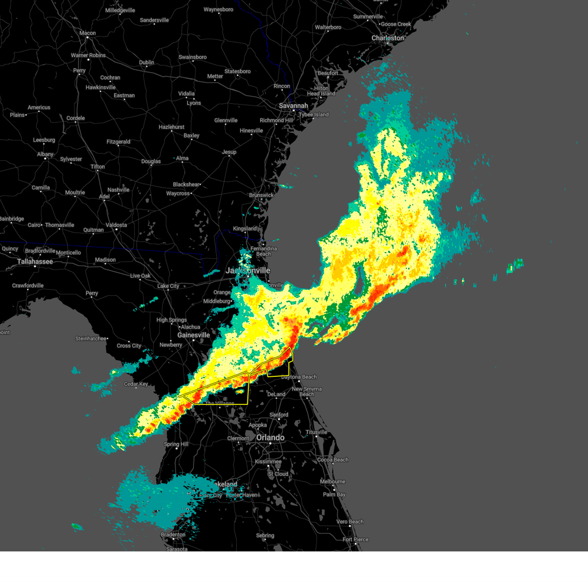
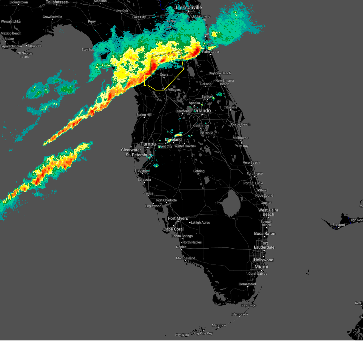
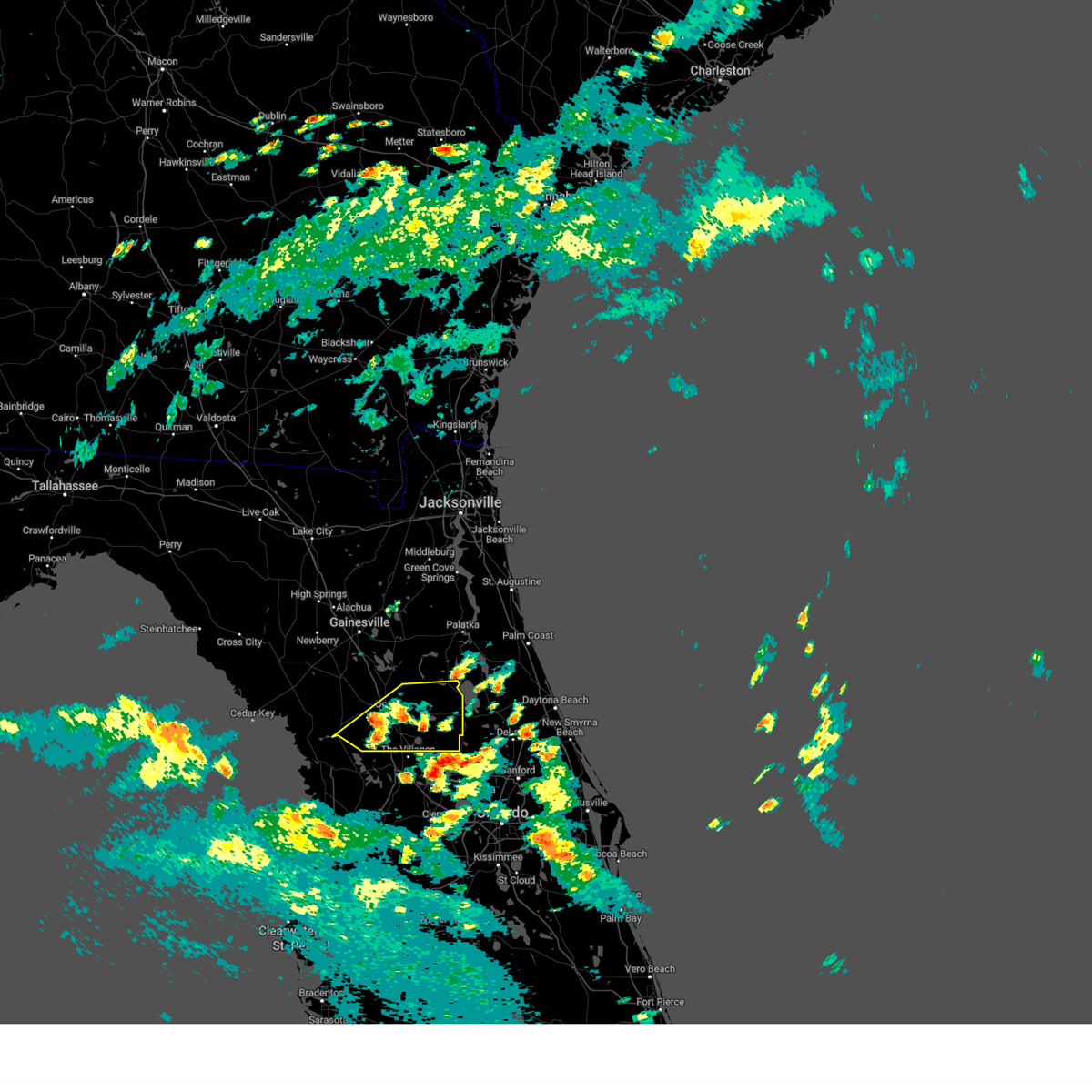
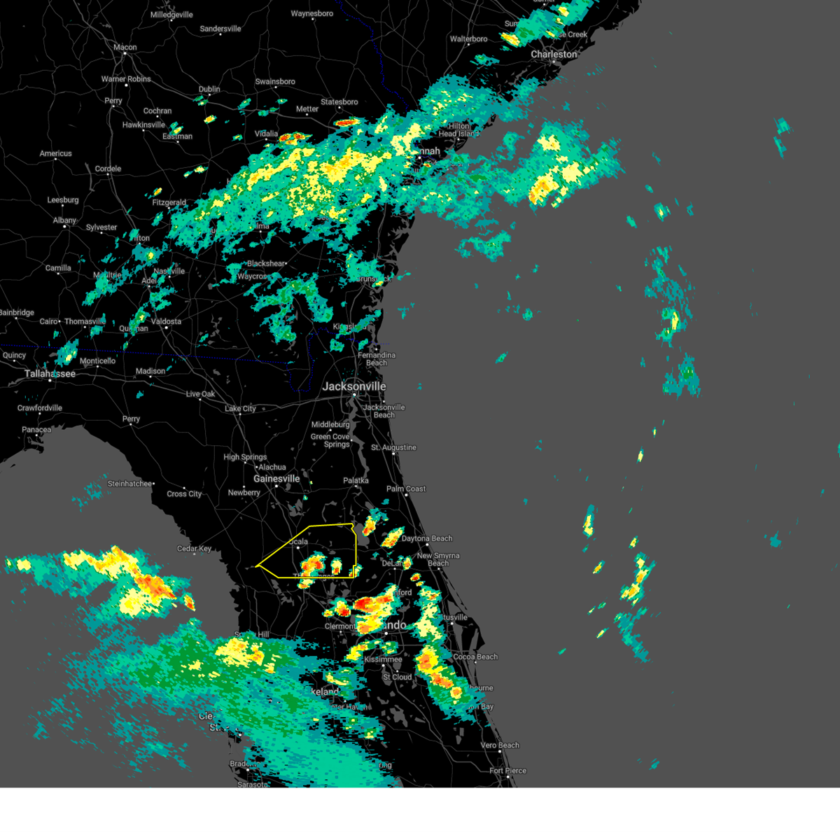
Hail Map for Dunnellon, FL
The Dunnellon, FL area has had 2 reports of on-the-ground hail by trained spotters, and has been under severe weather warnings 14 times during the past 12 months. Doppler radar has detected hail at or near Dunnellon, FL on 53 occasions, including 2 occasions during the past year.
| Name: | Dunnellon, FL |
| Where Located: | 73.8 miles WNW of Orlando, FL |
| Map: | Google Map for Dunnellon, FL |
| Population: | 1733 |
| Housing Units: | 1164 |
| More Info: | Search Google for Dunnellon, FL |
2
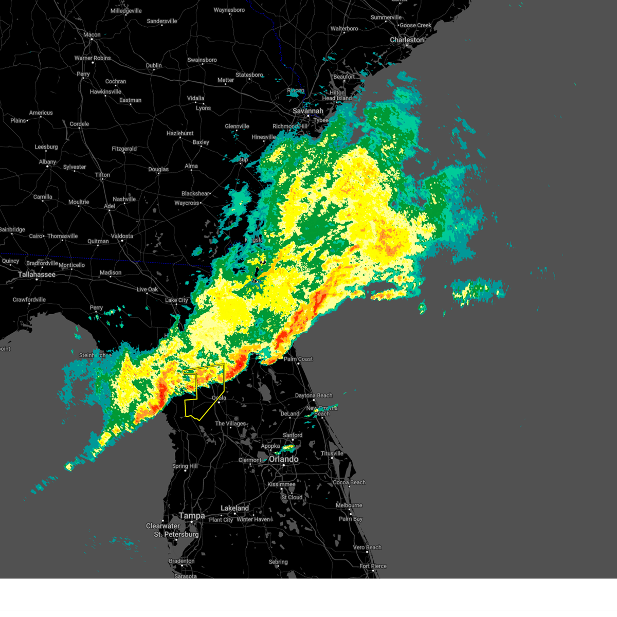
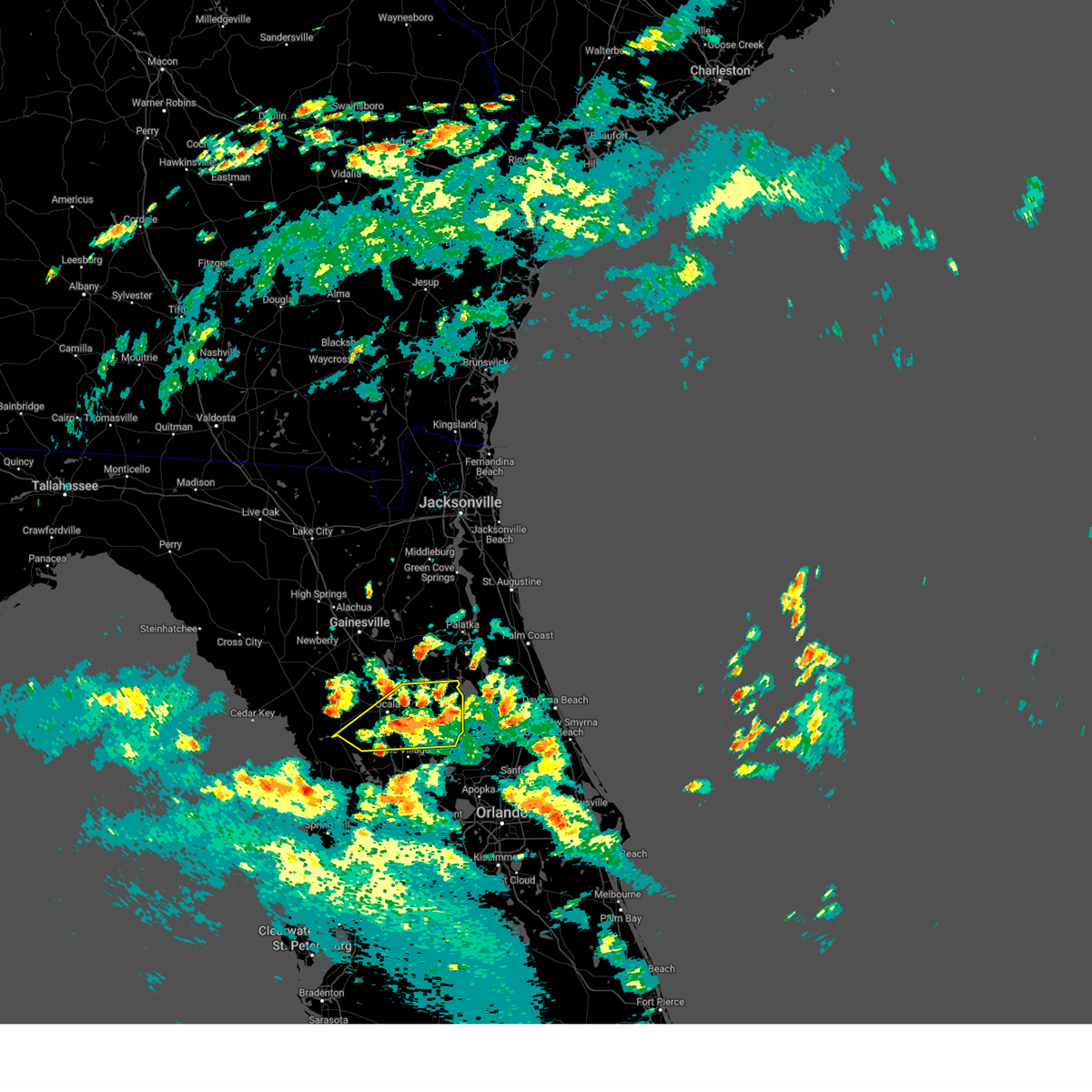
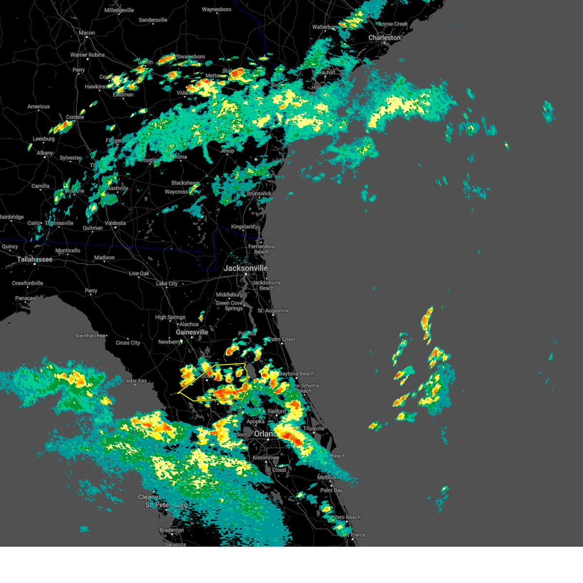
The Top Recent Hail Date for Dunnellon, FL is Friday, June 20, 2025 (4th out of 53)

Hail and Wind Damage Spotted near Dunnellon, FL
| Date / Time | Report Details |
|---|---|
| 6/20/2025 6:55 PM EDT |
 The storm which prompted the warning has weakened below severe limits, and no longer poses an immediate threat to life or property. therefore, the warning will be allowed to expire. however, gusty winds and heavy rain are still possible with this thunderstorm. The storm which prompted the warning has weakened below severe limits, and no longer poses an immediate threat to life or property. therefore, the warning will be allowed to expire. however, gusty winds and heavy rain are still possible with this thunderstorm.
|
| 6/20/2025 6:39 PM EDT |
 At 639 pm edt, a severe thunderstorm was located near rainbow lakes estates, moving north at 10 mph (radar indicated). Hazards include 60 mph wind gusts and penny size hail. Expect damage to roofs, siding, and trees. Locations impacted include, rainbow lakes estates and romeo. At 639 pm edt, a severe thunderstorm was located near rainbow lakes estates, moving north at 10 mph (radar indicated). Hazards include 60 mph wind gusts and penny size hail. Expect damage to roofs, siding, and trees. Locations impacted include, rainbow lakes estates and romeo.
|
| 6/20/2025 6:16 PM EDT |
 Svrjax the national weather service in jacksonville has issued a * severe thunderstorm warning for, southwestern marion county in northern florida, * until 700 pm edt. * at 615 pm edt, a severe thunderstorm was located over rainbow lakes estates, moving north at 10 mph (radar indicated). Hazards include 60 mph wind gusts and penny size hail. expect damage to roofs, siding, and trees Svrjax the national weather service in jacksonville has issued a * severe thunderstorm warning for, southwestern marion county in northern florida, * until 700 pm edt. * at 615 pm edt, a severe thunderstorm was located over rainbow lakes estates, moving north at 10 mph (radar indicated). Hazards include 60 mph wind gusts and penny size hail. expect damage to roofs, siding, and trees
|
| 1/19/2025 8:26 AM EST |
 The storms which prompted the warning have weakened below severe limits, and no longer pose an immediate threat to life or property. therefore, the warning will be allowed to expire. however, gusty winds are still possible with these thunderstorms. The storms which prompted the warning have weakened below severe limits, and no longer pose an immediate threat to life or property. therefore, the warning will be allowed to expire. however, gusty winds are still possible with these thunderstorms.
|
| 1/19/2025 8:15 AM EST |
 Svrjax the national weather service in jacksonville has issued a * severe thunderstorm warning for, southern flagler county in northeastern florida, southern marion county in northern florida, * until 845 am est. * at 814 am est, severe thunderstorms were located along a line extending from 9 miles east of marineland to 7 miles southwest of flagler beach to 7 miles south of lake george to homosassa springs, moving east at 50 mph (radar indicated). Hazards include 60 mph wind gusts and penny size hail. expect damage to roofs, siding, and trees Svrjax the national weather service in jacksonville has issued a * severe thunderstorm warning for, southern flagler county in northeastern florida, southern marion county in northern florida, * until 845 am est. * at 814 am est, severe thunderstorms were located along a line extending from 9 miles east of marineland to 7 miles southwest of flagler beach to 7 miles south of lake george to homosassa springs, moving east at 50 mph (radar indicated). Hazards include 60 mph wind gusts and penny size hail. expect damage to roofs, siding, and trees
|
| 1/19/2025 8:00 AM EST |
 At 800 am est, severe thunderstorms were located along a line extending from 6 miles southwest of rainbow lakes estates to black diamond to 13 miles northwest of pine island, moving east at 40 mph (radar indicated). Hazards include 60 mph wind gusts. Expect damage to roofs, siding, and trees. Locations impacted include, hernando, sugarmill woods, inverness, wildwood, lake panasoffkee, arbor lakes, lecanto, homosassa springs, leisure acres, and inverness highlands. At 800 am est, severe thunderstorms were located along a line extending from 6 miles southwest of rainbow lakes estates to black diamond to 13 miles northwest of pine island, moving east at 40 mph (radar indicated). Hazards include 60 mph wind gusts. Expect damage to roofs, siding, and trees. Locations impacted include, hernando, sugarmill woods, inverness, wildwood, lake panasoffkee, arbor lakes, lecanto, homosassa springs, leisure acres, and inverness highlands.
|
| 1/19/2025 7:38 AM EST |
 Svrtbw the national weather service in ruskin has issued a * severe thunderstorm warning for, citrus county in west central florida, northwestern sumter county in central florida, * until 830 am est. * at 738 am est, severe thunderstorms were located along a line extending from 14 miles northwest of crystal river airport to 11 miles west of homosassa to 28 miles west of pine island, moving east at 50 mph (radar indicated). Hazards include 60 mph wind gusts. expect damage to roofs, siding, and trees Svrtbw the national weather service in ruskin has issued a * severe thunderstorm warning for, citrus county in west central florida, northwestern sumter county in central florida, * until 830 am est. * at 738 am est, severe thunderstorms were located along a line extending from 14 miles northwest of crystal river airport to 11 miles west of homosassa to 28 miles west of pine island, moving east at 50 mph (radar indicated). Hazards include 60 mph wind gusts. expect damage to roofs, siding, and trees
|
| 1/19/2025 7:26 AM EST |
 At 726 am est, severe thunderstorms were located along a line extending from near hawthorne to near fort mccoy to near ocala to near rainbow lakes estates, moving east at 65 mph (radar indicated). Hazards include 70 mph wind gusts and quarter size hail. Hail damage to vehicles is expected. expect considerable tree damage. wind damage is also likely to mobile homes, roofs, and outbuildings. Locations impacted include, ocala, rainbow lakes estates, interlachen, fort mccoy, citra, lynne, lake delancy, sparr, anthony, and silver springs shores. At 726 am est, severe thunderstorms were located along a line extending from near hawthorne to near fort mccoy to near ocala to near rainbow lakes estates, moving east at 65 mph (radar indicated). Hazards include 70 mph wind gusts and quarter size hail. Hail damage to vehicles is expected. expect considerable tree damage. wind damage is also likely to mobile homes, roofs, and outbuildings. Locations impacted include, ocala, rainbow lakes estates, interlachen, fort mccoy, citra, lynne, lake delancy, sparr, anthony, and silver springs shores.
|
| 1/19/2025 7:15 AM EST |
 Svrjax the national weather service in jacksonville has issued a * severe thunderstorm warning for, southeastern alachua county in northern florida, marion county in northern florida, southwestern putnam county in northeastern florida, * until 745 am est. * at 715 am est, severe thunderstorms were located along a line extending from near rochelle to near citra to near rainbow lakes estates, moving east at 65 mph (radar indicated). Hazards include 70 mph wind gusts and quarter size hail. Hail damage to vehicles is expected. expect considerable tree damage. Wind damage is also likely to mobile homes, roofs, and outbuildings. Svrjax the national weather service in jacksonville has issued a * severe thunderstorm warning for, southeastern alachua county in northern florida, marion county in northern florida, southwestern putnam county in northeastern florida, * until 745 am est. * at 715 am est, severe thunderstorms were located along a line extending from near rochelle to near citra to near rainbow lakes estates, moving east at 65 mph (radar indicated). Hazards include 70 mph wind gusts and quarter size hail. Hail damage to vehicles is expected. expect considerable tree damage. Wind damage is also likely to mobile homes, roofs, and outbuildings.
|
| 1/19/2025 6:55 AM EST |
 Svrjax the national weather service in jacksonville has issued a * severe thunderstorm warning for, southern alachua county in northern florida, western marion county in northern florida, * until 730 am est. * at 655 am est, severe thunderstorms were located along a line extending from near bronson to near williston highlands to 18 miles northwest of crystal river airport, moving east at 65 mph (radar indicated). Hazards include 60 mph wind gusts. expect damage to roofs, siding, and trees Svrjax the national weather service in jacksonville has issued a * severe thunderstorm warning for, southern alachua county in northern florida, western marion county in northern florida, * until 730 am est. * at 655 am est, severe thunderstorms were located along a line extending from near bronson to near williston highlands to 18 miles northwest of crystal river airport, moving east at 65 mph (radar indicated). Hazards include 60 mph wind gusts. expect damage to roofs, siding, and trees
|
| 8/4/2024 1:38 PM EDT |
 The storms which prompted the warning have weakened below severe limits, and no longer pose an immediate threat to life or property. therefore, the warning will be allowed to expire. however, gusty winds and heavy rain are still possible with these thunderstorms. a tornado watch remains in effect until 800 pm edt for northern and northeastern florida. The storms which prompted the warning have weakened below severe limits, and no longer pose an immediate threat to life or property. therefore, the warning will be allowed to expire. however, gusty winds and heavy rain are still possible with these thunderstorms. a tornado watch remains in effect until 800 pm edt for northern and northeastern florida.
|
| 8/4/2024 1:28 PM EDT |
 At 128 pm edt, severe thunderstorms were located along a line extending from near juniper springs to near lake weir, moving northwest at 40 mph (radar indicated). Hazards include 60 mph wind gusts. Expect damage to roofs, siding, and trees. Locations impacted include, ocala, salt springs, juniper springs, lynne, weirsdale, anthony, ocklawaha, moss bluff, silver springs shores, and lake weir. At 128 pm edt, severe thunderstorms were located along a line extending from near juniper springs to near lake weir, moving northwest at 40 mph (radar indicated). Hazards include 60 mph wind gusts. Expect damage to roofs, siding, and trees. Locations impacted include, ocala, salt springs, juniper springs, lynne, weirsdale, anthony, ocklawaha, moss bluff, silver springs shores, and lake weir.
|
| 8/4/2024 1:07 PM EDT |
 At 107 pm edt, severe thunderstorms were located along a line extending from near pittman to leesburg, moving northwest at 40 mph (radar indicated). Hazards include 60 mph wind gusts. Expect damage to roofs, siding, and trees. Locations impacted include, ocala, salt springs, juniper springs, lynne, weirsdale, anthony, the village of briar meadow, ocklawaha, moss bluff, and silver springs shores. At 107 pm edt, severe thunderstorms were located along a line extending from near pittman to leesburg, moving northwest at 40 mph (radar indicated). Hazards include 60 mph wind gusts. Expect damage to roofs, siding, and trees. Locations impacted include, ocala, salt springs, juniper springs, lynne, weirsdale, anthony, the village of briar meadow, ocklawaha, moss bluff, and silver springs shores.
|
| 8/4/2024 12:53 PM EDT |
 Svrjax the national weather service in jacksonville has issued a * severe thunderstorm warning for, marion county in northern florida, * until 145 pm edt. * at 1252 pm edt, severe thunderstorms were located along a line extending from near mount plymouth to near howey-in-the-hills, moving northwest at 35 mph (radar indicated). Hazards include 60 mph wind gusts. expect damage to roofs, siding, and trees Svrjax the national weather service in jacksonville has issued a * severe thunderstorm warning for, marion county in northern florida, * until 145 pm edt. * at 1252 pm edt, severe thunderstorms were located along a line extending from near mount plymouth to near howey-in-the-hills, moving northwest at 35 mph (radar indicated). Hazards include 60 mph wind gusts. expect damage to roofs, siding, and trees
|
| 5/10/2024 9:59 AM EDT |
 The storms which prompted the warning have moved out of the area. therefore, the warning will be allowed to expire. however, heavy rain is still possible with these thunderstorms. a severe thunderstorm watch remains in effect until noon edt for northern and northeastern florida, and southeastern georgia. The storms which prompted the warning have moved out of the area. therefore, the warning will be allowed to expire. however, heavy rain is still possible with these thunderstorms. a severe thunderstorm watch remains in effect until noon edt for northern and northeastern florida, and southeastern georgia.
|
| 5/10/2024 9:25 AM EDT |
 Svrjax the national weather service in jacksonville has issued a * severe thunderstorm warning for, nassau county in northeastern florida, southeastern alachua county in northern florida, st. johns county in northeastern florida, central marion county in northern florida, putnam county in northeastern florida, clay county in northeastern florida, duval county in northeastern florida, camden county in southeastern georgia, northeastern charlton county in southeastern georgia, * until 1000 am edt. * at 925 am edt, severe thunderstorms were located along a line extending from near kings ferry to near florahome to near williston municipal airport, moving east at 60 mph (radar indicated). Hazards include 60 mph wind gusts and penny size hail. expect damage to roofs, siding, and trees Svrjax the national weather service in jacksonville has issued a * severe thunderstorm warning for, nassau county in northeastern florida, southeastern alachua county in northern florida, st. johns county in northeastern florida, central marion county in northern florida, putnam county in northeastern florida, clay county in northeastern florida, duval county in northeastern florida, camden county in southeastern georgia, northeastern charlton county in southeastern georgia, * until 1000 am edt. * at 925 am edt, severe thunderstorms were located along a line extending from near kings ferry to near florahome to near williston municipal airport, moving east at 60 mph (radar indicated). Hazards include 60 mph wind gusts and penny size hail. expect damage to roofs, siding, and trees
|
| 4/11/2024 11:34 AM EDT |
 Svrjax the national weather service in jacksonville has issued a * severe thunderstorm warning for, southern marion county in northern florida, * until noon edt. * at 1134 am edt, a severe thunderstorm was located 11 miles south of ocala airport, or 12 miles northeast of inverness, moving northeast at 60 mph (radar indicated). Hazards include 70 mph wind gusts. Expect considerable tree damage. Damage is likely to mobile homes, roofs, and outbuildings. Svrjax the national weather service in jacksonville has issued a * severe thunderstorm warning for, southern marion county in northern florida, * until noon edt. * at 1134 am edt, a severe thunderstorm was located 11 miles south of ocala airport, or 12 miles northeast of inverness, moving northeast at 60 mph (radar indicated). Hazards include 70 mph wind gusts. Expect considerable tree damage. Damage is likely to mobile homes, roofs, and outbuildings.
|
| 4/11/2024 11:29 AM EDT |
 Svrtbw the national weather service in ruskin has issued a * severe thunderstorm warning for, citrus county in west central florida, northern sumter county in central florida, northern hernando county in west central florida, southeastern levy county in northern florida, * until noon edt. * at 1129 am edt, severe thunderstorms were located along a line extending from 7 miles northwest of crystal river airport to black diamond to near inverness highlands north, moving northeast at 50 mph (radar indicated). Hazards include 60 mph wind gusts. expect damage to roofs, siding, and trees Svrtbw the national weather service in ruskin has issued a * severe thunderstorm warning for, citrus county in west central florida, northern sumter county in central florida, northern hernando county in west central florida, southeastern levy county in northern florida, * until noon edt. * at 1129 am edt, severe thunderstorms were located along a line extending from 7 miles northwest of crystal river airport to black diamond to near inverness highlands north, moving northeast at 50 mph (radar indicated). Hazards include 60 mph wind gusts. expect damage to roofs, siding, and trees
|
| 4/11/2024 11:01 AM EDT |
 Svrtbw the national weather service in ruskin has issued a * severe thunderstorm warning for, citrus county in west central florida, northwestern hernando county in west central florida, * until 1130 am edt. * at 1101 am edt, severe thunderstorms were located along a line extending from 14 miles west of homosassa to 12 miles west of pine island, moving northeast at 50 mph (radar indicated). Hazards include 60 mph wind gusts. expect damage to roofs, siding, and trees Svrtbw the national weather service in ruskin has issued a * severe thunderstorm warning for, citrus county in west central florida, northwestern hernando county in west central florida, * until 1130 am edt. * at 1101 am edt, severe thunderstorms were located along a line extending from 14 miles west of homosassa to 12 miles west of pine island, moving northeast at 50 mph (radar indicated). Hazards include 60 mph wind gusts. expect damage to roofs, siding, and trees
|
| 1/9/2024 3:38 PM EST |
 A severe thunderstorm warning remains in effect until 400 pm est for southeastern alachua. marion. northwestern putnam and southwestern clay counties. At 337 pm est, severe thunderstorms were located along a line extending from melrose to 7 miles north of inverness highlands north, moving east at 35 mph. A severe thunderstorm warning remains in effect until 400 pm est for southeastern alachua. marion. northwestern putnam and southwestern clay counties. At 337 pm est, severe thunderstorms were located along a line extending from melrose to 7 miles north of inverness highlands north, moving east at 35 mph.
|
| 1/9/2024 2:57 PM EST |
 At 257 pm est, severe thunderstorms were located along a line extending from near alachua to 15 miles west of rainbow lakes estates, moving east at 35 mph (radar indicated). Hazards include 60 mph wind gusts. expect damage to roofs, siding, and trees At 257 pm est, severe thunderstorms were located along a line extending from near alachua to 15 miles west of rainbow lakes estates, moving east at 35 mph (radar indicated). Hazards include 60 mph wind gusts. expect damage to roofs, siding, and trees
|
| 1/9/2024 2:09 PM EST |
 At 209 pm est, severe thunderstorms were located along a line extending from near high springs to 20 miles northwest of crystal river airport, moving east at 45 mph (radar indicated). Hazards include 60 mph wind gusts. expect damage to roofs, siding, and trees At 209 pm est, severe thunderstorms were located along a line extending from near high springs to 20 miles northwest of crystal river airport, moving east at 45 mph (radar indicated). Hazards include 60 mph wind gusts. expect damage to roofs, siding, and trees
|
| 10/12/2023 8:40 AM EDT |
 The tornado warning for southwestern marion county will expire at 845 am edt, the storm which prompted the warning has weakened below severe limits, and no longer appears capable of producing a tornado. therefore, the warning will be allowed to expire. however, gusty winds and heavy rain are still possible with this thunderstorm. a tornado watch remains in effect until 900 am edt for northern florida. The tornado warning for southwestern marion county will expire at 845 am edt, the storm which prompted the warning has weakened below severe limits, and no longer appears capable of producing a tornado. therefore, the warning will be allowed to expire. however, gusty winds and heavy rain are still possible with this thunderstorm. a tornado watch remains in effect until 900 am edt for northern florida.
|
| 10/12/2023 8:30 AM EDT |
 At 830 am edt, a severe thunderstorm capable of producing a tornado was located 9 miles southeast of rainbow lakes estates, moving northeast at 45 mph (radar indicated rotation). Hazards include tornado. Flying debris will be dangerous to those caught without shelter. mobile homes will be damaged or destroyed. damage to roofs, windows, and vehicles will occur. tree damage is likely. This tornadic thunderstorm will remain over mainly rural areas of southwestern marion county, including the following locations, dunnellon. At 830 am edt, a severe thunderstorm capable of producing a tornado was located 9 miles southeast of rainbow lakes estates, moving northeast at 45 mph (radar indicated rotation). Hazards include tornado. Flying debris will be dangerous to those caught without shelter. mobile homes will be damaged or destroyed. damage to roofs, windows, and vehicles will occur. tree damage is likely. This tornadic thunderstorm will remain over mainly rural areas of southwestern marion county, including the following locations, dunnellon.
|
| 10/12/2023 8:08 AM EDT |
 At 808 am edt, a severe thunderstorm capable of producing a tornado was located near beverly hills, moving northeast at 45 mph (radar indicated rotation). Hazards include tornado. Flying debris will be dangerous to those caught without shelter. mobile homes will be damaged or destroyed. damage to roofs, windows, and vehicles will occur. tree damage is likely. This tornadic thunderstorm will remain over mainly rural areas of southwestern marion county, including the following locations, dunnellon. At 808 am edt, a severe thunderstorm capable of producing a tornado was located near beverly hills, moving northeast at 45 mph (radar indicated rotation). Hazards include tornado. Flying debris will be dangerous to those caught without shelter. mobile homes will be damaged or destroyed. damage to roofs, windows, and vehicles will occur. tree damage is likely. This tornadic thunderstorm will remain over mainly rural areas of southwestern marion county, including the following locations, dunnellon.
|
| 10/12/2023 8:08 AM EDT |
 At 807 am edt, a severe thunderstorm capable of producing a tornado was located near beverly hills, moving northeast at 35 mph (radar indicated rotation). Hazards include tornado. Flying debris will be dangerous to those caught without shelter. mobile homes will be damaged or destroyed. damage to roofs, windows, and vehicles will occur. tree damage is likely. Locations impacted include, citrus springs and beverly hills. At 807 am edt, a severe thunderstorm capable of producing a tornado was located near beverly hills, moving northeast at 35 mph (radar indicated rotation). Hazards include tornado. Flying debris will be dangerous to those caught without shelter. mobile homes will be damaged or destroyed. damage to roofs, windows, and vehicles will occur. tree damage is likely. Locations impacted include, citrus springs and beverly hills.
|
| 10/12/2023 8:04 AM EDT |
 At 804 am edt, a severe thunderstorm capable of producing a tornado was located near beverly hills, moving northeast at 35 mph (radar indicated rotation). Hazards include tornado. Flying debris will be dangerous to those caught without shelter. mobile homes will be damaged or destroyed. damage to roofs, windows, and vehicles will occur. tree damage is likely. This tornadic thunderstorm will remain over mainly rural areas of north central citrus county, including the following locations, pine ridge, stokes ferry, citronelle, river lakes manor, citrus springs, brent wood, citrus hills, and lecanto. At 804 am edt, a severe thunderstorm capable of producing a tornado was located near beverly hills, moving northeast at 35 mph (radar indicated rotation). Hazards include tornado. Flying debris will be dangerous to those caught without shelter. mobile homes will be damaged or destroyed. damage to roofs, windows, and vehicles will occur. tree damage is likely. This tornadic thunderstorm will remain over mainly rural areas of north central citrus county, including the following locations, pine ridge, stokes ferry, citronelle, river lakes manor, citrus springs, brent wood, citrus hills, and lecanto.
|
| 10/12/2023 5:56 AM EDT |
 At 555 am edt, a severe thunderstorm capable of producing a tornado was located 8 miles southwest of rainbow lakes estates, moving northeast at 40 mph (radar indicated rotation). Hazards include tornado. Flying debris will be dangerous to those caught without shelter. mobile homes will be damaged or destroyed. damage to roofs, windows, and vehicles will occur. tree damage is likely. this dangerous storm will be near, rainbow lakes estates around 605 am edt. Other locations impacted by this tornadic thunderstorm include dunnellon and romeo. At 555 am edt, a severe thunderstorm capable of producing a tornado was located 8 miles southwest of rainbow lakes estates, moving northeast at 40 mph (radar indicated rotation). Hazards include tornado. Flying debris will be dangerous to those caught without shelter. mobile homes will be damaged or destroyed. damage to roofs, windows, and vehicles will occur. tree damage is likely. this dangerous storm will be near, rainbow lakes estates around 605 am edt. Other locations impacted by this tornadic thunderstorm include dunnellon and romeo.
|
| 10/12/2023 5:54 AM EDT |
 The tornado warning for north central citrus and southeastern levy counties will expire at 600 am edt, the storm which prompted the warning has weakened below severe limits, and no longer appears capable of producing a tornado. therefore, the warning will be allowed to expire. however, gusty winds and heavy rain are still possible with this thunderstorm. a tornado watch remains in effect until 900 am edt for northern and west central florida. The tornado warning for north central citrus and southeastern levy counties will expire at 600 am edt, the storm which prompted the warning has weakened below severe limits, and no longer appears capable of producing a tornado. therefore, the warning will be allowed to expire. however, gusty winds and heavy rain are still possible with this thunderstorm. a tornado watch remains in effect until 900 am edt for northern and west central florida.
|
| 10/12/2023 5:46 AM EDT |
 At 546 am edt, a severe thunderstorm capable of producing a tornado was located 12 miles north of crystal river airport, or 13 miles southwest of rainbow lakes estates, moving northeast at 45 mph (radar indicated rotation). Hazards include tornado. Flying debris will be dangerous to those caught without shelter. mobile homes will be damaged or destroyed. damage to roofs, windows, and vehicles will occur. tree damage is likely. Locations impacted include, inglis, lebanon, citronelle, crystal manor, and citrus springs. At 546 am edt, a severe thunderstorm capable of producing a tornado was located 12 miles north of crystal river airport, or 13 miles southwest of rainbow lakes estates, moving northeast at 45 mph (radar indicated rotation). Hazards include tornado. Flying debris will be dangerous to those caught without shelter. mobile homes will be damaged or destroyed. damage to roofs, windows, and vehicles will occur. tree damage is likely. Locations impacted include, inglis, lebanon, citronelle, crystal manor, and citrus springs.
|
| 10/12/2023 5:34 AM EDT |
 At 533 am edt, a severe thunderstorm capable of producing a tornado was located 11 miles northwest of crystal river airport, or 15 miles northwest of homosassa springs, moving northeast at 45 mph (radar indicated rotation). Hazards include tornado. Flying debris will be dangerous to those caught without shelter. mobile homes will be damaged or destroyed. damage to roofs, windows, and vehicles will occur. tree damage is likely. This tornadic thunderstorm will remain over mainly rural areas of northwestern citrus and southeastern levy counties, including the following locations, lebanon, citronelle, crystal manor, inglis, and citrus springs. At 533 am edt, a severe thunderstorm capable of producing a tornado was located 11 miles northwest of crystal river airport, or 15 miles northwest of homosassa springs, moving northeast at 45 mph (radar indicated rotation). Hazards include tornado. Flying debris will be dangerous to those caught without shelter. mobile homes will be damaged or destroyed. damage to roofs, windows, and vehicles will occur. tree damage is likely. This tornadic thunderstorm will remain over mainly rural areas of northwestern citrus and southeastern levy counties, including the following locations, lebanon, citronelle, crystal manor, inglis, and citrus springs.
|
| 10/12/2023 2:37 AM EDT |
 At 237 am edt, a severe thunderstorm capable of producing a tornado was located near beverly hills, moving northeast at 30 mph (radar indicated rotation). Hazards include tornado. Flying debris will be dangerous to those caught without shelter. mobile homes will be damaged or destroyed. damage to roofs, windows, and vehicles will occur. tree damage is likely. This tornadic thunderstorm will remain over mainly rural areas of southwestern marion county. At 237 am edt, a severe thunderstorm capable of producing a tornado was located near beverly hills, moving northeast at 30 mph (radar indicated rotation). Hazards include tornado. Flying debris will be dangerous to those caught without shelter. mobile homes will be damaged or destroyed. damage to roofs, windows, and vehicles will occur. tree damage is likely. This tornadic thunderstorm will remain over mainly rural areas of southwestern marion county.
|
| 10/12/2023 2:33 AM EDT |
 At 232 am edt, a severe thunderstorm capable of producing a tornado was located over beverly hills, moving northeast at 30 mph (radar indicated rotation). Hazards include tornado. Flying debris will be dangerous to those caught without shelter. mobile homes will be damaged or destroyed. damage to roofs, windows, and vehicles will occur. tree damage is likely. This tornadic thunderstorm will remain over mainly rural areas of north central citrus county, including the following locations, arbor lakes, citrus hills, stokes ferry, river lakes manor, and citrus springs. At 232 am edt, a severe thunderstorm capable of producing a tornado was located over beverly hills, moving northeast at 30 mph (radar indicated rotation). Hazards include tornado. Flying debris will be dangerous to those caught without shelter. mobile homes will be damaged or destroyed. damage to roofs, windows, and vehicles will occur. tree damage is likely. This tornadic thunderstorm will remain over mainly rural areas of north central citrus county, including the following locations, arbor lakes, citrus hills, stokes ferry, river lakes manor, and citrus springs.
|
| 10/12/2023 2:20 AM EDT |
 At 220 am edt, a severe thunderstorm capable of producing a tornado was located over crystal river airport, or near homosassa springs, moving northeast at 30 mph (radar indicated rotation). Hazards include tornado. Flying debris will be dangerous to those caught without shelter. mobile homes will be damaged or destroyed. damage to roofs, windows, and vehicles will occur. tree damage is likely. this dangerous storm will be near, beverly hills and black diamond around 225 am edt. Other locations impacted by this tornadic thunderstorm include pine ridge, arbor lakes, citrus hills, stokes ferry, citronelle, river lakes manor, citrus springs, brent wood, hernando, and lecanto. At 220 am edt, a severe thunderstorm capable of producing a tornado was located over crystal river airport, or near homosassa springs, moving northeast at 30 mph (radar indicated rotation). Hazards include tornado. Flying debris will be dangerous to those caught without shelter. mobile homes will be damaged or destroyed. damage to roofs, windows, and vehicles will occur. tree damage is likely. this dangerous storm will be near, beverly hills and black diamond around 225 am edt. Other locations impacted by this tornadic thunderstorm include pine ridge, arbor lakes, citrus hills, stokes ferry, citronelle, river lakes manor, citrus springs, brent wood, hernando, and lecanto.
|
| 10/12/2023 1:46 AM EDT |
 At 145 am edt, a radar indicated waterspout was located just offshore 11 miles west of homosassa, or 15 miles west of homosassa springs, moving northeast at 30 mph (radar indicated rotation). Hazards include tornado. Flying debris will be dangerous to those caught without shelter. mobile homes will be damaged or destroyed. damage to roofs, windows, and vehicles will occur. tree damage is likely. this tornado will be near, homosassa around 150 am edt. homosassa springs and crystal river airport around 200 am edt. black diamond around 210 am edt. beverly hills around 215 am edt. Other locations impacted by this tornadic thunderstorm include arbor lakes, lecanto, green acres, citronelle, leisure acres, crystal manor, crystal oaks, river lakes manor, citrus springs, and pine ridge. At 145 am edt, a radar indicated waterspout was located just offshore 11 miles west of homosassa, or 15 miles west of homosassa springs, moving northeast at 30 mph (radar indicated rotation). Hazards include tornado. Flying debris will be dangerous to those caught without shelter. mobile homes will be damaged or destroyed. damage to roofs, windows, and vehicles will occur. tree damage is likely. this tornado will be near, homosassa around 150 am edt. homosassa springs and crystal river airport around 200 am edt. black diamond around 210 am edt. beverly hills around 215 am edt. Other locations impacted by this tornadic thunderstorm include arbor lakes, lecanto, green acres, citronelle, leisure acres, crystal manor, crystal oaks, river lakes manor, citrus springs, and pine ridge.
|
| 6/15/2023 12:27 AM EDT |
 The severe thunderstorm warning for southern marion county will expire at 1230 am edt, the storms which prompted the warning have weakened below severe limits, and no longer pose an immediate threat to life or property. therefore, the warning will be allowed to expire. however gusty winds and heavy rain are still possible with these thunderstorms. a severe thunderstorm watch remains in effect until 100 am edt for northern florida. The severe thunderstorm warning for southern marion county will expire at 1230 am edt, the storms which prompted the warning have weakened below severe limits, and no longer pose an immediate threat to life or property. therefore, the warning will be allowed to expire. however gusty winds and heavy rain are still possible with these thunderstorms. a severe thunderstorm watch remains in effect until 100 am edt for northern florida.
|
| 6/15/2023 12:20 AM EDT |
 At 1220 am edt, severe thunderstorms were located along a line extending from near juniper springs to near moss bluff to 9 miles north of inverness highlands north, moving southeast at 40 mph (radar indicated). Hazards include 60 mph wind gusts. Expect damage to roofs, siding, and trees. locations impacted include, ocala, juniper springs, lynne, weirsdale, the village of briar meadow, ocklawaha, moss bluff, silver springs shores, lake weir and santos. hail threat, radar indicated max hail size, <. 75 in wind threat, radar indicated max wind gust, 60 mph. At 1220 am edt, severe thunderstorms were located along a line extending from near juniper springs to near moss bluff to 9 miles north of inverness highlands north, moving southeast at 40 mph (radar indicated). Hazards include 60 mph wind gusts. Expect damage to roofs, siding, and trees. locations impacted include, ocala, juniper springs, lynne, weirsdale, the village of briar meadow, ocklawaha, moss bluff, silver springs shores, lake weir and santos. hail threat, radar indicated max hail size, <. 75 in wind threat, radar indicated max wind gust, 60 mph.
|
| 6/14/2023 11:57 PM EDT |
 At 1157 pm edt, severe thunderstorms were located along a line extending from near fort mccoy to near ocala to 7 miles south of rainbow lakes estates, moving southeast at 40 mph (radar indicated). Hazards include 60 mph wind gusts. expect damage to roofs, siding, and trees At 1157 pm edt, severe thunderstorms were located along a line extending from near fort mccoy to near ocala to 7 miles south of rainbow lakes estates, moving southeast at 40 mph (radar indicated). Hazards include 60 mph wind gusts. expect damage to roofs, siding, and trees
|
| 5/11/2023 6:17 PM EDT |
 At 617 pm edt, a severe thunderstorm was located 7 miles north of crystal river airport, or 9 miles northwest of beverly hills, moving east at 10 mph (radar indicated). Hazards include 60 mph wind gusts and quarter size hail. Hail damage to vehicles is expected. expect wind damage to roofs, siding, and trees. locations impacted include, inglis, pine ridge, citronelle, crystal manor, crystal river airport, homosassa springs, homosassa, black diamond, and citrus springs. hail threat, radar indicated max hail size, 1. 00 in wind threat, radar indicated max wind gust, 60 mph. At 617 pm edt, a severe thunderstorm was located 7 miles north of crystal river airport, or 9 miles northwest of beverly hills, moving east at 10 mph (radar indicated). Hazards include 60 mph wind gusts and quarter size hail. Hail damage to vehicles is expected. expect wind damage to roofs, siding, and trees. locations impacted include, inglis, pine ridge, citronelle, crystal manor, crystal river airport, homosassa springs, homosassa, black diamond, and citrus springs. hail threat, radar indicated max hail size, 1. 00 in wind threat, radar indicated max wind gust, 60 mph.
|
| 5/11/2023 5:59 PM EDT |
 At 558 pm edt, a severe thunderstorm was located near crystal river airport, or 9 miles west of beverly hills, moving north at 10 mph (radar indicated). Hazards include 60 mph wind gusts and quarter size hail. Hail damage to vehicles is expected. Expect wind damage to roofs, siding, and trees. At 558 pm edt, a severe thunderstorm was located near crystal river airport, or 9 miles west of beverly hills, moving north at 10 mph (radar indicated). Hazards include 60 mph wind gusts and quarter size hail. Hail damage to vehicles is expected. Expect wind damage to roofs, siding, and trees.
|
| 8/23/2022 4:43 PM EDT | Marion county public safety reports damage to a residence metal roof as a result of wind in marion county FL, 1.1 miles SE of Dunnellon, FL |
| 6/30/2022 6:38 PM EDT |
 The severe thunderstorm warning for southwestern marion county will expire at 645 pm edt, the storm which prompted the warning has weakened below severe limits, and has exited the warned area. therefore, the warning will be allowed to expire. however heavy rain is still possible with this thunderstorm. The severe thunderstorm warning for southwestern marion county will expire at 645 pm edt, the storm which prompted the warning has weakened below severe limits, and has exited the warned area. therefore, the warning will be allowed to expire. however heavy rain is still possible with this thunderstorm.
|
| 6/30/2022 6:30 PM EDT |
 At 630 pm edt, a severe thunderstorm was located near rainbow lakes estates, moving west at 10 mph (radar indicated). Hazards include 60 mph wind gusts. Expect damage to roofs, siding, and trees. locations impacted include, dunnellon. hail threat, radar indicated max hail size, <. 75 in wind threat, radar indicated max wind gust, 60 mph. At 630 pm edt, a severe thunderstorm was located near rainbow lakes estates, moving west at 10 mph (radar indicated). Hazards include 60 mph wind gusts. Expect damage to roofs, siding, and trees. locations impacted include, dunnellon. hail threat, radar indicated max hail size, <. 75 in wind threat, radar indicated max wind gust, 60 mph.
|
| 6/30/2022 6:15 PM EDT |
 At 615 pm edt, a severe thunderstorm was located near rainbow lakes estates, moving west at 10 mph (radar indicated). Hazards include 60 mph wind gusts. expect damage to roofs, siding, and trees At 615 pm edt, a severe thunderstorm was located near rainbow lakes estates, moving west at 10 mph (radar indicated). Hazards include 60 mph wind gusts. expect damage to roofs, siding, and trees
|
| 6/24/2022 3:45 PM EDT |
 At 345 pm edt, a severe thunderstorm was located 7 miles southwest of santos, or 10 miles south of ocala, moving south at 15 mph (radar indicated). Hazards include 60 mph wind gusts and nickel size hail. Expect damage to roofs, siding, and trees. locations impacted include, weirsdale, santos, ocklawaha, silver springs shores, lake weir, belleview and summerfield. hail threat, radar indicated max hail size, 0. 88 in wind threat, radar indicated max wind gust, 60 mph. At 345 pm edt, a severe thunderstorm was located 7 miles southwest of santos, or 10 miles south of ocala, moving south at 15 mph (radar indicated). Hazards include 60 mph wind gusts and nickel size hail. Expect damage to roofs, siding, and trees. locations impacted include, weirsdale, santos, ocklawaha, silver springs shores, lake weir, belleview and summerfield. hail threat, radar indicated max hail size, 0. 88 in wind threat, radar indicated max wind gust, 60 mph.
|
| 6/24/2022 3:38 PM EDT |
 At 337 pm edt, a severe thunderstorm was located 7 miles southwest of santos, or 8 miles southwest of ocala, moving south at 15 mph (radar indicated). Hazards include 70 mph wind gusts and half dollar size hail. Hail damage to vehicles is expected. expect considerable tree damage. wind damage is also likely to mobile homes, roofs, and outbuildings. locations impacted include, weirsdale, santos, ocklawaha, silver springs shores, lake weir, belleview and summerfield. thunderstorm damage threat, considerable hail threat, radar indicated max hail size, 1. 25 in wind threat, radar indicated max wind gust, 70 mph. At 337 pm edt, a severe thunderstorm was located 7 miles southwest of santos, or 8 miles southwest of ocala, moving south at 15 mph (radar indicated). Hazards include 70 mph wind gusts and half dollar size hail. Hail damage to vehicles is expected. expect considerable tree damage. wind damage is also likely to mobile homes, roofs, and outbuildings. locations impacted include, weirsdale, santos, ocklawaha, silver springs shores, lake weir, belleview and summerfield. thunderstorm damage threat, considerable hail threat, radar indicated max hail size, 1. 25 in wind threat, radar indicated max wind gust, 70 mph.
|
| 6/24/2022 3:29 PM EDT |
 At 328 pm edt, a severe thunderstorm was located near ocala airport, or near ocala, moving south at 15 mph (radar indicated). Hazards include 70 mph wind gusts and half dollar size hail. Hail damage to vehicles is expected. expect considerable tree damage. Wind damage is also likely to mobile homes, roofs, and outbuildings. At 328 pm edt, a severe thunderstorm was located near ocala airport, or near ocala, moving south at 15 mph (radar indicated). Hazards include 70 mph wind gusts and half dollar size hail. Hail damage to vehicles is expected. expect considerable tree damage. Wind damage is also likely to mobile homes, roofs, and outbuildings.
|
| 6/24/2022 3:27 PM EDT |
 The severe thunderstorm warning for central marion county will expire at 330 pm edt, a new severe thunderstorm warning will be issued for the ocala area shortly. The severe thunderstorm warning for central marion county will expire at 330 pm edt, a new severe thunderstorm warning will be issued for the ocala area shortly.
|
| 6/24/2022 3:23 PM EDT |
 At 322 pm edt, severe thunderstorms were located along a line extending from near lynne to 6 miles southwest of ocala airport, moving southeast at 30 mph (radar indicated). Hazards include 70 mph wind gusts and half dollar size hail. Hail damage to vehicles is expected. expect considerable tree damage. wind damage is also likely to mobile homes, roofs, and outbuildings. locations impacted include, ocala, rainbow lakes estates, juniper springs, lynne, sparr, santos, anthony, ocala airport, silver springs shores and lowell. thunderstorm damage threat, considerable hail threat, radar indicated max hail size, 1. 25 in wind threat, radar indicated max wind gust, 70 mph. At 322 pm edt, severe thunderstorms were located along a line extending from near lynne to 6 miles southwest of ocala airport, moving southeast at 30 mph (radar indicated). Hazards include 70 mph wind gusts and half dollar size hail. Hail damage to vehicles is expected. expect considerable tree damage. wind damage is also likely to mobile homes, roofs, and outbuildings. locations impacted include, ocala, rainbow lakes estates, juniper springs, lynne, sparr, santos, anthony, ocala airport, silver springs shores and lowell. thunderstorm damage threat, considerable hail threat, radar indicated max hail size, 1. 25 in wind threat, radar indicated max wind gust, 70 mph.
|
| 6/24/2022 3:13 PM EDT |
 At 313 pm edt, severe thunderstorms were located along a line extending from 6 miles northwest of lynne to near ocala airport, moving southeast at 30 mph (radar indicated). Hazards include 60 mph wind gusts and quarter size hail. Hail damage to vehicles is expected. expect wind damage to roofs, siding, and trees. locations impacted include, ocala, rainbow lakes estates, fort mccoy, juniper springs, citra, lynne, sparr, anthony, silver springs shores and santos. hail threat, radar indicated max hail size, 1. 00 in wind threat, radar indicated max wind gust, 60 mph. At 313 pm edt, severe thunderstorms were located along a line extending from 6 miles northwest of lynne to near ocala airport, moving southeast at 30 mph (radar indicated). Hazards include 60 mph wind gusts and quarter size hail. Hail damage to vehicles is expected. expect wind damage to roofs, siding, and trees. locations impacted include, ocala, rainbow lakes estates, fort mccoy, juniper springs, citra, lynne, sparr, anthony, silver springs shores and santos. hail threat, radar indicated max hail size, 1. 00 in wind threat, radar indicated max wind gust, 60 mph.
|
| 6/24/2022 3:07 PM EDT |
 At 307 pm edt, severe thunderstorms were located along a line extending from citra to 6 miles southeast of williston, moving southeast at 5 mph (radar indicated). Hazards include 60 mph wind gusts and quarter size hail. Hail damage to vehicles is expected. expect wind damage to roofs, siding, and trees. locations impacted include, ocala, rainbow lakes estates, fort mccoy, salt springs, juniper springs, citra, lynne, lake delancy, sparr and anthony. hail threat, radar indicated max hail size, 1. 00 in wind threat, radar indicated max wind gust, 60 mph. At 307 pm edt, severe thunderstorms were located along a line extending from citra to 6 miles southeast of williston, moving southeast at 5 mph (radar indicated). Hazards include 60 mph wind gusts and quarter size hail. Hail damage to vehicles is expected. expect wind damage to roofs, siding, and trees. locations impacted include, ocala, rainbow lakes estates, fort mccoy, salt springs, juniper springs, citra, lynne, lake delancy, sparr and anthony. hail threat, radar indicated max hail size, 1. 00 in wind threat, radar indicated max wind gust, 60 mph.
|
| 6/24/2022 3:00 PM EDT |
 At 259 pm edt, severe thunderstorms were located along a line extending from citra to 6 miles southeast of williston, moving southeast at 5 mph (radar indicated). Hazards include 60 mph wind gusts and quarter size hail. Hail damage to vehicles is expected. Expect wind damage to roofs, siding, and trees. At 259 pm edt, severe thunderstorms were located along a line extending from citra to 6 miles southeast of williston, moving southeast at 5 mph (radar indicated). Hazards include 60 mph wind gusts and quarter size hail. Hail damage to vehicles is expected. Expect wind damage to roofs, siding, and trees.
|
| 6/19/2022 1:49 PM EDT |
 At 149 pm edt, a severe thunderstorm was located near beverly hills, moving southwest at 10 mph (radar indicated). Hazards include 60 mph wind gusts and quarter size hail. Hail damage to vehicles is expected. Expect wind damage to roofs, siding, and trees. At 149 pm edt, a severe thunderstorm was located near beverly hills, moving southwest at 10 mph (radar indicated). Hazards include 60 mph wind gusts and quarter size hail. Hail damage to vehicles is expected. Expect wind damage to roofs, siding, and trees.
|
| 4/7/2022 9:00 AM EDT |
 At 900 am edt, a severe thunderstorm was located 18 miles northwest of crystal river airport, or 22 miles northwest of homosassa springs, moving east at 35 mph (radar indicated). Hazards include 60 mph wind gusts and quarter size hail. Hail damage to vehicles is expected. Expect wind damage to roofs, siding, and trees. At 900 am edt, a severe thunderstorm was located 18 miles northwest of crystal river airport, or 22 miles northwest of homosassa springs, moving east at 35 mph (radar indicated). Hazards include 60 mph wind gusts and quarter size hail. Hail damage to vehicles is expected. Expect wind damage to roofs, siding, and trees.
|
| 3/12/2022 7:55 AM EST | Report of a portion of a residential roof was blown of in marion county FL, 0.8 miles SSE of Dunnellon, FL |
| 3/12/2022 7:55 AM EST |
 At 754 am est, severe thunderstorms were located along a line extending from 7 miles south of rainbow lakes estates to 17 miles northwest of beacon square, moving east at 40 mph (radar indicated). Hazards include 60 mph wind gusts. expect damage to roofs, siding, and trees At 754 am est, severe thunderstorms were located along a line extending from 7 miles south of rainbow lakes estates to 17 miles northwest of beacon square, moving east at 40 mph (radar indicated). Hazards include 60 mph wind gusts. expect damage to roofs, siding, and trees
|
| 3/12/2022 7:50 AM EST | Large tree split. social media repor in marion county FL, 0.8 miles E of Dunnellon, FL |
| 3/12/2022 7:50 AM EST | Large tree blown down. social media repor in marion county FL, 0.2 miles E of Dunnellon, FL |
| 3/12/2022 7:22 AM EST |
 At 721 am est, severe thunderstorms were located along a line extending from 16 miles west of rainbow lakes estates to 28 miles west of pine island, moving east at 40 mph (radar indicated). Hazards include 60 mph wind gusts. expect damage to roofs, siding, and trees At 721 am est, severe thunderstorms were located along a line extending from 16 miles west of rainbow lakes estates to 28 miles west of pine island, moving east at 40 mph (radar indicated). Hazards include 60 mph wind gusts. expect damage to roofs, siding, and trees
|
| 10/28/2021 12:26 PM EDT | At 1226 pm edt, a severe thunderstorm was located 8 miles southeast of rainbow lakes estates, moving east at 15 mph (radar indicated). Hazards include 60 mph wind gusts. Expect damage to roofs, siding, and trees. Locations impacted include, ocala, rainbow lakes estates, santos, ocala airport, silver springs shores, lake weir, belleview, dunnellon, burbank and summerfield. |
| 10/28/2021 12:10 PM EDT |
 At 1210 pm edt, a severe thunderstorm was located 7 miles south of rainbow lakes estates, moving east at 15 mph (radar indicated). Hazards include 60 mph wind gusts. expect damage to roofs, siding, and trees At 1210 pm edt, a severe thunderstorm was located 7 miles south of rainbow lakes estates, moving east at 15 mph (radar indicated). Hazards include 60 mph wind gusts. expect damage to roofs, siding, and trees
|
| 2/7/2021 1:09 AM EST |
 At 108 am est, a severe thunderstorm was located near rainbow lakes estates, moving northeast at 50 mph (radar indicated). Hazards include 60 mph wind gusts. expect damage to roofs, siding, and trees At 108 am est, a severe thunderstorm was located near rainbow lakes estates, moving northeast at 50 mph (radar indicated). Hazards include 60 mph wind gusts. expect damage to roofs, siding, and trees
|
| 8/24/2020 5:25 PM EDT |
 At 525 pm edt, a severe thunderstorm was located over inverness highlands north, or near inverness, moving northwest at 30 mph (radar indicated). Hazards include 60 mph wind gusts. expect damage to roofs, siding, and trees At 525 pm edt, a severe thunderstorm was located over inverness highlands north, or near inverness, moving northwest at 30 mph (radar indicated). Hazards include 60 mph wind gusts. expect damage to roofs, siding, and trees
|
| 4/30/2020 1:57 AM EDT |
 At 145 am edt, severe thunderstorms were located along a line extending from near williston municipal airport to 10 miles northeast of rainbow lakes estates to near ocala airport, moving northeast at 45 mph (radar indicated). Hazards include 60 mph wind gusts. Expect damage to roofs, siding, and trees. Locations impacted include, ocala, ocala airport, reddick, flemington and lowell. At 145 am edt, severe thunderstorms were located along a line extending from near williston municipal airport to 10 miles northeast of rainbow lakes estates to near ocala airport, moving northeast at 45 mph (radar indicated). Hazards include 60 mph wind gusts. Expect damage to roofs, siding, and trees. Locations impacted include, ocala, ocala airport, reddick, flemington and lowell.
|
| 4/30/2020 1:45 AM EDT |
 At 145 am edt, severe thunderstorms were located along a line extending from near williston municipal airport to 10 miles northeast of rainbow lakes estates to near ocala airport, moving northeast at 45 mph (radar indicated). Hazards include 60 mph wind gusts. Expect damage to roofs, siding, and trees. Locations impacted include, ocala, ocala airport, reddick, flemington and lowell. At 145 am edt, severe thunderstorms were located along a line extending from near williston municipal airport to 10 miles northeast of rainbow lakes estates to near ocala airport, moving northeast at 45 mph (radar indicated). Hazards include 60 mph wind gusts. Expect damage to roofs, siding, and trees. Locations impacted include, ocala, ocala airport, reddick, flemington and lowell.
|
| 4/30/2020 1:22 AM EDT |
 At 122 am edt, severe thunderstorms were located along a line extending from 13 miles south of williston highlands to 6 miles southwest of rainbow lakes estates to near black diamond, moving northeast at 45 mph (radar indicated). Hazards include 60 mph wind gusts. expect damage to roofs, siding, and trees At 122 am edt, severe thunderstorms were located along a line extending from 13 miles south of williston highlands to 6 miles southwest of rainbow lakes estates to near black diamond, moving northeast at 45 mph (radar indicated). Hazards include 60 mph wind gusts. expect damage to roofs, siding, and trees
|
| 4/20/2020 9:54 AM EDT |
 At 953 am edt, a severe thunderstorm was located near santos, or 10 miles southeast of ocala, moving east at 45 mph (radar indicated). Hazards include 60 mph wind gusts and penny size hail. expect damage to roofs, siding, and trees At 953 am edt, a severe thunderstorm was located near santos, or 10 miles southeast of ocala, moving east at 45 mph (radar indicated). Hazards include 60 mph wind gusts and penny size hail. expect damage to roofs, siding, and trees
|
| 4/20/2020 9:47 AM EDT |
 At 946 am edt, a severe thunderstorm was located over santos, or 7 miles south of ocala, moving east at 55 mph (radar indicated). Hazards include 60 mph wind gusts and penny size hail. Expect damage to roofs, siding, and trees. Locations impacted include, ocala, rainbow lakes estates, fort mccoy, salt springs, juniper springs, lynne, weirsdale, lake delancy, anthony and ocklawaha. At 946 am edt, a severe thunderstorm was located over santos, or 7 miles south of ocala, moving east at 55 mph (radar indicated). Hazards include 60 mph wind gusts and penny size hail. Expect damage to roofs, siding, and trees. Locations impacted include, ocala, rainbow lakes estates, fort mccoy, salt springs, juniper springs, lynne, weirsdale, lake delancy, anthony and ocklawaha.
|
| 4/20/2020 9:44 AM EDT |
 At 944 am edt, severe thunderstorms were located along a line extending from 8 miles southwest of rainbow lakes estates to near crystal river airport, moving east at 55 mph (radar indicated). Hazards include 60 mph wind gusts and nickel size hail. expect damage to roofs, siding, and trees At 944 am edt, severe thunderstorms were located along a line extending from 8 miles southwest of rainbow lakes estates to near crystal river airport, moving east at 55 mph (radar indicated). Hazards include 60 mph wind gusts and nickel size hail. expect damage to roofs, siding, and trees
|
| 4/20/2020 9:37 AM EDT |
 At 936 am edt, a severe thunderstorm was located near ocala airport, or 10 miles southwest of ocala, moving east at 60 mph (radar indicated). Hazards include 60 mph wind gusts and penny size hail. Expect damage to roofs, siding, and trees. Locations impacted include, ocala, rainbow lakes estates, fort mccoy, salt springs, juniper springs, lynne, weirsdale, lake delancy, sparr and anthony. At 936 am edt, a severe thunderstorm was located near ocala airport, or 10 miles southwest of ocala, moving east at 60 mph (radar indicated). Hazards include 60 mph wind gusts and penny size hail. Expect damage to roofs, siding, and trees. Locations impacted include, ocala, rainbow lakes estates, fort mccoy, salt springs, juniper springs, lynne, weirsdale, lake delancy, sparr and anthony.
|
| 4/20/2020 9:27 AM EDT |
 At 927 am edt, a severe thunderstorm was located near rainbow lakes estates, moving east at 45 mph (radar indicated). Hazards include 60 mph wind gusts and penny size hail. Expect damage to roofs, siding, and trees. Locations impacted include, ocala, rainbow lakes estates, fort mccoy, salt springs, juniper springs, citra, lynne, weirsdale, lake delancy and sparr. At 927 am edt, a severe thunderstorm was located near rainbow lakes estates, moving east at 45 mph (radar indicated). Hazards include 60 mph wind gusts and penny size hail. Expect damage to roofs, siding, and trees. Locations impacted include, ocala, rainbow lakes estates, fort mccoy, salt springs, juniper springs, citra, lynne, weirsdale, lake delancy and sparr.
|
| 4/20/2020 9:22 AM EDT |
 At 922 am edt, severe thunderstorms were located along a line extending from 6 miles west of sparr to near ocala airport to near beverly hills, moving east at 60 mph (radar indicated). Hazards include 60 mph wind gusts. expect damage to roofs, siding, and trees At 922 am edt, severe thunderstorms were located along a line extending from 6 miles west of sparr to near ocala airport to near beverly hills, moving east at 60 mph (radar indicated). Hazards include 60 mph wind gusts. expect damage to roofs, siding, and trees
|
| 4/15/2020 2:39 PM EDT |
 The severe thunderstorm warning for southwestern marion county will expire at 245 pm edt, the storm which prompted the warning has weakened below severe limits, and no longer poses an immediate threat to life or property. therefore, the warning will be allowed to expire. however gusty winds and heavy rain are still possible with this thunderstorm. The severe thunderstorm warning for southwestern marion county will expire at 245 pm edt, the storm which prompted the warning has weakened below severe limits, and no longer poses an immediate threat to life or property. therefore, the warning will be allowed to expire. however gusty winds and heavy rain are still possible with this thunderstorm.
|
| 4/15/2020 2:10 PM EDT |
 At 209 pm edt, a severe thunderstorm was located near rainbow lakes estates, moving east at 25 mph (radar indicated). Hazards include 60 mph wind gusts. expect damage to roofs, siding, and trees At 209 pm edt, a severe thunderstorm was located near rainbow lakes estates, moving east at 25 mph (radar indicated). Hazards include 60 mph wind gusts. expect damage to roofs, siding, and trees
|
| 4/15/2020 2:06 PM EDT | Trees and power poles dow in citrus county FL, 7.4 miles ENE of Dunnellon, FL |
| 2/6/2020 10:28 PM EST |
 At 1026 pm est, severe thunderstorms were located along a line extending from near ocala airport to 7 miles south of homosassa springs to near new port richey to 23 miles west of anna maria, moving east at 35 mph (radar indicated). Hazards include 60 mph wind gusts. Expect damage to roofs, siding, and trees. locations impacted include, tampa, spring hill, clearwater, largo, pinellas park, seminole, new port richey, brooksville, inverness, wildwood, bushnell, downtown saint petersburg, hudson, beverly hills, holiday, homosassa springs, saint petersburg, lutz, fort desoto park and st. Petersburg. At 1026 pm est, severe thunderstorms were located along a line extending from near ocala airport to 7 miles south of homosassa springs to near new port richey to 23 miles west of anna maria, moving east at 35 mph (radar indicated). Hazards include 60 mph wind gusts. Expect damage to roofs, siding, and trees. locations impacted include, tampa, spring hill, clearwater, largo, pinellas park, seminole, new port richey, brooksville, inverness, wildwood, bushnell, downtown saint petersburg, hudson, beverly hills, holiday, homosassa springs, saint petersburg, lutz, fort desoto park and st. Petersburg.
|
| 2/6/2020 10:11 PM EST |
 At 1011 pm est, severe thunderstorms were located along a line extending from near cross creek to 9 miles west of anthony to near beverly hills, moving east at 50 mph (radar indicated). Hazards include 60 mph wind gusts. expect damage to roofs, siding, and trees At 1011 pm est, severe thunderstorms were located along a line extending from near cross creek to 9 miles west of anthony to near beverly hills, moving east at 50 mph (radar indicated). Hazards include 60 mph wind gusts. expect damage to roofs, siding, and trees
|
| 2/6/2020 10:03 PM EST |
 At 1003 pm est, severe thunderstorms were located along a line extending from near cross creek to 9 miles east of williston to 8 miles north of black diamond, moving east at 40 mph (radar indicated). Hazards include 70 mph wind gusts. Expect considerable tree damage. damage is likely to mobile homes, roofs, and outbuildings. Locations impacted include, ocala, rainbow lakes estates, fort mccoy, citra, sparr, anthony, cross creek, santos, ocala airport and dunnellon. At 1003 pm est, severe thunderstorms were located along a line extending from near cross creek to 9 miles east of williston to 8 miles north of black diamond, moving east at 40 mph (radar indicated). Hazards include 70 mph wind gusts. Expect considerable tree damage. damage is likely to mobile homes, roofs, and outbuildings. Locations impacted include, ocala, rainbow lakes estates, fort mccoy, citra, sparr, anthony, cross creek, santos, ocala airport and dunnellon.
|
| 2/6/2020 10:02 PM EST |
 At 1002 pm est, severe thunderstorms were located along a line extending from near williston to 8 miles southwest of homosassa to 36 miles southwest of harbor bluffs, moving east at 30 mph (radar indicated). Hazards include 60 mph wind gusts. expect damage to roofs, siding, and trees At 1002 pm est, severe thunderstorms were located along a line extending from near williston to 8 miles southwest of homosassa to 36 miles southwest of harbor bluffs, moving east at 30 mph (radar indicated). Hazards include 60 mph wind gusts. expect damage to roofs, siding, and trees
|
| 2/6/2020 9:34 PM EST |
 At 933 pm est, severe thunderstorms were located along a line extending from near archer to near williston highlands to 19 miles northwest of crystal river airport, moving east at 50 mph (radar indicated). Hazards include 60 to 70 mph wind gusts. Expect considerable tree damage. Damage is likely to mobile homes, roofs, and outbuildings. At 933 pm est, severe thunderstorms were located along a line extending from near archer to near williston highlands to 19 miles northwest of crystal river airport, moving east at 50 mph (radar indicated). Hazards include 60 to 70 mph wind gusts. Expect considerable tree damage. Damage is likely to mobile homes, roofs, and outbuildings.
|
| 7/21/2019 5:40 PM EDT |
 The severe thunderstorm warning for southwestern marion county will expire at 545 pm edt, the storm which prompted the warning has weakened below severe limits, and no longer poses an immediate threat to life or property. therefore, the warning will be allowed to expire. however heavy rain is still possible with this thunderstorm. to report severe weather, contact your nearest law enforcement agency. they will relay your report to the national weather service jacksonville. The severe thunderstorm warning for southwestern marion county will expire at 545 pm edt, the storm which prompted the warning has weakened below severe limits, and no longer poses an immediate threat to life or property. therefore, the warning will be allowed to expire. however heavy rain is still possible with this thunderstorm. to report severe weather, contact your nearest law enforcement agency. they will relay your report to the national weather service jacksonville.
|
| 7/21/2019 5:32 PM EDT |
 At 532 pm edt, a severe thunderstorm was located near rainbow lakes estates, moving west at 10 mph (radar indicated). Hazards include 60 mph wind gusts and penny size hail. Expect damage to roofs, siding, and trees. Locations impacted include, rainbow lakes estates and dunnellon. At 532 pm edt, a severe thunderstorm was located near rainbow lakes estates, moving west at 10 mph (radar indicated). Hazards include 60 mph wind gusts and penny size hail. Expect damage to roofs, siding, and trees. Locations impacted include, rainbow lakes estates and dunnellon.
|
| 7/21/2019 5:21 PM EDT | Marion county sheriffs officer reported multiple trees that were knocked down in the dunnellon area as well as multiple vehicle accidents and power outage in marion county FL, 2.9 miles WNW of Dunnellon, FL |
| 7/21/2019 5:15 PM EDT |
 At 515 pm edt, a severe thunderstorm was located 7 miles southeast of rainbow lakes estates, moving west at 10 mph (radar indicated). Hazards include 60 mph wind gusts and quarter size hail. Hail damage to vehicles is expected. Expect wind damage to roofs, siding, and trees. At 515 pm edt, a severe thunderstorm was located 7 miles southeast of rainbow lakes estates, moving west at 10 mph (radar indicated). Hazards include 60 mph wind gusts and quarter size hail. Hail damage to vehicles is expected. Expect wind damage to roofs, siding, and trees.
|
| 7/17/2019 5:15 PM EDT |
 At 515 pm edt, a severe thunderstorm was located 9 miles southwest of ocala airport, or 11 miles southeast of rainbow lakes estates, moving north at 5 mph (radar indicated). Hazards include 60 mph wind gusts. expect damage to roofs, siding, and trees At 515 pm edt, a severe thunderstorm was located 9 miles southwest of ocala airport, or 11 miles southeast of rainbow lakes estates, moving north at 5 mph (radar indicated). Hazards include 60 mph wind gusts. expect damage to roofs, siding, and trees
|
| 7/5/2019 3:05 PM EDT | Large tree blocking road sw 136 court at sw 109 in marion county FL, 0.2 miles E of Dunnellon, FL |
| 4/19/2019 12:12 PM EDT |
 At 1212 pm edt, a severe thunderstorm was located near homosassa, or 8 miles southwest of homosassa springs, moving northeast at 60 mph (radar indicated). Hazards include 60 mph wind gusts. expect damage to roofs, siding, and trees At 1212 pm edt, a severe thunderstorm was located near homosassa, or 8 miles southwest of homosassa springs, moving northeast at 60 mph (radar indicated). Hazards include 60 mph wind gusts. expect damage to roofs, siding, and trees
|
| 4/19/2019 12:05 PM EDT | Trained spotters reporting trees downed in the dunnellon area...with a tree on a roof in the vicinity of 94th court. time of damage based on radar dat in marion county FL, 2.1 miles S of Dunnellon, FL |
| 4/19/2019 11:54 AM EDT |
 At 1154 am edt, severe thunderstorms were located along a line extending from near keystone heights to near beverly hills, moving northeast at 50 mph (radar indicated). Hazards include 60 mph wind gusts. expect damage to roofs, siding, and trees At 1154 am edt, severe thunderstorms were located along a line extending from near keystone heights to near beverly hills, moving northeast at 50 mph (radar indicated). Hazards include 60 mph wind gusts. expect damage to roofs, siding, and trees
|
| 4/19/2019 11:42 AM EDT |
 At 1142 am edt, a severe thunderstorm was located 7 miles northwest of crystal river airport, or 12 miles west of beverly hills, moving northeast at 60 mph (radar indicated). Hazards include 60 mph wind gusts. expect damage to roofs, siding, and trees At 1142 am edt, a severe thunderstorm was located 7 miles northwest of crystal river airport, or 12 miles west of beverly hills, moving northeast at 60 mph (radar indicated). Hazards include 60 mph wind gusts. expect damage to roofs, siding, and trees
|
| 12/21/2018 9:40 AM EST | Large tree branches were reported down during shower activit in marion county FL, 1.6 miles W of Dunnellon, FL |
| 8/25/2018 5:21 PM EDT |
 At 521 pm edt, a severe thunderstorm was located near rainbow lakes estates, moving west at 10 mph (radar indicated). Hazards include 60 mph wind gusts. Expect damage to roofs, siding, and trees. Locations impacted include, dunnellon. At 521 pm edt, a severe thunderstorm was located near rainbow lakes estates, moving west at 10 mph (radar indicated). Hazards include 60 mph wind gusts. Expect damage to roofs, siding, and trees. Locations impacted include, dunnellon.
|
| 8/25/2018 5:12 PM EDT |
 At 512 pm edt, a severe thunderstorm was located near rainbow lakes estates, moving west at 10 mph (radar indicated). Hazards include 60 mph wind gusts and penny size hail. expect damage to roofs, siding, and trees At 512 pm edt, a severe thunderstorm was located near rainbow lakes estates, moving west at 10 mph (radar indicated). Hazards include 60 mph wind gusts and penny size hail. expect damage to roofs, siding, and trees
|
| 7/22/2018 7:15 PM EDT |
 At 713 pm edt, a severe thunderstorm was located near crystal river airport, or 7 miles west of beverly hills, moving east at 25 mph (radar indicated). Hazards include 60 mph wind gusts and nickel size hail. expect damage to roofs, siding, and trees At 713 pm edt, a severe thunderstorm was located near crystal river airport, or 7 miles west of beverly hills, moving east at 25 mph (radar indicated). Hazards include 60 mph wind gusts and nickel size hail. expect damage to roofs, siding, and trees
|
| 4/9/2018 11:27 PM EDT |
 At 1127 pm edt, a severe thunderstorm was located 13 miles west of rainbow lakes estates, moving east at 15 mph (radar indicated). Hazards include 60 mph wind gusts. Expect damage to roofs, siding, and trees. Locations impacted include, rainbow lakes estates, dunnellon and romeo. At 1127 pm edt, a severe thunderstorm was located 13 miles west of rainbow lakes estates, moving east at 15 mph (radar indicated). Hazards include 60 mph wind gusts. Expect damage to roofs, siding, and trees. Locations impacted include, rainbow lakes estates, dunnellon and romeo.
|
| 4/9/2018 10:59 PM EDT |
 At 1059 pm edt, a severe thunderstorm was located 9 miles west of rainbow lakes estates, moving east at 20 mph (radar indicated). Hazards include 60 mph wind gusts. expect damage to roofs, siding, and trees At 1059 pm edt, a severe thunderstorm was located 9 miles west of rainbow lakes estates, moving east at 20 mph (radar indicated). Hazards include 60 mph wind gusts. expect damage to roofs, siding, and trees
|
| 3/20/2018 1:26 PM EDT |
 At 126 pm edt, a severe thunderstorm was located 7 miles northeast of beverly hills, moving east at 50 mph (radar indicated). Hazards include 60 mph wind gusts and quarter size hail. Hail damage to vehicles is expected. Expect wind damage to roofs, siding, and trees. At 126 pm edt, a severe thunderstorm was located 7 miles northeast of beverly hills, moving east at 50 mph (radar indicated). Hazards include 60 mph wind gusts and quarter size hail. Hail damage to vehicles is expected. Expect wind damage to roofs, siding, and trees.
|
| 9/23/2017 4:34 PM EDT |
 At 434 pm edt, a severe thunderstorm was located near rainbow lakes estates, moving west at 10 mph (radar indicated). Hazards include 60 mph wind gusts and quarter size hail. Hail damage to vehicles is expected. expect wind damage to roofs, siding, and trees. Locations impacted include, rainbow lakes estates. At 434 pm edt, a severe thunderstorm was located near rainbow lakes estates, moving west at 10 mph (radar indicated). Hazards include 60 mph wind gusts and quarter size hail. Hail damage to vehicles is expected. expect wind damage to roofs, siding, and trees. Locations impacted include, rainbow lakes estates.
|
| 9/23/2017 4:16 PM EDT |
 At 416 pm edt, a severe thunderstorm was located near rainbow lakes estates, moving west at 15 mph (radar indicated). Hazards include 60 mph wind gusts and quarter size hail. Hail damage to vehicles is expected. Expect wind damage to roofs, siding, and trees. At 416 pm edt, a severe thunderstorm was located near rainbow lakes estates, moving west at 15 mph (radar indicated). Hazards include 60 mph wind gusts and quarter size hail. Hail damage to vehicles is expected. Expect wind damage to roofs, siding, and trees.
|
| 7/20/2017 8:11 PM EDT | 911 call center reported trees with wires down on southwest 180th avenue road. brush fire also occurred due to the damage. time estimated from radar dat in marion county FL, 5.3 miles SSW of Dunnellon, FL |
| 7/14/2017 5:34 PM EDT |
 At 533 pm edt, a severe thunderstorm was located over rainbow lakes estates, moving northwest at 15 mph (radar indicated). Hazards include 60 mph wind gusts and penny size hail. Expect damage to roofs, siding, and trees. Locations impacted include, rainbow lakes estates and dunnellon. At 533 pm edt, a severe thunderstorm was located over rainbow lakes estates, moving northwest at 15 mph (radar indicated). Hazards include 60 mph wind gusts and penny size hail. Expect damage to roofs, siding, and trees. Locations impacted include, rainbow lakes estates and dunnellon.
|
| 7/14/2017 5:17 PM EDT |
 At 517 pm edt, a severe thunderstorm was located near rainbow lakes estates, moving northwest at 10 mph (radar indicated). Hazards include 60 mph wind gusts and penny size hail. Expect damage to roofs, siding, and trees. Locations impacted include, rainbow lakes estates and dunnellon. At 517 pm edt, a severe thunderstorm was located near rainbow lakes estates, moving northwest at 10 mph (radar indicated). Hazards include 60 mph wind gusts and penny size hail. Expect damage to roofs, siding, and trees. Locations impacted include, rainbow lakes estates and dunnellon.
|
| 7/14/2017 4:52 PM EDT |
 At 452 pm edt, a severe thunderstorm was located 10 miles southwest of ocala airport, or 10 miles southeast of rainbow lakes estates, moving northwest at 10 mph (radar indicated). Hazards include 60 mph wind gusts and penny size hail. expect damage to roofs, siding, and trees At 452 pm edt, a severe thunderstorm was located 10 miles southwest of ocala airport, or 10 miles southeast of rainbow lakes estates, moving northwest at 10 mph (radar indicated). Hazards include 60 mph wind gusts and penny size hail. expect damage to roofs, siding, and trees
|
| 7/6/2017 3:45 PM EDT | A large tree was blown down at the intersection of sw 102nd street road and sw 214 cour in marion county FL, 3.5 miles SE of Dunnellon, FL |
| 7/6/2017 3:43 PM EDT |
 At 342 pm edt, severe thunderstorms were located along a line extending from near rainbow lakes estates to 9 miles northeast of beverly hills, drifting slowly southeast at 5 mph (radar indicated). Hazards include 60 mph wind gusts and penny size hail. Expect damage to roofs, siding, and trees. Locations impacted include, dunnellon and stokes ferry. At 342 pm edt, severe thunderstorms were located along a line extending from near rainbow lakes estates to 9 miles northeast of beverly hills, drifting slowly southeast at 5 mph (radar indicated). Hazards include 60 mph wind gusts and penny size hail. Expect damage to roofs, siding, and trees. Locations impacted include, dunnellon and stokes ferry.
|
| 7/6/2017 3:25 PM EDT |
 At 325 pm edt, severe thunderstorms were located along a line extending from near rainbow lakes estates to 8 miles northeast of beverly hills, moving southeast at 5 mph (radar indicated). Hazards include 60 mph wind gusts and penny size hail. expect damage to roofs, siding, and trees At 325 pm edt, severe thunderstorms were located along a line extending from near rainbow lakes estates to 8 miles northeast of beverly hills, moving southeast at 5 mph (radar indicated). Hazards include 60 mph wind gusts and penny size hail. expect damage to roofs, siding, and trees
|
| 4/4/2017 4:09 PM EDT |
 The severe thunderstorm warning for southwestern marion county will expire at 415 pm edt, the storm which prompted the warning has weakened below severe limits, and no longer poses an immediate threat to life or property. therefore the warning will be allowed to expire. however small hail, gusty winds and heavy rain are still possible with this thunderstorm. to report severe weather, contact your nearest law enforcement agency. they will relay your report to the national weather service jacksonville. The severe thunderstorm warning for southwestern marion county will expire at 415 pm edt, the storm which prompted the warning has weakened below severe limits, and no longer poses an immediate threat to life or property. therefore the warning will be allowed to expire. however small hail, gusty winds and heavy rain are still possible with this thunderstorm. to report severe weather, contact your nearest law enforcement agency. they will relay your report to the national weather service jacksonville.
|
| 4/4/2017 4:04 PM EDT |
 At 404 pm edt, a severe thunderstorm was located near rainbow lakes estates, moving east at 15 mph (radar indicated). Hazards include 60 mph wind gusts and nickel size hail. Expect damage to roofs, siding, and trees. Locations impacted include, rainbow lakes estates, dunnellon and romeo. At 404 pm edt, a severe thunderstorm was located near rainbow lakes estates, moving east at 15 mph (radar indicated). Hazards include 60 mph wind gusts and nickel size hail. Expect damage to roofs, siding, and trees. Locations impacted include, rainbow lakes estates, dunnellon and romeo.
|
| 4/4/2017 3:52 PM EDT |
 At 351 pm edt, a severe thunderstorm was located near rainbow lakes estates, moving east at 20 mph (radar indicated). Hazards include 60 mph wind gusts and quarter size hail. Hail damage to vehicles is expected. expect wind damage to roofs, siding, and trees. Locations impacted include, rainbow lakes estates, dunnellon and romeo. At 351 pm edt, a severe thunderstorm was located near rainbow lakes estates, moving east at 20 mph (radar indicated). Hazards include 60 mph wind gusts and quarter size hail. Hail damage to vehicles is expected. expect wind damage to roofs, siding, and trees. Locations impacted include, rainbow lakes estates, dunnellon and romeo.
|
| 4/4/2017 3:39 PM EDT |
 At 339 pm edt, a severe thunderstorm was located 8 miles southwest of rainbow lakes estates, moving east at 15 mph (radar indicated). Hazards include 60 mph wind gusts and quarter size hail. Hail damage to vehicles is expected. expect wind damage to roofs, siding, and trees. Locations impacted include, rainbow lakes estates, dunnellon and romeo. At 339 pm edt, a severe thunderstorm was located 8 miles southwest of rainbow lakes estates, moving east at 15 mph (radar indicated). Hazards include 60 mph wind gusts and quarter size hail. Hail damage to vehicles is expected. expect wind damage to roofs, siding, and trees. Locations impacted include, rainbow lakes estates, dunnellon and romeo.
|
| 4/4/2017 3:23 PM EDT |
 At 322 pm edt, a severe thunderstorm was located 7 miles west of rainbow lakes estates, moving east at 15 mph (radar indicated). Hazards include 60 mph wind gusts and quarter size hail. Hail damage to vehicles is expected. Expect wind damage to roofs, siding, and trees. At 322 pm edt, a severe thunderstorm was located 7 miles west of rainbow lakes estates, moving east at 15 mph (radar indicated). Hazards include 60 mph wind gusts and quarter size hail. Hail damage to vehicles is expected. Expect wind damage to roofs, siding, and trees.
|
| 2/15/2017 2:27 PM EST |
 At 227 pm est, a severe thunderstorm was located 10 miles west of rainbow lakes estates, moving northeast at 60 mph (radar indicated). Hazards include 60 mph wind gusts and quarter size hail. Hail damage to vehicles is expected. Expect wind damage to roofs, siding, and trees. At 227 pm est, a severe thunderstorm was located 10 miles west of rainbow lakes estates, moving northeast at 60 mph (radar indicated). Hazards include 60 mph wind gusts and quarter size hail. Hail damage to vehicles is expected. Expect wind damage to roofs, siding, and trees.
|
| 2/7/2017 10:17 PM EST |
 At 1017 pm est, severe thunderstorms were located along a line extending from 6 miles northeast of williston to 12 miles northwest of black diamond to 15 miles west of weeki wachee gardens, moving east at 45 mph (radar indicated). Hazards include 60 mph wind gusts and penny size hail. Expect damage to roofs, siding, and trees. Locations impacted include, williston, beverly hills, homosassa springs, williston highlands, crystal river airport, williston municipal airport, black diamond, homosassa, east bronson, inglis, citronelle, crystal manor, crystal oaks, citrus springs, lebanon, pine ridge and lecanto. At 1017 pm est, severe thunderstorms were located along a line extending from 6 miles northeast of williston to 12 miles northwest of black diamond to 15 miles west of weeki wachee gardens, moving east at 45 mph (radar indicated). Hazards include 60 mph wind gusts and penny size hail. Expect damage to roofs, siding, and trees. Locations impacted include, williston, beverly hills, homosassa springs, williston highlands, crystal river airport, williston municipal airport, black diamond, homosassa, east bronson, inglis, citronelle, crystal manor, crystal oaks, citrus springs, lebanon, pine ridge and lecanto.
|
| 2/7/2017 10:03 PM EST |
 At 1002 pm est, severe thunderstorms were located along a line extending from near east bronson to 19 miles northwest of crystal river airport to 30 miles west of weeki wachee gardens, moving east at 35 mph (radar indicated). Hazards include 60 mph wind gusts and penny size hail. Expect damage to roofs, siding, and trees. Locations impacted include, williston, bronson, beverly hills, homosassa springs, williston highlands, east bronson, crystal river airport, williston municipal airport, black diamond, homosassa, inglis, otter creek, citronelle, crystal manor, crystal oaks, citrus springs, lebanon, pine ridge and lecanto. At 1002 pm est, severe thunderstorms were located along a line extending from near east bronson to 19 miles northwest of crystal river airport to 30 miles west of weeki wachee gardens, moving east at 35 mph (radar indicated). Hazards include 60 mph wind gusts and penny size hail. Expect damage to roofs, siding, and trees. Locations impacted include, williston, bronson, beverly hills, homosassa springs, williston highlands, east bronson, crystal river airport, williston municipal airport, black diamond, homosassa, inglis, otter creek, citronelle, crystal manor, crystal oaks, citrus springs, lebanon, pine ridge and lecanto.
|
| 2/7/2017 9:40 PM EST |
 At 939 pm est, severe thunderstorms were located along a line extending from near trenton to 21 miles south of fowlers bluff to 38 miles west of homosassa, moving east at 45 mph (radar indicated). Hazards include 60 mph wind gusts and penny size hail. expect damage to roofs, siding, and trees At 939 pm est, severe thunderstorms were located along a line extending from near trenton to 21 miles south of fowlers bluff to 38 miles west of homosassa, moving east at 45 mph (radar indicated). Hazards include 60 mph wind gusts and penny size hail. expect damage to roofs, siding, and trees
|
| 1/22/2017 5:59 PM EST |
 At 559 pm est, severe thunderstorms were located along a line extending from 11 miles west of homosassa to 17 miles west of weeki wachee gardens to 21 miles west of hudson, moving east at 45 mph (radar indicated). Hazards include 60 mph wind gusts and penny size hail. expect damage to roofs, siding, and trees At 559 pm est, severe thunderstorms were located along a line extending from 11 miles west of homosassa to 17 miles west of weeki wachee gardens to 21 miles west of hudson, moving east at 45 mph (radar indicated). Hazards include 60 mph wind gusts and penny size hail. expect damage to roofs, siding, and trees
|
| 1/7/2017 2:18 AM EST |
 At 216 am est, a severe thunderstorm was located 10 miles north of inverness highlands north, or 11 miles northeast of beverly hills, moving east at 55 mph. radar indicated rotation with this storm. severe thunderstorms can produce brief tornadoes with little or no advanced warning (radar indicated). Hazards include 60 mph wind gusts and penny size hail. expect damage to roofs, siding, and trees At 216 am est, a severe thunderstorm was located 10 miles north of inverness highlands north, or 11 miles northeast of beverly hills, moving east at 55 mph. radar indicated rotation with this storm. severe thunderstorms can produce brief tornadoes with little or no advanced warning (radar indicated). Hazards include 60 mph wind gusts and penny size hail. expect damage to roofs, siding, and trees
|
| 1/7/2017 1:48 AM EST |
 At 148 am est, a severe thunderstorm capable of producing a tornado was located 7 miles northwest of crystal river airport, or 11 miles northwest of homosassa springs, moving east at 30 mph (radar indicated rotation). Hazards include tornado. Flying debris will be dangerous to those caught without shelter. mobile homes will be damaged or destroyed. damage to roofs, windows, and vehicles will occur. Tree damage is likely. At 148 am est, a severe thunderstorm capable of producing a tornado was located 7 miles northwest of crystal river airport, or 11 miles northwest of homosassa springs, moving east at 30 mph (radar indicated rotation). Hazards include tornado. Flying debris will be dangerous to those caught without shelter. mobile homes will be damaged or destroyed. damage to roofs, windows, and vehicles will occur. Tree damage is likely.
|
| 8/11/2016 6:42 PM EDT |
 At 642 pm edt, severe thunderstorms were located along a line extending from near rainbow lakes estates to 11 miles southwest of ocala airport, moving north at 15 mph (radar indicated). Hazards include 60 mph wind gusts. Expect damage to roofs. siding. And trees. At 642 pm edt, severe thunderstorms were located along a line extending from near rainbow lakes estates to 11 miles southwest of ocala airport, moving north at 15 mph (radar indicated). Hazards include 60 mph wind gusts. Expect damage to roofs. siding. And trees.
|
| 7/24/2016 7:21 PM EDT |
 The severe thunderstorm warning for west central marion county will expire at 730 pm edt, the storm which prompted the warning has moved out of the area. therefore, the warning will be allowed to expire. to report severe weather, contact your nearest law enforcement agency. they will relay your report to the national weather service jacksonville. The severe thunderstorm warning for west central marion county will expire at 730 pm edt, the storm which prompted the warning has moved out of the area. therefore, the warning will be allowed to expire. to report severe weather, contact your nearest law enforcement agency. they will relay your report to the national weather service jacksonville.
|
| 7/24/2016 6:55 PM EDT |
 At 655 pm edt, a severe thunderstorm was located over rainbow lakes estates, moving northwest at 20 mph (radar indicated). Hazards include 60 mph wind gusts and quarter size hail. Hail damage to vehicles is expected. Expect wind damage to roofs, siding, and trees. At 655 pm edt, a severe thunderstorm was located over rainbow lakes estates, moving northwest at 20 mph (radar indicated). Hazards include 60 mph wind gusts and quarter size hail. Hail damage to vehicles is expected. Expect wind damage to roofs, siding, and trees.
|
| 7/23/2016 8:57 PM EDT |
 At 856 pm edt, a severe thunderstorm was located 9 miles southwest of santos, or 13 miles south of ocala, moving northwest at 20 mph (radar indicated). Hazards include 60 mph wind gusts and quarter size hail. Hail damage to vehicles is expected. expect wind damage to roofs, siding, and trees. Locations impacted include, rainbow lakes estates, dunnellon, stokes ferry and romeo. At 856 pm edt, a severe thunderstorm was located 9 miles southwest of santos, or 13 miles south of ocala, moving northwest at 20 mph (radar indicated). Hazards include 60 mph wind gusts and quarter size hail. Hail damage to vehicles is expected. expect wind damage to roofs, siding, and trees. Locations impacted include, rainbow lakes estates, dunnellon, stokes ferry and romeo.
|
| 7/23/2016 8:45 PM EDT |
 At 845 pm edt, a severe thunderstorm was located 8 miles southwest of santos, or 12 miles south of ocala, moving northwest at 25 mph (radar indicated). Hazards include 60 mph wind gusts and quarter size hail. Hail damage to vehicles is expected. Expect wind damage to roofs, siding, and trees. At 845 pm edt, a severe thunderstorm was located 8 miles southwest of santos, or 12 miles south of ocala, moving northwest at 25 mph (radar indicated). Hazards include 60 mph wind gusts and quarter size hail. Hail damage to vehicles is expected. Expect wind damage to roofs, siding, and trees.
|
| 6/5/2016 4:32 PM EDT |
 At 432 pm edt, a severe thunderstorm was located near rainbow lakes estates, moving north at 15 mph (radar indicated). Hazards include 60 mph wind gusts. Expect damage to roofs. siding. And trees. At 432 pm edt, a severe thunderstorm was located near rainbow lakes estates, moving north at 15 mph (radar indicated). Hazards include 60 mph wind gusts. Expect damage to roofs. siding. And trees.
|
| 7/13/2015 2:22 PM EDT |
 The severe thunderstorm warning for southwestern marion county will expire at 230 pm edt, the storm which prompted the warning has weakened below severe limits and exited the warned area. therefore the warning will be allowed to expire. however small hail, gusty winds and heavy rain are still possible with this thunderstorm. to report severe weather, contact your nearest law enforcement agency. they will relay your report to the national weather service jacksonville. The severe thunderstorm warning for southwestern marion county will expire at 230 pm edt, the storm which prompted the warning has weakened below severe limits and exited the warned area. therefore the warning will be allowed to expire. however small hail, gusty winds and heavy rain are still possible with this thunderstorm. to report severe weather, contact your nearest law enforcement agency. they will relay your report to the national weather service jacksonville.
|
| 7/13/2015 2:14 PM EDT |
 At 214 pm edt, local law enforcement reported a severe thunderstorm producing damaging winds in excess of 60 mph. this storm was located 8 miles northeast of beverly hills, and moving southeast at 15 mph. At 214 pm edt, local law enforcement reported a severe thunderstorm producing damaging winds in excess of 60 mph. this storm was located 8 miles northeast of beverly hills, and moving southeast at 15 mph.
|
| 7/13/2015 2:12 PM EDT | Trees reported down and power lines on fire in the southwest part of the county near dunnello in marion county FL, 0.2 miles E of Dunnellon, FL |
| 7/13/2015 2:07 PM EDT |
 At 207 pm edt, doppler radar indicated a severe thunderstorm capable of producing quarter size hail and damaging winds in excess of 60 mph. this storm was located 8 miles northeast of beverly hills, moving southeast at 15 mph. locations impacted include, dunnellon and stokes ferry. At 207 pm edt, doppler radar indicated a severe thunderstorm capable of producing quarter size hail and damaging winds in excess of 60 mph. this storm was located 8 miles northeast of beverly hills, moving southeast at 15 mph. locations impacted include, dunnellon and stokes ferry.
|
| 7/13/2015 2:02 PM EDT |
 At 201 pm edt, doppler radar indicated a severe thunderstorm capable of producing quarter size hail and damaging winds in excess of 60 mph. this storm was located near dunnellon or 8 miles northeast of beverly hills, moving southeast at 25 mph. locations impacted include, rainbow lakes estates, dunnellon and stokes ferry. At 201 pm edt, doppler radar indicated a severe thunderstorm capable of producing quarter size hail and damaging winds in excess of 60 mph. this storm was located near dunnellon or 8 miles northeast of beverly hills, moving southeast at 25 mph. locations impacted include, rainbow lakes estates, dunnellon and stokes ferry.
|
| 7/13/2015 1:56 PM EDT |
 At 156 pm edt, doppler radar indicated a severe thunderstorm capable of producing quarter size hail and damaging winds in excess of 60 mph. this storm was located near rainbow lakes estates, moving southeast at 15 mph. locations impacted include, ocala, rainbow lakes estates, ocala airport, dunnellon and stokes ferry. At 156 pm edt, doppler radar indicated a severe thunderstorm capable of producing quarter size hail and damaging winds in excess of 60 mph. this storm was located near rainbow lakes estates, moving southeast at 15 mph. locations impacted include, ocala, rainbow lakes estates, ocala airport, dunnellon and stokes ferry.
|
| 7/13/2015 1:46 PM EDT |
 At 146 pm edt, doppler radar indicated a severe thunderstorm capable of producing quarter size hail and damaging winds in excess of 60 mph. this storm was located near rainbow lakes estates, and moving southeast at 25 mph. At 146 pm edt, doppler radar indicated a severe thunderstorm capable of producing quarter size hail and damaging winds in excess of 60 mph. this storm was located near rainbow lakes estates, and moving southeast at 25 mph.
|
| 6/23/2015 4:30 PM EDT | Tree down in the dunnellon are in marion county FL, 1.1 miles SE of Dunnellon, FL |
| 6/23/2015 3:48 PM EDT |
 At 348 pm edt, doppler radar indicated a severe thunderstorm capable of producing quarter size hail and damaging winds in excess of 60 mph. this storm was located 8 miles southeast of rainbow lakes estates. this storm was nearly stationary. At 348 pm edt, doppler radar indicated a severe thunderstorm capable of producing quarter size hail and damaging winds in excess of 60 mph. this storm was located 8 miles southeast of rainbow lakes estates. this storm was nearly stationary.
|
| 6/18/2015 4:52 PM EDT | At 452 pm edt, doppler radar indicated a severe thunderstorm capable of producing damaging winds in excess of 60 mph. this storm was located 10 miles south of ocala airport, or 13 miles southeast of rainbow lakes estates, and moving northwest at 10 mph. * this severe thunderstorm will remain over mainly rural areas of southwestern marion county. |
| 6/18/2015 4:34 PM EDT | At 433 pm edt, doppler radar indicated a severe thunderstorm capable of producing damaging winds in excess of 60 mph. this storm was located near rainbow lakes estates. this storm was nearly stationary. |
| 6/16/2015 5:10 PM EDT |
 The severe thunderstorm warning for southwestern marion county will expire at 515 pm edt, the storm which prompted the warning has weakened below severe limits and exited the warned area. therefore the warning will be allowed to expire. however gusty winds are still possible with this thunderstorm. The severe thunderstorm warning for southwestern marion county will expire at 515 pm edt, the storm which prompted the warning has weakened below severe limits and exited the warned area. therefore the warning will be allowed to expire. however gusty winds are still possible with this thunderstorm.
|
| 6/16/2015 5:00 PM EDT |
 At 500 pm edt, doppler radar indicated a severe thunderstorm capable of producing quarter size hail and damaging winds in excess of 60 mph. this storm was located 7 miles south of rainbow lakes estates, moving southwest at 15 mph. locations impacted include, rainbow lakes estates and dunnellon. At 500 pm edt, doppler radar indicated a severe thunderstorm capable of producing quarter size hail and damaging winds in excess of 60 mph. this storm was located 7 miles south of rainbow lakes estates, moving southwest at 15 mph. locations impacted include, rainbow lakes estates and dunnellon.
|
| 6/16/2015 4:42 PM EDT |
 At 441 pm edt, doppler radar indicated a severe thunderstorm capable of producing quarter size hail and damaging winds in excess of 60 mph. this storm was located near rainbow lakes estates, and moving southwest at 25 mph. At 441 pm edt, doppler radar indicated a severe thunderstorm capable of producing quarter size hail and damaging winds in excess of 60 mph. this storm was located near rainbow lakes estates, and moving southwest at 25 mph.
|
| 9/15/2013 3:45 PM EDT | Tree damaged occurred in rainbow lakes state park. one tree was blown down over the road. the time of damage was based on rada in marion county FL, 2.1 miles SW of Dunnellon, FL |
| 1/1/0001 12:00 AM | An employee at the t and f electric company reported several trees down along breezy point roa in marion county FL, 8.5 miles SSE of Dunnellon, FL |
| 1/1/0001 12:00 AM | Quarter sized hail reported 2.8 miles S of Dunnellon, FL, trained spotter report of penny to quarter size hail 4 miles north of dunnellon. |
| 1/1/0001 12:00 AM | Quarter sized hail reported 5.6 miles S of Dunnellon, FL, quarter size hail was reported at the dollar general on highway 41. |
Hail Maps for Dunnellon, FL
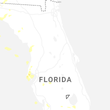
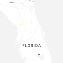


Connect with Interactive Hail Maps