

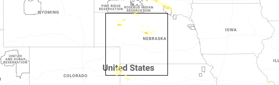
Hail Map for Dunning, NE
The Dunning, NE area has had 31 reports of on-the-ground hail by trained spotters, and has been under severe weather warnings 14 times during the past 12 months. Doppler radar has detected hail at or near Dunning, NE on 96 occasions, including 6 occasions during the past year.
| Name: | Dunning, NE |
| Where Located: | 58.6 miles NE of North Platte, NE |
| Map: | Google Map for Dunning, NE |
| Population: | 103 |
| Housing Units: | 67 |
| More Info: | Search Google for Dunning, NE |
2
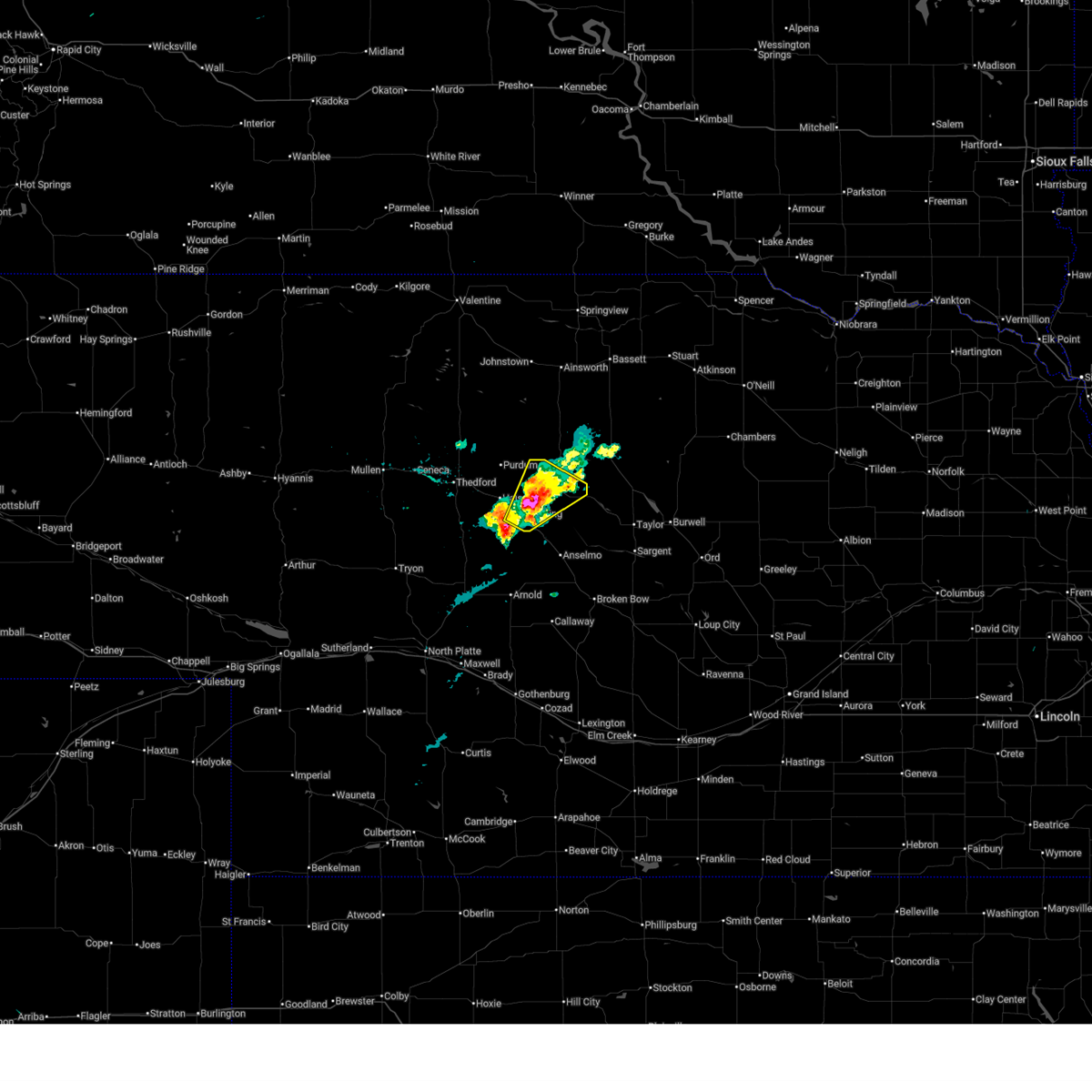
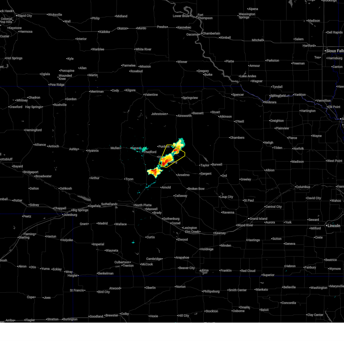
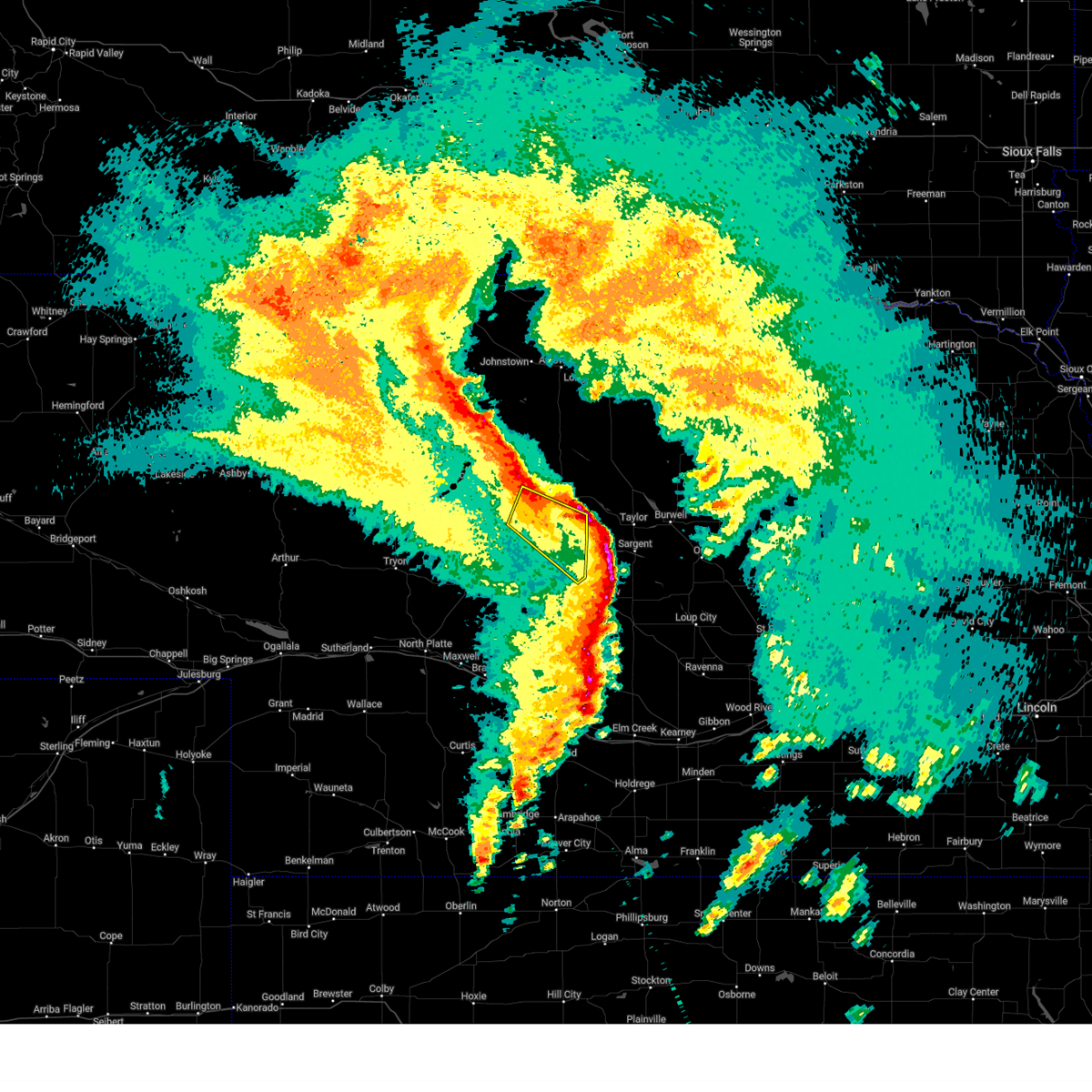
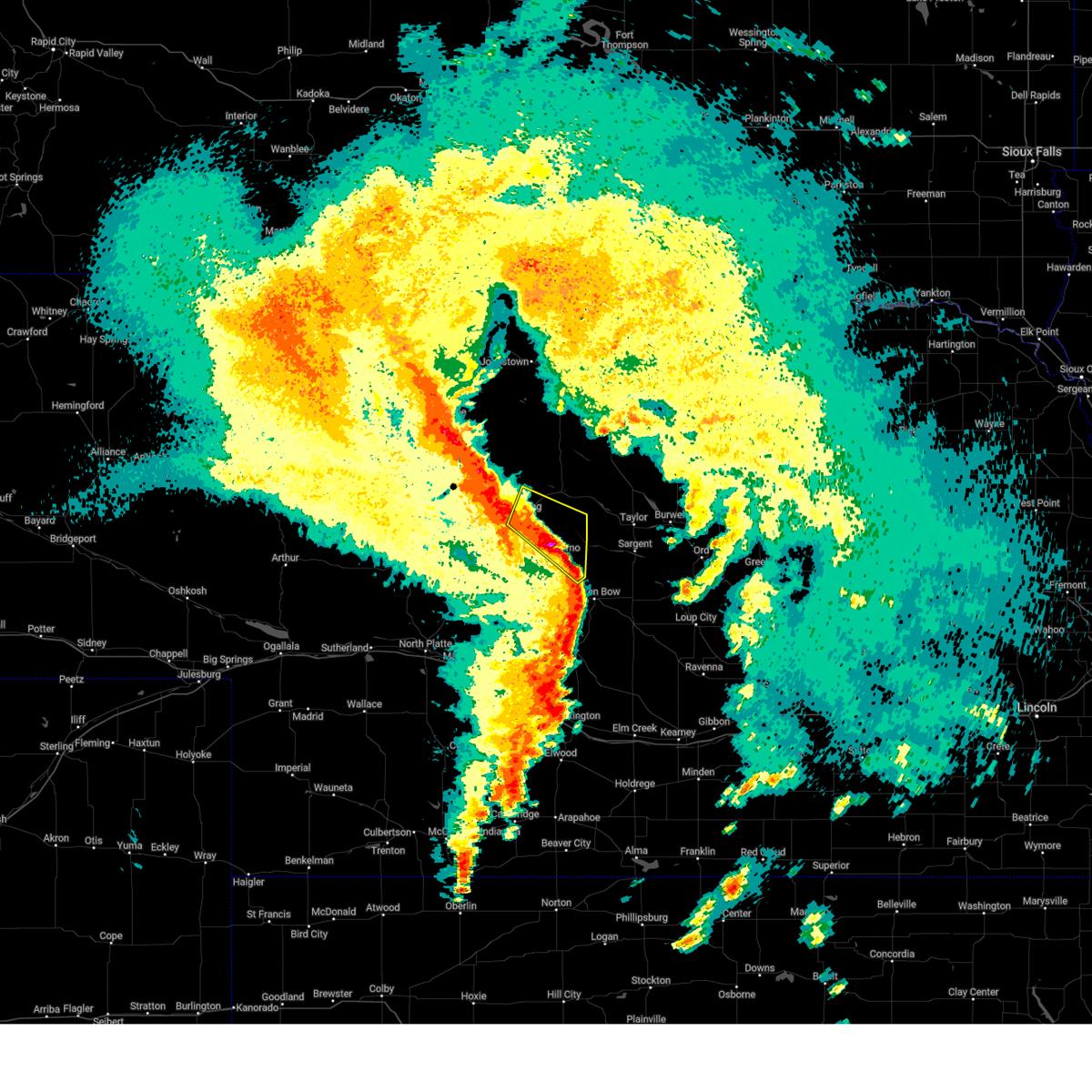
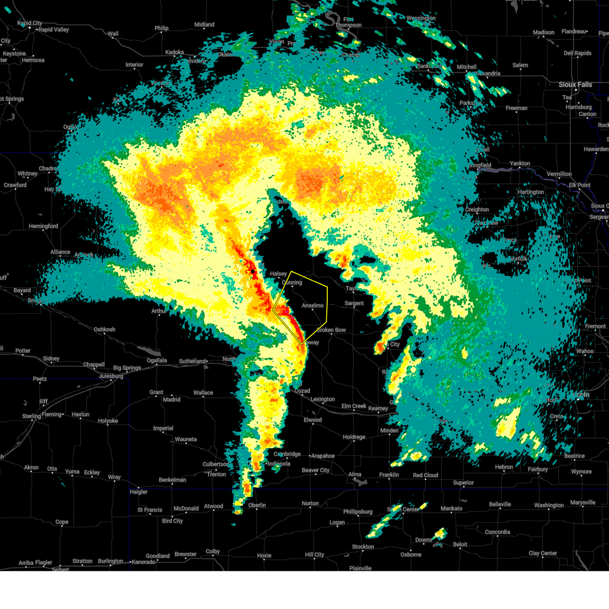
The Top Recent Hail Date for Dunning, NE is Friday, June 27, 2025 (5th out of 96)
Hail and Wind Damage Spotted near Dunning, NE
| Date / Time | Report Details |
|---|---|
| 6/27/2025 8:59 PM CDT |
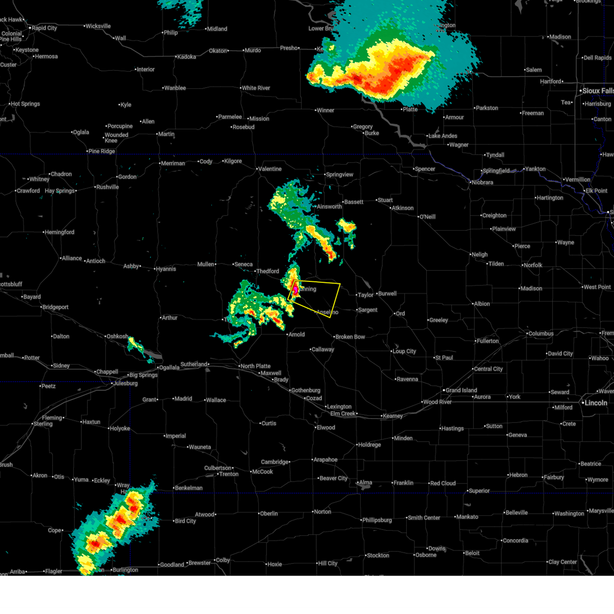 Svrlbf the national weather service in north platte has issued a * severe thunderstorm warning for, southwestern loup county in north central nebraska, north central custer county in central nebraska, southern blaine county in north central nebraska, * until 945 pm cdt. * at 859 pm cdt, a severe thunderstorm was located over dunning, or 14 miles southwest of brewster, moving east at 30 mph (radar indicated). Hazards include 60 mph wind gusts and quarter size hail. Hail damage to vehicles is expected. Expect wind damage to roofs, siding, and trees. Svrlbf the national weather service in north platte has issued a * severe thunderstorm warning for, southwestern loup county in north central nebraska, north central custer county in central nebraska, southern blaine county in north central nebraska, * until 945 pm cdt. * at 859 pm cdt, a severe thunderstorm was located over dunning, or 14 miles southwest of brewster, moving east at 30 mph (radar indicated). Hazards include 60 mph wind gusts and quarter size hail. Hail damage to vehicles is expected. Expect wind damage to roofs, siding, and trees.
|
| 6/22/2025 7:34 PM CDT |
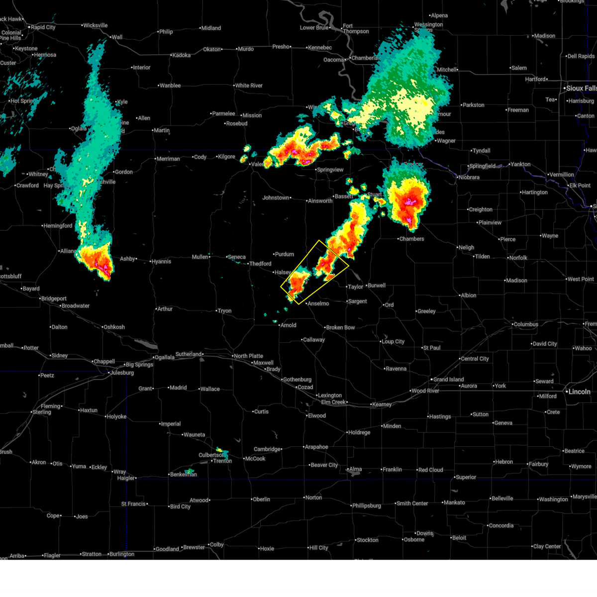 Svrlbf the national weather service in north platte has issued a * severe thunderstorm warning for, southwestern rock county in north central nebraska, northwestern loup county in north central nebraska, southeastern brown county in north central nebraska, north central custer county in central nebraska, eastern blaine county in north central nebraska, * until 815 pm cdt. * at 734 pm cdt, a severe thunderstorm was located 8 miles southeast of dunning, or 15 miles southwest of brewster, moving northeast at 40 mph (radar indicated). Hazards include ping pong ball size hail and 60 mph wind gusts. People and animals outdoors will be injured. expect hail damage to roofs, siding, windows, and vehicles. Expect wind damage to roofs, siding, and trees. Svrlbf the national weather service in north platte has issued a * severe thunderstorm warning for, southwestern rock county in north central nebraska, northwestern loup county in north central nebraska, southeastern brown county in north central nebraska, north central custer county in central nebraska, eastern blaine county in north central nebraska, * until 815 pm cdt. * at 734 pm cdt, a severe thunderstorm was located 8 miles southeast of dunning, or 15 miles southwest of brewster, moving northeast at 40 mph (radar indicated). Hazards include ping pong ball size hail and 60 mph wind gusts. People and animals outdoors will be injured. expect hail damage to roofs, siding, windows, and vehicles. Expect wind damage to roofs, siding, and trees.
|
| 6/22/2025 5:25 PM CDT | Half Dollar sized hail reported 0.3 miles SW of Dunning, NE, 1.25 inches of precip in 40 minutes... quarter and half dollar size hail... wind gusts between 35 and 45 mph. |
| 6/22/2025 5:21 PM CDT |
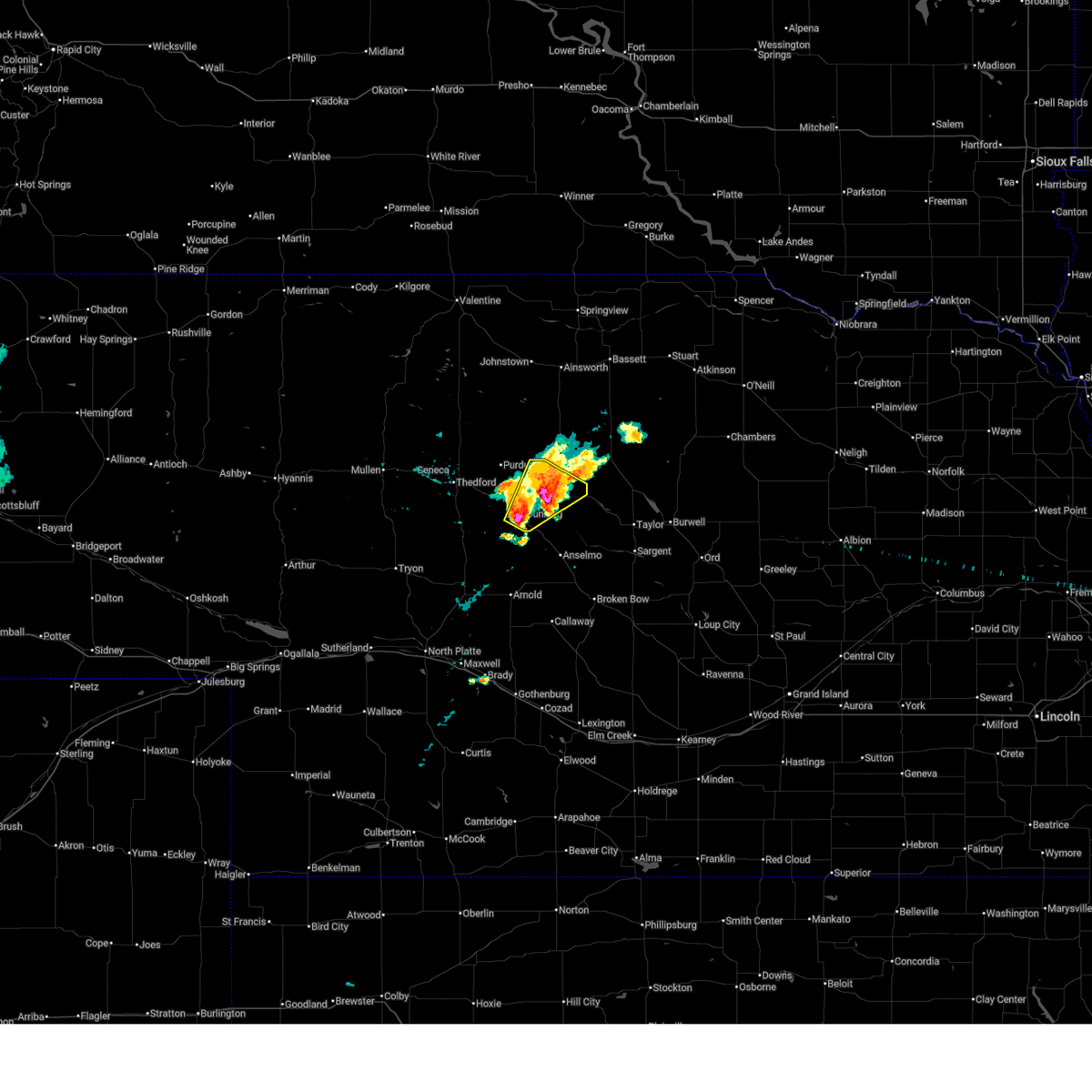 At 520 pm cdt, a severe thunderstorm was located near brewster, moving northeast at 20 mph (radar indicated). Hazards include two inch hail and 70 mph wind gusts. People and animals outdoors will be injured. expect hail damage to roofs, siding, windows, and vehicles. expect considerable tree damage. wind damage is also likely to mobile homes, roofs, and outbuildings. locations impacted include, brewster, dunning, and hawley flats. This includes highway 2 between mile markers 233 and 244. At 520 pm cdt, a severe thunderstorm was located near brewster, moving northeast at 20 mph (radar indicated). Hazards include two inch hail and 70 mph wind gusts. People and animals outdoors will be injured. expect hail damage to roofs, siding, windows, and vehicles. expect considerable tree damage. wind damage is also likely to mobile homes, roofs, and outbuildings. locations impacted include, brewster, dunning, and hawley flats. This includes highway 2 between mile markers 233 and 244.
|
| 6/22/2025 5:10 PM CDT |
 At 509 pm cdt, a severe thunderstorm was located near dunning, or 9 miles southwest of brewster, moving northeast at 20 mph (radar indicated). Hazards include two inch hail and 60 mph wind gusts. People and animals outdoors will be injured. expect hail damage to roofs, siding, windows, and vehicles. expect wind damage to roofs, siding, and trees. locations impacted include, brewster, dunning, and hawley flats. This includes highway 2 between mile markers 233 and 244. At 509 pm cdt, a severe thunderstorm was located near dunning, or 9 miles southwest of brewster, moving northeast at 20 mph (radar indicated). Hazards include two inch hail and 60 mph wind gusts. People and animals outdoors will be injured. expect hail damage to roofs, siding, windows, and vehicles. expect wind damage to roofs, siding, and trees. locations impacted include, brewster, dunning, and hawley flats. This includes highway 2 between mile markers 233 and 244.
|
| 6/22/2025 4:57 PM CDT |
 Svrlbf the national weather service in north platte has issued a * severe thunderstorm warning for, central blaine county in north central nebraska, * until 545 pm cdt. * at 456 pm cdt, a severe thunderstorm was located over dunning, or 14 miles southwest of brewster, moving northeast at 20 mph (radar indicated). Hazards include ping pong ball size hail and 60 mph wind gusts. People and animals outdoors will be injured. expect hail damage to roofs, siding, windows, and vehicles. Expect wind damage to roofs, siding, and trees. Svrlbf the national weather service in north platte has issued a * severe thunderstorm warning for, central blaine county in north central nebraska, * until 545 pm cdt. * at 456 pm cdt, a severe thunderstorm was located over dunning, or 14 miles southwest of brewster, moving northeast at 20 mph (radar indicated). Hazards include ping pong ball size hail and 60 mph wind gusts. People and animals outdoors will be injured. expect hail damage to roofs, siding, windows, and vehicles. Expect wind damage to roofs, siding, and trees.
|
| 5/18/2025 11:15 PM CDT |
 The storms which prompted the warning have weakened below severe limits, and have exited the warned area. therefore, the warning has been allowed to expire. however, gusty winds and heavy rain are still possible with these thunderstorms. a tornado watch remains in effect until 100 am cdt for central nebraska. The storms which prompted the warning have weakened below severe limits, and have exited the warned area. therefore, the warning has been allowed to expire. however, gusty winds and heavy rain are still possible with these thunderstorms. a tornado watch remains in effect until 100 am cdt for central nebraska.
|
| 5/18/2025 11:08 PM CDT |
 At 1106 pm cdt, severe thunderstorms were located along a line extending from near dunning to near victoria springs state recreation area, moving northeast at 45 mph (radar indicated). Hazards include 60 mph wind gusts and penny size hail. Expect damage to roofs, siding, and trees. locations impacted include, merna, anselmo, dunning, victoria springs state recreation area, milburn, milburn diversion dam state wildlife management area, and linscott. This includes highway 2 between mile markers 234 and 268. At 1106 pm cdt, severe thunderstorms were located along a line extending from near dunning to near victoria springs state recreation area, moving northeast at 45 mph (radar indicated). Hazards include 60 mph wind gusts and penny size hail. Expect damage to roofs, siding, and trees. locations impacted include, merna, anselmo, dunning, victoria springs state recreation area, milburn, milburn diversion dam state wildlife management area, and linscott. This includes highway 2 between mile markers 234 and 268.
|
| 5/18/2025 11:08 PM CDT |
 the severe thunderstorm warning has been cancelled and is no longer in effect the severe thunderstorm warning has been cancelled and is no longer in effect
|
| 5/18/2025 10:35 PM CDT |
 Svrlbf the national weather service in north platte has issued a * severe thunderstorm warning for, east central logan county in west central nebraska, northwestern custer county in central nebraska, southern blaine county in north central nebraska, * until 1115 pm cdt. * at 1035 pm cdt, a severe thunderstorm was located 10 miles northeast of arnold, or 21 miles east of stapleton, moving northeast at 40 mph (radar indicated). Hazards include 60 mph wind gusts and quarter size hail. Hail damage to vehicles is expected. Expect wind damage to roofs, siding, and trees. Svrlbf the national weather service in north platte has issued a * severe thunderstorm warning for, east central logan county in west central nebraska, northwestern custer county in central nebraska, southern blaine county in north central nebraska, * until 1115 pm cdt. * at 1035 pm cdt, a severe thunderstorm was located 10 miles northeast of arnold, or 21 miles east of stapleton, moving northeast at 40 mph (radar indicated). Hazards include 60 mph wind gusts and quarter size hail. Hail damage to vehicles is expected. Expect wind damage to roofs, siding, and trees.
|
| 5/18/2025 8:31 PM CDT | the severe thunderstorm warning has been cancelled and is no longer in effect |
| 5/18/2025 8:24 PM CDT |
 the severe thunderstorm warning has been cancelled and is no longer in effect the severe thunderstorm warning has been cancelled and is no longer in effect
|
| 5/18/2025 8:24 PM CDT |
 At 823 pm cdt, a severe thunderstorm was located near dunning, or 10 miles southwest of brewster, moving north at 60 mph (radar indicated). Hazards include 60 mph wind gusts and quarter size hail. Hail damage to vehicles is expected. expect wind damage to roofs, siding, and trees. locations impacted include, brewster, dunning, and hawley flats. This includes highway 2 between mile markers 234 and 244. At 823 pm cdt, a severe thunderstorm was located near dunning, or 10 miles southwest of brewster, moving north at 60 mph (radar indicated). Hazards include 60 mph wind gusts and quarter size hail. Hail damage to vehicles is expected. expect wind damage to roofs, siding, and trees. locations impacted include, brewster, dunning, and hawley flats. This includes highway 2 between mile markers 234 and 244.
|
| 5/18/2025 8:05 PM CDT | Svrlbf the national weather service in north platte has issued a * severe thunderstorm warning for, northwestern custer county in central nebraska, blaine county in north central nebraska, * until 845 pm cdt. * at 805 pm cdt, a severe thunderstorm was located near anselmo, or 17 miles northwest of broken bow, moving north at 70 mph (radar indicated). Hazards include 60 mph wind gusts and half dollar size hail. Hail damage to vehicles is expected. Expect wind damage to roofs, siding, and trees. |
| 7/16/2024 5:50 PM CDT | Tansformer pole broke off and cattle truck blown over on highway 91. time estimated by rada in blaine county NE, 10.1 miles SW of Dunning, NE |
| 7/16/2024 5:08 PM CDT |
 Svrlbf the national weather service in north platte has issued a * severe thunderstorm warning for, southeastern brown county in north central nebraska, blaine county in north central nebraska, * until 615 pm cdt. * at 508 pm cdt, a severe thunderstorm was located 12 miles northeast of elsmere, or 21 miles south of ainsworth, moving south at 25 mph (radar indicated). Hazards include tennis ball size hail and 60 mph wind gusts. People and animals outdoors will be injured. expect hail damage to roofs, siding, windows, and vehicles. Expect wind damage to roofs, siding, and trees. Svrlbf the national weather service in north platte has issued a * severe thunderstorm warning for, southeastern brown county in north central nebraska, blaine county in north central nebraska, * until 615 pm cdt. * at 508 pm cdt, a severe thunderstorm was located 12 miles northeast of elsmere, or 21 miles south of ainsworth, moving south at 25 mph (radar indicated). Hazards include tennis ball size hail and 60 mph wind gusts. People and animals outdoors will be injured. expect hail damage to roofs, siding, windows, and vehicles. Expect wind damage to roofs, siding, and trees.
|
| 6/7/2024 4:39 PM CDT |
 At 438 pm cdt, a severe thunderstorm was located near halsey, or 20 miles southeast of thedford, moving southeast at 30 mph (radar indicated). Hazards include ping pong ball size hail. People and animals outdoors will be injured. expect damage to roofs, siding, windows, and vehicles. locations impacted include, dunning and halsey. This includes highway 2 between mile markers 224 and 242. At 438 pm cdt, a severe thunderstorm was located near halsey, or 20 miles southeast of thedford, moving southeast at 30 mph (radar indicated). Hazards include ping pong ball size hail. People and animals outdoors will be injured. expect damage to roofs, siding, windows, and vehicles. locations impacted include, dunning and halsey. This includes highway 2 between mile markers 224 and 242.
|
| 6/7/2024 4:20 PM CDT |
 Svrlbf the national weather service in north platte has issued a * severe thunderstorm warning for, northeastern logan county in west central nebraska, southwestern blaine county in north central nebraska, southeastern thomas county in north central nebraska, * until 500 pm cdt. * at 420 pm cdt, a severe thunderstorm was located near halsey, or 11 miles southeast of thedford, moving southeast at 30 mph (radar indicated). Hazards include ping pong ball size hail. People and animals outdoors will be injured. Expect damage to roofs, siding, windows, and vehicles. Svrlbf the national weather service in north platte has issued a * severe thunderstorm warning for, northeastern logan county in west central nebraska, southwestern blaine county in north central nebraska, southeastern thomas county in north central nebraska, * until 500 pm cdt. * at 420 pm cdt, a severe thunderstorm was located near halsey, or 11 miles southeast of thedford, moving southeast at 30 mph (radar indicated). Hazards include ping pong ball size hail. People and animals outdoors will be injured. Expect damage to roofs, siding, windows, and vehicles.
|
| 6/2/2024 8:10 PM CDT |
 Svrlbf the national weather service in north platte has issued a * severe thunderstorm warning for, northeastern lincoln county in southwestern nebraska, southeastern logan county in west central nebraska, custer county in central nebraska, southwestern blaine county in north central nebraska, * until 900 pm cdt. * at 810 pm cdt, severe thunderstorms were located along a line extending from anselmo to 13 miles northeast of brady, moving southeast at 50 mph (radar indicated). Hazards include 60 mph wind gusts and penny size hail. expect damage to roofs, siding, and trees Svrlbf the national weather service in north platte has issued a * severe thunderstorm warning for, northeastern lincoln county in southwestern nebraska, southeastern logan county in west central nebraska, custer county in central nebraska, southwestern blaine county in north central nebraska, * until 900 pm cdt. * at 810 pm cdt, severe thunderstorms were located along a line extending from anselmo to 13 miles northeast of brady, moving southeast at 50 mph (radar indicated). Hazards include 60 mph wind gusts and penny size hail. expect damage to roofs, siding, and trees
|
| 6/2/2024 7:28 PM CDT |
 Svrlbf the national weather service in north platte has issued a * severe thunderstorm warning for, northeastern lincoln county in southwestern nebraska, logan county in west central nebraska, eastern mcpherson county in west central nebraska, northwestern custer county in central nebraska, southwestern blaine county in north central nebraska, southern thomas county in north central nebraska, * until 815 pm cdt. * at 728 pm cdt, severe thunderstorms were located along a line extending from 12 miles southwest of thedford to near north platte, moving east at 40 mph (radar indicated). Hazards include 70 mph wind gusts and penny size hail. Expect considerable tree damage. Damage is likely to mobile homes, roofs, and outbuildings. Svrlbf the national weather service in north platte has issued a * severe thunderstorm warning for, northeastern lincoln county in southwestern nebraska, logan county in west central nebraska, eastern mcpherson county in west central nebraska, northwestern custer county in central nebraska, southwestern blaine county in north central nebraska, southern thomas county in north central nebraska, * until 815 pm cdt. * at 728 pm cdt, severe thunderstorms were located along a line extending from 12 miles southwest of thedford to near north platte, moving east at 40 mph (radar indicated). Hazards include 70 mph wind gusts and penny size hail. Expect considerable tree damage. Damage is likely to mobile homes, roofs, and outbuildings.
|
| 4/6/2024 4:36 PM CDT |
 the severe thunderstorm warning has been cancelled and is no longer in effect the severe thunderstorm warning has been cancelled and is no longer in effect
|
| 4/6/2024 4:36 PM CDT |
 At 436 pm cdt, severe thunderstorms were located along a line extending from 12 miles north of seneca to 9 miles southeast of brownlee to 10 miles south of brewster, moving northeast at 45 mph (radar indicated). Hazards include 60 mph wind gusts. Expect damage to roofs, siding, and trees. locations impacted include, thedford, dunning, halsey, purdum, brownlee, elsmere, hawley flats, highway 83 crossing the north loup river, linscott, koshopah, giant hill, natwick, and highway 83 crossing goose creek. this includes the following highways, highway 2 between mile markers 209 and 246. Highway 83 between mile markers 147 and 180. At 436 pm cdt, severe thunderstorms were located along a line extending from 12 miles north of seneca to 9 miles southeast of brownlee to 10 miles south of brewster, moving northeast at 45 mph (radar indicated). Hazards include 60 mph wind gusts. Expect damage to roofs, siding, and trees. locations impacted include, thedford, dunning, halsey, purdum, brownlee, elsmere, hawley flats, highway 83 crossing the north loup river, linscott, koshopah, giant hill, natwick, and highway 83 crossing goose creek. this includes the following highways, highway 2 between mile markers 209 and 246. Highway 83 between mile markers 147 and 180.
|
| 4/6/2024 4:15 PM CDT |
 Svrlbf the national weather service in north platte has issued a * severe thunderstorm warning for, southeastern cherry county in north central nebraska, northeastern hooker county in west central nebraska, southwestern brown county in north central nebraska, northeastern logan county in west central nebraska, northwestern custer county in central nebraska, blaine county in north central nebraska, thomas county in north central nebraska, * until 500 pm cdt/400 pm mdt/. * at 415 pm cdt/315 pm mdt/, severe thunderstorms were located along a line extending from near seneca to thedford to anselmo, moving north at 40 mph (radar indicated). Hazards include 70 mph wind gusts. Expect considerable tree damage. Damage is likely to mobile homes, roofs, and outbuildings. Svrlbf the national weather service in north platte has issued a * severe thunderstorm warning for, southeastern cherry county in north central nebraska, northeastern hooker county in west central nebraska, southwestern brown county in north central nebraska, northeastern logan county in west central nebraska, northwestern custer county in central nebraska, blaine county in north central nebraska, thomas county in north central nebraska, * until 500 pm cdt/400 pm mdt/. * at 415 pm cdt/315 pm mdt/, severe thunderstorms were located along a line extending from near seneca to thedford to anselmo, moving north at 40 mph (radar indicated). Hazards include 70 mph wind gusts. Expect considerable tree damage. Damage is likely to mobile homes, roofs, and outbuildings.
|
| 4/6/2024 4:04 PM CDT |
 the severe thunderstorm warning has been cancelled and is no longer in effect the severe thunderstorm warning has been cancelled and is no longer in effect
|
| 4/6/2024 4:04 PM CDT |
 At 403 pm cdt/303 pm mdt/, severe thunderstorms were located along a line extending from 9 miles south of seneca to 6 miles south of thedford to 6 miles west of merna, moving northeast at 45 mph (radar indicated). Hazards include 70 mph wind gusts. Expect considerable tree damage. damage is likely to mobile homes, roofs, and outbuildings. locations impacted include, thedford, arnold, anselmo, dunning, halsey, seneca, logan, highway 83 crossing the dismal river, milldale, linscott, shanklin bluff, pleasant hill, brown lake, norway, finchville, natwick, and kelso. this includes the following highways, highway 2 between mile markers 188 and 258. highway 92 between mile markers 249 and 269. Highway 83 between mile markers 120 and 156. At 403 pm cdt/303 pm mdt/, severe thunderstorms were located along a line extending from 9 miles south of seneca to 6 miles south of thedford to 6 miles west of merna, moving northeast at 45 mph (radar indicated). Hazards include 70 mph wind gusts. Expect considerable tree damage. damage is likely to mobile homes, roofs, and outbuildings. locations impacted include, thedford, arnold, anselmo, dunning, halsey, seneca, logan, highway 83 crossing the dismal river, milldale, linscott, shanklin bluff, pleasant hill, brown lake, norway, finchville, natwick, and kelso. this includes the following highways, highway 2 between mile markers 188 and 258. highway 92 between mile markers 249 and 269. Highway 83 between mile markers 120 and 156.
|
| 4/6/2024 3:48 PM CDT |
 the severe thunderstorm warning has been cancelled and is no longer in effect the severe thunderstorm warning has been cancelled and is no longer in effect
|
| 4/6/2024 3:48 PM CDT |
 At 347 pm cdt/247 pm mdt/, severe thunderstorms were located along a line extending from 15 miles southwest of thedford to 11 miles north of stapleton to callaway, moving north at 45 mph (radar indicated). Hazards include 70 mph wind gusts. Expect considerable tree damage. damage is likely to mobile homes, roofs, and outbuildings. locations impacted include, stapleton, thedford, arnold, callaway, oconto, anselmo, dunning, halsey, seneca, gandy, logan, highway 83 crossing the dismal river, milldale, lodi, linscott, tarboz lake, shanklin bluff, pleasant hill, hoagland, and brown lake. this includes the following highways, highway 2 between mile markers 188 and 258. highway 92 between mile markers 223 and 270. Highway 83 between mile markers 108 and 156. At 347 pm cdt/247 pm mdt/, severe thunderstorms were located along a line extending from 15 miles southwest of thedford to 11 miles north of stapleton to callaway, moving north at 45 mph (radar indicated). Hazards include 70 mph wind gusts. Expect considerable tree damage. damage is likely to mobile homes, roofs, and outbuildings. locations impacted include, stapleton, thedford, arnold, callaway, oconto, anselmo, dunning, halsey, seneca, gandy, logan, highway 83 crossing the dismal river, milldale, lodi, linscott, tarboz lake, shanklin bluff, pleasant hill, hoagland, and brown lake. this includes the following highways, highway 2 between mile markers 188 and 258. highway 92 between mile markers 223 and 270. Highway 83 between mile markers 108 and 156.
|
| 4/6/2024 3:27 PM CDT |
 Svrlbf the national weather service in north platte has issued a * severe thunderstorm warning for, eastern hooker county in west central nebraska, northeastern lincoln county in southwestern nebraska, logan county in west central nebraska, eastern mcpherson county in west central nebraska, western custer county in central nebraska, southwestern blaine county in north central nebraska, thomas county in north central nebraska, * until 415 pm cdt/315 pm mdt/. * at 326 pm cdt/226 pm mdt/, severe thunderstorms were located along a line extending from near ringgold to near gandy to 8 miles southwest of oconto, moving north at 50 mph (radar indicated). Hazards include 70 mph wind gusts. Expect considerable tree damage. Damage is likely to mobile homes, roofs, and outbuildings. Svrlbf the national weather service in north platte has issued a * severe thunderstorm warning for, eastern hooker county in west central nebraska, northeastern lincoln county in southwestern nebraska, logan county in west central nebraska, eastern mcpherson county in west central nebraska, western custer county in central nebraska, southwestern blaine county in north central nebraska, thomas county in north central nebraska, * until 415 pm cdt/315 pm mdt/. * at 326 pm cdt/226 pm mdt/, severe thunderstorms were located along a line extending from near ringgold to near gandy to 8 miles southwest of oconto, moving north at 50 mph (radar indicated). Hazards include 70 mph wind gusts. Expect considerable tree damage. Damage is likely to mobile homes, roofs, and outbuildings.
|
| 8/4/2023 7:48 PM CDT |
 At 747 pm cdt, a severe thunderstorm was located near brewster, moving southeast at 15 mph (radar indicated). Hazards include quarter size hail. Damage to vehicles is expected. locations impacted include, brewster, dunning and linscott. this includes highway 2 between mile markers 236 and 239, and between mile markers 245 and 246. hail threat, radar indicated max hail size, 1. 00 in wind threat, radar indicated max wind gust, <50 mph. At 747 pm cdt, a severe thunderstorm was located near brewster, moving southeast at 15 mph (radar indicated). Hazards include quarter size hail. Damage to vehicles is expected. locations impacted include, brewster, dunning and linscott. this includes highway 2 between mile markers 236 and 239, and between mile markers 245 and 246. hail threat, radar indicated max hail size, 1. 00 in wind threat, radar indicated max wind gust, <50 mph.
|
| 8/4/2023 7:33 PM CDT |
 At 733 pm cdt, a severe thunderstorm was located 8 miles west of brewster, moving southeast at 15 mph (radar indicated). Hazards include half dollar size hail. Damage to vehicles is expected. locations impacted include, brewster, dunning, linscott and hawley flats. this includes highway 2 between mile markers 236 and 239, and between mile markers 245 and 246. hail threat, radar indicated max hail size, 1. 25 in wind threat, radar indicated max wind gust, <50 mph. At 733 pm cdt, a severe thunderstorm was located 8 miles west of brewster, moving southeast at 15 mph (radar indicated). Hazards include half dollar size hail. Damage to vehicles is expected. locations impacted include, brewster, dunning, linscott and hawley flats. this includes highway 2 between mile markers 236 and 239, and between mile markers 245 and 246. hail threat, radar indicated max hail size, 1. 25 in wind threat, radar indicated max wind gust, <50 mph.
|
| 8/4/2023 7:24 PM CDT |
 At 724 pm cdt, a severe thunderstorm was located 10 miles west of brewster, moving southeast at 15 mph (radar indicated). Hazards include ping pong ball size hail. People and animals outdoors will be injured. expect damage to roofs, siding, windows, and vehicles. locations impacted include, brewster, dunning, linscott and hawley flats. this includes highway 2 between mile markers 235 and 239, and between mile markers 245 and 246. hail threat, radar indicated max hail size, 1. 50 in wind threat, radar indicated max wind gust, <50 mph. At 724 pm cdt, a severe thunderstorm was located 10 miles west of brewster, moving southeast at 15 mph (radar indicated). Hazards include ping pong ball size hail. People and animals outdoors will be injured. expect damage to roofs, siding, windows, and vehicles. locations impacted include, brewster, dunning, linscott and hawley flats. this includes highway 2 between mile markers 235 and 239, and between mile markers 245 and 246. hail threat, radar indicated max hail size, 1. 50 in wind threat, radar indicated max wind gust, <50 mph.
|
| 8/4/2023 7:11 PM CDT |
 At 711 pm cdt, a severe thunderstorm was located 7 miles southeast of purdum, or 14 miles northwest of brewster, moving southeast at 15 mph (radar indicated). Hazards include two inch hail. People and animals outdoors will be injured. Expect damage to roofs, siding, windows, and vehicles. At 711 pm cdt, a severe thunderstorm was located 7 miles southeast of purdum, or 14 miles northwest of brewster, moving southeast at 15 mph (radar indicated). Hazards include two inch hail. People and animals outdoors will be injured. Expect damage to roofs, siding, windows, and vehicles.
|
| 8/4/2023 7:00 PM CDT | Half Dollar sized hail reported 16.4 miles SSE of Dunning, NE, hail was in progress at time of call. |
| 7/29/2023 4:03 AM CDT |
 At 402 am cdt, severe thunderstorms were located along a line extending from 8 miles west of anselmo to 6 miles west of arnold, moving southeast at 60 mph (radar indicated). Hazards include 60 mph wind gusts and quarter size hail. Hail damage to vehicles is expected. expect wind damage to roofs, siding, and trees. locations impacted include, stapleton, arnold, dunning, halsey, gandy, logan, milburn, highway 83 crossing the dismal river, milburn diversion dam state wildlife management area, linscott, tarboz lake, shanklin bluff, hoagland and brown lake. this includes the following highways, highway 2 between mile markers 224 and 257. highway 92 between mile markers 224 and 257. highway 83 between mile markers 105 and 136. hail threat, radar indicated max hail size, 1. 00 in wind threat, radar indicated max wind gust, 60 mph. At 402 am cdt, severe thunderstorms were located along a line extending from 8 miles west of anselmo to 6 miles west of arnold, moving southeast at 60 mph (radar indicated). Hazards include 60 mph wind gusts and quarter size hail. Hail damage to vehicles is expected. expect wind damage to roofs, siding, and trees. locations impacted include, stapleton, arnold, dunning, halsey, gandy, logan, milburn, highway 83 crossing the dismal river, milburn diversion dam state wildlife management area, linscott, tarboz lake, shanklin bluff, hoagland and brown lake. this includes the following highways, highway 2 between mile markers 224 and 257. highway 92 between mile markers 224 and 257. highway 83 between mile markers 105 and 136. hail threat, radar indicated max hail size, 1. 00 in wind threat, radar indicated max wind gust, 60 mph.
|
| 7/29/2023 3:52 AM CDT |
 At 352 am cdt, severe thunderstorms were located along a line extending from near dunning to 6 miles northeast of stapleton, moving southeast at 60 mph (radar indicated). Hazards include 60 mph wind gusts and quarter size hail. Hail damage to vehicles is expected. expect wind damage to roofs, siding, and trees. locations impacted include, stapleton, arnold, dunning, halsey, gandy, logan, milburn, highway 83 crossing the dismal river, milburn diversion dam state wildlife management area, linscott, tarboz lake, shanklin bluff, hoagland, brown lake and natwick. this includes the following highways, highway 2 between mile markers 217 and 257. highway 92 between mile markers 222 and 257. highway 83 between mile markers 104 and 142. hail threat, radar indicated max hail size, 1. 00 in wind threat, radar indicated max wind gust, 60 mph. At 352 am cdt, severe thunderstorms were located along a line extending from near dunning to 6 miles northeast of stapleton, moving southeast at 60 mph (radar indicated). Hazards include 60 mph wind gusts and quarter size hail. Hail damage to vehicles is expected. expect wind damage to roofs, siding, and trees. locations impacted include, stapleton, arnold, dunning, halsey, gandy, logan, milburn, highway 83 crossing the dismal river, milburn diversion dam state wildlife management area, linscott, tarboz lake, shanklin bluff, hoagland, brown lake and natwick. this includes the following highways, highway 2 between mile markers 217 and 257. highway 92 between mile markers 222 and 257. highway 83 between mile markers 104 and 142. hail threat, radar indicated max hail size, 1. 00 in wind threat, radar indicated max wind gust, 60 mph.
|
| 7/29/2023 3:31 AM CDT |
 At 330 am cdt/230 am mdt/, severe thunderstorms were located along a line extending from 8 miles east of thedford to 18 miles south of seneca, moving southeast at 65 mph (radar indicated). Hazards include 60 mph wind gusts and quarter size hail. Hail damage to vehicles is expected. Expect wind damage to roofs, siding, and trees. At 330 am cdt/230 am mdt/, severe thunderstorms were located along a line extending from 8 miles east of thedford to 18 miles south of seneca, moving southeast at 65 mph (radar indicated). Hazards include 60 mph wind gusts and quarter size hail. Hail damage to vehicles is expected. Expect wind damage to roofs, siding, and trees.
|
| 7/11/2023 10:07 PM CDT |
 The severe thunderstorm warning for north central custer and southeastern blaine counties will expire at 1015 pm cdt, the storm which prompted the warning has moved out of the area. therefore, the warning will be allowed to expire. The severe thunderstorm warning for north central custer and southeastern blaine counties will expire at 1015 pm cdt, the storm which prompted the warning has moved out of the area. therefore, the warning will be allowed to expire.
|
| 7/11/2023 9:36 PM CDT |
 At 935 pm cdt, a severe thunderstorm was located near brewster, moving southeast at 20 mph (radar indicated). Hazards include two inch hail and 60 mph wind gusts. People and animals outdoors will be injured. expect hail damage to roofs, siding, windows, and vehicles. expect wind damage to roofs, siding, and trees. locations impacted include, brewster, dunning, milburn diversion dam state wildlife management area and linscott. This includes highway 2 between mile markers 236 and 250. At 935 pm cdt, a severe thunderstorm was located near brewster, moving southeast at 20 mph (radar indicated). Hazards include two inch hail and 60 mph wind gusts. People and animals outdoors will be injured. expect hail damage to roofs, siding, windows, and vehicles. expect wind damage to roofs, siding, and trees. locations impacted include, brewster, dunning, milburn diversion dam state wildlife management area and linscott. This includes highway 2 between mile markers 236 and 250.
|
| 7/11/2023 9:25 PM CDT |
 At 924 pm cdt, a severe thunderstorm was located 8 miles west of brewster, moving southeast at 15 mph (radar indicated). Hazards include golf ball size hail and 60 mph wind gusts. People and animals outdoors will be injured. expect hail damage to roofs, siding, windows, and vehicles. Expect wind damage to roofs, siding, and trees. At 924 pm cdt, a severe thunderstorm was located 8 miles west of brewster, moving southeast at 15 mph (radar indicated). Hazards include golf ball size hail and 60 mph wind gusts. People and animals outdoors will be injured. expect hail damage to roofs, siding, windows, and vehicles. Expect wind damage to roofs, siding, and trees.
|
| 7/10/2023 4:55 PM CDT |
 At 455 pm cdt, a severe thunderstorm was located 8 miles southwest of dunning, or 22 miles southeast of thedford, moving southeast at 25 mph (radar indicated). Hazards include ping pong ball size hail and 60 mph wind gusts. People and animals outdoors will be injured. expect hail damage to roofs, siding, windows, and vehicles. Expect wind damage to roofs, siding, and trees. At 455 pm cdt, a severe thunderstorm was located 8 miles southwest of dunning, or 22 miles southeast of thedford, moving southeast at 25 mph (radar indicated). Hazards include ping pong ball size hail and 60 mph wind gusts. People and animals outdoors will be injured. expect hail damage to roofs, siding, windows, and vehicles. Expect wind damage to roofs, siding, and trees.
|
| 6/24/2023 1:21 AM CDT |
 At 120 am cdt, severe thunderstorms were located along a line extending from 8 miles east of elsmere to near brewster to 8 miles northeast of victoria springs state recreation area to near merna, moving east at 50 mph (radar indicated. at 109 am cdt, a 66 mph gust was reported 1 mile south of dunning). Hazards include 60 mph wind gusts. expect damage to roofs, siding, and trees At 120 am cdt, severe thunderstorms were located along a line extending from 8 miles east of elsmere to near brewster to 8 miles northeast of victoria springs state recreation area to near merna, moving east at 50 mph (radar indicated. at 109 am cdt, a 66 mph gust was reported 1 mile south of dunning). Hazards include 60 mph wind gusts. expect damage to roofs, siding, and trees
|
| 6/24/2023 1:09 AM CDT | Pws reports 66 mph gust via ambient weathe in blaine county NE, 0.5 miles NNE of Dunning, NE |
| 5/12/2023 1:06 PM CDT |
 At 106 pm cdt, a severe thunderstorm capable of producing a tornado was located 7 miles south of dunning, or 17 miles southwest of brewster, moving northwest at 20 mph (radar indicated rotation). Hazards include tornado. Flying debris will be dangerous to those caught without shelter. mobile homes will be damaged or destroyed. damage to roofs, windows, and vehicles will occur. tree damage is likely. this dangerous storm will be near, dunning around 125 pm cdt. other locations impacted by this tornadic thunderstorm include linscott. This includes highway 2 between mile markers 235 and 250. At 106 pm cdt, a severe thunderstorm capable of producing a tornado was located 7 miles south of dunning, or 17 miles southwest of brewster, moving northwest at 20 mph (radar indicated rotation). Hazards include tornado. Flying debris will be dangerous to those caught without shelter. mobile homes will be damaged or destroyed. damage to roofs, windows, and vehicles will occur. tree damage is likely. this dangerous storm will be near, dunning around 125 pm cdt. other locations impacted by this tornadic thunderstorm include linscott. This includes highway 2 between mile markers 235 and 250.
|
| 5/12/2023 12:57 PM CDT |
 At 1257 pm cdt, a severe thunderstorm capable of producing a tornado was located 7 miles northwest of anselmo, or 18 miles south of brewster, moving northwest at 20 mph (radar indicated rotation). Hazards include tornado. Flying debris will be dangerous to those caught without shelter. mobile homes will be damaged or destroyed. damage to roofs, windows, and vehicles will occur. tree damage is likely. this dangerous storm will be near, dunning around 130 pm cdt. other locations impacted by this tornadic thunderstorm include linscott. This includes highway 2 between mile markers 235 and 253. At 1257 pm cdt, a severe thunderstorm capable of producing a tornado was located 7 miles northwest of anselmo, or 18 miles south of brewster, moving northwest at 20 mph (radar indicated rotation). Hazards include tornado. Flying debris will be dangerous to those caught without shelter. mobile homes will be damaged or destroyed. damage to roofs, windows, and vehicles will occur. tree damage is likely. this dangerous storm will be near, dunning around 130 pm cdt. other locations impacted by this tornadic thunderstorm include linscott. This includes highway 2 between mile markers 235 and 253.
|
| 5/12/2023 12:49 PM CDT |
 At 1249 pm cdt, a severe thunderstorm capable of producing a tornado was located near anselmo, or 20 miles south of brewster, moving northwest at 15 mph (radar indicated rotation). Hazards include tornado. Flying debris will be dangerous to those caught without shelter. mobile homes will be damaged or destroyed. damage to roofs, windows, and vehicles will occur. tree damage is likely. this dangerous storm will be near, dunning around 130 pm cdt. other locations impacted by this tornadic thunderstorm include linscott. This includes highway 2 between mile markers 235 and 257. At 1249 pm cdt, a severe thunderstorm capable of producing a tornado was located near anselmo, or 20 miles south of brewster, moving northwest at 15 mph (radar indicated rotation). Hazards include tornado. Flying debris will be dangerous to those caught without shelter. mobile homes will be damaged or destroyed. damage to roofs, windows, and vehicles will occur. tree damage is likely. this dangerous storm will be near, dunning around 130 pm cdt. other locations impacted by this tornadic thunderstorm include linscott. This includes highway 2 between mile markers 235 and 257.
|
| 5/7/2023 3:20 PM CDT | Quarter sized hail reported 0.3 miles SW of Dunning, NE, marble to quarter size hail covering the ground. picture with details via social media. time from radar. |
| 5/7/2023 3:17 PM CDT |
 At 317 pm cdt, a severe thunderstorm was located over dunning, or 15 miles southwest of brewster, moving east at 25 mph (radar indicated). Hazards include 60 mph wind gusts and quarter size hail. Hail damage to vehicles is expected. Expect wind damage to roofs, siding, and trees. At 317 pm cdt, a severe thunderstorm was located over dunning, or 15 miles southwest of brewster, moving east at 25 mph (radar indicated). Hazards include 60 mph wind gusts and quarter size hail. Hail damage to vehicles is expected. Expect wind damage to roofs, siding, and trees.
|
| 5/7/2023 3:10 PM CDT | Quarter sized hail reported 3.8 miles NE of Dunning, NE, public report of pea sized mixed with some quarters to even walnut sized hail... had tree damage due to hail... ground was white due to hail in some areas. |
| 5/7/2023 2:58 PM CDT |
 At 257 pm cdt, a severe thunderstorm was located near halsey, or 18 miles southeast of thedford, moving east at 20 mph (radar indicated). Hazards include 60 mph wind gusts and quarter size hail. Hail damage to vehicles is expected. expect wind damage to roofs, siding, and trees. locations impacted include, dunning. this includes highway 2 between mile markers 232 and 237. hail threat, radar indicated max hail size, 1. 00 in wind threat, radar indicated max wind gust, 60 mph. At 257 pm cdt, a severe thunderstorm was located near halsey, or 18 miles southeast of thedford, moving east at 20 mph (radar indicated). Hazards include 60 mph wind gusts and quarter size hail. Hail damage to vehicles is expected. expect wind damage to roofs, siding, and trees. locations impacted include, dunning. this includes highway 2 between mile markers 232 and 237. hail threat, radar indicated max hail size, 1. 00 in wind threat, radar indicated max wind gust, 60 mph.
|
| 5/7/2023 2:37 PM CDT |
 At 237 pm cdt, a severe thunderstorm was located 13 miles southwest of halsey, or 13 miles south of thedford, moving east at 15 mph (radar indicated). Hazards include 60 mph wind gusts and quarter size hail. Hail damage to vehicles is expected. Expect wind damage to roofs, siding, and trees. At 237 pm cdt, a severe thunderstorm was located 13 miles southwest of halsey, or 13 miles south of thedford, moving east at 15 mph (radar indicated). Hazards include 60 mph wind gusts and quarter size hail. Hail damage to vehicles is expected. Expect wind damage to roofs, siding, and trees.
|
| 4/13/2023 7:08 PM CDT |
 At 708 pm cdt, a severe thunderstorm was located 12 miles south of dunning, or 23 miles southwest of brewster, moving northeast at 35 mph (radar indicated). Hazards include 60 mph wind gusts. Expect damage to roofs, siding, and trees. locations impacted include, arnold, anselmo, dunning, halsey, milburn, milburn diversion dam state wildlife management area, linscott and pleasant hill. this includes the following highways, highway 2 between mile markers 228 and 260. highway 92 between mile markers 250 and 261. hail threat, radar indicated max hail size, <. 75 in wind threat, radar indicated max wind gust, 60 mph. At 708 pm cdt, a severe thunderstorm was located 12 miles south of dunning, or 23 miles southwest of brewster, moving northeast at 35 mph (radar indicated). Hazards include 60 mph wind gusts. Expect damage to roofs, siding, and trees. locations impacted include, arnold, anselmo, dunning, halsey, milburn, milburn diversion dam state wildlife management area, linscott and pleasant hill. this includes the following highways, highway 2 between mile markers 228 and 260. highway 92 between mile markers 250 and 261. hail threat, radar indicated max hail size, <. 75 in wind threat, radar indicated max wind gust, 60 mph.
|
| 4/13/2023 6:39 PM CDT |
 At 636 pm cdt, a severe thunderstorm was located near gandy, or 9 miles east of stapleton, moving northeast at 50 mph. this will effect fire fighting efforts on going in northwest custer and blaine counties (radar indicated). Hazards include 60 mph wind gusts. expect damage to roofs, siding, and trees At 636 pm cdt, a severe thunderstorm was located near gandy, or 9 miles east of stapleton, moving northeast at 50 mph. this will effect fire fighting efforts on going in northwest custer and blaine counties (radar indicated). Hazards include 60 mph wind gusts. expect damage to roofs, siding, and trees
|
| 7/21/2022 7:23 PM CDT |
 At 722 pm cdt, severe thunderstorms were located along a line extending from 7 miles south of halsey to 6 miles northeast of gandy to near ringgold, moving southeast at 25 mph (radar indicated). Hazards include 60 mph wind gusts and quarter size hail. Hail damage to vehicles is expected. expect wind damage to roofs, siding, and trees. locations impacted include, stapleton, arnold, dunning, gandy, ringgold, and brown lake. this includes the following highways, highway 2 between mile markers 237 and 243. highway 92 between mile markers 212 and 252. highway 83 between mile markers 107 and 135. hail threat, radar indicated max hail size, 1. 00 in wind threat, radar indicated max wind gust, 60 mph. At 722 pm cdt, severe thunderstorms were located along a line extending from 7 miles south of halsey to 6 miles northeast of gandy to near ringgold, moving southeast at 25 mph (radar indicated). Hazards include 60 mph wind gusts and quarter size hail. Hail damage to vehicles is expected. expect wind damage to roofs, siding, and trees. locations impacted include, stapleton, arnold, dunning, gandy, ringgold, and brown lake. this includes the following highways, highway 2 between mile markers 237 and 243. highway 92 between mile markers 212 and 252. highway 83 between mile markers 107 and 135. hail threat, radar indicated max hail size, 1. 00 in wind threat, radar indicated max wind gust, 60 mph.
|
| 7/21/2022 7:09 PM CDT |
 At 708 pm cdt, severe thunderstorms were located along a line extending from 6 miles southwest of halsey to 7 miles north of stapleton to ringgold, moving southeast at 20 mph (radar indicated). Hazards include ping pong ball size hail and 60 mph wind gusts. People and animals outdoors will be injured. expect hail damage to roofs, siding, windows, and vehicles. Expect wind damage to roofs, siding, and trees. At 708 pm cdt, severe thunderstorms were located along a line extending from 6 miles southwest of halsey to 7 miles north of stapleton to ringgold, moving southeast at 20 mph (radar indicated). Hazards include ping pong ball size hail and 60 mph wind gusts. People and animals outdoors will be injured. expect hail damage to roofs, siding, windows, and vehicles. Expect wind damage to roofs, siding, and trees.
|
| 6/9/2022 7:13 PM CDT |
 The severe thunderstorm warning for northeastern logan, northwestern custer, western blaine and eastern thomas counties will expire at 715 pm cdt, the storm which prompted the warning has weakened below severe limits, and no longer poses an immediate threat to life or property. therefore, the warning will be allowed to expire. however small hail is still possible with this thunderstorm. a severe thunderstorm watch remains in effect until midnight cdt for central, north central and west central nebraska. to report severe weather, contact your nearest law enforcement agency. they will relay your report to the national weather service north platte. The severe thunderstorm warning for northeastern logan, northwestern custer, western blaine and eastern thomas counties will expire at 715 pm cdt, the storm which prompted the warning has weakened below severe limits, and no longer poses an immediate threat to life or property. therefore, the warning will be allowed to expire. however small hail is still possible with this thunderstorm. a severe thunderstorm watch remains in effect until midnight cdt for central, north central and west central nebraska. to report severe weather, contact your nearest law enforcement agency. they will relay your report to the national weather service north platte.
|
| 6/9/2022 6:58 PM CDT |
 At 657 pm cdt, a severe thunderstorm was located near halsey, or 14 miles east of thedford, moving east at 35 mph (radar indicated). Hazards include 60 mph wind gusts and quarter size hail. Hail damage to vehicles is expected. expect wind damage to roofs, siding, and trees. locations impacted include, dunning, halsey, hawley flats and natwick. this includes the following highways, highway 2 between mile markers 213 and 242. highway 83 between mile markers 136 and 152. hail threat, radar indicated max hail size, 1. 00 in wind threat, radar indicated max wind gust, 60 mph. At 657 pm cdt, a severe thunderstorm was located near halsey, or 14 miles east of thedford, moving east at 35 mph (radar indicated). Hazards include 60 mph wind gusts and quarter size hail. Hail damage to vehicles is expected. expect wind damage to roofs, siding, and trees. locations impacted include, dunning, halsey, hawley flats and natwick. this includes the following highways, highway 2 between mile markers 213 and 242. highway 83 between mile markers 136 and 152. hail threat, radar indicated max hail size, 1. 00 in wind threat, radar indicated max wind gust, 60 mph.
|
| 6/9/2022 6:33 PM CDT |
 At 633 pm cdt, a severe thunderstorm was located over thedford, moving east at 35 mph (radar indicated). Hazards include 60 mph wind gusts and quarter size hail. Hail damage to vehicles is expected. Expect wind damage to roofs, siding, and trees. At 633 pm cdt, a severe thunderstorm was located over thedford, moving east at 35 mph (radar indicated). Hazards include 60 mph wind gusts and quarter size hail. Hail damage to vehicles is expected. Expect wind damage to roofs, siding, and trees.
|
| 6/6/2022 5:34 PM CDT | Half Dollar sized hail reported 0.3 miles SW of Dunning, NE, report via twitter |
| 6/5/2022 6:35 PM CDT | Quarter sized hail reported 22.5 miles ENE of Dunning, NE |
| 6/4/2022 5:38 PM CDT |
 At 538 pm cdt, severe thunderstorms were located along a line extending from 6 miles south of halsey to 10 miles north of gandy, moving southeast at 15 mph (radar indicated). Hazards include ping pong ball size hail and 60 mph wind gusts. People and animals outdoors will be injured. expect hail damage to roofs, siding, windows, and vehicles. Expect wind damage to roofs, siding, and trees. At 538 pm cdt, severe thunderstorms were located along a line extending from 6 miles south of halsey to 10 miles north of gandy, moving southeast at 15 mph (radar indicated). Hazards include ping pong ball size hail and 60 mph wind gusts. People and animals outdoors will be injured. expect hail damage to roofs, siding, windows, and vehicles. Expect wind damage to roofs, siding, and trees.
|
| 5/30/2022 9:00 AM CDT |
 At 900 am cdt, a severe thunderstorm was located 9 miles south of brewster, moving northeast at 45 mph (public). Hazards include 60 mph wind gusts and quarter size hail. Hail damage to vehicles is expected. expect wind damage to roofs, siding, and trees. locations impacted include, brewster, arnold, merna, anselmo, dunning, rose, victoria springs state recreation area, milburn, milburn diversion dam state wildlife management area, fox bayou, almeria meadow state wildlife management area, hawley flats, willow lake state wildlife management area, long lake state wildlife management area, linscott, pleasant hill, horseshoe bend lake, koshopah, almeria and johnsons corner. this includes the following highways, highway 183 between mile markers 136 and 154. highway 2 between mile markers 234 and 270. highway 92 between mile markers 252 and 273. hail threat, radar indicated max hail size, 1. 00 in wind threat, radar indicated max wind gust, 60 mph. At 900 am cdt, a severe thunderstorm was located 9 miles south of brewster, moving northeast at 45 mph (public). Hazards include 60 mph wind gusts and quarter size hail. Hail damage to vehicles is expected. expect wind damage to roofs, siding, and trees. locations impacted include, brewster, arnold, merna, anselmo, dunning, rose, victoria springs state recreation area, milburn, milburn diversion dam state wildlife management area, fox bayou, almeria meadow state wildlife management area, hawley flats, willow lake state wildlife management area, long lake state wildlife management area, linscott, pleasant hill, horseshoe bend lake, koshopah, almeria and johnsons corner. this includes the following highways, highway 183 between mile markers 136 and 154. highway 2 between mile markers 234 and 270. highway 92 between mile markers 252 and 273. hail threat, radar indicated max hail size, 1. 00 in wind threat, radar indicated max wind gust, 60 mph.
|
| 5/30/2022 8:25 AM CDT |
 At 825 am cdt, a severe thunderstorm was located near arnold, or 22 miles east of stapleton, moving northeast at 45 mph (public). Hazards include 60 mph wind gusts and quarter size hail. Hail damage to vehicles is expected. Expect wind damage to roofs, siding, and trees. At 825 am cdt, a severe thunderstorm was located near arnold, or 22 miles east of stapleton, moving northeast at 45 mph (public). Hazards include 60 mph wind gusts and quarter size hail. Hail damage to vehicles is expected. Expect wind damage to roofs, siding, and trees.
|
| 5/30/2022 7:06 AM CDT |
 The severe thunderstorm warning for northwestern custer and southwestern blaine counties will expire at 715 am cdt, the storm which prompted the warning has weakened below severe limits, and no longer poses an immediate threat to life or property. therefore, the warning will be allowed to expire. however small hail is still possible with this thunderstorm. The severe thunderstorm warning for northwestern custer and southwestern blaine counties will expire at 715 am cdt, the storm which prompted the warning has weakened below severe limits, and no longer poses an immediate threat to life or property. therefore, the warning will be allowed to expire. however small hail is still possible with this thunderstorm.
|
| 5/30/2022 6:54 AM CDT |
 At 653 am cdt, a severe thunderstorm was located 13 miles west of anselmo, or 22 miles northeast of stapleton, moving north at 40 mph (radar indicated). Hazards include quarter size hail. Damage to vehicles is expected. locations impacted include, dunning and linscott. this includes highway 2 between mile markers 234 and 252. hail threat, radar indicated max hail size, 1. 00 in wind threat, radar indicated max wind gust, <50 mph. At 653 am cdt, a severe thunderstorm was located 13 miles west of anselmo, or 22 miles northeast of stapleton, moving north at 40 mph (radar indicated). Hazards include quarter size hail. Damage to vehicles is expected. locations impacted include, dunning and linscott. this includes highway 2 between mile markers 234 and 252. hail threat, radar indicated max hail size, 1. 00 in wind threat, radar indicated max wind gust, <50 mph.
|
| 5/30/2022 6:43 AM CDT |
 At 643 am cdt, a severe thunderstorm was located 7 miles north of arnold, or 18 miles east of stapleton, moving north at 40 mph (radar indicated). Hazards include golf ball size hail and 60 mph wind gusts. People and animals outdoors will be injured. expect hail damage to roofs, siding, windows, and vehicles. Expect wind damage to roofs, siding, and trees. At 643 am cdt, a severe thunderstorm was located 7 miles north of arnold, or 18 miles east of stapleton, moving north at 40 mph (radar indicated). Hazards include golf ball size hail and 60 mph wind gusts. People and animals outdoors will be injured. expect hail damage to roofs, siding, windows, and vehicles. Expect wind damage to roofs, siding, and trees.
|
| 5/29/2022 10:13 PM CDT |
 The severe thunderstorm warning for southeastern cherry, southwestern brown, northeastern logan, northwestern custer, western blaine and eastern thomas counties will expire at 1015 pm cdt, the storms which prompted the warning remain severe and have moved out of the area. therefore, this warning will be allowed to expire and a new warning has been issued. a tornado watch remains in effect until 200 am cdt for central and north central nebraska. The severe thunderstorm warning for southeastern cherry, southwestern brown, northeastern logan, northwestern custer, western blaine and eastern thomas counties will expire at 1015 pm cdt, the storms which prompted the warning remain severe and have moved out of the area. therefore, this warning will be allowed to expire and a new warning has been issued. a tornado watch remains in effect until 200 am cdt for central and north central nebraska.
|
| 5/29/2022 10:11 PM CDT |
 At 1011 pm cdt, severe thunderstorms were located along a line extending from near elsmere to 6 miles south of brewster to 7 miles northeast of arnold, moving east at 35 mph (radar indicated). Hazards include 60 mph wind gusts and quarter size hail. Hail damage to vehicles is expected. Expect wind damage to roofs, siding, and trees. At 1011 pm cdt, severe thunderstorms were located along a line extending from near elsmere to 6 miles south of brewster to 7 miles northeast of arnold, moving east at 35 mph (radar indicated). Hazards include 60 mph wind gusts and quarter size hail. Hail damage to vehicles is expected. Expect wind damage to roofs, siding, and trees.
|
| 5/29/2022 9:58 PM CDT |
 At 958 pm cdt, severe thunderstorms were located along a line extending from 9 miles southeast of valentine national wildlife refuge to near purdum to 13 miles south of halsey, moving northeast at 30 mph (radar indicated). Hazards include 60 mph wind gusts and quarter size hail. Hail damage to vehicles is expected. expect wind damage to roofs, siding, and trees. locations impacted include, dunning, halsey, purdum, brownlee, elsmere, wood lake, moon lake, hawley flats, willow lake state wildlife management area, long lake state wildlife management area, highway 83 crossing the north loup river, linscott, shanklin bluff, brown lake, koshopah, natwick and highway 83 crossing goose creek. this includes the following highways, highway 20 between mile markers 219 and 222. highway 2 between mile markers 213 and 252. highway 83 between mile markers 116 and 130, and between mile markers 161 and 180. hail threat, radar indicated max hail size, 1. 00 in wind threat, radar indicated max wind gust, 60 mph. At 958 pm cdt, severe thunderstorms were located along a line extending from 9 miles southeast of valentine national wildlife refuge to near purdum to 13 miles south of halsey, moving northeast at 30 mph (radar indicated). Hazards include 60 mph wind gusts and quarter size hail. Hail damage to vehicles is expected. expect wind damage to roofs, siding, and trees. locations impacted include, dunning, halsey, purdum, brownlee, elsmere, wood lake, moon lake, hawley flats, willow lake state wildlife management area, long lake state wildlife management area, highway 83 crossing the north loup river, linscott, shanklin bluff, brown lake, koshopah, natwick and highway 83 crossing goose creek. this includes the following highways, highway 20 between mile markers 219 and 222. highway 2 between mile markers 213 and 252. highway 83 between mile markers 116 and 130, and between mile markers 161 and 180. hail threat, radar indicated max hail size, 1. 00 in wind threat, radar indicated max wind gust, 60 mph.
|
| 5/29/2022 9:37 PM CDT |
 At 937 pm cdt, severe thunderstorms were located along a line extending from near brownlee to 7 miles west of purdum to 11 miles north of stapleton, moving northeast at 30 mph (radar indicated). Hazards include 60 mph wind gusts and quarter size hail. Hail damage to vehicles is expected. Expect wind damage to roofs, siding, and trees. At 937 pm cdt, severe thunderstorms were located along a line extending from near brownlee to 7 miles west of purdum to 11 miles north of stapleton, moving northeast at 30 mph (radar indicated). Hazards include 60 mph wind gusts and quarter size hail. Hail damage to vehicles is expected. Expect wind damage to roofs, siding, and trees.
|
| 5/7/2022 9:16 PM CDT |
 At 915 pm cdt, a severe thunderstorm was located near dunning, or 15 miles southwest of brewster, moving east at 25 mph (radar indicated). Hazards include 60 mph wind gusts and nickel size hail. Expect damage to roofs, siding, and trees. locations impacted include, anselmo, dunning, milburn diversion dam state wildlife management area and linscott. this includes highway 2 between mile markers 228 and 260. hail threat, radar indicated max hail size, 0. 88 in wind threat, radar indicated max wind gust, 60 mph. At 915 pm cdt, a severe thunderstorm was located near dunning, or 15 miles southwest of brewster, moving east at 25 mph (radar indicated). Hazards include 60 mph wind gusts and nickel size hail. Expect damage to roofs, siding, and trees. locations impacted include, anselmo, dunning, milburn diversion dam state wildlife management area and linscott. this includes highway 2 between mile markers 228 and 260. hail threat, radar indicated max hail size, 0. 88 in wind threat, radar indicated max wind gust, 60 mph.
|
| 5/7/2022 8:57 PM CDT |
 At 857 pm cdt, a severe thunderstorm was located near dunning, or 20 miles southwest of brewster, moving east at 25 mph (radar indicated). Hazards include 60 mph wind gusts and nickel size hail. expect damage to roofs, siding, and trees At 857 pm cdt, a severe thunderstorm was located near dunning, or 20 miles southwest of brewster, moving east at 25 mph (radar indicated). Hazards include 60 mph wind gusts and nickel size hail. expect damage to roofs, siding, and trees
|
| 5/7/2022 8:39 PM CDT |
 At 839 pm cdt, a severe thunderstorm was located near halsey, or 14 miles southeast of thedford, moving east at 30 mph (radar indicated). Hazards include 60 mph wind gusts and penny size hail. Expect damage to roofs, siding, and trees. locations impacted include, dunning, halsey, hawley flats and natwick. this includes the following highways, highway 2 between mile markers 214 and 243. highway 83 between mile markers 128 and 132. hail threat, radar indicated max hail size, 0. 75 in wind threat, radar indicated max wind gust, 60 mph. At 839 pm cdt, a severe thunderstorm was located near halsey, or 14 miles southeast of thedford, moving east at 30 mph (radar indicated). Hazards include 60 mph wind gusts and penny size hail. Expect damage to roofs, siding, and trees. locations impacted include, dunning, halsey, hawley flats and natwick. this includes the following highways, highway 2 between mile markers 214 and 243. highway 83 between mile markers 128 and 132. hail threat, radar indicated max hail size, 0. 75 in wind threat, radar indicated max wind gust, 60 mph.
|
| 5/7/2022 8:20 PM CDT |
 At 819 pm cdt, a severe thunderstorm was located 9 miles south of thedford, moving east at 35 mph (radar indicated). Hazards include 60 mph wind gusts and penny size hail. expect damage to roofs, siding, and trees At 819 pm cdt, a severe thunderstorm was located 9 miles south of thedford, moving east at 35 mph (radar indicated). Hazards include 60 mph wind gusts and penny size hail. expect damage to roofs, siding, and trees
|
| 4/23/2022 2:42 AM CDT |
 The severe thunderstorm warning for southeastern cherry, brown, blaine, thomas and western keya paha counties will expire at 245 am cdt, the storms which prompted the warning have weakened below severe limits, and no longer pose an immediate threat to life or property. therefore, the warning will be allowed to expire. a severe thunderstorm watch remains in effect until 500 am cdt for north central nebraska. The severe thunderstorm warning for southeastern cherry, brown, blaine, thomas and western keya paha counties will expire at 245 am cdt, the storms which prompted the warning have weakened below severe limits, and no longer pose an immediate threat to life or property. therefore, the warning will be allowed to expire. a severe thunderstorm watch remains in effect until 500 am cdt for north central nebraska.
|
| 4/23/2022 2:25 AM CDT |
 At 224 am cdt, severe thunderstorms were located along a line extending from near johnstown to 13 miles southwest of thedford, moving east at 25 mph (radar indicated). Hazards include 70 mph wind gusts and penny size hail. Expect considerable tree damage. damage is likely to mobile homes, roofs, and outbuildings. locations impacted include, ainsworth, springview, thedford, brewster, dunning, halsey, johnstown, purdum, norden, elsmere, wood lake, hofeld lake, highway 83 crossing the dismal river, raven, hawley flats, willow lake state wildlife management area and koshopah. this includes the following highways, highway 183 between mile markers 194 and 224. highway 20 between mile markers 218 and 249. highway 2 between mile markers 202 and 244. highway 83 between mile markers 132 and 178. highway 12 between mile markers 27 and 60. thunderstorm damage threat, considerable hail threat, radar indicated max hail size, 0. 75 in wind threat, radar indicated max wind gust, 70 mph. At 224 am cdt, severe thunderstorms were located along a line extending from near johnstown to 13 miles southwest of thedford, moving east at 25 mph (radar indicated). Hazards include 70 mph wind gusts and penny size hail. Expect considerable tree damage. damage is likely to mobile homes, roofs, and outbuildings. locations impacted include, ainsworth, springview, thedford, brewster, dunning, halsey, johnstown, purdum, norden, elsmere, wood lake, hofeld lake, highway 83 crossing the dismal river, raven, hawley flats, willow lake state wildlife management area and koshopah. this includes the following highways, highway 183 between mile markers 194 and 224. highway 20 between mile markers 218 and 249. highway 2 between mile markers 202 and 244. highway 83 between mile markers 132 and 178. highway 12 between mile markers 27 and 60. thunderstorm damage threat, considerable hail threat, radar indicated max hail size, 0. 75 in wind threat, radar indicated max wind gust, 70 mph.
|
| 4/23/2022 1:52 AM CDT |
 At 151 am cdt, severe thunderstorms were located along a line extending from 9 miles northwest of norden to 10 miles west of purdum, moving east at 35 mph (radar indicated). Hazards include 70 mph wind gusts and penny size hail. Expect considerable tree damage. Damage is likely to mobile homes, roofs, and outbuildings. At 151 am cdt, severe thunderstorms were located along a line extending from 9 miles northwest of norden to 10 miles west of purdum, moving east at 35 mph (radar indicated). Hazards include 70 mph wind gusts and penny size hail. Expect considerable tree damage. Damage is likely to mobile homes, roofs, and outbuildings.
|
| 9/16/2021 9:20 PM CDT |
 The severe thunderstorm warning for northern lincoln, logan, eastern mcpherson, northwestern custer, southwestern blaine and southern thomas counties will expire at 930 pm cdt, the storms which prompted the warning have weakened below severe limits, and no longer pose an immediate threat to life or property. therefore, the warning will be allowed to expire. however gusty winds are still possible with these thunderstorms. a severe thunderstorm watch remains in effect until 300 am cdt for central, southwestern, north central and west central nebraska. The severe thunderstorm warning for northern lincoln, logan, eastern mcpherson, northwestern custer, southwestern blaine and southern thomas counties will expire at 930 pm cdt, the storms which prompted the warning have weakened below severe limits, and no longer pose an immediate threat to life or property. therefore, the warning will be allowed to expire. however gusty winds are still possible with these thunderstorms. a severe thunderstorm watch remains in effect until 300 am cdt for central, southwestern, north central and west central nebraska.
|
| 9/16/2021 9:03 PM CDT |
 At 902 pm cdt, severe thunderstorms were located along a line extending from 14 miles south of thedford to 10 miles south of ringgold, moving east at 40 mph (radar indicated). Hazards include 60 mph wind gusts. Expect damage to roofs, siding, and trees. locations impacted include, north platte, stapleton, hershey, arnold, brady, maxwell, dunning, gandy, ringgold, sutherland reservoir state recreation area, north platte airport, keith, logan, highway 83 crossing the dismal river, o`fallons, shanklin bluff, tarboz lake, hoagland, brown lake and birdwood. this includes the following highways, highway 2 between mile markers 229 and 243. highway 92 between mile markers 207 and 249. highway 97 between mile markers 1 and 26. interstate 80 in nebraska between mile markers 160 and 196. highway 83 between mile markers 78 and 139. hail threat, radar indicated max hail size, <. 75 in wind threat, radar indicated max wind gust, 60 mph. At 902 pm cdt, severe thunderstorms were located along a line extending from 14 miles south of thedford to 10 miles south of ringgold, moving east at 40 mph (radar indicated). Hazards include 60 mph wind gusts. Expect damage to roofs, siding, and trees. locations impacted include, north platte, stapleton, hershey, arnold, brady, maxwell, dunning, gandy, ringgold, sutherland reservoir state recreation area, north platte airport, keith, logan, highway 83 crossing the dismal river, o`fallons, shanklin bluff, tarboz lake, hoagland, brown lake and birdwood. this includes the following highways, highway 2 between mile markers 229 and 243. highway 92 between mile markers 207 and 249. highway 97 between mile markers 1 and 26. interstate 80 in nebraska between mile markers 160 and 196. highway 83 between mile markers 78 and 139. hail threat, radar indicated max hail size, <. 75 in wind threat, radar indicated max wind gust, 60 mph.
|
| 9/16/2021 8:35 PM CDT |
 At 835 pm cdt/735 pm mdt/, severe thunderstorms were located along a line extending from 9 miles north of tryon to 9 miles north of hershey, moving east at 40 mph (radar indicated). Hazards include 60 mph wind gusts. expect damage to roofs, siding, and trees At 835 pm cdt/735 pm mdt/, severe thunderstorms were located along a line extending from 9 miles north of tryon to 9 miles north of hershey, moving east at 40 mph (radar indicated). Hazards include 60 mph wind gusts. expect damage to roofs, siding, and trees
|
| 9/12/2021 12:35 AM CDT |
 The severe thunderstorm warning for northeastern logan, northwestern custer, western blaine and southeastern thomas counties will expire at 1245 am cdt, the storm which prompted the warning has weakened below severe limits, and has exited the warned area. therefore, the warning will be allowed to expire. however gusty winds are still possible with this thunderstorm. to report severe weather, contact your nearest law enforcement agency. they will relay your report to the national weather service north platte. The severe thunderstorm warning for northeastern logan, northwestern custer, western blaine and southeastern thomas counties will expire at 1245 am cdt, the storm which prompted the warning has weakened below severe limits, and has exited the warned area. therefore, the warning will be allowed to expire. however gusty winds are still possible with this thunderstorm. to report severe weather, contact your nearest law enforcement agency. they will relay your report to the national weather service north platte.
|
| 9/12/2021 12:18 AM CDT |
 At 1218 am cdt, a severe thunderstorm was located near halsey, or 11 miles east of thedford, moving east at 40 mph (radar indicated). Hazards include 60 mph wind gusts and quarter size hail. Hail damage to vehicles is expected. expect wind damage to roofs, siding, and trees. locations impacted include, dunning, halsey, highway 83 crossing the dismal river and linscott. this includes the following highways, highway 2 between mile markers 219 and 250. highway 83 between mile markers 126 and 143. hail threat, radar indicated max hail size, 1. 00 in wind threat, radar indicated max wind gust, 60 mph. At 1218 am cdt, a severe thunderstorm was located near halsey, or 11 miles east of thedford, moving east at 40 mph (radar indicated). Hazards include 60 mph wind gusts and quarter size hail. Hail damage to vehicles is expected. expect wind damage to roofs, siding, and trees. locations impacted include, dunning, halsey, highway 83 crossing the dismal river and linscott. this includes the following highways, highway 2 between mile markers 219 and 250. highway 83 between mile markers 126 and 143. hail threat, radar indicated max hail size, 1. 00 in wind threat, radar indicated max wind gust, 60 mph.
|
| 9/12/2021 12:02 AM CDT |
 At 1201 am cdt, a severe thunderstorm was located 12 miles south of thedford, moving east at 40 mph (radar indicated). Hazards include 60 mph wind gusts and quarter size hail. Hail damage to vehicles is expected. expect wind damage to roofs, siding, and trees. locations impacted include, dunning, halsey, highway 83 crossing the dismal river and linscott. this includes the following highways, highway 2 between mile markers 218 and 250. highway 83 between mile markers 125 and 143. hail threat, radar indicated max hail size, 1. 00 in wind threat, radar indicated max wind gust, 60 mph. At 1201 am cdt, a severe thunderstorm was located 12 miles south of thedford, moving east at 40 mph (radar indicated). Hazards include 60 mph wind gusts and quarter size hail. Hail damage to vehicles is expected. expect wind damage to roofs, siding, and trees. locations impacted include, dunning, halsey, highway 83 crossing the dismal river and linscott. this includes the following highways, highway 2 between mile markers 218 and 250. highway 83 between mile markers 125 and 143. hail threat, radar indicated max hail size, 1. 00 in wind threat, radar indicated max wind gust, 60 mph.
|
| 9/11/2021 11:43 PM CDT |
 At 1143 pm cdt, a severe thunderstorm was located 17 miles northeast of tryon, moving east at 40 mph (radar indicated). Hazards include 60 mph wind gusts and penny size hail. expect damage to roofs, siding, and trees At 1143 pm cdt, a severe thunderstorm was located 17 miles northeast of tryon, moving east at 40 mph (radar indicated). Hazards include 60 mph wind gusts and penny size hail. expect damage to roofs, siding, and trees
|
| 8/28/2021 6:54 PM CDT |
 At 653 pm cdt, severe thunderstorms were located along a line extending from near chambers to 7 miles west of taylor to 8 miles south of dunning, moving southeast at 15 mph (radar indicated). Hazards include two inch hail and 60 mph wind gusts. People and animals outdoors will be injured. expect hail damage to roofs, siding, windows, and vehicles. expect wind damage to roofs, siding, and trees. locations impacted include, taylor, dunning, amelia, calamus reservoir state recreation area, milburn, milburn diversion dam state wildlife management area, almeria meadow state wildlife management area, hannamon bayou campground, carson lake, linscott, sunfish lake, horseshoe bend lake, almeria, nunda shoal campground, valley view flat campground and gates. this includes the following highways, highway 183 between mile markers 124 and 147. Highway 2 between mile markers 238 and 253. At 653 pm cdt, severe thunderstorms were located along a line extending from near chambers to 7 miles west of taylor to 8 miles south of dunning, moving southeast at 15 mph (radar indicated). Hazards include two inch hail and 60 mph wind gusts. People and animals outdoors will be injured. expect hail damage to roofs, siding, windows, and vehicles. expect wind damage to roofs, siding, and trees. locations impacted include, taylor, dunning, amelia, calamus reservoir state recreation area, milburn, milburn diversion dam state wildlife management area, almeria meadow state wildlife management area, hannamon bayou campground, carson lake, linscott, sunfish lake, horseshoe bend lake, almeria, nunda shoal campground, valley view flat campground and gates. this includes the following highways, highway 183 between mile markers 124 and 147. Highway 2 between mile markers 238 and 253.
|
| 8/28/2021 6:35 PM CDT |
 At 634 pm cdt, a severe thunderstorm was located 9 miles southeast of brewster, moving east at 20 mph (radar indicated). Hazards include golf ball size hail and 60 mph wind gusts. People and animals outdoors will be injured. expect hail damage to roofs, siding, windows, and vehicles. Expect wind damage to roofs, siding, and trees. At 634 pm cdt, a severe thunderstorm was located 9 miles southeast of brewster, moving east at 20 mph (radar indicated). Hazards include golf ball size hail and 60 mph wind gusts. People and animals outdoors will be injured. expect hail damage to roofs, siding, windows, and vehicles. Expect wind damage to roofs, siding, and trees.
|
| 8/5/2021 6:36 PM CDT |
 At 636 pm cdt, severe thunderstorms were located along a line extending from 10 miles northwest of brewster to 11 miles northeast of halsey to near purdum, moving south at 30 mph (radar indicated). Hazards include 70 mph wind gusts and ping pong ball size hail. People and animals outdoors will be injured. expect hail damage to roofs, siding, windows, and vehicles. expect considerable tree damage. wind damage is also likely to mobile homes, roofs, and outbuildings. locations impacted include, brewster, dunning, halsey, purdum and hawley flats. this includes highway 2 between mile markers 227 and 240. thunderstorm damage threat, considerable hail threat, ${observedhail} max hail size, 1. 50 in wind threat, ${observedwind} max wind gust, 70 mph. At 636 pm cdt, severe thunderstorms were located along a line extending from 10 miles northwest of brewster to 11 miles northeast of halsey to near purdum, moving south at 30 mph (radar indicated). Hazards include 70 mph wind gusts and ping pong ball size hail. People and animals outdoors will be injured. expect hail damage to roofs, siding, windows, and vehicles. expect considerable tree damage. wind damage is also likely to mobile homes, roofs, and outbuildings. locations impacted include, brewster, dunning, halsey, purdum and hawley flats. this includes highway 2 between mile markers 227 and 240. thunderstorm damage threat, considerable hail threat, ${observedhail} max hail size, 1. 50 in wind threat, ${observedwind} max wind gust, 70 mph.
|
| 8/5/2021 6:20 PM CDT |
 At 619 pm cdt, severe thunderstorms were located along a line extending from 16 miles northwest of brewster to near elsmere to near purdum, moving south at 30 mph (radar indicated). Hazards include 70 mph wind gusts and ping pong ball size hail. People and animals outdoors will be injured. expect hail damage to roofs, siding, windows, and vehicles. expect considerable tree damage. wind damage is also likely to mobile homes, roofs, and outbuildings. locations impacted include, brewster, dunning, halsey, elsmere, purdum, koshopah and hawley flats. this includes highway 2 between mile markers 222 and 240. thunderstorm damage threat, considerable hail threat, ${observedhail} max hail size, 1. 50 in wind threat, ${observedwind} max wind gust, 70 mph. At 619 pm cdt, severe thunderstorms were located along a line extending from 16 miles northwest of brewster to near elsmere to near purdum, moving south at 30 mph (radar indicated). Hazards include 70 mph wind gusts and ping pong ball size hail. People and animals outdoors will be injured. expect hail damage to roofs, siding, windows, and vehicles. expect considerable tree damage. wind damage is also likely to mobile homes, roofs, and outbuildings. locations impacted include, brewster, dunning, halsey, elsmere, purdum, koshopah and hawley flats. this includes highway 2 between mile markers 222 and 240. thunderstorm damage threat, considerable hail threat, ${observedhail} max hail size, 1. 50 in wind threat, ${observedwind} max wind gust, 70 mph.
|
| 8/5/2021 5:59 PM CDT |
 At 557 pm cdt, severe thunderstorms were located along a line extending from 18 miles south of johnstown to 6 miles north of elsmere to 14 miles north of purdum, moving south at 35 mph. these are destructive storms for elsmere and purdum! (radar indicated). Hazards include 80 mph wind gusts and ping pong ball size hail. Flying debris will be dangerous to those caught without shelter. mobile homes will be heavily damaged. expect considerable damage to roofs, windows, and vehicles. Extensive tree damage and power outages are likely. At 557 pm cdt, severe thunderstorms were located along a line extending from 18 miles south of johnstown to 6 miles north of elsmere to 14 miles north of purdum, moving south at 35 mph. these are destructive storms for elsmere and purdum! (radar indicated). Hazards include 80 mph wind gusts and ping pong ball size hail. Flying debris will be dangerous to those caught without shelter. mobile homes will be heavily damaged. expect considerable damage to roofs, windows, and vehicles. Extensive tree damage and power outages are likely.
|
| 7/10/2021 1:38 AM CDT |
 The severe thunderstorm warning for southeastern hooker, northeastern lincoln, logan, eastern mcpherson, northwestern custer, southwestern blaine and thomas counties will expire at 145 am cdt/1245 am mdt/, the storms which prompted the warning have weakened below severe limits, and no longer pose an immediate threat to life or property. therefore, the warning will be allowed to expire. however gusty winds are still possible with these thunderstorms. a severe thunderstorm watch remains in effect until 300 am cdt/200 am mdt/ for central, southwestern, north central and west central nebraska. to report severe weather, contact your nearest law enforcement agency. they will relay your report to the national weather service north platte. The severe thunderstorm warning for southeastern hooker, northeastern lincoln, logan, eastern mcpherson, northwestern custer, southwestern blaine and thomas counties will expire at 145 am cdt/1245 am mdt/, the storms which prompted the warning have weakened below severe limits, and no longer pose an immediate threat to life or property. therefore, the warning will be allowed to expire. however gusty winds are still possible with these thunderstorms. a severe thunderstorm watch remains in effect until 300 am cdt/200 am mdt/ for central, southwestern, north central and west central nebraska. to report severe weather, contact your nearest law enforcement agency. they will relay your report to the national weather service north platte.
|
| 7/10/2021 1:26 AM CDT |
 At 126 am cdt/1226 am mdt/, severe thunderstorms were located along a line extending from 12 miles southwest of thedford to 16 miles north of stapleton to 6 miles northeast of gandy, moving east at 45 mph (radar indicated). Hazards include 60 mph wind gusts. Expect damage to roofs, siding, and trees. locations impacted include, stapleton, arnold, dunning, halsey, gandy, ringgold, logan, highway 83 crossing the dismal river, shanklin bluff, tarboz lake, pleasant hill, hoagland, brown lake, finchville and natwick. this includes the following highways, highway 2 between mile markers 217 and 244. highway 92 between mile markers 207 and 261. highway 97 between mile markers 5 and 10, and between mile markers 19 and 26. Highway 83 between mile markers 92 and 147. At 126 am cdt/1226 am mdt/, severe thunderstorms were located along a line extending from 12 miles southwest of thedford to 16 miles north of stapleton to 6 miles northeast of gandy, moving east at 45 mph (radar indicated). Hazards include 60 mph wind gusts. Expect damage to roofs, siding, and trees. locations impacted include, stapleton, arnold, dunning, halsey, gandy, ringgold, logan, highway 83 crossing the dismal river, shanklin bluff, tarboz lake, pleasant hill, hoagland, brown lake, finchville and natwick. this includes the following highways, highway 2 between mile markers 217 and 244. highway 92 between mile markers 207 and 261. highway 97 between mile markers 5 and 10, and between mile markers 19 and 26. Highway 83 between mile markers 92 and 147.
|
| 7/10/2021 1:15 AM CDT |
 At 115 am cdt/1215 am mdt/, severe thunderstorms were located along a line extending from 13 miles south of seneca to 15 miles north of ringgold to 6 miles northwest of stapleton to 13 miles north of north platte airport, moving east at 45 mph (radar indicated). Hazards include 60 mph wind gusts. Expect damage to roofs, siding, and trees. locations impacted include, stapleton, tryon, arnold, dunning, halsey, gandy, ringgold, logan, highway 83 crossing the dismal river, shanklin bluff, tarboz lake, pleasant hill, hoagland, brown lake, highway 97 crossing the dismal river, finchville, natwick and shimmons lake. this includes the following highways, highway 2 between mile markers 217 and 244. highway 92 between mile markers 199 and 261. highway 97 between mile markers 5 and 63. Highway 83 between mile markers 92 and 147. At 115 am cdt/1215 am mdt/, severe thunderstorms were located along a line extending from 13 miles south of seneca to 15 miles north of ringgold to 6 miles northwest of stapleton to 13 miles north of north platte airport, moving east at 45 mph (radar indicated). Hazards include 60 mph wind gusts. Expect damage to roofs, siding, and trees. locations impacted include, stapleton, tryon, arnold, dunning, halsey, gandy, ringgold, logan, highway 83 crossing the dismal river, shanklin bluff, tarboz lake, pleasant hill, hoagland, brown lake, highway 97 crossing the dismal river, finchville, natwick and shimmons lake. this includes the following highways, highway 2 between mile markers 217 and 244. highway 92 between mile markers 199 and 261. highway 97 between mile markers 5 and 63. Highway 83 between mile markers 92 and 147.
|
| 7/10/2021 12:45 AM CDT |
 At 1244 am cdt/1144 pm mdt/, severe thunderstorms were located along a line extending from 11 miles west of mullen to 6 miles west of tryon to 16 miles north of sutherland, moving east at 50 mph (radar indicated). Hazards include 60 mph wind gusts and penny size hail. expect damage to roofs, siding, and trees At 1244 am cdt/1144 pm mdt/, severe thunderstorms were located along a line extending from 11 miles west of mullen to 6 miles west of tryon to 16 miles north of sutherland, moving east at 50 mph (radar indicated). Hazards include 60 mph wind gusts and penny size hail. expect damage to roofs, siding, and trees
|
| 6/23/2021 11:33 PM CDT |
 At 1133 pm cdt, severe thunderstorms were located along a line extending from 11 miles northeast of brewster to 6 miles southeast of dunning, moving east at 40 mph (radar indicated). Hazards include 60 mph wind gusts and quarter size hail. Hail damage to vehicles is expected. expect wind damage to roofs, siding, and trees. locations impacted include, brewster, anselmo, dunning, victoria springs state recreation area, milburn, milburn diversion dam state wildlife management area, linscott, almeria meadow state wildlife management area, horseshoe bend lake and almeria. this includes the following highways, highway 183 between mile markers 136 and 143. Highway 2 between mile markers 232 and 261. At 1133 pm cdt, severe thunderstorms were located along a line extending from 11 miles northeast of brewster to 6 miles southeast of dunning, moving east at 40 mph (radar indicated). Hazards include 60 mph wind gusts and quarter size hail. Hail damage to vehicles is expected. expect wind damage to roofs, siding, and trees. locations impacted include, brewster, anselmo, dunning, victoria springs state recreation area, milburn, milburn diversion dam state wildlife management area, linscott, almeria meadow state wildlife management area, horseshoe bend lake and almeria. this includes the following highways, highway 183 between mile markers 136 and 143. Highway 2 between mile markers 232 and 261.
|
| 6/23/2021 11:20 PM CDT |
 At 1120 pm cdt, severe thunderstorms were located along a line extending from 10 miles north of brewster to near dunning, moving east at 40 mph (radar indicated). Hazards include 60 mph wind gusts and quarter size hail. Hail damage to vehicles is expected. Expect wind damage to roofs, siding, and trees. At 1120 pm cdt, severe thunderstorms were located along a line extending from 10 miles north of brewster to near dunning, moving east at 40 mph (radar indicated). Hazards include 60 mph wind gusts and quarter size hail. Hail damage to vehicles is expected. Expect wind damage to roofs, siding, and trees.
|
| 5/26/2021 6:11 PM CDT |
 The severe thunderstorm warning for northeastern logan, northwestern custer and southwestern blaine counties will expire at 615 pm cdt, the storm which prompted the warning has weakened below severe limits, and no longer poses an immediate threat to life or property. therefore, the warning will be allowed to expire. however small hail is still possible with this thunderstorm. a severe thunderstorm watch remains in effect until 200 am cdt for central nebraska. The severe thunderstorm warning for northeastern logan, northwestern custer and southwestern blaine counties will expire at 615 pm cdt, the storm which prompted the warning has weakened below severe limits, and no longer poses an immediate threat to life or property. therefore, the warning will be allowed to expire. however small hail is still possible with this thunderstorm. a severe thunderstorm watch remains in effect until 200 am cdt for central nebraska.
|
| 5/26/2021 6:01 PM CDT |
 A severe thunderstorm warning remains in effect until 615 pm cdt for northeastern logan. northwestern custer and southwestern blaine counties. at 600 pm cdt, a severe thunderstorm was located 7 miles south of dunning, or 17 miles southwest of brewster, moving east at 40 mph. hazard. 60 mph wind gusts and quarter size hail. A severe thunderstorm warning remains in effect until 615 pm cdt for northeastern logan. northwestern custer and southwestern blaine counties. at 600 pm cdt, a severe thunderstorm was located 7 miles south of dunning, or 17 miles southwest of brewster, moving east at 40 mph. hazard. 60 mph wind gusts and quarter size hail.
|
| 5/26/2021 5:39 PM CDT |
 At 539 pm cdt, a severe thunderstorm was located 14 miles northeast of gandy, or 15 miles northeast of stapleton, moving east at 40 mph (radar indicated). Hazards include 60 mph wind gusts and quarter size hail. Hail damage to vehicles is expected. Expect wind damage to roofs, siding, and trees. At 539 pm cdt, a severe thunderstorm was located 14 miles northeast of gandy, or 15 miles northeast of stapleton, moving east at 40 mph (radar indicated). Hazards include 60 mph wind gusts and quarter size hail. Hail damage to vehicles is expected. Expect wind damage to roofs, siding, and trees.
|
| 8/30/2020 7:22 PM CDT | Golf Ball sized hail reported 0.3 miles SW of Dunning, NE |
| 7/11/2020 1:17 AM CDT |
 At 116 am cdt, a severe thunderstorm was located over dunning, or 12 miles southwest of brewster, moving southeast at 35 mph (radar indicated). Hazards include two inch hail and 60 mph wind gusts. People and animals outdoors will be injured. expect hail damage to roofs, siding, windows, and vehicles. expect wind damage to roofs, siding, and trees. locations impacted include, dunning, halsey, linscott and hawley flats. This includes highway 2 between mile markers 224 and 246. At 116 am cdt, a severe thunderstorm was located over dunning, or 12 miles southwest of brewster, moving southeast at 35 mph (radar indicated). Hazards include two inch hail and 60 mph wind gusts. People and animals outdoors will be injured. expect hail damage to roofs, siding, windows, and vehicles. expect wind damage to roofs, siding, and trees. locations impacted include, dunning, halsey, linscott and hawley flats. This includes highway 2 between mile markers 224 and 246.
|
| 7/11/2020 1:02 AM CDT |
 At 102 am cdt, a severe thunderstorm was located near halsey, or 17 miles west of brewster, moving south at 35 mph (radar indicated). Hazards include two inch hail and 60 mph wind gusts. People and animals outdoors will be injured. expect hail damage to roofs, siding, windows, and vehicles. Expect wind damage to roofs, siding, and trees. At 102 am cdt, a severe thunderstorm was located near halsey, or 17 miles west of brewster, moving south at 35 mph (radar indicated). Hazards include two inch hail and 60 mph wind gusts. People and animals outdoors will be injured. expect hail damage to roofs, siding, windows, and vehicles. Expect wind damage to roofs, siding, and trees.
|
| 7/10/2020 10:33 PM CDT |
 At 1032 pm cdt, severe thunderstorms were located along a line extending from 16 miles west of rose to 7 miles northwest of brewster to 6 miles east of halsey, moving southeast at 50 mph (radar indicated). Hazards include 60 mph wind gusts. Expect damage to roofs, siding, and trees. locations impacted include, brewster, dunning, halsey, elsmere, purdum, moon lake, hawley flats, natwick, willow lake state wildlife management area and long lake state wildlife management area. this includes the following highways, highway 2 between mile markers 215 and 241. Highway 83 between mile markers 152 and 169. At 1032 pm cdt, severe thunderstorms were located along a line extending from 16 miles west of rose to 7 miles northwest of brewster to 6 miles east of halsey, moving southeast at 50 mph (radar indicated). Hazards include 60 mph wind gusts. Expect damage to roofs, siding, and trees. locations impacted include, brewster, dunning, halsey, elsmere, purdum, moon lake, hawley flats, natwick, willow lake state wildlife management area and long lake state wildlife management area. this includes the following highways, highway 2 between mile markers 215 and 241. Highway 83 between mile markers 152 and 169.
|
| 7/10/2020 10:09 PM CDT |
 At 1007 pm cdt, severe thunderstorms were located along a line extending from 13 miles southwest of johnstown to 8 miles northwest of elsmere to 11 miles southeast of brownlee, moving southeast at 50 mph (radar indicated). Hazards include 60 mph wind gusts. expect damage to roofs, siding, and trees At 1007 pm cdt, severe thunderstorms were located along a line extending from 13 miles southwest of johnstown to 8 miles northwest of elsmere to 11 miles southeast of brownlee, moving southeast at 50 mph (radar indicated). Hazards include 60 mph wind gusts. expect damage to roofs, siding, and trees
|
| 7/10/2020 3:45 PM CDT | Golf Ball sized hail reported 2.9 miles NW of Dunning, NE, golf ball hail and at least 60 mph wind. |
| 7/10/2020 3:33 PM CDT |
 At 333 pm cdt, a severe thunderstorm was located over dunning, or 12 miles southwest of brewster, moving southeast at 30 mph (radar indicated). Hazards include 60 mph wind gusts and half dollar size hail. Hail damage to vehicles is expected. Expect wind damage to roofs, siding, and trees. At 333 pm cdt, a severe thunderstorm was located over dunning, or 12 miles southwest of brewster, moving southeast at 30 mph (radar indicated). Hazards include 60 mph wind gusts and half dollar size hail. Hail damage to vehicles is expected. Expect wind damage to roofs, siding, and trees.
|
| 7/10/2020 3:25 PM CDT | Mesonet station nb017 dunning 6n in blaine county NE, 5.8 miles SSE of Dunning, NE |
| 7/10/2020 3:23 PM CDT |
 At 322 pm cdt, a severe thunderstorm was located near purdum, or 17 miles west of brewster, moving southeast at 30 mph (radar indicated). Hazards include 60 mph wind gusts and quarter size hail. Hail damage to vehicles is expected. expect wind damage to roofs, siding, and trees. locations impacted include, dunning, halsey, purdum and hawley flats. This includes highway 2 between mile markers 223 and 239. At 322 pm cdt, a severe thunderstorm was located near purdum, or 17 miles west of brewster, moving southeast at 30 mph (radar indicated). Hazards include 60 mph wind gusts and quarter size hail. Hail damage to vehicles is expected. expect wind damage to roofs, siding, and trees. locations impacted include, dunning, halsey, purdum and hawley flats. This includes highway 2 between mile markers 223 and 239.
|
| 7/10/2020 2:59 PM CDT |
 At 258 pm cdt, a severe thunderstorm was located 8 miles west of purdum, or 10 miles northeast of thedford, moving southeast at 25 mph (radar indicated). Hazards include golf ball size hail and 70 mph wind gusts. People and animals outdoors will be injured. expect hail damage to roofs, siding, windows, and vehicles. expect considerable tree damage. Wind damage is also likely to mobile homes, roofs, and outbuildings. At 258 pm cdt, a severe thunderstorm was located 8 miles west of purdum, or 10 miles northeast of thedford, moving southeast at 25 mph (radar indicated). Hazards include golf ball size hail and 70 mph wind gusts. People and animals outdoors will be injured. expect hail damage to roofs, siding, windows, and vehicles. expect considerable tree damage. Wind damage is also likely to mobile homes, roofs, and outbuildings.
|
| 7/8/2020 9:04 PM CDT |
 At 904 pm cdt, severe thunderstorms were located along a line extending from 10 miles northeast of calamus reservoir state recreation area to 11 miles north of victoria springs state recreation area to 14 miles southwest of halsey, moving south at 50 mph (radar indicated). Hazards include 70 mph wind gusts and nickel size hail. Expect considerable tree damage. Damage is likely to mobile homes, roofs, and outbuildings. At 904 pm cdt, severe thunderstorms were located along a line extending from 10 miles northeast of calamus reservoir state recreation area to 11 miles north of victoria springs state recreation area to 14 miles southwest of halsey, moving south at 50 mph (radar indicated). Hazards include 70 mph wind gusts and nickel size hail. Expect considerable tree damage. Damage is likely to mobile homes, roofs, and outbuildings.
|
| 7/8/2020 8:26 PM CDT |
 At 826 pm cdt, severe thunderstorms were located along a line extending from 9 miles southwest of rose to 7 miles northeast of halsey to near thedford, moving south at 35 mph (radar indicated). Hazards include 70 mph wind gusts and quarter size hail. Hail damage to vehicles is expected. expect considerable tree damage. Wind damage is also likely to mobile homes, roofs, and outbuildings. At 826 pm cdt, severe thunderstorms were located along a line extending from 9 miles southwest of rose to 7 miles northeast of halsey to near thedford, moving south at 35 mph (radar indicated). Hazards include 70 mph wind gusts and quarter size hail. Hail damage to vehicles is expected. expect considerable tree damage. Wind damage is also likely to mobile homes, roofs, and outbuildings.
|
| 6/20/2020 5:28 PM CDT | Half Dollar sized hail reported 12.3 miles SSW of Dunning, NE |
| 6/20/2020 5:10 PM CDT | Tennis Ball sized hail reported 16.7 miles SSE of Dunning, NE, estimated tennis ball sized hail. soft and splattered on impact. |
| 6/8/2020 9:30 PM CDT |
 At 929 pm cdt, a severe thunderstorm was located near dunning, or 12 miles southwest of brewster, moving northeast at 30 mph (radar indicated). Hazards include 60 mph wind gusts and half dollar size hail. Hail damage to vehicles is expected. Expect wind damage to roofs, siding, and trees. At 929 pm cdt, a severe thunderstorm was located near dunning, or 12 miles southwest of brewster, moving northeast at 30 mph (radar indicated). Hazards include 60 mph wind gusts and half dollar size hail. Hail damage to vehicles is expected. Expect wind damage to roofs, siding, and trees.
|
| 6/8/2020 7:46 PM CDT |
 At 746 pm cdt, a severe thunderstorm was located over brewster, moving northeast at 25 mph (radar indicated). Hazards include golf ball size hail. People and animals outdoors will be injured. Expect damage to roofs, siding, windows, and vehicles. At 746 pm cdt, a severe thunderstorm was located over brewster, moving northeast at 25 mph (radar indicated). Hazards include golf ball size hail. People and animals outdoors will be injured. Expect damage to roofs, siding, windows, and vehicles.
|
| 6/8/2020 7:32 PM CDT |
 At 731 pm cdt, a severe thunderstorm capable of producing a tornado was located 7 miles northwest of anselmo, or 15 miles south of brewster, moving northeast at 25 mph (radar indicated rotation). Hazards include tornado and half dollar size hail. Flying debris will be dangerous to those caught without shelter. mobile homes will be damaged or destroyed. damage to roofs, windows, and vehicles will occur. tree damage is likely. this tornadic thunderstorm will remain over mainly rural areas of northwestern custer and southern blaine counties, including the following locations, milburn diversion dam state wildlife management area and linscott. This includes highway 2 between mile markers 234 and 259. At 731 pm cdt, a severe thunderstorm capable of producing a tornado was located 7 miles northwest of anselmo, or 15 miles south of brewster, moving northeast at 25 mph (radar indicated rotation). Hazards include tornado and half dollar size hail. Flying debris will be dangerous to those caught without shelter. mobile homes will be damaged or destroyed. damage to roofs, windows, and vehicles will occur. tree damage is likely. this tornadic thunderstorm will remain over mainly rural areas of northwestern custer and southern blaine counties, including the following locations, milburn diversion dam state wildlife management area and linscott. This includes highway 2 between mile markers 234 and 259.
|
| 6/8/2020 7:13 PM CDT |
 At 713 pm cdt, a confirmed tornado was located 8 miles west of anselmo, or 23 miles south of brewster, moving northeast at 15 mph (public confirmed tornado). Hazards include damaging tornado and ping pong ball size hail. Flying debris will be dangerous to those caught without shelter. mobile homes will be damaged or destroyed. damage to roofs, windows, and vehicles will occur. tree damage is likely. this tornado will be near, anselmo around 730 pm cdt. other locations impacted by this tornadic thunderstorm include milburn diversion dam state wildlife management area and linscott. This includes highway 2 between mile markers 234 and 259. At 713 pm cdt, a confirmed tornado was located 8 miles west of anselmo, or 23 miles south of brewster, moving northeast at 15 mph (public confirmed tornado). Hazards include damaging tornado and ping pong ball size hail. Flying debris will be dangerous to those caught without shelter. mobile homes will be damaged or destroyed. damage to roofs, windows, and vehicles will occur. tree damage is likely. this tornado will be near, anselmo around 730 pm cdt. other locations impacted by this tornadic thunderstorm include milburn diversion dam state wildlife management area and linscott. This includes highway 2 between mile markers 234 and 259.
|
| 6/8/2020 7:02 PM CDT |
 At 702 pm cdt, a severe thunderstorm capable of producing a tornado was located 9 miles northeast of arnold, or 21 miles east of stapleton, moving northeast at 15 mph (radar indicated rotation). Hazards include tornado and golf ball size hail. Flying debris will be dangerous to those caught without shelter. mobile homes will be damaged or destroyed. damage to roofs, windows, and vehicles will occur. tree damage is likely. this dangerous storm will be near, anselmo around 750 pm cdt. other locations impacted by this tornadic thunderstorm include milburn diversion dam state wildlife management area, linscott and pleasant hill. this includes the following highways, highway 2 between mile markers 234 and 260. Highway 92 between mile markers 252 and 266. At 702 pm cdt, a severe thunderstorm capable of producing a tornado was located 9 miles northeast of arnold, or 21 miles east of stapleton, moving northeast at 15 mph (radar indicated rotation). Hazards include tornado and golf ball size hail. Flying debris will be dangerous to those caught without shelter. mobile homes will be damaged or destroyed. damage to roofs, windows, and vehicles will occur. tree damage is likely. this dangerous storm will be near, anselmo around 750 pm cdt. other locations impacted by this tornadic thunderstorm include milburn diversion dam state wildlife management area, linscott and pleasant hill. this includes the following highways, highway 2 between mile markers 234 and 260. Highway 92 between mile markers 252 and 266.
|
| 6/8/2020 6:54 PM CDT |
 At 654 pm cdt, a severe thunderstorm capable of producing a tornado was located near arnold, or 19 miles east of stapleton, moving northeast at 25 mph (radar indicated rotation). Hazards include tornado and golf ball size hail. Flying debris will be dangerous to those caught without shelter. mobile homes will be damaged or destroyed. damage to roofs, windows, and vehicles will occur. tree damage is likely. this dangerous storm will be near, dunning around 745 pm cdt. other locations impacted by this tornadic thunderstorm include milburn diversion dam state wildlife management area, linscott and pleasant hill. this includes the following highways, highway 2 between mile markers 234 and 260. Highway 92 between mile markers 252 and 266. At 654 pm cdt, a severe thunderstorm capable of producing a tornado was located near arnold, or 19 miles east of stapleton, moving northeast at 25 mph (radar indicated rotation). Hazards include tornado and golf ball size hail. Flying debris will be dangerous to those caught without shelter. mobile homes will be damaged or destroyed. damage to roofs, windows, and vehicles will occur. tree damage is likely. this dangerous storm will be near, dunning around 745 pm cdt. other locations impacted by this tornadic thunderstorm include milburn diversion dam state wildlife management area, linscott and pleasant hill. this includes the following highways, highway 2 between mile markers 234 and 260. Highway 92 between mile markers 252 and 266.
|
| 6/8/2020 6:42 PM CDT |
 At 642 pm cdt, a severe thunderstorm was located 9 miles north of arnold, or 20 miles east of stapleton, moving north at 25 mph (radar indicated). Hazards include half dollar size hail. damage to vehicles is expected At 642 pm cdt, a severe thunderstorm was located 9 miles north of arnold, or 20 miles east of stapleton, moving north at 25 mph (radar indicated). Hazards include half dollar size hail. damage to vehicles is expected
|
| 6/4/2020 7:58 PM CDT |
 The severe thunderstorm warning for western loup and blaine counties will expire at 800 pm cdt, the storm which prompted the warning has weakened below severe limits, and no longer poses an immediate threat to life or property. therefore, the warning will be allowed to expire. however gusty winds are still possible with this thunderstorm. a severe thunderstorm watch remains in effect until 200 am cdt for north central nebraska. The severe thunderstorm warning for western loup and blaine counties will expire at 800 pm cdt, the storm which prompted the warning has weakened below severe limits, and no longer poses an immediate threat to life or property. therefore, the warning will be allowed to expire. however gusty winds are still possible with this thunderstorm. a severe thunderstorm watch remains in effect until 200 am cdt for north central nebraska.
|
| 6/4/2020 7:48 PM CDT |
 At 748 pm cdt, a severe thunderstorm was located near brewster, moving east at 30 mph (radar indicated). Hazards include 60 mph wind gusts and quarter size hail. Hail damage to vehicles is expected. expect wind damage to roofs, siding, and trees. locations impacted include, brewster, dunning, milburn diversion dam state wildlife management area, almeria meadow state wildlife management area and hawley flats. This includes highway 2 between mile markers 234 and 245. At 748 pm cdt, a severe thunderstorm was located near brewster, moving east at 30 mph (radar indicated). Hazards include 60 mph wind gusts and quarter size hail. Hail damage to vehicles is expected. expect wind damage to roofs, siding, and trees. locations impacted include, brewster, dunning, milburn diversion dam state wildlife management area, almeria meadow state wildlife management area and hawley flats. This includes highway 2 between mile markers 234 and 245.
|
| 6/4/2020 7:19 PM CDT |
 At 718 pm cdt, a severe thunderstorm was located near dunning, or 12 miles west of brewster, moving east at 30 mph (radar indicated). Hazards include 60 mph wind gusts and quarter size hail. Hail damage to vehicles is expected. Expect wind damage to roofs, siding, and trees. At 718 pm cdt, a severe thunderstorm was located near dunning, or 12 miles west of brewster, moving east at 30 mph (radar indicated). Hazards include 60 mph wind gusts and quarter size hail. Hail damage to vehicles is expected. Expect wind damage to roofs, siding, and trees.
|
| 5/24/2020 12:18 AM CDT |
 At 1217 am cdt, severe thunderstorms were located along a line extending from 6 miles northeast of johnstown to 16 miles northeast of elsmere to near dunning, moving east at 30 mph (radar indicated). Hazards include ping pong ball size hail and 60 mph wind gusts. People and animals outdoors will be injured. expect hail damage to roofs, siding, windows, and vehicles. expect wind damage to roofs, siding, and trees. locations impacted include, ainsworth, brewster, dunning, hofeld lake, raven, bobcat state wildlife management area, antelope peak, jones lake, hawley flats and johnsons corner. this includes the following highways, highway 20 between mile markers 235 and 245. Highway 2 between mile markers 234 and 242. At 1217 am cdt, severe thunderstorms were located along a line extending from 6 miles northeast of johnstown to 16 miles northeast of elsmere to near dunning, moving east at 30 mph (radar indicated). Hazards include ping pong ball size hail and 60 mph wind gusts. People and animals outdoors will be injured. expect hail damage to roofs, siding, windows, and vehicles. expect wind damage to roofs, siding, and trees. locations impacted include, ainsworth, brewster, dunning, hofeld lake, raven, bobcat state wildlife management area, antelope peak, jones lake, hawley flats and johnsons corner. this includes the following highways, highway 20 between mile markers 235 and 245. Highway 2 between mile markers 234 and 242.
|
| 5/23/2020 11:52 PM CDT |
 At 1151 pm cdt, severe thunderstorms were located along a line extending from 9 miles northwest of johnstown to 9 miles north of elsmere to 10 miles southwest of halsey, moving east at 25 mph (radar indicated). Hazards include ping pong ball size hail and 60 mph wind gusts. People and animals outdoors will be injured. expect hail damage to roofs, siding, windows, and vehicles. expect wind damage to roofs, siding, and trees. locations impacted include, ainsworth, brewster, dunning, halsey, johnstown, purdum, elsmere, wood lake, hofeld lake, raven, moon lake, hawley flats, willow lake, long lake, koshopah, antelope peak, jones lake, natwick and johnsons corner. this includes the following highways, highway 20 between mile markers 217 and 245. highway 2 between mile markers 214 and 244. Highway 83 between mile markers 133 and 139. At 1151 pm cdt, severe thunderstorms were located along a line extending from 9 miles northwest of johnstown to 9 miles north of elsmere to 10 miles southwest of halsey, moving east at 25 mph (radar indicated). Hazards include ping pong ball size hail and 60 mph wind gusts. People and animals outdoors will be injured. expect hail damage to roofs, siding, windows, and vehicles. expect wind damage to roofs, siding, and trees. locations impacted include, ainsworth, brewster, dunning, halsey, johnstown, purdum, elsmere, wood lake, hofeld lake, raven, moon lake, hawley flats, willow lake, long lake, koshopah, antelope peak, jones lake, natwick and johnsons corner. this includes the following highways, highway 20 between mile markers 217 and 245. highway 2 between mile markers 214 and 244. Highway 83 between mile markers 133 and 139.
|
| 5/23/2020 11:28 PM CDT |
 At 1127 pm cdt, severe thunderstorms were located along a line extending from 9 miles northeast of valentine national wildlife refuge to 8 miles southeast of brownlee to 12 miles southwest of thedford, moving east at 30 mph (radar indicated). Hazards include 60 mph wind gusts and half dollar size hail. Hail damage to vehicles is expected. Expect wind damage to roofs, siding, and trees. At 1127 pm cdt, severe thunderstorms were located along a line extending from 9 miles northeast of valentine national wildlife refuge to 8 miles southeast of brownlee to 12 miles southwest of thedford, moving east at 30 mph (radar indicated). Hazards include 60 mph wind gusts and half dollar size hail. Hail damage to vehicles is expected. Expect wind damage to roofs, siding, and trees.
|
| 8/26/2019 3:11 AM CDT |
 At 311 am cdt, a severe thunderstorm was located over halsey, or 17 miles east of thedford, moving east at 30 mph (radar indicated). Hazards include 60 mph wind gusts and half dollar size hail. Hail damage to vehicles is expected. Expect wind damage to roofs, siding, and trees. At 311 am cdt, a severe thunderstorm was located over halsey, or 17 miles east of thedford, moving east at 30 mph (radar indicated). Hazards include 60 mph wind gusts and half dollar size hail. Hail damage to vehicles is expected. Expect wind damage to roofs, siding, and trees.
|
| 7/15/2019 5:07 PM CDT |
 The severe thunderstorm warning for southwestern blaine and central thomas counties will expire at 515 pm cdt, the storm which prompted the warning has weakened below severe limits, and no longer poses an immediate threat to life or property. therefore, the warning will be allowed to expire. however small hail and heavy rain are still possible with this thunderstorm. a severe thunderstorm watch remains in effect until 1100 pm cdt for north central nebraska. The severe thunderstorm warning for southwestern blaine and central thomas counties will expire at 515 pm cdt, the storm which prompted the warning has weakened below severe limits, and no longer poses an immediate threat to life or property. therefore, the warning will be allowed to expire. however small hail and heavy rain are still possible with this thunderstorm. a severe thunderstorm watch remains in effect until 1100 pm cdt for north central nebraska.
|
| 7/15/2019 4:42 PM CDT |
 At 441 pm cdt, a severe thunderstorm was located near purdum, or 17 miles east of thedford, moving southeast at 20 mph (radar indicated). Hazards include 60 mph wind gusts and half dollar size hail. Hail damage to vehicles is expected. expect wind damage to roofs, siding, and trees. locations impacted include, thedford, dunning, halsey, highway 83 crossing the dismal river, natwick and norway. this includes the following highways, highway 2 between mile markers 202 and 240. Highway 83 between mile markers 133 and 154. At 441 pm cdt, a severe thunderstorm was located near purdum, or 17 miles east of thedford, moving southeast at 20 mph (radar indicated). Hazards include 60 mph wind gusts and half dollar size hail. Hail damage to vehicles is expected. expect wind damage to roofs, siding, and trees. locations impacted include, thedford, dunning, halsey, highway 83 crossing the dismal river, natwick and norway. this includes the following highways, highway 2 between mile markers 202 and 240. Highway 83 between mile markers 133 and 154.
|
| 7/15/2019 4:23 PM CDT |
 At 422 pm cdt, severe thunderstorms were located along a line extending from 8 miles southwest of purdum to 6 miles east of seneca, moving southeast at 20 mph (radar indicated). Hazards include ping pong ball size hail and 60 mph wind gusts. People and animals outdoors will be injured. expect hail damage to roofs, siding, windows, and vehicles. Expect wind damage to roofs, siding, and trees. At 422 pm cdt, severe thunderstorms were located along a line extending from 8 miles southwest of purdum to 6 miles east of seneca, moving southeast at 20 mph (radar indicated). Hazards include ping pong ball size hail and 60 mph wind gusts. People and animals outdoors will be injured. expect hail damage to roofs, siding, windows, and vehicles. Expect wind damage to roofs, siding, and trees.
|
| 7/13/2019 12:41 AM CDT |
 The severe thunderstorm warning for southeastern cherry, loup, southern brown, southwestern garfield, northeastern custer, blaine and northeastern thomas counties will expire at 1245 am cdt, the storms which prompted the warning have weakened below severe limits, and no longer pose an immediate threat to life or property. therefore, the warning will be allowed to expire. however gusty winds are still possible with these thunderstorms. a severe thunderstorm watch remains in effect until 200 am cdt for central and north central nebraska. to report severe weather, contact your nearest law enforcement agency. they will relay your report to the national weather service north platte. The severe thunderstorm warning for southeastern cherry, loup, southern brown, southwestern garfield, northeastern custer, blaine and northeastern thomas counties will expire at 1245 am cdt, the storms which prompted the warning have weakened below severe limits, and no longer pose an immediate threat to life or property. therefore, the warning will be allowed to expire. however gusty winds are still possible with these thunderstorms. a severe thunderstorm watch remains in effect until 200 am cdt for central and north central nebraska. to report severe weather, contact your nearest law enforcement agency. they will relay your report to the national weather service north platte.
|
| 7/13/2019 12:12 AM CDT |
 At 1212 am cdt, severe thunderstorms were located along a line extending from near elsmere to 8 miles east of brewster to near weissert, moving east at 45 mph (radar indicated). Hazards include 70 mph wind gusts and penny size hail. Expect considerable tree damage. damage is likely to mobile homes, roofs, and outbuildings. locations impacted include, broken bow, taylor, brewster, sargent, merna, anselmo, dunning, comstock, purdum, victoria springs state recreation area, elsmere, weissert, lillian, milburn, milburn diversion dam state wildlife management area, fox bayou, almeria meadow state wildlife management area, walworth, hawley flats and willow lake state wildlife management area. this includes the following highways, highway 183 between mile markers 99 and 136. highway 2 between mile markers 235 and 240, and between mile markers 242 and 276. highway 92 between mile markers 269 and 273. Highway 83 between mile markers 160 and 165. At 1212 am cdt, severe thunderstorms were located along a line extending from near elsmere to 8 miles east of brewster to near weissert, moving east at 45 mph (radar indicated). Hazards include 70 mph wind gusts and penny size hail. Expect considerable tree damage. damage is likely to mobile homes, roofs, and outbuildings. locations impacted include, broken bow, taylor, brewster, sargent, merna, anselmo, dunning, comstock, purdum, victoria springs state recreation area, elsmere, weissert, lillian, milburn, milburn diversion dam state wildlife management area, fox bayou, almeria meadow state wildlife management area, walworth, hawley flats and willow lake state wildlife management area. this includes the following highways, highway 183 between mile markers 99 and 136. highway 2 between mile markers 235 and 240, and between mile markers 242 and 276. highway 92 between mile markers 269 and 273. Highway 83 between mile markers 160 and 165.
|
| 7/12/2019 11:40 PM CDT |
 At 1140 pm cdt, severe thunderstorms were located along a line extending from 9 miles south of brownlee to near thedford to near dunning to near merna, moving east at 50 mph (radar indicated). Hazards include 70 mph wind gusts and penny size hail. Expect considerable tree damage. Damage is likely to mobile homes, roofs, and outbuildings. At 1140 pm cdt, severe thunderstorms were located along a line extending from 9 miles south of brownlee to near thedford to near dunning to near merna, moving east at 50 mph (radar indicated). Hazards include 70 mph wind gusts and penny size hail. Expect considerable tree damage. Damage is likely to mobile homes, roofs, and outbuildings.
|
| 7/5/2019 3:17 AM CDT |
 At 237 am cdt/137 am mdt/, severe thunderstorms were located along a line extending from 15 miles south of medicine lake to near purdum to victoria springs state recreation area, moving northeast at 50 mph (radar indicated). Hazards include 60 mph wind gusts and quarter size hail. Hail damage to vehicles is expected. Expect wind damage to roofs, siding, and trees. At 237 am cdt/137 am mdt/, severe thunderstorms were located along a line extending from 15 miles south of medicine lake to near purdum to victoria springs state recreation area, moving northeast at 50 mph (radar indicated). Hazards include 60 mph wind gusts and quarter size hail. Hail damage to vehicles is expected. Expect wind damage to roofs, siding, and trees.
|
| 7/5/2019 2:39 AM CDT |
 The national weather service in north platte has issued a * severe thunderstorm warning for. eastern cherry county in north central nebraska. rock county in north central nebraska. loup county in north central nebraska. Brown county in north central nebraska. The national weather service in north platte has issued a * severe thunderstorm warning for. eastern cherry county in north central nebraska. rock county in north central nebraska. loup county in north central nebraska. Brown county in north central nebraska.
|
| 5/17/2019 9:51 PM CDT |
 At 950 pm cdt, a severe thunderstorm was located 10 miles south of dunning, or 20 miles southwest of brewster, moving northeast at 40 mph (radar indicated). Hazards include 60 mph wind gusts and quarter size hail. Hail damage to vehicles is expected. expect wind damage to roofs, siding, and trees. locations impacted include, dunning. this includes highway 2 between mile markers 238 and 247. A tornado watch remains in effect until midnight cdt for central and north central nebraska. At 950 pm cdt, a severe thunderstorm was located 10 miles south of dunning, or 20 miles southwest of brewster, moving northeast at 40 mph (radar indicated). Hazards include 60 mph wind gusts and quarter size hail. Hail damage to vehicles is expected. expect wind damage to roofs, siding, and trees. locations impacted include, dunning. this includes highway 2 between mile markers 238 and 247. A tornado watch remains in effect until midnight cdt for central and north central nebraska.
|
| 5/17/2019 9:26 PM CDT |
 The national weather service in north platte has issued a * severe thunderstorm warning for. southeastern logan county in west central nebraska. northwestern custer county in central nebraska. south central blaine county in north central nebraska. Until 1000 pm cdt. The national weather service in north platte has issued a * severe thunderstorm warning for. southeastern logan county in west central nebraska. northwestern custer county in central nebraska. south central blaine county in north central nebraska. Until 1000 pm cdt.
|
| 5/17/2019 4:22 PM CDT |
 At 422 pm cdt, severe thunderstorms were located along a line extending from near halsey to near anselmo, moving north at 65 mph (radar indicated). Hazards include golf ball size hail and 60 mph wind gusts. People and animals outdoors will be injured. expect hail damage to roofs, siding, windows, and vehicles. Expect wind damage to roofs, siding, and trees. At 422 pm cdt, severe thunderstorms were located along a line extending from near halsey to near anselmo, moving north at 65 mph (radar indicated). Hazards include golf ball size hail and 60 mph wind gusts. People and animals outdoors will be injured. expect hail damage to roofs, siding, windows, and vehicles. Expect wind damage to roofs, siding, and trees.
|
| 8/31/2018 6:04 PM CDT |
 At 604 pm cdt, a severe thunderstorm was located over dunning, or 16 miles southwest of brewster, moving northeast at 25 mph (radar indicated). Hazards include quarter size hail. Damage to vehicles is expected. locations impacted include, dunning and hawley flats. This includes highway 2 between mile markers 231 and 240. At 604 pm cdt, a severe thunderstorm was located over dunning, or 16 miles southwest of brewster, moving northeast at 25 mph (radar indicated). Hazards include quarter size hail. Damage to vehicles is expected. locations impacted include, dunning and hawley flats. This includes highway 2 between mile markers 231 and 240.
|
| 8/31/2018 5:58 PM CDT | Quarter sized hail reported 5 miles SE of Dunning, NE |
| 8/31/2018 5:47 PM CDT |
 At 546 pm cdt, a severe thunderstorm was located near halsey, or 18 miles southeast of thedford, moving northeast at 25 mph (radar indicated). Hazards include quarter size hail. damage to vehicles is expected At 546 pm cdt, a severe thunderstorm was located near halsey, or 18 miles southeast of thedford, moving northeast at 25 mph (radar indicated). Hazards include quarter size hail. damage to vehicles is expected
|
| 8/31/2018 4:17 PM CDT | Golf Ball sized hail reported 5 miles SW of Dunning, NE, report via social media with pictures. |
| 8/31/2018 3:59 PM CDT |
 At 359 pm cdt, a severe thunderstorm capable of producing a tornado was located near dunning, or 13 miles west of brewster, moving east at 15 mph (radar indicated rotation). Hazards include tornado and quarter size hail. Flying debris will be dangerous to those caught without shelter. mobile homes will be damaged or destroyed. damage to roofs, windows, and vehicles will occur. tree damage is likely. this dangerous storm will be near, brewster around 445 pm cdt. other locations impacted by this tornadic thunderstorm include milburn diversion dam state wildlife management area. This includes highway 2 between mile markers 234 and 238. At 359 pm cdt, a severe thunderstorm capable of producing a tornado was located near dunning, or 13 miles west of brewster, moving east at 15 mph (radar indicated rotation). Hazards include tornado and quarter size hail. Flying debris will be dangerous to those caught without shelter. mobile homes will be damaged or destroyed. damage to roofs, windows, and vehicles will occur. tree damage is likely. this dangerous storm will be near, brewster around 445 pm cdt. other locations impacted by this tornadic thunderstorm include milburn diversion dam state wildlife management area. This includes highway 2 between mile markers 234 and 238.
|
| 7/4/2018 8:49 PM CDT |
 At 849 pm cdt, a severe thunderstorm was located 7 miles southwest of dunning, or 21 miles southwest of brewster, moving east at 20 mph (radar indicated). Hazards include ping pong ball size hail and 60 mph wind gusts. People and animals outdoors will be injured. expect hail damage to roofs, siding, windows, and vehicles. Expect wind damage to roofs, siding, and trees. At 849 pm cdt, a severe thunderstorm was located 7 miles southwest of dunning, or 21 miles southwest of brewster, moving east at 20 mph (radar indicated). Hazards include ping pong ball size hail and 60 mph wind gusts. People and animals outdoors will be injured. expect hail damage to roofs, siding, windows, and vehicles. Expect wind damage to roofs, siding, and trees.
|
| 6/30/2018 8:37 PM CDT |
 At 836 pm cdt, severe thunderstorms were located along a line extending from 8 miles south of halsey to near arnold to 12 miles southwest of callaway, moving east at 35 mph (radar indicated). Hazards include 60 mph wind gusts and penny size hail. Expect damage to roofs, siding, and trees. locations impacted include, arnold, dunning, logan, finchville and pleasant hill. this includes the following highways, highway 2 between mile markers 233 and 243. Highway 92 between mile markers 241 and 259. At 836 pm cdt, severe thunderstorms were located along a line extending from 8 miles south of halsey to near arnold to 12 miles southwest of callaway, moving east at 35 mph (radar indicated). Hazards include 60 mph wind gusts and penny size hail. Expect damage to roofs, siding, and trees. locations impacted include, arnold, dunning, logan, finchville and pleasant hill. this includes the following highways, highway 2 between mile markers 233 and 243. Highway 92 between mile markers 241 and 259.
|
| 6/30/2018 8:13 PM CDT |
 At 812 pm cdt, severe thunderstorms were located along a line extending from 14 miles north of stapleton to gandy to 11 miles north of maxwell, moving northeast at 40 mph (radar indicated). Hazards include 60 mph wind gusts and penny size hail. expect damage to roofs, siding, and trees At 812 pm cdt, severe thunderstorms were located along a line extending from 14 miles north of stapleton to gandy to 11 miles north of maxwell, moving northeast at 40 mph (radar indicated). Hazards include 60 mph wind gusts and penny size hail. expect damage to roofs, siding, and trees
|
| 6/17/2018 6:11 PM CDT |
 At 610 pm cdt, a severe thunderstorm was located 14 miles northeast of gandy, or 15 miles northeast of stapleton, moving northeast at 45 mph (radar indicated). Hazards include golf ball size hail and 60 mph wind gusts. People and animals outdoors will be injured. expect hail damage to roofs, siding, windows, and vehicles. expect wind damage to roofs, siding, and trees. locations impacted include, dunning, halsey and linscott. this includes highway 2 between mile markers 227 and 247. A tornado watch remains in effect until 1000 pm cdt for central, north central and west central nebraska. At 610 pm cdt, a severe thunderstorm was located 14 miles northeast of gandy, or 15 miles northeast of stapleton, moving northeast at 45 mph (radar indicated). Hazards include golf ball size hail and 60 mph wind gusts. People and animals outdoors will be injured. expect hail damage to roofs, siding, windows, and vehicles. expect wind damage to roofs, siding, and trees. locations impacted include, dunning, halsey and linscott. this includes highway 2 between mile markers 227 and 247. A tornado watch remains in effect until 1000 pm cdt for central, north central and west central nebraska.
|
| 6/17/2018 5:47 PM CDT |
 At 547 pm cdt, a severe thunderstorm was located 13 miles southwest of dunning, or 18 miles northeast of stapleton, moving northeast at 30 mph (radar indicated). Hazards include golf ball size hail and 60 mph wind gusts. People and animals outdoors will be injured. expect hail damage to roofs, siding, windows, and vehicles. Expect wind damage to roofs, siding, and trees. At 547 pm cdt, a severe thunderstorm was located 13 miles southwest of dunning, or 18 miles northeast of stapleton, moving northeast at 30 mph (radar indicated). Hazards include golf ball size hail and 60 mph wind gusts. People and animals outdoors will be injured. expect hail damage to roofs, siding, windows, and vehicles. Expect wind damage to roofs, siding, and trees.
|
| 8/19/2017 6:11 PM CDT | Tennis Ball sized hail reported 10.8 miles SW of Dunning, NE |
| 8/12/2017 6:00 PM CDT | Golf Ball sized hail reported 6.7 miles NW of Dunning, NE |
| 8/12/2017 5:35 PM CDT | Quarter sized hail reported 7.6 miles NE of Dunning, NE |
| 8/12/2017 5:14 PM CDT |
 At 514 pm cdt, a severe thunderstorm was located near dunning, or 19 miles southwest of brewster, moving southeast at 10 mph (radar indicated). Hazards include half dollar size hail. Damage to vehicles is expected. locations impacted include, dunning and linscott. This includes highway 2 between mile markers 234 and 246. At 514 pm cdt, a severe thunderstorm was located near dunning, or 19 miles southwest of brewster, moving southeast at 10 mph (radar indicated). Hazards include half dollar size hail. Damage to vehicles is expected. locations impacted include, dunning and linscott. This includes highway 2 between mile markers 234 and 246.
|
| 8/12/2017 4:53 PM CDT |
 At 452 pm cdt, a severe thunderstorm was located near halsey, or 19 miles southeast of thedford, moving southeast at 10 mph (radar indicated). Hazards include quarter size hail. damage to vehicles is expected At 452 pm cdt, a severe thunderstorm was located near halsey, or 19 miles southeast of thedford, moving southeast at 10 mph (radar indicated). Hazards include quarter size hail. damage to vehicles is expected
|
| 7/26/2017 12:28 AM CDT |
 The severe thunderstorm warning for southwestern brown. northwestern custer and central blaine counties will expire at 1230 am cdt. the storms which prompted the warning have moved out of the area. therefore the warning will be allowed to expire. Remember, a severe thunderstorm warning still remains in effect for. The severe thunderstorm warning for southwestern brown. northwestern custer and central blaine counties will expire at 1230 am cdt. the storms which prompted the warning have moved out of the area. therefore the warning will be allowed to expire. Remember, a severe thunderstorm warning still remains in effect for.
|
| 7/26/2017 12:18 AM CDT |
 At 1218 am cdt, severe thunderstorms were located along a line extending from 12 miles northeast of elsmere to 9 miles northeast of arnold, moving northeast at 35 mph (radar indicated). Hazards include 70 mph wind gusts and penny size hail. Expect considerable tree damage. damage is likely to mobile homes, roofs, and outbuildings. locations impacted include, dunning, linscott, pleasant hill, koshopah, hawley flats, willow lake state wildlife management area, long lake state wildlife management area and raven. this includes the following highways, highway 2 between mile markers 235 and 255. Highway 92 between mile markers 252 and 265. At 1218 am cdt, severe thunderstorms were located along a line extending from 12 miles northeast of elsmere to 9 miles northeast of arnold, moving northeast at 35 mph (radar indicated). Hazards include 70 mph wind gusts and penny size hail. Expect considerable tree damage. damage is likely to mobile homes, roofs, and outbuildings. locations impacted include, dunning, linscott, pleasant hill, koshopah, hawley flats, willow lake state wildlife management area, long lake state wildlife management area and raven. this includes the following highways, highway 2 between mile markers 235 and 255. Highway 92 between mile markers 252 and 265.
|
| 7/26/2017 12:10 AM CDT |
 At 1210 am cdt, severe thunderstorms were located along a line extending from 9 miles northeast of elsmere to 6 miles northeast of arnold, moving northeast at 40 mph (radar indicated). Hazards include 70 mph wind gusts and nickel size hail. Expect considerable tree damage. damage is likely to mobile homes, roofs, and outbuildings. locations impacted include, arnold, dunning, halsey, purdum, elsmere, logan, hawley flats, willow lake state wildlife management area, long lake state wildlife management area, linscott, pleasant hill, koshopah and raven. this includes the following highways, highway 2 between mile markers 222 and 255. Highway 92 between mile markers 241 and 265. At 1210 am cdt, severe thunderstorms were located along a line extending from 9 miles northeast of elsmere to 6 miles northeast of arnold, moving northeast at 40 mph (radar indicated). Hazards include 70 mph wind gusts and nickel size hail. Expect considerable tree damage. damage is likely to mobile homes, roofs, and outbuildings. locations impacted include, arnold, dunning, halsey, purdum, elsmere, logan, hawley flats, willow lake state wildlife management area, long lake state wildlife management area, linscott, pleasant hill, koshopah and raven. this includes the following highways, highway 2 between mile markers 222 and 255. Highway 92 between mile markers 241 and 265.
|
| 7/25/2017 11:52 PM CDT |
 At 1152 pm cdt, severe thunderstorms were located along a line extending from 12 miles southeast of brownlee to near gandy, moving northeast at 35 mph (radar indicated. at 1135 pm, 70 mph winds were measured at thedford airport). Hazards include 70 mph wind gusts. Expect considerable tree damage. Damage is likely to mobile homes, roofs, and outbuildings. At 1152 pm cdt, severe thunderstorms were located along a line extending from 12 miles southeast of brownlee to near gandy, moving northeast at 35 mph (radar indicated. at 1135 pm, 70 mph winds were measured at thedford airport). Hazards include 70 mph wind gusts. Expect considerable tree damage. Damage is likely to mobile homes, roofs, and outbuildings.
|
| 6/13/2017 4:08 PM CDT |
 At 407 pm cdt, a severe thunderstorm was located 8 miles north of arnold, or 19 miles east of stapleton, moving north at 45 mph. a second storm was located 20 miles north of arnold and was moving north at 45 mph. the northern storm was cabable of producing tennis ball sized hail (radar indicated). Hazards include tennis ball size hail and 60 mph wind gusts. People and animals outdoors will be injured. expect hail damage to roofs, siding, windows, and vehicles. expect wind damage to roofs, siding, and trees. locations impacted include, brewster, arnold, dunning, linscott and pleasant hill. this includes the following highways, highway 2 between mile markers 231 and 255. highway 92 between mile markers 247 and 261. A tornado watch remains in effect until 1000 pm cdt for central and north central nebraska. At 407 pm cdt, a severe thunderstorm was located 8 miles north of arnold, or 19 miles east of stapleton, moving north at 45 mph. a second storm was located 20 miles north of arnold and was moving north at 45 mph. the northern storm was cabable of producing tennis ball sized hail (radar indicated). Hazards include tennis ball size hail and 60 mph wind gusts. People and animals outdoors will be injured. expect hail damage to roofs, siding, windows, and vehicles. expect wind damage to roofs, siding, and trees. locations impacted include, brewster, arnold, dunning, linscott and pleasant hill. this includes the following highways, highway 2 between mile markers 231 and 255. highway 92 between mile markers 247 and 261. A tornado watch remains in effect until 1000 pm cdt for central and north central nebraska.
|
| 6/13/2017 4:03 PM CDT |
 At 407 pm cdt, a severe thunderstorm was located 8 miles north of arnold, or 19 miles east of stapleton, moving north at 45 mph. a second storm was located 20 miles north of arnold and was moving north at 45 mph. the northern storm was cabable of producing tennis ball sized hail (radar indicated). Hazards include tennis ball size hail and 60 mph wind gusts. People and animals outdoors will be injured. expect hail damage to roofs, siding, windows, and vehicles. expect wind damage to roofs, siding, and trees. locations impacted include, brewster, arnold, dunning, linscott and pleasant hill. this includes the following highways, highway 2 between mile markers 231 and 255. highway 92 between mile markers 247 and 261. A tornado watch remains in effect until 1000 pm cdt for central and north central nebraska. At 407 pm cdt, a severe thunderstorm was located 8 miles north of arnold, or 19 miles east of stapleton, moving north at 45 mph. a second storm was located 20 miles north of arnold and was moving north at 45 mph. the northern storm was cabable of producing tennis ball sized hail (radar indicated). Hazards include tennis ball size hail and 60 mph wind gusts. People and animals outdoors will be injured. expect hail damage to roofs, siding, windows, and vehicles. expect wind damage to roofs, siding, and trees. locations impacted include, brewster, arnold, dunning, linscott and pleasant hill. this includes the following highways, highway 2 between mile markers 231 and 255. highway 92 between mile markers 247 and 261. A tornado watch remains in effect until 1000 pm cdt for central and north central nebraska.
|
| 9/4/2016 8:13 PM CDT |
 At 813 pm cdt, a severe thunderstorm was located near dunning, or 13 miles southwest of brewster, moving northeast at 25 mph (radar indicated). Hazards include 60 mph wind gusts and quarter size hail. Hail damage to vehicles is expected. Expect wind damage to roofs, siding, and trees. At 813 pm cdt, a severe thunderstorm was located near dunning, or 13 miles southwest of brewster, moving northeast at 25 mph (radar indicated). Hazards include 60 mph wind gusts and quarter size hail. Hail damage to vehicles is expected. Expect wind damage to roofs, siding, and trees.
|
| 7/6/2016 8:55 PM CDT |
 At 854 pm cdt, a severe thunderstorm was located 8 miles north of dunning, or 12 miles west of brewster, moving northeast at 40 mph (radar indicated). Hazards include golf ball size hail. People and animals outdoors will be injured. expect damage to roofs, siding, windows, and vehicles. locations impacted include, brewster, dunning and hawley flats. this includes highway 2 between mile markers 229 and 237. A tornado watch remains in effect until 1000 pm cdt for north central nebraska. At 854 pm cdt, a severe thunderstorm was located 8 miles north of dunning, or 12 miles west of brewster, moving northeast at 40 mph (radar indicated). Hazards include golf ball size hail. People and animals outdoors will be injured. expect damage to roofs, siding, windows, and vehicles. locations impacted include, brewster, dunning and hawley flats. this includes highway 2 between mile markers 229 and 237. A tornado watch remains in effect until 1000 pm cdt for north central nebraska.
|
| 7/6/2016 8:46 PM CDT |
 At 845 pm cdt, a severe thunderstorm was located over halsey, or 18 miles east of thedford, moving northeast at 40 mph (radar indicated). Hazards include golf ball size hail. People and animals outdoors will be injured. Expect damage to roofs, siding, windows, and vehicles. At 845 pm cdt, a severe thunderstorm was located over halsey, or 18 miles east of thedford, moving northeast at 40 mph (radar indicated). Hazards include golf ball size hail. People and animals outdoors will be injured. Expect damage to roofs, siding, windows, and vehicles.
|
| 6/29/2016 10:20 PM CDT |
 At 1019 pm cdt/919 pm mdt/, severe thunderstorms were located along a line extending from 10 miles west of brewster to 15 miles south of seneca, moving southeast at 45 mph (radar indicated). Hazards include 60 mph wind gusts. Expect damage to roofs. siding. and trees. locations impacted include, mullen, stapleton, thedford, tryon, dunning, halsey, seneca, gandy, purdum, ringgold, logan, linscott, brown lake, kelso, shimmons lake, shanklin bluff, natwick, hoagland, highway 97 crossing the dismal river and highway 83 crossing the dismal river. this includes the following highways, highway 2 between mile markers 176 and 253. highway 92 between mile markers 189 and 239. highway 97 between mile markers 19 and 70. Highway 83 between mile markers 108 and 165. At 1019 pm cdt/919 pm mdt/, severe thunderstorms were located along a line extending from 10 miles west of brewster to 15 miles south of seneca, moving southeast at 45 mph (radar indicated). Hazards include 60 mph wind gusts. Expect damage to roofs. siding. and trees. locations impacted include, mullen, stapleton, thedford, tryon, dunning, halsey, seneca, gandy, purdum, ringgold, logan, linscott, brown lake, kelso, shimmons lake, shanklin bluff, natwick, hoagland, highway 97 crossing the dismal river and highway 83 crossing the dismal river. this includes the following highways, highway 2 between mile markers 176 and 253. highway 92 between mile markers 189 and 239. highway 97 between mile markers 19 and 70. Highway 83 between mile markers 108 and 165.
|
| 6/29/2016 10:03 PM CDT |
 At 1002 pm cdt/902 pm mdt/, severe thunderstorms were located along a line extending from near elsmere to near mullen, moving south at 45 mph (radar indicated). Hazards include 60 mph wind gusts. Expect damage to roofs. siding. And trees. At 1002 pm cdt/902 pm mdt/, severe thunderstorms were located along a line extending from near elsmere to near mullen, moving south at 45 mph (radar indicated). Hazards include 60 mph wind gusts. Expect damage to roofs. siding. And trees.
|
| 6/28/2016 10:08 PM CDT |
 At 1007 pm cdt, severe thunderstorms were located along a line extending from near long pine to 8 miles southeast of dunning, moving southeast at 35 mph (radar indicated). Hazards include 60 mph wind gusts. Expect damage to roofs. siding. and trees. locations impacted include, ainsworth, bassett, taylor, brewster, sargent, long pine, anselmo, dunning, comstock, victoria springs state recreation area, calamus reservoir state recreation area, rose, lillian, milburn, nunda shoal campground, linscott, kent diversion dam state wildlife management area, almeria meadow state wildlife management area, brown lake and hannamon bayou campground. this includes the following highways, highway 183 between mile markers 109 and 201. highway 20 between mile markers 241 and 266. Highway 2 between mile markers 232 and 261. At 1007 pm cdt, severe thunderstorms were located along a line extending from near long pine to 8 miles southeast of dunning, moving southeast at 35 mph (radar indicated). Hazards include 60 mph wind gusts. Expect damage to roofs. siding. and trees. locations impacted include, ainsworth, bassett, taylor, brewster, sargent, long pine, anselmo, dunning, comstock, victoria springs state recreation area, calamus reservoir state recreation area, rose, lillian, milburn, nunda shoal campground, linscott, kent diversion dam state wildlife management area, almeria meadow state wildlife management area, brown lake and hannamon bayou campground. this includes the following highways, highway 183 between mile markers 109 and 201. highway 20 between mile markers 241 and 266. Highway 2 between mile markers 232 and 261.
|
| 6/28/2016 9:43 PM CDT |
 At 942 pm cdt, severe thunderstorms were located along a line extending from 8 miles north of long pine to near halsey, moving southeast at 50 mph (radar indicated). Hazards include 60 mph wind gusts. Expect damage to roofs. siding. And trees. At 942 pm cdt, severe thunderstorms were located along a line extending from 8 miles north of long pine to near halsey, moving southeast at 50 mph (radar indicated). Hazards include 60 mph wind gusts. Expect damage to roofs. siding. And trees.
|
| 6/10/2016 7:51 PM CDT |
 At 750 pm cdt, severe thunderstorms were located along a line extending from 7 miles southeast of elsmere to 8 miles southeast of brewster, moving southwest at 10 mph (radar indicated). Hazards include 60 mph wind gusts and quarter size hail. Hail damage to vehicles is expected. expect wind damage to roofs, siding, and trees. locations impacted include, brewster, dunning, hawley flats, koshopah and milburn diversion dam state wildlife management area. This includes highway 2 between mile markers 234 and 240. At 750 pm cdt, severe thunderstorms were located along a line extending from 7 miles southeast of elsmere to 8 miles southeast of brewster, moving southwest at 10 mph (radar indicated). Hazards include 60 mph wind gusts and quarter size hail. Hail damage to vehicles is expected. expect wind damage to roofs, siding, and trees. locations impacted include, brewster, dunning, hawley flats, koshopah and milburn diversion dam state wildlife management area. This includes highway 2 between mile markers 234 and 240.
|
| 6/10/2016 7:32 PM CDT |
 At 732 pm cdt, severe thunderstorms were located along a line extending from 7 miles southeast of elsmere to 8 miles southeast of brewster, moving southwest at 10 mph (radar indicated). Hazards include 60 mph wind gusts and quarter size hail. Hail damage to vehicles is expected. Expect wind damage to roofs, siding, and trees. At 732 pm cdt, severe thunderstorms were located along a line extending from 7 miles southeast of elsmere to 8 miles southeast of brewster, moving southwest at 10 mph (radar indicated). Hazards include 60 mph wind gusts and quarter size hail. Hail damage to vehicles is expected. Expect wind damage to roofs, siding, and trees.
|
| 5/29/2016 9:28 PM CDT | The severe thunderstorm warning for southeastern blaine county will expire at 930 pm cdt, the storm which prompted the warning has weakened below severe limits, and no longer pose an immediate threat to life or property. therefore the warning will be allowed to expire. however small hail is still possible with this thunderstorm. |
| 5/29/2016 9:23 PM CDT |
 At 917 pm cdt, a severe thunderstorm was located 7 miles southwest of brewster, moving northeast at 30 mph (radar indicated). Hazards include ping pong ball size hail. People and animals outdoors will be injured. expect damage to roofs, siding, windows, and vehicles. locations impacted include, brewster and dunning. This includes highway 2 between mile markers 235 and 245. At 917 pm cdt, a severe thunderstorm was located 7 miles southwest of brewster, moving northeast at 30 mph (radar indicated). Hazards include ping pong ball size hail. People and animals outdoors will be injured. expect damage to roofs, siding, windows, and vehicles. locations impacted include, brewster and dunning. This includes highway 2 between mile markers 235 and 245.
|
| 5/29/2016 9:05 PM CDT | Ping Pong Ball sized hail reported 1.7 miles NW of Dunning, NE |
| 5/29/2016 8:58 PM CDT |
 At 858 pm cdt, a severe thunderstorm was located over dunning, or 15 miles southwest of brewster, moving northeast at 30 mph (radar indicated). Hazards include quarter size hail. damage to vehicles is expected At 858 pm cdt, a severe thunderstorm was located over dunning, or 15 miles southwest of brewster, moving northeast at 30 mph (radar indicated). Hazards include quarter size hail. damage to vehicles is expected
|
| 8/6/2015 7:28 AM CDT |
 At 713 am cdt, a severe thunderstorm was located 7 miles south of thedford, moving southeast at 35 mph (radar indicated). Hazards include 60 mph wind gusts and quarter size hail. Hail damage to vehicles is expected. Expect wind damage to roofs, siding and trees. At 713 am cdt, a severe thunderstorm was located 7 miles south of thedford, moving southeast at 35 mph (radar indicated). Hazards include 60 mph wind gusts and quarter size hail. Hail damage to vehicles is expected. Expect wind damage to roofs, siding and trees.
|
| 8/6/2015 7:14 AM CDT |
 At 713 am cdt, a severe thunderstorm was located 7 miles south of thedford, moving southeast at 35 mph (radar indicated). Hazards include 60 mph wind gusts and quarter size hail. Hail damage to vehicles is expected. Expect wind damage to roofs, siding and trees. At 713 am cdt, a severe thunderstorm was located 7 miles south of thedford, moving southeast at 35 mph (radar indicated). Hazards include 60 mph wind gusts and quarter size hail. Hail damage to vehicles is expected. Expect wind damage to roofs, siding and trees.
|
| 7/17/2015 8:00 PM CDT |
 At 757 pm cdt, severe thunderstorms were located along a line extending from 15 miles northwest of elsmere to 5 miles north of purdum to 8 miles northwest of halsey, and moving east at 35 mph (public). Hazards include 70 mph wind gusts and quarter size hail. Hail damage to vehicles is expected. expect considerable tree damage. wind damage is also likely to mobile homes, roofs and outbuildings. locations impacted include, purdum, halsey, elsmere, dunning, koshopah, moon lake, willow lake state wildlife management area, long lake state wildlife management area and hawley flats. this includes highway 83 between mile markers 144 and 180. This includes highway 2 between mile markers 206 and 238. At 757 pm cdt, severe thunderstorms were located along a line extending from 15 miles northwest of elsmere to 5 miles north of purdum to 8 miles northwest of halsey, and moving east at 35 mph (public). Hazards include 70 mph wind gusts and quarter size hail. Hail damage to vehicles is expected. expect considerable tree damage. wind damage is also likely to mobile homes, roofs and outbuildings. locations impacted include, purdum, halsey, elsmere, dunning, koshopah, moon lake, willow lake state wildlife management area, long lake state wildlife management area and hawley flats. this includes highway 83 between mile markers 144 and 180. This includes highway 2 between mile markers 206 and 238.
|
| 7/17/2015 7:43 PM CDT |
 At 740 pm cdt, severe thunderstorms were located along a line extending from 10 miles southeast of brownlee to thedford, and moving east at 25 mph (public). Hazards include 70 mph wind gusts and quarter size hail. Hail damage to vehicles is expected. expect considerable tree damage. wind damage is also likely to mobile homes, roofs and outbuildings. locations impacted include, halsey, purdum, elsmere, dunning, natwick, koshopah, hawley flats, willow lake state wildlife management area, long lake state wildlife management area and moon lake. this includes highway 83 between mile markers 137 and 181. This includes highway 2 between mile markers 196 and 239. At 740 pm cdt, severe thunderstorms were located along a line extending from 10 miles southeast of brownlee to thedford, and moving east at 25 mph (public). Hazards include 70 mph wind gusts and quarter size hail. Hail damage to vehicles is expected. expect considerable tree damage. wind damage is also likely to mobile homes, roofs and outbuildings. locations impacted include, halsey, purdum, elsmere, dunning, natwick, koshopah, hawley flats, willow lake state wildlife management area, long lake state wildlife management area and moon lake. this includes highway 83 between mile markers 137 and 181. This includes highway 2 between mile markers 196 and 239.
|
| 7/17/2015 7:39 PM CDT |
 At 737 pm cdt, severe thunderstorms were located along a line extending from 10 miles south of brownlee to thedford, and moving east at 40 mph (radar indicated). Hazards include 60 mph wind gusts and quarter size hail. Hail damage to vehicles is expected. Expect wind damage to roofs, siding and trees. At 737 pm cdt, severe thunderstorms were located along a line extending from 10 miles south of brownlee to thedford, and moving east at 40 mph (radar indicated). Hazards include 60 mph wind gusts and quarter size hail. Hail damage to vehicles is expected. Expect wind damage to roofs, siding and trees.
|
| 7/5/2015 10:09 PM CDT |
 At 1007 pm cdt, severe thunderstorms were located along a line extending from purdum to 9 miles southeast of purdum to 6 miles southwest of brewster to 8 miles north of anselmo, and moving northeast at 50 mph (radar indicated). Hazards include 60 mph wind gusts. Expect damage to roofs. Siding and trees. At 1007 pm cdt, severe thunderstorms were located along a line extending from purdum to 9 miles southeast of purdum to 6 miles southwest of brewster to 8 miles north of anselmo, and moving northeast at 50 mph (radar indicated). Hazards include 60 mph wind gusts. Expect damage to roofs. Siding and trees.
|
| 6/25/2015 6:28 PM CDT | The severe thunderstorm warning for southwestern loup, custer and southern blaine counties will expire at 530 pm mdt, the line of storms which prompted the warning has weakened below severe limits, and no longer poses an immediate threat to life or property. however, gusty winds to 50 mph and heavy rain are still possible with these thunderstorms. |
| 6/25/2015 6:02 PM CDT |
 At 559 pm cdt, severe thunderstorms were located along a line extending from milburn to victoria springs state recreation area to 6 miles west of merna, and moving east at 50 mph (radar indicated). Hazards include 60 mph wind gusts. Expect damage to roofs. siding and trees. locations impacted include, broken bow, merna, weissert, sargent, westerville, berwyn, walworth, round valley and divide hill. this includes highway 2 between mile markers 231 and 292. this includes highway 92 between mile markers 252 and 273. This includes highway 183 between mile markers 94 and 122. At 559 pm cdt, severe thunderstorms were located along a line extending from milburn to victoria springs state recreation area to 6 miles west of merna, and moving east at 50 mph (radar indicated). Hazards include 60 mph wind gusts. Expect damage to roofs. siding and trees. locations impacted include, broken bow, merna, weissert, sargent, westerville, berwyn, walworth, round valley and divide hill. this includes highway 2 between mile markers 231 and 292. this includes highway 92 between mile markers 252 and 273. This includes highway 183 between mile markers 94 and 122.
|
| 6/25/2015 5:41 PM CDT |
 At 539 pm cdt, severe thunderstorms were located along a line extending from 6 miles northeast of dunning to 7 miles northwest of anselmo to 10 miles north of arnold, and moving east at 50 mph (radar indicated). Hazards include 70 mph wind gusts. Expect considerable tree damage. Damage is likely to mobile homes, roofs and outbuildings. At 539 pm cdt, severe thunderstorms were located along a line extending from 6 miles northeast of dunning to 7 miles northwest of anselmo to 10 miles north of arnold, and moving east at 50 mph (radar indicated). Hazards include 70 mph wind gusts. Expect considerable tree damage. Damage is likely to mobile homes, roofs and outbuildings.
|
| 6/25/2015 5:35 PM CDT | Storm damage reported in blaine county NE, 5.2 miles ESE of Dunning, NE |
| 6/25/2015 5:34 PM CDT |
 At 531 pm cdt, severe thunderstorms were located along a line extending from dunning to 10 miles south of dunning to 10 miles northeast of gandy, and moving east at 40 mph (radar indicated). Hazards include 70 mph wind gusts. Expect considerable tree damage. damage is likely to mobile homes, roofs and outbuildings. locations impacted include, anselmo and linscott. this includes highway 83 between mile markers 118 and 156. this includes highway 2 between mile markers 209 and 261. This includes highway 92 between mile markers 255 and 258. At 531 pm cdt, severe thunderstorms were located along a line extending from dunning to 10 miles south of dunning to 10 miles northeast of gandy, and moving east at 40 mph (radar indicated). Hazards include 70 mph wind gusts. Expect considerable tree damage. damage is likely to mobile homes, roofs and outbuildings. locations impacted include, anselmo and linscott. this includes highway 83 between mile markers 118 and 156. this includes highway 2 between mile markers 209 and 261. This includes highway 92 between mile markers 255 and 258.
|
| 6/25/2015 5:25 PM CDT | Storm damage reported in blaine county NE, 3.9 miles E of Dunning, NE |
| 6/25/2015 5:18 PM CDT |
 At 515 pm cdt, severe thunderstorms were located along a line extending from halsey to 11 miles south of halsey to 10 miles north of stapleton, and moving east at 45 mph (radar indicated). Hazards include 70 mph wind gusts. Expect considerable tree damage. damage is likely to mobile homes, roofs and outbuildings. locations impacted include, dunning, anselmo, shanklin bluff and linscott. this includes highway 83 between mile markers 118 and 156. this includes highway 2 between mile markers 209 and 261. This includes highway 92 between mile markers 255 and 258. At 515 pm cdt, severe thunderstorms were located along a line extending from halsey to 11 miles south of halsey to 10 miles north of stapleton, and moving east at 45 mph (radar indicated). Hazards include 70 mph wind gusts. Expect considerable tree damage. damage is likely to mobile homes, roofs and outbuildings. locations impacted include, dunning, anselmo, shanklin bluff and linscott. this includes highway 83 between mile markers 118 and 156. this includes highway 2 between mile markers 209 and 261. This includes highway 92 between mile markers 255 and 258.
|
| 6/25/2015 5:02 PM CDT |
 At 459 pm cdt, severe thunderstorms were located along a line extending from thedford to 11 miles south of thedford to 12 miles north of ringgold, and moving east at 45 mph (radar indicated). Hazards include 70 mph wind gusts. Expect considerable tree damage. Damage is likely to mobile homes, roofs and outbuildings. At 459 pm cdt, severe thunderstorms were located along a line extending from thedford to 11 miles south of thedford to 12 miles north of ringgold, and moving east at 45 mph (radar indicated). Hazards include 70 mph wind gusts. Expect considerable tree damage. Damage is likely to mobile homes, roofs and outbuildings.
|
| 6/16/2015 8:27 PM CDT | The severe thunderstorm warning for east central thomas and blaine counties will expire at 830 pm cdt. the storm which prompted the warning has weakened below severe limits. and no longer poses an immediate threat to life or property. however. small hail. Gusty winds and heavy rain are still possible with this thunderstorm. |
| 6/16/2015 8:02 PM CDT | Quarter sized hail reported 16.7 miles SSE of Dunning, NE |
| 6/16/2015 8:01 PM CDT |
 At 759 pm cdt, a severe thunderstorm was located near purdum, and moving southeast at 35 mph (radar indicated). Hazards include 60 mph wind gusts and quarter size hail. Hail damage to vehicles is expected. Expect wind damage to roofs, siding and trees. At 759 pm cdt, a severe thunderstorm was located near purdum, and moving southeast at 35 mph (radar indicated). Hazards include 60 mph wind gusts and quarter size hail. Hail damage to vehicles is expected. Expect wind damage to roofs, siding and trees.
|
| 5/15/2015 10:43 PM CDT | At 1040 pm cdt, a severe thunderstorm was located near gandy, and moving north at 30 mph (radar indicated). Hazards include 60 mph wind gusts and quarter size hail. Hail damage to vehicles is expected. expect wind damage to roofs, siding and trees. locations impacted include, halsey, dunning, hoagland, tarboz lake, shanklin bluff, brown lake and highway 83 crossing the dismal river. this includes highway 83 between mile markers 106 and 144. this includes highway 2 between mile markers 222 and 243. this includes highway 92 between mile markers 226 and 254. 1. 00in. |
| 5/15/2015 10:21 PM CDT | At 1018 pm cdt, a severe thunderstorm was located 10 miles south of gandy, and moving north at 50 mph (radar indicated). Hazards include 60 mph wind gusts and quarter size hail. Hail damage to vehicles is expected. Expect wind damage to roofs, siding and trees. |
| 8/8/2014 7:50 PM CDT | Half Dollar sized hail reported 0.3 miles SW of Dunning, NE, also heavy rains... which led to water running in the ditches. |
| 8/8/2014 7:45 PM CDT | Quarter sized hail reported 0.3 miles SW of Dunning, NE, visibility under 1/8 mile |
| 8/8/2014 7:20 PM CDT | Quarter sized hail reported 12.7 miles SE of Dunning, NE, relayed by 911 call center |
| 7/7/2014 6:20 PM CDT | A lot of small tree branches down with pea size hail in blaine county NE, 0.3 miles SW of Dunning, NE |
| 5/26/2013 10:08 PM CDT | Quarter sized hail reported 9.1 miles SE of Dunning, NE |
| 5/26/2013 9:50 PM CDT | Ping Pong Ball sized hail reported 5.9 miles W of Dunning, NE |
| 5/18/2013 8:15 PM CDT | Quarter sized hail reported 16.4 miles SSE of Dunning, NE, mostly nickel size hail...but some quarter size. |
| 5/5/2012 10:45 PM CDT | Quarter sized hail reported 0.3 miles SW of Dunning, NE, up to quarter size hail although most was dime sized. rainfall of over an inch was also reported. |
| 1/1/0001 12:00 AM | Golf Ball sized hail reported 9.9 miles SW of Dunning, NE |
| 1/1/0001 12:00 AM | Half Dollar sized hail reported 2.9 miles WSW of Dunning, NE, hail was falling at highway 91...mile marker 3 |
| 1/1/0001 12:00 AM | Quarter sized hail reported 10.1 miles SW of Dunning, NE |
| 1/1/0001 12:00 AM | Quarter sized hail reported 2.8 miles W of Dunning, NE |
| 1/1/0001 12:00 AM | Quarter sized hail reported 7 miles SSW of Dunning, NE |
| 1/1/0001 12:00 AM | Quarter sized hail reported 5 miles SW of Dunning, NE, nickel to quarter sized hail and heavy rain at time of report near highway 91. |
| 1/1/0001 12:00 AM | Quarter sized hail reported 3.8 miles NW of Dunning, NE, biggest hail the size of quarters along with heavy rain. |
Hail Maps for Dunning, NE
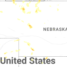

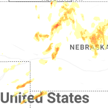


Connect with Interactive Hail Maps