

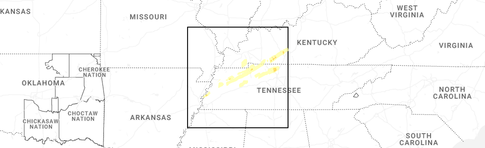
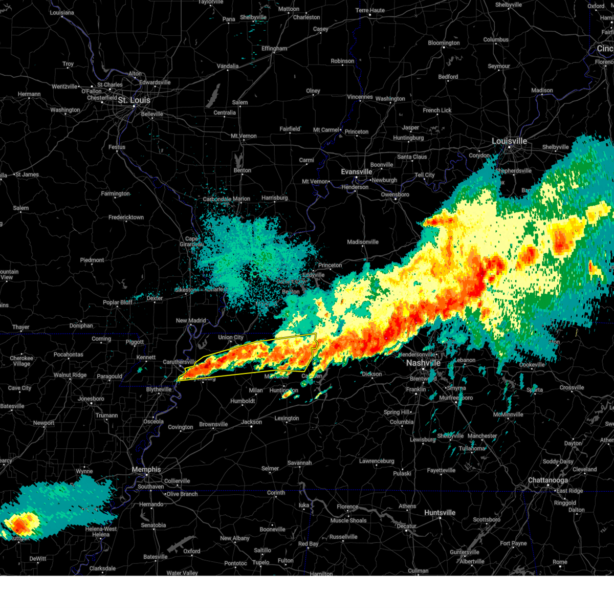
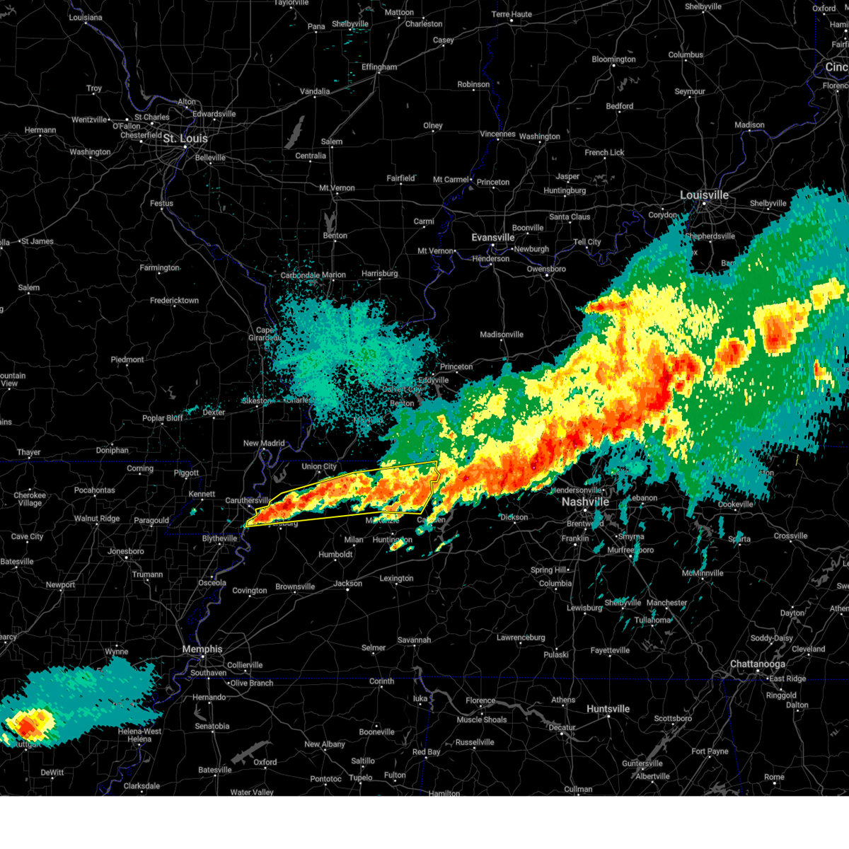
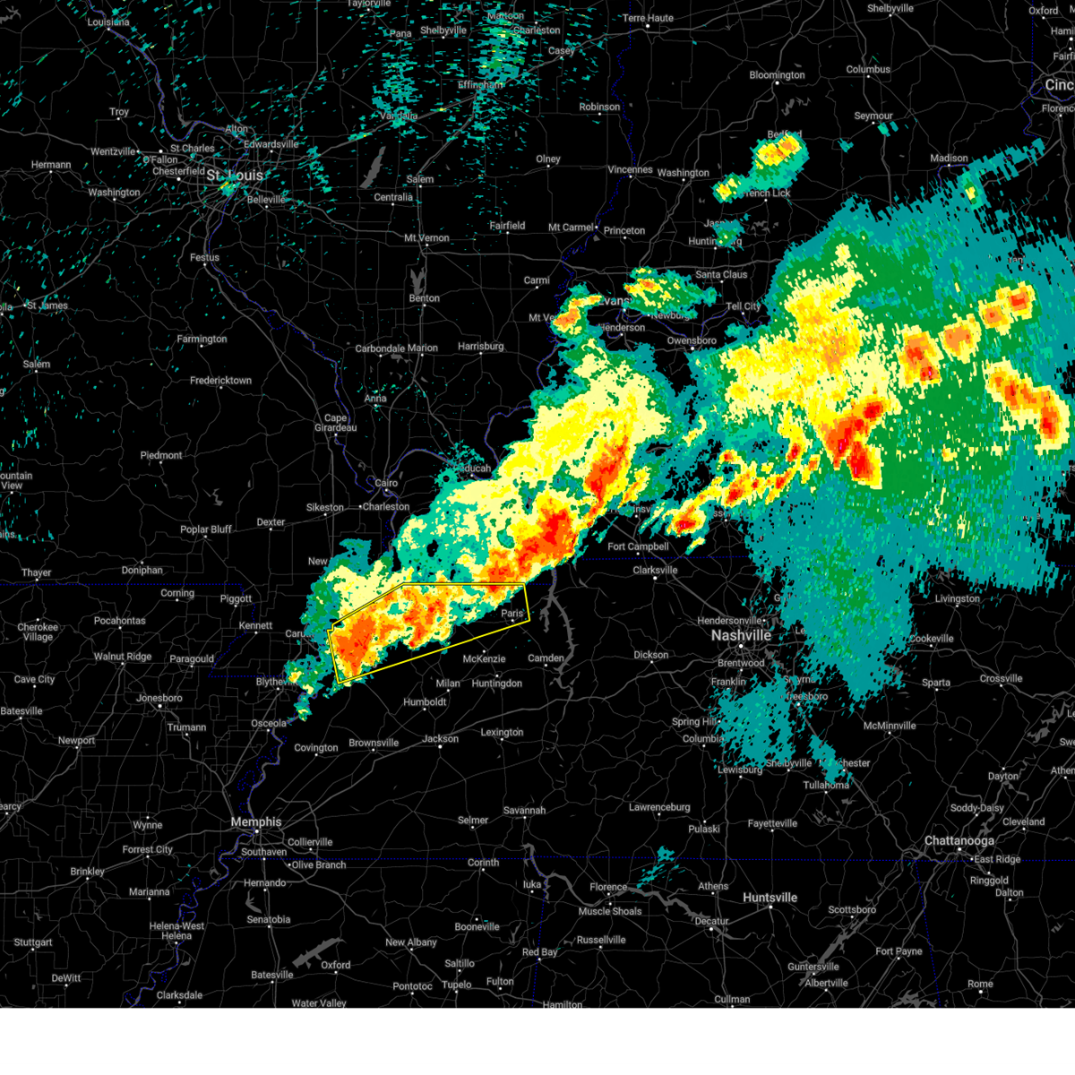
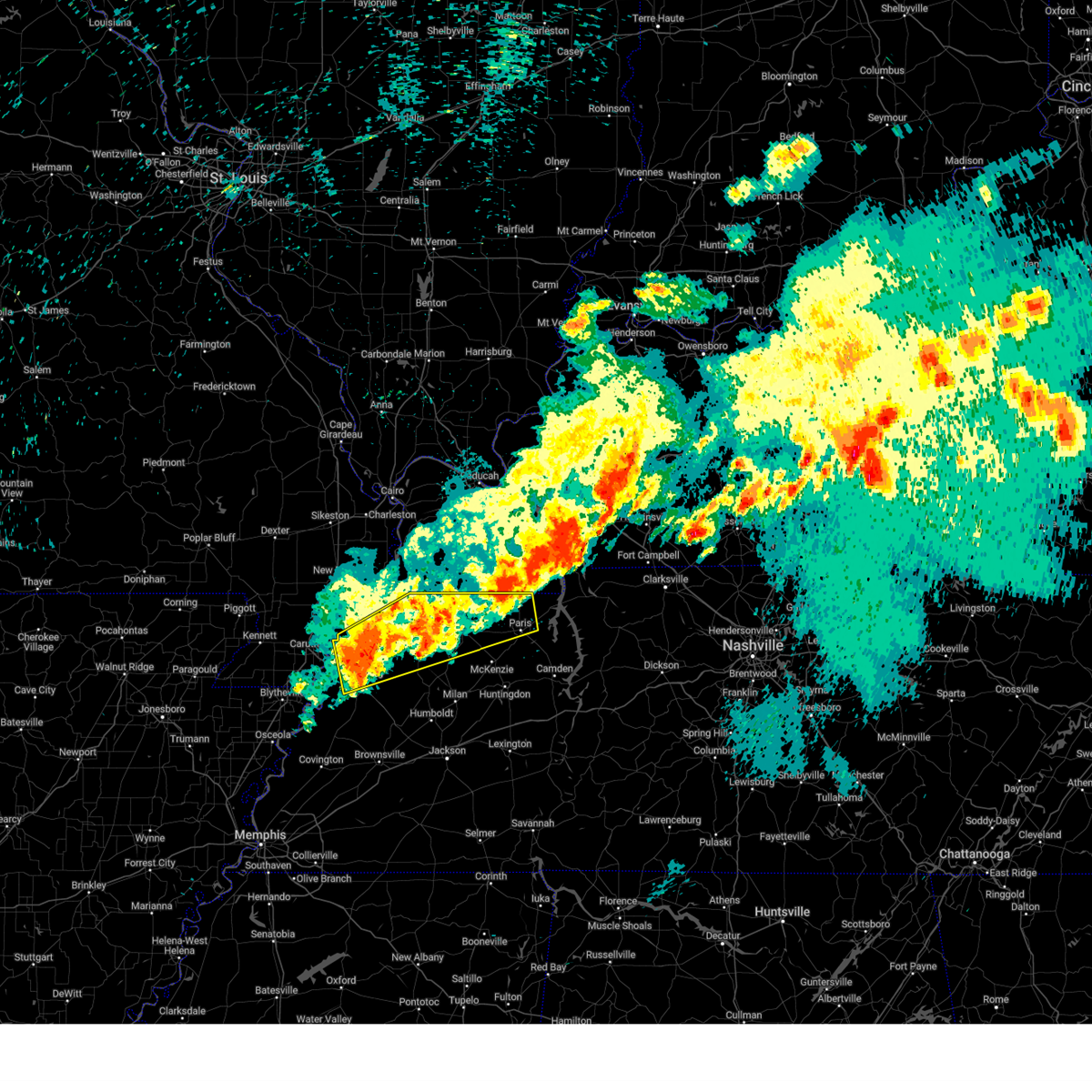
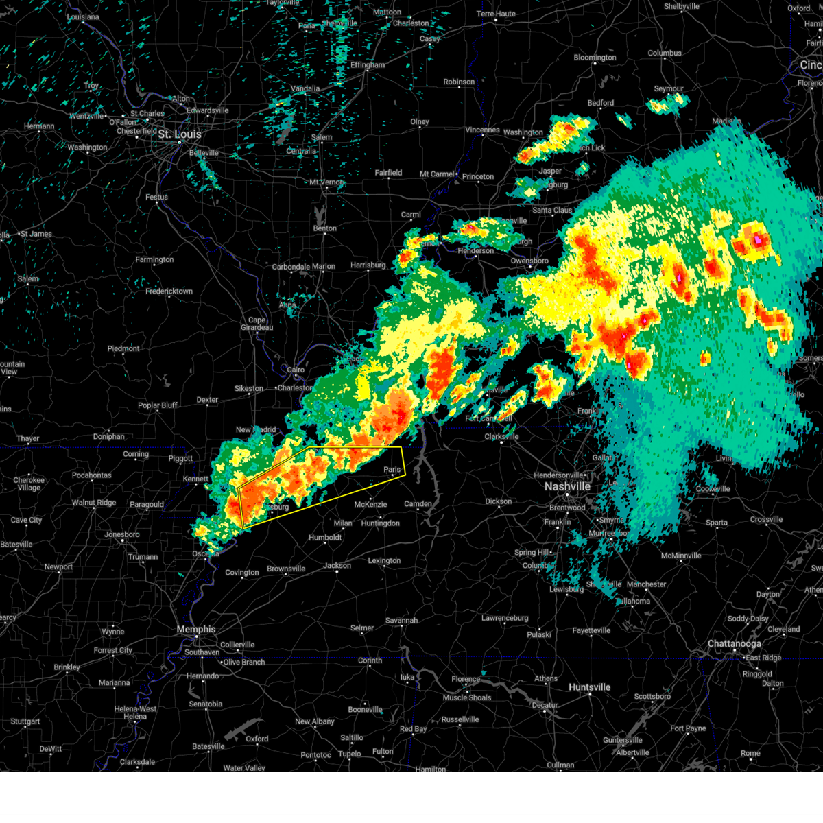
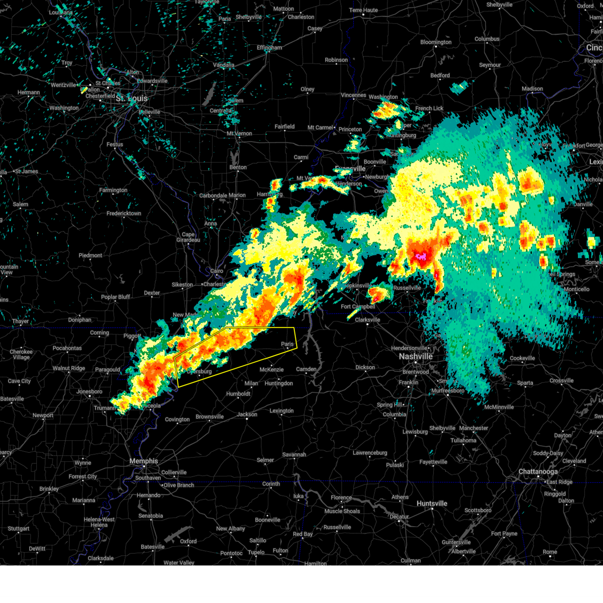
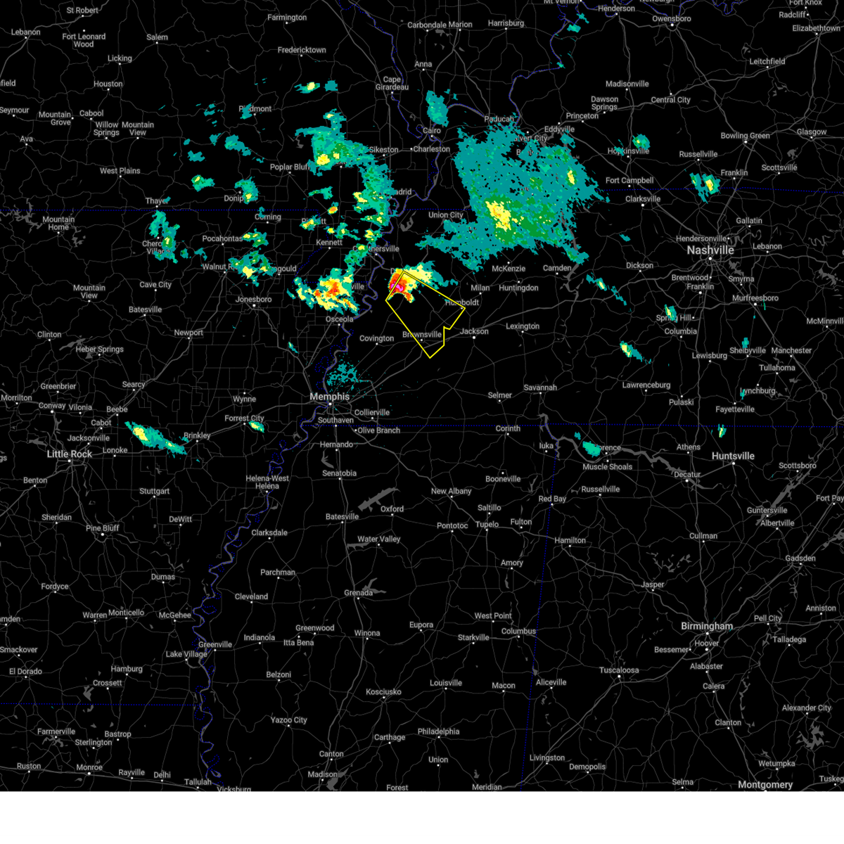
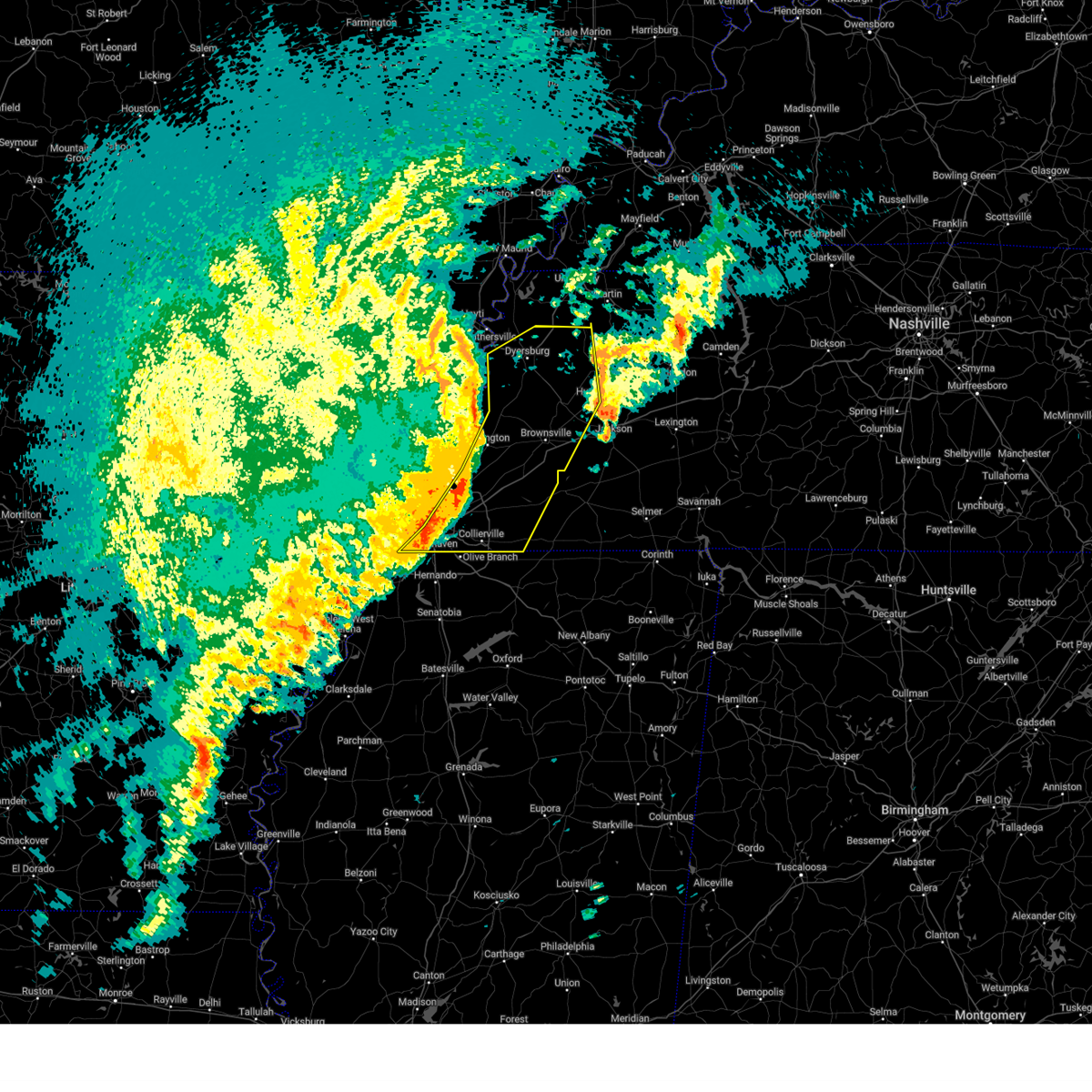
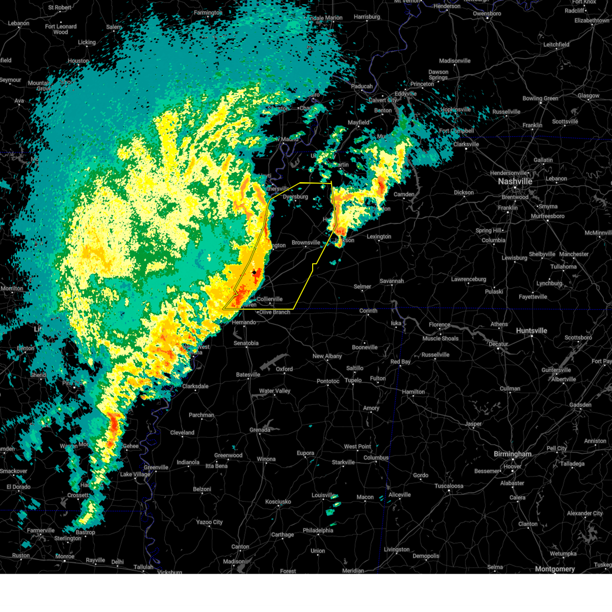
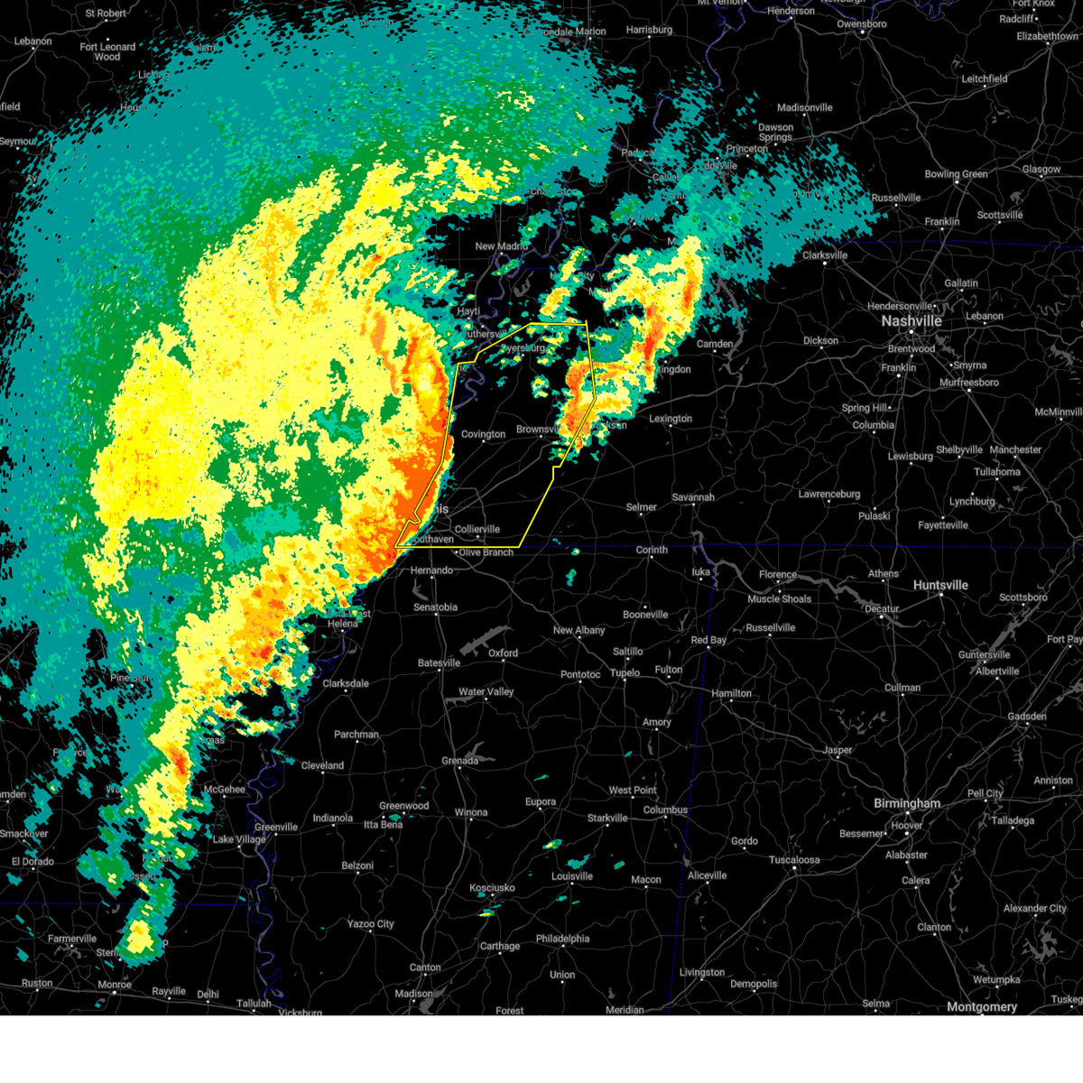
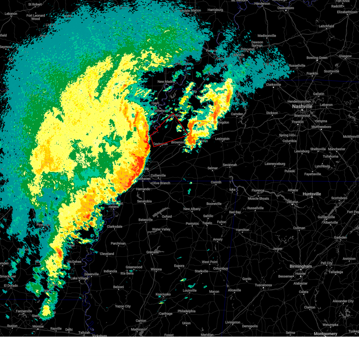
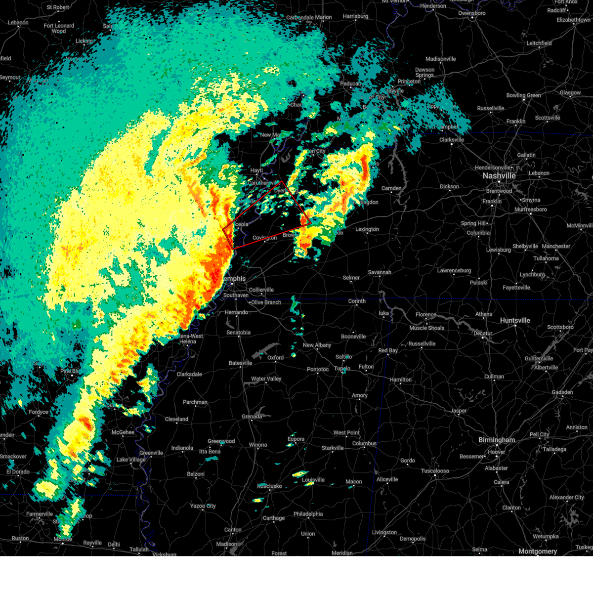
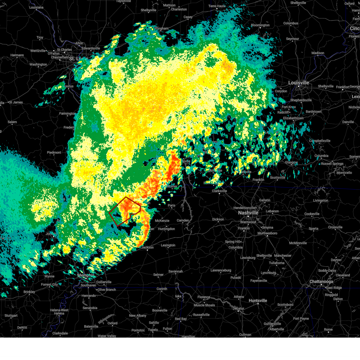
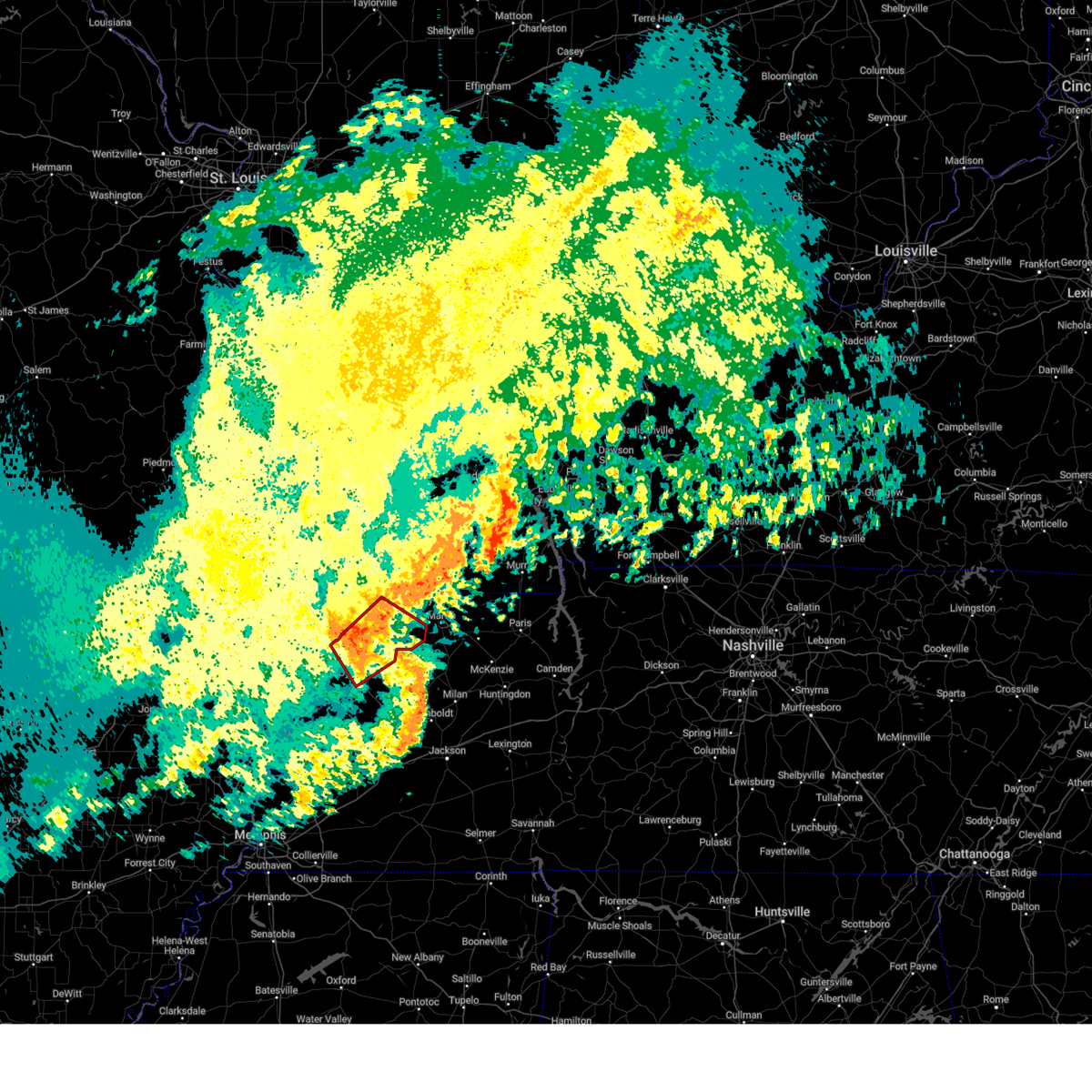
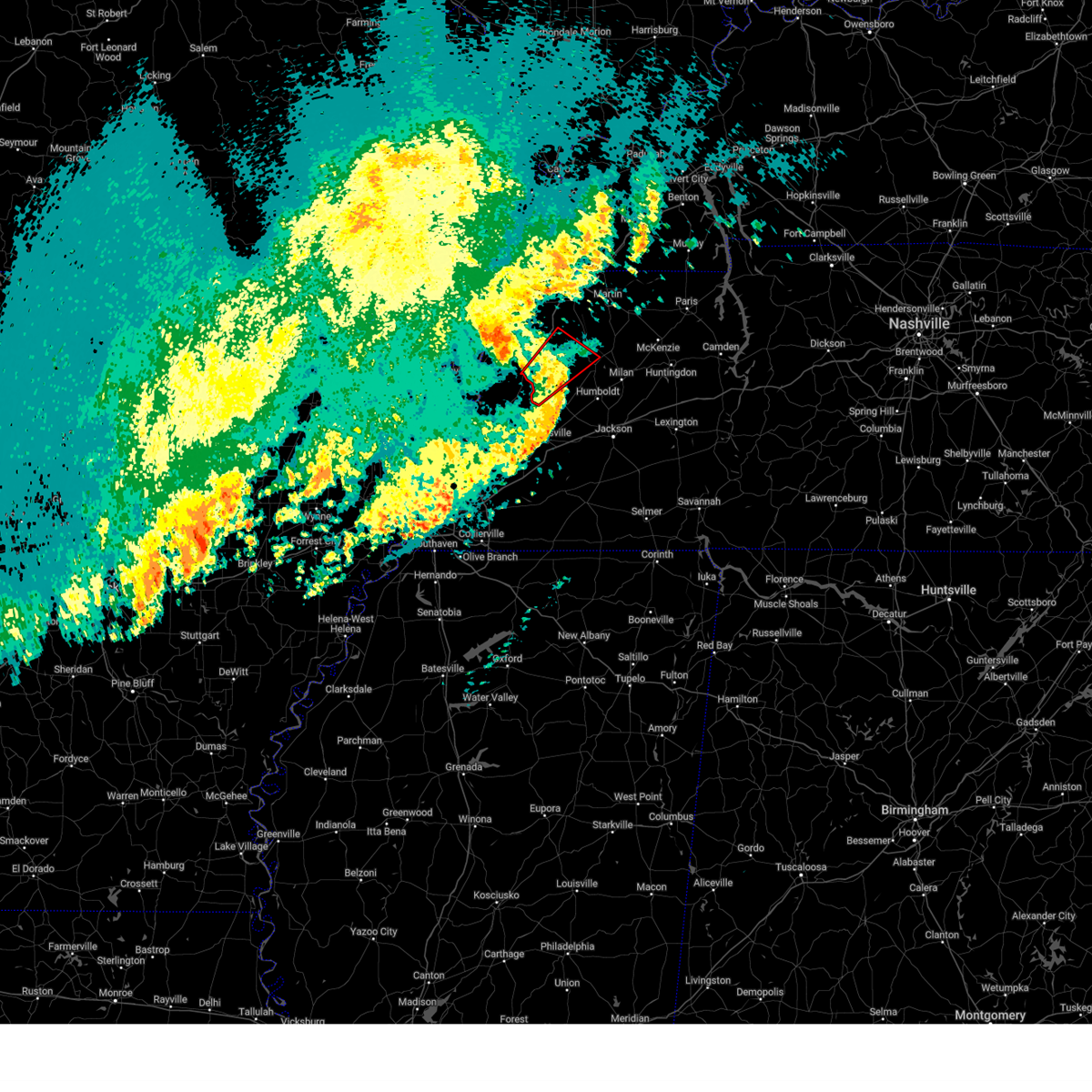
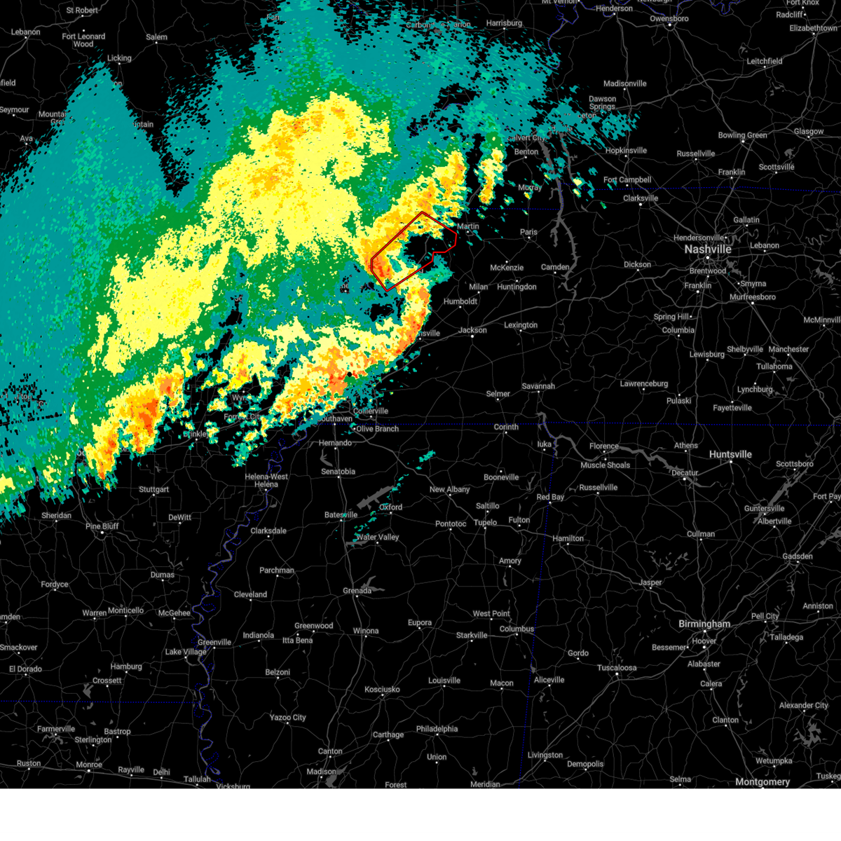
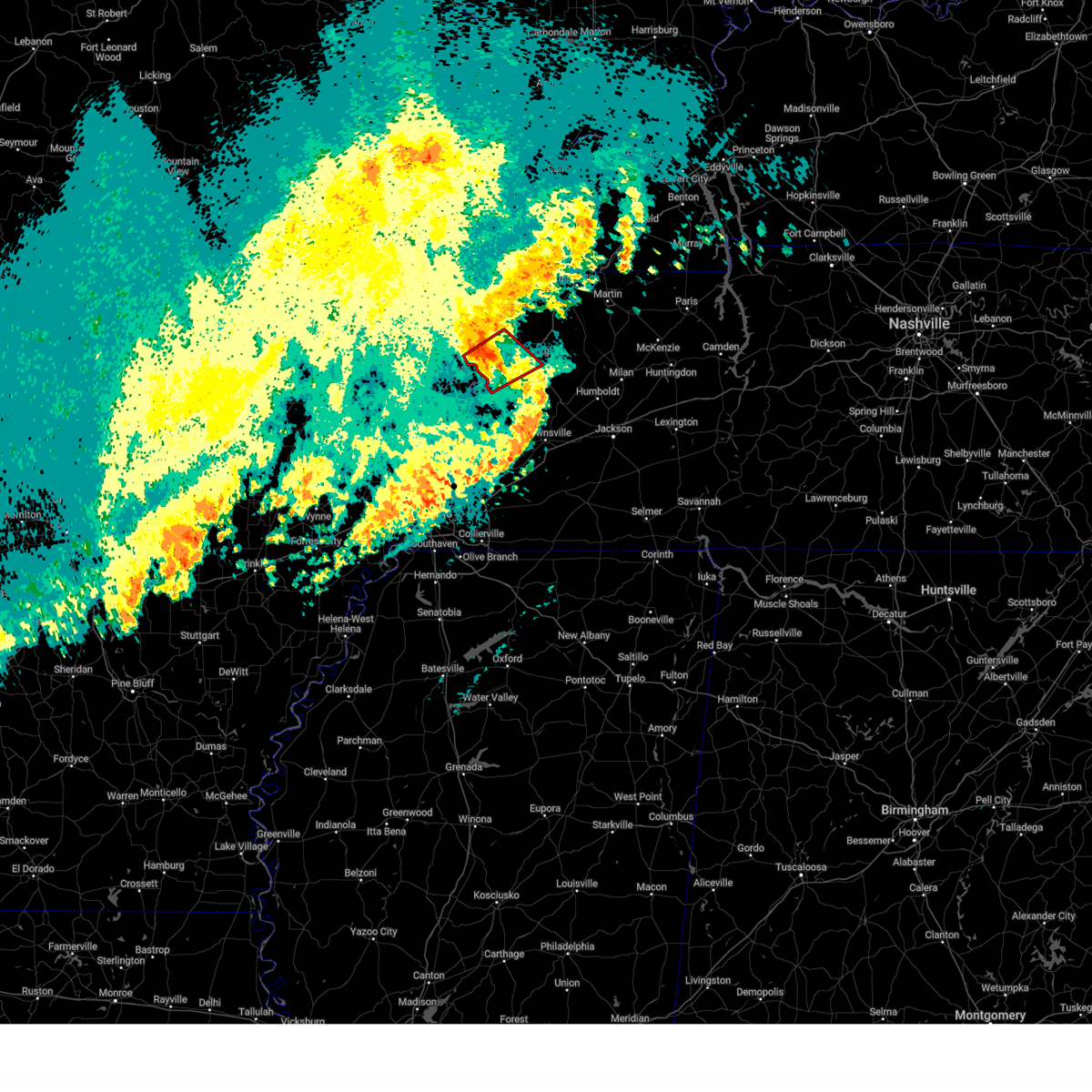
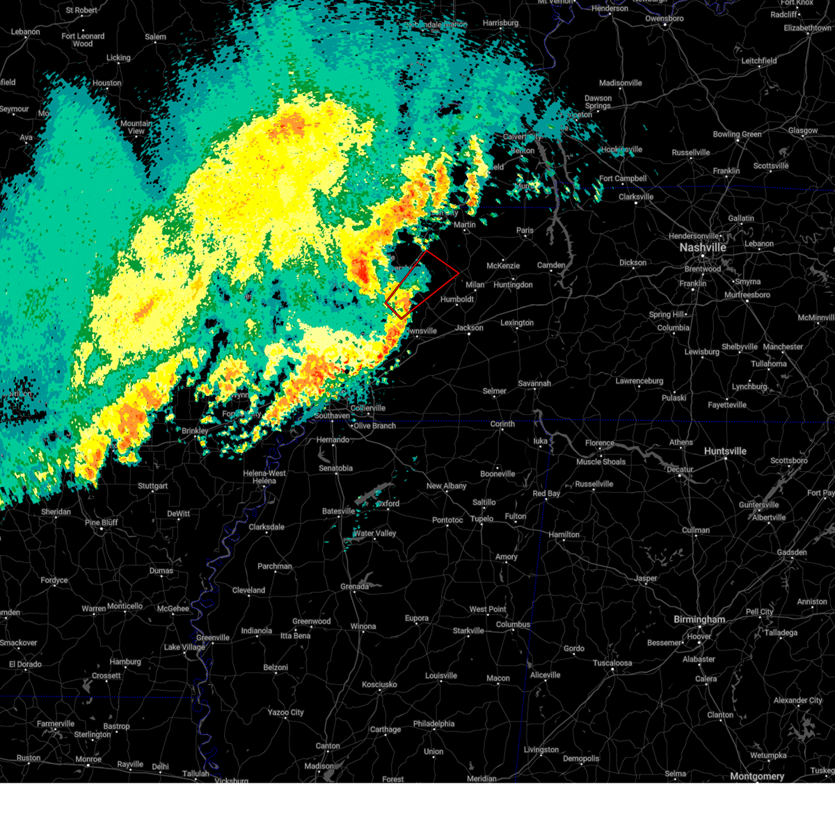
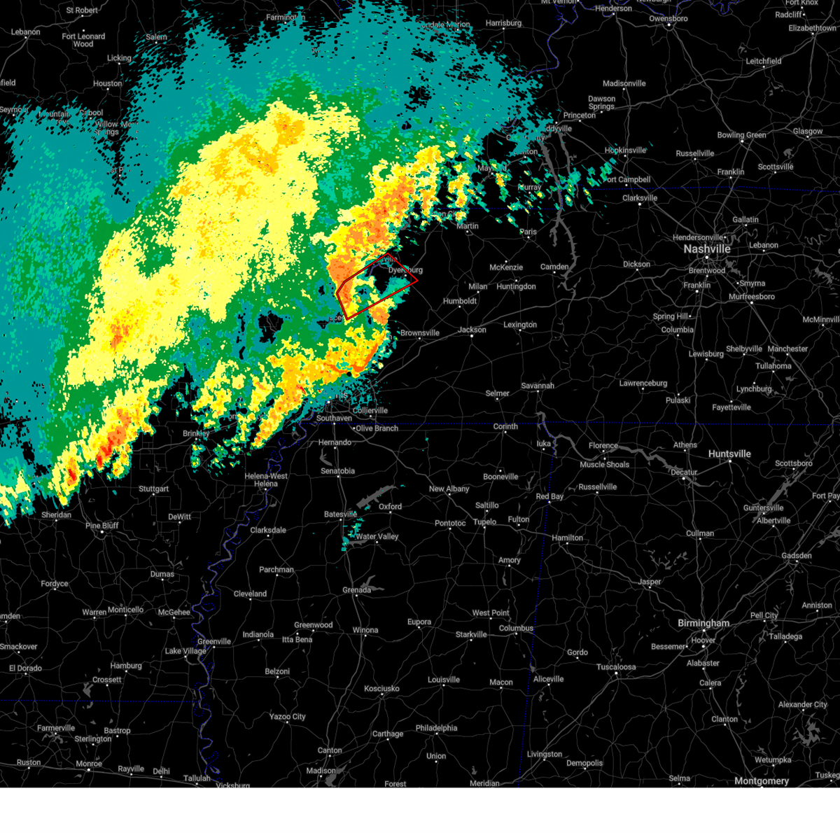
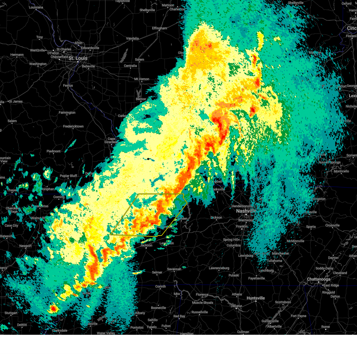
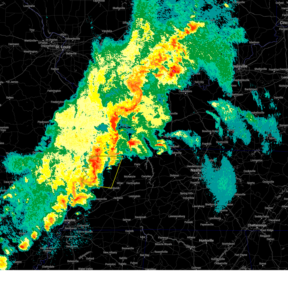
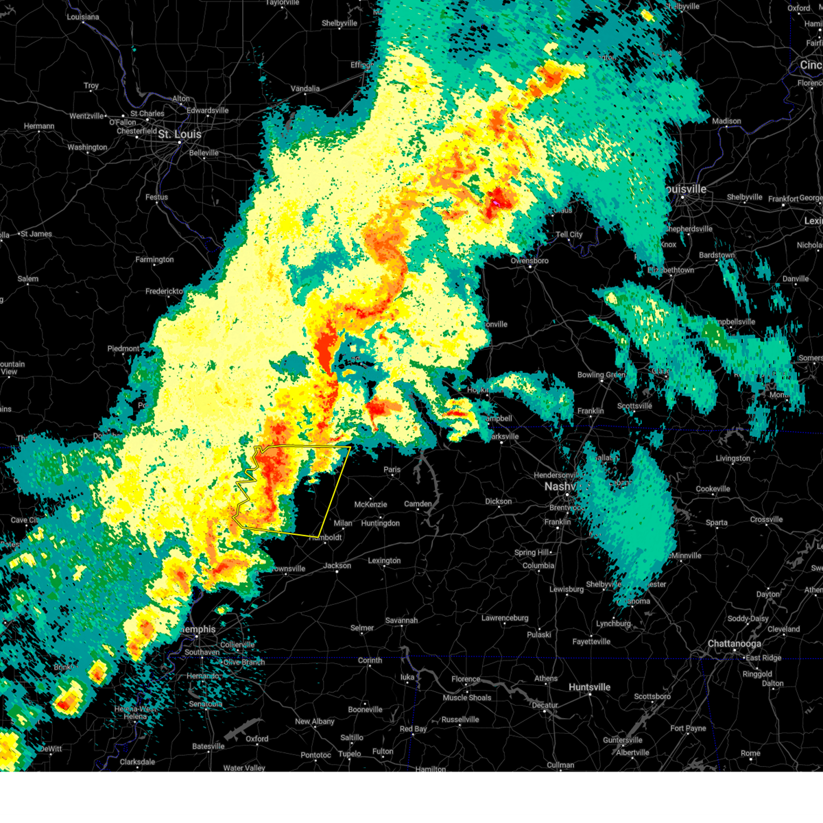
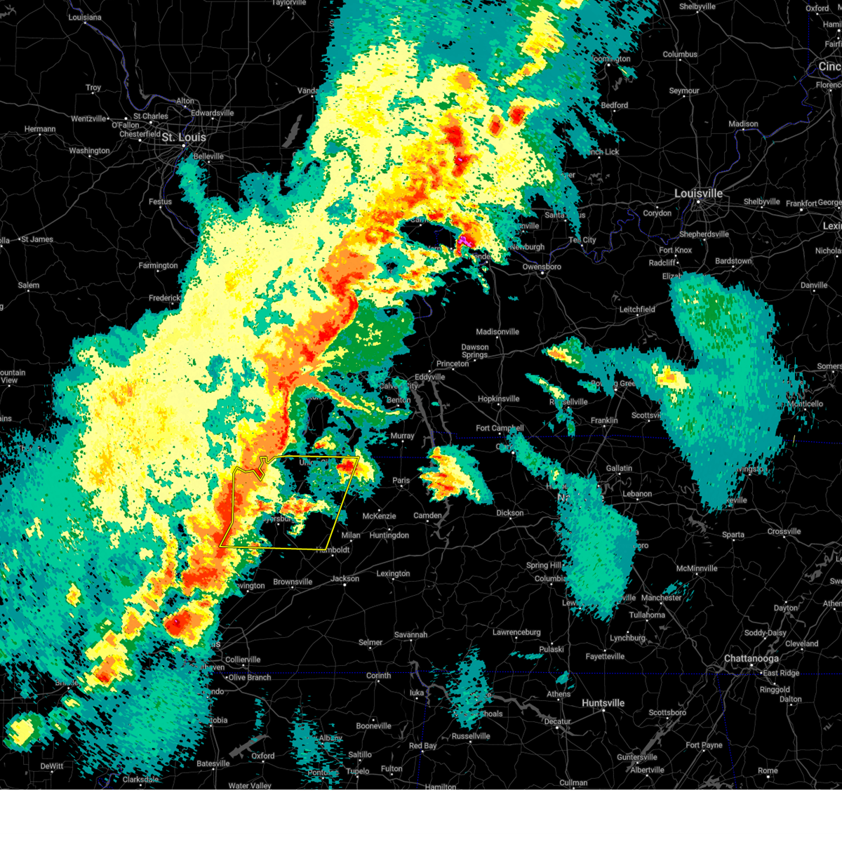
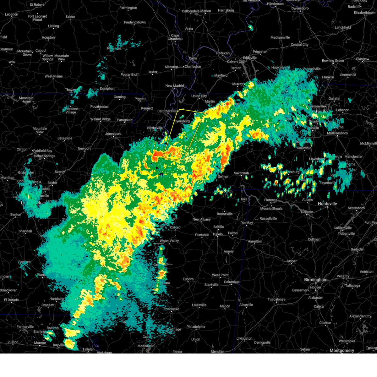
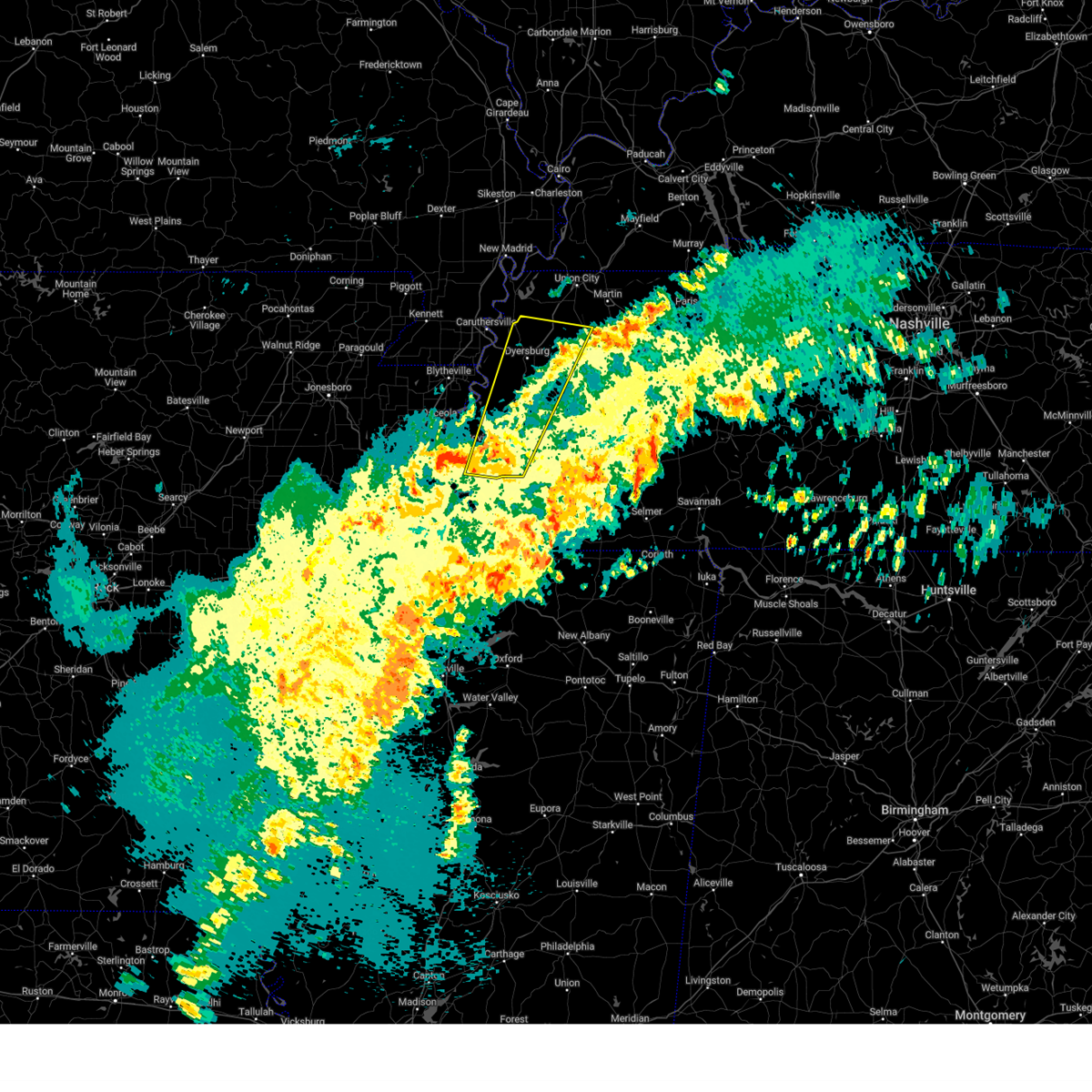
Hail Map for Dyersburg, TN
The Dyersburg, TN area has had 8 reports of on-the-ground hail by trained spotters, and has been under severe weather warnings 69 times during the past 12 months. Doppler radar has detected hail at or near Dyersburg, TN on 60 occasions, including 5 occasions during the past year.
| Name: | Dyersburg, TN |
| Where Located: | 49.1 miles W of Mc Kenzie, TN |
| Map: | Google Map for Dyersburg, TN |
| Population: | 17145 |
| Housing Units: | 7730 |
| More Info: | Search Google for Dyersburg, TN |
1
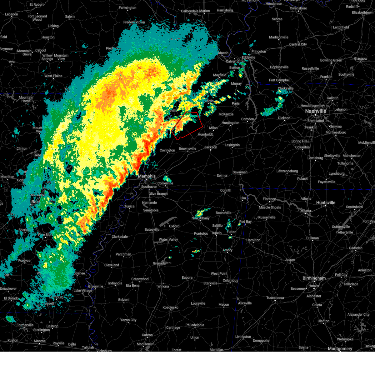
The Top Recent Hail Date for Dyersburg, TN is Saturday, February 15, 2025 (11th out of 60)
Hail and Wind Damage Spotted near Dyersburg, TN
| Date / Time | Report Details |
|---|---|
| 6/28/2025 5:34 PM CDT |
 Svrmeg the national weather service in memphis has issued a * severe thunderstorm warning for, northeastern mississippi county in eastern arkansas, southeastern pemiscot county in southeastern missouri, western dyer county in west tennessee, northeastern lauderdale county in west tennessee, * until 615 pm cdt. * at 534 pm cdt, a severe thunderstorm was located 8 miles east of blytheville, moving northeast at 20 mph (radar indicated). Hazards include 60 mph wind gusts. expect damage to roofs, siding, and trees Svrmeg the national weather service in memphis has issued a * severe thunderstorm warning for, northeastern mississippi county in eastern arkansas, southeastern pemiscot county in southeastern missouri, western dyer county in west tennessee, northeastern lauderdale county in west tennessee, * until 615 pm cdt. * at 534 pm cdt, a severe thunderstorm was located 8 miles east of blytheville, moving northeast at 20 mph (radar indicated). Hazards include 60 mph wind gusts. expect damage to roofs, siding, and trees
|
| 5/16/2025 11:52 PM CDT |
 At 1152 pm cdt, a severe thunderstorm was located near dyersburg, moving east at 40 mph (radar indicated). Hazards include 60 mph wind gusts and quarter size hail. Hail damage to vehicles is expected. expect wind damage to roofs, siding, and trees. Locations impacted include, tuckers corner, dyer, grizzard, bradford, atwood, lapata, cades, bonicord, central, rutherford, rohoboth, currie, mckenzie, gann, georgetown, edgewood, laneview, trezevant, parker, and tatumville. At 1152 pm cdt, a severe thunderstorm was located near dyersburg, moving east at 40 mph (radar indicated). Hazards include 60 mph wind gusts and quarter size hail. Hail damage to vehicles is expected. expect wind damage to roofs, siding, and trees. Locations impacted include, tuckers corner, dyer, grizzard, bradford, atwood, lapata, cades, bonicord, central, rutherford, rohoboth, currie, mckenzie, gann, georgetown, edgewood, laneview, trezevant, parker, and tatumville.
|
| 5/16/2025 11:35 PM CDT | Svrmeg the national weather service in memphis has issued a * severe thunderstorm warning for, northern crockett county in west tennessee, southern weakley county in west tennessee, southeastern dyer county in west tennessee, central gibson county in west tennessee, northwestern carroll county in west tennessee, * until 1230 am cdt. * at 1135 pm cdt, a severe thunderstorm was located near eaton, or 11 miles east of dyersburg, moving east at 40 mph (radar indicated). Hazards include 60 mph wind gusts and quarter size hail. Hail damage to vehicles is expected. Expect wind damage to roofs, siding, and trees. |
| 5/16/2025 11:01 PM CDT | The storms which prompted the warning have weakened. therefore, the warning has been allowed to expire. however, small hail and gusty winds are still possible with these thunderstorms. a tornado watch remains in effect until 200 am cdt for west tennessee. |
| 5/16/2025 10:32 PM CDT |
 At 1032 pm cdt, severe thunderstorms were located along a line extending from 7 miles northeast of springville to near sharon to near miston, moving east at 45 mph (radar indicated). Hazards include 60 mph wind gusts and quarter size hail. Hail damage to vehicles is expected. expect wind damage to roofs, siding, and trees. Locations impacted include, cat corner, newbern, old springville, como, locust grove, ralston, maxey, rutherford, elbridge, pisgah, porter court, ore springs, kenton, haigler ridge, lane, moffatt, kimery, bogota, buchanan, and india. At 1032 pm cdt, severe thunderstorms were located along a line extending from 7 miles northeast of springville to near sharon to near miston, moving east at 45 mph (radar indicated). Hazards include 60 mph wind gusts and quarter size hail. Hail damage to vehicles is expected. expect wind damage to roofs, siding, and trees. Locations impacted include, cat corner, newbern, old springville, como, locust grove, ralston, maxey, rutherford, elbridge, pisgah, porter court, ore springs, kenton, haigler ridge, lane, moffatt, kimery, bogota, buchanan, and india.
|
| 5/16/2025 10:27 PM CDT |
 At 1026 pm cdt, severe thunderstorms were located along a line extending from 6 miles northeast of springville to sharon to near miston, moving east at 35 mph (radar indicated). Hazards include 60 mph wind gusts and quarter size hail. Hail damage to vehicles is expected. expect wind damage to roofs, siding, and trees. Locations impacted include, cat corner, newbern, jones mill, latham, old springville, como, locust grove, ralston, maxey, rutherford, elbridge, pisgah, porter court, pine hill, broadmoor, ore springs, kenton, haigler ridge, lane, and moffatt. At 1026 pm cdt, severe thunderstorms were located along a line extending from 6 miles northeast of springville to sharon to near miston, moving east at 35 mph (radar indicated). Hazards include 60 mph wind gusts and quarter size hail. Hail damage to vehicles is expected. expect wind damage to roofs, siding, and trees. Locations impacted include, cat corner, newbern, jones mill, latham, old springville, como, locust grove, ralston, maxey, rutherford, elbridge, pisgah, porter court, pine hill, broadmoor, ore springs, kenton, haigler ridge, lane, and moffatt.
|
| 5/16/2025 10:27 PM CDT |
 the severe thunderstorm warning has been cancelled and is no longer in effect the severe thunderstorm warning has been cancelled and is no longer in effect
|
| 5/16/2025 10:15 PM CDT | Svrmeg the national weather service in memphis has issued a * severe thunderstorm warning for, weakley county in west tennessee, northern dyer county in west tennessee, northwestern gibson county in west tennessee, obion county in west tennessee, henry county in west tennessee, southeastern lake county in west tennessee, * until 1100 pm cdt. * at 1015 pm cdt, severe thunderstorms were located along a line extending from 7 miles southeast of paris landing state park to dresden to near miston, moving east at 45 mph (radar indicated). Hazards include 60 mph wind gusts and quarter size hail. Hail damage to vehicles is expected. Expect wind damage to roofs, siding, and trees. |
| 5/16/2025 8:44 AM CDT |
 the severe thunderstorm warning has been cancelled and is no longer in effect the severe thunderstorm warning has been cancelled and is no longer in effect
|
| 5/16/2025 8:44 AM CDT |
 At 844 am cdt, a severe thunderstorm was located over miston, or 8 miles northwest of dyersburg, moving northeast at 40 mph (trained weather spotters). Hazards include 70 mph wind gusts and quarter size hail. Hail damage to vehicles is expected. expect considerable tree damage. wind damage is also likely to mobile homes, roofs, and outbuildings. Locations impacted include, south fulton, newbern, jones mill, lapata, como, ralston, shaffner, rohoboth, terrell, edgewood, ore springs, kenton, madie, lane, moffatt, troy, india, mill creek, nauvoo, and lassiter corner. At 844 am cdt, a severe thunderstorm was located over miston, or 8 miles northwest of dyersburg, moving northeast at 40 mph (trained weather spotters). Hazards include 70 mph wind gusts and quarter size hail. Hail damage to vehicles is expected. expect considerable tree damage. wind damage is also likely to mobile homes, roofs, and outbuildings. Locations impacted include, south fulton, newbern, jones mill, lapata, como, ralston, shaffner, rohoboth, terrell, edgewood, ore springs, kenton, madie, lane, moffatt, troy, india, mill creek, nauvoo, and lassiter corner.
|
| 5/16/2025 8:32 AM CDT |
 At 831 am cdt, a severe thunderstorm was located near union city, moving northeast at 55 mph (trained weather spotters). Hazards include 60 mph wind gusts and quarter size hail. Hail damage to vehicles is expected. expect wind damage to roofs, siding, and trees. Locations impacted include, south fulton, newbern, jones mill, lapata, como, ralston, shaffner, rohoboth, terrell, edgewood, ore springs, kenton, madie, lane, moffatt, troy, india, tennemo, mill creek, and nauvoo. At 831 am cdt, a severe thunderstorm was located near union city, moving northeast at 55 mph (trained weather spotters). Hazards include 60 mph wind gusts and quarter size hail. Hail damage to vehicles is expected. expect wind damage to roofs, siding, and trees. Locations impacted include, south fulton, newbern, jones mill, lapata, como, ralston, shaffner, rohoboth, terrell, edgewood, ore springs, kenton, madie, lane, moffatt, troy, india, tennemo, mill creek, and nauvoo.
|
| 5/16/2025 8:15 AM CDT |
 Svrmeg the national weather service in memphis has issued a * severe thunderstorm warning for, east central pemiscot county in southeastern missouri, weakley county in west tennessee, dyer county in west tennessee, northwestern gibson county in west tennessee, obion county in west tennessee, northwestern henry county in west tennessee, southeastern lake county in west tennessee, * until 915 am cdt. * at 815 am cdt, a severe thunderstorm was located over obion, or 12 miles southeast of reelfoot lake state park, moving northeast at 55 mph (radar indicated). Hazards include 60 mph wind gusts and quarter size hail. Hail damage to vehicles is expected. Expect wind damage to roofs, siding, and trees. Svrmeg the national weather service in memphis has issued a * severe thunderstorm warning for, east central pemiscot county in southeastern missouri, weakley county in west tennessee, dyer county in west tennessee, northwestern gibson county in west tennessee, obion county in west tennessee, northwestern henry county in west tennessee, southeastern lake county in west tennessee, * until 915 am cdt. * at 815 am cdt, a severe thunderstorm was located over obion, or 12 miles southeast of reelfoot lake state park, moving northeast at 55 mph (radar indicated). Hazards include 60 mph wind gusts and quarter size hail. Hail damage to vehicles is expected. Expect wind damage to roofs, siding, and trees.
|
| 4/10/2025 3:25 PM CDT |
 At 325 pm cdt, a severe thunderstorm was located over halls, or 11 miles south of dyersburg, moving southeast at 45 mph (radar indicated). Hazards include 60 mph wind gusts and half dollar size hail. Hail damage to vehicles is expected. expect wind damage to roofs, siding, and trees. Locations impacted include, edith, gibson wells, fowlkes, brownsville, humboldt, christmasville, bonicord, jenkinsville, mason grove, forked deer, maury junction, halls, poplar grove, fruitvale, dyersburg, crockett mills, parker, curve, dog hill, and brims corner. At 325 pm cdt, a severe thunderstorm was located over halls, or 11 miles south of dyersburg, moving southeast at 45 mph (radar indicated). Hazards include 60 mph wind gusts and half dollar size hail. Hail damage to vehicles is expected. expect wind damage to roofs, siding, and trees. Locations impacted include, edith, gibson wells, fowlkes, brownsville, humboldt, christmasville, bonicord, jenkinsville, mason grove, forked deer, maury junction, halls, poplar grove, fruitvale, dyersburg, crockett mills, parker, curve, dog hill, and brims corner.
|
| 4/10/2025 3:20 PM CDT | Quarter sized hail reported 1 miles SSW of Dyersburg, TN |
| 4/10/2025 3:18 PM CDT | Quarter sized hail reported 1 miles SSW of Dyersburg, TN |
| 4/10/2025 3:15 PM CDT | Svrmeg the national weather service in memphis has issued a * severe thunderstorm warning for, crockett county in west tennessee, southern dyer county in west tennessee, southwestern gibson county in west tennessee, northeastern lauderdale county in west tennessee, central haywood county in west tennessee, * until 400 pm cdt. * at 315 pm cdt, a severe thunderstorm was located near unionville, or 9 miles southwest of dyersburg, moving southeast at 45 mph (radar indicated). Hazards include 60 mph wind gusts and quarter size hail. Hail damage to vehicles is expected. Expect wind damage to roofs, siding, and trees. |
| 4/5/2025 2:18 PM CDT |
 At 218 pm cdt, a severe thunderstorm capable of producing a tornado was located near forked deer, or near ripley, moving northeast at 45 mph (radar indicated rotation). Hazards include tornado and quarter size hail. Flying debris will be dangerous to those caught without shelter. mobile homes will be damaged or destroyed. damage to roofs, windows, and vehicles will occur. tree damage is likely. Locations impacted include, bishop, hawkinsville, chestnut bluff, fowlkes, dryhill, bonicord, double bridges, friendship, frog jump, flippin, forked deer, maury junction, halls, south fork, poplar grove, curve, dog hill, viar, brims corner, and maury city. At 218 pm cdt, a severe thunderstorm capable of producing a tornado was located near forked deer, or near ripley, moving northeast at 45 mph (radar indicated rotation). Hazards include tornado and quarter size hail. Flying debris will be dangerous to those caught without shelter. mobile homes will be damaged or destroyed. damage to roofs, windows, and vehicles will occur. tree damage is likely. Locations impacted include, bishop, hawkinsville, chestnut bluff, fowlkes, dryhill, bonicord, double bridges, friendship, frog jump, flippin, forked deer, maury junction, halls, south fork, poplar grove, curve, dog hill, viar, brims corner, and maury city.
|
| 4/5/2025 2:18 PM CDT |
 At 218 pm cdt, a severe thunderstorm capable of producing a tornado was located over forked deer, or near ripley, moving northeast at 50 mph (radar indicated rotation). Hazards include tornado and quarter size hail. Flying debris will be dangerous to those caught without shelter. mobile homes will be damaged or destroyed. damage to roofs, windows, and vehicles will occur. tree damage is likely. Locations impacted include, bishop, hawkinsville, chestnut bluff, papaw ridge, porter gap, edith, fowlkes, dryhill, bonicord, double bridges, jenkinsville, friendship, frog jump, flippin, bradleytown, forked deer, maury junction, unionville, halls, and south fork. At 218 pm cdt, a severe thunderstorm capable of producing a tornado was located over forked deer, or near ripley, moving northeast at 50 mph (radar indicated rotation). Hazards include tornado and quarter size hail. Flying debris will be dangerous to those caught without shelter. mobile homes will be damaged or destroyed. damage to roofs, windows, and vehicles will occur. tree damage is likely. Locations impacted include, bishop, hawkinsville, chestnut bluff, papaw ridge, porter gap, edith, fowlkes, dryhill, bonicord, double bridges, jenkinsville, friendship, frog jump, flippin, bradleytown, forked deer, maury junction, unionville, halls, and south fork.
|
| 4/5/2025 2:16 PM CDT |
 the severe thunderstorm warning has been cancelled and is no longer in effect the severe thunderstorm warning has been cancelled and is no longer in effect
|
| 4/5/2025 2:16 PM CDT |
 At 215 pm cdt, severe thunderstorms were located along a line extending from near bradleytown to 10 miles south of nutbush to near collierville, moving east at 55 mph (radar indicated). Hazards include 60 mph wind gusts and nickel size hail. Expect damage to roofs, siding, and trees. Locations impacted include, dyer, newbern, stanton, lapata, covington, rohoboth, currie, kirk, arlington, elmore park, poplar grove, laconia, parker, fruitland, lane, brims corner, sunnyhill, durhamville, nauvoo, and clopton. At 215 pm cdt, severe thunderstorms were located along a line extending from near bradleytown to 10 miles south of nutbush to near collierville, moving east at 55 mph (radar indicated). Hazards include 60 mph wind gusts and nickel size hail. Expect damage to roofs, siding, and trees. Locations impacted include, dyer, newbern, stanton, lapata, covington, rohoboth, currie, kirk, arlington, elmore park, poplar grove, laconia, parker, fruitland, lane, brims corner, sunnyhill, durhamville, nauvoo, and clopton.
|
| 4/5/2025 2:10 PM CDT |
 At 209 pm cdt, a severe thunderstorm capable of producing a tornado was located over ripley, moving northeast at 50 mph (radar indicated rotation). Hazards include tornado and quarter size hail. Flying debris will be dangerous to those caught without shelter. mobile homes will be damaged or destroyed. damage to roofs, windows, and vehicles will occur. tree damage is likely. Locations impacted include, bishop, hawkinsville, chestnut bluff, papaw ridge, porter gap, edith, fowlkes, dryhill, bonicord, double bridges, jenkinsville, chickasaw national wildlife refuge, friendship, frog jump, flippin, bradleytown, forked deer, maury junction, unionville, and halls. At 209 pm cdt, a severe thunderstorm capable of producing a tornado was located over ripley, moving northeast at 50 mph (radar indicated rotation). Hazards include tornado and quarter size hail. Flying debris will be dangerous to those caught without shelter. mobile homes will be damaged or destroyed. damage to roofs, windows, and vehicles will occur. tree damage is likely. Locations impacted include, bishop, hawkinsville, chestnut bluff, papaw ridge, porter gap, edith, fowlkes, dryhill, bonicord, double bridges, jenkinsville, chickasaw national wildlife refuge, friendship, frog jump, flippin, bradleytown, forked deer, maury junction, unionville, and halls.
|
| 4/5/2025 2:10 PM CDT |
 the tornado warning has been cancelled and is no longer in effect the tornado warning has been cancelled and is no longer in effect
|
| 4/5/2025 2:06 PM CDT |
 At 206 pm cdt, severe thunderstorms were located along a line extending from near heloise to near covington to near southeast memphis, moving northeast at 60 mph (radar indicated). Hazards include 60 mph wind gusts and quarter size hail. Hail damage to vehicles is expected. expect wind damage to roofs, siding, and trees. Locations impacted include, dyer, burlison, newbern, stanton, lapata, covington, rohoboth, currie, kirk, arlington, elmore park, poplar grove, laconia, parker, fruitland, lane, brims corner, sunnyhill, durhamville, and nauvoo. At 206 pm cdt, severe thunderstorms were located along a line extending from near heloise to near covington to near southeast memphis, moving northeast at 60 mph (radar indicated). Hazards include 60 mph wind gusts and quarter size hail. Hail damage to vehicles is expected. expect wind damage to roofs, siding, and trees. Locations impacted include, dyer, burlison, newbern, stanton, lapata, covington, rohoboth, currie, kirk, arlington, elmore park, poplar grove, laconia, parker, fruitland, lane, brims corner, sunnyhill, durhamville, and nauvoo.
|
| 4/5/2025 1:59 PM CDT |
 Svrmeg the national weather service in memphis has issued a * severe thunderstorm warning for, eastern mississippi county in eastern arkansas, crockett county in west tennessee, tipton county in west tennessee, dyer county in west tennessee, western gibson county in west tennessee, fayette county in west tennessee, lauderdale county in west tennessee, haywood county in west tennessee, northwestern madison county in west tennessee, shelby county in west tennessee, * until 245 pm cdt. * at 158 pm cdt, severe thunderstorms were located along a line extending from 7 miles southeast of cooter to near covington to whitehaven, moving northeast at 60 mph (radar indicated). Hazards include 70 mph wind gusts and quarter size hail. Hail damage to vehicles is expected. expect considerable tree damage. Wind damage is also likely to mobile homes, roofs, and outbuildings. Svrmeg the national weather service in memphis has issued a * severe thunderstorm warning for, eastern mississippi county in eastern arkansas, crockett county in west tennessee, tipton county in west tennessee, dyer county in west tennessee, western gibson county in west tennessee, fayette county in west tennessee, lauderdale county in west tennessee, haywood county in west tennessee, northwestern madison county in west tennessee, shelby county in west tennessee, * until 245 pm cdt. * at 158 pm cdt, severe thunderstorms were located along a line extending from 7 miles southeast of cooter to near covington to whitehaven, moving northeast at 60 mph (radar indicated). Hazards include 70 mph wind gusts and quarter size hail. Hail damage to vehicles is expected. expect considerable tree damage. Wind damage is also likely to mobile homes, roofs, and outbuildings.
|
| 4/5/2025 1:56 PM CDT |
 the tornado warning has been cancelled and is no longer in effect the tornado warning has been cancelled and is no longer in effect
|
| 4/5/2025 1:56 PM CDT |
 At 156 pm cdt, a severe thunderstorm capable of producing a tornado was located over ft pillow, or near fort pillow state park, moving northeast at 50 mph (radar indicated rotation). Hazards include tornado and quarter size hail. Flying debris will be dangerous to those caught without shelter. mobile homes will be damaged or destroyed. damage to roofs, windows, and vehicles will occur. tree damage is likely. Locations impacted include, edith, fowlkes, bonicord, nutbush, jenkinsville, luckett, forked deer, maury junction, halls, poplar grove, dyersburg, curve, dog hill, brims corner, tibbs, durhamville, maury city, nankipoo, finley, and stinger. At 156 pm cdt, a severe thunderstorm capable of producing a tornado was located over ft pillow, or near fort pillow state park, moving northeast at 50 mph (radar indicated rotation). Hazards include tornado and quarter size hail. Flying debris will be dangerous to those caught without shelter. mobile homes will be damaged or destroyed. damage to roofs, windows, and vehicles will occur. tree damage is likely. Locations impacted include, edith, fowlkes, bonicord, nutbush, jenkinsville, luckett, forked deer, maury junction, halls, poplar grove, dyersburg, curve, dog hill, brims corner, tibbs, durhamville, maury city, nankipoo, finley, and stinger.
|
| 4/5/2025 1:39 PM CDT |
 Tormeg the national weather service in memphis has issued a * tornado warning for, central mississippi county in eastern arkansas, western crockett county in west tennessee, northwestern tipton county in west tennessee, dyer county in west tennessee, lauderdale county in west tennessee, northern haywood county in west tennessee, * until 230 pm cdt. * at 139 pm cdt, a severe thunderstorm capable of producing a tornado was located near marie, or near wilson, moving northeast at 55 mph (radar indicated rotation). Hazards include tornado and quarter size hail. Flying debris will be dangerous to those caught without shelter. mobile homes will be damaged or destroyed. damage to roofs, windows, and vehicles will occur. Tree damage is likely. Tormeg the national weather service in memphis has issued a * tornado warning for, central mississippi county in eastern arkansas, western crockett county in west tennessee, northwestern tipton county in west tennessee, dyer county in west tennessee, lauderdale county in west tennessee, northern haywood county in west tennessee, * until 230 pm cdt. * at 139 pm cdt, a severe thunderstorm capable of producing a tornado was located near marie, or near wilson, moving northeast at 55 mph (radar indicated rotation). Hazards include tornado and quarter size hail. Flying debris will be dangerous to those caught without shelter. mobile homes will be damaged or destroyed. damage to roofs, windows, and vehicles will occur. Tree damage is likely.
|
| 4/5/2025 4:23 AM CDT |
 the tornado warning has been cancelled and is no longer in effect the tornado warning has been cancelled and is no longer in effect
|
| 4/5/2025 4:12 AM CDT |
 the tornado warning has been cancelled and is no longer in effect the tornado warning has been cancelled and is no longer in effect
|
| 4/5/2025 4:12 AM CDT |
 At 412 am cdt, a severe thunderstorm capable of producing a tornado was located over cloverdale, or 11 miles north of dyersburg, moving northeast at 50 mph (radar indicated rotation). Hazards include tornado. Flying debris will be dangerous to those caught without shelter. mobile homes will be damaged or destroyed. damage to roofs, windows, and vehicles will occur. tree damage is likely. Locations impacted include, mason hall, cat corner, newbern, ridgely, glass, locust grove, jenkinsville, maxey, roneys store, elbridge, templeton, trimble, bradleytown, rives, jacksonville, miston, samburg, fremont, broadmoor, and sharps ferry. At 412 am cdt, a severe thunderstorm capable of producing a tornado was located over cloverdale, or 11 miles north of dyersburg, moving northeast at 50 mph (radar indicated rotation). Hazards include tornado. Flying debris will be dangerous to those caught without shelter. mobile homes will be damaged or destroyed. damage to roofs, windows, and vehicles will occur. tree damage is likely. Locations impacted include, mason hall, cat corner, newbern, ridgely, glass, locust grove, jenkinsville, maxey, roneys store, elbridge, templeton, trimble, bradleytown, rives, jacksonville, miston, samburg, fremont, broadmoor, and sharps ferry.
|
| 4/5/2025 4:01 AM CDT |
 At 401 am cdt, a confirmed tornado was located over eaton, or 12 miles west of trenton, moving northeast at 45 mph (radar confirmed tornado). Hazards include damaging tornado. Flying debris will be dangerous to those caught without shelter. mobile homes will be damaged or destroyed. damage to roofs, windows, and vehicles will occur. tree damage is likely. Locations impacted include, bishop, dyer, hawkinsville, grizzard, fowlkes, lapata, bonicord, central, friendship, rohoboth, currie, maury junction, georgetown, edgewood, south fork, churchton, parker, tatumville, viar, and eaton. At 401 am cdt, a confirmed tornado was located over eaton, or 12 miles west of trenton, moving northeast at 45 mph (radar confirmed tornado). Hazards include damaging tornado. Flying debris will be dangerous to those caught without shelter. mobile homes will be damaged or destroyed. damage to roofs, windows, and vehicles will occur. tree damage is likely. Locations impacted include, bishop, dyer, hawkinsville, grizzard, fowlkes, lapata, bonicord, central, friendship, rohoboth, currie, maury junction, georgetown, edgewood, south fork, churchton, parker, tatumville, viar, and eaton.
|
| 4/5/2025 3:54 AM CDT |
 At 354 am cdt, a severe thunderstorm capable of producing a tornado was located near chestnut bluff, or 12 miles southeast of dyersburg, moving northeast at 45 mph (radar indicated rotation). Hazards include tornado. Flying debris will be dangerous to those caught without shelter. mobile homes will be damaged or destroyed. damage to roofs, windows, and vehicles will occur. tree damage is likely. Locations impacted include, bishop, dyer, hawkinsville, chestnut bluff, grizzard, fowlkes, lapata, bonicord, central, friendship, frog jump, rohoboth, currie, maury junction, georgetown, edgewood, south fork, churchton, parker, and dog hill. At 354 am cdt, a severe thunderstorm capable of producing a tornado was located near chestnut bluff, or 12 miles southeast of dyersburg, moving northeast at 45 mph (radar indicated rotation). Hazards include tornado. Flying debris will be dangerous to those caught without shelter. mobile homes will be damaged or destroyed. damage to roofs, windows, and vehicles will occur. tree damage is likely. Locations impacted include, bishop, dyer, hawkinsville, chestnut bluff, grizzard, fowlkes, lapata, bonicord, central, friendship, frog jump, rohoboth, currie, maury junction, georgetown, edgewood, south fork, churchton, parker, and dog hill.
|
| 4/5/2025 3:54 AM CDT |
 the tornado warning has been cancelled and is no longer in effect the tornado warning has been cancelled and is no longer in effect
|
| 4/5/2025 3:53 AM CDT |
 Tormeg the national weather service in memphis has issued a * tornado warning for, southeastern pemiscot county in southeastern missouri, dyer county in west tennessee, obion county in west tennessee, southeastern lake county in west tennessee, * until 445 am cdt. * at 353 am cdt, a severe thunderstorm capable of producing a tornado was located near bradleytown, or 8 miles west of dyersburg, moving northeast at 50 mph (radar indicated rotation). Hazards include tornado. Flying debris will be dangerous to those caught without shelter. mobile homes will be damaged or destroyed. damage to roofs, windows, and vehicles will occur. Tree damage is likely. Tormeg the national weather service in memphis has issued a * tornado warning for, southeastern pemiscot county in southeastern missouri, dyer county in west tennessee, obion county in west tennessee, southeastern lake county in west tennessee, * until 445 am cdt. * at 353 am cdt, a severe thunderstorm capable of producing a tornado was located near bradleytown, or 8 miles west of dyersburg, moving northeast at 50 mph (radar indicated rotation). Hazards include tornado. Flying debris will be dangerous to those caught without shelter. mobile homes will be damaged or destroyed. damage to roofs, windows, and vehicles will occur. Tree damage is likely.
|
| 4/5/2025 3:45 AM CDT |
 At 344 am cdt, a severe thunderstorm capable of producing a tornado was located near heloise, or 12 miles south of caruthersville, moving northeast at 45 mph (radar indicated rotation). Hazards include tornado. Flying debris will be dangerous to those caught without shelter. mobile homes will be damaged or destroyed. damage to roofs, windows, and vehicles will occur. tree damage is likely. Locations impacted include, lenox, bishop, ayers, papaw ridge, porter gap, fowlkes, tyler, jenkinsville, bradleytown, heloise, unionville, tiger tail, middle city, dyersburg, south dyersburg, viar, tennemo, nauvoo, boothspoint, and big boy junction. At 344 am cdt, a severe thunderstorm capable of producing a tornado was located near heloise, or 12 miles south of caruthersville, moving northeast at 45 mph (radar indicated rotation). Hazards include tornado. Flying debris will be dangerous to those caught without shelter. mobile homes will be damaged or destroyed. damage to roofs, windows, and vehicles will occur. tree damage is likely. Locations impacted include, lenox, bishop, ayers, papaw ridge, porter gap, fowlkes, tyler, jenkinsville, bradleytown, heloise, unionville, tiger tail, middle city, dyersburg, south dyersburg, viar, tennemo, nauvoo, boothspoint, and big boy junction.
|
| 4/5/2025 3:45 AM CDT |
 the tornado warning has been cancelled and is no longer in effect the tornado warning has been cancelled and is no longer in effect
|
| 4/5/2025 3:39 AM CDT |
 Tormeg the national weather service in memphis has issued a * tornado warning for, northwestern crockett county in west tennessee, southeastern dyer county in west tennessee, northwestern gibson county in west tennessee, northeastern lauderdale county in west tennessee, northwestern haywood county in west tennessee, * until 415 am cdt. * at 339 am cdt, a severe thunderstorm capable of producing a tornado was located near forked deer, or 8 miles northeast of ripley, moving northeast at 45 mph (radar indicated rotation). Hazards include tornado. Flying debris will be dangerous to those caught without shelter. mobile homes will be damaged or destroyed. damage to roofs, windows, and vehicles will occur. Tree damage is likely. Tormeg the national weather service in memphis has issued a * tornado warning for, northwestern crockett county in west tennessee, southeastern dyer county in west tennessee, northwestern gibson county in west tennessee, northeastern lauderdale county in west tennessee, northwestern haywood county in west tennessee, * until 415 am cdt. * at 339 am cdt, a severe thunderstorm capable of producing a tornado was located near forked deer, or 8 miles northeast of ripley, moving northeast at 45 mph (radar indicated rotation). Hazards include tornado. Flying debris will be dangerous to those caught without shelter. mobile homes will be damaged or destroyed. damage to roofs, windows, and vehicles will occur. Tree damage is likely.
|
| 4/5/2025 3:22 AM CDT |
 Tormeg the national weather service in memphis has issued a * tornado warning for, northeastern mississippi county in eastern arkansas, southeastern pemiscot county in southeastern missouri, southwestern dyer county in west tennessee, northwestern lauderdale county in west tennessee, * until 400 am cdt. * at 322 am cdt, a severe thunderstorm capable of producing a tornado was located near blytheville, moving northeast at 45 mph (radar indicated rotation). Hazards include tornado. Flying debris will be dangerous to those caught without shelter. mobile homes will be damaged or destroyed. damage to roofs, windows, and vehicles will occur. Tree damage is likely. Tormeg the national weather service in memphis has issued a * tornado warning for, northeastern mississippi county in eastern arkansas, southeastern pemiscot county in southeastern missouri, southwestern dyer county in west tennessee, northwestern lauderdale county in west tennessee, * until 400 am cdt. * at 322 am cdt, a severe thunderstorm capable of producing a tornado was located near blytheville, moving northeast at 45 mph (radar indicated rotation). Hazards include tornado. Flying debris will be dangerous to those caught without shelter. mobile homes will be damaged or destroyed. damage to roofs, windows, and vehicles will occur. Tree damage is likely.
|
| 4/2/2025 9:56 PM CDT |
 At 956 pm cdt, severe thunderstorms were located along a line extending from 8 miles south of murray to alamo, moving northeast at 50 mph (radar indicated). Hazards include 60 mph wind gusts and quarter size hail. Hail damage to vehicles is expected. expect wind damage to roofs, siding, and trees. Locations impacted include, tuckers corner, dyer, grizzard, south fulton, bradford, newbern, atwood, fowlkes, jones mill, lapata, cades, bonicord, como, ralston, shaffner, rohoboth, leach, terrell, currie, and mckenzie. At 956 pm cdt, severe thunderstorms were located along a line extending from 8 miles south of murray to alamo, moving northeast at 50 mph (radar indicated). Hazards include 60 mph wind gusts and quarter size hail. Hail damage to vehicles is expected. expect wind damage to roofs, siding, and trees. Locations impacted include, tuckers corner, dyer, grizzard, south fulton, bradford, newbern, atwood, fowlkes, jones mill, lapata, cades, bonicord, como, ralston, shaffner, rohoboth, leach, terrell, currie, and mckenzie.
|
| 4/2/2025 9:50 PM CDT | Svrmeg the national weather service in memphis has issued a * severe thunderstorm warning for, central crockett county in west tennessee, weakley county in west tennessee, eastern dyer county in west tennessee, gibson county in west tennessee, northwestern benton county in west tennessee, eastern obion county in west tennessee, northeastern lauderdale county in west tennessee, carroll county in west tennessee, henry county in west tennessee, * until 1045 pm cdt. * at 950 pm cdt, severe thunderstorms were located along a line extending from 8 miles northeast of cottage grove to near alamo, moving northeast at 50 mph (radar indicated). Hazards include 60 mph wind gusts and quarter size hail. Hail damage to vehicles is expected. Expect wind damage to roofs, siding, and trees. |
| 4/2/2025 9:13 PM CDT | The tornado warning that was previously in effect has been reissued and is in effect until 1000 pm. please refer to that bulletin for the latest severe weather information. a tornado watch remains in effect until midnight cdt for west tennessee. |
| 4/2/2025 9:02 PM CDT | At 901 pm cdt, a severe thunderstorm capable of producing a tornado was located near halls, or 8 miles south of dyersburg, moving northeast at 45 mph (radar indicated rotation). Hazards include tornado and quarter size hail. Flying debris will be dangerous to those caught without shelter. mobile homes will be damaged or destroyed. damage to roofs, windows, and vehicles will occur. tree damage is likely. Locations impacted include, bishop, hawkinsville, chestnut bluff, porter gap, edith, newbern, fowlkes, dryhill, lapata, bonicord, double bridges, central, chickasaw national wildlife refuge, friendship, frog jump, flippin, rohoboth, templeton, forked deer, and brazil. |
| 4/2/2025 8:45 PM CDT | the tornado warning has been cancelled and is no longer in effect |
| 4/2/2025 8:45 PM CDT | At 844 pm cdt, a severe thunderstorm capable of producing a tornado was located near ripley, moving northeast at 60 mph (radar indicated rotation). Hazards include tornado and quarter size hail. Flying debris will be dangerous to those caught without shelter. mobile homes will be damaged or destroyed. damage to roofs, windows, and vehicles will occur. tree damage is likely. Locations impacted include, bishop, hawkinsville, chestnut bluff, porter gap, edith, newbern, fowlkes, dryhill, lapata, bonicord, double bridges, central, chickasaw national wildlife refuge, friendship, frog jump, flippin, rohoboth, templeton, forked deer, and brazil. |
| 4/2/2025 8:35 PM CDT | Tormeg the national weather service in memphis has issued a * tornado warning for, crockett county in west tennessee, north central tipton county in west tennessee, southeastern dyer county in west tennessee, southwestern gibson county in west tennessee, lauderdale county in west tennessee, northwestern haywood county in west tennessee, * until 915 pm cdt. * at 834 pm cdt, a severe thunderstorm capable of producing a tornado was located near ft pillow, or 7 miles west of ripley, moving northeast at 60 mph (radar indicated rotation). Hazards include tornado and quarter size hail. Flying debris will be dangerous to those caught without shelter. mobile homes will be damaged or destroyed. damage to roofs, windows, and vehicles will occur. Tree damage is likely. |
| 4/2/2025 8:32 PM CDT | At 831 pm cdt, severe thunderstorms were located along a line extending from near clayton to near cloverdale to unionville, moving northeast at 45 mph (radar indicated). Hazards include 60 mph wind gusts and quarter size hail. Hail damage to vehicles is expected. expect wind damage to roofs, siding, and trees. Locations impacted include, dyer, grizzard, south fulton, newbern, fowlkes, lapata, bonicord, ralston, shaffner, rohoboth, terrell, currie, georgetown, edgewood, laneview, kenton, poplar grove, spout springs, parker, and lane. |
| 4/2/2025 8:32 PM CDT | the severe thunderstorm warning has been cancelled and is no longer in effect |
| 4/2/2025 8:22 PM CDT | The storm which prompted the warning has weakened. therefore, the warning will be allowed to expire. a tornado watch remains in effect until midnight cdt for eastern arkansas, southeastern missouri, and west tennessee. |
| 4/2/2025 8:20 PM CDT |
 At 820 pm cdt, severe thunderstorms were located along a line extending from near clayton to cloverdale to near bradleytown, moving northeast at 75 mph (radar indicated). Hazards include 60 mph wind gusts and quarter size hail. Hail damage to vehicles is expected. expect wind damage to roofs, siding, and trees. Locations impacted include, tiptonville, dyer, grizzard, south fulton, newbern, fowlkes, lapata, bonicord, ralston, shaffner, rohoboth, terrell, currie, reelfoot national wildlife refuge, georgetown, edgewood, laneview, kenton, poplar grove, and madie. At 820 pm cdt, severe thunderstorms were located along a line extending from near clayton to cloverdale to near bradleytown, moving northeast at 75 mph (radar indicated). Hazards include 60 mph wind gusts and quarter size hail. Hail damage to vehicles is expected. expect wind damage to roofs, siding, and trees. Locations impacted include, tiptonville, dyer, grizzard, south fulton, newbern, fowlkes, lapata, bonicord, ralston, shaffner, rohoboth, terrell, currie, reelfoot national wildlife refuge, georgetown, edgewood, laneview, kenton, poplar grove, and madie.
|
| 4/2/2025 8:20 PM CDT |
 the severe thunderstorm warning has been cancelled and is no longer in effect the severe thunderstorm warning has been cancelled and is no longer in effect
|
| 4/2/2025 8:15 PM CDT | Storm damage reported in dyer county TN, 1.6 miles W of Dyersburg, TN |
| 4/2/2025 8:12 PM CDT | At 811 pm cdt, a severe thunderstorm capable of producing a tornado was located near bradleytown, or 7 miles west of dyersburg, moving east at 50 mph (radar indicated rotation). Hazards include tornado. Flying debris will be dangerous to those caught without shelter. mobile homes will be damaged or destroyed. damage to roofs, windows, and vehicles will occur. tree damage is likely. Locations impacted include, lenox, ayers, cat corner, newbern, locust grove, jenkinsville, maxey, elbridge, bradleytown, heloise, miston, broadmoor, middle city, dyersburg, lane, bogota, tennemo, nauvoo, boothspoint, and big boy junction. |
| 4/2/2025 8:12 PM CDT | the tornado warning has been cancelled and is no longer in effect |
| 4/2/2025 8:07 PM CDT |
 Svrmeg the national weather service in memphis has issued a * severe thunderstorm warning for, northeastern mississippi county in eastern arkansas, central pemiscot county in southeastern missouri, northwestern crockett county in west tennessee, western weakley county in west tennessee, dyer county in west tennessee, western gibson county in west tennessee, obion county in west tennessee, northeastern lauderdale county in west tennessee, lake county in west tennessee, * until 900 pm cdt. * at 806 pm cdt, severe thunderstorms were located along a line extending from tiptonville to near miston to 7 miles south of heloise, moving northeast at 60 mph (radar indicated). Hazards include 60 mph wind gusts and quarter size hail. Hail damage to vehicles is expected. Expect wind damage to roofs, siding, and trees. Svrmeg the national weather service in memphis has issued a * severe thunderstorm warning for, northeastern mississippi county in eastern arkansas, central pemiscot county in southeastern missouri, northwestern crockett county in west tennessee, western weakley county in west tennessee, dyer county in west tennessee, western gibson county in west tennessee, obion county in west tennessee, northeastern lauderdale county in west tennessee, lake county in west tennessee, * until 900 pm cdt. * at 806 pm cdt, severe thunderstorms were located along a line extending from tiptonville to near miston to 7 miles south of heloise, moving northeast at 60 mph (radar indicated). Hazards include 60 mph wind gusts and quarter size hail. Hail damage to vehicles is expected. Expect wind damage to roofs, siding, and trees.
|
| 4/2/2025 7:58 PM CDT | At 758 pm cdt, a severe thunderstorm capable of producing a tornado was located over heloise, or 7 miles south of caruthersville, moving northeast at 55 mph (radar indicated rotation). Hazards include tornado. Flying debris will be dangerous to those caught without shelter. mobile homes will be damaged or destroyed. damage to roofs, windows, and vehicles will occur. tree damage is likely. Locations impacted include, lenox, ayers, cat corner, newbern, ridgely, barfield, tyler, locust grove, jenkinsville, caruthersville, maxey, elbridge, bradleytown, heloise, jacksonville, miston, samburg, broadmoor, sharps ferry, and middle city. |
| 4/2/2025 7:58 PM CDT | the tornado warning has been cancelled and is no longer in effect |
| 4/2/2025 7:40 PM CDT | Tormeg the national weather service in memphis has issued a * tornado warning for, northeastern mississippi county in eastern arkansas, southern pemiscot county in southeastern missouri, southeastern dunklin county in southeastern missouri, dyer county in west tennessee, southwestern obion county in west tennessee, lake county in west tennessee, * until 830 pm cdt. * at 739 pm cdt, a severe thunderstorm capable of producing a tornado was located over blytheville, moving northeast at 55 mph (radar indicated rotation). Hazards include tornado. Flying debris will be dangerous to those caught without shelter. mobile homes will be damaged or destroyed. damage to roofs, windows, and vehicles will occur. Tree damage is likely. |
| 3/30/2025 8:01 PM CDT | At 801 pm cdt, severe thunderstorms were located along a line extending from near clayton to ridgely to near cooter, moving east at 60 mph (radar indicated). Hazards include 60 mph wind gusts and quarter size hail. Hail damage to vehicles is expected. expect wind damage to roofs, siding, and trees. Locations impacted include, tiptonville, south fulton, newbern, fowlkes, new survey, lapata, covington, ralston, shaffner, rohoboth, terrell, reelfoot national wildlife refuge, edgewood, kenton, madie, spout springs, parker, lane, moffatt, and clayton. |
| 3/30/2025 8:01 PM CDT | the severe thunderstorm warning has been cancelled and is no longer in effect |
| 3/30/2025 7:45 PM CDT | Svrmeg the national weather service in memphis has issued a * severe thunderstorm warning for, pemiscot county in southeastern missouri, southeastern dunklin county in southeastern missouri, northwestern weakley county in west tennessee, dyer county in west tennessee, northwestern gibson county in west tennessee, obion county in west tennessee, lake county in west tennessee, * until 830 pm cdt. * at 745 pm cdt, severe thunderstorms were located along a line extending from 6 miles northwest of tiptonville to hayti to near hornersville, moving east at 60 mph (radar indicated). Hazards include 60 mph wind gusts and quarter size hail. Hail damage to vehicles is expected. Expect wind damage to roofs, siding, and trees. |
| 3/15/2025 9:38 AM CDT | the severe thunderstorm warning has been cancelled and is no longer in effect |
| 3/15/2025 9:38 AM CDT | At 938 am cdt, a severe thunderstorm was located near halls, or 9 miles northeast of ripley, moving north at 65 mph (radar indicated). Hazards include 70 mph wind gusts and quarter size hail. Hail damage to vehicles is expected. expect considerable tree damage. wind damage is also likely to mobile homes, roofs, and outbuildings. Locations impacted include, cat corner, edith, newbern, fowlkes, lapata, christmasville, bonicord, central, nutbush, locust grove, jenkinsville, maxey, rutherford, rohoboth, currie, forked deer, maury junction, halls, broadmoor, and edgewood. |
| 3/15/2025 9:23 AM CDT |
 At 923 am cdt, a severe thunderstorm was located near ripley, moving north at 60 mph (radar indicated). Hazards include 70 mph wind gusts and quarter size hail. Hail damage to vehicles is expected. expect considerable tree damage. wind damage is also likely to mobile homes, roofs, and outbuildings. Locations impacted include, newbern, fowlkes, lapata, christmasville, bonicord, covington, rohoboth, currie, maury junction, halls, edgewood, kenton, poplar grove, parker, curve, lane, orysa, durhamville, elizabeth, and nauvoo. At 923 am cdt, a severe thunderstorm was located near ripley, moving north at 60 mph (radar indicated). Hazards include 70 mph wind gusts and quarter size hail. Hail damage to vehicles is expected. expect considerable tree damage. wind damage is also likely to mobile homes, roofs, and outbuildings. Locations impacted include, newbern, fowlkes, lapata, christmasville, bonicord, covington, rohoboth, currie, maury junction, halls, edgewood, kenton, poplar grove, parker, curve, lane, orysa, durhamville, elizabeth, and nauvoo.
|
| 3/15/2025 9:19 AM CDT |
 Svrmeg the national weather service in memphis has issued a * severe thunderstorm warning for, northwestern crockett county in west tennessee, eastern tipton county in west tennessee, dyer county in west tennessee, northwestern gibson county in west tennessee, southwestern obion county in west tennessee, eastern lauderdale county in west tennessee, western haywood county in west tennessee, * until 1000 am cdt. * at 919 am cdt, a severe thunderstorm was located near covington, moving north at 65 mph (radar indicated). Hazards include 60 mph wind gusts and quarter size hail. Hail damage to vehicles is expected. Expect wind damage to roofs, siding, and trees. Svrmeg the national weather service in memphis has issued a * severe thunderstorm warning for, northwestern crockett county in west tennessee, eastern tipton county in west tennessee, dyer county in west tennessee, northwestern gibson county in west tennessee, southwestern obion county in west tennessee, eastern lauderdale county in west tennessee, western haywood county in west tennessee, * until 1000 am cdt. * at 919 am cdt, a severe thunderstorm was located near covington, moving north at 65 mph (radar indicated). Hazards include 60 mph wind gusts and quarter size hail. Hail damage to vehicles is expected. Expect wind damage to roofs, siding, and trees.
|
| 2/15/2025 6:24 PM CST | The storm which prompted the warning has weakened below severe limits, and has exited the warned area. therefore, the warning will be allowed to expire. a tornado watch remains in effect until 1000 pm cst for west tennessee. |
| 2/15/2025 6:06 PM CST |
 At 606 pm cst, a severe thunderstorm capable of producing a tornado was located near dyersburg, moving northeast at 45 mph (radar indicated rotation). Hazards include tornado. Flying debris will be dangerous to those caught without shelter. mobile homes will be damaged or destroyed. damage to roofs, windows, and vehicles will occur. tree damage is likely. Locations impacted include, dyersburg, newbern, bradleytown, trimble, yorkville, bishop, fowlkes, lapata, bonicord, locust grove, jenkinsville, maxey, rohoboth, templeton, currie, tyson store, edgewood, middle city, poplar ridge, and churchton. At 606 pm cst, a severe thunderstorm capable of producing a tornado was located near dyersburg, moving northeast at 45 mph (radar indicated rotation). Hazards include tornado. Flying debris will be dangerous to those caught without shelter. mobile homes will be damaged or destroyed. damage to roofs, windows, and vehicles will occur. tree damage is likely. Locations impacted include, dyersburg, newbern, bradleytown, trimble, yorkville, bishop, fowlkes, lapata, bonicord, locust grove, jenkinsville, maxey, rohoboth, templeton, currie, tyson store, edgewood, middle city, poplar ridge, and churchton.
|
| 2/15/2025 6:06 PM CST |
 the tornado warning has been cancelled and is no longer in effect the tornado warning has been cancelled and is no longer in effect
|
| 2/15/2025 6:00 PM CST | Quarter sized hail reported 0.5 miles WSW of Dyersburg, TN |
| 2/15/2025 5:55 PM CST |
 At 554 pm cst, a severe thunderstorm capable of producing a tornado was located over unionville, or 8 miles south of dyersburg, moving northeast at 45 mph (radar indicated rotation). Hazards include tornado. Flying debris will be dangerous to those caught without shelter. mobile homes will be damaged or destroyed. damage to roofs, windows, and vehicles will occur. tree damage is likely. Locations impacted include, dyersburg, newbern, halls, chestnut bluff, bradleytown, unionville, eaton, friendship, gates, trimble, yorkville, fowlkes, lapata, bonicord, central, locust grove, jenkinsville, maxey, rohoboth, and currie. At 554 pm cst, a severe thunderstorm capable of producing a tornado was located over unionville, or 8 miles south of dyersburg, moving northeast at 45 mph (radar indicated rotation). Hazards include tornado. Flying debris will be dangerous to those caught without shelter. mobile homes will be damaged or destroyed. damage to roofs, windows, and vehicles will occur. tree damage is likely. Locations impacted include, dyersburg, newbern, halls, chestnut bluff, bradleytown, unionville, eaton, friendship, gates, trimble, yorkville, fowlkes, lapata, bonicord, central, locust grove, jenkinsville, maxey, rohoboth, and currie.
|
| 2/15/2025 5:45 PM CST |
 Tormeg the national weather service in memphis has issued a * tornado warning for, northwestern crockett county in west tennessee, eastern dyer county in west tennessee, northwestern gibson county in west tennessee, northeastern lauderdale county in west tennessee, * until 630 pm cst. * at 545 pm cst, a severe thunderstorm capable of producing a tornado was located near ripley, moving northeast at 45 mph (radar indicated rotation). Hazards include tornado. Flying debris will be dangerous to those caught without shelter. mobile homes will be damaged or destroyed. damage to roofs, windows, and vehicles will occur. Tree damage is likely. Tormeg the national weather service in memphis has issued a * tornado warning for, northwestern crockett county in west tennessee, eastern dyer county in west tennessee, northwestern gibson county in west tennessee, northeastern lauderdale county in west tennessee, * until 630 pm cst. * at 545 pm cst, a severe thunderstorm capable of producing a tornado was located near ripley, moving northeast at 45 mph (radar indicated rotation). Hazards include tornado. Flying debris will be dangerous to those caught without shelter. mobile homes will be damaged or destroyed. damage to roofs, windows, and vehicles will occur. Tree damage is likely.
|
| 8/17/2024 3:18 AM CDT |
 the severe thunderstorm warning has been cancelled and is no longer in effect the severe thunderstorm warning has been cancelled and is no longer in effect
|
| 8/17/2024 2:59 AM CDT |
 At 259 am cdt, a severe thunderstorm was located over cooter, or near steele, moving southeast at 45 mph (radar indicated). Hazards include 60 mph wind gusts and quarter size hail. Hail damage to vehicles is expected. expect wind damage to roofs, siding, and trees. Locations impacted include, dyersburg, blytheville, kennett, ripley, osceola, caruthersville, gosnell, hayti, steele, senath, luxora, fort pillow state park, newbern, halls, ridgely, hornersville, hayti heights, arbyrd, cooter, and wardell. At 259 am cdt, a severe thunderstorm was located over cooter, or near steele, moving southeast at 45 mph (radar indicated). Hazards include 60 mph wind gusts and quarter size hail. Hail damage to vehicles is expected. expect wind damage to roofs, siding, and trees. Locations impacted include, dyersburg, blytheville, kennett, ripley, osceola, caruthersville, gosnell, hayti, steele, senath, luxora, fort pillow state park, newbern, halls, ridgely, hornersville, hayti heights, arbyrd, cooter, and wardell.
|
| 8/17/2024 2:39 AM CDT |
 Svrmeg the national weather service in memphis has issued a * severe thunderstorm warning for, eastern greene county in eastern arkansas, northern mississippi county in eastern arkansas, southeastern clay county in eastern arkansas, pemiscot county in southeastern missouri, dunklin county in southeastern missouri, dyer county in west tennessee, west central gibson county in west tennessee, lauderdale county in west tennessee, southwestern lake county in west tennessee, * until 330 am cdt. * at 239 am cdt, a severe thunderstorm was located near kennett, moving southeast at 45 mph (radar indicated). Hazards include 60 mph wind gusts and quarter size hail. Hail damage to vehicles is expected. Expect wind damage to roofs, siding, and trees. Svrmeg the national weather service in memphis has issued a * severe thunderstorm warning for, eastern greene county in eastern arkansas, northern mississippi county in eastern arkansas, southeastern clay county in eastern arkansas, pemiscot county in southeastern missouri, dunklin county in southeastern missouri, dyer county in west tennessee, west central gibson county in west tennessee, lauderdale county in west tennessee, southwestern lake county in west tennessee, * until 330 am cdt. * at 239 am cdt, a severe thunderstorm was located near kennett, moving southeast at 45 mph (radar indicated). Hazards include 60 mph wind gusts and quarter size hail. Hail damage to vehicles is expected. Expect wind damage to roofs, siding, and trees.
|
| 6/9/2024 1:11 AM CDT |
 At 110 am cdt, severe thunderstorms were located along a line extending from near martin to near eaton to near fulton, moving southeast at 45 mph (trained weather spotters. at 103 am cdt, 60 mph winds were reported in east dyersburg). Hazards include 60 mph wind gusts and quarter size hail. Hail damage to vehicles is expected. expect wind damage to roofs, siding, and trees. Locations impacted include, dyersburg, martin, union city, covington, ripley, osceola, trenton, luxora, wilson, keiser, fort pillow state park, munford, newbern, dresden, brighton, alamo, dyer, halls, greenfield, and troy. At 110 am cdt, severe thunderstorms were located along a line extending from near martin to near eaton to near fulton, moving southeast at 45 mph (trained weather spotters. at 103 am cdt, 60 mph winds were reported in east dyersburg). Hazards include 60 mph wind gusts and quarter size hail. Hail damage to vehicles is expected. expect wind damage to roofs, siding, and trees. Locations impacted include, dyersburg, martin, union city, covington, ripley, osceola, trenton, luxora, wilson, keiser, fort pillow state park, munford, newbern, dresden, brighton, alamo, dyer, halls, greenfield, and troy.
|
| 6/9/2024 1:03 AM CDT | Storm damage reported in dyer county TN, 1.1 miles W of Dyersburg, TN |
| 6/9/2024 12:45 AM CDT |
 Svrmeg the national weather service in memphis has issued a * severe thunderstorm warning for, central mississippi county in eastern arkansas, northwestern crockett county in west tennessee, tipton county in west tennessee, weakley county in west tennessee, dyer county in west tennessee, gibson county in west tennessee, obion county in west tennessee, lauderdale county in west tennessee, northwestern haywood county in west tennessee, * until 130 am cdt. * at 1244 am cdt, severe thunderstorms were located along a line extending from clayton to 6 miles southwest of miston to near dyess, moving east at 40 mph (radar indicated). Hazards include 60 mph wind gusts and quarter size hail. Hail damage to vehicles is expected. Expect wind damage to roofs, siding, and trees. Svrmeg the national weather service in memphis has issued a * severe thunderstorm warning for, central mississippi county in eastern arkansas, northwestern crockett county in west tennessee, tipton county in west tennessee, weakley county in west tennessee, dyer county in west tennessee, gibson county in west tennessee, obion county in west tennessee, lauderdale county in west tennessee, northwestern haywood county in west tennessee, * until 130 am cdt. * at 1244 am cdt, severe thunderstorms were located along a line extending from clayton to 6 miles southwest of miston to near dyess, moving east at 40 mph (radar indicated). Hazards include 60 mph wind gusts and quarter size hail. Hail damage to vehicles is expected. Expect wind damage to roofs, siding, and trees.
|
| 5/27/2024 12:22 AM CDT |
 the severe thunderstorm warning has been cancelled and is no longer in effect the severe thunderstorm warning has been cancelled and is no longer in effect
|
| 5/27/2024 12:07 AM CDT |
 The storms which prompted the warning have weakened below severe limits, and no longer pose an immediate threat to life or property. therefore, the warning will be allowed to expire. however, gusty winds are still possible with these thunderstorms. a tornado watch remains in effect until 500 am cdt for west tennessee. a tornado watch also remains in effect until 400 am cdt for west tennessee. The storms which prompted the warning have weakened below severe limits, and no longer pose an immediate threat to life or property. therefore, the warning will be allowed to expire. however, gusty winds are still possible with these thunderstorms. a tornado watch remains in effect until 500 am cdt for west tennessee. a tornado watch also remains in effect until 400 am cdt for west tennessee.
|
| 5/27/2024 12:06 AM CDT |
 the severe thunderstorm warning has been cancelled and is no longer in effect the severe thunderstorm warning has been cancelled and is no longer in effect
|
| 5/27/2024 12:06 AM CDT |
 At 1206 am cdt, severe thunderstorms were located along a line extending from near miston to near blytheville to near lake city, moving southeast at 20 mph (radar indicated). Hazards include 60 mph wind gusts and nickel size hail. Expect damage to roofs, siding, and trees. Locations impacted include, dyersburg, blytheville, caruthersville, gosnell, manila, hayti, steele, leachville, caraway, hornersville, hayti heights, cooter, dell, burdette, deering, bradleytown, heloise, unionville, miston, and little river. At 1206 am cdt, severe thunderstorms were located along a line extending from near miston to near blytheville to near lake city, moving southeast at 20 mph (radar indicated). Hazards include 60 mph wind gusts and nickel size hail. Expect damage to roofs, siding, and trees. Locations impacted include, dyersburg, blytheville, caruthersville, gosnell, manila, hayti, steele, leachville, caraway, hornersville, hayti heights, cooter, dell, burdette, deering, bradleytown, heloise, unionville, miston, and little river.
|
| 5/26/2024 11:55 PM CDT |
 At 1155 pm cdt, severe thunderstorms were located along a line extending from near tennessee ridge to near huntingdon to near dyersburg, moving southeast at 25 mph (radar indicated). Hazards include 60 mph wind gusts and nickel size hail. Expect damage to roofs, siding, and trees. Locations impacted include, dyersburg, martin, union city, paris, milan, mckenzie, trenton, huntingdon, camden, fulton, paris landing state park, reelfoot lake state park, tiptonville, newbern, dresden, south fulton, dyer, greenfield, new johnsonville, and ridgely. At 1155 pm cdt, severe thunderstorms were located along a line extending from near tennessee ridge to near huntingdon to near dyersburg, moving southeast at 25 mph (radar indicated). Hazards include 60 mph wind gusts and nickel size hail. Expect damage to roofs, siding, and trees. Locations impacted include, dyersburg, martin, union city, paris, milan, mckenzie, trenton, huntingdon, camden, fulton, paris landing state park, reelfoot lake state park, tiptonville, newbern, dresden, south fulton, dyer, greenfield, new johnsonville, and ridgely.
|
| 5/26/2024 11:54 PM CDT |
 Svrmeg the national weather service in memphis has issued a * severe thunderstorm warning for, eastern craighead county in eastern arkansas, northern mississippi county in eastern arkansas, pemiscot county in southeastern missouri, southeastern dunklin county in southeastern missouri, western dyer county in west tennessee, north central lauderdale county in west tennessee, western lake county in west tennessee, * until 1245 am cdt. * at 1153 pm cdt, severe thunderstorms were located along a line extending from near miston to near gosnell to near lake city, moving southeast at 20 mph (radar indicated). Hazards include 60 mph wind gusts and quarter size hail. Hail damage to vehicles is expected. Expect wind damage to roofs, siding, and trees. Svrmeg the national weather service in memphis has issued a * severe thunderstorm warning for, eastern craighead county in eastern arkansas, northern mississippi county in eastern arkansas, pemiscot county in southeastern missouri, southeastern dunklin county in southeastern missouri, western dyer county in west tennessee, north central lauderdale county in west tennessee, western lake county in west tennessee, * until 1245 am cdt. * at 1153 pm cdt, severe thunderstorms were located along a line extending from near miston to near gosnell to near lake city, moving southeast at 20 mph (radar indicated). Hazards include 60 mph wind gusts and quarter size hail. Hail damage to vehicles is expected. Expect wind damage to roofs, siding, and trees.
|
| 5/26/2024 11:30 PM CDT |
 Svrmeg the national weather service in memphis has issued a * severe thunderstorm warning for, weakley county in west tennessee, northeastern dyer county in west tennessee, gibson county in west tennessee, benton county in west tennessee, obion county in west tennessee, carroll county in west tennessee, henry county in west tennessee, northeastern decatur county in west tennessee, lake county in west tennessee, * until 1215 am cdt. * at 1130 pm cdt, severe thunderstorms were located along a line extending from near paris landing state park to near huntingdon to cottonwood grove, moving southeast at 25 mph (radar indicated). Hazards include 60 mph wind gusts and nickel size hail. expect damage to roofs, siding, and trees Svrmeg the national weather service in memphis has issued a * severe thunderstorm warning for, weakley county in west tennessee, northeastern dyer county in west tennessee, gibson county in west tennessee, benton county in west tennessee, obion county in west tennessee, carroll county in west tennessee, henry county in west tennessee, northeastern decatur county in west tennessee, lake county in west tennessee, * until 1215 am cdt. * at 1130 pm cdt, severe thunderstorms were located along a line extending from near paris landing state park to near huntingdon to cottonwood grove, moving southeast at 25 mph (radar indicated). Hazards include 60 mph wind gusts and nickel size hail. expect damage to roofs, siding, and trees
|
| 5/22/2024 3:09 PM CDT |
 Svrmeg the national weather service in memphis has issued a * severe thunderstorm warning for, eastern crockett county in west tennessee, weakley county in west tennessee, northeastern dyer county in west tennessee, gibson county in west tennessee, eastern obion county in west tennessee, carroll county in west tennessee, north central madison county in west tennessee, southwestern henry county in west tennessee, * until 400 pm cdt. * at 308 pm cdt, severe thunderstorms were located along a line extending from near newbern to near trenton to three way, moving northeast at 45 mph (radar indicated). Hazards include 60 mph wind gusts and penny size hail. expect damage to roofs, siding, and trees Svrmeg the national weather service in memphis has issued a * severe thunderstorm warning for, eastern crockett county in west tennessee, weakley county in west tennessee, northeastern dyer county in west tennessee, gibson county in west tennessee, eastern obion county in west tennessee, carroll county in west tennessee, north central madison county in west tennessee, southwestern henry county in west tennessee, * until 400 pm cdt. * at 308 pm cdt, severe thunderstorms were located along a line extending from near newbern to near trenton to three way, moving northeast at 45 mph (radar indicated). Hazards include 60 mph wind gusts and penny size hail. expect damage to roofs, siding, and trees
|
| 5/22/2024 2:54 PM CDT |
 At 254 pm cdt, a severe thunderstorm was located 7 miles west of eaton, or 7 miles southeast of dyersburg, moving northeast at 45 mph (radar indicated). Hazards include 60 mph wind gusts and penny size hail. Expect damage to roofs, siding, and trees. Locations impacted include, dyersburg, trenton, newbern, dyer, halls, chestnut bluff, bradleytown, unionville, eaton, friendship, gates, trimble, yorkville, grizzard, fowlkes, lapata, bonicord, central, locust grove, and jenkinsville. At 254 pm cdt, a severe thunderstorm was located 7 miles west of eaton, or 7 miles southeast of dyersburg, moving northeast at 45 mph (radar indicated). Hazards include 60 mph wind gusts and penny size hail. Expect damage to roofs, siding, and trees. Locations impacted include, dyersburg, trenton, newbern, dyer, halls, chestnut bluff, bradleytown, unionville, eaton, friendship, gates, trimble, yorkville, grizzard, fowlkes, lapata, bonicord, central, locust grove, and jenkinsville.
|
| 5/22/2024 2:40 PM CDT |
 At 240 pm cdt, a severe thunderstorm was located over halls, or 9 miles south of dyersburg, moving northeast at 45 mph (radar indicated). Hazards include 60 mph wind gusts and quarter size hail. Hail damage to vehicles is expected. expect wind damage to roofs, siding, and trees. Locations impacted include, dyersburg, ripley, trenton, newbern, dyer, halls, chestnut bluff, bradleytown, unionville, eaton, friendship, gates, trimble, yorkville, grizzard, edith, fowlkes, lapata, bonicord, and central. At 240 pm cdt, a severe thunderstorm was located over halls, or 9 miles south of dyersburg, moving northeast at 45 mph (radar indicated). Hazards include 60 mph wind gusts and quarter size hail. Hail damage to vehicles is expected. expect wind damage to roofs, siding, and trees. Locations impacted include, dyersburg, ripley, trenton, newbern, dyer, halls, chestnut bluff, bradleytown, unionville, eaton, friendship, gates, trimble, yorkville, grizzard, edith, fowlkes, lapata, bonicord, and central.
|
| 5/22/2024 2:40 PM CDT |
 the severe thunderstorm warning has been cancelled and is no longer in effect the severe thunderstorm warning has been cancelled and is no longer in effect
|
| 5/22/2024 2:24 PM CDT |
 Svrmeg the national weather service in memphis has issued a * severe thunderstorm warning for, northeastern mississippi county in eastern arkansas, northwestern crockett county in west tennessee, dyer county in west tennessee, western gibson county in west tennessee, south central obion county in west tennessee, northeastern lauderdale county in west tennessee, * until 315 pm cdt. * at 224 pm cdt, a severe thunderstorm was located 9 miles northwest of ripley, moving northeast at 45 mph (radar indicated). Hazards include 60 mph wind gusts and quarter size hail. Hail damage to vehicles is expected. Expect wind damage to roofs, siding, and trees. Svrmeg the national weather service in memphis has issued a * severe thunderstorm warning for, northeastern mississippi county in eastern arkansas, northwestern crockett county in west tennessee, dyer county in west tennessee, western gibson county in west tennessee, south central obion county in west tennessee, northeastern lauderdale county in west tennessee, * until 315 pm cdt. * at 224 pm cdt, a severe thunderstorm was located 9 miles northwest of ripley, moving northeast at 45 mph (radar indicated). Hazards include 60 mph wind gusts and quarter size hail. Hail damage to vehicles is expected. Expect wind damage to roofs, siding, and trees.
|
| 5/9/2024 12:48 AM CDT |
 At 1247 am cdt, a severe thunderstorm was located near halls, or 8 miles south of dyersburg, moving east at 55 mph (radar indicated). Hazards include 60 mph wind gusts and quarter size hail. Hail damage to vehicles is expected. expect wind damage to roofs, siding, and trees. Locations impacted include, dyersburg, humboldt, ripley, trenton, alamo, dyer, halls, rutherford, forked deer, chestnut bluff, unionville, eaton, maury city, friendship, gates, gadsden, yorkville, grizzard, edith, and gibson wells. At 1247 am cdt, a severe thunderstorm was located near halls, or 8 miles south of dyersburg, moving east at 55 mph (radar indicated). Hazards include 60 mph wind gusts and quarter size hail. Hail damage to vehicles is expected. expect wind damage to roofs, siding, and trees. Locations impacted include, dyersburg, humboldt, ripley, trenton, alamo, dyer, halls, rutherford, forked deer, chestnut bluff, unionville, eaton, maury city, friendship, gates, gadsden, yorkville, grizzard, edith, and gibson wells.
|
| 5/9/2024 12:48 AM CDT |
 the severe thunderstorm warning has been cancelled and is no longer in effect the severe thunderstorm warning has been cancelled and is no longer in effect
|
| 5/9/2024 12:29 AM CDT |
 Svrmeg the national weather service in memphis has issued a * severe thunderstorm warning for, northeastern mississippi county in eastern arkansas, crockett county in west tennessee, southern dyer county in west tennessee, western gibson county in west tennessee, lauderdale county in west tennessee, northwestern haywood county in west tennessee, * until 115 am cdt. * at 1229 am cdt, a severe thunderstorm was located 9 miles northwest of ripley, moving east at 55 mph (radar indicated). Hazards include 60 mph wind gusts and quarter size hail. Hail damage to vehicles is expected. Expect wind damage to roofs, siding, and trees. Svrmeg the national weather service in memphis has issued a * severe thunderstorm warning for, northeastern mississippi county in eastern arkansas, crockett county in west tennessee, southern dyer county in west tennessee, western gibson county in west tennessee, lauderdale county in west tennessee, northwestern haywood county in west tennessee, * until 115 am cdt. * at 1229 am cdt, a severe thunderstorm was located 9 miles northwest of ripley, moving east at 55 mph (radar indicated). Hazards include 60 mph wind gusts and quarter size hail. Hail damage to vehicles is expected. Expect wind damage to roofs, siding, and trees.
|
| 12/9/2023 11:46 AM CST |
 At 1146 am cst, a severe thunderstorm was located near newbern, or 7 miles east of dyersburg, moving east at 55 mph (radar indicated). Hazards include 60 mph wind gusts and quarter size hail. Hail damage to vehicles is expected. expect wind damage to roofs, siding, and trees. locations impacted include, dyersburg, newbern, dyer, kenton, rutherford, obion, bradford, trimble, yorkville, bishop, mason hall, good luck, lapata, bonicord, locust grove, maxey, rohoboth, templeton, currie, and barrons corner. hail threat, radar indicated max hail size, 1. 00 in wind threat, radar indicated max wind gust, 60 mph. At 1146 am cst, a severe thunderstorm was located near newbern, or 7 miles east of dyersburg, moving east at 55 mph (radar indicated). Hazards include 60 mph wind gusts and quarter size hail. Hail damage to vehicles is expected. expect wind damage to roofs, siding, and trees. locations impacted include, dyersburg, newbern, dyer, kenton, rutherford, obion, bradford, trimble, yorkville, bishop, mason hall, good luck, lapata, bonicord, locust grove, maxey, rohoboth, templeton, currie, and barrons corner. hail threat, radar indicated max hail size, 1. 00 in wind threat, radar indicated max wind gust, 60 mph.
|
| 12/9/2023 11:30 AM CST |
 At 1130 am cst, a severe thunderstorm was located near unionville, or 8 miles southwest of dyersburg, moving east at 55 mph (radar indicated). Hazards include 60 mph wind gusts and quarter size hail. Hail damage to vehicles is expected. Expect wind damage to roofs, siding, and trees. At 1130 am cst, a severe thunderstorm was located near unionville, or 8 miles southwest of dyersburg, moving east at 55 mph (radar indicated). Hazards include 60 mph wind gusts and quarter size hail. Hail damage to vehicles is expected. Expect wind damage to roofs, siding, and trees.
|
| 12/9/2023 11:24 AM CST |
 At 1123 am cst, a severe thunderstorm was located over newbern, or 9 miles northeast of dyersburg, moving northeast at 45 mph (radar indicated). Hazards include 60 mph wind gusts and quarter size hail. Hail damage to vehicles is expected. Expect wind damage to roofs, siding, and trees. At 1123 am cst, a severe thunderstorm was located over newbern, or 9 miles northeast of dyersburg, moving northeast at 45 mph (radar indicated). Hazards include 60 mph wind gusts and quarter size hail. Hail damage to vehicles is expected. Expect wind damage to roofs, siding, and trees.
|
| 8/9/2023 11:27 PM CDT |
 The severe thunderstorm warning for eastern mississippi, northeastern crittenden, west central crockett, tipton, southern dyer, northwestern fayette, lauderdale, western haywood and northeastern shelby counties will expire at 1130 pm cdt, the storm which prompted the warning has weakened below severe limits, and no longer poses an immediate threat to life or property. therefore, the warning will be allowed to expire. however gusty winds and heavy rain are still possible with this thunderstorm. a tornado watch remains in effect until 400 am cdt for eastern arkansas, southeastern missouri, and west tennessee. The severe thunderstorm warning for eastern mississippi, northeastern crittenden, west central crockett, tipton, southern dyer, northwestern fayette, lauderdale, western haywood and northeastern shelby counties will expire at 1130 pm cdt, the storm which prompted the warning has weakened below severe limits, and no longer poses an immediate threat to life or property. therefore, the warning will be allowed to expire. however gusty winds and heavy rain are still possible with this thunderstorm. a tornado watch remains in effect until 400 am cdt for eastern arkansas, southeastern missouri, and west tennessee.
|
| 8/9/2023 11:08 PM CDT |
 At 1108 pm cdt, a severe thunderstorm was located over ripley, moving east at 55 mph (radar indicated). Hazards include 60 mph wind gusts and quarter size hail. Hail damage to vehicles is expected. expect wind damage to roofs, siding, and trees. Locations impacted include, bartlett, dyersburg, brownsville, millington, covington, ripley, meeman shelby forest state park, fort pillow state park, lakeland, arlington, munford, brighton, halls, chestnut bluff, bradleytown, dixonville, unionville, ashport, ft pillow and nutbush. At 1108 pm cdt, a severe thunderstorm was located over ripley, moving east at 55 mph (radar indicated). Hazards include 60 mph wind gusts and quarter size hail. Hail damage to vehicles is expected. expect wind damage to roofs, siding, and trees. Locations impacted include, bartlett, dyersburg, brownsville, millington, covington, ripley, meeman shelby forest state park, fort pillow state park, lakeland, arlington, munford, brighton, halls, chestnut bluff, bradleytown, dixonville, unionville, ashport, ft pillow and nutbush.
|
| 8/9/2023 10:51 PM CDT |
 At 1051 pm cdt, a severe thunderstorm was located near ashport, or near luxora, moving east at 50 mph (radar indicated). Hazards include 60 mph wind gusts. Expect damage to roofs, siding, and trees. Locations impacted include, bartlett, dyersburg, blytheville, brownsville, millington, covington, ripley, osceola, gosnell, luxora, wilson, keiser, meeman shelby forest state park, fort pillow state park, memphis, lakeland, arlington, munford, brighton and halls. At 1051 pm cdt, a severe thunderstorm was located near ashport, or near luxora, moving east at 50 mph (radar indicated). Hazards include 60 mph wind gusts. Expect damage to roofs, siding, and trees. Locations impacted include, bartlett, dyersburg, blytheville, brownsville, millington, covington, ripley, osceola, gosnell, luxora, wilson, keiser, meeman shelby forest state park, fort pillow state park, memphis, lakeland, arlington, munford, brighton and halls.
|
| 8/9/2023 10:45 PM CDT |
 At 1045 pm cdt, severe thunderstorms were located along a line extending from near cooter to near osceola to near dyess, moving east at 45 mph (radar indicated). Hazards include 60 mph wind gusts. expect damage to roofs, siding, and trees At 1045 pm cdt, severe thunderstorms were located along a line extending from near cooter to near osceola to near dyess, moving east at 45 mph (radar indicated). Hazards include 60 mph wind gusts. expect damage to roofs, siding, and trees
|
| 7/18/2023 2:36 PM CDT |
 At 236 pm cdt, severe thunderstorms were located along a line extending from 6 miles south of gleason to near trenton to near dyersburg, moving southeast at 40 mph (public. at 221 pm cdt, the public reported a tree down on two vehicles in dyersburg). Hazards include 60 mph wind gusts. Expect damage to roofs, siding, and trees. locations impacted include, dyersburg, martin, humboldt, milan, mckenzie, trenton, huntingdon, newbern, alamo, dyer, greenfield, kenton, rutherford, bradford, sharon, atwood, miston, eaton, medina and trezevant. hail threat, radar indicated max hail size, <. 75 in wind threat, observed max wind gust, 60 mph. At 236 pm cdt, severe thunderstorms were located along a line extending from 6 miles south of gleason to near trenton to near dyersburg, moving southeast at 40 mph (public. at 221 pm cdt, the public reported a tree down on two vehicles in dyersburg). Hazards include 60 mph wind gusts. Expect damage to roofs, siding, and trees. locations impacted include, dyersburg, martin, humboldt, milan, mckenzie, trenton, huntingdon, newbern, alamo, dyer, greenfield, kenton, rutherford, bradford, sharon, atwood, miston, eaton, medina and trezevant. hail threat, radar indicated max hail size, <. 75 in wind threat, observed max wind gust, 60 mph.
|
| 7/18/2023 2:21 PM CDT | Public reports a tree fell on two vehicles in the lowes parking lot. time is radar estimate in dyer county TN, 1.4 miles NNE of Dyersburg, TN |
| 7/18/2023 2:18 PM CDT |
 At 217 pm cdt, severe thunderstorms were located along a line extending from near martin to near rutherford to bradleytown, moving southeast at 40 mph (radar indicated). Hazards include 60 mph wind gusts and penny size hail. expect damage to roofs, siding, and trees At 217 pm cdt, severe thunderstorms were located along a line extending from near martin to near rutherford to bradleytown, moving southeast at 40 mph (radar indicated). Hazards include 60 mph wind gusts and penny size hail. expect damage to roofs, siding, and trees
|
| 7/18/2023 2:05 PM CDT |
 At 205 pm cdt, severe thunderstorms were located along a line extending from near union city to near newbern to near heloise, moving southeast at 35 mph (radar indicated). Hazards include 60 mph wind gusts. Expect damage to roofs, siding, and trees. locations impacted include, dyersburg, martin, union city, caruthersville, hayti, steele, reelfoot lake state park, tiptonville, newbern, dresden, dyer, greenfield, ridgely, gleason, troy, kenton, rutherford, obion, sharon and hayti heights. hail threat, radar indicated max hail size, <. 75 in wind threat, radar indicated max wind gust, 60 mph. At 205 pm cdt, severe thunderstorms were located along a line extending from near union city to near newbern to near heloise, moving southeast at 35 mph (radar indicated). Hazards include 60 mph wind gusts. Expect damage to roofs, siding, and trees. locations impacted include, dyersburg, martin, union city, caruthersville, hayti, steele, reelfoot lake state park, tiptonville, newbern, dresden, dyer, greenfield, ridgely, gleason, troy, kenton, rutherford, obion, sharon and hayti heights. hail threat, radar indicated max hail size, <. 75 in wind threat, radar indicated max wind gust, 60 mph.
|
| 7/18/2023 1:47 PM CDT |
 At 146 pm cdt, severe thunderstorms were located along a line extending from near union city to near hayti heights, moving southeast at 40 mph (radar indicated). Hazards include 60 mph wind gusts and nickel size hail. expect damage to roofs, siding, and trees At 146 pm cdt, severe thunderstorms were located along a line extending from near union city to near hayti heights, moving southeast at 40 mph (radar indicated). Hazards include 60 mph wind gusts and nickel size hail. expect damage to roofs, siding, and trees
|
| 5/9/2023 12:18 AM CDT |
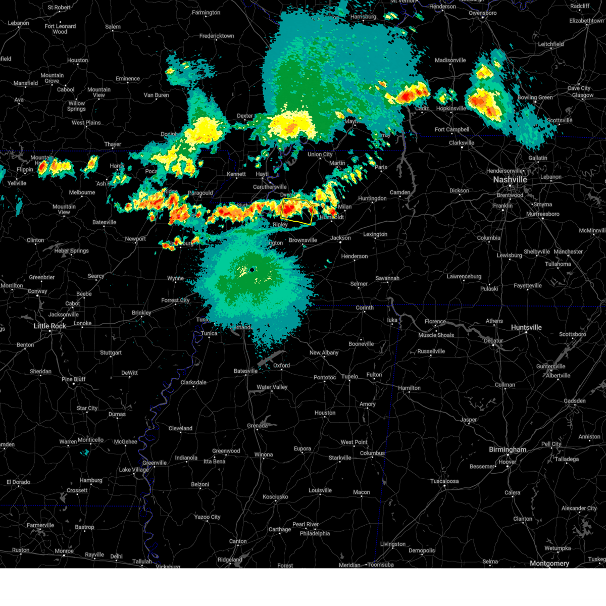 At 1218 am cdt, a severe thunderstorm was located near halls, or 8 miles south of dyersburg, moving east at 25 mph (radar indicated). Hazards include 60 mph wind gusts and quarter size hail. Hail damage to vehicles is expected. expect wind damage to roofs, siding, and trees. locations impacted include, dyersburg, halls, chestnut bluff, bradleytown, unionville, maury city, friendship, gates, bishop, hawkinsville, papaw ridge, porter gap, fowlkes, bonicord, double bridges, maury junction, south fork, poplar grove, crockett mills and south dyersburg. hail threat, radar indicated max hail size, 1. 00 in wind threat, radar indicated max wind gust, 60 mph. At 1218 am cdt, a severe thunderstorm was located near halls, or 8 miles south of dyersburg, moving east at 25 mph (radar indicated). Hazards include 60 mph wind gusts and quarter size hail. Hail damage to vehicles is expected. expect wind damage to roofs, siding, and trees. locations impacted include, dyersburg, halls, chestnut bluff, bradleytown, unionville, maury city, friendship, gates, bishop, hawkinsville, papaw ridge, porter gap, fowlkes, bonicord, double bridges, maury junction, south fork, poplar grove, crockett mills and south dyersburg. hail threat, radar indicated max hail size, 1. 00 in wind threat, radar indicated max wind gust, 60 mph.
|
| 5/9/2023 12:01 AM CDT | Quarter sized hail reported 0.5 miles WSW of Dyersburg, TN, quarter sized hail. |
| 5/9/2023 12:01 AM CDT |
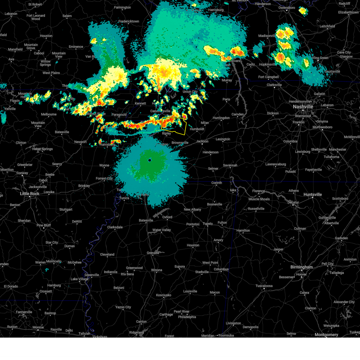 At 1201 am cdt, a severe thunderstorm was located near unionville, or 11 miles southwest of dyersburg, moving east at 30 mph (radar indicated). Hazards include 60 mph wind gusts and quarter size hail. Hail damage to vehicles is expected. Expect wind damage to roofs, siding, and trees. At 1201 am cdt, a severe thunderstorm was located near unionville, or 11 miles southwest of dyersburg, moving east at 30 mph (radar indicated). Hazards include 60 mph wind gusts and quarter size hail. Hail damage to vehicles is expected. Expect wind damage to roofs, siding, and trees.
|
| 4/15/2023 8:55 PM CDT |
 The severe thunderstorm warning for northern mississippi, pemiscot, southeastern dunklin, dyer, western obion, northeastern lauderdale and lake counties will expire at 900 pm cdt, the storms which prompted the warning have weakened below severe limits, and no longer pose an immediate threat to life or property. therefore, the warning will be allowed to expire. however gusty winds are still possible with these thunderstorms. a severe thunderstorm watch remains in effect until 200 am cdt for eastern arkansas, southeastern missouri, and west tennessee. to report severe weather, contact your nearest law enforcement agency. they will relay your report to the national weather service memphis. The severe thunderstorm warning for northern mississippi, pemiscot, southeastern dunklin, dyer, western obion, northeastern lauderdale and lake counties will expire at 900 pm cdt, the storms which prompted the warning have weakened below severe limits, and no longer pose an immediate threat to life or property. therefore, the warning will be allowed to expire. however gusty winds are still possible with these thunderstorms. a severe thunderstorm watch remains in effect until 200 am cdt for eastern arkansas, southeastern missouri, and west tennessee. to report severe weather, contact your nearest law enforcement agency. they will relay your report to the national weather service memphis.
|
| 4/15/2023 8:42 PM CDT |
 At 842 pm cdt, severe thunderstorms were located along a line extending from near risco to heloise to fort pillow state park, moving east at 60 mph (radar indicated). Hazards include 60 mph wind gusts. Expect damage to roofs, siding, and trees. locations impacted include, dyersburg, blytheville, kennett, ripley, caruthersville, gosnell, manila, portageville, hayti, steele, reelfoot lake state park, tiptonville, malden, newbern, halls, ridgely, troy, obion, hornersville and hayti heights. hail threat, radar indicated max hail size, <. 75 in wind threat, radar indicated max wind gust, 60 mph. At 842 pm cdt, severe thunderstorms were located along a line extending from near risco to heloise to fort pillow state park, moving east at 60 mph (radar indicated). Hazards include 60 mph wind gusts. Expect damage to roofs, siding, and trees. locations impacted include, dyersburg, blytheville, kennett, ripley, caruthersville, gosnell, manila, portageville, hayti, steele, reelfoot lake state park, tiptonville, malden, newbern, halls, ridgely, troy, obion, hornersville and hayti heights. hail threat, radar indicated max hail size, <. 75 in wind threat, radar indicated max wind gust, 60 mph.
|
| 4/15/2023 8:20 PM CDT |
 At 820 pm cdt, severe thunderstorms were located along a line extending from chalk bluff natural area to near gosnell to dyess, moving east at 60 mph (radar indicated). Hazards include 60 mph wind gusts. expect damage to roofs, siding, and trees At 820 pm cdt, severe thunderstorms were located along a line extending from chalk bluff natural area to near gosnell to dyess, moving east at 60 mph (radar indicated). Hazards include 60 mph wind gusts. expect damage to roofs, siding, and trees
|
| 5/21/2022 8:08 PM CDT | A couple of large trees down on the east side of dyersbur in dyer county TN, 1.6 miles W of Dyersburg, TN |
| 5/21/2022 8:02 PM CDT |
 At 801 pm cdt, severe thunderstorms were located along a line extending from marston to bradleytown to near ripley, moving southeast at 45 mph (radar indicated). Hazards include 60 mph wind gusts and quarter size hail. Hail damage to vehicles is expected. expect wind damage to roofs, siding, and trees. locations impacted include, dyersburg, martin, ripley, newbern, dyer, halls, kenton, rutherford, obion, forked deer, cloverdale, chestnut bluff, bradleytown, unionville, eaton, maury city, friendship, gates, trimble and yorkville. hail threat, radar indicated max hail size, 1. 00 in wind threat, radar indicated max wind gust, 60 mph. At 801 pm cdt, severe thunderstorms were located along a line extending from marston to bradleytown to near ripley, moving southeast at 45 mph (radar indicated). Hazards include 60 mph wind gusts and quarter size hail. Hail damage to vehicles is expected. expect wind damage to roofs, siding, and trees. locations impacted include, dyersburg, martin, ripley, newbern, dyer, halls, kenton, rutherford, obion, forked deer, cloverdale, chestnut bluff, bradleytown, unionville, eaton, maury city, friendship, gates, trimble and yorkville. hail threat, radar indicated max hail size, 1. 00 in wind threat, radar indicated max wind gust, 60 mph.
|
| 5/21/2022 7:33 PM CDT |
 At 733 pm cdt, severe thunderstorms were located along a line extending from near malden to hayti to near dell, moving east at 40 mph (radar indicated). Hazards include 60 mph wind gusts and quarter size hail. Hail damage to vehicles is expected. Expect wind damage to roofs, siding, and trees. At 733 pm cdt, severe thunderstorms were located along a line extending from near malden to hayti to near dell, moving east at 40 mph (radar indicated). Hazards include 60 mph wind gusts and quarter size hail. Hail damage to vehicles is expected. Expect wind damage to roofs, siding, and trees.
|
| 5/21/2022 4:53 PM CDT |
 The severe thunderstorm warning for northeastern mississippi, southeastern pemiscot, dyer, southwestern obion, northeastern lauderdale and southeastern lake counties will expire at 500 pm cdt, the storms which prompted the warning have weakened below severe limits, and no longer pose an immediate threat to life or property. therefore, the warning will be allowed to expire. however small hail and gusty winds are still possible with these thunderstorms. a severe thunderstorm watch remains in effect until 1000 pm cdt for eastern arkansas, southeastern missouri, and west tennessee. The severe thunderstorm warning for northeastern mississippi, southeastern pemiscot, dyer, southwestern obion, northeastern lauderdale and southeastern lake counties will expire at 500 pm cdt, the storms which prompted the warning have weakened below severe limits, and no longer pose an immediate threat to life or property. therefore, the warning will be allowed to expire. however small hail and gusty winds are still possible with these thunderstorms. a severe thunderstorm watch remains in effect until 1000 pm cdt for eastern arkansas, southeastern missouri, and west tennessee.
|
| 5/21/2022 4:53 PM CDT |
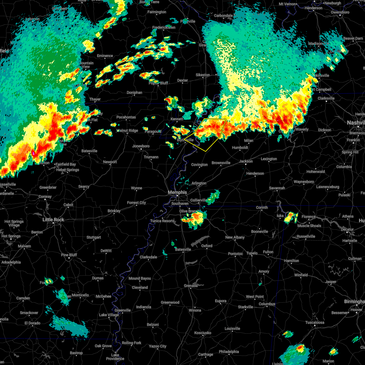 The severe thunderstorm warning for northeastern mississippi, southeastern pemiscot, dyer, southwestern obion, northeastern lauderdale and southeastern lake counties will expire at 500 pm cdt, the storms which prompted the warning have weakened below severe limits, and no longer pose an immediate threat to life or property. therefore, the warning will be allowed to expire. however small hail and gusty winds are still possible with these thunderstorms. a severe thunderstorm watch remains in effect until 1000 pm cdt for eastern arkansas, southeastern missouri, and west tennessee. The severe thunderstorm warning for northeastern mississippi, southeastern pemiscot, dyer, southwestern obion, northeastern lauderdale and southeastern lake counties will expire at 500 pm cdt, the storms which prompted the warning have weakened below severe limits, and no longer pose an immediate threat to life or property. therefore, the warning will be allowed to expire. however small hail and gusty winds are still possible with these thunderstorms. a severe thunderstorm watch remains in effect until 1000 pm cdt for eastern arkansas, southeastern missouri, and west tennessee.
|
| 5/21/2022 4:35 PM CDT |
 At 435 pm cdt, severe thunderstorms were located along a line extending from near miston to near heloise to 8 miles southeast of cooter, moving east at 15 mph (radar indicated). Hazards include 60 mph wind gusts and quarter size hail. Hail damage to vehicles is expected. expect wind damage to roofs, siding, and trees. locations impacted include, dyersburg, caruthersville, newbern, ridgely, obion, cooter, cloverdale, bradleytown, heloise, unionville, miston, cottonwood grove, trimble, cat corner, edith, fowlkes, locust grove, jenkinsville, maxey and elbridge. hail threat, radar indicated max hail size, 1. 00 in wind threat, radar indicated max wind gust, 60 mph. At 435 pm cdt, severe thunderstorms were located along a line extending from near miston to near heloise to 8 miles southeast of cooter, moving east at 15 mph (radar indicated). Hazards include 60 mph wind gusts and quarter size hail. Hail damage to vehicles is expected. expect wind damage to roofs, siding, and trees. locations impacted include, dyersburg, caruthersville, newbern, ridgely, obion, cooter, cloverdale, bradleytown, heloise, unionville, miston, cottonwood grove, trimble, cat corner, edith, fowlkes, locust grove, jenkinsville, maxey and elbridge. hail threat, radar indicated max hail size, 1. 00 in wind threat, radar indicated max wind gust, 60 mph.
|
| 5/21/2022 4:35 PM CDT |
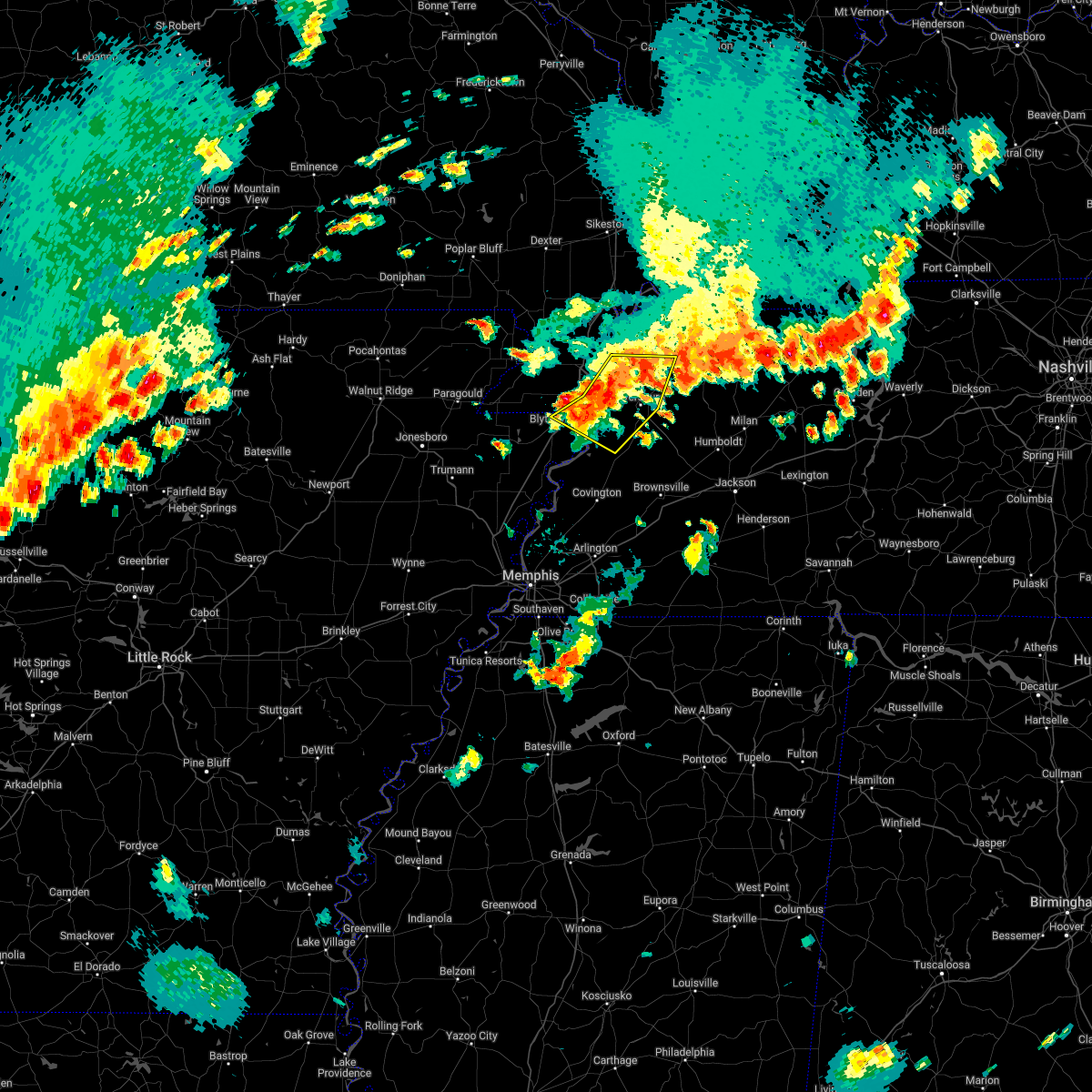 At 435 pm cdt, severe thunderstorms were located along a line extending from near miston to near heloise to 8 miles southeast of cooter, moving east at 15 mph (radar indicated). Hazards include 60 mph wind gusts and quarter size hail. Hail damage to vehicles is expected. expect wind damage to roofs, siding, and trees. locations impacted include, dyersburg, caruthersville, newbern, ridgely, obion, cooter, cloverdale, bradleytown, heloise, unionville, miston, cottonwood grove, trimble, cat corner, edith, fowlkes, locust grove, jenkinsville, maxey and elbridge. hail threat, radar indicated max hail size, 1. 00 in wind threat, radar indicated max wind gust, 60 mph. At 435 pm cdt, severe thunderstorms were located along a line extending from near miston to near heloise to 8 miles southeast of cooter, moving east at 15 mph (radar indicated). Hazards include 60 mph wind gusts and quarter size hail. Hail damage to vehicles is expected. expect wind damage to roofs, siding, and trees. locations impacted include, dyersburg, caruthersville, newbern, ridgely, obion, cooter, cloverdale, bradleytown, heloise, unionville, miston, cottonwood grove, trimble, cat corner, edith, fowlkes, locust grove, jenkinsville, maxey and elbridge. hail threat, radar indicated max hail size, 1. 00 in wind threat, radar indicated max wind gust, 60 mph.
|
| 5/21/2022 4:15 PM CDT |
 At 415 pm cdt, severe thunderstorms were located along a line extending from cottonwood grove to heloise to 6 miles east of blytheville, moving east at 15 mph (radar indicated). Hazards include 60 mph wind gusts and quarter size hail. Hail damage to vehicles is expected. Expect wind damage to roofs, siding, and trees. At 415 pm cdt, severe thunderstorms were located along a line extending from cottonwood grove to heloise to 6 miles east of blytheville, moving east at 15 mph (radar indicated). Hazards include 60 mph wind gusts and quarter size hail. Hail damage to vehicles is expected. Expect wind damage to roofs, siding, and trees.
|
| 4/17/2022 7:30 PM CDT | Half Dollar sized hail reported 0.5 miles WSW of Dyersburg, TN, corrects previous hail report from dyersburg. |
| 4/13/2022 3:34 PM CDT |
 At 333 pm cdt, severe thunderstorms were located along a line extending from near portageville to near cooter to near dixonville, moving east at 40 mph (radar indicated). Hazards include 70 mph wind gusts and quarter size hail. Hail damage to vehicles is expected. expect considerable tree damage. wind damage is also likely to mobile homes, roofs, and outbuildings. locations impacted include, dyersburg, blytheville, ripley, osceola, caruthersville, portageville, hayti, steele, luxora, wilson, reelfoot lake state park, fort pillow state park, munford, tiptonville, newbern, brighton, halls, ridgely, hayti heights and joiner. thunderstorm damage threat, considerable hail threat, radar indicated max hail size, 1. 00 in wind threat, radar indicated max wind gust, 70 mph. At 333 pm cdt, severe thunderstorms were located along a line extending from near portageville to near cooter to near dixonville, moving east at 40 mph (radar indicated). Hazards include 70 mph wind gusts and quarter size hail. Hail damage to vehicles is expected. expect considerable tree damage. wind damage is also likely to mobile homes, roofs, and outbuildings. locations impacted include, dyersburg, blytheville, ripley, osceola, caruthersville, portageville, hayti, steele, luxora, wilson, reelfoot lake state park, fort pillow state park, munford, tiptonville, newbern, brighton, halls, ridgely, hayti heights and joiner. thunderstorm damage threat, considerable hail threat, radar indicated max hail size, 1. 00 in wind threat, radar indicated max wind gust, 70 mph.
|
| 4/13/2022 3:11 PM CDT |
 At 311 pm cdt, severe thunderstorms were located along a line extending from clarkton to gosnell to near gilmore, moving east at 40 mph (radar indicated). Hazards include 70 mph wind gusts and quarter size hail. Hail damage to vehicles is expected. expect considerable tree damage. Wind damage is also likely to mobile homes, roofs, and outbuildings. At 311 pm cdt, severe thunderstorms were located along a line extending from clarkton to gosnell to near gilmore, moving east at 40 mph (radar indicated). Hazards include 70 mph wind gusts and quarter size hail. Hail damage to vehicles is expected. expect considerable tree damage. Wind damage is also likely to mobile homes, roofs, and outbuildings.
|
| 3/30/2022 4:06 PM CDT |
 At 406 pm cdt, severe thunderstorms were located along a line extending from heloise to 11 miles east of blytheville to near ashport, moving northeast at 40 mph (radar indicated). Hazards include 60 mph wind gusts. expect damage to roofs, siding, and trees At 406 pm cdt, severe thunderstorms were located along a line extending from heloise to 11 miles east of blytheville to near ashport, moving northeast at 40 mph (radar indicated). Hazards include 60 mph wind gusts. expect damage to roofs, siding, and trees
|
| 12/10/2021 11:20 PM CST |
 At 1119 pm cst, a severe thunderstorm was located near burdette, or near luxora, moving northeast at 50 mph (radar indicated). Hazards include 60 mph wind gusts and quarter size hail. Hail damage to vehicles is expected. Expect wind damage to roofs, siding, and trees. At 1119 pm cst, a severe thunderstorm was located near burdette, or near luxora, moving northeast at 50 mph (radar indicated). Hazards include 60 mph wind gusts and quarter size hail. Hail damage to vehicles is expected. Expect wind damage to roofs, siding, and trees.
|
| 12/10/2021 10:20 PM CST |
 At 1020 pm cst, a severe thunderstorm producing a tornado was located 8 miles northwest of ripley, moving east at 55 mph (radar indicated rotation). Hazards include tornado, quarter size hail, and 60 mph wind gusts. Flying debris will be dangerous to those caught without shelter. mobile homes will be damaged or destroyed. damage to roofs, windows, and vehicles will occur. tree damage is likely. this dangerous storm will be near, halls and unionville around 1035 pm cst. Other locations impacted by this tornadic thunderstorm include barr, south fork, poplar grove, papaw ridge, porter gap, edith, barfield, fowlkes, dryhill and south dyersburg. At 1020 pm cst, a severe thunderstorm producing a tornado was located 8 miles northwest of ripley, moving east at 55 mph (radar indicated rotation). Hazards include tornado, quarter size hail, and 60 mph wind gusts. Flying debris will be dangerous to those caught without shelter. mobile homes will be damaged or destroyed. damage to roofs, windows, and vehicles will occur. tree damage is likely. this dangerous storm will be near, halls and unionville around 1035 pm cst. Other locations impacted by this tornadic thunderstorm include barr, south fork, poplar grove, papaw ridge, porter gap, edith, barfield, fowlkes, dryhill and south dyersburg.
|
| 12/10/2021 9:52 PM CST |
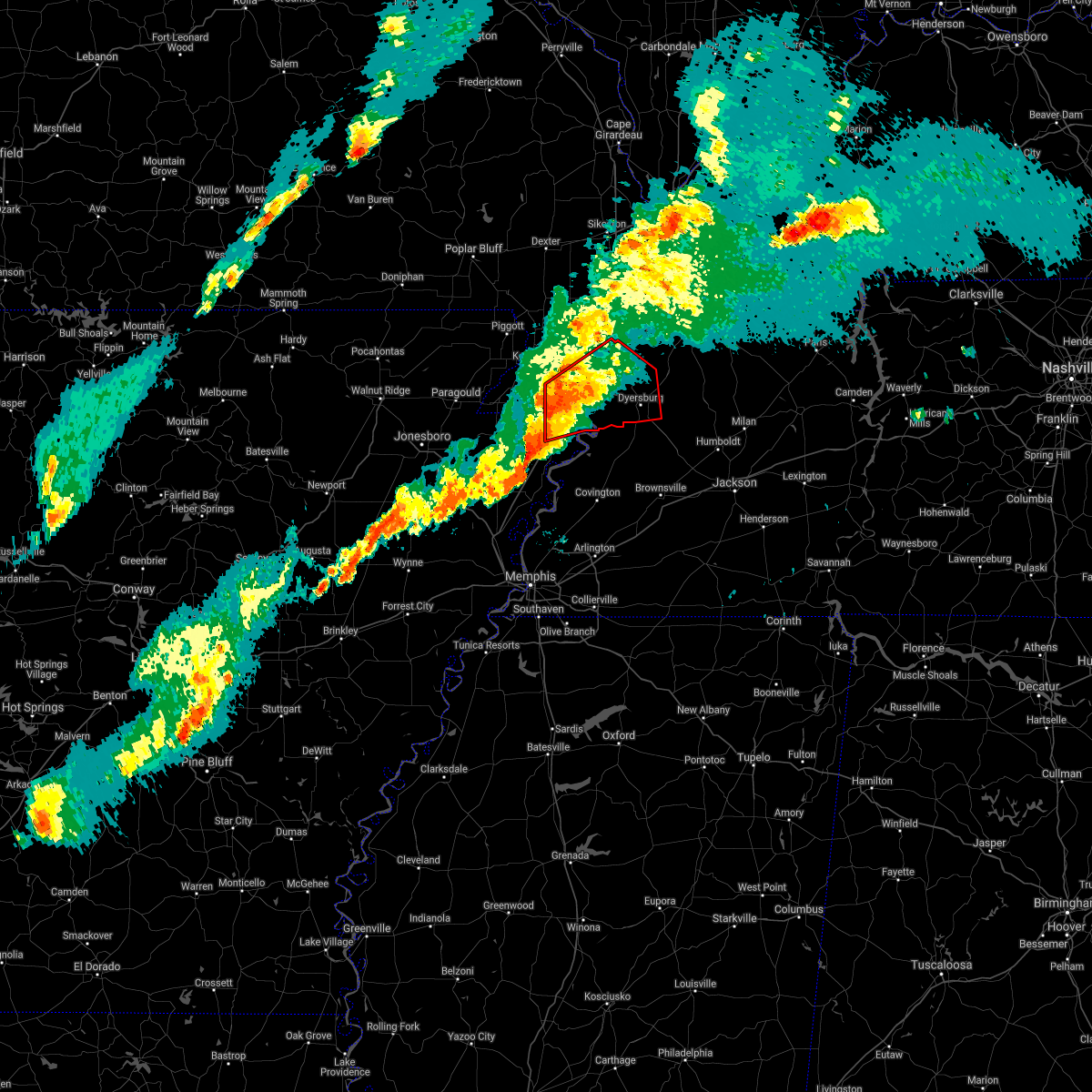 At 951 pm cst, a severe thunderstorm producing a tornado was located over blytheville, moving east at 55 mph (radar indicated rotation). Hazards include tornado and quarter size hail. Flying debris will be dangerous to those caught without shelter. mobile homes will be damaged or destroyed. damage to roofs, windows, and vehicles will occur. tree damage is likely. this dangerous storm will be near, cooter around 1000 pm cst. heloise around 1010 pm cst. unionville around 1020 pm cst. bradleytown and miston around 1025 pm cst. dyersburg and newbern around 1030 pm cst. Other locations impacted by this tornadic thunderstorm include cat corner, fowlkes, jenkinsville, maxey, broadmoor, madie, parker, lane, bogota and tennemo. At 951 pm cst, a severe thunderstorm producing a tornado was located over blytheville, moving east at 55 mph (radar indicated rotation). Hazards include tornado and quarter size hail. Flying debris will be dangerous to those caught without shelter. mobile homes will be damaged or destroyed. damage to roofs, windows, and vehicles will occur. tree damage is likely. this dangerous storm will be near, cooter around 1000 pm cst. heloise around 1010 pm cst. unionville around 1020 pm cst. bradleytown and miston around 1025 pm cst. dyersburg and newbern around 1030 pm cst. Other locations impacted by this tornadic thunderstorm include cat corner, fowlkes, jenkinsville, maxey, broadmoor, madie, parker, lane, bogota and tennemo.
|
| 7/31/2021 10:05 PM CDT |
 The severe thunderstorm warning for northwestern crockett, southeastern dyer, northeastern lauderdale and northwestern haywood counties will expire at 1015 pm cdt, the storm which prompted the warning has weakened below severe limits, and no longer poses an immediate threat to life or property. therefore, the warning will be allowed to expire. The severe thunderstorm warning for northwestern crockett, southeastern dyer, northeastern lauderdale and northwestern haywood counties will expire at 1015 pm cdt, the storm which prompted the warning has weakened below severe limits, and no longer poses an immediate threat to life or property. therefore, the warning will be allowed to expire.
|
| 7/31/2021 10:01 PM CDT |
 At 1001 pm cdt, a severe thunderstorm was located near chestnut bluff, or 13 miles southeast of dyersburg, moving southeast at 35 mph (radar indicated). Hazards include 60 mph wind gusts. Expect damage to roofs, siding, and trees. Locations impacted include, dyersburg, halls, chestnut bluff, bradleytown, forked deer, unionville, friendship, gates, bishop, hawkinsville, fowlkes, dryhill, bonicord, double bridges, jenkinsville, frog jump, rohoboth, maury junction, south fork and poplar grove. At 1001 pm cdt, a severe thunderstorm was located near chestnut bluff, or 13 miles southeast of dyersburg, moving southeast at 35 mph (radar indicated). Hazards include 60 mph wind gusts. Expect damage to roofs, siding, and trees. Locations impacted include, dyersburg, halls, chestnut bluff, bradleytown, forked deer, unionville, friendship, gates, bishop, hawkinsville, fowlkes, dryhill, bonicord, double bridges, jenkinsville, frog jump, rohoboth, maury junction, south fork and poplar grove.
|
| 7/31/2021 9:45 PM CDT |
 At 945 pm cdt, a severe thunderstorm was located over unionville, or 7 miles south of dyersburg, moving southeast at 35 mph (radar indicated). Hazards include 60 mph wind gusts. Expect damage to roofs, siding, and trees. Locations impacted include, dyersburg, halls, forked deer, chestnut bluff, bradleytown, heloise, unionville, friendship, gates, edith, fowlkes, bonicord, jenkinsville, rohoboth, maury junction, poplar grove, parker, curve, dog hill and tatumville. At 945 pm cdt, a severe thunderstorm was located over unionville, or 7 miles south of dyersburg, moving southeast at 35 mph (radar indicated). Hazards include 60 mph wind gusts. Expect damage to roofs, siding, and trees. Locations impacted include, dyersburg, halls, forked deer, chestnut bluff, bradleytown, heloise, unionville, friendship, gates, edith, fowlkes, bonicord, jenkinsville, rohoboth, maury junction, poplar grove, parker, curve, dog hill and tatumville.
|
| 7/31/2021 9:26 PM CDT |
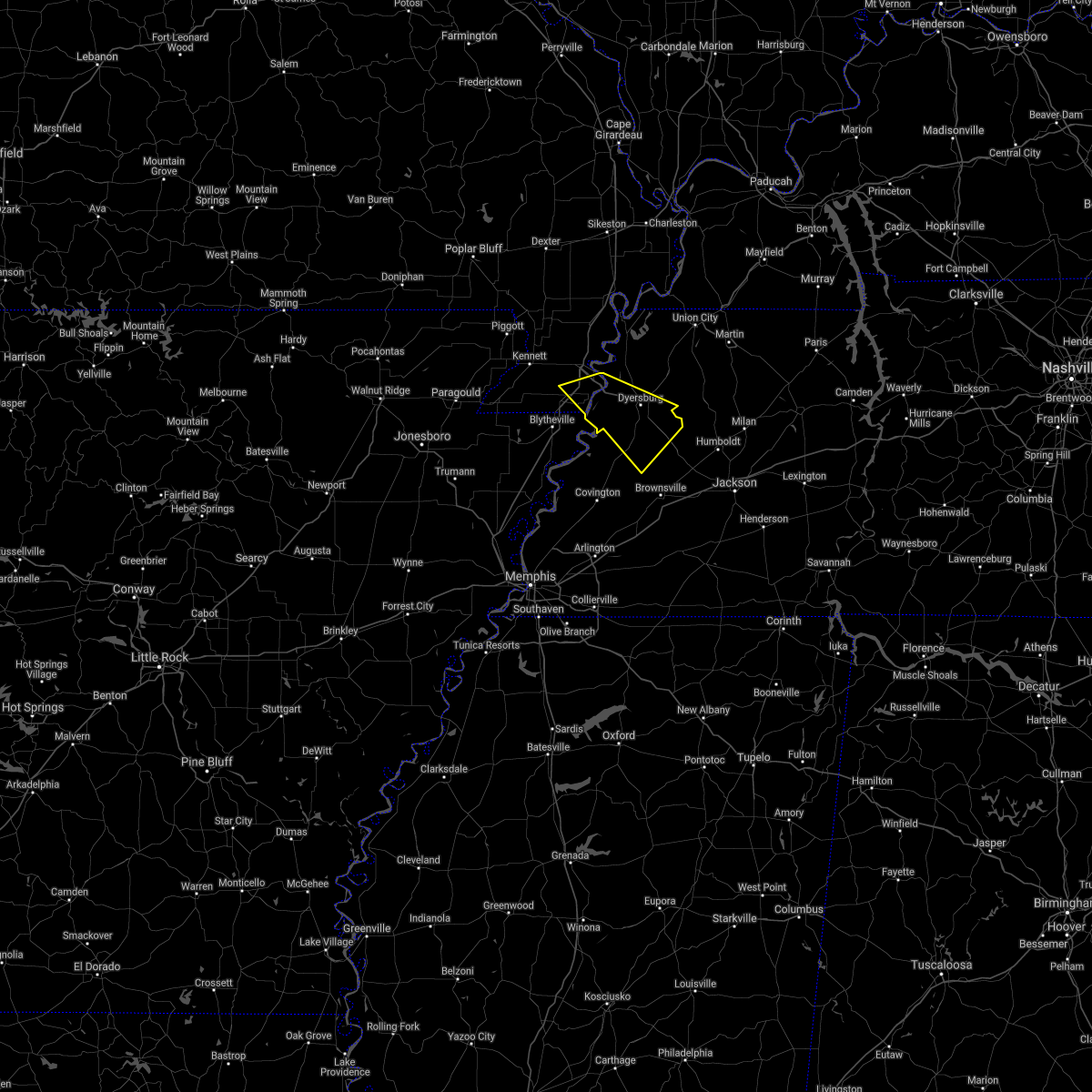 At 925 pm cdt, a severe thunderstorm was located near heloise, or 10 miles south of caruthersville, moving southeast at 35 mph (radar indicated). Hazards include 60 mph wind gusts. expect damage to roofs, siding, and trees At 925 pm cdt, a severe thunderstorm was located near heloise, or 10 miles south of caruthersville, moving southeast at 35 mph (radar indicated). Hazards include 60 mph wind gusts. expect damage to roofs, siding, and trees
|
| 5/4/2021 3:36 AM CDT |
 At 336 am cdt, severe thunderstorms were located along a line extending from 7 miles south of union city to near rutherford to near nutbush, moving east at 65 mph (radar indicated). Hazards include 60 mph wind gusts. Expect damage to roofs, siding, and trees. Locations impacted include, dyersburg, ripley, reelfoot lake state park, fort pillow state park, tiptonville, newbern, halls, ridgely, troy, obion, clayton, bradleytown, unionville, ashport, ft pillow, cloverdale, fulton, miston, henning and gates. At 336 am cdt, severe thunderstorms were located along a line extending from 7 miles south of union city to near rutherford to near nutbush, moving east at 65 mph (radar indicated). Hazards include 60 mph wind gusts. Expect damage to roofs, siding, and trees. Locations impacted include, dyersburg, ripley, reelfoot lake state park, fort pillow state park, tiptonville, newbern, halls, ridgely, troy, obion, clayton, bradleytown, unionville, ashport, ft pillow, cloverdale, fulton, miston, henning and gates.
|
| 5/4/2021 2:59 AM CDT |
 At 258 am cdt, severe thunderstorms were located along a line extending from near bolton to near caruthersville to near marie, moving east at 65 mph (radar indicated). Hazards include 60 mph wind gusts and quarter size hail. Hail damage to vehicles is expected. Expect wind damage to roofs, siding, and trees. At 258 am cdt, severe thunderstorms were located along a line extending from near bolton to near caruthersville to near marie, moving east at 65 mph (radar indicated). Hazards include 60 mph wind gusts and quarter size hail. Hail damage to vehicles is expected. Expect wind damage to roofs, siding, and trees.
|
| 4/9/2021 5:50 PM CDT |
 At 549 pm cdt, a severe thunderstorm was located near bradleytown, or 8 miles west of dyersburg, moving northeast at 25 mph (radar indicated). Hazards include 60 mph wind gusts and quarter size hail. Hail damage to vehicles is expected. expect wind damage to roofs, siding, and trees. Locations impacted include, dyersburg, ridgely, miston, cloverdale, cottonwood grove, bradleytown, lenox, ayers, cat corner, papaw ridge, wynnburg, jenkinsville, maxey, broadmoor, sharps ferry, middle city, poplar ridge, madie, mooring and lane. At 549 pm cdt, a severe thunderstorm was located near bradleytown, or 8 miles west of dyersburg, moving northeast at 25 mph (radar indicated). Hazards include 60 mph wind gusts and quarter size hail. Hail damage to vehicles is expected. expect wind damage to roofs, siding, and trees. Locations impacted include, dyersburg, ridgely, miston, cloverdale, cottonwood grove, bradleytown, lenox, ayers, cat corner, papaw ridge, wynnburg, jenkinsville, maxey, broadmoor, sharps ferry, middle city, poplar ridge, madie, mooring and lane.
|
| 4/9/2021 5:37 PM CDT |
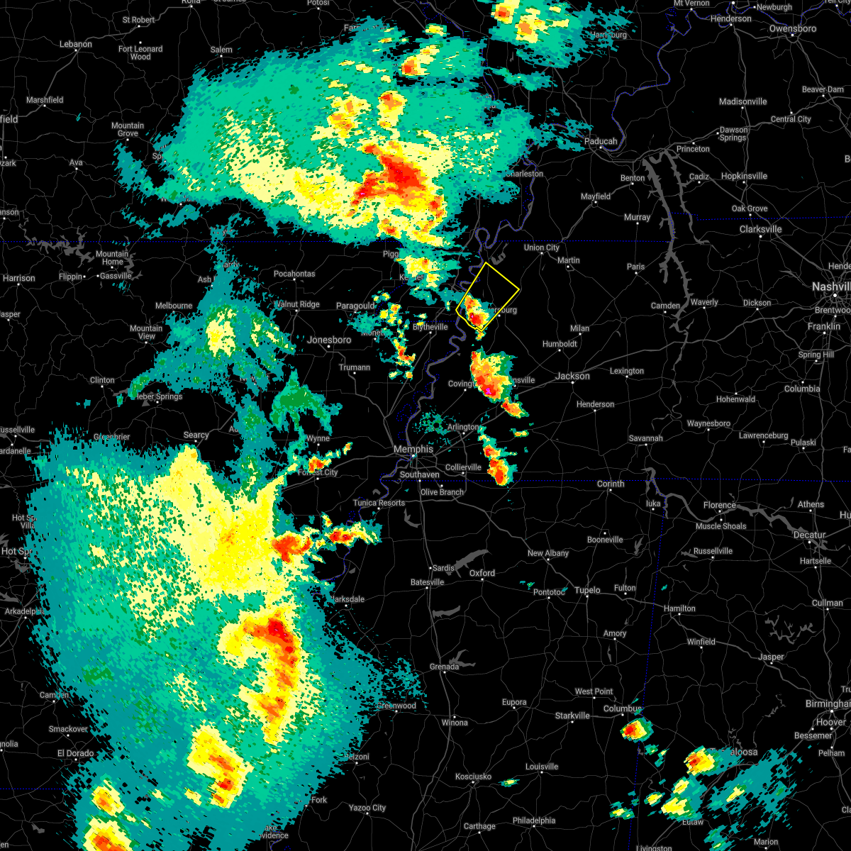 At 537 pm cdt, a severe thunderstorm was located near heloise, or 10 miles south of caruthersville, moving northeast at 25 mph (radar indicated). Hazards include 60 mph wind gusts and quarter size hail. Hail damage to vehicles is expected. expect wind damage to roofs, siding, and trees. Locations impacted include, dyersburg, caruthersville, ridgely, bradleytown, heloise, miston, cloverdale, cottonwood grove, lenox, ayers, cat corner, papaw ridge, wynnburg, jenkinsville, maxey, broadmoor, sharps ferry, middle city, poplar ridge and madie. At 537 pm cdt, a severe thunderstorm was located near heloise, or 10 miles south of caruthersville, moving northeast at 25 mph (radar indicated). Hazards include 60 mph wind gusts and quarter size hail. Hail damage to vehicles is expected. expect wind damage to roofs, siding, and trees. Locations impacted include, dyersburg, caruthersville, ridgely, bradleytown, heloise, miston, cloverdale, cottonwood grove, lenox, ayers, cat corner, papaw ridge, wynnburg, jenkinsville, maxey, broadmoor, sharps ferry, middle city, poplar ridge and madie.
|
| 4/9/2021 5:27 PM CDT |
 At 527 pm cdt, a severe thunderstorm was located near heloise, or 13 miles southeast of steele, moving northeast at 25 mph (radar indicated). Hazards include 60 mph wind gusts and quarter size hail. Hail damage to vehicles is expected. Expect wind damage to roofs, siding, and trees. At 527 pm cdt, a severe thunderstorm was located near heloise, or 13 miles southeast of steele, moving northeast at 25 mph (radar indicated). Hazards include 60 mph wind gusts and quarter size hail. Hail damage to vehicles is expected. Expect wind damage to roofs, siding, and trees.
|
| 4/9/2021 5:27 PM CDT |
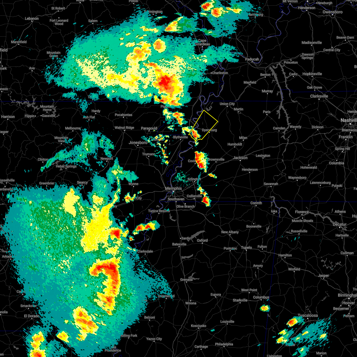 At 527 pm cdt, a severe thunderstorm was located near heloise, or 13 miles southeast of steele, moving northeast at 25 mph (radar indicated). Hazards include 60 mph wind gusts and quarter size hail. Hail damage to vehicles is expected. Expect wind damage to roofs, siding, and trees. At 527 pm cdt, a severe thunderstorm was located near heloise, or 13 miles southeast of steele, moving northeast at 25 mph (radar indicated). Hazards include 60 mph wind gusts and quarter size hail. Hail damage to vehicles is expected. Expect wind damage to roofs, siding, and trees.
|
| 5/4/2020 6:52 PM CDT |
 The severe thunderstorm warning for crockett, southeastern dyer, southern gibson, northeastern lauderdale, northeastern haywood and madison counties will expire at 700 pm cdt, the storm which prompted the warning has moved out of the area. therefore, the warning will be allowed to expire. a severe thunderstorm watch remains in effect until 1000 pm cdt for western tennessee. remember, a severe thunderstorm warning still remains in effect for crockett, gibson and madison counties. The severe thunderstorm warning for crockett, southeastern dyer, southern gibson, northeastern lauderdale, northeastern haywood and madison counties will expire at 700 pm cdt, the storm which prompted the warning has moved out of the area. therefore, the warning will be allowed to expire. a severe thunderstorm watch remains in effect until 1000 pm cdt for western tennessee. remember, a severe thunderstorm warning still remains in effect for crockett, gibson and madison counties.
|
| 5/4/2020 6:24 PM CDT |
 At 623 pm cdt, a severe thunderstorm was located near chestnut bluff, or 12 miles southeast of dyersburg, moving southeast at 70 mph (radar indicated). Hazards include 60 mph wind gusts and quarter size hail. Hail damage to vehicles is expected. Expect wind damage to roofs, siding, and trees. At 623 pm cdt, a severe thunderstorm was located near chestnut bluff, or 12 miles southeast of dyersburg, moving southeast at 70 mph (radar indicated). Hazards include 60 mph wind gusts and quarter size hail. Hail damage to vehicles is expected. Expect wind damage to roofs, siding, and trees.
|
| 5/4/2020 6:05 PM CDT |
 The severe thunderstorm warning for pemiscot, northern dyer, western obion and lake counties will expire at 615 pm cdt, the storm which prompted the warning has moved out of the area. therefore, the warning will be allowed to expire. however gusty winds are still possible with this thunderstorm. a severe thunderstorm watch remains in effect until 1000 pm cdt for southeastern missouri, and western tennessee. The severe thunderstorm warning for pemiscot, northern dyer, western obion and lake counties will expire at 615 pm cdt, the storm which prompted the warning has moved out of the area. therefore, the warning will be allowed to expire. however gusty winds are still possible with this thunderstorm. a severe thunderstorm watch remains in effect until 1000 pm cdt for southeastern missouri, and western tennessee.
|
| 5/4/2020 6:03 PM CDT |
 At 603 pm cdt, a severe thunderstorm was located near heloise, or 9 miles southeast of caruthersville, moving east at 55 mph (radar indicated). Hazards include 60 mph wind gusts and quarter size hail. Hail damage to vehicles is expected. Expect wind damage to roofs, siding, and trees. At 603 pm cdt, a severe thunderstorm was located near heloise, or 9 miles southeast of caruthersville, moving east at 55 mph (radar indicated). Hazards include 60 mph wind gusts and quarter size hail. Hail damage to vehicles is expected. Expect wind damage to roofs, siding, and trees.
|
| 5/4/2020 5:58 PM CDT |
 At 557 pm cdt, a severe thunderstorm was located over ridgely, or near reelfoot lake state park, moving east at 55 mph (radar indicated). Hazards include 60 mph wind gusts and quarter size hail. Hail damage to vehicles is expected. expect wind damage to roofs, siding, and trees. Locations impacted include, caruthersville, portageville, hayti, steele, reelfoot lake state park, tiptonville, newbern, ridgely, hayti heights, wardell, bolton, cloverdale, deering, miston, cottonwood grove, hornbeak, samburg, bragg city, pascola and cat corner. At 557 pm cdt, a severe thunderstorm was located over ridgely, or near reelfoot lake state park, moving east at 55 mph (radar indicated). Hazards include 60 mph wind gusts and quarter size hail. Hail damage to vehicles is expected. expect wind damage to roofs, siding, and trees. Locations impacted include, caruthersville, portageville, hayti, steele, reelfoot lake state park, tiptonville, newbern, ridgely, hayti heights, wardell, bolton, cloverdale, deering, miston, cottonwood grove, hornbeak, samburg, bragg city, pascola and cat corner.
|
| 5/4/2020 5:45 PM CDT | Bogata trees down in dyer county TN, 0.5 miles WSW of Dyersburg, TN |
| 5/4/2020 5:41 PM CDT |
 At 541 pm cdt, a severe thunderstorm was located over hayti heights, or over hayti, moving east at 55 mph (radar indicated). Hazards include 60 mph wind gusts and quarter size hail. Hail damage to vehicles is expected. Expect wind damage to roofs, siding, and trees. At 541 pm cdt, a severe thunderstorm was located over hayti heights, or over hayti, moving east at 55 mph (radar indicated). Hazards include 60 mph wind gusts and quarter size hail. Hail damage to vehicles is expected. Expect wind damage to roofs, siding, and trees.
|
| 5/4/2020 5:40 PM CDT | Mping report of trees uprooted south of dyersbur in dyer county TN, 8.1 miles N of Dyersburg, TN |
| 5/3/2020 5:55 PM CDT | Half Dollar sized hail reported 3.3 miles NW of Dyersburg, TN, half dollar and quarter sized hail in bonicord. |
| 5/3/2020 3:00 PM CDT | Power lines blown down and blocking roads near the nissan car dealer in tow in dyer county TN, 0.5 miles WSW of Dyersburg, TN |
| 5/3/2020 2:41 PM CDT |
 At 240 pm cdt, severe thunderstorms were located along a line extending from near latham to near kenton, moving east at 55 mph (radar indicated). Hazards include 70 mph wind gusts and quarter size hail. Hail damage to vehicles is expected. expect considerable tree damage. wind damage is also likely to mobile homes, roofs, and outbuildings. Locations impacted include, dyersburg, martin, union city, fulton, newbern, south fulton, troy, kenton, obion, latham, bradleytown, heloise, unionville, trimble, woodland mills, rives, yorkville, fowlkes, lapata and bonicord. At 240 pm cdt, severe thunderstorms were located along a line extending from near latham to near kenton, moving east at 55 mph (radar indicated). Hazards include 70 mph wind gusts and quarter size hail. Hail damage to vehicles is expected. expect considerable tree damage. wind damage is also likely to mobile homes, roofs, and outbuildings. Locations impacted include, dyersburg, martin, union city, fulton, newbern, south fulton, troy, kenton, obion, latham, bradleytown, heloise, unionville, trimble, woodland mills, rives, yorkville, fowlkes, lapata and bonicord.
|
| 5/3/2020 2:40 PM CDT |
 At 239 pm cdt, severe thunderstorms were located along a line extending from 6 miles southwest of unionville to near ft pillow to bassett, moving east at 50 mph (radar indicated). Hazards include 70 mph wind gusts and quarter size hail. Hail damage to vehicles is expected. expect considerable tree damage. wind damage is also likely to mobile homes, roofs, and outbuildings. Locations impacted include, dyersburg, blytheville, covington, ripley, osceola, gosnell, luxora, wilson, keiser, fort pillow state park, munford, brighton, halls, joiner, cooter, dyess, dell, burdette, bassett and marie. At 239 pm cdt, severe thunderstorms were located along a line extending from 6 miles southwest of unionville to near ft pillow to bassett, moving east at 50 mph (radar indicated). Hazards include 70 mph wind gusts and quarter size hail. Hail damage to vehicles is expected. expect considerable tree damage. wind damage is also likely to mobile homes, roofs, and outbuildings. Locations impacted include, dyersburg, blytheville, covington, ripley, osceola, gosnell, luxora, wilson, keiser, fort pillow state park, munford, brighton, halls, joiner, cooter, dyess, dell, burdette, bassett and marie.
|
| 5/3/2020 2:29 PM CDT |
 At 229 pm cdt, severe thunderstorms were located along a line extending from near union city to near newbern, moving east at 65 mph (radar indicated). Hazards include 70 mph wind gusts and quarter size hail. Hail damage to vehicles is expected. expect considerable tree damage. wind damage is also likely to mobile homes, roofs, and outbuildings. Locations impacted include, dyersburg, blytheville, martin, union city, caruthersville, gosnell, fulton, steele, newbern, south fulton, ridgely, troy, kenton, obion, cooter, clayton, bradleytown, heloise, unionville and latham. At 229 pm cdt, severe thunderstorms were located along a line extending from near union city to near newbern, moving east at 65 mph (radar indicated). Hazards include 70 mph wind gusts and quarter size hail. Hail damage to vehicles is expected. expect considerable tree damage. wind damage is also likely to mobile homes, roofs, and outbuildings. Locations impacted include, dyersburg, blytheville, martin, union city, caruthersville, gosnell, fulton, steele, newbern, south fulton, ridgely, troy, kenton, obion, cooter, clayton, bradleytown, heloise, unionville and latham.
|
| 5/3/2020 2:15 PM CDT |
 At 215 pm cdt, severe thunderstorms were located along a line extending from near gosnell to near trumann, moving east at 55 mph (radar indicated). Hazards include 70 mph wind gusts and quarter size hail. Hail damage to vehicles is expected. expect considerable tree damage. Wind damage is also likely to mobile homes, roofs, and outbuildings. At 215 pm cdt, severe thunderstorms were located along a line extending from near gosnell to near trumann, moving east at 55 mph (radar indicated). Hazards include 70 mph wind gusts and quarter size hail. Hail damage to vehicles is expected. expect considerable tree damage. Wind damage is also likely to mobile homes, roofs, and outbuildings.
|
| 5/3/2020 2:09 PM CDT |
 At 208 pm cdt, severe thunderstorms were located along a line extending from near clayton to near gosnell, moving east at 55 mph (radar indicated). Hazards include 70 mph wind gusts and quarter size hail. Hail damage to vehicles is expected. expect considerable tree damage. Wind damage is also likely to mobile homes, roofs, and outbuildings. At 208 pm cdt, severe thunderstorms were located along a line extending from near clayton to near gosnell, moving east at 55 mph (radar indicated). Hazards include 70 mph wind gusts and quarter size hail. Hail damage to vehicles is expected. expect considerable tree damage. Wind damage is also likely to mobile homes, roofs, and outbuildings.
|
| 5/3/2020 1:50 PM CDT |
 At 149 pm cdt, severe thunderstorms were located along a line extending from near parma to near senath, moving east at 55 mph (radar indicated). Hazards include 70 mph wind gusts and half dollar size hail. Hail damage to vehicles is expected. expect considerable tree damage. wind damage is also likely to mobile homes, roofs, and outbuildings. Locations impacted include, paragould, dyersburg, kennett, caruthersville, piggott, portageville, hayti, steele, campbell, rector, senath, marmaduke, reelfoot lake state park, chalk bluff natural area, tiptonville, malden, ridgely, oak grove heights, cardwell and hornersville. At 149 pm cdt, severe thunderstorms were located along a line extending from near parma to near senath, moving east at 55 mph (radar indicated). Hazards include 70 mph wind gusts and half dollar size hail. Hail damage to vehicles is expected. expect considerable tree damage. wind damage is also likely to mobile homes, roofs, and outbuildings. Locations impacted include, paragould, dyersburg, kennett, caruthersville, piggott, portageville, hayti, steele, campbell, rector, senath, marmaduke, reelfoot lake state park, chalk bluff natural area, tiptonville, malden, ridgely, oak grove heights, cardwell and hornersville.
|
| 5/3/2020 1:30 PM CDT |
 At 130 pm cdt, severe thunderstorms were located along a line extending from near glennonville to near oak grove heights, moving east at 70 mph (radar indicated). Hazards include 70 mph wind gusts and half dollar size hail. Hail damage to vehicles is expected. expect considerable tree damage. Wind damage is also likely to mobile homes, roofs, and outbuildings. At 130 pm cdt, severe thunderstorms were located along a line extending from near glennonville to near oak grove heights, moving east at 70 mph (radar indicated). Hazards include 70 mph wind gusts and half dollar size hail. Hail damage to vehicles is expected. expect considerable tree damage. Wind damage is also likely to mobile homes, roofs, and outbuildings.
|
| 4/8/2020 8:55 PM CDT |
 At 855 pm cdt, a severe thunderstorm was located near chestnut bluff, or near dyersburg, moving southeast at 35 mph (radar indicated). Hazards include 60 mph wind gusts and penny size hail. Expect damage to roofs, siding, and trees. Locations impacted include, dyersburg, ripley, trenton, newbern, alamo, halls, nutbush, forked deer, chestnut bluff, belle eagle, bradleytown, unionville, maury city, friendship, gates, grizzard, edith, gibson wells, fowlkes and christmasville. At 855 pm cdt, a severe thunderstorm was located near chestnut bluff, or near dyersburg, moving southeast at 35 mph (radar indicated). Hazards include 60 mph wind gusts and penny size hail. Expect damage to roofs, siding, and trees. Locations impacted include, dyersburg, ripley, trenton, newbern, alamo, halls, nutbush, forked deer, chestnut bluff, belle eagle, bradleytown, unionville, maury city, friendship, gates, grizzard, edith, gibson wells, fowlkes and christmasville.
|
| 4/8/2020 8:39 PM CDT |
 At 838 pm cdt, a severe thunderstorm was located near bradleytown, or near dyersburg, moving east at 30 mph (radar indicated). Hazards include 60 mph wind gusts and half dollar size hail. Hail damage to vehicles is expected. expect wind damage to roofs, siding, and trees. Locations impacted include, dyersburg, ripley, trenton, alamo, halls, nutbush, forked deer, chestnut bluff, belle eagle, bradleytown, unionville, maury city, friendship, gates, grizzard, edith, gibson wells, fowlkes, christmasville and bonicord. At 838 pm cdt, a severe thunderstorm was located near bradleytown, or near dyersburg, moving east at 30 mph (radar indicated). Hazards include 60 mph wind gusts and half dollar size hail. Hail damage to vehicles is expected. expect wind damage to roofs, siding, and trees. Locations impacted include, dyersburg, ripley, trenton, alamo, halls, nutbush, forked deer, chestnut bluff, belle eagle, bradleytown, unionville, maury city, friendship, gates, grizzard, edith, gibson wells, fowlkes, christmasville and bonicord.
|
| 4/8/2020 8:33 PM CDT |
 At 832 pm cdt, a severe thunderstorm was located near unionville, or 9 miles west of dyersburg, moving southeast at 35 mph (radar indicated). Hazards include 60 mph wind gusts. expect damage to roofs, siding, and trees At 832 pm cdt, a severe thunderstorm was located near unionville, or 9 miles west of dyersburg, moving southeast at 35 mph (radar indicated). Hazards include 60 mph wind gusts. expect damage to roofs, siding, and trees
|
| 3/28/2020 8:07 PM CDT |
 The severe thunderstorm warning for tipton, crockett, southeastern dyer, southwestern gibson and haywood counties will expire at 815 pm cdt, the storms which prompted the warning have weakened below severe limits, and no longer pose an immediate threat to life or property. therefore, the warning will be allowed to expire. however heavy rain is still possible with these thunderstorms. a tornado watch remains in effect until 200 am cdt for western tennessee. remember, a severe thunderstorm warning still remains in effect for lauderdale, tipton and dyer counties. The severe thunderstorm warning for tipton, crockett, southeastern dyer, southwestern gibson and haywood counties will expire at 815 pm cdt, the storms which prompted the warning have weakened below severe limits, and no longer pose an immediate threat to life or property. therefore, the warning will be allowed to expire. however heavy rain is still possible with these thunderstorms. a tornado watch remains in effect until 200 am cdt for western tennessee. remember, a severe thunderstorm warning still remains in effect for lauderdale, tipton and dyer counties.
|
| 3/28/2020 8:06 PM CDT |
 At 806 pm cdt, severe thunderstorms were located along a line extending from dyersburg to near dixonville, moving northeast at 50 mph (radar indicated). Hazards include 60 mph wind gusts and quarter size hail. Hail damage to vehicles is expected. Expect wind damage to roofs, siding, and trees. At 806 pm cdt, severe thunderstorms were located along a line extending from dyersburg to near dixonville, moving northeast at 50 mph (radar indicated). Hazards include 60 mph wind gusts and quarter size hail. Hail damage to vehicles is expected. Expect wind damage to roofs, siding, and trees.
|
| 3/28/2020 8:02 PM CDT |
 At 801 pm cdt, severe thunderstorms were located along a line extending from 10 miles southwest of dyer to 9 miles west of dancyville, moving east at 65 mph (radar indicated). Hazards include 60 mph wind gusts and quarter size hail. Hail damage to vehicles is expected. expect wind damage to roofs, siding, and trees. Locations impacted include, dyersburg, brownsville, covington, trenton, munford, brighton, alamo, bells, nutbush, forked deer, chestnut bluff, belle eagle, holly grove, unionville, dancyville, tipton, atoka, mason, maury city and friendship. At 801 pm cdt, severe thunderstorms were located along a line extending from 10 miles southwest of dyer to 9 miles west of dancyville, moving east at 65 mph (radar indicated). Hazards include 60 mph wind gusts and quarter size hail. Hail damage to vehicles is expected. expect wind damage to roofs, siding, and trees. Locations impacted include, dyersburg, brownsville, covington, trenton, munford, brighton, alamo, bells, nutbush, forked deer, chestnut bluff, belle eagle, holly grove, unionville, dancyville, tipton, atoka, mason, maury city and friendship.
|
| 3/28/2020 7:40 PM CDT |
 At 740 pm cdt, severe thunderstorms were located along a line extending from near unionville to near millington, moving east at 65 mph (radar indicated). Hazards include 60 mph wind gusts and quarter size hail. Hail damage to vehicles is expected. Expect wind damage to roofs, siding, and trees. At 740 pm cdt, severe thunderstorms were located along a line extending from near unionville to near millington, moving east at 65 mph (radar indicated). Hazards include 60 mph wind gusts and quarter size hail. Hail damage to vehicles is expected. Expect wind damage to roofs, siding, and trees.
|
| 3/20/2020 2:00 AM CDT |
 At 200 am cdt, a severe thunderstorm was located over miston, or 8 miles east of caruthersville, moving northeast at 55 mph (radar indicated). Hazards include 60 mph wind gusts. expect damage to roofs, siding, and trees At 200 am cdt, a severe thunderstorm was located over miston, or 8 miles east of caruthersville, moving northeast at 55 mph (radar indicated). Hazards include 60 mph wind gusts. expect damage to roofs, siding, and trees
|
| 3/12/2020 11:09 AM CDT |
 At 1109 am cdt, a severe thunderstorm was located near newbern, or near dyersburg, moving east at 40 mph (radar indicated). Hazards include 60 mph wind gusts and quarter size hail. Hail damage to vehicles is expected. Expect wind damage to roofs, siding, and trees. At 1109 am cdt, a severe thunderstorm was located near newbern, or near dyersburg, moving east at 40 mph (radar indicated). Hazards include 60 mph wind gusts and quarter size hail. Hail damage to vehicles is expected. Expect wind damage to roofs, siding, and trees.
|
| 1/11/2020 4:19 AM CST |
 At 419 am cst, a severe thunderstorm was located over bradleytown, or near dyersburg, moving northeast at 40 mph (radar indicated). Hazards include 60 mph wind gusts. Expect damage to roofs, siding, and trees. Locations impacted include, dyersburg, union city, caruthersville, trenton, reelfoot lake state park, newbern, dyer, halls, ridgely, troy, kenton, rutherford, obion, bradford, clayton, bradleytown, heloise, unionville, cloverdale and miston. At 419 am cst, a severe thunderstorm was located over bradleytown, or near dyersburg, moving northeast at 40 mph (radar indicated). Hazards include 60 mph wind gusts. Expect damage to roofs, siding, and trees. Locations impacted include, dyersburg, union city, caruthersville, trenton, reelfoot lake state park, newbern, dyer, halls, ridgely, troy, kenton, rutherford, obion, bradford, clayton, bradleytown, heloise, unionville, cloverdale and miston.
|
| 1/11/2020 3:54 AM CST |
 At 353 am cst, a severe thunderstorm was located 10 miles north of ashport, or 10 miles east of blytheville, moving northeast at 45 mph (radar indicated). Hazards include 60 mph wind gusts. expect damage to roofs, siding, and trees At 353 am cst, a severe thunderstorm was located 10 miles north of ashport, or 10 miles east of blytheville, moving northeast at 45 mph (radar indicated). Hazards include 60 mph wind gusts. expect damage to roofs, siding, and trees
|
| 1/11/2020 3:38 AM CST |
 At 337 am cst, a severe thunderstorm was located 7 miles south of heloise, or 13 miles southeast of steele, moving northeast at 45 mph (radar indicated). Hazards include 60 mph wind gusts. Expect damage to roofs, siding, and trees. Locations impacted include, dyersburg, blytheville, osceola, caruthersville, gosnell, steele, luxora, halls, cooter, dell, burdette, bradleytown, heloise, unionville, miston, ashport, cottonwood grove, holland, edith and calumet. At 337 am cst, a severe thunderstorm was located 7 miles south of heloise, or 13 miles southeast of steele, moving northeast at 45 mph (radar indicated). Hazards include 60 mph wind gusts. Expect damage to roofs, siding, and trees. Locations impacted include, dyersburg, blytheville, osceola, caruthersville, gosnell, steele, luxora, halls, cooter, dell, burdette, bradleytown, heloise, unionville, miston, ashport, cottonwood grove, holland, edith and calumet.
|
| 1/11/2020 3:38 AM CST |
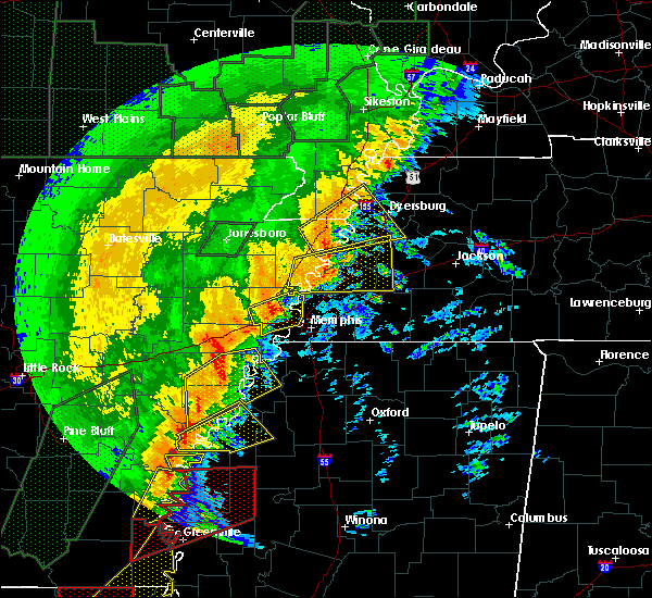 At 337 am cst, a severe thunderstorm was located 7 miles south of heloise, or 13 miles southeast of steele, moving northeast at 45 mph (radar indicated). Hazards include 60 mph wind gusts. Expect damage to roofs, siding, and trees. Locations impacted include, dyersburg, blytheville, osceola, caruthersville, gosnell, steele, luxora, halls, cooter, dell, burdette, bradleytown, heloise, unionville, miston, ashport, cottonwood grove, holland, edith and calumet. At 337 am cst, a severe thunderstorm was located 7 miles south of heloise, or 13 miles southeast of steele, moving northeast at 45 mph (radar indicated). Hazards include 60 mph wind gusts. Expect damage to roofs, siding, and trees. Locations impacted include, dyersburg, blytheville, osceola, caruthersville, gosnell, steele, luxora, halls, cooter, dell, burdette, bradleytown, heloise, unionville, miston, ashport, cottonwood grove, holland, edith and calumet.
|
| 1/11/2020 3:16 AM CST |
 At 316 am cst, a severe thunderstorm was located over burdette, or near blytheville, moving northeast at 45 mph (radar indicated). Hazards include 60 mph wind gusts. expect damage to roofs, siding, and trees At 316 am cst, a severe thunderstorm was located over burdette, or near blytheville, moving northeast at 45 mph (radar indicated). Hazards include 60 mph wind gusts. expect damage to roofs, siding, and trees
|
| 1/11/2020 2:47 AM CST |
 At 247 am cst, severe thunderstorms were located along a line extending from near portageville to near osceola, moving east at 40 mph (radar indicated). Hazards include 60 mph wind gusts. Expect damage to roofs, siding, and trees. Locations impacted include, dyersburg, blytheville, kennett, osceola, caruthersville, gosnell, manila, portageville, hayti, steele, caraway, luxora, keiser, reelfoot lake state park, tiptonville, ridgely, hornersville, hayti heights, cooter and wardell. At 247 am cst, severe thunderstorms were located along a line extending from near portageville to near osceola, moving east at 40 mph (radar indicated). Hazards include 60 mph wind gusts. Expect damage to roofs, siding, and trees. Locations impacted include, dyersburg, blytheville, kennett, osceola, caruthersville, gosnell, manila, portageville, hayti, steele, caraway, luxora, keiser, reelfoot lake state park, tiptonville, ridgely, hornersville, hayti heights, cooter and wardell.
|
| 1/11/2020 2:26 AM CST |
 At 225 am cst, severe thunderstorms were located along a line extending from near gideon to near caraway, moving northeast at 40 mph (radar indicated). Hazards include 60 mph wind gusts. expect damage to roofs, siding, and trees At 225 am cst, severe thunderstorms were located along a line extending from near gideon to near caraway, moving northeast at 40 mph (radar indicated). Hazards include 60 mph wind gusts. expect damage to roofs, siding, and trees
|
| 10/21/2019 7:43 AM CDT |
 The severe thunderstorm warning for crockett. western weakley. eastern dyer. gibson. obion. northeastern haywood and north central madison counties will expire at 745 am cdt. the storms which prompted the warning have weakened below severe limits, and no longer pose an immediate threat to life or property. Therefore, the warning will be allowed to expire. The severe thunderstorm warning for crockett. western weakley. eastern dyer. gibson. obion. northeastern haywood and north central madison counties will expire at 745 am cdt. the storms which prompted the warning have weakened below severe limits, and no longer pose an immediate threat to life or property. Therefore, the warning will be allowed to expire.
|
| 10/21/2019 7:25 AM CDT |
 At 725 am cdt, severe thunderstorms were located along a line extending from near fulgham to near gleason to near fairview, moving east at 110 mph (radar indicated). Hazards include 60 mph wind gusts. Expect damage to roofs, siding, and trees. Locations impacted include, dyersburg, martin, union city, humboldt, milan, trenton, fulton, fairview, newbern, dresden, alamo, bells, south fulton, dyer, greenfield, three way, troy, kenton, rutherford and obion. At 725 am cdt, severe thunderstorms were located along a line extending from near fulgham to near gleason to near fairview, moving east at 110 mph (radar indicated). Hazards include 60 mph wind gusts. Expect damage to roofs, siding, and trees. Locations impacted include, dyersburg, martin, union city, humboldt, milan, trenton, fulton, fairview, newbern, dresden, alamo, bells, south fulton, dyer, greenfield, three way, troy, kenton, rutherford and obion.
|
| 10/21/2019 7:00 AM CDT |
 At 700 am cdt, severe thunderstorms were located along a line extending from near marston to near bradleytown to 6 miles east of covington, moving east at 110 mph (radar indicated). Hazards include 60 mph wind gusts. expect damage to roofs, siding, and trees At 700 am cdt, severe thunderstorms were located along a line extending from near marston to near bradleytown to 6 miles east of covington, moving east at 110 mph (radar indicated). Hazards include 60 mph wind gusts. expect damage to roofs, siding, and trees
|
| 6/23/2019 4:56 PM CDT |
 At 448 pm cdt, severe thunderstorms were located along a line extending from near fulton to near alamo to 9 miles east of dixonville, moving east at 40 mph (radar indicated). Hazards include 60 mph wind gusts. Expect damage to roofs, siding, and trees. Locations impacted include, dyersburg, union city, covington, ripley, fulton, munford, newbern, brighton, south fulton, halls, troy, kenton, obion, chestnut bluff, dixonville, unionville, ft pillow, nutbush, forked deer and belle eagle. At 448 pm cdt, severe thunderstorms were located along a line extending from near fulton to near alamo to 9 miles east of dixonville, moving east at 40 mph (radar indicated). Hazards include 60 mph wind gusts. Expect damage to roofs, siding, and trees. Locations impacted include, dyersburg, union city, covington, ripley, fulton, munford, newbern, brighton, south fulton, halls, troy, kenton, obion, chestnut bluff, dixonville, unionville, ft pillow, nutbush, forked deer and belle eagle.
|
| 6/23/2019 4:49 PM CDT |
 At 430 pm cdt, severe thunderstorms were located along a line extending from near cayce, to near forked deer, to dixonville, moving east at 40 mph (radar indicated). Hazards include 60 mph wind gusts. Expect damage to roofs, siding, and trees. Locations impacted include, dyersburg, union city, covington, ripley, osceola, wilson, reelfoot lake state park, fort pillow state park, munford, tiptonville, newbern, brighton, south fulton, halls, ridgely, troy, kenton, obion, joiner and bassett. At 430 pm cdt, severe thunderstorms were located along a line extending from near cayce, to near forked deer, to dixonville, moving east at 40 mph (radar indicated). Hazards include 60 mph wind gusts. Expect damage to roofs, siding, and trees. Locations impacted include, dyersburg, union city, covington, ripley, osceola, wilson, reelfoot lake state park, fort pillow state park, munford, tiptonville, newbern, brighton, south fulton, halls, ridgely, troy, kenton, obion, joiner and bassett.
|
| 6/23/2019 4:49 PM CDT |
 At 448 pm cdt, severe thunderstorms were located along a line extending from near fulton to near alamo to 9 miles east of dixonville, moving east at 40 mph (radar indicated). Hazards include 60 mph wind gusts. Expect damage to roofs, siding, and trees. Locations impacted include, dyersburg, union city, covington, ripley, fulton, munford, newbern, brighton, south fulton, halls, troy, kenton, obion, chestnut bluff, dixonville, unionville, ft pillow, nutbush, forked deer and belle eagle. At 448 pm cdt, severe thunderstorms were located along a line extending from near fulton to near alamo to 9 miles east of dixonville, moving east at 40 mph (radar indicated). Hazards include 60 mph wind gusts. Expect damage to roofs, siding, and trees. Locations impacted include, dyersburg, union city, covington, ripley, fulton, munford, newbern, brighton, south fulton, halls, troy, kenton, obion, chestnut bluff, dixonville, unionville, ft pillow, nutbush, forked deer and belle eagle.
|
| 6/23/2019 4:31 PM CDT |
 At 430 pm cdt, severe thunderstorms were located along a line extending from near cayce, to near forked deer, to dixonville, moving east at 40 mph (radar indicated). Hazards include 60 mph wind gusts. Expect damage to roofs, siding, and trees. Locations impacted include, dyersburg, union city, covington, ripley, osceola, wilson, reelfoot lake state park, fort pillow state park, munford, tiptonville, newbern, brighton, south fulton, halls, ridgely, troy, kenton, obion, joiner and bassett. At 430 pm cdt, severe thunderstorms were located along a line extending from near cayce, to near forked deer, to dixonville, moving east at 40 mph (radar indicated). Hazards include 60 mph wind gusts. Expect damage to roofs, siding, and trees. Locations impacted include, dyersburg, union city, covington, ripley, osceola, wilson, reelfoot lake state park, fort pillow state park, munford, tiptonville, newbern, brighton, south fulton, halls, ridgely, troy, kenton, obion, joiner and bassett.
|
| 6/23/2019 4:11 PM CDT |
 At 410 pm cdt, severe thunderstorms were located along a line extending from 6 miles northwest of clayton to 7 miles northwest of ripley to 7 miles northeast of meeman shelby forest state park, moving east at 40 mph (radar indicated). Hazards include 60 mph wind gusts. expect damage to roofs, siding, and trees At 410 pm cdt, severe thunderstorms were located along a line extending from 6 miles northwest of clayton to 7 miles northwest of ripley to 7 miles northeast of meeman shelby forest state park, moving east at 40 mph (radar indicated). Hazards include 60 mph wind gusts. expect damage to roofs, siding, and trees
|
| 6/23/2019 3:55 PM CDT |
 At 354 pm cdt, severe thunderstorms were located along a line extending from near marston to near heloise to near fort pillow state park, moving east at 45 mph (trained weather spotters. at 335 pm cdt, a 59 mph wind gust was measured in kennett. trees were down across southern dunklin county). Hazards include 60 mph wind gusts. Expect damage to roofs, siding, and trees. Locations impacted include, blytheville, osceola, caruthersville, gosnell, manila, portageville, hayti, steele, luxora, keiser, reelfoot lake state park, tiptonville, ridgely, hayti heights, cooter, wardell, dell, burdette, deering and heloise. At 354 pm cdt, severe thunderstorms were located along a line extending from near marston to near heloise to near fort pillow state park, moving east at 45 mph (trained weather spotters. at 335 pm cdt, a 59 mph wind gust was measured in kennett. trees were down across southern dunklin county). Hazards include 60 mph wind gusts. Expect damage to roofs, siding, and trees. Locations impacted include, blytheville, osceola, caruthersville, gosnell, manila, portageville, hayti, steele, luxora, keiser, reelfoot lake state park, tiptonville, ridgely, hayti heights, cooter, wardell, dell, burdette, deering and heloise.
|
| 6/23/2019 3:28 PM CDT |
 At 327 pm cdt, severe thunderstorms were located along a line extending from near gideon to near gosnell to near dyess, moving east at 45 mph (radar indicated). Hazards include 60 mph wind gusts. expect damage to roofs, siding, and trees At 327 pm cdt, severe thunderstorms were located along a line extending from near gideon to near gosnell to near dyess, moving east at 45 mph (radar indicated). Hazards include 60 mph wind gusts. expect damage to roofs, siding, and trees
|
| 6/21/2019 6:41 PM CDT |
 The severe thunderstorm warning for weakley, northeastern dyer, northwestern gibson, north central benton, obion, henry and southeastern lake counties will expire at 645 pm cdt, the storms which prompted the warning have moved out of the area. therefore, the warning will be allowed to expire. however strong winds to 45 mph is still possible with these thunderstorms. a severe thunderstorm watch remains in effect until 100 am cdt for southeastern missouri, and western tennessee. The severe thunderstorm warning for weakley, northeastern dyer, northwestern gibson, north central benton, obion, henry and southeastern lake counties will expire at 645 pm cdt, the storms which prompted the warning have moved out of the area. therefore, the warning will be allowed to expire. however strong winds to 45 mph is still possible with these thunderstorms. a severe thunderstorm watch remains in effect until 100 am cdt for southeastern missouri, and western tennessee.
|
| 6/21/2019 6:29 PM CDT |
 At 629 pm cdt, severe thunderstorms were located along a line extending from 6 miles south of cottage grove to near dyersburg, moving southeast at 35 mph (radar indicated). Hazards include 60 mph wind gusts. Expect damage to roofs, siding, and trees. Locations impacted include, dyersburg, martin, union city, paris, fulton, paris landing state park, newbern, dresden, greenfield, ridgely, gleason, troy, kenton, rutherford, obion, sharon, cottage grove, latham, cloverdale and miston. At 629 pm cdt, severe thunderstorms were located along a line extending from 6 miles south of cottage grove to near dyersburg, moving southeast at 35 mph (radar indicated). Hazards include 60 mph wind gusts. Expect damage to roofs, siding, and trees. Locations impacted include, dyersburg, martin, union city, paris, fulton, paris landing state park, newbern, dresden, greenfield, ridgely, gleason, troy, kenton, rutherford, obion, sharon, cottage grove, latham, cloverdale and miston.
|
| 6/21/2019 6:25 PM CDT |
 At 624 pm cdt, severe thunderstorms were located along a line extending from 6 miles west of paris landing state park to unionville, moving southeast at 35 mph (radar indicated). Hazards include 60 mph wind gusts. expect damage to roofs, siding, and trees At 624 pm cdt, severe thunderstorms were located along a line extending from 6 miles west of paris landing state park to unionville, moving southeast at 35 mph (radar indicated). Hazards include 60 mph wind gusts. expect damage to roofs, siding, and trees
|
| 6/21/2019 6:23 PM CDT | Tractor trailor blown over on highway 41 in dyer county TN, 0.5 miles WSW of Dyersburg, TN |
| 6/21/2019 5:54 PM CDT |
 At 553 pm cdt, severe thunderstorms were located along a line extending from near latham to cottonwood grove, moving south at 25 mph (radar indicated). Hazards include 60 mph wind gusts. expect damage to roofs, siding, and trees At 553 pm cdt, severe thunderstorms were located along a line extending from near latham to cottonwood grove, moving south at 25 mph (radar indicated). Hazards include 60 mph wind gusts. expect damage to roofs, siding, and trees
|
| 2/23/2019 12:54 PM CST |
 The severe thunderstorm warning for central mississippi, northern tipton, southwestern dyer and lauderdale counties will expire at 100 pm cst, the storm which prompted the warning has weakened below severe limits, and no longer poses an immediate threat to life or property. therefore, the warning will be allowed to expire. however gusty winds and heavy rain are still possible with this thunderstorm. a tornado watch remains in effect until 800 pm cst for western tennessee. The severe thunderstorm warning for central mississippi, northern tipton, southwestern dyer and lauderdale counties will expire at 100 pm cst, the storm which prompted the warning has weakened below severe limits, and no longer poses an immediate threat to life or property. therefore, the warning will be allowed to expire. however gusty winds and heavy rain are still possible with this thunderstorm. a tornado watch remains in effect until 800 pm cst for western tennessee.
|
| 2/23/2019 12:38 PM CST |
 At 1238 pm cst, a severe thunderstorm was located 11 miles south of heloise, or 11 miles northwest of ripley, moving northeast at 65 mph (radar indicated). Hazards include 60 mph wind gusts. Expect damage to roofs, siding, and trees. locations impacted include, dyersburg, covington, ripley, osceola, luxora, wilson, fort pillow state park, halls, joiner, bassett, marie, fulton, unionville, ashport, ft pillow, henning, gates, gilt edge, burlison and garland. A tornado watch remains in effect until 800 pm cst for western tennessee. At 1238 pm cst, a severe thunderstorm was located 11 miles south of heloise, or 11 miles northwest of ripley, moving northeast at 65 mph (radar indicated). Hazards include 60 mph wind gusts. Expect damage to roofs, siding, and trees. locations impacted include, dyersburg, covington, ripley, osceola, luxora, wilson, fort pillow state park, halls, joiner, bassett, marie, fulton, unionville, ashport, ft pillow, henning, gates, gilt edge, burlison and garland. A tornado watch remains in effect until 800 pm cst for western tennessee.
|
| 2/23/2019 12:19 PM CST |
 At 1219 pm cst, a severe thunderstorm was located over osceola, moving northeast at 65 mph (radar indicated). Hazards include 60 mph wind gusts. expect damage to roofs, siding, and trees At 1219 pm cst, a severe thunderstorm was located over osceola, moving northeast at 65 mph (radar indicated). Hazards include 60 mph wind gusts. expect damage to roofs, siding, and trees
|
| 7/15/2018 4:00 PM CDT |
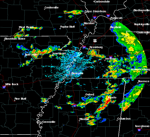 At 359 pm cdt, a severe thunderstorm was located near chestnut bluff, or 12 miles southeast of dyersburg, moving east at 20 mph (radar indicated). Hazards include 60 mph wind gusts. Expect damage to roofs, siding, and trees. Locations impacted include, alamo, halls, chestnut bluff, maury city, friendship, gates, bishop, hawkinsville, quincy, fowlkes, bonicord, central, brazil, maury junction, south fork, poplar grove, crockett mills, parker, dog hill and brims corner. At 359 pm cdt, a severe thunderstorm was located near chestnut bluff, or 12 miles southeast of dyersburg, moving east at 20 mph (radar indicated). Hazards include 60 mph wind gusts. Expect damage to roofs, siding, and trees. Locations impacted include, alamo, halls, chestnut bluff, maury city, friendship, gates, bishop, hawkinsville, quincy, fowlkes, bonicord, central, brazil, maury junction, south fork, poplar grove, crockett mills, parker, dog hill and brims corner.
|
| 7/15/2018 3:45 PM CDT | Several tree limbs blocking the road near the fowlkes communit in dyer county TN, 4.7 miles N of Dyersburg, TN |
| 7/15/2018 3:40 PM CDT |
 At 340 pm cdt, a severe thunderstorm was located near chestnut bluff, or near dyersburg, moving east at 20 mph (radar indicated). Hazards include 60 mph wind gusts. expect damage to roofs, siding, and trees At 340 pm cdt, a severe thunderstorm was located near chestnut bluff, or near dyersburg, moving east at 20 mph (radar indicated). Hazards include 60 mph wind gusts. expect damage to roofs, siding, and trees
|
| 6/28/2018 10:37 PM CDT |
 At 1037 pm cdt, a severe thunderstorm was located near heloise, or 9 miles southeast of steele, moving southwest at 35 mph (radar indicated). Hazards include 60 mph wind gusts and quarter size hail. Hail damage to vehicles is expected. expect wind damage to roofs, siding, and trees. Locations impacted include, dyersburg, blytheville, caruthersville, gosnell, manila, hayti, steele, newbern, halls, hornersville, hayti heights, cooter, dell, burdette, chestnut bluff, deering, bradleytown, heloise, unionville and bolton. At 1037 pm cdt, a severe thunderstorm was located near heloise, or 9 miles southeast of steele, moving southwest at 35 mph (radar indicated). Hazards include 60 mph wind gusts and quarter size hail. Hail damage to vehicles is expected. expect wind damage to roofs, siding, and trees. Locations impacted include, dyersburg, blytheville, caruthersville, gosnell, manila, hayti, steele, newbern, halls, hornersville, hayti heights, cooter, dell, burdette, chestnut bluff, deering, bradleytown, heloise, unionville and bolton.
|
| 6/28/2018 10:01 PM CDT |
 At 1000 pm cdt, a severe thunderstorm was located near miston, or 10 miles south of reelfoot lake state park, moving southwest at 35 mph (radar indicated). Hazards include 60 mph wind gusts and quarter size hail. Hail damage to vehicles is expected. Expect wind damage to roofs, siding, and trees. At 1000 pm cdt, a severe thunderstorm was located near miston, or 10 miles south of reelfoot lake state park, moving southwest at 35 mph (radar indicated). Hazards include 60 mph wind gusts and quarter size hail. Hail damage to vehicles is expected. Expect wind damage to roofs, siding, and trees.
|
| 6/28/2018 9:22 PM CDT |
 At 922 pm cdt, a severe thunderstorm was located near troy, or 8 miles west of union city, moving south at 60 mph (radar indicated). Hazards include 60 mph wind gusts and quarter size hail. Hail damage to vehicles is expected. Expect wind damage to roofs, siding, and trees. At 922 pm cdt, a severe thunderstorm was located near troy, or 8 miles west of union city, moving south at 60 mph (radar indicated). Hazards include 60 mph wind gusts and quarter size hail. Hail damage to vehicles is expected. Expect wind damage to roofs, siding, and trees.
|
| 6/28/2018 8:59 PM CDT |
 At 842 pm cdt, severe thunderstorms were located along a line extending from near energy to 7 miles southeast of wyatt, moving south at 60 mph (radar indicated). Hazards include 60 mph wind gusts. Expect damage to roofs, siding, and trees. Locations impacted include, martin, union city, paris, caruthersville, mckenzie, fulton, paris landing state park, reelfoot lake state park, tiptonville, newbern, dresden, south fulton, dyer, greenfield, ridgely, gleason, troy, kenton, rutherford and obion. At 842 pm cdt, severe thunderstorms were located along a line extending from near energy to 7 miles southeast of wyatt, moving south at 60 mph (radar indicated). Hazards include 60 mph wind gusts. Expect damage to roofs, siding, and trees. Locations impacted include, martin, union city, paris, caruthersville, mckenzie, fulton, paris landing state park, reelfoot lake state park, tiptonville, newbern, dresden, south fulton, dyer, greenfield, ridgely, gleason, troy, kenton, rutherford and obion.
|
| 6/28/2018 8:42 PM CDT |
 At 842 pm cdt, severe thunderstorms were located along a line extending from near energy to 7 miles southeast of wyatt, moving south at 60 mph (radar indicated). Hazards include 60 mph wind gusts. Expect damage to roofs, siding, and trees. Locations impacted include, martin, union city, paris, caruthersville, mckenzie, fulton, paris landing state park, reelfoot lake state park, tiptonville, newbern, dresden, south fulton, dyer, greenfield, ridgely, gleason, troy, kenton, rutherford and obion. At 842 pm cdt, severe thunderstorms were located along a line extending from near energy to 7 miles southeast of wyatt, moving south at 60 mph (radar indicated). Hazards include 60 mph wind gusts. Expect damage to roofs, siding, and trees. Locations impacted include, martin, union city, paris, caruthersville, mckenzie, fulton, paris landing state park, reelfoot lake state park, tiptonville, newbern, dresden, south fulton, dyer, greenfield, ridgely, gleason, troy, kenton, rutherford and obion.
|
| 6/28/2018 8:36 PM CDT |
 At 836 pm cdt, severe thunderstorms were located along a line extending from energy to 7 miles north of towosahgy state historic site, moving northeast at 30 mph (radar indicated). Hazards include 60 mph wind gusts. expect damage to roofs, siding, and trees At 836 pm cdt, severe thunderstorms were located along a line extending from energy to 7 miles north of towosahgy state historic site, moving northeast at 30 mph (radar indicated). Hazards include 60 mph wind gusts. expect damage to roofs, siding, and trees
|
| 6/1/2018 6:06 AM CDT |
 At 538 am cdt, a severe thunderstorm was located near heloise, or 11 miles west of dyersburg, moving east at 45 mph (radar indicated). Hazards include 60 mph wind gusts and quarter size hail. Hail damage to vehicles is expected. expect wind damage to roofs, siding, and trees. Locations impacted include, dyersburg, halls, bradleytown, unionville, gates, bishop, barr, hawkinsville, papaw ridge, porter gap, edith, barfield, fowlkes, dryhill, bonicord, double bridges, tomato, jenkinsville, tiger tail and south fork. At 538 am cdt, a severe thunderstorm was located near heloise, or 11 miles west of dyersburg, moving east at 45 mph (radar indicated). Hazards include 60 mph wind gusts and quarter size hail. Hail damage to vehicles is expected. expect wind damage to roofs, siding, and trees. Locations impacted include, dyersburg, halls, bradleytown, unionville, gates, bishop, barr, hawkinsville, papaw ridge, porter gap, edith, barfield, fowlkes, dryhill, bonicord, double bridges, tomato, jenkinsville, tiger tail and south fork.
|
| 6/1/2018 5:39 AM CDT |
 At 538 am cdt, a severe thunderstorm was located near heloise, or 11 miles west of dyersburg, moving east at 45 mph (radar indicated). Hazards include 60 mph wind gusts and quarter size hail. Hail damage to vehicles is expected. expect wind damage to roofs, siding, and trees. Locations impacted include, dyersburg, halls, bradleytown, unionville, gates, bishop, barr, hawkinsville, papaw ridge, porter gap, edith, barfield, fowlkes, dryhill, bonicord, double bridges, tomato, jenkinsville, tiger tail and south fork. At 538 am cdt, a severe thunderstorm was located near heloise, or 11 miles west of dyersburg, moving east at 45 mph (radar indicated). Hazards include 60 mph wind gusts and quarter size hail. Hail damage to vehicles is expected. expect wind damage to roofs, siding, and trees. Locations impacted include, dyersburg, halls, bradleytown, unionville, gates, bishop, barr, hawkinsville, papaw ridge, porter gap, edith, barfield, fowlkes, dryhill, bonicord, double bridges, tomato, jenkinsville, tiger tail and south fork.
|
| 6/1/2018 5:24 AM CDT |
 At 524 am cdt, a severe thunderstorm was located over cooter, or near steele, moving east at 45 mph (radar indicated). Hazards include 60 mph wind gusts and quarter size hail. Hail damage to vehicles is expected. Expect wind damage to roofs, siding, and trees. At 524 am cdt, a severe thunderstorm was located over cooter, or near steele, moving east at 45 mph (radar indicated). Hazards include 60 mph wind gusts and quarter size hail. Hail damage to vehicles is expected. Expect wind damage to roofs, siding, and trees.
|
| 6/1/2018 5:24 AM CDT |
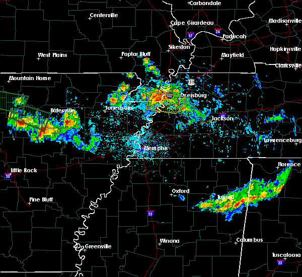 At 524 am cdt, a severe thunderstorm was located over cooter, or near steele, moving east at 45 mph (radar indicated). Hazards include 60 mph wind gusts and quarter size hail. Hail damage to vehicles is expected. Expect wind damage to roofs, siding, and trees. At 524 am cdt, a severe thunderstorm was located over cooter, or near steele, moving east at 45 mph (radar indicated). Hazards include 60 mph wind gusts and quarter size hail. Hail damage to vehicles is expected. Expect wind damage to roofs, siding, and trees.
|
| 6/1/2018 1:50 AM CDT |
 At 150 am cdt, a severe thunderstorm was located near forked deer, or 11 miles north of brownsville, moving east at 50 mph (radar indicated). Hazards include 60 mph wind gusts and quarter size hail. Hail damage to vehicles is expected. expect wind damage to roofs, siding, and trees. Locations impacted include, jackson, dyersburg, brownsville, covington, humboldt, ripley, milan, trenton, fairview, munford, newbern, brighton, alamo, bells, dyer, halls, three way, rutherford, bradford and hillville. At 150 am cdt, a severe thunderstorm was located near forked deer, or 11 miles north of brownsville, moving east at 50 mph (radar indicated). Hazards include 60 mph wind gusts and quarter size hail. Hail damage to vehicles is expected. expect wind damage to roofs, siding, and trees. Locations impacted include, jackson, dyersburg, brownsville, covington, humboldt, ripley, milan, trenton, fairview, munford, newbern, brighton, alamo, bells, dyer, halls, three way, rutherford, bradford and hillville.
|
| 6/1/2018 1:23 AM CDT |
 At 123 am cdt, a severe thunderstorm was located near trenton, moving southeast at 40 mph (radar indicated). Hazards include 60 mph wind gusts and quarter size hail. Hail damage to vehicles is expected. Expect wind damage to roofs, siding, and trees. At 123 am cdt, a severe thunderstorm was located near trenton, moving southeast at 40 mph (radar indicated). Hazards include 60 mph wind gusts and quarter size hail. Hail damage to vehicles is expected. Expect wind damage to roofs, siding, and trees.
|
| 6/1/2018 1:11 AM CDT |
 At 111 am cdt, a severe thunderstorm was located 7 miles east of chestnut bluff, or 13 miles southeast of dyersburg, moving southeast at 35 mph (radar indicated). Hazards include 60 mph wind gusts and quarter size hail. Hail damage to vehicles is expected. expect wind damage to roofs, siding, and trees. Locations impacted include, dyersburg, humboldt, ripley, milan, trenton, newbern, alamo, bells, dyer, halls, greenfield, gleason, kenton, rutherford, bradford, chestnut bluff, bradleytown, unionville, nutbush and forked deer. At 111 am cdt, a severe thunderstorm was located 7 miles east of chestnut bluff, or 13 miles southeast of dyersburg, moving southeast at 35 mph (radar indicated). Hazards include 60 mph wind gusts and quarter size hail. Hail damage to vehicles is expected. expect wind damage to roofs, siding, and trees. Locations impacted include, dyersburg, humboldt, ripley, milan, trenton, newbern, alamo, bells, dyer, halls, greenfield, gleason, kenton, rutherford, bradford, chestnut bluff, bradleytown, unionville, nutbush and forked deer.
|
| 6/1/2018 12:40 AM CDT |
 At 1239 am cdt, a severe thunderstorm was located near bradleytown, or near dyersburg, moving southeast at 35 mph (radar indicated). Hazards include 60 mph wind gusts. expect damage to roofs, siding, and trees At 1239 am cdt, a severe thunderstorm was located near bradleytown, or near dyersburg, moving southeast at 35 mph (radar indicated). Hazards include 60 mph wind gusts. expect damage to roofs, siding, and trees
|
| 6/1/2018 12:27 AM CDT |
 At 1227 am cdt, a severe thunderstorm was located 8 miles southwest of dyer, or 11 miles west of trenton, moving east at 40 mph (radar indicated). Hazards include 60 mph wind gusts and quarter size hail. Hail damage to vehicles is expected. expect wind damage to roofs, siding, and trees. Locations impacted include, dyersburg, humboldt, milan, mckenzie, trenton, newbern, dyer, greenfield, kenton, rutherford, bradford, atwood, bradleytown, unionville, miston, medina, trezevant, friendship, trimble and gibson. At 1227 am cdt, a severe thunderstorm was located 8 miles southwest of dyer, or 11 miles west of trenton, moving east at 40 mph (radar indicated). Hazards include 60 mph wind gusts and quarter size hail. Hail damage to vehicles is expected. expect wind damage to roofs, siding, and trees. Locations impacted include, dyersburg, humboldt, milan, mckenzie, trenton, newbern, dyer, greenfield, kenton, rutherford, bradford, atwood, bradleytown, unionville, miston, medina, trezevant, friendship, trimble and gibson.
|
| 6/1/2018 12:18 AM CDT |
 At 1218 am cdt, a severe thunderstorm was located over cooter, or near steele, moving southeast at 45 mph (radar indicated). Hazards include 60 mph wind gusts and quarter size hail. Hail damage to vehicles is expected. Expect wind damage to roofs, siding, and trees. At 1218 am cdt, a severe thunderstorm was located over cooter, or near steele, moving southeast at 45 mph (radar indicated). Hazards include 60 mph wind gusts and quarter size hail. Hail damage to vehicles is expected. Expect wind damage to roofs, siding, and trees.
|
| 6/1/2018 12:01 AM CDT |
 The national weather service in memphis has issued a * severe thunderstorm warning for. northern crockett county in northwestern tennessee. southern weakley county in northwestern tennessee. dyer county in northwestern tennessee. Gibson county in northwestern tennessee. The national weather service in memphis has issued a * severe thunderstorm warning for. northern crockett county in northwestern tennessee. southern weakley county in northwestern tennessee. dyer county in northwestern tennessee. Gibson county in northwestern tennessee.
|
| 5/20/2018 4:48 PM CDT |
 At 448 pm cdt, a severe thunderstorm was located near unionville, or near dyersburg, moving east at 30 mph (radar indicated). Hazards include 60 mph wind gusts and quarter size hail. Hail damage to vehicles is expected. expect wind damage to roofs, siding, and trees. Locations impacted include, dyersburg, ripley, newbern, halls, bradleytown, unionville, miston, gates, trimble, lenox, bishop, papaw ridge, porter gap, edith, fowlkes, dryhill, bonicord, double bridges, locust grove and jenkinsville. At 448 pm cdt, a severe thunderstorm was located near unionville, or near dyersburg, moving east at 30 mph (radar indicated). Hazards include 60 mph wind gusts and quarter size hail. Hail damage to vehicles is expected. expect wind damage to roofs, siding, and trees. Locations impacted include, dyersburg, ripley, newbern, halls, bradleytown, unionville, miston, gates, trimble, lenox, bishop, papaw ridge, porter gap, edith, fowlkes, dryhill, bonicord, double bridges, locust grove and jenkinsville.
|
| 5/20/2018 4:27 PM CDT |
 At 427 pm cdt, a severe thunderstorm was located 7 miles west of unionville, or 12 miles north of ripley, moving east at 30 mph (radar indicated). Hazards include 60 mph wind gusts and quarter size hail. Hail damage to vehicles is expected. Expect wind damage to roofs, siding, and trees. At 427 pm cdt, a severe thunderstorm was located 7 miles west of unionville, or 12 miles north of ripley, moving east at 30 mph (radar indicated). Hazards include 60 mph wind gusts and quarter size hail. Hail damage to vehicles is expected. Expect wind damage to roofs, siding, and trees.
|
| 5/19/2018 4:48 PM CDT |
 At 447 pm cdt, a severe thunderstorm was located near ft pillow, or 7 miles west of ripley, moving east at 25 mph (radar indicated). Hazards include 60 mph wind gusts and half dollar size hail. Hail damage to vehicles is expected. expect wind damage to roofs, siding, and trees. Locations impacted include, dyersburg, blytheville, covington, ripley, osceola, gosnell, luxora, wilson, keiser, fort pillow state park, brighton, halls, joiner, dell, burdette, bassett, marie, bradleytown, unionville and ashport. At 447 pm cdt, a severe thunderstorm was located near ft pillow, or 7 miles west of ripley, moving east at 25 mph (radar indicated). Hazards include 60 mph wind gusts and half dollar size hail. Hail damage to vehicles is expected. expect wind damage to roofs, siding, and trees. Locations impacted include, dyersburg, blytheville, covington, ripley, osceola, gosnell, luxora, wilson, keiser, fort pillow state park, brighton, halls, joiner, dell, burdette, bassett, marie, bradleytown, unionville and ashport.
|
| 5/19/2018 4:31 PM CDT |
 At 431 pm cdt, a severe thunderstorm was located near kenton, or 10 miles southwest of martin, moving east at 40 mph (radar indicated). Hazards include 60 mph wind gusts and quarter size hail. Hail damage to vehicles is expected. expect wind damage to roofs, siding, and trees. Locations impacted include, dyersburg, martin, union city, newbern, dresden, dyer, greenfield, troy, kenton, rutherford, obion, bradford, sharon, latham, cloverdale, miston, trimble, hornbeak, rives and yorkville. At 431 pm cdt, a severe thunderstorm was located near kenton, or 10 miles southwest of martin, moving east at 40 mph (radar indicated). Hazards include 60 mph wind gusts and quarter size hail. Hail damage to vehicles is expected. expect wind damage to roofs, siding, and trees. Locations impacted include, dyersburg, martin, union city, newbern, dresden, dyer, greenfield, troy, kenton, rutherford, obion, bradford, sharon, latham, cloverdale, miston, trimble, hornbeak, rives and yorkville.
|
| 5/19/2018 4:23 PM CDT |
 At 423 pm cdt, a severe thunderstorm was located near ashport, or near luxora, moving east at 25 mph (radar indicated). Hazards include 60 mph wind gusts and half dollar size hail. Hail damage to vehicles is expected. Expect wind damage to roofs, siding, and trees. At 423 pm cdt, a severe thunderstorm was located near ashport, or near luxora, moving east at 25 mph (radar indicated). Hazards include 60 mph wind gusts and half dollar size hail. Hail damage to vehicles is expected. Expect wind damage to roofs, siding, and trees.
|
| 5/19/2018 4:08 PM CDT |
 At 407 pm cdt, a severe thunderstorm was located over cloverdale, or 10 miles southeast of reelfoot lake state park, moving east at 40 mph (radar indicated). Hazards include 60 mph wind gusts and half dollar size hail. Hail damage to vehicles is expected. Expect wind damage to roofs, siding, and trees. At 407 pm cdt, a severe thunderstorm was located over cloverdale, or 10 miles southeast of reelfoot lake state park, moving east at 40 mph (radar indicated). Hazards include 60 mph wind gusts and half dollar size hail. Hail damage to vehicles is expected. Expect wind damage to roofs, siding, and trees.
|
| 4/3/2018 7:02 PM CDT |
 At 702 pm cdt, a severe thunderstorm was located near miston, or 7 miles north of dyersburg, moving east at 55 mph (radar indicated). Hazards include 60 mph wind gusts and quarter size hail. Hail damage to vehicles is expected. expect wind damage to roofs, siding, and trees. locations impacted include, dyersburg, newbern, obion, cloverdale, bradleytown, heloise, unionville, miston, trimble, yorkville, cat corner, fowlkes, lapata, bonicord, central, locust grove, jenkinsville, maxey, rohoboth and elbridge. A tornado watch remains in effect until 800 pm cdt for eastern arkansas, southeastern missouri, and southwestern and northwestern tennessee. At 702 pm cdt, a severe thunderstorm was located near miston, or 7 miles north of dyersburg, moving east at 55 mph (radar indicated). Hazards include 60 mph wind gusts and quarter size hail. Hail damage to vehicles is expected. expect wind damage to roofs, siding, and trees. locations impacted include, dyersburg, newbern, obion, cloverdale, bradleytown, heloise, unionville, miston, trimble, yorkville, cat corner, fowlkes, lapata, bonicord, central, locust grove, jenkinsville, maxey, rohoboth and elbridge. A tornado watch remains in effect until 800 pm cdt for eastern arkansas, southeastern missouri, and southwestern and northwestern tennessee.
|
| 4/3/2018 6:34 PM CDT |
 At 634 pm cdt, a severe thunderstorm was located over cooter, or over steele, moving east at 55 mph (radar indicated). Hazards include 60 mph wind gusts and quarter size hail. Hail damage to vehicles is expected. Expect wind damage to roofs, siding, and trees. At 634 pm cdt, a severe thunderstorm was located over cooter, or over steele, moving east at 55 mph (radar indicated). Hazards include 60 mph wind gusts and quarter size hail. Hail damage to vehicles is expected. Expect wind damage to roofs, siding, and trees.
|
| 2/24/2018 6:53 PM CST |
 The severe thunderstorm warning for northeastern mississippi, pemiscot, dyer, western obion, northeastern lauderdale and lake counties will expire at 700 pm cst, the storms which prompted the warning have moved out of the area. therefore the warning will be allowed to expire. a tornado watch remains in effect until 900 pm cst for eastern arkansas, southeastern missouri, and southwestern and northwestern tennessee. The severe thunderstorm warning for northeastern mississippi, pemiscot, dyer, western obion, northeastern lauderdale and lake counties will expire at 700 pm cst, the storms which prompted the warning have moved out of the area. therefore the warning will be allowed to expire. a tornado watch remains in effect until 900 pm cst for eastern arkansas, southeastern missouri, and southwestern and northwestern tennessee.
|
| 2/24/2018 6:46 PM CST |
 At 646 pm cst, severe thunderstorms were located along a line extending from near hickman to near halls to 6 miles south of ripley, moving east at 50 mph (radar indicated). Hazards include 60 mph wind gusts. expect damage to roofs, siding, and trees At 646 pm cst, severe thunderstorms were located along a line extending from near hickman to near halls to 6 miles south of ripley, moving east at 50 mph (radar indicated). Hazards include 60 mph wind gusts. expect damage to roofs, siding, and trees
|
| 2/24/2018 6:45 PM CST |
 At 646 pm cst, severe thunderstorms were located along a line extending from near hickman to near halls to 6 miles south of ripley, moving east at 50 mph (radar indicated). Hazards include 60 mph wind gusts. expect damage to roofs, siding, and trees At 646 pm cst, severe thunderstorms were located along a line extending from near hickman to near halls to 6 miles south of ripley, moving east at 50 mph (radar indicated). Hazards include 60 mph wind gusts. expect damage to roofs, siding, and trees
|
| 2/24/2018 6:22 PM CST |
 At 622 pm cst, severe thunderstorms were located along a line extending from near parma to near burdette, moving east at 50 mph (radar indicated). Hazards include 60 mph wind gusts. expect damage to roofs, siding, and trees At 622 pm cst, severe thunderstorms were located along a line extending from near parma to near burdette, moving east at 50 mph (radar indicated). Hazards include 60 mph wind gusts. expect damage to roofs, siding, and trees
|
| 2/24/2018 6:22 PM CST |
 The national weather service in memphis has issued a * severe thunderstorm warning for. northeastern mississippi county in eastern arkansas. pemiscot county in southeastern missouri. dyer county in northwestern tennessee. Western obion county in northwestern tennessee. The national weather service in memphis has issued a * severe thunderstorm warning for. northeastern mississippi county in eastern arkansas. pemiscot county in southeastern missouri. dyer county in northwestern tennessee. Western obion county in northwestern tennessee.
|
| 2/24/2018 6:22 PM CST |
 At 622 pm cst, severe thunderstorms were located along a line extending from near parma to near burdette, moving east at 50 mph (radar indicated). Hazards include 60 mph wind gusts. expect damage to roofs, siding, and trees At 622 pm cst, severe thunderstorms were located along a line extending from near parma to near burdette, moving east at 50 mph (radar indicated). Hazards include 60 mph wind gusts. expect damage to roofs, siding, and trees
|
| 5/27/2017 10:40 PM CDT |
 At 1040 pm cdt, a severe thunderstorm was located near ripley, moving southeast at 100 mph. this is a very dangerous storm (radar indicated). Hazards include 80 mph wind gusts and quarter size hail. Flying debris will be dangerous to those caught without shelter. mobile homes will be heavily damaged. expect considerable damage to roofs, windows, and vehicles. extensive tree damage and power outages are likely. locations impacted include, jackson, dyersburg, brownsville, humboldt, ripley, milan, trenton, fairview, alamo, bells, dyer, halls, three way, bradford, atwood, hillville, chestnut bluff, bradleytown, unionville and mercer. a tornado watch remains in effect until 200 am cdt for eastern arkansas. A tornado watch also remains in effect until 500 am cdt for western tennessee. At 1040 pm cdt, a severe thunderstorm was located near ripley, moving southeast at 100 mph. this is a very dangerous storm (radar indicated). Hazards include 80 mph wind gusts and quarter size hail. Flying debris will be dangerous to those caught without shelter. mobile homes will be heavily damaged. expect considerable damage to roofs, windows, and vehicles. extensive tree damage and power outages are likely. locations impacted include, jackson, dyersburg, brownsville, humboldt, ripley, milan, trenton, fairview, alamo, bells, dyer, halls, three way, bradford, atwood, hillville, chestnut bluff, bradleytown, unionville and mercer. a tornado watch remains in effect until 200 am cdt for eastern arkansas. A tornado watch also remains in effect until 500 am cdt for western tennessee.
|
| 5/27/2017 10:23 PM CDT |
 At 1023 pm cdt, a severe thunderstorm was located near cloverdale, or 10 miles north of dyersburg, moving east at 50 mph (radar indicated). Hazards include 70 mph wind gusts and quarter size hail. Hail damage to vehicles is expected. expect considerable tree damage. Wind damage is also likely to mobile homes, roofs, and outbuildings. At 1023 pm cdt, a severe thunderstorm was located near cloverdale, or 10 miles north of dyersburg, moving east at 50 mph (radar indicated). Hazards include 70 mph wind gusts and quarter size hail. Hail damage to vehicles is expected. expect considerable tree damage. Wind damage is also likely to mobile homes, roofs, and outbuildings.
|
| 5/27/2017 10:16 PM CDT |
 At 1016 pm cdt, a severe thunderstorm was located near caruthersville, moving southeast at 70 mph. this is a very dangerous storm (radar indicated). Hazards include 80 mph wind gusts and quarter size hail. Flying debris will be dangerous to those caught without shelter. mobile homes will be heavily damaged. expect considerable damage to roofs, windows, and vehicles. extensive tree damage and power outages are likely. locations impacted include, dyersburg, blytheville, kennett, ripley, caruthersville, gosnell, portageville, hayti, steele, senath, reelfoot lake state park, tiptonville, ridgely, clarkton, hornersville, holcomb, hayti heights, arbyrd, cooter and wardell. a tornado watch remains in effect until 200 am cdt for eastern arkansas, and southeastern missouri. A tornado watch also remains in effect until 500 am cdt for western tennessee. At 1016 pm cdt, a severe thunderstorm was located near caruthersville, moving southeast at 70 mph. this is a very dangerous storm (radar indicated). Hazards include 80 mph wind gusts and quarter size hail. Flying debris will be dangerous to those caught without shelter. mobile homes will be heavily damaged. expect considerable damage to roofs, windows, and vehicles. extensive tree damage and power outages are likely. locations impacted include, dyersburg, blytheville, kennett, ripley, caruthersville, gosnell, portageville, hayti, steele, senath, reelfoot lake state park, tiptonville, ridgely, clarkton, hornersville, holcomb, hayti heights, arbyrd, cooter and wardell. a tornado watch remains in effect until 200 am cdt for eastern arkansas, and southeastern missouri. A tornado watch also remains in effect until 500 am cdt for western tennessee.
|
| 5/27/2017 10:00 PM CDT |
 At 1000 pm cdt, a severe thunderstorm was located near nutbush, or 8 miles northwest of brownsville, moving northeast at 60 mph (radar indicated). Hazards include ping pong ball size hail and 60 mph wind gusts. People and animals outdoors will be injured. expect hail damage to roofs, siding, windows, and vehicles. Expect wind damage to roofs, siding, and trees. At 1000 pm cdt, a severe thunderstorm was located near nutbush, or 8 miles northwest of brownsville, moving northeast at 60 mph (radar indicated). Hazards include ping pong ball size hail and 60 mph wind gusts. People and animals outdoors will be injured. expect hail damage to roofs, siding, windows, and vehicles. Expect wind damage to roofs, siding, and trees.
|
| 5/27/2017 9:55 PM CDT |
 At 955 pm cdt, a severe thunderstorm was located near holcomb, or near kennett, moving southeast at 70 mph (radar indicated). Hazards include 70 mph wind gusts and quarter size hail. Hail damage to vehicles is expected. expect considerable tree damage. Wind damage is also likely to mobile homes, roofs, and outbuildings. At 955 pm cdt, a severe thunderstorm was located near holcomb, or near kennett, moving southeast at 70 mph (radar indicated). Hazards include 70 mph wind gusts and quarter size hail. Hail damage to vehicles is expected. expect considerable tree damage. Wind damage is also likely to mobile homes, roofs, and outbuildings.
|
| 5/27/2017 8:00 PM CDT |
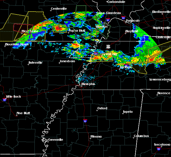 At 759 pm cdt, a severe thunderstorm was located near heloise, or 12 miles west of dyersburg, moving east at 30 mph (radar indicated). Hazards include ping pong ball size hail and 60 mph wind gusts. People and animals outdoors will be injured. expect hail damage to roofs, siding, windows, and vehicles. Expect wind damage to roofs, siding, and trees. At 759 pm cdt, a severe thunderstorm was located near heloise, or 12 miles west of dyersburg, moving east at 30 mph (radar indicated). Hazards include ping pong ball size hail and 60 mph wind gusts. People and animals outdoors will be injured. expect hail damage to roofs, siding, windows, and vehicles. Expect wind damage to roofs, siding, and trees.
|
| 5/27/2017 7:53 PM CDT |
 A severe thunderstorm warning remains in effect until 830 pm cdt for north central crockett. eastern dyer and west central gibson counties. at 751 pm cdt, a severe thunderstorm was located 8 miles southeast of newbern, or 12 miles west of trenton, moving east at 50 mph. hazard. 60 mph wind gusts and quarter size hail. A severe thunderstorm warning remains in effect until 830 pm cdt for north central crockett. eastern dyer and west central gibson counties. at 751 pm cdt, a severe thunderstorm was located 8 miles southeast of newbern, or 12 miles west of trenton, moving east at 50 mph. hazard. 60 mph wind gusts and quarter size hail.
|
| 5/27/2017 7:39 PM CDT |
 At 739 pm cdt, a severe thunderstorm was located near newbern, or near dyersburg, moving southeast at 60 mph (radar indicated). Hazards include 70 mph wind gusts and quarter size hail. Hail damage to vehicles is expected. expect considerable tree damage. Wind damage is also likely to mobile homes, roofs, and outbuildings. At 739 pm cdt, a severe thunderstorm was located near newbern, or near dyersburg, moving southeast at 60 mph (radar indicated). Hazards include 70 mph wind gusts and quarter size hail. Hail damage to vehicles is expected. expect considerable tree damage. Wind damage is also likely to mobile homes, roofs, and outbuildings.
|
| 5/27/2017 6:45 AM CDT |
 At 645 am cdt, severe thunderstorms were located along a line extending from near arbyrd to near leachville to near caraway, moving east at 45 mph (radar indicated). Hazards include 60 mph wind gusts and quarter size hail. Hail damage to vehicles is expected. Expect wind damage to roofs, siding, and trees. At 645 am cdt, severe thunderstorms were located along a line extending from near arbyrd to near leachville to near caraway, moving east at 45 mph (radar indicated). Hazards include 60 mph wind gusts and quarter size hail. Hail damage to vehicles is expected. Expect wind damage to roofs, siding, and trees.
|
| 4/30/2017 12:52 PM CDT |
 At 1252 pm cdt, a severe thunderstorm was located near chestnut bluff, or 15 miles southeast of dyersburg, moving northeast at 35 mph (radar indicated). Hazards include 60 mph wind gusts. Expect damage to roofs, siding, and trees. Locations impacted include, dyersburg, newbern, halls, chestnut bluff, maury city, friendship, gates, bishop, hawkinsville, fowlkes, bonicord, central, frog jump, rohoboth, maury junction, edgewood, south fork, poplar grove, south dyersburg and crockett mills. At 1252 pm cdt, a severe thunderstorm was located near chestnut bluff, or 15 miles southeast of dyersburg, moving northeast at 35 mph (radar indicated). Hazards include 60 mph wind gusts. Expect damage to roofs, siding, and trees. Locations impacted include, dyersburg, newbern, halls, chestnut bluff, maury city, friendship, gates, bishop, hawkinsville, fowlkes, bonicord, central, frog jump, rohoboth, maury junction, edgewood, south fork, poplar grove, south dyersburg and crockett mills.
|
| 4/30/2017 12:22 PM CDT |
 At 1222 pm cdt, a severe thunderstorm was located near forked deer, or near ripley, moving north at 50 mph (radar indicated). Hazards include 60 mph wind gusts. Expect damage to roofs, siding, and trees. Locations impacted include, dyersburg, ripley, trenton, newbern, halls, nutbush, forked deer, chestnut bluff, bradleytown, unionville, maury city, friendship, gates, edith, fowlkes, bonicord, central, jenkinsville, rohoboth and brazil. At 1222 pm cdt, a severe thunderstorm was located near forked deer, or near ripley, moving north at 50 mph (radar indicated). Hazards include 60 mph wind gusts. Expect damage to roofs, siding, and trees. Locations impacted include, dyersburg, ripley, trenton, newbern, halls, nutbush, forked deer, chestnut bluff, bradleytown, unionville, maury city, friendship, gates, edith, fowlkes, bonicord, central, jenkinsville, rohoboth and brazil.
|
| 4/30/2017 12:12 PM CDT |
 At 1212 pm cdt, a severe thunderstorm was located near ripley, moving north at 50 mph (radar indicated). Hazards include 60 mph wind gusts. expect damage to roofs, siding, and trees At 1212 pm cdt, a severe thunderstorm was located near ripley, moving north at 50 mph (radar indicated). Hazards include 60 mph wind gusts. expect damage to roofs, siding, and trees
|
| 4/30/2017 8:56 AM CDT |
 At 856 am cdt, a tornado producing storm was located near ripley, moving northeast at 60 mph (radar confirmed tornado). Hazards include damaging tornado. Flying debris will be dangerous to those caught without shelter. mobile homes will be damaged or destroyed. damage to roofs, windows, and vehicles will occur. tree damage is likely. this tornadic storm will be near, ripley and forked deer around 905 am cdt. halls, unionville and chestnut bluff around 915 am cdt. bradleytown around 920 am cdt. dyersburg around 925 am cdt. Other locations impacted by this tornadic thunderstorm include bishop, hawkinsville, papaw ridge, porter gap, edith, fowlkes, dryhill, bonicord, double bridges and jenkinsville. At 856 am cdt, a tornado producing storm was located near ripley, moving northeast at 60 mph (radar confirmed tornado). Hazards include damaging tornado. Flying debris will be dangerous to those caught without shelter. mobile homes will be damaged or destroyed. damage to roofs, windows, and vehicles will occur. tree damage is likely. this tornadic storm will be near, ripley and forked deer around 905 am cdt. halls, unionville and chestnut bluff around 915 am cdt. bradleytown around 920 am cdt. dyersburg around 925 am cdt. Other locations impacted by this tornadic thunderstorm include bishop, hawkinsville, papaw ridge, porter gap, edith, fowlkes, dryhill, bonicord, double bridges and jenkinsville.
|
| 4/30/2017 2:27 AM CDT |
 At 227 am cdt, a severe thunderstorm producing a tornado was located near heloise, or 11 miles southeast of steele, moving east at 60 mph (radar indicated rotation). Hazards include tornado. Flying debris will be dangerous to those caught without shelter. mobile homes will be damaged or destroyed. damage to roofs, windows, and vehicles will occur. tree damage is likely. this dangerous storm will be near, unionville around 240 am cdt. bradleytown around 245 am cdt. dyersburg around 250 am cdt. newbern around 255 am cdt. dyer around 305 am cdt. kenton and rutherford around 310 am cdt. Other locations impacted by this tornadic thunderstorm include cat corner, grizzard, fowlkes, lapata, bonicord, central, tyler, locust grove, jenkinsville and maxey. At 227 am cdt, a severe thunderstorm producing a tornado was located near heloise, or 11 miles southeast of steele, moving east at 60 mph (radar indicated rotation). Hazards include tornado. Flying debris will be dangerous to those caught without shelter. mobile homes will be damaged or destroyed. damage to roofs, windows, and vehicles will occur. tree damage is likely. this dangerous storm will be near, unionville around 240 am cdt. bradleytown around 245 am cdt. dyersburg around 250 am cdt. newbern around 255 am cdt. dyer around 305 am cdt. kenton and rutherford around 310 am cdt. Other locations impacted by this tornadic thunderstorm include cat corner, grizzard, fowlkes, lapata, bonicord, central, tyler, locust grove, jenkinsville and maxey.
|
| 4/17/2017 12:15 PM CDT |
 At 1215 pm cdt, a severe thunderstorm was located near newbern, or 9 miles east of dyersburg, moving east at 20 mph (radar indicated). Hazards include 60 mph wind gusts and quarter size hail. Hail damage to vehicles is expected. expect wind damage to roofs, siding, and trees. Locations impacted include, dyersburg, newbern, trimble, edgewood, bishop, poplar ridge, churchton, parker, lapata, tatumville, viar, locust grove, maxey, rohoboth, stokes, templeton, roellen and tigrett. At 1215 pm cdt, a severe thunderstorm was located near newbern, or 9 miles east of dyersburg, moving east at 20 mph (radar indicated). Hazards include 60 mph wind gusts and quarter size hail. Hail damage to vehicles is expected. expect wind damage to roofs, siding, and trees. Locations impacted include, dyersburg, newbern, trimble, edgewood, bishop, poplar ridge, churchton, parker, lapata, tatumville, viar, locust grove, maxey, rohoboth, stokes, templeton, roellen and tigrett.
|
| 4/17/2017 12:00 PM CDT |
 At 1200 pm cdt, a severe thunderstorm was located near newbern, or near dyersburg, moving east at 20 mph (radar indicated). Hazards include 60 mph wind gusts and half dollar size hail. Hail damage to vehicles is expected. Expect wind damage to roofs, siding, and trees. At 1200 pm cdt, a severe thunderstorm was located near newbern, or near dyersburg, moving east at 20 mph (radar indicated). Hazards include 60 mph wind gusts and half dollar size hail. Hail damage to vehicles is expected. Expect wind damage to roofs, siding, and trees.
|
| 3/27/2017 4:08 PM CDT |
 At 408 pm cdt, a severe thunderstorm was located near ashport, or 9 miles northwest of ripley, moving east at 45 mph (radar indicated). Hazards include 60 mph wind gusts and half dollar size hail. Hail damage to vehicles is expected. Expect wind damage to roofs, siding, and trees. At 408 pm cdt, a severe thunderstorm was located near ashport, or 9 miles northwest of ripley, moving east at 45 mph (radar indicated). Hazards include 60 mph wind gusts and half dollar size hail. Hail damage to vehicles is expected. Expect wind damage to roofs, siding, and trees.
|
| 3/27/2017 2:35 PM CDT | Quarter sized hail reported 0.5 miles WSW of Dyersburg, TN |
| 3/27/2017 12:44 PM CDT |
 At 1243 pm cdt, a severe thunderstorm was located near newbern, or 7 miles east of dyersburg, moving northeast at 35 mph (radar indicated). Hazards include quarter size hail. damage to vehicles is expected At 1243 pm cdt, a severe thunderstorm was located near newbern, or 7 miles east of dyersburg, moving northeast at 35 mph (radar indicated). Hazards include quarter size hail. damage to vehicles is expected
|
| 3/9/2017 8:34 PM CST |
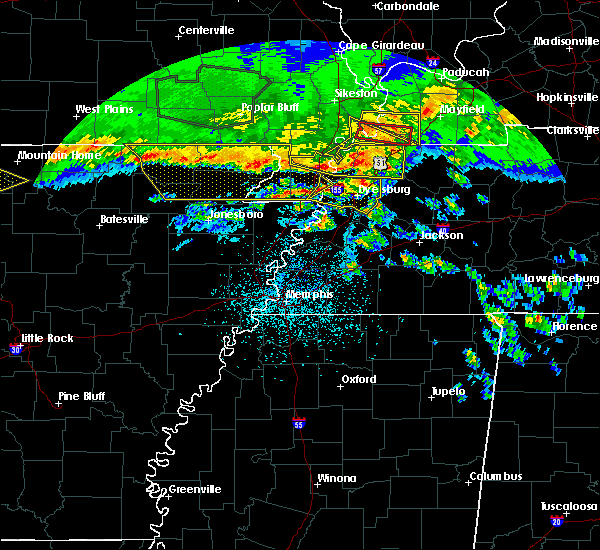 At 833 pm cst, a severe thunderstorm was located near heloise, or near caruthersville, moving east at 50 mph (radar indicated). Hazards include 60 mph wind gusts and quarter size hail. Hail damage to vehicles is expected. Expect wind damage to roofs, siding, and trees. At 833 pm cst, a severe thunderstorm was located near heloise, or near caruthersville, moving east at 50 mph (radar indicated). Hazards include 60 mph wind gusts and quarter size hail. Hail damage to vehicles is expected. Expect wind damage to roofs, siding, and trees.
|
| 3/1/2017 5:08 AM CST |
 The tornado warning for southeastern mississippi, tipton, western dyer and lauderdale counties will expire at 515 am cst, the storms which prompted the warning have moved out of the area. therefore the warning will be allowed to expire. however gusty winds are still possible with these thunderstorms. a tornado watch remains in effect until 800 am cst for eastern arkansas, southeastern missouri, and western and west tennessee. The tornado warning for southeastern mississippi, tipton, western dyer and lauderdale counties will expire at 515 am cst, the storms which prompted the warning have moved out of the area. therefore the warning will be allowed to expire. however gusty winds are still possible with these thunderstorms. a tornado watch remains in effect until 800 am cst for eastern arkansas, southeastern missouri, and western and west tennessee.
|
| 3/1/2017 4:59 AM CST |
 At 459 am cst, a severe squall line producing both tornadoes and extensive straight line wind damage was located along a line extending from near newbern to near chestnut bluff to 7 miles east of dixonville, moving east at 65 mph (radar indicated rotation). Hazards include tornado. Flying debris will be dangerous to those caught without shelter. mobile homes will be damaged or destroyed. damage to roofs, windows, and vehicles will occur. tree damage is likely. Locations impacted include, dyersburg, brownsville, newbern, alamo, bells, dyer, halls, kenton, rutherford, nutbush, forked deer, chestnut bluff, belle eagle, holly grove, dancyville, mason, maury city, friendship, gates and trimble. At 459 am cst, a severe squall line producing both tornadoes and extensive straight line wind damage was located along a line extending from near newbern to near chestnut bluff to 7 miles east of dixonville, moving east at 65 mph (radar indicated rotation). Hazards include tornado. Flying debris will be dangerous to those caught without shelter. mobile homes will be damaged or destroyed. damage to roofs, windows, and vehicles will occur. tree damage is likely. Locations impacted include, dyersburg, brownsville, newbern, alamo, bells, dyer, halls, kenton, rutherford, nutbush, forked deer, chestnut bluff, belle eagle, holly grove, dancyville, mason, maury city, friendship, gates and trimble.
|
| 3/1/2017 4:50 AM CST | Some power lines were blown down and electric poles were snappe in dyer county TN, 5.1 miles E of Dyersburg, TN |
| 3/1/2017 4:48 AM CST |
 At 447 am cst, a severe squall line producing both tornadoes and extensive straight line wind damage was located along a line extending from near ridgely to 6 miles west of halls to near dixonville, moving east at 65 mph (radar indicated rotation). Hazards include tornado. Flying debris will be dangerous to those caught without shelter. mobile homes will be damaged or destroyed. damage to roofs, windows, and vehicles will occur. tree damage is likely. these dangerous storms will be near, halls around 455 am cst. Other locations impacted by these tornadic storms include burlison, edith, tomato, jenkinsville, luckett, atoka, randolph, poplar grove, curve and tipton. At 447 am cst, a severe squall line producing both tornadoes and extensive straight line wind damage was located along a line extending from near ridgely to 6 miles west of halls to near dixonville, moving east at 65 mph (radar indicated rotation). Hazards include tornado. Flying debris will be dangerous to those caught without shelter. mobile homes will be damaged or destroyed. damage to roofs, windows, and vehicles will occur. tree damage is likely. these dangerous storms will be near, halls around 455 am cst. Other locations impacted by these tornadic storms include burlison, edith, tomato, jenkinsville, luckett, atoka, randolph, poplar grove, curve and tipton.
|
| 3/1/2017 4:43 AM CST |
 At 443 am cst, severe thunderstorms producing both tornadoes and extensive straight line wind damage were located along a line extending from miston to near ripley to near munford, moving east at 65 mph (radar indicated rotation). Hazards include tornado. Flying debris will be dangerous to those caught without shelter. mobile homes will be damaged or destroyed. damage to roofs, windows, and vehicles will occur. tree damage is likely. these dangerous storms will be near, dyersburg, halls and forked deer around 450 am cst. newbern and chestnut bluff around 455 am cst. alamo around 505 am cst. bells, dyer, kenton and rutherford around 510 am cst. dancyville around 515 am cst. Other locations impacted by these tornadic storms include fowlkes, stanton, lapata, christmasville, bonicord, central, locust grove, maxey, rohoboth and currie. At 443 am cst, severe thunderstorms producing both tornadoes and extensive straight line wind damage were located along a line extending from miston to near ripley to near munford, moving east at 65 mph (radar indicated rotation). Hazards include tornado. Flying debris will be dangerous to those caught without shelter. mobile homes will be damaged or destroyed. damage to roofs, windows, and vehicles will occur. tree damage is likely. these dangerous storms will be near, dyersburg, halls and forked deer around 450 am cst. newbern and chestnut bluff around 455 am cst. alamo around 505 am cst. bells, dyer, kenton and rutherford around 510 am cst. dancyville around 515 am cst. Other locations impacted by these tornadic storms include fowlkes, stanton, lapata, christmasville, bonicord, central, locust grove, maxey, rohoboth and currie.
|
| 3/1/2017 4:24 AM CST |
 At 423 am cst, severe thunderstorms producing both tornadoes and extensive straight line wind damage were located along a line extending from 6 miles west of wardell to near blytheville to near gilmore, moving east at 65 mph (radar indicated rotation). Hazards include tornado. Flying debris will be dangerous to those caught without shelter. mobile homes will be damaged or destroyed. damage to roofs, windows, and vehicles will occur. tree damage is likely. these dangerous storms will be near, hayti heights around 430 am cst. hayti and dixonville around 435 am cst. ripley and munford around 445 am cst. brighton, halls and unionville around 450 am cst. Other locations impacted by these tornadic storms include burlison, calumet, new survey, grider, gobler, covington, atoka, poplar grove, shippen and victoria. At 423 am cst, severe thunderstorms producing both tornadoes and extensive straight line wind damage were located along a line extending from 6 miles west of wardell to near blytheville to near gilmore, moving east at 65 mph (radar indicated rotation). Hazards include tornado. Flying debris will be dangerous to those caught without shelter. mobile homes will be damaged or destroyed. damage to roofs, windows, and vehicles will occur. tree damage is likely. these dangerous storms will be near, hayti heights around 430 am cst. hayti and dixonville around 435 am cst. ripley and munford around 445 am cst. brighton, halls and unionville around 450 am cst. Other locations impacted by these tornadic storms include burlison, calumet, new survey, grider, gobler, covington, atoka, poplar grove, shippen and victoria.
|
| 12/17/2016 6:20 PM CST | Trees... power lines and poles down over parts of dyer count in dyer county TN, 4.7 miles N of Dyersburg, TN |
| 12/17/2016 6:13 PM CST |
 At 612 pm cst, a severe thunderstorm was located over miston, or 8 miles northwest of dyersburg, moving northeast at 70 mph (radar indicated). Hazards include 60 mph wind gusts. Expect damage to roofs, siding, and trees. locations impacted include, dyersburg, blytheville, ripley, osceola, luxora, keiser, newbern, halls, burdette, bradleytown, miston, unionville, ashport, gates, trimble, edgewood, edith, lane, jenkinsville and stinger. A tornado watch remains in effect until 900 pm cst for eastern arkansas, southeastern missouri, and western tennessee. At 612 pm cst, a severe thunderstorm was located over miston, or 8 miles northwest of dyersburg, moving northeast at 70 mph (radar indicated). Hazards include 60 mph wind gusts. Expect damage to roofs, siding, and trees. locations impacted include, dyersburg, blytheville, ripley, osceola, luxora, keiser, newbern, halls, burdette, bradleytown, miston, unionville, ashport, gates, trimble, edgewood, edith, lane, jenkinsville and stinger. A tornado watch remains in effect until 900 pm cst for eastern arkansas, southeastern missouri, and western tennessee.
|
| 12/17/2016 5:51 PM CST |
 At 551 pm cst, a severe thunderstorm was located over blytheville, moving northeast at 70 mph (radar indicated). Hazards include 60 mph wind gusts. expect damage to roofs, siding, and trees At 551 pm cst, a severe thunderstorm was located over blytheville, moving northeast at 70 mph (radar indicated). Hazards include 60 mph wind gusts. expect damage to roofs, siding, and trees
|
| 8/14/2016 4:47 PM CDT |
 At 447 pm cdt, a severe thunderstorm was located over heloise, or 9 miles south of caruthersville, moving north at 35 mph (radar indicated). Hazards include 60 mph wind gusts. Expect damage to roofs. siding. and trees. Locations impacted include, dyersburg, caruthersville, bradleytown, miston, heloise, edith, jenkinsville, stinger, porter gap, bogota, tiger tail, tennemo, lenox, huffman, tomato, hickman, nauvoo, boothspoint, mengelwood and barfield. At 447 pm cdt, a severe thunderstorm was located over heloise, or 9 miles south of caruthersville, moving north at 35 mph (radar indicated). Hazards include 60 mph wind gusts. Expect damage to roofs. siding. and trees. Locations impacted include, dyersburg, caruthersville, bradleytown, miston, heloise, edith, jenkinsville, stinger, porter gap, bogota, tiger tail, tennemo, lenox, huffman, tomato, hickman, nauvoo, boothspoint, mengelwood and barfield.
|
| 8/14/2016 4:47 PM CDT |
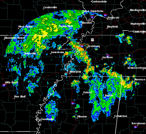 At 447 pm cdt, a severe thunderstorm was located over heloise, or 9 miles south of caruthersville, moving north at 35 mph (radar indicated). Hazards include 60 mph wind gusts. Expect damage to roofs. siding. and trees. Locations impacted include, dyersburg, caruthersville, bradleytown, miston, heloise, edith, jenkinsville, stinger, porter gap, bogota, tiger tail, tennemo, lenox, huffman, tomato, hickman, nauvoo, boothspoint, mengelwood and barfield. At 447 pm cdt, a severe thunderstorm was located over heloise, or 9 miles south of caruthersville, moving north at 35 mph (radar indicated). Hazards include 60 mph wind gusts. Expect damage to roofs. siding. and trees. Locations impacted include, dyersburg, caruthersville, bradleytown, miston, heloise, edith, jenkinsville, stinger, porter gap, bogota, tiger tail, tennemo, lenox, huffman, tomato, hickman, nauvoo, boothspoint, mengelwood and barfield.
|
| 8/14/2016 4:32 PM CDT |
 At 431 pm cdt, a severe thunderstorm was located 10 miles south of heloise, or 12 miles northwest of ripley, moving north at 30 mph (radar indicated). Hazards include 60 mph wind gusts. Expect damage to roofs. siding. And trees. At 431 pm cdt, a severe thunderstorm was located 10 miles south of heloise, or 12 miles northwest of ripley, moving north at 30 mph (radar indicated). Hazards include 60 mph wind gusts. Expect damage to roofs. siding. And trees.
|
| 7/15/2016 5:06 PM CDT | Multiple trees down near intersection of winchester and perkins. time is radar estimate in dyer county TN, 6.9 miles NNW of Dyersburg, TN |
| 6/15/2016 6:28 PM CDT |
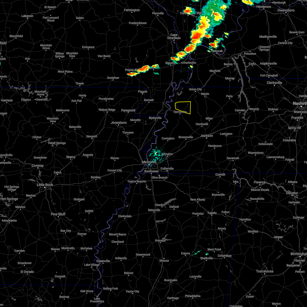 The severe thunderstorm warning for northeastern dyer and southwestern obion counties will expire at 630 pm cdt, the storm which prompted the warning has weakened below severe limits, and no longer poses an immediate threat to life or property. therefore the warning will be allowed to expire. a severe thunderstorm watch remains in effect until 900 pm cdt for western tennessee. The severe thunderstorm warning for northeastern dyer and southwestern obion counties will expire at 630 pm cdt, the storm which prompted the warning has weakened below severe limits, and no longer poses an immediate threat to life or property. therefore the warning will be allowed to expire. a severe thunderstorm watch remains in effect until 900 pm cdt for western tennessee.
|
| 6/15/2016 5:55 PM CDT |
 At 554 pm cdt, a severe thunderstorm was located near cloverdale, or 9 miles north of dyersburg, moving east at 20 mph (radar indicated). Hazards include 60 mph wind gusts and quarter size hail. Hail damage to vehicles is expected. Expect wind damage to roofs, siding, and trees. At 554 pm cdt, a severe thunderstorm was located near cloverdale, or 9 miles north of dyersburg, moving east at 20 mph (radar indicated). Hazards include 60 mph wind gusts and quarter size hail. Hail damage to vehicles is expected. Expect wind damage to roofs, siding, and trees.
|
| 3/31/2016 1:01 PM CDT |
 At 101 pm cdt, a severe thunderstorm was located near dyersburg, moving northeast at 40 mph (radar indicated). Hazards include 60 mph wind gusts and quarter size hail. Hail damage to vehicles is expected. expect wind damage to roofs, siding, and trees. Locations impacted include, dyersburg, dyer, kenton, rutherford, bradleytown, yorkville, edgewood, tigrett, bonicord, bishop, currie, rohoboth, tyson store, parker, tatumville, stokes, churchton, tilghman, evansville and roellen. At 101 pm cdt, a severe thunderstorm was located near dyersburg, moving northeast at 40 mph (radar indicated). Hazards include 60 mph wind gusts and quarter size hail. Hail damage to vehicles is expected. expect wind damage to roofs, siding, and trees. Locations impacted include, dyersburg, dyer, kenton, rutherford, bradleytown, yorkville, edgewood, tigrett, bonicord, bishop, currie, rohoboth, tyson store, parker, tatumville, stokes, churchton, tilghman, evansville and roellen.
|
| 3/31/2016 12:40 PM CDT |
 At 1240 pm cdt, a severe thunderstorm was located near unionville, or 10 miles north of ripley, moving east at 45 mph (radar indicated). Hazards include 60 mph wind gusts and quarter size hail. Hail damage to vehicles is expected. Expect wind damage to roofs, siding, and trees. At 1240 pm cdt, a severe thunderstorm was located near unionville, or 10 miles north of ripley, moving east at 45 mph (radar indicated). Hazards include 60 mph wind gusts and quarter size hail. Hail damage to vehicles is expected. Expect wind damage to roofs, siding, and trees.
|
| 12/26/2015 9:38 AM CST |
 At 938 am cst, a severe thunderstorm was located near dyersburg, moving northeast at 40 mph (radar indicated). Hazards include 60 mph wind gusts. Expect damage to roofs. Siding and trees. At 938 am cst, a severe thunderstorm was located near dyersburg, moving northeast at 40 mph (radar indicated). Hazards include 60 mph wind gusts. Expect damage to roofs. Siding and trees.
|
| 12/26/2015 9:35 AM CST |
 At 935 am cst, a severe thunderstorm was located near newbern, or 7 miles east of dyersburg, moving northeast at 40 mph (radar indicated). Hazards include 60 mph wind gusts. Expect damage to roofs. siding and trees. Locations impacted include, dyersburg, ripley, newbern, halls, bradleytown, chestnut bluff, unionville, maury city, friendship, gates, jenkinsville, bishop, nankipoo, porter gap, rohoboth, dog hill, stokes, south fork, maury junction and roellen. At 935 am cst, a severe thunderstorm was located near newbern, or 7 miles east of dyersburg, moving northeast at 40 mph (radar indicated). Hazards include 60 mph wind gusts. Expect damage to roofs. siding and trees. Locations impacted include, dyersburg, ripley, newbern, halls, bradleytown, chestnut bluff, unionville, maury city, friendship, gates, jenkinsville, bishop, nankipoo, porter gap, rohoboth, dog hill, stokes, south fork, maury junction and roellen.
|
| 12/26/2015 9:24 AM CST |
 At 924 am cst, a severe thunderstorm was located near unionville, or near dyersburg, moving northeast at 40 mph (radar indicated). Hazards include 60 mph wind gusts. Expect damage to roofs. siding and trees. Locations impacted include, dyersburg, ripley, newbern, halls, bradleytown, chestnut bluff, unionville, maury city, friendship, gates, edith, jenkinsville, bishop, nankipoo, porter gap, rohoboth, dog hill, arp, stokes and south fork. At 924 am cst, a severe thunderstorm was located near unionville, or near dyersburg, moving northeast at 40 mph (radar indicated). Hazards include 60 mph wind gusts. Expect damage to roofs. siding and trees. Locations impacted include, dyersburg, ripley, newbern, halls, bradleytown, chestnut bluff, unionville, maury city, friendship, gates, edith, jenkinsville, bishop, nankipoo, porter gap, rohoboth, dog hill, arp, stokes and south fork.
|
| 12/26/2015 9:07 AM CST |
 At 907 am cst, a severe thunderstorm was located 7 miles southwest of unionville, or 10 miles north of ripley, moving northeast at 40 mph (radar indicated). Hazards include 60 mph wind gusts. Expect damage to roofs. siding and trees. Locations impacted include, dyersburg, ripley, newbern, halls, bradleytown, chestnut bluff, unionville, maury city, friendship, gates, edith, jenkinsville, stinger, bishop, nankipoo, porter gap, rohoboth, dog hill, arp and stokes. At 907 am cst, a severe thunderstorm was located 7 miles southwest of unionville, or 10 miles north of ripley, moving northeast at 40 mph (radar indicated). Hazards include 60 mph wind gusts. Expect damage to roofs. siding and trees. Locations impacted include, dyersburg, ripley, newbern, halls, bradleytown, chestnut bluff, unionville, maury city, friendship, gates, edith, jenkinsville, stinger, bishop, nankipoo, porter gap, rohoboth, dog hill, arp and stokes.
|
| 12/26/2015 8:54 AM CST |
 At 854 am cst, a severe thunderstorm was located 7 miles northeast of ashport, or 11 miles northwest of ripley, moving northeast at 40 mph (radar indicated). Hazards include 60 mph wind gusts. Expect damage to roofs. Siding and trees. At 854 am cst, a severe thunderstorm was located 7 miles northeast of ashport, or 11 miles northwest of ripley, moving northeast at 40 mph (radar indicated). Hazards include 60 mph wind gusts. Expect damage to roofs. Siding and trees.
|
| 12/23/2015 4:00 PM CST | Quarter sized hail reported 2.8 miles W of Dyersburg, TN, quarter sized hail and gusty winds on east side of dyersburg. |
| 8/10/2015 3:26 AM CDT |
 At 326 am cdt, a severe thunderstorm was located near reelfoot lake state park, moving southeast at 50 mph (radar indicated). Hazards include 60 mph wind gusts. Expect damage to roofs. siding and trees. Locations impacted include, union city, caruthersville, hayti, fulton, reelfoot lake state park, tiptonville, ridgely, troy, obion, hayti heights, wardell, cottonwood grove, heloise, clayton, deering, miston, cloverdale, bolton, hornbeak and woodland mills. At 326 am cdt, a severe thunderstorm was located near reelfoot lake state park, moving southeast at 50 mph (radar indicated). Hazards include 60 mph wind gusts. Expect damage to roofs. siding and trees. Locations impacted include, union city, caruthersville, hayti, fulton, reelfoot lake state park, tiptonville, ridgely, troy, obion, hayti heights, wardell, cottonwood grove, heloise, clayton, deering, miston, cloverdale, bolton, hornbeak and woodland mills.
|
| 8/10/2015 2:58 AM CDT |
 At 257 am cdt, a severe thunderstorm was located over lilbourn, moving southeast at 50 mph (radar indicated). Hazards include 60 mph wind gusts. Expect damage to roofs. Siding and trees. At 257 am cdt, a severe thunderstorm was located over lilbourn, moving southeast at 50 mph (radar indicated). Hazards include 60 mph wind gusts. Expect damage to roofs. Siding and trees.
|
| 7/14/2015 4:00 PM CDT | Several trees down across dyer county with power outage in dyer county TN, 0.5 miles WSW of Dyersburg, TN |
| 6/26/2015 5:00 PM CDT | At 459 pm cdt, severe thunderstorms were located along a line extending from bradleytown to near munford, moving east at 35 mph (radar indicated). Hazards include 60 mph wind gusts and quarter size hail. Hail damage to vehicles is expected. expect wind damage to roofs, siding and trees. Locations impacted include, dyersburg, covington, ripley, fort pillow state park, munford, newbern, brighton, halls, bradleytown, chestnut bluff, ft pillow, miston, unionville, ashport, fulton, atoka, henning, gates, trimble and gilt edge. |
| 6/26/2015 4:35 PM CDT | At 435 pm cdt, severe thunderstorms were located along a line extending from near caruthersville to bassett, moving east at 35 mph (radar indicated). Hazards include 60 mph wind gusts and quarter size hail. Hail damage to vehicles is expected. Expect wind damage to roofs, siding and trees. |
| 6/26/2015 4:35 PM CDT | At 435 pm cdt, severe thunderstorms were located along a line extending from near caruthersville to bassett, moving east at 35 mph (radar indicated). Hazards include 60 mph wind gusts and quarter size hail. Hail damage to vehicles is expected. Expect wind damage to roofs, siding and trees. |
| 6/26/2015 4:35 PM CDT | At 435 pm cdt, severe thunderstorms were located along a line extending from near caruthersville to bassett, moving east at 35 mph (radar indicated). Hazards include 60 mph wind gusts and quarter size hail. Hail damage to vehicles is expected. Expect wind damage to roofs, siding and trees. |
| 6/26/2015 2:33 PM CDT | At 232 pm cdt, a severe thunderstorm was located near newbern, or 8 miles east of dyersburg, moving northeast at 40 mph (trained weather spotters). Hazards include 60 mph wind gusts. Expect damage to roofs. siding and trees. Locations impacted include, dyersburg, trenton, newbern, dyer, bradleytown, friendship, yorkville, central, edgewood, jenkinsville, bishop, grizzard, currie, rohoboth, tyson store, stokes, south fork, roellen, viar and georgetown. |
| 6/26/2015 2:22 PM CDT | At 222 pm cdt, a severe thunderstorm was located near dyersburg, moving northeast at 40 mph (radar indicated). Hazards include 60 mph wind gusts and quarter size hail. Hail damage to vehicles is expected. Expect wind damage to roofs, siding and trees. |
| 6/26/2015 2:15 PM CDT | Storm spotter reports 60 mph wind gust. no damage at this tim in dyer county TN, 0.5 miles WSW of Dyersburg, TN |
| 6/24/2015 2:51 PM CDT | A tree was blown down in the town of finle in dyer county TN, 5.1 miles E of Dyersburg, TN |
| 5/30/2015 12:59 PM CDT | At 1259 pm cdt, a severe thunderstorm was located over obion, or 12 miles southeast of reelfoot lake state park, moving northeast at 35 mph (radar indicated). Hazards include 60 mph wind gusts. Expect damage to roofs. siding and trees. Locations impacted include, dyersburg, newbern, dyer, kenton, rutherford, obion, cloverdale, trimble, yorkville, edgewood, lane, locust grove, rohoboth, tyson store, poplar ridge, tatumville, maxey, sharps ferry, churchton and tilghman. |
| 5/30/2015 12:58 PM CDT | At 1258 pm cdt, a severe thunderstorm was located over covington, moving northeast at 30 mph (radar indicated). Hazards include 60 mph wind gusts. Expect damage to roofs. siding and trees. Locations impacted include, brownsville, ripley, alamo, dyer, halls, belle eagle, chestnut bluff, nutbush, unionville, forked deer, henning, maury city, friendship, gates, stanton, edith, oakview, bishop, currie and nankipoo. |
| 5/30/2015 12:39 PM CDT | At 1239 pm cdt, a severe thunderstorm was located over brighton, or 7 miles southwest of covington, moving northeast at 30 mph (radar indicated). Hazards include 60 mph wind gusts and penny size hail. Expect damage to roofs. Siding and trees. |
| 5/30/2015 12:37 PM CDT | At 1237 pm cdt, a severe thunderstorm was located near dyersburg, moving northeast at 35 mph (radar indicated). Hazards include 60 mph wind gusts and penny size hail. Expect damage to roofs. Siding and trees. |
| 4/19/2015 9:40 PM CDT | Storm damage reported in dyer county TN, 0.5 miles WSW of Dyersburg, TN |
| 4/19/2015 5:58 PM CDT | At 557 pm cdt, a severe thunderstorm was located near miston, or 8 miles northwest of dyersburg, moving east at 35 mph (radar indicated). Hazards include 60 mph wind gusts and quarter size hail. Hail damage to vehicles is expected. expect wind damage to roofs, siding and trees. locations impacted include, dyersburg, newbern, bradleytown, miston, unionville, heloise, edgewood, lane, jenkinsville, bishop, rohoboth, maxey, south fork, bogota, templeton, roellen, tennemo, lenox, viar and nauvoo. 1. 00in. |
| 4/19/2015 5:44 PM CDT | The national weather service in memphis has issued a * severe thunderstorm warning for. southeastern pemiscot county in southeastern missouri. southwestern lake county in northwestern tennessee. dyer county in northwestern tennessee. Until 630 pm cdt. |
| 4/19/2015 5:44 PM CDT | The national weather service in memphis has issued a * severe thunderstorm warning for. southeastern pemiscot county in southeastern missouri. southwestern lake county in northwestern tennessee. dyer county in northwestern tennessee. Until 630 pm cdt. |
| 3/31/2015 8:49 PM CDT | The national weather service in memphis has issued a * severe thunderstorm warning for. crockett county in northwestern tennessee. northeastern lauderdale county in southwestern tennessee. northern haywood county in southwestern tennessee. Southern dyer county in northwestern tennessee. |
| 3/31/2015 6:38 PM CDT | The severe thunderstorm warning for southwestern obion and dyer counties will expire at 645 pm cdt. the storm which prompted the warning has weakened below severe limits and exited the warned area. Therefore the warning will be allowed to expire. |
| 3/31/2015 6:22 PM CDT | A severe thunderstorm warning remains in effect until 645 pm cdt for southwestern obion and dyer counties. at 621 pm cdt. doppler radar indicated a severe thunderstorm producing quarter size hail. this storm was located near bradleytown. or near dyersburg. moving southeast at 30 mph. Locations impacted include. |
| 3/31/2015 5:55 PM CDT | The national weather service in memphis has issued a * severe thunderstorm warning for. east central pemiscot county in southeastern missouri. southwestern lake county in northwestern tennessee. southwestern obion county in northwestern tennessee. Dyer county in northwestern tennessee. |
| 3/31/2015 5:55 PM CDT | The national weather service in memphis has issued a * severe thunderstorm warning for. east central pemiscot county in southeastern missouri. southwestern lake county in northwestern tennessee. southwestern obion county in northwestern tennessee. Dyer county in northwestern tennessee. |
| 10/13/2014 2:15 PM CDT | Damage to roof at kroger on lake road. trees down and roads blocked at owen drive and pennell lan in dyer county TN, 0.5 miles WSW of Dyersburg, TN |
| 6/5/2014 2:34 PM CDT | Storm damage reported in dyer county TN, 0.5 miles WSW of Dyersburg, TN |
| 10/31/2013 8:35 PM CDT | Trees down blocking hwy 210 south near fowlke in dyer county TN, 4.7 miles N of Dyersburg, TN |
| 10/31/2013 8:35 PM CDT | Trees down blocking dawn hurly road near roellen and trees down blocking deal road and ing road in western dyer count in dyer county TN, 6.2 miles WNW of Dyersburg, TN |
| 9/7/2012 9:30 PM CDT | Trees down all over the county in dyer county TN, 0.5 miles WSW of Dyersburg, TN |
| 6/11/2012 2:45 PM CDT | Large tree down and blocking meacham road. trampoline blown into the roa in dyer county TN, 7.1 miles S of Dyersburg, TN |
| 1/1/0001 12:00 AM | Storm damage reported in dyer county TN, 7.1 miles S of Dyersburg, TN |
| 1/1/0001 12:00 AM | A wooden porch was torn from a house...shingles also blown of hous in dyer county TN, 1.6 miles W of Dyersburg, TN |
| 1/1/0001 12:00 AM | Trees down near walmart in city in dyer county TN, 0.5 miles WSW of Dyersburg, TN |
| 1/1/0001 12:00 AM | Lots of tree limbs 3 to 4 inches in diameter down at the dyersburg municipal golf course. a roof was blown off a shed...and some of the shingles were blown across the c in dyer county TN, 0.5 miles WSW of Dyersburg, TN |
| 1/1/0001 12:00 AM | Multiple topped and downed trees along with large tree limbs falling on and damaging car in dyer county TN, 5.6 miles W of Dyersburg, TN |
Hail Maps for Dyersburg, TN


Connect with Interactive Hail Maps