

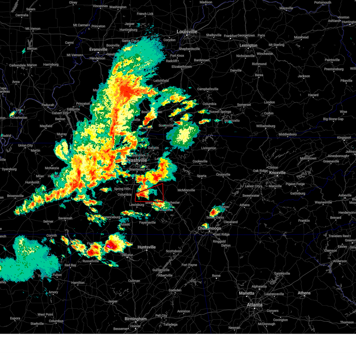
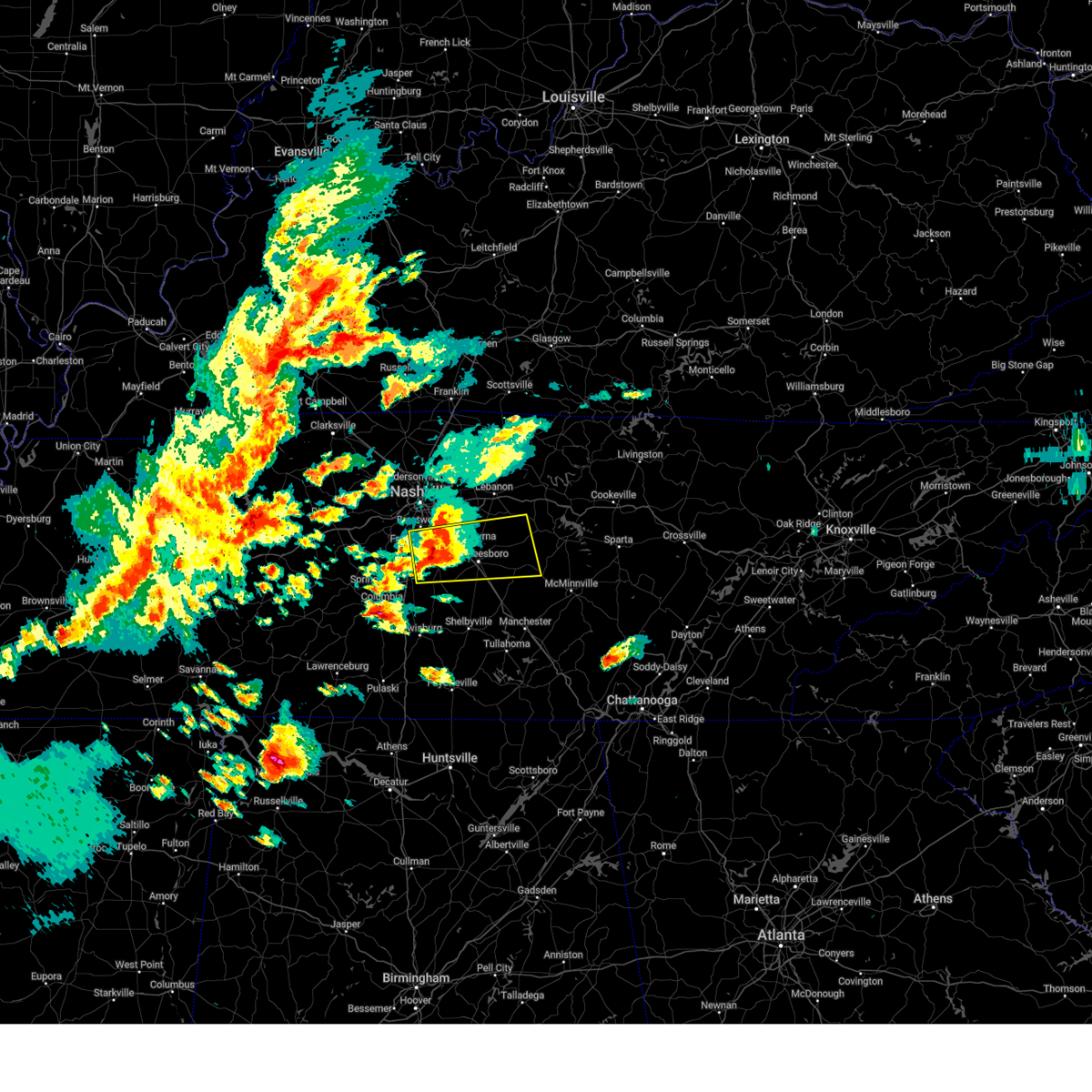
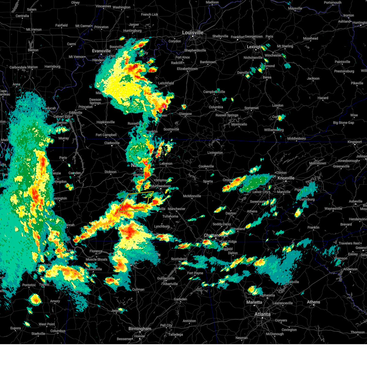
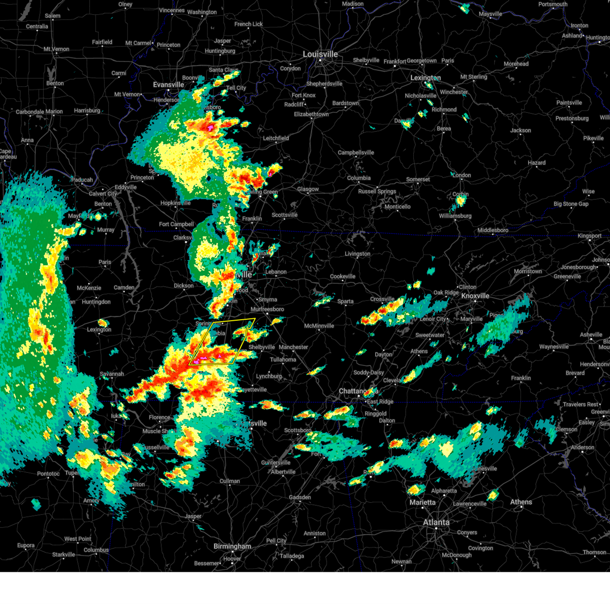
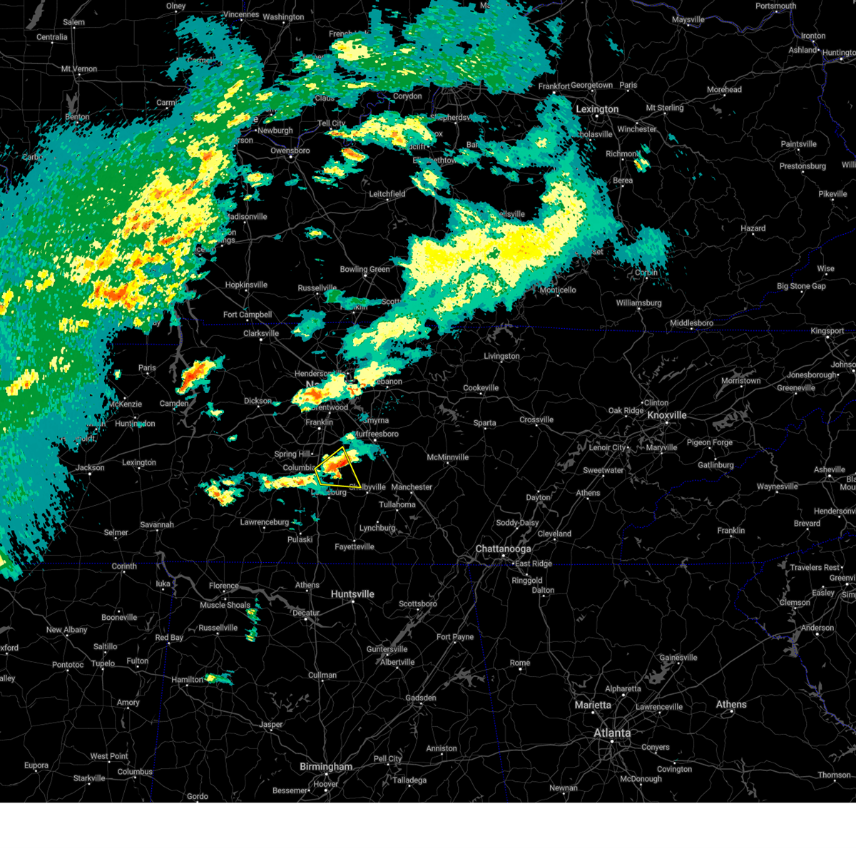
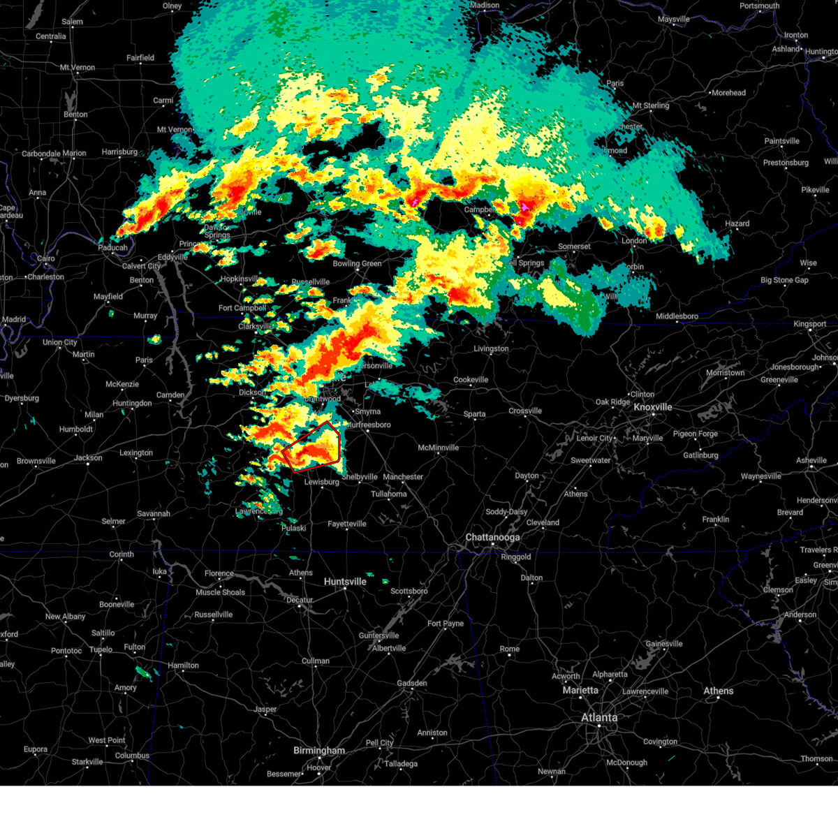
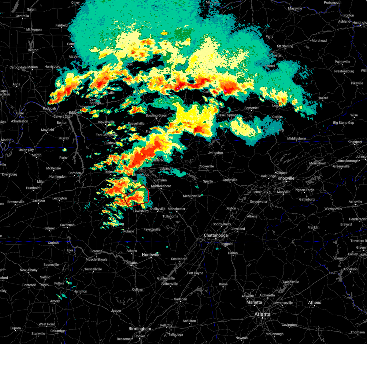
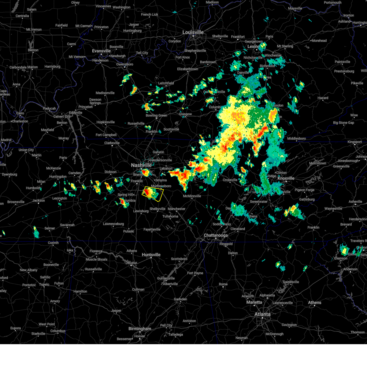
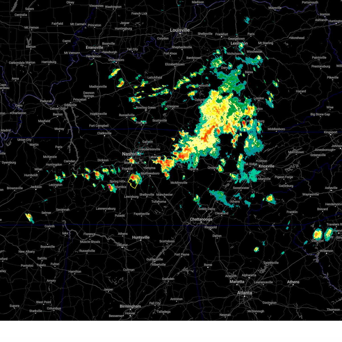
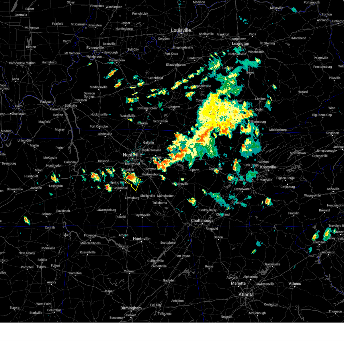
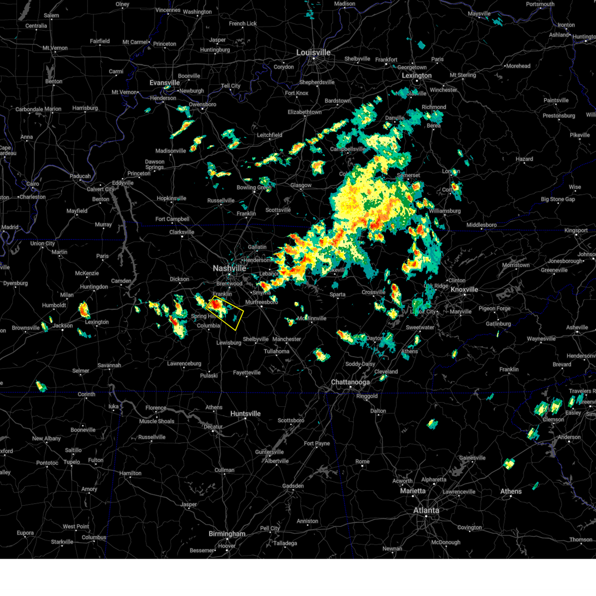
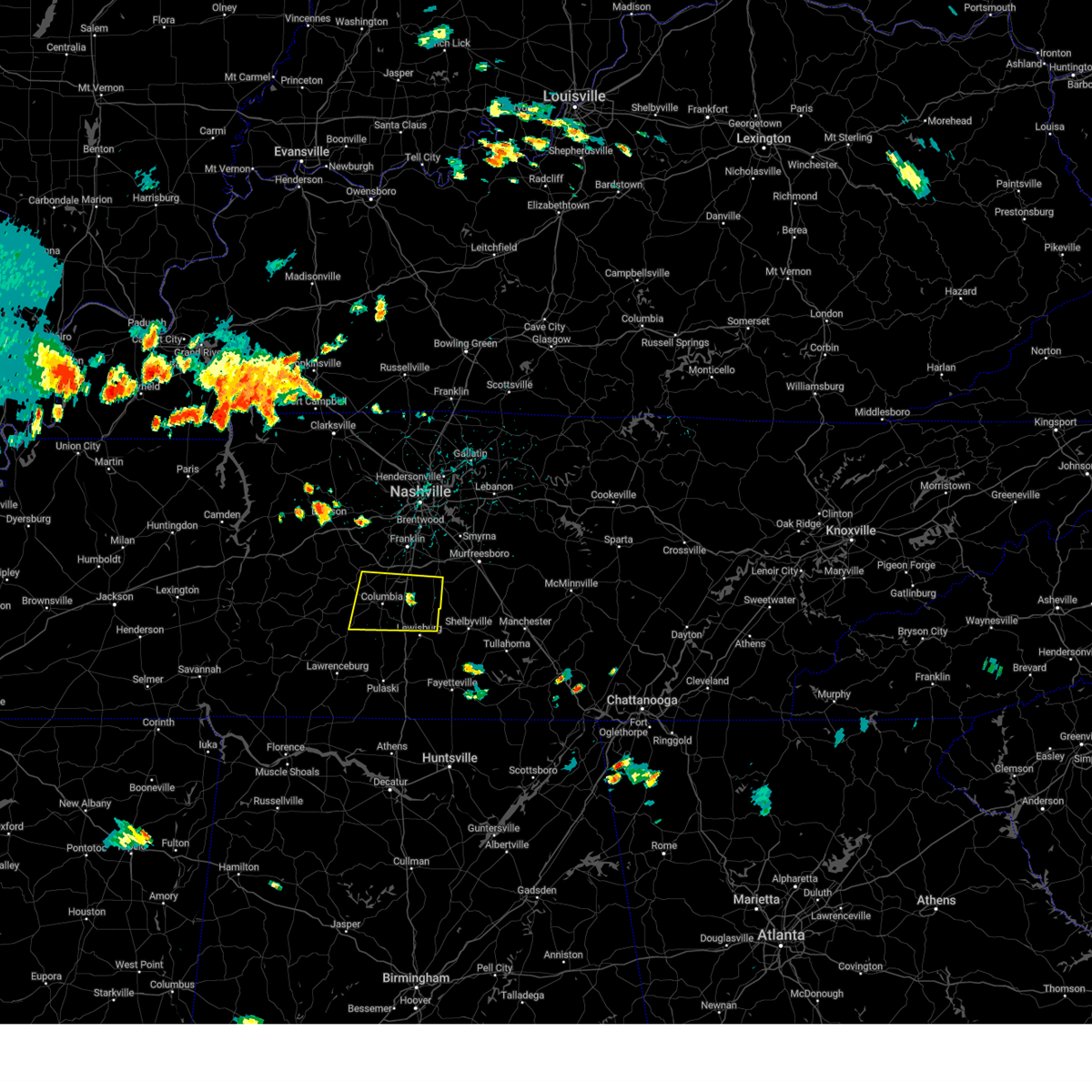
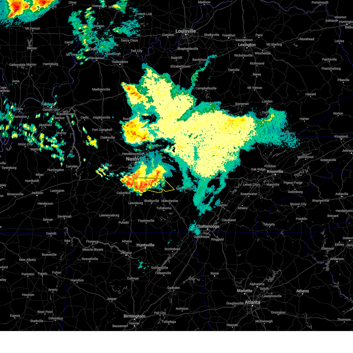
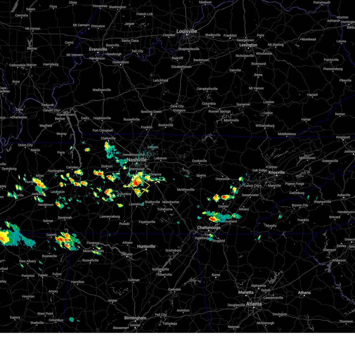
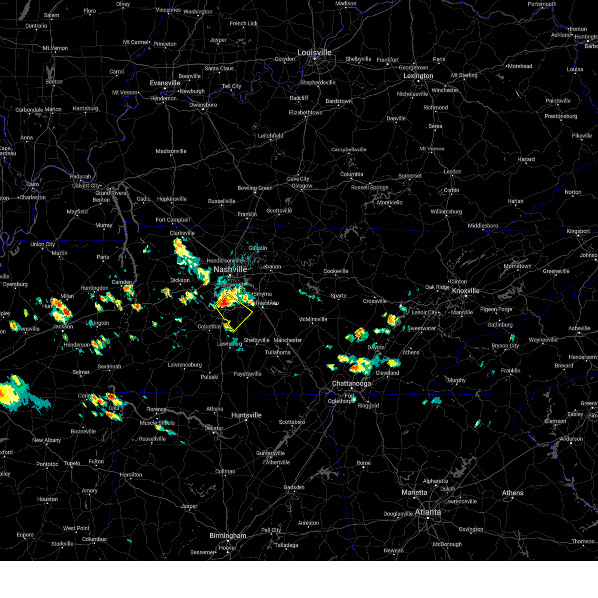
Hail Map for Eagleville, TN
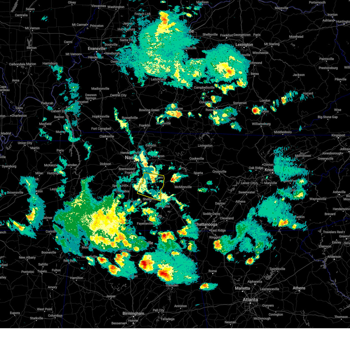
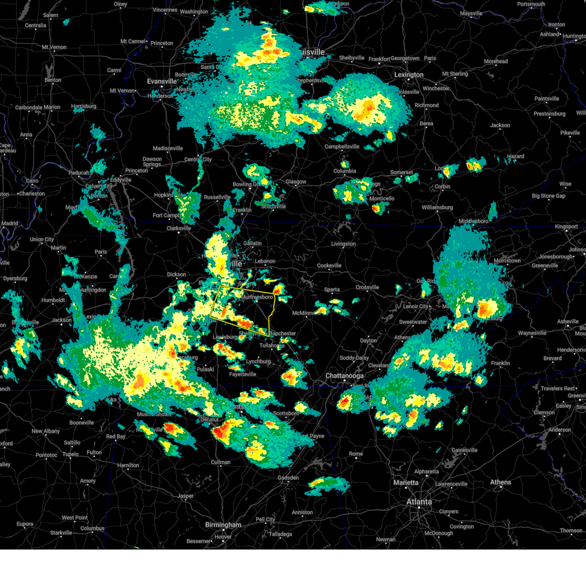
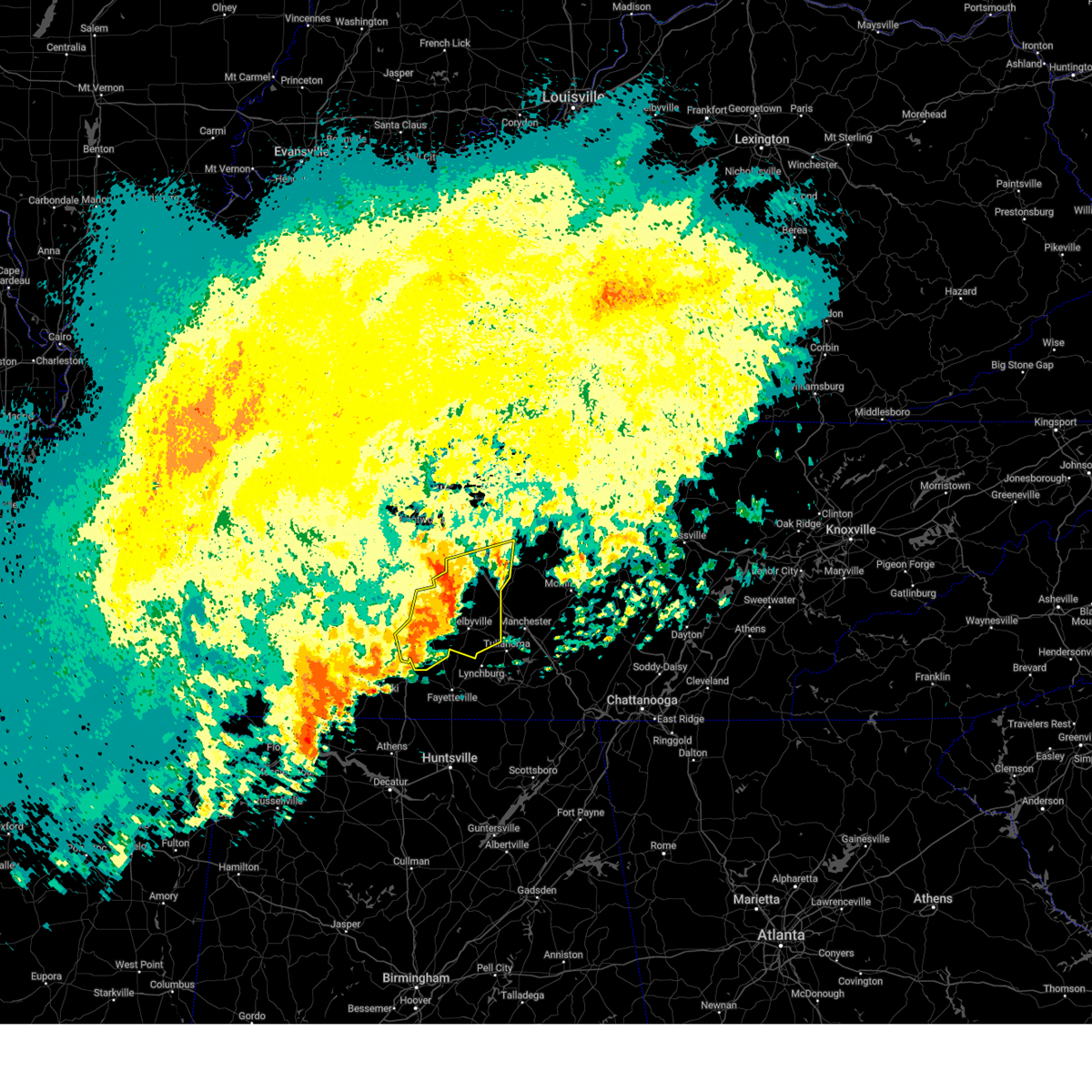
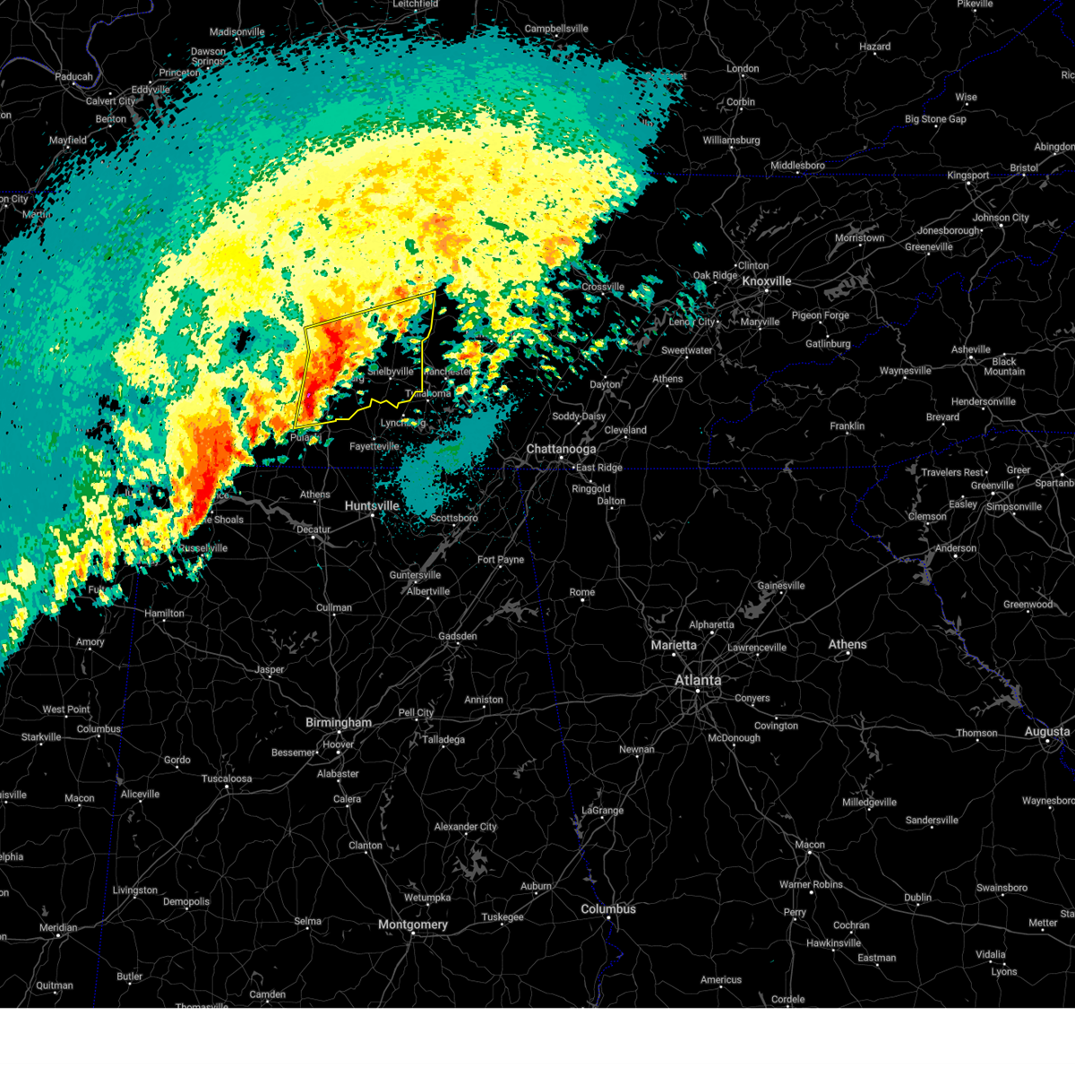
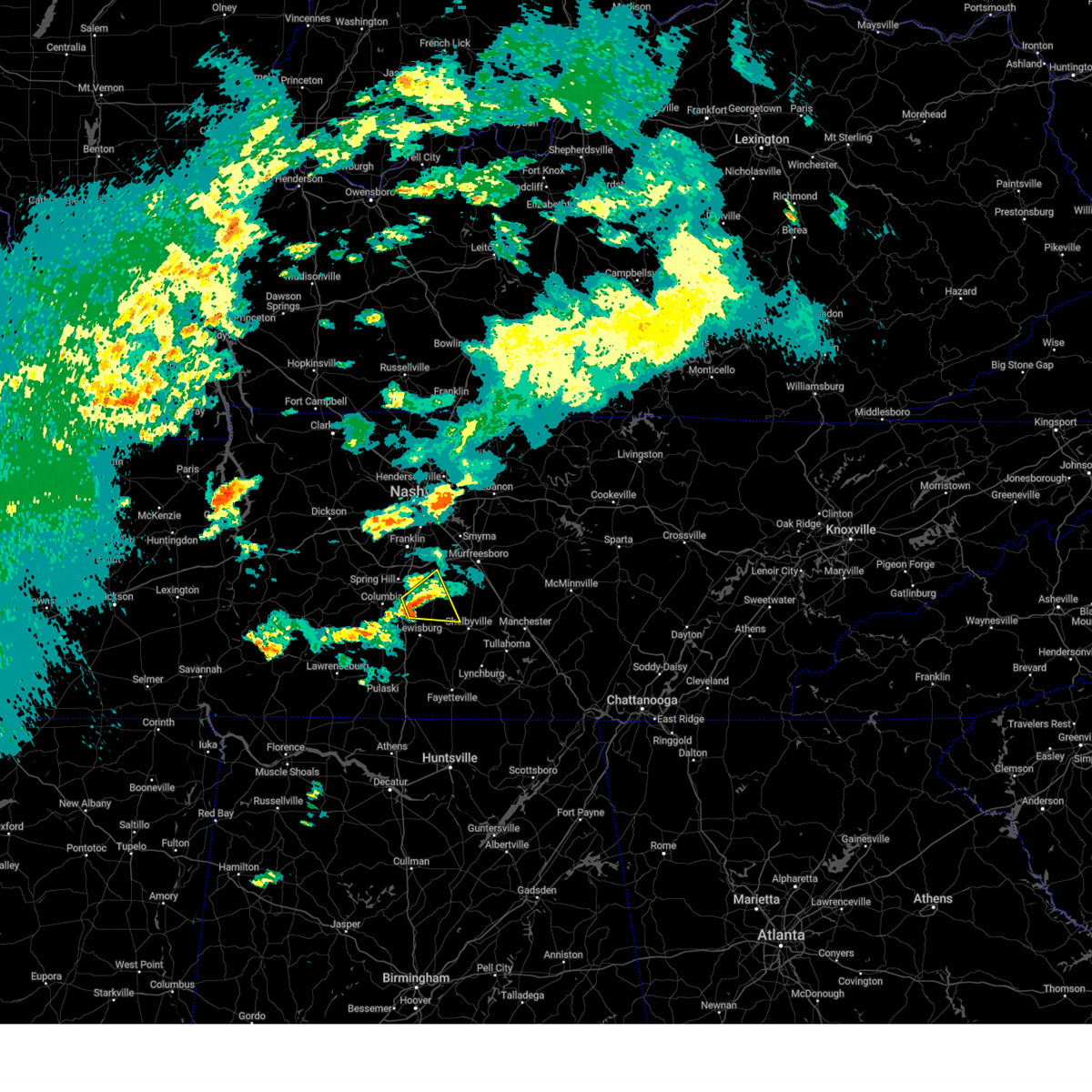
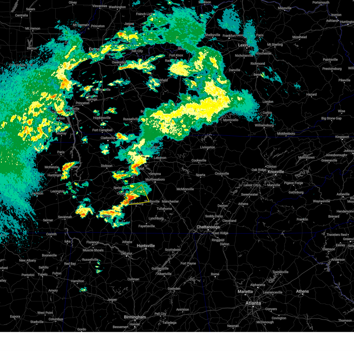
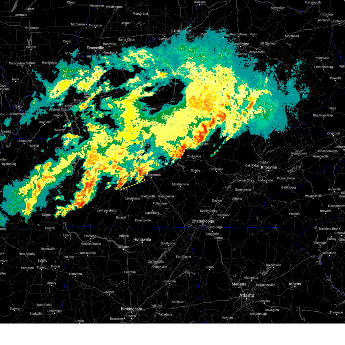
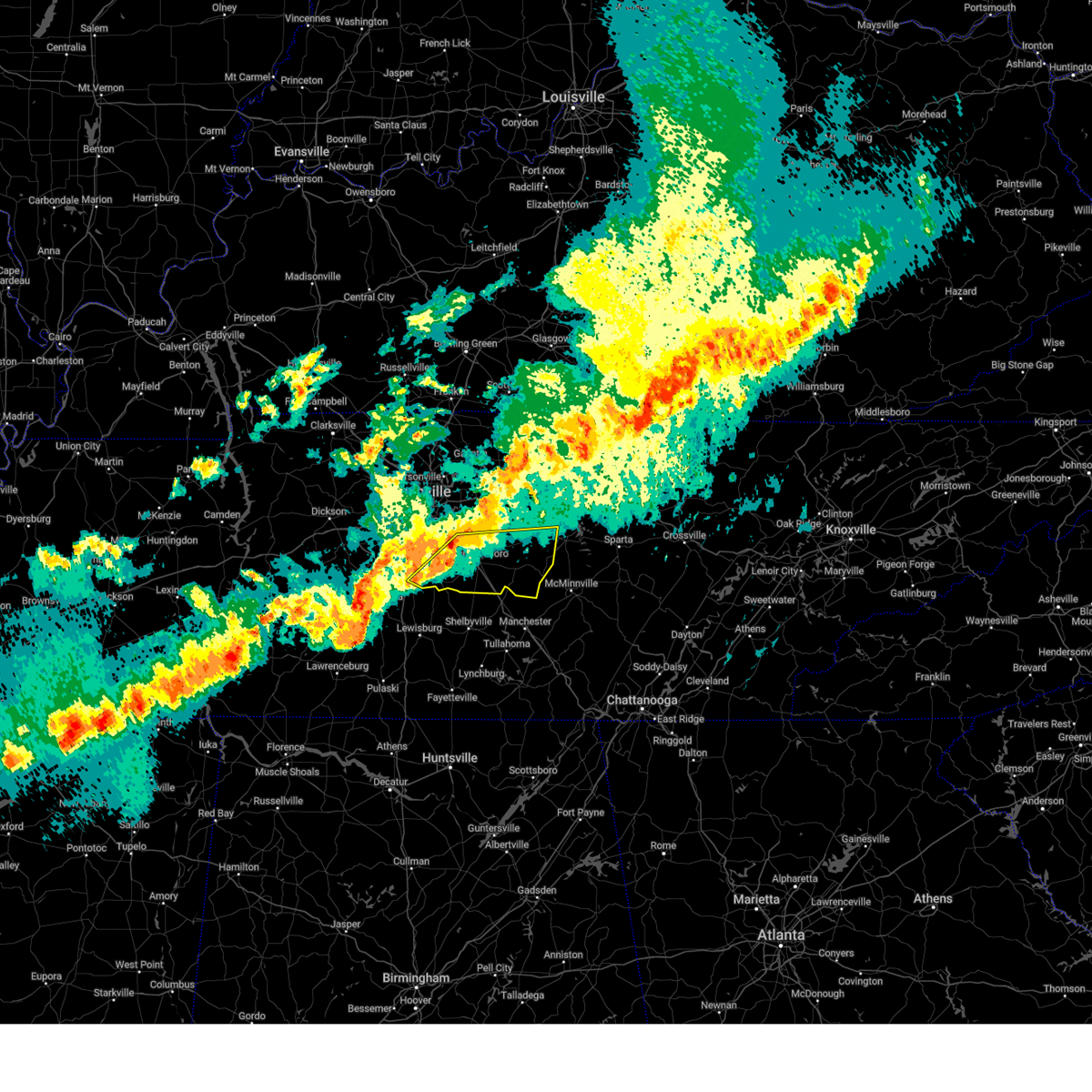
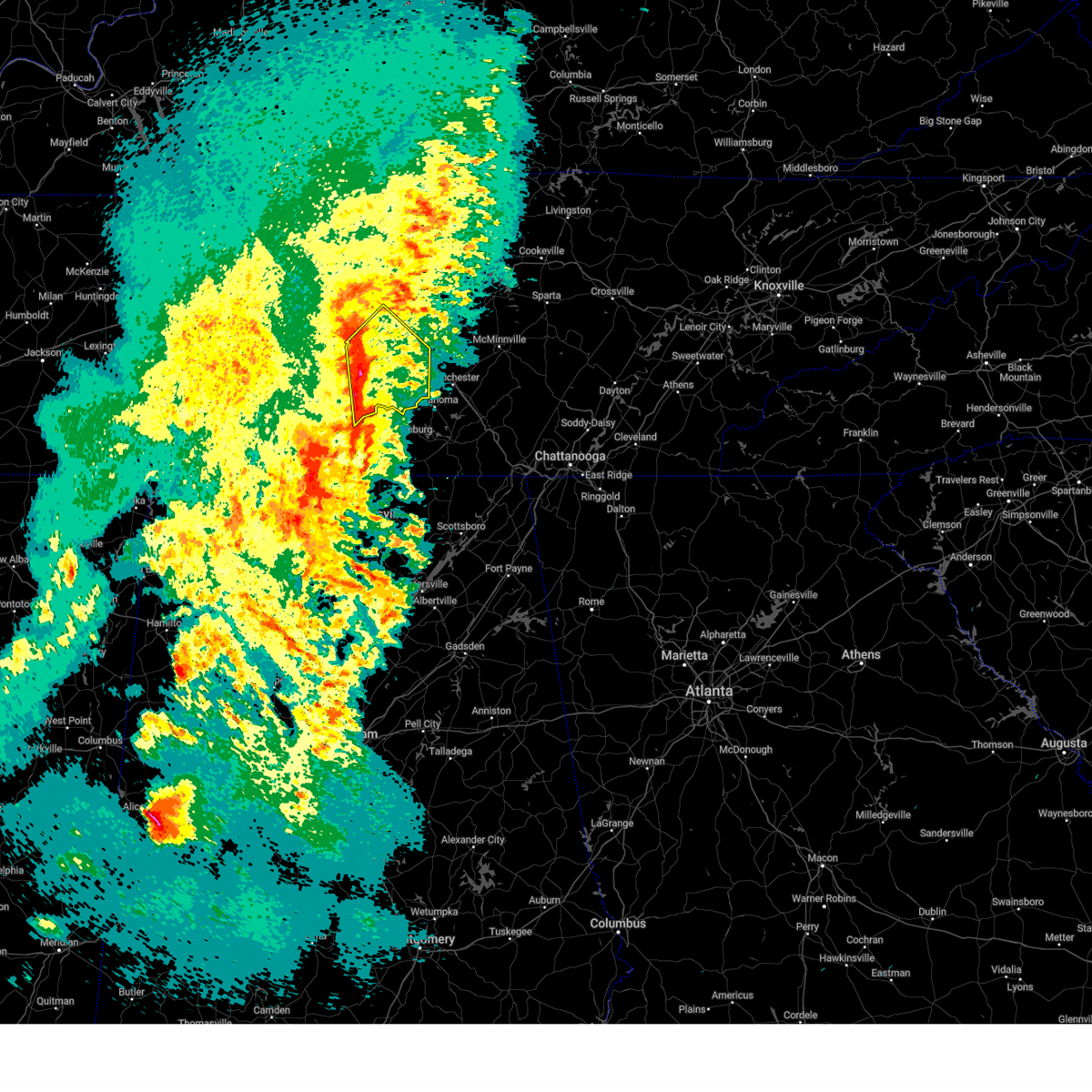
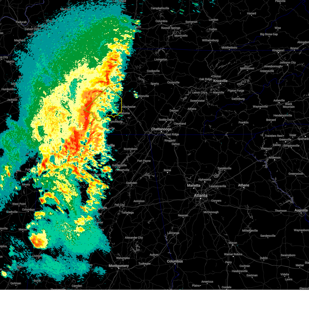
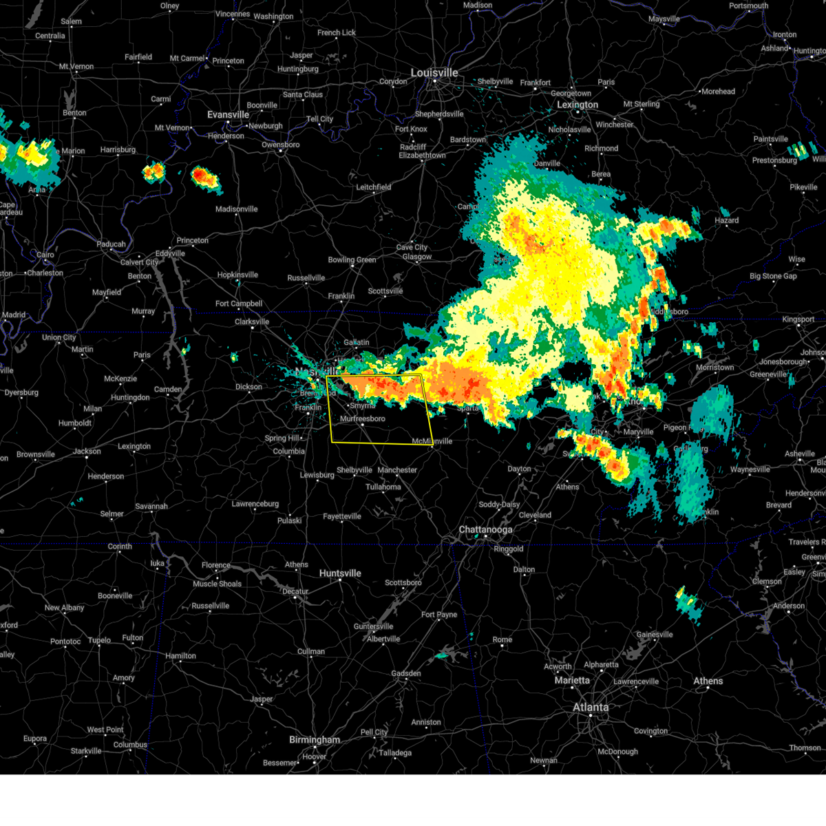
The Eagleville, TN area has had 8 reports of on-the-ground hail by trained spotters, and has been under severe weather warnings 30 times during the past 12 months. Doppler radar has detected hail at or near Eagleville, TN on 48 occasions, including 4 occasions during the past year.
| Name: | Eagleville, TN |
| Where Located: | 30.5 miles SSE of Nashville, TN |
| Map: | Google Map for Eagleville, TN |
| Population: | 604 |
| Housing Units: | 263 |
| More Info: | Search Google for Eagleville, TN |
1
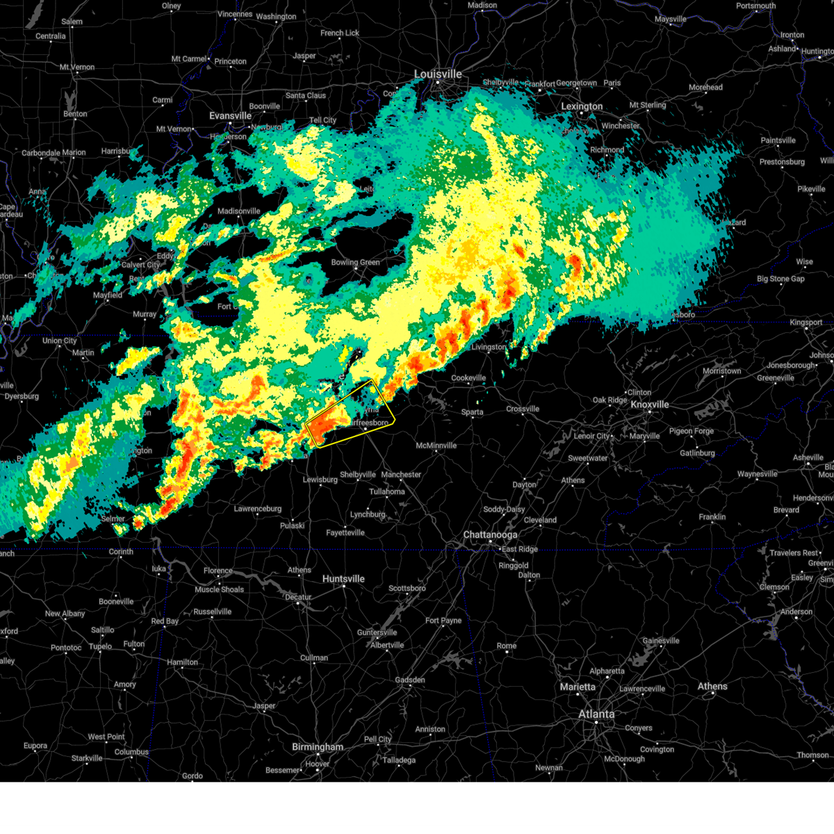
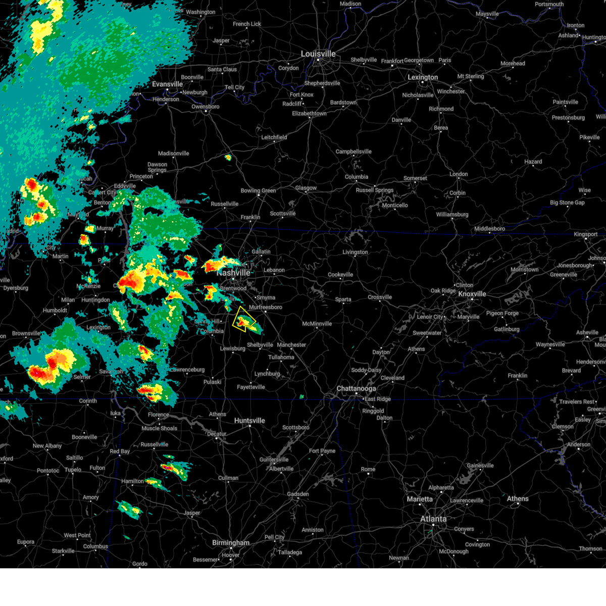
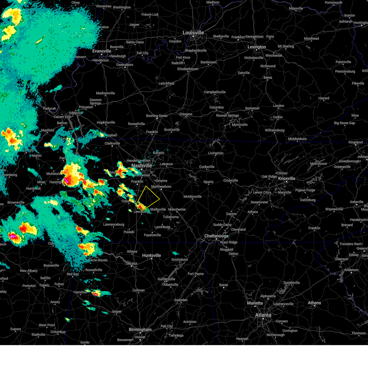
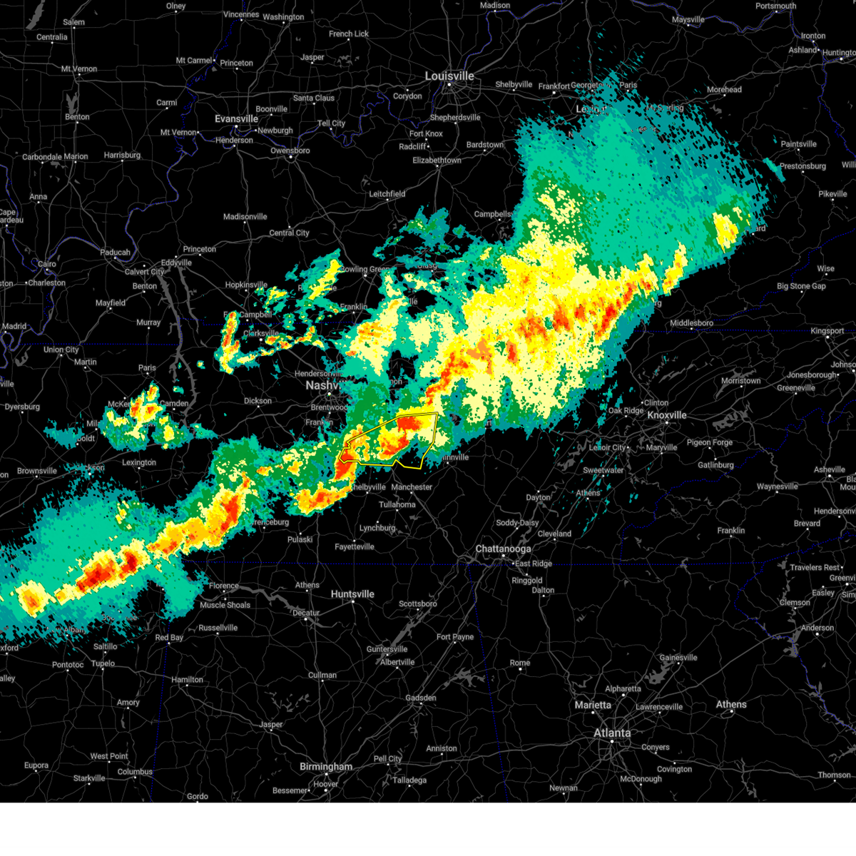
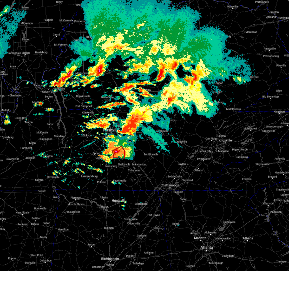
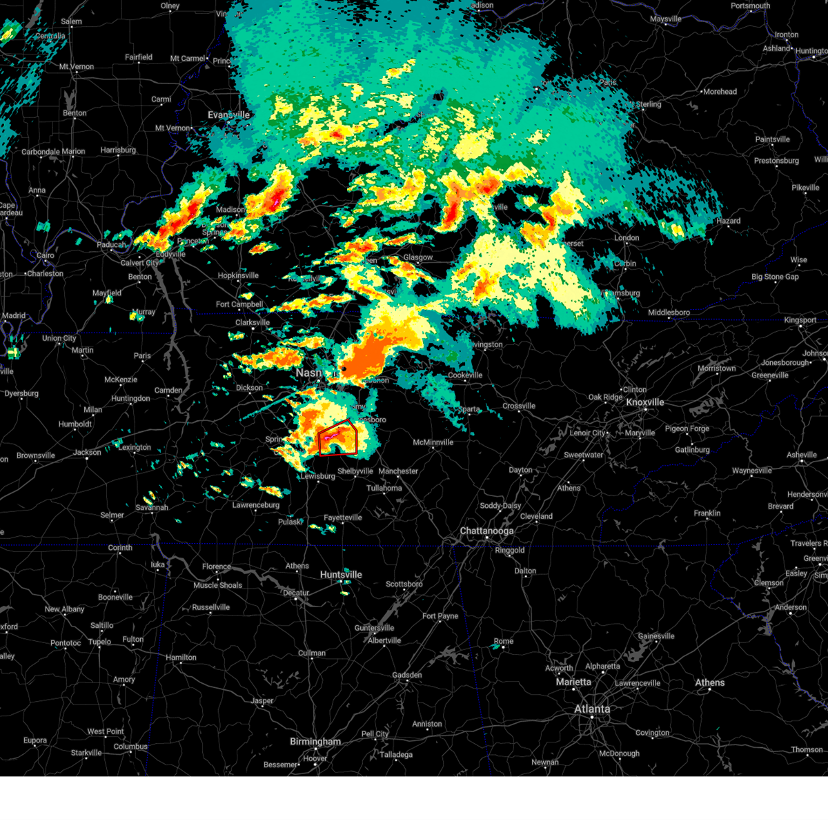
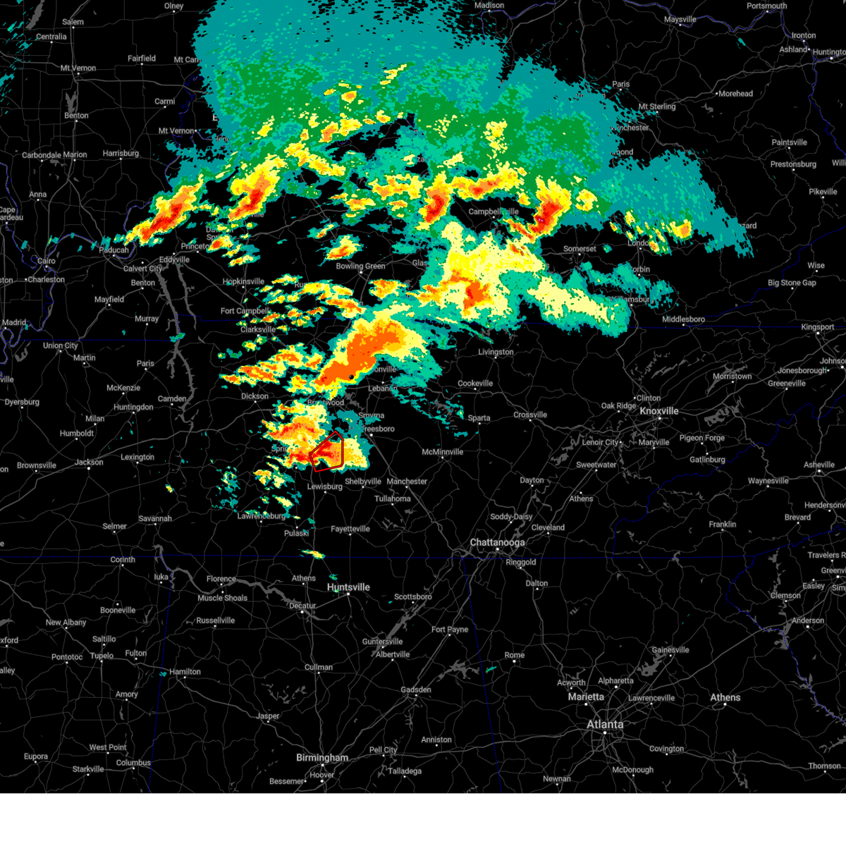
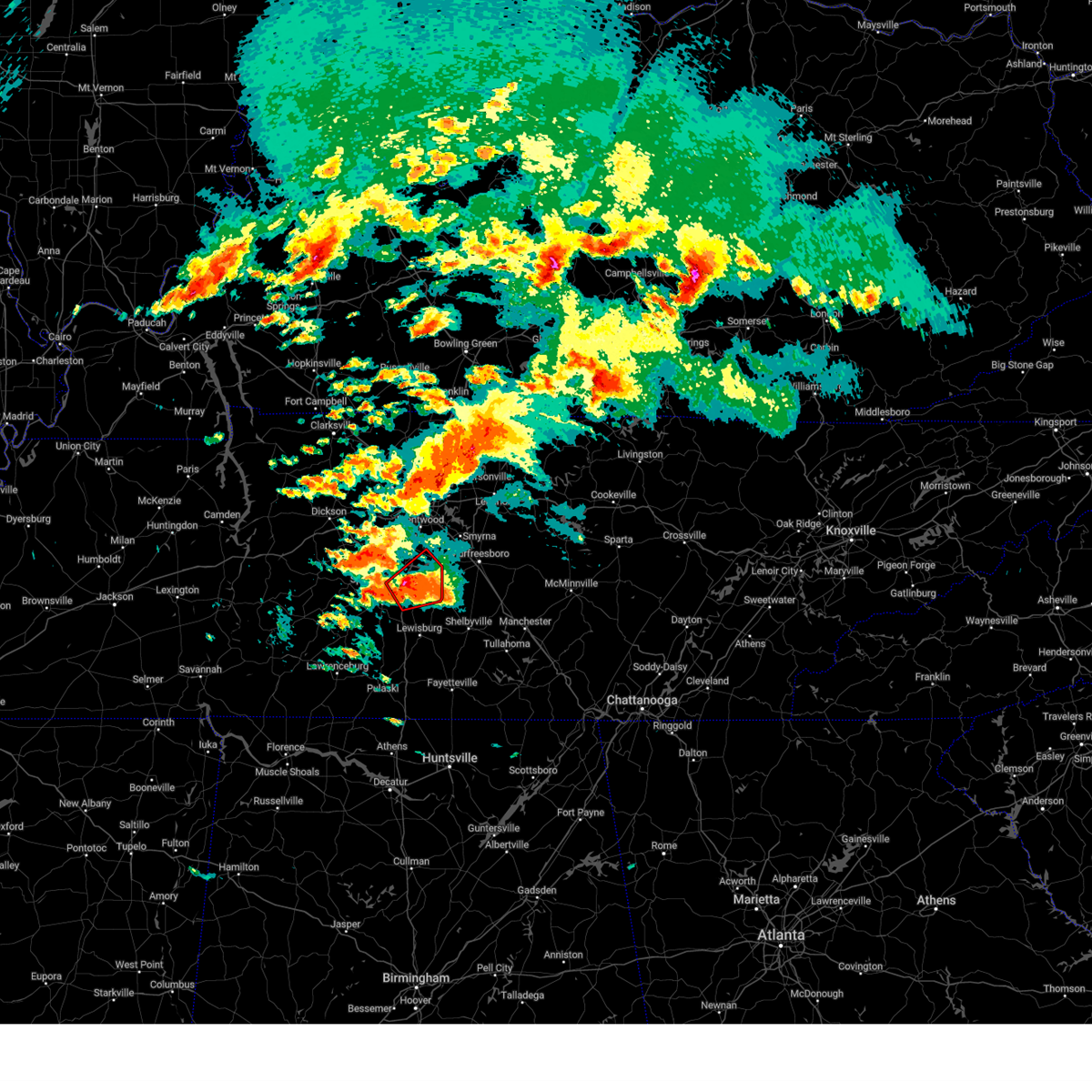
The Top Recent Hail Date for Eagleville, TN is Wednesday, April 2, 2025 (16th out of 48)

Hail and Wind Damage Spotted near Eagleville, TN
| Date / Time | Report Details |
|---|---|
| 5/20/2025 5:40 PM CDT | the tornado warning has been cancelled and is no longer in effect |
| 5/20/2025 5:40 PM CDT | At 540 pm cdt, a severe thunderstorm capable of producing a tornado was located 10 miles northwest of shelbyville, moving east at 40 mph (radar indicated rotation). Hazards include tornado and ping pong ball size hail. Flying debris will be dangerous to those caught without shelter. mobile homes will be damaged or destroyed. damage to roofs, windows, and vehicles will occur. tree damage is likely. Locations impacted include, rover, christiana, deason, bell buckle, rockvale, unionville, fosterville, and murfreesboro. |
| 5/20/2025 5:34 PM CDT | At 533 pm cdt, a severe thunderstorm was located near walterhill, or 8 miles northeast of murfreesboro, moving east at 40 mph (radar indicated). Hazards include ping pong ball size hail and 60 mph wind gusts. People and animals outdoors will be injured. expect hail damage to roofs, siding, windows, and vehicles. expect wind damage to roofs, siding, and trees. Locations impacted include, lascassas, murfreesboro, nolensville, walterhill, brentwood, la vergne, triune, cedars of lebanon state park, auburntown, eagleville, woodbury, rockvale, smyrna, milton, readyville, and franklin. |
| 5/20/2025 5:23 PM CDT |
 Torohx the national weather service in nashville has issued a * tornado warning for, northeastern marshall county in middle tennessee, southern rutherford county in middle tennessee, northern bedford county in middle tennessee, * until 600 pm cdt. * at 523 pm cdt, a severe thunderstorm capable of producing a tornado was located 9 miles north of lewisburg, moving east at 50 mph (radar indicated rotation). Hazards include tornado and half dollar size hail. Flying debris will be dangerous to those caught without shelter. mobile homes will be damaged or destroyed. damage to roofs, windows, and vehicles will occur. Tree damage is likely. Torohx the national weather service in nashville has issued a * tornado warning for, northeastern marshall county in middle tennessee, southern rutherford county in middle tennessee, northern bedford county in middle tennessee, * until 600 pm cdt. * at 523 pm cdt, a severe thunderstorm capable of producing a tornado was located 9 miles north of lewisburg, moving east at 50 mph (radar indicated rotation). Hazards include tornado and half dollar size hail. Flying debris will be dangerous to those caught without shelter. mobile homes will be damaged or destroyed. damage to roofs, windows, and vehicles will occur. Tree damage is likely.
|
| 5/20/2025 4:49 PM CDT |
 Svrohx the national weather service in nashville has issued a * severe thunderstorm warning for, southeastern davidson county in middle tennessee, rutherford county in middle tennessee, eastern williamson county in middle tennessee, southeastern wilson county in middle tennessee, northwestern cannon county in middle tennessee, * until 545 pm cdt. * at 448 pm cdt, a severe thunderstorm was located near nolensville, or 7 miles southeast of franklin, moving east at 45 mph. this is a destructive storm for williamson and rutherford counties (trained weather spotters. at 445 pm cdt...numerous reports of golfball to tennis ball size hail were received in franklin). Hazards include baseball size hail and 60 mph wind gusts. People and animals outdoors will be severely injured. Expect shattered windows, extensive damage to roofs, siding, and vehicles. Svrohx the national weather service in nashville has issued a * severe thunderstorm warning for, southeastern davidson county in middle tennessee, rutherford county in middle tennessee, eastern williamson county in middle tennessee, southeastern wilson county in middle tennessee, northwestern cannon county in middle tennessee, * until 545 pm cdt. * at 448 pm cdt, a severe thunderstorm was located near nolensville, or 7 miles southeast of franklin, moving east at 45 mph. this is a destructive storm for williamson and rutherford counties (trained weather spotters. at 445 pm cdt...numerous reports of golfball to tennis ball size hail were received in franklin). Hazards include baseball size hail and 60 mph wind gusts. People and animals outdoors will be severely injured. Expect shattered windows, extensive damage to roofs, siding, and vehicles.
|
| 5/2/2025 1:28 PM CDT |
 At 128 pm cdt, a severe thunderstorm was located 10 miles south of spring hill, or 10 miles east of columbia, moving north at 35 mph (radar indicated). Hazards include 60 mph wind gusts and quarter size hail. Hail damage to vehicles is expected. expect wind damage to roofs, siding, and trees. locations impacted include, i-65 east of columbia, columbia, eagleville, chapel hill, mount pleasant, and spring hill. This includes interstate 65 between mile markers 36 and 55. At 128 pm cdt, a severe thunderstorm was located 10 miles south of spring hill, or 10 miles east of columbia, moving north at 35 mph (radar indicated). Hazards include 60 mph wind gusts and quarter size hail. Hail damage to vehicles is expected. expect wind damage to roofs, siding, and trees. locations impacted include, i-65 east of columbia, columbia, eagleville, chapel hill, mount pleasant, and spring hill. This includes interstate 65 between mile markers 36 and 55.
|
| 5/2/2025 1:28 PM CDT |
 the severe thunderstorm warning has been cancelled and is no longer in effect the severe thunderstorm warning has been cancelled and is no longer in effect
|
| 5/2/2025 1:10 PM CDT |
 Svrohx the national weather service in nashville has issued a * severe thunderstorm warning for, central marshall county in middle tennessee, southwestern rutherford county in middle tennessee, northeastern lawrence county in middle tennessee, maury county in middle tennessee, southeastern williamson county in middle tennessee, northwestern giles county in middle tennessee, * until 145 pm cdt. * at 109 pm cdt, a severe thunderstorm was located 8 miles west of lewisburg, moving northeast at 35 mph (radar indicated). Hazards include 60 mph wind gusts and quarter size hail. Hail damage to vehicles is expected. Expect wind damage to roofs, siding, and trees. Svrohx the national weather service in nashville has issued a * severe thunderstorm warning for, central marshall county in middle tennessee, southwestern rutherford county in middle tennessee, northeastern lawrence county in middle tennessee, maury county in middle tennessee, southeastern williamson county in middle tennessee, northwestern giles county in middle tennessee, * until 145 pm cdt. * at 109 pm cdt, a severe thunderstorm was located 8 miles west of lewisburg, moving northeast at 35 mph (radar indicated). Hazards include 60 mph wind gusts and quarter size hail. Hail damage to vehicles is expected. Expect wind damage to roofs, siding, and trees.
|
| 4/10/2025 5:57 PM CDT |
 At 557 pm cdt, a severe thunderstorm was located near murfreesboro, moving east at 30 mph (radar indicated). Hazards include 60 mph wind gusts. Expect damage to roofs, siding, and trees. locations impacted include, lascassas, christiana, murfreesboro, bell buckle, fosterville, chapel hill, rover, eagleville, deason, rockvale, unionville, wartrace, smyrna, and walterhill. this includes the following highways, interstate 24 between mile markers 67 and 96. Interstate 840 between mile markers 46 and 58. At 557 pm cdt, a severe thunderstorm was located near murfreesboro, moving east at 30 mph (radar indicated). Hazards include 60 mph wind gusts. Expect damage to roofs, siding, and trees. locations impacted include, lascassas, christiana, murfreesboro, bell buckle, fosterville, chapel hill, rover, eagleville, deason, rockvale, unionville, wartrace, smyrna, and walterhill. this includes the following highways, interstate 24 between mile markers 67 and 96. Interstate 840 between mile markers 46 and 58.
|
| 4/10/2025 5:57 PM CDT |
 the severe thunderstorm warning has been cancelled and is no longer in effect the severe thunderstorm warning has been cancelled and is no longer in effect
|
| 4/10/2025 5:29 PM CDT |
 Svrohx the national weather service in nashville has issued a * severe thunderstorm warning for, northeastern marshall county in middle tennessee, rutherford county in middle tennessee, northeastern maury county in middle tennessee, eastern williamson county in middle tennessee, northern bedford county in middle tennessee, * until 615 pm cdt. * at 529 pm cdt, a severe thunderstorm was located near franklin, moving east at 30 mph (radar indicated). Hazards include 60 mph wind gusts. expect damage to roofs, siding, and trees Svrohx the national weather service in nashville has issued a * severe thunderstorm warning for, northeastern marshall county in middle tennessee, rutherford county in middle tennessee, northeastern maury county in middle tennessee, eastern williamson county in middle tennessee, northern bedford county in middle tennessee, * until 615 pm cdt. * at 529 pm cdt, a severe thunderstorm was located near franklin, moving east at 30 mph (radar indicated). Hazards include 60 mph wind gusts. expect damage to roofs, siding, and trees
|
| 4/5/2025 10:44 PM CDT |
 the severe thunderstorm warning has been cancelled and is no longer in effect the severe thunderstorm warning has been cancelled and is no longer in effect
|
| 4/5/2025 10:44 PM CDT |
 At 1044 pm cdt, severe thunderstorms were located along a line extending from 9 miles southwest of murfreesboro to 6 miles south of lewisburg, moving northeast at 55 mph (radar indicated). Hazards include 60 mph wind gusts and penny size hail. Expect damage to roofs, siding, and trees. locations impacted include, lascassas, christiana, murfreesboro, bell buckle, raus, lewisburg, fosterville, chapel hill, rover, belfast, eagleville, petersburg, deason, rockvale, shelbyville, cornersville, normandy, farmington, milton, and unionville. this includes the following highways, interstate 65 between mile markers 23 and 35. interstate 24 between mile markers 75 and 95. Interstate 840 between mile markers 45 and 53. At 1044 pm cdt, severe thunderstorms were located along a line extending from 9 miles southwest of murfreesboro to 6 miles south of lewisburg, moving northeast at 55 mph (radar indicated). Hazards include 60 mph wind gusts and penny size hail. Expect damage to roofs, siding, and trees. locations impacted include, lascassas, christiana, murfreesboro, bell buckle, raus, lewisburg, fosterville, chapel hill, rover, belfast, eagleville, petersburg, deason, rockvale, shelbyville, cornersville, normandy, farmington, milton, and unionville. this includes the following highways, interstate 65 between mile markers 23 and 35. interstate 24 between mile markers 75 and 95. Interstate 840 between mile markers 45 and 53.
|
| 4/5/2025 10:27 PM CDT |
 Svrohx the national weather service in nashville has issued a * severe thunderstorm warning for, marshall county in middle tennessee, rutherford county in middle tennessee, eastern maury county in middle tennessee, southeastern williamson county in middle tennessee, northeastern giles county in middle tennessee, bedford county in middle tennessee, * until 1115 pm cdt. * at 1027 pm cdt, severe thunderstorms were located along a line extending from 7 miles southeast of spring hill to 8 miles northeast of pulaski, moving northeast at 55 mph (radar indicated). Hazards include 60 mph wind gusts and quarter size hail. Hail damage to vehicles is expected. Expect wind damage to roofs, siding, and trees. Svrohx the national weather service in nashville has issued a * severe thunderstorm warning for, marshall county in middle tennessee, rutherford county in middle tennessee, eastern maury county in middle tennessee, southeastern williamson county in middle tennessee, northeastern giles county in middle tennessee, bedford county in middle tennessee, * until 1115 pm cdt. * at 1027 pm cdt, severe thunderstorms were located along a line extending from 7 miles southeast of spring hill to 8 miles northeast of pulaski, moving northeast at 55 mph (radar indicated). Hazards include 60 mph wind gusts and quarter size hail. Hail damage to vehicles is expected. Expect wind damage to roofs, siding, and trees.
|
| 4/3/2025 7:18 PM CDT |
 the severe thunderstorm warning has been cancelled and is no longer in effect the severe thunderstorm warning has been cancelled and is no longer in effect
|
| 4/3/2025 7:12 PM CDT |
 At 711 pm cdt, a severe thunderstorm was located 11 miles north of lewisburg, moving northeast at 35 mph (radar indicated). Hazards include 60 mph wind gusts and quarter size hail. Hail damage to vehicles is expected. expect wind damage to roofs, siding, and trees. locations impacted include, i-65 east of columbia, eagleville, unionville, chapel hill, and columbia. This includes interstate 65 between mile markers 45 and 47. At 711 pm cdt, a severe thunderstorm was located 11 miles north of lewisburg, moving northeast at 35 mph (radar indicated). Hazards include 60 mph wind gusts and quarter size hail. Hail damage to vehicles is expected. expect wind damage to roofs, siding, and trees. locations impacted include, i-65 east of columbia, eagleville, unionville, chapel hill, and columbia. This includes interstate 65 between mile markers 45 and 47.
|
| 4/3/2025 7:00 PM CDT |
 Svrohx the national weather service in nashville has issued a * severe thunderstorm warning for, northern marshall county in middle tennessee, western rutherford county in middle tennessee, southeastern maury county in middle tennessee, southeastern williamson county in middle tennessee, northwestern bedford county in middle tennessee, * until 730 pm cdt. * at 700 pm cdt, a severe thunderstorm was located 9 miles northwest of lewisburg, moving northeast at 35 mph (radar indicated). Hazards include 60 mph wind gusts and quarter size hail. Hail damage to vehicles is expected. Expect wind damage to roofs, siding, and trees. Svrohx the national weather service in nashville has issued a * severe thunderstorm warning for, northern marshall county in middle tennessee, western rutherford county in middle tennessee, southeastern maury county in middle tennessee, southeastern williamson county in middle tennessee, northwestern bedford county in middle tennessee, * until 730 pm cdt. * at 700 pm cdt, a severe thunderstorm was located 9 miles northwest of lewisburg, moving northeast at 35 mph (radar indicated). Hazards include 60 mph wind gusts and quarter size hail. Hail damage to vehicles is expected. Expect wind damage to roofs, siding, and trees.
|
| 4/3/2025 6:05 AM CDT |
 Svrohx the national weather service in nashville has issued a * severe thunderstorm warning for, west central rutherford county in middle tennessee, northeastern maury county in middle tennessee, eastern williamson county in middle tennessee, * until 630 am cdt. * at 605 am cdt, a severe thunderstorm was located over spring hill, or 9 miles northeast of columbia, moving northeast at 45 mph (radar indicated). Hazards include 60 mph wind gusts and quarter size hail. Hail damage to vehicles is expected. Expect wind damage to roofs, siding, and trees. Svrohx the national weather service in nashville has issued a * severe thunderstorm warning for, west central rutherford county in middle tennessee, northeastern maury county in middle tennessee, eastern williamson county in middle tennessee, * until 630 am cdt. * at 605 am cdt, a severe thunderstorm was located over spring hill, or 9 miles northeast of columbia, moving northeast at 45 mph (radar indicated). Hazards include 60 mph wind gusts and quarter size hail. Hail damage to vehicles is expected. Expect wind damage to roofs, siding, and trees.
|
| 4/3/2025 5:41 AM CDT |
 Svrohx the national weather service in nashville has issued a * severe thunderstorm warning for, southeastern davidson county in middle tennessee, central rutherford county in middle tennessee, eastern williamson county in middle tennessee, southwestern wilson county in middle tennessee, * until 630 am cdt. * at 540 am cdt, a severe thunderstorm was located 8 miles east of thompson's station, or 8 miles southeast of franklin, moving northeast at 40 mph (radar indicated). Hazards include 60 mph wind gusts and quarter size hail. Hail damage to vehicles is expected. Expect wind damage to roofs, siding, and trees. Svrohx the national weather service in nashville has issued a * severe thunderstorm warning for, southeastern davidson county in middle tennessee, central rutherford county in middle tennessee, eastern williamson county in middle tennessee, southwestern wilson county in middle tennessee, * until 630 am cdt. * at 540 am cdt, a severe thunderstorm was located 8 miles east of thompson's station, or 8 miles southeast of franklin, moving northeast at 40 mph (radar indicated). Hazards include 60 mph wind gusts and quarter size hail. Hail damage to vehicles is expected. Expect wind damage to roofs, siding, and trees.
|
| 4/2/2025 5:58 PM CDT |
 At 558 pm cdt, a severe thunderstorm was located 14 miles east of spring hill, or 16 miles southwest of murfreesboro, moving northeast at 50 mph (radar indicated). Hazards include 60 mph wind gusts and quarter size hail. Hail damage to vehicles is expected. expect wind damage to roofs, siding, and trees. locations impacted include, triune, rockvale, and eagleville. This includes interstate 840 between mile markers 38 and 43. At 558 pm cdt, a severe thunderstorm was located 14 miles east of spring hill, or 16 miles southwest of murfreesboro, moving northeast at 50 mph (radar indicated). Hazards include 60 mph wind gusts and quarter size hail. Hail damage to vehicles is expected. expect wind damage to roofs, siding, and trees. locations impacted include, triune, rockvale, and eagleville. This includes interstate 840 between mile markers 38 and 43.
|
| 4/2/2025 5:58 PM CDT |
 the severe thunderstorm warning has been cancelled and is no longer in effect the severe thunderstorm warning has been cancelled and is no longer in effect
|
| 4/2/2025 5:43 PM CDT |
 At 543 pm cdt, a severe thunderstorm was located 9 miles north of lewisburg, moving northeast at 50 mph (radar indicated). Hazards include 60 mph wind gusts and quarter size hail. Hail damage to vehicles is expected. expect wind damage to roofs, siding, and trees. locations impacted include, rover, eagleville, unionville, triune, chapel hill, and rockvale. This includes interstate 840 between mile markers 37 and 43. At 543 pm cdt, a severe thunderstorm was located 9 miles north of lewisburg, moving northeast at 50 mph (radar indicated). Hazards include 60 mph wind gusts and quarter size hail. Hail damage to vehicles is expected. expect wind damage to roofs, siding, and trees. locations impacted include, rover, eagleville, unionville, triune, chapel hill, and rockvale. This includes interstate 840 between mile markers 37 and 43.
|
| 4/2/2025 5:38 PM CDT |
 Svrohx the national weather service in nashville has issued a * severe thunderstorm warning for, northern marshall county in middle tennessee, southwestern rutherford county in middle tennessee, southeastern maury county in middle tennessee, southeastern williamson county in middle tennessee, northwestern bedford county in middle tennessee, * until 615 pm cdt. * at 538 pm cdt, a severe thunderstorm was located near lewisburg, moving northeast at 50 mph (radar indicated). Hazards include 60 mph wind gusts and quarter size hail. Hail damage to vehicles is expected. Expect wind damage to roofs, siding, and trees. Svrohx the national weather service in nashville has issued a * severe thunderstorm warning for, northern marshall county in middle tennessee, southwestern rutherford county in middle tennessee, southeastern maury county in middle tennessee, southeastern williamson county in middle tennessee, northwestern bedford county in middle tennessee, * until 615 pm cdt. * at 538 pm cdt, a severe thunderstorm was located near lewisburg, moving northeast at 50 mph (radar indicated). Hazards include 60 mph wind gusts and quarter size hail. Hail damage to vehicles is expected. Expect wind damage to roofs, siding, and trees.
|
| 3/31/2025 12:44 AM CDT |
 the severe thunderstorm warning has been cancelled and is no longer in effect the severe thunderstorm warning has been cancelled and is no longer in effect
|
| 3/31/2025 12:44 AM CDT |
 At 1244 am cdt, a severe thunderstorm was located over woodbury, moving east at 40 mph (radar indicated). Hazards include ping pong ball size hail and 60 mph wind gusts. People and animals outdoors will be injured. expect hail damage to roofs, siding, windows, and vehicles. expect wind damage to roofs, siding, and trees. locations impacted include, auburntown, lascassas, christiana, eagleville, murfreesboro, woodbury, rockvale, dowelltown, bradyville, milton, liberty, and readyville. this includes the following highways, interstate 24 between mile markers 74 and 93. Interstate 840 between mile markers 47 and 55. At 1244 am cdt, a severe thunderstorm was located over woodbury, moving east at 40 mph (radar indicated). Hazards include ping pong ball size hail and 60 mph wind gusts. People and animals outdoors will be injured. expect hail damage to roofs, siding, windows, and vehicles. expect wind damage to roofs, siding, and trees. locations impacted include, auburntown, lascassas, christiana, eagleville, murfreesboro, woodbury, rockvale, dowelltown, bradyville, milton, liberty, and readyville. this includes the following highways, interstate 24 between mile markers 74 and 93. Interstate 840 between mile markers 47 and 55.
|
| 3/31/2025 12:11 AM CDT |
 Svrohx the national weather service in nashville has issued a * severe thunderstorm warning for, southwestern de kalb county in middle tennessee, rutherford county in middle tennessee, southeastern williamson county in middle tennessee, southeastern wilson county in middle tennessee, cannon county in middle tennessee, * until 115 am cdt. * at 1211 am cdt, a severe thunderstorm was located near murfreesboro, moving east at 40 mph (radar indicated). Hazards include ping pong ball size hail and 60 mph wind gusts. People and animals outdoors will be injured. expect hail damage to roofs, siding, windows, and vehicles. Expect wind damage to roofs, siding, and trees. Svrohx the national weather service in nashville has issued a * severe thunderstorm warning for, southwestern de kalb county in middle tennessee, rutherford county in middle tennessee, southeastern williamson county in middle tennessee, southeastern wilson county in middle tennessee, cannon county in middle tennessee, * until 115 am cdt. * at 1211 am cdt, a severe thunderstorm was located near murfreesboro, moving east at 40 mph (radar indicated). Hazards include ping pong ball size hail and 60 mph wind gusts. People and animals outdoors will be injured. expect hail damage to roofs, siding, windows, and vehicles. Expect wind damage to roofs, siding, and trees.
|
| 3/15/2025 3:15 PM CDT |
 At 315 pm cdt, severe thunderstorms were located along a line extending from 13 miles south of nolensville to near petersburg, moving east at 55 mph (radar indicated). Hazards include 60 mph wind gusts and penny size hail. Expect damage to roofs, siding, and trees. locations impacted include, christiana, bell buckle, raus, fosterville, chapel hill, rover, belfast, eagleville, deason, rockvale, shelbyville, normandy, farmington, unionville, wartrace, lewisburg, and murfreesboro. this includes the following highways, interstate 24 between mile markers 85 and 97. Interstate 840 between mile markers 44 and 51. At 315 pm cdt, severe thunderstorms were located along a line extending from 13 miles south of nolensville to near petersburg, moving east at 55 mph (radar indicated). Hazards include 60 mph wind gusts and penny size hail. Expect damage to roofs, siding, and trees. locations impacted include, christiana, bell buckle, raus, fosterville, chapel hill, rover, belfast, eagleville, deason, rockvale, shelbyville, normandy, farmington, unionville, wartrace, lewisburg, and murfreesboro. this includes the following highways, interstate 24 between mile markers 85 and 97. Interstate 840 between mile markers 44 and 51.
|
| 3/15/2025 3:15 PM CDT |
 the severe thunderstorm warning has been cancelled and is no longer in effect the severe thunderstorm warning has been cancelled and is no longer in effect
|
| 3/15/2025 2:55 PM CDT |
 Svrohx the national weather service in nashville has issued a * severe thunderstorm warning for, marshall county in middle tennessee, southwestern rutherford county in middle tennessee, southeastern maury county in middle tennessee, southeastern williamson county in middle tennessee, bedford county in middle tennessee, * until 345 pm cdt. * at 255 pm cdt, severe thunderstorms were located along a line extending from 6 miles east of columbia to 8 miles northeast of pulaski, moving northeast at 70 mph (radar indicated). Hazards include 60 mph wind gusts and penny size hail. expect damage to roofs, siding, and trees Svrohx the national weather service in nashville has issued a * severe thunderstorm warning for, marshall county in middle tennessee, southwestern rutherford county in middle tennessee, southeastern maury county in middle tennessee, southeastern williamson county in middle tennessee, bedford county in middle tennessee, * until 345 pm cdt. * at 255 pm cdt, severe thunderstorms were located along a line extending from 6 miles east of columbia to 8 miles northeast of pulaski, moving northeast at 70 mph (radar indicated). Hazards include 60 mph wind gusts and penny size hail. expect damage to roofs, siding, and trees
|
| 3/4/2025 8:55 PM CST | Several trees were blown down in eaglevill in rutherford county TN, 0.4 miles SW of Eagleville, TN |
| 7/30/2024 3:42 PM CDT |
 Svrohx the national weather service in nashville has issued a * severe thunderstorm warning for, southwestern smith county in middle tennessee, southeastern davidson county in middle tennessee, western de kalb county in middle tennessee, rutherford county in middle tennessee, northwestern warren county in middle tennessee, east central williamson county in middle tennessee, wilson county in middle tennessee, cannon county in middle tennessee, * until 430 pm cdt. * at 342 pm cdt, severe thunderstorms were located along a line extending from percy priest lake to alexandria, moving south at 40 mph (radar indicated). Hazards include 60 mph wind gusts and quarter size hail. Hail damage to vehicles is expected. Expect wind damage to roofs, siding, and trees. Svrohx the national weather service in nashville has issued a * severe thunderstorm warning for, southwestern smith county in middle tennessee, southeastern davidson county in middle tennessee, western de kalb county in middle tennessee, rutherford county in middle tennessee, northwestern warren county in middle tennessee, east central williamson county in middle tennessee, wilson county in middle tennessee, cannon county in middle tennessee, * until 430 pm cdt. * at 342 pm cdt, severe thunderstorms were located along a line extending from percy priest lake to alexandria, moving south at 40 mph (radar indicated). Hazards include 60 mph wind gusts and quarter size hail. Hail damage to vehicles is expected. Expect wind damage to roofs, siding, and trees.
|
| 5/26/2024 3:42 PM CDT |
 Svrohx the national weather service in nashville has issued a * severe thunderstorm warning for, central rutherford county in middle tennessee, cannon county in middle tennessee, * until 415 pm cdt. * at 341 pm cdt, a severe thunderstorm was located near murfreesboro, moving east at 55 mph (radar indicated). Hazards include 60 mph wind gusts and quarter size hail. Hail damage to vehicles is expected. Expect wind damage to roofs, siding, and trees. Svrohx the national weather service in nashville has issued a * severe thunderstorm warning for, central rutherford county in middle tennessee, cannon county in middle tennessee, * until 415 pm cdt. * at 341 pm cdt, a severe thunderstorm was located near murfreesboro, moving east at 55 mph (radar indicated). Hazards include 60 mph wind gusts and quarter size hail. Hail damage to vehicles is expected. Expect wind damage to roofs, siding, and trees.
|
| 5/14/2024 5:13 PM CDT |
 Svrohx the national weather service in nashville has issued a * severe thunderstorm warning for, northeastern marshall county in middle tennessee, southern rutherford county in middle tennessee, western coffee county in middle tennessee, bedford county in middle tennessee, * until 600 pm cdt. * at 513 pm cdt, severe thunderstorms were located along a line extending from 13 miles east of spring hill to near shelbyville to near petersburg, moving east at 45 mph (radar indicated). Hazards include 60 mph wind gusts. expect damage to roofs, siding, and trees Svrohx the national weather service in nashville has issued a * severe thunderstorm warning for, northeastern marshall county in middle tennessee, southern rutherford county in middle tennessee, western coffee county in middle tennessee, bedford county in middle tennessee, * until 600 pm cdt. * at 513 pm cdt, severe thunderstorms were located along a line extending from 13 miles east of spring hill to near shelbyville to near petersburg, moving east at 45 mph (radar indicated). Hazards include 60 mph wind gusts. expect damage to roofs, siding, and trees
|
| 5/14/2024 4:49 PM CDT |
 Svrohx the national weather service in nashville has issued a * severe thunderstorm warning for, marshall county in middle tennessee, southwestern rutherford county in middle tennessee, eastern maury county in middle tennessee, eastern williamson county in middle tennessee, bedford county in middle tennessee, * until 515 pm cdt. * at 449 pm cdt, severe thunderstorms were located along a line extending from near thompson's station to 8 miles west of petersburg, moving northeast at 45 mph (radar indicated). Hazards include 60 mph wind gusts and penny size hail. expect damage to roofs, siding, and trees Svrohx the national weather service in nashville has issued a * severe thunderstorm warning for, marshall county in middle tennessee, southwestern rutherford county in middle tennessee, eastern maury county in middle tennessee, eastern williamson county in middle tennessee, bedford county in middle tennessee, * until 515 pm cdt. * at 449 pm cdt, severe thunderstorms were located along a line extending from near thompson's station to 8 miles west of petersburg, moving northeast at 45 mph (radar indicated). Hazards include 60 mph wind gusts and penny size hail. expect damage to roofs, siding, and trees
|
| 5/9/2024 2:41 AM CDT |
 The storm which prompted the warning has weakened below severe limits, and no longer poses an immediate threat to life or property. therefore, the warning will be allowed to expire. however, gusty winds and heavy rain are still possible with this thunderstorm. a tornado watch remains in effect until 300 am cdt for middle tennessee. The storm which prompted the warning has weakened below severe limits, and no longer poses an immediate threat to life or property. therefore, the warning will be allowed to expire. however, gusty winds and heavy rain are still possible with this thunderstorm. a tornado watch remains in effect until 300 am cdt for middle tennessee.
|
| 5/9/2024 2:27 AM CDT |
 At 226 am cdt, a severe thunderstorm was located near nolensville, or 8 miles east of franklin, moving east at 45 mph (radar indicated). Hazards include 60 mph wind gusts and penny size hail. Expect damage to roofs, siding, and trees. locations impacted include, franklin, columbia, smyrna, brentwood, la vergne, spring hill, nolensville, oak hill, thompson's station, eagleville, triune, rockvale, and leipers fork. this includes the following highways, interstate 65 between mile markers 51 and 74. interstate 24 between mile markers 59 and 74. Interstate 840 between mile markers 19 and 52. At 226 am cdt, a severe thunderstorm was located near nolensville, or 8 miles east of franklin, moving east at 45 mph (radar indicated). Hazards include 60 mph wind gusts and penny size hail. Expect damage to roofs, siding, and trees. locations impacted include, franklin, columbia, smyrna, brentwood, la vergne, spring hill, nolensville, oak hill, thompson's station, eagleville, triune, rockvale, and leipers fork. this includes the following highways, interstate 65 between mile markers 51 and 74. interstate 24 between mile markers 59 and 74. Interstate 840 between mile markers 19 and 52.
|
| 5/9/2024 1:59 AM CDT |
 Svrohx the national weather service in nashville has issued a * severe thunderstorm warning for, southern davidson county in middle tennessee, western rutherford county in middle tennessee, northern maury county in middle tennessee, williamson county in middle tennessee, * until 245 am cdt. * at 158 am cdt, a severe thunderstorm was located 10 miles south of fairview, or 15 miles north of columbia, moving east at 40 mph (radar indicated). Hazards include 60 mph wind gusts and penny size hail. expect damage to roofs, siding, and trees Svrohx the national weather service in nashville has issued a * severe thunderstorm warning for, southern davidson county in middle tennessee, western rutherford county in middle tennessee, northern maury county in middle tennessee, williamson county in middle tennessee, * until 245 am cdt. * at 158 am cdt, a severe thunderstorm was located 10 miles south of fairview, or 15 miles north of columbia, moving east at 40 mph (radar indicated). Hazards include 60 mph wind gusts and penny size hail. expect damage to roofs, siding, and trees
|
| 5/8/2024 6:52 PM CDT |
 Svrohx the national weather service in nashville has issued a * severe thunderstorm warning for, northeastern marshall county in middle tennessee, southwestern rutherford county in middle tennessee, southeastern williamson county in middle tennessee, northern bedford county in middle tennessee, * until 715 pm cdt. * at 652 pm cdt, a severe thunderstorm was located 14 miles southwest of murfreesboro, moving east at 30 mph (radar indicated). Hazards include 60 mph wind gusts and half dollar size hail. Hail damage to vehicles is expected. Expect wind damage to roofs, siding, and trees. Svrohx the national weather service in nashville has issued a * severe thunderstorm warning for, northeastern marshall county in middle tennessee, southwestern rutherford county in middle tennessee, southeastern williamson county in middle tennessee, northern bedford county in middle tennessee, * until 715 pm cdt. * at 652 pm cdt, a severe thunderstorm was located 14 miles southwest of murfreesboro, moving east at 30 mph (radar indicated). Hazards include 60 mph wind gusts and half dollar size hail. Hail damage to vehicles is expected. Expect wind damage to roofs, siding, and trees.
|
| 5/8/2024 6:24 PM CDT |
 At 624 pm cdt, a severe thunderstorm capable of producing a tornado was located 13 miles southwest of murfreesboro, moving east at 30 mph (radar indicated rotation). Hazards include tornado and quarter size hail. Flying debris will be dangerous to those caught without shelter. mobile homes will be damaged or destroyed. damage to roofs, windows, and vehicles will occur. tree damage is likely. locations impacted include, eagleville, rover, and rockvale. This includes interstate 840 between mile markers 43 and 50. At 624 pm cdt, a severe thunderstorm capable of producing a tornado was located 13 miles southwest of murfreesboro, moving east at 30 mph (radar indicated rotation). Hazards include tornado and quarter size hail. Flying debris will be dangerous to those caught without shelter. mobile homes will be damaged or destroyed. damage to roofs, windows, and vehicles will occur. tree damage is likely. locations impacted include, eagleville, rover, and rockvale. This includes interstate 840 between mile markers 43 and 50.
|
| 5/8/2024 6:18 PM CDT |
 At 618 pm cdt, a confirmed tornado was located 14 miles east of spring hill, or 18 miles southwest of murfreesboro, moving east at 30 mph (weather spotters confirmed tornado). Hazards include damaging tornado and quarter size hail. Flying debris will be dangerous to those caught without shelter. mobile homes will be damaged or destroyed. damage to roofs, windows, and vehicles will occur. tree damage is likely. locations impacted include, chapel hill, eagleville, rover, and rockvale. This includes interstate 840 between mile markers 43 and 50. At 618 pm cdt, a confirmed tornado was located 14 miles east of spring hill, or 18 miles southwest of murfreesboro, moving east at 30 mph (weather spotters confirmed tornado). Hazards include damaging tornado and quarter size hail. Flying debris will be dangerous to those caught without shelter. mobile homes will be damaged or destroyed. damage to roofs, windows, and vehicles will occur. tree damage is likely. locations impacted include, chapel hill, eagleville, rover, and rockvale. This includes interstate 840 between mile markers 43 and 50.
|
| 5/8/2024 6:18 PM CDT |
 the tornado warning has been cancelled and is no longer in effect the tornado warning has been cancelled and is no longer in effect
|
| 5/8/2024 6:10 PM CDT |
 Torohx the national weather service in nashville has issued a * tornado warning for, northeastern marshall county in middle tennessee, southwestern rutherford county in middle tennessee, east central maury county in middle tennessee, southeastern williamson county in middle tennessee, northwestern bedford county in middle tennessee, * until 645 pm cdt. * at 610 pm cdt, a confirmed tornado was located 8 miles southeast of spring hill, or 15 miles east of columbia, moving east at 25 mph (weather spotters confirmed tornado). Hazards include damaging tornado and quarter size hail. Flying debris will be dangerous to those caught without shelter. mobile homes will be damaged or destroyed. damage to roofs, windows, and vehicles will occur. tree damage is likely. this tornadic thunderstorm will remain over mainly rural areas of northeastern marshall, southwestern rutherford, east central maury, southeastern williamson and northwestern bedford counties, including the following locations, rover, eagleville, unionville, chapel hill, and rockvale. this includes the following highways, interstate 65 between mile markers 49 and 54. Interstate 840 between mile markers 43 and 50. Torohx the national weather service in nashville has issued a * tornado warning for, northeastern marshall county in middle tennessee, southwestern rutherford county in middle tennessee, east central maury county in middle tennessee, southeastern williamson county in middle tennessee, northwestern bedford county in middle tennessee, * until 645 pm cdt. * at 610 pm cdt, a confirmed tornado was located 8 miles southeast of spring hill, or 15 miles east of columbia, moving east at 25 mph (weather spotters confirmed tornado). Hazards include damaging tornado and quarter size hail. Flying debris will be dangerous to those caught without shelter. mobile homes will be damaged or destroyed. damage to roofs, windows, and vehicles will occur. tree damage is likely. this tornadic thunderstorm will remain over mainly rural areas of northeastern marshall, southwestern rutherford, east central maury, southeastern williamson and northwestern bedford counties, including the following locations, rover, eagleville, unionville, chapel hill, and rockvale. this includes the following highways, interstate 65 between mile markers 49 and 54. Interstate 840 between mile markers 43 and 50.
|
| 5/8/2024 6:03 PM CDT |
 At 601 pm cdt, a confirmed large and destructive tornado was located 7 miles southeast of spring hill, or 12 miles east of columbia, moving east at 25 mph. tornado emergency for northwestern maury county, northern marshall county, southeastern williamson county, and southwestern rutherford county. this is a particularly dangerous situation. take cover now! (weather spotters confirmed tornado). Hazards include deadly tornado. You are in a life-threatening situation. flying debris may be deadly to those caught without shelter. mobile homes will be destroyed. considerable damage to homes, businesses, and vehicles is likely and complete destruction is possible. locations impacted include, spring hill, chapel hill, and eagleville. this includes the following highways, interstate 65 between mile markers 47 and 53. Interstate 840 between mile markers 35 and 40. At 601 pm cdt, a confirmed large and destructive tornado was located 7 miles southeast of spring hill, or 12 miles east of columbia, moving east at 25 mph. tornado emergency for northwestern maury county, northern marshall county, southeastern williamson county, and southwestern rutherford county. this is a particularly dangerous situation. take cover now! (weather spotters confirmed tornado). Hazards include deadly tornado. You are in a life-threatening situation. flying debris may be deadly to those caught without shelter. mobile homes will be destroyed. considerable damage to homes, businesses, and vehicles is likely and complete destruction is possible. locations impacted include, spring hill, chapel hill, and eagleville. this includes the following highways, interstate 65 between mile markers 47 and 53. Interstate 840 between mile markers 35 and 40.
|
| 5/8/2024 5:57 PM CDT | Photos received of tress down on fence. time is radar estimated. possible tornado damag in bedford county TN, 3.5 miles NNW of Eagleville, TN |
| 5/8/2024 5:53 PM CDT |
 At 552 pm cdt, a confirmed large and destructive tornado was located near spring hill, or 9 miles east of columbia, moving northeast at 25 mph. tornado emergency for northern maury county, southern williamson county and and southwestern rutherford county. this is a particularly dangerous situation. take cover now! (weather spotters confirmed tornado). Hazards include deadly tornado. You are in a life-threatening situation. flying debris may be deadly to those caught without shelter. mobile homes will be destroyed. considerable damage to homes, businesses, and vehicles is likely and complete destruction is possible. this tornadic thunderstorm will remain over mainly rural areas of northeastern marshall, southwestern rutherford, northeastern maury and southeastern williamson counties, including the following locations, i-65 east of columbia, chapel hill, and eagleville. this includes the following highways, interstate 65 between mile markers 43 and 60. Interstate 840 between mile markers 29 and 41. At 552 pm cdt, a confirmed large and destructive tornado was located near spring hill, or 9 miles east of columbia, moving northeast at 25 mph. tornado emergency for northern maury county, southern williamson county and and southwestern rutherford county. this is a particularly dangerous situation. take cover now! (weather spotters confirmed tornado). Hazards include deadly tornado. You are in a life-threatening situation. flying debris may be deadly to those caught without shelter. mobile homes will be destroyed. considerable damage to homes, businesses, and vehicles is likely and complete destruction is possible. this tornadic thunderstorm will remain over mainly rural areas of northeastern marshall, southwestern rutherford, northeastern maury and southeastern williamson counties, including the following locations, i-65 east of columbia, chapel hill, and eagleville. this includes the following highways, interstate 65 between mile markers 43 and 60. Interstate 840 between mile markers 29 and 41.
|
| 5/8/2024 5:48 PM CDT |
 At 547 pm cdt, a confirmed large and extremely dangerous tornado was located near spring hill, or 7 miles east of columbia, moving northeast at 30 mph. this is a particularly dangerous situation. take cover now! (weather spotters confirmed tornado). Hazards include damaging tornado. You are in a life-threatening situation. flying debris may be deadly to those caught without shelter. mobile homes will be destroyed. considerable damage to homes, businesses, and vehicles is likely and complete destruction is possible. the tornado will be near, spring hill around 555 pm cdt. other locations impacted by this tornadic thunderstorm include i-65 east of columbia, chapel hill, and eagleville. this includes the following highways, interstate 65 between mile markers 42 and 61. Interstate 840 between mile markers 28 and 41. At 547 pm cdt, a confirmed large and extremely dangerous tornado was located near spring hill, or 7 miles east of columbia, moving northeast at 30 mph. this is a particularly dangerous situation. take cover now! (weather spotters confirmed tornado). Hazards include damaging tornado. You are in a life-threatening situation. flying debris may be deadly to those caught without shelter. mobile homes will be destroyed. considerable damage to homes, businesses, and vehicles is likely and complete destruction is possible. the tornado will be near, spring hill around 555 pm cdt. other locations impacted by this tornadic thunderstorm include i-65 east of columbia, chapel hill, and eagleville. this includes the following highways, interstate 65 between mile markers 42 and 61. Interstate 840 between mile markers 28 and 41.
|
| 5/8/2024 5:45 PM CDT |
 At 545 pm cdt, a confirmed large and extremely dangerous tornado was located near spring hill, or 7 miles northeast of columbia, moving northeast at 30 mph. this is a particularly dangerous situation. take cover now! (weather spotters confirmed tornado). Hazards include damaging tornado. You are in a life-threatening situation. flying debris may be deadly to those caught without shelter. mobile homes will be destroyed. considerable damage to homes, businesses, and vehicles is likely and complete destruction is possible. the tornado will be near, spring hill around 550 pm cdt. thompson's station around 555 pm cdt. other locations impacted by this tornadic thunderstorm include i-65 east of columbia, chapel hill, and eagleville. this includes the following highways, interstate 65 between mile markers 42 and 61. Interstate 840 between mile markers 28 and 41. At 545 pm cdt, a confirmed large and extremely dangerous tornado was located near spring hill, or 7 miles northeast of columbia, moving northeast at 30 mph. this is a particularly dangerous situation. take cover now! (weather spotters confirmed tornado). Hazards include damaging tornado. You are in a life-threatening situation. flying debris may be deadly to those caught without shelter. mobile homes will be destroyed. considerable damage to homes, businesses, and vehicles is likely and complete destruction is possible. the tornado will be near, spring hill around 550 pm cdt. thompson's station around 555 pm cdt. other locations impacted by this tornadic thunderstorm include i-65 east of columbia, chapel hill, and eagleville. this includes the following highways, interstate 65 between mile markers 42 and 61. Interstate 840 between mile markers 28 and 41.
|
| 5/8/2024 5:44 PM CDT |
 At 543 pm cdt, a confirmed tornado was located near spring hill, or near columbia, moving northeast at 30 mph (weather spotters confirmed tornado). Hazards include damaging tornado and quarter size hail. Flying debris will be dangerous to those caught without shelter. mobile homes will be damaged or destroyed. damage to roofs, windows, and vehicles will occur. tree damage is likely. this tornado will be near, spring hill around 550 pm cdt. thompson's station around 555 pm cdt. other locations impacted by this tornadic thunderstorm include i-65 east of columbia, chapel hill, and eagleville. this includes the following highways, interstate 65 between mile markers 42 and 61. Interstate 840 between mile markers 28 and 41. At 543 pm cdt, a confirmed tornado was located near spring hill, or near columbia, moving northeast at 30 mph (weather spotters confirmed tornado). Hazards include damaging tornado and quarter size hail. Flying debris will be dangerous to those caught without shelter. mobile homes will be damaged or destroyed. damage to roofs, windows, and vehicles will occur. tree damage is likely. this tornado will be near, spring hill around 550 pm cdt. thompson's station around 555 pm cdt. other locations impacted by this tornadic thunderstorm include i-65 east of columbia, chapel hill, and eagleville. this includes the following highways, interstate 65 between mile markers 42 and 61. Interstate 840 between mile markers 28 and 41.
|
| 5/8/2024 5:41 PM CDT |
 Torohx the national weather service in nashville has issued a * tornado warning for, northeastern marshall county in middle tennessee, southwestern rutherford county in middle tennessee, northeastern maury county in middle tennessee, southeastern williamson county in middle tennessee, * until 615 pm cdt. * at 540 pm cdt, a severe thunderstorm capable of producing a tornado was located near columbia, moving northeast at 30 mph (radar indicated rotation). Hazards include tornado and quarter size hail. Flying debris will be dangerous to those caught without shelter. mobile homes will be damaged or destroyed. damage to roofs, windows, and vehicles will occur. tree damage is likely. this dangerous storm will be near, columbia and spring hill around 545 pm cdt. thompson's station around 555 pm cdt. other locations impacted by this tornadic thunderstorm include i-65 east of columbia, chapel hill, and eagleville. this includes the following highways, interstate 65 between mile markers 42 and 61. Interstate 840 between mile markers 28 and 41. Torohx the national weather service in nashville has issued a * tornado warning for, northeastern marshall county in middle tennessee, southwestern rutherford county in middle tennessee, northeastern maury county in middle tennessee, southeastern williamson county in middle tennessee, * until 615 pm cdt. * at 540 pm cdt, a severe thunderstorm capable of producing a tornado was located near columbia, moving northeast at 30 mph (radar indicated rotation). Hazards include tornado and quarter size hail. Flying debris will be dangerous to those caught without shelter. mobile homes will be damaged or destroyed. damage to roofs, windows, and vehicles will occur. tree damage is likely. this dangerous storm will be near, columbia and spring hill around 545 pm cdt. thompson's station around 555 pm cdt. other locations impacted by this tornadic thunderstorm include i-65 east of columbia, chapel hill, and eagleville. this includes the following highways, interstate 65 between mile markers 42 and 61. Interstate 840 between mile markers 28 and 41.
|
| 5/6/2024 4:09 PM CDT | Hen Egg sized hail reported 5.1 miles S of Eagleville, TN, social media report. |
| 5/6/2024 4:09 PM CDT |
 Svrohx the national weather service in nashville has issued a * severe thunderstorm warning for, southwestern rutherford county in middle tennessee, southeastern williamson county in middle tennessee, * until 445 pm cdt. * at 409 pm cdt, a severe thunderstorm was located 10 miles south of nolensville, or 13 miles southeast of franklin, moving east at 25 mph (radar indicated). Hazards include 60 mph wind gusts and half dollar size hail. Hail damage to vehicles is expected. Expect wind damage to roofs, siding, and trees. Svrohx the national weather service in nashville has issued a * severe thunderstorm warning for, southwestern rutherford county in middle tennessee, southeastern williamson county in middle tennessee, * until 445 pm cdt. * at 409 pm cdt, a severe thunderstorm was located 10 miles south of nolensville, or 13 miles southeast of franklin, moving east at 25 mph (radar indicated). Hazards include 60 mph wind gusts and half dollar size hail. Hail damage to vehicles is expected. Expect wind damage to roofs, siding, and trees.
|
| 5/6/2024 4:02 PM CDT |
 At 402 pm cdt, a severe thunderstorm was located 12 miles east of spring hill, or 17 miles southeast of franklin, moving southeast at 30 mph (radar indicated). Hazards include 60 mph wind gusts and quarter size hail. Hail damage to vehicles is expected. expect wind damage to roofs, siding, and trees. locations impacted include, eagleville. This includes interstate 840 between mile markers 33 and 38. At 402 pm cdt, a severe thunderstorm was located 12 miles east of spring hill, or 17 miles southeast of franklin, moving southeast at 30 mph (radar indicated). Hazards include 60 mph wind gusts and quarter size hail. Hail damage to vehicles is expected. expect wind damage to roofs, siding, and trees. locations impacted include, eagleville. This includes interstate 840 between mile markers 33 and 38.
|
| 5/6/2024 3:44 PM CDT |
 At 343 pm cdt, a severe thunderstorm was located near thompson's station, or 9 miles south of franklin, moving southeast at 30 mph (radar indicated). Hazards include 60 mph wind gusts and quarter size hail. Hail damage to vehicles is expected. expect wind damage to roofs, siding, and trees. locations impacted include, franklin, spring hill, thompson's station, chapel hill, and eagleville. this includes the following highways, interstate 65 between mile markers 53 and 64. Interstate 840 between mile markers 24 and 38. At 343 pm cdt, a severe thunderstorm was located near thompson's station, or 9 miles south of franklin, moving southeast at 30 mph (radar indicated). Hazards include 60 mph wind gusts and quarter size hail. Hail damage to vehicles is expected. expect wind damage to roofs, siding, and trees. locations impacted include, franklin, spring hill, thompson's station, chapel hill, and eagleville. this includes the following highways, interstate 65 between mile markers 53 and 64. Interstate 840 between mile markers 24 and 38.
|
| 5/6/2024 3:44 PM CDT |
 the severe thunderstorm warning has been cancelled and is no longer in effect the severe thunderstorm warning has been cancelled and is no longer in effect
|
| 5/6/2024 3:28 PM CDT |
 Svrohx the national weather service in nashville has issued a * severe thunderstorm warning for, north central marshall county in middle tennessee, southwestern rutherford county in middle tennessee, northeastern maury county in middle tennessee, southeastern williamson county in middle tennessee, * until 415 pm cdt. * at 327 pm cdt, a severe thunderstorm was located near thompson's station, or 8 miles southwest of franklin, moving southeast at 30 mph (radar indicated). Hazards include 60 mph wind gusts and quarter size hail. Hail damage to vehicles is expected. Expect wind damage to roofs, siding, and trees. Svrohx the national weather service in nashville has issued a * severe thunderstorm warning for, north central marshall county in middle tennessee, southwestern rutherford county in middle tennessee, northeastern maury county in middle tennessee, southeastern williamson county in middle tennessee, * until 415 pm cdt. * at 327 pm cdt, a severe thunderstorm was located near thompson's station, or 8 miles southwest of franklin, moving southeast at 30 mph (radar indicated). Hazards include 60 mph wind gusts and quarter size hail. Hail damage to vehicles is expected. Expect wind damage to roofs, siding, and trees.
|
| 8/26/2023 4:56 PM CDT |
 At 455 pm cdt, severe thunderstorms were located along a line extending from near columbia to eagleville, moving south at 10 mph (radar indicated). Hazards include 60 mph wind gusts. expect damage to roofs, siding, and trees At 455 pm cdt, severe thunderstorms were located along a line extending from near columbia to eagleville, moving south at 10 mph (radar indicated). Hazards include 60 mph wind gusts. expect damage to roofs, siding, and trees
|
| 8/12/2023 12:12 PM CDT |
 At 1211 pm cdt, severe thunderstorms were located along a line extending from 9 miles west of murfreesboro to 6 miles west of lewisburg, moving east at 45 mph (radar indicated). Hazards include 60 mph wind gusts. Expect damage to roofs, siding, and trees. locations impacted include, murfreesboro, columbia, shelbyville, lewisburg, spring hill, chapel hill, eagleville, christiana, culleoka, i-65 east of columbia, triune, fosterville, rover, belfast, deason, rockvale, farmington and unionville. this includes the following highways, interstate 65 between mile markers 29 and 51. interstate 24 between mile markers 81 and 90. interstate 840 between mile markers 35 and 44. hail threat, radar indicated max hail size, <. 75 in wind threat, radar indicated max wind gust, 60 mph. At 1211 pm cdt, severe thunderstorms were located along a line extending from 9 miles west of murfreesboro to 6 miles west of lewisburg, moving east at 45 mph (radar indicated). Hazards include 60 mph wind gusts. Expect damage to roofs, siding, and trees. locations impacted include, murfreesboro, columbia, shelbyville, lewisburg, spring hill, chapel hill, eagleville, christiana, culleoka, i-65 east of columbia, triune, fosterville, rover, belfast, deason, rockvale, farmington and unionville. this includes the following highways, interstate 65 between mile markers 29 and 51. interstate 24 between mile markers 81 and 90. interstate 840 between mile markers 35 and 44. hail threat, radar indicated max hail size, <. 75 in wind threat, radar indicated max wind gust, 60 mph.
|
| 8/12/2023 11:56 AM CDT |
 At 1155 am cdt, severe thunderstorms were located along a line extending from franklin to mount pleasant, moving east at 45 mph (radar indicated). Hazards include 60 mph wind gusts. expect damage to roofs, siding, and trees At 1155 am cdt, severe thunderstorms were located along a line extending from franklin to mount pleasant, moving east at 45 mph (radar indicated). Hazards include 60 mph wind gusts. expect damage to roofs, siding, and trees
|
| 7/18/2023 4:56 PM CDT |
 At 456 pm cdt, severe thunderstorms were located along a line extending from 7 miles south of murfreesboro to 13 miles west of ardmore, moving southeast at 50 mph (radar indicated). Hazards include 60 mph wind gusts and penny size hail. expect damage to roofs, siding, and trees At 456 pm cdt, severe thunderstorms were located along a line extending from 7 miles south of murfreesboro to 13 miles west of ardmore, moving southeast at 50 mph (radar indicated). Hazards include 60 mph wind gusts and penny size hail. expect damage to roofs, siding, and trees
|
| 7/18/2023 4:41 PM CDT |
 At 440 pm cdt, severe thunderstorms were located along a line extending from near murfreesboro to 14 miles southeast of spring hill to 11 miles north of pulaski, moving southeast at 50 mph (radar indicated). Hazards include 60 mph wind gusts and penny size hail. Expect damage to roofs, siding, and trees. locations impacted include, murfreesboro, franklin, columbia, shelbyville, lewisburg, smyrna, brentwood, la vergne, spring hill, nolensville, thompson`s station, petersburg, chapel hill, cornersville, wartrace, eagleville, bell buckle, culleoka, fosterville and triune. this includes the following highways, interstate 65 between mile markers 23 and 64. interstate 24 between mile markers 64 and 95. interstate 840 between mile markers 29 and 58. hail threat, radar indicated max hail size, 0. 75 in wind threat, radar indicated max wind gust, 60 mph. At 440 pm cdt, severe thunderstorms were located along a line extending from near murfreesboro to 14 miles southeast of spring hill to 11 miles north of pulaski, moving southeast at 50 mph (radar indicated). Hazards include 60 mph wind gusts and penny size hail. Expect damage to roofs, siding, and trees. locations impacted include, murfreesboro, franklin, columbia, shelbyville, lewisburg, smyrna, brentwood, la vergne, spring hill, nolensville, thompson`s station, petersburg, chapel hill, cornersville, wartrace, eagleville, bell buckle, culleoka, fosterville and triune. this includes the following highways, interstate 65 between mile markers 23 and 64. interstate 24 between mile markers 64 and 95. interstate 840 between mile markers 29 and 58. hail threat, radar indicated max hail size, 0. 75 in wind threat, radar indicated max wind gust, 60 mph.
|
| 7/18/2023 4:27 PM CDT |
 At 427 pm cdt, severe thunderstorms were located along a line extending from near la vergne to 7 miles east of spring hill to near mount pleasant, moving southeast at 45 mph (radar indicated). Hazards include 60 mph wind gusts and penny size hail. Expect damage to roofs, siding, and trees. locations impacted include, murfreesboro, franklin, columbia, shelbyville, lewisburg, nashville, smyrna, brentwood, la vergne, spring hill, nolensville, forest hills, mount pleasant, oak hill, belle meade, thompson`s station, petersburg, antioch, walterhill and chapel hill. this includes the following highways, interstate 40 between mile markers 206 and 217. interstate 65 between mile markers 23 and 88. interstate 24 between mile markers 44 and 95. interstate 840 between mile markers 22 and 61. hail threat, radar indicated max hail size, 0. 75 in wind threat, radar indicated max wind gust, 60 mph. At 427 pm cdt, severe thunderstorms were located along a line extending from near la vergne to 7 miles east of spring hill to near mount pleasant, moving southeast at 45 mph (radar indicated). Hazards include 60 mph wind gusts and penny size hail. Expect damage to roofs, siding, and trees. locations impacted include, murfreesboro, franklin, columbia, shelbyville, lewisburg, nashville, smyrna, brentwood, la vergne, spring hill, nolensville, forest hills, mount pleasant, oak hill, belle meade, thompson`s station, petersburg, antioch, walterhill and chapel hill. this includes the following highways, interstate 40 between mile markers 206 and 217. interstate 65 between mile markers 23 and 88. interstate 24 between mile markers 44 and 95. interstate 840 between mile markers 22 and 61. hail threat, radar indicated max hail size, 0. 75 in wind threat, radar indicated max wind gust, 60 mph.
|
| 7/18/2023 4:11 PM CDT |
 At 411 pm cdt, severe thunderstorms were located along a line extending from near nashville to near franklin to 6 miles northwest of mount pleasant, moving southeast at 45 mph (radar indicated). Hazards include 60 mph wind gusts and penny size hail. expect damage to roofs, siding, and trees At 411 pm cdt, severe thunderstorms were located along a line extending from near nashville to near franklin to 6 miles northwest of mount pleasant, moving southeast at 45 mph (radar indicated). Hazards include 60 mph wind gusts and penny size hail. expect damage to roofs, siding, and trees
|
| 6/30/2023 9:09 PM CDT |
 The severe thunderstorm warning for southeastern davidson, central rutherford, east central williamson and southwestern wilson counties will expire at 915 pm cdt, the storm which prompted the warning has weakened below severe limits, and no longer poses an immediate threat to life or property. therefore, the warning will be allowed to expire. however small hail, gusty winds and heavy rain are still possible with this thunderstorm. a severe thunderstorm watch remains in effect until 1100 pm cdt for middle tennessee. The severe thunderstorm warning for southeastern davidson, central rutherford, east central williamson and southwestern wilson counties will expire at 915 pm cdt, the storm which prompted the warning has weakened below severe limits, and no longer poses an immediate threat to life or property. therefore, the warning will be allowed to expire. however small hail, gusty winds and heavy rain are still possible with this thunderstorm. a severe thunderstorm watch remains in effect until 1100 pm cdt for middle tennessee.
|
| 6/30/2023 8:51 PM CDT |
 At 851 pm cdt, a severe thunderstorm was located over smyrna, or 10 miles northwest of murfreesboro, moving south at 35 mph (radar indicated). Hazards include 70 mph wind gusts and quarter size hail. Hail damage to vehicles is expected. expect considerable tree damage. wind damage is also likely to mobile homes, roofs, and outbuildings. locations impacted include, murfreesboro, smyrna, la vergne, nolensville, walterhill, eagleville and triune. this includes the following highways, interstate 24 between mile markers 59 and 83. interstate 840 between mile markers 41 and 68. thunderstorm damage threat, considerable hail threat, radar indicated max hail size, 1. 00 in wind threat, radar indicated max wind gust, 70 mph. At 851 pm cdt, a severe thunderstorm was located over smyrna, or 10 miles northwest of murfreesboro, moving south at 35 mph (radar indicated). Hazards include 70 mph wind gusts and quarter size hail. Hail damage to vehicles is expected. expect considerable tree damage. wind damage is also likely to mobile homes, roofs, and outbuildings. locations impacted include, murfreesboro, smyrna, la vergne, nolensville, walterhill, eagleville and triune. this includes the following highways, interstate 24 between mile markers 59 and 83. interstate 840 between mile markers 41 and 68. thunderstorm damage threat, considerable hail threat, radar indicated max hail size, 1. 00 in wind threat, radar indicated max wind gust, 70 mph.
|
| 6/30/2023 8:38 PM CDT |
 At 837 pm cdt, a severe thunderstorm was located over rural hill, or 14 miles southwest of lebanon, moving south at 35 mph (radar indicated). Hazards include 60 mph wind gusts and quarter size hail. Hail damage to vehicles is expected. Expect wind damage to roofs, siding, and trees. At 837 pm cdt, a severe thunderstorm was located over rural hill, or 14 miles southwest of lebanon, moving south at 35 mph (radar indicated). Hazards include 60 mph wind gusts and quarter size hail. Hail damage to vehicles is expected. Expect wind damage to roofs, siding, and trees.
|
| 6/29/2023 1:56 PM CDT |
 At 155 pm cdt, severe thunderstorms were located along a line extending from 13 miles east of spring hill to 8 miles southwest of murfreesboro to 10 miles southeast of walterhill, moving southeast at 40 mph (radar indicated). Hazards include 60 mph wind gusts. expect damage to roofs, siding, and trees At 155 pm cdt, severe thunderstorms were located along a line extending from 13 miles east of spring hill to 8 miles southwest of murfreesboro to 10 miles southeast of walterhill, moving southeast at 40 mph (radar indicated). Hazards include 60 mph wind gusts. expect damage to roofs, siding, and trees
|
| 6/29/2023 1:52 PM CDT |
 At 151 pm cdt, severe thunderstorms were located along a line extending from near thompson`s station to 12 miles southeast of nolensville to 7 miles east of murfreesboro, moving southeast at 60 mph (radar indicated). Hazards include 60 mph wind gusts. Expect damage to roofs, siding, and trees. locations impacted include, murfreesboro, eagleville, christiana, rockvale, bradyville, triune and readyville. this includes the following highways, interstate 24 between mile markers 74 and 93. interstate 840 between mile markers 33 and 54. hail threat, radar indicated max hail size, <. 75 in wind threat, radar indicated max wind gust, 60 mph. At 151 pm cdt, severe thunderstorms were located along a line extending from near thompson`s station to 12 miles southeast of nolensville to 7 miles east of murfreesboro, moving southeast at 60 mph (radar indicated). Hazards include 60 mph wind gusts. Expect damage to roofs, siding, and trees. locations impacted include, murfreesboro, eagleville, christiana, rockvale, bradyville, triune and readyville. this includes the following highways, interstate 24 between mile markers 74 and 93. interstate 840 between mile markers 33 and 54. hail threat, radar indicated max hail size, <. 75 in wind threat, radar indicated max wind gust, 60 mph.
|
| 6/29/2023 1:44 PM CDT | 50-60 foot tree was completely uproote in williamson county TN, 4.4 miles S of Eagleville, TN |
| 6/29/2023 1:33 PM CDT |
 At 133 pm cdt, severe thunderstorms were located along a line extending from 7 miles west of franklin to near nolensville to walterhill, moving southeast at 45 mph (radar indicated). Hazards include 60 mph wind gusts. expect damage to roofs, siding, and trees At 133 pm cdt, severe thunderstorms were located along a line extending from 7 miles west of franklin to near nolensville to walterhill, moving southeast at 45 mph (radar indicated). Hazards include 60 mph wind gusts. expect damage to roofs, siding, and trees
|
| 6/15/2023 2:08 PM CDT |
 At 207 pm cdt, a severe thunderstorm was located 14 miles south of nolensville, or 15 miles southwest of murfreesboro, moving southeast at 20 mph (emergency management). Hazards include 60 mph wind gusts and penny size hail. Expect damage to roofs, siding, and trees. locations impacted include, chapel hill, eagleville, rover, unionville and rockvale. hail threat, radar indicated max hail size, 0. 75 in wind threat, radar indicated max wind gust, 60 mph. At 207 pm cdt, a severe thunderstorm was located 14 miles south of nolensville, or 15 miles southwest of murfreesboro, moving southeast at 20 mph (emergency management). Hazards include 60 mph wind gusts and penny size hail. Expect damage to roofs, siding, and trees. locations impacted include, chapel hill, eagleville, rover, unionville and rockvale. hail threat, radar indicated max hail size, 0. 75 in wind threat, radar indicated max wind gust, 60 mph.
|
| 6/15/2023 2:05 PM CDT | Tree down along flat creek road via #tspotter on twitter. time approximated from rada in williamson county TN, 3.6 miles E of Eagleville, TN |
| 6/15/2023 2:00 PM CDT | Oak tree snapped near arno allisona road and giles hill road via #tspotter on twitter. time approximated from rada in williamson county TN, 3.9 miles ESE of Eagleville, TN |
| 6/15/2023 1:52 PM CDT |
 At 151 pm cdt, a severe thunderstorm was located 10 miles east of thompson`s station, or 12 miles southeast of franklin, moving southeast at 20 mph (emergency management). Hazards include 60 mph wind gusts and penny size hail. expect damage to roofs, siding, and trees At 151 pm cdt, a severe thunderstorm was located 10 miles east of thompson`s station, or 12 miles southeast of franklin, moving southeast at 20 mph (emergency management). Hazards include 60 mph wind gusts and penny size hail. expect damage to roofs, siding, and trees
|
| 6/15/2023 1:40 PM CDT |
 At 139 pm cdt, a severe thunderstorm was located 7 miles east of thompson`s station, or 7 miles southeast of franklin, moving southeast at 20 mph (emergency management). Hazards include 60 mph wind gusts and penny size hail. Expect damage to roofs, siding, and trees. locations impacted include, franklin, spring hill, thompson`s station, eagleville and triune. this includes the following highways, interstate 65 between mile markers 55 and 63. interstate 840 between mile markers 28 and 44. hail threat, radar indicated max hail size, 0. 75 in wind threat, radar indicated max wind gust, 60 mph. At 139 pm cdt, a severe thunderstorm was located 7 miles east of thompson`s station, or 7 miles southeast of franklin, moving southeast at 20 mph (emergency management). Hazards include 60 mph wind gusts and penny size hail. Expect damage to roofs, siding, and trees. locations impacted include, franklin, spring hill, thompson`s station, eagleville and triune. this includes the following highways, interstate 65 between mile markers 55 and 63. interstate 840 between mile markers 28 and 44. hail threat, radar indicated max hail size, 0. 75 in wind threat, radar indicated max wind gust, 60 mph.
|
| 6/15/2023 1:27 PM CDT |
 At 127 pm cdt, a severe thunderstorm was located near franklin, moving southeast at 20 mph (emergency management). Hazards include 60 mph wind gusts and penny size hail. expect damage to roofs, siding, and trees At 127 pm cdt, a severe thunderstorm was located near franklin, moving southeast at 20 mph (emergency management). Hazards include 60 mph wind gusts and penny size hail. expect damage to roofs, siding, and trees
|
| 4/1/2023 1:31 AM CDT | *** tornado possible *** house damage...800f roof is gone (twitter report in rutherford county TN, 3.9 miles WNW of Eagleville, TN |
| 4/1/2023 1:25 AM CDT | Several trees down near 10800 block of bunker hill road in rockvale... t in rutherford county TN, 3.2 miles NW of Eagleville, TN |
| 3/24/2023 10:59 PM CDT |
 At 1058 pm cdt, severe thunderstorms were located along a line extending from near lakewood to la vergne to 12 miles east of spring hill, moving northeast at 70 mph (radar indicated). Hazards include 70 mph wind gusts. Expect considerable tree damage. Damage is likely to mobile homes, roofs, and outbuildings. At 1058 pm cdt, severe thunderstorms were located along a line extending from near lakewood to la vergne to 12 miles east of spring hill, moving northeast at 70 mph (radar indicated). Hazards include 70 mph wind gusts. Expect considerable tree damage. Damage is likely to mobile homes, roofs, and outbuildings.
|
| 3/24/2023 10:45 PM CDT |
 At 1044 pm cdt, severe thunderstorms were located along a line extending from near nashville to near brentwood to 6 miles south of spring hill, moving east at 55 mph (radar indicated). Hazards include 70 mph wind gusts and nickel size hail. Expect considerable tree damage. damage is likely to mobile homes, roofs, and outbuildings. locations impacted include, murfreesboro, franklin, columbia, gallatin, lebanon, nashville, madison, hendersonville, smyrna, brentwood, la vergne, spring hill, mount juliet, goodlettsville, nolensville, forest hills, oak hill, belle meade, lakewood and thompson`s station. thunderstorm damage threat, considerable hail threat, radar indicated max hail size, 0. 88 in wind threat, radar indicated max wind gust, 70 mph. At 1044 pm cdt, severe thunderstorms were located along a line extending from near nashville to near brentwood to 6 miles south of spring hill, moving east at 55 mph (radar indicated). Hazards include 70 mph wind gusts and nickel size hail. Expect considerable tree damage. damage is likely to mobile homes, roofs, and outbuildings. locations impacted include, murfreesboro, franklin, columbia, gallatin, lebanon, nashville, madison, hendersonville, smyrna, brentwood, la vergne, spring hill, mount juliet, goodlettsville, nolensville, forest hills, oak hill, belle meade, lakewood and thompson`s station. thunderstorm damage threat, considerable hail threat, radar indicated max hail size, 0. 88 in wind threat, radar indicated max wind gust, 70 mph.
|
| 3/24/2023 10:22 PM CDT |
 At 1022 pm cdt, severe thunderstorms were located along a line extending from near pegram to 7 miles southeast of fairview to near mount pleasant, moving east at 60 mph (radar indicated). Hazards include 70 mph wind gusts and nickel size hail. Expect considerable tree damage. Damage is likely to mobile homes, roofs, and outbuildings. At 1022 pm cdt, severe thunderstorms were located along a line extending from near pegram to 7 miles southeast of fairview to near mount pleasant, moving east at 60 mph (radar indicated). Hazards include 70 mph wind gusts and nickel size hail. Expect considerable tree damage. Damage is likely to mobile homes, roofs, and outbuildings.
|
| 3/3/2023 11:46 AM CST |
 At 1145 am cst, severe thunderstorms were located along a line extending from near mount juliet to smyrna to 7 miles west of murfreesboro, moving northeast at 70 mph (radar indicated). Hazards include 70 mph wind gusts. Expect considerable tree damage. damage is likely to mobile homes, roofs, and outbuildings. locations impacted include, murfreesboro, gallatin, lebanon, hendersonville, smyrna, la vergne, mount juliet, nolensville, lakewood, watertown, hermitage, walterhill, rural hill, belinda city, old hickory, green hill, lascassas, tuckers crossroads, bledsoe creek state park and dickerson chapel recreation area. this includes the following highways, interstate 40 between mile markers 218 and 247. interstate 24 between mile markers 62 and 80. interstate 840 between mile markers 46 and 76. thunderstorm damage threat, considerable hail threat, radar indicated max hail size, <. 75 in wind threat, radar indicated max wind gust, 70 mph. At 1145 am cst, severe thunderstorms were located along a line extending from near mount juliet to smyrna to 7 miles west of murfreesboro, moving northeast at 70 mph (radar indicated). Hazards include 70 mph wind gusts. Expect considerable tree damage. damage is likely to mobile homes, roofs, and outbuildings. locations impacted include, murfreesboro, gallatin, lebanon, hendersonville, smyrna, la vergne, mount juliet, nolensville, lakewood, watertown, hermitage, walterhill, rural hill, belinda city, old hickory, green hill, lascassas, tuckers crossroads, bledsoe creek state park and dickerson chapel recreation area. this includes the following highways, interstate 40 between mile markers 218 and 247. interstate 24 between mile markers 62 and 80. interstate 840 between mile markers 46 and 76. thunderstorm damage threat, considerable hail threat, radar indicated max hail size, <. 75 in wind threat, radar indicated max wind gust, 70 mph.
|
| 3/3/2023 11:28 AM CST |
 At 1128 am cst, severe thunderstorms were located along a line extending from near franklin to 8 miles east of thompson`s station to 11 miles north of lewisburg, moving northeast at 65 mph (radar indicated). Hazards include 70 mph wind gusts. Expect considerable tree damage. Damage is likely to mobile homes, roofs, and outbuildings. At 1128 am cst, severe thunderstorms were located along a line extending from near franklin to 8 miles east of thompson`s station to 11 miles north of lewisburg, moving northeast at 65 mph (radar indicated). Hazards include 70 mph wind gusts. Expect considerable tree damage. Damage is likely to mobile homes, roofs, and outbuildings.
|
| 2/16/2023 4:30 PM CST | Ping Pong Ball sized hail reported 7.1 miles S of Eagleville, TN, spiky ping pong ball size hail report near triune via twitter. |
| 7/12/2022 8:20 PM CDT |
 At 819 pm cdt, severe thunderstorms were located along a line extending from 10 miles northwest of manchester to chapel hill, moving southeast at 10 mph (public. at 815 pm cdt...quarter size hail was reported in chapel hill with these storms). Hazards include ping pong ball size hail and 60 mph wind gusts. People and animals outdoors will be injured. expect hail damage to roofs, siding, windows, and vehicles. expect wind damage to roofs, siding, and trees. locations impacted include, shelbyville, manchester, tullahoma, chapel hill, wartrace, eagleville, bell buckle, normandy, christiana, beechgrove, raus, fosterville, summitville, rover, belfast, deason, hillsboro, bradyville, farmington and unionville. this includes interstate 24 between mile markers 87 and 127. hail threat, observed max hail size, 1. 50 in wind threat, radar indicated max wind gust, 60 mph. At 819 pm cdt, severe thunderstorms were located along a line extending from 10 miles northwest of manchester to chapel hill, moving southeast at 10 mph (public. at 815 pm cdt...quarter size hail was reported in chapel hill with these storms). Hazards include ping pong ball size hail and 60 mph wind gusts. People and animals outdoors will be injured. expect hail damage to roofs, siding, windows, and vehicles. expect wind damage to roofs, siding, and trees. locations impacted include, shelbyville, manchester, tullahoma, chapel hill, wartrace, eagleville, bell buckle, normandy, christiana, beechgrove, raus, fosterville, summitville, rover, belfast, deason, hillsboro, bradyville, farmington and unionville. this includes interstate 24 between mile markers 87 and 127. hail threat, observed max hail size, 1. 50 in wind threat, radar indicated max wind gust, 60 mph.
|
| 7/12/2022 8:03 PM CDT |
 At 802 pm cdt, severe thunderstorms were located along a line extending from chapel hill to bell buckle, moving southeast at 20 mph (radar indicated). Hazards include golf ball size hail and 60 mph wind gusts. People and animals outdoors will be injured. expect hail damage to roofs, siding, windows, and vehicles. expect wind damage to roofs, siding, and trees. locations impacted include, shelbyville, manchester, tullahoma, chapel hill, wartrace, eagleville, bell buckle, normandy, christiana, beechgrove, raus, fosterville, summitville, rover, belfast, deason, hillsboro, bradyville, farmington and unionville. this includes interstate 24 between mile markers 87 and 127. thunderstorm damage threat, considerable hail threat, radar indicated max hail size, 1. 75 in wind threat, radar indicated max wind gust, 60 mph. At 802 pm cdt, severe thunderstorms were located along a line extending from chapel hill to bell buckle, moving southeast at 20 mph (radar indicated). Hazards include golf ball size hail and 60 mph wind gusts. People and animals outdoors will be injured. expect hail damage to roofs, siding, windows, and vehicles. expect wind damage to roofs, siding, and trees. locations impacted include, shelbyville, manchester, tullahoma, chapel hill, wartrace, eagleville, bell buckle, normandy, christiana, beechgrove, raus, fosterville, summitville, rover, belfast, deason, hillsboro, bradyville, farmington and unionville. this includes interstate 24 between mile markers 87 and 127. thunderstorm damage threat, considerable hail threat, radar indicated max hail size, 1. 75 in wind threat, radar indicated max wind gust, 60 mph.
|
| 7/12/2022 7:51 PM CDT |
 At 751 pm cdt, severe thunderstorms were located along a line extending from chapel hill to bell buckle, moving southeast at 25 mph (radar indicated). Hazards include 60 mph wind gusts and half dollar size hail. Hail damage to vehicles is expected. Expect wind damage to roofs, siding, and trees. At 751 pm cdt, severe thunderstorms were located along a line extending from chapel hill to bell buckle, moving southeast at 25 mph (radar indicated). Hazards include 60 mph wind gusts and half dollar size hail. Hail damage to vehicles is expected. Expect wind damage to roofs, siding, and trees.
|
| 7/12/2022 7:48 PM CDT | Quarter sized hail reported 3.2 miles NE of Eagleville, TN, twitter report of quarter size hail. time estimated via radar. |
| 7/12/2022 7:42 PM CDT | Quarter sized hail reported 3.8 miles ENE of Eagleville, TN, twitter picture of 1: hail. time estimated by radar. |
| 7/12/2022 7:42 PM CDT |
 At 741 pm cdt, severe thunderstorms were located along a line extending from rover to near bradyville, moving southeast at 10 mph (trained weather spotters. these storms have a history of producing damaging winds to trees and hail up to quarter size in rutherford county). Hazards include 60 mph wind gusts and quarter size hail. Hail damage to vehicles is expected. expect wind damage to roofs, siding, and trees. locations impacted include, murfreesboro, shelbyville, mcminnville, woodbury, chapel hill, wartrace, eagleville, bell buckle, centertown, christiana, beechgrove, fosterville, rover, deason, rockvale, bradyville, unionville and readyville. this includes interstate 24 between mile markers 81 and 103. hail threat, radar indicated max hail size, 1. 00 in wind threat, radar indicated max wind gust, 60 mph. At 741 pm cdt, severe thunderstorms were located along a line extending from rover to near bradyville, moving southeast at 10 mph (trained weather spotters. these storms have a history of producing damaging winds to trees and hail up to quarter size in rutherford county). Hazards include 60 mph wind gusts and quarter size hail. Hail damage to vehicles is expected. expect wind damage to roofs, siding, and trees. locations impacted include, murfreesboro, shelbyville, mcminnville, woodbury, chapel hill, wartrace, eagleville, bell buckle, centertown, christiana, beechgrove, fosterville, rover, deason, rockvale, bradyville, unionville and readyville. this includes interstate 24 between mile markers 81 and 103. hail threat, radar indicated max hail size, 1. 00 in wind threat, radar indicated max wind gust, 60 mph.
|
| 7/12/2022 7:15 PM CDT |
 At 715 pm cdt, severe thunderstorms were located along a line extending from chapel hill to woodbury, moving southeast at 15 mph (radar indicated). Hazards include 60 mph wind gusts and quarter size hail. Hail damage to vehicles is expected. Expect wind damage to roofs, siding, and trees. At 715 pm cdt, severe thunderstorms were located along a line extending from chapel hill to woodbury, moving southeast at 15 mph (radar indicated). Hazards include 60 mph wind gusts and quarter size hail. Hail damage to vehicles is expected. Expect wind damage to roofs, siding, and trees.
|
| 7/9/2022 2:54 AM CDT |
 At 254 am cdt, a severe thunderstorm was located over rural hill, or 12 miles southwest of lebanon, moving south at 25 mph (radar indicated). Hazards include 60 mph wind gusts. expect damage to roofs, siding, and trees At 254 am cdt, a severe thunderstorm was located over rural hill, or 12 miles southwest of lebanon, moving south at 25 mph (radar indicated). Hazards include 60 mph wind gusts. expect damage to roofs, siding, and trees
|
| 6/17/2022 10:56 AM CDT |
 At 1056 am cdt, severe thunderstorms were located along a line extending from 8 miles northeast of walterhill to near murfreesboro to 11 miles south of nolensville, moving southeast at 40 mph (radar indicated). Hazards include 60 mph wind gusts and quarter size hail. Hail damage to vehicles is expected. Expect wind damage to roofs, siding, and trees. At 1056 am cdt, severe thunderstorms were located along a line extending from 8 miles northeast of walterhill to near murfreesboro to 11 miles south of nolensville, moving southeast at 40 mph (radar indicated). Hazards include 60 mph wind gusts and quarter size hail. Hail damage to vehicles is expected. Expect wind damage to roofs, siding, and trees.
|
| 6/17/2022 10:40 AM CDT |
 At 1040 am cdt, severe thunderstorms were located along a line extending from 7 miles southeast of belinda city to thompson`s station to 8 miles east of centerville, moving southeast at 40 mph (radar indicated). Hazards include 60 mph wind gusts and half dollar size hail. Hail damage to vehicles is expected. expect wind damage to roofs, siding, and trees. locations impacted include, murfreesboro, franklin, columbia, lebanon, centerville, smyrna, brentwood, la vergne, spring hill, mount juliet, nolensville, forest hills, oak hill, thompson`s station, walterhill, rural hill, antioch, belinda city, eagleville and primm springs. hail threat, radar indicated max hail size, 1. 25 in wind threat, radar indicated max wind gust, 60 mph. At 1040 am cdt, severe thunderstorms were located along a line extending from 7 miles southeast of belinda city to thompson`s station to 8 miles east of centerville, moving southeast at 40 mph (radar indicated). Hazards include 60 mph wind gusts and half dollar size hail. Hail damage to vehicles is expected. expect wind damage to roofs, siding, and trees. locations impacted include, murfreesboro, franklin, columbia, lebanon, centerville, smyrna, brentwood, la vergne, spring hill, mount juliet, nolensville, forest hills, oak hill, thompson`s station, walterhill, rural hill, antioch, belinda city, eagleville and primm springs. hail threat, radar indicated max hail size, 1. 25 in wind threat, radar indicated max wind gust, 60 mph.
|
| 6/17/2022 10:27 AM CDT |
 At 1026 am cdt, severe thunderstorms were located along a line extending from belinda city to 7 miles northwest of thompson`s station to near centerville, moving southeast at 40 mph (radar indicated). Hazards include 60 mph wind gusts. expect damage to roofs, siding, and trees At 1026 am cdt, severe thunderstorms were located along a line extending from belinda city to 7 miles northwest of thompson`s station to near centerville, moving southeast at 40 mph (radar indicated). Hazards include 60 mph wind gusts. expect damage to roofs, siding, and trees
|
| 6/7/2022 4:09 PM CDT |
 At 408 pm cdt, a severe thunderstorm was located 7 miles southwest of murfreesboro, or near overall, moving east at 15 mph (radar indicated). Hazards include 60 mph wind gusts and quarter size hail. Hail damage to vehicles is expected. Expect wind damage to roofs, siding, and trees. At 408 pm cdt, a severe thunderstorm was located 7 miles southwest of murfreesboro, or near overall, moving east at 15 mph (radar indicated). Hazards include 60 mph wind gusts and quarter size hail. Hail damage to vehicles is expected. Expect wind damage to roofs, siding, and trees.
|
| 5/5/2022 4:29 PM CDT |
 At 428 pm cdt, a severe thunderstorm was located 16 miles southwest of murfreesboro, moving northeast at 30 mph (radar indicated). Hazards include 60 mph wind gusts and quarter size hail. Hail damage to vehicles is expected. expect wind damage to roofs, siding, and trees. locations impacted include, murfreesboro, eagleville and rockvale. this includes the following highways, interstate 24 between mile markers 80 and 85. interstate 840 between mile markers 46 and 52. hail threat, radar indicated max hail size, 1. 00 in wind threat, radar indicated max wind gust, 60 mph. At 428 pm cdt, a severe thunderstorm was located 16 miles southwest of murfreesboro, moving northeast at 30 mph (radar indicated). Hazards include 60 mph wind gusts and quarter size hail. Hail damage to vehicles is expected. expect wind damage to roofs, siding, and trees. locations impacted include, murfreesboro, eagleville and rockvale. this includes the following highways, interstate 24 between mile markers 80 and 85. interstate 840 between mile markers 46 and 52. hail threat, radar indicated max hail size, 1. 00 in wind threat, radar indicated max wind gust, 60 mph.
|
| 5/5/2022 4:16 PM CDT |
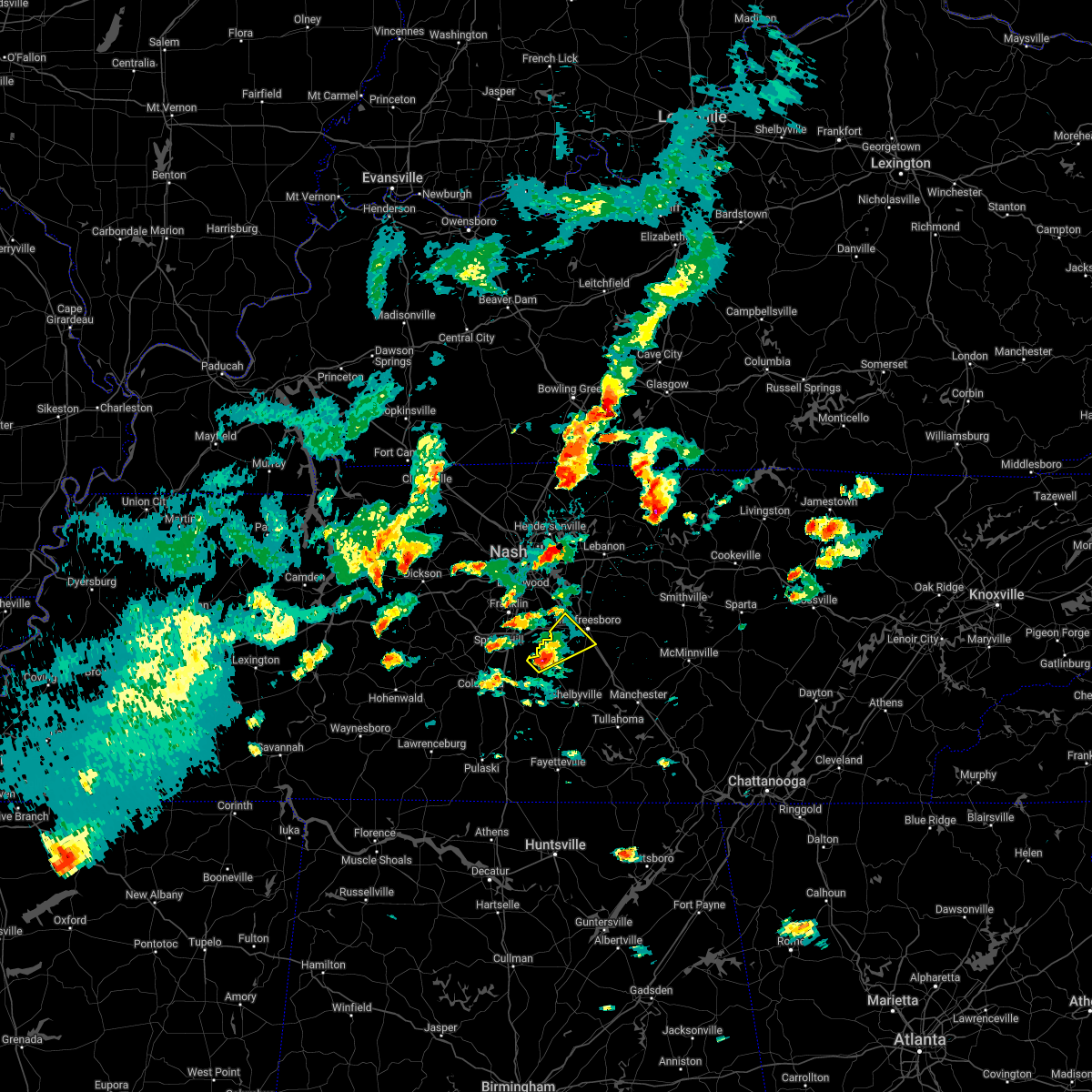 At 415 pm cdt, a severe thunderstorm was located 12 miles southeast of spring hill, or 15 miles north of lewisburg, moving northeast at 30 mph (radar indicated). Hazards include 60 mph wind gusts and quarter size hail. Hail damage to vehicles is expected. Expect wind damage to roofs, siding, and trees. At 415 pm cdt, a severe thunderstorm was located 12 miles southeast of spring hill, or 15 miles north of lewisburg, moving northeast at 30 mph (radar indicated). Hazards include 60 mph wind gusts and quarter size hail. Hail damage to vehicles is expected. Expect wind damage to roofs, siding, and trees.
|
| 4/13/2022 8:16 PM CDT |
 At 815 pm cdt, severe thunderstorms were located along a line extending from 9 miles south of murfreesboro to near ardmore, moving east at 60 mph (radar indicated). Hazards include 70 mph wind gusts. Expect considerable tree damage. damage is likely to mobile homes, roofs, and outbuildings. locations impacted include, shelbyville, lewisburg, manchester, pulaski, tullahoma, chapel hill, ardmore, cornersville, wartrace, eagleville, elkton, bell buckle, normandy, beechgrove, raus, fosterville, rover, belfast, frankewing and bradyville. this includes the following highways, interstate 65 between mile markers 1 and 25. interstate 24 between mile markers 87 and 111. thunderstorm damage threat, considerable hail threat, radar indicated max hail size, <. 75 in wind threat, radar indicated max wind gust, 70 mph. At 815 pm cdt, severe thunderstorms were located along a line extending from 9 miles south of murfreesboro to near ardmore, moving east at 60 mph (radar indicated). Hazards include 70 mph wind gusts. Expect considerable tree damage. damage is likely to mobile homes, roofs, and outbuildings. locations impacted include, shelbyville, lewisburg, manchester, pulaski, tullahoma, chapel hill, ardmore, cornersville, wartrace, eagleville, elkton, bell buckle, normandy, beechgrove, raus, fosterville, rover, belfast, frankewing and bradyville. this includes the following highways, interstate 65 between mile markers 1 and 25. interstate 24 between mile markers 87 and 111. thunderstorm damage threat, considerable hail threat, radar indicated max hail size, <. 75 in wind threat, radar indicated max wind gust, 70 mph.
|
| 4/13/2022 8:11 PM CDT |
 At 810 pm cdt, severe thunderstorms were located along a line extending from 7 miles northeast of lebanon to 8 miles southwest of murfreesboro, moving east at 65 mph (radar indicated). Hazards include 70 mph wind gusts. Expect considerable tree damage. damage is likely to mobile homes, roofs, and outbuildings. locations impacted include, murfreesboro, gallatin, lebanon, woodbury, carthage, hendersonville, smyrna, la vergne, mount juliet, watertown, gordonsville, walterhill, rural hill, belinda city, hickman, south carthage, alexandria, eagleville, dowelltown and liberty. this includes the following highways, interstate 40 between mile markers 223 and 263. interstate 24 between mile markers 65 and 91. Interstate 840 between mile markers 46 and 76. At 810 pm cdt, severe thunderstorms were located along a line extending from 7 miles northeast of lebanon to 8 miles southwest of murfreesboro, moving east at 65 mph (radar indicated). Hazards include 70 mph wind gusts. Expect considerable tree damage. damage is likely to mobile homes, roofs, and outbuildings. locations impacted include, murfreesboro, gallatin, lebanon, woodbury, carthage, hendersonville, smyrna, la vergne, mount juliet, watertown, gordonsville, walterhill, rural hill, belinda city, hickman, south carthage, alexandria, eagleville, dowelltown and liberty. this includes the following highways, interstate 40 between mile markers 223 and 263. interstate 24 between mile markers 65 and 91. Interstate 840 between mile markers 46 and 76.
|
| 4/13/2022 7:54 PM CDT |
 At 753 pm cdt, severe thunderstorms were located along a line extending from 7 miles east of spring hill to 13 miles east of lexington, moving east at 60 mph (radar indicated). Hazards include 70 mph wind gusts. Expect considerable tree damage. Damage is likely to mobile homes, roofs, and outbuildings. At 753 pm cdt, severe thunderstorms were located along a line extending from 7 miles east of spring hill to 13 miles east of lexington, moving east at 60 mph (radar indicated). Hazards include 70 mph wind gusts. Expect considerable tree damage. Damage is likely to mobile homes, roofs, and outbuildings.
|
| 4/13/2022 7:54 PM CDT | At 754 pm cdt, a severe thunderstorm capable of producing a tornado was located 10 miles east of thompson`s station, or 12 miles southeast of franklin, moving east at 60 mph (radar indicated rotation). Hazards include tornado. Flying debris will be dangerous to those caught without shelter. mobile homes will be damaged or destroyed. damage to roofs, windows, and vehicles will occur. tree damage is likely. this dangerous storm will be near, murfreesboro around 810 pm cdt. other locations impacted by this tornadic thunderstorm include christiana, eagleville, triune and rockvale. this includes the following highways, interstate 24 between mile markers 76 and 91. Interstate 840 between mile markers 34 and 51. |
| 4/13/2022 7:52 PM CDT |
 At 752 pm cdt, severe thunderstorms were located along a line extending from hendersonville to 6 miles east of spring hill, moving east at 65 mph (radar indicated). Hazards include 70 mph wind gusts. Expect considerable tree damage. Damage is likely to mobile homes, roofs, and outbuildings. At 752 pm cdt, severe thunderstorms were located along a line extending from hendersonville to 6 miles east of spring hill, moving east at 65 mph (radar indicated). Hazards include 70 mph wind gusts. Expect considerable tree damage. Damage is likely to mobile homes, roofs, and outbuildings.
|
| 7/31/2021 11:17 PM CDT |
 At 1116 pm cdt, severe thunderstorms were located along a line extending from smyrna to near lewisburg, moving southeast at 50 mph (radar indicated). Hazards include 60 mph wind gusts. Expect damage to roofs, siding, and trees. locations impacted include, murfreesboro, shelbyville, lewisburg, smyrna, chapel hill, wartrace, eagleville, bell buckle, christiana, fosterville, rover, belfast, deason, rockvale, farmington and unionville. this includes the following highways, interstate 65 between mile markers 32 and 39. interstate 24 between mile markers 69 and 94. Interstate 840 between mile markers 46 and 55. At 1116 pm cdt, severe thunderstorms were located along a line extending from smyrna to near lewisburg, moving southeast at 50 mph (radar indicated). Hazards include 60 mph wind gusts. Expect damage to roofs, siding, and trees. locations impacted include, murfreesboro, shelbyville, lewisburg, smyrna, chapel hill, wartrace, eagleville, bell buckle, christiana, fosterville, rover, belfast, deason, rockvale, farmington and unionville. this includes the following highways, interstate 65 between mile markers 32 and 39. interstate 24 between mile markers 69 and 94. Interstate 840 between mile markers 46 and 55.
|
| 7/31/2021 10:53 PM CDT | Tree fell on a house. power is out in the are in williamson county TN, 3.8 miles ENE of Eagleville, TN |
| 7/31/2021 10:53 PM CDT | Tspotter report of power lines... trees down... and a tree down on a roof. 6900 block of flat creek roa in williamson county TN, 4.8 miles ENE of Eagleville, TN |
| 7/31/2021 10:52 PM CDT |
 At 1052 pm cdt, severe thunderstorms were located along a line extending from near brentwood to near columbia, moving southeast at 50 mph (radar indicated). Hazards include 60 mph wind gusts. expect damage to roofs, siding, and trees At 1052 pm cdt, severe thunderstorms were located along a line extending from near brentwood to near columbia, moving southeast at 50 mph (radar indicated). Hazards include 60 mph wind gusts. expect damage to roofs, siding, and trees
|
| 5/9/2021 7:30 PM CDT |
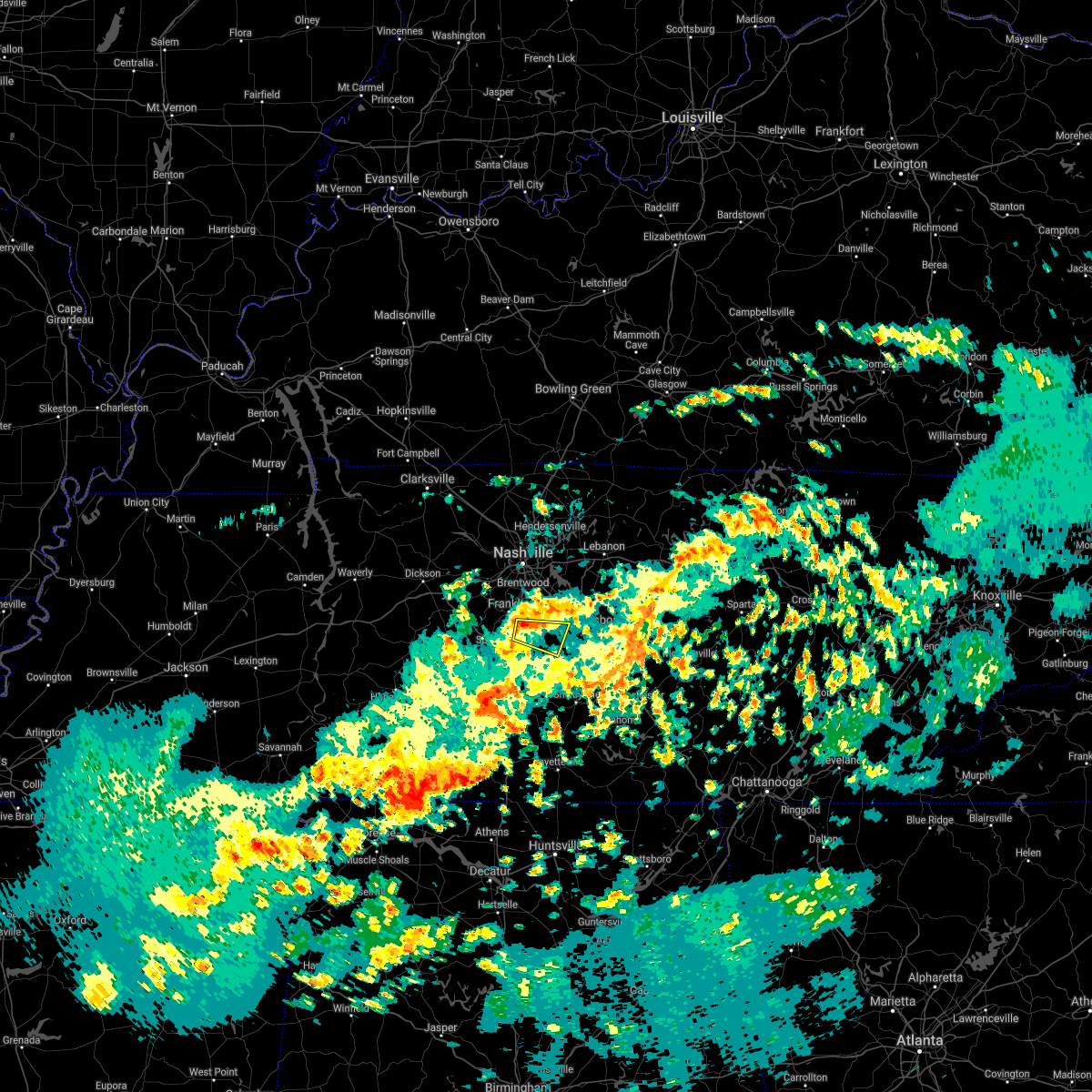 At 730 pm cdt, a severe thunderstorm was located 7 miles southeast of franklin, moving east at 30 mph (radar indicated). Hazards include 60 mph wind gusts. expect damage to roofs, siding, and trees At 730 pm cdt, a severe thunderstorm was located 7 miles southeast of franklin, moving east at 30 mph (radar indicated). Hazards include 60 mph wind gusts. expect damage to roofs, siding, and trees
|
| 5/6/2021 6:06 PM CDT |
 At 606 pm cdt, severe thunderstorms were located along a line extending from hartsville to 11 miles southeast of spring hill, moving east at 40 mph (radar indicated). Hazards include 60 mph wind gusts. Expect damage to roofs, siding, and trees. locations impacted include, murfreesboro, lebanon, smyrna, la vergne, mount juliet, watertown, walterhill, rural hill, eagleville, lascassas, tuckers crossroads, christiana, dixon springs, dickerson chapel recreation area, cedars of lebanon state park, rockvale and gladeville. this includes the following highways, interstate 40 between mile markers 229 and 249. interstate 24 between mile markers 66 and 88. Interstate 840 between mile markers 46 and 76. At 606 pm cdt, severe thunderstorms were located along a line extending from hartsville to 11 miles southeast of spring hill, moving east at 40 mph (radar indicated). Hazards include 60 mph wind gusts. Expect damage to roofs, siding, and trees. locations impacted include, murfreesboro, lebanon, smyrna, la vergne, mount juliet, watertown, walterhill, rural hill, eagleville, lascassas, tuckers crossroads, christiana, dixon springs, dickerson chapel recreation area, cedars of lebanon state park, rockvale and gladeville. this includes the following highways, interstate 40 between mile markers 229 and 249. interstate 24 between mile markers 66 and 88. Interstate 840 between mile markers 46 and 76.
|
| 5/6/2021 6:02 PM CDT |
 At 601 pm cdt, severe thunderstorms were located along a line extending from 14 miles south of nolensville to 13 miles northeast of rogersville, moving east at 50 mph (radar indicated). Hazards include 60 mph wind gusts. Expect damage to roofs, siding, and trees. locations impacted include, shelbyville, lewisburg, pulaski, chapel hill, ardmore, cornersville, eagleville, elkton, minor hill, bell buckle, lynnville, christiana, fosterville, rover, belfast, goodspring, deason, frankewing, rockvale and prospect. this includes the following highways, interstate 65 between mile markers 1 and 39. Interstate 24 between mile markers 86 and 91. At 601 pm cdt, severe thunderstorms were located along a line extending from 14 miles south of nolensville to 13 miles northeast of rogersville, moving east at 50 mph (radar indicated). Hazards include 60 mph wind gusts. Expect damage to roofs, siding, and trees. locations impacted include, shelbyville, lewisburg, pulaski, chapel hill, ardmore, cornersville, eagleville, elkton, minor hill, bell buckle, lynnville, christiana, fosterville, rover, belfast, goodspring, deason, frankewing, rockvale and prospect. this includes the following highways, interstate 65 between mile markers 1 and 39. Interstate 24 between mile markers 86 and 91.
|
| 5/6/2021 5:45 PM CDT |
 At 545 pm cdt, severe thunderstorms were located along a line extending from near thompson`s station to near lexington, moving east at 50 mph (radar indicated). Hazards include 60 mph wind gusts. expect damage to roofs, siding, and trees At 545 pm cdt, severe thunderstorms were located along a line extending from near thompson`s station to near lexington, moving east at 50 mph (radar indicated). Hazards include 60 mph wind gusts. expect damage to roofs, siding, and trees
|
| 5/6/2021 5:42 PM CDT |
 At 542 pm cdt, severe thunderstorms were located along a line extending from near gallatin to near columbia, moving east at 40 mph (radar indicated). Hazards include 60 mph wind gusts. expect damage to roofs, siding, and trees At 542 pm cdt, severe thunderstorms were located along a line extending from near gallatin to near columbia, moving east at 40 mph (radar indicated). Hazards include 60 mph wind gusts. expect damage to roofs, siding, and trees
|
| 5/6/2021 5:34 PM CDT |
 At 534 pm cdt, severe thunderstorms were located along a line extending from 7 miles east of gallatin to 10 miles south of nolensville, moving east at 55 mph (radar indicated). Hazards include 60 mph wind gusts. Expect damage to roofs, siding, and trees. locations impacted include, murfreesboro, franklin, gallatin, lebanon, nashville, hartsville, madison, hendersonville, smyrna, brentwood, la vergne, spring hill, mount juliet, goodlettsville, millersville, nolensville, forest hills, oak hill, belle meade and lakewood. this includes the following highways, interstate 40 between mile markers 203 and 248. interstate 65 between mile markers 53 and 102. interstate 24 between mile markers 38 and 87. Interstate 840 between mile markers 18 and 76. At 534 pm cdt, severe thunderstorms were located along a line extending from 7 miles east of gallatin to 10 miles south of nolensville, moving east at 55 mph (radar indicated). Hazards include 60 mph wind gusts. Expect damage to roofs, siding, and trees. locations impacted include, murfreesboro, franklin, gallatin, lebanon, nashville, hartsville, madison, hendersonville, smyrna, brentwood, la vergne, spring hill, mount juliet, goodlettsville, millersville, nolensville, forest hills, oak hill, belle meade and lakewood. this includes the following highways, interstate 40 between mile markers 203 and 248. interstate 65 between mile markers 53 and 102. interstate 24 between mile markers 38 and 87. Interstate 840 between mile markers 18 and 76.
|
| 5/6/2021 5:09 PM CDT |
 At 508 pm cdt, severe thunderstorms were located along a line extending from near greenbrier to 10 miles south of fairview, moving east at 55 mph (radar indicated). Hazards include 60 mph wind gusts. expect damage to roofs, siding, and trees At 508 pm cdt, severe thunderstorms were located along a line extending from near greenbrier to 10 miles south of fairview, moving east at 55 mph (radar indicated). Hazards include 60 mph wind gusts. expect damage to roofs, siding, and trees
|
| 3/28/2021 1:25 AM CDT |
 The national weather service in nashville has issued a * severe thunderstorm warning for. marshall county in middle tennessee. southern rutherford county in middle tennessee. east central lawrence county in middle tennessee. Southeastern maury county in middle tennessee. The national weather service in nashville has issued a * severe thunderstorm warning for. marshall county in middle tennessee. southern rutherford county in middle tennessee. east central lawrence county in middle tennessee. Southeastern maury county in middle tennessee.
|
| 3/27/2021 7:24 PM CDT |
 At 722 pm cdt, a severe thunderstorm was located 7 miles south of murfreesboro, moving east at 45 mph (trained weather spotters). Hazards include 60 mph wind gusts and half dollar size hail. Hail damage to vehicles is expected. expect wind damage to roofs, siding, and trees. locations impacted include, murfreesboro, smyrna, nolensville, walterhill, eagleville, bell buckle, lascassas, christiana, fosterville, rover, deason, rockvale and unionville. this includes the following highways, interstate 24 between mile markers 68 and 95. Interstate 840 between mile markers 46 and 61. At 722 pm cdt, a severe thunderstorm was located 7 miles south of murfreesboro, moving east at 45 mph (trained weather spotters). Hazards include 60 mph wind gusts and half dollar size hail. Hail damage to vehicles is expected. expect wind damage to roofs, siding, and trees. locations impacted include, murfreesboro, smyrna, nolensville, walterhill, eagleville, bell buckle, lascassas, christiana, fosterville, rover, deason, rockvale and unionville. this includes the following highways, interstate 24 between mile markers 68 and 95. Interstate 840 between mile markers 46 and 61.
|
| 3/27/2021 7:05 PM CDT | Ping Pong Ball sized hail reported 0.4 miles SW of Eagleville, TN |
| 3/27/2021 7:05 PM CDT |
 At 705 pm cdt, a severe thunderstorm was located 14 miles east of spring hill, or 17 miles southeast of franklin, moving east at 45 mph (trained weather spotters). Hazards include golf ball size hail and 60 mph wind gusts. People and animals outdoors will be injured. expect hail damage to roofs, siding, windows, and vehicles. expect wind damage to roofs, siding, and trees. locations impacted include, murfreesboro, franklin, columbia, smyrna, spring hill, nolensville, thompson`s station, walterhill, chapel hill, eagleville, bell buckle, lascassas, christiana, i-65 east of columbia, fosterville, triune, rover, deason, rockvale and unionville. this includes the following highways, interstate 65 between mile markers 42 and 64. interstate 24 between mile markers 68 and 96. Interstate 840 between mile markers 27 and 61. At 705 pm cdt, a severe thunderstorm was located 14 miles east of spring hill, or 17 miles southeast of franklin, moving east at 45 mph (trained weather spotters). Hazards include golf ball size hail and 60 mph wind gusts. People and animals outdoors will be injured. expect hail damage to roofs, siding, windows, and vehicles. expect wind damage to roofs, siding, and trees. locations impacted include, murfreesboro, franklin, columbia, smyrna, spring hill, nolensville, thompson`s station, walterhill, chapel hill, eagleville, bell buckle, lascassas, christiana, i-65 east of columbia, fosterville, triune, rover, deason, rockvale and unionville. this includes the following highways, interstate 65 between mile markers 42 and 64. interstate 24 between mile markers 68 and 96. Interstate 840 between mile markers 27 and 61.
|
| 3/27/2021 7:03 PM CDT | Hen Egg sized hail reported 3 miles SE of Eagleville, TN, in college grove |
| 3/27/2021 6:59 PM CDT |
 The national weather service in nashville has issued a * severe thunderstorm warning for. northeastern marshall county in middle tennessee. rutherford county in middle tennessee. northeastern maury county in middle tennessee. Southeastern williamson county in middle tennessee. The national weather service in nashville has issued a * severe thunderstorm warning for. northeastern marshall county in middle tennessee. rutherford county in middle tennessee. northeastern maury county in middle tennessee. Southeastern williamson county in middle tennessee.
|
| 3/27/2021 6:52 PM CDT |
 At 651 pm cdt, a severe thunderstorm was located near spring hill, or 9 miles northeast of columbia, moving east at 45 mph (radar indicated). Hazards include 60 mph wind gusts and half dollar size hail. Hail damage to vehicles is expected. expect wind damage to roofs, siding, and trees. locations impacted include, columbia, spring hill, chapel hill, eagleville and i-65 east of columbia. This includes interstate 65 between mile markers 43 and 55. At 651 pm cdt, a severe thunderstorm was located near spring hill, or 9 miles northeast of columbia, moving east at 45 mph (radar indicated). Hazards include 60 mph wind gusts and half dollar size hail. Hail damage to vehicles is expected. expect wind damage to roofs, siding, and trees. locations impacted include, columbia, spring hill, chapel hill, eagleville and i-65 east of columbia. This includes interstate 65 between mile markers 43 and 55.
|
| 3/27/2021 6:38 PM CDT |
 At 638 pm cdt, a severe thunderstorm was located near columbia, moving east at 45 mph (radar indicated). Hazards include 60 mph wind gusts and quarter size hail. Hail damage to vehicles is expected. Expect wind damage to roofs, siding, and trees. At 638 pm cdt, a severe thunderstorm was located near columbia, moving east at 45 mph (radar indicated). Hazards include 60 mph wind gusts and quarter size hail. Hail damage to vehicles is expected. Expect wind damage to roofs, siding, and trees.
|
| 3/27/2021 8:36 AM CDT |
 The severe thunderstorm warning for western rutherford, northeastern maury and eastern williamson counties will expire at 845 am cdt, the storm which prompted the warning has weakened below severe limits, and no longer poses an immediate threat to life or property. therefore, the warning will be allowed to expire. however heavy rain is still possible with this thunderstorm. The severe thunderstorm warning for western rutherford, northeastern maury and eastern williamson counties will expire at 845 am cdt, the storm which prompted the warning has weakened below severe limits, and no longer poses an immediate threat to life or property. therefore, the warning will be allowed to expire. however heavy rain is still possible with this thunderstorm.
|
| 3/27/2021 8:02 AM CDT |
 At 801 am cdt, a severe thunderstorm was located over thompson`s station, or 10 miles south of franklin, moving east at 45 mph (radar indicated). Hazards include 60 mph wind gusts and quarter size hail. Hail damage to vehicles is expected. Expect wind damage to roofs, siding, and trees. At 801 am cdt, a severe thunderstorm was located over thompson`s station, or 10 miles south of franklin, moving east at 45 mph (radar indicated). Hazards include 60 mph wind gusts and quarter size hail. Hail damage to vehicles is expected. Expect wind damage to roofs, siding, and trees.
|
| 3/25/2021 8:57 PM CDT |
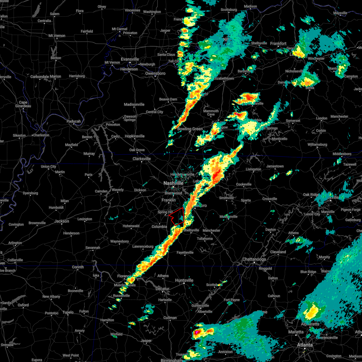 The tornado warning for northeastern marshall, southwestern rutherford, southeastern williamson and northwestern bedford counties will expire at 900 pm cdt, the storm which prompted the warning has moved out of the area. therefore, the warning will be allowed to expire. a tornado watch remains in effect until 1100 pm cdt for middle tennessee. The tornado warning for northeastern marshall, southwestern rutherford, southeastern williamson and northwestern bedford counties will expire at 900 pm cdt, the storm which prompted the warning has moved out of the area. therefore, the warning will be allowed to expire. a tornado watch remains in effect until 1100 pm cdt for middle tennessee.
|
| 3/25/2021 8:42 PM CDT |
 At 842 pm cdt, a severe thunderstorm capable of producing a tornado was located 10 miles east of spring hill, or 16 miles south of franklin, moving northeast at 55 mph (radar indicated rotation). Hazards include tornado and quarter size hail. Flying debris will be dangerous to those caught without shelter. mobile homes will be damaged or destroyed. damage to roofs, windows, and vehicles will occur. tree damage is likely. locations impacted include, chapel hill, eagleville and rover. This includes interstate 840 between mile markers 43 and 44. At 842 pm cdt, a severe thunderstorm capable of producing a tornado was located 10 miles east of spring hill, or 16 miles south of franklin, moving northeast at 55 mph (radar indicated rotation). Hazards include tornado and quarter size hail. Flying debris will be dangerous to those caught without shelter. mobile homes will be damaged or destroyed. damage to roofs, windows, and vehicles will occur. tree damage is likely. locations impacted include, chapel hill, eagleville and rover. This includes interstate 840 between mile markers 43 and 44.
|
| 3/25/2021 8:35 PM CDT |
 At 834 pm cdt, a severe thunderstorm capable of producing a tornado was located 7 miles southeast of spring hill, or 10 miles east of columbia, moving northeast at 55 mph (radar indicated rotation). Hazards include tornado and quarter size hail. Flying debris will be dangerous to those caught without shelter. mobile homes will be damaged or destroyed. damage to roofs, windows, and vehicles will occur. Tree damage is likely. At 834 pm cdt, a severe thunderstorm capable of producing a tornado was located 7 miles southeast of spring hill, or 10 miles east of columbia, moving northeast at 55 mph (radar indicated rotation). Hazards include tornado and quarter size hail. Flying debris will be dangerous to those caught without shelter. mobile homes will be damaged or destroyed. damage to roofs, windows, and vehicles will occur. Tree damage is likely.
|
| 9/1/2020 5:12 PM CDT |
 At 512 pm cdt, a severe thunderstorm was located 9 miles south of nolensville, or 12 miles southeast of franklin, moving northeast at 30 mph (radar indicated). Hazards include 60 mph wind gusts. Expect damage to roofs, siding, and trees. locations impacted include, murfreesboro, franklin, smyrna, brentwood, la vergne, nolensville, eagleville, triune and rockvale. this includes the following highways, interstate 24 between mile markers 68 and 78. Interstate 840 between mile markers 32 and 56. At 512 pm cdt, a severe thunderstorm was located 9 miles south of nolensville, or 12 miles southeast of franklin, moving northeast at 30 mph (radar indicated). Hazards include 60 mph wind gusts. Expect damage to roofs, siding, and trees. locations impacted include, murfreesboro, franklin, smyrna, brentwood, la vergne, nolensville, eagleville, triune and rockvale. this includes the following highways, interstate 24 between mile markers 68 and 78. Interstate 840 between mile markers 32 and 56.
|
| 9/1/2020 4:57 PM CDT |
 The national weather service in nashville has issued a * severe thunderstorm warning for. southwestern rutherford county in middle tennessee. eastern williamson county in middle tennessee. until 530 pm cdt. At 456 pm cdt, a severe thunderstorm was located 10 miles east of. The national weather service in nashville has issued a * severe thunderstorm warning for. southwestern rutherford county in middle tennessee. eastern williamson county in middle tennessee. until 530 pm cdt. At 456 pm cdt, a severe thunderstorm was located 10 miles east of.
|
| 6/14/2020 12:32 PM CDT |
 At 1232 pm cdt, a severe thunderstorm was located 13 miles southeast of spring hill, or 14 miles north of lewisburg, moving south at 25 mph (radar indicated). Hazards include 60 mph wind gusts and quarter size hail. Hail damage to vehicles is expected. expect wind damage to roofs, siding, and trees. locations impacted include, columbia, chapel hill, eagleville, rover, i-65 east of columbia and unionville. This includes interstate 65 between mile markers 41 and 47. At 1232 pm cdt, a severe thunderstorm was located 13 miles southeast of spring hill, or 14 miles north of lewisburg, moving south at 25 mph (radar indicated). Hazards include 60 mph wind gusts and quarter size hail. Hail damage to vehicles is expected. expect wind damage to roofs, siding, and trees. locations impacted include, columbia, chapel hill, eagleville, rover, i-65 east of columbia and unionville. This includes interstate 65 between mile markers 41 and 47.
|
| 6/14/2020 12:25 PM CDT | Quarter sized hail reported 3.6 miles E of Eagleville, TN, twitter video showed hail over quarter size near eagleville |
| 6/14/2020 12:12 PM CDT |
 At 1211 pm cdt, a severe thunderstorm was located 9 miles east of thompson`s station, or 11 miles southeast of franklin, moving south at 25 mph (radar indicated). Hazards include 60 mph wind gusts and penny size hail. expect damage to roofs, siding, and trees At 1211 pm cdt, a severe thunderstorm was located 9 miles east of thompson`s station, or 11 miles southeast of franklin, moving south at 25 mph (radar indicated). Hazards include 60 mph wind gusts and penny size hail. expect damage to roofs, siding, and trees
|
| 5/3/2020 5:01 PM CDT |
 At 501 pm cdt, severe thunderstorms were located along a line extending from 10 miles south of murfreesboro to near petersburg to 10 miles north of ardmore, moving southeast at 60 mph (radar indicated). Hazards include 70 mph wind gusts and penny size hail. Expect considerable tree damage. damage is likely to mobile homes, roofs, and outbuildings. Locations impacted include, shelbyville, lewisburg, chapel hill, cornersville, wartrace, eagleville, bell buckle, lynnville, christiana, fosterville, rover, belfast, deason, rockvale, farmington and unionville. At 501 pm cdt, severe thunderstorms were located along a line extending from 10 miles south of murfreesboro to near petersburg to 10 miles north of ardmore, moving southeast at 60 mph (radar indicated). Hazards include 70 mph wind gusts and penny size hail. Expect considerable tree damage. damage is likely to mobile homes, roofs, and outbuildings. Locations impacted include, shelbyville, lewisburg, chapel hill, cornersville, wartrace, eagleville, bell buckle, lynnville, christiana, fosterville, rover, belfast, deason, rockvale, farmington and unionville.
|
| 5/3/2020 4:47 PM CDT |
 A severe thunderstorm warning remains in effect until 500 pm cdt for southeastern davidson. north central marshall. northwestern rutherford. northeastern maury and eastern williamson counties. At 446 pm cdt, severe thunderstorms were located along a line extending from hermitage to near nolensville to near thompson`s station, moving east at 60 mph. A severe thunderstorm warning remains in effect until 500 pm cdt for southeastern davidson. north central marshall. northwestern rutherford. northeastern maury and eastern williamson counties. At 446 pm cdt, severe thunderstorms were located along a line extending from hermitage to near nolensville to near thompson`s station, moving east at 60 mph.
|
| 5/3/2020 4:41 PM CDT |
 At 440 pm cdt, severe thunderstorms were located along a line extending from near nolensville to near columbia to 10 miles northwest of pulaski, moving southeast at 60 mph (radar indicated). Hazards include 60 mph wind gusts and penny size hail. expect damage to roofs, siding, and trees At 440 pm cdt, severe thunderstorms were located along a line extending from near nolensville to near columbia to 10 miles northwest of pulaski, moving southeast at 60 mph (radar indicated). Hazards include 60 mph wind gusts and penny size hail. expect damage to roofs, siding, and trees
|
| 5/3/2020 4:17 PM CDT |
 At 417 pm cdt, severe thunderstorms were located along a line extending from near white bluff to near fairview to 8 miles east of centerville, moving east at 60 mph (radar indicated). Hazards include 70 mph wind gusts and penny size hail. Expect considerable tree damage. Damage is likely to mobile homes, roofs, and outbuildings. At 417 pm cdt, severe thunderstorms were located along a line extending from near white bluff to near fairview to 8 miles east of centerville, moving east at 60 mph (radar indicated). Hazards include 70 mph wind gusts and penny size hail. Expect considerable tree damage. Damage is likely to mobile homes, roofs, and outbuildings.
|
| 3/28/2020 11:57 PM CDT |
 At 1157 pm cdt, a severe thunderstorm was located over spring hill, or 8 miles northeast of columbia, moving northeast at 60 mph (radar indicated). Hazards include 60 mph wind gusts. expect damage to roofs, siding, and trees At 1157 pm cdt, a severe thunderstorm was located over spring hill, or 8 miles northeast of columbia, moving northeast at 60 mph (radar indicated). Hazards include 60 mph wind gusts. expect damage to roofs, siding, and trees
|
| 1/11/2020 10:06 AM CST |
 The severe thunderstorm warning for marshall, northwestern rutherford, southeastern maury, southeastern williamson and eastern giles counties will expire at 1015 am cst, the storms which prompted the warning have weakened below severe limits, and have exited the warned area. therefore, the warning will be allowed to expire. a tornado watch remains in effect until 100 pm cst for middle tennessee. The severe thunderstorm warning for marshall, northwestern rutherford, southeastern maury, southeastern williamson and eastern giles counties will expire at 1015 am cst, the storms which prompted the warning have weakened below severe limits, and have exited the warned area. therefore, the warning will be allowed to expire. a tornado watch remains in effect until 100 pm cst for middle tennessee.
|
| 1/11/2020 10:00 AM CST |
 At 1000 am cst, severe thunderstorms were located along a line extending from near la vergne to 7 miles northeast of pulaski, moving northeast at 30 mph (radar indicated). Hazards include 60 mph wind gusts. Expect damage to roofs, siding, and trees. locations impacted include, lewisburg, pulaski, smyrna, nolensville, chapel hill, cornersville, eagleville, frankewing, farmington and triune. this includes the following highways, interstate 65 between mile markers 8 and 37. interstate 24 between mile markers 66 and 71. Interstate 840 between mile markers 35 and 48. At 1000 am cst, severe thunderstorms were located along a line extending from near la vergne to 7 miles northeast of pulaski, moving northeast at 30 mph (radar indicated). Hazards include 60 mph wind gusts. Expect damage to roofs, siding, and trees. locations impacted include, lewisburg, pulaski, smyrna, nolensville, chapel hill, cornersville, eagleville, frankewing, farmington and triune. this includes the following highways, interstate 65 between mile markers 8 and 37. interstate 24 between mile markers 66 and 71. Interstate 840 between mile markers 35 and 48.
|
| 1/11/2020 9:43 AM CST |
 At 942 am cst, severe thunderstorms were located along a line extending from near nolensville to near pulaski, moving northeast at 30 mph (radar indicated). Hazards include 60 mph wind gusts. expect damage to roofs, siding, and trees At 942 am cst, severe thunderstorms were located along a line extending from near nolensville to near pulaski, moving northeast at 30 mph (radar indicated). Hazards include 60 mph wind gusts. expect damage to roofs, siding, and trees
|
| 8/13/2019 5:23 PM CDT |
 At 522 pm cdt, a severe thunderstorm was located 12 miles southeast of spring hill, or 15 miles north of lewisburg, moving east at 30 mph (radar indicated). Hazards include 60 mph wind gusts and nickel size hail. expect damage to roofs, siding, and trees At 522 pm cdt, a severe thunderstorm was located 12 miles southeast of spring hill, or 15 miles north of lewisburg, moving east at 30 mph (radar indicated). Hazards include 60 mph wind gusts and nickel size hail. expect damage to roofs, siding, and trees
|
| 8/13/2019 4:27 PM CDT | Quarter sized hail reported 3.9 miles SSE of Eagleville, TN, quarter sized hail report on facebook with picture. in college grove area. |
| 8/13/2019 4:00 PM CDT |
 At 400 pm cdt, severe thunderstorms were located along a line extending from 6 miles north of walterhill to near thompson`s station, moving east at 35 mph (radar indicated). Hazards include 60 mph wind gusts. expect damage to roofs, siding, and trees At 400 pm cdt, severe thunderstorms were located along a line extending from 6 miles north of walterhill to near thompson`s station, moving east at 35 mph (radar indicated). Hazards include 60 mph wind gusts. expect damage to roofs, siding, and trees
|
| 8/6/2019 9:43 PM CDT |
 The national weather service in nashville has issued a * severe thunderstorm warning for. marshall county in middle tennessee. southern rutherford county in middle tennessee. coffee county in middle tennessee. Bedford county in middle tennessee. The national weather service in nashville has issued a * severe thunderstorm warning for. marshall county in middle tennessee. southern rutherford county in middle tennessee. coffee county in middle tennessee. Bedford county in middle tennessee.
|
| 8/6/2019 9:07 PM CDT |
 At 907 pm cdt, severe thunderstorms were located along a line extending from 8 miles northwest of woodbury to 6 miles east of spring hill, moving southeast at 40 mph (radar indicated). Hazards include 60 mph wind gusts. expect damage to roofs, siding, and trees At 907 pm cdt, severe thunderstorms were located along a line extending from 8 miles northwest of woodbury to 6 miles east of spring hill, moving southeast at 40 mph (radar indicated). Hazards include 60 mph wind gusts. expect damage to roofs, siding, and trees
|
| 8/6/2019 8:34 PM CDT |
 At 834 pm cdt, severe thunderstorms were located along a line extending from near lebanon to near forest hills, moving southeast at 40 mph (radar indicated). Hazards include 60 mph wind gusts and penny size hail. expect damage to roofs, siding, and trees At 834 pm cdt, severe thunderstorms were located along a line extending from near lebanon to near forest hills, moving southeast at 40 mph (radar indicated). Hazards include 60 mph wind gusts and penny size hail. expect damage to roofs, siding, and trees
|
| 6/27/2019 4:59 PM CDT |
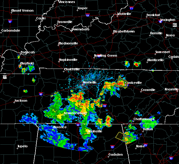 At 458 pm cdt, a severe thunderstorm was located 12 miles southeast of spring hill, or 13 miles north of lewisburg, moving north at 35 mph (radar indicated). Hazards include 60 mph wind gusts and penny size hail. expect damage to roofs, siding, and trees At 458 pm cdt, a severe thunderstorm was located 12 miles southeast of spring hill, or 13 miles north of lewisburg, moving north at 35 mph (radar indicated). Hazards include 60 mph wind gusts and penny size hail. expect damage to roofs, siding, and trees
|
| 6/21/2019 9:49 PM CDT | Photo of tree over fuller rd in college grov in marshall county TN, 3.1 miles NE of Eagleville, TN |
| 6/21/2019 8:26 PM CDT |
 At 825 pm cdt, severe thunderstorms were located along a line extending from near watertown to murfreesboro to spring hill, moving southeast at 50 mph. these are very dangerous storms (radar indicated). Hazards include 80 mph wind gusts and penny size hail. Flying debris will be dangerous to those caught without shelter. mobile homes will be heavily damaged. expect considerable damage to roofs, windows, and vehicles. extensive tree damage and power outages are likely. locations impacted include, murfreesboro, columbia, lewisburg, smyrna, la vergne, spring hill, nolensville, thompson`s station, walterhill, chapel hill, eagleville, auburntown, fosterville, triune, cedars of lebanon state park, rover, rockvale, unionville, readyville and lascassas. this includes the following highways, interstate 65 between mile markers 29 and 60. interstate 24 between mile markers 66 and 93. Interstate 840 between mile markers 29 and 70. At 825 pm cdt, severe thunderstorms were located along a line extending from near watertown to murfreesboro to spring hill, moving southeast at 50 mph. these are very dangerous storms (radar indicated). Hazards include 80 mph wind gusts and penny size hail. Flying debris will be dangerous to those caught without shelter. mobile homes will be heavily damaged. expect considerable damage to roofs, windows, and vehicles. extensive tree damage and power outages are likely. locations impacted include, murfreesboro, columbia, lewisburg, smyrna, la vergne, spring hill, nolensville, thompson`s station, walterhill, chapel hill, eagleville, auburntown, fosterville, triune, cedars of lebanon state park, rover, rockvale, unionville, readyville and lascassas. this includes the following highways, interstate 65 between mile markers 29 and 60. interstate 24 between mile markers 66 and 93. Interstate 840 between mile markers 29 and 70.
|
| 6/21/2019 8:05 PM CDT |
 The national weather service in nashville has issued a * severe thunderstorm warning for. southeastern davidson county in middle tennessee. central marshall county in middle tennessee. rutherford county in middle tennessee. Central maury county in middle tennessee. The national weather service in nashville has issued a * severe thunderstorm warning for. southeastern davidson county in middle tennessee. central marshall county in middle tennessee. rutherford county in middle tennessee. Central maury county in middle tennessee.
|
| 6/19/2019 8:37 PM CDT |
 At 837 pm cdt, severe thunderstorms were located along a line extending from 9 miles northwest of woodbury to near spring hill, moving southeast at 15 mph (radar indicated). Hazards include 60 mph wind gusts and quarter size hail. Hail damage to vehicles is expected. expect wind damage to roofs, siding, and trees. locations impacted include, franklin, smyrna, spring hill, nolensville, thompson`s station, walterhill, eagleville and triune. this includes the following highways, interstate 65 between mile markers 55 and 65. interstate 24 between mile markers 67 and 75. Interstate 840 between mile markers 15 and 61. At 837 pm cdt, severe thunderstorms were located along a line extending from 9 miles northwest of woodbury to near spring hill, moving southeast at 15 mph (radar indicated). Hazards include 60 mph wind gusts and quarter size hail. Hail damage to vehicles is expected. expect wind damage to roofs, siding, and trees. locations impacted include, franklin, smyrna, spring hill, nolensville, thompson`s station, walterhill, eagleville and triune. this includes the following highways, interstate 65 between mile markers 55 and 65. interstate 24 between mile markers 67 and 75. Interstate 840 between mile markers 15 and 61.
|
| 6/19/2019 8:31 PM CDT |
 At 830 pm cdt, severe thunderstorms were located along a line extending from alexandria to christiana, moving east at 25 mph (radar indicated. at 828 pm cdt...several trees were blown down with these storms across rutherford county). Hazards include 70 mph wind gusts and quarter size hail. Hail damage to vehicles is expected. expect considerable tree damage. Wind damage is also likely to mobile homes, roofs, and outbuildings. At 830 pm cdt, severe thunderstorms were located along a line extending from alexandria to christiana, moving east at 25 mph (radar indicated. at 828 pm cdt...several trees were blown down with these storms across rutherford county). Hazards include 70 mph wind gusts and quarter size hail. Hail damage to vehicles is expected. expect considerable tree damage. Wind damage is also likely to mobile homes, roofs, and outbuildings.
|
| 6/19/2019 8:23 PM CDT |
 At 823 pm cdt, severe thunderstorms were located along a line extending from watertown to near thompson`s station, moving east at 30 mph (radar indicated). Hazards include 70 mph wind gusts and quarter size hail. Hail damage to vehicles is expected. expect considerable tree damage. wind damage is also likely to mobile homes, roofs, and outbuildings. locations impacted include, murfreesboro, franklin, smyrna, brentwood, la vergne, spring hill, nolensville, thompson`s station, watertown, walterhill, eagleville, auburntown, lascassas, triune, cedars of lebanon state park, leipers fork and milton. this includes the following highways, interstate 65 between mile markers 55 and 72. interstate 24 between mile markers 60 and 81. Interstate 840 between mile markers 10 and 70. At 823 pm cdt, severe thunderstorms were located along a line extending from watertown to near thompson`s station, moving east at 30 mph (radar indicated). Hazards include 70 mph wind gusts and quarter size hail. Hail damage to vehicles is expected. expect considerable tree damage. wind damage is also likely to mobile homes, roofs, and outbuildings. locations impacted include, murfreesboro, franklin, smyrna, brentwood, la vergne, spring hill, nolensville, thompson`s station, watertown, walterhill, eagleville, auburntown, lascassas, triune, cedars of lebanon state park, leipers fork and milton. this includes the following highways, interstate 65 between mile markers 55 and 72. interstate 24 between mile markers 60 and 81. Interstate 840 between mile markers 10 and 70.
|
| 6/19/2019 8:16 PM CDT |
 At 815 pm cdt, severe thunderstorms were located along a line extending from near watertown to thompson`s station, moving east at 35 mph. these storms have produced numerous reports of quarter size hail and blown down trees in the southern nashville metro area (radar indicated). Hazards include 60 mph wind gusts and quarter size hail. Hail damage to vehicles is expected. expect wind damage to roofs, siding, and trees. locations impacted include, murfreesboro, franklin, smyrna, brentwood, la vergne, spring hill, nolensville, thompson`s station, watertown, walterhill, eagleville, auburntown, lascassas, triune, cedars of lebanon state park, leipers fork and milton. this includes the following highways, interstate 65 between mile markers 55 and 72. interstate 24 between mile markers 60 and 81. Interstate 840 between mile markers 10 and 70. At 815 pm cdt, severe thunderstorms were located along a line extending from near watertown to thompson`s station, moving east at 35 mph. these storms have produced numerous reports of quarter size hail and blown down trees in the southern nashville metro area (radar indicated). Hazards include 60 mph wind gusts and quarter size hail. Hail damage to vehicles is expected. expect wind damage to roofs, siding, and trees. locations impacted include, murfreesboro, franklin, smyrna, brentwood, la vergne, spring hill, nolensville, thompson`s station, watertown, walterhill, eagleville, auburntown, lascassas, triune, cedars of lebanon state park, leipers fork and milton. this includes the following highways, interstate 65 between mile markers 55 and 72. interstate 24 between mile markers 60 and 81. Interstate 840 between mile markers 10 and 70.
|
| 6/19/2019 7:58 PM CDT |
 At 757 pm cdt, severe thunderstorms were located along a line extending from near rural hill to nolensville to leipers fork, moving east at 30 mph (radar indicated. at 756 pm cdt...numerous reports of quarter size hail were received from brentwood with these storms). Hazards include 60 mph wind gusts and quarter size hail. Hail damage to vehicles is expected. Expect wind damage to roofs, siding, and trees. At 757 pm cdt, severe thunderstorms were located along a line extending from near rural hill to nolensville to leipers fork, moving east at 30 mph (radar indicated. at 756 pm cdt...numerous reports of quarter size hail were received from brentwood with these storms). Hazards include 60 mph wind gusts and quarter size hail. Hail damage to vehicles is expected. Expect wind damage to roofs, siding, and trees.
|
| 5/2/2019 12:03 PM CDT |
 At 1203 pm cdt, a severe thunderstorm was located 11 miles south of nolensville, or 14 miles west of murfreesboro, moving north at 20 mph (radar indicated). Hazards include 60 mph wind gusts and quarter size hail. Hail damage to vehicles is expected. Expect wind damage to roofs, siding, and trees. At 1203 pm cdt, a severe thunderstorm was located 11 miles south of nolensville, or 14 miles west of murfreesboro, moving north at 20 mph (radar indicated). Hazards include 60 mph wind gusts and quarter size hail. Hail damage to vehicles is expected. Expect wind damage to roofs, siding, and trees.
|
| 3/30/2019 7:11 PM CDT |
 The tornado warning for southwestern rutherford and southeastern williamson counties will expire at 715 pm cdt, the storm which prompted the warning has weakened and no longer appears capable of producing a tornado. therefore, the tornado warning will be allowed to expire. however gusty winds are still possible with this thunderstorm. The tornado warning for southwestern rutherford and southeastern williamson counties will expire at 715 pm cdt, the storm which prompted the warning has weakened and no longer appears capable of producing a tornado. therefore, the tornado warning will be allowed to expire. however gusty winds are still possible with this thunderstorm.
|
| 3/30/2019 6:54 PM CDT |
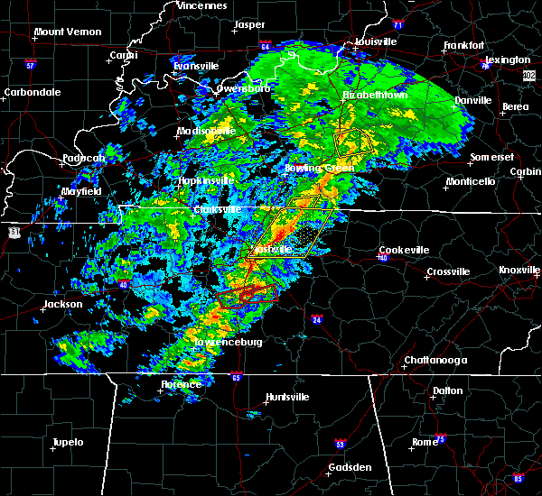 At 654 pm cdt, a severe thunderstorm capable of producing a tornado was located near spring hill, or 13 miles south of franklin, moving east at 50 mph (radar indicated rotation). Hazards include tornado. Flying debris will be dangerous to those caught without shelter. mobile homes will be damaged or destroyed. damage to roofs, windows, and vehicles will occur. tree damage is likely. this tornadic thunderstorm will remain over mainly rural areas of southwestern rutherford and southeastern williamson counties, including the following locations, eagleville and rockvale. this includes the following highways, interstate 65 between mile markers 55 and 56. Interstate 840 between mile markers 34 and 37, and between mile markers 41 and 49. At 654 pm cdt, a severe thunderstorm capable of producing a tornado was located near spring hill, or 13 miles south of franklin, moving east at 50 mph (radar indicated rotation). Hazards include tornado. Flying debris will be dangerous to those caught without shelter. mobile homes will be damaged or destroyed. damage to roofs, windows, and vehicles will occur. tree damage is likely. this tornadic thunderstorm will remain over mainly rural areas of southwestern rutherford and southeastern williamson counties, including the following locations, eagleville and rockvale. this includes the following highways, interstate 65 between mile markers 55 and 56. Interstate 840 between mile markers 34 and 37, and between mile markers 41 and 49.
|
| 3/9/2019 7:56 PM CDT |
 At 656 pm cst, a severe thunderstorm was located 8 miles southwest of murfreesboro, moving east at 55 mph (radar indicated). Hazards include 60 mph wind gusts. Expect damage to roofs, siding, and trees. locations impacted include, murfreesboro, woodbury, eagleville, auburntown, rover, lascassas, christiana, rockvale, milton and readyville. this includes the following highways, interstate 24 between mile markers 75 and 88. Interstate 840 between mile markers 48 and 53. At 656 pm cst, a severe thunderstorm was located 8 miles southwest of murfreesboro, moving east at 55 mph (radar indicated). Hazards include 60 mph wind gusts. Expect damage to roofs, siding, and trees. locations impacted include, murfreesboro, woodbury, eagleville, auburntown, rover, lascassas, christiana, rockvale, milton and readyville. this includes the following highways, interstate 24 between mile markers 75 and 88. Interstate 840 between mile markers 48 and 53.
|
| 3/9/2019 7:53 PM CDT |
 At 653 pm cst, a severe thunderstorm was located 11 miles southwest of murfreesboro, moving east at 55 mph (radar indicated). Hazards include 60 mph wind gusts. expect damage to roofs, siding, and trees At 653 pm cst, a severe thunderstorm was located 11 miles southwest of murfreesboro, moving east at 55 mph (radar indicated). Hazards include 60 mph wind gusts. expect damage to roofs, siding, and trees
|
| 12/31/2018 3:06 PM CST |
 The severe thunderstorm warning for marshall, southwestern rutherford, southeastern maury, southeastern williamson, eastern giles and western bedford counties will expire at 315 pm cst, the storms which prompted the warning have weakened below severe limits, and no longer pose an immediate threat to life or property. therefore, the warning will be allowed to expire. however heavy rain is still possible with these thunderstorms. a tornado watch remains in effect until 700 pm cst for middle tennessee. The severe thunderstorm warning for marshall, southwestern rutherford, southeastern maury, southeastern williamson, eastern giles and western bedford counties will expire at 315 pm cst, the storms which prompted the warning have weakened below severe limits, and no longer pose an immediate threat to life or property. therefore, the warning will be allowed to expire. however heavy rain is still possible with these thunderstorms. a tornado watch remains in effect until 700 pm cst for middle tennessee.
|
| 12/31/2018 2:52 PM CST |
 At 251 pm cst, severe thunderstorms were located along a line extending from 6 miles southeast of nolensville to 9 miles north of ardmore, moving east at 55 mph (radar indicated). Hazards include 60 mph wind gusts. Expect damage to roofs, siding, and trees. Locations impacted include, murfreesboro, lewisburg, pulaski, chapel hill, ardmore, cornersville, eagleville, elkton, i-65 east of columbia, triune, rover, belfast, frankewing, rockvale, prospect, farmington and unionville. At 251 pm cst, severe thunderstorms were located along a line extending from 6 miles southeast of nolensville to 9 miles north of ardmore, moving east at 55 mph (radar indicated). Hazards include 60 mph wind gusts. Expect damage to roofs, siding, and trees. Locations impacted include, murfreesboro, lewisburg, pulaski, chapel hill, ardmore, cornersville, eagleville, elkton, i-65 east of columbia, triune, rover, belfast, frankewing, rockvale, prospect, farmington and unionville.
|
| 12/31/2018 2:32 PM CST |
 At 231 pm cst, severe thunderstorms were located along a line extending from thompson`s station to 9 miles southwest of pulaski, moving east at 55 mph (radar indicated). Hazards include 60 mph wind gusts. expect damage to roofs, siding, and trees At 231 pm cst, severe thunderstorms were located along a line extending from thompson`s station to 9 miles southwest of pulaski, moving east at 55 mph (radar indicated). Hazards include 60 mph wind gusts. expect damage to roofs, siding, and trees
|
| 11/6/2018 12:00 AM CST |
 At 1159 pm cst, a severe thunderstorm capable of producing a tornado was located 9 miles southeast of spring hill, or 14 miles north of lewisburg, moving northeast at 55 mph (radar indicated rotation). Hazards include tornado. Flying debris will be dangerous to those caught without shelter. mobile homes will be damaged or destroyed. damage to roofs, windows, and vehicles will occur. tree damage is likely. this dangerous storm will be near, murfreesboro around 1225 am cst. other locations impacted by this tornadic thunderstorm include rover, eagleville, christiana, deason, rockvale, i-65 east of columbia, unionville, fosterville and chapel hill. this includes the following highways, interstate 65 between mile markers 42 and 51. interstate 24 between mile markers 73 and 95. Interstate 840 near mile marker 44, and between mile markers 46 and 57. At 1159 pm cst, a severe thunderstorm capable of producing a tornado was located 9 miles southeast of spring hill, or 14 miles north of lewisburg, moving northeast at 55 mph (radar indicated rotation). Hazards include tornado. Flying debris will be dangerous to those caught without shelter. mobile homes will be damaged or destroyed. damage to roofs, windows, and vehicles will occur. tree damage is likely. this dangerous storm will be near, murfreesboro around 1225 am cst. other locations impacted by this tornadic thunderstorm include rover, eagleville, christiana, deason, rockvale, i-65 east of columbia, unionville, fosterville and chapel hill. this includes the following highways, interstate 65 between mile markers 42 and 51. interstate 24 between mile markers 73 and 95. Interstate 840 near mile marker 44, and between mile markers 46 and 57.
|
| 11/5/2018 11:55 PM CST |
 At 1155 pm cst, a severe thunderstorm was located over nolensville, or 10 miles east of franklin, moving northeast at 50 mph (radar indicated). Hazards include 70 mph wind gusts. Expect considerable tree damage. Damage is likely to mobile homes, roofs, and outbuildings. At 1155 pm cst, a severe thunderstorm was located over nolensville, or 10 miles east of franklin, moving northeast at 50 mph (radar indicated). Hazards include 70 mph wind gusts. Expect considerable tree damage. Damage is likely to mobile homes, roofs, and outbuildings.
|
| 6/28/2018 10:49 AM CDT |
 At 1048 am cdt, a severe thunderstorm was located 9 miles north of lewisburg, or near chapel hill, moving southeast at 40 mph (radar indicated). Hazards include 70 mph wind gusts and quarter size hail. Hail damage to vehicles is expected. expect considerable tree damage. wind damage is also likely to mobile homes, roofs, and outbuildings. locations impacted include, columbia, lewisburg, spring hill, thompson`s station, chapel hill, eagleville, rover, i-65 east of columbia, farmington and unionville. this includes the following highways, interstate 65 between mile markers 44 and 60. Interstate 840 between mile markers 30 and 34. At 1048 am cdt, a severe thunderstorm was located 9 miles north of lewisburg, or near chapel hill, moving southeast at 40 mph (radar indicated). Hazards include 70 mph wind gusts and quarter size hail. Hail damage to vehicles is expected. expect considerable tree damage. wind damage is also likely to mobile homes, roofs, and outbuildings. locations impacted include, columbia, lewisburg, spring hill, thompson`s station, chapel hill, eagleville, rover, i-65 east of columbia, farmington and unionville. this includes the following highways, interstate 65 between mile markers 44 and 60. Interstate 840 between mile markers 30 and 34.
|
| 6/28/2018 10:37 AM CDT |
 At 1036 am cdt, a severe thunderstorm was located near spring hill, or 14 miles south of franklin, moving southeast at 20 mph (radar indicated). Hazards include 60 mph wind gusts and quarter size hail. Hail damage to vehicles is expected. Expect wind damage to roofs, siding, and trees. At 1036 am cdt, a severe thunderstorm was located near spring hill, or 14 miles south of franklin, moving southeast at 20 mph (radar indicated). Hazards include 60 mph wind gusts and quarter size hail. Hail damage to vehicles is expected. Expect wind damage to roofs, siding, and trees.
|
| 6/28/2018 10:06 AM CDT |
 At 1006 am cdt, a severe thunderstorm was located near franklin, moving southeast at 15 mph (radar indicated. at 959 am cdt, dime size hail was reported in franklin with this storm). Hazards include 60 mph wind gusts and quarter size hail. Hail damage to vehicles is expected. expect wind damage to roofs, siding, and trees. locations impacted include, franklin, thompson`s station, eagleville and triune. this includes the following highways, interstate 65 between mile markers 56 and 66. Interstate 840 between mile markers 28 and 44. At 1006 am cdt, a severe thunderstorm was located near franklin, moving southeast at 15 mph (radar indicated. at 959 am cdt, dime size hail was reported in franklin with this storm). Hazards include 60 mph wind gusts and quarter size hail. Hail damage to vehicles is expected. expect wind damage to roofs, siding, and trees. locations impacted include, franklin, thompson`s station, eagleville and triune. this includes the following highways, interstate 65 between mile markers 56 and 66. Interstate 840 between mile markers 28 and 44.
|
| 6/28/2018 9:39 AM CDT |
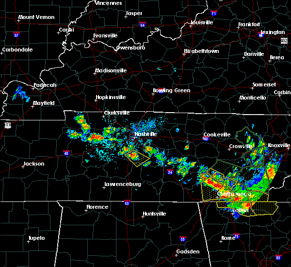 At 939 am cdt, a severe thunderstorm was located near franklin, moving southeast at 25 mph (radar indicated). Hazards include 60 mph wind gusts and quarter size hail. Hail damage to vehicles is expected. Expect wind damage to roofs, siding, and trees. At 939 am cdt, a severe thunderstorm was located near franklin, moving southeast at 25 mph (radar indicated). Hazards include 60 mph wind gusts and quarter size hail. Hail damage to vehicles is expected. Expect wind damage to roofs, siding, and trees.
|
| 2/24/2018 11:12 PM CST |
 At 1111 pm cst, severe thunderstorms were located along a line extending from 6 miles south of tompkinsville to 12 miles south of nolensville, moving east at 45 mph (radar indicated). Hazards include 60 mph wind gusts. Expect damage to roofs, siding, and trees. locations impacted include, murfreesboro, lebanon, lafayette, carthage, celina, gainesboro, hartsville, smyrna, la vergne, spring hill, mount juliet, nolensville, thompson`s station, watertown, gordonsville, red boiling springs, walterhill, rural hill, belinda city and hickman. A tornado watch remains in effect until 200 am cst for middle tennessee. At 1111 pm cst, severe thunderstorms were located along a line extending from 6 miles south of tompkinsville to 12 miles south of nolensville, moving east at 45 mph (radar indicated). Hazards include 60 mph wind gusts. Expect damage to roofs, siding, and trees. locations impacted include, murfreesboro, lebanon, lafayette, carthage, celina, gainesboro, hartsville, smyrna, la vergne, spring hill, mount juliet, nolensville, thompson`s station, watertown, gordonsville, red boiling springs, walterhill, rural hill, belinda city and hickman. A tornado watch remains in effect until 200 am cst for middle tennessee.
|
| 2/24/2018 10:41 PM CST |
 At 1041 pm cst, severe thunderstorms were located along a line extending from 6 miles north of lafayette to near spring hill, moving east at 45 mph (radar indicated). Hazards include 60 mph wind gusts. expect damage to roofs, siding, and trees At 1041 pm cst, severe thunderstorms were located along a line extending from 6 miles north of lafayette to near spring hill, moving east at 45 mph (radar indicated). Hazards include 60 mph wind gusts. expect damage to roofs, siding, and trees
|
| 11/18/2017 4:38 PM CST |
 At 438 pm cst, severe thunderstorms were located along a line extending from portland to thompson`s station, moving east at 50 mph (radar indicated). Hazards include 70 mph wind gusts. Expect considerable tree damage. damage is likely to mobile homes, roofs, and outbuildings. Locations impacted include, murfreesboro, franklin, gallatin, lebanon, springfield, nashville, madison, hendersonville, smyrna, brentwood, la vergne, spring hill, mount juliet, goodlettsville, white house, millersville, greenbrier, nolensville, forest hills and oak hill. At 438 pm cst, severe thunderstorms were located along a line extending from portland to thompson`s station, moving east at 50 mph (radar indicated). Hazards include 70 mph wind gusts. Expect considerable tree damage. damage is likely to mobile homes, roofs, and outbuildings. Locations impacted include, murfreesboro, franklin, gallatin, lebanon, springfield, nashville, madison, hendersonville, smyrna, brentwood, la vergne, spring hill, mount juliet, goodlettsville, white house, millersville, greenbrier, nolensville, forest hills and oak hill.
|
| 11/18/2017 4:25 PM CST |
 At 424 pm cst, severe thunderstorms were located along a line extending from cross plains to leiper`s fork, moving east at 50 mph (radar indicated). Hazards include 70 mph wind gusts. Expect considerable tree damage. Damage is likely to mobile homes, roofs, and outbuildings. At 424 pm cst, severe thunderstorms were located along a line extending from cross plains to leiper`s fork, moving east at 50 mph (radar indicated). Hazards include 70 mph wind gusts. Expect considerable tree damage. Damage is likely to mobile homes, roofs, and outbuildings.
|
| 5/27/2017 9:17 PM CDT |
 At 917 pm cdt, a severe thunderstorm was located 12 miles north of lewisburg, moving east at 40 mph (radar indicated). Hazards include 70 mph wind gusts and quarter size hail. Hail damage to vehicles is expected. expect considerable tree damage. Wind damage is also likely to mobile homes, roofs, and outbuildings. At 917 pm cdt, a severe thunderstorm was located 12 miles north of lewisburg, moving east at 40 mph (radar indicated). Hazards include 70 mph wind gusts and quarter size hail. Hail damage to vehicles is expected. expect considerable tree damage. Wind damage is also likely to mobile homes, roofs, and outbuildings.
|
| 5/27/2017 7:52 PM CDT |
 At 752 pm cdt, a severe thunderstorm was located near gordonsville, or 9 miles southwest of carthage, moving east at 70 mph (radar indicated). Hazards include 70 mph wind gusts and quarter size hail. Hail damage to vehicles is expected. expect considerable tree damage. wind damage is also likely to mobile homes, roofs, and outbuildings. Locations impacted include, murfreesboro, franklin, cookeville, smithville, woodbury, carthage, smyrna, brentwood, la vergne, nolensville, oak hill, algood, watertown, baxter, gordonsville, walterhill, antioch, rural hill, hickman and south carthage. At 752 pm cdt, a severe thunderstorm was located near gordonsville, or 9 miles southwest of carthage, moving east at 70 mph (radar indicated). Hazards include 70 mph wind gusts and quarter size hail. Hail damage to vehicles is expected. expect considerable tree damage. wind damage is also likely to mobile homes, roofs, and outbuildings. Locations impacted include, murfreesboro, franklin, cookeville, smithville, woodbury, carthage, smyrna, brentwood, la vergne, nolensville, oak hill, algood, watertown, baxter, gordonsville, walterhill, antioch, rural hill, hickman and south carthage.
|
| 5/27/2017 7:47 PM CDT |
 At 746 pm cdt, a severe thunderstorm was located near watertown, or 10 miles southeast of lebanon, moving east at 70 mph (radar indicated). Hazards include 70 mph wind gusts and quarter size hail. Hail damage to vehicles is expected. expect considerable tree damage. Wind damage is also likely to mobile homes, roofs, and outbuildings. At 746 pm cdt, a severe thunderstorm was located near watertown, or 10 miles southeast of lebanon, moving east at 70 mph (radar indicated). Hazards include 70 mph wind gusts and quarter size hail. Hail damage to vehicles is expected. expect considerable tree damage. Wind damage is also likely to mobile homes, roofs, and outbuildings.
|
| 4/30/2017 3:19 PM CDT | Friend of nws employee reported trees down in the college grove area in williamson county TN, 3.9 miles SSE of Eagleville, TN |
| 4/30/2017 3:14 PM CDT |
 At 312 pm cdt, severe thunderstorms were located along a line extending from near hermitage to 9 miles east of spring hill, moving northeast at 30 mph (radar indicated. several trees in williamson county have been snapped or downed by this line of storms). Hazards include 60 mph wind gusts. expect damage to roofs, siding, and trees At 312 pm cdt, severe thunderstorms were located along a line extending from near hermitage to 9 miles east of spring hill, moving northeast at 30 mph (radar indicated. several trees in williamson county have been snapped or downed by this line of storms). Hazards include 60 mph wind gusts. expect damage to roofs, siding, and trees
|
| 4/30/2017 3:07 PM CDT |
 At 306 pm cdt, severe thunderstorms were located along a line extending from near antioch to near nolensville, moving northeast at 40 mph (radar indicated. this line of storms has a history of producing damaging wind gusts in franklin and southeastern davidson county). Hazards include 70 mph wind gusts. Expect considerable tree damage. damage is likely to mobile homes, roofs, and outbuildings. locations impacted include, franklin, smyrna, brentwood, la vergne, nolensville, oak hill, antioch, eagleville, berry hill, percy priest lake and triune. A tornado watch remains in effect until 700 pm cdt for middle tennessee. At 306 pm cdt, severe thunderstorms were located along a line extending from near antioch to near nolensville, moving northeast at 40 mph (radar indicated. this line of storms has a history of producing damaging wind gusts in franklin and southeastern davidson county). Hazards include 70 mph wind gusts. Expect considerable tree damage. damage is likely to mobile homes, roofs, and outbuildings. locations impacted include, franklin, smyrna, brentwood, la vergne, nolensville, oak hill, antioch, eagleville, berry hill, percy priest lake and triune. A tornado watch remains in effect until 700 pm cdt for middle tennessee.
|
| 4/30/2017 2:48 PM CDT |
 At 247 pm cdt, severe thunderstorms were located along a line extending from near brentwood to near spring hill, moving northeast at 40 mph (radar indicated). Hazards include 70 mph wind gusts. Expect considerable tree damage. Damage is likely to mobile homes, roofs, and outbuildings. At 247 pm cdt, severe thunderstorms were located along a line extending from near brentwood to near spring hill, moving northeast at 40 mph (radar indicated). Hazards include 70 mph wind gusts. Expect considerable tree damage. Damage is likely to mobile homes, roofs, and outbuildings.
|
| 3/27/2017 3:55 PM CDT |
 At 354 pm cdt, a severe thunderstorm was located 10 miles east of spring hill, or 14 miles south of franklin, moving north at 45 mph (radar indicated). Hazards include 60 mph wind gusts and quarter size hail. Hail damage to vehicles is expected. Expect wind damage to roofs, siding, and trees. At 354 pm cdt, a severe thunderstorm was located 10 miles east of spring hill, or 14 miles south of franklin, moving north at 45 mph (radar indicated). Hazards include 60 mph wind gusts and quarter size hail. Hail damage to vehicles is expected. Expect wind damage to roofs, siding, and trees.
|
| 3/21/2017 4:32 PM CDT |
 At 432 pm cdt, a severe thunderstorm was located 9 miles southeast of spring hill, or 12 miles north of lewisburg, moving east at 30 mph (radar indicated). Hazards include 60 mph wind gusts and quarter size hail. Hail damage to vehicles is expected. expect wind damage to roofs, siding, and trees. Locations impacted include, chapel hill, eagleville, rover and farmington. At 432 pm cdt, a severe thunderstorm was located 9 miles southeast of spring hill, or 12 miles north of lewisburg, moving east at 30 mph (radar indicated). Hazards include 60 mph wind gusts and quarter size hail. Hail damage to vehicles is expected. expect wind damage to roofs, siding, and trees. Locations impacted include, chapel hill, eagleville, rover and farmington.
|
| 3/21/2017 4:30 PM CDT | Photo showed a barn was destroyed near college grove in williamson county TN, 3.9 miles SSE of Eagleville, TN |
| 3/21/2017 4:30 PM CDT |
 At 430 pm cdt, a severe thunderstorm was located 9 miles southeast of spring hill, or 13 miles east of columbia, moving east at 45 mph (radar indicated). Hazards include 60 mph wind gusts and quarter size hail. Hail damage to vehicles is expected. Expect wind damage to roofs, siding, and trees. At 430 pm cdt, a severe thunderstorm was located 9 miles southeast of spring hill, or 13 miles east of columbia, moving east at 45 mph (radar indicated). Hazards include 60 mph wind gusts and quarter size hail. Hail damage to vehicles is expected. Expect wind damage to roofs, siding, and trees.
|
| 3/21/2017 4:07 PM CDT |
 At 406 pm cdt, a severe thunderstorm was located over columbia, moving east at 30 mph (radar indicated). Hazards include 60 mph wind gusts and quarter size hail. Hail damage to vehicles is expected. Expect wind damage to roofs, siding, and trees. At 406 pm cdt, a severe thunderstorm was located over columbia, moving east at 30 mph (radar indicated). Hazards include 60 mph wind gusts and quarter size hail. Hail damage to vehicles is expected. Expect wind damage to roofs, siding, and trees.
|
| 3/9/2017 11:18 PM CST |
 At 1118 pm cst, a severe thunderstorm was located 11 miles south of nolensville, or 14 miles southeast of franklin, moving east at 50 mph (radar indicated). Hazards include 60 mph wind gusts. expect damage to roofs, siding, and trees At 1118 pm cst, a severe thunderstorm was located 11 miles south of nolensville, or 14 miles southeast of franklin, moving east at 50 mph (radar indicated). Hazards include 60 mph wind gusts. expect damage to roofs, siding, and trees
|
| 3/9/2017 9:39 PM CST |
 At 939 pm cst, a severe thunderstorm was located 13 miles southeast of spring hill, or 14 miles north of lewisburg, moving northeast at 55 mph (radar indicated). Hazards include 60 mph wind gusts and quarter size hail. Hail damage to vehicles is expected. Expect wind damage to roofs, siding, and trees. At 939 pm cst, a severe thunderstorm was located 13 miles southeast of spring hill, or 14 miles north of lewisburg, moving northeast at 55 mph (radar indicated). Hazards include 60 mph wind gusts and quarter size hail. Hail damage to vehicles is expected. Expect wind damage to roofs, siding, and trees.
|
| 3/1/2017 10:46 AM CST |
 At 1045 am cst, a severe thunderstorm was located 16 miles northwest of shelbyville, moving east at 60 mph (radar indicated). Hazards include 60 mph wind gusts and quarter size hail. Hail damage to vehicles is expected. expect wind damage to roofs, siding, and trees. Locations impacted include, murfreesboro, chapel hill, eagleville, rover, christiana, rockvale, unionville and fosterville. At 1045 am cst, a severe thunderstorm was located 16 miles northwest of shelbyville, moving east at 60 mph (radar indicated). Hazards include 60 mph wind gusts and quarter size hail. Hail damage to vehicles is expected. expect wind damage to roofs, siding, and trees. Locations impacted include, murfreesboro, chapel hill, eagleville, rover, christiana, rockvale, unionville and fosterville.
|
| 3/1/2017 10:35 AM CST |
 At 1035 am cst, a severe thunderstorm was located 10 miles southeast of spring hill, or 12 miles north of lewisburg, moving east at 65 mph (radar indicated). Hazards include 60 mph wind gusts and quarter size hail. Hail damage to vehicles is expected. Expect wind damage to roofs, siding, and trees. At 1035 am cst, a severe thunderstorm was located 10 miles southeast of spring hill, or 12 miles north of lewisburg, moving east at 65 mph (radar indicated). Hazards include 60 mph wind gusts and quarter size hail. Hail damage to vehicles is expected. Expect wind damage to roofs, siding, and trees.
|
| 2/7/2017 10:25 AM CST |
 At 1024 am cst, severe thunderstorms were located along a line extending from hendersonville to thompson`s station, moving east at 50 mph (radar indicated). Hazards include 60 mph wind gusts and penny size hail. Expect damage to roofs, siding, and trees. Locations impacted include, murfreesboro, franklin, gallatin, lebanon, nashville, madison, hendersonville, smyrna, brentwood, la vergne, spring hill, mount juliet, goodlettsville, millersville, nolensville, forest hills, oak hill, belle meade, lakewood and thompson`s station. At 1024 am cst, severe thunderstorms were located along a line extending from hendersonville to thompson`s station, moving east at 50 mph (radar indicated). Hazards include 60 mph wind gusts and penny size hail. Expect damage to roofs, siding, and trees. Locations impacted include, murfreesboro, franklin, gallatin, lebanon, nashville, madison, hendersonville, smyrna, brentwood, la vergne, spring hill, mount juliet, goodlettsville, millersville, nolensville, forest hills, oak hill, belle meade, lakewood and thompson`s station.
|
| 2/7/2017 10:11 AM CST |
 At 1010 am cst, severe thunderstorms were located along a line extending from near joelton to near franklin, moving east at 50 mph (radar indicated). Hazards include 70 mph wind gusts. Expect considerable tree damage. Damage is likely to mobile homes, roofs, and outbuildings. At 1010 am cst, severe thunderstorms were located along a line extending from near joelton to near franklin, moving east at 50 mph (radar indicated). Hazards include 70 mph wind gusts. Expect considerable tree damage. Damage is likely to mobile homes, roofs, and outbuildings.
|
| 12/18/2016 12:59 AM CST |
 At 1258 am cst, a severe thunderstorm was located near lewisburg, moving northeast at 70 mph. another cell was located southwest of chapel hill (radar indicated). Hazards include 60 mph wind gusts. expect damage to roofs, siding, and trees At 1258 am cst, a severe thunderstorm was located near lewisburg, moving northeast at 70 mph. another cell was located southwest of chapel hill (radar indicated). Hazards include 60 mph wind gusts. expect damage to roofs, siding, and trees
|
| 12/18/2016 12:52 AM CST |
 At 1250 am cst, a severe thunderstorm was located near lewisburg, moving northeast at 70 mph (radar indicated). Hazards include 60 mph wind gusts. Expect damage to roofs, siding, and trees. locations impacted include, shelbyville, lewisburg, chapel hill, cornersville, wartrace, eagleville, bell buckle, lynnville, christiana, belfast, farmington, raus, unionville, fosterville, rockvale, deason and rover. A tornado watch remains in effect until 300 am cst for middle tennessee. At 1250 am cst, a severe thunderstorm was located near lewisburg, moving northeast at 70 mph (radar indicated). Hazards include 60 mph wind gusts. Expect damage to roofs, siding, and trees. locations impacted include, shelbyville, lewisburg, chapel hill, cornersville, wartrace, eagleville, bell buckle, lynnville, christiana, belfast, farmington, raus, unionville, fosterville, rockvale, deason and rover. A tornado watch remains in effect until 300 am cst for middle tennessee.
|
| 12/18/2016 12:38 AM CST |
 At 1237 am cst, a severe thunderstorm was located near pulaski, moving northeast at 70 mph. another cell was located near lynnville moving northeast at 70 mph (radar indicated). Hazards include 60 mph wind gusts. expect damage to roofs, siding, and trees At 1237 am cst, a severe thunderstorm was located near pulaski, moving northeast at 70 mph. another cell was located near lynnville moving northeast at 70 mph (radar indicated). Hazards include 60 mph wind gusts. expect damage to roofs, siding, and trees
|
| 9/10/2016 5:05 PM CDT | Tree down on pulltight hill road near bethesda in williamson county TN, 5 miles ESE of Eagleville, TN |
| 8/20/2016 4:01 PM CDT |
 At 401 pm cdt, a severe thunderstorm was located near franklin, moving east at 45 mph (radar indicated). Hazards include 60 mph wind gusts. Expect damage to roofs. siding. And trees. At 401 pm cdt, a severe thunderstorm was located near franklin, moving east at 45 mph (radar indicated). Hazards include 60 mph wind gusts. Expect damage to roofs. siding. And trees.
|
| 8/20/2016 3:53 PM CDT | A few trees were blown down on harpeth peytonsville road in college grov in williamson county TN, 5.4 miles SSE of Eagleville, TN |
| 7/8/2016 9:31 PM CDT |
 At 931 pm cdt, severe thunderstorms were located along a line extending from near murfreesboro to near petersburg, moving east at 45 mph (radar indicated). Hazards include 70 mph wind gusts and penny size hail. Expect considerable tree damage. Damage is likely to mobile homes, roofs, and outbuildings. At 931 pm cdt, severe thunderstorms were located along a line extending from near murfreesboro to near petersburg, moving east at 45 mph (radar indicated). Hazards include 70 mph wind gusts and penny size hail. Expect considerable tree damage. Damage is likely to mobile homes, roofs, and outbuildings.
|
| 7/8/2016 9:10 PM CDT |
 At 909 pm cdt, severe thunderstorms were located along a line extending from lafayette to thompson`s station, moving east at 60 mph (trained weather spotters. numerous trees and power lines have been blown down with these storms all across the nashville metro area). Hazards include 70 mph wind gusts and quarter size hail. Hail damage to vehicles is expected. expect considerable tree damage. wind damage is also likely to mobile homes, roofs, and outbuildings. Locations impacted include, murfreesboro, franklin, gallatin, lebanon, lafayette, carthage, hartsville, nashville, madison, hendersonville, smyrna, brentwood, la vergne, spring hill, mount juliet, goodlettsville, white house, nolensville, forest hills and oak hill. At 909 pm cdt, severe thunderstorms were located along a line extending from lafayette to thompson`s station, moving east at 60 mph (trained weather spotters. numerous trees and power lines have been blown down with these storms all across the nashville metro area). Hazards include 70 mph wind gusts and quarter size hail. Hail damage to vehicles is expected. expect considerable tree damage. wind damage is also likely to mobile homes, roofs, and outbuildings. Locations impacted include, murfreesboro, franklin, gallatin, lebanon, lafayette, carthage, hartsville, nashville, madison, hendersonville, smyrna, brentwood, la vergne, spring hill, mount juliet, goodlettsville, white house, nolensville, forest hills and oak hill.
|
| 7/8/2016 9:08 PM CDT |
 At 907 pm cdt, a severe thunderstorm was located 9 miles southeast of spring hill, or 15 miles east of columbia, moving east at 30 mph (radar indicated). Hazards include 60 mph wind gusts and quarter size hail. Hail damage to vehicles is expected. Expect wind damage to roofs, siding, and trees. At 907 pm cdt, a severe thunderstorm was located 9 miles southeast of spring hill, or 15 miles east of columbia, moving east at 30 mph (radar indicated). Hazards include 60 mph wind gusts and quarter size hail. Hail damage to vehicles is expected. Expect wind damage to roofs, siding, and trees.
|
| 7/8/2016 9:06 PM CDT |
 At 905 pm cdt, severe thunderstorms were located along a line extending from westmoreland to near thompson`s station, moving east at 45 mph (trained spotters. at 9 pm cdt...60 mph winds were estimated at the nws nashville office in old hickory. numerous trees and power lines have been blown down with these storms across the nashville metro area). Hazards include 60 mph wind gusts and quarter size hail. Hail damage to vehicles is expected. expect wind damage to roofs, siding, and trees. Locations impacted include, murfreesboro, franklin, gallatin, lebanon, lafayette, carthage, hartsville, nashville, madison, hendersonville, smyrna, brentwood, la vergne, spring hill, mount juliet, goodlettsville, white house, nolensville, forest hills and oak hill. At 905 pm cdt, severe thunderstorms were located along a line extending from westmoreland to near thompson`s station, moving east at 45 mph (trained spotters. at 9 pm cdt...60 mph winds were estimated at the nws nashville office in old hickory. numerous trees and power lines have been blown down with these storms across the nashville metro area). Hazards include 60 mph wind gusts and quarter size hail. Hail damage to vehicles is expected. expect wind damage to roofs, siding, and trees. Locations impacted include, murfreesboro, franklin, gallatin, lebanon, lafayette, carthage, hartsville, nashville, madison, hendersonville, smyrna, brentwood, la vergne, spring hill, mount juliet, goodlettsville, white house, nolensville, forest hills and oak hill.
|
| 7/8/2016 8:50 PM CDT |
 At 849 pm cdt, severe thunderstorms were located along a line extending from portland to near thompson`s station, moving east at 55 mph (radar indicated). Hazards include 60 mph wind gusts and quarter size hail. Hail damage to vehicles is expected. Expect wind damage to roofs, siding, and trees. At 849 pm cdt, severe thunderstorms were located along a line extending from portland to near thompson`s station, moving east at 55 mph (radar indicated). Hazards include 60 mph wind gusts and quarter size hail. Hail damage to vehicles is expected. Expect wind damage to roofs, siding, and trees.
|
| 7/7/2016 6:55 AM CDT |
 At 655 am cdt, a severe thunderstorm was located 12 miles southwest of murfreesboro, moving east at 40 mph (radar indicated). Hazards include 60 mph wind gusts. Expect damage to roofs. siding. And trees. At 655 am cdt, a severe thunderstorm was located 12 miles southwest of murfreesboro, moving east at 40 mph (radar indicated). Hazards include 60 mph wind gusts. Expect damage to roofs. siding. And trees.
|
| 7/6/2016 5:44 PM CDT |
 At 543 pm cdt, severe thunderstorms were located along a line extending from bell buckle to interstate 65, moving southeast at 30 mph (radar indicated). Hazards include 60 mph wind gusts and penny size hail. Expect damage to roofs. siding. and trees. Locations impacted include, shelbyville, spring hill, chapel hill, wartrace, eagleville, bell buckle, unionville, fosterville, rockvale, farmington, deason and rover. At 543 pm cdt, severe thunderstorms were located along a line extending from bell buckle to interstate 65, moving southeast at 30 mph (radar indicated). Hazards include 60 mph wind gusts and penny size hail. Expect damage to roofs. siding. and trees. Locations impacted include, shelbyville, spring hill, chapel hill, wartrace, eagleville, bell buckle, unionville, fosterville, rockvale, farmington, deason and rover.
|
| 7/6/2016 5:23 PM CDT |
 At 523 pm cdt, severe thunderstorms were located along a line extending from near eagleville to near columbia, moving southeast at 35 mph (radar indicated). Hazards include 60 mph wind gusts and penny size hail. Expect damage to roofs. siding. And trees. At 523 pm cdt, severe thunderstorms were located along a line extending from near eagleville to near columbia, moving southeast at 35 mph (radar indicated). Hazards include 60 mph wind gusts and penny size hail. Expect damage to roofs. siding. And trees.
|
| 7/6/2016 5:15 PM CDT |
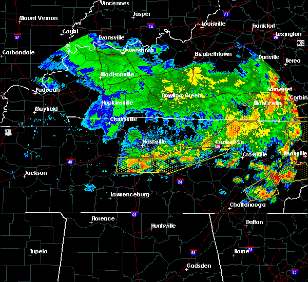 At 514 pm cdt, severe thunderstorms were located along a line extending from near nolensville to near thompson`s station, moving east at 30 mph (radar indicated). Hazards include 60 mph wind gusts and penny size hail. Expect damage to roofs. siding. and trees. Locations impacted include, franklin, columbia, brentwood, spring hill, nolensville, thompson`s station, eagleville, christiana, triune, santa fe, leipers fork, rockvale and thompsons station. At 514 pm cdt, severe thunderstorms were located along a line extending from near nolensville to near thompson`s station, moving east at 30 mph (radar indicated). Hazards include 60 mph wind gusts and penny size hail. Expect damage to roofs. siding. and trees. Locations impacted include, franklin, columbia, brentwood, spring hill, nolensville, thompson`s station, eagleville, christiana, triune, santa fe, leipers fork, rockvale and thompsons station.
|
| 7/6/2016 4:58 PM CDT |
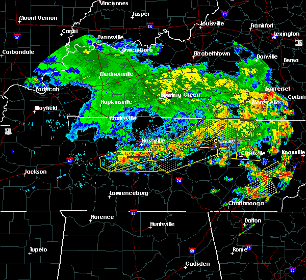 At 457 pm cdt, severe thunderstorms were located along a line extending from near antioch to fairview, moving east at 40 mph (radar indicated). Hazards include 60 mph wind gusts and penny size hail. Expect damage to roofs. siding. And trees. At 457 pm cdt, severe thunderstorms were located along a line extending from near antioch to fairview, moving east at 40 mph (radar indicated). Hazards include 60 mph wind gusts and penny size hail. Expect damage to roofs. siding. And trees.
|
| 6/28/2016 6:06 PM CDT |
 At 606 pm cdt, a severe thunderstorm was located 14 miles south of nolensville, or 16 miles southeast of franklin, moving south at 20 mph (radar indicated). Hazards include 60 mph wind gusts. Expect damage to roofs. siding. and trees. Locations impacted include, shelbyville, lewisburg, chapel hill, eagleville, unionville, rockvale, farmington, deason and rover. At 606 pm cdt, a severe thunderstorm was located 14 miles south of nolensville, or 16 miles southeast of franklin, moving south at 20 mph (radar indicated). Hazards include 60 mph wind gusts. Expect damage to roofs. siding. and trees. Locations impacted include, shelbyville, lewisburg, chapel hill, eagleville, unionville, rockvale, farmington, deason and rover.
|
| 6/28/2016 5:53 PM CDT |
 At 553 pm cdt, a severe thunderstorm was located 10 miles south of nolensville, or 12 miles southeast of franklin, moving south at 40 mph (radar indicated). Hazards include 60 mph wind gusts and penny size hail. Expect damage to roofs. siding. And trees. At 553 pm cdt, a severe thunderstorm was located 10 miles south of nolensville, or 12 miles southeast of franklin, moving south at 40 mph (radar indicated). Hazards include 60 mph wind gusts and penny size hail. Expect damage to roofs. siding. And trees.
|
| 6/15/2016 5:12 PM CDT |
 At 511 pm cdt, severe thunderstorms were located along a line extending from 8 miles northeast of woodbury to 14 miles southeast of murfreesboro to 9 miles northwest of shelbyville, moving southeast at 35 mph (radar indicated). Hazards include 60 mph wind gusts. Expect damage to roofs. siding. and trees. Locations impacted include, murfreesboro, shelbyville, mcminnville, manchester, woodbury, morrison, wartrace, eagleville, bell buckle, auburntown, centertown, normandy, summitville, unionville, fosterville, readyville, beechgrove, deason, christiana and bradyville. At 511 pm cdt, severe thunderstorms were located along a line extending from 8 miles northeast of woodbury to 14 miles southeast of murfreesboro to 9 miles northwest of shelbyville, moving southeast at 35 mph (radar indicated). Hazards include 60 mph wind gusts. Expect damage to roofs. siding. and trees. Locations impacted include, murfreesboro, shelbyville, mcminnville, manchester, woodbury, morrison, wartrace, eagleville, bell buckle, auburntown, centertown, normandy, summitville, unionville, fosterville, readyville, beechgrove, deason, christiana and bradyville.
|
| 6/15/2016 4:53 PM CDT |
 At 452 pm cdt, severe thunderstorms were located along a line extending from near watertown to 6 miles east of murfreesboro to 13 miles east of spring hill, moving southeast at 45 mph (radar indicated). Hazards include 60 mph wind gusts. Expect damage to roofs. siding. And trees. At 452 pm cdt, severe thunderstorms were located along a line extending from near watertown to 6 miles east of murfreesboro to 13 miles east of spring hill, moving southeast at 45 mph (radar indicated). Hazards include 60 mph wind gusts. Expect damage to roofs. siding. And trees.
|
| 6/15/2016 4:49 PM CDT |
 At 449 pm cdt, a severe thunderstorm was located 8 miles west of murfreesboro, moving southeast at 50 mph (radar indicated). Hazards include 60 mph wind gusts. Expect damage to roofs. siding. and trees. Locations impacted include, murfreesboro, smyrna, la vergne, nolensville, eagleville, triune and rockvale. At 449 pm cdt, a severe thunderstorm was located 8 miles west of murfreesboro, moving southeast at 50 mph (radar indicated). Hazards include 60 mph wind gusts. Expect damage to roofs. siding. and trees. Locations impacted include, murfreesboro, smyrna, la vergne, nolensville, eagleville, triune and rockvale.
|
| 6/15/2016 4:32 PM CDT |
 At 432 pm cdt, a severe thunderstorm was located near nolensville, or 7 miles east of franklin, moving southeast at 50 mph (radar indicated). Hazards include 60 mph wind gusts. Expect damage to roofs. siding. And trees. At 432 pm cdt, a severe thunderstorm was located near nolensville, or 7 miles east of franklin, moving southeast at 50 mph (radar indicated). Hazards include 60 mph wind gusts. Expect damage to roofs. siding. And trees.
|
| 12/23/2015 8:44 PM CST | At 844 pm cst, a severe thunderstorm capable of producing a tornado was located 12 miles south of nolensville, or 14 miles southwest of murfreesboro, moving northeast at 60 mph (radar indicated rotation). Hazards include tornado and quarter size hail. Flying debris will be dangerous to those caught without shelter. mobile homes will be damaged or destroyed. damage to roofs, windows and vehicles will occur. tree damage is likely. Locations impacted include, eagleville and rockvale. |
| 12/23/2015 8:35 PM CST | At 834 pm cst, a severe thunderstorm capable of producing a tornado was located 9 miles southeast of spring hill, or 15 miles east of columbia, moving northeast at 60 mph (radar indicated rotation). Hazards include tornado and quarter size hail. Flying debris will be dangerous to those caught without shelter. mobile homes will be damaged or destroyed. damage to roofs, windows and vehicles will occur. tree damage is likely. this tornadic thunderstorm will remain over mainly rural areas of southwestern rutherford, southeastern williamson and north central marshall counties, including the following locations, rockvale and eagleville. The rotation appears to be strengthening so take shelter immediately!. |
| 12/23/2015 8:24 PM CST | At 823 pm cst, a severe thunderstorm capable of producing a tornado was located near columbia, moving northeast at 60 mph (radar indicated rotation). Hazards include tornado and quarter size hail. Flying debris will be dangerous to those caught without shelter. mobile homes will be damaged or destroyed. damage to roofs, windows and vehicles will occur. tree damage is likely. This tornadic thunderstorm will remain over mainly rural areas of southwestern rutherford, southeastern williamson, east central maury and north central marshall counties, including the following locations, i-65 east of columbia, rockvale and eagleville. |
| 8/15/2015 2:27 PM CDT | The severe thunderstorm warning for southeastern williamson and southwestern rutherford counties will expire at 230 pm cdt, the storm which prompted the warning has weakened below severe limits, and no longer poses an immediate threat to life or property. therefore the warning will be allowed to expire. however heavy rain is still possible with this thunderstorm. |
| 8/15/2015 2:11 PM CDT |
 At 210 pm cdt, a severe thunderstorm was located 8 miles southeast of nolensville, or 10 miles west of murfreesboro, and is nearly stationary (radar indicated). Hazards include 60 mph wind gusts and quarter size hail. Hail damage to vehicles is expected. Expect wind damage to roofs, siding and trees. At 210 pm cdt, a severe thunderstorm was located 8 miles southeast of nolensville, or 10 miles west of murfreesboro, and is nearly stationary (radar indicated). Hazards include 60 mph wind gusts and quarter size hail. Hail damage to vehicles is expected. Expect wind damage to roofs, siding and trees.
|
| 8/15/2015 2:06 PM CDT |
 At 205 pm cdt, a severe thunderstorm was located 9 miles west of murfreesboro, and is nearly stationary (radar indicated. at 200 pm...nickel size hail was reported at rockvale). Hazards include 60 mph wind gusts and quarter size hail. Hail damage to vehicles is expected. expect wind damage to roofs, siding and trees. Locations impacted include, murfreesboro, nolensville, eagleville, rockvale and triune. At 205 pm cdt, a severe thunderstorm was located 9 miles west of murfreesboro, and is nearly stationary (radar indicated. at 200 pm...nickel size hail was reported at rockvale). Hazards include 60 mph wind gusts and quarter size hail. Hail damage to vehicles is expected. expect wind damage to roofs, siding and trees. Locations impacted include, murfreesboro, nolensville, eagleville, rockvale and triune.
|
| 8/15/2015 1:52 PM CDT |
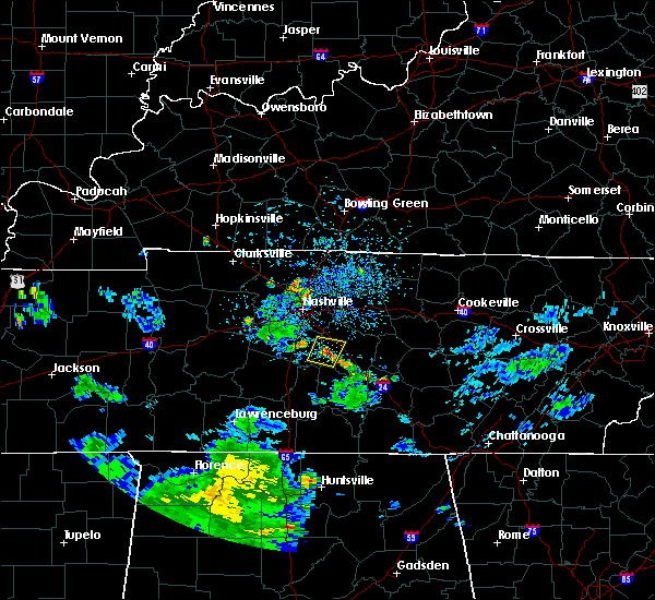 At 151 pm cdt, a severe thunderstorm was located 9 miles west of murfreesboro, and is nearly stationary (radar indicated). Hazards include 60 mph wind gusts and nickel size hail. Expect damage to roofs. Siding and trees. At 151 pm cdt, a severe thunderstorm was located 9 miles west of murfreesboro, and is nearly stationary (radar indicated). Hazards include 60 mph wind gusts and nickel size hail. Expect damage to roofs. Siding and trees.
|
| 7/28/2015 4:38 PM CDT |
 At 436 pm cdt, a severe thunderstorm was located over nolensville, or 12 miles east of franklin, moving south at 30 mph (radar indicated). Hazards include 60 mph wind gusts and penny size hail. Expect damage to roofs. siding and trees. this severe thunderstorm will be near, almaville around 445 pm cdt. Other locations impacted by this severe thunderstorm include rockvale, eagleville and triune. At 436 pm cdt, a severe thunderstorm was located over nolensville, or 12 miles east of franklin, moving south at 30 mph (radar indicated). Hazards include 60 mph wind gusts and penny size hail. Expect damage to roofs. siding and trees. this severe thunderstorm will be near, almaville around 445 pm cdt. Other locations impacted by this severe thunderstorm include rockvale, eagleville and triune.
|
| 4/10/2015 2:39 AM CDT | A severe thunderstorm warning remains in effect for northeastern maury. southeastern davidson. western wilson. eastern williamson and northwestern rutherford counties until 300 am cdt. at 238 am cdt. severe thunderstorms were located along a line extending from nolensville to spring hill. And moving northeast at 60 mph. |
| 4/10/2015 2:23 AM CDT | The national weather service in nashville has issued a * severe thunderstorm warning for. southern davidson county in middle tennessee. northern maury county in middle tennessee. northwestern rutherford county in middle tennessee. Williamson county in middle tennessee. |
| 8/23/2014 5:28 PM CDT | 60 ft trees reported dow in williamson county TN, 3.8 miles ENE of Eagleville, TN |
| 6/7/2014 6:55 PM CDT | Large trees reportedly blown down near eagleville in rutherford county TN, 1.7 miles SSW of Eagleville, TN |
| 2/20/2014 8:10 PM CST | Trained spotter reported trees down on horton highway near college grove in williamson county TN, 5.2 miles SE of Eagleville, TN |
| 10/31/2013 11:15 PM CDT | Tree down and blocking roadway at choctaw and giles hill road in college grove in williamson county TN, 5.3 miles E of Eagleville, TN |
| 1/30/2013 3:45 AM CST | Possible tornado damage. a horse farm had building damage. porch on the house was destroyed. sheet metal and lumber debris scattere in rutherford county TN, 0.4 miles SW of Eagleville, TN |
| 1/13/2013 4:32 PM CST | Possible tornado damage. abandoned house with roof damage and trees down. 896 floyd rd. 2 m south of eagleville near chapel hill r in rutherford county TN, 1.2 miles NNW of Eagleville, TN |
| 1/13/2013 3:27 PM CST | At 896 floyd rd.... portion of a roof missing and trees down in the are in rutherford county TN, 0.4 miles SW of Eagleville, TN |
| 3/15/2012 5:30 PM CDT | Tree blown down on patton road in williamson county TN, 7.4 miles SSE of Eagleville, TN |
| 1/1/0001 12:00 AM | Highway 41 at the rutherford/bedford county in rutherford county TN, 0.4 miles SW of Eagleville, TN |
Hail Maps for Eagleville, TN


Connect with Interactive Hail Maps