

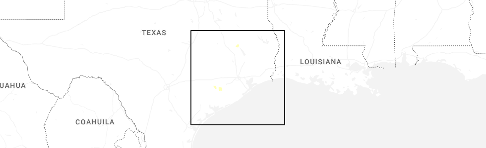
Hail Map for El Campo, TX
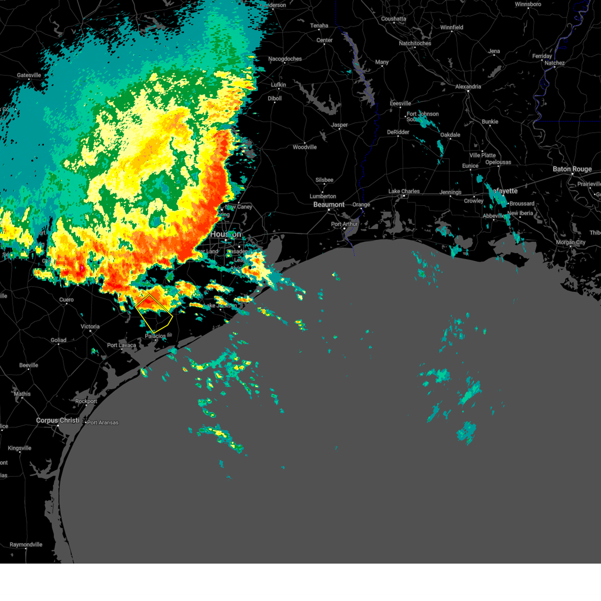
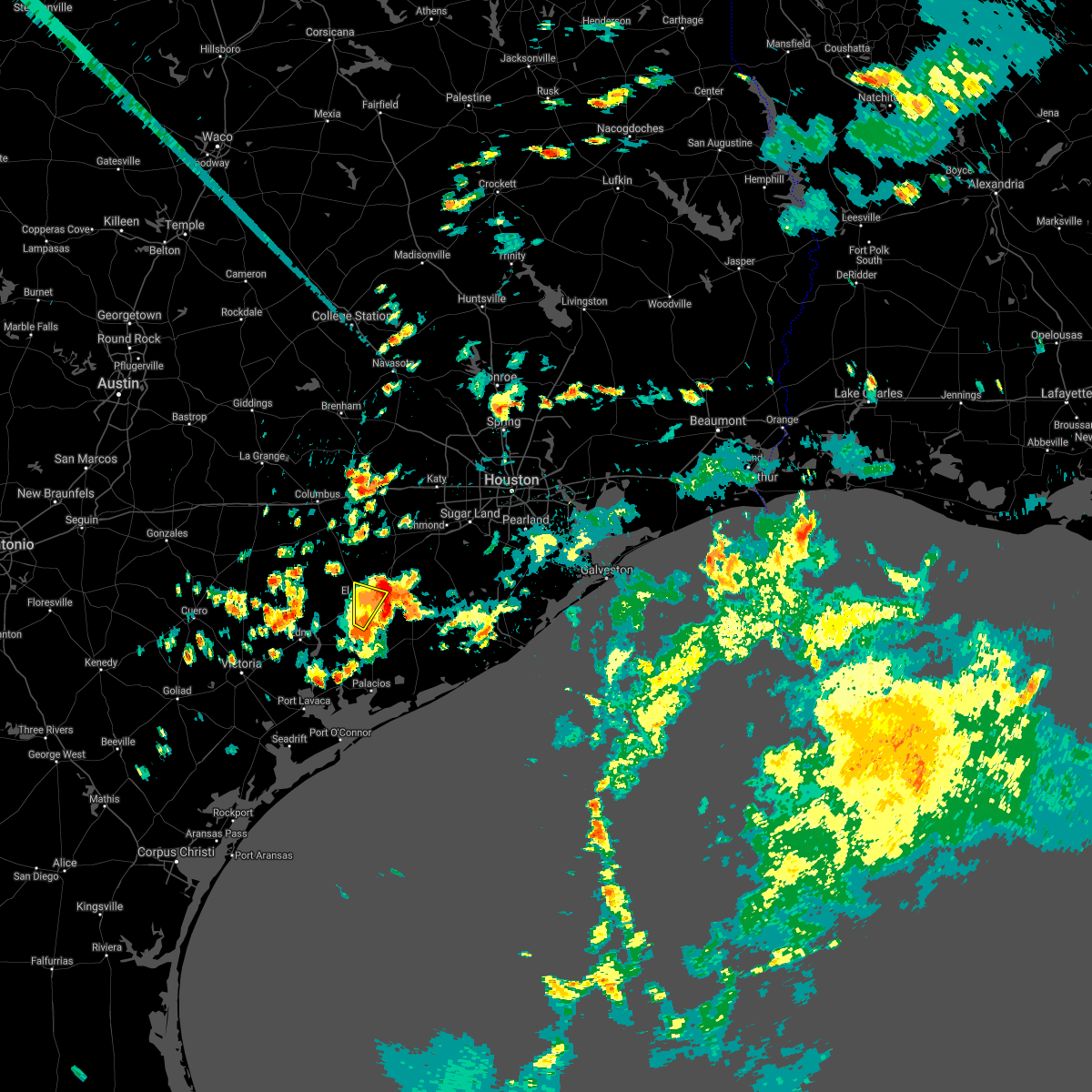
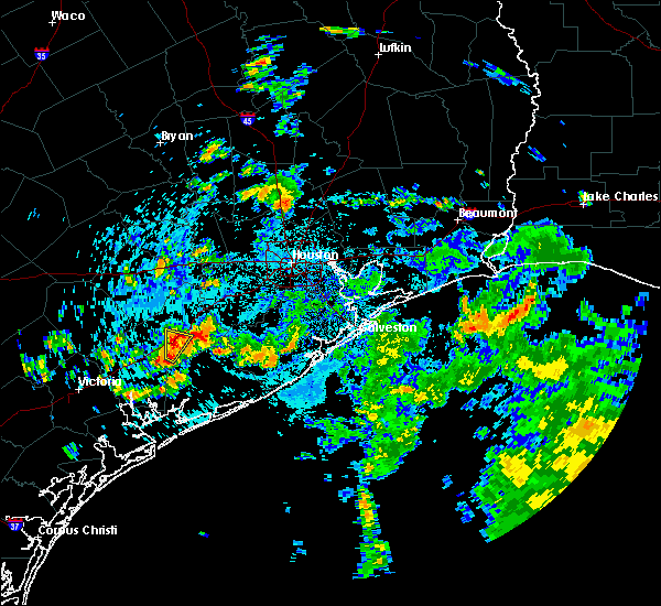
The El Campo, TX area has had 1 report of on-the-ground hail by trained spotters, and has been under severe weather warnings 3 times during the past 12 months. Doppler radar has detected hail at or near El Campo, TX on 30 occasions, including 1 occasion during the past year.
| Name: | El Campo, TX |
| Where Located: | 66.8 miles SW of Houston, TX |
| Map: | Google Map for El Campo, TX |
| Population: | 11602 |
| Housing Units: | 4491 |
| More Info: | Search Google for El Campo, TX |
0
The Top Recent Hail Date for El Campo, TX is Friday, May 30, 2025 (30th out of 30)
Hail and Wind Damage Spotted near El Campo, TX
| Date / Time | Report Details |
|---|---|
| 12/26/2024 2:32 PM CST |
 the tornado warning has been cancelled and is no longer in effect the tornado warning has been cancelled and is no longer in effect
|
| 12/26/2024 2:19 PM CST |
 At 217 pm cst, a severe thunderstorm capable of producing a tornado was located near el campo, moving northeast at 25 mph. a second thunderstorm capable of producing a tornado is located in eastern wharton county (radar indicated rotation). Hazards include tornado. Flying debris will be dangerous to those caught without shelter. mobile homes will be damaged or destroyed. damage to roofs, windows, and vehicles will occur. tree damage is likely. this dangerous storm will be near, el campo and pierce around 220 pm cst. wharton around 225 pm cst. Other locations impacted by this tornadic thunderstorm include hungerford. At 217 pm cst, a severe thunderstorm capable of producing a tornado was located near el campo, moving northeast at 25 mph. a second thunderstorm capable of producing a tornado is located in eastern wharton county (radar indicated rotation). Hazards include tornado. Flying debris will be dangerous to those caught without shelter. mobile homes will be damaged or destroyed. damage to roofs, windows, and vehicles will occur. tree damage is likely. this dangerous storm will be near, el campo and pierce around 220 pm cst. wharton around 225 pm cst. Other locations impacted by this tornadic thunderstorm include hungerford.
|
| 12/26/2024 2:15 PM CST |
 Torhgx the national weather service in league city has issued a * tornado warning for, east central wharton county in southeastern texas, * until 245 pm cst. * at 214 pm cst, a severe thunderstorm capable of producing a tornado was located over el campo, moving northeast at 25 mph (radar indicated rotation). Hazards include tornado. Flying debris will be dangerous to those caught without shelter. mobile homes will be damaged or destroyed. damage to roofs, windows, and vehicles will occur. tree damage is likely. this dangerous storm will be near, el campo and pierce around 220 pm cst. wharton around 225 pm cst. Other locations impacted by this tornadic thunderstorm include hungerford. Torhgx the national weather service in league city has issued a * tornado warning for, east central wharton county in southeastern texas, * until 245 pm cst. * at 214 pm cst, a severe thunderstorm capable of producing a tornado was located over el campo, moving northeast at 25 mph (radar indicated rotation). Hazards include tornado. Flying debris will be dangerous to those caught without shelter. mobile homes will be damaged or destroyed. damage to roofs, windows, and vehicles will occur. tree damage is likely. this dangerous storm will be near, el campo and pierce around 220 pm cst. wharton around 225 pm cst. Other locations impacted by this tornadic thunderstorm include hungerford.
|
| 5/31/2024 6:46 AM CDT |
 Svrhgx the national weather service in league city has issued a * severe thunderstorm warning for, south central wharton county in southeastern texas, east central jackson county in south central texas, northwestern matagorda county in southeastern texas, * until 715 am cdt. * at 645 am cdt, a severe thunderstorm was located 11 miles south of el campo, moving southeast at 15 mph (radar indicated). Hazards include 60 mph wind gusts and nickel size hail. expect damage to roofs, siding, and trees Svrhgx the national weather service in league city has issued a * severe thunderstorm warning for, south central wharton county in southeastern texas, east central jackson county in south central texas, northwestern matagorda county in southeastern texas, * until 715 am cdt. * at 645 am cdt, a severe thunderstorm was located 11 miles south of el campo, moving southeast at 15 mph (radar indicated). Hazards include 60 mph wind gusts and nickel size hail. expect damage to roofs, siding, and trees
|
| 12/9/2023 5:59 PM CST |
 At 558 pm cst, a severe thunderstorm was located over el campo, moving east at 30 mph (radar indicated). Hazards include quarter size hail. damage to vehicles is expected At 558 pm cst, a severe thunderstorm was located over el campo, moving east at 30 mph (radar indicated). Hazards include quarter size hail. damage to vehicles is expected
|
| 10/5/2023 8:39 AM CDT |
 At 839 am cdt, severe thunderstorms were located along a line extending from near wharton to 8 miles south of el campo to near lolita, moving southeast at 40 mph (radar indicated). Hazards include 60 mph wind gusts. Expect damage to roofs, siding, and trees. locations impacted include, el campo, edna, ganado, la ward, pierce, lolita, blessing, markham, cordele, vanderbilt, louise, midfield, lake texana dam, and danevang. hail threat, radar indicated max hail size, <. 75 in wind threat, observed max wind gust, 60 mph. At 839 am cdt, severe thunderstorms were located along a line extending from near wharton to 8 miles south of el campo to near lolita, moving southeast at 40 mph (radar indicated). Hazards include 60 mph wind gusts. Expect damage to roofs, siding, and trees. locations impacted include, el campo, edna, ganado, la ward, pierce, lolita, blessing, markham, cordele, vanderbilt, louise, midfield, lake texana dam, and danevang. hail threat, radar indicated max hail size, <. 75 in wind threat, observed max wind gust, 60 mph.
|
| 10/5/2023 8:21 AM CDT |
 At 820 am cdt, severe thunderstorms were located along a line extending from near pierce to near ganado to near inez, moving east at 40 mph. at 812 am cdt, victoria reported a 61 mph gust with this line of storms (radar indicated). Hazards include 60 mph wind gusts. expect damage to roofs, siding, and trees At 820 am cdt, severe thunderstorms were located along a line extending from near pierce to near ganado to near inez, moving east at 40 mph. at 812 am cdt, victoria reported a 61 mph gust with this line of storms (radar indicated). Hazards include 60 mph wind gusts. expect damage to roofs, siding, and trees
|
| 4/21/2023 3:27 AM CDT |
 At 326 am cdt, severe thunderstorms were located along a line extending from near kendleton to near wharton to 6 miles south of pierce to 9 miles east of ganado, moving east at 45 mph (radar indicated). Hazards include 60 mph wind gusts and penny size hail. expect damage to roofs, siding, and trees At 326 am cdt, severe thunderstorms were located along a line extending from near kendleton to near wharton to 6 miles south of pierce to 9 miles east of ganado, moving east at 45 mph (radar indicated). Hazards include 60 mph wind gusts and penny size hail. expect damage to roofs, siding, and trees
|
| 4/21/2023 3:16 AM CDT |
 At 316 am cdt, severe thunderstorms were located along a line extending from 11 miles southeast of eagle lake to near pierce to 8 miles east of ganado to 6 miles north of lolita, moving east at 35 mph (radar indicated). Hazards include 60 mph wind gusts and penny size hail. Expect damage to roofs, siding, and trees. locations impacted include, el campo, edna, ganado, pierce, nada, egypt, louise and garwood. hail threat, radar indicated max hail size, 0. 75 in wind threat, radar indicated max wind gust, 60 mph. At 316 am cdt, severe thunderstorms were located along a line extending from 11 miles southeast of eagle lake to near pierce to 8 miles east of ganado to 6 miles north of lolita, moving east at 35 mph (radar indicated). Hazards include 60 mph wind gusts and penny size hail. Expect damage to roofs, siding, and trees. locations impacted include, el campo, edna, ganado, pierce, nada, egypt, louise and garwood. hail threat, radar indicated max hail size, 0. 75 in wind threat, radar indicated max wind gust, 60 mph.
|
| 4/21/2023 2:59 AM CDT |
 At 259 am cdt, severe thunderstorms were located along a line extending from 8 miles southwest of eagle lake to 13 miles northwest of el campo to 6 miles north of ganado to near edna, moving east at 35 mph (radar indicated). Hazards include 60 mph wind gusts and penny size hail. expect damage to roofs, siding, and trees At 259 am cdt, severe thunderstorms were located along a line extending from 8 miles southwest of eagle lake to 13 miles northwest of el campo to 6 miles north of ganado to near edna, moving east at 35 mph (radar indicated). Hazards include 60 mph wind gusts and penny size hail. expect damage to roofs, siding, and trees
|
| 4/21/2023 2:35 AM CDT |
 At 235 am cdt, a severe thunderstorm was located 9 miles northeast of fordtran, or 16 miles northwest of edna, moving southeast at 30 mph (radar indicated). Hazards include 60 mph wind gusts and quarter size hail. Hail damage to vehicles is expected. expect wind damage to roofs, siding, and trees. locations impacted include, el campo, edna, ganado, lolita, cordele, morales, lake texana dam and louise. hail threat, radar indicated max hail size, 1. 00 in wind threat, radar indicated max wind gust, 60 mph. At 235 am cdt, a severe thunderstorm was located 9 miles northeast of fordtran, or 16 miles northwest of edna, moving southeast at 30 mph (radar indicated). Hazards include 60 mph wind gusts and quarter size hail. Hail damage to vehicles is expected. expect wind damage to roofs, siding, and trees. locations impacted include, el campo, edna, ganado, lolita, cordele, morales, lake texana dam and louise. hail threat, radar indicated max hail size, 1. 00 in wind threat, radar indicated max wind gust, 60 mph.
|
| 4/21/2023 2:09 AM CDT |
 At 209 am cdt, a severe thunderstorm was located 7 miles southeast of yoakum, moving southeast at 30 mph (radar indicated). Hazards include golf ball size hail and 70 mph wind gusts. People and animals outdoors will be injured. expect hail damage to roofs, siding, windows, and vehicles. expect considerable tree damage. Wind damage is also likely to mobile homes, roofs, and outbuildings. At 209 am cdt, a severe thunderstorm was located 7 miles southeast of yoakum, moving southeast at 30 mph (radar indicated). Hazards include golf ball size hail and 70 mph wind gusts. People and animals outdoors will be injured. expect hail damage to roofs, siding, windows, and vehicles. expect considerable tree damage. Wind damage is also likely to mobile homes, roofs, and outbuildings.
|
| 1/24/2023 12:56 PM CST |
 The severe thunderstorm warning for southwestern wharton and northeastern jackson counties will expire at 100 pm cst, the storm which prompted the warning has weakened below severe limits, and has exited the warned area. therefore, the warning will be allowed to expire. a tornado watch remains in effect until 600 pm cst for south central and southeastern texas. to report severe weather, contact your nearest law enforcement agency. they will relay your report to the national weather service league city. The severe thunderstorm warning for southwestern wharton and northeastern jackson counties will expire at 100 pm cst, the storm which prompted the warning has weakened below severe limits, and has exited the warned area. therefore, the warning will be allowed to expire. a tornado watch remains in effect until 600 pm cst for south central and southeastern texas. to report severe weather, contact your nearest law enforcement agency. they will relay your report to the national weather service league city.
|
| 1/24/2023 12:38 PM CST |
 At 1237 pm cst, a severe thunderstorm was located over ganado, or 11 miles northeast of edna, moving northeast at 40 mph (radar indicated). Hazards include 60 mph wind gusts and quarter size hail. Hail damage to vehicles is expected. expect wind damage to roofs, siding, and trees. Locations impacted include, el campo, ganado and louise. At 1237 pm cst, a severe thunderstorm was located over ganado, or 11 miles northeast of edna, moving northeast at 40 mph (radar indicated). Hazards include 60 mph wind gusts and quarter size hail. Hail damage to vehicles is expected. expect wind damage to roofs, siding, and trees. Locations impacted include, el campo, ganado and louise.
|
| 1/24/2023 12:25 PM CST |
 At 1224 pm cst, a severe thunderstorm was located over edna, moving northeast at 40 mph (radar indicated). Hazards include 60 mph wind gusts and quarter size hail. Hail damage to vehicles is expected. Expect wind damage to roofs, siding, and trees. At 1224 pm cst, a severe thunderstorm was located over edna, moving northeast at 40 mph (radar indicated). Hazards include 60 mph wind gusts and quarter size hail. Hail damage to vehicles is expected. Expect wind damage to roofs, siding, and trees.
|
| 5/25/2022 2:02 AM CDT |
 At 201 am cdt, severe thunderstorms were located along a line extending from near speaks to near olivia to 21 miles southwest of matagorda island state park, moving east at 30 mph (radar indicated). Hazards include 60 mph wind gusts. expect damage to roofs, siding, and trees At 201 am cdt, severe thunderstorms were located along a line extending from near speaks to near olivia to 21 miles southwest of matagorda island state park, moving east at 30 mph (radar indicated). Hazards include 60 mph wind gusts. expect damage to roofs, siding, and trees
|
| 3/22/2022 5:51 AM CDT |
 At 551 am cdt, a severe thunderstorm was located 8 miles southwest of el campo, moving northeast at 45 mph (radar indicated). Hazards include 60 mph wind gusts. expect damage to roofs, siding, and trees At 551 am cdt, a severe thunderstorm was located 8 miles southwest of el campo, moving northeast at 45 mph (radar indicated). Hazards include 60 mph wind gusts. expect damage to roofs, siding, and trees
|
| 5/19/2021 3:25 AM CDT |
 At 325 am cdt, severe thunderstorms located near ganado, or near edna, moving east at 50-60 mph (radar indicated). Hazards include 60 mph wind gusts and penny size hail. expect damage to roofs, siding, and trees At 325 am cdt, severe thunderstorms located near ganado, or near edna, moving east at 50-60 mph (radar indicated). Hazards include 60 mph wind gusts and penny size hail. expect damage to roofs, siding, and trees
|
| 1/6/2021 4:20 PM CST |
 At 420 pm cst, a severe thunderstorm was located near pierce, or near wharton, moving east at 35 mph (radar indicated). Hazards include 60 mph wind gusts. expect damage to roofs, siding, and trees At 420 pm cst, a severe thunderstorm was located near pierce, or near wharton, moving east at 35 mph (radar indicated). Hazards include 60 mph wind gusts. expect damage to roofs, siding, and trees
|
| 5/16/2020 2:13 AM CDT |
 The severe thunderstorm warning for southeastern colorado, central wharton and northern jackson counties will expire at 215 am cdt, the storms which prompted the warning have weakened below severe limits, and are exiting the warned area. therefore, the warning will be allowed to expire. however, there is a small bowing segment which may still be severe, and a new severe thunderstorm warning has been issued for parts of wharton and fort bend counties. see the bulletin for severe thunderstorm warning 74 for more details. a severe thunderstorm watch remains in effect until 500 am cdt for south central and southeastern texas. The severe thunderstorm warning for southeastern colorado, central wharton and northern jackson counties will expire at 215 am cdt, the storms which prompted the warning have weakened below severe limits, and are exiting the warned area. therefore, the warning will be allowed to expire. however, there is a small bowing segment which may still be severe, and a new severe thunderstorm warning has been issued for parts of wharton and fort bend counties. see the bulletin for severe thunderstorm warning 74 for more details. a severe thunderstorm watch remains in effect until 500 am cdt for south central and southeastern texas.
|
| 5/16/2020 1:53 AM CDT |
 At 153 am cdt, severe thunderstorms were located along a line extending from 9 miles southwest of eagle lake to 14 miles northwest of el campo to 7 miles southeast of speaks, moving east at 55 mph (radar indicated). Hazards include 60 mph wind gusts. Expect damage to roofs, siding, and trees. Locations impacted include, el campo, wharton, eagle lake, pierce, cordele, egypt, louise, altair, nada, morales, garwood, rock island and hungerford. At 153 am cdt, severe thunderstorms were located along a line extending from 9 miles southwest of eagle lake to 14 miles northwest of el campo to 7 miles southeast of speaks, moving east at 55 mph (radar indicated). Hazards include 60 mph wind gusts. Expect damage to roofs, siding, and trees. Locations impacted include, el campo, wharton, eagle lake, pierce, cordele, egypt, louise, altair, nada, morales, garwood, rock island and hungerford.
|
| 5/16/2020 1:25 AM CDT |
 At 125 am cdt, severe thunderstorms were located along a line extending from near sublime to near ezzell to near fordtran, moving east at 55 mph (radar indicated). Hazards include 60 mph wind gusts. expect damage to roofs, siding, and trees At 125 am cdt, severe thunderstorms were located along a line extending from near sublime to near ezzell to near fordtran, moving east at 55 mph (radar indicated). Hazards include 60 mph wind gusts. expect damage to roofs, siding, and trees
|
| 4/19/2020 1:00 PM CDT |
 At 1259 pm cdt, a severe thunderstorm was located near pierce, or 8 miles east of el campo, moving east at 25 mph (radar indicated). Hazards include ping pong ball size hail and 60 mph wind gusts. People and animals outdoors will be injured. expect hail damage to roofs, siding, windows, and vehicles. expect wind damage to roofs, siding, and trees. Locations impacted include, el campo, wharton, pierce, boling-iago, van vleck, hungerford and danevang. At 1259 pm cdt, a severe thunderstorm was located near pierce, or 8 miles east of el campo, moving east at 25 mph (radar indicated). Hazards include ping pong ball size hail and 60 mph wind gusts. People and animals outdoors will be injured. expect hail damage to roofs, siding, windows, and vehicles. expect wind damage to roofs, siding, and trees. Locations impacted include, el campo, wharton, pierce, boling-iago, van vleck, hungerford and danevang.
|
| 4/19/2020 12:44 PM CDT |
 At 1243 pm cdt, a severe thunderstorm was located near el campo, moving east at 35 mph (radar indicated). Hazards include 60 mph wind gusts and half dollar size hail. Hail damage to vehicles is expected. Wind damage to roofs, siding, and trees is possible. At 1243 pm cdt, a severe thunderstorm was located near el campo, moving east at 35 mph (radar indicated). Hazards include 60 mph wind gusts and half dollar size hail. Hail damage to vehicles is expected. Wind damage to roofs, siding, and trees is possible.
|
| 4/19/2020 12:24 PM CDT |
 At 1223 pm cdt, a severe thunderstorm was located 8 miles west of el campo, moving northeast at 35 mph (radar indicated). Hazards include ping pong ball size hail and 60 mph wind gusts. People and animals outdoors will be injured. expect hail damage to roofs, siding, windows, and vehicles. wind damage to roofs, siding, and trees are possible. Locations impacted include, el campo, wharton, ganado, pierce, egypt, louise and danevang. At 1223 pm cdt, a severe thunderstorm was located 8 miles west of el campo, moving northeast at 35 mph (radar indicated). Hazards include ping pong ball size hail and 60 mph wind gusts. People and animals outdoors will be injured. expect hail damage to roofs, siding, windows, and vehicles. wind damage to roofs, siding, and trees are possible. Locations impacted include, el campo, wharton, ganado, pierce, egypt, louise and danevang.
|
| 4/19/2020 12:05 PM CDT |
 At 1203 pm cdt, a severe thunderstorm was located near ganado, or 12 miles northeast of edna, moving northeast at 30 mph (radar indicated). Hazards include 60 mph wind gusts and quarter size hail. Hail damage to vehicles is expected. Wind damage to roofs, siding, and trees is possible. At 1203 pm cdt, a severe thunderstorm was located near ganado, or 12 miles northeast of edna, moving northeast at 30 mph (radar indicated). Hazards include 60 mph wind gusts and quarter size hail. Hail damage to vehicles is expected. Wind damage to roofs, siding, and trees is possible.
|
| 8/23/2019 3:27 PM CDT |
 The severe thunderstorm warning for south central wharton county will expire at 330 pm cdt, the storm which prompted the warning has weakened below severe limits, and has exited the warned area. therefore, the warning will be allowed to expire. The severe thunderstorm warning for south central wharton county will expire at 330 pm cdt, the storm which prompted the warning has weakened below severe limits, and has exited the warned area. therefore, the warning will be allowed to expire.
|
| 8/23/2019 3:21 PM CDT |
 At 321 pm cdt, a severe thunderstorm was located over pierce, or near el campo, moving north at 10 mph (radar indicated). Hazards include 60 mph wind gusts and quarter size hail. Hail damage to vehicles is expected. expect wind damage to roofs, siding, and trees. Locations impacted include, el campo and pierce. At 321 pm cdt, a severe thunderstorm was located over pierce, or near el campo, moving north at 10 mph (radar indicated). Hazards include 60 mph wind gusts and quarter size hail. Hail damage to vehicles is expected. expect wind damage to roofs, siding, and trees. Locations impacted include, el campo and pierce.
|
| 8/23/2019 2:59 PM CDT |
 At 259 pm cdt, a severe thunderstorm was located over el campo, moving north at 10 mph (radar indicated). Hazards include 60 mph wind gusts and quarter size hail. Hail damage to vehicles is expected. Expect wind damage to roofs, siding, and trees. At 259 pm cdt, a severe thunderstorm was located over el campo, moving north at 10 mph (radar indicated). Hazards include 60 mph wind gusts and quarter size hail. Hail damage to vehicles is expected. Expect wind damage to roofs, siding, and trees.
|
| 6/6/2019 7:16 PM CDT |
 At 714 pm cdt, a cluster of severe thunderstorms was located from wharton down towards ganado, moving east 30 mph (radar indicated). Hazards include 60 mph wind gusts and quarter size hail. Hail damage to vehicles is expected. expect wind damage to roofs, siding, and trees. Locations impacted include, el campo, wharton, ganado, pierce, markham, boling-iago, blessing, cordele, louise, midfield and danevang. At 714 pm cdt, a cluster of severe thunderstorms was located from wharton down towards ganado, moving east 30 mph (radar indicated). Hazards include 60 mph wind gusts and quarter size hail. Hail damage to vehicles is expected. expect wind damage to roofs, siding, and trees. Locations impacted include, el campo, wharton, ganado, pierce, markham, boling-iago, blessing, cordele, louise, midfield and danevang.
|
| 6/6/2019 6:46 PM CDT |
 At 643 pm cdt, a cluster of severe thunderstorms were located from nada down towards cordele, moving east at 35 mph (radar indicated). Hazards include 60 mph wind gusts and quarter size hail. Hail damage to vehicles is expected. Expect wind damage to roofs, siding, and trees. At 643 pm cdt, a cluster of severe thunderstorms were located from nada down towards cordele, moving east at 35 mph (radar indicated). Hazards include 60 mph wind gusts and quarter size hail. Hail damage to vehicles is expected. Expect wind damage to roofs, siding, and trees.
|
| 6/6/2019 6:35 PM CDT |
 At 630 pm cdt, a cluster of severe thunderstorms was located from garwood down towards morales, moving east 30 mph (radar indicated). Hazards include 60 mph wind gusts and quarter size hail. Hail damage to vehicles is expected. expect wind damage to roofs, siding, and trees. Locations impacted include, el campo, wharton, pierce, cordele, egypt, louise, hungerford, sheridan, altair, nada, morales, garwood, rock island and danevang. At 630 pm cdt, a cluster of severe thunderstorms was located from garwood down towards morales, moving east 30 mph (radar indicated). Hazards include 60 mph wind gusts and quarter size hail. Hail damage to vehicles is expected. expect wind damage to roofs, siding, and trees. Locations impacted include, el campo, wharton, pierce, cordele, egypt, louise, hungerford, sheridan, altair, nada, morales, garwood, rock island and danevang.
|
| 6/6/2019 6:07 PM CDT |
 At 605 pm cdt, a cluster of severe thunderstorms from the sheridan down towards morales, moving east 35 mph (radar indicated). Hazards include 60 mph wind gusts and quarter size hail. Hail damage to vehicles is expected. Expect wind damage to roofs, siding, and trees. At 605 pm cdt, a cluster of severe thunderstorms from the sheridan down towards morales, moving east 35 mph (radar indicated). Hazards include 60 mph wind gusts and quarter size hail. Hail damage to vehicles is expected. Expect wind damage to roofs, siding, and trees.
|
| 5/9/2019 11:46 PM CDT |
 At 1146 pm cdt, severe thunderstorms were located along a line extending from near salem to inez to near port lavaca to near seadrift, moving east at 40 mph (radar indicated). Hazards include 60 mph wind gusts. expect damage to roofs, siding, and trees At 1146 pm cdt, severe thunderstorms were located along a line extending from near salem to inez to near port lavaca to near seadrift, moving east at 40 mph (radar indicated). Hazards include 60 mph wind gusts. expect damage to roofs, siding, and trees
|
| 5/9/2019 8:50 PM CDT |
 At 850 pm cdt, a severe thunderstorm was located 11 miles east of speaks, or 14 miles west of el campo, moving east at 25 mph (radar indicated). Hazards include golf ball size hail. People and animals outdoors will be injured. Expect damage to roofs, siding, windows, and vehicles. At 850 pm cdt, a severe thunderstorm was located 11 miles east of speaks, or 14 miles west of el campo, moving east at 25 mph (radar indicated). Hazards include golf ball size hail. People and animals outdoors will be injured. Expect damage to roofs, siding, windows, and vehicles.
|
| 4/7/2019 11:18 AM CDT |
 At 1118 am cdt, a severe thunderstorm was located near van vleck, or near bay city, moving northeast at 35 mph (radar indicated). Hazards include 60 mph wind gusts. Expect damage to roofs, siding, and trees. Locations impacted include, matagorda, bay city, el campo, wharton, eagle lake, south texas nuclear plant, sargent, pierce, markham, van vleck, boling-iago, egypt, hungerford, wadsworth and garwood. At 1118 am cdt, a severe thunderstorm was located near van vleck, or near bay city, moving northeast at 35 mph (radar indicated). Hazards include 60 mph wind gusts. Expect damage to roofs, siding, and trees. Locations impacted include, matagorda, bay city, el campo, wharton, eagle lake, south texas nuclear plant, sargent, pierce, markham, van vleck, boling-iago, egypt, hungerford, wadsworth and garwood.
|
| 4/7/2019 11:05 AM CDT |
 At 1104 am cdt, a severe thunderstorm was located over markham, or near bay city, moving northeast at 35 mph. this line of thunderstorms produced wind damage earlier this morning near ganado (radar indicated). Hazards include 60 mph wind gusts. expect damage to roofs, siding, and trees At 1104 am cdt, a severe thunderstorm was located over markham, or near bay city, moving northeast at 35 mph. this line of thunderstorms produced wind damage earlier this morning near ganado (radar indicated). Hazards include 60 mph wind gusts. expect damage to roofs, siding, and trees
|
| 2/26/2019 4:15 PM CST | Quarter sized hail reported 8.1 miles SSE of El Campo, TX, wharton county em received a report from an off duty leo of hail. |
| 2/26/2019 4:07 PM CST |
 At 407 pm cst, a severe thunderstorm was located near pierce, or near wharton, moving northeast at 35 mph. another storm is moving into the warned area from the west, though it may eventually need its own warning (radar indicated). Hazards include quarter size hail. Damage to vehicles is expected. Locations impacted include, wharton and hungerford. At 407 pm cst, a severe thunderstorm was located near pierce, or near wharton, moving northeast at 35 mph. another storm is moving into the warned area from the west, though it may eventually need its own warning (radar indicated). Hazards include quarter size hail. Damage to vehicles is expected. Locations impacted include, wharton and hungerford.
|
| 2/26/2019 3:55 PM CST |
 At 354 pm cst, a severe thunderstorm was located over el campo, moving east at 40 mph (radar indicated). Hazards include quarter size hail. damage to vehicles is expected At 354 pm cst, a severe thunderstorm was located over el campo, moving east at 40 mph (radar indicated). Hazards include quarter size hail. damage to vehicles is expected
|
| 3/29/2018 1:19 AM CDT |
 At 118 am cdt, a severe thunderstorm was located near el campo, moving northeast at 55 mph (radar indicated). Hazards include ping pong ball size hail and 60 mph wind gusts. People and animals outdoors will be injured. expect hail damage to roofs, siding, windows, and vehicles. expect wind damage to roofs, siding, and trees. Locations impacted include, el campo, wharton, edna, needville, east bernard, ganado, kendleton, pierce, boling-iago, cordele, egypt, louise, hungerford, nada and garwood. At 118 am cdt, a severe thunderstorm was located near el campo, moving northeast at 55 mph (radar indicated). Hazards include ping pong ball size hail and 60 mph wind gusts. People and animals outdoors will be injured. expect hail damage to roofs, siding, windows, and vehicles. expect wind damage to roofs, siding, and trees. Locations impacted include, el campo, wharton, edna, needville, east bernard, ganado, kendleton, pierce, boling-iago, cordele, egypt, louise, hungerford, nada and garwood.
|
| 3/29/2018 1:06 AM CDT |
 At 106 am cdt, a severe thunderstorm was located near ganado, or 10 miles northeast of edna, moving northeast at 55 mph (radar indicated). Hazards include 60 mph wind gusts and quarter size hail. Hail damage to vehicles is expected. Expect wind damage to roofs, siding, and trees. At 106 am cdt, a severe thunderstorm was located near ganado, or 10 miles northeast of edna, moving northeast at 55 mph (radar indicated). Hazards include 60 mph wind gusts and quarter size hail. Hail damage to vehicles is expected. Expect wind damage to roofs, siding, and trees.
|
| 2/14/2017 7:51 AM CST |
 At 751 am cst, a severe thunderstorm capable of producing a tornado was located near wharton, moving east at 30 mph (radar indicated rotation). Hazards include tornado. Flying debris will be dangerous to those caught without shelter. mobile homes will be damaged or destroyed. damage to roofs, windows, and vehicles will occur. tree damage is likely. this dangerous storm will be near, boling-iago around 755 am cst. needville and kendleton around 800 am cst. Other locations impacted by this tornadic thunderstorm include hungerford. At 751 am cst, a severe thunderstorm capable of producing a tornado was located near wharton, moving east at 30 mph (radar indicated rotation). Hazards include tornado. Flying debris will be dangerous to those caught without shelter. mobile homes will be damaged or destroyed. damage to roofs, windows, and vehicles will occur. tree damage is likely. this dangerous storm will be near, boling-iago around 755 am cst. needville and kendleton around 800 am cst. Other locations impacted by this tornadic thunderstorm include hungerford.
|
| 2/14/2017 7:35 AM CST | Trained spotter reports power lines down on w norris at w loop in el campo in wharton county TX, 0.7 miles ENE of El Campo, TX |
| 2/14/2017 7:29 AM CST |
 At 728 am cst, a severe thunderstorm capable of producing a tornado was located near pierce, or near wharton, moving east at 45 mph (radar indicated rotation). Hazards include tornado. Flying debris will be dangerous to those caught without shelter. mobile homes will be damaged or destroyed. damage to roofs, windows, and vehicles will occur. Tree damage is likely. At 728 am cst, a severe thunderstorm capable of producing a tornado was located near pierce, or near wharton, moving east at 45 mph (radar indicated rotation). Hazards include tornado. Flying debris will be dangerous to those caught without shelter. mobile homes will be damaged or destroyed. damage to roofs, windows, and vehicles will occur. Tree damage is likely.
|
| 2/14/2017 7:25 AM CST |
 At 724 am cst, severe thunderstorms were located along a line extending from near wallis to near lolita, moving east at 30 mph (radar indicated). Hazards include 60 mph wind gusts. expect damage to roofs, siding, and trees At 724 am cst, severe thunderstorms were located along a line extending from near wallis to near lolita, moving east at 30 mph (radar indicated). Hazards include 60 mph wind gusts. expect damage to roofs, siding, and trees
|
| 2/14/2017 7:11 AM CST |
 At 710 am cst, a severe thunderstorm capable of producing a tornado was located 12 miles northwest of el campo, moving east at 30 mph (radar indicated rotation). Hazards include tornado. Flying debris will be dangerous to those caught without shelter. mobile homes will be damaged or destroyed. damage to roofs, windows, and vehicles will occur. tree damage is likely. Locations impacted include, el campo, pierce, garwood, egypt and nada. At 710 am cst, a severe thunderstorm capable of producing a tornado was located 12 miles northwest of el campo, moving east at 30 mph (radar indicated rotation). Hazards include tornado. Flying debris will be dangerous to those caught without shelter. mobile homes will be damaged or destroyed. damage to roofs, windows, and vehicles will occur. tree damage is likely. Locations impacted include, el campo, pierce, garwood, egypt and nada.
|
| 2/14/2017 6:45 AM CST |
 At 645 am cst, a severe thunderstorm capable of producing a tornado was located near speaks, or 16 miles north of edna, moving northeast at 40 mph (radar indicated rotation). Hazards include tornado. Flying debris will be dangerous to those caught without shelter. mobile homes will be damaged or destroyed. damage to roofs, windows, and vehicles will occur. Tree damage is likely. At 645 am cst, a severe thunderstorm capable of producing a tornado was located near speaks, or 16 miles north of edna, moving northeast at 40 mph (radar indicated rotation). Hazards include tornado. Flying debris will be dangerous to those caught without shelter. mobile homes will be damaged or destroyed. damage to roofs, windows, and vehicles will occur. Tree damage is likely.
|
| 2/14/2017 6:28 AM CST |
 At 628 am cst, severe thunderstorms were located along a line extending from 6 miles northeast of speaks to 6 miles northeast of salem, moving northeast at 45 mph (radar indicated). Hazards include 60 mph wind gusts. expect damage to roofs, siding, and trees At 628 am cst, severe thunderstorms were located along a line extending from 6 miles northeast of speaks to 6 miles northeast of salem, moving northeast at 45 mph (radar indicated). Hazards include 60 mph wind gusts. expect damage to roofs, siding, and trees
|
| 8/11/2015 7:50 PM CDT |
 At 749 pm cdt, doppler radar indicated a line of severe thunderstorms from wharton to just south of nada, and moving southwest at 25 mph. At 749 pm cdt, doppler radar indicated a line of severe thunderstorms from wharton to just south of nada, and moving southwest at 25 mph.
|
| 6/16/2015 6:30 PM CDT | Wharton county sheriffs office has recieved numerous reports of trees down at many locations throughout the count in wharton county TX, 0.3 miles N of El Campo, TX |
| 5/24/2015 4:20 AM CDT | At 419 am cdt, doppler radar indicated a line of severe thunderstorms capable of producing damaging winds in excess of 60 mph. these storms were located along a line extending from near weimar to 7 miles west of eagle lake to 13 miles northwest of wharton to 8 miles southwest of el campo to 17 miles east of port oconnor, and moving east northeast at 40 mph. |
| 5/24/2015 3:39 AM CDT | At 338 am cdt, doppler radar indicated a line of severe thunderstorms capable of producing damaging winds in excess of 60 mph. these storms were located along a line extending from near speaks to 6 miles north of la ward to near alamo beach, and moving northeast at 45 mph. |
| 4/26/2015 5:57 PM CDT | At 557 pm cdt, doppler radar indicated a severe thunderstorm capable of producing a tornado. this dangerous storm was located near pierce, or near wharton, moving east at 15 mph. locations impacted include, el campo, wharton, pierce and boling-lago. |
| 4/26/2015 5:29 PM CDT | At 529 pm cdt, doppler radar indicated a severe thunderstorm capable of producing a tornado. this dangerous storm was located over pierce, or near el campo, and moving east at 15 mph. |
| 4/26/2015 5:24 PM CDT | At 523 pm cdt, doppler radar indicated a severe thunderstorm capable of producing a tornado. this dangerous storm was located near pierce, or near el campo, moving east at 15 mph. locations impacted include, el campo, wharton and pierce. |
| 4/26/2015 5:08 PM CDT | At 508 pm cdt, doppler radar indicated a severe thunderstorm capable of producing a tornado. this dangerous storm was located near el campo, and moving east at 15 mph. |
| 4/25/2015 7:39 AM CDT | At 739 am cdt, doppler radar indicated a severe thunderstorm capable of producing quarter size hail. this storm was located over la ward, or 13 miles southeast of edna, and moving northeast at 50 mph. |
| 4/17/2015 6:21 PM CDT | At 620 pm cdt, doppler radar indicated a line of severe thunderstorms capable of producing damaging winds in excess of 60 mph. these storms were located along a line extending from near columbus to near el campo to lolita, and moving northeast at 45 mph. this storm has a history of producing wind damage in jackson county earlier this evening. |
| 4/17/2015 6:18 PM CDT | At 617 pm cdt, doppler radar indicated a line of severe thunderstorms capable of producing quarter size hail and damaging winds in excess of 60 mph. these storms were located along a line extending from 9 miles southeast of weimar to 6 miles northwest of el campo to 7 miles south of ganado, moving east at 45 mph. the most intense part of the storm was moving into el campo. locations impacted include, el campo, edna, ganado, la ward, pierce, lolita, lake texana dam, louise, altair, rock island, garwood, vanderbilt and nada. |
| 4/17/2015 6:03 PM CDT | At 601 pm cdt, doppler radar indicated a line of severe thunderstorms capable of producing quarter size hail and damaging winds in excess of 60 mph. these storms were located along a line extending from near sublime to 11 miles north of ganado to near inez, moving east at 30 mph. jackson county sheriffs office reported trees down in morales at 558 pm. locations impacted include, el campo, edna, ganado, la ward, pierce, lolita, altair, lake texana dam, sheridan, louise, rock island, garwood, vanderbilt and nada. |
| 4/17/2015 5:45 PM CDT | At 544 pm cdt, doppler radar indicated a line of severe thunderstorms capable of producing quarter size hail and damaging winds in excess of 60 mph. these storms were located along a line extending from near hallettsville to near speaks to near wood hi, and moving east at 45 mph. |
| 4/16/2015 7:56 PM CDT | At 755 pm cdt, doppler radar indicated a severe thunderstorm capable of producing large damaging hail up to golf ball size and damaging winds in excess of 60 mph. this storm was located near pierce, or 7 miles east of el campo, moving northeast at 25 mph. the storm was between el campo and danevang. locations impacted include, el campo, wharton, and danevang. |
| 4/16/2015 7:36 PM CDT | At 736 pm cdt, doppler radar indicated a severe thunderstorm capable of producing quarter size hail and damaging winds in excess of 60 mph. this storm was located near el campo, and moving northeast at 25 mph. |
Hail Maps for El Campo, TX


Connect with Interactive Hail Maps