

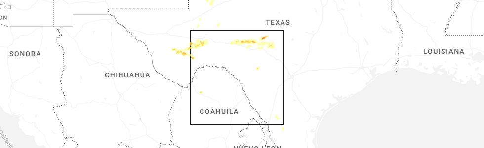
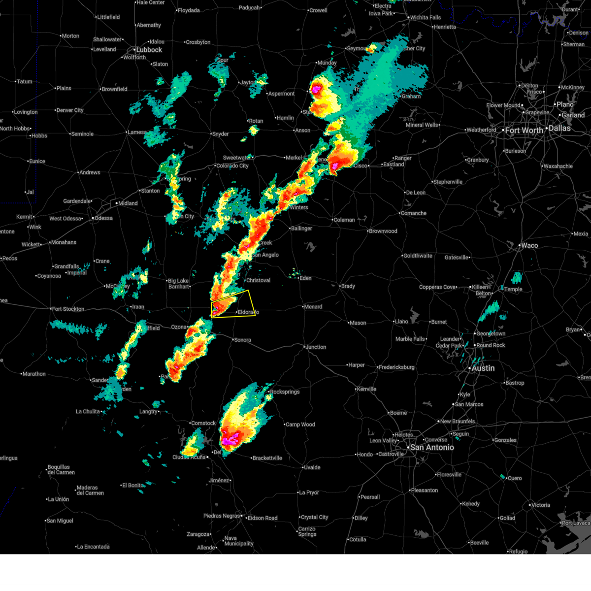
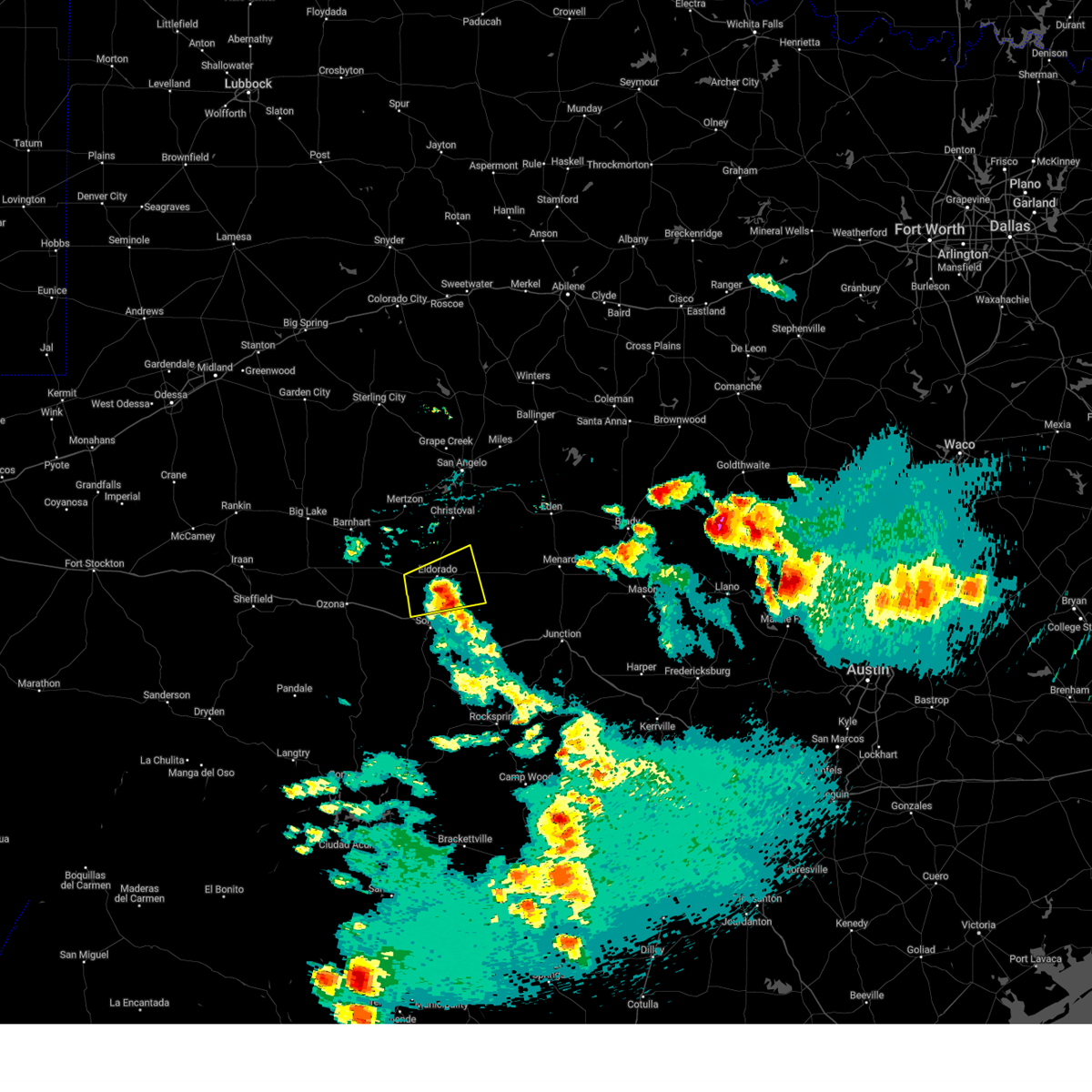
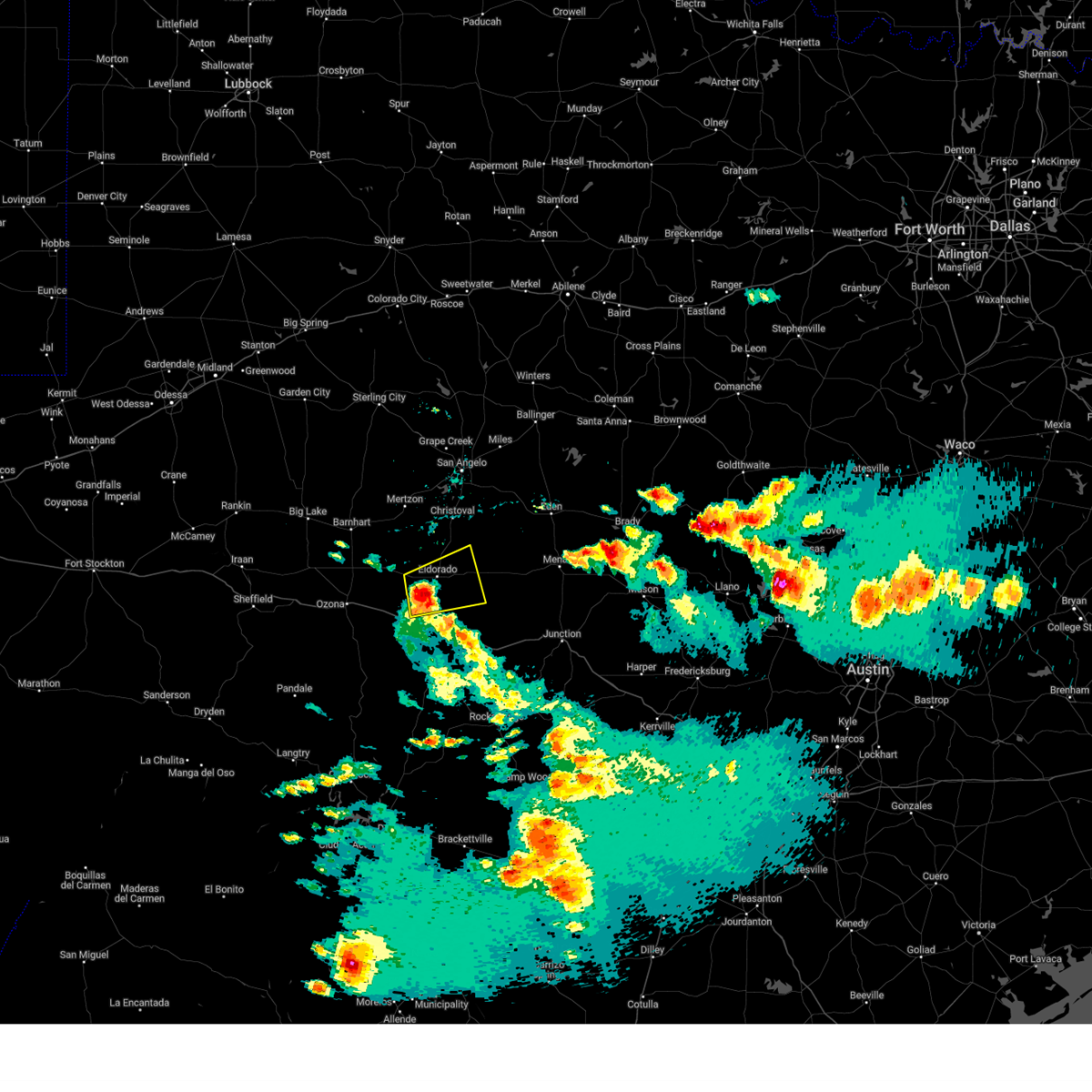
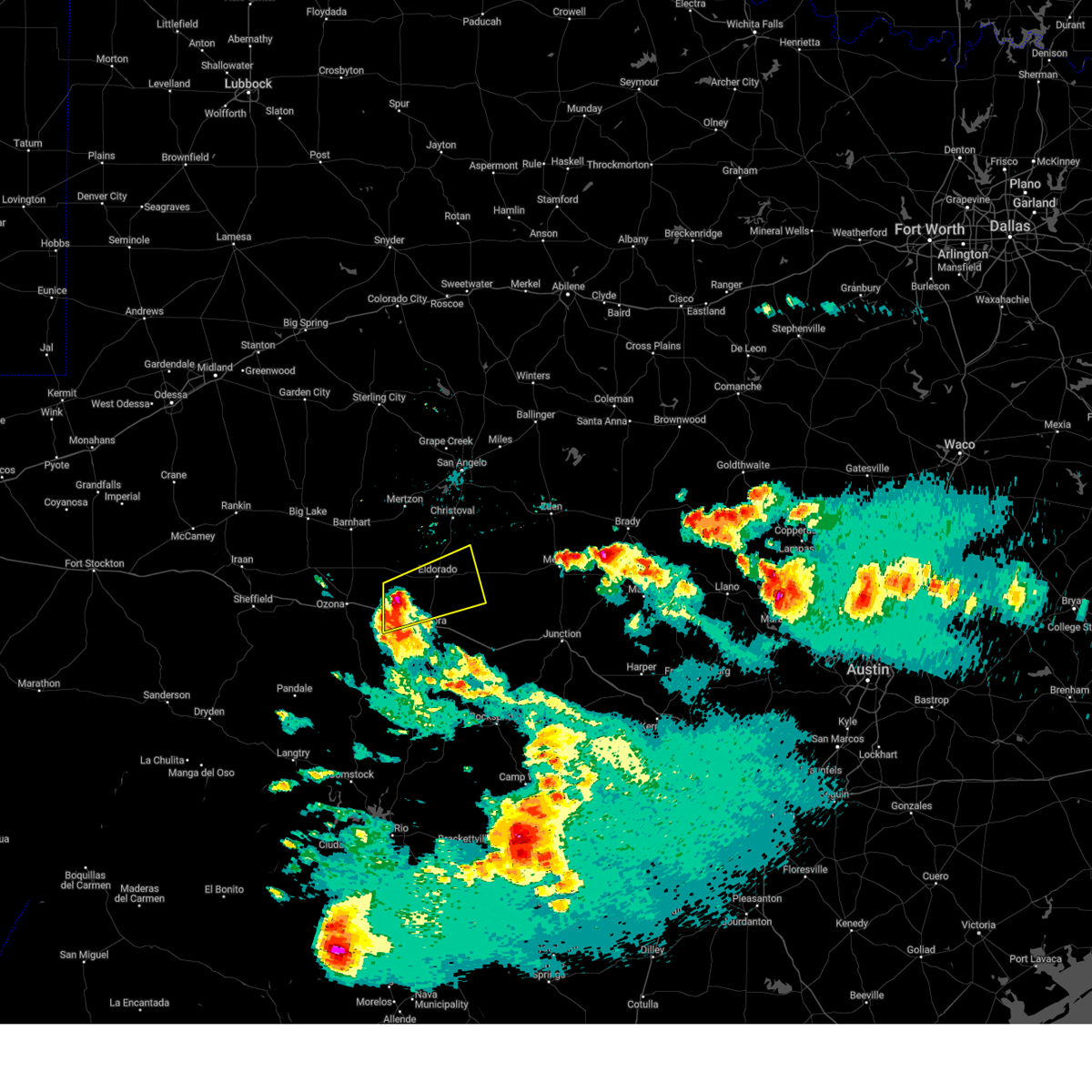
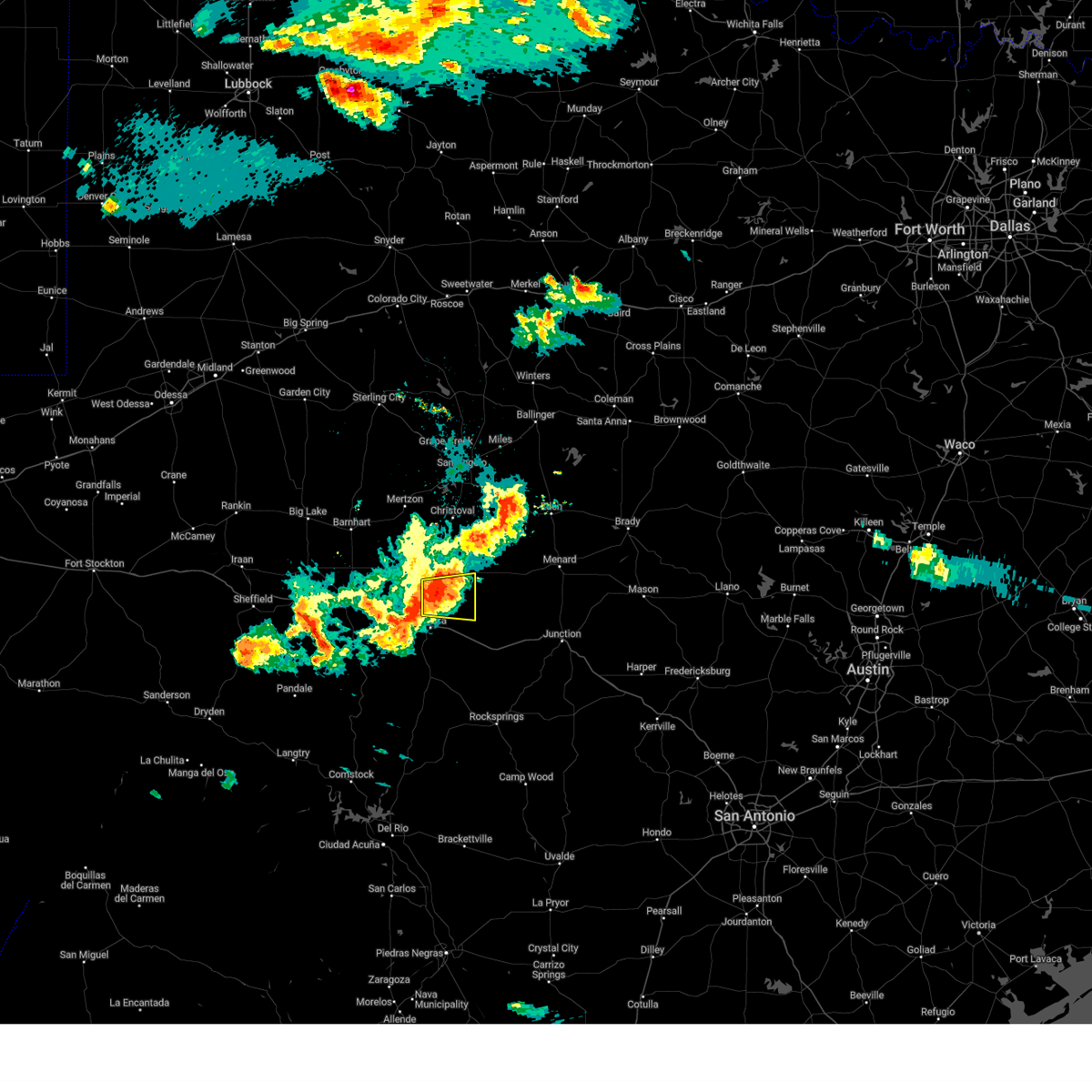
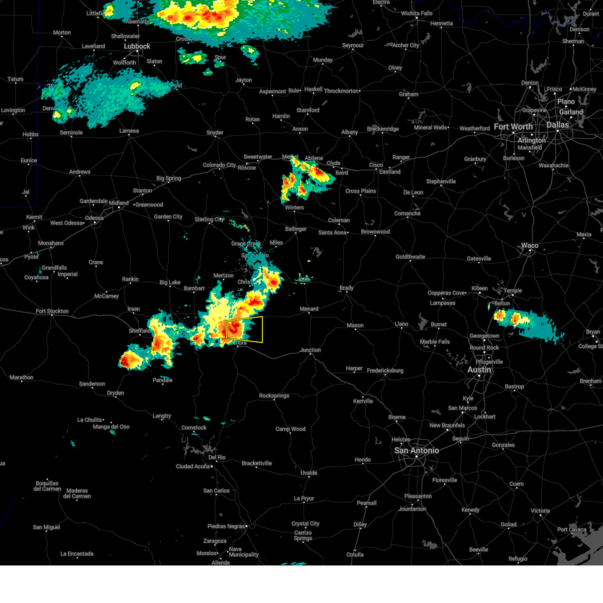
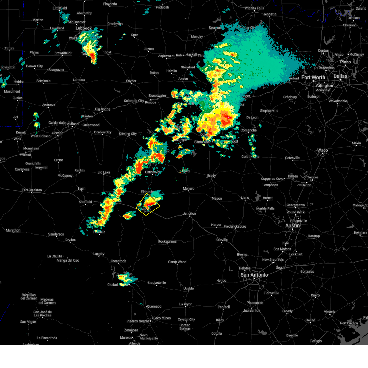
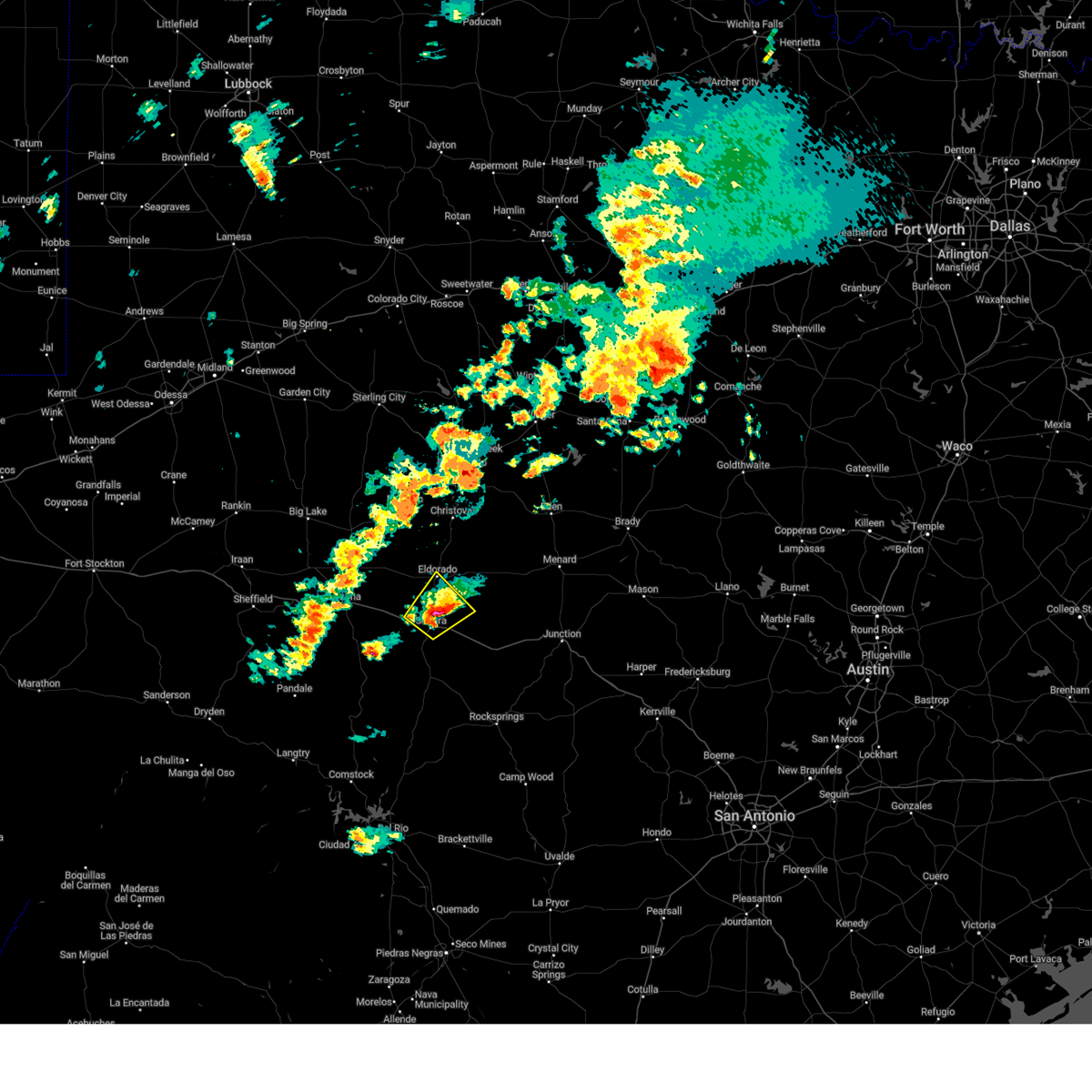
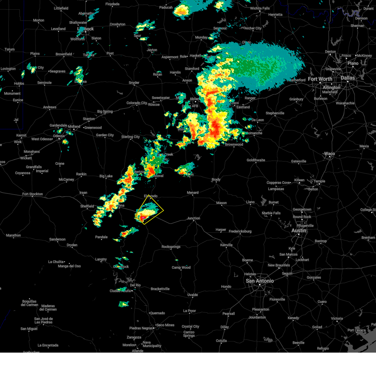
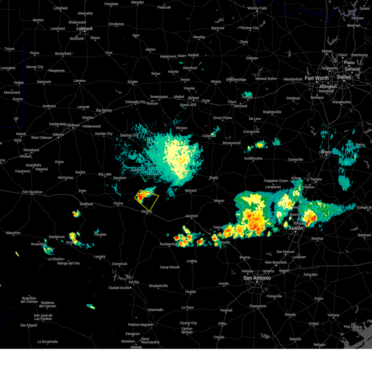
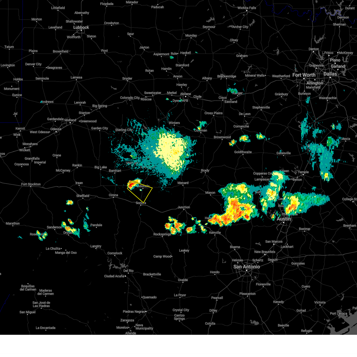
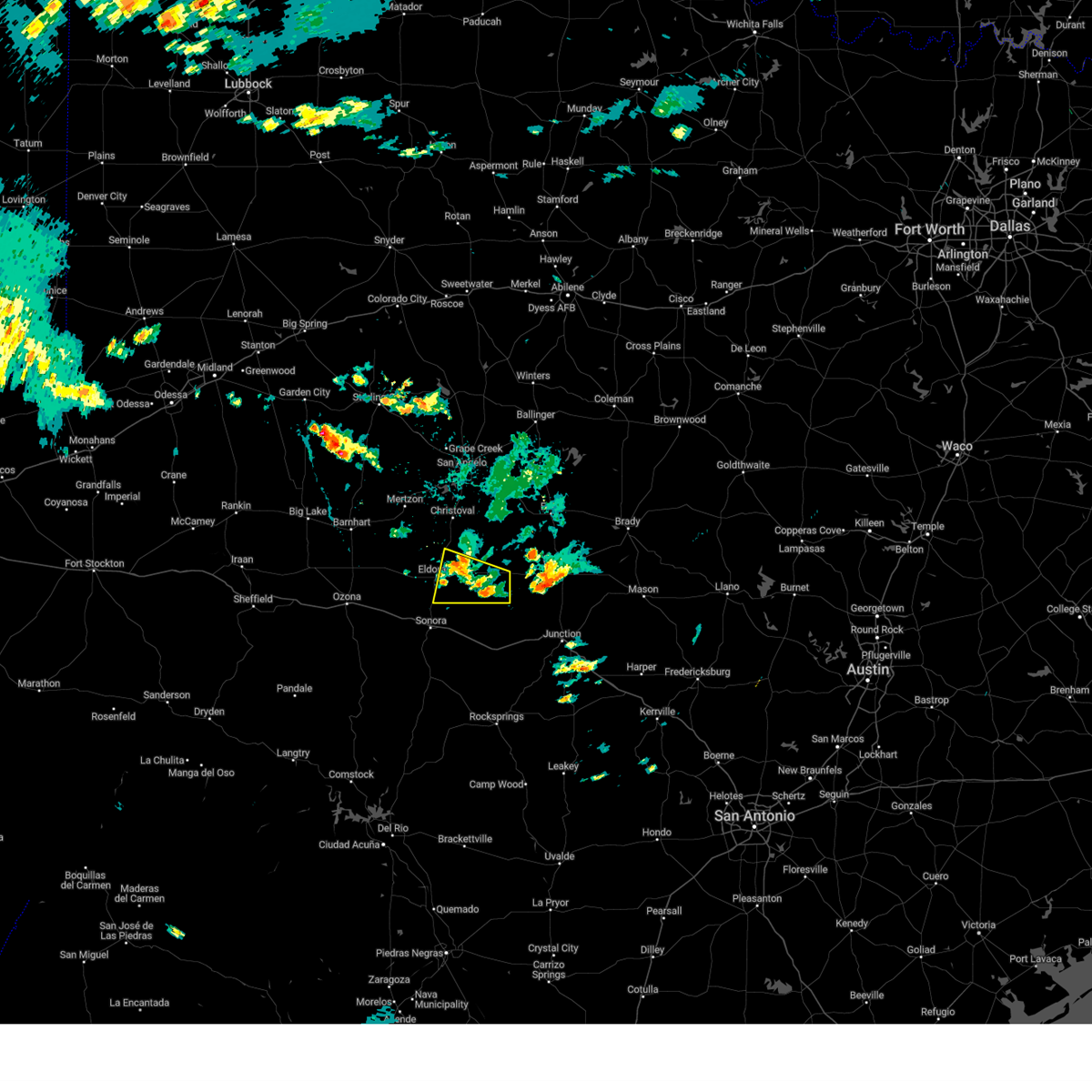
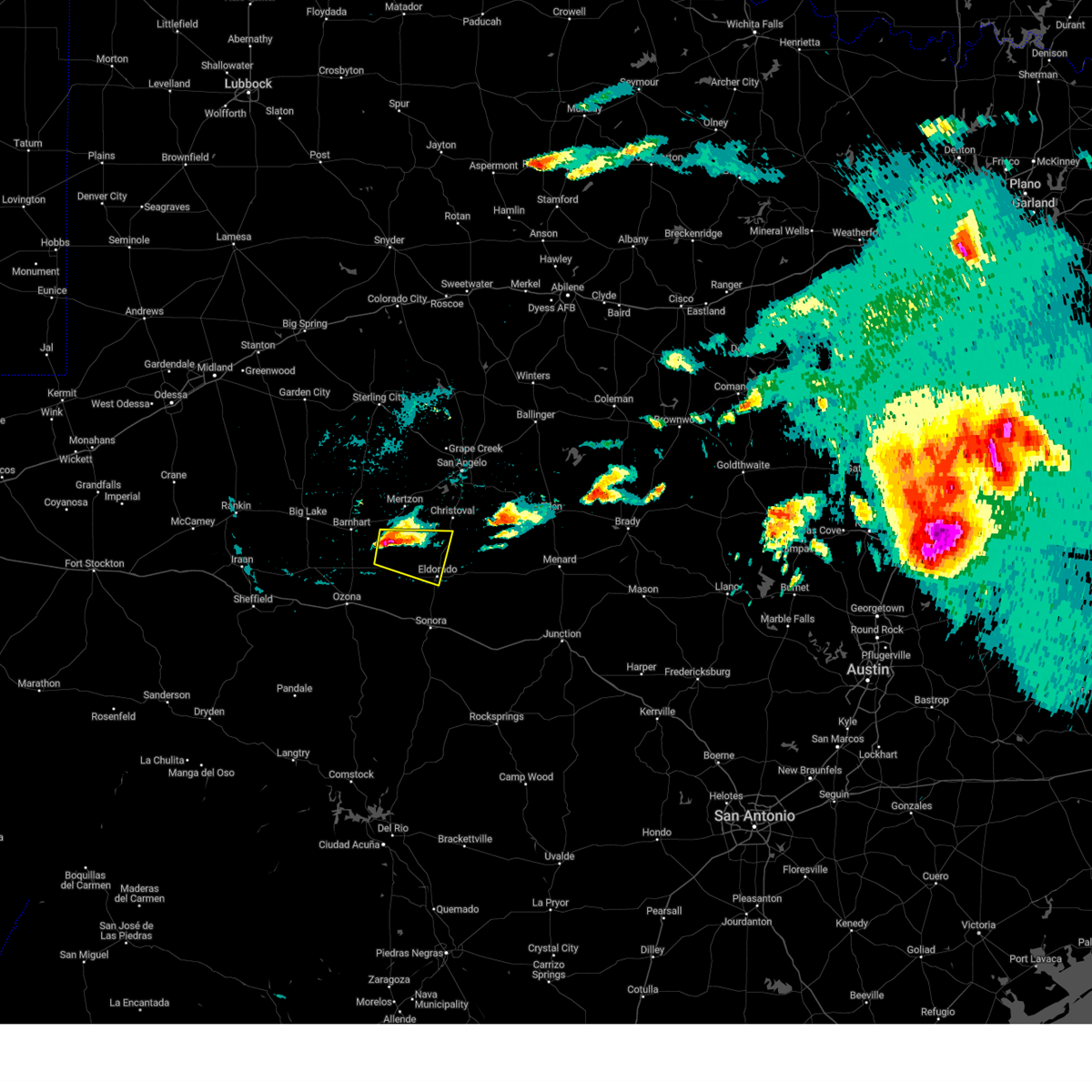
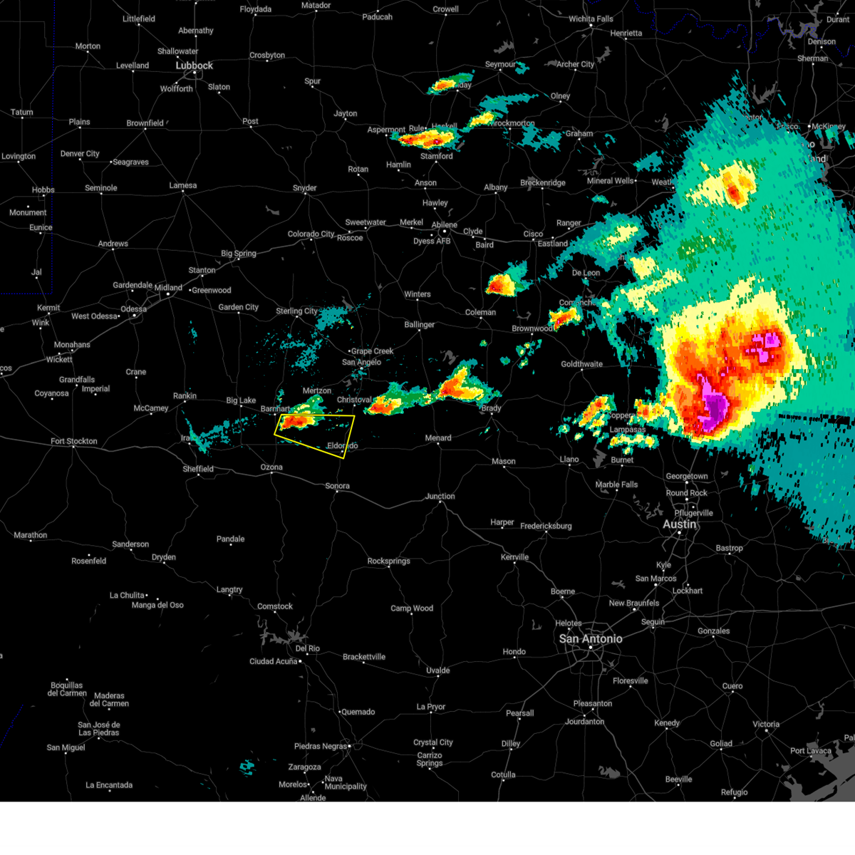
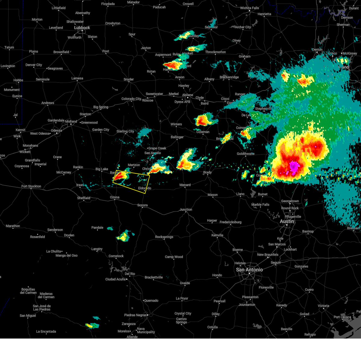
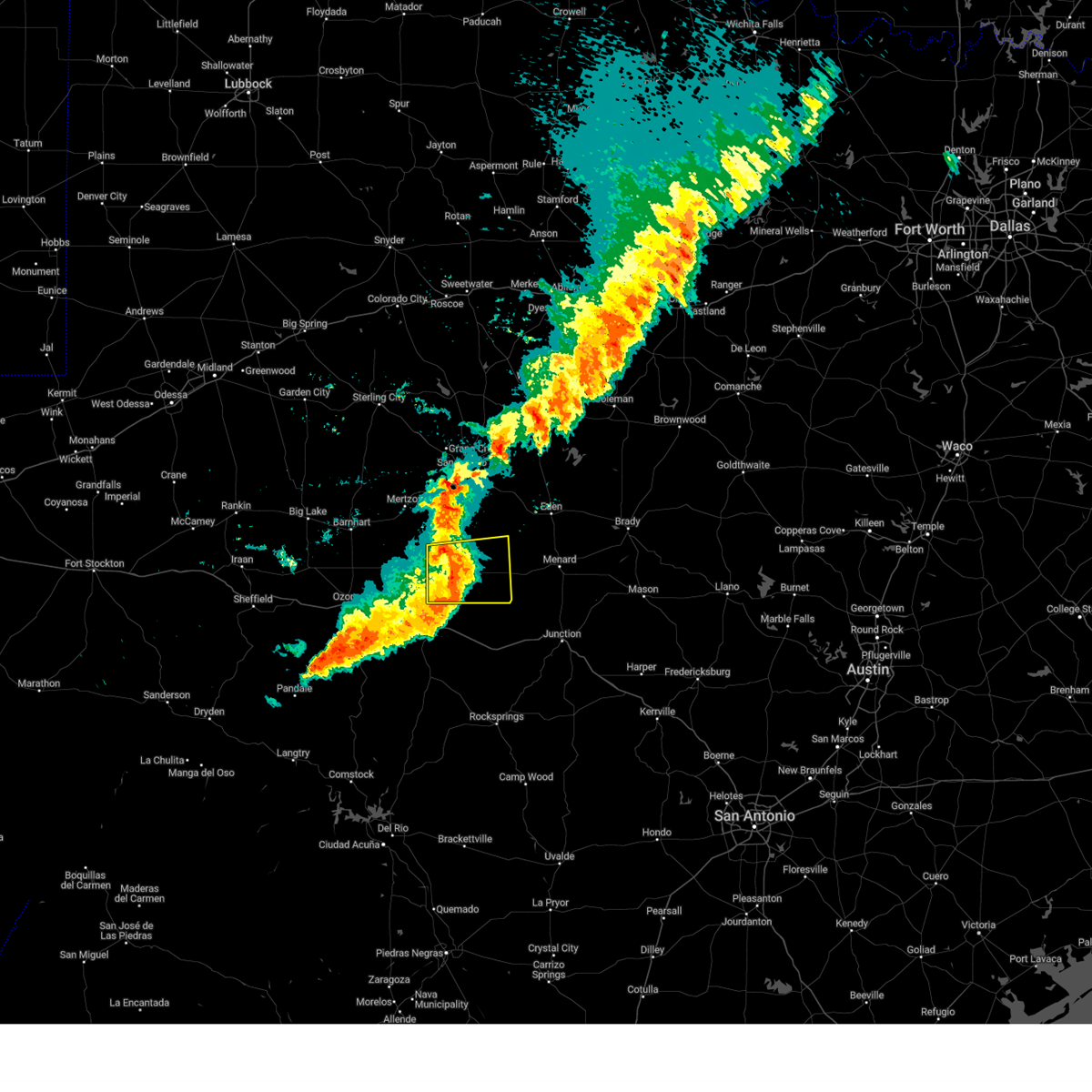
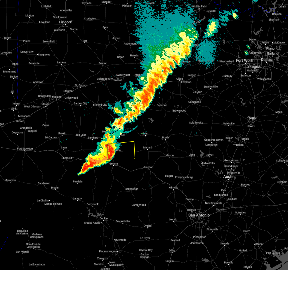
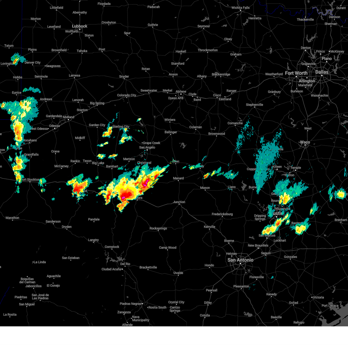
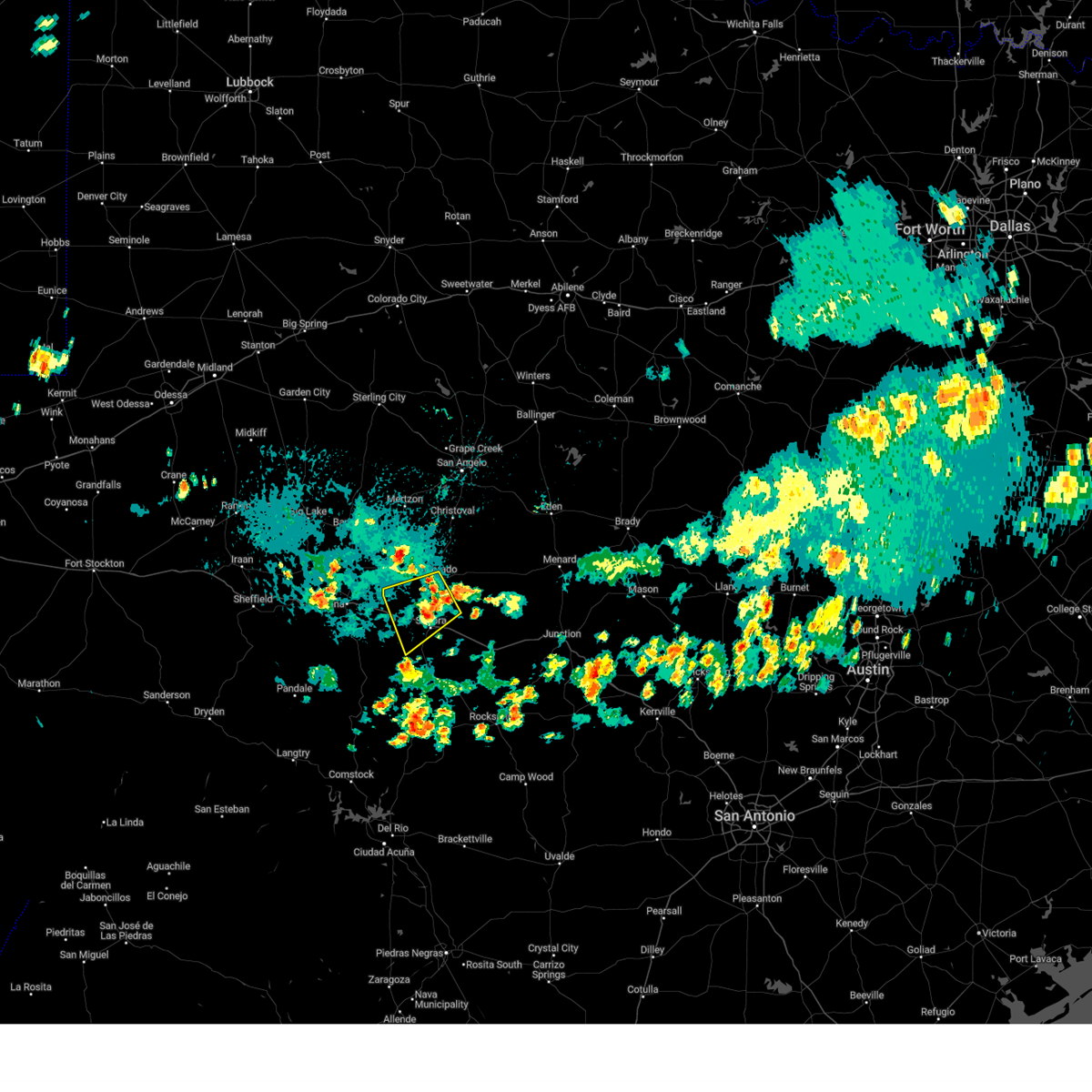
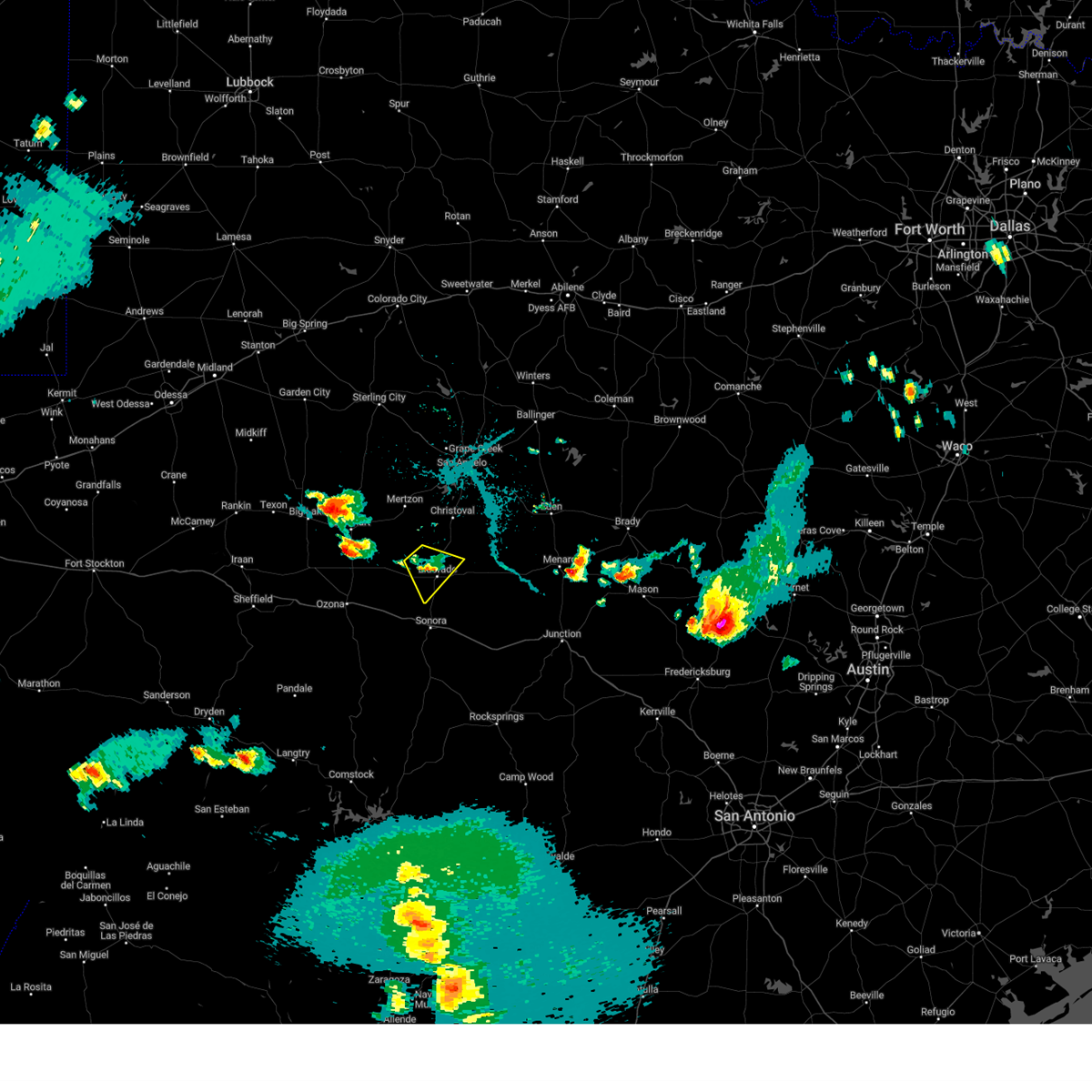
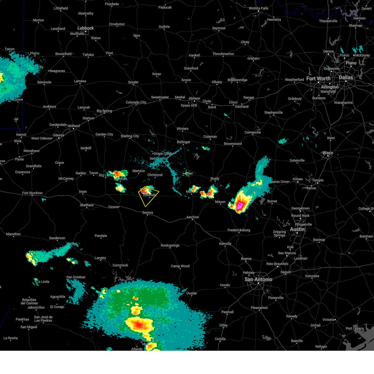
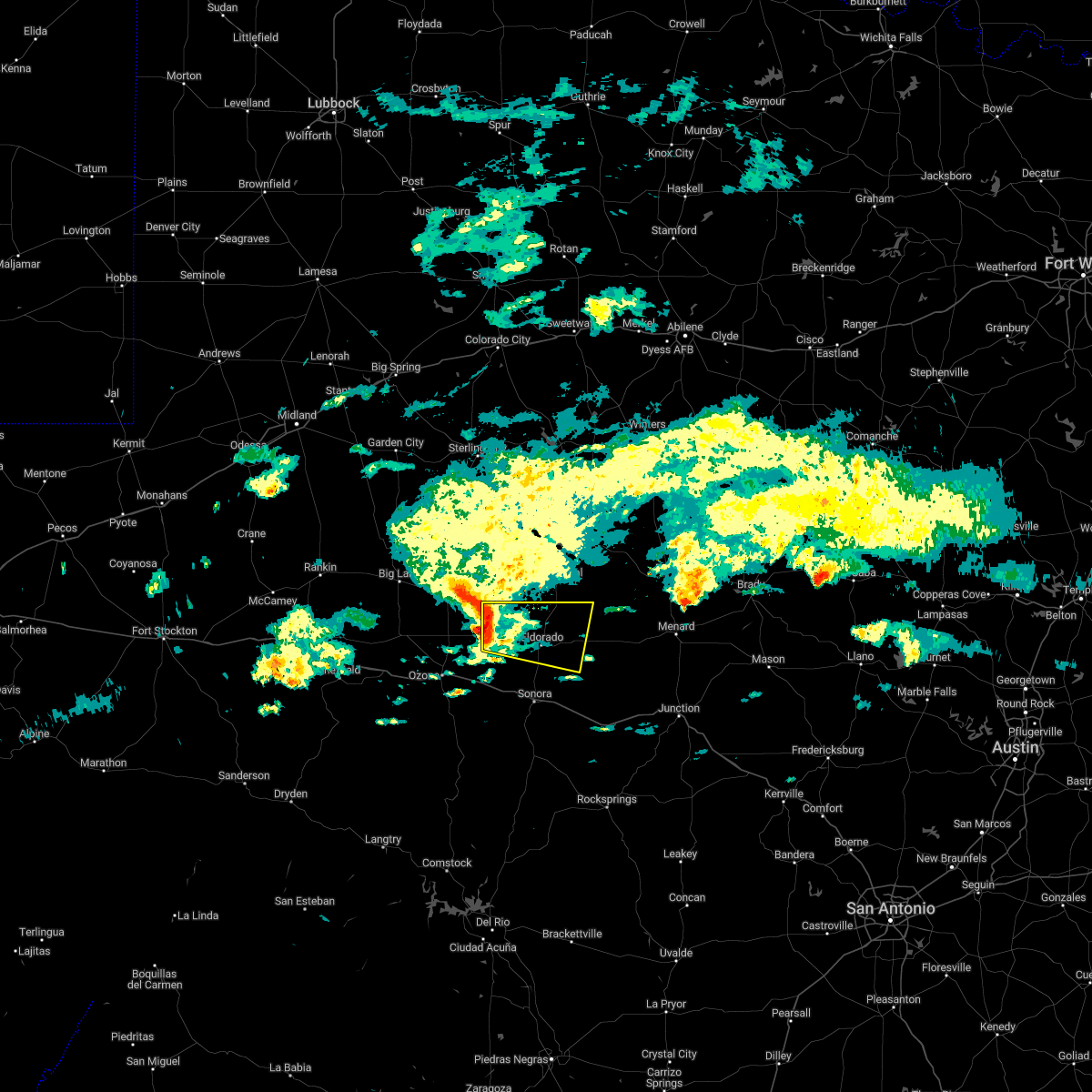
Hail Map for Eldorado, TX
The Eldorado, TX area has had 14 reports of on-the-ground hail by trained spotters, and has been under severe weather warnings 8 times during the past 12 months. Doppler radar has detected hail at or near Eldorado, TX on 61 occasions, including 3 occasions during the past year.
| Name: | Eldorado, TX |
| Where Located: | 104.6 miles N of Del Rio, TX |
| Map: | Google Map for Eldorado, TX |
| Population: | 1951 |
| Housing Units: | 838 |
| More Info: | Search Google for Eldorado, TX |
0
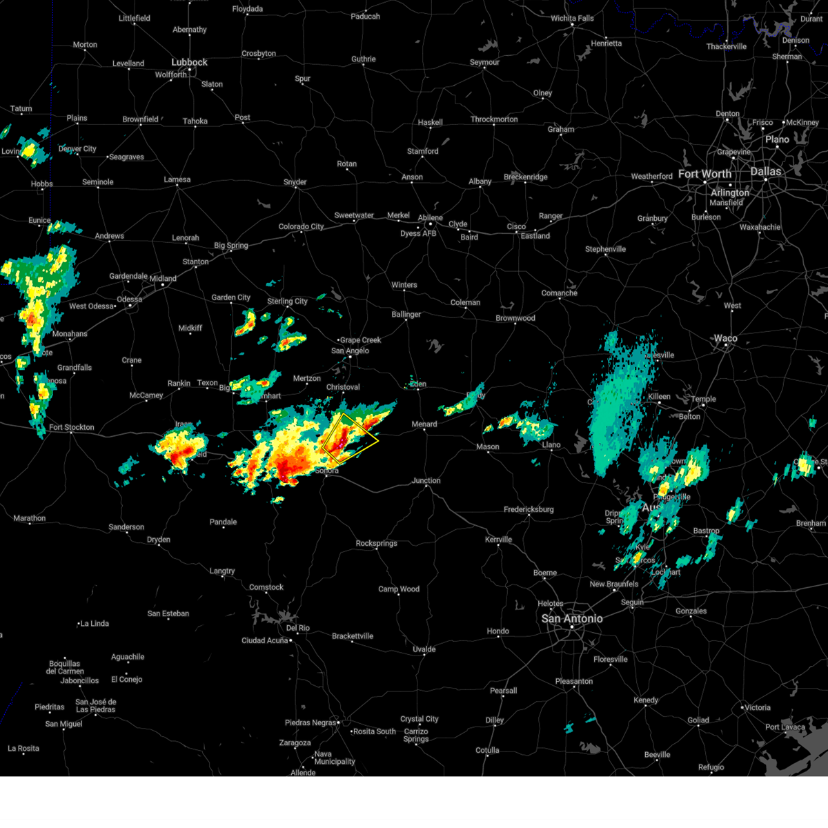
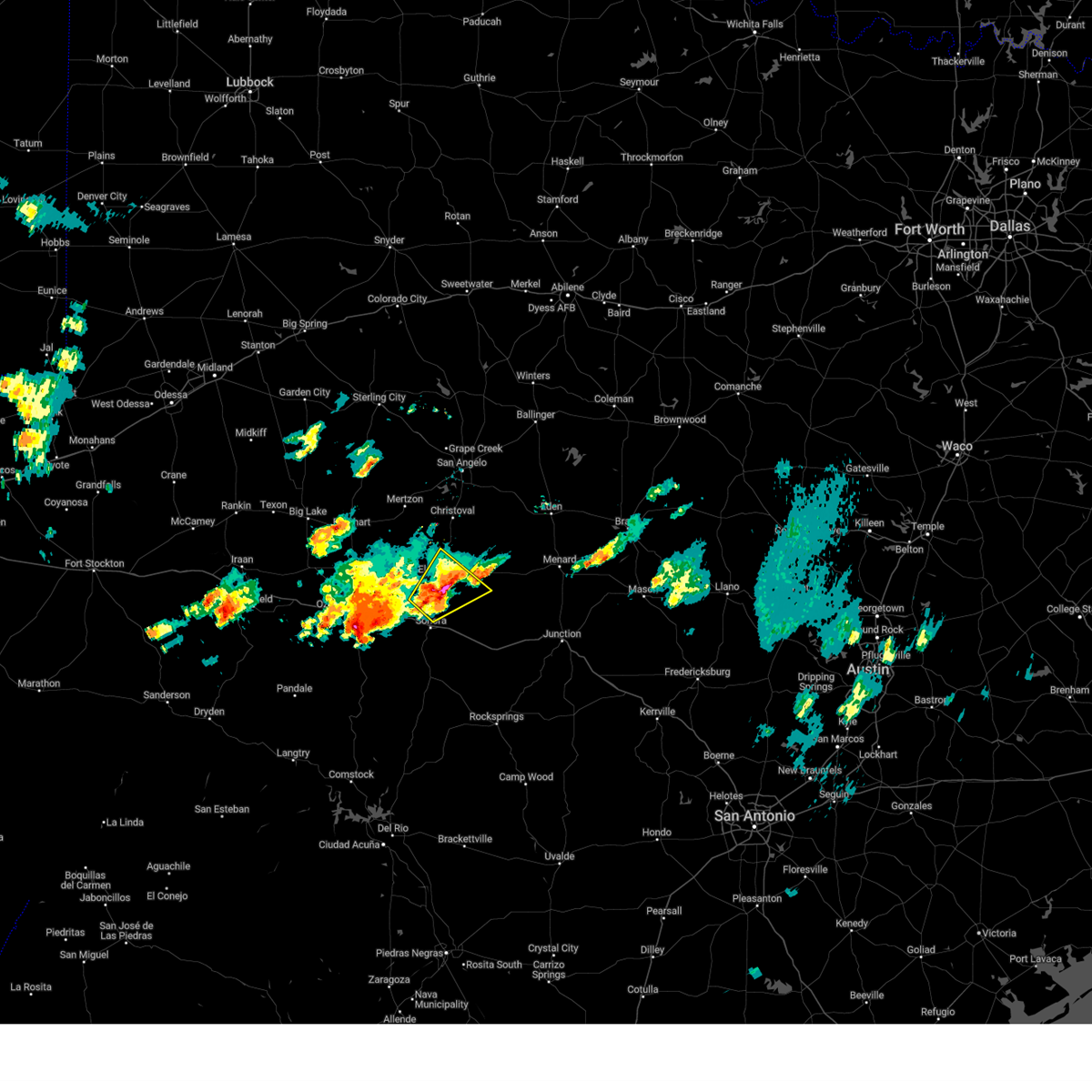
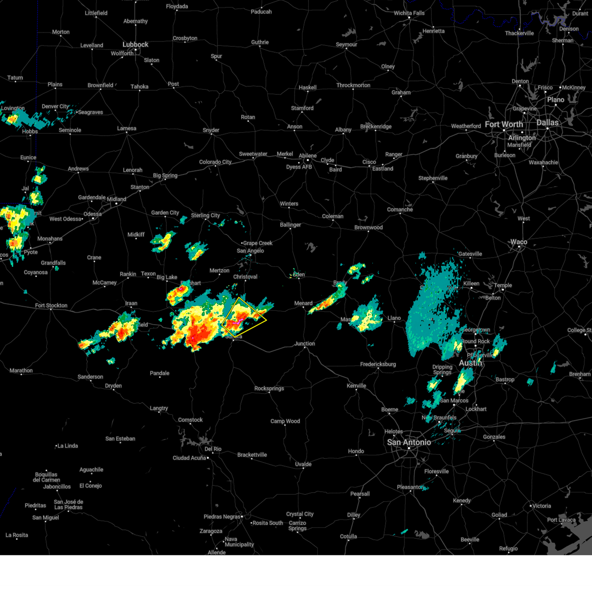
The Top Recent Hail Date for Eldorado, TX is Wednesday, May 20, 2026 (61st out of 61)
Hail and Wind Damage Spotted near Eldorado, TX
| Date / Time | Report Details |
|---|---|
| 5/20/2026 8:41 PM CDT |
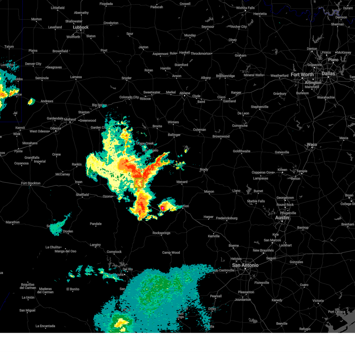
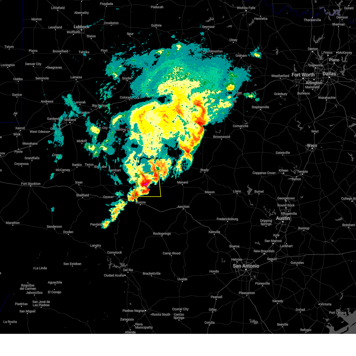
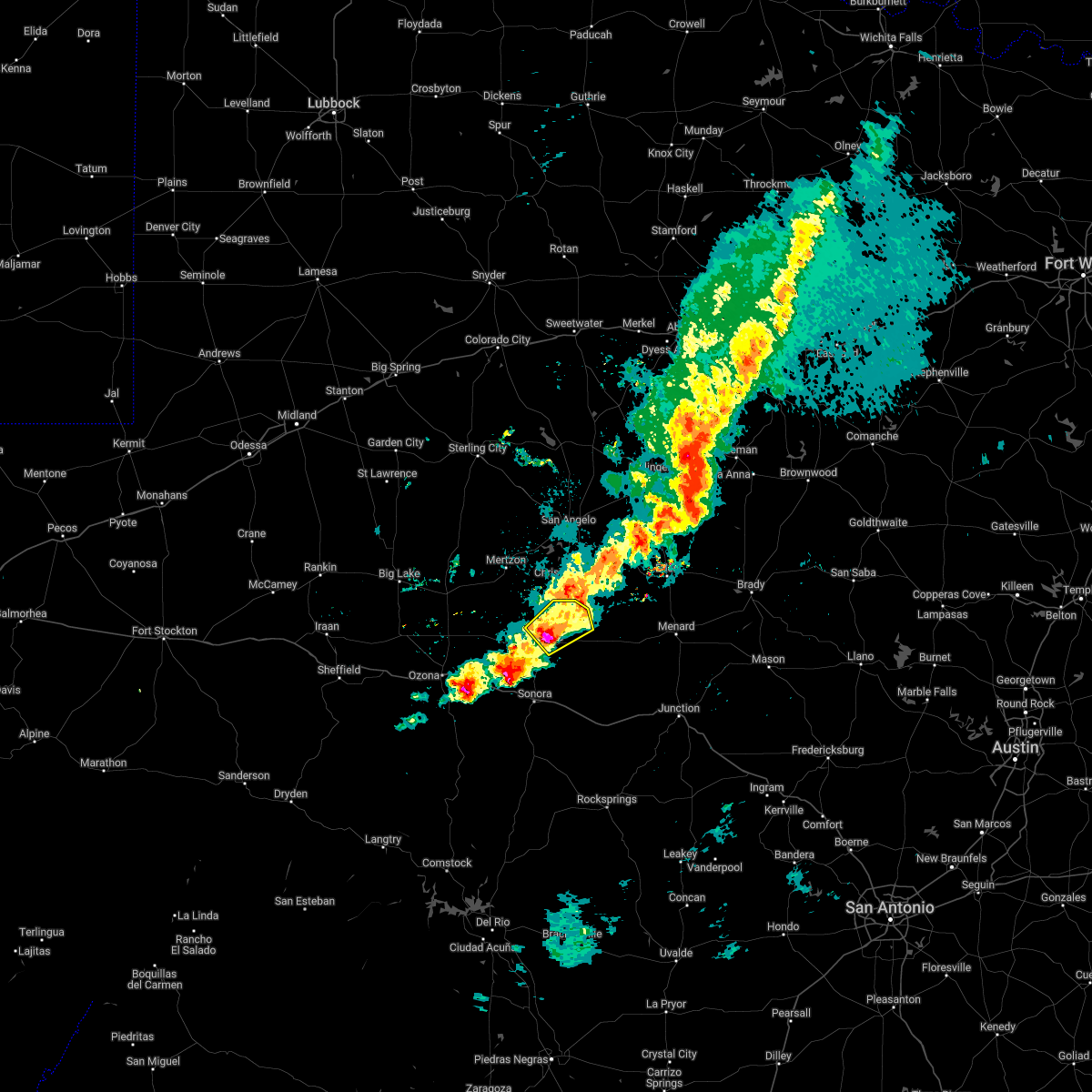
 Svrsjt the national weather service in san angelo has issued a * severe thunderstorm warning for, eastern schleicher county in west central texas, north central sutton county in west central texas, * until 945 pm cdt. * at 840 pm cdt, a severe thunderstorm was located near us-277 near the sutton-schleicher county line, or 8 miles southwest of eldorado, moving northeast at 20 mph (radar indicated). Hazards include ping pong ball size hail and 60 mph wind gusts. People and animals outdoors will be injured. expect hail damage to roofs, siding, windows, and vehicles. expect wind damage to roofs, siding, and trees. this severe thunderstorm will be near, eldorado around 845 pm cdt. Other locations impacted by this severe thunderstorm include us- 277 near the sutton- schleicher county line and the intersection of us- 190 and ranch road 2084. Svrsjt the national weather service in san angelo has issued a * severe thunderstorm warning for, eastern schleicher county in west central texas, north central sutton county in west central texas, * until 945 pm cdt. * at 840 pm cdt, a severe thunderstorm was located near us-277 near the sutton-schleicher county line, or 8 miles southwest of eldorado, moving northeast at 20 mph (radar indicated). Hazards include ping pong ball size hail and 60 mph wind gusts. People and animals outdoors will be injured. expect hail damage to roofs, siding, windows, and vehicles. expect wind damage to roofs, siding, and trees. this severe thunderstorm will be near, eldorado around 845 pm cdt. Other locations impacted by this severe thunderstorm include us- 277 near the sutton- schleicher county line and the intersection of us- 190 and ranch road 2084.
|
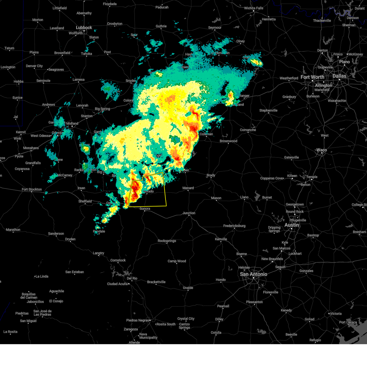
| 5/19/2026 5:22 PM CDT |
 the severe thunderstorm warning has been cancelled and is no longer in effect the severe thunderstorm warning has been cancelled and is no longer in effect
|
| 5/19/2026 4:45 PM CDT |
 Svrsjt the national weather service in san angelo has issued a * severe thunderstorm warning for, central schleicher county in west central texas, * until 545 pm cdt. * at 444 pm cdt, a severe thunderstorm was located near eldorado, moving northeast at 20 mph (radar indicated). Hazards include ping pong ball size hail and 60 mph wind gusts. People and animals outdoors will be injured. expect hail damage to roofs, siding, windows, and vehicles. expect wind damage to roofs, siding, and trees. This severe thunderstorm will be near, eldorado around 450 pm cdt. Svrsjt the national weather service in san angelo has issued a * severe thunderstorm warning for, central schleicher county in west central texas, * until 545 pm cdt. * at 444 pm cdt, a severe thunderstorm was located near eldorado, moving northeast at 20 mph (radar indicated). Hazards include ping pong ball size hail and 60 mph wind gusts. People and animals outdoors will be injured. expect hail damage to roofs, siding, windows, and vehicles. expect wind damage to roofs, siding, and trees. This severe thunderstorm will be near, eldorado around 450 pm cdt.
|
| 3/10/2026 5:40 PM CDT |
 At 540 pm cdt, a severe thunderstorm was located near the intersection of us- 190 and ranch road 1828, or 10 miles west of eldorado, moving northeast at 35 mph (radar indicated). Hazards include golf ball size hail and 70 mph wind gusts. People and animals outdoors will be injured. expect hail damage to roofs, siding, windows, and vehicles. expect considerable tree damage. wind damage is also likely to mobile homes, roofs, and outbuildings. this severe storm will be near, eldorado around 545 pm cdt. Other locations impacted by this severe thunderstorm include the intersection of ranch road 1828 and ranch road 915 and the intersection of us-190 and ranch road 1828. At 540 pm cdt, a severe thunderstorm was located near the intersection of us- 190 and ranch road 1828, or 10 miles west of eldorado, moving northeast at 35 mph (radar indicated). Hazards include golf ball size hail and 70 mph wind gusts. People and animals outdoors will be injured. expect hail damage to roofs, siding, windows, and vehicles. expect considerable tree damage. wind damage is also likely to mobile homes, roofs, and outbuildings. this severe storm will be near, eldorado around 545 pm cdt. Other locations impacted by this severe thunderstorm include the intersection of ranch road 1828 and ranch road 915 and the intersection of us-190 and ranch road 1828.
|
| 3/10/2026 5:28 PM CDT |
 the severe thunderstorm warning has been cancelled and is no longer in effect the severe thunderstorm warning has been cancelled and is no longer in effect
|
| 3/10/2026 5:28 PM CDT |
 At 528 pm cdt, a severe thunderstorm was located near the intersection of us- 190 and ranch road 1828, or 16 miles west of eldorado, moving east at 35 mph (radar indicated). Hazards include golf ball size hail and 60 mph wind gusts. People and animals outdoors will be injured. expect hail damage to roofs, siding, windows, and vehicles. expect wind damage to roofs, siding, and trees. this severe storm will be near, eldorado around 540 pm cdt. Other locations impacted by this severe thunderstorm include the intersection of ranch road 1828 and ranch road 915, the intersection of us-190 and ranch road 1828, and us-190 near the crockett- sutton county line. At 528 pm cdt, a severe thunderstorm was located near the intersection of us- 190 and ranch road 1828, or 16 miles west of eldorado, moving east at 35 mph (radar indicated). Hazards include golf ball size hail and 60 mph wind gusts. People and animals outdoors will be injured. expect hail damage to roofs, siding, windows, and vehicles. expect wind damage to roofs, siding, and trees. this severe storm will be near, eldorado around 540 pm cdt. Other locations impacted by this severe thunderstorm include the intersection of ranch road 1828 and ranch road 915, the intersection of us-190 and ranch road 1828, and us-190 near the crockett- sutton county line.
|
| 3/10/2026 5:18 PM CDT |
 Svrsjt the national weather service in san angelo has issued a * severe thunderstorm warning for, western schleicher county in west central texas, eastern crockett county in west central texas, * until 615 pm cdt. * at 518 pm cdt, a severe thunderstorm was located 7 miles south of us-190 near the crockett-sutton county line, or 15 miles northeast of ozona, moving east at 35 mph (radar indicated). Hazards include ping pong ball size hail and 60 mph wind gusts. People and animals outdoors will be injured. expect hail damage to roofs, siding, windows, and vehicles. expect wind damage to roofs, siding, and trees. this severe thunderstorm will be near, eldorado around 540 pm cdt. Other locations impacted by this severe thunderstorm include us- 190 near the crockett- sutton county line, the intersection of ranch road 1828 and ranch road 915, and the intersection of us-190 and ranch road 1828. Svrsjt the national weather service in san angelo has issued a * severe thunderstorm warning for, western schleicher county in west central texas, eastern crockett county in west central texas, * until 615 pm cdt. * at 518 pm cdt, a severe thunderstorm was located 7 miles south of us-190 near the crockett-sutton county line, or 15 miles northeast of ozona, moving east at 35 mph (radar indicated). Hazards include ping pong ball size hail and 60 mph wind gusts. People and animals outdoors will be injured. expect hail damage to roofs, siding, windows, and vehicles. expect wind damage to roofs, siding, and trees. this severe thunderstorm will be near, eldorado around 540 pm cdt. Other locations impacted by this severe thunderstorm include us- 190 near the crockett- sutton county line, the intersection of ranch road 1828 and ranch road 915, and the intersection of us-190 and ranch road 1828.
|
| 8/20/2025 4:44 PM CDT |
 Svrsjt the national weather service in san angelo has issued a * severe thunderstorm warning for, south central schleicher county in west central texas, north central sutton county in west central texas, * until 515 pm cdt. * at 443 pm cdt, a severe thunderstorm was located near eldorado, moving south at 5 mph (radar indicated). Hazards include 60 mph wind gusts. expect damage to roofs, siding, and trees Svrsjt the national weather service in san angelo has issued a * severe thunderstorm warning for, south central schleicher county in west central texas, north central sutton county in west central texas, * until 515 pm cdt. * at 443 pm cdt, a severe thunderstorm was located near eldorado, moving south at 5 mph (radar indicated). Hazards include 60 mph wind gusts. expect damage to roofs, siding, and trees
|
| 5/27/2025 11:10 PM CDT |
 At 1109 pm cdt, a severe thunderstorm was located 8 miles northwest of the intersection of ranch road 1828 and ranch road 915, or 15 miles northwest of eldorado, moving east at 25 mph (radar indicated). Hazards include 60 mph wind gusts and nickel size hail. Expect damage to roofs, siding, and trees. Locations impacted include, eldorado and the intersection of ranch road 1828 and ranch road 915. At 1109 pm cdt, a severe thunderstorm was located 8 miles northwest of the intersection of ranch road 1828 and ranch road 915, or 15 miles northwest of eldorado, moving east at 25 mph (radar indicated). Hazards include 60 mph wind gusts and nickel size hail. Expect damage to roofs, siding, and trees. Locations impacted include, eldorado and the intersection of ranch road 1828 and ranch road 915.
|
| 5/27/2025 11:10 PM CDT |
 the severe thunderstorm warning has been cancelled and is no longer in effect the severe thunderstorm warning has been cancelled and is no longer in effect
|
| 5/27/2025 10:33 PM CDT |
 Svrsjt the national weather service in san angelo has issued a * severe thunderstorm warning for, northwestern schleicher county in west central texas, southwestern tom green county in west central texas, northeastern crockett county in west central texas, southern irion county in west central texas, * until 1130 pm cdt. * at 1033 pm cdt, a severe thunderstorm was located near us-190 near the crockett-sutton county line, or 14 miles southeast of barnhart, moving east at 25 mph (radar indicated). Hazards include 60 mph wind gusts and nickel size hail. Expect damage to roofs, siding, and trees. This severe thunderstorm will remain over mainly rural areas of northwestern schleicher, southwestern tom green, northeastern crockett and southern irion counties, including the following locations, the intersection of us-190 and ranch road 1828, the intersection of ranch road 1828 and ranch road 915, the intersection of us 190 and highway 163, and us-190 near the crockett-sutton county line. Svrsjt the national weather service in san angelo has issued a * severe thunderstorm warning for, northwestern schleicher county in west central texas, southwestern tom green county in west central texas, northeastern crockett county in west central texas, southern irion county in west central texas, * until 1130 pm cdt. * at 1033 pm cdt, a severe thunderstorm was located near us-190 near the crockett-sutton county line, or 14 miles southeast of barnhart, moving east at 25 mph (radar indicated). Hazards include 60 mph wind gusts and nickel size hail. Expect damage to roofs, siding, and trees. This severe thunderstorm will remain over mainly rural areas of northwestern schleicher, southwestern tom green, northeastern crockett and southern irion counties, including the following locations, the intersection of us-190 and ranch road 1828, the intersection of ranch road 1828 and ranch road 915, the intersection of us 190 and highway 163, and us-190 near the crockett-sutton county line.
|
| 5/6/2025 2:19 AM CDT |
 At 218 am cdt, a severe thunderstorm was located north of eldorado, moving northeast at 30 mph (radar indicated). Hazards include golf ball size hail and 60 mph wind gusts. People and animals outdoors will be injured. expect hail damage to roofs, siding, windows, and vehicles. expect wind damage to roofs, siding, and trees. This severe thunderstorm will remain over mainly rural areas of northeastern schleicher county, including the following locations, the intersection of ranch road 1828 and ranch road 915, the intersection of us-190 and ranch road 2084, and adams. At 218 am cdt, a severe thunderstorm was located north of eldorado, moving northeast at 30 mph (radar indicated). Hazards include golf ball size hail and 60 mph wind gusts. People and animals outdoors will be injured. expect hail damage to roofs, siding, windows, and vehicles. expect wind damage to roofs, siding, and trees. This severe thunderstorm will remain over mainly rural areas of northeastern schleicher county, including the following locations, the intersection of ranch road 1828 and ranch road 915, the intersection of us-190 and ranch road 2084, and adams.
|
| 5/6/2025 2:08 AM CDT |
 At 208 am cdt, a severe thunderstorm was located just west of eldorado, moving northeast at 30 mph (radar indicated). Hazards include 60 mph wind gusts and half dollar size hail. Hail damage to vehicles is expected. expect wind damage to roofs, siding, and trees. this severe storm will be near, eldorado around 215 am cdt. Other locations impacted by this severe thunderstorm include the intersection of ranch road 1828 and ranch road 915, the intersection of us-190 and ranch road 1828, the intersection of us- 190 and ranch road 2084, adams, and us-277 near the sutton- schleicher county line. At 208 am cdt, a severe thunderstorm was located just west of eldorado, moving northeast at 30 mph (radar indicated). Hazards include 60 mph wind gusts and half dollar size hail. Hail damage to vehicles is expected. expect wind damage to roofs, siding, and trees. this severe storm will be near, eldorado around 215 am cdt. Other locations impacted by this severe thunderstorm include the intersection of ranch road 1828 and ranch road 915, the intersection of us-190 and ranch road 1828, the intersection of us- 190 and ranch road 2084, adams, and us-277 near the sutton- schleicher county line.
|
| 5/6/2025 1:59 AM CDT | Quarter sized hail reported 0.6 miles SSE of Eldorado, TX |
| 5/6/2025 1:56 AM CDT |
 Svrsjt the national weather service in san angelo has issued a * severe thunderstorm warning for, schleicher county in west central texas, * until 300 am cdt. * at 156 am cdt, a severe thunderstorm was located about 5 miles southwest of eldorado, moving northeast at 30 mph (radar indicated). Hazards include 60 mph wind gusts and quarter size hail. Hail damage to vehicles is expected. expect wind damage to roofs, siding, and trees. this severe thunderstorm will be near, eldorado around 200 am cdt. Other locations impacted by this severe thunderstorm include the intersection of ranch road 1828 and ranch road 915, the intersection of us-190 and ranch road 1828, the intersection of us- 190 and ranch road 2084, adams, and us-277 near the sutton- schleicher county line. Svrsjt the national weather service in san angelo has issued a * severe thunderstorm warning for, schleicher county in west central texas, * until 300 am cdt. * at 156 am cdt, a severe thunderstorm was located about 5 miles southwest of eldorado, moving northeast at 30 mph (radar indicated). Hazards include 60 mph wind gusts and quarter size hail. Hail damage to vehicles is expected. expect wind damage to roofs, siding, and trees. this severe thunderstorm will be near, eldorado around 200 am cdt. Other locations impacted by this severe thunderstorm include the intersection of ranch road 1828 and ranch road 915, the intersection of us-190 and ranch road 1828, the intersection of us- 190 and ranch road 2084, adams, and us-277 near the sutton- schleicher county line.
|
| 5/1/2025 7:49 PM CDT |
 the severe thunderstorm warning has been cancelled and is no longer in effect the severe thunderstorm warning has been cancelled and is no longer in effect
|
| 5/1/2025 7:30 PM CDT |
 At 729 pm cdt, a severe thunderstorm was located near us-277 near the sutton-schleicher county line, or 8 miles southwest of eldorado, moving east at 30 mph (radar indicated). Hazards include 60 mph wind gusts and quarter size hail. Hail damage to vehicles is expected. expect wind damage to roofs, siding, and trees. this severe storm will be near, eldorado around 745 pm cdt. Other locations impacted by this severe thunderstorm include the intersection of us-190 and ranch road 1828 and us- 277 near the sutton-schleicher county line. At 729 pm cdt, a severe thunderstorm was located near us-277 near the sutton-schleicher county line, or 8 miles southwest of eldorado, moving east at 30 mph (radar indicated). Hazards include 60 mph wind gusts and quarter size hail. Hail damage to vehicles is expected. expect wind damage to roofs, siding, and trees. this severe storm will be near, eldorado around 745 pm cdt. Other locations impacted by this severe thunderstorm include the intersection of us-190 and ranch road 1828 and us- 277 near the sutton-schleicher county line.
|
| 5/1/2025 7:13 PM CDT |
 Svrsjt the national weather service in san angelo has issued a * severe thunderstorm warning for, western schleicher county in west central texas, northwestern sutton county in west central texas, * until 815 pm cdt. * at 713 pm cdt, a severe thunderstorm was located 8 miles northwest of the intersection of i-10 and ranch road 1989, or 15 miles northwest of sonora, moving northeast at 25 mph (radar indicated). Hazards include 60 mph wind gusts and half dollar size hail. Hail damage to vehicles is expected. expect wind damage to roofs, siding, and trees. this severe thunderstorm will be near, eldorado around 730 pm cdt. other locations impacted by this severe thunderstorm include the intersection of us-190 and ranch road 1828, the intersection of i- 10 and ranch road 1989, us-277 near the sutton- schleicher county line, and i-10 near the crockett- sutton county line. This includes interstate 10 between mile markers 380 and 395. Svrsjt the national weather service in san angelo has issued a * severe thunderstorm warning for, western schleicher county in west central texas, northwestern sutton county in west central texas, * until 815 pm cdt. * at 713 pm cdt, a severe thunderstorm was located 8 miles northwest of the intersection of i-10 and ranch road 1989, or 15 miles northwest of sonora, moving northeast at 25 mph (radar indicated). Hazards include 60 mph wind gusts and half dollar size hail. Hail damage to vehicles is expected. expect wind damage to roofs, siding, and trees. this severe thunderstorm will be near, eldorado around 730 pm cdt. other locations impacted by this severe thunderstorm include the intersection of us-190 and ranch road 1828, the intersection of i- 10 and ranch road 1989, us-277 near the sutton- schleicher county line, and i-10 near the crockett- sutton county line. This includes interstate 10 between mile markers 380 and 395.
|
| 4/22/2025 9:57 PM CDT |
 At 957 pm cdt, a severe thunderstorm was located near us- 277 near the sutton- schleicher county line, or 8 miles south of eldorado, moving east at 20 mph (radar indicated). Hazards include 60 mph wind gusts and quarter size hail. Hail damage to vehicles is expected. expect wind damage to roofs, siding, and trees. Locations impacted include, us-277 near the sutton-schleicher county line and the intersection of ranch road 2596 and ranch road 864. At 957 pm cdt, a severe thunderstorm was located near us- 277 near the sutton- schleicher county line, or 8 miles south of eldorado, moving east at 20 mph (radar indicated). Hazards include 60 mph wind gusts and quarter size hail. Hail damage to vehicles is expected. expect wind damage to roofs, siding, and trees. Locations impacted include, us-277 near the sutton-schleicher county line and the intersection of ranch road 2596 and ranch road 864.
|
| 4/22/2025 9:37 PM CDT |
 Svrsjt the national weather service in san angelo has issued a * severe thunderstorm warning for, southwestern schleicher county in west central texas, north central sutton county in west central texas, * until 1015 pm cdt. * at 936 pm cdt, a severe thunderstorm was located near us-277 near the sutton-schleicher county line, or 10 miles southwest of eldorado, moving east at 20 mph (radar indicated). Hazards include 60 mph wind gusts and quarter size hail. Hail damage to vehicles is expected. expect wind damage to roofs, siding, and trees. This severe thunderstorm will remain over mainly rural areas of southwestern schleicher and north central sutton counties, including the following locations, us-277 near the sutton-schleicher county line and the intersection of ranch road 2596 and ranch road 864. Svrsjt the national weather service in san angelo has issued a * severe thunderstorm warning for, southwestern schleicher county in west central texas, north central sutton county in west central texas, * until 1015 pm cdt. * at 936 pm cdt, a severe thunderstorm was located near us-277 near the sutton-schleicher county line, or 10 miles southwest of eldorado, moving east at 20 mph (radar indicated). Hazards include 60 mph wind gusts and quarter size hail. Hail damage to vehicles is expected. expect wind damage to roofs, siding, and trees. This severe thunderstorm will remain over mainly rural areas of southwestern schleicher and north central sutton counties, including the following locations, us-277 near the sutton-schleicher county line and the intersection of ranch road 2596 and ranch road 864.
|
| 11/7/2024 9:13 PM CST |
 A severe thunderstorm watch remains in effect until 1100 pm cst for west central texas. remember, a severe thunderstorm warning still remains in effect for north central sutton and southeastern schleicher counties. A severe thunderstorm watch remains in effect until 1100 pm cst for west central texas. remember, a severe thunderstorm warning still remains in effect for north central sutton and southeastern schleicher counties.
|
| 11/7/2024 9:00 PM CST |
 At 859 pm cst, a severe thunderstorm was located near us- 277 near the sutton- schleicher county line, or near sonora, moving northeast at 20 mph (radar indicated). Hazards include 60 mph wind gusts and half dollar size hail. Hail damage to vehicles is expected. expect wind damage to roofs, siding, and trees. this severe storm will be near, eldorado around 925 pm cst. other locations impacted by this severe thunderstorm include us- 277 near the sutton-schleicher county line and the intersection of i- 10 and ranch road 1989. This includes interstate 10 between mile markers 390 and 407. At 859 pm cst, a severe thunderstorm was located near us- 277 near the sutton- schleicher county line, or near sonora, moving northeast at 20 mph (radar indicated). Hazards include 60 mph wind gusts and half dollar size hail. Hail damage to vehicles is expected. expect wind damage to roofs, siding, and trees. this severe storm will be near, eldorado around 925 pm cst. other locations impacted by this severe thunderstorm include us- 277 near the sutton-schleicher county line and the intersection of i- 10 and ranch road 1989. This includes interstate 10 between mile markers 390 and 407.
|
| 11/7/2024 8:30 PM CST |
 Svrsjt the national weather service in san angelo has issued a * severe thunderstorm warning for, south central schleicher county in west central texas, northwestern sutton county in west central texas, * until 915 pm cst. * at 830 pm cst, a severe thunderstorm was located near the intersection of i-10 and ranch road 1989, or near sonora, moving northeast at 20 mph (radar indicated). Hazards include 60 mph wind gusts and quarter size hail. Hail damage to vehicles is expected. expect wind damage to roofs, siding, and trees. this severe thunderstorm will be near, sonora around 835 pm cst. other locations impacted by this severe thunderstorm include us- 277 near the sutton-schleicher county line and the intersection of i- 10 and ranch road 1989. This includes interstate 10 between mile markers 387 and 408. Svrsjt the national weather service in san angelo has issued a * severe thunderstorm warning for, south central schleicher county in west central texas, northwestern sutton county in west central texas, * until 915 pm cst. * at 830 pm cst, a severe thunderstorm was located near the intersection of i-10 and ranch road 1989, or near sonora, moving northeast at 20 mph (radar indicated). Hazards include 60 mph wind gusts and quarter size hail. Hail damage to vehicles is expected. expect wind damage to roofs, siding, and trees. this severe thunderstorm will be near, sonora around 835 pm cst. other locations impacted by this severe thunderstorm include us- 277 near the sutton-schleicher county line and the intersection of i- 10 and ranch road 1989. This includes interstate 10 between mile markers 387 and 408.
|
| 6/11/2024 3:46 PM CDT |
 At 345 pm cdt, a severe thunderstorm was located near the intersection of us- 190 and ranch road 1828, or 9 miles west of eldorado, moving southeast at 20 mph (radar indicated). Hazards include 60 mph wind gusts and half dollar size hail. Hail damage to vehicles is expected. expect wind damage to roofs, siding, and trees. this severe storm will be near, eldorado around 350 pm cdt. Other locations impacted by this severe thunderstorm include the intersection of us-190 and ranch road 1828 and us-277 between eldorado and the sutton-schleicher county line. At 345 pm cdt, a severe thunderstorm was located near the intersection of us- 190 and ranch road 1828, or 9 miles west of eldorado, moving southeast at 20 mph (radar indicated). Hazards include 60 mph wind gusts and half dollar size hail. Hail damage to vehicles is expected. expect wind damage to roofs, siding, and trees. this severe storm will be near, eldorado around 350 pm cdt. Other locations impacted by this severe thunderstorm include the intersection of us-190 and ranch road 1828 and us-277 between eldorado and the sutton-schleicher county line.
|
| 6/11/2024 3:31 PM CDT |
 Svrsjt the national weather service in san angelo has issued a * severe thunderstorm warning for, southwestern schleicher county in west central texas, north central sutton county in west central texas, * until 415 pm cdt. * at 331 pm cdt, a severe thunderstorm was located over the intersection of us-190 and ranch road 1828, or 12 miles west of eldorado, moving southeast at 20 mph (radar indicated). Hazards include 60 mph wind gusts and quarter size hail. Hail damage to vehicles is expected. expect wind damage to roofs, siding, and trees. this severe thunderstorm will be near, eldorado around 345 pm cdt. Other locations impacted by this severe thunderstorm include the intersection of us-190 and ranch road 1828 and us- 277 near the sutton-schleicher county line. Svrsjt the national weather service in san angelo has issued a * severe thunderstorm warning for, southwestern schleicher county in west central texas, north central sutton county in west central texas, * until 415 pm cdt. * at 331 pm cdt, a severe thunderstorm was located over the intersection of us-190 and ranch road 1828, or 12 miles west of eldorado, moving southeast at 20 mph (radar indicated). Hazards include 60 mph wind gusts and quarter size hail. Hail damage to vehicles is expected. expect wind damage to roofs, siding, and trees. this severe thunderstorm will be near, eldorado around 345 pm cdt. Other locations impacted by this severe thunderstorm include the intersection of us-190 and ranch road 1828 and us- 277 near the sutton-schleicher county line.
|
| 6/9/2024 5:21 PM CDT |
 Svrsjt the national weather service in san angelo has issued a * severe thunderstorm warning for, eastern schleicher county in west central texas, * until 600 pm cdt. * at 520 pm cdt, a severe thunderstorm was located about 11 miles west of fort mckavett, moving west at 10 mph (radar indicated). Hazards include ping pong ball size hail and 60 mph wind gusts. People and animals outdoors will be injured. expect hail damage to roofs, siding, windows, and vehicles. expect wind damage to roofs, siding, and trees. This severe thunderstorm will remain over mainly rural areas of eastern schleicher county, including the following locations, the intersection of us-190 and ranch road 2084. Svrsjt the national weather service in san angelo has issued a * severe thunderstorm warning for, eastern schleicher county in west central texas, * until 600 pm cdt. * at 520 pm cdt, a severe thunderstorm was located about 11 miles west of fort mckavett, moving west at 10 mph (radar indicated). Hazards include ping pong ball size hail and 60 mph wind gusts. People and animals outdoors will be injured. expect hail damage to roofs, siding, windows, and vehicles. expect wind damage to roofs, siding, and trees. This severe thunderstorm will remain over mainly rural areas of eastern schleicher county, including the following locations, the intersection of us-190 and ranch road 2084.
|
| 5/22/2024 6:49 PM CDT |
 At 648 pm cdt, a severe thunderstorm was located 10 miles northeast of us-190 near the crockett- sutton county line, or 16 miles south of mertzon, moving east at 30 mph (radar indicated). Hazards include 60 mph wind gusts and quarter size hail. Hail damage to vehicles is expected. expect wind damage to roofs, siding, and trees. Locations impacted include, eldorado and the intersection of ranch road 1828 and ranch road 915. At 648 pm cdt, a severe thunderstorm was located 10 miles northeast of us-190 near the crockett- sutton county line, or 16 miles south of mertzon, moving east at 30 mph (radar indicated). Hazards include 60 mph wind gusts and quarter size hail. Hail damage to vehicles is expected. expect wind damage to roofs, siding, and trees. Locations impacted include, eldorado and the intersection of ranch road 1828 and ranch road 915.
|
| 5/22/2024 6:32 PM CDT |
 At 632 pm cdt, a severe thunderstorm was located 10 miles north of us-190 near the crockett- sutton county line, or 12 miles southeast of barnhart, moving east at 30 mph (radar indicated). Hazards include 60 mph wind gusts and quarter size hail. Hail damage to vehicles is expected. expect wind damage to roofs, siding, and trees. Locations impacted include, eldorado and the intersection of ranch road 1828 and ranch road 915. At 632 pm cdt, a severe thunderstorm was located 10 miles north of us-190 near the crockett- sutton county line, or 12 miles southeast of barnhart, moving east at 30 mph (radar indicated). Hazards include 60 mph wind gusts and quarter size hail. Hail damage to vehicles is expected. expect wind damage to roofs, siding, and trees. Locations impacted include, eldorado and the intersection of ranch road 1828 and ranch road 915.
|
| 5/22/2024 6:14 PM CDT |
 Svrsjt the national weather service in san angelo has issued a * severe thunderstorm warning for, northwestern schleicher county in west central texas, southwestern tom green county in west central texas, northeastern crockett county in west central texas, southern irion county in west central texas, * until 715 pm cdt. * at 614 pm cdt, a severe thunderstorm was located near barnhart, moving east at 30 mph (radar indicated). Hazards include 60 mph wind gusts and quarter size hail. Hail damage to vehicles is expected. expect wind damage to roofs, siding, and trees. This severe thunderstorm will remain over mainly rural areas of northwestern schleicher, southwestern tom green, northeastern crockett and southern irion counties, including the following locations, the intersection of ranch road 1828 and ranch road 915. Svrsjt the national weather service in san angelo has issued a * severe thunderstorm warning for, northwestern schleicher county in west central texas, southwestern tom green county in west central texas, northeastern crockett county in west central texas, southern irion county in west central texas, * until 715 pm cdt. * at 614 pm cdt, a severe thunderstorm was located near barnhart, moving east at 30 mph (radar indicated). Hazards include 60 mph wind gusts and quarter size hail. Hail damage to vehicles is expected. expect wind damage to roofs, siding, and trees. This severe thunderstorm will remain over mainly rural areas of northwestern schleicher, southwestern tom green, northeastern crockett and southern irion counties, including the following locations, the intersection of ranch road 1828 and ranch road 915.
|
| 5/16/2024 6:43 PM CDT | Quarter sized hail reported 15.6 miles SSE of Eldorado, TX |
| 5/16/2024 6:06 PM CDT |
 Svrsjt the national weather service in san angelo has issued a * severe thunderstorm warning for, northwestern schleicher county in west central texas, south central tom green county in west central texas, northeastern crockett county in west central texas, southern irion county in west central texas, * until 645 pm cdt. * at 606 pm cdt, a severe thunderstorm was located 7 miles northeast of barnhart, moving east at 40 mph (radar indicated). Hazards include golf ball size hail and 60 mph wind gusts. People and animals outdoors will be injured. expect hail damage to roofs, siding, windows, and vehicles. expect wind damage to roofs, siding, and trees. This severe thunderstorm will remain over mainly rural areas of northwestern schleicher, south central tom green, northeastern crockett and southern irion counties, including the following locations, the intersection of ranch road 1828 and ranch road 915. Svrsjt the national weather service in san angelo has issued a * severe thunderstorm warning for, northwestern schleicher county in west central texas, south central tom green county in west central texas, northeastern crockett county in west central texas, southern irion county in west central texas, * until 645 pm cdt. * at 606 pm cdt, a severe thunderstorm was located 7 miles northeast of barnhart, moving east at 40 mph (radar indicated). Hazards include golf ball size hail and 60 mph wind gusts. People and animals outdoors will be injured. expect hail damage to roofs, siding, windows, and vehicles. expect wind damage to roofs, siding, and trees. This severe thunderstorm will remain over mainly rural areas of northwestern schleicher, south central tom green, northeastern crockett and southern irion counties, including the following locations, the intersection of ranch road 1828 and ranch road 915.
|
| 4/28/2024 12:55 AM CDT |
 At 1254 am cdt, a severe thunderstorm was located near the intersection of us- 190 and ranch road 2084, or 13 miles east of eldorado, moving east at 35 mph (radar indicated). Hazards include 60 mph wind gusts and penny size hail. Expect damage to roofs, siding, and trees. Locations impacted include, eldorado, the intersection of ranch road 1828 and ranch road 915, the intersection of us-190 and ranch road 2084, adams, and us- 277 near the sutton-schleicher county line. At 1254 am cdt, a severe thunderstorm was located near the intersection of us- 190 and ranch road 2084, or 13 miles east of eldorado, moving east at 35 mph (radar indicated). Hazards include 60 mph wind gusts and penny size hail. Expect damage to roofs, siding, and trees. Locations impacted include, eldorado, the intersection of ranch road 1828 and ranch road 915, the intersection of us-190 and ranch road 2084, adams, and us- 277 near the sutton-schleicher county line.
|
| 4/28/2024 12:28 AM CDT |
 Svrsjt the national weather service in san angelo has issued a * severe thunderstorm warning for, schleicher county in west central texas, * until 115 am cdt. * at 1227 am cdt, a severe thunderstorm was located over eldorado, moving east at 45 mph (radar indicated). Hazards include 60 mph wind gusts and quarter size hail. Hail damage to vehicles is expected. expect wind damage to roofs, siding, and trees. This severe thunderstorm will remain over mainly rural areas of schleicher county, including the following locations, the intersection of ranch road 1828 and ranch road 915, the intersection of us-190 and ranch road 2084, adams, and us-277 near the sutton-schleicher county line. Svrsjt the national weather service in san angelo has issued a * severe thunderstorm warning for, schleicher county in west central texas, * until 115 am cdt. * at 1227 am cdt, a severe thunderstorm was located over eldorado, moving east at 45 mph (radar indicated). Hazards include 60 mph wind gusts and quarter size hail. Hail damage to vehicles is expected. expect wind damage to roofs, siding, and trees. This severe thunderstorm will remain over mainly rural areas of schleicher county, including the following locations, the intersection of ranch road 1828 and ranch road 915, the intersection of us-190 and ranch road 2084, adams, and us-277 near the sutton-schleicher county line.
|
| 3/15/2024 6:49 AM CDT |
 At 648 am cdt, a severe thunderstorm was located near the intersection of us- 190 and ranch road 2084, or 10 miles east of eldorado, moving northeast at 20 mph (radar indicated). Hazards include ping pong ball size hail and 60 mph wind gusts. People and animals outdoors will be injured. expect hail damage to roofs, siding, windows, and vehicles. expect wind damage to roofs, siding, and trees. Locations impacted include, eldorado and the intersection of us-190 and ranch road 2084. At 648 am cdt, a severe thunderstorm was located near the intersection of us- 190 and ranch road 2084, or 10 miles east of eldorado, moving northeast at 20 mph (radar indicated). Hazards include ping pong ball size hail and 60 mph wind gusts. People and animals outdoors will be injured. expect hail damage to roofs, siding, windows, and vehicles. expect wind damage to roofs, siding, and trees. Locations impacted include, eldorado and the intersection of us-190 and ranch road 2084.
|
| 3/15/2024 6:49 AM CDT |
 the severe thunderstorm warning has been cancelled and is no longer in effect the severe thunderstorm warning has been cancelled and is no longer in effect
|
| 3/15/2024 6:32 AM CDT |
 At 632 am cdt, a severe thunderstorm was located 7 miles east of eldorado, moving northeast at 25 mph (radar indicated). Hazards include 60 mph wind gusts and half dollar size hail. Hail damage to vehicles is expected. expect wind damage to roofs, siding, and trees. This severe thunderstorm will remain over mainly rural areas of eastern schleicher and north central sutton counties, including the following locations, the intersection of us- 190 and ranch road 2084. At 632 am cdt, a severe thunderstorm was located 7 miles east of eldorado, moving northeast at 25 mph (radar indicated). Hazards include 60 mph wind gusts and half dollar size hail. Hail damage to vehicles is expected. expect wind damage to roofs, siding, and trees. This severe thunderstorm will remain over mainly rural areas of eastern schleicher and north central sutton counties, including the following locations, the intersection of us- 190 and ranch road 2084.
|
| 3/15/2024 6:19 AM CDT |
 the severe thunderstorm warning has been cancelled and is no longer in effect the severe thunderstorm warning has been cancelled and is no longer in effect
|
| 3/15/2024 6:11 AM CDT |
 Svrsjt the national weather service in san angelo has issued a * severe thunderstorm warning for, eastern schleicher county in west central texas, north central sutton county in west central texas, * until 700 am cdt. * at 610 am cdt, a severe thunderstorm was located near us-277 near the sutton-schleicher county line, or near eldorado, moving northeast at 30 mph (radar indicated). Hazards include 60 mph wind gusts and quarter size hail. Hail damage to vehicles is expected. expect wind damage to roofs, siding, and trees. this severe thunderstorm will be near, eldorado around 615 am cdt. Other locations impacted by this severe thunderstorm include us- 277 near the sutton- schleicher county line and the intersection of us- 190 and ranch road 2084. Svrsjt the national weather service in san angelo has issued a * severe thunderstorm warning for, eastern schleicher county in west central texas, north central sutton county in west central texas, * until 700 am cdt. * at 610 am cdt, a severe thunderstorm was located near us-277 near the sutton-schleicher county line, or near eldorado, moving northeast at 30 mph (radar indicated). Hazards include 60 mph wind gusts and quarter size hail. Hail damage to vehicles is expected. expect wind damage to roofs, siding, and trees. this severe thunderstorm will be near, eldorado around 615 am cdt. Other locations impacted by this severe thunderstorm include us- 277 near the sutton- schleicher county line and the intersection of us- 190 and ranch road 2084.
|
| 3/15/2024 6:10 AM CDT |
 Svrsjt the national weather service in san angelo has issued a * severe thunderstorm warning for, eastern schleicher county in west central texas, north central sutton county in west central texas, * until 700 am cdt. * at 610 am cdt, a severe thunderstorm was located near us-277 near the sutton-schleicher county line, or near eldorado, moving northeast at 30 mph (radar indicated). Hazards include 60 mph wind gusts and quarter size hail. Hail damage to vehicles is expected. expect wind damage to roofs, siding, and trees. this severe thunderstorm will be near, eldorado around 615 am cdt. Other locations impacted by this severe thunderstorm include us- 277 near the sutton-schleicher county line. Svrsjt the national weather service in san angelo has issued a * severe thunderstorm warning for, eastern schleicher county in west central texas, north central sutton county in west central texas, * until 700 am cdt. * at 610 am cdt, a severe thunderstorm was located near us-277 near the sutton-schleicher county line, or near eldorado, moving northeast at 30 mph (radar indicated). Hazards include 60 mph wind gusts and quarter size hail. Hail damage to vehicles is expected. expect wind damage to roofs, siding, and trees. this severe thunderstorm will be near, eldorado around 615 am cdt. Other locations impacted by this severe thunderstorm include us- 277 near the sutton-schleicher county line.
|
| 2/11/2024 1:22 AM CST |
 At 122 am cst, a severe thunderstorm was located near the intersection of us- 190 and ranch road 2084, or 11 miles east of eldorado, moving east at 45 mph (radar indicated). Hazards include 60 mph wind gusts and quarter size hail. Hail damage to vehicles is expected. expect wind damage to roofs, siding, and trees. this severe thunderstorm will remain over mainly rural areas of central schleicher and south central tom green counties, including the following locations, the intersection of ranch road 1828 and ranch road 915, the intersection of us-190 and ranch road 2084, adams, and us- 277 near the sutton-schleicher county line. hail threat, radar indicated max hail size, 1. 00 in wind threat, radar indicated max wind gust, 60 mph. At 122 am cst, a severe thunderstorm was located near the intersection of us- 190 and ranch road 2084, or 11 miles east of eldorado, moving east at 45 mph (radar indicated). Hazards include 60 mph wind gusts and quarter size hail. Hail damage to vehicles is expected. expect wind damage to roofs, siding, and trees. this severe thunderstorm will remain over mainly rural areas of central schleicher and south central tom green counties, including the following locations, the intersection of ranch road 1828 and ranch road 915, the intersection of us-190 and ranch road 2084, adams, and us- 277 near the sutton-schleicher county line. hail threat, radar indicated max hail size, 1. 00 in wind threat, radar indicated max wind gust, 60 mph.
|
| 2/11/2024 1:00 AM CST |
 At 1259 am cst, a severe thunderstorm was located near the intersection of ranch road 1828 and ranch road 915, or near eldorado, moving east at 45 mph (radar indicated). Hazards include 60 mph wind gusts and quarter size hail. Hail damage to vehicles is expected. expect wind damage to roofs, siding, and trees. this severe thunderstorm will be near, eldorado around 105 am cst. other locations impacted by this severe thunderstorm include the intersection of ranch road 1828 and ranch road 915, the intersection of us-190 and ranch road 1828, us-277 near the sutton- schleicher county line, the intersection of us- 190 and ranch road 2084, adams, and i-10 near the crockett- sutton county line. this includes interstate 10 between mile markers 380 and 384. hail threat, radar indicated max hail size, 1. 00 in wind threat, radar indicated max wind gust, 60 mph. At 1259 am cst, a severe thunderstorm was located near the intersection of ranch road 1828 and ranch road 915, or near eldorado, moving east at 45 mph (radar indicated). Hazards include 60 mph wind gusts and quarter size hail. Hail damage to vehicles is expected. expect wind damage to roofs, siding, and trees. this severe thunderstorm will be near, eldorado around 105 am cst. other locations impacted by this severe thunderstorm include the intersection of ranch road 1828 and ranch road 915, the intersection of us-190 and ranch road 1828, us-277 near the sutton- schleicher county line, the intersection of us- 190 and ranch road 2084, adams, and i-10 near the crockett- sutton county line. this includes interstate 10 between mile markers 380 and 384. hail threat, radar indicated max hail size, 1. 00 in wind threat, radar indicated max wind gust, 60 mph.
|
| 9/10/2023 9:37 PM CDT |
 At 936 pm cdt, a severe thunderstorm was located over eldorado, moving southeast at 20 mph (radar indicated). Hazards include 60 mph wind gusts and penny size hail. Expect damage to roofs, siding, and trees. this severe thunderstorm will remain over mainly rural areas of central schleicher county, including the following locations, the intersection of ranch road 1828 and ranch road 915. hail threat, radar indicated max hail size, 0. 75 in wind threat, radar indicated max wind gust, 60 mph. At 936 pm cdt, a severe thunderstorm was located over eldorado, moving southeast at 20 mph (radar indicated). Hazards include 60 mph wind gusts and penny size hail. Expect damage to roofs, siding, and trees. this severe thunderstorm will remain over mainly rural areas of central schleicher county, including the following locations, the intersection of ranch road 1828 and ranch road 915. hail threat, radar indicated max hail size, 0. 75 in wind threat, radar indicated max wind gust, 60 mph.
|
| 9/10/2023 9:22 PM CDT |
 At 920 pm cdt, a severe thunderstorm was located over the intersection of ranch road 1828 and ranch road 915, or 7 miles northwest of eldorado, moving east at 25 mph (radar indicated). Hazards include ping pong ball size hail and 60 mph wind gusts. People and animals outdoors will be injured. expect hail damage to roofs, siding, windows, and vehicles. expect wind damage to roofs, siding, and trees. this severe storm will be near, eldorado around 935 pm cdt. other locations impacted by this severe thunderstorm include the intersection of ranch road 1828 and ranch road 915 and the intersection of us-190 and ranch road 1828. hail threat, radar indicated max hail size, 1. 50 in wind threat, radar indicated max wind gust, 60 mph. At 920 pm cdt, a severe thunderstorm was located over the intersection of ranch road 1828 and ranch road 915, or 7 miles northwest of eldorado, moving east at 25 mph (radar indicated). Hazards include ping pong ball size hail and 60 mph wind gusts. People and animals outdoors will be injured. expect hail damage to roofs, siding, windows, and vehicles. expect wind damage to roofs, siding, and trees. this severe storm will be near, eldorado around 935 pm cdt. other locations impacted by this severe thunderstorm include the intersection of ranch road 1828 and ranch road 915 and the intersection of us-190 and ranch road 1828. hail threat, radar indicated max hail size, 1. 50 in wind threat, radar indicated max wind gust, 60 mph.
|
| 9/10/2023 9:11 PM CDT |
 At 911 pm cdt, a severe thunderstorm was located near the intersection of ranch road 1828 and ranch road 915, or 12 miles northwest of eldorado, moving east at 15 mph (radar indicated). Hazards include ping pong ball size hail and 60 mph wind gusts. People and animals outdoors will be injured. expect hail damage to roofs, siding, windows, and vehicles. expect wind damage to roofs, siding, and trees. this severe storm will be near, eldorado around 950 pm cdt. christoval around 955 pm cdt. other locations impacted by this severe thunderstorm include the intersection of ranch road 1828 and ranch road 915 and the intersection of us-190 and ranch road 1828. hail threat, radar indicated max hail size, 1. 50 in wind threat, radar indicated max wind gust, 60 mph. At 911 pm cdt, a severe thunderstorm was located near the intersection of ranch road 1828 and ranch road 915, or 12 miles northwest of eldorado, moving east at 15 mph (radar indicated). Hazards include ping pong ball size hail and 60 mph wind gusts. People and animals outdoors will be injured. expect hail damage to roofs, siding, windows, and vehicles. expect wind damage to roofs, siding, and trees. this severe storm will be near, eldorado around 950 pm cdt. christoval around 955 pm cdt. other locations impacted by this severe thunderstorm include the intersection of ranch road 1828 and ranch road 915 and the intersection of us-190 and ranch road 1828. hail threat, radar indicated max hail size, 1. 50 in wind threat, radar indicated max wind gust, 60 mph.
|
| 9/10/2023 9:02 PM CDT |
 At 901 pm cdt, a severe thunderstorm was located 8 miles west of the intersection of ranch road 1828 and ranch road 915, or 14 miles northwest of eldorado, moving east at 15 mph (radar indicated). Hazards include 60 mph wind gusts and half dollar size hail. Hail damage to vehicles is expected. expect wind damage to roofs, siding, and trees. this severe storm will be near, eldorado around 950 pm cdt. christoval around 955 pm cdt. other locations impacted by this severe thunderstorm include the intersection of ranch road 1828 and ranch road 915 and the intersection of us-190 and ranch road 1828. hail threat, radar indicated max hail size, 1. 25 in wind threat, radar indicated max wind gust, 60 mph. At 901 pm cdt, a severe thunderstorm was located 8 miles west of the intersection of ranch road 1828 and ranch road 915, or 14 miles northwest of eldorado, moving east at 15 mph (radar indicated). Hazards include 60 mph wind gusts and half dollar size hail. Hail damage to vehicles is expected. expect wind damage to roofs, siding, and trees. this severe storm will be near, eldorado around 950 pm cdt. christoval around 955 pm cdt. other locations impacted by this severe thunderstorm include the intersection of ranch road 1828 and ranch road 915 and the intersection of us-190 and ranch road 1828. hail threat, radar indicated max hail size, 1. 25 in wind threat, radar indicated max wind gust, 60 mph.
|
| 9/10/2023 8:44 PM CDT |
 At 844 pm cdt, a severe thunderstorm was located 9 miles northeast of us-190 near the crockett-sutton county line, or 17 miles south of mertzon, moving east at 15 mph (radar indicated). Hazards include 60 mph wind gusts. Expect damage to roofs, siding, and trees. this severe thunderstorm will be near, eldorado and christoval around 945 pm cdt. other locations impacted by this severe thunderstorm include the intersection of ranch road 1828 and ranch road 915 and the intersection of us-190 and ranch road 1828. hail threat, radar indicated max hail size, <. 75 in wind threat, radar indicated max wind gust, 60 mph. At 844 pm cdt, a severe thunderstorm was located 9 miles northeast of us-190 near the crockett-sutton county line, or 17 miles south of mertzon, moving east at 15 mph (radar indicated). Hazards include 60 mph wind gusts. Expect damage to roofs, siding, and trees. this severe thunderstorm will be near, eldorado and christoval around 945 pm cdt. other locations impacted by this severe thunderstorm include the intersection of ranch road 1828 and ranch road 915 and the intersection of us-190 and ranch road 1828. hail threat, radar indicated max hail size, <. 75 in wind threat, radar indicated max wind gust, 60 mph.
|
| 8/27/2023 5:31 PM CDT |
 At 530 pm cdt, a severe thunderstorm was located over us-277 near the sutton-schleicher county line, or 9 miles north of sonora, moving southwest at 20 mph (radar indicated). Hazards include 60 mph wind gusts and penny size hail. Expect damage to roofs, siding, and trees. this severe thunderstorm will be near, sonora around 555 pm cdt. other locations impacted by this severe thunderstorm include us- 277 near the sutton-schleicher county line and the intersection of i- 10 and ranch road 1989. this includes interstate 10 between mile markers 383 and 404. hail threat, radar indicated max hail size, 0. 75 in wind threat, radar indicated max wind gust, 60 mph. At 530 pm cdt, a severe thunderstorm was located over us-277 near the sutton-schleicher county line, or 9 miles north of sonora, moving southwest at 20 mph (radar indicated). Hazards include 60 mph wind gusts and penny size hail. Expect damage to roofs, siding, and trees. this severe thunderstorm will be near, sonora around 555 pm cdt. other locations impacted by this severe thunderstorm include us- 277 near the sutton-schleicher county line and the intersection of i- 10 and ranch road 1989. this includes interstate 10 between mile markers 383 and 404. hail threat, radar indicated max hail size, 0. 75 in wind threat, radar indicated max wind gust, 60 mph.
|
| 6/3/2023 6:38 PM CDT |
 The severe thunderstorm warning for central schleicher county will expire at 645 pm cdt, the storm which prompted the warning has weakened below severe limits, and no longer poses an immediate threat to life or property. therefore, the warning will be allowed to expire. however gusty winds and heavy rain are still possible with this thunderstorm. to report severe weather, contact your nearest law enforcement agency. they will relay your report to the national weather service san angelo. The severe thunderstorm warning for central schleicher county will expire at 645 pm cdt, the storm which prompted the warning has weakened below severe limits, and no longer poses an immediate threat to life or property. therefore, the warning will be allowed to expire. however gusty winds and heavy rain are still possible with this thunderstorm. to report severe weather, contact your nearest law enforcement agency. they will relay your report to the national weather service san angelo.
|
| 6/3/2023 6:14 PM CDT | Quarter sized hail reported 10 miles SE of Eldorado, TX |
| 6/3/2023 6:11 PM CDT |
 At 610 pm cdt, a severe thunderstorm was located near the intersection of ranch road 1828 and ranch road 915, or near eldorado, moving southeast at 15 mph (radar indicated). Hazards include 60 mph wind gusts and quarter size hail. Hail damage to vehicles is expected. expect wind damage to roofs, siding, and trees. this severe thunderstorm will be near, eldorado around 635 pm cdt. other locations impacted by this severe thunderstorm include the intersection of ranch road 1828 and ranch road 915. hail threat, radar indicated max hail size, 1. 00 in wind threat, radar indicated max wind gust, 60 mph. At 610 pm cdt, a severe thunderstorm was located near the intersection of ranch road 1828 and ranch road 915, or near eldorado, moving southeast at 15 mph (radar indicated). Hazards include 60 mph wind gusts and quarter size hail. Hail damage to vehicles is expected. expect wind damage to roofs, siding, and trees. this severe thunderstorm will be near, eldorado around 635 pm cdt. other locations impacted by this severe thunderstorm include the intersection of ranch road 1828 and ranch road 915. hail threat, radar indicated max hail size, 1. 00 in wind threat, radar indicated max wind gust, 60 mph.
|
| 10/16/2022 8:14 PM CDT |
 At 814 pm cdt, a severe thunderstorm was located near the intersection of ranch road 1828 and ranch road 915, or near eldorado, moving east at 30 mph (radar indicated). Hazards include 60 mph wind gusts. Expect damage to roofs, siding, and trees. this severe storm will be near, eldorado around 825 pm cdt. other locations impacted by this severe thunderstorm include the intersection of ranch road 1828 and ranch road 915 and the intersection of us-190 and ranch road 1828. hail threat, radar indicated max hail size, <. 75 in wind threat, radar indicated max wind gust, 60 mph. At 814 pm cdt, a severe thunderstorm was located near the intersection of ranch road 1828 and ranch road 915, or near eldorado, moving east at 30 mph (radar indicated). Hazards include 60 mph wind gusts. Expect damage to roofs, siding, and trees. this severe storm will be near, eldorado around 825 pm cdt. other locations impacted by this severe thunderstorm include the intersection of ranch road 1828 and ranch road 915 and the intersection of us-190 and ranch road 1828. hail threat, radar indicated max hail size, <. 75 in wind threat, radar indicated max wind gust, 60 mph.
|
| 10/16/2022 7:54 PM CDT |
 At 753 pm cdt, a severe thunderstorm was located near the intersection of us-190 and ranch road 1828, or 15 miles west of eldorado, moving east at 30 mph (radar indicated). Hazards include 60 mph wind gusts and quarter size hail. Hail damage to vehicles is expected. expect wind damage to roofs, siding, and trees. this severe thunderstorm will be near, eldorado around 825 pm cdt. other locations impacted by this severe thunderstorm include us- 190 near the crockett- sutton county line, the intersection of ranch road 1828 and ranch road 915 and the intersection of us-190 and ranch road 1828. hail threat, radar indicated max hail size, 1. 00 in wind threat, radar indicated max wind gust, 60 mph. At 753 pm cdt, a severe thunderstorm was located near the intersection of us-190 and ranch road 1828, or 15 miles west of eldorado, moving east at 30 mph (radar indicated). Hazards include 60 mph wind gusts and quarter size hail. Hail damage to vehicles is expected. expect wind damage to roofs, siding, and trees. this severe thunderstorm will be near, eldorado around 825 pm cdt. other locations impacted by this severe thunderstorm include us- 190 near the crockett- sutton county line, the intersection of ranch road 1828 and ranch road 915 and the intersection of us-190 and ranch road 1828. hail threat, radar indicated max hail size, 1. 00 in wind threat, radar indicated max wind gust, 60 mph.
|
| 5/24/2022 4:57 PM CDT |
 At 457 pm cdt, a severe thunderstorm was located 13 miles west of eldorado, moving northeast at 35 mph (radar indicated). Hazards include 60 mph wind gusts and half dollar size hail. Hail damage to vehicles is expected. expect wind damage to roofs, siding, and trees. this severe storm will be near, eldorado around 520 pm cdt. other locations impacted by this severe thunderstorm include the intersection of ranch road 1828 and ranch road 915 and the intersection of us-190 and ranch road 1828. hail threat, radar indicated max hail size, 1. 25 in wind threat, radar indicated max wind gust, 60 mph. At 457 pm cdt, a severe thunderstorm was located 13 miles west of eldorado, moving northeast at 35 mph (radar indicated). Hazards include 60 mph wind gusts and half dollar size hail. Hail damage to vehicles is expected. expect wind damage to roofs, siding, and trees. this severe storm will be near, eldorado around 520 pm cdt. other locations impacted by this severe thunderstorm include the intersection of ranch road 1828 and ranch road 915 and the intersection of us-190 and ranch road 1828. hail threat, radar indicated max hail size, 1. 25 in wind threat, radar indicated max wind gust, 60 mph.
|
| 5/24/2022 4:39 PM CDT |
 At 438 pm cdt, a severe thunderstorm was located 14 miles northeast of ozona, moving northeast at 35 mph (radar indicated). Hazards include two inch hail and 60 mph wind gusts. People and animals outdoors will be injured. expect hail damage to roofs, siding, windows, and vehicles. expect wind damage to roofs, siding, and trees. this severe thunderstorm will be near, eldorado around 520 pm cdt. other locations impacted by this severe thunderstorm include the intersection of ranch road 1828 and ranch road 915, us- 190 near the crockett-sutton county line and the intersection of us- 190 and ranch road 1828. thunderstorm damage threat, considerable hail threat, radar indicated max hail size, 2. 00 in wind threat, radar indicated max wind gust, 60 mph. At 438 pm cdt, a severe thunderstorm was located 14 miles northeast of ozona, moving northeast at 35 mph (radar indicated). Hazards include two inch hail and 60 mph wind gusts. People and animals outdoors will be injured. expect hail damage to roofs, siding, windows, and vehicles. expect wind damage to roofs, siding, and trees. this severe thunderstorm will be near, eldorado around 520 pm cdt. other locations impacted by this severe thunderstorm include the intersection of ranch road 1828 and ranch road 915, us- 190 near the crockett-sutton county line and the intersection of us- 190 and ranch road 1828. thunderstorm damage threat, considerable hail threat, radar indicated max hail size, 2. 00 in wind threat, radar indicated max wind gust, 60 mph.
|
| 3/29/2022 11:44 PM CDT |
 At 1144 pm cdt, a severe thunderstorm was located 10 miles north of sonora, moving east at 30 mph (radar indicated). Hazards include 60 mph wind gusts and quarter size hail. Hail damage to vehicles is expected. expect wind damage to roofs, siding, and trees. this severe thunderstorm will remain over mainly rural areas of schleicher and northern sutton counties, including the following locations, adams, the intersection of ranch road 1828 and ranch road 915, the intersection of us-190 and ranch road 1828, us-277 near the sutton-schleicher county line, i-10 near the crockett-sutton county line, the intersection of i-10 and ranch road 1989 and the intersection of us-190 and ranch road 2084. this includes interstate 10 between mile markers 380 and 394. hail threat, radar indicated max hail size, 1. 00 in wind threat, radar indicated max wind gust, 60 mph. At 1144 pm cdt, a severe thunderstorm was located 10 miles north of sonora, moving east at 30 mph (radar indicated). Hazards include 60 mph wind gusts and quarter size hail. Hail damage to vehicles is expected. expect wind damage to roofs, siding, and trees. this severe thunderstorm will remain over mainly rural areas of schleicher and northern sutton counties, including the following locations, adams, the intersection of ranch road 1828 and ranch road 915, the intersection of us-190 and ranch road 1828, us-277 near the sutton-schleicher county line, i-10 near the crockett-sutton county line, the intersection of i-10 and ranch road 1989 and the intersection of us-190 and ranch road 2084. this includes interstate 10 between mile markers 380 and 394. hail threat, radar indicated max hail size, 1. 00 in wind threat, radar indicated max wind gust, 60 mph.
|
| 3/29/2022 11:37 PM CDT |
 At 1137 pm cdt, a severe thunderstorm was located near eldorado, moving northeast at 35 mph (radar indicated). Hazards include ping pong ball size hail and 60 mph wind gusts. People and animals outdoors will be injured. expect hail damage to roofs, siding, windows, and vehicles. expect wind damage to roofs, siding, and trees. this severe thunderstorm will remain over mainly rural areas of northeastern schleicher county, including the following locations, the intersection of ranch road 1828 and ranch road 915. hail threat, radar indicated max hail size, 1. 50 in wind threat, radar indicated max wind gust, 60 mph. At 1137 pm cdt, a severe thunderstorm was located near eldorado, moving northeast at 35 mph (radar indicated). Hazards include ping pong ball size hail and 60 mph wind gusts. People and animals outdoors will be injured. expect hail damage to roofs, siding, windows, and vehicles. expect wind damage to roofs, siding, and trees. this severe thunderstorm will remain over mainly rural areas of northeastern schleicher county, including the following locations, the intersection of ranch road 1828 and ranch road 915. hail threat, radar indicated max hail size, 1. 50 in wind threat, radar indicated max wind gust, 60 mph.
|
| 3/29/2022 11:30 PM CDT | Quarter sized hail reported 0.3 miles ENE of Eldorado, TX |
| 3/29/2022 11:30 PM CDT | Golf Ball sized hail reported 0.3 miles ENE of Eldorado, TX, broken windows in some homes. |
| 3/29/2022 11:25 PM CDT |
 At 1124 pm cdt, a severe thunderstorm was located near eldorado, moving northeast at 30 mph (radar indicated). Hazards include 60 mph wind gusts and quarter size hail. Hail damage to vehicles is expected. expect wind damage to roofs, siding, and trees. this severe thunderstorm will be near, eldorado around 1135 pm cdt. other locations impacted by this severe thunderstorm include the intersection of ranch road 1828 and ranch road 915. hail threat, radar indicated max hail size, 1. 00 in wind threat, radar indicated max wind gust, 60 mph. At 1124 pm cdt, a severe thunderstorm was located near eldorado, moving northeast at 30 mph (radar indicated). Hazards include 60 mph wind gusts and quarter size hail. Hail damage to vehicles is expected. expect wind damage to roofs, siding, and trees. this severe thunderstorm will be near, eldorado around 1135 pm cdt. other locations impacted by this severe thunderstorm include the intersection of ranch road 1828 and ranch road 915. hail threat, radar indicated max hail size, 1. 00 in wind threat, radar indicated max wind gust, 60 mph.
|
| 5/29/2021 2:58 AM CDT |
 At 257 am cdt, severe thunderstorms were located along a line extending from 11 miles southeast of eldorado to 14 miles north of juno, moving east at 40 mph (radar indicated). Hazards include 70 mph wind gusts and quarter size hail. Hail damage to vehicles is expected. expect considerable tree damage. wind damage is also likely to mobile homes, roofs, and outbuildings. severe thunderstorms will be near, junction around 400 am cdt. other locations impacted by these severe thunderstorms include cleo, us-377 near the kimble-edwards county line, us-277 near the sutton- schleicher county line, the intersection of ranch road 2596 and ranch road 864, the intersection of us- 277 and ranch road 189, the intersection of i- 10 and ranch road 1989 and i-10 near the sutton-kimble county line. This includes interstate 10 between mile markers 384 and 462. At 257 am cdt, severe thunderstorms were located along a line extending from 11 miles southeast of eldorado to 14 miles north of juno, moving east at 40 mph (radar indicated). Hazards include 70 mph wind gusts and quarter size hail. Hail damage to vehicles is expected. expect considerable tree damage. wind damage is also likely to mobile homes, roofs, and outbuildings. severe thunderstorms will be near, junction around 400 am cdt. other locations impacted by these severe thunderstorms include cleo, us-377 near the kimble-edwards county line, us-277 near the sutton- schleicher county line, the intersection of ranch road 2596 and ranch road 864, the intersection of us- 277 and ranch road 189, the intersection of i- 10 and ranch road 1989 and i-10 near the sutton-kimble county line. This includes interstate 10 between mile markers 384 and 462.
|
| 5/29/2021 2:39 AM CDT |
 At 239 am cdt, severe thunderstorms were located along a line extending from near eldorado to 9 miles north of juno, moving east at 45 mph (radar indicated). Hazards include 60 mph wind gusts and nickel size hail. Expect damage to roofs, siding, and trees. locations impacted include, sonora, eldorado, ozona, the intersection of ranch road 1828 and ranch road 915, the intersection of us-190 and ranch road 1828, us- 277 near the sutton- schleicher county line, the intersection of highway 163 and ranch road 1973, the intersection of ranch road 2596 and ranch road 864, i- 10 near the crockett-sutton county line, the intersection of us- 277 and ranch road 189, the intersection of i- 10 and ranch road 1989 and us-190 near the crockett- sutton county line. This includes interstate 10 between mile markers 364 and 432. At 239 am cdt, severe thunderstorms were located along a line extending from near eldorado to 9 miles north of juno, moving east at 45 mph (radar indicated). Hazards include 60 mph wind gusts and nickel size hail. Expect damage to roofs, siding, and trees. locations impacted include, sonora, eldorado, ozona, the intersection of ranch road 1828 and ranch road 915, the intersection of us-190 and ranch road 1828, us- 277 near the sutton- schleicher county line, the intersection of highway 163 and ranch road 1973, the intersection of ranch road 2596 and ranch road 864, i- 10 near the crockett-sutton county line, the intersection of us- 277 and ranch road 189, the intersection of i- 10 and ranch road 1989 and us-190 near the crockett- sutton county line. This includes interstate 10 between mile markers 364 and 432.
|
| 5/29/2021 2:18 AM CDT |
 At 218 am cdt, severe thunderstorms were located along a line extending from 6 miles east of ozona to near pandale, moving southeast at 80 mph (radar indicated). Hazards include 60 mph wind gusts and quarter size hail. Hail damage to vehicles is expected. expect wind damage to roofs, siding, and trees. these severe thunderstorms will remain over mainly rural areas of western schleicher, southwestern kimble, southeastern crockett and sutton counties, including the following locations, the intersection of ranch road 1828 and ranch road 915, the intersection of us-190 and ranch road 1828, the intersection of ranch road 2083 and highway 405, us-277 near the sutton-schleicher county line, the intersection of highway 163 and ranch road 1973, the intersection of ranch road 2596 and ranch road 864, i-10 near the crockett-sutton county line, the intersection of us-277 and ranch road 189, the intersection of i-10 and ranch road 1989 and us-190 near the crockett-sutton county line. This includes interstate 10 between mile markers 355 and 432. At 218 am cdt, severe thunderstorms were located along a line extending from 6 miles east of ozona to near pandale, moving southeast at 80 mph (radar indicated). Hazards include 60 mph wind gusts and quarter size hail. Hail damage to vehicles is expected. expect wind damage to roofs, siding, and trees. these severe thunderstorms will remain over mainly rural areas of western schleicher, southwestern kimble, southeastern crockett and sutton counties, including the following locations, the intersection of ranch road 1828 and ranch road 915, the intersection of us-190 and ranch road 1828, the intersection of ranch road 2083 and highway 405, us-277 near the sutton-schleicher county line, the intersection of highway 163 and ranch road 1973, the intersection of ranch road 2596 and ranch road 864, i-10 near the crockett-sutton county line, the intersection of us-277 and ranch road 189, the intersection of i-10 and ranch road 1989 and us-190 near the crockett-sutton county line. This includes interstate 10 between mile markers 355 and 432.
|
| 4/15/2021 8:35 AM CDT |
 At 835 am cdt, a severe thunderstorm was located 11 miles northwest of sonora, moving east at 20 mph (radar indicated). Hazards include quarter size hail. Damage to vehicles is expected. this severe storm will be near, sonora around 855 am cdt. other locations impacted by this severe thunderstorm include us- 277 near the sutton-schleicher county line and the intersection of i- 10 and ranch road 1989. This includes interstate 10 between mile markers 388 and 412. At 835 am cdt, a severe thunderstorm was located 11 miles northwest of sonora, moving east at 20 mph (radar indicated). Hazards include quarter size hail. Damage to vehicles is expected. this severe storm will be near, sonora around 855 am cdt. other locations impacted by this severe thunderstorm include us- 277 near the sutton-schleicher county line and the intersection of i- 10 and ranch road 1989. This includes interstate 10 between mile markers 388 and 412.
|
| 4/15/2021 8:20 AM CDT |
 At 819 am cdt, a severe thunderstorm was located 15 miles west of sonora, moving east at 20 mph (radar indicated). Hazards include ping pong ball size hail. People and animals outdoors will be injured. expect damage to roofs, siding, windows, and vehicles. this severe thunderstorm will be near, sonora around 855 am cdt. other locations impacted by this severe thunderstorm include us- 277 near the sutton-schleicher county line, i-10 near the crockett- sutton county line and the intersection of i-10 and ranch road 1989. This includes interstate 10 between mile markers 377 and 412. At 819 am cdt, a severe thunderstorm was located 15 miles west of sonora, moving east at 20 mph (radar indicated). Hazards include ping pong ball size hail. People and animals outdoors will be injured. expect damage to roofs, siding, windows, and vehicles. this severe thunderstorm will be near, sonora around 855 am cdt. other locations impacted by this severe thunderstorm include us- 277 near the sutton-schleicher county line, i-10 near the crockett- sutton county line and the intersection of i-10 and ranch road 1989. This includes interstate 10 between mile markers 377 and 412.
|
| 5/15/2020 7:13 PM CDT |
 At 712 pm cdt, a severe thunderstorm was located 14 miles south of mertzon, moving northeast at 25 mph (radar indicated). Hazards include 60 mph wind gusts and quarter size hail. Hail damage to vehicles is expected. expect wind damage to roofs, siding, and trees. Locations impacted include, eldorado, mertzon, christoval, barnhart, sherwood, knickerbocker, arden, tankersley, us-190 near the crockett-sutton county line and the intersection of us-190 and ranch road 2084. At 712 pm cdt, a severe thunderstorm was located 14 miles south of mertzon, moving northeast at 25 mph (radar indicated). Hazards include 60 mph wind gusts and quarter size hail. Hail damage to vehicles is expected. expect wind damage to roofs, siding, and trees. Locations impacted include, eldorado, mertzon, christoval, barnhart, sherwood, knickerbocker, arden, tankersley, us-190 near the crockett-sutton county line and the intersection of us-190 and ranch road 2084.
|
| 5/15/2020 6:34 PM CDT |
 At 633 pm cdt, a severe thunderstorm was located 17 miles northeast of ozona, moving northeast at 25 mph (radar indicated). Hazards include 60 mph wind gusts and quarter size hail. Hail damage to vehicles is expected. expect wind damage to roofs, siding, and trees. This severe thunderstorm will remain over mainly rural areas of schleicher, southeastern tom green, northeastern crockett and irion counties, including the following locations, the intersection of ranch road 1828 and ranch road 915, the intersection of us-190 and ranch road 1828, us-67 near the irion-tom green county line, us-190 near the crockett-sutton county line, the intersection of us-190 and ranch road 2084 and adams. At 633 pm cdt, a severe thunderstorm was located 17 miles northeast of ozona, moving northeast at 25 mph (radar indicated). Hazards include 60 mph wind gusts and quarter size hail. Hail damage to vehicles is expected. expect wind damage to roofs, siding, and trees. This severe thunderstorm will remain over mainly rural areas of schleicher, southeastern tom green, northeastern crockett and irion counties, including the following locations, the intersection of ranch road 1828 and ranch road 915, the intersection of us-190 and ranch road 1828, us-67 near the irion-tom green county line, us-190 near the crockett-sutton county line, the intersection of us-190 and ranch road 2084 and adams.
|
| 4/12/2020 2:53 AM CDT |
 The severe thunderstorm warning for central schleicher and southeastern tom green counties will expire at 300 am cdt, the storm which prompted the warning has weakened below severe limits. therefore, the warning will be allowed to expire. however heavy rain is still possible with this thunderstorm. a tornado watch remains in effect until 800 am cdt for west central texas. The severe thunderstorm warning for central schleicher and southeastern tom green counties will expire at 300 am cdt, the storm which prompted the warning has weakened below severe limits. therefore, the warning will be allowed to expire. however heavy rain is still possible with this thunderstorm. a tornado watch remains in effect until 800 am cdt for west central texas.
|
| 4/12/2020 2:40 AM CDT |
 At 239 am cdt, a severe thunderstorm was located 12 miles northeast of eldorado, moving northeast at 30 mph (radar indicated). Hazards include 60 mph wind gusts and quarter size hail. Hail damage to vehicles is expected. expect wind damage to roofs, siding, and trees. This severe thunderstorm will remain over mainly rural areas of central schleicher and southeastern tom green counties, including the following locations, the intersection of us- 190 and ranch road 2084, adams and the intersection of ranch road 1828 and ranch road 915. At 239 am cdt, a severe thunderstorm was located 12 miles northeast of eldorado, moving northeast at 30 mph (radar indicated). Hazards include 60 mph wind gusts and quarter size hail. Hail damage to vehicles is expected. expect wind damage to roofs, siding, and trees. This severe thunderstorm will remain over mainly rural areas of central schleicher and southeastern tom green counties, including the following locations, the intersection of us- 190 and ranch road 2084, adams and the intersection of ranch road 1828 and ranch road 915.
|
| 4/12/2020 2:18 AM CDT | Quarter sized hail reported 0.3 miles ENE of Eldorado, TX, nickel to quarter size hail reported. |
| 4/12/2020 2:13 AM CDT |
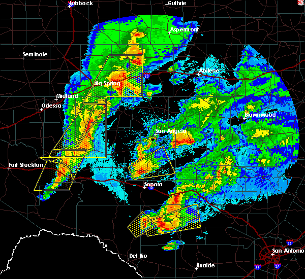 At 212 am cdt, a severe thunderstorm capable of producing a tornado was located 11 miles southwest of eldorado, moving east at 20 mph (radar indicated rotation). Hazards include tornado and quarter size hail. Flying debris will be dangerous to those caught without shelter. mobile homes will be damaged or destroyed. damage to roofs, windows, and vehicles will occur. tree damage is likely. This dangerous storm will be near, eldorado around 245 am cdt. At 212 am cdt, a severe thunderstorm capable of producing a tornado was located 11 miles southwest of eldorado, moving east at 20 mph (radar indicated rotation). Hazards include tornado and quarter size hail. Flying debris will be dangerous to those caught without shelter. mobile homes will be damaged or destroyed. damage to roofs, windows, and vehicles will occur. tree damage is likely. This dangerous storm will be near, eldorado around 245 am cdt.
|
| 4/12/2020 2:10 AM CDT |
 At 210 am cdt, a severe thunderstorm was located near eldorado, moving east at 35 mph (radar indicated). Hazards include 60 mph wind gusts and quarter size hail. Hail damage to vehicles is expected. expect wind damage to roofs, siding, and trees. this severe storm will be near, eldorado around 220 am cdt. Other locations impacted by this severe thunderstorm include the intersection of ranch road 1828 and ranch road 915, the intersection of us-190 and ranch road 1828, the intersection of us- 190 and ranch road 2084 and adams. At 210 am cdt, a severe thunderstorm was located near eldorado, moving east at 35 mph (radar indicated). Hazards include 60 mph wind gusts and quarter size hail. Hail damage to vehicles is expected. expect wind damage to roofs, siding, and trees. this severe storm will be near, eldorado around 220 am cdt. Other locations impacted by this severe thunderstorm include the intersection of ranch road 1828 and ranch road 915, the intersection of us-190 and ranch road 1828, the intersection of us- 190 and ranch road 2084 and adams.
|
| 4/12/2020 1:58 AM CDT |
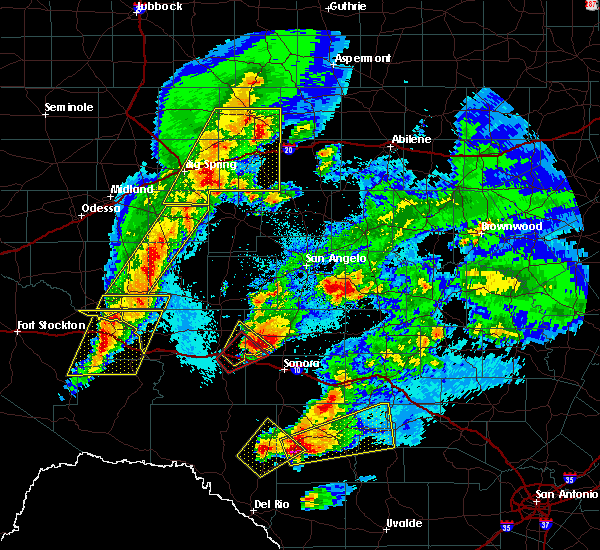 At 158 am cdt, a severe thunderstorm was located 9 miles west of eldorado, moving northeast at 50 mph (radar indicated). Hazards include 60 mph wind gusts and half dollar size hail. Hail damage to vehicles is expected. expect wind damage to roofs, siding, and trees. this severe thunderstorm will be near, eldorado around 210 am cdt. Other locations impacted by this severe thunderstorm include the intersection of ranch road 1828 and ranch road 915, the intersection of us-190 and ranch road 1828, the intersection of us- 190 and ranch road 2084 and adams. At 158 am cdt, a severe thunderstorm was located 9 miles west of eldorado, moving northeast at 50 mph (radar indicated). Hazards include 60 mph wind gusts and half dollar size hail. Hail damage to vehicles is expected. expect wind damage to roofs, siding, and trees. this severe thunderstorm will be near, eldorado around 210 am cdt. Other locations impacted by this severe thunderstorm include the intersection of ranch road 1828 and ranch road 915, the intersection of us-190 and ranch road 1828, the intersection of us- 190 and ranch road 2084 and adams.
|
| 7/10/2019 6:10 PM CDT |
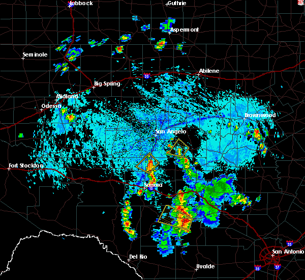 At 609 pm cdt, a severe thunderstorm was located 10 miles north of eldorado, moving northwest at 10 mph (radar indicated). Hazards include 60 mph wind gusts and quarter size hail. Hail damage to vehicles is expected. expect wind damage to roofs, siding, and trees. Locations impacted include, eldorado and the intersection of ranch road 1828 and ranch road 915. At 609 pm cdt, a severe thunderstorm was located 10 miles north of eldorado, moving northwest at 10 mph (radar indicated). Hazards include 60 mph wind gusts and quarter size hail. Hail damage to vehicles is expected. expect wind damage to roofs, siding, and trees. Locations impacted include, eldorado and the intersection of ranch road 1828 and ranch road 915.
|
| 7/10/2019 5:59 PM CDT |
 At 558 pm cdt, a severe thunderstorm was located 8 miles northeast of eldorado, moving northwest at 10 mph (radar indicated). Hazards include 60 mph wind gusts and quarter size hail. Hail damage to vehicles is expected. expect wind damage to roofs, siding, and trees. This severe thunderstorm will remain over mainly rural areas of north central schleicher and southern tom green counties, including the following locations, the intersection of ranch road 1828 and ranch road 915. At 558 pm cdt, a severe thunderstorm was located 8 miles northeast of eldorado, moving northwest at 10 mph (radar indicated). Hazards include 60 mph wind gusts and quarter size hail. Hail damage to vehicles is expected. expect wind damage to roofs, siding, and trees. This severe thunderstorm will remain over mainly rural areas of north central schleicher and southern tom green counties, including the following locations, the intersection of ranch road 1828 and ranch road 915.
|
| 5/18/2019 2:14 AM CDT | The schleicher county sheriff office reported a roof blown off of a residence 12 miles north of eldorado... on county road 43 in schleicher county TX, 11.6 miles S of Eldorado, TX |
| 5/18/2019 2:14 AM CDT | Thunderstorm wind damage to a residence 12 miles north of eldorado... in northern schleicher county. large live oak trees were blown over... a window was blown out of a in schleicher county TX, 12.3 miles S of Eldorado, TX |
| 5/16/2018 9:49 PM CDT |
 At 948 pm cdt, severe thunderstorms were located along a line extending from eldorado to 29 miles south of christoval to 13 miles northwest of sonora, moving southeast at 25 mph (radar indicated). Hazards include 60 mph wind gusts. Expect damage to roofs, siding, and trees. These severe thunderstorms will remain over mainly rural areas of southwestern schleicher and north central sutton counties, including the following locations: the intersection of ranch road 1828 and ranch road 915 and us-277 near the sutton-schleicher county line. At 948 pm cdt, severe thunderstorms were located along a line extending from eldorado to 29 miles south of christoval to 13 miles northwest of sonora, moving southeast at 25 mph (radar indicated). Hazards include 60 mph wind gusts. Expect damage to roofs, siding, and trees. These severe thunderstorms will remain over mainly rural areas of southwestern schleicher and north central sutton counties, including the following locations: the intersection of ranch road 1828 and ranch road 915 and us-277 near the sutton-schleicher county line.
|
| 5/16/2018 9:28 PM CDT |
 At 927 pm cdt, severe thunderstorms were located along a line extending from 7 miles north of eldorado to 26 miles southwest of christoval to 19 miles northwest of sonora, moving southeast at 20 mph (radar indicated). Hazards include 60 mph wind gusts and dime size hail. Expect damage to roofs, siding, and trees. severe thunderstorms will be near, eldorado around 945 pm cdt. other locations impacted by these severe thunderstorms include the intersection of ranch road 1828 and ranch road 915, the intersection of us-190 and ranch road 1828 and us-277 near the sutton- schleicher county line. This includes interstate 10 between mile markers 393 and 395. At 927 pm cdt, severe thunderstorms were located along a line extending from 7 miles north of eldorado to 26 miles southwest of christoval to 19 miles northwest of sonora, moving southeast at 20 mph (radar indicated). Hazards include 60 mph wind gusts and dime size hail. Expect damage to roofs, siding, and trees. severe thunderstorms will be near, eldorado around 945 pm cdt. other locations impacted by these severe thunderstorms include the intersection of ranch road 1828 and ranch road 915, the intersection of us-190 and ranch road 1828 and us-277 near the sutton- schleicher county line. This includes interstate 10 between mile markers 393 and 395.
|
| 5/3/2018 1:05 AM CDT |
 At 1258 am cdt, a severe thunderstorm was located over eldorado, moving northeast at 40 mph (radar indicated). Hazards include 60 mph wind gusts and quarter size hail. Hail damage to vehicles is expected. expect wind damage to roofs, siding, and trees. This severe thunderstorm will remain over mainly rural areas of western schleicher county, including the following locations: the intersection of ranch road 1828 and ranch road 915. At 1258 am cdt, a severe thunderstorm was located over eldorado, moving northeast at 40 mph (radar indicated). Hazards include 60 mph wind gusts and quarter size hail. Hail damage to vehicles is expected. expect wind damage to roofs, siding, and trees. This severe thunderstorm will remain over mainly rural areas of western schleicher county, including the following locations: the intersection of ranch road 1828 and ranch road 915.
|
| 5/3/2018 12:59 AM CDT |
 A severe thunderstorm warning remains in effect until 115 am cdt for western schleicher county. at 1258 am cdt, a severe thunderstorm was located over eldorado, moving northeast at 40 mph. hazard. 60 mph wind gusts and quarter size hail. source. Radar indicated. A severe thunderstorm warning remains in effect until 115 am cdt for western schleicher county. at 1258 am cdt, a severe thunderstorm was located over eldorado, moving northeast at 40 mph. hazard. 60 mph wind gusts and quarter size hail. source. Radar indicated.
|
| 5/3/2018 12:43 AM CDT |
 A severe thunderstorm warning remains in effect until 115 am cdt for western schleicher and northwestern sutton counties. at 1242 am cdt, a severe thunderstorm was located 9 miles southwest of eldorado, moving northeast at 40 mph. hazard. 60 mph wind gusts and quarter size hail. source. Radar indicated. A severe thunderstorm warning remains in effect until 115 am cdt for western schleicher and northwestern sutton counties. at 1242 am cdt, a severe thunderstorm was located 9 miles southwest of eldorado, moving northeast at 40 mph. hazard. 60 mph wind gusts and quarter size hail. source. Radar indicated.
|
| 5/3/2018 12:11 AM CDT |
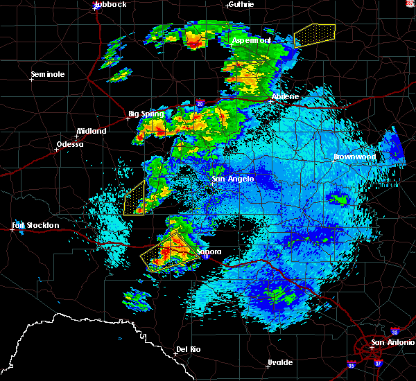 At 1211 am cdt, a severe thunderstorm was located 12 miles southeast of ozona, moving northeast at 40 mph (radar indicated). Hazards include 60 mph wind gusts and quarter size hail. Hail damage to vehicles is expected. expect wind damage to roofs, siding, and trees. this severe thunderstorm will be near, eldorado around 100 am cdt. other locations impacted by this severe thunderstorm include the intersection of ranch road 1828 and ranch road 915, the intersection of us-190 and ranch road 1828, i-10 near the crockett- sutton county line, the intersection of i- 10 and ranch road 1989 and us-277 near the sutton- schleicher county line. This includes interstate 10 between mile markers 370 and 396. At 1211 am cdt, a severe thunderstorm was located 12 miles southeast of ozona, moving northeast at 40 mph (radar indicated). Hazards include 60 mph wind gusts and quarter size hail. Hail damage to vehicles is expected. expect wind damage to roofs, siding, and trees. this severe thunderstorm will be near, eldorado around 100 am cdt. other locations impacted by this severe thunderstorm include the intersection of ranch road 1828 and ranch road 915, the intersection of us-190 and ranch road 1828, i-10 near the crockett- sutton county line, the intersection of i- 10 and ranch road 1989 and us-277 near the sutton- schleicher county line. This includes interstate 10 between mile markers 370 and 396.
|
| 5/2/2018 9:07 PM CDT |
 At 907 pm cdt, a severe thunderstorm was located 7 miles south of eldorado, moving northeast at 40 mph (radar indicated). Hazards include ping pong ball size hail and 60 mph wind gusts. People and animals outdoors will be injured. expect hail damage to roofs, siding, windows, and vehicles. expect wind damage to roofs, siding, and trees. this severe storm will be near, eldorado around 920 pm cdt. Other locations impacted by this severe thunderstorm include us- 277 near the sutton-schleicher county line. At 907 pm cdt, a severe thunderstorm was located 7 miles south of eldorado, moving northeast at 40 mph (radar indicated). Hazards include ping pong ball size hail and 60 mph wind gusts. People and animals outdoors will be injured. expect hail damage to roofs, siding, windows, and vehicles. expect wind damage to roofs, siding, and trees. this severe storm will be near, eldorado around 920 pm cdt. Other locations impacted by this severe thunderstorm include us- 277 near the sutton-schleicher county line.
|
| 5/2/2018 8:41 PM CDT |
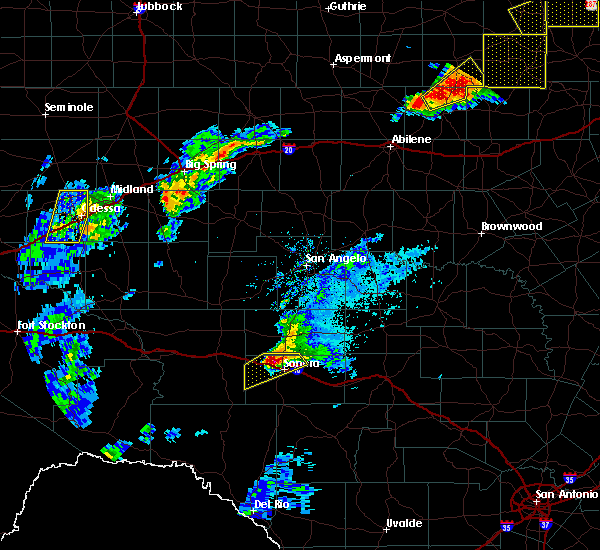 At 841 pm cdt, a severe thunderstorm was located 7 miles northwest of sonora, moving northeast at 35 mph (radar indicated). Hazards include ping pong ball size hail and 60 mph wind gusts. People and animals outdoors will be injured. expect hail damage to roofs, siding, windows, and vehicles. expect wind damage to roofs, siding, and trees. this severe thunderstorm will be near, eldorado around 910 pm cdt. other locations impacted by this severe thunderstorm include us- 277 near the sutton-schleicher county line and the intersection of i- 10 and ranch road 1989. This includes interstate 10 between mile markers 390 and 398. At 841 pm cdt, a severe thunderstorm was located 7 miles northwest of sonora, moving northeast at 35 mph (radar indicated). Hazards include ping pong ball size hail and 60 mph wind gusts. People and animals outdoors will be injured. expect hail damage to roofs, siding, windows, and vehicles. expect wind damage to roofs, siding, and trees. this severe thunderstorm will be near, eldorado around 910 pm cdt. other locations impacted by this severe thunderstorm include us- 277 near the sutton-schleicher county line and the intersection of i- 10 and ranch road 1989. This includes interstate 10 between mile markers 390 and 398.
|
| 6/23/2017 9:31 PM CDT |
 At 931 pm cdt, severe thunderstorms were located along a line extending from 13 miles southwest of fort mckavett to 15 miles northwest of sonora to 11 miles west of ozona, moving south at 45 mph (radar indicated). Hazards include 60 mph wind gusts. Expect damage to roofs, siding, and trees. these severe thunderstorms will remain over mainly rural areas of schleicher, eastern crockett and sutton counties, including the following locations: the intersection of ranch road 2083 and highway 405, the intersection of ranch road 2596 and ranch road 864, the intersection of us-190 and ranch road 2084, the intersection of u. s 190 and highway 163, the intersection of us-190 and ranch road 1828, i-10 near the crockett-sutton county line, the intersection of i-10 and ranch road 1989, the intersection of i-10 and highway 290, the intersection of us-277 and ranch road 189 and the intersection of highway 163 and ranch road 1973. This includes interstate 10 between mile markers 343 and 429. At 931 pm cdt, severe thunderstorms were located along a line extending from 13 miles southwest of fort mckavett to 15 miles northwest of sonora to 11 miles west of ozona, moving south at 45 mph (radar indicated). Hazards include 60 mph wind gusts. Expect damage to roofs, siding, and trees. these severe thunderstorms will remain over mainly rural areas of schleicher, eastern crockett and sutton counties, including the following locations: the intersection of ranch road 2083 and highway 405, the intersection of ranch road 2596 and ranch road 864, the intersection of us-190 and ranch road 2084, the intersection of u. s 190 and highway 163, the intersection of us-190 and ranch road 1828, i-10 near the crockett-sutton county line, the intersection of i-10 and ranch road 1989, the intersection of i-10 and highway 290, the intersection of us-277 and ranch road 189 and the intersection of highway 163 and ranch road 1973. This includes interstate 10 between mile markers 343 and 429.
|
| 6/23/2017 8:40 PM CDT |
 At 840 pm cdt, severe thunderstorms were located along a line extending from 12 miles southwest of eden to 8 miles northeast of eldorado to 24 miles northwest of sonora to 17 miles northwest of ozona, moving south at 30 mph (radar indicated). Hazards include 70 mph wind gusts. Expect considerable tree damage. damage is likely to mobile homes, roofs, and outbuildings. severe thunderstorms will be near, eldorado around 845 pm cdt. other locations impacted by these severe thunderstorms include the intersection of highway 163 and ranch road 1973, the intersection of ranch road 2596 and ranch road 864, the intersection of us- 190 and ranch road 2084, the intersection of u. s 190 and highway 163, camp sol mayer, the intersection of us-190 and ranch road 1828, i- 10 near the crockett-sutton county line, us-190 near the crockett- sutton county line and the intersection of i-10 and ranch road 1989. This includes interstate 10 between mile markers 350 and 415. At 840 pm cdt, severe thunderstorms were located along a line extending from 12 miles southwest of eden to 8 miles northeast of eldorado to 24 miles northwest of sonora to 17 miles northwest of ozona, moving south at 30 mph (radar indicated). Hazards include 70 mph wind gusts. Expect considerable tree damage. damage is likely to mobile homes, roofs, and outbuildings. severe thunderstorms will be near, eldorado around 845 pm cdt. other locations impacted by these severe thunderstorms include the intersection of highway 163 and ranch road 1973, the intersection of ranch road 2596 and ranch road 864, the intersection of us- 190 and ranch road 2084, the intersection of u. s 190 and highway 163, camp sol mayer, the intersection of us-190 and ranch road 1828, i- 10 near the crockett-sutton county line, us-190 near the crockett- sutton county line and the intersection of i-10 and ranch road 1989. This includes interstate 10 between mile markers 350 and 415.
|
| 6/4/2017 9:16 PM CDT |
 At 915 pm cdt, a severe thunderstorm was located 7 miles southeast of eldorado to 10 miles northeast of eldorado, moving south at 45 mph (radar indicated). Hazards include 65 mph wind gusts. Expect damage to roofs, siding, and trees. this severe thunderstorm will remain over mainly rural areas of central schleicher and eastern sutton counties, including the following locations: the intersection of ranch road 2596 and ranch road 864. This includes interstate 10 between mile markers 406 and 430. At 915 pm cdt, a severe thunderstorm was located 7 miles southeast of eldorado to 10 miles northeast of eldorado, moving south at 45 mph (radar indicated). Hazards include 65 mph wind gusts. Expect damage to roofs, siding, and trees. this severe thunderstorm will remain over mainly rural areas of central schleicher and eastern sutton counties, including the following locations: the intersection of ranch road 2596 and ranch road 864. This includes interstate 10 between mile markers 406 and 430.
|
| 6/4/2017 8:52 PM CDT |
 At 851 pm cdt, a severe thunderstorm was located 6 miles southwest of christoval, moving south at 40 mph (radar indicated). Hazards include 65 mph wind gusts. Expect damage to roofs, siding, and trees. this severe thunderstorm will be near, eldorado around 910 pm cdt. Other locations impacted by this severe thunderstorm include the intersection of ranch road 1828 and ranch road 915 and the intersection of us-190 and ranch road 2084. At 851 pm cdt, a severe thunderstorm was located 6 miles southwest of christoval, moving south at 40 mph (radar indicated). Hazards include 65 mph wind gusts. Expect damage to roofs, siding, and trees. this severe thunderstorm will be near, eldorado around 910 pm cdt. Other locations impacted by this severe thunderstorm include the intersection of ranch road 1828 and ranch road 915 and the intersection of us-190 and ranch road 2084.
|
| 3/28/2017 9:10 PM CDT |
 At 908 pm cdt, a severe thunderstorm was located 9 miles northwest of eldorado, moving east at 45 mph (radar indicated). Hazards include 60 mph wind gusts and quarter size hail. Hail damage to vehicles is expected. expect wind damage to roofs, siding, and trees. This severe storm will be near, eldorado around 920 pm cdt. At 908 pm cdt, a severe thunderstorm was located 9 miles northwest of eldorado, moving east at 45 mph (radar indicated). Hazards include 60 mph wind gusts and quarter size hail. Hail damage to vehicles is expected. expect wind damage to roofs, siding, and trees. This severe storm will be near, eldorado around 920 pm cdt.
|
| 3/28/2017 8:42 PM CDT |
 At 841 pm cdt, a severe thunderstorm was located 14 miles southeast of barnhart, or 17 miles northeast of ozona, moving east at 45 mph (radar indicated). Hazards include 60 mph wind gusts and quarter size hail. Hail damage to vehicles is expected. expect wind damage to roofs, siding, and trees. this severe thunderstorm will be near, eldorado around 920 pm cdt. This includes interstate 10 between mile markers 336 and 405. At 841 pm cdt, a severe thunderstorm was located 14 miles southeast of barnhart, or 17 miles northeast of ozona, moving east at 45 mph (radar indicated). Hazards include 60 mph wind gusts and quarter size hail. Hail damage to vehicles is expected. expect wind damage to roofs, siding, and trees. this severe thunderstorm will be near, eldorado around 920 pm cdt. This includes interstate 10 between mile markers 336 and 405.
|
| 1/2/2017 12:35 AM CST |
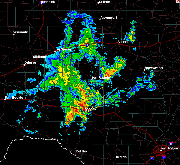 At 1234 am cst, a severe thunderstorm was located 9 miles north of sonora, moving northeast at 55 mph (radar indicated). Hazards include 60 mph wind gusts and quarter size hail. Hail damage to vehicles is expected. expect wind damage to roofs, siding, and trees. this severe thunderstorm will be near, eldorado around 1245 am cst. other locations impacted by this severe thunderstorm include the intersection of us-190 and ranch road 2084. This includes interstate 10 between mile markers 396 and 407. At 1234 am cst, a severe thunderstorm was located 9 miles north of sonora, moving northeast at 55 mph (radar indicated). Hazards include 60 mph wind gusts and quarter size hail. Hail damage to vehicles is expected. expect wind damage to roofs, siding, and trees. this severe thunderstorm will be near, eldorado around 1245 am cst. other locations impacted by this severe thunderstorm include the intersection of us-190 and ranch road 2084. This includes interstate 10 between mile markers 396 and 407.
|
| 9/18/2016 8:10 PM CDT |
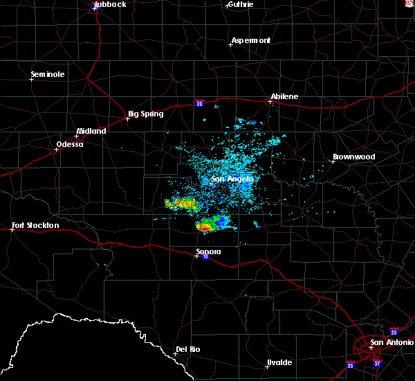 At 810 pm cdt, a severe thunderstorm was located near eldorado, moving southeast at 20 mph (radar indicated). Hazards include 60 mph wind gusts and quarter size hail. Hail damage to vehicles is expected. expect wind damage to roofs, siding, and trees. This severe thunderstorm will remain over mainly rural areas of southeastern schleicher county. At 810 pm cdt, a severe thunderstorm was located near eldorado, moving southeast at 20 mph (radar indicated). Hazards include 60 mph wind gusts and quarter size hail. Hail damage to vehicles is expected. expect wind damage to roofs, siding, and trees. This severe thunderstorm will remain over mainly rural areas of southeastern schleicher county.
|
| 6/26/2016 6:49 PM CDT |
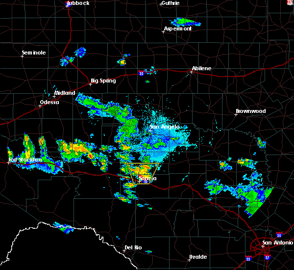 At 649 pm cdt, a severe thunderstorm was located near sonora, moving north at 10 mph. this storm has the potential to produce large hail to the size of golf balls (radar indicated). Hazards include golf ball size hail and 60 mph wind gusts. People and animals outdoors will be injured. expect hail damage to roofs, siding, windows, and vehicles. expect wind damage to roofs, siding, and trees. locations impacted include, sonora, eldorado, the intersection of us- 190 and ranch road 2084 and the intersection of us- 190 and ranch road 1828. This includes interstate 10 between mile markers 394 and 411. At 649 pm cdt, a severe thunderstorm was located near sonora, moving north at 10 mph. this storm has the potential to produce large hail to the size of golf balls (radar indicated). Hazards include golf ball size hail and 60 mph wind gusts. People and animals outdoors will be injured. expect hail damage to roofs, siding, windows, and vehicles. expect wind damage to roofs, siding, and trees. locations impacted include, sonora, eldorado, the intersection of us- 190 and ranch road 2084 and the intersection of us- 190 and ranch road 1828. This includes interstate 10 between mile markers 394 and 411.
|
| 6/26/2016 6:42 PM CDT |
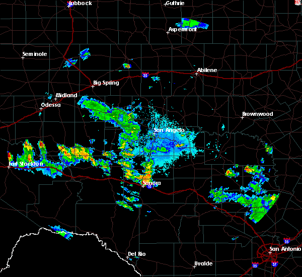 At 642 pm cdt, a severe thunderstorm was located near sonora, moving north at 10 mph (radar indicated). Hazards include 60 mph wind gusts and quarter size hail. Hail damage to vehicles is expected. expect wind damage to roofs, siding, and trees. this severe thunderstorm will remain over mainly rural areas of north central sutton and southern schleicher counties, including the following locations: the intersection of us-190 and ranch road 2084 and the intersection of us-190 and ranch road 1828. This includes interstate 10 between mile markers 394 and 411. At 642 pm cdt, a severe thunderstorm was located near sonora, moving north at 10 mph (radar indicated). Hazards include 60 mph wind gusts and quarter size hail. Hail damage to vehicles is expected. expect wind damage to roofs, siding, and trees. this severe thunderstorm will remain over mainly rural areas of north central sutton and southern schleicher counties, including the following locations: the intersection of us-190 and ranch road 2084 and the intersection of us-190 and ranch road 1828. This includes interstate 10 between mile markers 394 and 411.
|
| 6/1/2016 5:48 PM CDT |
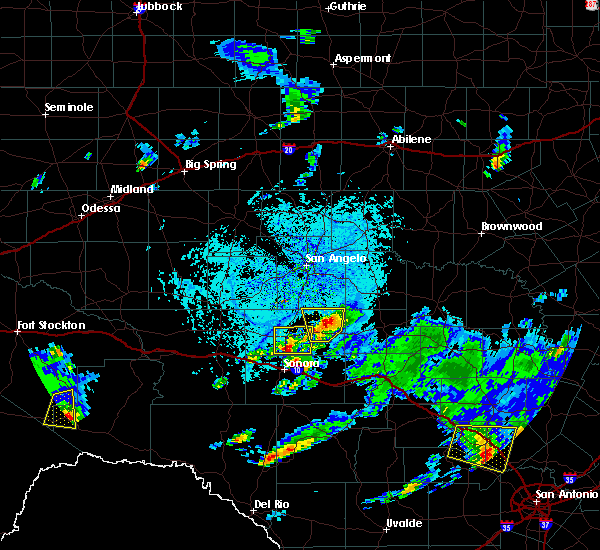 At 548 pm cdt, a severe thunderstorm was located near eldorado, moving northeast at 10 mph (radar indicated). Hazards include 60 mph wind gusts and quarter size hail. Hail damage to vehicles is expected. expect wind damage to roofs, siding, and trees. This severe thunderstorm will be near, eldorado around 625 pm cdt. At 548 pm cdt, a severe thunderstorm was located near eldorado, moving northeast at 10 mph (radar indicated). Hazards include 60 mph wind gusts and quarter size hail. Hail damage to vehicles is expected. expect wind damage to roofs, siding, and trees. This severe thunderstorm will be near, eldorado around 625 pm cdt.
|
| 5/17/2016 6:27 PM CDT |
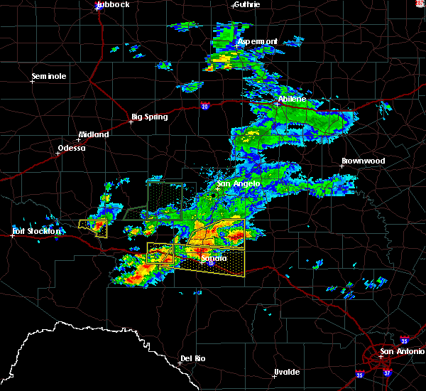 At 627 pm cdt, a severe thunderstorm was located near fort mckavett, or 23 miles west of menard, moving northeast at 10 mph (radar indicated). Hazards include tennis ball size hail and 60 mph wind gusts. People and animals outdoors will be injured. expect hail damage to roofs, siding, windows, and vehicles. expect wind damage to roofs, siding, and trees. Locations impacted include, eldorado, the intersection of us- 190 and ranch road 2084 and the intersection of ranch road 1828 and ranch road 915. At 627 pm cdt, a severe thunderstorm was located near fort mckavett, or 23 miles west of menard, moving northeast at 10 mph (radar indicated). Hazards include tennis ball size hail and 60 mph wind gusts. People and animals outdoors will be injured. expect hail damage to roofs, siding, windows, and vehicles. expect wind damage to roofs, siding, and trees. Locations impacted include, eldorado, the intersection of us- 190 and ranch road 2084 and the intersection of ranch road 1828 and ranch road 915.
|
| 5/17/2016 6:20 PM CDT | Half Dollar sized hail reported 25.3 miles W of Eldorado, TX |
| 5/17/2016 5:40 PM CDT |
 At 539 pm cdt, a severe thunderstorm was located 13 miles north of ozona, moving east at 25 mph. additional severe thunderstorms were affecting southern tom green, and schleicher counties (radar indicated). Hazards include golf ball size hail and 60 mph wind gusts. People and animals outdoors will be injured. expect hail damage to roofs, siding, windows, and vehicles. expect wind damage to roofs, siding, and trees. this severe thunderstorm will remain over mainly rural areas of schleicher, southeastern tom green and northeastern crockett counties, including the following locations: the intersection of us-190 and ranch road 2084, us-190 near the crockett-sutton county line, the intersection of u. S 190 and highway 163, the intersection of ranch road 1828 and ranch road 915 and the intersection of us-190 and ranch road 1828. At 539 pm cdt, a severe thunderstorm was located 13 miles north of ozona, moving east at 25 mph. additional severe thunderstorms were affecting southern tom green, and schleicher counties (radar indicated). Hazards include golf ball size hail and 60 mph wind gusts. People and animals outdoors will be injured. expect hail damage to roofs, siding, windows, and vehicles. expect wind damage to roofs, siding, and trees. this severe thunderstorm will remain over mainly rural areas of schleicher, southeastern tom green and northeastern crockett counties, including the following locations: the intersection of us-190 and ranch road 2084, us-190 near the crockett-sutton county line, the intersection of u. S 190 and highway 163, the intersection of ranch road 1828 and ranch road 915 and the intersection of us-190 and ranch road 1828.
|
| 5/10/2016 5:56 PM CDT |
 At 556 pm cdt, a severe thunderstorm was located near eldorado, moving northeast at 25 mph (radar indicated). Hazards include ping pong ball size hail and 60 mph wind gusts. People and animals outdoors will be injured. expect hail damage to roofs, siding, windows, and vehicles. expect wind damage to roofs, siding, and trees. this severe thunderstorm will be near, eldorado around 605 pm cdt. Other locations impacted by this severe thunderstorm include the intersection of ranch road 1828 and ranch road 915. At 556 pm cdt, a severe thunderstorm was located near eldorado, moving northeast at 25 mph (radar indicated). Hazards include ping pong ball size hail and 60 mph wind gusts. People and animals outdoors will be injured. expect hail damage to roofs, siding, windows, and vehicles. expect wind damage to roofs, siding, and trees. this severe thunderstorm will be near, eldorado around 605 pm cdt. Other locations impacted by this severe thunderstorm include the intersection of ranch road 1828 and ranch road 915.
|
| 5/28/2015 8:53 PM CDT | At 851 pm cdt, severe thunderstorms were located along a line extending from 17 miles northwest of fort mckavett to 12 miles east of the terrell gas plant, and moving southeast at 35 mph (radar indicated). Hazards include 60 mph wind gusts. Expect damage to roofs. siding and trees. severe thunderstorms will be near, sonora around 915 pm cdt. other locations in the warning include the intersection of us-190 and ranch road 2084, the intersection of highway 163 and ranch road 1973, us-277 near the sutton-schleicher county line and the intersection of i-10 and ranch road 1989. This includes interstate 10 between mile markers 342 and 428. |
| 5/28/2015 8:17 PM CDT | At 814 pm cdt, severe thunderstorms were located along a line extending from 11 miles southwest of christoval to 13 miles southeast of sheffield, moving southeast at 50 mph (radar indicated). Hazards include 60 mph wind gusts and quarter size hail. Hail damage to vehicles is expected. expect wind damage to roofs, siding and trees. severe thunderstorms will be near, eldorado around 830 pm cdt. sonora around 850 pm cdt. This also includes interstate 10 between mile markers 343 and 428. |
| 5/20/2015 7:09 PM CDT | At 708 pm cdt, a severe thunderstorm was located 6 miles southeast of eldorado, and moving east at 15 mph (radar indicated). Hazards include 60 mph wind gusts and quarter size hail. Hail damage to vehicles is expected. expect wind damage to roofs, siding and trees. The severe thunderstorm will affect mainly rural areas of south central schleicher county. |
| 5/20/2015 6:55 PM CDT | Trained spotter estimated a wind gust to 60 mph and reported tree limbs down at the intersetion of highway 2129 and 10 in schleicher county TX, 4.4 miles ENE of Eldorado, TX |
| 5/20/2015 6:52 PM CDT | At 651 pm cdt, a severe thunderstorm was located 5 miles south of eldorado, moving east at 10 mph (radar indicated). Hazards include 60 mph wind gusts and quarter size hail. Hail damage to vehicles is expected. expect wind damage to roofs, siding and trees. The severe thunderstorm will be near, eldorado around 700 pm cdt. |
| 5/20/2015 6:12 PM CDT | At 609 pm cdt, a severe thunderstorm was located 10 miles west of eldorado. another severe thunderstorm was located 8 miles northwest of eldorado. these thunderstorms are moving southeast at 15 mph (radar indicated). Hazards include 60 mph wind gusts and quarter size hail. Hail damage to vehicles is expected. expect wind damage to roofs, siding and trees. The severe thunderstorm will be near, eldorado around 630 pm cdt. |
| 5/20/2015 5:55 PM CDT | At 553 pm cdt, a severe thunderstorm was located 10 miles north of eldorado, and moving southeast at 25 mph (radar indicated). Hazards include 60 mph wind gusts and quarter size hail. Hail damage to vehicles is expected. expect wind damage to roofs, siding and trees. The severe thunderstorm will be near, eldorado around 615 pm cdt. |
| 5/20/2015 5:37 PM CDT | At 533 pm cdt, a severe thunderstorm was located 14 miles south of mertzon, moving southeast at 25 mph (radar indicated). Hazards include ping pong ball size hail and 60 mph wind gusts. People and pets outdoors will be injured. expect hail damage to roofs, siding, windows and vehicles. expect wind damage to roofs, siding and trees. the severe thunderstorm will be near, eldorado around 610 pm cdt. Other locations in the warning include the intersection of ranch road 1828 and ranch road 915. |
| 5/19/2015 3:13 AM CDT | At 309 am cdt, severe thunderstorms were located along a line extending from 8 miles northwest of arden to 6 miles southeast of mertzon to 18 miles west of eldorado, moving east at 35 mph (radar indicated). Hazards include 60 mph wind gusts and quarter size hail. Hail damage to vehicles is expected. expect wind damage to roofs, siding and trees. severe thunderstorms will be near, tankersley and knickerbocker around 325 am cdt. twin buttes reservoir and christoval around 335 am cdt. san angelo state park and o. c. fisher reservoir around 340 am cdt. san angelo around 345 am cdt. goodfellow air force base around 350 am cdt. wall around 400 am cdt. other locations in the warning include us-67 near the irion-tom green county line, the intersection of ranch road 1828 and ranch road 915 and the intersection of us-190 and ranch road 2084. 1. 00in. |
| 5/18/2015 8:20 PM CDT | At 818 pm cdt, a severe thunderstorm was located 13 miles south of mertzon, and moving north at 20 mph (radar indicated). Hazards include ping pong ball size hail and 60 mph wind gusts. People and pets outdoors will be injured. expect hail damage to roofs, siding, windows and vehicles. expect wind damage to roofs, siding and trees. the severe thunderstorm will be near, mertzon around 845 pm cdt. 1. 50in. |
| 5/18/2015 8:04 PM CDT | At 802 pm cdt, a severe thunderstorm was located 11 miles northwest of eldorado, moving north at 20 mph (radar indicated). Hazards include 60 mph wind gusts and half dollar size hail. Hail damage to vehicles is expected. expect wind damage to roofs, siding and trees. the severe thunderstorm will be near, mertzon and sherwood around 845 pm cdt. 1. 25in. |
| 5/16/2015 11:31 PM CDT | At 1129 pm cdt, severe thunderstorms were located along a line extending from eldorado to 16 miles west of ozona, and moving east at 35 mph (radar indicated). Hazards include 60 mph wind gusts and half dollar size hail. Hail damage to vehicles is expected. expect wind damage to roofs, siding and trees. locations impacted include, ozona, eldorado, i-10 near the crockett-sutton county line and us-277 near the sutton-schleicher county line. this includes interstate 10 between mile markers 332 and 382. 1. 25in. |
| 5/16/2015 11:13 PM CDT | At 1110 pm cdt, severe thunderstorms were located along a line extending from 7 miles north of eldorado to 17 miles east of sheffield, moving east at 55 mph (radar indicated). Hazards include golf ball size hail and 60 mph wind gusts. People and pets outdoors will be injured. expect hail damage to roofs, siding, windows and vehicles. expect wind damage to roofs, siding and trees. severe thunderstorms will affect mainly rural areas of northern crockett, northwestern sutton and schleicher counties, including the following locations, the intersection of us 190 and highway 163, the intersection of ranch road 1828 and ranch road 915 and us-190 near the crockett-sutton county line. this also includes interstate 10 between mile markers 332 and 381. 1. 75in. |
| 5/11/2015 11:05 AM CDT | At 1104 am cdt, a severe thunderstorm was located 10 miles northwest of sonora, and moving northeast at 15 mph (radar indicated). Hazards include 60 mph wind gusts and quarter size hail. Hail damage to vehicles is expected. expect wind damage to roofs, siding and trees. the severe thunderstorm will be near, eldorado around 1145 am cdt. other locations in the warning include us-277 near the sutton-schleicher county line. this includes interstate 10 between mile markers 381 and 398. 1. 00in. |
| 5/11/2015 10:54 AM CDT | At 1051 am cdt, a severe thunderstorm was located 8 miles northwest of sonora, moving northeast at 15 mph (radar indicated). Hazards include 60 mph wind gusts and half dollar size hail. Hail damage to vehicles is expected. expect wind damage to roofs, siding and trees. the severe thunderstorm will be near, eldorado around 1145 am cdt. other locations in the warning include us-277 near the sutton-schleicher county line. this also includes interstate 10 between mile markers 381 and 398. 1. 25in. |
| 5/10/2015 2:27 AM CDT | At 224 am cdt, a severe thunderstorm was located 7 miles east of christoval, moving east at 35 mph (radar indicated). Hazards include 60 mph wind gusts and quarter size hail. Hail damage to vehicles is expected. expect wind damage to roofs, siding and trees. the severe thunderstorm will be near, eden around 315 am cdt. other locations in the warning include live oak and us-83 near the menard-concho county line. 1. 00in. |
| 4/26/2015 8:48 PM CDT | Quarter sized hail reported 0.3 miles ENE of Eldorado, TX |
| 4/26/2015 8:46 PM CDT | At 844 pm cdt, a severe thunderstorm was located 10 miles northwest of sonora, moving east at 45 mph (radar indicated). Hazards include 60 mph wind gusts and quarter size hail. Hail damage to vehicles is expected. expect wind damage to roofs, siding and trees. the severe thunderstorm will be near, sonora around 855 pm cdt. other locations in the warning include us-277 near the sutton-schleicher county line and the intersection of ranch road 2596 and ranch road 864. this also includes interstate 10 between mile markers 377 and 428. 1. 00in. |
| 4/18/2015 2:58 PM CDT | At 257 pm cdt, a severe thunderstorm was located near eldorado, and moving east at 35 mph (trained weather spotters). Hazards include 60 mph wind gusts and quarter size hail. Hail damage to vehicles is expected. expect wind damage to roofs, siding and trees. the severe thunderstorm will affect mainly rural areas of eastern schleicher county, including the following locations, the intersection of us-190 and ranch road 2084 and adams. 1. 00in. |
| 4/18/2015 2:55 PM CDT | Quarter sized hail reported 0.3 miles ENE of Eldorado, TX |
| 4/18/2015 2:40 PM CDT | At 239 pm cdt, a severe thunderstorm was located 7 miles west of eldorado, moving east at 35 mph (radar indicated). Hazards include 60 mph wind gusts and quarter size hail. Hail damage to vehicles is expected. expect wind damage to roofs, siding and trees. the severe thunderstorm will be near, eldorado around 250 pm cdt. other locations in the warning include the intersection of us-190 and ranch road 2084 and adams. 1. 00in. |
| 7/2/2014 6:30 PM CDT | Scattered reports of wind damage from sub severe wind gusts including one power pole...several large branches...and some playground equipmen in schleicher county TX, 0.3 miles ENE of Eldorado, TX |
| 5/7/2014 7:42 PM CDT | Golf Ball sized hail reported 7.5 miles SSE of Eldorado, TX |
| 10/13/2012 7:33 PM CDT | Golf Ball sized hail reported 4 miles S of Eldorado, TX, highway 277 approx 4 miles north of eldorado |
| 10/13/2012 7:28 PM CDT | Power poles down along highway 277 in schleicher county TX, 2.7 miles S of Eldorado, TX |
| 10/13/2012 7:25 PM CDT | Quarter sized hail reported 7.5 miles SSE of Eldorado, TX |
| 8/9/2012 2:45 PM CDT | Wind damage along highway 277 south of eldorado. roof taken off a pumphouse...flagpole bent over...10 foot section of a barn door blown in. extensive tree damage as wel in schleicher county TX, 7 miles N of Eldorado, TX |
| 1/1/0001 12:00 AM | Golf Ball sized hail reported 15.1 miles E of Eldorado, TX, vehicle windows damaged |
| 1/1/0001 12:00 AM | Quarter sized hail reported 1.9 miles SE of Eldorado, TX |
Hail Maps for Eldorado, TX
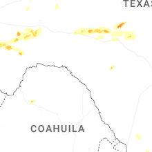
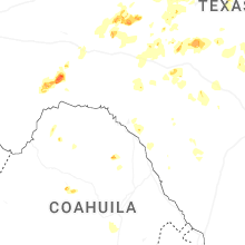
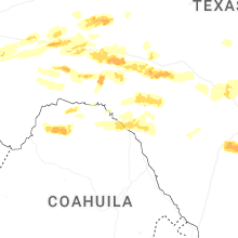
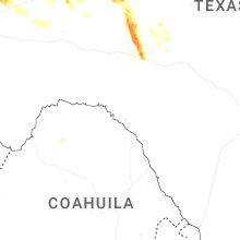
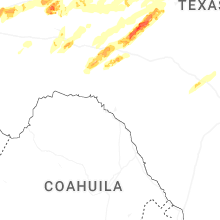


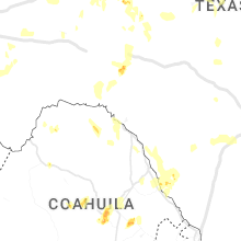


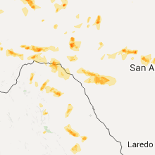


Connect with Interactive Hail Maps