

Hail Map for Elizabeth, WV
The Elizabeth, WV area has had 4 reports of on-the-ground hail by trained spotters, and has been under severe weather warnings 19 times during the past 12 months. Doppler radar has detected hail at or near Elizabeth, WV on 36 occasions, including 2 occasions during the past year.
| Name: | Elizabeth, WV |
| Where Located: | 50.8 miles NNE of Charleston, WV |
| Map: | Google Map for Elizabeth, WV |
| Population: | 823 |
| Housing Units: | 437 |
| More Info: | Search Google for Elizabeth, WV |
0
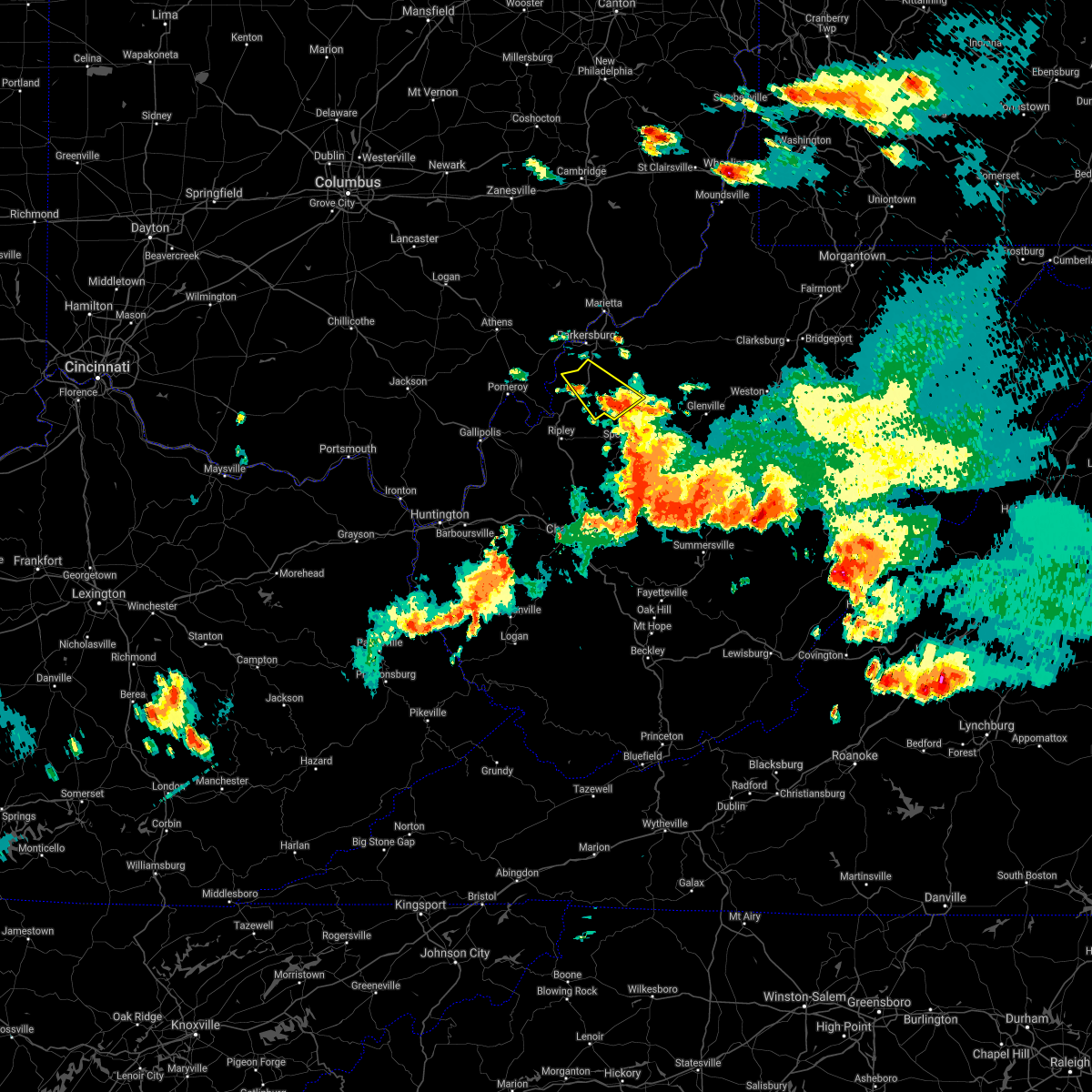
The Top Recent Hail Date for Elizabeth, WV is Monday, May 5, 2025 (36th out of 36)

Hail and Wind Damage Spotted near Elizabeth, WV
| Date / Time | Report Details |
|---|---|
| 6/19/2025 2:27 PM EDT |
 The storms which prompted the warning have weakened below severe limits, and have exited the warned area. therefore, the warning will be allowed to expire. however, gusty winds are still possible with these thunderstorms. The storms which prompted the warning have weakened below severe limits, and have exited the warned area. therefore, the warning will be allowed to expire. however, gusty winds are still possible with these thunderstorms.
|
| 6/19/2025 2:09 PM EDT |
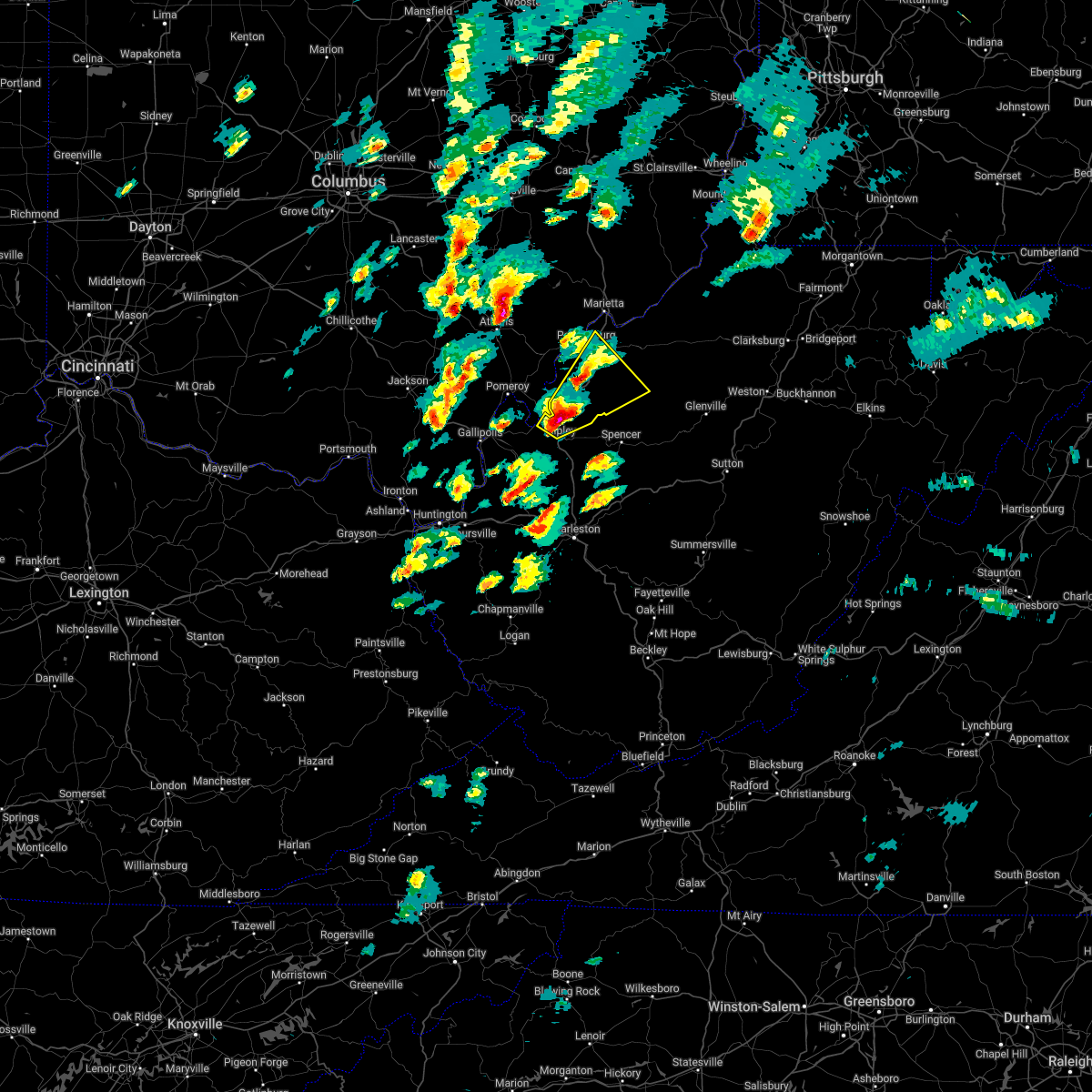
 At 209 pm edt, severe thunderstorms were located along a line extending from near middlebourne to near north bend state park to 8 miles east of sandyville, moving east at 40 mph (radar indicated). Hazards include 60 mph wind gusts. Expect damage to roofs, siding, and trees. Locations impacted include, harrisville, elizabeth, middlebourne, pennsboro, west union, sandyville, north bend state park, ellenboro, cairo, reedy, pullman, friendly, alma, cherry, smithville, maxwell, lucille, mountain, lima, and hebron. At 209 pm edt, severe thunderstorms were located along a line extending from near middlebourne to near north bend state park to 8 miles east of sandyville, moving east at 40 mph (radar indicated). Hazards include 60 mph wind gusts. Expect damage to roofs, siding, and trees. Locations impacted include, harrisville, elizabeth, middlebourne, pennsboro, west union, sandyville, north bend state park, ellenboro, cairo, reedy, pullman, friendly, alma, cherry, smithville, maxwell, lucille, mountain, lima, and hebron.
|
| 6/19/2025 2:09 PM EDT |
 the severe thunderstorm warning has been cancelled and is no longer in effect the severe thunderstorm warning has been cancelled and is no longer in effect
|
| 6/19/2025 1:47 PM EDT |
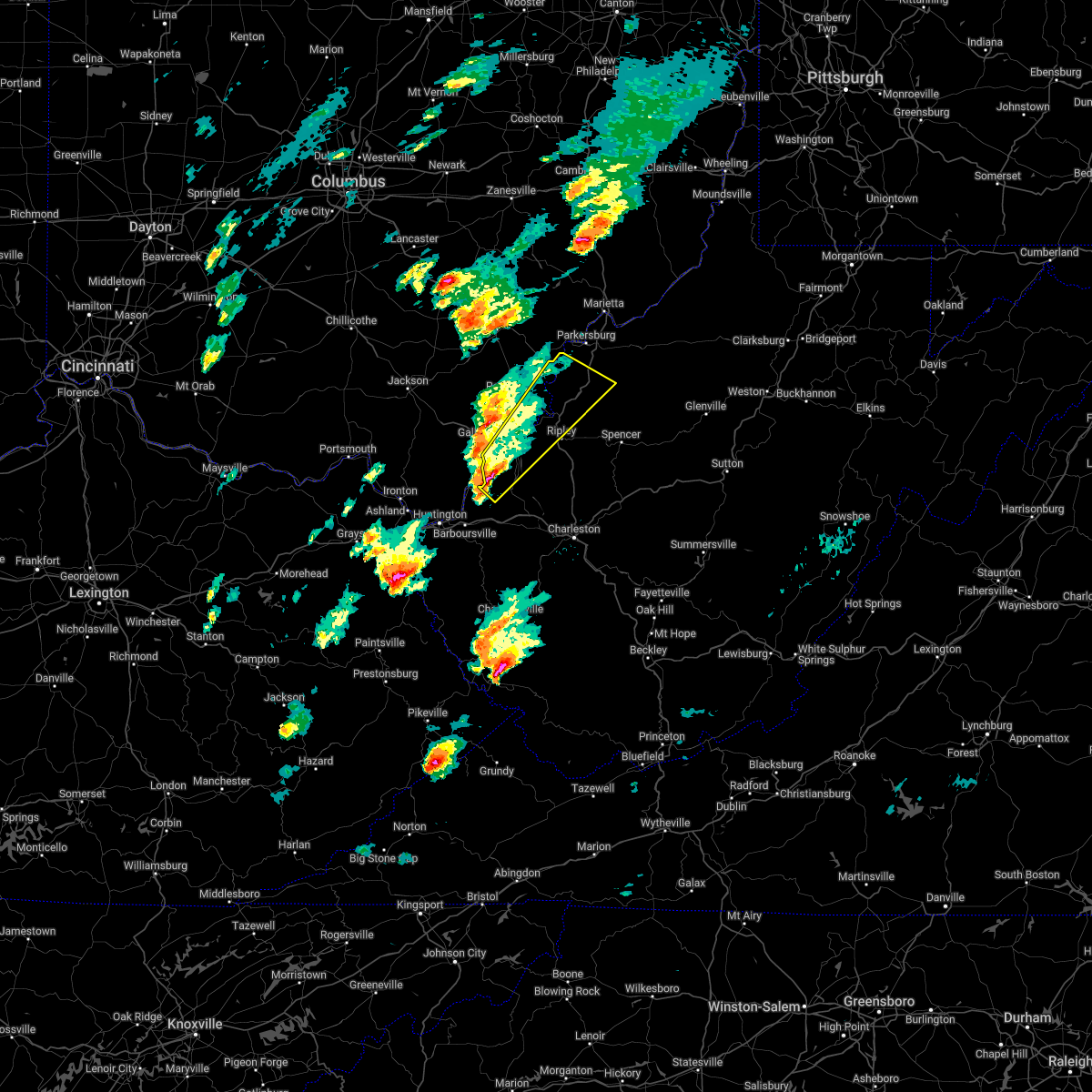
 Svrrlx the national weather service in charleston west virginia has issued a * severe thunderstorm warning for, east central washington county in southeastern ohio, pleasants county in northwestern west virginia, northwestern calhoun county in north central west virginia, ritchie county in northwestern west virginia, western doddridge county in northern west virginia, wirt county in northwestern west virginia, tyler county in northern west virginia, northwestern roane county in central west virginia, northern jackson county in northwestern west virginia, central wood county in northwestern west virginia, * until 230 pm edt. * at 147 pm edt, severe thunderstorms were located along a line extending from near st. marys to near mineralwells to near ravenswood, moving east at 40 mph (radar indicated). Hazards include 60 mph wind gusts. expect damage to roofs, siding, and trees Svrrlx the national weather service in charleston west virginia has issued a * severe thunderstorm warning for, east central washington county in southeastern ohio, pleasants county in northwestern west virginia, northwestern calhoun county in north central west virginia, ritchie county in northwestern west virginia, western doddridge county in northern west virginia, wirt county in northwestern west virginia, tyler county in northern west virginia, northwestern roane county in central west virginia, northern jackson county in northwestern west virginia, central wood county in northwestern west virginia, * until 230 pm edt. * at 147 pm edt, severe thunderstorms were located along a line extending from near st. marys to near mineralwells to near ravenswood, moving east at 40 mph (radar indicated). Hazards include 60 mph wind gusts. expect damage to roofs, siding, and trees
|
| 5/5/2025 3:42 PM EDT |
 the severe thunderstorm warning has been cancelled and is no longer in effect the severe thunderstorm warning has been cancelled and is no longer in effect
|
| 5/5/2025 3:42 PM EDT |
 At 341 pm edt, a severe thunderstorm was located near mineralwells, or 7 miles northwest of elizabeth, moving north at 30 mph (radar indicated). Hazards include 60 mph wind gusts and quarter size hail. Hail damage to vehicles is expected. expect wind damage to roofs, siding, and trees. Locations impacted include, parkersburg, belpre, elizabeth, lubeck, mineralwells, washington, blennerhassett, walker, davisville, morristown, rockport, and greencastle. At 341 pm edt, a severe thunderstorm was located near mineralwells, or 7 miles northwest of elizabeth, moving north at 30 mph (radar indicated). Hazards include 60 mph wind gusts and quarter size hail. Hail damage to vehicles is expected. expect wind damage to roofs, siding, and trees. Locations impacted include, parkersburg, belpre, elizabeth, lubeck, mineralwells, washington, blennerhassett, walker, davisville, morristown, rockport, and greencastle.
|
| 5/5/2025 3:26 PM EDT |
 Svrrlx the national weather service in charleston west virginia has issued a * severe thunderstorm warning for, western wirt county in northwestern west virginia, northeastern jackson county in northwestern west virginia, central wood county in northwestern west virginia, * until 400 pm edt. * at 326 pm edt, a severe thunderstorm was located 7 miles southwest of elizabeth, moving north at 30 mph (radar indicated). Hazards include quarter size hail. damage to vehicles is expected Svrrlx the national weather service in charleston west virginia has issued a * severe thunderstorm warning for, western wirt county in northwestern west virginia, northeastern jackson county in northwestern west virginia, central wood county in northwestern west virginia, * until 400 pm edt. * at 326 pm edt, a severe thunderstorm was located 7 miles southwest of elizabeth, moving north at 30 mph (radar indicated). Hazards include quarter size hail. damage to vehicles is expected
|
| 5/4/2025 5:00 PM EDT |
 Svrrlx the national weather service in charleston west virginia has issued a * severe thunderstorm warning for, south central washington county in southeastern ohio, southwestern pleasants county in northwestern west virginia, northwestern wirt county in northwestern west virginia, wood county in northwestern west virginia, * until 530 pm edt. * at 500 pm edt, a severe thunderstorm was located near mineralwells, or near elizabeth, moving north at 25 mph (radar indicated). Hazards include 60 mph wind gusts and half dollar size hail. Hail damage to vehicles is expected. Expect wind damage to roofs, siding, and trees. Svrrlx the national weather service in charleston west virginia has issued a * severe thunderstorm warning for, south central washington county in southeastern ohio, southwestern pleasants county in northwestern west virginia, northwestern wirt county in northwestern west virginia, wood county in northwestern west virginia, * until 530 pm edt. * at 500 pm edt, a severe thunderstorm was located near mineralwells, or near elizabeth, moving north at 25 mph (radar indicated). Hazards include 60 mph wind gusts and half dollar size hail. Hail damage to vehicles is expected. Expect wind damage to roofs, siding, and trees.
|
| 4/14/2025 5:59 PM EDT | Tree down in yard. brought power lines down as wel in wirt county WV, 4.8 miles SSW of Elizabeth, WV |
| 4/14/2025 5:40 PM EDT |
 Svrrlx the national weather service in charleston west virginia has issued a * severe thunderstorm warning for, central meigs county in southeastern ohio, northeastern gallia county in southeastern ohio, northwestern calhoun county in north central west virginia, north central mason county in western west virginia, wirt county in northwestern west virginia, northwestern roane county in central west virginia, northern jackson county in northwestern west virginia, southwestern wood county in northwestern west virginia, * until 645 pm edt. * at 540 pm edt, a severe thunderstorm was located over pomeroy, moving east at 50 mph (radar indicated). Hazards include 60 mph wind gusts and quarter size hail. Hail damage to vehicles is expected. Expect wind damage to roofs, siding, and trees. Svrrlx the national weather service in charleston west virginia has issued a * severe thunderstorm warning for, central meigs county in southeastern ohio, northeastern gallia county in southeastern ohio, northwestern calhoun county in north central west virginia, north central mason county in western west virginia, wirt county in northwestern west virginia, northwestern roane county in central west virginia, northern jackson county in northwestern west virginia, southwestern wood county in northwestern west virginia, * until 645 pm edt. * at 540 pm edt, a severe thunderstorm was located over pomeroy, moving east at 50 mph (radar indicated). Hazards include 60 mph wind gusts and quarter size hail. Hail damage to vehicles is expected. Expect wind damage to roofs, siding, and trees.
|
| 4/3/2025 5:34 AM EDT | At 533 am edt, severe thunderstorms were located along a line extending from near elizabeth to near spencer to near sissonville, moving east at 60 mph (radar indicated). Hazards include 60 mph wind gusts. Expect damage to roofs, siding, and trees. Locations impacted include, cherry, smithville, glenville, newberne, lucille, berea, stumptown, poca, tanner, macfarlan, frametown, wilsie, harmony, sand fork, tariff, gassaway, arnoldsburg, servia, auburn, and grantsville. |
| 4/3/2025 5:34 AM EDT | the severe thunderstorm warning has been cancelled and is no longer in effect |
| 4/3/2025 5:21 AM EDT |
 Svrrlx the national weather service in charleston west virginia has issued a * severe thunderstorm warning for, calhoun county in north central west virginia, east central putnam county in western west virginia, northern kanawha county in central west virginia, wirt county in northwestern west virginia, roane county in central west virginia, eastern jackson county in northwestern west virginia, south central wood county in northwestern west virginia, southern ritchie county in northwestern west virginia, southwestern doddridge county in northern west virginia, gilmer county in north central west virginia, northwestern lewis county in northern west virginia, western braxton county in north central west virginia, northern clay county in north central west virginia, * until 600 am edt. * at 521 am edt, severe thunderstorms were located along a line extending from 8 miles west of elizabeth to 7 miles west of spencer to near poca, moving east at 60 mph (radar indicated). Hazards include 60 mph wind gusts. expect damage to roofs, siding, and trees Svrrlx the national weather service in charleston west virginia has issued a * severe thunderstorm warning for, calhoun county in north central west virginia, east central putnam county in western west virginia, northern kanawha county in central west virginia, wirt county in northwestern west virginia, roane county in central west virginia, eastern jackson county in northwestern west virginia, south central wood county in northwestern west virginia, southern ritchie county in northwestern west virginia, southwestern doddridge county in northern west virginia, gilmer county in north central west virginia, northwestern lewis county in northern west virginia, western braxton county in north central west virginia, northern clay county in north central west virginia, * until 600 am edt. * at 521 am edt, severe thunderstorms were located along a line extending from 8 miles west of elizabeth to 7 miles west of spencer to near poca, moving east at 60 mph (radar indicated). Hazards include 60 mph wind gusts. expect damage to roofs, siding, and trees
|
| 4/3/2025 4:32 AM EDT |
 At 432 am edt, severe thunderstorms were located along a line extending from near pine grove to near elizabeth, moving east at 55 mph (radar indicated). Hazards include 60 mph wind gusts. Expect damage to roofs, siding, and trees. Locations impacted include, alma, portland, cherry, smithville, maxwell, mineralwells, schultz, north bend state park, mountain, lima, pennsboro, hebron, pike, center point, davisville, big springs, berea, brohard, macfarlan, and highland. At 432 am edt, severe thunderstorms were located along a line extending from near pine grove to near elizabeth, moving east at 55 mph (radar indicated). Hazards include 60 mph wind gusts. Expect damage to roofs, siding, and trees. Locations impacted include, alma, portland, cherry, smithville, maxwell, mineralwells, schultz, north bend state park, mountain, lima, pennsboro, hebron, pike, center point, davisville, big springs, berea, brohard, macfarlan, and highland.
|
| 4/3/2025 4:32 AM EDT |
 the severe thunderstorm warning has been cancelled and is no longer in effect the severe thunderstorm warning has been cancelled and is no longer in effect
|
| 4/3/2025 4:27 AM EDT |
 Torrlx the national weather service in charleston west virginia has issued a * tornado warning for, southeastern pleasants county in northwestern west virginia, ritchie county in northwestern west virginia, southwestern doddridge county in northern west virginia, central wirt county in northwestern west virginia, southwestern tyler county in northern west virginia, east central wood county in northwestern west virginia, * until 500 am edt. * at 427 am edt, a severe thunderstorm capable of producing a tornado was located near elizabeth, moving northeast at 65 mph (radar indicated rotation). Hazards include tornado. Flying debris will be dangerous to those caught without shelter. mobile homes will be damaged or destroyed. damage to roofs, windows, and vehicles will occur. tree damage is likely. this dangerous storm will be near, harrisville and north bend state park around 435 am edt. pennsboro around 440 am edt. Other locations impacted by this tornadic thunderstorm include cherry, greenwood, nutter farm, pullman, petroleum, mountain, cairo, hebron, pike, and freeport. Torrlx the national weather service in charleston west virginia has issued a * tornado warning for, southeastern pleasants county in northwestern west virginia, ritchie county in northwestern west virginia, southwestern doddridge county in northern west virginia, central wirt county in northwestern west virginia, southwestern tyler county in northern west virginia, east central wood county in northwestern west virginia, * until 500 am edt. * at 427 am edt, a severe thunderstorm capable of producing a tornado was located near elizabeth, moving northeast at 65 mph (radar indicated rotation). Hazards include tornado. Flying debris will be dangerous to those caught without shelter. mobile homes will be damaged or destroyed. damage to roofs, windows, and vehicles will occur. tree damage is likely. this dangerous storm will be near, harrisville and north bend state park around 435 am edt. pennsboro around 440 am edt. Other locations impacted by this tornadic thunderstorm include cherry, greenwood, nutter farm, pullman, petroleum, mountain, cairo, hebron, pike, and freeport.
|
| 4/3/2025 4:02 AM EDT |
 Svrrlx the national weather service in charleston west virginia has issued a * severe thunderstorm warning for, southeastern meigs county in southeastern ohio, east central washington county in southeastern ohio, pleasants county in northwestern west virginia, northwestern calhoun county in north central west virginia, ritchie county in northwestern west virginia, central doddridge county in northern west virginia, wirt county in northwestern west virginia, tyler county in northern west virginia, northern jackson county in northwestern west virginia, wood county in northwestern west virginia, * until 445 am edt. * at 401 am edt, severe thunderstorms were located along a line extending from near sistersville to near ravenswood, moving east at 110 mph (radar indicated). Hazards include 60 mph wind gusts. expect damage to roofs, siding, and trees Svrrlx the national weather service in charleston west virginia has issued a * severe thunderstorm warning for, southeastern meigs county in southeastern ohio, east central washington county in southeastern ohio, pleasants county in northwestern west virginia, northwestern calhoun county in north central west virginia, ritchie county in northwestern west virginia, central doddridge county in northern west virginia, wirt county in northwestern west virginia, tyler county in northern west virginia, northern jackson county in northwestern west virginia, wood county in northwestern west virginia, * until 445 am edt. * at 401 am edt, severe thunderstorms were located along a line extending from near sistersville to near ravenswood, moving east at 110 mph (radar indicated). Hazards include 60 mph wind gusts. expect damage to roofs, siding, and trees
|
| 4/3/2025 3:31 AM EDT |
 At 331 am edt, severe thunderstorms were located along a line extending from near chesterhill to 7 miles northwest of point pleasant, moving east at 45 mph (radar indicated). Hazards include 70 mph wind gusts. Expect considerable tree damage. damage is likely to mobile homes, roofs, and outbuildings. Locations impacted include, sandyville, point pleasant, belmont, stroud run state park, adamsville, pomeroy, mineralwells, little hocking, salem center, fleming, syracuse, dexter, amesville, racine, albany, gallia, peewee, rutland, parkersburg, and hartford city. At 331 am edt, severe thunderstorms were located along a line extending from near chesterhill to 7 miles northwest of point pleasant, moving east at 45 mph (radar indicated). Hazards include 70 mph wind gusts. Expect considerable tree damage. damage is likely to mobile homes, roofs, and outbuildings. Locations impacted include, sandyville, point pleasant, belmont, stroud run state park, adamsville, pomeroy, mineralwells, little hocking, salem center, fleming, syracuse, dexter, amesville, racine, albany, gallia, peewee, rutland, parkersburg, and hartford city.
|
| 4/3/2025 3:09 AM EDT |
 Svrrlx the national weather service in charleston west virginia has issued a * severe thunderstorm warning for, meigs county in southeastern ohio, northern gallia county in southeastern ohio, southern washington county in southeastern ohio, southeastern jackson county in southeastern ohio, southeastern vinton county in southeastern ohio, athens county in southeastern ohio, northwestern lawrence county in southeastern ohio, southwestern pleasants county in northwestern west virginia, northwestern mason county in western west virginia, western wirt county in northwestern west virginia, northern jackson county in northwestern west virginia, wood county in northwestern west virginia, * until 345 am edt. * at 308 am edt, severe thunderstorms were located along a line extending from near nelsonville to near oak hill, moving east at 90 mph (radar indicated). Hazards include 70 mph wind gusts. Expect considerable tree damage. Damage is likely to mobile homes, roofs, and outbuildings. Svrrlx the national weather service in charleston west virginia has issued a * severe thunderstorm warning for, meigs county in southeastern ohio, northern gallia county in southeastern ohio, southern washington county in southeastern ohio, southeastern jackson county in southeastern ohio, southeastern vinton county in southeastern ohio, athens county in southeastern ohio, northwestern lawrence county in southeastern ohio, southwestern pleasants county in northwestern west virginia, northwestern mason county in western west virginia, western wirt county in northwestern west virginia, northern jackson county in northwestern west virginia, wood county in northwestern west virginia, * until 345 am edt. * at 308 am edt, severe thunderstorms were located along a line extending from near nelsonville to near oak hill, moving east at 90 mph (radar indicated). Hazards include 70 mph wind gusts. Expect considerable tree damage. Damage is likely to mobile homes, roofs, and outbuildings.
|
| 3/16/2025 11:00 AM EDT |
 Svrrlx the national weather service in charleston west virginia has issued a * severe thunderstorm warning for, calhoun county in north central west virginia, southern ritchie county in northwestern west virginia, western gilmer county in north central west virginia, west central braxton county in north central west virginia, eastern wirt county in northwestern west virginia, central roane county in central west virginia, * until 1145 am edt. * at 1100 am edt, severe thunderstorms were located along a line extending from near elizabeth to 12 miles west of grantsville to near spencer to 10 miles northwest of amma, moving east at 30 mph (radar indicated). Hazards include 60 mph wind gusts. expect damage to roofs, siding, and trees Svrrlx the national weather service in charleston west virginia has issued a * severe thunderstorm warning for, calhoun county in north central west virginia, southern ritchie county in northwestern west virginia, western gilmer county in north central west virginia, west central braxton county in north central west virginia, eastern wirt county in northwestern west virginia, central roane county in central west virginia, * until 1145 am edt. * at 1100 am edt, severe thunderstorms were located along a line extending from near elizabeth to 12 miles west of grantsville to near spencer to 10 miles northwest of amma, moving east at 30 mph (radar indicated). Hazards include 60 mph wind gusts. expect damage to roofs, siding, and trees
|
| 8/31/2024 4:47 PM EDT | Trees and power lines down causing fire at route 53 and route 47 in petroleu in ritchie county WV, 8 miles WSW of Elizabeth, WV |
| 6/29/2024 3:46 PM EDT |
 At 346 pm edt, a severe thunderstorm was located near elizabeth, moving east at 25 mph (radar indicated). Hazards include 60 mph wind gusts and penny size hail. Expect damage to roofs, siding, and trees. Locations impacted include, elizabeth, freeport, walker, greencastle, morristown, rockport, and palestine. At 346 pm edt, a severe thunderstorm was located near elizabeth, moving east at 25 mph (radar indicated). Hazards include 60 mph wind gusts and penny size hail. Expect damage to roofs, siding, and trees. Locations impacted include, elizabeth, freeport, walker, greencastle, morristown, rockport, and palestine.
|
| 6/29/2024 3:46 PM EDT |
 the severe thunderstorm warning has been cancelled and is no longer in effect the severe thunderstorm warning has been cancelled and is no longer in effect
|
| 6/29/2024 3:34 PM EDT |
 Svrrlx the national weather service in charleston west virginia has issued a * severe thunderstorm warning for, central wirt county in northwestern west virginia, northeastern jackson county in northwestern west virginia, southern wood county in northwestern west virginia, * until 400 pm edt. * at 334 pm edt, a severe thunderstorm was located 10 miles north of sandyville, or 10 miles east of forked run state park, moving east at 25 mph (radar indicated). Hazards include 60 mph wind gusts and penny size hail. expect damage to roofs, siding, and trees Svrrlx the national weather service in charleston west virginia has issued a * severe thunderstorm warning for, central wirt county in northwestern west virginia, northeastern jackson county in northwestern west virginia, southern wood county in northwestern west virginia, * until 400 pm edt. * at 334 pm edt, a severe thunderstorm was located 10 miles north of sandyville, or 10 miles east of forked run state park, moving east at 25 mph (radar indicated). Hazards include 60 mph wind gusts and penny size hail. expect damage to roofs, siding, and trees
|
| 5/26/2024 5:26 PM EDT |
 The storm which prompted the warning has moved out of the area. therefore, the warning will be allowed to expire. however, gusty winds are still possible with this thunderstorm. a severe thunderstorm watch remains in effect until 800 pm edt for southeastern ohio, and western and northwestern west virginia. a severe thunderstorm watch also remains in effect until 900 pm edt for southeastern ohio, and central, north central and northwestern west virginia. The storm which prompted the warning has moved out of the area. therefore, the warning will be allowed to expire. however, gusty winds are still possible with this thunderstorm. a severe thunderstorm watch remains in effect until 800 pm edt for southeastern ohio, and western and northwestern west virginia. a severe thunderstorm watch also remains in effect until 900 pm edt for southeastern ohio, and central, north central and northwestern west virginia.
|
| 5/26/2024 4:44 PM EDT |
 At 443 pm edt, a severe thunderstorm was located over ravenswood, or near racine, moving northeast at 50 mph (radar indicated). Hazards include 60 mph wind gusts and penny size hail. Expect damage to roofs, siding, and trees. Locations impacted include, parkersburg, athens, marietta, belpre, ripley, spencer, beverly, elizabeth, coolville, chesterhill, forked run state park, vienna, ravenswood, williamstown, sissonville, clendenin, pinch, sandyville, mineralwells, and kenna. At 443 pm edt, a severe thunderstorm was located over ravenswood, or near racine, moving northeast at 50 mph (radar indicated). Hazards include 60 mph wind gusts and penny size hail. Expect damage to roofs, siding, and trees. Locations impacted include, parkersburg, athens, marietta, belpre, ripley, spencer, beverly, elizabeth, coolville, chesterhill, forked run state park, vienna, ravenswood, williamstown, sissonville, clendenin, pinch, sandyville, mineralwells, and kenna.
|
| 5/26/2024 4:32 PM EDT |
 Svrrlx the national weather service in charleston west virginia has issued a * severe thunderstorm warning for, eastern meigs county in southeastern ohio, washington county in southeastern ohio, southern morgan county in southeastern ohio, southeastern athens county in southeastern ohio, northeastern kanawha county in central west virginia, wirt county in northwestern west virginia, roane county in central west virginia, northwestern clay county in north central west virginia, jackson county in northwestern west virginia, wood county in northwestern west virginia, * until 530 pm edt. * at 432 pm edt, a severe thunderstorm was located over racine, moving northeast at 120 mph (radar indicated). Hazards include 60 mph wind gusts and penny size hail. expect damage to roofs, siding, and trees Svrrlx the national weather service in charleston west virginia has issued a * severe thunderstorm warning for, eastern meigs county in southeastern ohio, washington county in southeastern ohio, southern morgan county in southeastern ohio, southeastern athens county in southeastern ohio, northeastern kanawha county in central west virginia, wirt county in northwestern west virginia, roane county in central west virginia, northwestern clay county in north central west virginia, jackson county in northwestern west virginia, wood county in northwestern west virginia, * until 530 pm edt. * at 432 pm edt, a severe thunderstorm was located over racine, moving northeast at 120 mph (radar indicated). Hazards include 60 mph wind gusts and penny size hail. expect damage to roofs, siding, and trees
|
| 4/17/2024 10:20 PM EDT | Also pea to marble sized hai in wirt county WV, 7 miles NW of Elizabeth, WV |
| 4/17/2024 9:34 PM EDT |
 At 933 pm edt, severe thunderstorms were located along a line extending from near elizabeth to 8 miles southwest of albany, moving southeast at 35 mph (radar indicated). Hazards include 60 mph wind gusts and half dollar size hail. Hail damage to vehicles is expected. expect wind damage to roofs, siding, and trees. Locations impacted include, mcarthur, albany, elizabeth, forked run state park, mineralwells, tuppers plains, chester, wilkesville, radcliffe, smithville, belleville, reedsville, dyesville, darwin, harrisonville, freeport, greencastle, rockport, dexter, and macfarlan. At 933 pm edt, severe thunderstorms were located along a line extending from near elizabeth to 8 miles southwest of albany, moving southeast at 35 mph (radar indicated). Hazards include 60 mph wind gusts and half dollar size hail. Hail damage to vehicles is expected. expect wind damage to roofs, siding, and trees. Locations impacted include, mcarthur, albany, elizabeth, forked run state park, mineralwells, tuppers plains, chester, wilkesville, radcliffe, smithville, belleville, reedsville, dyesville, darwin, harrisonville, freeport, greencastle, rockport, dexter, and macfarlan.
|
| 4/17/2024 9:32 PM EDT |
 Svrrlx the national weather service in charleston west virginia has issued a * severe thunderstorm warning for, calhoun county in north central west virginia, southwestern ritchie county in northwestern west virginia, northwestern gilmer county in north central west virginia, wirt county in northwestern west virginia, north central roane county in central west virginia, southeastern wood county in northwestern west virginia, * until 1000 pm edt. * at 931 pm edt, a severe thunderstorm was located over elizabeth, moving southeast at 40 mph (radar indicated). Hazards include 60 mph wind gusts and half dollar size hail. Hail damage to vehicles is expected. Expect wind damage to roofs, siding, and trees. Svrrlx the national weather service in charleston west virginia has issued a * severe thunderstorm warning for, calhoun county in north central west virginia, southwestern ritchie county in northwestern west virginia, northwestern gilmer county in north central west virginia, wirt county in northwestern west virginia, north central roane county in central west virginia, southeastern wood county in northwestern west virginia, * until 1000 pm edt. * at 931 pm edt, a severe thunderstorm was located over elizabeth, moving southeast at 40 mph (radar indicated). Hazards include 60 mph wind gusts and half dollar size hail. Hail damage to vehicles is expected. Expect wind damage to roofs, siding, and trees.
|
| 4/17/2024 9:12 PM EDT |
 Svrrlx the national weather service in charleston west virginia has issued a * severe thunderstorm warning for, meigs county in southeastern ohio, southern vinton county in southeastern ohio, southern athens county in southeastern ohio, southwestern ritchie county in northwestern west virginia, northern wirt county in northwestern west virginia, north central jackson county in northwestern west virginia, southern wood county in northwestern west virginia, * until 945 pm edt. * at 912 pm edt, severe thunderstorms were located along a line extending from near parkersburg to near mcarthur, moving east at 30 mph (radar indicated). Hazards include 60 mph wind gusts and half dollar size hail. Hail damage to vehicles is expected. Expect wind damage to roofs, siding, and trees. Svrrlx the national weather service in charleston west virginia has issued a * severe thunderstorm warning for, meigs county in southeastern ohio, southern vinton county in southeastern ohio, southern athens county in southeastern ohio, southwestern ritchie county in northwestern west virginia, northern wirt county in northwestern west virginia, north central jackson county in northwestern west virginia, southern wood county in northwestern west virginia, * until 945 pm edt. * at 912 pm edt, severe thunderstorms were located along a line extending from near parkersburg to near mcarthur, moving east at 30 mph (radar indicated). Hazards include 60 mph wind gusts and half dollar size hail. Hail damage to vehicles is expected. Expect wind damage to roofs, siding, and trees.
|
| 4/2/2024 11:25 AM EDT | Structures damaged and a tree down on a hous in wirt county WV, 4.9 miles NW of Elizabeth, WV |
| 4/2/2024 11:24 AM EDT | Tree and lines down on calm school rd blocking the roa in wirt county WV, 4.6 miles NNW of Elizabeth, WV |
| 4/2/2024 11:15 AM EDT | Tree down blocking the roadwa in wirt county WV, 4.9 miles NE of Elizabeth, WV |
| 4/2/2024 11:11 AM EDT |
 Svrrlx the national weather service in charleston west virginia has issued a * severe thunderstorm warning for, southern pleasants county in northwestern west virginia, ritchie county in northwestern west virginia, doddridge county in northern west virginia, north central gilmer county in north central west virginia, northwestern lewis county in northern west virginia, northern wirt county in northwestern west virginia, south central tyler county in northern west virginia, southeastern wood county in northwestern west virginia, southwestern harrison county in northern west virginia, * until 1215 pm edt. * at 1111 am edt, severe thunderstorms were located along a line extending from 6 miles east of parkersburg to 7 miles northeast of sandyville, moving east at 60 mph (radar indicated). Hazards include 60 mph wind gusts. expect damage to roofs, siding, and trees Svrrlx the national weather service in charleston west virginia has issued a * severe thunderstorm warning for, southern pleasants county in northwestern west virginia, ritchie county in northwestern west virginia, doddridge county in northern west virginia, north central gilmer county in north central west virginia, northwestern lewis county in northern west virginia, northern wirt county in northwestern west virginia, south central tyler county in northern west virginia, southeastern wood county in northwestern west virginia, southwestern harrison county in northern west virginia, * until 1215 pm edt. * at 1111 am edt, severe thunderstorms were located along a line extending from 6 miles east of parkersburg to 7 miles northeast of sandyville, moving east at 60 mph (radar indicated). Hazards include 60 mph wind gusts. expect damage to roofs, siding, and trees
|
| 8/7/2023 2:41 PM EDT |
 The severe thunderstorm warning for wirt, northwestern roane, northeastern jackson and south central wood counties will expire at 245 pm edt, the storm which prompted the warning has moved out of the area. therefore, the warning will be allowed to expire. a tornado watch remains in effect until 600 pm edt for southeastern ohio, and central, north central and northwestern west virginia. The severe thunderstorm warning for wirt, northwestern roane, northeastern jackson and south central wood counties will expire at 245 pm edt, the storm which prompted the warning has moved out of the area. therefore, the warning will be allowed to expire. a tornado watch remains in effect until 600 pm edt for southeastern ohio, and central, north central and northwestern west virginia.
|
| 8/7/2023 2:34 PM EDT |
 At 233 pm edt, a severe thunderstorm was located near elizabeth, moving northeast at 70 mph (radar indicated). Hazards include 60 mph wind gusts and quarter size hail. Hail damage to vehicles is expected. expect wind damage to roofs, siding, and trees. Locations impacted include, ripley, elizabeth, ravenswood, sandyville, reedy, cherry, peewee, walker, palestine, lucille, greencastle, creston, morristown, rockport, and leroy. At 233 pm edt, a severe thunderstorm was located near elizabeth, moving northeast at 70 mph (radar indicated). Hazards include 60 mph wind gusts and quarter size hail. Hail damage to vehicles is expected. expect wind damage to roofs, siding, and trees. Locations impacted include, ripley, elizabeth, ravenswood, sandyville, reedy, cherry, peewee, walker, palestine, lucille, greencastle, creston, morristown, rockport, and leroy.
|
| 8/7/2023 2:23 PM EDT |
 At 223 pm edt, a severe thunderstorm was located 7 miles northeast of sandyville, or 10 miles southwest of elizabeth, moving northeast at 70 mph (radar indicated). Hazards include 70 mph wind gusts and quarter size hail. Hail damage to vehicles is expected. expect considerable tree damage. wind damage is also likely to mobile homes, roofs, and outbuildings. locations impacted include, ripley, elizabeth, ravenswood, sandyville, reedy, cherry, peewee, walker, palestine, lucille, greencastle, creston, morristown, rockport, and leroy. thunderstorm damage threat, considerable hail threat, radar indicated max hail size, 1. 00 in wind threat, radar indicated max wind gust, 70 mph. At 223 pm edt, a severe thunderstorm was located 7 miles northeast of sandyville, or 10 miles southwest of elizabeth, moving northeast at 70 mph (radar indicated). Hazards include 70 mph wind gusts and quarter size hail. Hail damage to vehicles is expected. expect considerable tree damage. wind damage is also likely to mobile homes, roofs, and outbuildings. locations impacted include, ripley, elizabeth, ravenswood, sandyville, reedy, cherry, peewee, walker, palestine, lucille, greencastle, creston, morristown, rockport, and leroy. thunderstorm damage threat, considerable hail threat, radar indicated max hail size, 1. 00 in wind threat, radar indicated max wind gust, 70 mph.
|
| 8/7/2023 2:16 PM EDT |
 At 216 pm edt, a severe thunderstorm was located over sandyville, or near ripley, moving northeast at 70 mph (radar indicated). Hazards include 60 mph wind gusts and quarter size hail. Hail damage to vehicles is expected. Expect wind damage to roofs, siding, and trees. At 216 pm edt, a severe thunderstorm was located over sandyville, or near ripley, moving northeast at 70 mph (radar indicated). Hazards include 60 mph wind gusts and quarter size hail. Hail damage to vehicles is expected. Expect wind damage to roofs, siding, and trees.
|
| 8/7/2023 1:38 PM EDT |
 The severe thunderstorm warning for west central ritchie, north central wirt and east central wood counties will expire at 145 pm edt, the storm which prompted the warning has weakened below severe limits, and no longer poses an immediate threat to life or property. therefore, the warning will be allowed to expire. a tornado watch remains in effect until 600 pm edt for northwestern west virginia. The severe thunderstorm warning for west central ritchie, north central wirt and east central wood counties will expire at 145 pm edt, the storm which prompted the warning has weakened below severe limits, and no longer poses an immediate threat to life or property. therefore, the warning will be allowed to expire. a tornado watch remains in effect until 600 pm edt for northwestern west virginia.
|
| 8/7/2023 1:36 PM EDT |
 At 136 pm edt, a severe thunderstorm was located near north bend state park, or 8 miles south of st. marys, moving northeast at 40 mph (radar indicated). Hazards include 60 mph wind gusts and quarter size hail. Hail damage to vehicles is expected. expect wind damage to roofs, siding, and trees. Locations impacted include, elizabeth, north bend state park, ellenboro, cairo, freeport, walker, nutter farm, greencastle, and petroleum. At 136 pm edt, a severe thunderstorm was located near north bend state park, or 8 miles south of st. marys, moving northeast at 40 mph (radar indicated). Hazards include 60 mph wind gusts and quarter size hail. Hail damage to vehicles is expected. expect wind damage to roofs, siding, and trees. Locations impacted include, elizabeth, north bend state park, ellenboro, cairo, freeport, walker, nutter farm, greencastle, and petroleum.
|
| 8/7/2023 1:18 PM EDT |
 At 117 pm edt, a severe thunderstorm was located near mineralwells, or 8 miles north of elizabeth, moving northeast at 40 mph (radar indicated). Hazards include 60 mph wind gusts and quarter size hail. Hail damage to vehicles is expected. expect wind damage to roofs, siding, and trees. Locations impacted include, parkersburg, elizabeth, pennsboro, mineralwells, north bend state park, ellenboro, cairo, willow island, walker, nutter farm, petroleum, schultz, waverly, pike, freeport, davisville, greencastle, morristown, rockport, and highland. At 117 pm edt, a severe thunderstorm was located near mineralwells, or 8 miles north of elizabeth, moving northeast at 40 mph (radar indicated). Hazards include 60 mph wind gusts and quarter size hail. Hail damage to vehicles is expected. expect wind damage to roofs, siding, and trees. Locations impacted include, parkersburg, elizabeth, pennsboro, mineralwells, north bend state park, ellenboro, cairo, willow island, walker, nutter farm, petroleum, schultz, waverly, pike, freeport, davisville, greencastle, morristown, rockport, and highland.
|
| 8/7/2023 1:05 PM EDT |
 At 105 pm edt, a severe thunderstorm was located near mineralwells, or 8 miles northwest of elizabeth, moving northeast at 40 mph (radar indicated). Hazards include 60 mph wind gusts and quarter size hail. Hail damage to vehicles is expected. Expect wind damage to roofs, siding, and trees. At 105 pm edt, a severe thunderstorm was located near mineralwells, or 8 miles northwest of elizabeth, moving northeast at 40 mph (radar indicated). Hazards include 60 mph wind gusts and quarter size hail. Hail damage to vehicles is expected. Expect wind damage to roofs, siding, and trees.
|
| 7/28/2023 2:52 PM EDT |
 At 252 pm edt, a severe thunderstorm was located over belpre, moving east at 40 mph (radar indicated). Hazards include 60 mph wind gusts and quarter size hail. Hail damage to vehicles is expected. Expect wind damage to roofs, siding, and trees. At 252 pm edt, a severe thunderstorm was located over belpre, moving east at 40 mph (radar indicated). Hazards include 60 mph wind gusts and quarter size hail. Hail damage to vehicles is expected. Expect wind damage to roofs, siding, and trees.
|
| 7/17/2023 11:57 PM EDT | Trained spotter has measured 3.75 inches of rain so far in the last 6 hour in wood county WV, 6 miles ESE of Elizabeth, WV |
| 7/23/2022 2:29 PM EDT |
 At 228 pm edt, a severe thunderstorm was located over williamstown, or over marietta, moving southeast at 30 mph (radar indicated). Hazards include 60 mph wind gusts and quarter size hail. Hail damage to vehicles is expected. Expect wind damage to roofs, siding, and trees. At 228 pm edt, a severe thunderstorm was located over williamstown, or over marietta, moving southeast at 30 mph (radar indicated). Hazards include 60 mph wind gusts and quarter size hail. Hail damage to vehicles is expected. Expect wind damage to roofs, siding, and trees.
|
| 6/13/2022 9:56 PM EDT | Trees and powerlines dow in wirt county WV, 0.2 miles N of Elizabeth, WV |
| 6/13/2022 9:17 PM EDT |
 At 917 pm edt, severe thunderstorms were located along a line extending from 8 miles northeast of marietta to 6 miles northwest of north bend state park to near elizabeth, moving east at 65 mph (radar indicated). Hazards include 60 mph wind gusts and nickel size hail. Expect damage to roofs, siding, and trees. locations impacted include, parkersburg, marietta, belpre, spencer, st. marys, elizabeth, vienna, williamstown, belmont, mineralwells, lubeck, boaz, newport, north hills, reedy, cherry, schultz, lucille, davisville and peewee. hail threat, radar indicated max hail size, 0. 88 in wind threat, radar indicated max wind gust, 60 mph. At 917 pm edt, severe thunderstorms were located along a line extending from 8 miles northeast of marietta to 6 miles northwest of north bend state park to near elizabeth, moving east at 65 mph (radar indicated). Hazards include 60 mph wind gusts and nickel size hail. Expect damage to roofs, siding, and trees. locations impacted include, parkersburg, marietta, belpre, spencer, st. marys, elizabeth, vienna, williamstown, belmont, mineralwells, lubeck, boaz, newport, north hills, reedy, cherry, schultz, lucille, davisville and peewee. hail threat, radar indicated max hail size, 0. 88 in wind threat, radar indicated max wind gust, 60 mph.
|
| 6/13/2022 9:17 PM EDT |
 A severe thunderstorm warning remains in effect until 930 pm edt for southeastern washington. southwestern pleasants. west central calhoun. southwestern ritchie. wirt. northwestern roane and wood counties. At 917 pm edt, severe thunderstorms were located along a line extending from 8 miles northeast of marietta to 6 miles northwest of. A severe thunderstorm warning remains in effect until 930 pm edt for southeastern washington. southwestern pleasants. west central calhoun. southwestern ritchie. wirt. northwestern roane and wood counties. At 917 pm edt, severe thunderstorms were located along a line extending from 8 miles northeast of marietta to 6 miles northwest of.
|
| 6/13/2022 9:09 PM EDT |
 A severe thunderstorm warning remains in effect until 930 pm edt for southern washington. southwestern pleasants. west central calhoun. southwestern ritchie. wirt. northwestern roane. northeastern jackson and wood counties. At 908 pm edt, severe thunderstorms were located along a line extending from near marietta to 9 miles east of mineralwells to near. A severe thunderstorm warning remains in effect until 930 pm edt for southern washington. southwestern pleasants. west central calhoun. southwestern ritchie. wirt. northwestern roane. northeastern jackson and wood counties. At 908 pm edt, severe thunderstorms were located along a line extending from near marietta to 9 miles east of mineralwells to near.
|
| 6/13/2022 9:09 PM EDT |
 At 908 pm edt, severe thunderstorms were located along a line extending from near marietta to 9 miles east of mineralwells to near elizabeth, moving east at 65 mph (radar indicated). Hazards include 60 mph wind gusts and nickel size hail. Expect damage to roofs, siding, and trees. locations impacted include, parkersburg, marietta, belpre, ripley, spencer, st. marys, elizabeth, vienna, ravenswood, williamstown, belmont, sandyville, washington, mineralwells, lubeck, boaz, newport, north hills, reedy and cherry. hail threat, radar indicated max hail size, 0. 88 in wind threat, radar indicated max wind gust, 60 mph. At 908 pm edt, severe thunderstorms were located along a line extending from near marietta to 9 miles east of mineralwells to near elizabeth, moving east at 65 mph (radar indicated). Hazards include 60 mph wind gusts and nickel size hail. Expect damage to roofs, siding, and trees. locations impacted include, parkersburg, marietta, belpre, ripley, spencer, st. marys, elizabeth, vienna, ravenswood, williamstown, belmont, sandyville, washington, mineralwells, lubeck, boaz, newport, north hills, reedy and cherry. hail threat, radar indicated max hail size, 0. 88 in wind threat, radar indicated max wind gust, 60 mph.
|
| 6/13/2022 9:06 PM EDT |
 At 905 pm edt, severe thunderstorms were located along a line extending from near vienna to near elizabeth to 7 miles west of spencer, moving east at 55 mph (radar indicated). Hazards include 60 mph wind gusts and quarter size hail. Hail damage to vehicles is possible. Expect wind damage to roofs, siding, and trees. At 905 pm edt, severe thunderstorms were located along a line extending from near vienna to near elizabeth to 7 miles west of spencer, moving east at 55 mph (radar indicated). Hazards include 60 mph wind gusts and quarter size hail. Hail damage to vehicles is possible. Expect wind damage to roofs, siding, and trees.
|
| 6/13/2022 9:06 PM EDT |
 The national weather service in charleston west virginia has issued a * severe thunderstorm warning for. southeastern washington county in southeastern ohio. pleasants county in northwestern west virginia. calhoun county in north central west virginia. Ritchie county in northwestern west virginia. The national weather service in charleston west virginia has issued a * severe thunderstorm warning for. southeastern washington county in southeastern ohio. pleasants county in northwestern west virginia. calhoun county in north central west virginia. Ritchie county in northwestern west virginia.
|
| 6/13/2022 9:05 PM EDT | Trees and powerlines dow in wirt county WV, 0.2 miles N of Elizabeth, WV |
| 6/13/2022 8:44 PM EDT |
 At 843 pm edt, severe thunderstorms were located along a line extending from 8 miles northwest of coolville to near forked run state park to 8 miles south of racine, moving northeast at 65 mph (radar indicated). Hazards include 60 mph wind gusts and nickel size hail. expect damage to roofs, siding, and trees At 843 pm edt, severe thunderstorms were located along a line extending from 8 miles northwest of coolville to near forked run state park to 8 miles south of racine, moving northeast at 65 mph (radar indicated). Hazards include 60 mph wind gusts and nickel size hail. expect damage to roofs, siding, and trees
|
| 3/23/2022 8:11 PM EDT |
 At 810 pm edt, a severe thunderstorm was located 8 miles north of spencer, moving northeast at 60 mph (radar indicated). Hazards include 60 mph wind gusts and nickel size hail. Expect damage to roofs, siding, and trees. locations impacted include, ripley, spencer, elizabeth, grantsville, kenna, reedy, statts mills, cherry, smithville, kentuck, newberne, lucille, big springs, brohard, macfarlan, annamoriah, fairplain, burnt house, peewee and walker. hail threat, radar indicated max hail size, 0. 88 in wind threat, radar indicated max wind gust, 60 mph. At 810 pm edt, a severe thunderstorm was located 8 miles north of spencer, moving northeast at 60 mph (radar indicated). Hazards include 60 mph wind gusts and nickel size hail. Expect damage to roofs, siding, and trees. locations impacted include, ripley, spencer, elizabeth, grantsville, kenna, reedy, statts mills, cherry, smithville, kentuck, newberne, lucille, big springs, brohard, macfarlan, annamoriah, fairplain, burnt house, peewee and walker. hail threat, radar indicated max hail size, 0. 88 in wind threat, radar indicated max wind gust, 60 mph.
|
| 3/23/2022 7:46 PM EDT |
 At 745 pm edt, a severe thunderstorm was located near kenna, or 11 miles northeast of winfield, moving northeast at 70 mph (radar indicated). Hazards include 60 mph wind gusts and nickel size hail. expect damage to roofs, siding, and trees At 745 pm edt, a severe thunderstorm was located near kenna, or 11 miles northeast of winfield, moving northeast at 70 mph (radar indicated). Hazards include 60 mph wind gusts and nickel size hail. expect damage to roofs, siding, and trees
|
| 3/23/2022 7:07 PM EDT |
 The severe thunderstorm warning for southwestern ritchie, wirt and southern wood counties will expire at 715 pm edt, the storm which prompted the warning has weakened below severe limits, and no longer poses an immediate threat to life or property. therefore, the warning will be allowed to expire. however small hail and gusty winds are still possible with this thunderstorm. a tornado watch remains in effect until 1000 pm edt for central and northwestern west virginia. The severe thunderstorm warning for southwestern ritchie, wirt and southern wood counties will expire at 715 pm edt, the storm which prompted the warning has weakened below severe limits, and no longer poses an immediate threat to life or property. therefore, the warning will be allowed to expire. however small hail and gusty winds are still possible with this thunderstorm. a tornado watch remains in effect until 1000 pm edt for central and northwestern west virginia.
|
| 3/23/2022 7:00 PM EDT |
 At 659 pm edt, a severe thunderstorm was located 7 miles south of mineralwells, or 7 miles west of elizabeth, moving northeast at 60 mph (radar indicated). Hazards include 70 mph wind gusts and quarter size hail. Hail damage to vehicles is expected. expect considerable tree damage. wind damage is also likely to mobile homes, roofs, and outbuildings. locations impacted include, parkersburg, elizabeth, mineralwells, north hills, cherry, peewee, walker, palestine, freeport, davisville, greencastle, morristown and rockport. thunderstorm damage threat, considerable hail threat, radar indicated max hail size, 1. 00 in wind threat, radar indicated max wind gust, 70 mph. At 659 pm edt, a severe thunderstorm was located 7 miles south of mineralwells, or 7 miles west of elizabeth, moving northeast at 60 mph (radar indicated). Hazards include 70 mph wind gusts and quarter size hail. Hail damage to vehicles is expected. expect considerable tree damage. wind damage is also likely to mobile homes, roofs, and outbuildings. locations impacted include, parkersburg, elizabeth, mineralwells, north hills, cherry, peewee, walker, palestine, freeport, davisville, greencastle, morristown and rockport. thunderstorm damage threat, considerable hail threat, radar indicated max hail size, 1. 00 in wind threat, radar indicated max wind gust, 70 mph.
|
| 3/23/2022 6:47 PM EDT |
 At 647 pm edt, a severe thunderstorm was located over ravenswood, or 8 miles north of ripley, moving northeast at 60 mph (radar indicated). Hazards include 70 mph wind gusts and quarter size hail. Hail damage to vehicles is expected. expect considerable tree damage. wind damage is also likely to mobile homes, roofs, and outbuildings. locations impacted include, parkersburg, ripley, elizabeth, ravenswood, sandyville, mineralwells, north hills, cherry, peewee, walker, palestine, cottageville, freeport, davisville, greencastle, morristown, rockport and leroy. thunderstorm damage threat, considerable hail threat, radar indicated max hail size, 1. 00 in wind threat, radar indicated max wind gust, 70 mph. At 647 pm edt, a severe thunderstorm was located over ravenswood, or 8 miles north of ripley, moving northeast at 60 mph (radar indicated). Hazards include 70 mph wind gusts and quarter size hail. Hail damage to vehicles is expected. expect considerable tree damage. wind damage is also likely to mobile homes, roofs, and outbuildings. locations impacted include, parkersburg, ripley, elizabeth, ravenswood, sandyville, mineralwells, north hills, cherry, peewee, walker, palestine, cottageville, freeport, davisville, greencastle, morristown, rockport and leroy. thunderstorm damage threat, considerable hail threat, radar indicated max hail size, 1. 00 in wind threat, radar indicated max wind gust, 70 mph.
|
| 3/23/2022 6:32 PM EDT |
 At 631 pm edt, a severe thunderstorm was located 10 miles south of racine, moving northeast at 60 mph (radar indicated). Hazards include 60 mph wind gusts and nickel size hail. expect damage to roofs, siding, and trees At 631 pm edt, a severe thunderstorm was located 10 miles south of racine, moving northeast at 60 mph (radar indicated). Hazards include 60 mph wind gusts and nickel size hail. expect damage to roofs, siding, and trees
|
| 3/23/2022 5:21 PM EDT |
 The severe thunderstorm warning for northeastern washington, pleasants, central ritchie, wirt, southwestern tyler, northeastern jackson and wood counties will expire at 530 pm edt, the storm which prompted the warning has weakened below severe limits, and no longer poses an immediate threat to life or property. therefore, the warning will be allowed to expire. however gusty winds are still possible with this thunderstorm. a tornado watch remains in effect until 1000 pm edt for southeastern ohio, and northern and northwestern west virginia. The severe thunderstorm warning for northeastern washington, pleasants, central ritchie, wirt, southwestern tyler, northeastern jackson and wood counties will expire at 530 pm edt, the storm which prompted the warning has weakened below severe limits, and no longer poses an immediate threat to life or property. therefore, the warning will be allowed to expire. however gusty winds are still possible with this thunderstorm. a tornado watch remains in effect until 1000 pm edt for southeastern ohio, and northern and northwestern west virginia.
|
| 3/23/2022 5:10 PM EDT |
 At 509 pm edt, a severe thunderstorm was located near mineralwells, or 7 miles southeast of parkersburg, moving northeast at 70 mph (radar indicated). Hazards include 70 mph wind gusts and quarter size hail. Hail damage to vehicles is expected. expect considerable tree damage. wind damage is also likely to mobile homes, roofs, and outbuildings. locations impacted include, parkersburg, marietta, harrisville, st. Marys, elizabeth, pennsboro, belmont, mineralwells, north bend state park, newport, ellenboro, cairo, maxwell, schultz, hebron, pike, davisville, highland, peewee and willow island. At 509 pm edt, a severe thunderstorm was located near mineralwells, or 7 miles southeast of parkersburg, moving northeast at 70 mph (radar indicated). Hazards include 70 mph wind gusts and quarter size hail. Hail damage to vehicles is expected. expect considerable tree damage. wind damage is also likely to mobile homes, roofs, and outbuildings. locations impacted include, parkersburg, marietta, harrisville, st. Marys, elizabeth, pennsboro, belmont, mineralwells, north bend state park, newport, ellenboro, cairo, maxwell, schultz, hebron, pike, davisville, highland, peewee and willow island.
|
| 3/23/2022 4:51 PM EDT |
 At 450 pm edt, a severe thunderstorm was located near ravenswood, or 7 miles north of ripley, moving northeast at 70 mph (radar indicated). Hazards include 70 mph wind gusts and quarter size hail. Hail damage to vehicles is expected. expect considerable tree damage. Wind damage is also likely to mobile homes, roofs, and outbuildings. At 450 pm edt, a severe thunderstorm was located near ravenswood, or 7 miles north of ripley, moving northeast at 70 mph (radar indicated). Hazards include 70 mph wind gusts and quarter size hail. Hail damage to vehicles is expected. expect considerable tree damage. Wind damage is also likely to mobile homes, roofs, and outbuildings.
|
| 3/23/2022 4:48 PM EDT |
 At 447 pm edt, a severe thunderstorm was located near lubeck, or 9 miles east of forked run state park, moving northeast at 70 mph (radar indicated). Hazards include 70 mph wind gusts and nickel size hail. Expect considerable tree damage. damage is likely to mobile homes, roofs, and outbuildings. locations impacted include, ripley, elizabeth, racine, forked run state park, ravenswood, sandyville, portland, belleville, reedsville, cottageville, evans, morristown and rockport. thunderstorm damage threat, considerable hail threat, radar indicated max hail size, 0. 88 in wind threat, radar indicated max wind gust, 70 mph. At 447 pm edt, a severe thunderstorm was located near lubeck, or 9 miles east of forked run state park, moving northeast at 70 mph (radar indicated). Hazards include 70 mph wind gusts and nickel size hail. Expect considerable tree damage. damage is likely to mobile homes, roofs, and outbuildings. locations impacted include, ripley, elizabeth, racine, forked run state park, ravenswood, sandyville, portland, belleville, reedsville, cottageville, evans, morristown and rockport. thunderstorm damage threat, considerable hail threat, radar indicated max hail size, 0. 88 in wind threat, radar indicated max wind gust, 70 mph.
|
| 3/23/2022 4:35 PM EDT |
 At 435 pm edt, a severe thunderstorm was located over ravenswood, or near racine, moving northeast at 70 mph (radar indicated). Hazards include 70 mph wind gusts and nickel size hail. Expect considerable tree damage. damage is likely to mobile homes, roofs, and outbuildings. locations impacted include, ripley, elizabeth, racine, forked run state park, ravenswood, new haven, sandyville, syracuse, leon, portland, mount alto, belleville, reedsville, southside, cottageville, grimms landing, evans, morristown, rockport and letart. thunderstorm damage threat, considerable hail threat, radar indicated max hail size, 0. 88 in wind threat, radar indicated max wind gust, 70 mph. At 435 pm edt, a severe thunderstorm was located over ravenswood, or near racine, moving northeast at 70 mph (radar indicated). Hazards include 70 mph wind gusts and nickel size hail. Expect considerable tree damage. damage is likely to mobile homes, roofs, and outbuildings. locations impacted include, ripley, elizabeth, racine, forked run state park, ravenswood, new haven, sandyville, syracuse, leon, portland, mount alto, belleville, reedsville, southside, cottageville, grimms landing, evans, morristown, rockport and letart. thunderstorm damage threat, considerable hail threat, radar indicated max hail size, 0. 88 in wind threat, radar indicated max wind gust, 70 mph.
|
| 3/23/2022 4:12 PM EDT |
 At 412 pm edt, a severe thunderstorm was located 8 miles northwest of buffalo, or 10 miles southeast of gallipolis, moving northeast at 70 mph (radar indicated). Hazards include 60 mph wind gusts and nickel size hail. expect damage to roofs, siding, and trees At 412 pm edt, a severe thunderstorm was located 8 miles northwest of buffalo, or 10 miles southeast of gallipolis, moving northeast at 70 mph (radar indicated). Hazards include 60 mph wind gusts and nickel size hail. expect damage to roofs, siding, and trees
|
| 8/29/2021 2:48 PM EDT |
 At 247 pm edt, a severe thunderstorm was located near elizabeth, moving northeast at 20 mph (radar indicated). Hazards include 60 mph wind gusts and quarter size hail. Hail damage to vehicles is expected. Expect wind damage to roofs, siding, and trees. At 247 pm edt, a severe thunderstorm was located near elizabeth, moving northeast at 20 mph (radar indicated). Hazards include 60 mph wind gusts and quarter size hail. Hail damage to vehicles is expected. Expect wind damage to roofs, siding, and trees.
|
| 8/3/2021 5:43 PM EDT |
 The severe thunderstorm warning for central wirt county will expire at 545 pm edt, the storm which prompted the warning has weakened below severe limits, and no longer poses an immediate threat to life or property. therefore, the warning will be allowed to expire. however gusty winds are still possible with this thunderstorm. The severe thunderstorm warning for central wirt county will expire at 545 pm edt, the storm which prompted the warning has weakened below severe limits, and no longer poses an immediate threat to life or property. therefore, the warning will be allowed to expire. however gusty winds are still possible with this thunderstorm.
|
| 8/3/2021 5:28 PM EDT |
 At 527 pm edt, a severe thunderstorm was located near elizabeth, moving north at 20 mph (radar indicated). Hazards include 60 mph wind gusts and penny size hail. Expect damage to roofs, siding, and trees. Locations impacted include, elizabeth, lucille, cherry and palestine. At 527 pm edt, a severe thunderstorm was located near elizabeth, moving north at 20 mph (radar indicated). Hazards include 60 mph wind gusts and penny size hail. Expect damage to roofs, siding, and trees. Locations impacted include, elizabeth, lucille, cherry and palestine.
|
| 8/3/2021 5:04 PM EDT |
 At 503 pm edt, a severe thunderstorm was located near spencer, moving north at 20 mph (radar indicated). Hazards include 60 mph wind gusts and quarter size hail. Hail damage to vehicles is expected. Expect wind damage to roofs, siding, and trees. At 503 pm edt, a severe thunderstorm was located near spencer, moving north at 20 mph (radar indicated). Hazards include 60 mph wind gusts and quarter size hail. Hail damage to vehicles is expected. Expect wind damage to roofs, siding, and trees.
|
| 6/21/2021 5:37 PM EDT |
 The tornado warning for northern calhoun, southwestern ritchie and northeastern wirt counties will expire at 545 pm edt, the tornado threat has diminished and the tornado warning has been cancelled. however, large hail and damaging winds remain likely and a severe thunderstorm warning remains in effect for the area. a severe thunderstorm watch remains in effect until 800 pm edt for north central and northwestern west virginia. The tornado warning for northern calhoun, southwestern ritchie and northeastern wirt counties will expire at 545 pm edt, the tornado threat has diminished and the tornado warning has been cancelled. however, large hail and damaging winds remain likely and a severe thunderstorm warning remains in effect for the area. a severe thunderstorm watch remains in effect until 800 pm edt for north central and northwestern west virginia.
|
| 6/21/2021 5:15 PM EDT |
 At 515 pm edt, a severe thunderstorm capable of producing a tornado was located near elizabeth, moving east at 20 mph (radar indicated rotation). Hazards include tornado. Flying debris will be dangerous to those caught without shelter. mobile homes will be damaged or destroyed. damage to roofs, windows, and vehicles will occur. tree damage is likely. This tornadic thunderstorm will remain over mainly rural areas of northern calhoun, southwestern ritchie and northeastern wirt counties, including the following locations, brohard, macfarlan and munday. At 515 pm edt, a severe thunderstorm capable of producing a tornado was located near elizabeth, moving east at 20 mph (radar indicated rotation). Hazards include tornado. Flying debris will be dangerous to those caught without shelter. mobile homes will be damaged or destroyed. damage to roofs, windows, and vehicles will occur. tree damage is likely. This tornadic thunderstorm will remain over mainly rural areas of northern calhoun, southwestern ritchie and northeastern wirt counties, including the following locations, brohard, macfarlan and munday.
|
| 6/21/2021 5:09 PM EDT |
 At 509 pm edt, a severe thunderstorm was located 9 miles east of mineralwells, or 9 miles north of elizabeth, moving northeast at 45 mph (radar indicated). Hazards include 70 mph wind gusts and penny size hail. Expect considerable tree damage. Damage is likely to mobile homes, roofs, and outbuildings. At 509 pm edt, a severe thunderstorm was located 9 miles east of mineralwells, or 9 miles north of elizabeth, moving northeast at 45 mph (radar indicated). Hazards include 70 mph wind gusts and penny size hail. Expect considerable tree damage. Damage is likely to mobile homes, roofs, and outbuildings.
|
| 6/21/2021 4:54 PM EDT |
 At 454 pm edt, a severe thunderstorm was located near elizabeth, moving northeast at 25 mph (radar indicated). Hazards include 70 mph wind gusts and penny size hail. Expect considerable tree damage. Damage is likely to mobile homes, roofs, and outbuildings. At 454 pm edt, a severe thunderstorm was located near elizabeth, moving northeast at 25 mph (radar indicated). Hazards include 70 mph wind gusts and penny size hail. Expect considerable tree damage. Damage is likely to mobile homes, roofs, and outbuildings.
|
| 6/13/2021 6:26 PM EDT |
 The severe thunderstorm warning for wirt, northeastern jackson and southwestern wood counties will expire at 630 pm edt, the storm which prompted the warning has moved out of the area. therefore, the warning will be allowed to expire. a severe thunderstorm watch remains in effect until 700 pm edt for central and northwestern west virginia. The severe thunderstorm warning for wirt, northeastern jackson and southwestern wood counties will expire at 630 pm edt, the storm which prompted the warning has moved out of the area. therefore, the warning will be allowed to expire. a severe thunderstorm watch remains in effect until 700 pm edt for central and northwestern west virginia.
|
| 6/13/2021 6:07 PM EDT |
 At 607 pm edt, a severe thunderstorm was located near elizabeth, moving southeast at 15 mph (radar indicated). Hazards include 60 mph wind gusts and quarter size hail. Hail damage to vehicles is expected. expect wind damage to roofs, siding, and trees. Locations impacted include, elizabeth, mineralwells, lucille, cherry, peewee, morristown, rockport and palestine. At 607 pm edt, a severe thunderstorm was located near elizabeth, moving southeast at 15 mph (radar indicated). Hazards include 60 mph wind gusts and quarter size hail. Hail damage to vehicles is expected. expect wind damage to roofs, siding, and trees. Locations impacted include, elizabeth, mineralwells, lucille, cherry, peewee, morristown, rockport and palestine.
|
| 6/13/2021 5:52 PM EDT | Pictures on twitter indicate damage to the roof of a barn... as well as several large trees down in wood county WV, 7.5 miles E of Elizabeth, WV |
| 6/13/2021 5:50 PM EDT |
 At 549 pm edt, a severe thunderstorm was located near mineralwells, or 10 miles south of parkersburg, moving southeast at 15 mph (radar indicated). Hazards include 60 mph wind gusts and quarter size hail. Hail damage to vehicles is expected. Expect wind damage to roofs, siding, and trees. At 549 pm edt, a severe thunderstorm was located near mineralwells, or 10 miles south of parkersburg, moving southeast at 15 mph (radar indicated). Hazards include 60 mph wind gusts and quarter size hail. Hail damage to vehicles is expected. Expect wind damage to roofs, siding, and trees.
|
| 6/13/2021 5:09 PM EDT |
 At 508 pm edt, severe thunderstorms were located along a line extending from near west union to 6 miles northeast of elizabeth, moving southeast at 15 mph (radar indicated). Hazards include 60 mph wind gusts and quarter size hail. Hail damage to vehicles is expected. Expect wind damage to roofs, siding, and trees. At 508 pm edt, severe thunderstorms were located along a line extending from near west union to 6 miles northeast of elizabeth, moving southeast at 15 mph (radar indicated). Hazards include 60 mph wind gusts and quarter size hail. Hail damage to vehicles is expected. Expect wind damage to roofs, siding, and trees.
|
| 9/3/2020 4:24 PM EDT |
 The severe thunderstorm warning for ritchie, northeastern wirt and east central wood counties will expire at 430 pm edt, the storm which prompted the warning has weakened below severe limits, and no longer poses an immediate threat to life or property. therefore, the warning will be allowed to expire. The severe thunderstorm warning for ritchie, northeastern wirt and east central wood counties will expire at 430 pm edt, the storm which prompted the warning has weakened below severe limits, and no longer poses an immediate threat to life or property. therefore, the warning will be allowed to expire.
|
| 9/3/2020 4:20 PM EDT |
 At 419 pm edt, a severe thunderstorm was located near north bend state park, or 8 miles west of harrisville, moving east at 45 mph (radar indicated). Hazards include 60 mph wind gusts. Expect damage to roofs, siding, and trees. Locations impacted include, harrisville, elizabeth, pennsboro, north bend state park, ellenboro, cairo, pullman, nutter farm, walker, petroleum, pike, freeport, greencastle, berea, macfarlan, highland and smithville. At 419 pm edt, a severe thunderstorm was located near north bend state park, or 8 miles west of harrisville, moving east at 45 mph (radar indicated). Hazards include 60 mph wind gusts. Expect damage to roofs, siding, and trees. Locations impacted include, harrisville, elizabeth, pennsboro, north bend state park, ellenboro, cairo, pullman, nutter farm, walker, petroleum, pike, freeport, greencastle, berea, macfarlan, highland and smithville.
|
| 9/3/2020 4:06 PM EDT |
 At 405 pm edt, a severe thunderstorm was located near mineralwells, or near elizabeth, moving east at 35 mph (radar indicated). Hazards include 60 mph wind gusts. Expect damage to roofs, siding, and trees. Locations impacted include, parkersburg, harrisville, elizabeth, pennsboro, mineralwells, north bend state park, ellenboro, cairo, pullman, nutter farm, walker, petroleum, pike, freeport, davisville, greencastle, morristown, berea, rockport and macfarlan. At 405 pm edt, a severe thunderstorm was located near mineralwells, or near elizabeth, moving east at 35 mph (radar indicated). Hazards include 60 mph wind gusts. Expect damage to roofs, siding, and trees. Locations impacted include, parkersburg, harrisville, elizabeth, pennsboro, mineralwells, north bend state park, ellenboro, cairo, pullman, nutter farm, walker, petroleum, pike, freeport, davisville, greencastle, morristown, berea, rockport and macfarlan.
|
| 9/3/2020 3:48 PM EDT |
 At 347 pm edt, a severe thunderstorm was located near mineralwells, or 8 miles south of parkersburg, moving east at 35 mph (radar indicated). Hazards include 60 mph wind gusts. expect damage to roofs, siding, and trees At 347 pm edt, a severe thunderstorm was located near mineralwells, or 8 miles south of parkersburg, moving east at 35 mph (radar indicated). Hazards include 60 mph wind gusts. expect damage to roofs, siding, and trees
|
| 8/25/2020 5:24 PM EDT |
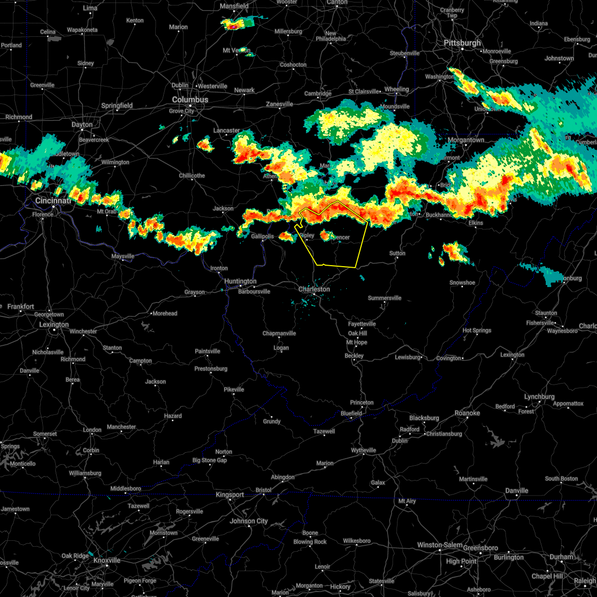 At 524 pm edt, a severe thunderstorm was located over ravenswood, or 8 miles south of forked run state park, moving southeast at 40 mph (radar indicated). Hazards include 60 mph wind gusts. expect damage to roofs, siding, and trees At 524 pm edt, a severe thunderstorm was located over ravenswood, or 8 miles south of forked run state park, moving southeast at 40 mph (radar indicated). Hazards include 60 mph wind gusts. expect damage to roofs, siding, and trees
|
| 5/10/2020 9:24 PM EDT |
 At 924 pm edt, a severe thunderstorm was located over sandyville, or 7 miles north of ripley, moving east at 55 mph (radar indicated). Hazards include 60 mph wind gusts and half dollar size hail. Hail damage to vehicles is expected. Expect wind damage to roofs, siding, and trees. At 924 pm edt, a severe thunderstorm was located over sandyville, or 7 miles north of ripley, moving east at 55 mph (radar indicated). Hazards include 60 mph wind gusts and half dollar size hail. Hail damage to vehicles is expected. Expect wind damage to roofs, siding, and trees.
|
| 4/9/2020 1:34 AM EDT |
 At 133 am edt, severe thunderstorms were located along a line extending from 7 miles northeast of elizabeth to near spencer, moving east at 60 mph (radar indicated). Hazards include 70 mph wind gusts and quarter size hail. Hail damage to vehicles is expected. expect considerable tree damage. wind damage is also likely to mobile homes, roofs, and outbuildings. locations impacted include, parkersburg, marietta, belpre, spencer, harrisville, st. Marys, elizabeth, grantsville, vienna, williamstown, pennsboro, belmont, mineralwells, arnoldsburg, north bend state park, boaz, lubeck, newport, north hills and ellenboro. At 133 am edt, severe thunderstorms were located along a line extending from 7 miles northeast of elizabeth to near spencer, moving east at 60 mph (radar indicated). Hazards include 70 mph wind gusts and quarter size hail. Hail damage to vehicles is expected. expect considerable tree damage. wind damage is also likely to mobile homes, roofs, and outbuildings. locations impacted include, parkersburg, marietta, belpre, spencer, harrisville, st. Marys, elizabeth, grantsville, vienna, williamstown, pennsboro, belmont, mineralwells, arnoldsburg, north bend state park, boaz, lubeck, newport, north hills and ellenboro.
|
| 4/9/2020 1:18 AM EDT |
 At 116 am edt, a severe thunderstorm was located near elizabeth, moving east at 50 mph (radar indicated). Hazards include 70 mph wind gusts and quarter size hail. Hail damage to vehicles is expected. expect considerable tree damage. wind damage is also likely to mobile homes, roofs, and outbuildings. locations impacted include, parkersburg, marietta, belpre, ripley, spencer, harrisville, st. Marys, elizabeth, grantsville, vienna, williamstown, pennsboro, belmont, sandyville, mineralwells, arnoldsburg, washington, north bend state park, lubeck and boaz. At 116 am edt, a severe thunderstorm was located near elizabeth, moving east at 50 mph (radar indicated). Hazards include 70 mph wind gusts and quarter size hail. Hail damage to vehicles is expected. expect considerable tree damage. wind damage is also likely to mobile homes, roofs, and outbuildings. locations impacted include, parkersburg, marietta, belpre, ripley, spencer, harrisville, st. Marys, elizabeth, grantsville, vienna, williamstown, pennsboro, belmont, sandyville, mineralwells, arnoldsburg, washington, north bend state park, lubeck and boaz.
|
| 4/9/2020 1:01 AM EDT |
 At 100 am edt, a severe thunderstorm was located 7 miles east of forked run state park, moving east at 65 mph (radar indicated). Hazards include 70 mph wind gusts and quarter size hail. Hail damage to vehicles is expected. expect considerable tree damage. wind damage is also likely to mobile homes, roofs, and outbuildings. locations impacted include, parkersburg, marietta, belpre, ripley, spencer, harrisville, st. Marys, elizabeth, racine, grantsville, coolville, forked run state park, vienna, ravenswood, williamstown, pennsboro, belmont, sandyville, mineralwells and arnoldsburg. At 100 am edt, a severe thunderstorm was located 7 miles east of forked run state park, moving east at 65 mph (radar indicated). Hazards include 70 mph wind gusts and quarter size hail. Hail damage to vehicles is expected. expect considerable tree damage. wind damage is also likely to mobile homes, roofs, and outbuildings. locations impacted include, parkersburg, marietta, belpre, ripley, spencer, harrisville, st. Marys, elizabeth, racine, grantsville, coolville, forked run state park, vienna, ravenswood, williamstown, pennsboro, belmont, sandyville, mineralwells and arnoldsburg.
|
| 4/9/2020 12:54 AM EDT |
 At 1253 am edt, a severe thunderstorm was located near forked run state park, moving east at 75 mph (radar indicated). Hazards include 70 mph wind gusts and quarter size hail. Hail damage to vehicles is expected. expect considerable tree damage. Wind damage is also likely to mobile homes, roofs, and outbuildings. At 1253 am edt, a severe thunderstorm was located near forked run state park, moving east at 75 mph (radar indicated). Hazards include 70 mph wind gusts and quarter size hail. Hail damage to vehicles is expected. expect considerable tree damage. Wind damage is also likely to mobile homes, roofs, and outbuildings.
|
| 8/8/2019 8:23 PM EDT |
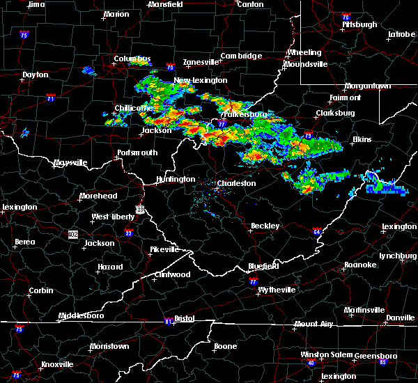 The severe thunderstorm warning for western wirt, northeastern jackson and southwestern wood counties will expire at 830 pm edt, the storm which prompted the warning has weakened below severe limits, and no longer poses an immediate threat to life or property. therefore, the warning will be allowed to expire. however gusty winds to 50 mph are still possible with this thunderstorm. The severe thunderstorm warning for western wirt, northeastern jackson and southwestern wood counties will expire at 830 pm edt, the storm which prompted the warning has weakened below severe limits, and no longer poses an immediate threat to life or property. therefore, the warning will be allowed to expire. however gusty winds to 50 mph are still possible with this thunderstorm.
|
| 8/8/2019 8:06 PM EDT |
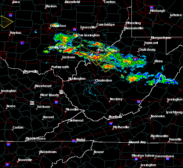 At 805 pm edt, a severe thunderstorm was located 8 miles southwest of mineralwells, or 9 miles east of forked run state park, moving southeast at 25 mph (radar indicated). Hazards include 60 mph wind gusts and quarter size hail. Hail damage to vehicles is expected. expect wind damage to roofs, siding, and trees. Locations impacted include, elizabeth, mineralwells, peewee, morristown, rockport, leroy, palestine and belleville. At 805 pm edt, a severe thunderstorm was located 8 miles southwest of mineralwells, or 9 miles east of forked run state park, moving southeast at 25 mph (radar indicated). Hazards include 60 mph wind gusts and quarter size hail. Hail damage to vehicles is expected. expect wind damage to roofs, siding, and trees. Locations impacted include, elizabeth, mineralwells, peewee, morristown, rockport, leroy, palestine and belleville.
|
| 8/8/2019 7:43 PM EDT |
 The national weather service in charleston west virginia has issued a * severe thunderstorm warning for. northeastern meigs county in southeastern ohio. southwestern washington county in southeastern ohio. southeastern athens county in southeastern ohio. Western wirt county in northwestern west virginia. The national weather service in charleston west virginia has issued a * severe thunderstorm warning for. northeastern meigs county in southeastern ohio. southwestern washington county in southeastern ohio. southeastern athens county in southeastern ohio. Western wirt county in northwestern west virginia.
|
| 8/8/2019 7:24 PM EDT |
 At 723 pm edt, a severe thunderstorm was located near elizabeth, moving southeast at 35 mph (radar indicated). Hazards include 60 mph wind gusts and quarter size hail. Hail damage to vehicles is expected. Expect wind damage to roofs, siding, and trees. At 723 pm edt, a severe thunderstorm was located near elizabeth, moving southeast at 35 mph (radar indicated). Hazards include 60 mph wind gusts and quarter size hail. Hail damage to vehicles is expected. Expect wind damage to roofs, siding, and trees.
|
| 8/8/2019 6:56 PM EDT |
 At 655 pm edt, a severe thunderstorm was located over mineralwells, or near parkersburg, moving southeast at 30 mph (radar indicated). Hazards include 60 mph wind gusts and quarter size hail. Hail damage to vehicles is expected. expect wind damage to roofs, siding, and trees. Locations impacted include, parkersburg, elizabeth, mineralwells, lubeck, cairo, peewee, walker, petroleum, palestine, freeport, davisville, greencastle, morristown and rockport. At 655 pm edt, a severe thunderstorm was located over mineralwells, or near parkersburg, moving southeast at 30 mph (radar indicated). Hazards include 60 mph wind gusts and quarter size hail. Hail damage to vehicles is expected. expect wind damage to roofs, siding, and trees. Locations impacted include, parkersburg, elizabeth, mineralwells, lubeck, cairo, peewee, walker, petroleum, palestine, freeport, davisville, greencastle, morristown and rockport.
|
| 8/8/2019 6:42 PM EDT |
 At 642 pm edt, a severe thunderstorm was located over belpre, moving southeast at 30 mph (radar indicated). Hazards include 65 mph wind gusts and quarter size hail. Hail damage to vehicles is expected. Expect wind damage to roofs, siding, and trees. At 642 pm edt, a severe thunderstorm was located over belpre, moving southeast at 30 mph (radar indicated). Hazards include 65 mph wind gusts and quarter size hail. Hail damage to vehicles is expected. Expect wind damage to roofs, siding, and trees.
|
| 7/21/2019 2:37 PM EDT |
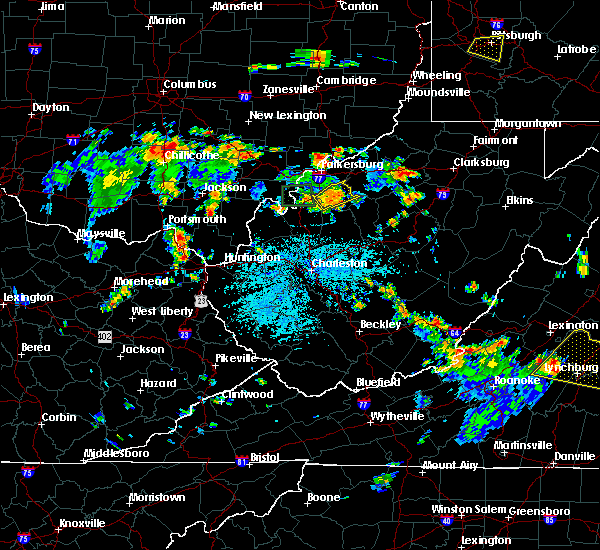 The severe thunderstorm warning for wirt and northeastern jackson counties will expire at 245 pm edt, the storm which prompted the warning has weakened below severe limits, and no longer poses an immediate threat to life or property. therefore, the warning will be allowed to expire. however small hail, gusty winds and heavy rain are still possible with this thunderstorm. to report severe weather, contact your nearest law enforcement agency. they will relay your report to the national weather service charleston west virginia. The severe thunderstorm warning for wirt and northeastern jackson counties will expire at 245 pm edt, the storm which prompted the warning has weakened below severe limits, and no longer poses an immediate threat to life or property. therefore, the warning will be allowed to expire. however small hail, gusty winds and heavy rain are still possible with this thunderstorm. to report severe weather, contact your nearest law enforcement agency. they will relay your report to the national weather service charleston west virginia.
|
| 7/21/2019 2:21 PM EDT |
 At 221 pm edt, a severe thunderstorm was located near elizabeth, moving northeast at 20 mph (radar indicated). Hazards include 60 mph wind gusts and quarter size hail. Hail damage to vehicles is expected. Expect wind damage to roofs, siding, and trees. At 221 pm edt, a severe thunderstorm was located near elizabeth, moving northeast at 20 mph (radar indicated). Hazards include 60 mph wind gusts and quarter size hail. Hail damage to vehicles is expected. Expect wind damage to roofs, siding, and trees.
|
| 7/11/2019 8:22 PM EDT |
 At 822 pm edt, a severe thunderstorm was located 8 miles east of elizabeth, moving southeast at 15 mph (radar indicated). Hazards include 60 mph wind gusts. Expect damage to roofs, siding, and trees. Locations impacted include, parkersburg, harrisville, elizabeth, mineralwells, north bend state park, ellenboro, cairo, pullman, auburn, cherry, smithville, schultz, lucille, pike, davisville, berea, brohard, macfarlan, burnt house and walker. At 822 pm edt, a severe thunderstorm was located 8 miles east of elizabeth, moving southeast at 15 mph (radar indicated). Hazards include 60 mph wind gusts. Expect damage to roofs, siding, and trees. Locations impacted include, parkersburg, harrisville, elizabeth, mineralwells, north bend state park, ellenboro, cairo, pullman, auburn, cherry, smithville, schultz, lucille, pike, davisville, berea, brohard, macfarlan, burnt house and walker.
|
| 7/11/2019 8:04 PM EDT |
 The national weather service in charleston west virginia has issued a * severe thunderstorm warning for. southwestern pleasants county in northwestern west virginia. northwestern calhoun county in north central west virginia. ritchie county in northwestern west virginia. Wirt county in northwestern west virginia. The national weather service in charleston west virginia has issued a * severe thunderstorm warning for. southwestern pleasants county in northwestern west virginia. northwestern calhoun county in north central west virginia. ritchie county in northwestern west virginia. Wirt county in northwestern west virginia.
|
| 6/2/2019 2:01 PM EDT | Downed tree due to high wind on state rt. in wirt county WV, 1 miles NNW of Elizabeth, WV |
| 6/2/2019 2:00 PM EDT | Half Dollar sized hail reported 2.3 miles NNE of Elizabeth, WV, via twitter with pictures. time estimated via radar. |
| 6/2/2019 1:48 PM EDT |
 At 148 pm edt, a severe thunderstorm was located near elizabeth, moving east at 25 mph (radar indicated). Hazards include golf ball size hail and 70 mph wind gusts. People and animals outdoors will be injured. expect hail damage to roofs, siding, windows, and vehicles. expect considerable tree damage. wind damage is also likely to mobile homes, roofs, and outbuildings. Locations impacted include, harrisville, elizabeth, cairo, pullman, cherry, peewee, smithville, walker, petroleum, palestine, lucille, freeport, greencastle, creston, morristown, brohard, macfarlan, annamoriah and munday. At 148 pm edt, a severe thunderstorm was located near elizabeth, moving east at 25 mph (radar indicated). Hazards include golf ball size hail and 70 mph wind gusts. People and animals outdoors will be injured. expect hail damage to roofs, siding, windows, and vehicles. expect considerable tree damage. wind damage is also likely to mobile homes, roofs, and outbuildings. Locations impacted include, harrisville, elizabeth, cairo, pullman, cherry, peewee, smithville, walker, petroleum, palestine, lucille, freeport, greencastle, creston, morristown, brohard, macfarlan, annamoriah and munday.
|
| 6/2/2019 1:33 PM EDT |
 At 133 pm edt, a severe thunderstorm was located near elizabeth, moving east at 25 mph (radar indicated). Hazards include golf ball size hail and 70 mph wind gusts. People and animals outdoors will be injured. expect hail damage to roofs, siding, windows, and vehicles. expect considerable tree damage. wind damage is also likely to mobile homes, roofs, and outbuildings. Locations impacted include, parkersburg, harrisville, elizabeth, mineralwells, lubeck, cairo, pullman, cherry, peewee, smithville, walker, petroleum, palestine, lucille, freeport, davisville, greencastle, creston, morristown and rockport. At 133 pm edt, a severe thunderstorm was located near elizabeth, moving east at 25 mph (radar indicated). Hazards include golf ball size hail and 70 mph wind gusts. People and animals outdoors will be injured. expect hail damage to roofs, siding, windows, and vehicles. expect considerable tree damage. wind damage is also likely to mobile homes, roofs, and outbuildings. Locations impacted include, parkersburg, harrisville, elizabeth, mineralwells, lubeck, cairo, pullman, cherry, peewee, smithville, walker, petroleum, palestine, lucille, freeport, davisville, greencastle, creston, morristown and rockport.
|
| 6/2/2019 1:28 PM EDT |
 At 128 pm edt, a severe thunderstorm was located near mineralwells, or near elizabeth, moving east at 25 mph (radar indicated). Hazards include ping pong ball size hail and 60 mph wind gusts. People and animals outdoors will be injured. expect hail damage to roofs, siding, windows, and vehicles. Expect wind damage to roofs, siding, and trees. At 128 pm edt, a severe thunderstorm was located near mineralwells, or near elizabeth, moving east at 25 mph (radar indicated). Hazards include ping pong ball size hail and 60 mph wind gusts. People and animals outdoors will be injured. expect hail damage to roofs, siding, windows, and vehicles. Expect wind damage to roofs, siding, and trees.
|
| 5/29/2019 1:09 PM EDT |
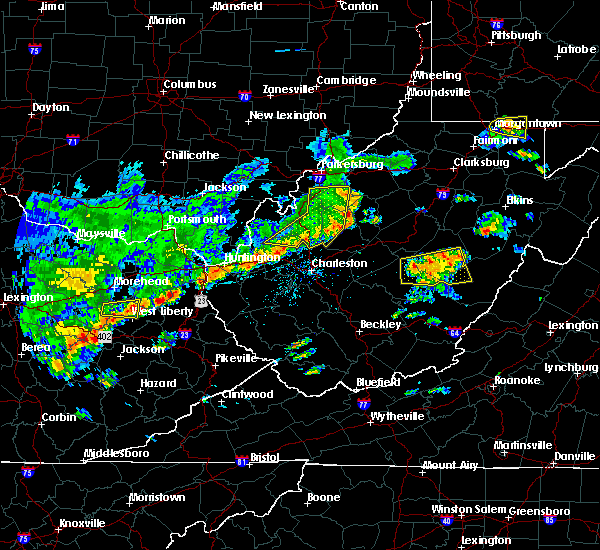 The severe thunderstorm warning for east central mason, northern putnam, wirt, western roane, jackson and south central wood counties will expire at 115 pm edt, the storms which prompted the warning have weakened below severe limits, and no longer pose an immediate threat to life or property. therefore, the warning will be allowed to expire. however gusty winds of 40 to 50mph are still possible with these thunderstorms. a severe thunderstorm watch remains in effect until 700 pm edt for central, western and northwestern west virginia. The severe thunderstorm warning for east central mason, northern putnam, wirt, western roane, jackson and south central wood counties will expire at 115 pm edt, the storms which prompted the warning have weakened below severe limits, and no longer pose an immediate threat to life or property. therefore, the warning will be allowed to expire. however gusty winds of 40 to 50mph are still possible with these thunderstorms. a severe thunderstorm watch remains in effect until 700 pm edt for central, western and northwestern west virginia.
|
| 5/29/2019 1:02 PM EDT | Roof torn partially off house. trees sheared off. other building damage as wel in wirt county WV, 2.3 miles NNE of Elizabeth, WV |
| 5/29/2019 12:56 PM EDT |
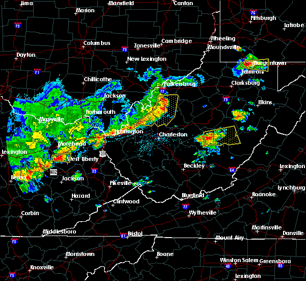 At 1255 pm edt, severe thunderstorms were located along a line extending from 6 miles west of elizabeth to near ripley to buffalo, moving east at 45 mph (radar indicated). Hazards include 60 mph wind gusts and nickel size hail. Expect damage to roofs, siding, and trees. Locations impacted include, ripley, spencer, elizabeth, buffalo, kenna, reedy, statts mills, cherry, peewee, harmony, given, kentuck, liberty, palestine, grimms landing, lucille, morristown, rockport, leroy and fairplain. At 1255 pm edt, severe thunderstorms were located along a line extending from 6 miles west of elizabeth to near ripley to buffalo, moving east at 45 mph (radar indicated). Hazards include 60 mph wind gusts and nickel size hail. Expect damage to roofs, siding, and trees. Locations impacted include, ripley, spencer, elizabeth, buffalo, kenna, reedy, statts mills, cherry, peewee, harmony, given, kentuck, liberty, palestine, grimms landing, lucille, morristown, rockport, leroy and fairplain.
|
| 5/29/2019 12:33 PM EDT |
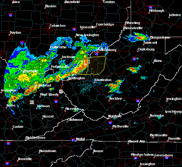 At 1232 pm edt, severe thunderstorms were located along a line extending from forked run state park to 11 miles east of point pleasant to 12 miles north of ona, moving east at 45 mph (radar indicated). Hazards include 60 mph wind gusts and nickel size hail. expect damage to roofs, siding, and trees At 1232 pm edt, severe thunderstorms were located along a line extending from forked run state park to 11 miles east of point pleasant to 12 miles north of ona, moving east at 45 mph (radar indicated). Hazards include 60 mph wind gusts and nickel size hail. expect damage to roofs, siding, and trees
|
| 5/26/2019 4:28 PM EDT |
 At 427 pm edt, a severe thunderstorm was located near north bend state park, or 8 miles southwest of harrisville, moving east at 30 mph (radar indicated). Hazards include 60 mph wind gusts and quarter size hail. Hail damage to vehicles is expected. Expect wind damage to roofs, siding, and trees. At 427 pm edt, a severe thunderstorm was located near north bend state park, or 8 miles southwest of harrisville, moving east at 30 mph (radar indicated). Hazards include 60 mph wind gusts and quarter size hail. Hail damage to vehicles is expected. Expect wind damage to roofs, siding, and trees.
|
| 5/17/2019 5:37 PM EDT |
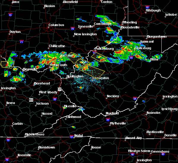 The severe thunderstorm warning for southwestern ritchie, wirt and south central wood counties will expire at 545 pm edt, the storm which prompted the warning has weakened below severe limits, and no longer poses an immediate threat to life or property. therefore, the warning will be allowed to expire. however small hail and gusty winds are still possible with this thunderstorm. a severe thunderstorm watch remains in effect until 1100 pm edt for northwestern west virginia. The severe thunderstorm warning for southwestern ritchie, wirt and south central wood counties will expire at 545 pm edt, the storm which prompted the warning has weakened below severe limits, and no longer poses an immediate threat to life or property. therefore, the warning will be allowed to expire. however small hail and gusty winds are still possible with this thunderstorm. a severe thunderstorm watch remains in effect until 1100 pm edt for northwestern west virginia.
|
| 5/17/2019 5:20 PM EDT |
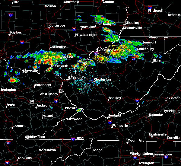 At 520 pm edt, a severe thunderstorm was located over elizabeth, moving southeast at 30 mph (radar indicated). Hazards include 60 mph wind gusts and quarter size hail. Hail damage to vehicles is expected. expect wind damage to roofs, siding, and trees. Locations impacted include, elizabeth, mineralwells, lucille, cherry, davisville, greencastle, morristown, rockport and palestine. At 520 pm edt, a severe thunderstorm was located over elizabeth, moving southeast at 30 mph (radar indicated). Hazards include 60 mph wind gusts and quarter size hail. Hail damage to vehicles is expected. expect wind damage to roofs, siding, and trees. Locations impacted include, elizabeth, mineralwells, lucille, cherry, davisville, greencastle, morristown, rockport and palestine.
|
| 5/17/2019 4:58 PM EDT |
 At 458 pm edt, a severe thunderstorm was located near mineralwells, or 9 miles south of parkersburg, moving southeast at 30 mph (radar indicated). Hazards include 60 mph wind gusts and quarter size hail. Hail damage to vehicles is expected. Expect wind damage to roofs, siding, and trees. At 458 pm edt, a severe thunderstorm was located near mineralwells, or 9 miles south of parkersburg, moving southeast at 30 mph (radar indicated). Hazards include 60 mph wind gusts and quarter size hail. Hail damage to vehicles is expected. Expect wind damage to roofs, siding, and trees.
|
| 12/1/2018 10:47 PM EST |
 At 1046 pm est, a severe thunderstorm was located over elizabeth, moving east at 75 mph (radar indicated). Hazards include 60 mph wind gusts and quarter size hail. Hail damage to vehicles is expected. expect wind damage to roofs, siding, and trees. Locations impacted include, parkersburg, elizabeth, mineralwells, north bend state park, cairo, smithville, walker, nutter farm, petroleum, palestine, freeport, davisville, greencastle, morristown, rockport, brohard and macfarlan. At 1046 pm est, a severe thunderstorm was located over elizabeth, moving east at 75 mph (radar indicated). Hazards include 60 mph wind gusts and quarter size hail. Hail damage to vehicles is expected. expect wind damage to roofs, siding, and trees. Locations impacted include, parkersburg, elizabeth, mineralwells, north bend state park, cairo, smithville, walker, nutter farm, petroleum, palestine, freeport, davisville, greencastle, morristown, rockport, brohard and macfarlan.
|
| 12/1/2018 10:35 PM EST |
 At 1035 pm est, a severe thunderstorm was located 9 miles northeast of ravenswood, or 9 miles southeast of forked run state park, moving east at 75 mph (radar indicated). Hazards include 60 mph wind gusts and quarter size hail. Hail damage to vehicles is expected. Expect wind damage to roofs, siding, and trees. At 1035 pm est, a severe thunderstorm was located 9 miles northeast of ravenswood, or 9 miles southeast of forked run state park, moving east at 75 mph (radar indicated). Hazards include 60 mph wind gusts and quarter size hail. Hail damage to vehicles is expected. Expect wind damage to roofs, siding, and trees.
|
| 7/10/2017 7:25 PM EDT |
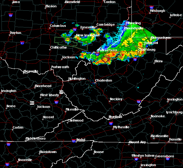 The tornado warning for southwestern ritchie and central wirt counties will expire at 730 pm edt, the storm which prompted the warning has weakened below severe limits, and has exited the warned area. therefore, the warning will be allowed to expire. gusty winds and heavy rain remain possible. The tornado warning for southwestern ritchie and central wirt counties will expire at 730 pm edt, the storm which prompted the warning has weakened below severe limits, and has exited the warned area. therefore, the warning will be allowed to expire. gusty winds and heavy rain remain possible.
|
| 7/10/2017 7:15 PM EDT |
 At 715 pm edt, a severe thunderstorm capable of producing a tornado was located 9 miles west of grantsville, moving southeast at 40 mph (radar indicated rotation). Hazards include tornado. Flying debris will be dangerous to those caught without shelter. mobile homes will be damaged or destroyed. damage to roofs, windows, and vehicles will occur. tree damage is likely. locations impacted include, elizabeth, cherry and macfarlan. At 715 pm edt, a severe thunderstorm capable of producing a tornado was located 9 miles west of grantsville, moving southeast at 40 mph (radar indicated rotation). Hazards include tornado. Flying debris will be dangerous to those caught without shelter. mobile homes will be damaged or destroyed. damage to roofs, windows, and vehicles will occur. tree damage is likely. locations impacted include, elizabeth, cherry and macfarlan.
|
| 7/10/2017 6:59 PM EDT |
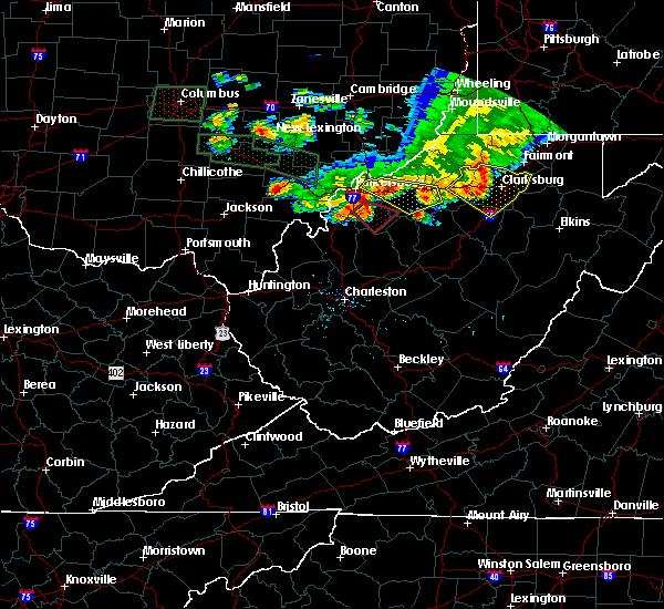 At 658 pm edt, a severe thunderstorm capable of producing a tornado was located near elizabeth, moving southeast at 50 mph (radar indicated rotation). Hazards include tornado. Flying debris will be dangerous to those caught without shelter. mobile homes will be damaged or destroyed. damage to roofs, windows, and vehicles will occur. tree damage is likely. this tornadic thunderstorm will remain over mainly rural areas of southwestern ritchie, wirt and south central wood counties, including the following locations: greencastle, morristown, lucille, macfarlan, cherry and palestine. This includes interstate 77 in west virginia near mile marker 162. At 658 pm edt, a severe thunderstorm capable of producing a tornado was located near elizabeth, moving southeast at 50 mph (radar indicated rotation). Hazards include tornado. Flying debris will be dangerous to those caught without shelter. mobile homes will be damaged or destroyed. damage to roofs, windows, and vehicles will occur. tree damage is likely. this tornadic thunderstorm will remain over mainly rural areas of southwestern ritchie, wirt and south central wood counties, including the following locations: greencastle, morristown, lucille, macfarlan, cherry and palestine. This includes interstate 77 in west virginia near mile marker 162.
|
| 6/23/2017 6:54 PM EDT |
 At 653 pm edt, a severe thunderstorm capable of producing a tornado was located near elizabeth, moving east at 40 mph (radar indicated rotation). Hazards include tornado. Flying debris will be dangerous to those caught without shelter. mobile homes will be damaged or destroyed. damage to roofs, windows, and vehicles will occur. tree damage is likely. locations impacted include, elizabeth, freeport and greencastle. At 653 pm edt, a severe thunderstorm capable of producing a tornado was located near elizabeth, moving east at 40 mph (radar indicated rotation). Hazards include tornado. Flying debris will be dangerous to those caught without shelter. mobile homes will be damaged or destroyed. damage to roofs, windows, and vehicles will occur. tree damage is likely. locations impacted include, elizabeth, freeport and greencastle.
|
| 6/23/2017 6:48 PM EDT |
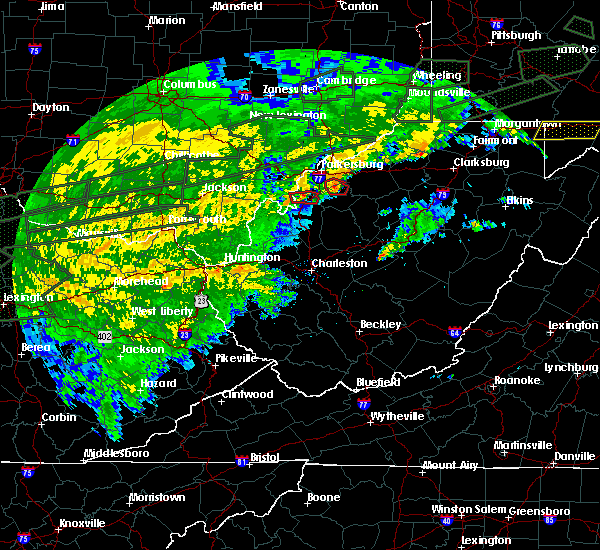 At 648 pm edt, a severe thunderstorm capable of producing a tornado was located near elizabeth, moving east at 40 mph (radar indicated rotation). Hazards include tornado. Flying debris will be dangerous to those caught without shelter. mobile homes will be damaged or destroyed. damage to roofs, windows, and vehicles will occur. tree damage is likely. This tornadic thunderstorm will remain over mainly rural areas of north central wirt and southeastern wood counties, including the following locations: freeport, walker and greencastle. At 648 pm edt, a severe thunderstorm capable of producing a tornado was located near elizabeth, moving east at 40 mph (radar indicated rotation). Hazards include tornado. Flying debris will be dangerous to those caught without shelter. mobile homes will be damaged or destroyed. damage to roofs, windows, and vehicles will occur. tree damage is likely. This tornadic thunderstorm will remain over mainly rural areas of north central wirt and southeastern wood counties, including the following locations: freeport, walker and greencastle.
|
| 6/23/2017 6:36 PM EDT |
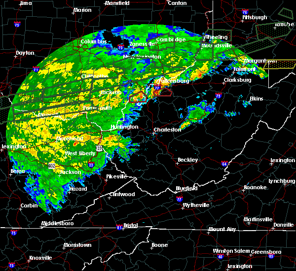 At 636 pm edt, a severe thunderstorm capable of producing a tornado was located near mineralwells, or 7 miles west of elizabeth, moving east at 40 mph (radar indicated rotation). Hazards include tornado. Flying debris will be dangerous to those caught without shelter. mobile homes will be damaged or destroyed. damage to roofs, windows, and vehicles will occur. tree damage is likely. this dangerous storm will be near, elizabeth around 645 pm edt. other locations impacted by this tornadic thunderstorm include freeport, walker, greencastle, rockport and morristown. This includes interstate 77 in west virginia between mile markers 160 and 167. At 636 pm edt, a severe thunderstorm capable of producing a tornado was located near mineralwells, or 7 miles west of elizabeth, moving east at 40 mph (radar indicated rotation). Hazards include tornado. Flying debris will be dangerous to those caught without shelter. mobile homes will be damaged or destroyed. damage to roofs, windows, and vehicles will occur. tree damage is likely. this dangerous storm will be near, elizabeth around 645 pm edt. other locations impacted by this tornadic thunderstorm include freeport, walker, greencastle, rockport and morristown. This includes interstate 77 in west virginia between mile markers 160 and 167.
|
| 6/23/2017 6:27 PM EDT |
 At 627 pm edt, a severe thunderstorm capable of producing a tornado was located 7 miles east of forked run state park, moving east at 40 mph (radar indicated rotation). Hazards include tornado. Flying debris will be dangerous to those caught without shelter. mobile homes will be damaged or destroyed. damage to roofs, windows, and vehicles will occur. tree damage is likely. this dangerous storm will be near, elizabeth around 645 pm edt. other locations impacted by this tornadic thunderstorm include freeport, walker, greencastle, rockport and morristown. This includes interstate 77 in west virginia between mile markers 159 and 167. At 627 pm edt, a severe thunderstorm capable of producing a tornado was located 7 miles east of forked run state park, moving east at 40 mph (radar indicated rotation). Hazards include tornado. Flying debris will be dangerous to those caught without shelter. mobile homes will be damaged or destroyed. damage to roofs, windows, and vehicles will occur. tree damage is likely. this dangerous storm will be near, elizabeth around 645 pm edt. other locations impacted by this tornadic thunderstorm include freeport, walker, greencastle, rockport and morristown. This includes interstate 77 in west virginia between mile markers 159 and 167.
|
| 4/29/2017 12:48 AM EDT |
 At 1247 am edt, a severe thunderstorm was located near ravenswood, or 9 miles north of ripley, moving east at 60 mph (radar indicated). Hazards include 60 mph wind gusts and quarter size hail. Hail damage to vehicles is expected. expect wind damage to roofs, siding, and trees. locations impacted include, parkersburg, ripley, spencer, elizabeth, ravenswood, sandyville, mineralwells, lubeck, cairo, reedy, statts mills, cherry, given, cottageville, lucille, davisville, brohard, macfarlan, annamoriah and fairplain. this includes the following highways, interstate 77 in west virginia between mile markers 127 and 175. Route 50 in west virginia between mile markers 12 and 32. At 1247 am edt, a severe thunderstorm was located near ravenswood, or 9 miles north of ripley, moving east at 60 mph (radar indicated). Hazards include 60 mph wind gusts and quarter size hail. Hail damage to vehicles is expected. expect wind damage to roofs, siding, and trees. locations impacted include, parkersburg, ripley, spencer, elizabeth, ravenswood, sandyville, mineralwells, lubeck, cairo, reedy, statts mills, cherry, given, cottageville, lucille, davisville, brohard, macfarlan, annamoriah and fairplain. this includes the following highways, interstate 77 in west virginia between mile markers 127 and 175. Route 50 in west virginia between mile markers 12 and 32.
|
| 4/29/2017 12:28 AM EDT |
 At 1228 am edt, a severe thunderstorm was located over new haven, or near pomeroy, moving east at 60 mph (radar indicated). Hazards include 60 mph wind gusts and quarter size hail. Hail damage to vehicles is expected. Expect wind damage to roofs, siding, and trees. At 1228 am edt, a severe thunderstorm was located over new haven, or near pomeroy, moving east at 60 mph (radar indicated). Hazards include 60 mph wind gusts and quarter size hail. Hail damage to vehicles is expected. Expect wind damage to roofs, siding, and trees.
|
| 3/1/2017 9:44 AM EST |
 At 943 am est, a severe thunderstorm capable of producing a tornado was located near mineralwells, or 7 miles west of elizabeth, moving east at 60 mph (radar indicated rotation). Hazards include tornado and half dollar size hail. Flying debris will be dangerous to those caught without shelter. mobile homes will be damaged or destroyed. damage to roofs, windows, and vehicles will occur. tree damage is likely. this dangerous storm will be near, elizabeth around 950 am est. other locations impacted by this tornadic thunderstorm include cherry, peewee, belleville, walker, nutter farm, petroleum, palestine, freeport, davisville and greencastle. this includes the following highways, interstate 77 in west virginia between mile markers 147 and 173. Route 50 in west virginia between mile markers 13 and 28. At 943 am est, a severe thunderstorm capable of producing a tornado was located near mineralwells, or 7 miles west of elizabeth, moving east at 60 mph (radar indicated rotation). Hazards include tornado and half dollar size hail. Flying debris will be dangerous to those caught without shelter. mobile homes will be damaged or destroyed. damage to roofs, windows, and vehicles will occur. tree damage is likely. this dangerous storm will be near, elizabeth around 950 am est. other locations impacted by this tornadic thunderstorm include cherry, peewee, belleville, walker, nutter farm, petroleum, palestine, freeport, davisville and greencastle. this includes the following highways, interstate 77 in west virginia between mile markers 147 and 173. Route 50 in west virginia between mile markers 13 and 28.
|
| 3/1/2017 9:28 AM EST |
 At 927 am est, a severe thunderstorm capable of producing a tornado was located near forked run state park, moving east at 60 mph (radar indicated rotation). Hazards include tornado and half dollar size hail. Flying debris will be dangerous to those caught without shelter. mobile homes will be damaged or destroyed. damage to roofs, windows, and vehicles will occur. tree damage is likely. this dangerous storm will be near, mineralwells around 945 am est. elizabeth around 950 am est. other locations impacted by this tornadic thunderstorm include portland, cherry, peewee, belleville, reedsville, walker, nutter farm, petroleum, palestine and freeport. this includes the following highways, interstate 77 in west virginia between mile markers 147 and 173. Route 50 in west virginia between mile markers 13 and 28. At 927 am est, a severe thunderstorm capable of producing a tornado was located near forked run state park, moving east at 60 mph (radar indicated rotation). Hazards include tornado and half dollar size hail. Flying debris will be dangerous to those caught without shelter. mobile homes will be damaged or destroyed. damage to roofs, windows, and vehicles will occur. tree damage is likely. this dangerous storm will be near, mineralwells around 945 am est. elizabeth around 950 am est. other locations impacted by this tornadic thunderstorm include portland, cherry, peewee, belleville, reedsville, walker, nutter farm, petroleum, palestine and freeport. this includes the following highways, interstate 77 in west virginia between mile markers 147 and 173. Route 50 in west virginia between mile markers 13 and 28.
|
| 9/30/2016 2:48 PM EDT |
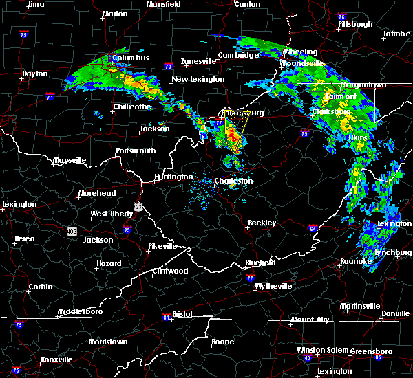 At 248 pm edt, a severe thunderstorm was located near elizabeth, moving north at 30 mph (radar indicated). Hazards include 60 mph wind gusts and quarter size hail. Hail damage to vehicles is expected. Locations impacted include, spencer, elizabeth, boaz, reedy, schultz, waverly, walker, lucille, nutter farm, cherry, freeport, petroleum, palestine and greencastle. At 248 pm edt, a severe thunderstorm was located near elizabeth, moving north at 30 mph (radar indicated). Hazards include 60 mph wind gusts and quarter size hail. Hail damage to vehicles is expected. Locations impacted include, spencer, elizabeth, boaz, reedy, schultz, waverly, walker, lucille, nutter farm, cherry, freeport, petroleum, palestine and greencastle.
|
| 9/30/2016 2:31 PM EDT |
 At 230 pm edt, a severe thunderstorm was located near spencer, moving north at 30 mph (radar indicated). Hazards include 60 mph wind gusts and quarter size hail. hail damage to vehicles is expected At 230 pm edt, a severe thunderstorm was located near spencer, moving north at 30 mph (radar indicated). Hazards include 60 mph wind gusts and quarter size hail. hail damage to vehicles is expected
|
| 5/2/2016 2:37 AM EDT |
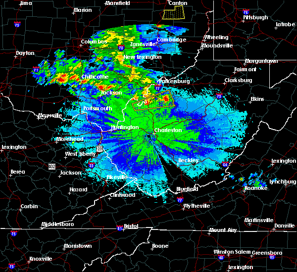 At 235 am edt, a severe thunderstorm was located 8 miles southwest of elizabeth, moving east at 35 mph (radar indicated). Hazards include 60 mph wind gusts and quarter size hail. Hail damage to vehicles is expected. expect wind damage to roofs, siding, and trees. Locations impacted include, elizabeth, ravenswood, sandyville, reedy, peewee, mount alto, creston, rockport, lucille, cherry, cottageville, palestine, morristown, greencastle and leroy. At 235 am edt, a severe thunderstorm was located 8 miles southwest of elizabeth, moving east at 35 mph (radar indicated). Hazards include 60 mph wind gusts and quarter size hail. Hail damage to vehicles is expected. expect wind damage to roofs, siding, and trees. Locations impacted include, elizabeth, ravenswood, sandyville, reedy, peewee, mount alto, creston, rockport, lucille, cherry, cottageville, palestine, morristown, greencastle and leroy.
|
| 5/2/2016 1:57 AM EDT |
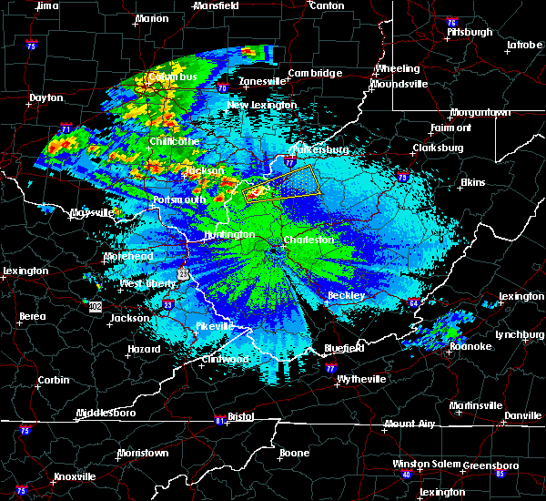 At 157 am edt, a severe thunderstorm was located near racine, moving east at 35 mph (radar indicated). Hazards include 60 mph wind gusts and quarter size hail. Hail damage to vehicles is expected. Expect wind damage to roofs, siding, and trees. At 157 am edt, a severe thunderstorm was located near racine, moving east at 35 mph (radar indicated). Hazards include 60 mph wind gusts and quarter size hail. Hail damage to vehicles is expected. Expect wind damage to roofs, siding, and trees.
|
| 4/28/2016 6:45 PM EDT | Hen Egg sized hail reported 4.1 miles SW of Elizabeth, WV, torrential rainfall |
| 4/28/2016 6:43 PM EDT |
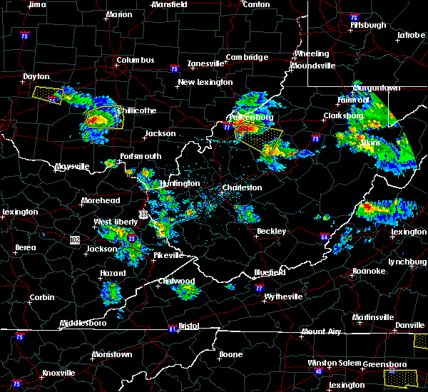 At 641 pm edt, a severe thunderstorm was located near elizabeth, moving east at 40 mph. ping pong ball sized hail was reported in mineral wells (trained weather spotters). Hazards include ping pong ball size hail and 60 mph wind gusts. People and animals outdoors will be injured. expect hail damage to roofs, siding, windows, and vehicles. expect wind damage to roofs, siding, and trees. Locations impacted include, elizabeth, grantsville, cairo, macfarlan, munday, burnt house, big springs, walker, smithville, berea, freeport, petroleum, brohard, tanner, greencastle, newberne and cherry. At 641 pm edt, a severe thunderstorm was located near elizabeth, moving east at 40 mph. ping pong ball sized hail was reported in mineral wells (trained weather spotters). Hazards include ping pong ball size hail and 60 mph wind gusts. People and animals outdoors will be injured. expect hail damage to roofs, siding, windows, and vehicles. expect wind damage to roofs, siding, and trees. Locations impacted include, elizabeth, grantsville, cairo, macfarlan, munday, burnt house, big springs, walker, smithville, berea, freeport, petroleum, brohard, tanner, greencastle, newberne and cherry.
|
| 4/28/2016 6:29 PM EDT |
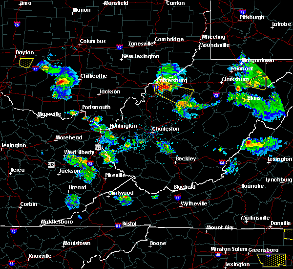 At 629 pm edt, a severe thunderstorm was located near mineralwells, or near elizabeth, moving east at 40 mph (radar indicated). Hazards include 60 mph wind gusts and half dollar size hail. Hail damage to vehicles is expected. Expect wind damage to roofs, siding, and trees. At 629 pm edt, a severe thunderstorm was located near mineralwells, or near elizabeth, moving east at 40 mph (radar indicated). Hazards include 60 mph wind gusts and half dollar size hail. Hail damage to vehicles is expected. Expect wind damage to roofs, siding, and trees.
|
| 4/28/2016 4:27 PM EDT | Quarter sized hail reported 4.1 miles ENE of Elizabeth, WV |
| 4/28/2016 4:18 PM EDT |
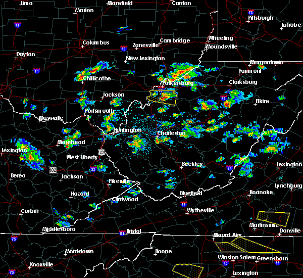 At 417 pm edt, a severe thunderstorm was located near elizabeth, moving east at 20 mph (radar indicated). Hazards include 60 mph wind gusts and half dollar size hail. Hail damage to vehicles is expected. expect wind damage to roofs, siding, and trees. Locations impacted include, elizabeth, cherry, peewee, palestine, morristown, rockport, lucille and greencastle. At 417 pm edt, a severe thunderstorm was located near elizabeth, moving east at 20 mph (radar indicated). Hazards include 60 mph wind gusts and half dollar size hail. Hail damage to vehicles is expected. expect wind damage to roofs, siding, and trees. Locations impacted include, elizabeth, cherry, peewee, palestine, morristown, rockport, lucille and greencastle.
|
| 4/28/2016 3:56 PM EDT |
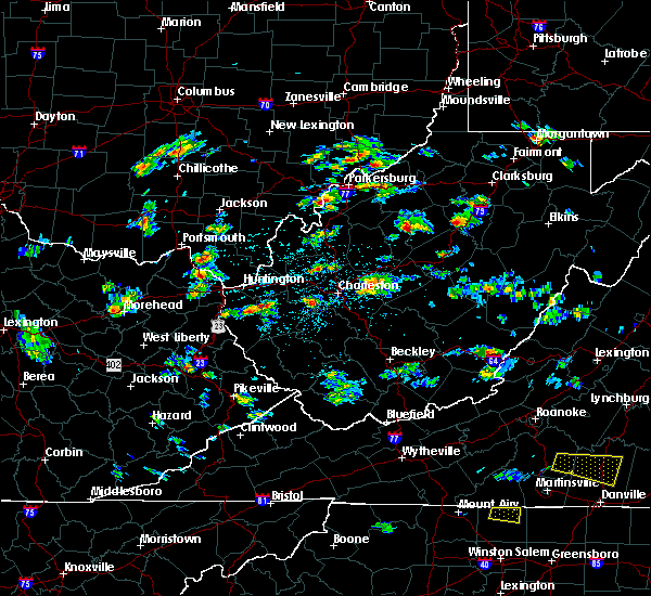 At 356 pm edt, a severe thunderstorm was located near forked run state park, moving east at 30 mph (radar indicated). Hazards include 60 mph wind gusts and half dollar size hail. Hail damage to vehicles is expected. Expect wind damage to roofs, siding, and trees. At 356 pm edt, a severe thunderstorm was located near forked run state park, moving east at 30 mph (radar indicated). Hazards include 60 mph wind gusts and half dollar size hail. Hail damage to vehicles is expected. Expect wind damage to roofs, siding, and trees.
|
| 7/14/2015 5:15 PM EDT | Reports of trees down near the town of elizabeth in wirt county WV, 0.2 miles N of Elizabeth, WV |
| 7/14/2015 5:09 PM EDT |
 At 507 pm edt, doppler radar indicated a line of severe thunderstorms capable of producing damaging winds in excess of 60 mph. these storms were located along a line extending from 6 miles southeast of pennsboro to near grantsville to 8 miles north of spencer, moving southeast at 45 mph. locations impacted include, spencer, harrisville, glenville, elizabeth, grantsville, salem, pennsboro, west union, arnoldsburg, north bend state park, cedar creek state park, ellenboro, cairo, reedy, sand fork, pullman, auburn, coxs mills, creston and wolf summit. At 507 pm edt, doppler radar indicated a line of severe thunderstorms capable of producing damaging winds in excess of 60 mph. these storms were located along a line extending from 6 miles southeast of pennsboro to near grantsville to 8 miles north of spencer, moving southeast at 45 mph. locations impacted include, spencer, harrisville, glenville, elizabeth, grantsville, salem, pennsboro, west union, arnoldsburg, north bend state park, cedar creek state park, ellenboro, cairo, reedy, sand fork, pullman, auburn, coxs mills, creston and wolf summit.
|
| 7/14/2015 4:34 PM EDT |
 At 433 pm edt, doppler radar indicated a line of severe thunderstorms capable of producing damaging winds in excess of 60 mph. these storms were located along a line extending from near belmont to mineralwells to forked run state park, and moving southeast at 45 mph. At 433 pm edt, doppler radar indicated a line of severe thunderstorms capable of producing damaging winds in excess of 60 mph. these storms were located along a line extending from near belmont to mineralwells to forked run state park, and moving southeast at 45 mph.
|
| 7/14/2015 4:21 PM EDT |
 At 420 pm edt, doppler radar indicated a line of severe thunderstorms capable of producing damaging winds in excess of 60 mph. these storms were located along a line extending from near vienna to near tuppers plains, moving southeast at 50 mph. these severe storms will be near, parkersburg, belpre, vienna, washington and lubeck around 425 pm edt. boaz around 430 pm edt. mineralwells around 435 pm edt. other locations impacted by these severe thunderstorms include harrisonville, darwin, ellenboro, davisville, rockport, walker, reedsville, newport, petroleum and north hills. At 420 pm edt, doppler radar indicated a line of severe thunderstorms capable of producing damaging winds in excess of 60 mph. these storms were located along a line extending from near vienna to near tuppers plains, moving southeast at 50 mph. these severe storms will be near, parkersburg, belpre, vienna, washington and lubeck around 425 pm edt. boaz around 430 pm edt. mineralwells around 435 pm edt. other locations impacted by these severe thunderstorms include harrisonville, darwin, ellenboro, davisville, rockport, walker, reedsville, newport, petroleum and north hills.
|
| 7/14/2015 3:52 PM EDT |
 At 352 pm edt, doppler radar indicated a line of severe thunderstorms capable of producing damaging winds in excess of 60 mph. these storms were located along a line extending from near glouster to near lake hope state park, and moving southeast at 50 mph. * severe thunderstorms will be near, belpre, tuppers plains, washington and lubeck around 420 pm edt. parkersburg, coolville, vienna and boaz around 425 pm edt. forked run state park and mineralwells around 430 pm edt. elizabeth around 445 pm edt. other locations impacted by these severe thunderstorms include harrisonville, stockport, darwin, ellenboro, davisville, bartlett, rockport, walker, reedsville and newport. At 352 pm edt, doppler radar indicated a line of severe thunderstorms capable of producing damaging winds in excess of 60 mph. these storms were located along a line extending from near glouster to near lake hope state park, and moving southeast at 50 mph. * severe thunderstorms will be near, belpre, tuppers plains, washington and lubeck around 420 pm edt. parkersburg, coolville, vienna and boaz around 425 pm edt. forked run state park and mineralwells around 430 pm edt. elizabeth around 445 pm edt. other locations impacted by these severe thunderstorms include harrisonville, stockport, darwin, ellenboro, davisville, bartlett, rockport, walker, reedsville and newport.
|
| 7/7/2015 4:45 PM EDT |
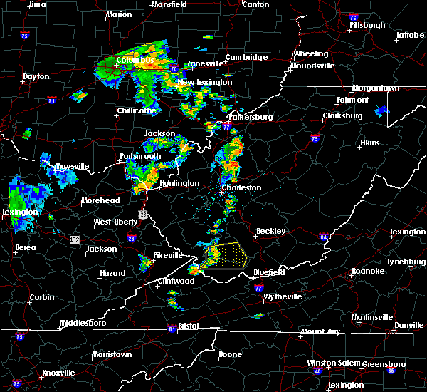 At 444 pm edt, doppler radar indicated a line of severe thunderstorms capable of producing damaging winds in excess of 60 mph. these storms were located along a line extending from elizabeth to near spencer, and moving east at 35 mph. At 444 pm edt, doppler radar indicated a line of severe thunderstorms capable of producing damaging winds in excess of 60 mph. these storms were located along a line extending from elizabeth to near spencer, and moving east at 35 mph.
|
| 5/11/2015 7:17 PM EDT | Trees down in elizabeth via wirt county 911 in wirt county WV, 0.2 miles N of Elizabeth, WV |
| 5/11/2015 7:12 PM EDT | At 710 pm edt, national weather service doppler radar indicated a line of severe thunderstorms capable of producing damaging winds in excess of 60 mph. these storms were located along a line extending from lubeck to mineralwells to elizabeth, or along a line extending from belpre to 6 miles northwest of elizabeth to elizabeth, moving northeast at 40 mph. * other locations in the warning include but are not limited to pennsboro, north bend state park, belmont, williamstown, washington, vienna and boaz. this will impact the following interstates, i-77 between mile markers 1 and 8 in ohio, and between mile markers 168 and 186 in west virginia. very heavy rain will also fall from this line of severe thunderstorms, and will cause water to pond on roads and quickly fill roadside ditches and small streams. a severe thunderstorm watch remains in effect until 1000 pm edt monday evening for central kentucky and southeast ohio and central west virginia. a severe thunderstorm watch also remains in effect until 100 am edt tuesday morning for central west virginia. please report hail or strong wind to the national weather service by calling toll free, 800-401-9535, when you can do so safely. you may also report severe weather by posting your report to the charleston west virginia national weather service facebook page, or by using the twitter hashtag, nwsrlx. |
| 5/11/2015 7:12 PM EDT | At 710 pm edt, national weather service doppler radar indicated a line of severe thunderstorms capable of producing damaging winds in excess of 60 mph. these storms were located along a line extending from lubeck to mineralwells to elizabeth, or along a line extending from belpre to 6 miles northwest of elizabeth to elizabeth, moving northeast at 40 mph. * other locations in the warning include but are not limited to pennsboro, north bend state park, belmont, williamstown, washington, vienna and boaz. this will impact the following interstates, i-77 between mile markers 1 and 8 in ohio, and between mile markers 168 and 186 in west virginia. very heavy rain will also fall from this line of severe thunderstorms, and will cause water to pond on roads and quickly fill roadside ditches and small streams. a severe thunderstorm watch remains in effect until 1000 pm edt monday evening for central kentucky and southeast ohio and central west virginia. a severe thunderstorm watch also remains in effect until 100 am edt tuesday morning for central west virginia. please report hail or strong wind to the national weather service by calling toll free, 800-401-9535, when you can do so safely. you may also report severe weather by posting your report to the charleston west virginia national weather service facebook page, or by using the twitter hashtag, nwsrlx. |
| 4/9/2015 3:58 PM EDT | A severe thunderstorm warning remains in effect until 430 pm edt for ritchie. wirt. northwestern calhoun and northwestern gilmer counties. at 354 pm edt. national weather service doppler radar continued to indicate a severe thunderstorm capable of producing ping pong ball size hail. and damaging winds in excess of 60 mph. This storm was. |
| 4/9/2015 3:41 PM EDT | The national weather service in charleston has issued a * severe thunderstorm warning for. northwestern calhoun county in west virginia. northwestern gilmer county in west virginia. northeastern jackson county in west virginia. Southern ritchie county in west virginia. |
| 4/8/2015 2:00 PM EDT | Metal roof blown off mobile home on rt 53. time estimated from rada in wirt county WV, 1.1 miles W of Elizabeth, WV |
| 11/17/2013 9:50 PM EST | Large limbs broken off of trees and thrown across the lawn... winds estimated by caller at 65 to 70 mph in wirt county WV, 0.2 miles N of Elizabeth, WV |
| 7/19/2013 2:10 PM EDT | 10 to 12 eight inch diameter trees blown down in the town of morristown...time estimated from rada in wirt county WV, 4.4 miles ENE of Elizabeth, WV |
| 6/13/2013 11:30 AM EDT | Numerous trees upr in wirt county WV, 5.5 miles WSW of Elizabeth, WV |
| 6/13/2013 11:27 AM EDT | Multiple trees upr in wirt county WV, 4.5 miles WSW of Elizabeth, WV |
| 6/13/2013 11:23 AM EDT | Numerous trees uprooted or snapped. roof on open-ended porch lifted and flipped onto hous in wirt county WV, 2.2 miles SSW of Elizabeth, WV |
| 6/29/2012 8:15 PM EDT | Trees and powerlines down across the county...structural damage to house in wirt county WV, 0.2 miles N of Elizabeth, WV |
| 6/29/2012 7:00 PM EDT | Front porch ripped off of a house. several large trees uprooted. power pole in road on route 1 in wirt county WV, 0.2 miles N of Elizabeth, WV |
| 9/14/2011 11:31 PM EDT | Quarter sized hail reported 8.7 miles ENE of Elizabeth, WV |
Hail Maps for Elizabeth, WV
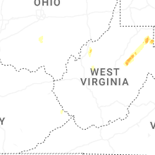


Connect with Interactive Hail Maps