

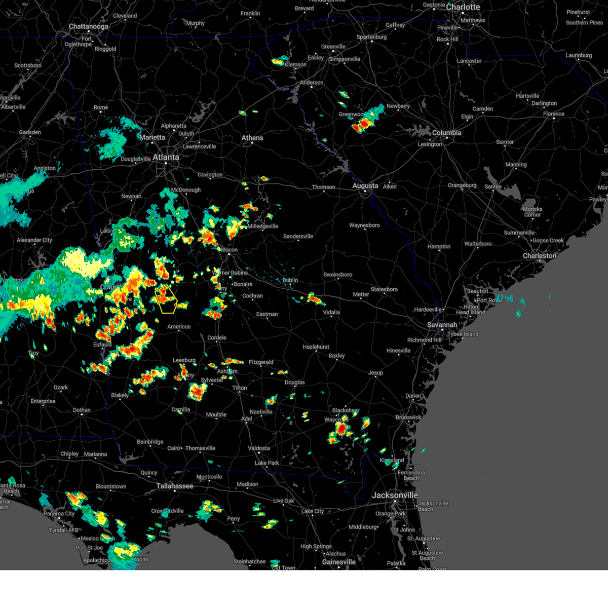
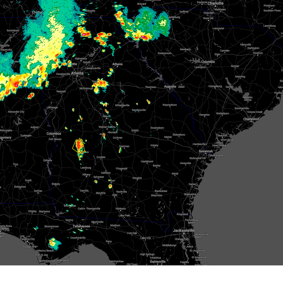
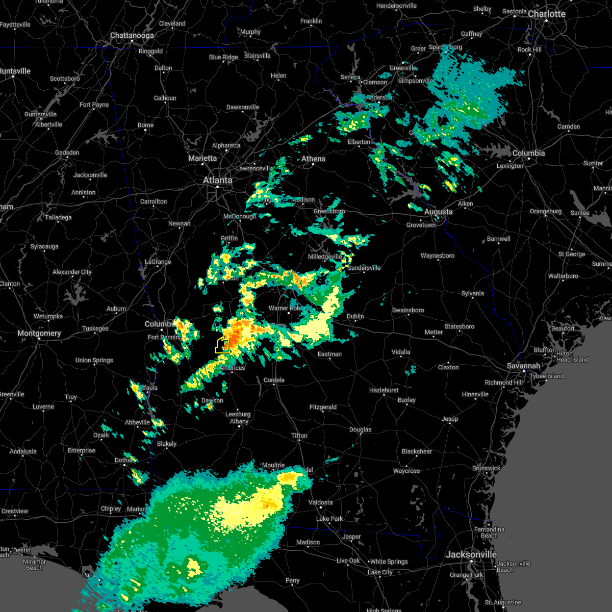
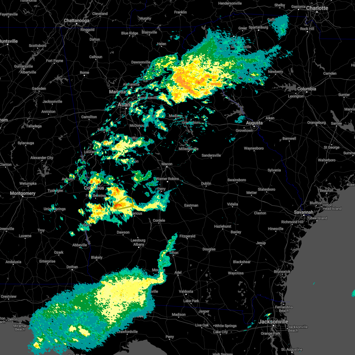
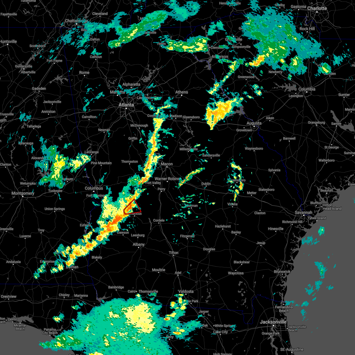
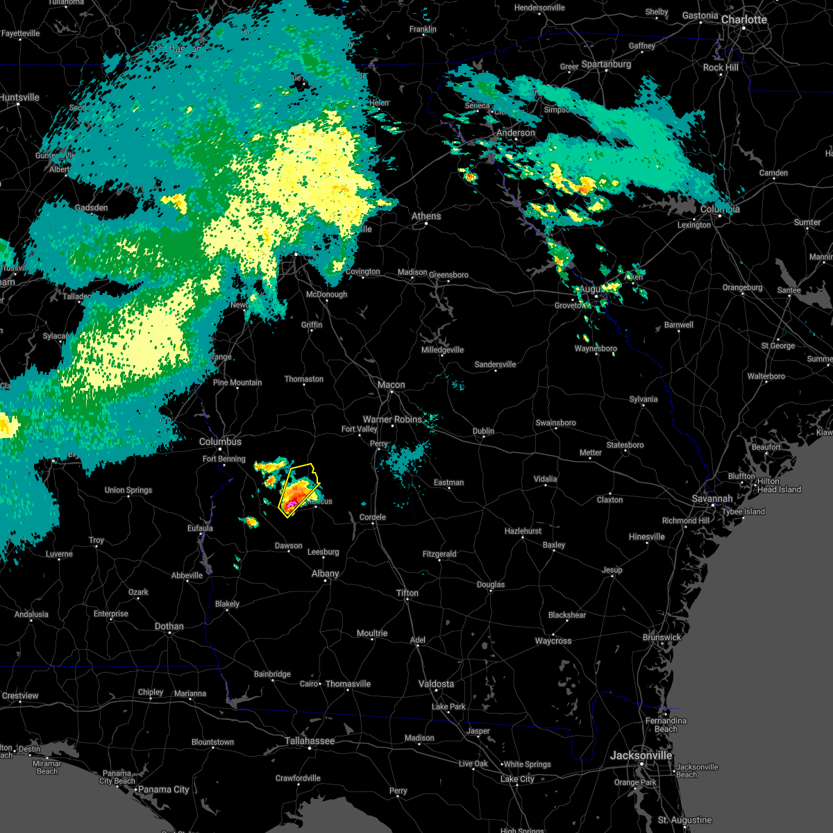
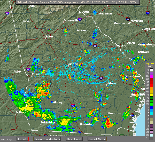
Hail Map for Ellaville, GA
The Ellaville, GA area has had 4 reports of on-the-ground hail by trained spotters, and has been under severe weather warnings 10 times during the past 12 months. Doppler radar has detected hail at or near Ellaville, GA on 40 occasions.
| Name: | Ellaville, GA |
| Where Located: | 73.1 miles ESE of Auburn, AL |
| Map: | Google Map for Ellaville, GA |
| Population: | 1812 |
| Housing Units: | 877 |
| More Info: | Search Google for Ellaville, GA |
4
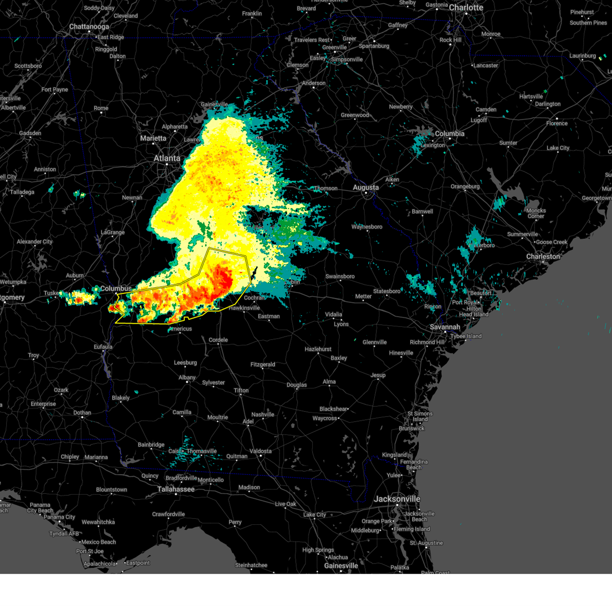
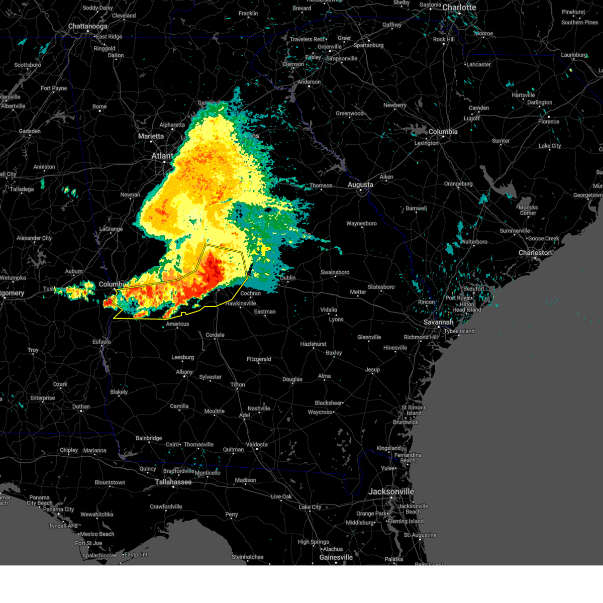
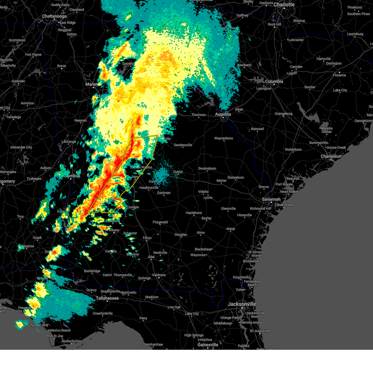
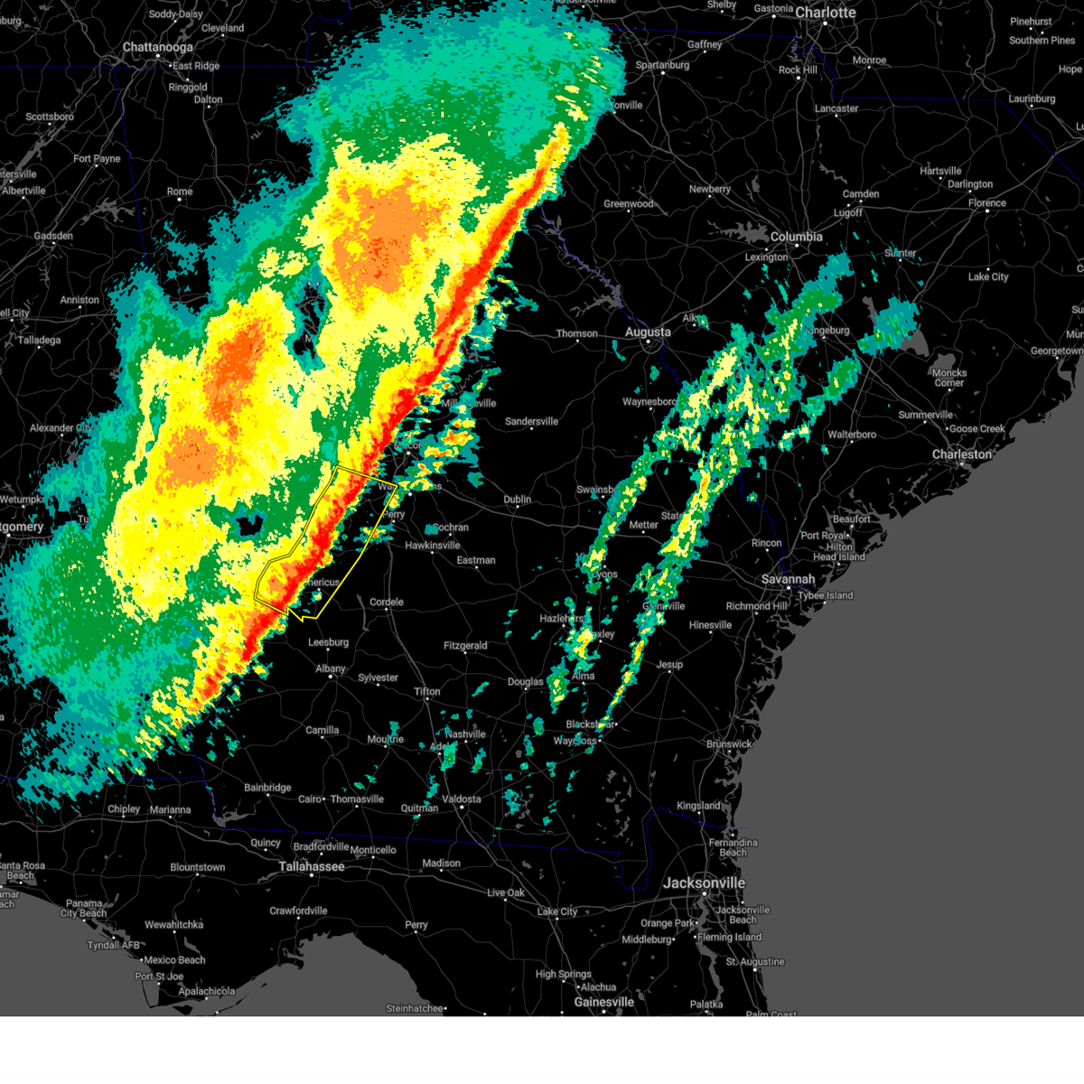
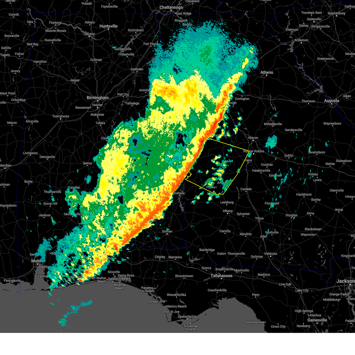
The Top Recent Hail Date for Ellaville, GA is Friday, March 15, 2024 (2nd out of 40)

Hail and Wind Damage Spotted near Ellaville, GA
| Date / Time | Report Details |
|---|---|
| 5/18/2025 11:03 AM EDT |
 The storms which prompted the warning have moved out of the area. therefore, the warning has been allowed to expire. a severe thunderstorm watch remains in effect until 100 pm edt for central and west central georgia. The storms which prompted the warning have moved out of the area. therefore, the warning has been allowed to expire. a severe thunderstorm watch remains in effect until 100 pm edt for central and west central georgia.
|
| 5/18/2025 10:47 AM EDT |
 At 1047 am edt, severe thunderstorms were located along a line extending from near lake tobesofkee to near skipperton to near saint louis to near garden valley to buena vista, moving east at 55 mph (radar indicated). Hazards include 60 mph wind gusts and quarter size hail. Hail damage to vehicles is expected. expect wind damage to roofs, siding, and trees. Locations impacted include, macon, perry, fort valley, buena vista, butler, ellaville, oglethorpe, cusseta, warner robins, centerville, byron, montezuma, marshallville, reynolds, ideal, payne, robins afb, payne city, north fort benning, and fort benning/lawson army air fld. At 1047 am edt, severe thunderstorms were located along a line extending from near lake tobesofkee to near skipperton to near saint louis to near garden valley to buena vista, moving east at 55 mph (radar indicated). Hazards include 60 mph wind gusts and quarter size hail. Hail damage to vehicles is expected. expect wind damage to roofs, siding, and trees. Locations impacted include, macon, perry, fort valley, buena vista, butler, ellaville, oglethorpe, cusseta, warner robins, centerville, byron, montezuma, marshallville, reynolds, ideal, payne, robins afb, payne city, north fort benning, and fort benning/lawson army air fld.
|
| 5/18/2025 10:47 AM EDT |
 the severe thunderstorm warning has been cancelled and is no longer in effect the severe thunderstorm warning has been cancelled and is no longer in effect
|
| 5/18/2025 10:46 AM EDT |
 Svrffc the national weather service in peachtree city has issued a * severe thunderstorm warning for, central laurens county in central georgia, dodge county in central georgia, southeastern marion county in west central georgia, southeastern bibb county in central georgia, houston county in central georgia, sumter county in west central georgia, northern crisp county in central georgia, southern wilkinson county in central georgia, southern macon county in west central georgia, pulaski county in central georgia, twiggs county in central georgia, northwestern wilcox county in central georgia, dooly county in central georgia, bleckley county in central georgia, east central webster county in west central georgia, schley county in west central georgia, * until 1130 am edt. * at 1045 am edt, severe thunderstorms were located along a line extending from near skipperton to centerville to near meadowdale to near whitewater state park to near buena vista, moving east at 55 mph (radar indicated). Hazards include 60 mph wind gusts. expect damage to roofs, siding, and trees Svrffc the national weather service in peachtree city has issued a * severe thunderstorm warning for, central laurens county in central georgia, dodge county in central georgia, southeastern marion county in west central georgia, southeastern bibb county in central georgia, houston county in central georgia, sumter county in west central georgia, northern crisp county in central georgia, southern wilkinson county in central georgia, southern macon county in west central georgia, pulaski county in central georgia, twiggs county in central georgia, northwestern wilcox county in central georgia, dooly county in central georgia, bleckley county in central georgia, east central webster county in west central georgia, schley county in west central georgia, * until 1130 am edt. * at 1045 am edt, severe thunderstorms were located along a line extending from near skipperton to centerville to near meadowdale to near whitewater state park to near buena vista, moving east at 55 mph (radar indicated). Hazards include 60 mph wind gusts. expect damage to roofs, siding, and trees
|
| 5/18/2025 10:11 AM EDT |
 Svrffc the national weather service in peachtree city has issued a * severe thunderstorm warning for, marion county in west central georgia, bibb county in central georgia, southeastern pike county in west central georgia, muscogee county in west central georgia, monroe county in central georgia, chattahoochee county in west central georgia, northern stewart county in west central georgia, eastern upson county in west central georgia, houston county in central georgia, central jones county in central georgia, southeastern harris county in west central georgia, macon county in west central georgia, western twiggs county in central georgia, northwestern webster county in west central georgia, peach county in central georgia, crawford county in central georgia, schley county in west central georgia, southern talbot county in west central georgia, taylor county in west central georgia, lamar county in west central georgia, * until 1100 am edt. * at 1011 am edt, severe thunderstorms were located along a line extending from piedmont to logtown to near howard to juniper to benning park, moving east at 55 mph (radar indicated). Hazards include 60 mph wind gusts and quarter size hail. Hail damage to vehicles is expected. Expect wind damage to roofs, siding, and trees. Svrffc the national weather service in peachtree city has issued a * severe thunderstorm warning for, marion county in west central georgia, bibb county in central georgia, southeastern pike county in west central georgia, muscogee county in west central georgia, monroe county in central georgia, chattahoochee county in west central georgia, northern stewart county in west central georgia, eastern upson county in west central georgia, houston county in central georgia, central jones county in central georgia, southeastern harris county in west central georgia, macon county in west central georgia, western twiggs county in central georgia, northwestern webster county in west central georgia, peach county in central georgia, crawford county in central georgia, schley county in west central georgia, southern talbot county in west central georgia, taylor county in west central georgia, lamar county in west central georgia, * until 1100 am edt. * at 1011 am edt, severe thunderstorms were located along a line extending from piedmont to logtown to near howard to juniper to benning park, moving east at 55 mph (radar indicated). Hazards include 60 mph wind gusts and quarter size hail. Hail damage to vehicles is expected. Expect wind damage to roofs, siding, and trees.
|
| 3/16/2025 3:13 AM EDT |
 Svrffc the national weather service in peachtree city has issued a * severe thunderstorm warning for, bibb county in central georgia, southeastern monroe county in central georgia, central houston county in central georgia, jones county in central georgia, sumter county in west central georgia, macon county in west central georgia, western baldwin county in central georgia, northwestern twiggs county in central georgia, southern webster county in west central georgia, peach county in central georgia, crawford county in central georgia, schley county in west central georgia, southeastern taylor county in west central georgia, * until 400 am edt. * at 312 am edt, severe thunderstorms were located along a line extending from plant scherer to near lizella to leveretts, moving east at 35 mph (radar indicated). Hazards include 60 mph wind gusts. expect damage to roofs, siding, and trees Svrffc the national weather service in peachtree city has issued a * severe thunderstorm warning for, bibb county in central georgia, southeastern monroe county in central georgia, central houston county in central georgia, jones county in central georgia, sumter county in west central georgia, macon county in west central georgia, western baldwin county in central georgia, northwestern twiggs county in central georgia, southern webster county in west central georgia, peach county in central georgia, crawford county in central georgia, schley county in west central georgia, southeastern taylor county in west central georgia, * until 400 am edt. * at 312 am edt, severe thunderstorms were located along a line extending from plant scherer to near lizella to leveretts, moving east at 35 mph (radar indicated). Hazards include 60 mph wind gusts. expect damage to roofs, siding, and trees
|
| 2/16/2025 5:47 AM EST |
 the severe thunderstorm warning has been cancelled and is no longer in effect the severe thunderstorm warning has been cancelled and is no longer in effect
|
| 2/16/2025 5:47 AM EST |
 At 546 am est, severe thunderstorms were located along a line extending from near reynolds to near bartlett to near plains, moving southeast at 45 mph (radar indicated). Hazards include 70 mph wind gusts. Expect considerable tree damage. damage is likely to mobile homes, roofs, and outbuildings. Locations impacted include, americus, fort valley, butler, ellaville, oglethorpe, roberta, preston, byron, montezuma, richland, marshallville, reynolds, plains, ideal, andersonville, smithville, sumter, putnam, murrays crossroads, and whitewater state park. At 546 am est, severe thunderstorms were located along a line extending from near reynolds to near bartlett to near plains, moving southeast at 45 mph (radar indicated). Hazards include 70 mph wind gusts. Expect considerable tree damage. damage is likely to mobile homes, roofs, and outbuildings. Locations impacted include, americus, fort valley, butler, ellaville, oglethorpe, roberta, preston, byron, montezuma, richland, marshallville, reynolds, plains, ideal, andersonville, smithville, sumter, putnam, murrays crossroads, and whitewater state park.
|
| 2/16/2025 5:02 AM EST |
 Svrffc the national weather service in peachtree city has issued a * severe thunderstorm warning for, marion county in west central georgia, eastern muscogee county in west central georgia, chattahoochee county in west central georgia, northern stewart county in west central georgia, southern upson county in west central georgia, sumter county in west central georgia, southeastern harris county in west central georgia, macon county in west central georgia, webster county in west central georgia, peach county in central georgia, central crawford county in central georgia, schley county in west central georgia, talbot county in west central georgia, taylor county in west central georgia, * until 600 am est. * at 501 am est, severe thunderstorms were located along a line extending from woodland to near box springs to near jamestown/south fort moore, moving southeast at 45 mph (radar indicated). Hazards include 70 mph wind gusts. Expect considerable tree damage. Damage is likely to mobile homes, roofs, and outbuildings. Svrffc the national weather service in peachtree city has issued a * severe thunderstorm warning for, marion county in west central georgia, eastern muscogee county in west central georgia, chattahoochee county in west central georgia, northern stewart county in west central georgia, southern upson county in west central georgia, sumter county in west central georgia, southeastern harris county in west central georgia, macon county in west central georgia, webster county in west central georgia, peach county in central georgia, central crawford county in central georgia, schley county in west central georgia, talbot county in west central georgia, taylor county in west central georgia, * until 600 am est. * at 501 am est, severe thunderstorms were located along a line extending from woodland to near box springs to near jamestown/south fort moore, moving southeast at 45 mph (radar indicated). Hazards include 70 mph wind gusts. Expect considerable tree damage. Damage is likely to mobile homes, roofs, and outbuildings.
|
| 12/18/2024 5:32 PM EST |
 Svrffc the national weather service in peachtree city has issued a * severe thunderstorm warning for, southeastern marion county in west central georgia, southern schley county in west central georgia, northwestern sumter county in west central georgia, * until 615 pm est. * at 532 pm est, a severe thunderstorm was located over friendship, or 7 miles southwest of ellaville, moving east at 25 mph (radar indicated). Hazards include 60 mph wind gusts and quarter size hail. Hail damage to vehicles is expected. Expect wind damage to roofs, siding, and trees. Svrffc the national weather service in peachtree city has issued a * severe thunderstorm warning for, southeastern marion county in west central georgia, southern schley county in west central georgia, northwestern sumter county in west central georgia, * until 615 pm est. * at 532 pm est, a severe thunderstorm was located over friendship, or 7 miles southwest of ellaville, moving east at 25 mph (radar indicated). Hazards include 60 mph wind gusts and quarter size hail. Hail damage to vehicles is expected. Expect wind damage to roofs, siding, and trees.
|
| 5/27/2024 4:43 PM EDT |
 The storm which prompted the warning has weakened below severe limits, and no longer poses an immediate threat to life or property. therefore, the warning will be allowed to expire. however, small hail, gusty winds and heavy rain are still possible with this thunderstorm. a severe thunderstorm watch remains in effect until 1000 pm edt for central and west central georgia. to report severe weather, contact your nearest law enforcement agency. they will relay your report to the national weather service peachtree city. The storm which prompted the warning has weakened below severe limits, and no longer poses an immediate threat to life or property. therefore, the warning will be allowed to expire. however, small hail, gusty winds and heavy rain are still possible with this thunderstorm. a severe thunderstorm watch remains in effect until 1000 pm edt for central and west central georgia. to report severe weather, contact your nearest law enforcement agency. they will relay your report to the national weather service peachtree city.
|
| 5/27/2024 3:56 PM EDT |
 Svrffc the national weather service in peachtree city has issued a * severe thunderstorm warning for, southwestern macon county in west central georgia, southern marion county in west central georgia, western dooly county in central georgia, webster county in west central georgia, schley county in west central georgia, sumter county in west central georgia, * until 445 pm edt. * at 356 pm edt, a severe thunderstorm was located over draneville, or 8 miles northeast of preston, moving east at 30 mph (radar indicated). Hazards include 60 mph wind gusts and quarter size hail. Hail damage to vehicles is expected. Expect wind damage to roofs, siding, and trees. Svrffc the national weather service in peachtree city has issued a * severe thunderstorm warning for, southwestern macon county in west central georgia, southern marion county in west central georgia, western dooly county in central georgia, webster county in west central georgia, schley county in west central georgia, sumter county in west central georgia, * until 445 pm edt. * at 356 pm edt, a severe thunderstorm was located over draneville, or 8 miles northeast of preston, moving east at 30 mph (radar indicated). Hazards include 60 mph wind gusts and quarter size hail. Hail damage to vehicles is expected. Expect wind damage to roofs, siding, and trees.
|
| 5/10/2024 12:48 AM EDT |
 the severe thunderstorm warning has been cancelled and is no longer in effect the severe thunderstorm warning has been cancelled and is no longer in effect
|
| 5/10/2024 12:38 AM EDT |
 the severe thunderstorm warning has been cancelled and is no longer in effect the severe thunderstorm warning has been cancelled and is no longer in effect
|
| 5/10/2024 12:38 AM EDT |
 At 1238 am edt, a severe thunderstorm was located near fountainville, or near ellaville, moving east at 45 mph (radar indicated). Hazards include 60 mph wind gusts and quarter size hail. Hail damage to vehicles is expected. expect wind damage to roofs, siding, and trees. Locations impacted include, ellaville, oglethorpe, montezuma, byromville, ideal, dooling, murrays crossroads, whitewater state park, clearview, fountainville, bartlett, and walls crossing. At 1238 am edt, a severe thunderstorm was located near fountainville, or near ellaville, moving east at 45 mph (radar indicated). Hazards include 60 mph wind gusts and quarter size hail. Hail damage to vehicles is expected. expect wind damage to roofs, siding, and trees. Locations impacted include, ellaville, oglethorpe, montezuma, byromville, ideal, dooling, murrays crossroads, whitewater state park, clearview, fountainville, bartlett, and walls crossing.
|
| 5/10/2024 12:37 AM EDT |
 At 1235 am edt, severe thunderstorms were located along a line extending from near friendship to morris, moving east at 60 mph (radar indicated). Hazards include 60 mph wind gusts and quarter size hail. Hail damage to vehicles is expected. expect wind damage to roofs, siding, and trees. Locations impacted include, americus, lumpkin, ellaville, preston, richland, plains, andersonville, weston, seminole, westville, la crosse, brooklyn, renfroe, leveretts, troutman, omaha, friendship, sanford, bumphead, and walls crossing. At 1235 am edt, severe thunderstorms were located along a line extending from near friendship to morris, moving east at 60 mph (radar indicated). Hazards include 60 mph wind gusts and quarter size hail. Hail damage to vehicles is expected. expect wind damage to roofs, siding, and trees. Locations impacted include, americus, lumpkin, ellaville, preston, richland, plains, andersonville, weston, seminole, westville, la crosse, brooklyn, renfroe, leveretts, troutman, omaha, friendship, sanford, bumphead, and walls crossing.
|
| 5/10/2024 12:13 AM EDT |
 Svrffc the national weather service in peachtree city has issued a * severe thunderstorm warning for, macon county in west central georgia, central marion county in west central georgia, northwestern dooly county in central georgia, central schley county in west central georgia, * until 100 am edt. * at 1213 am edt, a severe thunderstorm was located over buena vista, moving east at 45 mph (radar indicated). Hazards include 60 mph wind gusts and quarter size hail. Hail damage to vehicles is expected. Expect wind damage to roofs, siding, and trees. Svrffc the national weather service in peachtree city has issued a * severe thunderstorm warning for, macon county in west central georgia, central marion county in west central georgia, northwestern dooly county in central georgia, central schley county in west central georgia, * until 100 am edt. * at 1213 am edt, a severe thunderstorm was located over buena vista, moving east at 45 mph (radar indicated). Hazards include 60 mph wind gusts and quarter size hail. Hail damage to vehicles is expected. Expect wind damage to roofs, siding, and trees.
|
| 5/10/2024 12:04 AM EDT |
 Svrffc the national weather service in peachtree city has issued a * severe thunderstorm warning for, southern marion county in west central georgia, southeastern chattahoochee county in west central georgia, stewart county in west central georgia, webster county in west central georgia, southern schley county in west central georgia, northwestern sumter county in west central georgia, * until 1245 am edt. * at 1202 am edt, severe thunderstorms were located along a line extending from near fort mitchell activity center to near clayton municipal airport in east-central alabama, moving east at 60 mph (radar indicated). Hazards include 60 mph wind gusts and quarter size hail. Hail damage to vehicles is expected. Expect wind damage to roofs, siding, and trees. Svrffc the national weather service in peachtree city has issued a * severe thunderstorm warning for, southern marion county in west central georgia, southeastern chattahoochee county in west central georgia, stewart county in west central georgia, webster county in west central georgia, southern schley county in west central georgia, northwestern sumter county in west central georgia, * until 1245 am edt. * at 1202 am edt, severe thunderstorms were located along a line extending from near fort mitchell activity center to near clayton municipal airport in east-central alabama, moving east at 60 mph (radar indicated). Hazards include 60 mph wind gusts and quarter size hail. Hail damage to vehicles is expected. Expect wind damage to roofs, siding, and trees.
|
| 5/9/2024 12:47 PM EDT |
 the tornado warning has been cancelled and is no longer in effect the tornado warning has been cancelled and is no longer in effect
|
| 5/9/2024 12:47 PM EDT |
 At 1247 pm edt, a confirmed tornado was located over ellaville, moving east at 20 mph (emergency management confirmed tornado). Hazards include damaging tornado. Flying debris will be dangerous to those caught without shelter. mobile homes will be damaged or destroyed. damage to roofs, windows, and vehicles will occur. tree damage is likely. Locations impacted include, ellaville, oglethorpe, montezuma, andersonville, andersonville national historic, friendship, clearview, bumphead, fountainville, la crosse, pennington, and walls crossing. At 1247 pm edt, a confirmed tornado was located over ellaville, moving east at 20 mph (emergency management confirmed tornado). Hazards include damaging tornado. Flying debris will be dangerous to those caught without shelter. mobile homes will be damaged or destroyed. damage to roofs, windows, and vehicles will occur. tree damage is likely. Locations impacted include, ellaville, oglethorpe, montezuma, andersonville, andersonville national historic, friendship, clearview, bumphead, fountainville, la crosse, pennington, and walls crossing.
|
| 5/9/2024 12:45 PM EDT | Quarter sized hail reported 0.2 miles S of Ellaville, GA, quarter-size hail at ga-26 and n broad st. |
| 5/9/2024 12:33 PM EDT |
 Torffc the national weather service in peachtree city has issued a * tornado warning for, southwestern macon county in west central georgia, southeastern marion county in west central georgia, schley county in west central georgia, northwestern sumter county in west central georgia, * until 100 pm edt. * at 1233 pm edt, a severe thunderstorm capable of producing a tornado was located over draneville, or near buena vista, moving east at 50 mph (radar indicated rotation). Hazards include tornado. Flying debris will be dangerous to those caught without shelter. mobile homes will be damaged or destroyed. damage to roofs, windows, and vehicles will occur. Tree damage is likely. Torffc the national weather service in peachtree city has issued a * tornado warning for, southwestern macon county in west central georgia, southeastern marion county in west central georgia, schley county in west central georgia, northwestern sumter county in west central georgia, * until 100 pm edt. * at 1233 pm edt, a severe thunderstorm capable of producing a tornado was located over draneville, or near buena vista, moving east at 50 mph (radar indicated rotation). Hazards include tornado. Flying debris will be dangerous to those caught without shelter. mobile homes will be damaged or destroyed. damage to roofs, windows, and vehicles will occur. Tree damage is likely.
|
| 5/9/2024 12:30 PM EDT |
 Svrffc the national weather service in peachtree city has issued a * severe thunderstorm warning for, southwestern macon county in west central georgia, southern marion county in west central georgia, north central webster county in west central georgia, schley county in west central georgia, northern sumter county in west central georgia, * until 115 pm edt. * at 1229 pm edt, a severe thunderstorm was located near draneville, or near buena vista, moving east at 50 mph (radar indicated). Hazards include 60 mph wind gusts and nickel size hail. expect damage to roofs, siding, and trees Svrffc the national weather service in peachtree city has issued a * severe thunderstorm warning for, southwestern macon county in west central georgia, southern marion county in west central georgia, north central webster county in west central georgia, schley county in west central georgia, northern sumter county in west central georgia, * until 115 pm edt. * at 1229 pm edt, a severe thunderstorm was located near draneville, or near buena vista, moving east at 50 mph (radar indicated). Hazards include 60 mph wind gusts and nickel size hail. expect damage to roofs, siding, and trees
|
| 3/15/2024 3:53 PM EDT |
 Svrffc the national weather service in peachtree city has issued a * severe thunderstorm warning for, southwestern macon county in west central georgia, southeastern marion county in west central georgia, schley county in west central georgia, * until 430 pm edt. * at 353 pm edt, a severe thunderstorm was located over walls crossing, or near ellaville, moving east at 40 mph (radar indicated). Hazards include 60 mph wind gusts and half dollar size hail. Hail damage to vehicles is expected. Expect wind damage to roofs, siding, and trees. Svrffc the national weather service in peachtree city has issued a * severe thunderstorm warning for, southwestern macon county in west central georgia, southeastern marion county in west central georgia, schley county in west central georgia, * until 430 pm edt. * at 353 pm edt, a severe thunderstorm was located over walls crossing, or near ellaville, moving east at 40 mph (radar indicated). Hazards include 60 mph wind gusts and half dollar size hail. Hail damage to vehicles is expected. Expect wind damage to roofs, siding, and trees.
|
| 1/9/2024 9:38 AM EST |
 At 938 am est, severe thunderstorms were located along a line extending from near wesley church to near rupert to leveretts, moving east at 55 mph (radar indicated). Hazards include 60 mph wind gusts. expect damage to roofs, siding, and trees At 938 am est, severe thunderstorms were located along a line extending from near wesley church to near rupert to leveretts, moving east at 55 mph (radar indicated). Hazards include 60 mph wind gusts. expect damage to roofs, siding, and trees
|
| 1/9/2024 9:22 AM EST |
 At 922 am est, severe thunderstorms were located along a line extending from brantley to near seminole to kimbrough, moving northeast at 70 mph (radar indicated). Hazards include 60 mph wind gusts. Expect damage to roofs, siding, and trees. locations impacted include, buena vista, butler, ellaville, preston, richland, putnam, brantley, seminole, murrays crossroads, rupert, charing, oakland, draneville, zellobee, mauk, howard, tazewell, marion estates, doyle, and church hill. hail threat, radar indicated max hail size, <. 75 in wind threat, radar indicated max wind gust, 60 mph. At 922 am est, severe thunderstorms were located along a line extending from brantley to near seminole to kimbrough, moving northeast at 70 mph (radar indicated). Hazards include 60 mph wind gusts. Expect damage to roofs, siding, and trees. locations impacted include, buena vista, butler, ellaville, preston, richland, putnam, brantley, seminole, murrays crossroads, rupert, charing, oakland, draneville, zellobee, mauk, howard, tazewell, marion estates, doyle, and church hill. hail threat, radar indicated max hail size, <. 75 in wind threat, radar indicated max wind gust, 60 mph.
|
| 1/9/2024 9:03 AM EST |
 At 903 am est, severe thunderstorms were located along a line extending from louvale to lumpkin to near springvale, moving northeast at 80 mph (radar indicated). Hazards include 60 mph wind gusts. expect damage to roofs, siding, and trees At 903 am est, severe thunderstorms were located along a line extending from louvale to lumpkin to near springvale, moving northeast at 80 mph (radar indicated). Hazards include 60 mph wind gusts. expect damage to roofs, siding, and trees
|
| 8/27/2023 6:28 PM EDT |
 At 628 pm edt, a severe thunderstorm was located near church hill, or near preston, moving northeast at 15 mph (radar indicated). Hazards include 60 mph wind gusts. expect damage to roofs, siding, and trees At 628 pm edt, a severe thunderstorm was located near church hill, or near preston, moving northeast at 15 mph (radar indicated). Hazards include 60 mph wind gusts. expect damage to roofs, siding, and trees
|
| 8/15/2023 6:03 PM EDT |
 At 603 pm edt, a severe thunderstorm was located over ideal, or 9 miles northwest of oglethorpe, moving east at 25 mph (radar indicated). Hazards include 60 mph wind gusts and penny size hail. Expect damage to roofs, siding, and trees. locations impacted include, ellaville, oglethorpe, montezuma, marshallville, ideal, dooling, whitewater state park, fountainville, garden valley, hicks, clearview, winchester, and bartlett. hail threat, radar indicated max hail size, 0. 75 in wind threat, radar indicated max wind gust, 60 mph. At 603 pm edt, a severe thunderstorm was located over ideal, or 9 miles northwest of oglethorpe, moving east at 25 mph (radar indicated). Hazards include 60 mph wind gusts and penny size hail. Expect damage to roofs, siding, and trees. locations impacted include, ellaville, oglethorpe, montezuma, marshallville, ideal, dooling, whitewater state park, fountainville, garden valley, hicks, clearview, winchester, and bartlett. hail threat, radar indicated max hail size, 0. 75 in wind threat, radar indicated max wind gust, 60 mph.
|
| 8/15/2023 5:46 PM EDT |
 At 546 pm edt, a severe thunderstorm was located near rupert, or 10 miles north of ellaville, moving east at 25 mph (radar indicated). Hazards include 60 mph wind gusts and penny size hail. expect damage to roofs, siding, and trees At 546 pm edt, a severe thunderstorm was located near rupert, or 10 miles north of ellaville, moving east at 25 mph (radar indicated). Hazards include 60 mph wind gusts and penny size hail. expect damage to roofs, siding, and trees
|
| 8/12/2023 5:46 PM EDT |
 At 546 pm edt, a severe thunderstorm was located near buena vista, moving southeast at 15 mph (radar indicated). Hazards include 60 mph wind gusts and quarter size hail. Hail damage to vehicles is expected. Expect wind damage to roofs, siding, and trees. At 546 pm edt, a severe thunderstorm was located near buena vista, moving southeast at 15 mph (radar indicated). Hazards include 60 mph wind gusts and quarter size hail. Hail damage to vehicles is expected. Expect wind damage to roofs, siding, and trees.
|
| 8/8/2023 5:00 PM EDT | Trees and powerlines reported down throughout ellaville including: 57th block of n. stevens st. 465th block of n broad st. 39th block of bridges s in schley county GA, 0.2 miles S of Ellaville, GA |
| 7/30/2023 4:07 PM EDT | Corrects previous tstm wnd dmg report from 1 e ellaville. powerlines down at intersection of east oglethorpe street and hayes avenu in schley county GA, 0.6 miles WSW of Ellaville, GA |
| 7/30/2023 4:00 PM EDT |
 At 359 pm edt, a severe thunderstorm was located near friendship, or 7 miles northwest of americus, moving east at 25 mph (radar indicated). Hazards include 60 mph wind gusts and quarter size hail. Hail damage to vehicles is expected. Expect wind damage to roofs, siding, and trees. At 359 pm edt, a severe thunderstorm was located near friendship, or 7 miles northwest of americus, moving east at 25 mph (radar indicated). Hazards include 60 mph wind gusts and quarter size hail. Hail damage to vehicles is expected. Expect wind damage to roofs, siding, and trees.
|
| 7/30/2023 3:56 PM EDT |
 At 356 pm edt, a severe thunderstorm was located over murrays crossroads, or near ellaville, moving southeast at 25 mph (radar indicated). Hazards include 60 mph wind gusts and penny size hail. Expect damage to roofs, siding, and trees. locations impacted include, ellaville, murrays crossroads, and walls crossing. hail threat, radar indicated max hail size, 0. 75 in wind threat, radar indicated max wind gust, 60 mph. At 356 pm edt, a severe thunderstorm was located over murrays crossroads, or near ellaville, moving southeast at 25 mph (radar indicated). Hazards include 60 mph wind gusts and penny size hail. Expect damage to roofs, siding, and trees. locations impacted include, ellaville, murrays crossroads, and walls crossing. hail threat, radar indicated max hail size, 0. 75 in wind threat, radar indicated max wind gust, 60 mph.
|
| 7/30/2023 3:37 PM EDT | Powerlines down at intersection of east oglethorpe street and hayes avenu in schley county GA, 0.6 miles WSW of Ellaville, GA |
| 7/30/2023 3:28 PM EDT |
 At 328 pm edt, a severe thunderstorm was located over charing, or 11 miles northeast of buena vista, moving southeast at 15 mph (radar indicated). Hazards include 60 mph wind gusts and quarter size hail. Hail damage to vehicles is expected. Expect wind damage to roofs, siding, and trees. At 328 pm edt, a severe thunderstorm was located over charing, or 11 miles northeast of buena vista, moving southeast at 15 mph (radar indicated). Hazards include 60 mph wind gusts and quarter size hail. Hail damage to vehicles is expected. Expect wind damage to roofs, siding, and trees.
|
| 7/5/2023 7:41 PM EDT |
 At 741 pm edt, a severe thunderstorm was located over ideal, or 7 miles northwest of oglethorpe, moving southeast at 15 mph (radar indicated). Hazards include 60 mph wind gusts and quarter size hail. Hail damage to vehicles is expected. expect wind damage to roofs, siding, and trees. locations impacted include, ellaville, oglethorpe, montezuma, ideal, murrays crossroads, whitewater state park, fountainville, rupert, garden valley and bartlett. hail threat, radar indicated max hail size, 1. 00 in wind threat, radar indicated max wind gust, 60 mph. At 741 pm edt, a severe thunderstorm was located over ideal, or 7 miles northwest of oglethorpe, moving southeast at 15 mph (radar indicated). Hazards include 60 mph wind gusts and quarter size hail. Hail damage to vehicles is expected. expect wind damage to roofs, siding, and trees. locations impacted include, ellaville, oglethorpe, montezuma, ideal, murrays crossroads, whitewater state park, fountainville, rupert, garden valley and bartlett. hail threat, radar indicated max hail size, 1. 00 in wind threat, radar indicated max wind gust, 60 mph.
|
| 7/5/2023 7:24 PM EDT |
 At 724 pm edt, a severe thunderstorm was located over ideal, or 11 miles south of butler, moving southeast at 5 mph (radar indicated). Hazards include 60 mph wind gusts and quarter size hail. Hail damage to vehicles is expected. Expect wind damage to roofs, siding, and trees. At 724 pm edt, a severe thunderstorm was located over ideal, or 11 miles south of butler, moving southeast at 5 mph (radar indicated). Hazards include 60 mph wind gusts and quarter size hail. Hail damage to vehicles is expected. Expect wind damage to roofs, siding, and trees.
|
| 7/1/2023 6:18 PM EDT |
 At 617 pm edt, a severe thunderstorm was located over walls crossing, or near ellaville, and is nearly stationary (radar indicated). Hazards include 60 mph wind gusts and quarter size hail. Hail damage to vehicles is expected. Expect wind damage to roofs, siding, and trees. At 617 pm edt, a severe thunderstorm was located over walls crossing, or near ellaville, and is nearly stationary (radar indicated). Hazards include 60 mph wind gusts and quarter size hail. Hail damage to vehicles is expected. Expect wind damage to roofs, siding, and trees.
|
| 6/25/2023 9:21 PM EDT |
 At 920 pm edt, severe thunderstorms were located along a line extending from new era to near richland to near omaha, moving south at 30 mph (radar indicated). Hazards include 60 mph wind gusts. Expect damage to roofs, siding, and trees. locations impacted include, americus, lumpkin, ellaville, cusseta, preston, richland, plains, leslie, andersonville, de soto, fort moore, desoto, weston, cobb, sumter, lamar, seminole, new era, la crosse and pennington. hail threat, radar indicated max hail size, <. 75 in wind threat, radar indicated max wind gust, 60 mph. At 920 pm edt, severe thunderstorms were located along a line extending from new era to near richland to near omaha, moving south at 30 mph (radar indicated). Hazards include 60 mph wind gusts. Expect damage to roofs, siding, and trees. locations impacted include, americus, lumpkin, ellaville, cusseta, preston, richland, plains, leslie, andersonville, de soto, fort moore, desoto, weston, cobb, sumter, lamar, seminole, new era, la crosse and pennington. hail threat, radar indicated max hail size, <. 75 in wind threat, radar indicated max wind gust, 60 mph.
|
| 6/25/2023 8:53 PM EDT |
 At 853 pm edt, severe thunderstorms were located along a line extending from fountainville to zellobee to fort mitchell, moving south at 30 mph (radar indicated). Hazards include 60 mph wind gusts. expect damage to roofs, siding, and trees At 853 pm edt, severe thunderstorms were located along a line extending from fountainville to zellobee to fort mitchell, moving south at 30 mph (radar indicated). Hazards include 60 mph wind gusts. expect damage to roofs, siding, and trees
|
| 6/15/2023 9:05 AM EDT | Tree down near the intersection of heath rd and hw 27 in schley county GA, 4.8 miles NW of Ellaville, GA |
| 6/15/2023 9:00 AM EDT | Tree reported down near the intersection of andrews ln and mt zion r in schley county GA, 3.1 miles NW of Ellaville, GA |
| 6/15/2023 8:55 AM EDT | Tree down on the 300th block of barwick r in schley county GA, 7.6 miles WNW of Ellaville, GA |
| 4/1/2023 1:01 PM EDT |
 At 101 pm edt, a severe thunderstorm was located near americus, moving east at 50 mph (radar indicated). Hazards include 60 mph wind gusts and penny size hail. Expect damage to roofs, siding, and trees. locations impacted include, americus, ellaville, preston, plains, weston, sumter, kimbrough, croxton crossroads, new era, la crosse, friendship, maddox, bumphead, centerpoint, dumas and walls crossing. hail threat, radar indicated max hail size, 0. 75 in wind threat, radar indicated max wind gust, 60 mph. At 101 pm edt, a severe thunderstorm was located near americus, moving east at 50 mph (radar indicated). Hazards include 60 mph wind gusts and penny size hail. Expect damage to roofs, siding, and trees. locations impacted include, americus, ellaville, preston, plains, weston, sumter, kimbrough, croxton crossroads, new era, la crosse, friendship, maddox, bumphead, centerpoint, dumas and walls crossing. hail threat, radar indicated max hail size, 0. 75 in wind threat, radar indicated max wind gust, 60 mph.
|
| 4/1/2023 12:51 PM EDT |
 At 1251 pm edt, a severe thunderstorm was located over friendship, or 7 miles northeast of preston, moving east at 50 mph (radar indicated). Hazards include 60 mph wind gusts and penny size hail. Expect damage to roofs, siding, and trees. locations impacted include, americus, ellaville, preston, plains, weston, sumter, seminole, kimbrough, croxton crossroads, new era, la crosse, draneville, friendship, maddox, bumphead, church hill, centerpoint and dumas. hail threat, radar indicated max hail size, 0. 75 in wind threat, radar indicated max wind gust, 60 mph. At 1251 pm edt, a severe thunderstorm was located over friendship, or 7 miles northeast of preston, moving east at 50 mph (radar indicated). Hazards include 60 mph wind gusts and penny size hail. Expect damage to roofs, siding, and trees. locations impacted include, americus, ellaville, preston, plains, weston, sumter, seminole, kimbrough, croxton crossroads, new era, la crosse, draneville, friendship, maddox, bumphead, church hill, centerpoint and dumas. hail threat, radar indicated max hail size, 0. 75 in wind threat, radar indicated max wind gust, 60 mph.
|
| 4/1/2023 12:29 PM EDT |
 At 1229 pm edt, a severe thunderstorm was located near brooklyn, or near lumpkin, moving east at 50 mph (radar indicated). Hazards include 60 mph wind gusts and quarter size hail. Hail damage to vehicles is expected. Expect wind damage to roofs, siding, and trees. At 1229 pm edt, a severe thunderstorm was located near brooklyn, or near lumpkin, moving east at 50 mph (radar indicated). Hazards include 60 mph wind gusts and quarter size hail. Hail damage to vehicles is expected. Expect wind damage to roofs, siding, and trees.
|
| 3/25/2023 10:50 PM EDT | Half Dollar sized hail reported 4.3 miles WNW of Ellaville, GA, half dollar sized hail reported by emergency manager along hwy 228 near lacross rd. |
| 6/29/2022 4:17 PM EDT |
 At 416 pm edt, a severe thunderstorm was located over putnam, or near ellaville, and is nearly stationary (radar indicated). Hazards include 60 mph wind gusts. Expect damage to roofs, siding, and trees. locations impacted include, ellaville and walls crossing. hail threat, radar indicated max hail size, <. 75 in wind threat, radar indicated max wind gust, 60 mph. At 416 pm edt, a severe thunderstorm was located over putnam, or near ellaville, and is nearly stationary (radar indicated). Hazards include 60 mph wind gusts. Expect damage to roofs, siding, and trees. locations impacted include, ellaville and walls crossing. hail threat, radar indicated max hail size, <. 75 in wind threat, radar indicated max wind gust, 60 mph.
|
| 6/29/2022 3:52 PM EDT |
 At 352 pm edt, a severe thunderstorm was located near friendship, or near ellaville, and is nearly stationary (radar indicated). Hazards include 60 mph wind gusts. expect damage to roofs, siding, and trees At 352 pm edt, a severe thunderstorm was located near friendship, or near ellaville, and is nearly stationary (radar indicated). Hazards include 60 mph wind gusts. expect damage to roofs, siding, and trees
|
| 6/24/2022 8:11 PM EDT |
 The severe thunderstorm warning for southwestern macon, west central dooly, southeastern schley and northeastern sumter counties will expire at 815 pm edt, the storm which prompted the warning has weakened below severe limits, and no longer poses an immediate threat to life or property. therefore, the warning will be allowed to expire. however gusty winds and heavy rain are still possible with this thunderstorm. to report severe weather, contact your nearest law enforcement agency. they will relay your report to the national weather service peachtree city. The severe thunderstorm warning for southwestern macon, west central dooly, southeastern schley and northeastern sumter counties will expire at 815 pm edt, the storm which prompted the warning has weakened below severe limits, and no longer poses an immediate threat to life or property. therefore, the warning will be allowed to expire. however gusty winds and heavy rain are still possible with this thunderstorm. to report severe weather, contact your nearest law enforcement agency. they will relay your report to the national weather service peachtree city.
|
| 6/24/2022 7:26 PM EDT |
 At 726 pm edt, a severe thunderstorm was located over clearview, or near oglethorpe, moving southwest at 15 mph (radar indicated). Hazards include golf ball size hail and 70 mph wind gusts. People and animals outdoors will be injured. expect hail damage to roofs, siding, windows, and vehicles. expect considerable tree damage. Wind damage is also likely to mobile homes, roofs, and outbuildings. At 726 pm edt, a severe thunderstorm was located over clearview, or near oglethorpe, moving southwest at 15 mph (radar indicated). Hazards include golf ball size hail and 70 mph wind gusts. People and animals outdoors will be injured. expect hail damage to roofs, siding, windows, and vehicles. expect considerable tree damage. Wind damage is also likely to mobile homes, roofs, and outbuildings.
|
| 6/24/2022 2:46 PM EDT |
 At 246 pm edt, a severe thunderstorm was located over tazewell, or near buena vista, moving southeast at 10 mph (radar indicated). Hazards include 60 mph wind gusts and quarter size hail. Hail damage to vehicles is expected. Expect wind damage to roofs, siding, and trees. At 246 pm edt, a severe thunderstorm was located over tazewell, or near buena vista, moving southeast at 10 mph (radar indicated). Hazards include 60 mph wind gusts and quarter size hail. Hail damage to vehicles is expected. Expect wind damage to roofs, siding, and trees.
|
| 6/15/2022 7:51 PM EDT |
 At 751 pm edt, a severe thunderstorm was located near walls crossing, or near ellaville, moving southwest at 30 mph (radar indicated). Hazards include 60 mph wind gusts and quarter size hail. Hail damage to vehicles is expected. expect wind damage to roofs, siding, and trees. locations impacted include, buena vista, ellaville, putnam, brantley, murrays crossroads, tazewell, doyle, draneville and walls crossing. hail threat, radar indicated max hail size, 1. 00 in wind threat, radar indicated max wind gust, 60 mph. At 751 pm edt, a severe thunderstorm was located near walls crossing, or near ellaville, moving southwest at 30 mph (radar indicated). Hazards include 60 mph wind gusts and quarter size hail. Hail damage to vehicles is expected. expect wind damage to roofs, siding, and trees. locations impacted include, buena vista, ellaville, putnam, brantley, murrays crossroads, tazewell, doyle, draneville and walls crossing. hail threat, radar indicated max hail size, 1. 00 in wind threat, radar indicated max wind gust, 60 mph.
|
| 6/15/2022 7:41 PM EDT |
 At 741 pm edt, a severe thunderstorm was located over murrays crossroads, or 7 miles north of ellaville, moving southwest at 30 mph (radar indicated). Hazards include 60 mph wind gusts and quarter size hail. Hail damage to vehicles is expected. Expect wind damage to roofs, siding, and trees. At 741 pm edt, a severe thunderstorm was located over murrays crossroads, or 7 miles north of ellaville, moving southwest at 30 mph (radar indicated). Hazards include 60 mph wind gusts and quarter size hail. Hail damage to vehicles is expected. Expect wind damage to roofs, siding, and trees.
|
| 4/5/2022 3:05 PM EDT |
 At 304 pm edt, severe thunderstorms were located along a line extending from near perry to near byromville to near georgia veterans memorial st pk, moving east at 65 mph (radar indicated). Hazards include 60 mph wind gusts and penny size hail. Expect damage to roofs, siding, and trees. locations impacted include, americus, ellaville, oglethorpe, montezuma, marshallville, plains, ideal, leslie, andersonville, de soto, desoto, smithville, cobb, sumter, lamar, murrays crossroads, whitewater state park, croxton crossroads, new era and la crosse. hail threat, radar indicated max hail size, 0. 75 in wind threat, radar indicated max wind gust, 60 mph. At 304 pm edt, severe thunderstorms were located along a line extending from near perry to near byromville to near georgia veterans memorial st pk, moving east at 65 mph (radar indicated). Hazards include 60 mph wind gusts and penny size hail. Expect damage to roofs, siding, and trees. locations impacted include, americus, ellaville, oglethorpe, montezuma, marshallville, plains, ideal, leslie, andersonville, de soto, desoto, smithville, cobb, sumter, lamar, murrays crossroads, whitewater state park, croxton crossroads, new era and la crosse. hail threat, radar indicated max hail size, 0. 75 in wind threat, radar indicated max wind gust, 60 mph.
|
| 4/5/2022 2:53 PM EDT |
 At 252 pm edt, severe thunderstorms were located along a line extending from near marshallville to near andersonville to leslie, moving east at 65 mph (radar indicated). Hazards include 60 mph wind gusts and penny size hail. Expect damage to roofs, siding, and trees. locations impacted include, americus, ellaville, oglethorpe, montezuma, marshallville, plains, ideal, leslie, andersonville, de soto, desoto, smithville, cobb, sumter, lamar, murrays crossroads, whitewater state park, croxton crossroads, new era and rupert. hail threat, radar indicated max hail size, 0. 75 in wind threat, radar indicated max wind gust, 60 mph. At 252 pm edt, severe thunderstorms were located along a line extending from near marshallville to near andersonville to leslie, moving east at 65 mph (radar indicated). Hazards include 60 mph wind gusts and penny size hail. Expect damage to roofs, siding, and trees. locations impacted include, americus, ellaville, oglethorpe, montezuma, marshallville, plains, ideal, leslie, andersonville, de soto, desoto, smithville, cobb, sumter, lamar, murrays crossroads, whitewater state park, croxton crossroads, new era and rupert. hail threat, radar indicated max hail size, 0. 75 in wind threat, radar indicated max wind gust, 60 mph.
|
| 4/5/2022 2:44 PM EDT |
 At 244 pm edt, severe thunderstorms were located along a line extending from near hicks to shiloh to near sumter, moving east at 65 mph (radar indicated). Hazards include 60 mph wind gusts and penny size hail. Expect damage to roofs, siding, and trees. locations impacted include, americus, ellaville, oglethorpe, preston, montezuma, marshallville, plains, ideal, leslie, andersonville, de soto, desoto, smithville, cobb, sumter, putnam, lamar, murrays crossroads, whitewater state park and croxton crossroads. hail threat, radar indicated max hail size, 0. 75 in wind threat, radar indicated max wind gust, 60 mph. At 244 pm edt, severe thunderstorms were located along a line extending from near hicks to shiloh to near sumter, moving east at 65 mph (radar indicated). Hazards include 60 mph wind gusts and penny size hail. Expect damage to roofs, siding, and trees. locations impacted include, americus, ellaville, oglethorpe, preston, montezuma, marshallville, plains, ideal, leslie, andersonville, de soto, desoto, smithville, cobb, sumter, putnam, lamar, murrays crossroads, whitewater state park and croxton crossroads. hail threat, radar indicated max hail size, 0. 75 in wind threat, radar indicated max wind gust, 60 mph.
|
| 4/5/2022 2:26 PM EDT |
 At 225 pm edt, severe thunderstorms were located along a line extending from near mauk to seminole to centerpoint, moving east at 65 mph (radar indicated). Hazards include 60 mph wind gusts and penny size hail. expect damage to roofs, siding, and trees At 225 pm edt, severe thunderstorms were located along a line extending from near mauk to seminole to centerpoint, moving east at 65 mph (radar indicated). Hazards include 60 mph wind gusts and penny size hail. expect damage to roofs, siding, and trees
|
| 3/9/2022 8:51 AM EST |
 The severe thunderstorm warning for central schley county will expire at 900 am est, the storm which prompted the warning has moved out of the area. therefore, the warning will be allowed to expire. a tornado watch remains in effect until 100 pm est for west central georgia. The severe thunderstorm warning for central schley county will expire at 900 am est, the storm which prompted the warning has moved out of the area. therefore, the warning will be allowed to expire. a tornado watch remains in effect until 100 pm est for west central georgia.
|
| 3/9/2022 8:38 AM EST |
 At 838 am est, a severe thunderstorm was located near walls crossing, or near ellaville, moving east at 45 mph (radar indicated). Hazards include 60 mph wind gusts. Expect damage to roofs, siding, and trees. Locations impacted include, ellaville, murrays crossroads and walls crossing. At 838 am est, a severe thunderstorm was located near walls crossing, or near ellaville, moving east at 45 mph (radar indicated). Hazards include 60 mph wind gusts. Expect damage to roofs, siding, and trees. Locations impacted include, ellaville, murrays crossroads and walls crossing.
|
| 3/9/2022 8:26 AM EST |
 At 826 am est, a severe thunderstorm was located near draneville, or near buena vista, moving east at 45 mph (radar indicated). Hazards include 60 mph wind gusts. expect damage to roofs, siding, and trees At 826 am est, a severe thunderstorm was located near draneville, or near buena vista, moving east at 45 mph (radar indicated). Hazards include 60 mph wind gusts. expect damage to roofs, siding, and trees
|
| 3/9/2022 7:52 AM EST |
 At 751 am est, a severe thunderstorm capable of producing a tornado was located over putnam, or near ellaville, moving east at 35 mph (radar indicated rotation). Hazards include tornado. Flying debris will be dangerous to those caught without shelter. mobile homes will be damaged or destroyed. damage to roofs, windows, and vehicles will occur. tree damage is likely. Locations impacted include, ellaville, putnam, doyle and walls crossing. At 751 am est, a severe thunderstorm capable of producing a tornado was located over putnam, or near ellaville, moving east at 35 mph (radar indicated rotation). Hazards include tornado. Flying debris will be dangerous to those caught without shelter. mobile homes will be damaged or destroyed. damage to roofs, windows, and vehicles will occur. tree damage is likely. Locations impacted include, ellaville, putnam, doyle and walls crossing.
|
| 3/9/2022 7:43 AM EST |
 At 743 am est, a severe thunderstorm capable of producing a tornado was located over draneville, or near buena vista, moving east at 35 mph (radar indicated rotation). Hazards include tornado. Flying debris will be dangerous to those caught without shelter. mobile homes will be damaged or destroyed. damage to roofs, windows, and vehicles will occur. Tree damage is likely. At 743 am est, a severe thunderstorm capable of producing a tornado was located over draneville, or near buena vista, moving east at 35 mph (radar indicated rotation). Hazards include tornado. Flying debris will be dangerous to those caught without shelter. mobile homes will be damaged or destroyed. damage to roofs, windows, and vehicles will occur. Tree damage is likely.
|
| 3/9/2022 7:39 AM EST |
 At 739 am est, a severe thunderstorm was located over draneville, or near buena vista, moving east at 35 mph (radar indicated). Hazards include 60 mph wind gusts. expect damage to roofs, siding, and trees At 739 am est, a severe thunderstorm was located over draneville, or near buena vista, moving east at 35 mph (radar indicated). Hazards include 60 mph wind gusts. expect damage to roofs, siding, and trees
|
| 12/30/2021 4:50 PM EST |
 At 450 pm est, a severe thunderstorm was located over butler, moving east at 30 mph (radar indicated). Hazards include 60 mph wind gusts and nickel size hail. expect damage to roofs, siding, and trees At 450 pm est, a severe thunderstorm was located over butler, moving east at 30 mph (radar indicated). Hazards include 60 mph wind gusts and nickel size hail. expect damage to roofs, siding, and trees
|
| 6/20/2021 4:38 AM EDT |
 The tornado warning for southwestern macon, southern schley and northwestern sumter counties will expire at 445 am edt, the storm which prompted the warning has weakened below severe limits, and no longer appears capable of producing a tornado. therefore, the warning will be allowed to expire. however heavy rain is still possible with this thunderstorm. a tornado watch remains in effect until 700 am edt for west central georgia. to report severe weather, contact your nearest law enforcement agency. they will relay your report to the national weather service peachtree city. The tornado warning for southwestern macon, southern schley and northwestern sumter counties will expire at 445 am edt, the storm which prompted the warning has weakened below severe limits, and no longer appears capable of producing a tornado. therefore, the warning will be allowed to expire. however heavy rain is still possible with this thunderstorm. a tornado watch remains in effect until 700 am edt for west central georgia. to report severe weather, contact your nearest law enforcement agency. they will relay your report to the national weather service peachtree city.
|
| 6/20/2021 4:26 AM EDT |
 At 426 am edt, a severe thunderstorm capable of producing a tornado was located over concord, or near ellaville, moving northeast at 45 mph (radar indicated rotation). Hazards include tornado. Flying debris will be dangerous to those caught without shelter. mobile homes will be damaged or destroyed. damage to roofs, windows, and vehicles will occur. tree damage is likely. Locations impacted include, ellaville, andersonville, la crosse, friendship and bumphead. At 426 am edt, a severe thunderstorm capable of producing a tornado was located over concord, or near ellaville, moving northeast at 45 mph (radar indicated rotation). Hazards include tornado. Flying debris will be dangerous to those caught without shelter. mobile homes will be damaged or destroyed. damage to roofs, windows, and vehicles will occur. tree damage is likely. Locations impacted include, ellaville, andersonville, la crosse, friendship and bumphead.
|
| 6/20/2021 4:12 AM EDT |
 At 412 am edt, a severe thunderstorm capable of producing a tornado was located over preston, moving northeast at 45 mph (radar indicated rotation). Hazards include tornado. Flying debris will be dangerous to those caught without shelter. mobile homes will be damaged or destroyed. damage to roofs, windows, and vehicles will occur. Tree damage is likely. At 412 am edt, a severe thunderstorm capable of producing a tornado was located over preston, moving northeast at 45 mph (radar indicated rotation). Hazards include tornado. Flying debris will be dangerous to those caught without shelter. mobile homes will be damaged or destroyed. damage to roofs, windows, and vehicles will occur. Tree damage is likely.
|
| 5/4/2021 9:15 PM EDT |
 At 914 pm edt, severe thunderstorms were located along a line extending from near manchester to near junction city to buena vista to near lumpkin, moving east at 60 mph (radar indicated). Hazards include 60 mph wind gusts and quarter size hail. Hail damage to vehicles is expected. Expect wind damage to roofs, siding, and trees. At 914 pm edt, severe thunderstorms were located along a line extending from near manchester to near junction city to buena vista to near lumpkin, moving east at 60 mph (radar indicated). Hazards include 60 mph wind gusts and quarter size hail. Hail damage to vehicles is expected. Expect wind damage to roofs, siding, and trees.
|
| 3/17/2021 6:33 PM EDT |
 At 633 pm edt, a severe thunderstorm was located over andersonville national historic, or near oglethorpe, moving northeast at 30 mph (radar indicated). Hazards include 60 mph wind gusts and quarter size hail. Hail damage to vehicles is expected. expect wind damage to roofs, siding, and trees. Locations impacted include, americus, ellaville, oglethorpe, montezuma, andersonville, new era, fountainville, flint river wma, la crosse, pennington, andersonville national historic, clearview, methvins, bumphead and bartlett. At 633 pm edt, a severe thunderstorm was located over andersonville national historic, or near oglethorpe, moving northeast at 30 mph (radar indicated). Hazards include 60 mph wind gusts and quarter size hail. Hail damage to vehicles is expected. expect wind damage to roofs, siding, and trees. Locations impacted include, americus, ellaville, oglethorpe, montezuma, andersonville, new era, fountainville, flint river wma, la crosse, pennington, andersonville national historic, clearview, methvins, bumphead and bartlett.
|
| 3/17/2021 6:07 PM EDT |
 At 607 pm edt, a severe thunderstorm was located over shiloh, or near americus, moving east at 30 mph (radar indicated). Hazards include 60 mph wind gusts and quarter size hail. Hail damage to vehicles is expected. Expect wind damage to roofs, siding, and trees. At 607 pm edt, a severe thunderstorm was located over shiloh, or near americus, moving east at 30 mph (radar indicated). Hazards include 60 mph wind gusts and quarter size hail. Hail damage to vehicles is expected. Expect wind damage to roofs, siding, and trees.
|
| 3/17/2021 5:58 PM EDT |
 At 558 pm edt, a severe thunderstorm was located over friendship, or 9 miles southwest of ellaville, moving northeast at 30 mph (radar indicated). Hazards include 60 mph wind gusts and quarter size hail. Hail damage to vehicles is expected. expect wind damage to roofs, siding, and trees. Locations impacted include, ellaville, putnam, murrays crossroads, friendship, doyle, dumas and walls crossing. At 558 pm edt, a severe thunderstorm was located over friendship, or 9 miles southwest of ellaville, moving northeast at 30 mph (radar indicated). Hazards include 60 mph wind gusts and quarter size hail. Hail damage to vehicles is expected. expect wind damage to roofs, siding, and trees. Locations impacted include, ellaville, putnam, murrays crossroads, friendship, doyle, dumas and walls crossing.
|
| 3/17/2021 5:41 PM EDT |
 At 540 pm edt, a severe thunderstorm was located over preston, moving northeast at 30 mph (radar indicated). Hazards include 60 mph wind gusts and quarter size hail. Hail damage to vehicles is expected. Expect wind damage to roofs, siding, and trees. At 540 pm edt, a severe thunderstorm was located over preston, moving northeast at 30 mph (radar indicated). Hazards include 60 mph wind gusts and quarter size hail. Hail damage to vehicles is expected. Expect wind damage to roofs, siding, and trees.
|
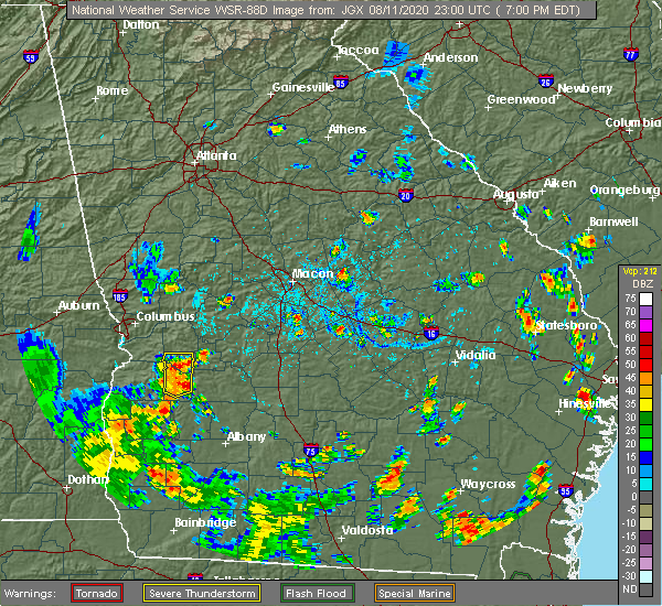
| 8/11/2020 7:31 PM EDT |
 At 729 pm edt, a severe thunderstorm was located over friendship, or 7 miles southwest of ellaville, moving south at 5 mph (public. half dollar to tennis ball sized hail have been preliminarily reported in schley county). Hazards include tennis ball size hail and 60 mph wind gusts. People and animals outdoors will be injured. expect hail damage to roofs, siding, windows, and vehicles. expect wind damage to roofs, siding, and trees. Locations impacted include, ellaville, putnam, murrays crossroads, friendship, doyle, draneville and walls crossing. At 729 pm edt, a severe thunderstorm was located over friendship, or 7 miles southwest of ellaville, moving south at 5 mph (public. half dollar to tennis ball sized hail have been preliminarily reported in schley county). Hazards include tennis ball size hail and 60 mph wind gusts. People and animals outdoors will be injured. expect hail damage to roofs, siding, windows, and vehicles. expect wind damage to roofs, siding, and trees. Locations impacted include, ellaville, putnam, murrays crossroads, friendship, doyle, draneville and walls crossing.
|
| 8/11/2020 7:23 PM EDT |
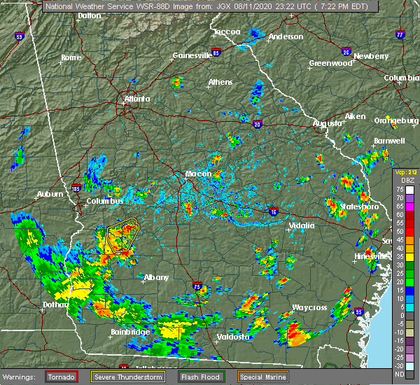 At 714 pm edt, a severe thunderstorm was located near friendship, or near ellaville, moving south at 5 mph (radar indicated). Hazards include two inch hail and 60 mph wind gusts. People and animals outdoors will be injured. expect hail damage to roofs, siding, windows, and vehicles. expect wind damage to roofs, siding, and trees. Locations impacted include, ellaville, preston, plains, putnam, murrays crossroads, friendship, doyle, church hill, centerpoint, dumas, draneville and walls crossing. At 714 pm edt, a severe thunderstorm was located near friendship, or near ellaville, moving south at 5 mph (radar indicated). Hazards include two inch hail and 60 mph wind gusts. People and animals outdoors will be injured. expect hail damage to roofs, siding, windows, and vehicles. expect wind damage to roofs, siding, and trees. Locations impacted include, ellaville, preston, plains, putnam, murrays crossroads, friendship, doyle, church hill, centerpoint, dumas, draneville and walls crossing.
|
| 8/11/2020 7:22 PM EDT | Quarter sized hail reported 1 miles SSE of Ellaville, GA, approximately one inch hail via social media pictures on the western side of ellaville. |
| 8/11/2020 7:22 PM EDT | Tree down near intersection of hwy 26 and concord church roa in schley county GA, 1.4 miles SE of Ellaville, GA |
| 8/11/2020 7:17 PM EDT | Tree down near the intersection of ebenezer rd and marvin murphy r in schley county GA, 1.7 miles NE of Ellaville, GA |
| 8/11/2020 7:14 PM EDT |
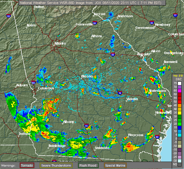 At 714 pm edt, a severe thunderstorm was located near friendship, or near ellaville, moving south at 5 mph (radar indicated). Hazards include two inch hail and 60 mph wind gusts. People and animals outdoors will be injured. expect hail damage to roofs, siding, windows, and vehicles. expect wind damage to roofs, siding, and trees. Locations impacted include, ellaville, preston, plains, putnam, murrays crossroads, friendship, doyle, church hill, centerpoint, dumas, draneville and walls crossing. At 714 pm edt, a severe thunderstorm was located near friendship, or near ellaville, moving south at 5 mph (radar indicated). Hazards include two inch hail and 60 mph wind gusts. People and animals outdoors will be injured. expect hail damage to roofs, siding, windows, and vehicles. expect wind damage to roofs, siding, and trees. Locations impacted include, ellaville, preston, plains, putnam, murrays crossroads, friendship, doyle, church hill, centerpoint, dumas, draneville and walls crossing.
|
| 8/11/2020 7:05 PM EDT |
 At 705 pm edt, a severe thunderstorm was located near putnam, or near ellaville, moving south at 5 mph (radar indicated). Hazards include 60 mph wind gusts and quarter size hail. Hail damage to vehicles is expected. Expect wind damage to roofs, siding, and trees. At 705 pm edt, a severe thunderstorm was located near putnam, or near ellaville, moving south at 5 mph (radar indicated). Hazards include 60 mph wind gusts and quarter size hail. Hail damage to vehicles is expected. Expect wind damage to roofs, siding, and trees.
|
| 6/30/2020 5:37 PM EDT |
 A severe thunderstorm warning remains in effect until 545 pm edt for southeastern marion. schley and south central taylor counties. at 536 pm edt, a severe thunderstorm was located over putnam, or near buena vista, moving east at 35 mph. hazard. 60 mph wind gusts. source. Radar indicated. A severe thunderstorm warning remains in effect until 545 pm edt for southeastern marion. schley and south central taylor counties. at 536 pm edt, a severe thunderstorm was located over putnam, or near buena vista, moving east at 35 mph. hazard. 60 mph wind gusts. source. Radar indicated.
|
| 6/30/2020 5:06 PM EDT |
 At 506 pm edt, severe thunderstorms were extending from near cusseta to near louvale to lumpkin, moving east at 30 mph (radar indicated). Hazards include 60 mph wind gusts and quarter size hail. Hail damage to vehicles is expected. Expect wind damage to roofs, siding, and trees. At 506 pm edt, severe thunderstorms were extending from near cusseta to near louvale to lumpkin, moving east at 30 mph (radar indicated). Hazards include 60 mph wind gusts and quarter size hail. Hail damage to vehicles is expected. Expect wind damage to roofs, siding, and trees.
|
| 5/22/2020 6:35 PM EDT | Emergency manager reports 4 trees down on powerlines within the city limits of ellavill in schley county GA, 0.2 miles S of Ellaville, GA |
| 5/22/2020 6:35 PM EDT | Emergency manager reports 4 trees down on powerlines northwest of ellavill in schley county GA, 5 miles SE of Ellaville, GA |
| 4/19/2020 10:53 AM EDT |
 At 1053 am edt, a severe thunderstorm was located over murrays crossroads, or 7 miles north of ellaville, moving east at 50 mph (radar indicated). Hazards include 60 mph wind gusts and quarter size hail. Hail damage to vehicles is expected. Expect wind damage to roofs, siding, and trees. At 1053 am edt, a severe thunderstorm was located over murrays crossroads, or 7 miles north of ellaville, moving east at 50 mph (radar indicated). Hazards include 60 mph wind gusts and quarter size hail. Hail damage to vehicles is expected. Expect wind damage to roofs, siding, and trees.
|
| 4/13/2020 2:18 AM EDT |
 At 218 am edt, severe thunderstorms were located along a line extending from junction city to near florence marina state park, moving east at 50 mph (radar indicated). Hazards include 60 mph wind gusts. expect damage to roofs, siding, and trees At 218 am edt, severe thunderstorms were located along a line extending from junction city to near florence marina state park, moving east at 50 mph (radar indicated). Hazards include 60 mph wind gusts. expect damage to roofs, siding, and trees
|
| 1/11/2020 6:41 PM EST |
 At 640 pm est, severe thunderstorms were located along a line extending from tazewell to friendship to centerpoint, moving northeast at 50 mph (radar indicated). Hazards include 60 mph wind gusts. expect damage to roofs, siding, and trees At 640 pm est, severe thunderstorms were located along a line extending from tazewell to friendship to centerpoint, moving northeast at 50 mph (radar indicated). Hazards include 60 mph wind gusts. expect damage to roofs, siding, and trees
|
| 9/9/2019 3:11 PM EDT |
 At 310 pm edt, severe thunderstorms were located along a line extending from murrays crossroads to buena vista, moving southwest at 10 mph (radar indicated). Hazards include 60 mph wind gusts and penny size hail. Expect damage to roofs, siding, and trees. Locations impacted include, buena vista, ellaville, putnam, doyle, draneville, zellobee and walls crossing. At 310 pm edt, severe thunderstorms were located along a line extending from murrays crossroads to buena vista, moving southwest at 10 mph (radar indicated). Hazards include 60 mph wind gusts and penny size hail. Expect damage to roofs, siding, and trees. Locations impacted include, buena vista, ellaville, putnam, doyle, draneville, zellobee and walls crossing.
|
| 9/9/2019 2:38 PM EDT |
 At 238 pm edt, severe thunderstorms were located along a line extending from cedar creel to near ideal, moving southwest at 10 mph (radar indicated). Hazards include 60 mph wind gusts and quarter size hail. Hail damage to vehicles is expected. Expect wind damage to roofs, siding, and trees. At 238 pm edt, severe thunderstorms were located along a line extending from cedar creel to near ideal, moving southwest at 10 mph (radar indicated). Hazards include 60 mph wind gusts and quarter size hail. Hail damage to vehicles is expected. Expect wind damage to roofs, siding, and trees.
|
| 6/7/2019 4:40 PM EDT |
 At 439 pm edt, severe thunderstorms were located along a line extending from near charing to near murrays crossroads to ellaville to shiloh, moving east at 10 mph (radar indicated). Hazards include 60 mph wind gusts. Expect damage to roofs, siding, and trees. Locations impacted include, americus, butler, ellaville, oglethorpe, ideal, andersonville, new era, fountainville, rupert, la crosse, garden valley, andersonville national historic, clearview, bumphead, bartlett and fickling mill. At 439 pm edt, severe thunderstorms were located along a line extending from near charing to near murrays crossroads to ellaville to shiloh, moving east at 10 mph (radar indicated). Hazards include 60 mph wind gusts. Expect damage to roofs, siding, and trees. Locations impacted include, americus, butler, ellaville, oglethorpe, ideal, andersonville, new era, fountainville, rupert, la crosse, garden valley, andersonville national historic, clearview, bumphead, bartlett and fickling mill.
|
| 6/7/2019 4:18 PM EDT | Power lines were reported down on north thompson stree in schley county GA, 0.2 miles S of Ellaville, GA |
| 6/7/2019 4:16 PM EDT | A power line was reported down on deerfield circl in schley county GA, 0.8 miles NE of Ellaville, GA |
| 6/7/2019 4:12 PM EDT |
 The national weather service in peachtree city has issued a * severe thunderstorm warning for. western macon county in west central georgia. southeastern marion county in west central georgia. schley county in west central georgia. Northwestern sumter county in west central georgia. The national weather service in peachtree city has issued a * severe thunderstorm warning for. western macon county in west central georgia. southeastern marion county in west central georgia. schley county in west central georgia. Northwestern sumter county in west central georgia.
|
| 3/3/2019 5:23 PM EST |
 The tornado warning for central macon, schley and northwestern sumter counties will expire at 530 pm est, the storm which prompted the warning has weakened below severe limits, and no longer appears capable of producing a tornado. therefore, the warning will be allowed to expire. a tornado watch remains in effect until 800 pm est for west central georgia. The tornado warning for central macon, schley and northwestern sumter counties will expire at 530 pm est, the storm which prompted the warning has weakened below severe limits, and no longer appears capable of producing a tornado. therefore, the warning will be allowed to expire. a tornado watch remains in effect until 800 pm est for west central georgia.
|
| 3/3/2019 5:04 PM EST |
 At 503 pm est, severe thunderstorms capable of producing both tornadoes and extensive straight line wind damage were located over putnam, or near ellaville, moving east at 55 mph (radar indicated rotation). Hazards include tornado. Flying debris will be dangerous to those caught without shelter. mobile homes will be damaged or destroyed. damage to roofs, windows, and vehicles will occur. Tree damage is likely. At 503 pm est, severe thunderstorms capable of producing both tornadoes and extensive straight line wind damage were located over putnam, or near ellaville, moving east at 55 mph (radar indicated rotation). Hazards include tornado. Flying debris will be dangerous to those caught without shelter. mobile homes will be damaged or destroyed. damage to roofs, windows, and vehicles will occur. Tree damage is likely.
|
| 6/28/2018 3:00 PM EDT |
 At 259 pm edt, the leading edge of a line of severe thunderstorms was located along a line extending from columbus metropolitan airport to near buena vista to near ellaville, moving southwest at 30 mph (radar indicated). Hazards include 60 mph wind gusts. expect damage to roofs, siding, and trees At 259 pm edt, the leading edge of a line of severe thunderstorms was located along a line extending from columbus metropolitan airport to near buena vista to near ellaville, moving southwest at 30 mph (radar indicated). Hazards include 60 mph wind gusts. expect damage to roofs, siding, and trees
|
| 8/30/2017 3:01 PM EDT |
 At 300 pm edt, a severe thunderstorm was located over dumas, or near preston, moving northeast at 35 mph (radar indicated). Hazards include 60 mph wind gusts. expect damage to roofs, siding, and trees At 300 pm edt, a severe thunderstorm was located over dumas, or near preston, moving northeast at 35 mph (radar indicated). Hazards include 60 mph wind gusts. expect damage to roofs, siding, and trees
|
| 4/3/2017 12:59 PM EDT |
 At 1259 pm edt, a severe thunderstorm was located near murrays crossroads, or 9 miles north of ellaville, moving northeast at 50 mph (radar indicated). Hazards include 60 mph wind gusts and quarter size hail. Hail damage to vehicles is expected. Expect wind damage to roofs, siding, and trees. At 1259 pm edt, a severe thunderstorm was located near murrays crossroads, or 9 miles north of ellaville, moving northeast at 50 mph (radar indicated). Hazards include 60 mph wind gusts and quarter size hail. Hail damage to vehicles is expected. Expect wind damage to roofs, siding, and trees.
|
| 4/3/2017 12:30 PM EDT |
 At 1229 pm edt, severe thunderstorms capable of producing both tornadoes and extensive straight line wind damage were located over church hill, or 8 miles north of preston, moving northeast at 50 mph (radar indicated rotation). Hazards include tornado. Flying debris will be dangerous to those caught without shelter. mobile homes will be damaged or destroyed. damage to roofs, windows, and vehicles will occur. Tree damage is likely. At 1229 pm edt, severe thunderstorms capable of producing both tornadoes and extensive straight line wind damage were located over church hill, or 8 miles north of preston, moving northeast at 50 mph (radar indicated rotation). Hazards include tornado. Flying debris will be dangerous to those caught without shelter. mobile homes will be damaged or destroyed. damage to roofs, windows, and vehicles will occur. Tree damage is likely.
|
| 7/11/2016 4:06 PM EDT |
 At 406 pm edt, a severe thunderstorm was located over ellaville, moving northeast at 45 mph (radar indicated). Hazards include 60 mph wind gusts and quarter size hail. Hail damage to vehicles is expected. expect wind damage to roofs, siding, and trees. Other locations in the warning include but are not limited to americus, buena vista, ellaville, preston, plains, weston, putnam, seminole, doyle, draneville, la crosse, friendship, church hill, murrays crossroads, walls crossing, centerpoint, leveretts, dumas and chambliss. At 406 pm edt, a severe thunderstorm was located over ellaville, moving northeast at 45 mph (radar indicated). Hazards include 60 mph wind gusts and quarter size hail. Hail damage to vehicles is expected. expect wind damage to roofs, siding, and trees. Other locations in the warning include but are not limited to americus, buena vista, ellaville, preston, plains, weston, putnam, seminole, doyle, draneville, la crosse, friendship, church hill, murrays crossroads, walls crossing, centerpoint, leveretts, dumas and chambliss.
|
| 7/11/2016 3:39 PM EDT |
 At 338 pm edt, a severe thunderstorm was located near preston, moving northeast at 45 mph (radar indicated). Hazards include 60 mph wind gusts and quarter size hail. Hail damage to vehicles is expected. expect wind damage to roofs, siding, and trees. Other locations in the warning include but are not limited to americus, buena vista, ellaville, preston, richland, plains, weston, putnam, seminole, doyle, troutman, draneville, la crosse, friendship, church hill, murrays crossroads, walls crossing, kimbrough, centerpoint and leveretts. At 338 pm edt, a severe thunderstorm was located near preston, moving northeast at 45 mph (radar indicated). Hazards include 60 mph wind gusts and quarter size hail. Hail damage to vehicles is expected. expect wind damage to roofs, siding, and trees. Other locations in the warning include but are not limited to americus, buena vista, ellaville, preston, richland, plains, weston, putnam, seminole, doyle, troutman, draneville, la crosse, friendship, church hill, murrays crossroads, walls crossing, kimbrough, centerpoint and leveretts.
|
| 7/6/2016 2:26 PM EDT |
 At 225 pm edt, severe thunderstormz were located over ideal, or 10 miles south of butler and over ellaville, moving east at 35 mph (radar indicated). Hazards include 60 mph wind gusts and penny size hail. Expect damage to roofs. siding. and trees. Other locations in the warning include but are not limited to ellaville, oglethorpe, montezuma, marshallville, ideal, rupert, potterville, garden valley, fountainville, hicks, clearview, bartlett, murrays crossroads, saint louis, walls crossing, winchester and whitewater state park. At 225 pm edt, severe thunderstormz were located over ideal, or 10 miles south of butler and over ellaville, moving east at 35 mph (radar indicated). Hazards include 60 mph wind gusts and penny size hail. Expect damage to roofs. siding. and trees. Other locations in the warning include but are not limited to ellaville, oglethorpe, montezuma, marshallville, ideal, rupert, potterville, garden valley, fountainville, hicks, clearview, bartlett, murrays crossroads, saint louis, walls crossing, winchester and whitewater state park.
|
| 7/6/2016 2:20 PM EDT | 911 call center received report of one tree down at the intersection of concord church rd and bridges store rd in schley county GA, 0.2 miles S of Ellaville, GA |
| 7/6/2016 1:48 PM EDT |
 At 148 pm edt, a severe thunderstorm was located near buena vista, moving east at 25 mph (radar indicated). Hazards include 60 mph wind gusts and quarter size hail. Hail damage to vehicles is expected. expect wind damage to roofs, siding, and trees. Other locations in the warning include but are not limited to buena vista, ellaville, putnam, murrays crossroads, doyle, walls crossing, zellobee and draneville. At 148 pm edt, a severe thunderstorm was located near buena vista, moving east at 25 mph (radar indicated). Hazards include 60 mph wind gusts and quarter size hail. Hail damage to vehicles is expected. expect wind damage to roofs, siding, and trees. Other locations in the warning include but are not limited to buena vista, ellaville, putnam, murrays crossroads, doyle, walls crossing, zellobee and draneville.
|
| 6/26/2016 4:15 PM EDT | 911 call center received reports of 1 tree down on concord church rd...1 tree down on old hwy 19 s...and several trees down on highway 153 and dosier rd intersection in schley county GA, 0.2 miles S of Ellaville, GA |
| 6/26/2016 4:01 PM EDT |
 At 401 pm edt, a severe thunderstorm was located 7 miles south of ellaville, moving southwest at 15 mph (radar indicated). Hazards include 60 mph wind gusts and nickel size hail. Expect damage to roofs. siding. and trees. Other locations in the warning include but are not limited to americus, ellaville, plains, putnam, friendship, church hill, bumphead, walls crossing, draneville and la crosse. At 401 pm edt, a severe thunderstorm was located 7 miles south of ellaville, moving southwest at 15 mph (radar indicated). Hazards include 60 mph wind gusts and nickel size hail. Expect damage to roofs. siding. and trees. Other locations in the warning include but are not limited to americus, ellaville, plains, putnam, friendship, church hill, bumphead, walls crossing, draneville and la crosse.
|
| 6/25/2016 4:00 PM EDT | 911 call center received report of 1 tree down on dogwood dr and hwy49 intersection...1 tree on arch helms rd near hwy 49...and 1 tree down on house along hwy49 in schley county GA, 1.1 miles SW of Ellaville, GA |
| 6/1/2016 3:05 PM EDT |
 At 305 pm edt, a severe thunderstorm was located near ellaville, moving southeast at 15 mph (radar indicated). Hazards include 60 mph wind gusts and quarter size hail. Hail damage to vehicles is expected. expect wind damage to roofs, siding, and trees. Other locations in the warning include but are not limited to ellaville, oglethorpe, montezuma, andersonville, dooling, fountainville, new era, clearview, bartlett, la crosse, murrays crossroads, andersonville national historic, bumphead, methvins, flint river wma and pennington. At 305 pm edt, a severe thunderstorm was located near ellaville, moving southeast at 15 mph (radar indicated). Hazards include 60 mph wind gusts and quarter size hail. Hail damage to vehicles is expected. expect wind damage to roofs, siding, and trees. Other locations in the warning include but are not limited to ellaville, oglethorpe, montezuma, andersonville, dooling, fountainville, new era, clearview, bartlett, la crosse, murrays crossroads, andersonville national historic, bumphead, methvins, flint river wma and pennington.
|
| 12/24/2015 9:50 PM EST | Quarter sized hail reported 11.7 miles SSE of Ellaville, GA, public reported quarter inch hail in extreme northern schley county. |
| 6/24/2015 2:56 PM EDT |
 At 255 pm edt, a severe thunderstorm was located 10 miles northeast of buena vista, and is nearly stationary (radar indicated). Hazards include 60 mph wind gusts and penny size hail. Expect damage to roofs. siding and trees. Other locations in the warning include but are not limited to ellaville, putnam, walls crossing, murrays crossroads, doyle and tazewell. At 255 pm edt, a severe thunderstorm was located 10 miles northeast of buena vista, and is nearly stationary (radar indicated). Hazards include 60 mph wind gusts and penny size hail. Expect damage to roofs. siding and trees. Other locations in the warning include but are not limited to ellaville, putnam, walls crossing, murrays crossroads, doyle and tazewell.
|
| 6/24/2015 2:27 PM EDT |
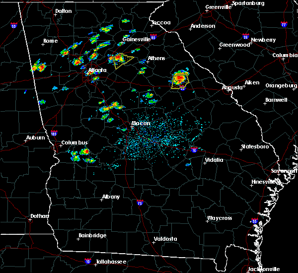 At 227 pm edt, a severe thunderstorm was located 7 miles northeast of buena vista, and is nearly stationary (radar indicated). Hazards include 60 mph wind gusts and penny size hail. Expect damage to roofs. siding and trees. Other locations in the warning include but are not limited to ellaville, putnam, walls crossing, murrays crossroads, doyle and tazewell. At 227 pm edt, a severe thunderstorm was located 7 miles northeast of buena vista, and is nearly stationary (radar indicated). Hazards include 60 mph wind gusts and penny size hail. Expect damage to roofs. siding and trees. Other locations in the warning include but are not limited to ellaville, putnam, walls crossing, murrays crossroads, doyle and tazewell.
|
| 6/23/2015 1:07 PM EDT |
 At 106 pm edt, a severe thunderstorm was located near andersonville, or 7 miles west of oglethorpe, moving southeast at 10 mph (radar indicated). Hazards include 60 mph wind gusts and nickel size hail. Expect damage to roofs. siding and trees. Other locations in the warning include but are not limited to oglethorpe, montezuma, ideal, andersonville, fountainville, methvins, andersonville national historic, bumphead, clearview, bartlett, pennington and la crosse. At 106 pm edt, a severe thunderstorm was located near andersonville, or 7 miles west of oglethorpe, moving southeast at 10 mph (radar indicated). Hazards include 60 mph wind gusts and nickel size hail. Expect damage to roofs. siding and trees. Other locations in the warning include but are not limited to oglethorpe, montezuma, ideal, andersonville, fountainville, methvins, andersonville national historic, bumphead, clearview, bartlett, pennington and la crosse.
|
| 4/19/2015 12:00 PM EDT | Several trees and powerlines dow in schley county GA, 3.9 miles NE of Ellaville, GA |
| 4/19/2015 11:45 AM EDT | At 1144 am edt, severe thunderstorms were located from 6 miles north of plains to near leslie, moving northeast at 40 mph (radar indicated). Hazards include 60 mph wind gusts. Expect damage to roofs. siding and trees. other locations in the warning include but are not limited to americus, vienna, ellaville, oglethorpe, unadilla, montezuma, byromville, ideal, pinehurst, leslie, andersonville, lilly, dooling, lamar, fountainville, new era, drayton, clearview, bartlett and friendship. a tornado watch remains in effect until 300 pm edt for west central georgia. Possible. |
| 5/6/2012 2:00 PM EDT | Sheriffs deputy of schley county reported 3 trees were downed at highway 26 and stevens road about 3 miles west of ellavill in schley county GA, 4.7 miles E of Ellaville, GA |
| 5/6/2012 2:00 PM EDT | Sheriffs deputy of schley county reported 7 trees were downed at highway 26 and stevens road about 5 miles west of ellavill in schley county GA, 4.7 miles E of Ellaville, GA |
| 1/1/0001 12:00 AM | 5 trees down and shingles blown off roo in schley county GA, 0.2 miles S of Ellaville, GA |
| 1/1/0001 12:00 AM | 1 tree down in schley county GA, 5.3 miles NW of Ellaville, GA |
| 1/1/0001 12:00 AM | Schley county 911 reports 2-3 downed trees in ellavill in schley county GA, 0.2 miles S of Ellaville, GA |
Hail Maps for Ellaville, GA


Connect with Interactive Hail Maps