

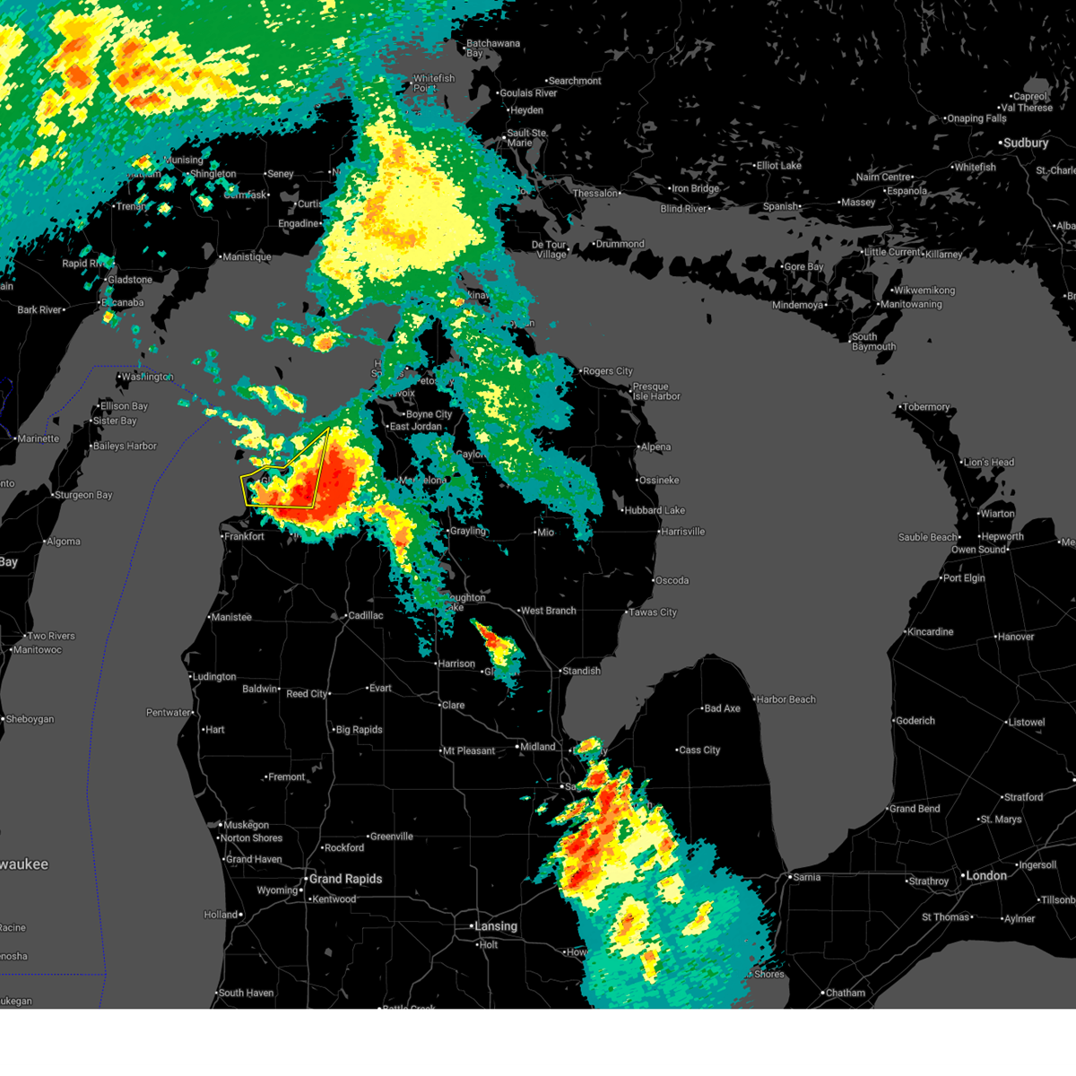
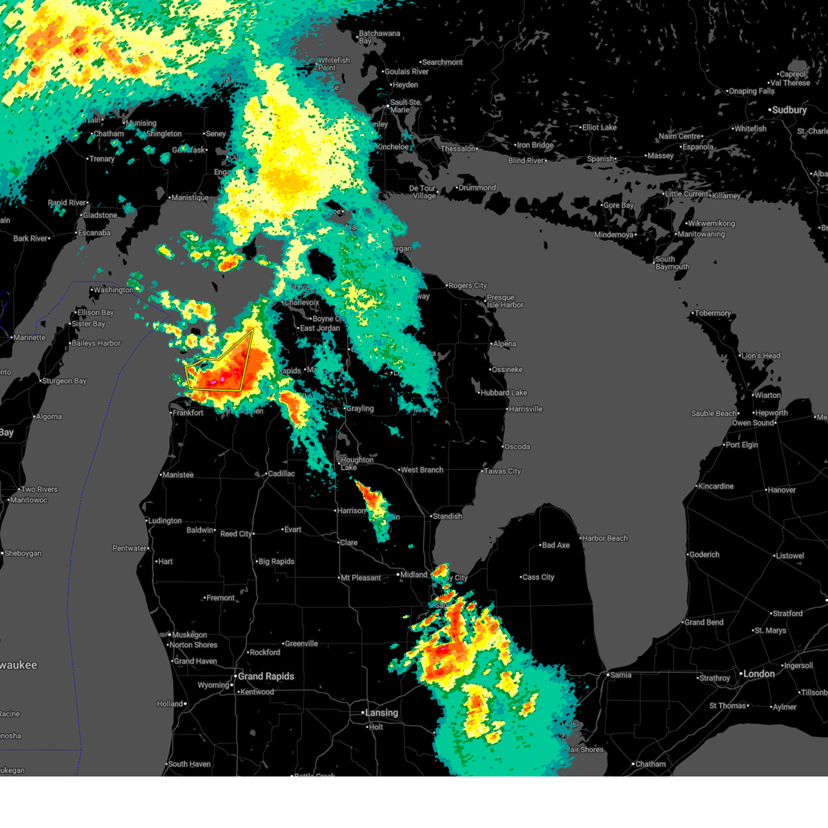
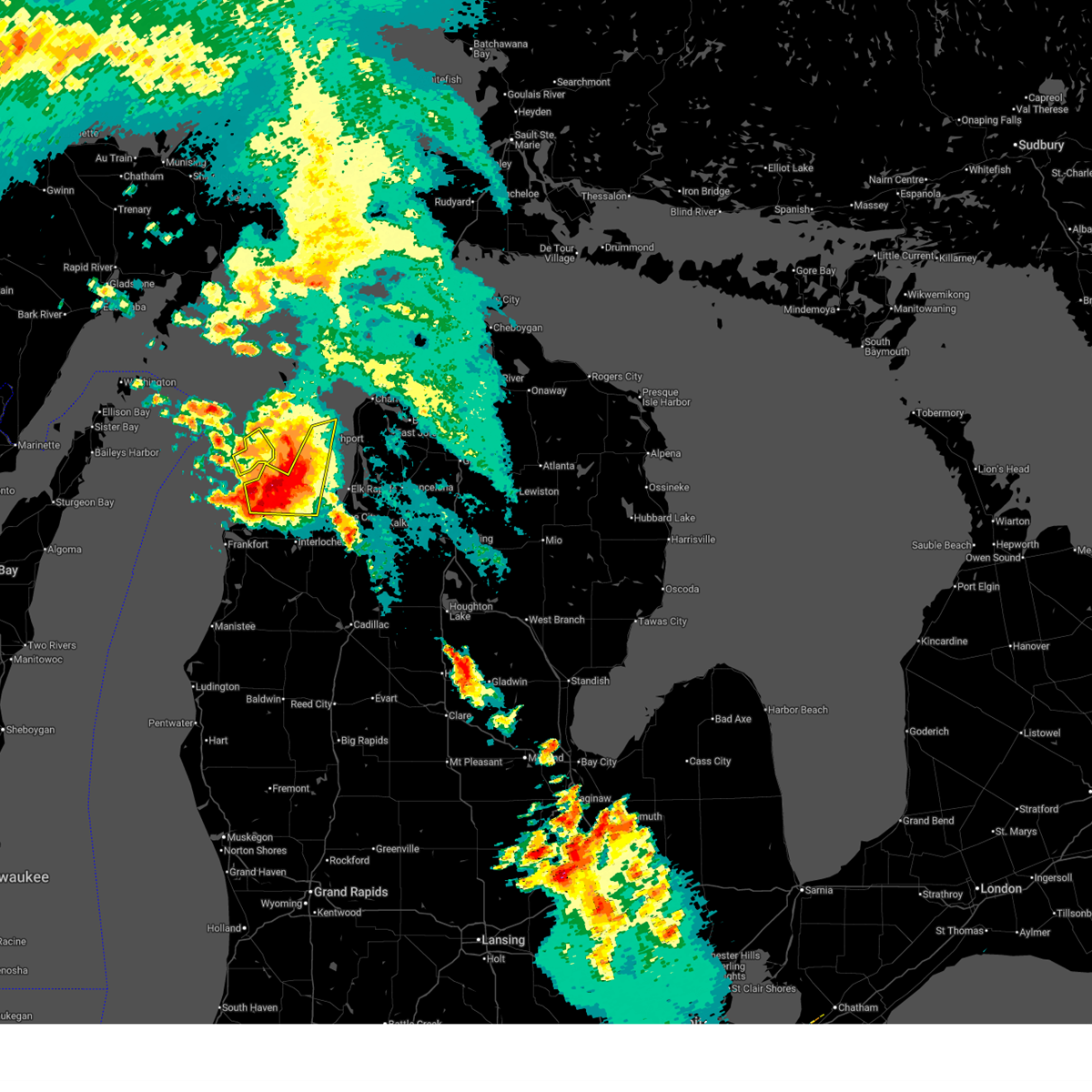
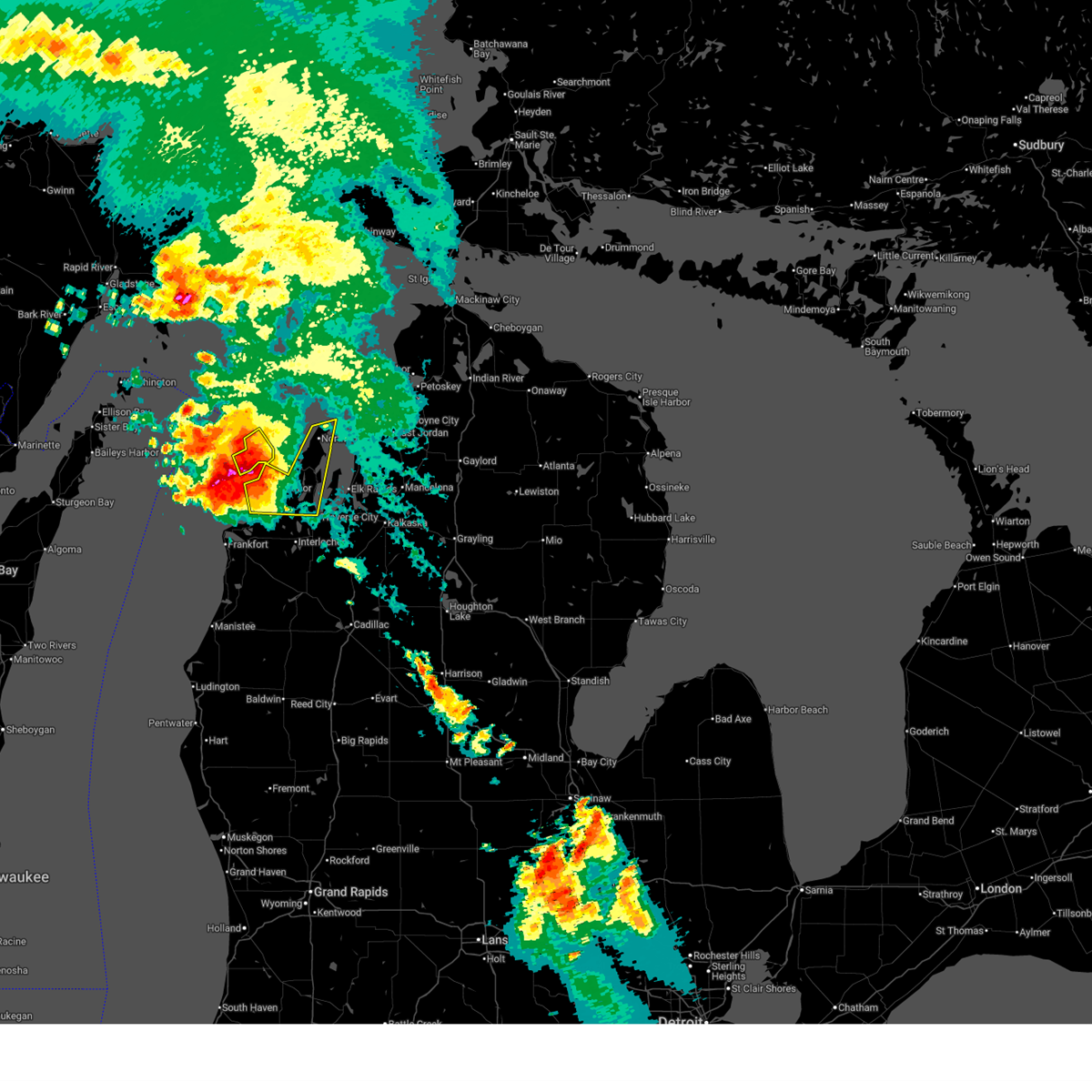
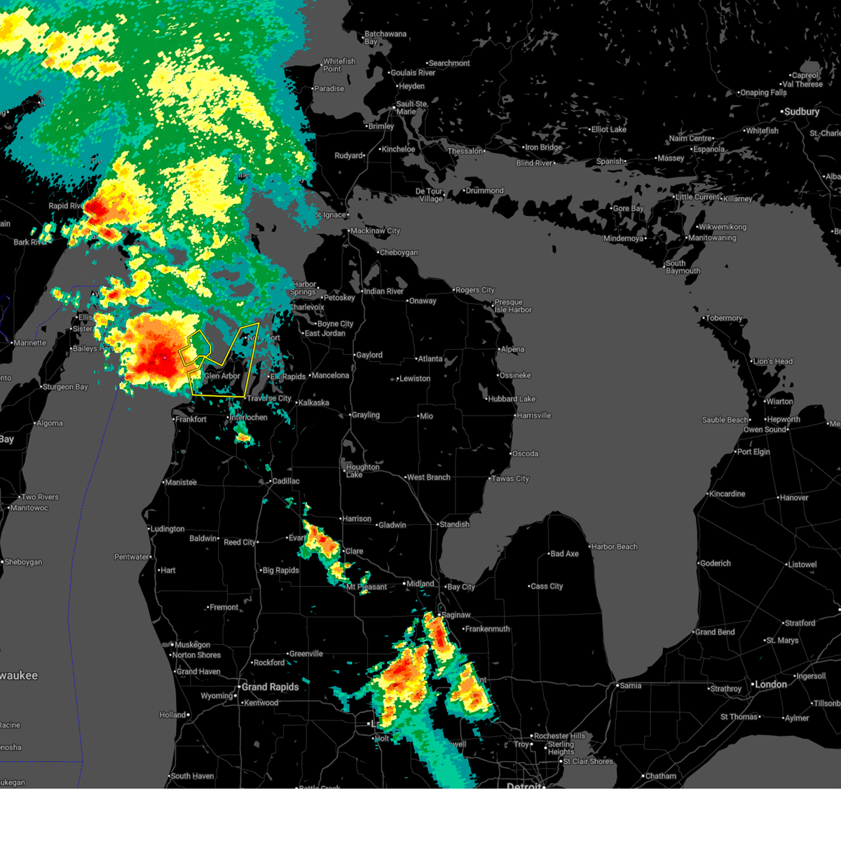
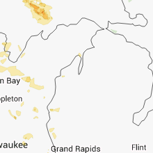
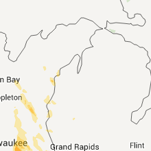
Hail Map for Empire, MI
The Empire, MI area has had 2 reports of on-the-ground hail by trained spotters, and has been under severe weather warnings 7 times during the past 12 months. Doppler radar has detected hail at or near Empire, MI on 18 occasions.
| Name: | Empire, MI |
| Where Located: | 22.3 miles W of Traverse City, MI |
| Map: | Google Map for Empire, MI |
| Population: | 375 |
| Housing Units: | 347 |
| More Info: | Search Google for Empire, MI |
1
The Top Recent Hail Date for Empire, MI is Thursday, August 3, 2023 (11th out of 18)

Hail and Wind Damage Spotted near Empire, MI
| Date / Time | Report Details |
|---|---|
| 6/21/2025 7:26 AM EDT |
 The storm which prompted the warning has moved out of the area. therefore, the warning will be allowed to expire. additional thunderstorms will be possible through the morning into the afternoon. to report severe weather, contact your nearest law enforcement agency. they will relay your report to the national weather service gaylord. The storm which prompted the warning has moved out of the area. therefore, the warning will be allowed to expire. additional thunderstorms will be possible through the morning into the afternoon. to report severe weather, contact your nearest law enforcement agency. they will relay your report to the national weather service gaylord.
|
| 6/21/2025 7:17 AM EDT |
 At 717 am edt, a severe thunderstorm was located near bingham, or 7 miles north of traverse city, moving east at 30 mph (radar indicated). Hazards include 70 mph wind gusts and ping pong ball size hail. People and animals outdoors will be injured. expect hail damage to roofs, siding, windows, and vehicles. expect considerable tree damage. wind damage is also likely to mobile homes, roofs, and outbuildings. This severe thunderstorm will remain over mainly rural areas of leelanau county, including the following locations, good harbor. At 717 am edt, a severe thunderstorm was located near bingham, or 7 miles north of traverse city, moving east at 30 mph (radar indicated). Hazards include 70 mph wind gusts and ping pong ball size hail. People and animals outdoors will be injured. expect hail damage to roofs, siding, windows, and vehicles. expect considerable tree damage. wind damage is also likely to mobile homes, roofs, and outbuildings. This severe thunderstorm will remain over mainly rural areas of leelanau county, including the following locations, good harbor.
|
| 6/21/2025 7:01 AM EDT |
 At 701 am edt, a severe thunderstorm was located over cedar, or 10 miles northwest of traverse city, moving southeast at 30 mph (radar indicated). Hazards include two inch hail and 70 mph wind gusts. People and animals outdoors will be injured. expect hail damage to roofs, siding, windows, and vehicles. expect considerable tree damage. wind damage is also likely to mobile homes, roofs, and outbuildings. this severe storm will be near, traverse city, bingham, greilickville, and fouch around 705 am edt. Other locations impacted by this severe thunderstorm include good harbor. At 701 am edt, a severe thunderstorm was located over cedar, or 10 miles northwest of traverse city, moving southeast at 30 mph (radar indicated). Hazards include two inch hail and 70 mph wind gusts. People and animals outdoors will be injured. expect hail damage to roofs, siding, windows, and vehicles. expect considerable tree damage. wind damage is also likely to mobile homes, roofs, and outbuildings. this severe storm will be near, traverse city, bingham, greilickville, and fouch around 705 am edt. Other locations impacted by this severe thunderstorm include good harbor.
|
| 6/21/2025 6:32 AM EDT |
 At 631 am edt, a severe thunderstorm was located near sleeping bear point, moving east at 30 mph (radar indicated). Hazards include two inch hail and 60 mph wind gusts. People and animals outdoors will be injured. expect hail damage to roofs, siding, windows, and vehicles. expect wind damage to roofs, siding, and trees. this severe storm will be near, glen arbor, glen haven, and burdickville around 635 am edt. maple city around 640 am edt. leland, cedar, and lake leelanau around 645 am edt. bingham and suttons bay around 650 am edt. fouch around 655 am edt. peshawbestown and greilickville around 700 am edt. Other locations impacted by this severe thunderstorm include good harbor. At 631 am edt, a severe thunderstorm was located near sleeping bear point, moving east at 30 mph (radar indicated). Hazards include two inch hail and 60 mph wind gusts. People and animals outdoors will be injured. expect hail damage to roofs, siding, windows, and vehicles. expect wind damage to roofs, siding, and trees. this severe storm will be near, glen arbor, glen haven, and burdickville around 635 am edt. maple city around 640 am edt. leland, cedar, and lake leelanau around 645 am edt. bingham and suttons bay around 650 am edt. fouch around 655 am edt. peshawbestown and greilickville around 700 am edt. Other locations impacted by this severe thunderstorm include good harbor.
|
| 6/21/2025 6:12 AM EDT |
 Svrapx the national weather service in gaylord has issued a * severe thunderstorm warning for, leelanau county in northern michigan, * until 730 am edt. * at 611 am edt, a severe thunderstorm was located 9 miles northwest of sleeping bear point, moving east at 35 mph (radar indicated). Hazards include 60 mph wind gusts and quarter size hail. Hail damage to vehicles is expected. expect wind damage to roofs, siding, and trees. this severe thunderstorm will be near, sleeping bear point and glen haven around 615 am edt. glen arbor around 620 am edt. leland around 630 am edt. lake leelanau around 635 am edt. suttons bay around 640 am edt. peshawbestown around 645 am edt. omena around 650 am edt. northport around 655 am edt. Other locations impacted by this severe thunderstorm include good harbor. Svrapx the national weather service in gaylord has issued a * severe thunderstorm warning for, leelanau county in northern michigan, * until 730 am edt. * at 611 am edt, a severe thunderstorm was located 9 miles northwest of sleeping bear point, moving east at 35 mph (radar indicated). Hazards include 60 mph wind gusts and quarter size hail. Hail damage to vehicles is expected. expect wind damage to roofs, siding, and trees. this severe thunderstorm will be near, sleeping bear point and glen haven around 615 am edt. glen arbor around 620 am edt. leland around 630 am edt. lake leelanau around 635 am edt. suttons bay around 640 am edt. peshawbestown around 645 am edt. omena around 650 am edt. northport around 655 am edt. Other locations impacted by this severe thunderstorm include good harbor.
|
| 5/16/2025 8:13 PM EDT | At 812 pm edt, a severe thunderstorm was located near lake leelanau, or near leland, moving north at 25 mph (radar indicated). Hazards include 70 mph wind gusts and quarter size hail. Hail damage to vehicles is expected. expect considerable tree damage. wind damage is also likely to mobile homes, roofs, and outbuildings. this severe storm will be near, suttons bay, lake leelanau, and leland around 820 pm edt. Other locations impacted by this severe thunderstorm include good harbor. |
| 5/16/2025 7:53 PM EDT | Svrapx the national weather service in gaylord has issued a * severe thunderstorm warning for, leelanau county in northern michigan, * until 845 pm edt. * at 753 pm edt, a severe thunderstorm was located over cedar, or 10 miles northwest of traverse city, moving north at 20 mph (radar indicated). Hazards include 60 mph wind gusts. Expect damage to roofs, siding, and trees. this severe thunderstorm will be near, lake leelanau and burdickville around 800 pm edt. leland around 805 pm edt. suttons bay around 810 pm edt. Other locations impacted by this severe thunderstorm include good harbor. |
| 7/20/2023 9:51 AM EDT |
 At 950 am edt, severe thunderstorms were located along a line extending from near empire to beulah to near arcadia, moving east at 30 mph (radar indicated). Hazards include 60 mph wind gusts and quarter size hail. Hail damage to vehicles is expected. expect wind damage to roofs, siding, and trees. these severe storms will be near, empire, beulah, benzonia and honor around 955 am edt. other locations in the path of these severe thunderstorms include platte township, glen arbor, burdickville, lake ann, bendon, maple city, cedar, thompsonville and copemish. hail threat, radar indicated max hail size, 1. 00 in wind threat, radar indicated max wind gust, 60 mph. At 950 am edt, severe thunderstorms were located along a line extending from near empire to beulah to near arcadia, moving east at 30 mph (radar indicated). Hazards include 60 mph wind gusts and quarter size hail. Hail damage to vehicles is expected. expect wind damage to roofs, siding, and trees. these severe storms will be near, empire, beulah, benzonia and honor around 955 am edt. other locations in the path of these severe thunderstorms include platte township, glen arbor, burdickville, lake ann, bendon, maple city, cedar, thompsonville and copemish. hail threat, radar indicated max hail size, 1. 00 in wind threat, radar indicated max wind gust, 60 mph.
|
| 7/20/2023 9:36 AM EDT |
 At 935 am edt, severe thunderstorms were located along a line extending from 9 miles north of frankfort to elberta to 10 miles west of arcadia, moving east at 30 mph (radar indicated). Hazards include 60 mph wind gusts and quarter size hail. Hail damage to vehicles is expected. expect wind damage to roofs, siding, and trees. severe thunderstorms will be near, frankfort and elberta around 940 am edt. beulah and benzonia around 950 am edt. empire, arcadia, honor and pierport around 955 am edt. other locations in the path of these severe thunderstorms include platte township, glen arbor, burdickville, lake ann, bendon, maple city and cedar. hail threat, radar indicated max hail size, 1. 00 in wind threat, radar indicated max wind gust, 60 mph. At 935 am edt, severe thunderstorms were located along a line extending from 9 miles north of frankfort to elberta to 10 miles west of arcadia, moving east at 30 mph (radar indicated). Hazards include 60 mph wind gusts and quarter size hail. Hail damage to vehicles is expected. expect wind damage to roofs, siding, and trees. severe thunderstorms will be near, frankfort and elberta around 940 am edt. beulah and benzonia around 950 am edt. empire, arcadia, honor and pierport around 955 am edt. other locations in the path of these severe thunderstorms include platte township, glen arbor, burdickville, lake ann, bendon, maple city and cedar. hail threat, radar indicated max hail size, 1. 00 in wind threat, radar indicated max wind gust, 60 mph.
|
| 6/25/2023 6:21 PM EDT |
 At 621 pm edt, severe thunderstorms were located along a line extending from near glen arbor to near elk rapids, moving north at 30 mph (radar indicated). Hazards include 60 mph wind gusts and penny size hail. expect damage to roofs, siding, and trees At 621 pm edt, severe thunderstorms were located along a line extending from near glen arbor to near elk rapids, moving north at 30 mph (radar indicated). Hazards include 60 mph wind gusts and penny size hail. expect damage to roofs, siding, and trees
|
| 5/20/2022 2:23 PM EDT |
 At 223 pm edt, severe thunderstorms were located along a line extending from 10 miles northwest of leland to near benzonia, moving northeast at 75 mph (radar indicated). Hazards include 70 mph wind gusts and quarter size hail. Hail damage to vehicles is expected. expect considerable tree damage. wind damage is also likely to mobile homes, roofs, and outbuildings. locations impacted include, northport, lake ann, leelanau state park, interlochen, grawn, interlochen state park, traverse city, greilickville, fouch, traverse city state park and mapleton. thunderstorm damage threat, considerable hail threat, radar indicated max hail size, 1. 00 in wind threat, radar indicated max wind gust, 70 mph. At 223 pm edt, severe thunderstorms were located along a line extending from 10 miles northwest of leland to near benzonia, moving northeast at 75 mph (radar indicated). Hazards include 70 mph wind gusts and quarter size hail. Hail damage to vehicles is expected. expect considerable tree damage. wind damage is also likely to mobile homes, roofs, and outbuildings. locations impacted include, northport, lake ann, leelanau state park, interlochen, grawn, interlochen state park, traverse city, greilickville, fouch, traverse city state park and mapleton. thunderstorm damage threat, considerable hail threat, radar indicated max hail size, 1. 00 in wind threat, radar indicated max wind gust, 70 mph.
|
| 5/10/2022 11:17 PM EDT |
 At 1116 pm edt, a severe thunderstorm was located near empire, moving east at 30 mph (radar indicated). Hazards include 60 mph wind gusts and quarter size hail. Hail damage to vehicles is expected. expect wind damage to roofs, siding, and trees. this severe thunderstorm will be near, empire and glen haven around 1125 pm edt. platte township around 1130 pm edt. honor and burdickville around 1135 pm edt. other locations in the path of this severe thunderstorm include maple city, lake ann, bendon, interlochen, interlochen state park and traverse city. hail threat, radar indicated max hail size, 1. 00 in wind threat, radar indicated max wind gust, 60 mph. At 1116 pm edt, a severe thunderstorm was located near empire, moving east at 30 mph (radar indicated). Hazards include 60 mph wind gusts and quarter size hail. Hail damage to vehicles is expected. expect wind damage to roofs, siding, and trees. this severe thunderstorm will be near, empire and glen haven around 1125 pm edt. platte township around 1130 pm edt. honor and burdickville around 1135 pm edt. other locations in the path of this severe thunderstorm include maple city, lake ann, bendon, interlochen, interlochen state park and traverse city. hail threat, radar indicated max hail size, 1. 00 in wind threat, radar indicated max wind gust, 60 mph.
|
| 9/7/2021 8:40 AM EDT |
 At 839 am edt, severe thunderstorms were located along a line extending from 9 miles north of sleeping bear point to 6 miles west of empire to 9 miles northwest of frankfort, moving east at 40 mph (radar indicated). Hazards include 60 mph wind gusts and quarter size hail. Hail damage to vehicles is expected. expect wind damage to roofs, siding, and trees. severe thunderstorms will be near, empire and glen haven around 850 am edt. burdickville around 855 am edt. other locations in the path of these severe thunderstorms include leland, platte township, maple city, cedar, lake leelanau, suttons bay, peshawbestown, omena, lake ann, fouch, greilickville, traverse city and interlochen. hail threat, radar indicated max hail size, 1. 00 in wind threat, radar indicated max wind gust, 60 mph. At 839 am edt, severe thunderstorms were located along a line extending from 9 miles north of sleeping bear point to 6 miles west of empire to 9 miles northwest of frankfort, moving east at 40 mph (radar indicated). Hazards include 60 mph wind gusts and quarter size hail. Hail damage to vehicles is expected. expect wind damage to roofs, siding, and trees. severe thunderstorms will be near, empire and glen haven around 850 am edt. burdickville around 855 am edt. other locations in the path of these severe thunderstorms include leland, platte township, maple city, cedar, lake leelanau, suttons bay, peshawbestown, omena, lake ann, fouch, greilickville, traverse city and interlochen. hail threat, radar indicated max hail size, 1. 00 in wind threat, radar indicated max wind gust, 60 mph.
|
| 8/11/2021 6:14 PM EDT |
 At 613 pm edt, a severe thunderstorm was located near platte township, or near empire, moving east at 65 mph. this is a destructive storm for platte lake and lake ann (radar indicated). Hazards include 80 mph wind gusts. Flying debris will be dangerous to those caught without shelter. mobile homes will be heavily damaged. expect considerable damage to roofs, windows, and vehicles. extensive tree damage and power outages are likely. this severe storm will be near, burdickville around 620 pm edt. lake ann, maple city and bendon around 625 pm edt. other locations impacted by this severe thunderstorm include wallin and blaine township. thunderstorm damage threat, destructive hail threat, radar indicated max hail size, <. 75 in wind threat, radar indicated max wind gust, 80 mph. At 613 pm edt, a severe thunderstorm was located near platte township, or near empire, moving east at 65 mph. this is a destructive storm for platte lake and lake ann (radar indicated). Hazards include 80 mph wind gusts. Flying debris will be dangerous to those caught without shelter. mobile homes will be heavily damaged. expect considerable damage to roofs, windows, and vehicles. extensive tree damage and power outages are likely. this severe storm will be near, burdickville around 620 pm edt. lake ann, maple city and bendon around 625 pm edt. other locations impacted by this severe thunderstorm include wallin and blaine township. thunderstorm damage threat, destructive hail threat, radar indicated max hail size, <. 75 in wind threat, radar indicated max wind gust, 80 mph.
|
| 8/11/2021 6:00 PM EDT |
 At 559 pm edt, a severe thunderstorm was located 10 miles northwest of frankfort, moving east at 65 mph. this is a destructive storm for point betsie and platte lake (radar indicated). Hazards include 80 mph wind gusts. Flying debris will be dangerous to those caught without shelter. mobile homes will be heavily damaged. expect considerable damage to roofs, windows, and vehicles. extensive tree damage and power outages are likely. this severe thunderstorm will be near, elberta around 605 pm edt. frankfort around 610 pm edt. empire, beulah, benzonia and honor around 615 pm edt. other locations in the path of this severe thunderstorm include platte township, burdickville, lake ann, maple city and bendon. thunderstorm damage threat, destructive hail threat, radar indicated max hail size, <. 75 in wind threat, radar indicated max wind gust, 80 mph. At 559 pm edt, a severe thunderstorm was located 10 miles northwest of frankfort, moving east at 65 mph. this is a destructive storm for point betsie and platte lake (radar indicated). Hazards include 80 mph wind gusts. Flying debris will be dangerous to those caught without shelter. mobile homes will be heavily damaged. expect considerable damage to roofs, windows, and vehicles. extensive tree damage and power outages are likely. this severe thunderstorm will be near, elberta around 605 pm edt. frankfort around 610 pm edt. empire, beulah, benzonia and honor around 615 pm edt. other locations in the path of this severe thunderstorm include platte township, burdickville, lake ann, maple city and bendon. thunderstorm damage threat, destructive hail threat, radar indicated max hail size, <. 75 in wind threat, radar indicated max wind gust, 80 mph.
|
| 8/10/2021 10:23 PM EDT |
 At 1022 pm edt, severe thunderstorms were located along a line extending from near cedar to near lake ann to benzonia, moving east at 40 mph (radar indicated). Hazards include 70 mph wind gusts and nickel size hail. Expect considerable tree damage. damage is likely to mobile homes, roofs, and outbuildings. locations impacted include, bingham, cedar, fouch, bendon, interlochen, greilickville, copemish, grawn, interlochen state park, traverse city, traverse city state park, mapleton, elk rapids, karlin, hannah, kingsley, williamsburg, spider lake, sherman, buckley and mesick. thunderstorm damage threat, considerable hail threat, radar indicated max hail size, 0. 88 in wind threat, radar indicated max wind gust, 70 mph. At 1022 pm edt, severe thunderstorms were located along a line extending from near cedar to near lake ann to benzonia, moving east at 40 mph (radar indicated). Hazards include 70 mph wind gusts and nickel size hail. Expect considerable tree damage. damage is likely to mobile homes, roofs, and outbuildings. locations impacted include, bingham, cedar, fouch, bendon, interlochen, greilickville, copemish, grawn, interlochen state park, traverse city, traverse city state park, mapleton, elk rapids, karlin, hannah, kingsley, williamsburg, spider lake, sherman, buckley and mesick. thunderstorm damage threat, considerable hail threat, radar indicated max hail size, 0. 88 in wind threat, radar indicated max wind gust, 70 mph.
|
| 8/10/2021 10:04 PM EDT |
 At 1003 pm edt, severe thunderstorms were located along a line extending from sleeping bear point to near empire to near frankfort, moving east at 40 mph (radar indicated). Hazards include 60 mph wind gusts and nickel size hail. Expect damage to roofs, siding, and trees. severe thunderstorms will be near, empire, sleeping bear point, glen arbor, glen haven and burdickville around 1010 pm edt. honor and platte township around 1015 pm edt. beulah, benzonia and maple city around 1020 pm edt. other locations in the path of these severe thunderstorms include cedar, lake ann, bingham, fouch, bendon, thompsonville, interlochen, greilickville, interlochen state park, copemish, grawn, mapleton, traverse city, kingsley, buckley, hannah, karlin, traverse city state park, williamsburg and spider lake. hail threat, radar indicated max hail size, 0. 88 in wind threat, radar indicated max wind gust, 60 mph. At 1003 pm edt, severe thunderstorms were located along a line extending from sleeping bear point to near empire to near frankfort, moving east at 40 mph (radar indicated). Hazards include 60 mph wind gusts and nickel size hail. Expect damage to roofs, siding, and trees. severe thunderstorms will be near, empire, sleeping bear point, glen arbor, glen haven and burdickville around 1010 pm edt. honor and platte township around 1015 pm edt. beulah, benzonia and maple city around 1020 pm edt. other locations in the path of these severe thunderstorms include cedar, lake ann, bingham, fouch, bendon, thompsonville, interlochen, greilickville, interlochen state park, copemish, grawn, mapleton, traverse city, kingsley, buckley, hannah, karlin, traverse city state park, williamsburg and spider lake. hail threat, radar indicated max hail size, 0. 88 in wind threat, radar indicated max wind gust, 60 mph.
|
| 9/26/2020 8:56 AM EDT |
 At 855 am edt, a severe thunderstorm was located over burdickville, or 7 miles east of empire, moving east at 30 mph (radar indicated). Hazards include quarter size hail. Damage to vehicles is expected. Locations impacted include, empire, bingham, suttons bay, cedar, lake leelanau, burdickville, maple city, platte township, peshawbestown, fouch, greilickville and good harbor. At 855 am edt, a severe thunderstorm was located over burdickville, or 7 miles east of empire, moving east at 30 mph (radar indicated). Hazards include quarter size hail. Damage to vehicles is expected. Locations impacted include, empire, bingham, suttons bay, cedar, lake leelanau, burdickville, maple city, platte township, peshawbestown, fouch, greilickville and good harbor.
|
| 9/26/2020 8:29 AM EDT |
 At 829 am edt, a severe thunderstorm was located 7 miles west of empire, moving east at 30 mph (radar indicated). Hazards include quarter size hail. damage to vehicles is expected At 829 am edt, a severe thunderstorm was located 7 miles west of empire, moving east at 30 mph (radar indicated). Hazards include quarter size hail. damage to vehicles is expected
|
| 7/20/2019 2:45 PM EDT |
 At 245 pm edt, severe thunderstorms were located along a line extending from near lake ann to karlin to near copemish, moving east at 50 mph (radar indicated). Hazards include 60 mph wind gusts. Expect damage to roofs, siding, and trees. Locations impacted include, traverse city, elk rapids, thompsonville, empire, bingham, kingsley, glen arbor, cedar, fife lake, honor, lake ann, mapleton, grawn, traverse city state park, karlin, williamsburg, bendon, interlochen state park, fouch and hannah. At 245 pm edt, severe thunderstorms were located along a line extending from near lake ann to karlin to near copemish, moving east at 50 mph (radar indicated). Hazards include 60 mph wind gusts. Expect damage to roofs, siding, and trees. Locations impacted include, traverse city, elk rapids, thompsonville, empire, bingham, kingsley, glen arbor, cedar, fife lake, honor, lake ann, mapleton, grawn, traverse city state park, karlin, williamsburg, bendon, interlochen state park, fouch and hannah.
|
| 7/20/2019 2:35 PM EDT |
 At 235 pm edt, severe thunderstorms were located along a line extending from burdickville to near bendon to copemish, moving east at 50 mph (radar indicated). Hazards include 60 mph wind gusts. expect damage to roofs, siding, and trees At 235 pm edt, severe thunderstorms were located along a line extending from burdickville to near bendon to copemish, moving east at 50 mph (radar indicated). Hazards include 60 mph wind gusts. expect damage to roofs, siding, and trees
|
| 7/20/2019 2:16 PM EDT |
 At 215 pm edt, severe thunderstorms were located along a line extending from 13 miles northwest of leland to near empire, moving east at 35 mph (radar indicated). Hazards include 60 mph wind gusts and nickel size hail. expect damage to roofs, siding, and trees At 215 pm edt, severe thunderstorms were located along a line extending from 13 miles northwest of leland to near empire, moving east at 35 mph (radar indicated). Hazards include 60 mph wind gusts and nickel size hail. expect damage to roofs, siding, and trees
|
| 7/20/2019 12:57 AM EDT |
 The severe thunderstorm warning for leelanau, benzie, wexford, grand traverse and manistee counties will expire at 100 am edt, the storms which prompted the warning have weakened below severe limits, and no longer pose an immediate threat to life or property. therefore, the warning will be allowed to expire. however gusty winds are still possible with these thunderstorms as they track into kalkaska and missaukee counties. a severe thunderstorm watch remains in effect until 600 am edt for northern michigan. The severe thunderstorm warning for leelanau, benzie, wexford, grand traverse and manistee counties will expire at 100 am edt, the storms which prompted the warning have weakened below severe limits, and no longer pose an immediate threat to life or property. therefore, the warning will be allowed to expire. however gusty winds are still possible with these thunderstorms as they track into kalkaska and missaukee counties. a severe thunderstorm watch remains in effect until 600 am edt for northern michigan.
|
| 7/20/2019 12:34 AM EDT |
 At 1232 am edt, severe thunderstorms were located along a line extending from 7 miles northwest of sleeping bear point to mesick to near dublin to near mears state park, moving east at 55 mph (radar indicated). Hazards include 70 mph wind gusts and penny size hail. Expect considerable tree damage. damage is likely to mobile homes, roofs, and outbuildings. several reports of downed trees have been reported across benzie county. wind gusts over 50 mph have also been reported with this line of thunderstorms. Locations impacted include, traverse city, cadillac, manistee, leland, elk rapids, frankfort, thompsonville, empire, beulah, grand traverse light, sleeping bear point, arcadia, bingham, kingsley, manton, sherman, glen arbor, buckley, boon and suttons bay. At 1232 am edt, severe thunderstorms were located along a line extending from 7 miles northwest of sleeping bear point to mesick to near dublin to near mears state park, moving east at 55 mph (radar indicated). Hazards include 70 mph wind gusts and penny size hail. Expect considerable tree damage. damage is likely to mobile homes, roofs, and outbuildings. several reports of downed trees have been reported across benzie county. wind gusts over 50 mph have also been reported with this line of thunderstorms. Locations impacted include, traverse city, cadillac, manistee, leland, elk rapids, frankfort, thompsonville, empire, beulah, grand traverse light, sleeping bear point, arcadia, bingham, kingsley, manton, sherman, glen arbor, buckley, boon and suttons bay.
|
| 7/20/2019 12:15 AM EDT |
 At 1214 am edt, severe thunderstorms were located along a line extending from 21 miles west of sleeping bear point to near copemish to near free soil to 12 miles southwest of ludington, moving east at 55 mph (radar indicated). Hazards include 70 mph wind gusts and penny size hail. Expect considerable tree damage. damage is likely to mobile homes, roofs, and outbuildings. at 1202 am, a 51 mph wind gust was reported in manistee. Locations impacted include, traverse city, cadillac, manistee, leland, elk rapids, frankfort, thompsonville, empire, beulah, grand traverse light, sleeping bear point, arcadia, bingham, kingsley, manton, sherman, glen arbor, buckley, boon and suttons bay. At 1214 am edt, severe thunderstorms were located along a line extending from 21 miles west of sleeping bear point to near copemish to near free soil to 12 miles southwest of ludington, moving east at 55 mph (radar indicated). Hazards include 70 mph wind gusts and penny size hail. Expect considerable tree damage. damage is likely to mobile homes, roofs, and outbuildings. at 1202 am, a 51 mph wind gust was reported in manistee. Locations impacted include, traverse city, cadillac, manistee, leland, elk rapids, frankfort, thompsonville, empire, beulah, grand traverse light, sleeping bear point, arcadia, bingham, kingsley, manton, sherman, glen arbor, buckley, boon and suttons bay.
|
| 7/19/2019 11:57 PM EDT |
 At 1156 pm edt, severe thunderstorms were located along a line extending from 18 miles southeast of newport state park to near arcadia to 7 miles west of manistee to 23 miles west of ludington state park, moving east at 50 mph (radar indicated). Hazards include 70 mph wind gusts and penny size hail. Expect considerable tree damage. damage is likely to mobile homes, roofs, and outbuildings. Locations impacted include, traverse city, cadillac, manistee, leland, elk rapids, frankfort, thompsonville, empire, beulah, grand traverse light, sleeping bear point, arcadia, bingham, kingsley, manton, sherman, glen arbor, buckley, boon and suttons bay. At 1156 pm edt, severe thunderstorms were located along a line extending from 18 miles southeast of newport state park to near arcadia to 7 miles west of manistee to 23 miles west of ludington state park, moving east at 50 mph (radar indicated). Hazards include 70 mph wind gusts and penny size hail. Expect considerable tree damage. damage is likely to mobile homes, roofs, and outbuildings. Locations impacted include, traverse city, cadillac, manistee, leland, elk rapids, frankfort, thompsonville, empire, beulah, grand traverse light, sleeping bear point, arcadia, bingham, kingsley, manton, sherman, glen arbor, buckley, boon and suttons bay.
|
| 7/19/2019 11:40 PM EDT |
 At 1139 pm edt, severe thunderstorms were located along a line extending from 7 miles southeast of newport state park to 16 miles west of frankfort to 20 miles west of manistee to 22 miles east of manitowoc, moving east at 55 mph (radar indicated). Hazards include 70 mph wind gusts. Expect considerable tree damage. Damage is likely to mobile homes, roofs, and outbuildings. At 1139 pm edt, severe thunderstorms were located along a line extending from 7 miles southeast of newport state park to 16 miles west of frankfort to 20 miles west of manistee to 22 miles east of manitowoc, moving east at 55 mph (radar indicated). Hazards include 70 mph wind gusts. Expect considerable tree damage. Damage is likely to mobile homes, roofs, and outbuildings.
|
| 8/28/2018 6:31 PM EDT |
 At 631 pm edt, severe thunderstorms were located along a line extending from empire to near elberta, moving east at 40 mph (radar indicated). Hazards include 60 mph wind gusts and penny size hail. expect damage to roofs, siding, and trees At 631 pm edt, severe thunderstorms were located along a line extending from empire to near elberta, moving east at 40 mph (radar indicated). Hazards include 60 mph wind gusts and penny size hail. expect damage to roofs, siding, and trees
|
| 8/28/2018 1:17 AM EDT |
 At 117 am edt, severe thunderstorms were located along a line extending from near grand traverse light to near fouch to near eastlake, moving east at 60 mph (radar indicated. at 110 am, leland harbor reported a wind gust of 65 mph). Hazards include 70 mph wind gusts. Expect considerable tree damage. damage is likely to mobile homes, roofs, and outbuildings. Locations impacted include, traverse city, manistee, frankfort, thompsonville, empire, beulah, sleeping bear point, arcadia, bingham, glen arbor, suttons bay, northport, eastlake, benzonia, kaleva, cedar, onekama, elberta, honor and lake ann. At 117 am edt, severe thunderstorms were located along a line extending from near grand traverse light to near fouch to near eastlake, moving east at 60 mph (radar indicated. at 110 am, leland harbor reported a wind gust of 65 mph). Hazards include 70 mph wind gusts. Expect considerable tree damage. damage is likely to mobile homes, roofs, and outbuildings. Locations impacted include, traverse city, manistee, frankfort, thompsonville, empire, beulah, sleeping bear point, arcadia, bingham, glen arbor, suttons bay, northport, eastlake, benzonia, kaleva, cedar, onekama, elberta, honor and lake ann.
|
| 8/28/2018 1:06 AM EDT |
 At 105 am edt, severe thunderstorms were located along a line extending from 12 miles northwest of leelanau state park to near platte township to 8 miles west of manistee, moving east at 45 mph (radar indicated). Hazards include 60 mph wind gusts. Expect damage to roofs, siding, and trees. Locations impacted include, traverse city, manistee, frankfort, thompsonville, empire, beulah, sleeping bear point, arcadia, bingham, glen arbor, suttons bay, northport, eastlake, benzonia, kaleva, cedar, onekama, elberta, honor and lake ann. At 105 am edt, severe thunderstorms were located along a line extending from 12 miles northwest of leelanau state park to near platte township to 8 miles west of manistee, moving east at 45 mph (radar indicated). Hazards include 60 mph wind gusts. Expect damage to roofs, siding, and trees. Locations impacted include, traverse city, manistee, frankfort, thompsonville, empire, beulah, sleeping bear point, arcadia, bingham, glen arbor, suttons bay, northport, eastlake, benzonia, kaleva, cedar, onekama, elberta, honor and lake ann.
|
| 8/28/2018 12:26 AM EDT |
 At 1224 am edt, severe thunderstorms were located along a line extending from 29 miles south of garden to 27 miles northwest of ludington sp, moving east at 65 mph (radar indicated). Hazards include 60 mph wind gusts. expect damage to roofs, siding, and trees At 1224 am edt, severe thunderstorms were located along a line extending from 29 miles south of garden to 27 miles northwest of ludington sp, moving east at 65 mph (radar indicated). Hazards include 60 mph wind gusts. expect damage to roofs, siding, and trees
|
| 7/1/2018 7:10 PM EDT |
 At 709 pm edt, severe thunderstorms were located along a line extending from near beulah to near brethren, moving northeast at 50 mph (radar indicated). Hazards include 60 mph wind gusts. expect damage to roofs, siding, and trees At 709 pm edt, severe thunderstorms were located along a line extending from near beulah to near brethren, moving northeast at 50 mph (radar indicated). Hazards include 60 mph wind gusts. expect damage to roofs, siding, and trees
|
| 6/14/2017 7:53 PM EDT |
 At 750 pm edt, severe thunderstorms moving north-northeast at 30 mph continue across parts of the warned area with additional thunderstorms moving from mason into southern manistee county over the next 20 minutes (radar indicated). Hazards include 60 mph wind gusts and quarter size hail. Hail damage to vehicles is expected. expect wind damage to roofs, siding, and trees. Locations impacted include, manistee, frankfort, thompsonville, empire, beulah, sleeping bear point, arcadia, glen arbor, eastlake, benzonia, kaleva, onekama, elberta, honor, lake ann, copemish, dublin, brethren, bendon and orchard beach state park. At 750 pm edt, severe thunderstorms moving north-northeast at 30 mph continue across parts of the warned area with additional thunderstorms moving from mason into southern manistee county over the next 20 minutes (radar indicated). Hazards include 60 mph wind gusts and quarter size hail. Hail damage to vehicles is expected. expect wind damage to roofs, siding, and trees. Locations impacted include, manistee, frankfort, thompsonville, empire, beulah, sleeping bear point, arcadia, glen arbor, eastlake, benzonia, kaleva, onekama, elberta, honor, lake ann, copemish, dublin, brethren, bendon and orchard beach state park.
|
| 6/14/2017 7:17 PM EDT |
 At 713 pm edt, severe thunderstorms continue across northern manistee, benzie and leelanau counties, moving north at 30 mph. additional strong thunderstorms developing across mason county will enter the warned area over the 20 minutes (radar indicated). Hazards include 60 mph wind gusts and quarter size hail. Hail damage to vehicles is expected. expect wind damage to roofs, siding, and trees. Locations impacted include, manistee, frankfort, thompsonville, empire, beulah, sleeping bear point, arcadia, glen arbor, eastlake, benzonia, kaleva, onekama, elberta, honor, lake ann, copemish, dublin, brethren, bendon and orchard beach state park. At 713 pm edt, severe thunderstorms continue across northern manistee, benzie and leelanau counties, moving north at 30 mph. additional strong thunderstorms developing across mason county will enter the warned area over the 20 minutes (radar indicated). Hazards include 60 mph wind gusts and quarter size hail. Hail damage to vehicles is expected. expect wind damage to roofs, siding, and trees. Locations impacted include, manistee, frankfort, thompsonville, empire, beulah, sleeping bear point, arcadia, glen arbor, eastlake, benzonia, kaleva, onekama, elberta, honor, lake ann, copemish, dublin, brethren, bendon and orchard beach state park.
|
| 6/14/2017 7:01 PM EDT |
 At 700 pm edt, several severe thunderstorms were located across manistee, benzie, and leelanau counties moving north at 30 mph (radar indicated). Hazards include 60 mph wind gusts and quarter size hail. Hail damage to vehicles is expected. Expect wind damage to roofs, siding, and trees. At 700 pm edt, several severe thunderstorms were located across manistee, benzie, and leelanau counties moving north at 30 mph (radar indicated). Hazards include 60 mph wind gusts and quarter size hail. Hail damage to vehicles is expected. Expect wind damage to roofs, siding, and trees.
|
| 6/12/2017 11:20 PM EDT |
 At 1120 pm edt, severe thunderstorms were located along a line extending from 10 miles west of sleeping bear point to glen arbor to lake ann, moving northeast at 45 mph (radar indicated). Hazards include 60 mph wind gusts. expect damage to roofs, siding, and trees At 1120 pm edt, severe thunderstorms were located along a line extending from 10 miles west of sleeping bear point to glen arbor to lake ann, moving northeast at 45 mph (radar indicated). Hazards include 60 mph wind gusts. expect damage to roofs, siding, and trees
|
| 6/12/2017 11:08 PM EDT |
 At 1108 pm edt, severe thunderstorms were located along a line extending from 6 miles west of empire to honor to near kaleva, moving northeast at 45 mph (radar indicated). Hazards include 60 mph wind gusts. Expect damage to roofs, siding, and trees. Locations impacted include, traverse city, elk rapids, frankfort, thompsonville, empire, beulah, sleeping bear point, bingham, kingsley, sherman, glen arbor, buckley, suttons bay, benzonia, kaleva, cedar, fife lake, mesick, elberta and honor. At 1108 pm edt, severe thunderstorms were located along a line extending from 6 miles west of empire to honor to near kaleva, moving northeast at 45 mph (radar indicated). Hazards include 60 mph wind gusts. Expect damage to roofs, siding, and trees. Locations impacted include, traverse city, elk rapids, frankfort, thompsonville, empire, beulah, sleeping bear point, bingham, kingsley, sherman, glen arbor, buckley, suttons bay, benzonia, kaleva, cedar, fife lake, mesick, elberta and honor.
|
| 6/12/2017 10:34 PM EDT |
 At 1034 pm edt, severe thunderstorms were located along a line extending from 21 miles west of frankfort to 10 miles west of pierport to near manistee, moving east at 60 mph (radar indicated). Hazards include 60 mph wind gusts and nickel size hail. expect damage to roofs, siding, and trees At 1034 pm edt, severe thunderstorms were located along a line extending from 21 miles west of frankfort to 10 miles west of pierport to near manistee, moving east at 60 mph (radar indicated). Hazards include 60 mph wind gusts and nickel size hail. expect damage to roofs, siding, and trees
|
| 6/11/2017 4:07 PM EDT |
 At 406 pm edt, severe thunderstorms were located along a line extending from 16 miles northwest of grand traverse light to 17 miles northwest of leland to near sleeping bear point to near frankfort, moving east at 50 mph (radar indicated). Hazards include 60 mph wind gusts and penny size hail. Expect damage to roofs, siding, and trees. Locations impacted include, leland, empire, grand traverse light, sleeping bear point, bingham, glen arbor, suttons bay, northport, cedar, lake leelanau, burdickville, maple city, glen haven, omena, peshawbestown, leelanau state park, fouch, greilickville and good harbor. At 406 pm edt, severe thunderstorms were located along a line extending from 16 miles northwest of grand traverse light to 17 miles northwest of leland to near sleeping bear point to near frankfort, moving east at 50 mph (radar indicated). Hazards include 60 mph wind gusts and penny size hail. Expect damage to roofs, siding, and trees. Locations impacted include, leland, empire, grand traverse light, sleeping bear point, bingham, glen arbor, suttons bay, northport, cedar, lake leelanau, burdickville, maple city, glen haven, omena, peshawbestown, leelanau state park, fouch, greilickville and good harbor.
|
| 6/11/2017 3:51 PM EDT |
 At 351 pm edt, severe thunderstorms were located along a line extending from 27 miles northwest of leland to 24 miles northwest of glen haven to 13 miles west of sleeping bear point to 13 miles west of frankfort, moving east at 50 mph (radar indicated). Hazards include 60 mph wind gusts and penny size hail. expect damage to roofs, siding, and trees At 351 pm edt, severe thunderstorms were located along a line extending from 27 miles northwest of leland to 24 miles northwest of glen haven to 13 miles west of sleeping bear point to 13 miles west of frankfort, moving east at 50 mph (radar indicated). Hazards include 60 mph wind gusts and penny size hail. expect damage to roofs, siding, and trees
|
| 7/8/2016 11:08 AM EDT |
 At 1107 am edt, a severe thunderstorm was located near leland, moving east at 40 mph (radar indicated). Hazards include golf ball size hail and 60 mph wind gusts. People and animals outdoors will be injured. expect hail damage to roofs, siding, windows, and vehicles. expect wind damage to roofs, siding, and trees. this severe storm will be near, leland around 1115 am edt. suttons bay and lake leelanau around 1120 am edt. peshawbestown around 1125 am edt. omena around 1130 am edt. Other locations impacted by this severe thunderstorm include good harbor. At 1107 am edt, a severe thunderstorm was located near leland, moving east at 40 mph (radar indicated). Hazards include golf ball size hail and 60 mph wind gusts. People and animals outdoors will be injured. expect hail damage to roofs, siding, windows, and vehicles. expect wind damage to roofs, siding, and trees. this severe storm will be near, leland around 1115 am edt. suttons bay and lake leelanau around 1120 am edt. peshawbestown around 1125 am edt. omena around 1130 am edt. Other locations impacted by this severe thunderstorm include good harbor.
|
| 7/8/2016 10:50 AM EDT | Golf Ball sized hail reported 0.2 miles NW of Empire, MI |
| 7/8/2016 10:33 AM EDT |
 At 1033 am edt, a severe thunderstorm was located 13 miles west of sleeping bear point, moving east at 35 mph (radar indicated). Hazards include golf ball size hail and 60 mph wind gusts. People and animals outdoors will be injured. expect hail damage to roofs, siding, windows, and vehicles. Expect wind damage to roofs, siding, and trees. At 1033 am edt, a severe thunderstorm was located 13 miles west of sleeping bear point, moving east at 35 mph (radar indicated). Hazards include golf ball size hail and 60 mph wind gusts. People and animals outdoors will be injured. expect hail damage to roofs, siding, windows, and vehicles. Expect wind damage to roofs, siding, and trees.
|
| 6/10/2016 9:18 PM EDT |
 At 917 pm edt, severe thunderstorms were located along a line extending from near norwood to near lake leelanau to elberta, moving east at 40 mph (radar indicated). Hazards include 60 mph wind gusts and quarter size hail. Hail damage to vehicles is expected. expect wind damage to roofs, siding, and trees. Locations impacted include, traverse city, leland, frankfort, thompsonville, empire, beulah, grand traverse light, sleeping bear point, arcadia, bingham, glen arbor, norwood, suttons bay, northport, benzonia, cedar, elberta, honor, lake ann and omena. At 917 pm edt, severe thunderstorms were located along a line extending from near norwood to near lake leelanau to elberta, moving east at 40 mph (radar indicated). Hazards include 60 mph wind gusts and quarter size hail. Hail damage to vehicles is expected. expect wind damage to roofs, siding, and trees. Locations impacted include, traverse city, leland, frankfort, thompsonville, empire, beulah, grand traverse light, sleeping bear point, arcadia, bingham, glen arbor, norwood, suttons bay, northport, benzonia, cedar, elberta, honor, lake ann and omena.
|
| 6/10/2016 8:52 PM EDT |
 At 851 pm edt, severe thunderstorms were located along a line extending from 12 miles northwest of grand traverse light to near sleeping bear point to 15 miles west of frankfort, moving east at 40 mph (radar indicated). Hazards include 60 mph wind gusts and quarter size hail. Hail damage to vehicles is expected. Expect wind damage to roofs, siding, and trees. At 851 pm edt, severe thunderstorms were located along a line extending from 12 miles northwest of grand traverse light to near sleeping bear point to 15 miles west of frankfort, moving east at 40 mph (radar indicated). Hazards include 60 mph wind gusts and quarter size hail. Hail damage to vehicles is expected. Expect wind damage to roofs, siding, and trees.
|
| 8/2/2015 4:44 PM EDT |
 At 440 pm edt, severe thunderstorms were located along a line extending from 18 miles northwest of sleeping bear point to 20 miles east of algoma, and are nearly stationary (radar indicated. at 426pm and later 60 mph winds were reported in leelanau and grand traverse counties). Hazards include 70 mph wind gusts and quarter size hail. Hail damage to vehicles is expected. expect considerable tree damage. wind damage is also likely to mobile homes, roofs and outbuildings. Locations impacted include, traverse city, cadillac, manistee, elk rapids, thompsonville, empire, beulah, sleeping bear point, bingham, kingsley, manton, sherman, glen arbor, buckley, boon, suttons bay, northport, eastlake, benzonia and kaleva. At 440 pm edt, severe thunderstorms were located along a line extending from 18 miles northwest of sleeping bear point to 20 miles east of algoma, and are nearly stationary (radar indicated. at 426pm and later 60 mph winds were reported in leelanau and grand traverse counties). Hazards include 70 mph wind gusts and quarter size hail. Hail damage to vehicles is expected. expect considerable tree damage. wind damage is also likely to mobile homes, roofs and outbuildings. Locations impacted include, traverse city, cadillac, manistee, elk rapids, thompsonville, empire, beulah, sleeping bear point, bingham, kingsley, manton, sherman, glen arbor, buckley, boon, suttons bay, northport, eastlake, benzonia and kaleva.
|
| 8/2/2015 4:16 PM EDT |
 At 416 pm edt, severe thunderstorms were located along a line extending from 18 miles northwest of sleeping bear point to 20 miles east of algoma, and are nearly stationary (radar indicated). Hazards include 70 mph wind gusts and penny size hail. Expect considerable tree damage. damage is likely to mobile homes, roofs and outbuildings. Locations impacted include, traverse city, cadillac, manistee, elk rapids, thompsonville, empire, beulah, sleeping bear point, bingham, kingsley, manton, sherman, glen arbor, buckley, boon, suttons bay, northport, eastlake, benzonia and kaleva. At 416 pm edt, severe thunderstorms were located along a line extending from 18 miles northwest of sleeping bear point to 20 miles east of algoma, and are nearly stationary (radar indicated). Hazards include 70 mph wind gusts and penny size hail. Expect considerable tree damage. damage is likely to mobile homes, roofs and outbuildings. Locations impacted include, traverse city, cadillac, manistee, elk rapids, thompsonville, empire, beulah, sleeping bear point, bingham, kingsley, manton, sherman, glen arbor, buckley, boon, suttons bay, northport, eastlake, benzonia and kaleva.
|
| 8/2/2015 3:57 PM EDT |
 At 356 pm edt, severe thunderstorms were located along a line extending from 18 miles northwest of sleeping bear point to 20 miles east of algoma, moving southeast at 45 mph (radar indicated). Hazards include 70 mph wind gusts and penny size hail. Expect considerable tree damage. Damage is likely to mobile homes, roofs and outbuildings. At 356 pm edt, severe thunderstorms were located along a line extending from 18 miles northwest of sleeping bear point to 20 miles east of algoma, moving southeast at 45 mph (radar indicated). Hazards include 70 mph wind gusts and penny size hail. Expect considerable tree damage. Damage is likely to mobile homes, roofs and outbuildings.
|
| 8/2/2015 12:09 PM EDT |
 The severe thunderstorm warning for leelanau county will expire at 1215 pm edt, the storms which prompted the warning have moved out of the area. therefore the warning will be allowed to expire. a severe thunderstorm watch remains in effect until 500 pm edt for northern michigan. The severe thunderstorm warning for leelanau county will expire at 1215 pm edt, the storms which prompted the warning have moved out of the area. therefore the warning will be allowed to expire. a severe thunderstorm watch remains in effect until 500 pm edt for northern michigan.
|
| 8/2/2015 11:21 AM EDT |
 At 1121 am edt, severe thunderstorms were located along a line extending from 21 miles northwest of leland to 7 miles north of sleeping bear point to 23 miles northwest of frankfort, moving east at 45 mph (radar indicated). Hazards include 60 mph wind gusts and quarter size hail. Hail damage to vehicles is expected. Expect wind damage to roofs, siding and trees. At 1121 am edt, severe thunderstorms were located along a line extending from 21 miles northwest of leland to 7 miles north of sleeping bear point to 23 miles northwest of frankfort, moving east at 45 mph (radar indicated). Hazards include 60 mph wind gusts and quarter size hail. Hail damage to vehicles is expected. Expect wind damage to roofs, siding and trees.
|
| 1/1/0001 12:00 AM | Quarter sized hail reported 0.2 miles NW of Empire, MI |
Hail Maps for Empire, MI


Connect with Interactive Hail Maps