

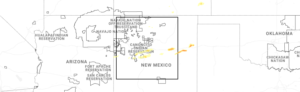
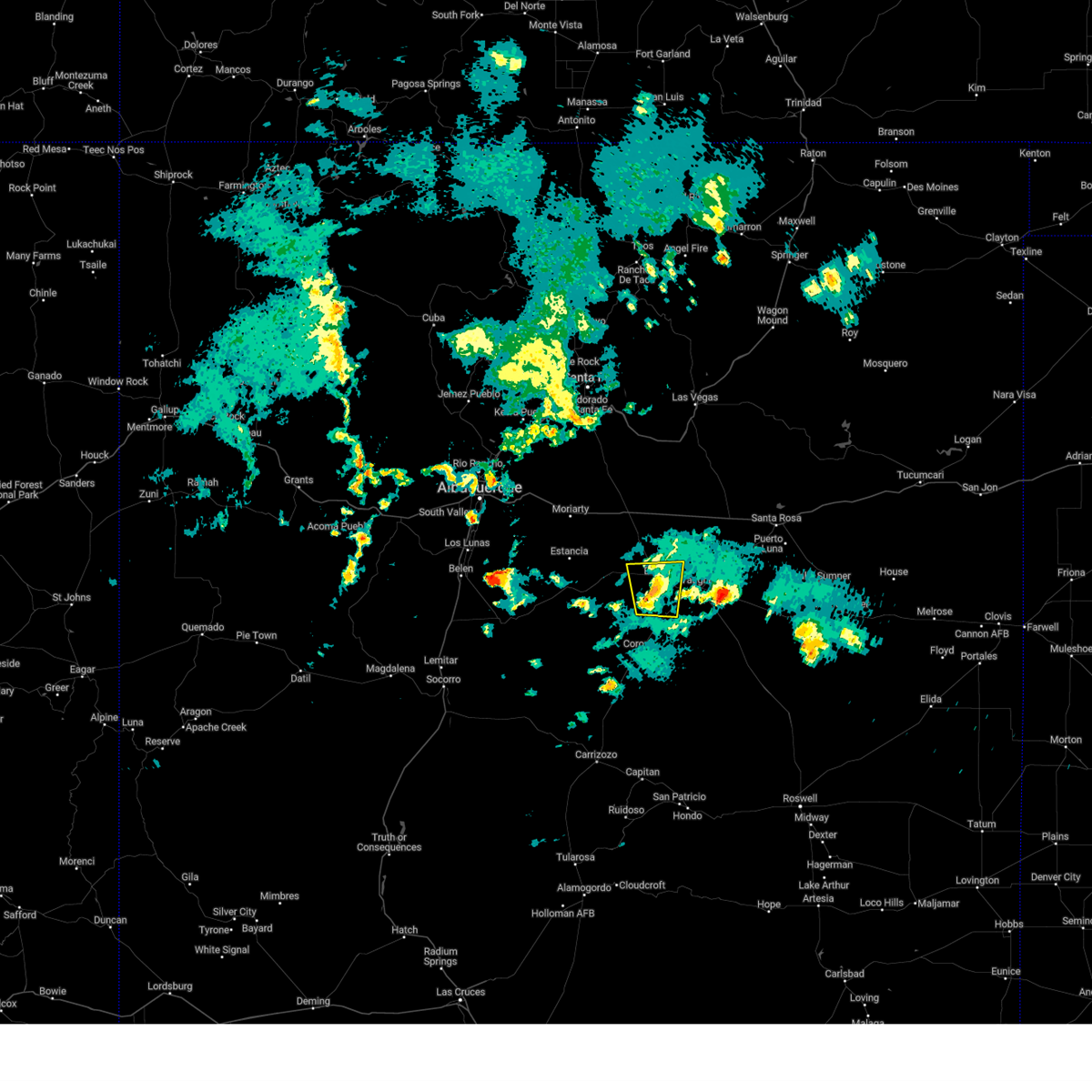
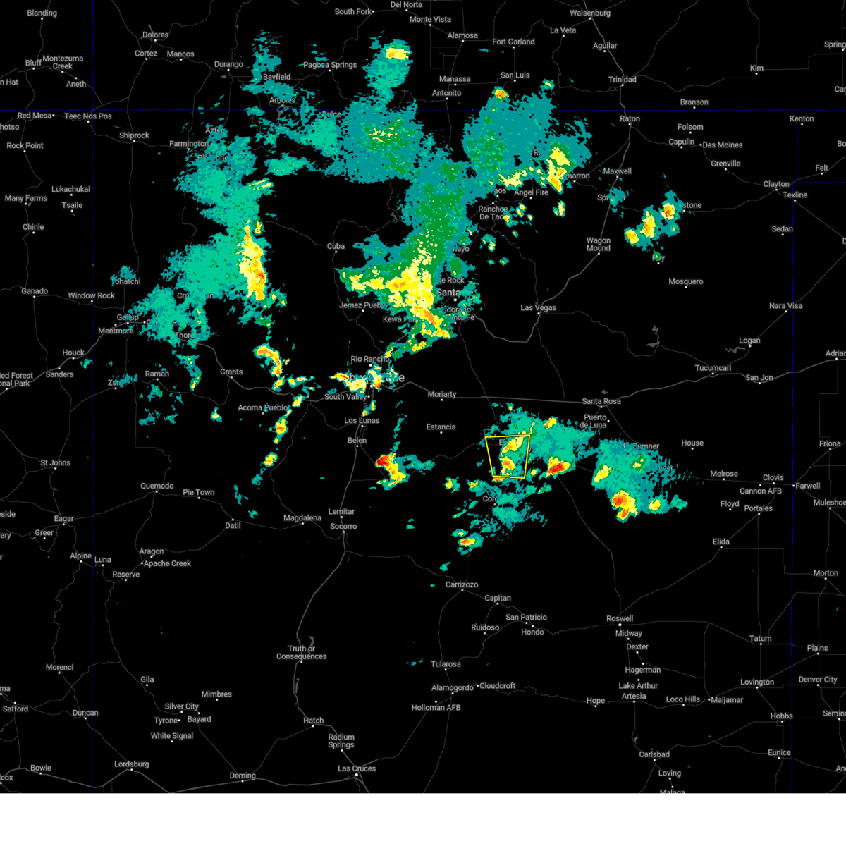
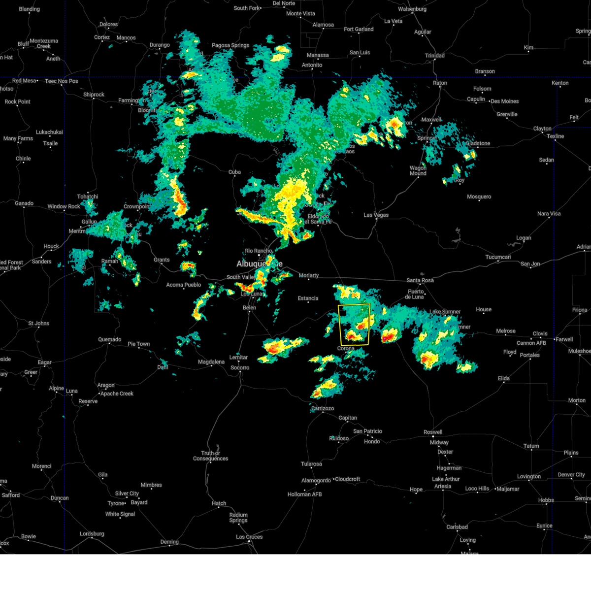
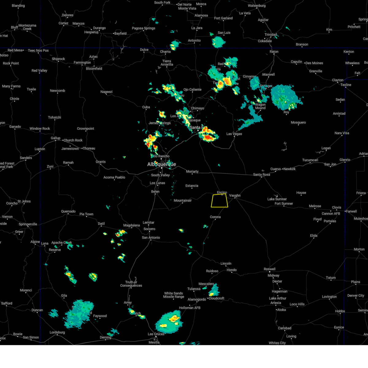
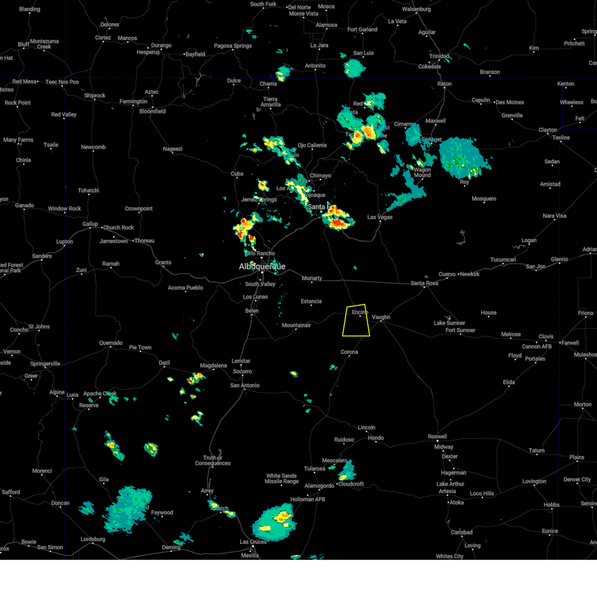
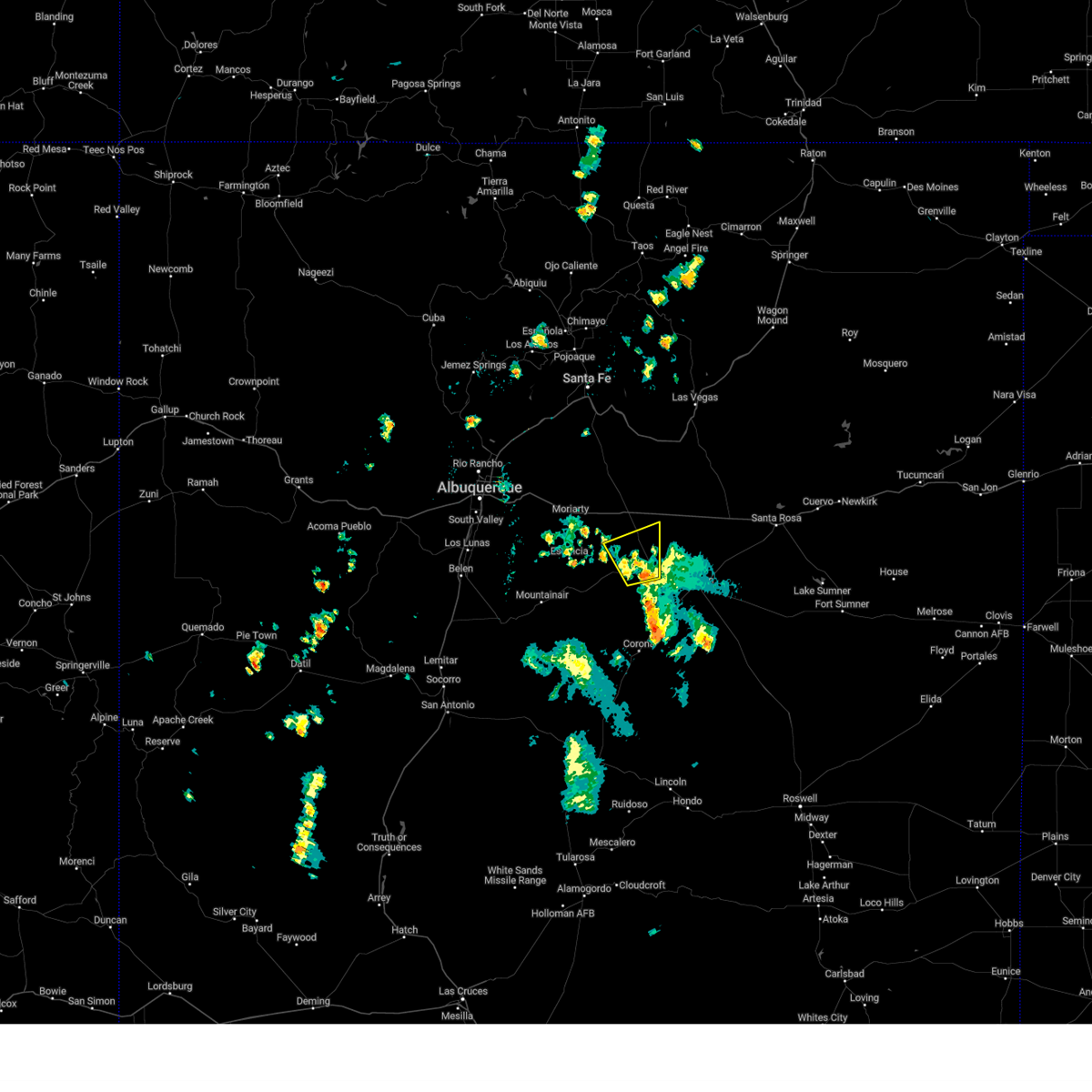
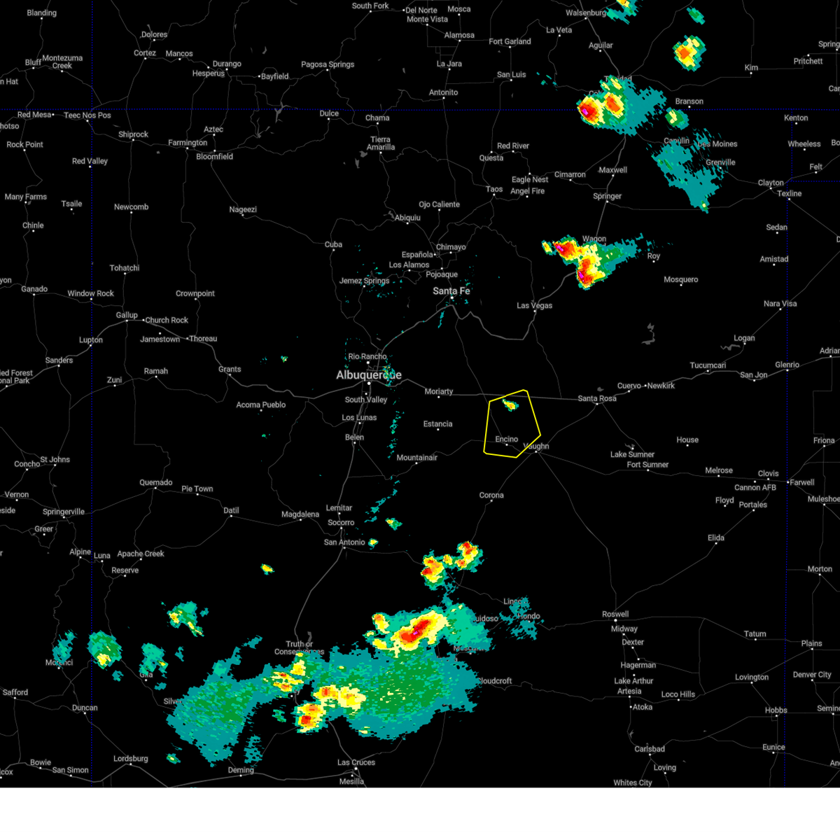
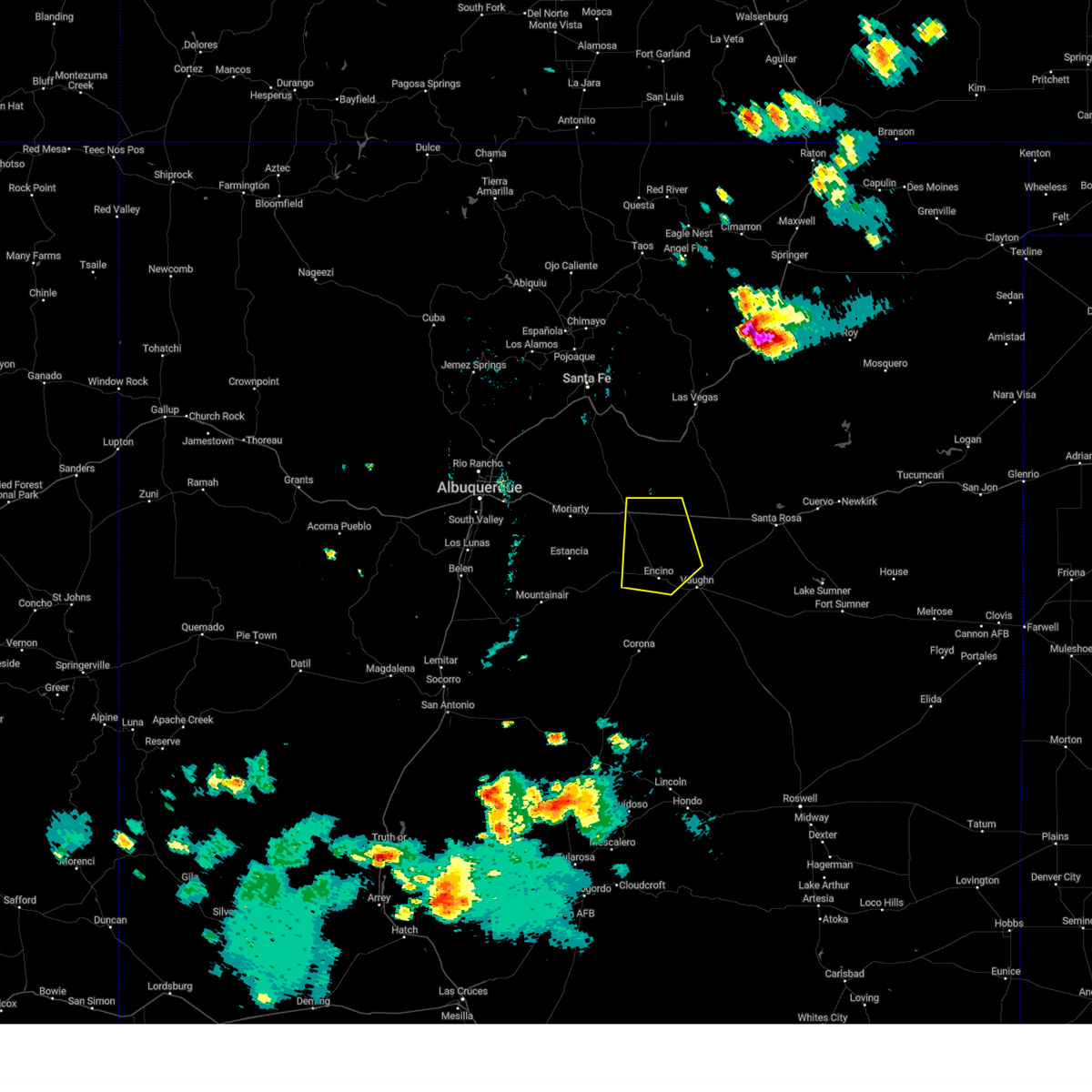
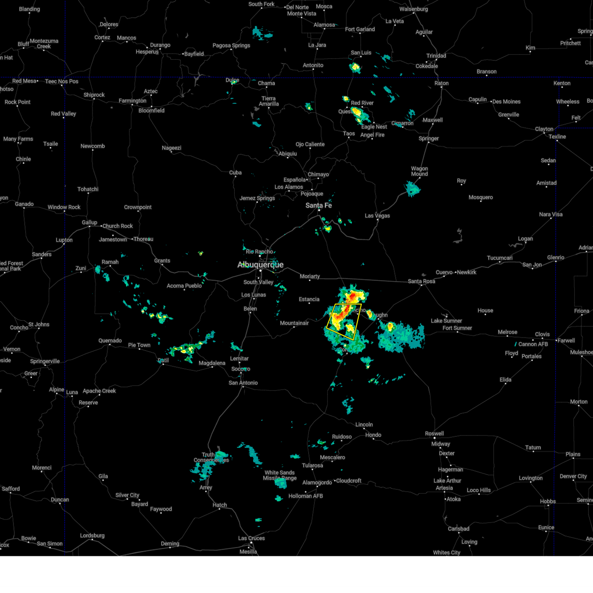
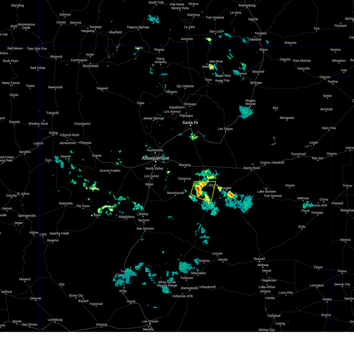
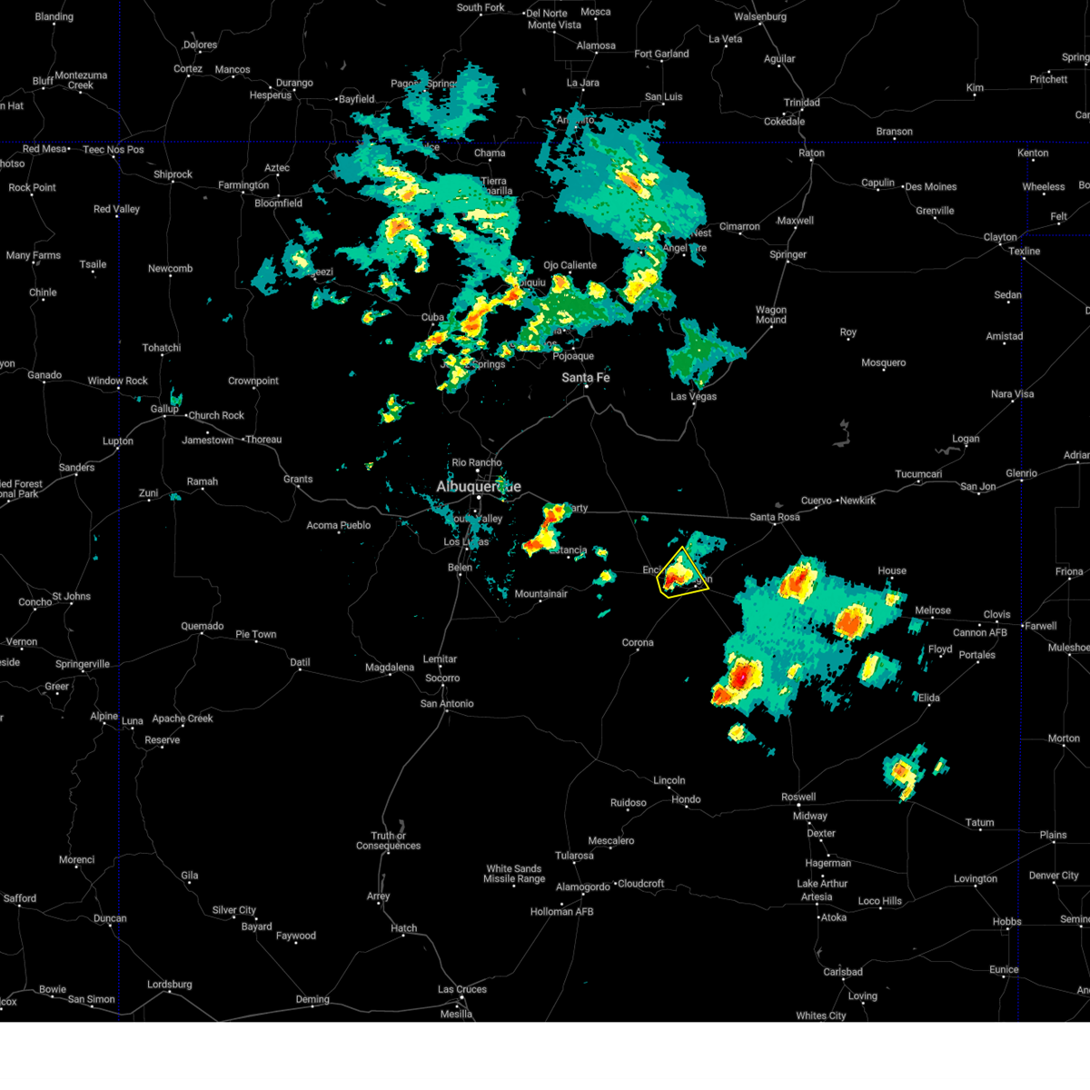
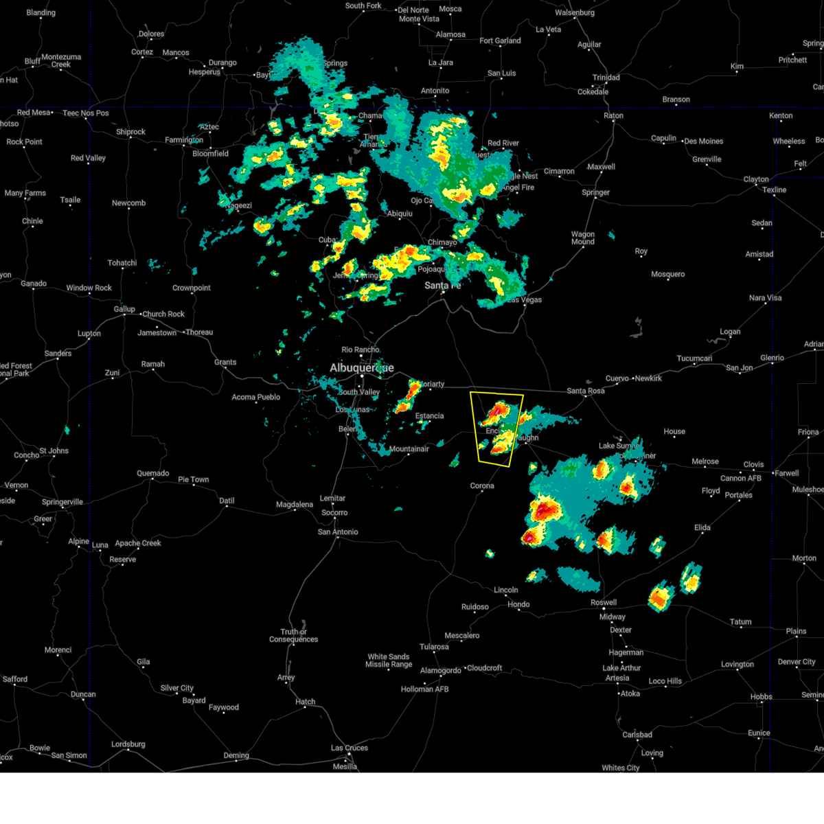
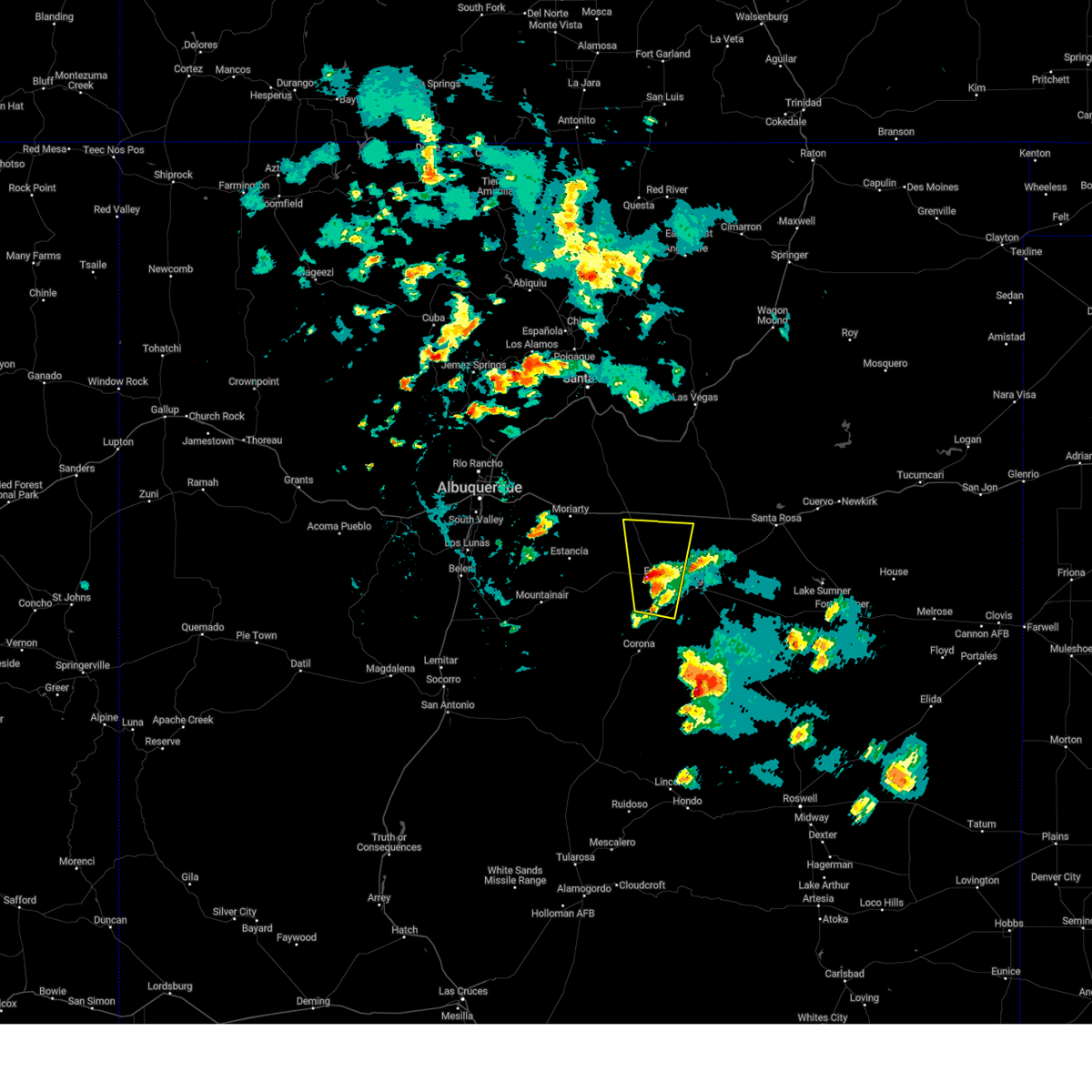
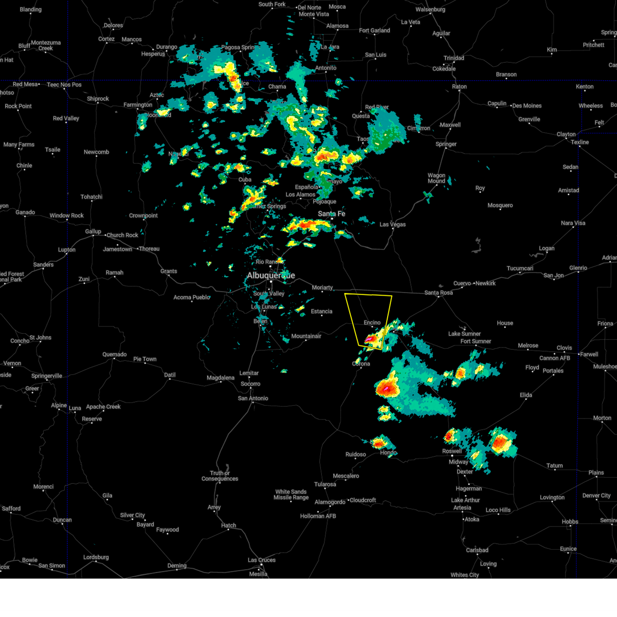
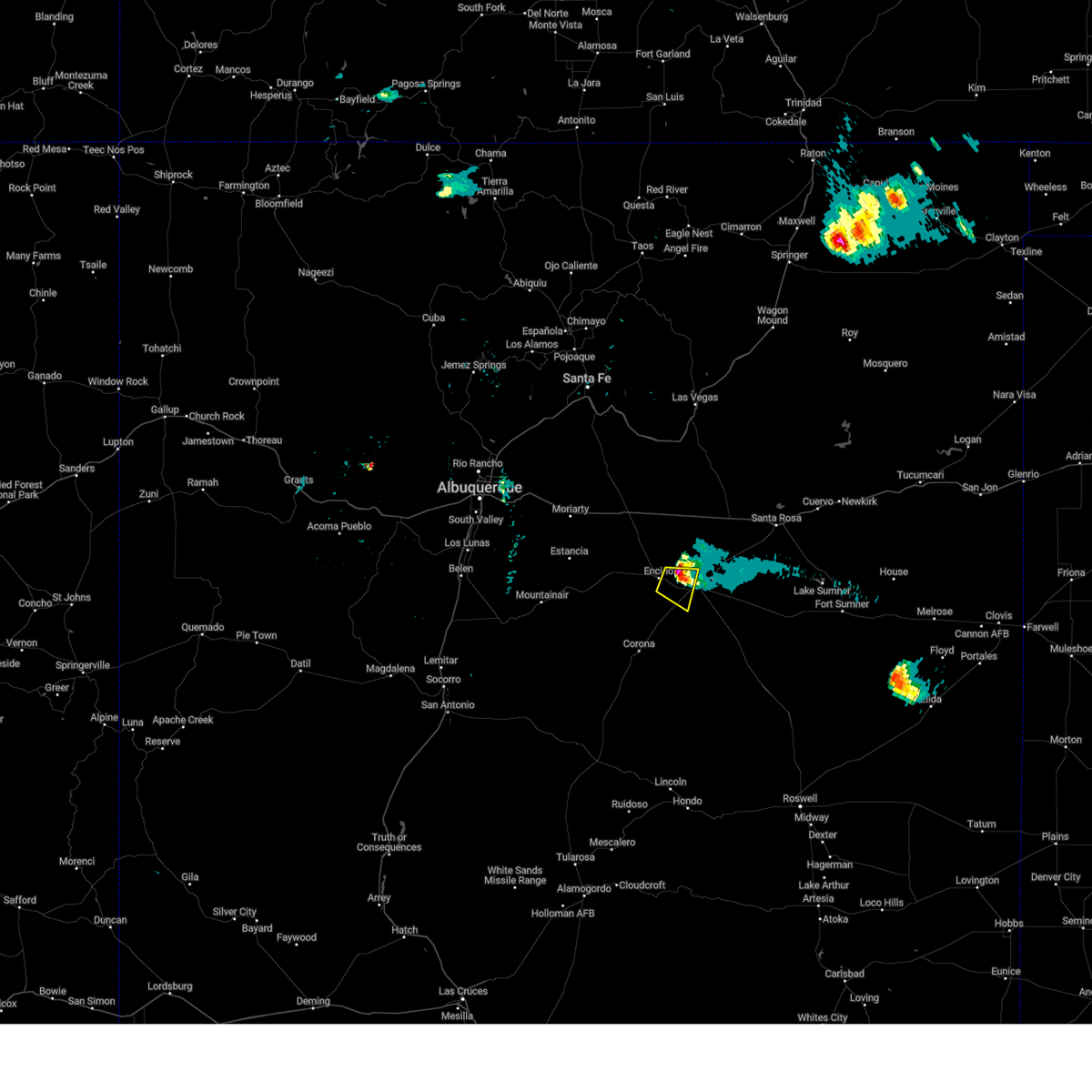
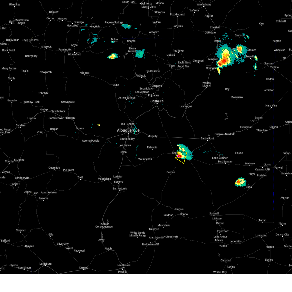
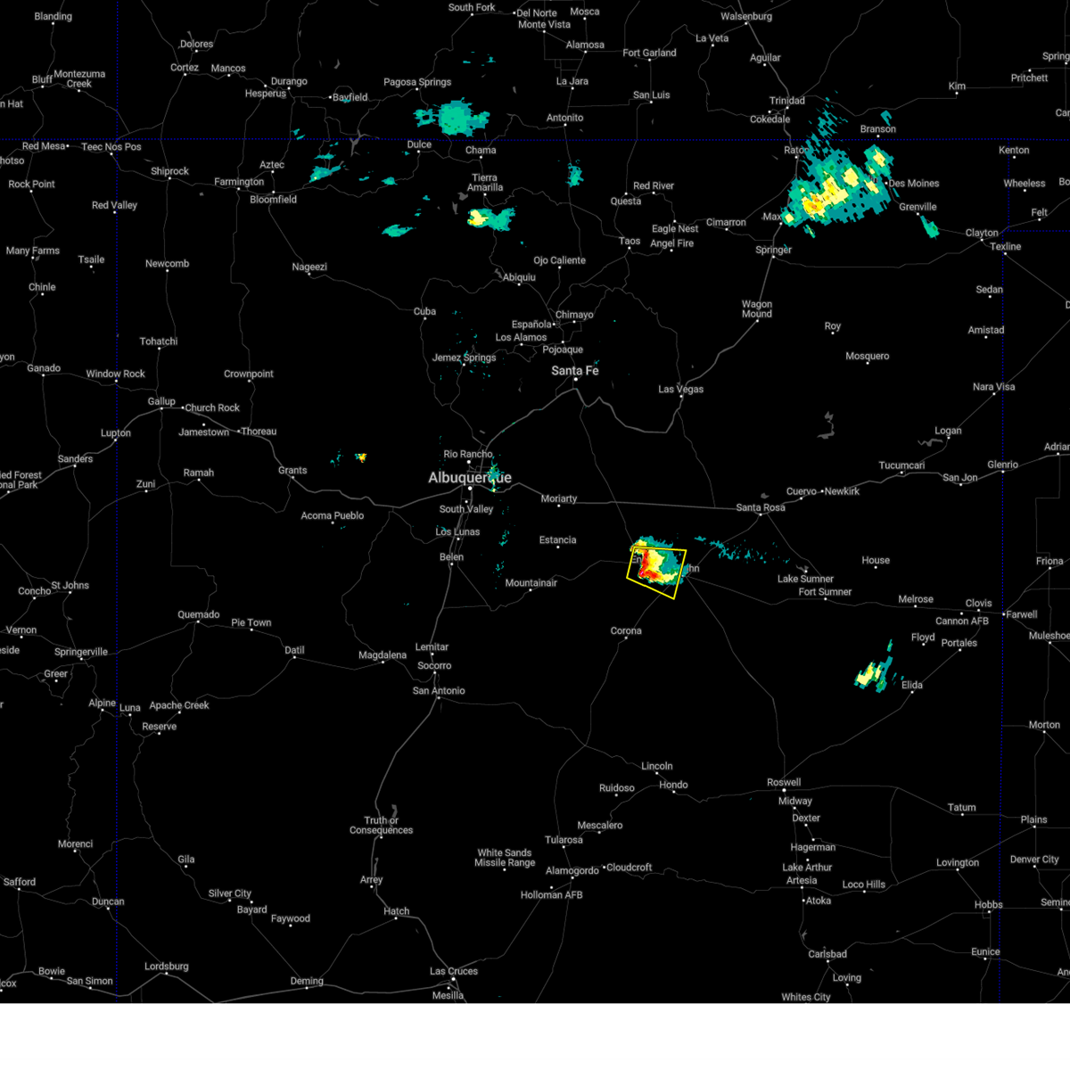
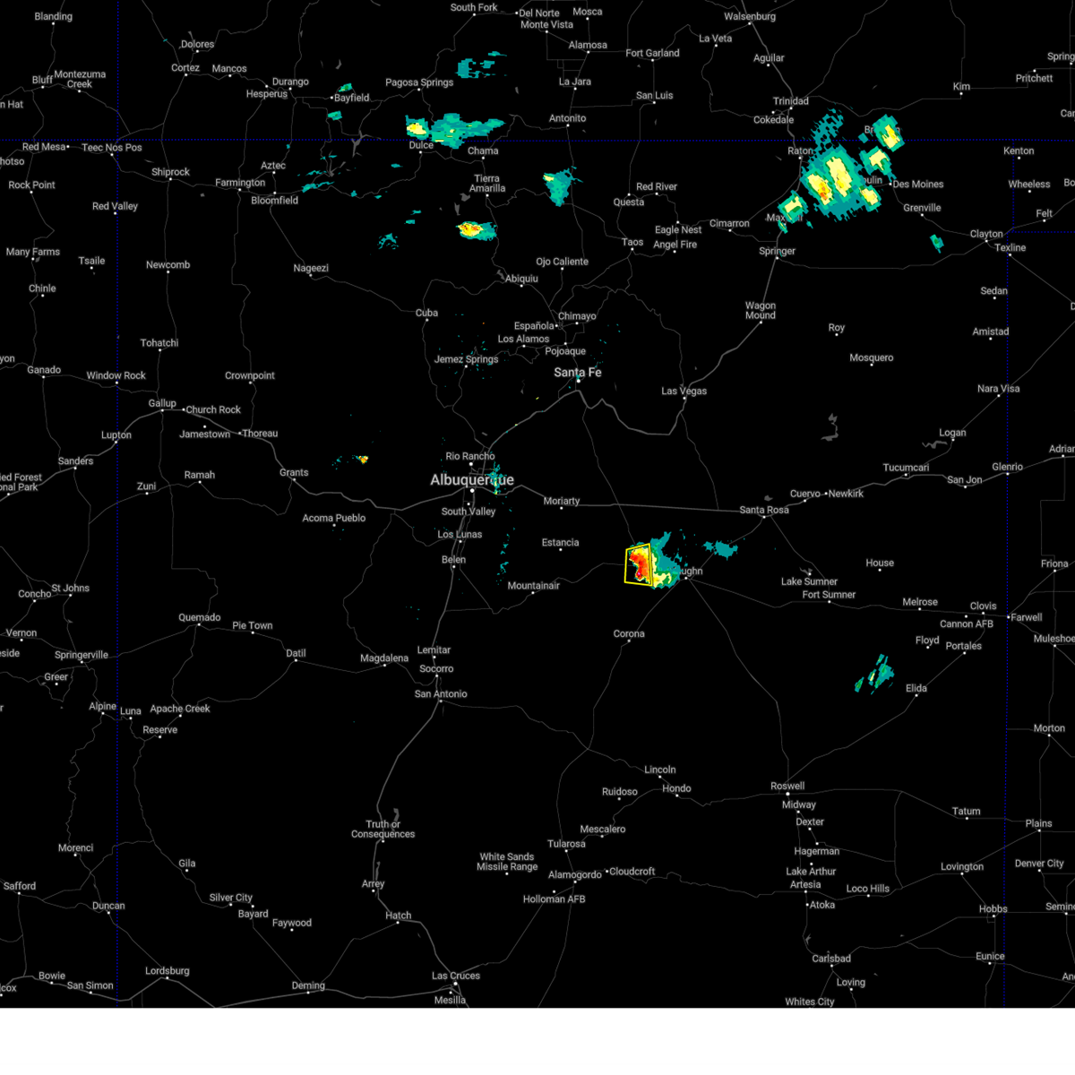
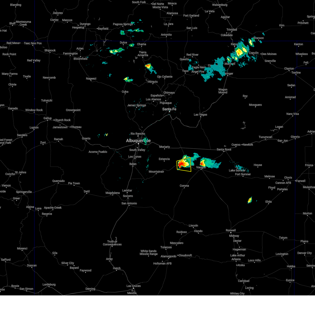
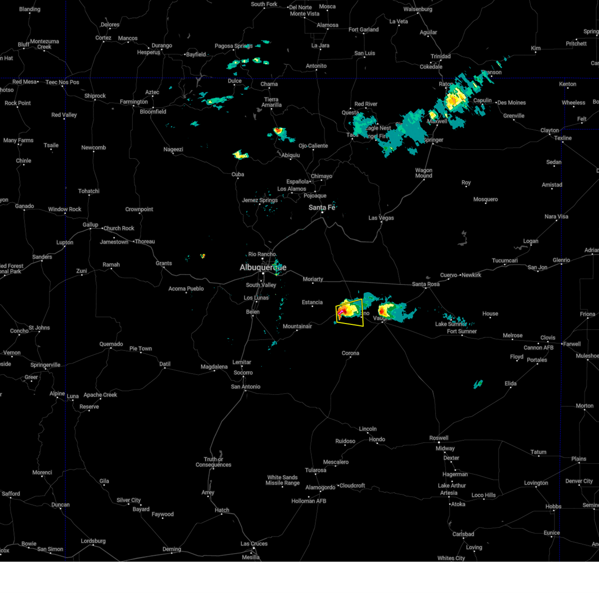
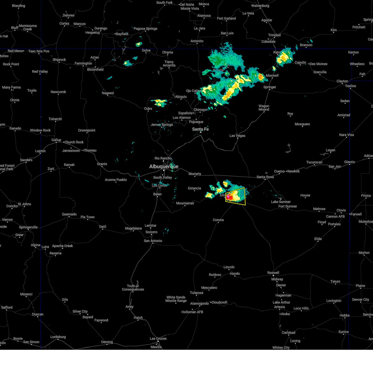
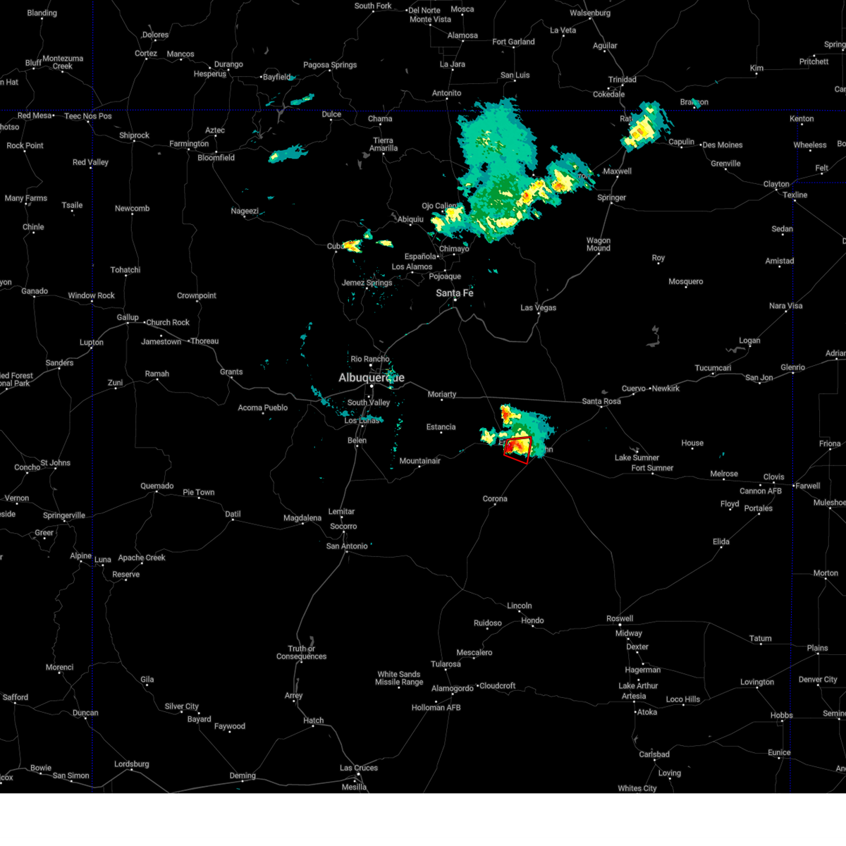
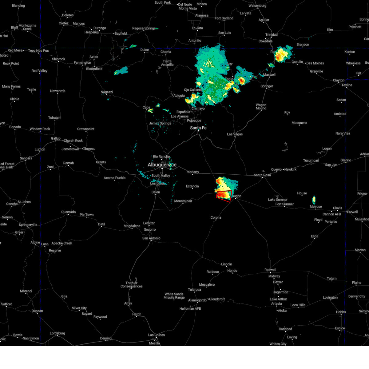
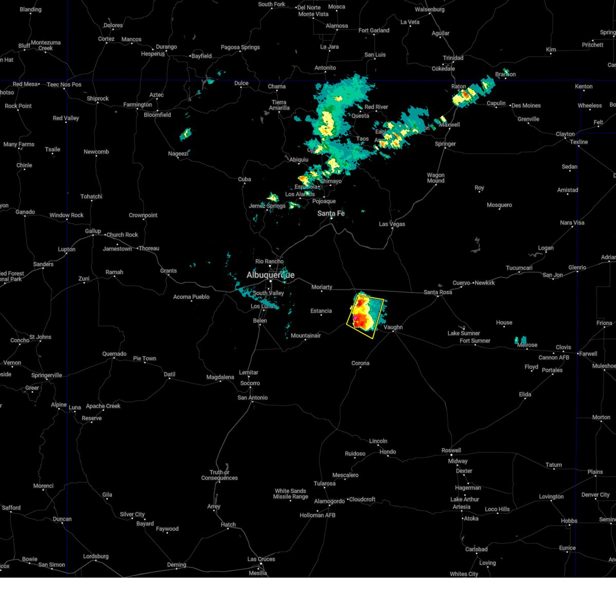
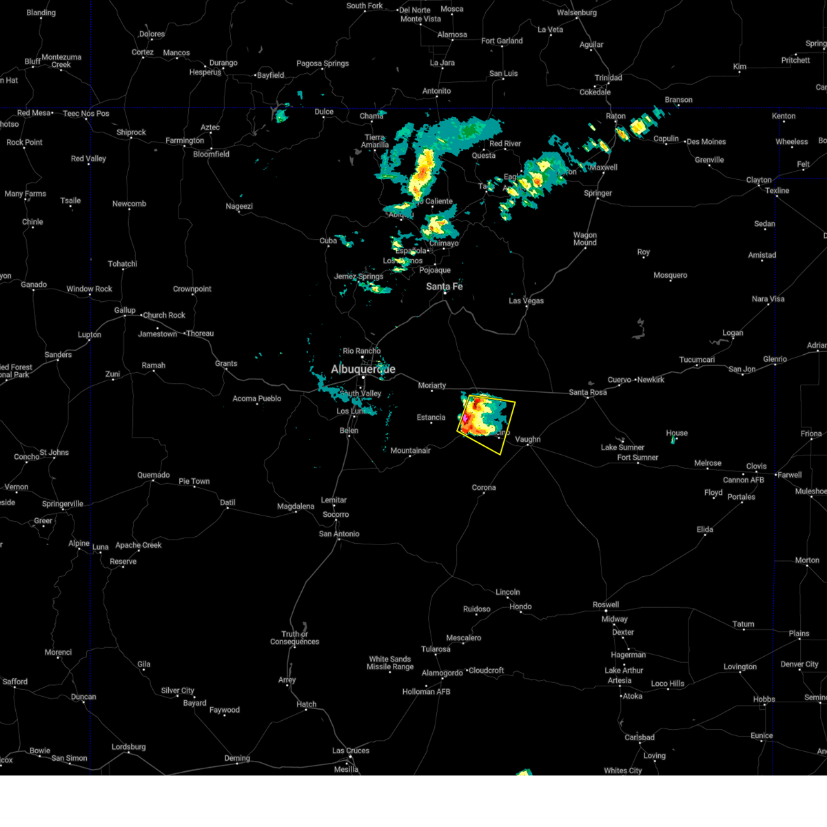
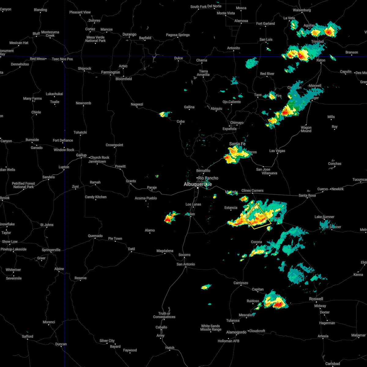
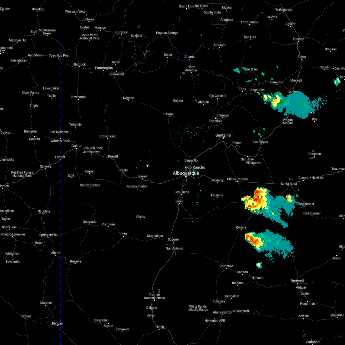
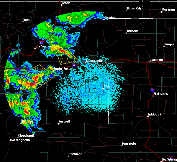
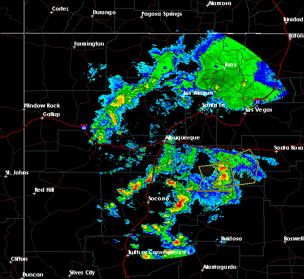
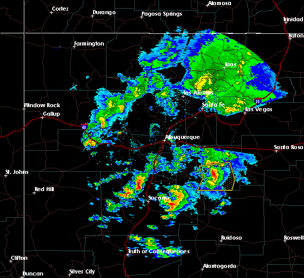
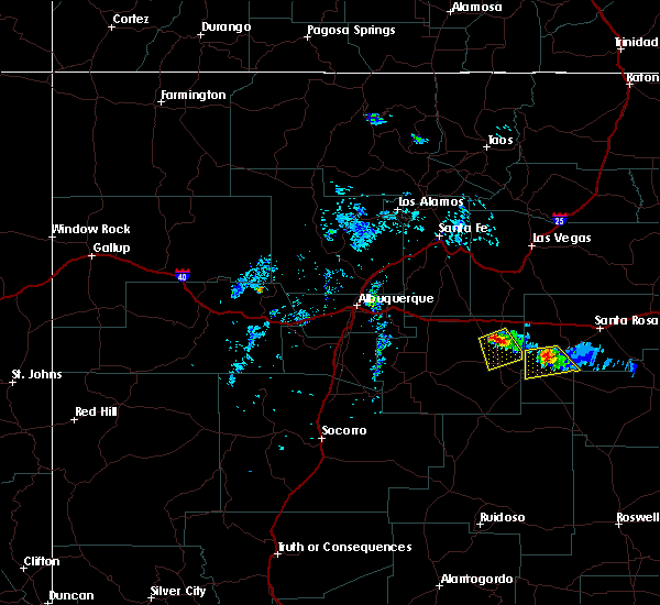
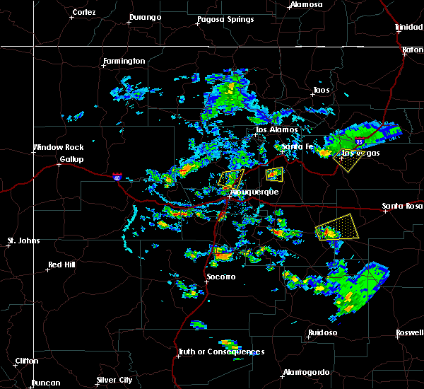
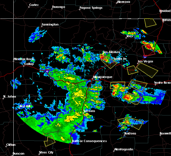
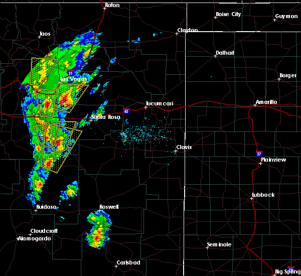
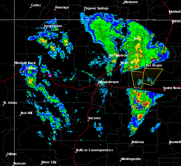
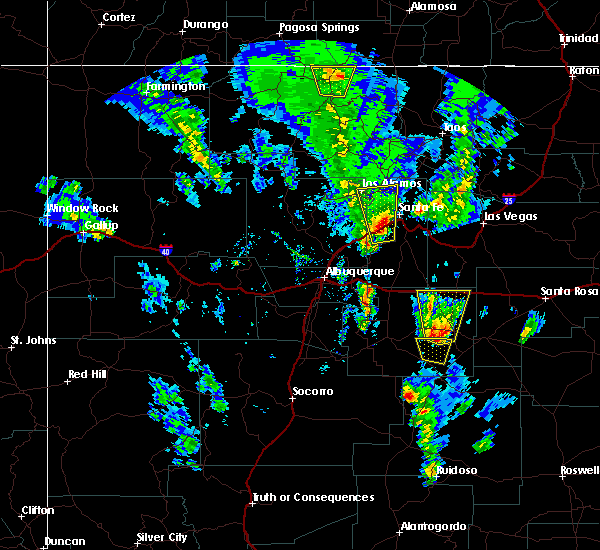
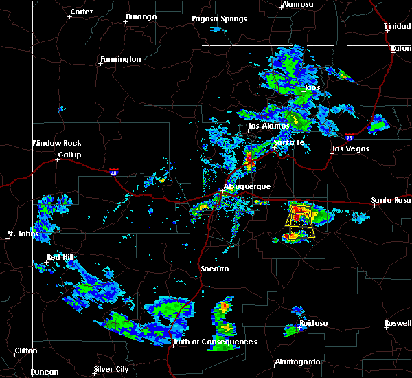
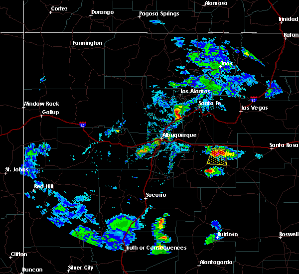
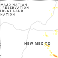
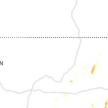
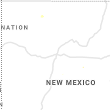
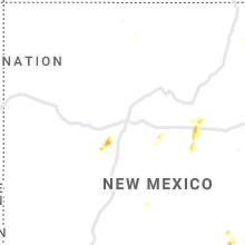
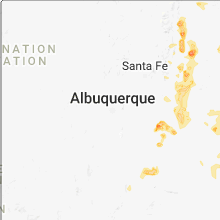
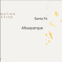
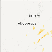
Hail Map for Encino, NM
The Encino, NM area has had 17 reports of on-the-ground hail by trained spotters, and has been under severe weather warnings 7 times during the past 12 months. Doppler radar has detected hail at or near Encino, NM on 36 occasions, including 1 occasion during the past year.
| Name: | Encino, NM |
| Where Located: | 73.6 miles ESE of Albuquerque, NM |
| Map: | Google Map for Encino, NM |
| Population: | 82 |
| Housing Units: | 62 |
| More Info: | Search Google for Encino, NM |
0
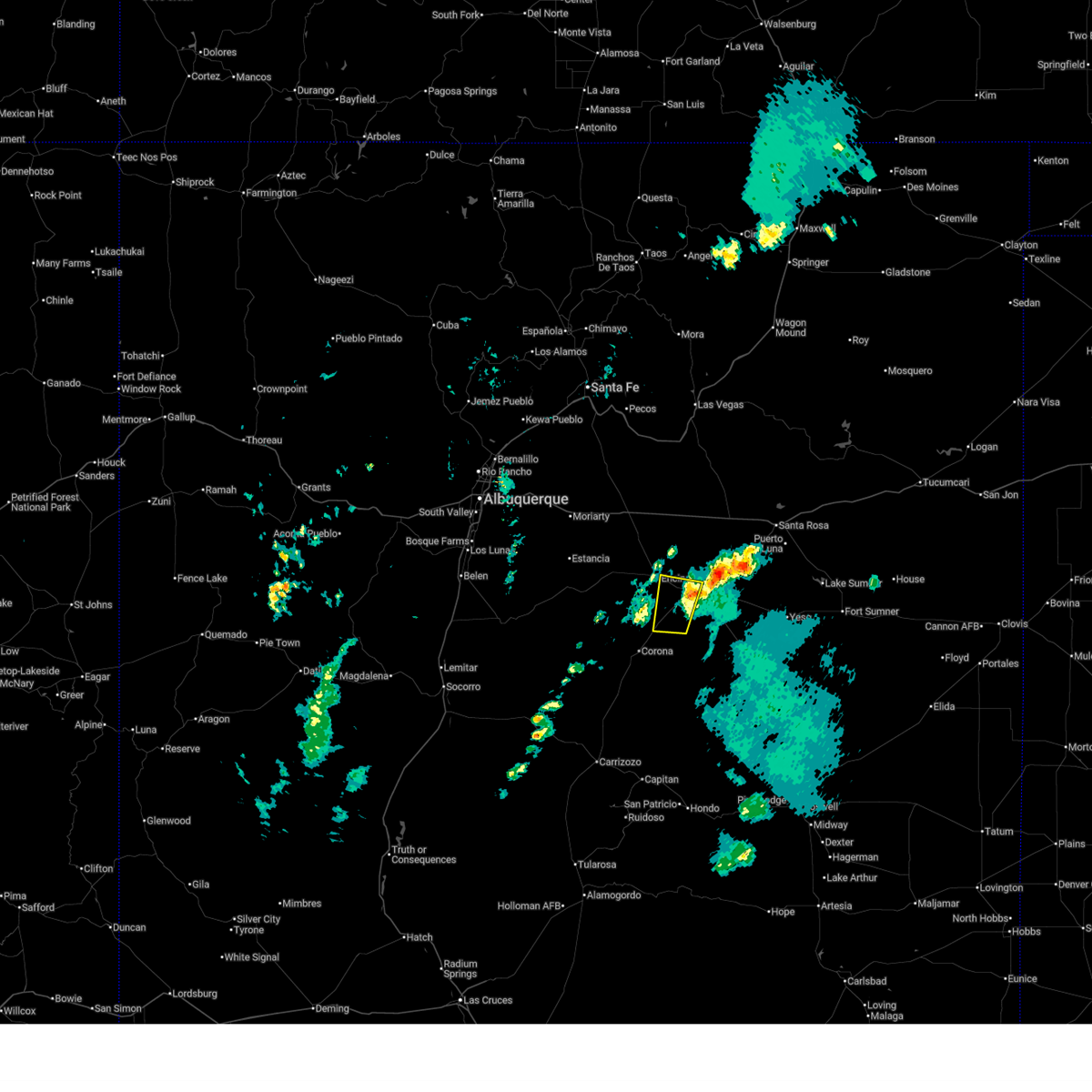
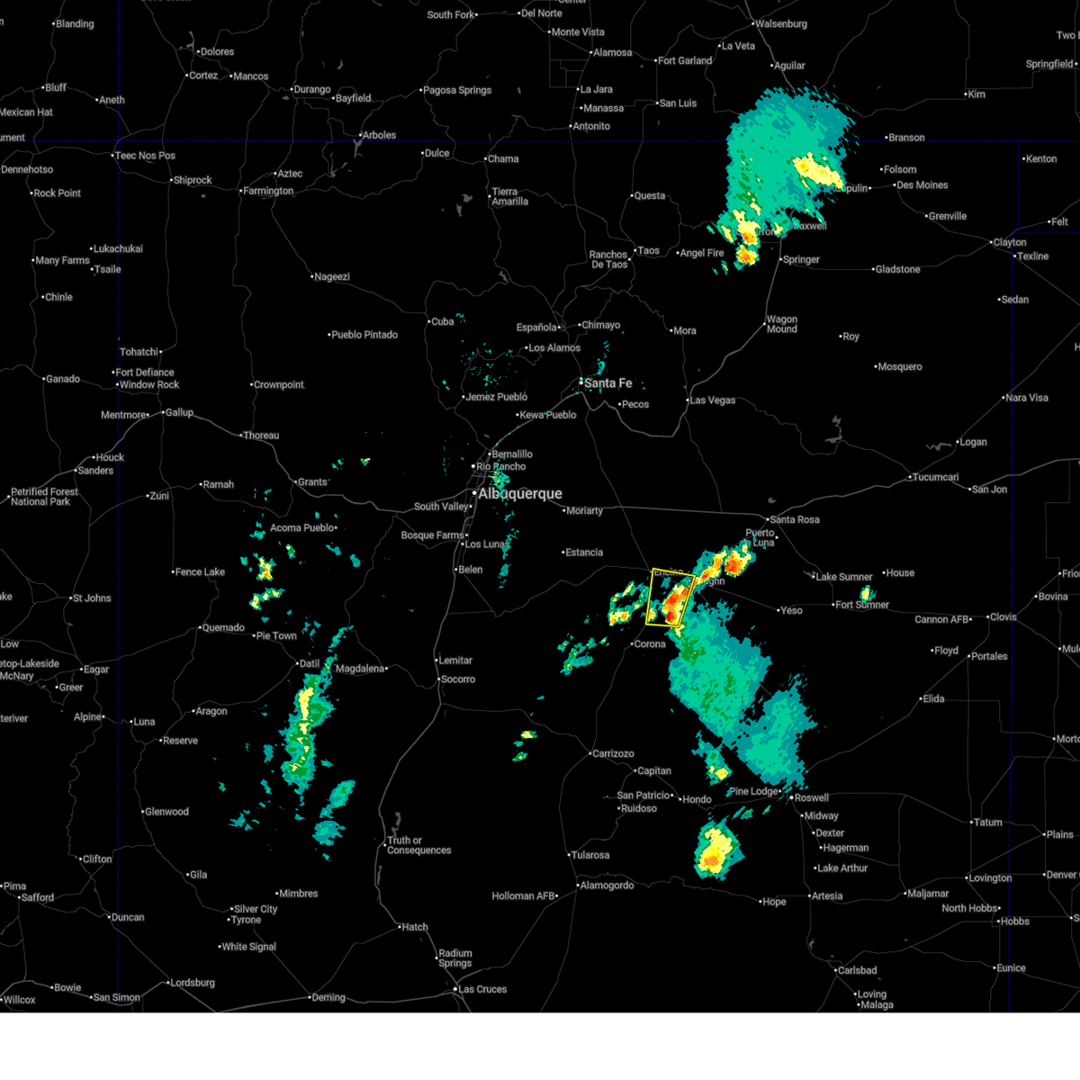
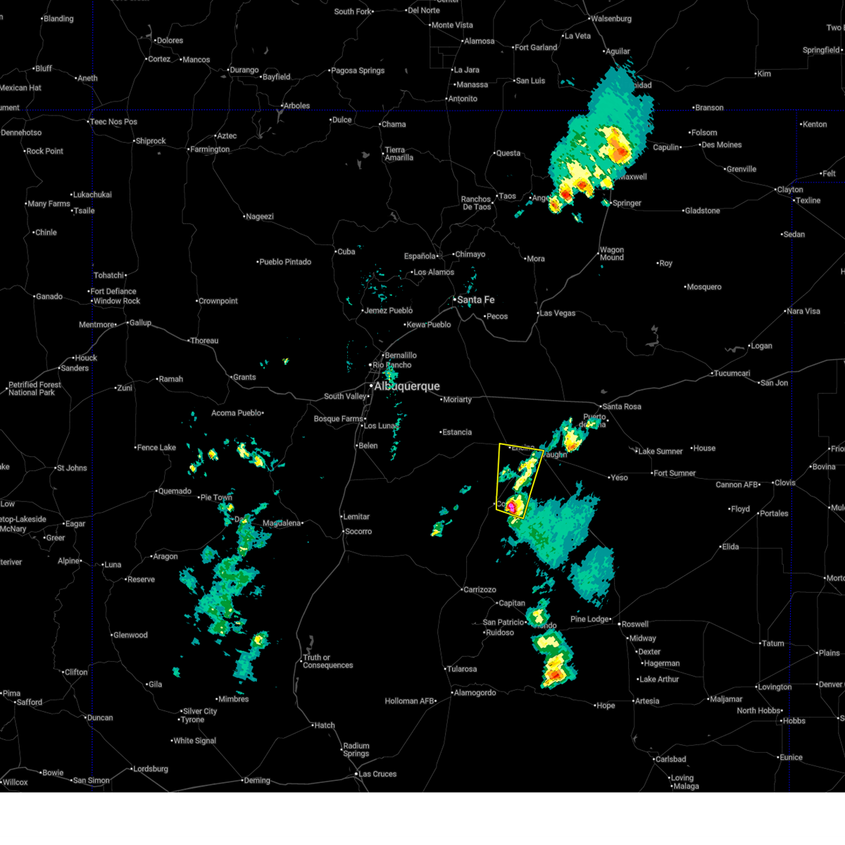
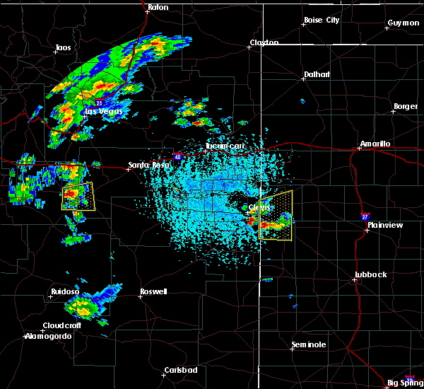
The Top Recent Hail Date for Encino, NM is Wednesday, June 4, 2025 (14th out of 36)
Hail and Wind Damage Spotted near Encino, NM
| Date / Time | Report Details |
|---|---|
| 6/23/2025 3:37 PM MDT |
 The storm which prompted the warning has weakened below severe limits, and no longer poses an immediate threat to life or property. therefore, the warning will be allowed to expire. a severe thunderstorm warning still remains in effect for central guadalupe county near santa rosa. The storm which prompted the warning has weakened below severe limits, and no longer poses an immediate threat to life or property. therefore, the warning will be allowed to expire. a severe thunderstorm warning still remains in effect for central guadalupe county near santa rosa.
|
| 6/23/2025 3:20 PM MDT |
 the severe thunderstorm warning has been cancelled and is no longer in effect the severe thunderstorm warning has been cancelled and is no longer in effect
|
| 6/23/2025 3:20 PM MDT |
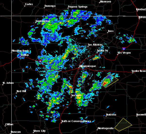
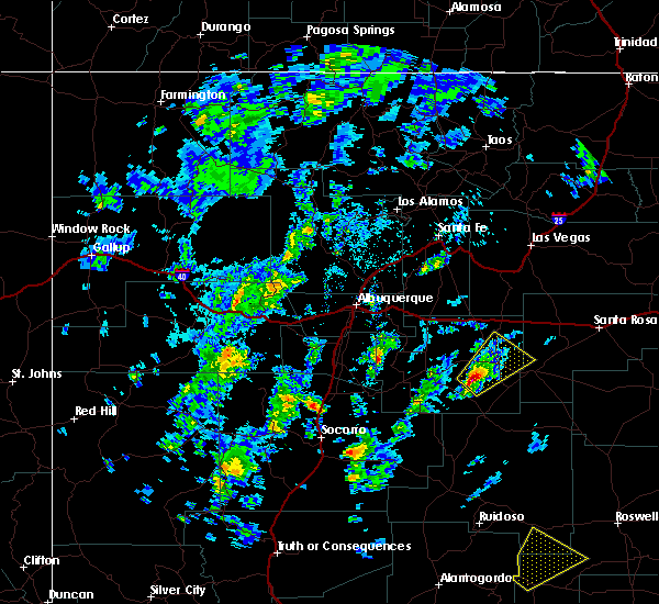
 At 320 pm mdt, a severe thunderstorm was located 9 miles southwest of vaughn, moving north at 30 mph (radar indicated). Hazards include 60 mph wind gusts and quarter size hail. Hail damage to vehicles is expected. expect wind damage to roofs, siding, and trees. locations impacted include, vaughn, encino and duran. This includes highway 60 between mile markers 254 and 267. At 320 pm mdt, a severe thunderstorm was located 9 miles southwest of vaughn, moving north at 30 mph (radar indicated). Hazards include 60 mph wind gusts and quarter size hail. Hail damage to vehicles is expected. expect wind damage to roofs, siding, and trees. locations impacted include, vaughn, encino and duran. This includes highway 60 between mile markers 254 and 267.
|
| 6/23/2025 2:50 PM MDT |
 Svrabq the national weather service in albuquerque has issued a * severe thunderstorm warning for, northern lincoln county in central new mexico, southeastern torrance county in central new mexico, southwestern guadalupe county in east central new mexico, * until 345 pm mdt. * at 250 pm mdt, a severe thunderstorm was located 7 miles east of corona, moving north at 25 mph (radar indicated). Hazards include 60 mph wind gusts and quarter size hail. Hail damage to vehicles is expected. Expect wind damage to roofs, siding, and trees. Svrabq the national weather service in albuquerque has issued a * severe thunderstorm warning for, northern lincoln county in central new mexico, southeastern torrance county in central new mexico, southwestern guadalupe county in east central new mexico, * until 345 pm mdt. * at 250 pm mdt, a severe thunderstorm was located 7 miles east of corona, moving north at 25 mph (radar indicated). Hazards include 60 mph wind gusts and quarter size hail. Hail damage to vehicles is expected. Expect wind damage to roofs, siding, and trees.
|
| 5/4/2025 5:19 PM MDT |
 the severe thunderstorm warning has been cancelled and is no longer in effect the severe thunderstorm warning has been cancelled and is no longer in effect
|
| 5/4/2025 5:04 PM MDT |
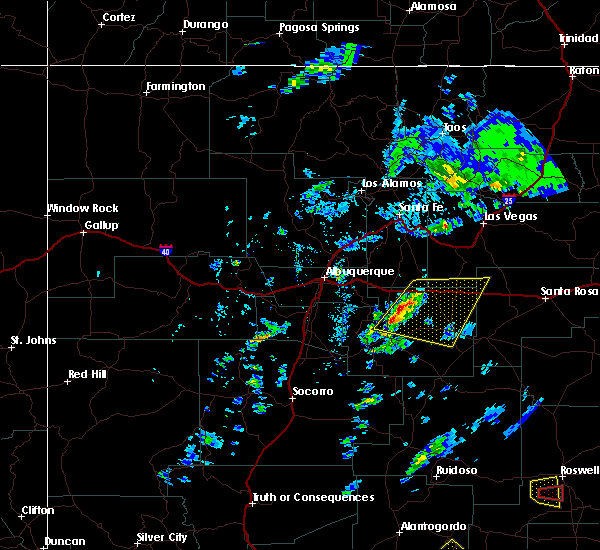
 At 504 pm mdt, a severe thunderstorm was located 8 miles south of encino, or 18 miles west of vaughn, moving north at 25 mph (radar indicated). Hazards include 60 mph wind gusts and small hail. Expect damage to roofs, siding, and trees. locations impacted include, encino and duran. this includes the following highways, highway 285 between mile markers 223 and 228. Highway 60 between mile markers 242 and 262. At 504 pm mdt, a severe thunderstorm was located 8 miles south of encino, or 18 miles west of vaughn, moving north at 25 mph (radar indicated). Hazards include 60 mph wind gusts and small hail. Expect damage to roofs, siding, and trees. locations impacted include, encino and duran. this includes the following highways, highway 285 between mile markers 223 and 228. Highway 60 between mile markers 242 and 262.
|
| 5/4/2025 4:40 PM MDT |
 Svrabq the national weather service in albuquerque has issued a * severe thunderstorm warning for, southeastern torrance county in central new mexico, * until 545 pm mdt. * at 440 pm mdt, a severe thunderstorm was located 10 miles north of corona, moving north at 20 mph (radar indicated). Hazards include 60 mph wind gusts and half dollar size hail. Hail damage to vehicles is expected. Expect wind damage to roofs, siding, and trees. Svrabq the national weather service in albuquerque has issued a * severe thunderstorm warning for, southeastern torrance county in central new mexico, * until 545 pm mdt. * at 440 pm mdt, a severe thunderstorm was located 10 miles north of corona, moving north at 20 mph (radar indicated). Hazards include 60 mph wind gusts and half dollar size hail. Hail damage to vehicles is expected. Expect wind damage to roofs, siding, and trees.
|
| 8/28/2023 6:43 PM MDT |
 The severe thunderstorm warning for east central torrance county will expire at 645 pm mdt, the storm that prompted the warning has weakened below severe limits, and has exited the warned area. therefore, the warning will be allowed to expire. The severe thunderstorm warning for east central torrance county will expire at 645 pm mdt, the storm that prompted the warning has weakened below severe limits, and has exited the warned area. therefore, the warning will be allowed to expire.
|
| 8/28/2023 6:30 PM MDT | 8-10 inch branch snapped off tree in sudden change of wind direction. accompanied by pea sized hai in torrance county NM, 2.2 miles N of Encino, NM |
| 8/28/2023 6:21 PM MDT |
 At 620 pm mdt, a severe thunderstorm was located 7 miles southwest of encino, or 17 miles west of vaughn, moving south at 20 mph (radar indicated). Hazards include 60 mph wind gusts and quarter size hail. Hail damage to vehicles is expected. expect wind damage to roofs, siding, and trees. locations impacted include, encino and duran. this includes the following highways, highway 285 near mile marker 223. highway 60 between mile markers 251 and 258. hail threat, radar indicated max hail size, 1. 00 in wind threat, radar indicated max wind gust, 60 mph. At 620 pm mdt, a severe thunderstorm was located 7 miles southwest of encino, or 17 miles west of vaughn, moving south at 20 mph (radar indicated). Hazards include 60 mph wind gusts and quarter size hail. Hail damage to vehicles is expected. expect wind damage to roofs, siding, and trees. locations impacted include, encino and duran. this includes the following highways, highway 285 near mile marker 223. highway 60 between mile markers 251 and 258. hail threat, radar indicated max hail size, 1. 00 in wind threat, radar indicated max wind gust, 60 mph.
|
| 8/28/2023 5:58 PM MDT |
 At 558 pm mdt, a severe thunderstorm was located near encino, or 18 miles west of vaughn, moving south at 20 mph (radar indicated). Hazards include 60 mph wind gusts and quarter size hail. Hail damage to vehicles is expected. Expect wind damage to roofs, siding, and trees. At 558 pm mdt, a severe thunderstorm was located near encino, or 18 miles west of vaughn, moving south at 20 mph (radar indicated). Hazards include 60 mph wind gusts and quarter size hail. Hail damage to vehicles is expected. Expect wind damage to roofs, siding, and trees.
|
| 8/28/2023 5:39 PM MDT |
 At 538 pm mdt, a severe thunderstorm was located 9 miles north of encino, or 17 miles northwest of vaughn, moving south at 25 mph (radar indicated). Hazards include 60 mph wind gusts and quarter size hail. Hail damage to vehicles is expected. expect wind damage to roofs, siding, and trees. locations impacted include, encino. this includes the following highways, highway 285 between mile markers 223 and 235. highway 60 between mile markers 246 and 267. hail threat, radar indicated max hail size, 1. 00 in wind threat, radar indicated max wind gust, 60 mph. At 538 pm mdt, a severe thunderstorm was located 9 miles north of encino, or 17 miles northwest of vaughn, moving south at 25 mph (radar indicated). Hazards include 60 mph wind gusts and quarter size hail. Hail damage to vehicles is expected. expect wind damage to roofs, siding, and trees. locations impacted include, encino. this includes the following highways, highway 285 between mile markers 223 and 235. highway 60 between mile markers 246 and 267. hail threat, radar indicated max hail size, 1. 00 in wind threat, radar indicated max wind gust, 60 mph.
|
| 8/28/2023 5:20 PM MDT |
 At 519 pm mdt, a severe thunderstorm was located 15 miles north of encino, or 22 miles northwest of vaughn, moving south at 30 mph (radar indicated). Hazards include 60 mph wind gusts and quarter size hail. Hail damage to vehicles is expected. Expect wind damage to roofs, siding, and trees. At 519 pm mdt, a severe thunderstorm was located 15 miles north of encino, or 22 miles northwest of vaughn, moving south at 30 mph (radar indicated). Hazards include 60 mph wind gusts and quarter size hail. Hail damage to vehicles is expected. Expect wind damage to roofs, siding, and trees.
|
| 8/25/2023 11:53 AM MDT |
 At 1152 am mdt, a severe thunderstorm was located 8 miles northwest of encino, or 22 miles west of vaughn, moving north at 10 mph (radar indicated). Hazards include 60 mph wind gusts and quarter size hail. Hail damage to vehicles is expected. Expect wind damage to roofs, siding, and trees. At 1152 am mdt, a severe thunderstorm was located 8 miles northwest of encino, or 22 miles west of vaughn, moving north at 10 mph (radar indicated). Hazards include 60 mph wind gusts and quarter size hail. Hail damage to vehicles is expected. Expect wind damage to roofs, siding, and trees.
|
| 7/15/2023 5:16 PM MDT |
 At 514 pm mdt, a severe thunderstorm was located 13 miles southeast of clines corners, or 25 miles northwest of vaughn, moving south at 20 mph (radar indicated). Hazards include 60 mph wind gusts and quarter size hail. Hail damage to vehicles is expected. expect wind damage to roofs, siding, and trees. locations impacted include, encino. this includes the following highways, interstate 40 between mile markers 230 and 240. highway 285 between mile markers 223 and 242. Highway 60 between mile markers 243 and 261. At 514 pm mdt, a severe thunderstorm was located 13 miles southeast of clines corners, or 25 miles northwest of vaughn, moving south at 20 mph (radar indicated). Hazards include 60 mph wind gusts and quarter size hail. Hail damage to vehicles is expected. expect wind damage to roofs, siding, and trees. locations impacted include, encino. this includes the following highways, interstate 40 between mile markers 230 and 240. highway 285 between mile markers 223 and 242. Highway 60 between mile markers 243 and 261.
|
| 7/15/2023 4:41 PM MDT |
 At 441 pm mdt, a severe thunderstorm was located 9 miles east of clines corners, or 29 miles east of moriarty, moving south at 30 mph (radar indicated). Hazards include 60 mph wind gusts and half dollar size hail. Hail damage to vehicles is expected. Expect wind damage to roofs, siding, and trees. At 441 pm mdt, a severe thunderstorm was located 9 miles east of clines corners, or 29 miles east of moriarty, moving south at 30 mph (radar indicated). Hazards include 60 mph wind gusts and half dollar size hail. Hail damage to vehicles is expected. Expect wind damage to roofs, siding, and trees.
|
| 6/3/2023 6:55 PM MDT |
 At 655 pm mdt, a severe thunderstorm was located 11 miles west of encino, or 24 miles north of corona, moving east at 15 mph (radar indicated). Hazards include 60 mph wind gusts and penny size hail. Expect damage to roofs, siding, and trees. locations impacted include, encino. this includes the following highways, highway 285 between mile markers 223 and 229. highway 60 between mile markers 236 and 254. hail threat, radar indicated max hail size, 0. 75 in wind threat, radar indicated max wind gust, 60 mph. At 655 pm mdt, a severe thunderstorm was located 11 miles west of encino, or 24 miles north of corona, moving east at 15 mph (radar indicated). Hazards include 60 mph wind gusts and penny size hail. Expect damage to roofs, siding, and trees. locations impacted include, encino. this includes the following highways, highway 285 between mile markers 223 and 229. highway 60 between mile markers 236 and 254. hail threat, radar indicated max hail size, 0. 75 in wind threat, radar indicated max wind gust, 60 mph.
|
| 6/3/2023 6:37 PM MDT |
 At 637 pm mdt, a severe thunderstorm was located 14 miles west of encino, or 20 miles southeast of estancia, moving east at 15 mph (radar indicated). Hazards include 60 mph wind gusts and half dollar size hail. Hail damage to vehicles is expected. Expect wind damage to roofs, siding, and trees. At 637 pm mdt, a severe thunderstorm was located 14 miles west of encino, or 20 miles southeast of estancia, moving east at 15 mph (radar indicated). Hazards include 60 mph wind gusts and half dollar size hail. Hail damage to vehicles is expected. Expect wind damage to roofs, siding, and trees.
|
| 6/1/2023 2:43 PM MDT | Quarter sized hail reported 20.8 miles SW of Encino, NM, hail accumulations of up to 3 inches has fallen. |
| 5/31/2023 4:22 PM MDT |
 At 421 pm mdt, a severe thunderstorm was located near encino, or 10 miles west of vaughn, moving northeast at 5 mph (radar indicated). Hazards include 60 mph wind gusts and quarter size hail. Hail damage to vehicles is expected. Expect wind damage to roofs, siding, and trees. At 421 pm mdt, a severe thunderstorm was located near encino, or 10 miles west of vaughn, moving northeast at 5 mph (radar indicated). Hazards include 60 mph wind gusts and quarter size hail. Hail damage to vehicles is expected. Expect wind damage to roofs, siding, and trees.
|
| 5/31/2023 3:53 PM MDT |
 The severe thunderstorm warning for west central guadalupe and northeastern torrance counties will expire at 400 pm mdt, the storm which prompted the warning has weakened below severe limits, and no longer poses an immediate threat to life or property. therefore, the warning will be allowed to expire. however small hail and gusty winds are still possible with this thunderstorm. a severe thunderstorm watch remains in effect until 900 pm mdt for central and east central new mexico. The severe thunderstorm warning for west central guadalupe and northeastern torrance counties will expire at 400 pm mdt, the storm which prompted the warning has weakened below severe limits, and no longer poses an immediate threat to life or property. therefore, the warning will be allowed to expire. however small hail and gusty winds are still possible with this thunderstorm. a severe thunderstorm watch remains in effect until 900 pm mdt for central and east central new mexico.
|
| 5/31/2023 3:36 PM MDT |
 At 336 pm mdt, a severe thunderstorm was located near encino, or 19 miles northwest of vaughn, moving north at 30 mph (radar indicated). Hazards include 60 mph wind gusts and quarter size hail. Hail damage to vehicles is expected. expect wind damage to roofs, siding, and trees. locations impacted include, encino, duran and milagro. this includes the following highways, highway 285 between mile markers 223 and 246. highway 60 between mile markers 243 and 262. hail threat, radar indicated max hail size, 1. 00 in wind threat, radar indicated max wind gust, 60 mph. At 336 pm mdt, a severe thunderstorm was located near encino, or 19 miles northwest of vaughn, moving north at 30 mph (radar indicated). Hazards include 60 mph wind gusts and quarter size hail. Hail damage to vehicles is expected. expect wind damage to roofs, siding, and trees. locations impacted include, encino, duran and milagro. this includes the following highways, highway 285 between mile markers 223 and 246. highway 60 between mile markers 243 and 262. hail threat, radar indicated max hail size, 1. 00 in wind threat, radar indicated max wind gust, 60 mph.
|
| 5/31/2023 3:14 PM MDT |
 At 314 pm mdt, a severe thunderstorm was located 7 miles southwest of encino, or 17 miles west of vaughn, moving north at 30 mph (radar indicated). Hazards include 60 mph wind gusts and quarter size hail. Hail damage to vehicles is expected. Expect wind damage to roofs, siding, and trees. At 314 pm mdt, a severe thunderstorm was located 7 miles southwest of encino, or 17 miles west of vaughn, moving north at 30 mph (radar indicated). Hazards include 60 mph wind gusts and quarter size hail. Hail damage to vehicles is expected. Expect wind damage to roofs, siding, and trees.
|
| 5/26/2023 8:23 PM MDT |
 The severe thunderstorm warning for west central guadalupe and east central torrance counties will expire at 830 pm mdt, the storm which prompted the warning has weakened below severe limits, and has exited the warned area. therefore, the warning will be allowed to expire. however small hail, gusty winds and heavy rain are still possible with this thunderstorm. a tornado watch remains in effect until 1000 pm mdt for central and east central new mexico. to report severe weather, contact your local law enforcement and the national weather service in albuquerque. The severe thunderstorm warning for west central guadalupe and east central torrance counties will expire at 830 pm mdt, the storm which prompted the warning has weakened below severe limits, and has exited the warned area. therefore, the warning will be allowed to expire. however small hail, gusty winds and heavy rain are still possible with this thunderstorm. a tornado watch remains in effect until 1000 pm mdt for central and east central new mexico. to report severe weather, contact your local law enforcement and the national weather service in albuquerque.
|
| 5/26/2023 7:51 PM MDT |
 At 750 pm mdt, a severe thunderstorm was located near encino, or 10 miles west of vaughn, moving east at 10 mph (radar indicated). Hazards include ping pong ball size hail and 60 mph wind gusts. People and animals outdoors will be injured. expect hail damage to roofs, siding, windows, and vehicles. expect wind damage to roofs, siding, and trees. locations impacted include, vaughn and encino. this includes highway 60 between mile markers 255 and 267. hail threat, radar indicated max hail size, 1. 50 in wind threat, radar indicated max wind gust, 60 mph. At 750 pm mdt, a severe thunderstorm was located near encino, or 10 miles west of vaughn, moving east at 10 mph (radar indicated). Hazards include ping pong ball size hail and 60 mph wind gusts. People and animals outdoors will be injured. expect hail damage to roofs, siding, windows, and vehicles. expect wind damage to roofs, siding, and trees. locations impacted include, vaughn and encino. this includes highway 60 between mile markers 255 and 267. hail threat, radar indicated max hail size, 1. 50 in wind threat, radar indicated max wind gust, 60 mph.
|
| 5/26/2023 7:30 PM MDT | Quarter sized hail reported 7.5 miles WNW of Encino, NM, report from mping: quarter (1.00 in.). |
| 5/26/2023 7:30 PM MDT | Golf Ball sized hail reported 2.2 miles N of Encino, NM |
| 5/26/2023 7:30 PM MDT |
 At 729 pm mdt, a severe thunderstorm was located over encino, or 14 miles west of vaughn, moving east at 15 mph (radar indicated). Hazards include 60 mph wind gusts and quarter size hail. Hail damage to vehicles is expected. Expect wind damage to roofs, siding, and trees. At 729 pm mdt, a severe thunderstorm was located over encino, or 14 miles west of vaughn, moving east at 15 mph (radar indicated). Hazards include 60 mph wind gusts and quarter size hail. Hail damage to vehicles is expected. Expect wind damage to roofs, siding, and trees.
|
| 5/26/2023 7:16 PM MDT |
 At 716 pm mdt, a severe thunderstorm was located near encino, or 17 miles west of vaughn, moving east at 15 mph (radar indicated). Hazards include 60 mph wind gusts and half dollar size hail. Hail damage to vehicles is expected. expect wind damage to roofs, siding, and trees. locations impacted include, encino. this includes the following highways, highway 285 between mile markers 223 and 231. Highway 60 between mile markers 245 and 254. At 716 pm mdt, a severe thunderstorm was located near encino, or 17 miles west of vaughn, moving east at 15 mph (radar indicated). Hazards include 60 mph wind gusts and half dollar size hail. Hail damage to vehicles is expected. expect wind damage to roofs, siding, and trees. locations impacted include, encino. this includes the following highways, highway 285 between mile markers 223 and 231. Highway 60 between mile markers 245 and 254.
|
| 5/26/2023 7:14 PM MDT | Half Dollar sized hail reported 4.3 miles N of Encino, NM |
| 5/26/2023 7:14 PM MDT | Half Dollar sized hail reported 2.9 miles N of Encino, NM, report from mping: half dollar (1.25 in.). |
| 5/26/2023 7:12 PM MDT | Half Dollar sized hail reported 3.6 miles N of Encino, NM, report from mping: half dollar (1.25 in.). |
| 5/26/2023 7:00 PM MDT | Quarter sized hail reported 2.2 miles N of Encino, NM |
| 5/26/2023 6:56 PM MDT | Quarter sized hail reported 0.3 miles ENE of Encino, NM, report from mping: quarter (1.00 in.). |
| 5/26/2023 6:43 PM MDT | Quarter sized hail reported 7.8 miles E of Encino, NM, report from mping: quarter (1.00 in.). |
| 5/26/2023 6:41 PM MDT |
 At 640 pm mdt, a severe thunderstorm was located 12 miles west of encino, or 20 miles east of estancia, moving east at 15 mph (radar indicated). Hazards include golf ball size hail and 60 mph wind gusts. People and animals outdoors will be injured. expect hail damage to roofs, siding, windows, and vehicles. expect wind damage to roofs, siding, and trees. locations impacted include, encino. this includes the following highways, highway 285 between mile markers 223 and 234. Highway 60 between mile markers 236 and 254. At 640 pm mdt, a severe thunderstorm was located 12 miles west of encino, or 20 miles east of estancia, moving east at 15 mph (radar indicated). Hazards include golf ball size hail and 60 mph wind gusts. People and animals outdoors will be injured. expect hail damage to roofs, siding, windows, and vehicles. expect wind damage to roofs, siding, and trees. locations impacted include, encino. this includes the following highways, highway 285 between mile markers 223 and 234. Highway 60 between mile markers 236 and 254.
|
| 5/26/2023 6:33 PM MDT |
 At 633 pm mdt, a severe thunderstorm was located 14 miles west of encino, or 19 miles east of estancia, moving east at 15 mph (radar indicated). Hazards include ping pong ball size hail and 60 mph wind gusts. People and animals outdoors will be injured. expect hail damage to roofs, siding, windows, and vehicles. Expect wind damage to roofs, siding, and trees. At 633 pm mdt, a severe thunderstorm was located 14 miles west of encino, or 19 miles east of estancia, moving east at 15 mph (radar indicated). Hazards include ping pong ball size hail and 60 mph wind gusts. People and animals outdoors will be injured. expect hail damage to roofs, siding, windows, and vehicles. Expect wind damage to roofs, siding, and trees.
|
| 5/26/2023 5:43 PM MDT |
 At 543 pm mdt, a severe thunderstorm was located near encino, or 9 miles west of vaughn, moving east at 15 mph (radar indicated). Hazards include golf ball size hail and 70 mph wind gusts. People and animals outdoors will be injured. expect hail damage to roofs, siding, windows, and vehicles. expect considerable tree damage. Wind damage is also likely to mobile homes, roofs, and outbuildings. At 543 pm mdt, a severe thunderstorm was located near encino, or 9 miles west of vaughn, moving east at 15 mph (radar indicated). Hazards include golf ball size hail and 70 mph wind gusts. People and animals outdoors will be injured. expect hail damage to roofs, siding, windows, and vehicles. expect considerable tree damage. Wind damage is also likely to mobile homes, roofs, and outbuildings.
|
| 5/26/2023 5:36 PM MDT | Golf Ball sized hail reported 4.8 miles WNW of Encino, NM, report from mping: golf ball (1.75 in.). |
| 5/26/2023 5:25 PM MDT |
 At 524 pm mdt, a confirmed tornado was located over encino, or 13 miles west of vaughn, moving east at 20 mph (weather spotters confirmed tornado). Hazards include damaging tornado and ping pong ball size hail. Flying debris will be dangerous to those caught without shelter. mobile homes will be damaged or destroyed. damage to roofs, windows, and vehicles will occur. tree damage is likely. this tornadic thunderstorm will remain over mainly rural areas of east central torrance county. this includes the following highways, highway 285 between mile markers 223 and 225. Highway 60 between mile markers 251 and 263. At 524 pm mdt, a confirmed tornado was located over encino, or 13 miles west of vaughn, moving east at 20 mph (weather spotters confirmed tornado). Hazards include damaging tornado and ping pong ball size hail. Flying debris will be dangerous to those caught without shelter. mobile homes will be damaged or destroyed. damage to roofs, windows, and vehicles will occur. tree damage is likely. this tornadic thunderstorm will remain over mainly rural areas of east central torrance county. this includes the following highways, highway 285 between mile markers 223 and 225. Highway 60 between mile markers 251 and 263.
|
| 5/26/2023 5:12 PM MDT |
 At 512 pm mdt, a severe thunderstorm capable of producing a tornado was located over encino, or 16 miles west of vaughn, moving east at 20 mph (radar indicated rotation). Hazards include tornado and ping pong ball size hail. Flying debris will be dangerous to those caught without shelter. mobile homes will be damaged or destroyed. damage to roofs, windows, and vehicles will occur. tree damage is likely. this dangerous storm will be near, encino around 520 pm mdt. this includes the following highways, highway 285 between mile markers 223 and 227. Highway 60 between mile markers 247 and 263. At 512 pm mdt, a severe thunderstorm capable of producing a tornado was located over encino, or 16 miles west of vaughn, moving east at 20 mph (radar indicated rotation). Hazards include tornado and ping pong ball size hail. Flying debris will be dangerous to those caught without shelter. mobile homes will be damaged or destroyed. damage to roofs, windows, and vehicles will occur. tree damage is likely. this dangerous storm will be near, encino around 520 pm mdt. this includes the following highways, highway 285 between mile markers 223 and 227. Highway 60 between mile markers 247 and 263.
|
| 5/26/2023 4:49 PM MDT |
 At 449 pm mdt, a severe thunderstorm was located 10 miles northwest of encino, or 23 miles east of estancia, moving east at 20 mph (radar indicated). Hazards include ping pong ball size hail and 60 mph wind gusts. People and animals outdoors will be injured. expect hail damage to roofs, siding, windows, and vehicles. expect wind damage to roofs, siding, and trees. locations impacted include, encino. this includes the following highways, highway 285 between mile markers 223 and 244. Highway 60 between mile markers 237 and 256. At 449 pm mdt, a severe thunderstorm was located 10 miles northwest of encino, or 23 miles east of estancia, moving east at 20 mph (radar indicated). Hazards include ping pong ball size hail and 60 mph wind gusts. People and animals outdoors will be injured. expect hail damage to roofs, siding, windows, and vehicles. expect wind damage to roofs, siding, and trees. locations impacted include, encino. this includes the following highways, highway 285 between mile markers 223 and 244. Highway 60 between mile markers 237 and 256.
|
| 5/26/2023 4:46 PM MDT | Ping Pong Ball sized hail reported 6.7 miles E of Encino, NM, report from mping: ping pong ball (1.50 in.). |
| 5/26/2023 4:29 PM MDT |
 At 429 pm mdt, a severe thunderstorm was located 15 miles south of clines corners, or 17 miles east of estancia, moving east at 20 mph (radar indicated). Hazards include 60 mph wind gusts and half dollar size hail. Hail damage to vehicles is expected. Expect wind damage to roofs, siding, and trees. At 429 pm mdt, a severe thunderstorm was located 15 miles south of clines corners, or 17 miles east of estancia, moving east at 20 mph (radar indicated). Hazards include 60 mph wind gusts and half dollar size hail. Hail damage to vehicles is expected. Expect wind damage to roofs, siding, and trees.
|
| 5/30/2021 2:21 PM MDT |
 The severe thunderstorm warning for east central torrance county will expire at 230 pm mdt, the storm which prompted the warning has weakened below severe limits, and no longer poses an immediate threat to life or property. therefore, the warning will be allowed to expire. however small hail is still possible with this thunderstorm. a severe thunderstorm watch remains in effect until 600 pm mdt for central new mexico. The severe thunderstorm warning for east central torrance county will expire at 230 pm mdt, the storm which prompted the warning has weakened below severe limits, and no longer poses an immediate threat to life or property. therefore, the warning will be allowed to expire. however small hail is still possible with this thunderstorm. a severe thunderstorm watch remains in effect until 600 pm mdt for central new mexico.
|
| 5/30/2021 1:57 PM MDT |
 At 157 pm mdt, a severe thunderstorm was located 8 miles west of encino, or 23 miles west of vaughn, moving northeast at 10 mph (radar indicated). Hazards include 60 mph wind gusts and quarter size hail. Hail damage to vehicles is expected. expect wind damage to roofs, siding, and trees. locations impacted include, encino. this includes the following highways, highway 285 between mile markers 223 and 237. Highway 60 between mile markers 238 and 258. At 157 pm mdt, a severe thunderstorm was located 8 miles west of encino, or 23 miles west of vaughn, moving northeast at 10 mph (radar indicated). Hazards include 60 mph wind gusts and quarter size hail. Hail damage to vehicles is expected. expect wind damage to roofs, siding, and trees. locations impacted include, encino. this includes the following highways, highway 285 between mile markers 223 and 237. Highway 60 between mile markers 238 and 258.
|
| 5/30/2021 1:32 PM MDT |
 At 132 pm mdt, a severe thunderstorm was located 13 miles west of encino, or 23 miles north of corona, moving northeast at 15 mph (radar indicated). Hazards include 60 mph wind gusts and quarter size hail. Hail damage to vehicles is expected. Expect wind damage to roofs, siding, and trees. At 132 pm mdt, a severe thunderstorm was located 13 miles west of encino, or 23 miles north of corona, moving northeast at 15 mph (radar indicated). Hazards include 60 mph wind gusts and quarter size hail. Hail damage to vehicles is expected. Expect wind damage to roofs, siding, and trees.
|
| 5/28/2021 4:00 PM MDT |
 At 400 pm mdt, a severe thunderstorm was located 9 miles northwest of vaughn, moving east at 25 mph (radar indicated). Hazards include 60 mph wind gusts and quarter size hail. Hail damage to vehicles is expected. expect wind damage to roofs, siding, and trees. locations impacted include, vaughn and encino. this includes the following highways, highway 285 between mile markers 223 and 227. Highway 60 between mile markers 251 and 267. At 400 pm mdt, a severe thunderstorm was located 9 miles northwest of vaughn, moving east at 25 mph (radar indicated). Hazards include 60 mph wind gusts and quarter size hail. Hail damage to vehicles is expected. expect wind damage to roofs, siding, and trees. locations impacted include, vaughn and encino. this includes the following highways, highway 285 between mile markers 223 and 227. Highway 60 between mile markers 251 and 267.
|
| 5/28/2021 3:47 PM MDT |
 At 347 pm mdt, a severe thunderstorm was located over encino, or 15 miles west of vaughn, moving east at 15 mph (radar indicated). Hazards include 60 mph wind gusts and half dollar size hail. Hail damage to vehicles is expected. Expect wind damage to roofs, siding, and trees. At 347 pm mdt, a severe thunderstorm was located over encino, or 15 miles west of vaughn, moving east at 15 mph (radar indicated). Hazards include 60 mph wind gusts and half dollar size hail. Hail damage to vehicles is expected. Expect wind damage to roofs, siding, and trees.
|
| 5/28/2021 3:42 PM MDT | Quarter sized hail reported 25.8 miles SSW of Encino, NM |
| 6/24/2020 4:33 PM MDT |
 At 432 pm mdt, severe thunderstorms were located along a line extending from near anton chico to 21 miles north of vaughn to 6 miles north of encino, moving south at 15 mph (radar indicated). Hazards include 60 mph wind gusts and quarter size hail. Hail damage to vehicles is expected. Expect wind damage to roofs, siding, and trees. At 432 pm mdt, severe thunderstorms were located along a line extending from near anton chico to 21 miles north of vaughn to 6 miles north of encino, moving south at 15 mph (radar indicated). Hazards include 60 mph wind gusts and quarter size hail. Hail damage to vehicles is expected. Expect wind damage to roofs, siding, and trees.
|
| 6/23/2020 4:36 PM MDT |
 At 436 pm mdt, severe thunderstorms were located along a line extending from 7 miles east of vaughn to 13 miles southeast of encino, moving south at 40 mph (radar indicated). Hazards include golf ball size hail and 70 mph wind gusts. People and animals outdoors will be injured. expect hail damage to roofs, siding, windows, and vehicles. expect considerable tree damage. wind damage is also likely to mobile homes, roofs, and outbuildings. locations impacted include, vaughn, encino, pastura and duran. this includes the following highways, highway 285 between mile markers 194 and 225. Highway 60 between mile markers 249 and 283. At 436 pm mdt, severe thunderstorms were located along a line extending from 7 miles east of vaughn to 13 miles southeast of encino, moving south at 40 mph (radar indicated). Hazards include golf ball size hail and 70 mph wind gusts. People and animals outdoors will be injured. expect hail damage to roofs, siding, windows, and vehicles. expect considerable tree damage. wind damage is also likely to mobile homes, roofs, and outbuildings. locations impacted include, vaughn, encino, pastura and duran. this includes the following highways, highway 285 between mile markers 194 and 225. Highway 60 between mile markers 249 and 283.
|
| 6/23/2020 4:01 PM MDT |
 At 400 pm mdt, severe thunderstorms were located along a line extending from 14 miles south of anton chico to 12 miles north of encino, moving south at 35 mph (radar indicated). Hazards include 60 mph wind gusts and quarter size hail. Hail damage to vehicles is expected. Expect wind damage to roofs, siding, and trees. At 400 pm mdt, severe thunderstorms were located along a line extending from 14 miles south of anton chico to 12 miles north of encino, moving south at 35 mph (radar indicated). Hazards include 60 mph wind gusts and quarter size hail. Hail damage to vehicles is expected. Expect wind damage to roofs, siding, and trees.
|
| 6/23/2020 3:46 PM MDT | Quarter sized hail reported 25.6 miles SSW of Encino, NM |
| 6/23/2020 3:37 PM MDT | Golf Ball sized hail reported 25.6 miles SSW of Encino, NM |
| 8/31/2019 3:43 PM MDT |
 At 343 pm mdt, a severe thunderstorm was located 15 miles east of clines corners, or 26 miles northwest of vaughn, moving south at 15 mph (radar indicated). Hazards include 60 mph wind gusts and half dollar size hail. Hail damage to vehicles is expected. Expect wind damage to roofs, siding, and trees. At 343 pm mdt, a severe thunderstorm was located 15 miles east of clines corners, or 26 miles northwest of vaughn, moving south at 15 mph (radar indicated). Hazards include 60 mph wind gusts and half dollar size hail. Hail damage to vehicles is expected. Expect wind damage to roofs, siding, and trees.
|
| 6/28/2019 7:31 PM MDT |
 At 731 pm mdt, a severe thunderstorm was located 9 miles northwest of encino, or 23 miles northwest of vaughn, moving east at 20 mph (radar indicated). Hazards include 60 mph wind gusts and quarter size hail. Hail damage to vehicles is expected. Expect wind damage to roofs, siding, and trees. At 731 pm mdt, a severe thunderstorm was located 9 miles northwest of encino, or 23 miles northwest of vaughn, moving east at 20 mph (radar indicated). Hazards include 60 mph wind gusts and quarter size hail. Hail damage to vehicles is expected. Expect wind damage to roofs, siding, and trees.
|
| 6/17/2019 3:43 PM MDT |
 The severe thunderstorm warning for southwestern guadalupe and east central torrance counties will expire at 345 pm mdt, the storm which prompted the warning has weakened below severe limits, and no longer poses an immediate threat to life or property. therefore the warning will be allowed to expire. however small hail, gusty winds and heavy rain are still possible with this thunderstorm. a severe thunderstorm watch remains in effect until 900 pm mdt for central and east central new mexico. The severe thunderstorm warning for southwestern guadalupe and east central torrance counties will expire at 345 pm mdt, the storm which prompted the warning has weakened below severe limits, and no longer poses an immediate threat to life or property. therefore the warning will be allowed to expire. however small hail, gusty winds and heavy rain are still possible with this thunderstorm. a severe thunderstorm watch remains in effect until 900 pm mdt for central and east central new mexico.
|
| 6/17/2019 3:14 PM MDT |
 At 314 pm mdt, a severe thunderstorm was located 7 miles west of vaughn, moving east at 15 mph (radar indicated). Hazards include 60 mph wind gusts and nickel size hail. Expect damage to roofs, siding, and trees. locations impacted include, vaughn and encino. This includes highway 285 between mile markers 198 and 204. At 314 pm mdt, a severe thunderstorm was located 7 miles west of vaughn, moving east at 15 mph (radar indicated). Hazards include 60 mph wind gusts and nickel size hail. Expect damage to roofs, siding, and trees. locations impacted include, vaughn and encino. This includes highway 285 between mile markers 198 and 204.
|
| 6/17/2019 3:00 PM MDT |
 At 300 pm mdt, a severe thunderstorm was located near encino, or 10 miles west of vaughn, moving east at 15 mph (radar indicated). Hazards include 70 mph wind gusts and ping pong ball size hail. People and animals outdoors will be injured. expect hail damage to roofs, siding, windows, and vehicles. expect considerable tree damage. Wind damage is also likely to mobile homes, roofs, and outbuildings. At 300 pm mdt, a severe thunderstorm was located near encino, or 10 miles west of vaughn, moving east at 15 mph (radar indicated). Hazards include 70 mph wind gusts and ping pong ball size hail. People and animals outdoors will be injured. expect hail damage to roofs, siding, windows, and vehicles. expect considerable tree damage. Wind damage is also likely to mobile homes, roofs, and outbuildings.
|
| 6/4/2019 3:07 PM MDT |
 The severe thunderstorm warning for southwestern guadalupe and eastern torrance counties will expire at 315 pm mdt, the storm which prompted the warning has weakened below severe limits, and no longer poses an immediate threat to life or property. therefore the warning will be allowed to expire. however small hail, gusty winds and heavy rain are still possible with this thunderstorm. The severe thunderstorm warning for southwestern guadalupe and eastern torrance counties will expire at 315 pm mdt, the storm which prompted the warning has weakened below severe limits, and no longer poses an immediate threat to life or property. therefore the warning will be allowed to expire. however small hail, gusty winds and heavy rain are still possible with this thunderstorm.
|
| 6/4/2019 2:37 PM MDT |
 At 237 pm mdt, a severe thunderstorm was located 9 miles southwest of encino, or 23 miles west of vaughn, moving northeast at 20 mph (radar indicated). Hazards include tennis ball size hail and 60 mph wind gusts. People and animals outdoors will be injured. expect hail damage to roofs, siding, windows, and vehicles. expect wind damage to roofs, siding, and trees. locations impacted include, encino. This includes highway 285 between mile markers 223 and 236. At 237 pm mdt, a severe thunderstorm was located 9 miles southwest of encino, or 23 miles west of vaughn, moving northeast at 20 mph (radar indicated). Hazards include tennis ball size hail and 60 mph wind gusts. People and animals outdoors will be injured. expect hail damage to roofs, siding, windows, and vehicles. expect wind damage to roofs, siding, and trees. locations impacted include, encino. This includes highway 285 between mile markers 223 and 236.
|
| 6/4/2019 2:21 PM MDT |
 At 221 pm mdt, a severe thunderstorm was located 11 miles north of cedarvale, or 20 miles north of corona, moving northeast at 20 mph (radar indicated). Hazards include 60 mph wind gusts and half dollar size hail. Hail damage to vehicles is expected. Expect wind damage to roofs, siding, and trees. At 221 pm mdt, a severe thunderstorm was located 11 miles north of cedarvale, or 20 miles north of corona, moving northeast at 20 mph (radar indicated). Hazards include 60 mph wind gusts and half dollar size hail. Hail damage to vehicles is expected. Expect wind damage to roofs, siding, and trees.
|
| 6/3/2019 5:34 PM MDT |
 At 507 pm mdt, severe thunderstorms were located along a line extending from 10 miles northwest of clines corners to near estancia, moving northeast at 30 mph (radar indicated). Hazards include 60 mph wind gusts and quarter size hail. Hail damage to vehicles is expected. Expect wind damage to roofs, siding, and trees. At 507 pm mdt, severe thunderstorms were located along a line extending from 10 miles northwest of clines corners to near estancia, moving northeast at 30 mph (radar indicated). Hazards include 60 mph wind gusts and quarter size hail. Hail damage to vehicles is expected. Expect wind damage to roofs, siding, and trees.
|
| 6/3/2019 5:08 PM MDT |
 At 507 pm mdt, severe thunderstorms were located along a line extending from 10 miles northwest of clines corners to near estancia, moving northeast at 30 mph (radar indicated). Hazards include 60 mph wind gusts and quarter size hail. Hail damage to vehicles is expected. Expect wind damage to roofs, siding, and trees. At 507 pm mdt, severe thunderstorms were located along a line extending from 10 miles northwest of clines corners to near estancia, moving northeast at 30 mph (radar indicated). Hazards include 60 mph wind gusts and quarter size hail. Hail damage to vehicles is expected. Expect wind damage to roofs, siding, and trees.
|
| 5/21/2018 6:28 PM MDT |
 At 628 pm mdt, severe thunderstorms were located along a line extending from 17 miles northwest of vaughn to near encino, moving east at 25 mph (radar indicated). Hazards include 60 mph wind gusts and quarter size hail. Hail damage to vehicles is expected. expect wind damage to roofs, siding, and trees. locations impacted include, vaughn, encino, duran and pintada. This includes highway 285 between mile markers 190 and 233. At 628 pm mdt, severe thunderstorms were located along a line extending from 17 miles northwest of vaughn to near encino, moving east at 25 mph (radar indicated). Hazards include 60 mph wind gusts and quarter size hail. Hail damage to vehicles is expected. expect wind damage to roofs, siding, and trees. locations impacted include, vaughn, encino, duran and pintada. This includes highway 285 between mile markers 190 and 233.
|
| 5/21/2018 5:57 PM MDT |
 At 557 pm mdt, severe thunderstorms were located along a line extending from 22 miles east of willard to 9 miles southwest of encino to 7 miles northeast of cedarvale, moving east at 25 mph (radar indicated). Hazards include 60 mph wind gusts and quarter size hail. Hail damage to vehicles is expected. Expect wind damage to roofs, siding, and trees. At 557 pm mdt, severe thunderstorms were located along a line extending from 22 miles east of willard to 9 miles southwest of encino to 7 miles northeast of cedarvale, moving east at 25 mph (radar indicated). Hazards include 60 mph wind gusts and quarter size hail. Hail damage to vehicles is expected. Expect wind damage to roofs, siding, and trees.
|
| 5/21/2018 5:24 PM MDT |
 At 523 pm mdt, severe thunderstorms were located along a line extending from 12 miles northeast of willard to 9 miles northwest of cedarvale to 12 miles northeast of gran quivira, moving east at 25 mph (radar indicated). Hazards include ping pong ball size hail and 60 mph wind gusts. People and animals outdoors will be injured. expect hail damage to roofs, siding, windows, and vehicles. expect wind damage to roofs, siding, and trees. locations impacted include, encino, cedarvale and duran. This includes highway 285 between mile markers 223 and 229. At 523 pm mdt, severe thunderstorms were located along a line extending from 12 miles northeast of willard to 9 miles northwest of cedarvale to 12 miles northeast of gran quivira, moving east at 25 mph (radar indicated). Hazards include ping pong ball size hail and 60 mph wind gusts. People and animals outdoors will be injured. expect hail damage to roofs, siding, windows, and vehicles. expect wind damage to roofs, siding, and trees. locations impacted include, encino, cedarvale and duran. This includes highway 285 between mile markers 223 and 229.
|
| 5/21/2018 4:55 PM MDT |
 At 455 pm mdt, severe thunderstorms were located along a line extending from near willard to 6 miles east of gran quivira, moving east at 20 mph (radar indicated). Hazards include ping pong ball size hail and 60 mph wind gusts. People and animals outdoors will be injured. expect hail damage to roofs, siding, windows, and vehicles. Expect wind damage to roofs, siding, and trees. At 455 pm mdt, severe thunderstorms were located along a line extending from near willard to 6 miles east of gran quivira, moving east at 20 mph (radar indicated). Hazards include ping pong ball size hail and 60 mph wind gusts. People and animals outdoors will be injured. expect hail damage to roofs, siding, windows, and vehicles. Expect wind damage to roofs, siding, and trees.
|
| 8/22/2017 5:35 PM MDT | Half Dollar sized hail reported 23.6 miles SSW of Encino, NM, hail fall extended from mile marker 242 to 244 with verified reports of 1 2 dollar size hail. |
| 8/8/2017 8:00 PM MDT |
 At 800 pm mdt, a severe thunderstorm was located 13 miles north of encino, or 23 miles northwest of vaughn, moving southeast at 15 mph (radar indicated). Hazards include 60 mph wind gusts and half dollar size hail. Hail damage to vehicles is expected. Expect wind damage to roofs, siding, and trees. At 800 pm mdt, a severe thunderstorm was located 13 miles north of encino, or 23 miles northwest of vaughn, moving southeast at 15 mph (radar indicated). Hazards include 60 mph wind gusts and half dollar size hail. Hail damage to vehicles is expected. Expect wind damage to roofs, siding, and trees.
|
| 7/1/2017 5:07 PM MDT |
 At 507 pm mdt, a severe thunderstorm was located over encino, or 13 miles west of vaughn, moving east at 20 mph (radar indicated). Hazards include 60 mph wind gusts and quarter size hail. Hail damage to vehicles is expected. Expect wind damage to roofs, siding, and trees. At 507 pm mdt, a severe thunderstorm was located over encino, or 13 miles west of vaughn, moving east at 20 mph (radar indicated). Hazards include 60 mph wind gusts and quarter size hail. Hail damage to vehicles is expected. Expect wind damage to roofs, siding, and trees.
|
| 6/25/2017 5:15 PM MDT |
 At 514 pm mdt, a severe thunderstorm was located near ribera, or 15 miles southwest of las vegas, and is nearly stationary (radar indicated). Hazards include golf ball size hail and 60 mph wind gusts. People and animals outdoors will be injured. expect hail damage to roofs, siding, windows, and vehicles. expect wind damage to roofs, siding, and trees. locations impacted include, vaughn, encino and duran. This includes highway 285 between mile markers 198 and 203, and between mile markers 223 and 225. At 514 pm mdt, a severe thunderstorm was located near ribera, or 15 miles southwest of las vegas, and is nearly stationary (radar indicated). Hazards include golf ball size hail and 60 mph wind gusts. People and animals outdoors will be injured. expect hail damage to roofs, siding, windows, and vehicles. expect wind damage to roofs, siding, and trees. locations impacted include, vaughn, encino and duran. This includes highway 285 between mile markers 198 and 203, and between mile markers 223 and 225.
|
| 6/25/2017 5:00 PM MDT |
 At 500 pm mdt, a severe thunderstorm was located near encino, or 17 miles west of vaughn, moving southeast at 20 mph (radar indicated). Hazards include golf ball size hail and 60 mph wind gusts. People and animals outdoors will be injured. expect hail damage to roofs, siding, windows, and vehicles. Expect wind damage to roofs, siding, and trees. At 500 pm mdt, a severe thunderstorm was located near encino, or 17 miles west of vaughn, moving southeast at 20 mph (radar indicated). Hazards include golf ball size hail and 60 mph wind gusts. People and animals outdoors will be injured. expect hail damage to roofs, siding, windows, and vehicles. Expect wind damage to roofs, siding, and trees.
|
| 6/25/2017 4:40 PM MDT | Golf Ball sized hail reported 24.5 miles SSW of Encino, NM, golf ball size hail from 440 pm to present time. |
| 6/20/2017 4:35 PM MDT |
 At 434 pm mdt, a severe thunderstorm was located 9 miles northeast of encino, or 13 miles northwest of vaughn, moving west at 15 mph (radar indicated). Hazards include 60 mph wind gusts and half dollar size hail. Hail damage to vehicles is expected. Expect wind damage to roofs, siding, and trees. At 434 pm mdt, a severe thunderstorm was located 9 miles northeast of encino, or 13 miles northwest of vaughn, moving west at 15 mph (radar indicated). Hazards include 60 mph wind gusts and half dollar size hail. Hail damage to vehicles is expected. Expect wind damage to roofs, siding, and trees.
|
| 6/7/2017 5:00 PM MDT | Quarter sized hail reported 21.4 miles SW of Encino, NM |
| 5/9/2017 2:05 PM MDT |
 At 204 pm mdt, a severe thunderstorm was located 13 miles east of corona, moving north at 35 mph (radar indicated). Hazards include 60 mph wind gusts and half dollar size hail. Hail damage to vehicles is expected. Expect wind damage to roofs, siding, and trees. At 204 pm mdt, a severe thunderstorm was located 13 miles east of corona, moving north at 35 mph (radar indicated). Hazards include 60 mph wind gusts and half dollar size hail. Hail damage to vehicles is expected. Expect wind damage to roofs, siding, and trees.
|
| 5/9/2017 2:01 PM MDT |
 At 148 pm mdt, a severe thunderstorm was located 10 miles south of encino, or 12 miles southwest of vaughn, moving north at 30 mph (radar indicated). Hazards include 60 mph wind gusts and quarter size hail. Hail damage to vehicles is expected. Expect wind damage to roofs, siding, and trees. At 148 pm mdt, a severe thunderstorm was located 10 miles south of encino, or 12 miles southwest of vaughn, moving north at 30 mph (radar indicated). Hazards include 60 mph wind gusts and quarter size hail. Hail damage to vehicles is expected. Expect wind damage to roofs, siding, and trees.
|
| 5/9/2017 1:48 PM MDT |
 At 148 pm mdt, a severe thunderstorm was located 10 miles south of encino, or 12 miles southwest of vaughn, moving north at 30 mph (radar indicated). Hazards include 60 mph wind gusts and quarter size hail. Hail damage to vehicles is expected. Expect wind damage to roofs, siding, and trees. At 148 pm mdt, a severe thunderstorm was located 10 miles south of encino, or 12 miles southwest of vaughn, moving north at 30 mph (radar indicated). Hazards include 60 mph wind gusts and quarter size hail. Hail damage to vehicles is expected. Expect wind damage to roofs, siding, and trees.
|
| 5/9/2017 12:18 PM MDT |
 At 1218 pm mdt, a severe thunderstorm was located 8 miles west of encino, or 23 miles west of vaughn, moving north at 25 mph (radar indicated). Hazards include 60 mph wind gusts and quarter size hail. Hail damage to vehicles is expected. Expect wind damage to roofs, siding, and trees. At 1218 pm mdt, a severe thunderstorm was located 8 miles west of encino, or 23 miles west of vaughn, moving north at 25 mph (radar indicated). Hazards include 60 mph wind gusts and quarter size hail. Hail damage to vehicles is expected. Expect wind damage to roofs, siding, and trees.
|
| 6/6/2016 6:42 PM MDT |
 At 642 pm mdt, a severe thunderstorm was located 12 miles northwest of encino, or 25 miles east of estancia, moving south at 15 mph. this is a very dangerous storm (radar indicated). Hazards include tennis ball size hail and 80 mph wind gusts. Flying debris will be dangerous to those caught without shelter. mobile homes will be heavily damaged. expect considerable damage to roofs, windows, and vehicles. Extensive tree damage and power outages are likely. At 642 pm mdt, a severe thunderstorm was located 12 miles northwest of encino, or 25 miles east of estancia, moving south at 15 mph. this is a very dangerous storm (radar indicated). Hazards include tennis ball size hail and 80 mph wind gusts. Flying debris will be dangerous to those caught without shelter. mobile homes will be heavily damaged. expect considerable damage to roofs, windows, and vehicles. Extensive tree damage and power outages are likely.
|
| 6/6/2016 6:31 PM MDT |
 At 630 pm mdt, a severe thunderstorm was located 10 miles south of clines corners, or 26 miles east of moriarty, moving south at 10 mph (radar indicated). Hazards include golf ball size hail and 70 mph wind gusts. People and animals outdoors will be injured. expect hail damage to roofs, siding, windows, and vehicles. Expect wind damage to roofs, siding, and trees. At 630 pm mdt, a severe thunderstorm was located 10 miles south of clines corners, or 26 miles east of moriarty, moving south at 10 mph (radar indicated). Hazards include golf ball size hail and 70 mph wind gusts. People and animals outdoors will be injured. expect hail damage to roofs, siding, windows, and vehicles. Expect wind damage to roofs, siding, and trees.
|
| 6/6/2015 2:20 PM MDT | At 220 pm mdt, a severe thunderstorm was located 12 miles southwest of vaughn, moving north at 30 mph (radar indicated). Hazards include 60 mph wind gusts and quarter size hail. Hail damage to vehicles is expected. expect wind damage to roofs, siding and trees. locations impacted include, vaughn, encino and duran. This includes highway 285 between mile markers 202 and 204. |
| 6/6/2015 2:10 PM MDT | At 209 pm mdt, a severe thunderstorm was located 14 miles northeast of corona, moving northeast at 30 mph (radar indicated). Hazards include 60 mph wind gusts and quarter size hail. Hail damage to vehicles is expected. expect wind damage to roofs, siding and trees. locations impacted include, vaughn, encino and duran. This includes highway 285 between mile markers 202 and 204. |
| 6/6/2015 1:56 PM MDT | At 155 pm mdt, a severe thunderstorm was located 8 miles east of corona, moving north at 25 mph (radar indicated). Hazards include half dollar size hail and 60 mph wind gusts. Hail damage to vehicles is expected. Expect wind damage to roofs, siding and trees. |
| 7/3/2013 7:00 AM MDT | Storm damage reported in torrance county NM, 2.2 miles N of Encino, NM |
| 7/2/2013 4:06 PM MDT | Storm damage reported in torrance county NM, 2.2 miles N of Encino, NM |
Hail Maps for Encino, NM


Connect with Interactive Hail Maps