

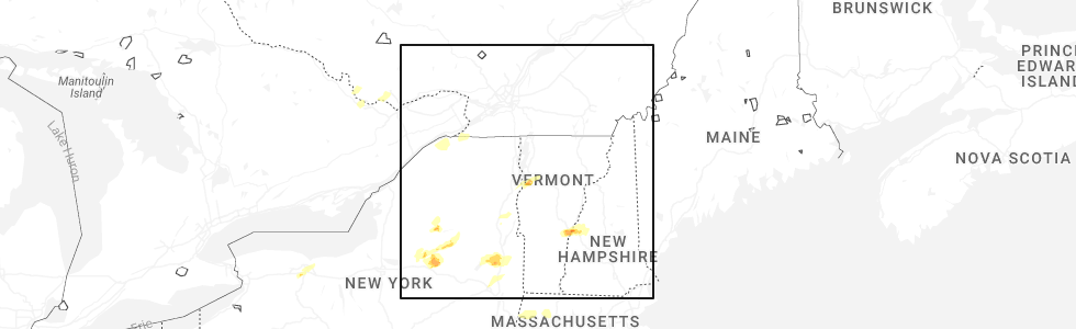
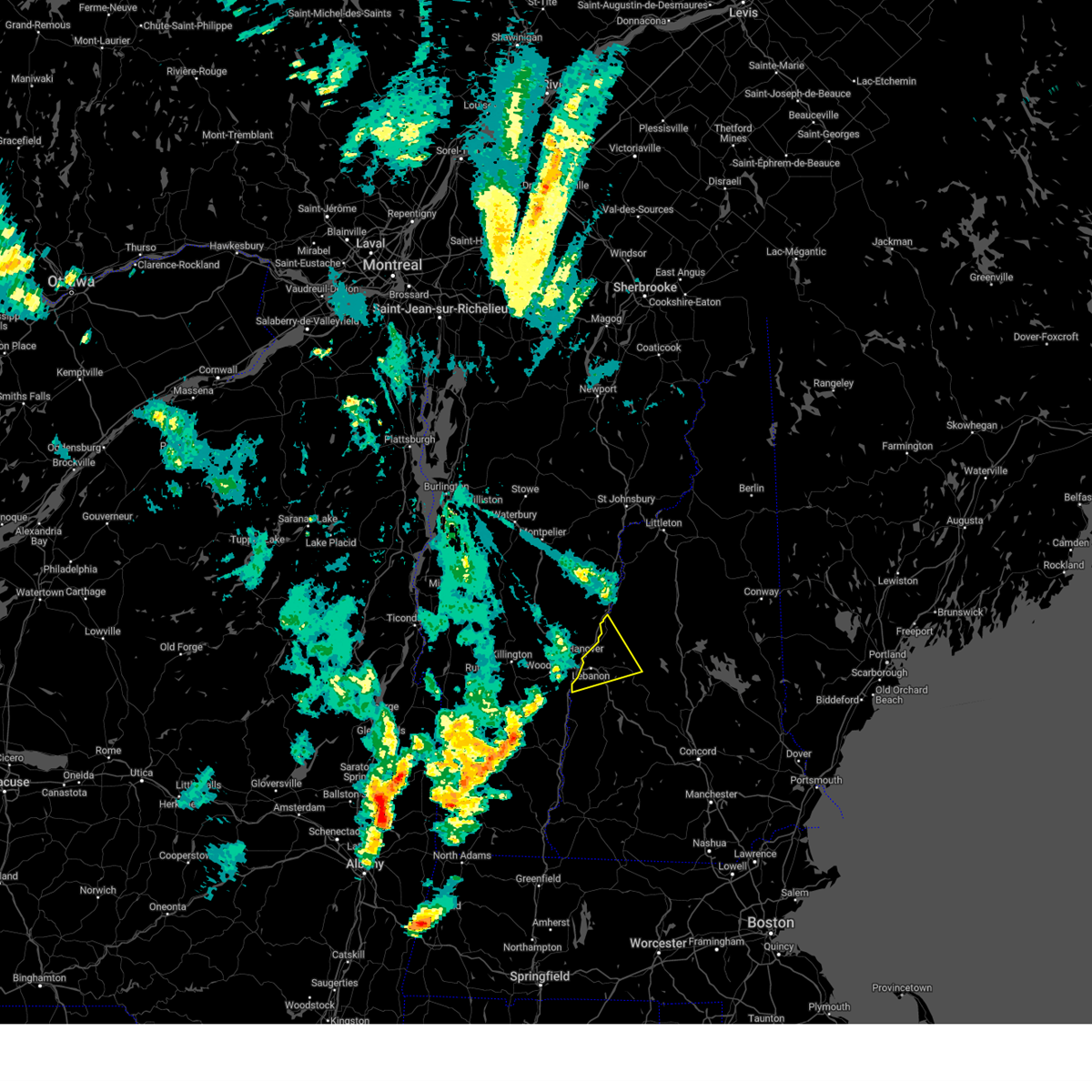
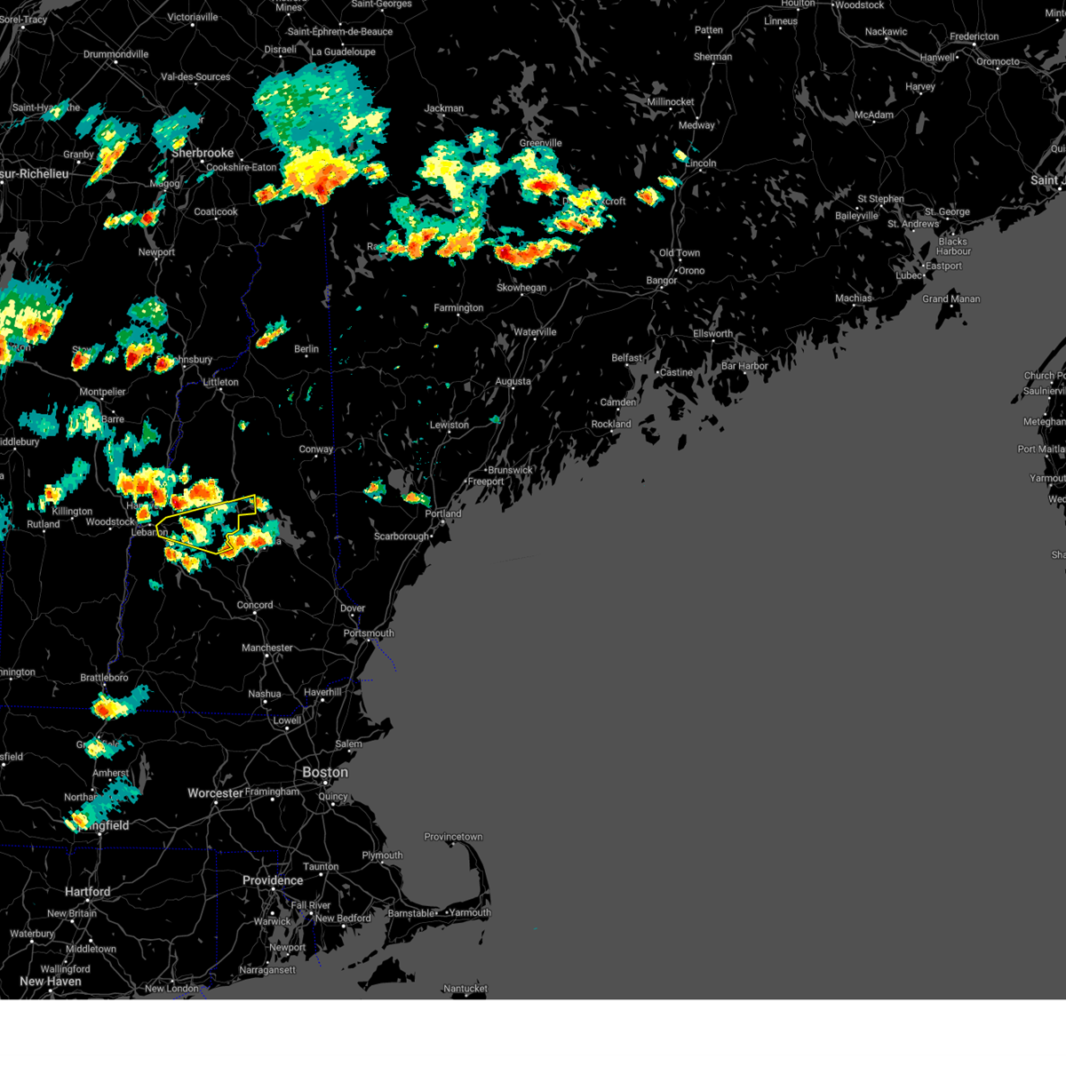
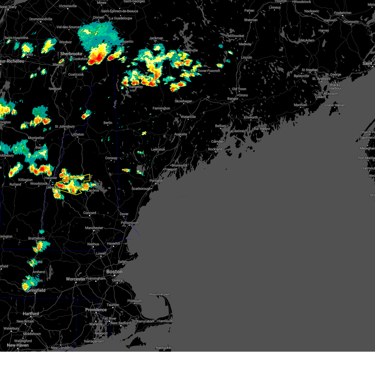
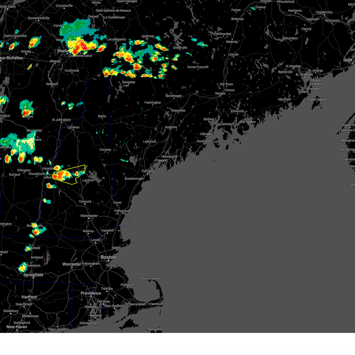
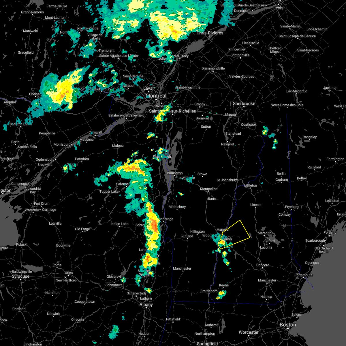
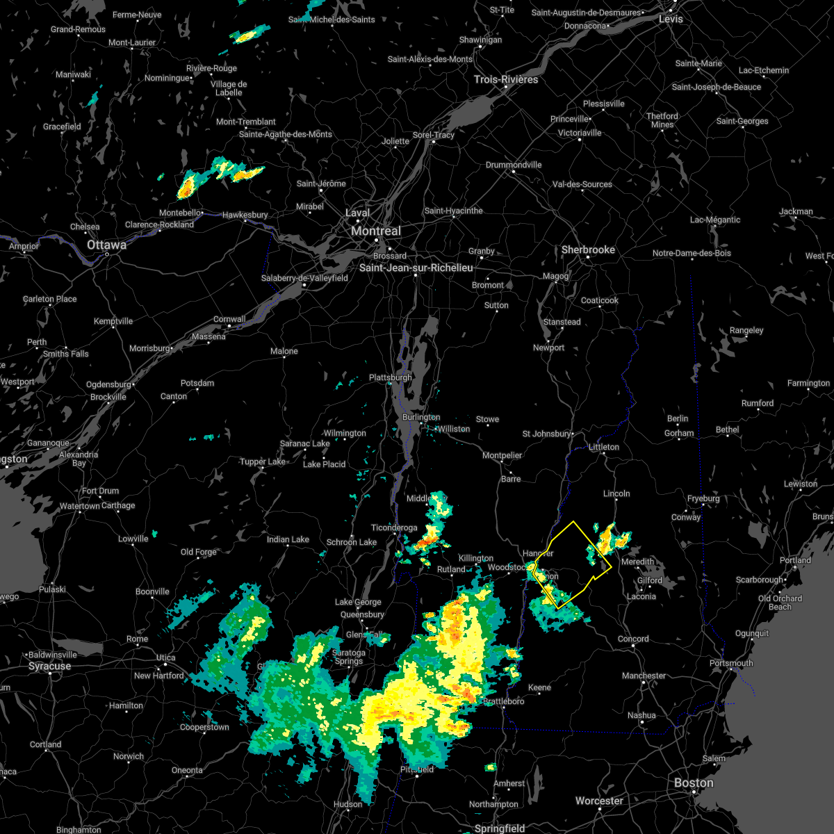
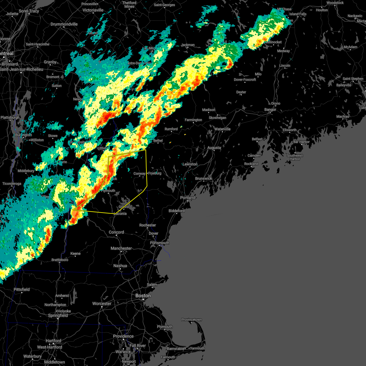
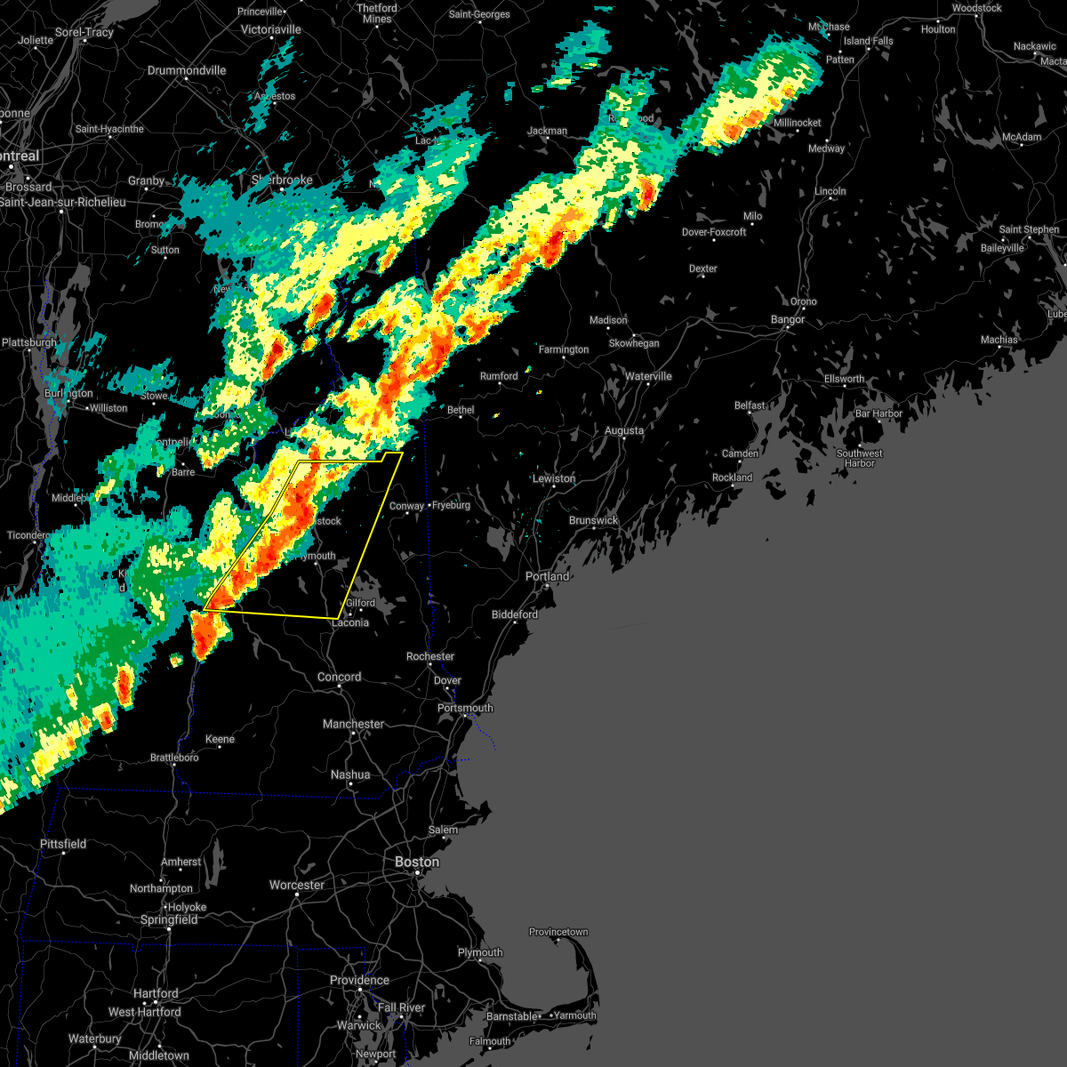
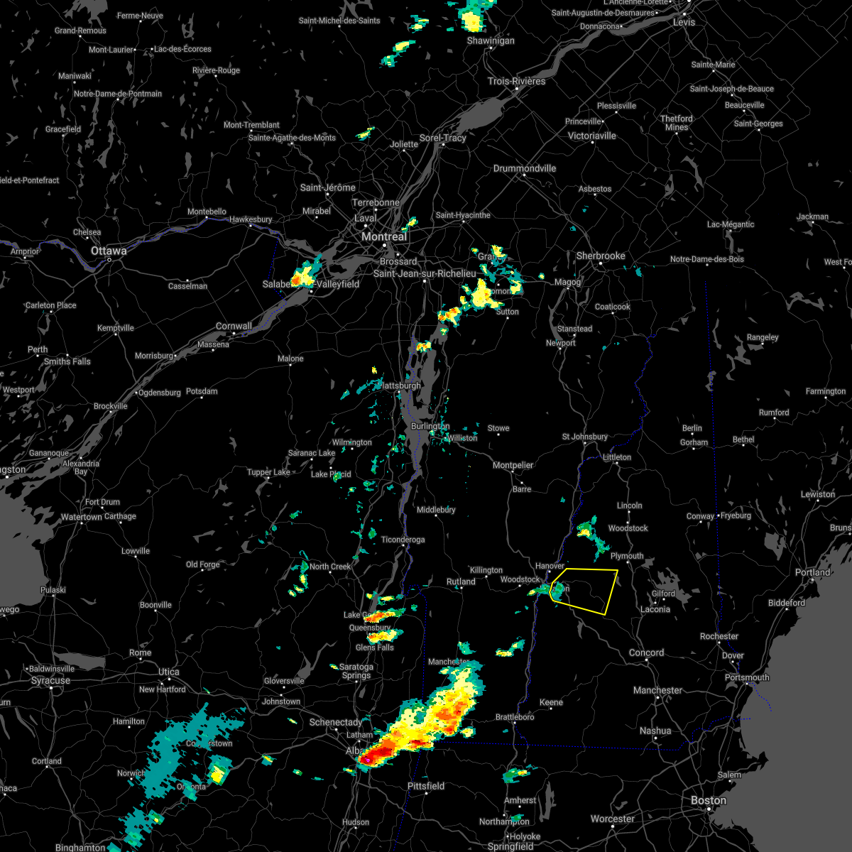
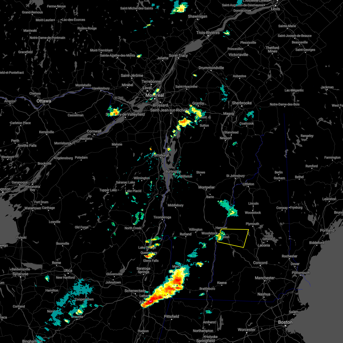
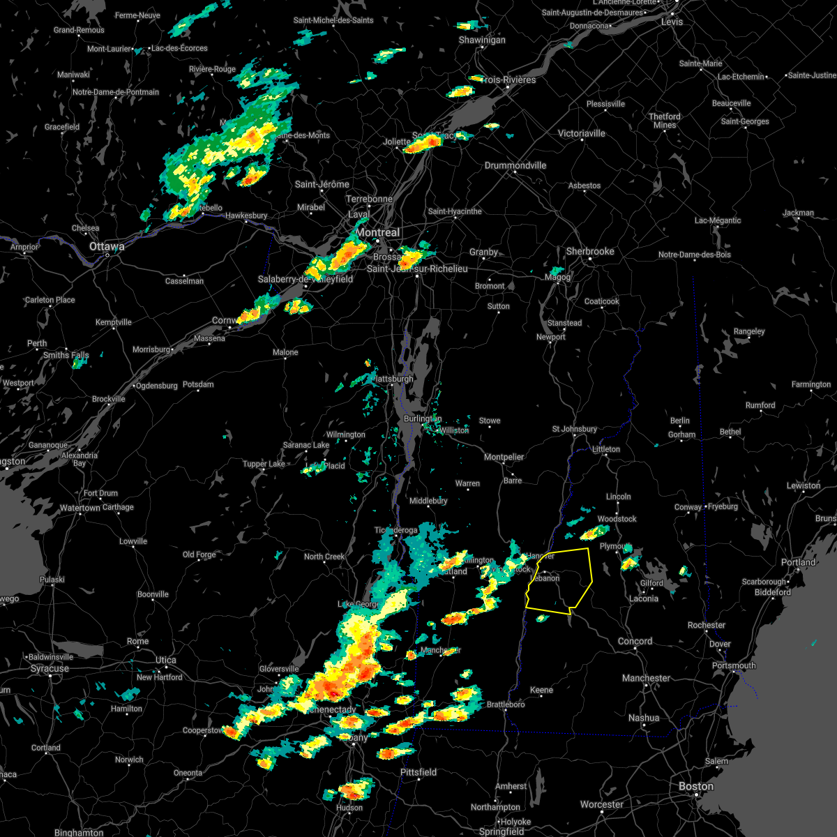
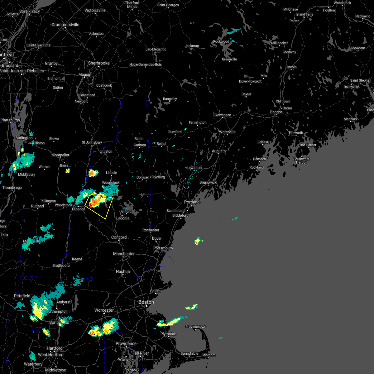
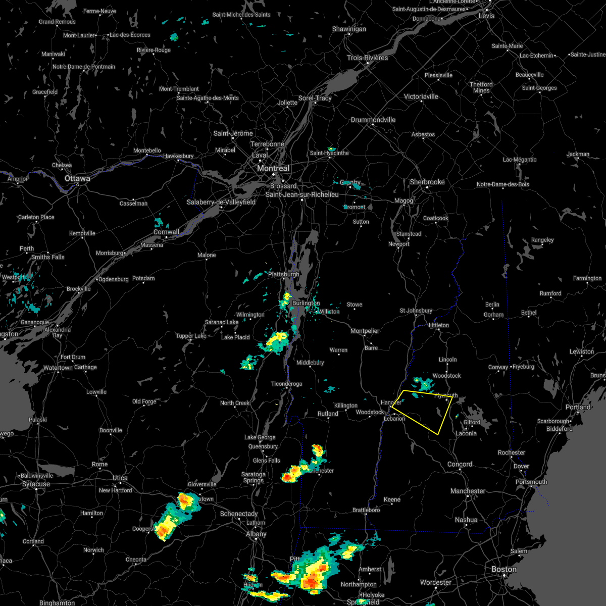
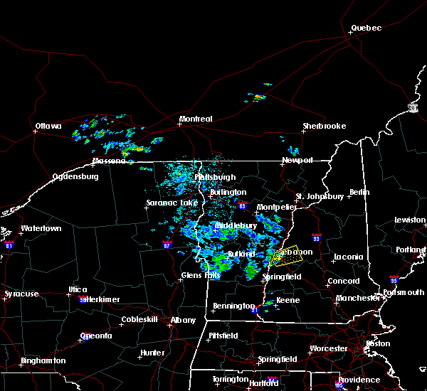
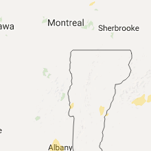
Hail Map for Enfield, NH
The Enfield, NH area has had 5 reports of on-the-ground hail by trained spotters, and has been under severe weather warnings 7 times during the past 12 months. Doppler radar has detected hail at or near Enfield, NH on 10 occasions, including 1 occasion during the past year.
| Name: | Enfield, NH |
| Where Located: | 78.5 miles SE of Burlington, VT |
| Map: | Google Map for Enfield, NH |
| Population: | 1540 |
| Housing Units: | 787 |
| More Info: | Search Google for Enfield, NH |
5
The Top Recent Hail Date for Enfield, NH is Saturday, May 17, 2025 (1st out of 10)
Hail and Wind Damage Spotted near Enfield, NH
| Date / Time | Report Details |
|---|---|
| 6/6/2025 3:42 PM EDT | The storm which prompted the warning has weakened below severe limits, and no longer poses an immediate threat to life or property. therefore, the warning will be allowed to expire. however, heavy rain is still possible with this thunderstorm. |
| 6/6/2025 3:05 PM EDT |
 Svrgyx the national weather service in gray maine has issued a * severe thunderstorm warning for, northern sullivan county in central new hampshire, southwestern grafton county in northern new hampshire, * until 345 pm edt. * at 305 pm edt, a severe thunderstorm was located near claremont, moving northeast at 15 mph (radar indicated). Hazards include 60 mph wind gusts and quarter size hail. Hail damage to vehicles is expected. Expect wind damage to roofs, siding, and trees. Svrgyx the national weather service in gray maine has issued a * severe thunderstorm warning for, northern sullivan county in central new hampshire, southwestern grafton county in northern new hampshire, * until 345 pm edt. * at 305 pm edt, a severe thunderstorm was located near claremont, moving northeast at 15 mph (radar indicated). Hazards include 60 mph wind gusts and quarter size hail. Hail damage to vehicles is expected. Expect wind damage to roofs, siding, and trees.
|
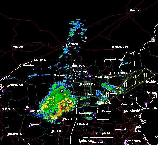
| 5/17/2025 6:33 PM EDT |
 At 632 pm edt, a severe thunderstorm was located over enfield, or 7 miles east of lebanon, moving east at 30 mph (trained spotters). Hazards include 60 mph wind gusts and half dollar size hail. Hail damage to vehicles is expected. expect wind damage to roofs, siding, and trees. Locations impacted include, enfield, canaan, orange, hanover, dorchester, lebanon, grafton, plainfield, and lyme. At 632 pm edt, a severe thunderstorm was located over enfield, or 7 miles east of lebanon, moving east at 30 mph (trained spotters). Hazards include 60 mph wind gusts and half dollar size hail. Hail damage to vehicles is expected. expect wind damage to roofs, siding, and trees. Locations impacted include, enfield, canaan, orange, hanover, dorchester, lebanon, grafton, plainfield, and lyme.
|
| 5/17/2025 6:32 PM EDT | Quarter sized hail reported 1.8 miles W of Enfield, NH, spotter reported quarter size hail near canaan town line. |
| 5/17/2025 6:28 PM EDT | Half Dollar sized hail reported 0.2 miles ESE of Enfield, NH, spotter reporting half dollar size hail on rt. 4 in enfield. |
| 5/17/2025 6:25 PM EDT | Trees and branches downed. pillsbury street partially blocked by 10 inch diameter tree. time estimated by rada in grafton county NH, 0.3 miles WSW of Enfield, NH |
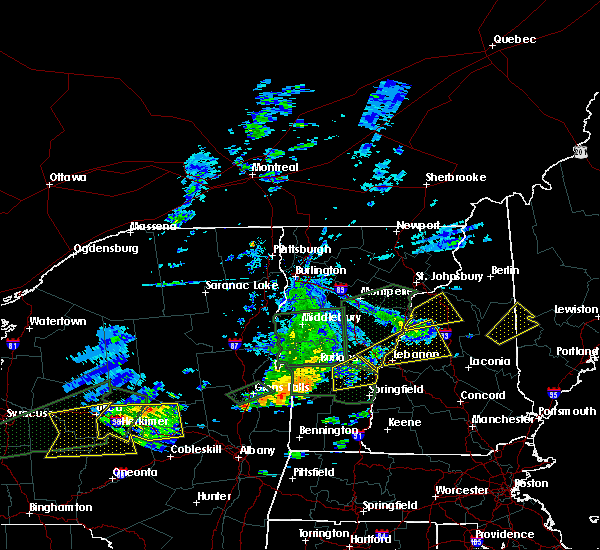
| 5/17/2025 6:08 PM EDT |
 At 607 pm edt, a severe thunderstorm was located near lebanon, moving northeast at 35 mph (radar indicated). Hazards include golf ball size hail and 60 mph wind gusts. People and animals outdoors will be injured. expect hail damage to roofs, siding, windows, and vehicles. expect wind damage to roofs, siding, and trees. Locations impacted include, lebanon, enfield, hanover, canaan, lyme, plainfield, orange, dorchester, grafton, and orford. At 607 pm edt, a severe thunderstorm was located near lebanon, moving northeast at 35 mph (radar indicated). Hazards include golf ball size hail and 60 mph wind gusts. People and animals outdoors will be injured. expect hail damage to roofs, siding, windows, and vehicles. expect wind damage to roofs, siding, and trees. Locations impacted include, lebanon, enfield, hanover, canaan, lyme, plainfield, orange, dorchester, grafton, and orford.
|
| 5/17/2025 6:00 PM EDT |
 Svrgyx the national weather service in gray maine has issued a * severe thunderstorm warning for, north central sullivan county in central new hampshire, southwestern grafton county in northern new hampshire, * until 645 pm edt. * at 600 pm edt, a severe thunderstorm was located 9 miles west of lebanon, moving northeast at 25 mph (radar indicated). Hazards include 60 mph wind gusts and quarter size hail. Hail damage to vehicles is expected. Expect wind damage to roofs, siding, and trees. Svrgyx the national weather service in gray maine has issued a * severe thunderstorm warning for, north central sullivan county in central new hampshire, southwestern grafton county in northern new hampshire, * until 645 pm edt. * at 600 pm edt, a severe thunderstorm was located 9 miles west of lebanon, moving northeast at 25 mph (radar indicated). Hazards include 60 mph wind gusts and quarter size hail. Hail damage to vehicles is expected. Expect wind damage to roofs, siding, and trees.
|
| 7/16/2024 6:38 PM EDT |
 At 638 pm edt, severe thunderstorms were located along a line extending from 9 miles southwest of lebanon to near claremont to charlestown to 11 miles west of westmoreland, moving east at 50 mph (radar indicated). Hazards include 70 mph wind gusts. Expect considerable tree damage. damage is likely to mobile homes, roofs, and outbuildings. locations impacted include, claremont, lebanon, henniker, new london, grafton, hanover, charlestown, enfield, canaan, bradford, danbury, groton, newport, gilsum, walpole, warner, alstead, marlow, stoddard, and surry. this also includes, mount kearsage and mount sunapee. This includes interstate 89 between mile markers 16 and 60. At 638 pm edt, severe thunderstorms were located along a line extending from 9 miles southwest of lebanon to near claremont to charlestown to 11 miles west of westmoreland, moving east at 50 mph (radar indicated). Hazards include 70 mph wind gusts. Expect considerable tree damage. damage is likely to mobile homes, roofs, and outbuildings. locations impacted include, claremont, lebanon, henniker, new london, grafton, hanover, charlestown, enfield, canaan, bradford, danbury, groton, newport, gilsum, walpole, warner, alstead, marlow, stoddard, and surry. this also includes, mount kearsage and mount sunapee. This includes interstate 89 between mile markers 16 and 60.
|
| 7/16/2024 6:25 PM EDT |
 Svrgyx the national weather service in gray maine has issued a * severe thunderstorm warning for, sullivan county in central new hampshire, southwestern grafton county in northern new hampshire, northwestern cheshire county in southern new hampshire, northwestern merrimack county in central new hampshire, * until 715 pm edt. * at 624 pm edt, severe thunderstorms were located along a line extending from 18 miles southwest of lebanon to 6 miles west of claremont to 7 miles southwest of charlestown to 20 miles west of chesterfield, moving east at 55 mph (radar indicated). Hazards include 70 mph wind gusts. Expect considerable tree damage. Damage is likely to mobile homes, roofs, and outbuildings. Svrgyx the national weather service in gray maine has issued a * severe thunderstorm warning for, sullivan county in central new hampshire, southwestern grafton county in northern new hampshire, northwestern cheshire county in southern new hampshire, northwestern merrimack county in central new hampshire, * until 715 pm edt. * at 624 pm edt, severe thunderstorms were located along a line extending from 18 miles southwest of lebanon to 6 miles west of claremont to 7 miles southwest of charlestown to 20 miles west of chesterfield, moving east at 55 mph (radar indicated). Hazards include 70 mph wind gusts. Expect considerable tree damage. Damage is likely to mobile homes, roofs, and outbuildings.
|
| 6/20/2024 3:07 PM EDT |
 the severe thunderstorm warning has been cancelled and is no longer in effect the severe thunderstorm warning has been cancelled and is no longer in effect
|
| 6/20/2024 2:48 PM EDT |
 At 248 pm edt, a severe thunderstorm was located near grafton, or 10 miles southwest of plymouth, moving east at 20 mph (radar indicated). Hazards include 60 mph wind gusts and penny size hail. Expect damage to roofs, siding, and trees. locations impacted include, lebanon, plymouth, grafton, hanover, enfield, canaan, holderness, ashland, danbury, groton, bristol, alexandria, hill, bridgewater, hebron, dorchester, orange, and new hampton. this includes the following highways, interstate 89 between mile markers 50 and 53. Interstate 93 between mile markers 75 and 80. At 248 pm edt, a severe thunderstorm was located near grafton, or 10 miles southwest of plymouth, moving east at 20 mph (radar indicated). Hazards include 60 mph wind gusts and penny size hail. Expect damage to roofs, siding, and trees. locations impacted include, lebanon, plymouth, grafton, hanover, enfield, canaan, holderness, ashland, danbury, groton, bristol, alexandria, hill, bridgewater, hebron, dorchester, orange, and new hampton. this includes the following highways, interstate 89 between mile markers 50 and 53. Interstate 93 between mile markers 75 and 80.
|
| 6/20/2024 2:28 PM EDT | Trees and wires reported down in enfield... n in grafton county NH, 0.3 miles WSW of Enfield, NH |
| 6/20/2024 2:23 PM EDT |
 Svrgyx the national weather service in gray maine has issued a * severe thunderstorm warning for, southern grafton county in northern new hampshire, north central merrimack county in central new hampshire, * until 330 pm edt. * at 223 pm edt, a severe thunderstorm was located near grafton, or 13 miles southwest of plymouth, moving east at 25 mph (radar indicated). Hazards include 60 mph wind gusts and quarter size hail. Hail damage to vehicles is expected. Expect wind damage to roofs, siding, and trees. Svrgyx the national weather service in gray maine has issued a * severe thunderstorm warning for, southern grafton county in northern new hampshire, north central merrimack county in central new hampshire, * until 330 pm edt. * at 223 pm edt, a severe thunderstorm was located near grafton, or 13 miles southwest of plymouth, moving east at 25 mph (radar indicated). Hazards include 60 mph wind gusts and quarter size hail. Hail damage to vehicles is expected. Expect wind damage to roofs, siding, and trees.
|
| 6/20/2024 2:20 PM EDT | Half Dollar sized hail reported 0.2 miles ESE of Enfield, NH, half dollar sized hail fell for about ten minutes. time estimated via radar. |
| 9/7/2023 10:52 PM EDT |
 At 1051 pm edt, severe thunderstorms were located along a line extending from 20 miles northwest of littleton to 7 miles north of hanover, moving north at 85 mph (radar indicated). Hazards include 60 mph wind gusts and quarter size hail. Expect wind damage to trees and power lines. minor hail damage to vehicles is possible. locations impacted include, franklin, littleton, bethlehem, lincoln, new london, plymouth, grafton, hanover, haverhill, enfield, canaan, bradford, danbury, franconia, groton, woodstock, piermont, newport, walpole and alstead. hail threat, radar indicated max hail size, 1. 00 in wind threat, observed max wind gust, 60 mph. At 1051 pm edt, severe thunderstorms were located along a line extending from 20 miles northwest of littleton to 7 miles north of hanover, moving north at 85 mph (radar indicated). Hazards include 60 mph wind gusts and quarter size hail. Expect wind damage to trees and power lines. minor hail damage to vehicles is possible. locations impacted include, franklin, littleton, bethlehem, lincoln, new london, plymouth, grafton, hanover, haverhill, enfield, canaan, bradford, danbury, franconia, groton, woodstock, piermont, newport, walpole and alstead. hail threat, radar indicated max hail size, 1. 00 in wind threat, observed max wind gust, 60 mph.
|
| 9/7/2023 10:18 PM EDT |
 At 1018 pm edt, severe thunderstorms were located along a line extending from 17 miles northwest of hanover to near charlestown, moving north at 85 mph (radar indicated). Hazards include 60 mph wind gusts and quarter size hail. Expect wind damage to trees and power lines. Minor hail damage to vehicles is possible. At 1018 pm edt, severe thunderstorms were located along a line extending from 17 miles northwest of hanover to near charlestown, moving north at 85 mph (radar indicated). Hazards include 60 mph wind gusts and quarter size hail. Expect wind damage to trees and power lines. Minor hail damage to vehicles is possible.
|
| 7/13/2023 8:02 PM EDT |
 At 802 pm edt, severe thunderstorms were located along a line extending from 11 miles west of littleton to 9 miles southwest of lebanon, moving northeast at 65 mph (radar indicated). Hazards include 60 mph wind gusts. expect damage to roofs, siding, and trees At 802 pm edt, severe thunderstorms were located along a line extending from 11 miles west of littleton to 9 miles southwest of lebanon, moving northeast at 65 mph (radar indicated). Hazards include 60 mph wind gusts. expect damage to roofs, siding, and trees
|
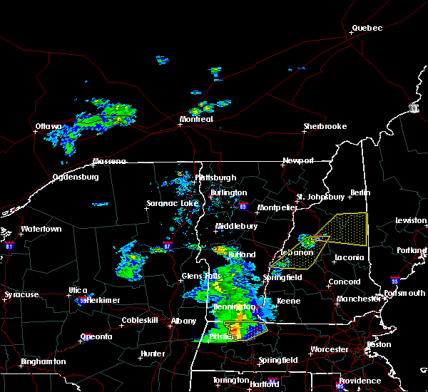
| 8/26/2022 3:06 PM EDT | The severe thunderstorm warning for northern sullivan, south central grafton, northwestern belknap and northwestern merrimack counties will expire at 315 pm edt, the storms which prompted the warning have weakened below severe limits, and no longer pose an immediate threat to life or property. therefore, the warning will be allowed to expire. however heavy rain is still possible with these thunderstorms. a severe thunderstorm watch remains in effect until 800 pm edt for central and northern new hampshire. |
| 8/26/2022 2:27 PM EDT | At 227 pm edt, severe thunderstorms were located along a line extending from 6 miles northeast of claremont to near new london to bradford, moving northeast at 60 mph (radar indicated). Hazards include 60 mph wind gusts and nickel size hail. expect damage to roofs, siding, and trees |
| 8/26/2022 12:53 PM EDT | At 1252 pm edt, severe thunderstorms were located along a line extending from near hanover to 11 miles northwest of claremont, moving east at 20 mph (radar indicated). Hazards include 60 mph wind gusts and quarter size hail. Hail damage to vehicles is expected. Expect wind damage to roofs, siding, and trees. |
| 8/8/2022 6:42 PM EDT |
 At 642 pm edt, a severe thunderstorm was located near lebanon, moving northeast at 35 mph (radar indicated). Hazards include 60 mph wind gusts and penny size hail. expect damage to roofs, siding, and trees At 642 pm edt, a severe thunderstorm was located near lebanon, moving northeast at 35 mph (radar indicated). Hazards include 60 mph wind gusts and penny size hail. expect damage to roofs, siding, and trees
|
| 8/4/2022 7:32 PM EDT |
 At 731 pm edt, a severe thunderstorm was located near enfield, or near lebanon, moving northeast at 25 mph (radar indicated). Hazards include 60 mph wind gusts and penny size hail. expect damage to roofs, siding, and trees At 731 pm edt, a severe thunderstorm was located near enfield, or near lebanon, moving northeast at 25 mph (radar indicated). Hazards include 60 mph wind gusts and penny size hail. expect damage to roofs, siding, and trees
|
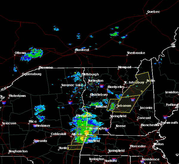
| 7/12/2022 3:56 PM EDT | Numerous trees down in enfield cente in grafton county NH, 3.8 miles NNW of Enfield, NH |
| 7/12/2022 3:46 PM EDT |
 At 345 pm edt, severe thunderstorms were located along a line extending from 10 miles southwest of piermont to near charlestown, moving east at 40 mph (radar indicated). Hazards include 60 mph wind gusts and quarter size hail. Hail damage to vehicles is expected. expect wind damage to roofs, siding, and trees. locations impacted include, claremont, lebanon, henniker, new london, plymouth, grafton, hanover, charlestown, enfield, canaan, holderness, ashland, bradford, danbury, groton, newport, warner, marlow, piermont and alstead. this includes the following highways, interstate 89 between mile markers 19 and 60. interstate 93 between mile markers 78 and 93. hail threat, radar indicated max hail size, 1. 00 in wind threat, radar indicated max wind gust, 60 mph. At 345 pm edt, severe thunderstorms were located along a line extending from 10 miles southwest of piermont to near charlestown, moving east at 40 mph (radar indicated). Hazards include 60 mph wind gusts and quarter size hail. Hail damage to vehicles is expected. expect wind damage to roofs, siding, and trees. locations impacted include, claremont, lebanon, henniker, new london, plymouth, grafton, hanover, charlestown, enfield, canaan, holderness, ashland, bradford, danbury, groton, newport, warner, marlow, piermont and alstead. this includes the following highways, interstate 89 between mile markers 19 and 60. interstate 93 between mile markers 78 and 93. hail threat, radar indicated max hail size, 1. 00 in wind threat, radar indicated max wind gust, 60 mph.
|
| 7/12/2022 3:32 PM EDT |
 At 331 pm edt, severe thunderstorms were located along a line extending from 13 miles northwest of hanover to 11 miles west of charlestown, moving east at 40 mph (radar indicated). Hazards include 60 mph wind gusts and nickel size hail. expect damage to roofs, siding, and trees At 331 pm edt, severe thunderstorms were located along a line extending from 13 miles northwest of hanover to 11 miles west of charlestown, moving east at 40 mph (radar indicated). Hazards include 60 mph wind gusts and nickel size hail. expect damage to roofs, siding, and trees
|
| 5/16/2022 7:02 PM EDT |
 At 702 pm edt, a severe thunderstorm was located near enfield, or near lebanon, moving northeast at 30 mph (radar indicated). Hazards include 60 mph wind gusts and penny size hail. Expect damage to roofs, siding, and trees. locations impacted include, lebanon, new london, grafton, hanover, enfield, canaan, danbury, grantham, andover, cornish, croydon, dorchester, wilmot, orange, springfield, sunapee, plainfield and sulton. This includes interstate 89 between mile markers 31 and 60. At 702 pm edt, a severe thunderstorm was located near enfield, or near lebanon, moving northeast at 30 mph (radar indicated). Hazards include 60 mph wind gusts and penny size hail. Expect damage to roofs, siding, and trees. locations impacted include, lebanon, new london, grafton, hanover, enfield, canaan, danbury, grantham, andover, cornish, croydon, dorchester, wilmot, orange, springfield, sunapee, plainfield and sulton. This includes interstate 89 between mile markers 31 and 60.
|
| 5/16/2022 6:50 PM EDT |
 At 649 pm edt, a severe thunderstorm was located 7 miles south of lebanon, moving northeast at 35 mph (radar indicated). Hazards include 60 mph wind gusts and penny size hail. Expect damage to roofs, siding, and trees. locations impacted include, claremont, lebanon, new london, grafton, hanover, enfield, canaan, danbury, newport, grantham, andover, cornish, croydon, dorchester, plainfield, wilmot, orange, sunapee, springfield and sulton. This includes interstate 89 between mile markers 30 and 60. At 649 pm edt, a severe thunderstorm was located 7 miles south of lebanon, moving northeast at 35 mph (radar indicated). Hazards include 60 mph wind gusts and penny size hail. Expect damage to roofs, siding, and trees. locations impacted include, claremont, lebanon, new london, grafton, hanover, enfield, canaan, danbury, newport, grantham, andover, cornish, croydon, dorchester, plainfield, wilmot, orange, sunapee, springfield and sulton. This includes interstate 89 between mile markers 30 and 60.
|
| 5/16/2022 6:36 PM EDT |
 At 636 pm edt, a severe thunderstorm was located over claremont, moving northeast at 30 mph (radar indicated). Hazards include 60 mph wind gusts and penny size hail. expect damage to roofs, siding, and trees At 636 pm edt, a severe thunderstorm was located over claremont, moving northeast at 30 mph (radar indicated). Hazards include 60 mph wind gusts and penny size hail. expect damage to roofs, siding, and trees
|
| 9/15/2021 3:22 PM EDT |
 At 322 pm edt, severe thunderstorms were located along a line extending from 7 miles southeast of bethlehem to near lincoln to near plymouth to 8 miles south of enfield, moving east at 25 mph (radar indicated). Hazards include 60 mph wind gusts and penny size hail. expect damage to roofs, siding, and trees At 322 pm edt, severe thunderstorms were located along a line extending from 7 miles southeast of bethlehem to near lincoln to near plymouth to 8 miles south of enfield, moving east at 25 mph (radar indicated). Hazards include 60 mph wind gusts and penny size hail. expect damage to roofs, siding, and trees
|
| 9/15/2021 3:14 PM EDT |
 At 313 pm edt, severe thunderstorms were located along a line extending from 6 miles south of lancaster to near canaan, moving east at 30 mph. the greatest wind threat appears to be near warren through lincoln, including i-93 (radar indicated). Hazards include 70 mph wind gusts and penny size hail. Expect considerable tree damage. damage is likely to mobile homes, roofs, and outbuildings. Locations impacted include, laconia, lebanon, bethlehem, lincoln, plymouth, meredith, moultonborough, grafton, hanover, enfield, canaan, holderness, ashland, danbury, franconia, groton, woodstock, sandwich, piermont and tamworth. At 313 pm edt, severe thunderstorms were located along a line extending from 6 miles south of lancaster to near canaan, moving east at 30 mph. the greatest wind threat appears to be near warren through lincoln, including i-93 (radar indicated). Hazards include 70 mph wind gusts and penny size hail. Expect considerable tree damage. damage is likely to mobile homes, roofs, and outbuildings. Locations impacted include, laconia, lebanon, bethlehem, lincoln, plymouth, meredith, moultonborough, grafton, hanover, enfield, canaan, holderness, ashland, danbury, franconia, groton, woodstock, sandwich, piermont and tamworth.
|
| 9/15/2021 2:31 PM EDT |
 At 231 pm edt, severe thunderstorms were located along a line extending from 8 miles west of littleton to near lebanon, moving east at 30 mph (radar indicated). Hazards include 60 mph wind gusts and nickel size hail. expect damage to roofs, siding, and trees At 231 pm edt, severe thunderstorms were located along a line extending from 8 miles west of littleton to near lebanon, moving east at 30 mph (radar indicated). Hazards include 60 mph wind gusts and nickel size hail. expect damage to roofs, siding, and trees
|
| 7/20/2021 9:24 PM EDT |
 At 924 pm edt, severe thunderstorms were located along a line extending from near lebanon to 8 miles northwest of claremont, moving east at 50 mph (radar indicated). Hazards include 60 mph wind gusts and quarter size hail. Hail damage to vehicles is expected. Expect wind damage to roofs, siding, and trees. At 924 pm edt, severe thunderstorms were located along a line extending from near lebanon to 8 miles northwest of claremont, moving east at 50 mph (radar indicated). Hazards include 60 mph wind gusts and quarter size hail. Hail damage to vehicles is expected. Expect wind damage to roofs, siding, and trees.
|
| 7/14/2021 3:52 PM EDT |
 At 351 pm edt, a severe thunderstorm was located over canaan, or 11 miles east of lebanon, moving east at 30 mph (radar indicated). Hazards include 60 mph wind gusts and quarter size hail. Hail damage to vehicles is expected. expect wind damage to roofs, siding, and trees. locations impacted include, lebanon, grafton, hanover, enfield, canaan, danbury, groton, grantham, hebron, dorchester, orange, springfield, wilmot and plainfield. This includes interstate 89 between mile markers 45 and 56. At 351 pm edt, a severe thunderstorm was located over canaan, or 11 miles east of lebanon, moving east at 30 mph (radar indicated). Hazards include 60 mph wind gusts and quarter size hail. Hail damage to vehicles is expected. expect wind damage to roofs, siding, and trees. locations impacted include, lebanon, grafton, hanover, enfield, canaan, danbury, groton, grantham, hebron, dorchester, orange, springfield, wilmot and plainfield. This includes interstate 89 between mile markers 45 and 56.
|
| 7/14/2021 3:32 PM EDT |
 At 332 pm edt, a severe thunderstorm was located over lebanon, moving east at 30 mph (radar indicated). Hazards include 60 mph wind gusts and penny size hail. expect damage to roofs, siding, and trees At 332 pm edt, a severe thunderstorm was located over lebanon, moving east at 30 mph (radar indicated). Hazards include 60 mph wind gusts and penny size hail. expect damage to roofs, siding, and trees
|
| 6/30/2021 3:02 PM EDT |
 At 302 pm edt, a severe thunderstorm was located 9 miles southwest of hanover, or 9 miles west of lebanon, moving east at 40 mph (radar indicated). Hazards include 60 mph wind gusts and quarter size hail. Hail damage to vehicles is expected. Expect wind damage to roofs, siding, and trees. At 302 pm edt, a severe thunderstorm was located 9 miles southwest of hanover, or 9 miles west of lebanon, moving east at 40 mph (radar indicated). Hazards include 60 mph wind gusts and quarter size hail. Hail damage to vehicles is expected. Expect wind damage to roofs, siding, and trees.
|
| 6/29/2021 6:31 PM EDT |
 At 631 pm edt, a severe thunderstorm was located over canaan, or 14 miles east of lebanon, moving east at 30 mph (radar indicated). Hazards include 60 mph wind gusts and quarter size hail. Hail damage to vehicles is expected. expect wind damage to roofs, siding, and trees. locations impacted include, plymouth, grafton, enfield, canaan, holderness, ashland, danbury, groton, bristol, lyme, hill, hebron, dorchester and orange. This includes interstate 93 between mile markers 78 and 79. At 631 pm edt, a severe thunderstorm was located over canaan, or 14 miles east of lebanon, moving east at 30 mph (radar indicated). Hazards include 60 mph wind gusts and quarter size hail. Hail damage to vehicles is expected. expect wind damage to roofs, siding, and trees. locations impacted include, plymouth, grafton, enfield, canaan, holderness, ashland, danbury, groton, bristol, lyme, hill, hebron, dorchester and orange. This includes interstate 93 between mile markers 78 and 79.
|
| 6/29/2021 6:12 PM EDT |
 At 611 pm edt, a severe thunderstorm was located near enfield, or 8 miles northeast of lebanon, moving southeast at 30 mph (radar indicated). Hazards include 60 mph wind gusts and quarter size hail. Hail damage to vehicles is expected. Expect wind damage to roofs, siding, and trees. At 611 pm edt, a severe thunderstorm was located near enfield, or 8 miles northeast of lebanon, moving southeast at 30 mph (radar indicated). Hazards include 60 mph wind gusts and quarter size hail. Hail damage to vehicles is expected. Expect wind damage to roofs, siding, and trees.
|
| 6/21/2021 7:17 PM EDT |
 At 716 pm edt, severe thunderstorms were located along a line extending from near haverhill to 7 miles south of piermont to 6 miles north of enfield to 6 miles southwest of lebanon, moving east at 35 mph (radar indicated). Hazards include 60 mph wind gusts and quarter size hail. Hail damage to vehicles is expected. expect wind damage to roofs, siding, and trees. locations impacted include, lebanon, new london, grafton, hanover, haverhill, enfield, canaan, danbury, groton, piermont, grantham, lyme, cornish, croydon, hebron, benton, dorchester, plainfield, orange and wentworth. this also includes, rumney rocks and carr mountain. This includes interstate 89 between mile markers 39 and 60. At 716 pm edt, severe thunderstorms were located along a line extending from near haverhill to 7 miles south of piermont to 6 miles north of enfield to 6 miles southwest of lebanon, moving east at 35 mph (radar indicated). Hazards include 60 mph wind gusts and quarter size hail. Hail damage to vehicles is expected. expect wind damage to roofs, siding, and trees. locations impacted include, lebanon, new london, grafton, hanover, haverhill, enfield, canaan, danbury, groton, piermont, grantham, lyme, cornish, croydon, hebron, benton, dorchester, plainfield, orange and wentworth. this also includes, rumney rocks and carr mountain. This includes interstate 89 between mile markers 39 and 60.
|
| 6/21/2021 6:56 PM EDT |
 At 655 pm edt, severe thunderstorms were located along a line extending from 10 miles west of piermont to 11 miles north of lebanon to near hanover to 11 miles north of claremont, moving east at 25 mph (radar indicated). Hazards include 60 mph wind gusts and quarter size hail. Hail damage to vehicles is expected. Expect wind damage to roofs, siding, and trees. At 655 pm edt, severe thunderstorms were located along a line extending from 10 miles west of piermont to 11 miles north of lebanon to near hanover to 11 miles north of claremont, moving east at 25 mph (radar indicated). Hazards include 60 mph wind gusts and quarter size hail. Hail damage to vehicles is expected. Expect wind damage to roofs, siding, and trees.
|
| 5/26/2021 5:36 PM EDT |
 At 536 pm edt, a severe thunderstorm was located near grafton, or 8 miles north of new london, moving east at 45 mph (radar indicated). Hazards include 60 mph wind gusts. Expect damage to roofs, siding, and trees. locations impacted include, claremont, lebanon, franklin, new london, plymouth, grafton, hanover, charlestown, enfield, canaan, holderness, ashland, danbury, groton, newport, warner, bristol, grantham, andover and cornish. this also includes, mount kearsage. this includes the following highways, interstate 89 between mile markers 26 and 59. Interstate 93 between mile markers 73 and 83. At 536 pm edt, a severe thunderstorm was located near grafton, or 8 miles north of new london, moving east at 45 mph (radar indicated). Hazards include 60 mph wind gusts. Expect damage to roofs, siding, and trees. locations impacted include, claremont, lebanon, franklin, new london, plymouth, grafton, hanover, charlestown, enfield, canaan, holderness, ashland, danbury, groton, newport, warner, bristol, grantham, andover and cornish. this also includes, mount kearsage. this includes the following highways, interstate 89 between mile markers 26 and 59. Interstate 93 between mile markers 73 and 83.
|
| 5/26/2021 5:07 PM EDT |
 At 507 pm edt, severe thunderstorms were located along a line extending from near hanover to 6 miles west of claremont, moving east at 50 mph (radar indicated). Hazards include 60 mph wind gusts. expect damage to roofs, siding, and trees At 507 pm edt, severe thunderstorms were located along a line extending from near hanover to 6 miles west of claremont, moving east at 50 mph (radar indicated). Hazards include 60 mph wind gusts. expect damage to roofs, siding, and trees
|
| 7/14/2020 5:37 AM EDT |
 The severe thunderstorm warning for southwestern grafton county will expire at 545 am edt, the storms which prompted the warning have weakened below severe limits, and no longer pose an immediate threat to life or property. therefore, the warning will be allowed to expire. however heavy rain and flooding is still possible with these thunderstorms. The severe thunderstorm warning for southwestern grafton county will expire at 545 am edt, the storms which prompted the warning have weakened below severe limits, and no longer pose an immediate threat to life or property. therefore, the warning will be allowed to expire. however heavy rain and flooding is still possible with these thunderstorms.
|
| 7/14/2020 4:54 AM EDT |
 At 453 am edt, severe thunderstorms were located along a line extending from 8 miles west of piermont to 14 miles southwest of haverhill to 9 miles northeast of hanover to near enfield, moving northeast at 20 mph (radar indicated). Hazards include 60 mph wind gusts and quarter size hail. Hail damage to vehicles is expected. Expect wind damage to roofs, siding, and trees. At 453 am edt, severe thunderstorms were located along a line extending from 8 miles west of piermont to 14 miles southwest of haverhill to 9 miles northeast of hanover to near enfield, moving northeast at 20 mph (radar indicated). Hazards include 60 mph wind gusts and quarter size hail. Hail damage to vehicles is expected. Expect wind damage to roofs, siding, and trees.
|
| 7/14/2020 4:47 AM EDT |
 At 447 am edt, a severe thunderstorm was located near enfield, or 9 miles northeast of lebanon, moving northeast at 20 mph (radar indicated). Hazards include 60 mph wind gusts and quarter size hail. Hail damage to vehicles is expected. expect wind damage to roofs, siding, and trees. locations impacted include, lebanon, hanover, enfield, canaan, lyme, dorchester, orange and plainfield. This includes interstate 89 between mile markers 51 and 60. At 447 am edt, a severe thunderstorm was located near enfield, or 9 miles northeast of lebanon, moving northeast at 20 mph (radar indicated). Hazards include 60 mph wind gusts and quarter size hail. Hail damage to vehicles is expected. expect wind damage to roofs, siding, and trees. locations impacted include, lebanon, hanover, enfield, canaan, lyme, dorchester, orange and plainfield. This includes interstate 89 between mile markers 51 and 60.
|
| 7/14/2020 4:19 AM EDT |
 At 418 am edt, a severe thunderstorm was located over lebanon, moving northeast at 20 mph (radar indicated). Hazards include 60 mph wind gusts and quarter size hail. Hail damage to vehicles is expected. Expect wind damage to roofs, siding, and trees. At 418 am edt, a severe thunderstorm was located over lebanon, moving northeast at 20 mph (radar indicated). Hazards include 60 mph wind gusts and quarter size hail. Hail damage to vehicles is expected. Expect wind damage to roofs, siding, and trees.
|
| 7/8/2020 7:14 PM EDT |
 At 714 pm edt, severe thunderstorms were located along a line extending from near haverhill to 7 miles southeast of piermont to near hanover, moving southeast at 60 mph (radar indicated). Hazards include 60 mph wind gusts and quarter size hail. Hail damage to vehicles is expected. Expect wind damage to roofs, siding, and trees. At 714 pm edt, severe thunderstorms were located along a line extending from near haverhill to 7 miles southeast of piermont to near hanover, moving southeast at 60 mph (radar indicated). Hazards include 60 mph wind gusts and quarter size hail. Hail damage to vehicles is expected. Expect wind damage to roofs, siding, and trees.
|
| 5/15/2020 7:56 PM EDT |
 The severe thunderstorm warning for sullivan, southern grafton and northwestern merrimack counties will expire at 800 pm edt, the storms which prompted the warning have moved out of the area. therefore, the warning will be allowed to expire. however gusty winds and heavy rain are still possible with these thunderstorms. a tornado watch remains in effect until 1000 pm edt for central and northern new hampshire. The severe thunderstorm warning for sullivan, southern grafton and northwestern merrimack counties will expire at 800 pm edt, the storms which prompted the warning have moved out of the area. therefore, the warning will be allowed to expire. however gusty winds and heavy rain are still possible with these thunderstorms. a tornado watch remains in effect until 1000 pm edt for central and northern new hampshire.
|
| 5/15/2020 7:16 PM EDT |
 At 715 pm edt, severe thunderstorms were located along a line extending from 9 miles northeast of hanover to 10 miles northwest of claremont, moving east at 50 mph (radar indicated). Hazards include 60 mph wind gusts and penny size hail. expect damage to roofs, siding, and trees At 715 pm edt, severe thunderstorms were located along a line extending from 9 miles northeast of hanover to 10 miles northwest of claremont, moving east at 50 mph (radar indicated). Hazards include 60 mph wind gusts and penny size hail. expect damage to roofs, siding, and trees
|
| 8/17/2019 7:58 PM EDT |
 At 726 pm edt, severe thunderstorms were located along a line extending from 10 miles southwest of piermont to near hanover to 8 miles north of claremont to charlestown, moving northeast at 45 mph (radar indicated). Hazards include 60 mph wind gusts. expect damage to roofs, siding, and trees At 726 pm edt, severe thunderstorms were located along a line extending from 10 miles southwest of piermont to near hanover to 8 miles north of claremont to charlestown, moving northeast at 45 mph (radar indicated). Hazards include 60 mph wind gusts. expect damage to roofs, siding, and trees
|
| 8/17/2019 7:26 PM EDT |
 At 726 pm edt, severe thunderstorms were located along a line extending from 10 miles southwest of piermont to near hanover to 8 miles north of claremont to charlestown, moving northeast at 45 mph (radar indicated). Hazards include 60 mph wind gusts. expect damage to roofs, siding, and trees At 726 pm edt, severe thunderstorms were located along a line extending from 10 miles southwest of piermont to near hanover to 8 miles north of claremont to charlestown, moving northeast at 45 mph (radar indicated). Hazards include 60 mph wind gusts. expect damage to roofs, siding, and trees
|
| 5/4/2018 9:40 PM EDT |
 At 939 pm edt, severe thunderstorms were located along a line extending from near mount washington to 8 miles east of lincoln to near woodstock to near groton, moving east at 60 mph (radar indicated). Hazards include 60 mph wind gusts. Expect damage to roofs, siding, and trees. locations impacted include, lincoln, plymouth, grafton, hanover, enfield, canaan, holderness, ashland, danbury, franconia, groton, woodstock, piermont, sandwich, bristol, grantham, lyme, hill, albany and hebron. this also includes, franconia notch, mount moosilauke, rumney rocks, cannon mountain, and franconia ridge. this includes the following highways, interstate 89 between mile markers 47 and 51. Interstate 93 between mile markers 75 and 115. At 939 pm edt, severe thunderstorms were located along a line extending from near mount washington to 8 miles east of lincoln to near woodstock to near groton, moving east at 60 mph (radar indicated). Hazards include 60 mph wind gusts. Expect damage to roofs, siding, and trees. locations impacted include, lincoln, plymouth, grafton, hanover, enfield, canaan, holderness, ashland, danbury, franconia, groton, woodstock, piermont, sandwich, bristol, grantham, lyme, hill, albany and hebron. this also includes, franconia notch, mount moosilauke, rumney rocks, cannon mountain, and franconia ridge. this includes the following highways, interstate 89 between mile markers 47 and 51. Interstate 93 between mile markers 75 and 115.
|
| 5/4/2018 9:23 PM EDT |
 At 922 pm edt, severe thunderstorms were located along a line extending from bethlehem to 8 miles west of lincoln to 6 miles southeast of piermont to 6 miles northeast of hanover, moving east at 60 mph (radar indicated). Hazards include 60 mph wind gusts. Expect damage to roofs, siding, and trees. locations impacted include, lebanon, lincoln, plymouth, grafton, hanover, haverhill, enfield, canaan, holderness, ashland, danbury, franconia, groton, woodstock, piermont, sandwich, bristol, grantham, lyme and lisbon. this also includes, franconia notch, mount moosilauke, rumney rocks, cannon mountain, and franconia ridge. this includes the following highways, interstate 89 between mile markers 47 and 60. Interstate 93 between mile markers 75 and 115. At 922 pm edt, severe thunderstorms were located along a line extending from bethlehem to 8 miles west of lincoln to 6 miles southeast of piermont to 6 miles northeast of hanover, moving east at 60 mph (radar indicated). Hazards include 60 mph wind gusts. Expect damage to roofs, siding, and trees. locations impacted include, lebanon, lincoln, plymouth, grafton, hanover, haverhill, enfield, canaan, holderness, ashland, danbury, franconia, groton, woodstock, piermont, sandwich, bristol, grantham, lyme and lisbon. this also includes, franconia notch, mount moosilauke, rumney rocks, cannon mountain, and franconia ridge. this includes the following highways, interstate 89 between mile markers 47 and 60. Interstate 93 between mile markers 75 and 115.
|
| 5/4/2018 8:54 PM EDT |
 At 853 pm edt, severe thunderstorms were located along a line extending from 15 miles northwest of haverhill to 13 miles west of piermont to 14 miles northwest of hanover to 22 miles west of lebanon, moving east at 55 mph (radar indicated). Hazards include 60 mph wind gusts. expect damage to roofs, siding, and trees At 853 pm edt, severe thunderstorms were located along a line extending from 15 miles northwest of haverhill to 13 miles west of piermont to 14 miles northwest of hanover to 22 miles west of lebanon, moving east at 55 mph (radar indicated). Hazards include 60 mph wind gusts. expect damage to roofs, siding, and trees
|
| 9/5/2017 4:19 PM EDT |
 At 419 pm edt, a severe thunderstorm was located near groton, or 10 miles west of plymouth, moving northeast at 30 mph (radar indicated). Hazards include 60 mph wind gusts and penny size hail. Expect damage to trees, and power lines. locations impacted include, lebanon, plymouth, grafton, hanover, enfield, canaan, groton, grantham, lyme, cornish, croydon, hebron, dorchester, ellsworth, wentworth, rumney, orange, campton, springfield and plainfield. this also includes, rumney rocks, carr mountain, and stinson mountain. this includes the following highways, interstate 89 between mile markers 41 and 55. Interstate 93 between mile markers 83 and 85. At 419 pm edt, a severe thunderstorm was located near groton, or 10 miles west of plymouth, moving northeast at 30 mph (radar indicated). Hazards include 60 mph wind gusts and penny size hail. Expect damage to trees, and power lines. locations impacted include, lebanon, plymouth, grafton, hanover, enfield, canaan, groton, grantham, lyme, cornish, croydon, hebron, dorchester, ellsworth, wentworth, rumney, orange, campton, springfield and plainfield. this also includes, rumney rocks, carr mountain, and stinson mountain. this includes the following highways, interstate 89 between mile markers 41 and 55. Interstate 93 between mile markers 83 and 85.
|
| 9/5/2017 3:57 PM EDT |
 At 356 pm edt, a severe thunderstorm was located over enfield, or 7 miles east of lebanon, moving northeast at 35 mph (radar indicated). Hazards include 60 mph wind gusts and penny size hail. expect damage to trees, and power lines At 356 pm edt, a severe thunderstorm was located over enfield, or 7 miles east of lebanon, moving northeast at 35 mph (radar indicated). Hazards include 60 mph wind gusts and penny size hail. expect damage to trees, and power lines
|
| 8/22/2017 9:20 PM EDT |
 At 920 pm edt, severe thunderstorms were located along a line extending from 10 miles west of hanover to 6 miles west of claremont to 17 miles west of hinsdale, moving east at 45 mph (radar indicated). Hazards include 60 mph wind gusts. expect damage to trees, and power lines At 920 pm edt, severe thunderstorms were located along a line extending from 10 miles west of hanover to 6 miles west of claremont to 17 miles west of hinsdale, moving east at 45 mph (radar indicated). Hazards include 60 mph wind gusts. expect damage to trees, and power lines
|
| 7/1/2017 7:43 PM EDT |
 At 743 pm edt, severe thunderstorms were located along a line extending from 8 miles north of claremont to 8 miles north of marlow to near westmoreland, moving east at 35 mph (radar indicated). Hazards include 60 mph wind gusts. Expect damage to trees, and power lines. locations impacted include, claremont, lebanon, henniker, new london, grafton, enfield, canaan, antrim, bradford, bennington, nelson, newport, gilsum, windsor, warner, hillsborough, alstead, marlow, sullivan and surry. this also includes, mount kearsage and mount sunapee. This includes interstate 89 between mile markers 17 and 55. At 743 pm edt, severe thunderstorms were located along a line extending from 8 miles north of claremont to 8 miles north of marlow to near westmoreland, moving east at 35 mph (radar indicated). Hazards include 60 mph wind gusts. Expect damage to trees, and power lines. locations impacted include, claremont, lebanon, henniker, new london, grafton, enfield, canaan, antrim, bradford, bennington, nelson, newport, gilsum, windsor, warner, hillsborough, alstead, marlow, sullivan and surry. this also includes, mount kearsage and mount sunapee. This includes interstate 89 between mile markers 17 and 55.
|
| 7/1/2017 7:16 PM EDT |
 At 716 pm edt, severe thunderstorms were located along a line extending from 15 miles west of claremont to near charlestown to 9 miles west of chesterfield, moving east at 35 mph (radar indicated). Hazards include 60 mph wind gusts. expect damage to trees, and power lines At 716 pm edt, severe thunderstorms were located along a line extending from 15 miles west of claremont to near charlestown to 9 miles west of chesterfield, moving east at 35 mph (radar indicated). Hazards include 60 mph wind gusts. expect damage to trees, and power lines
|
| 7/1/2017 5:37 PM EDT |
 At 536 pm edt, severe thunderstorms were located along a line extending from 8 miles north of groton to near newport, moving east at 35 mph (radar indicated). Hazards include 60 mph wind gusts and penny size hail. Expect damage to trees, and power lines. locations impacted include, claremont, lebanon, plymouth, new london, grafton, hanover, charlestown, enfield, canaan, danbury, groton, newport, grantham, lyme, cornish, goshen, croydon, hebron, dorchester and ellsworth. this also includes, rumney rocks, stinson mountain, welch mountain, and dickey mountain. this includes the following highways, interstate 89 between mile markers 37 and 52. Interstate 93 between mile markers 81 and 91. At 536 pm edt, severe thunderstorms were located along a line extending from 8 miles north of groton to near newport, moving east at 35 mph (radar indicated). Hazards include 60 mph wind gusts and penny size hail. Expect damage to trees, and power lines. locations impacted include, claremont, lebanon, plymouth, new london, grafton, hanover, charlestown, enfield, canaan, danbury, groton, newport, grantham, lyme, cornish, goshen, croydon, hebron, dorchester and ellsworth. this also includes, rumney rocks, stinson mountain, welch mountain, and dickey mountain. this includes the following highways, interstate 89 between mile markers 37 and 52. Interstate 93 between mile markers 81 and 91.
|
| 7/1/2017 5:04 PM EDT |
 At 504 pm edt, severe thunderstorms were located along a line extending from near hanover to 7 miles northwest of charlestown, moving east at 35 mph (radar indicated). Hazards include 60 mph wind gusts and penny size hail. expect damage to trees, and power lines At 504 pm edt, severe thunderstorms were located along a line extending from near hanover to 7 miles northwest of charlestown, moving east at 35 mph (radar indicated). Hazards include 60 mph wind gusts and penny size hail. expect damage to trees, and power lines
|
| 7/1/2017 4:02 PM EDT |
 At 402 pm edt, a severe thunderstorm was located 7 miles northeast of hanover, or 10 miles north of lebanon, moving northeast at 40 mph (radar indicated). Hazards include 60 mph wind gusts and penny size hail. expect damage to trees, and power lines At 402 pm edt, a severe thunderstorm was located 7 miles northeast of hanover, or 10 miles north of lebanon, moving northeast at 40 mph (radar indicated). Hazards include 60 mph wind gusts and penny size hail. expect damage to trees, and power lines
|
| 5/31/2017 5:59 PM EDT |
 At 559 pm edt, severe thunderstorms were located along a line extending from 11 miles southwest of woodstock to near enfield, moving east at 30 mph (radar indicated). Hazards include 60 mph wind gusts and quarter size hail. Minor hail damage to vehicles is possible. expect wind damage to roofs, siding, and trees. locations impacted include, lebanon, plymouth, grafton, hanover, enfield, canaan, holderness, ashland, danbury, groton, woodstock, bristol, grantham, lyme, cornish, hill, hebron, dorchester, ellsworth and orange. this includes the following highways, interstate 89 between mile markers 43 and 54. Interstate 93 between mile markers 79 and 93. At 559 pm edt, severe thunderstorms were located along a line extending from 11 miles southwest of woodstock to near enfield, moving east at 30 mph (radar indicated). Hazards include 60 mph wind gusts and quarter size hail. Minor hail damage to vehicles is possible. expect wind damage to roofs, siding, and trees. locations impacted include, lebanon, plymouth, grafton, hanover, enfield, canaan, holderness, ashland, danbury, groton, woodstock, bristol, grantham, lyme, cornish, hill, hebron, dorchester, ellsworth and orange. this includes the following highways, interstate 89 between mile markers 43 and 54. Interstate 93 between mile markers 79 and 93.
|
| 5/31/2017 5:17 PM EDT |
 At 516 pm edt, severe thunderstorms were located along a line extending from 12 miles southwest of piermont to 7 miles west of lebanon, moving east at 35 mph (radar indicated). Hazards include 60 mph wind gusts and quarter size hail. Minor hail damage to vehicles is possible. Expect wind damage to roofs, siding, and trees. At 516 pm edt, severe thunderstorms were located along a line extending from 12 miles southwest of piermont to 7 miles west of lebanon, moving east at 35 mph (radar indicated). Hazards include 60 mph wind gusts and quarter size hail. Minor hail damage to vehicles is possible. Expect wind damage to roofs, siding, and trees.
|
| 9/11/2016 8:06 AM EDT |
 At 806 am edt, severe thunderstorms were located along a line extending from near littleton to near lebanon, moving northeast at 55 mph (radar indicated). Hazards include 60 mph wind gusts and penny size hail. Expect damage to roofs. siding. And trees. At 806 am edt, severe thunderstorms were located along a line extending from near littleton to near lebanon, moving northeast at 55 mph (radar indicated). Hazards include 60 mph wind gusts and penny size hail. Expect damage to roofs. siding. And trees.
|
| 7/1/2016 7:55 PM EDT |
 At 755 pm edt, severe thunderstorms were located along a line extending from near enfield to near newport to near westminster, moving east at 15 mph (radar indicated). Hazards include 60 mph wind gusts. Expect damage to roofs. siding. and trees. Locations impacted include, claremont, lebanon, new london, plymouth, grafton, hanover, charlestown, enfield, canaan, bradford, danbury, groton, newport, marlow, warner, bristol, grantham, andover, lyme and cornish. At 755 pm edt, severe thunderstorms were located along a line extending from near enfield to near newport to near westminster, moving east at 15 mph (radar indicated). Hazards include 60 mph wind gusts. Expect damage to roofs. siding. and trees. Locations impacted include, claremont, lebanon, new london, plymouth, grafton, hanover, charlestown, enfield, canaan, bradford, danbury, groton, newport, marlow, warner, bristol, grantham, andover, lyme and cornish.
|
| 7/1/2016 7:26 PM EDT |
 At 726 pm edt, severe thunderstorms were located along a line extending from hanover to near claremont to near townshend, moving east at 15 mph (radar indicated). Hazards include 60 mph wind gusts. Expect damage to roofs. siding. And trees. At 726 pm edt, severe thunderstorms were located along a line extending from hanover to near claremont to near townshend, moving east at 15 mph (radar indicated). Hazards include 60 mph wind gusts. Expect damage to roofs. siding. And trees.
|
| 8/3/2015 5:42 PM EDT |
 At 542 pm edt, doppler radar indicated a line of severe thunderstorms capable of producing quarter size hail and damaging winds in excess of 60 mph. these storms were located along a line extending from 8 miles east of haverhill to hanover, and moving northeast at 50 mph. At 542 pm edt, doppler radar indicated a line of severe thunderstorms capable of producing quarter size hail and damaging winds in excess of 60 mph. these storms were located along a line extending from 8 miles east of haverhill to hanover, and moving northeast at 50 mph.
|
| 8/3/2015 5:29 PM EDT |
 At 529 pm edt, doppler radar indicated a line of severe thunderstorms capable of producing quarter size hail and damaging winds in excess of 60 mph. these storms were located along a line extending from 6 miles east of piermont to lebanon, moving east at 10 mph. locations impacted include, lebanon, lincoln, plymouth, hanover, enfield, canaan, groton, cardigan mountain state park, woodstock, piermont, grafton, lyme, hebron, benton, dorchester, ellsworth, east thetford, lake tarleton state park, wentworth and thornton. At 529 pm edt, doppler radar indicated a line of severe thunderstorms capable of producing quarter size hail and damaging winds in excess of 60 mph. these storms were located along a line extending from 6 miles east of piermont to lebanon, moving east at 10 mph. locations impacted include, lebanon, lincoln, plymouth, hanover, enfield, canaan, groton, cardigan mountain state park, woodstock, piermont, grafton, lyme, hebron, benton, dorchester, ellsworth, east thetford, lake tarleton state park, wentworth and thornton.
|
| 8/3/2015 5:05 PM EDT |
 At 505 pm edt, doppler radar indicated a line of severe thunderstorms capable of producing quarter size hail and damaging winds in excess of 60 mph. these storms were located along a line extending from near piermont to lebanon, and moving east at 25 mph. At 505 pm edt, doppler radar indicated a line of severe thunderstorms capable of producing quarter size hail and damaging winds in excess of 60 mph. these storms were located along a line extending from near piermont to lebanon, and moving east at 25 mph.
|
| 5/27/2015 5:33 PM EDT | At 532 pm edt, doppler radar indicated a line of severe thunderstorms capable of producing damaging winds in excess of 60 mph. these storms were located along a line extending from lancaster to 9 miles east of franconia notch state park to near plymouth, moving northeast at 55 mph. locations impacted include, eastern lebanon, littleton, lancaster, bethlehem, lincoln, plymouth, hanover, canaan, franconia, groton, franconia notch state park, woodstock, piermont, carroll, lyme, lisbon, jefferson, dalton, benton and dorchester. |
| 5/27/2015 5:33 PM EDT | At 533 pm edt, doppler radar indicated a line of severe thunderstorms capable of producing damaging winds in excess of 60 mph. these storms were located along a line extending from near canaan to near grafton, moving east at 55 mph. locations impacted include, lebanon, plymouth, southern hanover, enfield, canaan, holderness, ashland, danbury, groton, cardigan mountain state park, grafton, bristol, grantham, hill, croydon, hebron, dorchester, orange, wellington state park and campton. |
| 5/27/2015 5:26 PM EDT | Trees and wires down in enfield in grafton county NH, 0.3 miles WSW of Enfield, NH |
| 5/27/2015 5:17 PM EDT | At 516 pm edt, doppler radar indicated a line of severe thunderstorms capable of producing damaging winds in excess of 60 mph. these storms were located along a line extending from lebanon to 6 miles southeast of hartland, and moving east at 55 mph. |
| 5/27/2015 4:55 PM EDT | At 455 pm edt, doppler radar indicated a line of severe thunderstorms capable of producing damaging winds in excess of 60 mph. these storms were located along a line extending from near barnet to near fairlee to near north hartland, and moving northeast at 55 mph. |
| 5/27/2015 4:34 PM EDT | The national weather service in gray maine has issued a * severe thunderstorm warning for. central grafton county in northern new hampshire. until 500 pm edt * at 434 pm edt. Doppler radar indicated a line of severe thunderstorms capable of producing damaging winds in excess of 60. |
| 5/10/2015 6:40 PM EDT | Minor limbs down in grafton county NH, 0.3 miles WSW of Enfield, NH |
| 5/10/2015 6:34 PM EDT | At 633 pm edt, doppler radar indicated a severe thunderstorm capable of producing damaging winds in excess of 60 mph. this storm was located over northern lebanon, and moving east at 40 mph. |
| 1/1/0001 12:00 AM | Half Dollar sized hail reported 0.3 miles WSW of Enfield, NH, between 912pm-925pm |
| 1/1/0001 12:00 AM | Half Dollar sized hail reported 0.3 miles WSW of Enfield, NH |
Hail Maps for Enfield, NH


Connect with Interactive Hail Maps