

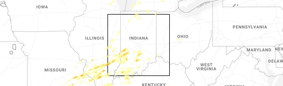
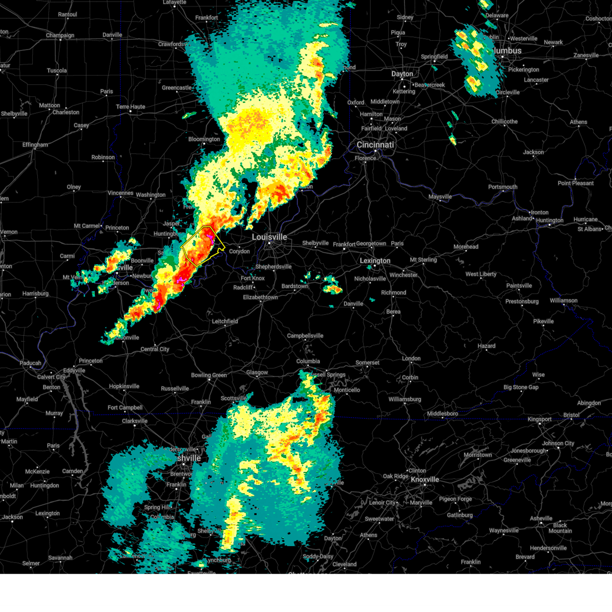
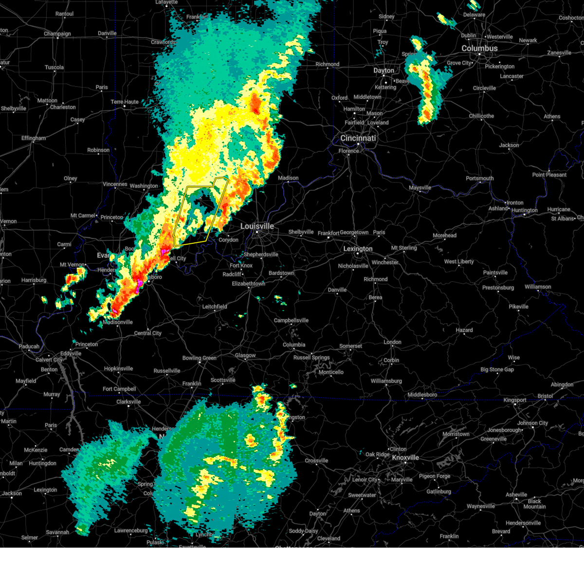
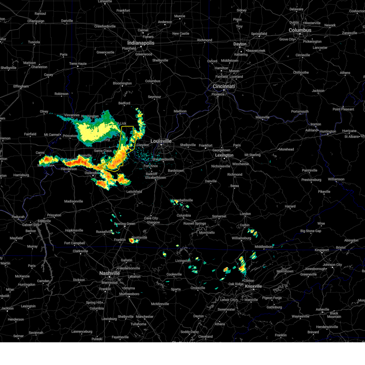
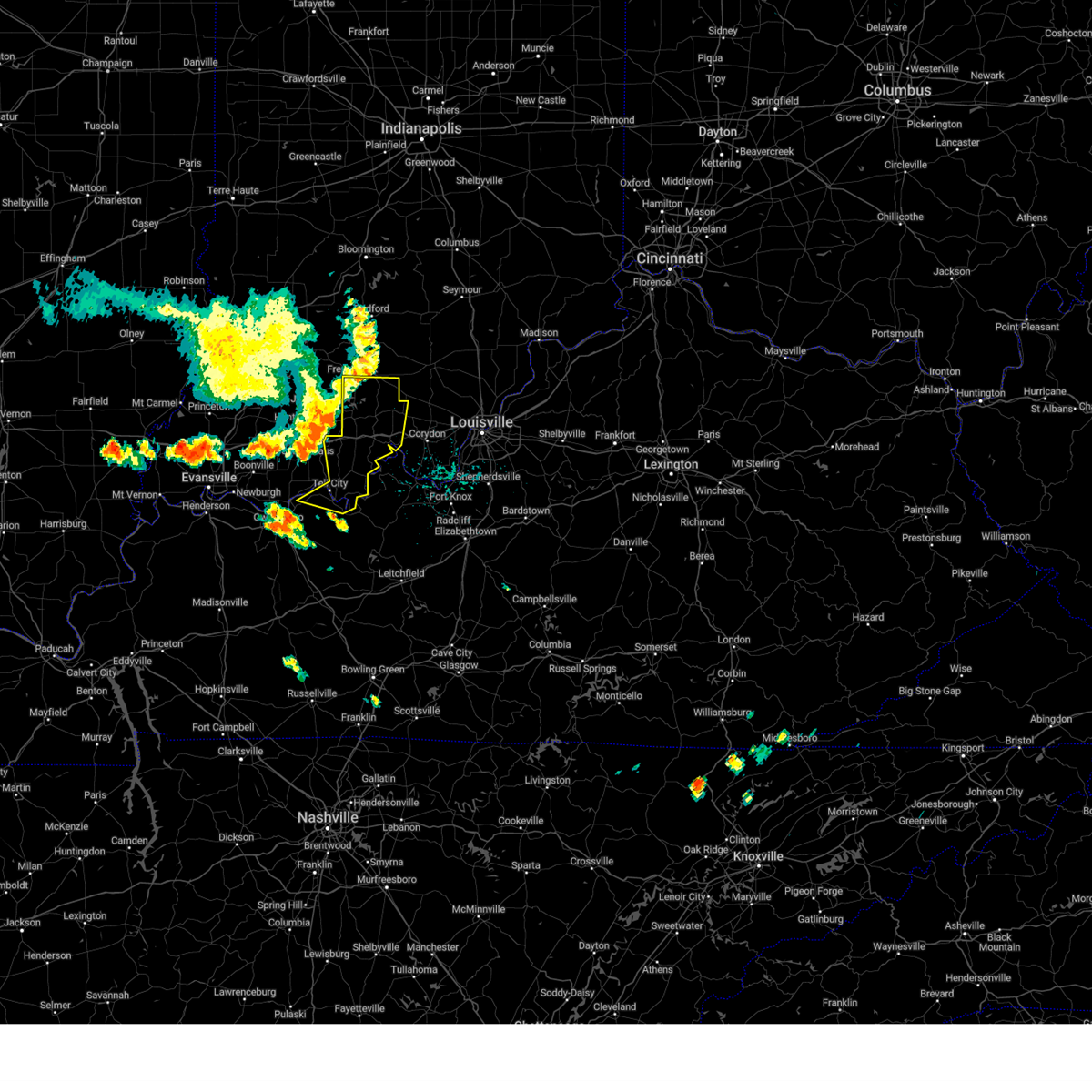
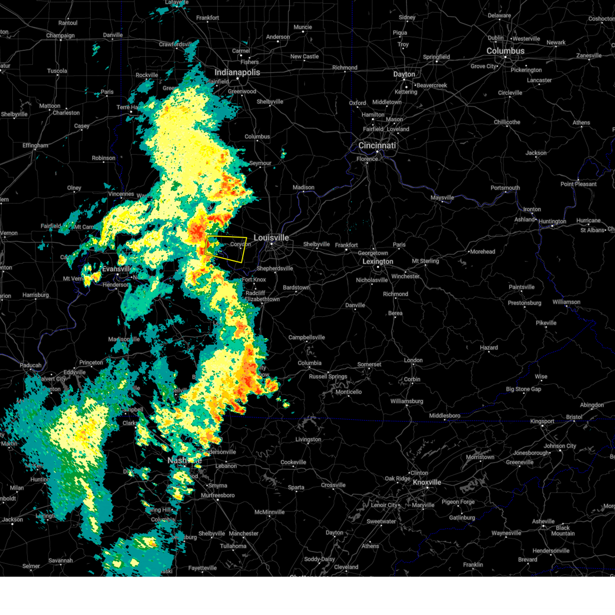
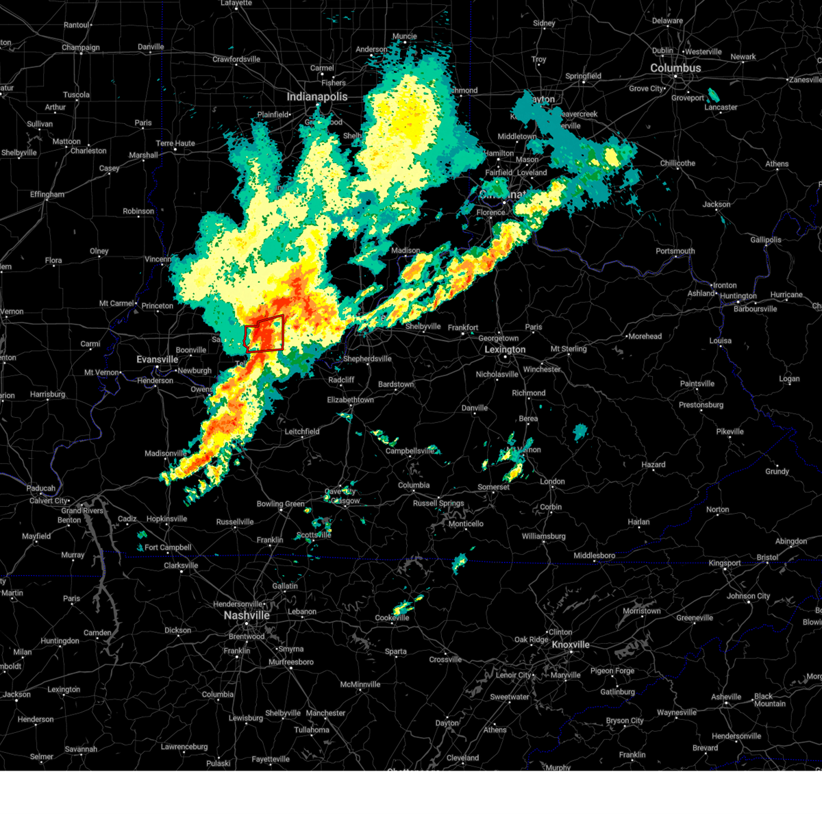
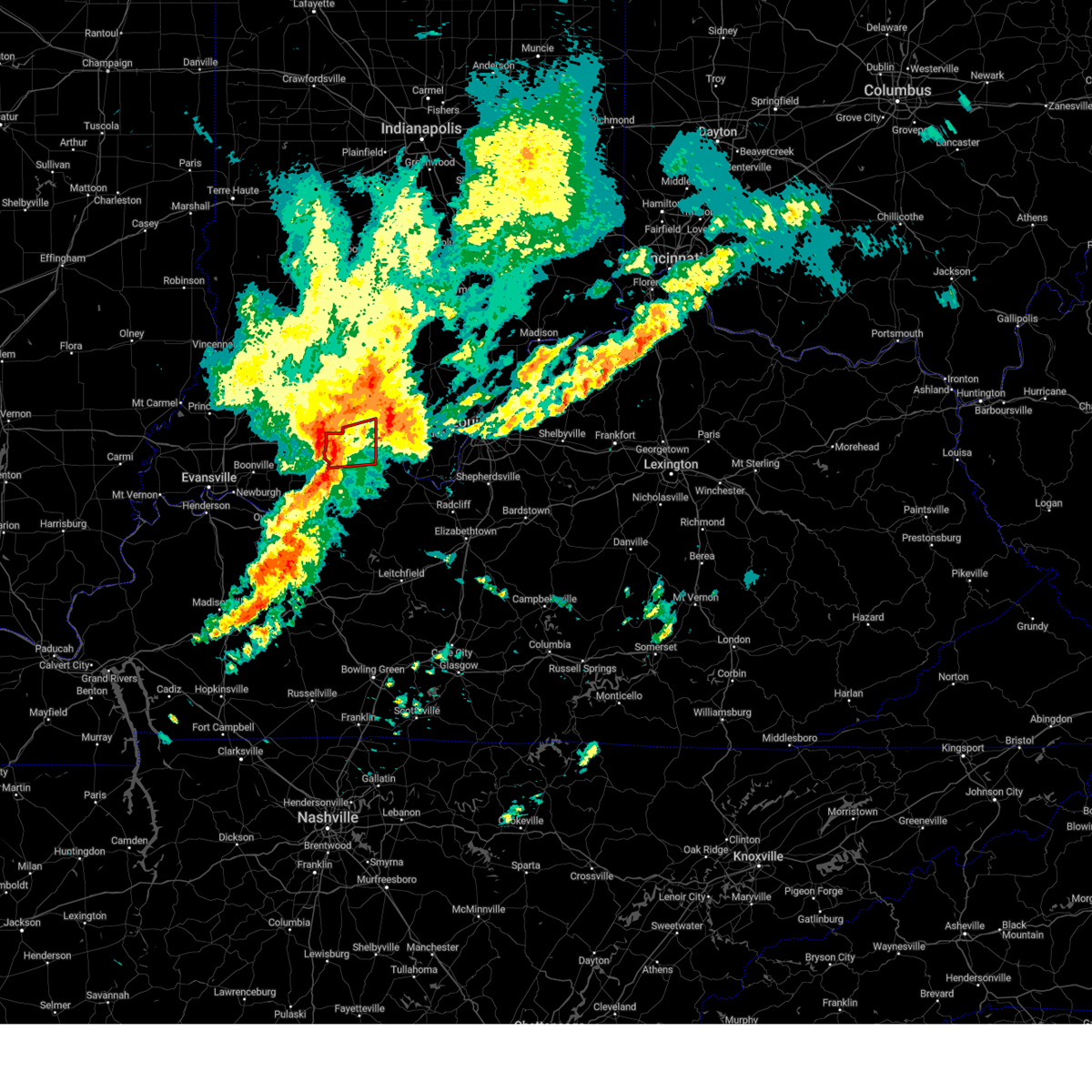
Hail Map for English, IN
The English, IN area has had 19 reports of on-the-ground hail by trained spotters, and has been under severe weather warnings 29 times during the past 12 months. Doppler radar has detected hail at or near English, IN on 68 occasions, including 2 occasions during the past year.
| Name: | English, IN |
| Where Located: | 47.1 miles WNW of Louisville, KY |
| Map: | Google Map for English, IN |
| Population: | 645 |
| Housing Units: | 335 |
| More Info: | Search Google for English, IN |
0
The Top Recent Hail Date for English, IN is Sunday, March 30, 2025 (31st out of 68)
Hail and Wind Damage Spotted near English, IN
| Date / Time | Report Details |
|---|---|
| 4/2/2025 10:26 PM CDT |
 the severe thunderstorm warning has been cancelled and is no longer in effect the severe thunderstorm warning has been cancelled and is no longer in effect
|
| 4/2/2025 10:26 PM CDT |
 At 1125 pm edt/1025 pm cdt/, severe thunderstorms were located along a line extending from brownstown to 13 miles north of corydon to 8 miles northeast of hardinsburg, moving east at 60 mph (radar indicated). Hazards include 60 mph wind gusts. Expect damage to roofs, siding, and trees. Locations impacted include, tell city, salem, corydon, brandenburg, hardinsburg, hawesville, english, carefree town, mount pleasant, and webster. At 1125 pm edt/1025 pm cdt/, severe thunderstorms were located along a line extending from brownstown to 13 miles north of corydon to 8 miles northeast of hardinsburg, moving east at 60 mph (radar indicated). Hazards include 60 mph wind gusts. Expect damage to roofs, siding, and trees. Locations impacted include, tell city, salem, corydon, brandenburg, hardinsburg, hawesville, english, carefree town, mount pleasant, and webster.
|
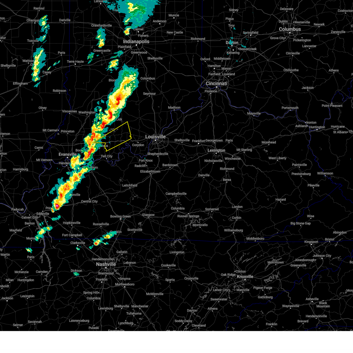
| 4/2/2025 10:09 PM CDT | The storms which prompted the warning have moved out of the area. therefore, the warning will be allowed to expire. however, gusty winds and heavy rain are still possible with these thunderstorms. a tornado watch remains in effect until 200 am edt/100 am cdt/ for south central indiana, and central kentucky. |
| 4/2/2025 10:00 PM CDT | The storms which prompted the warning have moved out of the area. therefore, the warning will be allowed to expire. however, gusty winds and heavy rain are still possible with these thunderstorms. a tornado watch remains in effect until 200 am edt/100 am cdt/ for south central indiana, and central kentucky. to report severe weather, contact your nearest law enforcement agency. they will relay your report to the national weather service louisville. remember, a severe thunderstorm warning still remains in effect. |
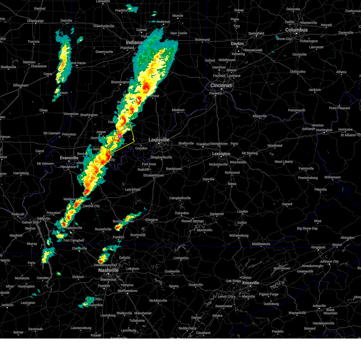
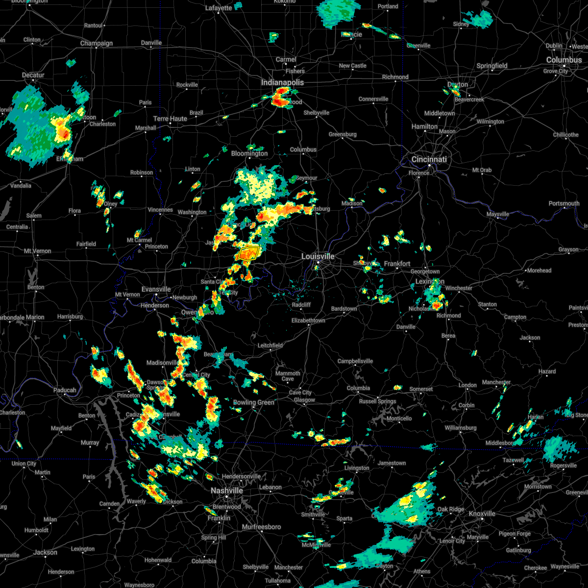
| 4/2/2025 9:58 PM CDT | Svrlmk the national weather service in louisville has issued a * severe thunderstorm warning for, harrison county in south central indiana, northwestern clark county in south central indiana, crawford county in south central indiana, perry county in south central indiana, floyd county in south central indiana, orange county in south central indiana, washington county in south central indiana, meade county in central kentucky, hancock county in central kentucky, breckinridge county in central kentucky, northeastern ohio county in central kentucky, * until midnight edt/1100 pm cdt/. * at 1058 pm edt/958 pm cdt/, severe thunderstorms were located along a line extending from 10 miles south of bedford to 7 miles southwest of english to near whitesville, moving northeast at 55 mph (radar indicated). Hazards include 60 mph wind gusts. expect damage to roofs, siding, and trees |
| 4/2/2025 9:39 PM CDT | Torlmk the national weather service in louisville has issued a * tornado warning for, eastern dubois county in south central indiana, western crawford county in south central indiana, northern perry county in south central indiana, southern orange county in south central indiana, * until 1115 pm edt/1015 pm cdt/. * at 1039 pm edt/939 pm cdt/, severe thunderstorms capable of producing a tornado were located along a line extending from near jasper to near santa claus, moving east at 50 mph (radar indicated rotation). Hazards include tornado. Flying debris will be dangerous to those caught without shelter. mobile homes will be damaged or destroyed. damage to roofs, windows, and vehicles will occur. tree damage is likely. these dangerous storms will be near, english around 1100 pm edt. Other locations impacted by these tornadic storms include celestine, ranger, bretzville, bacon, birdseye, syria, adyeville, fargo, doolittle mills, and deuchars. |
| 4/2/2025 9:37 PM CDT | At 1037 pm edt/937 pm cdt/, severe thunderstorms were located along a line extending from 11 miles southwest of shoals to 10 miles northeast of santa claus to grandview, moving northeast at 60 mph (radar indicated). Hazards include 70 mph wind gusts and nickel size hail. Expect considerable tree damage. damage is likely to mobile homes, roofs, and outbuildings. Locations impacted include, jasper, tell city, paoli, corydon, brandenburg, hardinsburg, hawesville, english, carefree town, and mount pleasant. |
| 4/2/2025 9:19 PM CDT | Svrlmk the national weather service in louisville has issued a * severe thunderstorm warning for, harrison county in south central indiana, dubois county in south central indiana, crawford county in south central indiana, perry county in south central indiana, orange county in south central indiana, western washington county in south central indiana, meade county in central kentucky, hancock county in central kentucky, breckinridge county in central kentucky, northeastern ohio county in central kentucky, * until 1100 pm edt/1000 pm cdt/. * at 1018 pm edt/918 pm cdt/, severe thunderstorms were located along a line extending from near petersburg to near folsomville to stanley, moving northeast at 75 mph (radar indicated). Hazards include 70 mph wind gusts and nickel size hail. Expect considerable tree damage. Damage is likely to mobile homes, roofs, and outbuildings. |
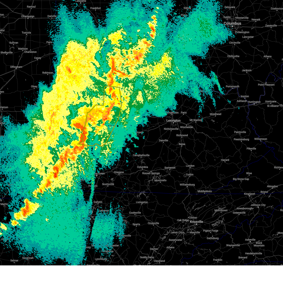
| 3/19/2025 9:05 PM EDT | Quarter sized hail reported 8.2 miles NNW of English, IN, quarter sized hail was reported near curby. |
| 3/19/2025 8:44 PM EDT |
 Svrlmk the national weather service in louisville has issued a * severe thunderstorm warning for, northwestern harrison county in south central indiana, crawford county in south central indiana, northern perry county in south central indiana, southeastern orange county in south central indiana, southwestern washington county in south central indiana, * until 915 pm edt/815 pm cdt/. * at 844 pm edt/744 pm cdt/, a severe thunderstorm was located over english, moving northeast at 60 mph (radar indicated). Hazards include 60 mph wind gusts and nickel size hail. expect damage to roofs, siding, and trees Svrlmk the national weather service in louisville has issued a * severe thunderstorm warning for, northwestern harrison county in south central indiana, crawford county in south central indiana, northern perry county in south central indiana, southeastern orange county in south central indiana, southwestern washington county in south central indiana, * until 915 pm edt/815 pm cdt/. * at 844 pm edt/744 pm cdt/, a severe thunderstorm was located over english, moving northeast at 60 mph (radar indicated). Hazards include 60 mph wind gusts and nickel size hail. expect damage to roofs, siding, and trees
|
| 3/19/2025 8:38 PM EDT |
 At 838 pm edt/738 pm cdt/, a severe thunderstorm was located near english, moving northeast at 60 mph (radar indicated). Hazards include 60 mph wind gusts and penny size hail. Expect damage to roofs, siding, and trees. Locations impacted include, english, carefree town, marengo, milltown, west fork, taswell, chambersburg, bacon, sulphur, and eckerty. At 838 pm edt/738 pm cdt/, a severe thunderstorm was located near english, moving northeast at 60 mph (radar indicated). Hazards include 60 mph wind gusts and penny size hail. Expect damage to roofs, siding, and trees. Locations impacted include, english, carefree town, marengo, milltown, west fork, taswell, chambersburg, bacon, sulphur, and eckerty.
|
| 3/19/2025 8:36 PM EDT | Quarter sized hail reported 6.3 miles E of English, IN, quarter sized hail was reported near taswell. time estimated by radar. |
| 3/19/2025 8:08 PM EDT |
 Svrlmk the national weather service in louisville has issued a * severe thunderstorm warning for, southeastern dubois county in south central indiana, crawford county in south central indiana, northern perry county in south central indiana, southeastern orange county in south central indiana, * until 845 pm edt/745 pm cdt/. * at 808 pm edt/708 pm cdt/, a severe thunderstorm was located over santa claus, moving northeast at 60 mph (radar indicated). Hazards include 60 mph wind gusts and penny size hail. expect damage to roofs, siding, and trees Svrlmk the national weather service in louisville has issued a * severe thunderstorm warning for, southeastern dubois county in south central indiana, crawford county in south central indiana, northern perry county in south central indiana, southeastern orange county in south central indiana, * until 845 pm edt/745 pm cdt/. * at 808 pm edt/708 pm cdt/, a severe thunderstorm was located over santa claus, moving northeast at 60 mph (radar indicated). Hazards include 60 mph wind gusts and penny size hail. expect damage to roofs, siding, and trees
|
| 3/15/2025 6:25 AM EDT | At 624 am edt, a severe thunderstorm was located 8 miles east of english, moving northeast at 60 mph. trained spotters observed quarter sized hail was near carefree (radar indicated and trained spotters confirmed). Hazards include 60 mph wind gusts and quarter size hail. Hail damage to vehicles is expected. expect wind damage to roofs, siding, and trees. Locations impacted include, english, palmyra, marengo, milltown, hardinsburg, fredericksburg, shorts corner, martinsburg, bradford, and fairdale. |
| 3/15/2025 6:25 AM EDT | the severe thunderstorm warning has been cancelled and is no longer in effect |
| 3/15/2025 5:16 AM CDT |
 The storm which prompted the warning has moved out of the area. therefore, the warning will be allowed to expire. a tornado watch remains in effect until 1000 am edt/900 am cdt/ for south central indiana, and central kentucky. remember, a severe thunderstorm warning still remains in effect for portions of crawford and perry county until 645 am edt/545 am cdt. The storm which prompted the warning has moved out of the area. therefore, the warning will be allowed to expire. a tornado watch remains in effect until 1000 am edt/900 am cdt/ for south central indiana, and central kentucky. remember, a severe thunderstorm warning still remains in effect for portions of crawford and perry county until 645 am edt/545 am cdt.
|
| 3/15/2025 6:14 AM EDT |
 Svrlmk the national weather service in louisville has issued a * severe thunderstorm warning for, northwestern harrison county in south central indiana, crawford county in south central indiana, northeastern perry county in south central indiana, southeastern orange county in south central indiana, southwestern washington county in south central indiana, * until 645 am edt/545 am cdt/. * at 613 am edt/513 am cdt/, a severe thunderstorm was located near english, moving northeast at 60 mph (radar indicated). Hazards include 60 mph wind gusts and half dollar size hail. Hail damage to vehicles is expected. Expect wind damage to roofs, siding, and trees. Svrlmk the national weather service in louisville has issued a * severe thunderstorm warning for, northwestern harrison county in south central indiana, crawford county in south central indiana, northeastern perry county in south central indiana, southeastern orange county in south central indiana, southwestern washington county in south central indiana, * until 645 am edt/545 am cdt/. * at 613 am edt/513 am cdt/, a severe thunderstorm was located near english, moving northeast at 60 mph (radar indicated). Hazards include 60 mph wind gusts and half dollar size hail. Hail damage to vehicles is expected. Expect wind damage to roofs, siding, and trees.
|
| 3/15/2025 5:04 AM CDT |
 At 603 am edt/503 am cdt/, a severe thunderstorm was located 14 miles east of santa claus, moving northeast at 60 mph (radar indicated). Hazards include 60 mph wind gusts and half dollar size hail. Hail damage to vehicles is expected. expect wind damage to roofs, siding, and trees. Locations impacted include, english, carefree town, mount pleasant, leopold, leavenworth, ranger, beechwood, terry, west fork, and taswell. At 603 am edt/503 am cdt/, a severe thunderstorm was located 14 miles east of santa claus, moving northeast at 60 mph (radar indicated). Hazards include 60 mph wind gusts and half dollar size hail. Hail damage to vehicles is expected. expect wind damage to roofs, siding, and trees. Locations impacted include, english, carefree town, mount pleasant, leopold, leavenworth, ranger, beechwood, terry, west fork, and taswell.
|
| 3/15/2025 5:04 AM CDT |
 the severe thunderstorm warning has been cancelled and is no longer in effect the severe thunderstorm warning has been cancelled and is no longer in effect
|
| 3/15/2025 4:52 AM CDT |
 Svrlmk the national weather service in louisville has issued a * severe thunderstorm warning for, southeastern dubois county in south central indiana, crawford county in south central indiana, perry county in south central indiana, northwestern meade county in central kentucky, * until 615 am edt/515 am cdt/. * at 552 am edt/452 am cdt/, a severe thunderstorm was located 7 miles east of santa claus, moving northeast at 60 mph (radar indicated). Hazards include 60 mph wind gusts and quarter size hail. Hail damage to vehicles is expected. Expect wind damage to roofs, siding, and trees. Svrlmk the national weather service in louisville has issued a * severe thunderstorm warning for, southeastern dubois county in south central indiana, crawford county in south central indiana, perry county in south central indiana, northwestern meade county in central kentucky, * until 615 am edt/515 am cdt/. * at 552 am edt/452 am cdt/, a severe thunderstorm was located 7 miles east of santa claus, moving northeast at 60 mph (radar indicated). Hazards include 60 mph wind gusts and quarter size hail. Hail damage to vehicles is expected. Expect wind damage to roofs, siding, and trees.
|
| 3/15/2025 4:51 AM CDT |
 The storms which prompted the warning have weakened. more storms will approach the region from the southwest in the next 20 to 30 minutes, which will likely lead to another issued severe thunderstorm warning. a tornado watch remains in effect until 1000 am edt/900 am cdt/ for south central indiana, and central kentucky. The storms which prompted the warning have weakened. more storms will approach the region from the southwest in the next 20 to 30 minutes, which will likely lead to another issued severe thunderstorm warning. a tornado watch remains in effect until 1000 am edt/900 am cdt/ for south central indiana, and central kentucky.
|
| 3/15/2025 5:43 AM EDT |
 The storms which prompted the warning have moved out of the area. therefore, the warning will be allowed to expire. however, another strong, possibly severe storm will approach this area from the southwest over the next 30 minutes. a tornado watch remains in effect until 1000 am edt/900 am cdt/ for south central indiana. The storms which prompted the warning have moved out of the area. therefore, the warning will be allowed to expire. however, another strong, possibly severe storm will approach this area from the southwest over the next 30 minutes. a tornado watch remains in effect until 1000 am edt/900 am cdt/ for south central indiana.
|
| 3/15/2025 5:42 AM EDT | The storms which prompted the warning have weakened below severe limits, and no longer pose an immediate threat to life or property. therefore, the warning will be allowed to expire. a tornado watch remains in effect until 1000 am edt for south central indiana. |
| 3/15/2025 4:20 AM CDT | Svrlmk the national weather service in louisville has issued a * severe thunderstorm warning for, harrison county in south central indiana, northwestern clark county in south central indiana, crawford county in south central indiana, perry county in south central indiana, floyd county in south central indiana, south central washington county in south central indiana, northwestern meade county in central kentucky, hancock county in central kentucky, northwestern breckinridge county in central kentucky, northern ohio county in central kentucky, * until 600 am edt/500 am cdt/. * at 520 am edt/420 am cdt/, severe thunderstorms were located along a line extending from near english to 13 miles northeast of tell city to near st. joseph, moving east at 60 mph (radar indicated). Hazards include 60 mph wind gusts and quarter size hail. Hail damage to vehicles is expected. Expect wind damage to roofs, siding, and trees. |
| 3/15/2025 5:12 AM EDT | The storms which prompted the warning have moved out of the warned area. therefore, the warning will be allowed to expire. a tornado watch remains in effect until 1000 am edt/900 am cdt/ for south central indiana. remember, a severe thunderstorm warning still remains in effect for eastern dubois county, crawford, orange, and perry counties. |
| 3/15/2025 5:11 AM EDT | Svrlmk the national weather service in louisville has issued a * severe thunderstorm warning for, southeastern dubois county in south central indiana, crawford county in south central indiana, northern perry county in south central indiana, orange county in south central indiana, western washington county in south central indiana, * until 545 am edt/445 am cdt/. * at 510 am edt/410 am cdt/, severe thunderstorms were located along a line extending from near salem to 10 miles northeast of tell city, moving east at 45 mph (radar indicated). Hazards include 60 mph wind gusts and quarter size hail. Hail damage to vehicles is expected. Expect wind damage to roofs, siding, and trees. |
| 3/15/2025 5:02 AM EDT | Svrlmk the national weather service in louisville has issued a * severe thunderstorm warning for, north central harrison county in south central indiana, northwestern jefferson county in south central indiana, northwestern clark county in south central indiana, northern crawford county in south central indiana, eastern orange county in south central indiana, scott county in south central indiana, washington county in south central indiana, * until 545 am edt. * at 502 am edt, severe thunderstorms were located along a line extending from 9 miles east of bedford to 9 miles west of salem to near english, moving east at 70 mph (radar indicated). Hazards include 60 mph wind gusts. expect damage to roofs, siding, and trees |
| 3/15/2025 4:34 AM EDT | Svrlmk the national weather service in louisville has issued a * severe thunderstorm warning for, eastern dubois county in south central indiana, crawford county in south central indiana, northern perry county in south central indiana, orange county in south central indiana, western washington county in south central indiana, * until 515 am edt/415 am cdt/. * at 433 am edt/333 am cdt/, severe thunderstorms were located along a line extending from 7 miles west of shoals to near jasper to near folsomville, moving east at 55 mph (radar indicated). Hazards include 70 mph wind gusts and quarter size hail. Hail damage to vehicles is expected. expect considerable tree damage. Wind damage is also likely to mobile homes, roofs, and outbuildings. |
| 7/30/2024 12:07 PM CDT |
 the severe thunderstorm warning has been cancelled and is no longer in effect the severe thunderstorm warning has been cancelled and is no longer in effect
|
| 7/30/2024 12:07 PM CDT |
 At 106 pm edt/1206 pm cdt/, a severe thunderstorm was located near carefree town, moving east at 40 mph (radar indicated). Hazards include 60 mph wind gusts. Expect damage to roofs, siding, and trees. Locations impacted include, tell city, hawesville, english, carefree town, mount pleasant, lewisport, cannelton, marengo, milltown, and leopold. At 106 pm edt/1206 pm cdt/, a severe thunderstorm was located near carefree town, moving east at 40 mph (radar indicated). Hazards include 60 mph wind gusts. Expect damage to roofs, siding, and trees. Locations impacted include, tell city, hawesville, english, carefree town, mount pleasant, lewisport, cannelton, marengo, milltown, and leopold.
|
| 7/30/2024 11:38 AM CDT |
 Svrlmk the national weather service in louisville has issued a * severe thunderstorm warning for, northwestern harrison county in south central indiana, southeastern dubois county in south central indiana, crawford county in south central indiana, perry county in south central indiana, southern orange county in south central indiana, northwestern meade county in central kentucky, northern hancock county in central kentucky, * until 130 pm edt/1230 pm cdt/. * at 1238 pm edt/1138 am cdt/, a severe thunderstorm was located 11 miles northwest of english, moving east at 40 mph (radar indicated). Hazards include 60 mph wind gusts. expect damage to roofs, siding, and trees Svrlmk the national weather service in louisville has issued a * severe thunderstorm warning for, northwestern harrison county in south central indiana, southeastern dubois county in south central indiana, crawford county in south central indiana, perry county in south central indiana, southern orange county in south central indiana, northwestern meade county in central kentucky, northern hancock county in central kentucky, * until 130 pm edt/1230 pm cdt/. * at 1238 pm edt/1138 am cdt/, a severe thunderstorm was located 11 miles northwest of english, moving east at 40 mph (radar indicated). Hazards include 60 mph wind gusts. expect damage to roofs, siding, and trees
|
| 7/5/2024 8:45 AM EDT | Another tree dow in crawford county IN, 2.9 miles N of English, IN |
| 7/5/2024 8:44 AM EDT |
 Svrlmk the national weather service in louisville has issued a * severe thunderstorm warning for, west central harrison county in south central indiana, central crawford county in south central indiana, northeastern perry county in south central indiana, north central meade county in central kentucky, * until 915 am edt/815 am cdt/. * at 844 am edt/744 am cdt/, a severe thunderstorm was located near carefree town, moving east at 40 mph (radar indicated). Hazards include 60 mph wind gusts. expect damage to roofs, siding, and trees Svrlmk the national weather service in louisville has issued a * severe thunderstorm warning for, west central harrison county in south central indiana, central crawford county in south central indiana, northeastern perry county in south central indiana, north central meade county in central kentucky, * until 915 am edt/815 am cdt/. * at 844 am edt/744 am cdt/, a severe thunderstorm was located near carefree town, moving east at 40 mph (radar indicated). Hazards include 60 mph wind gusts. expect damage to roofs, siding, and trees
|
| 7/4/2024 12:40 PM EDT |
 Svrlmk the national weather service in louisville has issued a * severe thunderstorm warning for, northwestern harrison county in south central indiana, northeastern crawford county in south central indiana, * until 115 pm edt. * at 1239 pm edt, a severe thunderstorm was located near carefree town, moving east at 35 mph (radar indicated). Hazards include 60 mph wind gusts. expect damage to roofs, siding, and trees Svrlmk the national weather service in louisville has issued a * severe thunderstorm warning for, northwestern harrison county in south central indiana, northeastern crawford county in south central indiana, * until 115 pm edt. * at 1239 pm edt, a severe thunderstorm was located near carefree town, moving east at 35 mph (radar indicated). Hazards include 60 mph wind gusts. expect damage to roofs, siding, and trees
|
| 5/22/2024 6:30 PM EDT |
 Svrlmk the national weather service in louisville has issued a * severe thunderstorm warning for, northwestern harrison county in south central indiana, northeastern crawford county in south central indiana, southeastern orange county in south central indiana, * until 700 pm edt. * at 629 pm edt, a severe thunderstorm was located over english, moving east at 30 mph (radar indicated). Hazards include 60 mph wind gusts and quarter size hail. Hail damage to vehicles is expected. Expect wind damage to roofs, siding, and trees. Svrlmk the national weather service in louisville has issued a * severe thunderstorm warning for, northwestern harrison county in south central indiana, northeastern crawford county in south central indiana, southeastern orange county in south central indiana, * until 700 pm edt. * at 629 pm edt, a severe thunderstorm was located over english, moving east at 30 mph (radar indicated). Hazards include 60 mph wind gusts and quarter size hail. Hail damage to vehicles is expected. Expect wind damage to roofs, siding, and trees.
|
| 5/7/2024 8:41 PM EDT | On old union church rd just south of east rainforth rd... trees and power lines down... and carport blown in the road. time estimated from rada in crawford county IN, 9.2 miles N of English, IN |
| 4/18/2024 11:26 PM EDT |
 Svrlmk the national weather service in louisville has issued a * severe thunderstorm warning for, harrison county in south central indiana, west central clark county in south central indiana, crawford county in south central indiana, east central perry county in south central indiana, floyd county in south central indiana, southeastern orange county in south central indiana, southern washington county in south central indiana, northern meade county in central kentucky, * until midnight edt/1100 pm cdt/. * at 1126 pm edt/1026 pm cdt/, severe thunderstorms were located along a line extending from near english to carefree town to 17 miles northeast of tell city, moving east at 50 mph (radar indicated). Hazards include 60 mph wind gusts. expect damage to roofs, siding, and trees Svrlmk the national weather service in louisville has issued a * severe thunderstorm warning for, harrison county in south central indiana, west central clark county in south central indiana, crawford county in south central indiana, east central perry county in south central indiana, floyd county in south central indiana, southeastern orange county in south central indiana, southern washington county in south central indiana, northern meade county in central kentucky, * until midnight edt/1100 pm cdt/. * at 1126 pm edt/1026 pm cdt/, severe thunderstorms were located along a line extending from near english to carefree town to 17 miles northeast of tell city, moving east at 50 mph (radar indicated). Hazards include 60 mph wind gusts. expect damage to roofs, siding, and trees
|
| 4/18/2024 11:16 PM EDT |
 The storms which prompted the warning have weakened below severe limits, and no longer pose an immediate threat to life or property. therefore, the warning has been allowed to expire. however, gusty winds are still possible with these thunderstorms. a severe thunderstorm watch remains in effect until 300 am edt/200 am cdt/ for south central indiana, and central kentucky. The storms which prompted the warning have weakened below severe limits, and no longer pose an immediate threat to life or property. therefore, the warning has been allowed to expire. however, gusty winds are still possible with these thunderstorms. a severe thunderstorm watch remains in effect until 300 am edt/200 am cdt/ for south central indiana, and central kentucky.
|
| 4/18/2024 10:52 PM EDT |
 Svrlmk the national weather service in louisville has issued a * severe thunderstorm warning for, dubois county in south central indiana, crawford county in south central indiana, northern perry county in south central indiana, southern orange county in south central indiana, * until 1115 pm edt/1015 pm cdt/. * at 1051 pm edt/951 pm cdt/, severe thunderstorms were located along a line extending from 13 miles southwest of shoals to near jasper to near dale, moving east at 60 mph (radar indicated). Hazards include 60 mph wind gusts. expect damage to roofs, siding, and trees Svrlmk the national weather service in louisville has issued a * severe thunderstorm warning for, dubois county in south central indiana, crawford county in south central indiana, northern perry county in south central indiana, southern orange county in south central indiana, * until 1115 pm edt/1015 pm cdt/. * at 1051 pm edt/951 pm cdt/, severe thunderstorms were located along a line extending from 13 miles southwest of shoals to near jasper to near dale, moving east at 60 mph (radar indicated). Hazards include 60 mph wind gusts. expect damage to roofs, siding, and trees
|
| 4/2/2024 4:50 PM EDT | Storm damage reported in crawford county IN, 8.5 miles NNW of English, IN |
| 4/2/2024 4:50 PM EDT | Corrects previous tstm wnd dmg report from carefree. roof torn off fire station at the intersection of in66/i-6 in crawford county IN, 8.2 miles NW of English, IN |
| 4/2/2024 4:45 PM EDT |
 Svrlmk the national weather service in louisville has issued a * severe thunderstorm warning for, harrison county in south central indiana, eastern crawford county in south central indiana, northern perry county in south central indiana, northwestern floyd county in south central indiana, southeastern orange county in south central indiana, southern washington county in south central indiana, northwestern meade county in central kentucky, north central breckinridge county in central kentucky, * until 515 pm edt/415 pm cdt/. * at 444 pm edt/344 pm cdt/, severe thunderstorms were located along a line extending from 7 miles northeast of english to carefree town to 6 miles northeast of tell city, moving east at 45 mph (radar indicated). Hazards include 60 mph wind gusts and nickel size hail. expect damage to roofs, siding, and trees Svrlmk the national weather service in louisville has issued a * severe thunderstorm warning for, harrison county in south central indiana, eastern crawford county in south central indiana, northern perry county in south central indiana, northwestern floyd county in south central indiana, southeastern orange county in south central indiana, southern washington county in south central indiana, northwestern meade county in central kentucky, north central breckinridge county in central kentucky, * until 515 pm edt/415 pm cdt/. * at 444 pm edt/344 pm cdt/, severe thunderstorms were located along a line extending from 7 miles northeast of english to carefree town to 6 miles northeast of tell city, moving east at 45 mph (radar indicated). Hazards include 60 mph wind gusts and nickel size hail. expect damage to roofs, siding, and trees
|
| 4/2/2024 6:48 AM CDT |
 The storm which prompted the warning has weakened below severe limits, and no longer poses an immediate threat to life or property. therefore, the warning has been allowed to expire. a tornado watch remains in effect until noon edt/1100 am cdt/ for south central indiana, and central kentucky. remember, a tornado warning still remains in effect for portions of perry and crawford county until 815 am edt. The storm which prompted the warning has weakened below severe limits, and no longer poses an immediate threat to life or property. therefore, the warning has been allowed to expire. a tornado watch remains in effect until noon edt/1100 am cdt/ for south central indiana, and central kentucky. remember, a tornado warning still remains in effect for portions of perry and crawford county until 815 am edt.
|
| 4/2/2024 6:47 AM CDT |
 The storm which prompted the warning has moved out of the area. therefore, the warning has been allowed to expire. a tornado watch remains in effect until noon edt/1100 am cdt/ for south central indiana, and central kentucky. remember, a tornado warning still remains in effect for portions of perry and crawford counties until 815 am edt. The storm which prompted the warning has moved out of the area. therefore, the warning has been allowed to expire. a tornado watch remains in effect until noon edt/1100 am cdt/ for south central indiana, and central kentucky. remember, a tornado warning still remains in effect for portions of perry and crawford counties until 815 am edt.
|
| 4/2/2024 6:38 AM CDT |
 the tornado warning has been cancelled and is no longer in effect the tornado warning has been cancelled and is no longer in effect
|
| 4/2/2024 6:38 AM CDT |
 At 737 am edt/637 am cdt/, a severe thunderstorm capable of producing a tornado was located 12 miles east of santa claus, moving east at 65 mph (radar indicated rotation). Hazards include tornado. Flying debris will be dangerous to those caught without shelter. mobile homes will be damaged or destroyed. damage to roofs, windows, and vehicles will occur. tree damage is likely. Locations impacted include, english, mount pleasant, leopold, ranger, sassafras, bristow, oriole, celina, terry, and west fork. At 737 am edt/637 am cdt/, a severe thunderstorm capable of producing a tornado was located 12 miles east of santa claus, moving east at 65 mph (radar indicated rotation). Hazards include tornado. Flying debris will be dangerous to those caught without shelter. mobile homes will be damaged or destroyed. damage to roofs, windows, and vehicles will occur. tree damage is likely. Locations impacted include, english, mount pleasant, leopold, ranger, sassafras, bristow, oriole, celina, terry, and west fork.
|
| 4/2/2024 6:35 AM CDT |
 At 734 am edt/634 am cdt/, a severe thunderstorm was located 14 miles northeast of santa claus, moving east at 75 mph (radar indicated). Hazards include 60 mph wind gusts and penny size hail. Expect damage to roofs, siding, and trees. Locations impacted include, english, mount pleasant, ferdinand, leopold, birdseye, ranger, terry, west fork, taswell, and mentor. At 734 am edt/634 am cdt/, a severe thunderstorm was located 14 miles northeast of santa claus, moving east at 75 mph (radar indicated). Hazards include 60 mph wind gusts and penny size hail. Expect damage to roofs, siding, and trees. Locations impacted include, english, mount pleasant, ferdinand, leopold, birdseye, ranger, terry, west fork, taswell, and mentor.
|
| 4/2/2024 6:35 AM CDT |
 the severe thunderstorm warning has been cancelled and is no longer in effect the severe thunderstorm warning has been cancelled and is no longer in effect
|
| 4/2/2024 6:19 AM CDT |
 Torlmk the national weather service in louisville has issued a * tornado warning for, southern dubois county in south central indiana, western crawford county in south central indiana, northern perry county in south central indiana, * until 745 am edt/645 am cdt/. * at 719 am edt/619 am cdt/, a severe thunderstorm capable of producing a tornado was located near folsomville, moving east at 65 mph (radar indicated rotation). Hazards include tornado. Flying debris will be dangerous to those caught without shelter. mobile homes will be damaged or destroyed. damage to roofs, windows, and vehicles will occur. tree damage is likely. This tornadic thunderstorm will remain over mainly rural areas of southern dubois, western crawford and northern perry counties, including the following locations, ranger, bretzville, terry, west fork, taswell, mentor, birdseye, sulphur, eckerty, and adyeville. Torlmk the national weather service in louisville has issued a * tornado warning for, southern dubois county in south central indiana, western crawford county in south central indiana, northern perry county in south central indiana, * until 745 am edt/645 am cdt/. * at 719 am edt/619 am cdt/, a severe thunderstorm capable of producing a tornado was located near folsomville, moving east at 65 mph (radar indicated rotation). Hazards include tornado. Flying debris will be dangerous to those caught without shelter. mobile homes will be damaged or destroyed. damage to roofs, windows, and vehicles will occur. tree damage is likely. This tornadic thunderstorm will remain over mainly rural areas of southern dubois, western crawford and northern perry counties, including the following locations, ranger, bretzville, terry, west fork, taswell, mentor, birdseye, sulphur, eckerty, and adyeville.
|
| 4/2/2024 6:07 AM CDT |
 Svrlmk the national weather service in louisville has issued a * severe thunderstorm warning for, dubois county in south central indiana, western crawford county in south central indiana, perry county in south central indiana, southwestern orange county in south central indiana, * until 745 am edt/645 am cdt/. * at 706 am edt/606 am cdt/, severe thunderstorms were located along a line extending from oakland city to near chandler, moving east at 65 mph (radar indicated). Hazards include 70 mph wind gusts and penny size hail. Expect considerable tree damage. Damage is likely to mobile homes, roofs, and outbuildings. Svrlmk the national weather service in louisville has issued a * severe thunderstorm warning for, dubois county in south central indiana, western crawford county in south central indiana, perry county in south central indiana, southwestern orange county in south central indiana, * until 745 am edt/645 am cdt/. * at 706 am edt/606 am cdt/, severe thunderstorms were located along a line extending from oakland city to near chandler, moving east at 65 mph (radar indicated). Hazards include 70 mph wind gusts and penny size hail. Expect considerable tree damage. Damage is likely to mobile homes, roofs, and outbuildings.
|
| 3/14/2024 11:21 PM EDT |
 The storms which prompted the warning have weakened below severe limits, and have exited the warned area. therefore, the warning will be allowed to expire. a tornado watch remains in effect until midnight edt/1100 pm cdt/ for south central indiana. a tornado watch also remains in effect until 400 am edt/300 am cdt/ for south central indiana, and central kentucky. The storms which prompted the warning have weakened below severe limits, and have exited the warned area. therefore, the warning will be allowed to expire. a tornado watch remains in effect until midnight edt/1100 pm cdt/ for south central indiana. a tornado watch also remains in effect until 400 am edt/300 am cdt/ for south central indiana, and central kentucky.
|
| 3/14/2024 11:20 PM EDT |
 At 1120 pm edt/1020 pm cdt/, severe thunderstorms were located along a line extending from 9 miles north of salem to 11 miles southwest of carefree town, moving east at 50 mph (radar indicated). Hazards include 60 mph wind gusts and nickel size hail. Expect damage to roofs, siding, and trees. Locations impacted include, salem, english, carefree town, mount pleasant, marengo, leopold, campbellsburg, hardinsburg, livonia, and smedley. At 1120 pm edt/1020 pm cdt/, severe thunderstorms were located along a line extending from 9 miles north of salem to 11 miles southwest of carefree town, moving east at 50 mph (radar indicated). Hazards include 60 mph wind gusts and nickel size hail. Expect damage to roofs, siding, and trees. Locations impacted include, salem, english, carefree town, mount pleasant, marengo, leopold, campbellsburg, hardinsburg, livonia, and smedley.
|
| 3/14/2024 11:08 PM EDT |
 At 1107 pm edt/1007 pm cdt/, severe thunderstorms were located along a line extending from 13 miles northwest of salem to 13 miles north of tell city, moving east at 50 mph (radar indicated). Hazards include 60 mph wind gusts and quarter size hail. Hail damage to vehicles is expected. expect wind damage to roofs, siding, and trees. Locations impacted include, salem, paoli, english, carefree town, mount pleasant, orleans, stampers creek, marengo, leopold, and campbellsburg. At 1107 pm edt/1007 pm cdt/, severe thunderstorms were located along a line extending from 13 miles northwest of salem to 13 miles north of tell city, moving east at 50 mph (radar indicated). Hazards include 60 mph wind gusts and quarter size hail. Hail damage to vehicles is expected. expect wind damage to roofs, siding, and trees. Locations impacted include, salem, paoli, english, carefree town, mount pleasant, orleans, stampers creek, marengo, leopold, and campbellsburg.
|
| 3/14/2024 11:08 PM EDT |
 the severe thunderstorm warning has been cancelled and is no longer in effect the severe thunderstorm warning has been cancelled and is no longer in effect
|
| 3/14/2024 10:55 PM EDT |
 Svrlmk the national weather service in louisville has issued a * severe thunderstorm warning for, eastern dubois county in south central indiana, crawford county in south central indiana, northern perry county in south central indiana, orange county in south central indiana, western washington county in south central indiana, * until 1130 pm edt/1030 pm cdt/. * at 1054 pm edt/954 pm cdt/, severe thunderstorms were located along a line extending from 9 miles south of bedford to near santa claus, moving east at 50 mph (radar indicated). Hazards include 60 mph wind gusts and quarter size hail. Hail damage to vehicles is expected. Expect wind damage to roofs, siding, and trees. Svrlmk the national weather service in louisville has issued a * severe thunderstorm warning for, eastern dubois county in south central indiana, crawford county in south central indiana, northern perry county in south central indiana, orange county in south central indiana, western washington county in south central indiana, * until 1130 pm edt/1030 pm cdt/. * at 1054 pm edt/954 pm cdt/, severe thunderstorms were located along a line extending from 9 miles south of bedford to near santa claus, moving east at 50 mph (radar indicated). Hazards include 60 mph wind gusts and quarter size hail. Hail damage to vehicles is expected. Expect wind damage to roofs, siding, and trees.
|
| 3/14/2024 10:31 PM EDT | Quarter sized hail reported 2.1 miles SSE of English, IN |
| 8/7/2023 3:55 AM EDT |
 The severe thunderstorm warning for northwestern harrison, crawford and south central washington counties will expire at 400 am edt, the storm which prompted the warning has weakened below severe limits, and no longer poses an immediate threat to life or property. therefore, the warning will be allowed to expire. however, heavy rain is still possible with this thunderstorm. a tornado watch remains in effect until 500 am edt for south central indiana, and central kentucky. The severe thunderstorm warning for northwestern harrison, crawford and south central washington counties will expire at 400 am edt, the storm which prompted the warning has weakened below severe limits, and no longer poses an immediate threat to life or property. therefore, the warning will be allowed to expire. however, heavy rain is still possible with this thunderstorm. a tornado watch remains in effect until 500 am edt for south central indiana, and central kentucky.
|
| 8/7/2023 3:36 AM EDT |
 At 335 am edt, a severe thunderstorm was located near english, moving east at 55 mph (radar indicated). Hazards include 60 mph wind gusts and quarter size hail. Hail damage to vehicles is expected. Expect wind damage to roofs, siding, and trees. At 335 am edt, a severe thunderstorm was located near english, moving east at 55 mph (radar indicated). Hazards include 60 mph wind gusts and quarter size hail. Hail damage to vehicles is expected. Expect wind damage to roofs, siding, and trees.
|
| 8/7/2023 1:01 AM EDT |
 At 101 am edt, severe thunderstorms were located along a line extending from 9 miles southeast of paoli to 8 miles north of carefree town to near english, moving east at 55 mph (radar indicated). Hazards include 60 mph wind gusts and penny size hail. expect damage to roofs, siding, and trees At 101 am edt, severe thunderstorms were located along a line extending from 9 miles southeast of paoli to 8 miles north of carefree town to near english, moving east at 55 mph (radar indicated). Hazards include 60 mph wind gusts and penny size hail. expect damage to roofs, siding, and trees
|
| 7/29/2023 9:12 PM CDT |
 At 1012 pm edt/912 pm cdt/, severe thunderstorms were located along a line extending from 9 miles southeast of jasper to 11 miles northeast of tell city to 6 miles east of hawesville, moving east at 35 mph (radar indicated). Hazards include 60 mph wind gusts. expect damage to roofs, siding, and trees At 1012 pm edt/912 pm cdt/, severe thunderstorms were located along a line extending from 9 miles southeast of jasper to 11 miles northeast of tell city to 6 miles east of hawesville, moving east at 35 mph (radar indicated). Hazards include 60 mph wind gusts. expect damage to roofs, siding, and trees
|
| 7/18/2023 10:02 AM EDT |
 At 1002 am edt/902 am cdt/, a severe thunderstorm was located 8 miles west of carefree town, moving east at 30 mph (radar indicated). Hazards include 60 mph wind gusts and half dollar size hail. Hail damage to vehicles is expected. Expect wind damage to roofs, siding, and trees. At 1002 am edt/902 am cdt/, a severe thunderstorm was located 8 miles west of carefree town, moving east at 30 mph (radar indicated). Hazards include 60 mph wind gusts and half dollar size hail. Hail damage to vehicles is expected. Expect wind damage to roofs, siding, and trees.
|
| 7/2/2023 3:02 PM EDT |
 At 302 pm edt, a severe thunderstorm was located over english, moving northeast at 50 mph (radar indicated). Hazards include 60 mph wind gusts and quarter size hail. Hail damage to vehicles is expected. Expect wind damage to roofs, siding, and trees. At 302 pm edt, a severe thunderstorm was located over english, moving northeast at 50 mph (radar indicated). Hazards include 60 mph wind gusts and quarter size hail. Hail damage to vehicles is expected. Expect wind damage to roofs, siding, and trees.
|
| 7/2/2023 1:45 PM CDT | Trees dow in perry county IN, 12.1 miles NNE of English, IN |
| 6/29/2023 3:25 PM CDT |
 At 425 pm edt/325 pm cdt/, severe thunderstorms were located along a line extending from 7 miles northeast of english to near grandview, moving southeast at 55 mph (trained weather spotters). Hazards include 60 mph wind gusts and penny size hail. Expect damage to roofs, siding, and trees. locations impacted include, tell city, corydon, hawesville, carefree town, mount pleasant, lewisport, cannelton, cloverport, palmyra and marengo. hail threat, radar indicated max hail size, 0. 75 in wind threat, observed max wind gust, 60 mph. At 425 pm edt/325 pm cdt/, severe thunderstorms were located along a line extending from 7 miles northeast of english to near grandview, moving southeast at 55 mph (trained weather spotters). Hazards include 60 mph wind gusts and penny size hail. Expect damage to roofs, siding, and trees. locations impacted include, tell city, corydon, hawesville, carefree town, mount pleasant, lewisport, cannelton, cloverport, palmyra and marengo. hail threat, radar indicated max hail size, 0. 75 in wind threat, observed max wind gust, 60 mph.
|
| 6/29/2023 4:22 PM EDT | Trees and power lines dow in crawford county IN, 0.3 miles NE of English, IN |
| 6/29/2023 4:17 PM EDT |
 At 416 pm edt, severe thunderstorms were located along a line extending from 7 miles north of salem to near santa claus, moving southeast at 60 mph (trained weather spotters). Hazards include 60 mph wind gusts and penny size hail. Expect damage to roofs, siding, and trees. locations impacted include, jasper, paoli, english, huntingburg, ferdinand, orleans, french lick, stampers creek, marengo and orangeville. hail threat, radar indicated max hail size, 0. 75 in wind threat, observed max wind gust, 60 mph. At 416 pm edt, severe thunderstorms were located along a line extending from 7 miles north of salem to near santa claus, moving southeast at 60 mph (trained weather spotters). Hazards include 60 mph wind gusts and penny size hail. Expect damage to roofs, siding, and trees. locations impacted include, jasper, paoli, english, huntingburg, ferdinand, orleans, french lick, stampers creek, marengo and orangeville. hail threat, radar indicated max hail size, 0. 75 in wind threat, observed max wind gust, 60 mph.
|
| 6/29/2023 3:13 PM CDT |
 At 412 pm edt/312 pm cdt/, severe thunderstorms were located along a line extending from near paoli to near folsomville, moving southeast at 55 mph (radar indicated). Hazards include 60 mph wind gusts and penny size hail. expect damage to roofs, siding, and trees At 412 pm edt/312 pm cdt/, severe thunderstorms were located along a line extending from near paoli to near folsomville, moving southeast at 55 mph (radar indicated). Hazards include 60 mph wind gusts and penny size hail. expect damage to roofs, siding, and trees
|
| 6/29/2023 3:41 PM EDT |
 At 341 pm edt, severe thunderstorms were located along a line extending from 11 miles east of bloomfield to patoka, moving southeast at 60 mph (radar indicated). Hazards include 60 mph wind gusts and quarter size hail. Hail damage to vehicles is expected. Expect wind damage to roofs, siding, and trees. At 341 pm edt, severe thunderstorms were located along a line extending from 11 miles east of bloomfield to patoka, moving southeast at 60 mph (radar indicated). Hazards include 60 mph wind gusts and quarter size hail. Hail damage to vehicles is expected. Expect wind damage to roofs, siding, and trees.
|
| 3/3/2023 2:55 PM EST |
 The severe thunderstorm warning for northeastern crawford, orange and southwestern washington counties will expire at 300 pm est, the storms which prompted the warning have moved out of the area. therefore, the warning will be allowed to expire. a tornado watch remains in effect until 500 pm est for south central indiana. The severe thunderstorm warning for northeastern crawford, orange and southwestern washington counties will expire at 300 pm est, the storms which prompted the warning have moved out of the area. therefore, the warning will be allowed to expire. a tornado watch remains in effect until 500 pm est for south central indiana.
|
| 3/3/2023 2:48 PM EST |
 At 247 pm est, severe thunderstorms were located along a line extending from 9 miles southwest of bedford to 6 miles north of carefree town, moving northeast at 70 mph (trained weather spotters and weather observing stations). Hazards include 70 mph wind gusts. Expect considerable tree damage. damage is likely to mobile homes, roofs, and outbuildings. Locations impacted include, paoli, english, orleans, french lick, stampers creek, marengo, orangeville, west baden springs, hardinsburg and livonia. At 247 pm est, severe thunderstorms were located along a line extending from 9 miles southwest of bedford to 6 miles north of carefree town, moving northeast at 70 mph (trained weather spotters and weather observing stations). Hazards include 70 mph wind gusts. Expect considerable tree damage. damage is likely to mobile homes, roofs, and outbuildings. Locations impacted include, paoli, english, orleans, french lick, stampers creek, marengo, orangeville, west baden springs, hardinsburg and livonia.
|
| 3/3/2023 2:33 PM EST |
 At 233 pm est/133 pm cst/, severe thunderstorms were located along a line extending from 12 miles south of bloomfield to 7 miles northwest of english, moving north at 75 mph (trained weather spotters). Hazards include 70 mph wind gusts. Expect considerable tree damage. damage is likely to mobile homes, roofs, and outbuildings. These severe thunderstorms will remain over mainly rural areas of northeastern dubois, crawford, northeastern perry, orange and southwestern washington counties, including the following locations, hillham, celestine, livonia, chambersburg, bacon, birdseye, french lick, syria, mahan crossing and thales. At 233 pm est/133 pm cst/, severe thunderstorms were located along a line extending from 12 miles south of bloomfield to 7 miles northwest of english, moving north at 75 mph (trained weather spotters). Hazards include 70 mph wind gusts. Expect considerable tree damage. damage is likely to mobile homes, roofs, and outbuildings. These severe thunderstorms will remain over mainly rural areas of northeastern dubois, crawford, northeastern perry, orange and southwestern washington counties, including the following locations, hillham, celestine, livonia, chambersburg, bacon, birdseye, french lick, syria, mahan crossing and thales.
|
| 3/3/2023 2:15 PM EST |
 At 215 pm est/115 pm cst/, severe thunderstorms were located along a line extending from 9 miles northwest of jasper to 8 miles north of tell city, moving north at 80 mph (radar indicated). Hazards include 70 mph wind gusts. Expect considerable tree damage. damage is likely to mobile homes, roofs, and outbuildings. severe thunderstorms will be near, english around 230 pm est. Other locations in the path of these severe thunderstorms include paoli. At 215 pm est/115 pm cst/, severe thunderstorms were located along a line extending from 9 miles northwest of jasper to 8 miles north of tell city, moving north at 80 mph (radar indicated). Hazards include 70 mph wind gusts. Expect considerable tree damage. damage is likely to mobile homes, roofs, and outbuildings. severe thunderstorms will be near, english around 230 pm est. Other locations in the path of these severe thunderstorms include paoli.
|
| 1/12/2023 5:56 AM EST |
 The severe thunderstorm warning for northeastern crawford, southeastern orange and southwestern washington counties will expire at 600 am est, the storm which prompted the warning has weakened below severe limits, and no longer poses an immediate threat to life or property. therefore, the warning will be allowed to expire. however heavy rain is still possible with this thunderstorm. The severe thunderstorm warning for northeastern crawford, southeastern orange and southwestern washington counties will expire at 600 am est, the storm which prompted the warning has weakened below severe limits, and no longer poses an immediate threat to life or property. therefore, the warning will be allowed to expire. however heavy rain is still possible with this thunderstorm.
|
| 1/12/2023 5:49 AM EST |
 At 548 am est, a severe thunderstorm was located 11 miles southeast of paoli, moving northeast at 60 mph (radar indicated). Hazards include 60 mph wind gusts and penny size hail. Expect damage to roofs, siding, and trees. locations impacted include, english, marengo, hardinsburg, livonia, fredericksburg, valeene, bacon, rosebud, grantsburg and temple. hail threat, radar indicated max hail size, 0. 75 in wind threat, radar indicated max wind gust, 60 mph. At 548 am est, a severe thunderstorm was located 11 miles southeast of paoli, moving northeast at 60 mph (radar indicated). Hazards include 60 mph wind gusts and penny size hail. Expect damage to roofs, siding, and trees. locations impacted include, english, marengo, hardinsburg, livonia, fredericksburg, valeene, bacon, rosebud, grantsburg and temple. hail threat, radar indicated max hail size, 0. 75 in wind threat, radar indicated max wind gust, 60 mph.
|
| 1/12/2023 5:39 AM EST |
 At 539 am est/439 am cst/, a severe thunderstorm was located near english, moving northeast at 60 mph (radar indicated). Hazards include 60 mph wind gusts and quarter size hail. Hail damage to vehicles is expected. expect wind damage to roofs, siding, and trees. this severe thunderstorm will remain over mainly rural areas of northeastern crawford, north central perry, orange and southwestern washington counties, including the following locations, saltillo, campbellsburg, west fork, livonia, chambersburg, bacon, syria, rosebud, greenbrier and mahan crossing. hail threat, radar indicated max hail size, 1. 00 in wind threat, radar indicated max wind gust, 60 mph. At 539 am est/439 am cst/, a severe thunderstorm was located near english, moving northeast at 60 mph (radar indicated). Hazards include 60 mph wind gusts and quarter size hail. Hail damage to vehicles is expected. expect wind damage to roofs, siding, and trees. this severe thunderstorm will remain over mainly rural areas of northeastern crawford, north central perry, orange and southwestern washington counties, including the following locations, saltillo, campbellsburg, west fork, livonia, chambersburg, bacon, syria, rosebud, greenbrier and mahan crossing. hail threat, radar indicated max hail size, 1. 00 in wind threat, radar indicated max wind gust, 60 mph.
|
| 1/12/2023 5:29 AM EST |
 At 528 am est/428 am cst/, a severe thunderstorm was located near english, moving northeast at 55 mph (radar indicated). Hazards include 60 mph wind gusts and quarter size hail. Hail damage to vehicles is expected. expect wind damage to roofs, siding, and trees. this severe thunderstorm will be near, english around 540 am est. hail threat, radar indicated max hail size, 1. 00 in wind threat, radar indicated max wind gust, 60 mph. At 528 am est/428 am cst/, a severe thunderstorm was located near english, moving northeast at 55 mph (radar indicated). Hazards include 60 mph wind gusts and quarter size hail. Hail damage to vehicles is expected. expect wind damage to roofs, siding, and trees. this severe thunderstorm will be near, english around 540 am est. hail threat, radar indicated max hail size, 1. 00 in wind threat, radar indicated max wind gust, 60 mph.
|
| 1/12/2023 4:01 AM CST |
 At 501 am est/401 am cst/, a severe thunderstorm was located over santa claus, moving northeast at 55 mph (radar indicated). Hazards include 60 mph wind gusts and quarter size hail. Hail damage to vehicles is expected. expect wind damage to roofs, siding, and trees. this severe thunderstorm will remain over mainly rural areas of southern dubois, northwestern crawford, northwestern perry and southwestern orange counties, including the following locations, celestine, ranger, bretzville, huntingburg, west fork, taswell, mentor, birdseye, eckerty and ellsworth. hail threat, radar indicated max hail size, 1. 00 in wind threat, radar indicated max wind gust, 60 mph. At 501 am est/401 am cst/, a severe thunderstorm was located over santa claus, moving northeast at 55 mph (radar indicated). Hazards include 60 mph wind gusts and quarter size hail. Hail damage to vehicles is expected. expect wind damage to roofs, siding, and trees. this severe thunderstorm will remain over mainly rural areas of southern dubois, northwestern crawford, northwestern perry and southwestern orange counties, including the following locations, celestine, ranger, bretzville, huntingburg, west fork, taswell, mentor, birdseye, eckerty and ellsworth. hail threat, radar indicated max hail size, 1. 00 in wind threat, radar indicated max wind gust, 60 mph.
|
| 7/24/2022 9:39 PM EDT | Tree down near intersection of west fork road and mifflin west fork roa in crawford county IN, 7.5 miles NE of English, IN |
| 7/24/2022 9:39 PM EDT |
 At 938 pm edt, severe thunderstorms were located along a line extending from near english to 10 miles west of carefree town to 21 miles east of santa claus, moving east at 35 mph (radar indicated). Hazards include 60 mph wind gusts. Expect damage to roofs, siding, and trees. severe thunderstorms will be near, english around 950 pm edt. carefree town around 955 pm edt. hail threat, radar indicated max hail size, <. 75 in wind threat, radar indicated max wind gust, 60 mph. At 938 pm edt, severe thunderstorms were located along a line extending from near english to 10 miles west of carefree town to 21 miles east of santa claus, moving east at 35 mph (radar indicated). Hazards include 60 mph wind gusts. Expect damage to roofs, siding, and trees. severe thunderstorms will be near, english around 950 pm edt. carefree town around 955 pm edt. hail threat, radar indicated max hail size, <. 75 in wind threat, radar indicated max wind gust, 60 mph.
|
| 6/17/2022 10:13 AM EDT | Tree damag in crawford county IN, 0.3 miles NE of English, IN |
| 6/17/2022 9:25 AM EDT |
 At 925 am edt, severe thunderstorms were located along a line extending from near bedford to 7 miles east of jasper, moving east at 45 mph (radar indicated). Hazards include 60 mph wind gusts. expect damage to roofs, siding, and trees At 925 am edt, severe thunderstorms were located along a line extending from near bedford to 7 miles east of jasper, moving east at 45 mph (radar indicated). Hazards include 60 mph wind gusts. expect damage to roofs, siding, and trees
|
| 5/26/2022 6:06 PM CDT |
 At 705 pm edt/605 pm cdt/, a severe thunderstorm was located 14 miles southwest of english, moving northeast at 35 mph (radar indicated). Hazards include 60 mph wind gusts. expect damage to roofs, siding, and trees At 705 pm edt/605 pm cdt/, a severe thunderstorm was located 14 miles southwest of english, moving northeast at 35 mph (radar indicated). Hazards include 60 mph wind gusts. expect damage to roofs, siding, and trees
|
| 5/21/2022 4:11 PM EDT |
 The severe thunderstorm warning for crawford, northeastern perry and southeastern orange counties will expire at 415 pm edt/315 pm cdt/, the storms which prompted the warning have moved out of the area. therefore, the warning will be allowed to expire. a severe thunderstorm watch remains in effect until 700 pm edt/600 pm cdt/ for south central indiana, and central kentucky. The severe thunderstorm warning for crawford, northeastern perry and southeastern orange counties will expire at 415 pm edt/315 pm cdt/, the storms which prompted the warning have moved out of the area. therefore, the warning will be allowed to expire. a severe thunderstorm watch remains in effect until 700 pm edt/600 pm cdt/ for south central indiana, and central kentucky.
|
| 5/21/2022 3:52 PM EDT |
 At 352 pm edt/252 pm cdt/, severe thunderstorms were located along a line extending from 6 miles northeast of paoli to 14 miles southwest of carefree town, moving east at 35 mph (trained weather spotters). Hazards include 60 mph wind gusts. Expect damage to roofs, siding, and trees. locations impacted include, english, carefree town, mount pleasant, stampers creek, marengo, milltown, leopold, leavenworth, alton and beechwood. hail threat, radar indicated max hail size, <. 75 in wind threat, observed max wind gust, 60 mph. At 352 pm edt/252 pm cdt/, severe thunderstorms were located along a line extending from 6 miles northeast of paoli to 14 miles southwest of carefree town, moving east at 35 mph (trained weather spotters). Hazards include 60 mph wind gusts. Expect damage to roofs, siding, and trees. locations impacted include, english, carefree town, mount pleasant, stampers creek, marengo, milltown, leopold, leavenworth, alton and beechwood. hail threat, radar indicated max hail size, <. 75 in wind threat, observed max wind gust, 60 mph.
|
| 5/21/2022 3:50 PM EDT | Trees and power lines are down in englis in crawford county IN, 1 miles WSW of English, IN |
| 5/21/2022 3:18 PM EDT |
 At 317 pm edt/217 pm cdt/, severe thunderstorms were located along a line extending from near shoals to 7 miles south of santa claus, moving east at 50 mph (trained weather spotters). Hazards include 60 mph wind gusts and quarter size hail. Hail damage to vehicles is expected. Expect wind damage to roofs, siding, and trees. At 317 pm edt/217 pm cdt/, severe thunderstorms were located along a line extending from near shoals to 7 miles south of santa claus, moving east at 50 mph (trained weather spotters). Hazards include 60 mph wind gusts and quarter size hail. Hail damage to vehicles is expected. Expect wind damage to roofs, siding, and trees.
|
| 5/20/2022 12:19 AM EDT |
 At 1217 am edt, severe thunderstorms were located along a line extending from 11 miles south of bedford to near paoli to 8 miles southwest of english, moving northeast at 55 mph (radar indicated). Hazards include 60 mph wind gusts. Expect damage to roofs, siding, and trees. locations impacted include, paoli, english, orleans, french lick, stampers creek, orangeville, west baden springs, taswell, chambersburg, and bacon. wind gusts over 50 mph were reported in dubois county with these storms. A tree was reported down in dubois county as well. At 1217 am edt, severe thunderstorms were located along a line extending from 11 miles south of bedford to near paoli to 8 miles southwest of english, moving northeast at 55 mph (radar indicated). Hazards include 60 mph wind gusts. Expect damage to roofs, siding, and trees. locations impacted include, paoli, english, orleans, french lick, stampers creek, orangeville, west baden springs, taswell, chambersburg, and bacon. wind gusts over 50 mph were reported in dubois county with these storms. A tree was reported down in dubois county as well.
|
| 5/19/2022 11:58 PM EDT |
 At 1157 pm edt, severe thunderstorms were located along a line extending from shoals to 10 miles east of jasper to near dale, moving northeast at 55 mph (radar indicated). Hazards include 60 mph wind gusts and penny size hail. expect damage to roofs, siding, and trees At 1157 pm edt, severe thunderstorms were located along a line extending from shoals to 10 miles east of jasper to near dale, moving northeast at 55 mph (radar indicated). Hazards include 60 mph wind gusts and penny size hail. expect damage to roofs, siding, and trees
|
| 5/19/2022 3:51 PM EDT | Half Dollar sized hail reported 8.7 miles NNE of English, IN |
| 3/18/2022 7:41 PM EDT |
 The severe thunderstorm warning for northwestern crawford and southeastern orange counties will expire at 745 pm edt, a tornado warning has replaced the severe thunderstorm warning for southeast washington county. to report severe weather, contact your nearest law enforcement agency. they will relay your report to the national weather service louisville. The severe thunderstorm warning for northwestern crawford and southeastern orange counties will expire at 745 pm edt, a tornado warning has replaced the severe thunderstorm warning for southeast washington county. to report severe weather, contact your nearest law enforcement agency. they will relay your report to the national weather service louisville.
|
| 3/18/2022 7:33 PM EDT |
 At 733 pm edt, a severe thunderstorm capable of producing a tornado was located near english, moving northeast at 40 mph (radar indicated rotation). Hazards include tornado. Flying debris will be dangerous to those caught without shelter. mobile homes will be damaged or destroyed. damage to roofs, windows, and vehicles will occur. tree damage is likely. Locations impacted include, english, ethel, trotter crossing, valeene, fargo, bacon and rego. At 733 pm edt, a severe thunderstorm capable of producing a tornado was located near english, moving northeast at 40 mph (radar indicated rotation). Hazards include tornado. Flying debris will be dangerous to those caught without shelter. mobile homes will be damaged or destroyed. damage to roofs, windows, and vehicles will occur. tree damage is likely. Locations impacted include, english, ethel, trotter crossing, valeene, fargo, bacon and rego.
|
| 3/18/2022 7:24 PM EDT |
 At 723 pm edt, a severe thunderstorm capable of producing a tornado was located near english, moving northeast at 40 mph (radar indicated rotation). Hazards include tornado. Flying debris will be dangerous to those caught without shelter. mobile homes will be damaged or destroyed. damage to roofs, windows, and vehicles will occur. tree damage is likely. This tornadic thunderstorm will remain over mainly rural areas of northwestern crawford and southeastern orange counties, including the following locations, ethel, trotter crossing, valeene, fargo, taswell, bacon, rego and mifflin. At 723 pm edt, a severe thunderstorm capable of producing a tornado was located near english, moving northeast at 40 mph (radar indicated rotation). Hazards include tornado. Flying debris will be dangerous to those caught without shelter. mobile homes will be damaged or destroyed. damage to roofs, windows, and vehicles will occur. tree damage is likely. This tornadic thunderstorm will remain over mainly rural areas of northwestern crawford and southeastern orange counties, including the following locations, ethel, trotter crossing, valeene, fargo, taswell, bacon, rego and mifflin.
|
| 3/18/2022 7:19 PM EDT |
 At 719 pm edt, a severe thunderstorm was located 7 miles west of english, moving northeast at 40 mph (radar indicated). Hazards include 60 mph wind gusts and penny size hail. Expect damage to roofs, siding, and trees. This severe thunderstorm will be near, english around 730 pm edt. At 719 pm edt, a severe thunderstorm was located 7 miles west of english, moving northeast at 40 mph (radar indicated). Hazards include 60 mph wind gusts and penny size hail. Expect damage to roofs, siding, and trees. This severe thunderstorm will be near, english around 730 pm edt.
|
| 3/7/2022 3:41 AM EST |
 At 341 am est, a severe thunderstorm was located 7 miles south of paoli, moving east at 60 mph (radar indicated). Hazards include 60 mph wind gusts. Expect damage to roofs, siding, and trees. This severe thunderstorm will be near, salem around 400 am est. At 341 am est, a severe thunderstorm was located 7 miles south of paoli, moving east at 60 mph (radar indicated). Hazards include 60 mph wind gusts. Expect damage to roofs, siding, and trees. This severe thunderstorm will be near, salem around 400 am est.
|
| 3/7/2022 3:25 AM EST |
 At 325 am est, a severe thunderstorm was located 10 miles southeast of jasper, moving east at 60 mph (radar indicated). Hazards include 60 mph wind gusts. Expect damage to roofs, siding, and trees. Locations impacted include, english, birdseye, riceville, celestine, ethel, saint marks, taswell, mentor, eckerty and mifflin. At 325 am est, a severe thunderstorm was located 10 miles southeast of jasper, moving east at 60 mph (radar indicated). Hazards include 60 mph wind gusts. Expect damage to roofs, siding, and trees. Locations impacted include, english, birdseye, riceville, celestine, ethel, saint marks, taswell, mentor, eckerty and mifflin.
|
| 3/7/2022 3:14 AM EST |
 At 314 am est, a severe thunderstorm was located 7 miles north of dale, moving east at 65 mph (radar indicated). Hazards include 60 mph wind gusts. expect damage to roofs, siding, and trees At 314 am est, a severe thunderstorm was located 7 miles north of dale, moving east at 65 mph (radar indicated). Hazards include 60 mph wind gusts. expect damage to roofs, siding, and trees
|
| 7/11/2020 9:03 PM EDT |
 At 902 pm edt, severe thunderstorms were from near carefree town to near hollyvilla, moving southeast at 35 mph (radar indicated). Hazards include 60 mph wind gusts. Expect damage to roofs, siding, and trees. locations impacted include, louisville, jeffersonville, new albany, jeffersontown, st. Matthews, shively, shepherdsville, lyndon, hurstbourne, and corydon. At 902 pm edt, severe thunderstorms were from near carefree town to near hollyvilla, moving southeast at 35 mph (radar indicated). Hazards include 60 mph wind gusts. Expect damage to roofs, siding, and trees. locations impacted include, louisville, jeffersonville, new albany, jeffersontown, st. Matthews, shively, shepherdsville, lyndon, hurstbourne, and corydon.
|
| 7/11/2020 8:40 PM EDT |
 At 840 pm edt, severe thunderstorms were from near english to near pleasure ridge park, moving southeast at 35 mph (radar indicated). Hazards include 60 mph wind gusts and penny size hail. expect damage to roofs, siding, and trees At 840 pm edt, severe thunderstorms were from near english to near pleasure ridge park, moving southeast at 35 mph (radar indicated). Hazards include 60 mph wind gusts and penny size hail. expect damage to roofs, siding, and trees
|
| 7/8/2020 2:57 PM EDT |
 The severe thunderstorm warning for northwestern crawford county will expire at 300 pm edt, the storm which prompted the warning has weakened below severe limits, and no longer poses an immediate threat to life or property. therefore, the warning will be allowed to expire. however gusty winds are still possible with this thunderstorm. The severe thunderstorm warning for northwestern crawford county will expire at 300 pm edt, the storm which prompted the warning has weakened below severe limits, and no longer poses an immediate threat to life or property. therefore, the warning will be allowed to expire. however gusty winds are still possible with this thunderstorm.
|
| 7/8/2020 2:51 PM EDT |
 At 251 pm edt, a severe thunderstorm was located near english, moving north at 10 mph (radar indicated). Hazards include 60 mph wind gusts. Expect damage to roofs, siding, and trees. Locations impacted include, english, taswell, grantsburg, eckerty and mifflin. At 251 pm edt, a severe thunderstorm was located near english, moving north at 10 mph (radar indicated). Hazards include 60 mph wind gusts. Expect damage to roofs, siding, and trees. Locations impacted include, english, taswell, grantsburg, eckerty and mifflin.
|
| 7/8/2020 2:44 PM EDT | Half dozen of trees snapped along hwy 6 in crawford county IN, 4.7 miles E of English, IN |
| 7/8/2020 2:36 PM EDT | Trees and power lines dow in crawford county IN, 5.7 miles E of English, IN |
| 7/8/2020 2:34 PM EDT |
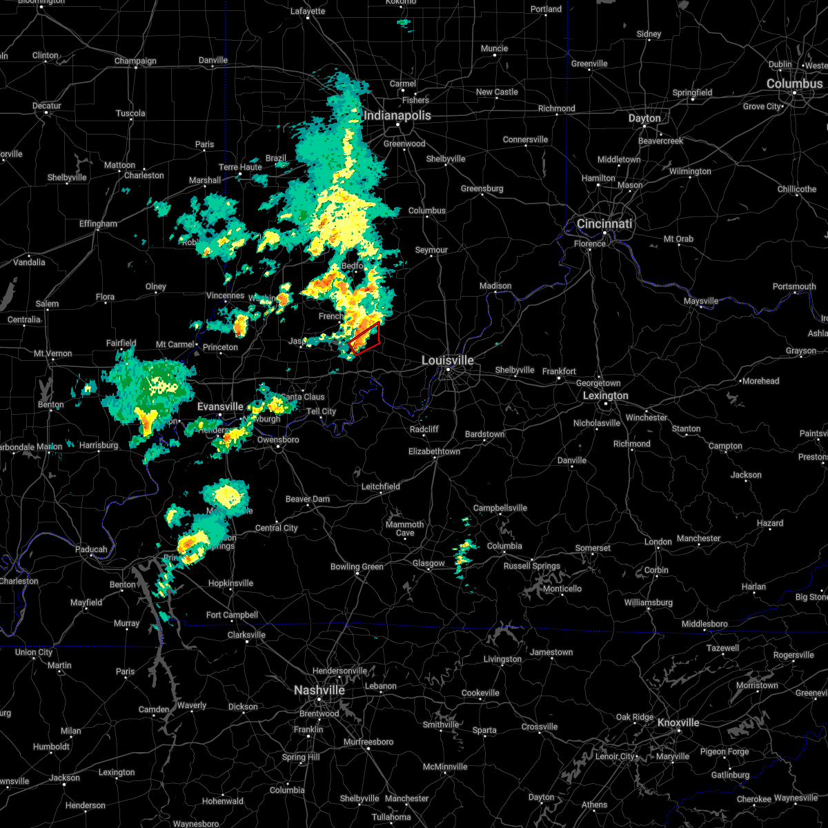
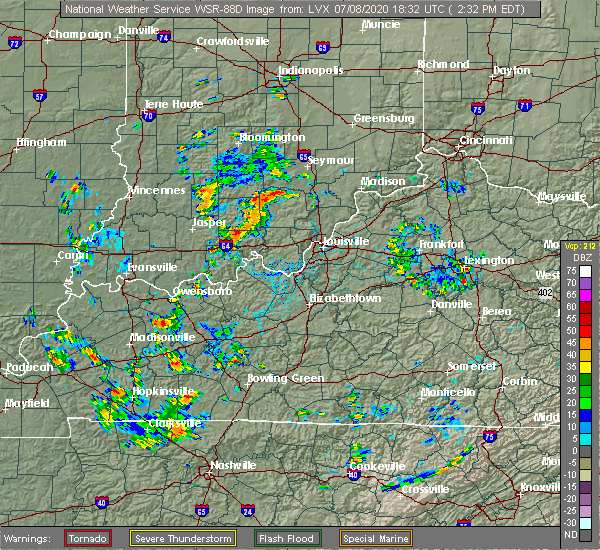 At 234 pm edt/134 pm cdt/, a severe thunderstorm was located near english and was nearly stationary (radar indicated). Hazards include 60 mph wind gusts and quarter size hail. Hail damage to vehicles is expected. Expect wind damage to roofs, siding, and trees. At 234 pm edt/134 pm cdt/, a severe thunderstorm was located near english and was nearly stationary (radar indicated). Hazards include 60 mph wind gusts and quarter size hail. Hail damage to vehicles is expected. Expect wind damage to roofs, siding, and trees.
|
| 6/4/2020 5:57 PM EDT |
 The severe thunderstorm warning for northern crawford and southern orange counties will expire at 600 pm edt, the storms which prompted the warning have weakened below severe limits, and have exited the warned area. therefore, the warning will be allowed to expire. The severe thunderstorm warning for northern crawford and southern orange counties will expire at 600 pm edt, the storms which prompted the warning have weakened below severe limits, and have exited the warned area. therefore, the warning will be allowed to expire.
|
| 6/4/2020 5:30 PM EDT | Tree down on brownstown rd near the golf cours in crawford county IN, 0.8 miles ENE of English, IN |
| 6/4/2020 5:30 PM EDT |
 At 529 pm edt, severe thunderstorms were located along a line extending from near paoli to 6 miles southwest of english, moving east at 20 mph (radar indicated). Hazards include 60 mph wind gusts. expect damage to roofs, siding, and trees At 529 pm edt, severe thunderstorms were located along a line extending from near paoli to 6 miles southwest of english, moving east at 20 mph (radar indicated). Hazards include 60 mph wind gusts. expect damage to roofs, siding, and trees
|
| 4/8/2020 10:02 PM EDT |
 At 1001 pm edt/901 pm cdt/, a severe thunderstorm was located 8 miles west of english, moving southeast at 70 mph (radar indicated). Hazards include 70 mph wind gusts. Expect considerable tree damage. Damage is likely to mobile homes, roofs, and outbuildings. At 1001 pm edt/901 pm cdt/, a severe thunderstorm was located 8 miles west of english, moving southeast at 70 mph (radar indicated). Hazards include 70 mph wind gusts. Expect considerable tree damage. Damage is likely to mobile homes, roofs, and outbuildings.
|
| 3/28/2020 10:11 PM EDT |
 At 1011 pm edt/911 pm cdt/, a severe thunderstorm was located near paoli, moving northeast at 65 mph (radar indicated). Hazards include 70 mph wind gusts. Expect considerable tree damage. damage is likely to mobile homes, roofs, and outbuildings. Locations impacted include, paoli, english, orleans, french lick, stampers creek, orangeville, west baden springs, birdseye, hardinsburg and livonia. At 1011 pm edt/911 pm cdt/, a severe thunderstorm was located near paoli, moving northeast at 65 mph (radar indicated). Hazards include 70 mph wind gusts. Expect considerable tree damage. damage is likely to mobile homes, roofs, and outbuildings. Locations impacted include, paoli, english, orleans, french lick, stampers creek, orangeville, west baden springs, birdseye, hardinsburg and livonia.
|
| 3/28/2020 9:56 PM EDT |
 At 956 pm edt/856 pm cdt/, a severe thunderstorm was located 10 miles east of jasper, moving northeast at 65 mph (radar indicated). Hazards include 70 mph wind gusts. Expect considerable tree damage. Damage is likely to mobile homes, roofs, and outbuildings. At 956 pm edt/856 pm cdt/, a severe thunderstorm was located 10 miles east of jasper, moving northeast at 65 mph (radar indicated). Hazards include 70 mph wind gusts. Expect considerable tree damage. Damage is likely to mobile homes, roofs, and outbuildings.
|
| 10/26/2019 6:07 PM EDT |
 At 606 pm edt, severe thunderstorms were located along a line extending from 7 miles northeast of shoals to 7 miles northeast of corydon, moving northeast at 70 mph (radar indicated). Hazards include 60 mph wind gusts. Expect damage to roofs, siding, and trees. Locations impacted include, paoli, corydon, english, carefree town, orleans, french lick, stampers creek, marengo, milltown, and orangeville. At 606 pm edt, severe thunderstorms were located along a line extending from 7 miles northeast of shoals to 7 miles northeast of corydon, moving northeast at 70 mph (radar indicated). Hazards include 60 mph wind gusts. Expect damage to roofs, siding, and trees. Locations impacted include, paoli, corydon, english, carefree town, orleans, french lick, stampers creek, marengo, milltown, and orangeville.
|
| 10/26/2019 5:44 PM EDT |
 At 543 pm edt/443 pm cdt/, severe thunderstorms were located along a line extending from near jasper to near brandenburg, moving north at 65 mph (radar indicated). Hazards include 65 mph wind gusts. expect damage to roofs, siding, and trees At 543 pm edt/443 pm cdt/, severe thunderstorms were located along a line extending from near jasper to near brandenburg, moving north at 65 mph (radar indicated). Hazards include 65 mph wind gusts. expect damage to roofs, siding, and trees
|
| 8/20/2019 3:30 PM EDT |
 The national weather service in louisville has issued a * severe thunderstorm warning for. southern dubois county in south central indiana. northwestern crawford county in south central indiana. northwestern perry county in south central indiana. Orange county in south central indiana. The national weather service in louisville has issued a * severe thunderstorm warning for. southern dubois county in south central indiana. northwestern crawford county in south central indiana. northwestern perry county in south central indiana. Orange county in south central indiana.
|
| 6/30/2019 8:04 PM EDT |
 At 803 pm edt, severe thunderstorms were located along a line extending from 13 miles northeast of english to 6 miles northwest of dale, moving south at 30 mph (radar indicated). Hazards include 60 mph wind gusts. Expect damage to roofs, siding, and trees. Locations impacted include, jasper, english, huntingburg, ferdinand, marengo, holland, birdseye, dubois, hillham, and celestine. At 803 pm edt, severe thunderstorms were located along a line extending from 13 miles northeast of english to 6 miles northwest of dale, moving south at 30 mph (radar indicated). Hazards include 60 mph wind gusts. Expect damage to roofs, siding, and trees. Locations impacted include, jasper, english, huntingburg, ferdinand, marengo, holland, birdseye, dubois, hillham, and celestine.
|
| 6/30/2019 8:00 PM EDT | Trees and power lines down in taswell... i in crawford county IN, 6.3 miles E of English, IN |
| 6/30/2019 7:27 PM EDT |
 At 727 pm edt, severe thunderstorms were located along a line extending from 11 miles northeast of paoli to 8 miles east of petersburg, moving south at 30 mph (radar indicated). Hazards include 60 mph wind gusts and penny size hail. expect damage to roofs, siding, and trees At 727 pm edt, severe thunderstorms were located along a line extending from 11 miles northeast of paoli to 8 miles east of petersburg, moving south at 30 mph (radar indicated). Hazards include 60 mph wind gusts and penny size hail. expect damage to roofs, siding, and trees
|
| 6/16/2019 3:59 PM EDT |
 At 359 pm edt, a severe thunderstorm was located near carefree town, moving northeast at 30 mph (radar indicated). Hazards include 60 mph wind gusts and quarter size hail. Hail damage to vehicles is expected. Expect wind damage to roofs, siding, and trees. At 359 pm edt, a severe thunderstorm was located near carefree town, moving northeast at 30 mph (radar indicated). Hazards include 60 mph wind gusts and quarter size hail. Hail damage to vehicles is expected. Expect wind damage to roofs, siding, and trees.
|
| 6/5/2019 9:23 PM EDT | Trees and power lines down grantsburg... i in crawford county IN, 4.4 miles N of English, IN |
| 6/5/2019 9:17 PM EDT |
 At 915 pm edt/815 pm cdt/, severe thunderstorms were located along a line extending from 9 miles southwest of new providence town to near english, moving south at 35 mph (radar indicated). Hazards include 60 to 70 mph wind gusts. Expect considerable tree damage. damage is likely to mobile homes, roofs, and outbuildings. Widespread trees down reported in orange county from this storm. At 915 pm edt/815 pm cdt/, severe thunderstorms were located along a line extending from 9 miles southwest of new providence town to near english, moving south at 35 mph (radar indicated). Hazards include 60 to 70 mph wind gusts. Expect considerable tree damage. damage is likely to mobile homes, roofs, and outbuildings. Widespread trees down reported in orange county from this storm.
|
| 6/5/2019 8:59 PM EDT | Trees down multiple locations along 3 in orange county IN, 4 miles S of English, IN |
| 6/5/2019 8:52 PM EDT |
 At 852 pm edt/752 pm cdt/, severe thunderstorms were located along a line extending from 7 miles southwest of salem to 9 miles southwest of paoli, moving southeast at 35 mph (radar indicated). Hazards include 60 mph wind gusts and nickel size hail. expect damage to roofs, siding, and trees At 852 pm edt/752 pm cdt/, severe thunderstorms were located along a line extending from 7 miles southwest of salem to 9 miles southwest of paoli, moving southeast at 35 mph (radar indicated). Hazards include 60 mph wind gusts and nickel size hail. expect damage to roofs, siding, and trees
|
| 6/5/2019 8:18 PM EDT |
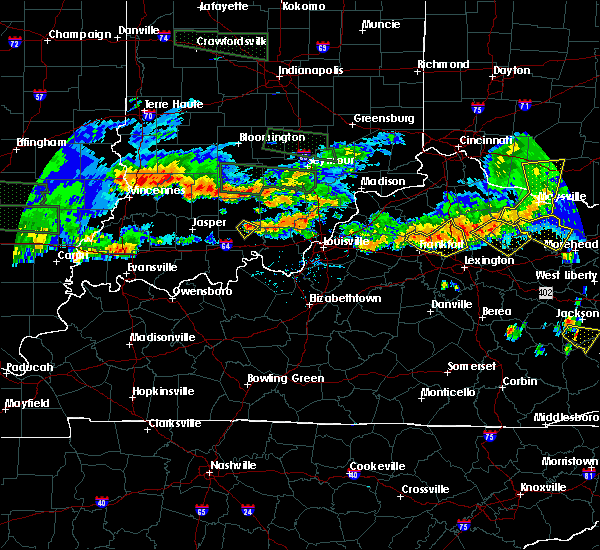 At 818 pm edt, a severe thunderstorm was located near english, moving southeast at 15 mph (radar indicated). Hazards include 60 mph wind gusts and quarter size hail. Hail damage to vehicles is expected. expect wind damage to roofs, siding, and trees. Locations impacted include, english, temple, bacon, valeene and fargo. At 818 pm edt, a severe thunderstorm was located near english, moving southeast at 15 mph (radar indicated). Hazards include 60 mph wind gusts and quarter size hail. Hail damage to vehicles is expected. expect wind damage to roofs, siding, and trees. Locations impacted include, english, temple, bacon, valeene and fargo.
|
| 6/5/2019 7:58 PM EDT |
 At 758 pm edt, a severe thunderstorm was located near english, moving southeast at 15 mph (radar indicated). Hazards include ping pong ball size hail and 60 mph wind gusts. People and animals outdoors will be injured. expect hail damage to roofs, siding, windows, and vehicles. expect wind damage to roofs, siding, and trees. Locations impacted include, english, greenbrier, ethel, temple, valeene, fargo, taswell, bacon, youngs creek and mifflin. At 758 pm edt, a severe thunderstorm was located near english, moving southeast at 15 mph (radar indicated). Hazards include ping pong ball size hail and 60 mph wind gusts. People and animals outdoors will be injured. expect hail damage to roofs, siding, windows, and vehicles. expect wind damage to roofs, siding, and trees. Locations impacted include, english, greenbrier, ethel, temple, valeene, fargo, taswell, bacon, youngs creek and mifflin.
|
| 6/5/2019 7:44 PM EDT |
 At 744 pm edt, a severe thunderstorm was located 9 miles southwest of paoli, moving southeast at 15 mph (radar indicated). Hazards include 60 mph wind gusts and quarter size hail. Hail damage to vehicles is expected. Expect wind damage to roofs, siding, and trees. At 744 pm edt, a severe thunderstorm was located 9 miles southwest of paoli, moving southeast at 15 mph (radar indicated). Hazards include 60 mph wind gusts and quarter size hail. Hail damage to vehicles is expected. Expect wind damage to roofs, siding, and trees.
|
| 4/25/2019 5:12 PM EDT |
 The severe thunderstorm warning for north central crawford county will expire at 515 pm edt, the storm which prompted the warning has weakened below severe limits, and no longer poses an immediate threat to life or property. therefore, the warning will be allowed to expire. report severe weather to local law enforcement, post your report to the national weather service louisville facebook page, or tweet your report using hashtag l, m, k, spotter. The severe thunderstorm warning for north central crawford county will expire at 515 pm edt, the storm which prompted the warning has weakened below severe limits, and no longer poses an immediate threat to life or property. therefore, the warning will be allowed to expire. report severe weather to local law enforcement, post your report to the national weather service louisville facebook page, or tweet your report using hashtag l, m, k, spotter.
|
| 4/25/2019 4:56 PM EDT |
 At 455 pm edt, a severe thunderstorm was located near english, moving north at 35 mph (radar indicated). Hazards include 60 mph wind gusts. Expect damage to roofs, siding, and trees. Locations impacted include, english, marengo, grantsburg, temple, west fork, sulphur and fargo. At 455 pm edt, a severe thunderstorm was located near english, moving north at 35 mph (radar indicated). Hazards include 60 mph wind gusts. Expect damage to roofs, siding, and trees. Locations impacted include, english, marengo, grantsburg, temple, west fork, sulphur and fargo.
|
| 4/25/2019 4:44 PM EDT |
 At 444 pm edt/344 pm cdt/, a severe thunderstorm was located 9 miles west of carefree town, moving northeast at 35 mph (radar indicated). Hazards include 60 mph wind gusts. expect damage to roofs, siding, and trees At 444 pm edt/344 pm cdt/, a severe thunderstorm was located 9 miles west of carefree town, moving northeast at 35 mph (radar indicated). Hazards include 60 mph wind gusts. expect damage to roofs, siding, and trees
|
| 3/14/2019 2:35 PM EDT |
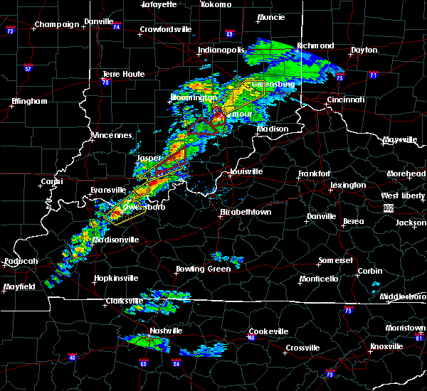 At 234 pm edt/134 pm cdt/, a severe thunderstorm was located near brownstown, moving northeast at 65 mph. additional storms were moving into perry county from the southwest (radar indicated). Hazards include 60 mph wind gusts and penny size hail. Expect damage to roofs, siding, and trees. locations impacted include, english, ethel, taswell, bacon, eckerty, mifflin, adyeville, grantsburg, temple and uniontown. A tornado watch remains in effect until 500 pm edt/400 pm cdt/ for south central indiana. At 234 pm edt/134 pm cdt/, a severe thunderstorm was located near brownstown, moving northeast at 65 mph. additional storms were moving into perry county from the southwest (radar indicated). Hazards include 60 mph wind gusts and penny size hail. Expect damage to roofs, siding, and trees. locations impacted include, english, ethel, taswell, bacon, eckerty, mifflin, adyeville, grantsburg, temple and uniontown. A tornado watch remains in effect until 500 pm edt/400 pm cdt/ for south central indiana.
|
| 3/14/2019 2:25 PM EDT |
 At 225 pm edt, a severe thunderstorm capable of producing a tornado was located 9 miles west of english, moving northeast at 60 mph (radar indicated rotation). Hazards include tornado. Flying debris will be dangerous to those caught without shelter. mobile homes will be damaged or destroyed. damage to roofs, windows, and vehicles will occur. Tree damage is likely. At 225 pm edt, a severe thunderstorm capable of producing a tornado was located 9 miles west of english, moving northeast at 60 mph (radar indicated rotation). Hazards include tornado. Flying debris will be dangerous to those caught without shelter. mobile homes will be damaged or destroyed. damage to roofs, windows, and vehicles will occur. Tree damage is likely.
|
| 3/14/2019 2:11 PM EDT |
 At 210 pm edt/110 pm cdt/, a severe thunderstorm was located near holiday world, moving northeast at 65 mph (radar indicated). Hazards include 60 mph wind gusts and penny size hail. expect damage to roofs, siding, and trees At 210 pm edt/110 pm cdt/, a severe thunderstorm was located near holiday world, moving northeast at 65 mph (radar indicated). Hazards include 60 mph wind gusts and penny size hail. expect damage to roofs, siding, and trees
|
| 9/8/2018 4:27 PM EDT | Tree downed on a power lin in crawford county IN, 7.8 miles N of English, IN |
| 8/15/2018 7:19 PM EDT |
 At 718 pm edt/618 pm cdt/, severe thunderstorms were located along a line extending from 9 miles northeast of shoals to near paoli to near english to 11 miles northeast of tell city, moving northeast at 30 mph (radar indicated). Hazards include 70 mph wind gusts. Expect considerable tree damage. damage is likely to mobile homes, roofs, and outbuildings. Locations impacted include, paoli, english, carefree town, mount pleasant, orleans, french lick, stampers creek, marengo, milltown and orangeville. At 718 pm edt/618 pm cdt/, severe thunderstorms were located along a line extending from 9 miles northeast of shoals to near paoli to near english to 11 miles northeast of tell city, moving northeast at 30 mph (radar indicated). Hazards include 70 mph wind gusts. Expect considerable tree damage. damage is likely to mobile homes, roofs, and outbuildings. Locations impacted include, paoli, english, carefree town, mount pleasant, orleans, french lick, stampers creek, marengo, milltown and orangeville.
|
| 8/15/2018 7:19 PM EDT |
 At 703 pm edt/603 pm cdt/, severe thunderstorms were located along a line extending from near shoals to near paoli to 6 miles southwest of english to near tell city, moving northeast at 30 mph. winds gusted to 67 mph at french lick as the storm went through (radar indicated). Hazards include 70 mph wind gusts. Expect considerable tree damage. Damage is likely to mobile homes, roofs, and outbuildings. At 703 pm edt/603 pm cdt/, severe thunderstorms were located along a line extending from near shoals to near paoli to 6 miles southwest of english to near tell city, moving northeast at 30 mph. winds gusted to 67 mph at french lick as the storm went through (radar indicated). Hazards include 70 mph wind gusts. Expect considerable tree damage. Damage is likely to mobile homes, roofs, and outbuildings.
|
| 8/15/2018 7:05 PM EDT |
 The national weather service in louisville has issued a * severe thunderstorm warning for. crawford county in south central indiana. central perry county in south central indiana. orange county in south central indiana. Northwestern meade county in central kentucky. The national weather service in louisville has issued a * severe thunderstorm warning for. crawford county in south central indiana. central perry county in south central indiana. orange county in south central indiana. Northwestern meade county in central kentucky.
|
| 7/20/2018 8:49 PM EDT |
 At 848 pm edt, a severe thunderstorm was located northeast of english, moving east at 40 mph (radar indicated). Hazards include quarter size hail. Damage to vehicles is expected. locations impacted include, marengo, milltown, temple, valeene, bacon, and hogtown. A tornado watch remains in effect until 300 am edt for south central indiana. At 848 pm edt, a severe thunderstorm was located northeast of english, moving east at 40 mph (radar indicated). Hazards include quarter size hail. Damage to vehicles is expected. locations impacted include, marengo, milltown, temple, valeene, bacon, and hogtown. A tornado watch remains in effect until 300 am edt for south central indiana.
|
| 7/20/2018 8:36 PM EDT |
 At 835 pm edt, a severe thunderstorm was located 7 miles northwest of english, moving east at 40 mph (radar indicated). Hazards include quarter size hail. damage to vehicles is expected At 835 pm edt, a severe thunderstorm was located 7 miles northwest of english, moving east at 40 mph (radar indicated). Hazards include quarter size hail. damage to vehicles is expected
|
| 7/20/2018 8:10 PM EDT | Quarter sized hail reported 8.2 miles NNW of English, IN |
| 7/20/2018 8:10 PM EDT | Quarter sized hail reported 7.6 miles NNW of English, IN |
| 7/20/2018 1:22 PM EDT | Golf Ball sized hail reported 7.8 miles N of English, IN |
| 6/26/2018 12:50 PM EDT | Bradford pear type of tree blown down along driveway between mcintosh road and magnolia road on the west side of state road 6 in crawford county IN, 7.6 miles NW of English, IN |
| 6/26/2018 12:40 PM EDT |
 At 1240 pm edt/1140 am cdt/, severe thunderstorms were located along a line extending from near paoli to 6 miles south of carefree town to 9 miles north of hardinsburg, moving east at 55 mph (radar indicated). Hazards include 60 mph wind gusts. expect damage to roofs, siding, and trees At 1240 pm edt/1140 am cdt/, severe thunderstorms were located along a line extending from near paoli to 6 miles south of carefree town to 9 miles north of hardinsburg, moving east at 55 mph (radar indicated). Hazards include 60 mph wind gusts. expect damage to roofs, siding, and trees
|
| 6/26/2018 12:12 PM EDT |
 The national weather service in louisville has issued a * severe thunderstorm warning for. dubois county in south central indiana. northwestern crawford county in south central indiana. northern perry county in south central indiana. Western orange county in south central indiana. The national weather service in louisville has issued a * severe thunderstorm warning for. dubois county in south central indiana. northwestern crawford county in south central indiana. northern perry county in south central indiana. Western orange county in south central indiana.
|
| 5/31/2018 1:53 PM EDT |
 The severe thunderstorm warning for dubois, crawford, northern perry and orange counties will expire at 200 pm edt/100 pm cdt/, the storms which prompted the warning have moved out of the area. therefore the warning will be allowed to expire. a severe thunderstorm watch remains in effect until 600 pm edt/500 pm cdt/ for south central indiana, and central kentucky. report severe weather to local law enforcement, post your report to the national weather service louisville facebook page, or tweet your report using hashtag l, m, k, spotter. The severe thunderstorm warning for dubois, crawford, northern perry and orange counties will expire at 200 pm edt/100 pm cdt/, the storms which prompted the warning have moved out of the area. therefore the warning will be allowed to expire. a severe thunderstorm watch remains in effect until 600 pm edt/500 pm cdt/ for south central indiana, and central kentucky. report severe weather to local law enforcement, post your report to the national weather service louisville facebook page, or tweet your report using hashtag l, m, k, spotter.
|
| 5/31/2018 1:30 PM EDT |
 At 112 pm edt/1212 pm cdt/, severe thunderstorms were located along a line extending from 8 miles west of shoals to near holiday world, moving east at 55 mph (radar indicated). Hazards include 70 mph wind gusts. Expect considerable tree damage. Damage is likely to mobile homes, roofs, and outbuildings. At 112 pm edt/1212 pm cdt/, severe thunderstorms were located along a line extending from 8 miles west of shoals to near holiday world, moving east at 55 mph (radar indicated). Hazards include 70 mph wind gusts. Expect considerable tree damage. Damage is likely to mobile homes, roofs, and outbuildings.
|
| 5/31/2018 1:13 PM EDT |
 The national weather service in louisville has issued a * severe thunderstorm warning for. dubois county in south central indiana. crawford county in south central indiana. northern perry county in south central indiana. Orange county in south central indiana. The national weather service in louisville has issued a * severe thunderstorm warning for. dubois county in south central indiana. crawford county in south central indiana. northern perry county in south central indiana. Orange county in south central indiana.
|
| 10/7/2017 7:13 PM EDT |
 At 712 pm edt, a severe thunderstorm capable of producing a tornado was located 9 miles west of english, moving northeast at 40 mph (radar indicated rotation). Hazards include tornado. Expect damage to mobile homes, roofs, and vehicles. Locations impacted include, english, marengo, riceville, ethel, taswell, bacon, eckerty, mifflin, greenbrier and wickliffe. At 712 pm edt, a severe thunderstorm capable of producing a tornado was located 9 miles west of english, moving northeast at 40 mph (radar indicated rotation). Hazards include tornado. Expect damage to mobile homes, roofs, and vehicles. Locations impacted include, english, marengo, riceville, ethel, taswell, bacon, eckerty, mifflin, greenbrier and wickliffe.
|
| 10/7/2017 7:02 PM EDT |
 The national weather service in louisville has issued a * tornado warning for. southeastern dubois county in south central indiana. northern crawford county in south central indiana. south central orange county in south central indiana. Until 730 pm edt. The national weather service in louisville has issued a * tornado warning for. southeastern dubois county in south central indiana. northern crawford county in south central indiana. south central orange county in south central indiana. Until 730 pm edt.
|
| 7/23/2017 7:01 AM CDT |
 At 801 am edt/701 am cdt/, severe thunderstorms were located along a line extending from 6 miles northwest of english to 8 miles west of carefree town to 8 miles northeast of tell city, moving east at 60 mph (radar indicated). Hazards include 60 mph wind gusts. Expect damage to roofs, siding, and trees. Locations impacted include, english, carefree town, mount pleasant, marengo, leopold, leavenworth, alton, roberta, ranger and beechwood. At 801 am edt/701 am cdt/, severe thunderstorms were located along a line extending from 6 miles northwest of english to 8 miles west of carefree town to 8 miles northeast of tell city, moving east at 60 mph (radar indicated). Hazards include 60 mph wind gusts. Expect damage to roofs, siding, and trees. Locations impacted include, english, carefree town, mount pleasant, marengo, leopold, leavenworth, alton, roberta, ranger and beechwood.
|
| 7/23/2017 6:44 AM CDT |
 At 744 am edt/644 am cdt/, severe thunderstorms were located along a line extending from near jasper to 12 miles east of dale to 7 miles south of holiday world, moving east at 65 mph (radar indicated). Hazards include 60 mph wind gusts. expect damage to roofs, siding, and trees At 744 am edt/644 am cdt/, severe thunderstorms were located along a line extending from near jasper to 12 miles east of dale to 7 miles south of holiday world, moving east at 65 mph (radar indicated). Hazards include 60 mph wind gusts. expect damage to roofs, siding, and trees
|
| 7/23/2017 3:12 AM EDT |
 At 312 am edt/212 am cdt/, severe thunderstorms were located along a line extending from 7 miles north of corydon to near dale, moving southeast at 40 mph (radar indicated). Hazards include 60 mph wind gusts. expect damage to roofs, siding, and trees At 312 am edt/212 am cdt/, severe thunderstorms were located along a line extending from 7 miles north of corydon to near dale, moving southeast at 40 mph (radar indicated). Hazards include 60 mph wind gusts. expect damage to roofs, siding, and trees
|
| 7/23/2017 2:04 AM EDT |
 At 203 am edt, severe thunderstorms were located along a line extending from 6 miles southwest of scottsburg to 9 miles southwest of new providence town to near paoli, moving southeast at 35 mph (radar indicated). Hazards include 60 mph wind gusts. Expect damage to roofs, siding, and trees. Locations impacted include, scottsburg, salem, paoli, english, carefree town, new providence town, vienna, austin, galena and french lick. At 203 am edt, severe thunderstorms were located along a line extending from 6 miles southwest of scottsburg to 9 miles southwest of new providence town to near paoli, moving southeast at 35 mph (radar indicated). Hazards include 60 mph wind gusts. Expect damage to roofs, siding, and trees. Locations impacted include, scottsburg, salem, paoli, english, carefree town, new providence town, vienna, austin, galena and french lick.
|
| 7/23/2017 1:44 AM EDT |
 At 143 am edt, the leading edge of a line of severe thunderstorms was from 10 miles south of brownstown to 8 miles southwest of salem to near paoli, moving southeast at 35 mph (radar indicated). Hazards include 60 mph wind gusts. expect damage to roofs, siding, and trees At 143 am edt, the leading edge of a line of severe thunderstorms was from 10 miles south of brownstown to 8 miles southwest of salem to near paoli, moving southeast at 35 mph (radar indicated). Hazards include 60 mph wind gusts. expect damage to roofs, siding, and trees
|
| 7/13/2017 3:05 PM EDT |
 At 305 pm edt/205 pm cdt/, a severe thunderstorm was located 9 miles southwest of english, moving east at 20 mph (radar indicated). Hazards include 60 mph wind gusts. Expect damage to roofs, siding, and trees. Locations impacted include, english, saint croix, oriole, celina, apalona, west fork, doolittle mills, branchville, mifflin and taswell. At 305 pm edt/205 pm cdt/, a severe thunderstorm was located 9 miles southwest of english, moving east at 20 mph (radar indicated). Hazards include 60 mph wind gusts. Expect damage to roofs, siding, and trees. Locations impacted include, english, saint croix, oriole, celina, apalona, west fork, doolittle mills, branchville, mifflin and taswell.
|
| 7/13/2017 1:50 PM CDT |
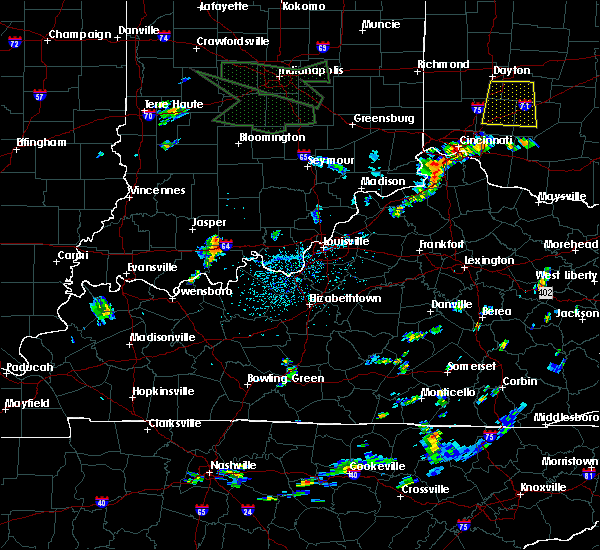 At 250 pm edt/150 pm cdt/, a severe thunderstorm was located 13 miles southwest of english, moving east at 20 mph (radar indicated). Hazards include 60 mph wind gusts. expect damage to roofs, siding, and trees At 250 pm edt/150 pm cdt/, a severe thunderstorm was located 13 miles southwest of english, moving east at 20 mph (radar indicated). Hazards include 60 mph wind gusts. expect damage to roofs, siding, and trees
|
| 7/7/2017 10:00 PM EDT | Several trees down in the english are in crawford county IN, 0.9 miles NNE of English, IN |
| 7/7/2017 9:58 PM EDT | Multiple trees dow in crawford county IN, 6.3 miles E of English, IN |
| 6/30/2017 7:59 PM EDT |
 At 742 pm edt, severe thunderstorms were located along a line extending from 9 miles southwest of shoals to near jasper, moving east at 40 mph (radar indicated). Hazards include 60 mph wind gusts. expect damage to roofs, siding, and trees At 742 pm edt, severe thunderstorms were located along a line extending from 9 miles southwest of shoals to near jasper, moving east at 40 mph (radar indicated). Hazards include 60 mph wind gusts. expect damage to roofs, siding, and trees
|
| 6/30/2017 7:42 PM EDT |
 At 742 pm edt, severe thunderstorms were located along a line extending from 9 miles southwest of shoals to near jasper, moving east at 40 mph (radar indicated). Hazards include 60 mph wind gusts. expect damage to roofs, siding, and trees At 742 pm edt, severe thunderstorms were located along a line extending from 9 miles southwest of shoals to near jasper, moving east at 40 mph (radar indicated). Hazards include 60 mph wind gusts. expect damage to roofs, siding, and trees
|
| 5/27/2017 4:44 PM EDT | Quarter sized hail reported 9.9 miles NE of English, IN, i-64 near the perry/crawford county line. reported by state police. |
| 5/27/2017 4:09 PM EDT |
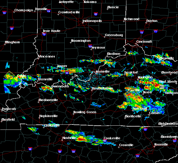 The severe thunderstorm warning for northwestern crawford county will expire at 415 pm edt, the storm which prompted the warning has moved out of the area. therefore the warning will be allowed to expire. a severe thunderstorm watch remains in effect until 1000 pm edt for south central indiana. report severe weather to local law enforcement, post your report to the national weather service louisville facebook page, or tweet your report using hashtag l, m, k, spotter. The severe thunderstorm warning for northwestern crawford county will expire at 415 pm edt, the storm which prompted the warning has moved out of the area. therefore the warning will be allowed to expire. a severe thunderstorm watch remains in effect until 1000 pm edt for south central indiana. report severe weather to local law enforcement, post your report to the national weather service louisville facebook page, or tweet your report using hashtag l, m, k, spotter.
|
| 5/27/2017 3:54 PM EDT |
 At 353 pm edt, a severe thunderstorm was located over english, moving southeast at 20 mph (radar indicated). Hazards include 60 mph wind gusts and quarter size hail. Hail damage to vehicles is expected. expect wind damage to roofs, siding, and trees. Locations impacted include, english, curby, grantsburg, temple, taswell, switzer crossroads and mifflin. At 353 pm edt, a severe thunderstorm was located over english, moving southeast at 20 mph (radar indicated). Hazards include 60 mph wind gusts and quarter size hail. Hail damage to vehicles is expected. expect wind damage to roofs, siding, and trees. Locations impacted include, english, curby, grantsburg, temple, taswell, switzer crossroads and mifflin.
|
| 5/27/2017 3:50 PM EDT | Golf Ball sized hail reported 3.5 miles E of English, IN |
| 5/27/2017 3:39 PM EDT |
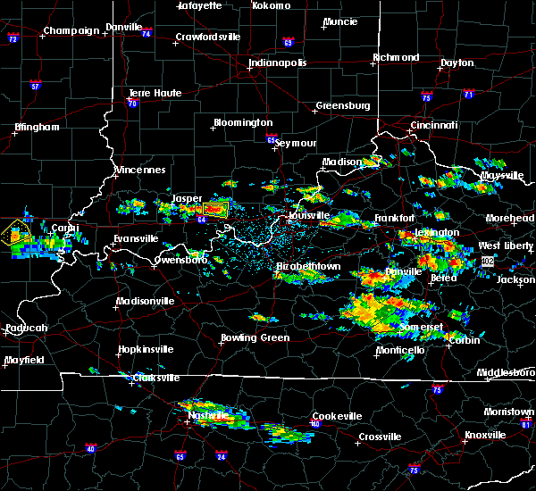 At 339 pm edt, a severe thunderstorm was located near english, moving east at 20 mph (radar indicated). Hazards include 60 mph wind gusts and quarter size hail. Hail damage to vehicles is expected. Expect wind damage to roofs, siding, and trees. At 339 pm edt, a severe thunderstorm was located near english, moving east at 20 mph (radar indicated). Hazards include 60 mph wind gusts and quarter size hail. Hail damage to vehicles is expected. Expect wind damage to roofs, siding, and trees.
|
| 5/19/2017 4:20 PM EDT | Porch blown off of a mobile home and damage to a metal outbuildin in crawford county IN, 8.1 miles NNE of English, IN |
| 4/29/2017 12:34 AM EDT |
 At 1234 am edt, a severe thunderstorm was located over english, moving east at 40 mph (radar indicated). Hazards include 60 mph wind gusts and quarter size hail. Hail damage to vehicles is expected. expect wind damage to roofs, siding, and trees. locations impacted include, english, marengo, curby, grantsburg, temple, taswell, switzer crossroads, eckerty, pilot knob and hogtown. A tornado watch remains in effect until 200 am edt for south central indiana. At 1234 am edt, a severe thunderstorm was located over english, moving east at 40 mph (radar indicated). Hazards include 60 mph wind gusts and quarter size hail. Hail damage to vehicles is expected. expect wind damage to roofs, siding, and trees. locations impacted include, english, marengo, curby, grantsburg, temple, taswell, switzer crossroads, eckerty, pilot knob and hogtown. A tornado watch remains in effect until 200 am edt for south central indiana.
|
| 4/29/2017 12:19 AM EDT |
 At 1218 am edt/1118 pm cdt/, a severe thunderstorm was located 8 miles west of english, moving east at 55 mph (radar indicated). Hazards include 60 mph wind gusts and quarter size hail. Hail damage to vehicles is expected. Expect wind damage to roofs, siding, and trees. At 1218 am edt/1118 pm cdt/, a severe thunderstorm was located 8 miles west of english, moving east at 55 mph (radar indicated). Hazards include 60 mph wind gusts and quarter size hail. Hail damage to vehicles is expected. Expect wind damage to roofs, siding, and trees.
|
| 4/28/2017 11:37 PM EDT | Quarter sized hail reported 0.8 miles ENE of English, IN |
| 4/28/2017 11:30 PM EDT |
 At 1130 pm edt/1030 pm cdt/, a severe thunderstorm was located near english, moving east at 55 mph (radar indicated). Hazards include 60 mph wind gusts and quarter size hail. Hail damage to vehicles is expected. Expect wind damage to roofs, siding, and trees. At 1130 pm edt/1030 pm cdt/, a severe thunderstorm was located near english, moving east at 55 mph (radar indicated). Hazards include 60 mph wind gusts and quarter size hail. Hail damage to vehicles is expected. Expect wind damage to roofs, siding, and trees.
|
| 4/28/2017 10:45 PM EDT |
 At 1045 pm edt, severe thunderstorms were located along a line extending from paoli to near english, moving east at 40 mph (radar indicated). Hazards include 60 mph wind gusts and nickel size hail. expect damage to roofs, siding, and trees At 1045 pm edt, severe thunderstorms were located along a line extending from paoli to near english, moving east at 40 mph (radar indicated). Hazards include 60 mph wind gusts and nickel size hail. expect damage to roofs, siding, and trees
|
| 4/28/2017 10:39 PM EDT |
 At 1039 pm edt, a severe thunderstorm was located near english, moving east at 55 mph (radar indicated). Hazards include 60 mph wind gusts. expect damage to roofs, siding, and trees At 1039 pm edt, a severe thunderstorm was located near english, moving east at 55 mph (radar indicated). Hazards include 60 mph wind gusts. expect damage to roofs, siding, and trees
|
| 4/28/2017 10:14 PM EDT |
 At 1013 pm edt, a severe thunderstorm was located 10 miles east of jasper, moving east at 50 mph (radar indicated). Hazards include 60 mph wind gusts and quarter size hail. Hail damage to vehicles is expected. Expect wind damage to roofs, siding, and trees. At 1013 pm edt, a severe thunderstorm was located 10 miles east of jasper, moving east at 50 mph (radar indicated). Hazards include 60 mph wind gusts and quarter size hail. Hail damage to vehicles is expected. Expect wind damage to roofs, siding, and trees.
|
| 3/1/2017 5:57 AM EST |
 At 556 am est/456 am cst/, severe thunderstorms were located along a line extending from 9 miles northwest of scottsburg to 10 miles southwest of carefree town, moving east at 55 mph (radar indicated). Hazards include 60 mph wind gusts. expect damage to roofs, siding, and trees At 556 am est/456 am cst/, severe thunderstorms were located along a line extending from 9 miles northwest of scottsburg to 10 miles southwest of carefree town, moving east at 55 mph (radar indicated). Hazards include 60 mph wind gusts. expect damage to roofs, siding, and trees
|
| 3/1/2017 5:33 AM EST |
 At 532 am est, severe thunderstorms were located along a line extending from 8 miles north of paoli to 8 miles south of jasper, moving east at 60 mph (radar indicated). Hazards include 60 mph wind gusts. expect damage to roofs, siding, and trees At 532 am est, severe thunderstorms were located along a line extending from 8 miles north of paoli to 8 miles south of jasper, moving east at 60 mph (radar indicated). Hazards include 60 mph wind gusts. expect damage to roofs, siding, and trees
|
| 3/1/2017 2:37 AM EST |
 The severe thunderstorm warning for central crawford county will expire at 245 am est, the storm which prompted the warning has weakened below severe limits, and have exited the warned area. therefore the warning will be allowed to expire. a tornado watch remains in effect until 500 am est for south central indiana. report severe weather to local law enforcement, post your report to the national weather service louisville facebook page, or tweet your report using hashtag l, m, k, spotter. The severe thunderstorm warning for central crawford county will expire at 245 am est, the storm which prompted the warning has weakened below severe limits, and have exited the warned area. therefore the warning will be allowed to expire. a tornado watch remains in effect until 500 am est for south central indiana. report severe weather to local law enforcement, post your report to the national weather service louisville facebook page, or tweet your report using hashtag l, m, k, spotter.
|
| 3/1/2017 2:26 AM EST |
 At 225 am est, a severe thunderstorm was located near english, moving east at 60 mph (radar indicated). Hazards include 60 mph wind gusts and penny size hail. Expect damage to roofs, siding, and trees. locations impacted include, english, carefree town, marengo, curby, grantsburg, riddle, temple, beechwood, west fork and switzer crossroads. A tornado watch remains in effect until 500 am est for south central indiana. At 225 am est, a severe thunderstorm was located near english, moving east at 60 mph (radar indicated). Hazards include 60 mph wind gusts and penny size hail. Expect damage to roofs, siding, and trees. locations impacted include, english, carefree town, marengo, curby, grantsburg, riddle, temple, beechwood, west fork and switzer crossroads. A tornado watch remains in effect until 500 am est for south central indiana.
|
| 3/1/2017 2:15 AM EST |
 At 214 am est/114 am cst/, a severe thunderstorm was located 11 miles southeast of jasper, moving east at 45 mph (radar indicated). Hazards include 60 mph wind gusts and quarter size hail. Hail damage to vehicles is expected. Expect wind damage to roofs, siding, and trees. At 214 am est/114 am cst/, a severe thunderstorm was located 11 miles southeast of jasper, moving east at 45 mph (radar indicated). Hazards include 60 mph wind gusts and quarter size hail. Hail damage to vehicles is expected. Expect wind damage to roofs, siding, and trees.
|
| 7/15/2016 3:54 PM EDT |
 At 354 pm edt, severe thunderstorms were located along a line extending from near english to 14 miles west of carefree town, moving southeast at 25 mph (radar indicated). Hazards include 60 mph wind gusts and quarter size hail. Hail damage to vehicles is expected. expect wind damage to roofs, siding, and trees. Locations impacted include, english, birdseye, taswell, riceville, eckerty, mentor, mifflin, grantsburg, west fork and wickliffe. At 354 pm edt, severe thunderstorms were located along a line extending from near english to 14 miles west of carefree town, moving southeast at 25 mph (radar indicated). Hazards include 60 mph wind gusts and quarter size hail. Hail damage to vehicles is expected. expect wind damage to roofs, siding, and trees. Locations impacted include, english, birdseye, taswell, riceville, eckerty, mentor, mifflin, grantsburg, west fork and wickliffe.
|
| 7/15/2016 3:34 PM EDT |
 At 334 pm edt, a severe thunderstorm was located 10 miles west of english, moving east at 25 mph (radar indicated). Hazards include 60 mph wind gusts and quarter size hail. Hail damage to vehicles is expected. Expect wind damage to roofs, siding, and trees. At 334 pm edt, a severe thunderstorm was located 10 miles west of english, moving east at 25 mph (radar indicated). Hazards include 60 mph wind gusts and quarter size hail. Hail damage to vehicles is expected. Expect wind damage to roofs, siding, and trees.
|
| 7/13/2016 8:04 PM EDT |
 At 804 pm edt/704 pm cdt/, severe thunderstorms were located along a line extending from near shoals to near jasper to near rockport, moving east at 40 mph (radar indicated). Hazards include 60 mph wind gusts. Expect damage to roofs. siding. And trees. At 804 pm edt/704 pm cdt/, severe thunderstorms were located along a line extending from near shoals to near jasper to near rockport, moving east at 40 mph (radar indicated). Hazards include 60 mph wind gusts. Expect damage to roofs. siding. And trees.
|
| 7/8/2016 7:40 PM EDT |
 At 740 pm edt, a severe thunderstorm was located over carefree town, moving southeast at 40 mph (radar indicated). Hazards include 60 mph wind gusts and nickel size hail. Expect damage to roofs. siding. and trees. Locations impacted include, corydon, english, carefree town, leavenworth, moberly, sulphur, pilot knob, temple, fredonia and wyandotte. At 740 pm edt, a severe thunderstorm was located over carefree town, moving southeast at 40 mph (radar indicated). Hazards include 60 mph wind gusts and nickel size hail. Expect damage to roofs. siding. and trees. Locations impacted include, corydon, english, carefree town, leavenworth, moberly, sulphur, pilot knob, temple, fredonia and wyandotte.
|
| 7/8/2016 7:34 PM EDT |
 At 734 pm edt, a severe thunderstorm was located over carefree town, moving southeast at 40 mph (radar indicated). Hazards include 60 mph wind gusts. Expect damage to roofs. siding. and trees. Locations impacted include, corydon, english, carefree town, marengo, leavenworth, taswell, moberly, pilot knob, temple and fredonia. At 734 pm edt, a severe thunderstorm was located over carefree town, moving southeast at 40 mph (radar indicated). Hazards include 60 mph wind gusts. Expect damage to roofs. siding. and trees. Locations impacted include, corydon, english, carefree town, marengo, leavenworth, taswell, moberly, pilot knob, temple and fredonia.
|
| 7/8/2016 7:25 PM EDT |
 At 725 pm edt, a severe thunderstorm was located over english, moving southeast at 40 mph (radar indicated). Hazards include 60 mph wind gusts. Expect damage to roofs. siding. And trees. At 725 pm edt, a severe thunderstorm was located over english, moving southeast at 40 mph (radar indicated). Hazards include 60 mph wind gusts. Expect damage to roofs. siding. And trees.
|
| 7/8/2016 10:24 AM EDT |
 At 1024 am edt, a severe thunderstorm was located 7 miles northeast of carefree town, moving east at 50 mph (radar indicated). Hazards include 60 mph wind gusts and penny size hail. Expect damage to roofs. siding. and trees. Locations impacted include, english, carefree town, marengo, milltown, leavenworth, alton, valeene, sulphur, youngs creek and cape sandy. At 1024 am edt, a severe thunderstorm was located 7 miles northeast of carefree town, moving east at 50 mph (radar indicated). Hazards include 60 mph wind gusts and penny size hail. Expect damage to roofs. siding. and trees. Locations impacted include, english, carefree town, marengo, milltown, leavenworth, alton, valeene, sulphur, youngs creek and cape sandy.
|
| 7/8/2016 10:16 AM EDT |
 At 1015 am edt/915 am cdt/, a severe thunderstorm was located near english, moving east at 50 mph (radar indicated). Hazards include 60 mph wind gusts and nickel size hail. Expect damage to roofs. siding. and trees. Locations impacted include, english, carefree town, mount pleasant, marengo, milltown, leopold, leavenworth, alton, valeene and sulphur. At 1015 am edt/915 am cdt/, a severe thunderstorm was located near english, moving east at 50 mph (radar indicated). Hazards include 60 mph wind gusts and nickel size hail. Expect damage to roofs. siding. and trees. Locations impacted include, english, carefree town, mount pleasant, marengo, milltown, leopold, leavenworth, alton, valeene and sulphur.
|
| 7/8/2016 10:07 AM EDT |
 At 1007 am edt/907 am cdt/, a severe thunderstorm was located near english, moving east at 40 mph (radar indicated). Hazards include 60 mph wind gusts and nickel size hail. Expect damage to roofs. siding. and trees. Locations impacted include, english, carefree town, mount pleasant, marengo, milltown, leopold, birdseye, leavenworth, alton and valeene. At 1007 am edt/907 am cdt/, a severe thunderstorm was located near english, moving east at 40 mph (radar indicated). Hazards include 60 mph wind gusts and nickel size hail. Expect damage to roofs. siding. and trees. Locations impacted include, english, carefree town, mount pleasant, marengo, milltown, leopold, birdseye, leavenworth, alton and valeene.
|
| 7/8/2016 9:51 AM EDT |
 At 950 am edt/850 am cdt/, a severe thunderstorm was located 11 miles east of jasper, moving east at 55 mph (radar indicated). Hazards include 60 mph wind gusts and quarter size hail. Hail damage to vehicles is expected. Expect wind damage to roofs, siding, and trees. At 950 am edt/850 am cdt/, a severe thunderstorm was located 11 miles east of jasper, moving east at 55 mph (radar indicated). Hazards include 60 mph wind gusts and quarter size hail. Hail damage to vehicles is expected. Expect wind damage to roofs, siding, and trees.
|
| 6/15/2016 7:22 PM EDT |
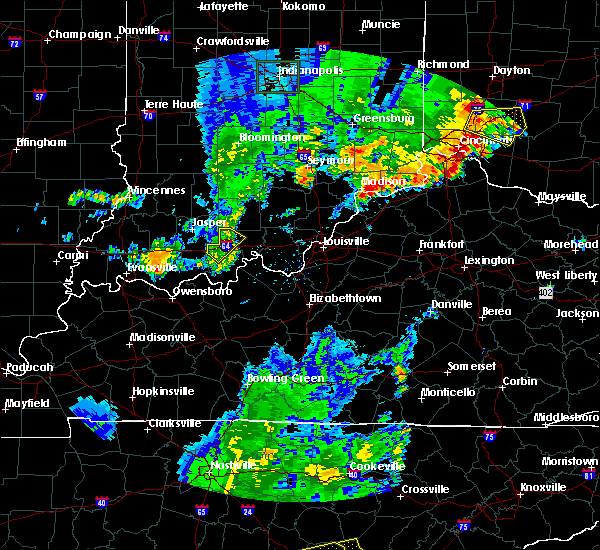 The severe thunderstorm warning for northwestern perry and northwestern crawford counties will expire at 730 pm edt, the storms which prompted the warning have weakened below severe limits, and exited the warned area. therefore the warning will be allowed to expire. a severe thunderstorm watch remains in effect until 1000 pm edt/900 pm cdt/ for south central indiana. The severe thunderstorm warning for northwestern perry and northwestern crawford counties will expire at 730 pm edt, the storms which prompted the warning have weakened below severe limits, and exited the warned area. therefore the warning will be allowed to expire. a severe thunderstorm watch remains in effect until 1000 pm edt/900 pm cdt/ for south central indiana.
|
| 6/15/2016 7:16 PM EDT |
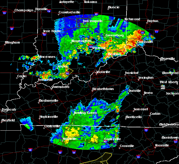 At 715 pm edt/615 pm cdt/, severe thunderstorms were located along a line extending from 7 miles southwest of english to 9 miles east of holiday world, moving southeast at 35 mph (radar indicated). Hazards include 60 mph wind gusts and penny size hail. Expect damage to roofs. siding. and trees. Locations impacted include, english, taswell, celina, riceville, sassafras, doolittle mills, eckerty, adyeville, apalona and saint croix. At 715 pm edt/615 pm cdt/, severe thunderstorms were located along a line extending from 7 miles southwest of english to 9 miles east of holiday world, moving southeast at 35 mph (radar indicated). Hazards include 60 mph wind gusts and penny size hail. Expect damage to roofs. siding. and trees. Locations impacted include, english, taswell, celina, riceville, sassafras, doolittle mills, eckerty, adyeville, apalona and saint croix.
|
| 6/15/2016 6:59 PM EDT |
 At 659 pm edt/559 pm cdt/, severe thunderstorms were located along a line extending from 11 miles west of english to 7 miles northeast of holiday world, moving southeast at 35 mph (radar indicated). Hazards include 60 mph wind gusts and penny size hail. Expect damage to roofs. siding. And trees. At 659 pm edt/559 pm cdt/, severe thunderstorms were located along a line extending from 11 miles west of english to 7 miles northeast of holiday world, moving southeast at 35 mph (radar indicated). Hazards include 60 mph wind gusts and penny size hail. Expect damage to roofs. siding. And trees.
|
| 5/11/2016 8:00 PM EDT |
 At 759 pm edt/659 pm cdt/, a severe thunderstorm was located near english, moving east at 40 mph (radar indicated). Hazards include 60 mph wind gusts and quarter size hail. Hail damage to vehicles is expected. Expect wind damage to roofs, siding, and trees. At 759 pm edt/659 pm cdt/, a severe thunderstorm was located near english, moving east at 40 mph (radar indicated). Hazards include 60 mph wind gusts and quarter size hail. Hail damage to vehicles is expected. Expect wind damage to roofs, siding, and trees.
|
| 5/11/2016 7:53 PM EDT |
 At 752 pm edt/652 pm cdt/, a severe thunderstorm was located near english, moving east at 50 mph (radar indicated). Hazards include 60 mph wind gusts and quarter size hail. Hail damage to vehicles is expected. expect wind damage to roofs, siding, and trees. Locations impacted include, english, carefree town, marengo, milltown, leavenworth, celina, riceville, sulphur, hogtown and wyandotte. At 752 pm edt/652 pm cdt/, a severe thunderstorm was located near english, moving east at 50 mph (radar indicated). Hazards include 60 mph wind gusts and quarter size hail. Hail damage to vehicles is expected. expect wind damage to roofs, siding, and trees. Locations impacted include, english, carefree town, marengo, milltown, leavenworth, celina, riceville, sulphur, hogtown and wyandotte.
|
| 5/11/2016 7:35 PM EDT |
 At 734 pm edt/634 pm cdt/, a severe thunderstorm was located 10 miles northeast of dale, moving east at 50 mph (radar indicated). Hazards include 60 mph wind gusts and quarter size hail. Hail damage to vehicles is expected. Expect wind damage to roofs, siding, and trees. At 734 pm edt/634 pm cdt/, a severe thunderstorm was located 10 miles northeast of dale, moving east at 50 mph (radar indicated). Hazards include 60 mph wind gusts and quarter size hail. Hail damage to vehicles is expected. Expect wind damage to roofs, siding, and trees.
|
| 5/7/2016 8:48 PM EDT |
 At 847 pm edt/747 pm cdt/, severe thunderstorms were located along a line extending from 9 miles north of paoli to 6 miles southwest of english to 9 miles southeast of whitesville, moving east at 40 mph (trained weather spotters. this line of storms has produced wind damage and 60 mph gusts across dubois county indiana). Hazards include 60 mph wind gusts and quarter size hail. Hail damage to vehicles is expected. Expect wind damage to roofs, siding, and trees. At 847 pm edt/747 pm cdt/, severe thunderstorms were located along a line extending from 9 miles north of paoli to 6 miles southwest of english to 9 miles southeast of whitesville, moving east at 40 mph (trained weather spotters. this line of storms has produced wind damage and 60 mph gusts across dubois county indiana). Hazards include 60 mph wind gusts and quarter size hail. Hail damage to vehicles is expected. Expect wind damage to roofs, siding, and trees.
|
| 12/23/2015 5:56 PM EST | At 556 pm est, a severe thunderstorm was located over paoli, moving northeast at 80 mph (radar indicated). Hazards include 60 mph wind gusts and penny size hail. Expect damage to roofs. siding and trees. locations impacted include, paoli, english, orleans, french lick, stampers creek, orangeville, west baden springs, hardinsburg, livonia, saltillo, valeene, riceville, bonds, mahan crossing, youngs creek, scarlet, syria, fargo, rego and chambersburg. A tornado watch remains in effect until 900 pm est for south central indiana. |
| 12/23/2015 5:42 PM EST | At 542 pm est, a severe thunderstorm was located 7 miles east of jasper, moving northeast at 80 mph (radar indicated). Hazards include 60 mph wind gusts and penny size hail. Expect damage to roofs. Siding and trees. |
| 12/23/2015 2:08 PM CST | At 308 pm est /208 pm cst/, severe thunderstorms were located along a line extending from near shoals to 9 miles southeast of jasper to near grandview, moving east at 45 mph (radar indicated). Hazards include 60 mph wind gusts. Expect damage to roofs. Siding and trees. |
| 12/23/2015 2:08 PM CST | At 308 pm est /208 pm cst/, severe thunderstorms were located along a line extending from near shoals to 9 miles southeast of jasper to near grandview, moving east at 45 mph (radar indicated). Hazards include 60 mph wind gusts. Expect damage to roofs. Siding and trees. |
| 7/29/2015 6:14 PM EDT |
 At 613 pm edt, a severe thunderstorm was located 5 miles southwest of english, and moving southeast at 30 mph (radar indicated). Hazards include 60 mph wind gusts. Expect damage to roofs. siding and trees. Locations impacted include, grantsburg, west fork, switzer crossroads, sulphur, riddle, curby and sulphur springs. At 613 pm edt, a severe thunderstorm was located 5 miles southwest of english, and moving southeast at 30 mph (radar indicated). Hazards include 60 mph wind gusts. Expect damage to roofs. siding and trees. Locations impacted include, grantsburg, west fork, switzer crossroads, sulphur, riddle, curby and sulphur springs.
|
| 7/29/2015 5:55 PM EDT |
 At 552 pm edt, a severe thunderstorm was located 12 miles west of english, and moving southeast at 30 mph (radar indicated). Hazards include 60 mph wind gusts. Expect damage to roofs. Siding and trees. At 552 pm edt, a severe thunderstorm was located 12 miles west of english, and moving southeast at 30 mph (radar indicated). Hazards include 60 mph wind gusts. Expect damage to roofs. Siding and trees.
|
| 6/26/2015 3:26 PM CDT | At 322 pm cdt, a severe thunderstorm was located 15 miles southwest of english, and moving east at 30 mph (radar indicated). Hazards include 60 mph wind gusts and quarter size hail. Hail damage to vehicles is expected. Expect wind damage to roofs, siding and trees. |
| 4/10/2015 1:44 AM EDT | A severe thunderstorm warning remains in effect for crawford and northeastern perry counties until 200 am edt/100 am cdt/. at 141 am edt. a severe thunderstorm was located 5 miles south of english. and moving east at 55 mph. hazard. 60 mph wind gusts. source. Radar indicated. |
| 4/10/2015 1:32 AM EDT | The national weather service in louisville has issued a * severe thunderstorm warning for. crawford county in south central indiana. southeastern dubois county in south central indiana. northern perry county in south central indiana. Until 200 am edt/100 am cdt/. |
| 4/7/2015 4:56 PM EDT | The national weather service in louisville has issued a * severe thunderstorm warning for. eastern crawford county in south central indiana. floyd county in south central indiana. northern harrison county in south central indiana. Until 525 pm edt. |
| 4/7/2015 4:43 PM EDT | A severe thunderstorm warning remains in effect for crawford county until 445 pm edt. at 440 pm edt. a severe thunderstorm was located 5 miles southeast of english. and moving east at 50 mph. hazard. 60 mph wind gusts and quarter size hail. source. Radar indicated. |
| 4/7/2015 4:34 PM EDT | The national weather service in louisville has issued a * tornado warning for. crawford county in south central indiana. northwestern harrison county in south central indiana. northeastern perry county in south central indiana. Until 455 pm edt/355 pm cdt/. |
| 4/7/2015 4:21 PM EDT | The national weather service in louisville has issued a * severe thunderstorm warning for. crawford county in south central indiana. southeastern dubois county in south central indiana. northwestern perry county in south central indiana. Until 445 pm edt/345 pm cdt/. |
| 5/22/2014 3:48 AM EDT | Quarter sized hail reported 7.8 miles N of English, IN, a spotter reported one inch and larger hail that whitened the ground just northeast of sulphur springs. |
| 5/22/2014 3:43 AM EDT | Golf Ball sized hail reported 6.5 miles NNW of English, IN, golf ball sized hail reported near riddle...in crawford county. |
| 5/11/2014 1:57 PM EDT | Quarter sized hail reported 7.8 miles N of English, IN |
| 5/11/2014 12:36 PM CDT | Ping Pong Ball sized hail reported 8.8 miles NE of English, IN |
| 7/10/2013 1:57 PM EDT | Pictures submitted through facebook of tree split...limbs down...and crops flattened in crawford county IN, 0.9 miles NNE of English, IN |
| 6/29/2013 7:14 PM EDT | Quarter sized hail reported 6.3 miles E of English, IN, spotter estimated quarter size hail covering his deck |
| 4/17/2013 4:05 PM EDT | Quarter sized hail reported 0.9 miles NNE of English, IN |
| 7/27/2012 8:17 PM EDT | Dispatch reports tree down in crawford county IN, 0.9 miles NNE of English, IN |
| 7/19/2012 7:35 PM EDT | 2 trees blocking williamson road in crawford county IN, 2.3 miles SE of English, IN |
| 7/8/2012 4:04 PM EDT | Trees down in the english area in crawford county IN, 0.9 miles NNE of English, IN |
| 4/28/2012 7:02 PM EDT | Quarter sized hail reported 0.9 miles NNE of English, IN |
| 3/2/2012 2:36 PM EST | Golf Ball sized hail reported 0.9 miles NNE of English, IN |
| 3/2/2012 2:27 PM EST | Golf Ball sized hail reported 6.3 miles E of English, IN |
| 1/1/0001 12:00 AM | Power outages in english. dispatch reported power outages in grantsbur in crawford county IN, 0.9 miles NNE of English, IN |
| 1/1/0001 12:00 AM | A few trees down across the county...along with several power outage in crawford county IN, 0.9 miles NNE of English, IN |
| 1/1/0001 12:00 AM | At least one tree reported down near the intersection of indiana state highway 64 and patoka school r in crawford county IN, 6.8 miles E of English, IN |
| 1/1/0001 12:00 AM | At least one tree reported down near the intersection of indiana state highway 64 and patoka school r in crawford county IN, 6.8 miles E of English, IN |
| 1/1/0001 12:00 AM | Numerous trees down around the count in crawford county IN, 0.9 miles NNE of English, IN |
| 1/1/0001 12:00 AM | Roof off of a small building in crawford county IN, 0.9 miles NNE of English, IN |
| 1/1/0001 12:00 AM | Scattered power outages and tree damage across crawford county in crawford county IN, 0.9 miles NNE of English, IN |
| 1/1/0001 12:00 AM | Storm damage reported in crawford county IN, 0.9 miles NNE of English, IN |
| 1/1/0001 12:00 AM | Storm damage reported in crawford county IN, 6.3 miles E of English, IN |
| 1/1/0001 12:00 AM | Dime size hail also reporte in crawford county IN, 0.9 miles NNE of English, IN |
Hail Maps for English, IN


Connect with Interactive Hail Maps