

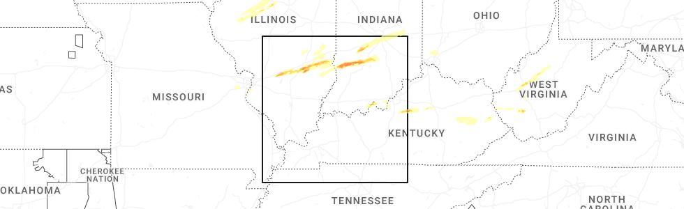
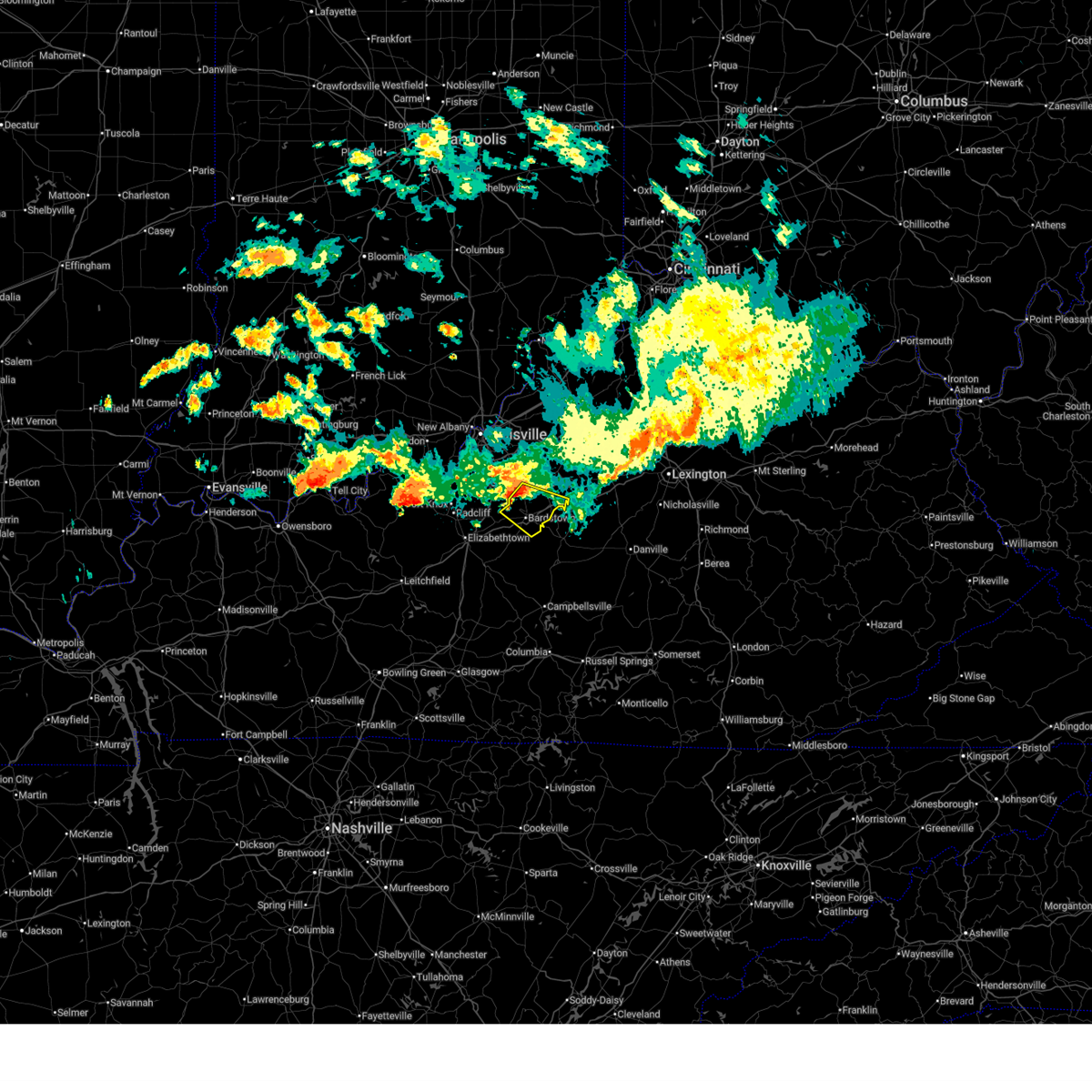
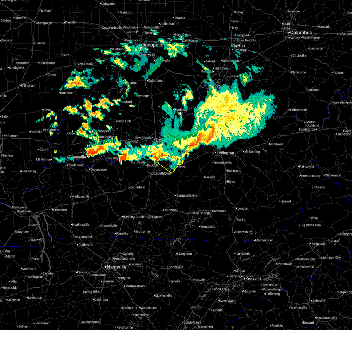
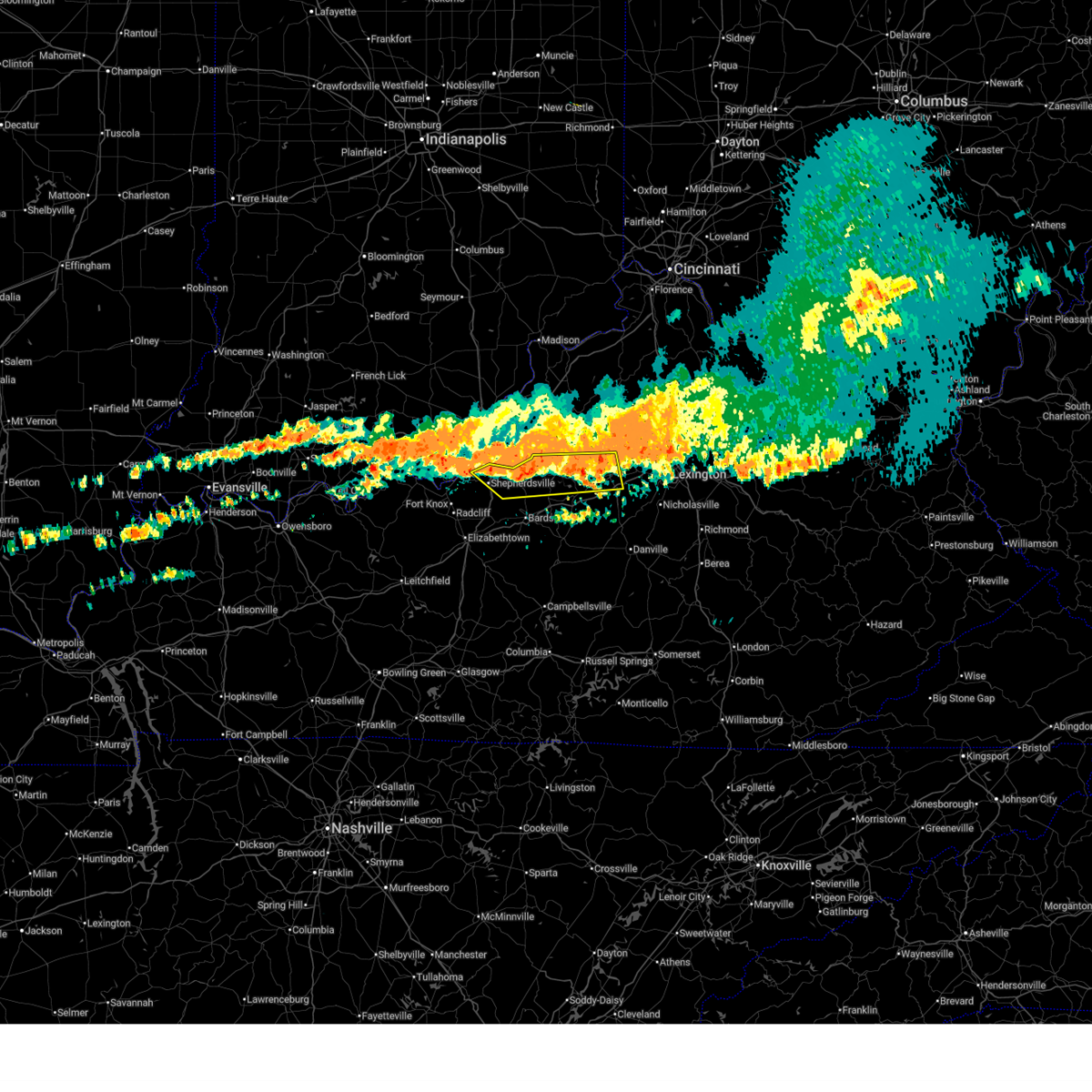
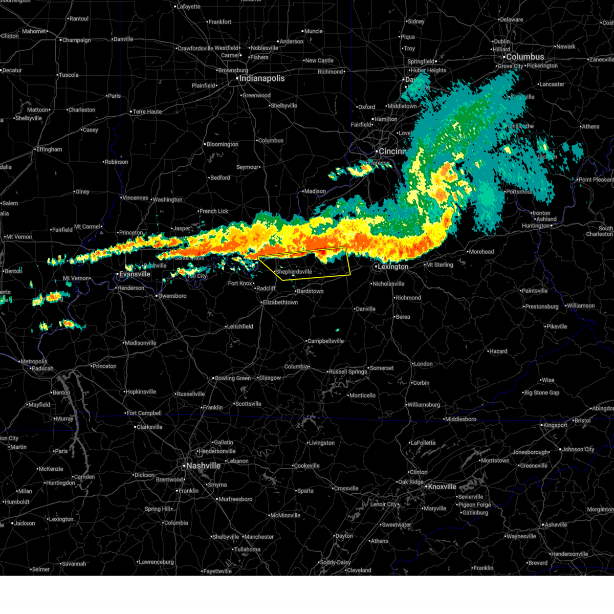
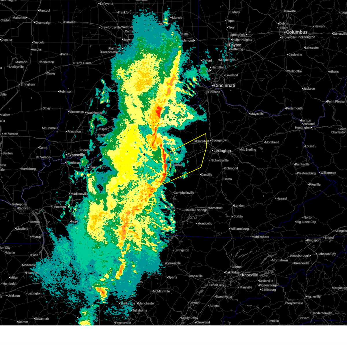
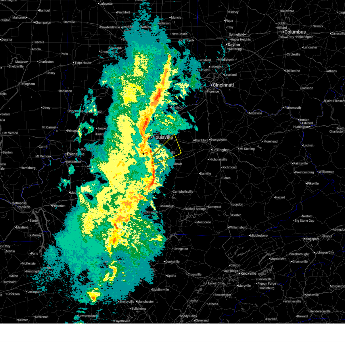
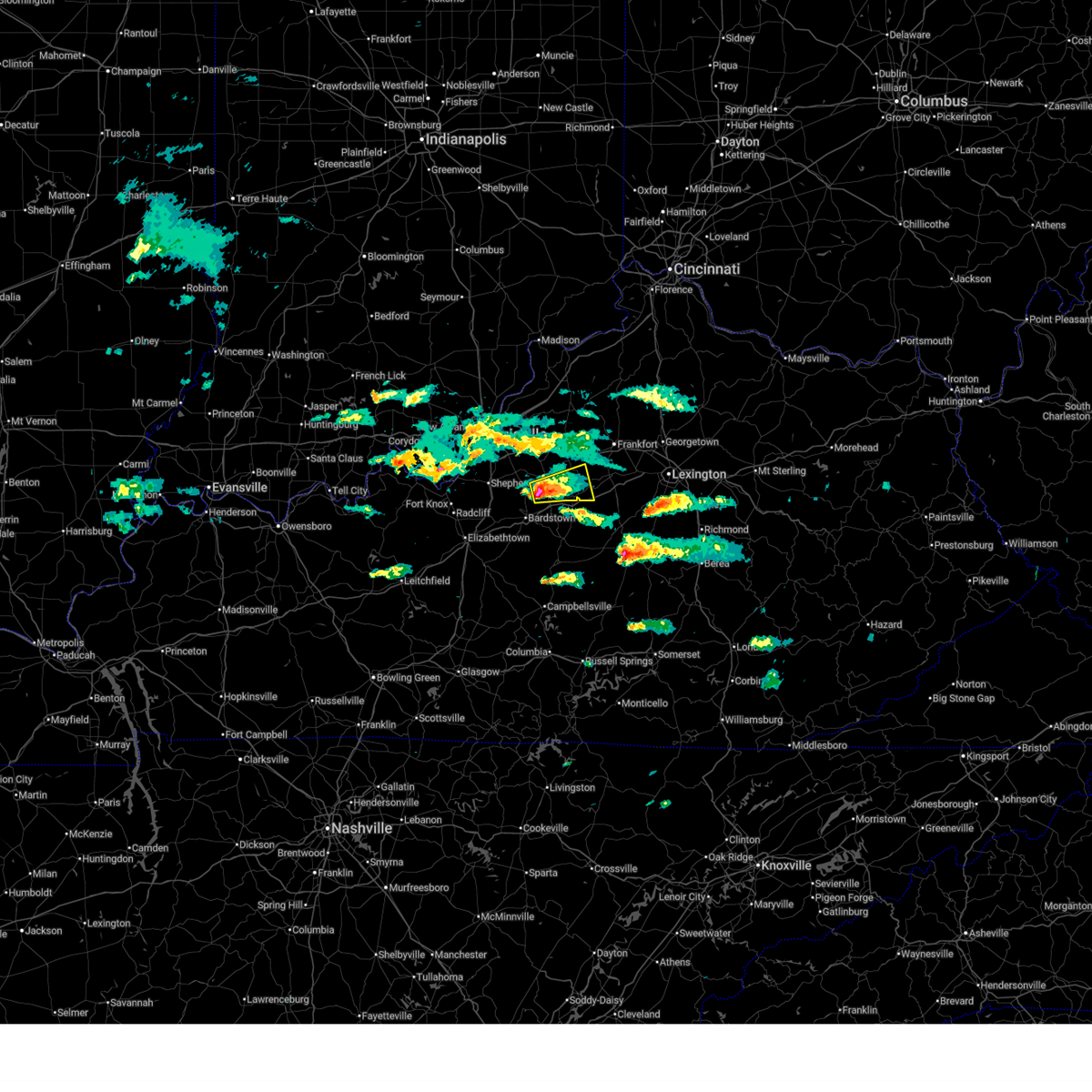
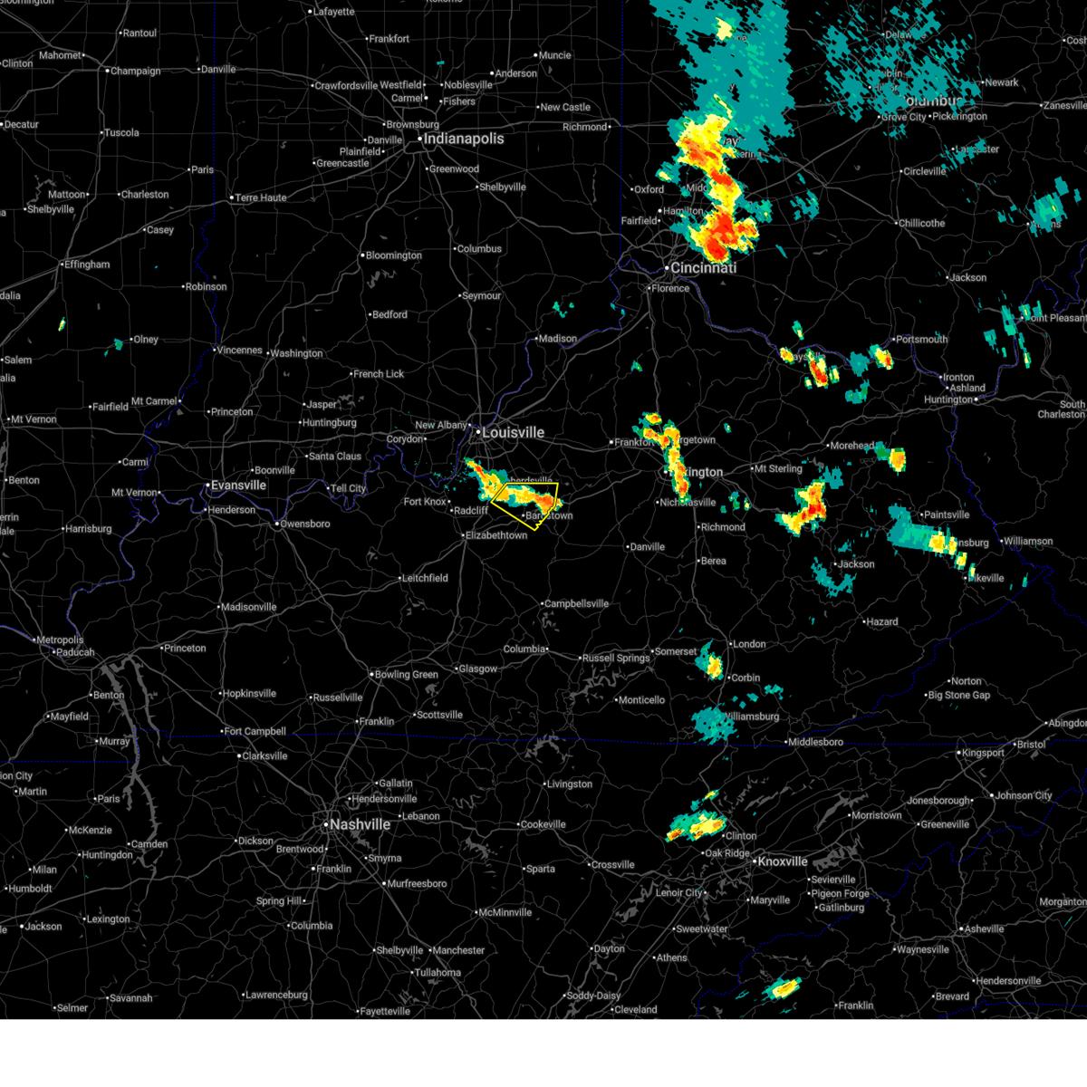
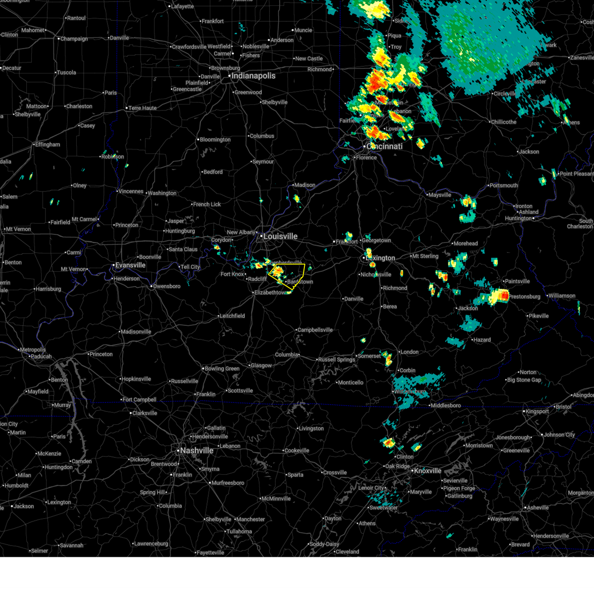
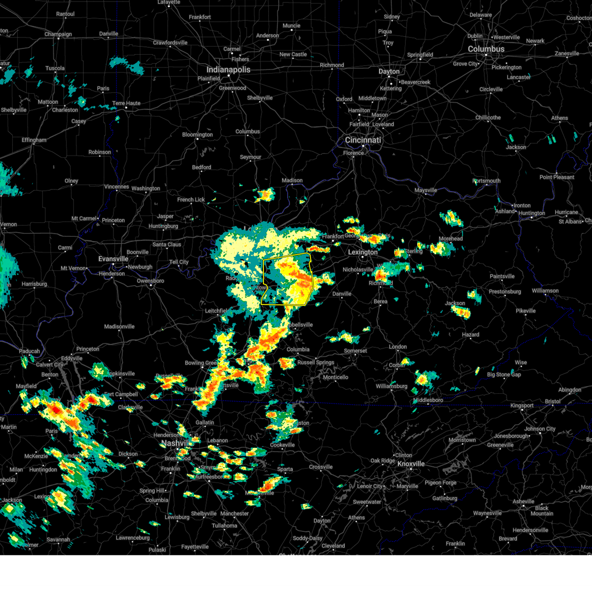
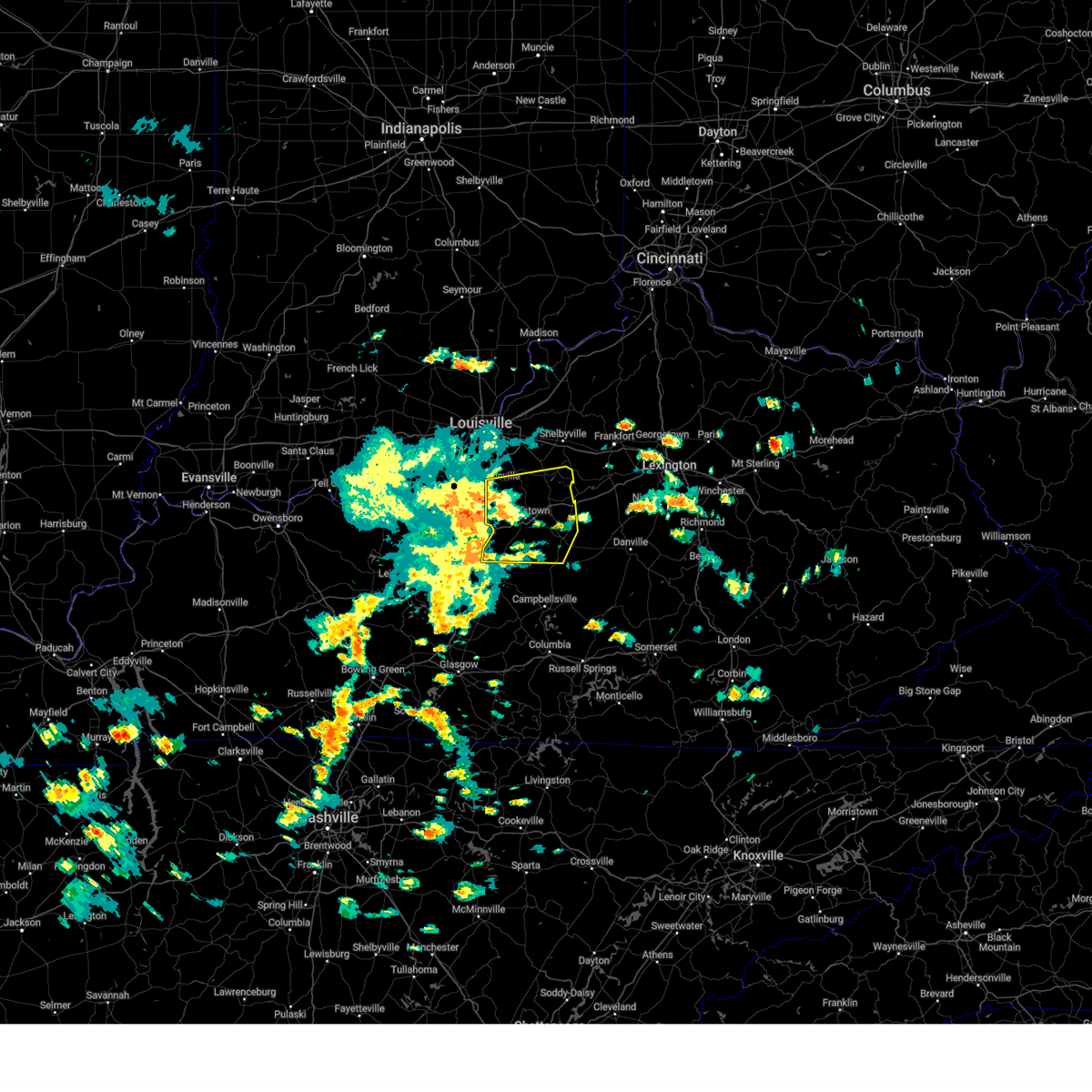
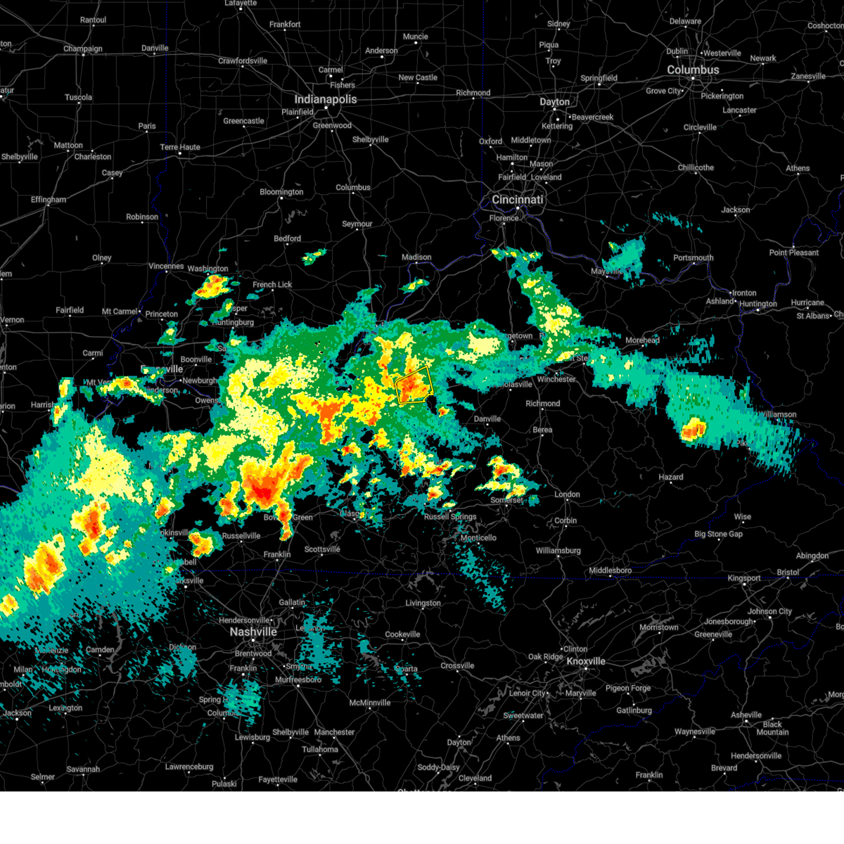
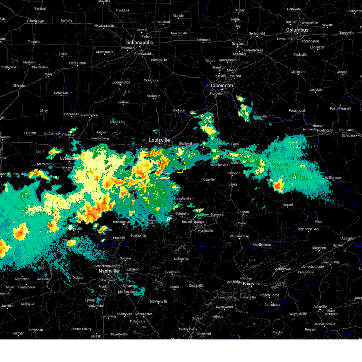
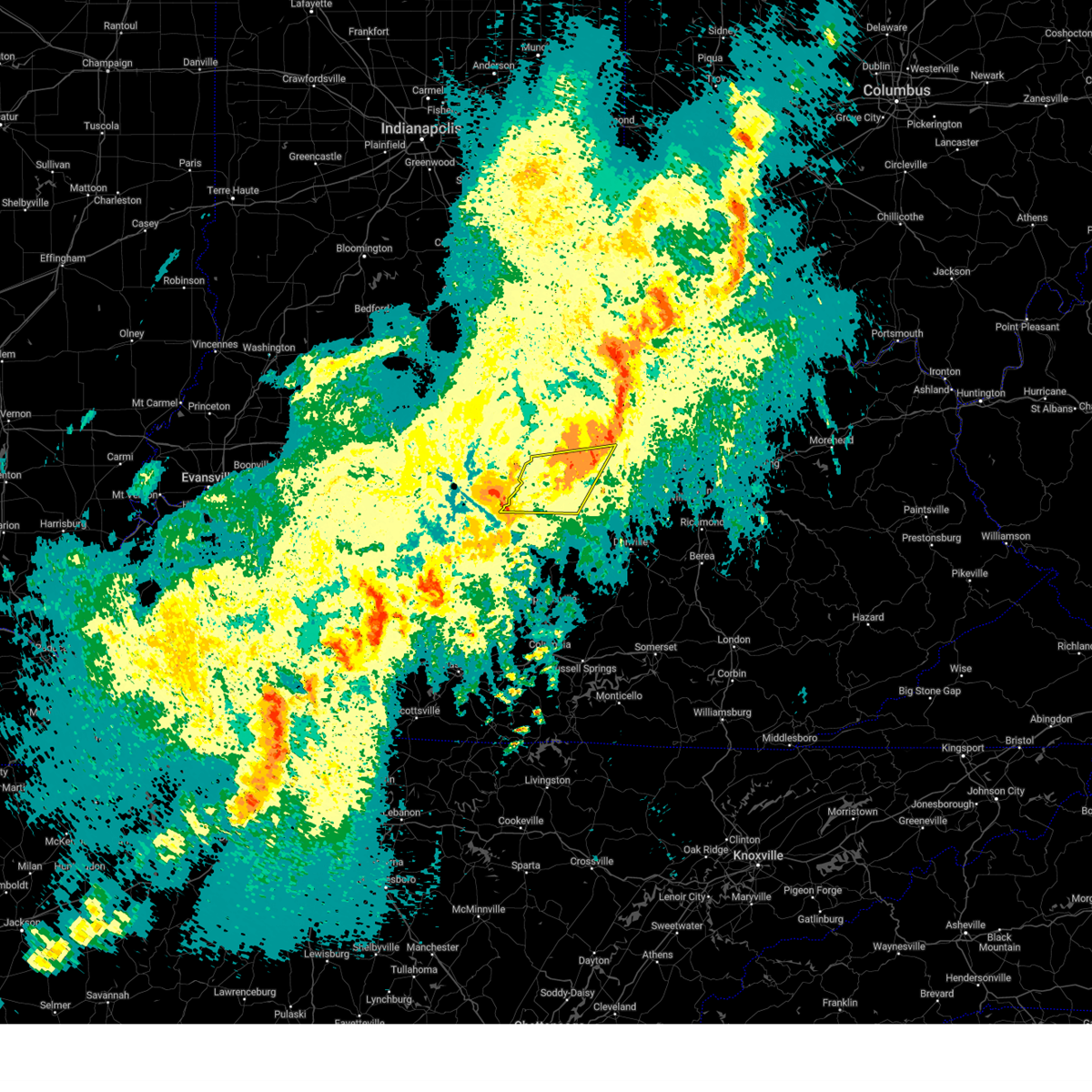
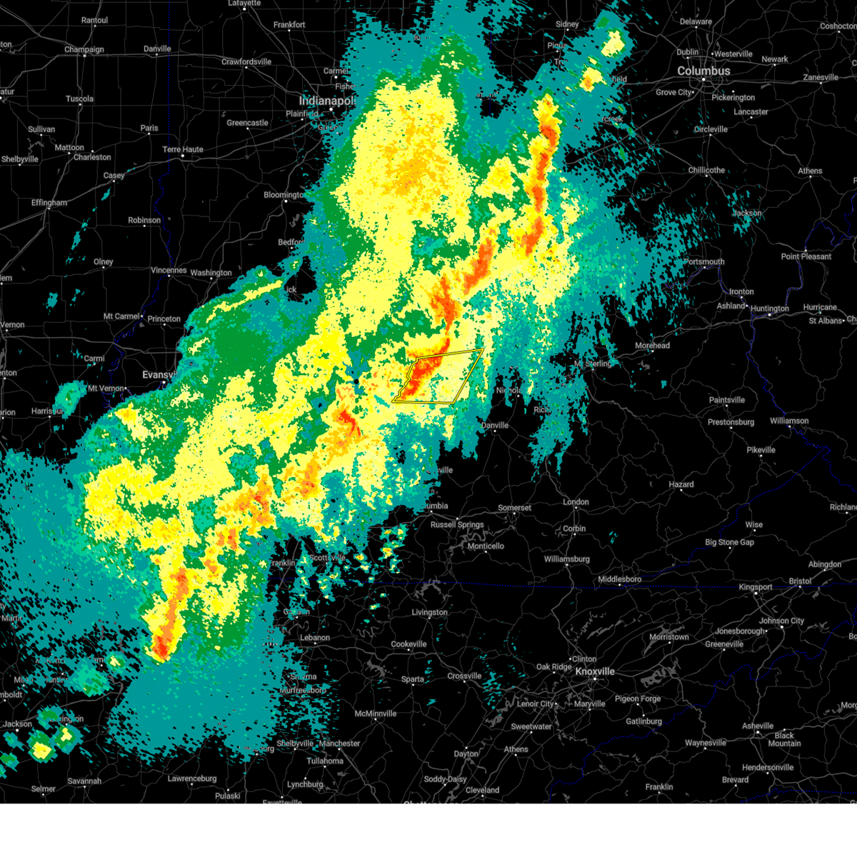
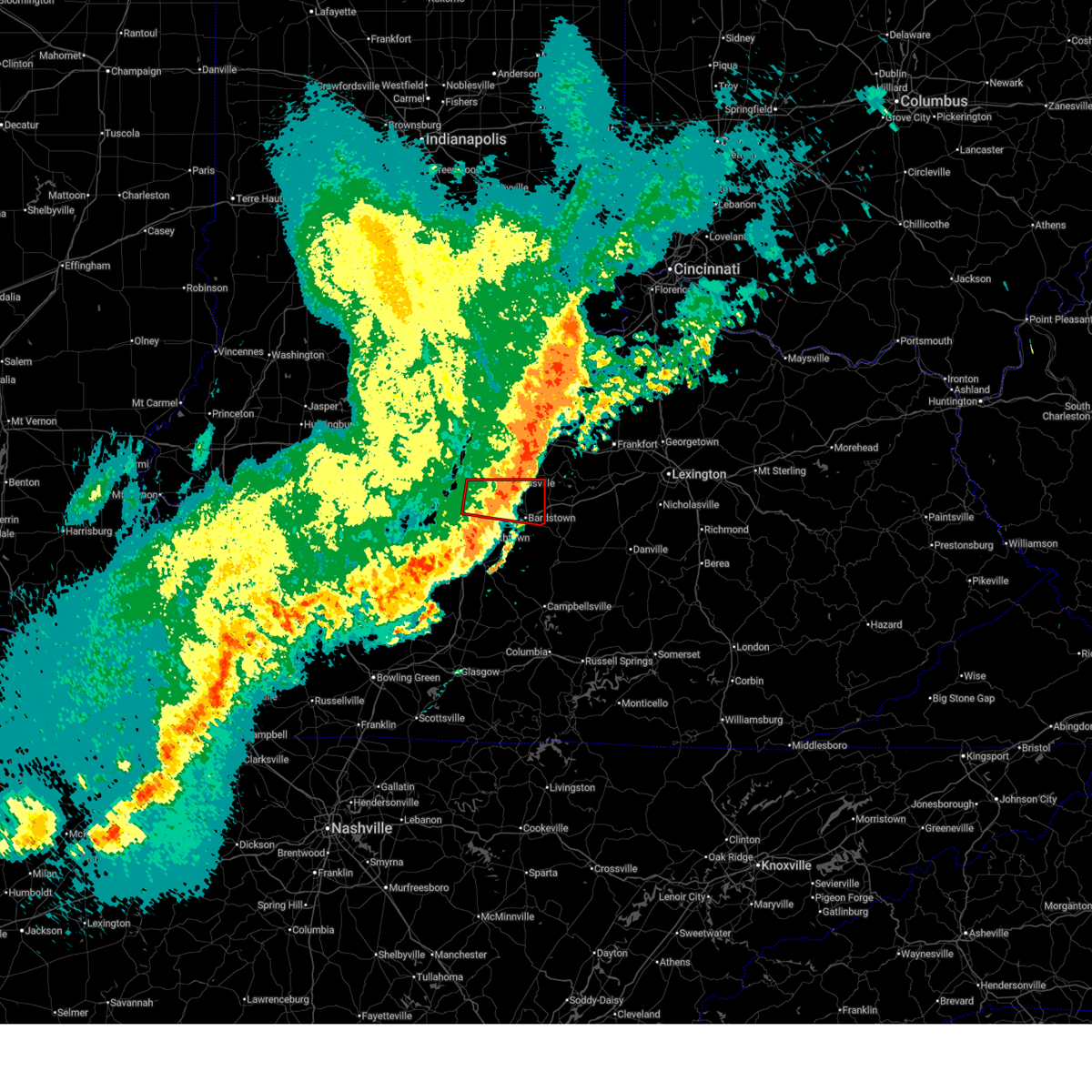
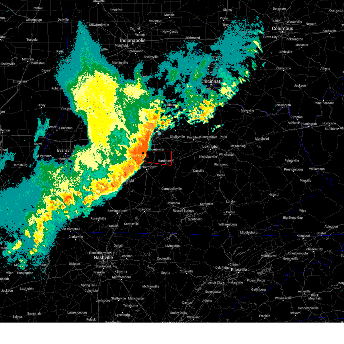
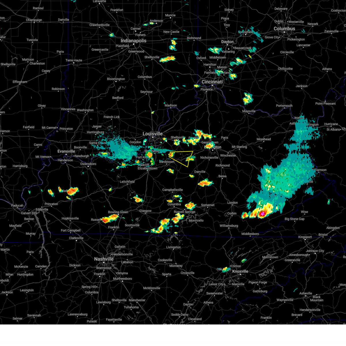
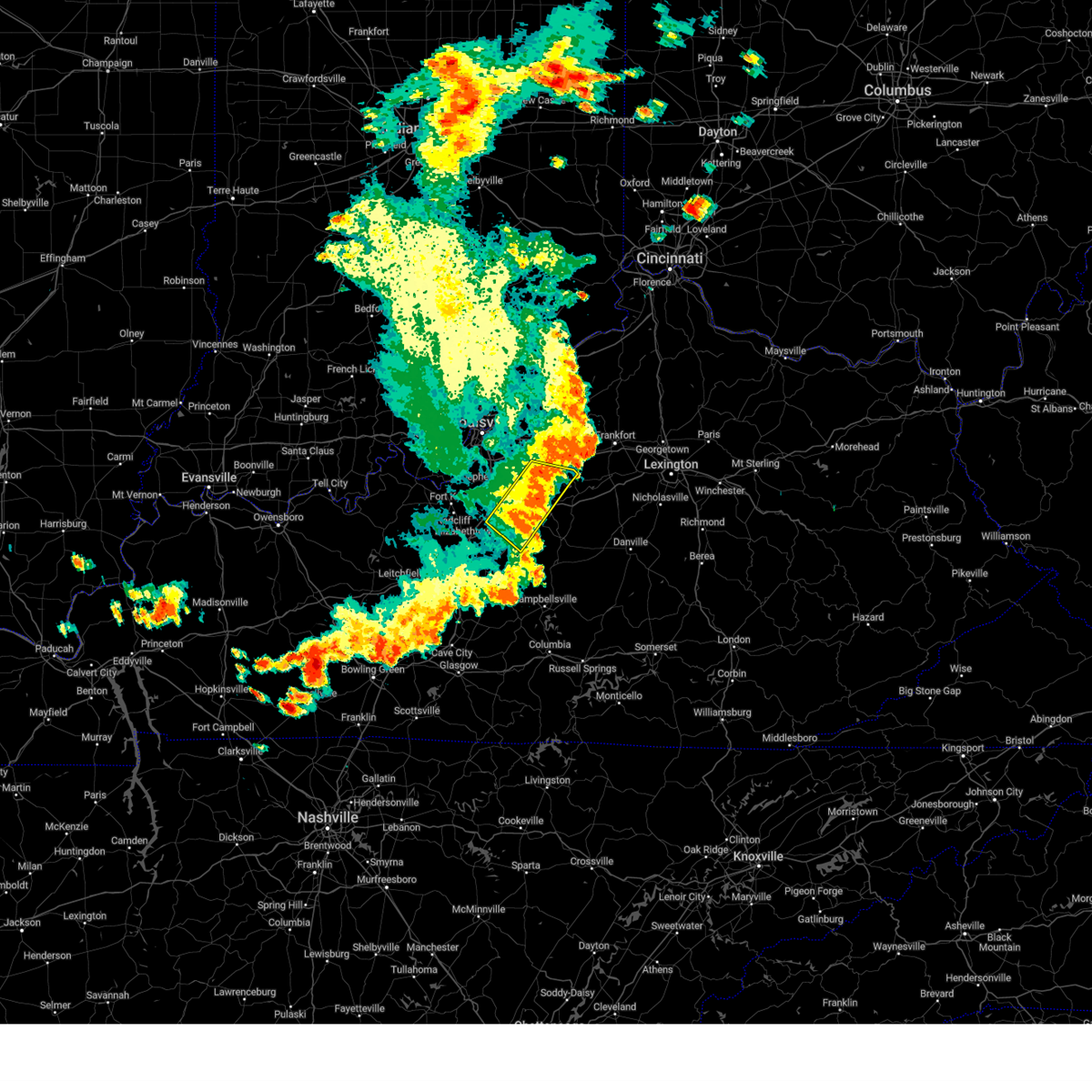
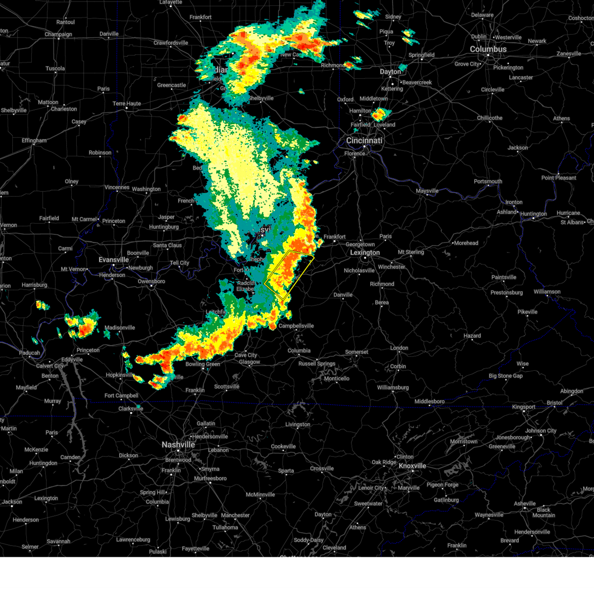
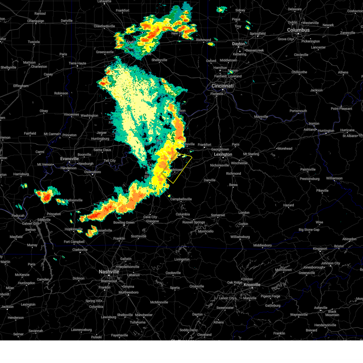
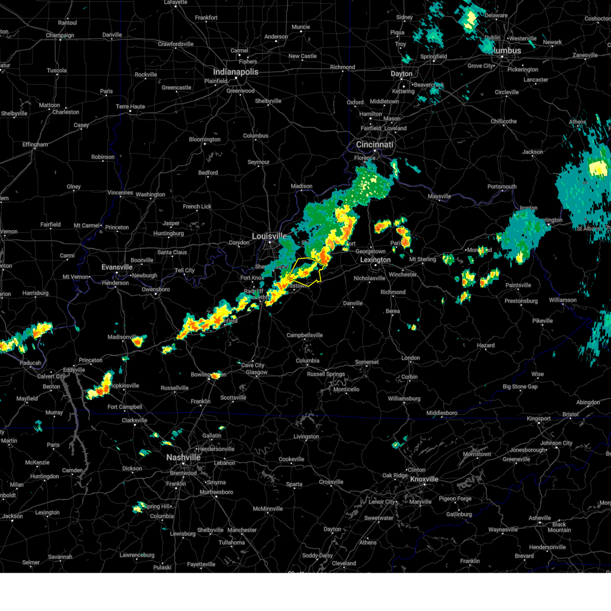
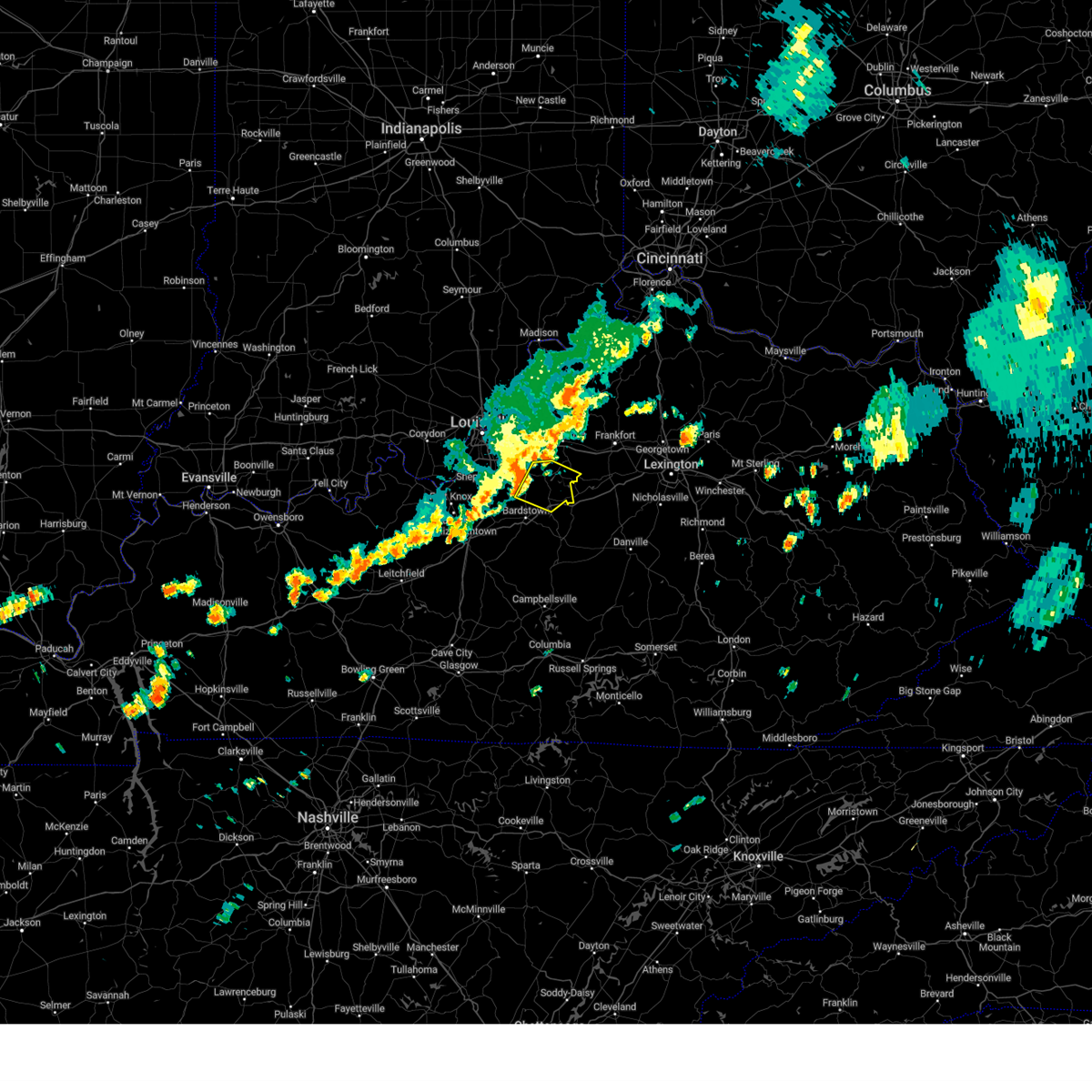
Hail Map for Fairfield, KY
The Fairfield, KY area has had 3 reports of on-the-ground hail by trained spotters, and has been under severe weather warnings 13 times during the past 12 months. Doppler radar has detected hail at or near Fairfield, KY on 52 occasions, including 2 occasions during the past year.
| Name: | Fairfield, KY |
| Where Located: | 18.6 miles ESE of Louisville, KY |
| Map: | Google Map for Fairfield, KY |
| Population: | 113 |
| Housing Units: | 57 |
| More Info: | Search Google for Fairfield, KY |
2
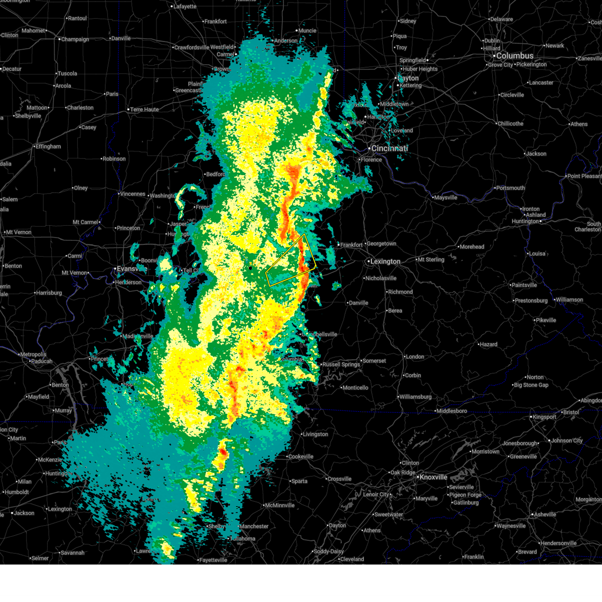
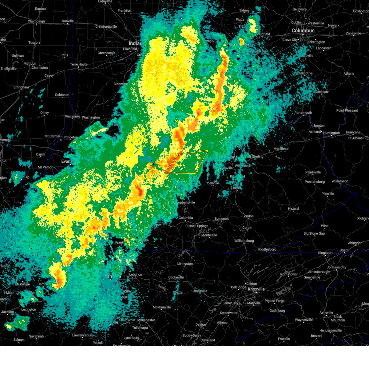
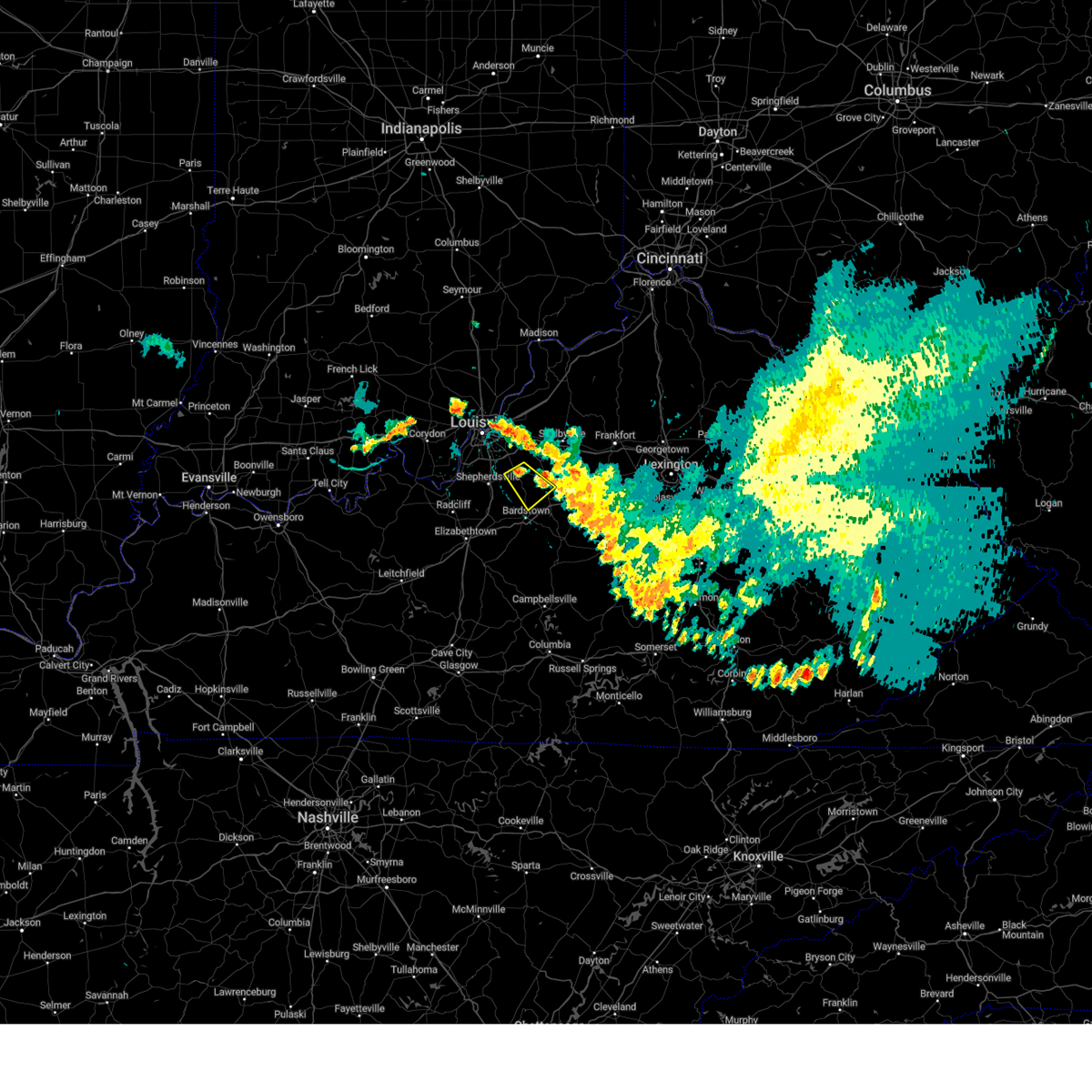
The Top Recent Hail Date for Fairfield, KY is Thursday, February 19, 2026 (4th out of 52)
Hail and Wind Damage Spotted near Fairfield, KY
| Date / Time | Report Details |
|---|---|
| 6/26/2026 8:57 PM EDT |
 Svrlmk the national weather service in louisville has issued a * severe thunderstorm warning for, southeastern spencer county in central kentucky, northeastern nelson county in central kentucky, northwestern mercer county in central kentucky, southwestern anderson county in central kentucky, northeastern washington county in central kentucky, * until 945 pm edt. * at 857 pm edt, a severe thunderstorm was located 9 miles south of taylorsville, moving east at 35 mph (radar indicated). Hazards include 60 mph wind gusts. expect damage to roofs, siding, and trees Svrlmk the national weather service in louisville has issued a * severe thunderstorm warning for, southeastern spencer county in central kentucky, northeastern nelson county in central kentucky, northwestern mercer county in central kentucky, southwestern anderson county in central kentucky, northeastern washington county in central kentucky, * until 945 pm edt. * at 857 pm edt, a severe thunderstorm was located 9 miles south of taylorsville, moving east at 35 mph (radar indicated). Hazards include 60 mph wind gusts. expect damage to roofs, siding, and trees
|
| 6/22/2026 12:54 AM EDT |
 The storm which prompted the warning has weakened below severe limits, and no longer poses an immediate threat to life or property. therefore, the warning will be allowed to expire. a tornado watch remains in effect until 200 am edt for central kentucky. The storm which prompted the warning has weakened below severe limits, and no longer poses an immediate threat to life or property. therefore, the warning will be allowed to expire. a tornado watch remains in effect until 200 am edt for central kentucky.
|
| 6/22/2026 12:38 AM EDT |
 At 1238 am edt, a severe thunderstorm was located near bardstown, moving east at 25 mph (radar indicated). Hazards include 60 mph wind gusts. Expect damage to roofs, siding, and trees. Locations impacted include, bardstown, bloomfield, fairfield, east bardstown, samuels field airport, botland, withrow, samuels, chaplin, and bourbon springs. At 1238 am edt, a severe thunderstorm was located near bardstown, moving east at 25 mph (radar indicated). Hazards include 60 mph wind gusts. Expect damage to roofs, siding, and trees. Locations impacted include, bardstown, bloomfield, fairfield, east bardstown, samuels field airport, botland, withrow, samuels, chaplin, and bourbon springs.
|
| 6/22/2026 12:27 AM EDT |
 the severe thunderstorm warning has been cancelled and is no longer in effect the severe thunderstorm warning has been cancelled and is no longer in effect
|
| 6/22/2026 12:27 AM EDT |
 At 1226 am edt, a severe thunderstorm was located near bardstown, moving southeast at 25 mph (radar indicated). Hazards include 60 mph wind gusts. Expect damage to roofs, siding, and trees. Locations impacted include, bardstown, bloomfield, fairfield, highgrove, east bardstown, samuels field airport, deatsville, bellwood, botland, and withrow. At 1226 am edt, a severe thunderstorm was located near bardstown, moving southeast at 25 mph (radar indicated). Hazards include 60 mph wind gusts. Expect damage to roofs, siding, and trees. Locations impacted include, bardstown, bloomfield, fairfield, highgrove, east bardstown, samuels field airport, deatsville, bellwood, botland, and withrow.
|
| 6/22/2026 12:14 AM EDT |
 Svrlmk the national weather service in louisville has issued a * severe thunderstorm warning for, southwestern spencer county in central kentucky, northern nelson county in central kentucky, central bullitt county in central kentucky, * until 100 am edt. * at 1213 am edt, a severe thunderstorm was located near shepherdsville, moving southeast at 25 mph (radar indicated). Hazards include 60 mph wind gusts. expect damage to roofs, siding, and trees Svrlmk the national weather service in louisville has issued a * severe thunderstorm warning for, southwestern spencer county in central kentucky, northern nelson county in central kentucky, central bullitt county in central kentucky, * until 100 am edt. * at 1213 am edt, a severe thunderstorm was located near shepherdsville, moving southeast at 25 mph (radar indicated). Hazards include 60 mph wind gusts. expect damage to roofs, siding, and trees
|
| 6/18/2026 5:31 AM EDT |
 At 530 am edt, severe thunderstorms were located along a line extending from 11 miles southeast of shelbyville to near shepherdsville, moving southeast at 35 mph (radar indicated). Hazards include 60 mph wind gusts. Expect damage to roofs, siding, and trees. Locations impacted include, shepherdsville, lawrenceburg, pioneer village, taylorsville, mount washington, hillview, hebron estates, fox chase, hunters hollow, and fairfield. At 530 am edt, severe thunderstorms were located along a line extending from 11 miles southeast of shelbyville to near shepherdsville, moving southeast at 35 mph (radar indicated). Hazards include 60 mph wind gusts. Expect damage to roofs, siding, and trees. Locations impacted include, shepherdsville, lawrenceburg, pioneer village, taylorsville, mount washington, hillview, hebron estates, fox chase, hunters hollow, and fairfield.
|
| 6/18/2026 5:14 AM EDT |
 Svrlmk the national weather service in louisville has issued a * severe thunderstorm warning for, spencer county in central kentucky, southern shelby county in central kentucky, northeastern nelson county in central kentucky, west central woodford county in central kentucky, anderson county in central kentucky, southern jefferson county in central kentucky, northern bullitt county in central kentucky, southwestern franklin county in central kentucky, * until 545 am edt. * at 513 am edt, severe thunderstorms were located along a line extending from near shelbyville to near valley station, moving southeast at 35 mph (standiford field gusted to 62 mph). Hazards include 60 mph wind gusts. expect damage to roofs, siding, and trees Svrlmk the national weather service in louisville has issued a * severe thunderstorm warning for, spencer county in central kentucky, southern shelby county in central kentucky, northeastern nelson county in central kentucky, west central woodford county in central kentucky, anderson county in central kentucky, southern jefferson county in central kentucky, northern bullitt county in central kentucky, southwestern franklin county in central kentucky, * until 545 am edt. * at 513 am edt, severe thunderstorms were located along a line extending from near shelbyville to near valley station, moving southeast at 35 mph (standiford field gusted to 62 mph). Hazards include 60 mph wind gusts. expect damage to roofs, siding, and trees
|
| 3/16/2026 12:24 AM EDT |
 The storm which prompted the warning has moved out of the area. therefore, the warning will be allowed to expire. however, gusty winds are still possible with this thunderstorm. remember, a severe thunderstorm for spencer county and a tornado warning still remains in effect for shelby county. The storm which prompted the warning has moved out of the area. therefore, the warning will be allowed to expire. however, gusty winds are still possible with this thunderstorm. remember, a severe thunderstorm for spencer county and a tornado warning still remains in effect for shelby county.
|
| 3/16/2026 12:15 AM EDT |
 Svrlmk the national weather service in louisville has issued a * severe thunderstorm warning for, southern spencer county in central kentucky, southeastern shelby county in central kentucky, northeastern nelson county in central kentucky, mercer county in central kentucky, woodford county in central kentucky, southwestern scott county in central kentucky, anderson county in central kentucky, southeastern larue county in central kentucky, northern marion county in central kentucky, washington county in central kentucky, southern franklin county in central kentucky, * until 100 am edt. * at 1215 am edt, severe thunderstorms were located along a line extending from taylorsville to 8 miles east of bardstown to 10 miles southwest of lebanon, moving northeast at 60 mph (radar indicated). Hazards include 70 mph wind gusts. Expect considerable tree damage. Damage is likely to mobile homes, roofs, and outbuildings. Svrlmk the national weather service in louisville has issued a * severe thunderstorm warning for, southern spencer county in central kentucky, southeastern shelby county in central kentucky, northeastern nelson county in central kentucky, mercer county in central kentucky, woodford county in central kentucky, southwestern scott county in central kentucky, anderson county in central kentucky, southeastern larue county in central kentucky, northern marion county in central kentucky, washington county in central kentucky, southern franklin county in central kentucky, * until 100 am edt. * at 1215 am edt, severe thunderstorms were located along a line extending from taylorsville to 8 miles east of bardstown to 10 miles southwest of lebanon, moving northeast at 60 mph (radar indicated). Hazards include 70 mph wind gusts. Expect considerable tree damage. Damage is likely to mobile homes, roofs, and outbuildings.
|
| 3/15/2026 11:59 PM EDT |
 Svrlmk the national weather service in louisville has issued a * severe thunderstorm warning for, spencer county in central kentucky, western shelby county in central kentucky, northern nelson county in central kentucky, southeastern jefferson county in central kentucky, central bullitt county in central kentucky, * until 1230 am edt. * at 1159 pm edt, a severe thunderstorm was located near shepherdsville, moving northeast at 65 mph (radar indicated). Hazards include 60 mph wind gusts. expect damage to roofs, siding, and trees Svrlmk the national weather service in louisville has issued a * severe thunderstorm warning for, spencer county in central kentucky, western shelby county in central kentucky, northern nelson county in central kentucky, southeastern jefferson county in central kentucky, central bullitt county in central kentucky, * until 1230 am edt. * at 1159 pm edt, a severe thunderstorm was located near shepherdsville, moving northeast at 65 mph (radar indicated). Hazards include 60 mph wind gusts. expect damage to roofs, siding, and trees
|
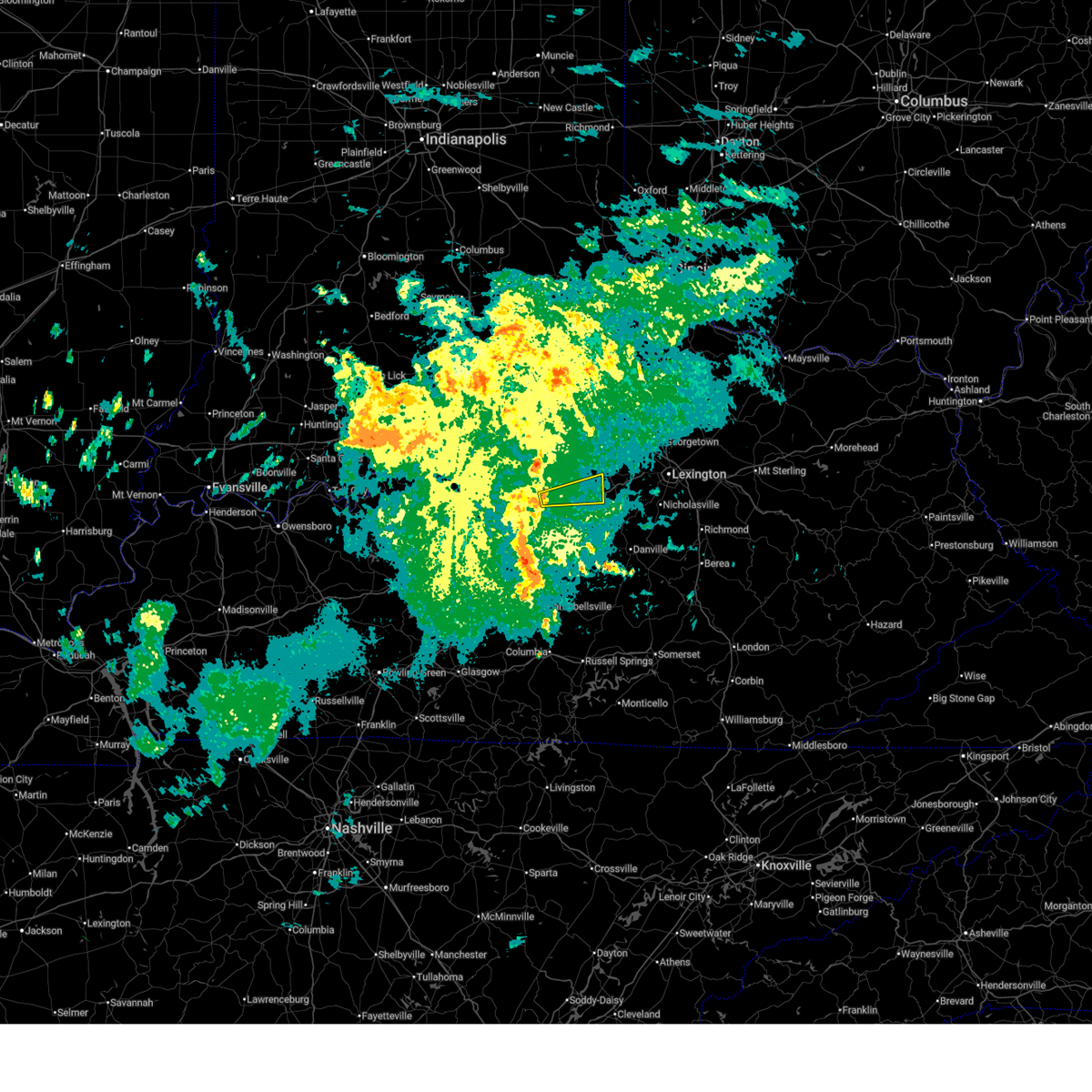
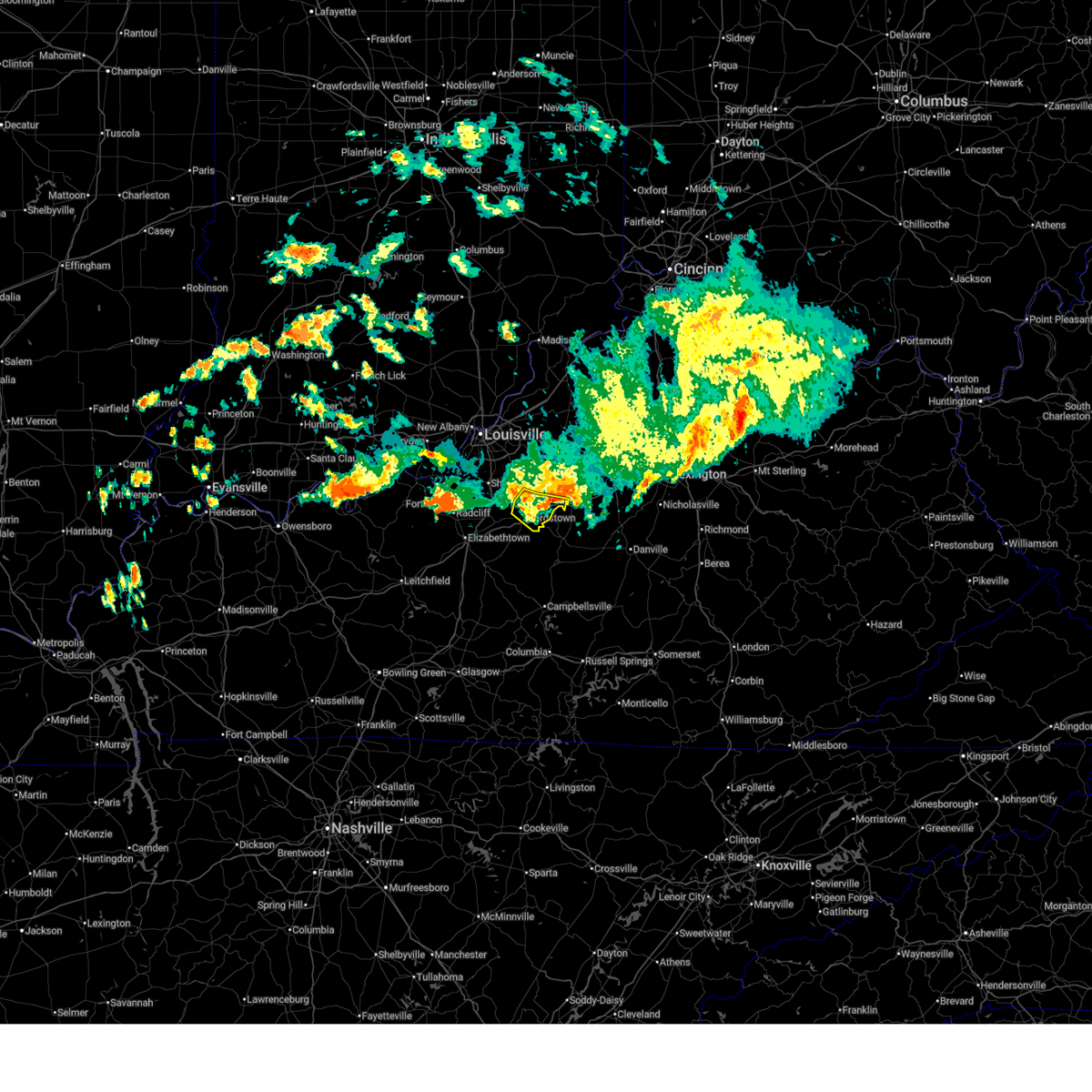
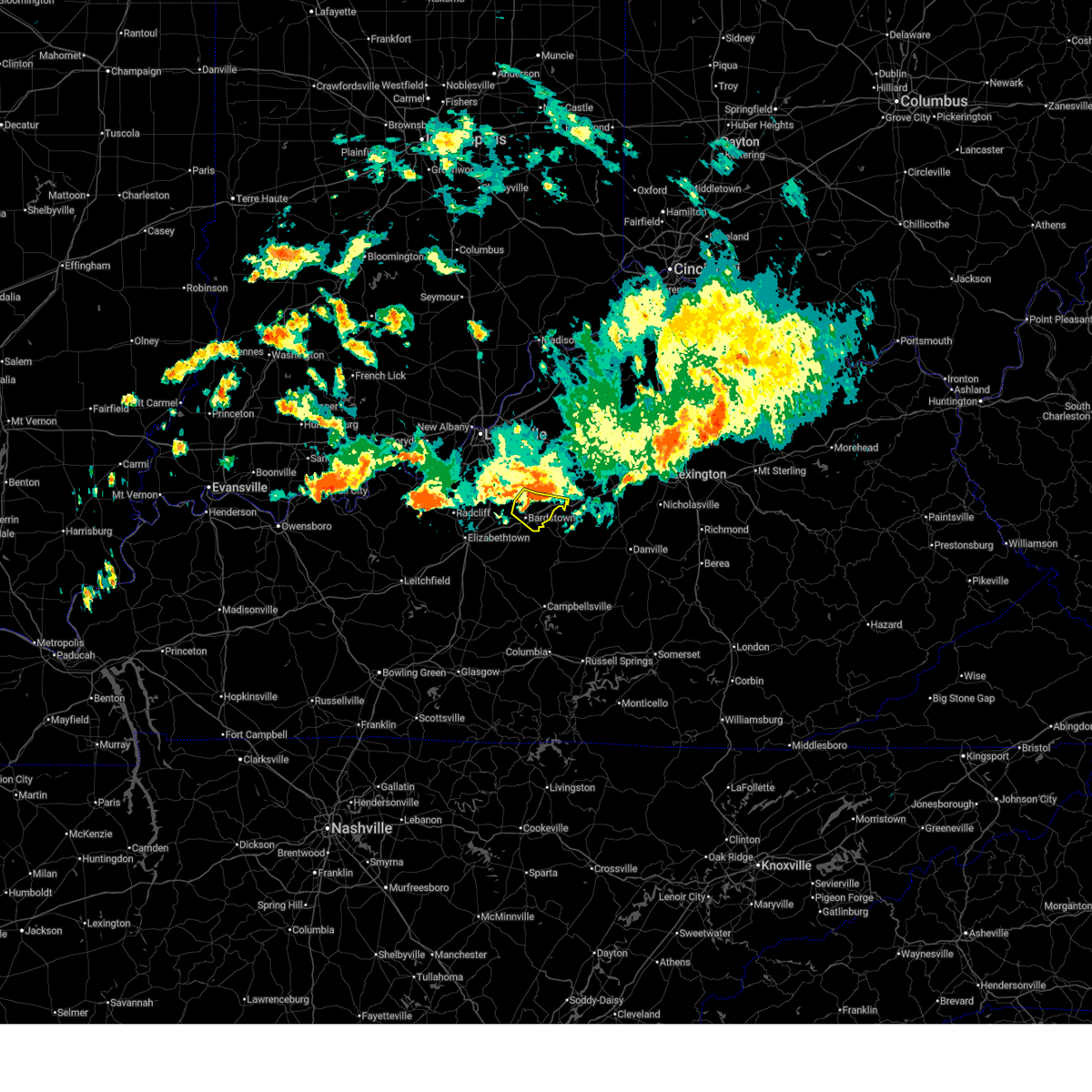
| 2/19/2026 3:00 PM EST |
 At 259 pm est, a severe thunderstorm was located 2 miles north of bloomfield, moving east at 35 mph (public reported quarter size hail in deatsville). Hazards include 60 mph wind gusts and quarter size hail. Hail damage to vehicles is expected. expect wind damage to roofs, siding, and trees. Locations impacted include, bloomfield, fairfield, wakefield, sinai, wayside, gee, glensboro, johnsonville, ashbrook, and klondyke. At 259 pm est, a severe thunderstorm was located 2 miles north of bloomfield, moving east at 35 mph (public reported quarter size hail in deatsville). Hazards include 60 mph wind gusts and quarter size hail. Hail damage to vehicles is expected. expect wind damage to roofs, siding, and trees. Locations impacted include, bloomfield, fairfield, wakefield, sinai, wayside, gee, glensboro, johnsonville, ashbrook, and klondyke.
|
| 2/19/2026 2:56 PM EST |
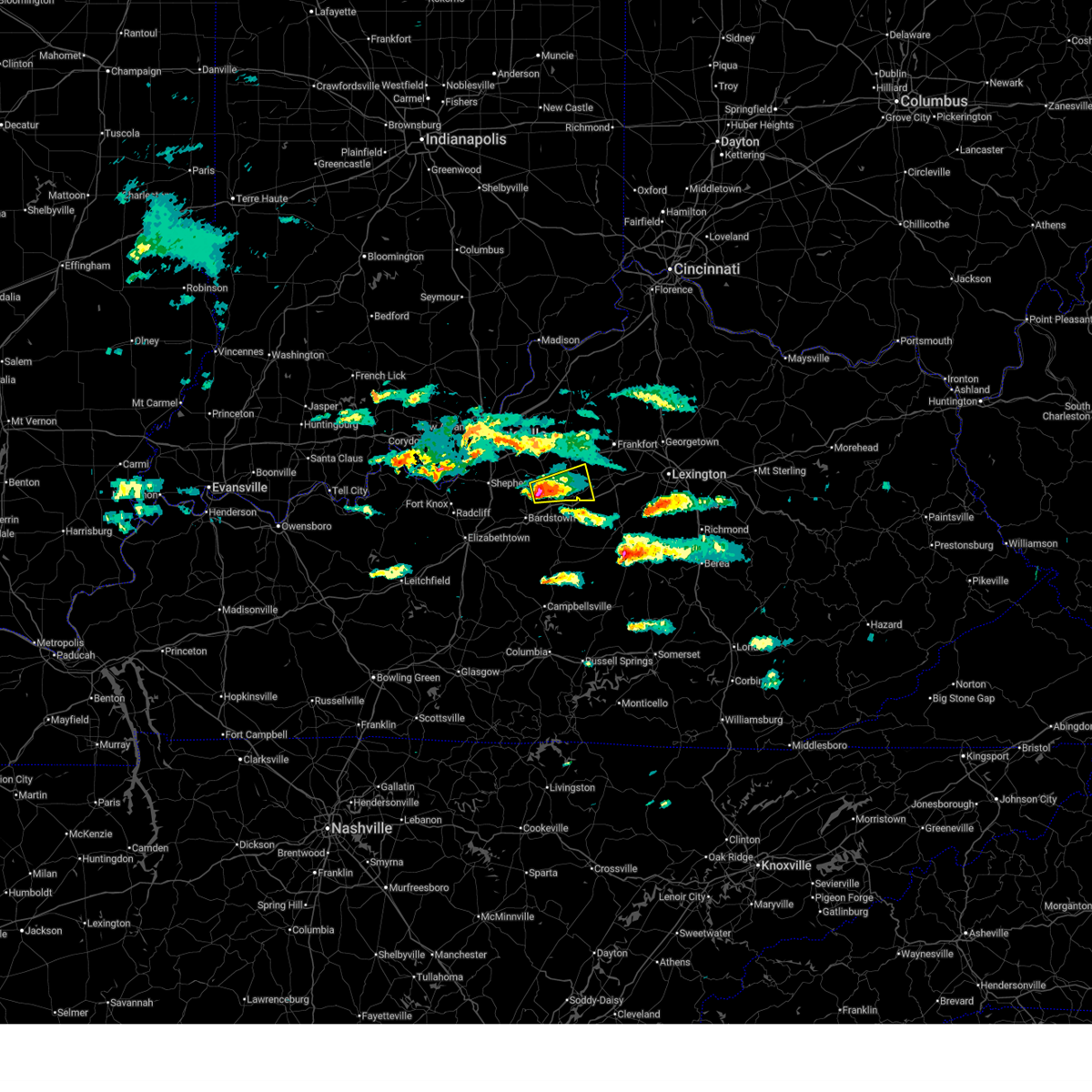 Svrlmk the national weather service in louisville has issued a * severe thunderstorm warning for, southern spencer county in central kentucky, south central shelby county in central kentucky, northeastern nelson county in central kentucky, southwestern anderson county in central kentucky, * until 330 pm est. * at 255 pm est, a severe thunderstorm was located 3 miles northeast of bloomfield, moving east at 35 mph (radar indicated). Hazards include 60 mph wind gusts and quarter size hail. Hail damage to vehicles is expected. Expect wind damage to roofs, siding, and trees. Svrlmk the national weather service in louisville has issued a * severe thunderstorm warning for, southern spencer county in central kentucky, south central shelby county in central kentucky, northeastern nelson county in central kentucky, southwestern anderson county in central kentucky, * until 330 pm est. * at 255 pm est, a severe thunderstorm was located 3 miles northeast of bloomfield, moving east at 35 mph (radar indicated). Hazards include 60 mph wind gusts and quarter size hail. Hail damage to vehicles is expected. Expect wind damage to roofs, siding, and trees.
|
| 6/26/2025 5:02 PM EDT |
 The storm which prompted the warning has weakened below severe limits, and no longer poses an immediate threat to life or property. therefore, the warning has been allowed to expire. however, gusty winds and heavy rain are still possible with this thunderstorm. to report severe weather, contact your nearest law enforcement agency. they will relay your report to the national weather service louisville. The storm which prompted the warning has weakened below severe limits, and no longer poses an immediate threat to life or property. therefore, the warning has been allowed to expire. however, gusty winds and heavy rain are still possible with this thunderstorm. to report severe weather, contact your nearest law enforcement agency. they will relay your report to the national weather service louisville.
|
| 6/26/2025 4:29 PM EDT |
 Svrlmk the national weather service in louisville has issued a * severe thunderstorm warning for, southwestern spencer county in central kentucky, northern nelson county in central kentucky, southeastern bullitt county in central kentucky, * until 500 pm edt. * at 429 pm edt, a severe thunderstorm was located over bardstown, moving east at 10 mph (radar indicated). Hazards include 60 mph wind gusts. expect damage to roofs, siding, and trees Svrlmk the national weather service in louisville has issued a * severe thunderstorm warning for, southwestern spencer county in central kentucky, northern nelson county in central kentucky, southeastern bullitt county in central kentucky, * until 500 pm edt. * at 429 pm edt, a severe thunderstorm was located over bardstown, moving east at 10 mph (radar indicated). Hazards include 60 mph wind gusts. expect damage to roofs, siding, and trees
|
| 6/6/2025 1:58 PM EDT |
 The storms which prompted the warning have moved out of the area. therefore, the warning will be allowed to expire. however, gusty winds are still possible with these thunderstorms. to report severe weather, contact your nearest law enforcement agency. they will relay your report to the national weather service louisville. The storms which prompted the warning have moved out of the area. therefore, the warning will be allowed to expire. however, gusty winds are still possible with these thunderstorms. to report severe weather, contact your nearest law enforcement agency. they will relay your report to the national weather service louisville.
|
| 6/6/2025 1:27 PM EDT |
 Svrlmk the national weather service in louisville has issued a * severe thunderstorm warning for, spencer county in central kentucky, nelson county in central kentucky, north central larue county in central kentucky, northwestern marion county in central kentucky, central washington county in central kentucky, central bullitt county in central kentucky, * until 200 pm edt. * at 127 pm edt, severe thunderstorms were located along a line extending from near shepherdsville to 9 miles southwest of bardstown to 7 miles northeast of hodgenville, moving east at 45 mph (radar indicated). Hazards include 60 mph wind gusts and penny size hail. expect damage to roofs, siding, and trees Svrlmk the national weather service in louisville has issued a * severe thunderstorm warning for, spencer county in central kentucky, nelson county in central kentucky, north central larue county in central kentucky, northwestern marion county in central kentucky, central washington county in central kentucky, central bullitt county in central kentucky, * until 200 pm edt. * at 127 pm edt, severe thunderstorms were located along a line extending from near shepherdsville to 9 miles southwest of bardstown to 7 miles northeast of hodgenville, moving east at 45 mph (radar indicated). Hazards include 60 mph wind gusts and penny size hail. expect damage to roofs, siding, and trees
|
| 5/16/2025 10:19 PM EDT |
 Svrlmk the national weather service in louisville has issued a * severe thunderstorm warning for, east central clark county in south central indiana, oldham county in central kentucky, shelby county in central kentucky, northern nelson county in central kentucky, anderson county in central kentucky, henry county in central kentucky, northeastern jefferson county in central kentucky, eastern bullitt county in central kentucky, franklin county in central kentucky, spencer county in central kentucky, northwestern woodford county in central kentucky, southern trimble county in central kentucky, northeastern washington county in central kentucky, * until 1100 pm edt. * at 1018 pm edt, severe thunderstorms were located along a line extending from near prospect to 7 miles southeast of fern creek to 8 miles south of shepherdsville, moving east at 60 mph (radar indicated). Hazards include 70 mph wind gusts and penny size hail. Expect considerable tree damage. Damage is likely to mobile homes, roofs, and outbuildings. Svrlmk the national weather service in louisville has issued a * severe thunderstorm warning for, east central clark county in south central indiana, oldham county in central kentucky, shelby county in central kentucky, northern nelson county in central kentucky, anderson county in central kentucky, henry county in central kentucky, northeastern jefferson county in central kentucky, eastern bullitt county in central kentucky, franklin county in central kentucky, spencer county in central kentucky, northwestern woodford county in central kentucky, southern trimble county in central kentucky, northeastern washington county in central kentucky, * until 1100 pm edt. * at 1018 pm edt, severe thunderstorms were located along a line extending from near prospect to 7 miles southeast of fern creek to 8 miles south of shepherdsville, moving east at 60 mph (radar indicated). Hazards include 70 mph wind gusts and penny size hail. Expect considerable tree damage. Damage is likely to mobile homes, roofs, and outbuildings.
|
| 5/16/2025 9:55 PM EDT |
 Svrlmk the national weather service in louisville has issued a * severe thunderstorm warning for, southeastern harrison county in south central indiana, south central clark county in south central indiana, southern floyd county in south central indiana, south central oldham county in central kentucky, western spencer county in central kentucky, west central shelby county in central kentucky, northwestern nelson county in central kentucky, southeastern meade county in central kentucky, jefferson county in central kentucky, bullitt county in central kentucky, northeastern hardin county in central kentucky, * until 1030 pm edt. * at 954 pm edt, a severe thunderstorm was located 9 miles northeast of brandenburg, moving east at 75 mph (radar indicated). Hazards include 70 mph wind gusts and quarter size hail. Hail damage to vehicles is expected. expect considerable tree damage. Wind damage is also likely to mobile homes, roofs, and outbuildings. Svrlmk the national weather service in louisville has issued a * severe thunderstorm warning for, southeastern harrison county in south central indiana, south central clark county in south central indiana, southern floyd county in south central indiana, south central oldham county in central kentucky, western spencer county in central kentucky, west central shelby county in central kentucky, northwestern nelson county in central kentucky, southeastern meade county in central kentucky, jefferson county in central kentucky, bullitt county in central kentucky, northeastern hardin county in central kentucky, * until 1030 pm edt. * at 954 pm edt, a severe thunderstorm was located 9 miles northeast of brandenburg, moving east at 75 mph (radar indicated). Hazards include 70 mph wind gusts and quarter size hail. Hail damage to vehicles is expected. expect considerable tree damage. Wind damage is also likely to mobile homes, roofs, and outbuildings.
|
| 5/16/2025 9:30 AM EDT |
 The storm which prompted the warning has weakened below severe limits, and no longer poses an immediate threat to life or property. therefore, the warning has been allowed to expire. however, small hail and gusty winds are still possible with this thunderstorm. a severe thunderstorm watch remains in effect until 1000 am edt for central kentucky. The storm which prompted the warning has weakened below severe limits, and no longer poses an immediate threat to life or property. therefore, the warning has been allowed to expire. however, small hail and gusty winds are still possible with this thunderstorm. a severe thunderstorm watch remains in effect until 1000 am edt for central kentucky.
|
| 5/16/2025 9:17 AM EDT |
 the severe thunderstorm warning has been cancelled and is no longer in effect the severe thunderstorm warning has been cancelled and is no longer in effect
|
| 5/16/2025 9:17 AM EDT |
 At 916 am edt, a severe thunderstorm was located near bardstown, moving east at 45 mph (radar indicated). Hazards include 60 mph wind gusts and quarter size hail. Hail damage to vehicles is expected. expect wind damage to roofs, siding, and trees. Locations impacted include, bardstown, bloomfield, fairfield, wakefield, samuels, east bardstown, samuels field airport, withrow, bourbon springs, and coxs creek. At 916 am edt, a severe thunderstorm was located near bardstown, moving east at 45 mph (radar indicated). Hazards include 60 mph wind gusts and quarter size hail. Hail damage to vehicles is expected. expect wind damage to roofs, siding, and trees. Locations impacted include, bardstown, bloomfield, fairfield, wakefield, samuels, east bardstown, samuels field airport, withrow, bourbon springs, and coxs creek.
|
| 5/16/2025 8:59 AM EDT |
 Svrlmk the national weather service in louisville has issued a * severe thunderstorm warning for, southwestern spencer county in central kentucky, northern nelson county in central kentucky, southeastern bullitt county in central kentucky, * until 930 am edt. * at 859 am edt, a severe thunderstorm was located 8 miles south of shepherdsville, moving east at 45 mph (radar indicated). Hazards include 60 mph wind gusts and quarter size hail. Hail damage to vehicles is expected. Expect wind damage to roofs, siding, and trees. Svrlmk the national weather service in louisville has issued a * severe thunderstorm warning for, southwestern spencer county in central kentucky, northern nelson county in central kentucky, southeastern bullitt county in central kentucky, * until 930 am edt. * at 859 am edt, a severe thunderstorm was located 8 miles south of shepherdsville, moving east at 45 mph (radar indicated). Hazards include 60 mph wind gusts and quarter size hail. Hail damage to vehicles is expected. Expect wind damage to roofs, siding, and trees.
|
| 4/3/2025 1:12 AM EDT |
 The storms which prompted the warning have moved out of the area. therefore, the warning will be allowed to expire. a tornado watch remains in effect until 700 am edt for central kentucky. remember, a severe thunderstorm warning still remains in effect for portions of nelson, spencer, anderson, and franklin county until 130 am edt. remember, a tornado warning still remains in effect for portions of nelson county until 130 am edt. The storms which prompted the warning have moved out of the area. therefore, the warning will be allowed to expire. a tornado watch remains in effect until 700 am edt for central kentucky. remember, a severe thunderstorm warning still remains in effect for portions of nelson, spencer, anderson, and franklin county until 130 am edt. remember, a tornado warning still remains in effect for portions of nelson county until 130 am edt.
|
| 4/3/2025 1:01 AM EDT |
 Svrlmk the national weather service in louisville has issued a * severe thunderstorm warning for, southeastern spencer county in central kentucky, eastern shelby county in central kentucky, northeastern nelson county in central kentucky, northwestern mercer county in central kentucky, northern woodford county in central kentucky, western scott county in central kentucky, anderson county in central kentucky, eastern henry county in central kentucky, northeastern washington county in central kentucky, franklin county in central kentucky, * until 130 am edt. * at 101 am edt, severe thunderstorms were located along a line extending from 8 miles southeast of carrollton to 8 miles east of shelbyville to 6 miles south of taylorsville, moving east at 50 mph (radar indicated). Hazards include 70 mph wind gusts and penny size hail. Expect considerable tree damage. Damage is likely to mobile homes, roofs, and outbuildings. Svrlmk the national weather service in louisville has issued a * severe thunderstorm warning for, southeastern spencer county in central kentucky, eastern shelby county in central kentucky, northeastern nelson county in central kentucky, northwestern mercer county in central kentucky, northern woodford county in central kentucky, western scott county in central kentucky, anderson county in central kentucky, eastern henry county in central kentucky, northeastern washington county in central kentucky, franklin county in central kentucky, * until 130 am edt. * at 101 am edt, severe thunderstorms were located along a line extending from 8 miles southeast of carrollton to 8 miles east of shelbyville to 6 miles south of taylorsville, moving east at 50 mph (radar indicated). Hazards include 70 mph wind gusts and penny size hail. Expect considerable tree damage. Damage is likely to mobile homes, roofs, and outbuildings.
|
| 4/3/2025 12:51 AM EDT |
 the severe thunderstorm warning has been cancelled and is no longer in effect the severe thunderstorm warning has been cancelled and is no longer in effect
|
| 4/3/2025 12:51 AM EDT |
 At 1250 am edt, severe thunderstorms were located along a line extending from near shelbyville to near bardstown, moving east at 55 mph (radar indicated). Hazards include 60 mph wind gusts and penny size hail. Expect damage to roofs, siding, and trees. Locations impacted include, frankfort, bardstown, taylorsville, bloomfield, fairfield, yoder, highgrove, waterford, wayside, and anderson city. At 1250 am edt, severe thunderstorms were located along a line extending from near shelbyville to near bardstown, moving east at 55 mph (radar indicated). Hazards include 60 mph wind gusts and penny size hail. Expect damage to roofs, siding, and trees. Locations impacted include, frankfort, bardstown, taylorsville, bloomfield, fairfield, yoder, highgrove, waterford, wayside, and anderson city.
|
| 4/3/2025 12:41 AM EDT |
 Svrlmk the national weather service in louisville has issued a * severe thunderstorm warning for, spencer county in central kentucky, southern shelby county in central kentucky, northern nelson county in central kentucky, western anderson county in central kentucky, north central washington county in central kentucky, eastern bullitt county in central kentucky, southwestern franklin county in central kentucky, * until 115 am edt. * at 1241 am edt, severe thunderstorms were located along a line extending from 7 miles northwest of taylorsville to 9 miles southeast of shepherdsville, moving east at 55 mph (radar indicated). Hazards include 60 mph wind gusts and penny size hail. expect damage to roofs, siding, and trees Svrlmk the national weather service in louisville has issued a * severe thunderstorm warning for, spencer county in central kentucky, southern shelby county in central kentucky, northern nelson county in central kentucky, western anderson county in central kentucky, north central washington county in central kentucky, eastern bullitt county in central kentucky, southwestern franklin county in central kentucky, * until 115 am edt. * at 1241 am edt, severe thunderstorms were located along a line extending from 7 miles northwest of taylorsville to 9 miles southeast of shepherdsville, moving east at 55 mph (radar indicated). Hazards include 60 mph wind gusts and penny size hail. expect damage to roofs, siding, and trees
|
| 3/30/2025 10:17 PM EDT |
 The storm which prompted the warning has moved out of the area. therefore, the warning has been allowed to expire. a tornado watch remains in effect until 100 am edt for central kentucky. remember, a tornado warning still remains in effect for portions of nelson and washington county until 1045 pm edt. The storm which prompted the warning has moved out of the area. therefore, the warning has been allowed to expire. a tornado watch remains in effect until 100 am edt for central kentucky. remember, a tornado warning still remains in effect for portions of nelson and washington county until 1045 pm edt.
|
| 3/30/2025 9:51 PM EDT |
 Torlmk the national weather service in louisville has issued a * tornado warning for, southwestern spencer county in central kentucky, northwestern nelson county in central kentucky, bullitt county in central kentucky, northeastern hardin county in central kentucky, * until 1015 pm edt. * at 951 pm edt, a severe thunderstorm capable of producing a tornado was located near shepherdsville, moving east at 45 mph (radar indicated rotation). Hazards include tornado and quarter size hail. Flying debris will be dangerous to those caught without shelter. mobile homes will be damaged or destroyed. damage to roofs, windows, and vehicles will occur. tree damage is likely. this dangerous storm will be near, shepherdsville around 955 pm edt. Other locations impacted by this tornadic thunderstorm include highgrove, samuels field airport, bardstown junction, hobbs, scuffletown, deatsville, cedar grove, bellwood, belmont, and botland. Torlmk the national weather service in louisville has issued a * tornado warning for, southwestern spencer county in central kentucky, northwestern nelson county in central kentucky, bullitt county in central kentucky, northeastern hardin county in central kentucky, * until 1015 pm edt. * at 951 pm edt, a severe thunderstorm capable of producing a tornado was located near shepherdsville, moving east at 45 mph (radar indicated rotation). Hazards include tornado and quarter size hail. Flying debris will be dangerous to those caught without shelter. mobile homes will be damaged or destroyed. damage to roofs, windows, and vehicles will occur. tree damage is likely. this dangerous storm will be near, shepherdsville around 955 pm edt. Other locations impacted by this tornadic thunderstorm include highgrove, samuels field airport, bardstown junction, hobbs, scuffletown, deatsville, cedar grove, bellwood, belmont, and botland.
|
| 8/17/2024 7:30 PM EDT |
 Svrlmk the national weather service in louisville has issued a * severe thunderstorm warning for, southeastern spencer county in central kentucky, northeastern nelson county in central kentucky, southwestern anderson county in central kentucky, northeastern washington county in central kentucky, * until 800 pm edt. * at 730 pm edt, a severe thunderstorm was located near taylorsville, moving east at 35 mph (radar indicated). Hazards include 60 mph wind gusts and penny size hail. expect damage to roofs, siding, and trees Svrlmk the national weather service in louisville has issued a * severe thunderstorm warning for, southeastern spencer county in central kentucky, northeastern nelson county in central kentucky, southwestern anderson county in central kentucky, northeastern washington county in central kentucky, * until 800 pm edt. * at 730 pm edt, a severe thunderstorm was located near taylorsville, moving east at 35 mph (radar indicated). Hazards include 60 mph wind gusts and penny size hail. expect damage to roofs, siding, and trees
|
| 8/1/2024 6:00 PM EDT |
 The storms which prompted the warning have moved out of the area. therefore, the warning has been allowed to expire. however, gusty winds and heavy rain are still possible with these thunderstorms. a severe thunderstorm watch remains in effect until 800 pm edt for central kentucky. to report severe weather, contact your nearest law enforcement agency. they will relay your report to the national weather service louisville. The storms which prompted the warning have moved out of the area. therefore, the warning has been allowed to expire. however, gusty winds and heavy rain are still possible with these thunderstorms. a severe thunderstorm watch remains in effect until 800 pm edt for central kentucky. to report severe weather, contact your nearest law enforcement agency. they will relay your report to the national weather service louisville.
|
| 8/1/2024 5:50 PM EDT |
 At 550 pm edt, severe thunderstorms were located along a line extending from 6 miles south of shelbyville to 7 miles southwest of bardstown, moving east at 30 mph (radar indicated). Hazards include 60 mph wind gusts. Expect damage to roofs, siding, and trees. Locations impacted include, bardstown, taylorsville, bloomfield, fairfield, wakefield, yoder, highgrove, waterford, samuels field airport, and smithville. At 550 pm edt, severe thunderstorms were located along a line extending from 6 miles south of shelbyville to 7 miles southwest of bardstown, moving east at 30 mph (radar indicated). Hazards include 60 mph wind gusts. Expect damage to roofs, siding, and trees. Locations impacted include, bardstown, taylorsville, bloomfield, fairfield, wakefield, yoder, highgrove, waterford, samuels field airport, and smithville.
|
| 8/1/2024 5:37 PM EDT |
 Svrlmk the national weather service in louisville has issued a * severe thunderstorm warning for, spencer county in central kentucky, nelson county in central kentucky, southeastern bullitt county in central kentucky, * until 600 pm edt. * at 537 pm edt, severe thunderstorms were located along a line extending from near taylorsville to 11 miles east of elizabethtown, moving east at 30 mph (radar indicated). Hazards include 60 mph wind gusts. expect damage to roofs, siding, and trees Svrlmk the national weather service in louisville has issued a * severe thunderstorm warning for, spencer county in central kentucky, nelson county in central kentucky, southeastern bullitt county in central kentucky, * until 600 pm edt. * at 537 pm edt, severe thunderstorms were located along a line extending from near taylorsville to 11 miles east of elizabethtown, moving east at 30 mph (radar indicated). Hazards include 60 mph wind gusts. expect damage to roofs, siding, and trees
|
| 7/4/2024 2:50 PM EDT |
 The storm which prompted the warning is moving out of spencer county. therefore, the warning will be allowed to expire. a severe thunderstorm watch remains in effect until 700 pm edt for central kentucky. The storm which prompted the warning is moving out of spencer county. therefore, the warning will be allowed to expire. a severe thunderstorm watch remains in effect until 700 pm edt for central kentucky.
|
| 7/4/2024 2:25 PM EDT |
 Svrlmk the national weather service in louisville has issued a * severe thunderstorm warning for, spencer county in central kentucky, northeastern nelson county in central kentucky, * until 300 pm edt. * at 225 pm edt, a severe thunderstorm was located near taylorsville, moving east at 40 mph (radar indicated). Hazards include 60 mph wind gusts. expect damage to roofs, siding, and trees Svrlmk the national weather service in louisville has issued a * severe thunderstorm warning for, spencer county in central kentucky, northeastern nelson county in central kentucky, * until 300 pm edt. * at 225 pm edt, a severe thunderstorm was located near taylorsville, moving east at 40 mph (radar indicated). Hazards include 60 mph wind gusts. expect damage to roofs, siding, and trees
|
| 6/14/2024 6:01 PM EDT | Trees dow in nelson county KY, 3.4 miles ENE of Fairfield, KY |
| 6/14/2024 5:55 PM EDT |
 Svrlmk the national weather service in louisville has issued a * severe thunderstorm warning for, southwestern spencer county in central kentucky, northeastern nelson county in central kentucky, * until 630 pm edt. * at 554 pm edt, a severe thunderstorm was located 8 miles north of bardstown, moving south at 15 mph (radar indicated). Hazards include 60 mph wind gusts and quarter size hail. Hail damage to vehicles is expected. Expect wind damage to roofs, siding, and trees. Svrlmk the national weather service in louisville has issued a * severe thunderstorm warning for, southwestern spencer county in central kentucky, northeastern nelson county in central kentucky, * until 630 pm edt. * at 554 pm edt, a severe thunderstorm was located 8 miles north of bardstown, moving south at 15 mph (radar indicated). Hazards include 60 mph wind gusts and quarter size hail. Hail damage to vehicles is expected. Expect wind damage to roofs, siding, and trees.
|
| 5/26/2024 11:57 PM EDT |
 The storms which prompted the warning have weakened below severe limits, and no longer pose an immediate threat to life or property. therefore, the warning will be allowed to expire. however, gusty winds are still possible with these thunderstorms. a tornado watch remains in effect until 200 am edt for central kentucky. a tornado watch also remains in effect until 600 am edt for central kentucky. The storms which prompted the warning have weakened below severe limits, and no longer pose an immediate threat to life or property. therefore, the warning will be allowed to expire. however, gusty winds are still possible with these thunderstorms. a tornado watch remains in effect until 200 am edt for central kentucky. a tornado watch also remains in effect until 600 am edt for central kentucky.
|
| 5/26/2024 11:42 PM EDT |
 At 1142 pm edt, severe thunderstorms were located along a line extending from near la grange to 8 miles east of pioneer village, moving east at 70 mph (radar indicated). Hazards include 60 mph wind gusts and penny size hail. Expect damage to roofs, siding, and trees. Locations impacted include, jeffersontown, shelbyville, lyndon, la grange, middletown, douglass hills, hurstbourne, anchorage, hurstbourne acres, and worthington hills. At 1142 pm edt, severe thunderstorms were located along a line extending from near la grange to 8 miles east of pioneer village, moving east at 70 mph (radar indicated). Hazards include 60 mph wind gusts and penny size hail. Expect damage to roofs, siding, and trees. Locations impacted include, jeffersontown, shelbyville, lyndon, la grange, middletown, douglass hills, hurstbourne, anchorage, hurstbourne acres, and worthington hills.
|
| 5/26/2024 11:42 PM EDT |
 the severe thunderstorm warning has been cancelled and is no longer in effect the severe thunderstorm warning has been cancelled and is no longer in effect
|
| 5/26/2024 11:40 PM EDT |
 the tornado warning has been cancelled and is no longer in effect the tornado warning has been cancelled and is no longer in effect
|
| 5/26/2024 11:37 PM EDT |
 At 1137 pm edt, a severe thunderstorm capable of producing a tornado was located near shepherdsville, moving east at 55 mph (radar indicated rotation). Hazards include tornado. Flying debris will be dangerous to those caught without shelter. mobile homes will be damaged or destroyed. damage to roofs, windows, and vehicles will occur. tree damage is likely. Locations impacted include, fairfield, ridgetop, highgrove, waterford, solitude, hobbs, smithville, scuffletown, deatsville, and cedar grove. At 1137 pm edt, a severe thunderstorm capable of producing a tornado was located near shepherdsville, moving east at 55 mph (radar indicated rotation). Hazards include tornado. Flying debris will be dangerous to those caught without shelter. mobile homes will be damaged or destroyed. damage to roofs, windows, and vehicles will occur. tree damage is likely. Locations impacted include, fairfield, ridgetop, highgrove, waterford, solitude, hobbs, smithville, scuffletown, deatsville, and cedar grove.
|
| 5/26/2024 11:27 PM EDT |
 the tornado warning has been cancelled and is no longer in effect the tornado warning has been cancelled and is no longer in effect
|
| 5/26/2024 11:27 PM EDT |
 At 1125 pm edt, a severe thunderstorm capable of producing a tornado was located 11 miles north of elizabethtown, moving east at 40 mph (radar indicated rotation). Hazards include tornado. Flying debris will be dangerous to those caught without shelter. mobile homes will be damaged or destroyed. damage to roofs, windows, and vehicles will occur. tree damage is likely. This tornadic thunderstorm will remain over mainly rural areas of southwestern spencer, north central nelson and central bullitt counties, including the following locations, ridgetop, highgrove, waterford, solitude, bardstown junction, hobbs, smithville, scuffletown, deatsville, and cedar grove. At 1125 pm edt, a severe thunderstorm capable of producing a tornado was located 11 miles north of elizabethtown, moving east at 40 mph (radar indicated rotation). Hazards include tornado. Flying debris will be dangerous to those caught without shelter. mobile homes will be damaged or destroyed. damage to roofs, windows, and vehicles will occur. tree damage is likely. This tornadic thunderstorm will remain over mainly rural areas of southwestern spencer, north central nelson and central bullitt counties, including the following locations, ridgetop, highgrove, waterford, solitude, bardstown junction, hobbs, smithville, scuffletown, deatsville, and cedar grove.
|
| 5/26/2024 11:24 PM EDT |
 the severe thunderstorm warning has been cancelled and is no longer in effect the severe thunderstorm warning has been cancelled and is no longer in effect
|
| 5/26/2024 11:24 PM EDT |
 At 1124 pm edt, severe thunderstorms were located along a line extending from jeffersonville to 6 miles southwest of shepherdsville, moving east at 70 mph (radar indicated). Hazards include 60 mph wind gusts and penny size hail. Expect damage to roofs, siding, and trees. locations impacted include, louisville, jeffersonville, new albany, jeffersontown, st. Matthews, shively, shelbyville, shepherdsville, lyndon, and la grange. At 1124 pm edt, severe thunderstorms were located along a line extending from jeffersonville to 6 miles southwest of shepherdsville, moving east at 70 mph (radar indicated). Hazards include 60 mph wind gusts and penny size hail. Expect damage to roofs, siding, and trees. locations impacted include, louisville, jeffersonville, new albany, jeffersontown, st. Matthews, shively, shelbyville, shepherdsville, lyndon, and la grange.
|
| 5/26/2024 11:17 PM EDT |
 Torlmk the national weather service in louisville has issued a * tornado warning for, western spencer county in central kentucky, north central nelson county in central kentucky, bullitt county in central kentucky, northeastern hardin county in central kentucky, * until midnight edt. * at 1117 pm edt, a tornado producing storm was located 12 miles north of elizabethtown, moving east at 55 mph (radar confirmed tornado). Hazards include damaging tornado. Flying debris will be dangerous to those caught without shelter. mobile homes will be damaged or destroyed. damage to roofs, windows, and vehicles will occur. tree damage is likely. this tornadic storm will be near, shepherdsville around 1125 pm edt. Other locations impacted by this tornadic thunderstorm include highgrove, waterford, bardstown junction, hobbs, smithville, scuffletown, deatsville, cedar grove, belmont, and pitts point. Torlmk the national weather service in louisville has issued a * tornado warning for, western spencer county in central kentucky, north central nelson county in central kentucky, bullitt county in central kentucky, northeastern hardin county in central kentucky, * until midnight edt. * at 1117 pm edt, a tornado producing storm was located 12 miles north of elizabethtown, moving east at 55 mph (radar confirmed tornado). Hazards include damaging tornado. Flying debris will be dangerous to those caught without shelter. mobile homes will be damaged or destroyed. damage to roofs, windows, and vehicles will occur. tree damage is likely. this tornadic storm will be near, shepherdsville around 1125 pm edt. Other locations impacted by this tornadic thunderstorm include highgrove, waterford, bardstown junction, hobbs, smithville, scuffletown, deatsville, cedar grove, belmont, and pitts point.
|
| 5/26/2024 11:09 PM EDT |
 Svrlmk the national weather service in louisville has issued a * severe thunderstorm warning for, southeastern harrison county in south central indiana, south central clark county in south central indiana, southeastern floyd county in south central indiana, oldham county in central kentucky, spencer county in central kentucky, western shelby county in central kentucky, northeastern nelson county in central kentucky, southeastern meade county in central kentucky, jefferson county in central kentucky, bullitt county in central kentucky, northeastern hardin county in central kentucky, * until midnight edt. * at 1109 pm edt, severe thunderstorms were located along a line extending from 7 miles east of corydon to 9 miles southeast of brandenburg, moving east at 70 mph (radar indicated). Hazards include 60 mph wind gusts and penny size hail. expect damage to roofs, siding, and trees Svrlmk the national weather service in louisville has issued a * severe thunderstorm warning for, southeastern harrison county in south central indiana, south central clark county in south central indiana, southeastern floyd county in south central indiana, oldham county in central kentucky, spencer county in central kentucky, western shelby county in central kentucky, northeastern nelson county in central kentucky, southeastern meade county in central kentucky, jefferson county in central kentucky, bullitt county in central kentucky, northeastern hardin county in central kentucky, * until midnight edt. * at 1109 pm edt, severe thunderstorms were located along a line extending from 7 miles east of corydon to 9 miles southeast of brandenburg, moving east at 70 mph (radar indicated). Hazards include 60 mph wind gusts and penny size hail. expect damage to roofs, siding, and trees
|
| 5/26/2024 12:14 PM EDT |
 At 1213 pm edt, a severe thunderstorm was located near taylorsville, moving east at 60 mph (radar indicated). Hazards include 75 mph wind gusts. Expect considerable tree damage. damage is likely to mobile homes, roofs, and outbuildings. locations impacted include, louisville, jeffersontown, st. Matthews, shelbyville, bardstown, lyndon, middletown, lebanon, douglass hills, and hurstbourne. At 1213 pm edt, a severe thunderstorm was located near taylorsville, moving east at 60 mph (radar indicated). Hazards include 75 mph wind gusts. Expect considerable tree damage. damage is likely to mobile homes, roofs, and outbuildings. locations impacted include, louisville, jeffersontown, st. Matthews, shelbyville, bardstown, lyndon, middletown, lebanon, douglass hills, and hurstbourne.
|
| 5/26/2024 12:14 PM EDT |
 the severe thunderstorm warning has been cancelled and is no longer in effect the severe thunderstorm warning has been cancelled and is no longer in effect
|
| 5/26/2024 12:06 PM EDT |
 At 1205 pm edt/1105 am cdt/, a severe thunderstorm was located near fern creek, moving northeast at 65 mph. this is a destructive storm for louisville metro area (radar indicated). Hazards include 80 mph wind gusts. Flying debris will be dangerous to those caught without shelter. mobile homes will be heavily damaged. expect considerable damage to roofs, windows, and vehicles. extensive tree damage and power outages are likely. locations impacted include, louisville, jeffersontown, st. Matthews, shively, shelbyville, bardstown, shepherdsville, lyndon, middletown, and lebanon. At 1205 pm edt/1105 am cdt/, a severe thunderstorm was located near fern creek, moving northeast at 65 mph. this is a destructive storm for louisville metro area (radar indicated). Hazards include 80 mph wind gusts. Flying debris will be dangerous to those caught without shelter. mobile homes will be heavily damaged. expect considerable damage to roofs, windows, and vehicles. extensive tree damage and power outages are likely. locations impacted include, louisville, jeffersontown, st. Matthews, shively, shelbyville, bardstown, shepherdsville, lyndon, middletown, and lebanon.
|
| 5/26/2024 11:58 AM EDT |
 Svrlmk the national weather service in louisville has issued a * severe thunderstorm warning for, southeastern floyd county in south central indiana, shelby county in central kentucky, nelson county in central kentucky, western anderson county in central kentucky, eastern larue county in central kentucky, marion county in central kentucky, northern taylor county in central kentucky, jefferson county in central kentucky, bullitt county in central kentucky, north central casey county in central kentucky, northwestern franklin county in central kentucky, spencer county in central kentucky, southwestern mercer county in central kentucky, northern green county in central kentucky, washington county in central kentucky, west central boyle county in central kentucky, * until 1230 pm edt/1130 am cdt/. * at 1157 am edt/1057 am cdt/, a severe thunderstorm was located over pioneer village, moving northeast at 65 mph (radar indicated). Hazards include 70 mph wind gusts. Expect considerable tree damage. Damage is likely to mobile homes, roofs, and outbuildings. Svrlmk the national weather service in louisville has issued a * severe thunderstorm warning for, southeastern floyd county in south central indiana, shelby county in central kentucky, nelson county in central kentucky, western anderson county in central kentucky, eastern larue county in central kentucky, marion county in central kentucky, northern taylor county in central kentucky, jefferson county in central kentucky, bullitt county in central kentucky, north central casey county in central kentucky, northwestern franklin county in central kentucky, spencer county in central kentucky, southwestern mercer county in central kentucky, northern green county in central kentucky, washington county in central kentucky, west central boyle county in central kentucky, * until 1230 pm edt/1130 am cdt/. * at 1157 am edt/1057 am cdt/, a severe thunderstorm was located over pioneer village, moving northeast at 65 mph (radar indicated). Hazards include 70 mph wind gusts. Expect considerable tree damage. Damage is likely to mobile homes, roofs, and outbuildings.
|
| 4/2/2024 8:42 AM EDT |
 Torlmk the national weather service in louisville has issued a * tornado warning for, southwestern spencer county in central kentucky, northeastern nelson county in central kentucky, central washington county in central kentucky, * until 900 am edt. * at 842 am edt, severe thunderstorms capable of producing both tornadoes and extensive straight line wind damage were located near bardstown, moving southeast at 50 mph (radar indicated rotation). Hazards include tornado. Flying debris will be dangerous to those caught without shelter. mobile homes will be damaged or destroyed. damage to roofs, windows, and vehicles will occur. tree damage is likely. these dangerous storms will be near, bardstown around 845 am edt. Other locations impacted by this tornadic thunderstorm include east bardstown, bloomfield, booker, maud, briartown, mooresville, polin, croakes, pulliam, and jimtown. Torlmk the national weather service in louisville has issued a * tornado warning for, southwestern spencer county in central kentucky, northeastern nelson county in central kentucky, central washington county in central kentucky, * until 900 am edt. * at 842 am edt, severe thunderstorms capable of producing both tornadoes and extensive straight line wind damage were located near bardstown, moving southeast at 50 mph (radar indicated rotation). Hazards include tornado. Flying debris will be dangerous to those caught without shelter. mobile homes will be damaged or destroyed. damage to roofs, windows, and vehicles will occur. tree damage is likely. these dangerous storms will be near, bardstown around 845 am edt. Other locations impacted by this tornadic thunderstorm include east bardstown, bloomfield, booker, maud, briartown, mooresville, polin, croakes, pulliam, and jimtown.
|
| 3/15/2024 12:34 AM EDT |
 the severe thunderstorm warning has been cancelled and is no longer in effect the severe thunderstorm warning has been cancelled and is no longer in effect
|
| 3/15/2024 12:14 AM EDT |
 Svrlmk the national weather service in louisville has issued a * severe thunderstorm warning for, spencer county in central kentucky, nelson county in central kentucky, larue county in central kentucky, central bullitt county in central kentucky, southeastern hardin county in central kentucky, * until 1245 am edt. * at 1214 am edt, severe thunderstorms were located along a line extending from 8 miles southeast of fern creek to 13 miles north of munfordville, moving east at 45 mph (radar indicated). Hazards include 60 mph wind gusts. expect damage to roofs, siding, and trees Svrlmk the national weather service in louisville has issued a * severe thunderstorm warning for, spencer county in central kentucky, nelson county in central kentucky, larue county in central kentucky, central bullitt county in central kentucky, southeastern hardin county in central kentucky, * until 1245 am edt. * at 1214 am edt, severe thunderstorms were located along a line extending from 8 miles southeast of fern creek to 13 miles north of munfordville, moving east at 45 mph (radar indicated). Hazards include 60 mph wind gusts. expect damage to roofs, siding, and trees
|
| 3/6/2024 10:06 AM EST |
 Torlmk the national weather service in louisville has issued a * this is a test message. tornado warning for, meade county in central kentucky, larue county in central kentucky, jessamine county in central kentucky, nicholas county in central kentucky, adair county in south central kentucky, bourbon county in central kentucky, warren county in south central kentucky, cumberland county in south central kentucky, henry county in central kentucky, russell county in south central kentucky, taylor county in central kentucky, jefferson county in central kentucky, hardin county in central kentucky, spencer county in central kentucky, scott county in central kentucky, hancock county in central kentucky, trimble county in central kentucky, monroe county in south central kentucky, metcalfe county in south central kentucky, shelby county in central kentucky, logan county in south central kentucky, nelson county in central kentucky, anderson county in central kentucky, clark county in central kentucky, marion county in central kentucky, simpson county in south central kentucky, grayson county in central kentucky, casey county in central kentucky, franklin county in central kentucky, edmonson county in south central kentucky, lincoln county in central kentucky, woodford county in central kentucky, butler county in south central kentucky, madison county in central kentucky, barren county in south central kentucky, ohio county in central kentucky, oldham county in central kentucky, garrard county in central kentucky, hart county in central kentucky, bullitt county in central kentucky, harrison county in central kentucky, mercer county in central kentucky, clinton county in south central kentucky, green county in central kentucky, allen county in south central kentucky, washington county in central kentucky, boyle county in central kentucky, breckinridge county in central kentucky, fayette county in central kentucky, * this is a test message. until 1030 am est/930 am cst/. * this is a test message. Torlmk the national weather service in louisville has issued a * this is a test message. tornado warning for, meade county in central kentucky, larue county in central kentucky, jessamine county in central kentucky, nicholas county in central kentucky, adair county in south central kentucky, bourbon county in central kentucky, warren county in south central kentucky, cumberland county in south central kentucky, henry county in central kentucky, russell county in south central kentucky, taylor county in central kentucky, jefferson county in central kentucky, hardin county in central kentucky, spencer county in central kentucky, scott county in central kentucky, hancock county in central kentucky, trimble county in central kentucky, monroe county in south central kentucky, metcalfe county in south central kentucky, shelby county in central kentucky, logan county in south central kentucky, nelson county in central kentucky, anderson county in central kentucky, clark county in central kentucky, marion county in central kentucky, simpson county in south central kentucky, grayson county in central kentucky, casey county in central kentucky, franklin county in central kentucky, edmonson county in south central kentucky, lincoln county in central kentucky, woodford county in central kentucky, butler county in south central kentucky, madison county in central kentucky, barren county in south central kentucky, ohio county in central kentucky, oldham county in central kentucky, garrard county in central kentucky, hart county in central kentucky, bullitt county in central kentucky, harrison county in central kentucky, mercer county in central kentucky, clinton county in south central kentucky, green county in central kentucky, allen county in south central kentucky, washington county in central kentucky, boyle county in central kentucky, breckinridge county in central kentucky, fayette county in central kentucky, * this is a test message. until 1030 am est/930 am cst/. * this is a test message.
|
| 2/28/2024 6:28 AM EST |
 At 627 am est, severe thunderstorms were located along a line extending from near frankfort to near bardstown, moving east at 60 mph (radar indicated). Hazards include 70 mph wind gusts and ping pong ball size hail. People and animals outdoors will be injured. expect hail damage to roofs, siding, windows, and vehicles. expect considerable tree damage. wind damage is also likely to mobile homes, roofs, and outbuildings. Locations impacted include, frankfort, bardstown, lawrenceburg, springfield, ballard, bloomfield, willisburg, fairfield, slickway, and wayside. At 627 am est, severe thunderstorms were located along a line extending from near frankfort to near bardstown, moving east at 60 mph (radar indicated). Hazards include 70 mph wind gusts and ping pong ball size hail. People and animals outdoors will be injured. expect hail damage to roofs, siding, windows, and vehicles. expect considerable tree damage. wind damage is also likely to mobile homes, roofs, and outbuildings. Locations impacted include, frankfort, bardstown, lawrenceburg, springfield, ballard, bloomfield, willisburg, fairfield, slickway, and wayside.
|
| 2/28/2024 6:15 AM EST |
 Svrlmk the national weather service in louisville has issued a * severe thunderstorm warning for, eastern spencer county in central kentucky, southeastern shelby county in central kentucky, nelson county in central kentucky, northwestern woodford county in central kentucky, anderson county in central kentucky, north central larue county in central kentucky, washington county in central kentucky, franklin county in central kentucky, * until 645 am est. * at 615 am est, severe thunderstorms were located along a line extending from 7 miles east of shelbyville to 10 miles southwest of bardstown, moving east at 60 mph (radar indicated). Hazards include 60 mph wind gusts. expect damage to roofs, siding, and trees Svrlmk the national weather service in louisville has issued a * severe thunderstorm warning for, eastern spencer county in central kentucky, southeastern shelby county in central kentucky, nelson county in central kentucky, northwestern woodford county in central kentucky, anderson county in central kentucky, north central larue county in central kentucky, washington county in central kentucky, franklin county in central kentucky, * until 645 am est. * at 615 am est, severe thunderstorms were located along a line extending from 7 miles east of shelbyville to 10 miles southwest of bardstown, moving east at 60 mph (radar indicated). Hazards include 60 mph wind gusts. expect damage to roofs, siding, and trees
|
| 2/28/2024 4:58 AM EST |
 The storm which prompted the warning has weakened below severe limits, and no longer poses an immediate threat to life or property. therefore, the warning will be allowed to expire. however, small hail and gusty winds are still possible with this thunderstorm. a tornado watch remains in effect until 600 am est for central kentucky. a tornado watch also remains in effect until 900 am est for central kentucky. The storm which prompted the warning has weakened below severe limits, and no longer poses an immediate threat to life or property. therefore, the warning will be allowed to expire. however, small hail and gusty winds are still possible with this thunderstorm. a tornado watch remains in effect until 600 am est for central kentucky. a tornado watch also remains in effect until 900 am est for central kentucky.
|
| 2/28/2024 4:44 AM EST |
 At 444 am est, a severe thunderstorm was located over bardstown, moving east at 75 mph (radar indicated). Hazards include 60 mph wind gusts and quarter size hail. Hail damage to vehicles is expected. expect wind damage to roofs, siding, and trees. Locations impacted include, bardstown, bloomfield, fairfield, wakefield, samuels field airport, booker, scuffletown, deatsville, bellwood, and botland. At 444 am est, a severe thunderstorm was located over bardstown, moving east at 75 mph (radar indicated). Hazards include 60 mph wind gusts and quarter size hail. Hail damage to vehicles is expected. expect wind damage to roofs, siding, and trees. Locations impacted include, bardstown, bloomfield, fairfield, wakefield, samuels field airport, booker, scuffletown, deatsville, bellwood, and botland.
|
| 2/28/2024 4:29 AM EST |
 Svrlmk the national weather service in louisville has issued a * severe thunderstorm warning for, south central spencer county in central kentucky, nelson county in central kentucky, northwestern washington county in central kentucky, southern bullitt county in central kentucky, east central hardin county in central kentucky, * until 500 am est. * at 429 am est, a severe thunderstorm was located near elizabethtown, moving east at 75 mph (radar indicated). Hazards include 60 mph wind gusts and quarter size hail. Hail damage to vehicles is expected. Expect wind damage to roofs, siding, and trees. Svrlmk the national weather service in louisville has issued a * severe thunderstorm warning for, south central spencer county in central kentucky, nelson county in central kentucky, northwestern washington county in central kentucky, southern bullitt county in central kentucky, east central hardin county in central kentucky, * until 500 am est. * at 429 am est, a severe thunderstorm was located near elizabethtown, moving east at 75 mph (radar indicated). Hazards include 60 mph wind gusts and quarter size hail. Hail damage to vehicles is expected. Expect wind damage to roofs, siding, and trees.
|
| 8/25/2023 9:13 PM EDT |
 The severe thunderstorm warning for western spencer, north central nelson, southeastern jefferson and northeastern bullitt counties will expire at 915 pm edt, the storm which prompted the warning has weakened below severe limits, and no longer poses an immediate threat to life or property. therefore, the warning will be allowed to expire. however, gusty winds are still possible with this thunderstorm. to report severe weather, contact your nearest law enforcement agency. they will relay your report to the national weather service louisville. The severe thunderstorm warning for western spencer, north central nelson, southeastern jefferson and northeastern bullitt counties will expire at 915 pm edt, the storm which prompted the warning has weakened below severe limits, and no longer poses an immediate threat to life or property. therefore, the warning will be allowed to expire. however, gusty winds are still possible with this thunderstorm. to report severe weather, contact your nearest law enforcement agency. they will relay your report to the national weather service louisville.
|
| 8/25/2023 8:50 PM EDT |
 At 849 pm edt, a severe thunderstorm was located near highview, moving southeast at 20 mph (radar indicated). Hazards include 70 mph wind gusts and quarter size hail. Hail damage to vehicles is expected. expect considerable tree damage. wind damage is also likely to mobile homes, roofs, and outbuildings. locations impacted include, jeffersontown, bardstown, pioneer village, hollow creek, taylorsville, hollyvilla, spring mill, highview, fern creek and okolona. thunderstorm damage threat, considerable hail threat, radar indicated max hail size, 1. 00 in wind threat, radar indicated max wind gust, 70 mph. At 849 pm edt, a severe thunderstorm was located near highview, moving southeast at 20 mph (radar indicated). Hazards include 70 mph wind gusts and quarter size hail. Hail damage to vehicles is expected. expect considerable tree damage. wind damage is also likely to mobile homes, roofs, and outbuildings. locations impacted include, jeffersontown, bardstown, pioneer village, hollow creek, taylorsville, hollyvilla, spring mill, highview, fern creek and okolona. thunderstorm damage threat, considerable hail threat, radar indicated max hail size, 1. 00 in wind threat, radar indicated max wind gust, 70 mph.
|
| 8/25/2023 8:38 PM EDT |
 At 838 pm edt, a severe thunderstorm was located over highview, moving southeast at 20 mph (radar indicated). Hazards include 70 mph wind gusts and quarter size hail. Hail damage to vehicles is expected. expect considerable tree damage. Wind damage is also likely to mobile homes, roofs, and outbuildings. At 838 pm edt, a severe thunderstorm was located over highview, moving southeast at 20 mph (radar indicated). Hazards include 70 mph wind gusts and quarter size hail. Hail damage to vehicles is expected. expect considerable tree damage. Wind damage is also likely to mobile homes, roofs, and outbuildings.
|
| 8/25/2023 7:50 PM EDT |
 At 749 pm edt, a severe thunderstorm was located over mount washington, moving southeast at 15 mph (radar indicated). Hazards include 60 mph wind gusts. expect damage to roofs, siding, and trees At 749 pm edt, a severe thunderstorm was located over mount washington, moving southeast at 15 mph (radar indicated). Hazards include 60 mph wind gusts. expect damage to roofs, siding, and trees
|
| 7/2/2023 3:37 PM EDT |
 At 337 pm edt, a severe thunderstorm was located 8 miles southeast of taylorsville, moving east at 45 mph (radar indicated). Hazards include 70 mph wind gusts and quarter size hail. Hail damage to vehicles is expected. expect considerable tree damage. wind damage is also likely to mobile homes, roofs, and outbuildings. locations impacted include, bardstown, lawrenceburg, taylorsville, ballard, bloomfield, yoder, wayside, dugansville, anderson city and glensboro. thunderstorm damage threat, considerable hail threat, radar indicated max hail size, 1. 00 in wind threat, radar indicated max wind gust, 70 mph. At 337 pm edt, a severe thunderstorm was located 8 miles southeast of taylorsville, moving east at 45 mph (radar indicated). Hazards include 70 mph wind gusts and quarter size hail. Hail damage to vehicles is expected. expect considerable tree damage. wind damage is also likely to mobile homes, roofs, and outbuildings. locations impacted include, bardstown, lawrenceburg, taylorsville, ballard, bloomfield, yoder, wayside, dugansville, anderson city and glensboro. thunderstorm damage threat, considerable hail threat, radar indicated max hail size, 1. 00 in wind threat, radar indicated max wind gust, 70 mph.
|
| 7/2/2023 3:28 PM EDT |
 At 328 pm edt, a severe thunderstorm was located near taylorsville, moving east at 45 mph (radar indicated). Hazards include 60 mph wind gusts and quarter size hail. Hail damage to vehicles is expected. Expect wind damage to roofs, siding, and trees. At 328 pm edt, a severe thunderstorm was located near taylorsville, moving east at 45 mph (radar indicated). Hazards include 60 mph wind gusts and quarter size hail. Hail damage to vehicles is expected. Expect wind damage to roofs, siding, and trees.
|
| 7/2/2023 3:06 PM EDT |
 At 306 pm edt, a severe thunderstorm was located near shepherdsville, moving east at 45 mph (radar indicated). Hazards include 60 mph wind gusts and quarter size hail. Hail damage to vehicles is expected. Expect wind damage to roofs, siding, and trees. At 306 pm edt, a severe thunderstorm was located near shepherdsville, moving east at 45 mph (radar indicated). Hazards include 60 mph wind gusts and quarter size hail. Hail damage to vehicles is expected. Expect wind damage to roofs, siding, and trees.
|
| 6/25/2023 9:42 PM EDT |
 At 942 pm edt, a severe thunderstorm was located near taylorsville, moving southeast at 35 mph (radar indicated). Hazards include 60 mph wind gusts and half dollar size hail. Hail damage to vehicles is expected. Expect wind damage to roofs, siding, and trees. At 942 pm edt, a severe thunderstorm was located near taylorsville, moving southeast at 35 mph (radar indicated). Hazards include 60 mph wind gusts and half dollar size hail. Hail damage to vehicles is expected. Expect wind damage to roofs, siding, and trees.
|
| 6/25/2023 9:14 PM EDT |
 At 914 pm edt, a severe thunderstorm was located near fern creek, moving southeast at 40 mph (radar indicated). Hazards include 70 mph wind gusts and ping pong ball size hail. People and animals outdoors will be injured. expect hail damage to roofs, siding, windows, and vehicles. expect considerable tree damage. Wind damage is also likely to mobile homes, roofs, and outbuildings. At 914 pm edt, a severe thunderstorm was located near fern creek, moving southeast at 40 mph (radar indicated). Hazards include 70 mph wind gusts and ping pong ball size hail. People and animals outdoors will be injured. expect hail damage to roofs, siding, windows, and vehicles. expect considerable tree damage. Wind damage is also likely to mobile homes, roofs, and outbuildings.
|
| 6/25/2023 7:31 PM EDT |
 At 730 pm edt, a severe thunderstorm was located over bardstown, moving southeast at 35 mph (radar indicated). Hazards include 70 mph wind gusts and quarter size hail. Hail damage to vehicles is expected. expect considerable tree damage. wind damage is also likely to mobile homes, roofs, and outbuildings. locations impacted include, bardstown, springfield, taylorsville, bloomfield, loretto, burkes spring, yoder, wayside, booker and bellwood. thunderstorm damage threat, considerable hail threat, radar indicated max hail size, 1. 00 in wind threat, radar indicated max wind gust, 70 mph. At 730 pm edt, a severe thunderstorm was located over bardstown, moving southeast at 35 mph (radar indicated). Hazards include 70 mph wind gusts and quarter size hail. Hail damage to vehicles is expected. expect considerable tree damage. wind damage is also likely to mobile homes, roofs, and outbuildings. locations impacted include, bardstown, springfield, taylorsville, bloomfield, loretto, burkes spring, yoder, wayside, booker and bellwood. thunderstorm damage threat, considerable hail threat, radar indicated max hail size, 1. 00 in wind threat, radar indicated max wind gust, 70 mph.
|
| 6/25/2023 7:26 PM EDT |
 At 725 pm edt, a severe thunderstorm was located over bardstown, moving southeast at 35 mph (radar indicated). Hazards include 70 mph wind gusts and quarter size hail. Hail damage to vehicles is expected. expect considerable tree damage. wind damage is also likely to mobile homes, roofs, and outbuildings. locations impacted include, bardstown, springfield, taylorsville, lebanon junction, new haven, bloomfield, loretto, burkes spring, yoder and dant. thunderstorm damage threat, considerable hail threat, radar indicated max hail size, 1. 00 in wind threat, radar indicated max wind gust, 70 mph. At 725 pm edt, a severe thunderstorm was located over bardstown, moving southeast at 35 mph (radar indicated). Hazards include 70 mph wind gusts and quarter size hail. Hail damage to vehicles is expected. expect considerable tree damage. wind damage is also likely to mobile homes, roofs, and outbuildings. locations impacted include, bardstown, springfield, taylorsville, lebanon junction, new haven, bloomfield, loretto, burkes spring, yoder and dant. thunderstorm damage threat, considerable hail threat, radar indicated max hail size, 1. 00 in wind threat, radar indicated max wind gust, 70 mph.
|
| 6/25/2023 7:13 PM EDT |
 At 712 pm edt, a severe thunderstorm was located 9 miles southeast of shepherdsville, moving southeast at 35 mph (radar indicated). Hazards include 70 mph wind gusts and quarter size hail. Hail damage to vehicles is expected. expect considerable tree damage. Wind damage is also likely to mobile homes, roofs, and outbuildings. At 712 pm edt, a severe thunderstorm was located 9 miles southeast of shepherdsville, moving southeast at 35 mph (radar indicated). Hazards include 70 mph wind gusts and quarter size hail. Hail damage to vehicles is expected. expect considerable tree damage. Wind damage is also likely to mobile homes, roofs, and outbuildings.
|
| 8/6/2022 4:14 PM EDT |
 At 414 pm edt, severe thunderstorms were located along a line extending from near taylorsville to 6 miles north of bardstown, moving south at 15 mph (radar indicated). Hazards include 60 mph wind gusts. expect damage to roofs, siding, and trees At 414 pm edt, severe thunderstorms were located along a line extending from near taylorsville to 6 miles north of bardstown, moving south at 15 mph (radar indicated). Hazards include 60 mph wind gusts. expect damage to roofs, siding, and trees
|
| 3/25/2021 7:19 PM EDT |
 At 719 pm edt, a severe thunderstorm was located near bardstown, moving northeast at 75 mph (radar indicated). Hazards include 60 mph wind gusts and quarter size hail. Hail damage to vehicles is expected. expect wind damage to roofs, siding, and trees. Locations impacted include, bardstown, taylorsville, mount washington, wakefield, yoder, highgrove, waterford, samuels field airport, hobbs and smithville. At 719 pm edt, a severe thunderstorm was located near bardstown, moving northeast at 75 mph (radar indicated). Hazards include 60 mph wind gusts and quarter size hail. Hail damage to vehicles is expected. expect wind damage to roofs, siding, and trees. Locations impacted include, bardstown, taylorsville, mount washington, wakefield, yoder, highgrove, waterford, samuels field airport, hobbs and smithville.
|
| 3/25/2021 7:14 PM EDT |
 At 714 pm edt, a severe thunderstorm was located 9 miles southwest of bardstown, moving northeast at 75 mph (radar indicated). Hazards include 60 mph wind gusts and quarter size hail. Hail damage to vehicles is expected. Expect wind damage to roofs, siding, and trees. At 714 pm edt, a severe thunderstorm was located 9 miles southwest of bardstown, moving northeast at 75 mph (radar indicated). Hazards include 60 mph wind gusts and quarter size hail. Hail damage to vehicles is expected. Expect wind damage to roofs, siding, and trees.
|
| 7/20/2020 2:42 PM EDT |
 At 242 pm edt, a severe thunderstorm was located 11 miles north of springfield, moving east at 25 mph (radar indicated). Hazards include 60 mph wind gusts. expect damage to roofs, siding, and trees At 242 pm edt, a severe thunderstorm was located 11 miles north of springfield, moving east at 25 mph (radar indicated). Hazards include 60 mph wind gusts. expect damage to roofs, siding, and trees
|
| 7/17/2020 12:35 PM EDT |
 At 1235 pm edt, a severe thunderstorm was located 8 miles south of taylorsville, moving east at 25 mph (radar indicated). Hazards include 60 mph wind gusts. expect damage to roofs, siding, and trees At 1235 pm edt, a severe thunderstorm was located 8 miles south of taylorsville, moving east at 25 mph (radar indicated). Hazards include 60 mph wind gusts. expect damage to roofs, siding, and trees
|
| 4/8/2020 11:06 PM EDT |
 At 1106 pm edt, severe thunderstorms were located along a line extending from shelbyville to 8 miles southeast of fern creek to near shepherdsville, moving southeast at 50 mph (radar indicated). Hazards include 60 mph wind gusts. expect damage to roofs, siding, and trees At 1106 pm edt, severe thunderstorms were located along a line extending from shelbyville to 8 miles southeast of fern creek to near shepherdsville, moving southeast at 50 mph (radar indicated). Hazards include 60 mph wind gusts. expect damage to roofs, siding, and trees
|
| 6/21/2019 8:32 PM EDT |
 At 832 pm edt, a severe thunderstorm was located 7 miles south of taylorsville, moving east at 35 mph (radar indicated). Hazards include 60 mph wind gusts and penny size hail. expect damage to roofs, siding, and trees At 832 pm edt, a severe thunderstorm was located 7 miles south of taylorsville, moving east at 35 mph (radar indicated). Hazards include 60 mph wind gusts and penny size hail. expect damage to roofs, siding, and trees
|
| 7/20/2018 9:50 PM EDT |
 At 950 pm edt, severe thunderstorms were located along a line extending from 8 miles east of taylorsville to 7 miles north of bardstown, moving east at 40 mph (radar indicated). Hazards include 60 mph wind gusts. expect damage to roofs, siding, and trees At 950 pm edt, severe thunderstorms were located along a line extending from 8 miles east of taylorsville to 7 miles north of bardstown, moving east at 40 mph (radar indicated). Hazards include 60 mph wind gusts. expect damage to roofs, siding, and trees
|
| 7/20/2018 9:16 PM EDT |
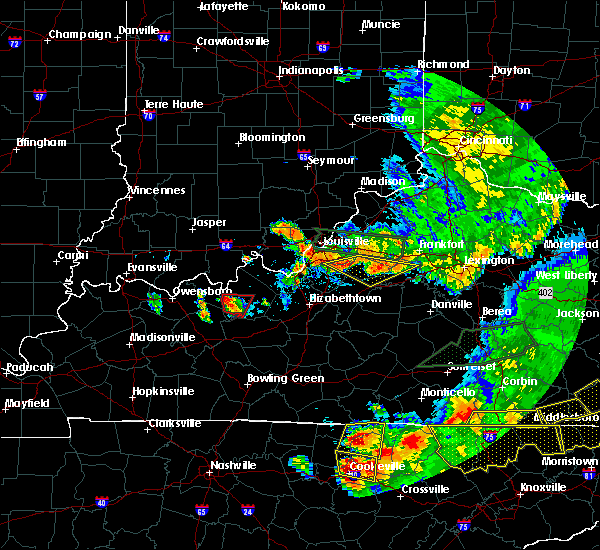 At 916 pm edt, severe thunderstorms were located along a line extending from near taylorsville to near pioneer village, moving east at 50 mph (radar indicated). Hazards include 60 mph wind gusts and quarter size hail. Hail damage to vehicles is expected. Expect wind damage to roofs, siding, and trees. At 916 pm edt, severe thunderstorms were located along a line extending from near taylorsville to near pioneer village, moving east at 50 mph (radar indicated). Hazards include 60 mph wind gusts and quarter size hail. Hail damage to vehicles is expected. Expect wind damage to roofs, siding, and trees.
|
| 7/20/2018 3:58 PM EDT |
 At 357 pm edt, a severe thunderstorm was located 9 miles north of bardstown, moving east at 25 mph. this is a very dangerous storm (radar indicated). Hazards include baseball size hail and 70 mph wind gusts. People and animals outdoors will be severely injured. Expect shattered windows, extensive damage to roofs, siding, and vehicles. At 357 pm edt, a severe thunderstorm was located 9 miles north of bardstown, moving east at 25 mph. this is a very dangerous storm (radar indicated). Hazards include baseball size hail and 70 mph wind gusts. People and animals outdoors will be severely injured. Expect shattered windows, extensive damage to roofs, siding, and vehicles.
|
| 7/20/2018 3:55 PM EDT |
 At 355 pm edt, a severe thunderstorm was located 9 miles southwest of taylorsville, moving east at 25 mph. this is a very dangerous storm (radar indicated). Hazards include baseball size hail and 70 mph wind gusts. People and animals outdoors will be severely injured. expect shattered windows, extensive damage to roofs, siding, and vehicles. locations impacted include, coxs creek and lenore. A tornado watch remains in effect until 900 pm edt for central kentucky. At 355 pm edt, a severe thunderstorm was located 9 miles southwest of taylorsville, moving east at 25 mph. this is a very dangerous storm (radar indicated). Hazards include baseball size hail and 70 mph wind gusts. People and animals outdoors will be severely injured. expect shattered windows, extensive damage to roofs, siding, and vehicles. locations impacted include, coxs creek and lenore. A tornado watch remains in effect until 900 pm edt for central kentucky.
|
| 7/20/2018 3:33 PM EDT |
 At 333 pm edt, a severe thunderstorm was located near shepherdsville, moving east at 30 mph. this is a very dangerous storm (radar indicated). Hazards include baseball size hail and 70 mph wind gusts. People and animals outdoors will be severely injured. expect shattered windows, extensive damage to roofs, siding, and vehicles. locations impacted include, shepherdsville, ridgetop, highgrove, solitude, bardstown junction, hobbs, smithville, deatsville, cedar grove and lotus. A tornado watch remains in effect until 900 pm edt for central kentucky. At 333 pm edt, a severe thunderstorm was located near shepherdsville, moving east at 30 mph. this is a very dangerous storm (radar indicated). Hazards include baseball size hail and 70 mph wind gusts. People and animals outdoors will be severely injured. expect shattered windows, extensive damage to roofs, siding, and vehicles. locations impacted include, shepherdsville, ridgetop, highgrove, solitude, bardstown junction, hobbs, smithville, deatsville, cedar grove and lotus. A tornado watch remains in effect until 900 pm edt for central kentucky.
|
| 7/20/2018 3:23 PM EDT |
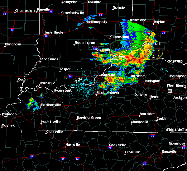 At 322 pm edt, a severe thunderstorm was located over shepherdsville, moving east at 30 mph (radar indicated). Hazards include ping pong ball size hail and 60 mph wind gusts. People and animals outdoors will be injured. expect hail damage to roofs, siding, windows, and vehicles. Expect wind damage to roofs, siding, and trees. At 322 pm edt, a severe thunderstorm was located over shepherdsville, moving east at 30 mph (radar indicated). Hazards include ping pong ball size hail and 60 mph wind gusts. People and animals outdoors will be injured. expect hail damage to roofs, siding, windows, and vehicles. Expect wind damage to roofs, siding, and trees.
|
| 6/26/2018 2:09 PM EDT |
 The severe thunderstorm warning for east central clark, spencer, oldham, western shelby, north central nelson, east central jefferson and northeastern bullitt counties will expire at 215 pm edt, the storms which prompted the warning have moved out of the area. therefore the warning will be allowed to expire. a severe thunderstorm watch remains in effect until 400 pm edt for south central indiana, and central kentucky. report severe weather to local law enforcement, post your report to the national weather service louisville facebook page, or tweet your report using hashtag l, m, k, spotter. The severe thunderstorm warning for east central clark, spencer, oldham, western shelby, north central nelson, east central jefferson and northeastern bullitt counties will expire at 215 pm edt, the storms which prompted the warning have moved out of the area. therefore the warning will be allowed to expire. a severe thunderstorm watch remains in effect until 400 pm edt for south central indiana, and central kentucky. report severe weather to local law enforcement, post your report to the national weather service louisville facebook page, or tweet your report using hashtag l, m, k, spotter.
|
| 6/26/2018 1:54 PM EDT |
 At 154 pm edt, severe thunderstorms were located along a line extending from 6 miles northwest of la grange to 7 miles east of middletown to 6 miles south of taylorsville, moving east at 25 mph (radar indicated). Hazards include 70 mph wind gusts. Expect considerable tree damage. damage is likely to mobile homes, roofs, and outbuildings. Locations impacted include, shelbyville, la grange, taylorsville, mount washington, crestwood, simpsonville, pewee valley, owen, yoder and montclair. At 154 pm edt, severe thunderstorms were located along a line extending from 6 miles northwest of la grange to 7 miles east of middletown to 6 miles south of taylorsville, moving east at 25 mph (radar indicated). Hazards include 70 mph wind gusts. Expect considerable tree damage. damage is likely to mobile homes, roofs, and outbuildings. Locations impacted include, shelbyville, la grange, taylorsville, mount washington, crestwood, simpsonville, pewee valley, owen, yoder and montclair.
|
| 6/26/2018 1:34 PM EDT |
 At 134 pm edt, severe thunderstorms were located along a line extending from 9 miles northwest of prospect to woodland hills to 7 miles northwest of bardstown, moving east at 25 mph (radar indicated). Hazards include 60 mph wind gusts. expect damage to roofs, siding, and trees At 134 pm edt, severe thunderstorms were located along a line extending from 9 miles northwest of prospect to woodland hills to 7 miles northwest of bardstown, moving east at 25 mph (radar indicated). Hazards include 60 mph wind gusts. expect damage to roofs, siding, and trees
|
| 5/31/2018 3:07 PM EDT |
 At 305 pm edt, severe thunderstorms were located along a line extending from 6 miles northeast of taylorsville to 10 miles west of lebanon, moving southeast at 45 mph (radar indicated). Hazards include 70 mph wind gusts. Expect considerable tree damage. damage is likely to mobile homes, roofs, and outbuildings. locations impacted include, jeffersontown, shelbyville, bardstown, shepherdsville, lyndon, middletown, douglass hills, hurstbourne, springfield and anchorage. wind damage has been reported from these storms as they passed through jefferson and bullitt counties. The strongest winds at 305 pm were east of taylorsville lake in spencer county. At 305 pm edt, severe thunderstorms were located along a line extending from 6 miles northeast of taylorsville to 10 miles west of lebanon, moving southeast at 45 mph (radar indicated). Hazards include 70 mph wind gusts. Expect considerable tree damage. damage is likely to mobile homes, roofs, and outbuildings. locations impacted include, jeffersontown, shelbyville, bardstown, shepherdsville, lyndon, middletown, douglass hills, hurstbourne, springfield and anchorage. wind damage has been reported from these storms as they passed through jefferson and bullitt counties. The strongest winds at 305 pm were east of taylorsville lake in spencer county.
|
| 5/31/2018 2:44 PM EDT |
 At 243 pm edt, severe thunderstorms were located along a line extending from woodland hills to 10 miles east of elizabethtown, moving southeast at 45 mph (radar indicated). Hazards include 70 mph wind gusts. Expect considerable tree damage. Damage is likely to mobile homes, roofs, and outbuildings. At 243 pm edt, severe thunderstorms were located along a line extending from woodland hills to 10 miles east of elizabethtown, moving southeast at 45 mph (radar indicated). Hazards include 70 mph wind gusts. Expect considerable tree damage. Damage is likely to mobile homes, roofs, and outbuildings.
|
| 4/3/2018 8:30 PM EDT |
 At 830 pm edt, a severe thunderstorm was located near bardstown, moving east at 50 mph (radar indicated). Hazards include 60 mph wind gusts. Expect damage to roofs, siding, and trees. locations impacted include, bardstown, samuels, east bardstown, highgrove, samuels field airport, withrow, bourbon springs, coxs creek, lenore and hunters. A tornado watch remains in effect until 100 am edt for central kentucky. At 830 pm edt, a severe thunderstorm was located near bardstown, moving east at 50 mph (radar indicated). Hazards include 60 mph wind gusts. Expect damage to roofs, siding, and trees. locations impacted include, bardstown, samuels, east bardstown, highgrove, samuels field airport, withrow, bourbon springs, coxs creek, lenore and hunters. A tornado watch remains in effect until 100 am edt for central kentucky.
|
| 4/3/2018 8:19 PM EDT |
 At 818 pm edt, a severe thunderstorm was located 9 miles south of shepherdsville, moving east at 50 mph (radar indicated). Hazards include 60 mph wind gusts and nickel size hail. Expect damage to roofs, siding, and trees. locations impacted include, bardstown, ridgetop, east bardstown, highgrove, solitude, samuels field airport, hobbs, smithville, scuffletown and deatsville. A tornado watch remains in effect until 100 am edt for central kentucky. At 818 pm edt, a severe thunderstorm was located 9 miles south of shepherdsville, moving east at 50 mph (radar indicated). Hazards include 60 mph wind gusts and nickel size hail. Expect damage to roofs, siding, and trees. locations impacted include, bardstown, ridgetop, east bardstown, highgrove, solitude, samuels field airport, hobbs, smithville, scuffletown and deatsville. A tornado watch remains in effect until 100 am edt for central kentucky.
|
| 4/3/2018 8:12 PM EDT |
 At 811 pm edt, a severe thunderstorm was located 9 miles northeast of elizabethtown, moving east at 50 mph (radar indicated). Hazards include ping pong ball size hail and 60 mph wind gusts. People and animals outdoors will be injured. expect hail damage to roofs, siding, windows, and vehicles. Expect wind damage to roofs, siding, and trees. At 811 pm edt, a severe thunderstorm was located 9 miles northeast of elizabethtown, moving east at 50 mph (radar indicated). Hazards include ping pong ball size hail and 60 mph wind gusts. People and animals outdoors will be injured. expect hail damage to roofs, siding, windows, and vehicles. Expect wind damage to roofs, siding, and trees.
|
| 2/24/2018 11:24 PM EST |
 At 1123 pm est, severe thunderstorms were located along a line extending from 6 miles southeast of new castle to 8 miles north of bardstown, moving east at 40 mph (radar indicated). Hazards include 60 mph wind gusts. expect damage to roofs, siding, and trees At 1123 pm est, severe thunderstorms were located along a line extending from 6 miles southeast of new castle to 8 miles north of bardstown, moving east at 40 mph (radar indicated). Hazards include 60 mph wind gusts. expect damage to roofs, siding, and trees
|
| 6/18/2017 4:14 PM EDT |
 At 414 pm edt, a severe thunderstorm was located 7 miles east of bardstown, moving northeast at 30 mph (radar indicated). Hazards include 60 mph wind gusts. expect damage to roofs, siding, and trees At 414 pm edt, a severe thunderstorm was located 7 miles east of bardstown, moving northeast at 30 mph (radar indicated). Hazards include 60 mph wind gusts. expect damage to roofs, siding, and trees
|
| 4/30/2017 6:30 PM EDT |
 At 630 pm edt, severe thunderstorms were located along a line extending from near bardstown to near springfield to 8 miles northeast of campbellsville, moving northeast at 50 mph (radar indicated). Hazards include 60 mph wind gusts. Expect damage to roofs, siding, and trees. Locations impacted include, bardstown, lebanon, springfield, bloomfield, loretto, bradfordsville, raywick, burkes spring, dant, and booker. At 630 pm edt, severe thunderstorms were located along a line extending from near bardstown to near springfield to 8 miles northeast of campbellsville, moving northeast at 50 mph (radar indicated). Hazards include 60 mph wind gusts. Expect damage to roofs, siding, and trees. Locations impacted include, bardstown, lebanon, springfield, bloomfield, loretto, bradfordsville, raywick, burkes spring, dant, and booker.
|
| 4/30/2017 6:14 PM EDT |
 At 613 pm edt, severe thunderstorms were located along a line extending from 10 miles north of hodgenville to 12 miles west of lebanon to near campbellsville, moving northeast at 50 mph (law enforcement. at 556 pm a tree was reported blown down in central larue county). Hazards include 60 mph wind gusts. expect damage to roofs, siding, and trees At 613 pm edt, severe thunderstorms were located along a line extending from 10 miles north of hodgenville to 12 miles west of lebanon to near campbellsville, moving northeast at 50 mph (law enforcement. at 556 pm a tree was reported blown down in central larue county). Hazards include 60 mph wind gusts. expect damage to roofs, siding, and trees
|
| 4/5/2017 6:15 PM EDT | Quarter sized hail reported 0.2 miles WNW of Fairfield, KY |
| 4/5/2017 6:03 PM EDT |
 At 602 pm edt, a severe thunderstorm was located near taylorsville, moving northeast at 55 mph (trained weather spotters. at 557 pm edt, golf ball size hail was reported in bardstown). Hazards include golf ball size hail and 70 mph wind gusts. People and animals outdoors will be injured. expect hail damage to roofs, siding, windows, and vehicles. expect considerable tree damage. wind damage is also likely to mobile homes, roofs, and outbuildings. locations impacted include, shelbyville, bardstown, taylorsville, bloomfield, wakefield, yoder, highgrove, waterford, wayside and anderson city. A tornado watch remains in effect until 1000 pm edt for central kentucky. At 602 pm edt, a severe thunderstorm was located near taylorsville, moving northeast at 55 mph (trained weather spotters. at 557 pm edt, golf ball size hail was reported in bardstown). Hazards include golf ball size hail and 70 mph wind gusts. People and animals outdoors will be injured. expect hail damage to roofs, siding, windows, and vehicles. expect considerable tree damage. wind damage is also likely to mobile homes, roofs, and outbuildings. locations impacted include, shelbyville, bardstown, taylorsville, bloomfield, wakefield, yoder, highgrove, waterford, wayside and anderson city. A tornado watch remains in effect until 1000 pm edt for central kentucky.
|
| 4/5/2017 6:00 PM EDT | Quarter sized hail reported 0.2 miles WNW of Fairfield, KY |
| 4/5/2017 5:52 PM EDT |
 At 552 pm edt, a severe thunderstorm was located 3 miles west of bardstown, moving northeast at 55 mph (radar indicated). Hazards include golf ball size hail and 70 mph wind gusts. People and animals outdoors will be injured. expect hail damage to roofs, siding, windows, and vehicles. expect considerable tree damage. Wind damage is also likely to mobile homes, roofs, and outbuildings. At 552 pm edt, a severe thunderstorm was located 3 miles west of bardstown, moving northeast at 55 mph (radar indicated). Hazards include golf ball size hail and 70 mph wind gusts. People and animals outdoors will be injured. expect hail damage to roofs, siding, windows, and vehicles. expect considerable tree damage. Wind damage is also likely to mobile homes, roofs, and outbuildings.
|
| 3/30/2017 9:05 PM EDT |
 At 904 pm edt, a severe thunderstorm was located 8 miles north of bardstown, moving northeast at 45 mph (radar indicated). Hazards include 60 mph wind gusts and quarter size hail. Hail damage to vehicles is expected. Expect wind damage to roofs, siding, and trees. At 904 pm edt, a severe thunderstorm was located 8 miles north of bardstown, moving northeast at 45 mph (radar indicated). Hazards include 60 mph wind gusts and quarter size hail. Hail damage to vehicles is expected. Expect wind damage to roofs, siding, and trees.
|
| 3/27/2017 6:23 PM EDT |
 At 623 pm edt, a severe thunderstorm was located over taylorsville, moving northeast at 40 mph (radar indicated). Hazards include 60 mph wind gusts and quarter size hail. Hail damage to vehicles is expected. expect wind damage to roofs, siding, and trees. Locations impacted include, taylorsville, bloomfield, wakefield, yoder, highgrove, waterford, normandy and elk creek. At 623 pm edt, a severe thunderstorm was located over taylorsville, moving northeast at 40 mph (radar indicated). Hazards include 60 mph wind gusts and quarter size hail. Hail damage to vehicles is expected. expect wind damage to roofs, siding, and trees. Locations impacted include, taylorsville, bloomfield, wakefield, yoder, highgrove, waterford, normandy and elk creek.
|
| 3/27/2017 6:18 PM EDT | Quarter sized hail reported 3.7 miles E of Fairfield, KY, had 1 inch hail that was irregularly shaped. hurt to pick it up. |
| 3/27/2017 6:06 PM EDT |
 At 606 pm edt, a severe thunderstorm was located 7 miles northwest of bardstown, moving northeast at 35 mph (radar indicated). Hazards include 60 mph wind gusts and quarter size hail. Hail damage to vehicles is expected. Expect wind damage to roofs, siding, and trees. At 606 pm edt, a severe thunderstorm was located 7 miles northwest of bardstown, moving northeast at 35 mph (radar indicated). Hazards include 60 mph wind gusts and quarter size hail. Hail damage to vehicles is expected. Expect wind damage to roofs, siding, and trees.
|
| 3/1/2017 7:14 AM EST |
 At 713 am est, severe thunderstorms were located along a line extending from near shelbyville to 7 miles east of elizabethtown, moving southeast at 45 mph (radar indicated). Hazards include 60 mph wind gusts. Expect damage to roofs, siding, and trees. locations impacted include, shelbyville, bardstown, shepherdsville, taylorsville, radcliff, mount washington, vine grove, simpsonville, lebanon junction and new haven. a tornado watch remains in effect until 900 am est for central kentucky. A tornado watch also remains in effect until 1100 am est for central kentucky. At 713 am est, severe thunderstorms were located along a line extending from near shelbyville to 7 miles east of elizabethtown, moving southeast at 45 mph (radar indicated). Hazards include 60 mph wind gusts. Expect damage to roofs, siding, and trees. locations impacted include, shelbyville, bardstown, shepherdsville, taylorsville, radcliff, mount washington, vine grove, simpsonville, lebanon junction and new haven. a tornado watch remains in effect until 900 am est for central kentucky. A tornado watch also remains in effect until 1100 am est for central kentucky.
|
| 3/1/2017 6:46 AM EST |
 At 646 am est, severe thunderstorms were located along a line extending from creekside to 10 miles south of brandenburg, moving southeast at 50 mph (radar indicated). Hazards include 60 mph wind gusts and quarter size hail. Hail damage to vehicles is expected. Expect wind damage to roofs, siding, and trees. At 646 am est, severe thunderstorms were located along a line extending from creekside to 10 miles south of brandenburg, moving southeast at 50 mph (radar indicated). Hazards include 60 mph wind gusts and quarter size hail. Hail damage to vehicles is expected. Expect wind damage to roofs, siding, and trees.
|
| 7/28/2016 3:00 AM EDT | Tree down across ky hwy 48 in nelson county. time approximated based on rada in nelson county KY, 0.8 miles W of Fairfield, KY |
| 6/23/2016 10:00 PM EDT |
 At 1000 pm edt, a severe thunderstorm was located 8 miles north of bardstown, moving southeast at 35 mph (radar indicated). Hazards include 60 mph wind gusts. Expect damage to roofs. siding. And trees. At 1000 pm edt, a severe thunderstorm was located 8 miles north of bardstown, moving southeast at 35 mph (radar indicated). Hazards include 60 mph wind gusts. Expect damage to roofs. siding. And trees.
|
| 6/23/2016 6:09 PM EDT |
 At 609 pm edt, severe thunderstorms were located along a line extending from 10 miles east of taylorsville to 10 miles east of bardstown, moving southeast at 45 mph (radar indicated). Hazards include 60 mph wind gusts. Expect damage to roofs. siding. And trees. At 609 pm edt, severe thunderstorms were located along a line extending from 10 miles east of taylorsville to 10 miles east of bardstown, moving southeast at 45 mph (radar indicated). Hazards include 60 mph wind gusts. Expect damage to roofs. siding. And trees.
|
| 6/23/2016 5:55 PM EDT |
 The severe thunderstorm warning for spencer, northeastern nelson, southern shelby and southwestern anderson counties will expire at 600 pm edt, the storms which prompted the warning have weakened below severe limits, and no longer pose an immediate threat to life or property. therefore the warning will be allowed to expire. however gusty winds are still possible with these thunderstorms. a severe thunderstorm watch remains in effect until 1100 pm edt for central kentucky. The severe thunderstorm warning for spencer, northeastern nelson, southern shelby and southwestern anderson counties will expire at 600 pm edt, the storms which prompted the warning have weakened below severe limits, and no longer pose an immediate threat to life or property. therefore the warning will be allowed to expire. however gusty winds are still possible with these thunderstorms. a severe thunderstorm watch remains in effect until 1100 pm edt for central kentucky.
|
| 6/23/2016 5:51 PM EDT |
 At 551 pm edt, severe thunderstorms were located along a line extending from 10 miles southwest of taylorsville to 6 miles northwest of bardstown to 8 miles southwest of shepherdsville, moving southeast at 30 mph (radar indicated). Hazards include 60 mph wind gusts and quarter size hail. Hail damage to vehicles is expected. Expect wind damage to roofs, siding, and trees. At 551 pm edt, severe thunderstorms were located along a line extending from 10 miles southwest of taylorsville to 6 miles northwest of bardstown to 8 miles southwest of shepherdsville, moving southeast at 30 mph (radar indicated). Hazards include 60 mph wind gusts and quarter size hail. Hail damage to vehicles is expected. Expect wind damage to roofs, siding, and trees.
|
| 6/23/2016 5:37 PM EDT |
 At 537 pm edt, severe thunderstorms were located along a line extending from 7 miles south of shelbyville to near taylorsville to 10 miles north of bardstown, moving east at 50 mph (radar indicated). Hazards include 60 mph wind gusts. Expect damage to roofs. siding. And trees. At 537 pm edt, severe thunderstorms were located along a line extending from 7 miles south of shelbyville to near taylorsville to 10 miles north of bardstown, moving east at 50 mph (radar indicated). Hazards include 60 mph wind gusts. Expect damage to roofs. siding. And trees.
|
| 6/23/2016 5:06 PM EDT |
 At 505 pm edt, severe thunderstorms were located along a line extending from douglass hills to near highview to shepherdsville, moving southeast at 35 mph (radar indicated). Hazards include 60 mph wind gusts and penny size hail. Expect damage to roofs. siding. And trees. At 505 pm edt, severe thunderstorms were located along a line extending from douglass hills to near highview to shepherdsville, moving southeast at 35 mph (radar indicated). Hazards include 60 mph wind gusts and penny size hail. Expect damage to roofs. siding. And trees.
|
| 6/2/2016 5:25 PM EDT |
 The severe thunderstorm warning for north central nelson county will expire at 530 pm edt, the storm which prompted the warning has weakened below severe limits, and no longer pose an immediate threat to life or property. therefore the warning will be allowed to expire. The severe thunderstorm warning for north central nelson county will expire at 530 pm edt, the storm which prompted the warning has weakened below severe limits, and no longer pose an immediate threat to life or property. therefore the warning will be allowed to expire.
|
| 6/2/2016 5:02 PM EDT |
 At 501 pm edt, a severe thunderstorm was located near samuels, or northwest of bardstown, moving east at 5 mph (radar indicated). Hazards include 60 mph wind gusts and quarter size hail. Hail damage to vehicles is expected. Expect wind damage to roofs, siding, and trees. At 501 pm edt, a severe thunderstorm was located near samuels, or northwest of bardstown, moving east at 5 mph (radar indicated). Hazards include 60 mph wind gusts and quarter size hail. Hail damage to vehicles is expected. Expect wind damage to roofs, siding, and trees.
|
| 5/10/2016 5:10 PM EDT |
 The severe thunderstorm warning for northern washington, southern spencer, northeastern nelson and southwestern anderson counties will expire at 515 pm edt, the storm which prompted the warning has weakened below severe limits, and no longer pose an immediate threat to life or property. therefore the warning will be allowed to expire. a severe thunderstorm watch remains in effect until 800 pm edt for central kentucky. The severe thunderstorm warning for northern washington, southern spencer, northeastern nelson and southwestern anderson counties will expire at 515 pm edt, the storm which prompted the warning has weakened below severe limits, and no longer pose an immediate threat to life or property. therefore the warning will be allowed to expire. a severe thunderstorm watch remains in effect until 800 pm edt for central kentucky.
|
| 5/10/2016 4:42 PM EDT |
 At 442 pm edt, a severe thunderstorm was located near bardstown, moving east at 35 mph (radar indicated). Hazards include 60 mph wind gusts and quarter size hail. Hail damage to vehicles is expected. Expect wind damage to roofs, siding, and trees. At 442 pm edt, a severe thunderstorm was located near bardstown, moving east at 35 mph (radar indicated). Hazards include 60 mph wind gusts and quarter size hail. Hail damage to vehicles is expected. Expect wind damage to roofs, siding, and trees.
|
| 5/7/2016 9:14 PM EDT |
 At 914 pm edt, a severe thunderstorm was located near taylorsville, moving east at 55 mph (radar indicated). Hazards include 60 mph wind gusts and quarter size hail. Hail damage to vehicles is expected. expect wind damage to roofs, siding, and trees. locations impacted include, louisville, jeffersonville, new albany, jeffersontown, st. Matthews, shively, shelbyville, shepherdsville, lyndon and middletown. At 914 pm edt, a severe thunderstorm was located near taylorsville, moving east at 55 mph (radar indicated). Hazards include 60 mph wind gusts and quarter size hail. Hail damage to vehicles is expected. expect wind damage to roofs, siding, and trees. locations impacted include, louisville, jeffersonville, new albany, jeffersontown, st. Matthews, shively, shelbyville, shepherdsville, lyndon and middletown.
|
| 5/7/2016 8:59 PM EDT |
 At 858 pm edt, a severe thunderstorm was located over okolona, moving east at 55 mph (radar indicated). Hazards include 60 mph wind gusts and quarter size hail. Hail damage to vehicles is expected. Expect wind damage to roofs, siding, and trees. At 858 pm edt, a severe thunderstorm was located over okolona, moving east at 55 mph (radar indicated). Hazards include 60 mph wind gusts and quarter size hail. Hail damage to vehicles is expected. Expect wind damage to roofs, siding, and trees.
|
| 5/7/2016 5:54 PM EDT |
 The severe thunderstorm warning for spencer, northeastern nelson, east central bullitt, southeastern shelby and anderson counties will expire at 600 pm edt, the storms which prompted the warning have weakened below severe limits, and no longer pose an immediate threat to life or property. therefore the warning will be allowed to expire. The severe thunderstorm warning for spencer, northeastern nelson, east central bullitt, southeastern shelby and anderson counties will expire at 600 pm edt, the storms which prompted the warning have weakened below severe limits, and no longer pose an immediate threat to life or property. therefore the warning will be allowed to expire.
|
| 5/7/2016 5:45 PM EDT |
 At 545 pm edt, severe thunderstorms were located along a line extending from 11 miles south of shelbyville to 7 miles southwest of taylorsville, moving southeast at 45 mph (radar indicated). Hazards include 60 mph wind gusts and quarter size hail. Hail damage to vehicles is expected. expect wind damage to roofs, siding, and trees. locations impacted include, lawrenceburg, taylorsville, bloomfield, lenore, harrisonville, drydock, klondyke, fox creek, van buren and waterford. those attending outdoor events in the path of these storms should prepare for imminent dangerous weather conditions. Seek shelter now!. At 545 pm edt, severe thunderstorms were located along a line extending from 11 miles south of shelbyville to 7 miles southwest of taylorsville, moving southeast at 45 mph (radar indicated). Hazards include 60 mph wind gusts and quarter size hail. Hail damage to vehicles is expected. expect wind damage to roofs, siding, and trees. locations impacted include, lawrenceburg, taylorsville, bloomfield, lenore, harrisonville, drydock, klondyke, fox creek, van buren and waterford. those attending outdoor events in the path of these storms should prepare for imminent dangerous weather conditions. Seek shelter now!.
|
| 5/7/2016 5:39 PM EDT |
 At 538 pm edt, severe thunderstorms were located along a line extending from near shelbyville to 6 miles east of pioneer village, moving southeast at 40 mph (radar indicated). Hazards include 60 mph wind gusts and quarter size hail. Hail damage to vehicles is expected. expect wind damage to roofs, siding, and trees. locations impacted include, shelbyville, lawrenceburg, taylorsville, mount washington, bloomfield, lenore, harrisonville, drydock, klondyke and fox creek. those attending outdoor events in the path of these storms should prepare for imminent dangerous weather conditions. Seek shelter now!. At 538 pm edt, severe thunderstorms were located along a line extending from near shelbyville to 6 miles east of pioneer village, moving southeast at 40 mph (radar indicated). Hazards include 60 mph wind gusts and quarter size hail. Hail damage to vehicles is expected. expect wind damage to roofs, siding, and trees. locations impacted include, shelbyville, lawrenceburg, taylorsville, mount washington, bloomfield, lenore, harrisonville, drydock, klondyke and fox creek. those attending outdoor events in the path of these storms should prepare for imminent dangerous weather conditions. Seek shelter now!.
|
| 5/7/2016 5:29 PM EDT |
 At 528 pm edt, severe thunderstorms were located along a line extending from near shelbyville to near highview, moving southeast at 40 mph (radar indicated). Hazards include 60 mph wind gusts and quarter size hail. Hail damage to vehicles is expected. Expect wind damage to roofs, siding, and trees. At 528 pm edt, severe thunderstorms were located along a line extending from near shelbyville to near highview, moving southeast at 40 mph (radar indicated). Hazards include 60 mph wind gusts and quarter size hail. Hail damage to vehicles is expected. Expect wind damage to roofs, siding, and trees.
|
| 3/31/2016 4:31 PM EDT |
 At 430 pm edt, a severe thunderstorm was located near bardstown, moving east at 55 mph (radar indicated). Hazards include 60 mph wind gusts. Expect damage to roofs. siding. and trees. locations impacted include, bardstown, springfield, lebanon junction, new haven, bloomfield, loretto, willisburg, mackville, polin and botland. Time, mot, loc 2030z 265deg 133kt 3786 8541. At 430 pm edt, a severe thunderstorm was located near bardstown, moving east at 55 mph (radar indicated). Hazards include 60 mph wind gusts. Expect damage to roofs. siding. and trees. locations impacted include, bardstown, springfield, lebanon junction, new haven, bloomfield, loretto, willisburg, mackville, polin and botland. Time, mot, loc 2030z 265deg 133kt 3786 8541.
|
| 3/31/2016 4:15 PM EDT |
 At 415 pm edt, a severe thunderstorm was located 9 miles north of elizabethtown, moving east at 55 mph (radar indicated). Hazards include 60 mph wind gusts. Expect damage to roofs. siding. and trees. locations impacted include, elizabethtown, bardstown, hodgenville, springfield, radcliff, vine grove, lebanon junction, new haven, bloomfield and loretto. Time, mot, loc 2015z 258deg 102kt 3782 8585. At 415 pm edt, a severe thunderstorm was located 9 miles north of elizabethtown, moving east at 55 mph (radar indicated). Hazards include 60 mph wind gusts. Expect damage to roofs. siding. and trees. locations impacted include, elizabethtown, bardstown, hodgenville, springfield, radcliff, vine grove, lebanon junction, new haven, bloomfield and loretto. Time, mot, loc 2015z 258deg 102kt 3782 8585.
|
| 3/31/2016 4:12 PM EDT |
 At 411 pm edt, a severe thunderstorm was located 10 miles northwest of elizabethtown, moving east at 100 mph (radar indicated). Hazards include 60 mph wind gusts. Expect damage to roofs. siding. And trees. At 411 pm edt, a severe thunderstorm was located 10 miles northwest of elizabethtown, moving east at 100 mph (radar indicated). Hazards include 60 mph wind gusts. Expect damage to roofs. siding. And trees.
|
| 12/23/2015 8:07 PM EST | At 807 pm est, a severe thunderstorm was located over taylorsville, moving northeast at 60 mph (radar indicated). Hazards include 70 mph wind gusts and quarter size hail. Hail damage to vehicles is expected. expect considerable tree damage. wind damage is also likely to mobile homes, roofs and outbuildings. locations impacted include, shelbyville, bardstown, lawrenceburg, taylorsville, bloomfield, elmburg, hatton, drydock, klondyke, fox creek, waterford, samuels field airport, crenshaw, joyes, peytona, chaplin, wilsonville, hooper, olive branch and little mount. A tornado watch remains in effect until 900 pm est for central kentucky. |
| 12/23/2015 8:07 PM EST | At 807 pm est, a severe thunderstorm was located over taylorsville, moving northeast at 60 mph (radar indicated). Hazards include 70 mph wind gusts and quarter size hail. Hail damage to vehicles is expected. expect considerable tree damage. wind damage is also likely to mobile homes, roofs and outbuildings. locations impacted include, shelbyville, bardstown, lawrenceburg, taylorsville, bloomfield, elmburg, hatton, drydock, klondyke, fox creek, waterford, samuels field airport, crenshaw, joyes, peytona, chaplin, wilsonville, hooper, olive branch and little mount. A tornado watch remains in effect until 900 pm est for central kentucky. |
| 12/23/2015 7:58 PM EST | At 758 pm est, a severe thunderstorm was located 8 miles northwest of bardstown, moving northeast at 55 mph (radar indicated). Hazards include 60 mph wind gusts and quarter size hail. Hail damage to vehicles is expected. Expect wind damage to roofs, siding and trees. |
| 12/23/2015 7:58 PM EST | At 758 pm est, a severe thunderstorm was located 8 miles northwest of bardstown, moving northeast at 55 mph (radar indicated). Hazards include 60 mph wind gusts and quarter size hail. Hail damage to vehicles is expected. Expect wind damage to roofs, siding and trees. |
| 7/29/2015 6:45 PM EDT |
 At 644 pm edt, a severe thunderstorm was located 5 miles southeast of shelbyville, and moving southeast at 25 mph (radar indicated). Hazards include 60 mph wind gusts. Expect damage to roofs. siding and trees. Locations impacted include, frankfort, fairfield, southville, hemp ridge, polsgrove, wakefield, peytona, hatton, ottusville, swallowfield, waddy, bryant, bloomfield, mount eden, harvieland, benson, graefenburg, junte, harrisonville and peaks mill. At 644 pm edt, a severe thunderstorm was located 5 miles southeast of shelbyville, and moving southeast at 25 mph (radar indicated). Hazards include 60 mph wind gusts. Expect damage to roofs. siding and trees. Locations impacted include, frankfort, fairfield, southville, hemp ridge, polsgrove, wakefield, peytona, hatton, ottusville, swallowfield, waddy, bryant, bloomfield, mount eden, harvieland, benson, graefenburg, junte, harrisonville and peaks mill.
|
| 7/29/2015 6:19 PM EDT |
 At 618 pm edt, a severe thunderstorm was located 8 miles west of shelbyville, and moving southeast at 25 mph (radar indicated). Hazards include 60 mph wind gusts. Expect damage to roofs. Siding and trees. At 618 pm edt, a severe thunderstorm was located 8 miles west of shelbyville, and moving southeast at 25 mph (radar indicated). Hazards include 60 mph wind gusts. Expect damage to roofs. Siding and trees.
|
| 7/14/2015 5:11 AM EDT |
 At 510 am edt, severe thunderstorms were located along a line extending from 11 miles east of taylorsville to 8 miles southwest of taylorsville to 5 miles northwest of shepherdsville, and moving south at 45 mph (radar indicated). Hazards include 60 mph wind gusts. Expect damage to roofs. Siding and trees. At 510 am edt, severe thunderstorms were located along a line extending from 11 miles east of taylorsville to 8 miles southwest of taylorsville to 5 miles northwest of shepherdsville, and moving south at 45 mph (radar indicated). Hazards include 60 mph wind gusts. Expect damage to roofs. Siding and trees.
|
| 7/13/2015 3:26 PM EDT |
 At 323 pm edt, severe thunderstorms were located along a line extending from 6 miles southwest of camargo to 7 miles southwest of versailles to shepherdsville, and moving southeast at 25 mph (radar indicated). Hazards include 60 mph wind gusts. Expect damage to roofs. Siding and trees. At 323 pm edt, severe thunderstorms were located along a line extending from 6 miles southwest of camargo to 7 miles southwest of versailles to shepherdsville, and moving southeast at 25 mph (radar indicated). Hazards include 60 mph wind gusts. Expect damage to roofs. Siding and trees.
|
| 7/13/2015 2:51 PM EDT |
 At 249 pm edt, severe thunderstorms were located along a line extending from 7 miles west of georgetown to 6 miles southwest of shelbyville to shively, and moving southeast at 45 mph (radar indicated). Hazards include 60 mph wind gusts. Expect damage to roofs. Siding and trees. At 249 pm edt, severe thunderstorms were located along a line extending from 7 miles west of georgetown to 6 miles southwest of shelbyville to shively, and moving southeast at 45 mph (radar indicated). Hazards include 60 mph wind gusts. Expect damage to roofs. Siding and trees.
|
| 7/10/2015 11:21 AM EDT |
 At 1118 am edt, severe thunderstorms were located along a line extending from 8 miles east of middletown to taylorsville to 12 miles south of bardstown to 8 miles east of hodgenville, and moving east at 30 mph (radar indicated). Hazards include 60 mph wind gusts. Expect damage to roofs. siding and trees. Locations impacted include, little mount, olive branch and joyes. At 1118 am edt, severe thunderstorms were located along a line extending from 8 miles east of middletown to taylorsville to 12 miles south of bardstown to 8 miles east of hodgenville, and moving east at 30 mph (radar indicated). Hazards include 60 mph wind gusts. Expect damage to roofs. siding and trees. Locations impacted include, little mount, olive branch and joyes.
|
| 7/10/2015 11:08 AM EDT |
 At 1104 am edt, severe thunderstorms were located along a line extending from 6 miles east of middletown to 6 miles east of fern creek to 9 miles west of taylorsville to bardstown to hodgenville, and moving east at 30 mph (radar indicated). Hazards include 60 mph wind gusts. Expect damage to roofs. siding and trees. Locations impacted include, bardstown, taylorsville, coxs creek, lyons, samuels field airport, withrow, wilsonville, new haven, waterford, blue gap, culvertown, balltown, east bardstown, fairfield, elk creek, finchville, joyes, greenbrier, veech and normandy. At 1104 am edt, severe thunderstorms were located along a line extending from 6 miles east of middletown to 6 miles east of fern creek to 9 miles west of taylorsville to bardstown to hodgenville, and moving east at 30 mph (radar indicated). Hazards include 60 mph wind gusts. Expect damage to roofs. siding and trees. Locations impacted include, bardstown, taylorsville, coxs creek, lyons, samuels field airport, withrow, wilsonville, new haven, waterford, blue gap, culvertown, balltown, east bardstown, fairfield, elk creek, finchville, joyes, greenbrier, veech and normandy.
|
| 7/10/2015 11:03 AM EDT |
 At 1101 am edt, severe thunderstorms were located along a line extending from middletown to fern creek to 9 miles southeast of fern creek to 5 miles northwest of bardstown to 7 miles west of bardstown to 7 miles northeast of hodgenville to hodgenville, and moving east at 30 mph (radar indicated). Hazards include 70 mph wind gusts. Expect considerable tree damage. damage is likely to mobile homes, roofs and outbuildings. Locations impacted include, bardstown, taylorsville, highgrove, hunters, bourbon springs, lyons, coxs creek, samuels field airport, whitfield, withrow, routt, crenshaw, l s park, blue gap, culvertown, new haven, balltown, athertonville, waterford and east bardstown. At 1101 am edt, severe thunderstorms were located along a line extending from middletown to fern creek to 9 miles southeast of fern creek to 5 miles northwest of bardstown to 7 miles west of bardstown to 7 miles northeast of hodgenville to hodgenville, and moving east at 30 mph (radar indicated). Hazards include 70 mph wind gusts. Expect considerable tree damage. damage is likely to mobile homes, roofs and outbuildings. Locations impacted include, bardstown, taylorsville, highgrove, hunters, bourbon springs, lyons, coxs creek, samuels field airport, whitfield, withrow, routt, crenshaw, l s park, blue gap, culvertown, new haven, balltown, athertonville, waterford and east bardstown.
|
| 7/10/2015 10:52 AM EDT |
 At 1049 am edt, severe thunderstorms were located along a line extending from jeffersontown to shepherdsville to 9 miles northeast of elizabethtown to elizabethtown to 13 miles east of leitchfield, and moving east at 30 mph (radar indicated). Hazards include 60 mph wind gusts. Expect damage to roofs. siding and trees. Locations impacted include, taylorsville, bardstown, thixton, belmont, bardstown junction, younger creek, fisherville, clermont, roanoke, cedar grove, mount washington, routt, scuffletown, boston, ridgetop, l s park, hobbs, whitfield, brownington and nelsonville. At 1049 am edt, severe thunderstorms were located along a line extending from jeffersontown to shepherdsville to 9 miles northeast of elizabethtown to elizabethtown to 13 miles east of leitchfield, and moving east at 30 mph (radar indicated). Hazards include 60 mph wind gusts. Expect damage to roofs. siding and trees. Locations impacted include, taylorsville, bardstown, thixton, belmont, bardstown junction, younger creek, fisherville, clermont, roanoke, cedar grove, mount washington, routt, scuffletown, boston, ridgetop, l s park, hobbs, whitfield, brownington and nelsonville.
|
| 7/10/2015 10:50 AM EDT |
 At 1043 am edt, severe thunderstorms were located along a line extending from lyndon to shepherdsville to 11 miles southwest of shepherdsville to elizabethtown to 12 miles northeast of leitchfield, and moving east at 30 mph (radar indicated). Hazards include 60 mph wind gusts. Expect damage to roofs. Siding and trees. At 1043 am edt, severe thunderstorms were located along a line extending from lyndon to shepherdsville to 11 miles southwest of shepherdsville to elizabethtown to 12 miles northeast of leitchfield, and moving east at 30 mph (radar indicated). Hazards include 60 mph wind gusts. Expect damage to roofs. Siding and trees.
|
| 7/10/2015 10:49 AM EDT |
 At 1043 am edt, severe thunderstorms were located along a line extending from lyndon to shepherdsville to 11 miles southwest of shepherdsville to elizabethtown to 12 miles northeast of leitchfield, and moving east at 30 mph (radar indicated). Hazards include 60 mph wind gusts. Expect damage to roofs. Siding and trees. At 1043 am edt, severe thunderstorms were located along a line extending from lyndon to shepherdsville to 11 miles southwest of shepherdsville to elizabethtown to 12 miles northeast of leitchfield, and moving east at 30 mph (radar indicated). Hazards include 60 mph wind gusts. Expect damage to roofs. Siding and trees.
|
| 4/25/2015 7:24 PM EDT | At 721 pm edt, severe thunderstorms were located along a line extending from 8 miles southwest of taylorsville to bardstown, and moving east at 35 mph (radar indicated. quarter-sized hail was reported just north of bardstown). Hazards include 60 mph wind gusts and quarter size hail. Hail damage to vehicles is expected. expect wind damage to roofs, siding and trees. locations impacted include, taylorsville, fairfield, botland, woodlawn, bloomfield and wakefield. 1. 00in. |
| 4/25/2015 7:03 PM EDT | At 702 pm edt, severe thunderstorms were located along a line extending from shepherdsville to 9 miles west of bardstown to 11 miles northeast of elizabethtown, and moving east at 35 mph (radar indicated). Hazards include 60 mph wind gusts and quarter size hail. Hail damage to vehicles is expected. Expect wind damage to roofs, siding and trees. |
| 4/25/2015 6:41 PM EDT | At 634 pm edt, a severe thunderstorm was located 11 miles west of shepherdsville, and moving east at 30 mph (radar indicated). Hazards include 60 mph wind gusts and quarter size hail. Hail damage to vehicles is expected. Expect wind damage to roofs, siding and trees. |
| 4/8/2015 6:01 PM EDT | A severe thunderstorm warning remains in effect for spencer and northeastern nelson counties until 615 pm edt. at 557 pm edt. a severe thunderstorm was located near taylorsville. and moving east at 40 mph. hazard. 60 mph wind gusts and quarter size hail. source. Radar indicated. |
| 4/8/2015 5:43 PM EDT | The national weather service in louisville has issued a * severe thunderstorm warning for. east central bullitt county in north central kentucky. northern nelson county in north central kentucky. spencer county in north central kentucky. Until 615 pm edt. |
| 4/7/2015 5:55 PM EDT | A severe thunderstorm warning remains in effect for nelson county until 610 pm edt. at 553 pm edt. severe thunderstorms were located along a line extending from taylorsville to 6 miles north of bardstown to bardstown. and moving east at 45 mph. hazard. 60 mph wind gusts. |
| 4/7/2015 5:40 PM EDT | The national weather service in louisville has issued a * severe thunderstorm warning for. eastern bullitt county in north central kentucky. east central hardin county in north central kentucky. southeastern jefferson county in north central kentucky. Nelson county in north central kentucky. |
| 4/2/2015 5:07 PM EDT | The severe thunderstorm warning for east central hardin. southeastern bullitt. spencer and northwestern nelson counties will expire at 510 pm edt/410 pm cdt/. the line of storms which prompted the warning has moved out of the warned area. however. Heavy rain is still possible with these thunderstorms. |
| 4/2/2015 4:58 PM EDT | A severe thunderstorm warning remains in effect for east central hardin. southeastern bullitt. spencer and northwestern nelson counties until 510 pm edt. at 455 pm edt. severe thunderstorms were located along a line extending from shelbyville to 10 miles south of shepherdsville. And moving east at 40 mph. |
| 4/2/2015 4:57 PM EDT | The national weather service in louisville has issued a * severe thunderstorm warning for. southern anderson county in east central kentucky. mercer county in east central kentucky. northeastern nelson county in north central kentucky. Southeastern spencer county in north central kentucky. |
| 4/2/2015 4:33 PM EDT | The national weather service in louisville has issued a * severe thunderstorm warning for. bullitt county in north central kentucky. northern hardin county in north central kentucky. southeastern jefferson county in north central kentucky. Northwestern nelson county in north central kentucky. |
| 7/26/2012 10:42 PM EDT | Dispatch reports tree down on highgrove road in spencer county KY, 3.2 miles SE of Fairfield, KY |
| 1/1/0001 12:00 AM | Lost some shingles off roof and 8 inch diameter tree dow in nelson county KY, 3.8 miles ESE of Fairfield, KY |
Hail Maps for Fairfield, KY
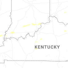
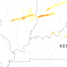


Connect with Interactive Hail Maps