

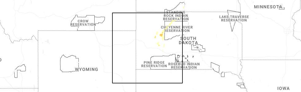
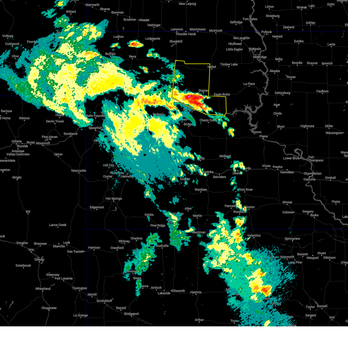
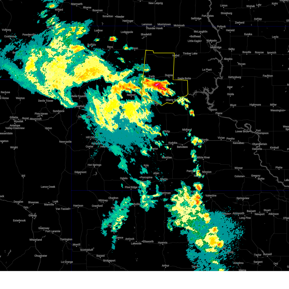
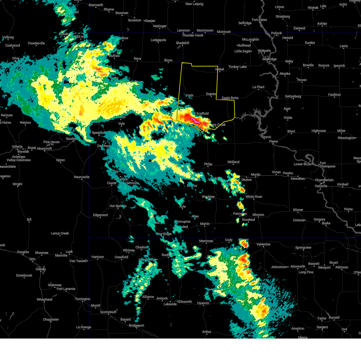
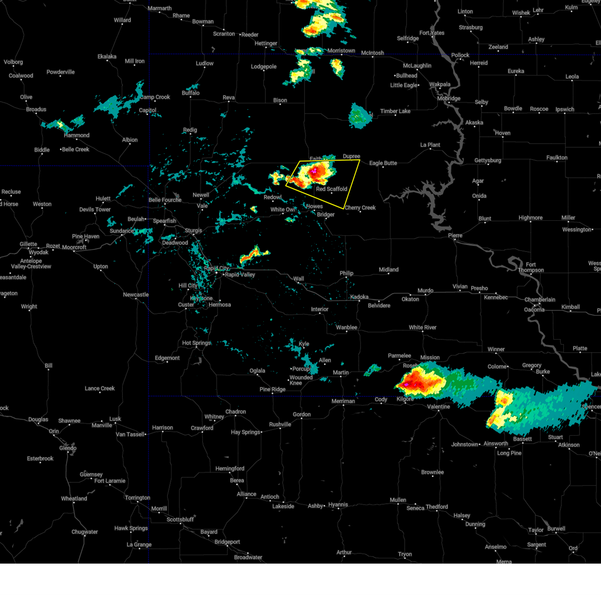
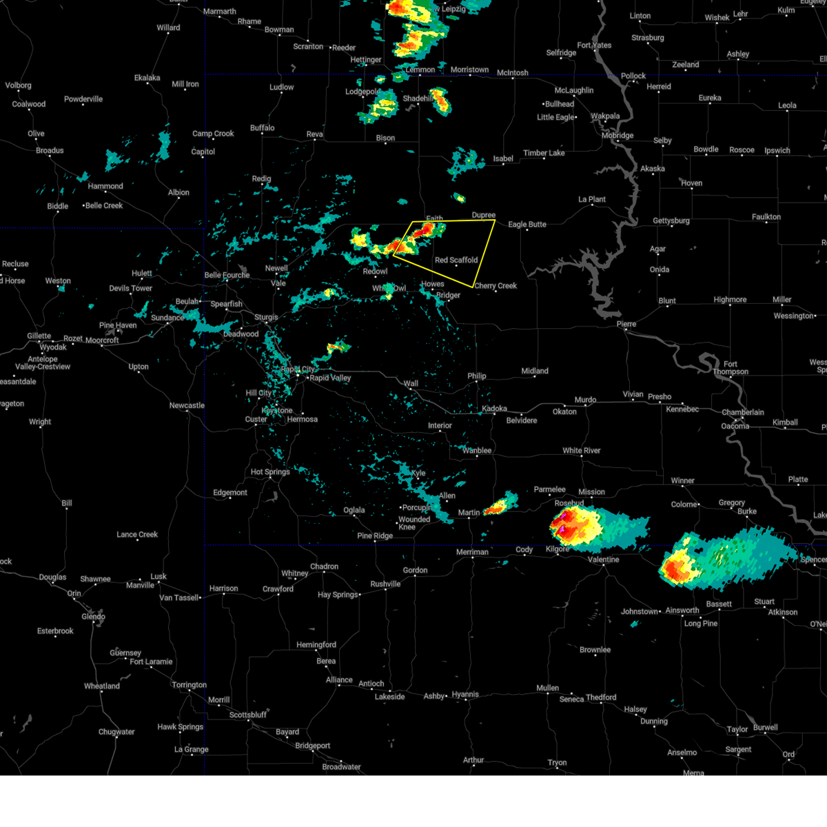
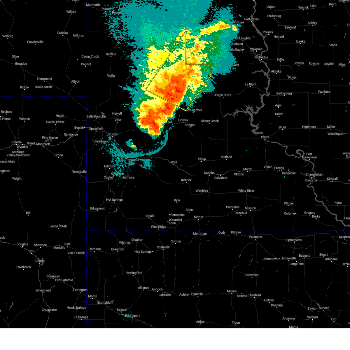
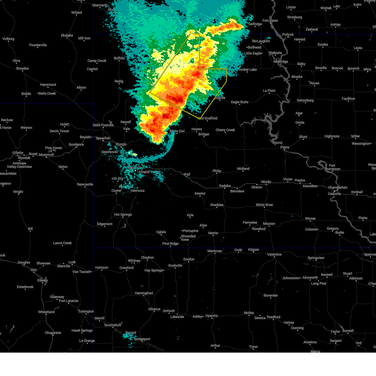
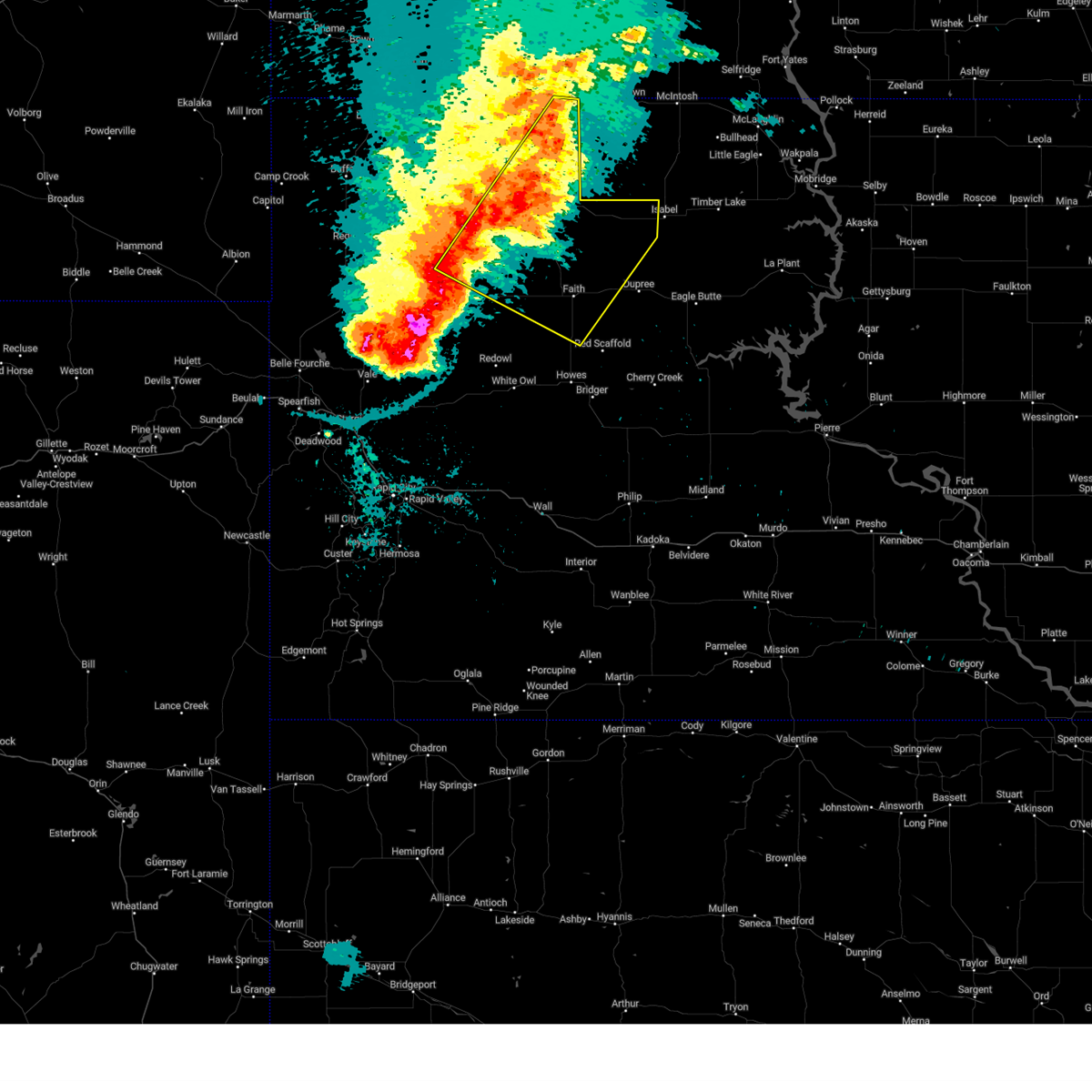
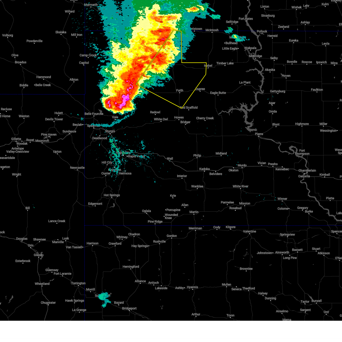
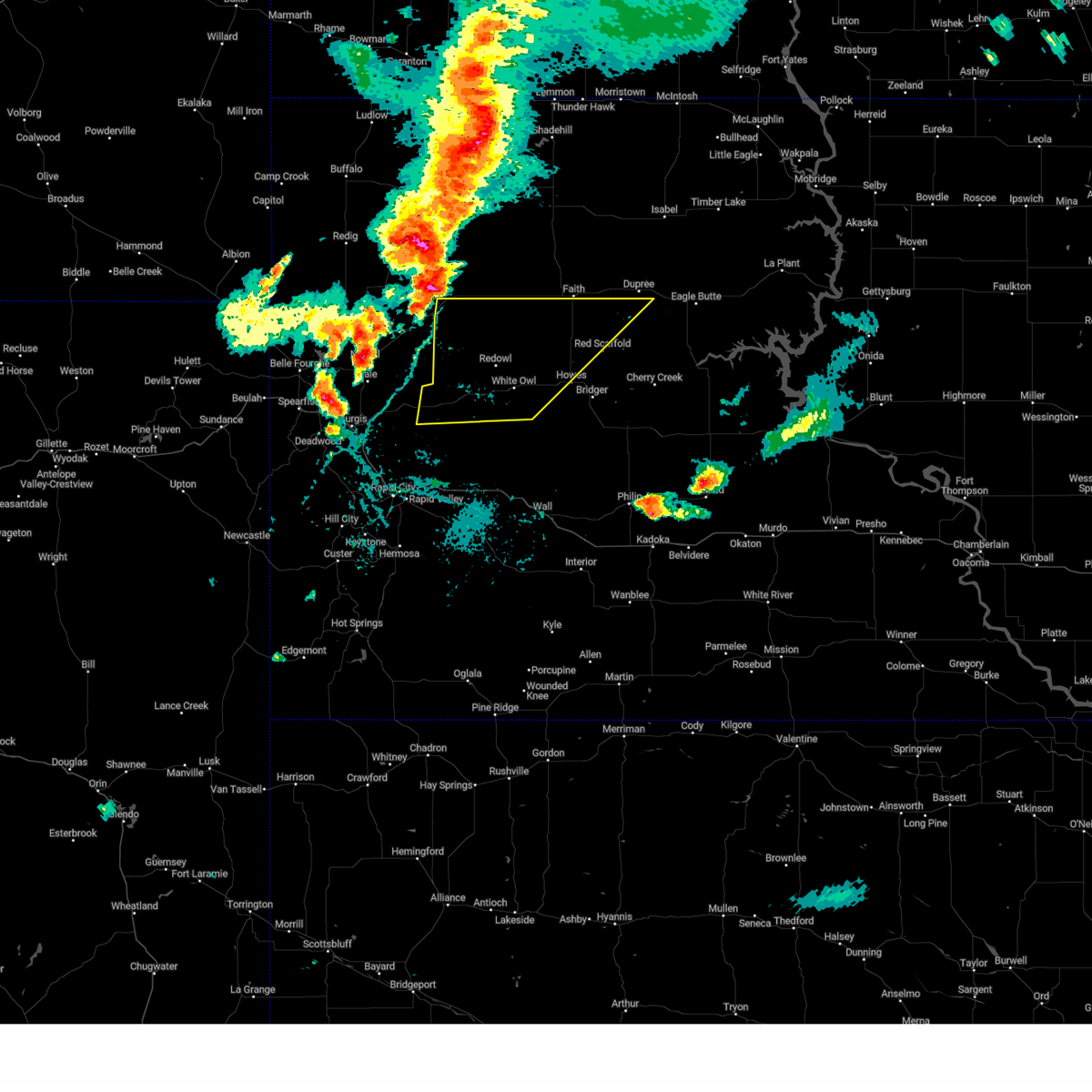
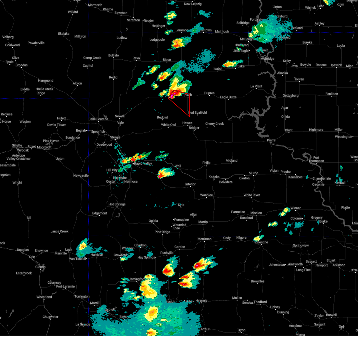
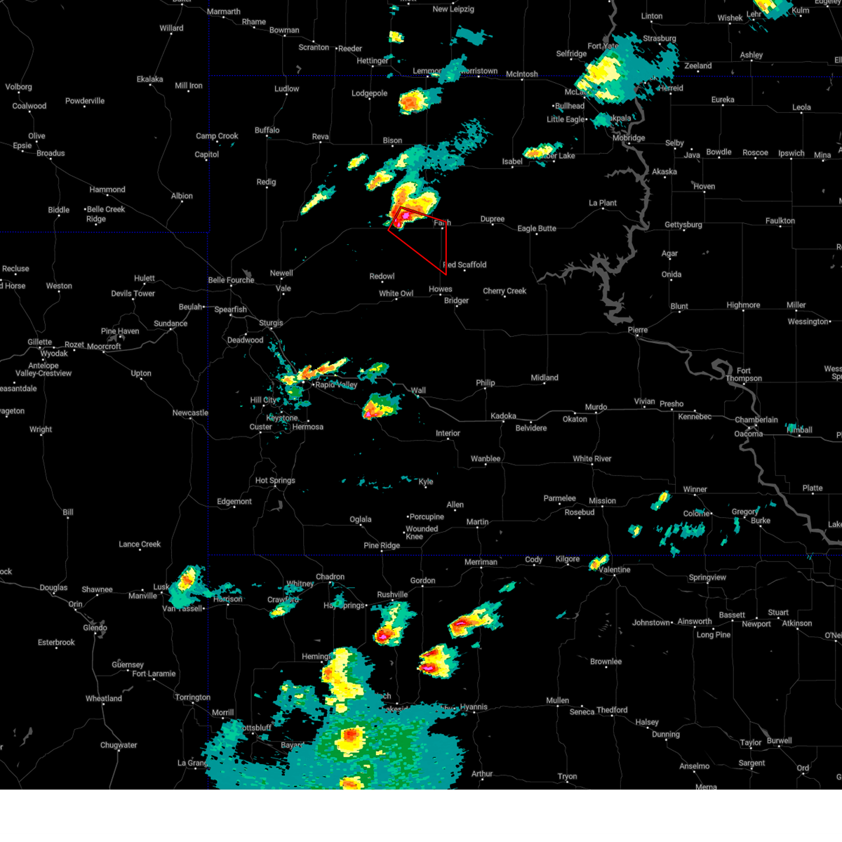
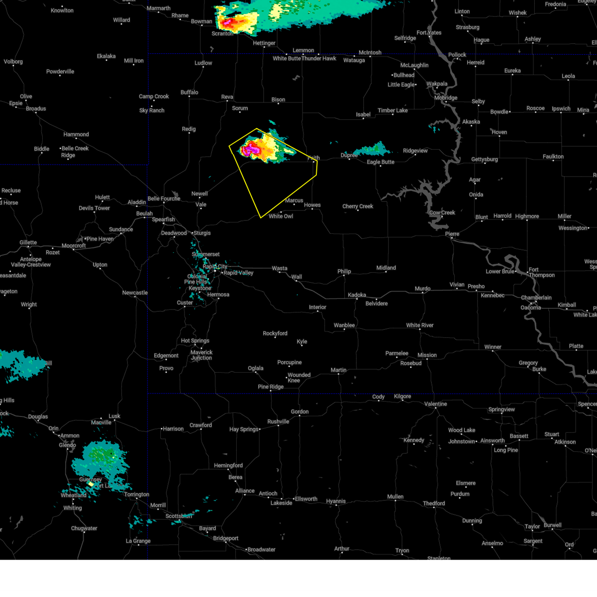
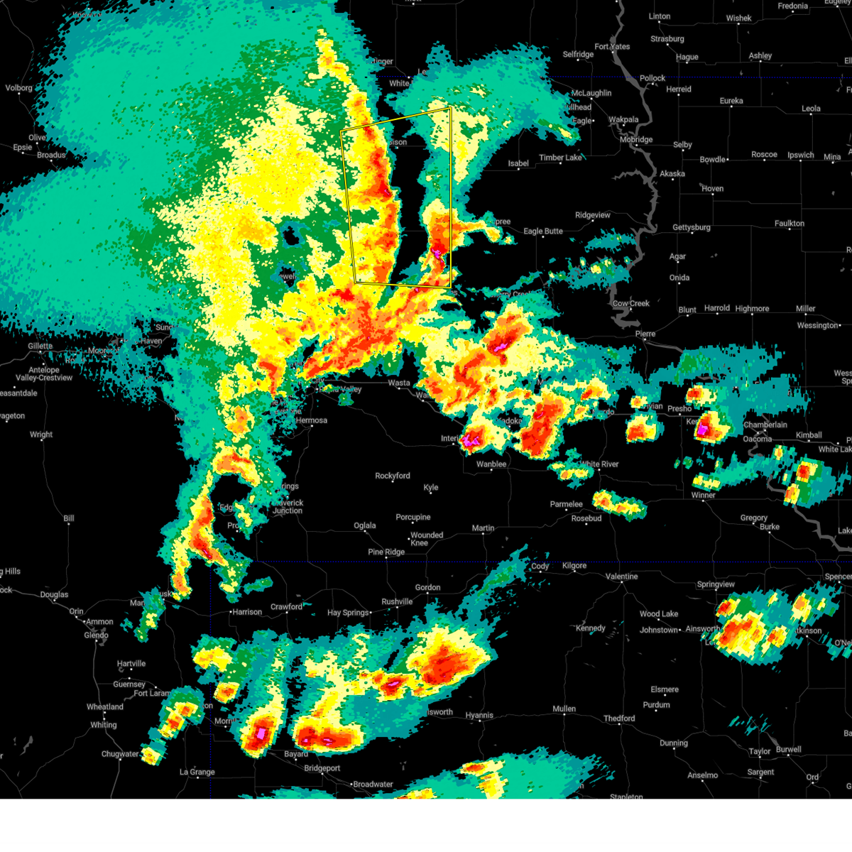
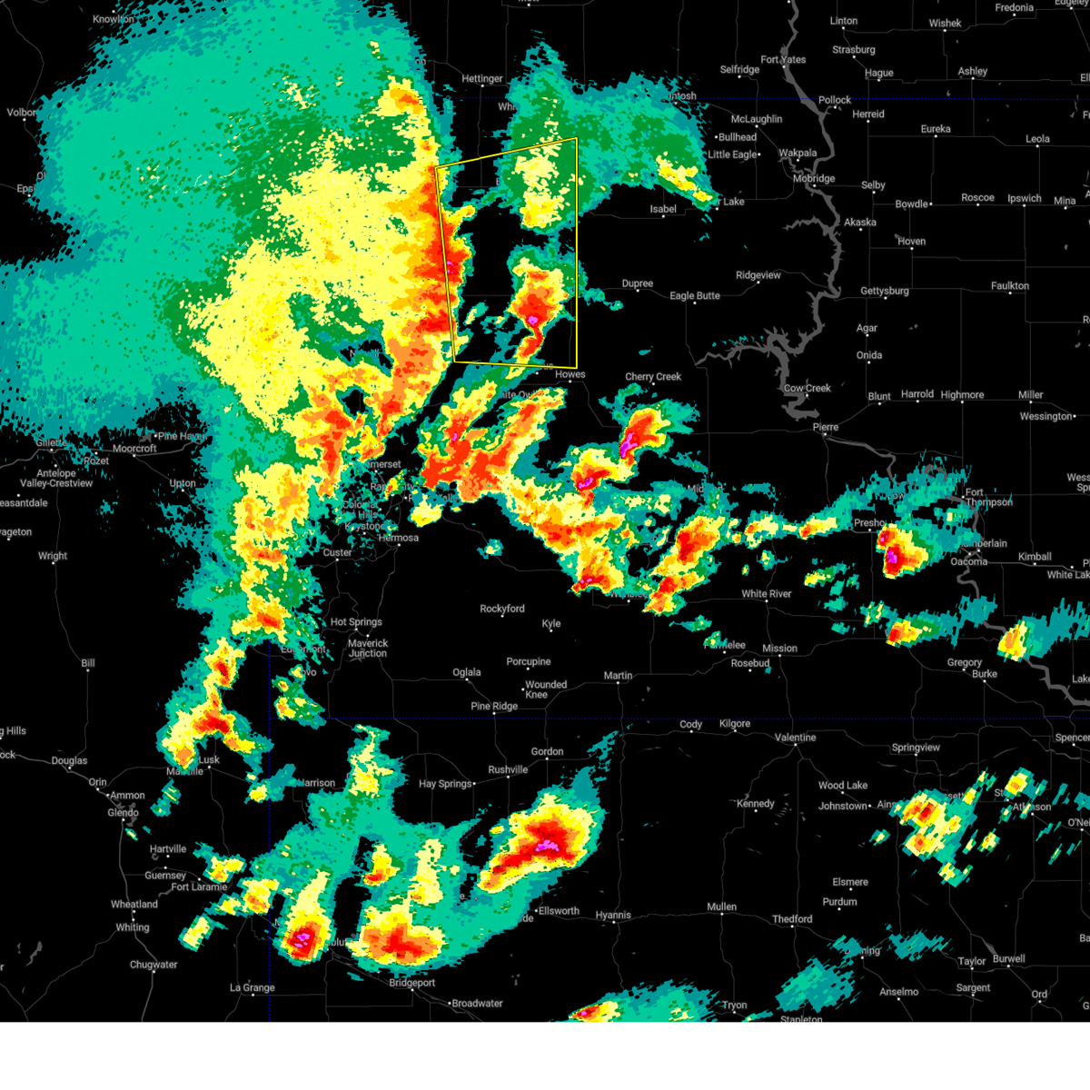
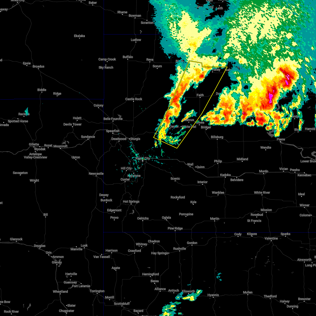
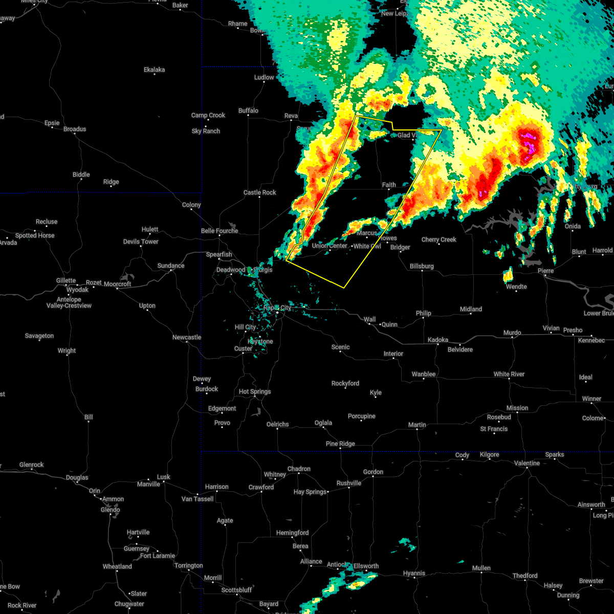
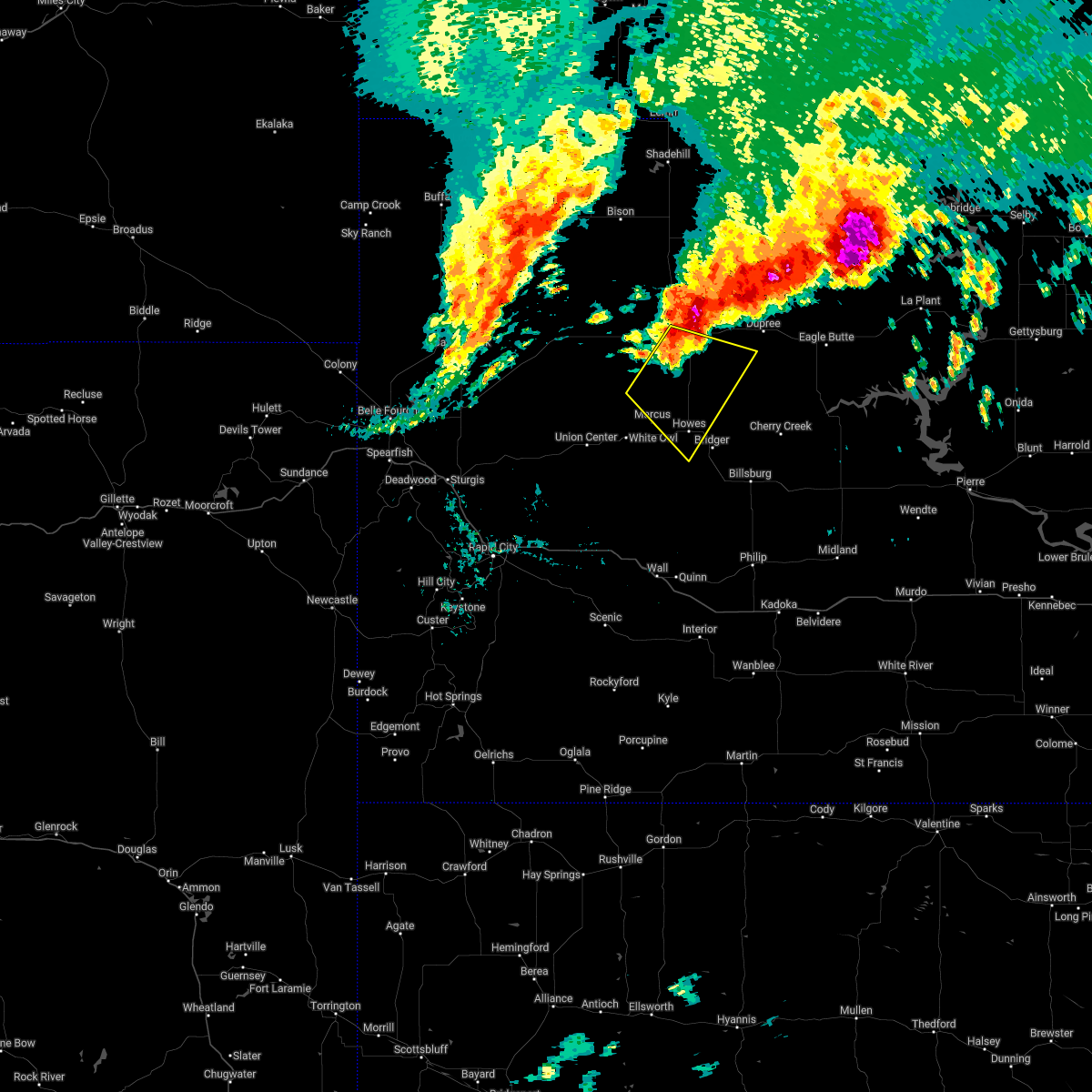
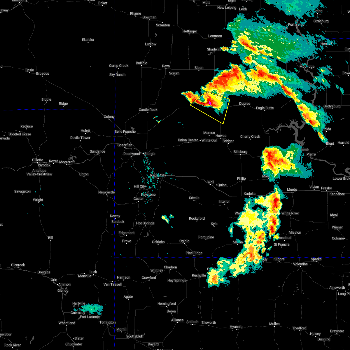
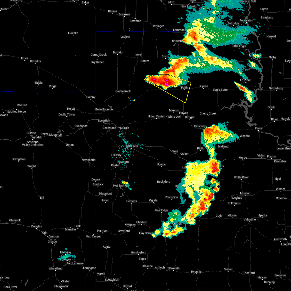
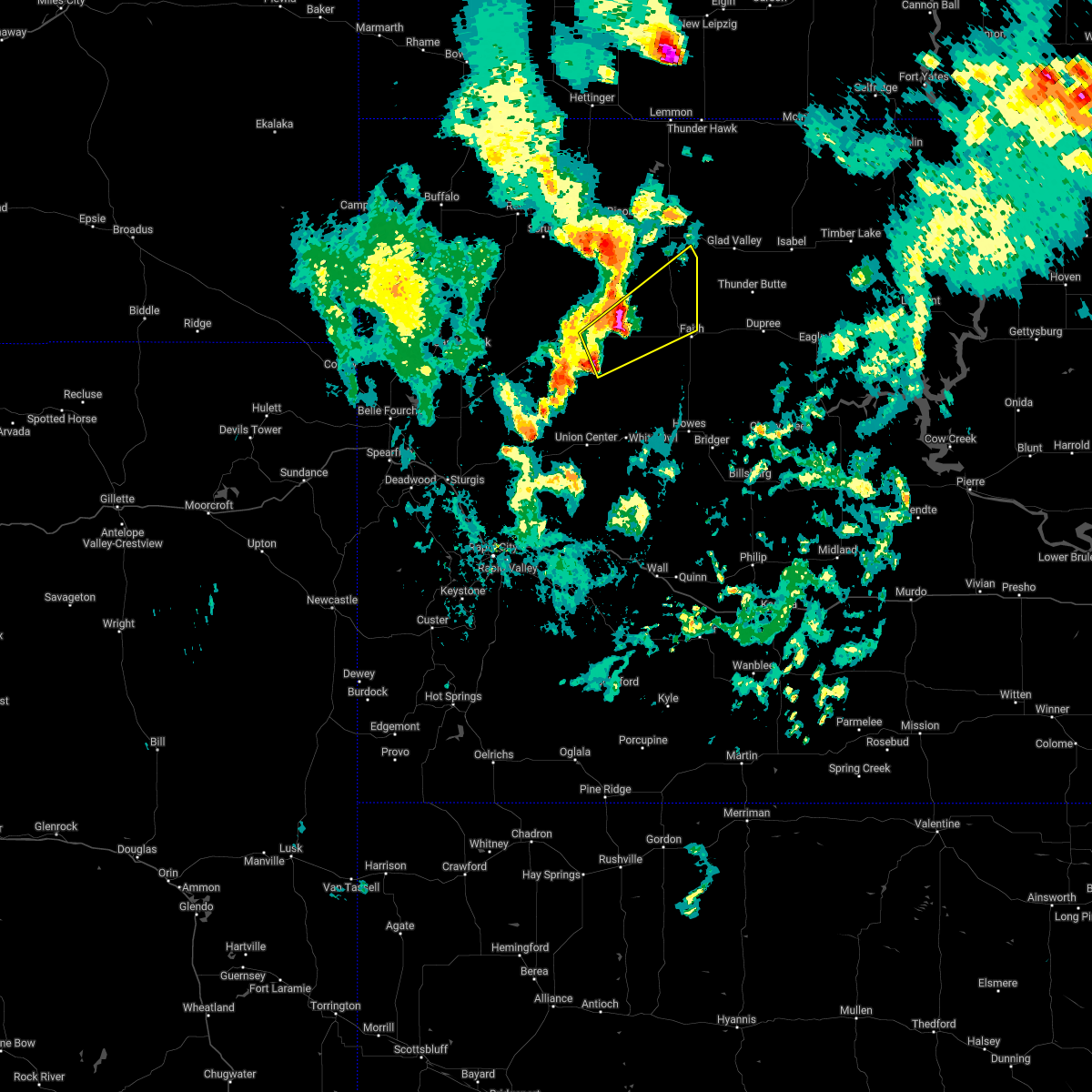
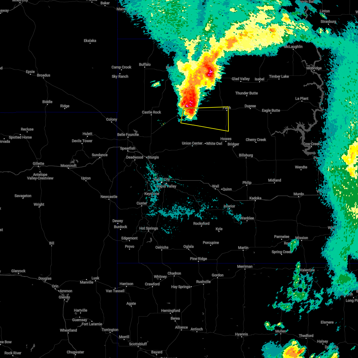
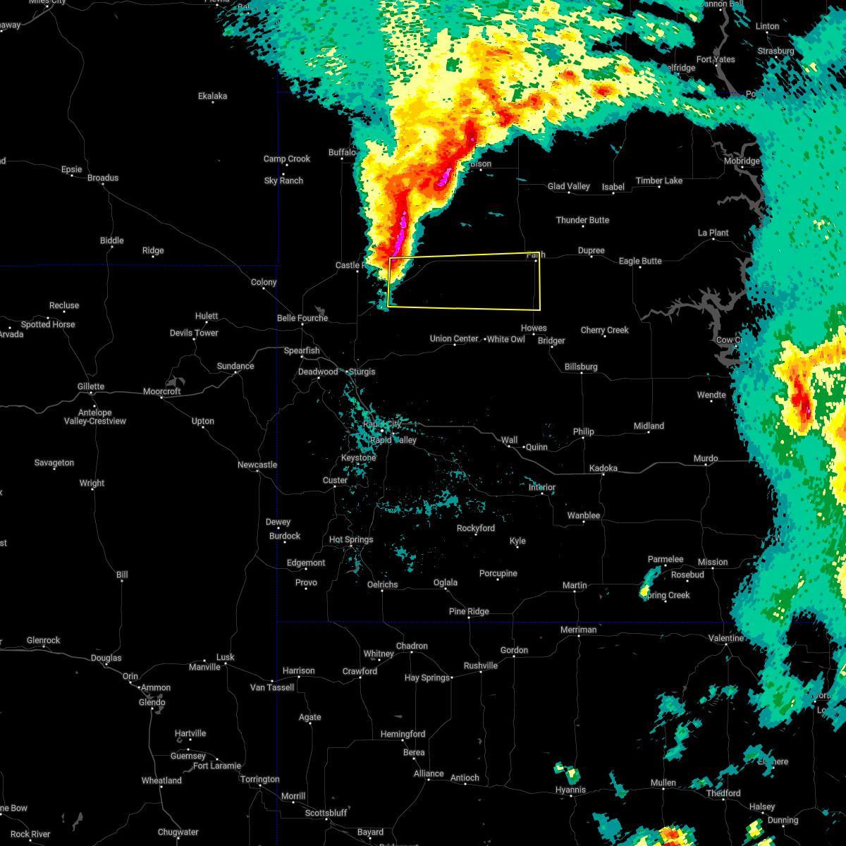
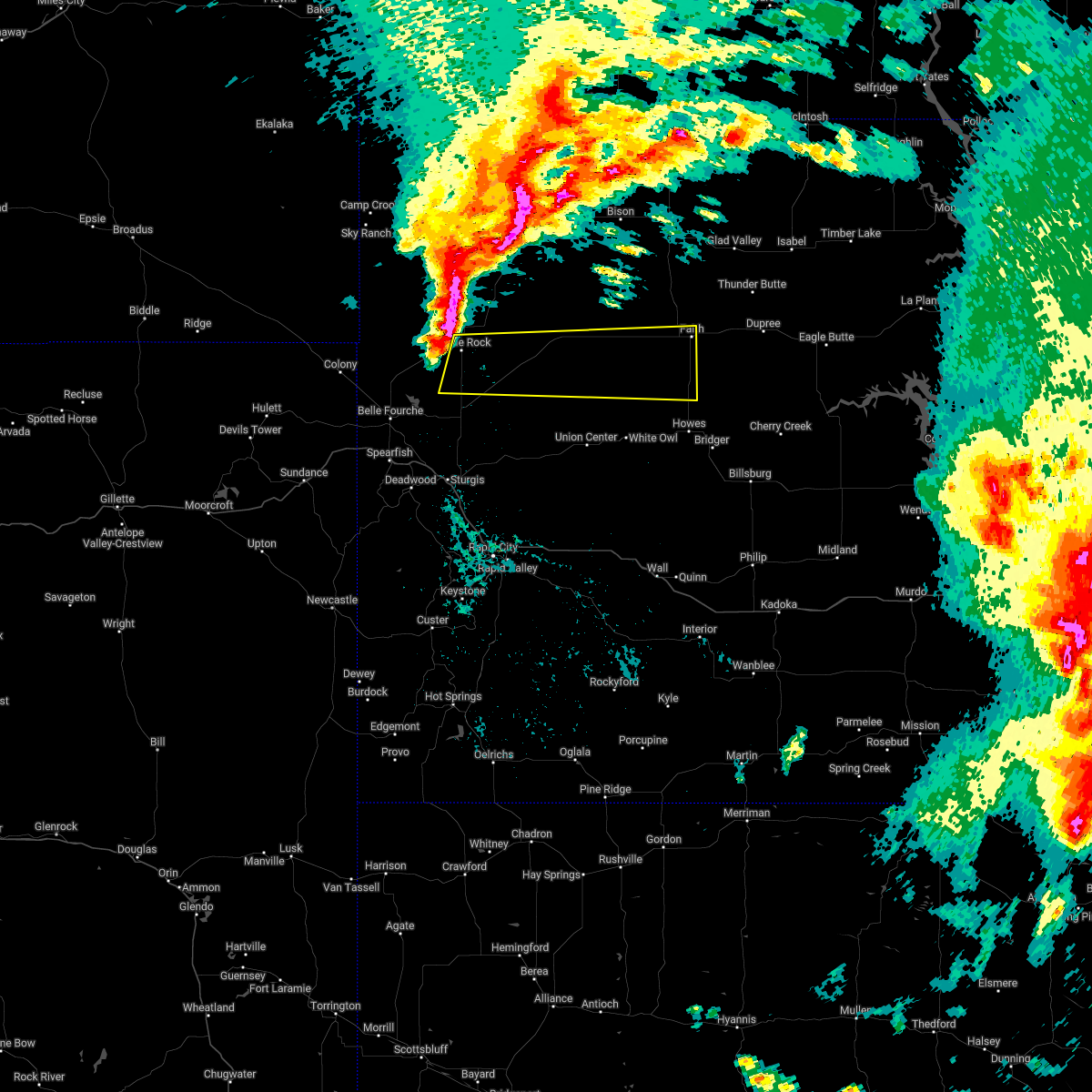
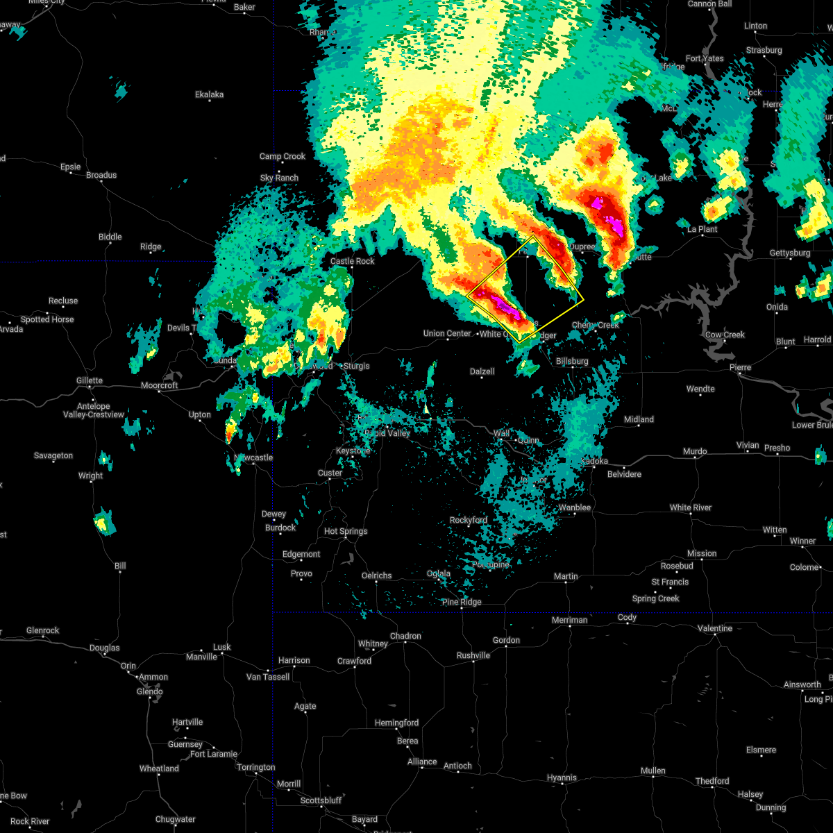
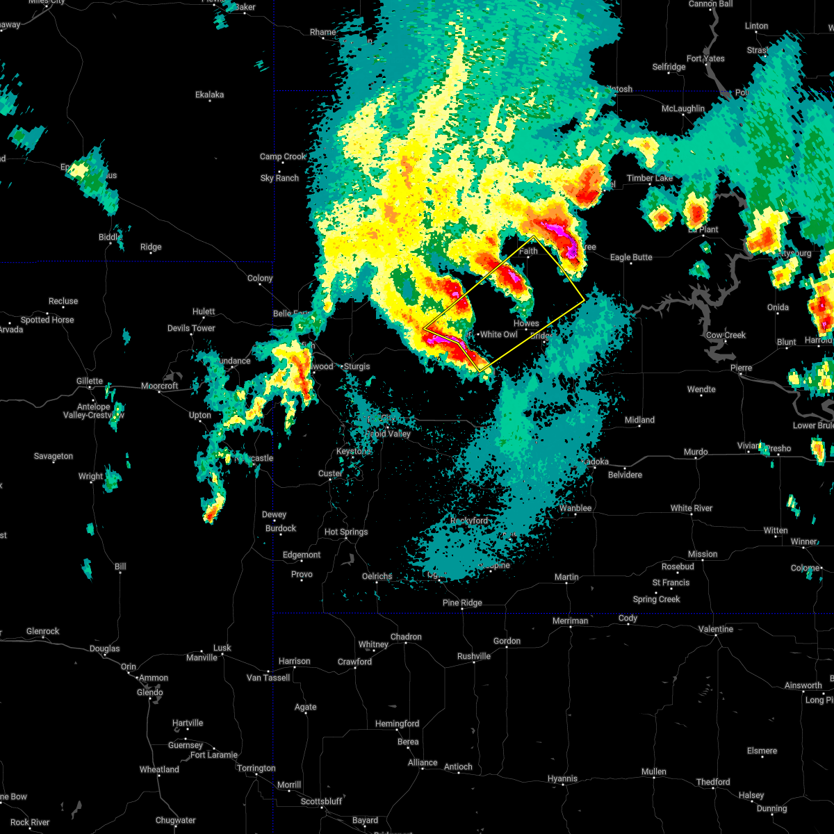
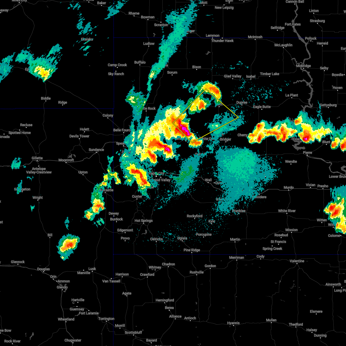
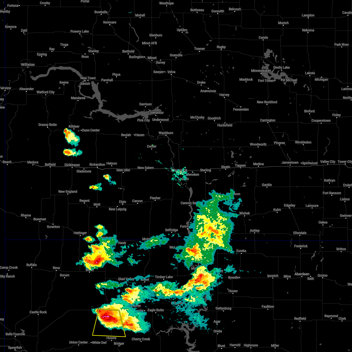
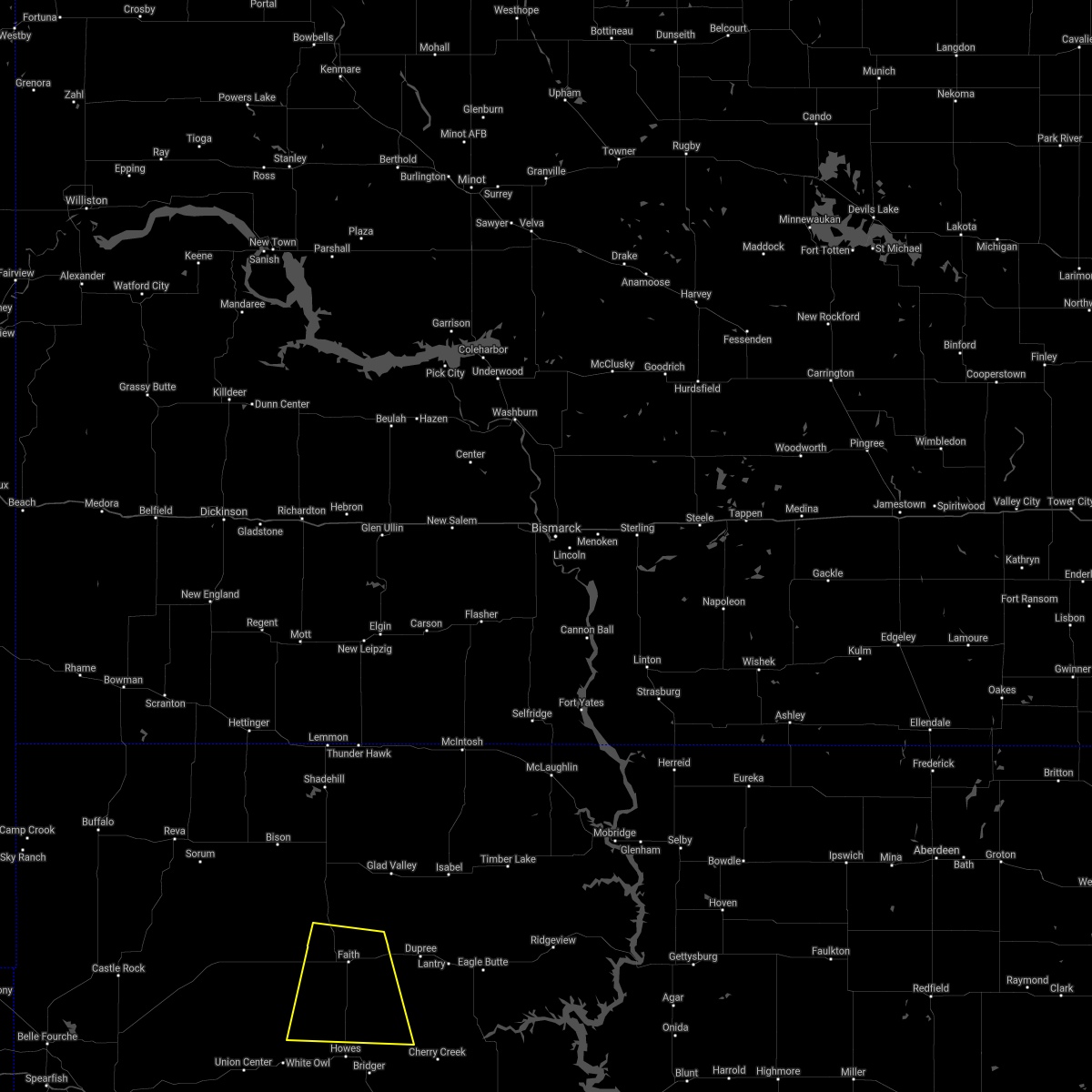
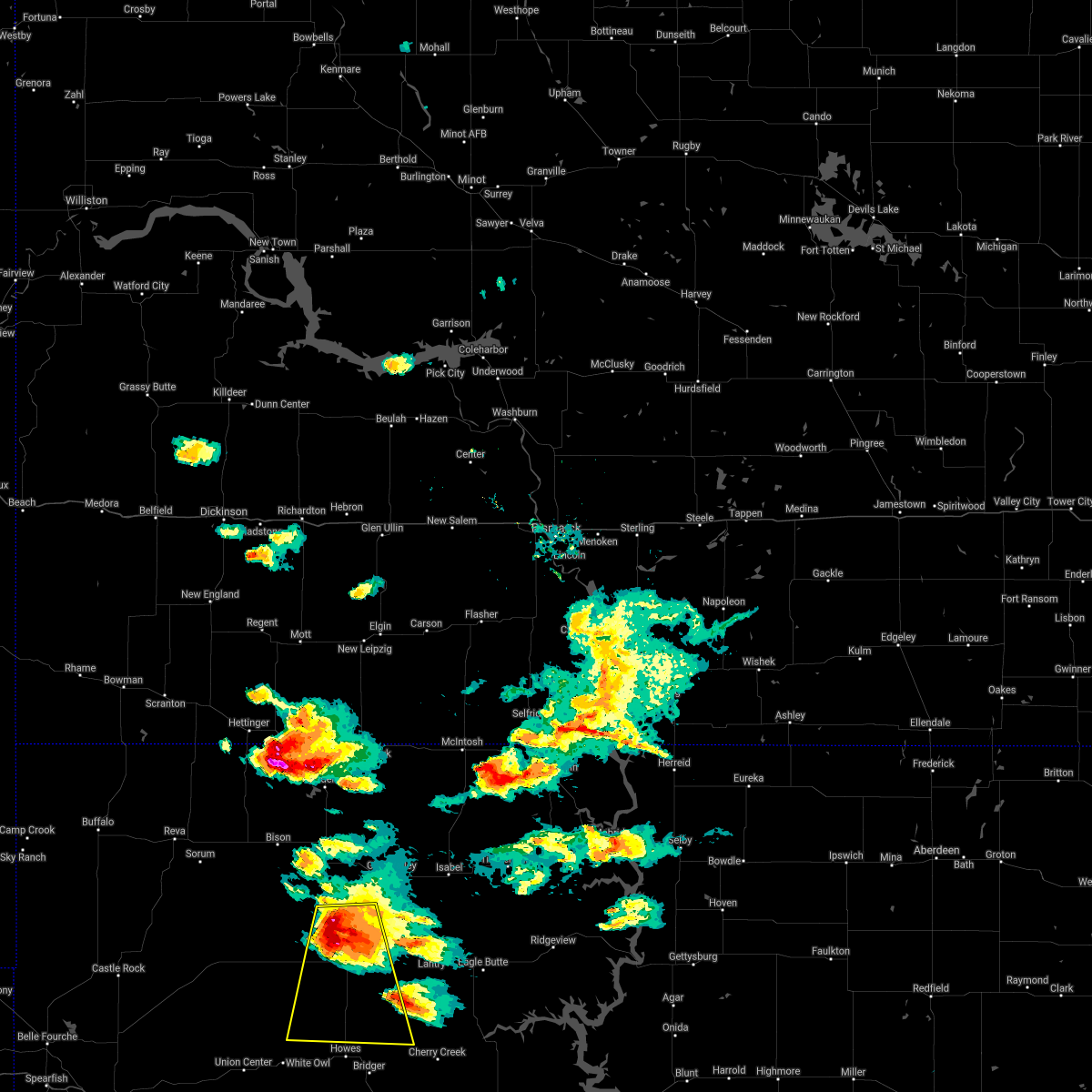
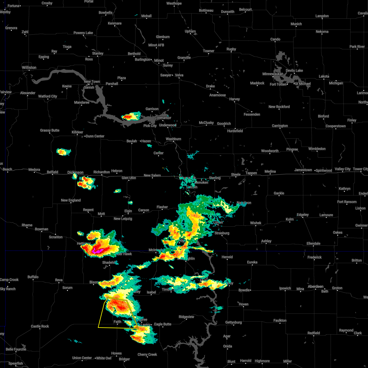
Hail Map for Faith, SD
The Faith, SD area has had 50 reports of on-the-ground hail by trained spotters, and has been under severe weather warnings 11 times during the past 12 months. Doppler radar has detected hail at or near Faith, SD on 61 occasions, including 3 occasions during the past year.
| Name: | Faith, SD |
| Where Located: | 87.8 miles NE of Rapid City, SD |
| Map: | Google Map for Faith, SD |
| Population: | 421 |
| Housing Units: | 236 |
| More Info: | Search Google for Faith, SD |
1
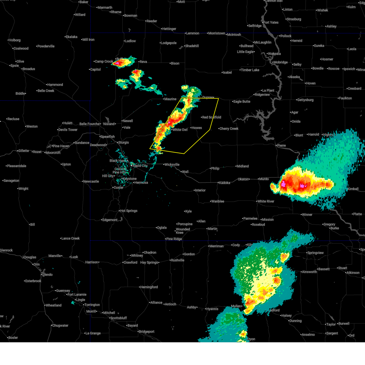
The Top Recent Hail Date for Faith, SD is Monday, May 5, 2025 (20th out of 61)
Hail and Wind Damage Spotted near Faith, SD
| Date / Time | Report Details |
|---|---|
| 7/9/2025 4:44 PM MDT | Svrunr the national weather service in rapid city has issued a * severe thunderstorm warning for, northeastern haakon county in west central south dakota, ziebach county in west central south dakota, northeastern meade county in west central south dakota, * until 545 pm mdt. * at 443 pm mdt, severe thunderstorms were located along a line extending from 4 miles southeast of glad valley to 5 miles northeast of intersection of cherry creek and sunnybrook roads to near takini, moving east at 50 mph. trained spotters and automated observations recently reported wind gusts around 60 mph in faith (trained weather spotters). Hazards include 60 mph wind gusts. expect damage to roofs, siding, and trees |
| 7/9/2025 4:25 PM MDT | Storm damage reported in perkins county SD, 10.2 miles S of Faith, SD |
| 7/9/2025 4:24 PM MDT | Storm damage reported in meade county SD, 1 miles WSW of Faith, SD |
| 7/9/2025 4:16 PM MDT |
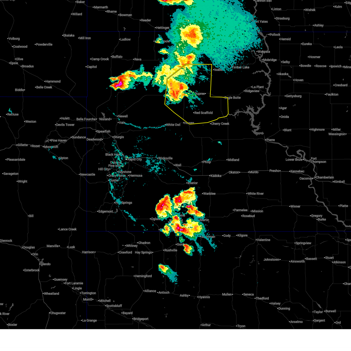 At 416 pm mdt, severe thunderstorms were located along a line extending from 6 miles southwest of shambo ranch to 6 miles west of red elm to 11 miles west of red scaffold, moving east at 40 mph. a 64 mph wind gust was recently recorded in usta (automated observations indicated). Hazards include 60 mph wind gusts. Expect damage to roofs, siding, and trees. Locations impacted include, dupree, faith, usta, glad valley, south eagle butte, red scaffold, thunder butte, red elm, iron lightning, takini, intersection of cherry creek and sunnybrook roads, intersection of highway 63 and bia road 8, durkee lake, arrow head buttes, and western cheyenne river reservation. At 416 pm mdt, severe thunderstorms were located along a line extending from 6 miles southwest of shambo ranch to 6 miles west of red elm to 11 miles west of red scaffold, moving east at 40 mph. a 64 mph wind gust was recently recorded in usta (automated observations indicated). Hazards include 60 mph wind gusts. Expect damage to roofs, siding, and trees. Locations impacted include, dupree, faith, usta, glad valley, south eagle butte, red scaffold, thunder butte, red elm, iron lightning, takini, intersection of cherry creek and sunnybrook roads, intersection of highway 63 and bia road 8, durkee lake, arrow head buttes, and western cheyenne river reservation.
|
| 7/9/2025 4:09 PM MDT | Storm damage reported in perkins county SD, 14.1 miles SSE of Faith, SD |
| 7/9/2025 3:58 PM MDT | At 357 pm mdt, severe thunderstorms were located along a line extending from 8 miles west of shambo ranch to 5 miles southwest of iron lightning to 7 miles north of marcus, moving southeast at 50 mph (radar indicated). Hazards include 60 mph wind gusts and penny size hail. Expect damage to roofs, siding, and trees. Locations impacted include, dupree, faith, meadow, chance, usta, maurine, opal, glad valley, south eagle butte, red scaffold, thunder butte, red elm, iron lightning, owen lake, takini, intersection of cherry creek and sunnybrook roads, intersection of highway 63 and bia road 8, durkee lake, arrow head buttes, and western cheyenne river reservation. |
| 7/9/2025 3:49 PM MDT | At 348 pm mdt, severe thunderstorms were located along a line extending from 4 miles north of shadehill to 9 miles east of meadow to 4 miles south of opal, moving east at 50 mph (radar indicated). Hazards include 60 mph wind gusts and penny size hail. Expect damage to roofs, siding, and trees. Locations impacted include, lemmon, dupree, faith, bison, plainview, meadow, chance, usta, maurine, shadehill, stoneville, opal, red scaffold, red owl, iron lightning, glad valley, date, south eagle butte, marcus, and howes. |
| 7/9/2025 3:40 PM MDT |
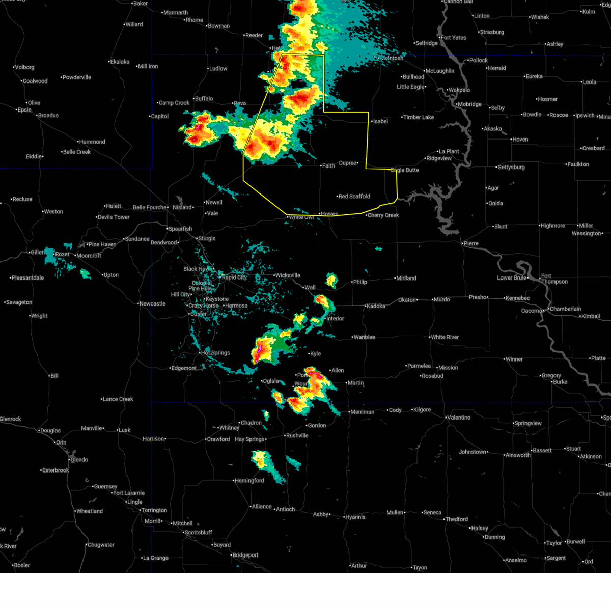 Svrunr the national weather service in rapid city has issued a * severe thunderstorm warning for, ziebach county in west central south dakota, northeastern meade county in west central south dakota, perkins county in northwestern south dakota, * until 445 pm mdt. * at 340 pm mdt, severe thunderstorms were located along a line extending from 6 miles south of white butte to 10 miles southeast of meadow to 7 miles north of stoneville, moving east at 60 mph (radar indicated). Hazards include 60 mph wind gusts and quarter size hail. Hail damage to vehicles is expected. Expect wind damage to roofs, siding, and trees. Svrunr the national weather service in rapid city has issued a * severe thunderstorm warning for, ziebach county in west central south dakota, northeastern meade county in west central south dakota, perkins county in northwestern south dakota, * until 445 pm mdt. * at 340 pm mdt, severe thunderstorms were located along a line extending from 6 miles south of white butte to 10 miles southeast of meadow to 7 miles north of stoneville, moving east at 60 mph (radar indicated). Hazards include 60 mph wind gusts and quarter size hail. Hail damage to vehicles is expected. Expect wind damage to roofs, siding, and trees.
|
| 6/27/2025 6:31 PM MDT |
 Svrunr the national weather service in rapid city has issued a * severe thunderstorm warning for, west central haakon county in west central south dakota, southwestern ziebach county in west central south dakota, eastern meade county in west central south dakota, northeastern pennington county in west central south dakota, * until 730 pm mdt. * at 631 pm mdt, severe thunderstorms were located along a line extending from 6 miles west of durkee lake to 5 miles southwest of marcus to 5 miles southeast of hereford, moving east at 30 mph (radar indicated). Hazards include 60 mph wind gusts. expect damage to roofs, siding, and trees Svrunr the national weather service in rapid city has issued a * severe thunderstorm warning for, west central haakon county in west central south dakota, southwestern ziebach county in west central south dakota, eastern meade county in west central south dakota, northeastern pennington county in west central south dakota, * until 730 pm mdt. * at 631 pm mdt, severe thunderstorms were located along a line extending from 6 miles west of durkee lake to 5 miles southwest of marcus to 5 miles southeast of hereford, moving east at 30 mph (radar indicated). Hazards include 60 mph wind gusts. expect damage to roofs, siding, and trees
|
| 9/17/2024 9:49 PM MDT |
 At 948 pm mdt, severe thunderstorms were located along a line extending from 5 miles northwest of durkee lake to 4 miles southwest of dupree to 4 miles east of intersection of cherry creek and sunnybrook roads, moving northeast at 55 mph. downed power poles and structural damage were recently reported near faith (law enforcement). Hazards include 70 mph wind gusts and penny size hail. Expect considerable tree damage. damage is likely to mobile homes, roofs, and outbuildings. Locations impacted include, dupree, faith, usta, glad valley, south eagle butte, thunder butte, red elm, iron lightning, intersection of cherry creek and sunnybrook roads, intersection of highway 63 and bia road 8, durkee lake, arrow head buttes, and northwestern cheyenne river reservation. At 948 pm mdt, severe thunderstorms were located along a line extending from 5 miles northwest of durkee lake to 4 miles southwest of dupree to 4 miles east of intersection of cherry creek and sunnybrook roads, moving northeast at 55 mph. downed power poles and structural damage were recently reported near faith (law enforcement). Hazards include 70 mph wind gusts and penny size hail. Expect considerable tree damage. damage is likely to mobile homes, roofs, and outbuildings. Locations impacted include, dupree, faith, usta, glad valley, south eagle butte, thunder butte, red elm, iron lightning, intersection of cherry creek and sunnybrook roads, intersection of highway 63 and bia road 8, durkee lake, arrow head buttes, and northwestern cheyenne river reservation.
|
| 9/17/2024 9:45 PM MDT |
 At 943 pm mdt, severe thunderstorms were located along a line extending from 3 miles northwest of durkee lake to 6 miles south of red elm to 4 miles southeast of intersection of cherry creek and sunnybrook roads, moving north at 65 mph. power poles were recently reported down near faith (trained weather spotters and automated observations). Hazards include 70 mph wind gusts and quarter size hail. Hail damage to vehicles is expected. expect considerable tree damage. wind damage is also likely to mobile homes, roofs, and outbuildings. Locations impacted include, dupree, faith, cherry creek, usta, glad valley, south eagle butte, red scaffold, thunder butte, red elm, iron lightning, takini, intersection of cherry creek and sunnybrook roads, intersection of highway 63 and bia road 8, durkee lake, arrow head buttes, and western cheyenne river reservation. At 943 pm mdt, severe thunderstorms were located along a line extending from 3 miles northwest of durkee lake to 6 miles south of red elm to 4 miles southeast of intersection of cherry creek and sunnybrook roads, moving north at 65 mph. power poles were recently reported down near faith (trained weather spotters and automated observations). Hazards include 70 mph wind gusts and quarter size hail. Hail damage to vehicles is expected. expect considerable tree damage. wind damage is also likely to mobile homes, roofs, and outbuildings. Locations impacted include, dupree, faith, cherry creek, usta, glad valley, south eagle butte, red scaffold, thunder butte, red elm, iron lightning, takini, intersection of cherry creek and sunnybrook roads, intersection of highway 63 and bia road 8, durkee lake, arrow head buttes, and western cheyenne river reservation.
|
| 9/17/2024 9:35 PM MDT | Storm damage reported in perkins county SD, 14.1 miles SSE of Faith, SD |
| 9/17/2024 9:27 PM MDT | Storm damage reported in meade county SD, 1 miles WSW of Faith, SD |
| 9/17/2024 9:25 PM MDT | Power poles down. shed blew onto the highway in meade county SD, 0.6 miles NW of Faith, SD |
| 9/17/2024 9:25 PM MDT |
 Svrunr the national weather service in rapid city has issued a * severe thunderstorm warning for, ziebach county in west central south dakota, northeastern meade county in west central south dakota, southeastern perkins county in northwestern south dakota, * until 1045 pm mdt. * at 925 pm mdt, severe thunderstorms were located along a line extending from 9 miles south of durkee lake to 2 miles south of red scaffold to 7 miles northwest of cherry creek, moving north at 45 mph (radar indicated). Hazards include 60 mph wind gusts and quarter size hail. Hail damage to vehicles is expected. expect wind damage to roofs, siding, and trees. severe thunderstorms will be near, faith, red scaffold, durkee lake, and intersection of cherry creek and sunnybrook roads around 930 pm mdt. red elm around 935 pm mdt. dupree and arrow head buttes around 940 pm mdt. iron lightning and intersection of highway 63 and bia road 8 around 945 pm mdt. Other locations in the path of these severe thunderstorms include usta, thunder butte, south eagle butte and glad valley. Svrunr the national weather service in rapid city has issued a * severe thunderstorm warning for, ziebach county in west central south dakota, northeastern meade county in west central south dakota, southeastern perkins county in northwestern south dakota, * until 1045 pm mdt. * at 925 pm mdt, severe thunderstorms were located along a line extending from 9 miles south of durkee lake to 2 miles south of red scaffold to 7 miles northwest of cherry creek, moving north at 45 mph (radar indicated). Hazards include 60 mph wind gusts and quarter size hail. Hail damage to vehicles is expected. expect wind damage to roofs, siding, and trees. severe thunderstorms will be near, faith, red scaffold, durkee lake, and intersection of cherry creek and sunnybrook roads around 930 pm mdt. red elm around 935 pm mdt. dupree and arrow head buttes around 940 pm mdt. iron lightning and intersection of highway 63 and bia road 8 around 945 pm mdt. Other locations in the path of these severe thunderstorms include usta, thunder butte, south eagle butte and glad valley.
|
| 9/14/2024 1:45 PM MDT | Storm damage reported in meade county SD, 1 miles WSW of Faith, SD |
| 7/30/2024 4:49 PM MDT | Golf Ball sized hail reported 12.8 miles N of Faith, SD, hail covered the ground. about an inch and half of rain as well. |
| 7/30/2024 4:31 PM MDT |
 At 431 pm mdt, a severe thunderstorm was located 3 miles south of durkee lake, or 5 miles south of faith, moving east at 20 mph (radar indicated). Hazards include 60 mph wind gusts and quarter size hail. Hail damage to vehicles is expected. expect wind damage to roofs, siding, and trees. Locations impacted include, red scaffold, intersection of cherry creek and sunnybrook roads and dupree. At 431 pm mdt, a severe thunderstorm was located 3 miles south of durkee lake, or 5 miles south of faith, moving east at 20 mph (radar indicated). Hazards include 60 mph wind gusts and quarter size hail. Hail damage to vehicles is expected. expect wind damage to roofs, siding, and trees. Locations impacted include, red scaffold, intersection of cherry creek and sunnybrook roads and dupree.
|
| 7/30/2024 4:14 PM MDT |
 Svrunr the national weather service in rapid city has issued a * severe thunderstorm warning for, southwestern ziebach county in west central south dakota, northeastern meade county in west central south dakota, * until 515 pm mdt. * at 414 pm mdt, a severe thunderstorm was located near durkee lake, or 4 miles southwest of faith, moving east at 25 mph (radar indicated). Hazards include 60 mph wind gusts and half dollar size hail. Hail damage to vehicles is expected. expect wind damage to roofs, siding, and trees. this severe thunderstorm will be near, faith around 420 pm mdt. red scaffold and intersection of cherry creek and sunnybrook roads around 440 pm mdt. Dupree around 445 pm mdt. Svrunr the national weather service in rapid city has issued a * severe thunderstorm warning for, southwestern ziebach county in west central south dakota, northeastern meade county in west central south dakota, * until 515 pm mdt. * at 414 pm mdt, a severe thunderstorm was located near durkee lake, or 4 miles southwest of faith, moving east at 25 mph (radar indicated). Hazards include 60 mph wind gusts and half dollar size hail. Hail damage to vehicles is expected. expect wind damage to roofs, siding, and trees. this severe thunderstorm will be near, faith around 420 pm mdt. red scaffold and intersection of cherry creek and sunnybrook roads around 440 pm mdt. Dupree around 445 pm mdt.
|
| 7/13/2024 11:23 PM MDT |
 At 1122 pm mdt, severe thunderstorms were located along a line extending from 7 miles west of isabel to 8 miles east of takini to 6 miles north of wall, moving southeast at 50 mph. these are destructive storms for dupree, cherry creek and billsburg (radar indicated). Hazards include 80 mph wind gusts and penny size hail. Flying debris will be dangerous to those caught without shelter. mobile homes will be heavily damaged. expect considerable damage to roofs, windows, and vehicles. extensive tree damage and power outages are likely. these severe storms will be near, dupree, wall, cherry creek, milesville, billsburg, grindstone, intersection of cherry creek and sunnybrook roads, and grindstone butte around 1125 pm mdt. south eagle butte, kirley, and intersection of highway 63 and bia road 8 around 1130 pm mdt. philip around 1140 pm mdt. ottumwa around 1145 pm mdt. nowlin around 1155 pm mdt. midland around 1205 am mdt. other locations impacted by these severe thunderstorms include western cheyenne river reservation. This includes interstate 90 in south dakota between mile markers 87 and 110. At 1122 pm mdt, severe thunderstorms were located along a line extending from 7 miles west of isabel to 8 miles east of takini to 6 miles north of wall, moving southeast at 50 mph. these are destructive storms for dupree, cherry creek and billsburg (radar indicated). Hazards include 80 mph wind gusts and penny size hail. Flying debris will be dangerous to those caught without shelter. mobile homes will be heavily damaged. expect considerable damage to roofs, windows, and vehicles. extensive tree damage and power outages are likely. these severe storms will be near, dupree, wall, cherry creek, milesville, billsburg, grindstone, intersection of cherry creek and sunnybrook roads, and grindstone butte around 1125 pm mdt. south eagle butte, kirley, and intersection of highway 63 and bia road 8 around 1130 pm mdt. philip around 1140 pm mdt. ottumwa around 1145 pm mdt. nowlin around 1155 pm mdt. midland around 1205 am mdt. other locations impacted by these severe thunderstorms include western cheyenne river reservation. This includes interstate 90 in south dakota between mile markers 87 and 110.
|
| 7/13/2024 11:04 PM MDT |
 Svrunr the national weather service in rapid city has issued a * severe thunderstorm warning for, haakon county in west central south dakota, ziebach county in west central south dakota, eastern meade county in west central south dakota, southeastern perkins county in northwestern south dakota, northeastern pennington county in west central south dakota, * until 1215 am mdt. * at 1102 pm mdt, severe thunderstorms were located along a line extending from near glad valley to 9 miles northeast of marcus to 6 miles northwest of wicksville, moving east at 40 mph. these are destructive storms for faith, milesville, creighton, and red elm (radar indicated). Hazards include 80 mph wind gusts and penny size hail. Flying debris will be dangerous to those caught without shelter. mobile homes will be heavily damaged. expect considerable damage to roofs, windows, and vehicles. extensive tree damage and power outages are likely. severe thunderstorms will be near, wasta, plainview, wicksville, howes, creighton, red scaffold, iron lightning, thunder butte, red elm, and takini around 1105 pm mdt. dupree and bridger around 1110 pm mdt. intersection of cherry creek and sunnybrook roads around 1115 pm mdt. wall around 1120 pm mdt. milesville and grindstone around 1130 pm mdt. cherry creek, south eagle butte, and billsburg around 1135 pm mdt. intersection of highway 63 and bia road 8 and grindstone butte around 1140 pm mdt. kirley around 1150 pm mdt. other locations impacted by these severe thunderstorms include western cheyenne river reservation. This includes interstate 90 in south dakota between mile markers 86 and 110. Svrunr the national weather service in rapid city has issued a * severe thunderstorm warning for, haakon county in west central south dakota, ziebach county in west central south dakota, eastern meade county in west central south dakota, southeastern perkins county in northwestern south dakota, northeastern pennington county in west central south dakota, * until 1215 am mdt. * at 1102 pm mdt, severe thunderstorms were located along a line extending from near glad valley to 9 miles northeast of marcus to 6 miles northwest of wicksville, moving east at 40 mph. these are destructive storms for faith, milesville, creighton, and red elm (radar indicated). Hazards include 80 mph wind gusts and penny size hail. Flying debris will be dangerous to those caught without shelter. mobile homes will be heavily damaged. expect considerable damage to roofs, windows, and vehicles. extensive tree damage and power outages are likely. severe thunderstorms will be near, wasta, plainview, wicksville, howes, creighton, red scaffold, iron lightning, thunder butte, red elm, and takini around 1105 pm mdt. dupree and bridger around 1110 pm mdt. intersection of cherry creek and sunnybrook roads around 1115 pm mdt. wall around 1120 pm mdt. milesville and grindstone around 1130 pm mdt. cherry creek, south eagle butte, and billsburg around 1135 pm mdt. intersection of highway 63 and bia road 8 and grindstone butte around 1140 pm mdt. kirley around 1150 pm mdt. other locations impacted by these severe thunderstorms include western cheyenne river reservation. This includes interstate 90 in south dakota between mile markers 86 and 110.
|
| 7/13/2024 11:01 PM MDT |
 At 1100 pm mdt, severe thunderstorms were located along a line extending from 7 miles northeast of glad valley to 4 miles northwest of red elm to 10 miles south of durkee lake, moving east at 55 mph. these are destructive storms for faith and red elm (radar indicated). Hazards include 80 mph wind gusts and penny size hail. Flying debris will be dangerous to those caught without shelter. mobile homes will be heavily damaged. expect considerable damage to roofs, windows, and vehicles. extensive tree damage and power outages are likely. Locations impacted include, faith, meadow, chance, maurine, usta, glad valley, thunder butte, red elm, iron lightning, owen lake, durkee lake, and arrow head buttes. At 1100 pm mdt, severe thunderstorms were located along a line extending from 7 miles northeast of glad valley to 4 miles northwest of red elm to 10 miles south of durkee lake, moving east at 55 mph. these are destructive storms for faith and red elm (radar indicated). Hazards include 80 mph wind gusts and penny size hail. Flying debris will be dangerous to those caught without shelter. mobile homes will be heavily damaged. expect considerable damage to roofs, windows, and vehicles. extensive tree damage and power outages are likely. Locations impacted include, faith, meadow, chance, maurine, usta, glad valley, thunder butte, red elm, iron lightning, owen lake, durkee lake, and arrow head buttes.
|
| 7/13/2024 11:00 PM MDT | Reports of downed trees and impassible roads in faith. winds estimated at 80-90 mph. time estimated based on rada in meade county SD, 0.6 miles NW of Faith, SD |
| 7/13/2024 10:47 PM MDT | Storm damage reported in perkins county SD, 14.1 miles SSE of Faith, SD |
| 7/13/2024 10:47 PM MDT |
 At 1047 pm mdt, severe thunderstorms were located along a line extending from 10 miles west of black horse to 6 miles northeast of opal, moving southeast at 55 mph (radar indicated). Hazards include 70 mph wind gusts and quarter size hail. Hail damage to vehicles is expected. expect considerable tree damage. wind damage is also likely to mobile homes, roofs, and outbuildings. Locations impacted include, faith, iron lightning, thunder butte, red elm and durkee lake. At 1047 pm mdt, severe thunderstorms were located along a line extending from 10 miles west of black horse to 6 miles northeast of opal, moving southeast at 55 mph (radar indicated). Hazards include 70 mph wind gusts and quarter size hail. Hail damage to vehicles is expected. expect considerable tree damage. wind damage is also likely to mobile homes, roofs, and outbuildings. Locations impacted include, faith, iron lightning, thunder butte, red elm and durkee lake.
|
| 7/13/2024 10:40 PM MDT | 60-70 mph winds. 4 to 5 inch diameter branches broken off tree in perkins county SD, 17.7 miles E of Faith, SD |
| 7/13/2024 10:24 PM MDT |
 At 1022 pm mdt, severe thunderstorms were located along a line extending from 6 miles southwest of thunder hawk to 6 miles southeast of zeona, moving southeast at 50 mph. these are destructive storms for bison (radar indicated). Hazards include 80 mph wind gusts and quarter size hail. Flying debris will be dangerous to those caught without shelter. mobile homes will be heavily damaged. expect considerable damage to roofs, windows, and vehicles. extensive tree damage and power outages are likely. these severe storms will be near, meadow, chance, and maurine around 1030 pm mdt. usta around 1035 pm mdt. Other locations in the path of these severe thunderstorms include glad valley, arrow head buttes, faith, iron lightning and durkee lake. At 1022 pm mdt, severe thunderstorms were located along a line extending from 6 miles southwest of thunder hawk to 6 miles southeast of zeona, moving southeast at 50 mph. these are destructive storms for bison (radar indicated). Hazards include 80 mph wind gusts and quarter size hail. Flying debris will be dangerous to those caught without shelter. mobile homes will be heavily damaged. expect considerable damage to roofs, windows, and vehicles. extensive tree damage and power outages are likely. these severe storms will be near, meadow, chance, and maurine around 1030 pm mdt. usta around 1035 pm mdt. Other locations in the path of these severe thunderstorms include glad valley, arrow head buttes, faith, iron lightning and durkee lake.
|
| 7/13/2024 10:17 PM MDT |
 Svrunr the national weather service in rapid city has issued a * severe thunderstorm warning for, northwestern ziebach county in west central south dakota, northeastern meade county in west central south dakota, perkins county in northwestern south dakota, * until 1115 pm mdt. * at 1017 pm mdt, severe thunderstorms were located along a line extending from 4 miles southeast of lemmon to 3 miles southeast of zeona, moving southeast at 50 mph (radar indicated). Hazards include 70 mph wind gusts and quarter size hail. Hail damage to vehicles is expected. expect considerable tree damage. wind damage is also likely to mobile homes, roofs, and outbuildings. severe thunderstorms will be near, meadow, chance, maurine, and owen lake around 1025 pm mdt. usta around 1035 pm mdt. arrow head buttes around 1040 pm mdt. glad valley around 1045 pm mdt. Faith, iron lightning, and durkee lake around 1050 pm mdt. Svrunr the national weather service in rapid city has issued a * severe thunderstorm warning for, northwestern ziebach county in west central south dakota, northeastern meade county in west central south dakota, perkins county in northwestern south dakota, * until 1115 pm mdt. * at 1017 pm mdt, severe thunderstorms were located along a line extending from 4 miles southeast of lemmon to 3 miles southeast of zeona, moving southeast at 50 mph (radar indicated). Hazards include 70 mph wind gusts and quarter size hail. Hail damage to vehicles is expected. expect considerable tree damage. wind damage is also likely to mobile homes, roofs, and outbuildings. severe thunderstorms will be near, meadow, chance, maurine, and owen lake around 1025 pm mdt. usta around 1035 pm mdt. arrow head buttes around 1040 pm mdt. glad valley around 1045 pm mdt. Faith, iron lightning, and durkee lake around 1050 pm mdt.
|
| 6/27/2024 8:13 PM MDT |
 The storms which prompted the warning have weakened below severe limits, and no longer pose an immediate threat to life or property. therefore, the warning will be allowed to expire. however, gusty winds are still possible with these thunderstorms. a severe thunderstorm watch remains in effect until 900 pm mdt for northwestern and west central south dakota. The storms which prompted the warning have weakened below severe limits, and no longer pose an immediate threat to life or property. therefore, the warning will be allowed to expire. however, gusty winds are still possible with these thunderstorms. a severe thunderstorm watch remains in effect until 900 pm mdt for northwestern and west central south dakota.
|
| 6/27/2024 8:05 PM MDT | Storm damage reported in meade county SD, 1 miles WSW of Faith, SD |
| 6/27/2024 7:50 PM MDT |
 At 750 pm mdt, severe thunderstorms were located along a line extending from 3 miles west of keldron to 8 miles southwest of shambo ranch to 11 miles east of maurine, moving east at 55 mph (radar indicated). Hazards include 70 mph wind gusts and half dollar size hail. Hail damage to vehicles is expected. expect considerable tree damage. wind damage is also likely to mobile homes, roofs, and outbuildings. these severe storms will be near, faith, glad valley, usta, iron lightning, and arrow head buttes around 755 pm mdt. thunder butte and red elm around 805 pm mdt. Dupree around 815 pm mdt. At 750 pm mdt, severe thunderstorms were located along a line extending from 3 miles west of keldron to 8 miles southwest of shambo ranch to 11 miles east of maurine, moving east at 55 mph (radar indicated). Hazards include 70 mph wind gusts and half dollar size hail. Hail damage to vehicles is expected. expect considerable tree damage. wind damage is also likely to mobile homes, roofs, and outbuildings. these severe storms will be near, faith, glad valley, usta, iron lightning, and arrow head buttes around 755 pm mdt. thunder butte and red elm around 805 pm mdt. Dupree around 815 pm mdt.
|
| 6/27/2024 7:50 PM MDT |
 the severe thunderstorm warning has been cancelled and is no longer in effect the severe thunderstorm warning has been cancelled and is no longer in effect
|
| 6/27/2024 7:09 PM MDT |
 Svrunr the national weather service in rapid city has issued a * severe thunderstorm warning for, west central ziebach county in west central south dakota, northeastern meade county in west central south dakota, * until 815 pm mdt. * at 708 pm mdt, severe thunderstorms were located along a line extending from 6 miles northwest of maurine to 3 miles east of bear butte state park, moving east at 55 mph (radar indicated). Hazards include 60 mph wind gusts. Expect damage to roofs, siding, and trees. severe thunderstorms will be near, opal, fairpoint, and stoneville around 715 pm mdt. red owl around 720 pm mdt. union center around 725 pm mdt. Other locations in the path of these severe thunderstorms include enning, durkee lake, white owl, marcus and plainview. Svrunr the national weather service in rapid city has issued a * severe thunderstorm warning for, west central ziebach county in west central south dakota, northeastern meade county in west central south dakota, * until 815 pm mdt. * at 708 pm mdt, severe thunderstorms were located along a line extending from 6 miles northwest of maurine to 3 miles east of bear butte state park, moving east at 55 mph (radar indicated). Hazards include 60 mph wind gusts. Expect damage to roofs, siding, and trees. severe thunderstorms will be near, opal, fairpoint, and stoneville around 715 pm mdt. red owl around 720 pm mdt. union center around 725 pm mdt. Other locations in the path of these severe thunderstorms include enning, durkee lake, white owl, marcus and plainview.
|
| 6/27/2024 7:03 PM MDT |
 Svrunr the national weather service in rapid city has issued a * severe thunderstorm warning for, southeastern harding county in northwestern south dakota, northeastern butte county in northwestern south dakota, northwestern ziebach county in west central south dakota, northeastern meade county in west central south dakota, perkins county in northwestern south dakota, * until 815 pm mdt. * at 702 pm mdt, severe thunderstorms were located along a line extending from 4 miles southeast of hettinger to 6 miles north of date to 6 miles northeast of dears ears butte, moving east at 55 mph (radar indicated). Hazards include 70 mph wind gusts and ping pong ball size hail. People and animals outdoors will be injured. expect hail damage to roofs, siding, windows, and vehicles. expect considerable tree damage. Wind damage is also likely to mobile homes, roofs, and outbuildings. Svrunr the national weather service in rapid city has issued a * severe thunderstorm warning for, southeastern harding county in northwestern south dakota, northeastern butte county in northwestern south dakota, northwestern ziebach county in west central south dakota, northeastern meade county in west central south dakota, perkins county in northwestern south dakota, * until 815 pm mdt. * at 702 pm mdt, severe thunderstorms were located along a line extending from 4 miles southeast of hettinger to 6 miles north of date to 6 miles northeast of dears ears butte, moving east at 55 mph (radar indicated). Hazards include 70 mph wind gusts and ping pong ball size hail. People and animals outdoors will be injured. expect hail damage to roofs, siding, windows, and vehicles. expect considerable tree damage. Wind damage is also likely to mobile homes, roofs, and outbuildings.
|
| 6/10/2024 3:48 PM MDT |
 At 347 pm mdt, severe thunderstorms were located along a line extending from 5 miles southeast of morristown to 2 miles southwest of isabel to 9 miles west of red scaffold, moving east at 45 mph (radar indicated). Hazards include 70 mph wind gusts. Expect considerable tree damage. damage is likely to mobile homes, roofs, and outbuildings. Locations impacted include, dupree, faith, red scaffold, glad valley, thunder butte, red elm, iron lightning, takini, durkee lake, intersection of cherry creek and sunnybrook roads, and arrow head buttes. At 347 pm mdt, severe thunderstorms were located along a line extending from 5 miles southeast of morristown to 2 miles southwest of isabel to 9 miles west of red scaffold, moving east at 45 mph (radar indicated). Hazards include 70 mph wind gusts. Expect considerable tree damage. damage is likely to mobile homes, roofs, and outbuildings. Locations impacted include, dupree, faith, red scaffold, glad valley, thunder butte, red elm, iron lightning, takini, durkee lake, intersection of cherry creek and sunnybrook roads, and arrow head buttes.
|
| 6/10/2024 3:41 PM MDT | Storm damage reported in meade county SD, 1 miles WSW of Faith, SD |
| 6/10/2024 3:40 PM MDT | Storm damage reported in ziebach county SD, 4.6 miles WNW of Faith, SD |
| 6/10/2024 3:29 PM MDT |
 At 328 pm mdt, severe thunderstorms were located along a line extending from 4 miles southeast of thunder hawk to 3 miles southeast of glad valley to 7 miles north of marcus, moving east at 45 mph (radar indicated. at 315 mph, a 74 mph wind gust was reported 6 miles wnw of opal). Hazards include 70 mph wind gusts and penny size hail. Expect considerable tree damage. damage is likely to mobile homes, roofs, and outbuildings. Locations impacted include, dupree, faith, iron lightning, thunder butte, red elm, durkee lake, red scaffold, takini and intersection of cherry creek and sunnybrook roads. At 328 pm mdt, severe thunderstorms were located along a line extending from 4 miles southeast of thunder hawk to 3 miles southeast of glad valley to 7 miles north of marcus, moving east at 45 mph (radar indicated. at 315 mph, a 74 mph wind gust was reported 6 miles wnw of opal). Hazards include 70 mph wind gusts and penny size hail. Expect considerable tree damage. damage is likely to mobile homes, roofs, and outbuildings. Locations impacted include, dupree, faith, iron lightning, thunder butte, red elm, durkee lake, red scaffold, takini and intersection of cherry creek and sunnybrook roads.
|
| 6/10/2024 3:08 PM MDT |
 Svrunr the national weather service in rapid city has issued a * severe thunderstorm warning for, ziebach county in west central south dakota, northeastern meade county in west central south dakota, eastern perkins county in northwestern south dakota, * until 415 pm mdt. * at 307 pm mdt, severe thunderstorms were located along a line extending from 4 miles southwest of lemmon to 11 miles west of glad valley to 4 miles northeast of stoneville, moving east at 40 mph (radar indicated). Hazards include 60 mph wind gusts and penny size hail. Expect damage to roofs, siding, and trees. severe thunderstorms will be near, faith, glad valley, opal, iron lightning, durkee lake, and arrow head buttes around 315 pm mdt. thunder butte around 320 pm mdt. red elm around 325 pm mdt. dupree around 335 pm mdt. red scaffold around 340 pm mdt. Takini and intersection of cherry creek and sunnybrook roads around 350 pm mdt. Svrunr the national weather service in rapid city has issued a * severe thunderstorm warning for, ziebach county in west central south dakota, northeastern meade county in west central south dakota, eastern perkins county in northwestern south dakota, * until 415 pm mdt. * at 307 pm mdt, severe thunderstorms were located along a line extending from 4 miles southwest of lemmon to 11 miles west of glad valley to 4 miles northeast of stoneville, moving east at 40 mph (radar indicated). Hazards include 60 mph wind gusts and penny size hail. Expect damage to roofs, siding, and trees. severe thunderstorms will be near, faith, glad valley, opal, iron lightning, durkee lake, and arrow head buttes around 315 pm mdt. thunder butte around 320 pm mdt. red elm around 325 pm mdt. dupree around 335 pm mdt. red scaffold around 340 pm mdt. Takini and intersection of cherry creek and sunnybrook roads around 350 pm mdt.
|
| 6/2/2024 4:16 PM MDT | Quarter sized hail reported 19.7 miles NNW of Faith, SD |
| 6/2/2024 3:20 PM MDT | Golf Ball sized hail reported 12.3 miles E of Faith, SD |
| 6/2/2024 3:20 PM MDT |
 At 320 pm mdt, a confirmed tornado was located 11 miles northeast of opal, or 13 miles west of faith, moving southeast at 30 mph (law enforcement confirmed tornado). Hazards include damaging tornado and two inch hail. Flying debris will be dangerous to those caught without shelter. mobile homes will be damaged or destroyed. damage to roofs, windows, and vehicles will occur. tree damage is likely. This tornado will be near, faith and durkee lake around 325 pm mdt. At 320 pm mdt, a confirmed tornado was located 11 miles northeast of opal, or 13 miles west of faith, moving southeast at 30 mph (law enforcement confirmed tornado). Hazards include damaging tornado and two inch hail. Flying debris will be dangerous to those caught without shelter. mobile homes will be damaged or destroyed. damage to roofs, windows, and vehicles will occur. tree damage is likely. This tornado will be near, faith and durkee lake around 325 pm mdt.
|
| 6/2/2024 3:14 PM MDT |
 Torunr the national weather service in rapid city has issued a * tornado warning for, northeastern meade county in west central south dakota, southeastern perkins county in northwestern south dakota, * until 400 pm mdt. * at 314 pm mdt, a severe thunderstorm capable of producing a tornado was located 10 miles northeast of opal, or 16 miles west of faith, moving southeast at 30 mph (radar indicated rotation). Hazards include tornado and hail up to two inches in diameter. Flying debris will be dangerous to those caught without shelter. mobile homes will be damaged or destroyed. damage to roofs, windows, and vehicles will occur. tree damage is likely. this dangerous storm will be near, durkee lake around 320 pm mdt. Faith around 325 pm mdt. Torunr the national weather service in rapid city has issued a * tornado warning for, northeastern meade county in west central south dakota, southeastern perkins county in northwestern south dakota, * until 400 pm mdt. * at 314 pm mdt, a severe thunderstorm capable of producing a tornado was located 10 miles northeast of opal, or 16 miles west of faith, moving southeast at 30 mph (radar indicated rotation). Hazards include tornado and hail up to two inches in diameter. Flying debris will be dangerous to those caught without shelter. mobile homes will be damaged or destroyed. damage to roofs, windows, and vehicles will occur. tree damage is likely. this dangerous storm will be near, durkee lake around 320 pm mdt. Faith around 325 pm mdt.
|
| 6/2/2024 3:12 PM MDT | Tennis Ball sized hail reported 17.7 miles E of Faith, SD |
| 7/29/2023 8:49 PM MDT | Quarter sized hail reported 30.4 miles E of Faith, SD, lots of hail. mostly marble sized. 35 mph wind gusts. |
| 7/29/2023 8:37 PM MDT |
 At 837 pm mdt, a severe thunderstorm was located 9 miles northeast of mud butte, or 35 miles west of faith, moving southeast at 30 mph (radar indicated). Hazards include 70 mph wind gusts and ping pong ball size hail. People and animals outdoors will be injured. expect hail damage to roofs, siding, windows, and vehicles. expect considerable tree damage. Wind damage is also likely to mobile homes, roofs, and outbuildings. At 837 pm mdt, a severe thunderstorm was located 9 miles northeast of mud butte, or 35 miles west of faith, moving southeast at 30 mph (radar indicated). Hazards include 70 mph wind gusts and ping pong ball size hail. People and animals outdoors will be injured. expect hail damage to roofs, siding, windows, and vehicles. expect considerable tree damage. Wind damage is also likely to mobile homes, roofs, and outbuildings.
|
| 7/11/2023 9:56 PM MDT |
 The severe thunderstorm warning for northwestern ziebach, northeastern meade and southeastern perkins counties will expire at 1000 pm mdt, the storm which prompted the warning has weakened below severe limits, and no longer poses an immediate threat to life or property. therefore, the warning will be allowed to expire. however small hail, gusty winds and heavy rain are still possible with this thunderstorm. a severe thunderstorm watch remains in effect until 1100 pm mdt for northwestern and west central south dakota. The severe thunderstorm warning for northwestern ziebach, northeastern meade and southeastern perkins counties will expire at 1000 pm mdt, the storm which prompted the warning has weakened below severe limits, and no longer poses an immediate threat to life or property. therefore, the warning will be allowed to expire. however small hail, gusty winds and heavy rain are still possible with this thunderstorm. a severe thunderstorm watch remains in effect until 1100 pm mdt for northwestern and west central south dakota.
|
| 7/11/2023 9:29 PM MDT |
 At 929 pm mdt, a severe thunderstorm was located near usta, or 12 miles northwest of faith, moving southeast at 50 mph (radar indicated). Hazards include 60 mph wind gusts and half dollar size hail. Hail damage to vehicles is expected. expect wind damage to roofs, siding, and trees. locations impacted include, faith, chance, usta, iron lightning, durkee lake and arrow head buttes. hail threat, radar indicated max hail size, 1. 25 in wind threat, radar indicated max wind gust, 60 mph. At 929 pm mdt, a severe thunderstorm was located near usta, or 12 miles northwest of faith, moving southeast at 50 mph (radar indicated). Hazards include 60 mph wind gusts and half dollar size hail. Hail damage to vehicles is expected. expect wind damage to roofs, siding, and trees. locations impacted include, faith, chance, usta, iron lightning, durkee lake and arrow head buttes. hail threat, radar indicated max hail size, 1. 25 in wind threat, radar indicated max wind gust, 60 mph.
|
| 7/11/2023 9:06 PM MDT |
 At 905 pm mdt, a severe thunderstorm was located 5 miles southeast of date, or 32 miles northwest of faith, moving southeast at 40 mph (radar indicated). Hazards include ping pong ball size hail and 60 mph wind gusts. People and animals outdoors will be injured. expect hail damage to roofs, siding, windows, and vehicles. Expect wind damage to roofs, siding, and trees. At 905 pm mdt, a severe thunderstorm was located 5 miles southeast of date, or 32 miles northwest of faith, moving southeast at 40 mph (radar indicated). Hazards include ping pong ball size hail and 60 mph wind gusts. People and animals outdoors will be injured. expect hail damage to roofs, siding, windows, and vehicles. Expect wind damage to roofs, siding, and trees.
|
| 6/23/2023 9:25 PM MDT |
 The severe thunderstorm warning for northeastern meade and perkins counties will expire at 930 pm mdt, the storms which prompted the warning have weakened below severe limits and no longer pose an immediate threat to life or property. therefore, the warning will be allowed to expire. however, gusty winds and heavy rain are still possible with these thunderstorms. a tornado watch remains in effect until midnight mdt for northwestern and west central south dakota. The severe thunderstorm warning for northeastern meade and perkins counties will expire at 930 pm mdt, the storms which prompted the warning have weakened below severe limits and no longer pose an immediate threat to life or property. therefore, the warning will be allowed to expire. however, gusty winds and heavy rain are still possible with these thunderstorms. a tornado watch remains in effect until midnight mdt for northwestern and west central south dakota.
|
| 6/23/2023 8:51 PM MDT |
 At 851 pm mdt, severe thunderstorms were located along a line extending from 3 miles southeast of prairie city to 9 miles north of maurine to 5 miles north of stoneville, moving east at 40 mph (radar indicated). Hazards include 60 mph wind gusts and quarter size hail. Hail damage to vehicles is expected. expect wind damage to roofs, siding, and trees. locations impacted include, faith, bison, meadow, chance, usta, maurine, stoneville, opal, date, fairpoint, prairie city, owen lake, durkee lake, arrow head buttes and southwestern shadehill reservoir. hail threat, radar indicated max hail size, 1. 00 in wind threat, radar indicated max wind gust, 60 mph. At 851 pm mdt, severe thunderstorms were located along a line extending from 3 miles southeast of prairie city to 9 miles north of maurine to 5 miles north of stoneville, moving east at 40 mph (radar indicated). Hazards include 60 mph wind gusts and quarter size hail. Hail damage to vehicles is expected. expect wind damage to roofs, siding, and trees. locations impacted include, faith, bison, meadow, chance, usta, maurine, stoneville, opal, date, fairpoint, prairie city, owen lake, durkee lake, arrow head buttes and southwestern shadehill reservoir. hail threat, radar indicated max hail size, 1. 00 in wind threat, radar indicated max wind gust, 60 mph.
|
| 6/23/2023 8:20 PM MDT |
 At 819 pm mdt, severe thunderstorms were located along a line extending from slim buttes to 6 miles northeast of dears ears butte to 5 miles northwest of owl butte, moving east at 35 mph (radar indicated). Hazards include 60 mph wind gusts and quarter size hail. Hail damage to vehicles is expected. expect wind damage to roofs, siding, and trees. severe thunderstorms will be near, reva around 830 pm mdt. mud butte around 835 pm mdt. other locations in the path of these severe thunderstorms include sorum, prairie city, maurine, fairpoint, stoneville and bison. hail threat, radar indicated max hail size, 1. 00 in wind threat, radar indicated max wind gust, 60 mph. At 819 pm mdt, severe thunderstorms were located along a line extending from slim buttes to 6 miles northeast of dears ears butte to 5 miles northwest of owl butte, moving east at 35 mph (radar indicated). Hazards include 60 mph wind gusts and quarter size hail. Hail damage to vehicles is expected. expect wind damage to roofs, siding, and trees. severe thunderstorms will be near, reva around 830 pm mdt. mud butte around 835 pm mdt. other locations in the path of these severe thunderstorms include sorum, prairie city, maurine, fairpoint, stoneville and bison. hail threat, radar indicated max hail size, 1. 00 in wind threat, radar indicated max wind gust, 60 mph.
|
| 8/26/2022 9:06 PM MDT | The severe thunderstorm warning for west central haakon, southwestern ziebach, eastern meade and northeastern pennington counties will expire at 915 pm mdt, the storms which prompted the warning have weakened below severe limits, and no longer pose an immediate threat to life or property. therefore, the warning will be allowed to expire. however gusty winds and heavy rain are still possible with these thunderstorms. |
| 8/26/2022 8:45 PM MDT | At 845 pm mdt, severe thunderstorms were located along a line extending from 2 miles northwest of marcus to 4 miles south of plainview to 8 miles northwest of creighton, moving east at 30 mph (radar indicated). Hazards include 60 mph wind gusts. Expect damage to roofs, siding, and trees. locations impacted include, faith, plainview, marcus, bridger, howes, white owl, red scaffold, opal, takini and durkee lake. hail threat, radar indicated max hail size, <. 75 in wind threat, radar indicated max wind gust, 60 mph. |
| 8/26/2022 8:32 PM MDT | At 832 pm mdt, severe thunderstorms were located along a line extending from 6 miles south of opal to 4 miles east of white owl to 4 miles east of elm springs, moving east at 45 mph (radar indicated). Hazards include 60 mph wind gusts. Expect damage to roofs, siding, and trees. locations impacted include, faith, union center, plainview, enning, elm springs, stoneville, opal, marcus, bridger, howes, white owl, red scaffold, red owl, creighton, takini and durkee lake. hail threat, radar indicated max hail size, <. 75 in wind threat, radar indicated max wind gust, 60 mph. |
| 8/26/2022 8:23 PM MDT | At 809 pm mdt, severe thunderstorms were located along a line extending from 4 miles west of fairpoint to 4 miles northwest of union center to 3 miles southeast of hereford, moving east at 45 mph. wind gusts of 60 to 70 mph were recently reported 6 miles north-northwest of hereford (trained weather spotters). Hazards include 70 mph wind gusts. Expect considerable tree damage. damage is likely to mobile homes, roofs, and outbuildings. severe thunderstorms will be near, union center around 815 pm mdt. enning around 820 pm mdt. elm springs, red owl and stoneville around 825 pm mdt. other locations in the path of these severe thunderstorms include white owl, opal, marcus, plainview, howes, durkee lake, faith, bridger and red scaffold. thunderstorm damage threat, considerable hail threat, radar indicated max hail size, <. 75 in wind threat, observed max wind gust, 70 mph. |
| 8/26/2022 8:10 PM MDT | At 809 pm mdt, severe thunderstorms were located along a line extending from 4 miles west of fairpoint to 4 miles northwest of union center to 3 miles southeast of hereford, moving east at 45 mph. wind gusts of 60 to 70 mph were recently reported 6 miles north-northwest of hereford (trained weather spotters). Hazards include 70 mph wind gusts. Expect considerable tree damage. damage is likely to mobile homes, roofs, and outbuildings. severe thunderstorms will be near, union center around 815 pm mdt. enning around 820 pm mdt. elm springs, red owl and stoneville around 825 pm mdt. other locations in the path of these severe thunderstorms include white owl, opal, marcus, plainview, howes, durkee lake, faith, bridger and red scaffold. thunderstorm damage threat, considerable hail threat, radar indicated max hail size, <. 75 in wind threat, observed max wind gust, 70 mph. |
| 8/17/2022 4:28 PM MDT | Storm damage reported in meade county SD, 1 miles WSW of Faith, SD |
| 7/10/2022 9:24 PM MDT |
 At 924 pm mdt, severe thunderstorms were located along a line extending from 5 miles northeast of haystack buttes to 3 miles west of nisland, moving east at 65 mph (radar indicated). Hazards include 70 mph wind gusts and half dollar size hail. Hail damage to vehicles is expected. expect considerable tree damage. wind damage is also likely to mobile homes, roofs, and outbuildings. severe thunderstorms will be near, newell and hoover around 930 pm mdt. vale and dears ears butte around 935 pm mdt. owl butte around 940 pm mdt. other locations in the path of these severe thunderstorms include mud butte, maurine and opal. thunderstorm damage threat, considerable hail threat, radar indicated max hail size, 1. 25 in wind threat, radar indicated max wind gust, 70 mph. At 924 pm mdt, severe thunderstorms were located along a line extending from 5 miles northeast of haystack buttes to 3 miles west of nisland, moving east at 65 mph (radar indicated). Hazards include 70 mph wind gusts and half dollar size hail. Hail damage to vehicles is expected. expect considerable tree damage. wind damage is also likely to mobile homes, roofs, and outbuildings. severe thunderstorms will be near, newell and hoover around 930 pm mdt. vale and dears ears butte around 935 pm mdt. owl butte around 940 pm mdt. other locations in the path of these severe thunderstorms include mud butte, maurine and opal. thunderstorm damage threat, considerable hail threat, radar indicated max hail size, 1. 25 in wind threat, radar indicated max wind gust, 70 mph.
|
| 7/5/2022 10:29 AM MDT |
 At 1029 am mdt, severe thunderstorms were located along a line extending from 4 miles northwest of green grass to 6 miles west of creighton, moving southeast at 30 mph (radar indicated). Hazards include 60 mph wind gusts and quarter size hail. Hail damage to vehicles is expected. expect wind damage to roofs, siding, and trees. locations impacted include, dupree, faith, cherry creek, milesville, plainview, enning, elm springs, red scaffold, billsburg, iron lightning, grindstone, creighton, south eagle butte, marcus, bridger, howes, white owl, thunder butte, red elm and takini. hail threat, radar indicated max hail size, 1. 00 in wind threat, radar indicated max wind gust, 60 mph. At 1029 am mdt, severe thunderstorms were located along a line extending from 4 miles northwest of green grass to 6 miles west of creighton, moving southeast at 30 mph (radar indicated). Hazards include 60 mph wind gusts and quarter size hail. Hail damage to vehicles is expected. expect wind damage to roofs, siding, and trees. locations impacted include, dupree, faith, cherry creek, milesville, plainview, enning, elm springs, red scaffold, billsburg, iron lightning, grindstone, creighton, south eagle butte, marcus, bridger, howes, white owl, thunder butte, red elm and takini. hail threat, radar indicated max hail size, 1. 00 in wind threat, radar indicated max wind gust, 60 mph.
|
| 7/5/2022 10:15 AM MDT | Storm damage reported in meade county SD, 17.5 miles ENE of Faith, SD |
| 7/5/2022 10:12 AM MDT |
 At 1011 am mdt, severe thunderstorms were located along a line extending from 5 miles southwest of isabel to near elm springs, moving east at 45 mph (radar indicated). Hazards include 60 mph wind gusts and quarter size hail. Hail damage to vehicles is expected. Expect wind damage to roofs, siding, and trees. At 1011 am mdt, severe thunderstorms were located along a line extending from 5 miles southwest of isabel to near elm springs, moving east at 45 mph (radar indicated). Hazards include 60 mph wind gusts and quarter size hail. Hail damage to vehicles is expected. Expect wind damage to roofs, siding, and trees.
|
| 7/5/2022 9:55 AM MDT | Storm damage reported in meade county SD, 17.5 miles ENE of Faith, SD |
| 7/5/2022 9:53 AM MDT |
 At 952 am mdt, severe thunderstorms were located along a line extending from 4 miles south of glad valley to 10 miles north of marcus to 5 miles northwest of elm springs, moving east at 45 mph (radar indicated). Hazards include 70 mph wind gusts and quarter size hail. Hail damage to vehicles is expected. expect considerable tree damage. wind damage is also likely to mobile homes, roofs, and outbuildings. locations impacted include, faith, union center, enning, meadow, chance, elm springs, usta, stoneville, glad valley, opal, marcus, white owl, red owl, thunder butte, iron lightning, durkee lake and arrow head buttes. thunderstorm damage threat, considerable hail threat, radar indicated max hail size, 1. 00 in wind threat, radar indicated max wind gust, 70 mph. At 952 am mdt, severe thunderstorms were located along a line extending from 4 miles south of glad valley to 10 miles north of marcus to 5 miles northwest of elm springs, moving east at 45 mph (radar indicated). Hazards include 70 mph wind gusts and quarter size hail. Hail damage to vehicles is expected. expect considerable tree damage. wind damage is also likely to mobile homes, roofs, and outbuildings. locations impacted include, faith, union center, enning, meadow, chance, elm springs, usta, stoneville, glad valley, opal, marcus, white owl, red owl, thunder butte, iron lightning, durkee lake and arrow head buttes. thunderstorm damage threat, considerable hail threat, radar indicated max hail size, 1. 00 in wind threat, radar indicated max wind gust, 70 mph.
|
| 7/5/2022 9:28 AM MDT |
 At 928 am mdt, severe thunderstorms were located along a line extending from 7 miles southeast of meadow to 5 miles west of opal to 7 miles northwest of hereford, moving southeast at 50 mph (radar indicated). Hazards include 70 mph wind gusts and quarter size hail. Hail damage to vehicles is expected. expect considerable tree damage. Wind damage is also likely to mobile homes, roofs, and outbuildings. At 928 am mdt, severe thunderstorms were located along a line extending from 7 miles southeast of meadow to 5 miles west of opal to 7 miles northwest of hereford, moving southeast at 50 mph (radar indicated). Hazards include 70 mph wind gusts and quarter size hail. Hail damage to vehicles is expected. expect considerable tree damage. Wind damage is also likely to mobile homes, roofs, and outbuildings.
|
| 7/5/2022 8:56 AM MDT |
 At 855 am mdt, severe thunderstorms were located along a line extending from bear creek to 11 miles northeast of marcus, moving south at 45 mph (radar indicated). Hazards include 70 mph wind gusts and quarter size hail. Hail damage to vehicles is expected. expect considerable tree damage. wind damage is also likely to mobile homes, roofs, and outbuildings. severe thunderstorms will be near, plainview and howes around 910 am mdt. intersection of highway 63 and bia road 8 around 915 am mdt. other locations in the path of these severe thunderstorms include bridger, kirley and grindstone butte. thunderstorm damage threat, considerable hail threat, radar indicated max hail size, 1. 00 in wind threat, radar indicated max wind gust, 70 mph. At 855 am mdt, severe thunderstorms were located along a line extending from bear creek to 11 miles northeast of marcus, moving south at 45 mph (radar indicated). Hazards include 70 mph wind gusts and quarter size hail. Hail damage to vehicles is expected. expect considerable tree damage. wind damage is also likely to mobile homes, roofs, and outbuildings. severe thunderstorms will be near, plainview and howes around 910 am mdt. intersection of highway 63 and bia road 8 around 915 am mdt. other locations in the path of these severe thunderstorms include bridger, kirley and grindstone butte. thunderstorm damage threat, considerable hail threat, radar indicated max hail size, 1. 00 in wind threat, radar indicated max wind gust, 70 mph.
|
| 7/5/2022 8:45 AM MDT |
 At 844 am mdt, a severe thunderstorm was located near faith, moving southeast at 30 mph (radar indicated). Hazards include 70 mph wind gusts and half dollar size hail. Hail damage to vehicles is expected. expect considerable tree damage. wind damage is also likely to mobile homes, roofs, and outbuildings. locations impacted include, faith, plainview, marcus, howes, red scaffold and durkee lake. thunderstorm damage threat, considerable hail threat, radar indicated max hail size, 1. 25 in wind threat, radar indicated max wind gust, 70 mph. At 844 am mdt, a severe thunderstorm was located near faith, moving southeast at 30 mph (radar indicated). Hazards include 70 mph wind gusts and half dollar size hail. Hail damage to vehicles is expected. expect considerable tree damage. wind damage is also likely to mobile homes, roofs, and outbuildings. locations impacted include, faith, plainview, marcus, howes, red scaffold and durkee lake. thunderstorm damage threat, considerable hail threat, radar indicated max hail size, 1. 25 in wind threat, radar indicated max wind gust, 70 mph.
|
| 7/5/2022 8:40 AM MDT | Storm damage reported in meade county SD, 0.3 miles N of Faith, SD |
| 7/5/2022 8:29 AM MDT | At 829 am mdt, a severe thunderstorm was located 6 miles northwest of faith, moving southeast at 30 mph (radar indicated). Hazards include 70 mph wind gusts and half dollar size hail. Hail damage to vehicles is expected. expect considerable tree damage. Wind damage is also likely to mobile homes, roofs, and outbuildings. |
| 7/5/2022 8:10 AM MDT | Quarter sized hail reported 20.4 miles SE of Faith, SD, wind and hail from 0750 to 0810 |
| 7/5/2022 8:10 AM MDT | Wind and hail from 0750 to 0810 in perkins county SD, 20.4 miles SE of Faith, SD |
| 7/5/2022 7:50 AM MDT | Quarter sized hail reported 20.4 miles SE of Faith, SD, hail and wind lasted from 0750 to around 0810 |
| 7/5/2022 7:50 AM MDT | Hail and wind lasted from 0750 to around 0810 in perkins county SD, 20.4 miles SE of Faith, SD |
| 7/2/2022 11:10 PM MDT |
 At 1109 pm mdt, a severe thunderstorm was located 8 miles west of faith, moving southeast at 20 mph (radar indicated). Hazards include 60 mph wind gusts. Expect damage to roofs, siding, and trees. locations impacted include, faith, durkee lake and arrow head buttes. hail threat, radar indicated max hail size, <. 75 in wind threat, radar indicated max wind gust, 60 mph. At 1109 pm mdt, a severe thunderstorm was located 8 miles west of faith, moving southeast at 20 mph (radar indicated). Hazards include 60 mph wind gusts. Expect damage to roofs, siding, and trees. locations impacted include, faith, durkee lake and arrow head buttes. hail threat, radar indicated max hail size, <. 75 in wind threat, radar indicated max wind gust, 60 mph.
|
| 7/2/2022 10:42 PM MDT |
 At 1042 pm mdt, a severe thunderstorm was located 11 miles east of maurine, or 17 miles west of faith, moving southeast at 25 mph (radar indicated). Hazards include 70 mph wind gusts and half dollar size hail. Hail damage to vehicles is expected. expect considerable tree damage. Wind damage is also likely to mobile homes, roofs, and outbuildings. At 1042 pm mdt, a severe thunderstorm was located 11 miles east of maurine, or 17 miles west of faith, moving southeast at 25 mph (radar indicated). Hazards include 70 mph wind gusts and half dollar size hail. Hail damage to vehicles is expected. expect considerable tree damage. Wind damage is also likely to mobile homes, roofs, and outbuildings.
|
| 6/29/2022 6:16 PM MDT |
 At 615 pm mdt, severe thunderstorms were located along a line extending from 5 miles northwest of bison to 8 miles southeast of date to 7 miles southeast of mud butte, moving east at 40 mph (radar indicated). Hazards include 70 mph wind gusts. Expect considerable tree damage. damage is likely to mobile homes, roofs, and outbuildings. severe thunderstorms will be near, bison around 620 pm mdt. chance around 635 pm mdt. other locations in the path of these severe thunderstorms include meadow, glad valley, durkee lake, faith, red elm and dupree. thunderstorm damage threat, considerable hail threat, radar indicated max hail size, <. 75 in wind threat, radar indicated max wind gust, 70 mph. At 615 pm mdt, severe thunderstorms were located along a line extending from 5 miles northwest of bison to 8 miles southeast of date to 7 miles southeast of mud butte, moving east at 40 mph (radar indicated). Hazards include 70 mph wind gusts. Expect considerable tree damage. damage is likely to mobile homes, roofs, and outbuildings. severe thunderstorms will be near, bison around 620 pm mdt. chance around 635 pm mdt. other locations in the path of these severe thunderstorms include meadow, glad valley, durkee lake, faith, red elm and dupree. thunderstorm damage threat, considerable hail threat, radar indicated max hail size, <. 75 in wind threat, radar indicated max wind gust, 70 mph.
|
| 6/19/2022 9:47 PM MDT |
 At 947 pm mdt, a severe thunderstorm was located 10 miles northeast of maurine, or 19 miles west of faith, moving northeast at 25 mph (radar indicated). Hazards include ping pong ball size hail. People and animals outdoors will be injured. Expect damage to roofs, siding, windows, and vehicles. At 947 pm mdt, a severe thunderstorm was located 10 miles northeast of maurine, or 19 miles west of faith, moving northeast at 25 mph (radar indicated). Hazards include ping pong ball size hail. People and animals outdoors will be injured. Expect damage to roofs, siding, windows, and vehicles.
|
| 6/13/2022 12:04 AM MDT | Storm damage reported in meade county SD, 1 miles WSW of Faith, SD |
| 6/12/2022 11:39 PM MDT |
 At 1138 pm mdt, a severe thunderstorm was located over maurine, or 27 miles west of faith, moving east at 60 mph (radar indicated). Hazards include 60 mph wind gusts. Expect damage to roofs, siding, and trees. locations impacted include, faith, opal, maurine and durkee lake. hail threat, radar indicated max hail size, <. 75 in wind threat, observed max wind gust, 60 mph. At 1138 pm mdt, a severe thunderstorm was located over maurine, or 27 miles west of faith, moving east at 60 mph (radar indicated). Hazards include 60 mph wind gusts. Expect damage to roofs, siding, and trees. locations impacted include, faith, opal, maurine and durkee lake. hail threat, radar indicated max hail size, <. 75 in wind threat, observed max wind gust, 60 mph.
|
| 6/12/2022 11:19 PM MDT |
 At 1119 pm mdt, severe thunderstorms were located along a line extending from 6 miles northwest of mud butte to 8 miles northeast of owl butte, moving east at 60 mph (radar indicated). Hazards include 70 mph wind gusts. Expect considerable tree damage. damage is likely to mobile homes, roofs, and outbuildings. locations impacted include, mud butte, maurine, faith and durkee lake. thunderstorm damage threat, considerable hail threat, radar indicated max hail size, <. 75 in wind threat, observed max wind gust, 70 mph. At 1119 pm mdt, severe thunderstorms were located along a line extending from 6 miles northwest of mud butte to 8 miles northeast of owl butte, moving east at 60 mph (radar indicated). Hazards include 70 mph wind gusts. Expect considerable tree damage. damage is likely to mobile homes, roofs, and outbuildings. locations impacted include, mud butte, maurine, faith and durkee lake. thunderstorm damage threat, considerable hail threat, radar indicated max hail size, <. 75 in wind threat, observed max wind gust, 70 mph.
|
| 6/12/2022 11:03 PM MDT |
 At 1103 pm mdt, severe thunderstorms were located along a line extending from near hoover to 3 miles southwest of newell lake, moving east at 55 mph (radar indicated). Hazards include 70 mph wind gusts. Expect considerable tree damage. damage is likely to mobile homes, roofs, and outbuildings. severe thunderstorms will be near, dears ears butte around 1110 pm mdt. other locations in the path of these severe thunderstorms include mud butte, maurine, opal, faith and durkee lake. thunderstorm damage threat, considerable hail threat, radar indicated max hail size, <. 75 in wind threat, observed max wind gust, 70 mph. At 1103 pm mdt, severe thunderstorms were located along a line extending from near hoover to 3 miles southwest of newell lake, moving east at 55 mph (radar indicated). Hazards include 70 mph wind gusts. Expect considerable tree damage. damage is likely to mobile homes, roofs, and outbuildings. severe thunderstorms will be near, dears ears butte around 1110 pm mdt. other locations in the path of these severe thunderstorms include mud butte, maurine, opal, faith and durkee lake. thunderstorm damage threat, considerable hail threat, radar indicated max hail size, <. 75 in wind threat, observed max wind gust, 70 mph.
|
| 5/28/2022 7:51 PM MDT |
 At 751 pm mdt, severe thunderstorms were located along a line extending from 7 miles east of meadow to 2 miles east of arrow head buttes to 6 miles west of red scaffold, moving east at 35 mph (radar indicated). Hazards include 60 mph wind gusts and quarter size hail. Hail damage to vehicles is expected. expect wind damage to roofs, siding, and trees. severe thunderstorms will be near, red scaffold around 800 pm mdt. iron lightning around 805 pm mdt. other locations in the path of these severe thunderstorms include thunder butte, intersection of cherry creek and sunnybrook roads, intersection of highway 63 and bia road 8 and south eagle butte. hail threat, radar indicated max hail size, 1. 00 in wind threat, radar indicated max wind gust, 60 mph. At 751 pm mdt, severe thunderstorms were located along a line extending from 7 miles east of meadow to 2 miles east of arrow head buttes to 6 miles west of red scaffold, moving east at 35 mph (radar indicated). Hazards include 60 mph wind gusts and quarter size hail. Hail damage to vehicles is expected. expect wind damage to roofs, siding, and trees. severe thunderstorms will be near, red scaffold around 800 pm mdt. iron lightning around 805 pm mdt. other locations in the path of these severe thunderstorms include thunder butte, intersection of cherry creek and sunnybrook roads, intersection of highway 63 and bia road 8 and south eagle butte. hail threat, radar indicated max hail size, 1. 00 in wind threat, radar indicated max wind gust, 60 mph.
|
| 5/28/2022 7:32 PM MDT | 50 to 60 mph winds... pea sized hail in meade county SD, 15.1 miles NE of Faith, SD |
| 5/27/2022 7:00 PM MDT | Storm damage reported in ziebach county SD, 4.6 miles WNW of Faith, SD |
| 5/12/2022 2:45 AM MDT |
 At 245 am mdt, severe thunderstorms were located along a line extending from near durkee lake to 10 miles southeast of faith to 6 miles east of red scaffold, moving northeast at 50 mph (radar indicated). Hazards include two inch hail and 60 mph wind gusts. People and animals outdoors will be injured. expect hail damage to roofs, siding, windows, and vehicles. expect wind damage to roofs, siding, and trees. severe thunderstorms will be near, intersection of cherry creek and sunnybrook roads around 255 am mdt. red elm around 300 am mdt. dupree and iron lightning around 305 am mdt. other locations in the path of these severe thunderstorms include south eagle butte and thunder butte. thunderstorm damage threat, considerable hail threat, radar indicated max hail size, 2. 00 in wind threat, radar indicated max wind gust, 60 mph. At 245 am mdt, severe thunderstorms were located along a line extending from near durkee lake to 10 miles southeast of faith to 6 miles east of red scaffold, moving northeast at 50 mph (radar indicated). Hazards include two inch hail and 60 mph wind gusts. People and animals outdoors will be injured. expect hail damage to roofs, siding, windows, and vehicles. expect wind damage to roofs, siding, and trees. severe thunderstorms will be near, intersection of cherry creek and sunnybrook roads around 255 am mdt. red elm around 300 am mdt. dupree and iron lightning around 305 am mdt. other locations in the path of these severe thunderstorms include south eagle butte and thunder butte. thunderstorm damage threat, considerable hail threat, radar indicated max hail size, 2. 00 in wind threat, radar indicated max wind gust, 60 mph.
|
| 5/12/2022 2:23 AM MDT |
 At 223 am mdt, severe thunderstorms were located along a line extending from 6 miles southeast of opal to 8 miles northeast of marcus to 2 miles east of howes, moving northeast at 50 mph (radar indicated). Hazards include tennis ball size hail and 60 mph wind gusts. People and animals outdoors will be injured. expect hail damage to roofs, siding, windows, and vehicles. expect wind damage to roofs, siding, and trees. locations impacted include, faith, plainview, marcus, howes, red scaffold and durkee lake. thunderstorm damage threat, considerable hail threat, radar indicated max hail size, 2. 50 in wind threat, radar indicated max wind gust, 60 mph. At 223 am mdt, severe thunderstorms were located along a line extending from 6 miles southeast of opal to 8 miles northeast of marcus to 2 miles east of howes, moving northeast at 50 mph (radar indicated). Hazards include tennis ball size hail and 60 mph wind gusts. People and animals outdoors will be injured. expect hail damage to roofs, siding, windows, and vehicles. expect wind damage to roofs, siding, and trees. locations impacted include, faith, plainview, marcus, howes, red scaffold and durkee lake. thunderstorm damage threat, considerable hail threat, radar indicated max hail size, 2. 50 in wind threat, radar indicated max wind gust, 60 mph.
|
| 5/12/2022 1:59 AM MDT |
 At 159 am mdt, severe thunderstorms were located along a line extending from 3 miles north of union center to 2 miles east of enning to 7 miles southeast of white owl, moving northeast at 55 mph (radar indicated). Hazards include golf ball size hail and 60 mph wind gusts. People and animals outdoors will be injured. expect hail damage to roofs, siding, windows, and vehicles. Expect wind damage to roofs, siding, and trees. At 159 am mdt, severe thunderstorms were located along a line extending from 3 miles north of union center to 2 miles east of enning to 7 miles southeast of white owl, moving northeast at 55 mph (radar indicated). Hazards include golf ball size hail and 60 mph wind gusts. People and animals outdoors will be injured. expect hail damage to roofs, siding, windows, and vehicles. Expect wind damage to roofs, siding, and trees.
|
| 5/12/2022 12:48 AM MDT |
 At 1247 am mdt, severe thunderstorms were located along a line extending from 3 miles east of fairpoint to 3 miles northeast of enning, moving east-northeast at 35 mph (radar indicated). Hazards include tennis ball size hail and 60 mph wind gusts. People and animals outdoors will be injured. expect hail damage to roofs, siding, windows, and vehicles. expect wind damage to roofs, siding, and trees. severe thunderstorms will be near, white owl around 1255 am mdt. other locations in the path of these severe thunderstorms include marcus and opal. thunderstorm damage threat, considerable hail threat, radar indicated max hail size, 2. 50 in wind threat, radar indicated max wind gust, 60 mph. At 1247 am mdt, severe thunderstorms were located along a line extending from 3 miles east of fairpoint to 3 miles northeast of enning, moving east-northeast at 35 mph (radar indicated). Hazards include tennis ball size hail and 60 mph wind gusts. People and animals outdoors will be injured. expect hail damage to roofs, siding, windows, and vehicles. expect wind damage to roofs, siding, and trees. severe thunderstorms will be near, white owl around 1255 am mdt. other locations in the path of these severe thunderstorms include marcus and opal. thunderstorm damage threat, considerable hail threat, radar indicated max hail size, 2. 50 in wind threat, radar indicated max wind gust, 60 mph.
|
| 8/30/2021 8:00 PM MDT | Golf Ball sized hail reported 19.7 miles NNW of Faith, SD |
| 8/30/2021 7:24 PM MDT |
 At 724 pm mdt, a severe thunderstorm was located 8 miles southwest of durkee lake, or 10 miles southwest of faith, moving south at 20 mph (satellite and lightning indicated). Hazards include golf ball size hail and 60 mph wind gusts. People and animals outdoors will be injured. expect hail damage to roofs, siding, windows, and vehicles. expect wind damage to roofs, siding, and trees. Locations impacted include, faith, red scaffold and durkee lake. At 724 pm mdt, a severe thunderstorm was located 8 miles southwest of durkee lake, or 10 miles southwest of faith, moving south at 20 mph (satellite and lightning indicated). Hazards include golf ball size hail and 60 mph wind gusts. People and animals outdoors will be injured. expect hail damage to roofs, siding, windows, and vehicles. expect wind damage to roofs, siding, and trees. Locations impacted include, faith, red scaffold and durkee lake.
|
| 8/30/2021 7:02 PM MDT |
 At 700 pm mdt, a severe thunderstorm was located near durkee lake, or 3 miles west of faith, moving south at 25 mph. this is a destructive storm for faith and locations south of faith along highway 73 (satellite and lightning indicated). Hazards include three inch hail and 70 mph wind gusts. People and animals outdoors will be severely injured. expect shattered windows, extensive damage to roofs, siding, and vehicles. This severe thunderstorm will remain over mainly rural areas of southwestern ziebach, northeastern meade and southeastern perkins counties near and south of faith. At 700 pm mdt, a severe thunderstorm was located near durkee lake, or 3 miles west of faith, moving south at 25 mph. this is a destructive storm for faith and locations south of faith along highway 73 (satellite and lightning indicated). Hazards include three inch hail and 70 mph wind gusts. People and animals outdoors will be severely injured. expect shattered windows, extensive damage to roofs, siding, and vehicles. This severe thunderstorm will remain over mainly rural areas of southwestern ziebach, northeastern meade and southeastern perkins counties near and south of faith.
|
| 8/30/2021 6:55 PM MDT | Hen Egg sized hail reported 0.6 miles SW of Faith, SD |
| 8/30/2021 6:47 PM MDT | Storm damage reported in meade county SD, 1 miles WSW of Faith, SD |
| 8/30/2021 6:42 PM MDT |
 At 641 pm mdt, a severe thunderstorm was located 3 miles south of arrow head buttes, or 7 miles north of faith, moving south at 25 mph. this is a destructive storm for faith (radar indicated). Hazards include three inch hail and 70 mph wind gusts. People and animals outdoors will be severely injured. expect shattered windows, extensive damage to roofs, siding, and vehicles. this severe thunderstorm will be near, faith around 700 pm mdt. Other locations in the path of this severe thunderstorm include durkee lake. At 641 pm mdt, a severe thunderstorm was located 3 miles south of arrow head buttes, or 7 miles north of faith, moving south at 25 mph. this is a destructive storm for faith (radar indicated). Hazards include three inch hail and 70 mph wind gusts. People and animals outdoors will be severely injured. expect shattered windows, extensive damage to roofs, siding, and vehicles. this severe thunderstorm will be near, faith around 700 pm mdt. Other locations in the path of this severe thunderstorm include durkee lake.
|
| 8/30/2021 6:19 PM MDT |
 At 618 pm mdt, a severe thunderstorm was located 3 miles east of usta, or 14 miles north of faith, moving south at 25 mph. this is a destructive storm for usta, arrow head buttes, and faith (radar indicated). Hazards include softball size hail and 70 mph wind gusts. People and animals outdoors will be severely injured. expect shattered windows, extensive damage to roofs, siding, and vehicles. Locations impacted include, faith, usta, red elm, iron lightning, durkee lake and arrow head buttes. At 618 pm mdt, a severe thunderstorm was located 3 miles east of usta, or 14 miles north of faith, moving south at 25 mph. this is a destructive storm for usta, arrow head buttes, and faith (radar indicated). Hazards include softball size hail and 70 mph wind gusts. People and animals outdoors will be severely injured. expect shattered windows, extensive damage to roofs, siding, and vehicles. Locations impacted include, faith, usta, red elm, iron lightning, durkee lake and arrow head buttes.
|
| 8/30/2021 5:58 PM MDT |
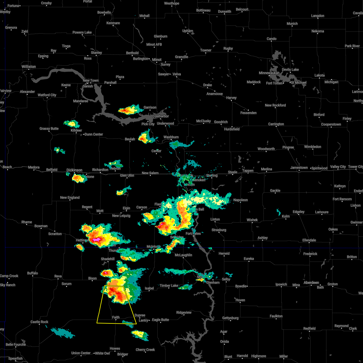 At 557 pm mdt, a severe thunderstorm was located 7 miles northeast of usta, or 20 miles north of faith, moving south at 20 mph. this is a destructive storm for usta, arrow head buttes, and iron lightning (radar indicated). Hazards include softball size hail and 70 mph wind gusts. People and animals outdoors will be severely injured. expect shattered windows, extensive damage to roofs, siding, and vehicles. locations impacted include, usta, arrow head buttes, faith and durkee lake. thunderstorm damage threat, destructive hail threat, radar indicated max hail size, 4. 00 in wind threat, radar indicated max wind gust, 70 mph. At 557 pm mdt, a severe thunderstorm was located 7 miles northeast of usta, or 20 miles north of faith, moving south at 20 mph. this is a destructive storm for usta, arrow head buttes, and iron lightning (radar indicated). Hazards include softball size hail and 70 mph wind gusts. People and animals outdoors will be severely injured. expect shattered windows, extensive damage to roofs, siding, and vehicles. locations impacted include, usta, arrow head buttes, faith and durkee lake. thunderstorm damage threat, destructive hail threat, radar indicated max hail size, 4. 00 in wind threat, radar indicated max wind gust, 70 mph.
|
| 8/30/2021 5:45 PM MDT |
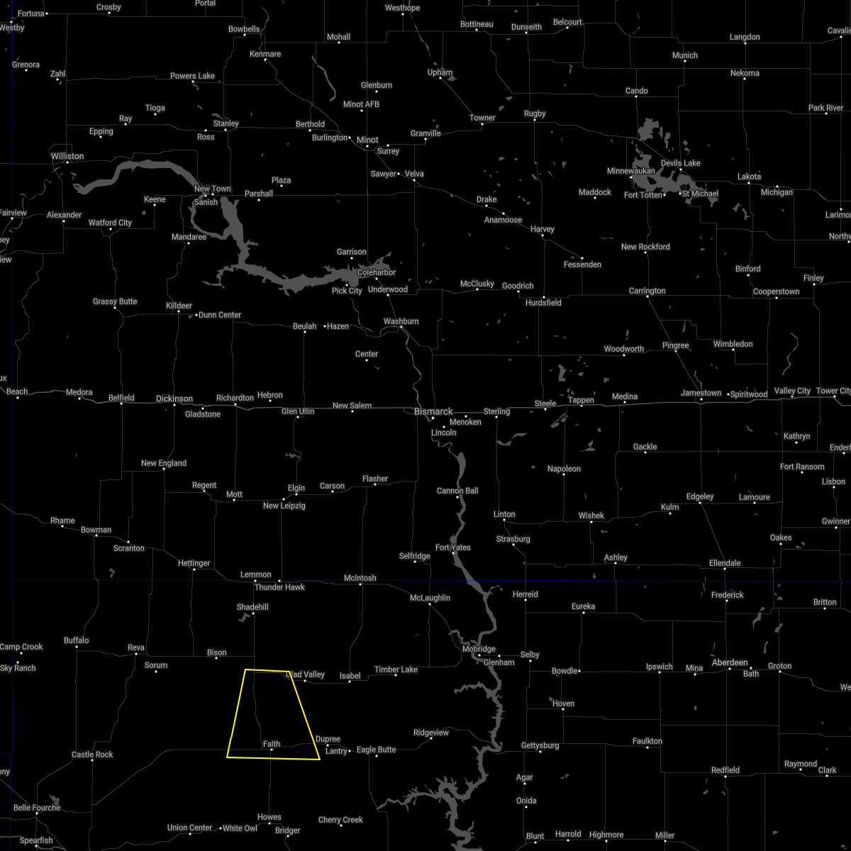 At 542 pm mdt, a severe thunderstorm was located 10 miles east of chance, or 23 miles north of faith, moving south at 20 mph. this is a destructive storm for usta, iron lightning, and arrow head buttes (radar indicated). Hazards include three inch hail and 60 mph wind gusts. People and animals outdoors will be severely injured. Expect shattered windows, extensive damage to roofs, siding, and vehicles. At 542 pm mdt, a severe thunderstorm was located 10 miles east of chance, or 23 miles north of faith, moving south at 20 mph. this is a destructive storm for usta, iron lightning, and arrow head buttes (radar indicated). Hazards include three inch hail and 60 mph wind gusts. People and animals outdoors will be severely injured. Expect shattered windows, extensive damage to roofs, siding, and vehicles.
|
| 8/27/2021 7:14 PM MDT |
 At 712 pm mdt, a severe thunderstorm was located near arrow head buttes, or near faith, moving east at 45 mph (radar indicated). Hazards include 60 mph wind gusts and quarter size hail. Hail damage to vehicles is expected. Expect wind damage to roofs, siding, and trees. At 712 pm mdt, a severe thunderstorm was located near arrow head buttes, or near faith, moving east at 45 mph (radar indicated). Hazards include 60 mph wind gusts and quarter size hail. Hail damage to vehicles is expected. Expect wind damage to roofs, siding, and trees.
|
| 8/27/2021 6:45 PM MDT |
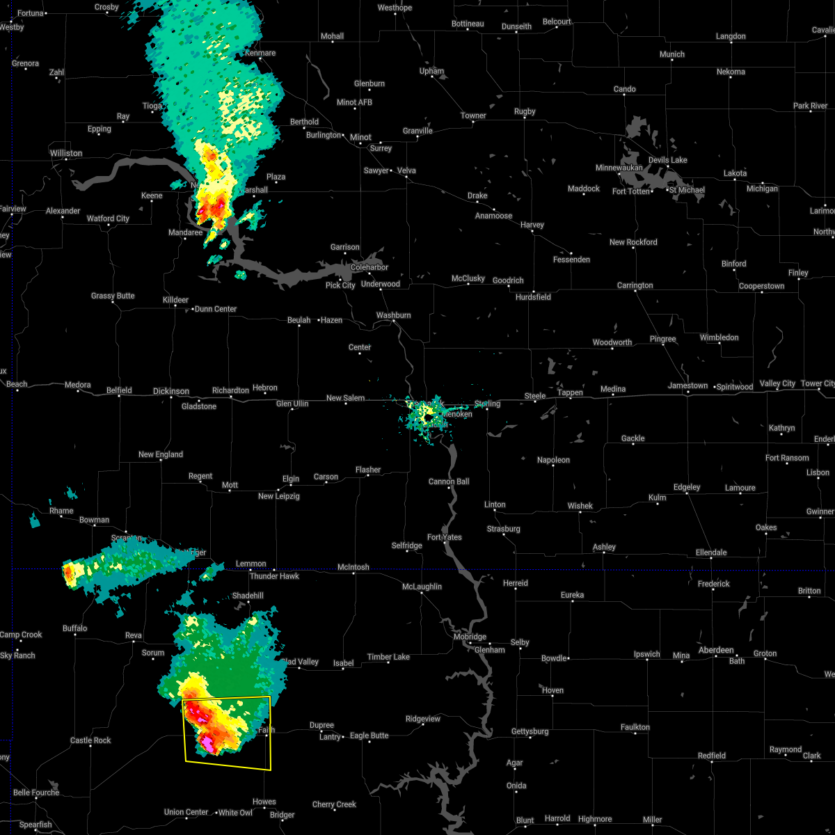 At 644 pm mdt, a severe thunderstorm was located 12 miles northeast of opal, or 15 miles west of faith, moving east at 45 mph (radar indicated). Hazards include two inch hail and 70 mph wind gusts. People and animals outdoors will be injured. expect hail damage to roofs, siding, windows, and vehicles. expect considerable tree damage. wind damage is also likely to mobile homes, roofs, and outbuildings. locations impacted include, faith, opal, maurine, usta, durkee lake and arrow head buttes. thunderstorm damage threat, considerable hail threat, radar indicated max hail size, 2. 00 in wind threat, radar indicated max wind gust, 70 mph. At 644 pm mdt, a severe thunderstorm was located 12 miles northeast of opal, or 15 miles west of faith, moving east at 45 mph (radar indicated). Hazards include two inch hail and 70 mph wind gusts. People and animals outdoors will be injured. expect hail damage to roofs, siding, windows, and vehicles. expect considerable tree damage. wind damage is also likely to mobile homes, roofs, and outbuildings. locations impacted include, faith, opal, maurine, usta, durkee lake and arrow head buttes. thunderstorm damage threat, considerable hail threat, radar indicated max hail size, 2. 00 in wind threat, radar indicated max wind gust, 70 mph.
|
| 8/27/2021 6:38 PM MDT |
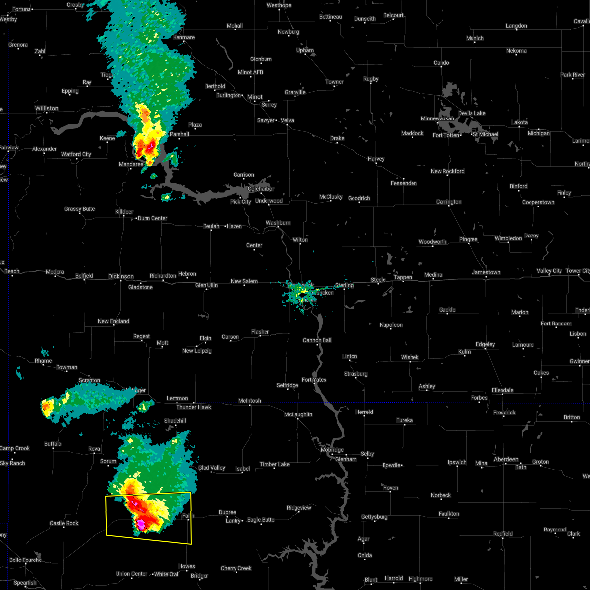 At 638 pm mdt, a severe thunderstorm was located 11 miles east of maurine, or 16 miles west of faith, moving east at 40 mph (radar indicated). Hazards include two inch hail and 70 mph wind gusts. People and animals outdoors will be injured. expect hail damage to roofs, siding, windows, and vehicles. expect considerable tree damage. wind damage is also likely to mobile homes, roofs, and outbuildings. locations impacted include, faith, maurine, usta, zeona, opal, mud butte, durkee lake and arrow head buttes. thunderstorm damage threat, considerable hail threat, radar indicated max hail size, 2. 00 in wind threat, radar indicated max wind gust, 70 mph. At 638 pm mdt, a severe thunderstorm was located 11 miles east of maurine, or 16 miles west of faith, moving east at 40 mph (radar indicated). Hazards include two inch hail and 70 mph wind gusts. People and animals outdoors will be injured. expect hail damage to roofs, siding, windows, and vehicles. expect considerable tree damage. wind damage is also likely to mobile homes, roofs, and outbuildings. locations impacted include, faith, maurine, usta, zeona, opal, mud butte, durkee lake and arrow head buttes. thunderstorm damage threat, considerable hail threat, radar indicated max hail size, 2. 00 in wind threat, radar indicated max wind gust, 70 mph.
|
| 8/27/2021 6:30 PM MDT | Storm damage reported in perkins county SD, 34.1 miles ESE of Faith, SD |
| 8/27/2021 6:25 PM MDT |
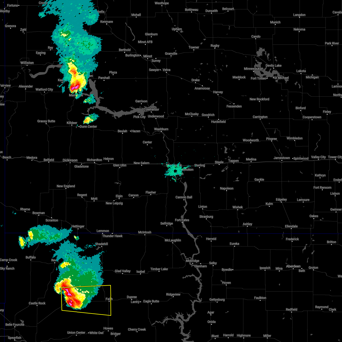 At 623 pm mdt, a severe thunderstorm was located 4 miles northeast of maurine, or 24 miles west of faith, moving east at 45 mph (radar indicated. at 542 pm mdt quarter size hail and 70 mph winds were reported at hoover. power is out in places). Hazards include two inch hail and 70 mph wind gusts. People and animals outdoors will be injured. expect hail damage to roofs, siding, windows, and vehicles. expect considerable tree damage. wind damage is also likely to mobile homes, roofs, and outbuildings. locations impacted include, faith and durkee lake. thunderstorm damage threat, considerable hail threat, radar indicated max hail size, 2. 00 in wind threat, radar indicated max wind gust, 70 mph. At 623 pm mdt, a severe thunderstorm was located 4 miles northeast of maurine, or 24 miles west of faith, moving east at 45 mph (radar indicated. at 542 pm mdt quarter size hail and 70 mph winds were reported at hoover. power is out in places). Hazards include two inch hail and 70 mph wind gusts. People and animals outdoors will be injured. expect hail damage to roofs, siding, windows, and vehicles. expect considerable tree damage. wind damage is also likely to mobile homes, roofs, and outbuildings. locations impacted include, faith and durkee lake. thunderstorm damage threat, considerable hail threat, radar indicated max hail size, 2. 00 in wind threat, radar indicated max wind gust, 70 mph.
|
| 8/27/2021 6:07 PM MDT |
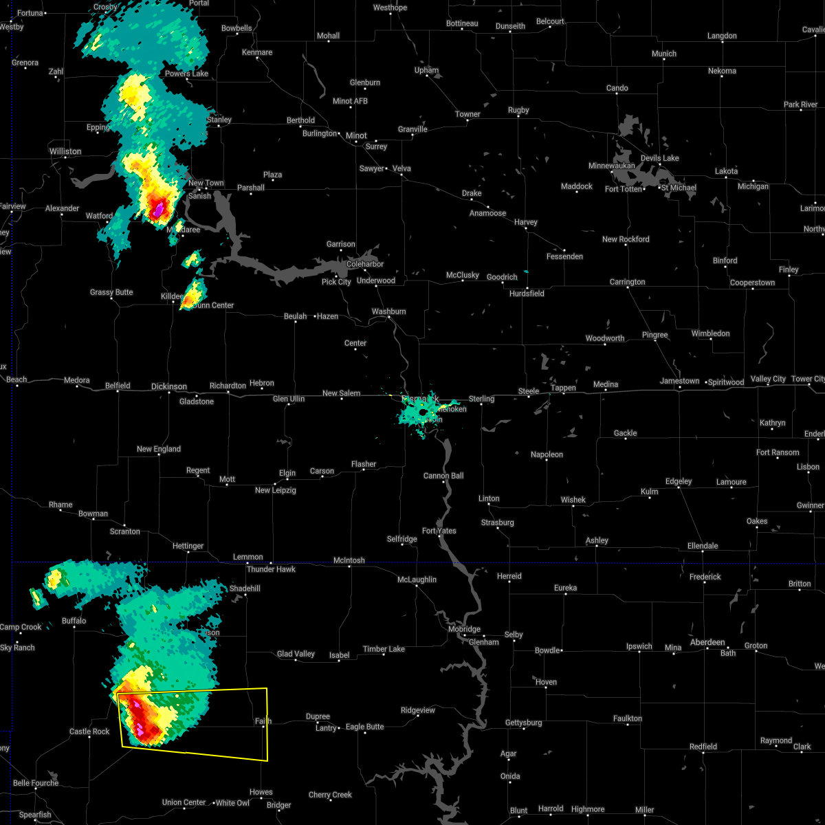 At 606 pm mdt, a severe thunderstorm was located 4 miles northeast of mud butte, or 38 miles west of faith, moving east at 40 mph (radar indicated). Hazards include tennis ball size hail and 60 mph wind gusts. People and animals outdoors will be injured. expect hail damage to roofs, siding, windows, and vehicles. expect wind damage to roofs, siding, and trees. this severe storm will be near, maurine around 625 pm mdt. durkee lake around 705 pm mdt. faith around 710 pm mdt. thunderstorm damage threat, considerable hail threat, radar indicated max hail size, 2. 50 in wind threat, radar indicated max wind gust, 60 mph. At 606 pm mdt, a severe thunderstorm was located 4 miles northeast of mud butte, or 38 miles west of faith, moving east at 40 mph (radar indicated). Hazards include tennis ball size hail and 60 mph wind gusts. People and animals outdoors will be injured. expect hail damage to roofs, siding, windows, and vehicles. expect wind damage to roofs, siding, and trees. this severe storm will be near, maurine around 625 pm mdt. durkee lake around 705 pm mdt. faith around 710 pm mdt. thunderstorm damage threat, considerable hail threat, radar indicated max hail size, 2. 50 in wind threat, radar indicated max wind gust, 60 mph.
|
| 8/27/2021 5:39 PM MDT |
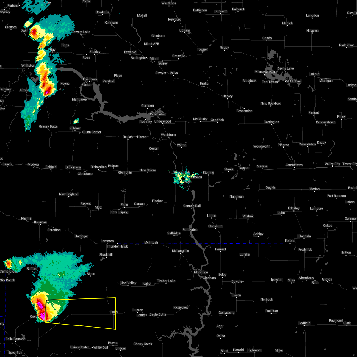 At 539 pm mdt, a severe thunderstorm was located 3 miles southeast of hoover, or 38 miles southeast of buffalo, moving east at 45 mph (radar indicated). Hazards include tennis ball size hail and 60 mph wind gusts. People and animals outdoors will be injured. expect hail damage to roofs, siding, windows, and vehicles. expect wind damage to roofs, siding, and trees. this severe thunderstorm will be near, zeona around 555 pm mdt. other locations in the path of this severe thunderstorm include mud butte, maurine, durkee lake, arrow head buttes and faith. thunderstorm damage threat, considerable hail threat, radar indicated max hail size, 2. 50 in wind threat, radar indicated max wind gust, 60 mph. At 539 pm mdt, a severe thunderstorm was located 3 miles southeast of hoover, or 38 miles southeast of buffalo, moving east at 45 mph (radar indicated). Hazards include tennis ball size hail and 60 mph wind gusts. People and animals outdoors will be injured. expect hail damage to roofs, siding, windows, and vehicles. expect wind damage to roofs, siding, and trees. this severe thunderstorm will be near, zeona around 555 pm mdt. other locations in the path of this severe thunderstorm include mud butte, maurine, durkee lake, arrow head buttes and faith. thunderstorm damage threat, considerable hail threat, radar indicated max hail size, 2. 50 in wind threat, radar indicated max wind gust, 60 mph.
|
| 8/19/2021 5:51 PM MDT |
 At 550 pm mdt, severe thunderstorms were located along a line extending from 3 miles north of faith to 4 miles south of red elm to near intersection of cherry creek and sunnybrook roads, moving north at 40 mph (satellite and lightning indicated). Hazards include 60 mph wind gusts. Expect damage to roofs, siding, and trees. locations impacted include, red elm, arrow head buttes, dupree, iron lightning, thunder butte and glad valley. hail threat, radar indicated max hail size, <. 75 in wind threat, radar indicated max wind gust, 60 mph. At 550 pm mdt, severe thunderstorms were located along a line extending from 3 miles north of faith to 4 miles south of red elm to near intersection of cherry creek and sunnybrook roads, moving north at 40 mph (satellite and lightning indicated). Hazards include 60 mph wind gusts. Expect damage to roofs, siding, and trees. locations impacted include, red elm, arrow head buttes, dupree, iron lightning, thunder butte and glad valley. hail threat, radar indicated max hail size, <. 75 in wind threat, radar indicated max wind gust, 60 mph.
|
| 8/19/2021 5:26 PM MDT |
 At 526 pm mdt, severe thunderstorms were located along a line extending from 10 miles south of durkee lake to 2 miles northeast of red scaffold to 7 miles north of milesville, moving north at 40 mph (satellite and lightning indicated). Hazards include 60 mph wind gusts. Expect damage to roofs, siding, and trees. severe thunderstorms will be near, durkee lake around 540 pm mdt. faith around 545 pm mdt. other locations in the path of these severe thunderstorms include red elm, intersection of cherry creek and sunnybrook roads, arrow head buttes, iron lightning, thunder butte, dupree and glad valley. hail threat, radar indicated max hail size, <. 75 in wind threat, radar indicated max wind gust, 60 mph. At 526 pm mdt, severe thunderstorms were located along a line extending from 10 miles south of durkee lake to 2 miles northeast of red scaffold to 7 miles north of milesville, moving north at 40 mph (satellite and lightning indicated). Hazards include 60 mph wind gusts. Expect damage to roofs, siding, and trees. severe thunderstorms will be near, durkee lake around 540 pm mdt. faith around 545 pm mdt. other locations in the path of these severe thunderstorms include red elm, intersection of cherry creek and sunnybrook roads, arrow head buttes, iron lightning, thunder butte, dupree and glad valley. hail threat, radar indicated max hail size, <. 75 in wind threat, radar indicated max wind gust, 60 mph.
|
| 7/22/2021 6:09 PM MDT |
 At 609 pm mdt, severe thunderstorms were located along a line extending from 2 miles north of mcintosh to 2 miles northeast of marcus, moving east at 35 mph (radar indicated). Hazards include 60 mph wind gusts. Expect damage to roofs, siding, and trees. Locations impacted include, dupree, faith, usta, glad valley, red scaffold, thunder butte, red elm, iron lightning, intersection of cherry creek and sunnybrook roads, intersection of highway 63 and bia road 8, durkee lake, arrow head buttes and northwestern cheyenne river reservation. At 609 pm mdt, severe thunderstorms were located along a line extending from 2 miles north of mcintosh to 2 miles northeast of marcus, moving east at 35 mph (radar indicated). Hazards include 60 mph wind gusts. Expect damage to roofs, siding, and trees. Locations impacted include, dupree, faith, usta, glad valley, red scaffold, thunder butte, red elm, iron lightning, intersection of cherry creek and sunnybrook roads, intersection of highway 63 and bia road 8, durkee lake, arrow head buttes and northwestern cheyenne river reservation.
|
| 7/22/2021 5:41 PM MDT |
 At 540 pm mdt, severe thunderstorms were located along a line extending from 4 miles north of morristown to 3 miles south of opal, moving east at 50 mph (radar indicated). Hazards include 60 mph wind gusts. expect damage to roofs, siding, and trees At 540 pm mdt, severe thunderstorms were located along a line extending from 4 miles north of morristown to 3 miles south of opal, moving east at 50 mph (radar indicated). Hazards include 60 mph wind gusts. expect damage to roofs, siding, and trees
|
| 7/8/2021 9:07 PM MDT | Tennis Ball sized hail reported 12.1 miles N of Faith, SD |
| 7/8/2021 9:04 PM MDT |
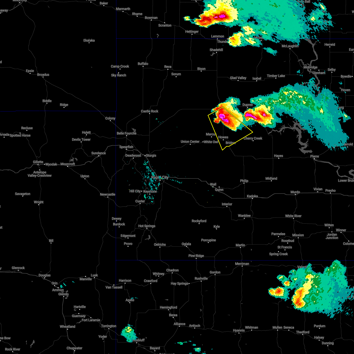 At 904 pm mdt, a severe thunderstorm was located 7 miles south of durkee lake, or 9 miles south of faith, moving southeast at 50 mph. this is a very dangerous storm (radar indicated). Hazards include baseball size hail and 60 mph wind gusts. People and animals outdoors will be severely injured. expect shattered windows, extensive damage to roofs, siding, and vehicles. Locations impacted include, faith, howes, red scaffold, bridger, takini, and durkee lake. At 904 pm mdt, a severe thunderstorm was located 7 miles south of durkee lake, or 9 miles south of faith, moving southeast at 50 mph. this is a very dangerous storm (radar indicated). Hazards include baseball size hail and 60 mph wind gusts. People and animals outdoors will be severely injured. expect shattered windows, extensive damage to roofs, siding, and vehicles. Locations impacted include, faith, howes, red scaffold, bridger, takini, and durkee lake.
|
| 7/8/2021 8:49 PM MDT |
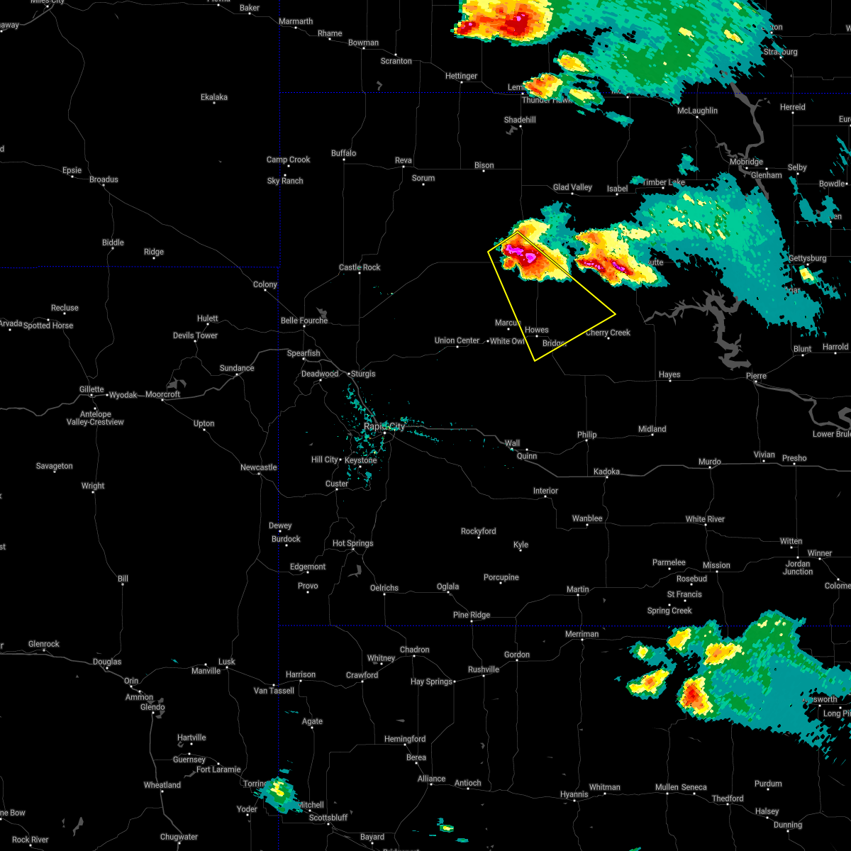 At 849 pm mdt, a severe thunderstorm was located 8 miles west of faith, moving southeast at 45 mph (radar indicated). Hazards include tennis ball size hail and 60 mph wind gusts. People and animals outdoors will be injured. expect hail damage to roofs, siding, windows, and vehicles. expect wind damage to roofs, siding, and trees. Locations impacted include, faith, howes, red scaffold, bridger, takini and durkee lake. At 849 pm mdt, a severe thunderstorm was located 8 miles west of faith, moving southeast at 45 mph (radar indicated). Hazards include tennis ball size hail and 60 mph wind gusts. People and animals outdoors will be injured. expect hail damage to roofs, siding, windows, and vehicles. expect wind damage to roofs, siding, and trees. Locations impacted include, faith, howes, red scaffold, bridger, takini and durkee lake.
|
| 7/8/2021 8:34 PM MDT |
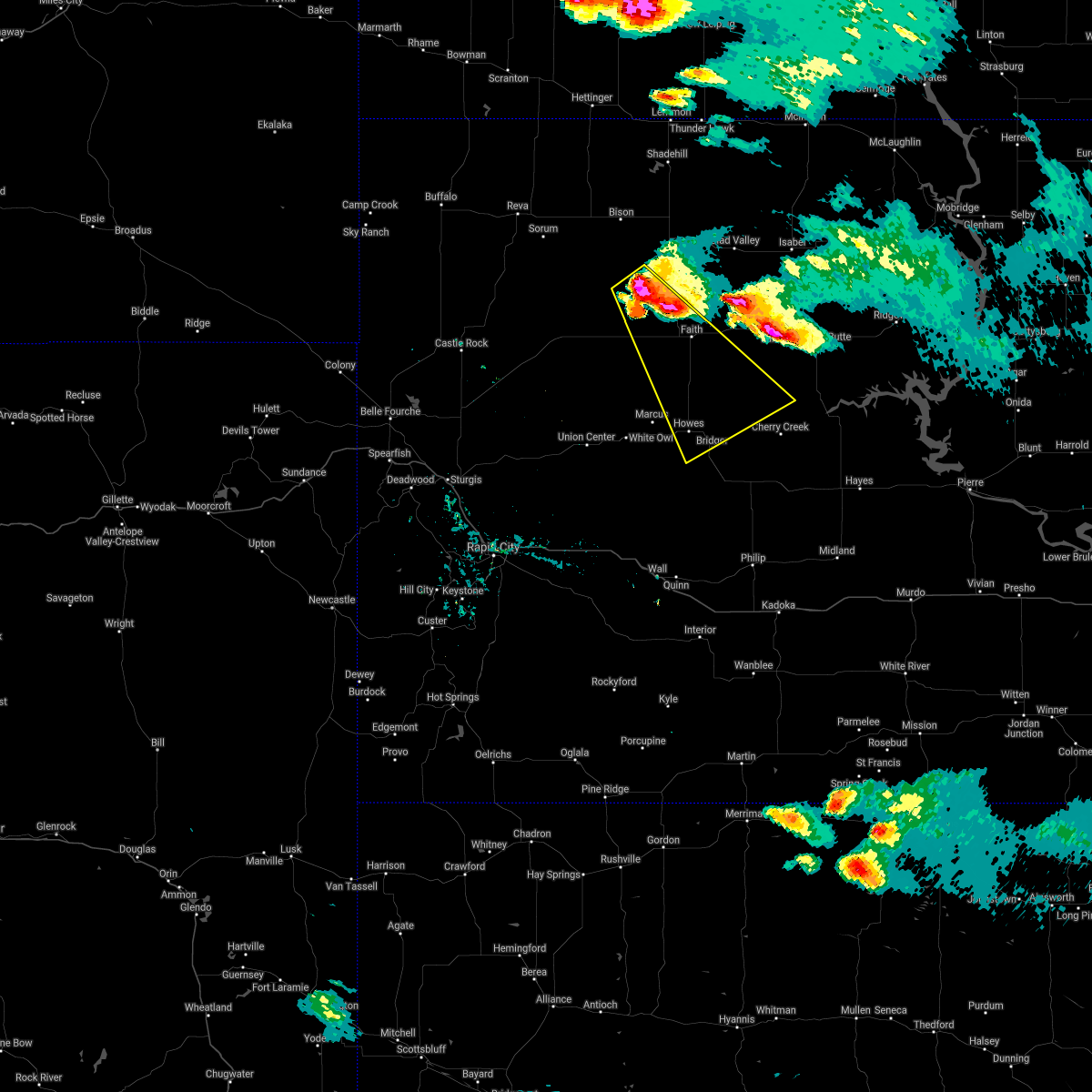 At 834 pm mdt, a severe thunderstorm was located 8 miles southwest of usta, or 17 miles northwest of faith, moving southeast at 50 mph (radar indicated). Hazards include tennis ball size hail and 60 mph wind gusts. People and animals outdoors will be injured. expect hail damage to roofs, siding, windows, and vehicles. Expect wind damage to roofs, siding, and trees. At 834 pm mdt, a severe thunderstorm was located 8 miles southwest of usta, or 17 miles northwest of faith, moving southeast at 50 mph (radar indicated). Hazards include tennis ball size hail and 60 mph wind gusts. People and animals outdoors will be injured. expect hail damage to roofs, siding, windows, and vehicles. Expect wind damage to roofs, siding, and trees.
|
| 7/8/2021 8:24 PM MDT | Hen Egg sized hail reported 20.4 miles SE of Faith, SD |
| 6/10/2021 11:19 PM MDT |
 At 1118 pm mdt, severe thunderstorms were located along a line extending from 5 miles northeast of glad valley to near red elm to near howes, moving east at 30 mph (radar indicated). Hazards include 70 mph wind gusts and nickel size hail. Expect considerable tree damage. damage is likely to mobile homes, roofs, and outbuildings. Locations impacted include, red elm, dupree, takini and red scaffold. At 1118 pm mdt, severe thunderstorms were located along a line extending from 5 miles northeast of glad valley to near red elm to near howes, moving east at 30 mph (radar indicated). Hazards include 70 mph wind gusts and nickel size hail. Expect considerable tree damage. damage is likely to mobile homes, roofs, and outbuildings. Locations impacted include, red elm, dupree, takini and red scaffold.
|
| 6/10/2021 10:44 PM MDT |
 At 1044 pm mdt, severe thunderstorms were located along a line extending from 8 miles southwest of shambo ranch to 3 miles west of durkee lake to 3 miles southeast of white owl, moving east at 30 mph (radar indicated). Hazards include 70 mph wind gusts and nickel size hail. Expect considerable tree damage. damage is likely to mobile homes, roofs, and outbuildings. severe thunderstorms will be near, durkee lake around 1050 pm mdt. faith around 1055 pm mdt. Other locations in the path of these severe thunderstorms include glad valley, howes, red elm, dupree, takini and red scaffold. At 1044 pm mdt, severe thunderstorms were located along a line extending from 8 miles southwest of shambo ranch to 3 miles west of durkee lake to 3 miles southeast of white owl, moving east at 30 mph (radar indicated). Hazards include 70 mph wind gusts and nickel size hail. Expect considerable tree damage. damage is likely to mobile homes, roofs, and outbuildings. severe thunderstorms will be near, durkee lake around 1050 pm mdt. faith around 1055 pm mdt. Other locations in the path of these severe thunderstorms include glad valley, howes, red elm, dupree, takini and red scaffold.
|
| 6/10/2021 10:35 PM MDT |
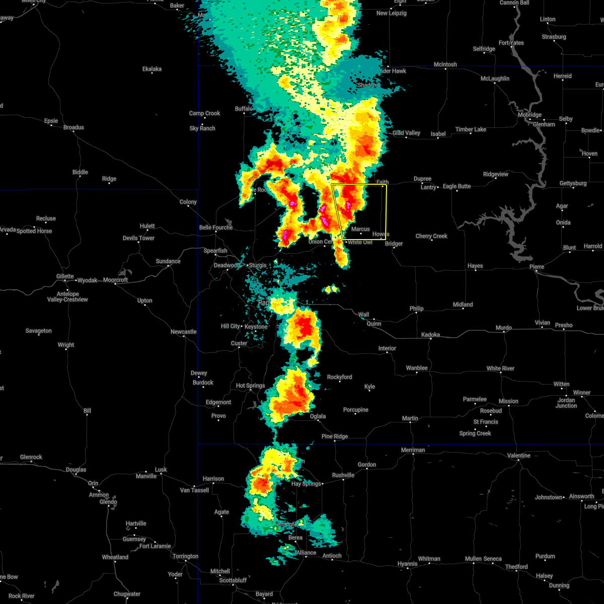 At 1035 pm mdt, a severe thunderstorm was located 10 miles southwest of durkee lake, or 12 miles southwest of faith, moving northeast at 45 mph (radar indicated). Hazards include 60 mph wind gusts and quarter size hail. Hail damage to vehicles is expected. expect wind damage to roofs, siding, and trees. Locations impacted include, durkee lake and faith. At 1035 pm mdt, a severe thunderstorm was located 10 miles southwest of durkee lake, or 12 miles southwest of faith, moving northeast at 45 mph (radar indicated). Hazards include 60 mph wind gusts and quarter size hail. Hail damage to vehicles is expected. expect wind damage to roofs, siding, and trees. Locations impacted include, durkee lake and faith.
|
| 6/10/2021 10:05 PM MDT |
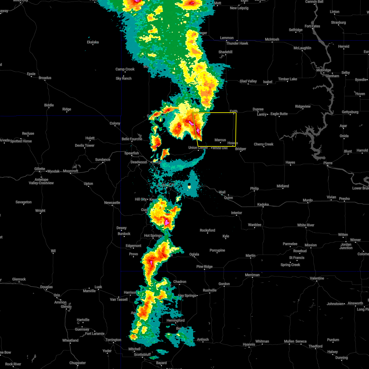 At 1005 pm mdt, a severe thunderstorm was located 4 miles northeast of stoneville, or 31 miles southwest of faith, moving northeast at 50 mph (radar indicated). Hazards include 60 mph wind gusts and quarter size hail. Hail damage to vehicles is expected. expect wind damage to roofs, siding, and trees. this severe thunderstorm will be near, opal around 1015 pm mdt. Other locations in the path of this severe thunderstorm include faith and durkee lake. At 1005 pm mdt, a severe thunderstorm was located 4 miles northeast of stoneville, or 31 miles southwest of faith, moving northeast at 50 mph (radar indicated). Hazards include 60 mph wind gusts and quarter size hail. Hail damage to vehicles is expected. expect wind damage to roofs, siding, and trees. this severe thunderstorm will be near, opal around 1015 pm mdt. Other locations in the path of this severe thunderstorm include faith and durkee lake.
|
| 6/8/2021 10:50 PM MDT |
 At 1049 pm mdt, severe thunderstorms were located along a line extending from 8 miles southwest of shambo ranch to 5 miles south of red elm to near bridger, moving east at 30 mph (radar indicated). Hazards include 60 mph wind gusts and penny size hail. Expect damage to roofs, siding, and trees. severe thunderstorms will be near, red elm around 1055 pm mdt. Other locations in the path of these severe thunderstorms include dupree, glad valley, cherry creek, south eagle butte and kirley. At 1049 pm mdt, severe thunderstorms were located along a line extending from 8 miles southwest of shambo ranch to 5 miles south of red elm to near bridger, moving east at 30 mph (radar indicated). Hazards include 60 mph wind gusts and penny size hail. Expect damage to roofs, siding, and trees. severe thunderstorms will be near, red elm around 1055 pm mdt. Other locations in the path of these severe thunderstorms include dupree, glad valley, cherry creek, south eagle butte and kirley.
|
| 6/8/2021 7:42 PM MDT | Storm damage reported in meade county SD, 1 miles WSW of Faith, SD |
| 6/8/2021 7:30 PM MDT | 70-80 mph wind gusts in ziebach county SD, 4.6 miles WNW of Faith, SD |
| 5/23/2021 6:56 PM MDT | Storm damage reported in meade county SD, 1.4 miles SW of Faith, SD |
| 5/23/2021 6:50 PM MDT | Storm damage reported in ziebach county SD, 4.6 miles WNW of Faith, SD |
| 5/23/2021 6:45 PM MDT |
 At 645 pm mdt, severe thunderstorms were located along a line extending from 5 miles south of durkee lake to 9 miles east of takini to 6 miles east of milesville, moving northeast at 50 mph (radar indicated). Hazards include 60 mph wind gusts. Expect damage to roofs, siding, and trees. severe thunderstorms will be near, red elm around 700 pm mdt. Other locations in the path of these severe thunderstorms include dupree and intersection of highway 63 and bia road 8. At 645 pm mdt, severe thunderstorms were located along a line extending from 5 miles south of durkee lake to 9 miles east of takini to 6 miles east of milesville, moving northeast at 50 mph (radar indicated). Hazards include 60 mph wind gusts. Expect damage to roofs, siding, and trees. severe thunderstorms will be near, red elm around 700 pm mdt. Other locations in the path of these severe thunderstorms include dupree and intersection of highway 63 and bia road 8.
|
| 5/23/2021 6:40 PM MDT | Storm damage reported in meade county SD, 1.4 miles SW of Faith, SD |
| 5/23/2021 3:35 PM MDT | Storm damage reported in perkins county SD, 20.4 miles SE of Faith, SD |
| 9/23/2020 6:23 PM MDT |
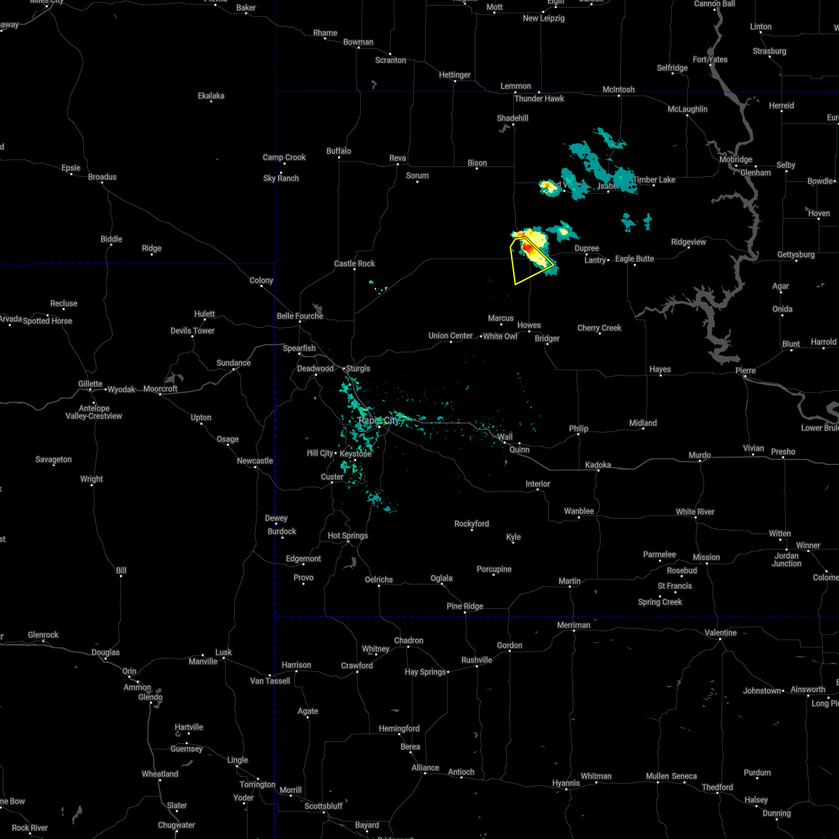 The severe thunderstorm warning for west central ziebach, northeastern meade and southeastern perkins counties will expire at 630 pm mdt, the storm which prompted the warning has weakened below severe limits and no longer poses an immediate threat to life or property. therefore, the warning will be allowed to expire. The severe thunderstorm warning for west central ziebach, northeastern meade and southeastern perkins counties will expire at 630 pm mdt, the storm which prompted the warning has weakened below severe limits and no longer poses an immediate threat to life or property. therefore, the warning will be allowed to expire.
|
| 9/23/2020 6:14 PM MDT |
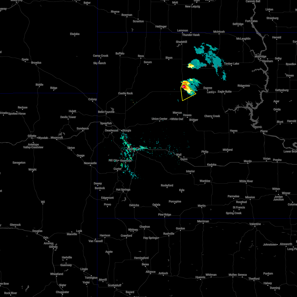 At 614 pm mdt, a severe thunderstorm was located 6 miles northwest of faith, moving southeast at 25 mph (radar indicated). Hazards include 60 mph wind gusts and quarter size hail. Hail damage to vehicles is expected. expect wind damage to roofs, siding, and trees. This severe storm will be near, faith and durkee lake around 630 pm mdt. At 614 pm mdt, a severe thunderstorm was located 6 miles northwest of faith, moving southeast at 25 mph (radar indicated). Hazards include 60 mph wind gusts and quarter size hail. Hail damage to vehicles is expected. expect wind damage to roofs, siding, and trees. This severe storm will be near, faith and durkee lake around 630 pm mdt.
|
| 9/23/2020 6:01 PM MDT |
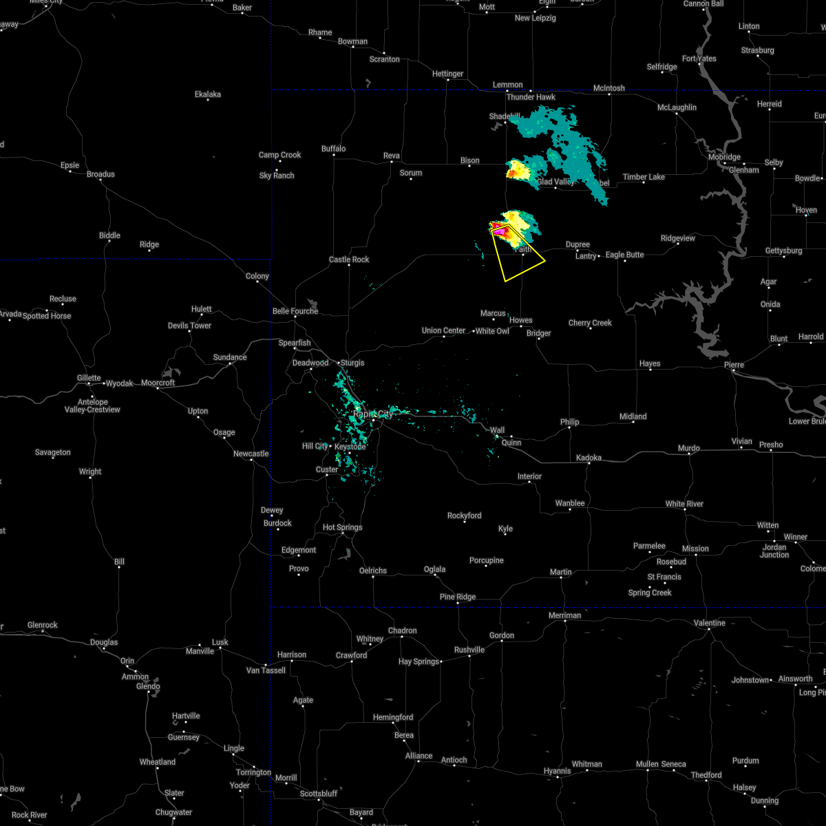 At 601 pm mdt, a severe thunderstorm was located 6 miles south of usta, or 11 miles northwest of faith, moving southeast at 20 mph (radar indicated). Hazards include 60 mph wind gusts and half dollar size hail. Hail damage to vehicles is expected. expect wind damage to roofs, siding, and trees. Locations impacted include, faith and durkee lake. At 601 pm mdt, a severe thunderstorm was located 6 miles south of usta, or 11 miles northwest of faith, moving southeast at 20 mph (radar indicated). Hazards include 60 mph wind gusts and half dollar size hail. Hail damage to vehicles is expected. expect wind damage to roofs, siding, and trees. Locations impacted include, faith and durkee lake.
|
| 9/23/2020 5:48 PM MDT |
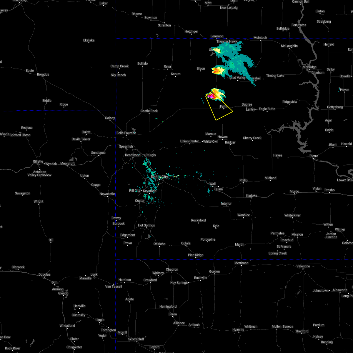 At 548 pm mdt, a severe thunderstorm was located 6 miles southwest of usta, or 15 miles northwest of faith, moving southeast at 30 mph (radar indicated). Hazards include ping pong ball size hail and 60 mph wind gusts. People and animals outdoors will be injured. expect hail damage to roofs, siding, windows, and vehicles. expect wind damage to roofs, siding, and trees. This severe thunderstorm will be near, faith and durkee lake around 625 pm mdt. At 548 pm mdt, a severe thunderstorm was located 6 miles southwest of usta, or 15 miles northwest of faith, moving southeast at 30 mph (radar indicated). Hazards include ping pong ball size hail and 60 mph wind gusts. People and animals outdoors will be injured. expect hail damage to roofs, siding, windows, and vehicles. expect wind damage to roofs, siding, and trees. This severe thunderstorm will be near, faith and durkee lake around 625 pm mdt.
|
| 7/20/2020 11:30 AM MDT | Several large trees blown down in town in meade county SD, 0.6 miles NW of Faith, SD |
| 7/20/2020 11:27 AM MDT | Ping Pong Ball sized hail reported 4.4 miles W of Faith, SD |
| 7/20/2020 11:23 AM MDT |
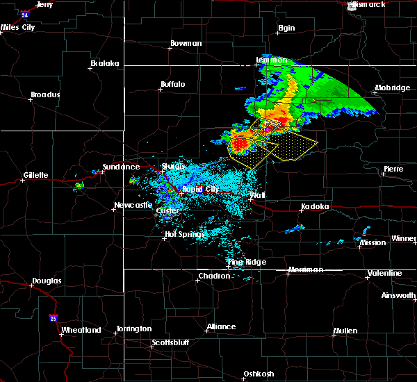 At 1122 am mdt, a severe thunderstorm was located near faith, moving southeast at 30 mph. automated observations in faith recently recorded an 84 mph wind gust. this is a very dangerous storm (automated observations). Hazards include 90 mph wind gusts and golf ball size hail. You are in a life-threatening situation. flying debris may be deadly to those caught without shelter. mobile homes will be heavily damaged or destroyed. homes and businesses will have substantial roof and window damage. expect extensive tree damage and power outages. This severe storm will be near, intersection of cherry creek and sunnybrook roads around 1200 pm mdt. At 1122 am mdt, a severe thunderstorm was located near faith, moving southeast at 30 mph. automated observations in faith recently recorded an 84 mph wind gust. this is a very dangerous storm (automated observations). Hazards include 90 mph wind gusts and golf ball size hail. You are in a life-threatening situation. flying debris may be deadly to those caught without shelter. mobile homes will be heavily damaged or destroyed. homes and businesses will have substantial roof and window damage. expect extensive tree damage and power outages. This severe storm will be near, intersection of cherry creek and sunnybrook roads around 1200 pm mdt.
|
| 7/20/2020 11:15 AM MDT |
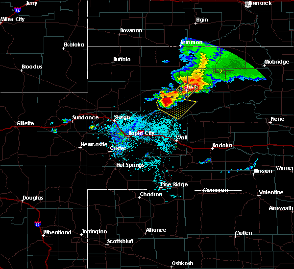 At 1114 am mdt, a severe thunderstorm was located over faith, moving southeast at 30 mph (radar indicated). Hazards include golf ball size hail and 70 mph wind gusts. People and animals outdoors will be injured. expect hail damage to roofs, siding, windows, and vehicles. expect considerable tree damage. wind damage is also likely to mobile homes, roofs, and outbuildings. This severe thunderstorm will be near, intersection of cherry creek and sunnybrook roads around 1200 pm mdt. At 1114 am mdt, a severe thunderstorm was located over faith, moving southeast at 30 mph (radar indicated). Hazards include golf ball size hail and 70 mph wind gusts. People and animals outdoors will be injured. expect hail damage to roofs, siding, windows, and vehicles. expect considerable tree damage. wind damage is also likely to mobile homes, roofs, and outbuildings. This severe thunderstorm will be near, intersection of cherry creek and sunnybrook roads around 1200 pm mdt.
|
| 7/20/2020 11:14 AM MDT | Storm damage reported in perkins county SD, 5.7 miles SSE of Faith, SD |
| 7/20/2020 11:14 AM MDT | Storm damage reported in meade county SD, 1.4 miles SW of Faith, SD |
| 7/20/2020 11:11 AM MDT |
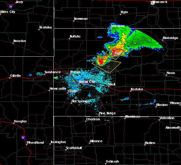 At 1111 am mdt, a severe thunderstorm was located near faith, moving southeast at 30 mph (radar indicated). Hazards include two inch hail and 60 mph wind gusts. People and animals outdoors will be injured. expect hail damage to roofs, siding, windows, and vehicles. expect wind damage to roofs, siding, and trees. Locations impacted include, faith, durkee lake and arrow head buttes. At 1111 am mdt, a severe thunderstorm was located near faith, moving southeast at 30 mph (radar indicated). Hazards include two inch hail and 60 mph wind gusts. People and animals outdoors will be injured. expect hail damage to roofs, siding, windows, and vehicles. expect wind damage to roofs, siding, and trees. Locations impacted include, faith, durkee lake and arrow head buttes.
|
| 7/20/2020 10:59 AM MDT |
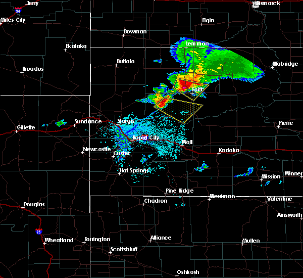 At 1046 am mdt, a severe thunderstorm was located 4 miles west of usta, or 17 miles northwest of faith, moving southeast at 30 mph (radar indicated). Hazards include ping pong ball size hail. People and animals outdoors will be injured. expect damage to roofs, siding, windows, and vehicles. this severe storm will be near, usta around 1055 am mdt. arrow head buttes around 1110 am mdt. faith around 1120 am mdt. Iron lightning around 1130 am mdt. At 1046 am mdt, a severe thunderstorm was located 4 miles west of usta, or 17 miles northwest of faith, moving southeast at 30 mph (radar indicated). Hazards include ping pong ball size hail. People and animals outdoors will be injured. expect damage to roofs, siding, windows, and vehicles. this severe storm will be near, usta around 1055 am mdt. arrow head buttes around 1110 am mdt. faith around 1120 am mdt. Iron lightning around 1130 am mdt.
|
| 7/20/2020 10:50 AM MDT | Quarter sized hail reported 17.9 miles SE of Faith, SD |
| 7/20/2020 10:46 AM MDT |
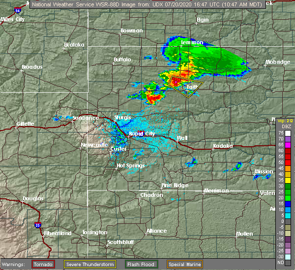 At 1046 am mdt, a severe thunderstorm was located 4 miles west of usta, or 17 miles northwest of faith, moving southeast at 30 mph (radar indicated). Hazards include ping pong ball size hail. People and animals outdoors will be injured. expect damage to roofs, siding, windows, and vehicles. this severe storm will be near, usta around 1055 am mdt. arrow head buttes around 1110 am mdt. faith around 1120 am mdt. Iron lightning around 1130 am mdt. At 1046 am mdt, a severe thunderstorm was located 4 miles west of usta, or 17 miles northwest of faith, moving southeast at 30 mph (radar indicated). Hazards include ping pong ball size hail. People and animals outdoors will be injured. expect damage to roofs, siding, windows, and vehicles. this severe storm will be near, usta around 1055 am mdt. arrow head buttes around 1110 am mdt. faith around 1120 am mdt. Iron lightning around 1130 am mdt.
|
| 7/20/2020 10:42 AM MDT |
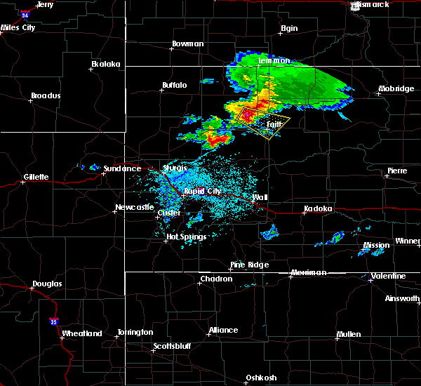 At 1042 am mdt, a severe thunderstorm was located 6 miles west of usta, or 19 miles northwest of faith, moving southeast at 30 mph (radar indicated). Hazards include quarter size hail. Damage to vehicles is expected. this severe thunderstorm will be near, usta around 1055 am mdt. arrow head buttes around 1110 am mdt. faith around 1120 am mdt. Iron lightning around 1130 am mdt. At 1042 am mdt, a severe thunderstorm was located 6 miles west of usta, or 19 miles northwest of faith, moving southeast at 30 mph (radar indicated). Hazards include quarter size hail. Damage to vehicles is expected. this severe thunderstorm will be near, usta around 1055 am mdt. arrow head buttes around 1110 am mdt. faith around 1120 am mdt. Iron lightning around 1130 am mdt.
|
| 7/6/2020 8:01 PM MDT |
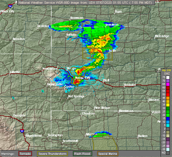 At 800 pm mdt, a severe thunderstorm was located 9 miles west of faith, moving east at 40 mph (radar indicated). Hazards include 60 mph wind gusts and quarter size hail. Hail damage to vehicles is expected. expect wind damage to roofs, siding, and trees. this severe storm will be near, arrow head buttes around 810 pm mdt. Faith and durkee lake around 815 pm mdt. At 800 pm mdt, a severe thunderstorm was located 9 miles west of faith, moving east at 40 mph (radar indicated). Hazards include 60 mph wind gusts and quarter size hail. Hail damage to vehicles is expected. expect wind damage to roofs, siding, and trees. this severe storm will be near, arrow head buttes around 810 pm mdt. Faith and durkee lake around 815 pm mdt.
|
| 7/6/2020 7:40 PM MDT |
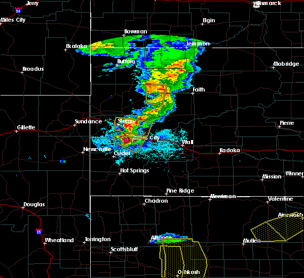 At 739 pm mdt, a severe thunderstorm was located near maurine, or 25 miles west of faith, moving east at 30 mph (radar indicated). Hazards include 60 mph wind gusts and quarter size hail. Hail damage to vehicles is expected. expect wind damage to roofs, siding, and trees. This severe thunderstorm will be near, faith and durkee lake around 830 pm mdt. At 739 pm mdt, a severe thunderstorm was located near maurine, or 25 miles west of faith, moving east at 30 mph (radar indicated). Hazards include 60 mph wind gusts and quarter size hail. Hail damage to vehicles is expected. expect wind damage to roofs, siding, and trees. This severe thunderstorm will be near, faith and durkee lake around 830 pm mdt.
|
| 7/5/2020 11:04 PM MDT | Storm damage reported in meade county SD, 1 miles WSW of Faith, SD |
| 7/5/2020 10:56 PM MDT | Storm damage reported in meade county SD, 1 miles WSW of Faith, SD |
| 6/28/2020 7:36 PM MDT |
 At 736 pm mdt, a severe thunderstorm was located 6 miles southeast of arrow head buttes, or 7 miles northeast of faith, moving northeast at 40 mph. this is a very dangerous storm (radar indicated). Hazards include 80 mph wind gusts and ping pong ball size hail. this storm has a history of producing winds in excess of 80 mph. Flying debris will be dangerous to those caught without shelter. mobile homes will be heavily damaged. expect considerable damage to roofs, windows, and vehicles. extensive tree damage and power outages are likely. this severe storm will be near, iron lightning and red elm around 745 pm mdt. Thunder butte around 800 pm mdt. At 736 pm mdt, a severe thunderstorm was located 6 miles southeast of arrow head buttes, or 7 miles northeast of faith, moving northeast at 40 mph. this is a very dangerous storm (radar indicated). Hazards include 80 mph wind gusts and ping pong ball size hail. this storm has a history of producing winds in excess of 80 mph. Flying debris will be dangerous to those caught without shelter. mobile homes will be heavily damaged. expect considerable damage to roofs, windows, and vehicles. extensive tree damage and power outages are likely. this severe storm will be near, iron lightning and red elm around 745 pm mdt. Thunder butte around 800 pm mdt.
|
| 6/28/2020 7:32 PM MDT | Storm damage reported in ziebach county SD, 4.6 miles WNW of Faith, SD |
| 6/28/2020 7:29 PM MDT | Storm damage reported in meade county SD, 1 miles WSW of Faith, SD |
| 6/28/2020 7:28 PM MDT |
 At 727 pm mdt, a severe thunderstorm was located 4 miles north of faith, moving northeast at 40 mph (radar indicated). Hazards include ping pong ball size hail and 60 mph wind gusts. People and animals outdoors will be injured. expect hail damage to roofs, siding, windows, and vehicles. expect wind damage to roofs, siding, and trees. this severe thunderstorm will be near, red elm around 745 pm mdt. iron lightning around 750 pm mdt. Thunder butte around 800 pm mdt. At 727 pm mdt, a severe thunderstorm was located 4 miles north of faith, moving northeast at 40 mph (radar indicated). Hazards include ping pong ball size hail and 60 mph wind gusts. People and animals outdoors will be injured. expect hail damage to roofs, siding, windows, and vehicles. expect wind damage to roofs, siding, and trees. this severe thunderstorm will be near, red elm around 745 pm mdt. iron lightning around 750 pm mdt. Thunder butte around 800 pm mdt.
|
| 6/28/2020 7:22 PM MDT | Storm damage reported in meade county SD, 1 miles WSW of Faith, SD |
| 6/28/2020 7:21 PM MDT |
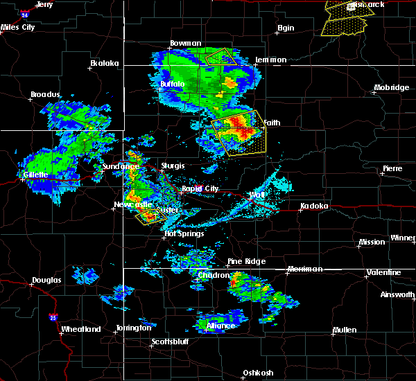 At 720 pm mdt, a severe thunderstorm was located 4 miles northwest of faith, moving northeast at 35 mph (radar indicated). Hazards include ping pong ball size hail and 60 mph wind gusts. People and animals outdoors will be injured. expect hail damage to roofs, siding, windows, and vehicles. expect wind damage to roofs, siding, and trees. This severe thunderstorm will remain over mainly rural areas of northeastern meade and southeastern perkins counties, near faith and usta. At 720 pm mdt, a severe thunderstorm was located 4 miles northwest of faith, moving northeast at 35 mph (radar indicated). Hazards include ping pong ball size hail and 60 mph wind gusts. People and animals outdoors will be injured. expect hail damage to roofs, siding, windows, and vehicles. expect wind damage to roofs, siding, and trees. This severe thunderstorm will remain over mainly rural areas of northeastern meade and southeastern perkins counties, near faith and usta.
|
| 6/28/2020 7:00 PM MDT | Storm damage reported in meade county SD, 18.6 miles E of Faith, SD |
| 6/28/2020 6:51 PM MDT |
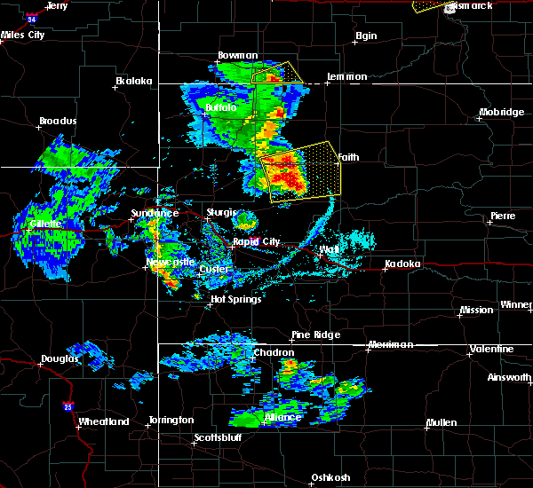 At 651 pm mdt, severe thunderstorms were located along a line extending from 8 miles north of maurine to 2 miles east of opal to 6 miles west of marcus, moving east at 35 mph (radar indicated). Hazards include ping pong ball size hail and 60 mph wind gusts. People and animals outdoors will be injured. expect hail damage to roofs, siding, windows, and vehicles. expect wind damage to roofs, siding, and trees. these severe storms will be near, marcus around 700 pm mdt. usta and durkee lake around 720 pm mdt. Faith around 725 pm mdt. At 651 pm mdt, severe thunderstorms were located along a line extending from 8 miles north of maurine to 2 miles east of opal to 6 miles west of marcus, moving east at 35 mph (radar indicated). Hazards include ping pong ball size hail and 60 mph wind gusts. People and animals outdoors will be injured. expect hail damage to roofs, siding, windows, and vehicles. expect wind damage to roofs, siding, and trees. these severe storms will be near, marcus around 700 pm mdt. usta and durkee lake around 720 pm mdt. Faith around 725 pm mdt.
|
| 6/28/2020 6:28 PM MDT |
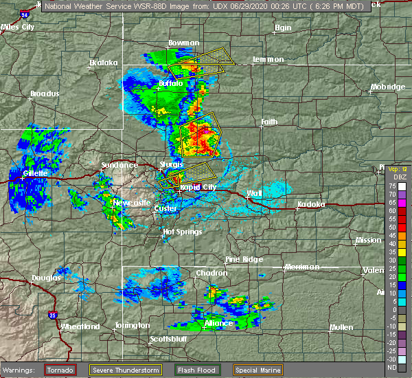 At 628 pm mdt, severe thunderstorms were located along a line extending from 6 miles northeast of mud butte to 5 miles north of stoneville to 4 miles north of union center, moving east at 35 mph (radar indicated). Hazards include 70 mph wind gusts and ping pong ball size hail. People and animals outdoors will be injured. expect hail damage to roofs, siding, windows, and vehicles. expect considerable tree damage. wind damage is also likely to mobile homes, roofs, and outbuildings. severe thunderstorms will be near, red owl and maurine around 640 pm mdt. opal around 645 pm mdt. marcus around 700 pm mdt. usta and durkee lake around 720 pm mdt. Faith around 725 pm mdt. At 628 pm mdt, severe thunderstorms were located along a line extending from 6 miles northeast of mud butte to 5 miles north of stoneville to 4 miles north of union center, moving east at 35 mph (radar indicated). Hazards include 70 mph wind gusts and ping pong ball size hail. People and animals outdoors will be injured. expect hail damage to roofs, siding, windows, and vehicles. expect considerable tree damage. wind damage is also likely to mobile homes, roofs, and outbuildings. severe thunderstorms will be near, red owl and maurine around 640 pm mdt. opal around 645 pm mdt. marcus around 700 pm mdt. usta and durkee lake around 720 pm mdt. Faith around 725 pm mdt.
|
| 6/16/2020 8:49 PM MDT | Storm damage reported in meade county SD, 1.4 miles SW of Faith, SD |
| 6/16/2020 8:40 PM MDT | Received 0.25" of rain in ziebach county SD, 4.6 miles WNW of Faith, SD |
| 6/16/2020 8:40 PM MDT |
 At 840 pm mdt, a severe thunderstorm was located over faith, moving northeast at 45 mph (radar indicated). Hazards include 60 mph wind gusts and quarter size hail. Hail damage to vehicles is expected. expect wind damage to roofs, siding, and trees. this severe storm will be near, red elm around 855 pm mdt. iron lightning around 900 pm mdt. Thunder butte around 910 pm mdt. At 840 pm mdt, a severe thunderstorm was located over faith, moving northeast at 45 mph (radar indicated). Hazards include 60 mph wind gusts and quarter size hail. Hail damage to vehicles is expected. expect wind damage to roofs, siding, and trees. this severe storm will be near, red elm around 855 pm mdt. iron lightning around 900 pm mdt. Thunder butte around 910 pm mdt.
|
| 6/16/2020 8:15 PM MDT |
 At 815 pm mdt, a severe thunderstorm was located 7 miles southeast of opal, or 18 miles southwest of faith, moving northeast at 45 mph (radar indicated). Hazards include 60 mph wind gusts and half dollar size hail. Hail damage to vehicles is expected. expect wind damage to roofs, siding, and trees. this severe thunderstorm will be near, durkee lake around 835 pm mdt. faith around 840 pm mdt. arrow head buttes around 850 pm mdt. Iron lightning around 900 pm mdt. At 815 pm mdt, a severe thunderstorm was located 7 miles southeast of opal, or 18 miles southwest of faith, moving northeast at 45 mph (radar indicated). Hazards include 60 mph wind gusts and half dollar size hail. Hail damage to vehicles is expected. expect wind damage to roofs, siding, and trees. this severe thunderstorm will be near, durkee lake around 835 pm mdt. faith around 840 pm mdt. arrow head buttes around 850 pm mdt. Iron lightning around 900 pm mdt.
|
| 6/6/2020 8:32 PM MDT |
 At 831 pm mdt, severe thunderstorms were located along a line extending from 3 miles east of faith to 7 miles southwest of cherry creek to nowlin, moving east at 55 mph (radar indicated. at 825 pm mdt a 75 mph gust was reported 1 mile north-northeast of faith). Hazards include 70 mph wind gusts. Expect considerable tree damage. damage is likely to mobile homes, roofs, and outbuildings. these severe storms will be near, nowlin around 835 pm mdt. cherry creek and midland around 840 pm mdt. Dupree and kirley around 850 pm mdt. At 831 pm mdt, severe thunderstorms were located along a line extending from 3 miles east of faith to 7 miles southwest of cherry creek to nowlin, moving east at 55 mph (radar indicated. at 825 pm mdt a 75 mph gust was reported 1 mile north-northeast of faith). Hazards include 70 mph wind gusts. Expect considerable tree damage. damage is likely to mobile homes, roofs, and outbuildings. these severe storms will be near, nowlin around 835 pm mdt. cherry creek and midland around 840 pm mdt. Dupree and kirley around 850 pm mdt.
|
| 6/6/2020 8:25 PM MDT | Storm damage reported in meade county SD, 1 miles WSW of Faith, SD |
| 6/6/2020 8:24 PM MDT |
 At 823 pm mdt, severe thunderstorms were located along a line extending from 5 miles east of faith to 2 miles southeast of takini school to 4 miles north of philip, moving northeast at 45 mph (radar indicated). Hazards include 70 mph wind gusts. Expect considerable tree damage. damage is likely to mobile homes, roofs, and outbuildings. these severe storms will be near, red elm around 830 pm mdt. iron lightning around 835 pm mdt. ottumwa and thunder butte around 845 pm mdt. intersection of highway 63 and bia road 8 around 905 pm mdt. South eagle butte around 915 pm mdt. At 823 pm mdt, severe thunderstorms were located along a line extending from 5 miles east of faith to 2 miles southeast of takini school to 4 miles north of philip, moving northeast at 45 mph (radar indicated). Hazards include 70 mph wind gusts. Expect considerable tree damage. damage is likely to mobile homes, roofs, and outbuildings. these severe storms will be near, red elm around 830 pm mdt. iron lightning around 835 pm mdt. ottumwa and thunder butte around 845 pm mdt. intersection of highway 63 and bia road 8 around 905 pm mdt. South eagle butte around 915 pm mdt.
|
| 6/6/2020 8:15 PM MDT | Storm damage reported in meade county SD, 2.5 miles E of Faith, SD |
| 6/6/2020 8:09 PM MDT |
 At 809 pm mdt, severe thunderstorms were located along a line extending from 3 miles southwest of durkee lake to 3 miles west of bridger to 5 miles northeast of cottonwood, moving east at 45 mph (radar indicated). Hazards include 70 mph wind gusts. Expect considerable tree damage. damage is likely to mobile homes, roofs, and outbuildings. these severe storms will be near, philip and takini school around 820 pm mdt. milesville and red elm around 830 pm mdt. cherry creek and intersection of cherry creek and sunnybrook roads around 840 pm mdt. dupree and nowlin around 845 pm mdt. midland and kirley around 855 pm mdt. South eagle butte and intersection of highway 63 and bia road 8 around 905 pm mdt. At 809 pm mdt, severe thunderstorms were located along a line extending from 3 miles southwest of durkee lake to 3 miles west of bridger to 5 miles northeast of cottonwood, moving east at 45 mph (radar indicated). Hazards include 70 mph wind gusts. Expect considerable tree damage. damage is likely to mobile homes, roofs, and outbuildings. these severe storms will be near, philip and takini school around 820 pm mdt. milesville and red elm around 830 pm mdt. cherry creek and intersection of cherry creek and sunnybrook roads around 840 pm mdt. dupree and nowlin around 845 pm mdt. midland and kirley around 855 pm mdt. South eagle butte and intersection of highway 63 and bia road 8 around 905 pm mdt.
|
| 6/6/2020 8:08 PM MDT | Storm damage reported in perkins county SD, 34.1 miles ESE of Faith, SD |
| 6/6/2020 7:46 PM MDT |
 At 746 pm mdt, severe thunderstorms were located along a line extending from 5 miles southeast of opal to 11 miles north of creighton to 2 miles west of quinn, moving northeast at 45 mph (radar indicated). Hazards include 60 mph wind gusts. Expect damage to roofs, siding, and trees. severe thunderstorms will be near, grindstone around 805 pm mdt. howes around 810 pm mdt. faith, bridger and durkee lake around 815 pm mdt. grindstone butte and takini school around 820 pm mdt. red elm around 830 pm mdt. iron lightning around 835 pm mdt. thunder butte around 845 pm mdt. This includes interstate 90 in south dakota between mile markers 107 and 113. At 746 pm mdt, severe thunderstorms were located along a line extending from 5 miles southeast of opal to 11 miles north of creighton to 2 miles west of quinn, moving northeast at 45 mph (radar indicated). Hazards include 60 mph wind gusts. Expect damage to roofs, siding, and trees. severe thunderstorms will be near, grindstone around 805 pm mdt. howes around 810 pm mdt. faith, bridger and durkee lake around 815 pm mdt. grindstone butte and takini school around 820 pm mdt. red elm around 830 pm mdt. iron lightning around 835 pm mdt. thunder butte around 845 pm mdt. This includes interstate 90 in south dakota between mile markers 107 and 113.
|
| 6/4/2020 5:10 PM MDT | Hen Egg sized hail reported 2.5 miles E of Faith, SD |
| 6/4/2020 5:03 PM MDT | Golf Ball sized hail reported 19.7 miles NNW of Faith, SD |
| 6/4/2020 4:46 PM MDT |
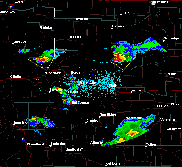 At 446 pm mdt, a severe thunderstorm was located 8 miles north of red scaffold, or 11 miles southeast of faith, moving southeast at 45 mph (radar indicated). Hazards include tennis ball size hail and 70 mph wind gusts. People and animals outdoors will be injured. expect hail damage to roofs, siding, windows, and vehicles. expect considerable tree damage. wind damage is also likely to mobile homes, roofs, and outbuildings. this severe storm will be near, red scaffold around 455 pm mdt. Intersection of cherry creek and sunnybrook roads around 505 pm mdt. At 446 pm mdt, a severe thunderstorm was located 8 miles north of red scaffold, or 11 miles southeast of faith, moving southeast at 45 mph (radar indicated). Hazards include tennis ball size hail and 70 mph wind gusts. People and animals outdoors will be injured. expect hail damage to roofs, siding, windows, and vehicles. expect considerable tree damage. wind damage is also likely to mobile homes, roofs, and outbuildings. this severe storm will be near, red scaffold around 455 pm mdt. Intersection of cherry creek and sunnybrook roads around 505 pm mdt.
|
| 6/4/2020 4:44 PM MDT | Tea Cup sized hail reported 9.3 miles N of Faith, SD |
| 6/4/2020 4:30 PM MDT | Hen Egg sized hail reported 7.4 miles E of Faith, SD |
| 6/4/2020 4:25 PM MDT | Baseball sized hail reported 7.9 miles E of Faith, SD |
| 6/4/2020 4:16 PM MDT |
 At 415 pm mdt, a severe thunderstorm was located 11 miles southwest of usta, or 13 miles west of faith, moving southeast at 45 mph (radar indicated). Hazards include golf ball size hail and 70 mph wind gusts. People and animals outdoors will be injured. expect hail damage to roofs, siding, windows, and vehicles. expect considerable tree damage. wind damage is also likely to mobile homes, roofs, and outbuildings. this severe thunderstorm will be near, faith and durkee lake around 435 pm mdt. Intersection of cherry creek and sunnybrook roads around 505 pm mdt. At 415 pm mdt, a severe thunderstorm was located 11 miles southwest of usta, or 13 miles west of faith, moving southeast at 45 mph (radar indicated). Hazards include golf ball size hail and 70 mph wind gusts. People and animals outdoors will be injured. expect hail damage to roofs, siding, windows, and vehicles. expect considerable tree damage. wind damage is also likely to mobile homes, roofs, and outbuildings. this severe thunderstorm will be near, faith and durkee lake around 435 pm mdt. Intersection of cherry creek and sunnybrook roads around 505 pm mdt.
|
| 6/4/2020 4:15 PM MDT | Half Dollar sized hail reported 7.9 miles SE of Faith, SD |
| 9/20/2019 11:15 PM MDT | Storm damage reported in ziebach county SD, 4.6 miles WNW of Faith, SD |
| 9/20/2019 10:28 PM MDT | Storm damage reported in meade county SD, 1.4 miles SW of Faith, SD |
| 9/20/2019 10:15 PM MDT | Storm damage reported in perkins county SD, 5.9 miles ESE of Faith, SD |
| 9/20/2019 10:12 PM MDT |
 At 1011 pm mdt, severe thunderstorms were located along a line extending from 6 miles southwest of usta to 6 miles southeast of faith to 9 miles east of takini school, moving northeast at 50 mph (radar indicated). Hazards include 60 mph wind gusts and nickel size hail. expect damage to roofs, siding, and trees At 1011 pm mdt, severe thunderstorms were located along a line extending from 6 miles southwest of usta to 6 miles southeast of faith to 9 miles east of takini school, moving northeast at 50 mph (radar indicated). Hazards include 60 mph wind gusts and nickel size hail. expect damage to roofs, siding, and trees
|
| 9/20/2019 10:03 PM MDT |
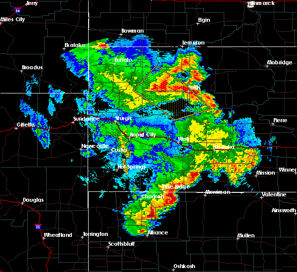 At 1002 pm mdt, severe thunderstorms were located along a line extending from 13 miles southeast of date to 3 miles west of durkee lake to near takini school, moving northeast at 45 mph (radar indicated). Hazards include 60 mph wind gusts and quarter size hail. Hail damage to vehicles is expected. expect wind damage to roofs, siding, and trees. Locations impacted include, faith, usta, maurine, red scaffold, opal, durkee lake and takini school. At 1002 pm mdt, severe thunderstorms were located along a line extending from 13 miles southeast of date to 3 miles west of durkee lake to near takini school, moving northeast at 45 mph (radar indicated). Hazards include 60 mph wind gusts and quarter size hail. Hail damage to vehicles is expected. expect wind damage to roofs, siding, and trees. Locations impacted include, faith, usta, maurine, red scaffold, opal, durkee lake and takini school.
|
| 9/20/2019 9:37 PM MDT |
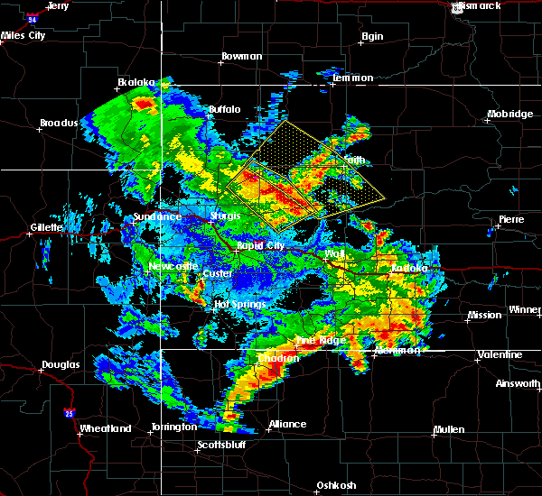 At 936 pm mdt, severe thunderstorms were located along a line extending from 5 miles northwest of mud butte to 6 miles northeast of stoneville to 8 miles southwest of plainview, moving northeast at 35 mph (radar indicated). Hazards include 60 mph wind gusts and half dollar size hail. Hail damage to vehicles is expected. Expect wind damage to roofs, siding, and trees. At 936 pm mdt, severe thunderstorms were located along a line extending from 5 miles northwest of mud butte to 6 miles northeast of stoneville to 8 miles southwest of plainview, moving northeast at 35 mph (radar indicated). Hazards include 60 mph wind gusts and half dollar size hail. Hail damage to vehicles is expected. Expect wind damage to roofs, siding, and trees.
|
| 8/10/2019 3:30 PM MDT | Quarter sized hail reported 14.1 miles SSE of Faith, SD |
| 8/10/2019 3:23 PM MDT |
 At 323 pm mdt, a severe thunderstorm was located 4 miles southwest of usta, or 15 miles northwest of faith, moving southeast at 25 mph (radar indicated). Hazards include 60 mph wind gusts and quarter size hail. Hail damage to vehicles is expected. expect wind damage to roofs, siding, and trees. Locations impacted include, faith, usta, durkee lake and arrow head buttes. At 323 pm mdt, a severe thunderstorm was located 4 miles southwest of usta, or 15 miles northwest of faith, moving southeast at 25 mph (radar indicated). Hazards include 60 mph wind gusts and quarter size hail. Hail damage to vehicles is expected. expect wind damage to roofs, siding, and trees. Locations impacted include, faith, usta, durkee lake and arrow head buttes.
|
| 8/10/2019 3:10 PM MDT |
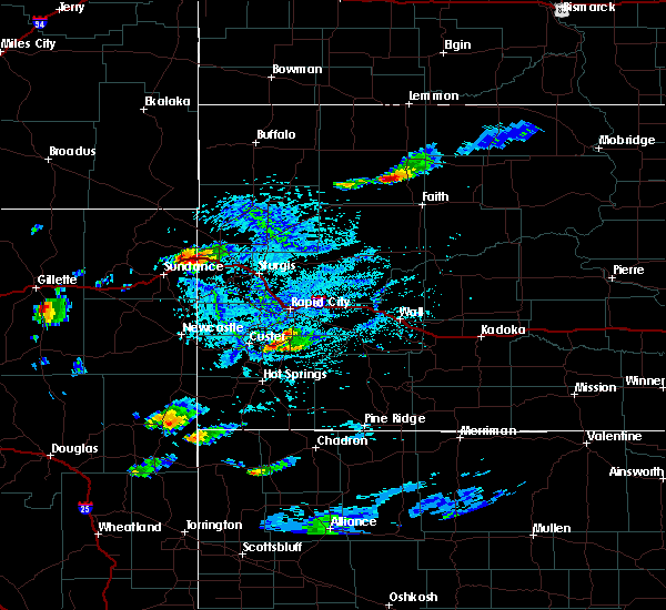 At 310 pm mdt, a severe thunderstorm was located 7 miles west of usta, or 20 miles northwest of faith, moving southeast at 30 mph (radar indicated). Hazards include 60 mph wind gusts and quarter size hail. Hail damage to vehicles is expected. Expect wind damage to roofs, siding, and trees. At 310 pm mdt, a severe thunderstorm was located 7 miles west of usta, or 20 miles northwest of faith, moving southeast at 30 mph (radar indicated). Hazards include 60 mph wind gusts and quarter size hail. Hail damage to vehicles is expected. Expect wind damage to roofs, siding, and trees.
|
| 7/20/2019 1:48 AM MDT |
 At 148 am mdt, a severe thunderstorm was located over intersection of cherry creek and sunnybrook roads, or 12 miles south of dupree, moving east at 40 mph (radar indicated). Hazards include 60 mph wind gusts and quarter size hail. Hail damage to vehicles is expected. expect wind damage to roofs, siding, and trees. Locations impacted include, dupree, faith, cherry creek, milesville, plainview, marcus, south eagle butte, bridger, kirley, howes, red scaffold, billsburg, red elm, intersection of cherry creek and sunnybrook roads, intersection of highway 63 and bia road 8, durkee lake and takini school. At 148 am mdt, a severe thunderstorm was located over intersection of cherry creek and sunnybrook roads, or 12 miles south of dupree, moving east at 40 mph (radar indicated). Hazards include 60 mph wind gusts and quarter size hail. Hail damage to vehicles is expected. expect wind damage to roofs, siding, and trees. Locations impacted include, dupree, faith, cherry creek, milesville, plainview, marcus, south eagle butte, bridger, kirley, howes, red scaffold, billsburg, red elm, intersection of cherry creek and sunnybrook roads, intersection of highway 63 and bia road 8, durkee lake and takini school.
|
| 7/20/2019 1:28 AM MDT |
 At 127 am mdt, a severe thunderstorm was located 8 miles southeast of durkee lake, or 10 miles southeast of faith, moving east at 40 mph (radar indicated). Hazards include 60 mph wind gusts and quarter size hail. Hail damage to vehicles is expected. Expect wind damage to roofs, siding, and trees. At 127 am mdt, a severe thunderstorm was located 8 miles southeast of durkee lake, or 10 miles southeast of faith, moving east at 40 mph (radar indicated). Hazards include 60 mph wind gusts and quarter size hail. Hail damage to vehicles is expected. Expect wind damage to roofs, siding, and trees.
|
| 7/20/2019 1:09 AM MDT |
 At 109 am mdt, a severe thunderstorm was located 3 miles south of iron lightning, or 11 miles northeast of faith, moving east at 45 mph (radar indicated). Hazards include 60 mph wind gusts and quarter size hail. Hail damage to vehicles is expected. Expect wind damage to roofs, siding, and trees. At 109 am mdt, a severe thunderstorm was located 3 miles south of iron lightning, or 11 miles northeast of faith, moving east at 45 mph (radar indicated). Hazards include 60 mph wind gusts and quarter size hail. Hail damage to vehicles is expected. Expect wind damage to roofs, siding, and trees.
|
| 7/19/2019 3:31 AM MDT |
 At 331 am mdt, a severe thunderstorm was located 5 miles west of faith, moving east at 40 mph (radar indicated). Hazards include two inch hail and 60 mph wind gusts. People and animals outdoors will be injured. expect hail damage to roofs, siding, windows, and vehicles. expect wind damage to roofs, siding, and trees. Locations impacted include, dupree, faith, usta, thunder butte, red elm, iron lightning, durkee lake, arrow head buttes and intersection of cherry creek and sunnybrook roads. At 331 am mdt, a severe thunderstorm was located 5 miles west of faith, moving east at 40 mph (radar indicated). Hazards include two inch hail and 60 mph wind gusts. People and animals outdoors will be injured. expect hail damage to roofs, siding, windows, and vehicles. expect wind damage to roofs, siding, and trees. Locations impacted include, dupree, faith, usta, thunder butte, red elm, iron lightning, durkee lake, arrow head buttes and intersection of cherry creek and sunnybrook roads.
|
| 7/19/2019 3:23 AM MDT |
 At 322 am mdt, a severe thunderstorm was located 10 miles west of faith, moving east at 45 mph (radar indicated). Hazards include 60 mph wind gusts and half dollar size hail. Hail damage to vehicles is expected. Expect wind damage to roofs, siding, and trees. At 322 am mdt, a severe thunderstorm was located 10 miles west of faith, moving east at 45 mph (radar indicated). Hazards include 60 mph wind gusts and half dollar size hail. Hail damage to vehicles is expected. Expect wind damage to roofs, siding, and trees.
|
| 7/16/2019 9:26 PM MDT |
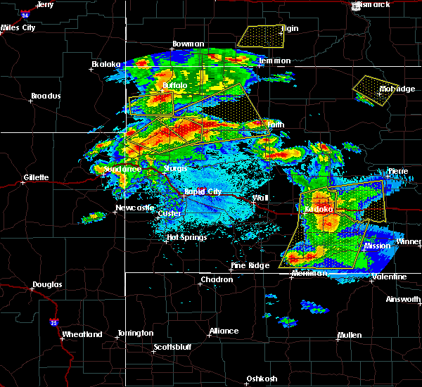 At 926 pm mdt, a severe thunderstorm was located 4 miles south of zeona, or 43 miles west of faith, moving east at 40 mph (radar indicated). Hazards include 60 mph wind gusts and quarter size hail. Hail damage to vehicles is expected. Expect wind damage to roofs, siding, and trees. At 926 pm mdt, a severe thunderstorm was located 4 miles south of zeona, or 43 miles west of faith, moving east at 40 mph (radar indicated). Hazards include 60 mph wind gusts and quarter size hail. Hail damage to vehicles is expected. Expect wind damage to roofs, siding, and trees.
|
| 7/14/2019 2:27 AM MDT |
 At 200 am mdt, severe thunderstorms were located along a line extending from meadow to 4 miles southeast of mud butte, moving east at 35 mph (radar indicated). Hazards include 60 mph wind gusts and penny size hail. Expect damage to roofs, siding, and trees. Locations impacted include, faith, bison, meadow, chance, sorum, usta, maurine, glad valley, opal, mud butte, date, zeona, prairie city, owen lake, durkee lake and arrow head buttes. At 200 am mdt, severe thunderstorms were located along a line extending from meadow to 4 miles southeast of mud butte, moving east at 35 mph (radar indicated). Hazards include 60 mph wind gusts and penny size hail. Expect damage to roofs, siding, and trees. Locations impacted include, faith, bison, meadow, chance, sorum, usta, maurine, glad valley, opal, mud butte, date, zeona, prairie city, owen lake, durkee lake and arrow head buttes.
|
| 7/14/2019 2:01 AM MDT |
 At 200 am mdt, severe thunderstorms were located along a line extending from meadow to 4 miles southeast of mud butte, moving east at 35 mph (radar indicated). Hazards include 60 mph wind gusts and penny size hail. Expect damage to roofs, siding, and trees. Locations impacted include, faith, bison, meadow, chance, sorum, usta, maurine, glad valley, opal, mud butte, date, zeona, prairie city, owen lake, durkee lake and arrow head buttes. At 200 am mdt, severe thunderstorms were located along a line extending from meadow to 4 miles southeast of mud butte, moving east at 35 mph (radar indicated). Hazards include 60 mph wind gusts and penny size hail. Expect damage to roofs, siding, and trees. Locations impacted include, faith, bison, meadow, chance, sorum, usta, maurine, glad valley, opal, mud butte, date, zeona, prairie city, owen lake, durkee lake and arrow head buttes.
|
| 7/14/2019 1:23 AM MDT |
 At 122 am mdt, severe thunderstorms were located along a line extending from 4 miles east of white butte to 9 miles south of dears ears butte, moving east at 45 mph (radar indicated). Hazards include 60 mph wind gusts and penny size hail. expect damage to roofs, siding, and trees At 122 am mdt, severe thunderstorms were located along a line extending from 4 miles east of white butte to 9 miles south of dears ears butte, moving east at 45 mph (radar indicated). Hazards include 60 mph wind gusts and penny size hail. expect damage to roofs, siding, and trees
|
| 7/5/2019 5:23 PM MDT |
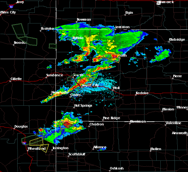 At 523 pm mdt, a severe thunderstorm was located 8 miles west of faith, moving east at 25 mph (radar indicated). Hazards include 60 mph wind gusts and quarter size hail. Hail damage to vehicles is expected. expect wind damage to roofs, siding, and trees. Locations impacted include, faith and durkee lake. At 523 pm mdt, a severe thunderstorm was located 8 miles west of faith, moving east at 25 mph (radar indicated). Hazards include 60 mph wind gusts and quarter size hail. Hail damage to vehicles is expected. expect wind damage to roofs, siding, and trees. Locations impacted include, faith and durkee lake.
|
| 7/5/2019 5:14 PM MDT | Quarter sized hail reported 17.2 miles E of Faith, SD, reported that there were a few trees down. |
| 7/5/2019 5:14 PM MDT | Reported that there were a few trees dow in perkins county SD, 17.2 miles E of Faith, SD |
| 7/5/2019 5:14 PM MDT | Reported that there were a few trees dow in perkins county SD, 17.2 miles E of Faith, SD |
| 7/5/2019 4:53 PM MDT |
 At 453 pm mdt, a severe thunderstorm was located 8 miles northeast of maurine, or 21 miles west of faith, moving east at 20 mph (radar indicated). Hazards include tennis ball size hail and 60 mph wind gusts. People and animals outdoors will be injured. expect hail damage to roofs, siding, windows, and vehicles. Expect wind damage to roofs, siding, and trees. At 453 pm mdt, a severe thunderstorm was located 8 miles northeast of maurine, or 21 miles west of faith, moving east at 20 mph (radar indicated). Hazards include tennis ball size hail and 60 mph wind gusts. People and animals outdoors will be injured. expect hail damage to roofs, siding, windows, and vehicles. Expect wind damage to roofs, siding, and trees.
|
| 6/27/2019 1:00 AM MDT | Power pole yard light knocked down from post thunderstorm outflow wind. wind estimated to be 60 to 80 mph around 100 am md in ziebach county SD, 4.6 miles WNW of Faith, SD |
| 6/27/2019 12:56 AM MDT | Occurred with decaying thunderstorms in meade county SD, 1.4 miles SW of Faith, SD |
| 6/27/2019 12:27 AM MDT |
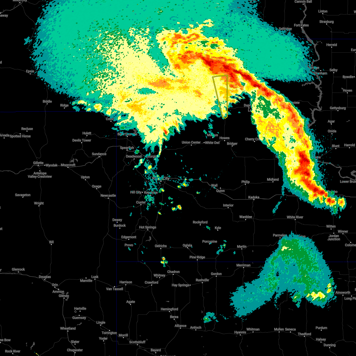 The severe thunderstorm warning for northeastern meade and southeastern perkins counties will expire at 1230 am mdt, the storms which prompted the warning have moved out of the area. therefore, the warning will be allowed to expire. a severe thunderstorm watch remains in effect until 600 am mdt for northwestern and west central south dakota. remember, a severe thunderstorm warning still remains in effect for portions of southeast perkins county until 1 am mdt. The severe thunderstorm warning for northeastern meade and southeastern perkins counties will expire at 1230 am mdt, the storms which prompted the warning have moved out of the area. therefore, the warning will be allowed to expire. a severe thunderstorm watch remains in effect until 600 am mdt for northwestern and west central south dakota. remember, a severe thunderstorm warning still remains in effect for portions of southeast perkins county until 1 am mdt.
|
| 6/27/2019 12:18 AM MDT |
 At 1218 am mdt, severe thunderstorms were located along a line extending from 4 miles southeast of meadow to 4 miles southeast of arrow head buttes to near faith, moving east at 40 mph (radar indicated). Hazards include 60 mph wind gusts. Expect damage to roofs, siding, and trees. Locations impacted include, faith, usta, durkee lake and arrow head buttes. At 1218 am mdt, severe thunderstorms were located along a line extending from 4 miles southeast of meadow to 4 miles southeast of arrow head buttes to near faith, moving east at 40 mph (radar indicated). Hazards include 60 mph wind gusts. Expect damage to roofs, siding, and trees. Locations impacted include, faith, usta, durkee lake and arrow head buttes.
|
| 6/27/2019 12:09 AM MDT |
 At 1209 am mdt, severe thunderstorms were located along a line extending from 3 miles south of meadow to 3 miles southwest of arrow head buttes to 11 miles south of durkee lake, moving east at 35 mph (radar indicated). Hazards include 60 mph wind gusts. Expect damage to roofs, siding, and trees. Locations impacted include, faith, chance, usta, stoneville, opal, durkee lake and arrow head buttes. At 1209 am mdt, severe thunderstorms were located along a line extending from 3 miles south of meadow to 3 miles southwest of arrow head buttes to 11 miles south of durkee lake, moving east at 35 mph (radar indicated). Hazards include 60 mph wind gusts. Expect damage to roofs, siding, and trees. Locations impacted include, faith, chance, usta, stoneville, opal, durkee lake and arrow head buttes.
|
| 6/26/2019 11:50 PM MDT |
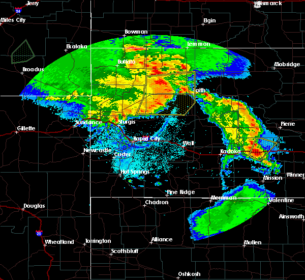 At 1150 pm mdt, severe thunderstorms were located along a line extending from 6 miles northeast of date to 3 miles east of maurine to 3 miles south of stoneville, moving east at 45 mph (radar indicated). Hazards include 60 mph wind gusts and quarter size hail. Hail damage to vehicles is expected. expect wind damage to roofs, siding, and trees. Locations impacted include, faith, chance, usta, maurine, stoneville, opal, mud butte, date, fairpoint, marcus, zeona, red owl, durkee lake and arrow head buttes. At 1150 pm mdt, severe thunderstorms were located along a line extending from 6 miles northeast of date to 3 miles east of maurine to 3 miles south of stoneville, moving east at 45 mph (radar indicated). Hazards include 60 mph wind gusts and quarter size hail. Hail damage to vehicles is expected. expect wind damage to roofs, siding, and trees. Locations impacted include, faith, chance, usta, maurine, stoneville, opal, mud butte, date, fairpoint, marcus, zeona, red owl, durkee lake and arrow head buttes.
|
| 6/26/2019 11:23 PM MDT |
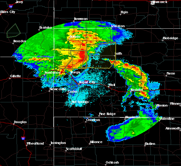 At 1123 pm mdt, severe thunderstorms were located along a line extending from 4 miles south of sorum to 3 miles southwest of mud butte to 7 miles east of owl butte, moving east at 40 mph (radar indicated). Hazards include 60 mph wind gusts and quarter size hail. Hail damage to vehicles is expected. Expect wind damage to roofs, siding, and trees. At 1123 pm mdt, severe thunderstorms were located along a line extending from 4 miles south of sorum to 3 miles southwest of mud butte to 7 miles east of owl butte, moving east at 40 mph (radar indicated). Hazards include 60 mph wind gusts and quarter size hail. Hail damage to vehicles is expected. Expect wind damage to roofs, siding, and trees.
|
| 8/3/2018 10:46 PM MDT | Storm damage reported in meade county SD, 1.4 miles SW of Faith, SD |
| 6/29/2018 6:24 PM MDT | Storm damage reported in meade county SD, 12.1 miles N of Faith, SD |
| 6/29/2018 6:24 PM MDT | Quarter sized hail reported 12.1 miles N of Faith, SD |
| 6/29/2018 6:21 PM MDT |
 At 621 pm mdt, severe thunderstorms were located along a line extending from 2 miles northwest of durkee lake to near howes, moving east at 30 mph (radar indicated). Hazards include two inch hail and 60 mph wind gusts. People and animals outdoors will be injured. expect hail damage to roofs, siding, windows, and vehicles. Expect wind damage to roofs, siding, and trees. At 621 pm mdt, severe thunderstorms were located along a line extending from 2 miles northwest of durkee lake to near howes, moving east at 30 mph (radar indicated). Hazards include two inch hail and 60 mph wind gusts. People and animals outdoors will be injured. expect hail damage to roofs, siding, windows, and vehicles. Expect wind damage to roofs, siding, and trees.
|
| 6/29/2018 6:15 PM MDT |
 At 615 pm mdt, a severe thunderstorm was located 9 miles south of durkee lake, or 12 miles south of faith, moving east at 35 mph (radar indicated). Hazards include golf ball size hail and 60 mph wind gusts. People and animals outdoors will be injured. expect hail damage to roofs, siding, windows, and vehicles. expect wind damage to roofs, siding, and trees. Locations impacted include, faith, plainview, marcus, howes and durkee lake. At 615 pm mdt, a severe thunderstorm was located 9 miles south of durkee lake, or 12 miles south of faith, moving east at 35 mph (radar indicated). Hazards include golf ball size hail and 60 mph wind gusts. People and animals outdoors will be injured. expect hail damage to roofs, siding, windows, and vehicles. expect wind damage to roofs, siding, and trees. Locations impacted include, faith, plainview, marcus, howes and durkee lake.
|
| 6/29/2018 6:03 PM MDT |
 At 603 pm mdt, a severe thunderstorm was located 12 miles east of opal, or 14 miles southwest of faith, moving east at 35 mph. this is a very dangerous storm (radar indicated. at 554 pm mdt 3 inch diamter hail was reported 6 miles southeat of opal). Hazards include three inch hail and 70 mph wind gusts. People and animals outdoors will be severely injured. expect shattered windows, extensive damage to roofs, siding, and vehicles. Locations impacted include, faith, plainview, marcus, howes, opal, red owl and durkee lake. At 603 pm mdt, a severe thunderstorm was located 12 miles east of opal, or 14 miles southwest of faith, moving east at 35 mph. this is a very dangerous storm (radar indicated. at 554 pm mdt 3 inch diamter hail was reported 6 miles southeat of opal). Hazards include three inch hail and 70 mph wind gusts. People and animals outdoors will be severely injured. expect shattered windows, extensive damage to roofs, siding, and vehicles. Locations impacted include, faith, plainview, marcus, howes, opal, red owl and durkee lake.
|
| 6/29/2018 5:59 PM MDT |
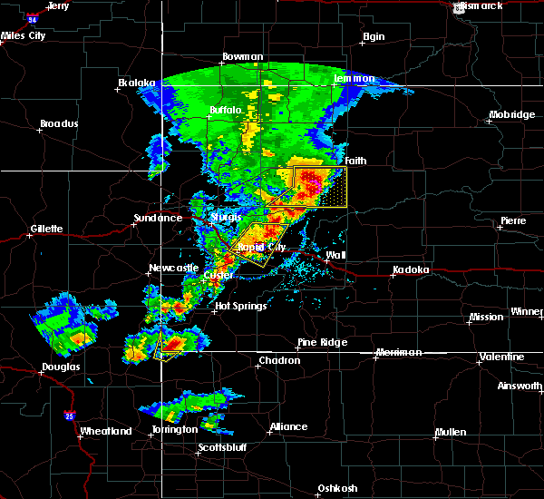 At 559 pm mdt, a severe thunderstorm was located 9 miles east of opal, or 16 miles southwest of faith, moving east at 35 mph (radar indicated. at 528 pm mdt quarter size hail was reported 8 miles southeast of mud butte). Hazards include tennis ball size hail and 70 mph wind gusts. People and animals outdoors will be injured. expect hail damage to roofs, siding, windows, and vehicles. expect considerable tree damage. wind damage is also likely to mobile homes, roofs, and outbuildings. Locations impacted include, faith, plainview, marcus, howes, stoneville, opal, red owl and durkee lake. At 559 pm mdt, a severe thunderstorm was located 9 miles east of opal, or 16 miles southwest of faith, moving east at 35 mph (radar indicated. at 528 pm mdt quarter size hail was reported 8 miles southeast of mud butte). Hazards include tennis ball size hail and 70 mph wind gusts. People and animals outdoors will be injured. expect hail damage to roofs, siding, windows, and vehicles. expect considerable tree damage. wind damage is also likely to mobile homes, roofs, and outbuildings. Locations impacted include, faith, plainview, marcus, howes, stoneville, opal, red owl and durkee lake.
|
| 6/29/2018 5:44 PM MDT |
 At 544 pm mdt, a severe thunderstorm was located over opal, or 23 miles southwest of faith, moving east at 45 mph (radar indicated). Hazards include tennis ball size hail and 70 mph wind gusts. People and animals outdoors will be injured. expect hail damage to roofs, siding, windows, and vehicles. expect considerable tree damage. wind damage is also likely to mobile homes, roofs, and outbuildings. Locations impacted include, faith, plainview, fairpoint, marcus, maurine, howes, stoneville, opal, mud butte, red owl and durkee lake. At 544 pm mdt, a severe thunderstorm was located over opal, or 23 miles southwest of faith, moving east at 45 mph (radar indicated). Hazards include tennis ball size hail and 70 mph wind gusts. People and animals outdoors will be injured. expect hail damage to roofs, siding, windows, and vehicles. expect considerable tree damage. wind damage is also likely to mobile homes, roofs, and outbuildings. Locations impacted include, faith, plainview, fairpoint, marcus, maurine, howes, stoneville, opal, mud butte, red owl and durkee lake.
|
| 6/29/2018 5:24 PM MDT |
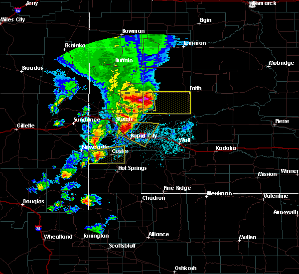 At 524 pm mdt, a severe thunderstorm was located 7 miles north of fairpoint, or 37 miles west of faith, moving east at 45 mph (radar indicated. at 510 pm mdt a 68 mph wind gust was reported 8 miles southwest of mud butte). Hazards include tennis ball size hail and 70 mph wind gusts. People and animals outdoors will be injured. expect hail damage to roofs, siding, windows, and vehicles. expect considerable tree damage. Wind damage is also likely to mobile homes, roofs, and outbuildings. At 524 pm mdt, a severe thunderstorm was located 7 miles north of fairpoint, or 37 miles west of faith, moving east at 45 mph (radar indicated. at 510 pm mdt a 68 mph wind gust was reported 8 miles southwest of mud butte). Hazards include tennis ball size hail and 70 mph wind gusts. People and animals outdoors will be injured. expect hail damage to roofs, siding, windows, and vehicles. expect considerable tree damage. Wind damage is also likely to mobile homes, roofs, and outbuildings.
|
| 6/27/2018 1:30 AM MDT | Tennis Ball sized hail reported 18.2 miles NNE of Faith, SD |
| 6/27/2018 12:52 AM MDT |
 At 1251 am mdt, severe thunderstorms were located along a line extending from 14 miles northeast of thunder butte to 3 miles north of faith, moving southeast at 30 mph (radar indicated). Hazards include golf ball size hail and 60 mph wind gusts. People and animals outdoors will be injured. expect hail damage to roofs, siding, windows, and vehicles. expect wind damage to roofs, siding, and trees. Locations impacted include, dupree, faith, south eagle butte, glad valley, thunder butte, red elm, iron lightning, durkee lake, arrow head buttes and intersection of cherry creek and sunnybrook roads. At 1251 am mdt, severe thunderstorms were located along a line extending from 14 miles northeast of thunder butte to 3 miles north of faith, moving southeast at 30 mph (radar indicated). Hazards include golf ball size hail and 60 mph wind gusts. People and animals outdoors will be injured. expect hail damage to roofs, siding, windows, and vehicles. expect wind damage to roofs, siding, and trees. Locations impacted include, dupree, faith, south eagle butte, glad valley, thunder butte, red elm, iron lightning, durkee lake, arrow head buttes and intersection of cherry creek and sunnybrook roads.
|
| 6/27/2018 12:26 AM MDT |
 At 1226 am mdt, severe thunderstorms were located along a line extending from 11 miles northeast of glad valley to near usta, moving southeast at 30 mph (radar indicated). Hazards include 60 mph wind gusts and half dollar size hail. Hail damage to vehicles is expected. Expect wind damage to roofs, siding, and trees. At 1226 am mdt, severe thunderstorms were located along a line extending from 11 miles northeast of glad valley to near usta, moving southeast at 30 mph (radar indicated). Hazards include 60 mph wind gusts and half dollar size hail. Hail damage to vehicles is expected. Expect wind damage to roofs, siding, and trees.
|
| 6/10/2018 8:05 PM MDT |
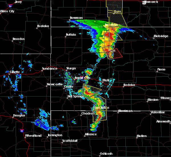 At 805 pm mdt, severe thunderstorms were located along a line extending from near glad valley to 7 miles south of durkee lake, moving east at 25 mph (radar indicated). Hazards include 60 mph wind gusts and quarter size hail. Hail damage to vehicles is expected. expect wind damage to roofs, siding, and trees. locations impacted include, faith, usta, iron lightning, durkee lake and arrow head buttes. A tornado watch remains in effect until 1000 pm mdt for northwestern and west central south dakota. At 805 pm mdt, severe thunderstorms were located along a line extending from near glad valley to 7 miles south of durkee lake, moving east at 25 mph (radar indicated). Hazards include 60 mph wind gusts and quarter size hail. Hail damage to vehicles is expected. expect wind damage to roofs, siding, and trees. locations impacted include, faith, usta, iron lightning, durkee lake and arrow head buttes. A tornado watch remains in effect until 1000 pm mdt for northwestern and west central south dakota.
|
| 6/10/2018 8:03 PM MDT |
 At 802 pm mdt, a severe thunderstorm capable of producing a tornado was located near durkee lake, or 7 miles southeast of faith, moving northeast at 25 mph (radar indicated rotation). Hazards include tornado and half dollar size hail. Flying debris will be dangerous to those caught without shelter. mobile homes will be damaged or destroyed. damage to roofs, windows, and vehicles will occur. tree damage is likely. This dangerous storm will be near, red elm around 830 pm mdt. At 802 pm mdt, a severe thunderstorm capable of producing a tornado was located near durkee lake, or 7 miles southeast of faith, moving northeast at 25 mph (radar indicated rotation). Hazards include tornado and half dollar size hail. Flying debris will be dangerous to those caught without shelter. mobile homes will be damaged or destroyed. damage to roofs, windows, and vehicles will occur. tree damage is likely. This dangerous storm will be near, red elm around 830 pm mdt.
|
| 6/10/2018 7:52 PM MDT | Ping Pong Ball sized hail reported 14.7 miles E of Faith, SD |
| 6/10/2018 7:49 PM MDT | Hen Egg sized hail reported 2 miles E of Faith, SD |
| 6/10/2018 7:23 PM MDT |
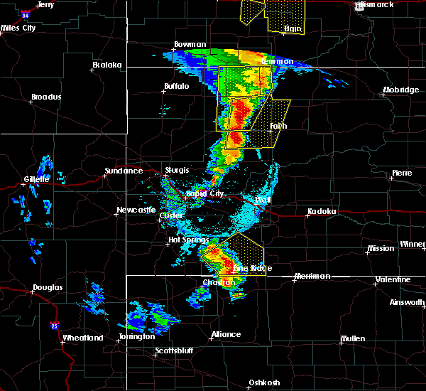 The national weather service in rapid city has issued a * severe thunderstorm warning for. northwestern ziebach county in west central south dakota. northeastern meade county in west central south dakota. southeastern perkins county in northwestern south dakota. Until 830 pm mdt. The national weather service in rapid city has issued a * severe thunderstorm warning for. northwestern ziebach county in west central south dakota. northeastern meade county in west central south dakota. southeastern perkins county in northwestern south dakota. Until 830 pm mdt.
|
| 6/10/2018 6:38 PM MDT | Quarter sized hail reported 33.6 miles ESE of Faith, SD |
| 6/7/2018 11:23 PM MDT |
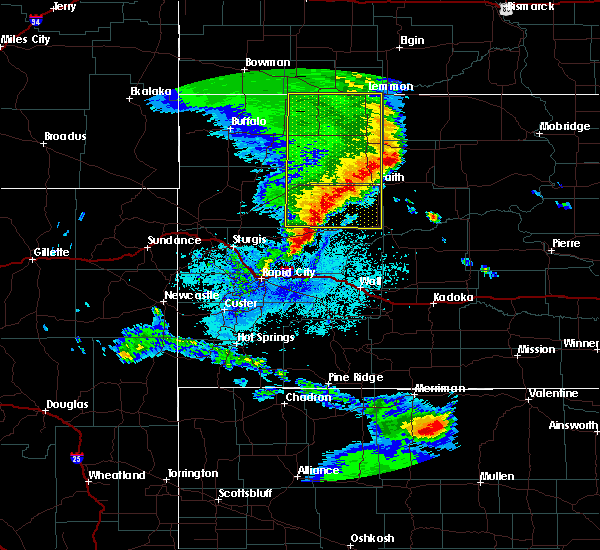 The severe thunderstorm warning for northeastern meade and perkins counties will expire at 1130 pm mdt, the storms which prompted the warning have weakened below severe limits, so the warning will be allowed to expire. however, nickel sized hail and wind gusts to 45 mph are still possible with these thunderstorms. a severe thunderstorm watch remains in effect until 100 am mdt for northwestern and west central south dakota. The severe thunderstorm warning for northeastern meade and perkins counties will expire at 1130 pm mdt, the storms which prompted the warning have weakened below severe limits, so the warning will be allowed to expire. however, nickel sized hail and wind gusts to 45 mph are still possible with these thunderstorms. a severe thunderstorm watch remains in effect until 100 am mdt for northwestern and west central south dakota.
|
| 6/7/2018 10:28 PM MDT |
 At 1027 pm mdt, severe thunderstorms were located along a line extending from near hettinger to near bison to near mud butte, moving east at 50 mph (radar indicated). Hazards include 60 mph wind gusts. expect damage to roofs, siding, and trees At 1027 pm mdt, severe thunderstorms were located along a line extending from near hettinger to near bison to near mud butte, moving east at 50 mph (radar indicated). Hazards include 60 mph wind gusts. expect damage to roofs, siding, and trees
|
| 6/5/2018 9:07 PM MDT |
 At 907 pm mdt, a severe thunderstorm was located over dupree, moving northeast at 45 mph (radar indicated). Hazards include 60 mph wind gusts and quarter size hail. Hail damage to vehicles is expected. expect wind damage to roofs, siding, and trees. Locations impacted include, eagle butte, faith, plainview, south eagle butte, marcus, howes, red scaffold, red elm, intersection of highway 63 and bia road 8, durkee lake, takini school and intersection of cherry creek and sunnybrook roads. At 907 pm mdt, a severe thunderstorm was located over dupree, moving northeast at 45 mph (radar indicated). Hazards include 60 mph wind gusts and quarter size hail. Hail damage to vehicles is expected. expect wind damage to roofs, siding, and trees. Locations impacted include, eagle butte, faith, plainview, south eagle butte, marcus, howes, red scaffold, red elm, intersection of highway 63 and bia road 8, durkee lake, takini school and intersection of cherry creek and sunnybrook roads.
|
| 6/5/2018 9:05 PM MDT | Storm damage reported in meade county SD, 1.4 miles SW of Faith, SD |
| 6/5/2018 8:52 PM MDT |
 At 851 pm mdt, a severe thunderstorm was located 8 miles south of red elm, or 12 miles southwest of dupree, moving northeast at 45 mph (radar indicated). Hazards include 60 mph wind gusts and quarter size hail. Hail damage to vehicles is expected. Expect wind damage to roofs, siding, and trees. At 851 pm mdt, a severe thunderstorm was located 8 miles south of red elm, or 12 miles southwest of dupree, moving northeast at 45 mph (radar indicated). Hazards include 60 mph wind gusts and quarter size hail. Hail damage to vehicles is expected. Expect wind damage to roofs, siding, and trees.
|
| 6/5/2018 8:28 PM MDT | Storm damage reported in perkins county SD, 20.4 miles SE of Faith, SD |
| 6/5/2018 8:28 PM MDT | Half Dollar sized hail reported 20.4 miles SE of Faith, SD |
| 5/17/2018 4:52 PM MDT |
 At 452 pm mdt, a severe thunderstorm was located over arrow head buttes, or 11 miles north of faith, moving northeast at 55 mph (radar indicated). Hazards include 60 mph wind gusts. expect damage to roofs, siding, and trees At 452 pm mdt, a severe thunderstorm was located over arrow head buttes, or 11 miles north of faith, moving northeast at 55 mph (radar indicated). Hazards include 60 mph wind gusts. expect damage to roofs, siding, and trees
|
| 5/17/2018 4:43 PM MDT | Storm damage reported in meade county SD, 1.4 miles SW of Faith, SD |
| 5/17/2018 4:21 PM MDT |
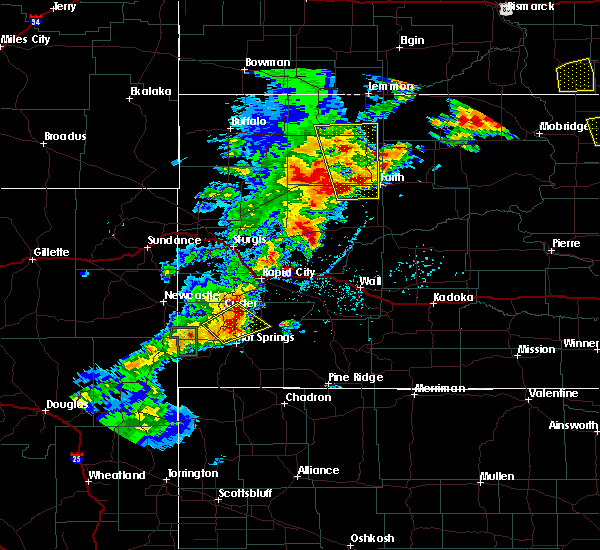 At 421 pm mdt, a severe thunderstorm was located 11 miles southwest of usta, or 11 miles west of faith, moving north at 25 mph (radar indicated). Hazards include 60 mph wind gusts and quarter size hail. Hail damage to vehicles is expected. expect wind damage to roofs, siding, and trees. Locations impacted include, bison, meadow, chance, usta, opal, owen lake, durkee lake and arrow head buttes. At 421 pm mdt, a severe thunderstorm was located 11 miles southwest of usta, or 11 miles west of faith, moving north at 25 mph (radar indicated). Hazards include 60 mph wind gusts and quarter size hail. Hail damage to vehicles is expected. expect wind damage to roofs, siding, and trees. Locations impacted include, bison, meadow, chance, usta, opal, owen lake, durkee lake and arrow head buttes.
|
| 5/17/2018 3:51 PM MDT |
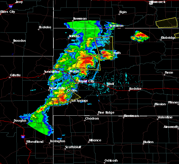 At 351 pm mdt, a severe thunderstorm was located 12 miles east of maurine, or 16 miles west of faith, moving north at 35 mph (radar indicated). Hazards include 60 mph wind gusts and half dollar size hail. Hail damage to vehicles is expected. Expect wind damage to roofs, siding, and trees. At 351 pm mdt, a severe thunderstorm was located 12 miles east of maurine, or 16 miles west of faith, moving north at 35 mph (radar indicated). Hazards include 60 mph wind gusts and half dollar size hail. Hail damage to vehicles is expected. Expect wind damage to roofs, siding, and trees.
|
| 5/17/2018 3:46 PM MDT | Quarter sized hail reported 17.2 miles E of Faith, SD, pea to quarter size hail |
| 5/7/2018 6:50 PM MDT | Storm damage reported in meade county SD, 1.4 miles SW of Faith, SD |
| 5/7/2018 6:48 PM MDT | Storm damage reported in meade county SD, 0.3 miles N of Faith, SD |
| 5/7/2018 6:29 PM MDT |
 At 629 pm mdt, a severe thunderstorm was located near faith, moving east at 55 mph (radar indicated). Hazards include 60 mph wind gusts. Expect damage to roofs, siding, and trees. Locations impacted include, faith, opal, red elm, iron lightning, durkee lake and arrow head buttes. At 629 pm mdt, a severe thunderstorm was located near faith, moving east at 55 mph (radar indicated). Hazards include 60 mph wind gusts. Expect damage to roofs, siding, and trees. Locations impacted include, faith, opal, red elm, iron lightning, durkee lake and arrow head buttes.
|
| 5/7/2018 6:20 PM MDT | At least 60 mph winds in perkins county SD, 20.4 miles SE of Faith, SD |
| 5/7/2018 6:07 PM MDT |
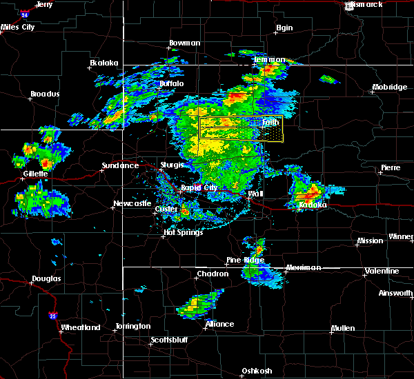 At 606 pm mdt, a severe thunderstorm was located near maurine, or 24 miles west of faith, moving east at 55 mph (radar indicated. at 544 pm mdt a 71 mph gust was reported 1 mile east-northeast of mud butte). Hazards include 60 mph wind gusts. expect damage to roofs, siding, and trees At 606 pm mdt, a severe thunderstorm was located near maurine, or 24 miles west of faith, moving east at 55 mph (radar indicated. at 544 pm mdt a 71 mph gust was reported 1 mile east-northeast of mud butte). Hazards include 60 mph wind gusts. expect damage to roofs, siding, and trees
|
| 8/26/2017 6:55 PM MDT | Ping Pong Ball sized hail reported 20.2 miles NE of Faith, SD |
| 7/31/2017 5:38 PM MDT | Storm damage reported in meade county SD, 27.4 miles E of Faith, SD |
| 7/31/2017 5:20 PM MDT | Lots of pea sized hail in perkins county SD, 26.8 miles E of Faith, SD |
| 7/4/2017 5:04 PM MDT |
 At 504 pm mdt, severe thunderstorms were located along a line extending from near red elm to 9 miles northeast of owl butte, moving southeast at 20 mph (radar indicated). Hazards include 60 mph wind gusts and nickel size hail. Expect damage to roofs, siding, and trees. Locations impacted include, faith, red elm and durkee lake. At 504 pm mdt, severe thunderstorms were located along a line extending from near red elm to 9 miles northeast of owl butte, moving southeast at 20 mph (radar indicated). Hazards include 60 mph wind gusts and nickel size hail. Expect damage to roofs, siding, and trees. Locations impacted include, faith, red elm and durkee lake.
|
| 7/4/2017 4:48 PM MDT |
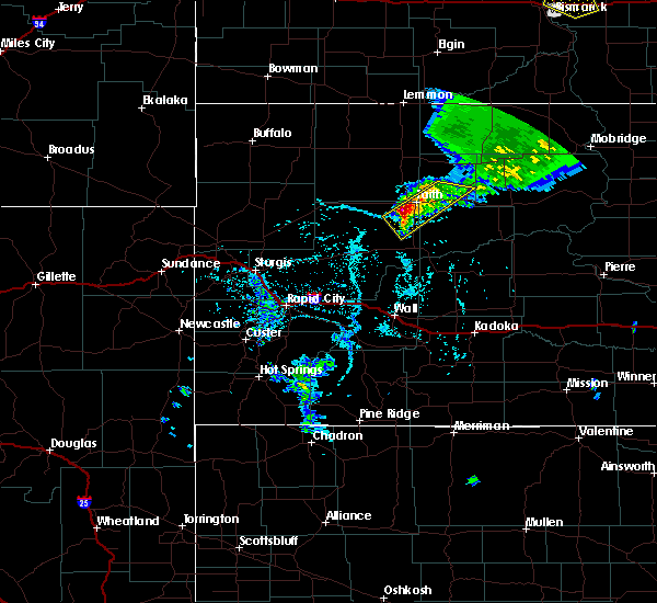 At 448 pm mdt, severe thunderstorms were located along a line extending from near thunder butte to 9 miles northeast of owl butte, moving southeast at 15 mph (radar indicated). Hazards include 60 mph wind gusts and nickel size hail. Expect damage to roofs, siding, and trees. Locations impacted include, faith, red elm, iron lightning and durkee lake. At 448 pm mdt, severe thunderstorms were located along a line extending from near thunder butte to 9 miles northeast of owl butte, moving southeast at 15 mph (radar indicated). Hazards include 60 mph wind gusts and nickel size hail. Expect damage to roofs, siding, and trees. Locations impacted include, faith, red elm, iron lightning and durkee lake.
|
| 7/4/2017 4:26 PM MDT |
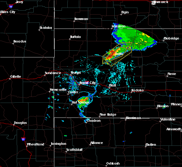 At 425 pm mdt, severe thunderstorms were located along a line extending from near thunder butte to 9 miles east of opal, moving southeast at 15 mph (radar indicated). Hazards include 60 mph wind gusts and nickel size hail. expect damage to roofs, siding, and trees At 425 pm mdt, severe thunderstorms were located along a line extending from near thunder butte to 9 miles east of opal, moving southeast at 15 mph (radar indicated). Hazards include 60 mph wind gusts and nickel size hail. expect damage to roofs, siding, and trees
|
| 7/4/2017 4:17 PM MDT |
 At 417 pm mdt, severe thunderstorms were located along a line extending from near glad valley to 6 miles northeast of faith to near opal, moving southeast at 15 mph (radar indicated). Hazards include 60 mph wind gusts and quarter size hail. Hail damage to vehicles is expected. expect wind damage to roofs, siding, and trees. Locations impacted include, faith, usta, glad valley, thunder butte, red elm, iron lightning, durkee lake and arrow head buttes. At 417 pm mdt, severe thunderstorms were located along a line extending from near glad valley to 6 miles northeast of faith to near opal, moving southeast at 15 mph (radar indicated). Hazards include 60 mph wind gusts and quarter size hail. Hail damage to vehicles is expected. expect wind damage to roofs, siding, and trees. Locations impacted include, faith, usta, glad valley, thunder butte, red elm, iron lightning, durkee lake and arrow head buttes.
|
| 7/4/2017 3:52 PM MDT |
 At 352 pm mdt, severe thunderstorms were located along a line extending from glad valley to arrow head buttes to 6 miles north of opal, moving southeast at 20 mph (radar indicated). Hazards include 60 mph wind gusts and penny size hail. Expect damage to roofs, siding, and trees. Locations impacted include, faith, usta, glad valley, opal, thunder butte, red elm, iron lightning, durkee lake and arrow head buttes. At 352 pm mdt, severe thunderstorms were located along a line extending from glad valley to arrow head buttes to 6 miles north of opal, moving southeast at 20 mph (radar indicated). Hazards include 60 mph wind gusts and penny size hail. Expect damage to roofs, siding, and trees. Locations impacted include, faith, usta, glad valley, opal, thunder butte, red elm, iron lightning, durkee lake and arrow head buttes.
|
| 7/4/2017 3:34 PM MDT |
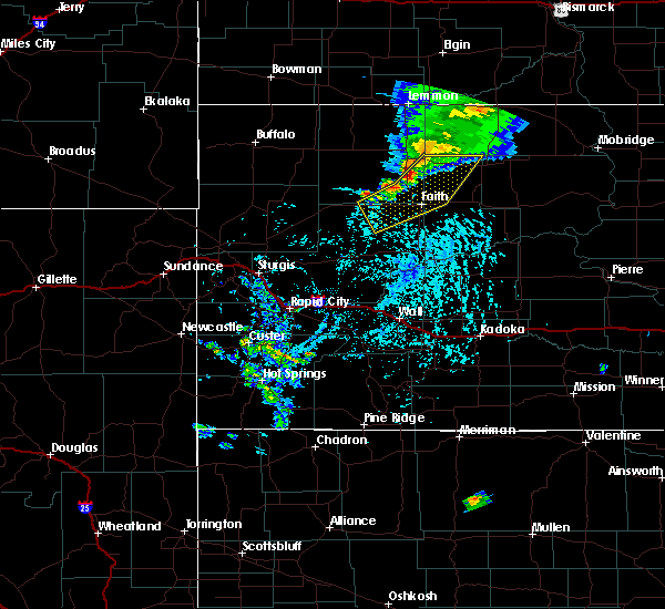 At 333 pm mdt, severe thunderstorms were located along a line extending from 6 miles northwest of glad valley to near usta to near maurine, moving southeast at 20 mph (radar indicated). Hazards include 60 mph wind gusts and penny size hail. expect damage to roofs, siding, and trees At 333 pm mdt, severe thunderstorms were located along a line extending from 6 miles northwest of glad valley to near usta to near maurine, moving southeast at 20 mph (radar indicated). Hazards include 60 mph wind gusts and penny size hail. expect damage to roofs, siding, and trees
|
| 6/2/2017 4:18 PM MDT | Damage to barn doors... tin sheeting ripped from structure... steel troughs thrown about... electric pole down... and tree split in half. time estimated from rada in perkins county SD, 14.1 miles SSE of Faith, SD |
| 5/28/2017 2:19 PM MDT | Storm damage reported in meade county SD, 1.4 miles SW of Faith, SD |
| 4/17/2017 10:04 PM MDT |
 At 1003 pm mdt, severe thunderstorms were located along a line extending from 10 miles west of durkee lake to 10 miles southwest of bridger to near wasta, moving east at 50 mph (radar indicated). Hazards include 60 mph wind gusts. Expect damage to roofs, siding, and trees. Locations impacted include, faith, milesville, wasta, plainview, elm springs, grindstone, creighton, marcus, bridger, howes, red scaffold, and wicksville. At 1003 pm mdt, severe thunderstorms were located along a line extending from 10 miles west of durkee lake to 10 miles southwest of bridger to near wasta, moving east at 50 mph (radar indicated). Hazards include 60 mph wind gusts. Expect damage to roofs, siding, and trees. Locations impacted include, faith, milesville, wasta, plainview, elm springs, grindstone, creighton, marcus, bridger, howes, red scaffold, and wicksville.
|
| 4/17/2017 9:37 PM MDT |
 At 937 pm mdt, severe thunderstorms were located along a line extending from 6 miles southwest of maurine to enning to near new underwood, moving east at 50 mph (radar indicated). Hazards include 60 mph wind gusts. expect damage to roofs, siding, and trees At 937 pm mdt, severe thunderstorms were located along a line extending from 6 miles southwest of maurine to enning to near new underwood, moving east at 50 mph (radar indicated). Hazards include 60 mph wind gusts. expect damage to roofs, siding, and trees
|
| 8/14/2016 6:02 PM MDT | Storm damage reported in ziebach county SD, 9.9 miles NNW of Faith, SD |
| 8/14/2016 6:01 PM MDT |
 At 600 pm mdt, a severe thunderstorm was located near faith, moving southeast at 20 mph (law enforcement). Hazards include 70 mph wind gusts and ping pong ball size hail. People and animals outdoors will be injured. expect hail damage to roofs, siding, windows, and vehicles. expect considerable tree damage. wind damage is also likely to mobile homes, roofs, and outbuildings. Locations impacted include, faith, red elm and durkee lake. At 600 pm mdt, a severe thunderstorm was located near faith, moving southeast at 20 mph (law enforcement). Hazards include 70 mph wind gusts and ping pong ball size hail. People and animals outdoors will be injured. expect hail damage to roofs, siding, windows, and vehicles. expect considerable tree damage. wind damage is also likely to mobile homes, roofs, and outbuildings. Locations impacted include, faith, red elm and durkee lake.
|
| 8/14/2016 5:51 PM MDT | Storm damage reported in meade county SD, 1.4 miles SW of Faith, SD |
| 8/14/2016 5:28 PM MDT |
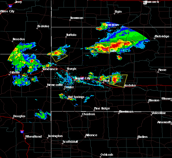 At 528 pm mdt, a severe thunderstorm was located near arrow head buttes, or 8 miles northwest of faith, moving southeast at 20 mph (radar indicated). Hazards include ping pong ball size hail and 60 mph wind gusts. People and animals outdoors will be injured. expect hail damage to roofs, siding, windows, and vehicles. Expect wind damage to roofs, siding, and trees. At 528 pm mdt, a severe thunderstorm was located near arrow head buttes, or 8 miles northwest of faith, moving southeast at 20 mph (radar indicated). Hazards include ping pong ball size hail and 60 mph wind gusts. People and animals outdoors will be injured. expect hail damage to roofs, siding, windows, and vehicles. Expect wind damage to roofs, siding, and trees.
|
| 8/14/2016 4:40 PM MDT | Storm damage reported in perkins county SD, 20.4 miles SE of Faith, SD |
| 8/8/2016 8:24 PM MDT |
 At 823 pm mdt, severe thunderstorms were located along a line extending from near faith to 8 miles west of cherry creek, moving northeast at 45 mph (radar indicated). Hazards include 60 mph wind gusts and quarter size hail. Hail damage to vehicles is expected. expect wind damage to roofs, siding, and trees. Locations impacted include, eagle butte, dupree, faith, cherry creek, milesville, bridger, red elm, south eagle butte, glad valley, howes, red scaffold, thunder butte, iron lightning, kirley, billsburg and usta. At 823 pm mdt, severe thunderstorms were located along a line extending from near faith to 8 miles west of cherry creek, moving northeast at 45 mph (radar indicated). Hazards include 60 mph wind gusts and quarter size hail. Hail damage to vehicles is expected. expect wind damage to roofs, siding, and trees. Locations impacted include, eagle butte, dupree, faith, cherry creek, milesville, bridger, red elm, south eagle butte, glad valley, howes, red scaffold, thunder butte, iron lightning, kirley, billsburg and usta.
|
| 8/8/2016 7:57 PM MDT |
 At 757 pm mdt, severe thunderstorms were located along a line extending from near opal to 6 miles southwest of bridger, moving northeast at 45 mph (radar indicated). Hazards include 60 mph wind gusts and quarter size hail. Hail damage to vehicles is expected. expect wind damage to roofs, siding, and trees. Locations impacted include, eagle butte, dupree, faith, cherry creek, milesville, plainview, bridger, marcus, white owl, red owl, red elm, south eagle butte, glad valley, maurine, howes, red scaffold, thunder butte, iron lightning, creighton and kirley. At 757 pm mdt, severe thunderstorms were located along a line extending from near opal to 6 miles southwest of bridger, moving northeast at 45 mph (radar indicated). Hazards include 60 mph wind gusts and quarter size hail. Hail damage to vehicles is expected. expect wind damage to roofs, siding, and trees. Locations impacted include, eagle butte, dupree, faith, cherry creek, milesville, plainview, bridger, marcus, white owl, red owl, red elm, south eagle butte, glad valley, maurine, howes, red scaffold, thunder butte, iron lightning, creighton and kirley.
|
| 8/8/2016 7:40 PM MDT |
 At 740 pm mdt, severe thunderstorms were located along a line extending from 6 miles southwest of opal to 8 miles north of creighton, moving northeast at 45 mph (radar indicated). Hazards include 60 mph wind gusts and quarter size hail. Hail damage to vehicles is expected. Expect wind damage to roofs, siding, and trees. At 740 pm mdt, severe thunderstorms were located along a line extending from 6 miles southwest of opal to 8 miles north of creighton, moving northeast at 45 mph (radar indicated). Hazards include 60 mph wind gusts and quarter size hail. Hail damage to vehicles is expected. Expect wind damage to roofs, siding, and trees.
|
| 8/2/2016 10:20 PM MDT | Storm damage reported in ziebach county SD, 4.6 miles WNW of Faith, SD |
| 7/31/2016 9:40 PM MDT | The severe thunderstorm warning for northeastern meade, west central ziebach and southeastern perkins counties will expire at 945 pm mdt, the storm which prompted the warning has weakened below severe limits, and no longer pose an immediate threat to life or property. therefore the warning will be allowed to expire. however small hail, gusty winds and heavy rain are still possible with this thunderstorm. a severe thunderstorm watch remains in effect until 1000 pm mdt for west central and northwestern south dakota. to report severe weather, contact your nearest law enforcement agency. they will relay your report to the national weather service rapid city. |
| 7/31/2016 9:20 PM MDT |
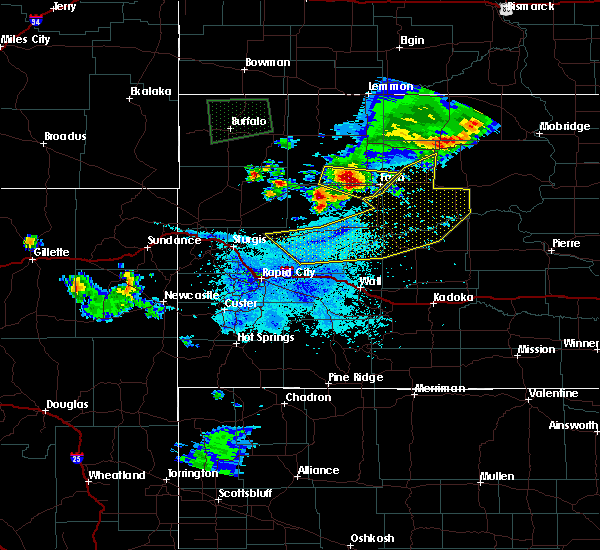 At 920 pm mdt, a severe thunderstorm was located 11 miles west of faith, moving east at 25 mph (radar indicated). Hazards include 60 mph wind gusts and quarter size hail. Hail damage to vehicles is expected. expect wind damage to roofs, siding, and trees. Locations impacted include, faith. At 920 pm mdt, a severe thunderstorm was located 11 miles west of faith, moving east at 25 mph (radar indicated). Hazards include 60 mph wind gusts and quarter size hail. Hail damage to vehicles is expected. expect wind damage to roofs, siding, and trees. Locations impacted include, faith.
|
| 7/31/2016 9:10 PM MDT | Quarter sized hail reported 18.4 miles ESE of Faith, SD |
| 7/31/2016 8:55 PM MDT | Storm damage reported in perkins county SD, 27.4 miles E of Faith, SD |
| 7/31/2016 8:52 PM MDT |
 At 851 pm mdt, a severe thunderstorm was located 7 miles northeast of maurine, or 22 miles west of faith, moving east at 20 mph (radar indicated). Hazards include golf ball size hail and 60 mph wind gusts. People and animals outdoors will be injured. expect hail damage to roofs, siding, windows, and vehicles. expect wind damage to roofs, siding, and trees. Locations impacted include, faith, and areas between maurine and faith on highway 212. At 851 pm mdt, a severe thunderstorm was located 7 miles northeast of maurine, or 22 miles west of faith, moving east at 20 mph (radar indicated). Hazards include golf ball size hail and 60 mph wind gusts. People and animals outdoors will be injured. expect hail damage to roofs, siding, windows, and vehicles. expect wind damage to roofs, siding, and trees. Locations impacted include, faith, and areas between maurine and faith on highway 212.
|
| 7/31/2016 8:44 PM MDT |
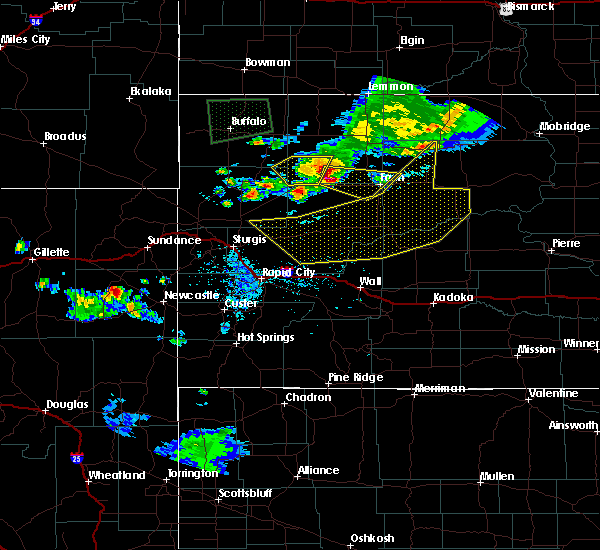 At 844 pm mdt, a severe thunderstorm was located 7 miles northeast of maurine, or 25 miles west of faith, moving east at 25 mph (radar indicated). Hazards include 60 mph wind gusts and quarter size hail. Hail damage to vehicles is expected. Expect wind damage to roofs, siding, and trees. At 844 pm mdt, a severe thunderstorm was located 7 miles northeast of maurine, or 25 miles west of faith, moving east at 25 mph (radar indicated). Hazards include 60 mph wind gusts and quarter size hail. Hail damage to vehicles is expected. Expect wind damage to roofs, siding, and trees.
|
| 7/31/2016 8:30 PM MDT | Storm damage reported in meade county SD, 1.4 miles SW of Faith, SD |
| 7/16/2016 7:29 PM MDT |
 At 728 pm mdt, severe thunderstorms were located along a line extending from 9 miles northwest of shambo ranch to near howes, moving east at 30 mph (radar indicated. at 722 pm mdt...a 64 mph wind gust was reported at the faith airport). Hazards include 60 mph wind gusts. Expect damage to roofs. siding. And trees. At 728 pm mdt, severe thunderstorms were located along a line extending from 9 miles northwest of shambo ranch to near howes, moving east at 30 mph (radar indicated. at 722 pm mdt...a 64 mph wind gust was reported at the faith airport). Hazards include 60 mph wind gusts. Expect damage to roofs. siding. And trees.
|
| 7/16/2016 7:22 PM MDT | Storm damage reported in meade county SD, 1.4 miles SW of Faith, SD |
| 7/14/2016 9:15 PM MDT | Storm damage reported in meade county SD, 21.7 miles N of Faith, SD |
| 7/14/2016 9:00 PM MDT | Quarter sized hail reported 19.5 miles NNE of Faith, SD |
| 7/14/2016 8:54 PM MDT | Half Dollar sized hail reported 13.2 miles NNE of Faith, SD |
| 7/14/2016 8:44 PM MDT | Quarter sized hail reported 10.2 miles NE of Faith, SD |
| 7/14/2016 8:22 PM MDT | Golf Ball sized hail reported 17.2 miles E of Faith, SD |
| 7/14/2016 8:10 PM MDT | Hen Egg sized hail reported 22.3 miles ESE of Faith, SD |
| 7/6/2016 3:34 PM MDT |
 At 333 pm mdt, severe thunderstorms were located along a line extending from near maurine to near union center, moving east at 65 mph (radar indicated). Hazards include 70 mph wind gusts and quarter size hail. Hail damage to vehicles is expected. expect considerable tree damage. Wind damage is also likely to mobile homes, roofs, and outbuildings. At 333 pm mdt, severe thunderstorms were located along a line extending from near maurine to near union center, moving east at 65 mph (radar indicated). Hazards include 70 mph wind gusts and quarter size hail. Hail damage to vehicles is expected. expect considerable tree damage. Wind damage is also likely to mobile homes, roofs, and outbuildings.
|
| 6/2/2016 5:27 PM MDT |
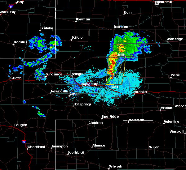 At 526 pm mdt, severe thunderstorms were located along a line extending from near faith to near plainview to creighton, moving east at 35 mph (radar indicated). Hazards include 60 mph wind gusts and penny size hail. Expect damage to roofs. siding. and trees. Locations impacted include, faith, plainview, red scaffold, marcus, bridger, grindstone, red elm, creighton and howes. At 526 pm mdt, severe thunderstorms were located along a line extending from near faith to near plainview to creighton, moving east at 35 mph (radar indicated). Hazards include 60 mph wind gusts and penny size hail. Expect damage to roofs. siding. and trees. Locations impacted include, faith, plainview, red scaffold, marcus, bridger, grindstone, red elm, creighton and howes.
|
| 6/2/2016 5:01 PM MDT |
 At 501 pm mdt, severe thunderstorms were located along a line extending from 8 miles east of maurine to near white owl to near wicksville, moving east at 30 mph (radar indicated). Hazards include 60 mph wind gusts and quarter size hail. Hail damage to vehicles is expected. Expect wind damage to roofs, siding, and trees. At 501 pm mdt, severe thunderstorms were located along a line extending from 8 miles east of maurine to near white owl to near wicksville, moving east at 30 mph (radar indicated). Hazards include 60 mph wind gusts and quarter size hail. Hail damage to vehicles is expected. Expect wind damage to roofs, siding, and trees.
|
| 5/30/2016 3:14 PM MDT |
 At 314 pm mdt, severe thunderstorms were located along a line extending from near shambo ranch to 11 miles north of howes, moving east at 25 mph (radar indicated. at 310 pm quarter sized hail was reported near faith). Hazards include ping pong ball size hail and 60 mph wind gusts. People and animals outdoors will be injured. expect hail damage to roofs, siding, windows, and vehicles. expect wind damage to roofs, siding, and trees. Locations impacted include, dupree, faith, red scaffold, thunder butte, iron lightning, red elm and glad valley. At 314 pm mdt, severe thunderstorms were located along a line extending from near shambo ranch to 11 miles north of howes, moving east at 25 mph (radar indicated. at 310 pm quarter sized hail was reported near faith). Hazards include ping pong ball size hail and 60 mph wind gusts. People and animals outdoors will be injured. expect hail damage to roofs, siding, windows, and vehicles. expect wind damage to roofs, siding, and trees. Locations impacted include, dupree, faith, red scaffold, thunder butte, iron lightning, red elm and glad valley.
|
| 5/30/2016 3:10 PM MDT | Quarter sized hail reported 0.6 miles ENE of Faith, SD, 1.10 inch rainfall |
| 5/30/2016 3:03 PM MDT |
 At 303 pm mdt, severe thunderstorms were located along a line extending from 6 miles west of shambo ranch to 9 miles northeast of marcus, moving east at 25 mph (radar indicated). Hazards include ping pong ball size hail and 60 mph wind gusts. People and animals outdoors will be injured. expect hail damage to roofs, siding, windows, and vehicles. Expect wind damage to roofs, siding, and trees. At 303 pm mdt, severe thunderstorms were located along a line extending from 6 miles west of shambo ranch to 9 miles northeast of marcus, moving east at 25 mph (radar indicated). Hazards include ping pong ball size hail and 60 mph wind gusts. People and animals outdoors will be injured. expect hail damage to roofs, siding, windows, and vehicles. Expect wind damage to roofs, siding, and trees.
|
| 5/30/2016 2:20 PM MDT | Golf Ball sized hail reported 33.3 miles E of Faith, SD |
| 7/27/2015 8:03 PM MDT |
 At 801 pm mdt, severe thunderstorms were located along a line extending from 8 miles east of glad valley to 12 miles south of lantry, moving northeast at 45 mph. additional thunderstorms have formed southwest of plainview, moving northeast at 45 mph (radar indicated). Hazards include 70 mph wind gusts and nickel size hail. Expect considerable tree damage. damage is likely to mobile homes, roofs and outbuildings. Locations impacted include, eagle butte, dupree, faith, cherry creek, plainview, thunder butte, red scaffold, bridger, marcus, red elm, south eagle butte and howes. At 801 pm mdt, severe thunderstorms were located along a line extending from 8 miles east of glad valley to 12 miles south of lantry, moving northeast at 45 mph. additional thunderstorms have formed southwest of plainview, moving northeast at 45 mph (radar indicated). Hazards include 70 mph wind gusts and nickel size hail. Expect considerable tree damage. damage is likely to mobile homes, roofs and outbuildings. Locations impacted include, eagle butte, dupree, faith, cherry creek, plainview, thunder butte, red scaffold, bridger, marcus, red elm, south eagle butte and howes.
|
| 7/27/2015 7:57 PM MDT |
 At 755 pm mdt, severe thunderstorms were located along a line extending from 6 miles southeast of glad valley to 14 miles south of lantry, moving northeast at 50 mph. additional thunderstorms have formed southwest of plainview, moving northeast at 50 mph (radar indicated). Hazards include 60 mph wind gusts and nickel size hail. Expect damage to roofs. siding and trees. Locations impacted include, eagle butte, dupree, faith, cherry creek, plainview, thunder butte, red scaffold, bridger, marcus, red elm, south eagle butte and howes. At 755 pm mdt, severe thunderstorms were located along a line extending from 6 miles southeast of glad valley to 14 miles south of lantry, moving northeast at 50 mph. additional thunderstorms have formed southwest of plainview, moving northeast at 50 mph (radar indicated). Hazards include 60 mph wind gusts and nickel size hail. Expect damage to roofs. siding and trees. Locations impacted include, eagle butte, dupree, faith, cherry creek, plainview, thunder butte, red scaffold, bridger, marcus, red elm, south eagle butte and howes.
|
| 7/27/2015 7:53 PM MDT |
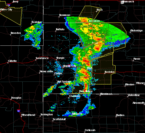 At 752 pm mdt, severe thunderstorms were located along a line extending from 13 miles south of morristown to 9 miles northeast of red scaffold, moving east-northeast at 50 mph (radar indicated). Hazards include 60 mph wind gusts and nickel size hail. Expect damage to roofs. siding and trees. Locations impacted include, bison, meadow, chance, thunder butte, iron lightning, shadehill, glad valley, usta and shadehill reservoir. At 752 pm mdt, severe thunderstorms were located along a line extending from 13 miles south of morristown to 9 miles northeast of red scaffold, moving east-northeast at 50 mph (radar indicated). Hazards include 60 mph wind gusts and nickel size hail. Expect damage to roofs. siding and trees. Locations impacted include, bison, meadow, chance, thunder butte, iron lightning, shadehill, glad valley, usta and shadehill reservoir.
|
| 7/27/2015 7:30 PM MDT | Storm damage reported in meade county SD, 1.4 miles SW of Faith, SD |
| 7/27/2015 7:22 PM MDT |
 At 720 pm mdt, severe thunderstorms were located along a line extending from 6 miles south of shadehill reservoir to 6 miles north of marcus, moving east at 30 mph (radar indicated). Hazards include 70 mph wind gusts and half dollar size hail. Hail damage to vehicles is expected. expect considerable tree damage. wind damage is also likely to mobile homes, roofs and outbuildings. Locations impacted include, bison, meadow, chance, thunder butte, iron lightning, shadehill, glad valley, usta and shadehill reservoir. At 720 pm mdt, severe thunderstorms were located along a line extending from 6 miles south of shadehill reservoir to 6 miles north of marcus, moving east at 30 mph (radar indicated). Hazards include 70 mph wind gusts and half dollar size hail. Hail damage to vehicles is expected. expect considerable tree damage. wind damage is also likely to mobile homes, roofs and outbuildings. Locations impacted include, bison, meadow, chance, thunder butte, iron lightning, shadehill, glad valley, usta and shadehill reservoir.
|
| 7/27/2015 7:16 PM MDT |
 At 714 pm mdt, severe thunderstorms were located along a line extending from near faith to 8 miles south of bridger, moving northeast at 45 mph (radar indicated). Hazards include 60 mph wind gusts and quarter size hail. Hail damage to vehicles is expected. expect wind damage to roofs, siding and trees. Locations impacted include, eagle butte, dupree, faith, cherry creek, plainview, thunder butte, red scaffold, bridger, marcus, red elm, south eagle butte and howes. At 714 pm mdt, severe thunderstorms were located along a line extending from near faith to 8 miles south of bridger, moving northeast at 45 mph (radar indicated). Hazards include 60 mph wind gusts and quarter size hail. Hail damage to vehicles is expected. expect wind damage to roofs, siding and trees. Locations impacted include, eagle butte, dupree, faith, cherry creek, plainview, thunder butte, red scaffold, bridger, marcus, red elm, south eagle butte and howes.
|
| 7/27/2015 7:07 PM MDT | Storm damage reported in perkins county SD, 18.2 miles E of Faith, SD |
| 7/27/2015 6:54 PM MDT |
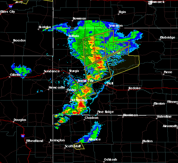 At 654 pm mdt, severe thunderstorms were located along a line extending from 7 miles north of bison to 6 miles northeast of red owl, moving east at 30 mph (radar indicated). Hazards include 60 mph wind gusts and quarter size hail. Hail damage to vehicles is expected. Expect wind damage to roofs, siding and trees. At 654 pm mdt, severe thunderstorms were located along a line extending from 7 miles north of bison to 6 miles northeast of red owl, moving east at 30 mph (radar indicated). Hazards include 60 mph wind gusts and quarter size hail. Hail damage to vehicles is expected. Expect wind damage to roofs, siding and trees.
|
| 7/27/2015 6:50 PM MDT |
 At 650 pm mdt, severe thunderstorms were located along a line extending from 6 miles southeast of opal to near creighton, moving northeast at 45 mph (radar indicated). Hazards include 60 mph wind gusts and quarter size hail. Hail damage to vehicles is expected. Expect wind damage to roofs, siding and trees. At 650 pm mdt, severe thunderstorms were located along a line extending from 6 miles southeast of opal to near creighton, moving northeast at 45 mph (radar indicated). Hazards include 60 mph wind gusts and quarter size hail. Hail damage to vehicles is expected. Expect wind damage to roofs, siding and trees.
|
| 7/26/2015 10:51 PM MDT | Storm damage reported in meade county SD, 1.4 miles SW of Faith, SD |
| 7/25/2015 4:42 AM MDT |
 At 441 am mdt, severe thunderstorms were located along a line extending from near red elm to 6 miles north of creighton, moving east at 50 mph (radar indicated. at 432 am mdt...a 60 mph wind gust was reported at the faith airport). Hazards include 60 mph wind gusts and penny size hail. Expect damage to roofs. Siding and trees. At 441 am mdt, severe thunderstorms were located along a line extending from near red elm to 6 miles north of creighton, moving east at 50 mph (radar indicated. at 432 am mdt...a 60 mph wind gust was reported at the faith airport). Hazards include 60 mph wind gusts and penny size hail. Expect damage to roofs. Siding and trees.
|
| 7/25/2015 4:32 AM MDT | Storm damage reported in meade county SD, 1.4 miles SW of Faith, SD |
| 7/24/2015 10:10 PM MDT | The severe thunderstorm warning for northeastern meade county will expire at 1015 pm mdt, the storm which prompted the warning has weakened below severe limits, and no longer pose an immediate threat to life or property. therefore the warning will be allowed to expire. however small. |
| 7/24/2015 9:58 PM MDT |
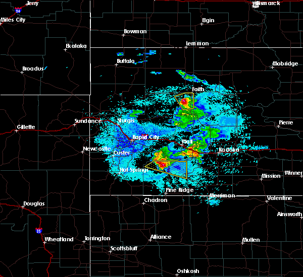 At 958 pm mdt, a severe thunderstorm was located 10 miles southwest of faith, moving northeast at 35 mph (radar indicated). Hazards include 60 mph wind gusts and quarter size hail. Hail damage to vehicles is expected. expect wind damage to roofs, siding and trees. Locations impacted include, faith. At 958 pm mdt, a severe thunderstorm was located 10 miles southwest of faith, moving northeast at 35 mph (radar indicated). Hazards include 60 mph wind gusts and quarter size hail. Hail damage to vehicles is expected. expect wind damage to roofs, siding and trees. Locations impacted include, faith.
|
| 7/24/2015 9:41 PM MDT |
 At 940 pm mdt, a severe thunderstorm was located near opal, or 20 miles southwest of faith, moving northeast at 45 mph (radar indicated). Hazards include 60 mph wind gusts and quarter size hail. Hail damage to vehicles is expected. expect wind damage to roofs, siding and trees. Locations impacted include, faith and opal. At 940 pm mdt, a severe thunderstorm was located near opal, or 20 miles southwest of faith, moving northeast at 45 mph (radar indicated). Hazards include 60 mph wind gusts and quarter size hail. Hail damage to vehicles is expected. expect wind damage to roofs, siding and trees. Locations impacted include, faith and opal.
|
| 7/24/2015 9:25 PM MDT |
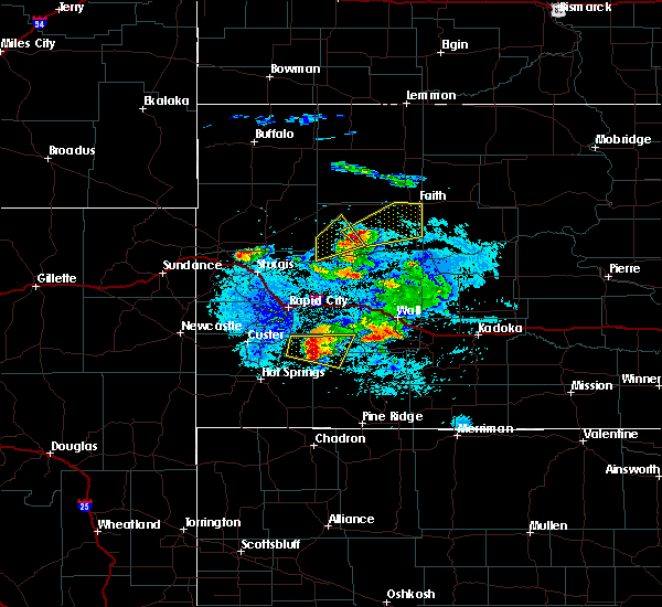 At 925 pm mdt, a severe thunderstorm was located near red owl, or 32 miles southwest of faith, moving northeast at 55 mph (radar indicated). Hazards include 60 mph wind gusts and quarter size hail. Hail damage to vehicles is expected. Expect wind damage to roofs, siding and trees. At 925 pm mdt, a severe thunderstorm was located near red owl, or 32 miles southwest of faith, moving northeast at 55 mph (radar indicated). Hazards include 60 mph wind gusts and quarter size hail. Hail damage to vehicles is expected. Expect wind damage to roofs, siding and trees.
|
| 6/30/2015 9:57 PM MDT |
 At 956 pm mdt, a severe thunderstorm was located 8 miles west of red scaffold, or 17 miles south of faith, moving southeast at 45 mph (radar indicated). Hazards include two inch hail and 70 mph wind gusts. People and animals outdoors will be injured. expect hail damage to roofs, siding, windows and vehicles. expect considerable tree damage. wind damage is also likely to mobile homes, roofs and outbuildings. locations impacted include, philip, faith, cherry creek, milesville, midland, plainview, bridger, marcus, grindstone, howes, red scaffold, kirley, billsburg and ottumwa. A tornado watch remains in effect until 100 am mdt for western south dakota. At 956 pm mdt, a severe thunderstorm was located 8 miles west of red scaffold, or 17 miles south of faith, moving southeast at 45 mph (radar indicated). Hazards include two inch hail and 70 mph wind gusts. People and animals outdoors will be injured. expect hail damage to roofs, siding, windows and vehicles. expect considerable tree damage. wind damage is also likely to mobile homes, roofs and outbuildings. locations impacted include, philip, faith, cherry creek, milesville, midland, plainview, bridger, marcus, grindstone, howes, red scaffold, kirley, billsburg and ottumwa. A tornado watch remains in effect until 100 am mdt for western south dakota.
|
| 6/30/2015 9:49 PM MDT |
 At 949 pm mdt, a severe thunderstorm was located 12 miles northeast of marcus, or 14 miles south of faith, moving southeast at 40 mph (radar indicated). Hazards include two inch hail and 70 mph wind gusts. People and animals outdoors will be injured. expect hail damage to roofs, siding, windows and vehicles. expect considerable tree damage. wind damage is also likely to mobile homes, roofs and outbuildings. locations impacted include, eagle butte, philip, dupree, faith, cherry creek, milesville, midland, plainview, bridger, marcus, grindstone, red elm, south eagle butte, howes, red scaffold, iron lightning, kirley, billsburg, usta and opal. A tornado watch remains in effect until 100 am mdt for western south dakota. At 949 pm mdt, a severe thunderstorm was located 12 miles northeast of marcus, or 14 miles south of faith, moving southeast at 40 mph (radar indicated). Hazards include two inch hail and 70 mph wind gusts. People and animals outdoors will be injured. expect hail damage to roofs, siding, windows and vehicles. expect considerable tree damage. wind damage is also likely to mobile homes, roofs and outbuildings. locations impacted include, eagle butte, philip, dupree, faith, cherry creek, milesville, midland, plainview, bridger, marcus, grindstone, red elm, south eagle butte, howes, red scaffold, iron lightning, kirley, billsburg, usta and opal. A tornado watch remains in effect until 100 am mdt for western south dakota.
|
| 6/30/2015 9:35 PM MDT |
 At 934 pm mdt, a severe thunderstorm was located near faith, moving southeast at 50 mph (radar indicated). Hazards include tennis ball size hail and 70 mph wind gusts. People and animals outdoors will be injured. expect hail damage to roofs, siding, windows and vehicles. expect considerable tree damage. Wind damage is also likely to mobile homes, roofs and outbuildings. At 934 pm mdt, a severe thunderstorm was located near faith, moving southeast at 50 mph (radar indicated). Hazards include tennis ball size hail and 70 mph wind gusts. People and animals outdoors will be injured. expect hail damage to roofs, siding, windows and vehicles. expect considerable tree damage. Wind damage is also likely to mobile homes, roofs and outbuildings.
|
| 6/30/2015 9:22 PM MDT | Quarter sized hail reported 18.2 miles E of Faith, SD |
| 6/30/2015 9:22 PM MDT | Storm damage reported in perkins county SD, 18.2 miles E of Faith, SD |
| 6/20/2015 6:44 PM MDT | Quarter sized hail reported 4.6 miles SE of Faith, SD |
| 6/20/2015 6:39 PM MDT |
 At 638 pm mdt, a severe thunderstorm was located 8 miles west of faith, moving east at 25 mph (radar indicated). Hazards include golf ball size hail and 60 mph wind gusts. People and animals outdoors will be injured. expect hail damage to roofs, siding, windows and vehicles. expect wind damage to roofs, siding and trees. Locations impacted include, areas between faith and usta. At 638 pm mdt, a severe thunderstorm was located 8 miles west of faith, moving east at 25 mph (radar indicated). Hazards include golf ball size hail and 60 mph wind gusts. People and animals outdoors will be injured. expect hail damage to roofs, siding, windows and vehicles. expect wind damage to roofs, siding and trees. Locations impacted include, areas between faith and usta.
|
| 6/20/2015 6:25 PM MDT |
 At 624 pm mdt, a severe thunderstorm was located 10 miles northeast of opal, or 13 miles west of faith, moving east at 25 mph (radar indicated). Hazards include 60 mph wind gusts and half dollar size hail. Hail damage to vehicles is expected. Expect wind damage to roofs, siding and trees. At 624 pm mdt, a severe thunderstorm was located 10 miles northeast of opal, or 13 miles west of faith, moving east at 25 mph (radar indicated). Hazards include 60 mph wind gusts and half dollar size hail. Hail damage to vehicles is expected. Expect wind damage to roofs, siding and trees.
|
| 6/20/2015 5:55 PM MDT | Golf Ball sized hail reported 12.1 miles N of Faith, SD |
| 6/20/2015 5:55 PM MDT | Storm damage reported in meade county SD, 12.1 miles N of Faith, SD |
| 6/20/2015 5:32 PM MDT |
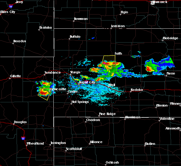 At 531 pm mdt, a severe thunderstorm was located 9 miles southeast of opal, or 19 miles southwest of faith, moving northeast at 25 mph (radar indicated). Hazards include golf ball size hail and 60 mph wind gusts. People and animals outdoors will be injured. expect hail damage to roofs, siding, windows and vehicles. expect wind damage to roofs, siding and trees. Locations impacted include, rural areas between marcus and faith. At 531 pm mdt, a severe thunderstorm was located 9 miles southeast of opal, or 19 miles southwest of faith, moving northeast at 25 mph (radar indicated). Hazards include golf ball size hail and 60 mph wind gusts. People and animals outdoors will be injured. expect hail damage to roofs, siding, windows and vehicles. expect wind damage to roofs, siding and trees. Locations impacted include, rural areas between marcus and faith.
|
| 6/20/2015 5:14 PM MDT |
 At 514 pm mdt, a severe thunderstorm was located 7 miles northeast of red owl, or 26 miles southwest of faith, moving northeast at 25 mph (radar indicated). Hazards include golf ball size hail and 60 mph wind gusts. People and animals outdoors will be injured. expect hail damage to roofs, siding, windows and vehicles. expect wind damage to roofs, siding and trees. Locations impacted include, faith, plainview, marcus, red owl, stoneville, opal, maurine and howes. At 514 pm mdt, a severe thunderstorm was located 7 miles northeast of red owl, or 26 miles southwest of faith, moving northeast at 25 mph (radar indicated). Hazards include golf ball size hail and 60 mph wind gusts. People and animals outdoors will be injured. expect hail damage to roofs, siding, windows and vehicles. expect wind damage to roofs, siding and trees. Locations impacted include, faith, plainview, marcus, red owl, stoneville, opal, maurine and howes.
|
| 6/20/2015 5:02 PM MDT |
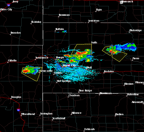 At 501 pm mdt, a severe thunderstorm was located over red owl, or 31 miles southwest of faith, moving northeast at 25 mph (radar indicated). Hazards include 60 mph wind gusts and quarter size hail. Hail damage to vehicles is expected. Expect wind damage to roofs, siding and trees. At 501 pm mdt, a severe thunderstorm was located over red owl, or 31 miles southwest of faith, moving northeast at 25 mph (radar indicated). Hazards include 60 mph wind gusts and quarter size hail. Hail damage to vehicles is expected. Expect wind damage to roofs, siding and trees.
|
| 6/14/2015 3:49 AM MDT | Storm damage reported in perkins county SD, 1.4 miles SW of Faith, SD |
| 7/24/2014 8:33 PM MDT | Storm damage reported in ziebach county SD, 11.8 miles SSW of Faith, SD |
| 6/21/2014 7:40 PM MDT | Storm damage reported in ziebach county SD, 19.9 miles NNW of Faith, SD |
| 6/13/2014 7:52 PM MDT | Storm damage reported in meade county SD, 0.6 miles NW of Faith, SD |
| 9/18/2013 5:05 PM MDT | Ping Pong Ball sized hail reported 10.5 miles SSE of Faith, SD, vehicle d |
| 9/18/2013 5:02 PM MDT | Storm damage reported in perkins county SD, 10.5 miles SSE of Faith, SD |
| 9/8/2013 10:00 PM MDT | Storm damage reported in ziebach county SD, 9.9 miles NNW of Faith, SD |
| 9/7/2013 10:00 PM MDT | Storm damage reported in perkins county SD, 10.3 miles SSE of Faith, SD |
| 8/27/2013 11:15 PM MDT | 1.50 inches rainfall and pea size hail in ziebach county SD, 20.7 miles SSW of Faith, SD |
| 8/27/2013 6:42 PM MDT | Pole barn lifted off foundation in ziebach county SD, 14.5 miles SW of Faith, SD |
| 8/27/2013 6:27 PM MDT | Storm damage reported in ziebach county SD, 12.2 miles SSW of Faith, SD |
| 8/27/2013 6:05 PM MDT | Quarter sized hail reported 16.6 miles SSE of Faith, SD |
| 8/5/2013 9:30 PM MDT | Storm damage reported in ziebach county SD, 19.9 miles NNW of Faith, SD |
| 8/5/2013 9:26 PM MDT | Storm damage reported in meade county SD, 12.8 miles N of Faith, SD |
| 6/22/2013 6:00 PM MDT | Wind broke small branches in perkins county SD, 17.2 miles E of Faith, SD |
| 6/22/2013 6:00 PM MDT | Wind is breaking small branche in perkins county SD, 17.2 miles E of Faith, SD |
| 5/26/2013 12:34 AM MDT | Storm damage reported in perkins county SD, 1.4 miles SW of Faith, SD |
| 5/25/2013 11:50 PM MDT | Baseball sized hail reported 20.4 miles SE of Faith, SD, looks like it snowed with hail covering the ground. |
| 5/25/2013 11:16 PM MDT | Storm damage reported in perkins county SD, 1.4 miles SW of Faith, SD |
| 5/18/2013 4:30 PM MDT | Golf Ball sized hail reported 3.4 miles WNW of Faith, SD, lasted 10 minutes |
| 7/25/2012 12:10 AM MDT | Tree branches b in ziebach county SD, 4.6 miles WNW of Faith, SD |
| 7/16/2012 7:10 PM MDT | Storm damage reported in ziebach county SD, 4.6 miles WNW of Faith, SD |
| 7/16/2012 6:58 PM MDT | Storm damage reported in meade county SD, 0.6 miles NW of Faith, SD |
| 7/16/2012 6:55 PM MDT | Brief heavy rai in perkins county SD, 16.6 miles SSE of Faith, SD |
| 6/30/2012 5:45 PM MDT | Storm damage reported in meade county SD, 18.2 miles NNE of Faith, SD |
| 6/30/2012 5:19 PM MDT | Storm damage reported in meade county SD, 13.5 miles N of Faith, SD |
| 6/30/2012 5:03 PM MDT | Storm damage reported in perkins county SD, 1.4 miles SW of Faith, SD |
| 6/30/2012 4:50 PM MDT | Storm damage reported in ziebach county SD, 4.6 miles WNW of Faith, SD |
| 6/30/2012 4:48 PM MDT | Storm damage reported in ziebach county SD, 7.3 miles WSW of Faith, SD |
| 4/6/2012 5:30 PM MDT | Storm damage reported in meade county SD, 1 miles WSW of Faith, SD |
| 4/5/2012 5:30 PM MDT | Storm damage reported in meade county SD, 1 miles WSW of Faith, SD |
| 1/1/0001 12:00 AM | Storm damage reported in meade county SD, 0.6 miles NW of Faith, SD |
| 10/6/2011 6:01 PM MDT | Quarter sized hail reported 18 miles NNE of Faith, SD |
| 1/1/0001 12:00 AM | Storm damage reported in meade county SD, 18 miles NNE of Faith, SD |
| 1/1/0001 12:00 AM | Storm damage reported in perkins county SD, 20.6 miles SSE of Faith, SD |
| 1/1/0001 12:00 AM | Wind gust at faith aso in perkins county SD, 1.4 miles SW of Faith, SD |
| 1/1/0001 12:00 AM | Storm damage reported in ziebach county SD, 7.7 miles WSW of Faith, SD |
| 1/1/0001 12:00 AM | Storm damage reported in meade county SD, 0.6 miles NW of Faith, SD |
| 1/1/0001 12:00 AM | Storm damage reported in perkins county SD, 5.5 miles SE of Faith, SD |
| 1/1/0001 12:00 AM | Half Dollar sized hail reported 17.2 miles E of Faith, SD |
| 1/1/0001 12:00 AM | 4-5 inch diameter tree branches broken in perkins county SD, 17.2 miles E of Faith, SD |
| 1/1/0001 12:00 AM | Quarter sized hail reported 28.4 miles E of Faith, SD |
| 1/1/0001 12:00 AM | Quarter sized hail reported 31.9 miles E of Faith, SD |
| 1/1/0001 12:00 AM | Storm damage reported in ziebach county SD, 14.5 miles SW of Faith, SD |
| 1/1/0001 12:00 AM | Storm damage reported in perkins county SD, 1.4 miles SW of Faith, SD |
| 1/1/0001 12:00 AM | Storm damage reported in ziebach county SD, 12.8 miles NW of Faith, SD |
| 1/1/0001 12:00 AM | Storm damage reported in meade county SD, 12.5 miles NE of Faith, SD |
| 1/1/0001 12:00 AM | Quarter sized hail reported 23.5 miles E of Faith, SD, pea to ping pong ball hail from 540 pm to 630 pm. |
| 1/1/0001 12:00 AM | Storm damage reported in ziebach county SD, 15.7 miles NW of Faith, SD |
| 1/1/0001 12:00 AM | Quarter sized hail reported 20.1 miles E of Faith, SD |
Hail Maps for Faith, SD


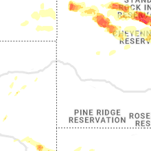


Connect with Interactive Hail Maps