

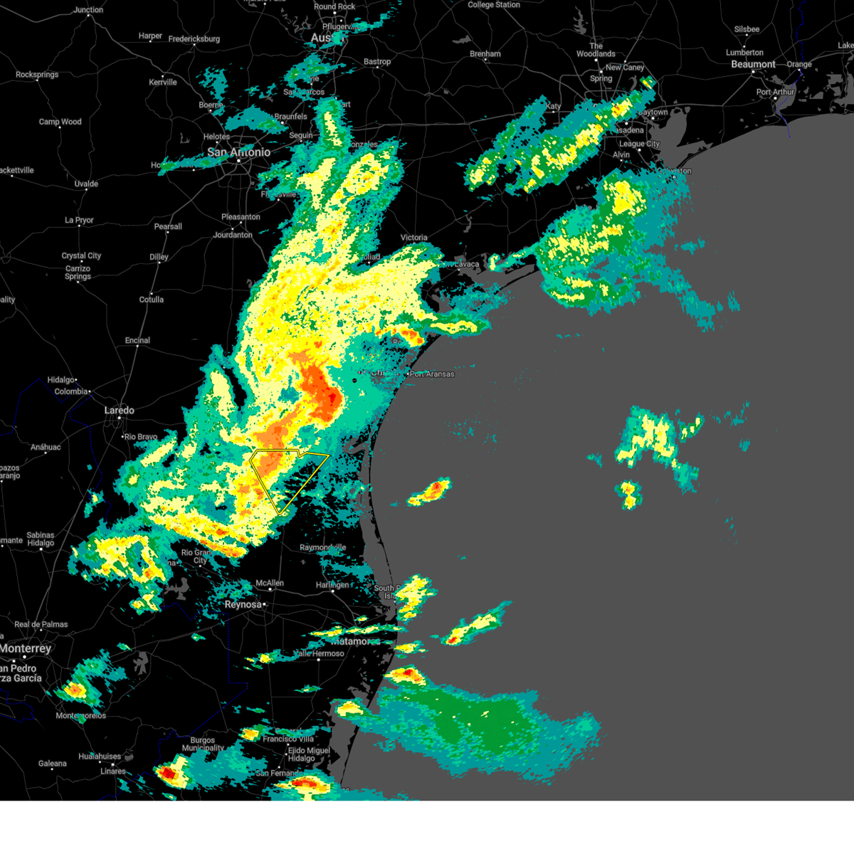
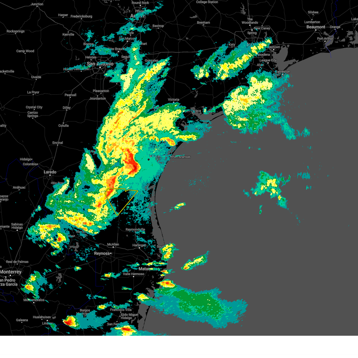
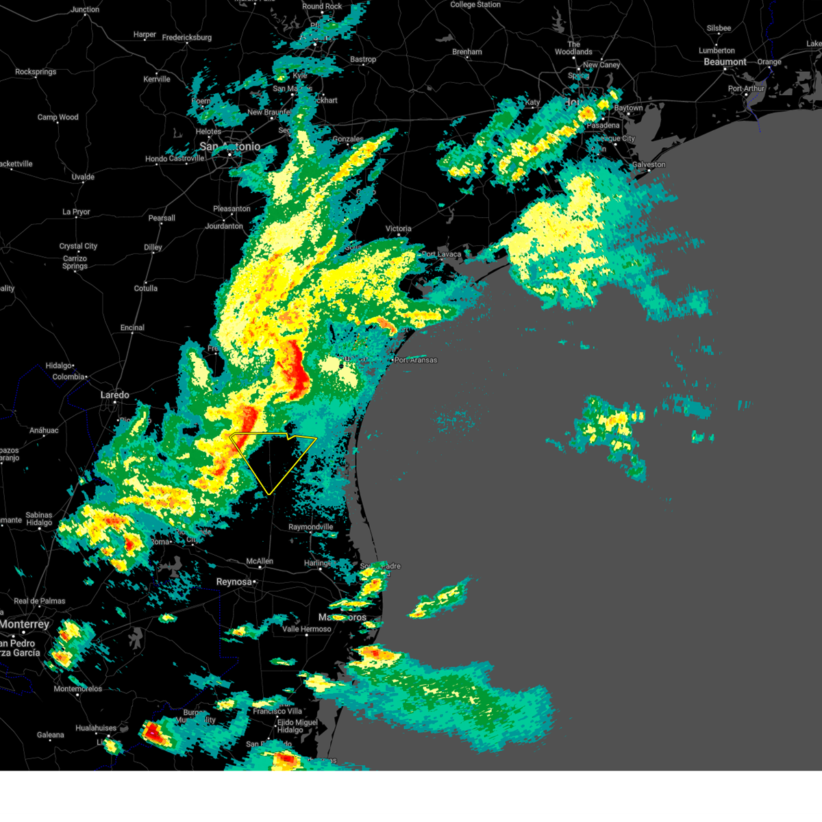
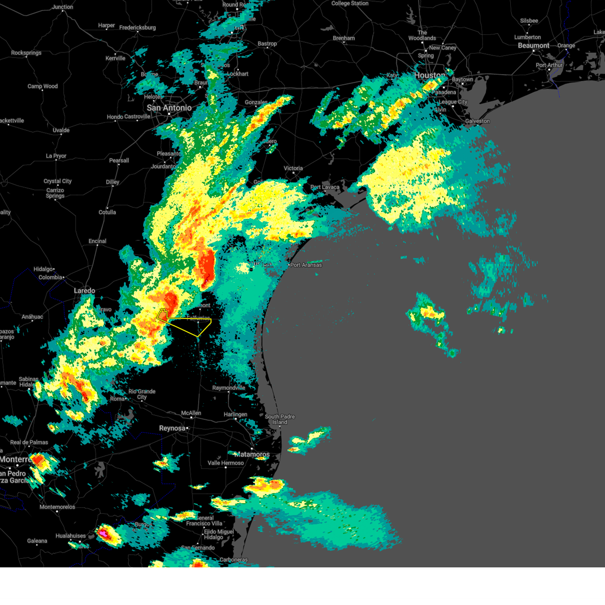
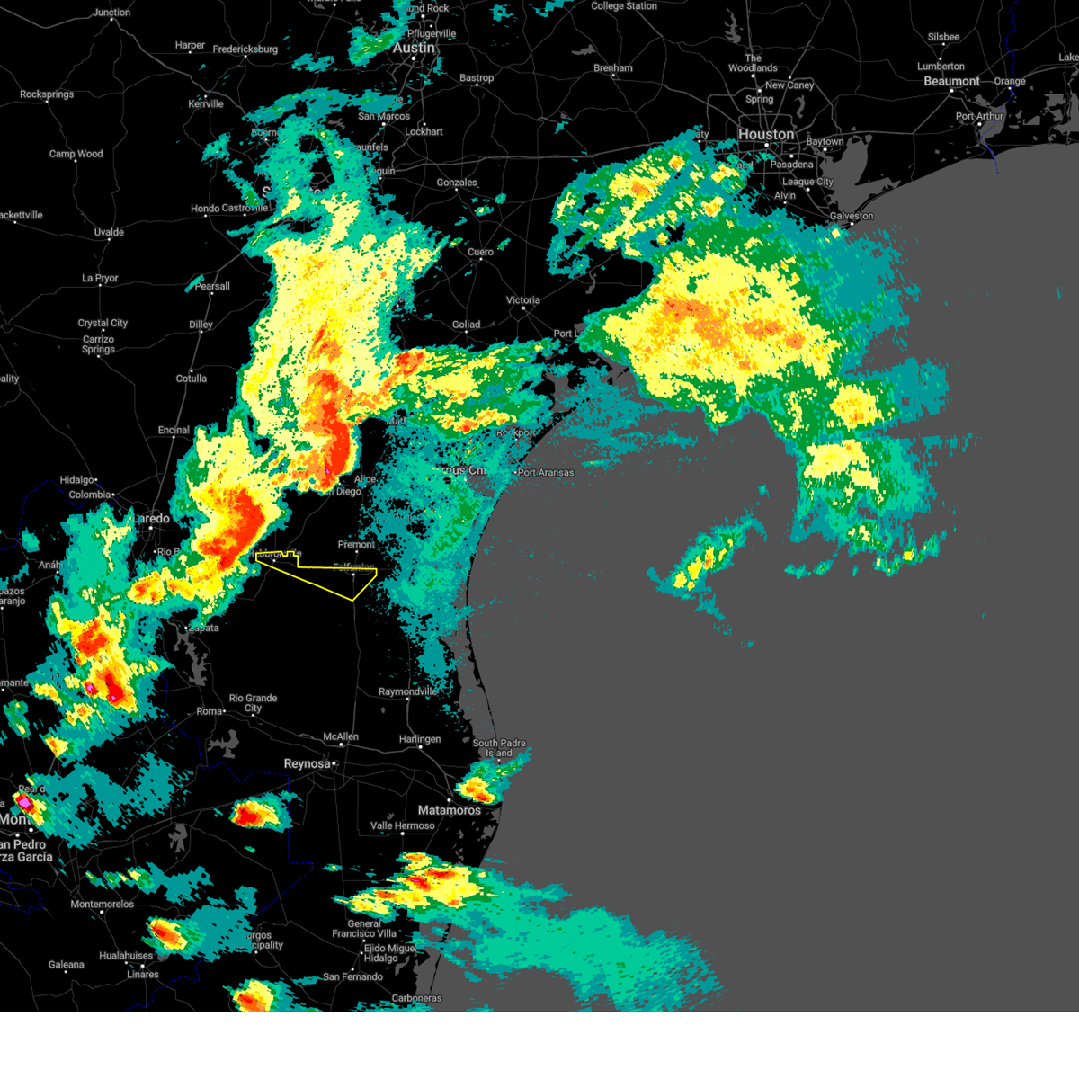
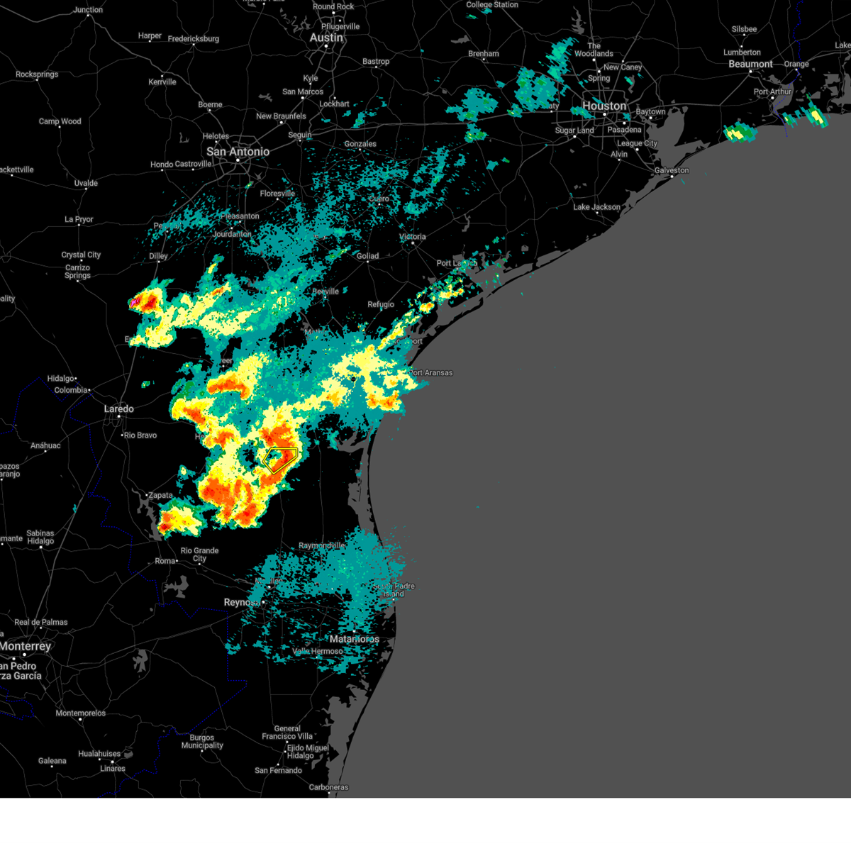
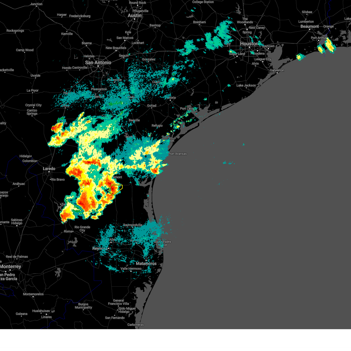
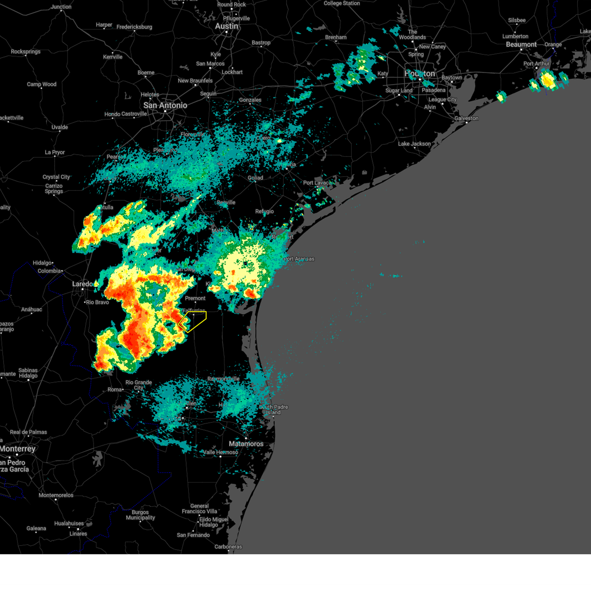
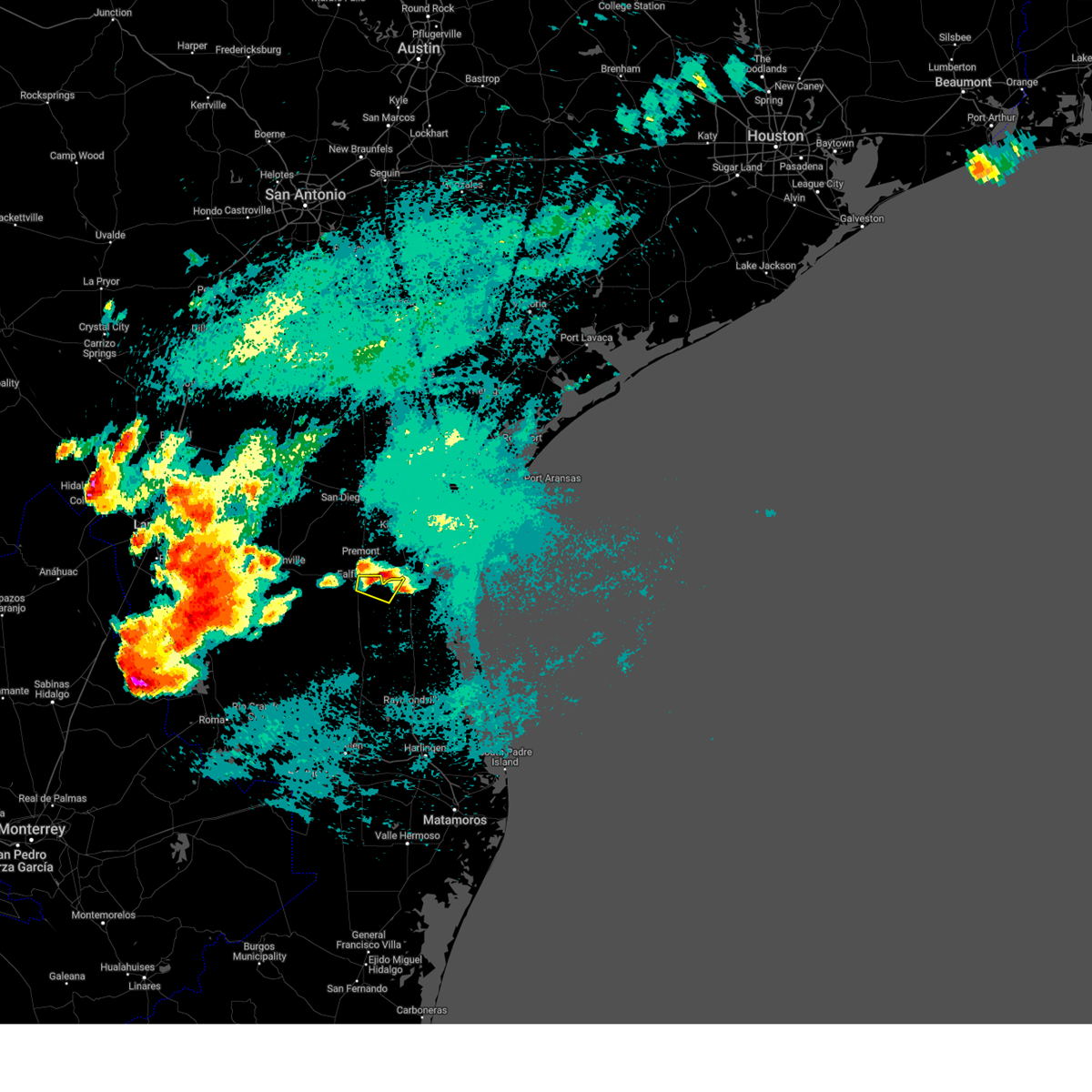
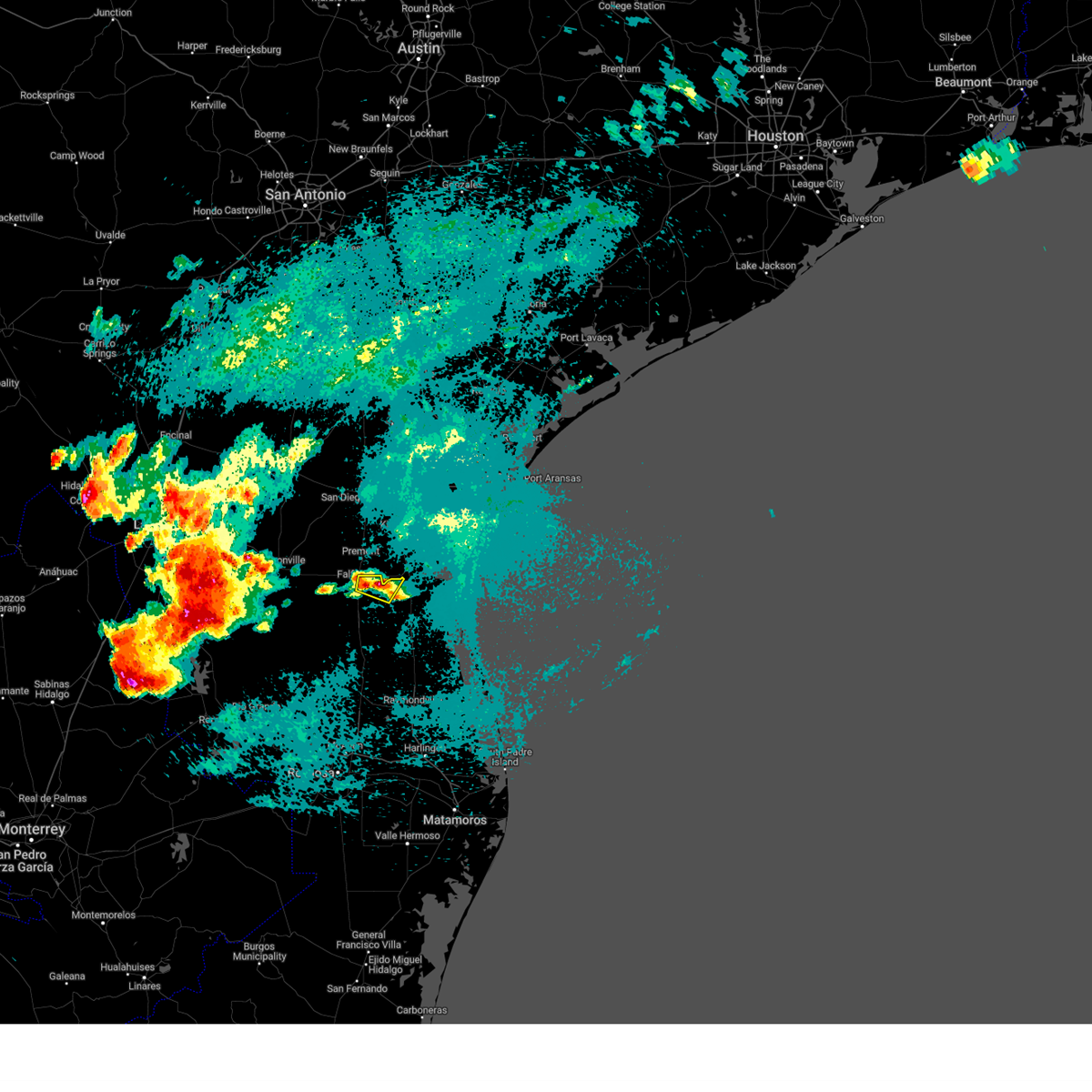
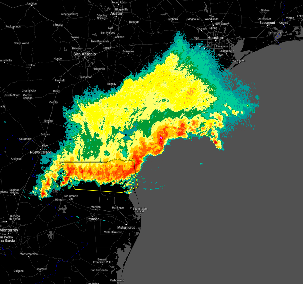
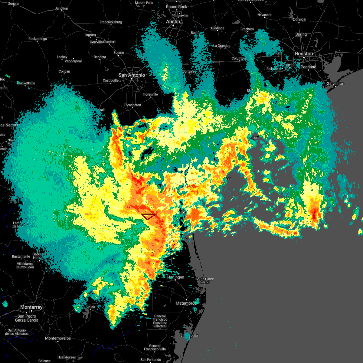
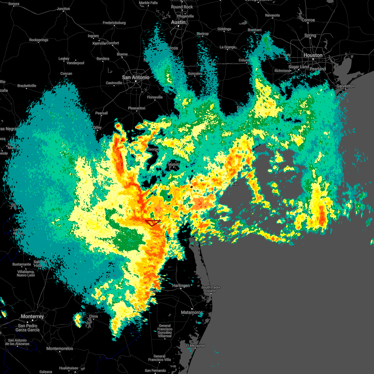
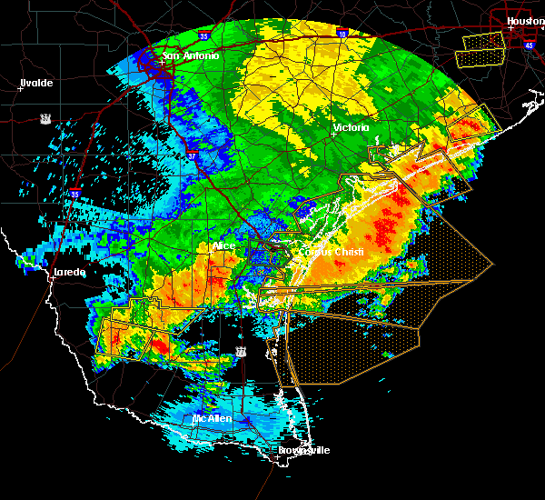
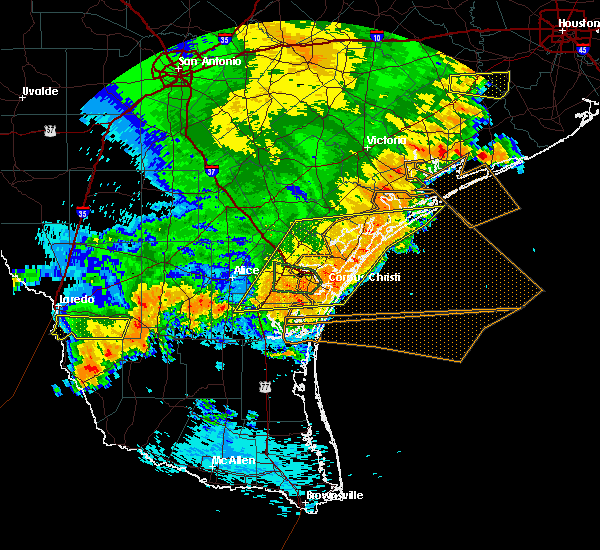
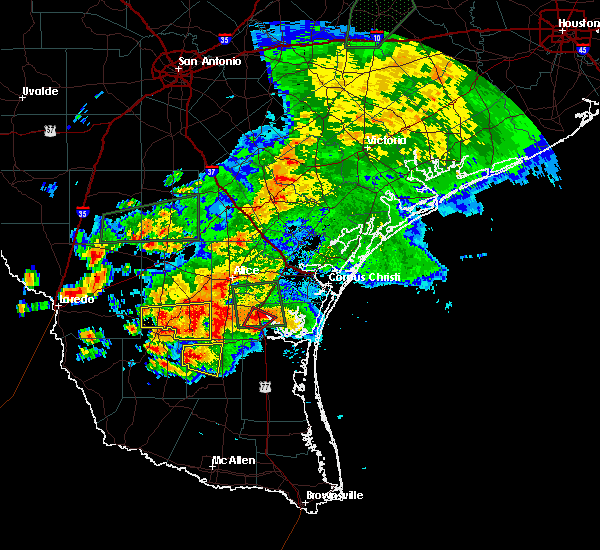
Hail Map for Falfurrias, TX
The Falfurrias, TX area has had 9 reports of on-the-ground hail by trained spotters, and has been under severe weather warnings 10 times during the past 12 months. Doppler radar has detected hail at or near Falfurrias, TX on 27 occasions.
| Name: | Falfurrias, TX |
| Where Located: | 60.2 miles SW of Corpus Christi, TX |
| Map: | Google Map for Falfurrias, TX |
| Population: | 4981 |
| Housing Units: | 2139 |
| More Info: | Search Google for Falfurrias, TX |
1
The Top Recent Hail Date for Falfurrias, TX is Friday, May 17, 2024 (12th out of 27)

Hail and Wind Damage Spotted near Falfurrias, TX
| Date / Time | Report Details |
|---|---|
| 5/8/2025 10:02 PM CDT |
 the severe thunderstorm warning has been cancelled and is no longer in effect the severe thunderstorm warning has been cancelled and is no longer in effect
|
| 5/8/2025 9:54 PM CDT |
 At 954 pm cdt, a severe thunderstorm was located 9 miles southwest of falfurrias junior high school, or 10 miles southwest of falfurrias, moving southeast at 40 mph (radar indicated). Hazards include 60 mph wind gusts and quarter size hail. Hail damage to vehicles is expected. expect wind damage to roofs, siding, and trees. Locations impacted include, la colonia park, cantu addition, airport road addition, encino, rachal, flowella, falfurrias junior high school, pleasant park, brooks county airport, and brooks county detention center. At 954 pm cdt, a severe thunderstorm was located 9 miles southwest of falfurrias junior high school, or 10 miles southwest of falfurrias, moving southeast at 40 mph (radar indicated). Hazards include 60 mph wind gusts and quarter size hail. Hail damage to vehicles is expected. expect wind damage to roofs, siding, and trees. Locations impacted include, la colonia park, cantu addition, airport road addition, encino, rachal, flowella, falfurrias junior high school, pleasant park, brooks county airport, and brooks county detention center.
|
| 5/8/2025 9:43 PM CDT |
 Svrbro the national weather service in brownsville has issued a * severe thunderstorm warning for, northwestern kenedy county in deep south texas, brooks county in deep south texas, * until 1030 pm cdt. * at 942 pm cdt, a severe thunderstorm was located 10 miles south of ramirez, or 13 miles west of falfurrias, moving southeast at 40 mph (radar indicated). Hazards include 60 mph wind gusts and quarter size hail. Hail damage to vehicles is expected. Expect wind damage to roofs, siding, and trees. Svrbro the national weather service in brownsville has issued a * severe thunderstorm warning for, northwestern kenedy county in deep south texas, brooks county in deep south texas, * until 1030 pm cdt. * at 942 pm cdt, a severe thunderstorm was located 10 miles south of ramirez, or 13 miles west of falfurrias, moving southeast at 40 mph (radar indicated). Hazards include 60 mph wind gusts and quarter size hail. Hail damage to vehicles is expected. Expect wind damage to roofs, siding, and trees.
|
| 5/8/2025 9:29 PM CDT |
 At 929 pm cdt, severe thunderstorms were located along a line extending from concepcion to 7 miles southwest of ramirez, moving southeast at 45 mph (radar indicated). Hazards include 60 mph wind gusts and penny size hail. Expect damage to roofs, siding, and trees. Locations impacted include, flowella, falfurrias junior high school, pleasant park, brooks county airport, la colonia park, cantu addition, brooks county detention center, airport road addition, falfurrias, and falfurrias fire station. At 929 pm cdt, severe thunderstorms were located along a line extending from concepcion to 7 miles southwest of ramirez, moving southeast at 45 mph (radar indicated). Hazards include 60 mph wind gusts and penny size hail. Expect damage to roofs, siding, and trees. Locations impacted include, flowella, falfurrias junior high school, pleasant park, brooks county airport, la colonia park, cantu addition, brooks county detention center, airport road addition, falfurrias, and falfurrias fire station.
|
| 5/8/2025 9:06 PM CDT |
 Svrbro the national weather service in brownsville has issued a * severe thunderstorm warning for, northeastern jim hogg county in deep south texas, northern brooks county in deep south texas, * until 945 pm cdt. * at 906 pm cdt, severe thunderstorms were located along a line extending from near realitos to jim hogg county airport, moving southeast at 45 mph (radar indicated). Hazards include 60 mph wind gusts and penny size hail. expect damage to roofs, siding, and trees Svrbro the national weather service in brownsville has issued a * severe thunderstorm warning for, northeastern jim hogg county in deep south texas, northern brooks county in deep south texas, * until 945 pm cdt. * at 906 pm cdt, severe thunderstorms were located along a line extending from near realitos to jim hogg county airport, moving southeast at 45 mph (radar indicated). Hazards include 60 mph wind gusts and penny size hail. expect damage to roofs, siding, and trees
|
| 5/7/2025 3:55 AM CDT |
 The storm which prompted the warning has weakened below severe limits, and no longer poses an immediate threat to life or property. therefore, the warning will be allowed to expire. however, small hail and gusty winds are still possible with this thunderstorm. a severe thunderstorm watch remains in effect until 800 am cdt for deep south texas. The storm which prompted the warning has weakened below severe limits, and no longer poses an immediate threat to life or property. therefore, the warning will be allowed to expire. however, small hail and gusty winds are still possible with this thunderstorm. a severe thunderstorm watch remains in effect until 800 am cdt for deep south texas.
|
| 5/7/2025 3:40 AM CDT |
 At 340 am cdt, a severe thunderstorm was located over falfurrias junior high school, or over falfurrias, moving northeast at 50 mph (radar indicated). Hazards include 60 mph wind gusts and quarter size hail. Hail damage to vehicles is expected. expect wind damage to roofs, siding, and trees. Locations impacted include, flowella, falfurrias junior high school, pleasant park, brooks county airport, la colonia park, cantu addition, brooks county detention center, airport road addition, falfurrias, and falfurrias fire station. At 340 am cdt, a severe thunderstorm was located over falfurrias junior high school, or over falfurrias, moving northeast at 50 mph (radar indicated). Hazards include 60 mph wind gusts and quarter size hail. Hail damage to vehicles is expected. expect wind damage to roofs, siding, and trees. Locations impacted include, flowella, falfurrias junior high school, pleasant park, brooks county airport, la colonia park, cantu addition, brooks county detention center, airport road addition, falfurrias, and falfurrias fire station.
|
| 5/7/2025 3:33 AM CDT |
 Svrbro the national weather service in brownsville has issued a * severe thunderstorm warning for, northeastern brooks county in deep south texas, * until 400 am cdt. * at 333 am cdt, a severe thunderstorm was located 8 miles southwest of falfurrias junior high school, or 8 miles southwest of falfurrias, moving northeast at 45 mph (radar indicated). Hazards include 60 mph wind gusts and quarter size hail. Hail damage to vehicles is expected. Expect wind damage to roofs, siding, and trees. Svrbro the national weather service in brownsville has issued a * severe thunderstorm warning for, northeastern brooks county in deep south texas, * until 400 am cdt. * at 333 am cdt, a severe thunderstorm was located 8 miles southwest of falfurrias junior high school, or 8 miles southwest of falfurrias, moving northeast at 45 mph (radar indicated). Hazards include 60 mph wind gusts and quarter size hail. Hail damage to vehicles is expected. Expect wind damage to roofs, siding, and trees.
|
| 5/7/2025 2:49 AM CDT |
 the severe thunderstorm warning has been cancelled and is no longer in effect the severe thunderstorm warning has been cancelled and is no longer in effect
|
| 5/7/2025 2:38 AM CDT |
 Svrbro the national weather service in brownsville has issued a * severe thunderstorm warning for, northwestern kenedy county in deep south texas, northeastern brooks county in deep south texas, * until 300 am cdt. * at 237 am cdt, a severe thunderstorm was located near airport road addition, or 8 miles east of falfurrias, moving northeast at 50 mph (radar indicated). Hazards include 60 mph wind gusts and quarter size hail. Hail damage to vehicles is expected. Expect wind damage to roofs, siding, and trees. Svrbro the national weather service in brownsville has issued a * severe thunderstorm warning for, northwestern kenedy county in deep south texas, northeastern brooks county in deep south texas, * until 300 am cdt. * at 237 am cdt, a severe thunderstorm was located near airport road addition, or 8 miles east of falfurrias, moving northeast at 50 mph (radar indicated). Hazards include 60 mph wind gusts and quarter size hail. Hail damage to vehicles is expected. Expect wind damage to roofs, siding, and trees.
|
| 5/17/2024 8:11 AM CDT |
 the severe thunderstorm warning has been cancelled and is no longer in effect the severe thunderstorm warning has been cancelled and is no longer in effect
|
| 5/17/2024 7:55 AM CDT |
 At 754 am cdt, a severe thunderstorm was located near airport road addition, or near falfurrias, moving east at 45 mph (radar indicated). Hazards include 60 mph wind gusts and quarter size hail. Hail damage to vehicles is expected. expect wind damage to roofs, siding, and trees. Locations impacted include, falfurrias, sarita, falfurrias junior high school, pleasant park, la colonia park, airport road addition, kenedy county sheriffs office, falfurrias fire station, flowella, and brooks county airport. At 754 am cdt, a severe thunderstorm was located near airport road addition, or near falfurrias, moving east at 45 mph (radar indicated). Hazards include 60 mph wind gusts and quarter size hail. Hail damage to vehicles is expected. expect wind damage to roofs, siding, and trees. Locations impacted include, falfurrias, sarita, falfurrias junior high school, pleasant park, la colonia park, airport road addition, kenedy county sheriffs office, falfurrias fire station, flowella, and brooks county airport.
|
| 5/17/2024 7:43 AM CDT |
 Svrbro the national weather service in brownsville has issued a * severe thunderstorm warning for, northwestern kenedy county in deep south texas, northeastern brooks county in deep south texas, * until 830 am cdt. * at 743 am cdt, a severe thunderstorm was located 7 miles southwest of falfurrias junior high school, or 7 miles southwest of falfurrias, moving east at 45 mph (radar indicated). Hazards include 60 mph wind gusts and quarter size hail. Hail damage to vehicles is expected. Expect wind damage to roofs, siding, and trees. Svrbro the national weather service in brownsville has issued a * severe thunderstorm warning for, northwestern kenedy county in deep south texas, northeastern brooks county in deep south texas, * until 830 am cdt. * at 743 am cdt, a severe thunderstorm was located 7 miles southwest of falfurrias junior high school, or 7 miles southwest of falfurrias, moving east at 45 mph (radar indicated). Hazards include 60 mph wind gusts and quarter size hail. Hail damage to vehicles is expected. Expect wind damage to roofs, siding, and trees.
|
| 5/5/2024 6:45 PM CDT |
 At 645 pm cdt, a severe thunderstorm was located near airport road addition, or near falfurrias, moving southeast at 30 mph (radar indicated). Hazards include 60 mph wind gusts and quarter size hail. Hail damage to vehicles is expected. expect wind damage to roofs, siding, and trees. Locations impacted include, falfurrias, armstrong, encino, sarita, la colonia park, airport road addition, u s 77 border patrol station, falfurrias junior high school, pleasant park, and kenedy county sheriffs office. At 645 pm cdt, a severe thunderstorm was located near airport road addition, or near falfurrias, moving southeast at 30 mph (radar indicated). Hazards include 60 mph wind gusts and quarter size hail. Hail damage to vehicles is expected. expect wind damage to roofs, siding, and trees. Locations impacted include, falfurrias, armstrong, encino, sarita, la colonia park, airport road addition, u s 77 border patrol station, falfurrias junior high school, pleasant park, and kenedy county sheriffs office.
|
| 5/5/2024 6:27 PM CDT |
 Svrbro the national weather service in brownsville has issued a * severe thunderstorm warning for, northwestern kenedy county in deep south texas, northeastern brooks county in deep south texas, * until 715 pm cdt. * at 626 pm cdt, a severe thunderstorm was located near la colonia park, or near falfurrias, moving southeast at 30 mph (radar indicated). Hazards include 60 mph wind gusts and quarter size hail. Hail damage to vehicles is expected. Expect wind damage to roofs, siding, and trees. Svrbro the national weather service in brownsville has issued a * severe thunderstorm warning for, northwestern kenedy county in deep south texas, northeastern brooks county in deep south texas, * until 715 pm cdt. * at 626 pm cdt, a severe thunderstorm was located near la colonia park, or near falfurrias, moving southeast at 30 mph (radar indicated). Hazards include 60 mph wind gusts and quarter size hail. Hail damage to vehicles is expected. Expect wind damage to roofs, siding, and trees.
|
| 5/5/2024 6:07 PM CDT |
 At 604 pm cdt, a severe thunderstorm was located over ramirez, or 20 miles west northwest of falfurrias, moving southeast at 30 mph (radar indicated). Hazards include 60 mph wind gusts and quarter size hail. Hail damage to vehicles is expected. expect wind damage to roofs, siding, and trees. Locations impacted include, falfurrias, falfurrias junior high school, pleasant park, la colonia park, airport road addition, falfurrias fire station, flowella, brooks county airport, cantu addition, and brooks county detention center. At 604 pm cdt, a severe thunderstorm was located over ramirez, or 20 miles west northwest of falfurrias, moving southeast at 30 mph (radar indicated). Hazards include 60 mph wind gusts and quarter size hail. Hail damage to vehicles is expected. expect wind damage to roofs, siding, and trees. Locations impacted include, falfurrias, falfurrias junior high school, pleasant park, la colonia park, airport road addition, falfurrias fire station, flowella, brooks county airport, cantu addition, and brooks county detention center.
|
| 5/5/2024 5:42 PM CDT |
 Svrbro the national weather service in brownsville has issued a * severe thunderstorm warning for, northeastern jim hogg county in deep south texas, northern brooks county in deep south texas, * until 630 pm cdt. * at 540 pm cdt, a severe thunderstorm was located over realitos, or 11 miles southwest of benavides, moving southeast at 30 mph (radar indicated). Hazards include 60 mph wind gusts and quarter size hail. Hail damage to vehicles is expected. Expect wind damage to roofs, siding, and trees. Svrbro the national weather service in brownsville has issued a * severe thunderstorm warning for, northeastern jim hogg county in deep south texas, northern brooks county in deep south texas, * until 630 pm cdt. * at 540 pm cdt, a severe thunderstorm was located over realitos, or 11 miles southwest of benavides, moving southeast at 30 mph (radar indicated). Hazards include 60 mph wind gusts and quarter size hail. Hail damage to vehicles is expected. Expect wind damage to roofs, siding, and trees.
|
| 5/29/2023 6:55 PM CDT |
 The severe thunderstorm warning for northeastern brooks county will expire at 700 pm cdt, the storm which prompted the warning has weakened below severe limits, and no longer poses an immediate threat to life or property. therefore, the warning will be allowed to expire. however small hail and gusty winds are still possible with this thunderstorm. The severe thunderstorm warning for northeastern brooks county will expire at 700 pm cdt, the storm which prompted the warning has weakened below severe limits, and no longer poses an immediate threat to life or property. therefore, the warning will be allowed to expire. however small hail and gusty winds are still possible with this thunderstorm.
|
| 5/29/2023 6:45 PM CDT |
 At 644 pm cdt, a severe thunderstorm was located 8 miles west of falfurrias, moving southeast at 15 mph (radar indicated). Hazards include 60 mph wind gusts and quarter size hail. Hail damage to vehicles is expected. expect wind damage to roofs, siding, and trees. locations impacted include, falfurrias, falfurrias junior high school, pleasant park, la colonia park, falfurrias fire station, brooks county airport, cantu addition, brooks county detention center and hidalgo city park. hail threat, radar indicated max hail size, 1. 00 in wind threat, radar indicated max wind gust, 60 mph. At 644 pm cdt, a severe thunderstorm was located 8 miles west of falfurrias, moving southeast at 15 mph (radar indicated). Hazards include 60 mph wind gusts and quarter size hail. Hail damage to vehicles is expected. expect wind damage to roofs, siding, and trees. locations impacted include, falfurrias, falfurrias junior high school, pleasant park, la colonia park, falfurrias fire station, brooks county airport, cantu addition, brooks county detention center and hidalgo city park. hail threat, radar indicated max hail size, 1. 00 in wind threat, radar indicated max wind gust, 60 mph.
|
| 5/29/2023 6:22 PM CDT |
 At 621 pm cdt, a severe thunderstorm was located near la colonia park, or near falfurrias, moving south at 10 mph (radar indicated). Hazards include 60 mph wind gusts and half dollar size hail. Hail damage to vehicles is expected. expect wind damage to roofs, siding, and trees. locations impacted include, falfurrias, falfurrias junior high school, pleasant park, la colonia park, falfurrias fire station, brooks county airport, cantu addition, brooks county detention center and hidalgo city park. hail threat, radar indicated max hail size, 1. 25 in wind threat, radar indicated max wind gust, 60 mph. At 621 pm cdt, a severe thunderstorm was located near la colonia park, or near falfurrias, moving south at 10 mph (radar indicated). Hazards include 60 mph wind gusts and half dollar size hail. Hail damage to vehicles is expected. expect wind damage to roofs, siding, and trees. locations impacted include, falfurrias, falfurrias junior high school, pleasant park, la colonia park, falfurrias fire station, brooks county airport, cantu addition, brooks county detention center and hidalgo city park. hail threat, radar indicated max hail size, 1. 25 in wind threat, radar indicated max wind gust, 60 mph.
|
| 5/29/2023 6:10 PM CDT |
 At 610 pm cdt, a severe thunderstorm was located near cruz calle, or 7 miles northwest of falfurrias, moving south at 10 mph (radar indicated). Hazards include ping pong ball size hail and 60 mph wind gusts. People and animals outdoors will be injured. expect hail damage to roofs, siding, windows, and vehicles. Expect wind damage to roofs, siding, and trees. At 610 pm cdt, a severe thunderstorm was located near cruz calle, or 7 miles northwest of falfurrias, moving south at 10 mph (radar indicated). Hazards include ping pong ball size hail and 60 mph wind gusts. People and animals outdoors will be injured. expect hail damage to roofs, siding, windows, and vehicles. Expect wind damage to roofs, siding, and trees.
|
| 4/23/2023 12:06 PM CDT |
 At 1206 pm cdt, severe thunderstorms were located along a line extending from 30 miles southeast of malaquite beach to 9 miles west of norias to near guerra, moving southeast at 55 mph (radar indicated). Hazards include 70 mph wind gusts and penny size hail. Expect considerable tree damage. damage is likely to mobile homes, roofs, and outbuildings. locations impacted include, falfurrias, armstrong, agua nueva, encino, rachal, sarita, puerto rico, randado, la gloria and la reforma. thunderstorm damage threat, considerable hail threat, radar indicated max hail size, 0. 75 in wind threat, radar indicated max wind gust, 70 mph. At 1206 pm cdt, severe thunderstorms were located along a line extending from 30 miles southeast of malaquite beach to 9 miles west of norias to near guerra, moving southeast at 55 mph (radar indicated). Hazards include 70 mph wind gusts and penny size hail. Expect considerable tree damage. damage is likely to mobile homes, roofs, and outbuildings. locations impacted include, falfurrias, armstrong, agua nueva, encino, rachal, sarita, puerto rico, randado, la gloria and la reforma. thunderstorm damage threat, considerable hail threat, radar indicated max hail size, 0. 75 in wind threat, radar indicated max wind gust, 70 mph.
|
| 4/23/2023 11:42 AM CDT |
 At 1141 am cdt, severe thunderstorms were located along a line extending from 21 miles southeast of malaquite beach to 6 miles east of rachal to near bustamante, moving southeast at 50 mph (radar indicated). Hazards include 70 mph wind gusts and penny size hail. Expect considerable tree damage. Damage is likely to mobile homes, roofs, and outbuildings. At 1141 am cdt, severe thunderstorms were located along a line extending from 21 miles southeast of malaquite beach to 6 miles east of rachal to near bustamante, moving southeast at 50 mph (radar indicated). Hazards include 70 mph wind gusts and penny size hail. Expect considerable tree damage. Damage is likely to mobile homes, roofs, and outbuildings.
|
| 4/25/2022 7:26 PM CDT |
 At 725 pm cdt, a severe thunderstorm was located over pleasant park, or over falfurrias, moving south at 5 mph (law enforcement). Hazards include 70 mph wind gusts and half dollar size hail. Hail damage to vehicles is expected. expect considerable tree damage. wind damage is also likely to mobile homes, roofs, and outbuildings. locations impacted include, falfurrias, falfurrias junior high school, pleasant park, la colonia park, airport road addition, falfurrias fire station, flowella, brooks county airport, cantu addition and brooks county detention center. thunderstorm damage threat, considerable hail threat, radar indicated max hail size, 1. 25 in wind threat, observed max wind gust, 70 mph. At 725 pm cdt, a severe thunderstorm was located over pleasant park, or over falfurrias, moving south at 5 mph (law enforcement). Hazards include 70 mph wind gusts and half dollar size hail. Hail damage to vehicles is expected. expect considerable tree damage. wind damage is also likely to mobile homes, roofs, and outbuildings. locations impacted include, falfurrias, falfurrias junior high school, pleasant park, la colonia park, airport road addition, falfurrias fire station, flowella, brooks county airport, cantu addition and brooks county detention center. thunderstorm damage threat, considerable hail threat, radar indicated max hail size, 1. 25 in wind threat, observed max wind gust, 70 mph.
|
| 4/25/2022 7:24 PM CDT | Brooks county sheriffs office reported roof damage at several houses in falfurria in brooks county TX, 0.5 miles SW of Falfurrias, TX |
| 4/25/2022 7:14 PM CDT |
 At 714 pm cdt, a severe thunderstorm was located over la colonia park, or over falfurrias, moving south at 5 mph (radar indicated). Hazards include ping pong ball size hail and 60 mph wind gusts. People and animals outdoors will be injured. expect hail damage to roofs, siding, windows, and vehicles. Expect wind damage to roofs, siding, and trees. At 714 pm cdt, a severe thunderstorm was located over la colonia park, or over falfurrias, moving south at 5 mph (radar indicated). Hazards include ping pong ball size hail and 60 mph wind gusts. People and animals outdoors will be injured. expect hail damage to roofs, siding, windows, and vehicles. Expect wind damage to roofs, siding, and trees.
|
| 4/25/2022 6:56 PM CDT |
 At 655 pm cdt, a severe thunderstorm was located near la gloria, or near premont, moving southeast around 10 mph (radar indicated). Hazards include ping pong ball size hail and 60 mph wind gusts. People and animals outdoors will be injured. expect hail damage to roofs, siding, windows, and vehicles. expect wind damage to roofs, siding, and trees. locations impacted include, falfurrias, falfurrias junior high school, pleasant park, la colonia park, airport road addition, falfurrias fire station, flowella, brooks county airport, cantu addition and brooks county detention center. hail threat, radar indicated max hail size, 1. 50 in wind threat, radar indicated max wind gust, 60 mph. At 655 pm cdt, a severe thunderstorm was located near la gloria, or near premont, moving southeast around 10 mph (radar indicated). Hazards include ping pong ball size hail and 60 mph wind gusts. People and animals outdoors will be injured. expect hail damage to roofs, siding, windows, and vehicles. expect wind damage to roofs, siding, and trees. locations impacted include, falfurrias, falfurrias junior high school, pleasant park, la colonia park, airport road addition, falfurrias fire station, flowella, brooks county airport, cantu addition and brooks county detention center. hail threat, radar indicated max hail size, 1. 50 in wind threat, radar indicated max wind gust, 60 mph.
|
| 4/25/2022 6:38 PM CDT |
 At 637 pm cdt, a severe thunderstorm was located over premont, moving southeast around 20 mph (radar indicated). Hazards include ping pong ball size hail and 60 mph wind gusts. People and animals outdoors will be injured. expect hail damage to roofs, siding, windows, and vehicles. Expect wind damage to roofs, siding, and trees. At 637 pm cdt, a severe thunderstorm was located over premont, moving southeast around 20 mph (radar indicated). Hazards include ping pong ball size hail and 60 mph wind gusts. People and animals outdoors will be injured. expect hail damage to roofs, siding, windows, and vehicles. Expect wind damage to roofs, siding, and trees.
|
| 5/19/2021 8:58 AM CDT |
 The national weather service in brownsville has issued a * severe thunderstorm warning for. kenedy county in deep south texas. hidalgo county in deep south texas. northwestern cameron county in deep south texas. Eastern brooks county in deep south texas. The national weather service in brownsville has issued a * severe thunderstorm warning for. kenedy county in deep south texas. hidalgo county in deep south texas. northwestern cameron county in deep south texas. Eastern brooks county in deep south texas.
|
| 5/19/2021 8:55 AM CDT |
 The tornado warning for north central brooks county will expire at 900 am cdt, the storm which prompted the warning has moved out of the area. therefore, the warning will be allowed to expire. a severe thunderstorm watch remains in effect until 100 pm cdt for deep south texas. remember, a severe thunderstorm warning still remains in effect for brooks county, including falfurrias. The tornado warning for north central brooks county will expire at 900 am cdt, the storm which prompted the warning has moved out of the area. therefore, the warning will be allowed to expire. a severe thunderstorm watch remains in effect until 100 pm cdt for deep south texas. remember, a severe thunderstorm warning still remains in effect for brooks county, including falfurrias.
|
| 5/19/2021 8:47 AM CDT |
 At 847 am cdt, a severe thunderstorm capable of producing a tornado was located over la colonia park, or over falfurrias, moving northeast at 50 mph (radar indicated rotation). Hazards include tornado. Flying debris will be dangerous to those caught without shelter. mobile homes will be damaged or destroyed. damage to roofs, windows, and vehicles will occur. tree damage is likely. this tornadic thunderstorm will remain over mainly rural areas of north central brooks county, including the following locations, brooks county detention center. This includes us highway 281 near mile marker 710. At 847 am cdt, a severe thunderstorm capable of producing a tornado was located over la colonia park, or over falfurrias, moving northeast at 50 mph (radar indicated rotation). Hazards include tornado. Flying debris will be dangerous to those caught without shelter. mobile homes will be damaged or destroyed. damage to roofs, windows, and vehicles will occur. tree damage is likely. this tornadic thunderstorm will remain over mainly rural areas of north central brooks county, including the following locations, brooks county detention center. This includes us highway 281 near mile marker 710.
|
| 5/19/2021 8:37 AM CDT |
 At 836 am cdt, severe thunderstorms were located along a line extending from 7 miles north of encino to near south alamo, moving east at 50 mph (radar indicated). Hazards include 60 mph wind gusts. Expect damage to roofs, siding, and trees. Locations impacted include, edinburg, mission, pharr, harlingen, weslaco, san juan, alamo, donna, mercedes and raymondville. At 836 am cdt, severe thunderstorms were located along a line extending from 7 miles north of encino to near south alamo, moving east at 50 mph (radar indicated). Hazards include 60 mph wind gusts. Expect damage to roofs, siding, and trees. Locations impacted include, edinburg, mission, pharr, harlingen, weslaco, san juan, alamo, donna, mercedes and raymondville.
|
| 5/19/2021 8:21 AM CDT |
 The national weather service in brownsville has issued a * severe thunderstorm warning for. western kenedy county in deep south texas. central jim hogg county in deep south texas. hidalgo county in deep south texas. Eastern starr county in deep south texas. The national weather service in brownsville has issued a * severe thunderstorm warning for. western kenedy county in deep south texas. central jim hogg county in deep south texas. hidalgo county in deep south texas. Eastern starr county in deep south texas.
|
| 5/18/2021 1:49 AM CDT |
 At 149 am cdt, severe thunderstorms were located along a line extending from riviera to 9 miles northeast of encino, moving east at 45 mph (radar indicated). Hazards include 60 mph wind gusts and penny size hail. Expect damage to roofs, siding, and trees. Locations impacted include, falfurrias, sarita, la colonia park, airport road addition, u s 77 border patrol station, falfurrias junior high school, pleasant park, kenedy county sheriffs office, falfurrias fire station and cantu addition. At 149 am cdt, severe thunderstorms were located along a line extending from riviera to 9 miles northeast of encino, moving east at 45 mph (radar indicated). Hazards include 60 mph wind gusts and penny size hail. Expect damage to roofs, siding, and trees. Locations impacted include, falfurrias, sarita, la colonia park, airport road addition, u s 77 border patrol station, falfurrias junior high school, pleasant park, kenedy county sheriffs office, falfurrias fire station and cantu addition.
|
| 5/18/2021 1:33 AM CDT |
 At 133 am cdt, severe thunderstorms were located along a line extending from 6 miles east of airport road addition to near encino, moving east at 45 mph (radar indicated). Hazards include 60 mph wind gusts and penny size hail. Expect damage to roofs, siding, and trees. Locations impacted include, falfurrias, armstrong, encino, rachal, sarita, la colonia park, airport road addition, u s 77 border patrol station, falfurrias junior high school and pleasant park. At 133 am cdt, severe thunderstorms were located along a line extending from 6 miles east of airport road addition to near encino, moving east at 45 mph (radar indicated). Hazards include 60 mph wind gusts and penny size hail. Expect damage to roofs, siding, and trees. Locations impacted include, falfurrias, armstrong, encino, rachal, sarita, la colonia park, airport road addition, u s 77 border patrol station, falfurrias junior high school and pleasant park.
|
| 5/18/2021 1:29 AM CDT |
 At 128 am cdt, severe thunderstorms were located along a line extending from near airport road addition to 8 miles northwest of encino, moving east at 45 mph (radar indicated). Hazards include 70 mph wind gusts and nickel size hail. Expect considerable tree damage. Damage is likely to mobile homes, roofs, and outbuildings. At 128 am cdt, severe thunderstorms were located along a line extending from near airport road addition to 8 miles northwest of encino, moving east at 45 mph (radar indicated). Hazards include 70 mph wind gusts and nickel size hail. Expect considerable tree damage. Damage is likely to mobile homes, roofs, and outbuildings.
|
| 5/18/2021 1:19 AM CDT |
 At 119 am cdt, a severe thunderstorm was located over falfurrias junior high school, or over falfurrias, moving east at 35 mph (radar indicated). Hazards include 70 mph wind gusts and nickel size hail. Expect considerable tree damage. damage is likely to mobile homes, roofs, and outbuildings. Locations impacted include, falfurrias, encino, rachal, la colonia park, airport road addition, falfurrias junior high school, pleasant park, falfurrias fire station, cantu addition and flowella. At 119 am cdt, a severe thunderstorm was located over falfurrias junior high school, or over falfurrias, moving east at 35 mph (radar indicated). Hazards include 70 mph wind gusts and nickel size hail. Expect considerable tree damage. damage is likely to mobile homes, roofs, and outbuildings. Locations impacted include, falfurrias, encino, rachal, la colonia park, airport road addition, falfurrias junior high school, pleasant park, falfurrias fire station, cantu addition and flowella.
|
| 5/18/2021 1:06 AM CDT |
 At 106 am cdt, a severe thunderstorm was located 8 miles west of falfurrias junior high school, or 8 miles west of falfurrias, moving east at 35 mph (radar indicated). Hazards include 70 mph wind gusts and quarter size hail. Hail damage to vehicles is expected. expect considerable tree damage. wind damage is also likely to mobile homes, roofs, and outbuildings. Locations impacted include, falfurrias, encino, rachal, la colonia park, airport road addition, falfurrias junior high school, pleasant park, falfurrias fire station, cantu addition and puesta del sol airport. At 106 am cdt, a severe thunderstorm was located 8 miles west of falfurrias junior high school, or 8 miles west of falfurrias, moving east at 35 mph (radar indicated). Hazards include 70 mph wind gusts and quarter size hail. Hail damage to vehicles is expected. expect considerable tree damage. wind damage is also likely to mobile homes, roofs, and outbuildings. Locations impacted include, falfurrias, encino, rachal, la colonia park, airport road addition, falfurrias junior high school, pleasant park, falfurrias fire station, cantu addition and puesta del sol airport.
|
| 5/18/2021 12:58 AM CDT |
 At 1258 am cdt, a severe thunderstorm was located 11 miles south of ramirez, or 13 miles west of falfurrias, moving east at 35 mph (radar indicated). Hazards include 70 mph wind gusts and ping pong ball size hail. People and animals outdoors will be injured. expect hail damage to roofs, siding, windows, and vehicles. expect considerable tree damage. Wind damage is also likely to mobile homes, roofs, and outbuildings. At 1258 am cdt, a severe thunderstorm was located 11 miles south of ramirez, or 13 miles west of falfurrias, moving east at 35 mph (radar indicated). Hazards include 70 mph wind gusts and ping pong ball size hail. People and animals outdoors will be injured. expect hail damage to roofs, siding, windows, and vehicles. expect considerable tree damage. Wind damage is also likely to mobile homes, roofs, and outbuildings.
|
| 5/11/2021 9:54 PM CDT |
 At 953 pm cdt, severe thunderstorms were located along a line extending from 7 miles west of ramirez to 7 miles south of south fork estates, moving southeast at 40 mph (radar indicated). Hazards include golf ball size hail and 60 mph wind gusts. People and animals outdoors will be injured. expect hail damage to roofs, siding, windows, and vehicles. Expect wind damage to roofs, siding, and trees. At 953 pm cdt, severe thunderstorms were located along a line extending from 7 miles west of ramirez to 7 miles south of south fork estates, moving southeast at 40 mph (radar indicated). Hazards include golf ball size hail and 60 mph wind gusts. People and animals outdoors will be injured. expect hail damage to roofs, siding, windows, and vehicles. Expect wind damage to roofs, siding, and trees.
|
| 7/28/2020 3:07 PM CDT |
 At 306 pm cdt, a severe thunderstorm capable of producing a tornado was located over falfurrias fire station, or over falfurrias, moving northwest at 15 mph. law enforcement reported a possible funnel cloud near the border patrol detention center (radar indicated rotation). Hazards include tornado. Flying debris will be dangerous to those caught without shelter. mobile homes will be damaged or destroyed. damage to roofs, windows, and vehicles will occur. tree damage is likely. Locations impacted include, falfurrias, falfurrias junior high school, pleasant park, la colonia park, airport road addition, falfurrias fire station, flowella, brooks county airport, cantu addition and brooks county detention center. At 306 pm cdt, a severe thunderstorm capable of producing a tornado was located over falfurrias fire station, or over falfurrias, moving northwest at 15 mph. law enforcement reported a possible funnel cloud near the border patrol detention center (radar indicated rotation). Hazards include tornado. Flying debris will be dangerous to those caught without shelter. mobile homes will be damaged or destroyed. damage to roofs, windows, and vehicles will occur. tree damage is likely. Locations impacted include, falfurrias, falfurrias junior high school, pleasant park, la colonia park, airport road addition, falfurrias fire station, flowella, brooks county airport, cantu addition and brooks county detention center.
|
| 7/28/2020 2:52 PM CDT |
 At 251 pm cdt, a severe thunderstorm capable of producing a tornado was located over airport road addition, or near falfurrias, moving northwest at 15 mph. law enforcement reported a possible funnel cloud near the border patrol checkpoint (radar indicated rotation). Hazards include tornado. Flying debris will be dangerous to those caught without shelter. mobile homes will be damaged or destroyed. damage to roofs, windows, and vehicles will occur. tree damage is likely. Locations impacted include, falfurrias, falfurrias junior high school, pleasant park, la colonia park, airport road addition, falfurrias fire station, flowella, brooks county airport, cantu addition and brooks county detention center. At 251 pm cdt, a severe thunderstorm capable of producing a tornado was located over airport road addition, or near falfurrias, moving northwest at 15 mph. law enforcement reported a possible funnel cloud near the border patrol checkpoint (radar indicated rotation). Hazards include tornado. Flying debris will be dangerous to those caught without shelter. mobile homes will be damaged or destroyed. damage to roofs, windows, and vehicles will occur. tree damage is likely. Locations impacted include, falfurrias, falfurrias junior high school, pleasant park, la colonia park, airport road addition, falfurrias fire station, flowella, brooks county airport, cantu addition and brooks county detention center.
|
| 7/28/2020 2:40 PM CDT |
 At 240 pm cdt, a severe thunderstorm capable of producing a tornado was located near airport road addition, or near falfurrias, moving northwest at 15 mph (radar indicated rotation). Hazards include tornado. Flying debris will be dangerous to those caught without shelter. mobile homes will be damaged or destroyed. damage to roofs, windows, and vehicles will occur. Tree damage is likely. At 240 pm cdt, a severe thunderstorm capable of producing a tornado was located near airport road addition, or near falfurrias, moving northwest at 15 mph (radar indicated rotation). Hazards include tornado. Flying debris will be dangerous to those caught without shelter. mobile homes will be damaged or destroyed. damage to roofs, windows, and vehicles will occur. Tree damage is likely.
|
| 7/26/2020 1:28 PM CDT |
 The tornado warning for northeastern brooks county will expire at 130 pm cdt, the storm which prompted the warning has moved out of the area. therefore, the warning will be allowed to expire. however gusty winds are still possible with this thunderstorm. a tornado watch remains in effect until 1000 pm cdt for deep south texas. The tornado warning for northeastern brooks county will expire at 130 pm cdt, the storm which prompted the warning has moved out of the area. therefore, the warning will be allowed to expire. however gusty winds are still possible with this thunderstorm. a tornado watch remains in effect until 1000 pm cdt for deep south texas.
|
| 7/26/2020 1:18 PM CDT |
 At 118 pm cdt, a severe thunderstorm capable of producing a tornado was located near la gloria, or near premont, moving northwest at 55 mph (radar indicated rotation). Hazards include tornado. Flying debris will be dangerous to those caught without shelter. mobile homes will be damaged or destroyed. damage to roofs, windows, and vehicles will occur. tree damage is likely. This tornadic thunderstorm will remain over mainly rural areas of northeastern brooks county, including the following locations, cantu addition, brooks county detention center, flowella and brooks county airport. At 118 pm cdt, a severe thunderstorm capable of producing a tornado was located near la gloria, or near premont, moving northwest at 55 mph (radar indicated rotation). Hazards include tornado. Flying debris will be dangerous to those caught without shelter. mobile homes will be damaged or destroyed. damage to roofs, windows, and vehicles will occur. tree damage is likely. This tornadic thunderstorm will remain over mainly rural areas of northeastern brooks county, including the following locations, cantu addition, brooks county detention center, flowella and brooks county airport.
|
| 7/26/2020 1:04 PM CDT |
 At 104 pm cdt, a severe thunderstorm capable of producing a tornado was located near airport road addition, or 7 miles southeast of falfurrias, moving northwest at 55 mph (radar indicated rotation). Hazards include tornado. Flying debris will be dangerous to those caught without shelter. mobile homes will be damaged or destroyed. damage to roofs, windows, and vehicles will occur. tree damage is likely. this dangerous storm will be near, airport road addition, pleasant park, falfurrias fire station and falfurrias junior high school around 110 pm cdt. falfurrias and la colonia park around 115 pm cdt. other locations impacted by this tornadic thunderstorm include cantu addition, brooks county detention center, flowella and brooks county airport. This includes us highway 281 between mile markers 710 and 714. At 104 pm cdt, a severe thunderstorm capable of producing a tornado was located near airport road addition, or 7 miles southeast of falfurrias, moving northwest at 55 mph (radar indicated rotation). Hazards include tornado. Flying debris will be dangerous to those caught without shelter. mobile homes will be damaged or destroyed. damage to roofs, windows, and vehicles will occur. tree damage is likely. this dangerous storm will be near, airport road addition, pleasant park, falfurrias fire station and falfurrias junior high school around 110 pm cdt. falfurrias and la colonia park around 115 pm cdt. other locations impacted by this tornadic thunderstorm include cantu addition, brooks county detention center, flowella and brooks county airport. This includes us highway 281 between mile markers 710 and 714.
|
| 6/24/2020 3:15 PM CDT |
 At 314 pm cdt, a severe thunderstorm was located near falfurrias junior high school, or near falfurrias, moving southeast at 5 mph (radar indicated). Hazards include quarter size hail. Damage to vehicles is expected. Locations impacted include, falfurrias, falfurrias junior high school, pleasant park, la colonia park, airport road addition, falfurrias fire station, flowella, brooks county airport, cantu addition and brooks county detention center. At 314 pm cdt, a severe thunderstorm was located near falfurrias junior high school, or near falfurrias, moving southeast at 5 mph (radar indicated). Hazards include quarter size hail. Damage to vehicles is expected. Locations impacted include, falfurrias, falfurrias junior high school, pleasant park, la colonia park, airport road addition, falfurrias fire station, flowella, brooks county airport, cantu addition and brooks county detention center.
|
| 6/24/2020 2:59 PM CDT |
 At 258 pm cdt, a severe thunderstorm was located near falfurrias junior high school, or near falfurrias, moving southeast at 5 mph (radar indicated). Hazards include 60 mph wind gusts and quarter size hail. Hail damage to vehicles is expected. Expect wind damage to roofs, siding, and trees. At 258 pm cdt, a severe thunderstorm was located near falfurrias junior high school, or near falfurrias, moving southeast at 5 mph (radar indicated). Hazards include 60 mph wind gusts and quarter size hail. Hail damage to vehicles is expected. Expect wind damage to roofs, siding, and trees.
|
| 5/16/2020 3:06 AM CDT |
 At 305 am cdt, a severe thunderstorm was located 8 miles south of ramirez, or 14 miles west of falfurrias, moving east at 40 mph (radar indicated). Hazards include 60 mph wind gusts and penny size hail. Expect damage to roofs, siding, and trees. Locations impacted include, falfurrias and la colonia park. At 305 am cdt, a severe thunderstorm was located 8 miles south of ramirez, or 14 miles west of falfurrias, moving east at 40 mph (radar indicated). Hazards include 60 mph wind gusts and penny size hail. Expect damage to roofs, siding, and trees. Locations impacted include, falfurrias and la colonia park.
|
| 5/16/2020 2:35 AM CDT |
 At 235 am cdt, a severe thunderstorm was located over hebbronville, moving east at 40 mph (radar indicated). Hazards include 60 mph wind gusts and penny size hail. expect damage to roofs, siding, and trees At 235 am cdt, a severe thunderstorm was located over hebbronville, moving east at 40 mph (radar indicated). Hazards include 60 mph wind gusts and penny size hail. expect damage to roofs, siding, and trees
|
| 5/6/2019 11:54 AM CDT |
 The severe thunderstorm warning for northwestern kenedy and northeastern brooks counties will expire at noon cdt, the storm which prompted the warning has moved out of the area. therefore, the warning will be allowed to expire. however heavy rain is still possible with this thunderstorm. The severe thunderstorm warning for northwestern kenedy and northeastern brooks counties will expire at noon cdt, the storm which prompted the warning has moved out of the area. therefore, the warning will be allowed to expire. however heavy rain is still possible with this thunderstorm.
|
| 5/6/2019 11:44 AM CDT |
 At 1142 am cdt, a severe thunderstorm was located over airport road addition, or near falfurrias, moving northeast at 30 mph (radar indicated). Hazards include 60 mph wind gusts and penny size hail. Expect damage to roofs, siding, and trees. Locations impacted include, falfurrias, falfurrias junior high school, pleasant park, la colonia park, airport road addition, falfurrias fire station, flowella, brooks county airport, cantu addition and brooks county detention center. At 1142 am cdt, a severe thunderstorm was located over airport road addition, or near falfurrias, moving northeast at 30 mph (radar indicated). Hazards include 60 mph wind gusts and penny size hail. Expect damage to roofs, siding, and trees. Locations impacted include, falfurrias, falfurrias junior high school, pleasant park, la colonia park, airport road addition, falfurrias fire station, flowella, brooks county airport, cantu addition and brooks county detention center.
|
| 5/6/2019 11:30 AM CDT | Falfurrias police dept. reported downed power lines in falfurria in brooks county TX, 0.5 miles SW of Falfurrias, TX |
| 5/6/2019 11:24 AM CDT |
 At 1124 am cdt, a severe thunderstorm was located near falfurrias junior high school, or near falfurrias, moving northeast at 30 mph (radar indicated). Hazards include 60 mph wind gusts and penny size hail. expect damage to roofs, siding, and trees At 1124 am cdt, a severe thunderstorm was located near falfurrias junior high school, or near falfurrias, moving northeast at 30 mph (radar indicated). Hazards include 60 mph wind gusts and penny size hail. expect damage to roofs, siding, and trees
|
| 4/7/2019 8:07 AM CDT |
 The severe thunderstorm warning for northeastern hidalgo, northeastern starr and brooks counties will expire at 815 am cdt, the storms which prompted the warning have weakened below severe limits, and no longer pose an immediate threat to life or property. therefore, the warning will be allowed to expire. however heavy rain and frequent lightning are still possible with these thunderstorms. a severe thunderstorm watch remains in effect until 900 am cdt for deep south texas. The severe thunderstorm warning for northeastern hidalgo, northeastern starr and brooks counties will expire at 815 am cdt, the storms which prompted the warning have weakened below severe limits, and no longer pose an immediate threat to life or property. therefore, the warning will be allowed to expire. however heavy rain and frequent lightning are still possible with these thunderstorms. a severe thunderstorm watch remains in effect until 900 am cdt for deep south texas.
|
| 4/7/2019 8:01 AM CDT |
 At 800 am cdt, severe thunderstorms were located along a line extending from near falfurrias to la gloria, moving east at 25 mph (radar indicated). Hazards include 60 mph wind gusts and penny size hail. Expect damage to roofs, siding, and trees. Locations impacted include, falfurrias, encino, rachal, san manuel, linn, puerto rico, la colonia park, airport road addition, falfurrias junior high school and la gloria. At 800 am cdt, severe thunderstorms were located along a line extending from near falfurrias to la gloria, moving east at 25 mph (radar indicated). Hazards include 60 mph wind gusts and penny size hail. Expect damage to roofs, siding, and trees. Locations impacted include, falfurrias, encino, rachal, san manuel, linn, puerto rico, la colonia park, airport road addition, falfurrias junior high school and la gloria.
|
| 4/7/2019 7:17 AM CDT |
 At 716 am cdt, severe thunderstorms were located along a line extending from 8 miles southeast of ramirez to near santa elena, moving east at 25 mph (radar indicated). Hazards include 60 mph wind gusts and quarter size hail. Hail damage to vehicles is expected. Expect wind damage to roofs, siding, and trees. At 716 am cdt, severe thunderstorms were located along a line extending from 8 miles southeast of ramirez to near santa elena, moving east at 25 mph (radar indicated). Hazards include 60 mph wind gusts and quarter size hail. Hail damage to vehicles is expected. Expect wind damage to roofs, siding, and trees.
|
| 6/5/2017 3:47 PM CDT |
 At 346 pm cdt, a severe thunderstorm was located over la gloria, or near premont, moving southeast at 10 mph (radar indicated). Hazards include 60 mph wind gusts and quarter size hail. Hail damage to vehicles. including cracked windshields and minor exterior dents can expected. some damage to crops and trees is expected. expect minor wind damage to mobile homes, some roofs, siding and some fences. tree limbs will blow down and small trees will be uprooted. Damage to power lines and some power poles is expected. At 346 pm cdt, a severe thunderstorm was located over la gloria, or near premont, moving southeast at 10 mph (radar indicated). Hazards include 60 mph wind gusts and quarter size hail. Hail damage to vehicles. including cracked windshields and minor exterior dents can expected. some damage to crops and trees is expected. expect minor wind damage to mobile homes, some roofs, siding and some fences. tree limbs will blow down and small trees will be uprooted. Damage to power lines and some power poles is expected.
|
| 6/4/2017 10:45 PM CDT | Golf Ball sized hail reported 0.4 miles NW of Falfurrias, TX, brooks county so reported golf ball size hail 5 miles of highway 77 on e 285. |
| 6/4/2017 10:45 PM CDT |
 At 1044 pm cdt, a severe thunderstorm was located near falfurrias junior high school, or over falfurrias, moving southeast at 25 mph (radar indicated). Hazards include 60 mph wind gusts and half dollar size hail. Hail damage to vehicles. including cracked windshields and minor exterior dents can expected. some damage to crops and trees is expected. expect minor wind damage to mobile homes, some roofs, siding and some fences. tree limbs will blow down and small trees will be uprooted. damage to power lines and some power poles is expected. Locations impacted include, falfurrias, falfurrias junior high school, pleasant park, la colonia park, airport road addition, falfurrias fire station, flowella, brooks county airport, cantu addition and brooks county detention center. At 1044 pm cdt, a severe thunderstorm was located near falfurrias junior high school, or over falfurrias, moving southeast at 25 mph (radar indicated). Hazards include 60 mph wind gusts and half dollar size hail. Hail damage to vehicles. including cracked windshields and minor exterior dents can expected. some damage to crops and trees is expected. expect minor wind damage to mobile homes, some roofs, siding and some fences. tree limbs will blow down and small trees will be uprooted. damage to power lines and some power poles is expected. Locations impacted include, falfurrias, falfurrias junior high school, pleasant park, la colonia park, airport road addition, falfurrias fire station, flowella, brooks county airport, cantu addition and brooks county detention center.
|
| 6/4/2017 10:21 PM CDT |
 At 1020 pm cdt, a severe thunderstorm was located near la gloria, or near falfurrias, moving southeast at 25 mph (radar indicated). Hazards include 60 mph wind gusts and half dollar size hail. Hail damage to vehicles. including cracked windshields and minor exterior dents can expected. some damage to crops and trees is expected. expect minor wind damage to mobile homes, some roofs, siding and some fences. tree limbs will blow down and small trees will be uprooted. Damage to power lines and some power poles is expected. At 1020 pm cdt, a severe thunderstorm was located near la gloria, or near falfurrias, moving southeast at 25 mph (radar indicated). Hazards include 60 mph wind gusts and half dollar size hail. Hail damage to vehicles. including cracked windshields and minor exterior dents can expected. some damage to crops and trees is expected. expect minor wind damage to mobile homes, some roofs, siding and some fences. tree limbs will blow down and small trees will be uprooted. Damage to power lines and some power poles is expected.
|
| 5/29/2017 1:43 AM CDT |
 At 143 am cdt, severe thunderstorms were located along a line extending from 8 miles east of premont to 9 miles southeast of airport road addition to 7 miles northeast of encino to 11 miles southeast of rachal, moving northeast at 45 mph (radar indicated). Hazards include 60 mph wind gusts and nickel size hail. Expect minor damage to mobile homes. some roofs. siding and some fences. tree limbs will blow down and small trees will be uprooted. Damage to power lines and some power poles is expected. At 143 am cdt, severe thunderstorms were located along a line extending from 8 miles east of premont to 9 miles southeast of airport road addition to 7 miles northeast of encino to 11 miles southeast of rachal, moving northeast at 45 mph (radar indicated). Hazards include 60 mph wind gusts and nickel size hail. Expect minor damage to mobile homes. some roofs. siding and some fences. tree limbs will blow down and small trees will be uprooted. Damage to power lines and some power poles is expected.
|
| 5/29/2017 12:43 AM CDT |
 At 1242 am cdt, severe thunderstorms were located along a line extending from near realitos to 8 miles northeast of agua nueva to near la gloria, moving east at 25 mph (radar indicated). Hazards include 60 mph wind gusts and quarter size hail. Hail damage to vehicles. including cracked windshields and minor exterior dents can expected. some damage to crops and trees is expected. expect minor wind damage to mobile homes, some roofs, siding and some fences. tree limbs will blow down and small trees will be uprooted. Damage to power lines and some power poles is expected. At 1242 am cdt, severe thunderstorms were located along a line extending from near realitos to 8 miles northeast of agua nueva to near la gloria, moving east at 25 mph (radar indicated). Hazards include 60 mph wind gusts and quarter size hail. Hail damage to vehicles. including cracked windshields and minor exterior dents can expected. some damage to crops and trees is expected. expect minor wind damage to mobile homes, some roofs, siding and some fences. tree limbs will blow down and small trees will be uprooted. Damage to power lines and some power poles is expected.
|
| 5/20/2017 7:55 PM CDT |
 The severe thunderstorm warning for northeastern brooks county will expire at 800 pm cdt, the storm which prompted the warning has weakened below severe limits, and has exited the warned area. therefore, the warning will be allowed to expire. however small hail and gusty winds are still possible with this thunderstorm. The severe thunderstorm warning for northeastern brooks county will expire at 800 pm cdt, the storm which prompted the warning has weakened below severe limits, and has exited the warned area. therefore, the warning will be allowed to expire. however small hail and gusty winds are still possible with this thunderstorm.
|
| 5/20/2017 7:42 PM CDT |
 At 741 pm cdt, a severe thunderstorm was located over la colonia park, or over falfurrias, moving east at 20 mph (radar indicated). Hazards include 60 mph wind gusts and quarter size hail. Hail damage to vehicles. including cracked windshields and minor exterior dents can expected. some damage to crops and trees is expected. expect minor wind damage to mobile homes, some roofs, siding and some fences. tree limbs will blow down and small trees will be uprooted. damage to power lines and some power poles is expected. Locations impacted include, falfurrias, falfurrias junior high school, pleasant park, la colonia park, airport road addition, falfurrias fire station, flowella, brooks county airport, cantu addition and brooks county detention center. At 741 pm cdt, a severe thunderstorm was located over la colonia park, or over falfurrias, moving east at 20 mph (radar indicated). Hazards include 60 mph wind gusts and quarter size hail. Hail damage to vehicles. including cracked windshields and minor exterior dents can expected. some damage to crops and trees is expected. expect minor wind damage to mobile homes, some roofs, siding and some fences. tree limbs will blow down and small trees will be uprooted. damage to power lines and some power poles is expected. Locations impacted include, falfurrias, falfurrias junior high school, pleasant park, la colonia park, airport road addition, falfurrias fire station, flowella, brooks county airport, cantu addition and brooks county detention center.
|
| 5/20/2017 7:22 PM CDT |
 At 721 pm cdt, a severe thunderstorm was located 7 miles west of falfurrias junior high school, or 7 miles west of falfurrias, moving east at 15 mph (radar indicated). Hazards include ping pong ball size hail and 60 mph wind gusts. People and animals outdoors will be injured. expect hail damage to roofs, siding, windows and property. vehicle damage will include cracked or shattered windshields and major dents requiring significant repairs. expect minor wind damage to mobile homes, some roofs, siding and some fences. tree limbs will blow down and small trees will be uprooted. damage to power lines and some power poles is expected. Locations impacted include, falfurrias, falfurrias junior high school, pleasant park, la colonia park, airport road addition, falfurrias fire station, flowella, brooks county airport, cantu addition and brooks county detention center. At 721 pm cdt, a severe thunderstorm was located 7 miles west of falfurrias junior high school, or 7 miles west of falfurrias, moving east at 15 mph (radar indicated). Hazards include ping pong ball size hail and 60 mph wind gusts. People and animals outdoors will be injured. expect hail damage to roofs, siding, windows and property. vehicle damage will include cracked or shattered windshields and major dents requiring significant repairs. expect minor wind damage to mobile homes, some roofs, siding and some fences. tree limbs will blow down and small trees will be uprooted. damage to power lines and some power poles is expected. Locations impacted include, falfurrias, falfurrias junior high school, pleasant park, la colonia park, airport road addition, falfurrias fire station, flowella, brooks county airport, cantu addition and brooks county detention center.
|
| 5/20/2017 6:55 PM CDT |
 At 654 pm cdt, a severe thunderstorm was located 7 miles south of ramirez, or 15 miles west of falfurrias, moving east at 5 mph (radar indicated). Hazards include 60 mph wind gusts and half dollar size hail. Hail damage to vehicles. including cracked windshields and minor exterior dents can expected. some damage to crops and trees is expected. expect minor wind damage to mobile homes, some roofs, siding and some fences. tree limbs will blow down and small trees will be uprooted. Damage to power lines and some power poles is expected. At 654 pm cdt, a severe thunderstorm was located 7 miles south of ramirez, or 15 miles west of falfurrias, moving east at 5 mph (radar indicated). Hazards include 60 mph wind gusts and half dollar size hail. Hail damage to vehicles. including cracked windshields and minor exterior dents can expected. some damage to crops and trees is expected. expect minor wind damage to mobile homes, some roofs, siding and some fences. tree limbs will blow down and small trees will be uprooted. Damage to power lines and some power poles is expected.
|
| 4/17/2017 6:45 PM CDT | Quarter sized hail reported 1 miles WSW of Falfurrias, TX, storm spotter repoted quarter size hail in falfurrias. |
| 6/2/2016 2:28 PM CDT |
 At 227 pm cdt, a severe thunderstorm was located 7 miles south of airport road addition, or 8 miles southeast of falfurrias, moving northeast at 25 mph (radar indicated). Hazards include 60 mph wind gusts and quarter size hail. Hail damage to vehicles. including cracked windshields and minor exterior dents can expected. some damage to crops and trees is expected. expect minor wind damage to mobile homes, some roofs, siding and some fences. tree limbs will blow down and small trees will be uprooted. Damage to power lines and some power poles is expected. At 227 pm cdt, a severe thunderstorm was located 7 miles south of airport road addition, or 8 miles southeast of falfurrias, moving northeast at 25 mph (radar indicated). Hazards include 60 mph wind gusts and quarter size hail. Hail damage to vehicles. including cracked windshields and minor exterior dents can expected. some damage to crops and trees is expected. expect minor wind damage to mobile homes, some roofs, siding and some fences. tree limbs will blow down and small trees will be uprooted. Damage to power lines and some power poles is expected.
|
| 5/31/2016 7:27 PM CDT |
 At 726 pm cdt, a severe thunderstorm was located 15 miles south of ramirez, or 16 miles southwest of falfurrias, moving east at 15 mph (radar indicated). Hazards include 60 mph wind gusts and half dollar size hail. Hail damage to vehicles. including cracked windshields and minor exterior dents can expected. some damage to crops and trees is expected. expect minor wind damage to mobile homes, some roofs, siding and some fences. tree limbs will blow down and small trees will be uprooted. Damage to power lines and some power poles is expected. At 726 pm cdt, a severe thunderstorm was located 15 miles south of ramirez, or 16 miles southwest of falfurrias, moving east at 15 mph (radar indicated). Hazards include 60 mph wind gusts and half dollar size hail. Hail damage to vehicles. including cracked windshields and minor exterior dents can expected. some damage to crops and trees is expected. expect minor wind damage to mobile homes, some roofs, siding and some fences. tree limbs will blow down and small trees will be uprooted. Damage to power lines and some power poles is expected.
|
| 4/18/2016 6:12 PM CDT |
 At 610 pm cdt, national weather service meteorologists indicated a severe thunderstorm located near san rafael ranch airport, or 8 miles east of agua nueva, moving east at 10 mph (radar indicated). Hazards include 60 mph wind gusts and quarter size hail. Hail damage to vehicles. including cracked windshields and minor exterior dents can expected. some damage to crops and trees is expected. expect minor wind damage to mobile homes, some roofs, siding and some fences. tree limbs will blow down and small trees will be uprooted. damage to power lines and some power poles is expected. Locations impacted include, falfurrias, rachal, encino, falfurrias fire station, falfurrias junior high school, san rafael ranch airport, la colonia park, pleasant park, el coyote ranch airport and brooks county airport. At 610 pm cdt, national weather service meteorologists indicated a severe thunderstorm located near san rafael ranch airport, or 8 miles east of agua nueva, moving east at 10 mph (radar indicated). Hazards include 60 mph wind gusts and quarter size hail. Hail damage to vehicles. including cracked windshields and minor exterior dents can expected. some damage to crops and trees is expected. expect minor wind damage to mobile homes, some roofs, siding and some fences. tree limbs will blow down and small trees will be uprooted. damage to power lines and some power poles is expected. Locations impacted include, falfurrias, rachal, encino, falfurrias fire station, falfurrias junior high school, san rafael ranch airport, la colonia park, pleasant park, el coyote ranch airport and brooks county airport.
|
| 4/18/2016 5:45 PM CDT |
 At 544 pm cdt, national weather service meteorologists detected severe thunderstorms were located along a line extending from 10 miles northeast of agua nueva to near san rafael ranch airport, moving east at 10 mph (radar indicated). Hazards include ping pong ball size hail and 60 mph wind gusts. People and animals outdoors will be injured. expect hail damage to roofs, siding, windows and property. vehicle damage will include cracked or shattered windshields and major dents requiring significant repairs. expect minor wind damage to mobile homes, some roofs, siding and some fences. tree limbs will blow down and small trees will be uprooted. Damage to power lines and some power poles is expected. At 544 pm cdt, national weather service meteorologists detected severe thunderstorms were located along a line extending from 10 miles northeast of agua nueva to near san rafael ranch airport, moving east at 10 mph (radar indicated). Hazards include ping pong ball size hail and 60 mph wind gusts. People and animals outdoors will be injured. expect hail damage to roofs, siding, windows and property. vehicle damage will include cracked or shattered windshields and major dents requiring significant repairs. expect minor wind damage to mobile homes, some roofs, siding and some fences. tree limbs will blow down and small trees will be uprooted. Damage to power lines and some power poles is expected.
|
| 3/19/2016 12:19 AM CDT |
 At 1218 am cdt, severe thunderstorms were located along a line extending from near riviera to 6 miles northwest of el coyote ranch airport, moving east at 50 mph (radar indicated). Hazards include 70 mph wind gusts and quarter size hail. Hail damage to vehicles. including cracked windshields and minor exterior dents can expected. some damage to crops and trees is expected. expect considerable tree damage. wind damage is also likely to mobile homes, roofs, outbuildings and some windows. Power outages are likely. At 1218 am cdt, severe thunderstorms were located along a line extending from near riviera to 6 miles northwest of el coyote ranch airport, moving east at 50 mph (radar indicated). Hazards include 70 mph wind gusts and quarter size hail. Hail damage to vehicles. including cracked windshields and minor exterior dents can expected. some damage to crops and trees is expected. expect considerable tree damage. wind damage is also likely to mobile homes, roofs, outbuildings and some windows. Power outages are likely.
|
| 3/19/2016 12:08 AM CDT |
 At 1206 am cdt, a severe thunderstorm was located over pleasant park, or over falfurrias, moving east at 50 mph (automated observation site in alice texas reported a wind gusts of 64 mph at 1202 am). Hazards include 70 mph wind gusts. Expect considerable tree damage. damage is likely to mobile homes, roofs, outbuildings and some windows. power outages are likely. Locations impacted include, falfurrias, la colonia park, falfurrias fire station, falfurrias junior high school, airport road addition, pleasant park, brooks county airport, flowella, hidalgo city park and cantu addition. At 1206 am cdt, a severe thunderstorm was located over pleasant park, or over falfurrias, moving east at 50 mph (automated observation site in alice texas reported a wind gusts of 64 mph at 1202 am). Hazards include 70 mph wind gusts. Expect considerable tree damage. damage is likely to mobile homes, roofs, outbuildings and some windows. power outages are likely. Locations impacted include, falfurrias, la colonia park, falfurrias fire station, falfurrias junior high school, airport road addition, pleasant park, brooks county airport, flowella, hidalgo city park and cantu addition.
|
| 3/18/2016 11:45 PM CDT |
 At 1144 pm cdt, a severe thunderstorm was located near ramirez, or 16 miles east of hebbronville, moving east at 50 mph (radar indicated). Hazards include 60 mph wind gusts. Expect minor damage to mobile homes. some roofs. siding and some fences. tree limbs will blow down and small trees will be uprooted. Damage to power lines and some power poles is expected. At 1144 pm cdt, a severe thunderstorm was located near ramirez, or 16 miles east of hebbronville, moving east at 50 mph (radar indicated). Hazards include 60 mph wind gusts. Expect minor damage to mobile homes. some roofs. siding and some fences. tree limbs will blow down and small trees will be uprooted. Damage to power lines and some power poles is expected.
|
| 5/24/2015 12:31 AM CDT | At 1229 am cdt, doppler radar indicated a line of severe thunderstorms capable of producing damaging winds in excess of 60 mph. these storms were located along a line extending from near falfurrias to near san manuel, moving east at 30 mph. locations impacted include, falfurrias and sarita. |
| 5/23/2015 11:55 PM CDT | At 1154 pm cdt, doppler radar indicated a line of severe thunderstorms capable of producing damaging winds in excess of 60 mph. these storms were located along a line extending from falfurrias to near palmview, and moving east at 45 mph. penny size hail may also accompany the damaging winds. |
| 5/23/2015 11:39 PM CDT | At 1138 pm cdt, doppler radar indicated a line of severe thunderstorms capable of producing damaging winds in excess of 60 mph. these storms were located along a line extending from near concepcion to 11 miles northwest of encino to 7 miles northeast of la reforma to 9 miles south of santa catarina, moving east at 45 mph. locations impacted include, mcallen, rio grande city, falfurrias..sullivan city, la joya and la grulla. |
| 5/23/2015 11:12 PM CDT | At 1110 pm cdt, doppler radar indicated a line of severe thunderstorms capable of producing damaging winds in excess of 60 mph. these storms were located along a line extending from hebbronville to near agua nueva to santa catarina to near rio grande city, moving east at 45 mph. |
| 5/11/2015 8:53 PM CDT | At 852 pm cdt, doppler radar indicated a severe thunderstorm capable of producing damaging winds in excess of 60 mph. this storm was located near airport road addition, or 8 miles east of falfurrias, moving northeast at 15 mph. locations impacted include, falfurrias, la colonia park, falfurrias fire station, falfurrias junior high school, airport road addition, pleasant park, brooks county airport, flowella, cantu addition and brooks county detention center. |
| 5/11/2015 8:30 PM CDT | At 829 pm cdt, doppler radar indicated a severe thunderstorm capable of producing damaging winds in excess of 60 mph. this storm was located near airport road addition, or near falfurrias, and moving northeast at 15 mph. |
| 5/11/2015 8:09 PM CDT | At 809 pm cdt, doppler radar indicated a severe thunderstorm capable of producing quarter size hail and damaging winds in excess of 60 mph. this storm was located over la reforma, or 15 miles north of mccook. this storm was nearly stationary. locations impacted include, falfurrias, la colonia park, falfurrias fire station, falfurrias junior high school, airport road addition, pleasant park, brooks county airport, flowella, hidalgo city park, cantu addition and brooks county detention center. |
| 5/11/2015 7:46 PM CDT | At 745 pm cdt, doppler radar indicated a severe thunderstorm capable of producing quarter size hail and damaging winds in excess of 60 mph. this storm was located near falfurrias junior high school, or near falfurrias, and moving east at 20 mph. |
| 5/11/2015 7:21 PM CDT | At 721 pm cdt, doppler radar indicated a severe thunderstorm capable of producing large damaging hail up to two inches in diameter and damaging winds in excess of 60 mph. this storm was located near falfurrias junior high school, or near falfurrias, moving east at 35 mph. locations impacted include, falfurrias, la colonia park, falfurrias fire station, falfurrias junior high school, airport road addition, pleasant park, brooks county airport, flowella, hidalgo city park, cantu addition and brooks county detention center. |
| 5/11/2015 6:59 PM CDT | At 658 pm cdt, doppler radar indicated a severe thunderstorm capable of producing large damaging hail up to two inches in diameter and destructive winds in excess of 70 mph. this storm was located 9 miles southeast of ramirez, or 11 miles west of falfurrias, and moving east at 25 mph. |
| 4/12/2015 11:02 PM CDT | A severe thunderstorm warning remains in effect until 1130 pm cdt for hidalgo. kenedy. northwestern cameron. brooks and willacy counties. at 1100 pm cdt. doppler radar indicated a line of severe thunderstorms capable of producing quarter size hail and destructive winds in excess of 70 mph. These storms were located along a line. |
| 4/12/2015 10:52 PM CDT | A severe thunderstorm warning remains in effect until 1130 pm cdt for hidalgo. kenedy. northwestern cameron. brooks. eastern starr and willacy counties. at 1048 pm cdt. doppler radar indicated a line of severe thunderstorms capable of producing quarter size hail and damaging winds in excess of 60 mph. These storms were located along a line. |
| 4/12/2015 10:28 PM CDT | The national weather service in brownsville has issued a * severe thunderstorm warning for. hidalgo county in deep south texas. eastern jim hogg county in deep south texas. kenedy county in deep south texas. Northwestern cameron county in deep south texas. |
| 4/12/2015 10:15 PM CDT | A severe thunderstorm warning remains in effect until 1030 pm cdt for jim hogg. western brooks and starr counties. at 1013 pm cdt. doppler radar indicated a line of severe thunderstorms capable of producing quarter size hail and destructive winds in excess of 70 mph. These storms were located along a line extending from 7 miles southwest of ramirez to near santa elena to. |
| 4/12/2015 10:04 PM CDT | A severe thunderstorm warning remains in effect until 1030 pm cdt for jim hogg. zapata. western brooks and starr counties. at 1001 pm cdt. doppler radar indicated a line of severe thunderstorms capable of producing quarter size hail and destructive winds in excess of 80 mph. These storms were located along a line extending from near hebbronville high school to 7 miles southwest of. |
| 4/12/2015 9:46 PM CDT | A severe thunderstorm warning remains in effect until 1030 pm cdt for jim hogg. zapata. western brooks and starr counties. at 942 pm cdt. doppler radar indicated a line of severe thunderstorms capable of producing quarter size hail and destructive winds in excess of 80 mph. These storms were located along a line extending from 6 miles west of south fork estates to near guerra to. |
| 4/12/2015 9:32 PM CDT | The national weather service in brownsville has issued a * severe thunderstorm warning for. jim hogg county in deep south texas. zapata county in deep south texas. western brooks county in deep south texas. Starr county in deep south texas. |
| 4/10/2015 3:24 PM CDT | A severe thunderstorm warning remains in effect until 345 pm cdt for northwestern kenedy and northeastern brooks counties. at 322 pm cdt. doppler radar indicated a severe thunderstorm capable of producing damaging winds in excess of 60 mph. this storm was located over airport road addition. or near falfurrias. moving northeast at 15 mph. Nickel size hail may also accompany the damaging. |
| 4/10/2015 3:15 PM CDT | Quarter sized hail reported 0.5 miles SE of Falfurrias, TX, public report of quarter size hail in falfurrias received via social media post to nws personnel. |
| 4/10/2015 3:08 PM CDT | The national weather service in brownsville has issued a * severe thunderstorm warning for. northwestern kenedy county in deep south texas. northeastern brooks county in deep south texas. until 345 pm cdt * at 307 pm cdt. Doppler radar indicated a severe thunderstorm. |
| 5/27/2014 8:05 PM CDT | Golf Ball sized hail reported 0.4 miles NW of Falfurrias, TX, golf ball size hail reported |
| 5/27/2014 8:02 PM CDT | Reports of numerous trees down on st. marys street in brooks county TX, 0.5 miles NE of Falfurrias, TX |
| 5/27/2014 8:01 PM CDT | Storm damage reported in brooks county TX, 0.4 miles NW of Falfurrias, TX |
| 5/27/2014 7:52 PM CDT | Oak trees down at lasater street and rice street in brooks county TX, 0.4 miles NW of Falfurrias, TX |
| 5/27/2014 7:52 PM CDT | Reports of structural damage to business signs on center street in brooks county TX, 0.5 miles SE of Falfurrias, TX |
| 3/31/2013 9:46 PM CDT | Golf Ball sized hail reported 0.4 miles NW of Falfurrias, TX, pea to golf ball size hail reported by kpso radar in falfurrrias. |
| 3/31/2013 9:41 PM CDT | Half Dollar sized hail reported 0.4 miles NW of Falfurrias, TX, half dollar sized hail |
| 3/31/2013 9:40 PM CDT | Golf Ball sized hail reported 0.4 miles NW of Falfurrias, TX, golf ball size hail. |
| 9/8/2012 6:12 PM CDT | Powerlines down on north nava in falfurrias. pea sized hail also fell during stor in brooks county TX, 0.4 miles NW of Falfurrias, TX |
| 9/8/2012 6:12 PM CDT | Trees down at 210 and eucalyptus in falfurria in brooks county TX, 0.4 miles NW of Falfurrias, TX |
| 5/11/2012 7:05 PM CDT | Quarter sized hail reported 0.4 miles NW of Falfurrias, TX |
| 1/1/0001 12:00 AM | Quarter sized hail reported 0.4 miles NW of Falfurrias, TX, quarter size hail reported by law enforcement in falfurrias. |
| 1/1/0001 12:00 AM | Public reported sheet metal damage to carport and aluminum siding blown off of house near the falfurrias airpor in brooks county TX, 0.5 miles SE of Falfurrias, TX |
Hail Maps for Falfurrias, TX


Connect with Interactive Hail Maps