

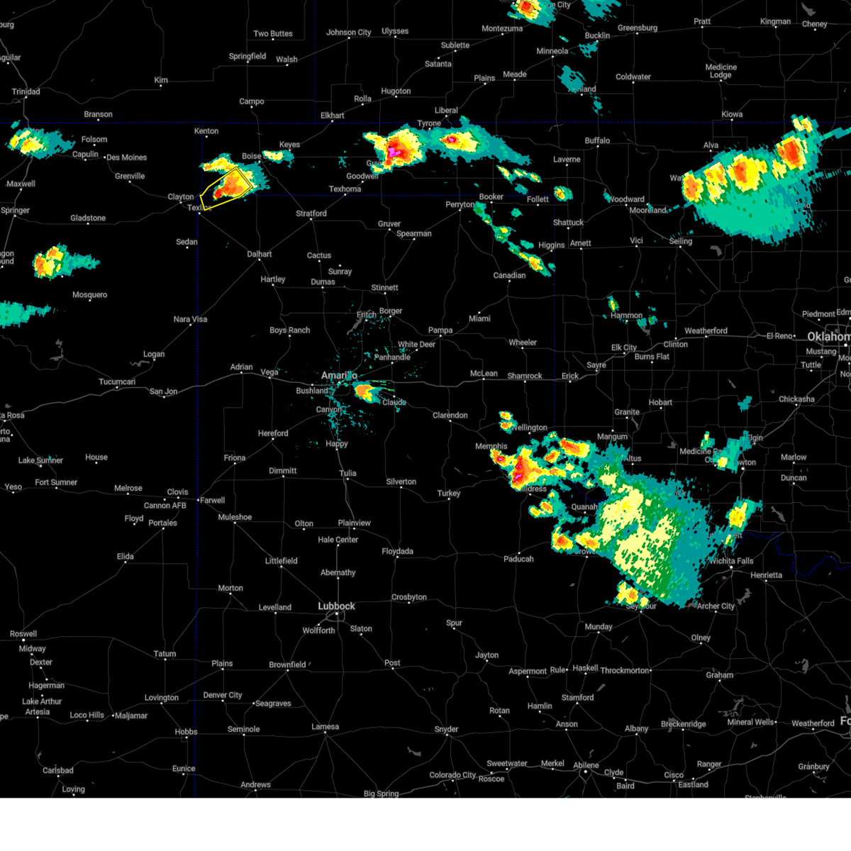
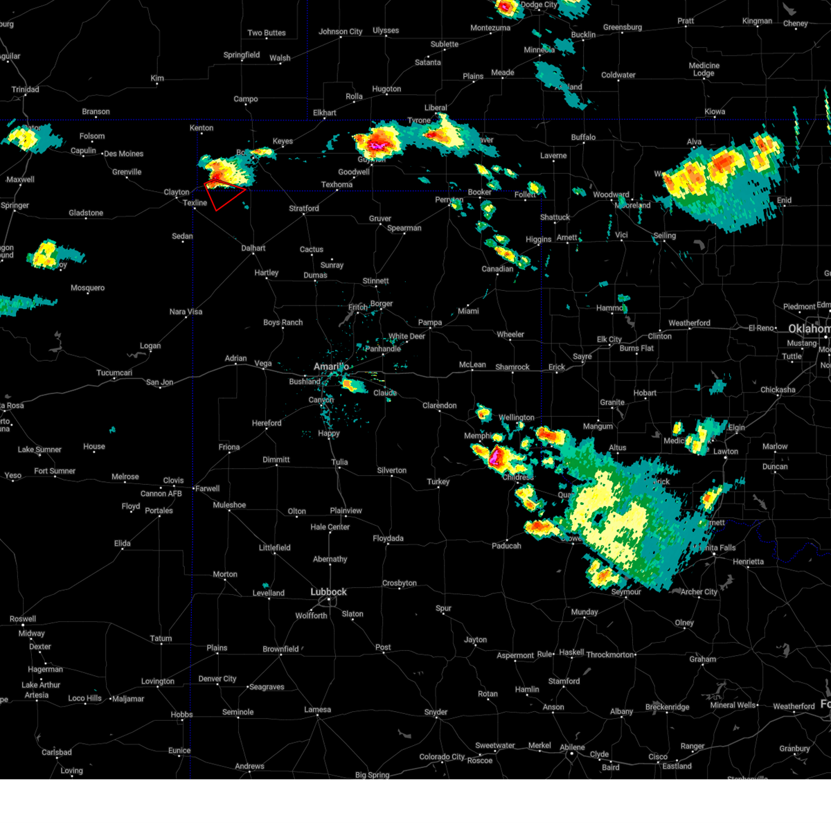
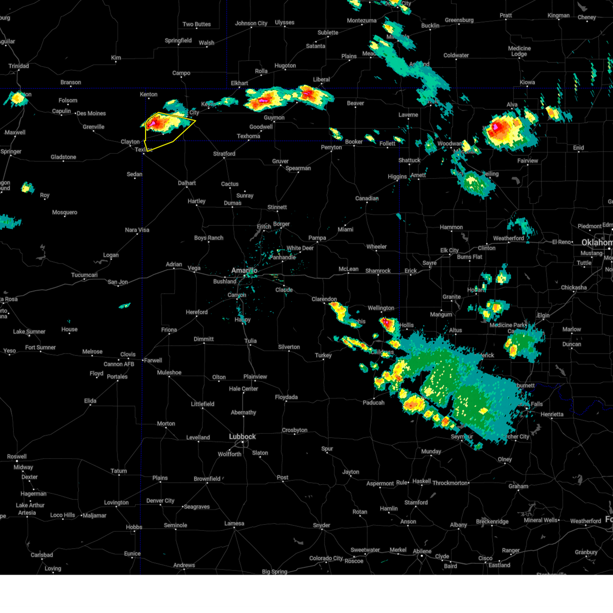
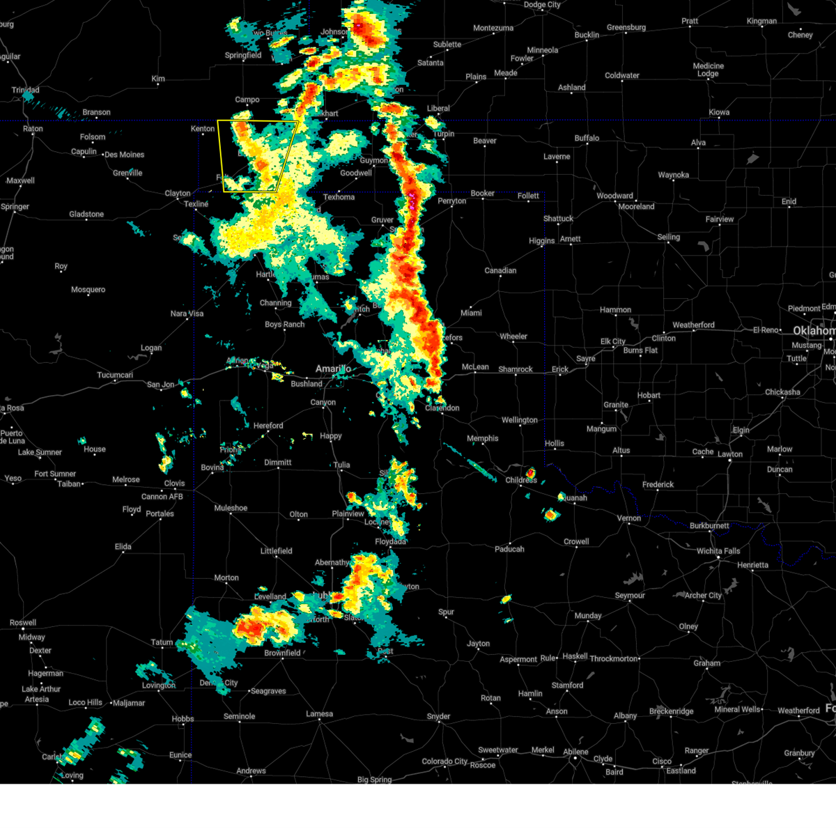
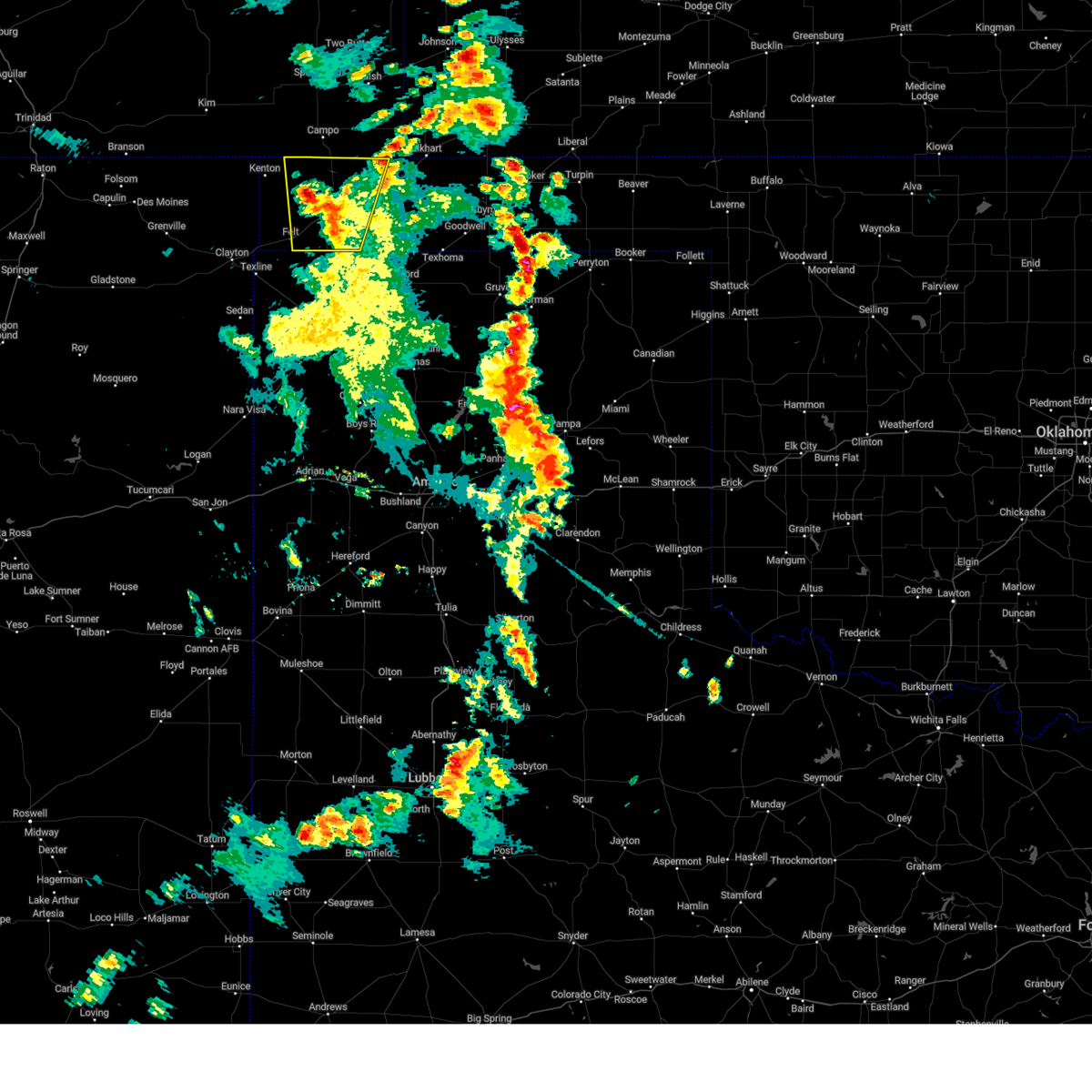
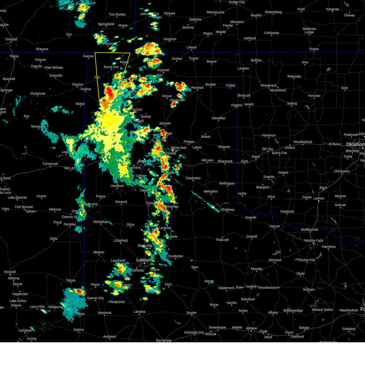
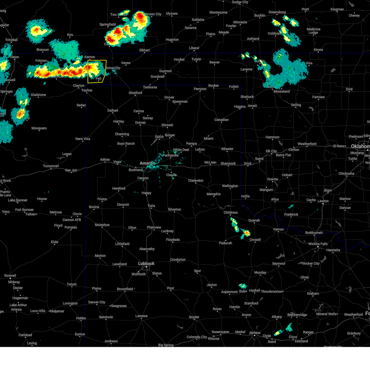
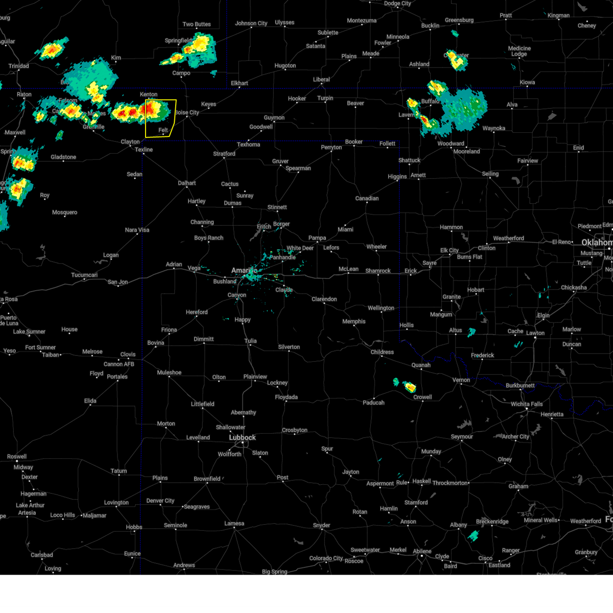
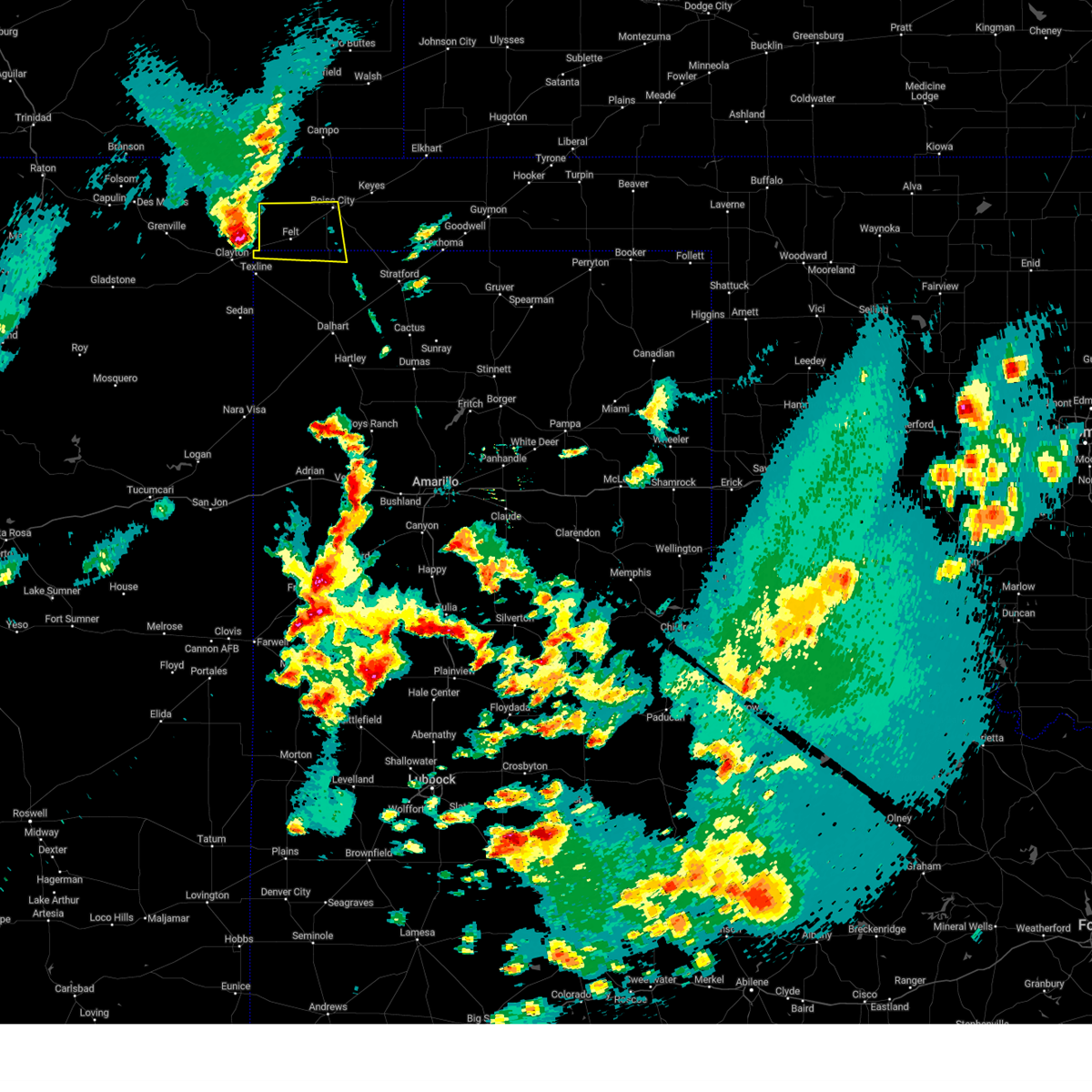
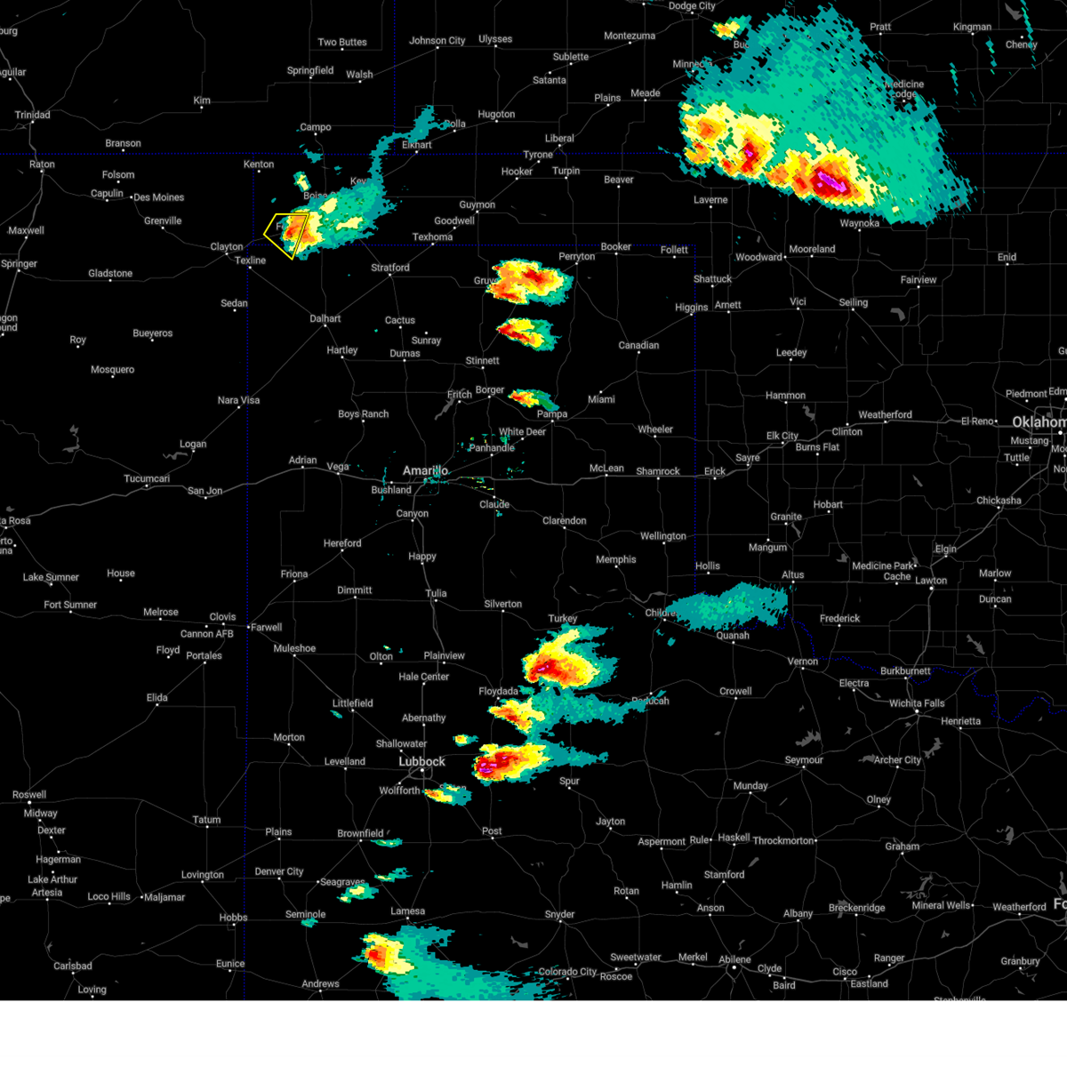
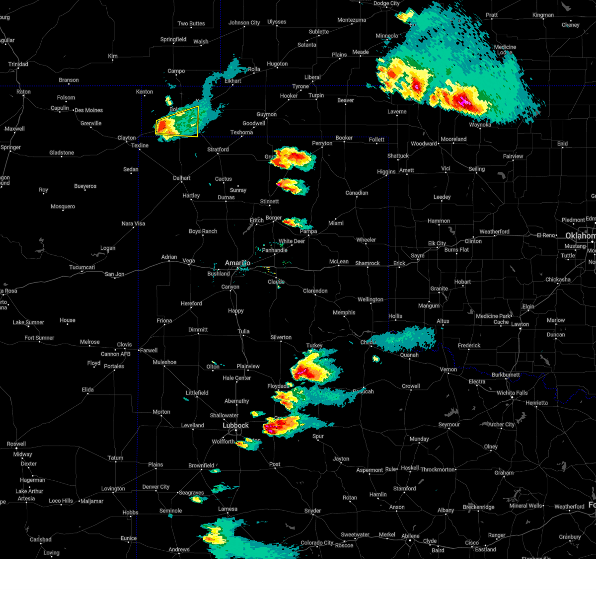
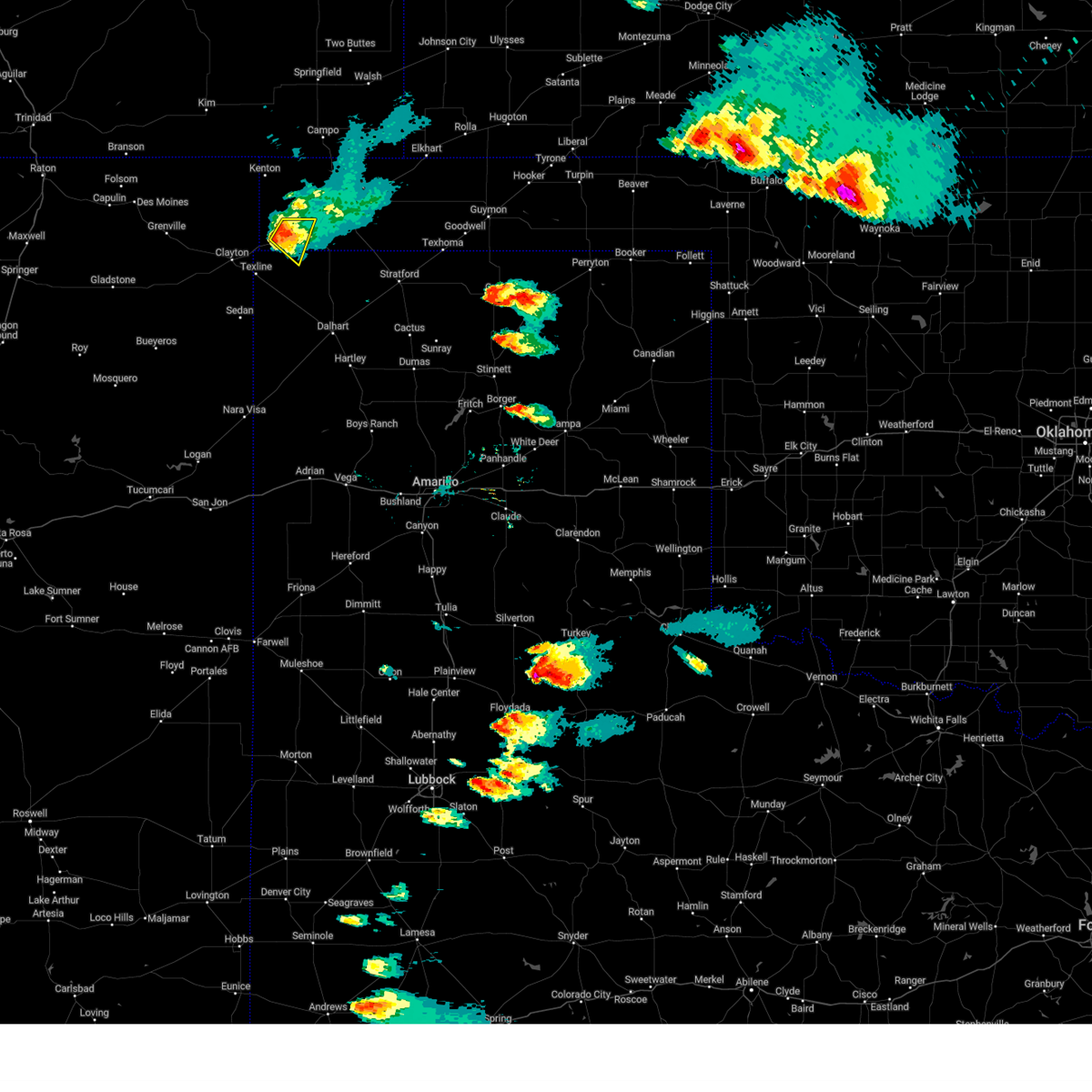
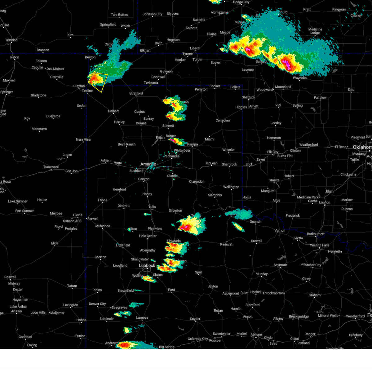
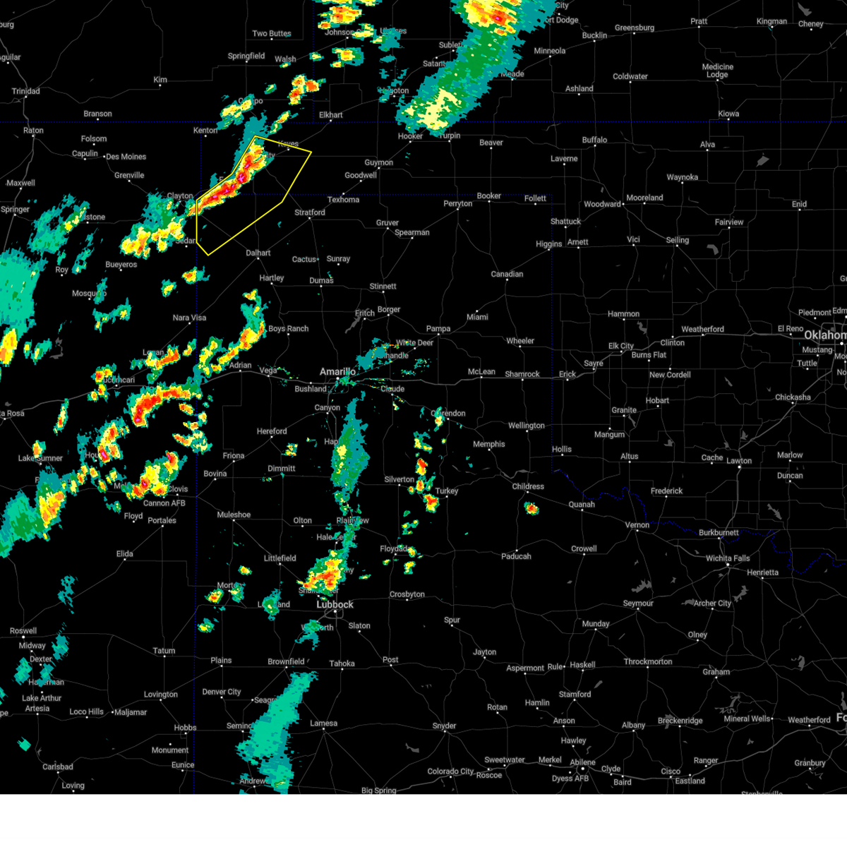
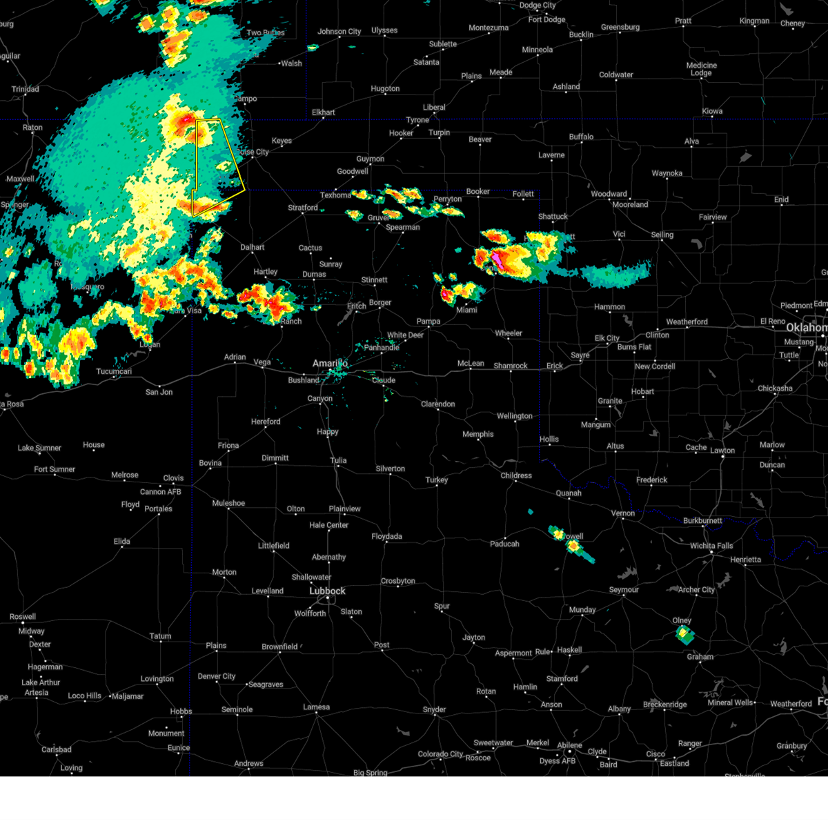
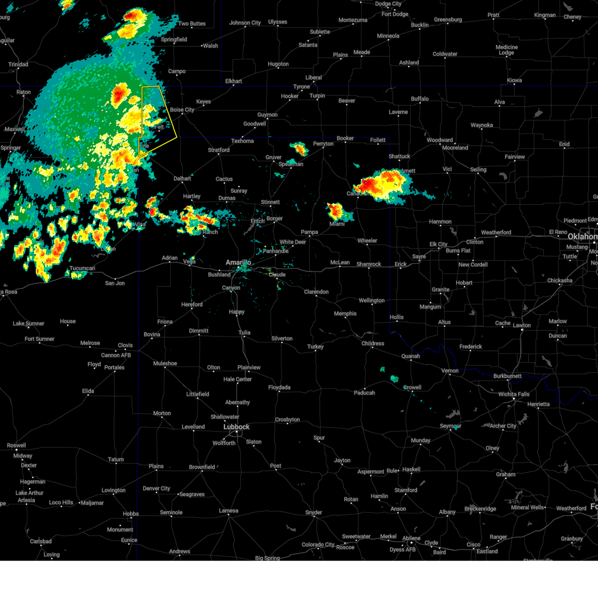
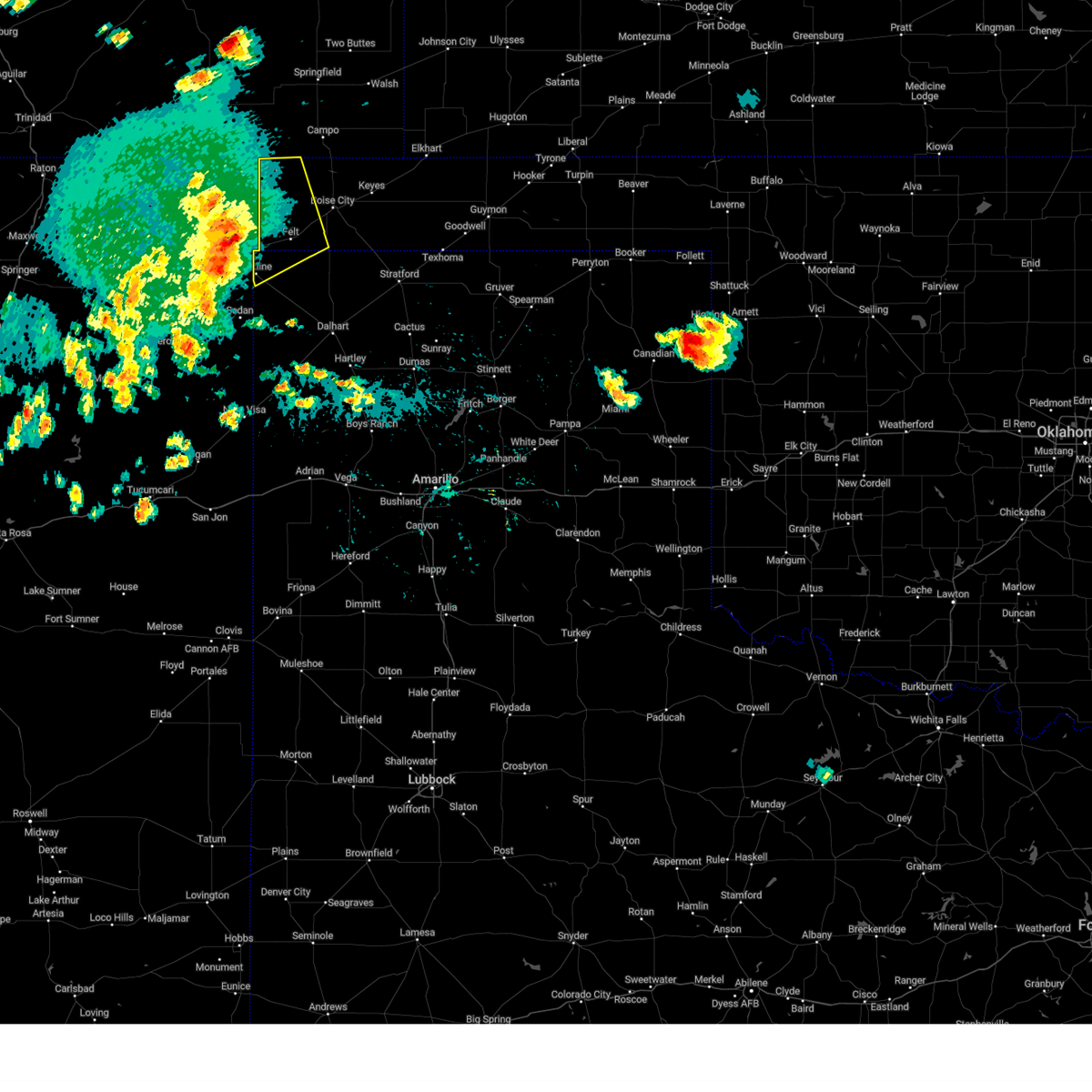
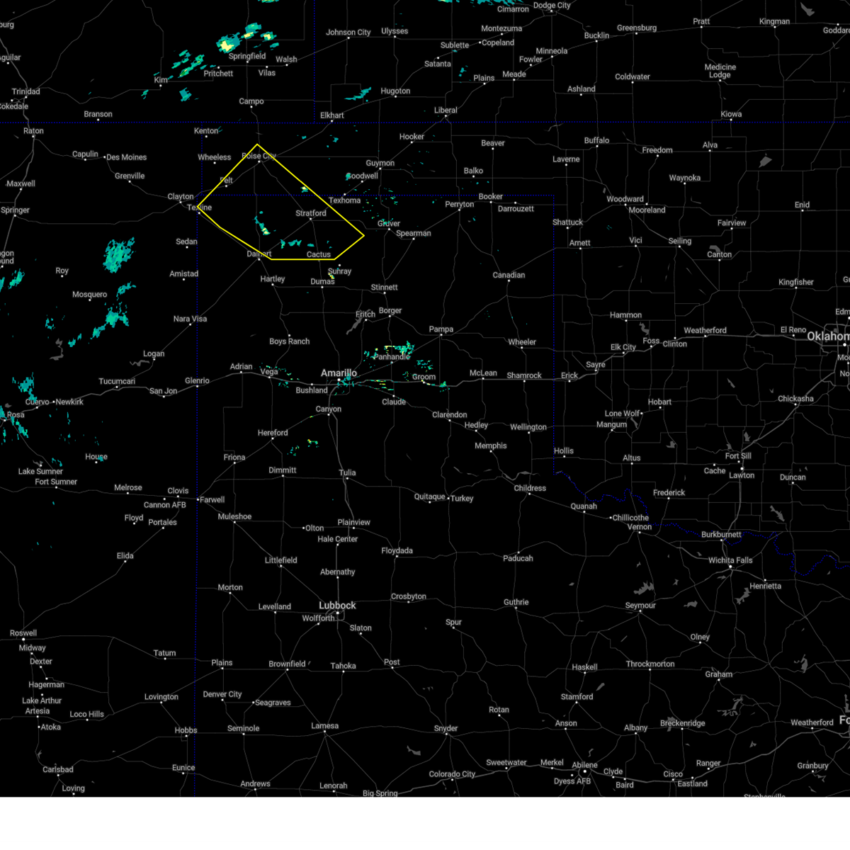
Hail Map for Felt, OK
The Felt, OK area has had 12 reports of on-the-ground hail by trained spotters, and has been under severe weather warnings 25 times during the past 12 months. Doppler radar has detected hail at or near Felt, OK on 64 occasions, including 8 occasions during the past year.
| Name: | Felt, OK |
| Where Located: | 107.9 miles NNW of Amarillo, TX |
| Map: | Google Map for Felt, OK |
| Population: | 93 |
| Housing Units: | 53 |
| More Info: | Search Google for Felt, OK |
0
The Top Recent Hail Date for Felt, OK is Friday, June 27, 2025 (64th out of 64)
Hail and Wind Damage Spotted near Felt, OK
| Date / Time | Report Details |
|---|---|
| 6/23/2025 8:51 PM CDT |
 The storms which prompted the warning have weakened below severe limits, and no longer pose an immediate threat to life or property. therefore, the warning will be allowed to expire. however, gusty winds and heavy rain are still possible with these thunderstorms. The storms which prompted the warning have weakened below severe limits, and no longer pose an immediate threat to life or property. therefore, the warning will be allowed to expire. however, gusty winds and heavy rain are still possible with these thunderstorms.
|
| 6/23/2025 7:59 PM CDT |
 Svrama the national weather service in amarillo has issued a * severe thunderstorm warning for, western texas county in the panhandle of oklahoma, eastern cimarron county in the panhandle of oklahoma, northwestern sherman county in the panhandle of texas, northern dallam county in the panhandle of texas, * until 900 pm cdt. * at 759 pm cdt, severe thunderstorms were located along a line extending from 12 miles north of keyes to 7 miles east of texline, moving east at 35 mph (radar indicated). Hazards include 60 mph wind gusts and nickel size hail. minor damage to roofs, siding, and trees is possible Svrama the national weather service in amarillo has issued a * severe thunderstorm warning for, western texas county in the panhandle of oklahoma, eastern cimarron county in the panhandle of oklahoma, northwestern sherman county in the panhandle of texas, northern dallam county in the panhandle of texas, * until 900 pm cdt. * at 759 pm cdt, severe thunderstorms were located along a line extending from 12 miles north of keyes to 7 miles east of texline, moving east at 35 mph (radar indicated). Hazards include 60 mph wind gusts and nickel size hail. minor damage to roofs, siding, and trees is possible
|
| 6/23/2025 7:36 PM CDT |
 Svrama the national weather service in amarillo has issued a * severe thunderstorm warning for, southwestern cimarron county in the panhandle of oklahoma, northwestern dallam county in the panhandle of texas, * until 815 pm cdt. * at 736 pm cdt, severe thunderstorms were located along a line extending from 7 miles east of texline to 8 miles southwest of clayton, moving northeast at 40 mph (radar indicated). Hazards include 60 mph wind gusts and quarter size hail. Minor damage to roofs, siding, and trees is possible. Hail damage to vehicles is expected. Svrama the national weather service in amarillo has issued a * severe thunderstorm warning for, southwestern cimarron county in the panhandle of oklahoma, northwestern dallam county in the panhandle of texas, * until 815 pm cdt. * at 736 pm cdt, severe thunderstorms were located along a line extending from 7 miles east of texline to 8 miles southwest of clayton, moving northeast at 40 mph (radar indicated). Hazards include 60 mph wind gusts and quarter size hail. Minor damage to roofs, siding, and trees is possible. Hail damage to vehicles is expected.
|
| 6/8/2025 3:00 PM CDT |
 At 300 pm cdt, a confirmed tornado was located 8 miles southwest of felt, or 17 miles east of clayton, moving south at 15 mph (public confirmed tornado). Hazards include damaging tornado and two inch hail. Flying debris will be dangerous to those caught without shelter. mobile homes will be damaged or destroyed. damage to roofs, windows, and vehicles will occur. tree damage is likely. This tornadic thunderstorm will remain over mainly rural areas of south central cimarron and northwestern dallam counties. At 300 pm cdt, a confirmed tornado was located 8 miles southwest of felt, or 17 miles east of clayton, moving south at 15 mph (public confirmed tornado). Hazards include damaging tornado and two inch hail. Flying debris will be dangerous to those caught without shelter. mobile homes will be damaged or destroyed. damage to roofs, windows, and vehicles will occur. tree damage is likely. This tornadic thunderstorm will remain over mainly rural areas of south central cimarron and northwestern dallam counties.
|
| 6/8/2025 2:56 PM CDT |
 At 255 pm cdt, a severe thunderstorm was located over felt, or 18 miles southwest of boise city, moving southeast at 15 mph (radar indicated). Hazards include two inch hail and 60 mph wind gusts. Minor damage to roofs, siding, and trees is possible. people and animals outdoors will be injured. expect hail damage to roofs, siding, windows, and vehicles. Locations impacted include, felt. At 255 pm cdt, a severe thunderstorm was located over felt, or 18 miles southwest of boise city, moving southeast at 15 mph (radar indicated). Hazards include two inch hail and 60 mph wind gusts. Minor damage to roofs, siding, and trees is possible. people and animals outdoors will be injured. expect hail damage to roofs, siding, windows, and vehicles. Locations impacted include, felt.
|
| 6/8/2025 2:48 PM CDT |
 Torama the national weather service in amarillo has issued a * tornado warning for, southwestern cimarron county in the panhandle of oklahoma, northwestern dallam county in the panhandle of texas, * until 315 pm cdt. * at 248 pm cdt, a confirmed tornado was located 5 miles southwest of felt, or 18 miles east of clayton, moving southeast at 20 mph (public confirmed tornado). Hazards include damaging tornado and ping pong ball size hail. Flying debris will be dangerous to those caught without shelter. mobile homes will be damaged or destroyed. damage to roofs, windows, and vehicles will occur. tree damage is likely. This tornadic thunderstorm will remain over mainly rural areas of southwestern cimarron and northwestern dallam counties. Torama the national weather service in amarillo has issued a * tornado warning for, southwestern cimarron county in the panhandle of oklahoma, northwestern dallam county in the panhandle of texas, * until 315 pm cdt. * at 248 pm cdt, a confirmed tornado was located 5 miles southwest of felt, or 18 miles east of clayton, moving southeast at 20 mph (public confirmed tornado). Hazards include damaging tornado and ping pong ball size hail. Flying debris will be dangerous to those caught without shelter. mobile homes will be damaged or destroyed. damage to roofs, windows, and vehicles will occur. tree damage is likely. This tornadic thunderstorm will remain over mainly rural areas of southwestern cimarron and northwestern dallam counties.
|
| 6/8/2025 2:21 PM CDT |
 Svrama the national weather service in amarillo has issued a * severe thunderstorm warning for, southwestern cimarron county in the panhandle of oklahoma, northwestern dallam county in the panhandle of texas, * until 315 pm cdt. * at 221 pm cdt, a severe thunderstorm was located 5 miles south of wheeless, or 19 miles northeast of clayton, moving southeast at 15 mph (radar indicated). Hazards include golf ball size hail and 60 mph wind gusts. Minor damage to roofs, siding, and trees is possible. people and animals outdoors will be injured. Expect hail damage to roofs, siding, windows, and vehicles. Svrama the national weather service in amarillo has issued a * severe thunderstorm warning for, southwestern cimarron county in the panhandle of oklahoma, northwestern dallam county in the panhandle of texas, * until 315 pm cdt. * at 221 pm cdt, a severe thunderstorm was located 5 miles south of wheeless, or 19 miles northeast of clayton, moving southeast at 15 mph (radar indicated). Hazards include golf ball size hail and 60 mph wind gusts. Minor damage to roofs, siding, and trees is possible. people and animals outdoors will be injured. Expect hail damage to roofs, siding, windows, and vehicles.
|
| 6/2/2025 5:10 PM CDT |
 The storm which prompted the warning has weakened below severe limits, and no longer poses an immediate threat to life or property. therefore, the warning will be allowed to expire. however, small hail and gusty winds are still possible with this thunderstorm. a severe thunderstorm watch remains in effect until 900 pm cdt for the panhandle of oklahoma, and the panhandle of texas. The storm which prompted the warning has weakened below severe limits, and no longer poses an immediate threat to life or property. therefore, the warning will be allowed to expire. however, small hail and gusty winds are still possible with this thunderstorm. a severe thunderstorm watch remains in effect until 900 pm cdt for the panhandle of oklahoma, and the panhandle of texas.
|
| 6/2/2025 4:55 PM CDT |
 the severe thunderstorm warning has been cancelled and is no longer in effect the severe thunderstorm warning has been cancelled and is no longer in effect
|
| 6/2/2025 4:55 PM CDT |
 At 454 pm cdt, a severe thunderstorm was located 11 miles southeast of campo, or 16 miles north of boise city, moving north at 45 mph (radar indicated). Hazards include 60 mph wind gusts. Minor damage to roofs, siding, and trees is possible. Locations impacted include, keyes, felt, and boise city. At 454 pm cdt, a severe thunderstorm was located 11 miles southeast of campo, or 16 miles north of boise city, moving north at 45 mph (radar indicated). Hazards include 60 mph wind gusts. Minor damage to roofs, siding, and trees is possible. Locations impacted include, keyes, felt, and boise city.
|
| 6/2/2025 4:12 PM CDT |
 Svrama the national weather service in amarillo has issued a * severe thunderstorm warning for, central cimarron county in the panhandle of oklahoma, north central dallam county in the panhandle of texas, * until 515 pm cdt. * at 412 pm cdt, a severe thunderstorm was located 14 miles east of felt, or 16 miles south of boise city, moving north at 45 mph (radar indicated). Hazards include 60 mph wind gusts and penny size hail. minor damage to roofs, siding, and trees is possible Svrama the national weather service in amarillo has issued a * severe thunderstorm warning for, central cimarron county in the panhandle of oklahoma, north central dallam county in the panhandle of texas, * until 515 pm cdt. * at 412 pm cdt, a severe thunderstorm was located 14 miles east of felt, or 16 miles south of boise city, moving north at 45 mph (radar indicated). Hazards include 60 mph wind gusts and penny size hail. minor damage to roofs, siding, and trees is possible
|
| 5/28/2025 3:48 PM CDT |
 At 348 pm cdt, a severe thunderstorm was located 6 miles northwest of wheeless, or 24 miles northeast of clayton, moving south at 5 mph (radar indicated). Hazards include 60 mph wind gusts and quarter size hail. Minor damage to roofs, siding, and trees is possible. hail damage to vehicles is expected. Locations impacted include, black mesa park, felt, and wheeless. At 348 pm cdt, a severe thunderstorm was located 6 miles northwest of wheeless, or 24 miles northeast of clayton, moving south at 5 mph (radar indicated). Hazards include 60 mph wind gusts and quarter size hail. Minor damage to roofs, siding, and trees is possible. hail damage to vehicles is expected. Locations impacted include, black mesa park, felt, and wheeless.
|
| 5/28/2025 3:15 PM CDT |
 Svrama the national weather service in amarillo has issued a * severe thunderstorm warning for, western cimarron county in the panhandle of oklahoma, * until 415 pm cdt. * at 314 pm cdt, a severe thunderstorm was located 6 miles northwest of wheeless, or 25 miles northeast of clayton, moving southeast at 10 mph (radar indicated). Hazards include 60 mph wind gusts and half dollar size hail. Minor damage to roofs, siding, and trees is possible. Hail damage to vehicles is expected. Svrama the national weather service in amarillo has issued a * severe thunderstorm warning for, western cimarron county in the panhandle of oklahoma, * until 415 pm cdt. * at 314 pm cdt, a severe thunderstorm was located 6 miles northwest of wheeless, or 25 miles northeast of clayton, moving southeast at 10 mph (radar indicated). Hazards include 60 mph wind gusts and half dollar size hail. Minor damage to roofs, siding, and trees is possible. Hail damage to vehicles is expected.
|
| 5/25/2025 8:44 PM CDT | At 843 pm cdt, a severe thunderstorm was located 4 miles north of felt, or 15 miles southwest of boise city, moving east at 35 mph (radar indicated). Hazards include quarter size hail. Damage to vehicles is expected. Locations impacted include, felt, boise city, and wheeless. |
| 5/25/2025 8:44 PM CDT | the severe thunderstorm warning has been cancelled and is no longer in effect |
| 5/25/2025 8:10 PM CDT |
 Svrama the national weather service in amarillo has issued a * severe thunderstorm warning for, southwestern cimarron county in the panhandle of oklahoma, northwestern dallam county in the panhandle of texas, * until 915 pm cdt. * at 810 pm cdt, a severe thunderstorm was located 4 miles south of seneca, or 8 miles northeast of clayton, moving east at 35 mph (radar indicated). Hazards include ping pong ball size hail. People and animals outdoors will be injured. Expect damage to roofs, siding, windows, and vehicles. Svrama the national weather service in amarillo has issued a * severe thunderstorm warning for, southwestern cimarron county in the panhandle of oklahoma, northwestern dallam county in the panhandle of texas, * until 915 pm cdt. * at 810 pm cdt, a severe thunderstorm was located 4 miles south of seneca, or 8 miles northeast of clayton, moving east at 35 mph (radar indicated). Hazards include ping pong ball size hail. People and animals outdoors will be injured. Expect damage to roofs, siding, windows, and vehicles.
|
| 4/24/2025 7:18 PM CDT |
 The severe thunderstorm which prompted the warning continues with a new warning. therefore, the warning has been allowed to expire. remember, a severe thunderstorm warning still remains in effect. The severe thunderstorm which prompted the warning continues with a new warning. therefore, the warning has been allowed to expire. remember, a severe thunderstorm warning still remains in effect.
|
| 4/24/2025 7:12 PM CDT |
 Svrama the national weather service in amarillo has issued a * severe thunderstorm warning for, southwestern cimarron county in the panhandle of oklahoma, * until 815 pm cdt. * at 711 pm cdt, a severe thunderstorm was located 4 miles northeast of felt, or 14 miles southwest of boise city, moving east at 35 mph (radar indicated). Hazards include golf ball size hail and 60 mph wind gusts. Minor damage to roofs, siding, and trees is possible. people and animals outdoors will be injured. Expect hail damage to roofs, siding, windows, and vehicles. Svrama the national weather service in amarillo has issued a * severe thunderstorm warning for, southwestern cimarron county in the panhandle of oklahoma, * until 815 pm cdt. * at 711 pm cdt, a severe thunderstorm was located 4 miles northeast of felt, or 14 miles southwest of boise city, moving east at 35 mph (radar indicated). Hazards include golf ball size hail and 60 mph wind gusts. Minor damage to roofs, siding, and trees is possible. people and animals outdoors will be injured. Expect hail damage to roofs, siding, windows, and vehicles.
|
| 4/24/2025 7:02 PM CDT |
 At 701 pm cdt, a severe thunderstorm was located over felt, or 20 miles southwest of boise city, moving east at 20 mph (radar indicated). Hazards include ping pong ball size hail and 60 mph wind gusts. Minor damage to roofs, siding, and trees is possible. people and animals outdoors will be injured. expect hail damage to roofs, siding, windows, and vehicles. Locations impacted include, felt. At 701 pm cdt, a severe thunderstorm was located over felt, or 20 miles southwest of boise city, moving east at 20 mph (radar indicated). Hazards include ping pong ball size hail and 60 mph wind gusts. Minor damage to roofs, siding, and trees is possible. people and animals outdoors will be injured. expect hail damage to roofs, siding, windows, and vehicles. Locations impacted include, felt.
|
| 4/24/2025 7:01 PM CDT |
 At 701 pm cdt, a severe thunderstorm was located over felt, or 20 miles southwest of boise city, moving east at 20 mph (radar indicated). Hazards include ping pong ball size hail and 60 mph wind gusts. Minor damage to roofs, siding, and trees is possible. people and animals outdoors will be injured. expect hail damage to roofs, siding, windows, and vehicles. Locations impacted include, felt. At 701 pm cdt, a severe thunderstorm was located over felt, or 20 miles southwest of boise city, moving east at 20 mph (radar indicated). Hazards include ping pong ball size hail and 60 mph wind gusts. Minor damage to roofs, siding, and trees is possible. people and animals outdoors will be injured. expect hail damage to roofs, siding, windows, and vehicles. Locations impacted include, felt.
|
| 4/24/2025 6:47 PM CDT |
 Svrama the national weather service in amarillo has issued a * severe thunderstorm warning for, southwestern cimarron county in the panhandle of oklahoma, north central dallam county in the panhandle of texas, * until 715 pm cdt. * at 647 pm cdt, a severe thunderstorm was located 6 miles west of felt, or 17 miles northeast of clayton, moving east at 20 mph (radar indicated). Hazards include 60 mph wind gusts and half dollar size hail. Minor damage to roofs, siding, and trees is possible. Hail damage to vehicles is expected. Svrama the national weather service in amarillo has issued a * severe thunderstorm warning for, southwestern cimarron county in the panhandle of oklahoma, north central dallam county in the panhandle of texas, * until 715 pm cdt. * at 647 pm cdt, a severe thunderstorm was located 6 miles west of felt, or 17 miles northeast of clayton, moving east at 20 mph (radar indicated). Hazards include 60 mph wind gusts and half dollar size hail. Minor damage to roofs, siding, and trees is possible. Hail damage to vehicles is expected.
|
| 8/29/2024 5:08 PM CDT |
 Svrama the national weather service in amarillo has issued a * severe thunderstorm warning for, cimarron county in the panhandle of oklahoma, western dallam county in the panhandle of texas, * until 615 pm cdt. * at 508 pm cdt, severe thunderstorms were located along a line extending from 5 miles north of boise city to 6 miles east of felt to 3 miles southwest of texline, moving southeast at 15 mph (radar indicated). Hazards include 60 mph wind gusts and penny size hail. minor damage to roofs, siding, and trees is possible Svrama the national weather service in amarillo has issued a * severe thunderstorm warning for, cimarron county in the panhandle of oklahoma, western dallam county in the panhandle of texas, * until 615 pm cdt. * at 508 pm cdt, severe thunderstorms were located along a line extending from 5 miles north of boise city to 6 miles east of felt to 3 miles southwest of texline, moving southeast at 15 mph (radar indicated). Hazards include 60 mph wind gusts and penny size hail. minor damage to roofs, siding, and trees is possible
|
| 8/1/2024 6:11 PM CDT |
 The storms which prompted the warning have weakened below severe limits, and no longer pose an immediate threat to life or property. therefore, the warning will be allowed to expire. however, gusty winds are still possible with these thunderstorms. The storms which prompted the warning have weakened below severe limits, and no longer pose an immediate threat to life or property. therefore, the warning will be allowed to expire. however, gusty winds are still possible with these thunderstorms.
|
| 8/1/2024 5:46 PM CDT |
 At 546 pm cdt, severe thunderstorms were located along a line extending from near kenton to near felt, moving northeast at 25 mph (radar indicated). Hazards include 60 mph wind gusts and penny size hail. Minor damage to roofs, siding, and trees is possible. Locations impacted include, texline, kenton, wheeless, black mesa park, and felt. At 546 pm cdt, severe thunderstorms were located along a line extending from near kenton to near felt, moving northeast at 25 mph (radar indicated). Hazards include 60 mph wind gusts and penny size hail. Minor damage to roofs, siding, and trees is possible. Locations impacted include, texline, kenton, wheeless, black mesa park, and felt.
|
| 8/1/2024 5:10 PM CDT |
 Svrama the national weather service in amarillo has issued a * severe thunderstorm warning for, western cimarron county in the panhandle of oklahoma, northwestern dallam county in the panhandle of texas, * until 615 pm cdt. * at 510 pm cdt, severe thunderstorms were located along a line extending from 8 miles north of seneca to 7 miles north of texline, moving northeast at 25 mph (radar indicated). Hazards include 70 mph wind gusts and quarter size hail. Expect some tree damage. damage is likely to mobile homes, roofs, and outbuildings. Hail damage to vehicles is expected. Svrama the national weather service in amarillo has issued a * severe thunderstorm warning for, western cimarron county in the panhandle of oklahoma, northwestern dallam county in the panhandle of texas, * until 615 pm cdt. * at 510 pm cdt, severe thunderstorms were located along a line extending from 8 miles north of seneca to 7 miles north of texline, moving northeast at 25 mph (radar indicated). Hazards include 70 mph wind gusts and quarter size hail. Expect some tree damage. damage is likely to mobile homes, roofs, and outbuildings. Hail damage to vehicles is expected.
|
| 6/14/2024 7:28 PM CDT |
 The storm which prompted the warning has moved out of the area. therefore, the warning will be allowed to expire. however, gusty winds are still possible with this thunderstorm. a severe thunderstorm watch remains in effect until 1000 pm cdt for the panhandle of oklahoma, and the panhandle of texas. remember, a severe thunderstorm warning still remains in effect for eastern cimarron and western texas counties until 800 pm cdt. The storm which prompted the warning has moved out of the area. therefore, the warning will be allowed to expire. however, gusty winds are still possible with this thunderstorm. a severe thunderstorm watch remains in effect until 1000 pm cdt for the panhandle of oklahoma, and the panhandle of texas. remember, a severe thunderstorm warning still remains in effect for eastern cimarron and western texas counties until 800 pm cdt.
|
| 6/14/2024 7:20 PM CDT |
 At 719 pm cdt, a severe thunderstorm was located over keyes, or 17 miles northeast of boise city, moving north at 20 mph (radar indicated). Hazards include 70 mph wind gusts. Expect some tree damage. damage is likely to mobile homes, roofs, and outbuildings. Locations impacted include, boise city, keyes, felt, and sturgis. At 719 pm cdt, a severe thunderstorm was located over keyes, or 17 miles northeast of boise city, moving north at 20 mph (radar indicated). Hazards include 70 mph wind gusts. Expect some tree damage. damage is likely to mobile homes, roofs, and outbuildings. Locations impacted include, boise city, keyes, felt, and sturgis.
|
| 6/14/2024 6:54 PM CDT |
 the severe thunderstorm warning has been cancelled and is no longer in effect the severe thunderstorm warning has been cancelled and is no longer in effect
|
| 6/14/2024 6:54 PM CDT |
 At 653 pm cdt, a severe thunderstorm was located 8 miles west of keyes, or 8 miles northeast of boise city, moving northeast at 45 mph (radar indicated). Hazards include 60 mph wind gusts. Minor damage to roofs, siding, and trees is possible. Locations impacted include, boise city, keyes, kenton, wheeless, black mesa park, felt, and sturgis. At 653 pm cdt, a severe thunderstorm was located 8 miles west of keyes, or 8 miles northeast of boise city, moving northeast at 45 mph (radar indicated). Hazards include 60 mph wind gusts. Minor damage to roofs, siding, and trees is possible. Locations impacted include, boise city, keyes, kenton, wheeless, black mesa park, felt, and sturgis.
|
| 6/14/2024 6:32 PM CDT |
 At 631 pm cdt, a severe thunderstorm was located 12 miles east of black mesa park, or 12 miles northwest of boise city, moving northeast at 40 mph (radar indicated). Hazards include 60 mph wind gusts and nickel size hail. Minor damage to roofs, siding, and trees is possible. Locations impacted include, boise city, keyes, kenton, wheeless, black mesa park, felt, and sturgis. At 631 pm cdt, a severe thunderstorm was located 12 miles east of black mesa park, or 12 miles northwest of boise city, moving northeast at 40 mph (radar indicated). Hazards include 60 mph wind gusts and nickel size hail. Minor damage to roofs, siding, and trees is possible. Locations impacted include, boise city, keyes, kenton, wheeless, black mesa park, felt, and sturgis.
|
| 6/14/2024 6:22 PM CDT |
 At 622 pm cdt, a severe thunderstorm was located 10 miles west of boise city, moving northeast at 55 mph (radar indicated). Hazards include 60 mph wind gusts and nickel size hail. Minor damage to roofs, siding, and trees is possible. Locations impacted include, boise city, keyes, kenton, wheeless, black mesa park, felt, and sturgis. At 622 pm cdt, a severe thunderstorm was located 10 miles west of boise city, moving northeast at 55 mph (radar indicated). Hazards include 60 mph wind gusts and nickel size hail. Minor damage to roofs, siding, and trees is possible. Locations impacted include, boise city, keyes, kenton, wheeless, black mesa park, felt, and sturgis.
|
| 6/14/2024 5:59 PM CDT |
 Svrama the national weather service in amarillo has issued a * severe thunderstorm warning for, northwestern texas county in the panhandle of oklahoma, cimarron county in the panhandle of oklahoma, northwestern dallam county in the panhandle of texas, * until 730 pm cdt. * at 558 pm cdt, a severe thunderstorm was located 7 miles northeast of texline, or 13 miles east of clayton, moving north at 45 mph (radar indicated). Hazards include 60 mph wind gusts and nickel size hail. minor damage to roofs, siding, and trees is possible Svrama the national weather service in amarillo has issued a * severe thunderstorm warning for, northwestern texas county in the panhandle of oklahoma, cimarron county in the panhandle of oklahoma, northwestern dallam county in the panhandle of texas, * until 730 pm cdt. * at 558 pm cdt, a severe thunderstorm was located 7 miles northeast of texline, or 13 miles east of clayton, moving north at 45 mph (radar indicated). Hazards include 60 mph wind gusts and nickel size hail. minor damage to roofs, siding, and trees is possible
|
| 6/7/2024 6:23 PM CDT |
 The storms which prompted the warning have weakened below severe limits, and no longer pose an immediate threat to life or property. therefore, the warning will be allowed to expire. however, gusty winds are still possible with these thunderstorms. a severe thunderstorm watch remains in effect until 1000 pm cdt for the panhandle of oklahoma, and the panhandle of texas. The storms which prompted the warning have weakened below severe limits, and no longer pose an immediate threat to life or property. therefore, the warning will be allowed to expire. however, gusty winds are still possible with these thunderstorms. a severe thunderstorm watch remains in effect until 1000 pm cdt for the panhandle of oklahoma, and the panhandle of texas.
|
| 6/7/2024 6:04 PM CDT |
 At 603 pm cdt, severe thunderstorms were located along a line extending from 7 miles northeast of felt to 11 miles west of ware, moving east at 45 mph (radar indicated). Hazards include 70 mph wind gusts and penny size hail. Expect some tree damage. damage is likely to mobile homes, roofs, and outbuildings. Locations impacted include, boise city, texline, wheeless, ware, black mesa park, and felt. At 603 pm cdt, severe thunderstorms were located along a line extending from 7 miles northeast of felt to 11 miles west of ware, moving east at 45 mph (radar indicated). Hazards include 70 mph wind gusts and penny size hail. Expect some tree damage. damage is likely to mobile homes, roofs, and outbuildings. Locations impacted include, boise city, texline, wheeless, ware, black mesa park, and felt.
|
| 6/7/2024 5:32 PM CDT |
 Svrama the national weather service in amarillo has issued a * severe thunderstorm warning for, southwestern cimarron county in the panhandle of oklahoma, western dallam county in the panhandle of texas, northwestern hartley county in the panhandle of texas, * until 630 pm cdt. * at 531 pm cdt, severe thunderstorms were located along a line extending from seneca to 13 miles west of sedan, moving east at 30 mph (radar indicated). Hazards include 70 mph wind gusts and penny size hail. Expect some tree damage. Damage is likely to mobile homes, roofs, and outbuildings. Svrama the national weather service in amarillo has issued a * severe thunderstorm warning for, southwestern cimarron county in the panhandle of oklahoma, western dallam county in the panhandle of texas, northwestern hartley county in the panhandle of texas, * until 630 pm cdt. * at 531 pm cdt, severe thunderstorms were located along a line extending from seneca to 13 miles west of sedan, moving east at 30 mph (radar indicated). Hazards include 70 mph wind gusts and penny size hail. Expect some tree damage. Damage is likely to mobile homes, roofs, and outbuildings.
|
| 5/31/2024 7:04 PM CDT |
 Svrama the national weather service in amarillo has issued a * severe thunderstorm warning for, western texas county in the panhandle of oklahoma, cimarron county in the panhandle of oklahoma, northwestern sherman county in the panhandle of texas, dallam county in the panhandle of texas, * until 800 pm cdt. * at 704 pm cdt, severe thunderstorms were located along a line extending from 11 miles southwest of stonington to boise city to 4 miles east of sedan, moving east at 35 mph (radar indicated). Hazards include 60 mph wind gusts. minor damage to roofs, siding, and trees is possible Svrama the national weather service in amarillo has issued a * severe thunderstorm warning for, western texas county in the panhandle of oklahoma, cimarron county in the panhandle of oklahoma, northwestern sherman county in the panhandle of texas, dallam county in the panhandle of texas, * until 800 pm cdt. * at 704 pm cdt, severe thunderstorms were located along a line extending from 11 miles southwest of stonington to boise city to 4 miles east of sedan, moving east at 35 mph (radar indicated). Hazards include 60 mph wind gusts. minor damage to roofs, siding, and trees is possible
|
| 5/30/2024 2:52 PM CDT |
 At 252 pm cdt, severe thunderstorms were located along a line extending from 13 miles south of campo to 3 miles northwest of felt to 3 miles north of clayton, moving southeast at 15 mph (radar indicated). Hazards include 60 mph wind gusts and half dollar size hail. Minor damage to roofs, siding, and trees is possible. hail damage to vehicles is expected. Locations impacted include, boise city, texline, wheeless, and felt. At 252 pm cdt, severe thunderstorms were located along a line extending from 13 miles south of campo to 3 miles northwest of felt to 3 miles north of clayton, moving southeast at 15 mph (radar indicated). Hazards include 60 mph wind gusts and half dollar size hail. Minor damage to roofs, siding, and trees is possible. hail damage to vehicles is expected. Locations impacted include, boise city, texline, wheeless, and felt.
|
| 5/30/2024 2:26 PM CDT |
 Svrama the national weather service in amarillo has issued a * severe thunderstorm warning for, cimarron county in the panhandle of oklahoma, northwestern dallam county in the panhandle of texas, * until 330 pm cdt. * at 226 pm cdt, severe thunderstorms were located along a line extending from 8 miles southwest of campo to 5 miles south of wheeless to 5 miles northeast of clayton, moving southeast at 20 mph (radar indicated). Hazards include ping pong ball size hail and 60 mph wind gusts. Minor damage to roofs, siding, and trees is possible. people and animals outdoors will be injured. Expect hail damage to roofs, siding, windows, and vehicles. Svrama the national weather service in amarillo has issued a * severe thunderstorm warning for, cimarron county in the panhandle of oklahoma, northwestern dallam county in the panhandle of texas, * until 330 pm cdt. * at 226 pm cdt, severe thunderstorms were located along a line extending from 8 miles southwest of campo to 5 miles south of wheeless to 5 miles northeast of clayton, moving southeast at 20 mph (radar indicated). Hazards include ping pong ball size hail and 60 mph wind gusts. Minor damage to roofs, siding, and trees is possible. people and animals outdoors will be injured. Expect hail damage to roofs, siding, windows, and vehicles.
|
| 10/2/2023 10:25 PM CDT |
 At 1025 pm cdt, severe thunderstorms were located along a line extending from 14 miles north of keyes to 13 miles southeast of felt, moving east at 60 mph (radar indicated). Hazards include 60 mph wind gusts. minor damage to roofs, siding, and trees is possible At 1025 pm cdt, severe thunderstorms were located along a line extending from 14 miles north of keyes to 13 miles southeast of felt, moving east at 60 mph (radar indicated). Hazards include 60 mph wind gusts. minor damage to roofs, siding, and trees is possible
|
| 10/2/2023 8:30 PM CDT |
 At 830 pm cdt, a severe thunderstorm was located 5 miles southeast of griggs, or 13 miles north of stratford, moving northeast at 30 mph (radar indicated). Hazards include 60 mph wind gusts. Minor damage to roofs, siding, and trees is possible. locations impacted include, stratford, boise city, keyes, eva, kenton, wheeless, black mesa park, felt, conlen, griggs, and sturgis. hail threat, radar indicated max hail size, <. 75 in wind threat, radar indicated max wind gust, 60 mph. At 830 pm cdt, a severe thunderstorm was located 5 miles southeast of griggs, or 13 miles north of stratford, moving northeast at 30 mph (radar indicated). Hazards include 60 mph wind gusts. Minor damage to roofs, siding, and trees is possible. locations impacted include, stratford, boise city, keyes, eva, kenton, wheeless, black mesa park, felt, conlen, griggs, and sturgis. hail threat, radar indicated max hail size, <. 75 in wind threat, radar indicated max wind gust, 60 mph.
|
| 10/2/2023 8:18 PM CDT |
 At 818 pm cdt, a severe thunderstorm was located 8 miles south of griggs, or 9 miles north of stratford, moving northeast at 30 mph (radar indicated). Hazards include 60 mph wind gusts and penny size hail. Minor damage to roofs, siding, and trees is possible. locations impacted include, stratford, boise city, texline, keyes, eva, kenton, wheeless, black mesa park, felt, conlen, griggs, and sturgis. hail threat, radar indicated max hail size, 0. 75in wind threat, radar indicated max wind gust, 60 mph. At 818 pm cdt, a severe thunderstorm was located 8 miles south of griggs, or 9 miles north of stratford, moving northeast at 30 mph (radar indicated). Hazards include 60 mph wind gusts and penny size hail. Minor damage to roofs, siding, and trees is possible. locations impacted include, stratford, boise city, texline, keyes, eva, kenton, wheeless, black mesa park, felt, conlen, griggs, and sturgis. hail threat, radar indicated max hail size, 0. 75in wind threat, radar indicated max wind gust, 60 mph.
|
| 10/2/2023 8:03 PM CDT |
 At 803 pm cdt, severe thunderstorms were located along a line extending from 5 miles north of texline to 8 miles southeast of conlen, moving north at 50 mph (radar indicated). Hazards include 60 mph wind gusts and penny size hail. Minor damage to roofs, siding, and trees is possible. locations impacted include, stratford, boise city, texline, keyes, eva, kenton, wheeless, black mesa park, felt, conlen, griggs, and sturgis. hail threat, radar indicated max hail size, 0. 75in wind threat, radar indicated max wind gust, 60 mph. At 803 pm cdt, severe thunderstorms were located along a line extending from 5 miles north of texline to 8 miles southeast of conlen, moving north at 50 mph (radar indicated). Hazards include 60 mph wind gusts and penny size hail. Minor damage to roofs, siding, and trees is possible. locations impacted include, stratford, boise city, texline, keyes, eva, kenton, wheeless, black mesa park, felt, conlen, griggs, and sturgis. hail threat, radar indicated max hail size, 0. 75in wind threat, radar indicated max wind gust, 60 mph.
|
| 10/2/2023 7:55 PM CDT |
 At 755 pm cdt, severe thunderstorms were located along a line extending from texline to 12 miles south of conlen, moving north at 50 mph (radar indicated). Hazards include 60 mph wind gusts and penny size hail. Minor damage to roofs, siding, and trees is possible. locations impacted include, dalhart, stratford, boise city, texline, keyes, kenton, wheeless, black mesa park, felt, griggs, eva, ware, conlen, and sturgis. hail threat, radar indicated max hail size, 0. 75in wind threat, radar indicated max wind gust, 60 mph. At 755 pm cdt, severe thunderstorms were located along a line extending from texline to 12 miles south of conlen, moving north at 50 mph (radar indicated). Hazards include 60 mph wind gusts and penny size hail. Minor damage to roofs, siding, and trees is possible. locations impacted include, dalhart, stratford, boise city, texline, keyes, kenton, wheeless, black mesa park, felt, griggs, eva, ware, conlen, and sturgis. hail threat, radar indicated max hail size, 0. 75in wind threat, radar indicated max wind gust, 60 mph.
|
| 10/2/2023 7:41 PM CDT |
 At 741 pm cdt, severe thunderstorms were located along a line extending from 6 miles south of texline to 8 miles northeast of hartley, moving north at 50 mph (radar indicated). Hazards include 60 mph wind gusts and penny size hail. minor damage to roofs, siding, and trees is possible At 741 pm cdt, severe thunderstorms were located along a line extending from 6 miles south of texline to 8 miles northeast of hartley, moving north at 50 mph (radar indicated). Hazards include 60 mph wind gusts and penny size hail. minor damage to roofs, siding, and trees is possible
|
| 9/9/2023 9:28 PM CDT |
 At 928 pm cdt, a severe thunderstorm was located 4 miles southwest of felt, or 19 miles east of clayton, moving south at 15 mph (radar indicated). Hazards include 60 mph wind gusts and quarter size hail. Minor damage to roofs, siding, and trees is possible. hail damage to vehicles is expected. locations impacted include, felt. hail threat, radar indicated max hail size, 1. 00in wind threat, radar indicated max wind gust, 60 mph. At 928 pm cdt, a severe thunderstorm was located 4 miles southwest of felt, or 19 miles east of clayton, moving south at 15 mph (radar indicated). Hazards include 60 mph wind gusts and quarter size hail. Minor damage to roofs, siding, and trees is possible. hail damage to vehicles is expected. locations impacted include, felt. hail threat, radar indicated max hail size, 1. 00in wind threat, radar indicated max wind gust, 60 mph.
|
| 9/9/2023 8:50 PM CDT |
 At 850 pm cdt, a severe thunderstorm was located 6 miles north of felt, or 16 miles west of boise city, moving south at 15 mph (radar indicated). Hazards include ping pong ball size hail and 60 mph wind gusts. Minor damage to roofs, siding, and trees is possible. people and animals outdoors will be injured. Expect hail damage to roofs, siding, windows, and vehicles. At 850 pm cdt, a severe thunderstorm was located 6 miles north of felt, or 16 miles west of boise city, moving south at 15 mph (radar indicated). Hazards include ping pong ball size hail and 60 mph wind gusts. Minor damage to roofs, siding, and trees is possible. people and animals outdoors will be injured. Expect hail damage to roofs, siding, windows, and vehicles.
|
| 9/9/2023 8:25 PM CDT |
 At 825 pm cdt, a severe thunderstorm was located 5 miles northeast of wheeless, or 16 miles west of boise city, moving south at 10 mph (radar indicated). Hazards include two inch hail and 60 mph wind gusts. Minor damage to roofs, siding, and trees is possible. people and animals outdoors will be injured. expect hail damage to roofs, siding, windows, and vehicles. locations impacted include, kenton, wheeless, black mesa park, and felt. thunderstorm damage threat, considerable hail threat, radar indicated max hail size, 2. 00 in wind threat, radar indicated max wind gust, 60 mph. At 825 pm cdt, a severe thunderstorm was located 5 miles northeast of wheeless, or 16 miles west of boise city, moving south at 10 mph (radar indicated). Hazards include two inch hail and 60 mph wind gusts. Minor damage to roofs, siding, and trees is possible. people and animals outdoors will be injured. expect hail damage to roofs, siding, windows, and vehicles. locations impacted include, kenton, wheeless, black mesa park, and felt. thunderstorm damage threat, considerable hail threat, radar indicated max hail size, 2. 00 in wind threat, radar indicated max wind gust, 60 mph.
|
| 9/9/2023 8:03 PM CDT |
 At 803 pm cdt, a severe thunderstorm was located 7 miles northeast of wheeless, or 15 miles west of boise city, moving south at 15 mph (radar indicated). Hazards include golf ball size hail and 60 mph wind gusts. Minor damage to roofs, siding, and trees is possible. people and animals outdoors will be injured. expect hail damage to roofs, siding, windows, and vehicles. locations impacted include, kenton, wheeless, black mesa park, and felt. thunderstorm damage threat, considerable hail threat, radar indicated max hail size, 1. 75 in wind threat, radar indicated max wind gust, 60 mph. At 803 pm cdt, a severe thunderstorm was located 7 miles northeast of wheeless, or 15 miles west of boise city, moving south at 15 mph (radar indicated). Hazards include golf ball size hail and 60 mph wind gusts. Minor damage to roofs, siding, and trees is possible. people and animals outdoors will be injured. expect hail damage to roofs, siding, windows, and vehicles. locations impacted include, kenton, wheeless, black mesa park, and felt. thunderstorm damage threat, considerable hail threat, radar indicated max hail size, 1. 75 in wind threat, radar indicated max wind gust, 60 mph.
|
| 9/9/2023 8:00 PM CDT |
 At 800 pm cdt, a severe thunderstorm was located 7 miles southeast of black mesa park, or 15 miles west of boise city, moving south at 15 mph (radar indicated). Hazards include 60 mph wind gusts and quarter size hail. Minor damage to roofs, siding, and trees is possible. Hail damage to vehicles is expected. At 800 pm cdt, a severe thunderstorm was located 7 miles southeast of black mesa park, or 15 miles west of boise city, moving south at 15 mph (radar indicated). Hazards include 60 mph wind gusts and quarter size hail. Minor damage to roofs, siding, and trees is possible. Hail damage to vehicles is expected.
|
| 8/5/2023 10:06 PM CDT |
 At 1006 pm cdt, a severe thunderstorm was located 6 miles west of kenton, or 31 miles north of clayton, moving east at 35 mph (radar indicated). Hazards include 70 mph wind gusts and ping pong ball size hail. Expect some tree damage. damage is likely to mobile homes, roofs, and outbuildings. people and animals outdoors will be injured. Expect hail damage to roofs, siding, windows, and vehicles. At 1006 pm cdt, a severe thunderstorm was located 6 miles west of kenton, or 31 miles north of clayton, moving east at 35 mph (radar indicated). Hazards include 70 mph wind gusts and ping pong ball size hail. Expect some tree damage. damage is likely to mobile homes, roofs, and outbuildings. people and animals outdoors will be injured. Expect hail damage to roofs, siding, windows, and vehicles.
|
| 8/3/2023 7:32 PM CDT |
 At 731 pm cdt, a severe thunderstorm was located 6 miles south of texline, or 13 miles southeast of clayton, moving east at 25 mph (radar indicated). Hazards include 60 mph wind gusts and quarter size hail. Minor damage to roofs, siding, and trees is possible. hail damage to vehicles is expected. locations impacted include, texline. hail threat, radar indicated max hail size, 1. 00in wind threat, radar indicated max wind gust, 60 mph. At 731 pm cdt, a severe thunderstorm was located 6 miles south of texline, or 13 miles southeast of clayton, moving east at 25 mph (radar indicated). Hazards include 60 mph wind gusts and quarter size hail. Minor damage to roofs, siding, and trees is possible. hail damage to vehicles is expected. locations impacted include, texline. hail threat, radar indicated max hail size, 1. 00in wind threat, radar indicated max wind gust, 60 mph.
|
| 8/3/2023 7:15 PM CDT |
 At 715 pm cdt, a severe thunderstorm was located 9 miles north of sedan, or 11 miles south of clayton, moving east at 20 mph (radar indicated). Hazards include 60 mph wind gusts and half dollar size hail. Minor damage to roofs, siding, and trees is possible. Hail damage to vehicles is expected. At 715 pm cdt, a severe thunderstorm was located 9 miles north of sedan, or 11 miles south of clayton, moving east at 20 mph (radar indicated). Hazards include 60 mph wind gusts and half dollar size hail. Minor damage to roofs, siding, and trees is possible. Hail damage to vehicles is expected.
|
| 7/14/2023 12:58 AM CDT |
 At 1257 am cdt, a severe thunderstorm was located 7 miles north of texline, or 8 miles east of clayton, moving southeast at 30 mph (radar indicated). Hazards include 60 mph wind gusts and quarter size hail. Minor damage to roofs, siding, and trees is possible. Hail damage to vehicles is expected. At 1257 am cdt, a severe thunderstorm was located 7 miles north of texline, or 8 miles east of clayton, moving southeast at 30 mph (radar indicated). Hazards include 60 mph wind gusts and quarter size hail. Minor damage to roofs, siding, and trees is possible. Hail damage to vehicles is expected.
|
| 7/13/2023 8:37 PM CDT |
 At 837 pm cdt, a severe thunderstorm was located 8 miles north of texline, or 9 miles east of clayton, moving south at 20 mph (radar indicated). Hazards include ping pong ball size hail and 60 mph wind gusts. Minor damage to roofs, siding, and trees is possible. people and animals outdoors will be injured. expect hail damage to roofs, siding, windows, and vehicles. Locations impacted include, texline and felt. At 837 pm cdt, a severe thunderstorm was located 8 miles north of texline, or 9 miles east of clayton, moving south at 20 mph (radar indicated). Hazards include ping pong ball size hail and 60 mph wind gusts. Minor damage to roofs, siding, and trees is possible. people and animals outdoors will be injured. expect hail damage to roofs, siding, windows, and vehicles. Locations impacted include, texline and felt.
|
| 7/13/2023 8:32 PM CDT |
 At 831 pm cdt, a severe thunderstorm was located 8 miles north of texline, or 11 miles east of clayton, moving south at 15 mph (radar indicated). Hazards include 60 mph wind gusts and quarter size hail. Minor damage to roofs, siding, and trees is possible. hail damage to vehicles is expected. Locations impacted include, texline and felt. At 831 pm cdt, a severe thunderstorm was located 8 miles north of texline, or 11 miles east of clayton, moving south at 15 mph (radar indicated). Hazards include 60 mph wind gusts and quarter size hail. Minor damage to roofs, siding, and trees is possible. hail damage to vehicles is expected. Locations impacted include, texline and felt.
|
| 7/13/2023 8:04 PM CDT |
 At 804 pm cdt, a severe thunderstorm was located 8 miles east of seneca, or 13 miles northeast of clayton, moving south at 15 mph (radar indicated). Hazards include 60 mph wind gusts and quarter size hail. Minor damage to roofs, siding, and trees is possible. Hail damage to vehicles is expected. At 804 pm cdt, a severe thunderstorm was located 8 miles east of seneca, or 13 miles northeast of clayton, moving south at 15 mph (radar indicated). Hazards include 60 mph wind gusts and quarter size hail. Minor damage to roofs, siding, and trees is possible. Hail damage to vehicles is expected.
|
| 7/13/2023 7:40 PM CDT |
 At 740 pm cdt, a severe thunderstorm was located 4 miles southwest of wheeless, or 20 miles northeast of clayton, moving southeast at 15 mph (radar indicated). Hazards include 60 mph wind gusts and quarter size hail. Minor damage to roofs, siding, and trees is possible. hail damage to vehicles is expected. Locations impacted include, kenton, wheeless, black mesa park and felt. At 740 pm cdt, a severe thunderstorm was located 4 miles southwest of wheeless, or 20 miles northeast of clayton, moving southeast at 15 mph (radar indicated). Hazards include 60 mph wind gusts and quarter size hail. Minor damage to roofs, siding, and trees is possible. hail damage to vehicles is expected. Locations impacted include, kenton, wheeless, black mesa park and felt.
|
| 7/13/2023 7:29 PM CDT |
 At 729 pm cdt, a severe thunderstorm was located 4 miles west of wheeless, or 20 miles northeast of clayton, moving south at 25 mph (trained weather spotters. at 726 pm cdt, trained spotters reported half dollar size hail 6 miles west southwest of black mesa park). Hazards include golf ball size hail and 60 mph wind gusts. Minor damage to roofs, siding, and trees is possible. people and animals outdoors will be injured. expect hail damage to roofs, siding, windows, and vehicles. Locations impacted include, kenton, wheeless, black mesa park and felt. At 729 pm cdt, a severe thunderstorm was located 4 miles west of wheeless, or 20 miles northeast of clayton, moving south at 25 mph (trained weather spotters. at 726 pm cdt, trained spotters reported half dollar size hail 6 miles west southwest of black mesa park). Hazards include golf ball size hail and 60 mph wind gusts. Minor damage to roofs, siding, and trees is possible. people and animals outdoors will be injured. expect hail damage to roofs, siding, windows, and vehicles. Locations impacted include, kenton, wheeless, black mesa park and felt.
|
| 7/13/2023 7:07 PM CDT |
 At 707 pm cdt, a severe thunderstorm was located 7 miles southwest of kenton, or 25 miles north of clayton, moving south at 25 mph (radar indicated). Hazards include golf ball size hail and 60 mph wind gusts. Minor damage to roofs, siding, and trees is possible. people and animals outdoors will be injured. Expect hail damage to roofs, siding, windows, and vehicles. At 707 pm cdt, a severe thunderstorm was located 7 miles southwest of kenton, or 25 miles north of clayton, moving south at 25 mph (radar indicated). Hazards include golf ball size hail and 60 mph wind gusts. Minor damage to roofs, siding, and trees is possible. people and animals outdoors will be injured. Expect hail damage to roofs, siding, windows, and vehicles.
|
| 7/10/2023 7:36 PM CDT |
 At 736 pm cdt, severe thunderstorms were located along a line extending from 7 miles south of boise city to 13 miles southeast of felt, moving east at 30 mph (radar indicated). Hazards include 60 mph wind gusts and quarter size hail. Minor damage to roofs, siding, and trees is possible. hail damage to vehicles is expected. locations impacted include, boise city, texline, ware and felt. hail threat, radar indicated max hail size, 1. 00in wind threat, radar indicated max wind gust, 60 mph. At 736 pm cdt, severe thunderstorms were located along a line extending from 7 miles south of boise city to 13 miles southeast of felt, moving east at 30 mph (radar indicated). Hazards include 60 mph wind gusts and quarter size hail. Minor damage to roofs, siding, and trees is possible. hail damage to vehicles is expected. locations impacted include, boise city, texline, ware and felt. hail threat, radar indicated max hail size, 1. 00in wind threat, radar indicated max wind gust, 60 mph.
|
| 7/10/2023 7:25 PM CDT |
 At 724 pm cdt, severe thunderstorms were located along a line extending from 5 miles south of boise city to 8 miles northeast of texline, moving southeast at 20 mph (radar indicated). Hazards include 60 mph wind gusts and quarter size hail. Minor damage to roofs, siding, and trees is possible. hail damage to vehicles is expected. locations impacted include, boise city, texline, ware and felt. hail threat, radar indicated max hail size, 1. 00in wind threat, radar indicated max wind gust, 60 mph. At 724 pm cdt, severe thunderstorms were located along a line extending from 5 miles south of boise city to 8 miles northeast of texline, moving southeast at 20 mph (radar indicated). Hazards include 60 mph wind gusts and quarter size hail. Minor damage to roofs, siding, and trees is possible. hail damage to vehicles is expected. locations impacted include, boise city, texline, ware and felt. hail threat, radar indicated max hail size, 1. 00in wind threat, radar indicated max wind gust, 60 mph.
|
| 7/10/2023 7:09 PM CDT |
 At 709 pm cdt, severe thunderstorms were located along a line extending from 6 miles southwest of boise city to 7 miles northeast of texline, moving southeast at 25 mph (radar indicated). Hazards include ping pong ball size hail and 60 mph wind gusts. Minor damage to roofs, siding, and trees is possible. people and animals outdoors will be injured. expect hail damage to roofs, siding, windows, and vehicles. locations impacted include, boise city, texline, ware and felt. hail threat, radar indicated max hail size, 1. 50 in wind threat, radar indicated max wind gust, 60 mph. At 709 pm cdt, severe thunderstorms were located along a line extending from 6 miles southwest of boise city to 7 miles northeast of texline, moving southeast at 25 mph (radar indicated). Hazards include ping pong ball size hail and 60 mph wind gusts. Minor damage to roofs, siding, and trees is possible. people and animals outdoors will be injured. expect hail damage to roofs, siding, windows, and vehicles. locations impacted include, boise city, texline, ware and felt. hail threat, radar indicated max hail size, 1. 50 in wind threat, radar indicated max wind gust, 60 mph.
|
| 7/10/2023 6:59 PM CDT |
 At 659 pm cdt, severe thunderstorms were located along a line extending from 10 miles east of wheeless to 8 miles north of texline, moving southeast at 20 mph (radar indicated). Hazards include 60 mph wind gusts and quarter size hail. Minor damage to roofs, siding, and trees is possible. Hail damage to vehicles is expected. At 659 pm cdt, severe thunderstorms were located along a line extending from 10 miles east of wheeless to 8 miles north of texline, moving southeast at 20 mph (radar indicated). Hazards include 60 mph wind gusts and quarter size hail. Minor damage to roofs, siding, and trees is possible. Hail damage to vehicles is expected.
|
| 7/2/2023 4:32 PM CDT |
 At 431 pm cdt, automated weather equipment reported severe thunderstorms were located along a line extending from 18 miles south of boise city to 8 miles east of texline to 5 miles northwest of sedan, moving southeast at 35 mph (automated weather equipment at texline reported a 58 mph wind gust). Hazards include 60 mph wind gusts and quarter size hail. Minor damage to roofs, siding, and trees is possible. hail damage to vehicles is expected. locations impacted include, stratford, boise city, texline, wheeless, ware, felt and conlen. hail threat, radar indicated max hail size, 1. 00in wind threat, observed max wind gust, 60 mph. At 431 pm cdt, automated weather equipment reported severe thunderstorms were located along a line extending from 18 miles south of boise city to 8 miles east of texline to 5 miles northwest of sedan, moving southeast at 35 mph (automated weather equipment at texline reported a 58 mph wind gust). Hazards include 60 mph wind gusts and quarter size hail. Minor damage to roofs, siding, and trees is possible. hail damage to vehicles is expected. locations impacted include, stratford, boise city, texline, wheeless, ware, felt and conlen. hail threat, radar indicated max hail size, 1. 00in wind threat, observed max wind gust, 60 mph.
|
| 7/2/2023 4:08 PM CDT |
 At 407 pm cdt, severe thunderstorms were located along a line extending from 7 miles south of boise city to 9 miles southeast of seneca to 10 miles southwest of clayton, moving southeast at 35 mph (radar indicated). Hazards include 60 mph wind gusts and quarter size hail. Minor damage to roofs, siding, and trees is possible. Hail damage to vehicles is expected. At 407 pm cdt, severe thunderstorms were located along a line extending from 7 miles south of boise city to 9 miles southeast of seneca to 10 miles southwest of clayton, moving southeast at 35 mph (radar indicated). Hazards include 60 mph wind gusts and quarter size hail. Minor damage to roofs, siding, and trees is possible. Hail damage to vehicles is expected.
|
| 6/28/2023 9:04 PM CDT |
 At 904 pm cdt, severe thunderstorms were located along a line extending from 8 miles northeast of felt to 7 miles north of cactus, moving northeast at 35 mph (radar indicated). Hazards include 70 mph wind gusts. Expect some tree damage. damage is likely to mobile homes, roofs, and outbuildings. locations impacted include, stratford, boise city, felt and conlen. thunderstorm damage threat, considerable hail threat, radar indicated max hail size, <. 75 in wind threat, radar indicated max wind gust, 70 mph. At 904 pm cdt, severe thunderstorms were located along a line extending from 8 miles northeast of felt to 7 miles north of cactus, moving northeast at 35 mph (radar indicated). Hazards include 70 mph wind gusts. Expect some tree damage. damage is likely to mobile homes, roofs, and outbuildings. locations impacted include, stratford, boise city, felt and conlen. thunderstorm damage threat, considerable hail threat, radar indicated max hail size, <. 75 in wind threat, radar indicated max wind gust, 70 mph.
|
| 6/28/2023 8:45 PM CDT |
 At 845 pm cdt, severe thunderstorms were located along a line extending from near felt to 7 miles west of cactus, moving northeast at 35 mph (radar indicated). Hazards include 70 mph wind gusts. Expect some tree damage. damage is likely to mobile homes, roofs, and outbuildings. locations impacted include, dalhart, stratford, boise city, cactus, texline, ware, felt and conlen. thunderstorm damage threat, considerable hail threat, radar indicated max hail size, <. 75 in wind threat, radar indicated max wind gust, 70 mph. At 845 pm cdt, severe thunderstorms were located along a line extending from near felt to 7 miles west of cactus, moving northeast at 35 mph (radar indicated). Hazards include 70 mph wind gusts. Expect some tree damage. damage is likely to mobile homes, roofs, and outbuildings. locations impacted include, dalhart, stratford, boise city, cactus, texline, ware, felt and conlen. thunderstorm damage threat, considerable hail threat, radar indicated max hail size, <. 75 in wind threat, radar indicated max wind gust, 70 mph.
|
| 6/28/2023 8:19 PM CDT |
 At 819 pm cdt, severe thunderstorms were located along a line extending from 4 miles east of texline to 5 miles east of hartley, moving northeast at 35 mph (radar indicated). Hazards include 70 mph wind gusts. Expect some tree damage. Damage is likely to mobile homes, roofs, and outbuildings. At 819 pm cdt, severe thunderstorms were located along a line extending from 4 miles east of texline to 5 miles east of hartley, moving northeast at 35 mph (radar indicated). Hazards include 70 mph wind gusts. Expect some tree damage. Damage is likely to mobile homes, roofs, and outbuildings.
|
| 6/27/2023 5:56 PM CDT |
 At 555 pm cdt, severe thunderstorms were located along a line extending from 4 miles southwest of black mesa park to 9 miles west of griggs to near conlen, moving northeast at 40 mph (radar indicated). Hazards include 60 mph wind gusts and quarter size hail. Minor damage to roofs, siding, and trees is possible. Hail damage to vehicles is expected. At 555 pm cdt, severe thunderstorms were located along a line extending from 4 miles southwest of black mesa park to 9 miles west of griggs to near conlen, moving northeast at 40 mph (radar indicated). Hazards include 60 mph wind gusts and quarter size hail. Minor damage to roofs, siding, and trees is possible. Hail damage to vehicles is expected.
|
| 6/27/2023 2:44 PM CDT |
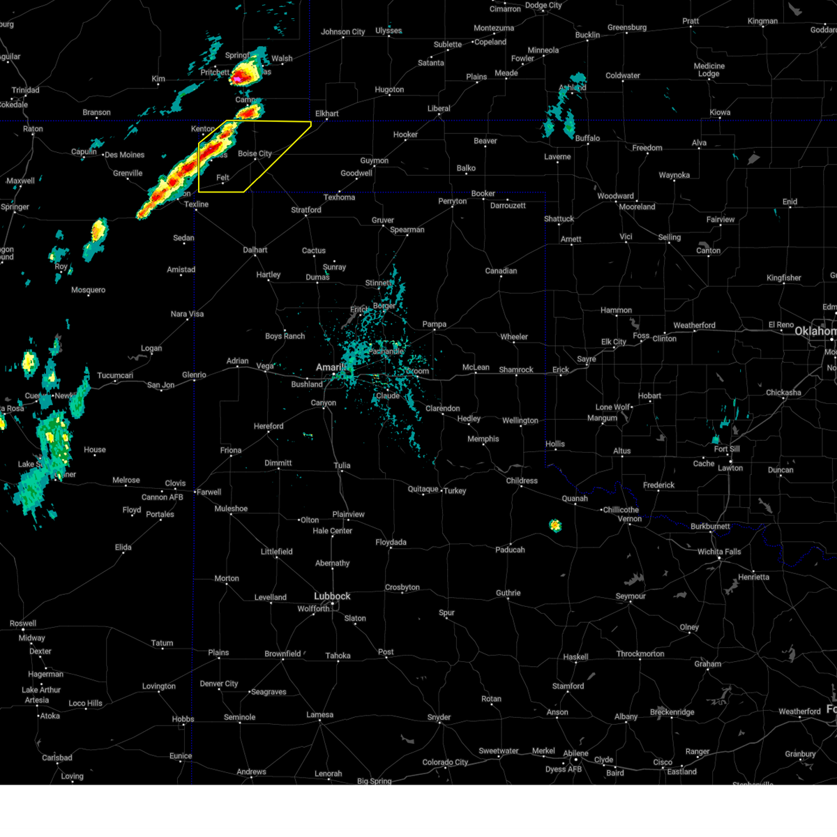 At 243 pm cdt, severe thunderstorms were located along a line extending from 8 miles south of campo to 4 miles southwest of wheeless, moving east at 20 mph (radar indicated). Hazards include 60 mph wind gusts and half dollar size hail. Minor damage to roofs, siding, and trees is possible. Hail damage to vehicles is expected. At 243 pm cdt, severe thunderstorms were located along a line extending from 8 miles south of campo to 4 miles southwest of wheeless, moving east at 20 mph (radar indicated). Hazards include 60 mph wind gusts and half dollar size hail. Minor damage to roofs, siding, and trees is possible. Hail damage to vehicles is expected.
|
| 6/17/2023 5:42 PM CDT |
 The severe thunderstorm warning for western cimarron and northern dallam counties will expire at 545 pm cdt, the storm which prompted the warning has weakened below severe limits, and no longer poses an immediate threat to life or property. therefore, the warning will be allowed to expire. however small hail, gusty winds and heavy rain are still possible with this thunderstorm. a tornado watch remains in effect until 1100 pm cdt for the panhandle of oklahoma. The severe thunderstorm warning for western cimarron and northern dallam counties will expire at 545 pm cdt, the storm which prompted the warning has weakened below severe limits, and no longer poses an immediate threat to life or property. therefore, the warning will be allowed to expire. however small hail, gusty winds and heavy rain are still possible with this thunderstorm. a tornado watch remains in effect until 1100 pm cdt for the panhandle of oklahoma.
|
| 6/17/2023 4:48 PM CDT |
 At 448 pm cdt, a severe thunderstorm was located 12 miles northwest of seneca, or 22 miles north of clayton, moving east at 40 mph (radar indicated). Hazards include ping pong ball size hail and 60 mph wind gusts. Minor damage to roofs, siding, and trees is possible. people and animals outdoors will be injured. Expect hail damage to roofs, siding, windows, and vehicles. At 448 pm cdt, a severe thunderstorm was located 12 miles northwest of seneca, or 22 miles north of clayton, moving east at 40 mph (radar indicated). Hazards include ping pong ball size hail and 60 mph wind gusts. Minor damage to roofs, siding, and trees is possible. people and animals outdoors will be injured. Expect hail damage to roofs, siding, windows, and vehicles.
|
| 6/13/2023 3:58 PM CDT |
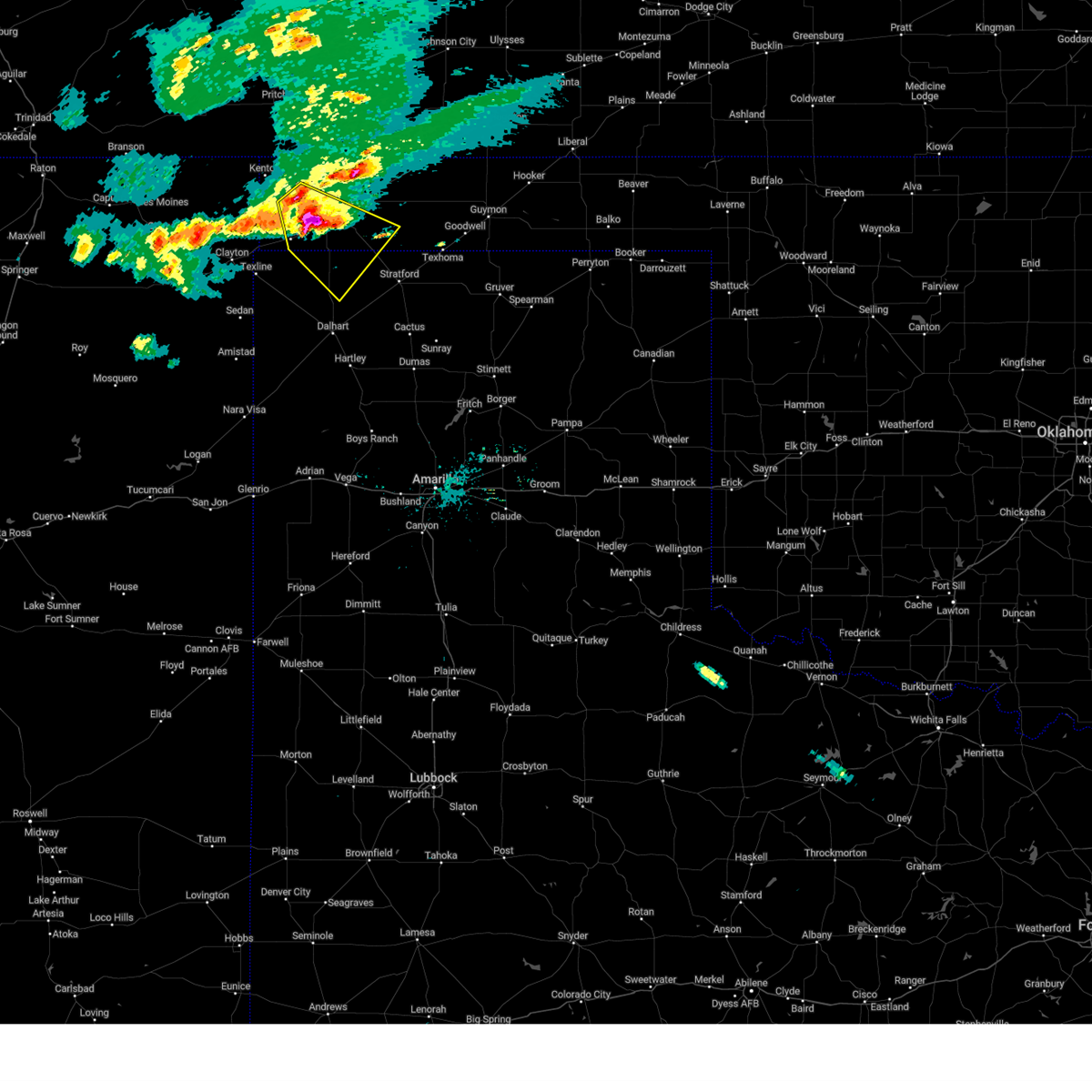 At 358 pm cdt, a severe thunderstorm was located 11 miles south of boise city, moving southeast at 35 mph (public). Hazards include golf ball size hail, and accumulating hail, as well as 60 mph wind gusts. Minor damage to roofs, siding, and trees is possible. people and animals outdoors will be injured. expect hail damage to roofs, siding, windows, and vehicles. locations impacted include, boise city, felt and griggs. thunderstorm damage threat, considerable hail threat, observed max hail size, 1. 75 in wind threat, radar indicated max wind gust, 60 mph. At 358 pm cdt, a severe thunderstorm was located 11 miles south of boise city, moving southeast at 35 mph (public). Hazards include golf ball size hail, and accumulating hail, as well as 60 mph wind gusts. Minor damage to roofs, siding, and trees is possible. people and animals outdoors will be injured. expect hail damage to roofs, siding, windows, and vehicles. locations impacted include, boise city, felt and griggs. thunderstorm damage threat, considerable hail threat, observed max hail size, 1. 75 in wind threat, radar indicated max wind gust, 60 mph.
|
| 6/13/2023 3:54 PM CDT |
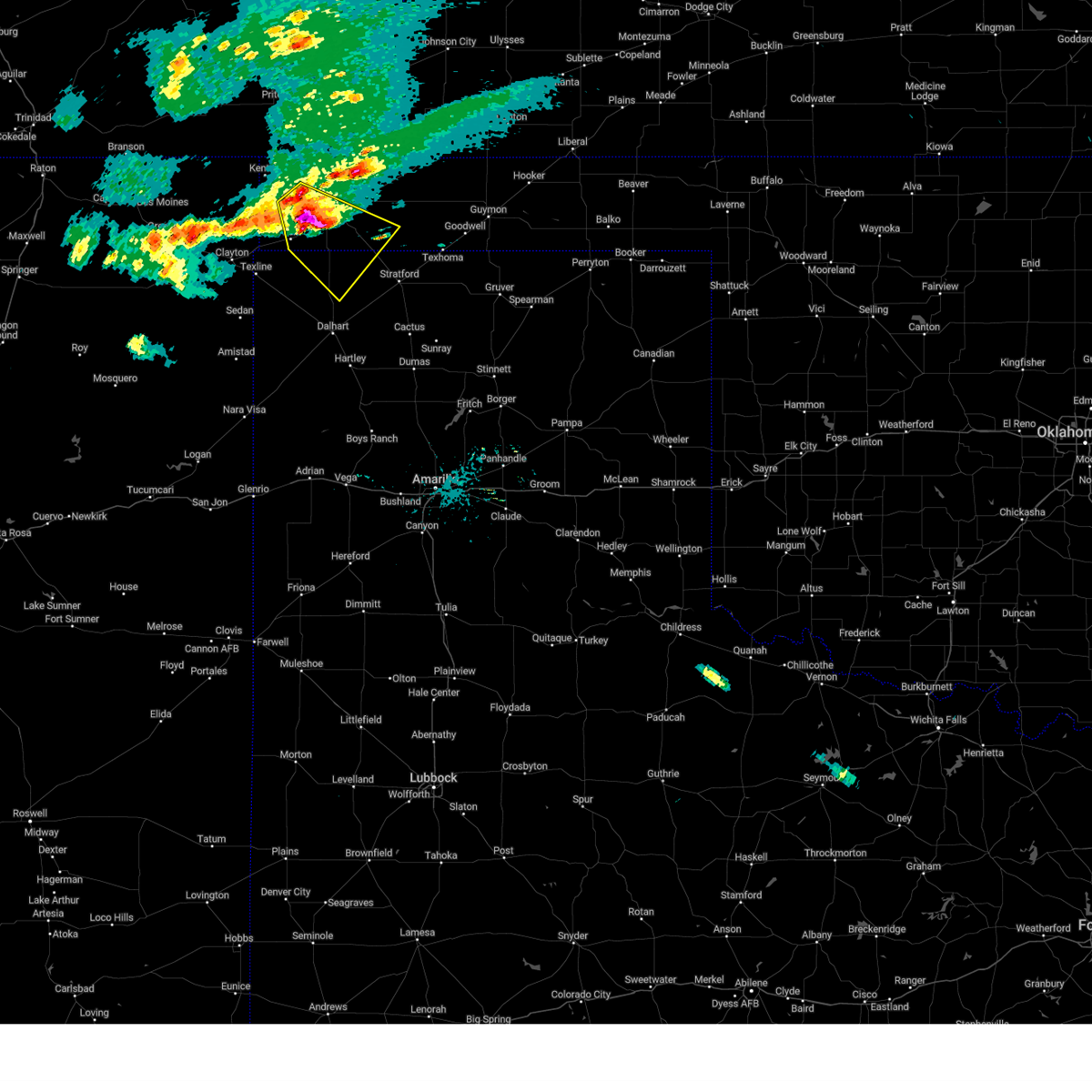 At 354 pm cdt, a severe thunderstorm was located 10 miles southwest of boise city, moving southeast at 35 mph (radar indicated). Hazards include golf ball size hail and 60 mph wind gusts. Minor damage to roofs, siding, and trees is possible. people and animals outdoors will be injured. expect hail damage to roofs, siding, windows, and vehicles. locations impacted include, boise city, felt and griggs. thunderstorm damage threat, considerable hail threat, radar indicated max hail size, 1. 75 in wind threat, radar indicated max wind gust, 60 mph. At 354 pm cdt, a severe thunderstorm was located 10 miles southwest of boise city, moving southeast at 35 mph (radar indicated). Hazards include golf ball size hail and 60 mph wind gusts. Minor damage to roofs, siding, and trees is possible. people and animals outdoors will be injured. expect hail damage to roofs, siding, windows, and vehicles. locations impacted include, boise city, felt and griggs. thunderstorm damage threat, considerable hail threat, radar indicated max hail size, 1. 75 in wind threat, radar indicated max wind gust, 60 mph.
|
| 6/13/2023 3:54 PM CDT |
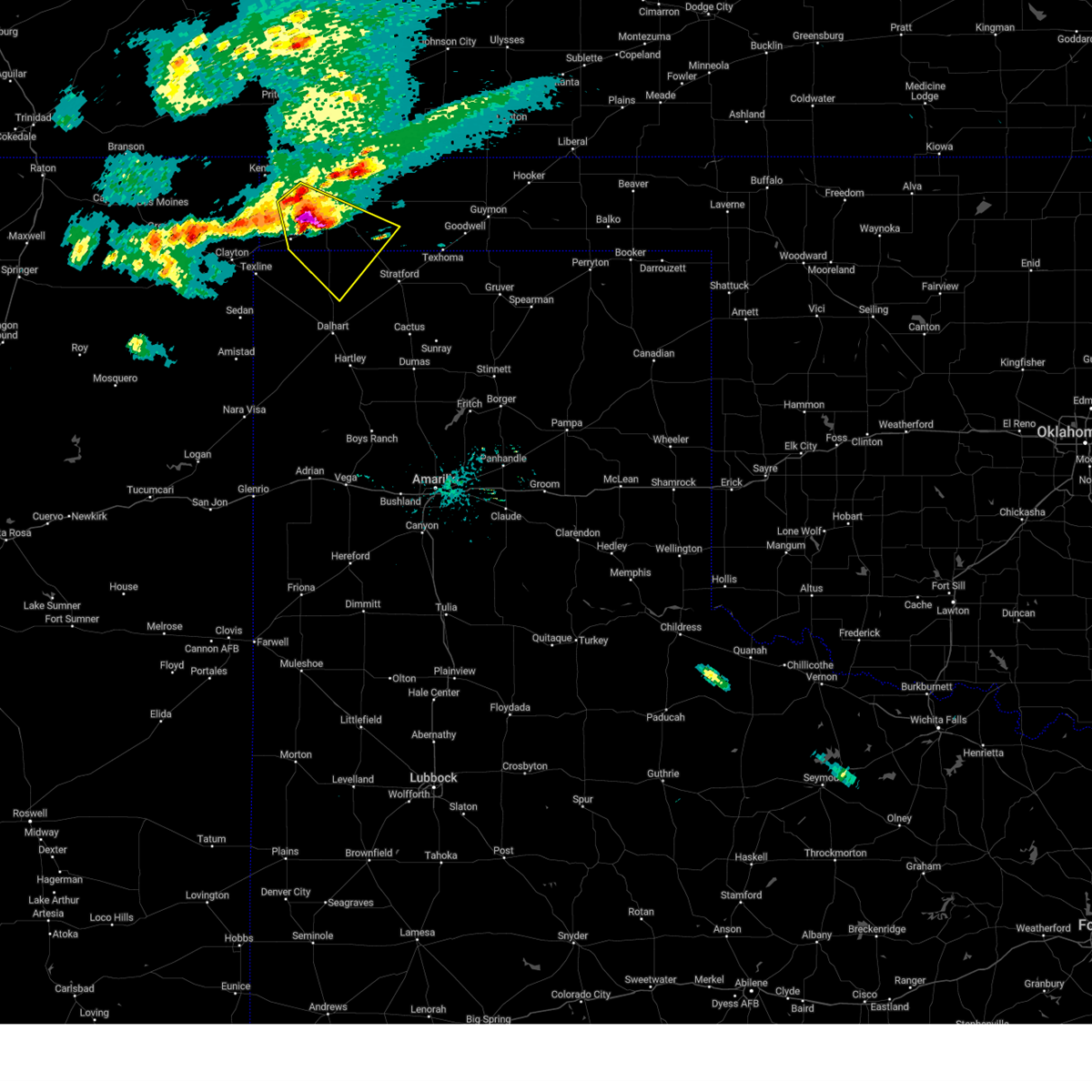 At 354 pm cdt, a severe thunderstorm was located 10 miles southwest of boise city, moving southeast at 35 mph (radar indicated). Hazards include golf ball size hail and 60 mph wind gusts. Minor damage to roofs, siding, and trees is possible. people and animals outdoors will be injured. expect hail damage to roofs, siding, windows, and vehicles. locations impacted include, boise city, felt and griggs. thunderstorm damage threat, considerable hail threat, radar indicated max hail size, 1. 75 in wind threat, radar indicated max wind gust, 60 mph. At 354 pm cdt, a severe thunderstorm was located 10 miles southwest of boise city, moving southeast at 35 mph (radar indicated). Hazards include golf ball size hail and 60 mph wind gusts. Minor damage to roofs, siding, and trees is possible. people and animals outdoors will be injured. expect hail damage to roofs, siding, windows, and vehicles. locations impacted include, boise city, felt and griggs. thunderstorm damage threat, considerable hail threat, radar indicated max hail size, 1. 75 in wind threat, radar indicated max wind gust, 60 mph.
|
| 6/13/2023 3:41 PM CDT |
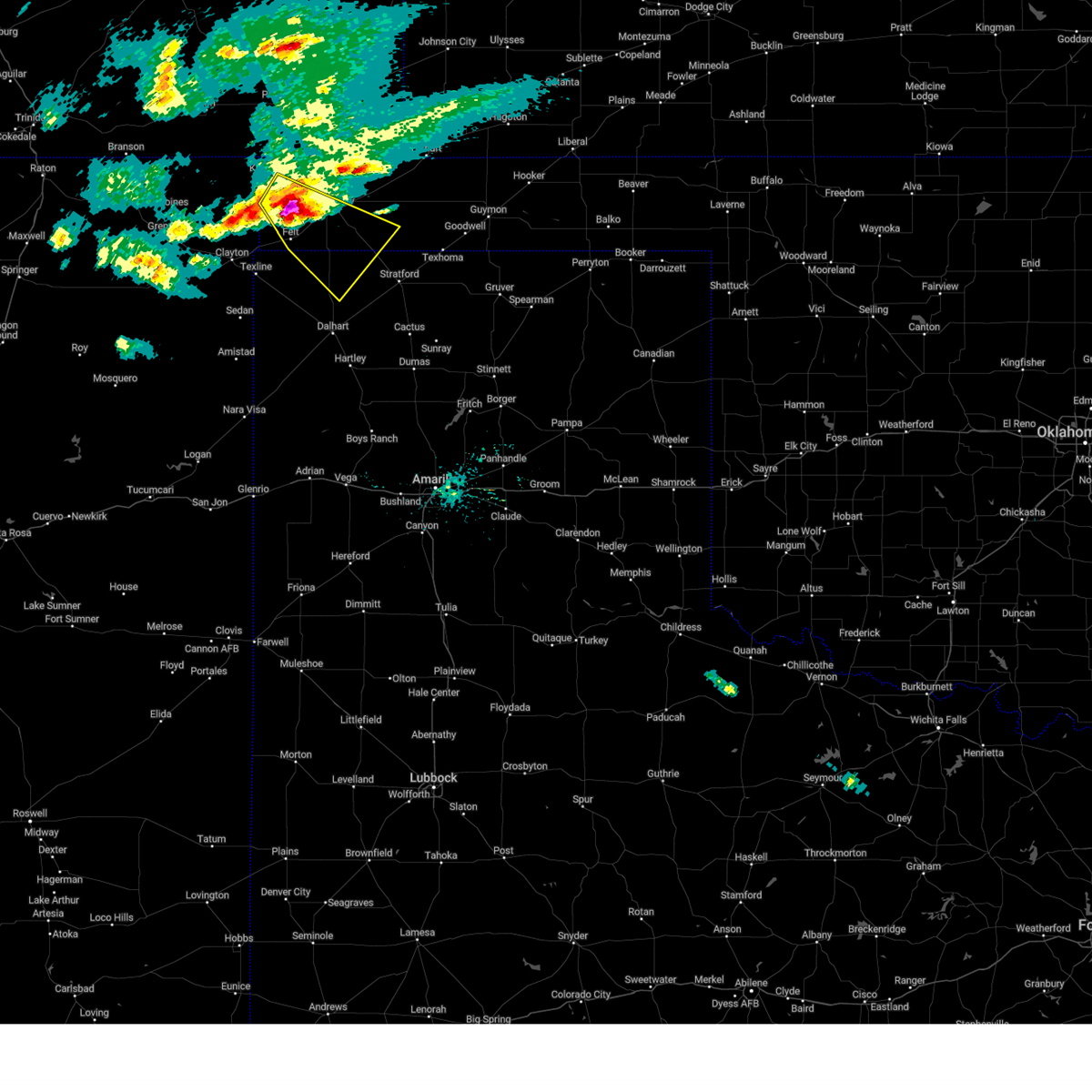 At 341 pm cdt, a severe thunderstorm was located 7 miles northeast of felt, or 11 miles southwest of boise city, moving southeast at 35 mph (radar indicated). Hazards include golf ball size hail and 60 mph wind gusts. Minor damage to roofs, siding, and trees is possible. people and animals outdoors will be injured. Expect hail damage to roofs, siding, windows, and vehicles. At 341 pm cdt, a severe thunderstorm was located 7 miles northeast of felt, or 11 miles southwest of boise city, moving southeast at 35 mph (radar indicated). Hazards include golf ball size hail and 60 mph wind gusts. Minor damage to roofs, siding, and trees is possible. people and animals outdoors will be injured. Expect hail damage to roofs, siding, windows, and vehicles.
|
| 6/13/2023 3:26 PM CDT |
 At 326 pm cdt, a severe thunderstorm was located 6 miles southwest of black mesa park, or 26 miles northeast of clayton, moving southeast at 15 mph (radar indicated). Hazards include golf ball size hail and 60 mph wind gusts. Minor damage to roofs, siding, and trees is possible. people and animals outdoors will be injured. expect hail damage to roofs, siding, windows, and vehicles. locations impacted include, kenton, wheeless, black mesa park and felt. thunderstorm damage threat, considerable hail threat, radar indicated max hail size, 1. 75 in wind threat, radar indicated max wind gust, 60 mph. At 326 pm cdt, a severe thunderstorm was located 6 miles southwest of black mesa park, or 26 miles northeast of clayton, moving southeast at 15 mph (radar indicated). Hazards include golf ball size hail and 60 mph wind gusts. Minor damage to roofs, siding, and trees is possible. people and animals outdoors will be injured. expect hail damage to roofs, siding, windows, and vehicles. locations impacted include, kenton, wheeless, black mesa park and felt. thunderstorm damage threat, considerable hail threat, radar indicated max hail size, 1. 75 in wind threat, radar indicated max wind gust, 60 mph.
|
| 6/13/2023 2:45 PM CDT |
 At 245 pm cdt, a severe thunderstorm was located 8 miles west of kenton, or 28 miles north of clayton, moving southeast at 15 mph (radar indicated). Hazards include ping pong ball size hail and 60 mph wind gusts. Minor damage to roofs, siding, and trees is possible. people and animals outdoors will be injured. Expect hail damage to roofs, siding, windows, and vehicles. At 245 pm cdt, a severe thunderstorm was located 8 miles west of kenton, or 28 miles north of clayton, moving southeast at 15 mph (radar indicated). Hazards include ping pong ball size hail and 60 mph wind gusts. Minor damage to roofs, siding, and trees is possible. people and animals outdoors will be injured. Expect hail damage to roofs, siding, windows, and vehicles.
|
| 6/12/2023 4:48 AM CDT |
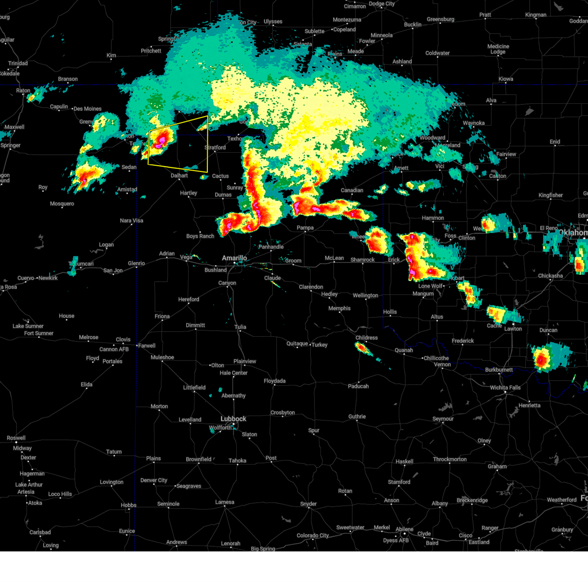 At 448 am cdt, a severe thunderstorm was located 13 miles southeast of felt, or 20 miles south of boise city, moving east at 35 mph (radar indicated). Hazards include 60 mph wind gusts and quarter size hail. Minor damage to roofs, siding, and trees is possible. hail damage to vehicles is expected. locations impacted include, conlen. hail threat, observed max hail size, 1. 00in wind threat, radar indicated max wind gust, 60 mph. At 448 am cdt, a severe thunderstorm was located 13 miles southeast of felt, or 20 miles south of boise city, moving east at 35 mph (radar indicated). Hazards include 60 mph wind gusts and quarter size hail. Minor damage to roofs, siding, and trees is possible. hail damage to vehicles is expected. locations impacted include, conlen. hail threat, observed max hail size, 1. 00in wind threat, radar indicated max wind gust, 60 mph.
|
| 6/12/2023 4:48 AM CDT |
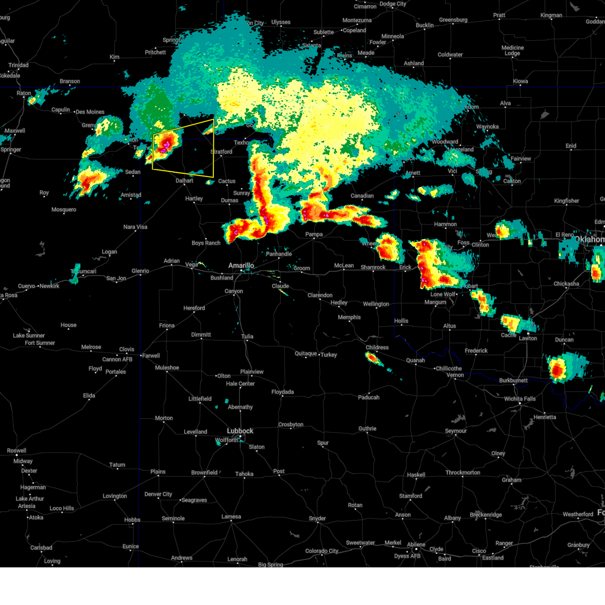 At 448 am cdt, a severe thunderstorm was located 13 miles southeast of felt, or 20 miles south of boise city, moving east at 35 mph (radar indicated). Hazards include 60 mph wind gusts and quarter size hail. Minor damage to roofs, siding, and trees is possible. hail damage to vehicles is expected. locations impacted include, conlen. hail threat, observed max hail size, 1. 00in wind threat, radar indicated max wind gust, 60 mph. At 448 am cdt, a severe thunderstorm was located 13 miles southeast of felt, or 20 miles south of boise city, moving east at 35 mph (radar indicated). Hazards include 60 mph wind gusts and quarter size hail. Minor damage to roofs, siding, and trees is possible. hail damage to vehicles is expected. locations impacted include, conlen. hail threat, observed max hail size, 1. 00in wind threat, radar indicated max wind gust, 60 mph.
|
| 6/12/2023 4:23 AM CDT |
 At 422 am cdt, a severe thunderstorm was located 7 miles east of texline, or 16 miles east of clayton, moving east at 35 mph (public. at 409 am cdt, quarter size hail was reported in clayton). Hazards include ping pong ball size hail and 60 mph wind gusts. Minor damage to roofs, siding, and trees is possible. people and animals outdoors will be injured. expect hail damage to roofs, siding, windows, and vehicles. locations impacted include, texline, felt and conlen. hail threat, observed max hail size, 1. 50 in wind threat, radar indicated max wind gust, 60 mph. At 422 am cdt, a severe thunderstorm was located 7 miles east of texline, or 16 miles east of clayton, moving east at 35 mph (public. at 409 am cdt, quarter size hail was reported in clayton). Hazards include ping pong ball size hail and 60 mph wind gusts. Minor damage to roofs, siding, and trees is possible. people and animals outdoors will be injured. expect hail damage to roofs, siding, windows, and vehicles. locations impacted include, texline, felt and conlen. hail threat, observed max hail size, 1. 50 in wind threat, radar indicated max wind gust, 60 mph.
|
| 6/12/2023 4:04 AM CDT |
 At 403 am cdt, a severe thunderstorm was located 4 miles east of clayton, moving east at 35 mph (radar indicated). Hazards include two inch hail and 60 mph wind gusts. Minor damage to roofs, siding, and trees is possible. people and animals outdoors will be injured. Expect hail damage to roofs, siding, windows, and vehicles. At 403 am cdt, a severe thunderstorm was located 4 miles east of clayton, moving east at 35 mph (radar indicated). Hazards include two inch hail and 60 mph wind gusts. Minor damage to roofs, siding, and trees is possible. people and animals outdoors will be injured. Expect hail damage to roofs, siding, windows, and vehicles.
|
| 6/12/2023 1:44 AM CDT |
 At 144 am cdt, a severe thunderstorm was located 7 miles northwest of sedan, or 16 miles south of clayton, moving east at 40 mph (radar indicated). Hazards include tennis ball size hail and 70 mph wind gusts. Expect some tree damage. damage is likely to mobile homes, roofs, and outbuildings. people and animals outdoors will be injured. Expect hail damage to roofs, siding, windows, and vehicles. At 144 am cdt, a severe thunderstorm was located 7 miles northwest of sedan, or 16 miles south of clayton, moving east at 40 mph (radar indicated). Hazards include tennis ball size hail and 70 mph wind gusts. Expect some tree damage. damage is likely to mobile homes, roofs, and outbuildings. people and animals outdoors will be injured. Expect hail damage to roofs, siding, windows, and vehicles.
|
| 6/11/2023 10:40 PM CDT | Half Dollar sized hail reported 11.2 miles W of Felt, OK, mostly quarter with a few half dollars. |
| 6/11/2023 10:26 PM CDT |
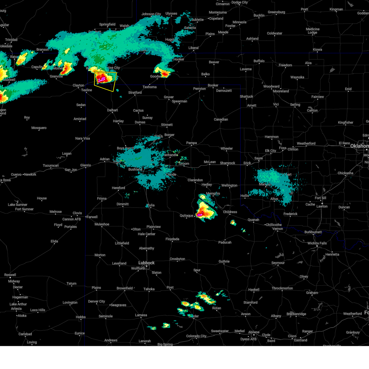 At 1026 pm cdt, a severe thunderstorm was located 7 miles east of felt, or 14 miles southwest of boise city, moving east at 30 mph (radar indicated). Hazards include tennis ball size hail and 70 mph wind gusts. Expect some tree damage. damage is likely to mobile homes, roofs, and outbuildings. people and animals outdoors will be injured. expect hail damage to roofs, siding, windows, and vehicles. locations impacted include, felt. thunderstorm damage threat, considerable hail threat, radar indicated max hail size, 2. 50 in wind threat, radar indicated max wind gust, 70 mph. At 1026 pm cdt, a severe thunderstorm was located 7 miles east of felt, or 14 miles southwest of boise city, moving east at 30 mph (radar indicated). Hazards include tennis ball size hail and 70 mph wind gusts. Expect some tree damage. damage is likely to mobile homes, roofs, and outbuildings. people and animals outdoors will be injured. expect hail damage to roofs, siding, windows, and vehicles. locations impacted include, felt. thunderstorm damage threat, considerable hail threat, radar indicated max hail size, 2. 50 in wind threat, radar indicated max wind gust, 70 mph.
|
| 6/11/2023 10:13 PM CDT | Hen Egg sized hail reported 0.3 miles N of Felt, OK, report from social media with picture. time estimated based on radar. |
| 6/11/2023 10:13 PM CDT | Hen Egg sized hail reported 2.8 miles E of Felt, OK |
| 6/11/2023 10:11 PM CDT |
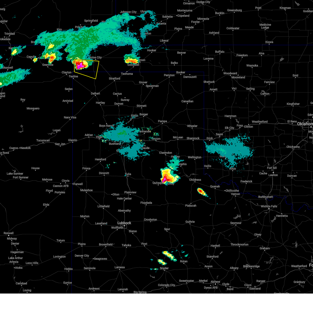 At 1011 pm cdt, a severe thunderstorm was located over felt, or 17 miles southwest of boise city, moving east at 35 mph (radar indicated). Hazards include tennis ball size hail and 70 mph wind gusts. Expect some tree damage. damage is likely to mobile homes, roofs, and outbuildings. people and animals outdoors will be injured. expect hail damage to roofs, siding, windows, and vehicles. locations impacted include, felt and wheeless. thunderstorm damage threat, considerable hail threat, radar indicated max hail size, 2. 50 in wind threat, radar indicated max wind gust, 70 mph. At 1011 pm cdt, a severe thunderstorm was located over felt, or 17 miles southwest of boise city, moving east at 35 mph (radar indicated). Hazards include tennis ball size hail and 70 mph wind gusts. Expect some tree damage. damage is likely to mobile homes, roofs, and outbuildings. people and animals outdoors will be injured. expect hail damage to roofs, siding, windows, and vehicles. locations impacted include, felt and wheeless. thunderstorm damage threat, considerable hail threat, radar indicated max hail size, 2. 50 in wind threat, radar indicated max wind gust, 70 mph.
|
| 6/11/2023 9:47 PM CDT |
 At 946 pm cdt, a severe thunderstorm was located 5 miles east of seneca, or 14 miles northeast of clayton, moving east at 30 mph. this is a destructive storm for felt (radar indicated). Hazards include baseball size hail and 70 mph wind gusts. People and animals outdoors will be severely injured. Expect shattered windows, extensive damage to roofs, siding, and vehicles. At 946 pm cdt, a severe thunderstorm was located 5 miles east of seneca, or 14 miles northeast of clayton, moving east at 30 mph. this is a destructive storm for felt (radar indicated). Hazards include baseball size hail and 70 mph wind gusts. People and animals outdoors will be severely injured. Expect shattered windows, extensive damage to roofs, siding, and vehicles.
|
| 6/11/2023 9:47 PM CDT |
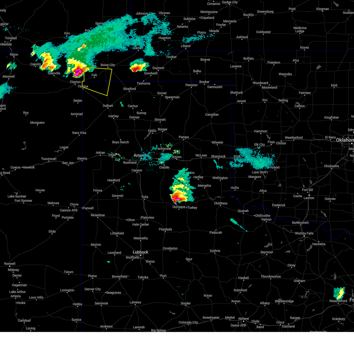 At 946 pm cdt, a severe thunderstorm was located 5 miles east of seneca, or 14 miles northeast of clayton, moving east at 30 mph. this is a destructive storm for felt (radar indicated). Hazards include baseball size hail and 70 mph wind gusts. People and animals outdoors will be severely injured. Expect shattered windows, extensive damage to roofs, siding, and vehicles. At 946 pm cdt, a severe thunderstorm was located 5 miles east of seneca, or 14 miles northeast of clayton, moving east at 30 mph. this is a destructive storm for felt (radar indicated). Hazards include baseball size hail and 70 mph wind gusts. People and animals outdoors will be severely injured. Expect shattered windows, extensive damage to roofs, siding, and vehicles.
|
| 6/2/2023 3:19 PM CDT |
 At 319 pm cdt, a severe thunderstorm was located 13 miles southeast of campo, or 14 miles north of boise city, moving north at 50 mph (radar indicated). Hazards include 60 mph wind gusts. Minor damage to roofs, siding, and trees is possible. locations impacted include, boise city, keyes, kenton, wheeless, black mesa park, felt, conlen, griggs and sturgis. hail threat, radar indicated max hail size, <. 75 in wind threat, radar indicated max wind gust, 60 mph. At 319 pm cdt, a severe thunderstorm was located 13 miles southeast of campo, or 14 miles north of boise city, moving north at 50 mph (radar indicated). Hazards include 60 mph wind gusts. Minor damage to roofs, siding, and trees is possible. locations impacted include, boise city, keyes, kenton, wheeless, black mesa park, felt, conlen, griggs and sturgis. hail threat, radar indicated max hail size, <. 75 in wind threat, radar indicated max wind gust, 60 mph.
|
| 6/2/2023 2:53 PM CDT |
 At 252 pm cdt, a severe thunderstorm was located 9 miles south of boise city, moving north at 50 mph (radar indicated). Hazards include 60 mph wind gusts. Minor damage to roofs, siding, and trees is possible. locations impacted include, dalhart, boise city, keyes, kenton, wheeless, ware, black mesa park, felt, conlen, griggs and sturgis. hail threat, radar indicated max hail size, <. 75 in wind threat, radar indicated max wind gust, 60 mph. At 252 pm cdt, a severe thunderstorm was located 9 miles south of boise city, moving north at 50 mph (radar indicated). Hazards include 60 mph wind gusts. Minor damage to roofs, siding, and trees is possible. locations impacted include, dalhart, boise city, keyes, kenton, wheeless, ware, black mesa park, felt, conlen, griggs and sturgis. hail threat, radar indicated max hail size, <. 75 in wind threat, radar indicated max wind gust, 60 mph.
|
| 6/2/2023 2:32 PM CDT |
 At 232 pm cdt, a severe thunderstorm was located 14 miles northwest of conlen, or 18 miles north of dalhart, moving north at 40 mph (radar indicated). Hazards include 60 mph wind gusts. Minor damage to roofs, siding, and trees is possible. locations impacted include, dalhart, boise city, keyes, kenton, wheeless, ware, black mesa park, felt, conlen, griggs and sturgis. hail threat, radar indicated max hail size, <. 75 in wind threat, radar indicated max wind gust, 60 mph. At 232 pm cdt, a severe thunderstorm was located 14 miles northwest of conlen, or 18 miles north of dalhart, moving north at 40 mph (radar indicated). Hazards include 60 mph wind gusts. Minor damage to roofs, siding, and trees is possible. locations impacted include, dalhart, boise city, keyes, kenton, wheeless, ware, black mesa park, felt, conlen, griggs and sturgis. hail threat, radar indicated max hail size, <. 75 in wind threat, radar indicated max wind gust, 60 mph.
|
| 6/2/2023 2:18 PM CDT |
 At 218 pm cdt, a severe thunderstorm was located 10 miles north of dalhart, moving north at 35 mph (radar indicated). Hazards include 60 mph wind gusts. Minor damage to roofs, siding, and trees is possible. locations impacted include, dalhart, boise city, keyes, kenton, wheeless, ware, black mesa park, felt, conlen, griggs and sturgis. hail threat, radar indicated max hail size, <. 75 in wind threat, radar indicated max wind gust, 60 mph. At 218 pm cdt, a severe thunderstorm was located 10 miles north of dalhart, moving north at 35 mph (radar indicated). Hazards include 60 mph wind gusts. Minor damage to roofs, siding, and trees is possible. locations impacted include, dalhart, boise city, keyes, kenton, wheeless, ware, black mesa park, felt, conlen, griggs and sturgis. hail threat, radar indicated max hail size, <. 75 in wind threat, radar indicated max wind gust, 60 mph.
|
| 6/2/2023 2:01 PM CDT |
 At 201 pm cdt, a severe thunderstorm was located over dalhart, moving north at 50 mph (radar indicated). Hazards include 70 mph wind gusts. Expect some tree damage. Damage is likely to mobile homes, roofs, and outbuildings. At 201 pm cdt, a severe thunderstorm was located over dalhart, moving north at 50 mph (radar indicated). Hazards include 70 mph wind gusts. Expect some tree damage. Damage is likely to mobile homes, roofs, and outbuildings.
|
| 5/10/2023 7:23 PM CDT |
 At 721 pm cdt, severe thunderstorms were located from 6 miles northeast of sedan to 2 miles west of kenton, moving northeast at 50 mph (radar indicated). Hazards include 60 mph wind gusts and penny size hail. Minor damage to roofs, siding, and trees is possible. Blowing dust may reduce visibilities. At 721 pm cdt, severe thunderstorms were located from 6 miles northeast of sedan to 2 miles west of kenton, moving northeast at 50 mph (radar indicated). Hazards include 60 mph wind gusts and penny size hail. Minor damage to roofs, siding, and trees is possible. Blowing dust may reduce visibilities.
|
| 4/25/2023 5:06 PM CDT |
 At 505 pm cdt, a severe thunderstorm was located 5 miles west of boise city, moving northeast at 30 mph (radar indicated). Hazards include 60 mph wind gusts and quarter size hail. Minor damage to roofs, siding, and trees is possible. hail damage to vehicles is expected. locations impacted include, boise city, kenton, black mesa park and felt. hail threat, radar indicated max hail size, 1. 00in wind threat, radar indicated max wind gust, 60 mph. At 505 pm cdt, a severe thunderstorm was located 5 miles west of boise city, moving northeast at 30 mph (radar indicated). Hazards include 60 mph wind gusts and quarter size hail. Minor damage to roofs, siding, and trees is possible. hail damage to vehicles is expected. locations impacted include, boise city, kenton, black mesa park and felt. hail threat, radar indicated max hail size, 1. 00in wind threat, radar indicated max wind gust, 60 mph.
|
| 4/25/2023 4:44 PM CDT |
 At 444 pm cdt, a severe thunderstorm was located over black mesa park, or 21 miles west of boise city, moving northeast at 30 mph (radar indicated). Hazards include 60 mph wind gusts and quarter size hail. Minor damage to roofs, siding, and trees is possible. Hail damage to vehicles is expected. At 444 pm cdt, a severe thunderstorm was located over black mesa park, or 21 miles west of boise city, moving northeast at 30 mph (radar indicated). Hazards include 60 mph wind gusts and quarter size hail. Minor damage to roofs, siding, and trees is possible. Hail damage to vehicles is expected.
|
| 7/28/2022 9:25 PM CDT |
 At 924 pm cdt, a severe thunderstorm was located 8 miles northeast of texline, or 14 miles east of clayton, moving north at 15 mph (radar indicated). Hazards include 60 mph wind gusts and penny size hail. Minor damage to roofs, siding, and trees is possible. locations impacted include, texline, kenton, wheeless, black mesa park and felt. hail threat, radar indicated max hail size, 0. 75in wind threat, radar indicated max wind gust, 60 mph. At 924 pm cdt, a severe thunderstorm was located 8 miles northeast of texline, or 14 miles east of clayton, moving north at 15 mph (radar indicated). Hazards include 60 mph wind gusts and penny size hail. Minor damage to roofs, siding, and trees is possible. locations impacted include, texline, kenton, wheeless, black mesa park and felt. hail threat, radar indicated max hail size, 0. 75in wind threat, radar indicated max wind gust, 60 mph.
|
| 7/28/2022 9:06 PM CDT |
 At 906 pm cdt, a severe thunderstorm was located 5 miles east of texline, or 14 miles east of clayton, moving north at 15 mph (radar indicated). Hazards include 60 mph wind gusts and nickel size hail. Minor damage to roofs, siding, and trees is possible. locations impacted include, texline, kenton, wheeless, black mesa park and felt. hail threat, radar indicated max hail size, 0. 88in wind threat, radar indicated max wind gust, 60 mph. At 906 pm cdt, a severe thunderstorm was located 5 miles east of texline, or 14 miles east of clayton, moving north at 15 mph (radar indicated). Hazards include 60 mph wind gusts and nickel size hail. Minor damage to roofs, siding, and trees is possible. locations impacted include, texline, kenton, wheeless, black mesa park and felt. hail threat, radar indicated max hail size, 0. 88in wind threat, radar indicated max wind gust, 60 mph.
|
| 7/28/2022 8:56 PM CDT |
 At 856 pm cdt, a severe thunderstorm was located 5 miles east of texline, or 15 miles southeast of clayton, moving north at 15 mph (radar indicated). Hazards include 60 mph wind gusts and quarter size hail. Minor damage to roofs, siding, and trees is possible. Hail damage to vehicles is expected. At 856 pm cdt, a severe thunderstorm was located 5 miles east of texline, or 15 miles southeast of clayton, moving north at 15 mph (radar indicated). Hazards include 60 mph wind gusts and quarter size hail. Minor damage to roofs, siding, and trees is possible. Hail damage to vehicles is expected.
|
| 7/2/2022 6:49 PM CDT |
 At 649 pm cdt, a severe thunderstorm was located 5 miles southeast of wheeless, or 18 miles west of boise city, moving northeast at 25 mph (radar indicated). Hazards include 60 mph wind gusts and quarter size hail. Minor damage to roofs, siding, and trees is possible. Hail damage to vehicles is expected. At 649 pm cdt, a severe thunderstorm was located 5 miles southeast of wheeless, or 18 miles west of boise city, moving northeast at 25 mph (radar indicated). Hazards include 60 mph wind gusts and quarter size hail. Minor damage to roofs, siding, and trees is possible. Hail damage to vehicles is expected.
|
| 6/8/2022 3:46 AM CDT |
 At 346 am cdt, severe thunderstorms were located along a line extending from near campo to 8 miles west of elkhart, moving southwest at 45 mph (radar indicated). Hazards include 70 mph wind gusts and quarter size hail. Expect some tree damage. damage is likely to mobile homes, roofs, and outbuildings. Hail damage to vehicles is expected. At 346 am cdt, severe thunderstorms were located along a line extending from near campo to 8 miles west of elkhart, moving southwest at 45 mph (radar indicated). Hazards include 70 mph wind gusts and quarter size hail. Expect some tree damage. damage is likely to mobile homes, roofs, and outbuildings. Hail damage to vehicles is expected.
|
| 6/6/2022 7:42 PM CDT |
 At 742 pm cdt, a severe thunderstorm was located 9 miles south of felt, or 22 miles east of clayton, moving southeast at 25 mph (radar indicated). Hazards include ping pong ball size hail and 60 mph wind gusts. Minor damage to roofs, siding, and trees is possible. people and animals outdoors will be injured. expect hail damage to roofs, siding, windows, and vehicles. locations impacted include, felt. hail threat, radar indicated max hail size, 1. 50 in wind threat, radar indicated max wind gust, 60 mph. At 742 pm cdt, a severe thunderstorm was located 9 miles south of felt, or 22 miles east of clayton, moving southeast at 25 mph (radar indicated). Hazards include ping pong ball size hail and 60 mph wind gusts. Minor damage to roofs, siding, and trees is possible. people and animals outdoors will be injured. expect hail damage to roofs, siding, windows, and vehicles. locations impacted include, felt. hail threat, radar indicated max hail size, 1. 50 in wind threat, radar indicated max wind gust, 60 mph.
|
| 6/6/2022 7:42 PM CDT |
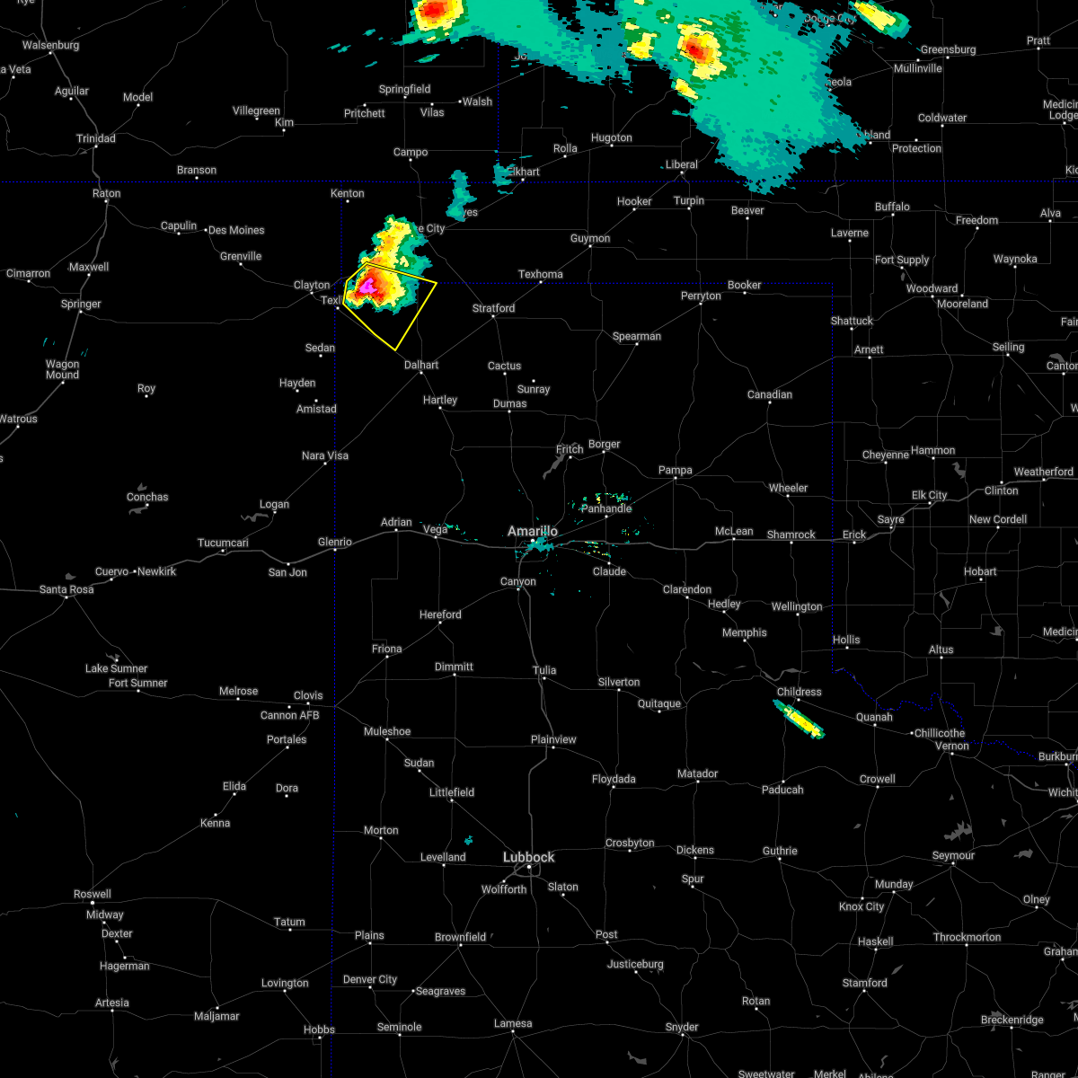 At 742 pm cdt, a severe thunderstorm was located 9 miles south of felt, or 22 miles east of clayton, moving southeast at 25 mph (radar indicated). Hazards include ping pong ball size hail and 60 mph wind gusts. Minor damage to roofs, siding, and trees is possible. people and animals outdoors will be injured. expect hail damage to roofs, siding, windows, and vehicles. locations impacted include, felt. hail threat, radar indicated max hail size, 1. 50 in wind threat, radar indicated max wind gust, 60 mph. At 742 pm cdt, a severe thunderstorm was located 9 miles south of felt, or 22 miles east of clayton, moving southeast at 25 mph (radar indicated). Hazards include ping pong ball size hail and 60 mph wind gusts. Minor damage to roofs, siding, and trees is possible. people and animals outdoors will be injured. expect hail damage to roofs, siding, windows, and vehicles. locations impacted include, felt. hail threat, radar indicated max hail size, 1. 50 in wind threat, radar indicated max wind gust, 60 mph.
|
| 6/6/2022 7:24 PM CDT |
 At 723 pm cdt, a severe thunderstorm was located 9 miles southwest of felt, or 15 miles east of clayton, moving southeast at 25 mph (radar indicated). Hazards include 60 mph wind gusts and quarter size hail. Minor damage to roofs, siding, and trees is possible. Hail damage to vehicles is expected. At 723 pm cdt, a severe thunderstorm was located 9 miles southwest of felt, or 15 miles east of clayton, moving southeast at 25 mph (radar indicated). Hazards include 60 mph wind gusts and quarter size hail. Minor damage to roofs, siding, and trees is possible. Hail damage to vehicles is expected.
|
| 6/6/2022 7:24 PM CDT |
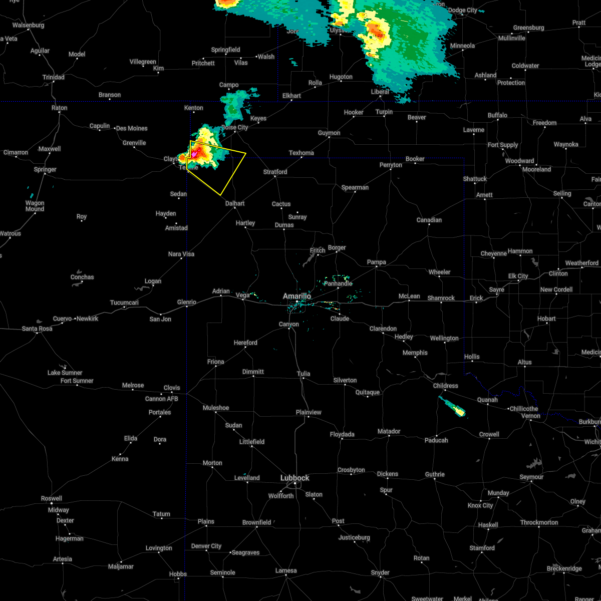 At 723 pm cdt, a severe thunderstorm was located 9 miles southwest of felt, or 15 miles east of clayton, moving southeast at 25 mph (radar indicated). Hazards include 60 mph wind gusts and quarter size hail. Minor damage to roofs, siding, and trees is possible. Hail damage to vehicles is expected. At 723 pm cdt, a severe thunderstorm was located 9 miles southwest of felt, or 15 miles east of clayton, moving southeast at 25 mph (radar indicated). Hazards include 60 mph wind gusts and quarter size hail. Minor damage to roofs, siding, and trees is possible. Hail damage to vehicles is expected.
|
| 5/23/2022 6:50 PM CDT |
 At 650 pm cdt, a severe thunderstorm was located 4 miles northeast of texline, or 12 miles east of clayton, moving east at 25 mph (radar indicated). Hazards include 60 mph wind gusts and quarter size hail. Minor damage to roofs, siding, and trees is possible. hail damage to vehicles is expected. accumulating hail is occurring and covering the roads which will lead to dangerous driving conditions. locations impacted include, texline and felt. hail threat, radar indicated max hail size, 1. 00in wind threat, radar indicated max wind gust, 60 mph. At 650 pm cdt, a severe thunderstorm was located 4 miles northeast of texline, or 12 miles east of clayton, moving east at 25 mph (radar indicated). Hazards include 60 mph wind gusts and quarter size hail. Minor damage to roofs, siding, and trees is possible. hail damage to vehicles is expected. accumulating hail is occurring and covering the roads which will lead to dangerous driving conditions. locations impacted include, texline and felt. hail threat, radar indicated max hail size, 1. 00in wind threat, radar indicated max wind gust, 60 mph.
|
| 5/23/2022 6:27 PM CDT |
 At 627 pm cdt, a severe thunderstorm was located over clayton, moving east at 25 mph (radar indicated). Hazards include 60 mph wind gusts and quarter size hail. Minor damage to roofs, siding, and trees is possible. Hail damage to vehicles is expected. At 627 pm cdt, a severe thunderstorm was located over clayton, moving east at 25 mph (radar indicated). Hazards include 60 mph wind gusts and quarter size hail. Minor damage to roofs, siding, and trees is possible. Hail damage to vehicles is expected.
|
| 5/1/2022 8:10 PM CDT |
 At 810 pm cdt, a severe thunderstorm was located 8 miles northeast of felt, or 10 miles southwest of boise city, moving northeast at 35 mph (radar indicated). Hazards include 60 mph wind gusts and quarter size hail. Minor damage to roofs, siding, and trees is possible. hail damage to vehicles is expected. locations impacted include, boise city and felt. hail threat, radar indicated max hail size, 1. 00in wind threat, radar indicated max wind gust, 60 mph. At 810 pm cdt, a severe thunderstorm was located 8 miles northeast of felt, or 10 miles southwest of boise city, moving northeast at 35 mph (radar indicated). Hazards include 60 mph wind gusts and quarter size hail. Minor damage to roofs, siding, and trees is possible. hail damage to vehicles is expected. locations impacted include, boise city and felt. hail threat, radar indicated max hail size, 1. 00in wind threat, radar indicated max wind gust, 60 mph.
|
| 5/1/2022 7:34 PM CDT |
 At 734 pm cdt, a severe thunderstorm was located 6 miles northeast of texline, or 13 miles east of clayton, moving northeast at 35 mph (radar indicated). Hazards include 60 mph wind gusts and quarter size hail. Minor damage to roofs, siding, and trees is possible. Hail damage to vehicles is expected. At 734 pm cdt, a severe thunderstorm was located 6 miles northeast of texline, or 13 miles east of clayton, moving northeast at 35 mph (radar indicated). Hazards include 60 mph wind gusts and quarter size hail. Minor damage to roofs, siding, and trees is possible. Hail damage to vehicles is expected.
|
| 9/5/2021 6:11 PM CDT |
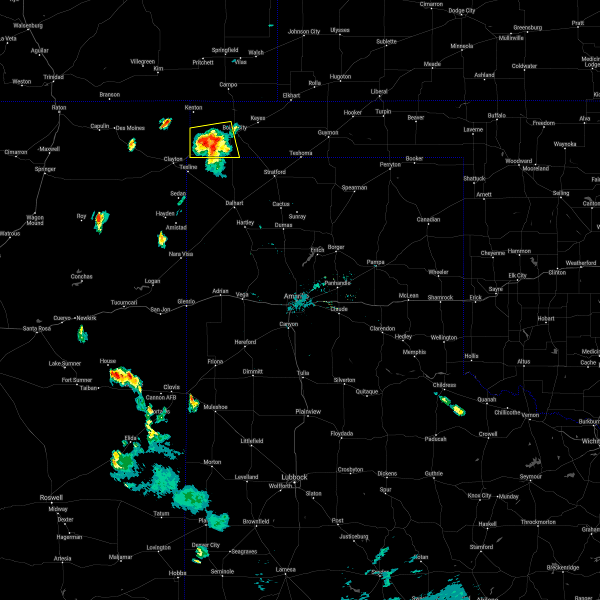 The severe thunderstorm warning for southwestern cimarron county will expire at 615 pm cdt, the storm which prompted the warning has weakened below severe limits, and no longer poses an immediate threat to life or property. therefore, the warning will be allowed to expire. however gusty winds and heavy rain are still possible with this thunderstorm. The severe thunderstorm warning for southwestern cimarron county will expire at 615 pm cdt, the storm which prompted the warning has weakened below severe limits, and no longer poses an immediate threat to life or property. therefore, the warning will be allowed to expire. however gusty winds and heavy rain are still possible with this thunderstorm.
|
| 9/5/2021 6:04 PM CDT |
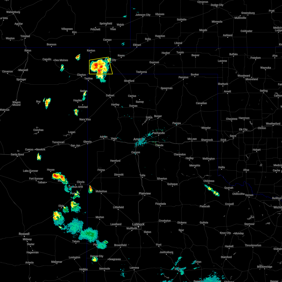 At 604 pm cdt, a severe thunderstorm was located over felt, or 17 miles southwest of boise city, moving east at 5 mph (radar indicated). Hazards include 60 mph wind gusts and quarter size hail. Minor damage to roofs, siding, and trees is possible. hail damage to vehicles is expected. locations impacted include, felt and wheeless. hail threat, radar indicated max hail size, 1. 00in wind threat, radar indicated max wind gust, 60 mph. At 604 pm cdt, a severe thunderstorm was located over felt, or 17 miles southwest of boise city, moving east at 5 mph (radar indicated). Hazards include 60 mph wind gusts and quarter size hail. Minor damage to roofs, siding, and trees is possible. hail damage to vehicles is expected. locations impacted include, felt and wheeless. hail threat, radar indicated max hail size, 1. 00in wind threat, radar indicated max wind gust, 60 mph.
|
| 9/5/2021 5:58 PM CDT |
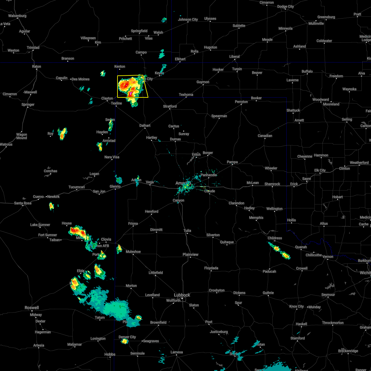 At 557 pm cdt, a severe thunderstorm was located over felt, or 19 miles southwest of boise city, moving south at 10 mph (radar indicated). Hazards include 60 mph wind gusts and half dollar size hail. Minor damage to roofs, siding, and trees is possible. hail damage to vehicles is expected. locations impacted include, felt and wheeless. hail threat, radar indicated max hail size, 1. 25 in wind threat, radar indicated max wind gust, 60 mph. At 557 pm cdt, a severe thunderstorm was located over felt, or 19 miles southwest of boise city, moving south at 10 mph (radar indicated). Hazards include 60 mph wind gusts and half dollar size hail. Minor damage to roofs, siding, and trees is possible. hail damage to vehicles is expected. locations impacted include, felt and wheeless. hail threat, radar indicated max hail size, 1. 25 in wind threat, radar indicated max wind gust, 60 mph.
|
| 9/5/2021 5:46 PM CDT |
 At 545 pm cdt, a severe thunderstorm was located over wheeless, or 22 miles northeast of clayton, moving southwest at 15 mph. another severe thunderstorm was located over felt and it was stationary (radar indicated). Hazards include 60 mph wind gusts and half dollar size hail. Minor damage to roofs, siding, and trees is possible. hail damage to vehicles is expected. locations impacted include, felt and wheeless. hail threat, radar indicated max hail size, 1. 25 in wind threat, radar indicated max wind gust, 60 mph. At 545 pm cdt, a severe thunderstorm was located over wheeless, or 22 miles northeast of clayton, moving southwest at 15 mph. another severe thunderstorm was located over felt and it was stationary (radar indicated). Hazards include 60 mph wind gusts and half dollar size hail. Minor damage to roofs, siding, and trees is possible. hail damage to vehicles is expected. locations impacted include, felt and wheeless. hail threat, radar indicated max hail size, 1. 25 in wind threat, radar indicated max wind gust, 60 mph.
|
| 9/5/2021 5:34 PM CDT |
 At 534 pm cdt, a severe thunderstorm was located over wheeless, or 20 miles west of boise city, moving southwest at 20 mph (radar indicated). Hazards include 60 mph wind gusts and half dollar size hail. Minor damage to roofs, siding, and trees is possible. hail damage to vehicles is expected. locations impacted include, felt and wheeless. hail threat, radar indicated max hail size, 1. 25 in wind threat, radar indicated max wind gust, 60 mph. At 534 pm cdt, a severe thunderstorm was located over wheeless, or 20 miles west of boise city, moving southwest at 20 mph (radar indicated). Hazards include 60 mph wind gusts and half dollar size hail. Minor damage to roofs, siding, and trees is possible. hail damage to vehicles is expected. locations impacted include, felt and wheeless. hail threat, radar indicated max hail size, 1. 25 in wind threat, radar indicated max wind gust, 60 mph.
|
| 9/5/2021 5:24 PM CDT |
 At 524 pm cdt, a severe thunderstorm was located 5 miles southeast of black mesa park, or 17 miles west of boise city, moving southeast at 5 mph (radar indicated). Hazards include 60 mph wind gusts and quarter size hail. Minor damage to roofs, siding, and trees is possible. hail damage to vehicles is expected. locations impacted include, black mesa park, felt and wheeless. hail threat, radar indicated max hail size, 1. 00in wind threat, radar indicated max wind gust, 60 mph. At 524 pm cdt, a severe thunderstorm was located 5 miles southeast of black mesa park, or 17 miles west of boise city, moving southeast at 5 mph (radar indicated). Hazards include 60 mph wind gusts and quarter size hail. Minor damage to roofs, siding, and trees is possible. hail damage to vehicles is expected. locations impacted include, black mesa park, felt and wheeless. hail threat, radar indicated max hail size, 1. 00in wind threat, radar indicated max wind gust, 60 mph.
|
| 9/5/2021 5:13 PM CDT |
 At 513 pm cdt, a severe thunderstorm was located 4 miles southeast of black mesa park, or 17 miles west of boise city, moving south at 5 mph (radar indicated). Hazards include 60 mph wind gusts and quarter size hail. Minor damage to roofs, siding, and trees is possible. Hail damage to vehicles is expected. At 513 pm cdt, a severe thunderstorm was located 4 miles southeast of black mesa park, or 17 miles west of boise city, moving south at 5 mph (radar indicated). Hazards include 60 mph wind gusts and quarter size hail. Minor damage to roofs, siding, and trees is possible. Hail damage to vehicles is expected.
|
| 8/7/2021 5:11 PM CDT |
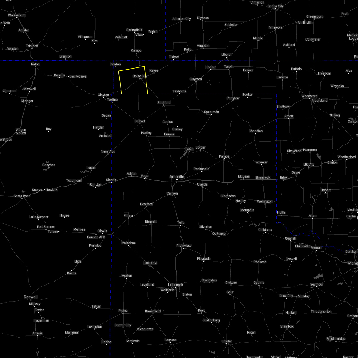 At 510 pm cdt, a severe thunderstorm was located 4 miles northeast of felt, or 14 miles southwest of boise city, moving east at 20 mph (radar indicated). Hazards include 60 mph wind gusts and quarter size hail. Minor damage to roofs, siding, and trees is possible. hail damage to vehicles is expected. locations impacted include, boise city and felt. hail threat, radar indicated max hail size, 1. 00in wind threat, radar indicated max wind gust, 60 mph. At 510 pm cdt, a severe thunderstorm was located 4 miles northeast of felt, or 14 miles southwest of boise city, moving east at 20 mph (radar indicated). Hazards include 60 mph wind gusts and quarter size hail. Minor damage to roofs, siding, and trees is possible. hail damage to vehicles is expected. locations impacted include, boise city and felt. hail threat, radar indicated max hail size, 1. 00in wind threat, radar indicated max wind gust, 60 mph.
|
| 8/7/2021 4:54 PM CDT |
 At 454 pm cdt, a severe thunderstorm was located near felt, or 20 miles southwest of boise city, moving east at 20 mph (radar indicated). Hazards include 70 mph wind gusts and half dollar size hail. Expect some tree damage. damage is likely to mobile homes, roofs, and outbuildings. hail damage to vehicles is expected. locations impacted include, boise city, felt and wheeless. thunderstorm damage threat, considerable hail threat, radar indicated max hail size, 1. 25 in wind threat, radar indicated max wind gust, 70 mph. At 454 pm cdt, a severe thunderstorm was located near felt, or 20 miles southwest of boise city, moving east at 20 mph (radar indicated). Hazards include 70 mph wind gusts and half dollar size hail. Expect some tree damage. damage is likely to mobile homes, roofs, and outbuildings. hail damage to vehicles is expected. locations impacted include, boise city, felt and wheeless. thunderstorm damage threat, considerable hail threat, radar indicated max hail size, 1. 25 in wind threat, radar indicated max wind gust, 70 mph.
|
| 8/7/2021 4:39 PM CDT |
 At 439 pm cdt, a severe thunderstorm was located 4 miles southwest of wheeless, or 19 miles northeast of clayton, moving east at 20 mph (radar indicated). Hazards include 70 mph wind gusts and quarter size hail. Expect some tree damage. damage is likely to mobile homes, roofs, and outbuildings. Hail damage to vehicles is expected. At 439 pm cdt, a severe thunderstorm was located 4 miles southwest of wheeless, or 19 miles northeast of clayton, moving east at 20 mph (radar indicated). Hazards include 70 mph wind gusts and quarter size hail. Expect some tree damage. damage is likely to mobile homes, roofs, and outbuildings. Hail damage to vehicles is expected.
|
| 7/4/2021 9:00 PM CDT |
 At 859 pm cdt, severe thunderstorms were located along a line extending from 18 miles northwest of conlen to 3 miles southeast of felt to 8 miles northwest of kenton, moving south at 35 mph (radar indicated). Hazards include 60 mph wind gusts and quarter size hail. Minor damage to roofs, siding, and trees is possible. Hail damage to vehicles is expected. At 859 pm cdt, severe thunderstorms were located along a line extending from 18 miles northwest of conlen to 3 miles southeast of felt to 8 miles northwest of kenton, moving south at 35 mph (radar indicated). Hazards include 60 mph wind gusts and quarter size hail. Minor damage to roofs, siding, and trees is possible. Hail damage to vehicles is expected.
|
| 7/4/2021 8:39 PM CDT |
 At 839 pm cdt, a severe thunderstorm was located 9 miles south of boise city, moving south at 35 mph. this is a very dangerous storm (radar indicated). Hazards include 80 mph wind gusts and quarter size hail. Flying debris will be dangerous to those caught without shelter. mobile homes will be heavily damaged. expect considerable damage to roofs, windows, and vehicles. tree damage and power outages are likely. hail damage to vehicles is expected. Locations impacted include, boise city, keyes, kenton, wheeless, black mesa park, felt, griggs and sturgis. At 839 pm cdt, a severe thunderstorm was located 9 miles south of boise city, moving south at 35 mph. this is a very dangerous storm (radar indicated). Hazards include 80 mph wind gusts and quarter size hail. Flying debris will be dangerous to those caught without shelter. mobile homes will be heavily damaged. expect considerable damage to roofs, windows, and vehicles. tree damage and power outages are likely. hail damage to vehicles is expected. Locations impacted include, boise city, keyes, kenton, wheeless, black mesa park, felt, griggs and sturgis.
|
| 7/4/2021 8:33 PM CDT |
 At 833 pm cdt, a severe thunderstorm was located 8 miles south of boise city, moving south at 35 mph (radar indicated). Hazards include 70 mph wind gusts and half dollar size hail. Expect some tree damage. damage is likely to mobile homes, roofs, and outbuildings. hail damage to vehicles is expected. Locations impacted include, boise city, keyes, kenton, wheeless, black mesa park, felt, griggs and sturgis. At 833 pm cdt, a severe thunderstorm was located 8 miles south of boise city, moving south at 35 mph (radar indicated). Hazards include 70 mph wind gusts and half dollar size hail. Expect some tree damage. damage is likely to mobile homes, roofs, and outbuildings. hail damage to vehicles is expected. Locations impacted include, boise city, keyes, kenton, wheeless, black mesa park, felt, griggs and sturgis.
|
| 7/4/2021 8:12 PM CDT |
 At 812 pm cdt, a severe thunderstorm was located 8 miles northeast of boise city, moving south at 25 mph (radar indicated). Hazards include golf ball size hail and 60 mph wind gusts. Minor damage to roofs, siding, and trees is possible. people and animals outdoors will be injured. expect hail damage to roofs, siding, windows, and vehicles. Locations impacted include, boise city, keyes, kenton, wheeless, black mesa park, felt, griggs and sturgis. At 812 pm cdt, a severe thunderstorm was located 8 miles northeast of boise city, moving south at 25 mph (radar indicated). Hazards include golf ball size hail and 60 mph wind gusts. Minor damage to roofs, siding, and trees is possible. people and animals outdoors will be injured. expect hail damage to roofs, siding, windows, and vehicles. Locations impacted include, boise city, keyes, kenton, wheeless, black mesa park, felt, griggs and sturgis.
|
| 7/4/2021 7:55 PM CDT |
 At 755 pm cdt, a severe thunderstorm was located 10 miles northwest of keyes, or 16 miles northeast of boise city, moving south at 25 mph (radar indicated). Hazards include golf ball size hail and 60 mph wind gusts. Minor damage to roofs, siding, and trees is possible. people and animals outdoors will be injured. expect hail damage to roofs, siding, windows, and vehicles. Locations impacted include, boise city, keyes, kenton, wheeless, black mesa park, felt, griggs and sturgis. At 755 pm cdt, a severe thunderstorm was located 10 miles northwest of keyes, or 16 miles northeast of boise city, moving south at 25 mph (radar indicated). Hazards include golf ball size hail and 60 mph wind gusts. Minor damage to roofs, siding, and trees is possible. people and animals outdoors will be injured. expect hail damage to roofs, siding, windows, and vehicles. Locations impacted include, boise city, keyes, kenton, wheeless, black mesa park, felt, griggs and sturgis.
|
| 7/4/2021 7:31 PM CDT |
 At 731 pm cdt, a severe thunderstorm was located 16 miles north of keyes, or 19 miles west of elkhart, moving south at 25 mph (radar indicated). Hazards include golf ball size hail and 60 mph wind gusts. Minor damage to roofs, siding, and trees is possible. people and animals outdoors will be injured. Expect hail damage to roofs, siding, windows, and vehicles. At 731 pm cdt, a severe thunderstorm was located 16 miles north of keyes, or 19 miles west of elkhart, moving south at 25 mph (radar indicated). Hazards include golf ball size hail and 60 mph wind gusts. Minor damage to roofs, siding, and trees is possible. people and animals outdoors will be injured. Expect hail damage to roofs, siding, windows, and vehicles.
|
| 6/12/2021 11:39 PM CDT |
 At 1139 pm cdt, a severe thunderstorm was located near conlen, or 14 miles southwest of stratford, moving southeast at 30 mph (radar indicated). Hazards include 70 mph wind gusts and quarter size hail. Expect some tree damage. damage is likely to mobile homes, roofs, and outbuildings. hail damage to vehicles is expected. Locations impacted include, dalhart, stratford, hartley, cactus, texline, ware, felt, conlen, griggs and texhoma. At 1139 pm cdt, a severe thunderstorm was located near conlen, or 14 miles southwest of stratford, moving southeast at 30 mph (radar indicated). Hazards include 70 mph wind gusts and quarter size hail. Expect some tree damage. damage is likely to mobile homes, roofs, and outbuildings. hail damage to vehicles is expected. Locations impacted include, dalhart, stratford, hartley, cactus, texline, ware, felt, conlen, griggs and texhoma.
|
| 6/12/2021 11:27 PM CDT |
 At 1127 pm cdt, a severe thunderstorm was located near conlen, or 13 miles west of stratford, moving southeast at 30 mph. this is a very dangerous storm (radar indicated). Hazards include 80 mph wind gusts and quarter size hail. Flying debris will be dangerous to those caught without shelter. mobile homes will be heavily damaged. expect considerable damage to roofs, windows, and vehicles. tree damage and power outages are likely. hail damage to vehicles is expected. Locations impacted include, dalhart, stratford, hartley, cactus, texline, ware, felt, conlen, griggs and texhoma. At 1127 pm cdt, a severe thunderstorm was located near conlen, or 13 miles west of stratford, moving southeast at 30 mph. this is a very dangerous storm (radar indicated). Hazards include 80 mph wind gusts and quarter size hail. Flying debris will be dangerous to those caught without shelter. mobile homes will be heavily damaged. expect considerable damage to roofs, windows, and vehicles. tree damage and power outages are likely. hail damage to vehicles is expected. Locations impacted include, dalhart, stratford, hartley, cactus, texline, ware, felt, conlen, griggs and texhoma.
|
| 6/12/2021 11:01 PM CDT |
 At 1101 pm cdt, a severe thunderstorm was located 17 miles northwest of conlen, or 20 miles west of stratford, moving southeast at 30 mph (radar indicated). Hazards include 70 mph wind gusts and penny size hail. Expect some tree damage. Damage is likely to mobile homes, roofs, and outbuildings. At 1101 pm cdt, a severe thunderstorm was located 17 miles northwest of conlen, or 20 miles west of stratford, moving southeast at 30 mph (radar indicated). Hazards include 70 mph wind gusts and penny size hail. Expect some tree damage. Damage is likely to mobile homes, roofs, and outbuildings.
|
| 5/30/2021 6:04 PM CDT |
 At 604 pm cdt, a severe thunderstorm was located 5 miles west of boise city, moving northeast at 25 mph. this is a very dangerous storm (radar indicated). Hazards include baseball size hail and 60 mph wind gusts. People and animals outdoors will be severely injured. expect shattered windows, extensive damage to roofs, siding, and vehicles. locations impacted include, felt. A tornado watch remains in effect until midnight cdt for the panhandle of oklahoma. At 604 pm cdt, a severe thunderstorm was located 5 miles west of boise city, moving northeast at 25 mph. this is a very dangerous storm (radar indicated). Hazards include baseball size hail and 60 mph wind gusts. People and animals outdoors will be severely injured. expect shattered windows, extensive damage to roofs, siding, and vehicles. locations impacted include, felt. A tornado watch remains in effect until midnight cdt for the panhandle of oklahoma.
|
| 5/30/2021 6:01 PM CDT |
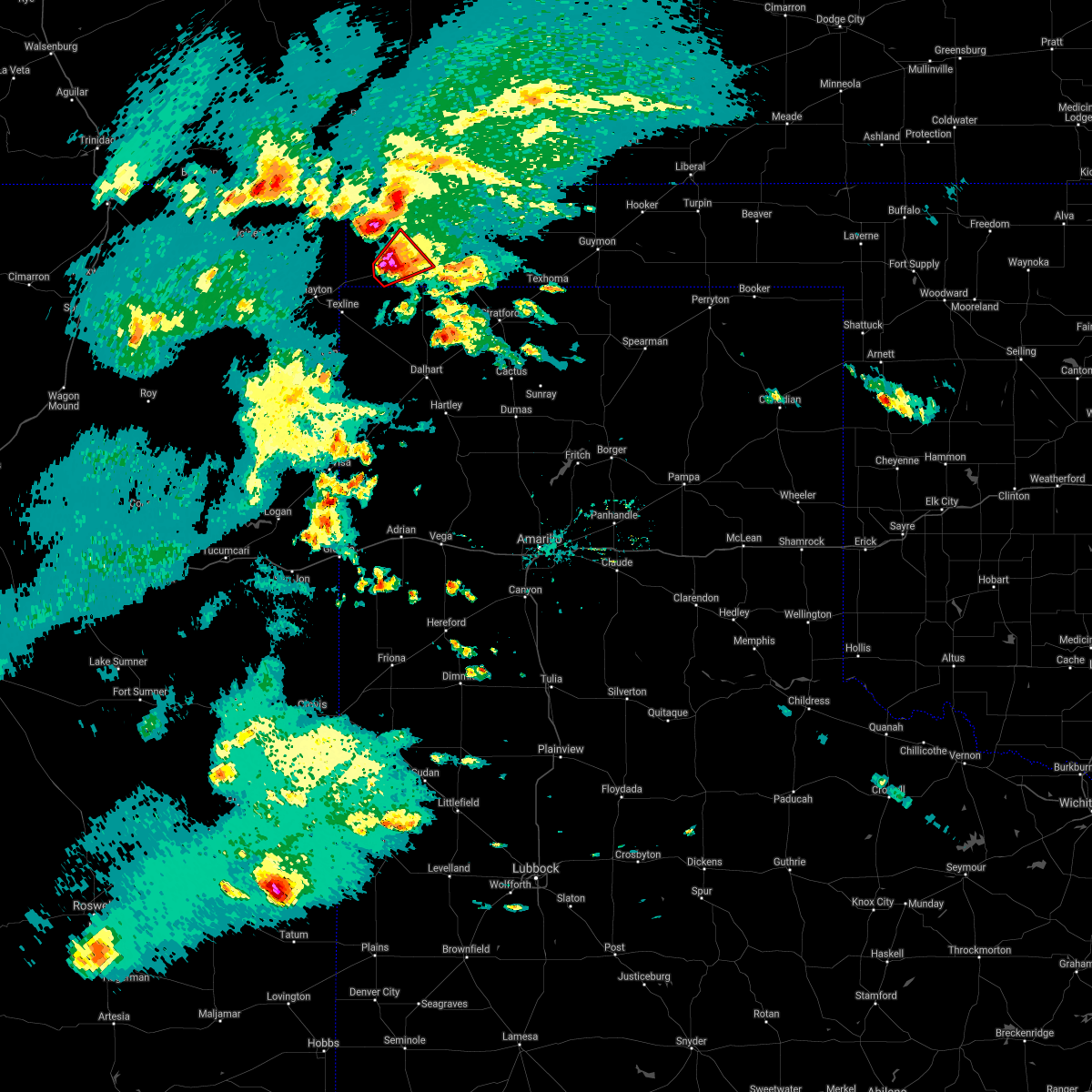 At 538 pm cdt, a confirmed tornado was located over felt, or 20 miles southwest of boise city, moving northeast at 20 mph (live storm chaser video confirmed tornado). Hazards include damaging tornado and baseball size hail. Flying debris will be dangerous to those caught without shelter. mobile homes will be damaged or destroyed. damage to roofs, windows, and vehicles will occur. Tree damage is likely. At 538 pm cdt, a confirmed tornado was located over felt, or 20 miles southwest of boise city, moving northeast at 20 mph (live storm chaser video confirmed tornado). Hazards include damaging tornado and baseball size hail. Flying debris will be dangerous to those caught without shelter. mobile homes will be damaged or destroyed. damage to roofs, windows, and vehicles will occur. Tree damage is likely.
|
| 5/30/2021 5:41 PM CDT | Golf Ball sized hail reported 4.5 miles ENE of Felt, OK, storm chaser reports golf ball size hail. |
| 5/30/2021 5:39 PM CDT |
 At 538 pm cdt, a confirmed tornado was located over felt, or 20 miles southwest of boise city, moving northeast at 20 mph (live storm chaser video confirmed tornado). Hazards include damaging tornado and baseball size hail. Flying debris will be dangerous to those caught without shelter. mobile homes will be damaged or destroyed. damage to roofs, windows, and vehicles will occur. Tree damage is likely. At 538 pm cdt, a confirmed tornado was located over felt, or 20 miles southwest of boise city, moving northeast at 20 mph (live storm chaser video confirmed tornado). Hazards include damaging tornado and baseball size hail. Flying debris will be dangerous to those caught without shelter. mobile homes will be damaged or destroyed. damage to roofs, windows, and vehicles will occur. Tree damage is likely.
|
| 5/30/2021 5:26 PM CDT |
 At 526 pm cdt, a severe thunderstorm was located near felt, or 19 miles southwest of boise city, moving northeast at 25 mph. this is a very dangerous storm (radar indicated). Hazards include baseball size hail and 60 mph wind gusts. People and animals outdoors will be severely injured. expect shattered windows, extensive damage to roofs, siding, and vehicles. locations impacted include, felt. A tornado watch remains in effect until midnight cdt for the panhandle of oklahoma, and the panhandle of texas. At 526 pm cdt, a severe thunderstorm was located near felt, or 19 miles southwest of boise city, moving northeast at 25 mph. this is a very dangerous storm (radar indicated). Hazards include baseball size hail and 60 mph wind gusts. People and animals outdoors will be severely injured. expect shattered windows, extensive damage to roofs, siding, and vehicles. locations impacted include, felt. A tornado watch remains in effect until midnight cdt for the panhandle of oklahoma, and the panhandle of texas.
|
| 5/30/2021 5:26 PM CDT |
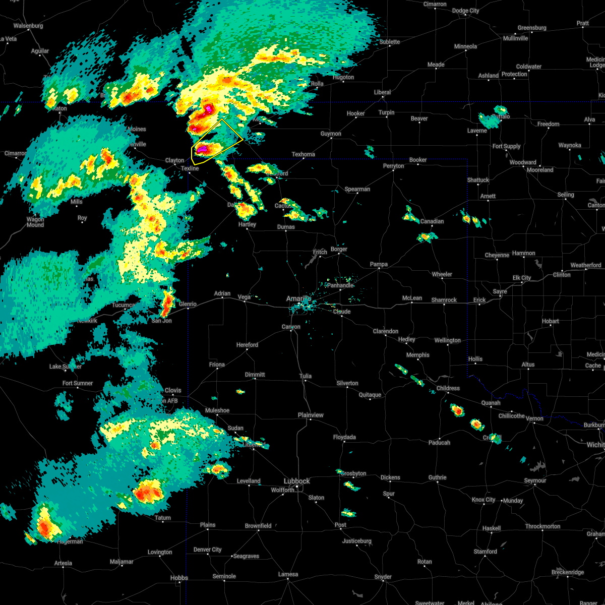 At 526 pm cdt, a severe thunderstorm was located near felt, or 19 miles southwest of boise city, moving northeast at 25 mph. this is a very dangerous storm (radar indicated). Hazards include baseball size hail and 60 mph wind gusts. People and animals outdoors will be severely injured. expect shattered windows, extensive damage to roofs, siding, and vehicles. locations impacted include, felt. A tornado watch remains in effect until midnight cdt for the panhandle of oklahoma, and the panhandle of texas. At 526 pm cdt, a severe thunderstorm was located near felt, or 19 miles southwest of boise city, moving northeast at 25 mph. this is a very dangerous storm (radar indicated). Hazards include baseball size hail and 60 mph wind gusts. People and animals outdoors will be severely injured. expect shattered windows, extensive damage to roofs, siding, and vehicles. locations impacted include, felt. A tornado watch remains in effect until midnight cdt for the panhandle of oklahoma, and the panhandle of texas.
|
| 5/30/2021 5:22 PM CDT |
 At 521 pm cdt, a severe thunderstorm was located 4 miles west of felt, or 20 miles northeast of clayton, moving northeast at 25 mph (radar indicated). Hazards include two inch hail and 60 mph wind gusts. Minor damage to roofs, siding, and trees is possible. people and animals outdoors will be injured. expect hail damage to roofs, siding, windows, and vehicles. locations impacted include, felt. A tornado watch remains in effect until midnight cdt for the panhandle of oklahoma, and the panhandle of texas. At 521 pm cdt, a severe thunderstorm was located 4 miles west of felt, or 20 miles northeast of clayton, moving northeast at 25 mph (radar indicated). Hazards include two inch hail and 60 mph wind gusts. Minor damage to roofs, siding, and trees is possible. people and animals outdoors will be injured. expect hail damage to roofs, siding, windows, and vehicles. locations impacted include, felt. A tornado watch remains in effect until midnight cdt for the panhandle of oklahoma, and the panhandle of texas.
|
| 5/30/2021 5:14 PM CDT |
 At 513 pm cdt, a severe thunderstorm was located 7 miles west of felt, or 16 miles northeast of clayton, moving northeast at 25 mph (radar indicated). Hazards include 60 mph wind gusts and quarter size hail. Minor damage to roofs, siding, and trees is possible. Hail damage to vehicles is expected. At 513 pm cdt, a severe thunderstorm was located 7 miles west of felt, or 16 miles northeast of clayton, moving northeast at 25 mph (radar indicated). Hazards include 60 mph wind gusts and quarter size hail. Minor damage to roofs, siding, and trees is possible. Hail damage to vehicles is expected.
|
| 5/30/2021 5:14 PM CDT |
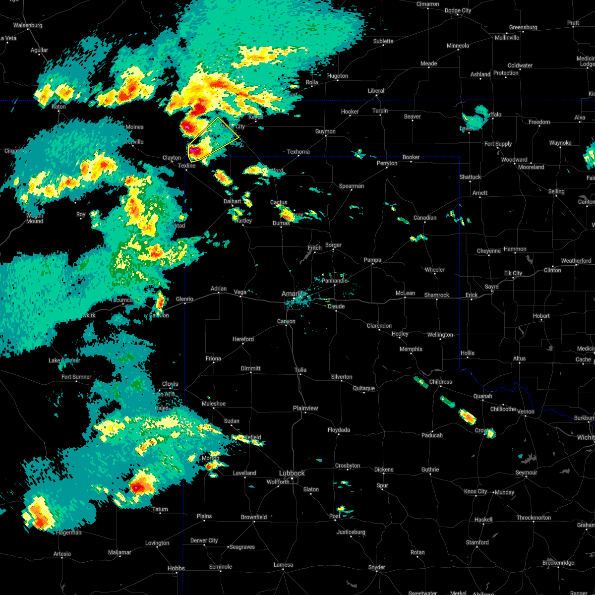 At 513 pm cdt, a severe thunderstorm was located 7 miles west of felt, or 16 miles northeast of clayton, moving northeast at 25 mph (radar indicated). Hazards include 60 mph wind gusts and quarter size hail. Minor damage to roofs, siding, and trees is possible. Hail damage to vehicles is expected. At 513 pm cdt, a severe thunderstorm was located 7 miles west of felt, or 16 miles northeast of clayton, moving northeast at 25 mph (radar indicated). Hazards include 60 mph wind gusts and quarter size hail. Minor damage to roofs, siding, and trees is possible. Hail damage to vehicles is expected.
|
| 5/18/2021 1:42 PM CDT |
 At 136 pm cdt, a severe thunderstorm was located 9 miles northwest of boise city, moving north at 20 mph (radar indicated). Hazards include 60 mph wind gusts and quarter size hail. Minor damage to roofs, siding, and trees is possible. hail damage to vehicles is expected. Locations impacted include, kenton, wheeless, black mesa park and felt. At 136 pm cdt, a severe thunderstorm was located 9 miles northwest of boise city, moving north at 20 mph (radar indicated). Hazards include 60 mph wind gusts and quarter size hail. Minor damage to roofs, siding, and trees is possible. hail damage to vehicles is expected. Locations impacted include, kenton, wheeless, black mesa park and felt.
|
| 5/18/2021 1:37 PM CDT |
 At 136 pm cdt, a severe thunderstorm was located 9 miles northwest of boise city, moving north at 20 mph (radar indicated). Hazards include 60 mph wind gusts and quarter size hail. Minor damage to roofs, siding, and trees is possible. hail damage to vehicles is expected. Locations impacted include, kenton, wheeless, black mesa park and felt. At 136 pm cdt, a severe thunderstorm was located 9 miles northwest of boise city, moving north at 20 mph (radar indicated). Hazards include 60 mph wind gusts and quarter size hail. Minor damage to roofs, siding, and trees is possible. hail damage to vehicles is expected. Locations impacted include, kenton, wheeless, black mesa park and felt.
|
| 5/18/2021 1:28 PM CDT |
 At 128 pm cdt, a severe thunderstorm was located 8 miles west of boise city, moving northwest at 20 mph (radar indicated). Hazards include 60 mph wind gusts and half dollar size hail. Minor damage to roofs, siding, and trees is possible. Hail damage to vehicles is expected. At 128 pm cdt, a severe thunderstorm was located 8 miles west of boise city, moving northwest at 20 mph (radar indicated). Hazards include 60 mph wind gusts and half dollar size hail. Minor damage to roofs, siding, and trees is possible. Hail damage to vehicles is expected.
|
| 5/17/2021 8:31 PM CDT |
 At 830 pm cdt, automated weather equipment reported severe thunderstorms were located along a line extending from 11 miles northwest of campo to 7 miles southwest of griggs, moving northeast at 50 mph (automated weather equipment measured a wind gust of 59 mph at 815 pm cdt in boise city). Hazards include 60 mph wind gusts and quarter size hail. Minor damage to roofs, siding, and trees is possible. hail damage to vehicles is expected. Locations impacted include, boise city, keyes, kenton, wheeless, black mesa park, felt, griggs and sturgis. At 830 pm cdt, automated weather equipment reported severe thunderstorms were located along a line extending from 11 miles northwest of campo to 7 miles southwest of griggs, moving northeast at 50 mph (automated weather equipment measured a wind gust of 59 mph at 815 pm cdt in boise city). Hazards include 60 mph wind gusts and quarter size hail. Minor damage to roofs, siding, and trees is possible. hail damage to vehicles is expected. Locations impacted include, boise city, keyes, kenton, wheeless, black mesa park, felt, griggs and sturgis.
|
| 5/17/2021 8:05 PM CDT |
 At 805 pm cdt, severe thunderstorms were located along a line extending from 7 miles north of kenton to 12 miles west of conlen, moving northeast at 50 mph (radar indicated). Hazards include 60 mph wind gusts and quarter size hail. Minor damage to roofs, siding, and trees is possible. Hail damage to vehicles is expected. At 805 pm cdt, severe thunderstorms were located along a line extending from 7 miles north of kenton to 12 miles west of conlen, moving northeast at 50 mph (radar indicated). Hazards include 60 mph wind gusts and quarter size hail. Minor damage to roofs, siding, and trees is possible. Hail damage to vehicles is expected.
|
| 5/17/2021 8:05 PM CDT |
 The national weather service in amarillo has issued a * severe thunderstorm warning for. southwestern texas county in the panhandle of oklahoma. cimarron county in the panhandle of oklahoma. northwestern sherman county in the panhandle of texas. Northern dallam county in the panhandle of texas. The national weather service in amarillo has issued a * severe thunderstorm warning for. southwestern texas county in the panhandle of oklahoma. cimarron county in the panhandle of oklahoma. northwestern sherman county in the panhandle of texas. Northern dallam county in the panhandle of texas.
|
| 5/17/2021 7:25 PM CDT |
 At 725 pm cdt, severe thunderstorms were located along a line extending from 10 miles southeast of seneca to near dalhart, moving northeast at 45 mph (radar indicated). Hazards include 60 mph wind gusts and quarter size hail. Minor damage to roofs, siding, and trees is possible. hail damage to vehicles is expected. Locations impacted include, dalhart, stratford, cactus, texline, ware, felt, conlen and griggs. At 725 pm cdt, severe thunderstorms were located along a line extending from 10 miles southeast of seneca to near dalhart, moving northeast at 45 mph (radar indicated). Hazards include 60 mph wind gusts and quarter size hail. Minor damage to roofs, siding, and trees is possible. hail damage to vehicles is expected. Locations impacted include, dalhart, stratford, cactus, texline, ware, felt, conlen and griggs.
|
| 5/17/2021 7:15 PM CDT |
 At 715 pm cdt, severe thunderstorms were located along a line extending from 8 miles north of texline to 6 miles southwest of dalhart, moving northeast at 45 mph (radar indicated). Hazards include golf ball size hail and 60 mph wind gusts. Minor damage to roofs, siding, and trees is possible. people and animals outdoors will be injured. Expect hail damage to roofs, siding, windows, and vehicles. At 715 pm cdt, severe thunderstorms were located along a line extending from 8 miles north of texline to 6 miles southwest of dalhart, moving northeast at 45 mph (radar indicated). Hazards include golf ball size hail and 60 mph wind gusts. Minor damage to roofs, siding, and trees is possible. people and animals outdoors will be injured. Expect hail damage to roofs, siding, windows, and vehicles.
|
| 5/15/2021 7:58 PM CDT |
 The severe thunderstorm warning for western cimarron and northwestern dallam counties will expire at 800 pm cdt, the storms which prompted the warning have weakened below severe limits, and no longer pose an immediate threat to life or property. therefore, the warning will be allowed to expire. however gusty winds are still possible with these thunderstorms. a severe thunderstorm watch remains in effect until 1100 pm cdt for the panhandle of oklahoma, and the panhandle of texas. The severe thunderstorm warning for western cimarron and northwestern dallam counties will expire at 800 pm cdt, the storms which prompted the warning have weakened below severe limits, and no longer pose an immediate threat to life or property. therefore, the warning will be allowed to expire. however gusty winds are still possible with these thunderstorms. a severe thunderstorm watch remains in effect until 1100 pm cdt for the panhandle of oklahoma, and the panhandle of texas.
|
| 5/15/2021 7:32 PM CDT |
 At 732 pm cdt, severe thunderstorms were located along a line extending from 11 miles north of boise city to 7 miles east of felt to 9 miles northwest of ware, moving east at 30 mph (radar indicated). Hazards include 60 mph wind gusts and quarter size hail. Minor damage to roofs, siding, and trees is possible. hail damage to vehicles is expected. Locations impacted include, boise city, texline, wheeless and felt. At 732 pm cdt, severe thunderstorms were located along a line extending from 11 miles north of boise city to 7 miles east of felt to 9 miles northwest of ware, moving east at 30 mph (radar indicated). Hazards include 60 mph wind gusts and quarter size hail. Minor damage to roofs, siding, and trees is possible. hail damage to vehicles is expected. Locations impacted include, boise city, texline, wheeless and felt.
|
| 5/15/2021 6:57 PM CDT |
 At 657 pm cdt, severe thunderstorms were located along a line extending from 7 miles east of black mesa park to 7 miles east of seneca to 5 miles southeast of clayton, moving northeast at 30 mph (radar indicated). Hazards include 70 mph wind gusts and half dollar size hail. Expect some tree damage. damage is likely to mobile homes, roofs, and outbuildings. Hail damage to vehicles is expected. At 657 pm cdt, severe thunderstorms were located along a line extending from 7 miles east of black mesa park to 7 miles east of seneca to 5 miles southeast of clayton, moving northeast at 30 mph (radar indicated). Hazards include 70 mph wind gusts and half dollar size hail. Expect some tree damage. damage is likely to mobile homes, roofs, and outbuildings. Hail damage to vehicles is expected.
|
| 8/29/2020 5:50 PM CDT |
 At 549 pm cdt, severe thunderstorms were located along a line extending from 5 miles northeast of black mesa park to 6 miles southeast of seneca, moving east at 40 mph (radar indicated). Hazards include 60 mph wind gusts and nickel size hail. Minor damage to roofs, siding, and trees is possible. Locations impacted include, boise city, keyes, kenton, wheeless, black mesa park and felt. At 549 pm cdt, severe thunderstorms were located along a line extending from 5 miles northeast of black mesa park to 6 miles southeast of seneca, moving east at 40 mph (radar indicated). Hazards include 60 mph wind gusts and nickel size hail. Minor damage to roofs, siding, and trees is possible. Locations impacted include, boise city, keyes, kenton, wheeless, black mesa park and felt.
|
| 8/29/2020 5:18 PM CDT |
 At 518 pm cdt, a severe thunderstorm was located 6 miles north of seneca, or 18 miles north of clayton, moving east at 50 mph (radar indicated). Hazards include 60 mph wind gusts and nickel size hail. minor damage to roofs, siding, and trees is possible At 518 pm cdt, a severe thunderstorm was located 6 miles north of seneca, or 18 miles north of clayton, moving east at 50 mph (radar indicated). Hazards include 60 mph wind gusts and nickel size hail. minor damage to roofs, siding, and trees is possible
|
| 8/2/2020 10:08 PM CDT |
 At 1008 pm cdt, a severe thunderstorm was located near felt, or 19 miles southwest of boise city, moving southeast at 30 mph (radar indicated). Hazards include 60 mph wind gusts and quarter size hail. Minor damage to roofs, siding, and trees is possible. hail damage to vehicles is expected. Locations impacted include, boise city, felt and wheeless. At 1008 pm cdt, a severe thunderstorm was located near felt, or 19 miles southwest of boise city, moving southeast at 30 mph (radar indicated). Hazards include 60 mph wind gusts and quarter size hail. Minor damage to roofs, siding, and trees is possible. hail damage to vehicles is expected. Locations impacted include, boise city, felt and wheeless.
|
| 8/2/2020 9:34 PM CDT |
 At 934 pm cdt, a severe thunderstorm was located 6 miles southwest of black mesa park, or 25 miles northeast of clayton, moving southeast at 25 mph (radar indicated). Hazards include 60 mph wind gusts and quarter size hail. Minor damage to roofs, siding, and trees is possible. Hail damage to vehicles is expected. At 934 pm cdt, a severe thunderstorm was located 6 miles southwest of black mesa park, or 25 miles northeast of clayton, moving southeast at 25 mph (radar indicated). Hazards include 60 mph wind gusts and quarter size hail. Minor damage to roofs, siding, and trees is possible. Hail damage to vehicles is expected.
|
| 7/13/2020 6:29 PM CDT |
 At 629 pm cdt, severe thunderstorms were located along a line extending from 10 miles south of campo to 11 miles east of felt to near ware, moving east at 20 mph (radar indicated). Hazards include 60 mph wind gusts. Minor damage to roofs, siding, and trees is possible. Locations impacted include, boise city, keyes, ware and felt. At 629 pm cdt, severe thunderstorms were located along a line extending from 10 miles south of campo to 11 miles east of felt to near ware, moving east at 20 mph (radar indicated). Hazards include 60 mph wind gusts. Minor damage to roofs, siding, and trees is possible. Locations impacted include, boise city, keyes, ware and felt.
|
| 7/13/2020 6:29 PM CDT |
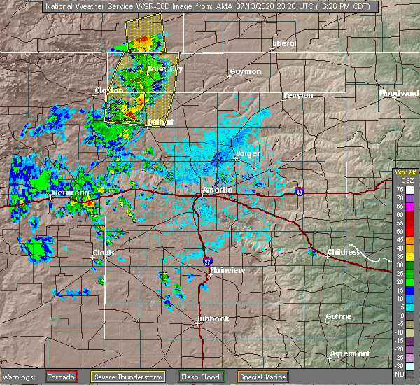 At 629 pm cdt, severe thunderstorms were located along a line extending from 10 miles south of campo to 11 miles east of felt to near ware, moving east at 20 mph (radar indicated). Hazards include 60 mph wind gusts. Minor damage to roofs, siding, and trees is possible. Locations impacted include, boise city, keyes, ware and felt. At 629 pm cdt, severe thunderstorms were located along a line extending from 10 miles south of campo to 11 miles east of felt to near ware, moving east at 20 mph (radar indicated). Hazards include 60 mph wind gusts. Minor damage to roofs, siding, and trees is possible. Locations impacted include, boise city, keyes, ware and felt.
|
| 7/13/2020 6:14 PM CDT |
 At 614 pm cdt, severe thunderstorms were located along a line extending from 9 miles south of campo to 7 miles southeast of felt to 3 miles northwest of ware, moving east at 20 mph (radar indicated). Hazards include 60 mph wind gusts. Minor damage to roofs, siding, and trees is possible. Locations impacted include, boise city, keyes, wheeless, ware and felt. At 614 pm cdt, severe thunderstorms were located along a line extending from 9 miles south of campo to 7 miles southeast of felt to 3 miles northwest of ware, moving east at 20 mph (radar indicated). Hazards include 60 mph wind gusts. Minor damage to roofs, siding, and trees is possible. Locations impacted include, boise city, keyes, wheeless, ware and felt.
|
| 7/13/2020 5:39 PM CDT |
 At 539 pm cdt, severe thunderstorms were located along a line extending from 9 miles northeast of kenton to 7 miles west of felt to 8 miles northeast of sedan, moving east at 20 mph (radar indicated). Hazards include 60 mph wind gusts. minor damage to roofs, siding, and trees is possible At 539 pm cdt, severe thunderstorms were located along a line extending from 9 miles northeast of kenton to 7 miles west of felt to 8 miles northeast of sedan, moving east at 20 mph (radar indicated). Hazards include 60 mph wind gusts. minor damage to roofs, siding, and trees is possible
|
| 7/4/2020 9:38 PM CDT |
 At 936 pm cdt, severe thunderstorms were located along a line extending from 7 miles east of wheeless to 5 miles southwest of glenrio, moving east at 30 mph (radar indicated). Hazards include 60 mph wind gusts. minor damage to roofs, siding, and trees is possible At 936 pm cdt, severe thunderstorms were located along a line extending from 7 miles east of wheeless to 5 miles southwest of glenrio, moving east at 30 mph (radar indicated). Hazards include 60 mph wind gusts. minor damage to roofs, siding, and trees is possible
|
| 6/19/2020 8:34 PM CDT |
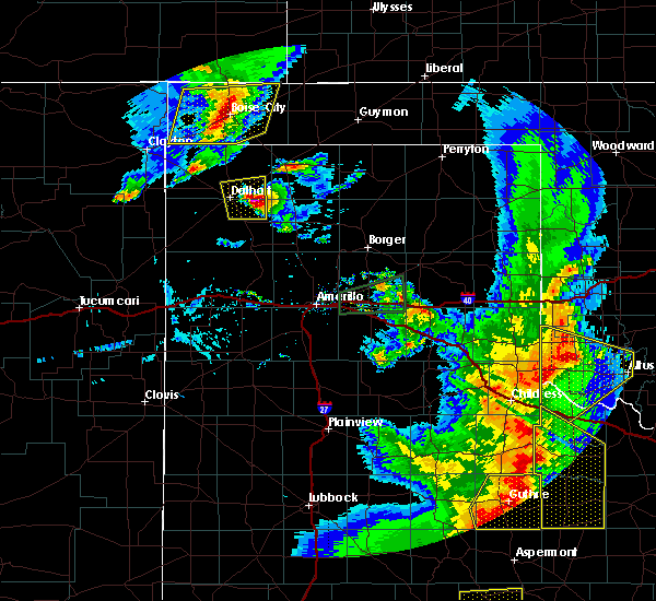 At 834 pm cdt, a severe thunderstorm was located over boise city, moving southeast at 35 mph (radar indicated). Hazards include 60 mph wind gusts and quarter size hail. Minor damage to roofs, siding, and trees is possible. hail damage to vehicles is expected. Locations impacted include, boise city, keyes, wheeless, black mesa park and felt. At 834 pm cdt, a severe thunderstorm was located over boise city, moving southeast at 35 mph (radar indicated). Hazards include 60 mph wind gusts and quarter size hail. Minor damage to roofs, siding, and trees is possible. hail damage to vehicles is expected. Locations impacted include, boise city, keyes, wheeless, black mesa park and felt.
|
| 6/19/2020 8:21 PM CDT |
 At 820 pm cdt, a severe thunderstorm was located 6 miles northwest of boise city, moving southeast at 35 mph (radar indicated). Hazards include 60 mph wind gusts and half dollar size hail. Minor damage to roofs, siding, and trees is possible. hail damage to vehicles is expected. Locations impacted include, boise city, keyes, wheeless, black mesa park and felt. At 820 pm cdt, a severe thunderstorm was located 6 miles northwest of boise city, moving southeast at 35 mph (radar indicated). Hazards include 60 mph wind gusts and half dollar size hail. Minor damage to roofs, siding, and trees is possible. hail damage to vehicles is expected. Locations impacted include, boise city, keyes, wheeless, black mesa park and felt.
|
| 6/19/2020 8:13 PM CDT |
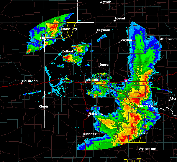 At 813 pm cdt, a severe thunderstorm was located 11 miles east of black mesa park, or 11 miles northwest of boise city, moving east at 35 mph (radar indicated). Hazards include 60 mph wind gusts and quarter size hail. Minor damage to roofs, siding, and trees is possible. hail damage to vehicles is expected. Locations impacted include, boise city, keyes, wheeless, black mesa park and felt. At 813 pm cdt, a severe thunderstorm was located 11 miles east of black mesa park, or 11 miles northwest of boise city, moving east at 35 mph (radar indicated). Hazards include 60 mph wind gusts and quarter size hail. Minor damage to roofs, siding, and trees is possible. hail damage to vehicles is expected. Locations impacted include, boise city, keyes, wheeless, black mesa park and felt.
|
| 6/19/2020 8:06 PM CDT |
 At 806 pm cdt, a severe thunderstorm was located over black mesa park, or 20 miles northwest of boise city, moving southeast at 25 mph (radar indicated). Hazards include 60 mph wind gusts and quarter size hail. Minor damage to roofs, siding, and trees is possible. hail damage to vehicles is expected. Locations impacted include, boise city, keyes, kenton, wheeless, black mesa park and felt. At 806 pm cdt, a severe thunderstorm was located over black mesa park, or 20 miles northwest of boise city, moving southeast at 25 mph (radar indicated). Hazards include 60 mph wind gusts and quarter size hail. Minor damage to roofs, siding, and trees is possible. hail damage to vehicles is expected. Locations impacted include, boise city, keyes, kenton, wheeless, black mesa park and felt.
|
| 6/19/2020 7:57 PM CDT |
 At 757 pm cdt, a severe thunderstorm was located near kenton, or 24 miles northwest of boise city, moving southeast at 20 mph (radar indicated). Hazards include 60 mph wind gusts and quarter size hail. Minor damage to roofs, siding, and trees is possible. hail damage to vehicles is expected. Locations impacted include, boise city, keyes, kenton, wheeless, black mesa park and felt. At 757 pm cdt, a severe thunderstorm was located near kenton, or 24 miles northwest of boise city, moving southeast at 20 mph (radar indicated). Hazards include 60 mph wind gusts and quarter size hail. Minor damage to roofs, siding, and trees is possible. hail damage to vehicles is expected. Locations impacted include, boise city, keyes, kenton, wheeless, black mesa park and felt.
|
| 6/19/2020 7:44 PM CDT |
 At 744 pm cdt, a severe thunderstorm was located over kenton, or 29 miles northwest of boise city, moving east at 20 mph (radar indicated). Hazards include ping pong ball size hail and 60 mph wind gusts. Minor damage to roofs, siding, and trees is possible. people and animals outdoors will be injured. expect hail damage to roofs, siding, windows, and vehicles. Locations impacted include, boise city, keyes, kenton, wheeless, black mesa park and felt. At 744 pm cdt, a severe thunderstorm was located over kenton, or 29 miles northwest of boise city, moving east at 20 mph (radar indicated). Hazards include ping pong ball size hail and 60 mph wind gusts. Minor damage to roofs, siding, and trees is possible. people and animals outdoors will be injured. expect hail damage to roofs, siding, windows, and vehicles. Locations impacted include, boise city, keyes, kenton, wheeless, black mesa park and felt.
|
| 6/19/2020 7:36 PM CDT |
 At 736 pm cdt, a severe thunderstorm was located 5 miles northwest of kenton, or 33 miles northwest of boise city, moving southeast at 20 mph (radar indicated). Hazards include ping pong ball size hail and 60 mph wind gusts. Minor damage to roofs, siding, and trees is possible. people and animals outdoors will be injured. Expect hail damage to roofs, siding, windows, and vehicles. At 736 pm cdt, a severe thunderstorm was located 5 miles northwest of kenton, or 33 miles northwest of boise city, moving southeast at 20 mph (radar indicated). Hazards include ping pong ball size hail and 60 mph wind gusts. Minor damage to roofs, siding, and trees is possible. people and animals outdoors will be injured. Expect hail damage to roofs, siding, windows, and vehicles.
|
| 5/15/2020 8:24 PM CDT |
 The severe thunderstorm warning for southwestern cimarron, western dallam and northwestern hartley counties will expire at 830 pm cdt, the storms which prompted the warning have weakened below severe limits, and no longer pose an immediate threat to life or property. therefore, the warning will be allowed to expire. however gusty winds are still possible with these thunderstorms. The severe thunderstorm warning for southwestern cimarron, western dallam and northwestern hartley counties will expire at 830 pm cdt, the storms which prompted the warning have weakened below severe limits, and no longer pose an immediate threat to life or property. therefore, the warning will be allowed to expire. however gusty winds are still possible with these thunderstorms.
|
| 5/15/2020 7:53 PM CDT |
 At 752 pm cdt, severe thunderstorms were located along a line extending from 3 miles north of texline to 9 miles northeast of sedan to 4 miles northeast of amistad, moving east at 15 mph (public reported quarter size hail in texline). Hazards include quarter size hail. Damage to vehicles is expected. Locations impacted include, texline, ware and felt. At 752 pm cdt, severe thunderstorms were located along a line extending from 3 miles north of texline to 9 miles northeast of sedan to 4 miles northeast of amistad, moving east at 15 mph (public reported quarter size hail in texline). Hazards include quarter size hail. Damage to vehicles is expected. Locations impacted include, texline, ware and felt.
|
| 5/15/2020 7:35 PM CDT |
 At 734 pm cdt, severe thunderstorms were located along a line extending from 4 miles east of clayton to 8 miles southwest of texline to 6 miles northeast of hayden, moving east at 10 mph (radar indicated). Hazards include ping pong ball size hail and 60 mph wind gusts. Minor damage to roofs, siding, and trees is possible. people and animals outdoors will be injured. Expect hail damage to roofs, siding, windows, and vehicles. At 734 pm cdt, severe thunderstorms were located along a line extending from 4 miles east of clayton to 8 miles southwest of texline to 6 miles northeast of hayden, moving east at 10 mph (radar indicated). Hazards include ping pong ball size hail and 60 mph wind gusts. Minor damage to roofs, siding, and trees is possible. people and animals outdoors will be injured. Expect hail damage to roofs, siding, windows, and vehicles.
|
| 8/30/2019 8:05 PM CDT |
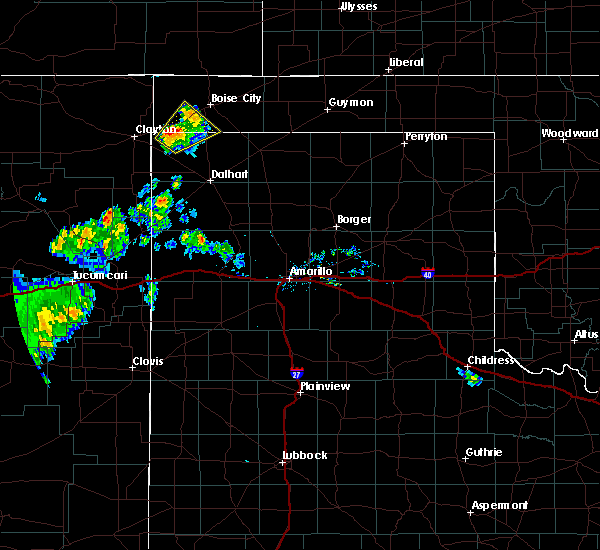 At 805 pm cdt, a severe thunderstorm was located 6 miles southwest of felt, or 18 miles east of clayton, and is nearly stationary (radar indicated). Hazards include 60 mph wind gusts and quarter size hail. Minor damage to roofs, siding, and trees is possible. hail damage to vehicles is expected. Locations impacted include, felt. At 805 pm cdt, a severe thunderstorm was located 6 miles southwest of felt, or 18 miles east of clayton, and is nearly stationary (radar indicated). Hazards include 60 mph wind gusts and quarter size hail. Minor damage to roofs, siding, and trees is possible. hail damage to vehicles is expected. Locations impacted include, felt.
|
| 8/30/2019 7:51 PM CDT |
 At 750 pm cdt, a severe thunderstorm was located over felt, or 20 miles southwest of boise city, and is nearly stationary (public. at 734 pm cdt, quarter size hail was reported in felt). Hazards include 60 mph wind gusts and quarter size hail. Minor damage to roofs, siding, and trees is possible. hail damage to vehicles is expected. Locations impacted include, felt. At 750 pm cdt, a severe thunderstorm was located over felt, or 20 miles southwest of boise city, and is nearly stationary (public. at 734 pm cdt, quarter size hail was reported in felt). Hazards include 60 mph wind gusts and quarter size hail. Minor damage to roofs, siding, and trees is possible. hail damage to vehicles is expected. Locations impacted include, felt.
|
| 8/30/2019 7:51 PM CDT |
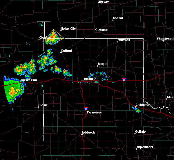 At 750 pm cdt, a severe thunderstorm was located over felt, or 20 miles southwest of boise city, and is nearly stationary (public. at 734 pm cdt, quarter size hail was reported in felt). Hazards include 60 mph wind gusts and quarter size hail. Minor damage to roofs, siding, and trees is possible. hail damage to vehicles is expected. Locations impacted include, felt. At 750 pm cdt, a severe thunderstorm was located over felt, or 20 miles southwest of boise city, and is nearly stationary (public. at 734 pm cdt, quarter size hail was reported in felt). Hazards include 60 mph wind gusts and quarter size hail. Minor damage to roofs, siding, and trees is possible. hail damage to vehicles is expected. Locations impacted include, felt.
|
| 8/30/2019 7:34 PM CDT | Half Dollar sized hail reported 0.7 miles WSW of Felt, OK, report received from facebook. |
| 8/30/2019 7:33 PM CDT |
 At 733 pm cdt, a severe thunderstorm was located over felt, or 20 miles southwest of boise city, moving northeast at 10 mph (radar indicated). Hazards include 60 mph wind gusts and quarter size hail. Minor damage to roofs, siding, and trees is possible. Hail damage to vehicles is expected. At 733 pm cdt, a severe thunderstorm was located over felt, or 20 miles southwest of boise city, moving northeast at 10 mph (radar indicated). Hazards include 60 mph wind gusts and quarter size hail. Minor damage to roofs, siding, and trees is possible. Hail damage to vehicles is expected.
|
| 8/24/2019 6:45 PM CDT |
 At 645 pm cdt, a severe thunderstorm was located 4 miles west of wheeless, or 20 miles northeast of clayton, moving southeast at 20 mph (radar indicated). Hazards include 60 mph wind gusts and quarter size hail. Minor damage to roofs, siding, and trees is possible. hail damage to vehicles is expected. Locations impacted include, felt and wheeless. At 645 pm cdt, a severe thunderstorm was located 4 miles west of wheeless, or 20 miles northeast of clayton, moving southeast at 20 mph (radar indicated). Hazards include 60 mph wind gusts and quarter size hail. Minor damage to roofs, siding, and trees is possible. hail damage to vehicles is expected. Locations impacted include, felt and wheeless.
|
| 8/24/2019 6:30 PM CDT |
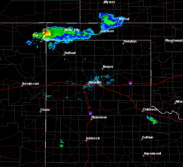 At 630 pm cdt, a severe thunderstorm was located 7 miles west of wheeless, or 22 miles north of clayton, moving southeast at 20 mph (radar indicated). Hazards include 60 mph wind gusts and half dollar size hail. Minor damage to roofs, siding, and trees is possible. Hail damage to vehicles is expected. At 630 pm cdt, a severe thunderstorm was located 7 miles west of wheeless, or 22 miles north of clayton, moving southeast at 20 mph (radar indicated). Hazards include 60 mph wind gusts and half dollar size hail. Minor damage to roofs, siding, and trees is possible. Hail damage to vehicles is expected.
|
| 8/21/2019 9:56 PM CDT |
 At 905 pm cdt, a severe thunderstorm was located 9 miles northeast of felt, or 10 miles west of boise city, moving west at 10 mph (radar indicated). Hazards include 60 mph wind gusts. minor damage to roofs, siding, and trees is possible At 905 pm cdt, a severe thunderstorm was located 9 miles northeast of felt, or 10 miles west of boise city, moving west at 10 mph (radar indicated). Hazards include 60 mph wind gusts. minor damage to roofs, siding, and trees is possible
|
| 8/21/2019 9:44 PM CDT |
 At 944 pm cdt, severe thunderstorms were located along a line extending from 9 miles east of felt to 10 miles south of campo, moving east at 20 mph (radar indicated). Hazards include 60 mph wind gusts and penny size hail. Minor damage to roofs, siding, and trees is possible. Locations impacted include, boise city, keyes, kenton, wheeless, black mesa park, felt and griggs. At 944 pm cdt, severe thunderstorms were located along a line extending from 9 miles east of felt to 10 miles south of campo, moving east at 20 mph (radar indicated). Hazards include 60 mph wind gusts and penny size hail. Minor damage to roofs, siding, and trees is possible. Locations impacted include, boise city, keyes, kenton, wheeless, black mesa park, felt and griggs.
|
| 8/21/2019 9:31 PM CDT |
 At 931 pm cdt, a severe thunderstorm was located 9 miles east of wheeless, or 12 miles west of boise city, moving east at 10 mph (radar indicated). Hazards include 60 mph wind gusts and quarter size hail. Minor damage to roofs, siding, and trees is possible. hail damage to vehicles is expected. Locations impacted include, boise city, keyes, kenton, wheeless, black mesa park, felt and griggs. At 931 pm cdt, a severe thunderstorm was located 9 miles east of wheeless, or 12 miles west of boise city, moving east at 10 mph (radar indicated). Hazards include 60 mph wind gusts and quarter size hail. Minor damage to roofs, siding, and trees is possible. hail damage to vehicles is expected. Locations impacted include, boise city, keyes, kenton, wheeless, black mesa park, felt and griggs.
|
| 8/21/2019 9:20 PM CDT |
 At 919 pm cdt, a severe thunderstorm was located 7 miles east of wheeless, or 14 miles west of boise city, moving northwest at 10 mph (radar indicated). Hazards include 60 mph wind gusts and quarter size hail. Minor damage to roofs, siding, and trees is possible. hail damage to vehicles is expected. Locations impacted include, boise city, keyes, kenton, wheeless, black mesa park, felt and griggs. At 919 pm cdt, a severe thunderstorm was located 7 miles east of wheeless, or 14 miles west of boise city, moving northwest at 10 mph (radar indicated). Hazards include 60 mph wind gusts and quarter size hail. Minor damage to roofs, siding, and trees is possible. hail damage to vehicles is expected. Locations impacted include, boise city, keyes, kenton, wheeless, black mesa park, felt and griggs.
|
| 8/21/2019 9:06 PM CDT |
 The national weather service in amarillo has issued a * severe thunderstorm warning for. cimarron county in the panhandle of oklahoma. until 1030 pm cdt. At 905 pm cdt, a severe thunderstorm was located 9 miles northeast of felt, or 10 miles west of boise city, moving west at 10 mph. The national weather service in amarillo has issued a * severe thunderstorm warning for. cimarron county in the panhandle of oklahoma. until 1030 pm cdt. At 905 pm cdt, a severe thunderstorm was located 9 miles northeast of felt, or 10 miles west of boise city, moving west at 10 mph.
|
| 8/20/2019 6:54 PM CDT |
 At 654 pm cdt, a severe thunderstorm was located over kenton, or 28 miles northwest of boise city, moving southeast at 10 mph (radar indicated). Hazards include 60 mph wind gusts. Minor damage to roofs, siding, and trees is possible. Locations impacted include, boise city, kenton, wheeless, black mesa park and felt. At 654 pm cdt, a severe thunderstorm was located over kenton, or 28 miles northwest of boise city, moving southeast at 10 mph (radar indicated). Hazards include 60 mph wind gusts. Minor damage to roofs, siding, and trees is possible. Locations impacted include, boise city, kenton, wheeless, black mesa park and felt.
|
| 8/20/2019 6:41 PM CDT |
 At 631 pm cdt, a severe thunderstorm was located 7 miles northeast of kenton, or 26 miles northwest of boise city, moving east at 15 mph (radar indicated). Hazards include 60 mph wind gusts. Minor damage to roofs, siding, and trees is possible. Locations impacted include, boise city, kenton, wheeless, black mesa park and felt. At 631 pm cdt, a severe thunderstorm was located 7 miles northeast of kenton, or 26 miles northwest of boise city, moving east at 15 mph (radar indicated). Hazards include 60 mph wind gusts. Minor damage to roofs, siding, and trees is possible. Locations impacted include, boise city, kenton, wheeless, black mesa park and felt.
|
| 8/20/2019 6:31 PM CDT |
 At 610 pm cdt, a severe thunderstorm was located near kenton, or 30 miles northwest of boise city, moving southeast at 10 mph (radar indicated). Hazards include 70 mph wind gusts and quarter size hail. Expect some tree damage. damage is likely to mobile homes, roofs, and outbuildings. Hail damage to vehicles is expected. At 610 pm cdt, a severe thunderstorm was located near kenton, or 30 miles northwest of boise city, moving southeast at 10 mph (radar indicated). Hazards include 70 mph wind gusts and quarter size hail. Expect some tree damage. damage is likely to mobile homes, roofs, and outbuildings. Hail damage to vehicles is expected.
|
| 8/20/2019 6:23 PM CDT |
 At 622 pm cdt, a severe thunderstorm was located 5 miles north of kenton, or 28 miles northwest of boise city, moving east at 10 mph (radar indicated). Hazards include 60 mph wind gusts and penny size hail. Minor damage to roofs, siding, and trees is possible. Locations impacted include, boise city, kenton, wheeless, black mesa park and felt. At 622 pm cdt, a severe thunderstorm was located 5 miles north of kenton, or 28 miles northwest of boise city, moving east at 10 mph (radar indicated). Hazards include 60 mph wind gusts and penny size hail. Minor damage to roofs, siding, and trees is possible. Locations impacted include, boise city, kenton, wheeless, black mesa park and felt.
|
| 8/20/2019 6:10 PM CDT |
 At 610 pm cdt, a severe thunderstorm was located near kenton, or 30 miles northwest of boise city, moving southeast at 10 mph (radar indicated). Hazards include 70 mph wind gusts and quarter size hail. Expect some tree damage. damage is likely to mobile homes, roofs, and outbuildings. Hail damage to vehicles is expected. At 610 pm cdt, a severe thunderstorm was located near kenton, or 30 miles northwest of boise city, moving southeast at 10 mph (radar indicated). Hazards include 70 mph wind gusts and quarter size hail. Expect some tree damage. damage is likely to mobile homes, roofs, and outbuildings. Hail damage to vehicles is expected.
|
| 7/5/2019 7:26 PM CDT |
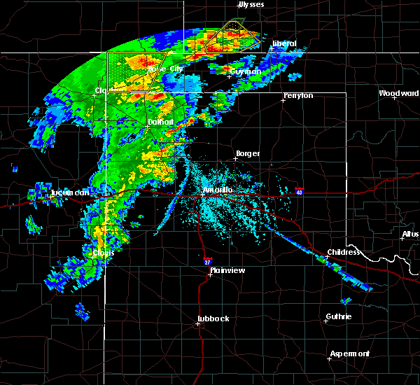 At 726 pm cdt, a severe thunderstorm was located 7 miles north of boise city, moving east at 15 mph (radar indicated). Hazards include 60 mph wind gusts and quarter size hail. Minor damage to roofs, siding, and trees is possible. hail damage to vehicles is expected. Locations impacted include, boise city and felt. At 726 pm cdt, a severe thunderstorm was located 7 miles north of boise city, moving east at 15 mph (radar indicated). Hazards include 60 mph wind gusts and quarter size hail. Minor damage to roofs, siding, and trees is possible. hail damage to vehicles is expected. Locations impacted include, boise city and felt.
|
| 7/5/2019 7:14 PM CDT |
 At 713 pm cdt, automated weather equipment reported a severe thunderstorm was located 6 miles east of black mesa park, or 17 miles northwest of boise city, moving north at 10 mph. a wind gust to 60 mph was reported 5 miles southeast of kenton (automated weather equipment). Hazards include 60 mph wind gusts and quarter size hail. Minor damage to roofs, siding, and trees is possible. hail damage to vehicles is expected. Locations impacted include, boise city, kenton, wheeless, black mesa park and felt. At 713 pm cdt, automated weather equipment reported a severe thunderstorm was located 6 miles east of black mesa park, or 17 miles northwest of boise city, moving north at 10 mph. a wind gust to 60 mph was reported 5 miles southeast of kenton (automated weather equipment). Hazards include 60 mph wind gusts and quarter size hail. Minor damage to roofs, siding, and trees is possible. hail damage to vehicles is expected. Locations impacted include, boise city, kenton, wheeless, black mesa park and felt.
|
| 7/5/2019 7:03 PM CDT |
 At 703 pm cdt, a severe thunderstorm was located 4 miles east of black mesa park, or 17 miles northwest of boise city, moving northwest at 15 mph (radar indicated). Hazards include 60 mph wind gusts and half dollar size hail. Minor damage to roofs, siding, and trees is possible. hail damage to vehicles is expected. Locations impacted include, boise city, kenton, wheeless, black mesa park and felt. At 703 pm cdt, a severe thunderstorm was located 4 miles east of black mesa park, or 17 miles northwest of boise city, moving northwest at 15 mph (radar indicated). Hazards include 60 mph wind gusts and half dollar size hail. Minor damage to roofs, siding, and trees is possible. hail damage to vehicles is expected. Locations impacted include, boise city, kenton, wheeless, black mesa park and felt.
|
| 7/5/2019 6:51 PM CDT |
 At 651 pm cdt, a severe thunderstorm was located 8 miles east of black mesa park, or 14 miles northwest of boise city, moving northwest at 10 mph (radar indicated). Hazards include 60 mph wind gusts and half dollar size hail. Minor damage to roofs, siding, and trees is possible. hail damage to vehicles is expected. Locations impacted include, boise city, kenton, wheeless, black mesa park and felt. At 651 pm cdt, a severe thunderstorm was located 8 miles east of black mesa park, or 14 miles northwest of boise city, moving northwest at 10 mph (radar indicated). Hazards include 60 mph wind gusts and half dollar size hail. Minor damage to roofs, siding, and trees is possible. hail damage to vehicles is expected. Locations impacted include, boise city, kenton, wheeless, black mesa park and felt.
|
| 7/5/2019 6:46 PM CDT |
 At 646 pm cdt, a severe thunderstorm was located over wheeless, or 21 miles west of boise city, moving northeast at 25 mph (radar indicated). Hazards include 60 mph wind gusts and half dollar size hail. Minor damage to roofs, siding, and trees is possible. hail damage to vehicles is expected. Locations impacted include, boise city, kenton, wheeless, black mesa park and felt. At 646 pm cdt, a severe thunderstorm was located over wheeless, or 21 miles west of boise city, moving northeast at 25 mph (radar indicated). Hazards include 60 mph wind gusts and half dollar size hail. Minor damage to roofs, siding, and trees is possible. hail damage to vehicles is expected. Locations impacted include, boise city, kenton, wheeless, black mesa park and felt.
|
| 7/5/2019 6:33 PM CDT |
 At 632 pm cdt, a severe thunderstorm was located 4 miles west of wheeless, or 21 miles northeast of clayton, moving north at 30 mph (radar indicated). Hazards include 60 mph wind gusts and half dollar size hail. Minor damage to roofs, siding, and trees is possible. Hail damage to vehicles is expected. At 632 pm cdt, a severe thunderstorm was located 4 miles west of wheeless, or 21 miles northeast of clayton, moving north at 30 mph (radar indicated). Hazards include 60 mph wind gusts and half dollar size hail. Minor damage to roofs, siding, and trees is possible. Hail damage to vehicles is expected.
|
| 6/26/2019 6:44 PM CDT |
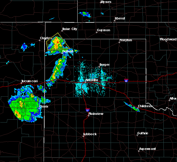 At 643 pm cdt, a severe thunderstorm was located 7 miles southeast of felt, or 17 miles southwest of boise city, moving northeast at 40 mph (radar indicated). Hazards include 60 mph wind gusts and nickel size hail. Minor damage to roofs, siding, and trees is possible. Locations impacted include, ware. At 643 pm cdt, a severe thunderstorm was located 7 miles southeast of felt, or 17 miles southwest of boise city, moving northeast at 40 mph (radar indicated). Hazards include 60 mph wind gusts and nickel size hail. Minor damage to roofs, siding, and trees is possible. Locations impacted include, ware.
|
| 6/26/2019 6:30 PM CDT |
 At 630 pm cdt, a severe thunderstorm was located 8 miles south of felt, or 21 miles east of clayton, moving east at 40 mph (radar indicated). Hazards include 60 mph wind gusts and nickel size hail. Minor damage to roofs, siding, and trees is possible. Locations impacted include, texline, ware and felt. At 630 pm cdt, a severe thunderstorm was located 8 miles south of felt, or 21 miles east of clayton, moving east at 40 mph (radar indicated). Hazards include 60 mph wind gusts and nickel size hail. Minor damage to roofs, siding, and trees is possible. Locations impacted include, texline, ware and felt.
|
| 6/26/2019 6:09 PM CDT |
 At 609 pm cdt, a severe thunderstorm was located 8 miles northwest of ware, or 22 miles northwest of dalhart, moving northeast at 15 mph (radar indicated). Hazards include 70 mph wind gusts and quarter size hail. Expect some tree damage. damage is likely to mobile homes, roofs, and outbuildings. Hail damage to vehicles is expected. At 609 pm cdt, a severe thunderstorm was located 8 miles northwest of ware, or 22 miles northwest of dalhart, moving northeast at 15 mph (radar indicated). Hazards include 70 mph wind gusts and quarter size hail. Expect some tree damage. damage is likely to mobile homes, roofs, and outbuildings. Hail damage to vehicles is expected.
|
| 6/18/2019 9:11 PM CDT |
 The severe thunderstorm warning for cimarron and northwestern dallam counties will expire at 915 pm cdt, the storms which prompted the warning have weakened below severe limits, and no longer pose an immediate threat to life or property. therefore, the warning will be allowed to expire. however up to nickel size hail, gusty winds up to 55 mph, and heavy rain are still possible with these thunderstorms. a significant weather advisory is now in effect for western texas and cimarron counties until 1000 pm cdt as a result. a severe thunderstorm watch remains in effect until 1100 pm cdt for the panhandle of oklahoma, and the panhandle of texas. The severe thunderstorm warning for cimarron and northwestern dallam counties will expire at 915 pm cdt, the storms which prompted the warning have weakened below severe limits, and no longer pose an immediate threat to life or property. therefore, the warning will be allowed to expire. however up to nickel size hail, gusty winds up to 55 mph, and heavy rain are still possible with these thunderstorms. a significant weather advisory is now in effect for western texas and cimarron counties until 1000 pm cdt as a result. a severe thunderstorm watch remains in effect until 1100 pm cdt for the panhandle of oklahoma, and the panhandle of texas.
|
| 6/18/2019 8:46 PM CDT |
 At 846 pm cdt, severe thunderstorms were located along a line extending from 7 miles north of boise city to 3 miles south of wheeless to 7 miles southeast of seneca, moving southeast at 25 mph (radar indicated). Hazards include 60 mph wind gusts and quarter size hail. Minor damage to roofs, siding, and trees is possible. hail damage to vehicles is expected. Locations impacted include, boise city, texline, kenton, wheeless, black mesa park and felt. At 846 pm cdt, severe thunderstorms were located along a line extending from 7 miles north of boise city to 3 miles south of wheeless to 7 miles southeast of seneca, moving southeast at 25 mph (radar indicated). Hazards include 60 mph wind gusts and quarter size hail. Minor damage to roofs, siding, and trees is possible. hail damage to vehicles is expected. Locations impacted include, boise city, texline, kenton, wheeless, black mesa park and felt.
|
| 6/18/2019 8:27 PM CDT |
 At 827 pm cdt, severe thunderstorms were located along a line extending from near black mesa park to 9 miles west of wheeless to 5 miles southwest of seneca, moving east at 25 mph (radar indicated). Hazards include 60 mph wind gusts and quarter size hail. Minor damage to roofs, siding, and trees is possible. Hail damage to vehicles is expected. At 827 pm cdt, severe thunderstorms were located along a line extending from near black mesa park to 9 miles west of wheeless to 5 miles southwest of seneca, moving east at 25 mph (radar indicated). Hazards include 60 mph wind gusts and quarter size hail. Minor damage to roofs, siding, and trees is possible. Hail damage to vehicles is expected.
|
| 6/2/2019 8:54 PM CDT |
 The severe thunderstorm warning for western cimarron county will expire at 900 pm cdt, the storm which prompted the warning has weakened below severe limits, and no longer poses an immediate threat to life or property. therefore, the warning will be allowed to expire. however, up to nickel size hail, gusty winds up to 55 mph, heavy rain, and potential weak land spout tornadoes are still possible with this thunderstorm as it moves southeast. a significant weather advisory is now in effect as a result. The severe thunderstorm warning for western cimarron county will expire at 900 pm cdt, the storm which prompted the warning has weakened below severe limits, and no longer poses an immediate threat to life or property. therefore, the warning will be allowed to expire. however, up to nickel size hail, gusty winds up to 55 mph, heavy rain, and potential weak land spout tornadoes are still possible with this thunderstorm as it moves southeast. a significant weather advisory is now in effect as a result.
|
| 6/2/2019 8:34 PM CDT |
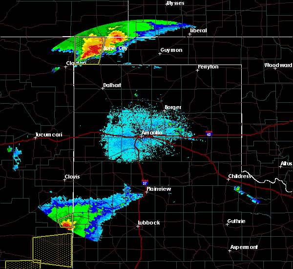 At 833 pm cdt, a severe thunderstorm was located 9 miles east of black mesa park, or 12 miles northwest of boise city, moving north at 10 mph (radar indicated). Hazards include 60 mph wind gusts and half dollar size hail. Minor damage to roofs, siding, and trees is possible. hail damage to vehicles is expected. Locations impacted include, black mesa park, felt and wheeless. At 833 pm cdt, a severe thunderstorm was located 9 miles east of black mesa park, or 12 miles northwest of boise city, moving north at 10 mph (radar indicated). Hazards include 60 mph wind gusts and half dollar size hail. Minor damage to roofs, siding, and trees is possible. hail damage to vehicles is expected. Locations impacted include, black mesa park, felt and wheeless.
|
| 6/2/2019 8:19 PM CDT |
 At 814 pm cdt, a severe thunderstorm was located 10 miles east of wheeless, or 11 miles west of boise city, moving north at 20 mph. additionally, a second severe storm is located near black mesa park, moving southeast at 20 mph (radar indicated). Hazards include 60 mph wind gusts and quarter size hail. Minor damage to roofs, siding, and trees is possible. Hail damage to vehicles is expected. At 814 pm cdt, a severe thunderstorm was located 10 miles east of wheeless, or 11 miles west of boise city, moving north at 20 mph. additionally, a second severe storm is located near black mesa park, moving southeast at 20 mph (radar indicated). Hazards include 60 mph wind gusts and quarter size hail. Minor damage to roofs, siding, and trees is possible. Hail damage to vehicles is expected.
|
| 6/2/2019 8:15 PM CDT |
 At 814 pm cdt, a severe thunderstorm was located 10 miles east of wheeless, or 11 miles west of boise city, moving north at 20 mph. additionally, a second severe storm is located near black mesa park, moving southeast at 20 mph (radar indicated). Hazards include 60 mph wind gusts and quarter size hail. Minor damage to roofs, siding, and trees is possible. Hail damage to vehicles is expected. At 814 pm cdt, a severe thunderstorm was located 10 miles east of wheeless, or 11 miles west of boise city, moving north at 20 mph. additionally, a second severe storm is located near black mesa park, moving southeast at 20 mph (radar indicated). Hazards include 60 mph wind gusts and quarter size hail. Minor damage to roofs, siding, and trees is possible. Hail damage to vehicles is expected.
|
| 6/1/2019 1:44 PM CDT |
 At 144 pm cdt, a severe thunderstorm was located 6 miles northeast of texline, or 12 miles east of clayton, moving southeast at 10 mph (radar indicated). Hazards include ping pong ball size hail and 60 mph wind gusts. Minor damage to roofs, siding, and trees is possible. people and animals outdoors will be injured. Expect hail damage to roofs, siding, windows, and vehicles. At 144 pm cdt, a severe thunderstorm was located 6 miles northeast of texline, or 12 miles east of clayton, moving southeast at 10 mph (radar indicated). Hazards include ping pong ball size hail and 60 mph wind gusts. Minor damage to roofs, siding, and trees is possible. people and animals outdoors will be injured. Expect hail damage to roofs, siding, windows, and vehicles.
|
| 5/26/2019 7:52 PM CDT |
 At 752 pm cdt, severe thunderstorms were located along a line extending from 9 miles north of felt to near ware to 9 miles east of romero, moving east at 55 mph (radar indicated). Hazards include 70 mph wind gusts and ping pong ball size hail. Expect some tree damage. damage is likely to mobile homes, roofs, and outbuildings. people and animals outdoors will be injured. Expect hail damage to roofs, siding, windows, and vehicles. At 752 pm cdt, severe thunderstorms were located along a line extending from 9 miles north of felt to near ware to 9 miles east of romero, moving east at 55 mph (radar indicated). Hazards include 70 mph wind gusts and ping pong ball size hail. Expect some tree damage. damage is likely to mobile homes, roofs, and outbuildings. people and animals outdoors will be injured. Expect hail damage to roofs, siding, windows, and vehicles.
|
| 5/26/2019 7:48 PM CDT | Half Dollar sized hail reported 0.7 miles WSW of Felt, OK |
| 5/26/2019 7:41 PM CDT |
 At 741 pm cdt, severe thunderstorms capable of producing both tornadoes and extensive straight line wind damage were located over felt, or 20 miles southwest of boise city, moving northeast at 55 mph (radar indicated rotation). Hazards include tornado and quarter size hail. Flying debris will be dangerous to those caught without shelter. mobile homes will be damaged or destroyed. damage to roofs, windows, and vehicles will occur. Tree damage is likely. At 741 pm cdt, severe thunderstorms capable of producing both tornadoes and extensive straight line wind damage were located over felt, or 20 miles southwest of boise city, moving northeast at 55 mph (radar indicated rotation). Hazards include tornado and quarter size hail. Flying debris will be dangerous to those caught without shelter. mobile homes will be damaged or destroyed. damage to roofs, windows, and vehicles will occur. Tree damage is likely.
|
| 5/26/2019 7:24 PM CDT |
 At 724 pm cdt, a severe thunderstorm was located 6 miles south of wheeless, or 17 miles northeast of clayton, moving northeast at 35 mph (radar indicated). Hazards include ping pong ball size hail and 60 mph wind gusts. Minor damage to roofs, siding, and trees is possible. people and animals outdoors will be injured. expect hail damage to roofs, siding, windows, and vehicles. locations impacted include, boise city, keyes, kenton, wheeless, black mesa park and sturgis. A tornado watch remains in effect until 1000 pm cdt for the panhandle of oklahoma, and the panhandle of texas. At 724 pm cdt, a severe thunderstorm was located 6 miles south of wheeless, or 17 miles northeast of clayton, moving northeast at 35 mph (radar indicated). Hazards include ping pong ball size hail and 60 mph wind gusts. Minor damage to roofs, siding, and trees is possible. people and animals outdoors will be injured. expect hail damage to roofs, siding, windows, and vehicles. locations impacted include, boise city, keyes, kenton, wheeless, black mesa park and sturgis. A tornado watch remains in effect until 1000 pm cdt for the panhandle of oklahoma, and the panhandle of texas.
|
| 5/26/2019 7:05 PM CDT |
 At 705 pm cdt, a severe thunderstorm was located over seneca, or 13 miles north of clayton, moving northeast at 55 mph (radar indicated). Hazards include ping pong ball size hail and 60 mph wind gusts. Minor damage to roofs, siding, and trees is possible. people and animals outdoors will be injured. Expect hail damage to roofs, siding, windows, and vehicles. At 705 pm cdt, a severe thunderstorm was located over seneca, or 13 miles north of clayton, moving northeast at 55 mph (radar indicated). Hazards include ping pong ball size hail and 60 mph wind gusts. Minor damage to roofs, siding, and trees is possible. people and animals outdoors will be injured. Expect hail damage to roofs, siding, windows, and vehicles.
|
| 5/25/2019 4:05 PM CDT |
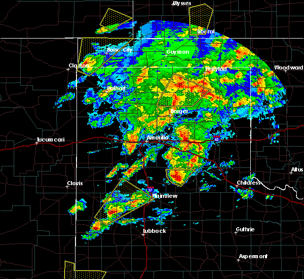 At 404 pm cdt, a severe thunderstorm was located 4 miles south of felt, or 21 miles east of clayton, moving northeast at 50 mph (radar indicated). Hazards include 60 mph wind gusts and quarter size hail. Minor damage to roofs, siding, and trees is possible. hail damage to vehicles is expected. Locations impacted include, boise city, keyes, wheeless, black mesa park and felt. At 404 pm cdt, a severe thunderstorm was located 4 miles south of felt, or 21 miles east of clayton, moving northeast at 50 mph (radar indicated). Hazards include 60 mph wind gusts and quarter size hail. Minor damage to roofs, siding, and trees is possible. hail damage to vehicles is expected. Locations impacted include, boise city, keyes, wheeless, black mesa park and felt.
|
| 5/25/2019 3:49 PM CDT |
 The national weather service in amarillo has issued a * severe thunderstorm warning for. cimarron county in the panhandle of oklahoma. northwestern dallam county in the panhandle of texas. until 500 pm cdt. At 349 pm cdt, a severe thunderstorm was located 6 miles southeast. The national weather service in amarillo has issued a * severe thunderstorm warning for. cimarron county in the panhandle of oklahoma. northwestern dallam county in the panhandle of texas. until 500 pm cdt. At 349 pm cdt, a severe thunderstorm was located 6 miles southeast.
|
| 5/25/2019 3:49 PM CDT |
 At 349 pm cdt, a severe thunderstorm was located 6 miles southeast of texline, or 16 miles southeast of clayton, moving northeast at 50 mph (radar indicated). Hazards include 60 mph wind gusts and quarter size hail. Minor damage to roofs, siding, and trees is possible. Hail damage to vehicles is expected. At 349 pm cdt, a severe thunderstorm was located 6 miles southeast of texline, or 16 miles southeast of clayton, moving northeast at 50 mph (radar indicated). Hazards include 60 mph wind gusts and quarter size hail. Minor damage to roofs, siding, and trees is possible. Hail damage to vehicles is expected.
|
| 8/21/2018 9:08 PM CDT |
 At 908 pm cdt, severe thunderstorms were located along a line extending from 6 miles northwest of guymon to near griggs to 6 miles northeast of texline, moving east at 35 mph (radar indicated). Hazards include 70 mph wind gusts and half dollar size hail. Expect some tree damage. damage is likely to mobile homes, roofs, and outbuildings. hail damage to vehicles is expected. Locations impacted include, guymon, stratford, boise city, goodwell, texline, optima, keyes, hardesty, wheeless, hough, felt, griggs, eva, texhoma and sturgis. At 908 pm cdt, severe thunderstorms were located along a line extending from 6 miles northwest of guymon to near griggs to 6 miles northeast of texline, moving east at 35 mph (radar indicated). Hazards include 70 mph wind gusts and half dollar size hail. Expect some tree damage. damage is likely to mobile homes, roofs, and outbuildings. hail damage to vehicles is expected. Locations impacted include, guymon, stratford, boise city, goodwell, texline, optima, keyes, hardesty, wheeless, hough, felt, griggs, eva, texhoma and sturgis.
|
| 8/21/2018 8:42 PM CDT |
 At 842 pm cdt, severe thunderstorms were located along a line extending from 4 miles east of eva to 11 miles southeast of boise city to 3 miles north of clayton, moving east at 35 mph (radar indicated). Hazards include 60 mph wind gusts and half dollar size hail. Minor damage to roofs, siding, and trees is possible. Hail damage to vehicles is expected. At 842 pm cdt, severe thunderstorms were located along a line extending from 4 miles east of eva to 11 miles southeast of boise city to 3 miles north of clayton, moving east at 35 mph (radar indicated). Hazards include 60 mph wind gusts and half dollar size hail. Minor damage to roofs, siding, and trees is possible. Hail damage to vehicles is expected.
|
| 6/24/2018 10:33 PM CDT |
 At 1031 pm cdt, severe thunderstorms were located along a line extending from 14 miles south of boise city to 5 miles northwest of ware, moving southeast at 45 mph. trained spotters reported ping pong ball size hail 1 mile east of boise city at 10:28 pm cdt (radar indicated). Hazards include ping pong ball size hail and 60 mph wind gusts. Minor damage to roofs, siding, and trees is possible. people and animals outdoors will be injured. expect hail damage to roofs, siding, windows, and vehicles. Locations impacted include, boise city, texline, ware and felt. At 1031 pm cdt, severe thunderstorms were located along a line extending from 14 miles south of boise city to 5 miles northwest of ware, moving southeast at 45 mph. trained spotters reported ping pong ball size hail 1 mile east of boise city at 10:28 pm cdt (radar indicated). Hazards include ping pong ball size hail and 60 mph wind gusts. Minor damage to roofs, siding, and trees is possible. people and animals outdoors will be injured. expect hail damage to roofs, siding, windows, and vehicles. Locations impacted include, boise city, texline, ware and felt.
|
| 6/24/2018 9:49 PM CDT |
 The national weather service in amarillo has issued a * severe thunderstorm warning for. cimarron county in the panhandle of oklahoma. western dallam county in the panhandle of texas. Until 1045 pm cdt * at 949 pm cdt, severe thunderstorms were located along a line. The national weather service in amarillo has issued a * severe thunderstorm warning for. cimarron county in the panhandle of oklahoma. western dallam county in the panhandle of texas. Until 1045 pm cdt * at 949 pm cdt, severe thunderstorms were located along a line.
|
| 6/24/2018 9:49 PM CDT |
 At 949 pm cdt, severe thunderstorms were located along a line extending from 9 miles southwest of kenton to 5 miles west of clayton lake state park, moving southeast at 45 mph (radar indicated). Hazards include 60 mph wind gusts and quarter size hail. Minor damage to roofs, siding, and trees is possible. Hail damage to vehicles is expected. At 949 pm cdt, severe thunderstorms were located along a line extending from 9 miles southwest of kenton to 5 miles west of clayton lake state park, moving southeast at 45 mph (radar indicated). Hazards include 60 mph wind gusts and quarter size hail. Minor damage to roofs, siding, and trees is possible. Hail damage to vehicles is expected.
|
| 6/22/2018 1:30 AM CDT |
 At 130 am cdt, a severe thunderstorm was located 4 miles west of felt, or 19 miles northeast of clayton, moving southeast at 25 mph (radar indicated). Hazards include golf ball size hail and 60 mph wind gusts. Minor damage to roofs, siding, and trees is possible. people and animals outdoors will be injured. expect hail damage to roofs, siding, windows, and vehicles. Locations impacted include, felt. At 130 am cdt, a severe thunderstorm was located 4 miles west of felt, or 19 miles northeast of clayton, moving southeast at 25 mph (radar indicated). Hazards include golf ball size hail and 60 mph wind gusts. Minor damage to roofs, siding, and trees is possible. people and animals outdoors will be injured. expect hail damage to roofs, siding, windows, and vehicles. Locations impacted include, felt.
|
| 6/22/2018 1:30 AM CDT |
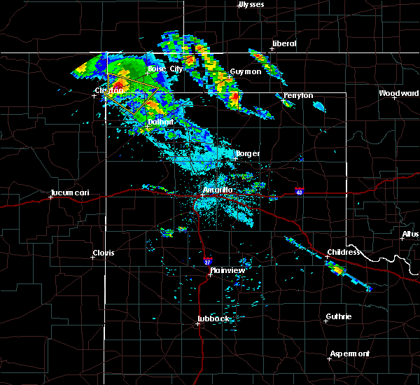 At 130 am cdt, a severe thunderstorm was located 4 miles west of felt, or 19 miles northeast of clayton, moving southeast at 25 mph (radar indicated). Hazards include golf ball size hail and 60 mph wind gusts. Minor damage to roofs, siding, and trees is possible. people and animals outdoors will be injured. expect hail damage to roofs, siding, windows, and vehicles. Locations impacted include, felt. At 130 am cdt, a severe thunderstorm was located 4 miles west of felt, or 19 miles northeast of clayton, moving southeast at 25 mph (radar indicated). Hazards include golf ball size hail and 60 mph wind gusts. Minor damage to roofs, siding, and trees is possible. people and animals outdoors will be injured. expect hail damage to roofs, siding, windows, and vehicles. Locations impacted include, felt.
|
| 6/22/2018 1:09 AM CDT |
 At 109 am cdt, a severe thunderstorm was located 6 miles southwest of wheeless, or 17 miles northeast of clayton, moving southeast at 25 mph (radar indicated). Hazards include 60 mph wind gusts and quarter size hail. Minor damage to roofs, siding, and trees is possible. Hail damage to vehicles is expected. At 109 am cdt, a severe thunderstorm was located 6 miles southwest of wheeless, or 17 miles northeast of clayton, moving southeast at 25 mph (radar indicated). Hazards include 60 mph wind gusts and quarter size hail. Minor damage to roofs, siding, and trees is possible. Hail damage to vehicles is expected.
|
| 6/22/2018 1:09 AM CDT |
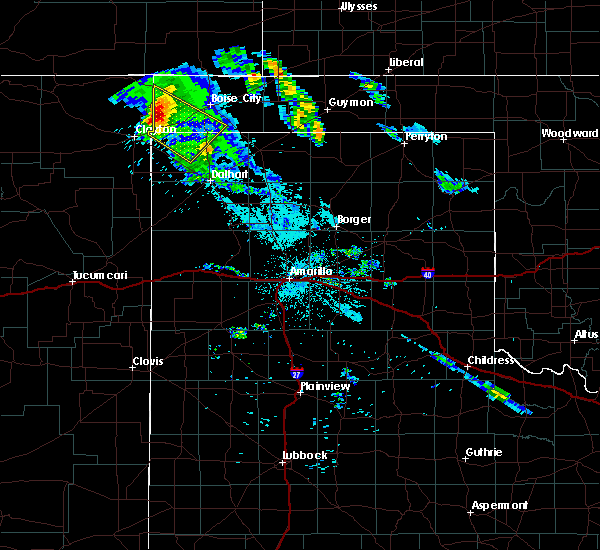 At 109 am cdt, a severe thunderstorm was located 6 miles southwest of wheeless, or 17 miles northeast of clayton, moving southeast at 25 mph (radar indicated). Hazards include 60 mph wind gusts and quarter size hail. Minor damage to roofs, siding, and trees is possible. Hail damage to vehicles is expected. At 109 am cdt, a severe thunderstorm was located 6 miles southwest of wheeless, or 17 miles northeast of clayton, moving southeast at 25 mph (radar indicated). Hazards include 60 mph wind gusts and quarter size hail. Minor damage to roofs, siding, and trees is possible. Hail damage to vehicles is expected.
|
| 6/12/2018 8:48 PM CDT |
 At 847 pm cdt, severe thunderstorms were located along a line extending from 5 miles southwest of felt to 9 miles south of ware to 6 miles north of romero, moving northeast at 30 mph (radar indicated). Hazards include 60 mph wind gusts and quarter size hail. Minor damage to roofs, siding, and trees is possible. Hail damage to vehicles is expected. At 847 pm cdt, severe thunderstorms were located along a line extending from 5 miles southwest of felt to 9 miles south of ware to 6 miles north of romero, moving northeast at 30 mph (radar indicated). Hazards include 60 mph wind gusts and quarter size hail. Minor damage to roofs, siding, and trees is possible. Hail damage to vehicles is expected.
|
| 5/30/2018 6:40 PM CDT |
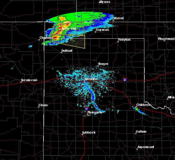 At 640 pm cdt, a severe thunderstorm was located 9 miles southeast of felt, or 19 miles southwest of boise city, moving east at 40 mph (radar indicated). Hazards include ping pong ball size hail and 60 mph wind gusts. Minor damage to roofs, siding, and trees is possible. people and animals outdoors will be injured. expect hail damage to roofs, siding, windows, and vehicles. Locations impacted include, stratford, felt and texhoma. At 640 pm cdt, a severe thunderstorm was located 9 miles southeast of felt, or 19 miles southwest of boise city, moving east at 40 mph (radar indicated). Hazards include ping pong ball size hail and 60 mph wind gusts. Minor damage to roofs, siding, and trees is possible. people and animals outdoors will be injured. expect hail damage to roofs, siding, windows, and vehicles. Locations impacted include, stratford, felt and texhoma.
|
| 5/30/2018 6:25 PM CDT |
 At 625 pm cdt, a severe thunderstorm was located 11 miles southeast of felt, or 19 miles south of boise city, moving east at 75 mph (radar indicated). Hazards include 60 mph wind gusts and quarter size hail. Minor damage to roofs, siding, and trees is possible. Hail damage to vehicles is expected. At 625 pm cdt, a severe thunderstorm was located 11 miles southeast of felt, or 19 miles south of boise city, moving east at 75 mph (radar indicated). Hazards include 60 mph wind gusts and quarter size hail. Minor damage to roofs, siding, and trees is possible. Hail damage to vehicles is expected.
|
| 5/19/2018 8:24 PM CDT |
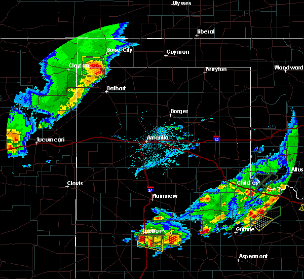 The severe thunderstorm warning for southwestern cimarron and northwestern dallam counties will expire at 830 pm cdt, the storm which prompted the warning has moved out of the area. therefore the warning will be allowed to expire. however small hail and gusty winds are still possible with this thunderstorm. The severe thunderstorm warning for southwestern cimarron and northwestern dallam counties will expire at 830 pm cdt, the storm which prompted the warning has moved out of the area. therefore the warning will be allowed to expire. however small hail and gusty winds are still possible with this thunderstorm.
|
| 5/19/2018 8:24 PM CDT |
 At 803 pm cdt, a severe thunderstorm was located 7 miles south of felt, or 22 miles southwest of boise city, moving east at 25 mph (radar indicated). Hazards include 60 mph wind gusts and quarter size hail. Minor damage to roofs, siding, and trees is possible. hail damage to vehicles is expected. Locations impacted include, felt. At 803 pm cdt, a severe thunderstorm was located 7 miles south of felt, or 22 miles southwest of boise city, moving east at 25 mph (radar indicated). Hazards include 60 mph wind gusts and quarter size hail. Minor damage to roofs, siding, and trees is possible. hail damage to vehicles is expected. Locations impacted include, felt.
|
| 5/19/2018 8:04 PM CDT |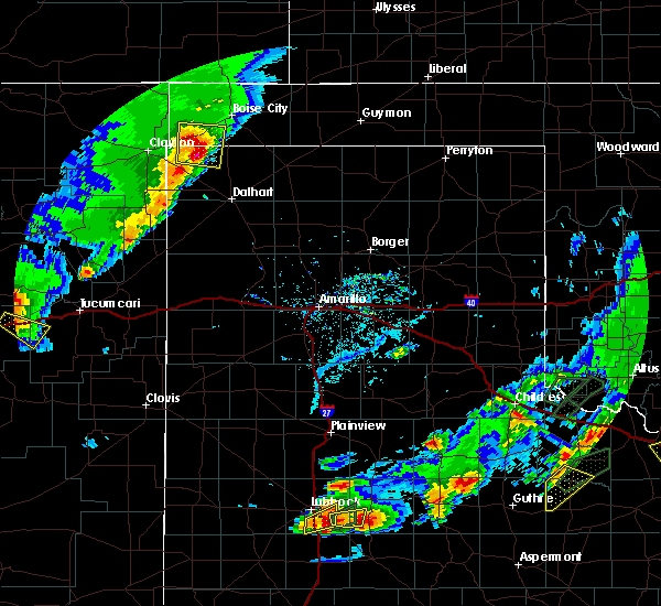
 At 803 pm cdt, a severe thunderstorm was located 7 miles south of felt, or 22 miles southwest of boise city, moving east at 25 mph (radar indicated). Hazards include 60 mph wind gusts and quarter size hail. Minor damage to roofs, siding, and trees is possible. hail damage to vehicles is expected. Locations impacted include, felt. At 803 pm cdt, a severe thunderstorm was located 7 miles south of felt, or 22 miles southwest of boise city, moving east at 25 mph (radar indicated). Hazards include 60 mph wind gusts and quarter size hail. Minor damage to roofs, siding, and trees is possible. hail damage to vehicles is expected. Locations impacted include, felt.
|
| 5/19/2018 7:33 PM CDT |
 At 733 pm cdt, a severe thunderstorm was located 10 miles north of texline, or 12 miles northeast of clayton, moving east at 25 mph (radar indicated). Hazards include 60 mph wind gusts and half dollar size hail. Minor damage to roofs, siding, and trees is possible. Hail damage to vehicles is expected. At 733 pm cdt, a severe thunderstorm was located 10 miles north of texline, or 12 miles northeast of clayton, moving east at 25 mph (radar indicated). Hazards include 60 mph wind gusts and half dollar size hail. Minor damage to roofs, siding, and trees is possible. Hail damage to vehicles is expected.
|
| 5/19/2018 7:33 PM CDT |
 The national weather service in amarillo has issued a * severe thunderstorm warning for. southwestern cimarron county in the panhandle of oklahoma. northwestern dallam county in the panhandle of texas. Until 830 pm cdt * at 733 pm cdt, a severe thunderstorm was located 10 miles north of. The national weather service in amarillo has issued a * severe thunderstorm warning for. southwestern cimarron county in the panhandle of oklahoma. northwestern dallam county in the panhandle of texas. Until 830 pm cdt * at 733 pm cdt, a severe thunderstorm was located 10 miles north of.
|
| 5/16/2018 6:14 PM CDT |
 At 613 pm cdt, a severe thunderstorm was located over felt, or 16 miles southwest of boise city, moving southeast at 5 mph (trained weather spotters reported half dollar size hail near felt at 6:05 pm cdt). Hazards include 60 mph wind gusts and half dollar size hail. Minor damage to roofs, siding, and trees is possible. hail damage to vehicles is expected. Locations impacted include, felt. At 613 pm cdt, a severe thunderstorm was located over felt, or 16 miles southwest of boise city, moving southeast at 5 mph (trained weather spotters reported half dollar size hail near felt at 6:05 pm cdt). Hazards include 60 mph wind gusts and half dollar size hail. Minor damage to roofs, siding, and trees is possible. hail damage to vehicles is expected. Locations impacted include, felt.
|
| 5/16/2018 6:14 PM CDT |
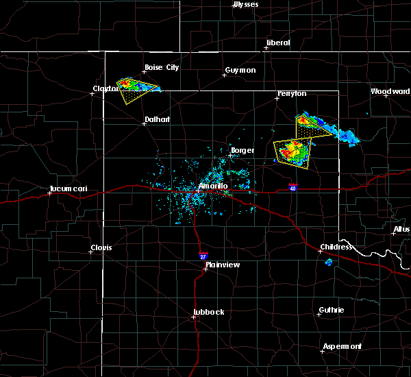 At 613 pm cdt, a severe thunderstorm was located over felt, or 16 miles southwest of boise city, moving southeast at 5 mph (trained weather spotters reported half dollar size hail near felt at 6:05 pm cdt). Hazards include 60 mph wind gusts and half dollar size hail. Minor damage to roofs, siding, and trees is possible. hail damage to vehicles is expected. Locations impacted include, felt. At 613 pm cdt, a severe thunderstorm was located over felt, or 16 miles southwest of boise city, moving southeast at 5 mph (trained weather spotters reported half dollar size hail near felt at 6:05 pm cdt). Hazards include 60 mph wind gusts and half dollar size hail. Minor damage to roofs, siding, and trees is possible. hail damage to vehicles is expected. Locations impacted include, felt.
|
| 5/16/2018 6:05 PM CDT | Half Dollar sized hail reported 1.7 miles WSW of Felt, OK, spotter network report |
| 5/16/2018 6:05 PM CDT |
 At 605 pm cdt, a severe thunderstorm was located over felt, or 17 miles southwest of boise city, moving southeast at 10 mph (radar indicated). Hazards include 60 mph wind gusts and quarter size hail. Minor damage to roofs, siding, and trees is possible. Hail damage to vehicles is expected. At 605 pm cdt, a severe thunderstorm was located over felt, or 17 miles southwest of boise city, moving southeast at 10 mph (radar indicated). Hazards include 60 mph wind gusts and quarter size hail. Minor damage to roofs, siding, and trees is possible. Hail damage to vehicles is expected.
|
| 5/16/2018 6:05 PM CDT |
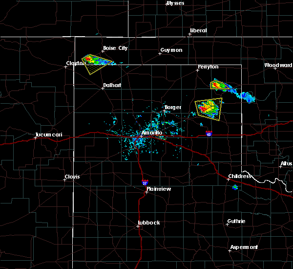 At 605 pm cdt, a severe thunderstorm was located over felt, or 17 miles southwest of boise city, moving southeast at 10 mph (radar indicated). Hazards include 60 mph wind gusts and quarter size hail. Minor damage to roofs, siding, and trees is possible. Hail damage to vehicles is expected. At 605 pm cdt, a severe thunderstorm was located over felt, or 17 miles southwest of boise city, moving southeast at 10 mph (radar indicated). Hazards include 60 mph wind gusts and quarter size hail. Minor damage to roofs, siding, and trees is possible. Hail damage to vehicles is expected.
|
| 5/16/2018 5:42 PM CDT |
 The severe thunderstorm warning for southwestern cimarron county will expire at 545 pm cdt. the storm which prompted the warning has weakened below severe limits, and no longer poses an immediate threat to life or property. therefore the warning will be allowed to expire. However gusty winds are still possible with this thunderstorm. The severe thunderstorm warning for southwestern cimarron county will expire at 545 pm cdt. the storm which prompted the warning has weakened below severe limits, and no longer poses an immediate threat to life or property. therefore the warning will be allowed to expire. However gusty winds are still possible with this thunderstorm.
|
| 5/16/2018 5:33 PM CDT |
 At 533 pm cdt, a severe thunderstorm was located 8 miles east of felt, or 15 miles southwest of boise city, moving southeast at 15 mph (trained weather spotters). Hazards include 60 mph wind gusts and nickel size hail. Minor damage to roofs, siding, and trees is possible. Locations impacted include, felt. At 533 pm cdt, a severe thunderstorm was located 8 miles east of felt, or 15 miles southwest of boise city, moving southeast at 15 mph (trained weather spotters). Hazards include 60 mph wind gusts and nickel size hail. Minor damage to roofs, siding, and trees is possible. Locations impacted include, felt.
|
| 5/16/2018 5:08 PM CDT |
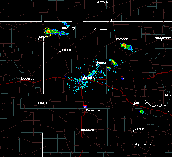 At 508 pm cdt, a severe thunderstorm was located near felt, or 15 miles southwest of boise city, moving southeast at 15 mph (trained weather spotters reported quarter size hail). Hazards include 60 mph wind gusts and half dollar size hail. Minor damage to roofs, siding, and trees is possible. hail damage to vehicles is expected. Locations impacted include, wheeless and felt. At 508 pm cdt, a severe thunderstorm was located near felt, or 15 miles southwest of boise city, moving southeast at 15 mph (trained weather spotters reported quarter size hail). Hazards include 60 mph wind gusts and half dollar size hail. Minor damage to roofs, siding, and trees is possible. hail damage to vehicles is expected. Locations impacted include, wheeless and felt.
|
| 5/16/2018 4:51 PM CDT |
 At 450 pm cdt, a severe thunderstorm was located 6 miles southeast of wheeless, or 18 miles west of boise city, moving southeast at 15 mph (radar indicated). Hazards include 60 mph wind gusts and quarter size hail. Minor damage to roofs, siding, and trees is possible. Hail damage to vehicles is expected. At 450 pm cdt, a severe thunderstorm was located 6 miles southeast of wheeless, or 18 miles west of boise city, moving southeast at 15 mph (radar indicated). Hazards include 60 mph wind gusts and quarter size hail. Minor damage to roofs, siding, and trees is possible. Hail damage to vehicles is expected.
|
| 5/15/2018 6:57 PM CDT |
 At 657 pm cdt, a severe thunderstorm was located 8 miles west of boise city, moving northeast at 35 mph (radar indicated). Hazards include 60 mph wind gusts and quarter size hail. Minor damage to roofs, siding, and trees is possible. Hail damage to vehicles is expected. At 657 pm cdt, a severe thunderstorm was located 8 miles west of boise city, moving northeast at 35 mph (radar indicated). Hazards include 60 mph wind gusts and quarter size hail. Minor damage to roofs, siding, and trees is possible. Hail damage to vehicles is expected.
|
| 8/13/2017 4:01 PM CDT |
 At 401 pm cdt, a severe thunderstorm was located 10 miles north of seneca, or 23 miles north of clayton, moving southeast at 20 mph (radar indicated). Hazards include 60 mph wind gusts and half dollar size hail. Minor damage to roofs, siding, and trees is possible. Hail damage to vehicles is expected. At 401 pm cdt, a severe thunderstorm was located 10 miles north of seneca, or 23 miles north of clayton, moving southeast at 20 mph (radar indicated). Hazards include 60 mph wind gusts and half dollar size hail. Minor damage to roofs, siding, and trees is possible. Hail damage to vehicles is expected.
|
| 8/10/2017 8:30 PM CDT |
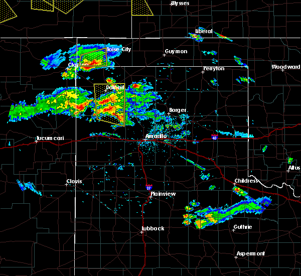 At 830 pm cdt, a severe thunderstorm was located 5 miles northeast of felt, or 13 miles southwest of boise city, moving east at 15 mph (radar indicated). Hazards include 70 mph wind gusts and half dollar size hail. Expect some tree damage. damage is likely to mobile homes, roofs, and outbuildings. hail damage to vehicles is expected. Locations impacted include, boise city and felt. At 830 pm cdt, a severe thunderstorm was located 5 miles northeast of felt, or 13 miles southwest of boise city, moving east at 15 mph (radar indicated). Hazards include 70 mph wind gusts and half dollar size hail. Expect some tree damage. damage is likely to mobile homes, roofs, and outbuildings. hail damage to vehicles is expected. Locations impacted include, boise city and felt.
|
| 8/10/2017 8:09 PM CDT |
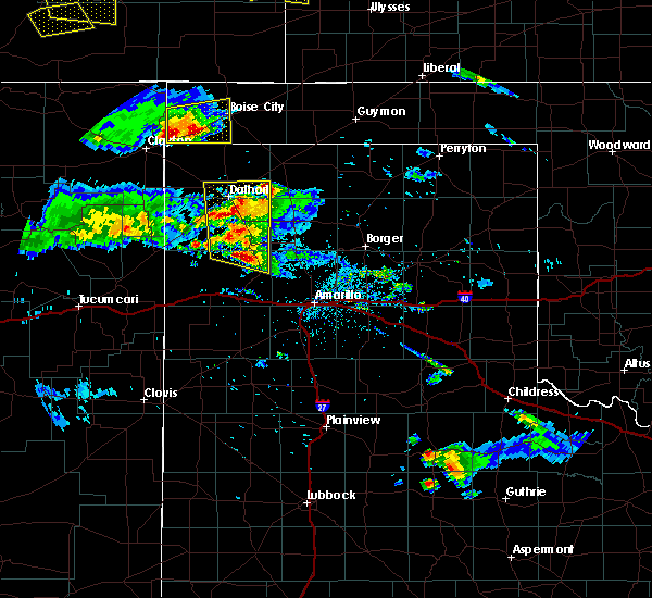 At 809 pm cdt, a severe thunderstorm was located over felt, or 17 miles southwest of boise city, moving east at 15 mph (radar indicated). Hazards include 70 mph wind gusts and half dollar size hail. Expect some tree damage. damage is likely to mobile homes, roofs, and outbuildings. Hail damage to vehicles is expected. At 809 pm cdt, a severe thunderstorm was located over felt, or 17 miles southwest of boise city, moving east at 15 mph (radar indicated). Hazards include 70 mph wind gusts and half dollar size hail. Expect some tree damage. damage is likely to mobile homes, roofs, and outbuildings. Hail damage to vehicles is expected.
|
| 5/27/2017 7:23 PM CDT |
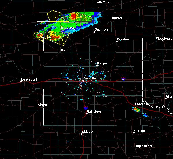 The severe thunderstorm warning for southwestern cimarron and northern dallam counties will expire at 730 pm cdt, the storm which prompted the warning has been replaced with another severe thunderstorm warning. therefore this warning will be allowed to expire. hail to the size of half dollar size remain possible with this storm. a severe thunderstorm watch remains in effect until 100 am cdt for the panhandle of oklahoma, and the panhandle of texas. The severe thunderstorm warning for southwestern cimarron and northern dallam counties will expire at 730 pm cdt, the storm which prompted the warning has been replaced with another severe thunderstorm warning. therefore this warning will be allowed to expire. hail to the size of half dollar size remain possible with this storm. a severe thunderstorm watch remains in effect until 100 am cdt for the panhandle of oklahoma, and the panhandle of texas.
|
| 5/27/2017 7:16 PM CDT |
 At 716 pm cdt, severe thunderstorms were located from 14 miles southwest of boise city to near felt, moving east at 30 mph (trained weather spotters reported half dollar size hail in felt). Hazards include 60 mph wind gusts and half dollar size hail. Minor damage to roofs, siding, and trees is possible. hail damage to vehicles is expected. Locations impacted include, felt. At 716 pm cdt, severe thunderstorms were located from 14 miles southwest of boise city to near felt, moving east at 30 mph (trained weather spotters reported half dollar size hail in felt). Hazards include 60 mph wind gusts and half dollar size hail. Minor damage to roofs, siding, and trees is possible. hail damage to vehicles is expected. Locations impacted include, felt.
|
| 5/27/2017 7:14 PM CDT | Half Dollar sized hail reported 0.6 miles ENE of Felt, OK |
| 5/27/2017 7:10 PM CDT |
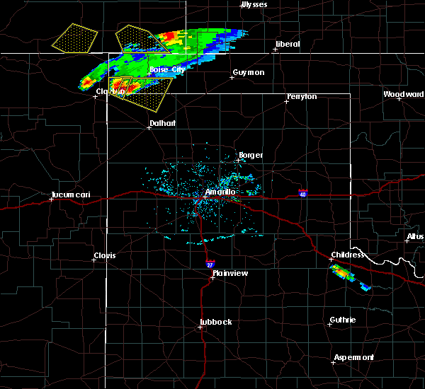 At 710 pm cdt, a severe thunderstorm was located near felt, or 20 miles east of clayton, moving southeast at 30 mph (radar indicated). Hazards include ping pong ball size hail and 60 mph wind gusts. Minor damage to roofs, siding, and trees is possible. people and animals outdoors will be injured. expect hail damage to roofs, siding, windows, and vehicles. Locations impacted include, felt. At 710 pm cdt, a severe thunderstorm was located near felt, or 20 miles east of clayton, moving southeast at 30 mph (radar indicated). Hazards include ping pong ball size hail and 60 mph wind gusts. Minor damage to roofs, siding, and trees is possible. people and animals outdoors will be injured. expect hail damage to roofs, siding, windows, and vehicles. Locations impacted include, felt.
|
| 5/27/2017 7:09 PM CDT |
 At 709 pm cdt, severe thunderstorms were located along a line extending from 3 miles east of felt to 12 miles south of wheeless, moving east at 30 mph (radar indicated). Hazards include ping pong ball size hail and 60 mph wind gusts. Minor damage to roofs, siding, and trees is possible. people and animals outdoors will be injured. Expect hail damage to roofs, siding, windows, and vehicles. At 709 pm cdt, severe thunderstorms were located along a line extending from 3 miles east of felt to 12 miles south of wheeless, moving east at 30 mph (radar indicated). Hazards include ping pong ball size hail and 60 mph wind gusts. Minor damage to roofs, siding, and trees is possible. people and animals outdoors will be injured. Expect hail damage to roofs, siding, windows, and vehicles.
|
| 5/27/2017 6:56 PM CDT |
 At 656 pm cdt, a severe thunderstorm was located 8 miles southwest of wheeless, or 16 miles northeast of clayton, moving east at 25 mph (radar indicated). Hazards include ping pong ball size hail and 60 mph wind gusts. Minor damage to roofs, siding, and trees is possible. people and animals outdoors will be injured. expect hail damage to roofs, siding, windows, and vehicles. Locations impacted include, felt and wheeless. At 656 pm cdt, a severe thunderstorm was located 8 miles southwest of wheeless, or 16 miles northeast of clayton, moving east at 25 mph (radar indicated). Hazards include ping pong ball size hail and 60 mph wind gusts. Minor damage to roofs, siding, and trees is possible. people and animals outdoors will be injured. expect hail damage to roofs, siding, windows, and vehicles. Locations impacted include, felt and wheeless.
|
| 5/27/2017 6:56 PM CDT |
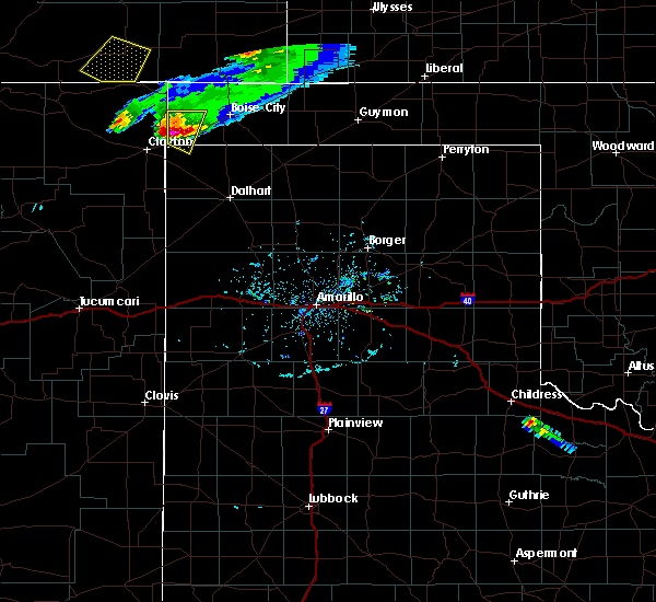 At 656 pm cdt, a severe thunderstorm was located 8 miles southwest of wheeless, or 16 miles northeast of clayton, moving east at 25 mph (radar indicated). Hazards include ping pong ball size hail and 60 mph wind gusts. Minor damage to roofs, siding, and trees is possible. people and animals outdoors will be injured. expect hail damage to roofs, siding, windows, and vehicles. Locations impacted include, felt and wheeless. At 656 pm cdt, a severe thunderstorm was located 8 miles southwest of wheeless, or 16 miles northeast of clayton, moving east at 25 mph (radar indicated). Hazards include ping pong ball size hail and 60 mph wind gusts. Minor damage to roofs, siding, and trees is possible. people and animals outdoors will be injured. expect hail damage to roofs, siding, windows, and vehicles. Locations impacted include, felt and wheeless.
|
| 5/27/2017 6:44 PM CDT |
 At 643 pm cdt, a severe thunderstorm was located 4 miles east of seneca, or 15 miles northeast of clayton, moving east at 25 mph (radar indicated). Hazards include 60 mph wind gusts and quarter size hail. Minor damage to roofs, siding, and trees is possible. Hail damage to vehicles is expected. At 643 pm cdt, a severe thunderstorm was located 4 miles east of seneca, or 15 miles northeast of clayton, moving east at 25 mph (radar indicated). Hazards include 60 mph wind gusts and quarter size hail. Minor damage to roofs, siding, and trees is possible. Hail damage to vehicles is expected.
|
| 5/27/2017 6:44 PM CDT |
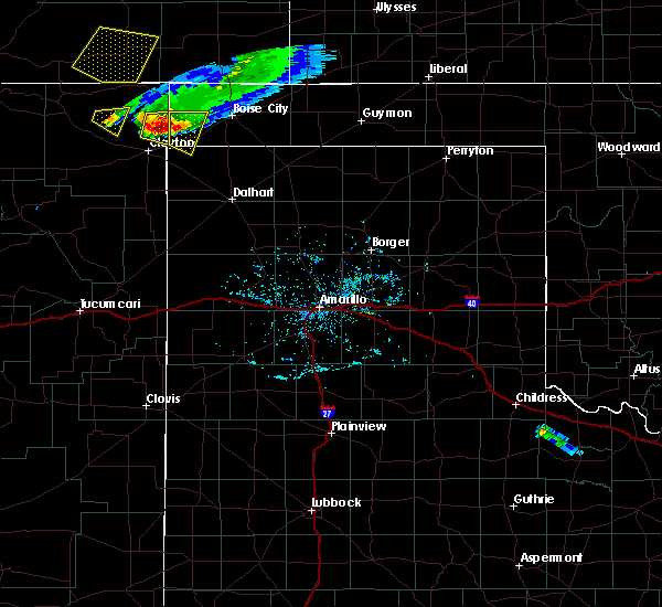 At 643 pm cdt, a severe thunderstorm was located 4 miles east of seneca, or 15 miles northeast of clayton, moving east at 25 mph (radar indicated). Hazards include 60 mph wind gusts and quarter size hail. Minor damage to roofs, siding, and trees is possible. Hail damage to vehicles is expected. At 643 pm cdt, a severe thunderstorm was located 4 miles east of seneca, or 15 miles northeast of clayton, moving east at 25 mph (radar indicated). Hazards include 60 mph wind gusts and quarter size hail. Minor damage to roofs, siding, and trees is possible. Hail damage to vehicles is expected.
|
| 5/9/2017 9:26 PM CDT |
 The severe thunderstorm warning for western cimarron and north central dallam counties will expire at 930 pm cdt, the storms which prompted the warning have moved out of the area. therefore this warning will be allowed to expire. remember, a new severe thunderstorm warning still remains in effect for eastern cimarron county and western texas county until 1015 pm cdt. The severe thunderstorm warning for western cimarron and north central dallam counties will expire at 930 pm cdt, the storms which prompted the warning have moved out of the area. therefore this warning will be allowed to expire. remember, a new severe thunderstorm warning still remains in effect for eastern cimarron county and western texas county until 1015 pm cdt.
|
| 5/9/2017 9:02 PM CDT |
 At 902 pm cdt, severe thunderstorms were located along a line extending from 10 miles northeast of black mesa park to 9 miles west of boise city to 11 miles southeast of felt, moving northeast at 40 mph (radar indicated). Hazards include 60 mph wind gusts and half dollar size hail. Minor damage to roofs, siding, and trees is possible. hail damage to vehicles is expected. hail may accumulate on roadways causing hazardous travel. Locations impacted include, boise city, black mesa park and felt. At 902 pm cdt, severe thunderstorms were located along a line extending from 10 miles northeast of black mesa park to 9 miles west of boise city to 11 miles southeast of felt, moving northeast at 40 mph (radar indicated). Hazards include 60 mph wind gusts and half dollar size hail. Minor damage to roofs, siding, and trees is possible. hail damage to vehicles is expected. hail may accumulate on roadways causing hazardous travel. Locations impacted include, boise city, black mesa park and felt.
|
| 5/9/2017 8:40 PM CDT |
 At 840 pm cdt, severe thunderstorms were located along a line extending from near black mesa park to 4 miles south of wheeless to 11 miles east of texline, moving northeast at 50 mph (radar indicated). Hazards include 60 mph wind gusts and half dollar size hail. Minor damage to roofs, siding, and trees is possible. hail damage to vehicles is expected. hail may accumulate on roadways causing hazardous travel. Locations impacted include, boise city, kenton, wheeless, black mesa park and felt. At 840 pm cdt, severe thunderstorms were located along a line extending from near black mesa park to 4 miles south of wheeless to 11 miles east of texline, moving northeast at 50 mph (radar indicated). Hazards include 60 mph wind gusts and half dollar size hail. Minor damage to roofs, siding, and trees is possible. hail damage to vehicles is expected. hail may accumulate on roadways causing hazardous travel. Locations impacted include, boise city, kenton, wheeless, black mesa park and felt.
|
| 5/9/2017 8:10 PM CDT |
 At 810 pm cdt, severe thunderstorms were located along a line extending from 14 miles northwest of seneca to 4 miles southeast of clayton lake state park to 7 miles northwest of sedan, moving northeast at 40 mph (radar indicated). Hazards include 60 mph wind gusts and half dollar size hail. Minor damage to roofs, siding, and trees is possible. Hail damage to vehicles is expected. At 810 pm cdt, severe thunderstorms were located along a line extending from 14 miles northwest of seneca to 4 miles southeast of clayton lake state park to 7 miles northwest of sedan, moving northeast at 40 mph (radar indicated). Hazards include 60 mph wind gusts and half dollar size hail. Minor damage to roofs, siding, and trees is possible. Hail damage to vehicles is expected.
|
| 7/29/2016 7:21 PM CDT |
 The severe thunderstorm warning for southern cimarron county will expire at 730 pm cdt, the storm which prompted the warning has weakened below severe limits, and no longer poses an immediate threat to life or property. therefore the warning will be allowed to expire. however gusty winds are still possible with this thunderstorm. The severe thunderstorm warning for southern cimarron county will expire at 730 pm cdt, the storm which prompted the warning has weakened below severe limits, and no longer poses an immediate threat to life or property. therefore the warning will be allowed to expire. however gusty winds are still possible with this thunderstorm.
|
| 7/29/2016 7:11 PM CDT |
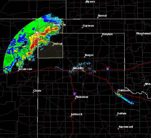 At 711 pm cdt, a severe thunderstorm was located 11 miles southeast of boise city, moving east at 25 mph (radar indicated). Hazards include 60 mph wind gusts. Minor damage to roofs. siding. and trees is possible. Locations impacted include, boise city and felt. At 711 pm cdt, a severe thunderstorm was located 11 miles southeast of boise city, moving east at 25 mph (radar indicated). Hazards include 60 mph wind gusts. Minor damage to roofs. siding. and trees is possible. Locations impacted include, boise city and felt.
|
| 7/29/2016 6:50 PM CDT |
 At 649 pm cdt, severe thunderstorms were located along a line extending from 4 miles southeast of boise city to felt, moving southeast at 15 mph (radar indicated). Hazards include 60 mph wind gusts. Minor damage to roofs. siding. and trees is possible. Locations impacted include, boise city, keyes and felt. At 649 pm cdt, severe thunderstorms were located along a line extending from 4 miles southeast of boise city to felt, moving southeast at 15 mph (radar indicated). Hazards include 60 mph wind gusts. Minor damage to roofs. siding. and trees is possible. Locations impacted include, boise city, keyes and felt.
|
| 7/29/2016 6:40 PM CDT |
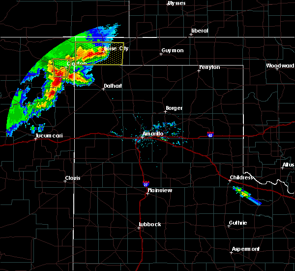 At 640 pm cdt, a severe thunderstorm was located over boise city, moving east at 25 mph (radar indicated). Hazards include 60 mph wind gusts and penny size hail. Minor damage to roofs. siding. and trees is possible. Locations impacted include, boise city, keyes, felt and wheeless. At 640 pm cdt, a severe thunderstorm was located over boise city, moving east at 25 mph (radar indicated). Hazards include 60 mph wind gusts and penny size hail. Minor damage to roofs. siding. and trees is possible. Locations impacted include, boise city, keyes, felt and wheeless.
|
| 7/29/2016 6:25 PM CDT |
 At 625 pm cdt, a severe thunderstorm was located over boise city, moving east at 30 mph (radar indicated). Hazards include 70 mph wind gusts and quarter size hail. Expect some tree damage. damage is likely to mobile homes. roofs, and outbuildings. hail damage to vehicles is expected. Locations impacted include, boise city, keyes, black mesa park, felt, kenton and wheeless. At 625 pm cdt, a severe thunderstorm was located over boise city, moving east at 30 mph (radar indicated). Hazards include 70 mph wind gusts and quarter size hail. Expect some tree damage. damage is likely to mobile homes. roofs, and outbuildings. hail damage to vehicles is expected. Locations impacted include, boise city, keyes, black mesa park, felt, kenton and wheeless.
|
| 7/29/2016 6:12 PM CDT |
 At 611 pm cdt, a severe thunderstorm was located 9 miles west of boise city, moving east at 25 mph (radar indicated). Hazards include 60 mph wind gusts and quarter size hail. Minor damage to roofs. siding. and trees is possible. hail damage to vehicles is expected. Locations impacted include, boise city, keyes, black mesa park, felt, kenton and wheeless. At 611 pm cdt, a severe thunderstorm was located 9 miles west of boise city, moving east at 25 mph (radar indicated). Hazards include 60 mph wind gusts and quarter size hail. Minor damage to roofs. siding. and trees is possible. hail damage to vehicles is expected. Locations impacted include, boise city, keyes, black mesa park, felt, kenton and wheeless.
|
| 7/29/2016 5:56 PM CDT |
 At 556 pm cdt, a severe thunderstorm was located 4 miles northeast of wheeless, or 17 miles west of boise city, moving southeast at 30 mph (radar indicated). Hazards include 60 mph wind gusts and half dollar size hail. Minor damage to roofs. siding. and trees is possible. Hail damage to vehicles is expected. At 556 pm cdt, a severe thunderstorm was located 4 miles northeast of wheeless, or 17 miles west of boise city, moving southeast at 30 mph (radar indicated). Hazards include 60 mph wind gusts and half dollar size hail. Minor damage to roofs. siding. and trees is possible. Hail damage to vehicles is expected.
|
| 7/3/2016 8:27 PM CDT | Pea size hail and very heavy rainfal in cimarron county OK, 0.6 miles ENE of Felt, OK |
| 7/3/2016 8:05 PM CDT |
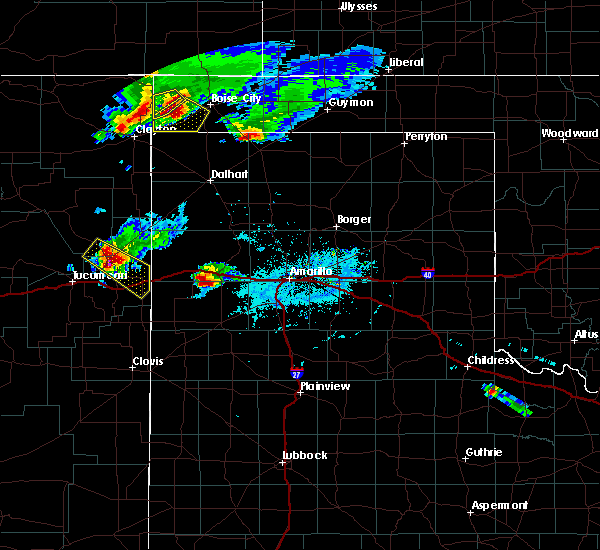 At 805 pm cdt, a severe thunderstorm was located 6 miles north of felt, or 17 miles west of boise city, moving southeast at 30 mph (radar indicated). Hazards include 60 mph wind gusts and nickel size hail. Minor damage to roofs. siding. And trees is possible. At 805 pm cdt, a severe thunderstorm was located 6 miles north of felt, or 17 miles west of boise city, moving southeast at 30 mph (radar indicated). Hazards include 60 mph wind gusts and nickel size hail. Minor damage to roofs. siding. And trees is possible.
|
| 6/13/2016 6:05 PM CDT |
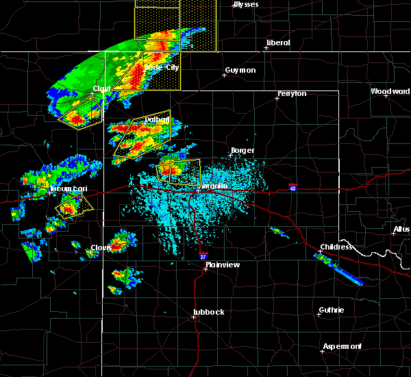 At 605 pm cdt, severe thunderstorms were located along a line extending from 12 miles north of keyes to 5 miles southeast of felt, moving east at 45 mph (radar indicated). Hazards include 60 mph wind gusts and penny size hail. Minor damage to roofs. siding. And trees is possible. At 605 pm cdt, severe thunderstorms were located along a line extending from 12 miles north of keyes to 5 miles southeast of felt, moving east at 45 mph (radar indicated). Hazards include 60 mph wind gusts and penny size hail. Minor damage to roofs. siding. And trees is possible.
|
| 5/16/2016 5:05 PM CDT | Golf Ball sized hail reported 5.6 miles WSW of Felt, OK, cimarron county sheriff office reports golfball sized hail. 60 mph wind gusts and heavy rain producing muddy roads |
| 5/16/2016 5:05 PM CDT | Cimarron county sheriff office reports golfball sized hail. 60 mph wind gusts and heavy rain producing muddy roads in cimarron county OK, 5.6 miles WSW of Felt, OK |
| 5/16/2016 5:04 PM CDT |
 At 503 pm cdt, severe thunderstorms were located along a line extending from 7 miles southwest of boise city to 7 miles south of clayton, moving east at 25 mph (radar indicated). Hazards include 70 mph wind gusts and ping pong ball size hail. Expect some tree damage. damage is likely to mobile homes. roofs, and outbuildings. people and animals outdoors will be injured. expect hail damage to roofs, siding, windows, and vehicles. Locations impacted include, boise city, texline, felt and ware. At 503 pm cdt, severe thunderstorms were located along a line extending from 7 miles southwest of boise city to 7 miles south of clayton, moving east at 25 mph (radar indicated). Hazards include 70 mph wind gusts and ping pong ball size hail. Expect some tree damage. damage is likely to mobile homes. roofs, and outbuildings. people and animals outdoors will be injured. expect hail damage to roofs, siding, windows, and vehicles. Locations impacted include, boise city, texline, felt and ware.
|
| 5/16/2016 5:01 PM CDT | Quarter sized hail reported 0.7 miles WSW of Felt, OK |
| 5/16/2016 4:57 PM CDT |
 At 457 pm cdt, a severe thunderstorm was located over felt, or 16 miles southwest of boise city, moving southeast at 20 mph (radar indicated). Hazards include 70 mph wind gusts and quarter size hail. Expect some tree damage. damage is likely to mobile homes, roofs, and outbuildings. Hail damage to vehicles is expected. At 457 pm cdt, a severe thunderstorm was located over felt, or 16 miles southwest of boise city, moving southeast at 20 mph (radar indicated). Hazards include 70 mph wind gusts and quarter size hail. Expect some tree damage. damage is likely to mobile homes, roofs, and outbuildings. Hail damage to vehicles is expected.
|
| 5/16/2016 4:46 PM CDT |
 At 445 pm cdt, a severe thunderstorm capable of producing a tornado was located near felt, or 19 miles southwest of boise city, moving southeast at 15 mph. spotters reported a rapidly rotating wall cloud at 444 pm cdt, but the tornado that occurred earlier has lifted. this storm may produce another tornado at any time (weather spotters reported a funnel cloud). Hazards include tornado and quarter size hail. Flying debris will be dangerous to those caught without shelter. mobile homes will be damaged or destroyed. damage to roofs, windows, and vehicles will occur. tree damage is likely. Locations impacted include, felt. At 445 pm cdt, a severe thunderstorm capable of producing a tornado was located near felt, or 19 miles southwest of boise city, moving southeast at 15 mph. spotters reported a rapidly rotating wall cloud at 444 pm cdt, but the tornado that occurred earlier has lifted. this storm may produce another tornado at any time (weather spotters reported a funnel cloud). Hazards include tornado and quarter size hail. Flying debris will be dangerous to those caught without shelter. mobile homes will be damaged or destroyed. damage to roofs, windows, and vehicles will occur. tree damage is likely. Locations impacted include, felt.
|
| 5/16/2016 4:36 PM CDT |
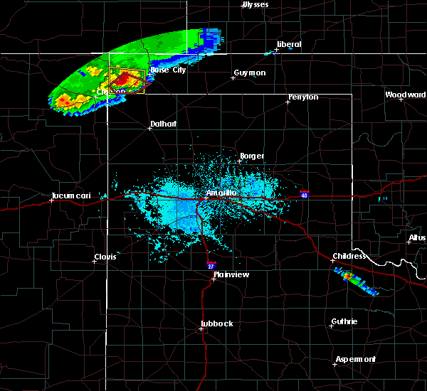 At 436 pm cdt, a confirmed tornado was located 5 miles northwest of felt, or 20 miles west of boise city, moving southeast at 15 mph (weather spotters confirmed tornado). Hazards include damaging tornado and quarter size hail. Flying debris will be dangerous to those caught without shelter. mobile homes will be damaged or destroyed. damage to roofs, windows, and vehicles will occur. Tree damage is likely. At 436 pm cdt, a confirmed tornado was located 5 miles northwest of felt, or 20 miles west of boise city, moving southeast at 15 mph (weather spotters confirmed tornado). Hazards include damaging tornado and quarter size hail. Flying debris will be dangerous to those caught without shelter. mobile homes will be damaged or destroyed. damage to roofs, windows, and vehicles will occur. Tree damage is likely.
|
| 5/16/2016 4:25 PM CDT |
 At 424 pm cdt, a severe thunderstorm was located 4 miles south of wheeless, or 21 miles northeast of clayton, moving southeast at 15 mph (radar indicated). Hazards include ping pong ball size hail and 60 mph wind gusts. Minor damage to roofs. siding. and trees is possible. people and animals outdoors will be injured. expect hail damage to roofs, siding, windows, and vehicles. Locations impacted include, felt and wheeless. At 424 pm cdt, a severe thunderstorm was located 4 miles south of wheeless, or 21 miles northeast of clayton, moving southeast at 15 mph (radar indicated). Hazards include ping pong ball size hail and 60 mph wind gusts. Minor damage to roofs. siding. and trees is possible. people and animals outdoors will be injured. expect hail damage to roofs, siding, windows, and vehicles. Locations impacted include, felt and wheeless.
|
| 5/16/2016 4:10 PM CDT |
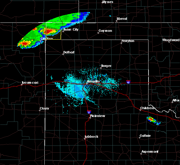 At 409 pm cdt, a severe thunderstorm was located near wheeless, or 21 miles northeast of clayton, moving southeast at 20 mph (radar indicated). Hazards include ping pong ball size hail and 60 mph wind gusts. Minor damage to roofs. siding. and trees is possible. people and animals outdoors will be injured. expect hail damage to roofs, siding, windows, and vehicles. Locations impacted include, felt and wheeless. At 409 pm cdt, a severe thunderstorm was located near wheeless, or 21 miles northeast of clayton, moving southeast at 20 mph (radar indicated). Hazards include ping pong ball size hail and 60 mph wind gusts. Minor damage to roofs. siding. and trees is possible. people and animals outdoors will be injured. expect hail damage to roofs, siding, windows, and vehicles. Locations impacted include, felt and wheeless.
|
| 5/16/2016 3:56 PM CDT |
 At 355 pm cdt, a severe thunderstorm was located 6 miles west of wheeless, or 22 miles northeast of clayton, moving southeast at 20 mph (radar indicated). Hazards include ping pong ball size hail and 60 mph wind gusts. Minor damage to roofs. siding. and trees is possible. people and animals outdoors will be injured. Expect hail damage to roofs, siding, windows, and vehicles. At 355 pm cdt, a severe thunderstorm was located 6 miles west of wheeless, or 22 miles northeast of clayton, moving southeast at 20 mph (radar indicated). Hazards include ping pong ball size hail and 60 mph wind gusts. Minor damage to roofs. siding. and trees is possible. people and animals outdoors will be injured. Expect hail damage to roofs, siding, windows, and vehicles.
|
| 5/16/2016 3:24 PM CDT |
 At 323 pm cdt, severe thunderstorms were located along a line extending from near kenton to 12 miles northwest of seneca, moving east at 10 mph (radar indicated). Hazards include ping pong ball size hail and 60 mph wind gusts. Minor damage to roofs. siding. and trees is possible. people and animals outdoors will be injured. expect hail damage to roofs, siding, windows, and vehicles. Locations impacted include, black mesa park, felt, kenton and wheeless. At 323 pm cdt, severe thunderstorms were located along a line extending from near kenton to 12 miles northwest of seneca, moving east at 10 mph (radar indicated). Hazards include ping pong ball size hail and 60 mph wind gusts. Minor damage to roofs. siding. and trees is possible. people and animals outdoors will be injured. expect hail damage to roofs, siding, windows, and vehicles. Locations impacted include, black mesa park, felt, kenton and wheeless.
|
| 5/16/2016 3:07 PM CDT |
 At 306 pm cdt, a severe thunderstorm was located 8 miles southwest of kenton, or 26 miles north of clayton, moving southeast at 15 mph (radar indicated). Hazards include ping pong ball size hail and 60 mph wind gusts. Minor damage to roofs. siding. and trees is possible. people and animals outdoors will be injured. Expect hail damage to roofs, siding, windows, and vehicles. At 306 pm cdt, a severe thunderstorm was located 8 miles southwest of kenton, or 26 miles north of clayton, moving southeast at 15 mph (radar indicated). Hazards include ping pong ball size hail and 60 mph wind gusts. Minor damage to roofs. siding. and trees is possible. people and animals outdoors will be injured. Expect hail damage to roofs, siding, windows, and vehicles.
|
| 4/15/2016 8:46 PM CDT |
 At 846 pm cdt, severe thunderstorms were located along a line extending from 7 miles west of keyes to near felt, moving east at 15 mph (radar indicated). Hazards include 60 mph wind gusts and quarter size hail. Minor damage to roofs. siding. and trees is possible. hail damage to vehicles is expected. locations impacted include, boise city, keyes and felt. A tornado watch remains in effect until 1000 pm cdt. At 846 pm cdt, severe thunderstorms were located along a line extending from 7 miles west of keyes to near felt, moving east at 15 mph (radar indicated). Hazards include 60 mph wind gusts and quarter size hail. Minor damage to roofs. siding. and trees is possible. hail damage to vehicles is expected. locations impacted include, boise city, keyes and felt. A tornado watch remains in effect until 1000 pm cdt.
|
| 4/15/2016 8:32 PM CDT |
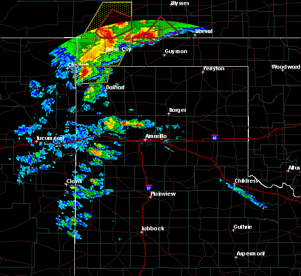 At 831 pm cdt, severe thunderstorms were located along a line extending from 13 miles northwest of keyes to felt, moving east at 40 mph (radar indicated). Hazards include 60 mph wind gusts and quarter size hail. Minor damage to roofs. siding. and trees is possible. hail damage to vehicles is expected. locations impacted include, boise city, keyes and felt. A tornado watch remains in effect until 1000 pm cdt. At 831 pm cdt, severe thunderstorms were located along a line extending from 13 miles northwest of keyes to felt, moving east at 40 mph (radar indicated). Hazards include 60 mph wind gusts and quarter size hail. Minor damage to roofs. siding. and trees is possible. hail damage to vehicles is expected. locations impacted include, boise city, keyes and felt. A tornado watch remains in effect until 1000 pm cdt.
|
| 4/15/2016 8:11 PM CDT |
 At 810 pm cdt, severe thunderstorms were located along a line extending from 9 miles southwest of campo to 7 miles west of felt, moving northeast at 20 mph (radar indicated). Hazards include 60 mph wind gusts and quarter size hail. Minor damage to roofs. siding. and trees is possible. Hail damage to vehicles is expected. At 810 pm cdt, severe thunderstorms were located along a line extending from 9 miles southwest of campo to 7 miles west of felt, moving northeast at 20 mph (radar indicated). Hazards include 60 mph wind gusts and quarter size hail. Minor damage to roofs. siding. and trees is possible. Hail damage to vehicles is expected.
|
| 4/15/2016 6:30 PM CDT |
 At 629 pm cdt, severe thunderstorms were located along a line extending from just west of kenton to near wheeless to 10 miles west of felt, moving northeast at 25 mph (radar indicated). Hazards include 60 mph wind gusts and half dollar size hail. Minor damage to roofs. siding. and trees is possible. hail damage to vehicles is expected. hail may accumulate on roadways causing hazardous travel. locations impacted include, black mesa park, felt, kenton and wheeless. A tornado watch remains in effect until 1000 pm cdt. At 629 pm cdt, severe thunderstorms were located along a line extending from just west of kenton to near wheeless to 10 miles west of felt, moving northeast at 25 mph (radar indicated). Hazards include 60 mph wind gusts and half dollar size hail. Minor damage to roofs. siding. and trees is possible. hail damage to vehicles is expected. hail may accumulate on roadways causing hazardous travel. locations impacted include, black mesa park, felt, kenton and wheeless. A tornado watch remains in effect until 1000 pm cdt.
|
| 4/15/2016 6:14 PM CDT |
 At 614 pm cdt, severe thunderstorms were located along a line extending from 7 miles southwest of kenton to 5 miles southwest of wheeless to 8 miles north of texline, moving northeast at 30 mph (radar indicated). Hazards include 60 mph wind gusts and half dollar size hail. Minor damage to roofs. siding. and trees is possible. hail damage to vehicles is expected. Hail may accumulate on roadways causing hazardous travel. At 614 pm cdt, severe thunderstorms were located along a line extending from 7 miles southwest of kenton to 5 miles southwest of wheeless to 8 miles north of texline, moving northeast at 30 mph (radar indicated). Hazards include 60 mph wind gusts and half dollar size hail. Minor damage to roofs. siding. and trees is possible. hail damage to vehicles is expected. Hail may accumulate on roadways causing hazardous travel.
|
| 4/15/2016 5:27 PM CDT |
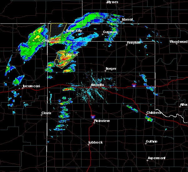 At 527 pm cdt, a severe thunderstorm was located near felt, or 18 miles southwest of boise city, moving north at 65 mph (radar indicated). Hazards include golf ball size hail and 60 mph wind gusts. Minor damage to roofs. siding. and trees is possible. people and animals outdoors will be injured. Expect hail damage to roofs, siding, windows, and vehicles. At 527 pm cdt, a severe thunderstorm was located near felt, or 18 miles southwest of boise city, moving north at 65 mph (radar indicated). Hazards include golf ball size hail and 60 mph wind gusts. Minor damage to roofs. siding. and trees is possible. people and animals outdoors will be injured. Expect hail damage to roofs, siding, windows, and vehicles.
|
| 8/3/2015 5:48 PM CDT |
 At 548 pm cdt, a severe thunderstorm was located 6 miles northeast of felt, and moving southeast at 20 mph (radar indicated). Hazards include hen egg size hail and 60 mph wind gusts. People and animals outdoors will be injured. expect hail damage to roofs, siding, windows and vehicles. Minor wind damage to roofs, siding and trees is possible. At 548 pm cdt, a severe thunderstorm was located 6 miles northeast of felt, and moving southeast at 20 mph (radar indicated). Hazards include hen egg size hail and 60 mph wind gusts. People and animals outdoors will be injured. expect hail damage to roofs, siding, windows and vehicles. Minor wind damage to roofs, siding and trees is possible.
|
| 8/3/2015 5:25 PM CDT |
 At 524 pm cdt, doppler radar indicated severe thunderstorms located along a line extending from 11 miles north of boise city to 9 miles west of boise city to wheeless, and moving southeast at 20 mph (radar indicated). Hazards include golf ball size hail and 60 mph wind gusts. People and animals outdoors will be injured. expect hail damage to roofs, siding, windows and vehicles. Minor wind damage to roofs, siding and trees is possible. At 524 pm cdt, doppler radar indicated severe thunderstorms located along a line extending from 11 miles north of boise city to 9 miles west of boise city to wheeless, and moving southeast at 20 mph (radar indicated). Hazards include golf ball size hail and 60 mph wind gusts. People and animals outdoors will be injured. expect hail damage to roofs, siding, windows and vehicles. Minor wind damage to roofs, siding and trees is possible.
|
| 8/3/2015 5:25 PM CDT |
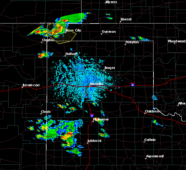 At 524 pm cdt, doppler radar indicated severe thunderstorms located along a line extending from 11 miles north of boise city to 9 miles west of boise city to wheeless, and moving southeast at 20 mph (radar indicated). Hazards include golf ball size hail and 60 mph wind gusts. People and animals outdoors will be injured. expect hail damage to roofs, siding, windows and vehicles. Minor wind damage to roofs, siding and trees is possible. At 524 pm cdt, doppler radar indicated severe thunderstorms located along a line extending from 11 miles north of boise city to 9 miles west of boise city to wheeless, and moving southeast at 20 mph (radar indicated). Hazards include golf ball size hail and 60 mph wind gusts. People and animals outdoors will be injured. expect hail damage to roofs, siding, windows and vehicles. Minor wind damage to roofs, siding and trees is possible.
|
| 5/28/2015 6:28 PM CDT | The severe thunderstorm warning for northwestern hartley, dallam and cimarron counties will expire at 630 pm cdt, the line of storms which prompted the warning has weakened below severe limits, and no longer poses an immediate threat to life or property. additional strong thunderstorms are still possible, and a severe thunderstorm watch remains in effect until 9 pm cdt. |
| 5/28/2015 6:28 PM CDT | The severe thunderstorm warning for northwestern hartley, dallam and cimarron counties will expire at 630 pm cdt, the line of storms which prompted the warning has weakened below severe limits, and no longer poses an immediate threat to life or property. additional strong thunderstorms are still possible, and a severe thunderstorm watch remains in effect until 9 pm cdt. |
| 5/28/2015 6:10 PM CDT | At 607 pm cdt, severe thunderstorms were located along a line extending from 12 miles southwest of elkhart to 11 miles west of conlen to 9 miles east of sedan, and moving east at 20 mph. the strongest storm within this line was located 11 miles west of ware (radar indicated). Hazards include ping pong ball size hail and 60 mph wind gusts. People and animals outdoors will be injured. expect hail damage to roofs, siding, windows and vehicles. Minor wind damage to roofs, siding and trees is possible. |
| 5/28/2015 6:10 PM CDT | At 607 pm cdt, severe thunderstorms were located along a line extending from 12 miles southwest of elkhart to 11 miles west of conlen to 9 miles east of sedan, and moving east at 20 mph. the strongest storm within this line was located 11 miles west of ware (radar indicated). Hazards include ping pong ball size hail and 60 mph wind gusts. People and animals outdoors will be injured. expect hail damage to roofs, siding, windows and vehicles. Minor wind damage to roofs, siding and trees is possible. |
| 5/28/2015 5:50 PM CDT | At 549 pm cdt, severe thunderstorms were located along a line extending from 9 miles west of elkhart to 13 miles southeast of boise city to 8 miles northeast of ware to 10 miles southeast of sedan, and moving east at 20 mph (radar indicated). Hazards include ping pong ball size hail and 60 mph wind gusts. People and animals outdoors will be injured. expect hail damage to roofs, siding, windows and vehicles. Minor wind damage to roofs, siding and trees is possible. |
| 5/28/2015 5:50 PM CDT | At 549 pm cdt, severe thunderstorms were located along a line extending from 9 miles west of elkhart to 13 miles southeast of boise city to 8 miles northeast of ware to 10 miles southeast of sedan, and moving east at 20 mph (radar indicated). Hazards include ping pong ball size hail and 60 mph wind gusts. People and animals outdoors will be injured. expect hail damage to roofs, siding, windows and vehicles. Minor wind damage to roofs, siding and trees is possible. |
| 5/28/2015 5:26 PM CDT | At 524 pm cdt, severe thunderstorms were located along a line extending from 17 miles north of boise city to 13 miles southeast of felt to 7 miles southeast of sedan, and moving east at 20 mph (radar indicated). Hazards include 60 mph wind gusts and half dollar size hail. Hail damage to vehicles is expected. Minor wind damage to roofs, siding and trees is possible. |
| 5/28/2015 5:26 PM CDT | At 524 pm cdt, severe thunderstorms were located along a line extending from 17 miles north of boise city to 13 miles southeast of felt to 7 miles southeast of sedan, and moving east at 20 mph (radar indicated). Hazards include 60 mph wind gusts and half dollar size hail. Hail damage to vehicles is expected. Minor wind damage to roofs, siding and trees is possible. |
| 5/28/2015 5:10 PM CDT | At 508 pm cdt, severe thunderstorms were located along a line extending from 18 miles north of boise city to 6 miles southeast of felt to sedan, and moving east at 15 mph (radar indicated). Hazards include golf ball size hail and 60 mph wind gusts. People and animals outdoors will be injured. expect hail damage to roofs, siding, windows and vehicles. Minor wind damage to roofs, siding and trees is possible. |
| 5/28/2015 5:10 PM CDT | At 508 pm cdt, severe thunderstorms were located along a line extending from 18 miles north of boise city to 6 miles southeast of felt to sedan, and moving east at 15 mph (radar indicated). Hazards include golf ball size hail and 60 mph wind gusts. People and animals outdoors will be injured. expect hail damage to roofs, siding, windows and vehicles. Minor wind damage to roofs, siding and trees is possible. |
| 5/28/2015 4:43 PM CDT | At 439 pm cdt, severe thunderstorms were located along a line extending from 15 miles northeast of black mesa park to felt to 6 miles south of texline, and moving east at 15 mph (radar indicated). Hazards include golf ball size hail and 60 mph wind gusts. People and animals outdoors will be injured. expect hail damage to roofs, siding, windows and vehicles. Minor wind damage to roofs, siding and trees is possible. |
| 5/28/2015 4:43 PM CDT | At 439 pm cdt, severe thunderstorms were located along a line extending from 15 miles northeast of black mesa park to felt to 6 miles south of texline, and moving east at 15 mph (radar indicated). Hazards include golf ball size hail and 60 mph wind gusts. People and animals outdoors will be injured. expect hail damage to roofs, siding, windows and vehicles. Minor wind damage to roofs, siding and trees is possible. |
| 5/28/2015 4:26 PM CDT | At 424 pm cdt, severe thunderstorms were located along a line extending from 17 miles north of boise city to felt to 7 miles south of texline, and moving east at 15 mph (radar indicated). Hazards include golf ball size hail and 60 mph wind gusts. People and animals outdoors will be injured. expect hail damage to roofs, siding, windows and vehicles. Minor wind damage to roofs, siding and trees is possible. |
| 5/28/2015 4:26 PM CDT | At 424 pm cdt, severe thunderstorms were located along a line extending from 17 miles north of boise city to felt to 7 miles south of texline, and moving east at 15 mph (radar indicated). Hazards include golf ball size hail and 60 mph wind gusts. People and animals outdoors will be injured. expect hail damage to roofs, siding, windows and vehicles. Minor wind damage to roofs, siding and trees is possible. |
| 4/22/2015 6:16 PM CDT | At 614 pm cdt, severe thunderstorms were located along a line extending from 6 miles southeast of boise city to 11 miles east of texline, and moving east at 20 mph (radar indicated). Hazards include 60 mph wind gusts and quarter size hail. Hail damage to vehicles is expected. Minor wind damage to roofs, siding and trees is possible. |
| 4/22/2015 6:16 PM CDT | At 614 pm cdt, severe thunderstorms were located along a line extending from 6 miles southeast of boise city to 11 miles east of texline, and moving east at 20 mph (radar indicated). Hazards include 60 mph wind gusts and quarter size hail. Hail damage to vehicles is expected. Minor wind damage to roofs, siding and trees is possible. |
| 4/22/2015 5:58 PM CDT | At 556 pm cdt, severe thunderstorms were located along a line extending from 7 miles southwest of boise city to 6 miles southeast of texline, and moving east at 20 mph (radar indicated). Hazards include 60 mph wind gusts and quarter size hail. Hail damage to vehicles is expected. Minor wind damage to roofs, siding and trees is possible. |
| 4/22/2015 5:58 PM CDT | At 556 pm cdt, severe thunderstorms were located along a line extending from 7 miles southwest of boise city to 6 miles southeast of texline, and moving east at 20 mph (radar indicated). Hazards include 60 mph wind gusts and quarter size hail. Hail damage to vehicles is expected. Minor wind damage to roofs, siding and trees is possible. |
| 4/22/2015 5:40 PM CDT | At 537 pm cdt, a severe thunderstorm was located near texline, and moving northeast at 15 mph (radar indicated). Hazards include 60 mph wind gusts and quarter size hail. Hail damage to vehicles is expected. Minor wind damage to roofs, siding and trees is possible. |
| 4/22/2015 5:40 PM CDT | At 537 pm cdt, a severe thunderstorm was located near texline, and moving northeast at 15 mph (radar indicated). Hazards include 60 mph wind gusts and quarter size hail. Hail damage to vehicles is expected. Minor wind damage to roofs, siding and trees is possible. |
| 6/5/2013 2:55 AM CDT | Half Dollar sized hail reported 5.1 miles WSW of Felt, OK |
| 4/10/2012 9:00 PM CDT | Quarter sized hail reported 0.7 miles WSW of Felt, OK, hail covering the ground |
| 1/1/0001 12:00 AM | Estimated 50-60 mph wind gusts along with pea size hail in cimarron county OK, 1.8 miles NNW of Felt, OK |
Hail Maps for Felt, OK

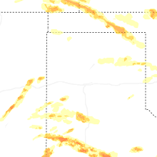

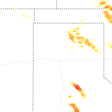


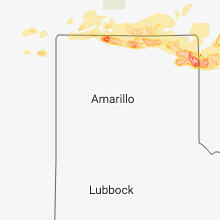


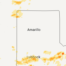


Connect with Interactive Hail Maps