

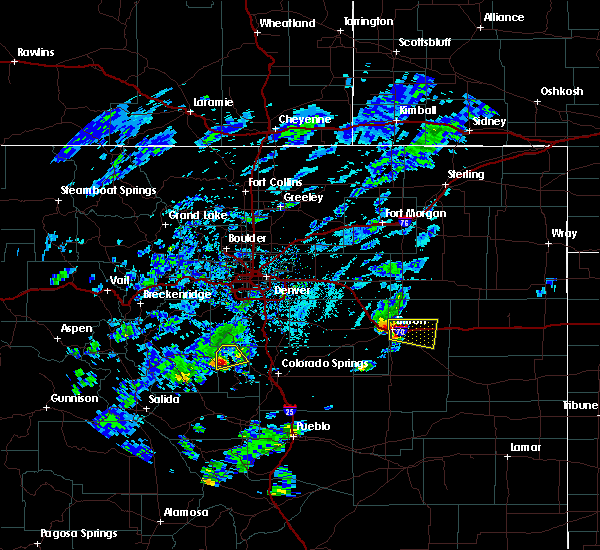
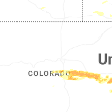
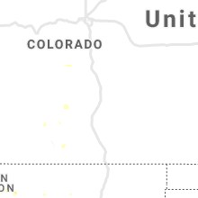
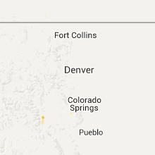
Hail Map for Florissant, CO
The Florissant, CO area has had 3 reports of on-the-ground hail by trained spotters, and has been under severe weather warnings 0 times during the past 12 months. Doppler radar has detected hail at or near Florissant, CO on 31 occasions, including 4 occasions during the past year.
| Name: | Florissant, CO |
| Where Located: | 57 miles SSW of Denver, CO |
| Map: | Google Map for Florissant, CO |
| Population: | 104 |
| Housing Units: | 47 |
| More Info: | Search Google for Florissant, CO |
0
The Top Recent Hail Date for Florissant, CO is Saturday, July 12, 2025 (30th out of 31)
Hail and Wind Damage Spotted near Florissant, CO
| Date / Time | Report Details |
|---|---|
| 7/12/2025 3:10 PM MDT | Ping Pong Ball sized hail reported 12.6 miles NNE of Florissant, CO, hail lasted 30 minutes. |
| 7/31/2023 8:16 PM MDT |
 At 816 pm mdt, a severe thunderstorm was located near cripple creek, or 22 miles west of colorado springs, moving north at 20 mph (radar indicated). Hazards include 60 mph wind gusts and quarter size hail. Hail damage to vehicles is expected. expect wind damage to roofs, siding, and trees. this severe thunderstorm will remain over mainly rural areas of northeastern fremont and southwestern teller counties. hail threat, radar indicated max hail size, 1. 00 in wind threat, radar indicated max wind gust, 60 mph. At 816 pm mdt, a severe thunderstorm was located near cripple creek, or 22 miles west of colorado springs, moving north at 20 mph (radar indicated). Hazards include 60 mph wind gusts and quarter size hail. Hail damage to vehicles is expected. expect wind damage to roofs, siding, and trees. this severe thunderstorm will remain over mainly rural areas of northeastern fremont and southwestern teller counties. hail threat, radar indicated max hail size, 1. 00 in wind threat, radar indicated max wind gust, 60 mph.
|
| 7/31/2023 8:05 PM MDT |
 At 805 pm mdt, a severe thunderstorm was located near cripple creek, or 24 miles west of colorado springs, moving north at 20 mph (radar indicated). Hazards include 60 mph wind gusts and quarter size hail. Hail damage to vehicles is expected. expect wind damage to roofs, siding, and trees. this severe thunderstorm will be near, cripple creek around 810 pm mdt. hail threat, radar indicated max hail size, 1. 00 in wind threat, radar indicated max wind gust, 60 mph. At 805 pm mdt, a severe thunderstorm was located near cripple creek, or 24 miles west of colorado springs, moving north at 20 mph (radar indicated). Hazards include 60 mph wind gusts and quarter size hail. Hail damage to vehicles is expected. expect wind damage to roofs, siding, and trees. this severe thunderstorm will be near, cripple creek around 810 pm mdt. hail threat, radar indicated max hail size, 1. 00 in wind threat, radar indicated max wind gust, 60 mph.
|
| 7/13/2021 1:17 PM MDT |
 At 117 pm mdt, a severe thunderstorm was located near florissant, or 23 miles northwest of colorado springs, moving southeast at 15 mph (radar indicated). Hazards include 60 mph wind gusts and quarter size hail. Hail damage to vehicles is expected. expect wind damage to roofs, siding, and trees. Locations impacted include, divide. At 117 pm mdt, a severe thunderstorm was located near florissant, or 23 miles northwest of colorado springs, moving southeast at 15 mph (radar indicated). Hazards include 60 mph wind gusts and quarter size hail. Hail damage to vehicles is expected. expect wind damage to roofs, siding, and trees. Locations impacted include, divide.
|
| 7/13/2021 1:08 PM MDT |
 At 108 pm mdt, a severe thunderstorm was located near florissant, or 25 miles northwest of colorado springs, moving southeast at 15 mph (radar indicated). Hazards include 60 mph wind gusts and quarter size hail. Hail damage to vehicles is expected. Expect wind damage to roofs, siding, and trees. At 108 pm mdt, a severe thunderstorm was located near florissant, or 25 miles northwest of colorado springs, moving southeast at 15 mph (radar indicated). Hazards include 60 mph wind gusts and quarter size hail. Hail damage to vehicles is expected. Expect wind damage to roofs, siding, and trees.
|
| 7/5/2021 2:51 PM MDT |
 At 248 pm mdt, a severe thunderstorm was located near florissant, or 23 miles west of colorado springs, moving east at 15 mph (radar indicated). Hazards include 60 mph wind gusts and quarter size hail. Hail damage to vehicles is expected. Expect wind damage to roofs, siding, and trees. At 248 pm mdt, a severe thunderstorm was located near florissant, or 23 miles west of colorado springs, moving east at 15 mph (radar indicated). Hazards include 60 mph wind gusts and quarter size hail. Hail damage to vehicles is expected. Expect wind damage to roofs, siding, and trees.
|
| 8/6/2018 1:33 PM MDT |
 At 132 pm mdt, a severe thunderstorm was located over divide, or 17 miles northwest of colorado springs, moving southeast at 30 mph (radar indicated). Hazards include 60 mph wind gusts and quarter size hail. Hail damage to vehicles is expected. expect wind damage to roofs, siding, and trees. Locations impacted include, western colorado springs, woodland park, air force academy, manitou springs, green mountain falls, pikes peak, divide, crystola, chipita park and cascade. At 132 pm mdt, a severe thunderstorm was located over divide, or 17 miles northwest of colorado springs, moving southeast at 30 mph (radar indicated). Hazards include 60 mph wind gusts and quarter size hail. Hail damage to vehicles is expected. expect wind damage to roofs, siding, and trees. Locations impacted include, western colorado springs, woodland park, air force academy, manitou springs, green mountain falls, pikes peak, divide, crystola, chipita park and cascade.
|
| 8/6/2018 1:19 PM MDT |
 At 118 pm mdt, a severe thunderstorm was located near florissant, or 24 miles northwest of colorado springs, moving east at 30 mph (trained weather spotters). Hazards include 60 mph wind gusts and quarter size hail. Hail damage to vehicles is expected. Expect wind damage to roofs, siding, and trees. At 118 pm mdt, a severe thunderstorm was located near florissant, or 24 miles northwest of colorado springs, moving east at 30 mph (trained weather spotters). Hazards include 60 mph wind gusts and quarter size hail. Hail damage to vehicles is expected. Expect wind damage to roofs, siding, and trees.
|
| 7/24/2018 5:24 PM MDT |
 The severe thunderstorm warning for southern teller and west central el paso counties will expire at 530 pm mdt, the severe thunderstorm which prompted the warning has weakened. therefore, the warning will be allowed to expire. The severe thunderstorm warning for southern teller and west central el paso counties will expire at 530 pm mdt, the severe thunderstorm which prompted the warning has weakened. therefore, the warning will be allowed to expire.
|
| 7/24/2018 5:03 PM MDT |
 At 502 pm mdt, a severe thunderstorm was located 7 miles south of florissant, or 25 miles west of colorado springs, moving southeast at 10 mph (radar indicated). Hazards include 60 mph wind gusts and half dollar size hail. Hail damage to vehicles is expected. expect wind damage to roofs, siding, and trees. Locations impacted include, cripple creek and victor. At 502 pm mdt, a severe thunderstorm was located 7 miles south of florissant, or 25 miles west of colorado springs, moving southeast at 10 mph (radar indicated). Hazards include 60 mph wind gusts and half dollar size hail. Hail damage to vehicles is expected. expect wind damage to roofs, siding, and trees. Locations impacted include, cripple creek and victor.
|
| 7/24/2018 4:52 PM MDT |
 At 451 pm mdt, a severe thunderstorm was located near florissant, or 24 miles west of colorado springs, moving southeast at 10 mph (radar indicated). Hazards include 60 mph wind gusts and quarter size hail. Hail damage to vehicles is expected. Expect wind damage to roofs, siding, and trees. At 451 pm mdt, a severe thunderstorm was located near florissant, or 24 miles west of colorado springs, moving southeast at 10 mph (radar indicated). Hazards include 60 mph wind gusts and quarter size hail. Hail damage to vehicles is expected. Expect wind damage to roofs, siding, and trees.
|
| 7/23/2018 3:19 PM MDT |
 At 319 pm mdt, a severe thunderstorm was located over woodland park, or 17 miles northwest of colorado springs, moving southeast at 25 mph (radar indicated). Hazards include 70 mph wind gusts and ping pong ball size hail. People and animals outdoors will be injured. expect hail damage to roofs, siding, windows, and vehicles. expect considerable tree damage. wind damage is also likely to mobile homes, roofs, and outbuildings. Locations impacted include, colorado springs, fountain, woodland park, monument, air force academy, manitou springs, palmer lake, green mountain falls, pikes peak, black forest, crystola, security, divide, stratmoor, chipita park, florissant, gleneagle, fort carson, peterson afb and cimarron hills. At 319 pm mdt, a severe thunderstorm was located over woodland park, or 17 miles northwest of colorado springs, moving southeast at 25 mph (radar indicated). Hazards include 70 mph wind gusts and ping pong ball size hail. People and animals outdoors will be injured. expect hail damage to roofs, siding, windows, and vehicles. expect considerable tree damage. wind damage is also likely to mobile homes, roofs, and outbuildings. Locations impacted include, colorado springs, fountain, woodland park, monument, air force academy, manitou springs, palmer lake, green mountain falls, pikes peak, black forest, crystola, security, divide, stratmoor, chipita park, florissant, gleneagle, fort carson, peterson afb and cimarron hills.
|
| 7/23/2018 3:13 PM MDT |
 At 312 pm mdt, a severe thunderstorm was located near woodland park, or 21 miles northwest of colorado springs, moving southeast at 20 mph (radar indicated). Hazards include 60 mph wind gusts and half dollar size hail. Hail damage to vehicles is expected. expect wind damage to roofs, siding, and trees. Locations impacted include, colorado springs, fountain, woodland park, monument, air force academy, manitou springs, palmer lake, green mountain falls, pikes peak, black forest, crystola, security, divide, stratmoor, chipita park, florissant, gleneagle, fort carson, peterson afb and cimarron hills. At 312 pm mdt, a severe thunderstorm was located near woodland park, or 21 miles northwest of colorado springs, moving southeast at 20 mph (radar indicated). Hazards include 60 mph wind gusts and half dollar size hail. Hail damage to vehicles is expected. expect wind damage to roofs, siding, and trees. Locations impacted include, colorado springs, fountain, woodland park, monument, air force academy, manitou springs, palmer lake, green mountain falls, pikes peak, black forest, crystola, security, divide, stratmoor, chipita park, florissant, gleneagle, fort carson, peterson afb and cimarron hills.
|
| 7/23/2018 2:58 PM MDT |
 At 258 pm mdt, a severe thunderstorm was located near westcreek, or 25 miles northwest of colorado springs, moving southeast at 20 mph (radar indicated). Hazards include 60 mph wind gusts and half dollar size hail. Hail damage to vehicles is expected. expect wind damage to roofs, siding, and trees. Locations impacted include, colorado springs, fountain, woodland park, monument, air force academy, manitou springs, palmer lake, green mountain falls, pikes peak, black forest, crystola, security, divide, stratmoor, chipita park, florissant, gleneagle, fort carson, peterson afb and cimarron hills. At 258 pm mdt, a severe thunderstorm was located near westcreek, or 25 miles northwest of colorado springs, moving southeast at 20 mph (radar indicated). Hazards include 60 mph wind gusts and half dollar size hail. Hail damage to vehicles is expected. expect wind damage to roofs, siding, and trees. Locations impacted include, colorado springs, fountain, woodland park, monument, air force academy, manitou springs, palmer lake, green mountain falls, pikes peak, black forest, crystola, security, divide, stratmoor, chipita park, florissant, gleneagle, fort carson, peterson afb and cimarron hills.
|
| 7/23/2018 2:42 PM MDT |
 At 241 pm mdt, a severe thunderstorm was located near westcreek, or 25 miles northwest of colorado springs, moving southeast at 30 mph (radar indicated). Hazards include golf ball size hail and 70 mph wind gusts. People and animals outdoors will be injured. expect hail damage to roofs, siding, windows, and vehicles. expect considerable tree damage. wind damage is also likely to mobile homes, roofs, and outbuildings. Locations impacted include, colorado springs, fountain, woodland park, monument, air force academy, manitou springs, palmer lake, green mountain falls, pikes peak, black forest, crystola, security, divide, stratmoor, chipita park, florissant, gleneagle, fort carson, peterson afb and cimarron hills. At 241 pm mdt, a severe thunderstorm was located near westcreek, or 25 miles northwest of colorado springs, moving southeast at 30 mph (radar indicated). Hazards include golf ball size hail and 70 mph wind gusts. People and animals outdoors will be injured. expect hail damage to roofs, siding, windows, and vehicles. expect considerable tree damage. wind damage is also likely to mobile homes, roofs, and outbuildings. Locations impacted include, colorado springs, fountain, woodland park, monument, air force academy, manitou springs, palmer lake, green mountain falls, pikes peak, black forest, crystola, security, divide, stratmoor, chipita park, florissant, gleneagle, fort carson, peterson afb and cimarron hills.
|
| 7/23/2018 2:38 PM MDT |
 At 238 pm mdt, a severe thunderstorm was located over westcreek, or 26 miles northwest of colorado springs, moving southeast at 30 mph (radar indicated). Hazards include 60 mph wind gusts and half dollar size hail. Hail damage to vehicles is expected. Expect wind damage to roofs, siding, and trees. At 238 pm mdt, a severe thunderstorm was located over westcreek, or 26 miles northwest of colorado springs, moving southeast at 30 mph (radar indicated). Hazards include 60 mph wind gusts and half dollar size hail. Hail damage to vehicles is expected. Expect wind damage to roofs, siding, and trees.
|
| 7/23/2018 2:33 PM MDT |
 At 233 pm mdt, a severe thunderstorm was located near westcreek, or 24 miles northwest of colorado springs, moving northeast at 30 mph (radar indicated). Hazards include ping pong ball size hail and 60 mph wind gusts. People and animals outdoors will be injured. expect hail damage to roofs, siding, windows, and vehicles. expect wind damage to roofs, siding, and trees. Locations impacted include, woodland park, florissant and divide. At 233 pm mdt, a severe thunderstorm was located near westcreek, or 24 miles northwest of colorado springs, moving northeast at 30 mph (radar indicated). Hazards include ping pong ball size hail and 60 mph wind gusts. People and animals outdoors will be injured. expect hail damage to roofs, siding, windows, and vehicles. expect wind damage to roofs, siding, and trees. Locations impacted include, woodland park, florissant and divide.
|
| 7/23/2018 2:20 PM MDT |
 The national weather service in pueblo has issued a * severe thunderstorm warning for. northwestern teller county in central colorado. until 300 pm mdt. At 220 pm mdt, a severe thunderstorm was located near florissant, or 26 miles northwest of colorado springs, moving northeast at 30. The national weather service in pueblo has issued a * severe thunderstorm warning for. northwestern teller county in central colorado. until 300 pm mdt. At 220 pm mdt, a severe thunderstorm was located near florissant, or 26 miles northwest of colorado springs, moving northeast at 30.
|
| 6/19/2018 2:00 PM MDT | Baseball sized hail reported 10.8 miles ENE of Florissant, CO |
| 7/12/2017 3:23 PM MDT |
 At 323 pm mdt, a severe thunderstorm was located near florissant, or 25 miles northwest of colorado springs, moving northeast at 10 mph (radar indicated). Hazards include 60 mph wind gusts and quarter size hail. Hail damage to vehicles is expected. expect wind damage to roofs, siding, and trees. Locations impacted include, woodland park. At 323 pm mdt, a severe thunderstorm was located near florissant, or 25 miles northwest of colorado springs, moving northeast at 10 mph (radar indicated). Hazards include 60 mph wind gusts and quarter size hail. Hail damage to vehicles is expected. expect wind damage to roofs, siding, and trees. Locations impacted include, woodland park.
|
| 7/12/2017 3:04 PM MDT |
 At 304 pm mdt, a severe thunderstorm was located near florissant, or 26 miles northwest of colorado springs, moving northeast at 10 mph (radar indicated). Hazards include 60 mph wind gusts and quarter size hail. Hail damage to vehicles is expected. Expect wind damage to roofs, siding, and trees. At 304 pm mdt, a severe thunderstorm was located near florissant, or 26 miles northwest of colorado springs, moving northeast at 10 mph (radar indicated). Hazards include 60 mph wind gusts and quarter size hail. Hail damage to vehicles is expected. Expect wind damage to roofs, siding, and trees.
|
| 7/1/2015 2:24 PM MDT |
 At 223 pm mdt, a severe thunderstorm was located south of florissant moving east southeast at 30 mph (radar indicated). Hazards include quarter size hail. Damage to vehicles is expected. Locations impacted include, green mountain falls, pikes peak, cascade, chipita park and divide. At 223 pm mdt, a severe thunderstorm was located south of florissant moving east southeast at 30 mph (radar indicated). Hazards include quarter size hail. Damage to vehicles is expected. Locations impacted include, green mountain falls, pikes peak, cascade, chipita park and divide.
|
| 7/1/2015 2:10 PM MDT |
 At 210 pm mdt, a severe thunderstorm was located near florissant, or 22 miles west of colorado springs, moving east southeast at 30 mph (radar indicated). Hazards include quarter size hail. damage to vehicles is expected At 210 pm mdt, a severe thunderstorm was located near florissant, or 22 miles west of colorado springs, moving east southeast at 30 mph (radar indicated). Hazards include quarter size hail. damage to vehicles is expected
|
| 6/30/2015 6:25 PM MDT |
 At 625 pm mdt, a severe thunderstorm was located near divide, or 20 miles west of colorado springs, moving south at 10 mph (radar indicated. at 622 pm...golf ball size hail was reported 4 miles south southwest of divide). Hazards include golf ball size hail and 60 mph wind gusts. People and animals outdoors will be injured. expect hail damage to roofs, siding, windows and vehicles. expect wind damage to roofs, siding and trees. Locations impacted include, cripple creek, pikes peak, florissant and divide. At 625 pm mdt, a severe thunderstorm was located near divide, or 20 miles west of colorado springs, moving south at 10 mph (radar indicated. at 622 pm...golf ball size hail was reported 4 miles south southwest of divide). Hazards include golf ball size hail and 60 mph wind gusts. People and animals outdoors will be injured. expect hail damage to roofs, siding, windows and vehicles. expect wind damage to roofs, siding and trees. Locations impacted include, cripple creek, pikes peak, florissant and divide.
|
| 6/30/2015 6:22 PM MDT | Golf Ball sized hail reported 6.7 miles WNW of Florissant, CO |
| 6/30/2015 6:17 PM MDT |
 At 616 pm mdt, a severe thunderstorm was located near divide, or 21 miles west of colorado springs, moving south at 10 mph (radar indicated). Hazards include 60 mph wind gusts and quarter size hail. Hail damage to vehicles is expected. Expect wind damage to roofs, siding and trees. At 616 pm mdt, a severe thunderstorm was located near divide, or 21 miles west of colorado springs, moving south at 10 mph (radar indicated). Hazards include 60 mph wind gusts and quarter size hail. Hail damage to vehicles is expected. Expect wind damage to roofs, siding and trees.
|
Hail Maps for Florissant, CO


Connect with Interactive Hail Maps