

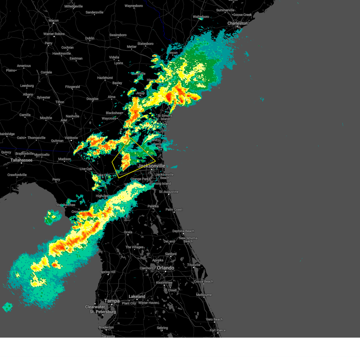
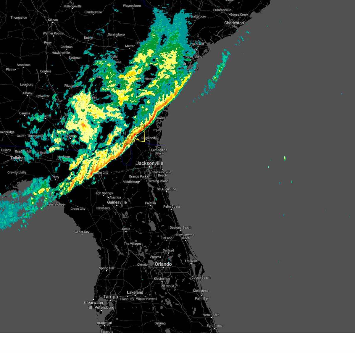
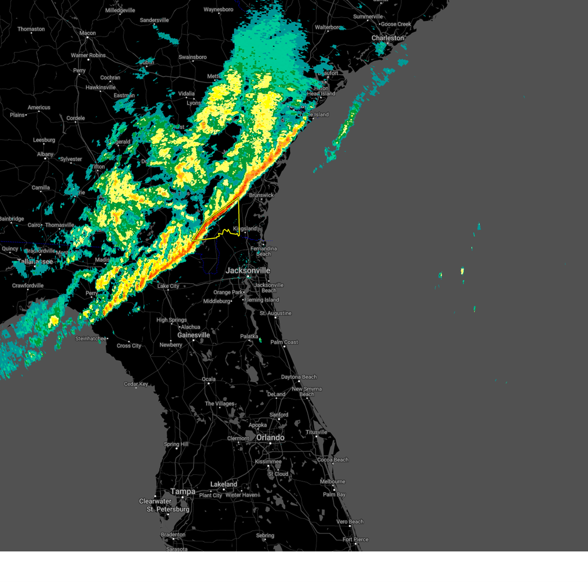
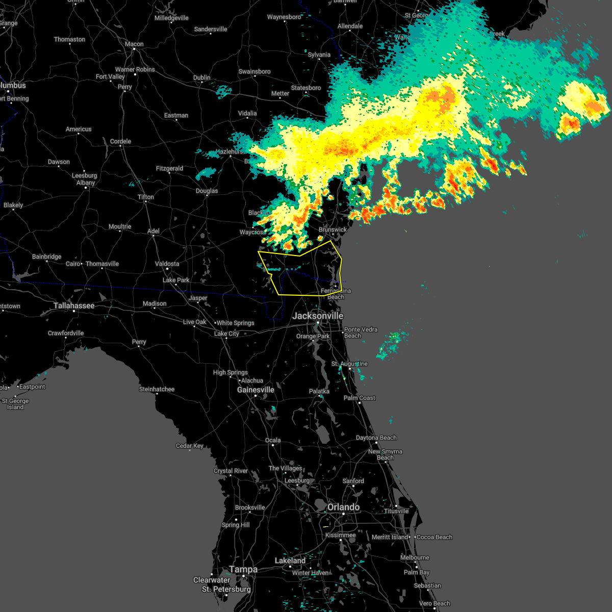
Hail Map for Folkston, GA
The Folkston, GA area has had 3 reports of on-the-ground hail by trained spotters, and has been under severe weather warnings 8 times during the past 12 months. Doppler radar has detected hail at or near Folkston, GA on 71 occasions, including 2 occasions during the past year.
| Name: | Folkston, GA |
| Where Located: | 40.9 miles NNW of Jacksonville, FL |
| Map: | Google Map for Folkston, GA |
| Population: | 2502 |
| Housing Units: | 997 |
| More Info: | Search Google for Folkston, GA |
2
The Top Recent Hail Date for Folkston, GA is Monday, July 15, 2024 (6th out of 71)

Hail and Wind Damage Spotted near Folkston, GA
| Date / Time | Report Details |
|---|---|
| 6/9/2025 3:05 PM EDT | Multiple reports of downed trees and powerlines in the folkston area. some fires started with the downed powerlines. time based off rada in charlton county GA, 0.6 miles ENE of Folkston, GA |
| 3/16/2025 12:17 PM EDT |
 the severe thunderstorm warning has been cancelled and is no longer in effect the severe thunderstorm warning has been cancelled and is no longer in effect
|
| 3/16/2025 12:04 PM EDT |
 the severe thunderstorm warning has been cancelled and is no longer in effect the severe thunderstorm warning has been cancelled and is no longer in effect
|
| 3/16/2025 12:04 PM EDT |
 At 1204 pm edt, a severe thunderstorm was located near st. george, or 9 miles southwest of hilliard, moving northeast at 50 mph (radar indicated). Hazards include 60 mph wind gusts and penny size hail. Expect damage to roofs, siding, and trees. locations impacted include, callahan, taylor, st. George, jacksonville international arpt, macclenny, bryceville, nassau village-ratliff, ratliff, oceanway, and sanderson. At 1204 pm edt, a severe thunderstorm was located near st. george, or 9 miles southwest of hilliard, moving northeast at 50 mph (radar indicated). Hazards include 60 mph wind gusts and penny size hail. Expect damage to roofs, siding, and trees. locations impacted include, callahan, taylor, st. George, jacksonville international arpt, macclenny, bryceville, nassau village-ratliff, ratliff, oceanway, and sanderson.
|
| 3/16/2025 11:46 AM EDT |
 Svrjax the national weather service in jacksonville has issued a * severe thunderstorm warning for, western nassau county in northeastern florida, baker county in northeastern florida, northwestern union county in northern florida, northeastern columbia county in northern florida, northwestern duval county in northeastern florida, east central hamilton county in northern florida, southeastern ware county in southeastern georgia, southeastern clinch county in southeastern georgia, central charlton county in southeastern georgia, * until 1230 pm edt. * at 1146 am edt, a severe thunderstorm was located near taylor, or 22 miles southeast of fargo, moving northeast at 50 mph (radar indicated). Hazards include 60 mph wind gusts and penny size hail. expect damage to roofs, siding, and trees Svrjax the national weather service in jacksonville has issued a * severe thunderstorm warning for, western nassau county in northeastern florida, baker county in northeastern florida, northwestern union county in northern florida, northeastern columbia county in northern florida, northwestern duval county in northeastern florida, east central hamilton county in northern florida, southeastern ware county in southeastern georgia, southeastern clinch county in southeastern georgia, central charlton county in southeastern georgia, * until 1230 pm edt. * at 1146 am edt, a severe thunderstorm was located near taylor, or 22 miles southeast of fargo, moving northeast at 50 mph (radar indicated). Hazards include 60 mph wind gusts and penny size hail. expect damage to roofs, siding, and trees
|
| 3/16/2025 10:55 AM EDT | 2 homes has minor to moderate damage with some shingles peeled from roof. shed turned upside down. trees knocked down near samuel crews road. trees knocked down on char in charlton county GA, 13.5 miles S of Folkston, GA |
| 2/16/2025 10:38 AM EST |
 The storm which prompted the warning has weakened below severe limits, and no longer poses an immediate threat to life or property. therefore, the warning will be allowed to expire. however, gusty winds and heavy rain are still possible with this thunderstorm. a severe thunderstorm watch remains in effect until 100 pm est for northeastern florida, and southeastern georgia. The storm which prompted the warning has weakened below severe limits, and no longer poses an immediate threat to life or property. therefore, the warning will be allowed to expire. however, gusty winds and heavy rain are still possible with this thunderstorm. a severe thunderstorm watch remains in effect until 100 pm est for northeastern florida, and southeastern georgia.
|
| 2/16/2025 10:25 AM EST |
 the severe thunderstorm warning has been cancelled and is no longer in effect the severe thunderstorm warning has been cancelled and is no longer in effect
|
| 2/16/2025 10:25 AM EST |
 At 1024 am est, a severe thunderstorm was located over folkston, moving east at 50 mph (radar indicated). Hazards include 60 mph wind gusts. Expect damage to roofs, siding, and trees. Locations impacted include, folkston, homeland, kings ferry, and tarboro. At 1024 am est, a severe thunderstorm was located over folkston, moving east at 50 mph (radar indicated). Hazards include 60 mph wind gusts. Expect damage to roofs, siding, and trees. Locations impacted include, folkston, homeland, kings ferry, and tarboro.
|
| 2/16/2025 10:13 AM EST |
 Svrjax the national weather service in jacksonville has issued a * severe thunderstorm warning for, western camden county in southeastern georgia, southeastern brantley county in southeastern georgia, southeastern ware county in southeastern georgia, northeastern charlton county in southeastern georgia, * until 1045 am est. * at 1013 am est, a severe thunderstorm was located 7 miles west of homeland, or 7 miles west of folkston, moving east at 50 mph (radar indicated). Hazards include 60 mph wind gusts. expect damage to roofs, siding, and trees Svrjax the national weather service in jacksonville has issued a * severe thunderstorm warning for, western camden county in southeastern georgia, southeastern brantley county in southeastern georgia, southeastern ware county in southeastern georgia, northeastern charlton county in southeastern georgia, * until 1045 am est. * at 1013 am est, a severe thunderstorm was located 7 miles west of homeland, or 7 miles west of folkston, moving east at 50 mph (radar indicated). Hazards include 60 mph wind gusts. expect damage to roofs, siding, and trees
|
| 7/15/2024 5:47 PM EDT | Power poles knocked down e-se of folkston. over 1000 electric customers were reported without powe in charlton county GA, 2.4 miles N of Folkston, GA |
| 5/10/2024 9:59 AM EDT |
 The storms which prompted the warning have moved out of the area. therefore, the warning will be allowed to expire. however, heavy rain is still possible with these thunderstorms. a severe thunderstorm watch remains in effect until noon edt for northern and northeastern florida, and southeastern georgia. The storms which prompted the warning have moved out of the area. therefore, the warning will be allowed to expire. however, heavy rain is still possible with these thunderstorms. a severe thunderstorm watch remains in effect until noon edt for northern and northeastern florida, and southeastern georgia.
|
| 5/10/2024 9:25 AM EDT |
 Svrjax the national weather service in jacksonville has issued a * severe thunderstorm warning for, nassau county in northeastern florida, southeastern alachua county in northern florida, st. johns county in northeastern florida, central marion county in northern florida, putnam county in northeastern florida, clay county in northeastern florida, duval county in northeastern florida, camden county in southeastern georgia, northeastern charlton county in southeastern georgia, * until 1000 am edt. * at 925 am edt, severe thunderstorms were located along a line extending from near kings ferry to near florahome to near williston municipal airport, moving east at 60 mph (radar indicated). Hazards include 60 mph wind gusts and penny size hail. expect damage to roofs, siding, and trees Svrjax the national weather service in jacksonville has issued a * severe thunderstorm warning for, nassau county in northeastern florida, southeastern alachua county in northern florida, st. johns county in northeastern florida, central marion county in northern florida, putnam county in northeastern florida, clay county in northeastern florida, duval county in northeastern florida, camden county in southeastern georgia, northeastern charlton county in southeastern georgia, * until 1000 am edt. * at 925 am edt, severe thunderstorms were located along a line extending from near kings ferry to near florahome to near williston municipal airport, moving east at 60 mph (radar indicated). Hazards include 60 mph wind gusts and penny size hail. expect damage to roofs, siding, and trees
|
| 5/10/2024 9:05 AM EDT | Gusts knocked down trees and power lines across charlton county... ga... leading to power outages. time est based off rada in charlton county GA, 12.2 miles S of Folkston, GA |
| 5/10/2024 8:44 AM EDT |
 Svrjax the national weather service in jacksonville has issued a * severe thunderstorm warning for, nassau county in northeastern florida, bradford county in northern florida, alachua county in northern florida, north central marion county in northern florida, baker county in northeastern florida, northwestern putnam county in northeastern florida, union county in northern florida, western clay county in northeastern florida, western duval county in northeastern florida, southwestern camden county in southeastern georgia, southeastern ware county in southeastern georgia, charlton county in southeastern georgia, * until 915 am edt. * at 843 am edt, severe thunderstorms were located along a line extending from 9 miles south of argyle to near lulu to 7 miles southeast of cross city, moving east at 70 mph. these are destructive storms for lake butler, starke, gainesville, macclenny, baldwin, and hilliard. (radar indicated). Hazards include 80 mph wind gusts and quarter size hail. Flying debris will be dangerous to those caught without shelter. mobile homes will be heavily damaged. expect considerable damage to roofs, windows, and vehicles. Extensive tree damage and power outages are likely. Svrjax the national weather service in jacksonville has issued a * severe thunderstorm warning for, nassau county in northeastern florida, bradford county in northern florida, alachua county in northern florida, north central marion county in northern florida, baker county in northeastern florida, northwestern putnam county in northeastern florida, union county in northern florida, western clay county in northeastern florida, western duval county in northeastern florida, southwestern camden county in southeastern georgia, southeastern ware county in southeastern georgia, charlton county in southeastern georgia, * until 915 am edt. * at 843 am edt, severe thunderstorms were located along a line extending from 9 miles south of argyle to near lulu to 7 miles southeast of cross city, moving east at 70 mph. these are destructive storms for lake butler, starke, gainesville, macclenny, baldwin, and hilliard. (radar indicated). Hazards include 80 mph wind gusts and quarter size hail. Flying debris will be dangerous to those caught without shelter. mobile homes will be heavily damaged. expect considerable damage to roofs, windows, and vehicles. Extensive tree damage and power outages are likely.
|
| 3/9/2024 1:45 PM EST |
 Svrjax the national weather service in jacksonville has issued a * severe thunderstorm warning for, northwestern baker county in northeastern florida, north central suwannee county in northern florida, northeastern columbia county in northern florida, hamilton county in northern florida, southern echols county in southeastern georgia, southeastern ware county in southeastern georgia, southeastern clinch county in southeastern georgia, northern charlton county in southeastern georgia, * until 215 pm est. * at 145 pm est, severe thunderstorms were located along a line extending from 8 miles northeast of stephen foster state park to 8 miles east of fargo to suwannee river state park, moving southeast at 15 mph (radar indicated). Hazards include 60 mph wind gusts and penny size hail. expect damage to roofs, siding, and trees Svrjax the national weather service in jacksonville has issued a * severe thunderstorm warning for, northwestern baker county in northeastern florida, north central suwannee county in northern florida, northeastern columbia county in northern florida, hamilton county in northern florida, southern echols county in southeastern georgia, southeastern ware county in southeastern georgia, southeastern clinch county in southeastern georgia, northern charlton county in southeastern georgia, * until 215 pm est. * at 145 pm est, severe thunderstorms were located along a line extending from 8 miles northeast of stephen foster state park to 8 miles east of fargo to suwannee river state park, moving southeast at 15 mph (radar indicated). Hazards include 60 mph wind gusts and penny size hail. expect damage to roofs, siding, and trees
|
| 2/4/2024 5:10 PM EST |
 The severe thunderstorm warning for northwestern nassau, southwestern camden and northeastern charlton counties will expire at 515 pm est, the storm which prompted the warning has moved out of the warned area. therefore, the warning will be allowed to expire. The severe thunderstorm warning for northwestern nassau, southwestern camden and northeastern charlton counties will expire at 515 pm est, the storm which prompted the warning has moved out of the warned area. therefore, the warning will be allowed to expire.
|
| 2/4/2024 4:52 PM EST |
 At 451 pm est, a severe thunderstorm was located near folkston, moving north at 30 mph (radar indicated). Hazards include 60 mph wind gusts and nickel size hail. Expect damage to roofs, siding, and trees. locations impacted include, folkston, homeland, and kings ferry. hail threat, radar indicated max hail size, 0. 88 in wind threat, radar indicated max wind gust, 60 mph. At 451 pm est, a severe thunderstorm was located near folkston, moving north at 30 mph (radar indicated). Hazards include 60 mph wind gusts and nickel size hail. Expect damage to roofs, siding, and trees. locations impacted include, folkston, homeland, and kings ferry. hail threat, radar indicated max hail size, 0. 88 in wind threat, radar indicated max wind gust, 60 mph.
|
| 2/4/2024 4:34 PM EST |
 At 434 pm est, a severe thunderstorm was located near folkston, moving north at 20 mph (radar indicated). Hazards include 60 mph wind gusts and nickel size hail. expect damage to roofs, siding, and trees At 434 pm est, a severe thunderstorm was located near folkston, moving north at 20 mph (radar indicated). Hazards include 60 mph wind gusts and nickel size hail. expect damage to roofs, siding, and trees
|
| 1/9/2024 2:52 PM EST |
 The severe thunderstorm warning for northwestern nassau, camden, western glynn, brantley, southeastern ware, southeastern wayne and northeastern charlton counties will expire at 300 pm est, the storms which prompted the warning have moved out of the area. therefore, the warning will be allowed to expire. however, gusty winds are still possible with these thunderstorms. a tornado watch remains in effect until 600 pm est for northeastern florida, and southeastern georgia. The severe thunderstorm warning for northwestern nassau, camden, western glynn, brantley, southeastern ware, southeastern wayne and northeastern charlton counties will expire at 300 pm est, the storms which prompted the warning have moved out of the area. therefore, the warning will be allowed to expire. however, gusty winds are still possible with these thunderstorms. a tornado watch remains in effect until 600 pm est for northeastern florida, and southeastern georgia.
|
| 1/9/2024 2:03 PM EST |
 At 202 pm est, severe thunderstorms were located along a line extending from near race pond to 10 miles north of taylor, moving northeast at 70 mph (radar indicated). Hazards include 70 mph wind gusts and penny size hail. Expect considerable tree damage. damage is likely to mobile homes, roofs, and outbuildings. Locations impacted include, kingsland, jesup, hilliard, folkston, woodbine, nahunta, gardi, dock junction, homeland, and hickox. At 202 pm est, severe thunderstorms were located along a line extending from near race pond to 10 miles north of taylor, moving northeast at 70 mph (radar indicated). Hazards include 70 mph wind gusts and penny size hail. Expect considerable tree damage. damage is likely to mobile homes, roofs, and outbuildings. Locations impacted include, kingsland, jesup, hilliard, folkston, woodbine, nahunta, gardi, dock junction, homeland, and hickox.
|
| 1/9/2024 1:55 PM EST |
 At 155 pm est, severe thunderstorms were located along a line extending from 7 miles southeast of hickox to 9 miles southeast of fargo, moving northeast at 95 mph (radar indicated). Hazards include 70 mph wind gusts and penny size hail. Expect considerable tree damage. Damage is likely to mobile homes, roofs, and outbuildings. At 155 pm est, severe thunderstorms were located along a line extending from 7 miles southeast of hickox to 9 miles southeast of fargo, moving northeast at 95 mph (radar indicated). Hazards include 70 mph wind gusts and penny size hail. Expect considerable tree damage. Damage is likely to mobile homes, roofs, and outbuildings.
|
| 9/12/2023 8:08 PM EDT |
 The severe thunderstorm warning for northwestern nassau, southwestern camden and central charlton counties will expire at 815 pm edt, the storms which prompted the warning have weakened below severe limits, and no longer pose an immediate threat to life or property. therefore, the warning will be allowed to expire. however, gusty winds are still possible with these thunderstorms. the severe thunderstorm warning may be reissued if the storms become severe again. remain alert for possible warnings. to report severe weather, contact your nearest law enforcement agency. they will relay your report to the national weather service jacksonville. The severe thunderstorm warning for northwestern nassau, southwestern camden and central charlton counties will expire at 815 pm edt, the storms which prompted the warning have weakened below severe limits, and no longer pose an immediate threat to life or property. therefore, the warning will be allowed to expire. however, gusty winds are still possible with these thunderstorms. the severe thunderstorm warning may be reissued if the storms become severe again. remain alert for possible warnings. to report severe weather, contact your nearest law enforcement agency. they will relay your report to the national weather service jacksonville.
|
| 9/12/2023 7:59 PM EDT |
 At 759 pm edt, severe thunderstorms were located along a line extending from near hickox to near folkston, moving southeast at 15 mph (radar indicated). Hazards include 60 mph wind gusts. expect damage to roofs, siding, and trees At 759 pm edt, severe thunderstorms were located along a line extending from near hickox to near folkston, moving southeast at 15 mph (radar indicated). Hazards include 60 mph wind gusts. expect damage to roofs, siding, and trees
|
| 9/12/2023 7:57 PM EDT |
 The severe thunderstorm warning for eastern brantley and northeastern charlton counties will expire at 800 pm edt, this severe thunderstorm warning will expire at 800 pm edt, however severe weather is still occurring and it will be replaced by a new warning at 800 pm edt. The severe thunderstorm warning for eastern brantley and northeastern charlton counties will expire at 800 pm edt, this severe thunderstorm warning will expire at 800 pm edt, however severe weather is still occurring and it will be replaced by a new warning at 800 pm edt.
|
| 9/12/2023 7:51 PM EDT |
 At 751 pm edt, severe thunderstorms were located along a line extending from near waynesville to 7 miles north of homeland, moving southeast at 15 mph (radar indicated). Hazards include 60 mph wind gusts and penny size hail. Expect damage to roofs, siding, and trees. locations impacted include, nahunta, hickox, waynesville, atkinson, and winokur. hail threat, radar indicated max hail size, 0. 75 in wind threat, radar indicated max wind gust, 60 mph. At 751 pm edt, severe thunderstorms were located along a line extending from near waynesville to 7 miles north of homeland, moving southeast at 15 mph (radar indicated). Hazards include 60 mph wind gusts and penny size hail. Expect damage to roofs, siding, and trees. locations impacted include, nahunta, hickox, waynesville, atkinson, and winokur. hail threat, radar indicated max hail size, 0. 75 in wind threat, radar indicated max wind gust, 60 mph.
|
| 9/12/2023 7:44 PM EDT |
 At 744 pm edt, severe thunderstorms were located along a line extending from near waynesville to 7 miles north of homeland, moving southeast at 20 mph (radar indicated). Hazards include 60 mph wind gusts and penny size hail. Expect damage to roofs, siding, and trees. locations impacted include, nahunta, hickox, raybon, waynesville, atkinson, and winokur. hail threat, radar indicated max hail size, 0. 75 in wind threat, radar indicated max wind gust, 60 mph. At 744 pm edt, severe thunderstorms were located along a line extending from near waynesville to 7 miles north of homeland, moving southeast at 20 mph (radar indicated). Hazards include 60 mph wind gusts and penny size hail. Expect damage to roofs, siding, and trees. locations impacted include, nahunta, hickox, raybon, waynesville, atkinson, and winokur. hail threat, radar indicated max hail size, 0. 75 in wind threat, radar indicated max wind gust, 60 mph.
|
| 9/12/2023 7:42 PM EDT |
 At 741 pm edt, severe thunderstorms were located along a line extending from homeland to near st. george, moving southeast at 35 mph (radar indicated). Hazards include 60 mph wind gusts. expect damage to roofs, siding, and trees At 741 pm edt, severe thunderstorms were located along a line extending from homeland to near st. george, moving southeast at 35 mph (radar indicated). Hazards include 60 mph wind gusts. expect damage to roofs, siding, and trees
|
| 9/12/2023 7:30 PM EDT |
 At 730 pm edt, severe thunderstorms were located along a line extending from near waynesville to near race pond, moving southeast at 15 mph (radar indicated). Hazards include 60 mph wind gusts and penny size hail. Expect damage to roofs, siding, and trees. locations impacted include, nahunta, hickox, raybon, waynesville, fort mudge, atkinson, hortense, and winokur. hail threat, radar indicated max hail size, 0. 75 in wind threat, radar indicated max wind gust, 60 mph. At 730 pm edt, severe thunderstorms were located along a line extending from near waynesville to near race pond, moving southeast at 15 mph (radar indicated). Hazards include 60 mph wind gusts and penny size hail. Expect damage to roofs, siding, and trees. locations impacted include, nahunta, hickox, raybon, waynesville, fort mudge, atkinson, hortense, and winokur. hail threat, radar indicated max hail size, 0. 75 in wind threat, radar indicated max wind gust, 60 mph.
|
| 9/12/2023 7:24 PM EDT |
 At 724 pm edt, severe thunderstorms were located along a line extending from 6 miles northwest of waynesville to near race pond, moving southeast at 15 mph (radar indicated). Hazards include 60 mph wind gusts and penny size hail. expect damage to roofs, siding, and trees At 724 pm edt, severe thunderstorms were located along a line extending from 6 miles northwest of waynesville to near race pond, moving southeast at 15 mph (radar indicated). Hazards include 60 mph wind gusts and penny size hail. expect damage to roofs, siding, and trees
|
| 8/30/2023 5:42 AM EDT |
 At 541 am edt, a severe thunderstorm capable of producing a tornado was located over homeland, or over folkston, moving northwest at 25 mph (radar indicated rotation). Hazards include tornado. Flying debris will be dangerous to those caught without shelter. mobile homes will be damaged or destroyed. damage to roofs, windows, and vehicles will occur. tree damage is likely. This dangerous storm will be near, folkston and homeland around 545 am edt. At 541 am edt, a severe thunderstorm capable of producing a tornado was located over homeland, or over folkston, moving northwest at 25 mph (radar indicated rotation). Hazards include tornado. Flying debris will be dangerous to those caught without shelter. mobile homes will be damaged or destroyed. damage to roofs, windows, and vehicles will occur. tree damage is likely. This dangerous storm will be near, folkston and homeland around 545 am edt.
|
| 8/8/2023 7:43 PM EDT |
 At 743 pm edt, a severe thunderstorm was located near race pond, or 15 miles southwest of nahunta, moving east at 45 mph (radar indicated). Hazards include 70 mph wind gusts and quarter size hail. Hail damage to vehicles is expected. expect considerable tree damage. Wind damage is also likely to mobile homes, roofs, and outbuildings. At 743 pm edt, a severe thunderstorm was located near race pond, or 15 miles southwest of nahunta, moving east at 45 mph (radar indicated). Hazards include 70 mph wind gusts and quarter size hail. Hail damage to vehicles is expected. expect considerable tree damage. Wind damage is also likely to mobile homes, roofs, and outbuildings.
|
| 7/30/2023 4:24 PM EDT |
 At 424 pm edt, a severe thunderstorm was located over homeland, or near folkston, moving east at 15 mph (radar indicated). Hazards include 60 mph wind gusts and penny size hail. Expect damage to roofs, siding, and trees. locations impacted include, folkston and homeland. hail threat, radar indicated max hail size, 0. 75 in wind threat, radar indicated max wind gust, 60 mph. At 424 pm edt, a severe thunderstorm was located over homeland, or near folkston, moving east at 15 mph (radar indicated). Hazards include 60 mph wind gusts and penny size hail. Expect damage to roofs, siding, and trees. locations impacted include, folkston and homeland. hail threat, radar indicated max hail size, 0. 75 in wind threat, radar indicated max wind gust, 60 mph.
|
| 7/30/2023 4:10 PM EDT |
 At 410 pm edt, a severe thunderstorm was located near homeland, or 7 miles northwest of folkston, moving east at 5 mph (radar indicated). Hazards include 60 mph wind gusts and penny size hail. expect damage to roofs, siding, and trees At 410 pm edt, a severe thunderstorm was located near homeland, or 7 miles northwest of folkston, moving east at 5 mph (radar indicated). Hazards include 60 mph wind gusts and penny size hail. expect damage to roofs, siding, and trees
|
| 6/19/2023 11:47 AM EDT |
 At 1147 am edt, severe thunderstorms were located along a line extending from near race pond to 10 miles west of homeland to 8 miles south of stephen foster state park, moving northeast at 45 mph (radar indicated). Hazards include 60 mph wind gusts. Expect damage to roofs, siding, and trees. locations impacted include, hilliard, folkston, homeland, race pond and winokur. hail threat, radar indicated max hail size, <. 75 in wind threat, radar indicated max wind gust, 60 mph. At 1147 am edt, severe thunderstorms were located along a line extending from near race pond to 10 miles west of homeland to 8 miles south of stephen foster state park, moving northeast at 45 mph (radar indicated). Hazards include 60 mph wind gusts. Expect damage to roofs, siding, and trees. locations impacted include, hilliard, folkston, homeland, race pond and winokur. hail threat, radar indicated max hail size, <. 75 in wind threat, radar indicated max wind gust, 60 mph.
|
| 6/19/2023 11:30 AM EDT |
 At 1130 am edt, severe thunderstorms were located along a line extending from 11 miles southwest of braganza to near stephen foster state park to 8 miles southeast of fargo, moving northeast at 45 mph (radar indicated). Hazards include 60 mph wind gusts and penny size hail. expect damage to roofs, siding, and trees At 1130 am edt, severe thunderstorms were located along a line extending from 11 miles southwest of braganza to near stephen foster state park to 8 miles southeast of fargo, moving northeast at 45 mph (radar indicated). Hazards include 60 mph wind gusts and penny size hail. expect damage to roofs, siding, and trees
|
| 6/14/2023 9:12 PM EDT |
 At 911 pm edt, a severe thunderstorm was located near st. george, or 10 miles southwest of hilliard, moving east at 50 mph (radar indicated). Hazards include 60 mph wind gusts and nickel size hail. expect damage to roofs, siding, and trees At 911 pm edt, a severe thunderstorm was located near st. george, or 10 miles southwest of hilliard, moving east at 50 mph (radar indicated). Hazards include 60 mph wind gusts and nickel size hail. expect damage to roofs, siding, and trees
|
| 6/13/2023 7:40 PM EDT |
 The severe thunderstorm warning for northwestern nassau, southwestern camden, southeastern ware and east central charlton counties will expire at 745 pm edt, the storm which prompted the warning has moved out of the area. therefore, the warning will be allowed to expire. a severe thunderstorm watch remains in effect until 1000 pm edt for northeastern florida, and southeastern georgia. The severe thunderstorm warning for northwestern nassau, southwestern camden, southeastern ware and east central charlton counties will expire at 745 pm edt, the storm which prompted the warning has moved out of the area. therefore, the warning will be allowed to expire. a severe thunderstorm watch remains in effect until 1000 pm edt for northeastern florida, and southeastern georgia.
|
| 6/13/2023 7:24 PM EDT |
 At 724 pm edt, a severe thunderstorm was located near hilliard, moving east at 40 mph (radar indicated). Hazards include 60 mph wind gusts and penny size hail. Expect damage to roofs, siding, and trees. locations impacted include, hilliard, folkston and kings ferry. hail threat, radar indicated max hail size, 0. 75 in wind threat, radar indicated max wind gust, 60 mph. At 724 pm edt, a severe thunderstorm was located near hilliard, moving east at 40 mph (radar indicated). Hazards include 60 mph wind gusts and penny size hail. Expect damage to roofs, siding, and trees. locations impacted include, hilliard, folkston and kings ferry. hail threat, radar indicated max hail size, 0. 75 in wind threat, radar indicated max wind gust, 60 mph.
|
| 6/13/2023 7:13 PM EDT |
 At 713 pm edt, a severe thunderstorm was located 10 miles southwest of folkston, moving east at 40 mph (radar indicated). Hazards include 60 mph wind gusts and penny size hail. expect damage to roofs, siding, and trees At 713 pm edt, a severe thunderstorm was located 10 miles southwest of folkston, moving east at 40 mph (radar indicated). Hazards include 60 mph wind gusts and penny size hail. expect damage to roofs, siding, and trees
|
| 5/22/2023 10:03 AM EDT |
 At 1003 am edt, a severe thunderstorm was located near folkston, moving southeast at 5 mph (radar indicated). Hazards include ping pong ball size hail and 60 mph wind gusts. People and animals outdoors will be injured. expect hail damage to roofs, siding, windows, and vehicles. expect wind damage to roofs, siding, and trees. Locations impacted include, hilliard, folkston and kings ferry. At 1003 am edt, a severe thunderstorm was located near folkston, moving southeast at 5 mph (radar indicated). Hazards include ping pong ball size hail and 60 mph wind gusts. People and animals outdoors will be injured. expect hail damage to roofs, siding, windows, and vehicles. expect wind damage to roofs, siding, and trees. Locations impacted include, hilliard, folkston and kings ferry.
|
| 5/22/2023 9:53 AM EDT |
 At 953 am edt, a severe thunderstorm was located near folkston, moving southeast at 5 mph (radar indicated). Hazards include 60 mph wind gusts and quarter size hail. Hail damage to vehicles is expected. Expect wind damage to roofs, siding, and trees. At 953 am edt, a severe thunderstorm was located near folkston, moving southeast at 5 mph (radar indicated). Hazards include 60 mph wind gusts and quarter size hail. Hail damage to vehicles is expected. Expect wind damage to roofs, siding, and trees.
|
| 4/26/2023 3:40 PM EDT |
 At 340 pm edt, a severe thunderstorm was located near folkston, moving southeast at 5 mph (radar indicated). Hazards include 60 mph wind gusts and quarter size hail. Hail damage to vehicles is expected. expect wind damage to roofs, siding, and trees. locations impacted include, folkston and homeland. hail threat, radar indicated max hail size, 1. 00 in wind threat, radar indicated max wind gust, 60 mph. At 340 pm edt, a severe thunderstorm was located near folkston, moving southeast at 5 mph (radar indicated). Hazards include 60 mph wind gusts and quarter size hail. Hail damage to vehicles is expected. expect wind damage to roofs, siding, and trees. locations impacted include, folkston and homeland. hail threat, radar indicated max hail size, 1. 00 in wind threat, radar indicated max wind gust, 60 mph.
|
| 4/26/2023 3:31 PM EDT | Golf Ball sized hail reported 1.9 miles SSW of Folkston, GA, multiple hail sizes...largest estimated to be golf ball size. |
| 4/26/2023 3:30 PM EDT |
 At 329 pm edt, a severe thunderstorm was located over homeland, or over folkston, moving southeast at 5 mph (spotter estimated up to golf ball size hail falling in folkston). Hazards include golf ball size hail and 60 mph wind gusts. People and animals outdoors will be injured. expect hail damage to roofs, siding, windows, and vehicles. Expect wind damage to roofs, siding, and trees. At 329 pm edt, a severe thunderstorm was located over homeland, or over folkston, moving southeast at 5 mph (spotter estimated up to golf ball size hail falling in folkston). Hazards include golf ball size hail and 60 mph wind gusts. People and animals outdoors will be injured. expect hail damage to roofs, siding, windows, and vehicles. Expect wind damage to roofs, siding, and trees.
|
| 1/22/2023 8:00 PM EST |
 At 759 pm est, a severe thunderstorm was located near folkston, moving east at 55 mph (radar indicated). Hazards include 60 mph wind gusts. expect damage to roofs, siding, and trees At 759 pm est, a severe thunderstorm was located near folkston, moving east at 55 mph (radar indicated). Hazards include 60 mph wind gusts. expect damage to roofs, siding, and trees
|
| 1/4/2023 1:47 PM EST |
 At 147 pm est, a severe thunderstorm was located 9 miles northeast of homeland, or 10 miles northeast of folkston, moving east at 50 mph (radar indicated). Hazards include 60 mph wind gusts and quarter size hail. Hail damage to vehicles is expected. Expect wind damage to roofs, siding, and trees. At 147 pm est, a severe thunderstorm was located 9 miles northeast of homeland, or 10 miles northeast of folkston, moving east at 50 mph (radar indicated). Hazards include 60 mph wind gusts and quarter size hail. Hail damage to vehicles is expected. Expect wind damage to roofs, siding, and trees.
|
| 1/4/2023 1:39 PM EST |
 At 139 pm est, severe thunderstorms were located along a line extending from 6 miles southeast of gardi to near waverly to woodbine to st. george, moving east at 50 mph (radar indicated). Hazards include 60 mph wind gusts and quarter size hail. Hail damage to vehicles is expected. expect wind damage to roofs, siding, and trees. Locations impacted include, kingsland, brunswick, jesup, hilliard, folkston, woodbine, callahan, gardi, dock junction and homeland. At 139 pm est, severe thunderstorms were located along a line extending from 6 miles southeast of gardi to near waverly to woodbine to st. george, moving east at 50 mph (radar indicated). Hazards include 60 mph wind gusts and quarter size hail. Hail damage to vehicles is expected. expect wind damage to roofs, siding, and trees. Locations impacted include, kingsland, brunswick, jesup, hilliard, folkston, woodbine, callahan, gardi, dock junction and homeland.
|
| 1/4/2023 1:38 PM EST |
 At 138 pm est, a severe thunderstorm capable of producing a tornado was located near homeland, or 7 miles north of folkston, moving east at 40 mph (radar indicated rotation). Hazards include tornado. Flying debris will be dangerous to those caught without shelter. mobile homes will be damaged or destroyed. damage to roofs, windows, and vehicles will occur. tree damage is likely. Locations impacted include, woodbine, tarboro and colesburg. At 138 pm est, a severe thunderstorm capable of producing a tornado was located near homeland, or 7 miles north of folkston, moving east at 40 mph (radar indicated rotation). Hazards include tornado. Flying debris will be dangerous to those caught without shelter. mobile homes will be damaged or destroyed. damage to roofs, windows, and vehicles will occur. tree damage is likely. Locations impacted include, woodbine, tarboro and colesburg.
|
| 1/4/2023 1:36 PM EST |
 At 136 pm est, severe thunderstorms were located along a line extending from near gardi to near waynesville to near woodbine to near st. george, moving east at 50 mph (radar indicated). Hazards include 60 mph wind gusts and quarter size hail. Hail damage to vehicles is expected. expect wind damage to roofs, siding, and trees. Locations impacted include, kingsland, brunswick, jesup, hilliard, folkston, woodbine, callahan, dock junction, gardi and homeland. At 136 pm est, severe thunderstorms were located along a line extending from near gardi to near waynesville to near woodbine to near st. george, moving east at 50 mph (radar indicated). Hazards include 60 mph wind gusts and quarter size hail. Hail damage to vehicles is expected. expect wind damage to roofs, siding, and trees. Locations impacted include, kingsland, brunswick, jesup, hilliard, folkston, woodbine, callahan, dock junction, gardi and homeland.
|
| 1/4/2023 1:30 PM EST |
 At 130 pm est, severe thunderstorms were located along a line extending from near gardi to near waynesville to 7 miles west of woodbine to 6 miles northwest of st. george, moving east at 50 mph (radar indicated). Hazards include 60 mph wind gusts and quarter size hail. Hail damage to vehicles is expected. expect wind damage to roofs, siding, and trees. Locations impacted include, kingsland, brunswick, jesup, hilliard, folkston, woodbine, callahan, nahunta, dock junction and gardi. At 130 pm est, severe thunderstorms were located along a line extending from near gardi to near waynesville to 7 miles west of woodbine to 6 miles northwest of st. george, moving east at 50 mph (radar indicated). Hazards include 60 mph wind gusts and quarter size hail. Hail damage to vehicles is expected. expect wind damage to roofs, siding, and trees. Locations impacted include, kingsland, brunswick, jesup, hilliard, folkston, woodbine, callahan, nahunta, dock junction and gardi.
|
| 1/4/2023 1:29 PM EST |
 At 129 pm est, a severe thunderstorm capable of producing a tornado was located near homeland, or near folkston, moving east at 45 mph (radar indicated rotation). Hazards include tornado. Flying debris will be dangerous to those caught without shelter. mobile homes will be damaged or destroyed. damage to roofs, windows, and vehicles will occur. tree damage is likely. This tornadic thunderstorm will remain over mainly rural areas of western camden and northeastern charlton counties, including the following locations, tarboro and colesburg. At 129 pm est, a severe thunderstorm capable of producing a tornado was located near homeland, or near folkston, moving east at 45 mph (radar indicated rotation). Hazards include tornado. Flying debris will be dangerous to those caught without shelter. mobile homes will be damaged or destroyed. damage to roofs, windows, and vehicles will occur. tree damage is likely. This tornadic thunderstorm will remain over mainly rural areas of western camden and northeastern charlton counties, including the following locations, tarboro and colesburg.
|
| 1/4/2023 1:27 PM EST |
 At 127 pm est, a severe thunderstorm capable of producing a tornado was located near homeland, or near folkston, moving east at 40 mph (radar indicated rotation). Hazards include tornado. Flying debris will be dangerous to those caught without shelter. mobile homes will be damaged or destroyed. damage to roofs, windows, and vehicles will occur. tree damage is likely. this dangerous storm will be near, folkston and homeland around 135 pm est. Other locations impacted by this tornadic thunderstorm include tarboro and colesburg. At 127 pm est, a severe thunderstorm capable of producing a tornado was located near homeland, or near folkston, moving east at 40 mph (radar indicated rotation). Hazards include tornado. Flying debris will be dangerous to those caught without shelter. mobile homes will be damaged or destroyed. damage to roofs, windows, and vehicles will occur. tree damage is likely. this dangerous storm will be near, folkston and homeland around 135 pm est. Other locations impacted by this tornadic thunderstorm include tarboro and colesburg.
|
| 1/4/2023 1:11 PM EST |
 At 110 pm est, severe thunderstorms were located along a line extending from near screven to near nahunta to race pond to 12 miles northwest of taylor, moving east at 50 mph (radar indicated). Hazards include 60 mph wind gusts and quarter size hail. Hail damage to vehicles is expected. Expect wind damage to roofs, siding, and trees. At 110 pm est, severe thunderstorms were located along a line extending from near screven to near nahunta to race pond to 12 miles northwest of taylor, moving east at 50 mph (radar indicated). Hazards include 60 mph wind gusts and quarter size hail. Hail damage to vehicles is expected. Expect wind damage to roofs, siding, and trees.
|
| 8/31/2022 2:51 PM EDT |
 At 251 pm edt, a severe thunderstorm was located near homeland, or near folkston, moving east at 10 mph (radar indicated). Hazards include 60 mph wind gusts and quarter size hail. Hail damage to vehicles is expected. expect wind damage to roofs, siding, and trees. locations impacted include, folkston, homeland and tarboro. hail threat, radar indicated max hail size, 1. 00 in wind threat, radar indicated max wind gust, 60 mph. At 251 pm edt, a severe thunderstorm was located near homeland, or near folkston, moving east at 10 mph (radar indicated). Hazards include 60 mph wind gusts and quarter size hail. Hail damage to vehicles is expected. expect wind damage to roofs, siding, and trees. locations impacted include, folkston, homeland and tarboro. hail threat, radar indicated max hail size, 1. 00 in wind threat, radar indicated max wind gust, 60 mph.
|
| 8/31/2022 2:33 PM EDT |
 At 233 pm edt, a severe thunderstorm was located near homeland, or 7 miles northwest of folkston, moving east at 5 mph (radar indicated). Hazards include 60 mph wind gusts and quarter size hail. Hail damage to vehicles is expected. Expect wind damage to roofs, siding, and trees. At 233 pm edt, a severe thunderstorm was located near homeland, or 7 miles northwest of folkston, moving east at 5 mph (radar indicated). Hazards include 60 mph wind gusts and quarter size hail. Hail damage to vehicles is expected. Expect wind damage to roofs, siding, and trees.
|
| 8/25/2022 4:25 PM EDT | At 424 pm edt, a severe thunderstorm was located near homeland, or near folkston, moving northwest at 5 mph (radar indicated). Hazards include 60 mph wind gusts and nickel size hail. expect damage to roofs, siding, and trees |
| 6/18/2022 12:06 AM EDT |
 At 1205 am edt, weakening thunderstorms were located along a line extending from near homeland to near kings ferry to 6 miles north of kings bay base, moving southeast at 40 mph. although the storms are weakening, they are still capable of producing 40-50 mph wind gusts (radar indicated). Hazards include 40 to 50 mph wind gusts. Expect minor damage to trees and structures. locations impacted include, st. marys, kingsland, fernandina beach, hilliard, folkston, woodbine, kings bay base, yulee, homeland and kings ferry. hail threat, radar indicated max hail size, <. 75 in wind threat, radar indicated max wind gust, 60 mph. At 1205 am edt, weakening thunderstorms were located along a line extending from near homeland to near kings ferry to 6 miles north of kings bay base, moving southeast at 40 mph. although the storms are weakening, they are still capable of producing 40-50 mph wind gusts (radar indicated). Hazards include 40 to 50 mph wind gusts. Expect minor damage to trees and structures. locations impacted include, st. marys, kingsland, fernandina beach, hilliard, folkston, woodbine, kings bay base, yulee, homeland and kings ferry. hail threat, radar indicated max hail size, <. 75 in wind threat, radar indicated max wind gust, 60 mph.
|
| 6/17/2022 11:39 PM EDT |
 At 1139 pm edt, severe thunderstorms were located along a line extending from 6 miles northwest of race pond to 10 miles west of woodbine to near waverly, moving southeast at 50 mph. the storms have a history of producing damage (radar indicated). Hazards include 60 mph wind gusts. expect damage to roofs, siding, and trees At 1139 pm edt, severe thunderstorms were located along a line extending from 6 miles northwest of race pond to 10 miles west of woodbine to near waverly, moving southeast at 50 mph. the storms have a history of producing damage (radar indicated). Hazards include 60 mph wind gusts. expect damage to roofs, siding, and trees
|
| 6/9/2022 2:55 PM EDT |
 At 254 pm edt, a severe thunderstorm was located 8 miles north of kings ferry, or 9 miles northeast of folkston, moving southeast at 25 mph (radar indicated). Hazards include 60 mph wind gusts and penny size hail. expect damage to roofs, siding, and trees At 254 pm edt, a severe thunderstorm was located 8 miles north of kings ferry, or 9 miles northeast of folkston, moving southeast at 25 mph (radar indicated). Hazards include 60 mph wind gusts and penny size hail. expect damage to roofs, siding, and trees
|
| 5/22/2022 11:42 PM EDT |
 The severe thunderstorm warning for southwestern brantley, east central ware and northern charlton counties will expire at 1145 pm edt, the storms which prompted the warning have weakened below severe limits, and no longer pose an immediate threat to life or property. therefore, the warning will be allowed to expire. however gusty winds and heavy rain are still expected with these thunderstorms. to report severe weather, contact your nearest law enforcement agency. they will relay your report to the national weather service jacksonville. The severe thunderstorm warning for southwestern brantley, east central ware and northern charlton counties will expire at 1145 pm edt, the storms which prompted the warning have weakened below severe limits, and no longer pose an immediate threat to life or property. therefore, the warning will be allowed to expire. however gusty winds and heavy rain are still expected with these thunderstorms. to report severe weather, contact your nearest law enforcement agency. they will relay your report to the national weather service jacksonville.
|
| 5/22/2022 11:29 PM EDT |
 At 1129 pm edt, severe thunderstorms were located along a line extending from 9 miles southwest of braganza to 7 miles northeast of homeland, moving north at 35 mph (radar indicated). Hazards include 60 mph wind gusts. Expect damage to roofs, siding, and trees. locations impacted include, waycross, homeland, hickox, boggy bay, braganza, race pond, fort mudge and winokur. hail threat, radar indicated max hail size, <. 75 in wind threat, radar indicated max wind gust, 60 mph. At 1129 pm edt, severe thunderstorms were located along a line extending from 9 miles southwest of braganza to 7 miles northeast of homeland, moving north at 35 mph (radar indicated). Hazards include 60 mph wind gusts. Expect damage to roofs, siding, and trees. locations impacted include, waycross, homeland, hickox, boggy bay, braganza, race pond, fort mudge and winokur. hail threat, radar indicated max hail size, <. 75 in wind threat, radar indicated max wind gust, 60 mph.
|
| 5/22/2022 11:12 PM EDT |
 At 1111 pm edt, severe thunderstorms were located along a line extending from near stephen foster state park to folkston, moving north at 35 mph (radar indicated). Hazards include 60 mph wind gusts and penny size hail. expect damage to roofs, siding, and trees At 1111 pm edt, severe thunderstorms were located along a line extending from near stephen foster state park to folkston, moving north at 35 mph (radar indicated). Hazards include 60 mph wind gusts and penny size hail. expect damage to roofs, siding, and trees
|
| 5/20/2022 8:12 PM EDT |
 The severe thunderstorm warning for northwestern nassau, western camden, southern brantley, southeastern ware and charlton counties will expire at 815 pm edt, the storm which prompted the warning has weakened below severe limits, and no longer poses an immediate threat to life or property. therefore, the warning will be allowed to expire. however gusty winds and heavy rain are still possible with this thunderstorm. The severe thunderstorm warning for northwestern nassau, western camden, southern brantley, southeastern ware and charlton counties will expire at 815 pm edt, the storm which prompted the warning has weakened below severe limits, and no longer poses an immediate threat to life or property. therefore, the warning will be allowed to expire. however gusty winds and heavy rain are still possible with this thunderstorm.
|
| 5/20/2022 7:51 PM EDT |
 At 750 pm edt, a severe thunderstorm was located near homeland, or near folkston, moving northeast at 30 mph (radar indicated). Hazards include 60 mph wind gusts and penny size hail. expect damage to roofs, siding, and trees At 750 pm edt, a severe thunderstorm was located near homeland, or near folkston, moving northeast at 30 mph (radar indicated). Hazards include 60 mph wind gusts and penny size hail. expect damage to roofs, siding, and trees
|
| 4/7/2022 2:56 AM EDT |
 The severe thunderstorm warning for northwestern nassau, southwestern camden and northeastern charlton counties will expire at 300 am edt, the storms which prompted the warning have moved out of the area. therefore, the warning will be allowed to expire. however gusty winds and heavy rain are still possible with these thunderstorms. remember, a severe thunderstorm warning still remains in effect for nassau and camden counties. The severe thunderstorm warning for northwestern nassau, southwestern camden and northeastern charlton counties will expire at 300 am edt, the storms which prompted the warning have moved out of the area. therefore, the warning will be allowed to expire. however gusty winds and heavy rain are still possible with these thunderstorms. remember, a severe thunderstorm warning still remains in effect for nassau and camden counties.
|
| 4/7/2022 2:43 AM EDT |
 At 243 am edt, severe thunderstorms were located along a line extending from near waverly to near kings ferry to near st. george, moving east at 50 mph (radar indicated). Hazards include 70 mph wind gusts. Expect considerable tree damage. damage is likely to mobile homes, roofs, and outbuildings. Locations impacted include, kingsland, hilliard, folkston, woodbine, homeland, kings ferry, tarboro and colesburg. At 243 am edt, severe thunderstorms were located along a line extending from near waverly to near kings ferry to near st. george, moving east at 50 mph (radar indicated). Hazards include 70 mph wind gusts. Expect considerable tree damage. damage is likely to mobile homes, roofs, and outbuildings. Locations impacted include, kingsland, hilliard, folkston, woodbine, homeland, kings ferry, tarboro and colesburg.
|
| 4/7/2022 2:34 AM EDT |
 At 234 am edt, a severe squall line capable of producing both tornadoes and extensive straight line wind damage was located over homeland, or over folkston, moving east at 40 mph (radar indicated rotation). Hazards include tornado. Flying debris will be dangerous to those caught without shelter. mobile homes will be damaged or destroyed. damage to roofs, windows, and vehicles will occur. tree damage is likely. This tornadic thunderstorm will remain over mainly rural areas of northern nassau, southwestern camden and east central charlton counties. At 234 am edt, a severe squall line capable of producing both tornadoes and extensive straight line wind damage was located over homeland, or over folkston, moving east at 40 mph (radar indicated rotation). Hazards include tornado. Flying debris will be dangerous to those caught without shelter. mobile homes will be damaged or destroyed. damage to roofs, windows, and vehicles will occur. tree damage is likely. This tornadic thunderstorm will remain over mainly rural areas of northern nassau, southwestern camden and east central charlton counties.
|
| 4/7/2022 2:27 AM EDT |
 At 227 am edt, severe thunderstorms capable of producing both tornadoes and extensive straight line wind damage were located near homeland, or near folkston, moving east at 40 mph (radar indicated rotation). Hazards include tornado. Flying debris will be dangerous to those caught without shelter. mobile homes will be damaged or destroyed. damage to roofs, windows, and vehicles will occur. tree damage is likely. These dangerous storms will be near, folkston and homeland around 235 am edt. At 227 am edt, severe thunderstorms capable of producing both tornadoes and extensive straight line wind damage were located near homeland, or near folkston, moving east at 40 mph (radar indicated rotation). Hazards include tornado. Flying debris will be dangerous to those caught without shelter. mobile homes will be damaged or destroyed. damage to roofs, windows, and vehicles will occur. tree damage is likely. These dangerous storms will be near, folkston and homeland around 235 am edt.
|
| 4/7/2022 2:23 AM EDT |
 At 223 am edt, severe thunderstorms were located along a line extending from near race pond to 7 miles southwest of folkston to 6 miles north of taylor, moving east at 50 mph (radar indicated). Hazards include 70 mph wind gusts. Expect considerable tree damage. Damage is likely to mobile homes, roofs, and outbuildings. At 223 am edt, severe thunderstorms were located along a line extending from near race pond to 7 miles southwest of folkston to 6 miles north of taylor, moving east at 50 mph (radar indicated). Hazards include 70 mph wind gusts. Expect considerable tree damage. Damage is likely to mobile homes, roofs, and outbuildings.
|
| 4/7/2022 2:20 AM EDT |
 At 219 am edt, severe thunderstorms were located along a line extending from near homeland to 11 miles southwest of folkston to 8 miles north of taylor, moving east at 50 mph (radar indicated). Hazards include 70 mph wind gusts. Expect considerable tree damage. damage is likely to mobile homes, roofs, and outbuildings. Locations impacted include, folkston, stephen foster state park and homeland. At 219 am edt, severe thunderstorms were located along a line extending from near homeland to 11 miles southwest of folkston to 8 miles north of taylor, moving east at 50 mph (radar indicated). Hazards include 70 mph wind gusts. Expect considerable tree damage. damage is likely to mobile homes, roofs, and outbuildings. Locations impacted include, folkston, stephen foster state park and homeland.
|
| 4/7/2022 2:07 AM EDT |
 At 207 am edt, severe thunderstorms were located along a line extending from 6 miles northeast of stephen foster state park to 18 miles north of taylor to 10 miles south of fargo, moving east at 50 mph (radar indicated). Hazards include 60 mph wind gusts. expect damage to roofs, siding, and trees At 207 am edt, severe thunderstorms were located along a line extending from 6 miles northeast of stephen foster state park to 18 miles north of taylor to 10 miles south of fargo, moving east at 50 mph (radar indicated). Hazards include 60 mph wind gusts. expect damage to roofs, siding, and trees
|
| 4/5/2022 7:53 PM EDT |
 At 753 pm edt, a severe thunderstorm was located near folkston, moving east at 35 mph (radar indicated). Hazards include 70 mph wind gusts. Expect considerable tree damage. Damage is likely to mobile homes, roofs, and outbuildings. At 753 pm edt, a severe thunderstorm was located near folkston, moving east at 35 mph (radar indicated). Hazards include 70 mph wind gusts. Expect considerable tree damage. Damage is likely to mobile homes, roofs, and outbuildings.
|
| 6/12/2021 4:10 PM EDT |
 At 410 pm edt, severe thunderstorms were located along a line extending from 8 miles northwest of stephen foster state park to near white springs, moving east at 25 mph (radar indicated). Hazards include 60 mph wind gusts. expect damage to roofs, siding, and trees At 410 pm edt, severe thunderstorms were located along a line extending from 8 miles northwest of stephen foster state park to near white springs, moving east at 25 mph (radar indicated). Hazards include 60 mph wind gusts. expect damage to roofs, siding, and trees
|
| 12/24/2020 6:28 PM EST |
 At 627 pm est, severe thunderstorms were located along a line extending from 10 miles west of woodbine to near orange heights, moving northeast at 55 mph (radar indicated). Hazards include 60 mph wind gusts. expect damage to roofs, siding, and trees At 627 pm est, severe thunderstorms were located along a line extending from 10 miles west of woodbine to near orange heights, moving northeast at 55 mph (radar indicated). Hazards include 60 mph wind gusts. expect damage to roofs, siding, and trees
|
| 12/24/2020 6:15 PM EST |
 At 615 pm est, severe thunderstorms were located along a line extending from cox to 6 miles northeast of waverly to near folkston, moving east at 55 mph (radar indicated). Hazards include 60 mph wind gusts. Expect damage to roofs, siding, and trees. locations impacted include, kingsland, brunswick, st. Simons island, folkston, woodbine, nahunta, dock junction, kings bay base, homeland and country club estates. At 615 pm est, severe thunderstorms were located along a line extending from cox to 6 miles northeast of waverly to near folkston, moving east at 55 mph (radar indicated). Hazards include 60 mph wind gusts. Expect damage to roofs, siding, and trees. locations impacted include, kingsland, brunswick, st. Simons island, folkston, woodbine, nahunta, dock junction, kings bay base, homeland and country club estates.
|
| 12/24/2020 6:03 PM EST |
 At 602 pm est, severe thunderstorms were located along a line extending from 10 miles southeast of stephen foster state park to near sanderson to alachua, moving east at 60 mph (radar indicated). Hazards include 60 mph wind gusts. Expect damage to roofs, siding, and trees. Locations impacted include, starke, hilliard, lake butler, keystone heights, callahan, raiford, worthington spring, taylor, alachua and macclenny. At 602 pm est, severe thunderstorms were located along a line extending from 10 miles southeast of stephen foster state park to near sanderson to alachua, moving east at 60 mph (radar indicated). Hazards include 60 mph wind gusts. Expect damage to roofs, siding, and trees. Locations impacted include, starke, hilliard, lake butler, keystone heights, callahan, raiford, worthington spring, taylor, alachua and macclenny.
|
| 12/24/2020 6:00 PM EST |
 At 600 pm est, severe thunderstorms were located along a line extending from near ludowici to near waynesville to 9 miles southeast of stephen foster state park, moving southeast at 50 mph (radar indicated). Hazards include 60 mph wind gusts. Expect damage to roofs, siding, and trees. locations impacted include, kingsland, brunswick, st. Simons island, jesup, folkston, woodbine, nahunta, dock junction, kings bay base and stephen foster state park. At 600 pm est, severe thunderstorms were located along a line extending from near ludowici to near waynesville to 9 miles southeast of stephen foster state park, moving southeast at 50 mph (radar indicated). Hazards include 60 mph wind gusts. Expect damage to roofs, siding, and trees. locations impacted include, kingsland, brunswick, st. Simons island, jesup, folkston, woodbine, nahunta, dock junction, kings bay base and stephen foster state park.
|
| 12/24/2020 5:42 PM EST |
 At 542 pm est, severe thunderstorms were located along a line extending from 6 miles southeast of fargo to near watertown to 6 miles northeast of trenton, moving east at 55 mph (radar indicated). Hazards include 60 mph wind gusts. expect damage to roofs, siding, and trees At 542 pm est, severe thunderstorms were located along a line extending from 6 miles southeast of fargo to near watertown to 6 miles northeast of trenton, moving east at 55 mph (radar indicated). Hazards include 60 mph wind gusts. expect damage to roofs, siding, and trees
|
| 12/24/2020 5:33 PM EST |
 At 533 pm est, severe thunderstorms were located along a line extending from 8 miles west of donald to near patterson to near stephen foster state park, moving east at 55 mph (radar indicated). Hazards include 60 mph wind gusts. expect damage to roofs, siding, and trees At 533 pm est, severe thunderstorms were located along a line extending from 8 miles west of donald to near patterson to near stephen foster state park, moving east at 55 mph (radar indicated). Hazards include 60 mph wind gusts. expect damage to roofs, siding, and trees
|
| 8/9/2020 7:50 PM EDT |
 At 750 pm edt, a severe thunderstorm was located near folkston, moving east at 20 mph (radar indicated). Hazards include 60 mph wind gusts and quarter size hail. Hail damage to vehicles is expected. expect wind damage to roofs, siding, and trees. Locations impacted include, folkston and homeland. At 750 pm edt, a severe thunderstorm was located near folkston, moving east at 20 mph (radar indicated). Hazards include 60 mph wind gusts and quarter size hail. Hail damage to vehicles is expected. expect wind damage to roofs, siding, and trees. Locations impacted include, folkston and homeland.
|
| 8/9/2020 7:34 PM EDT |
 At 734 pm edt, a severe thunderstorm was located over homeland, or over folkston, moving southeast at 20 mph (radar indicated). Hazards include 60 mph wind gusts and quarter size hail. Hail damage to vehicles is expected. expect wind damage to roofs, siding, and trees. Locations impacted include, folkston and homeland. At 734 pm edt, a severe thunderstorm was located over homeland, or over folkston, moving southeast at 20 mph (radar indicated). Hazards include 60 mph wind gusts and quarter size hail. Hail damage to vehicles is expected. expect wind damage to roofs, siding, and trees. Locations impacted include, folkston and homeland.
|
| 8/9/2020 7:13 PM EDT |
 At 713 pm edt, a severe thunderstorm was located near race pond, or 7 miles northwest of folkston, moving southeast at 20 mph (radar indicated). Hazards include 60 mph wind gusts and quarter size hail. Hail damage to vehicles is expected. Expect wind damage to roofs, siding, and trees. At 713 pm edt, a severe thunderstorm was located near race pond, or 7 miles northwest of folkston, moving southeast at 20 mph (radar indicated). Hazards include 60 mph wind gusts and quarter size hail. Hail damage to vehicles is expected. Expect wind damage to roofs, siding, and trees.
|
| 5/21/2020 4:55 PM EDT |
 At 454 pm edt, a severe thunderstorm was located near folkston, moving east at 15 mph (radar indicated). Hazards include 60 mph wind gusts and half dollar size hail. Hail damage to vehicles is expected. expect wind damage to roofs, siding, and trees. Locations impacted include, folkston. At 454 pm edt, a severe thunderstorm was located near folkston, moving east at 15 mph (radar indicated). Hazards include 60 mph wind gusts and half dollar size hail. Hail damage to vehicles is expected. expect wind damage to roofs, siding, and trees. Locations impacted include, folkston.
|
| 5/21/2020 4:38 PM EDT |
 At 438 pm edt, a severe thunderstorm was located 9 miles southwest of folkston, moving east at 15 mph (radar indicated). Hazards include 60 mph wind gusts and half dollar size hail. Hail damage to vehicles is expected. Expect wind damage to roofs, siding, and trees. At 438 pm edt, a severe thunderstorm was located 9 miles southwest of folkston, moving east at 15 mph (radar indicated). Hazards include 60 mph wind gusts and half dollar size hail. Hail damage to vehicles is expected. Expect wind damage to roofs, siding, and trees.
|
| 5/21/2020 3:15 PM EDT |
 At 315 pm edt, a severe thunderstorm was located near folkston, moving east at 20 mph (radar indicated). Hazards include 60 mph wind gusts and quarter size hail. Hail damage to vehicles is expected. Expect wind damage to roofs, siding, and trees. At 315 pm edt, a severe thunderstorm was located near folkston, moving east at 20 mph (radar indicated). Hazards include 60 mph wind gusts and quarter size hail. Hail damage to vehicles is expected. Expect wind damage to roofs, siding, and trees.
|
| 4/23/2020 9:19 PM EDT |
 At 918 pm edt, severe thunderstorms were located along a line extending from near homeland to 9 miles north of taylor to near columbia, moving east at 45 mph (radar indicated). Hazards include 60 mph wind gusts and penny size hail. Expect damage to roofs, siding, and trees. Locations impacted include, lake city, folkston, columbia, taylor, homeland, winfield, suwannee valley, mcalpin, wellborn and five points. At 918 pm edt, severe thunderstorms were located along a line extending from near homeland to 9 miles north of taylor to near columbia, moving east at 45 mph (radar indicated). Hazards include 60 mph wind gusts and penny size hail. Expect damage to roofs, siding, and trees. Locations impacted include, lake city, folkston, columbia, taylor, homeland, winfield, suwannee valley, mcalpin, wellborn and five points.
|
| 4/23/2020 8:54 PM EDT |
 At 854 pm edt, severe thunderstorms were located along a line extending from 8 miles north of stephen foster state park to near fargo to near luraville, moving east at 35 mph (radar indicated). Hazards include 60 mph wind gusts and penny size hail. Expect damage to roofs, siding, and trees. Locations impacted include, lake city, live oak, folkston, white springs, fargo, suwannee springs, stephen foster state park, columbia, taylor and homeland. At 854 pm edt, severe thunderstorms were located along a line extending from 8 miles north of stephen foster state park to near fargo to near luraville, moving east at 35 mph (radar indicated). Hazards include 60 mph wind gusts and penny size hail. Expect damage to roofs, siding, and trees. Locations impacted include, lake city, live oak, folkston, white springs, fargo, suwannee springs, stephen foster state park, columbia, taylor and homeland.
|
| 4/23/2020 8:26 PM EDT |
 At 826 pm edt, severe thunderstorms were located along a line extending from 10 miles southeast of homerville to 6 miles north of belmont to 6 miles west of luraville, moving east at 35 mph (radar indicated). Hazards include 60 mph wind gusts and penny size hail. expect damage to roofs, siding, and trees At 826 pm edt, severe thunderstorms were located along a line extending from 10 miles southeast of homerville to 6 miles north of belmont to 6 miles west of luraville, moving east at 35 mph (radar indicated). Hazards include 60 mph wind gusts and penny size hail. expect damage to roofs, siding, and trees
|
| 4/23/2020 3:10 PM EDT |
 At 309 pm edt, a severe thunderstorm capable of producing a tornado was located 8 miles north of homeland, or 10 miles north of folkston, moving east at 55 mph (radar indicated rotation). Hazards include tornado and golf ball size hail. Flying debris will be dangerous to those caught without shelter. mobile homes will be damaged or destroyed. damage to roofs, windows, and vehicles will occur. tree damage is likely. this dangerous storm will be near, woodbine and waverly around 325 pm edt. Other locations impacted by this tornadic thunderstorm include winokur, tarboro and colesburg. At 309 pm edt, a severe thunderstorm capable of producing a tornado was located 8 miles north of homeland, or 10 miles north of folkston, moving east at 55 mph (radar indicated rotation). Hazards include tornado and golf ball size hail. Flying debris will be dangerous to those caught without shelter. mobile homes will be damaged or destroyed. damage to roofs, windows, and vehicles will occur. tree damage is likely. this dangerous storm will be near, woodbine and waverly around 325 pm edt. Other locations impacted by this tornadic thunderstorm include winokur, tarboro and colesburg.
|
| 4/23/2020 3:04 PM EDT |
 At 303 pm edt, severe thunderstorms were located along a line extending from near fort mudge to 6 miles east of fargo, moving east at 50 mph (radar indicated). Hazards include golf ball size hail and 60 mph wind gusts. People and animals outdoors will be injured. expect hail damage to roofs, siding, windows, and vehicles. expect wind damage to roofs, siding, and trees. Locations impacted include, hilliard, folkston, woodbine, callahan, stephen foster state park, homeland, boggy bay, kings ferry, race pond and fort mudge. At 303 pm edt, severe thunderstorms were located along a line extending from near fort mudge to 6 miles east of fargo, moving east at 50 mph (radar indicated). Hazards include golf ball size hail and 60 mph wind gusts. People and animals outdoors will be injured. expect hail damage to roofs, siding, windows, and vehicles. expect wind damage to roofs, siding, and trees. Locations impacted include, hilliard, folkston, woodbine, callahan, stephen foster state park, homeland, boggy bay, kings ferry, race pond and fort mudge.
|
| 4/23/2020 2:52 PM EDT |
 At 251 pm edt, a severe thunderstorm capable of producing a tornado was located 8 miles northeast of stephen foster state park, moving east at 55 mph (radar indicated rotation). Hazards include tornado and golf ball size hail. Flying debris will be dangerous to those caught without shelter. mobile homes will be damaged or destroyed. damage to roofs, windows, and vehicles will occur. tree damage is likely. this dangerous storm will be near, race pond around 300 pm edt. homeland around 305 pm edt. folkston around 310 pm edt. woodbine around 325 pm edt. waverly around 330 pm edt. Other locations impacted by this tornadic thunderstorm include winokur, tarboro and colesburg. At 251 pm edt, a severe thunderstorm capable of producing a tornado was located 8 miles northeast of stephen foster state park, moving east at 55 mph (radar indicated rotation). Hazards include tornado and golf ball size hail. Flying debris will be dangerous to those caught without shelter. mobile homes will be damaged or destroyed. damage to roofs, windows, and vehicles will occur. tree damage is likely. this dangerous storm will be near, race pond around 300 pm edt. homeland around 305 pm edt. folkston around 310 pm edt. woodbine around 325 pm edt. waverly around 330 pm edt. Other locations impacted by this tornadic thunderstorm include winokur, tarboro and colesburg.
|
| 4/23/2020 2:41 PM EDT |
 At 240 pm edt, severe thunderstorms were located along a line extending from 6 miles south of boggy bay to near needmore, moving east at 50 mph (radar indicated). Hazards include 60 mph wind gusts and quarter size hail. Hail damage to vehicles is expected. Expect wind damage to roofs, siding, and trees. At 240 pm edt, severe thunderstorms were located along a line extending from 6 miles south of boggy bay to near needmore, moving east at 50 mph (radar indicated). Hazards include 60 mph wind gusts and quarter size hail. Hail damage to vehicles is expected. Expect wind damage to roofs, siding, and trees.
|
| 4/23/2020 1:34 PM EDT |
 At 134 pm edt, severe thunderstorms were located along a line extending from 7 miles northeast of willacoochee to 6 miles north of mayday, moving east at 50 mph (radar indicated). Hazards include 70 mph wind gusts and quarter size hail. Hail damage to vehicles is expected. expect considerable tree damage. Wind damage is also likely to mobile homes, roofs, and outbuildings. At 134 pm edt, severe thunderstorms were located along a line extending from 7 miles northeast of willacoochee to 6 miles north of mayday, moving east at 50 mph (radar indicated). Hazards include 70 mph wind gusts and quarter size hail. Hail damage to vehicles is expected. expect considerable tree damage. Wind damage is also likely to mobile homes, roofs, and outbuildings.
|
| 4/20/2020 6:09 AM EDT |
 At 609 am edt, a severe thunderstorm was located near kings ferry, or near hilliard, moving east at 60 mph (radar indicated). Hazards include 60 mph wind gusts and quarter size hail. Hail damage to vehicles is expected. Expect wind damage to roofs, siding, and trees. At 609 am edt, a severe thunderstorm was located near kings ferry, or near hilliard, moving east at 60 mph (radar indicated). Hazards include 60 mph wind gusts and quarter size hail. Hail damage to vehicles is expected. Expect wind damage to roofs, siding, and trees.
|
| 4/13/2020 10:09 AM EDT |
 The severe thunderstorm warning for northern nassau, camden, southeastern glynn, southeastern ware and central charlton counties will expire at 1015 am edt, the storms which prompted the warning have weakened and some have moved out of the warned area. therefore, the warning will be allowed to expire. however gusty winds are still possible with these thunderstorms and a significant weather advisory is in effect. a tornado watch remains in effect until 1100 am edt for northeastern florida, and southeastern georgia. The severe thunderstorm warning for northern nassau, camden, southeastern glynn, southeastern ware and central charlton counties will expire at 1015 am edt, the storms which prompted the warning have weakened and some have moved out of the warned area. therefore, the warning will be allowed to expire. however gusty winds are still possible with these thunderstorms and a significant weather advisory is in effect. a tornado watch remains in effect until 1100 am edt for northeastern florida, and southeastern georgia.
|
| 4/13/2020 9:42 AM EDT |
 At 941 am edt, severe thunderstorms were located along a line extending from 8 miles east of jekyll island to 10 miles southeast of stephen foster state park, moving east at 60 mph (radar indicated). Hazards include 60 mph wind gusts. Expect damage to roofs, siding, and trees. locations impacted include, st. marys, kingsland, brunswick, st. Simons island, hilliard, folkston, woodbine, kings bay base, homeland and kings ferry. At 941 am edt, severe thunderstorms were located along a line extending from 8 miles east of jekyll island to 10 miles southeast of stephen foster state park, moving east at 60 mph (radar indicated). Hazards include 60 mph wind gusts. Expect damage to roofs, siding, and trees. locations impacted include, st. marys, kingsland, brunswick, st. Simons island, hilliard, folkston, woodbine, kings bay base, homeland and kings ferry.
|
| 4/13/2020 9:29 AM EDT |
 At 929 am edt, severe thunderstorms were located along a line extending from near jekyll island to 9 miles east of fargo, moving east at 60 mph (radar indicated). Hazards include 70 mph wind gusts and quarter size hail. Hail damage to vehicles is expected. expect considerable tree damage. wind damage is also likely to mobile homes, roofs, and outbuildings. locations impacted include, st. marys, kingsland, brunswick, st. Simons island, hilliard, folkston, woodbine, fargo, statenville and dock junction. At 929 am edt, severe thunderstorms were located along a line extending from near jekyll island to 9 miles east of fargo, moving east at 60 mph (radar indicated). Hazards include 70 mph wind gusts and quarter size hail. Hail damage to vehicles is expected. expect considerable tree damage. wind damage is also likely to mobile homes, roofs, and outbuildings. locations impacted include, st. marys, kingsland, brunswick, st. Simons island, hilliard, folkston, woodbine, fargo, statenville and dock junction.
|
| 4/13/2020 9:11 AM EDT |
 The severe thunderstorm warning for northern hamilton, echols, brantley, central ware, southern clinch and northern charlton counties will expire at 915 am edt, the storms which prompted the warning have moved out of the area. remember, a severe thunderstorm warning still remains in effect for echols, southern clinch, ware, charlton, and parts of brantley counties. The severe thunderstorm warning for northern hamilton, echols, brantley, central ware, southern clinch and northern charlton counties will expire at 915 am edt, the storms which prompted the warning have moved out of the area. remember, a severe thunderstorm warning still remains in effect for echols, southern clinch, ware, charlton, and parts of brantley counties.
|
| 4/13/2020 9:08 AM EDT |
 At 908 am edt, severe thunderstorms were located along a line extending from 6 miles west of woodbine to near needmore, moving east at 60 mph (radar indicated). Hazards include 70 mph wind gusts and quarter size hail. Hail damage to vehicles is expected. expect considerable tree damage. Wind damage is also likely to mobile homes, roofs, and outbuildings. At 908 am edt, severe thunderstorms were located along a line extending from 6 miles west of woodbine to near needmore, moving east at 60 mph (radar indicated). Hazards include 70 mph wind gusts and quarter size hail. Hail damage to vehicles is expected. expect considerable tree damage. Wind damage is also likely to mobile homes, roofs, and outbuildings.
|
| 4/13/2020 8:54 AM EDT |
 At 854 am edt, severe thunderstorms were located along a line extending from near gardi to near fort mudge to du pont, moving northeast at 40 mph (radar indicated). Hazards include 70 mph wind gusts and quarter size hail. Hail damage to vehicles is expected. expect considerable tree damage. wind damage is also likely to mobile homes, roofs, and outbuildings. Locations impacted include, folkston, nahunta, fargo, statenville, stephen foster state park, homeland, hickox, mayday, raybon and race pond. At 854 am edt, severe thunderstorms were located along a line extending from near gardi to near fort mudge to du pont, moving northeast at 40 mph (radar indicated). Hazards include 70 mph wind gusts and quarter size hail. Hail damage to vehicles is expected. expect considerable tree damage. wind damage is also likely to mobile homes, roofs, and outbuildings. Locations impacted include, folkston, nahunta, fargo, statenville, stephen foster state park, homeland, hickox, mayday, raybon and race pond.
|
| 4/13/2020 8:28 AM EDT |
 At 828 am edt, severe thunderstorms were located along a line extending from near patterson to 9 miles south of boggy bay to near mayday, moving northeast at 40 mph (radar indicated). Hazards include 70 mph wind gusts and quarter size hail. Hail damage to vehicles is expected. expect considerable tree damage. wind damage is also likely to mobile homes, roofs, and outbuildings. Locations impacted include, waycross, folkston, homerville, nahunta, fargo, argyle, statenville, stephen foster state park, homeland and du pont. At 828 am edt, severe thunderstorms were located along a line extending from near patterson to 9 miles south of boggy bay to near mayday, moving northeast at 40 mph (radar indicated). Hazards include 70 mph wind gusts and quarter size hail. Hail damage to vehicles is expected. expect considerable tree damage. wind damage is also likely to mobile homes, roofs, and outbuildings. Locations impacted include, waycross, folkston, homerville, nahunta, fargo, argyle, statenville, stephen foster state park, homeland and du pont.
|
| 4/13/2020 8:12 AM EDT |
 At 812 am edt, severe thunderstorms were located along a line extending from near blackshear to 9 miles south of manor to near lake park, moving northeast at 40 mph (radar indicated). Hazards include 60 mph wind gusts. expect damage to roofs, siding, and trees At 812 am edt, severe thunderstorms were located along a line extending from near blackshear to 9 miles south of manor to near lake park, moving northeast at 40 mph (radar indicated). Hazards include 60 mph wind gusts. expect damage to roofs, siding, and trees
|
| 4/8/2020 8:51 PM EDT |
 The severe thunderstorm warning for eastern ware and northeastern charlton counties will expire at 900 pm edt, the storm which prompted the warning will weaken below severe limits by 900 pm edt. therefore, the warning will be allowed to expire. however small hail, gusty winds and heavy rain are still possible with this thunderstorm. The severe thunderstorm warning for eastern ware and northeastern charlton counties will expire at 900 pm edt, the storm which prompted the warning will weaken below severe limits by 900 pm edt. therefore, the warning will be allowed to expire. however small hail, gusty winds and heavy rain are still possible with this thunderstorm.
|
| 4/8/2020 8:39 PM EDT |
 At 839 pm edt, a severe thunderstorm was located near homeland, or near folkston, moving east at 35 mph (radar indicated). Hazards include golf ball size hail and 70 mph wind gusts. People and animals outdoors will be injured. expect hail damage to roofs, siding, windows, and vehicles. expect considerable tree damage. wind damage is also likely to mobile homes, roofs, and outbuildings. Locations impacted include, folkston, homeland and winokur. At 839 pm edt, a severe thunderstorm was located near homeland, or near folkston, moving east at 35 mph (radar indicated). Hazards include golf ball size hail and 70 mph wind gusts. People and animals outdoors will be injured. expect hail damage to roofs, siding, windows, and vehicles. expect considerable tree damage. wind damage is also likely to mobile homes, roofs, and outbuildings. Locations impacted include, folkston, homeland and winokur.
|
| 4/8/2020 8:17 PM EDT |
 At 817 pm edt, a severe thunderstorm was located over stephen foster state park, moving east at 20 mph (radar indicated). Hazards include golf ball size hail and 70 mph wind gusts. People and animals outdoors will be injured. expect hail damage to roofs, siding, windows, and vehicles. expect considerable tree damage. Wind damage is also likely to mobile homes, roofs, and outbuildings. At 817 pm edt, a severe thunderstorm was located over stephen foster state park, moving east at 20 mph (radar indicated). Hazards include golf ball size hail and 70 mph wind gusts. People and animals outdoors will be injured. expect hail damage to roofs, siding, windows, and vehicles. expect considerable tree damage. Wind damage is also likely to mobile homes, roofs, and outbuildings.
|
| 2/6/2020 9:28 PM EST |
 At 927 pm est, a severe thunderstorm was located 10 miles southeast of stephen foster state park, moving northeast at 70 mph (radar indicated). Hazards include 60 mph wind gusts. expect damage to roofs, siding, and trees At 927 pm est, a severe thunderstorm was located 10 miles southeast of stephen foster state park, moving northeast at 70 mph (radar indicated). Hazards include 60 mph wind gusts. expect damage to roofs, siding, and trees
|
| 2/6/2020 9:10 PM EST |
 At 910 pm est, a severe thunderstorm was located near hickox, or near nahunta, moving northeast at 65 mph (radar indicated). Hazards include 60 mph wind gusts. Expect damage to roofs, siding, and trees. Locations impacted include, fargo, stephen foster state park, homeland, braganza, race pond, fort mudge and winokur. At 910 pm est, a severe thunderstorm was located near hickox, or near nahunta, moving northeast at 65 mph (radar indicated). Hazards include 60 mph wind gusts. Expect damage to roofs, siding, and trees. Locations impacted include, fargo, stephen foster state park, homeland, braganza, race pond, fort mudge and winokur.
|
| 2/6/2020 8:45 PM EST |
 At 845 pm est, a severe thunderstorm was located 11 miles north of stephen foster state park, moving northeast at 65 mph (radar indicated). Hazards include 60 mph wind gusts. expect damage to roofs, siding, and trees At 845 pm est, a severe thunderstorm was located 11 miles north of stephen foster state park, moving northeast at 65 mph (radar indicated). Hazards include 60 mph wind gusts. expect damage to roofs, siding, and trees
|
| 2/6/2020 7:55 PM EST |
 At 754 pm est, severe thunderstorms were located along a line extending from near argyle to 7 miles north of needmore to 6 miles northeast of dowling park, moving northeast at 65 mph. the strongest storm winds are in clinch and moving into ware county. these are very dangerous storms (radar indicated). Hazards include 60 to 80 mph wind gusts. Flying debris will be dangerous to those caught without shelter. mobile homes will be heavily damaged. expect considerable damage to roofs, windows, and vehicles. extensive tree damage and power outages are likely. Locations impacted include, live oak, jasper, homerville, white springs, fargo, argyle, suwannee springs, stephen foster state park, homeland and belmont. At 754 pm est, severe thunderstorms were located along a line extending from near argyle to 7 miles north of needmore to 6 miles northeast of dowling park, moving northeast at 65 mph. the strongest storm winds are in clinch and moving into ware county. these are very dangerous storms (radar indicated). Hazards include 60 to 80 mph wind gusts. Flying debris will be dangerous to those caught without shelter. mobile homes will be heavily damaged. expect considerable damage to roofs, windows, and vehicles. extensive tree damage and power outages are likely. Locations impacted include, live oak, jasper, homerville, white springs, fargo, argyle, suwannee springs, stephen foster state park, homeland and belmont.
|
| 2/6/2020 7:42 PM EST |
 At 742 pm est, severe thunderstorms were located along a line extending from 6 miles northeast of mayday to 8 miles northeast of jasper to near dowling park, moving east at 60 mph (radar indicated). Hazards include 70 mph wind gusts. Expect considerable tree damage. Damage is likely to mobile homes, roofs, and outbuildings. At 742 pm est, severe thunderstorms were located along a line extending from 6 miles northeast of mayday to 8 miles northeast of jasper to near dowling park, moving east at 60 mph (radar indicated). Hazards include 70 mph wind gusts. Expect considerable tree damage. Damage is likely to mobile homes, roofs, and outbuildings.
|
| 12/17/2019 3:39 PM EST |
 At 339 pm est, severe thunderstorms were located along a line extending from near waynesville to near race pond to 11 miles southeast of fargo, moving northeast at 45 mph (radar indicated). Hazards include 60 mph wind gusts. expect damage to roofs, siding, and trees At 339 pm est, severe thunderstorms were located along a line extending from near waynesville to near race pond to 11 miles southeast of fargo, moving northeast at 45 mph (radar indicated). Hazards include 60 mph wind gusts. expect damage to roofs, siding, and trees
|
| 8/10/2019 10:26 PM EDT |
 The severe thunderstorm warning for southeastern ware and northern charlton counties will expire at 1030 pm edt, the storm which prompted the warning has weakened below severe limits, and no longer poses an immediate threat to life or property. therefore, the warning will be allowed to expire. however gusty winds up to 50 mph and heavy rain of 2-3 inches are still possible with this thunderstorm. The severe thunderstorm warning for southeastern ware and northern charlton counties will expire at 1030 pm edt, the storm which prompted the warning has weakened below severe limits, and no longer poses an immediate threat to life or property. therefore, the warning will be allowed to expire. however gusty winds up to 50 mph and heavy rain of 2-3 inches are still possible with this thunderstorm.
|
| 8/10/2019 10:19 PM EDT |
 A severe thunderstorm warning remains in effect until 1030 pm edt for southeastern ware and northern charlton counties. at 1019 pm edt, a severe thunderstorm was located 7 miles east of stephen foster state park, moving southeast at 20 mph. hazard. 60 mph wind gusts. source. Radar indicated. A severe thunderstorm warning remains in effect until 1030 pm edt for southeastern ware and northern charlton counties. at 1019 pm edt, a severe thunderstorm was located 7 miles east of stephen foster state park, moving southeast at 20 mph. hazard. 60 mph wind gusts. source. Radar indicated.
|
| 8/10/2019 10:13 PM EDT |
 At 1012 pm edt, a severe thunderstorm was located near stephen foster state park, moving southeast at 20 mph (radar indicated). Hazards include 60 mph wind gusts. Expect damage to roofs, siding, and trees. Locations impacted include, folkston, homeland and race pond. At 1012 pm edt, a severe thunderstorm was located near stephen foster state park, moving southeast at 20 mph (radar indicated). Hazards include 60 mph wind gusts. Expect damage to roofs, siding, and trees. Locations impacted include, folkston, homeland and race pond.
|
| 8/10/2019 9:44 PM EDT |
 At 944 pm edt, a severe thunderstorm was located 9 miles north of stephen foster state park, moving southeast at 20 mph (radar indicated). Hazards include 60 mph wind gusts. expect damage to roofs, siding, and trees At 944 pm edt, a severe thunderstorm was located 9 miles north of stephen foster state park, moving southeast at 20 mph (radar indicated). Hazards include 60 mph wind gusts. expect damage to roofs, siding, and trees
|
| 8/7/2019 7:32 PM EDT |
 At 731 pm edt, a severe thunderstorm was located 9 miles east of stephen foster state park, moving southeast at 15 mph (radar indicated). Hazards include 60 mph wind gusts and quarter size hail. Hail damage to vehicles is expected. expect wind damage to roofs, siding, and trees. Locations impacted include, folkston and homeland. At 731 pm edt, a severe thunderstorm was located 9 miles east of stephen foster state park, moving southeast at 15 mph (radar indicated). Hazards include 60 mph wind gusts and quarter size hail. Hail damage to vehicles is expected. expect wind damage to roofs, siding, and trees. Locations impacted include, folkston and homeland.
|
| 8/7/2019 7:07 PM EDT |
 At 706 pm edt, a severe thunderstorm was located 7 miles northeast of stephen foster state park, moving southeast at 20 mph (radar indicated). Hazards include 60 mph wind gusts and quarter size hail. Hail damage to vehicles is expected. Expect wind damage to roofs, siding, and trees. At 706 pm edt, a severe thunderstorm was located 7 miles northeast of stephen foster state park, moving southeast at 20 mph (radar indicated). Hazards include 60 mph wind gusts and quarter size hail. Hail damage to vehicles is expected. Expect wind damage to roofs, siding, and trees.
|
| 7/19/2019 3:02 PM EDT |
 At 302 pm edt, a severe thunderstorm was located over kings ferry, or near hilliard, moving northwest at 20 mph (radar indicated). Hazards include 60 mph wind gusts and quarter size hail. Hail damage to vehicles is expected. Expect wind damage to roofs, siding, and trees. At 302 pm edt, a severe thunderstorm was located over kings ferry, or near hilliard, moving northwest at 20 mph (radar indicated). Hazards include 60 mph wind gusts and quarter size hail. Hail damage to vehicles is expected. Expect wind damage to roofs, siding, and trees.
|
| 7/19/2019 3:02 PM EDT |
 The national weather service in jacksonville has issued a * severe thunderstorm warning for. northwestern nassau county in northeastern florida. southwestern camden county in southeastern georgia. east central charlton county in southeastern georgia. Until 345 pm edt. The national weather service in jacksonville has issued a * severe thunderstorm warning for. northwestern nassau county in northeastern florida. southwestern camden county in southeastern georgia. east central charlton county in southeastern georgia. Until 345 pm edt.
|
| 6/20/2019 9:27 PM EDT |
 The national weather service in jacksonville has issued a * severe thunderstorm warning for. northwestern nassau county in northeastern florida. southwestern camden county in southeastern georgia. south central brantley county in southeastern georgia. Southeastern ware county in southeastern georgia. The national weather service in jacksonville has issued a * severe thunderstorm warning for. northwestern nassau county in northeastern florida. southwestern camden county in southeastern georgia. south central brantley county in southeastern georgia. Southeastern ware county in southeastern georgia.
|
| 6/20/2019 8:07 PM EDT |
 At 807 pm edt, a severe thunderstorm was located near blackshear, moving southeast at 35 mph (radar indicated). Hazards include 60 mph wind gusts. expect damage to roofs, siding, and trees At 807 pm edt, a severe thunderstorm was located near blackshear, moving southeast at 35 mph (radar indicated). Hazards include 60 mph wind gusts. expect damage to roofs, siding, and trees
|
| 4/19/2019 12:01 PM EDT |
 At 1201 pm edt, severe thunderstorms were located along a line extending from near doctortown to homeland, moving northheast at 50 mph (radar indicated). Hazards include 70 mph wind gusts. Expect considerable tree damage. Damage is likely to mobile homes, roofs, and outbuildings. At 1201 pm edt, severe thunderstorms were located along a line extending from near doctortown to homeland, moving northheast at 50 mph (radar indicated). Hazards include 70 mph wind gusts. Expect considerable tree damage. Damage is likely to mobile homes, roofs, and outbuildings.
|
| 4/19/2019 11:50 AM EDT | Broadcast media passed along a report of a tree snapped in half in folkston near georgia highway 40 and camp pinckney road. time is estimated based on radar imager in charlton county GA, 1.3 miles WNW of Folkston, GA |
| 4/19/2019 11:29 AM EDT |
 At 1129 am edt, severe thunderstorms were located along a line extending from near raybon to near raiford, moving northeast at 55 mph (radar indicated). Hazards include 70 mph wind gusts. Expect considerable tree damage. damage is likely to mobile homes, roofs, and outbuildings. Locations impacted include, gainesville, starke, folkston, lake butler, raiford, worthington spring, stephen foster state park, taylor, alachua and macclenny. At 1129 am edt, severe thunderstorms were located along a line extending from near raybon to near raiford, moving northeast at 55 mph (radar indicated). Hazards include 70 mph wind gusts. Expect considerable tree damage. damage is likely to mobile homes, roofs, and outbuildings. Locations impacted include, gainesville, starke, folkston, lake butler, raiford, worthington spring, stephen foster state park, taylor, alachua and macclenny.
|
| 4/19/2019 11:15 AM EDT |
 At 1114 am edt, severe thunderstorms were located along a line extending from near braganza to near alachua, moving northeast at 55 mph (radar indicated). Hazards include 70 mph wind gusts. Expect considerable tree damage. damage is likely to mobile homes, roofs, and outbuildings. Locations impacted include, gainesville, starke, folkston, lake butler, raiford, worthington spring, stephen foster state park, taylor, alachua and macclenny. At 1114 am edt, severe thunderstorms were located along a line extending from near braganza to near alachua, moving northeast at 55 mph (radar indicated). Hazards include 70 mph wind gusts. Expect considerable tree damage. damage is likely to mobile homes, roofs, and outbuildings. Locations impacted include, gainesville, starke, folkston, lake butler, raiford, worthington spring, stephen foster state park, taylor, alachua and macclenny.
|
| 4/19/2019 11:12 AM EDT |
 At 1112 am edt, severe thunderstorms were located along a line extending from baxley to near stephen foster state park, moving northeast at 55 mph (radar indicated). Hazards include 70 mph wind gusts. Expect considerable tree damage. Damage is likely to mobile homes, roofs, and outbuildings. At 1112 am edt, severe thunderstorms were located along a line extending from baxley to near stephen foster state park, moving northeast at 55 mph (radar indicated). Hazards include 70 mph wind gusts. Expect considerable tree damage. Damage is likely to mobile homes, roofs, and outbuildings.
|
| 4/19/2019 11:00 AM EDT |
 At 1100 am edt, severe thunderstorms were located along a line extending from 8 miles west of stephen foster state park to 7 miles north of bronson, moving northeast at 55 mph (radar indicated). Hazards include 70 mph wind gusts. Expect considerable tree damage. Damage is likely to mobile homes, roofs, and outbuildings. At 1100 am edt, severe thunderstorms were located along a line extending from 8 miles west of stephen foster state park to 7 miles north of bronson, moving northeast at 55 mph (radar indicated). Hazards include 70 mph wind gusts. Expect considerable tree damage. Damage is likely to mobile homes, roofs, and outbuildings.
|
| 12/3/2018 6:29 AM EST |
 At 628 am est, a severe thunderstorm was located 8 miles northeast of folkston, moving east at 35 mph (radar indicated). Hazards include 60 mph wind gusts. expect damage to roofs, siding, and trees At 628 am est, a severe thunderstorm was located 8 miles northeast of folkston, moving east at 35 mph (radar indicated). Hazards include 60 mph wind gusts. expect damage to roofs, siding, and trees
|
| 12/1/2018 11:31 PM EST |
 At 1131 pm est, severe thunderstorms were located along a line extending from near little saint simons island to near jekyll island to near homeland, moving east at 45 mph (radar indicated). Hazards include 60 mph wind gusts. expect damage to roofs, siding, and trees At 1131 pm est, severe thunderstorms were located along a line extending from near little saint simons island to near jekyll island to near homeland, moving east at 45 mph (radar indicated). Hazards include 60 mph wind gusts. expect damage to roofs, siding, and trees
|
| 10/10/2018 4:53 PM EDT |
 At 453 pm edt, a severe thunderstorm capable of producing a tornado was located near folkston, moving north at 30 mph (radar indicated rotation). Hazards include tornado. Flying debris will be dangerous to those caught without shelter. mobile homes will be damaged or destroyed. damage to roofs, windows, and vehicles will occur. tree damage is likely. This tornadic thunderstorm will remain over mainly rural areas of west central camden and northeastern charlton counties. At 453 pm edt, a severe thunderstorm capable of producing a tornado was located near folkston, moving north at 30 mph (radar indicated rotation). Hazards include tornado. Flying debris will be dangerous to those caught without shelter. mobile homes will be damaged or destroyed. damage to roofs, windows, and vehicles will occur. tree damage is likely. This tornadic thunderstorm will remain over mainly rural areas of west central camden and northeastern charlton counties.
|
| 10/10/2018 4:46 PM EDT |
 At 446 pm edt, a severe thunderstorm capable of producing a tornado was located near kings ferry, or near folkston, moving north at 30 mph (radar indicated rotation). Hazards include tornado. Flying debris will be dangerous to those caught without shelter. mobile homes will be damaged or destroyed. damage to roofs, windows, and vehicles will occur. tree damage is likely. This dangerous storm will be near, folkston and homeland around 500 pm edt. At 446 pm edt, a severe thunderstorm capable of producing a tornado was located near kings ferry, or near folkston, moving north at 30 mph (radar indicated rotation). Hazards include tornado. Flying debris will be dangerous to those caught without shelter. mobile homes will be damaged or destroyed. damage to roofs, windows, and vehicles will occur. tree damage is likely. This dangerous storm will be near, folkston and homeland around 500 pm edt.
|
| 10/10/2018 4:37 PM EDT |
 At 437 pm edt, a severe thunderstorm capable of producing a tornado was located over hilliard, moving north at 30 mph (radar indicated rotation). Hazards include tornado. Flying debris will be dangerous to those caught without shelter. mobile homes will be damaged or destroyed. damage to roofs, windows, and vehicles will occur. tree damage is likely. This dangerous storm will be near, folkston and homeland around 500 pm edt. At 437 pm edt, a severe thunderstorm capable of producing a tornado was located over hilliard, moving north at 30 mph (radar indicated rotation). Hazards include tornado. Flying debris will be dangerous to those caught without shelter. mobile homes will be damaged or destroyed. damage to roofs, windows, and vehicles will occur. tree damage is likely. This dangerous storm will be near, folkston and homeland around 500 pm edt.
|
| 10/10/2018 4:19 PM EDT |
 At 419 pm edt, a severe thunderstorm capable of producing a tornado was located near race pond, or 7 miles northwest of folkston, moving north at 45 mph (radar indicated rotation). Hazards include tornado. Flying debris will be dangerous to those caught without shelter. mobile homes will be damaged or destroyed. damage to roofs, windows, and vehicles will occur. tree damage is likely. this dangerous storm will be near, race pond around 425 pm edt. hickox and fort mudge around 440 pm edt. nahunta and raybon around 445 pm edt. Other locations impacted by this tornadic thunderstorm include winokur. At 419 pm edt, a severe thunderstorm capable of producing a tornado was located near race pond, or 7 miles northwest of folkston, moving north at 45 mph (radar indicated rotation). Hazards include tornado. Flying debris will be dangerous to those caught without shelter. mobile homes will be damaged or destroyed. damage to roofs, windows, and vehicles will occur. tree damage is likely. this dangerous storm will be near, race pond around 425 pm edt. hickox and fort mudge around 440 pm edt. nahunta and raybon around 445 pm edt. Other locations impacted by this tornadic thunderstorm include winokur.
|
| 10/10/2018 4:10 PM EDT |
 At 410 pm edt, a severe thunderstorm capable of producing a tornado was located near homeland, or near folkston, moving north at 45 mph (radar indicated rotation). Hazards include tornado. Flying debris will be dangerous to those caught without shelter. mobile homes will be damaged or destroyed. damage to roofs, windows, and vehicles will occur. tree damage is likely. this dangerous storm will be near, race pond around 425 pm edt. hickox and fort mudge around 440 pm edt. nahunta and raybon around 445 pm edt. Other locations impacted by this tornadic thunderstorm include winokur. At 410 pm edt, a severe thunderstorm capable of producing a tornado was located near homeland, or near folkston, moving north at 45 mph (radar indicated rotation). Hazards include tornado. Flying debris will be dangerous to those caught without shelter. mobile homes will be damaged or destroyed. damage to roofs, windows, and vehicles will occur. tree damage is likely. this dangerous storm will be near, race pond around 425 pm edt. hickox and fort mudge around 440 pm edt. nahunta and raybon around 445 pm edt. Other locations impacted by this tornadic thunderstorm include winokur.
|
| 8/17/2018 5:40 PM EDT |
 At 540 pm edt, a severe thunderstorm was located over kings ferry, or 8 miles northeast of hilliard, moving north at 20 mph (radar indicated). Hazards include 60 mph wind gusts and penny size hail. Expect damage to roofs, siding, and trees. Locations impacted include, kings ferry. At 540 pm edt, a severe thunderstorm was located over kings ferry, or 8 miles northeast of hilliard, moving north at 20 mph (radar indicated). Hazards include 60 mph wind gusts and penny size hail. Expect damage to roofs, siding, and trees. Locations impacted include, kings ferry.
|
| 8/17/2018 5:29 PM EDT |
 At 528 pm edt, a severe thunderstorm was located near kings ferry, or near hilliard, moving north at 15 to 20 mph (radar indicated). Hazards include 60 mph wind gusts and penny size hail. expect damage to roofs, siding, and trees At 528 pm edt, a severe thunderstorm was located near kings ferry, or near hilliard, moving north at 15 to 20 mph (radar indicated). Hazards include 60 mph wind gusts and penny size hail. expect damage to roofs, siding, and trees
|
| 7/28/2018 7:07 PM EDT |
 The severe thunderstorm warning for northwestern nassau, southwestern camden and east central charlton counties will expire at 715 pm edt, the storms which prompted the warning have weakened below severe limits, and no longer poses an immediate threat to life or property. therefore, the warning will be allowed to expire. however heavy rain is still occurring with these thunderstorms. The severe thunderstorm warning for northwestern nassau, southwestern camden and east central charlton counties will expire at 715 pm edt, the storms which prompted the warning have weakened below severe limits, and no longer poses an immediate threat to life or property. therefore, the warning will be allowed to expire. however heavy rain is still occurring with these thunderstorms.
|
| 7/28/2018 6:37 PM EDT |
 At 636 pm edt, a severe thunderstorm was located near folkston, and is drifting southeast at 5 mph. other strong storms were occurring in northwest nassau county (radar indicated). Hazards include 60 mph wind gusts and penny size hail. expect damage to roofs, siding, and trees At 636 pm edt, a severe thunderstorm was located near folkston, and is drifting southeast at 5 mph. other strong storms were occurring in northwest nassau county (radar indicated). Hazards include 60 mph wind gusts and penny size hail. expect damage to roofs, siding, and trees
|
| 6/28/2018 7:03 PM EDT |
 At 703 pm edt, a severe thunderstorm was located over kings ferry, or 7 miles north of hilliard, moving south at 30 mph (radar indicated). Hazards include 60 mph wind gusts. Expect damage to roofs, siding, and trees. Locations impacted include, hilliard, folkston, woodbine, homeland and kings ferry. At 703 pm edt, a severe thunderstorm was located over kings ferry, or 7 miles north of hilliard, moving south at 30 mph (radar indicated). Hazards include 60 mph wind gusts. Expect damage to roofs, siding, and trees. Locations impacted include, hilliard, folkston, woodbine, homeland and kings ferry.
|
| 6/28/2018 6:46 PM EDT |
 At 646 pm edt, a severe thunderstorm was located 8 miles west of woodbine, moving south at 20 mph (radar indicated). Hazards include 60 mph wind gusts. expect damage to roofs, siding, and trees At 646 pm edt, a severe thunderstorm was located 8 miles west of woodbine, moving south at 20 mph (radar indicated). Hazards include 60 mph wind gusts. expect damage to roofs, siding, and trees
|
| 6/2/2018 5:08 PM EDT |
 At 459 pm edt, a severe thunderstorm was located near race pond, or 8 miles north of folkston, moving east at 20 mph (radar indicated). Hazards include 60 mph wind gusts and quarter size hail. Hail damage to vehicles is expected. expect wind damage to roofs, siding, and trees. Locations impacted include, folkston, homeland, race pond and winokur. At 459 pm edt, a severe thunderstorm was located near race pond, or 8 miles north of folkston, moving east at 20 mph (radar indicated). Hazards include 60 mph wind gusts and quarter size hail. Hail damage to vehicles is expected. expect wind damage to roofs, siding, and trees. Locations impacted include, folkston, homeland, race pond and winokur.
|
| 6/2/2018 5:00 PM EDT | Estimated winds of 60 mph just east of folkston off of dora lloyd roa in charlton county GA, 1.3 miles WNW of Folkston, GA |
| 6/2/2018 4:59 PM EDT |
 A severe thunderstorm warning remains in effect until 530 pm edt for northeastern charlton county. at 459 pm edt, a severe thunderstorm was located near race pond, or 8 miles north of folkston, moving east at 20 mph. hazard. 60 mph wind gusts and quarter size hail. source. Radar indicated. A severe thunderstorm warning remains in effect until 530 pm edt for northeastern charlton county. at 459 pm edt, a severe thunderstorm was located near race pond, or 8 miles north of folkston, moving east at 20 mph. hazard. 60 mph wind gusts and quarter size hail. source. Radar indicated.
|
| 6/2/2018 4:57 PM EDT |
 At 456 pm edt, severe thunderstorms were located along a line extending from near homeland to 7 miles east of stephen foster state park, moving east at 25 mph (radar indicated). Hazards include 60 mph wind gusts and quarter size hail. Hail damage to vehicles is expected. Expect wind damage to roofs, siding, and trees. At 456 pm edt, severe thunderstorms were located along a line extending from near homeland to 7 miles east of stephen foster state park, moving east at 25 mph (radar indicated). Hazards include 60 mph wind gusts and quarter size hail. Hail damage to vehicles is expected. Expect wind damage to roofs, siding, and trees.
|
| 6/2/2018 4:50 PM EDT |
 At 450 pm edt, a severe thunderstorm was located over race pond, or 10 miles northwest of folkston, moving east at 20 mph (radar indicated). Hazards include 60 mph wind gusts and quarter size hail. Hail damage to vehicles is expected. expect wind damage to roofs, siding, and trees. Locations impacted include, folkston, homeland, race pond and winokur. At 450 pm edt, a severe thunderstorm was located over race pond, or 10 miles northwest of folkston, moving east at 20 mph (radar indicated). Hazards include 60 mph wind gusts and quarter size hail. Hail damage to vehicles is expected. expect wind damage to roofs, siding, and trees. Locations impacted include, folkston, homeland, race pond and winokur.
|
| 6/2/2018 4:33 PM EDT |
 At 433 pm edt, a severe thunderstorm was located near race pond, or 14 miles northeast of stephen foster state park, moving east at 20 mph (radar indicated). Hazards include 60 mph wind gusts and quarter size hail. Hail damage to vehicles is expected. Expect wind damage to roofs, siding, and trees. At 433 pm edt, a severe thunderstorm was located near race pond, or 14 miles northeast of stephen foster state park, moving east at 20 mph (radar indicated). Hazards include 60 mph wind gusts and quarter size hail. Hail damage to vehicles is expected. Expect wind damage to roofs, siding, and trees.
|
| 5/28/2018 4:35 PM EDT |
 At 434 pm edt, a severe thunderstorm was located near woodbine, moving north at 35 mph (radar indicated). Hazards include 60 mph wind gusts. Expect damage to roofs, siding, and trees. Locations impacted include, folkston, nahunta, homeland, hickox, race pond, waynesville, fort mudge, atkinson, winokur and tarboro. At 434 pm edt, a severe thunderstorm was located near woodbine, moving north at 35 mph (radar indicated). Hazards include 60 mph wind gusts. Expect damage to roofs, siding, and trees. Locations impacted include, folkston, nahunta, homeland, hickox, race pond, waynesville, fort mudge, atkinson, winokur and tarboro.
|
| 5/28/2018 4:20 PM EDT |
 At 419 pm edt, a severe thunderstorm was located over homeland, or over folkston, moving north at 40 mph (radar indicated). Hazards include 60 mph wind gusts. expect damage to roofs, siding, and trees At 419 pm edt, a severe thunderstorm was located over homeland, or over folkston, moving north at 40 mph (radar indicated). Hazards include 60 mph wind gusts. expect damage to roofs, siding, and trees
|
| 3/20/2018 2:26 PM EDT |
 At 225 pm edt, a severe thunderstorm was located 10 miles northwest of taylor, or 13 miles southeast of fargo, moving northeast at 55 mph (radar indicated). Hazards include 60 mph wind gusts and quarter size hail. Hail damage to vehicles is expected. Expect wind damage to roofs, siding, and trees. At 225 pm edt, a severe thunderstorm was located 10 miles northwest of taylor, or 13 miles southeast of fargo, moving northeast at 55 mph (radar indicated). Hazards include 60 mph wind gusts and quarter size hail. Hail damage to vehicles is expected. Expect wind damage to roofs, siding, and trees.
|
| 9/5/2017 3:54 PM EDT |
 At 353 pm edt, a severe thunderstorm was located 11 miles north of taylor, or 15 miles south of stephen foster state park, moving northeast at 20 mph (radar indicated). Hazards include 60 mph wind gusts and nickel size hail. expect damage to roofs, siding, and trees At 353 pm edt, a severe thunderstorm was located 11 miles north of taylor, or 15 miles south of stephen foster state park, moving northeast at 20 mph (radar indicated). Hazards include 60 mph wind gusts and nickel size hail. expect damage to roofs, siding, and trees
|
| 8/20/2017 4:53 PM EDT |
 At 453 pm edt, severe thunderstorms were located along a line extending from 8 miles west of waverly to near folkston, moving north at 10 mph (radar indicated). Hazards include 60 mph wind gusts and nickel size hail. Expect damage to roofs, siding, and trees. Locations impacted include, folkston. At 453 pm edt, severe thunderstorms were located along a line extending from 8 miles west of waverly to near folkston, moving north at 10 mph (radar indicated). Hazards include 60 mph wind gusts and nickel size hail. Expect damage to roofs, siding, and trees. Locations impacted include, folkston.
|
| 8/20/2017 4:41 PM EDT |
 At 441 pm edt, severe thunderstorms were located along a line extending from 8 miles west of waverly to near folkston, and are nearly stationary (radar indicated). Hazards include 60 mph wind gusts and nickel size hail. Expect damage to roofs, siding, and trees. Locations impacted include, folkston. At 441 pm edt, severe thunderstorms were located along a line extending from 8 miles west of waverly to near folkston, and are nearly stationary (radar indicated). Hazards include 60 mph wind gusts and nickel size hail. Expect damage to roofs, siding, and trees. Locations impacted include, folkston.
|
| 8/20/2017 4:14 PM EDT |
 At 413 pm edt, severe thunderstorms were located along a line extending from near nahunta to 8 miles northeast of homeland, moving north at 10 mph (radar indicated). Hazards include 60 mph wind gusts and nickel size hail. expect damage to roofs, siding, and trees At 413 pm edt, severe thunderstorms were located along a line extending from near nahunta to 8 miles northeast of homeland, moving north at 10 mph (radar indicated). Hazards include 60 mph wind gusts and nickel size hail. expect damage to roofs, siding, and trees
|
| 6/15/2017 6:09 PM EDT |
 At 545 pm edt, a severe thunderstorm was located over folkston, moving northeast at 15 mph (radar indicated). Hazards include 60 mph wind gusts and quarter size hail. Hail damage to vehicles is expected. expect wind damage to roofs, siding, and trees. Locations impacted include, folkston, homeland and winokur. At 545 pm edt, a severe thunderstorm was located over folkston, moving northeast at 15 mph (radar indicated). Hazards include 60 mph wind gusts and quarter size hail. Hail damage to vehicles is expected. expect wind damage to roofs, siding, and trees. Locations impacted include, folkston, homeland and winokur.
|
| 6/15/2017 5:45 PM EDT |
 At 545 pm edt, a severe thunderstorm was located over folkston, moving northeast at 15 mph (radar indicated). Hazards include 60 mph wind gusts and quarter size hail. Hail damage to vehicles is expected. expect wind damage to roofs, siding, and trees. Locations impacted include, folkston, homeland and winokur. At 545 pm edt, a severe thunderstorm was located over folkston, moving northeast at 15 mph (radar indicated). Hazards include 60 mph wind gusts and quarter size hail. Hail damage to vehicles is expected. expect wind damage to roofs, siding, and trees. Locations impacted include, folkston, homeland and winokur.
|
| 6/15/2017 5:35 PM EDT | Trees reported down around highway 121 and u.s. 1 and gardener road. time of event based on radar dat in charlton county GA, 1.9 miles SSE of Folkston, GA |
| 6/15/2017 5:26 PM EDT |
 At 526 pm edt, a severe thunderstorm was located near folkston, moving northeast at 20 mph (radar indicated). Hazards include 60 mph wind gusts and quarter size hail. Hail damage to vehicles is expected. Expect wind damage to roofs, siding, and trees. At 526 pm edt, a severe thunderstorm was located near folkston, moving northeast at 20 mph (radar indicated). Hazards include 60 mph wind gusts and quarter size hail. Hail damage to vehicles is expected. Expect wind damage to roofs, siding, and trees.
|
| 5/13/2017 4:00 PM EDT |
 At 359 pm edt, a severe thunderstorm was located 8 miles northeast of homeland, or 9 miles northeast of folkston, moving east at 45 mph (radar indicated). Hazards include 60 mph wind gusts and quarter size hail. Hail damage to vehicles is expected. Expect wind damage to roofs, siding, and trees. At 359 pm edt, a severe thunderstorm was located 8 miles northeast of homeland, or 9 miles northeast of folkston, moving east at 45 mph (radar indicated). Hazards include 60 mph wind gusts and quarter size hail. Hail damage to vehicles is expected. Expect wind damage to roofs, siding, and trees.
|
| 4/6/2017 1:29 AM EDT |
 At 129 am edt, a severe thunderstorm was located 8 miles northwest of st. george, or 11 miles southwest of hilliard, moving east at 55 mph (radar indicated). Hazards include 60 mph wind gusts and quarter size hail. Hail damage to vehicles is expected. Expect wind damage to roofs, siding, and trees. At 129 am edt, a severe thunderstorm was located 8 miles northwest of st. george, or 11 miles southwest of hilliard, moving east at 55 mph (radar indicated). Hazards include 60 mph wind gusts and quarter size hail. Hail damage to vehicles is expected. Expect wind damage to roofs, siding, and trees.
|
| 1/22/2017 6:30 PM EST |
 At 630 pm est, severe thunderstorms were located along a line extending from 8 miles west of waverly to near kings ferry, moving northeast at 70 mph (radar indicated). Hazards include 70 mph wind gusts. Expect considerable tree damage. Damage is likely to mobile homes, roofs, and outbuildings. At 630 pm est, severe thunderstorms were located along a line extending from 8 miles west of waverly to near kings ferry, moving northeast at 70 mph (radar indicated). Hazards include 70 mph wind gusts. Expect considerable tree damage. Damage is likely to mobile homes, roofs, and outbuildings.
|
| 1/22/2017 6:22 PM EST |
 At 621 pm est, a severe thunderstorm capable of producing a tornado was located near folkston, moving northeast at 55 mph (radar indicated rotation). Hazards include tornado and quarter size hail. Flying debris will be dangerous to those caught without shelter. mobile homes will be damaged or destroyed. damage to roofs, windows, and vehicles will occur. tree damage is likely. this dangerous storm will be near, woodbine and waverly around 640 pm est. Other locations impacted by this tornadic thunderstorm include tarboro, dover bluff and colesburg. At 621 pm est, a severe thunderstorm capable of producing a tornado was located near folkston, moving northeast at 55 mph (radar indicated rotation). Hazards include tornado and quarter size hail. Flying debris will be dangerous to those caught without shelter. mobile homes will be damaged or destroyed. damage to roofs, windows, and vehicles will occur. tree damage is likely. this dangerous storm will be near, woodbine and waverly around 640 pm est. Other locations impacted by this tornadic thunderstorm include tarboro, dover bluff and colesburg.
|
| 1/22/2017 6:14 PM EST |
 At 614 pm est, a severe thunderstorm capable of producing a tornado was located over homeland, or near folkston, moving northeast at 55 mph (radar indicated rotation). Hazards include tornado and quarter size hail. Flying debris will be dangerous to those caught without shelter. mobile homes will be damaged or destroyed. damage to roofs, windows, and vehicles will occur. tree damage is likely. this dangerous storm will be near, woodbine and waverly around 640 pm est. Other locations impacted by this tornadic thunderstorm include tarboro, dover bluff and colesburg. At 614 pm est, a severe thunderstorm capable of producing a tornado was located over homeland, or near folkston, moving northeast at 55 mph (radar indicated rotation). Hazards include tornado and quarter size hail. Flying debris will be dangerous to those caught without shelter. mobile homes will be damaged or destroyed. damage to roofs, windows, and vehicles will occur. tree damage is likely. this dangerous storm will be near, woodbine and waverly around 640 pm est. Other locations impacted by this tornadic thunderstorm include tarboro, dover bluff and colesburg.
|
| 1/22/2017 6:14 PM EST |
 At 614 pm est, severe thunderstorms were located along a line extending from near waynesville to 6 miles north of st. george, moving northeast at 85 mph (radar indicated). Hazards include 60 mph wind gusts and quarter size hail. Hail damage to vehicles is expected. expect wind damage to roofs, siding, and trees. locations impacted include, st. marys, kingsland, brunswick, st. simons island, hilliard, folkston, woodbine, callahan, dock junction and kings bay base. A tornado watch remains in effect until 800 pm est for northern and northeastern florida, and southeastern georgia. At 614 pm est, severe thunderstorms were located along a line extending from near waynesville to 6 miles north of st. george, moving northeast at 85 mph (radar indicated). Hazards include 60 mph wind gusts and quarter size hail. Hail damage to vehicles is expected. expect wind damage to roofs, siding, and trees. locations impacted include, st. marys, kingsland, brunswick, st. simons island, hilliard, folkston, woodbine, callahan, dock junction and kings bay base. A tornado watch remains in effect until 800 pm est for northern and northeastern florida, and southeastern georgia.
|
| 1/22/2017 6:10 PM EST |
 At 609 pm est, severe thunderstorms were located along a line extending from near nahunta to near st. george, moving northeast at 85 mph (radar indicated). Hazards include 60 mph wind gusts and quarter size hail. Hail damage to vehicles is expected. expect wind damage to roofs, siding, and trees. locations impacted include, st. marys, kingsland, brunswick, st. simons island, hilliard, folkston, woodbine, callahan, dock junction and kings bay base. A tornado watch remains in effect until 800 pm est for northern and northeastern florida, and southeastern georgia. At 609 pm est, severe thunderstorms were located along a line extending from near nahunta to near st. george, moving northeast at 85 mph (radar indicated). Hazards include 60 mph wind gusts and quarter size hail. Hail damage to vehicles is expected. expect wind damage to roofs, siding, and trees. locations impacted include, st. marys, kingsland, brunswick, st. simons island, hilliard, folkston, woodbine, callahan, dock junction and kings bay base. A tornado watch remains in effect until 800 pm est for northern and northeastern florida, and southeastern georgia.
|
| 1/22/2017 5:50 PM EST |
 At 550 pm est, severe thunderstorms were located along a line extending from 8 miles west of race pond to 6 miles northwest of olustee, moving northeast at 85 mph (radar indicated). Hazards include 60 mph wind gusts and quarter size hail. Hail damage to vehicles is expected. Expect wind damage to roofs, siding, and trees. At 550 pm est, severe thunderstorms were located along a line extending from 8 miles west of race pond to 6 miles northwest of olustee, moving northeast at 85 mph (radar indicated). Hazards include 60 mph wind gusts and quarter size hail. Hail damage to vehicles is expected. Expect wind damage to roofs, siding, and trees.
|
| 1/22/2017 1:03 PM EST |
 At 103 pm est, a severe thunderstorm was located near fargo, moving northeast at 60 mph (radar indicated). Hazards include 60 mph wind gusts and quarter size hail. Hail damage to vehicles is expected. Expect wind damage to roofs, siding, and trees. At 103 pm est, a severe thunderstorm was located near fargo, moving northeast at 60 mph (radar indicated). Hazards include 60 mph wind gusts and quarter size hail. Hail damage to vehicles is expected. Expect wind damage to roofs, siding, and trees.
|
| 1/22/2017 10:26 AM EST |
 At 1026 am est, severe thunderstorms were located along a line extending from near st. simons island to kingsland to near hilliard, moving east at 70 mph (radar indicated). Hazards include 60 mph wind gusts. Expect damage to roofs, siding, and trees. locations impacted include, st. marys, kingsland, brunswick, st. simons island, fernandina beach, hilliard, folkston, woodbine, dock junction and kings bay base. A tornado watch remains in effect until 1100 am est for northeastern florida, and southeastern georgia. At 1026 am est, severe thunderstorms were located along a line extending from near st. simons island to kingsland to near hilliard, moving east at 70 mph (radar indicated). Hazards include 60 mph wind gusts. Expect damage to roofs, siding, and trees. locations impacted include, st. marys, kingsland, brunswick, st. simons island, fernandina beach, hilliard, folkston, woodbine, dock junction and kings bay base. A tornado watch remains in effect until 1100 am est for northeastern florida, and southeastern georgia.
|
| 1/22/2017 10:02 AM EST |
 At 1002 am est, severe thunderstorms were located along a line extending from near sea island to 12 miles southeast of stephen foster state park, moving east at 70 mph (radar indicated). Hazards include 60 mph wind gusts. expect damage to roofs, siding, and trees At 1002 am est, severe thunderstorms were located along a line extending from near sea island to 12 miles southeast of stephen foster state park, moving east at 70 mph (radar indicated). Hazards include 60 mph wind gusts. expect damage to roofs, siding, and trees
|
| 1/22/2017 9:41 AM EST |
 At 941 am est, a severe thunderstorm capable of producing a tornado was located 7 miles east of stephen foster state park, moving east at 60 mph (radar indicated rotation). Hazards include tornado. Flying debris will be dangerous to those caught without shelter. mobile homes will be damaged or destroyed. damage to roofs, windows, and vehicles will occur. tree damage is likely. this dangerous storm will be near, race pond around 950 am est. folkston and homeland around 955 am est. Other locations impacted by this tornadic thunderstorm include winokur and tarboro. At 941 am est, a severe thunderstorm capable of producing a tornado was located 7 miles east of stephen foster state park, moving east at 60 mph (radar indicated rotation). Hazards include tornado. Flying debris will be dangerous to those caught without shelter. mobile homes will be damaged or destroyed. damage to roofs, windows, and vehicles will occur. tree damage is likely. this dangerous storm will be near, race pond around 950 am est. folkston and homeland around 955 am est. Other locations impacted by this tornadic thunderstorm include winokur and tarboro.
|
| 1/22/2017 9:32 AM EST |
 At 932 am est, a severe squall line capable of producing both tornadoes and extensive straight line wind damage was located along a line extending from near race pond to 7 miles northeast of fargo, moving east at 50 mph (radar indicated rotation). Hazards include tornado. Flying debris will be dangerous to those caught without shelter. mobile homes will be damaged or destroyed. damage to roofs, windows, and vehicles will occur. tree damage is likely. these dangerous storms will be near, homeland around 940 am est. Folkston around 945 am est. At 932 am est, a severe squall line capable of producing both tornadoes and extensive straight line wind damage was located along a line extending from near race pond to 7 miles northeast of fargo, moving east at 50 mph (radar indicated rotation). Hazards include tornado. Flying debris will be dangerous to those caught without shelter. mobile homes will be damaged or destroyed. damage to roofs, windows, and vehicles will occur. tree damage is likely. these dangerous storms will be near, homeland around 940 am est. Folkston around 945 am est.
|
| 1/22/2017 9:16 AM EST |
 At 916 am est, a severe thunderstorm capable of producing a tornado was located 8 miles northeast of fargo, moving east at 50 mph (radar indicated rotation). Hazards include tornado. Flying debris will be dangerous to those caught without shelter. mobile homes will be damaged or destroyed. damage to roofs, windows, and vehicles will occur. tree damage is likely. this dangerous storm will be near, stephen foster state park around 930 am est. Folkston and homeland around 945 am est. At 916 am est, a severe thunderstorm capable of producing a tornado was located 8 miles northeast of fargo, moving east at 50 mph (radar indicated rotation). Hazards include tornado. Flying debris will be dangerous to those caught without shelter. mobile homes will be damaged or destroyed. damage to roofs, windows, and vehicles will occur. tree damage is likely. this dangerous storm will be near, stephen foster state park around 930 am est. Folkston and homeland around 945 am est.
|
| 7/17/2016 5:26 PM EDT | Dispatch reported power lines downed on old us hwy in charlton county GA, 3.8 miles SE of Folkston, GA |
| 7/17/2016 5:24 PM EDT |
 At 524 pm edt, a severe thunderstorm was located near homeland, or near folkston, moving west at 10 mph (radar indicated). Hazards include 60 mph wind gusts and quarter size hail. Hail damage to vehicles is expected. Expect wind damage to roofs, siding, and trees. At 524 pm edt, a severe thunderstorm was located near homeland, or near folkston, moving west at 10 mph (radar indicated). Hazards include 60 mph wind gusts and quarter size hail. Hail damage to vehicles is expected. Expect wind damage to roofs, siding, and trees.
|
| 7/16/2016 6:06 PM EDT |
 The severe thunderstorm warning for southeastern ware, south central pierce, southwestern brantley and northern charlton counties will expire at 615 pm edt, the storm which prompted the warning has weakened below severe limits, and no longer pose an immediate threat to life or property. therefore, the warning will be allowed to expire. however gusty winds are still possible with this thunderstorm. The severe thunderstorm warning for southeastern ware, south central pierce, southwestern brantley and northern charlton counties will expire at 615 pm edt, the storm which prompted the warning has weakened below severe limits, and no longer pose an immediate threat to life or property. therefore, the warning will be allowed to expire. however gusty winds are still possible with this thunderstorm.
|
| 7/16/2016 5:48 PM EDT |
 At 547 pm edt, a severe thunderstorm was located 8 miles east of stephen foster state park, moving northeast at 35 mph (radar indicated). Hazards include 60 mph wind gusts and quarter size hail. Hail damage to vehicles is expected. expect wind damage to roofs, siding, and trees. Locations impacted include, waycross, folkston, stephen foster state park, homeland, race pond, braganza, hickox, fort mudge and winokur. At 547 pm edt, a severe thunderstorm was located 8 miles east of stephen foster state park, moving northeast at 35 mph (radar indicated). Hazards include 60 mph wind gusts and quarter size hail. Hail damage to vehicles is expected. expect wind damage to roofs, siding, and trees. Locations impacted include, waycross, folkston, stephen foster state park, homeland, race pond, braganza, hickox, fort mudge and winokur.
|
| 7/16/2016 5:36 PM EDT |
 At 536 pm edt, a severe thunderstorm was located near stephen foster state park, moving north at 35 mph (radar indicated). Hazards include 60 mph wind gusts and quarter size hail. Hail damage to vehicles is expected. Expect wind damage to roofs, siding, and trees. At 536 pm edt, a severe thunderstorm was located near stephen foster state park, moving north at 35 mph (radar indicated). Hazards include 60 mph wind gusts and quarter size hail. Hail damage to vehicles is expected. Expect wind damage to roofs, siding, and trees.
|
| 7/16/2016 5:25 PM EDT | Dispatch reported a tree down on union stree in charlton county GA, 1.7 miles E of Folkston, GA |
| 7/16/2016 5:17 PM EDT | Dispatch reported a tree down in the roadway on old traders hill roa in charlton county GA, 4.1 miles NNE of Folkston, GA |
| 7/16/2016 5:12 PM EDT |
 At 512 pm edt, a severe thunderstorm was located near hilliard, moving north at 15 mph (radar indicated). Hazards include 60 mph wind gusts and quarter size hail. Hail damage to vehicles is expected. expect wind damage to roofs, siding, and trees. Locations impacted include, hilliard, folkston and homeland. At 512 pm edt, a severe thunderstorm was located near hilliard, moving north at 15 mph (radar indicated). Hazards include 60 mph wind gusts and quarter size hail. Hail damage to vehicles is expected. expect wind damage to roofs, siding, and trees. Locations impacted include, hilliard, folkston and homeland.
|
| 7/16/2016 5:03 PM EDT |
 At 503 pm edt, a severe thunderstorm was located near hilliard, moving north at 10 mph (radar indicated). Hazards include 60 mph wind gusts and nickel size hail. Expect damage to roofs. siding. And trees. At 503 pm edt, a severe thunderstorm was located near hilliard, moving north at 10 mph (radar indicated). Hazards include 60 mph wind gusts and nickel size hail. Expect damage to roofs. siding. And trees.
|
| 6/6/2016 4:06 PM EDT |
 The tornado warning for northwestern nassau, southwestern camden and northeastern charlton counties will expire at 415 pm edt, the storm which prompted the warning has weakened below severe limits, and no longer appears capable of producing a tornado. therefore the warning will be allowed to expire. The tornado warning for northwestern nassau, southwestern camden and northeastern charlton counties will expire at 415 pm edt, the storm which prompted the warning has weakened below severe limits, and no longer appears capable of producing a tornado. therefore the warning will be allowed to expire.
|
| 6/6/2016 3:57 PM EDT |
 At 356 pm edt, a severe thunderstorm capable of producing a tornado was located near kings ferry, or near hilliard, moving north at 20 mph (radar indicated rotation). Hazards include tornado. Flying debris will be dangerous to those caught without shelter. mobile homes will be damaged or destroyed. damage to roofs, windows, and vehicles will occur. tree damage is likely. this dangerous storm will be near, kings ferry around 400 pm edt. Homeland around 405 pm edt. At 356 pm edt, a severe thunderstorm capable of producing a tornado was located near kings ferry, or near hilliard, moving north at 20 mph (radar indicated rotation). Hazards include tornado. Flying debris will be dangerous to those caught without shelter. mobile homes will be damaged or destroyed. damage to roofs, windows, and vehicles will occur. tree damage is likely. this dangerous storm will be near, kings ferry around 400 pm edt. Homeland around 405 pm edt.
|
| 6/6/2016 3:36 PM EDT |
 At 336 pm edt, a severe thunderstorm capable of producing a tornado was located over hilliard, moving north at 20 mph (radar indicated rotation). Hazards include tornado. Flying debris will be dangerous to those caught without shelter. mobile homes will be damaged or destroyed. damage to roofs, windows, and vehicles will occur. tree damage is likely. this dangerous storm will be near, hilliard around 340 pm edt. kings ferry around 400 pm edt. homeland around 405 pm edt. Folkston around 410 pm edt. At 336 pm edt, a severe thunderstorm capable of producing a tornado was located over hilliard, moving north at 20 mph (radar indicated rotation). Hazards include tornado. Flying debris will be dangerous to those caught without shelter. mobile homes will be damaged or destroyed. damage to roofs, windows, and vehicles will occur. tree damage is likely. this dangerous storm will be near, hilliard around 340 pm edt. kings ferry around 400 pm edt. homeland around 405 pm edt. Folkston around 410 pm edt.
|
| 3/24/2016 9:52 PM EDT |
 At 952 pm edt, severe thunderstorms were located along a line extending from near fargo to 11 miles east of belmont, moving east at 40 mph (radar indicated). Hazards include 60 to 70 mph wind gusts. Expect considerable tree damage. Damage is likely to mobile homes, roofs, and outbuildings. At 952 pm edt, severe thunderstorms were located along a line extending from near fargo to 11 miles east of belmont, moving east at 40 mph (radar indicated). Hazards include 60 to 70 mph wind gusts. Expect considerable tree damage. Damage is likely to mobile homes, roofs, and outbuildings.
|
| 8/23/2015 5:03 PM EDT |
 At 503 pm edt, doppler radar indicated a severe thunderstorm capable of producing damaging winds in excess of 60 mph. this storm was located over kings ferry, or near hilliard, and moving east at 35 mph. nickel size hail may also accompany the damaging winds. At 503 pm edt, doppler radar indicated a severe thunderstorm capable of producing damaging winds in excess of 60 mph. this storm was located over kings ferry, or near hilliard, and moving east at 35 mph. nickel size hail may also accompany the damaging winds.
|
| 8/7/2015 2:11 PM EDT |
 At 210 pm edt, doppler radar indicated a line of severe thunderstorms capable of producing damaging winds in excess of 60 mph. these storms were located along a line extending from near folkston to 9 miles northwest of st. george to 8 miles south of fargo, and moving southeast at 30 mph. At 210 pm edt, doppler radar indicated a line of severe thunderstorms capable of producing damaging winds in excess of 60 mph. these storms were located along a line extending from near folkston to 9 miles northwest of st. george to 8 miles south of fargo, and moving southeast at 30 mph.
|
| 8/7/2015 1:50 PM EDT |
 At 150 pm edt, doppler radar indicated a line of severe thunderstorms capable of producing damaging winds in excess of 60 mph. these storms were located along a line extending from near homeland to near belmont, and moving southeast at 30 mph. At 150 pm edt, doppler radar indicated a line of severe thunderstorms capable of producing damaging winds in excess of 60 mph. these storms were located along a line extending from near homeland to near belmont, and moving southeast at 30 mph.
|
| 7/21/2015 4:05 PM EDT |
 At 405 pm edt, doppler radar indicated a severe thunderstorm capable of producing damaging winds in excess of 60 mph. this storm was located over callahan, moving southeast at 30 mph. locations impacted include, jacksonville, st. marys, fernandina beach, hilliard, folkston, callahan, jacksonville international arpt, unf, arlington, yulee, neptune beach, oceanway, craig field, riverside, san marco, cisco gardens, san pablo, st. george, little talbot island and fort caroline. At 405 pm edt, doppler radar indicated a severe thunderstorm capable of producing damaging winds in excess of 60 mph. this storm was located over callahan, moving southeast at 30 mph. locations impacted include, jacksonville, st. marys, fernandina beach, hilliard, folkston, callahan, jacksonville international arpt, unf, arlington, yulee, neptune beach, oceanway, craig field, riverside, san marco, cisco gardens, san pablo, st. george, little talbot island and fort caroline.
|
| 7/21/2015 3:40 PM EDT |
 At 340 pm edt, doppler radar indicated a severe thunderstorm capable of producing damaging winds in excess of 60 mph. this storm was located near hilliard, and moving southeast at 30 mph. At 340 pm edt, doppler radar indicated a severe thunderstorm capable of producing damaging winds in excess of 60 mph. this storm was located near hilliard, and moving southeast at 30 mph.
|
| 7/12/2015 7:48 PM EDT |
 At 748 pm edt, doppler radar indicated a severe thunderstorm capable of producing damaging winds in excess of 60 mph. this storm was located 9 miles west of woodbine, moving southwest at 15 mph. penny size hail may also accompany the damaging winds. locations impacted include, folkston, woodbine, homeland, kings ferry, tarboro and colesburg. At 748 pm edt, doppler radar indicated a severe thunderstorm capable of producing damaging winds in excess of 60 mph. this storm was located 9 miles west of woodbine, moving southwest at 15 mph. penny size hail may also accompany the damaging winds. locations impacted include, folkston, woodbine, homeland, kings ferry, tarboro and colesburg.
|
| 7/12/2015 7:28 PM EDT |
 At 728 pm edt, doppler radar indicated a severe thunderstorm capable of producing quarter size hail and damaging winds in excess of 60 mph. this storm was located near woodbine, and moving southwest at 15 mph. At 728 pm edt, doppler radar indicated a severe thunderstorm capable of producing quarter size hail and damaging winds in excess of 60 mph. this storm was located near woodbine, and moving southwest at 15 mph.
|
| 7/11/2015 5:48 PM EDT |
 At 548 pm edt, doppler radar indicated a line of severe thunderstorms capable of producing damaging winds in excess of 60 mph. these storms were located along a line extending from 6 miles southwest of folkston to 6 miles southwest of hilliard, and moving west at 5 mph. nickel size hail may also accompany the damaging winds. At 548 pm edt, doppler radar indicated a line of severe thunderstorms capable of producing damaging winds in excess of 60 mph. these storms were located along a line extending from 6 miles southwest of folkston to 6 miles southwest of hilliard, and moving west at 5 mph. nickel size hail may also accompany the damaging winds.
|
| 7/5/2015 3:43 PM EDT |
 At 342 pm edt, doppler radar indicated a severe thunderstorm capable of producing quarter size hail and damaging winds in excess of 60 mph. this storm was located near kings ferry, or near hilliard, and moving northeast at 30 mph. At 342 pm edt, doppler radar indicated a severe thunderstorm capable of producing quarter size hail and damaging winds in excess of 60 mph. this storm was located near kings ferry, or near hilliard, and moving northeast at 30 mph.
|
| 7/2/2015 6:13 PM EDT |
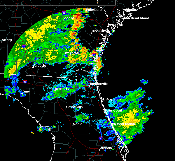 At 613 pm edt, doppler radar indicated a line of severe thunderstorms capable of producing damaging winds in excess of 60 mph. these storms were located along a line extending from near jesup to near nahunta to race pond, and moving northeast at 35 mph. At 613 pm edt, doppler radar indicated a line of severe thunderstorms capable of producing damaging winds in excess of 60 mph. these storms were located along a line extending from near jesup to near nahunta to race pond, and moving northeast at 35 mph.
|
| 6/30/2015 2:13 PM EDT |
 At 212 pm edt, doppler radar indicated a severe thunderstorm capable of producing damaging winds in excess of 60 mph. this storm was located over stephen foster state park, and moving east at 25 mph. At 212 pm edt, doppler radar indicated a severe thunderstorm capable of producing damaging winds in excess of 60 mph. this storm was located over stephen foster state park, and moving east at 25 mph.
|
| 6/30/2015 1:29 PM EDT |
 At 129 pm edt, doppler radar indicated a line of severe thunderstorms capable of producing damaging winds in excess of 60 mph. these storms were located along a line extending from near emerson park to near columbia, and moving east at 45 mph. At 129 pm edt, doppler radar indicated a line of severe thunderstorms capable of producing damaging winds in excess of 60 mph. these storms were located along a line extending from near emerson park to near columbia, and moving east at 45 mph.
|
| 6/18/2015 5:27 PM EDT | At 526 pm edt, doppler radar indicated a severe thunderstorm capable of producing damaging winds in excess of 60 mph. this storm was located near folkston, and moving north at 10 mph. |
| 6/12/2015 4:18 PM EDT |
 At 418 pm edt, doppler radar indicated a severe thunderstorm capable of producing quarter size hail and destructive winds in excess of 70 mph. this storm was located near hilliard, moving northeast at 5 mph. locations impacted include, hilliard, folkston and homeland. At 418 pm edt, doppler radar indicated a severe thunderstorm capable of producing quarter size hail and destructive winds in excess of 70 mph. this storm was located near hilliard, moving northeast at 5 mph. locations impacted include, hilliard, folkston and homeland.
|
| 6/12/2015 4:04 PM EDT |
 At 404 pm edt, doppler radar indicated a severe thunderstorm capable of producing destructive winds in excess of 70 mph. this storm was located near hilliard, and moving northeast at 5 mph. At 404 pm edt, doppler radar indicated a severe thunderstorm capable of producing destructive winds in excess of 70 mph. this storm was located near hilliard, and moving northeast at 5 mph.
|
| 6/3/2015 3:43 PM EDT | The severe thunderstorm warning for central brantley, northwestern camden and northeastern charlton counties will expire at 345 pm edt, the storm which prompted the warning has weakened below severe limits, and no longer poses an immediate threat to life or property. therefore the warning will be allowed to expire. however small. |
| 6/3/2015 3:15 PM EDT | At 315 pm edt, doppler radar indicated a severe thunderstorm capable of producing quarter size hail and damaging winds in excess of 60 mph. this storm was located 7 miles southeast of hickox, or 11 miles south of nahunta, and moving north at 10 mph. |
| 6/1/2015 6:52 PM EDT | At 651 pm edt, doppler radar indicated a severe thunderstorm capable of producing quarter size hail and damaging winds in excess of 60 mph. this storm was located 11 miles northwest of st. george, or 13 miles west of hilliard, moving east at 20 mph. locations impacted include, hilliard, folkston, homeland and st. george. |
| 6/1/2015 6:52 PM EDT | At 651 pm edt, doppler radar indicated a severe thunderstorm capable of producing quarter size hail and damaging winds in excess of 60 mph. this storm was located 11 miles northwest of st. george, or 13 miles west of hilliard, moving east at 20 mph. locations impacted include, hilliard, folkston, homeland and st. george. |
| 6/1/2015 6:36 PM EDT | At 635 pm edt, doppler radar indicated a severe thunderstorm capable of producing quarter size hail and damaging winds in excess of 60 mph. this storm was located 11 miles north of taylor, or 17 miles southeast of stephen foster state park, and moving east at 25 mph. |
| 6/1/2015 6:36 PM EDT | At 635 pm edt, doppler radar indicated a severe thunderstorm capable of producing quarter size hail and damaging winds in excess of 60 mph. this storm was located 11 miles north of taylor, or 17 miles southeast of stephen foster state park, and moving east at 25 mph. |
| 4/25/2015 9:44 PM EDT | At 944 pm edt, doppler radar indicated a line of severe thunderstorms capable of producing quarter size hail and damaging winds in excess of 60 mph. these storms were located along a line extending from 8 miles south of hickox to near race pond to 11 miles north of fargo, and moving east at 70 mph. |
| 4/25/2015 9:16 PM EDT | At 916 pm edt, doppler radar indicated a line of severe thunderstorms capable of producing quarter size hail and damaging winds in excess of 60 mph. these storms were located along a line extending from near donald to near jesup to 7 miles southeast of homerville, and moving east at 70 mph. |
| 4/19/2015 8:00 PM EDT | Straight line wind snapped several pine trees at a home about 1 mile west of folksto in charlton county GA, 1.5 miles NE of Folkston, GA |
| 4/19/2015 5:00 PM EDT | Straight line wind snapped several pine tree in charlton county GA, 1.5 miles NE of Folkston, GA |
| 4/19/2015 4:58 PM EDT | Spotter reported a tree downed on a powerline as well as numerous large limbs down in the roadway near spanish creek roa in charlton county GA, 2.8 miles NE of Folkston, GA |
| 4/19/2015 4:58 PM EDT | Spotter reported a tree downed on a powerline as well as numerous large limbs down in the roadway near spanish creek roa in charlton county GA, 4.7 miles ENE of Folkston, GA |
| 4/19/2015 4:55 PM EDT | At 455 pm edt, doppler radar indicated a line of severe thunderstorms capable of producing damaging winds in excess of 60 mph. these storms were located along a line extending from near race pond to near folkston to bryceville, and moving east at 55 mph. |
| 4/19/2015 4:55 PM EDT | At 455 pm edt, doppler radar indicated a line of severe thunderstorms capable of producing damaging winds in excess of 60 mph. these storms were located along a line extending from near race pond to near folkston to bryceville, and moving east at 55 mph. |
| 6/20/2014 6:50 PM EDT | Dispatch reported tree down on hwy 25 in charlton county GA, 3.7 miles SSW of Folkston, GA |
| 5/25/2014 4:40 PM EDT | Golf Ball sized hail reported 13.7 miles S of Folkston, GA, charlton county dispatcher relayed a public report of golf ball size hail near winokur. |
| 9/20/2012 2:08 PM EDT | The sheriffs office reported trees and powerlines down in folkston. the time given was based on rada in charlton county GA, 0.6 miles ENE of Folkston, GA |
| 1/1/0001 12:00 AM | Public report of 60 mph winds in folksto in charlton county GA, 0.6 miles ENE of Folkston, GA |
| 1/1/0001 12:00 AM | Nws incident meteorologist on site at the honey prairie wildfire complex reported widespread tree damage at the east entrace of the okefenokee nw in charlton county GA, 1.2 miles ENE of Folkston, GA |
| 1/1/0001 12:00 AM | Numerous trees down and a few powerlines dow in charlton county GA, 0.7 miles WNW of Folkston, GA |
| 1/1/0001 12:00 AM | Quarter sized hail reported 1.2 miles ENE of Folkston, GA, public report of penny to quarter size hail and several small limbs down at the folkston country club. |
Hail Maps for Folkston, GA
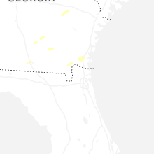


Connect with Interactive Hail Maps