

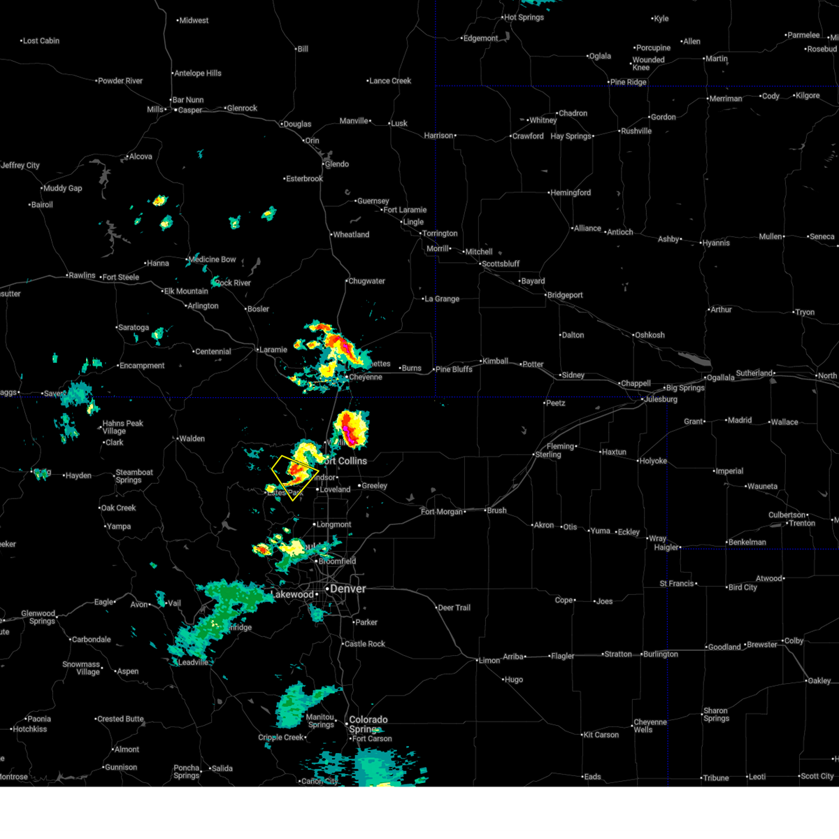
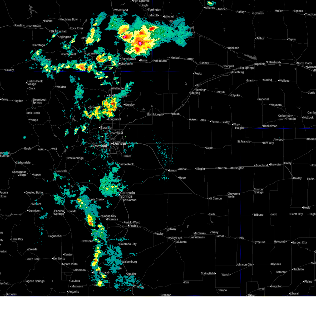
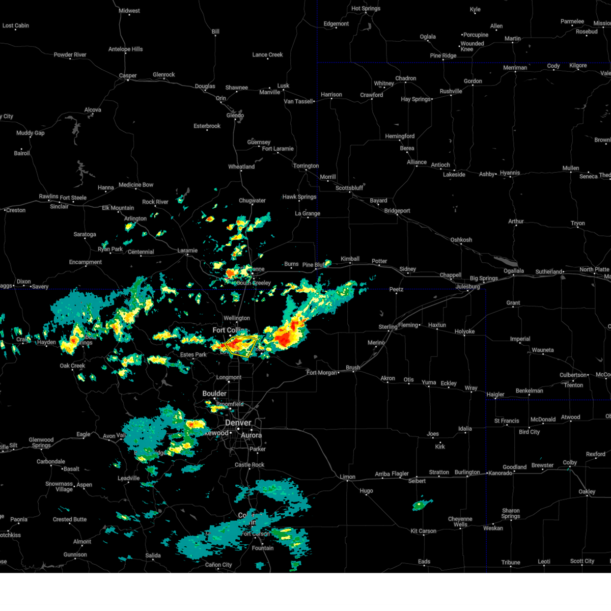
Hail Map for Fort Collins, CO
The Fort Collins, CO area has had 93 reports of on-the-ground hail by trained spotters, and has been under severe weather warnings 10 times during the past 12 months. Doppler radar has detected hail at or near Fort Collins, CO on 88 occasions, including 8 occasions during the past year.
| Name: | Fort Collins, CO |
| Where Located: | 56.7 miles N of Denver, CO |
| Map: | Google Map for Fort Collins, CO |
| Population: | 143986 |
| Housing Units: | 60503 |
| More Info: | Search Google for Fort Collins, CO |
2
The Top Recent Hail Date for Fort Collins, CO is Saturday, July 20, 2024 (9th out of 88)

Hail and Wind Damage Spotted near Fort Collins, CO
| Date / Time | Report Details |
|---|---|
| 6/29/2025 3:28 PM MDT |
 the severe thunderstorm warning has been cancelled and is no longer in effect the severe thunderstorm warning has been cancelled and is no longer in effect
|
| 6/29/2025 3:12 PM MDT |
 Svrbou the national weather service in denver has issued a * severe thunderstorm warning for, southeastern larimer county in north central colorado, * until 345 pm mdt. * at 312 pm mdt, a severe thunderstorm was located 5 miles south of buckhorn mountain, or 15 miles west of fort collins, moving southeast at 20 mph (radar indicated). Hazards include 60 mph wind gusts and quarter size hail. Hail damage to vehicles is expected. Expect wind damage to roofs, siding, and trees. Svrbou the national weather service in denver has issued a * severe thunderstorm warning for, southeastern larimer county in north central colorado, * until 345 pm mdt. * at 312 pm mdt, a severe thunderstorm was located 5 miles south of buckhorn mountain, or 15 miles west of fort collins, moving southeast at 20 mph (radar indicated). Hazards include 60 mph wind gusts and quarter size hail. Hail damage to vehicles is expected. Expect wind damage to roofs, siding, and trees.
|
| 6/17/2025 3:02 AM MDT | Half Dollar sized hail reported 8.1 miles WSW of Fort Collins, CO, report from mping: half dollar (1.25 in.). |
| 6/17/2025 2:27 AM MDT |
 At 227 am mdt, a severe thunderstorm was located near wellington, or 13 miles northeast of fort collins, moving north at 20 mph (radar indicated). Hazards include ping pong ball size hail. People and animals outdoors will be injured. expect damage to roofs, siding, windows, and vehicles. Locations impacted include, northeastern fort collins, wellington and black hollow reservoir. At 227 am mdt, a severe thunderstorm was located near wellington, or 13 miles northeast of fort collins, moving north at 20 mph (radar indicated). Hazards include ping pong ball size hail. People and animals outdoors will be injured. expect damage to roofs, siding, windows, and vehicles. Locations impacted include, northeastern fort collins, wellington and black hollow reservoir.
|
| 6/17/2025 2:16 AM MDT |
 Svrbou the national weather service in denver has issued a * severe thunderstorm warning for, east central larimer county in north central colorado, west central weld county in northeastern colorado, * until 245 am mdt. * at 216 am mdt, a severe thunderstorm was located near wellington, or 9 miles northeast of fort collins, moving north at 15 mph (radar indicated). Hazards include quarter size hail. damage to vehicles is expected Svrbou the national weather service in denver has issued a * severe thunderstorm warning for, east central larimer county in north central colorado, west central weld county in northeastern colorado, * until 245 am mdt. * at 216 am mdt, a severe thunderstorm was located near wellington, or 9 miles northeast of fort collins, moving north at 15 mph (radar indicated). Hazards include quarter size hail. damage to vehicles is expected
|
| 6/12/2025 3:33 PM MDT |
 the severe thunderstorm warning has been cancelled and is no longer in effect the severe thunderstorm warning has been cancelled and is no longer in effect
|
| 6/12/2025 3:25 PM MDT |
 At 325 pm mdt, a severe thunderstorm was located 2 miles east of loveland, moving east at 10 mph (radar indicated). Hazards include 60 mph wind gusts and quarter size hail. Hail damage to vehicles is expected. expect wind damage to roofs, siding, and trees. Locations impacted include, southeastern fort collins, loveland, windsor, timnath, masonville and campion. At 325 pm mdt, a severe thunderstorm was located 2 miles east of loveland, moving east at 10 mph (radar indicated). Hazards include 60 mph wind gusts and quarter size hail. Hail damage to vehicles is expected. expect wind damage to roofs, siding, and trees. Locations impacted include, southeastern fort collins, loveland, windsor, timnath, masonville and campion.
|
| 6/12/2025 3:11 PM MDT |
 Svrbou the national weather service in denver has issued a * severe thunderstorm warning for, southeastern larimer county in north central colorado, * until 400 pm mdt. * at 311 pm mdt, a severe thunderstorm was located near cedar cove, or 12 miles southwest of fort collins, moving east at 10 mph (radar indicated). Hazards include 60 mph wind gusts and quarter size hail. Hail damage to vehicles is expected. Expect wind damage to roofs, siding, and trees. Svrbou the national weather service in denver has issued a * severe thunderstorm warning for, southeastern larimer county in north central colorado, * until 400 pm mdt. * at 311 pm mdt, a severe thunderstorm was located near cedar cove, or 12 miles southwest of fort collins, moving east at 10 mph (radar indicated). Hazards include 60 mph wind gusts and quarter size hail. Hail damage to vehicles is expected. Expect wind damage to roofs, siding, and trees.
|
| 8/7/2024 3:25 PM MDT |
 The storm which prompted the warning has weakened below severe limits, and no longer poses an immediate threat to life or property. therefore, the warning will be allowed to expire. a severe thunderstorm watch remains in effect until 1000 pm mdt for northeastern colorado. The storm which prompted the warning has weakened below severe limits, and no longer poses an immediate threat to life or property. therefore, the warning will be allowed to expire. a severe thunderstorm watch remains in effect until 1000 pm mdt for northeastern colorado.
|
| 8/7/2024 2:57 PM MDT |
 Svrbou the national weather service in denver colorado has issued a * severe thunderstorm warning for, west central weld county in northeastern colorado, east central larimer county in north central colorado, * until 330 pm mdt. * at 257 pm mdt, a severe thunderstorm was located over southeastern fort collins, moving east at 20 mph (radar indicated). Hazards include 60 mph wind gusts and quarter size hail. Expect damage to roofs, siding, and trees. Hail damage to vehicles is expected. Svrbou the national weather service in denver colorado has issued a * severe thunderstorm warning for, west central weld county in northeastern colorado, east central larimer county in north central colorado, * until 330 pm mdt. * at 257 pm mdt, a severe thunderstorm was located over southeastern fort collins, moving east at 20 mph (radar indicated). Hazards include 60 mph wind gusts and quarter size hail. Expect damage to roofs, siding, and trees. Hail damage to vehicles is expected.
|
| 7/20/2024 7:22 PM MDT |
 Svrbou the national weather service in denver colorado has issued a * severe thunderstorm warning for, west central weld county in northeastern colorado, southeastern larimer county in north central colorado, * until 745 pm mdt. * at 722 pm mdt, a severe thunderstorm was located over northwestern loveland, or 8 miles south of fort collins, moving south at 30 mph (radar indicated). Hazards include 60 mph wind gusts and quarter size hail. Expect damage to roofs, siding, and trees. Hail damage to vehicles is expected. Svrbou the national weather service in denver colorado has issued a * severe thunderstorm warning for, west central weld county in northeastern colorado, southeastern larimer county in north central colorado, * until 745 pm mdt. * at 722 pm mdt, a severe thunderstorm was located over northwestern loveland, or 8 miles south of fort collins, moving south at 30 mph (radar indicated). Hazards include 60 mph wind gusts and quarter size hail. Expect damage to roofs, siding, and trees. Hail damage to vehicles is expected.
|
| 8/27/2023 3:06 PM MDT | Quarter sized hail reported 3.7 miles E of Fort Collins, CO, report from mping: quarter (1.00 in.). |
| 8/5/2023 3:31 PM MDT |
 At 331 pm mdt, a severe thunderstorm was located near masonville, or 7 miles southwest of fort collins, moving southeast at 25 mph (radar indicated). Hazards include half dollar size hail. Damage to vehicles is expected. this severe thunderstorm will be near, loveland around 340 pm mdt. other locations in the path of this severe thunderstorm include berthoud, johnstown, milliken and mead. hail threat, radar indicated max hail size, 1. 25 in wind threat, radar indicated max wind gust, <50 mph. At 331 pm mdt, a severe thunderstorm was located near masonville, or 7 miles southwest of fort collins, moving southeast at 25 mph (radar indicated). Hazards include half dollar size hail. Damage to vehicles is expected. this severe thunderstorm will be near, loveland around 340 pm mdt. other locations in the path of this severe thunderstorm include berthoud, johnstown, milliken and mead. hail threat, radar indicated max hail size, 1. 25 in wind threat, radar indicated max wind gust, <50 mph.
|
| 8/3/2023 6:04 PM MDT |
 At 604 pm mdt, a severe thunderstorm was located over windsor, or 7 miles southeast of fort collins, moving east at 20 mph (radar indicated. at 554 pm mdt, a trained spotter reported quarter size hail just south of fort collins). Hazards include 60 mph wind gusts and quarter size hail. Expect damage to roofs, siding, and trees. hail damage to vehicles is expected. locations impacted include, severance, greeley and evans. hail threat, observed max hail size, 1. 00 in wind threat, radar indicated max wind gust, 60 mph. At 604 pm mdt, a severe thunderstorm was located over windsor, or 7 miles southeast of fort collins, moving east at 20 mph (radar indicated. at 554 pm mdt, a trained spotter reported quarter size hail just south of fort collins). Hazards include 60 mph wind gusts and quarter size hail. Expect damage to roofs, siding, and trees. hail damage to vehicles is expected. locations impacted include, severance, greeley and evans. hail threat, observed max hail size, 1. 00 in wind threat, radar indicated max wind gust, 60 mph.
|
| 8/3/2023 5:55 PM MDT | Quarter sized hail reported 4.1 miles N of Fort Collins, CO |
| 8/3/2023 5:43 PM MDT |
 At 543 pm mdt, a severe thunderstorm was located 4 miles southwest of fort collins, moving east at 20 mph (radar indicated). Hazards include 60 mph wind gusts and quarter size hail. Expect damage to roofs, siding, and trees. hail damage to vehicles is expected. this severe thunderstorm will be near, fort collins around 555 pm mdt. loveland around 600 pm mdt. other locations in the path of this severe thunderstorm include timnath, windsor, greeley and severance. hail threat, radar indicated max hail size, 1. 00 in wind threat, radar indicated max wind gust, 60 mph. At 543 pm mdt, a severe thunderstorm was located 4 miles southwest of fort collins, moving east at 20 mph (radar indicated). Hazards include 60 mph wind gusts and quarter size hail. Expect damage to roofs, siding, and trees. hail damage to vehicles is expected. this severe thunderstorm will be near, fort collins around 555 pm mdt. loveland around 600 pm mdt. other locations in the path of this severe thunderstorm include timnath, windsor, greeley and severance. hail threat, radar indicated max hail size, 1. 00 in wind threat, radar indicated max wind gust, 60 mph.
|
| 8/3/2023 5:36 PM MDT |
 At 536 pm mdt, a severe thunderstorm was located near masonville, or 5 miles southwest of fort collins, moving east at 15 mph (radar indicated). Hazards include 60 mph wind gusts and quarter size hail. Expect damage to roofs, siding, and trees. hail damage to vehicles is expected. locations impacted include, fort collins. hail threat, radar indicated max hail size, 1. 00 in wind threat, radar indicated max wind gust, 60 mph. At 536 pm mdt, a severe thunderstorm was located near masonville, or 5 miles southwest of fort collins, moving east at 15 mph (radar indicated). Hazards include 60 mph wind gusts and quarter size hail. Expect damage to roofs, siding, and trees. hail damage to vehicles is expected. locations impacted include, fort collins. hail threat, radar indicated max hail size, 1. 00 in wind threat, radar indicated max wind gust, 60 mph.
|
| 8/3/2023 5:11 PM MDT |
 At 511 pm mdt, a severe thunderstorm was located 4 miles west of masonville, or 11 miles west of fort collins, moving northeast at 15 mph (radar indicated). Hazards include 60 mph wind gusts and quarter size hail. Expect damage to roofs, siding, and trees. hail damage to vehicles is expected. this severe thunderstorm will be near, masonville around 525 pm mdt. other locations in the path of this severe thunderstorm include fort collins and bellvue. hail threat, radar indicated max hail size, 1. 00 in wind threat, radar indicated max wind gust, 60 mph. At 511 pm mdt, a severe thunderstorm was located 4 miles west of masonville, or 11 miles west of fort collins, moving northeast at 15 mph (radar indicated). Hazards include 60 mph wind gusts and quarter size hail. Expect damage to roofs, siding, and trees. hail damage to vehicles is expected. this severe thunderstorm will be near, masonville around 525 pm mdt. other locations in the path of this severe thunderstorm include fort collins and bellvue. hail threat, radar indicated max hail size, 1. 00 in wind threat, radar indicated max wind gust, 60 mph.
|
| 7/31/2023 8:03 PM MDT |
 At 802 pm mdt, a severe thunderstorm was located over northern fort collins, and is nearly stationary. a second storm was located east of wellington, and is also nearly stationary (radar indicated). Hazards include 60 mph wind gusts and quarter size hail. Expect damage to roofs, siding, and trees. hail damage to vehicles is expected. Locations impacted include, northern fort collins, windsor, wellington, timnath, nunn and teds place. At 802 pm mdt, a severe thunderstorm was located over northern fort collins, and is nearly stationary. a second storm was located east of wellington, and is also nearly stationary (radar indicated). Hazards include 60 mph wind gusts and quarter size hail. Expect damage to roofs, siding, and trees. hail damage to vehicles is expected. Locations impacted include, northern fort collins, windsor, wellington, timnath, nunn and teds place.
|
| 7/31/2023 8:00 PM MDT | Half Dollar sized hail reported 3.6 miles SSE of Fort Collins, CO, report from mping. |
| 7/31/2023 7:30 PM MDT |
 At 729 pm mdt, a severe thunderstorm was located over wellington, or 9 miles northeast of fort collins, moving southwest at 5 mph (radar indicated). Hazards include 60 mph wind gusts and quarter size hail. Expect damage to roofs, siding, and trees. Hail damage to vehicles is expected. At 729 pm mdt, a severe thunderstorm was located over wellington, or 9 miles northeast of fort collins, moving southwest at 5 mph (radar indicated). Hazards include 60 mph wind gusts and quarter size hail. Expect damage to roofs, siding, and trees. Hail damage to vehicles is expected.
|
| 7/31/2023 7:05 PM MDT |
 At 704 pm mdt, a severe thunderstorm was located near wellington, or 11 miles northeast of fort collins, moving southwest at 5 mph (radar indicated). Hazards include golf ball size hail and 60 mph wind gusts. Expect damage to roofs, siding, and trees. people and animals outdoors will be injured. expect hail damage to roofs, siding, windows, and vehicles. hail may accumulate on roadways causing hazardous travel. locations impacted include, northeastern fort collins and wellington. thunderstorm damage threat, considerable hail threat, radar indicated max hail size, 1. 75 in wind threat, radar indicated max wind gust, 60 mph. At 704 pm mdt, a severe thunderstorm was located near wellington, or 11 miles northeast of fort collins, moving southwest at 5 mph (radar indicated). Hazards include golf ball size hail and 60 mph wind gusts. Expect damage to roofs, siding, and trees. people and animals outdoors will be injured. expect hail damage to roofs, siding, windows, and vehicles. hail may accumulate on roadways causing hazardous travel. locations impacted include, northeastern fort collins and wellington. thunderstorm damage threat, considerable hail threat, radar indicated max hail size, 1. 75 in wind threat, radar indicated max wind gust, 60 mph.
|
| 7/31/2023 6:40 PM MDT |
 At 640 pm mdt, a severe thunderstorm was located 4 miles northeast of wellington, or 14 miles northeast of fort collins, moving southwest at 10 mph (radar indicated). Hazards include ping pong ball size hail and 60 mph wind gusts. Expect damage to roofs, siding, and trees. people and animals outdoors will be injured. expect hail damage to roofs, siding, windows, and vehicles. Hail may accumulate on roadways causing hazardous travel. At 640 pm mdt, a severe thunderstorm was located 4 miles northeast of wellington, or 14 miles northeast of fort collins, moving southwest at 10 mph (radar indicated). Hazards include ping pong ball size hail and 60 mph wind gusts. Expect damage to roofs, siding, and trees. people and animals outdoors will be injured. expect hail damage to roofs, siding, windows, and vehicles. Hail may accumulate on roadways causing hazardous travel.
|
| 7/15/2023 3:46 PM MDT |
 At 346 pm mdt, a severe thunderstorm was located 4 miles south of stove prairie, or 16 miles west of fort collins, moving southeast at 20 mph (radar indicated). Hazards include quarter size hail. Damage to vehicles is expected. this severe thunderstorm will be near, buckhorn mountain around 350 pm mdt. drake around 405 pm mdt. other locations in the path of this severe thunderstorm include masonville and cedar cove. hail threat, radar indicated max hail size, 1. 00 in wind threat, radar indicated max wind gust, <50 mph. At 346 pm mdt, a severe thunderstorm was located 4 miles south of stove prairie, or 16 miles west of fort collins, moving southeast at 20 mph (radar indicated). Hazards include quarter size hail. Damage to vehicles is expected. this severe thunderstorm will be near, buckhorn mountain around 350 pm mdt. drake around 405 pm mdt. other locations in the path of this severe thunderstorm include masonville and cedar cove. hail threat, radar indicated max hail size, 1. 00 in wind threat, radar indicated max wind gust, <50 mph.
|
| 6/21/2023 7:41 PM MDT | Quarter sized hail reported 5 miles SSW of Fort Collins, CO, report from mping: quarter (1.00 in.) time adjusted using radar estimation. |
| 6/21/2023 7:40 PM MDT | Quarter sized hail reported 3.5 miles S of Fort Collins, CO, time estimated from radar. |
| 6/21/2023 7:36 PM MDT | Quarter sized hail reported 1.5 miles SSE of Fort Collins, CO, report via twitter. time and location estimated. |
| 6/21/2023 7:36 PM MDT |
 At 736 pm mdt, a severe thunderstorm was located near fort collins, moving northeast at 15 mph (radar indicated). Hazards include half dollar size hail. Damage to vehicles is expected. this severe thunderstorm will be near, timnath around 740 pm mdt. windsor around 750 pm mdt. other locations in the path of this severe thunderstorm include wellington and severance. hail threat, radar indicated max hail size, 1. 25 in wind threat, radar indicated max wind gust, <50 mph. At 736 pm mdt, a severe thunderstorm was located near fort collins, moving northeast at 15 mph (radar indicated). Hazards include half dollar size hail. Damage to vehicles is expected. this severe thunderstorm will be near, timnath around 740 pm mdt. windsor around 750 pm mdt. other locations in the path of this severe thunderstorm include wellington and severance. hail threat, radar indicated max hail size, 1. 25 in wind threat, radar indicated max wind gust, <50 mph.
|
| 5/31/2023 4:43 PM MDT |
 The severe thunderstorm warning for west central weld and southeastern larimer counties will expire at 445 pm mdt, the storm which prompted the warning has weakened below severe limits, and has exited the warned area. therefore, the warning will be allowed to expire. The severe thunderstorm warning for west central weld and southeastern larimer counties will expire at 445 pm mdt, the storm which prompted the warning has weakened below severe limits, and has exited the warned area. therefore, the warning will be allowed to expire.
|
| 5/31/2023 4:32 PM MDT |
 At 431 pm mdt, a severe thunderstorm was located near timnath, or 5 miles southeast of fort collins, moving north at 35 mph (radar indicated). Hazards include 60 mph wind gusts and penny size hail. Expect damage to roofs, siding, and trees. locations impacted include, fort collins, western greeley, loveland, windsor, severance and timnath. hail threat, radar indicated max hail size, 0. 75 in wind threat, observed max wind gust, 60 mph. At 431 pm mdt, a severe thunderstorm was located near timnath, or 5 miles southeast of fort collins, moving north at 35 mph (radar indicated). Hazards include 60 mph wind gusts and penny size hail. Expect damage to roofs, siding, and trees. locations impacted include, fort collins, western greeley, loveland, windsor, severance and timnath. hail threat, radar indicated max hail size, 0. 75 in wind threat, observed max wind gust, 60 mph.
|
| 5/31/2023 4:19 PM MDT |
 At 416 pm mdt, a severe thunderstorm was located near johnstown, or 12 miles west of greeley, moving north at 25 mph (media reported large tree limb down and winds around 64 mph in milliken before 4 pm). Hazards include 60 mph wind gusts and quarter size hail. Expect damage to roofs, siding, and trees. hail damage to vehicles is expected. locations impacted include, fort collins, western greeley, loveland, windsor, johnstown, milliken, berthoud, mead, severance and timnath. hail threat, radar indicated max hail size, 1. 00 in wind threat, observed max wind gust, 60 mph. At 416 pm mdt, a severe thunderstorm was located near johnstown, or 12 miles west of greeley, moving north at 25 mph (media reported large tree limb down and winds around 64 mph in milliken before 4 pm). Hazards include 60 mph wind gusts and quarter size hail. Expect damage to roofs, siding, and trees. hail damage to vehicles is expected. locations impacted include, fort collins, western greeley, loveland, windsor, johnstown, milliken, berthoud, mead, severance and timnath. hail threat, radar indicated max hail size, 1. 00 in wind threat, observed max wind gust, 60 mph.
|
| 5/31/2023 4:04 PM MDT |
 At 404 pm mdt, a severe thunderstorm was located near johnstown, or 14 miles southwest of greeley, moving north at 35 mph (radar indicated). Hazards include quarter size hail. damage to vehicles is expected At 404 pm mdt, a severe thunderstorm was located near johnstown, or 14 miles southwest of greeley, moving north at 35 mph (radar indicated). Hazards include quarter size hail. damage to vehicles is expected
|
| 5/27/2023 4:10 PM MDT |
 The severe thunderstorm warning for northwestern weld and east central larimer counties will expire at 415 pm mdt, the storm which prompted the warning has weakened below severe limits, and no longer poses an immediate threat to life or property. therefore, the warning will be allowed to expire. however heavy rain is still possible with this thunderstorm. a severe thunderstorm watch remains in effect until 900 pm mdt for northeastern colorado. The severe thunderstorm warning for northwestern weld and east central larimer counties will expire at 415 pm mdt, the storm which prompted the warning has weakened below severe limits, and no longer poses an immediate threat to life or property. therefore, the warning will be allowed to expire. however heavy rain is still possible with this thunderstorm. a severe thunderstorm watch remains in effect until 900 pm mdt for northeastern colorado.
|
| 5/27/2023 3:45 PM MDT | Quarter sized hail reported 3.5 miles WNW of Fort Collins, CO |
| 5/27/2023 3:43 PM MDT |
 At 342 pm mdt, a severe thunderstorm was located 4 miles northeast of timnath, or 8 miles east of fort collins, moving northeast at 20 mph (radar indicated and spotter reported). Hazards include ping pong ball size hail and 60 mph wind gusts. Expect damage to roofs, siding, and trees. people and animals outdoors will be injured. expect hail damage to roofs, siding, windows, and vehicles. locations impacted include, ault, pierce and nunn. hail threat, radar indicated max hail size, 1. 50 in wind threat, radar indicated max wind gust, 60 mph. At 342 pm mdt, a severe thunderstorm was located 4 miles northeast of timnath, or 8 miles east of fort collins, moving northeast at 20 mph (radar indicated and spotter reported). Hazards include ping pong ball size hail and 60 mph wind gusts. Expect damage to roofs, siding, and trees. people and animals outdoors will be injured. expect hail damage to roofs, siding, windows, and vehicles. locations impacted include, ault, pierce and nunn. hail threat, radar indicated max hail size, 1. 50 in wind threat, radar indicated max wind gust, 60 mph.
|
| 5/27/2023 3:26 PM MDT |
 At 326 pm mdt, a severe thunderstorm was located near windsor, or 8 miles east of fort collins, moving northeast at 25 mph (radar indicated). Hazards include 60 mph wind gusts and half dollar size hail. Expect damage to roofs, siding, and trees. hail damage to vehicles is expected. this severe thunderstorm will be near, severance around 345 pm mdt. other locations in the path of this severe thunderstorm include eaton, ault and pierce. hail threat, radar indicated max hail size, 1. 25 in wind threat, radar indicated max wind gust, 60 mph. At 326 pm mdt, a severe thunderstorm was located near windsor, or 8 miles east of fort collins, moving northeast at 25 mph (radar indicated). Hazards include 60 mph wind gusts and half dollar size hail. Expect damage to roofs, siding, and trees. hail damage to vehicles is expected. this severe thunderstorm will be near, severance around 345 pm mdt. other locations in the path of this severe thunderstorm include eaton, ault and pierce. hail threat, radar indicated max hail size, 1. 25 in wind threat, radar indicated max wind gust, 60 mph.
|
| 5/27/2023 3:25 PM MDT | Quarter sized hail reported 6.2 miles WSW of Fort Collins, CO |
| 5/9/2023 11:34 PM MDT |
 At 1133 pm mdt, a severe thunderstorm was located over berthoud, or 16 miles southwest of greeley, moving north at 15 mph (trained weather spotters). Hazards include two inch hail and 60 mph wind gusts. Expect damage to roofs, siding, and trees. people and animals outdoors will be injured. expect hail damage to roofs, siding, windows, and vehicles. locations impacted include, johnstown, milliken, loveland, windsor and southern fort collins. thunderstorm damage threat, considerable hail threat, observed max hail size, 2. 00 in wind threat, radar indicated max wind gust, 60 mph. At 1133 pm mdt, a severe thunderstorm was located over berthoud, or 16 miles southwest of greeley, moving north at 15 mph (trained weather spotters). Hazards include two inch hail and 60 mph wind gusts. Expect damage to roofs, siding, and trees. people and animals outdoors will be injured. expect hail damage to roofs, siding, windows, and vehicles. locations impacted include, johnstown, milliken, loveland, windsor and southern fort collins. thunderstorm damage threat, considerable hail threat, observed max hail size, 2. 00 in wind threat, radar indicated max wind gust, 60 mph.
|
| 5/9/2023 11:11 PM MDT |
 At 1110 pm mdt, a severe thunderstorm was located near longmont, or 21 miles southwest of greeley, moving north at 20 mph (radar indicated). Hazards include 60 mph wind gusts and half dollar size hail. Expect damage to roofs, siding, and trees. hail damage to vehicles is expected. this severe thunderstorm will be near, mead around 1120 pm mdt. berthoud around 1130 pm mdt. other locations in the path of this severe thunderstorm include johnstown, milliken, loveland and windsor. hail threat, radar indicated max hail size, 1. 25 in wind threat, radar indicated max wind gust, 60 mph. At 1110 pm mdt, a severe thunderstorm was located near longmont, or 21 miles southwest of greeley, moving north at 20 mph (radar indicated). Hazards include 60 mph wind gusts and half dollar size hail. Expect damage to roofs, siding, and trees. hail damage to vehicles is expected. this severe thunderstorm will be near, mead around 1120 pm mdt. berthoud around 1130 pm mdt. other locations in the path of this severe thunderstorm include johnstown, milliken, loveland and windsor. hail threat, radar indicated max hail size, 1. 25 in wind threat, radar indicated max wind gust, 60 mph.
|
| 5/9/2023 8:06 PM MDT |
 At 806 pm mdt, a severe thunderstorm was located 6 miles north of timnath, or 7 miles northeast of fort collins, moving northeast at 25 mph (radar indicated). Hazards include quarter size hail. Damage to vehicles is expected. locations impacted include, fort collins, greeley, northern loveland, windsor, wellington, eaton, severance, ault, pierce, timnath, nunn and lucerne. hail threat, radar indicated max hail size, 1. 00 in wind threat, radar indicated max wind gust, <50 mph. At 806 pm mdt, a severe thunderstorm was located 6 miles north of timnath, or 7 miles northeast of fort collins, moving northeast at 25 mph (radar indicated). Hazards include quarter size hail. Damage to vehicles is expected. locations impacted include, fort collins, greeley, northern loveland, windsor, wellington, eaton, severance, ault, pierce, timnath, nunn and lucerne. hail threat, radar indicated max hail size, 1. 00 in wind threat, radar indicated max wind gust, <50 mph.
|
| 5/9/2023 7:31 PM MDT |
 At 731 pm mdt, a severe thunderstorm was located near windsor, or 7 miles northwest of greeley, moving north at 25 mph (radar indicated). Hazards include 60 mph wind gusts and half dollar size hail. Expect damage to roofs, siding, and trees. Hail damage to vehicles is expected. At 731 pm mdt, a severe thunderstorm was located near windsor, or 7 miles northwest of greeley, moving north at 25 mph (radar indicated). Hazards include 60 mph wind gusts and half dollar size hail. Expect damage to roofs, siding, and trees. Hail damage to vehicles is expected.
|
| 7/27/2022 8:08 PM MDT | Hen Egg sized hail reported 7 miles WSW of Fort Collins, CO, photos of hail at the intersection of mulberry street and county road 15. time estimated. |
| 7/27/2022 8:02 PM MDT | Tennis Ball sized hail reported 7.6 miles WSW of Fort Collins, CO, off-duty nws employee provided photos of tennis ball size hail... measured 45 minutes after the hail stopped falling. |
| 7/27/2022 8:02 PM MDT |
 At 801 pm mdt, a severe thunderstorm was located 4 miles northwest of severance, or 8 miles east of fort collins, moving south at 25 mph. this is a destructive storm for severance, windsor, timnath (radar indicated). Hazards include three inch hail and 60 mph wind gusts. People and animals outdoors will be severely injured. expect shattered windows, extensive damage to roofs, siding, and vehicles. this severe thunderstorm will be near, severance around 805 pm mdt. windsor and timnath around 810 pm mdt. greeley and northeastern loveland around 820 pm mdt. Other locations in the path of this severe thunderstorm include milliken and johnstown. At 801 pm mdt, a severe thunderstorm was located 4 miles northwest of severance, or 8 miles east of fort collins, moving south at 25 mph. this is a destructive storm for severance, windsor, timnath (radar indicated). Hazards include three inch hail and 60 mph wind gusts. People and animals outdoors will be severely injured. expect shattered windows, extensive damage to roofs, siding, and vehicles. this severe thunderstorm will be near, severance around 805 pm mdt. windsor and timnath around 810 pm mdt. greeley and northeastern loveland around 820 pm mdt. Other locations in the path of this severe thunderstorm include milliken and johnstown.
|
| 7/27/2022 8:00 PM MDT | Half Dollar sized hail reported 5.7 miles WSW of Fort Collins, CO, hail blown into house causing some damage. tree limbs also down. |
| 7/27/2022 8:00 PM MDT | Large tree limbs dow in larimer county CO, 5.7 miles WSW of Fort Collins, CO |
| 7/27/2022 7:59 PM MDT |
 At 759 pm mdt, a severe thunderstorm was located 4 miles west of pierce, or 12 miles east of fort collins, moving southeast at 25 mph. this is a destructive storm (radar indicated). Hazards include three inch hail and 60 mph wind gusts. People and animals outdoors will be severely injured. expect shattered windows, extensive damage to roofs, siding, and vehicles. Locations impacted include, northeastern fort collins and wellington. At 759 pm mdt, a severe thunderstorm was located 4 miles west of pierce, or 12 miles east of fort collins, moving southeast at 25 mph. this is a destructive storm (radar indicated). Hazards include three inch hail and 60 mph wind gusts. People and animals outdoors will be severely injured. expect shattered windows, extensive damage to roofs, siding, and vehicles. Locations impacted include, northeastern fort collins and wellington.
|
| 7/27/2022 7:53 PM MDT | Ping Pong Ball sized hail reported 8.2 miles SW of Fort Collins, CO, larimer dispatch relayed report of significant damage... including smashed windows... as a result of the hail. time estimated. |
| 7/27/2022 7:50 PM MDT |
 At 749 pm mdt, a severe thunderstorm was located 5 miles southwest of nunn, or 12 miles northeast of fort collins, moving southeast at 25 mph (radar indicated). Hazards include two inch hail and 60 mph wind gusts. Expect damage to roofs, siding, and trees. people and animals outdoors will be injured. expect hail damage to roofs, siding, windows, and vehicles. Locations impacted include, northeastern fort collins and wellington. At 749 pm mdt, a severe thunderstorm was located 5 miles southwest of nunn, or 12 miles northeast of fort collins, moving southeast at 25 mph (radar indicated). Hazards include two inch hail and 60 mph wind gusts. Expect damage to roofs, siding, and trees. people and animals outdoors will be injured. expect hail damage to roofs, siding, windows, and vehicles. Locations impacted include, northeastern fort collins and wellington.
|
| 7/27/2022 7:47 PM MDT | Hen Egg sized hail reported 9.3 miles SW of Fort Collins, CO, report relayed from spotter. |
| 7/27/2022 7:37 PM MDT |
 At 737 pm mdt, a severe thunderstorm was located 4 miles northeast of wellington, or 14 miles northeast of fort collins, moving southeast at 25 mph (radar indicated). Hazards include two inch hail and 60 mph wind gusts. Expect damage to roofs, siding, and trees. people and animals outdoors will be injured. expect hail damage to roofs, siding, windows, and vehicles. Locations impacted include, pierce. At 737 pm mdt, a severe thunderstorm was located 4 miles northeast of wellington, or 14 miles northeast of fort collins, moving southeast at 25 mph (radar indicated). Hazards include two inch hail and 60 mph wind gusts. Expect damage to roofs, siding, and trees. people and animals outdoors will be injured. expect hail damage to roofs, siding, windows, and vehicles. Locations impacted include, pierce.
|
| 7/27/2022 7:27 PM MDT |
 At 727 pm mdt, a severe thunderstorm was located 6 miles north of wellington, or 17 miles north of fort collins, moving southeast at 25 mph (radar indicated). Hazards include 60 mph wind gusts and quarter size hail. Expect damage to roofs, siding, and trees. hail damage to vehicles is expected. this severe thunderstorm will be near, wellington around 735 pm mdt. other locations in the path of this severe thunderstorm include nunn and pierce. hail threat, radar indicated max hail size, 1. 00 in wind threat, radar indicated max wind gust, 60 mph. At 727 pm mdt, a severe thunderstorm was located 6 miles north of wellington, or 17 miles north of fort collins, moving southeast at 25 mph (radar indicated). Hazards include 60 mph wind gusts and quarter size hail. Expect damage to roofs, siding, and trees. hail damage to vehicles is expected. this severe thunderstorm will be near, wellington around 735 pm mdt. other locations in the path of this severe thunderstorm include nunn and pierce. hail threat, radar indicated max hail size, 1. 00 in wind threat, radar indicated max wind gust, 60 mph.
|
| 7/30/2021 4:11 PM MDT |
 At 410 pm mdt, a severe thunderstorm was located near wellington, or 11 miles northeast of fort collins, moving south at 10 mph (public). Hazards include 60 mph wind gusts and quarter size hail. Expect damage to roofs, siding, and trees. Hail damage to vehicles is expected. At 410 pm mdt, a severe thunderstorm was located near wellington, or 11 miles northeast of fort collins, moving south at 10 mph (public). Hazards include 60 mph wind gusts and quarter size hail. Expect damage to roofs, siding, and trees. Hail damage to vehicles is expected.
|
| 7/30/2021 3:51 PM MDT |
 At 351 pm mdt, a severe thunderstorm was located near wellington, or 12 miles northeast of fort collins, moving southeast at 10 mph (radar indicated). Hazards include 60 mph wind gusts and quarter size hail. Expect damage to roofs, siding, and trees. hail damage to vehicles is expected. Locations impacted include, northeastern fort collins, wellington and pierce. At 351 pm mdt, a severe thunderstorm was located near wellington, or 12 miles northeast of fort collins, moving southeast at 10 mph (radar indicated). Hazards include 60 mph wind gusts and quarter size hail. Expect damage to roofs, siding, and trees. hail damage to vehicles is expected. Locations impacted include, northeastern fort collins, wellington and pierce.
|
| 7/30/2021 3:26 PM MDT |
 At 326 pm mdt, a severe thunderstorm was located 5 miles north of wellington, or 15 miles north of fort collins, moving southeast at 10 mph (radar indicated). Hazards include 60 mph wind gusts and quarter size hail. Expect damage to roofs, siding, and trees. Hail damage to vehicles is expected. At 326 pm mdt, a severe thunderstorm was located 5 miles north of wellington, or 15 miles north of fort collins, moving southeast at 10 mph (radar indicated). Hazards include 60 mph wind gusts and quarter size hail. Expect damage to roofs, siding, and trees. Hail damage to vehicles is expected.
|
| 6/7/2021 6:55 PM MDT |
 At 654 pm mdt, a severe thunderstorm was located 4 miles northwest of severance, or 8 miles east of fort collins, moving north at 15 mph. the largest hail reported with the storm so far has been one half inch (radar indicated). Hazards include 60 mph wind gusts and quarter size hail. Expect damage to roofs, siding, and trees. hail damage to vehicles is expected. Locations impacted include, eastern fort collins, northern greeley, windsor, severance, ault and timnath. At 654 pm mdt, a severe thunderstorm was located 4 miles northwest of severance, or 8 miles east of fort collins, moving north at 15 mph. the largest hail reported with the storm so far has been one half inch (radar indicated). Hazards include 60 mph wind gusts and quarter size hail. Expect damage to roofs, siding, and trees. hail damage to vehicles is expected. Locations impacted include, eastern fort collins, northern greeley, windsor, severance, ault and timnath.
|
| 6/7/2021 6:25 PM MDT |
 At 625 pm mdt, a severe thunderstorm was located over windsor, or 9 miles southeast of fort collins, moving north at 15 mph (radar indicated). Hazards include 60 mph wind gusts and quarter size hail. Expect damage to roofs, siding, and trees. Hail damage to vehicles is expected. At 625 pm mdt, a severe thunderstorm was located over windsor, or 9 miles southeast of fort collins, moving north at 15 mph (radar indicated). Hazards include 60 mph wind gusts and quarter size hail. Expect damage to roofs, siding, and trees. Hail damage to vehicles is expected.
|
| 7/13/2020 4:34 PM MDT |
 At 433 pm mdt, severe thunderstorms were located along a line extending from 8 miles west of carpenter to milliken, or along a line extending from 16 miles southeast of cheyenne to 8 miles southwest of greeley, moving east at 45 mph (radar indicated). Hazards include 70 mph wind gusts. up to 80 mph gust and possible landspout tornado in the rockport and grover areas of far northern weld county. Expect considerable tree damage. damage is likely to mobile homes, roofs, and outbuildings. Locations impacted include, eastern fort collins, greeley, eastern loveland, windsor, evans, johnstown, milliken, berthoud, eaton, mead, severance, lasalle, ault, kersey, gilcrest, pierce, timnath, nunn, grover and purcell. At 433 pm mdt, severe thunderstorms were located along a line extending from 8 miles west of carpenter to milliken, or along a line extending from 16 miles southeast of cheyenne to 8 miles southwest of greeley, moving east at 45 mph (radar indicated). Hazards include 70 mph wind gusts. up to 80 mph gust and possible landspout tornado in the rockport and grover areas of far northern weld county. Expect considerable tree damage. damage is likely to mobile homes, roofs, and outbuildings. Locations impacted include, eastern fort collins, greeley, eastern loveland, windsor, evans, johnstown, milliken, berthoud, eaton, mead, severance, lasalle, ault, kersey, gilcrest, pierce, timnath, nunn, grover and purcell.
|
| 7/13/2020 4:16 PM MDT |
 At 416 pm mdt, severe thunderstorms were located along a line extending from 6 miles southeast of south greeley to near berthoud, or along a line extending from 8 miles southeast of cheyenne to 18 miles south of fort collins, moving east at 45 mph (radar indicated). Hazards include 60 mph wind gusts. expect damage to roofs, siding, and trees At 416 pm mdt, severe thunderstorms were located along a line extending from 6 miles southeast of south greeley to near berthoud, or along a line extending from 8 miles southeast of cheyenne to 18 miles south of fort collins, moving east at 45 mph (radar indicated). Hazards include 60 mph wind gusts. expect damage to roofs, siding, and trees
|
| 7/13/2020 4:08 PM MDT |
 At 407 pm mdt, severe thunderstorms were located along a line extending from 5 miles east of pumpkin vine to fort collins to 4 miles south of carter lake, or along a line extending from 22 miles southeast of laramie to 21 miles northwest of greeley to 40 miles north of denver, moving east at 45 mph (radar indicated). Hazards include 60 mph wind gusts. Expect damage to roofs, siding, and trees. Locations impacted include, fort collins, greeley, loveland, windsor, evans, johnstown, wellington, milliken, berthoud, eaton, mead, severance, platteville, lyons, lasalle, ault, gilcrest, pierce, timnath and nunn. At 407 pm mdt, severe thunderstorms were located along a line extending from 5 miles east of pumpkin vine to fort collins to 4 miles south of carter lake, or along a line extending from 22 miles southeast of laramie to 21 miles northwest of greeley to 40 miles north of denver, moving east at 45 mph (radar indicated). Hazards include 60 mph wind gusts. Expect damage to roofs, siding, and trees. Locations impacted include, fort collins, greeley, loveland, windsor, evans, johnstown, wellington, milliken, berthoud, eaton, mead, severance, platteville, lyons, lasalle, ault, gilcrest, pierce, timnath and nunn.
|
| 7/13/2020 3:36 PM MDT |
 At 335 pm mdt, severe thunderstorms were located along a line extending from 11 miles south of hutton lake to 6 miles west of buckhorn mountain to near allenspark, or along a line extending from 22 miles south of laramie to 20 miles west of fort collins to 43 miles northwest of denver, moving east at 45 mph (radar indicated). Hazards include 60 mph wind gusts. expect damage to roofs, siding, and trees At 335 pm mdt, severe thunderstorms were located along a line extending from 11 miles south of hutton lake to 6 miles west of buckhorn mountain to near allenspark, or along a line extending from 22 miles south of laramie to 20 miles west of fort collins to 43 miles northwest of denver, moving east at 45 mph (radar indicated). Hazards include 60 mph wind gusts. expect damage to roofs, siding, and trees
|
| 6/6/2020 3:56 PM MDT |
 At 355 pm mdt, severe thunderstorms were located along a line extending from 6 miles south of carr to 3 miles east of dacono to aurora to 5 miles east of greenland, or along a line extending from 21 miles northeast of fort collins to 24 miles south of greeley to 10 miles east of denver to 22 miles north of colorado springs, moving northeast at 60 mph. these are very dangerous storms (radar indicated). Hazards include 80 mph wind gusts. Flying debris will be dangerous to those caught without shelter. mobile homes will be heavily damaged. expect considerable damage to roofs, windows, and vehicles. Extensive tree damage and power outages are likely. At 355 pm mdt, severe thunderstorms were located along a line extending from 6 miles south of carr to 3 miles east of dacono to aurora to 5 miles east of greenland, or along a line extending from 21 miles northeast of fort collins to 24 miles south of greeley to 10 miles east of denver to 22 miles north of colorado springs, moving northeast at 60 mph. these are very dangerous storms (radar indicated). Hazards include 80 mph wind gusts. Flying debris will be dangerous to those caught without shelter. mobile homes will be heavily damaged. expect considerable damage to roofs, windows, and vehicles. Extensive tree damage and power outages are likely.
|
| 6/6/2020 3:46 PM MDT |
 At 342 pm mdt, severe thunderstorms were located along a line extending from 3 miles north of drake to near aspen springs to 7 miles west of elevenmile canyon reservoir, or along a line extending from 15 miles west of fort collins to 28 miles west of denver to 39 miles north of hayden pass burn scar, the storms are moving northeast at 60 mph. these are very dangerous storms (an automated weather station in lakewood recorded a peak wind gust to 70 mph at bear creek golf club in southwest lakewood). Hazards include 75 mph wind gusts. Flying debris will be dangerous to those caught without shelter. mobile homes will be heavily damaged. expect considerable damage to roofs, windows, and vehicles. extensive tree damage and power outages are likely. Locations impacted include, denver, fort collins, greeley, aurora, lakewood, thornton, arvada, westminster, centennial, boulder, longmont, loveland, broomfield, highlands ranch, castle rock, commerce city, parker, littleton, northglenn and brighton. At 342 pm mdt, severe thunderstorms were located along a line extending from 3 miles north of drake to near aspen springs to 7 miles west of elevenmile canyon reservoir, or along a line extending from 15 miles west of fort collins to 28 miles west of denver to 39 miles north of hayden pass burn scar, the storms are moving northeast at 60 mph. these are very dangerous storms (an automated weather station in lakewood recorded a peak wind gust to 70 mph at bear creek golf club in southwest lakewood). Hazards include 75 mph wind gusts. Flying debris will be dangerous to those caught without shelter. mobile homes will be heavily damaged. expect considerable damage to roofs, windows, and vehicles. extensive tree damage and power outages are likely. Locations impacted include, denver, fort collins, greeley, aurora, lakewood, thornton, arvada, westminster, centennial, boulder, longmont, loveland, broomfield, highlands ranch, castle rock, commerce city, parker, littleton, northglenn and brighton.
|
| 6/6/2020 3:03 PM MDT |
 At 303 pm mdt, severe thunderstorms were located along a line extending from 3 miles north of drake to near aspen springs to 8 miles west of elevenmile canyon reservoir, or along a line extending from 15 miles west of fort collins to 28 miles west of denver to 39 miles north of hayden pass burn scar, moving northeast at 65 mph. these are very dangerous storms (radar indicated). Hazards include 80 mph wind gusts. Flying debris will be dangerous to those caught without shelter. mobile homes will be heavily damaged. expect considerable damage to roofs, windows, and vehicles. Extensive tree damage and power outages are likely. At 303 pm mdt, severe thunderstorms were located along a line extending from 3 miles north of drake to near aspen springs to 8 miles west of elevenmile canyon reservoir, or along a line extending from 15 miles west of fort collins to 28 miles west of denver to 39 miles north of hayden pass burn scar, moving northeast at 65 mph. these are very dangerous storms (radar indicated). Hazards include 80 mph wind gusts. Flying debris will be dangerous to those caught without shelter. mobile homes will be heavily damaged. expect considerable damage to roofs, windows, and vehicles. Extensive tree damage and power outages are likely.
|
| 8/13/2019 11:38 PM MDT |
 At 1138 pm mdt, a severe thunderstorm was located over wellington, or 10 miles northeast of fort collins, moving east at 15 mph (radar indicated). Hazards include quarter size hail. damage to vehicles is expected At 1138 pm mdt, a severe thunderstorm was located over wellington, or 10 miles northeast of fort collins, moving east at 15 mph (radar indicated). Hazards include quarter size hail. damage to vehicles is expected
|
| 7/5/2019 9:40 PM MDT | Quarter sized hail reported 3.7 miles SSW of Fort Collins, CO |
| 7/5/2019 9:38 PM MDT | Quarter sized hail reported 2.6 miles WSW of Fort Collins, CO |
| 7/5/2019 9:38 PM MDT |
 At 938 pm mdt, a severe thunderstorm was located over northeastern fort collins, moving north at 25 mph (trained weather spotters). Hazards include ping pong ball size hail. People and animals outdoors will be injured. Expect damage to roofs, siding, windows, and vehicles. At 938 pm mdt, a severe thunderstorm was located over northeastern fort collins, moving north at 25 mph (trained weather spotters). Hazards include ping pong ball size hail. People and animals outdoors will be injured. Expect damage to roofs, siding, windows, and vehicles.
|
| 7/5/2019 9:32 PM MDT | Ping Pong Ball sized hail reported 3.4 miles N of Fort Collins, CO |
| 7/5/2019 9:30 PM MDT | Ping Pong Ball sized hail reported 0.9 miles SW of Fort Collins, CO |
| 7/5/2019 9:28 PM MDT | Quarter sized hail reported 1.6 miles ENE of Fort Collins, CO |
| 7/5/2019 9:28 PM MDT |
 At 928 pm mdt, a severe thunderstorm was located over northeastern fort collins, moving north at 25 mph. another severe storms was located southwest of loveland, moving northeast at 20 mph (trained weather spotters). Hazards include golf ball size hail. People and animals outdoors will be injured. expect damage to roofs, siding, windows, and vehicles. Locations impacted include, fort collins, loveland, windsor and timnath. At 928 pm mdt, a severe thunderstorm was located over northeastern fort collins, moving north at 25 mph. another severe storms was located southwest of loveland, moving northeast at 20 mph (trained weather spotters). Hazards include golf ball size hail. People and animals outdoors will be injured. expect damage to roofs, siding, windows, and vehicles. Locations impacted include, fort collins, loveland, windsor and timnath.
|
| 7/5/2019 9:21 PM MDT | Ping Pong Ball sized hail reported 0.9 miles SW of Fort Collins, CO |
| 7/5/2019 9:20 PM MDT | Quarter sized hail reported 0.1 miles SW of Fort Collins, CO |
| 7/5/2019 9:20 PM MDT | Golf Ball sized hail reported 2.9 miles NNW of Fort Collins, CO |
| 7/5/2019 9:14 PM MDT | Ping Pong Ball sized hail reported 4.8 miles N of Fort Collins, CO |
| 7/5/2019 9:01 PM MDT |
 At 901 pm mdt, a severe thunderstorm was located over southeastern loveland, or 10 miles south of fort collins, moving north at 35 mph (radar indicated). Hazards include golf ball size hail. People and animals outdoors will be injured. Expect damage to roofs, siding, windows, and vehicles. At 901 pm mdt, a severe thunderstorm was located over southeastern loveland, or 10 miles south of fort collins, moving north at 35 mph (radar indicated). Hazards include golf ball size hail. People and animals outdoors will be injured. Expect damage to roofs, siding, windows, and vehicles.
|
| 7/5/2019 8:52 PM MDT | Quarter sized hail reported 7 miles NNW of Fort Collins, CO |
| 7/4/2019 7:50 PM MDT | Ping Pong Ball sized hail reported 5.5 miles N of Fort Collins, CO, lasted approximately 8 minutes. |
| 7/4/2019 7:48 PM MDT |
 At 748 pm mdt, a severe thunderstorm was located near loveland, or 9 miles south of fort collins, moving north at 30 mph (radar indicated). Hazards include quarter size hail. damage to vehicles is expected At 748 pm mdt, a severe thunderstorm was located near loveland, or 9 miles south of fort collins, moving north at 30 mph (radar indicated). Hazards include quarter size hail. damage to vehicles is expected
|
| 6/20/2019 5:05 PM MDT | Quarter sized hail reported 0.9 miles SW of Fort Collins, CO |
| 6/20/2019 5:04 PM MDT | Half Dollar sized hail reported 1.7 miles SE of Fort Collins, CO |
| 6/20/2019 5:01 PM MDT |
 At 500 pm mdt, a severe thunderstorm was located over eastern fort collins, moving east at 20 mph. nickel size hail was reported on the south side of fort collins at 543 pm (radar indicated). Hazards include quarter size hail. damage to vehicles is expected At 500 pm mdt, a severe thunderstorm was located over eastern fort collins, moving east at 20 mph. nickel size hail was reported on the south side of fort collins at 543 pm (radar indicated). Hazards include quarter size hail. damage to vehicles is expected
|
| 11/2/2018 11:36 PM MDT |
 The severe thunderstorm warning for west central weld and southeastern larimer counties will expire at 1145 pm mdt, the storm which prompted the warning has weakened below severe limits, and no longer poses an immediate threat to life or property. therefore, the warning will be allowed to expire. however gusty winds up to 45 mph are still possible with these weakening showers. The severe thunderstorm warning for west central weld and southeastern larimer counties will expire at 1145 pm mdt, the storm which prompted the warning has weakened below severe limits, and no longer poses an immediate threat to life or property. therefore, the warning will be allowed to expire. however gusty winds up to 45 mph are still possible with these weakening showers.
|
| 11/2/2018 11:02 PM MDT |
 At 1101 pm mdt, a strong storm was located over eastern loveland, or 10 miles south of fort collins, moving southeast at 35 mph (radar indicated). Hazards include 60 mph wind gusts. expect damage to roofs, siding, and trees At 1101 pm mdt, a strong storm was located over eastern loveland, or 10 miles south of fort collins, moving southeast at 35 mph (radar indicated). Hazards include 60 mph wind gusts. expect damage to roofs, siding, and trees
|
| 7/29/2018 7:15 PM MDT | Golf Ball sized hail reported 2.7 miles W of Fort Collins, CO |
| 7/29/2018 7:14 PM MDT | Quarter sized hail reported 2.8 miles S of Fort Collins, CO |
| 7/29/2018 7:08 PM MDT | Quarter sized hail reported 0.5 miles E of Fort Collins, CO |
| 7/29/2018 7:07 PM MDT | Quarter sized hail reported 6.3 miles ENE of Fort Collins, CO |
| 7/29/2018 7:00 PM MDT |
 At 659 pm mdt, a severe thunderstorm was located over western fort collins, moving southeast at 50 mph (radar indicated). Hazards include two inch hail and 70 mph wind gusts. Expect considerable tree damage. damage is likely to mobile homes, roofs, and outbuildings. people and animals outdoors will be injured. expect hail damage to roofs, siding, windows, and vehicles. locations impacted include, fort collins, loveland, windsor, johnstown, wellington, milliken, berthoud, timnath, masonville and bellvue. A tornado watch remains in effect until 900 pm mdt for northeastern colorado. At 659 pm mdt, a severe thunderstorm was located over western fort collins, moving southeast at 50 mph (radar indicated). Hazards include two inch hail and 70 mph wind gusts. Expect considerable tree damage. damage is likely to mobile homes, roofs, and outbuildings. people and animals outdoors will be injured. expect hail damage to roofs, siding, windows, and vehicles. locations impacted include, fort collins, loveland, windsor, johnstown, wellington, milliken, berthoud, timnath, masonville and bellvue. A tornado watch remains in effect until 900 pm mdt for northeastern colorado.
|
| 7/29/2018 6:43 PM MDT |
 At 643 pm mdt, a severe thunderstorm was located over poudre park, or 15 miles northwest of fort collins, moving southeast at 50 mph (radar indicated). Hazards include two inch hail and 70 mph wind gusts. Expect considerable tree damage. damage is likely to mobile homes, roofs, and outbuildings. people and animals outdoors will be injured. Expect hail damage to roofs, siding, windows, and vehicles. At 643 pm mdt, a severe thunderstorm was located over poudre park, or 15 miles northwest of fort collins, moving southeast at 50 mph (radar indicated). Hazards include two inch hail and 70 mph wind gusts. Expect considerable tree damage. damage is likely to mobile homes, roofs, and outbuildings. people and animals outdoors will be injured. Expect hail damage to roofs, siding, windows, and vehicles.
|
| 7/26/2018 8:25 PM MDT |
 At 759 pm mdt, a severe thunderstorm was located near severance, or 8 miles east of fort collins, moving southeast at 35 mph (radar indicated). Hazards include 60 mph wind gusts and quarter size hail. Expect damage to roofs, siding, and trees. Hail damage to vehicles is expected. At 759 pm mdt, a severe thunderstorm was located near severance, or 8 miles east of fort collins, moving southeast at 35 mph (radar indicated). Hazards include 60 mph wind gusts and quarter size hail. Expect damage to roofs, siding, and trees. Hail damage to vehicles is expected.
|
| 7/26/2018 8:00 PM MDT |
 The national weather service in denver colorado has issued a * severe thunderstorm warning for. west central weld county in northeastern colorado. east central larimer county in north central colorado. until 830 pm mdt. At 759 pm mdt, a severe thunderstorm was located near severance, or. The national weather service in denver colorado has issued a * severe thunderstorm warning for. west central weld county in northeastern colorado. east central larimer county in north central colorado. until 830 pm mdt. At 759 pm mdt, a severe thunderstorm was located near severance, or.
|
| 7/4/2018 6:29 PM MDT |
 At 628 pm mdt, a severe thunderstorm was located near masonville, or 10 miles southwest of fort collins, moving northeast at 15 mph (radar indicated). Hazards include ping pong ball size hail and 60 mph wind gusts. Expect damage to roofs, siding, and trees. people and animals outdoors will be injured. Expect hail damage to roofs, siding, windows, and vehicles. At 628 pm mdt, a severe thunderstorm was located near masonville, or 10 miles southwest of fort collins, moving northeast at 15 mph (radar indicated). Hazards include ping pong ball size hail and 60 mph wind gusts. Expect damage to roofs, siding, and trees. people and animals outdoors will be injured. Expect hail damage to roofs, siding, windows, and vehicles.
|
| 7/4/2018 6:19 PM MDT |
 At 540 pm mdt, a severe thunderstorm was located near bellvue, or 8 miles west of fort collins, moving north at 15 mph (radar indicated). Hazards include 60 mph wind gusts and quarter size hail. Expect damage to roofs, siding, and trees. Hail damage to vehicles is expected. At 540 pm mdt, a severe thunderstorm was located near bellvue, or 8 miles west of fort collins, moving north at 15 mph (radar indicated). Hazards include 60 mph wind gusts and quarter size hail. Expect damage to roofs, siding, and trees. Hail damage to vehicles is expected.
|
| 7/4/2018 5:41 PM MDT |
 At 540 pm mdt, a severe thunderstorm was located near bellvue, or 8 miles west of fort collins, moving north at 15 mph (radar indicated). Hazards include 60 mph wind gusts and quarter size hail. Expect damage to roofs, siding, and trees. Hail damage to vehicles is expected. At 540 pm mdt, a severe thunderstorm was located near bellvue, or 8 miles west of fort collins, moving north at 15 mph (radar indicated). Hazards include 60 mph wind gusts and quarter size hail. Expect damage to roofs, siding, and trees. Hail damage to vehicles is expected.
|
| 6/30/2018 4:18 PM MDT |
 At 416 pm mdt, a severe thunderstorm was located over southern fort collins, moving northeast at 40 mph. a spotter 6 northwest of lovelan reported marble sized hail as this storm passed over (trained weather spotters). Hazards include quarter size hail. Damage to vehicles is expected. Locations impacted include, fort collins, western greeley, loveland, windsor, johnstown, milliken, berthoud, timnath and masonville. At 416 pm mdt, a severe thunderstorm was located over southern fort collins, moving northeast at 40 mph. a spotter 6 northwest of lovelan reported marble sized hail as this storm passed over (trained weather spotters). Hazards include quarter size hail. Damage to vehicles is expected. Locations impacted include, fort collins, western greeley, loveland, windsor, johnstown, milliken, berthoud, timnath and masonville.
|
| 6/30/2018 3:59 PM MDT |
 At 359 pm mdt, a severe thunderstorm was located near drake, or 13 miles southwest of fort collins, moving northeast at 40 mph (radar indicated). Hazards include half dollar size hail. damage to vehicles is expected At 359 pm mdt, a severe thunderstorm was located near drake, or 13 miles southwest of fort collins, moving northeast at 40 mph (radar indicated). Hazards include half dollar size hail. damage to vehicles is expected
|
| 6/19/2018 4:53 PM MDT | Golf Ball sized hail reported 4.6 miles SE of Fort Collins, CO |
| 6/19/2018 4:28 PM MDT | Golf Ball sized hail reported 2.9 miles SE of Fort Collins, CO |
| 6/19/2018 4:28 PM MDT |
 At 427 pm mdt, a severe thunderstorm was located near fort collins, moving east at 25 mph (trained weather spotters). Hazards include golf ball size hail was reported north in fort collins. People and animals outdoors will be injured. expect damage to roofs, siding, windows, and vehicles. locations impacted include, fort collins, windsor, wellington and timnath. A tornado watch remains in effect until 700 pm mdt for north central and northeastern colorado. At 427 pm mdt, a severe thunderstorm was located near fort collins, moving east at 25 mph (trained weather spotters). Hazards include golf ball size hail was reported north in fort collins. People and animals outdoors will be injured. expect damage to roofs, siding, windows, and vehicles. locations impacted include, fort collins, windsor, wellington and timnath. A tornado watch remains in effect until 700 pm mdt for north central and northeastern colorado.
|
| 6/19/2018 4:24 PM MDT | Ping Pong Ball sized hail reported 2.1 miles S of Fort Collins, CO |
| 6/19/2018 4:24 PM MDT |
 At 414 pm mdt, a severe thunderstorm was located near bellvue, or 5 miles northwest of fort collins, moving east at 25 mph (radar indicated). Hazards include 60 mph wind gusts and quarter size hail. Expect damage to roofs, siding, and trees. Hail damage to vehicles is expected. At 414 pm mdt, a severe thunderstorm was located near bellvue, or 5 miles northwest of fort collins, moving east at 25 mph (radar indicated). Hazards include 60 mph wind gusts and quarter size hail. Expect damage to roofs, siding, and trees. Hail damage to vehicles is expected.
|
| 6/19/2018 4:19 PM MDT | Half Dollar sized hail reported 3.3 miles SE of Fort Collins, CO |
| 6/19/2018 4:15 PM MDT |
 At 414 pm mdt, a severe thunderstorm was located near bellvue, or 5 miles northwest of fort collins, moving east at 25 mph (radar indicated). Hazards include 60 mph wind gusts and quarter size hail. Expect damage to roofs, siding, and trees. Hail damage to vehicles is expected. At 414 pm mdt, a severe thunderstorm was located near bellvue, or 5 miles northwest of fort collins, moving east at 25 mph (radar indicated). Hazards include 60 mph wind gusts and quarter size hail. Expect damage to roofs, siding, and trees. Hail damage to vehicles is expected.
|
| 6/19/2018 4:12 PM MDT | Quarter sized hail reported 0.5 miles E of Fort Collins, CO |
| 6/19/2018 4:05 PM MDT | Quarter sized hail reported 3.6 miles E of Fort Collins, CO |
| 6/19/2018 2:35 PM MDT | Ping Pong Ball sized hail reported 12.5 miles S of Fort Collins, CO, hail 2-3 inches deep... buck drive & cr-19. |
| 6/19/2018 2:02 PM MDT |
 At 202 pm mdt, a severe thunderstorm was located over wellington, or 11 miles north of fort collins, moving southeast at 20 mph (radar indicated). Hazards include ping pong ball size hail and 60 mph wind gusts. Expect damage to roofs, siding, and trees. people and animals outdoors will be injured. Expect hail damage to roofs, siding, windows, and vehicles. At 202 pm mdt, a severe thunderstorm was located over wellington, or 11 miles north of fort collins, moving southeast at 20 mph (radar indicated). Hazards include ping pong ball size hail and 60 mph wind gusts. Expect damage to roofs, siding, and trees. people and animals outdoors will be injured. Expect hail damage to roofs, siding, windows, and vehicles.
|
| 6/19/2018 1:51 PM MDT |
 At 150 pm mdt, a severe thunderstorm was located 7 miles north of wellington, or 17 miles north of fort collins, moving east at 20 mph (radar indicated). Hazards include two inch hail and 60 mph wind gusts. Expect damage to roofs, siding, and trees. people and animals outdoors will be injured. expect hail damage to roofs, siding, windows, and vehicles. locations impacted include, northeastern fort collins, wellington and teds place. A tornado watch remains in effect until 700 pm mdt for north central and northeastern colorado. At 150 pm mdt, a severe thunderstorm was located 7 miles north of wellington, or 17 miles north of fort collins, moving east at 20 mph (radar indicated). Hazards include two inch hail and 60 mph wind gusts. Expect damage to roofs, siding, and trees. people and animals outdoors will be injured. expect hail damage to roofs, siding, windows, and vehicles. locations impacted include, northeastern fort collins, wellington and teds place. A tornado watch remains in effect until 700 pm mdt for north central and northeastern colorado.
|
| 6/19/2018 1:18 PM MDT |
 At 118 pm mdt, a severe thunderstorm was located 4 miles north of livermore, or 22 miles northwest of fort collins, moving east at 20 mph (trained weather spotters). Hazards include two inch hail and 60 mph wind gusts. Expect damage to roofs, siding, and trees. people and animals outdoors will be injured. Expect hail damage to roofs, siding, windows, and vehicles. At 118 pm mdt, a severe thunderstorm was located 4 miles north of livermore, or 22 miles northwest of fort collins, moving east at 20 mph (trained weather spotters). Hazards include two inch hail and 60 mph wind gusts. Expect damage to roofs, siding, and trees. people and animals outdoors will be injured. Expect hail damage to roofs, siding, windows, and vehicles.
|
| 6/18/2018 6:25 PM MDT |
 The severe thunderstorm warning for east central larimer county will expire at 630 pm mdt, the storm which prompted the warning has weakened below severe limits, and no longer poses an immediate threat to life or property. therefore, the warning will be allowed to expire. however small hail is still possible with this thunderstorm. The severe thunderstorm warning for east central larimer county will expire at 630 pm mdt, the storm which prompted the warning has weakened below severe limits, and no longer poses an immediate threat to life or property. therefore, the warning will be allowed to expire. however small hail is still possible with this thunderstorm.
|
| 6/18/2018 6:17 PM MDT |
 At 617 pm mdt, a severe thunderstorm was located near wellington, or 8 miles northeast of fort collins, moving northeast at 30 mph (trained weather spotters). Hazards include quarter size hail. Damage to vehicles is expected. Locations impacted include, northeastern fort collins and wellington. At 617 pm mdt, a severe thunderstorm was located near wellington, or 8 miles northeast of fort collins, moving northeast at 30 mph (trained weather spotters). Hazards include quarter size hail. Damage to vehicles is expected. Locations impacted include, northeastern fort collins and wellington.
|
| 6/18/2018 6:08 PM MDT |
 A severe thunderstorm warning remains in effect until 630 pm mdt for east central larimer county. at 607 pm mdt, a severe thunderstorm was located over northeastern fort collins, moving northeast at 35 mph. hazard. quarter size hail. source. Radar indicated. A severe thunderstorm warning remains in effect until 630 pm mdt for east central larimer county. at 607 pm mdt, a severe thunderstorm was located over northeastern fort collins, moving northeast at 35 mph. hazard. quarter size hail. source. Radar indicated.
|
| 6/18/2018 5:56 PM MDT |
 At 555 pm mdt, a severe thunderstorm was located 4 miles southwest of fort collins, moving northeast at 30 mph (radar indicated). Hazards include quarter size hail. damage to vehicles is expected At 555 pm mdt, a severe thunderstorm was located 4 miles southwest of fort collins, moving northeast at 30 mph (radar indicated). Hazards include quarter size hail. damage to vehicles is expected
|
| 5/22/2018 6:12 PM MDT |
 At 612 pm mdt, a severe thunderstorm was located near fort collins, moving north at 20 mph (trained weather spotters). Hazards include 60 mph wind gusts and quarter size hail. Hail damage to vehicles is expected. expect wind damage to roofs, siding, and trees. Locations impacted include, fort collins, wellington, timnath, bellvue, livermore and teds place. At 612 pm mdt, a severe thunderstorm was located near fort collins, moving north at 20 mph (trained weather spotters). Hazards include 60 mph wind gusts and quarter size hail. Hail damage to vehicles is expected. expect wind damage to roofs, siding, and trees. Locations impacted include, fort collins, wellington, timnath, bellvue, livermore and teds place.
|
| 5/22/2018 6:01 PM MDT |
 At 601 pm mdt, a severe thunderstorm was located over southwestern fort collins, moving north at 20 mph (trained weather spotters). Hazards include quarter size hail. damage to vehicles is expected At 601 pm mdt, a severe thunderstorm was located over southwestern fort collins, moving north at 20 mph (trained weather spotters). Hazards include quarter size hail. damage to vehicles is expected
|
| 5/22/2018 6:00 PM MDT | Quarter sized hail reported 3.5 miles NNE of Fort Collins, CO |
| 5/22/2018 5:59 PM MDT | Quarter sized hail reported 2.4 miles ENE of Fort Collins, CO |
| 8/10/2017 3:11 PM MDT | Quarter sized hail reported 1.6 miles ENE of Fort Collins, CO, quarter was reported 2 miles south of csu. |
| 8/10/2017 3:10 PM MDT | Quarter sized hail reported 1.2 miles ENE of Fort Collins, CO |
| 8/10/2017 3:02 PM MDT |
 At 301 pm mdt, a severe thunderstorm was located near bellvue, or 5 miles northwest of fort collins, moving southeast at 35 mph (radar indicated). Hazards include half dollar size hail. damage to vehicles is expected At 301 pm mdt, a severe thunderstorm was located near bellvue, or 5 miles northwest of fort collins, moving southeast at 35 mph (radar indicated). Hazards include half dollar size hail. damage to vehicles is expected
|
| 8/10/2017 2:28 PM MDT |
 At 227 pm mdt, a severe thunderstorm was located 5 miles east of rustic, or 23 miles northwest of fort collins, moving southeast at 25 mph (radar indicated). Hazards include ping pong ball size hail. People and animals outdoors will be injured. Expect damage to roofs, siding, windows, and vehicles. At 227 pm mdt, a severe thunderstorm was located 5 miles east of rustic, or 23 miles northwest of fort collins, moving southeast at 25 mph (radar indicated). Hazards include ping pong ball size hail. People and animals outdoors will be injured. Expect damage to roofs, siding, windows, and vehicles.
|
| 7/6/2017 3:12 PM MDT |
 At 312 pm mdt, a severe thunderstorm was located over northwestern fort collins, moving southeast at 15 mph (radar indicated). Hazards include 60 mph wind gusts and quarter size hail. Hail damage to vehicles is expected. Expect wind damage to roofs, siding, and trees. At 312 pm mdt, a severe thunderstorm was located over northwestern fort collins, moving southeast at 15 mph (radar indicated). Hazards include 60 mph wind gusts and quarter size hail. Hail damage to vehicles is expected. Expect wind damage to roofs, siding, and trees.
|
| 6/12/2017 3:45 PM MDT | Baseball sized hail reported 9 miles WSW of Fort Collins, CO |
| 6/12/2017 2:51 PM MDT |
 At 248 pm mdt, a severe thunderstorm was located near timnath, or 6 miles east of fort collins, moving northeast at 25 mph (radar indicated and storm spotter reports). Hazards include up to two inch hail. People and animals outdoors will be injured. expect damage to roofs, siding, windows, and vehicles. locations impacted include, eastern fort collins, northeastern loveland, windsor, eaton, severance, ault, pierce and timnath. spotter reported 2 inch diameter hail with this storm near windsor in west central weld county. A tornado watch remains in effect until 800 pm mdt for north central and northeastern colorado. At 248 pm mdt, a severe thunderstorm was located near timnath, or 6 miles east of fort collins, moving northeast at 25 mph (radar indicated and storm spotter reports). Hazards include up to two inch hail. People and animals outdoors will be injured. expect damage to roofs, siding, windows, and vehicles. locations impacted include, eastern fort collins, northeastern loveland, windsor, eaton, severance, ault, pierce and timnath. spotter reported 2 inch diameter hail with this storm near windsor in west central weld county. A tornado watch remains in effect until 800 pm mdt for north central and northeastern colorado.
|
| 6/12/2017 2:30 PM MDT | Golf Ball sized hail reported 6.8 miles WNW of Fort Collins, CO |
| 6/12/2017 2:29 PM MDT |
 At 228 pm mdt, a severe thunderstorm was located over northwestern loveland, or 8 miles south of fort collins, moving northeast at 25 mph (radar indicated). Hazards include quarter size hail. damage to vehicles is expected At 228 pm mdt, a severe thunderstorm was located over northwestern loveland, or 8 miles south of fort collins, moving northeast at 25 mph (radar indicated). Hazards include quarter size hail. damage to vehicles is expected
|
| 6/12/2017 2:28 PM MDT | Golf Ball sized hail reported 7.3 miles NW of Fort Collins, CO |
| 5/8/2017 3:04 PM MDT |
 At 242 pm mdt, a severe thunderstorm was located 4 miles southwest of johnstown, or 15 miles southwest of greeley, moving north at 15 mph (public has reported quarter sized hail in mead at 240 pm mdt). Hazards include half dollar size hail. damage to vehicles is expected At 242 pm mdt, a severe thunderstorm was located 4 miles southwest of johnstown, or 15 miles southwest of greeley, moving north at 15 mph (public has reported quarter sized hail in mead at 240 pm mdt). Hazards include half dollar size hail. damage to vehicles is expected
|
| 5/8/2017 2:44 PM MDT |
 At 242 pm mdt, a severe thunderstorm was located 4 miles southwest of johnstown, or 15 miles southwest of greeley, moving north at 15 mph (public has reported quarter sized hail in mead at 240 pm mdt). Hazards include half dollar size hail. damage to vehicles is expected At 242 pm mdt, a severe thunderstorm was located 4 miles southwest of johnstown, or 15 miles southwest of greeley, moving north at 15 mph (public has reported quarter sized hail in mead at 240 pm mdt). Hazards include half dollar size hail. damage to vehicles is expected
|
| 6/23/2016 4:45 PM MDT | 80 mph winds which destroyed 2 outbuildings in larimer county CO, 7.6 miles S of Fort Collins, CO |
| 6/25/2015 11:21 PM MDT |
 The severe thunderstorm warning for west central weld and southeastern larimer counties will expire at 1130 pm mdt, the storm which prompted the warning has weakened below severe limits, and no longer poses an immediate threat to life or property. therefore the warning will be allowed to expire. however small hail and heavy rain are still possible with this thunderstorm. The severe thunderstorm warning for west central weld and southeastern larimer counties will expire at 1130 pm mdt, the storm which prompted the warning has weakened below severe limits, and no longer poses an immediate threat to life or property. therefore the warning will be allowed to expire. however small hail and heavy rain are still possible with this thunderstorm.
|
| 6/25/2015 10:58 PM MDT |
 At 1058 pm mdt, a severe thunderstorm was located near berthoud, or 15 miles south of fort collins, moving southeast at 40 mph (radar indicated). Hazards include half dollar size hail. damage to vehicles is expected At 1058 pm mdt, a severe thunderstorm was located near berthoud, or 15 miles south of fort collins, moving southeast at 40 mph (radar indicated). Hazards include half dollar size hail. damage to vehicles is expected
|
| 6/25/2015 9:09 PM MDT |
 At 909 pm mdt, a severe thunderstorm was located 6 miles southwest of carr, or 19 miles north of fort collins, moving south at 30 mph (radar indicated). Hazards include ping pong ball size hail and 60 mph wind gusts. People and animals outdoors will be injured. expect hail damage to roofs, siding, windows and vehicles. Expect wind damage to roofs, siding and trees. At 909 pm mdt, a severe thunderstorm was located 6 miles southwest of carr, or 19 miles north of fort collins, moving south at 30 mph (radar indicated). Hazards include ping pong ball size hail and 60 mph wind gusts. People and animals outdoors will be injured. expect hail damage to roofs, siding, windows and vehicles. Expect wind damage to roofs, siding and trees.
|
| 6/16/2015 4:40 PM MDT |
 The severe thunderstorm warning for east central larimer and west central weld counties will expire at 445 pm mdt, the storm which prompted the warning has weakened below severe limits, and no longer poses an immediate threat to life or property. therefore the warning will be allowed to expire. however, hail and gusty winds are still possible with this thunderstorm. a severe thunderstorm watch remains in effect until 1000 pm mdt for northeastern colorado. The severe thunderstorm warning for east central larimer and west central weld counties will expire at 445 pm mdt, the storm which prompted the warning has weakened below severe limits, and no longer poses an immediate threat to life or property. therefore the warning will be allowed to expire. however, hail and gusty winds are still possible with this thunderstorm. a severe thunderstorm watch remains in effect until 1000 pm mdt for northeastern colorado.
|
| 6/16/2015 4:19 PM MDT |
 At 418 pm mdt, a severe thunderstorm was located near wellington, or 8 miles north of fort collins, moving southeast at 20 mph (radar indicated). Hazards include half dollar size hail and 60 mph wind gusts. Hail damage to vehicles is expected. expect wind damage to roofs, siding and trees. Locations impacted include, fort collins, northeastern loveland, windsor, wellington, severance, ault, pierce, timnath and teds place. At 418 pm mdt, a severe thunderstorm was located near wellington, or 8 miles north of fort collins, moving southeast at 20 mph (radar indicated). Hazards include half dollar size hail and 60 mph wind gusts. Hail damage to vehicles is expected. expect wind damage to roofs, siding and trees. Locations impacted include, fort collins, northeastern loveland, windsor, wellington, severance, ault, pierce, timnath and teds place.
|
| 6/16/2015 4:00 PM MDT |
 At 359 pm mdt, a severe thunderstorm was located near teds place, or 11 miles north of fort collins, moving southeast at 25 mph (radar indicated). Hazards include 60 mph wind gusts and half dollar size hail. Hail damage to vehicles is expected. Expect wind damage to roofs, siding and trees. At 359 pm mdt, a severe thunderstorm was located near teds place, or 11 miles north of fort collins, moving southeast at 25 mph (radar indicated). Hazards include 60 mph wind gusts and half dollar size hail. Hail damage to vehicles is expected. Expect wind damage to roofs, siding and trees.
|
| 6/16/2015 3:05 PM MDT | Quarter sized hail reported 6 miles WNW of Fort Collins, CO |
| 6/16/2015 2:58 PM MDT |
 At 257 pm mdt, a severe thunderstorm was located near timnath, or 6 miles southeast of fort collins, moving east at 30 mph (trained spotters 4 miles south of fort collins were reporting nickel to quarter size hail at 356 pm mdt). Hazards include 60 mph wind gusts and quarter size hail. Hail damage to vehicles is expected. Expect wind damage to roofs, siding and trees. At 257 pm mdt, a severe thunderstorm was located near timnath, or 6 miles southeast of fort collins, moving east at 30 mph (trained spotters 4 miles south of fort collins were reporting nickel to quarter size hail at 356 pm mdt). Hazards include 60 mph wind gusts and quarter size hail. Hail damage to vehicles is expected. Expect wind damage to roofs, siding and trees.
|
| 6/16/2015 2:57 PM MDT | Quarter sized hail reported 4.1 miles N of Fort Collins, CO |
| 6/4/2015 6:20 PM MDT | At 618 pm mdt, a severe thunderstorm was located near wellington, or 13 miles north of fort collins, moving north at 25 mph (trained weather spotters in fort collins and wellington have reported hail one inch to one-and-a-half inches since 600 pm mdt). Hazards include half dollar size hail. Damage to vehicles is expected. locations impacted include, fort collins, northeastern loveland, windsor, wellington, timnath and bellvue. A tornado watch remains in effect until 1000 pm mdt for northeastern colorado. |
| 6/4/2015 5:57 PM MDT | Quarter sized hail reported 5.6 miles S of Fort Collins, CO |
| 6/4/2015 5:54 PM MDT | At 553 pm mdt, a severe thunderstorm was located over northeastern fort collins, moving north at 25 mph (trained weather spotters on the north side of fort collins reported half-dollar size hail at 552 pm mdt). Hazards include half dollar size hail. damage to vehicles is expected |
| 6/4/2015 5:52 PM MDT | Half Dollar sized hail reported 0.9 miles SSE of Fort Collins, CO |
| 6/4/2015 5:48 PM MDT | Quarter sized hail reported 0.5 miles E of Fort Collins, CO |
| 6/3/2015 7:18 PM MDT | At 718 pm mdt, a severe thunderstorm was located over loveland, or 8 miles south of fort collins, moving north at 35 mph (radar indicated). Hazards include ping pong ball size hail and 60 mph wind gusts. People and animals outdoors will be injured. expect hail damage to roofs, siding, windows and vehicles. Expect wind damage to roofs, siding and trees. |
| 6/24/2014 11:17 PM MDT | Hen Egg sized hail reported 4.1 miles N of Fort Collins, CO |
| 6/24/2014 11:05 PM MDT | Half Dollar sized hail reported 2.5 miles NE of Fort Collins, CO |
| 6/24/2014 11:05 PM MDT | Ping Pong Ball sized hail reported 3.1 miles E of Fort Collins, CO |
| 6/24/2014 11:03 PM MDT | Quarter sized hail reported 2.3 miles NNE of Fort Collins, CO |
| 6/24/2014 11:01 PM MDT | Hen Egg sized hail reported 3.4 miles N of Fort Collins, CO |
| 6/24/2014 10:59 PM MDT | Hen Egg sized hail reported 1.4 miles NNE of Fort Collins, CO |
| 6/24/2014 10:56 PM MDT | Half Dollar sized hail reported 2.6 miles ENE of Fort Collins, CO |
| 6/24/2014 10:54 PM MDT | Half Dollar sized hail reported 2.3 miles NNW of Fort Collins, CO |
| 6/24/2014 10:45 PM MDT | Quarter sized hail reported 0.8 miles NE of Fort Collins, CO |
| 6/22/2014 4:50 PM MDT | Half Dollar sized hail reported 5 miles SSW of Fort Collins, CO |
| 6/22/2014 4:21 PM MDT | Quarter sized hail reported 6 miles WSW of Fort Collins, CO |
| 6/22/2014 4:20 PM MDT | Half Dollar sized hail reported 5 miles SSW of Fort Collins, CO |
| 5/7/2014 6:43 PM MDT | Quarter sized hail reported 4.1 miles N of Fort Collins, CO |
| 5/7/2014 6:39 PM MDT | Quarter sized hail reported 0.5 miles E of Fort Collins, CO |
| 5/7/2014 3:18 PM MDT | Quarter sized hail reported 4.9 miles NNE of Fort Collins, CO |
| 5/7/2014 2:44 PM MDT | Half Dollar sized hail reported 1.1 miles W of Fort Collins, CO |
| 8/3/2013 4:25 PM MDT | Quarter sized hail reported 5.9 miles W of Fort Collins, CO |
| 8/3/2013 3:21 PM MDT | Half Dollar sized hail reported 9.3 miles SW of Fort Collins, CO |
| 6/28/2013 9:20 PM MDT | Power lines down in larimer county CO, 5.5 miles N of Fort Collins, CO |
| 6/28/2013 8:30 PM MDT | 8 to 12 inch diameter tree branches broken in larimer county CO, 0.5 miles E of Fort Collins, CO |
| 6/28/2013 8:30 PM MDT | 6 inch diameter branches broken in larimer county CO, 0.5 miles E of Fort Collins, CO |
| 6/28/2013 8:24 PM MDT | Quarter sized hail reported 5.5 miles N of Fort Collins, CO |
| 6/28/2013 8:08 PM MDT | Quarter sized hail reported 2.6 miles WSW of Fort Collins, CO |
| 6/28/2013 7:58 PM MDT | Nickel sized hail and zero visibility due the very heavy rain and hail in larimer county CO, 0.5 miles E of Fort Collins, CO |
| 6/28/2013 7:50 PM MDT | Storm damage reported in larimer county CO, 0.5 miles E of Fort Collins, CO |
| 6/28/2013 7:50 PM MDT | Quarter sized hail reported 0.5 miles E of Fort Collins, CO |
| 6/15/2013 10:39 PM MDT | Quarter sized hail reported 5.5 miles WSW of Fort Collins, CO |
| 6/15/2013 10:35 PM MDT | Half Dollar sized hail reported 0.5 miles E of Fort Collins, CO |
| 6/15/2013 10:34 PM MDT | Golf Ball sized hail reported 0.5 miles E of Fort Collins, CO |
| 6/15/2013 10:33 PM MDT | Quarter sized hail reported 3.6 miles E of Fort Collins, CO |
| 6/15/2013 10:31 PM MDT | Quarter sized hail reported 0.8 miles NE of Fort Collins, CO |
| 6/7/2012 9:41 PM MDT | Quarter sized hail reported 9.3 miles SW of Fort Collins, CO |
| 1/1/0001 12:00 AM | Tree branches down wcr 5 and co14. three inches standing rain and hail on the road in larimer county CO, 6.1 miles ESE of Fort Collins, CO |
| 1/1/0001 12:00 AM | Ping Pong Ball sized hail reported 9.1 miles SW of Fort Collins, CO, 50 mph wind gust |
| 1/1/0001 12:00 AM | Quarter sized hail reported 4.2 miles NNW of Fort Collins, CO, sheets of one inch hail with significant tree damage. |
| 1/1/0001 12:00 AM | Ping Pong Ball sized hail reported 3.4 miles N of Fort Collins, CO, warren lake |
| 7/13/2011 7:45 PM MDT | Ping Pong Ball sized hail reported 4.1 miles N of Fort Collins, CO, broken windows...damaged shingles...shredded leaves and estimated thunderstorm winds upto 50 mph. |
| 1/1/0001 12:00 AM | Golf Ball sized hail reported 0.9 miles NW of Fort Collins, CO |
| 1/1/0001 12:00 AM | Golf Ball sized hail reported 5.5 miles N of Fort Collins, CO, shattered house window near college and trilby. |
| 1/1/0001 12:00 AM | Half Dollar sized hail reported 5.5 miles N of Fort Collins, CO |
| 1/1/0001 12:00 AM | Quarter sized hail reported 4.6 miles NNE of Fort Collins, CO |
| 1/1/0001 12:00 AM | Half Dollar sized hail reported 5.5 miles N of Fort Collins, CO |
| 1/1/0001 12:00 AM | Quarter sized hail reported 5.5 miles N of Fort Collins, CO |
| 1/1/0001 12:00 AM | Half Dollar sized hail reported 0.5 miles E of Fort Collins, CO |
| 1/1/0001 12:00 AM | Quarter sized hail reported 0.5 miles E of Fort Collins, CO |
| 1/1/0001 12:00 AM | Quarter sized hail reported 0.5 miles E of Fort Collins, CO, most hail penny size. |
| 1/1/0001 12:00 AM | Half Dollar sized hail reported 0.5 miles E of Fort Collins, CO, one inch to 1 1/4 inch hail. no wind. no rain. |
| 1/1/0001 12:00 AM | Golf Ball sized hail reported 4.6 miles NE of Fort Collins, CO |
| 1/1/0001 12:00 AM | Quarter sized hail reported 6.3 miles ENE of Fort Collins, CO |
Hail Maps for Fort Collins, CO
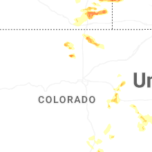
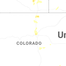

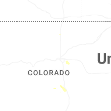
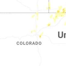


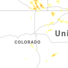


Connect with Interactive Hail Maps