

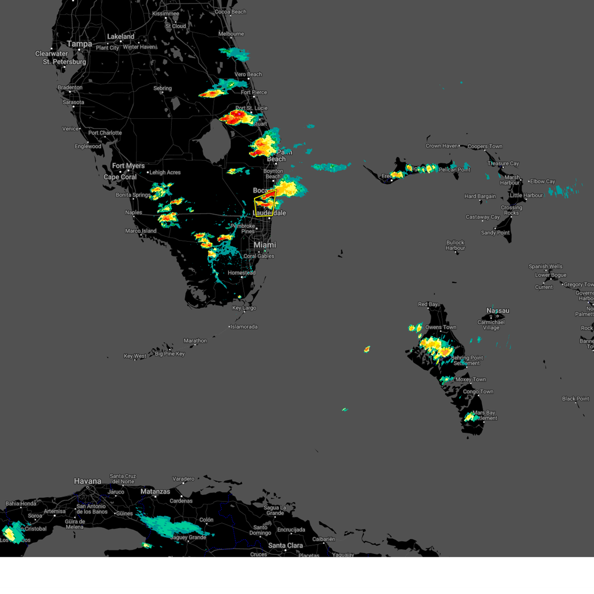
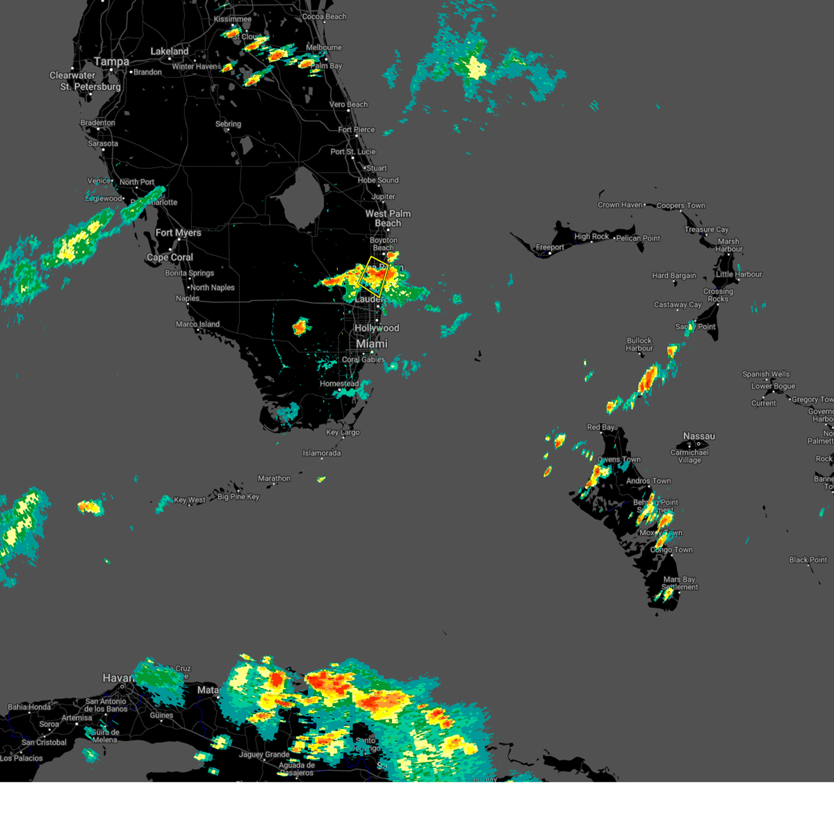
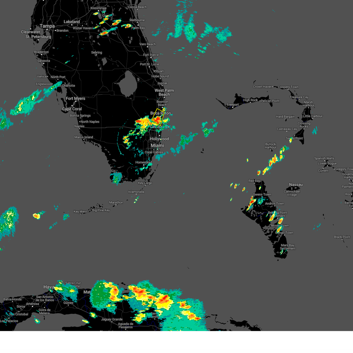
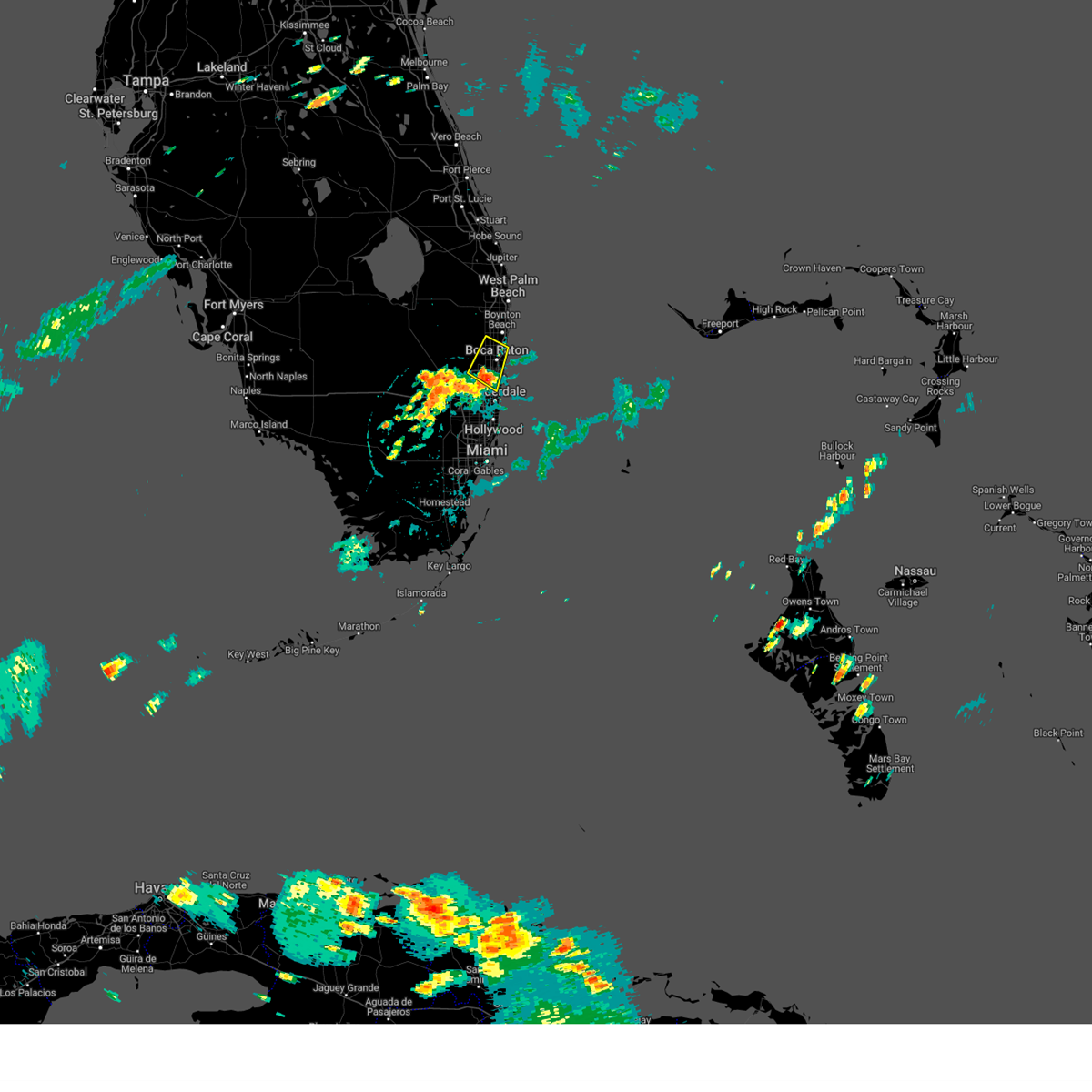
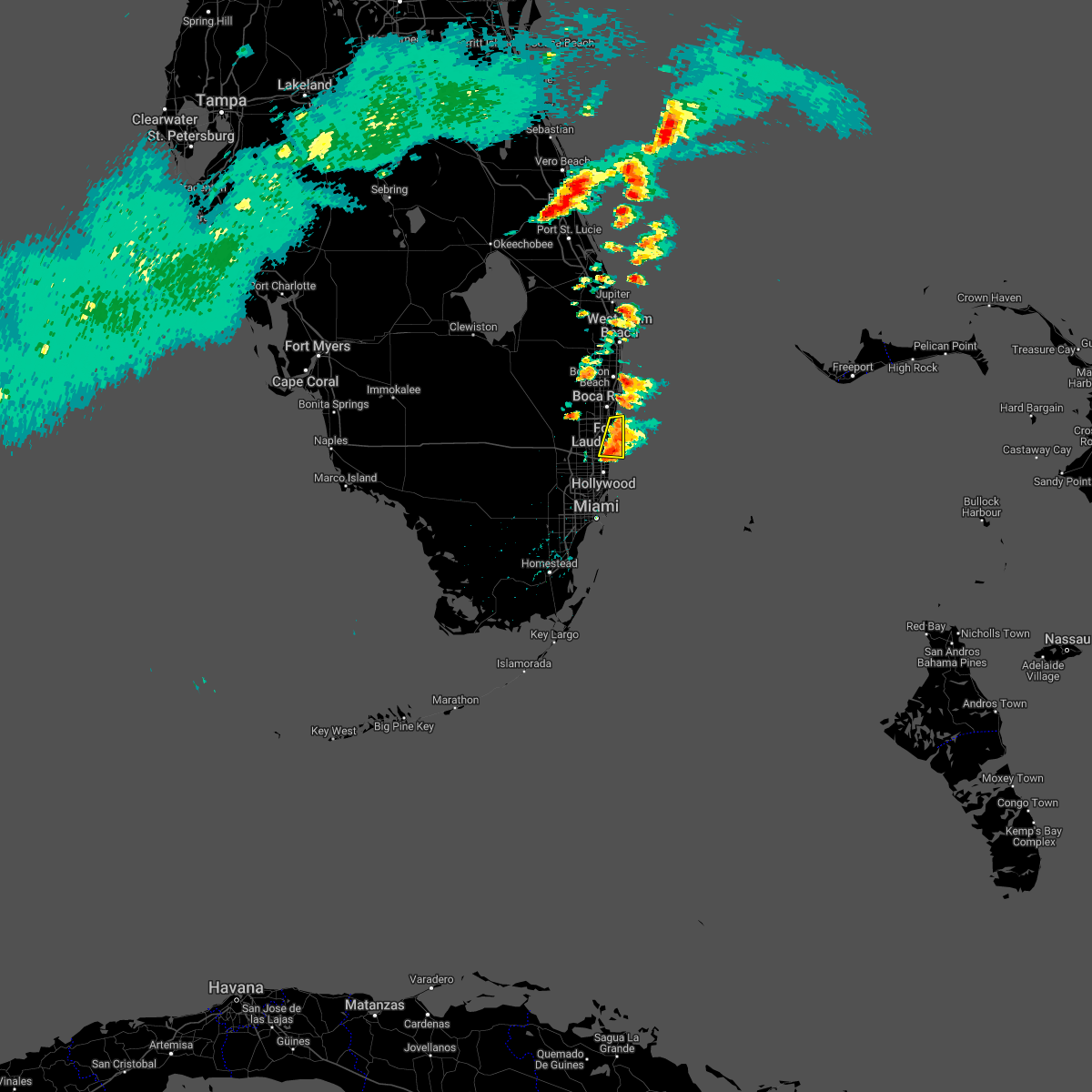
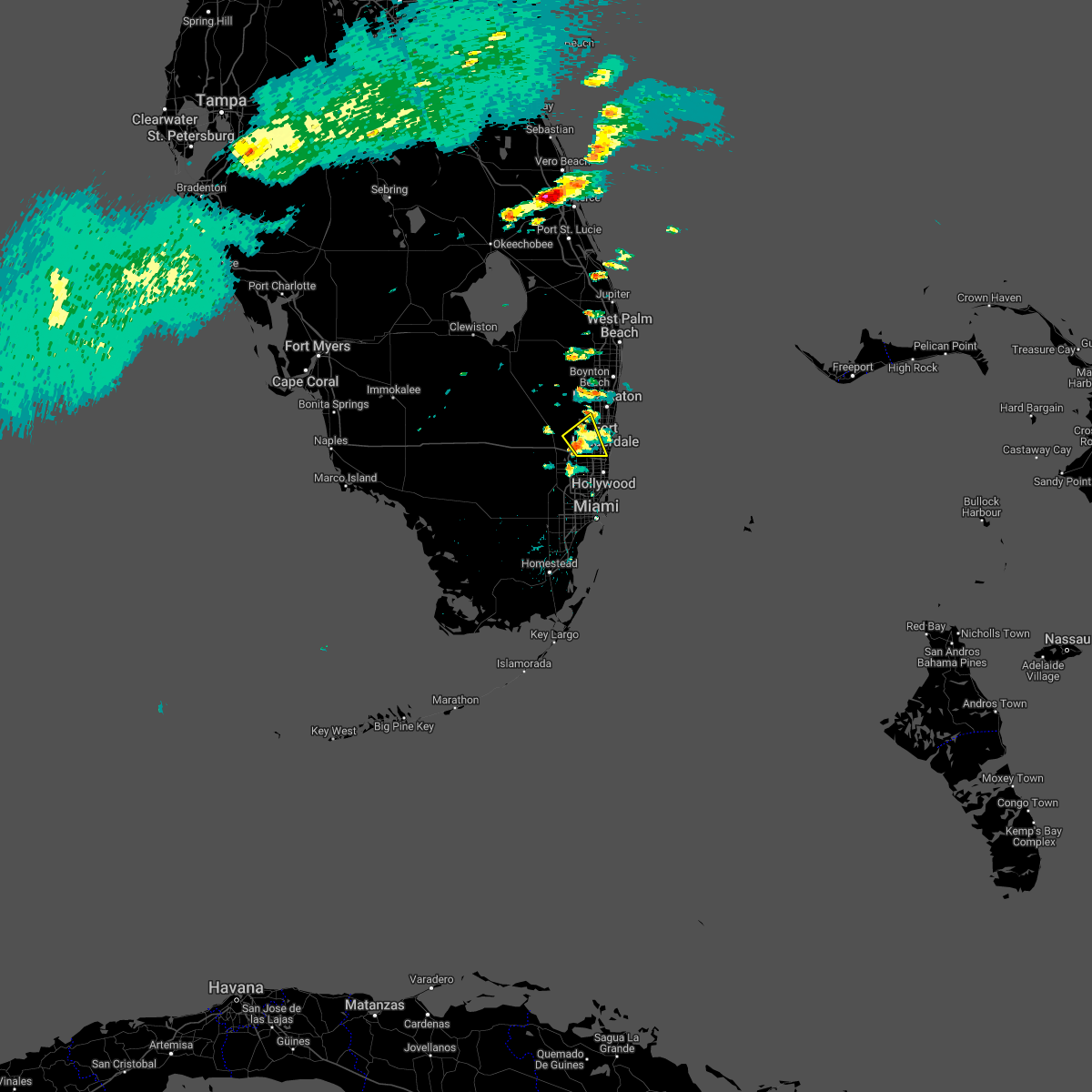
Hail Map for Fort Lauderdale, FL
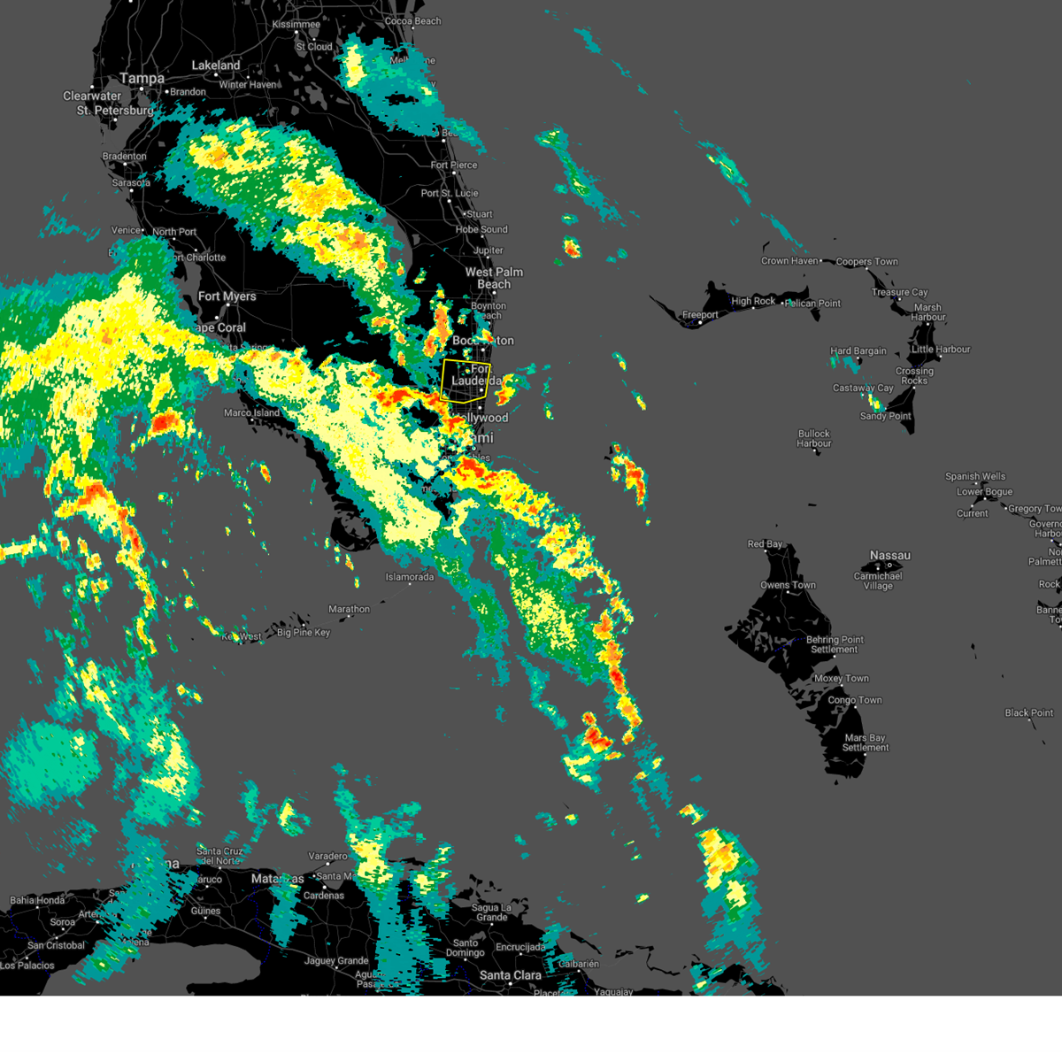
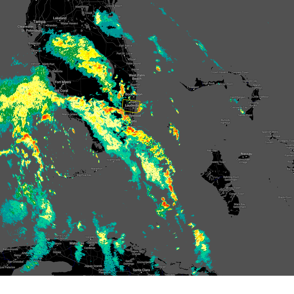
The Fort Lauderdale, FL area has had 12 reports of on-the-ground hail by trained spotters, and has been under severe weather warnings 7 times during the past 12 months. Doppler radar has detected hail at or near Fort Lauderdale, FL on 50 occasions, including 3 occasions during the past year.
| Name: | Fort Lauderdale, FL |
| Where Located: | 29.6 miles N of Miami, FL |
| Map: | Google Map for Fort Lauderdale, FL |
| Population: | 165521 |
| Housing Units: | 93159 |
| More Info: | Search Google for Fort Lauderdale, FL |
5
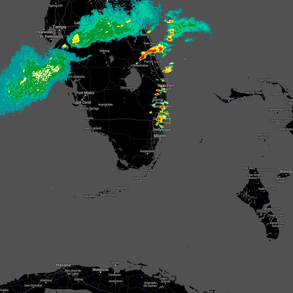
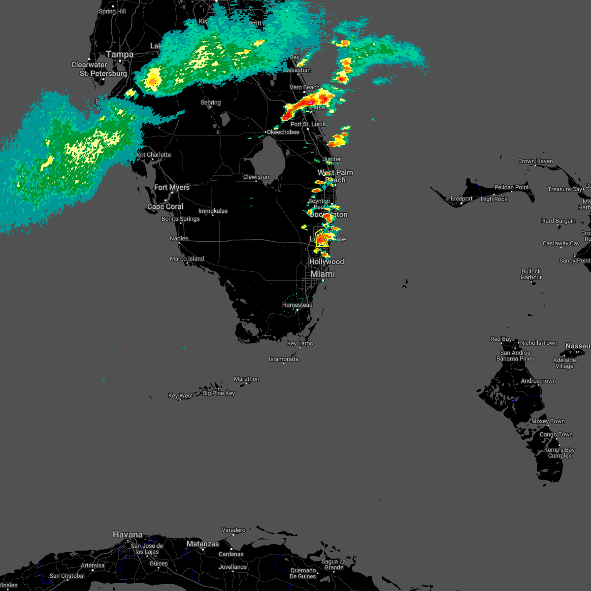
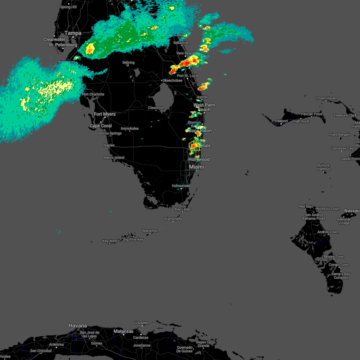
The Top Recent Hail Date for Fort Lauderdale, FL is Friday, May 23, 2025 (2nd out of 50)

Hail and Wind Damage Spotted near Fort Lauderdale, FL
| Date / Time | Report Details |
|---|---|
| 5/23/2025 4:01 PM EDT |
 Svrmfl the national weather service in miami has issued a * severe thunderstorm warning for, northern broward county in southeastern florida, southeastern palm beach county in southeastern florida, * until 445 pm edt. * at 401 pm edt, a severe thunderstorm was located over boca del mar, or over deerfield beach, moving south at 15 mph (radar indicated). Hazards include 60 mph wind gusts and quarter size hail. Hail damage to vehicles is expected. Expect wind damage to roofs, siding, and trees. Svrmfl the national weather service in miami has issued a * severe thunderstorm warning for, northern broward county in southeastern florida, southeastern palm beach county in southeastern florida, * until 445 pm edt. * at 401 pm edt, a severe thunderstorm was located over boca del mar, or over deerfield beach, moving south at 15 mph (radar indicated). Hazards include 60 mph wind gusts and quarter size hail. Hail damage to vehicles is expected. Expect wind damage to roofs, siding, and trees.
|
| 5/5/2025 4:00 PM EDT | Mesonet station 1529w at city of sunrise fire station 83 reported a 58 mph wind gust at 400 pm edt with a severe thunderstor in broward county FL, 12.8 miles E of Fort Lauderdale, FL |
| 9/26/2024 6:41 AM EDT | Asos station kfll fort lauderdale/hollywood intl airpor in broward county FL, 5.7 miles N of Fort Lauderdale, FL |
| 9/16/2024 7:27 PM EDT |
 The storm which prompted the warning has weakened below severe limits, and no longer poses an immediate threat to life or property. therefore, the warning will be allowed to expire. however, gusty winds are still possible with this thunderstorm. The storm which prompted the warning has weakened below severe limits, and no longer poses an immediate threat to life or property. therefore, the warning will be allowed to expire. however, gusty winds are still possible with this thunderstorm.
|
| 9/16/2024 7:10 PM EDT |
 At 710 pm edt, a severe thunderstorm was located over hamptons at boca raton, or near boca raton, moving north at 25 mph (radar indicated). Hazards include 60 mph wind gusts and penny size hail. Expect damage to roofs, siding, and trees. Locations impacted include, fort lauderdale, coral springs, pompano beach, boca raton, deerfield beach, delray beach, margate, highland beach, coconut creek, oakland park, parkland, mission bay, boca pointe, boca del mar, hamptons at boca raton, whisper walk, godfrey road, kings point, loxahatchee nwr, and fau south campus. At 710 pm edt, a severe thunderstorm was located over hamptons at boca raton, or near boca raton, moving north at 25 mph (radar indicated). Hazards include 60 mph wind gusts and penny size hail. Expect damage to roofs, siding, and trees. Locations impacted include, fort lauderdale, coral springs, pompano beach, boca raton, deerfield beach, delray beach, margate, highland beach, coconut creek, oakland park, parkland, mission bay, boca pointe, boca del mar, hamptons at boca raton, whisper walk, godfrey road, kings point, loxahatchee nwr, and fau south campus.
|
| 9/16/2024 7:03 PM EDT |
 Svrmfl the national weather service in miami has issued a * severe thunderstorm warning for, northern broward county in southeastern florida, southeastern palm beach county in southeastern florida, * until 730 pm edt. * at 703 pm edt, a severe thunderstorm was located over boca pointe, or near deerfield beach, moving north at 25 mph (radar indicated). Hazards include 60 mph wind gusts. expect damage to roofs, siding, and trees Svrmfl the national weather service in miami has issued a * severe thunderstorm warning for, northern broward county in southeastern florida, southeastern palm beach county in southeastern florida, * until 730 pm edt. * at 703 pm edt, a severe thunderstorm was located over boca pointe, or near deerfield beach, moving north at 25 mph (radar indicated). Hazards include 60 mph wind gusts. expect damage to roofs, siding, and trees
|
| 8/3/2024 9:37 PM EDT |
 Tormfl the national weather service in miami has issued a * tornado warning for, broward county in southeastern florida, southeastern palm beach county in southeastern florida, * until 1000 pm edt. * at 937 pm edt, a severe thunderstorm capable of producing a tornado was located over downtown fort lauderdale, or over fort lauderdale, moving north at 50 mph (radar indicated rotation). Hazards include tornado. Flying debris will be dangerous to those caught without shelter. mobile homes will be damaged or destroyed. damage to roofs, windows, and vehicles will occur. Tree damage is likely. Tormfl the national weather service in miami has issued a * tornado warning for, broward county in southeastern florida, southeastern palm beach county in southeastern florida, * until 1000 pm edt. * at 937 pm edt, a severe thunderstorm capable of producing a tornado was located over downtown fort lauderdale, or over fort lauderdale, moving north at 50 mph (radar indicated rotation). Hazards include tornado. Flying debris will be dangerous to those caught without shelter. mobile homes will be damaged or destroyed. damage to roofs, windows, and vehicles will occur. Tree damage is likely.
|
| 8/3/2024 9:08 PM EDT |
 At 908 pm edt, a severe thunderstorm was located over golden heights, or over fort lauderdale, moving west at 40 mph (radar indicated). Hazards include 60 mph wind gusts. Expect damage to roofs, siding, and trees. Locations impacted include, fort lauderdale, hollywood, coral springs, pompano beach, davie, plantation, sunrise, deerfield beach, tamarac, margate, lighthouse point, lauderdale-by-the-sea, lauderhill, weston, coconut creek, oakland park, north lauderdale, lauderdale lakes, dania beach, and cooper city. At 908 pm edt, a severe thunderstorm was located over golden heights, or over fort lauderdale, moving west at 40 mph (radar indicated). Hazards include 60 mph wind gusts. Expect damage to roofs, siding, and trees. Locations impacted include, fort lauderdale, hollywood, coral springs, pompano beach, davie, plantation, sunrise, deerfield beach, tamarac, margate, lighthouse point, lauderdale-by-the-sea, lauderhill, weston, coconut creek, oakland park, north lauderdale, lauderdale lakes, dania beach, and cooper city.
|
| 8/3/2024 9:01 PM EDT |
 Svrmfl the national weather service in miami has issued a * severe thunderstorm warning for, broward county in southeastern florida, * until 930 pm edt. * at 901 pm edt, a severe thunderstorm was located over port everglades, or near fort lauderdale, moving west at 40 mph (radar indicated). Hazards include 60 mph wind gusts. expect damage to roofs, siding, and trees Svrmfl the national weather service in miami has issued a * severe thunderstorm warning for, broward county in southeastern florida, * until 930 pm edt. * at 901 pm edt, a severe thunderstorm was located over port everglades, or near fort lauderdale, moving west at 40 mph (radar indicated). Hazards include 60 mph wind gusts. expect damage to roofs, siding, and trees
|
| 5/28/2024 5:16 PM EDT |
 the severe thunderstorm warning has been cancelled and is no longer in effect the severe thunderstorm warning has been cancelled and is no longer in effect
|
| 5/28/2024 4:57 PM EDT |
 At 457 pm edt, a severe thunderstorm was located near coral springs, moving northeast at 15 mph (radar indicated). Hazards include 60 mph wind gusts and quarter size hail. Hail damage to vehicles is expected. expect wind damage to roofs, siding, and trees. Locations impacted include, fort lauderdale, coral springs, pompano beach, plantation, sunrise, boca raton, deerfield beach, tamarac, margate, lighthouse point, lauderdale-by-the-sea, lauderhill, weston, coconut creek, oakland park, north lauderdale, lauderdale lakes, parkland, hillsboro beach, and sea ranch lakes. At 457 pm edt, a severe thunderstorm was located near coral springs, moving northeast at 15 mph (radar indicated). Hazards include 60 mph wind gusts and quarter size hail. Hail damage to vehicles is expected. expect wind damage to roofs, siding, and trees. Locations impacted include, fort lauderdale, coral springs, pompano beach, plantation, sunrise, boca raton, deerfield beach, tamarac, margate, lighthouse point, lauderdale-by-the-sea, lauderhill, weston, coconut creek, oakland park, north lauderdale, lauderdale lakes, parkland, hillsboro beach, and sea ranch lakes.
|
| 5/28/2024 4:41 PM EDT |
 Svrmfl the national weather service in miami has issued a * severe thunderstorm warning for, northern broward county in southeastern florida, southeastern palm beach county in southeastern florida, * until 530 pm edt. * at 440 pm edt, a severe thunderstorm was located near intersection i-75 and u.s. 27, or 7 miles northwest of sunrise, moving east at 15 mph (radar indicated). Hazards include 60 mph wind gusts and quarter size hail. Hail damage to vehicles is expected. Expect wind damage to roofs, siding, and trees. Svrmfl the national weather service in miami has issued a * severe thunderstorm warning for, northern broward county in southeastern florida, southeastern palm beach county in southeastern florida, * until 530 pm edt. * at 440 pm edt, a severe thunderstorm was located near intersection i-75 and u.s. 27, or 7 miles northwest of sunrise, moving east at 15 mph (radar indicated). Hazards include 60 mph wind gusts and quarter size hail. Hail damage to vehicles is expected. Expect wind damage to roofs, siding, and trees.
|
| 5/20/2024 5:06 PM EDT |
 The storm which prompted the warning has weakened below severe limits, and no longer poses an immediate threat to life or property. therefore, the warning will be allowed to expire. however, small hail, gusty winds and heavy rain are still possible with this thunderstorm. to report severe weather, contact your nearest law enforcement agency. they will relay your report to the national weather service miami. you can also share your report with nws miami on facebook and twitter. The storm which prompted the warning has weakened below severe limits, and no longer poses an immediate threat to life or property. therefore, the warning will be allowed to expire. however, small hail, gusty winds and heavy rain are still possible with this thunderstorm. to report severe weather, contact your nearest law enforcement agency. they will relay your report to the national weather service miami. you can also share your report with nws miami on facebook and twitter.
|
| 5/20/2024 4:48 PM EDT |
 At 448 pm edt, a severe thunderstorm was located over intersection i-75 and griffin road, or over pembroke pines, moving east at 15 mph (radar indicated). Hazards include 60 mph wind gusts and quarter size hail. Hail damage to vehicles is expected. expect wind damage to roofs, siding, and trees. Locations impacted include, fort lauderdale, pembroke pines, hollywood, miramar, davie, plantation, sunrise, hallandale, weston, dania beach, cooper city, west park, royal palm ranches, ravenswood estates, sunshine acres, estates of fort lauderdale, fort lauderdale - hollywood international airport, chambers estates, miramar parkway and university drive, and pine island ridge. At 448 pm edt, a severe thunderstorm was located over intersection i-75 and griffin road, or over pembroke pines, moving east at 15 mph (radar indicated). Hazards include 60 mph wind gusts and quarter size hail. Hail damage to vehicles is expected. expect wind damage to roofs, siding, and trees. Locations impacted include, fort lauderdale, pembroke pines, hollywood, miramar, davie, plantation, sunrise, hallandale, weston, dania beach, cooper city, west park, royal palm ranches, ravenswood estates, sunshine acres, estates of fort lauderdale, fort lauderdale - hollywood international airport, chambers estates, miramar parkway and university drive, and pine island ridge.
|
| 5/20/2024 4:36 PM EDT | Asos fxe metar 1/2sm +tsr in broward county FL, 3.3 miles S of Fort Lauderdale, FL |
| 5/20/2024 4:30 PM EDT |
 Svrmfl the national weather service in miami has issued a * severe thunderstorm warning for, southern broward county in southeastern florida, * until 515 pm edt. * at 430 pm edt, severe thunderstorms were located along a line extending from near pompano beach to sunrise to near intersection i-75 and griffin road, moving east at 20 mph (radar indicated). Hazards include 60 mph wind gusts and quarter size hail. Hail damage to vehicles is expected. Expect wind damage to roofs, siding, and trees. Svrmfl the national weather service in miami has issued a * severe thunderstorm warning for, southern broward county in southeastern florida, * until 515 pm edt. * at 430 pm edt, severe thunderstorms were located along a line extending from near pompano beach to sunrise to near intersection i-75 and griffin road, moving east at 20 mph (radar indicated). Hazards include 60 mph wind gusts and quarter size hail. Hail damage to vehicles is expected. Expect wind damage to roofs, siding, and trees.
|
| 5/20/2024 4:28 PM EDT | Asos fxe reports gust of 67 mph at 2028 in broward county FL, 3.4 miles SSE of Fort Lauderdale, FL |
| 5/18/2024 6:58 PM EDT |
 the severe thunderstorm warning has been cancelled and is no longer in effect the severe thunderstorm warning has been cancelled and is no longer in effect
|
| 5/18/2024 6:39 PM EDT |
 Svrmfl the national weather service in miami has issued a * severe thunderstorm warning for, northern broward county in southeastern florida, southeastern palm beach county in southeastern florida, * until 715 pm edt. * at 639 pm edt, a severe thunderstorm was located over coconut creek, or over margate, moving northeast at 10 mph (radar indicated). Hazards include 60 mph wind gusts and quarter size hail. Hail damage to vehicles is expected. Expect wind damage to roofs, siding, and trees. Svrmfl the national weather service in miami has issued a * severe thunderstorm warning for, northern broward county in southeastern florida, southeastern palm beach county in southeastern florida, * until 715 pm edt. * at 639 pm edt, a severe thunderstorm was located over coconut creek, or over margate, moving northeast at 10 mph (radar indicated). Hazards include 60 mph wind gusts and quarter size hail. Hail damage to vehicles is expected. Expect wind damage to roofs, siding, and trees.
|
| 3/3/2024 4:56 PM EST |
 The storm which prompted the warning has weakened below severe limits, and no longer poses an immediate threat to life or property. therefore, the warning will be allowed to expire. The storm which prompted the warning has weakened below severe limits, and no longer poses an immediate threat to life or property. therefore, the warning will be allowed to expire.
|
| 3/3/2024 4:48 PM EST | Quarter sized hail reported 9.1 miles NE of Fort Lauderdale, FL, member of the public shared two videos of nickel-to-quarter sized hail falling as a strong thunderstorm moved through the area. |
| 3/3/2024 4:45 PM EST | Quarter sized hail reported 6.9 miles NE of Fort Lauderdale, FL, member of the public reports quarter sized hail in east davie. |
| 3/3/2024 4:39 PM EST | Earth networks mesonet clwch seminole tribe headquarters recorded a gust of 64 mph at 4:39 pm as a severe thunderstorm moved through the area. site elevation is listed in broward county FL, 8.1 miles NNE of Fort Lauderdale, FL |
| 3/3/2024 4:39 PM EST |
 At 439 pm est, a severe thunderstorm was located over oak point, or over hollywood, moving southeast at 15 mph (radar indicated). Hazards include 60 mph wind gusts and quarter size hail. Hail damage to vehicles is expected. expect wind damage to roofs, siding, and trees. Locations impacted include, fort lauderdale, pembroke pines, hollywood, miramar, davie, plantation, hallandale, miami gardens, aventura, dania beach, cooper city, west park, royal palm ranches, ravenswood estates, sunshine acres, estates of fort lauderdale, fort lauderdale - hollywood international airport, chambers estates, miramar parkway and university drive, and pine island ridge. At 439 pm est, a severe thunderstorm was located over oak point, or over hollywood, moving southeast at 15 mph (radar indicated). Hazards include 60 mph wind gusts and quarter size hail. Hail damage to vehicles is expected. expect wind damage to roofs, siding, and trees. Locations impacted include, fort lauderdale, pembroke pines, hollywood, miramar, davie, plantation, hallandale, miami gardens, aventura, dania beach, cooper city, west park, royal palm ranches, ravenswood estates, sunshine acres, estates of fort lauderdale, fort lauderdale - hollywood international airport, chambers estates, miramar parkway and university drive, and pine island ridge.
|
| 3/3/2024 4:34 PM EST | Fpl power crews reported several large tree branches and trees down on power lines resulted in power outages in the vicinity of griffin rd & davie rd extension. fpl met in broward county FL, 8.4 miles NNE of Fort Lauderdale, FL |
| 3/3/2024 4:30 PM EST | Ping Pong Ball sized hail reported 6.9 miles NE of Fort Lauderdale, FL, video and photos showing hail between 1 and 1.5 inches in diameter. |
| 3/3/2024 4:28 PM EST |
 Svrmfl the national weather service in miami has issued a * severe thunderstorm warning for, northern miami-dade county in southeastern florida, southern broward county in southeastern florida, * until 500 pm est. * at 428 pm est, a severe thunderstorm was located over nova southeastern university, or near davie, moving southeast at 15 mph (radar indicated). Hazards include 60 mph wind gusts and quarter size hail. Hail damage to vehicles is expected. Expect wind damage to roofs, siding, and trees. Svrmfl the national weather service in miami has issued a * severe thunderstorm warning for, northern miami-dade county in southeastern florida, southern broward county in southeastern florida, * until 500 pm est. * at 428 pm est, a severe thunderstorm was located over nova southeastern university, or near davie, moving southeast at 15 mph (radar indicated). Hazards include 60 mph wind gusts and quarter size hail. Hail damage to vehicles is expected. Expect wind damage to roofs, siding, and trees.
|
| 2/18/2024 4:23 PM EST | Strong wind gusts from a thunderstorm caused a car to flip over near the intersection of ne 3rd ave and ne 34th ct in oakland par in broward county FL, 1.6 miles SW of Fort Lauderdale, FL |
| 2/18/2024 4:05 PM EST | Wind damage... with a possible brief tornado touchdown... reported near the intersection of stirling road and nw 101st avenue. a few benches were damaged... metal slidi in broward county FL, 10.4 miles NE of Fort Lauderdale, FL |
| 2/4/2024 11:42 AM EST |
 The severe thunderstorm warning for northern miami-dade and southern broward counties will expire at 1145 am est, the storm which prompted the warning has moved out of the area. therefore, the warning will be allowed to expire. a tornado watch remains in effect until 200 pm est for southeastern florida. The severe thunderstorm warning for northern miami-dade and southern broward counties will expire at 1145 am est, the storm which prompted the warning has moved out of the area. therefore, the warning will be allowed to expire. a tornado watch remains in effect until 200 pm est for southeastern florida.
|
| 2/4/2024 11:33 AM EST |
 At 1132 am est, a severe thunderstorm was located near miami beach, moving northeast at 40 mph (radar indicated). Hazards include 60 mph wind gusts. Expect damage to roofs, siding, and trees. Locations impacted include, miami, pembroke pines, hollywood, miramar, miami beach, surfside, hallandale, miami gardens, north miami, north miami beach, aventura, dania beach, sunny isles beach, opa-locka, west park, miami shores, north bay village, el portal, estates of fort lauderdale, and miramar parkway and university drive. At 1132 am est, a severe thunderstorm was located near miami beach, moving northeast at 40 mph (radar indicated). Hazards include 60 mph wind gusts. Expect damage to roofs, siding, and trees. Locations impacted include, miami, pembroke pines, hollywood, miramar, miami beach, surfside, hallandale, miami gardens, north miami, north miami beach, aventura, dania beach, sunny isles beach, opa-locka, west park, miami shores, north bay village, el portal, estates of fort lauderdale, and miramar parkway and university drive.
|
| 2/4/2024 11:21 AM EST |
 At 1120 am est, a severe thunderstorm was located over virginia key, moving northeast at 40 mph (radar indicated). Hazards include 60 mph wind gusts. expect damage to roofs, siding, and trees At 1120 am est, a severe thunderstorm was located over virginia key, moving northeast at 40 mph (radar indicated). Hazards include 60 mph wind gusts. expect damage to roofs, siding, and trees
|
| 1/6/2024 5:45 PM EST |
 At 545 pm est, a severe thunderstorm capable of producing a tornado was located over port everglades, or over fort lauderdale, moving east at 25 mph (radar indicated rotation). Hazards include tornado. Flying debris will be dangerous to those caught without shelter. mobile homes will be damaged or destroyed. damage to roofs, windows, and vehicles will occur. Tree damage is likely. At 545 pm est, a severe thunderstorm capable of producing a tornado was located over port everglades, or over fort lauderdale, moving east at 25 mph (radar indicated rotation). Hazards include tornado. Flying debris will be dangerous to those caught without shelter. mobile homes will be damaged or destroyed. damage to roofs, windows, and vehicles will occur. Tree damage is likely.
|
| 9/21/2023 6:40 PM EDT | Mesonet station 1694w fswn ft. lauderdale-hollywood international airport measured a wind gust of 66 mph as a thunderstorm moved through the are in broward county FL, 5.1 miles NNW of Fort Lauderdale, FL |
| 8/29/2023 6:36 PM EDT |
 The severe thunderstorm warning for northern broward and central palm beach counties will expire at 645 pm edt, the storms which prompted the warning have weakened below severe limits, and no longer pose an immediate threat to life or property. therefore, the warning will be allowed to expire. however gusty winds are still possible with these thunderstorms, so a special weather statement is in place for winds up to 30 kts through 7 pm et. The severe thunderstorm warning for northern broward and central palm beach counties will expire at 645 pm edt, the storms which prompted the warning have weakened below severe limits, and no longer pose an immediate threat to life or property. therefore, the warning will be allowed to expire. however gusty winds are still possible with these thunderstorms, so a special weather statement is in place for winds up to 30 kts through 7 pm et.
|
| 8/29/2023 6:12 PM EDT |
 The severe thunderstorm warning for northern miami-dade and broward counties will expire at 615 pm edt, the storms which prompted the warning have moved out of the area. therefore, the warning will be allowed to expire. however gusty winds are still possible with these thunderstorms. The severe thunderstorm warning for northern miami-dade and broward counties will expire at 615 pm edt, the storms which prompted the warning have moved out of the area. therefore, the warning will be allowed to expire. however gusty winds are still possible with these thunderstorms.
|
| 8/29/2023 6:10 PM EDT |
 At 609 pm edt, severe thunderstorms were located along a line extending from 6 miles southeast of okeelanta to near loxahatchee nwr to deerfield beach, moving north at 40 mph (radar indicated). Hazards include 60 mph wind gusts. expect damage to roofs, siding, and trees At 609 pm edt, severe thunderstorms were located along a line extending from 6 miles southeast of okeelanta to near loxahatchee nwr to deerfield beach, moving north at 40 mph (radar indicated). Hazards include 60 mph wind gusts. expect damage to roofs, siding, and trees
|
| 8/29/2023 5:38 PM EDT |
 At 538 pm edt, severe thunderstorms were located along a line extending from 6 miles north of intersection alligator alley and miami canal to intersection i-75 and griffin road to near fisher island, moving north at 40 mph (radar indicated). Hazards include 60 mph wind gusts. expect damage to roofs, siding, and trees At 538 pm edt, severe thunderstorms were located along a line extending from 6 miles north of intersection alligator alley and miami canal to intersection i-75 and griffin road to near fisher island, moving north at 40 mph (radar indicated). Hazards include 60 mph wind gusts. expect damage to roofs, siding, and trees
|
| 8/17/2023 2:33 PM EDT | Earthnetworks mesowest seminole tribe headquarters reported a wind gust of 59mph at 2:33pm as a strong thunderstorm moved through the are in broward county FL, 8.1 miles NNE of Fort Lauderdale, FL |
| 7/21/2023 2:48 PM EDT |
 At 247 pm edt, a severe thunderstorm was located over nova southeastern university, or over davie, moving north at 10 mph (radar indicated). Hazards include 60 mph wind gusts and quarter size hail. Hail damage to vehicles is expected. Expect wind damage to roofs, siding, and trees. At 247 pm edt, a severe thunderstorm was located over nova southeastern university, or over davie, moving north at 10 mph (radar indicated). Hazards include 60 mph wind gusts and quarter size hail. Hail damage to vehicles is expected. Expect wind damage to roofs, siding, and trees.
|
| 7/17/2023 4:02 PM EDT |
 At 402 pm edt, a severe thunderstorm was located over coconut creek, or over margate, moving east at 10 mph (radar indicated). Hazards include 60 mph wind gusts and penny size hail. expect damage to roofs, siding, and trees At 402 pm edt, a severe thunderstorm was located over coconut creek, or over margate, moving east at 10 mph (radar indicated). Hazards include 60 mph wind gusts and penny size hail. expect damage to roofs, siding, and trees
|
| 7/16/2023 5:59 PM EDT | Pws in sunrise florida at nw 96th ave measured a 58mph gust at 6p in broward county FL, 7.6 miles E of Fort Lauderdale, FL |
| 7/16/2023 5:35 PM EDT |
 At 535 pm edt, a severe thunderstorm was located near sawgrass mills mall, or near sunrise, moving northeast at 20 mph (radar indicated). Hazards include 60 mph wind gusts. expect damage to roofs, siding, and trees At 535 pm edt, a severe thunderstorm was located near sawgrass mills mall, or near sunrise, moving northeast at 20 mph (radar indicated). Hazards include 60 mph wind gusts. expect damage to roofs, siding, and trees
|
| 6/20/2023 5:14 PM EDT |
 At 514 pm edt, a severe thunderstorm was located over twin lakes, or over fort lauderdale, moving east at 15 mph (radar indicated). Hazards include 60 mph wind gusts. Expect damage to roofs, siding, and trees. Locations impacted include, fort lauderdale, hollywood, coral springs, pompano beach and davie. At 514 pm edt, a severe thunderstorm was located over twin lakes, or over fort lauderdale, moving east at 15 mph (radar indicated). Hazards include 60 mph wind gusts. Expect damage to roofs, siding, and trees. Locations impacted include, fort lauderdale, hollywood, coral springs, pompano beach and davie.
|
| 6/20/2023 4:59 PM EDT |
 At 459 pm edt, a severe thunderstorm was located over lauderhill, or near plantation, moving east at 15 mph (radar indicated). Hazards include 60 mph wind gusts and penny size hail. expect damage to roofs, siding, and trees At 459 pm edt, a severe thunderstorm was located over lauderhill, or near plantation, moving east at 15 mph (radar indicated). Hazards include 60 mph wind gusts and penny size hail. expect damage to roofs, siding, and trees
|
| 6/18/2023 6:42 AM EDT |
 At 642 am edt, a severe thunderstorm was located near parkland, or 7 miles northwest of coral springs, moving east at 45 mph (radar indicated). Hazards include 60 mph wind gusts. expect damage to roofs, siding, and trees At 642 am edt, a severe thunderstorm was located near parkland, or 7 miles northwest of coral springs, moving east at 45 mph (radar indicated). Hazards include 60 mph wind gusts. expect damage to roofs, siding, and trees
|
| 6/17/2023 5:40 PM EDT |
 At 540 pm edt, a severe thunderstorm was located over intersection i-75 and griffin road, or near davie, moving east at 15 mph (radar indicated). Hazards include 60 mph wind gusts and nickel size hail. expect damage to roofs, siding, and trees At 540 pm edt, a severe thunderstorm was located over intersection i-75 and griffin road, or near davie, moving east at 15 mph (radar indicated). Hazards include 60 mph wind gusts and nickel size hail. expect damage to roofs, siding, and trees
|
| 6/13/2023 5:14 PM EDT | Mesonet station 1529w city of sunrise fire station 83 reported a wind gust of 58mph at 5:14pm as a severe thunderstorm moved through the are in broward county FL, 12.8 miles E of Fort Lauderdale, FL |
| 6/13/2023 5:05 PM EDT | Member of the public reported multiple trees down at country isles park in weston. time estimation was based on radar signature of severe stor in broward county FL, 14.5 miles ENE of Fort Lauderdale, FL |
| 6/13/2023 4:14 PM EDT | Public report of multiple trees down near the intersection of creekford drive and pine branch drive in weston. radar estimated time based off rada in broward county FL, 13.5 miles ENE of Fort Lauderdale, FL |
| 6/13/2023 4:10 PM EDT | Trained spotter reported large oak tree down and fencing down in the new river circle neighborhood just east of weston road. time based off of radar estimatio in broward county FL, 12.8 miles E of Fort Lauderdale, FL |
| 6/13/2023 4:02 PM EDT |
 At 401 pm edt, a severe thunderstorm was located over plantation, and is nearly stationary (radar indicated). Hazards include 60 mph wind gusts and nickel size hail. expect damage to roofs, siding, and trees At 401 pm edt, a severe thunderstorm was located over plantation, and is nearly stationary (radar indicated). Hazards include 60 mph wind gusts and nickel size hail. expect damage to roofs, siding, and trees
|
| 6/3/2023 1:30 PM EDT | Half Dollar sized hail reported 4.3 miles N of Fort Lauderdale, FL, marina mile and 9th ave. half dollar sized hail. |
| 6/3/2023 1:30 PM EDT | A thunderstorm produced a wind gust of 72 mph at mesonet station 1694w fswn ft. lauderdal in broward county FL, 5.1 miles NNW of Fort Lauderdale, FL |
| 6/3/2023 1:27 PM EDT |
 The severe thunderstorm warning for northern miami-dade and southern broward counties will expire at 130 pm edt, the storm which prompted the warning has moved out of the area. therefore, the warning will be allowed to expire. however gusty winds are still possible with this thunderstorm. remember, a severe thunderstorm warning still remains in effect for central broward county. The severe thunderstorm warning for northern miami-dade and southern broward counties will expire at 130 pm edt, the storm which prompted the warning has moved out of the area. therefore, the warning will be allowed to expire. however gusty winds are still possible with this thunderstorm. remember, a severe thunderstorm warning still remains in effect for central broward county.
|
| 6/3/2023 1:25 PM EDT |
 At 125 pm edt, a severe thunderstorm was located over port everglades, or near fort lauderdale, moving north at 10 mph (radar indicated). Hazards include 60 mph wind gusts and quarter size hail. Hail damage to vehicles is expected. Expect wind damage to roofs, siding, and trees. At 125 pm edt, a severe thunderstorm was located over port everglades, or near fort lauderdale, moving north at 10 mph (radar indicated). Hazards include 60 mph wind gusts and quarter size hail. Hail damage to vehicles is expected. Expect wind damage to roofs, siding, and trees.
|
| 6/3/2023 1:20 PM EDT | A thunderstorm produced a wind gust of 83 mph at mesonet station 1694w ft lauderdal in broward county FL, 5.1 miles NNW of Fort Lauderdale, FL |
| 6/3/2023 1:19 PM EDT | A thunderstorm produced a wind gust at asos station kfll fort lauderdale/hollywood intl airpor in broward county FL, 5.7 miles N of Fort Lauderdale, FL |
| 6/3/2023 1:14 PM EDT |
 At 113 pm edt, a severe thunderstorm was located over dania beach, or over hollywood, moving north at 10 mph (radar indicated). Hazards include ping pong ball size hail and 60 mph wind gusts. People and animals outdoors will be injured. expect hail damage to roofs, siding, windows, and vehicles. expect wind damage to roofs, siding, and trees. locations impacted include, fort lauderdale, pembroke pines, hollywood, davie and plantation. hail threat, radar indicated max hail size, 1. 50 in wind threat, radar indicated max wind gust, 60 mph. At 113 pm edt, a severe thunderstorm was located over dania beach, or over hollywood, moving north at 10 mph (radar indicated). Hazards include ping pong ball size hail and 60 mph wind gusts. People and animals outdoors will be injured. expect hail damage to roofs, siding, windows, and vehicles. expect wind damage to roofs, siding, and trees. locations impacted include, fort lauderdale, pembroke pines, hollywood, davie and plantation. hail threat, radar indicated max hail size, 1. 50 in wind threat, radar indicated max wind gust, 60 mph.
|
| 6/3/2023 1:06 PM EDT |
 At 106 pm edt, a severe thunderstorm was located over dania beach, or over hollywood, moving northeast at 15 mph (radar indicated). Hazards include 60 mph wind gusts and quarter size hail. Hail damage to vehicles is expected. expect wind damage to roofs, siding, and trees. locations impacted include, fort lauderdale, pembroke pines, hollywood, davie and plantation. hail threat, radar indicated max hail size, 1. 00 in wind threat, radar indicated max wind gust, 60 mph. At 106 pm edt, a severe thunderstorm was located over dania beach, or over hollywood, moving northeast at 15 mph (radar indicated). Hazards include 60 mph wind gusts and quarter size hail. Hail damage to vehicles is expected. expect wind damage to roofs, siding, and trees. locations impacted include, fort lauderdale, pembroke pines, hollywood, davie and plantation. hail threat, radar indicated max hail size, 1. 00 in wind threat, radar indicated max wind gust, 60 mph.
|
| 6/3/2023 12:59 PM EDT |
 At 1259 pm edt, a severe thunderstorm was located over hollywood, moving northeast at 15 mph (radar indicated). Hazards include 60 mph wind gusts and nickel size hail. expect damage to roofs, siding, and trees At 1259 pm edt, a severe thunderstorm was located over hollywood, moving northeast at 15 mph (radar indicated). Hazards include 60 mph wind gusts and nickel size hail. expect damage to roofs, siding, and trees
|
| 6/2/2023 3:11 PM EDT |
 The severe thunderstorm warning for broward county will expire at 315 pm edt, the storm which prompted the warning has weakened below severe limits, and no longer poses an immediate threat to life or property. therefore, the warning will be allowed to expire. however heavy rain is still possible with this thunderstorm. to report severe weather, contact your nearest law enforcement agency. they will relay your report to the national weather service miami. you can also share your report with nws miami on facebook and twitter. The severe thunderstorm warning for broward county will expire at 315 pm edt, the storm which prompted the warning has weakened below severe limits, and no longer poses an immediate threat to life or property. therefore, the warning will be allowed to expire. however heavy rain is still possible with this thunderstorm. to report severe weather, contact your nearest law enforcement agency. they will relay your report to the national weather service miami. you can also share your report with nws miami on facebook and twitter.
|
| 6/2/2023 3:10 PM EDT | A thunderstorm produced a wind gust of 61 mph at mesonet station 1343w (weatherstem in broward county FL, 8.3 miles E of Fort Lauderdale, FL |
| 6/2/2023 2:51 PM EDT |
 At 251 pm edt, a severe thunderstorm was located over lauderhill, or over plantation, moving northwest at 20 mph (radar indicated). Hazards include 60 mph wind gusts and penny size hail. expect damage to roofs, siding, and trees At 251 pm edt, a severe thunderstorm was located over lauderhill, or over plantation, moving northwest at 20 mph (radar indicated). Hazards include 60 mph wind gusts and penny size hail. expect damage to roofs, siding, and trees
|
| 5/25/2023 2:21 PM EDT |
 The severe thunderstorm warning for northern miami-dade and broward counties will expire at 230 pm edt. the storm which prompted the warning has weakened below severe limits, and no longer poses an immediate threat to life or property. therefore, the warning will be allowed to expire. However gusty winds and heavy rain are still possible with this thunderstorm. The severe thunderstorm warning for northern miami-dade and broward counties will expire at 230 pm edt. the storm which prompted the warning has weakened below severe limits, and no longer poses an immediate threat to life or property. therefore, the warning will be allowed to expire. However gusty winds and heavy rain are still possible with this thunderstorm.
|
| 5/25/2023 1:56 PM EDT |
 At 156 pm edt, a severe thunderstorm was located over royal palm ranches, or over davie, moving northeast at 5 mph (radar indicated). Hazards include 60 mph wind gusts and quarter size hail. Hail damage to vehicles is expected. Expect wind damage to roofs, siding, and trees. At 156 pm edt, a severe thunderstorm was located over royal palm ranches, or over davie, moving northeast at 5 mph (radar indicated). Hazards include 60 mph wind gusts and quarter size hail. Hail damage to vehicles is expected. Expect wind damage to roofs, siding, and trees.
|
| 5/24/2023 3:46 PM EDT |
 At 346 pm edt, a severe thunderstorm was located over chula vista, or near hollywood, moving east at 5 mph (radar indicated). Hazards include 60 mph wind gusts and quarter size hail. Hail damage to vehicles is expected. expect wind damage to roofs, siding, and trees. locations impacted include, fort lauderdale, pembroke pines, hollywood, pompano beach and davie. hail threat, radar indicated max hail size, 1. 00 in wind threat, radar indicated max wind gust, 60 mph. At 346 pm edt, a severe thunderstorm was located over chula vista, or near hollywood, moving east at 5 mph (radar indicated). Hazards include 60 mph wind gusts and quarter size hail. Hail damage to vehicles is expected. expect wind damage to roofs, siding, and trees. locations impacted include, fort lauderdale, pembroke pines, hollywood, pompano beach and davie. hail threat, radar indicated max hail size, 1. 00 in wind threat, radar indicated max wind gust, 60 mph.
|
| 5/24/2023 3:37 PM EDT |
 At 337 pm edt, a severe thunderstorm was located over broadview park, or near hollywood, moving east at 5 mph (radar indicated). Hazards include 60 mph wind gusts and quarter size hail. Hail damage to vehicles is expected. Expect wind damage to roofs, siding, and trees. At 337 pm edt, a severe thunderstorm was located over broadview park, or near hollywood, moving east at 5 mph (radar indicated). Hazards include 60 mph wind gusts and quarter size hail. Hail damage to vehicles is expected. Expect wind damage to roofs, siding, and trees.
|
| 5/18/2023 6:09 PM EDT |
 At 608 pm edt, severe thunderstorms were located along a line extending from near the acreage to near loxahatchee nwr to parkland, moving east at 15 mph (radar indicated). Hazards include 60 mph wind gusts and quarter size hail. Hail damage to vehicles is expected. Expect wind damage to roofs, siding, and trees. At 608 pm edt, severe thunderstorms were located along a line extending from near the acreage to near loxahatchee nwr to parkland, moving east at 15 mph (radar indicated). Hazards include 60 mph wind gusts and quarter size hail. Hail damage to vehicles is expected. Expect wind damage to roofs, siding, and trees.
|
| 5/17/2023 3:40 PM EDT |
 The severe thunderstorm warning for southern broward county will expire at 345 pm edt, the storm which prompted the warning has weakened below severe limits, and no longer poses an immediate threat to life or property. therefore, the warning will be allowed to expire. however gusty winds and heavy rain are still possible with this thunderstorm. to report severe weather, contact your nearest law enforcement agency. they will relay your report to the national weather service miami. you can also share your report with nws miami on facebook and twitter. The severe thunderstorm warning for southern broward county will expire at 345 pm edt, the storm which prompted the warning has weakened below severe limits, and no longer poses an immediate threat to life or property. therefore, the warning will be allowed to expire. however gusty winds and heavy rain are still possible with this thunderstorm. to report severe weather, contact your nearest law enforcement agency. they will relay your report to the national weather service miami. you can also share your report with nws miami on facebook and twitter.
|
| 5/17/2023 3:18 PM EDT |
 At 318 pm edt, a severe thunderstorm was located over fort lauderdale - hollywood international airport, or near hollywood, moving northeast at 20 mph (radar indicated). Hazards include 60 mph wind gusts and quarter size hail. Hail damage to vehicles is expected. Expect wind damage to roofs, siding, and trees. At 318 pm edt, a severe thunderstorm was located over fort lauderdale - hollywood international airport, or near hollywood, moving northeast at 20 mph (radar indicated). Hazards include 60 mph wind gusts and quarter size hail. Hail damage to vehicles is expected. Expect wind damage to roofs, siding, and trees.
|
| 4/30/2023 10:38 AM EDT |
 The severe thunderstorm warning for central broward county will expire at 1045 am edt, the storm which prompted the warning has moved out of the area. therefore, the warning will be allowed to expire. a tornado watch remains in effect until 200 pm edt for southeastern florida. The severe thunderstorm warning for central broward county will expire at 1045 am edt, the storm which prompted the warning has moved out of the area. therefore, the warning will be allowed to expire. a tornado watch remains in effect until 200 pm edt for southeastern florida.
|
| 4/30/2023 10:33 AM EDT |
 At 1033 am edt, a severe thunderstorm was located over sawgrass mills mall, or over sunrise, moving northeast at 50 mph (radar indicated). Hazards include 60 mph wind gusts. expect damage to roofs, siding, and trees At 1033 am edt, a severe thunderstorm was located over sawgrass mills mall, or over sunrise, moving northeast at 50 mph (radar indicated). Hazards include 60 mph wind gusts. expect damage to roofs, siding, and trees
|
| 4/30/2023 10:19 AM EDT |
 At 1019 am edt, a severe thunderstorm was located near east toll gate on alligator alley, or 10 miles west of pembroke pines, moving northeast at 50 mph (radar indicated). Hazards include 60 mph wind gusts and penny size hail. expect damage to roofs, siding, and trees At 1019 am edt, a severe thunderstorm was located near east toll gate on alligator alley, or 10 miles west of pembroke pines, moving northeast at 50 mph (radar indicated). Hazards include 60 mph wind gusts and penny size hail. expect damage to roofs, siding, and trees
|
| 4/17/2023 1:42 PM EDT |
 The severe thunderstorm warning for north central miami-dade and southern broward counties will expire at 145 pm edt, the storm which prompted the warning has weakened below severe limits, and no longer poses an immediate threat to life or property. therefore, the warning will be allowed to expire. however small hail, gusty winds and heavy rain are still possible with this thunderstorm. to report severe weather, contact your nearest law enforcement agency. they will relay your report to the national weather service miami. you can also share your report with nws miami on facebook and twitter. The severe thunderstorm warning for north central miami-dade and southern broward counties will expire at 145 pm edt, the storm which prompted the warning has weakened below severe limits, and no longer poses an immediate threat to life or property. therefore, the warning will be allowed to expire. however small hail, gusty winds and heavy rain are still possible with this thunderstorm. to report severe weather, contact your nearest law enforcement agency. they will relay your report to the national weather service miami. you can also share your report with nws miami on facebook and twitter.
|
| 4/17/2023 1:33 PM EDT |
 At 132 pm edt, a severe thunderstorm was located over royal palm ranches, or over davie, moving northeast at 40 mph (public). Hazards include ping pong ball size hail and 60 mph wind gusts. People and animals outdoors will be injured. expect hail damage to roofs, siding, windows, and vehicles. expect wind damage to roofs, siding, and trees. locations impacted include, hialeah, fort lauderdale, pembroke pines, hollywood and miramar. hail threat, observed max hail size, 1. 50 in wind threat, radar indicated max wind gust, 60 mph. At 132 pm edt, a severe thunderstorm was located over royal palm ranches, or over davie, moving northeast at 40 mph (public). Hazards include ping pong ball size hail and 60 mph wind gusts. People and animals outdoors will be injured. expect hail damage to roofs, siding, windows, and vehicles. expect wind damage to roofs, siding, and trees. locations impacted include, hialeah, fort lauderdale, pembroke pines, hollywood and miramar. hail threat, observed max hail size, 1. 50 in wind threat, radar indicated max wind gust, 60 mph.
|
| 4/17/2023 1:19 PM EDT |
 At 119 pm edt, a severe thunderstorm was located near intersection krome and u.s. 27, or near miramar, moving northeast at 40 mph (radar indicated). Hazards include 60 mph wind gusts and quarter size hail. Hail damage to vehicles is expected. Expect wind damage to roofs, siding, and trees. At 119 pm edt, a severe thunderstorm was located near intersection krome and u.s. 27, or near miramar, moving northeast at 40 mph (radar indicated). Hazards include 60 mph wind gusts and quarter size hail. Hail damage to vehicles is expected. Expect wind damage to roofs, siding, and trees.
|
| 4/13/2023 5:10 PM EDT |
 The severe thunderstorm warning for northern miami-dade and southern broward counties will expire at 515 pm edt, the storm which prompted the warning has weakened below severe limits, and no longer poses an immediate threat to life or property. therefore, the warning will be allowed to expire. however small hail, gusty winds and heavy rain are still possible with this thunderstorm. The severe thunderstorm warning for northern miami-dade and southern broward counties will expire at 515 pm edt, the storm which prompted the warning has weakened below severe limits, and no longer poses an immediate threat to life or property. therefore, the warning will be allowed to expire. however small hail, gusty winds and heavy rain are still possible with this thunderstorm.
|
| 4/13/2023 4:45 PM EDT |
 At 444 pm edt, a severe thunderstorm was located over chula vista, or near hollywood, moving east at 20 mph (radar indicated). Hazards include 60 mph wind gusts and nickel size hail. expect damage to roofs, siding, and trees At 444 pm edt, a severe thunderstorm was located over chula vista, or near hollywood, moving east at 20 mph (radar indicated). Hazards include 60 mph wind gusts and nickel size hail. expect damage to roofs, siding, and trees
|
| 4/13/2023 4:36 PM EDT |
 At 436 pm edt, a severe thunderstorm was located over nova southeastern university, or near davie, moving east at 20 mph (radar indicated). Hazards include 60 mph wind gusts and penny size hail. expect damage to roofs, siding, and trees At 436 pm edt, a severe thunderstorm was located over nova southeastern university, or near davie, moving east at 20 mph (radar indicated). Hazards include 60 mph wind gusts and penny size hail. expect damage to roofs, siding, and trees
|
| 4/13/2023 4:23 PM EDT |
 At 422 pm edt, a severe thunderstorm was located over sawgrass mills mall, or over sunrise, moving northeast at 30 mph (radar indicated). Hazards include 60 mph wind gusts and penny size hail. Expect damage to roofs, siding, and trees. locations impacted include, fort lauderdale, pembroke pines, hollywood, miramar and coral springs. hail threat, radar indicated max hail size, 0. 75 in wind threat, radar indicated max wind gust, 60 mph. At 422 pm edt, a severe thunderstorm was located over sawgrass mills mall, or over sunrise, moving northeast at 30 mph (radar indicated). Hazards include 60 mph wind gusts and penny size hail. Expect damage to roofs, siding, and trees. locations impacted include, fort lauderdale, pembroke pines, hollywood, miramar and coral springs. hail threat, radar indicated max hail size, 0. 75 in wind threat, radar indicated max wind gust, 60 mph.
|
| 4/13/2023 4:15 PM EDT |
 At 415 pm edt, a severe thunderstorm was located over weston, or near sunrise, moving northeast at 25 mph (radar indicated). Hazards include 60 mph wind gusts and penny size hail. expect damage to roofs, siding, and trees At 415 pm edt, a severe thunderstorm was located over weston, or near sunrise, moving northeast at 25 mph (radar indicated). Hazards include 60 mph wind gusts and penny size hail. expect damage to roofs, siding, and trees
|
| 4/12/2023 10:07 PM EDT |
 The tornado warning for southern broward county will expire at 1015 pm edt, the storm which prompted the warning has weakened below severe limits, and no longer appears capable of producing a tornado. therefore, the warning will be allowed to expire. The tornado warning for southern broward county will expire at 1015 pm edt, the storm which prompted the warning has weakened below severe limits, and no longer appears capable of producing a tornado. therefore, the warning will be allowed to expire.
|
| 4/12/2023 9:48 PM EDT |
 At 948 pm edt, a severe thunderstorm capable of producing a tornado was located over ravenswood estates, or over hollywood, moving west at 20 mph (radar indicated rotation). Hazards include tornado. Flying debris will be dangerous to those caught without shelter. mobile homes will be damaged or destroyed. damage to roofs, windows, and vehicles will occur. Tree damage is likely. At 948 pm edt, a severe thunderstorm capable of producing a tornado was located over ravenswood estates, or over hollywood, moving west at 20 mph (radar indicated rotation). Hazards include tornado. Flying debris will be dangerous to those caught without shelter. mobile homes will be damaged or destroyed. damage to roofs, windows, and vehicles will occur. Tree damage is likely.
|
| 4/12/2023 4:40 PM EDT |
 The tornado warning for central broward county will expire at 445 pm edt, the storm which prompted the warning has weakened below severe limits, and has exited the warned area. therefore, the warning will be allowed to expire. however gusty winds and heavy rain are still possible with this thunderstorm. The tornado warning for central broward county will expire at 445 pm edt, the storm which prompted the warning has weakened below severe limits, and has exited the warned area. therefore, the warning will be allowed to expire. however gusty winds and heavy rain are still possible with this thunderstorm.
|
| 4/12/2023 4:20 PM EDT |
 At 420 pm edt, a severe thunderstorm capable of producing a tornado was located over dania beach, or near hollywood, moving northeast at 15 mph (radar indicated rotation). Hazards include tornado. Flying debris will be dangerous to those caught without shelter. mobile homes will be damaged or destroyed. damage to roofs, windows, and vehicles will occur. Tree damage is likely. At 420 pm edt, a severe thunderstorm capable of producing a tornado was located over dania beach, or near hollywood, moving northeast at 15 mph (radar indicated rotation). Hazards include tornado. Flying debris will be dangerous to those caught without shelter. mobile homes will be damaged or destroyed. damage to roofs, windows, and vehicles will occur. Tree damage is likely.
|
| 4/12/2023 4:14 PM EDT |
 At 414 pm edt, a severe thunderstorm was located over port everglades, or near hollywood, moving north at 20 mph (radar indicated). Hazards include 60 mph wind gusts and penny size hail. expect damage to roofs, siding, and trees At 414 pm edt, a severe thunderstorm was located over port everglades, or near hollywood, moving north at 20 mph (radar indicated). Hazards include 60 mph wind gusts and penny size hail. expect damage to roofs, siding, and trees
|
| 4/12/2023 3:56 PM EDT |
 The tornado warning for central broward county will expire at 400 pm edt, the storm which prompted the warning has weakened below severe limits, and has exited the warned area. therefore, the warning will be allowed to expire. however, gusty winds and heavy rain are still possible with this thunderstorm. The tornado warning for central broward county will expire at 400 pm edt, the storm which prompted the warning has weakened below severe limits, and has exited the warned area. therefore, the warning will be allowed to expire. however, gusty winds and heavy rain are still possible with this thunderstorm.
|
| 4/12/2023 3:44 PM EDT |
 At 343 pm edt, a severe thunderstorm capable of producing a tornado was located over hollywood, and is nearly stationary (radar indicated rotation). Hazards include tornado. Flying debris will be dangerous to those caught without shelter. mobile homes will be damaged or destroyed. damage to roofs, windows, and vehicles will occur. tree damage is likely. Locations impacted include, fort lauderdale, hollywood, dania beach, port everglades and ravenswood estates. At 343 pm edt, a severe thunderstorm capable of producing a tornado was located over hollywood, and is nearly stationary (radar indicated rotation). Hazards include tornado. Flying debris will be dangerous to those caught without shelter. mobile homes will be damaged or destroyed. damage to roofs, windows, and vehicles will occur. tree damage is likely. Locations impacted include, fort lauderdale, hollywood, dania beach, port everglades and ravenswood estates.
|
| 4/12/2023 3:35 PM EDT |
 At 335 pm edt, a severe thunderstorm capable of producing a tornado was located over hollywood, and is nearly stationary (radar indicated rotation). Hazards include tornado. Flying debris will be dangerous to those caught without shelter. mobile homes will be damaged or destroyed. damage to roofs, windows, and vehicles will occur. Tree damage is likely. At 335 pm edt, a severe thunderstorm capable of producing a tornado was located over hollywood, and is nearly stationary (radar indicated rotation). Hazards include tornado. Flying debris will be dangerous to those caught without shelter. mobile homes will be damaged or destroyed. damage to roofs, windows, and vehicles will occur. Tree damage is likely.
|
| 4/12/2023 3:14 PM EDT |
 At 313 pm edt, a severe thunderstorm capable of producing a tornado was located over west park, or near hollywood, moving northwest at 15 mph (radar indicated rotation). Hazards include tornado. Flying debris will be dangerous to those caught without shelter. mobile homes will be damaged or destroyed. damage to roofs, windows, and vehicles will occur. tree damage is likely. Locations impacted include, fort lauderdale, pembroke pines, hollywood, miramar and davie. At 313 pm edt, a severe thunderstorm capable of producing a tornado was located over west park, or near hollywood, moving northwest at 15 mph (radar indicated rotation). Hazards include tornado. Flying debris will be dangerous to those caught without shelter. mobile homes will be damaged or destroyed. damage to roofs, windows, and vehicles will occur. tree damage is likely. Locations impacted include, fort lauderdale, pembroke pines, hollywood, miramar and davie.
|
| 4/12/2023 3:04 PM EDT |
 At 304 pm edt, a severe thunderstorm capable of producing a tornado was located over west park, or near hallandale, moving northwest at 15 mph (radar indicated rotation). Hazards include tornado. Flying debris will be dangerous to those caught without shelter. mobile homes will be damaged or destroyed. damage to roofs, windows, and vehicles will occur. Tree damage is likely. At 304 pm edt, a severe thunderstorm capable of producing a tornado was located over west park, or near hallandale, moving northwest at 15 mph (radar indicated rotation). Hazards include tornado. Flying debris will be dangerous to those caught without shelter. mobile homes will be damaged or destroyed. damage to roofs, windows, and vehicles will occur. Tree damage is likely.
|
| 4/12/2023 2:56 PM EDT |
 At 255 pm edt, a severe thunderstorm was located over ojus, or near hallandale, moving northwest at 15 mph (radar indicated). Hazards include 60 mph wind gusts and penny size hail. expect damage to roofs, siding, and trees At 255 pm edt, a severe thunderstorm was located over ojus, or near hallandale, moving northwest at 15 mph (radar indicated). Hazards include 60 mph wind gusts and penny size hail. expect damage to roofs, siding, and trees
|
| 9/27/2022 8:10 PM EDT |
 The tornado warning for southern broward county will expire at 815 pm edt, the storm which prompted the warning has weakened below severe limits, and has exited the warned area. therefore, the warning will be allowed to expire. however gusty winds and heavy rain are still possible with this thunderstorm. a tornado watch remains in effect until 500 am edt for southeastern florida. The tornado warning for southern broward county will expire at 815 pm edt, the storm which prompted the warning has weakened below severe limits, and has exited the warned area. therefore, the warning will be allowed to expire. however gusty winds and heavy rain are still possible with this thunderstorm. a tornado watch remains in effect until 500 am edt for southeastern florida.
|
| 9/27/2022 8:09 PM EDT | Large tree down in the publix plaza near i-595 and pine island r in broward county FL, 7.3 miles ENE of Fort Lauderdale, FL |
| 9/27/2022 8:01 PM EDT |
 At 801 pm edt, a severe thunderstorm capable of producing a tornado was located over nova southeastern university, or near davie, moving northwest at 25 mph (radar indicated rotation). Hazards include tornado. Flying debris will be dangerous to those caught without shelter. mobile homes will be damaged or destroyed. damage to roofs, windows, and vehicles will occur. tree damage is likely. Locations impacted include, pembroke pines, hollywood, davie, plantation and dania beach. At 801 pm edt, a severe thunderstorm capable of producing a tornado was located over nova southeastern university, or near davie, moving northwest at 25 mph (radar indicated rotation). Hazards include tornado. Flying debris will be dangerous to those caught without shelter. mobile homes will be damaged or destroyed. damage to roofs, windows, and vehicles will occur. tree damage is likely. Locations impacted include, pembroke pines, hollywood, davie, plantation and dania beach.
|
| 9/27/2022 7:54 PM EDT |
 At 754 pm edt, a confirmed tornado was located over chambers estates, or near hollywood, moving northwest at 25 mph (radar confirmed tornado). Hazards include damaging tornado. Flying debris will be dangerous to those caught without shelter. mobile homes will be damaged or destroyed. damage to roofs, windows, and vehicles will occur. tree damage is likely. Locations impacted include, fort lauderdale, pembroke pines, hollywood, davie and plantation. At 754 pm edt, a confirmed tornado was located over chambers estates, or near hollywood, moving northwest at 25 mph (radar confirmed tornado). Hazards include damaging tornado. Flying debris will be dangerous to those caught without shelter. mobile homes will be damaged or destroyed. damage to roofs, windows, and vehicles will occur. tree damage is likely. Locations impacted include, fort lauderdale, pembroke pines, hollywood, davie and plantation.
|
| 9/27/2022 7:52 PM EDT |
 At 751 pm edt, a severe thunderstorm capable of producing a tornado was located over west park, or over hollywood, moving northwest at 25 mph (radar indicated rotation). Hazards include tornado. Flying debris will be dangerous to those caught without shelter. mobile homes will be damaged or destroyed. damage to roofs, windows, and vehicles will occur. tree damage is likely. Locations impacted include, fort lauderdale, pembroke pines, hollywood, miramar and davie. At 751 pm edt, a severe thunderstorm capable of producing a tornado was located over west park, or over hollywood, moving northwest at 25 mph (radar indicated rotation). Hazards include tornado. Flying debris will be dangerous to those caught without shelter. mobile homes will be damaged or destroyed. damage to roofs, windows, and vehicles will occur. tree damage is likely. Locations impacted include, fort lauderdale, pembroke pines, hollywood, miramar and davie.
|
| 9/27/2022 7:46 PM EDT |
 At 746 pm edt, a severe thunderstorm capable of producing a tornado was located over west park, or over hallandale, moving northwest at 25 mph (radar indicated rotation). Hazards include tornado. Flying debris will be dangerous to those caught without shelter. mobile homes will be damaged or destroyed. damage to roofs, windows, and vehicles will occur. Tree damage is likely. At 746 pm edt, a severe thunderstorm capable of producing a tornado was located over west park, or over hallandale, moving northwest at 25 mph (radar indicated rotation). Hazards include tornado. Flying debris will be dangerous to those caught without shelter. mobile homes will be damaged or destroyed. damage to roofs, windows, and vehicles will occur. Tree damage is likely.
|
| 9/27/2022 7:18 PM EDT |
 At 718 pm edt, a severe thunderstorm capable of producing a tornado was located over miramar parkway and university drive, or near miami gardens, moving north at 25 mph (radar indicated rotation). Hazards include tornado. Flying debris will be dangerous to those caught without shelter. mobile homes will be damaged or destroyed. damage to roofs, windows, and vehicles will occur. Tree damage is likely. At 718 pm edt, a severe thunderstorm capable of producing a tornado was located over miramar parkway and university drive, or near miami gardens, moving north at 25 mph (radar indicated rotation). Hazards include tornado. Flying debris will be dangerous to those caught without shelter. mobile homes will be damaged or destroyed. damage to roofs, windows, and vehicles will occur. Tree damage is likely.
|
| 7/15/2022 12:35 PM EDT |
 At 1234 pm edt, a severe thunderstorm was located 7 miles southeast of port everglades, or 7 miles northeast of hallandale, moving west at 30 mph (radar indicated). Hazards include 60 mph wind gusts and penny size hail. expect damage to roofs, siding, and trees At 1234 pm edt, a severe thunderstorm was located 7 miles southeast of port everglades, or 7 miles northeast of hallandale, moving west at 30 mph (radar indicated). Hazards include 60 mph wind gusts and penny size hail. expect damage to roofs, siding, and trees
|
| 4/28/2022 4:05 PM EDT |
 The severe thunderstorm warning for northern broward county will expire at 415 pm edt, the storm which prompted the warning has weakened below severe limits, and no longer poses an immediate threat to life or property. therefore, the warning will be allowed to expire. however gusty winds and heavy rain are still possible with this thunderstorm. to report severe weather, contact your nearest law enforcement agency. they will relay your report to the national weather service miami. you can also share your report with nws miami on facebook and twitter. The severe thunderstorm warning for northern broward county will expire at 415 pm edt, the storm which prompted the warning has weakened below severe limits, and no longer poses an immediate threat to life or property. therefore, the warning will be allowed to expire. however gusty winds and heavy rain are still possible with this thunderstorm. to report severe weather, contact your nearest law enforcement agency. they will relay your report to the national weather service miami. you can also share your report with nws miami on facebook and twitter.
|
| 4/28/2022 3:41 PM EDT |
 At 341 pm edt, a severe thunderstorm was located over margate, moving south at 10 mph (radar indicated). Hazards include 60 mph wind gusts and quarter size hail. Hail damage to vehicles is expected. Expect wind damage to roofs, siding, and trees. At 341 pm edt, a severe thunderstorm was located over margate, moving south at 10 mph (radar indicated). Hazards include 60 mph wind gusts and quarter size hail. Hail damage to vehicles is expected. Expect wind damage to roofs, siding, and trees.
|
| 4/7/2022 2:20 PM EDT |
 The severe thunderstorm warning for central broward county will expire at 230 pm edt, the storm which prompted the warning has moved out of the area. therefore, the warning will be allowed to expire. to report severe weather, contact your nearest law enforcement agency. they will relay your report to the national weather service miami. you can also share your report with nws miami on facebook and twitter. The severe thunderstorm warning for central broward county will expire at 230 pm edt, the storm which prompted the warning has moved out of the area. therefore, the warning will be allowed to expire. to report severe weather, contact your nearest law enforcement agency. they will relay your report to the national weather service miami. you can also share your report with nws miami on facebook and twitter.
|
| 4/7/2022 2:15 PM EDT |
 At 215 pm edt, a severe thunderstorm was located near sea ranch lakes, or near lauderdale-by-the-sea, moving east at 35 mph (radar indicated). Hazards include 60 mph wind gusts and quarter size hail. Hail damage to vehicles is expected. expect wind damage to roofs, siding, and trees. locations impacted include, fort lauderdale, pompano beach, deerfield beach, lighthouse point and lauderdale-by-the-sea. hail threat, radar indicated max hail size, 1. 00 in wind threat, radar indicated max wind gust, 60 mph. At 215 pm edt, a severe thunderstorm was located near sea ranch lakes, or near lauderdale-by-the-sea, moving east at 35 mph (radar indicated). Hazards include 60 mph wind gusts and quarter size hail. Hail damage to vehicles is expected. expect wind damage to roofs, siding, and trees. locations impacted include, fort lauderdale, pompano beach, deerfield beach, lighthouse point and lauderdale-by-the-sea. hail threat, radar indicated max hail size, 1. 00 in wind threat, radar indicated max wind gust, 60 mph.
|
| 4/7/2022 2:01 PM EDT |
 At 201 pm edt, a severe thunderstorm was located over twin lakes, or near lauderdale-by-the-sea, moving east at 35 mph (radar indicated). Hazards include 60 mph wind gusts and quarter size hail. Hail damage to vehicles is expected. Expect wind damage to roofs, siding, and trees. At 201 pm edt, a severe thunderstorm was located over twin lakes, or near lauderdale-by-the-sea, moving east at 35 mph (radar indicated). Hazards include 60 mph wind gusts and quarter size hail. Hail damage to vehicles is expected. Expect wind damage to roofs, siding, and trees.
|
| 4/7/2022 1:55 PM EDT |
 At 155 pm edt, a severe thunderstorm was located over broadview-pompano park, or over tamarac, moving northeast at 25 mph (radar indicated). Hazards include 60 mph wind gusts and quarter size hail. Hail damage to vehicles is expected. expect wind damage to roofs, siding, and trees. locations impacted include, fort lauderdale, coral springs, pompano beach, plantation and sunrise. hail threat, radar indicated max hail size, 1. 00 in wind threat, radar indicated max wind gust, 60 mph. At 155 pm edt, a severe thunderstorm was located over broadview-pompano park, or over tamarac, moving northeast at 25 mph (radar indicated). Hazards include 60 mph wind gusts and quarter size hail. Hail damage to vehicles is expected. expect wind damage to roofs, siding, and trees. locations impacted include, fort lauderdale, coral springs, pompano beach, plantation and sunrise. hail threat, radar indicated max hail size, 1. 00 in wind threat, radar indicated max wind gust, 60 mph.
|
| 4/7/2022 1:49 PM EDT |
 At 149 pm edt, a severe thunderstorm was located over lauderhill, or over tamarac, moving northeast at 25 mph (radar indicated). Hazards include 60 mph wind gusts and quarter size hail. Hail damage to vehicles is expected. expect wind damage to roofs, siding, and trees. locations impacted include, fort lauderdale, coral springs, pompano beach, davie and plantation. hail threat, radar indicated max hail size, 1. 00 in wind threat, radar indicated max wind gust, 60 mph. At 149 pm edt, a severe thunderstorm was located over lauderhill, or over tamarac, moving northeast at 25 mph (radar indicated). Hazards include 60 mph wind gusts and quarter size hail. Hail damage to vehicles is expected. expect wind damage to roofs, siding, and trees. locations impacted include, fort lauderdale, coral springs, pompano beach, davie and plantation. hail threat, radar indicated max hail size, 1. 00 in wind threat, radar indicated max wind gust, 60 mph.
|
| 4/7/2022 1:43 PM EDT |
 At 143 pm edt, a severe thunderstorm was located over sunrise, moving northeast at 25 mph (radar indicated). Hazards include 60 mph wind gusts and quarter size hail. Hail damage to vehicles is expected. Expect wind damage to roofs, siding, and trees. At 143 pm edt, a severe thunderstorm was located over sunrise, moving northeast at 25 mph (radar indicated). Hazards include 60 mph wind gusts and quarter size hail. Hail damage to vehicles is expected. Expect wind damage to roofs, siding, and trees.
|
| 4/4/2022 1:20 PM EDT | At 120 pm edt, a severe thunderstorm was located near sawgrass mills mall, or near sunrise, moving northeast at 20 mph (radar indicated). Hazards include ping pong ball size hail and 60 mph wind gusts. People and animals outdoors will be injured. expect hail damage to roofs, siding, windows, and vehicles. Expect wind damage to roofs, siding, and trees. |
| 1/16/2022 12:22 PM EST |
 At 1222 pm est, severe thunderstorms were located along a line extending from 11 miles west of loxahatchee nwr to 7 miles north of intersection i-75 and u.s. 27 to 6 miles southwest of east toll gate on alligator alley, moving east at 45 mph (radar indicated). Hazards include 60 mph wind gusts. expect damage to roofs, siding, and trees At 1222 pm est, severe thunderstorms were located along a line extending from 11 miles west of loxahatchee nwr to 7 miles north of intersection i-75 and u.s. 27 to 6 miles southwest of east toll gate on alligator alley, moving east at 45 mph (radar indicated). Hazards include 60 mph wind gusts. expect damage to roofs, siding, and trees
|
| 9/4/2021 3:29 PM EDT |
 At 329 pm edt, a severe thunderstorm was located over chambers estates, or near hollywood, and is nearly stationary (radar indicated). Hazards include 60 mph wind gusts. expect damage to roofs, siding, and trees At 329 pm edt, a severe thunderstorm was located over chambers estates, or near hollywood, and is nearly stationary (radar indicated). Hazards include 60 mph wind gusts. expect damage to roofs, siding, and trees
|
| 9/1/2021 5:36 PM EDT | Delayed report... a trained spotter called to report a large portion of a medium sized tree was broken and split in half when returning home from work. timing estimated in broward county FL, 1.4 miles SSE of Fort Lauderdale, FL |
| 8/12/2021 5:05 PM EDT |
 The severe thunderstorm warning for northern miami-dade and southern broward counties will expire at 515 pm edt, the storms which prompted the warning have weakened below severe limits, and no longer pose an immediate threat to life or property. therefore, the warning will be allowed to expire. however gusty winds and heavy rain are still possible with these thunderstorms. to report severe weather, contact your nearest law enforcement agency. they will relay your report to the national weather service miami. you can also share your report with nws miami on facebook and twitter. The severe thunderstorm warning for northern miami-dade and southern broward counties will expire at 515 pm edt, the storms which prompted the warning have weakened below severe limits, and no longer pose an immediate threat to life or property. therefore, the warning will be allowed to expire. however gusty winds and heavy rain are still possible with these thunderstorms. to report severe weather, contact your nearest law enforcement agency. they will relay your report to the national weather service miami. you can also share your report with nws miami on facebook and twitter.
|
| 8/3/2021 8:06 PM EDT |
 The severe thunderstorm warning for northern miami-dade and broward counties will expire at 815 pm edt, the storms which prompted the warning have weakened below severe limits, and no longer pose an immediate threat to life or property. therefore, the warning will be allowed to expire. however gusty winds and heavy rain are still possible with these thunderstorms. The severe thunderstorm warning for northern miami-dade and broward counties will expire at 815 pm edt, the storms which prompted the warning have weakened below severe limits, and no longer pose an immediate threat to life or property. therefore, the warning will be allowed to expire. however gusty winds and heavy rain are still possible with these thunderstorms.
|
| 8/3/2021 7:43 PM EDT |
 At 743 pm edt, severe thunderstorms were located along a line extending from coconut creek to miami springs, moving east at 20 mph (radar indicated). Hazards include 60 mph wind gusts. expect damage to roofs, siding, and trees At 743 pm edt, severe thunderstorms were located along a line extending from coconut creek to miami springs, moving east at 20 mph (radar indicated). Hazards include 60 mph wind gusts. expect damage to roofs, siding, and trees
|
| 8/3/2021 7:36 PM EDT |
 At 736 pm edt, severe thunderstorms were located along a line extending from margate to doral, moving east at 30 mph (radar indicated). Hazards include 60 mph wind gusts and penny size hail. Expect damage to roofs, siding, and trees. Locations impacted include, miami, hialeah, fort lauderdale, pembroke pines and hollywood. At 736 pm edt, severe thunderstorms were located along a line extending from margate to doral, moving east at 30 mph (radar indicated). Hazards include 60 mph wind gusts and penny size hail. Expect damage to roofs, siding, and trees. Locations impacted include, miami, hialeah, fort lauderdale, pembroke pines and hollywood.
|
| 8/3/2021 7:05 PM EDT |
 At 705 pm edt, severe thunderstorms were located along a line extending from 6 miles north of intersection i-75 and u.s. 27 to near miccosukee resort, moving east at 30 mph (radar indicated). Hazards include 60 mph wind gusts and penny size hail. expect damage to roofs, siding, and trees At 705 pm edt, severe thunderstorms were located along a line extending from 6 miles north of intersection i-75 and u.s. 27 to near miccosukee resort, moving east at 30 mph (radar indicated). Hazards include 60 mph wind gusts and penny size hail. expect damage to roofs, siding, and trees
|
| 8/3/2021 12:22 PM EDT |
 At 1222 pm edt, a severe thunderstorm was located near weston, or near pembroke pines, moving northeast at 20 mph (radar indicated). Hazards include 60 mph wind gusts. expect damage to roofs, siding, and trees At 1222 pm edt, a severe thunderstorm was located near weston, or near pembroke pines, moving northeast at 20 mph (radar indicated). Hazards include 60 mph wind gusts. expect damage to roofs, siding, and trees
|
| 8/2/2021 3:26 PM EDT |
 At 326 pm edt, severe thunderstorms were located along a line extending from near whisper walk to lauderdale lakes, moving north at 15 mph (radar indicated). Hazards include 60 mph wind gusts and penny size hail. expect damage to roofs, siding, and trees At 326 pm edt, severe thunderstorms were located along a line extending from near whisper walk to lauderdale lakes, moving north at 15 mph (radar indicated). Hazards include 60 mph wind gusts and penny size hail. expect damage to roofs, siding, and trees
|
| 7/24/2021 2:51 PM EDT |
 At 251 pm edt, a severe thunderstorm was located over deerfield beach, moving southeast at 10 mph (radar indicated). Hazards include 60 mph wind gusts and quarter size hail. Hail damage to vehicles is expected. expect wind damage to roofs, siding, and trees. Locations impacted include, fort lauderdale, coral springs, pompano beach, boca raton and deerfield beach. At 251 pm edt, a severe thunderstorm was located over deerfield beach, moving southeast at 10 mph (radar indicated). Hazards include 60 mph wind gusts and quarter size hail. Hail damage to vehicles is expected. expect wind damage to roofs, siding, and trees. Locations impacted include, fort lauderdale, coral springs, pompano beach, boca raton and deerfield beach.
|
| 7/24/2021 2:43 PM EDT |
 At 243 pm edt, a severe thunderstorm was located over boca del mar, or over deerfield beach, moving southeast at 10 mph (radar indicated). Hazards include 60 mph wind gusts and penny size hail. expect damage to roofs, siding, and trees At 243 pm edt, a severe thunderstorm was located over boca del mar, or over deerfield beach, moving southeast at 10 mph (radar indicated). Hazards include 60 mph wind gusts and penny size hail. expect damage to roofs, siding, and trees
|
| 7/23/2021 6:33 PM EDT |
 At 633 pm edt, a severe thunderstorm was located over hallandale, moving southeast at 15 mph (radar indicated). Hazards include 60 mph wind gusts and nickel size hail. Expect damage to roofs, siding, and trees. Locations impacted include, fort lauderdale, pembroke pines, hollywood, miramar and pompano beach. At 633 pm edt, a severe thunderstorm was located over hallandale, moving southeast at 15 mph (radar indicated). Hazards include 60 mph wind gusts and nickel size hail. Expect damage to roofs, siding, and trees. Locations impacted include, fort lauderdale, pembroke pines, hollywood, miramar and pompano beach.
|
| 7/23/2021 6:22 PM EDT |
 At 622 pm edt, a severe thunderstorm was located over dania beach, or over hollywood, moving southeast at 15 mph (radar indicated). Hazards include 60 mph wind gusts and quarter size hail. Hail damage to vehicles is expected. Expect wind damage to roofs, siding, and trees. At 622 pm edt, a severe thunderstorm was located over dania beach, or over hollywood, moving southeast at 15 mph (radar indicated). Hazards include 60 mph wind gusts and quarter size hail. Hail damage to vehicles is expected. Expect wind damage to roofs, siding, and trees.
|
| 7/12/2021 1:20 PM EDT |
 At 120 pm edt, a severe thunderstorm was located over surfside, moving north at 15 mph (radar indicated). Hazards include 60 mph wind gusts. expect damage to roofs, siding, and trees At 120 pm edt, a severe thunderstorm was located over surfside, moving north at 15 mph (radar indicated). Hazards include 60 mph wind gusts. expect damage to roofs, siding, and trees
|
| 6/20/2021 5:23 PM EDT |
 The severe thunderstorm warning for northern broward and southeastern palm beach counties will expire at 530 pm edt, the storms which prompted the warning have weakened below severe limits, and have exited the warned area. therefore, the warning will be allowed to expire. however gusty winds are still possible with these thunderstorms. The severe thunderstorm warning for northern broward and southeastern palm beach counties will expire at 530 pm edt, the storms which prompted the warning have weakened below severe limits, and have exited the warned area. therefore, the warning will be allowed to expire. however gusty winds are still possible with these thunderstorms.
|
| 6/20/2021 4:41 PM EDT | Small branches and palm fronds down. time estimated. radar suggests winds of 50 to 60 mph in the area around the time of this repor in broward county FL, 15.1 miles E of Fort Lauderdale, FL |
| 6/20/2021 4:41 PM EDT |
 At 441 pm edt, severe thunderstorms were located along a line extending from 6 miles west of coral springs to margate, moving south at 5 mph (radar indicated). Hazards include 60 mph wind gusts and quarter size hail. Hail damage to vehicles is expected. Expect wind damage to roofs, siding, and trees. At 441 pm edt, severe thunderstorms were located along a line extending from 6 miles west of coral springs to margate, moving south at 5 mph (radar indicated). Hazards include 60 mph wind gusts and quarter size hail. Hail damage to vehicles is expected. Expect wind damage to roofs, siding, and trees.
|
| 6/20/2021 4:20 PM EDT |
 At 420 pm edt, a severe thunderstorm was located 7 miles northwest of coral springs, moving east at 15 mph (radar indicated). Hazards include 60 mph wind gusts and quarter size hail. Hail damage to vehicles is expected. Expect wind damage to roofs, siding, and trees. At 420 pm edt, a severe thunderstorm was located 7 miles northwest of coral springs, moving east at 15 mph (radar indicated). Hazards include 60 mph wind gusts and quarter size hail. Hail damage to vehicles is expected. Expect wind damage to roofs, siding, and trees.
|
| 6/15/2021 3:00 PM EDT | Lauderhill fire department reported a palm tree that was toppled onto a multi-story apartment building during a strong thunderstorm. video shows that the ground was sat in broward county FL, 3.9 miles E of Fort Lauderdale, FL |
| 6/14/2021 11:44 AM EDT | Several portable classrooms with flat roofs damaged along with good amount of tree and sign damge at indian ridge middle schoo in broward county FL, 8.4 miles ENE of Fort Lauderdale, FL |
| 6/14/2021 11:43 AM EDT | Local broadcast media reports roof and awning damage to manufactured homes in the park city west community in davi in broward county FL, 9 miles ENE of Fort Lauderdale, FL |
| 6/14/2021 11:43 AM EDT | 3 medium limbs snapped on older tree and small yard material moved around at the intersection of sw 16th place and sw 102 terric in broward county FL, 8.4 miles ENE of Fort Lauderdale, FL |
| 6/14/2021 11:43 AM EDT | Thunderstorm wind gust at broward county eoc-sunris in broward county FL, 6.7 miles ENE of Fort Lauderdale, FL |
| 6/14/2021 11:43 AM EDT | Metal roof shingles on the ground just southeast of pine island par in broward county FL, 7 miles ENE of Fort Lauderdale, FL |
| 6/14/2021 11:40 AM EDT | Indian ridge middle school. earth networks station dvnhr. trees reported down in the vicinity as noted within nearby wind damage lsr from fox trail elementary schoo in broward county FL, 8.1 miles ENE of Fort Lauderdale, FL |
| 6/14/2021 11:40 AM EDT | Wind damage reported along s nob hill rd near i-595. relayed via social media with pictures of downed tree branche in broward county FL, 8.4 miles ENE of Fort Lauderdale, FL |
| 6/14/2021 11:35 AM EDT | Corrects previous tstm wnd dmg report from 2 sw plantation. multiple trees down near fox trail elementary. canopy blown over. time estimate in broward county FL, 8.4 miles ENE of Fort Lauderdale, FL |
| 6/14/2021 11:35 AM EDT | Corrects previous tstm wnd dmg report from 2 sw plantation. multiple trees down near fox trail elementary. canopy blown over. time estimate in broward county FL, 8.4 miles ENE of Fort Lauderdale, FL |
| 4/11/2021 4:43 PM EDT |
 At 443 pm edt, a severe thunderstorm was located over dania beach, or over hollywood, moving east at 15 mph (radar indicated). Hazards include 60 mph wind gusts and quarter size hail. Hail damage to vehicles is expected. expect wind damage to roofs, siding, and trees. Locations impacted include, fort lauderdale, hollywood, davie, plantation and sunrise. At 443 pm edt, a severe thunderstorm was located over dania beach, or over hollywood, moving east at 15 mph (radar indicated). Hazards include 60 mph wind gusts and quarter size hail. Hail damage to vehicles is expected. expect wind damage to roofs, siding, and trees. Locations impacted include, fort lauderdale, hollywood, davie, plantation and sunrise.
|
| 4/11/2021 4:18 PM EDT |
 At 418 pm edt, a severe thunderstorm was located over port everglades, or over fort lauderdale, moving northeast at 10 mph (radar indicated). Hazards include 60 mph wind gusts and quarter size hail. Hail damage to vehicles is expected. Expect wind damage to roofs, siding, and trees. At 418 pm edt, a severe thunderstorm was located over port everglades, or over fort lauderdale, moving northeast at 10 mph (radar indicated). Hazards include 60 mph wind gusts and quarter size hail. Hail damage to vehicles is expected. Expect wind damage to roofs, siding, and trees.
|
| 12/7/2020 4:25 AM EST |
 The severe thunderstorm warning for eastern broward county will expire at 430 am est, the storms which prompted the warning have moved out of the area. therefore, the warning will be allowed to expire. however gusty winds and heavy rain are still possible with these thunderstorms. The severe thunderstorm warning for eastern broward county will expire at 430 am est, the storms which prompted the warning have moved out of the area. therefore, the warning will be allowed to expire. however gusty winds and heavy rain are still possible with these thunderstorms.
|
| 12/7/2020 4:22 AM EST |
 At 422 am est, severe thunderstorms were located along a line extending from lauderdale-by-the-sea to port everglades, moving east at 30 mph (radar indicated). Hazards include 60 mph wind gusts. Expect damage to roofs, siding, and trees. Locations impacted include, fort lauderdale, lauderdale-by-the-sea, oakland park, dania beach and wilton manors. At 422 am est, severe thunderstorms were located along a line extending from lauderdale-by-the-sea to port everglades, moving east at 30 mph (radar indicated). Hazards include 60 mph wind gusts. Expect damage to roofs, siding, and trees. Locations impacted include, fort lauderdale, lauderdale-by-the-sea, oakland park, dania beach and wilton manors.
|
| 12/7/2020 4:12 AM EST |
 At 412 am est, severe thunderstorms were located along a line extending from oakland park to davie, moving northeast at 45 mph (radar indicated). Hazards include 60 mph wind gusts. Expect damage to roofs, siding, and trees. Locations impacted include, fort lauderdale, pembroke pines, hollywood, miramar and pompano beach. At 412 am est, severe thunderstorms were located along a line extending from oakland park to davie, moving northeast at 45 mph (radar indicated). Hazards include 60 mph wind gusts. Expect damage to roofs, siding, and trees. Locations impacted include, fort lauderdale, pembroke pines, hollywood, miramar and pompano beach.
|
| 12/7/2020 4:04 AM EST |
 At 404 am est, severe thunderstorms were located along a line extending from lauderhill to cooper city, moving northeast at 40 mph (radar indicated). Hazards include 60 mph wind gusts. expect damage to roofs, siding, and trees At 404 am est, severe thunderstorms were located along a line extending from lauderhill to cooper city, moving northeast at 40 mph (radar indicated). Hazards include 60 mph wind gusts. expect damage to roofs, siding, and trees
|
| 8/17/2020 5:36 PM EDT | An off duty nws employee reported several large tree branches down in the vicinity of sw 178th ave and 61st ct in southwest ranche in broward county FL, 16.4 miles ENE of Fort Lauderdale, FL |
| 7/15/2020 3:47 PM EDT | Earth networks sensor. site id wstnn. cypress bay high schoo in broward county FL, 16.1 miles ENE of Fort Lauderdale, FL |
| 7/5/2020 2:58 PM EDT |
 At 258 pm edt, severe thunderstorms were located along a line extending from coconut creek to fort lauderdale, moving north at 15 mph (radar indicated). Hazards include 60 mph wind gusts. expect damage to roofs, siding, and trees At 258 pm edt, severe thunderstorms were located along a line extending from coconut creek to fort lauderdale, moving north at 15 mph (radar indicated). Hazards include 60 mph wind gusts. expect damage to roofs, siding, and trees
|
| 7/4/2020 5:35 PM EDT |
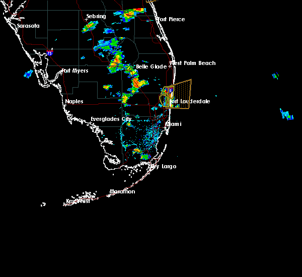 The severe thunderstorm warning for northern broward county will expire at 545 pm edt, the storms which prompted the warning have moved out of the area. therefore, the warning will be allowed to expire. The severe thunderstorm warning for northern broward county will expire at 545 pm edt, the storms which prompted the warning have moved out of the area. therefore, the warning will be allowed to expire.
|
| 7/4/2020 5:21 PM EDT |
 At 521 pm edt, severe thunderstorms were located along a line extending from near boca pointe to lazy lake, moving east at 15 mph (radar indicated). Hazards include 60 mph wind gusts and quarter size hail. Hail damage to vehicles is expected. expect wind damage to roofs, siding, and trees. Locations impacted include, fort lauderdale, coral springs, pompano beach, plantation and sunrise. At 521 pm edt, severe thunderstorms were located along a line extending from near boca pointe to lazy lake, moving east at 15 mph (radar indicated). Hazards include 60 mph wind gusts and quarter size hail. Hail damage to vehicles is expected. expect wind damage to roofs, siding, and trees. Locations impacted include, fort lauderdale, coral springs, pompano beach, plantation and sunrise.
|
| 7/4/2020 5:21 PM EDT |
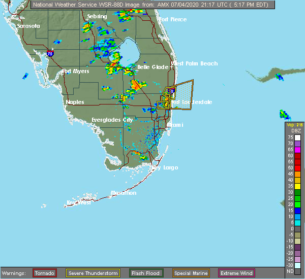 The severe thunderstorm warning for central broward county will expire at 530 pm edt, the severe thunderstorm which prompted the warning has moved out of the warned area. therefore, the warning will be allowed to expire. The severe thunderstorm warning for central broward county will expire at 530 pm edt, the severe thunderstorm which prompted the warning has moved out of the warned area. therefore, the warning will be allowed to expire.
|
| 7/4/2020 4:55 PM EDT |
 At 455 pm edt, severe thunderstorms were located along a line extending from coral springs to sunrise, moving northeast at 5 mph (radar indicated). Hazards include 70 mph wind gusts and quarter size hail. Hail damage to vehicles is expected. expect considerable tree damage. Wind damage is also likely to mobile homes, roofs, and outbuildings. At 455 pm edt, severe thunderstorms were located along a line extending from coral springs to sunrise, moving northeast at 5 mph (radar indicated). Hazards include 70 mph wind gusts and quarter size hail. Hail damage to vehicles is expected. expect considerable tree damage. Wind damage is also likely to mobile homes, roofs, and outbuildings.
|
| 7/4/2020 4:49 PM EDT |
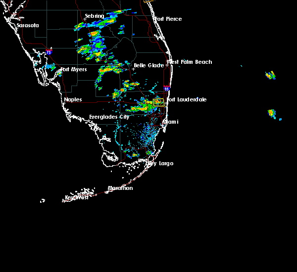 At 449 pm edt, a severe thunderstorm was located over sunrise, moving east at 10 mph. this severe thunderstorm is intensifying and could produce 70-mph wind gusts. take shelter now! (radar indicated). Hazards include 70 mph wind gusts and quarter size hail. Hail damage to vehicles is expected. expect considerable tree damage. wind damage is also likely to mobile homes, roofs, and outbuildings. Locations impacted include, fort lauderdale, pompano beach, davie, plantation and sunrise. At 449 pm edt, a severe thunderstorm was located over sunrise, moving east at 10 mph. this severe thunderstorm is intensifying and could produce 70-mph wind gusts. take shelter now! (radar indicated). Hazards include 70 mph wind gusts and quarter size hail. Hail damage to vehicles is expected. expect considerable tree damage. wind damage is also likely to mobile homes, roofs, and outbuildings. Locations impacted include, fort lauderdale, pompano beach, davie, plantation and sunrise.
|
| 7/4/2020 4:45 PM EDT |
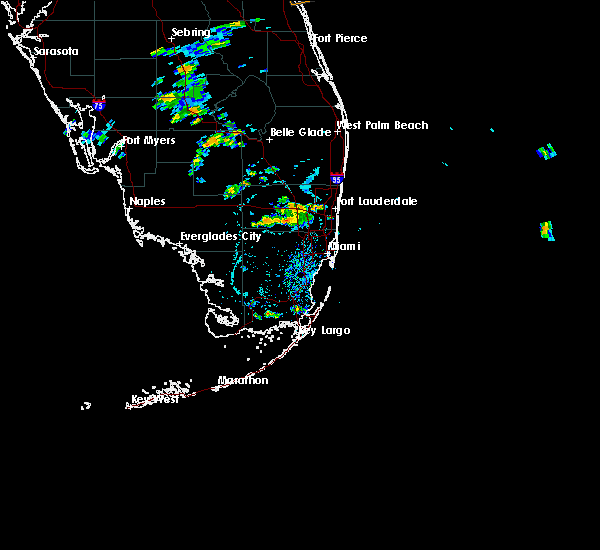 At 444 pm edt, a severe thunderstorm was located over sunrise, moving east at 10 mph (radar indicated). Hazards include 60 mph wind gusts and quarter size hail. Hail damage to vehicles is expected. Expect wind damage to roofs, siding, and trees. At 444 pm edt, a severe thunderstorm was located over sunrise, moving east at 10 mph (radar indicated). Hazards include 60 mph wind gusts and quarter size hail. Hail damage to vehicles is expected. Expect wind damage to roofs, siding, and trees.
|
| 7/2/2020 6:24 PM EDT |
 The severe thunderstorm warning for southern broward county will expire at 630 pm edt, the storm which prompted the warning has weakened below severe limits, and no longer poses an immediate threat to life or property. therefore, the warning will be allowed to expire. The severe thunderstorm warning for southern broward county will expire at 630 pm edt, the storm which prompted the warning has weakened below severe limits, and no longer poses an immediate threat to life or property. therefore, the warning will be allowed to expire.
|
| 7/2/2020 6:10 PM EDT | Quarter sized hail reported 6.8 miles ENE of Fort Lauderdale, FL, a member of the public via twitter reported quarter size hail on 595 in davie. |
| 7/2/2020 6:05 PM EDT | Multiple broadcast media outlets and law enforcement reports damage to two homes on nova drive. one of these homes suffered severe roof damage... with part of the roof in broward county FL, 7.7 miles NE of Fort Lauderdale, FL |
| 7/2/2020 6:03 PM EDT |
 At 603 pm edt, a severe thunderstorm was located over pine island ridge, or over plantation, moving east at 15 mph (radar indicated). Hazards include 60 mph wind gusts and quarter size hail. Hail damage to vehicles is expected. Expect wind damage to roofs, siding, and trees. At 603 pm edt, a severe thunderstorm was located over pine island ridge, or over plantation, moving east at 15 mph (radar indicated). Hazards include 60 mph wind gusts and quarter size hail. Hail damage to vehicles is expected. Expect wind damage to roofs, siding, and trees.
|
| 7/2/2020 6:02 PM EDT | Wplg relayed report via twitter of large tree damage in the area of 81st ave and 20th court. estimated downburst winds of 75 mp in broward county FL, 6.8 miles ENE of Fort Lauderdale, FL |
| 7/2/2020 6:00 PM EDT | Corrects previous tstm wnd dmg report for timing. wplg relayed report via twitter of large tree damage in the area of 81st ave and 20th court. estimated downburst winds in broward county FL, 6.8 miles ENE of Fort Lauderdale, FL |
| 7/2/2020 6:00 PM EDT | Corrects previous report to update timing and location. multiple broadcast media outlets and law enforcement reports damage to two homes on 83rd terrace near nova drive in broward county FL, 7.7 miles NE of Fort Lauderdale, FL |
| 5/25/2020 2:40 PM EDT |
 The severe thunderstorm warning for northern miami-dade and southern broward counties will expire at 245 pm edt, the storm which prompted the warning has weakened below severe limits, and no longer poses an immediate threat to life or property. therefore, the warning will be allowed to expire. The severe thunderstorm warning for northern miami-dade and southern broward counties will expire at 245 pm edt, the storm which prompted the warning has weakened below severe limits, and no longer poses an immediate threat to life or property. therefore, the warning will be allowed to expire.
|
| 5/25/2020 2:17 PM EDT |
 At 217 pm edt, a severe thunderstorm was located over sunny isles beach, or near surfside, moving north at 30 mph (radar indicated). Hazards include 60 mph wind gusts. expect damage to roofs, siding, and trees At 217 pm edt, a severe thunderstorm was located over sunny isles beach, or near surfside, moving north at 30 mph (radar indicated). Hazards include 60 mph wind gusts. expect damage to roofs, siding, and trees
|
| 5/21/2020 2:27 PM EDT |
 The severe thunderstorm warning for central broward county will expire at 230 pm edt, the storm which prompted the warning has weakened below severe limits, and no longer poses an immediate threat to life or property. therefore, the warning will be allowed to expire. however small hail and gusty winds are still possible with this thunderstorm. The severe thunderstorm warning for central broward county will expire at 230 pm edt, the storm which prompted the warning has weakened below severe limits, and no longer poses an immediate threat to life or property. therefore, the warning will be allowed to expire. however small hail and gusty winds are still possible with this thunderstorm.
|
| 5/21/2020 2:14 PM EDT |
 At 213 pm edt, a severe thunderstorm was located near sawgrass mills mall, or near sunrise, moving southwest at 10 mph. at 200 pm edt, quarter size hail was reported near coral springs (public). Hazards include 60 mph wind gusts and quarter size hail. Hail damage to vehicles is expected. expect wind damage to roofs, siding, and trees. Locations impacted include, fort lauderdale, pembroke pines, coral springs, davie and plantation. At 213 pm edt, a severe thunderstorm was located near sawgrass mills mall, or near sunrise, moving southwest at 10 mph. at 200 pm edt, quarter size hail was reported near coral springs (public). Hazards include 60 mph wind gusts and quarter size hail. Hail damage to vehicles is expected. expect wind damage to roofs, siding, and trees. Locations impacted include, fort lauderdale, pembroke pines, coral springs, davie and plantation.
|
| 5/21/2020 2:09 PM EDT |
 At 209 pm edt, a severe thunderstorm was located near sawgrass mills mall, or near sunrise, moving southwest at 10 mph (radar indicated). Hazards include 60 mph wind gusts and quarter size hail. Hail damage to vehicles is expected. expect wind damage to roofs, siding, and trees. Locations impacted include, fort lauderdale, pembroke pines, coral springs, davie and plantation. At 209 pm edt, a severe thunderstorm was located near sawgrass mills mall, or near sunrise, moving southwest at 10 mph (radar indicated). Hazards include 60 mph wind gusts and quarter size hail. Hail damage to vehicles is expected. expect wind damage to roofs, siding, and trees. Locations impacted include, fort lauderdale, pembroke pines, coral springs, davie and plantation.
|
| 5/21/2020 2:04 PM EDT |
 At 204 pm edt, a severe thunderstorm was located near sawgrass mills mall, or near sunrise, moving southwest at 10 mph (radar indicated). Hazards include 60 mph wind gusts and quarter size hail. Hail damage to vehicles is expected. expect wind damage to roofs, siding, and trees. Locations impacted include, fort lauderdale, pembroke pines, coral springs, davie and plantation. At 204 pm edt, a severe thunderstorm was located near sawgrass mills mall, or near sunrise, moving southwest at 10 mph (radar indicated). Hazards include 60 mph wind gusts and quarter size hail. Hail damage to vehicles is expected. expect wind damage to roofs, siding, and trees. Locations impacted include, fort lauderdale, pembroke pines, coral springs, davie and plantation.
|
| 5/21/2020 1:48 PM EDT |
 At 148 pm edt, a severe thunderstorm was located near tamarac, moving southwest at 10 mph (radar indicated). Hazards include 60 mph wind gusts and quarter size hail. Hail damage to vehicles is expected. Expect wind damage to roofs, siding, and trees. At 148 pm edt, a severe thunderstorm was located near tamarac, moving southwest at 10 mph (radar indicated). Hazards include 60 mph wind gusts and quarter size hail. Hail damage to vehicles is expected. Expect wind damage to roofs, siding, and trees.
|
| 5/18/2020 3:17 PM EDT |
 At 316 pm edt, severe thunderstorms were located along a line extending from 8 miles west of coral springs to near intersection i-75 and u.s. 27 to 14 miles west of intersection krome and u.s. 27, moving east at 30 mph (radar indicated). Hazards include 60 mph wind gusts and penny size hail. expect damage to roofs, siding, and trees At 316 pm edt, severe thunderstorms were located along a line extending from 8 miles west of coral springs to near intersection i-75 and u.s. 27 to 14 miles west of intersection krome and u.s. 27, moving east at 30 mph (radar indicated). Hazards include 60 mph wind gusts and penny size hail. expect damage to roofs, siding, and trees
|
| 5/17/2020 3:28 PM EDT |
 At 328 pm edt, severe thunderstorms were located along a line extending from hard rock stadium to golden glades to port of miami, moving east at 25 mph (radar indicated). Hazards include 60 mph wind gusts and half dollar size hail. Hail damage to vehicles is expected. expect wind damage to roofs, siding, and trees. Locations impacted include, miami, hialeah, fort lauderdale, pembroke pines and hollywood. At 328 pm edt, severe thunderstorms were located along a line extending from hard rock stadium to golden glades to port of miami, moving east at 25 mph (radar indicated). Hazards include 60 mph wind gusts and half dollar size hail. Hail damage to vehicles is expected. expect wind damage to roofs, siding, and trees. Locations impacted include, miami, hialeah, fort lauderdale, pembroke pines and hollywood.
|
| 5/17/2020 3:21 PM EDT |
 At 321 pm edt, severe thunderstorms were located along a line extending from west park to near opa-locka to port of miami, moving east at 25 mph (radar indicated). Hazards include 60 mph wind gusts and half dollar size hail. Hail damage to vehicles is expected. Expect wind damage to roofs, siding, and trees. At 321 pm edt, severe thunderstorms were located along a line extending from west park to near opa-locka to port of miami, moving east at 25 mph (radar indicated). Hazards include 60 mph wind gusts and half dollar size hail. Hail damage to vehicles is expected. Expect wind damage to roofs, siding, and trees.
|
| 5/16/2020 8:03 PM EDT |
 At 803 pm edt, a severe thunderstorm was located over fort lauderdale, moving east at 15 mph (radar indicated). Hazards include 60 mph wind gusts and penny size hail. Expect damage to roofs, siding, and trees. Locations impacted include, fort lauderdale, hollywood, pompano beach, davie and plantation. At 803 pm edt, a severe thunderstorm was located over fort lauderdale, moving east at 15 mph (radar indicated). Hazards include 60 mph wind gusts and penny size hail. Expect damage to roofs, siding, and trees. Locations impacted include, fort lauderdale, hollywood, pompano beach, davie and plantation.
|
| 5/16/2020 7:49 PM EDT |
 At 748 pm edt, a severe thunderstorm was located over twin lakes, or near lauderdale-by-the-sea, moving east at 10 mph (radar indicated). Hazards include 60 mph wind gusts and penny size hail. Expect damage to roofs, siding, and trees. Locations impacted include, fort lauderdale, hollywood, coral springs, pompano beach and davie. At 748 pm edt, a severe thunderstorm was located over twin lakes, or near lauderdale-by-the-sea, moving east at 10 mph (radar indicated). Hazards include 60 mph wind gusts and penny size hail. Expect damage to roofs, siding, and trees. Locations impacted include, fort lauderdale, hollywood, coral springs, pompano beach and davie.
|
| 5/16/2020 7:25 PM EDT |
 At 725 pm edt, severe thunderstorms were located along a line extending from near intersection i-75 and u.s. 27 to village park to near fort lauderdale, moving east at 25 mph (radar indicated). Hazards include 60 mph wind gusts. expect damage to roofs, siding, and trees At 725 pm edt, severe thunderstorms were located along a line extending from near intersection i-75 and u.s. 27 to village park to near fort lauderdale, moving east at 25 mph (radar indicated). Hazards include 60 mph wind gusts. expect damage to roofs, siding, and trees
|
| 5/16/2020 6:40 PM EDT | ...delayed report...a thunderstorm produced a strong microburst measured by the sunrise weatherstem mesonet... 1343w. site is elevated 6 feet above ground leve in broward county FL, 8.3 miles E of Fort Lauderdale, FL |
| 4/30/2020 2:15 PM EDT |
 At 215 pm edt, severe thunderstorms were located along a line extending from pompano beach to fort lauderdale to near hollywood, moving east at 25 mph (radar indicated). Hazards include 60 mph wind gusts and nickel size hail. Expect damage to roofs, siding, and trees. Locations impacted include, fort lauderdale, pembroke pines, hollywood, miramar and pompano beach. At 215 pm edt, severe thunderstorms were located along a line extending from pompano beach to fort lauderdale to near hollywood, moving east at 25 mph (radar indicated). Hazards include 60 mph wind gusts and nickel size hail. Expect damage to roofs, siding, and trees. Locations impacted include, fort lauderdale, pembroke pines, hollywood, miramar and pompano beach.
|
| 4/30/2020 2:04 PM EDT | Wplg channel 10 in miami reports a large tree uprooted and leaning over the road from a line of thunderstorms that moved through the fort lauderdale are in broward county FL, 0.8 miles ENE of Fort Lauderdale, FL |
| 4/30/2020 2:00 PM EDT |
 At 200 pm edt, severe thunderstorms were located along a line extending from near coconut creek to st. george to near chambers estates, moving northeast at 30 mph (radar indicated). Hazards include 60 mph wind gusts and nickel size hail. expect damage to roofs, siding, and trees At 200 pm edt, severe thunderstorms were located along a line extending from near coconut creek to st. george to near chambers estates, moving northeast at 30 mph (radar indicated). Hazards include 60 mph wind gusts and nickel size hail. expect damage to roofs, siding, and trees
|
| 4/26/2020 3:21 PM EDT |
 At 321 pm edt, a severe thunderstorm was located over ravenswood estates, or near hollywood, moving east at 30 mph (radar indicated). Hazards include 60 mph wind gusts and quarter size hail. Hail damage to vehicles is expected. expect wind damage to roofs, siding, and trees. Locations impacted include, fort lauderdale, pembroke pines, hollywood, miramar and davie. At 321 pm edt, a severe thunderstorm was located over ravenswood estates, or near hollywood, moving east at 30 mph (radar indicated). Hazards include 60 mph wind gusts and quarter size hail. Hail damage to vehicles is expected. expect wind damage to roofs, siding, and trees. Locations impacted include, fort lauderdale, pembroke pines, hollywood, miramar and davie.
|
| 4/26/2020 2:57 PM EDT |
 At 257 pm edt, a severe thunderstorm was located over pembroke pines, moving east at 30 mph (radar indicated). Hazards include 60 mph wind gusts and quarter size hail. Hail damage to vehicles is expected. Expect wind damage to roofs, siding, and trees. At 257 pm edt, a severe thunderstorm was located over pembroke pines, moving east at 30 mph (radar indicated). Hazards include 60 mph wind gusts and quarter size hail. Hail damage to vehicles is expected. Expect wind damage to roofs, siding, and trees.
|
| 4/26/2020 1:45 PM EDT |
 At 145 pm edt, a severe thunderstorm was located over boca raton, moving east at 25 mph (public). Hazards include 60 mph wind gusts and penny size hail. Expect damage to roofs, siding, and trees. Locations impacted include, fort lauderdale, coral springs, pompano beach, boca raton and deerfield beach. At 145 pm edt, a severe thunderstorm was located over boca raton, moving east at 25 mph (public). Hazards include 60 mph wind gusts and penny size hail. Expect damage to roofs, siding, and trees. Locations impacted include, fort lauderdale, coral springs, pompano beach, boca raton and deerfield beach.
|
| 4/26/2020 1:33 PM EDT |
 At 132 pm edt, a severe thunderstorm was located over dunes road, or near boynton beach, moving east at 25 mph. damage was reported from this line of storms earlier across palm beach county. seek safe indoor shelter now! (public). Hazards include 60 mph wind gusts and penny size hail. Expect damage to roofs, siding, and trees. Locations impacted include, fort lauderdale, coral springs, pompano beach, boca raton and deerfield beach. At 132 pm edt, a severe thunderstorm was located over dunes road, or near boynton beach, moving east at 25 mph. damage was reported from this line of storms earlier across palm beach county. seek safe indoor shelter now! (public). Hazards include 60 mph wind gusts and penny size hail. Expect damage to roofs, siding, and trees. Locations impacted include, fort lauderdale, coral springs, pompano beach, boca raton and deerfield beach.
|
| 4/26/2020 1:24 PM EDT |
 At 124 pm edt, a severe thunderstorm was located near loxahatchee nwr, or near boynton beach, moving east at 25 mph (radar indicated). Hazards include 60 mph wind gusts and penny size hail. expect damage to roofs, siding, and trees At 124 pm edt, a severe thunderstorm was located near loxahatchee nwr, or near boynton beach, moving east at 25 mph (radar indicated). Hazards include 60 mph wind gusts and penny size hail. expect damage to roofs, siding, and trees
|
| 4/18/2020 3:23 PM EDT |
 At 323 pm edt, severe thunderstorms were located along a line extending from 13 miles northwest of miccosukee resort to 8 miles east of hollywood, moving southeast at 25 mph (radar indicated). Hazards include 60 mph wind gusts and quarter size hail. Hail damage to vehicles is expected. expect wind damage to roofs, siding, and trees. Locations impacted include, miami, hialeah, pembroke pines, hollywood and miramar. At 323 pm edt, severe thunderstorms were located along a line extending from 13 miles northwest of miccosukee resort to 8 miles east of hollywood, moving southeast at 25 mph (radar indicated). Hazards include 60 mph wind gusts and quarter size hail. Hail damage to vehicles is expected. expect wind damage to roofs, siding, and trees. Locations impacted include, miami, hialeah, pembroke pines, hollywood and miramar.
|
| 4/18/2020 3:08 PM EDT |
 At 308 pm edt, severe thunderstorms were located along a line extending from 13 miles south of intersection alligator alley and miami canal to near lauderdale-by-the-sea, moving southeast at 25 mph (radar indicated). Hazards include 60 mph wind gusts and quarter size hail. Hail damage to vehicles is expected. Expect wind damage to roofs, siding, and trees. At 308 pm edt, severe thunderstorms were located along a line extending from 13 miles south of intersection alligator alley and miami canal to near lauderdale-by-the-sea, moving southeast at 25 mph (radar indicated). Hazards include 60 mph wind gusts and quarter size hail. Hail damage to vehicles is expected. Expect wind damage to roofs, siding, and trees.
|
| 10/8/2019 10:18 AM EDT |
 At 1018 am edt, a severe thunderstorm was located near pompano beach, moving northeast at 20 mph (radar indicated). Hazards include 60 mph wind gusts. Expect damage to roofs, siding, and trees. Locations impacted include, fort lauderdale, hollywood, pompano beach, boca raton and deerfield beach. At 1018 am edt, a severe thunderstorm was located near pompano beach, moving northeast at 20 mph (radar indicated). Hazards include 60 mph wind gusts. Expect damage to roofs, siding, and trees. Locations impacted include, fort lauderdale, hollywood, pompano beach, boca raton and deerfield beach.
|
| 10/8/2019 9:47 AM EDT |
 At 947 am edt, a severe thunderstorm was located over downtown fort lauderdale, or over fort lauderdale, moving northeast at 20 mph (radar indicated). Hazards include 60 mph wind gusts. expect damage to roofs, siding, and trees At 947 am edt, a severe thunderstorm was located over downtown fort lauderdale, or over fort lauderdale, moving northeast at 20 mph (radar indicated). Hazards include 60 mph wind gusts. expect damage to roofs, siding, and trees
|
| 8/5/2019 1:54 PM EDT |
 At 154 pm edt, severe thunderstorms were located along a line extending from near whisper walk to deerfield beach to lauderdale-by-the-sea, moving northeast at 25 mph (radar indicated). Hazards include 60 mph wind gusts. Expect damage to roofs, siding, and trees. Locations impacted include, fort lauderdale, coral springs, pompano beach, boca raton and deerfield beach. At 154 pm edt, severe thunderstorms were located along a line extending from near whisper walk to deerfield beach to lauderdale-by-the-sea, moving northeast at 25 mph (radar indicated). Hazards include 60 mph wind gusts. Expect damage to roofs, siding, and trees. Locations impacted include, fort lauderdale, coral springs, pompano beach, boca raton and deerfield beach.
|
| 8/5/2019 1:43 PM EDT |
 At 143 pm edt, severe thunderstorms were located along a line extending from near mission bay to near coconut creek to downtown fort lauderdale, moving northeast at 25 mph (radar indicated). Hazards include 60 mph wind gusts. Expect damage to roofs, siding, and trees. Locations impacted include, fort lauderdale, coral springs, pompano beach, plantation and sunrise. At 143 pm edt, severe thunderstorms were located along a line extending from near mission bay to near coconut creek to downtown fort lauderdale, moving northeast at 25 mph (radar indicated). Hazards include 60 mph wind gusts. Expect damage to roofs, siding, and trees. Locations impacted include, fort lauderdale, coral springs, pompano beach, plantation and sunrise.
|
| 8/5/2019 1:38 PM EDT |
 At 138 pm edt, severe thunderstorms were located along a line extending from near parkland to margate to st. george, moving northeast at 30 mph (radar indicated). Hazards include 60 mph wind gusts. Expect damage to roofs, siding, and trees. Locations impacted include, fort lauderdale, coral springs, pompano beach, davie and plantation. At 138 pm edt, severe thunderstorms were located along a line extending from near parkland to margate to st. george, moving northeast at 30 mph (radar indicated). Hazards include 60 mph wind gusts. Expect damage to roofs, siding, and trees. Locations impacted include, fort lauderdale, coral springs, pompano beach, davie and plantation.
|
| 8/5/2019 1:34 PM EDT |
 At 133 pm edt, severe thunderstorms were located along a line extending from near parkland to north lauderdale to broadview park, moving northeast at 35 mph (radar indicated). Hazards include 60 mph wind gusts. Expect damage to roofs, siding, and trees. Locations impacted include, fort lauderdale, coral springs, pompano beach, davie and plantation. At 133 pm edt, severe thunderstorms were located along a line extending from near parkland to north lauderdale to broadview park, moving northeast at 35 mph (radar indicated). Hazards include 60 mph wind gusts. Expect damage to roofs, siding, and trees. Locations impacted include, fort lauderdale, coral springs, pompano beach, davie and plantation.
|
| 8/5/2019 1:27 PM EDT |
 At 126 pm edt, severe thunderstorms were located along a line extending from 9 miles north of mile marker 30 on alligator alley to pine island ridge, moving northeast at 25 mph (radar indicated). Hazards include 60 mph wind gusts. expect damage to roofs, siding, and trees At 126 pm edt, severe thunderstorms were located along a line extending from 9 miles north of mile marker 30 on alligator alley to pine island ridge, moving northeast at 25 mph (radar indicated). Hazards include 60 mph wind gusts. expect damage to roofs, siding, and trees
|
| 8/3/2019 4:41 PM EDT |
 The severe thunderstorm warning for northern broward county will expire at 445 pm edt, the storms which prompted the warning have weakened below severe limits, and are exiting the warned area. therefore, the warning will be allowed to expire. however gusty winds are still possible with these thunderstorms. The severe thunderstorm warning for northern broward county will expire at 445 pm edt, the storms which prompted the warning have weakened below severe limits, and are exiting the warned area. therefore, the warning will be allowed to expire. however gusty winds are still possible with these thunderstorms.
|
| 8/3/2019 4:22 PM EDT |
 At 422 pm edt, severe thunderstorms were located along a line extending from near coral springs to near coconut creek, moving northeast at 25 mph (radar indicated). Hazards include 60 mph wind gusts. Expect damage to roofs, siding, and trees. Locations impacted include, fort lauderdale, coral springs, pompano beach, sunrise and deerfield beach. At 422 pm edt, severe thunderstorms were located along a line extending from near coral springs to near coconut creek, moving northeast at 25 mph (radar indicated). Hazards include 60 mph wind gusts. Expect damage to roofs, siding, and trees. Locations impacted include, fort lauderdale, coral springs, pompano beach, sunrise and deerfield beach.
|
| 8/3/2019 4:16 PM EDT |
 At 415 pm edt, severe thunderstorms were located along a line extending from near coral springs to lauderdale lakes, moving northeast at 20 mph (radar indicated). Hazards include 60 mph wind gusts. Expect damage to roofs, siding, and trees. Locations impacted include, fort lauderdale, coral springs, pompano beach, davie and plantation. At 415 pm edt, severe thunderstorms were located along a line extending from near coral springs to lauderdale lakes, moving northeast at 20 mph (radar indicated). Hazards include 60 mph wind gusts. Expect damage to roofs, siding, and trees. Locations impacted include, fort lauderdale, coral springs, pompano beach, davie and plantation.
|
| 8/3/2019 4:05 PM EDT |
 At 353 pm edt, severe thunderstorms were located along a line extending from near intersection i-75 and u.s. 27 to pine island ridge, moving northeast at 20 mph (radar indicated). Hazards include 60 mph wind gusts. expect damage to roofs, siding, and trees At 353 pm edt, severe thunderstorms were located along a line extending from near intersection i-75 and u.s. 27 to pine island ridge, moving northeast at 20 mph (radar indicated). Hazards include 60 mph wind gusts. expect damage to roofs, siding, and trees
|
| 8/3/2019 3:53 PM EDT |
 The national weather service in miami has issued a * severe thunderstorm warning for. northern broward county in southeastern florida. until 445 pm edt. at 353 pm edt, severe thunderstorms were located along a line extending from near intersection i-75 and u. s. 27 to pine island. The national weather service in miami has issued a * severe thunderstorm warning for. northern broward county in southeastern florida. until 445 pm edt. at 353 pm edt, severe thunderstorms were located along a line extending from near intersection i-75 and u. s. 27 to pine island.
|
| 5/15/2019 7:02 PM EDT |
 At 702 pm edt, a severe thunderstorm was located over royal palm ranches, or over pembroke pines, moving southeast at 30 mph (radar indicated). Hazards include 60 mph wind gusts and quarter size hail. Hail damage to vehicles is expected. expect wind damage to roofs, siding, and trees. Locations impacted include, hialeah, fort lauderdale, pembroke pines, hollywood and miramar. At 702 pm edt, a severe thunderstorm was located over royal palm ranches, or over pembroke pines, moving southeast at 30 mph (radar indicated). Hazards include 60 mph wind gusts and quarter size hail. Hail damage to vehicles is expected. expect wind damage to roofs, siding, and trees. Locations impacted include, hialeah, fort lauderdale, pembroke pines, hollywood and miramar.
|
| 5/15/2019 6:47 PM EDT |
 At 647 pm edt, a severe thunderstorm was located over weston, or near davie, moving southeast at 30 mph (radar indicated). Hazards include 60 mph wind gusts and quarter size hail. Hail damage to vehicles is expected. expect wind damage to roofs, siding, and trees. Locations impacted include, hialeah, fort lauderdale, pembroke pines, hollywood and miramar. At 647 pm edt, a severe thunderstorm was located over weston, or near davie, moving southeast at 30 mph (radar indicated). Hazards include 60 mph wind gusts and quarter size hail. Hail damage to vehicles is expected. expect wind damage to roofs, siding, and trees. Locations impacted include, hialeah, fort lauderdale, pembroke pines, hollywood and miramar.
|
| 5/15/2019 6:34 PM EDT |
 The national weather service in miami has issued a * severe thunderstorm warning for. north central miami-dade county in southeastern florida. southern broward county in southeastern florida. until 715 pm edt. At 633 pm edt, a severe thunderstorm was located over east toll. The national weather service in miami has issued a * severe thunderstorm warning for. north central miami-dade county in southeastern florida. southern broward county in southeastern florida. until 715 pm edt. At 633 pm edt, a severe thunderstorm was located over east toll.
|
| 9/20/2018 3:25 PM EDT | Quarter sized hail reported 10.7 miles E of Fort Lauderdale, FL, members of the public and photos on social media suggest quater sized hail fell near bb&t center. |
| 6/7/2018 2:55 PM EDT |
 The severe thunderstorm warning for northern broward and southeastern palm beach counties will expire at 300 pm edt, the storms which prompted the warning have weakened. therefore, the warning will be allowed to expire. The severe thunderstorm warning for northern broward and southeastern palm beach counties will expire at 300 pm edt, the storms which prompted the warning have weakened. therefore, the warning will be allowed to expire.
|
| 6/7/2018 2:53 PM EDT |
 At 252 pm edt, severe thunderstorms were located along a line extending from near hillsboro beach to port everglades, moving northeast at 15 mph (radar indicated). Hazards include 60 mph wind gusts and quarter size hail. Hail damage to vehicles is expected. expect wind damage to roofs, siding, and trees. Locations impacted include, fort lauderdale, hollywood, pompano beach, davie and plantation. At 252 pm edt, severe thunderstorms were located along a line extending from near hillsboro beach to port everglades, moving northeast at 15 mph (radar indicated). Hazards include 60 mph wind gusts and quarter size hail. Hail damage to vehicles is expected. expect wind damage to roofs, siding, and trees. Locations impacted include, fort lauderdale, hollywood, pompano beach, davie and plantation.
|
| 6/7/2018 2:41 PM EDT |
 A severe thunderstorm warning remains in effect until 300 pm edt for broward and southeastern palm beach counties. at 239 pm edt, severe thunderstorms were located along a line extending from hillsboro beach to fort lauderdale - hollywood international airport, moving northeast at 20 mph. hazard. 70 mph wind gusts and quarter size hail. A severe thunderstorm warning remains in effect until 300 pm edt for broward and southeastern palm beach counties. at 239 pm edt, severe thunderstorms were located along a line extending from hillsboro beach to fort lauderdale - hollywood international airport, moving northeast at 20 mph. hazard. 70 mph wind gusts and quarter size hail.
|
| 6/7/2018 2:22 PM EDT |
 At 221 pm edt, severe thunderstorms were located along a line extending from near pompano beach to oak point, moving northeast at 20 mph (radar indicated). Hazards include 60 mph wind gusts and quarter size hail. Hail damage to vehicles is expected. Expect wind damage to roofs, siding, and trees. At 221 pm edt, severe thunderstorms were located along a line extending from near pompano beach to oak point, moving northeast at 20 mph (radar indicated). Hazards include 60 mph wind gusts and quarter size hail. Hail damage to vehicles is expected. Expect wind damage to roofs, siding, and trees.
|
| 6/6/2018 5:21 PM EDT |
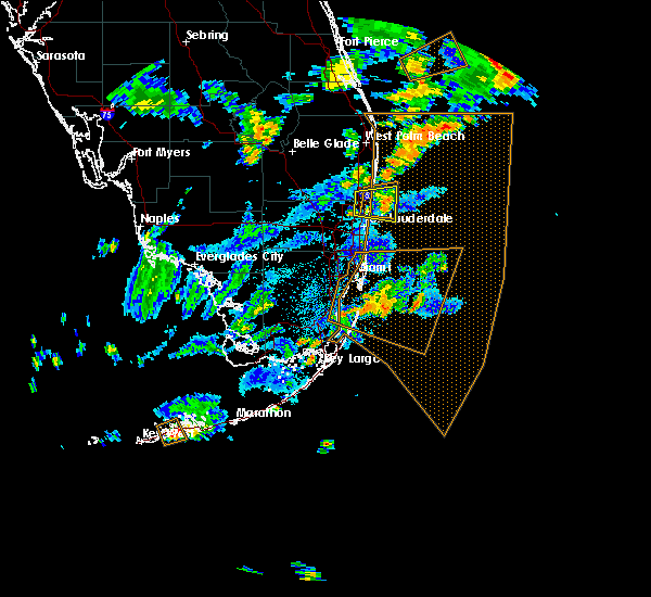 At 506 pm edt, a severe thunderstorm was located over deerfield beach, moving east at 15 mph (radar indicated). Hazards include 60 mph wind gusts and nickel size hail. Expect damage to roofs, siding, and trees. Locations impacted include, fort lauderdale, pompano beach, boca raton, deerfield beach and margate. At 506 pm edt, a severe thunderstorm was located over deerfield beach, moving east at 15 mph (radar indicated). Hazards include 60 mph wind gusts and nickel size hail. Expect damage to roofs, siding, and trees. Locations impacted include, fort lauderdale, pompano beach, boca raton, deerfield beach and margate.
|
| 6/6/2018 5:07 PM EDT |
 At 506 pm edt, a severe thunderstorm was located over deerfield beach, moving east at 15 mph (radar indicated). Hazards include 60 mph wind gusts and nickel size hail. Expect damage to roofs, siding, and trees. Locations impacted include, fort lauderdale, pompano beach, boca raton, deerfield beach and margate. At 506 pm edt, a severe thunderstorm was located over deerfield beach, moving east at 15 mph (radar indicated). Hazards include 60 mph wind gusts and nickel size hail. Expect damage to roofs, siding, and trees. Locations impacted include, fort lauderdale, pompano beach, boca raton, deerfield beach and margate.
|
| 6/6/2018 5:04 PM EDT |
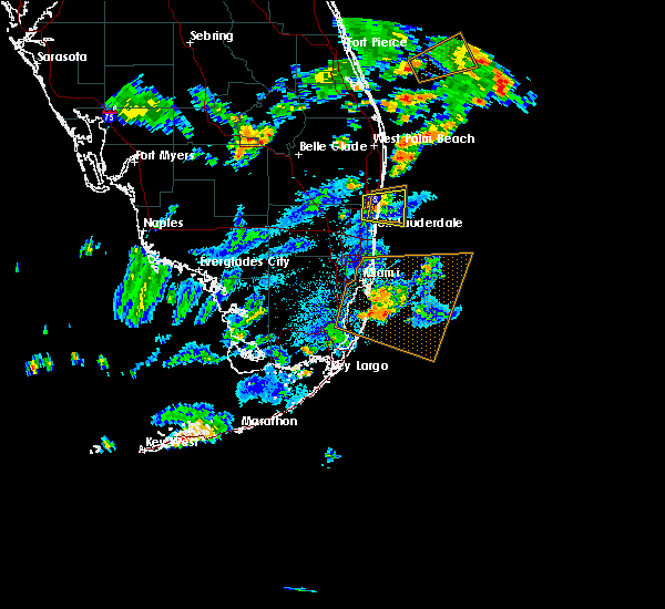 At 506 pm edt, a severe thunderstorm was located over deerfield beach, moving east at 15 mph (radar indicated). Hazards include 60 mph wind gusts and nickel size hail. Expect damage to roofs, siding, and trees. Locations impacted include, fort lauderdale, pompano beach, boca raton, deerfield beach and margate. At 506 pm edt, a severe thunderstorm was located over deerfield beach, moving east at 15 mph (radar indicated). Hazards include 60 mph wind gusts and nickel size hail. Expect damage to roofs, siding, and trees. Locations impacted include, fort lauderdale, pompano beach, boca raton, deerfield beach and margate.
|
| 4/10/2018 4:55 PM EDT |
 The severe thunderstorm warning for southeastern broward county will expire at 500 pm edt, the storm which prompted the warning has moved out of the area. therefore, the warning will be allowed to expire. however gusty winds and heavy rain are still possible with these thunderstorms. The severe thunderstorm warning for southeastern broward county will expire at 500 pm edt, the storm which prompted the warning has moved out of the area. therefore, the warning will be allowed to expire. however gusty winds and heavy rain are still possible with these thunderstorms.
|
| 4/10/2018 4:45 PM EDT | Quarter sized hail reported 5.8 miles NE of Fort Lauderdale, FL, a trained weather spotter reported quarter sized hail along interstate 595 near sw 66th terrace. |
| 4/10/2018 4:45 PM EDT |
 At 444 pm edt, a severe thunderstorm was located over broadview park, or over plantation, moving east at 20 mph (trained weather spotters have reported quarter sized hail along with wind gusts in excess of 60 mph). Hazards include 70 mph wind gusts and quarter size hail. Hail damage to vehicles is expected. expect considerable tree damage. wind damage is also likely to mobile homes, roofs, and outbuildings. Locations impacted include, fort lauderdale, hollywood, davie, plantation and sunrise. At 444 pm edt, a severe thunderstorm was located over broadview park, or over plantation, moving east at 20 mph (trained weather spotters have reported quarter sized hail along with wind gusts in excess of 60 mph). Hazards include 70 mph wind gusts and quarter size hail. Hail damage to vehicles is expected. expect considerable tree damage. wind damage is also likely to mobile homes, roofs, and outbuildings. Locations impacted include, fort lauderdale, hollywood, davie, plantation and sunrise.
|
| 4/10/2018 4:36 PM EDT |
 At 436 pm edt, a severe thunderstorm was located over pine island ridge, or over plantation, moving northeast at 25 mph (radar indicated). Hazards include 60 mph wind gusts and quarter size hail. Hail damage to vehicles is expected. Expect wind damage to roofs, siding, and trees. At 436 pm edt, a severe thunderstorm was located over pine island ridge, or over plantation, moving northeast at 25 mph (radar indicated). Hazards include 60 mph wind gusts and quarter size hail. Hail damage to vehicles is expected. Expect wind damage to roofs, siding, and trees.
|
| 4/10/2018 4:32 PM EDT | A thunderstorm produced a wind gust of 63 mph at a mesonet site at port everglade in broward county FL, 5.5 miles NNW of Fort Lauderdale, FL |
| 4/10/2018 4:30 PM EDT |
 At 430 pm edt, a confirmed tornado was located over fort lauderdale - hollywood international airport, or over hollywood, moving east at 25 mph (weather spotters confirmed tornado). Hazards include damaging tornado. Flying debris will be dangerous to those caught without shelter. mobile homes will be damaged or destroyed. damage to roofs, windows, and vehicles will occur. tree damage is likely. This tornadic thunderstorm will remain over mainly rural areas of eastern broward county. At 430 pm edt, a confirmed tornado was located over fort lauderdale - hollywood international airport, or over hollywood, moving east at 25 mph (weather spotters confirmed tornado). Hazards include damaging tornado. Flying debris will be dangerous to those caught without shelter. mobile homes will be damaged or destroyed. damage to roofs, windows, and vehicles will occur. tree damage is likely. This tornadic thunderstorm will remain over mainly rural areas of eastern broward county.
|
| 4/10/2018 3:54 PM EDT |
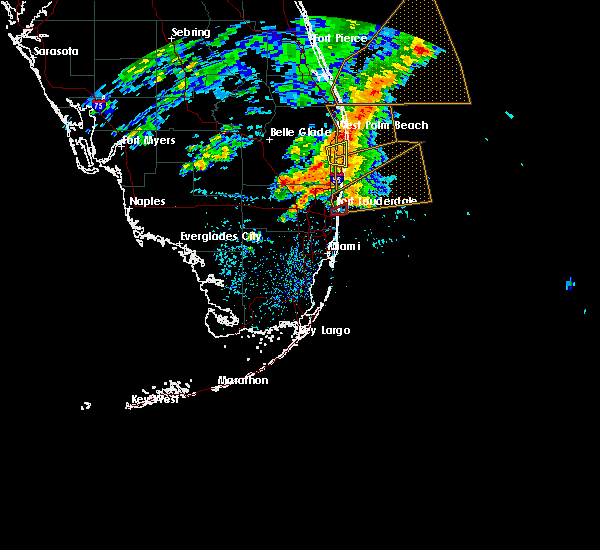 The tornado warning for east central broward county will expire at 400 pm edt, the storm which prompted the warning has weakened below severe limits, and no longer appears capable of producing a tornado. therefore, the warning will be allowed to expire. however gusty winds are still possible with this thunderstorm. to report severe weather, contact your nearest law enforcement agency. they will relay your report to the national weather service miami. The tornado warning for east central broward county will expire at 400 pm edt, the storm which prompted the warning has weakened below severe limits, and no longer appears capable of producing a tornado. therefore, the warning will be allowed to expire. however gusty winds are still possible with this thunderstorm. to report severe weather, contact your nearest law enforcement agency. they will relay your report to the national weather service miami.
|
| 4/10/2018 3:44 PM EDT |
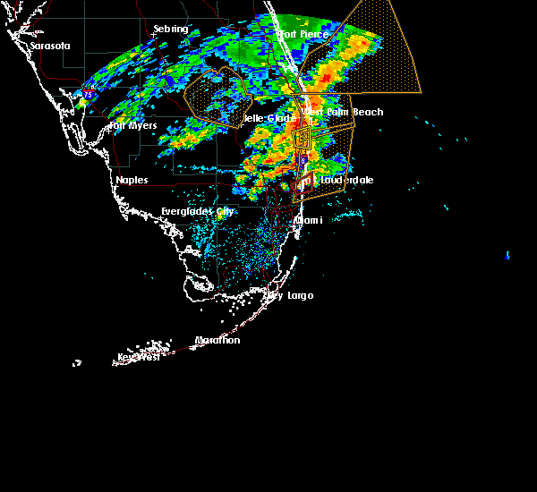 At 344 pm edt, a confirmed tornado was located over downtown fort lauderdale, or near fort lauderdale, and is nearly stationary (weather spotters confirmed tornado). Hazards include damaging tornado. Flying debris will be dangerous to those caught without shelter. mobile homes will be damaged or destroyed. damage to roofs, windows, and vehicles will occur. tree damage is likely. this tornado will be near, fort lauderdale around 350 pm edt. hollywood and port everglades around 400 pm edt. Other locations impacted by this tornadic thunderstorm include fort lauderdale beach. At 344 pm edt, a confirmed tornado was located over downtown fort lauderdale, or near fort lauderdale, and is nearly stationary (weather spotters confirmed tornado). Hazards include damaging tornado. Flying debris will be dangerous to those caught without shelter. mobile homes will be damaged or destroyed. damage to roofs, windows, and vehicles will occur. tree damage is likely. this tornado will be near, fort lauderdale around 350 pm edt. hollywood and port everglades around 400 pm edt. Other locations impacted by this tornadic thunderstorm include fort lauderdale beach.
|
| 4/10/2018 3:36 PM EDT |
 At 336 pm edt, a confirmed tornado was located over downtown fort lauderdale, or over fort lauderdale, moving east at 10 mph (weather spotters confirmed tornado). Hazards include damaging tornado. Flying debris will be dangerous to those caught without shelter. mobile homes will be damaged or destroyed. damage to roofs, windows, and vehicles will occur. tree damage is likely. the tornado will be near, fort lauderdale around 340 pm edt. wilton manors, lazy lake, port everglades and twin lakes around 345 pm edt. oakland park around 350 pm edt. lauderdale-by-the-sea and sea ranch lakes around 400 pm edt. Other locations impacted by this tornadic thunderstorm include intersection i-595 and i-95, fort lauderdale beach, broward estates, boulevard gardens, west ken-lark, north andrews gardens, roosevelt gardens and terra mar. At 336 pm edt, a confirmed tornado was located over downtown fort lauderdale, or over fort lauderdale, moving east at 10 mph (weather spotters confirmed tornado). Hazards include damaging tornado. Flying debris will be dangerous to those caught without shelter. mobile homes will be damaged or destroyed. damage to roofs, windows, and vehicles will occur. tree damage is likely. the tornado will be near, fort lauderdale around 340 pm edt. wilton manors, lazy lake, port everglades and twin lakes around 345 pm edt. oakland park around 350 pm edt. lauderdale-by-the-sea and sea ranch lakes around 400 pm edt. Other locations impacted by this tornadic thunderstorm include intersection i-595 and i-95, fort lauderdale beach, broward estates, boulevard gardens, west ken-lark, north andrews gardens, roosevelt gardens and terra mar.
|
| 9/10/2017 3:53 PM EDT |
 At 353 pm edt, a severe thunderstorm located east of pompano beach and another severe thunderstorm located east of fort lauderdale are moving northwest at 55 mph (radar indicated rotation). Hazards include tornado. Flying debris will be dangerous to those caught without shelter. mobile homes will be damaged or destroyed. damage to roofs, windows, and vehicles will occur. Tree damage is likely. At 353 pm edt, a severe thunderstorm located east of pompano beach and another severe thunderstorm located east of fort lauderdale are moving northwest at 55 mph (radar indicated rotation). Hazards include tornado. Flying debris will be dangerous to those caught without shelter. mobile homes will be damaged or destroyed. damage to roofs, windows, and vehicles will occur. Tree damage is likely.
|
| 9/10/2017 2:07 PM EDT |
 The tornado warning for northeastern miami-dade, eastern broward and southeastern palm beach counties will expire at 215 pm edt, the storm which prompted the warning has weakened below severe limits, and no longer appears capable of producing a tornado. therefore the warning will be allowed to expire. The tornado warning for northeastern miami-dade, eastern broward and southeastern palm beach counties will expire at 215 pm edt, the storm which prompted the warning has weakened below severe limits, and no longer appears capable of producing a tornado. therefore the warning will be allowed to expire.
|
| 9/10/2017 2:00 PM EDT |
 At 159 pm edt, a severe thunderstorm capable of producing a tornado was located over hollywood, moving northwest at 70 mph (radar indicated rotation). Hazards include tornado. Flying debris will be dangerous to those caught without shelter. mobile homes will be damaged or destroyed. damage to roofs, windows, and vehicles will occur. tree damage is likely. Locations impacted include, fort lauderdale, hollywood, coral springs, pompano beach and davie. At 159 pm edt, a severe thunderstorm capable of producing a tornado was located over hollywood, moving northwest at 70 mph (radar indicated rotation). Hazards include tornado. Flying debris will be dangerous to those caught without shelter. mobile homes will be damaged or destroyed. damage to roofs, windows, and vehicles will occur. tree damage is likely. Locations impacted include, fort lauderdale, hollywood, coral springs, pompano beach and davie.
|
| 9/10/2017 1:57 PM EDT |
 At 157 pm edt, a severe thunderstorm capable of producing a tornado was located near hallandale, moving northwest at 65 mph (radar indicated rotation). Hazards include tornado. Flying debris will be dangerous to those caught without shelter. mobile homes will be damaged or destroyed. damage to roofs, windows, and vehicles will occur. tree damage is likely. Locations impacted include, fort lauderdale, hollywood, coral springs, pompano beach and davie. At 157 pm edt, a severe thunderstorm capable of producing a tornado was located near hallandale, moving northwest at 65 mph (radar indicated rotation). Hazards include tornado. Flying debris will be dangerous to those caught without shelter. mobile homes will be damaged or destroyed. damage to roofs, windows, and vehicles will occur. tree damage is likely. Locations impacted include, fort lauderdale, hollywood, coral springs, pompano beach and davie.
|
| 9/10/2017 1:49 PM EDT |
 At 149 pm edt, a severe thunderstorm capable of producing a tornado was located 8 miles east of surfside, moving northwest at 90 mph (radar indicated rotation). Hazards include tornado. Flying debris will be dangerous to those caught without shelter. mobile homes will be damaged or destroyed. damage to roofs, windows, and vehicles will occur. Tree damage is likely. At 149 pm edt, a severe thunderstorm capable of producing a tornado was located 8 miles east of surfside, moving northwest at 90 mph (radar indicated rotation). Hazards include tornado. Flying debris will be dangerous to those caught without shelter. mobile homes will be damaged or destroyed. damage to roofs, windows, and vehicles will occur. Tree damage is likely.
|
| 9/10/2017 7:52 AM EDT |
 The tornado warning for northeastern miami-dade and eastern broward counties will expire at 800 am edt, the storm which prompted the warning has weakened below severe limits, and no longer appears capable of producing a tornado. therefore the warning will be allowed to expire. however gusty winds are still possible with this thunderstorm. a tornado watch remains in effect until noon edt for southeastern florida. The tornado warning for northeastern miami-dade and eastern broward counties will expire at 800 am edt, the storm which prompted the warning has weakened below severe limits, and no longer appears capable of producing a tornado. therefore the warning will be allowed to expire. however gusty winds are still possible with this thunderstorm. a tornado watch remains in effect until noon edt for southeastern florida.
|
| 9/10/2017 7:36 AM EDT |
 At 735 am edt, a severe thunderstorm capable of producing a tornado was located 8 miles southeast of miami beach, moving northwest at 80 mph (radar indicated rotation). Hazards include tornado. Flying debris will be dangerous to those caught without shelter. mobile homes will be damaged or destroyed. damage to roofs, windows, and vehicles will occur. tree damage is likely. this dangerous storm will be near, virginia key, fisher island and port of miami around 740 am edt. miami, miami beach, surfside, north miami beach, miami shores, north bay village, el portal, little haiti, gladeview and liberty city around 745 am edt. miramar, miami gardens, hallandale, north miami, aventura, sunny isles beach, opa-locka, west park, golden glades and sun life stadium around 750 am edt. miami lakes, cooper city, royal palm ranches, miramar parkway and university drive, sunshine acres, nova southeastern university, palm springs north, chambers estates, oak point and estates of fort lauderdale around 755 am edt. pembroke pines, davie, plantation, weston, intersection i-75 and griffin road, sawgrass mills mall, pine island ridge and intersection i-75 and u. s. 27 around 800 am edt. Other locations impacted by this tornadic thunderstorm include markham park, saint thomas university, fiu north campus, ives estates, downtown davie, bay harbor islands, allapattah, biscayne park, pembroke park and bal harbour. At 735 am edt, a severe thunderstorm capable of producing a tornado was located 8 miles southeast of miami beach, moving northwest at 80 mph (radar indicated rotation). Hazards include tornado. Flying debris will be dangerous to those caught without shelter. mobile homes will be damaged or destroyed. damage to roofs, windows, and vehicles will occur. tree damage is likely. this dangerous storm will be near, virginia key, fisher island and port of miami around 740 am edt. miami, miami beach, surfside, north miami beach, miami shores, north bay village, el portal, little haiti, gladeview and liberty city around 745 am edt. miramar, miami gardens, hallandale, north miami, aventura, sunny isles beach, opa-locka, west park, golden glades and sun life stadium around 750 am edt. miami lakes, cooper city, royal palm ranches, miramar parkway and university drive, sunshine acres, nova southeastern university, palm springs north, chambers estates, oak point and estates of fort lauderdale around 755 am edt. pembroke pines, davie, plantation, weston, intersection i-75 and griffin road, sawgrass mills mall, pine island ridge and intersection i-75 and u. s. 27 around 800 am edt. Other locations impacted by this tornadic thunderstorm include markham park, saint thomas university, fiu north campus, ives estates, downtown davie, bay harbor islands, allapattah, biscayne park, pembroke park and bal harbour.
|
| 9/10/2017 3:46 AM EDT |
 At 346 am edt, severe thunderstorms capable of producing tornadoes were located along a line extending from ocean ridge to port everglades, moving northwest at 30 mph (radar indicated rotation). Hazards include tornado. Flying debris will be dangerous to those caught without shelter. mobile homes will be damaged or destroyed. damage to roofs, windows, and vehicles will occur. tree damage is likely. these dangerous storms will be near, boynton beach, delray beach, ocean ridge, village of golf and dunes road around 350 am edt. palm beach and lantana around 355 am edt. lake worth, greenacres and atlantis around 400 am edt. pompano beach, sunrise, palm springs and hillsboro beach around 405 am edt. tamarac, wellington, margate, lighthouse point and north lauderdale around 410 am edt. coral springs, deerfield beach, coconut creek, parkland, godfrey road, boca pointe, boca del mar, mission bay, hamptons at boca raton and whisper walk around 415 am edt. Other locations impacted by these tornadic storms include fau south campus, fort lauderdale beach, aberdeen, boca west, hillsboro pines, north andrews gardens, aberdeen golf course, terra mar, boulevard gardens and seminole manor. At 346 am edt, severe thunderstorms capable of producing tornadoes were located along a line extending from ocean ridge to port everglades, moving northwest at 30 mph (radar indicated rotation). Hazards include tornado. Flying debris will be dangerous to those caught without shelter. mobile homes will be damaged or destroyed. damage to roofs, windows, and vehicles will occur. tree damage is likely. these dangerous storms will be near, boynton beach, delray beach, ocean ridge, village of golf and dunes road around 350 am edt. palm beach and lantana around 355 am edt. lake worth, greenacres and atlantis around 400 am edt. pompano beach, sunrise, palm springs and hillsboro beach around 405 am edt. tamarac, wellington, margate, lighthouse point and north lauderdale around 410 am edt. coral springs, deerfield beach, coconut creek, parkland, godfrey road, boca pointe, boca del mar, mission bay, hamptons at boca raton and whisper walk around 415 am edt. Other locations impacted by these tornadic storms include fau south campus, fort lauderdale beach, aberdeen, boca west, hillsboro pines, north andrews gardens, aberdeen golf course, terra mar, boulevard gardens and seminole manor.
|
| 9/9/2017 8:11 PM EDT |
 The tornado warning for northeastern miami-dade and southeastern broward counties will expire at 815 pm edt. the storm which prompted the warning has weakened below severe limits, and no longer appears capable of producing a tornado. therefore the warning will be allowed to expire. However gusty winds and heavy rain are still possible with this thunderstorm. The tornado warning for northeastern miami-dade and southeastern broward counties will expire at 815 pm edt. the storm which prompted the warning has weakened below severe limits, and no longer appears capable of producing a tornado. therefore the warning will be allowed to expire. However gusty winds and heavy rain are still possible with this thunderstorm.
|
| 9/9/2017 7:52 PM EDT |
 At 751 pm edt, a severe thunderstorm capable of producing a tornado was located over hallandale, moving west at 30 mph (radar indicated rotation). Hazards include tornado. Flying debris will be dangerous to those caught without shelter. mobile homes will be damaged or destroyed. damage to roofs, windows, and vehicles will occur. tree damage is likely. this dangerous storm will be near, north miami beach and sunny isles beach around 755 pm edt. hollywood, hallandale, aventura, dania beach and ojus around 800 pm edt. north miami, west park, ravenswood estates and fort lauderdale - hollywood international airport around 805 pm edt. fort lauderdale, miramar, miami gardens, miramar parkway and university drive, oak point, chambers estates, estates of fort lauderdale, sun life stadium and broadview park around 810 pm edt. davie, cooper city, royal palm ranches, sunshine acres, nova southeastern university, pine island ridge and intersection i-75 and griffin road around 815 pm edt. Other locations impacted by this tornadic thunderstorm include markham park, pembroke park, ives estates, hollywood downtown, golden beach, downtown davie, intersection i-595 and i-95 and riverland village. At 751 pm edt, a severe thunderstorm capable of producing a tornado was located over hallandale, moving west at 30 mph (radar indicated rotation). Hazards include tornado. Flying debris will be dangerous to those caught without shelter. mobile homes will be damaged or destroyed. damage to roofs, windows, and vehicles will occur. tree damage is likely. this dangerous storm will be near, north miami beach and sunny isles beach around 755 pm edt. hollywood, hallandale, aventura, dania beach and ojus around 800 pm edt. north miami, west park, ravenswood estates and fort lauderdale - hollywood international airport around 805 pm edt. fort lauderdale, miramar, miami gardens, miramar parkway and university drive, oak point, chambers estates, estates of fort lauderdale, sun life stadium and broadview park around 810 pm edt. davie, cooper city, royal palm ranches, sunshine acres, nova southeastern university, pine island ridge and intersection i-75 and griffin road around 815 pm edt. Other locations impacted by this tornadic thunderstorm include markham park, pembroke park, ives estates, hollywood downtown, golden beach, downtown davie, intersection i-595 and i-95 and riverland village.
|
| 9/9/2017 7:18 PM EDT |
 At 718 pm edt, a confirmed large and extremely dangerous tornado was located over plantation, moving west at 35 mph. this is a particularly dangerous situation. take cover now! (public confirmed tornado). Hazards include damaging tornado. You are in a life-threatening situation. flying debris may be deadly to those caught without shelter. mobile homes will be destroyed. considerable damage to homes, businesses, and vehicles is likely and complete destruction is possible. the tornado will be near, weston around 730 pm edt. Other locations impacted by this tornadic thunderstorm include north pompano beach, markham park, west ken-lark, ramblewood east, downtown davie and broward estates. At 718 pm edt, a confirmed large and extremely dangerous tornado was located over plantation, moving west at 35 mph. this is a particularly dangerous situation. take cover now! (public confirmed tornado). Hazards include damaging tornado. You are in a life-threatening situation. flying debris may be deadly to those caught without shelter. mobile homes will be destroyed. considerable damage to homes, businesses, and vehicles is likely and complete destruction is possible. the tornado will be near, weston around 730 pm edt. Other locations impacted by this tornadic thunderstorm include north pompano beach, markham park, west ken-lark, ramblewood east, downtown davie and broward estates.
|
| 9/9/2017 7:14 PM EDT |
 At 714 pm edt, a confirmed large and extremely dangerous tornado was located over lauderhill, or over plantation, moving west at 35 mph. this is a particularly dangerous situation. take cover now! (public confirmed tornado). Hazards include damaging tornado. You are in a life-threatening situation. flying debris may be deadly to those caught without shelter. mobile homes will be destroyed. considerable damage to homes, businesses, and vehicles is likely and complete destruction is possible. the tornado will be near, davie, sunrise and tamarac around 720 pm edt. sawgrass mills mall around 725 pm edt. weston around 730 pm edt. Other locations impacted by this tornadic thunderstorm include fort lauderdale beach, north pompano beach, markham park, riverland village, north andrews gardens, ramblewood east, downtown davie, roosevelt gardens, terra mar and intersection i-595 and i-95. At 714 pm edt, a confirmed large and extremely dangerous tornado was located over lauderhill, or over plantation, moving west at 35 mph. this is a particularly dangerous situation. take cover now! (public confirmed tornado). Hazards include damaging tornado. You are in a life-threatening situation. flying debris may be deadly to those caught without shelter. mobile homes will be destroyed. considerable damage to homes, businesses, and vehicles is likely and complete destruction is possible. the tornado will be near, davie, sunrise and tamarac around 720 pm edt. sawgrass mills mall around 725 pm edt. weston around 730 pm edt. Other locations impacted by this tornadic thunderstorm include fort lauderdale beach, north pompano beach, markham park, riverland village, north andrews gardens, ramblewood east, downtown davie, roosevelt gardens, terra mar and intersection i-595 and i-95.
|
| 9/9/2017 7:04 PM EDT |
 At 704 pm edt, a severe thunderstorm capable of producing a tornado was located over port everglades, or over fort lauderdale, moving west at 35 mph (weather spotters reported a funnel cloud). Hazards include tornado. Flying debris will be dangerous to those caught without shelter. mobile homes will be damaged or destroyed. damage to roofs, windows, and vehicles will occur. tree damage is likely. this dangerous storm will be near, franklin park, washington park, golden heights, melrose park, chula vista, broadview park, twin lakes and chambers estates around 710 pm edt. lauderhill, lauderdale lakes, st. george, village park, nova southeastern university, broadview-pompano park and palm aire around 715 pm edt. davie, sunrise, tamarac, north lauderdale and pine island ridge around 720 pm edt. plantation and sawgrass mills mall around 725 pm edt. weston around 730 pm edt. Other locations impacted by this tornadic thunderstorm include fort lauderdale beach, north pompano beach, markham park, riverland village, north andrews gardens, ramblewood east, downtown davie, roosevelt gardens, terra mar and intersection i-595 and i-95. At 704 pm edt, a severe thunderstorm capable of producing a tornado was located over port everglades, or over fort lauderdale, moving west at 35 mph (weather spotters reported a funnel cloud). Hazards include tornado. Flying debris will be dangerous to those caught without shelter. mobile homes will be damaged or destroyed. damage to roofs, windows, and vehicles will occur. tree damage is likely. this dangerous storm will be near, franklin park, washington park, golden heights, melrose park, chula vista, broadview park, twin lakes and chambers estates around 710 pm edt. lauderhill, lauderdale lakes, st. george, village park, nova southeastern university, broadview-pompano park and palm aire around 715 pm edt. davie, sunrise, tamarac, north lauderdale and pine island ridge around 720 pm edt. plantation and sawgrass mills mall around 725 pm edt. weston around 730 pm edt. Other locations impacted by this tornadic thunderstorm include fort lauderdale beach, north pompano beach, markham park, riverland village, north andrews gardens, ramblewood east, downtown davie, roosevelt gardens, terra mar and intersection i-595 and i-95.
|
| 9/9/2017 6:59 PM EDT |
 At 659 pm edt, a severe thunderstorm capable of producing a tornado was located near port everglades, or near fort lauderdale, moving west at 35 mph (radar indicated rotation). Hazards include tornado. Flying debris will be dangerous to those caught without shelter. mobile homes will be damaged or destroyed. damage to roofs, windows, and vehicles will occur. tree damage is likely. this dangerous storm will be near, dania beach, sea ranch lakes and fort lauderdale - hollywood international airport around 705 pm edt. oakland park, wilton manors, lazy lake, franklin park, washington park, downtown fort lauderdale, golden heights, chula vista, twin lakes and ravenswood estates around 710 pm edt. lauderhill, lauderdale lakes, st. george, melrose park, broadview park, village park, nova southeastern university, broadview-pompano park and palm aire around 715 pm edt. davie, sunrise, tamarac, north lauderdale and pine island ridge around 720 pm edt. plantation and sawgrass mills mall around 725 pm edt. weston around 730 pm edt. Other locations impacted by this tornadic thunderstorm include fort lauderdale beach, north pompano beach, markham park, riverland village, north andrews gardens, ramblewood east, downtown davie, roosevelt gardens, terra mar and intersection i-595 and i-95. At 659 pm edt, a severe thunderstorm capable of producing a tornado was located near port everglades, or near fort lauderdale, moving west at 35 mph (radar indicated rotation). Hazards include tornado. Flying debris will be dangerous to those caught without shelter. mobile homes will be damaged or destroyed. damage to roofs, windows, and vehicles will occur. tree damage is likely. this dangerous storm will be near, dania beach, sea ranch lakes and fort lauderdale - hollywood international airport around 705 pm edt. oakland park, wilton manors, lazy lake, franklin park, washington park, downtown fort lauderdale, golden heights, chula vista, twin lakes and ravenswood estates around 710 pm edt. lauderhill, lauderdale lakes, st. george, melrose park, broadview park, village park, nova southeastern university, broadview-pompano park and palm aire around 715 pm edt. davie, sunrise, tamarac, north lauderdale and pine island ridge around 720 pm edt. plantation and sawgrass mills mall around 725 pm edt. weston around 730 pm edt. Other locations impacted by this tornadic thunderstorm include fort lauderdale beach, north pompano beach, markham park, riverland village, north andrews gardens, ramblewood east, downtown davie, roosevelt gardens, terra mar and intersection i-595 and i-95.
|
| 9/9/2017 6:44 PM EDT |
 At 644 pm edt, a confirmed large and extremely dangerous tornado was located over lauderdale lakes, or near plantation, moving west at 35 mph. this is a particularly dangerous situation. take cover now! (weather spotters confirmed tornado). Hazards include damaging tornado. You are in a life-threatening situation. flying debris may be deadly to those caught without shelter. mobile homes will be destroyed. considerable damage to homes, businesses, and vehicles is likely and complete destruction is possible. the tornado will be near, sunrise and tamarac around 650 pm edt. sawgrass mills mall around 655 pm edt. coral springs around 700 pm edt. Other locations impacted by this tornadic thunderstorm include broward estates, pompano beach airport, markham park, west ken-lark, roosevelt gardens, boulevard gardens, ramblewood east and north andrews gardens. At 644 pm edt, a confirmed large and extremely dangerous tornado was located over lauderdale lakes, or near plantation, moving west at 35 mph. this is a particularly dangerous situation. take cover now! (weather spotters confirmed tornado). Hazards include damaging tornado. You are in a life-threatening situation. flying debris may be deadly to those caught without shelter. mobile homes will be destroyed. considerable damage to homes, businesses, and vehicles is likely and complete destruction is possible. the tornado will be near, sunrise and tamarac around 650 pm edt. sawgrass mills mall around 655 pm edt. coral springs around 700 pm edt. Other locations impacted by this tornadic thunderstorm include broward estates, pompano beach airport, markham park, west ken-lark, roosevelt gardens, boulevard gardens, ramblewood east and north andrews gardens.
|
| 9/9/2017 6:40 PM EDT |
 At 640 pm edt, a confirmed large and extremely dangerous tornado was located over lazy lake, or near fort lauderdale, moving west at 35 mph. this is a particularly dangerous situation. take cover now! (weather spotters confirmed tornado). Hazards include damaging tornado. You are in a life-threatening situation. flying debris may be deadly to those caught without shelter. mobile homes will be destroyed. considerable damage to homes, businesses, and vehicles is likely and complete destruction is possible. the tornado will be near, village park, broadview-pompano park and palm aire around 645 pm edt. sunrise, tamarac, margate, lauderhill and north lauderdale around 650 pm edt. plantation and sawgrass mills mall around 655 pm edt. coral springs around 700 pm edt. Other locations impacted by this tornadic thunderstorm include fort lauderdale beach, intersection i-595 and i-95, broward estates, boulevard gardens, markham park, west ken-lark, riverland village, north andrews gardens, roosevelt gardens and terra mar. At 640 pm edt, a confirmed large and extremely dangerous tornado was located over lazy lake, or near fort lauderdale, moving west at 35 mph. this is a particularly dangerous situation. take cover now! (weather spotters confirmed tornado). Hazards include damaging tornado. You are in a life-threatening situation. flying debris may be deadly to those caught without shelter. mobile homes will be destroyed. considerable damage to homes, businesses, and vehicles is likely and complete destruction is possible. the tornado will be near, village park, broadview-pompano park and palm aire around 645 pm edt. sunrise, tamarac, margate, lauderhill and north lauderdale around 650 pm edt. plantation and sawgrass mills mall around 655 pm edt. coral springs around 700 pm edt. Other locations impacted by this tornadic thunderstorm include fort lauderdale beach, intersection i-595 and i-95, broward estates, boulevard gardens, markham park, west ken-lark, riverland village, north andrews gardens, roosevelt gardens and terra mar.
|
| 9/9/2017 6:30 PM EDT |
 At 630 pm edt, a severe thunderstorm capable of producing a tornado was located over fort lauderdale, moving west at 35 mph (radar indicated rotation). Hazards include tornado. Flying debris will be dangerous to those caught without shelter. mobile homes will be damaged or destroyed. damage to roofs, windows, and vehicles will occur. tree damage is likely. this dangerous storm will be near, lauderdale-by-the-sea, dania beach, port everglades and fort lauderdale - hollywood international airport around 635 pm edt. fort lauderdale, oakland park, wilton manors, sea ranch lakes, lazy lake, downtown fort lauderdale, franklin park, twin lakes and chula vista around 640 pm edt. lauderdale lakes, golden heights, st. george, washington park, palm aire, melrose park and broadview park around 645 pm edt. margate, lauderhill, village park and broadview-pompano park around 650 pm edt. plantation, sunrise, tamarac and north lauderdale around 655 pm edt. coral springs and sawgrass mills mall around 700 pm edt. Other locations impacted by this tornadic thunderstorm include fort lauderdale beach, intersection i-595 and i-95, broward estates, boulevard gardens, markham park, west ken-lark, riverland village, north andrews gardens, roosevelt gardens and terra mar. At 630 pm edt, a severe thunderstorm capable of producing a tornado was located over fort lauderdale, moving west at 35 mph (radar indicated rotation). Hazards include tornado. Flying debris will be dangerous to those caught without shelter. mobile homes will be damaged or destroyed. damage to roofs, windows, and vehicles will occur. tree damage is likely. this dangerous storm will be near, lauderdale-by-the-sea, dania beach, port everglades and fort lauderdale - hollywood international airport around 635 pm edt. fort lauderdale, oakland park, wilton manors, sea ranch lakes, lazy lake, downtown fort lauderdale, franklin park, twin lakes and chula vista around 640 pm edt. lauderdale lakes, golden heights, st. george, washington park, palm aire, melrose park and broadview park around 645 pm edt. margate, lauderhill, village park and broadview-pompano park around 650 pm edt. plantation, sunrise, tamarac and north lauderdale around 655 pm edt. coral springs and sawgrass mills mall around 700 pm edt. Other locations impacted by this tornadic thunderstorm include fort lauderdale beach, intersection i-595 and i-95, broward estates, boulevard gardens, markham park, west ken-lark, riverland village, north andrews gardens, roosevelt gardens and terra mar.
|
| 6/5/2017 7:51 PM EDT |
 The severe thunderstorm warning for northeastern broward county will expire at 800 pm edt, the storm which prompted the warning has weakened below severe limits, and has exited the warned area. therefore, the warning will be allowed to expire. however heavy rain and localized flooding of urbanized areas is still possible with this thunderstorm. The severe thunderstorm warning for northeastern broward county will expire at 800 pm edt, the storm which prompted the warning has weakened below severe limits, and has exited the warned area. therefore, the warning will be allowed to expire. however heavy rain and localized flooding of urbanized areas is still possible with this thunderstorm.
|
| 6/5/2017 7:41 PM EDT |
 At 741 pm edt, a severe thunderstorm was located over broadview park, or over plantation, moving northeast at 15 mph (radar indicated). Hazards include 60 mph wind gusts and quarter size hail. Hail damage to vehicles is expected. expect wind damage to roofs, siding, and trees. Locations impacted include, fort lauderdale, hollywood, coral springs, pompano beach and davie. At 741 pm edt, a severe thunderstorm was located over broadview park, or over plantation, moving northeast at 15 mph (radar indicated). Hazards include 60 mph wind gusts and quarter size hail. Hail damage to vehicles is expected. expect wind damage to roofs, siding, and trees. Locations impacted include, fort lauderdale, hollywood, coral springs, pompano beach and davie.
|
| 6/5/2017 7:29 PM EDT |
 At 729 pm edt, a severe thunderstorm was located over nova southeastern university, or over plantation, moving northeast at 15 mph (radar indicated). Hazards include 60 mph wind gusts and quarter size hail. Hail damage to vehicles is expected. Expect wind damage to roofs, siding, and trees. At 729 pm edt, a severe thunderstorm was located over nova southeastern university, or over plantation, moving northeast at 15 mph (radar indicated). Hazards include 60 mph wind gusts and quarter size hail. Hail damage to vehicles is expected. Expect wind damage to roofs, siding, and trees.
|
| 6/5/2017 7:15 PM EDT |
 At 715 pm edt, a severe thunderstorm capable of producing a tornado was located over sunshine acres, or over davie, moving northeast at 15 mph (radar indicated rotation). Hazards include tornado. Flying debris will be dangerous to those caught without shelter. mobile homes will be damaged or destroyed. damage to roofs, windows, and vehicles will occur. tree damage is likely. this dangerous storm will be near, sawgrass mills mall around 720 pm edt. plantation, nova southeastern university and pine island ridge around 725 pm edt. fort lauderdale, hollywood, sunrise, lauderhill, dania beach, broadview park, chambers estates, chula vista, melrose park and estates of fort lauderdale around 730 pm edt. Other locations impacted by this tornadic thunderstorm include riverland village, intersection i-595 and i-95, downtown davie and broward estates. At 715 pm edt, a severe thunderstorm capable of producing a tornado was located over sunshine acres, or over davie, moving northeast at 15 mph (radar indicated rotation). Hazards include tornado. Flying debris will be dangerous to those caught without shelter. mobile homes will be damaged or destroyed. damage to roofs, windows, and vehicles will occur. tree damage is likely. this dangerous storm will be near, sawgrass mills mall around 720 pm edt. plantation, nova southeastern university and pine island ridge around 725 pm edt. fort lauderdale, hollywood, sunrise, lauderhill, dania beach, broadview park, chambers estates, chula vista, melrose park and estates of fort lauderdale around 730 pm edt. Other locations impacted by this tornadic thunderstorm include riverland village, intersection i-595 and i-95, downtown davie and broward estates.
|
| 6/5/2017 7:01 PM EDT |
 At 701 pm edt, a severe thunderstorm capable of producing a tornado was located over pembroke pines, moving northeast at 15 mph (radar indicated rotation). Hazards include tornado. Flying debris will be dangerous to those caught without shelter. mobile homes will be damaged or destroyed. damage to roofs, windows, and vehicles will occur. tree damage is likely. this dangerous storm will be near, sunshine acres and royal palm ranches around 715 pm edt. cooper city and sawgrass mills mall around 720 pm edt. davie, plantation, nova southeastern university and pine island ridge around 725 pm edt. fort lauderdale, hollywood, sunrise, lauderhill, dania beach, broadview park, chambers estates, chula vista, melrose park and estates of fort lauderdale around 730 pm edt. Other locations impacted by this tornadic thunderstorm include riverland village, intersection i-595 and i-95, downtown davie, markham park and broward estates. At 701 pm edt, a severe thunderstorm capable of producing a tornado was located over pembroke pines, moving northeast at 15 mph (radar indicated rotation). Hazards include tornado. Flying debris will be dangerous to those caught without shelter. mobile homes will be damaged or destroyed. damage to roofs, windows, and vehicles will occur. tree damage is likely. this dangerous storm will be near, sunshine acres and royal palm ranches around 715 pm edt. cooper city and sawgrass mills mall around 720 pm edt. davie, plantation, nova southeastern university and pine island ridge around 725 pm edt. fort lauderdale, hollywood, sunrise, lauderhill, dania beach, broadview park, chambers estates, chula vista, melrose park and estates of fort lauderdale around 730 pm edt. Other locations impacted by this tornadic thunderstorm include riverland village, intersection i-595 and i-95, downtown davie, markham park and broward estates.
|
| 5/24/2017 8:18 PM EDT |
 At 818 pm edt, a severe thunderstorm was located over coconut creek, or near margate, moving northeast at 25 mph (radar indicated). Hazards include 60 mph wind gusts. expect damage to roofs, siding, and trees At 818 pm edt, a severe thunderstorm was located over coconut creek, or near margate, moving northeast at 25 mph (radar indicated). Hazards include 60 mph wind gusts. expect damage to roofs, siding, and trees
|
| 5/24/2017 8:10 PM EDT |
 The severe thunderstorm warning for northeastern miami-dade and eastern broward counties will expire at 815 pm edt, the storm which prompted the warning has weakened below severe limits, and no longer poses an immediate threat to life or property. therefore the warning will be allowed to expire. however gusty winds are still possible with this thunderstorm. additional strong thunderstorms are in the area and additional warnings may be required. a severe thunderstorm watch remains in effect until 1100 pm edt for southeastern florida. to report severe weather, contact your nearest law enforcement agency. they will relay your report to the national weather service miami. The severe thunderstorm warning for northeastern miami-dade and eastern broward counties will expire at 815 pm edt, the storm which prompted the warning has weakened below severe limits, and no longer poses an immediate threat to life or property. therefore the warning will be allowed to expire. however gusty winds are still possible with this thunderstorm. additional strong thunderstorms are in the area and additional warnings may be required. a severe thunderstorm watch remains in effect until 1100 pm edt for southeastern florida. to report severe weather, contact your nearest law enforcement agency. they will relay your report to the national weather service miami.
|
| 5/24/2017 8:06 PM EDT | An off duty nws employee reported a tree down due to wind gusts from a thunderstor in broward county FL, 14.1 miles ENE of Fort Lauderdale, FL |
| 5/24/2017 7:58 PM EDT | A thunderstorm produced a wind gust of 61 mph at cypress bay high school in broward county FL, 16.1 miles ENE of Fort Lauderdale, FL |
| 5/24/2017 7:52 PM EDT |
 At 751 pm edt, a severe thunderstorm was located near intersection krome and u.s. 27, or near miramar, moving northeast at 30 mph (radar indicated). Hazards include 60 mph wind gusts. expect damage to roofs, siding, and trees At 751 pm edt, a severe thunderstorm was located near intersection krome and u.s. 27, or near miramar, moving northeast at 30 mph (radar indicated). Hazards include 60 mph wind gusts. expect damage to roofs, siding, and trees
|
| 3/14/2017 1:52 AM EDT |
 The tornado warning for east central broward county will expire at 200 am edt, the storm which prompted the warning has weakened below severe limits, and has exited the warned area. therefore, the warning will be allowed to expire. The tornado warning for east central broward county will expire at 200 am edt, the storm which prompted the warning has weakened below severe limits, and has exited the warned area. therefore, the warning will be allowed to expire.
|
| 3/14/2017 1:35 AM EDT |
 At 134 am edt, a severe thunderstorm capable of producing a tornado was located over lauderdale lakes, or near fort lauderdale, moving east at 40 mph (radar indicated rotation). Hazards include tornado. Flying debris will be dangerous to those caught without shelter. mobile homes will be damaged or destroyed. damage to roofs, windows, and vehicles will occur. tree damage is likely. this dangerous storm will be near, fort lauderdale around 140 am edt. pompano beach, lauderdale-by-the-sea, hillsboro beach and sea ranch lakes around 145 am edt. lighthouse point around 150 am edt. Other locations impacted by this tornadic thunderstorm include fort lauderdale beach, broward estates, pompano beach airport, boulevard gardens, west ken-lark, north andrews gardens, roosevelt gardens, terra mar and riverland village. At 134 am edt, a severe thunderstorm capable of producing a tornado was located over lauderdale lakes, or near fort lauderdale, moving east at 40 mph (radar indicated rotation). Hazards include tornado. Flying debris will be dangerous to those caught without shelter. mobile homes will be damaged or destroyed. damage to roofs, windows, and vehicles will occur. tree damage is likely. this dangerous storm will be near, fort lauderdale around 140 am edt. pompano beach, lauderdale-by-the-sea, hillsboro beach and sea ranch lakes around 145 am edt. lighthouse point around 150 am edt. Other locations impacted by this tornadic thunderstorm include fort lauderdale beach, broward estates, pompano beach airport, boulevard gardens, west ken-lark, north andrews gardens, roosevelt gardens, terra mar and riverland village.
|
| 3/14/2017 1:27 AM EDT |
 At 126 am edt, a severe thunderstorm capable of producing a tornado was located over plantation, moving northeast at 40 mph (radar indicated rotation). Hazards include tornado. Flying debris will be dangerous to those caught without shelter. mobile homes will be damaged or destroyed. damage to roofs, windows, and vehicles will occur. tree damage is likely. this dangerous storm will be near, fort lauderdale, melrose park and broadview park around 130 am edt. lauderhill, north lauderdale, lauderdale lakes, golden heights, st. george, washington park, franklin park, village park, palm aire and broadview-pompano park around 135 am edt. margate, oakland park, wilton manors, lazy lake and twin lakes around 140 am edt. lauderdale-by-the-sea and sea ranch lakes around 145 am edt. pompano beach, lighthouse point and hillsboro beach around 150 am edt. Other locations impacted by this tornadic thunderstorm include fort lauderdale beach, broward estates, pompano beach airport, boulevard gardens, west ken-lark, north andrews gardens, roosevelt gardens, terra mar and riverland village. At 126 am edt, a severe thunderstorm capable of producing a tornado was located over plantation, moving northeast at 40 mph (radar indicated rotation). Hazards include tornado. Flying debris will be dangerous to those caught without shelter. mobile homes will be damaged or destroyed. damage to roofs, windows, and vehicles will occur. tree damage is likely. this dangerous storm will be near, fort lauderdale, melrose park and broadview park around 130 am edt. lauderhill, north lauderdale, lauderdale lakes, golden heights, st. george, washington park, franklin park, village park, palm aire and broadview-pompano park around 135 am edt. margate, oakland park, wilton manors, lazy lake and twin lakes around 140 am edt. lauderdale-by-the-sea and sea ranch lakes around 145 am edt. pompano beach, lighthouse point and hillsboro beach around 150 am edt. Other locations impacted by this tornadic thunderstorm include fort lauderdale beach, broward estates, pompano beach airport, boulevard gardens, west ken-lark, north andrews gardens, roosevelt gardens, terra mar and riverland village.
|
| 3/14/2017 1:25 AM EDT | Plantation pd reported downed trees blocking streets across parts of the city. area affected generally along nw 6 st from nw 106 avenue to nob hill road... then along c in broward county FL, 7.8 miles ENE of Fort Lauderdale, FL |
| 1/23/2017 3:26 AM EST |
 The severe thunderstorm warning for northeastern broward county will expire at 330 am est, the storms which prompted the warning have weakened below severe limits, and have exited the warned area. therefore the warning will be allowed to expire. however gusty winds are still possible with these thunderstorms. a tornado watch remains in effect until 600 am est for southeastern florida. The severe thunderstorm warning for northeastern broward county will expire at 330 am est, the storms which prompted the warning have weakened below severe limits, and have exited the warned area. therefore the warning will be allowed to expire. however gusty winds are still possible with these thunderstorms. a tornado watch remains in effect until 600 am est for southeastern florida.
|
| 1/23/2017 3:18 AM EST | Wind gust of 60 mph measured just off of port everglades at 318 am in amz651 county FL, 6 miles NW of Fort Lauderdale, FL |
| 1/23/2017 3:12 AM EST |
 At 312 am est, severe thunderstorms were located along a line extending from hillsboro beach to twin lakes to near intersection i-75 and griffin road, moving east at 45 mph (radar indicated). Hazards include 60 mph wind gusts. Expect damage to roofs, siding, and trees. locations impacted include, fort lauderdale, hollywood, coral springs, pompano beach and davie. A tornado watch remains in effect until 600 am est for southeastern florida. At 312 am est, severe thunderstorms were located along a line extending from hillsboro beach to twin lakes to near intersection i-75 and griffin road, moving east at 45 mph (radar indicated). Hazards include 60 mph wind gusts. Expect damage to roofs, siding, and trees. locations impacted include, fort lauderdale, hollywood, coral springs, pompano beach and davie. A tornado watch remains in effect until 600 am est for southeastern florida.
|
| 1/23/2017 2:54 AM EST |
 At 254 am est, a severe thunderstorm was located over intersection i-75 and u.s. 27, or 7 miles northwest of davie, moving east at 55 mph (radar indicated). Hazards include 60 mph wind gusts. expect damage to roofs, siding, and trees At 254 am est, a severe thunderstorm was located over intersection i-75 and u.s. 27, or 7 miles northwest of davie, moving east at 55 mph (radar indicated). Hazards include 60 mph wind gusts. expect damage to roofs, siding, and trees
|
| 1/23/2017 2:33 AM EST | Wind gust of 61 mph was measured at 233 am in broward county FL, 4.7 miles NW of Fort Lauderdale, FL |
| 8/9/2016 5:34 PM EDT |
 At 533 pm edt, a severe thunderstorm was located over sunrise, moving northeast at 5 mph (law enforcement). Hazards include 60 mph wind gusts and penny size hail. Expect damage to roofs. siding. and trees. Locations impacted include, fort lauderdale, coral springs, pompano beach, davie and plantation. At 533 pm edt, a severe thunderstorm was located over sunrise, moving northeast at 5 mph (law enforcement). Hazards include 60 mph wind gusts and penny size hail. Expect damage to roofs. siding. and trees. Locations impacted include, fort lauderdale, coral springs, pompano beach, davie and plantation.
|
| 8/9/2016 5:21 PM EDT |
 At 520 pm edt, a severe thunderstorm was located over sunrise, moving northeast at 5 mph (radar indicated). Hazards include 60 mph wind gusts and nickel size hail. Expect damage to roofs. siding. and trees. Locations impacted include, fort lauderdale, pembroke pines, coral springs, pompano beach and davie. At 520 pm edt, a severe thunderstorm was located over sunrise, moving northeast at 5 mph (radar indicated). Hazards include 60 mph wind gusts and nickel size hail. Expect damage to roofs. siding. and trees. Locations impacted include, fort lauderdale, pembroke pines, coral springs, pompano beach and davie.
|
| 8/9/2016 4:59 PM EDT | Fire resuce reported large uprooted tree down blocking road near 11800 nw25th court. the tree also downed powerlines when it fell and is partially blocking the roa in broward county FL, 9.5 miles E of Fort Lauderdale, FL |
| 8/9/2016 4:54 PM EDT |
 At 454 pm edt, a severe thunderstorm was located over sawgrass mills mall, or near sunrise, moving northeast at 5 mph (radar indicated). Hazards include 60 mph wind gusts and nickel size hail. Expect damage to roofs. siding. And trees. At 454 pm edt, a severe thunderstorm was located over sawgrass mills mall, or near sunrise, moving northeast at 5 mph (radar indicated). Hazards include 60 mph wind gusts and nickel size hail. Expect damage to roofs. siding. And trees.
|
| 8/9/2016 4:35 PM EDT |
 At 435 pm edt, a severe thunderstorm was located over broadview- pompano park, or over margate, moving northeast at 10 mph (radar indicated). Hazards include 60 mph wind gusts and nickel size hail. Expect damage to roofs. siding. and trees. Locations impacted include, fort lauderdale, coral springs, pompano beach, plantation and sunrise. At 435 pm edt, a severe thunderstorm was located over broadview- pompano park, or over margate, moving northeast at 10 mph (radar indicated). Hazards include 60 mph wind gusts and nickel size hail. Expect damage to roofs. siding. and trees. Locations impacted include, fort lauderdale, coral springs, pompano beach, plantation and sunrise.
|
| 8/9/2016 4:30 PM EDT | Numerous trees down across a swath of tamarac from approximately nw 57th street and university ave to nw 64th ave and nw 62nd street in broward county FL, 6.3 miles ESE of Fort Lauderdale, FL |
| 8/9/2016 4:21 PM EDT |
 At 421 pm edt, a severe thunderstorm was located over north lauderdale, or over tamarac, moving northeast at 10 mph (radar indicated). Hazards include 60 mph wind gusts and nickel size hail. Expect damage to roofs. siding. And trees. At 421 pm edt, a severe thunderstorm was located over north lauderdale, or over tamarac, moving northeast at 10 mph (radar indicated). Hazards include 60 mph wind gusts and nickel size hail. Expect damage to roofs. siding. And trees.
|
| 8/6/2016 6:10 PM EDT |
 At 609 pm edt, a severe thunderstorm was located over tamarac, moving northeast at 15 mph (radar indicated). Hazards include 60 mph wind gusts. Expect damage to roofs. siding. And trees. At 609 pm edt, a severe thunderstorm was located over tamarac, moving northeast at 15 mph (radar indicated). Hazards include 60 mph wind gusts. Expect damage to roofs. siding. And trees.
|
| 6/17/2016 12:41 PM EDT | The severe thunderstorm warning for northeastern broward and southeastern palm beach counties will expire at 1245 pm edt, the storm which prompted the warning has moved out of the area. therefore, the warning will be allowed to expire. to report severe weather, contact your nearest law enforcement agency. they will relay your report to the national weather service miami. |
| 6/17/2016 12:33 PM EDT | A tree was reported down by south federal highway ... 1 mile south of wilton manors via twitter in broward county FL, 2.4 miles WSW of Fort Lauderdale, FL |
| 6/17/2016 12:25 PM EDT |
 At 1224 pm edt, a dangerous severe thunderstorm was located over hillsboro beach, or over lighthouse point, moving east at 45 mph. a wind gust to 68 mph was measured in deerfield beach at 1220 pm (trained weather spotters). Hazards include 70 mph wind gusts. Expect considerable tree damage. Damage is likely to mobile homes, roofs, and outbuildings. At 1224 pm edt, a dangerous severe thunderstorm was located over hillsboro beach, or over lighthouse point, moving east at 45 mph. a wind gust to 68 mph was measured in deerfield beach at 1220 pm (trained weather spotters). Hazards include 70 mph wind gusts. Expect considerable tree damage. Damage is likely to mobile homes, roofs, and outbuildings.
|
| 6/17/2016 12:18 PM EDT |
 At 1216 pm edt, a severe thunderstorm was located over palm aire, or over margate, moving east at 45 mph. this storm is also producing an excessive number of cloud to ground lightning strikes (radar indicated). Hazards include 60 mph wind gusts. Expect damage to roofs. siding. and trees. Locations impacted include, fort lauderdale, coral springs, pompano beach, plantation and sunrise. At 1216 pm edt, a severe thunderstorm was located over palm aire, or over margate, moving east at 45 mph. this storm is also producing an excessive number of cloud to ground lightning strikes (radar indicated). Hazards include 60 mph wind gusts. Expect damage to roofs. siding. and trees. Locations impacted include, fort lauderdale, coral springs, pompano beach, plantation and sunrise.
|
| 6/17/2016 12:07 PM EDT |
 At 1207 pm edt, a severe thunderstorm was located near tamarac, moving east at 45 mph (radar indicated). Hazards include 60 mph wind gusts. Expect damage to roofs. siding. And trees. At 1207 pm edt, a severe thunderstorm was located near tamarac, moving east at 45 mph (radar indicated). Hazards include 60 mph wind gusts. Expect damage to roofs. siding. And trees.
|
| 5/4/2016 12:44 PM EDT |
 At 1242 pm edt, a severe thunderstorm was located near near intersection of us 27 and griffin, moving northeast at 30 mph (radar indicated). Hazards include 60 mph wind gusts. Expect damage to roofs. siding. and trees. Locations impacted include, pembroke pines, hollywood, miramar, davie and sunrise. At 1242 pm edt, a severe thunderstorm was located near near intersection of us 27 and griffin, moving northeast at 30 mph (radar indicated). Hazards include 60 mph wind gusts. Expect damage to roofs. siding. and trees. Locations impacted include, pembroke pines, hollywood, miramar, davie and sunrise.
|
| 5/4/2016 12:35 PM EDT |
 At 1234 pm edt, a severe thunderstorm was located over intersection krome and u.s. 27, or 7 miles southwest of miramar, moving northeast at 30 mph (radar indicated). Hazards include 60 mph wind gusts. Expect damage to roofs. siding. And trees. At 1234 pm edt, a severe thunderstorm was located over intersection krome and u.s. 27, or 7 miles southwest of miramar, moving northeast at 30 mph (radar indicated). Hazards include 60 mph wind gusts. Expect damage to roofs. siding. And trees.
|
| 4/15/2016 7:32 PM EDT |
 At 731 pm edt, severe thunderstorms were located along a line extending from , moving east at 25 mph (public). Hazards include golf ball size hail and 60 mph wind gusts. People and animals outdoors will be injured. expect wind and hail damage to roofs, siding, windows, and vehicles. Locations impacted include, miami, hialeah, fort lauderdale, pembroke pines and hollywood. At 731 pm edt, severe thunderstorms were located along a line extending from , moving east at 25 mph (public). Hazards include golf ball size hail and 60 mph wind gusts. People and animals outdoors will be injured. expect wind and hail damage to roofs, siding, windows, and vehicles. Locations impacted include, miami, hialeah, fort lauderdale, pembroke pines and hollywood.
|
| 4/15/2016 6:56 PM EDT |
 At 655 pm edt, severe thunderstorms were located along a line extending from , and are nearly stationary (radar indicated). Hazards include golf ball size hail and 60 mph wind gusts. People and animals outdoors will be injured. Expect wind and hail damage to roofs, siding, windows, and vehicles. At 655 pm edt, severe thunderstorms were located along a line extending from , and are nearly stationary (radar indicated). Hazards include golf ball size hail and 60 mph wind gusts. People and animals outdoors will be injured. Expect wind and hail damage to roofs, siding, windows, and vehicles.
|
| 4/15/2016 6:32 PM EDT |
 At 630 pm edt, severe thunderstorms were located along a line extending from , moving southwest at 15 mph (numerous reports of quarter sized hail have been received across southern palm beach county with hail up to half dollar size reported in delray beach). Hazards include ping pong ball size hail and 60 mph wind gusts. People and animals outdoors will be injured. expect wind and hail damage to roofs, siding, windows, and vehicles. Locations impacted include, fort lauderdale, coral springs, west palm beach, pompano beach and boca raton. At 630 pm edt, severe thunderstorms were located along a line extending from , moving southwest at 15 mph (numerous reports of quarter sized hail have been received across southern palm beach county with hail up to half dollar size reported in delray beach). Hazards include ping pong ball size hail and 60 mph wind gusts. People and animals outdoors will be injured. expect wind and hail damage to roofs, siding, windows, and vehicles. Locations impacted include, fort lauderdale, coral springs, west palm beach, pompano beach and boca raton.
|
| 4/15/2016 6:07 PM EDT |
 At 605 pm edt, severe thunderstorms were located along a line extending from , moving east at 30 mph (several trained weather spotters have reported hail up to quarter sized in lake worth, lantana, and boynton beach). Hazards include ping pong ball size hail and 60 mph wind gusts. People and animals outdoors will be injured. expect wind and hail damage to roofs, siding, windows, and vehicles. Locations impacted include, fort lauderdale, coral springs, west palm beach, pompano beach and boca raton. At 605 pm edt, severe thunderstorms were located along a line extending from , moving east at 30 mph (several trained weather spotters have reported hail up to quarter sized in lake worth, lantana, and boynton beach). Hazards include ping pong ball size hail and 60 mph wind gusts. People and animals outdoors will be injured. expect wind and hail damage to roofs, siding, windows, and vehicles. Locations impacted include, fort lauderdale, coral springs, west palm beach, pompano beach and boca raton.
|
| 4/15/2016 5:54 PM EDT |
 At 553 pm edt, severe thunderstorms were located along a line extending from palm beach to 6 miles southeast of holey land wildlife refuge, moving east southeast at 25 mph (radar indicated). Hazards include ping pong ball size hail and 60 mph wind gusts. People and animals outdoors will be injured. expect hail damage to roofs, siding, windows, and vehicles. Expect wind damage to roofs, siding, and trees. At 553 pm edt, severe thunderstorms were located along a line extending from palm beach to 6 miles southeast of holey land wildlife refuge, moving east southeast at 25 mph (radar indicated). Hazards include ping pong ball size hail and 60 mph wind gusts. People and animals outdoors will be injured. expect hail damage to roofs, siding, windows, and vehicles. Expect wind damage to roofs, siding, and trees.
|
| 2/16/2016 7:50 AM EST |
 At 750 am est, severe thunderstorms were located along a line extending from hollywood to royal palm ranches, moving east at 25 mph (radar indicated). Hazards include 60 mph wind gusts and penny size hail. Expect damage to roofs. siding. And trees. At 750 am est, severe thunderstorms were located along a line extending from hollywood to royal palm ranches, moving east at 25 mph (radar indicated). Hazards include 60 mph wind gusts and penny size hail. Expect damage to roofs. siding. And trees.
|
| 2/16/2016 7:45 AM EST | Trees and powerlines down and 2 boats have been capsize in broward county FL, 4.2 miles NW of Fort Lauderdale, FL |
| 2/16/2016 7:37 AM EST | A thunderstorm produced a wind gust of 61 mph at the seminole tribe headquarters weatherbug site in broward county FL, 8.1 miles NNE of Fort Lauderdale, FL |
| 2/16/2016 7:35 AM EST | A 20 inch diameter pine tree snapped at the top in broward county FL, 4.7 miles NW of Fort Lauderdale, FL |
| 2/16/2016 7:30 AM EST | A tree was down at 138th ave and sterling road in broward county FL, 13.2 miles NE of Fort Lauderdale, FL |
| 2/16/2016 7:07 AM EST | Power lines are down across 130th ave and 36th c in broward county FL, 11.6 miles ENE of Fort Lauderdale, FL |
| 1/27/2016 10:48 AM EST |
 At 1047 am est, a severe thunderstorm was located over tamarac, moving northeast at 25 mph (radar indicated). Hazards include 60 mph wind gusts. Expect damage to roofs. Siding and trees. At 1047 am est, a severe thunderstorm was located over tamarac, moving northeast at 25 mph (radar indicated). Hazards include 60 mph wind gusts. Expect damage to roofs. Siding and trees.
|
| 1/27/2016 9:55 AM EST |
 The tornado warning for northeastern broward and southeastern palm beach counties will expire at 1000 am est, the storm which prompted the warning has weakened below severe limits, and no longer appears capable of producing a tornado. therefore the warning will be allowed to expire. however gusty winds and heavy rain are still possible with this thunderstorm. The tornado warning for northeastern broward and southeastern palm beach counties will expire at 1000 am est, the storm which prompted the warning has weakened below severe limits, and no longer appears capable of producing a tornado. therefore the warning will be allowed to expire. however gusty winds and heavy rain are still possible with this thunderstorm.
|
| 1/27/2016 9:39 AM EST |
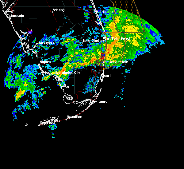 At 938 am est, a severe thunderstorm capable of producing a tornado was located over coconut creek, or near deerfield beach, moving northeast at 20 mph (radar indicated rotation). Hazards include tornado. Flying debris will be dangerous to those caught without shelter. mobile homes will be damaged or destroyed. damage to roofs, windows and vehicles will occur. tree damage is likely. Locations impacted include, fort lauderdale, coral springs, pompano beach, boca raton and deerfield beach. At 938 am est, a severe thunderstorm capable of producing a tornado was located over coconut creek, or near deerfield beach, moving northeast at 20 mph (radar indicated rotation). Hazards include tornado. Flying debris will be dangerous to those caught without shelter. mobile homes will be damaged or destroyed. damage to roofs, windows and vehicles will occur. tree damage is likely. Locations impacted include, fort lauderdale, coral springs, pompano beach, boca raton and deerfield beach.
|
| 1/27/2016 9:27 AM EST |
 At 927 am est, a severe thunderstorm capable of producing a tornado was located over north lauderdale, or over margate, moving northeast at 25 mph (radar indicated rotation). Hazards include tornado. Flying debris will be dangerous to those caught without shelter. mobile homes will be damaged or destroyed. damage to roofs, windows and vehicles will occur. Tree damage is likely. At 927 am est, a severe thunderstorm capable of producing a tornado was located over north lauderdale, or over margate, moving northeast at 25 mph (radar indicated rotation). Hazards include tornado. Flying debris will be dangerous to those caught without shelter. mobile homes will be damaged or destroyed. damage to roofs, windows and vehicles will occur. Tree damage is likely.
|
| 1/27/2016 9:20 AM EST |
 At 920 am est, a severe thunderstorm was located over north lauderdale, or over tamarac, moving northeast at 30 mph (radar indicated). Hazards include 60 mph wind gusts. Expect damage to roofs. Siding and trees. At 920 am est, a severe thunderstorm was located over north lauderdale, or over tamarac, moving northeast at 30 mph (radar indicated). Hazards include 60 mph wind gusts. Expect damage to roofs. Siding and trees.
|
| 1/17/2016 7:39 AM EST | A thunderstorm produced a wind gust of 52 mph at the city of sunrise weatherbug sit in broward county FL, 8.3 miles E of Fort Lauderdale, FL |
| 11/22/2015 11:49 AM EST |
 At 1146 am est, a severe thunderstorm capable of producing a tornado continues to move eastward into the western metro areas of broward county (radar indicated rotation). Hazards include tornado. Expect damage to mobile homes. roofs and vehicles. Locations impacted include, davie, plantation, sunrise, tamarac and lauderhill. At 1146 am est, a severe thunderstorm capable of producing a tornado continues to move eastward into the western metro areas of broward county (radar indicated rotation). Hazards include tornado. Expect damage to mobile homes. roofs and vehicles. Locations impacted include, davie, plantation, sunrise, tamarac and lauderhill.
|
| 11/22/2015 11:35 AM EST |
 At 1134 am est, a severe thunderstorm capable of producing a tornado was located over davie, moving northeast at 20 mph (radar indicated rotation). Hazards include tornado. Expect damage to mobile homes. Roofs and vehicles. At 1134 am est, a severe thunderstorm capable of producing a tornado was located over davie, moving northeast at 20 mph (radar indicated rotation). Hazards include tornado. Expect damage to mobile homes. Roofs and vehicles.
|
| 4/27/2015 6:44 PM EDT | A severe thunderstorm warning remains in effect until 700 pm edt for southeastern broward and northeastern miami-dade counties. at 644 pm edt. doppler radar indicated a severe thunderstorm capable of producing quarter size hail and damaging winds in excess of 60 mph. this storm was located over ojus. or near hallandale. Moving east at 25 mph. |
| 4/27/2015 6:44 PM EDT | At 644 pm edt, doppler radar indicated a severe thunderstorm capable of producing quarter size hail and damaging winds in excess of 60 mph. this storm was located over ojus, or near hallandale, moving east at 25 mph. locations impacted include, pembroke pines, hollywood, miramar, miami gardens and hallandale. |
| 4/27/2015 6:27 PM EDT | The national weather service in miami has issued a * severe thunderstorm warning for. southeastern broward county in southeastern florida. northeastern miami-dade county in southeastern florida. until 700 pm edt * at 627 pm edt. Doppler radar indicated a severe thunderstorm. |
| 4/27/2015 6:27 PM EDT | At 627 pm edt, doppler radar indicated a severe thunderstorm capable of producing quarter size hail and damaging winds in excess of 60 mph. this storm was located over west park, or near miami gardens, and moving east at 20 mph. |
| 4/27/2015 6:06 PM EDT | At 606 pm edt, doppler radar continued to indicate a severe thunderstorm capable of producing quarter size hail and damaging winds in excess of 60 mph. this storm was located over intersection krome and u.s. 27, or near miramar, moving east at 10 mph. locations impacted include, pembroke pines, hollywood, miramar, davie and plantation. |
| 4/27/2015 5:58 PM EDT | At 556 pm edt, the public reported a severe thunderstorm producinghail up quarter size at the intersection of pines blvd and 180th to 186th avenue. hail up to golf ball size and damagaging winds in excess of 60 mph is expected with this storm. this storm was located over intersection u.s. 27 pines blvd, or near pembroke pines, and moving northeast at 15 mph. |
| 6/13/2014 3:25 PM EDT | Quarter sized hail reported 9.5 miles NE of Fort Lauderdale, FL |
| 6/13/2014 3:10 PM EDT | Quarter sized hail reported 9.8 miles ENE of Fort Lauderdale, FL |
| 6/13/2014 2:55 PM EDT | Quarter sized hail reported 9.7 miles ENE of Fort Lauderdale, FL |
| 6/8/2014 12:40 PM EDT | Quarter sized hail reported 5.8 miles NE of Fort Lauderdale, FL, up to quarter size hail reported via social media |
| 3/6/2014 3:15 PM EST | Downed tree along south university drive near the grand oaks golf cours in broward county FL, 7.6 miles NE of Fort Lauderdale, FL |
| 3/6/2014 2:50 PM EST | Tree branches of 10 inches diameter also dow in broward county FL, 12.8 miles E of Fort Lauderdale, FL |
| 2/12/2014 5:00 PM EST | Branches down and estimated wind gust received via social medi in broward county FL, 9.9 miles NE of Fort Lauderdale, FL |
| 6/15/2012 3:42 PM EDT | Quarter sized hail reported 1.6 miles SW of Fort Lauderdale, FL, trained spotter reported quarter sized hail near i-95 and oakland park blvd. |
| 1/1/0001 12:00 AM | A wind gust of 53 kts...or 61 mph...was recorded by a mesonet station at the new river middle school in fort lauderdale at 917 pm ed in broward county FL, 2.3 miles NNW of Fort Lauderdale, FL |
| 1/1/0001 12:00 AM | Measured at fort lauderdale executive airport - kfx in broward county FL, 3.4 miles SSE of Fort Lauderdale, FL |
Hail Maps for Fort Lauderdale, FL
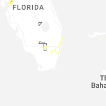
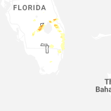


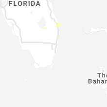


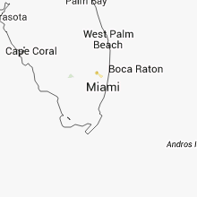


Connect with Interactive Hail Maps