

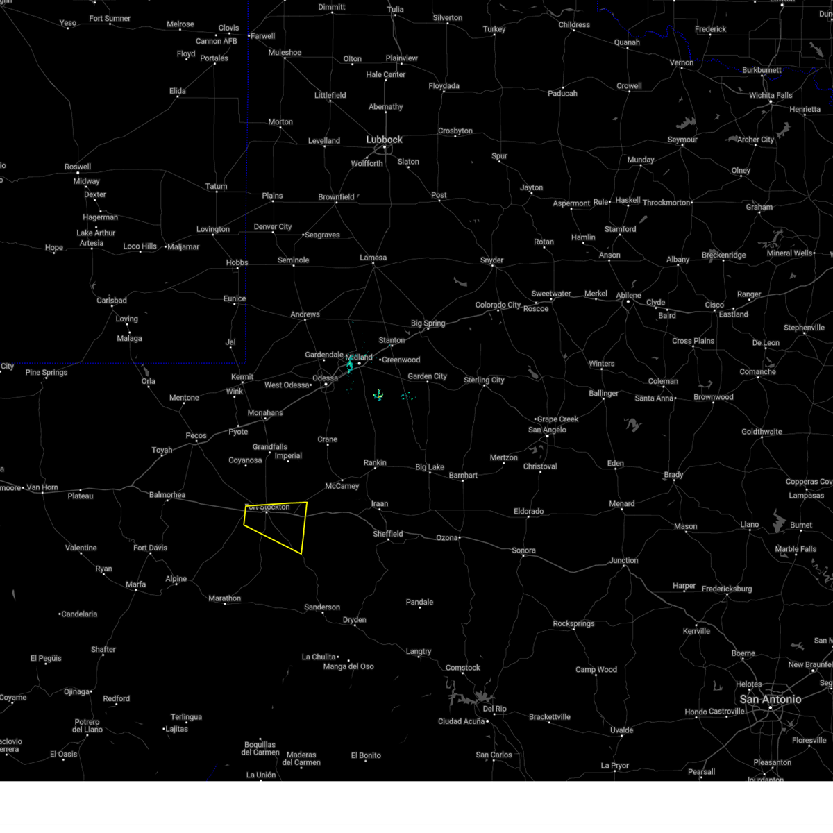
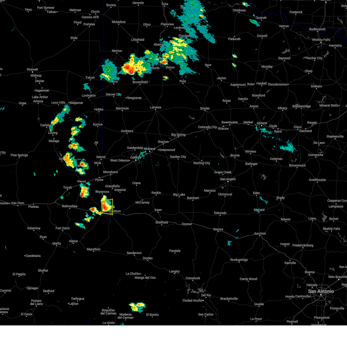
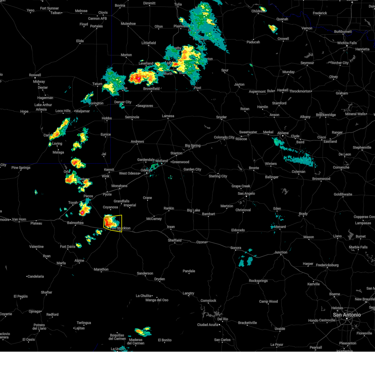
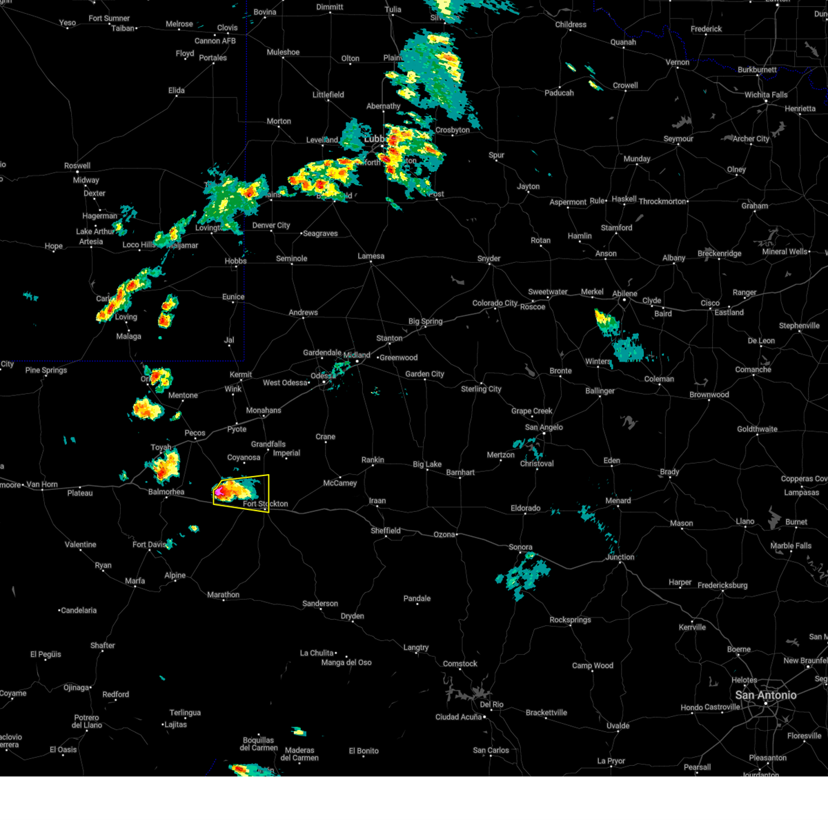
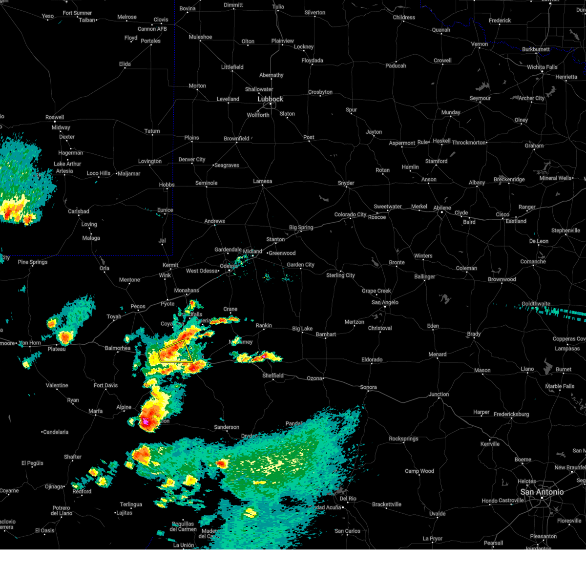
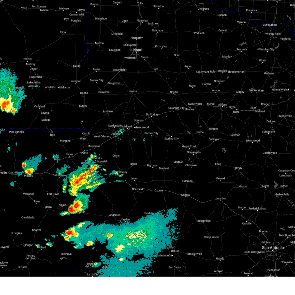
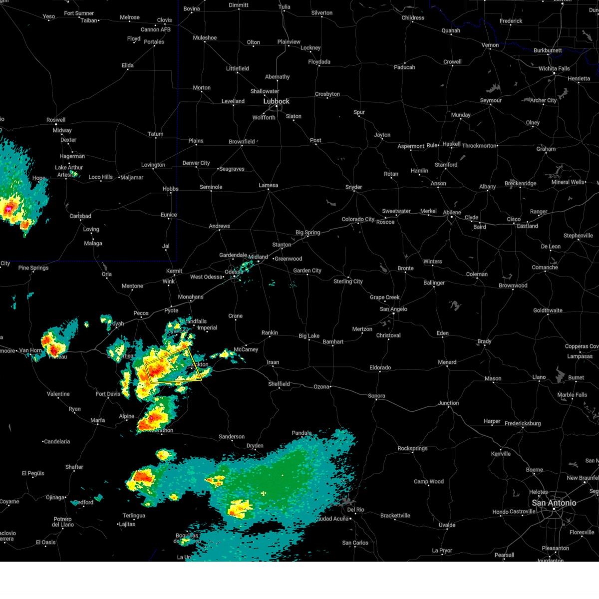
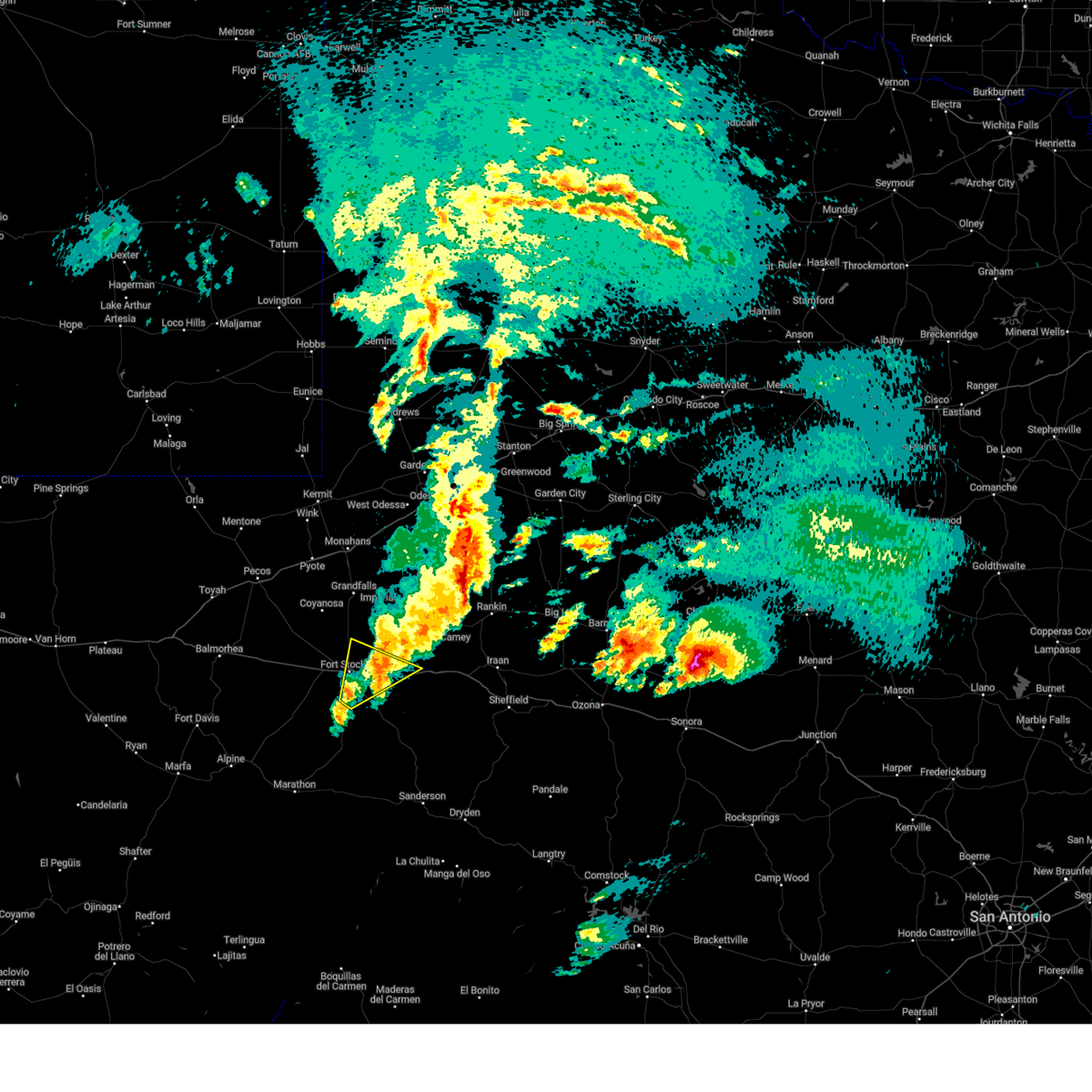
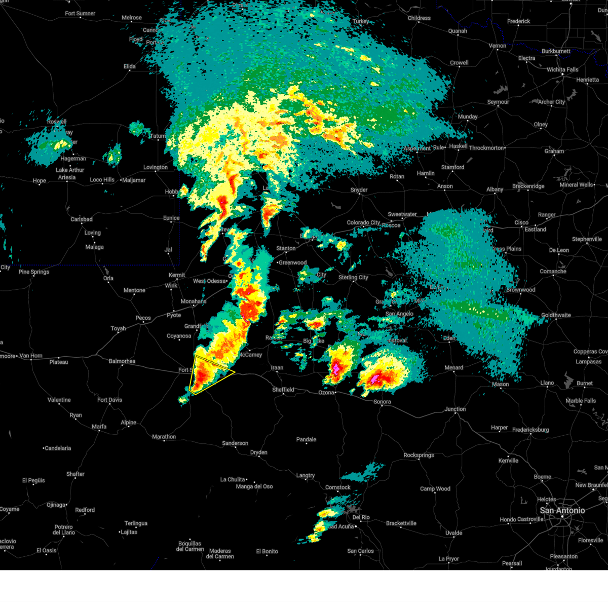
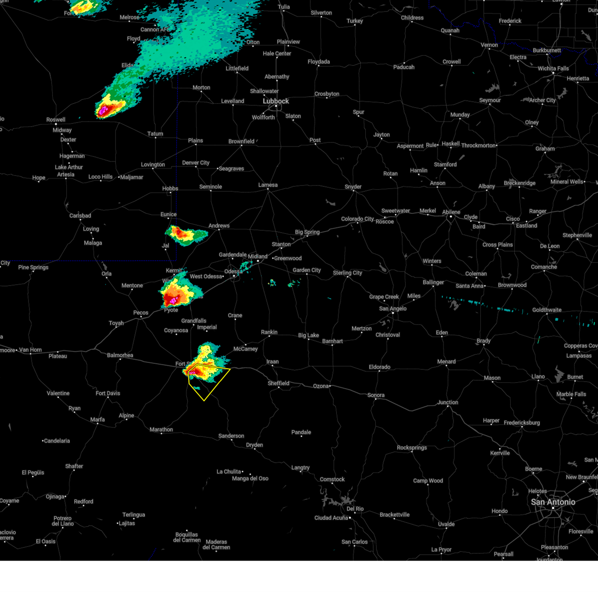
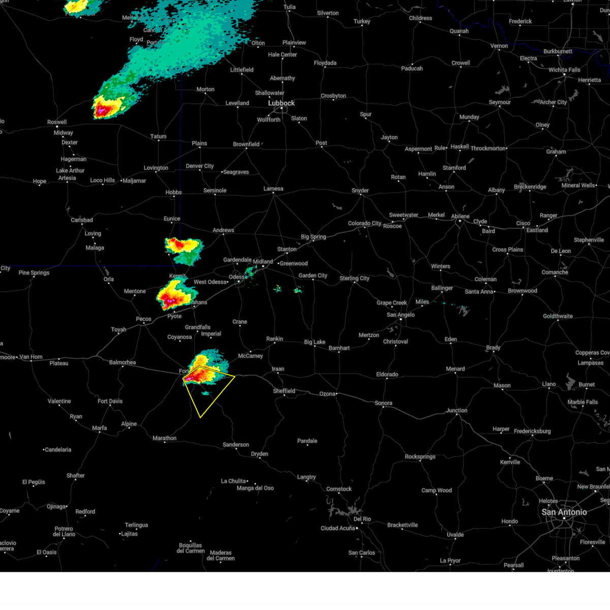
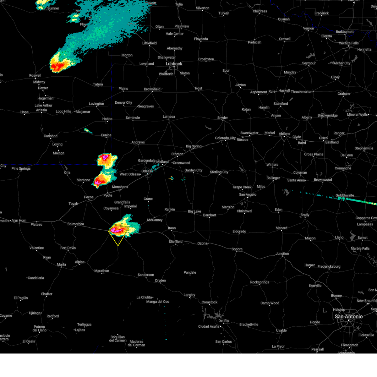
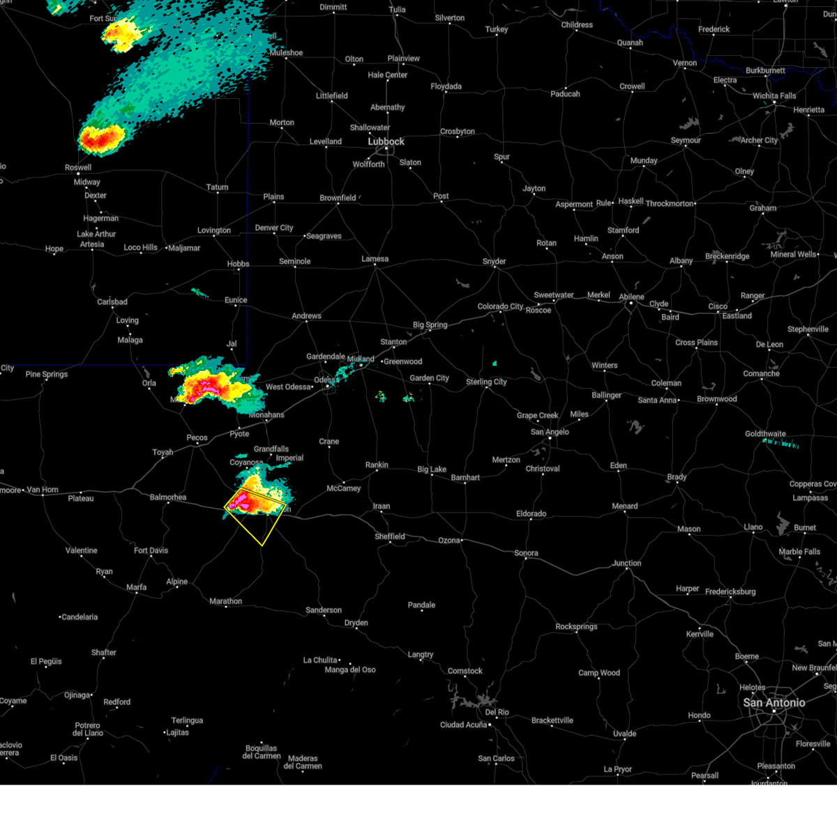
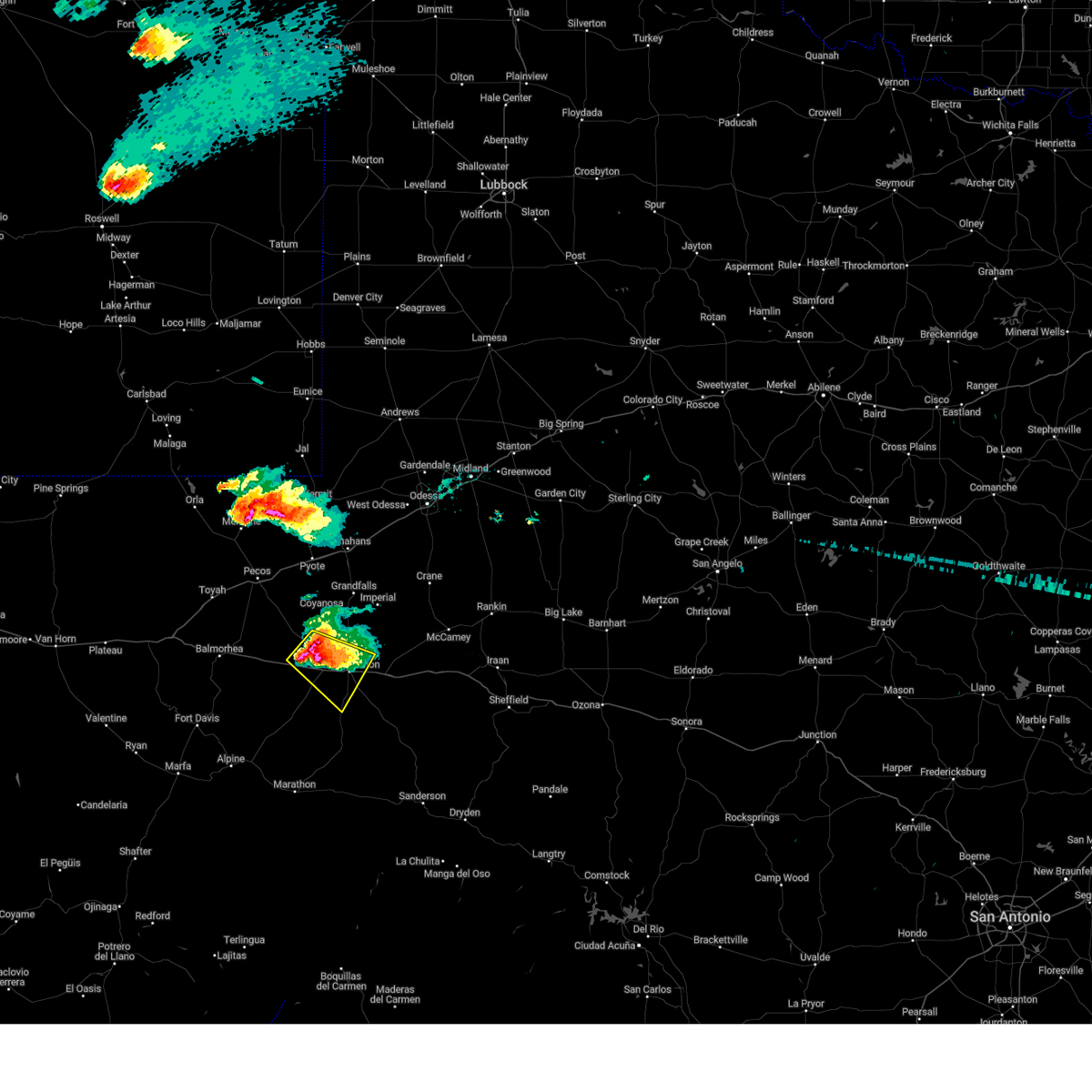
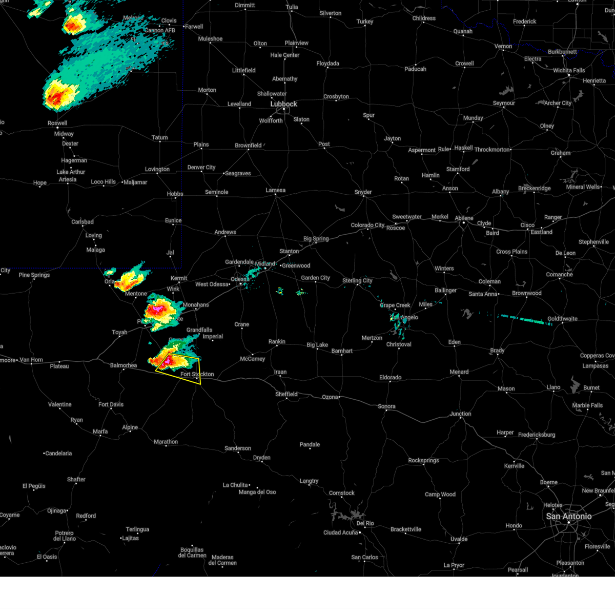
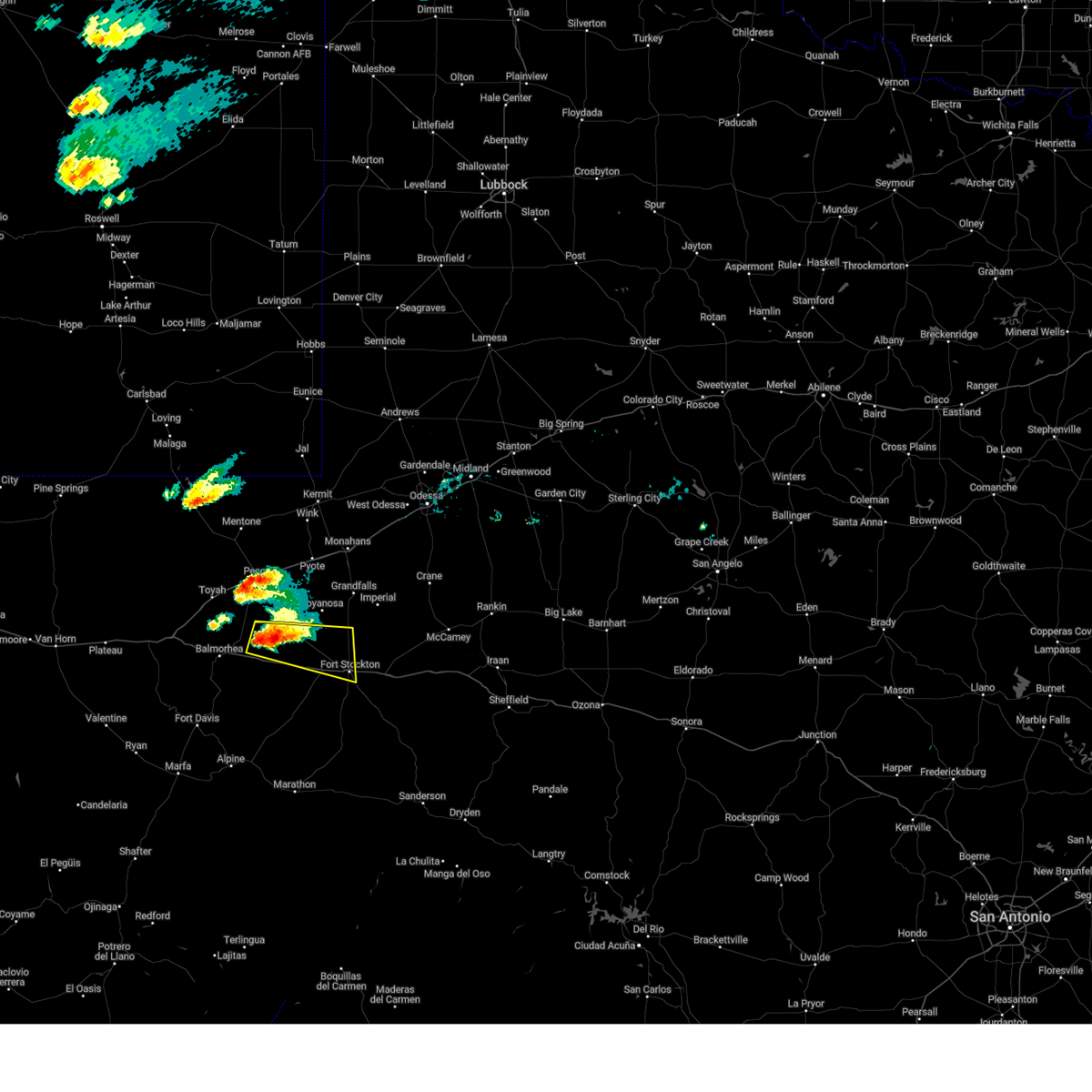
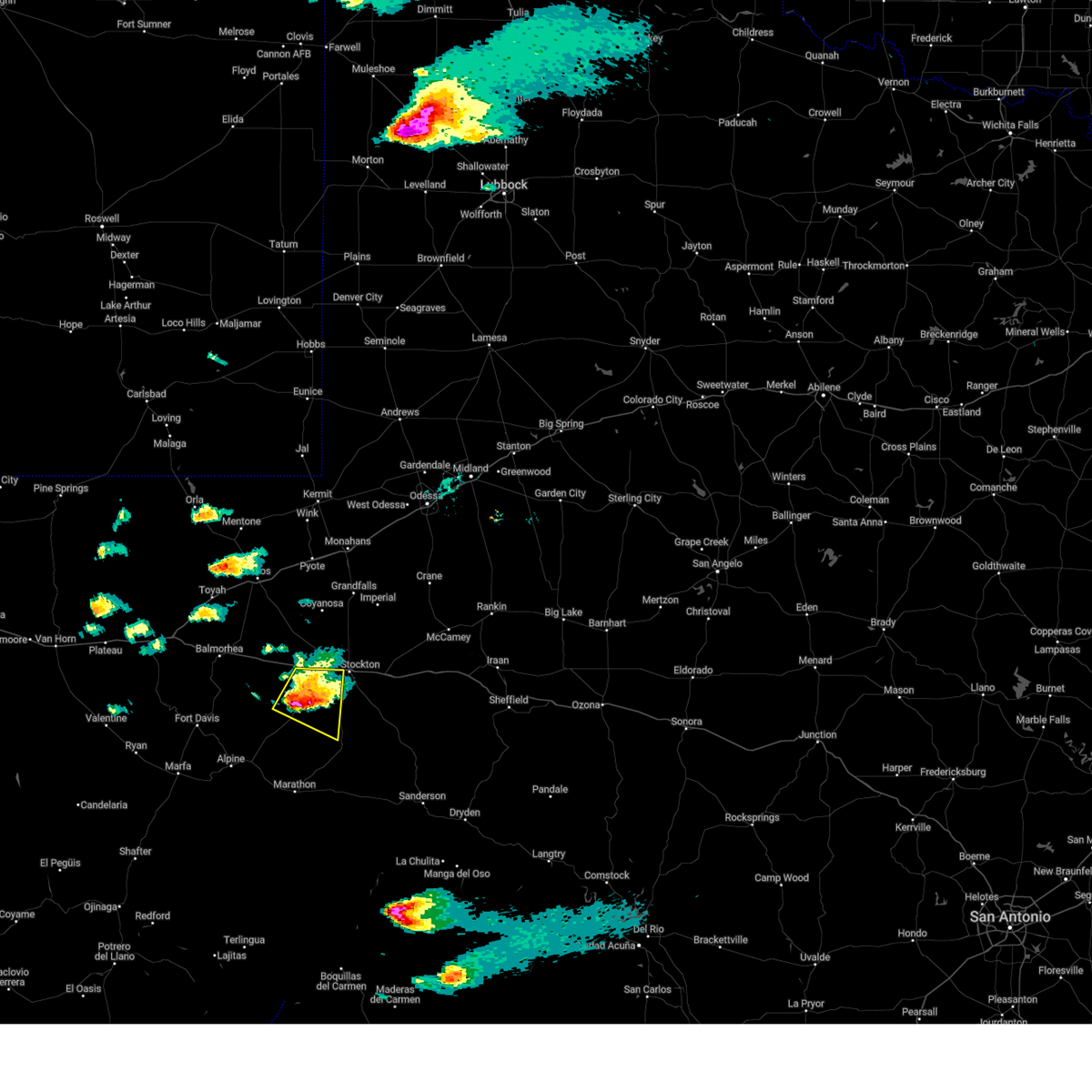
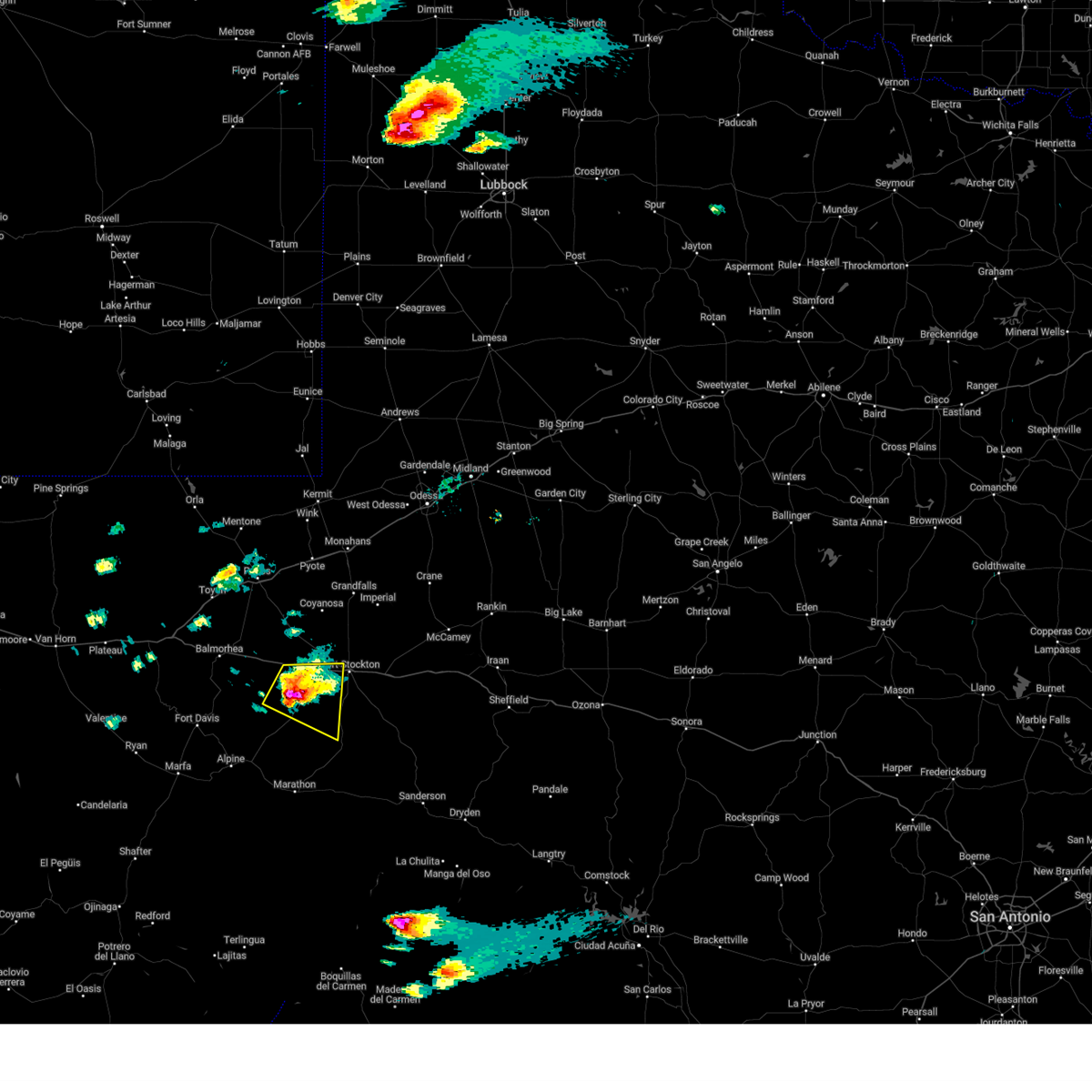
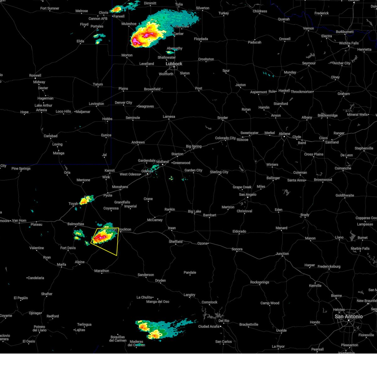
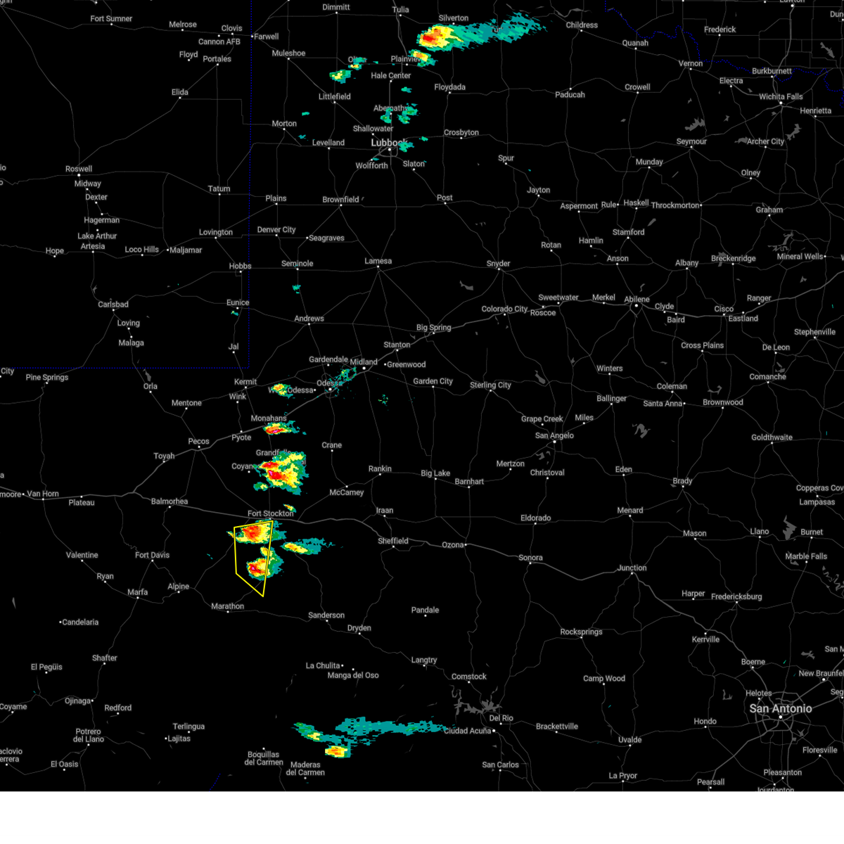
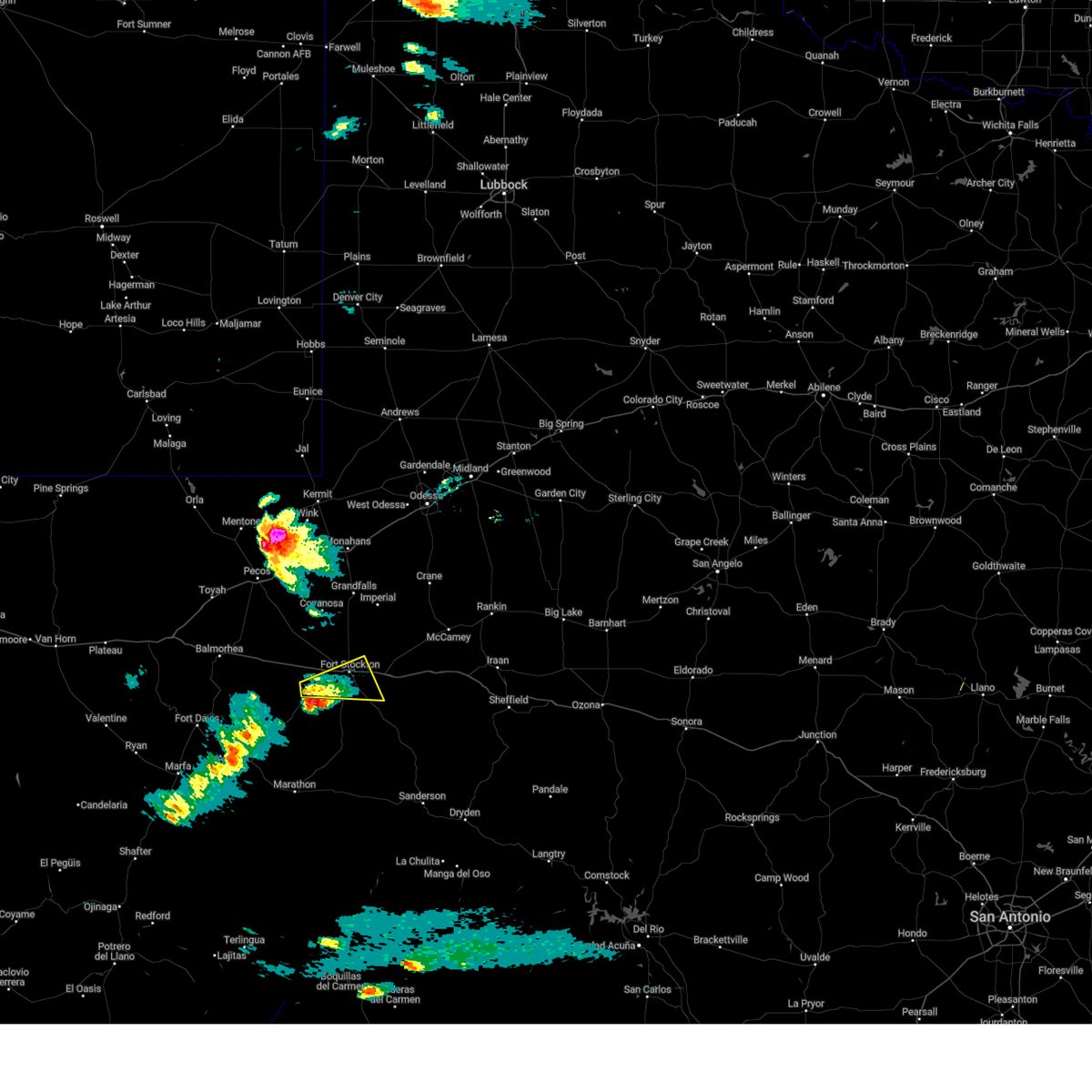
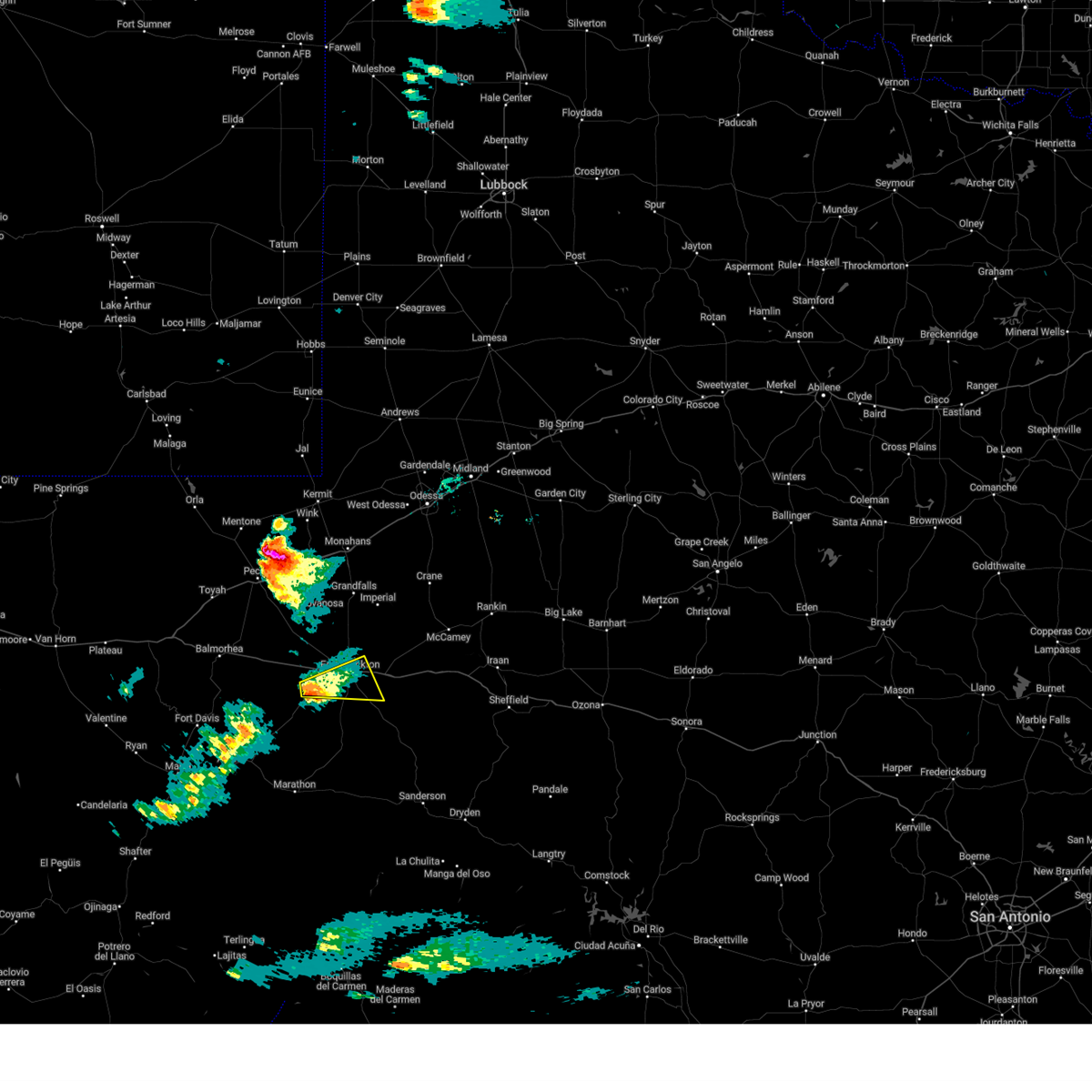
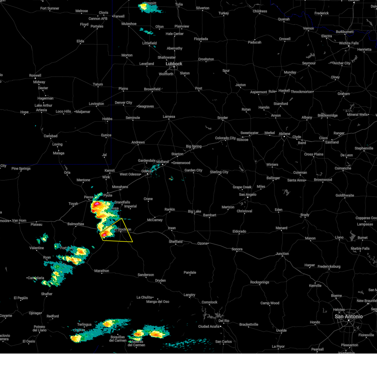
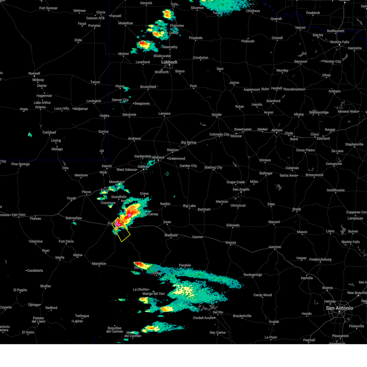
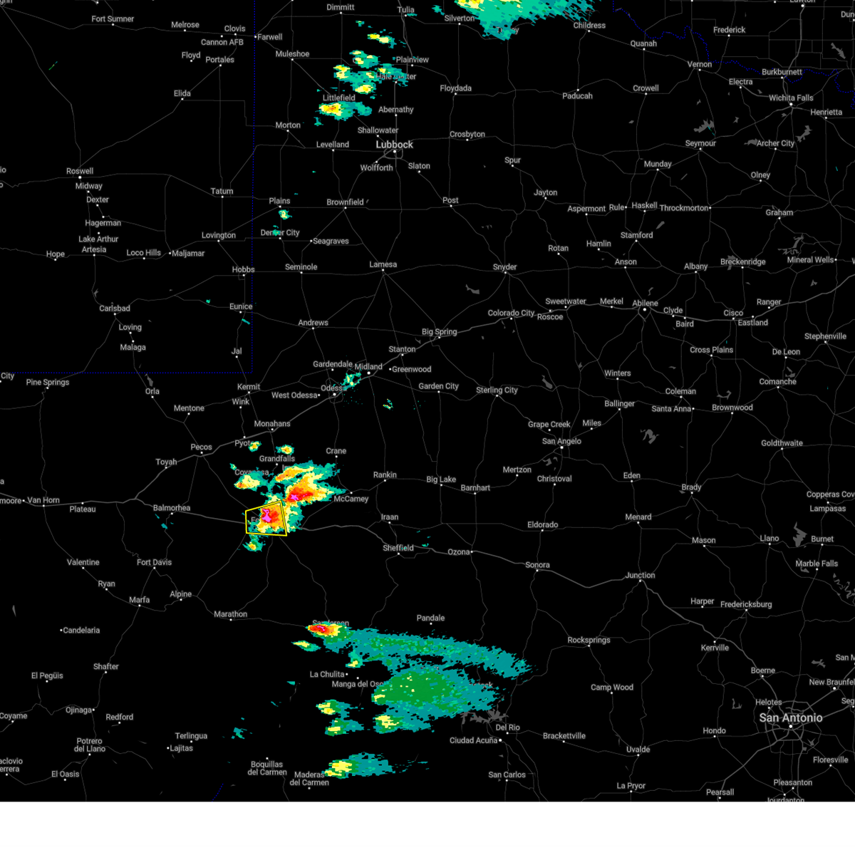
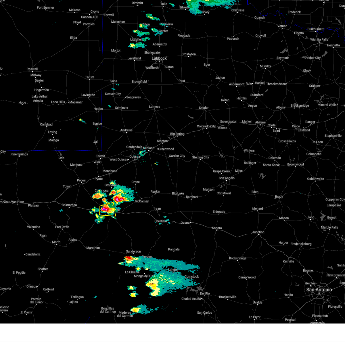
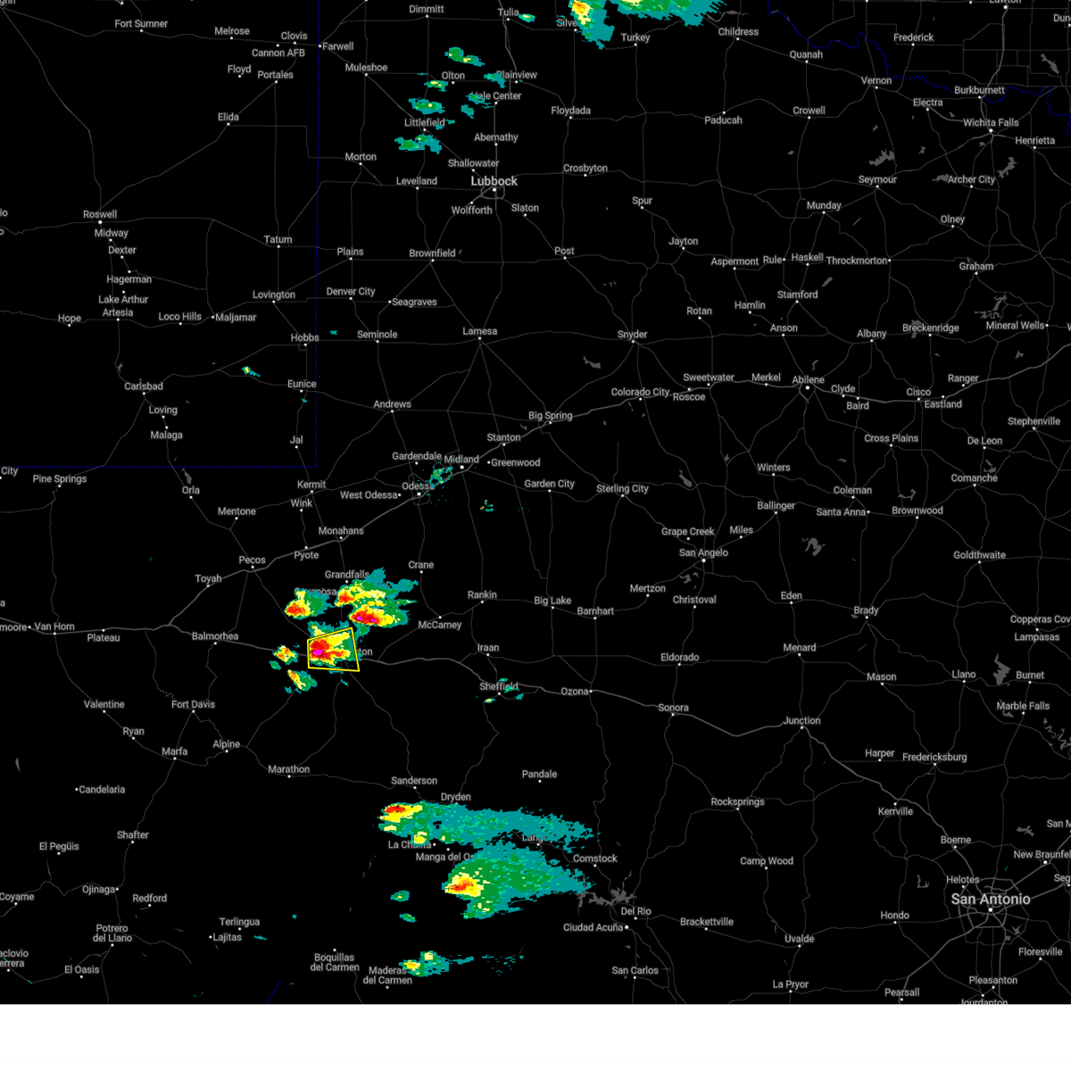
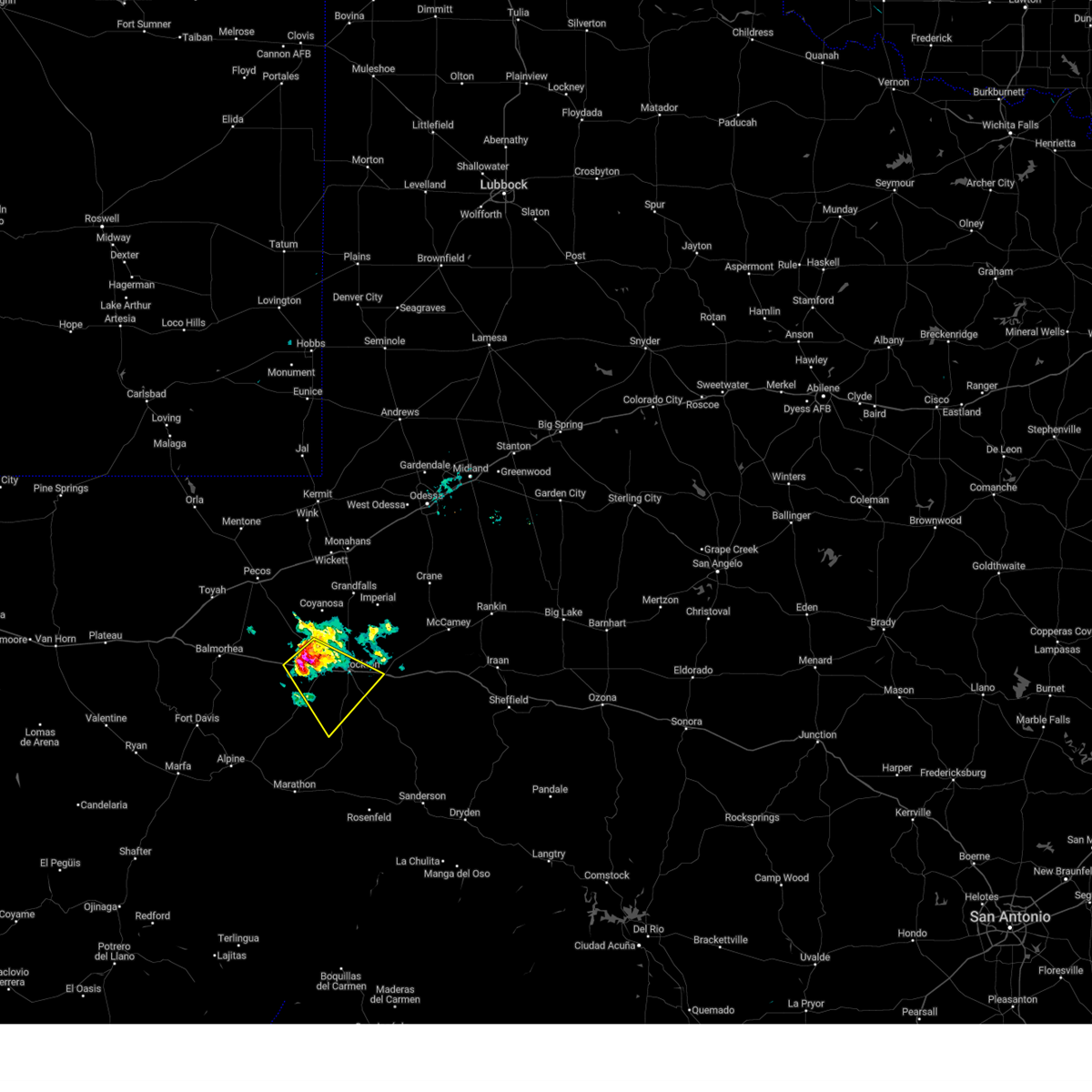
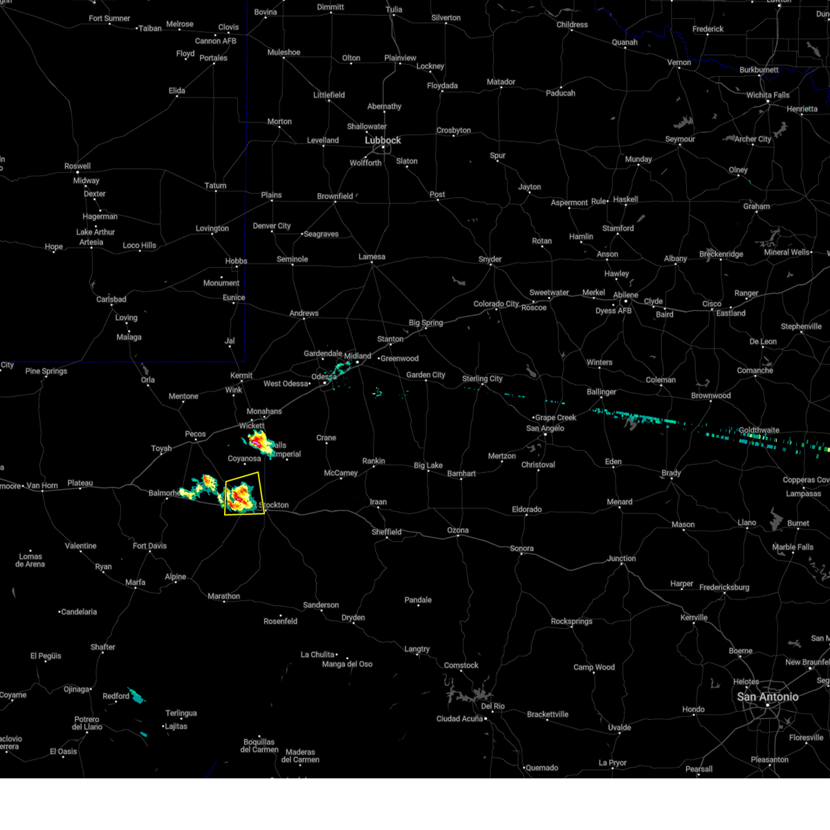
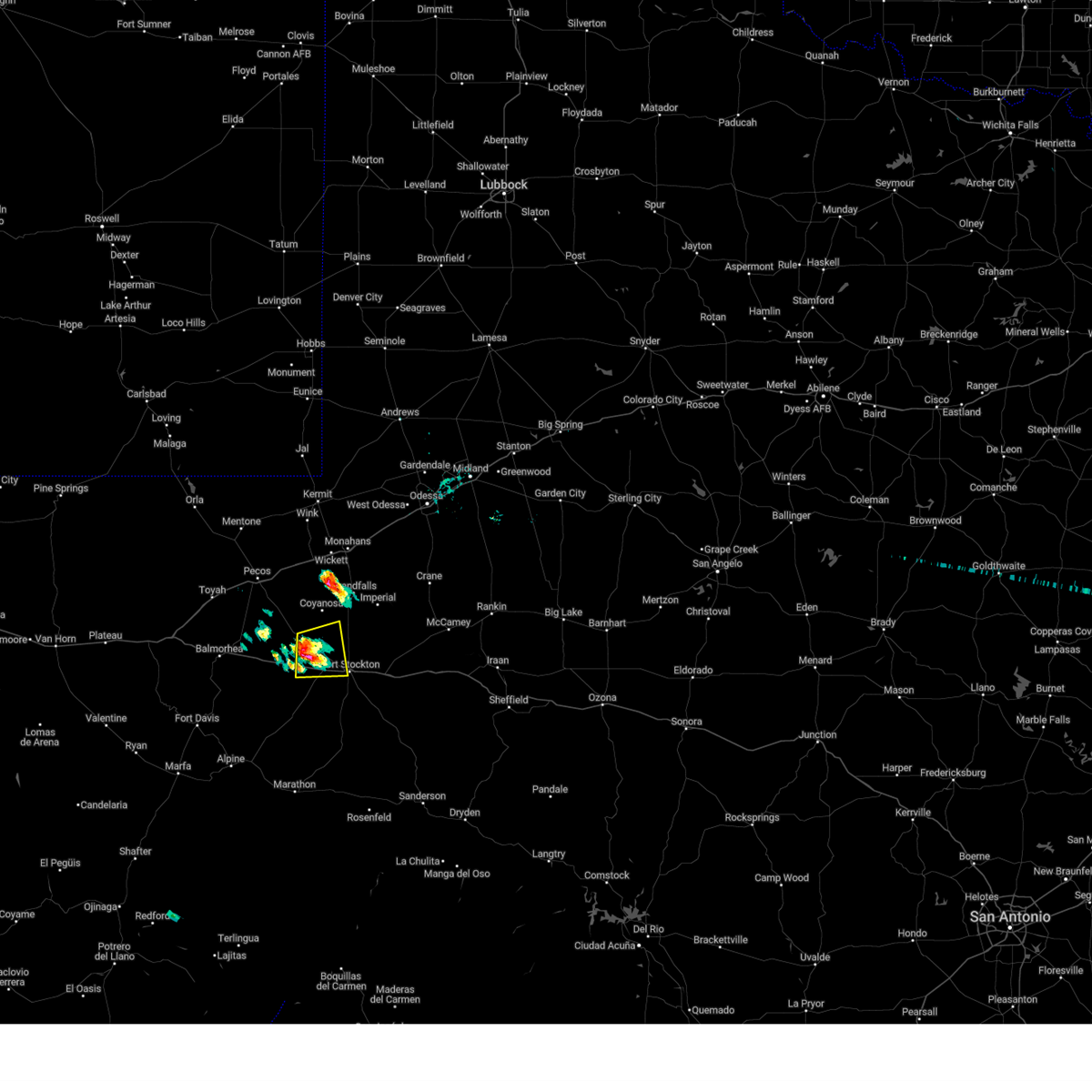
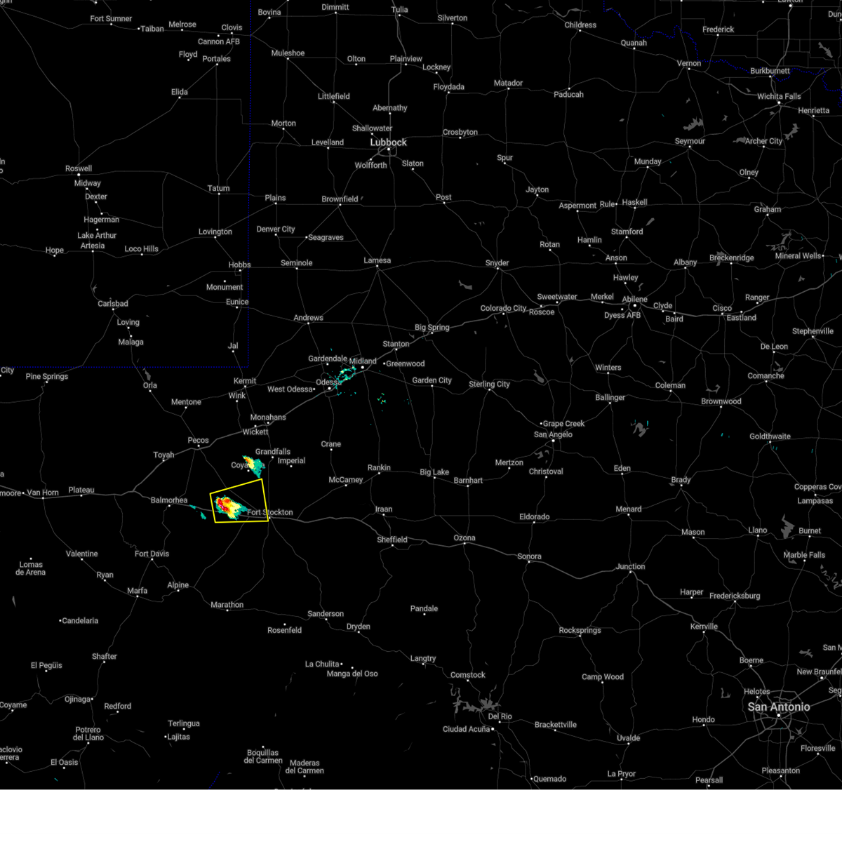
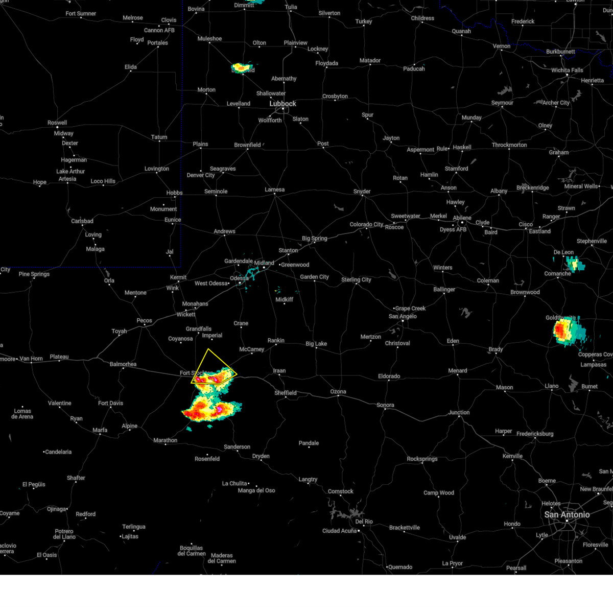
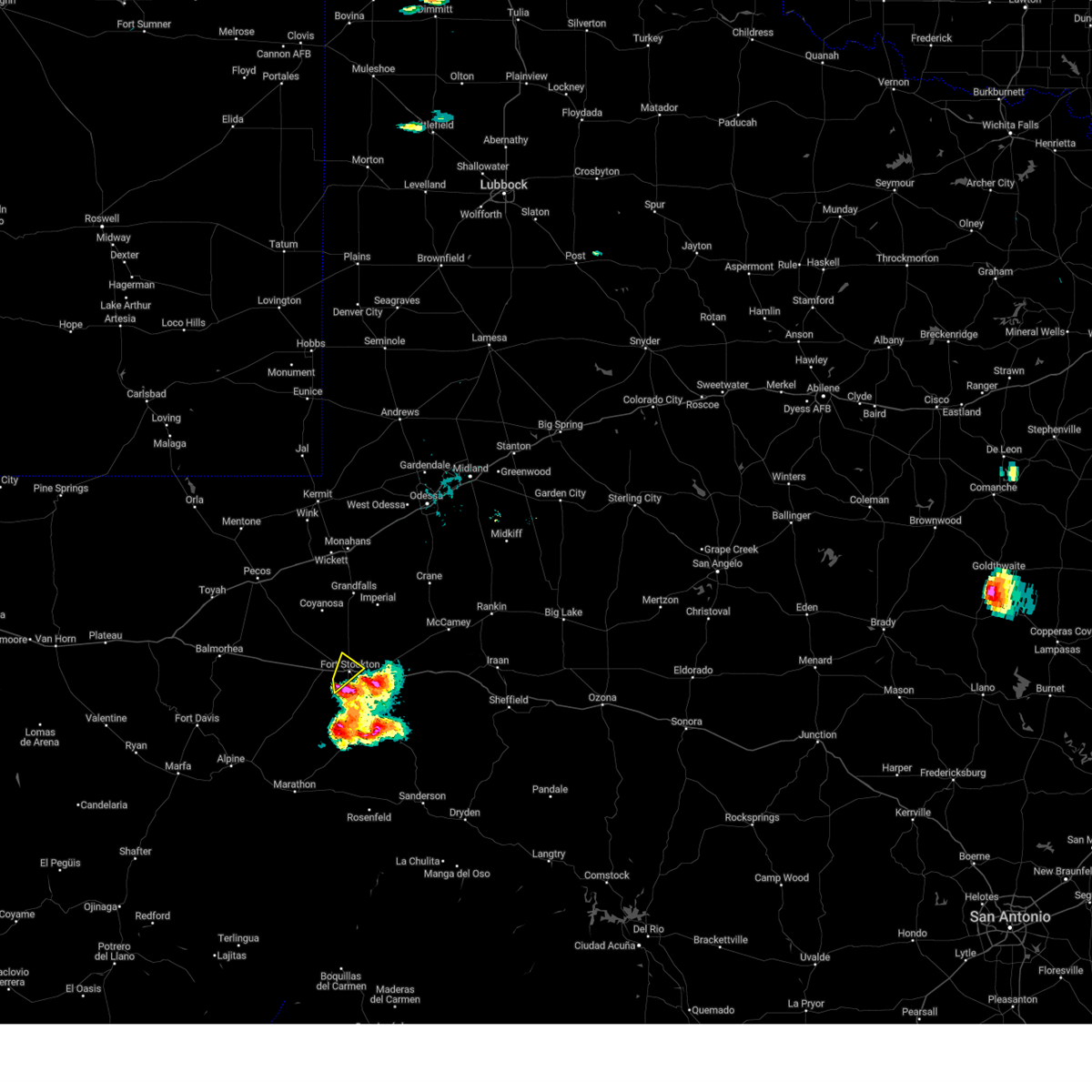
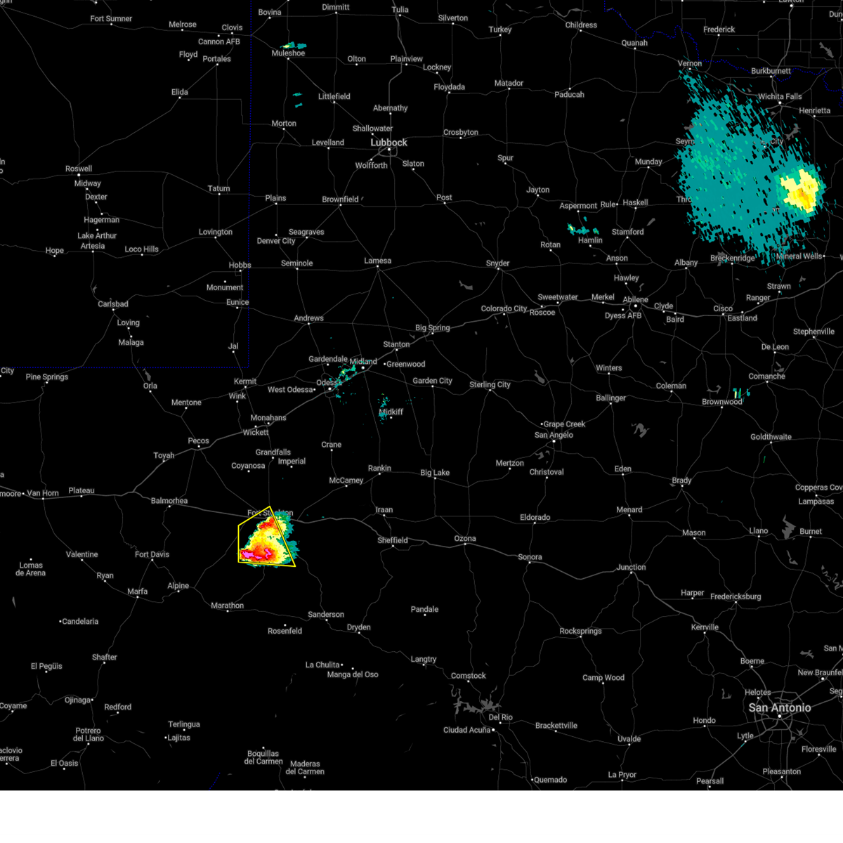
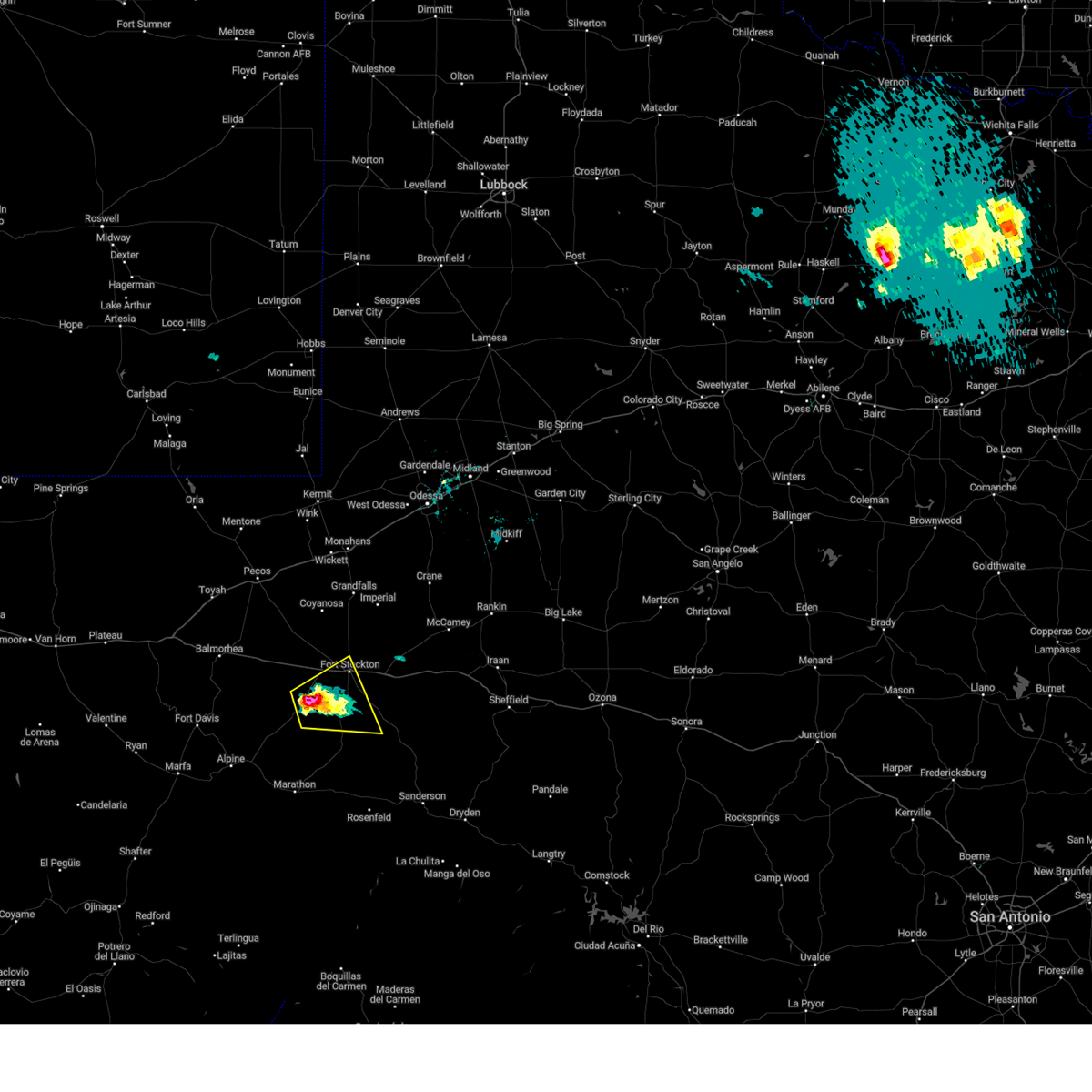
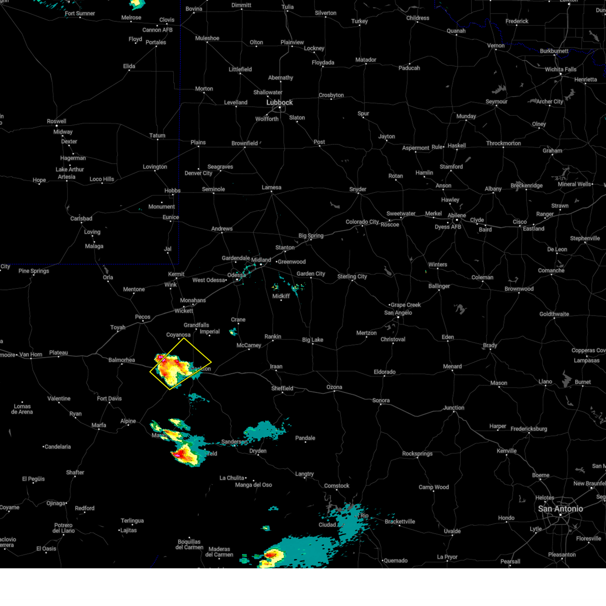
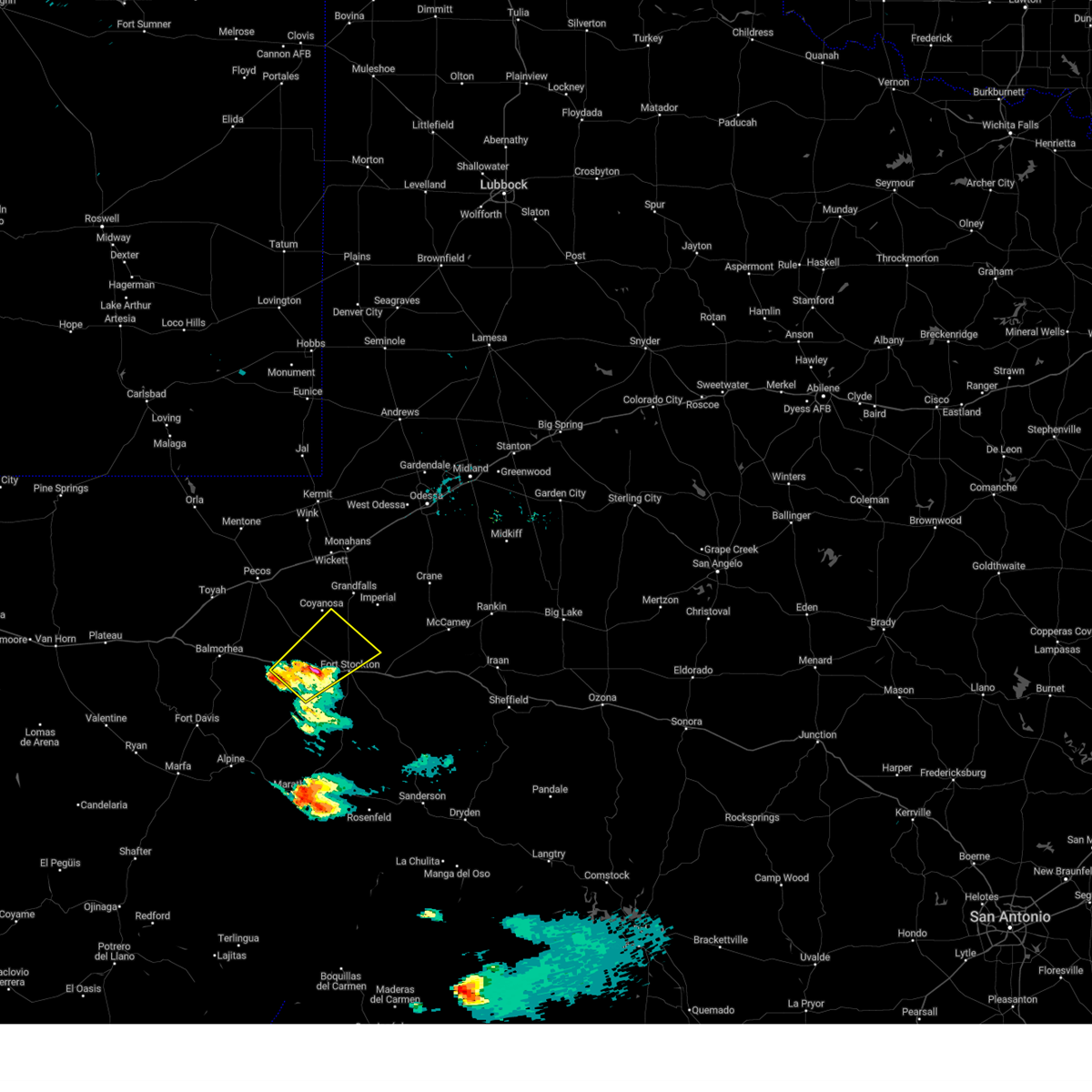
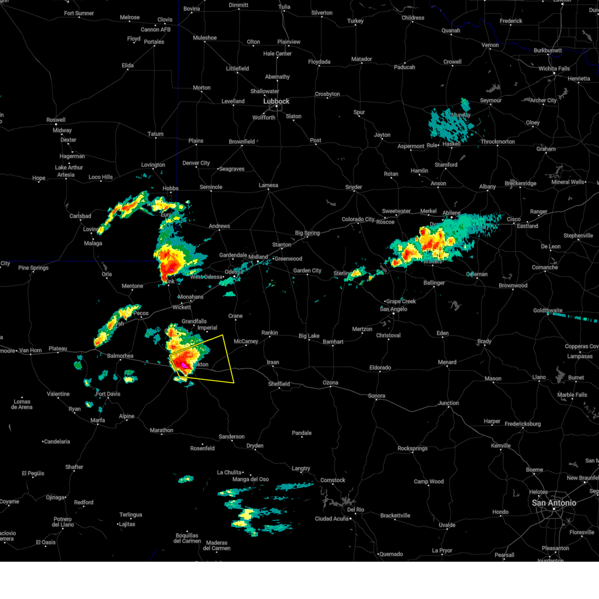
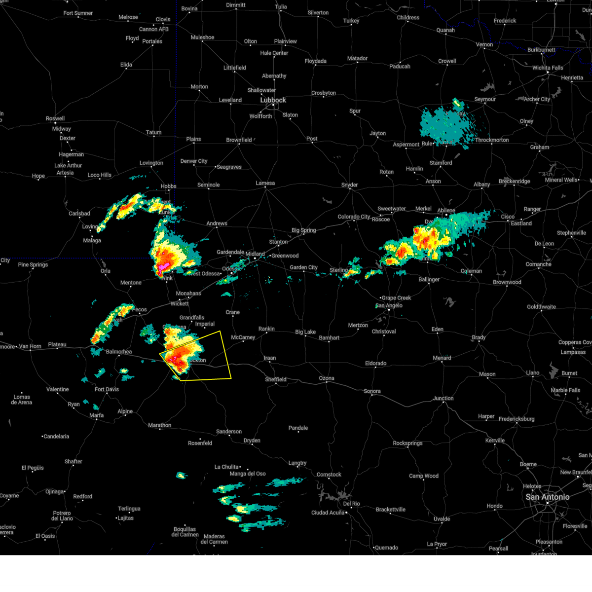
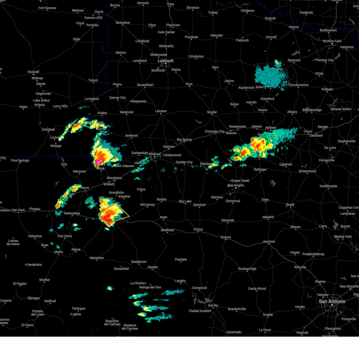
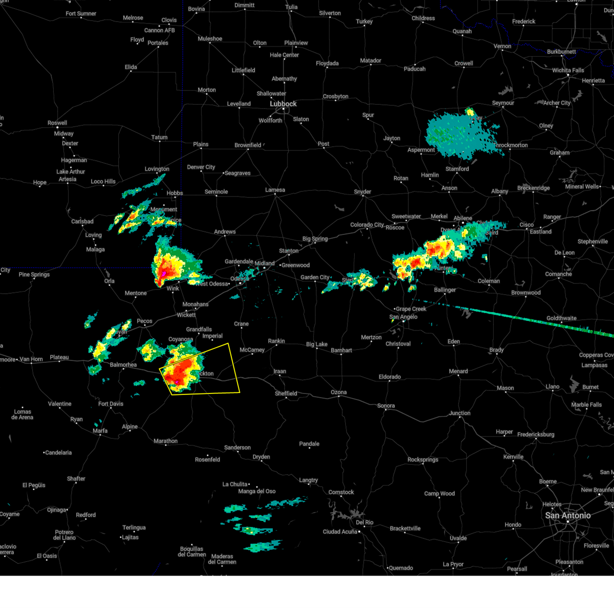
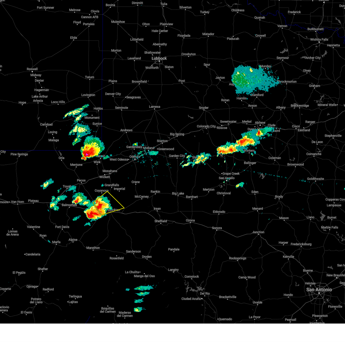
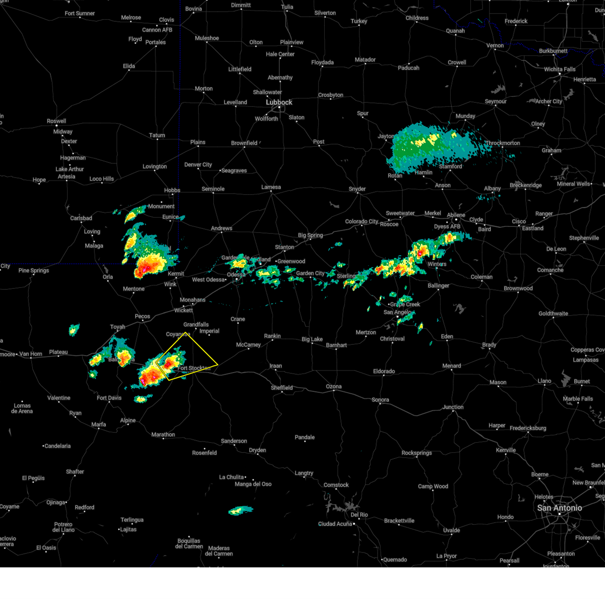
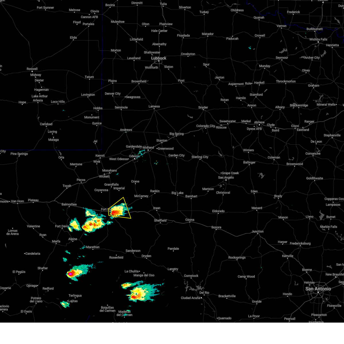
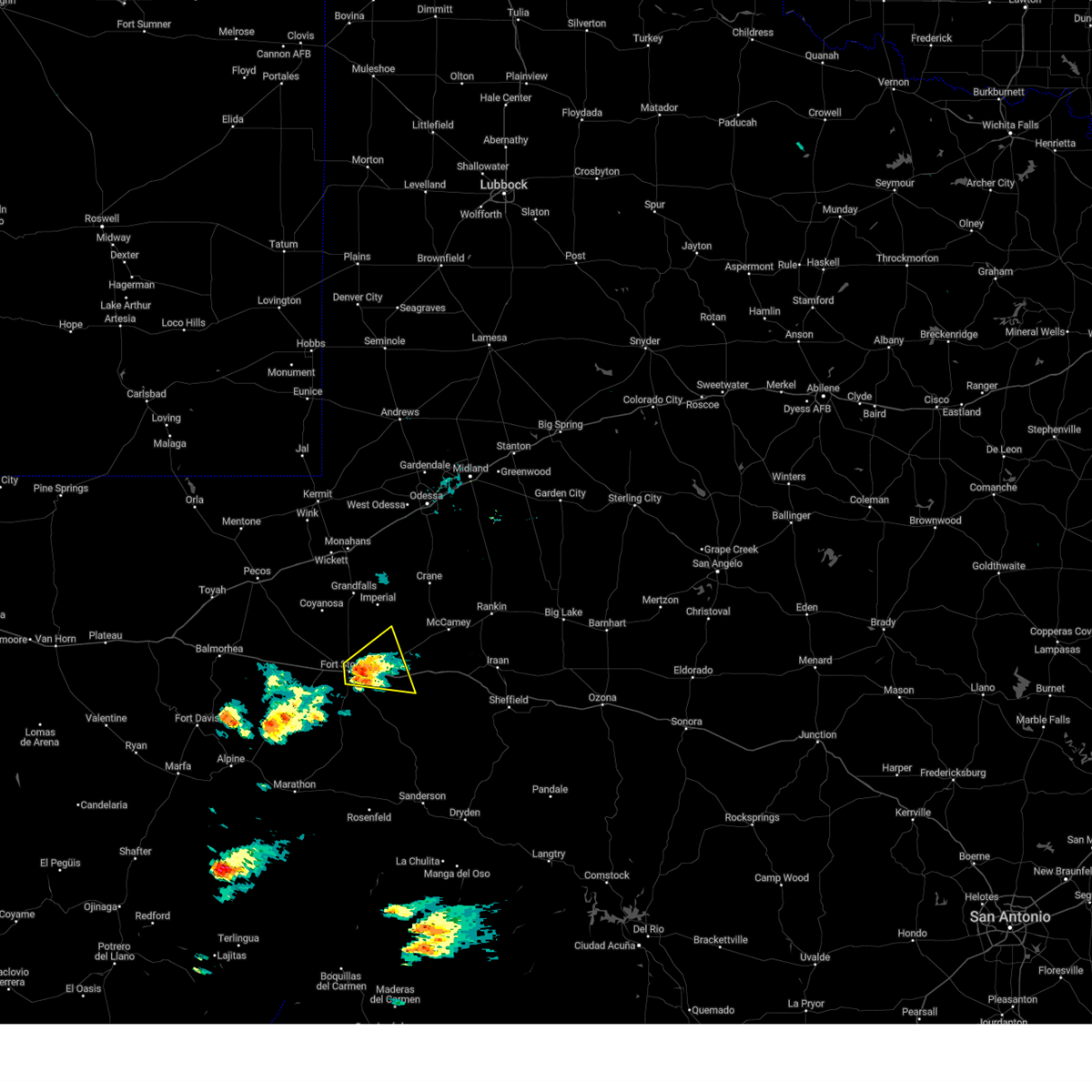
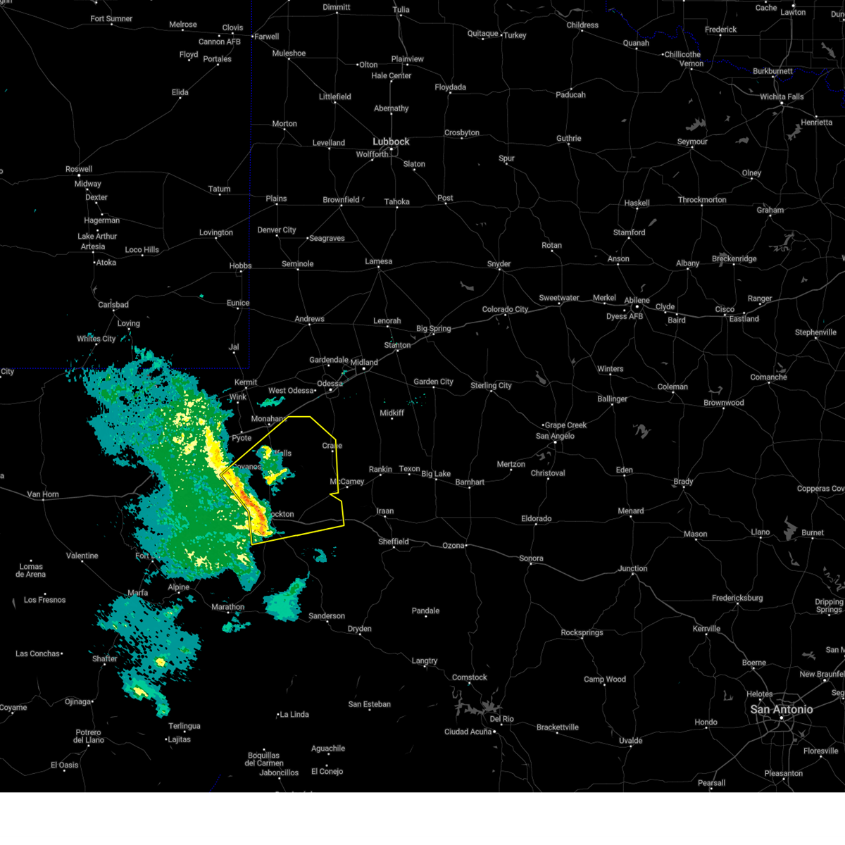
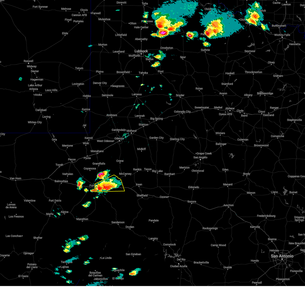
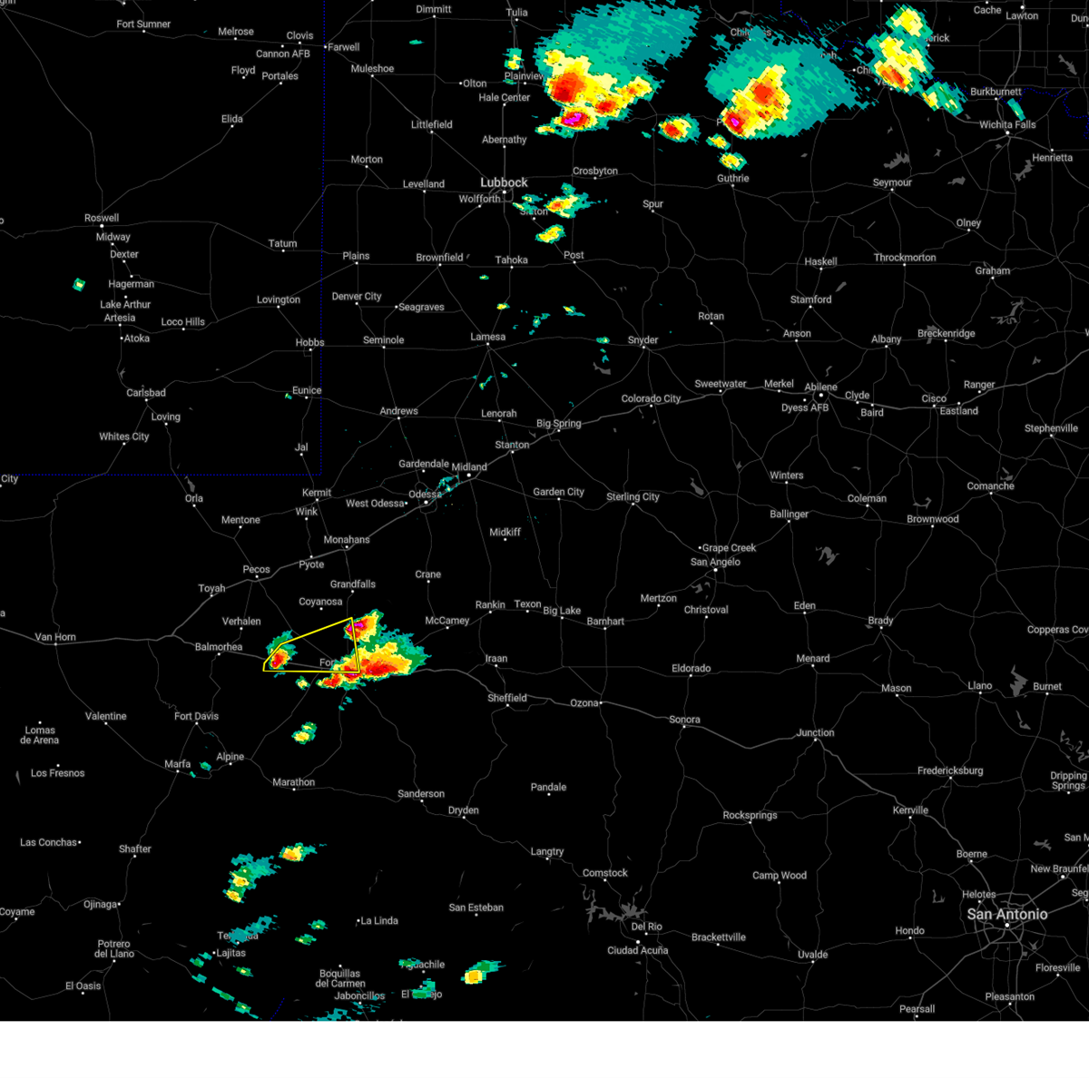
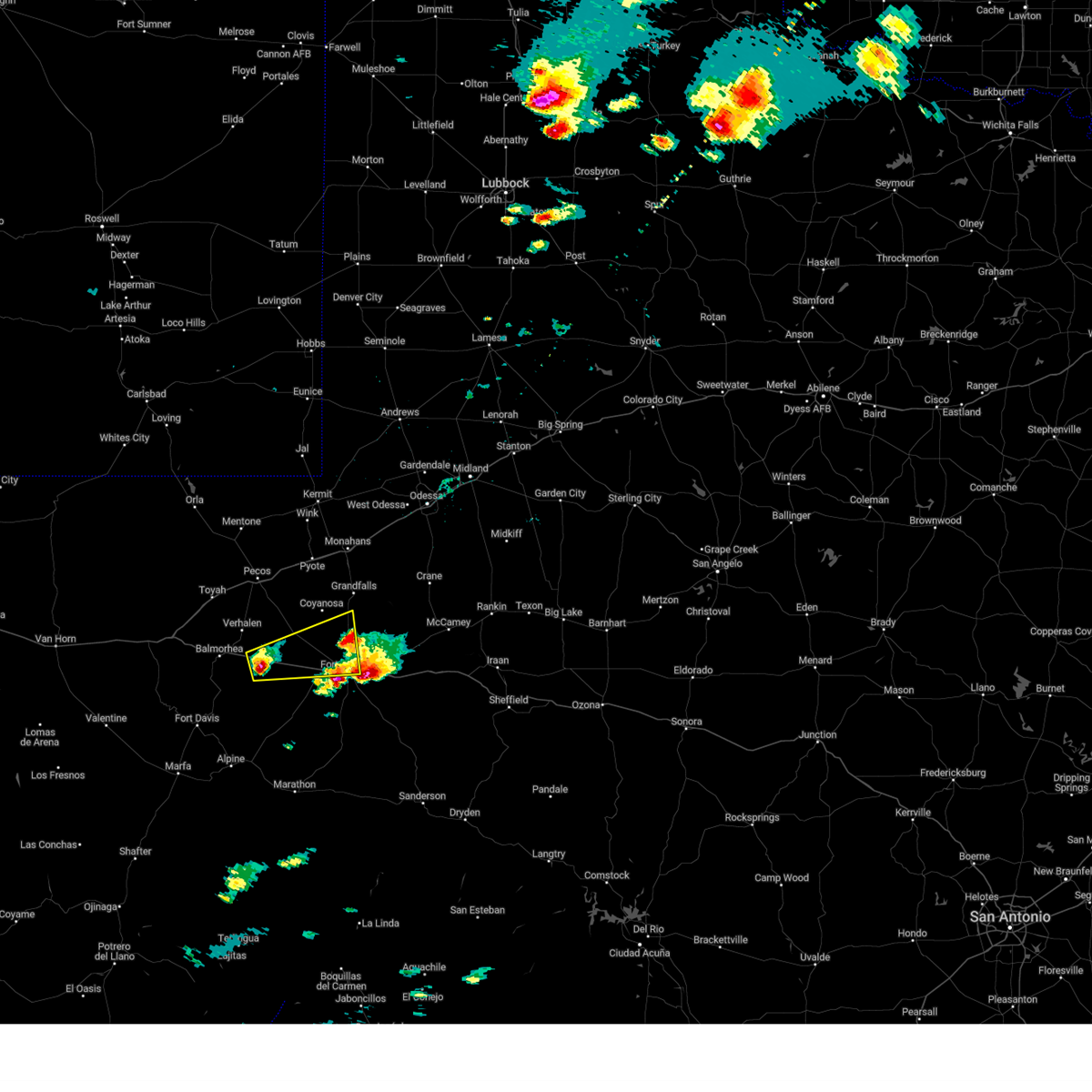
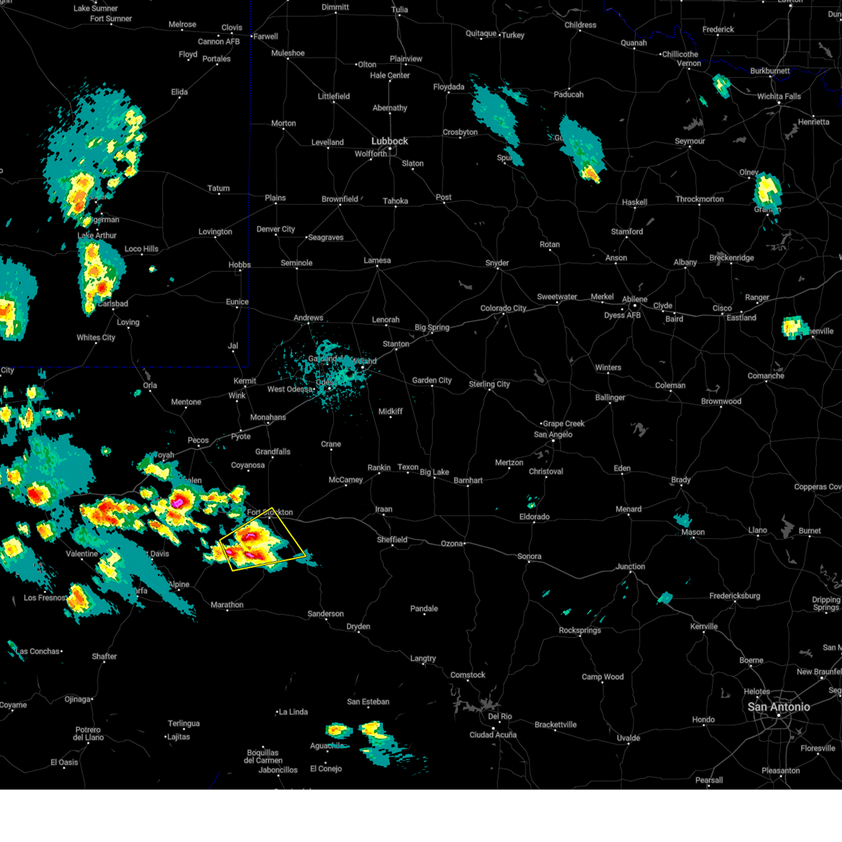
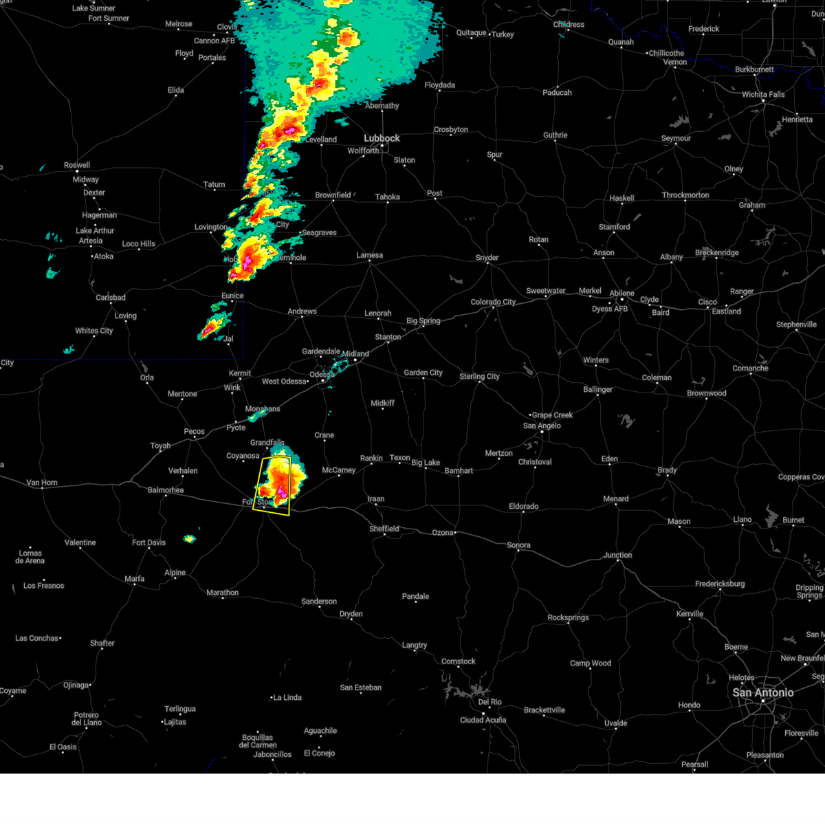
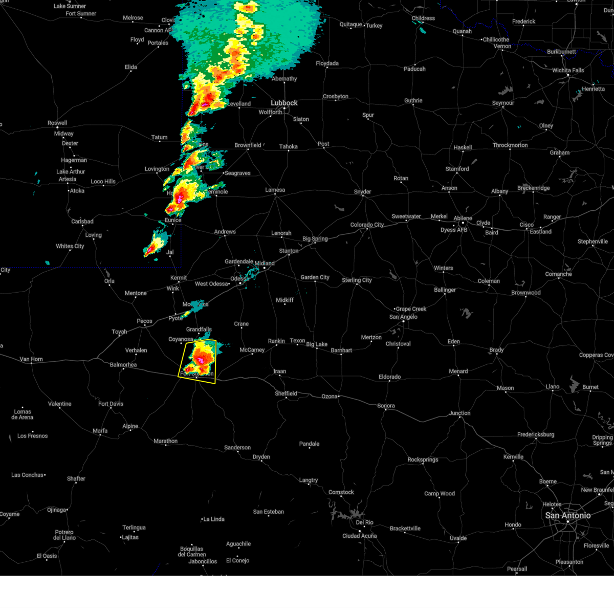
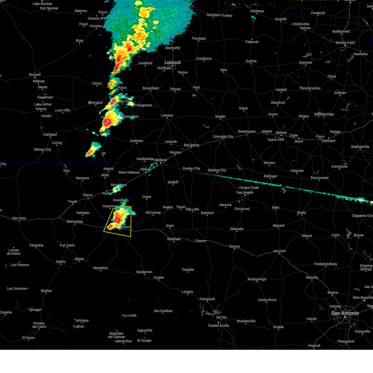
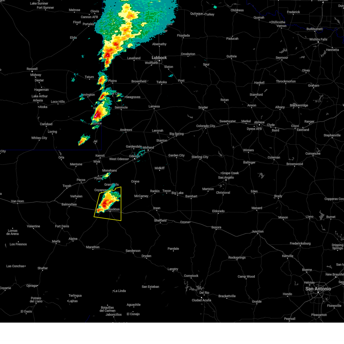
Hail Map for Fort Stockton, TX
The Fort Stockton, TX area has had 128 reports of on-the-ground hail by trained spotters, and has been under severe weather warnings 38 times during the past 12 months. Doppler radar has detected hail at or near Fort Stockton, TX on 70 occasions, including 8 occasions during the past year.
| Name: | Fort Stockton, TX |
| Where Located: | 59.3 miles NE of Alpine, TX |
| Map: | Google Map for Fort Stockton, TX |
| Population: | 8283 |
| Housing Units: | 3115 |
| More Info: | Search Google for Fort Stockton, TX |
3
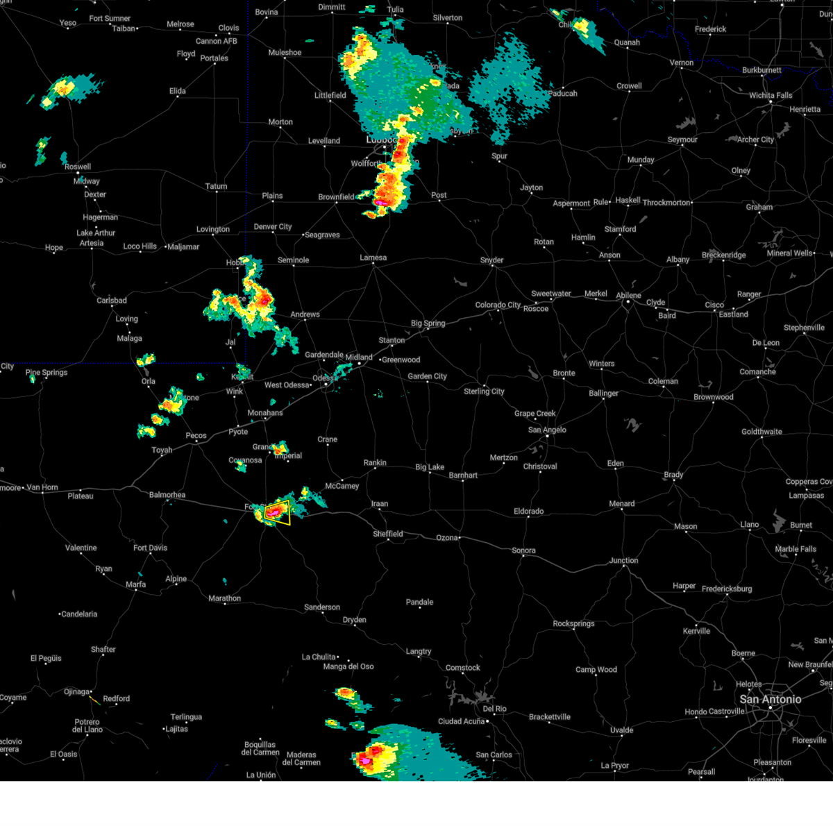
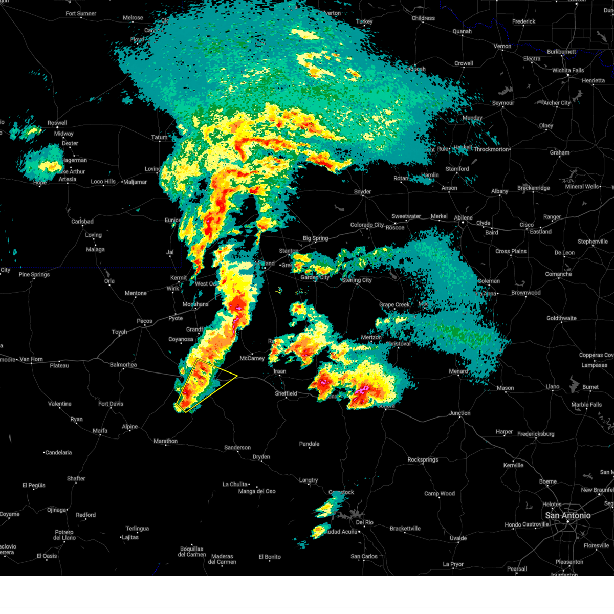
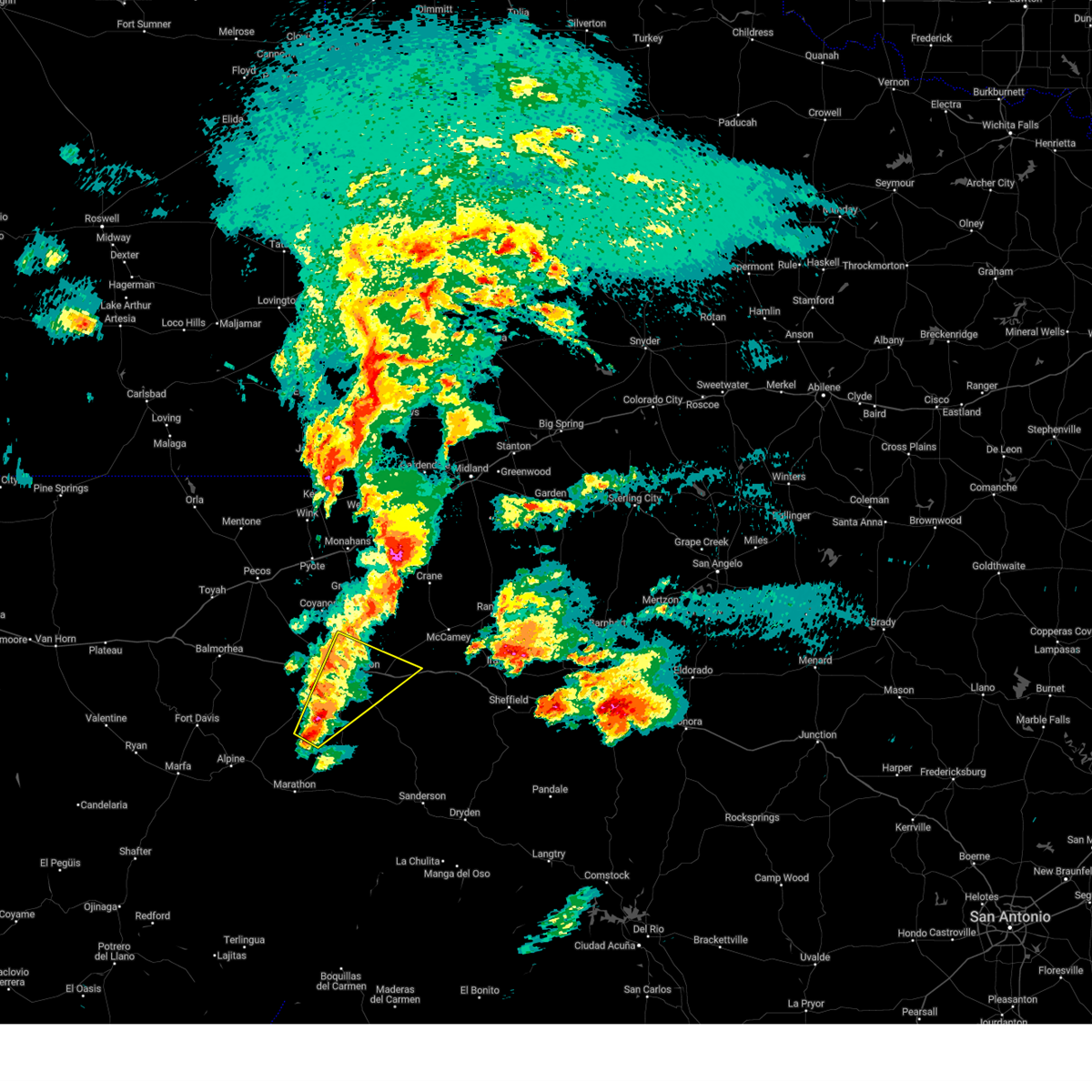
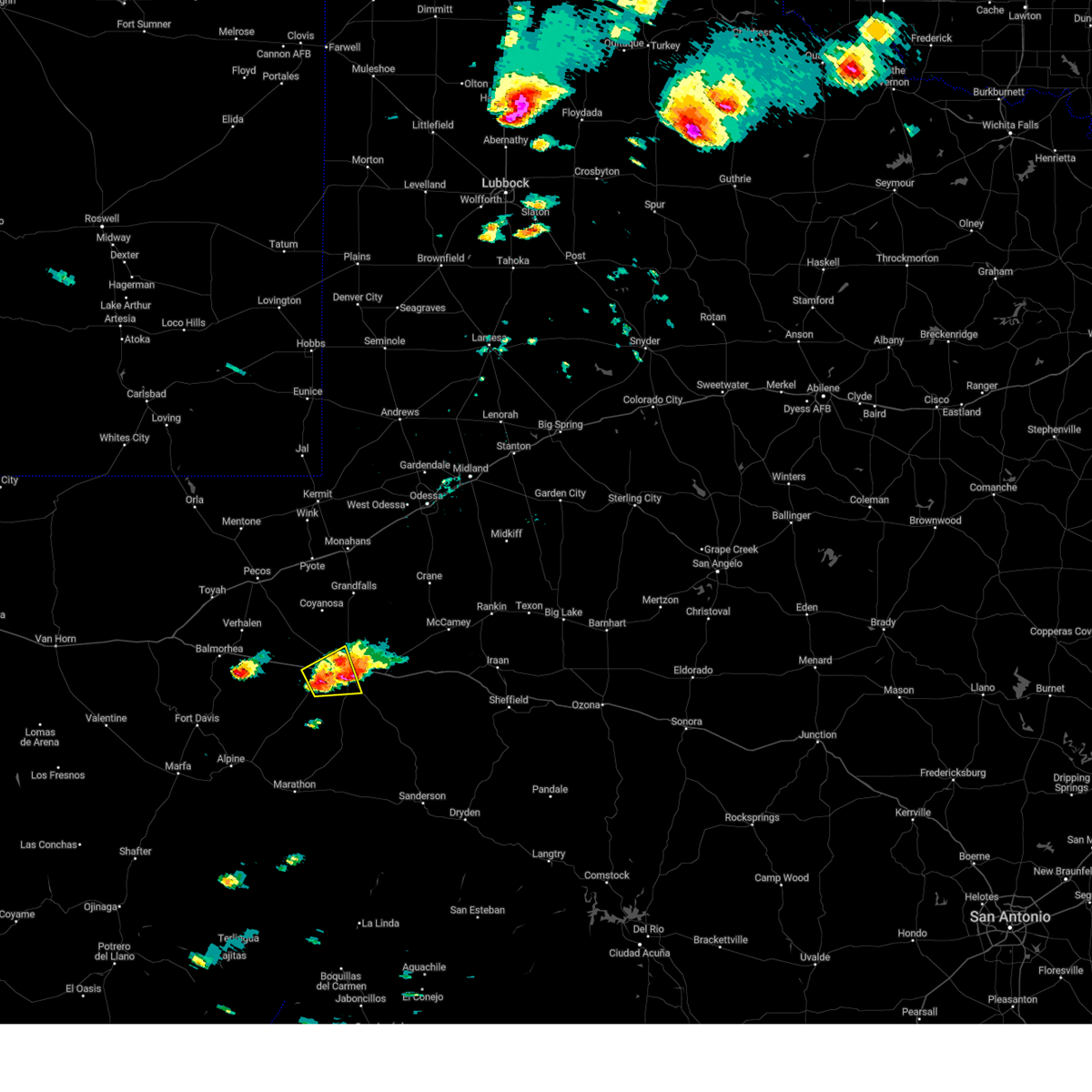
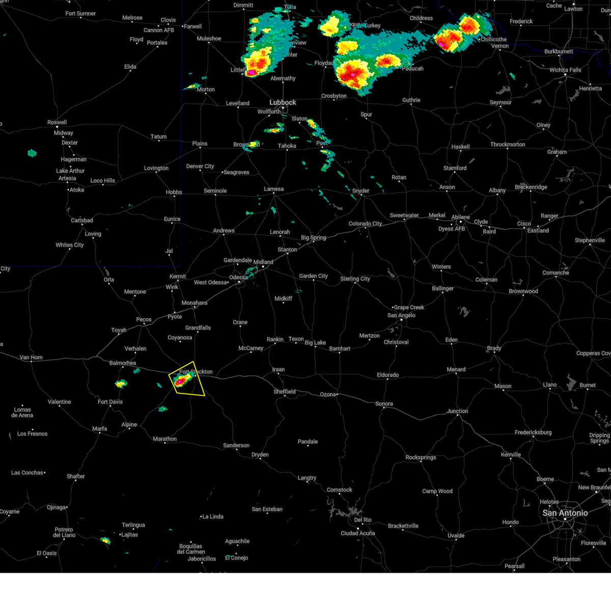
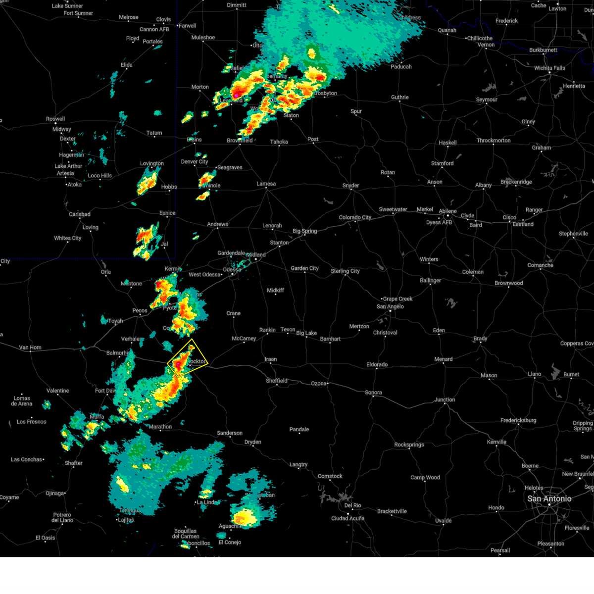
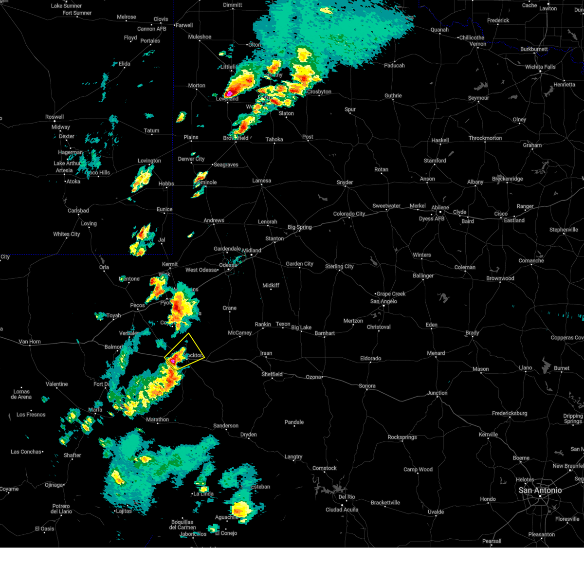
The Top Recent Hail Date for Fort Stockton, TX is Saturday, April 26, 2025 (3rd out of 70)

Hail and Wind Damage Spotted near Fort Stockton, TX
| Date / Time | Report Details |
|---|---|
| 6/26/2025 1:05 PM CDT | Mesonet station twb23 12.1 se belding (twdb in pecos county TX, 18.7 miles NNE of Fort Stockton, TX |
| 6/10/2025 7:50 PM CDT | Storm damage reported in pecos county TX, 2.7 miles SE of Fort Stockton, TX |
| 6/10/2025 6:08 PM CDT | Storm damage reported in pecos county TX, 9.9 miles ENE of Fort Stockton, TX |
| 6/5/2025 4:27 PM CDT | Tennis Ball sized hail reported 7.9 miles N of Fort Stockton, TX |
| 6/5/2025 4:26 PM CDT | At 426 pm cdt, a severe thunderstorm was located 7 miles south of fort stockton, moving east at 25 mph (emergency management). Hazards include two inch hail and 70 mph wind gusts. People and animals outdoors will be injured. expect hail damage to roofs, siding, windows, and vehicles. expect considerable tree damage. wind damage is also likely to mobile homes, roofs, and outbuildings. locations impacted include, fort stockton and fort stockton-pecos county airport. This includes interstate 10 between mile markers 256 and 280. |
| 6/5/2025 4:07 PM CDT | Hen Egg sized hail reported 2.7 miles NE of Fort Stockton, TX, hen egg size hail reported by emergency manager. time is estimated by radar. |
| 6/5/2025 3:59 PM CDT |
 Svrmaf the national weather service in midland has issued a * severe thunderstorm warning for, central pecos county in southwestern texas, * until 445 pm cdt. * at 359 pm cdt, a severe thunderstorm was located near fort stockton, moving east at 25 mph (radar indicated). Hazards include tennis ball size hail and 70 mph wind gusts. People and animals outdoors will be injured. expect hail damage to roofs, siding, windows, and vehicles. expect considerable tree damage. Wind damage is also likely to mobile homes, roofs, and outbuildings. Svrmaf the national weather service in midland has issued a * severe thunderstorm warning for, central pecos county in southwestern texas, * until 445 pm cdt. * at 359 pm cdt, a severe thunderstorm was located near fort stockton, moving east at 25 mph (radar indicated). Hazards include tennis ball size hail and 70 mph wind gusts. People and animals outdoors will be injured. expect hail damage to roofs, siding, windows, and vehicles. expect considerable tree damage. Wind damage is also likely to mobile homes, roofs, and outbuildings.
|
| 6/5/2025 3:57 PM CDT | Thunderstorm wind gust recorded by west texas mesonet statio in pecos county TX, 8.6 miles ENE of Fort Stockton, TX |
| 6/2/2025 6:54 PM CDT |
 At 654 pm cdt, a severe thunderstorm was located near fort stockton, moving east at 20 mph (emergency management). Hazards include 60 mph wind gusts and quarter size hail. Hail damage to vehicles is expected. expect wind damage to roofs, siding, and trees. locations impacted include, fort stockton. This includes interstate 10 between mile markers 259 and 271. At 654 pm cdt, a severe thunderstorm was located near fort stockton, moving east at 20 mph (emergency management). Hazards include 60 mph wind gusts and quarter size hail. Hail damage to vehicles is expected. expect wind damage to roofs, siding, and trees. locations impacted include, fort stockton. This includes interstate 10 between mile markers 259 and 271.
|
| 6/2/2025 6:43 PM CDT | Report of a fence and backyard antenna tower blown over. time estimated by rada in pecos county TX, 0.4 miles NE of Fort Stockton, TX |
| 6/2/2025 6:43 PM CDT |
 Svrmaf the national weather service in midland has issued a * severe thunderstorm warning for, northwestern pecos county in southwestern texas, * until 715 pm cdt. * at 643 pm cdt, a severe thunderstorm was located over fort stockton, moving east at 20 mph (radar indicated). Hazards include 60 mph wind gusts and quarter size hail. Hail damage to vehicles is expected. Expect wind damage to roofs, siding, and trees. Svrmaf the national weather service in midland has issued a * severe thunderstorm warning for, northwestern pecos county in southwestern texas, * until 715 pm cdt. * at 643 pm cdt, a severe thunderstorm was located over fort stockton, moving east at 20 mph (radar indicated). Hazards include 60 mph wind gusts and quarter size hail. Hail damage to vehicles is expected. Expect wind damage to roofs, siding, and trees.
|
| 6/2/2025 6:42 PM CDT | Corrects previous tstm wnd dmg report from fort stockton. approximately 50 homes had minor roof damage and 20 power poles were broken due to severe winds and hail in th in pecos county TX, 0.4 miles NE of Fort Stockton, TX |
| 6/2/2025 5:27 PM CDT |
 the severe thunderstorm warning has been cancelled and is no longer in effect the severe thunderstorm warning has been cancelled and is no longer in effect
|
| 6/2/2025 5:17 PM CDT |
 At 517 pm cdt, a severe thunderstorm was located 10 miles northwest of fort stockton, moving east at 25 mph (radar indicated). Hazards include 60 mph wind gusts and quarter size hail. Hail damage to vehicles is expected. expect wind damage to roofs, siding, and trees. locations impacted include, fort stockton and fort stockton-pecos county airport. This includes interstate 10 between mile markers 249 and 261. At 517 pm cdt, a severe thunderstorm was located 10 miles northwest of fort stockton, moving east at 25 mph (radar indicated). Hazards include 60 mph wind gusts and quarter size hail. Hail damage to vehicles is expected. expect wind damage to roofs, siding, and trees. locations impacted include, fort stockton and fort stockton-pecos county airport. This includes interstate 10 between mile markers 249 and 261.
|
| 6/2/2025 5:02 PM CDT |
 At 502 pm cdt, a severe thunderstorm was located 15 miles northwest of fort stockton, moving east at 25 mph (radar indicated). Hazards include 60 mph wind gusts and quarter size hail. Hail damage to vehicles is expected. expect wind damage to roofs, siding, and trees. locations impacted include, fort stockton, fort stockton-pecos county airport, and firestone test track. This includes interstate 10 between mile markers 248 and 261. At 502 pm cdt, a severe thunderstorm was located 15 miles northwest of fort stockton, moving east at 25 mph (radar indicated). Hazards include 60 mph wind gusts and quarter size hail. Hail damage to vehicles is expected. expect wind damage to roofs, siding, and trees. locations impacted include, fort stockton, fort stockton-pecos county airport, and firestone test track. This includes interstate 10 between mile markers 248 and 261.
|
| 6/2/2025 4:42 PM CDT |
 Svrmaf the national weather service in midland has issued a * severe thunderstorm warning for, northwestern pecos county in southwestern texas, * until 545 pm cdt. * at 442 pm cdt, a severe thunderstorm was located 22 miles west of fort stockton, moving east at 25 mph (radar indicated). Hazards include 60 mph wind gusts and half dollar size hail. Hail damage to vehicles is expected. Expect wind damage to roofs, siding, and trees. Svrmaf the national weather service in midland has issued a * severe thunderstorm warning for, northwestern pecos county in southwestern texas, * until 545 pm cdt. * at 442 pm cdt, a severe thunderstorm was located 22 miles west of fort stockton, moving east at 25 mph (radar indicated). Hazards include 60 mph wind gusts and half dollar size hail. Hail damage to vehicles is expected. Expect wind damage to roofs, siding, and trees.
|
| 5/27/2025 6:33 PM CDT |
 At 633 pm cdt, a severe thunderstorm was located 11 miles northwest of fort stockton, moving east at 25 mph (radar indicated). Hazards include 60 mph wind gusts and quarter size hail. Hail damage to vehicles is expected. expect wind damage to roofs, siding, and trees. locations impacted include, fort stockton, fort stockton-pecos county airport, and firestone test track. This includes interstate 10 between mile markers 238 and 263. At 633 pm cdt, a severe thunderstorm was located 11 miles northwest of fort stockton, moving east at 25 mph (radar indicated). Hazards include 60 mph wind gusts and quarter size hail. Hail damage to vehicles is expected. expect wind damage to roofs, siding, and trees. locations impacted include, fort stockton, fort stockton-pecos county airport, and firestone test track. This includes interstate 10 between mile markers 238 and 263.
|
| 5/27/2025 6:19 PM CDT |
 At 619 pm cdt, a severe thunderstorm was located 16 miles west of fort stockton, moving northeast at 20 mph (radar indicated). Hazards include 60 mph wind gusts and quarter size hail. Hail damage to vehicles is expected. expect wind damage to roofs, siding, and trees. locations impacted include, fort stockton, fort stockton-pecos county airport, and firestone test track. This includes interstate 10 between mile markers 229 and 263. At 619 pm cdt, a severe thunderstorm was located 16 miles west of fort stockton, moving northeast at 20 mph (radar indicated). Hazards include 60 mph wind gusts and quarter size hail. Hail damage to vehicles is expected. expect wind damage to roofs, siding, and trees. locations impacted include, fort stockton, fort stockton-pecos county airport, and firestone test track. This includes interstate 10 between mile markers 229 and 263.
|
| 5/27/2025 6:06 PM CDT |
 Svrmaf the national weather service in midland has issued a * severe thunderstorm warning for, northwestern pecos county in southwestern texas, * until 645 pm cdt. * at 605 pm cdt, a severe thunderstorm was located 21 miles west of fort stockton, moving east at 25 mph (radar indicated). Hazards include 60 mph wind gusts and quarter size hail. Hail damage to vehicles is expected. Expect wind damage to roofs, siding, and trees. Svrmaf the national weather service in midland has issued a * severe thunderstorm warning for, northwestern pecos county in southwestern texas, * until 645 pm cdt. * at 605 pm cdt, a severe thunderstorm was located 21 miles west of fort stockton, moving east at 25 mph (radar indicated). Hazards include 60 mph wind gusts and quarter size hail. Hail damage to vehicles is expected. Expect wind damage to roofs, siding, and trees.
|
| 5/6/2025 2:25 AM CDT |
 The storm which prompted the warning has weakened below severe limits, and no longer poses an immediate threat to life or property. therefore, the warning will be allowed to expire. a tornado watch remains in effect until 400 am cdt for southwestern texas. The storm which prompted the warning has weakened below severe limits, and no longer poses an immediate threat to life or property. therefore, the warning will be allowed to expire. a tornado watch remains in effect until 400 am cdt for southwestern texas.
|
| 5/6/2025 2:05 AM CDT |
 At 204 am cdt, a severe thunderstorm was located near fort stockton, moving northeast at 35 mph (radar indicated). Hazards include 60 mph wind gusts and quarter size hail. Hail damage to vehicles is expected. expect wind damage to roofs, siding, and trees. locations impacted include, fort stockton and fort stockton-pecos county airport. This includes interstate 10 between mile markers 258 and 284. At 204 am cdt, a severe thunderstorm was located near fort stockton, moving northeast at 35 mph (radar indicated). Hazards include 60 mph wind gusts and quarter size hail. Hail damage to vehicles is expected. expect wind damage to roofs, siding, and trees. locations impacted include, fort stockton and fort stockton-pecos county airport. This includes interstate 10 between mile markers 258 and 284.
|
| 5/6/2025 1:41 AM CDT |
 At 141 am cdt, a severe thunderstorm was located 18 miles south of fort stockton, moving northeast at 30 mph (radar indicated). Hazards include 60 mph wind gusts and quarter size hail. Hail damage to vehicles is expected. expect wind damage to roofs, siding, and trees. locations impacted include, fort stockton and fort stockton-pecos county airport. This includes interstate 10 between mile markers 255 and 286. At 141 am cdt, a severe thunderstorm was located 18 miles south of fort stockton, moving northeast at 30 mph (radar indicated). Hazards include 60 mph wind gusts and quarter size hail. Hail damage to vehicles is expected. expect wind damage to roofs, siding, and trees. locations impacted include, fort stockton and fort stockton-pecos county airport. This includes interstate 10 between mile markers 255 and 286.
|
| 5/6/2025 1:23 AM CDT |
 Svrmaf the national weather service in midland has issued a * severe thunderstorm warning for, central pecos county in southwestern texas, * until 230 am cdt. * at 123 am cdt, a severe thunderstorm was located 24 miles north of marathon, or 27 miles southwest of fort stockton, moving northeast at 30 mph (radar indicated). Hazards include 60 mph wind gusts and quarter size hail. Hail damage to vehicles is expected. Expect wind damage to roofs, siding, and trees. Svrmaf the national weather service in midland has issued a * severe thunderstorm warning for, central pecos county in southwestern texas, * until 230 am cdt. * at 123 am cdt, a severe thunderstorm was located 24 miles north of marathon, or 27 miles southwest of fort stockton, moving northeast at 30 mph (radar indicated). Hazards include 60 mph wind gusts and quarter size hail. Hail damage to vehicles is expected. Expect wind damage to roofs, siding, and trees.
|
| 4/29/2025 2:32 PM CDT |
 A 229 pm cdt, broadcast media reported quarter sized hail at the water plant just southwest of fort stockton. at 231 pm cdt, a severe thunderstorm was located over fort stockton, moving northeast at 35 mph (broadcast media). Hazards include 60 mph wind gusts and quarter size hail. Hail damage to vehicles is expected. expect wind damage to roofs, siding, and trees. locations impacted include, fort stockton and fort stockton-pecos county airport. This includes interstate 10 between mile markers 249 and 267. A 229 pm cdt, broadcast media reported quarter sized hail at the water plant just southwest of fort stockton. at 231 pm cdt, a severe thunderstorm was located over fort stockton, moving northeast at 35 mph (broadcast media). Hazards include 60 mph wind gusts and quarter size hail. Hail damage to vehicles is expected. expect wind damage to roofs, siding, and trees. locations impacted include, fort stockton and fort stockton-pecos county airport. This includes interstate 10 between mile markers 249 and 267.
|
| 4/29/2025 2:29 PM CDT | Ping Pong Ball sized hail reported 2.3 miles ESE of Fort Stockton, TX, large hail reported to emergency management. |
| 4/29/2025 2:23 PM CDT |
 Svrmaf the national weather service in midland has issued a * severe thunderstorm warning for, north central pecos county in southwestern texas, * until 330 pm cdt. * at 223 pm cdt, a severe thunderstorm was located near fort stockton, moving northeast at 35 mph (radar indicated). Hazards include 60 mph wind gusts and quarter size hail. Hail damage to vehicles is expected. Expect wind damage to roofs, siding, and trees. Svrmaf the national weather service in midland has issued a * severe thunderstorm warning for, north central pecos county in southwestern texas, * until 330 pm cdt. * at 223 pm cdt, a severe thunderstorm was located near fort stockton, moving northeast at 35 mph (radar indicated). Hazards include 60 mph wind gusts and quarter size hail. Hail damage to vehicles is expected. Expect wind damage to roofs, siding, and trees.
|
| 4/29/2025 1:28 PM CDT | Quarter sized hail reported 13.3 miles SSW of Fort Stockton, TX, quarter size reported by emergency manager. time was estimated by report and radar. |
| 4/29/2025 1:12 PM CDT |
 Svrmaf the national weather service in midland has issued a * severe thunderstorm warning for, north central pecos county in southwestern texas, southeastern ward county in western texas, southern crane county in western texas, * until 215 pm cdt. * at 112 pm cdt, a severe thunderstorm was located 8 miles north of fort stockton, moving northeast at 25 mph (radar indicated). Hazards include 60 mph wind gusts and quarter size hail. Hail damage to vehicles is expected. Expect wind damage to roofs, siding, and trees. Svrmaf the national weather service in midland has issued a * severe thunderstorm warning for, north central pecos county in southwestern texas, southeastern ward county in western texas, southern crane county in western texas, * until 215 pm cdt. * at 112 pm cdt, a severe thunderstorm was located 8 miles north of fort stockton, moving northeast at 25 mph (radar indicated). Hazards include 60 mph wind gusts and quarter size hail. Hail damage to vehicles is expected. Expect wind damage to roofs, siding, and trees.
|
| 4/26/2025 8:15 PM CDT | Softball sized hail reported 4.7 miles NW of Fort Stockton, TX, storm chaser jeff piotrowski reported 5 inch hail se of fort stockton... tx. |
| 4/26/2025 8:06 PM CDT | Baseball sized hail reported 1.5 miles ENE of Fort Stockton, TX, baseball sized hail reported on the west side of the city of fort stockton... tx at approximately 01:06z. |
| 4/26/2025 8:05 PM CDT | Tennis Ball sized hail reported 0.4 miles NE of Fort Stockton, TX, kwes reported tennis ball sized hail in the city of fort stockton... tx. |
| 4/26/2025 8:03 PM CDT |
 At 802 pm cdt, a severe thunderstorm was located near fort stockton, moving southeast at 15 mph (radar indicated). Hazards include golf ball size hail and 60 mph wind gusts. People and animals outdoors will be injured. expect hail damage to roofs, siding, windows, and vehicles. expect wind damage to roofs, siding, and trees. locations impacted include, fort stockton. This includes interstate 10 between mile markers 262 and 286. At 802 pm cdt, a severe thunderstorm was located near fort stockton, moving southeast at 15 mph (radar indicated). Hazards include golf ball size hail and 60 mph wind gusts. People and animals outdoors will be injured. expect hail damage to roofs, siding, windows, and vehicles. expect wind damage to roofs, siding, and trees. locations impacted include, fort stockton. This includes interstate 10 between mile markers 262 and 286.
|
| 4/26/2025 7:48 PM CDT | Golf Ball sized hail reported 1.1 miles NNE of Fort Stockton, TX, pecos county em reported golf ball sized hail 1 mile south of fort stockton on us 385. |
| 4/26/2025 7:43 PM CDT |
 Svrmaf the national weather service in midland has issued a * severe thunderstorm warning for, central pecos county in southwestern texas, * until 845 pm cdt. * at 742 pm cdt, a severe thunderstorm was located over fort stockton, moving southeast at 15 mph (radar indicated). Hazards include tennis ball size hail and 70 mph wind gusts. People and animals outdoors will be injured. expect hail damage to roofs, siding, windows, and vehicles. expect considerable tree damage. Wind damage is also likely to mobile homes, roofs, and outbuildings. Svrmaf the national weather service in midland has issued a * severe thunderstorm warning for, central pecos county in southwestern texas, * until 845 pm cdt. * at 742 pm cdt, a severe thunderstorm was located over fort stockton, moving southeast at 15 mph (radar indicated). Hazards include tennis ball size hail and 70 mph wind gusts. People and animals outdoors will be injured. expect hail damage to roofs, siding, windows, and vehicles. expect considerable tree damage. Wind damage is also likely to mobile homes, roofs, and outbuildings.
|
| 4/26/2025 7:41 PM CDT | Golf Ball sized hail reported 0.4 miles NE of Fort Stockton, TX, pecos county em reported golf ball sized hail in the city of fort stockton... tx. |
| 4/26/2025 7:29 PM CDT |
 At 729 pm cdt, a severe thunderstorm was located over fort stockton, moving southeast at 15 mph. this is a destructive storm for fort stockton (radar indicated). Hazards include 80 mph wind gusts and baseball size hail. Flying debris will be dangerous to those caught without shelter. mobile homes will be heavily damaged. expect considerable damage to roofs, windows, and vehicles. extensive tree damage and power outages are likely. locations impacted include, fort stockton, fort stockton-pecos county airport, and firestone test track. This includes interstate 10 between mile markers 246 and 266. At 729 pm cdt, a severe thunderstorm was located over fort stockton, moving southeast at 15 mph. this is a destructive storm for fort stockton (radar indicated). Hazards include 80 mph wind gusts and baseball size hail. Flying debris will be dangerous to those caught without shelter. mobile homes will be heavily damaged. expect considerable damage to roofs, windows, and vehicles. extensive tree damage and power outages are likely. locations impacted include, fort stockton, fort stockton-pecos county airport, and firestone test track. This includes interstate 10 between mile markers 246 and 266.
|
| 4/26/2025 7:22 PM CDT | Tennis Ball sized hail reported 3.8 miles E of Fort Stockton, TX, emergency manager reported tennis ball size hail on i-10 at mm 254 west of fort stockton. |
| 4/26/2025 6:50 PM CDT | Tennis Ball sized hail reported 11.6 miles ESE of Fort Stockton, TX, an emergency manager in pecos county reported golf ball and tennis ball sized hail. |
| 4/26/2025 6:47 PM CDT |
 At 646 pm cdt, a severe thunderstorm was located 13 miles west of fort stockton, moving southeast at 15 mph. this is a destructive storm for fort stockton and belding (radar indicated). Hazards include 80 mph wind gusts and baseball size hail. Flying debris will be dangerous to those caught without shelter. mobile homes will be heavily damaged. expect considerable damage to roofs, windows, and vehicles. extensive tree damage and power outages are likely. locations impacted include, fort stockton, fort stockton-pecos county airport, and firestone test track. This includes interstate 10 between mile markers 239 and 266. At 646 pm cdt, a severe thunderstorm was located 13 miles west of fort stockton, moving southeast at 15 mph. this is a destructive storm for fort stockton and belding (radar indicated). Hazards include 80 mph wind gusts and baseball size hail. Flying debris will be dangerous to those caught without shelter. mobile homes will be heavily damaged. expect considerable damage to roofs, windows, and vehicles. extensive tree damage and power outages are likely. locations impacted include, fort stockton, fort stockton-pecos county airport, and firestone test track. This includes interstate 10 between mile markers 239 and 266.
|
| 4/26/2025 6:40 PM CDT |
 Svrmaf the national weather service in midland has issued a * severe thunderstorm warning for, northwestern pecos county in southwestern texas, * until 745 pm cdt. * at 637 pm cdt, a severe thunderstorm was located 16 miles northwest of fort stockton, moving southeast at 15 mph (radar indicated). Hazards include golf ball size hail and 70 mph wind gusts. People and animals outdoors will be injured. expect hail damage to roofs, siding, windows, and vehicles. expect considerable tree damage. Wind damage is also likely to mobile homes, roofs, and outbuildings. Svrmaf the national weather service in midland has issued a * severe thunderstorm warning for, northwestern pecos county in southwestern texas, * until 745 pm cdt. * at 637 pm cdt, a severe thunderstorm was located 16 miles northwest of fort stockton, moving southeast at 15 mph (radar indicated). Hazards include golf ball size hail and 70 mph wind gusts. People and animals outdoors will be injured. expect hail damage to roofs, siding, windows, and vehicles. expect considerable tree damage. Wind damage is also likely to mobile homes, roofs, and outbuildings.
|
| 4/26/2025 6:15 PM CDT |
 the severe thunderstorm warning has been cancelled and is no longer in effect the severe thunderstorm warning has been cancelled and is no longer in effect
|
| 4/26/2025 6:15 PM CDT |
 At 614 pm cdt, a severe thunderstorm was located 22 miles northwest of fort stockton, moving east at 15 mph (radar indicated). Hazards include golf ball size hail and 60 mph wind gusts. People and animals outdoors will be injured. expect hail damage to roofs, siding, windows, and vehicles. expect wind damage to roofs, siding, and trees. locations impacted include, fort stockton, fort stockton-pecos county airport, and firestone test track. This includes interstate 10 between mile markers 242 and 261. At 614 pm cdt, a severe thunderstorm was located 22 miles northwest of fort stockton, moving east at 15 mph (radar indicated). Hazards include golf ball size hail and 60 mph wind gusts. People and animals outdoors will be injured. expect hail damage to roofs, siding, windows, and vehicles. expect wind damage to roofs, siding, and trees. locations impacted include, fort stockton, fort stockton-pecos county airport, and firestone test track. This includes interstate 10 between mile markers 242 and 261.
|
| 4/26/2025 5:43 PM CDT |
 Svrmaf the national weather service in midland has issued a * severe thunderstorm warning for, northwestern pecos county in southwestern texas, southeastern reeves county in southwestern texas, * until 645 pm cdt. * at 543 pm cdt, a severe thunderstorm was located 15 miles east of saragosa, or 24 miles south of pecos, moving east at 25 mph (radar indicated). Hazards include golf ball size hail and 60 mph wind gusts. People and animals outdoors will be injured. expect hail damage to roofs, siding, windows, and vehicles. Expect wind damage to roofs, siding, and trees. Svrmaf the national weather service in midland has issued a * severe thunderstorm warning for, northwestern pecos county in southwestern texas, southeastern reeves county in southwestern texas, * until 645 pm cdt. * at 543 pm cdt, a severe thunderstorm was located 15 miles east of saragosa, or 24 miles south of pecos, moving east at 25 mph (radar indicated). Hazards include golf ball size hail and 60 mph wind gusts. People and animals outdoors will be injured. expect hail damage to roofs, siding, windows, and vehicles. Expect wind damage to roofs, siding, and trees.
|
| 4/25/2025 4:48 PM CDT |
 At 447 pm cdt, a severe thunderstorm was located 23 miles southwest of fort stockton, moving southeast at 10 mph (radar indicated). Hazards include two inch hail and 70 mph wind gusts. People and animals outdoors will be injured. expect hail damage to roofs, siding, windows, and vehicles. expect considerable tree damage. wind damage is also likely to mobile homes, roofs, and outbuildings. Locations impacted include, fort stockton. At 447 pm cdt, a severe thunderstorm was located 23 miles southwest of fort stockton, moving southeast at 10 mph (radar indicated). Hazards include two inch hail and 70 mph wind gusts. People and animals outdoors will be injured. expect hail damage to roofs, siding, windows, and vehicles. expect considerable tree damage. wind damage is also likely to mobile homes, roofs, and outbuildings. Locations impacted include, fort stockton.
|
| 4/25/2025 4:40 PM CDT | Storm damage reported in pecos county TX, 28.4 miles NE of Fort Stockton, TX |
| 4/25/2025 4:30 PM CDT |
 At 427 pm cdt, a severe thunderstorm was located 16 miles southwest of fort stockton, moving east at 15 mph (radar indicated). Hazards include two inch hail and 70 mph wind gusts. People and animals outdoors will be injured. expect hail damage to roofs, siding, windows, and vehicles. expect considerable tree damage. wind damage is also likely to mobile homes, roofs, and outbuildings. Locations impacted include, firestone test track and a large portion of us highway 67 in western pecos county. At 427 pm cdt, a severe thunderstorm was located 16 miles southwest of fort stockton, moving east at 15 mph (radar indicated). Hazards include two inch hail and 70 mph wind gusts. People and animals outdoors will be injured. expect hail damage to roofs, siding, windows, and vehicles. expect considerable tree damage. wind damage is also likely to mobile homes, roofs, and outbuildings. Locations impacted include, firestone test track and a large portion of us highway 67 in western pecos county.
|
| 4/25/2025 4:10 PM CDT |
 At 410 pm cdt, a severe thunderstorm was located 21 miles west of fort stockton, moving east at 15 mph (radar indicated). Hazards include golf ball size hail and 60 mph wind gusts. People and animals outdoors will be injured. expect hail damage to roofs, siding, windows, and vehicles. expect wind damage to roofs, siding, and trees. Locations impacted include, firestone test track and fort stockton-pecos county airport. At 410 pm cdt, a severe thunderstorm was located 21 miles west of fort stockton, moving east at 15 mph (radar indicated). Hazards include golf ball size hail and 60 mph wind gusts. People and animals outdoors will be injured. expect hail damage to roofs, siding, windows, and vehicles. expect wind damage to roofs, siding, and trees. Locations impacted include, firestone test track and fort stockton-pecos county airport.
|
| 4/24/2025 5:10 PM CDT |
 At 509 pm cdt, a severe thunderstorm was located 10 miles southwest of fort stockton, moving east at 20 mph (radar indicated). Hazards include 60 mph wind gusts and quarter size hail. Hail damage to vehicles is expected. expect wind damage to roofs, siding, and trees. Locations impacted include, sierra madera and fort stockton. At 509 pm cdt, a severe thunderstorm was located 10 miles southwest of fort stockton, moving east at 20 mph (radar indicated). Hazards include 60 mph wind gusts and quarter size hail. Hail damage to vehicles is expected. expect wind damage to roofs, siding, and trees. Locations impacted include, sierra madera and fort stockton.
|
| 4/24/2025 4:57 PM CDT |
 Svrmaf the national weather service in midland has issued a * severe thunderstorm warning for, southwestern pecos county in southwestern texas, * until 545 pm cdt. * at 457 pm cdt, a severe thunderstorm was located 18 miles southwest of fort stockton, moving east at 15 mph (radar indicated). Hazards include 60 mph wind gusts and quarter size hail. Hail damage to vehicles is expected. Expect wind damage to roofs, siding, and trees. Svrmaf the national weather service in midland has issued a * severe thunderstorm warning for, southwestern pecos county in southwestern texas, * until 545 pm cdt. * at 457 pm cdt, a severe thunderstorm was located 18 miles southwest of fort stockton, moving east at 15 mph (radar indicated). Hazards include 60 mph wind gusts and quarter size hail. Hail damage to vehicles is expected. Expect wind damage to roofs, siding, and trees.
|
| 4/23/2025 5:44 PM CDT |
 the severe thunderstorm warning has been cancelled and is no longer in effect the severe thunderstorm warning has been cancelled and is no longer in effect
|
| 4/23/2025 5:33 PM CDT |
 At 532 pm cdt, a severe thunderstorm was located 7 miles west of fort stockton, moving east at 20 mph (radar indicated). Hazards include 60 mph wind gusts and penny size hail. Expect damage to roofs, siding, and trees. locations impacted include, fort stockton-pecos county airport and fort stockton. This includes interstate 10 between mile markers 252 and 268. At 532 pm cdt, a severe thunderstorm was located 7 miles west of fort stockton, moving east at 20 mph (radar indicated). Hazards include 60 mph wind gusts and penny size hail. Expect damage to roofs, siding, and trees. locations impacted include, fort stockton-pecos county airport and fort stockton. This includes interstate 10 between mile markers 252 and 268.
|
| 4/23/2025 5:07 PM CDT |
 Svrmaf the national weather service in midland has issued a * severe thunderstorm warning for, northwestern pecos county in southwestern texas, * until 600 pm cdt. * at 507 pm cdt, a severe thunderstorm was located 15 miles west of fort stockton, moving east at 20 mph (radar indicated). Hazards include 60 mph wind gusts and half dollar size hail. Hail damage to vehicles is expected. Expect wind damage to roofs, siding, and trees. Svrmaf the national weather service in midland has issued a * severe thunderstorm warning for, northwestern pecos county in southwestern texas, * until 600 pm cdt. * at 507 pm cdt, a severe thunderstorm was located 15 miles west of fort stockton, moving east at 20 mph (radar indicated). Hazards include 60 mph wind gusts and half dollar size hail. Hail damage to vehicles is expected. Expect wind damage to roofs, siding, and trees.
|
| 4/22/2025 8:30 PM CDT | Baseball sized hail reported 45.1 miles NW of Fort Stockton, TX, nws employee reported baseball sized hail along us hwy 285. time is approximate. |
| 4/22/2025 8:26 PM CDT | Ping Pong Ball sized hail reported 46.3 miles NW of Fort Stockton, TX, storm chaser reported walnut sized hail along us hwy 285. |
| 4/22/2025 8:03 PM CDT | As per the pecos county emergency manager... multiple power lines down in town with approximately 2...200 customers affected. minor roof damage from wind and hail and r in pecos county TX, 0.5 miles NW of Fort Stockton, TX |
| 4/22/2025 7:43 PM CDT | Golf Ball sized hail reported 38.5 miles NW of Fort Stockton, TX, storm chaser reported roughly golf ball sized hail along hwy 285. |
| 4/22/2025 7:36 PM CDT | Golf Ball sized hail reported 34.7 miles NW of Fort Stockton, TX, storm chaser reported golf ball sized hail along us hwy 285. |
| 4/22/2025 7:31 PM CDT | Quarter sized hail reported 34.7 miles NW of Fort Stockton, TX, report from mping: quarter (1.00 in.). |
| 4/22/2025 6:15 PM CDT | Hen Egg sized hail reported 24.8 miles NW of Fort Stockton, TX, hail up to and potentially in excess of 2ã¢â€â on us-285 se of fort stockton... tx. |
| 4/22/2025 5:40 PM CDT | 18 wheeler flipped over due to the winds 10 miles south of fort stockton on hwy 285. time is approximat in pecos county TX, 9.4 miles NNW of Fort Stockton, TX |
| 4/22/2025 5:30 PM CDT | Golf Ball sized hail reported 6.7 miles NNW of Fort Stockton, TX, report from mping: golf ball (1.75 in.). |
| 4/22/2025 5:04 PM CDT |
 Svrmaf the national weather service in midland has issued a * severe thunderstorm warning for, central pecos county in southwestern texas, * until 545 pm cdt. * at 504 pm cdt, a severe thunderstorm was located 18 miles northeast of fort stockton, moving southeast at 15 mph (radar indicated). Hazards include two inch hail and 70 mph wind gusts. People and animals outdoors will be injured. expect hail damage to roofs, siding, windows, and vehicles. expect considerable tree damage. Wind damage is also likely to mobile homes, roofs, and outbuildings. Svrmaf the national weather service in midland has issued a * severe thunderstorm warning for, central pecos county in southwestern texas, * until 545 pm cdt. * at 504 pm cdt, a severe thunderstorm was located 18 miles northeast of fort stockton, moving southeast at 15 mph (radar indicated). Hazards include two inch hail and 70 mph wind gusts. People and animals outdoors will be injured. expect hail damage to roofs, siding, windows, and vehicles. expect considerable tree damage. Wind damage is also likely to mobile homes, roofs, and outbuildings.
|
| 4/22/2025 4:53 PM CDT | Asos station kfst fort stockto in pecos county TX, 2.7 miles SE of Fort Stockton, TX |
| 4/22/2025 4:43 PM CDT |
 At 443 pm cdt, a severe thunderstorm was located 12 miles northeast of fort stockton, moving east at 30 mph (emergency management). Hazards include two inch hail and 70 mph wind gusts. People and animals outdoors will be injured. expect hail damage to roofs, siding, windows, and vehicles. expect considerable tree damage. wind damage is also likely to mobile homes, roofs, and outbuildings. Locations impacted include, fort stockton-pecos county airport, firestone test track, and fort stockton. At 443 pm cdt, a severe thunderstorm was located 12 miles northeast of fort stockton, moving east at 30 mph (emergency management). Hazards include two inch hail and 70 mph wind gusts. People and animals outdoors will be injured. expect hail damage to roofs, siding, windows, and vehicles. expect considerable tree damage. wind damage is also likely to mobile homes, roofs, and outbuildings. Locations impacted include, fort stockton-pecos county airport, firestone test track, and fort stockton.
|
| 4/22/2025 4:27 PM CDT |
 At 427 pm cdt, a severe thunderstorm was located 6 miles north of fort stockton, and is nearly stationary (radar indicated). Hazards include two inch hail and 70 mph wind gusts. People and animals outdoors will be injured. expect hail damage to roofs, siding, windows, and vehicles. expect considerable tree damage. wind damage is also likely to mobile homes, roofs, and outbuildings. Locations impacted include, fort stockton-pecos county airport, firestone test track, and fort stockton. At 427 pm cdt, a severe thunderstorm was located 6 miles north of fort stockton, and is nearly stationary (radar indicated). Hazards include two inch hail and 70 mph wind gusts. People and animals outdoors will be injured. expect hail damage to roofs, siding, windows, and vehicles. expect considerable tree damage. wind damage is also likely to mobile homes, roofs, and outbuildings. Locations impacted include, fort stockton-pecos county airport, firestone test track, and fort stockton.
|
| 4/22/2025 4:18 PM CDT |
 Svrmaf the national weather service in midland has issued a * severe thunderstorm warning for, central pecos county in southwestern texas, * until 500 pm cdt. * at 412 pm cdt, a severe thunderstorm was located 7 miles northwest of fort stockton, moving east at 30 mph (radar indicated). Hazards include 60 mph wind gusts and quarter size hail. Hail damage to vehicles is expected. Expect wind damage to roofs, siding, and trees. Svrmaf the national weather service in midland has issued a * severe thunderstorm warning for, central pecos county in southwestern texas, * until 500 pm cdt. * at 412 pm cdt, a severe thunderstorm was located 7 miles northwest of fort stockton, moving east at 30 mph (radar indicated). Hazards include 60 mph wind gusts and quarter size hail. Hail damage to vehicles is expected. Expect wind damage to roofs, siding, and trees.
|
| 6/17/2024 8:20 PM CDT | Storm damage reported in pecos county TX, 10.8 miles ENE of Fort Stockton, TX |
| 6/17/2024 8:07 PM CDT | Golf Ball sized hail reported 11.2 miles NE of Fort Stockton, TX, golf ball sized hail at fm2036 and spur 194. |
| 6/17/2024 7:46 PM CDT |
 At 745 pm cdt, a severe thunderstorm was located 13 miles west of fort stockton, moving southeast at 20 mph (radar indicated). Hazards include golf ball size hail and 70 mph wind gusts. People and animals outdoors will be injured. expect hail damage to roofs, siding, windows, and vehicles. expect considerable tree damage. wind damage is also likely to mobile homes, roofs, and outbuildings. locations impacted include, fort stockton, fort stockton-pecos county airport, and firestone test track. This includes interstate 10 between mile markers 237 and 273. At 745 pm cdt, a severe thunderstorm was located 13 miles west of fort stockton, moving southeast at 20 mph (radar indicated). Hazards include golf ball size hail and 70 mph wind gusts. People and animals outdoors will be injured. expect hail damage to roofs, siding, windows, and vehicles. expect considerable tree damage. wind damage is also likely to mobile homes, roofs, and outbuildings. locations impacted include, fort stockton, fort stockton-pecos county airport, and firestone test track. This includes interstate 10 between mile markers 237 and 273.
|
| 6/17/2024 7:33 PM CDT |
 Svrmaf the national weather service in midland has issued a * severe thunderstorm warning for, northwestern pecos county in southwestern texas, * until 830 pm cdt. * at 733 pm cdt, a severe thunderstorm was located 16 miles west of fort stockton, moving southeast at 20 mph (radar indicated). Hazards include tennis ball size hail and 70 mph wind gusts. People and animals outdoors will be injured. expect hail damage to roofs, siding, windows, and vehicles. expect considerable tree damage. Wind damage is also likely to mobile homes, roofs, and outbuildings. Svrmaf the national weather service in midland has issued a * severe thunderstorm warning for, northwestern pecos county in southwestern texas, * until 830 pm cdt. * at 733 pm cdt, a severe thunderstorm was located 16 miles west of fort stockton, moving southeast at 20 mph (radar indicated). Hazards include tennis ball size hail and 70 mph wind gusts. People and animals outdoors will be injured. expect hail damage to roofs, siding, windows, and vehicles. expect considerable tree damage. Wind damage is also likely to mobile homes, roofs, and outbuildings.
|
| 6/17/2024 7:15 PM CDT | 2 18 wheelers flipped on i-10 between mile markers 235 and 238. time estimate in pecos county TX, 21.1 miles E of Fort Stockton, TX |
| 6/17/2024 5:52 PM CDT |
 the severe thunderstorm warning has been cancelled and is no longer in effect the severe thunderstorm warning has been cancelled and is no longer in effect
|
| 6/17/2024 5:40 PM CDT |
 the severe thunderstorm warning has been cancelled and is no longer in effect the severe thunderstorm warning has been cancelled and is no longer in effect
|
| 6/17/2024 5:40 PM CDT |
 At 540 pm cdt, a severe thunderstorm was located 16 miles northwest of fort stockton, moving east at 15 mph (radar indicated). Hazards include 60 mph wind gusts and quarter size hail. Hail damage to vehicles is expected. expect wind damage to roofs, siding, and trees. locations impacted include, fort stockton, fort stockton-pecos county airport, and firestone test track. This includes interstate 10 between mile markers 238 and 258. At 540 pm cdt, a severe thunderstorm was located 16 miles northwest of fort stockton, moving east at 15 mph (radar indicated). Hazards include 60 mph wind gusts and quarter size hail. Hail damage to vehicles is expected. expect wind damage to roofs, siding, and trees. locations impacted include, fort stockton, fort stockton-pecos county airport, and firestone test track. This includes interstate 10 between mile markers 238 and 258.
|
| 6/17/2024 5:12 PM CDT |
 Svrmaf the national weather service in midland has issued a * severe thunderstorm warning for, northwestern pecos county in southwestern texas, southeastern reeves county in southwestern texas, * until 615 pm cdt. * at 511 pm cdt, a severe thunderstorm was located 22 miles east of saragosa, or 24 miles west of fort stockton, moving east at 15 mph (radar indicated). Hazards include 60 mph wind gusts and quarter size hail. Hail damage to vehicles is expected. Expect wind damage to roofs, siding, and trees. Svrmaf the national weather service in midland has issued a * severe thunderstorm warning for, northwestern pecos county in southwestern texas, southeastern reeves county in southwestern texas, * until 615 pm cdt. * at 511 pm cdt, a severe thunderstorm was located 22 miles east of saragosa, or 24 miles west of fort stockton, moving east at 15 mph (radar indicated). Hazards include 60 mph wind gusts and quarter size hail. Hail damage to vehicles is expected. Expect wind damage to roofs, siding, and trees.
|
| 6/2/2024 5:28 PM CDT | Golf Ball sized hail reported 1.4 miles NE of Fort Stockton, TX, hail ranged in size from half dollar to golf ball. |
| 6/2/2024 5:28 PM CDT |
 Svrmaf the national weather service in midland has issued a * severe thunderstorm warning for, north central pecos county in southwestern texas, * until 615 pm cdt. * at 527 pm cdt, severe thunderstorms were located along a line extending from near fort stockton to 30 miles southwest of mccamey, moving northeast at 25 mph. these are destructive storms for fort stockton (radar indicated). Hazards include softball size hail and 60 mph wind gusts. People and animals outdoors will be severely injured. Expect shattered windows, extensive damage to roofs, siding, and vehicles. Svrmaf the national weather service in midland has issued a * severe thunderstorm warning for, north central pecos county in southwestern texas, * until 615 pm cdt. * at 527 pm cdt, severe thunderstorms were located along a line extending from near fort stockton to 30 miles southwest of mccamey, moving northeast at 25 mph. these are destructive storms for fort stockton (radar indicated). Hazards include softball size hail and 60 mph wind gusts. People and animals outdoors will be severely injured. Expect shattered windows, extensive damage to roofs, siding, and vehicles.
|
| 6/2/2024 5:25 PM CDT | Grapefruit sized hail reported 2 miles NNW of Fort Stockton, TX, hail ranged in size from golf ball to softball. |
| 6/2/2024 5:25 PM CDT | Golf Ball sized hail reported 0.4 miles NE of Fort Stockton, TX, golf ball sized hail on the south side of fort stockton. |
| 6/2/2024 5:17 PM CDT |
 Svrmaf the national weather service in midland has issued a * severe thunderstorm warning for, northwestern pecos county in southwestern texas, * until 530 pm cdt. * at 517 pm cdt, a severe thunderstorm was located near fort stockton, moving northeast at 30 mph (radar indicated). Hazards include ping pong ball size hail and 60 mph wind gusts. People and animals outdoors will be injured. expect hail damage to roofs, siding, windows, and vehicles. Expect wind damage to roofs, siding, and trees. Svrmaf the national weather service in midland has issued a * severe thunderstorm warning for, northwestern pecos county in southwestern texas, * until 530 pm cdt. * at 517 pm cdt, a severe thunderstorm was located near fort stockton, moving northeast at 30 mph (radar indicated). Hazards include ping pong ball size hail and 60 mph wind gusts. People and animals outdoors will be injured. expect hail damage to roofs, siding, windows, and vehicles. Expect wind damage to roofs, siding, and trees.
|
| 6/2/2024 4:17 PM CDT |
 At 417 pm cdt, a severe thunderstorm was located 21 miles southwest of fort stockton, and is nearly stationary (radar indicated). Hazards include two inch hail and 60 mph wind gusts. People and animals outdoors will be injured. expect hail damage to roofs, siding, windows, and vehicles. expect wind damage to roofs, siding, and trees. locations impacted include, fort stockton, fort stockton-pecos county airport, and sierra madera. This includes interstate 10 between mile markers 251 and 262. At 417 pm cdt, a severe thunderstorm was located 21 miles southwest of fort stockton, and is nearly stationary (radar indicated). Hazards include two inch hail and 60 mph wind gusts. People and animals outdoors will be injured. expect hail damage to roofs, siding, windows, and vehicles. expect wind damage to roofs, siding, and trees. locations impacted include, fort stockton, fort stockton-pecos county airport, and sierra madera. This includes interstate 10 between mile markers 251 and 262.
|
| 6/2/2024 3:40 PM CDT |
 Svrmaf the national weather service in midland has issued a * severe thunderstorm warning for, west central pecos county in southwestern texas, * until 445 pm cdt. * at 340 pm cdt, a severe thunderstorm was located 18 miles southwest of fort stockton, moving northeast at 15 mph (radar indicated). Hazards include 60 mph wind gusts and half dollar size hail. Hail damage to vehicles is expected. Expect wind damage to roofs, siding, and trees. Svrmaf the national weather service in midland has issued a * severe thunderstorm warning for, west central pecos county in southwestern texas, * until 445 pm cdt. * at 340 pm cdt, a severe thunderstorm was located 18 miles southwest of fort stockton, moving northeast at 15 mph (radar indicated). Hazards include 60 mph wind gusts and half dollar size hail. Hail damage to vehicles is expected. Expect wind damage to roofs, siding, and trees.
|
| 5/29/2024 8:11 PM CDT |
 the severe thunderstorm warning has been cancelled and is no longer in effect the severe thunderstorm warning has been cancelled and is no longer in effect
|
| 5/29/2024 7:48 PM CDT |
 Svrmaf the national weather service in midland has issued a * severe thunderstorm warning for, northwestern pecos county in southwestern texas, * until 845 pm cdt. * at 747 pm cdt, a severe thunderstorm was located 12 miles west of fort stockton, moving northeast at 15 mph (radar indicated). Hazards include 60 mph wind gusts and quarter size hail. Hail damage to vehicles is expected. Expect wind damage to roofs, siding, and trees. Svrmaf the national weather service in midland has issued a * severe thunderstorm warning for, northwestern pecos county in southwestern texas, * until 845 pm cdt. * at 747 pm cdt, a severe thunderstorm was located 12 miles west of fort stockton, moving northeast at 15 mph (radar indicated). Hazards include 60 mph wind gusts and quarter size hail. Hail damage to vehicles is expected. Expect wind damage to roofs, siding, and trees.
|
| 5/4/2024 5:55 PM CDT | Tennis Ball sized hail reported 29.2 miles NW of Fort Stockton, TX, report from mping: tennis ball (2.50 in.). |
| 5/4/2024 5:53 PM CDT | Tea Cup sized hail reported 32.7 miles NW of Fort Stockton, TX |
| 5/4/2024 5:51 PM CDT | Half Dollar sized hail reported 30.7 miles NW of Fort Stockton, TX, report from mping: half dollar (1.25 in.). |
| 5/4/2024 4:45 PM CDT | Tea Cup sized hail reported 27.4 miles NW of Fort Stockton, TX |
| 5/4/2024 4:45 PM CDT | Tennis Ball sized hail reported 20.9 miles NW of Fort Stockton, TX |
| 5/4/2024 4:03 PM CDT |
 At 403 pm cdt, a severe thunderstorm was located near fort stockton, moving east at 30 mph (radar indicated). Hazards include ping pong ball size hail and 60 mph wind gusts. People and animals outdoors will be injured. expect hail damage to roofs, siding, windows, and vehicles. expect wind damage to roofs, siding, and trees. locations impacted include, fort stockton and fort stockton-pecos county airport. This includes interstate 10 between mile markers 258 and 277. At 403 pm cdt, a severe thunderstorm was located near fort stockton, moving east at 30 mph (radar indicated). Hazards include ping pong ball size hail and 60 mph wind gusts. People and animals outdoors will be injured. expect hail damage to roofs, siding, windows, and vehicles. expect wind damage to roofs, siding, and trees. locations impacted include, fort stockton and fort stockton-pecos county airport. This includes interstate 10 between mile markers 258 and 277.
|
| 5/4/2024 3:44 PM CDT | Golf Ball sized hail reported 6.2 miles E of Fort Stockton, TX |
| 5/4/2024 3:43 PM CDT |
 At 343 pm cdt, a severe thunderstorm was located near fort stockton, moving east at 40 mph. this is a destructive storm for fort stockton and i-10 (radar indicated). Hazards include baseball size hail and 70 mph wind gusts. People and animals outdoors will be severely injured. expect shattered windows, extensive damage to roofs, siding, and vehicles. locations impacted include, fort stockton, fort stockton-pecos county airport, and firestone test track. This includes interstate 10 between mile markers 248 and 288. At 343 pm cdt, a severe thunderstorm was located near fort stockton, moving east at 40 mph. this is a destructive storm for fort stockton and i-10 (radar indicated). Hazards include baseball size hail and 70 mph wind gusts. People and animals outdoors will be severely injured. expect shattered windows, extensive damage to roofs, siding, and vehicles. locations impacted include, fort stockton, fort stockton-pecos county airport, and firestone test track. This includes interstate 10 between mile markers 248 and 288.
|
| 5/4/2024 3:42 PM CDT | Quarter sized hail reported 11.2 miles NE of Fort Stockton, TX |
| 5/4/2024 3:36 PM CDT |
 At 336 pm cdt, a severe thunderstorm was located near fort stockton, moving east at 40 mph (radar indicated). Hazards include two inch hail and 70 mph wind gusts. People and animals outdoors will be injured. expect hail damage to roofs, siding, windows, and vehicles. expect considerable tree damage. wind damage is also likely to mobile homes, roofs, and outbuildings. locations impacted include, fort stockton, fort stockton-pecos county airport, and firestone test track. This includes interstate 10 between mile markers 242 and 288. At 336 pm cdt, a severe thunderstorm was located near fort stockton, moving east at 40 mph (radar indicated). Hazards include two inch hail and 70 mph wind gusts. People and animals outdoors will be injured. expect hail damage to roofs, siding, windows, and vehicles. expect considerable tree damage. wind damage is also likely to mobile homes, roofs, and outbuildings. locations impacted include, fort stockton, fort stockton-pecos county airport, and firestone test track. This includes interstate 10 between mile markers 242 and 288.
|
| 5/4/2024 3:35 PM CDT | Quarter sized hail reported 11 miles E of Fort Stockton, TX |
| 5/4/2024 3:34 PM CDT |
 At 333 pm cdt, a severe thunderstorm was located 14 miles northwest of fort stockton, moving northeast at 15 mph (radar indicated). Hazards include two inch hail and 70 mph wind gusts. People and animals outdoors will be injured. expect hail damage to roofs, siding, windows, and vehicles. expect considerable tree damage. wind damage is also likely to mobile homes, roofs, and outbuildings. locations impacted include, fort stockton, fort stockton-pecos county airport, and firestone test track. This includes interstate 10 between mile markers 245 and 261. At 333 pm cdt, a severe thunderstorm was located 14 miles northwest of fort stockton, moving northeast at 15 mph (radar indicated). Hazards include two inch hail and 70 mph wind gusts. People and animals outdoors will be injured. expect hail damage to roofs, siding, windows, and vehicles. expect considerable tree damage. wind damage is also likely to mobile homes, roofs, and outbuildings. locations impacted include, fort stockton, fort stockton-pecos county airport, and firestone test track. This includes interstate 10 between mile markers 245 and 261.
|
| 5/4/2024 3:28 PM CDT |
 Svrmaf the national weather service in midland has issued a * severe thunderstorm warning for, northwestern pecos county in southwestern texas, * until 415 pm cdt. * at 328 pm cdt, a severe thunderstorm was located 11 miles west of fort stockton, moving east at 40 mph (radar indicated). Hazards include two inch hail and 70 mph wind gusts. People and animals outdoors will be injured. expect hail damage to roofs, siding, windows, and vehicles. expect considerable tree damage. Wind damage is also likely to mobile homes, roofs, and outbuildings. Svrmaf the national weather service in midland has issued a * severe thunderstorm warning for, northwestern pecos county in southwestern texas, * until 415 pm cdt. * at 328 pm cdt, a severe thunderstorm was located 11 miles west of fort stockton, moving east at 40 mph (radar indicated). Hazards include two inch hail and 70 mph wind gusts. People and animals outdoors will be injured. expect hail damage to roofs, siding, windows, and vehicles. expect considerable tree damage. Wind damage is also likely to mobile homes, roofs, and outbuildings.
|
| 5/4/2024 3:08 PM CDT |
 At 308 pm cdt, a severe thunderstorm was located 14 miles northwest of fort stockton, moving northeast at 20 mph (radar indicated). Hazards include golf ball size hail and 60 mph wind gusts. People and animals outdoors will be injured. expect hail damage to roofs, siding, windows, and vehicles. expect wind damage to roofs, siding, and trees. locations impacted include, fort stockton, fort stockton-pecos county airport, and firestone test track. This includes interstate 10 between mile markers 245 and 261. At 308 pm cdt, a severe thunderstorm was located 14 miles northwest of fort stockton, moving northeast at 20 mph (radar indicated). Hazards include golf ball size hail and 60 mph wind gusts. People and animals outdoors will be injured. expect hail damage to roofs, siding, windows, and vehicles. expect wind damage to roofs, siding, and trees. locations impacted include, fort stockton, fort stockton-pecos county airport, and firestone test track. This includes interstate 10 between mile markers 245 and 261.
|
| 5/4/2024 2:49 PM CDT |
 Svrmaf the national weather service in midland has issued a * severe thunderstorm warning for, northwestern pecos county in southwestern texas, * until 345 pm cdt. * at 249 pm cdt, a severe thunderstorm was located 17 miles west of fort stockton, moving northeast at 15 mph (radar indicated). Hazards include 60 mph wind gusts and half dollar size hail. Hail damage to vehicles is expected. Expect wind damage to roofs, siding, and trees. Svrmaf the national weather service in midland has issued a * severe thunderstorm warning for, northwestern pecos county in southwestern texas, * until 345 pm cdt. * at 249 pm cdt, a severe thunderstorm was located 17 miles west of fort stockton, moving northeast at 15 mph (radar indicated). Hazards include 60 mph wind gusts and half dollar size hail. Hail damage to vehicles is expected. Expect wind damage to roofs, siding, and trees.
|
| 5/1/2024 3:21 PM CDT | Golf Ball sized hail reported 10.1 miles N of Fort Stockton, TX |
| 5/1/2024 2:44 PM CDT |
 At 242 pm cdt, a severe thunderstorm was located near fort stockton, moving east at 10 mph (emergency management report quarter size hail along i-10 at mile marker 262 at 241 pm cdt). Hazards include 60 mph wind gusts and quarter size hail. Hail damage to vehicles is expected. expect wind damage to roofs, siding, and trees. locations impacted include, fort stockton and fort stockton-pecos county airport. This includes interstate 10 between mile markers 258 and 284. At 242 pm cdt, a severe thunderstorm was located near fort stockton, moving east at 10 mph (emergency management report quarter size hail along i-10 at mile marker 262 at 241 pm cdt). Hazards include 60 mph wind gusts and quarter size hail. Hail damage to vehicles is expected. expect wind damage to roofs, siding, and trees. locations impacted include, fort stockton and fort stockton-pecos county airport. This includes interstate 10 between mile markers 258 and 284.
|
| 5/1/2024 2:41 PM CDT | Quarter sized hail reported 2.7 miles W of Fort Stockton, TX |
| 5/1/2024 2:34 PM CDT |
 Svrmaf the national weather service in midland has issued a * severe thunderstorm warning for, north central pecos county in southwestern texas, * until 330 pm cdt. * at 234 pm cdt, a severe thunderstorm was located near fort stockton, moving east at 10 mph (radar indicated). Hazards include 60 mph wind gusts and quarter size hail. Hail damage to vehicles is expected. Expect wind damage to roofs, siding, and trees. Svrmaf the national weather service in midland has issued a * severe thunderstorm warning for, north central pecos county in southwestern texas, * until 330 pm cdt. * at 234 pm cdt, a severe thunderstorm was located near fort stockton, moving east at 10 mph (radar indicated). Hazards include 60 mph wind gusts and quarter size hail. Hail damage to vehicles is expected. Expect wind damage to roofs, siding, and trees.
|
| 4/30/2024 4:20 PM CDT | Tennis Ball sized hail reported 38.9 miles W of Fort Stockton, TX, reports broken windshields and ground covered with hail. |
| 1/23/2024 8:16 PM CST |
 At 816 pm cst, severe thunderstorms were located along a line extending from 20 miles southeast of barstow to 21 miles south of grandfalls to 7 miles southwest of fort stockton, moving northeast at 45 mph (belding mesonet reported a 58 mph wind gust at 802 pm cst). Hazards include 60 mph wind gusts. expect damage to roofs, siding, and trees At 816 pm cst, severe thunderstorms were located along a line extending from 20 miles southeast of barstow to 21 miles south of grandfalls to 7 miles southwest of fort stockton, moving northeast at 45 mph (belding mesonet reported a 58 mph wind gust at 802 pm cst). Hazards include 60 mph wind gusts. expect damage to roofs, siding, and trees
|
| 1/23/2024 8:02 PM CST | Storm damage reported in pecos county TX, 10.8 miles ENE of Fort Stockton, TX |
| 10/4/2023 3:12 PM CDT |
 At 312 pm cdt, a severe thunderstorm was located 21 miles southwest of mccamey, moving east at 30 mph (radar indicated). Hazards include 60 mph wind gusts and half dollar size hail. Hail damage to vehicles is expected. expect wind damage to roofs, siding, and trees. locations impacted include, fort stockton, fort stockton-pecos county airport, bakersfield, and girvin. this includes interstate 10 between mile markers 256 and 297. hail threat, observed max hail size, 1. 25 in wind threat, radar indicated max wind gust, 60 mph. At 312 pm cdt, a severe thunderstorm was located 21 miles southwest of mccamey, moving east at 30 mph (radar indicated). Hazards include 60 mph wind gusts and half dollar size hail. Hail damage to vehicles is expected. expect wind damage to roofs, siding, and trees. locations impacted include, fort stockton, fort stockton-pecos county airport, bakersfield, and girvin. this includes interstate 10 between mile markers 256 and 297. hail threat, observed max hail size, 1. 25 in wind threat, radar indicated max wind gust, 60 mph.
|
| 10/4/2023 3:07 PM CDT |
 At 307 pm cdt, a severe thunderstorm was located 20 miles east of saragosa, or 26 miles west of fort stockton, moving east at 35 mph (radar indicated). Hazards include 60 mph wind gusts and half dollar size hail. Hail damage to vehicles is expected. expect wind damage to roofs, siding, and trees. locations impacted include, fort stockton, fort stockton-pecos county airport, and firestone test track. this includes interstate 10 between mile markers 227 and 264. hail threat, radar indicated max hail size, 1. 25 in wind threat, radar indicated max wind gust, 60 mph. At 307 pm cdt, a severe thunderstorm was located 20 miles east of saragosa, or 26 miles west of fort stockton, moving east at 35 mph (radar indicated). Hazards include 60 mph wind gusts and half dollar size hail. Hail damage to vehicles is expected. expect wind damage to roofs, siding, and trees. locations impacted include, fort stockton, fort stockton-pecos county airport, and firestone test track. this includes interstate 10 between mile markers 227 and 264. hail threat, radar indicated max hail size, 1. 25 in wind threat, radar indicated max wind gust, 60 mph.
|
| 10/4/2023 2:56 PM CDT | Golf Ball sized hail reported 1.1 miles NNE of Fort Stockton, TX, emergency manager reports golf ball size hail at spur 194 west of fort stockton. this is with a second thunderstorm. |
| 10/4/2023 2:54 PM CDT |
 At 254 pm cdt, a severe thunderstorm was located 14 miles southeast of saragosa, or 33 miles west of fort stockton, moving east at 35 mph (radar indicated). Hazards include 60 mph wind gusts and half dollar size hail. Hail damage to vehicles is expected. Expect wind damage to roofs, siding, and trees. At 254 pm cdt, a severe thunderstorm was located 14 miles southeast of saragosa, or 33 miles west of fort stockton, moving east at 35 mph (radar indicated). Hazards include 60 mph wind gusts and half dollar size hail. Hail damage to vehicles is expected. Expect wind damage to roofs, siding, and trees.
|
| 10/4/2023 2:54 PM CDT |
 At 253 pm cdt, a severe thunderstorm was located 12 miles east of fort stockton, moving east at 30 mph (radar indicated). Hazards include two inch hail and 60 mph wind gusts. People and animals outdoors will be injured. expect hail damage to roofs, siding, windows, and vehicles. expect wind damage to roofs, siding, and trees. locations impacted include, fort stockton, fort stockton-pecos county airport, bakersfield, and girvin. this includes interstate 10 between mile markers 256 and 297. thunderstorm damage threat, considerable hail threat, observed max hail size, 2. 00 in wind threat, radar indicated max wind gust, 60 mph. At 253 pm cdt, a severe thunderstorm was located 12 miles east of fort stockton, moving east at 30 mph (radar indicated). Hazards include two inch hail and 60 mph wind gusts. People and animals outdoors will be injured. expect hail damage to roofs, siding, windows, and vehicles. expect wind damage to roofs, siding, and trees. locations impacted include, fort stockton, fort stockton-pecos county airport, bakersfield, and girvin. this includes interstate 10 between mile markers 256 and 297. thunderstorm damage threat, considerable hail threat, observed max hail size, 2. 00 in wind threat, radar indicated max wind gust, 60 mph.
|
| 10/4/2023 2:39 PM CDT |
 At 239 pm cdt, a severe thunderstorm was located 7 miles west of fort stockton, moving northeast at 10 mph (emergency management reported quarter sized hail 1/2 mile west of fort stockton). Hazards include 60 mph wind gusts and half dollar size hail. Hail damage to vehicles is expected. expect wind damage to roofs, siding, and trees. locations impacted include, fort stockton, fort stockton-pecos county airport, and firestone test track. this includes interstate 10 between mile markers 243 and 261. hail threat, observed max hail size, 1. 25 in wind threat, radar indicated max wind gust, 60 mph. At 239 pm cdt, a severe thunderstorm was located 7 miles west of fort stockton, moving northeast at 10 mph (emergency management reported quarter sized hail 1/2 mile west of fort stockton). Hazards include 60 mph wind gusts and half dollar size hail. Hail damage to vehicles is expected. expect wind damage to roofs, siding, and trees. locations impacted include, fort stockton, fort stockton-pecos county airport, and firestone test track. this includes interstate 10 between mile markers 243 and 261. hail threat, observed max hail size, 1. 25 in wind threat, radar indicated max wind gust, 60 mph.
|
| 10/4/2023 2:36 PM CDT |
 At 236 pm cdt, a severe thunderstorm was located near fort stockton, moving east at 30 mph (emergency management reported quarter sized hail 1/2 mile west of fort stockton ). Hazards include 60 mph wind gusts and half dollar size hail. Hail damage to vehicles is expected. Expect wind damage to roofs, siding, and trees. At 236 pm cdt, a severe thunderstorm was located near fort stockton, moving east at 30 mph (emergency management reported quarter sized hail 1/2 mile west of fort stockton ). Hazards include 60 mph wind gusts and half dollar size hail. Hail damage to vehicles is expected. Expect wind damage to roofs, siding, and trees.
|
| 10/4/2023 2:33 PM CDT | Half Dollar sized hail reported 1.1 miles NNE of Fort Stockton, TX, emergency manager reports half dollar size hail and localized flash flooding on the south side of fort stockton. |
| 10/4/2023 2:28 PM CDT | Quarter sized hail reported 0.9 miles ENE of Fort Stockton, TX, emergency manager reports quarter size hail at spur 194 west of fort stockton. |
| 10/4/2023 2:10 PM CDT | Half Dollar sized hail reported 10.8 miles ENE of Fort Stockton, TX, belding mesonet land owner reports half dollar size hail at the mesonet. |
| 10/4/2023 2:03 PM CDT |
 At 203 pm cdt, a severe thunderstorm was located 11 miles west of fort stockton, moving northeast at 10 mph (radar indicated). Hazards include 60 mph wind gusts and half dollar size hail. Hail damage to vehicles is expected. Expect wind damage to roofs, siding, and trees. At 203 pm cdt, a severe thunderstorm was located 11 miles west of fort stockton, moving northeast at 10 mph (radar indicated). Hazards include 60 mph wind gusts and half dollar size hail. Hail damage to vehicles is expected. Expect wind damage to roofs, siding, and trees.
|
| 6/30/2023 5:01 PM CDT |
 At 459 pm cdt, a severe thunderstorm was located near fort stockton, moving northeast at 15 mph (the belding mesonet reported an 84 mph wind gust at 446pm). Hazards include 70 mph wind gusts and quarter size hail. Hail damage to vehicles is expected. expect considerable tree damage. wind damage is also likely to mobile homes, roofs, and outbuildings. locations impacted include, fort stockton, fort stockton-pecos county airport and firestone test track. this includes interstate 10 between mile markers 243 and 269. thunderstorm damage threat, considerable hail threat, radar indicated max hail size, 1. 00 in wind threat, observed max wind gust, 70 mph. At 459 pm cdt, a severe thunderstorm was located near fort stockton, moving northeast at 15 mph (the belding mesonet reported an 84 mph wind gust at 446pm). Hazards include 70 mph wind gusts and quarter size hail. Hail damage to vehicles is expected. expect considerable tree damage. wind damage is also likely to mobile homes, roofs, and outbuildings. locations impacted include, fort stockton, fort stockton-pecos county airport and firestone test track. this includes interstate 10 between mile markers 243 and 269. thunderstorm damage threat, considerable hail threat, radar indicated max hail size, 1. 00 in wind threat, observed max wind gust, 70 mph.
|
| 6/30/2023 4:55 PM CDT | Downed power poles and trees between belding and west side of fort stockton. roof blown off of garag in pecos county TX, 2.1 miles E of Fort Stockton, TX |
| 6/30/2023 4:49 PM CDT |
 At 449 pm cdt, a severe thunderstorm was located 8 miles west of fort stockton, moving northeast at 15 mph (radar indicated). Hazards include 60 mph wind gusts and quarter size hail. Hail damage to vehicles is expected. Expect wind damage to roofs, siding, and trees. At 449 pm cdt, a severe thunderstorm was located 8 miles west of fort stockton, moving northeast at 15 mph (radar indicated). Hazards include 60 mph wind gusts and quarter size hail. Hail damage to vehicles is expected. Expect wind damage to roofs, siding, and trees.
|
| 6/30/2023 4:46 PM CDT | From west texas mesonet statio in pecos county TX, 10.8 miles ENE of Fort Stockton, TX |
| 6/7/2023 5:56 PM CDT | Golf Ball sized hail reported 21 miles N of Fort Stockton, TX, quarter to golf ball size hail. |
| 6/7/2023 5:32 PM CDT |
 At 532 pm cdt, a severe thunderstorm was located 13 miles southwest of fort stockton, moving east at 20 mph (radar indicated). Hazards include 60 mph wind gusts and half dollar size hail. Hail damage to vehicles is expected. Expect wind damage to roofs, siding, and trees. At 532 pm cdt, a severe thunderstorm was located 13 miles southwest of fort stockton, moving east at 20 mph (radar indicated). Hazards include 60 mph wind gusts and half dollar size hail. Hail damage to vehicles is expected. Expect wind damage to roofs, siding, and trees.
|
| 6/7/2023 4:25 PM CDT | Ping Pong Ball sized hail reported 28.1 miles E of Fort Stockton, TX |
| 6/2/2023 4:58 PM CDT | Ping Pong Ball sized hail reported 32.7 miles NW of Fort Stockton, TX, hail observed along us285. |
| 6/2/2023 3:53 PM CDT | Baseball sized hail reported 43.6 miles WNW of Fort Stockton, TX, along harral rd. just west of s st. hwy 2886. |
| 6/2/2023 2:55 PM CDT | Golf Ball sized hail reported 23.7 miles WNW of Fort Stockton, TX, em reports golf ball size hail on fm 2023 south of i-10. |
| 6/2/2023 2:42 PM CDT | Tennis Ball sized hail reported 24.5 miles WNW of Fort Stockton, TX, em reports tennis ball sized hail 10 miles south of i-10 on fm 2023. |
| 6/2/2023 2:32 PM CDT | Golf Ball sized hail reported 19.6 miles WNW of Fort Stockton, TX, em also reports broken power poles. |
| 6/2/2023 1:38 PM CDT |
 At 138 pm cdt, a severe thunderstorm was located 9 miles north of fort stockton, moving east at 20 mph (radar indicated). Hazards include tennis ball size hail and 70 mph wind gusts. People and animals outdoors will be injured. expect hail damage to roofs, siding, windows, and vehicles. expect considerable tree damage. wind damage is also likely to mobile homes, roofs, and outbuildings. locations impacted include, fort stockton, imperial, fort stockton-pecos county airport and imperial reservoir. This includes interstate 10 between mile markers 254 and 273. At 138 pm cdt, a severe thunderstorm was located 9 miles north of fort stockton, moving east at 20 mph (radar indicated). Hazards include tennis ball size hail and 70 mph wind gusts. People and animals outdoors will be injured. expect hail damage to roofs, siding, windows, and vehicles. expect considerable tree damage. wind damage is also likely to mobile homes, roofs, and outbuildings. locations impacted include, fort stockton, imperial, fort stockton-pecos county airport and imperial reservoir. This includes interstate 10 between mile markers 254 and 273.
|
| 6/2/2023 1:28 PM CDT |
 At 127 pm cdt, a severe thunderstorm was located 7 miles north of fort stockton, moving east at 20 mph (radar indicated. emergency manager reported rain-wrapped funnel cloud and golf ball sized hail). Hazards include tennis ball size hail and 70 mph wind gusts. People and animals outdoors will be injured. expect hail damage to roofs, siding, windows, and vehicles. expect considerable tree damage. wind damage is also likely to mobile homes, roofs, and outbuildings. locations impacted include, fort stockton, imperial, fort stockton-pecos county airport, imperial reservoir and firestone test track. This includes interstate 10 between mile markers 247 and 273. At 127 pm cdt, a severe thunderstorm was located 7 miles north of fort stockton, moving east at 20 mph (radar indicated. emergency manager reported rain-wrapped funnel cloud and golf ball sized hail). Hazards include tennis ball size hail and 70 mph wind gusts. People and animals outdoors will be injured. expect hail damage to roofs, siding, windows, and vehicles. expect considerable tree damage. wind damage is also likely to mobile homes, roofs, and outbuildings. locations impacted include, fort stockton, imperial, fort stockton-pecos county airport, imperial reservoir and firestone test track. This includes interstate 10 between mile markers 247 and 273.
|
| 6/2/2023 1:24 PM CDT | Golf Ball sized hail reported 8.6 miles S of Fort Stockton, TX, golf ball sized hail observed along sh18 north of ft stockton. |
| 6/2/2023 1:20 PM CDT | Power poles down along sh18. time estimated from rada in pecos county TX, 8.6 miles S of Fort Stockton, TX |
| 6/2/2023 1:19 PM CDT |
 At 118 pm cdt, a severe thunderstorm was located 8 miles northwest of fort stockton, moving east at 20 mph. this is a destructive storm for fort stockton and those along hwy 18 (radar indicated). Hazards include baseball size hail and 70 mph wind gusts. People and animals outdoors will be severely injured. expect shattered windows, extensive damage to roofs, siding, and vehicles. locations impacted include, fort stockton, firestone test track, imperial, fort stockton-pecos county airport and imperial reservoir. This includes interstate 10 between mile markers 243 and 273. At 118 pm cdt, a severe thunderstorm was located 8 miles northwest of fort stockton, moving east at 20 mph. this is a destructive storm for fort stockton and those along hwy 18 (radar indicated). Hazards include baseball size hail and 70 mph wind gusts. People and animals outdoors will be severely injured. expect shattered windows, extensive damage to roofs, siding, and vehicles. locations impacted include, fort stockton, firestone test track, imperial, fort stockton-pecos county airport and imperial reservoir. This includes interstate 10 between mile markers 243 and 273.
|
| 6/2/2023 1:12 PM CDT |
 At 111 pm cdt, a severe thunderstorm was located 10 miles northwest of fort stockton, moving east at 20 mph (radar indicated). Hazards include two inch hail and 70 mph wind gusts. People and animals outdoors will be injured. expect hail damage to roofs, siding, windows, and vehicles. expect considerable tree damage. wind damage is also likely to mobile homes, roofs, and outbuildings. locations impacted include, fort stockton, firestone test track, imperial, fort stockton-pecos county airport and imperial reservoir. This includes interstate 10 between mile markers 242 and 273. At 111 pm cdt, a severe thunderstorm was located 10 miles northwest of fort stockton, moving east at 20 mph (radar indicated). Hazards include two inch hail and 70 mph wind gusts. People and animals outdoors will be injured. expect hail damage to roofs, siding, windows, and vehicles. expect considerable tree damage. wind damage is also likely to mobile homes, roofs, and outbuildings. locations impacted include, fort stockton, firestone test track, imperial, fort stockton-pecos county airport and imperial reservoir. This includes interstate 10 between mile markers 242 and 273.
|
| 6/2/2023 1:09 PM CDT |
 At 109 pm cdt, a severe thunderstorm was located 10 miles northwest of fort stockton, moving east at 20 mph (radar indicated). Hazards include 70 mph wind gusts and ping pong ball size hail. People and animals outdoors will be injured. expect hail damage to roofs, siding, windows, and vehicles. expect considerable tree damage. wind damage is also likely to mobile homes, roofs, and outbuildings. locations impacted include, fort stockton, firestone test track, imperial, fort stockton-pecos county airport and imperial reservoir. This includes interstate 10 between mile markers 242 and 273. At 109 pm cdt, a severe thunderstorm was located 10 miles northwest of fort stockton, moving east at 20 mph (radar indicated). Hazards include 70 mph wind gusts and ping pong ball size hail. People and animals outdoors will be injured. expect hail damage to roofs, siding, windows, and vehicles. expect considerable tree damage. wind damage is also likely to mobile homes, roofs, and outbuildings. locations impacted include, fort stockton, firestone test track, imperial, fort stockton-pecos county airport and imperial reservoir. This includes interstate 10 between mile markers 242 and 273.
|
| 6/2/2023 12:57 PM CDT |
 At 1257 pm cdt, a severe thunderstorm was located 14 miles northwest of fort stockton, moving east at 20 mph (radar indicated). Hazards include golf ball size hail and 70 mph wind gusts. People and animals outdoors will be injured. expect hail damage to roofs, siding, windows, and vehicles. expect considerable tree damage. Wind damage is also likely to mobile homes, roofs, and outbuildings. At 1257 pm cdt, a severe thunderstorm was located 14 miles northwest of fort stockton, moving east at 20 mph (radar indicated). Hazards include golf ball size hail and 70 mph wind gusts. People and animals outdoors will be injured. expect hail damage to roofs, siding, windows, and vehicles. expect considerable tree damage. Wind damage is also likely to mobile homes, roofs, and outbuildings.
|
| 5/28/2023 3:43 PM CDT |
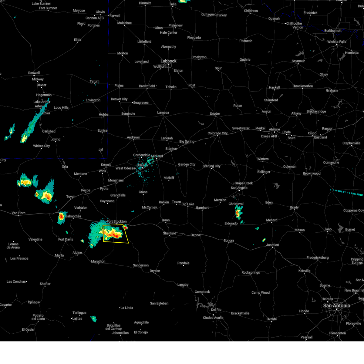 At 343 pm cdt, a severe thunderstorm was located 13 miles south of fort stockton, moving east at 20 mph (radar indicated). Hazards include 60 mph wind gusts and quarter size hail. Hail damage to vehicles is expected. expect wind damage to roofs, siding, and trees. locations impacted include, sierra madera. hail threat, radar indicated max hail size, 1. 00 in wind threat, radar indicated max wind gust, 60 mph. At 343 pm cdt, a severe thunderstorm was located 13 miles south of fort stockton, moving east at 20 mph (radar indicated). Hazards include 60 mph wind gusts and quarter size hail. Hail damage to vehicles is expected. expect wind damage to roofs, siding, and trees. locations impacted include, sierra madera. hail threat, radar indicated max hail size, 1. 00 in wind threat, radar indicated max wind gust, 60 mph.
|
| 10/16/2022 3:58 PM CDT |
 At 357 pm cdt, a severe thunderstorm was located 12 miles west of fort stockton, moving east at 20 mph (radar indicated). Hazards include 60 mph wind gusts and quarter size hail. Hail damage to vehicles is expected. Expect wind damage to roofs, siding, and trees. At 357 pm cdt, a severe thunderstorm was located 12 miles west of fort stockton, moving east at 20 mph (radar indicated). Hazards include 60 mph wind gusts and quarter size hail. Hail damage to vehicles is expected. Expect wind damage to roofs, siding, and trees.
|
| 10/10/2022 6:57 PM CDT |
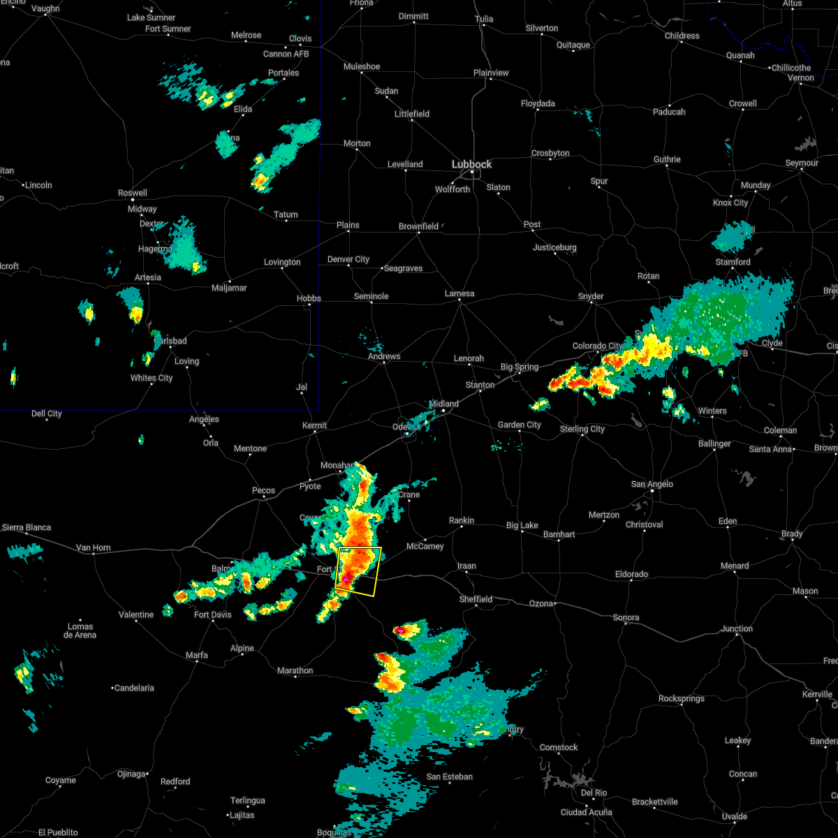 At 654 pm cdt, a severe thunderstorm was located 5 miles southeast of fort stockton, moving southeast at 10 mph (radar indicated). Hazards include 60 mph wind gusts and quarter size hail. Hail damage to vehicles is expected. expect wind damage to roofs, siding, and trees. locations impacted include, fort stockton and fort stockton-pecos county airport. this includes interstate 10 between mile markers 258 and 276. hail threat, radar indicated max hail size, 1. 00 in wind threat, radar indicated max wind gust, 60 mph. At 654 pm cdt, a severe thunderstorm was located 5 miles southeast of fort stockton, moving southeast at 10 mph (radar indicated). Hazards include 60 mph wind gusts and quarter size hail. Hail damage to vehicles is expected. expect wind damage to roofs, siding, and trees. locations impacted include, fort stockton and fort stockton-pecos county airport. this includes interstate 10 between mile markers 258 and 276. hail threat, radar indicated max hail size, 1. 00 in wind threat, radar indicated max wind gust, 60 mph.
|
| 10/10/2022 6:37 PM CDT |
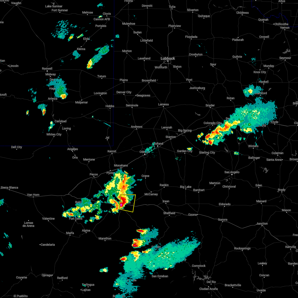 At 637 pm cdt, a severe thunderstorm was located over fort stockton, moving east at 10 mph (radar indicated). Hazards include 60 mph wind gusts and quarter size hail. Hail damage to vehicles is expected. Expect wind damage to roofs, siding, and trees. At 637 pm cdt, a severe thunderstorm was located over fort stockton, moving east at 10 mph (radar indicated). Hazards include 60 mph wind gusts and quarter size hail. Hail damage to vehicles is expected. Expect wind damage to roofs, siding, and trees.
|
| 10/10/2022 6:11 PM CDT | Golf Ball sized hail reported 0.4 miles NE of Fort Stockton, TX, at 6:18 it was still hailing in fort stockton. |
| 10/10/2022 6:09 PM CDT | Golf Ball sized hail reported 1.1 miles SSE of Fort Stockton, TX, hail is along hwy 285 north of fort stockton. |
| 10/10/2022 6:09 PM CDT |
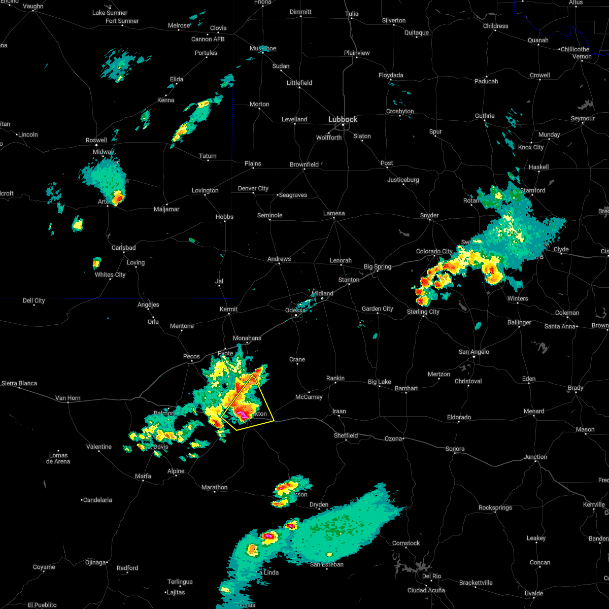 At 609 pm cdt, a severe thunderstorm was located near fort stockton, moving northeast at 20 mph (public). Hazards include golf ball size hail and 60 mph wind gusts. People and animals outdoors will be injured. expect hail damage to roofs, siding, windows, and vehicles. expect wind damage to roofs, siding, and trees. locations impacted include, fort stockton, firestone test track, fort stockton-pecos county airport and imperial reservoir. this includes interstate 10 between mile markers 243 and 276. thunderstorm damage threat, considerable hail threat, radar indicated max hail size, 1. 75 in wind threat, radar indicated max wind gust, 60 mph. At 609 pm cdt, a severe thunderstorm was located near fort stockton, moving northeast at 20 mph (public). Hazards include golf ball size hail and 60 mph wind gusts. People and animals outdoors will be injured. expect hail damage to roofs, siding, windows, and vehicles. expect wind damage to roofs, siding, and trees. locations impacted include, fort stockton, firestone test track, fort stockton-pecos county airport and imperial reservoir. this includes interstate 10 between mile markers 243 and 276. thunderstorm damage threat, considerable hail threat, radar indicated max hail size, 1. 75 in wind threat, radar indicated max wind gust, 60 mph.
|
| 10/10/2022 6:07 PM CDT | Storm damage reported in pecos county TX, 1.8 miles SE of Fort Stockton, TX |
| 10/10/2022 6:07 PM CDT | Quarter sized hail reported 1.1 miles SSE of Fort Stockton, TX |
| 10/10/2022 6:01 PM CDT |
 At 601 pm cdt, a severe thunderstorm was located near fort stockton, moving northeast at 20 mph (radar indicated). Hazards include ping pong ball size hail and 60 mph wind gusts. People and animals outdoors will be injured. expect hail damage to roofs, siding, windows, and vehicles. expect wind damage to roofs, siding, and trees. locations impacted include, fort stockton, firestone test track, fort stockton-pecos county airport and imperial reservoir. this includes interstate 10 between mile markers 243 and 276. hail threat, radar indicated max hail size, 1. 50 in wind threat, radar indicated max wind gust, 60 mph. At 601 pm cdt, a severe thunderstorm was located near fort stockton, moving northeast at 20 mph (radar indicated). Hazards include ping pong ball size hail and 60 mph wind gusts. People and animals outdoors will be injured. expect hail damage to roofs, siding, windows, and vehicles. expect wind damage to roofs, siding, and trees. locations impacted include, fort stockton, firestone test track, fort stockton-pecos county airport and imperial reservoir. this includes interstate 10 between mile markers 243 and 276. hail threat, radar indicated max hail size, 1. 50 in wind threat, radar indicated max wind gust, 60 mph.
|
| 10/10/2022 5:41 PM CDT |
 At 541 pm cdt, a severe thunderstorm was located 9 miles west of fort stockton, moving northeast at 20 mph (radar indicated). Hazards include 60 mph wind gusts and quarter size hail. Hail damage to vehicles is expected. Expect wind damage to roofs, siding, and trees. At 541 pm cdt, a severe thunderstorm was located 9 miles west of fort stockton, moving northeast at 20 mph (radar indicated). Hazards include 60 mph wind gusts and quarter size hail. Hail damage to vehicles is expected. Expect wind damage to roofs, siding, and trees.
|
| 8/29/2022 10:53 PM CDT | Kfst asos measured a wind gust of 60 mph at 10:53pm cd in pecos county TX, 2.7 miles SE of Fort Stockton, TX |
| 5/31/2022 6:14 PM CDT | Golf Ball sized hail reported 11.2 miles NE of Fort Stockton, TX |
| 5/31/2022 6:06 PM CDT |
 At 605 pm cdt, a severe thunderstorm was located 9 miles southwest of fort stockton, moving east at 10 mph (radar indicated). Hazards include ping pong ball size hail and 60 mph wind gusts. People and animals outdoors will be injured. expect hail damage to roofs, siding, windows, and vehicles. expect wind damage to roofs, siding, and trees. locations impacted include, fort stockton and fort stockton-pecos county airport. this includes interstate 10 between mile markers 255 and 270. hail threat, radar indicated max hail size, 1. 50 in wind threat, radar indicated max wind gust, 60 mph. At 605 pm cdt, a severe thunderstorm was located 9 miles southwest of fort stockton, moving east at 10 mph (radar indicated). Hazards include ping pong ball size hail and 60 mph wind gusts. People and animals outdoors will be injured. expect hail damage to roofs, siding, windows, and vehicles. expect wind damage to roofs, siding, and trees. locations impacted include, fort stockton and fort stockton-pecos county airport. this includes interstate 10 between mile markers 255 and 270. hail threat, radar indicated max hail size, 1. 50 in wind threat, radar indicated max wind gust, 60 mph.
|
| 5/31/2022 5:47 PM CDT | Quarter sized hail reported 11.3 miles NE of Fort Stockton, TX |
| 5/31/2022 5:43 PM CDT |
 At 542 pm cdt, a severe thunderstorm was located 9 miles southwest of fort stockton, moving northeast at 15 mph (radar indicated). Hazards include ping pong ball size hail and 60 mph wind gusts. People and animals outdoors will be injured. expect hail damage to roofs, siding, windows, and vehicles. Expect wind damage to roofs, siding, and trees. At 542 pm cdt, a severe thunderstorm was located 9 miles southwest of fort stockton, moving northeast at 15 mph (radar indicated). Hazards include ping pong ball size hail and 60 mph wind gusts. People and animals outdoors will be injured. expect hail damage to roofs, siding, windows, and vehicles. Expect wind damage to roofs, siding, and trees.
|
| 5/31/2022 5:27 PM CDT |
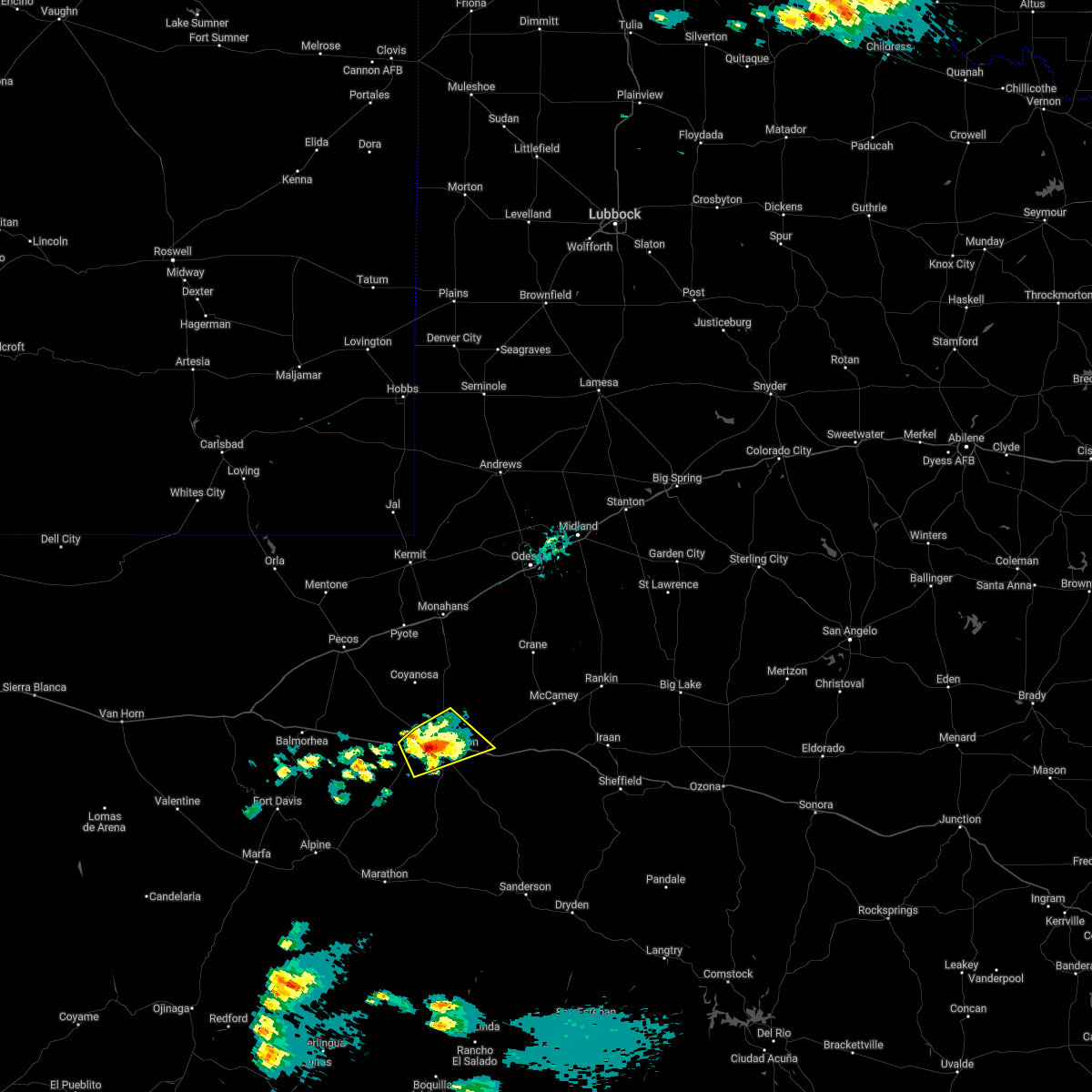 At 526 pm cdt, a severe thunderstorm was located near fort stockton, moving east at 10 mph (radar indicated). Hazards include 60 mph wind gusts and quarter size hail. Hail damage to vehicles is expected. expect wind damage to roofs, siding, and trees. locations impacted include, fort stockton, fort stockton-pecos county airport and firestone test track. this includes interstate 10 between mile markers 244 and 273. hail threat, radar indicated max hail size, 1. 00 in wind threat, radar indicated max wind gust, 60 mph. At 526 pm cdt, a severe thunderstorm was located near fort stockton, moving east at 10 mph (radar indicated). Hazards include 60 mph wind gusts and quarter size hail. Hail damage to vehicles is expected. expect wind damage to roofs, siding, and trees. locations impacted include, fort stockton, fort stockton-pecos county airport and firestone test track. this includes interstate 10 between mile markers 244 and 273. hail threat, radar indicated max hail size, 1. 00 in wind threat, radar indicated max wind gust, 60 mph.
|
| 5/31/2022 5:02 PM CDT |
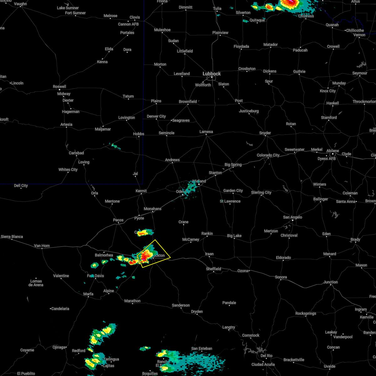 At 501 pm cdt, a severe thunderstorm was located 7 miles west of fort stockton, moving northeast at 20 mph (radar indicated). Hazards include 60 mph wind gusts and quarter size hail. Hail damage to vehicles is expected. Expect wind damage to roofs, siding, and trees. At 501 pm cdt, a severe thunderstorm was located 7 miles west of fort stockton, moving northeast at 20 mph (radar indicated). Hazards include 60 mph wind gusts and quarter size hail. Hail damage to vehicles is expected. Expect wind damage to roofs, siding, and trees.
|
| 5/12/2022 5:34 PM CDT | Quarter sized hail reported 26.3 miles NW of Fort Stockton, TX, hail observed along us285 se of fort stockton. time estimated from radar. |
| 5/10/2022 5:50 PM CDT | Estimated 60 to 70 mph wind gusts and nickel size hail in downtown fort stockto in pecos county TX, 0.4 miles NE of Fort Stockton, TX |
| 5/10/2022 5:45 PM CDT |
 At 544 pm cdt, a severe thunderstorm was located near fort stockton, moving northeast at 30 mph (emergency management reported wind damage in fort stockton. wind gusts up to 65 mph were observed at the airport in fort stockton). Hazards include 70 mph wind gusts and quarter size hail. Hail damage to vehicles is expected. expect considerable tree damage. Wind damage is also likely to mobile homes, roofs, and outbuildings. At 544 pm cdt, a severe thunderstorm was located near fort stockton, moving northeast at 30 mph (emergency management reported wind damage in fort stockton. wind gusts up to 65 mph were observed at the airport in fort stockton). Hazards include 70 mph wind gusts and quarter size hail. Hail damage to vehicles is expected. expect considerable tree damage. Wind damage is also likely to mobile homes, roofs, and outbuildings.
|
| 5/10/2022 5:37 PM CDT | At fort stockton aso in pecos county TX, 2.3 miles ESE of Fort Stockton, TX |
| 5/10/2022 5:28 PM CDT | Half Dollar sized hail reported 16.2 miles N of Fort Stockton, TX, along us hwy 385. |
| 5/10/2022 4:44 PM CDT |
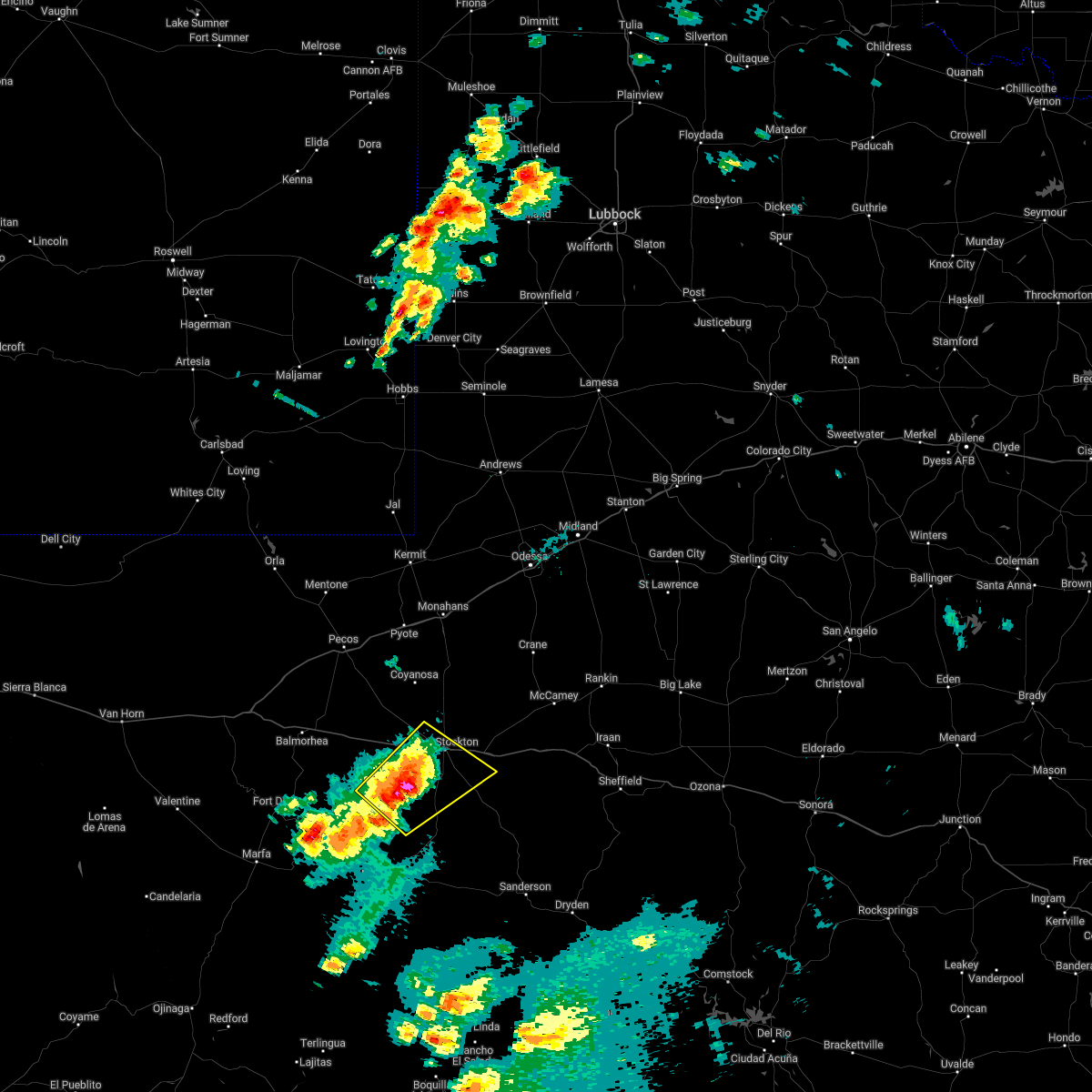 At 444 pm cdt, a severe thunderstorm was located 21 miles southwest of fort stockton, moving northeast at 25 mph (radar indicated). Hazards include 60 mph wind gusts and half dollar size hail. Hail damage to vehicles is expected. expect wind damage to roofs, siding, and trees. locations impacted include, fort stockton, firestone test track, fort stockton-pecos county airport and sierra madera. This includes interstate 10 between mile markers 244 and 267. At 444 pm cdt, a severe thunderstorm was located 21 miles southwest of fort stockton, moving northeast at 25 mph (radar indicated). Hazards include 60 mph wind gusts and half dollar size hail. Hail damage to vehicles is expected. expect wind damage to roofs, siding, and trees. locations impacted include, fort stockton, firestone test track, fort stockton-pecos county airport and sierra madera. This includes interstate 10 between mile markers 244 and 267.
|
| 5/10/2022 4:38 PM CDT |
 At 438 pm cdt, a severe thunderstorm was located 27 miles southwest of fort stockton, moving northeast at 20 mph (radar indicated). Hazards include 60 mph wind gusts and quarter size hail. Hail damage to vehicles is expected. Expect wind damage to roofs, siding, and trees. At 438 pm cdt, a severe thunderstorm was located 27 miles southwest of fort stockton, moving northeast at 20 mph (radar indicated). Hazards include 60 mph wind gusts and quarter size hail. Hail damage to vehicles is expected. Expect wind damage to roofs, siding, and trees.
|
| 5/1/2022 7:31 PM CDT | 18 wheeler flipped and houses damaged east side of fort stockto in pecos county TX, 1 miles WNW of Fort Stockton, TX |
| 5/1/2022 7:22 PM CDT | Baseball sized hail reported 7.9 miles S of Fort Stockton, TX |
| 5/1/2022 5:55 PM CDT | Baseball sized hail reported 12.7 miles SSW of Fort Stockton, TX |
| 5/1/2022 5:41 PM CDT | Baseball sized hail reported 14.8 miles S of Fort Stockton, TX |
| 8/20/2021 4:23 PM CDT | A wind gust of 60 mph was measured at the fst asos sit in pecos county TX, 0.4 miles NE of Fort Stockton, TX |
| 6/9/2021 6:24 PM CDT |
 At 623 pm cdt, a severe thunderstorm was located 18 miles west of mccamey, moving east at 20 mph (emergency management reported quarter size hail in this storm). Hazards include 60 mph wind gusts and quarter size hail. Hail damage to vehicles is expected. expect wind damage to roofs, siding, and trees. locations impacted include, fort stockton and fort stockton-pecos county airport. This includes interstate 10 between mile markers 258 and 285. At 623 pm cdt, a severe thunderstorm was located 18 miles west of mccamey, moving east at 20 mph (emergency management reported quarter size hail in this storm). Hazards include 60 mph wind gusts and quarter size hail. Hail damage to vehicles is expected. expect wind damage to roofs, siding, and trees. locations impacted include, fort stockton and fort stockton-pecos county airport. This includes interstate 10 between mile markers 258 and 285.
|
| 6/9/2021 5:57 PM CDT |
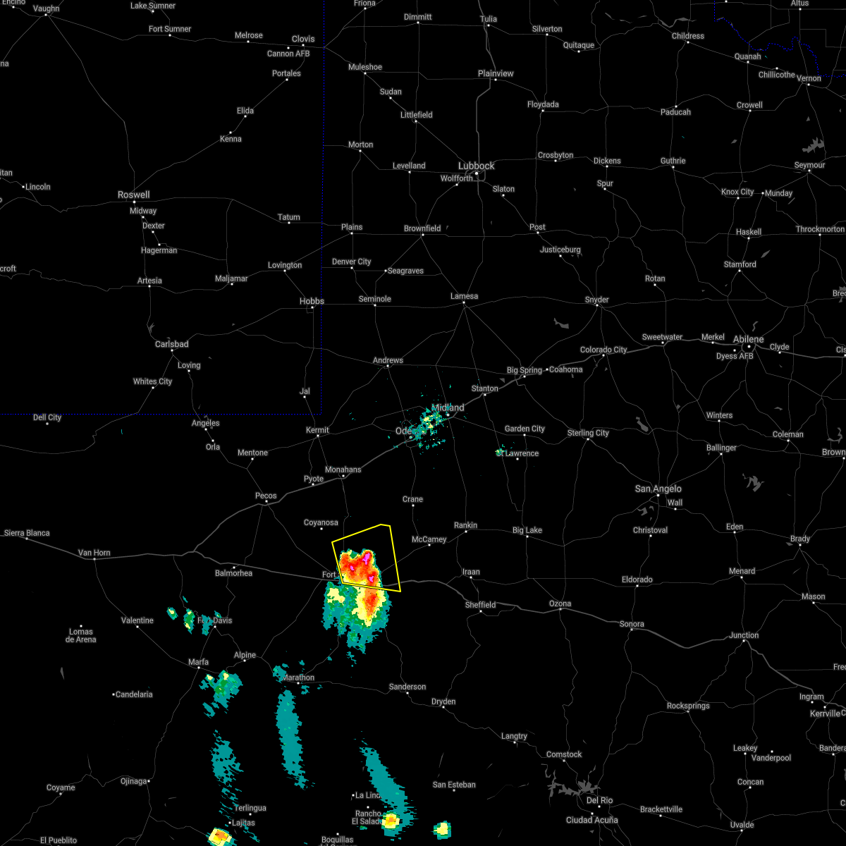 The national weather service in midland has issued a * severe thunderstorm warning for. north central pecos county in southwestern texas. until 700 pm cdt. At 556 pm cdt, a severe thunderstorm was located 14 miles northeast of fort stockton, moving east at 15 mph. The national weather service in midland has issued a * severe thunderstorm warning for. north central pecos county in southwestern texas. until 700 pm cdt. At 556 pm cdt, a severe thunderstorm was located 14 miles northeast of fort stockton, moving east at 15 mph.
|
| 6/9/2021 5:45 PM CDT | Quarter sized hail reported 10 miles S of Fort Stockton, TX |
| 5/31/2021 7:18 PM CDT | Quarter sized hail reported 20.3 miles N of Fort Stockton, TX, spotter reports nickel to quarter size hail 20 miles south of fort stockon on 285. |
| 5/31/2021 4:10 PM CDT |
 At 410 pm cdt, a severe thunderstorm was located 9 miles north of fort stockton, moving northeast at 30 mph (radar indicated). Hazards include 60 mph wind gusts and quarter size hail. Hail damage to vehicles is expected. expect wind damage to roofs, siding, and trees. locations impacted include, fort stockton, fort stockton-pecos county airport and imperial. This includes interstate 10 between mile markers 253 and 286. At 410 pm cdt, a severe thunderstorm was located 9 miles north of fort stockton, moving northeast at 30 mph (radar indicated). Hazards include 60 mph wind gusts and quarter size hail. Hail damage to vehicles is expected. expect wind damage to roofs, siding, and trees. locations impacted include, fort stockton, fort stockton-pecos county airport and imperial. This includes interstate 10 between mile markers 253 and 286.
|
| 5/31/2021 4:04 PM CDT | Quarter sized hail reported 10 miles WSW of Fort Stockton, TX, 10 miles east northeast of fort stockton along 285 report of quarter size hail. |
| 5/31/2021 3:51 PM CDT |
 At 351 pm cdt, a severe thunderstorm was located 7 miles northwest of fort stockton, moving northeast at 30 mph (radar indicated). Hazards include 60 mph wind gusts and half dollar size hail. Hail damage to vehicles is expected. Expect wind damage to roofs, siding, and trees. At 351 pm cdt, a severe thunderstorm was located 7 miles northwest of fort stockton, moving northeast at 30 mph (radar indicated). Hazards include 60 mph wind gusts and half dollar size hail. Hail damage to vehicles is expected. Expect wind damage to roofs, siding, and trees.
|
| 5/31/2021 3:10 PM CDT | Ping Pong Ball sized hail reported 21.9 miles ENE of Fort Stockton, TX |
| 5/31/2021 3:10 PM CDT |
 At 310 pm cdt, a severe thunderstorm was located 16 miles southwest of fort stockton, moving east at 25 mph (radar indicated). Hazards include tennis ball size hail and 70 mph wind gusts. People and animals outdoors will be injured. expect hail damage to roofs, siding, windows, and vehicles. expect considerable tree damage. wind damage is also likely to mobile homes, roofs, and outbuildings. locations impacted include, fort stockton, fort stockton-pecos county airport and firestone test track. This includes interstate 10 between mile markers 243 and 264. At 310 pm cdt, a severe thunderstorm was located 16 miles southwest of fort stockton, moving east at 25 mph (radar indicated). Hazards include tennis ball size hail and 70 mph wind gusts. People and animals outdoors will be injured. expect hail damage to roofs, siding, windows, and vehicles. expect considerable tree damage. wind damage is also likely to mobile homes, roofs, and outbuildings. locations impacted include, fort stockton, fort stockton-pecos county airport and firestone test track. This includes interstate 10 between mile markers 243 and 264.
|
| 5/31/2021 2:50 PM CDT |
 At 249 pm cdt, a severe thunderstorm was located 20 miles west of fort stockton, moving east at 25 mph (radar indicated). Hazards include tennis ball size hail and 70 mph wind gusts. People and animals outdoors will be injured. expect hail damage to roofs, siding, windows, and vehicles. expect considerable tree damage. wind damage is also likely to mobile homes, roofs, and outbuildings. locations impacted include, fort stockton, fort stockton-pecos county airport and firestone test track. This includes interstate 10 between mile markers 237 and 271. At 249 pm cdt, a severe thunderstorm was located 20 miles west of fort stockton, moving east at 25 mph (radar indicated). Hazards include tennis ball size hail and 70 mph wind gusts. People and animals outdoors will be injured. expect hail damage to roofs, siding, windows, and vehicles. expect considerable tree damage. wind damage is also likely to mobile homes, roofs, and outbuildings. locations impacted include, fort stockton, fort stockton-pecos county airport and firestone test track. This includes interstate 10 between mile markers 237 and 271.
|
| 5/31/2021 2:39 PM CDT |
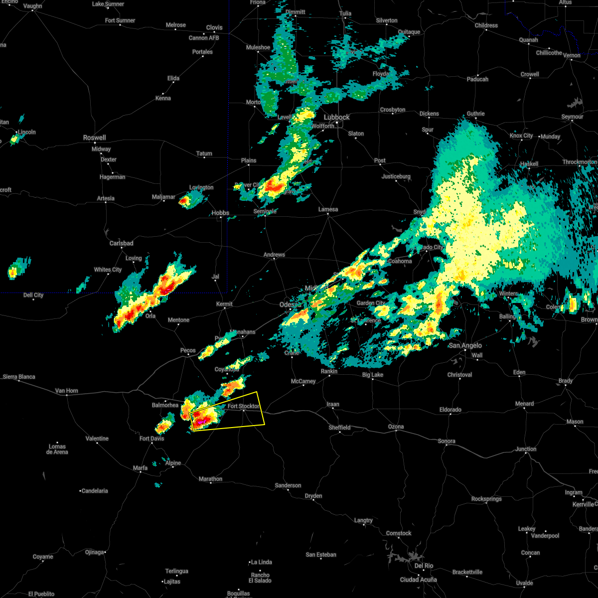 At 230 pm cdt, a severe thunderstorm was located 24 miles southeast of saragosa, or 27 miles west of fort stockton, moving east at 40 mph (radar indicated). Hazards include 70 mph wind gusts and ping pong ball size hail. People and animals outdoors will be injured. expect hail damage to roofs, siding, windows, and vehicles. expect considerable tree damage. Wind damage is also likely to mobile homes, roofs, and outbuildings. At 230 pm cdt, a severe thunderstorm was located 24 miles southeast of saragosa, or 27 miles west of fort stockton, moving east at 40 mph (radar indicated). Hazards include 70 mph wind gusts and ping pong ball size hail. People and animals outdoors will be injured. expect hail damage to roofs, siding, windows, and vehicles. expect considerable tree damage. Wind damage is also likely to mobile homes, roofs, and outbuildings.
|
| 5/31/2021 2:30 PM CDT |
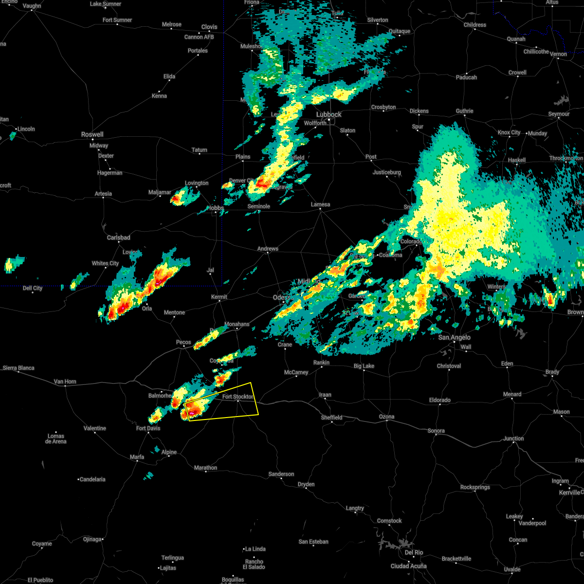 At 230 pm cdt, a severe thunderstorm was located 24 miles southeast of saragosa, or 27 miles west of fort stockton, moving east at 40 mph (radar indicated). Hazards include 70 mph wind gusts and ping pong ball size hail. People and animals outdoors will be injured. expect hail damage to roofs, siding, windows, and vehicles. expect considerable tree damage. Wind damage is also likely to mobile homes, roofs, and outbuildings. At 230 pm cdt, a severe thunderstorm was located 24 miles southeast of saragosa, or 27 miles west of fort stockton, moving east at 40 mph (radar indicated). Hazards include 70 mph wind gusts and ping pong ball size hail. People and animals outdoors will be injured. expect hail damage to roofs, siding, windows, and vehicles. expect considerable tree damage. Wind damage is also likely to mobile homes, roofs, and outbuildings.
|
| 5/28/2021 3:48 PM CDT |
 At 348 pm cdt, a severe thunderstorm was located near fort stockton, moving east at 20 mph (radar indicated). Hazards include 60 mph wind gusts and quarter size hail. Hail damage to vehicles is expected. expect wind damage to roofs, siding, and trees. locations impacted include, fort stockton and fort stockton-pecos county airport. This includes interstate 10 between mile markers 249 and 282. At 348 pm cdt, a severe thunderstorm was located near fort stockton, moving east at 20 mph (radar indicated). Hazards include 60 mph wind gusts and quarter size hail. Hail damage to vehicles is expected. expect wind damage to roofs, siding, and trees. locations impacted include, fort stockton and fort stockton-pecos county airport. This includes interstate 10 between mile markers 249 and 282.
|
| 5/28/2021 3:24 PM CDT |
 At 324 pm cdt, a severe thunderstorm was located 13 miles southwest of fort stockton, moving northeast at 25 mph (radar indicated). Hazards include 60 mph wind gusts and half dollar size hail. Hail damage to vehicles is expected. Expect wind damage to roofs, siding, and trees. At 324 pm cdt, a severe thunderstorm was located 13 miles southwest of fort stockton, moving northeast at 25 mph (radar indicated). Hazards include 60 mph wind gusts and half dollar size hail. Hail damage to vehicles is expected. Expect wind damage to roofs, siding, and trees.
|
| 5/27/2021 5:50 PM CDT | Golf Ball sized hail reported 30.3 miles NW of Fort Stockton, TX, golfball size hail reported on hwy 285 |
| 5/27/2021 5:11 PM CDT |
 At 510 pm cdt, a severe thunderstorm was located 22 miles east of marathon, or 32 miles northwest of sanderson, moving southeast at 45 mph (radar indicated). Hazards include two inch hail and 70 mph wind gusts. People and animals outdoors will be injured. expect hail damage to roofs, siding, windows, and vehicles. expect considerable tree damage. wind damage is also likely to mobile homes, roofs, and outbuildings. locations impacted include, fort stockton and sierra madera. This includes interstate 10 between mile markers 260 and 262. At 510 pm cdt, a severe thunderstorm was located 22 miles east of marathon, or 32 miles northwest of sanderson, moving southeast at 45 mph (radar indicated). Hazards include two inch hail and 70 mph wind gusts. People and animals outdoors will be injured. expect hail damage to roofs, siding, windows, and vehicles. expect considerable tree damage. wind damage is also likely to mobile homes, roofs, and outbuildings. locations impacted include, fort stockton and sierra madera. This includes interstate 10 between mile markers 260 and 262.
|
| 5/27/2021 5:10 PM CDT |
 At 509 pm cdt, a severe thunderstorm was located 23 miles east of marathon, or 30 miles northwest of sanderson, moving southeast at 45 mph (radar indicated). Hazards include 70 mph wind gusts and half dollar size hail. Hail damage to vehicles is expected. expect considerable tree damage. wind damage is also likely to mobile homes, roofs, and outbuildings. locations impacted include, fort stockton and sierra madera. This includes interstate 10 between mile markers 260 and 262. At 509 pm cdt, a severe thunderstorm was located 23 miles east of marathon, or 30 miles northwest of sanderson, moving southeast at 45 mph (radar indicated). Hazards include 70 mph wind gusts and half dollar size hail. Hail damage to vehicles is expected. expect considerable tree damage. wind damage is also likely to mobile homes, roofs, and outbuildings. locations impacted include, fort stockton and sierra madera. This includes interstate 10 between mile markers 260 and 262.
|
| 5/27/2021 4:58 PM CDT |
 At 457 pm cdt, a severe thunderstorm was located 19 miles northeast of marathon, or 34 miles south of fort stockton, moving southeast at 45 mph (radar indicated). Hazards include 70 mph wind gusts and half dollar size hail. Hail damage to vehicles is expected. expect considerable tree damage. wind damage is also likely to mobile homes, roofs, and outbuildings. locations impacted include, fort stockton and sierra madera. This includes interstate 10 between mile markers 256 and 262. At 457 pm cdt, a severe thunderstorm was located 19 miles northeast of marathon, or 34 miles south of fort stockton, moving southeast at 45 mph (radar indicated). Hazards include 70 mph wind gusts and half dollar size hail. Hail damage to vehicles is expected. expect considerable tree damage. wind damage is also likely to mobile homes, roofs, and outbuildings. locations impacted include, fort stockton and sierra madera. This includes interstate 10 between mile markers 256 and 262.
|
| 5/27/2021 4:41 PM CDT |
 At 440 pm cdt, a severe thunderstorm was located 19 miles north of marathon, or 29 miles east of alpine, moving southeast at 45 mph (radar indicated). Hazards include 70 mph wind gusts and half dollar size hail. Hail damage to vehicles is expected. expect considerable tree damage. Wind damage is also likely to mobile homes, roofs, and outbuildings. At 440 pm cdt, a severe thunderstorm was located 19 miles north of marathon, or 29 miles east of alpine, moving southeast at 45 mph (radar indicated). Hazards include 70 mph wind gusts and half dollar size hail. Hail damage to vehicles is expected. expect considerable tree damage. Wind damage is also likely to mobile homes, roofs, and outbuildings.
|
| 5/23/2021 5:30 PM CDT |
 At 529 pm cdt, severe thunderstorms were located along a line extending from 7 miles west of fort stockton to 32 miles southeast of saragosa moving east at 15 mph (radar indicated). Hazards include 60 mph wind gusts and quarter size hail. Hail damage to vehicles is expected. Expect wind damage to roofs, siding, and trees. At 529 pm cdt, severe thunderstorms were located along a line extending from 7 miles west of fort stockton to 32 miles southeast of saragosa moving east at 15 mph (radar indicated). Hazards include 60 mph wind gusts and quarter size hail. Hail damage to vehicles is expected. Expect wind damage to roofs, siding, and trees.
|
| 5/23/2021 5:17 PM CDT |
 At 516 pm cdt, a severe thunderstorm was located 13 miles west of fort stockton, moving southeast at 10 mph (radar indicated). Hazards include 60 mph wind gusts and quarter size hail. Hail damage to vehicles is expected. expect wind damage to roofs, siding, and trees. locations impacted include, fort stockton, fort stockton-pecos county airport and firestone test track. This includes interstate 10 between mile markers 232 and 266. At 516 pm cdt, a severe thunderstorm was located 13 miles west of fort stockton, moving southeast at 10 mph (radar indicated). Hazards include 60 mph wind gusts and quarter size hail. Hail damage to vehicles is expected. expect wind damage to roofs, siding, and trees. locations impacted include, fort stockton, fort stockton-pecos county airport and firestone test track. This includes interstate 10 between mile markers 232 and 266.
|
| 5/23/2021 4:58 PM CDT | Quarter sized hail reported 13.3 miles E of Fort Stockton, TX, quarter and nickel size hail reported 1 mile north of i-10 mile marker 245 with heavy rain and strong winds. |
| 5/23/2021 4:52 PM CDT |
 At 451 pm cdt, a severe thunderstorm was located 13 miles west of fort stockton, moving east at 15 mph (radar indicated). Hazards include 60 mph wind gusts and quarter size hail. Hail damage to vehicles is expected. Expect wind damage to roofs, siding, and trees. At 451 pm cdt, a severe thunderstorm was located 13 miles west of fort stockton, moving east at 15 mph (radar indicated). Hazards include 60 mph wind gusts and quarter size hail. Hail damage to vehicles is expected. Expect wind damage to roofs, siding, and trees.
|
| 5/15/2021 6:33 PM CDT | Hen Egg sized hail reported 47.4 miles NW of Fort Stockton, TX, social media report of 2 inch hail at ranch rd 2400 and hwy 285. |
| 5/15/2021 4:50 PM CDT | Half Dollar sized hail reported 6.9 miles W of Fort Stockton, TX, spotter report of 1-1 1/4 hail driving through storm heading westbound into fort stockton. |
| 6/17/2020 3:58 PM CDT |
 At 358 pm cdt, a severe thunderstorm was located 14 miles northwest of fort stockton, moving north at 25 mph (radar indicated). Hazards include 60 mph wind gusts and quarter size hail. Hail damage to vehicles is expected. expect wind damage to roofs, siding, and trees. locations impacted include, fort stockton, fort stockton-pecos county airport and firestone test track. This includes interstate 10 between mile markers 248 and 272. At 358 pm cdt, a severe thunderstorm was located 14 miles northwest of fort stockton, moving north at 25 mph (radar indicated). Hazards include 60 mph wind gusts and quarter size hail. Hail damage to vehicles is expected. expect wind damage to roofs, siding, and trees. locations impacted include, fort stockton, fort stockton-pecos county airport and firestone test track. This includes interstate 10 between mile markers 248 and 272.
|
| 6/17/2020 3:42 PM CDT |
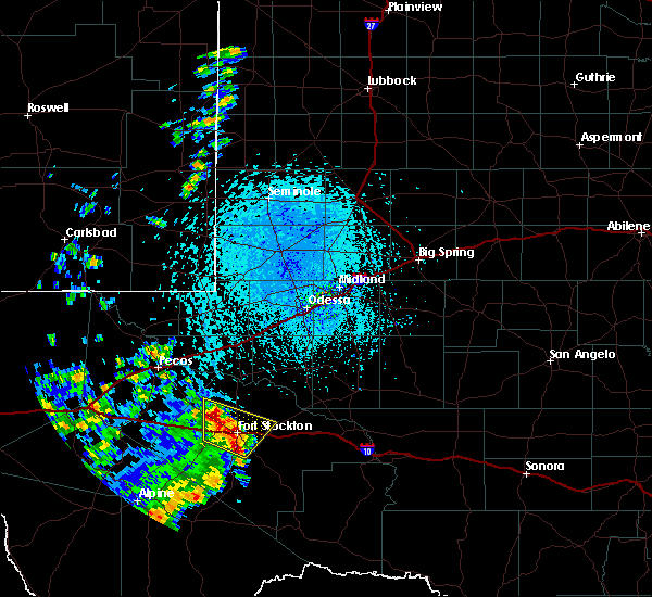 At 342 pm cdt, a cluster of severe thunderstorms were located near fort stockton, moving north at 10 mph (radar indicated). Hazards include 60 mph wind gusts and quarter size hail. Hail damage to vehicles is expected. expect wind damage to roofs, siding, and trees. locations impacted include, fort stockton, fort stockton-pecos county airport and firestone test track. This includes interstate 10 between mile markers 244 and 272. At 342 pm cdt, a cluster of severe thunderstorms were located near fort stockton, moving north at 10 mph (radar indicated). Hazards include 60 mph wind gusts and quarter size hail. Hail damage to vehicles is expected. expect wind damage to roofs, siding, and trees. locations impacted include, fort stockton, fort stockton-pecos county airport and firestone test track. This includes interstate 10 between mile markers 244 and 272.
|
| 6/17/2020 3:24 PM CDT |
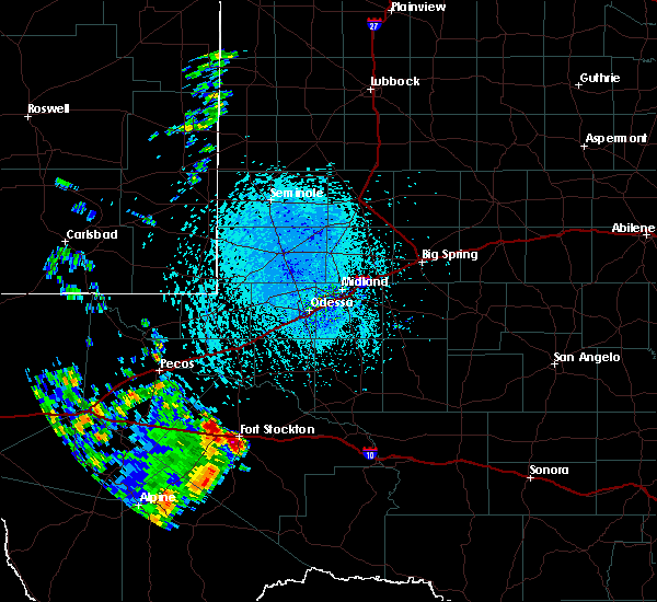 At 324 pm cdt, a severe thunderstorm was located over fort stockton, moving north at 10 mph (radar indicated). Hazards include 60 mph wind gusts and quarter size hail. Hail damage to vehicles is expected. Expect wind damage to roofs, siding, and trees. At 324 pm cdt, a severe thunderstorm was located over fort stockton, moving north at 10 mph (radar indicated). Hazards include 60 mph wind gusts and quarter size hail. Hail damage to vehicles is expected. Expect wind damage to roofs, siding, and trees.
|
| 5/23/2020 4:15 PM CDT |
 At 415 pm cdt, a severe thunderstorm was located 7 miles east of fort stockton, moving northeast at 25 mph (radar indicated). Hazards include 60 mph wind gusts and half dollar size hail. Hail damage to vehicles is expected. expect wind damage to roofs, siding, and trees. locations impacted include, fort stockton, fort stockton-pecos county airport and sierra madera. This includes interstate 10 between mile markers 248 and 286. At 415 pm cdt, a severe thunderstorm was located 7 miles east of fort stockton, moving northeast at 25 mph (radar indicated). Hazards include 60 mph wind gusts and half dollar size hail. Hail damage to vehicles is expected. expect wind damage to roofs, siding, and trees. locations impacted include, fort stockton, fort stockton-pecos county airport and sierra madera. This includes interstate 10 between mile markers 248 and 286.
|
| 5/23/2020 4:00 PM CDT | Storm damage reported in pecos county TX, 1.8 miles SE of Fort Stockton, TX |
| 5/23/2020 3:40 PM CDT |
 At 339 pm cdt, a severe thunderstorm was located 13 miles south of fort stockton, moving northeast at 25 mph (radar indicated). Hazards include ping pong ball size hail and 60 mph wind gusts. People and animals outdoors will be injured. expect hail damage to roofs, siding, windows, and vehicles. Expect wind damage to roofs, siding, and trees. At 339 pm cdt, a severe thunderstorm was located 13 miles south of fort stockton, moving northeast at 25 mph (radar indicated). Hazards include ping pong ball size hail and 60 mph wind gusts. People and animals outdoors will be injured. expect hail damage to roofs, siding, windows, and vehicles. Expect wind damage to roofs, siding, and trees.
|
| 5/23/2020 3:30 PM CDT | Hen Egg sized hail reported 15.5 miles N of Fort Stockton, TX |
| 5/13/2020 5:23 PM CDT |
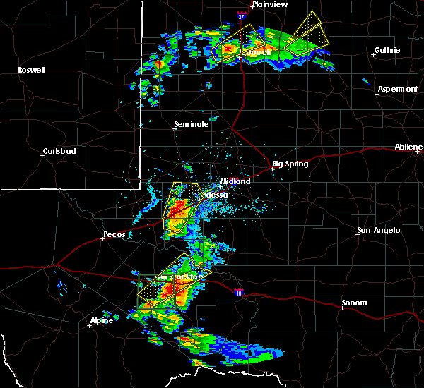 At 522 pm cdt, a severe thunderstorm was located 16 miles southeast of fort stockton, moving northeast at 15 mph (radar indicated). Hazards include two inch hail and 60 mph wind gusts. People and animals outdoors will be injured. expect hail damage to roofs, siding, windows, and vehicles. expect wind damage to roofs, siding, and trees. locations impacted include, fort stockton and girvin. This includes interstate 10 between mile markers 258 and 289. At 522 pm cdt, a severe thunderstorm was located 16 miles southeast of fort stockton, moving northeast at 15 mph (radar indicated). Hazards include two inch hail and 60 mph wind gusts. People and animals outdoors will be injured. expect hail damage to roofs, siding, windows, and vehicles. expect wind damage to roofs, siding, and trees. locations impacted include, fort stockton and girvin. This includes interstate 10 between mile markers 258 and 289.
|
| 5/13/2020 5:15 PM CDT |
 At 514 pm cdt, a severe thunderstorm was located 18 miles east of fort stockton, moving northeast at 20 mph (radar indicated). Hazards include 60 mph wind gusts and half dollar size hail. Hail damage to vehicles is expected. expect wind damage to roofs, siding, and trees. locations impacted include, fort stockton and girvin. This includes interstate 10 between mile markers 258 and 289. At 514 pm cdt, a severe thunderstorm was located 18 miles east of fort stockton, moving northeast at 20 mph (radar indicated). Hazards include 60 mph wind gusts and half dollar size hail. Hail damage to vehicles is expected. expect wind damage to roofs, siding, and trees. locations impacted include, fort stockton and girvin. This includes interstate 10 between mile markers 258 and 289.
|
| 5/13/2020 5:01 PM CDT |
 At 500 pm cdt, a severe thunderstorm was located 17 miles east of fort stockton, moving northeast at 25 mph (radar indicated). Hazards include 60 mph wind gusts and half dollar size hail. Hail damage to vehicles is expected. expect wind damage to roofs, siding, and trees. locations impacted include, fort stockton and girvin. This includes interstate 10 between mile markers 258 and 289. At 500 pm cdt, a severe thunderstorm was located 17 miles east of fort stockton, moving northeast at 25 mph (radar indicated). Hazards include 60 mph wind gusts and half dollar size hail. Hail damage to vehicles is expected. expect wind damage to roofs, siding, and trees. locations impacted include, fort stockton and girvin. This includes interstate 10 between mile markers 258 and 289.
|
| 5/13/2020 4:44 PM CDT |
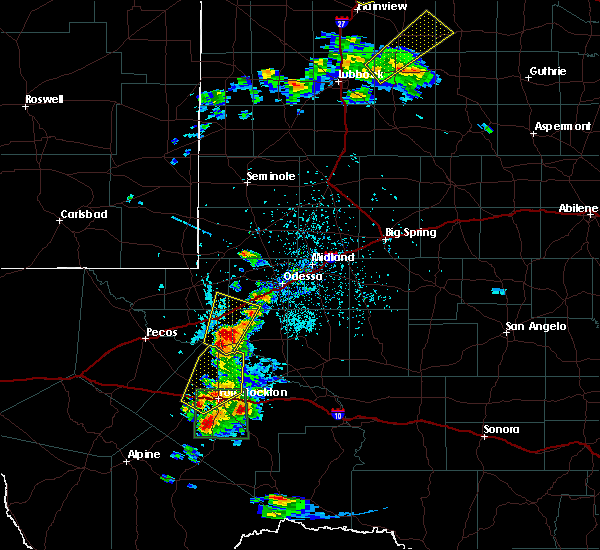 At 444 pm cdt, a severe thunderstorm was located 13 miles southeast of fort stockton, moving northeast at 25 mph (radar indicated). Hazards include 60 mph wind gusts and quarter size hail. Hail damage to vehicles is expected. Expect wind damage to roofs, siding, and trees. At 444 pm cdt, a severe thunderstorm was located 13 miles southeast of fort stockton, moving northeast at 25 mph (radar indicated). Hazards include 60 mph wind gusts and quarter size hail. Hail damage to vehicles is expected. Expect wind damage to roofs, siding, and trees.
|
| 5/13/2020 4:32 PM CDT |
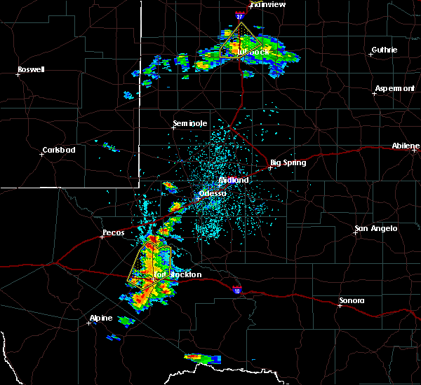 At 432 pm cdt, a severe thunderstorm was located over fort stockton, moving northeast at 25 mph (radar indicated). Hazards include 60 mph wind gusts and quarter size hail. Hail damage to vehicles is expected. expect wind damage to roofs, siding, and trees. locations impacted include, fort stockton, firestone test track, imperial, fort stockton-pecos county airport and imperial reservoir. This includes interstate 10 between mile markers 242 and 265. At 432 pm cdt, a severe thunderstorm was located over fort stockton, moving northeast at 25 mph (radar indicated). Hazards include 60 mph wind gusts and quarter size hail. Hail damage to vehicles is expected. expect wind damage to roofs, siding, and trees. locations impacted include, fort stockton, firestone test track, imperial, fort stockton-pecos county airport and imperial reservoir. This includes interstate 10 between mile markers 242 and 265.
|
| 5/13/2020 4:14 PM CDT |
 At 414 pm cdt, a severe thunderstorm was located 10 miles northwest of fort stockton, moving northeast at 20 mph (radar indicated). Hazards include 60 mph wind gusts and half dollar size hail. Hail damage to vehicles is expected. expect wind damage to roofs, siding, and trees. locations impacted include, fort stockton, firestone test track, imperial, fort stockton-pecos county airport and imperial reservoir. This includes interstate 10 between mile markers 242 and 265. At 414 pm cdt, a severe thunderstorm was located 10 miles northwest of fort stockton, moving northeast at 20 mph (radar indicated). Hazards include 60 mph wind gusts and half dollar size hail. Hail damage to vehicles is expected. expect wind damage to roofs, siding, and trees. locations impacted include, fort stockton, firestone test track, imperial, fort stockton-pecos county airport and imperial reservoir. This includes interstate 10 between mile markers 242 and 265.
|
| 5/13/2020 4:03 PM CDT |
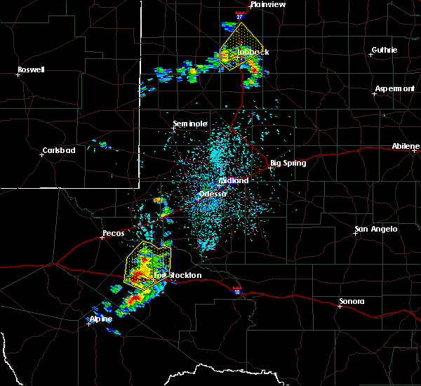 At 402 pm cdt, a severe thunderstorm was located 11 miles west of fort stockton, moving northeast at 20 mph (radar indicated). Hazards include 60 mph wind gusts and quarter size hail. Hail damage to vehicles is expected. expect wind damage to roofs, siding, and trees. locations impacted include, fort stockton, firestone test track, imperial, fort stockton-pecos county airport, coyanosa and imperial reservoir. This includes interstate 10 between mile markers 241 and 265. At 402 pm cdt, a severe thunderstorm was located 11 miles west of fort stockton, moving northeast at 20 mph (radar indicated). Hazards include 60 mph wind gusts and quarter size hail. Hail damage to vehicles is expected. expect wind damage to roofs, siding, and trees. locations impacted include, fort stockton, firestone test track, imperial, fort stockton-pecos county airport, coyanosa and imperial reservoir. This includes interstate 10 between mile markers 241 and 265.
|
| 5/13/2020 3:44 PM CDT |
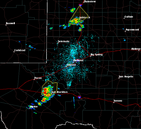 At 344 pm cdt, a severe thunderstorm was located 12 miles west of fort stockton, moving northeast at 25 mph (radar indicated). Hazards include 60 mph wind gusts and quarter size hail. Hail damage to vehicles is expected. Expect wind damage to roofs, siding, and trees. At 344 pm cdt, a severe thunderstorm was located 12 miles west of fort stockton, moving northeast at 25 mph (radar indicated). Hazards include 60 mph wind gusts and quarter size hail. Hail damage to vehicles is expected. Expect wind damage to roofs, siding, and trees.
|
| 5/11/2020 7:22 PM CDT |
 At 719 pm cdt, a severe thunderstorm was located 20 miles southeast of fort stockton, moving southeast at 10 mph. tennis ball size hail was reported on us 285 22 miles se of fort stockton with this storm (public). Hazards include tennis ball size hail. People and animals outdoors will be injured. expect damage to roofs, siding, windows, and vehicles. locations impacted include, fort stockton. This includes interstate 10 between mile markers 259 and 279. At 719 pm cdt, a severe thunderstorm was located 20 miles southeast of fort stockton, moving southeast at 10 mph. tennis ball size hail was reported on us 285 22 miles se of fort stockton with this storm (public). Hazards include tennis ball size hail. People and animals outdoors will be injured. expect damage to roofs, siding, windows, and vehicles. locations impacted include, fort stockton. This includes interstate 10 between mile markers 259 and 279.
|
| 5/11/2020 7:05 PM CDT |
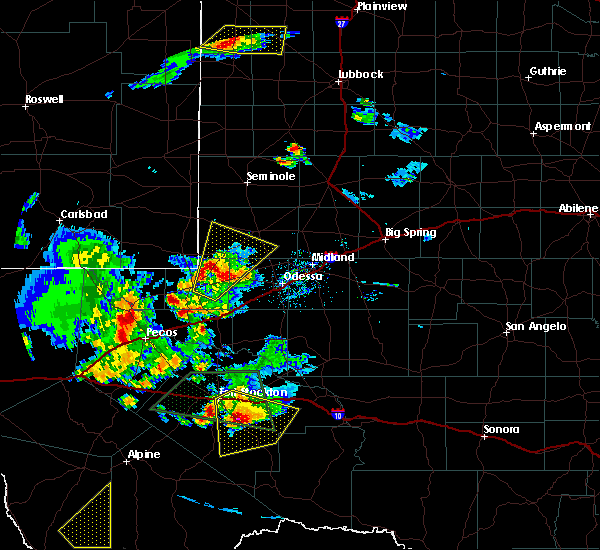 At 705 pm cdt, a severe thunderstorm was located 17 miles southeast of fort stockton, moving southeast at 10 mph. this is a very dangerous storm (radar indicated). Hazards include baseball size hail and 70 mph wind gusts. People and animals outdoors will be severely injured. expect shattered windows, extensive damage to roofs, siding, and vehicles. locations impacted include, fort stockton. This includes interstate 10 between mile markers 259 and 279. At 705 pm cdt, a severe thunderstorm was located 17 miles southeast of fort stockton, moving southeast at 10 mph. this is a very dangerous storm (radar indicated). Hazards include baseball size hail and 70 mph wind gusts. People and animals outdoors will be severely injured. expect shattered windows, extensive damage to roofs, siding, and vehicles. locations impacted include, fort stockton. This includes interstate 10 between mile markers 259 and 279.
|
| 5/11/2020 6:55 PM CDT | Tennis Ball sized hail reported 13.9 miles NW of Fort Stockton, TX, along hwy 285. |
| 5/11/2020 6:42 PM CDT |
 At 642 pm cdt, a severe thunderstorm was located 11 miles southeast of fort stockton, moving southeast at 15 mph (radar indicated). Hazards include golf ball size hail and 70 mph wind gusts. People and animals outdoors will be injured. expect hail damage to roofs, siding, windows, and vehicles. expect considerable tree damage. Wind damage is also likely to mobile homes, roofs, and outbuildings. At 642 pm cdt, a severe thunderstorm was located 11 miles southeast of fort stockton, moving southeast at 15 mph (radar indicated). Hazards include golf ball size hail and 70 mph wind gusts. People and animals outdoors will be injured. expect hail damage to roofs, siding, windows, and vehicles. expect considerable tree damage. Wind damage is also likely to mobile homes, roofs, and outbuildings.
|
| 5/11/2020 6:04 PM CDT |
 At 604 pm cdt, a severe thunderstorm was located near fort stockton, moving southeast at 15 mph (emergency management reported). Hazards include golf ball size hail and 70 mph wind gusts. People and animals outdoors will be injured. expect hail damage to roofs, siding, windows, and vehicles. expect considerable tree damage. wind damage is also likely to mobile homes, roofs, and outbuildings. locations impacted include, fort stockton and fort stockton-pecos county airport. This includes interstate 10 between mile markers 256 and 279. At 604 pm cdt, a severe thunderstorm was located near fort stockton, moving southeast at 15 mph (emergency management reported). Hazards include golf ball size hail and 70 mph wind gusts. People and animals outdoors will be injured. expect hail damage to roofs, siding, windows, and vehicles. expect considerable tree damage. wind damage is also likely to mobile homes, roofs, and outbuildings. locations impacted include, fort stockton and fort stockton-pecos county airport. This includes interstate 10 between mile markers 256 and 279.
|
| 5/11/2020 6:02 PM CDT | Half Dollar sized hail reported 0.4 miles NE of Fort Stockton, TX |
| 5/11/2020 6:01 PM CDT | Golf Ball sized hail reported 0.9 miles ESE of Fort Stockton, TX |
| 5/11/2020 5:52 PM CDT |
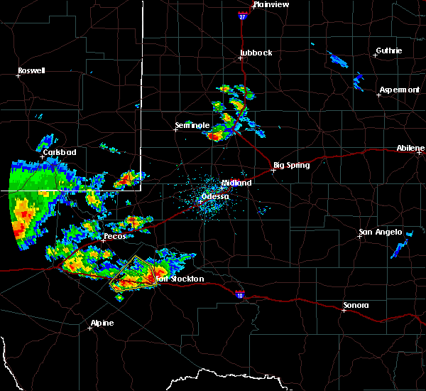 At 552 pm cdt, a severe thunderstorm was located over fort stockton, moving east at 15 mph (radar indicated). Hazards include 60 mph wind gusts and quarter size hail. Hail damage to vehicles is expected. Expect wind damage to roofs, siding, and trees. At 552 pm cdt, a severe thunderstorm was located over fort stockton, moving east at 15 mph (radar indicated). Hazards include 60 mph wind gusts and quarter size hail. Hail damage to vehicles is expected. Expect wind damage to roofs, siding, and trees.
|
| 5/11/2020 5:45 PM CDT |
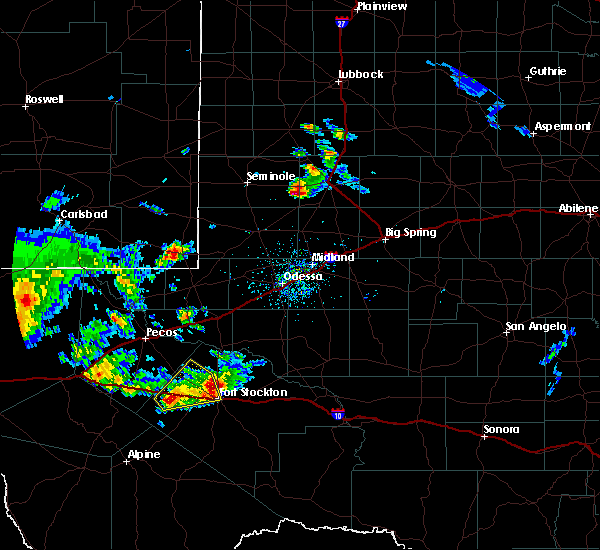 At 544 pm cdt, a severe thunderstorm was located over fort stockton, moving east at 15 mph (asos reported 61 mph wind gust at the airport). Hazards include ping pong ball size hail and 60 mph wind gusts. People and animals outdoors will be injured. expect hail damage to roofs, siding, windows, and vehicles. expect wind damage to roofs, siding, and trees. locations impacted include, fort stockton, fort stockton-pecos county airport and firestone test track. This includes interstate 10 between mile markers 229 and 260. At 544 pm cdt, a severe thunderstorm was located over fort stockton, moving east at 15 mph (asos reported 61 mph wind gust at the airport). Hazards include ping pong ball size hail and 60 mph wind gusts. People and animals outdoors will be injured. expect hail damage to roofs, siding, windows, and vehicles. expect wind damage to roofs, siding, and trees. locations impacted include, fort stockton, fort stockton-pecos county airport and firestone test track. This includes interstate 10 between mile markers 229 and 260.
|
| 5/11/2020 5:38 PM CDT | Storm damage reported in pecos county TX, 0.9 miles ESE of Fort Stockton, TX |
| 5/11/2020 5:23 PM CDT |
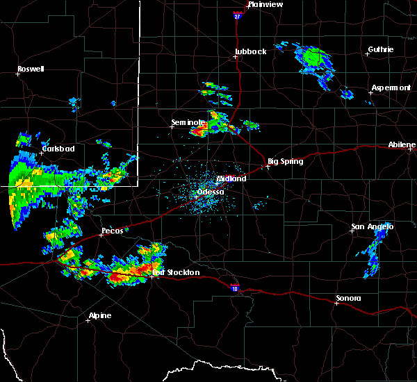 At 522 pm cdt, a severe thunderstorm was located 21 miles east of saragosa, or 25 miles west of fort stockton, moving northeast at 15 mph (radar indicated). Hazards include ping pong ball size hail and 60 mph wind gusts. People and animals outdoors will be injured. expect hail damage to roofs, siding, windows, and vehicles. Expect wind damage to roofs, siding, and trees. At 522 pm cdt, a severe thunderstorm was located 21 miles east of saragosa, or 25 miles west of fort stockton, moving northeast at 15 mph (radar indicated). Hazards include ping pong ball size hail and 60 mph wind gusts. People and animals outdoors will be injured. expect hail damage to roofs, siding, windows, and vehicles. Expect wind damage to roofs, siding, and trees.
|
| 5/2/2020 5:42 PM CDT | Storm damage reported in pecos county TX, 0.4 miles NE of Fort Stockton, TX |
| 8/10/2019 7:07 PM CDT | Emergency manager reported 3 rvs blown over at an rv park along us 285 about a half mile south of town in pecos county TX, 1.1 miles NNE of Fort Stockton, TX |
| 6/21/2019 7:38 PM CDT |
 At 737 pm cdt, a severe thunderstorm was located 23 miles southeast of belding, or 24 miles southeast of fort stockton, moving northeast at 15 mph (radar indicated). Hazards include golf ball size hail and 60 mph wind gusts. People and animals outdoors will be injured. expect hail damage to roofs, siding, windows, and vehicles. expect wind damage to roofs, siding, and trees. Locations impacted include, sierra madera. At 737 pm cdt, a severe thunderstorm was located 23 miles southeast of belding, or 24 miles southeast of fort stockton, moving northeast at 15 mph (radar indicated). Hazards include golf ball size hail and 60 mph wind gusts. People and animals outdoors will be injured. expect hail damage to roofs, siding, windows, and vehicles. expect wind damage to roofs, siding, and trees. Locations impacted include, sierra madera.
|
| 6/21/2019 7:25 PM CDT |
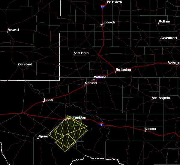 At 724 pm cdt, a severe thunderstorm was located 19 miles southeast of belding, or 22 miles south of fort stockton. this storm is nearly stationary (radar indicated). Hazards include golf ball size hail and 60 mph wind gusts. People and animals outdoors will be injured. expect hail damage to roofs, siding, windows, and vehicles. expect wind damage to roofs, siding, and trees. This severe thunderstorm will remain over mainly rural areas of central pecos, north central brewster and northwestern terrell counties, including the following locations, sierra madera. At 724 pm cdt, a severe thunderstorm was located 19 miles southeast of belding, or 22 miles south of fort stockton. this storm is nearly stationary (radar indicated). Hazards include golf ball size hail and 60 mph wind gusts. People and animals outdoors will be injured. expect hail damage to roofs, siding, windows, and vehicles. expect wind damage to roofs, siding, and trees. This severe thunderstorm will remain over mainly rural areas of central pecos, north central brewster and northwestern terrell counties, including the following locations, sierra madera.
|
| 6/21/2019 7:18 PM CDT |
 At 717 pm cdt, a severe thunderstorm was located 15 miles southeast of belding, or 20 miles south of fort stockton, and is nearly stationary (radar indicated). Hazards include two inch hail and 60 mph wind gusts. People and animals outdoors will be injured. expect hail damage to roofs, siding, windows, and vehicles. expect wind damage to roofs, siding, and trees. This severe thunderstorm will remain over mainly rural areas of central pecos county, including the following locations, sierra madera. At 717 pm cdt, a severe thunderstorm was located 15 miles southeast of belding, or 20 miles south of fort stockton, and is nearly stationary (radar indicated). Hazards include two inch hail and 60 mph wind gusts. People and animals outdoors will be injured. expect hail damage to roofs, siding, windows, and vehicles. expect wind damage to roofs, siding, and trees. This severe thunderstorm will remain over mainly rural areas of central pecos county, including the following locations, sierra madera.
|
| 6/21/2019 7:05 PM CDT |
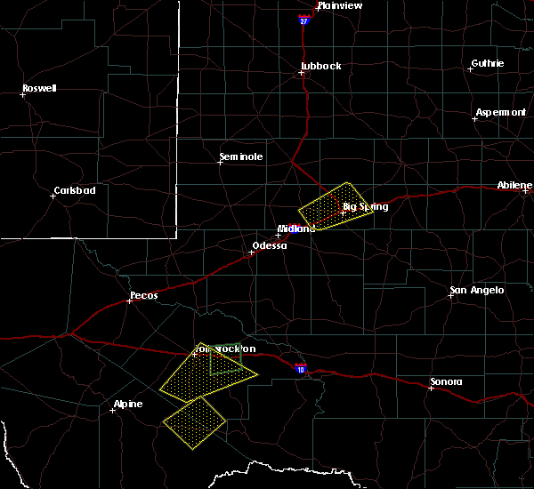 At 704 pm cdt, a severe thunderstorm was located 12 miles southeast of belding, or 17 miles south of fort stockton, moving west at 5 mph (radar indicated). Hazards include tennis ball size hail and 60 mph wind gusts. People and animals outdoors will be injured. expect hail damage to roofs, siding, windows, and vehicles. expect wind damage to roofs, siding, and trees. This severe thunderstorm will remain over mainly rural areas of central pecos county, including the following locations, sierra madera and fort stockton-pecos county airport. At 704 pm cdt, a severe thunderstorm was located 12 miles southeast of belding, or 17 miles south of fort stockton, moving west at 5 mph (radar indicated). Hazards include tennis ball size hail and 60 mph wind gusts. People and animals outdoors will be injured. expect hail damage to roofs, siding, windows, and vehicles. expect wind damage to roofs, siding, and trees. This severe thunderstorm will remain over mainly rural areas of central pecos county, including the following locations, sierra madera and fort stockton-pecos county airport.
|
| 6/21/2019 6:55 PM CDT |
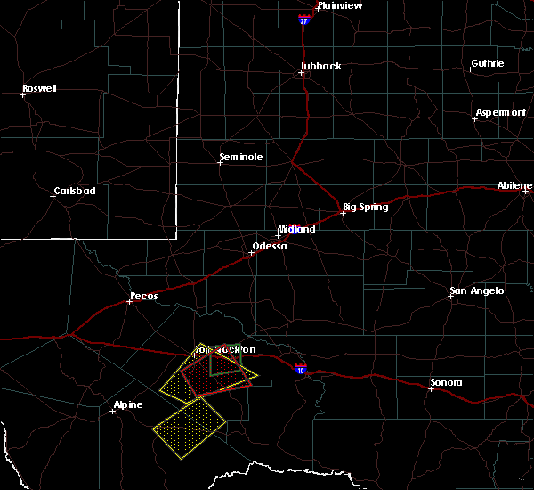 At 654 pm cdt, a severe thunderstorm was located 11 miles southeast of belding, or 15 miles south of fort stockton, moving north at 10 mph (radar indicated). Hazards include tennis ball size hail and 60 mph wind gusts. People and animals outdoors will be injured. expect hail damage to roofs, siding, windows, and vehicles. expect wind damage to roofs, siding, and trees. this severe thunderstorm will be near, fort stockton around 745 pm cdt. Other locations impacted by this severe thunderstorm include sierra madera and fort stockton-pecos county airport. At 654 pm cdt, a severe thunderstorm was located 11 miles southeast of belding, or 15 miles south of fort stockton, moving north at 10 mph (radar indicated). Hazards include tennis ball size hail and 60 mph wind gusts. People and animals outdoors will be injured. expect hail damage to roofs, siding, windows, and vehicles. expect wind damage to roofs, siding, and trees. this severe thunderstorm will be near, fort stockton around 745 pm cdt. Other locations impacted by this severe thunderstorm include sierra madera and fort stockton-pecos county airport.
|
| 6/21/2019 6:38 PM CDT | Golf Ball sized hail reported 11.4 miles N of Fort Stockton, TX |
| 6/21/2019 6:28 PM CDT | Golf Ball sized hail reported 8.6 miles NNW of Fort Stockton, TX |
| 6/21/2019 6:25 PM CDT | Golf Ball sized hail reported 8.6 miles NNW of Fort Stockton, TX |
| 6/21/2019 6:00 PM CDT | Quarter sized hail reported 12.8 miles W of Fort Stockton, TX |
| 6/18/2019 5:21 PM CDT |
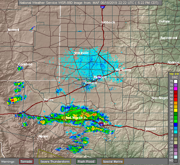 The severe thunderstorm warning for north central pecos county will expire at 530 pm cdt, the storm which prompted the warning has weakened below severe limits, and no longer poses an immediate threat to life or property. therefore, the warning will be allowed to expire. however heavy rain is still possible with this thunderstorm. The severe thunderstorm warning for north central pecos county will expire at 530 pm cdt, the storm which prompted the warning has weakened below severe limits, and no longer poses an immediate threat to life or property. therefore, the warning will be allowed to expire. however heavy rain is still possible with this thunderstorm.
|
| 6/18/2019 5:09 PM CDT |
 At 509 pm cdt, a severe thunderstorm was located 18 miles east of fort stockton, moving east at 25 mph (radar indicated). Hazards include 60 mph wind gusts and quarter size hail. Hail damage to vehicles is expected. expect wind damage to roofs, siding, and trees. locations impacted include, fort stockton, fort stockton-pecos county airport and girvin. This includes interstate 10 between mile markers 258 and 289. At 509 pm cdt, a severe thunderstorm was located 18 miles east of fort stockton, moving east at 25 mph (radar indicated). Hazards include 60 mph wind gusts and quarter size hail. Hail damage to vehicles is expected. expect wind damage to roofs, siding, and trees. locations impacted include, fort stockton, fort stockton-pecos county airport and girvin. This includes interstate 10 between mile markers 258 and 289.
|
| 6/18/2019 4:51 PM CDT |
 At 451 pm cdt, a severe thunderstorm was located 10 miles east of fort stockton, moving east at 25 mph (radar indicated). Hazards include 70 mph wind gusts and quarter size hail. Hail damage to vehicles is expected. expect considerable tree damage. wind damage is also likely to mobile homes, roofs, and outbuildings. locations impacted include, fort stockton, fort stockton-pecos county airport, girvin and firestone test track. This includes interstate 10 between mile markers 248 and 289. At 451 pm cdt, a severe thunderstorm was located 10 miles east of fort stockton, moving east at 25 mph (radar indicated). Hazards include 70 mph wind gusts and quarter size hail. Hail damage to vehicles is expected. expect considerable tree damage. wind damage is also likely to mobile homes, roofs, and outbuildings. locations impacted include, fort stockton, fort stockton-pecos county airport, girvin and firestone test track. This includes interstate 10 between mile markers 248 and 289.
|
| 6/18/2019 4:35 PM CDT |
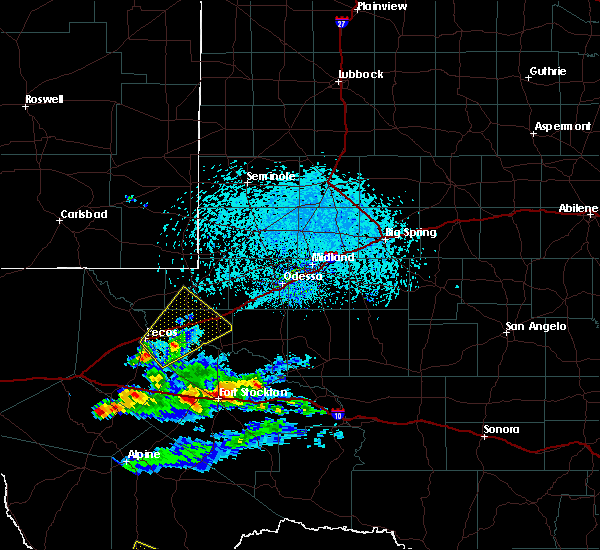 At 434 pm cdt, a severe thunderstorm was located near fort stockton, moving east at 25 mph. a 61 mph gust was recorded at fort stockton airport (radar indicated). Hazards include 70 mph wind gusts and quarter size hail. Hail damage to vehicles is expected. expect considerable tree damage. Wind damage is also likely to mobile homes, roofs, and outbuildings. At 434 pm cdt, a severe thunderstorm was located near fort stockton, moving east at 25 mph. a 61 mph gust was recorded at fort stockton airport (radar indicated). Hazards include 70 mph wind gusts and quarter size hail. Hail damage to vehicles is expected. expect considerable tree damage. Wind damage is also likely to mobile homes, roofs, and outbuildings.
|
| 6/18/2019 4:28 PM CDT | Storm damage reported in pecos county TX, 0.9 miles ESE of Fort Stockton, TX |
| 6/1/2019 8:21 PM CDT |
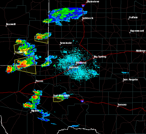 The severe thunderstorm warning for central pecos county will expire at 830 pm cdt, the storm which prompted the warning has weakened below severe limits, and no longer poses an immediate threat to life or property. therefore, the warning will be allowed to expire. a severe thunderstorm watch remains in effect until 1100 pm cdt for southwestern texas. The severe thunderstorm warning for central pecos county will expire at 830 pm cdt, the storm which prompted the warning has weakened below severe limits, and no longer poses an immediate threat to life or property. therefore, the warning will be allowed to expire. a severe thunderstorm watch remains in effect until 1100 pm cdt for southwestern texas.
|
| 6/1/2019 8:04 PM CDT |
 At 804 pm cdt, a severe thunderstorm was located near fort stockton, moving southeast at 5 mph (radar indicated). Hazards include 60 mph wind gusts and quarter size hail. Hail damage to vehicles is expected. expect wind damage to roofs, siding, and trees. Locations impacted include, fort stockton. At 804 pm cdt, a severe thunderstorm was located near fort stockton, moving southeast at 5 mph (radar indicated). Hazards include 60 mph wind gusts and quarter size hail. Hail damage to vehicles is expected. expect wind damage to roofs, siding, and trees. Locations impacted include, fort stockton.
|
| 6/1/2019 7:51 PM CDT | Ping Pong Ball sized hail reported 0.4 miles NE of Fort Stockton, TX, northwest side of town |
| 6/1/2019 7:46 PM CDT |
 At 746 pm cdt, a severe thunderstorm was located near fort stockton, moving southeast at 15 mph (radar indicated). Hazards include ping pong ball size hail and 60 mph wind gusts. People and animals outdoors will be injured. expect hail damage to roofs, siding, windows, and vehicles. expect wind damage to roofs, siding, and trees. locations impacted include, fort stockton and fort stockton-pecos county airport. This includes interstate 10 between mile markers 258 and 272. At 746 pm cdt, a severe thunderstorm was located near fort stockton, moving southeast at 15 mph (radar indicated). Hazards include ping pong ball size hail and 60 mph wind gusts. People and animals outdoors will be injured. expect hail damage to roofs, siding, windows, and vehicles. expect wind damage to roofs, siding, and trees. locations impacted include, fort stockton and fort stockton-pecos county airport. This includes interstate 10 between mile markers 258 and 272.
|
| 6/1/2019 7:40 PM CDT |
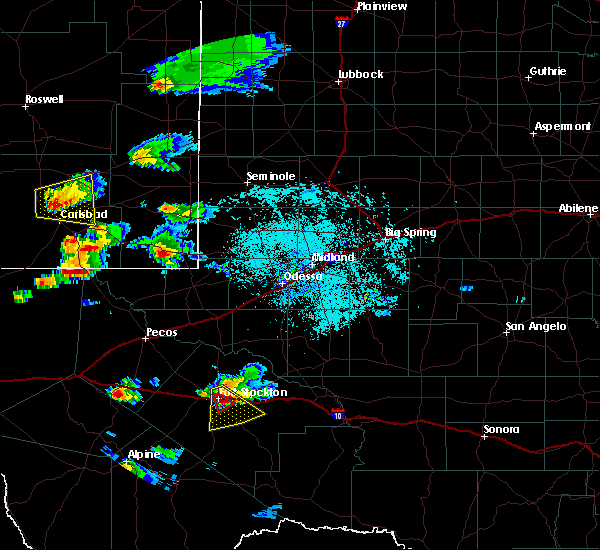 The tornado warning for northwestern pecos county will expire at 745 pm cdt, the storm which prompted the warning has weakened and no longer appears capable of producing a tornado. therefore, the warning will be allowed to expire. however large hail is still possible with this thunderstorm. a severe thunderstorm watch remains in effect until 1100 pm cdt for southwestern texas. remember, a severe thunderstorm warning still remains in effect for central pecos county. The tornado warning for northwestern pecos county will expire at 745 pm cdt, the storm which prompted the warning has weakened and no longer appears capable of producing a tornado. therefore, the warning will be allowed to expire. however large hail is still possible with this thunderstorm. a severe thunderstorm watch remains in effect until 1100 pm cdt for southwestern texas. remember, a severe thunderstorm warning still remains in effect for central pecos county.
|
| 6/1/2019 7:37 PM CDT |
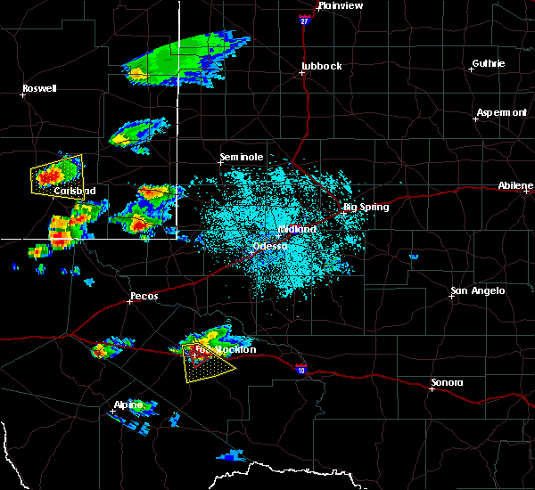 At 737 pm cdt, a severe thunderstorm was located near fort stockton, moving southeast at 15 mph (radar indicated). Hazards include two inch hail and 60 mph wind gusts. People and animals outdoors will be injured. expect hail damage to roofs, siding, windows, and vehicles. expect wind damage to roofs, siding, and trees. locations impacted include, fort stockton and fort stockton-pecos county airport. This includes interstate 10 between mile markers 257 and 273. At 737 pm cdt, a severe thunderstorm was located near fort stockton, moving southeast at 15 mph (radar indicated). Hazards include two inch hail and 60 mph wind gusts. People and animals outdoors will be injured. expect hail damage to roofs, siding, windows, and vehicles. expect wind damage to roofs, siding, and trees. locations impacted include, fort stockton and fort stockton-pecos county airport. This includes interstate 10 between mile markers 257 and 273.
|
| 6/1/2019 7:27 PM CDT |
 At 727 pm cdt, a severe thunderstorm capable of producing a tornado was located over fort stockton, moving southeast at 15 mph (radar indicated rotation). Hazards include tornado and baseball size hail. Flying debris will be dangerous to those caught without shelter. mobile homes will be damaged or destroyed. damage to roofs, windows, and vehicles will occur. tree damage is likely. this tornadic thunderstorm will remain over mainly rural areas of northwestern pecos county, including the following locations, fort stockton-pecos county airport. This includes interstate 10 between mile markers 258 and 264. At 727 pm cdt, a severe thunderstorm capable of producing a tornado was located over fort stockton, moving southeast at 15 mph (radar indicated rotation). Hazards include tornado and baseball size hail. Flying debris will be dangerous to those caught without shelter. mobile homes will be damaged or destroyed. damage to roofs, windows, and vehicles will occur. tree damage is likely. this tornadic thunderstorm will remain over mainly rural areas of northwestern pecos county, including the following locations, fort stockton-pecos county airport. This includes interstate 10 between mile markers 258 and 264.
|
| 6/1/2019 7:15 PM CDT |
 At 714 pm cdt, a severe thunderstorm was located over fort stockton, moving southeast at 15 mph. this is a very dangerous storm (radar indicated). Hazards include baseball size hail and 60 mph wind gusts. People and animals outdoors will be severely injured. Expect shattered windows, extensive damage to roofs, siding, and vehicles. At 714 pm cdt, a severe thunderstorm was located over fort stockton, moving southeast at 15 mph. this is a very dangerous storm (radar indicated). Hazards include baseball size hail and 60 mph wind gusts. People and animals outdoors will be severely injured. Expect shattered windows, extensive damage to roofs, siding, and vehicles.
|
| 6/1/2019 7:13 PM CDT |
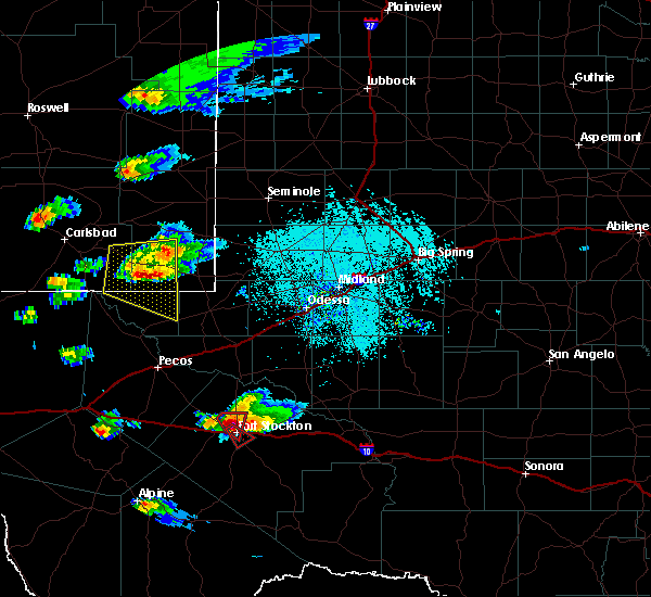 At 712 pm cdt, a severe thunderstorm capable of producing a tornado was located over fort stockton, moving southeast at 15 mph (radar indicated rotation). Hazards include tornado and baseball size hail. Flying debris will be dangerous to those caught without shelter. mobile homes will be damaged or destroyed. damage to roofs, windows, and vehicles will occur. tree damage is likely. this dangerous storm will be near, fort stockton around 725 pm cdt. other locations impacted by this tornadic thunderstorm include fort stockton-pecos county airport. This includes interstate 10 between mile markers 256 and 264. At 712 pm cdt, a severe thunderstorm capable of producing a tornado was located over fort stockton, moving southeast at 15 mph (radar indicated rotation). Hazards include tornado and baseball size hail. Flying debris will be dangerous to those caught without shelter. mobile homes will be damaged or destroyed. damage to roofs, windows, and vehicles will occur. tree damage is likely. this dangerous storm will be near, fort stockton around 725 pm cdt. other locations impacted by this tornadic thunderstorm include fort stockton-pecos county airport. This includes interstate 10 between mile markers 256 and 264.
|
| 6/1/2019 7:09 PM CDT | Quarter sized hail reported 0.4 miles NE of Fort Stockton, TX, fm 1053 |
| 6/1/2019 7:04 PM CDT | Ping Pong Ball sized hail reported 4.5 miles S of Fort Stockton, TX |
| 6/1/2019 6:58 PM CDT | Quarter sized hail reported 4.5 miles S of Fort Stockton, TX |
| 6/1/2019 6:57 PM CDT | Golf Ball sized hail reported 7.6 miles SE of Fort Stockton, TX, highway 285 and west gomez road |
| 6/1/2019 6:56 PM CDT |
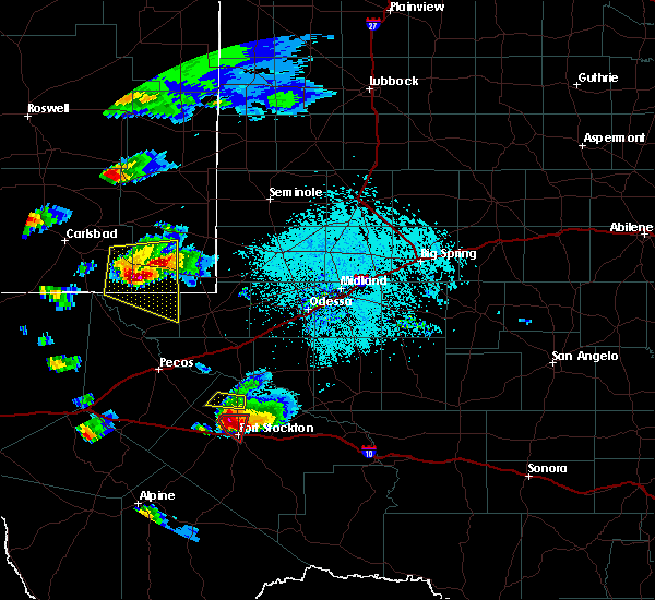 At 655 pm cdt, a severe thunderstorm capable of producing a tornado was located near fort stockton, moving southeast at 20 mph (radar indicated rotation). Hazards include tornado and baseball size hail. Flying debris will be dangerous to those caught without shelter. mobile homes will be damaged or destroyed. damage to roofs, windows, and vehicles will occur. tree damage is likely. locations impacted include, fort stockton and fort stockton-pecos county airport. This includes interstate 10 between mile markers 257 and 261. At 655 pm cdt, a severe thunderstorm capable of producing a tornado was located near fort stockton, moving southeast at 20 mph (radar indicated rotation). Hazards include tornado and baseball size hail. Flying debris will be dangerous to those caught without shelter. mobile homes will be damaged or destroyed. damage to roofs, windows, and vehicles will occur. tree damage is likely. locations impacted include, fort stockton and fort stockton-pecos county airport. This includes interstate 10 between mile markers 257 and 261.
|
| 6/1/2019 6:43 PM CDT |
 At 643 pm cdt, a severe thunderstorm capable of producing a tornado was located 9 miles northwest of fort stockton, moving southeast at 25 mph (radar indicated rotation). Hazards include tornado and baseball size hail. Flying debris will be dangerous to those caught without shelter. mobile homes will be damaged or destroyed. damage to roofs, windows, and vehicles will occur. tree damage is likely. locations impacted include, fort stockton and fort stockton-pecos county airport. This includes interstate 10 between mile markers 257 and 261. At 643 pm cdt, a severe thunderstorm capable of producing a tornado was located 9 miles northwest of fort stockton, moving southeast at 25 mph (radar indicated rotation). Hazards include tornado and baseball size hail. Flying debris will be dangerous to those caught without shelter. mobile homes will be damaged or destroyed. damage to roofs, windows, and vehicles will occur. tree damage is likely. locations impacted include, fort stockton and fort stockton-pecos county airport. This includes interstate 10 between mile markers 257 and 261.
|
| 6/1/2019 6:37 PM CDT | Golf Ball sized hail reported 12.6 miles SE of Fort Stockton, TX, fm 1776 about 2 miles north of highway 285 |
| 6/1/2019 6:28 PM CDT |
 At 628 pm cdt, a severe thunderstorm capable of producing a tornado was located 16 miles northwest of fort stockton, moving southeast at 15 mph (radar indicated rotation). Hazards include tornado and baseball size hail. Flying debris will be dangerous to those caught without shelter. mobile homes will be damaged or destroyed. damage to roofs, windows, and vehicles will occur. tree damage is likely. this tornadic thunderstorm will remain over mainly rural areas of north central pecos county, including the following locations, fort stockton-pecos county airport. This includes interstate 10 between mile markers 256 and 261. At 628 pm cdt, a severe thunderstorm capable of producing a tornado was located 16 miles northwest of fort stockton, moving southeast at 15 mph (radar indicated rotation). Hazards include tornado and baseball size hail. Flying debris will be dangerous to those caught without shelter. mobile homes will be damaged or destroyed. damage to roofs, windows, and vehicles will occur. tree damage is likely. this tornadic thunderstorm will remain over mainly rural areas of north central pecos county, including the following locations, fort stockton-pecos county airport. This includes interstate 10 between mile markers 256 and 261.
|
| 5/30/2019 10:33 AM CDT | Quarter sized hail reported 11.4 miles S of Fort Stockton, TX |
| 5/25/2019 6:49 PM CDT |
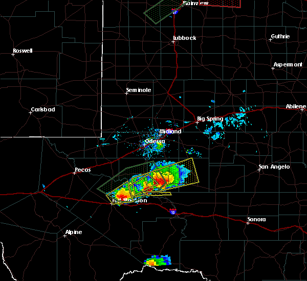 At 648 pm cdt, a severe thunderstorm was located 10 miles northeast of fort stockton, moving northeast at 15 mph (radar indicated). Hazards include 60 mph wind gusts and half dollar size hail. Hail damage to vehicles is expected. expect wind damage to roofs, siding, and trees. locations impacted include, fort stockton. This includes interstate 10 between mile markers 260 and 261. At 648 pm cdt, a severe thunderstorm was located 10 miles northeast of fort stockton, moving northeast at 15 mph (radar indicated). Hazards include 60 mph wind gusts and half dollar size hail. Hail damage to vehicles is expected. expect wind damage to roofs, siding, and trees. locations impacted include, fort stockton. This includes interstate 10 between mile markers 260 and 261.
|
| 5/25/2019 6:32 PM CDT |
 The national weather service in midland has issued a * severe thunderstorm warning for. north central pecos county in southwestern texas. until 730 pm cdt. At 632 pm cdt, a severe thunderstorm was located 7 miles northeast of fort stockton, moving northeast at 15 mph. The national weather service in midland has issued a * severe thunderstorm warning for. north central pecos county in southwestern texas. until 730 pm cdt. At 632 pm cdt, a severe thunderstorm was located 7 miles northeast of fort stockton, moving northeast at 15 mph.
|
| 5/17/2019 4:30 PM CDT | Tennis Ball sized hail reported 15.2 miles W of Fort Stockton, TX, hail was reported on i-10 between mile marker 274 and 276. |
| 5/17/2019 4:22 PM CDT | Quarter sized hail reported 14 miles W of Fort Stockton, TX, hail was reported at the intersection of i-10 and hwy 67. |
| 5/17/2019 4:09 PM CDT |
 At 359 pm cdt, a severe thunderstorm was located 9 miles east of fort stockton, moving northeast at 25 mph. at 354pm cdt, emergency management reported quarter size hail along interstate 10 at mile marker 267 (radar indicated). Hazards include 60 mph wind gusts and half dollar size hail. Hail damage to vehicles is expected. expect wind damage to roofs, siding, and trees. locations impacted include, fort stockton, mccamey, fort stockton-pecos county airport, girvin, cordona lake and upton county airport. This includes interstate 10 between mile markers 258 and 280. At 359 pm cdt, a severe thunderstorm was located 9 miles east of fort stockton, moving northeast at 25 mph. at 354pm cdt, emergency management reported quarter size hail along interstate 10 at mile marker 267 (radar indicated). Hazards include 60 mph wind gusts and half dollar size hail. Hail damage to vehicles is expected. expect wind damage to roofs, siding, and trees. locations impacted include, fort stockton, mccamey, fort stockton-pecos county airport, girvin, cordona lake and upton county airport. This includes interstate 10 between mile markers 258 and 280.
|
| 5/17/2019 4:05 PM CDT | Golf Ball sized hail reported 8.1 miles W of Fort Stockton, TX, hail was reported on i-10 at mile marker 267 by local emergency management. |
| 5/17/2019 4:00 PM CDT |
 At 359 pm cdt, a severe thunderstorm was located 9 miles east of fort stockton, moving northeast at 25 mph. at 354pm cdt, emergency management reported quarter size hail along interstate 10 at mile marker 267 (radar indicated). Hazards include 60 mph wind gusts and half dollar size hail. Hail damage to vehicles is expected. expect wind damage to roofs, siding, and trees. locations impacted include, fort stockton, mccamey, fort stockton-pecos county airport, girvin, cordona lake and upton county airport. This includes interstate 10 between mile markers 258 and 280. At 359 pm cdt, a severe thunderstorm was located 9 miles east of fort stockton, moving northeast at 25 mph. at 354pm cdt, emergency management reported quarter size hail along interstate 10 at mile marker 267 (radar indicated). Hazards include 60 mph wind gusts and half dollar size hail. Hail damage to vehicles is expected. expect wind damage to roofs, siding, and trees. locations impacted include, fort stockton, mccamey, fort stockton-pecos county airport, girvin, cordona lake and upton county airport. This includes interstate 10 between mile markers 258 and 280.
|
| 5/17/2019 3:54 PM CDT | Quarter sized hail reported 8.1 miles W of Fort Stockton, TX, hail reported on i-10 at mile marker 267 by local emergency management. |
| 5/17/2019 3:52 PM CDT |
 At 351 pm cdt, a severe thunderstorm was located near fort stockton, moving northeast at 30 mph. at 350pm, one and a half inch hail was reported along i-10, 7 miles east of fort stockton (radar indicated). Hazards include 60 mph wind gusts and half dollar size hail. Hail damage to vehicles is expected. Expect wind damage to roofs, siding, and trees. At 351 pm cdt, a severe thunderstorm was located near fort stockton, moving northeast at 30 mph. at 350pm, one and a half inch hail was reported along i-10, 7 miles east of fort stockton (radar indicated). Hazards include 60 mph wind gusts and half dollar size hail. Hail damage to vehicles is expected. Expect wind damage to roofs, siding, and trees.
|
| 5/17/2019 3:48 PM CDT | Half Dollar sized hail reported 6.9 miles W of Fort Stockton, TX |
| 5/7/2019 7:18 PM CDT | Tea Cup sized hail reported 12.8 miles W of Fort Stockton, TX |
| 5/7/2019 7:11 PM CDT | Tennis Ball sized hail reported 12.8 miles W of Fort Stockton, TX, covering the roadway between mile marker 273 and 274 on interste 10 |
| 5/7/2019 6:35 PM CDT |
 At 634 pm cdt, a severe thunderstorm was located 12 miles east of fort stockton, moving east at 15 mph. emergency management reported half dollar size hail on i-10 at mile marker 269 (radar indicated). Hazards include 70 mph wind gusts and half dollar size hail. Hail damage to vehicles is expected. expect considerable tree damage. wind damage is also likely to mobile homes, roofs, and outbuildings. locations impacted include, fort stockton and fort stockton-pecos county airport. This includes interstate 10 between mile markers 258 and 287. At 634 pm cdt, a severe thunderstorm was located 12 miles east of fort stockton, moving east at 15 mph. emergency management reported half dollar size hail on i-10 at mile marker 269 (radar indicated). Hazards include 70 mph wind gusts and half dollar size hail. Hail damage to vehicles is expected. expect considerable tree damage. wind damage is also likely to mobile homes, roofs, and outbuildings. locations impacted include, fort stockton and fort stockton-pecos county airport. This includes interstate 10 between mile markers 258 and 287.
|
| 5/7/2019 6:30 PM CDT | Half Dollar sized hail reported 0.4 miles NE of Fort Stockton, TX, interstate 10 mile marker 269 |
| 5/7/2019 6:27 PM CDT |
 At 625 pm cdt, emergency management reported a funnel cloud 1 mile north of i-10 at mile marker 270. this storm was located 15 miles east of fort stockton, moving east at 15 mph (emergency management confirmed tornado). Hazards include damaging tornado and tennis ball size hail. Flying debris will be dangerous to those caught without shelter. mobile homes will be damaged or destroyed. damage to roofs, windows, and vehicles will occur. tree damage is likely. locations impacted include, fort stockton, girvin and fort stockton-pecos county airport. This includes interstate 10 between mile markers 258 and 294. At 625 pm cdt, emergency management reported a funnel cloud 1 mile north of i-10 at mile marker 270. this storm was located 15 miles east of fort stockton, moving east at 15 mph (emergency management confirmed tornado). Hazards include damaging tornado and tennis ball size hail. Flying debris will be dangerous to those caught without shelter. mobile homes will be damaged or destroyed. damage to roofs, windows, and vehicles will occur. tree damage is likely. locations impacted include, fort stockton, girvin and fort stockton-pecos county airport. This includes interstate 10 between mile markers 258 and 294.
|
| 5/7/2019 6:19 PM CDT |
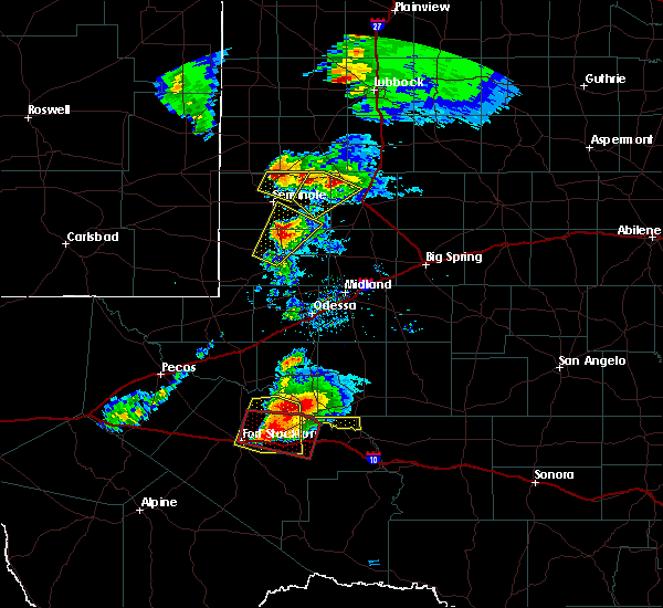 At 617 pm cdt, a severe thunderstorm was located 18 miles northeast of fort stockton, moving east at 10 mph (radar indicated). Hazards include tennis ball size hail and 70 mph wind gusts. People and animals outdoors will be injured. expect hail damage to roofs, siding, windows, and vehicles. expect considerable tree damage. wind damage is also likely to mobile homes, roofs, and outbuildings. locations impacted include, fort stockton-pecos county airport. This includes interstate 10 between mile markers 258 and 294. At 617 pm cdt, a severe thunderstorm was located 18 miles northeast of fort stockton, moving east at 10 mph (radar indicated). Hazards include tennis ball size hail and 70 mph wind gusts. People and animals outdoors will be injured. expect hail damage to roofs, siding, windows, and vehicles. expect considerable tree damage. wind damage is also likely to mobile homes, roofs, and outbuildings. locations impacted include, fort stockton-pecos county airport. This includes interstate 10 between mile markers 258 and 294.
|
| 5/7/2019 6:12 PM CDT |
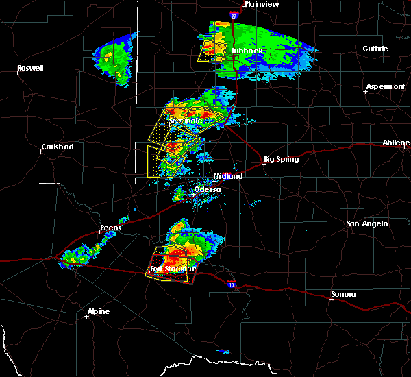 At 611 pm cdt, a severe thunderstorm capable of producing a tornado was located 12 miles east of fort stockton just north of i-10, moving east at 15 mph. this storm has a history of producing tornadoes and large hail (radar indicated rotation). Hazards include tornado and tennis ball size hail. Flying debris will be dangerous to those caught without shelter. mobile homes will be damaged or destroyed. damage to roofs, windows, and vehicles will occur. tree damage is likely. locations impacted include, fort stockton, girvin and fort stockton-pecos county airport. This includes interstate 10 between mile markers 258 and 294. At 611 pm cdt, a severe thunderstorm capable of producing a tornado was located 12 miles east of fort stockton just north of i-10, moving east at 15 mph. this storm has a history of producing tornadoes and large hail (radar indicated rotation). Hazards include tornado and tennis ball size hail. Flying debris will be dangerous to those caught without shelter. mobile homes will be damaged or destroyed. damage to roofs, windows, and vehicles will occur. tree damage is likely. locations impacted include, fort stockton, girvin and fort stockton-pecos county airport. This includes interstate 10 between mile markers 258 and 294.
|
| 5/7/2019 5:55 PM CDT |
 At 554 pm cdt, a severe thunderstorm capable of producing a tornado was centered 18 miles northeast of fort stockton, moving east at 10 mph. this storm has a history of producing tornadoes and large hail (radar indicated rotation). Hazards include tornado and tennis ball size hail. Flying debris will be dangerous to those caught without shelter. mobile homes will be damaged or destroyed. damage to roofs, windows, and vehicles will occur. tree damage is likely. this tornadic thunderstorm will remain over mainly rural areas of north central pecos county, including the following locations, girvin and fort stockton-pecos county airport. This includes interstate 10 between mile markers 258 and 294. At 554 pm cdt, a severe thunderstorm capable of producing a tornado was centered 18 miles northeast of fort stockton, moving east at 10 mph. this storm has a history of producing tornadoes and large hail (radar indicated rotation). Hazards include tornado and tennis ball size hail. Flying debris will be dangerous to those caught without shelter. mobile homes will be damaged or destroyed. damage to roofs, windows, and vehicles will occur. tree damage is likely. this tornadic thunderstorm will remain over mainly rural areas of north central pecos county, including the following locations, girvin and fort stockton-pecos county airport. This includes interstate 10 between mile markers 258 and 294.
|
| 5/7/2019 5:46 PM CDT |
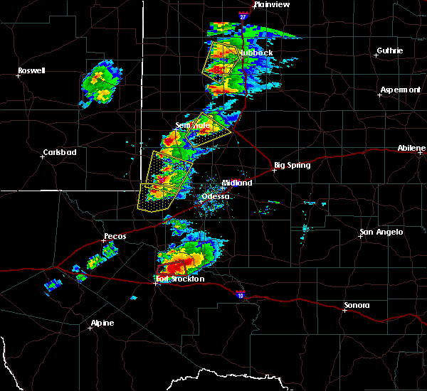 At 545 pm cdt, a severe thunderstorm was located 17 miles northeast of fort stockton, moving east at 15 mph (radar indicated). Hazards include two inch hail and 60 mph wind gusts. People and animals outdoors will be injured. expect hail damage to roofs, siding, windows, and vehicles. Expect wind damage to roofs, siding, and trees. At 545 pm cdt, a severe thunderstorm was located 17 miles northeast of fort stockton, moving east at 15 mph (radar indicated). Hazards include two inch hail and 60 mph wind gusts. People and animals outdoors will be injured. expect hail damage to roofs, siding, windows, and vehicles. Expect wind damage to roofs, siding, and trees.
|
| 5/7/2019 5:16 PM CDT | Baseball sized hail reported 14.8 miles S of Fort Stockton, TX, on farm to market 1053 |
| 5/7/2019 4:48 PM CDT | Baseball sized hail reported 13.4 miles S of Fort Stockton, TX |
| 5/7/2019 4:32 PM CDT | Ping Pong Ball sized hail reported 13.4 miles S of Fort Stockton, TX, along texas highway 18 |
| 5/5/2019 5:27 PM CDT |
 At 520 pm cdt, local law enforcement reported quarter size hail 12 miles southwest of fort stockton. at 525 pm cdt a severe thunderstorm was located 9 miles southwest of fort stockton, moving southeast at 15 mph (law enforcement). Hazards include 60 mph wind gusts and golfball size hail. Hail damage to vehicles is expected. expect wind damage to roofs, siding, and trees. Locations impacted include, belding, highway 285 south of fort stockton, highway 385 south of fort stockton. At 520 pm cdt, local law enforcement reported quarter size hail 12 miles southwest of fort stockton. at 525 pm cdt a severe thunderstorm was located 9 miles southwest of fort stockton, moving southeast at 15 mph (law enforcement). Hazards include 60 mph wind gusts and golfball size hail. Hail damage to vehicles is expected. expect wind damage to roofs, siding, and trees. Locations impacted include, belding, highway 285 south of fort stockton, highway 385 south of fort stockton.
|
| 5/5/2019 5:23 PM CDT | Golf Ball sized hail reported 11.2 miles NE of Fort Stockton, TX |
| 5/5/2019 5:20 PM CDT | Quarter sized hail reported 12.2 miles NE of Fort Stockton, TX, broken windows reported at tdjc. |
| 5/5/2019 5:04 PM CDT | Power poles knocked down... as well as a barn roof blown of in pecos county TX, 11.2 miles NE of Fort Stockton, TX |
| 5/5/2019 5:00 PM CDT |
 The national weather service in midland has issued a * severe thunderstorm warning for. central pecos county in southwestern texas. until 600 pm cdt. At 459 pm cdt, a severe thunderstorm was located 9 miles west of fort stockton, moving southeast at 10 mph. The national weather service in midland has issued a * severe thunderstorm warning for. central pecos county in southwestern texas. until 600 pm cdt. At 459 pm cdt, a severe thunderstorm was located 9 miles west of fort stockton, moving southeast at 10 mph.
|
| 5/5/2019 4:53 PM CDT | Golf Ball sized hail reported 9.2 miles E of Fort Stockton, TX |
| 5/5/2019 4:44 PM CDT |
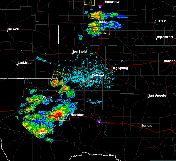 At 443 pm cdt, a severe thunderstorm was located 8 miles west of fort stockton, moving southeast at 10 mph (radar indicated). Hazards include golf ball size hail and 60 mph wind gusts. People and animals outdoors will be injured. expect hail damage to roofs, siding, windows, and vehicles. expect wind damage to roofs, siding, and trees. locations impacted include, fort stockton, fort stockton-pecos county airport and firestone test track. This includes interstate 10 between mile markers 242 and 268. At 443 pm cdt, a severe thunderstorm was located 8 miles west of fort stockton, moving southeast at 10 mph (radar indicated). Hazards include golf ball size hail and 60 mph wind gusts. People and animals outdoors will be injured. expect hail damage to roofs, siding, windows, and vehicles. expect wind damage to roofs, siding, and trees. locations impacted include, fort stockton, fort stockton-pecos county airport and firestone test track. This includes interstate 10 between mile markers 242 and 268.
|
| 5/5/2019 4:39 PM CDT |
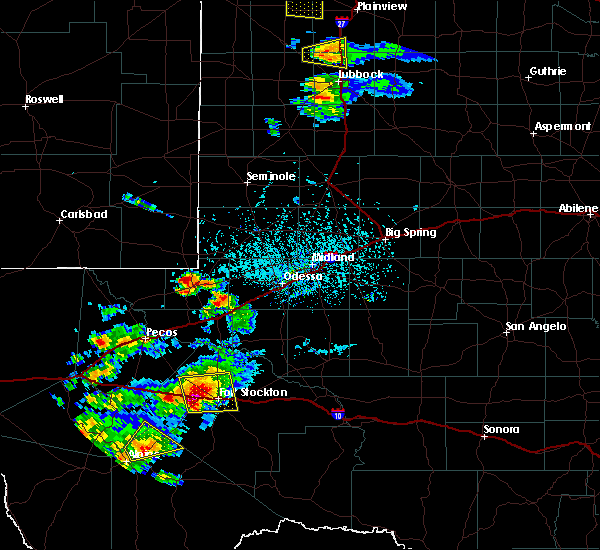 At 438 pm cdt, a severe thunderstorm was located 11 miles west of fort stockton, moving east at 15 mph (radar indicated). Hazards include golf ball size hail and 60 mph wind gusts. People and animals outdoors will be injured. expect hail damage to roofs, siding, windows, and vehicles. expect wind damage to roofs, siding, and trees. locations impacted include, fort stockton, fort stockton-pecos county airport and firestone test track. This includes interstate 10 between mile markers 242 and 268. At 438 pm cdt, a severe thunderstorm was located 11 miles west of fort stockton, moving east at 15 mph (radar indicated). Hazards include golf ball size hail and 60 mph wind gusts. People and animals outdoors will be injured. expect hail damage to roofs, siding, windows, and vehicles. expect wind damage to roofs, siding, and trees. locations impacted include, fort stockton, fort stockton-pecos county airport and firestone test track. This includes interstate 10 between mile markers 242 and 268.
|
| 5/5/2019 4:19 PM CDT |
 At 419 pm cdt, a severe thunderstorm was located 12 miles northwest of fort stockton, moving east at 15 mph (radar indicated). Hazards include golf ball size hail and 60 mph wind gusts. People and animals outdoors will be injured. expect hail damage to roofs, siding, windows, and vehicles. expect wind damage to roofs, siding, and trees. locations impacted include, fort stockton, fort stockton-pecos county airport and firestone test track. This includes interstate 10 between mile markers 242 and 268. At 419 pm cdt, a severe thunderstorm was located 12 miles northwest of fort stockton, moving east at 15 mph (radar indicated). Hazards include golf ball size hail and 60 mph wind gusts. People and animals outdoors will be injured. expect hail damage to roofs, siding, windows, and vehicles. expect wind damage to roofs, siding, and trees. locations impacted include, fort stockton, fort stockton-pecos county airport and firestone test track. This includes interstate 10 between mile markers 242 and 268.
|
| 5/5/2019 4:14 PM CDT |
 At 414 pm cdt, a severe thunderstorm was located 13 miles northwest of fort stockton, moving east at 15 mph (radar indicated). Hazards include 60 mph wind gusts and half dollar size hail. Hail damage to vehicles is expected. Expect wind damage to roofs, siding, and trees. At 414 pm cdt, a severe thunderstorm was located 13 miles northwest of fort stockton, moving east at 15 mph (radar indicated). Hazards include 60 mph wind gusts and half dollar size hail. Hail damage to vehicles is expected. Expect wind damage to roofs, siding, and trees.
|
| 5/3/2019 6:17 PM CDT |
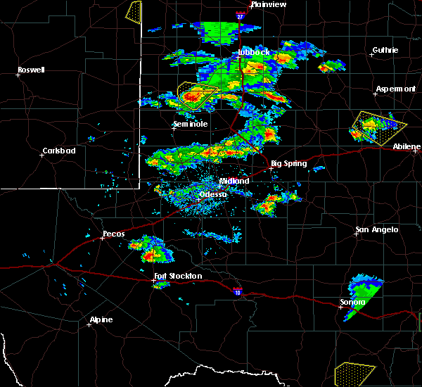 At 616 pm cdt, a severe thunderstorm was located 10 miles southwest of grandfalls, or 22 miles north of fort stockton, moving southeast at 20 mph (radar indicated). Hazards include two inch hail and 70 mph wind gusts. People and animals outdoors will be injured. expect hail damage to roofs, siding, windows, and vehicles. expect considerable tree damage. Wind damage is also likely to mobile homes, roofs, and outbuildings. At 616 pm cdt, a severe thunderstorm was located 10 miles southwest of grandfalls, or 22 miles north of fort stockton, moving southeast at 20 mph (radar indicated). Hazards include two inch hail and 70 mph wind gusts. People and animals outdoors will be injured. expect hail damage to roofs, siding, windows, and vehicles. expect considerable tree damage. Wind damage is also likely to mobile homes, roofs, and outbuildings.
|
| 4/23/2019 7:31 PM CDT |
 At 730 pm cdt, a severe thunderstorm was located 3 miles east of fort stockton, moving northeast at 30 mph (radar indicated). Hazards include 60 mph wind gusts and quarter size hail. Hail damage to vehicles is expected. expect wind damage to roofs, siding, and trees. locations impacted include, fort stockton, imperial, fort stockton-pecos county airport and bakersfield. This includes interstate 10 between mile markers 256 and 299. At 730 pm cdt, a severe thunderstorm was located 3 miles east of fort stockton, moving northeast at 30 mph (radar indicated). Hazards include 60 mph wind gusts and quarter size hail. Hail damage to vehicles is expected. expect wind damage to roofs, siding, and trees. locations impacted include, fort stockton, imperial, fort stockton-pecos county airport and bakersfield. This includes interstate 10 between mile markers 256 and 299.
|
| 4/23/2019 7:09 PM CDT |
 At 709 pm cdt, a severe thunderstorm was located 7 miles south of fort stockton, moving northeast at 25 mph (radar indicated). Hazards include 60 mph wind gusts and half dollar size hail. Hail damage to vehicles is expected. Expect wind damage to roofs, siding, and trees. At 709 pm cdt, a severe thunderstorm was located 7 miles south of fort stockton, moving northeast at 25 mph (radar indicated). Hazards include 60 mph wind gusts and half dollar size hail. Hail damage to vehicles is expected. Expect wind damage to roofs, siding, and trees.
|
| 3/12/2019 10:32 PM CDT | Storm damage reported in pecos county TX, 0.4 miles NE of Fort Stockton, TX |
| 3/12/2019 9:34 PM CDT |
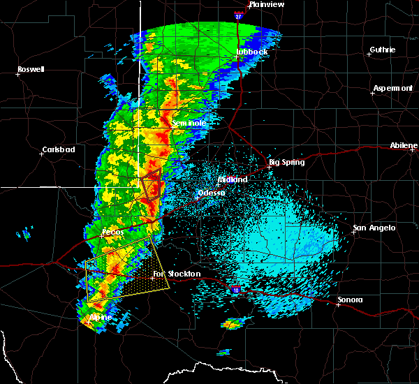 At 934 pm cdt, a severe thunderstorm was located 21 miles east of saragosa, or 25 miles west of fort stockton, moving northeast at 50 mph (radar indicated). Hazards include 60 mph wind gusts and quarter size hail. Hail damage to vehicles is expected. expect wind damage to roofs, siding, and trees. locations impacted include, fort stockton, firestone test track, fort stockton-pecos county airport, coyanosa and b f goodrich testing track. this includes interstate 10 between mile markers 217 and 269. A tornado watch remains in effect until 1100 pm cdt for western and southwestern texas. At 934 pm cdt, a severe thunderstorm was located 21 miles east of saragosa, or 25 miles west of fort stockton, moving northeast at 50 mph (radar indicated). Hazards include 60 mph wind gusts and quarter size hail. Hail damage to vehicles is expected. expect wind damage to roofs, siding, and trees. locations impacted include, fort stockton, firestone test track, fort stockton-pecos county airport, coyanosa and b f goodrich testing track. this includes interstate 10 between mile markers 217 and 269. A tornado watch remains in effect until 1100 pm cdt for western and southwestern texas.
|
| 3/12/2019 9:10 PM CDT |
 At 910 pm cdt, a severe thunderstorm was located 15 miles southeast of balmorhea lake, or 22 miles northeast of fort davis, moving northeast at 50 mph (radar indicated). Hazards include 60 mph wind gusts and quarter size hail. Hail damage to vehicles is expected. Expect wind damage to roofs, siding, and trees. At 910 pm cdt, a severe thunderstorm was located 15 miles southeast of balmorhea lake, or 22 miles northeast of fort davis, moving northeast at 50 mph (radar indicated). Hazards include 60 mph wind gusts and quarter size hail. Hail damage to vehicles is expected. Expect wind damage to roofs, siding, and trees.
|
| 10/13/2018 1:44 AM CDT |
 At 144 am cdt, a severe thunderstorm was located near fort stockton, moving east at 30 mph (radar indicated). Hazards include golf ball size hail and 60 mph wind gusts. People and animals outdoors will be injured. expect hail damage to roofs, siding, windows, and vehicles. expect wind damage to roofs, siding, and trees. locations impacted include, fort stockton and fort stockton-pecos county airport. This includes interstate 10 between mile markers 254 and 284. At 144 am cdt, a severe thunderstorm was located near fort stockton, moving east at 30 mph (radar indicated). Hazards include golf ball size hail and 60 mph wind gusts. People and animals outdoors will be injured. expect hail damage to roofs, siding, windows, and vehicles. expect wind damage to roofs, siding, and trees. locations impacted include, fort stockton and fort stockton-pecos county airport. This includes interstate 10 between mile markers 254 and 284.
|
| 10/13/2018 1:30 AM CDT |
 At 130 am cdt, a severe thunderstorm was located 8 miles northwest of fort stockton, moving east at 30 mph (radar indicated). Hazards include golf ball size hail and 60 mph wind gusts. People and animals outdoors will be injured. expect hail damage to roofs, siding, windows, and vehicles. Expect wind damage to roofs, siding, and trees. At 130 am cdt, a severe thunderstorm was located 8 miles northwest of fort stockton, moving east at 30 mph (radar indicated). Hazards include golf ball size hail and 60 mph wind gusts. People and animals outdoors will be injured. expect hail damage to roofs, siding, windows, and vehicles. Expect wind damage to roofs, siding, and trees.
|
| 10/12/2018 9:51 PM CDT |
 At 950 pm cdt, a severe thunderstorm was located 13 miles southwest of fort stockton, moving northeast at 25 mph (radar indicated). Hazards include 60 mph wind gusts and half dollar size hail. Hail damage to vehicles is expected. Expect wind damage to roofs, siding, and trees. At 950 pm cdt, a severe thunderstorm was located 13 miles southwest of fort stockton, moving northeast at 25 mph (radar indicated). Hazards include 60 mph wind gusts and half dollar size hail. Hail damage to vehicles is expected. Expect wind damage to roofs, siding, and trees.
|
| 6/4/2018 12:11 AM CDT |
 At 1211 am cdt, severe thunderstorms were located along a line extending from 22 miles west of mccamey to 12 miles southeast of fort stockton, moving east at 25 mph (trained weather spotters). Hazards include 60 mph wind gusts and quarter size hail. Hail damage to vehicles is expected. expect wind damage to roofs, siding, and trees. locations impacted include, fort stockton, firestone test track, fort stockton-pecos county airport and sierra madera. This includes interstate 10 between mile markers 241 and 289. At 1211 am cdt, severe thunderstorms were located along a line extending from 22 miles west of mccamey to 12 miles southeast of fort stockton, moving east at 25 mph (trained weather spotters). Hazards include 60 mph wind gusts and quarter size hail. Hail damage to vehicles is expected. expect wind damage to roofs, siding, and trees. locations impacted include, fort stockton, firestone test track, fort stockton-pecos county airport and sierra madera. This includes interstate 10 between mile markers 241 and 289.
|
| 6/3/2018 11:47 PM CDT | Measured at fort stockton-pecos county airport in pecos county TX, 1.8 miles SE of Fort Stockton, TX |
| 6/3/2018 11:47 PM CDT |
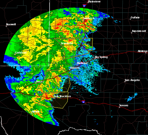 At 1147 pm cdt, severe thunderstorms were located along a line extending from 20 miles south of grandfalls to 9 miles south of fort stockton to 30 miles northeast of marathon, moving east at 25 mph (trained weather spotters). Hazards include 60 mph wind gusts and quarter size hail. Hail damage to vehicles is expected. Expect wind damage to roofs, siding, and trees. At 1147 pm cdt, severe thunderstorms were located along a line extending from 20 miles south of grandfalls to 9 miles south of fort stockton to 30 miles northeast of marathon, moving east at 25 mph (trained weather spotters). Hazards include 60 mph wind gusts and quarter size hail. Hail damage to vehicles is expected. Expect wind damage to roofs, siding, and trees.
|
| 6/3/2018 11:45 PM CDT | Measured at fort stockton-pecos county airport in pecos county TX, 1.8 miles SE of Fort Stockton, TX |
| 4/30/2018 6:08 PM CDT |
 The severe thunderstorm warning for north central pecos county will expire at 615 pm cdt, the storm which prompted the warning has weakened below severe limits, and no longer poses an immediate threat to life or property. therefore the warning will be allowed to expire. however small hail is still possible with this thunderstorm. a severe thunderstorm watch remains in effect until 1100 pm cdt for southwestern texas. The severe thunderstorm warning for north central pecos county will expire at 615 pm cdt, the storm which prompted the warning has weakened below severe limits, and no longer poses an immediate threat to life or property. therefore the warning will be allowed to expire. however small hail is still possible with this thunderstorm. a severe thunderstorm watch remains in effect until 1100 pm cdt for southwestern texas.
|
| 4/30/2018 5:51 PM CDT |
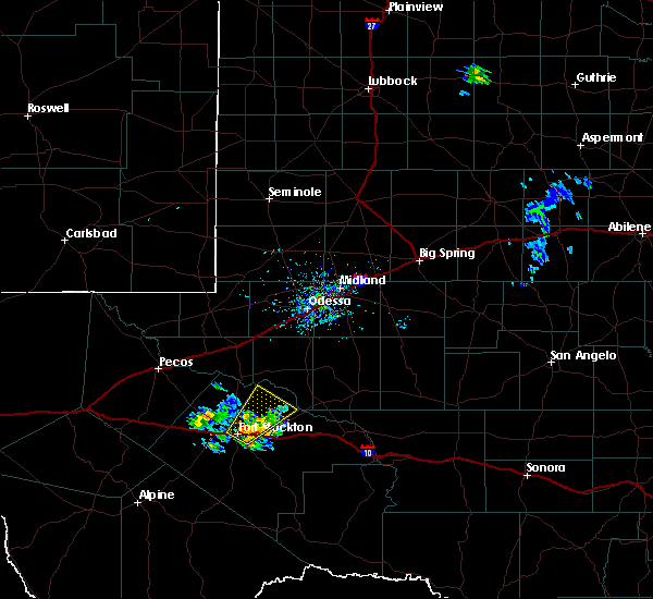 At 550 pm cdt, a severe thunderstorm was located 7 miles east of fort stockton, moving northeast at 20 mph (radar indicated). Hazards include quarter size hail. Damage to vehicles is expected. locations impacted include, fort stockton, fort stockton-pecos county airport and imperial. This includes interstate 10 between mile markers 257 and 270. At 550 pm cdt, a severe thunderstorm was located 7 miles east of fort stockton, moving northeast at 20 mph (radar indicated). Hazards include quarter size hail. Damage to vehicles is expected. locations impacted include, fort stockton, fort stockton-pecos county airport and imperial. This includes interstate 10 between mile markers 257 and 270.
|
| 4/30/2018 5:28 PM CDT |
 At 527 pm cdt, a severe thunderstorm was located over fort stockton, moving northeast at 25 mph. numerous reports of pea to quarter size hail have been reported in fort stockton (radar indicated). Hazards include 60 mph wind gusts and quarter size hail. Hail damage to vehicles is expected. expect wind damage to roofs, siding, and trees. locations impacted include, fort stockton, fort stockton-pecos county airport and imperial. This includes interstate 10 between mile markers 257 and 270. At 527 pm cdt, a severe thunderstorm was located over fort stockton, moving northeast at 25 mph. numerous reports of pea to quarter size hail have been reported in fort stockton (radar indicated). Hazards include 60 mph wind gusts and quarter size hail. Hail damage to vehicles is expected. expect wind damage to roofs, siding, and trees. locations impacted include, fort stockton, fort stockton-pecos county airport and imperial. This includes interstate 10 between mile markers 257 and 270.
|
| 4/30/2018 5:21 PM CDT | Quarter sized hail reported 0.4 miles NE of Fort Stockton, TX |
| 4/30/2018 5:10 PM CDT |
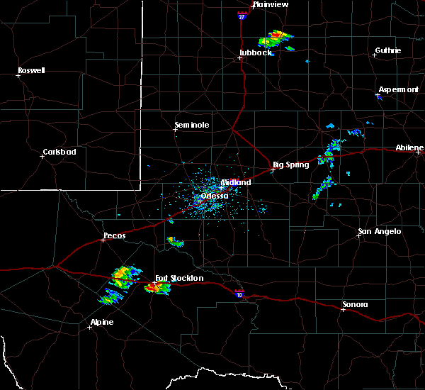 The national weather service in midland has issued a * severe thunderstorm warning for. north central pecos county in southwestern texas. Until 615 pm cdt * at 510 pm cdt, a severe thunderstorm was located over fort stockton, moving northeast at 30 mph. The national weather service in midland has issued a * severe thunderstorm warning for. north central pecos county in southwestern texas. Until 615 pm cdt * at 510 pm cdt, a severe thunderstorm was located over fort stockton, moving northeast at 30 mph.
|
| 6/23/2017 8:17 PM CDT |
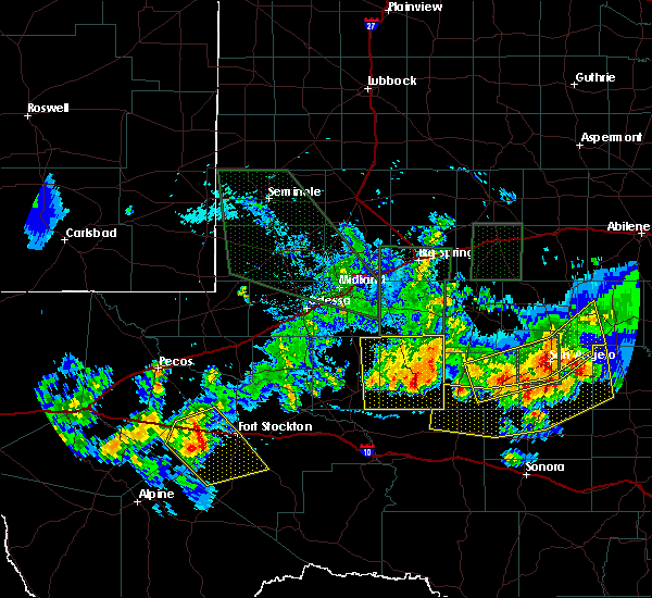 At 817 pm cdt, a severe thunderstorm was located 10 miles northwest of belding, or 16 miles west of fort stockton, moving southeast at 5 mph (radar indicated). Hazards include 60 mph wind gusts and quarter size hail. Hail damage to vehicles is expected. Expect wind damage to roofs, siding, and trees. At 817 pm cdt, a severe thunderstorm was located 10 miles northwest of belding, or 16 miles west of fort stockton, moving southeast at 5 mph (radar indicated). Hazards include 60 mph wind gusts and quarter size hail. Hail damage to vehicles is expected. Expect wind damage to roofs, siding, and trees.
|
| 6/13/2017 7:42 PM CDT |
 At 730 pm cdt, law enforcement reported quarter size hail 1 mile west of belding. at 737 pm cdt, a severe thunderstorm was located 8 miles southeast of belding, or 11 miles south of fort stockton, moving southeast at 25 mph (law enforcement). Hazards include quarter size hail. Damage to vehicles is expected. Locations impacted include, highway 385, 20 miles south of fort stockton, belding, sierra madera and firestone test track. At 730 pm cdt, law enforcement reported quarter size hail 1 mile west of belding. at 737 pm cdt, a severe thunderstorm was located 8 miles southeast of belding, or 11 miles south of fort stockton, moving southeast at 25 mph (law enforcement). Hazards include quarter size hail. Damage to vehicles is expected. Locations impacted include, highway 385, 20 miles south of fort stockton, belding, sierra madera and firestone test track.
|
| 6/13/2017 7:30 PM CDT | Quarter sized hail reported 12.2 miles NE of Fort Stockton, TX |
| 6/13/2017 7:18 PM CDT |
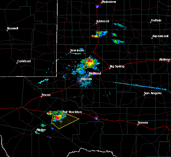 At 717 pm cdt, a severe thunderstorm was located over belding, or 10 miles southwest of fort stockton, moving east at 25 mph (radar indicated). Hazards include golf ball size hail and 60 mph wind gusts. People and animals outdoors will be injured. expect hail damage to roofs, siding, windows, and vehicles. Expect wind damage to roofs, siding, and trees. At 717 pm cdt, a severe thunderstorm was located over belding, or 10 miles southwest of fort stockton, moving east at 25 mph (radar indicated). Hazards include golf ball size hail and 60 mph wind gusts. People and animals outdoors will be injured. expect hail damage to roofs, siding, windows, and vehicles. Expect wind damage to roofs, siding, and trees.
|
| 6/1/2017 4:07 PM CDT | Quarter sized hail reported 18.3 miles N of Fort Stockton, TX, pecos co sheriff department officials reported hail on hwy 385. |
| 5/22/2017 7:21 PM CDT |
 The severe thunderstorm warning for western pecos county will expire at 730 pm cdt, the storms which prompted the warning have weakened below severe limits, and no longer pose an immediate threat to life or property. therefore the warning will be allowed to expire. The severe thunderstorm warning for western pecos county will expire at 730 pm cdt, the storms which prompted the warning have weakened below severe limits, and no longer pose an immediate threat to life or property. therefore the warning will be allowed to expire.
|
| 5/22/2017 6:56 PM CDT |
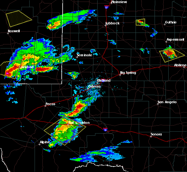 At 654 pm cdt, severe thunderstorms were located along a line extending from near fort stockton to near hovey, moving southeast at 30 mph. a report of quarter size hail 10 miles west of fort stockton at 652 pm cdt was called into the nws (public). Hazards include quarter size hail. Damage to vehicles is expected. locations impacted include, fort stockton, belding, firestone test track, fort stockton-pecos county airport and sierra madera. This includes interstate 10 between mile markers 237 and 284. At 654 pm cdt, severe thunderstorms were located along a line extending from near fort stockton to near hovey, moving southeast at 30 mph. a report of quarter size hail 10 miles west of fort stockton at 652 pm cdt was called into the nws (public). Hazards include quarter size hail. Damage to vehicles is expected. locations impacted include, fort stockton, belding, firestone test track, fort stockton-pecos county airport and sierra madera. This includes interstate 10 between mile markers 237 and 284.
|
| 5/22/2017 6:52 PM CDT | Quarter sized hail reported 9.8 miles E of Fort Stockton, TX |
| 5/22/2017 6:41 PM CDT |
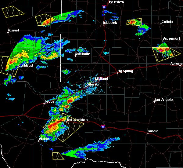 At 640 pm cdt, severe thunderstorms were located along a line extending from 12 miles northwest of fort stockton to near hovey, moving southeast at 30 mph (radar indicated). Hazards include quarter size hail. damage to vehicles is expected At 640 pm cdt, severe thunderstorms were located along a line extending from 12 miles northwest of fort stockton to near hovey, moving southeast at 30 mph (radar indicated). Hazards include quarter size hail. damage to vehicles is expected
|
| 4/14/2017 8:30 PM CDT |
 At 830 pm cdt, a severe thunderstorm was located near belding, or 7 miles west of fort stockton, moving east at 10 mph (radar indicated). Hazards include quarter size hail. Damage to vehicles is expected. locations impacted include, fort stockton and belding. This includes interstate 10 between mile markers 249 and 257. At 830 pm cdt, a severe thunderstorm was located near belding, or 7 miles west of fort stockton, moving east at 10 mph (radar indicated). Hazards include quarter size hail. Damage to vehicles is expected. locations impacted include, fort stockton and belding. This includes interstate 10 between mile markers 249 and 257.
|
| 4/14/2017 8:10 PM CDT |
 At 810 pm cdt, a severe thunderstorm was located near belding, or 11 miles west of fort stockton, moving southeast at 10 mph (radar indicated). Hazards include quarter size hail. damage to vehicles is expected At 810 pm cdt, a severe thunderstorm was located near belding, or 11 miles west of fort stockton, moving southeast at 10 mph (radar indicated). Hazards include quarter size hail. damage to vehicles is expected
|
| 4/14/2017 7:28 PM CDT | Golf Ball sized hail reported 13.3 miles E of Fort Stockton, TX, golfball sized hail covering i-10 at milemarker 246 west of fort stockton. |
| 4/14/2017 7:10 PM CDT | Hen Egg sized hail reported 23.8 miles ESE of Fort Stockton, TX |
| 4/14/2017 6:49 PM CDT |
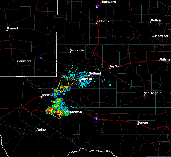 At 649 pm cdt, a severe thunderstorm was located 8 miles west of fort stockton, moving east at 10 mph (radar indicated). Hazards include 60 mph wind gusts and quarter size hail. Hail damage to vehicles is expected. expect wind damage to roofs, siding, and trees. locations impacted include, fort stockton, belding, firestone test track and fort stockton-pecos county airport. This includes interstate 10 between mile markers 237 and 260. At 649 pm cdt, a severe thunderstorm was located 8 miles west of fort stockton, moving east at 10 mph (radar indicated). Hazards include 60 mph wind gusts and quarter size hail. Hail damage to vehicles is expected. expect wind damage to roofs, siding, and trees. locations impacted include, fort stockton, belding, firestone test track and fort stockton-pecos county airport. This includes interstate 10 between mile markers 237 and 260.
|
| 4/14/2017 6:17 PM CDT |
 At 616 pm cdt, a severe thunderstorm was located 11 miles northwest of belding, or 13 miles west of fort stockton, moving east at 10 mph (radar indicated). Hazards include 60 mph wind gusts and half dollar size hail. Hail damage to vehicles is expected. Expect wind damage to roofs, siding, and trees. At 616 pm cdt, a severe thunderstorm was located 11 miles northwest of belding, or 13 miles west of fort stockton, moving east at 10 mph (radar indicated). Hazards include 60 mph wind gusts and half dollar size hail. Hail damage to vehicles is expected. Expect wind damage to roofs, siding, and trees.
|
| 4/14/2017 5:36 PM CDT | Quarter sized hail reported 23.8 miles ESE of Fort Stockton, TX |
| 4/12/2017 3:55 PM CDT | Ping Pong Ball sized hail reported 23.9 miles WSW of Fort Stockton, TX, ping pong size hail reported five miles n or i-10...exit 235. |
| 4/12/2017 3:55 PM CDT | Ping Pong Ball sized hail reported 23.8 miles ESE of Fort Stockton, TX, ping pong size hail reported five miles n or i-10...exit 235. |
| 7/7/2016 6:31 PM CDT |
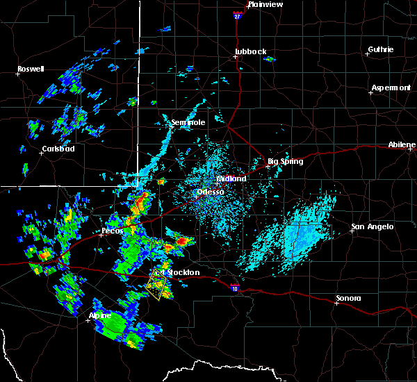 At 631 pm cdt, a severe thunderstorm was located near fort stockton, moving southeast at 10 mph (radar indicated). Hazards include 60 mph wind gusts. Expect damage to roofs. siding. and trees. locations impacted include, fort stockton. This includes interstate 10 between mile markers 260 and 269. At 631 pm cdt, a severe thunderstorm was located near fort stockton, moving southeast at 10 mph (radar indicated). Hazards include 60 mph wind gusts. Expect damage to roofs. siding. and trees. locations impacted include, fort stockton. This includes interstate 10 between mile markers 260 and 269.
|
| 7/7/2016 6:00 PM CDT | Golf Ball sized hail reported 0.4 miles NE of Fort Stockton, TX |
| 7/7/2016 5:54 PM CDT |
 At 553 pm cdt, a severe thunderstorm was located over fort stockton, moving southeast at 10 mph (radar indicated). Hazards include 60 mph wind gusts and quarter size hail. Hail damage to vehicles is expected. Expect wind damage to roofs, siding, and trees. At 553 pm cdt, a severe thunderstorm was located over fort stockton, moving southeast at 10 mph (radar indicated). Hazards include 60 mph wind gusts and quarter size hail. Hail damage to vehicles is expected. Expect wind damage to roofs, siding, and trees.
|
| 7/7/2016 5:42 PM CDT | Storm damage reported in pecos county TX, 0.4 miles NE of Fort Stockton, TX |
| 6/15/2016 8:30 PM CDT |
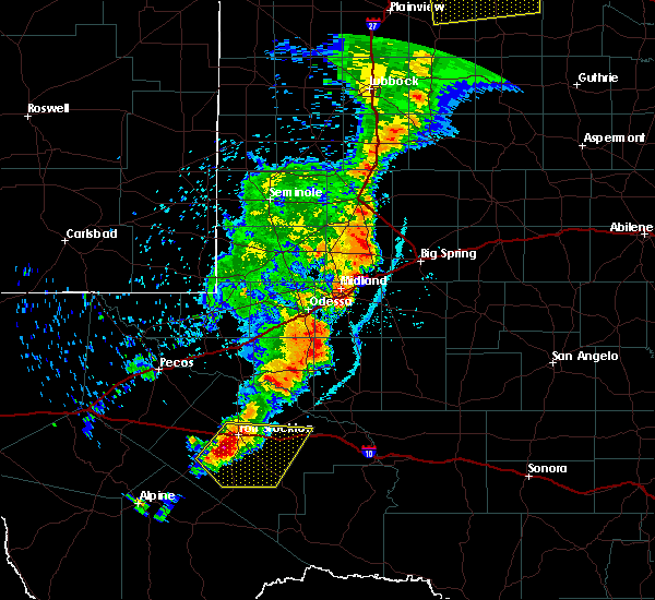 At 830 pm cdt, a severe thunderstorm was located near belding, or 8 miles southwest of fort stockton, moving east at 20 mph (radar indicated). Hazards include 60 mph wind gusts and quarter size hail. Hail damage to vehicles is expected. Expect wind damage to roofs, siding, and trees. At 830 pm cdt, a severe thunderstorm was located near belding, or 8 miles southwest of fort stockton, moving east at 20 mph (radar indicated). Hazards include 60 mph wind gusts and quarter size hail. Hail damage to vehicles is expected. Expect wind damage to roofs, siding, and trees.
|
| 6/15/2016 8:16 PM CDT |
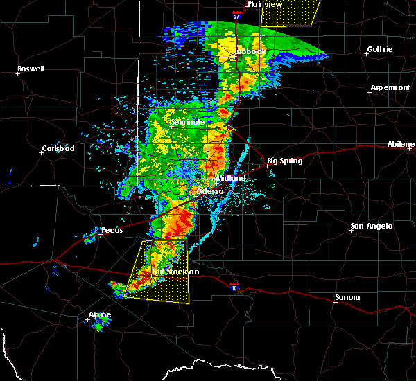 At 755 pm cdt, the public reported quarter size hail 3 miles southeast of grandfalls. at 814 pm cdt doppler radar indicated a severe thunderstorm was located near fort stockton-pecos county airport, or near fort stockton, moving east at 20 mph (public). Hazards include 60 mph wind gusts and quarter size hail. Hail damage to vehicles is expected. expect wind damage to roofs, siding, and trees. locations impacted include, fort stockton, belding, firestone test track, fort stockton-pecos county airport, imperial, cordona lake, grandfalls and imperial reservoir. This includes interstate 10 between mile markers 245 and 287. At 755 pm cdt, the public reported quarter size hail 3 miles southeast of grandfalls. at 814 pm cdt doppler radar indicated a severe thunderstorm was located near fort stockton-pecos county airport, or near fort stockton, moving east at 20 mph (public). Hazards include 60 mph wind gusts and quarter size hail. Hail damage to vehicles is expected. expect wind damage to roofs, siding, and trees. locations impacted include, fort stockton, belding, firestone test track, fort stockton-pecos county airport, imperial, cordona lake, grandfalls and imperial reservoir. This includes interstate 10 between mile markers 245 and 287.
|
| 6/15/2016 7:44 PM CDT |
 At 742 pm cdt, doppler radar indicated a line of severe thunderstorms from near grandfalls south to coyanosa to 7 miles west of fort stockton. the line was moving to the east at 20 mph (radar indicated). Hazards include 60 mph wind gusts and quarter size hail. Hail damage to vehicles is expected. Expect wind damage to roofs, siding, and trees. At 742 pm cdt, doppler radar indicated a line of severe thunderstorms from near grandfalls south to coyanosa to 7 miles west of fort stockton. the line was moving to the east at 20 mph (radar indicated). Hazards include 60 mph wind gusts and quarter size hail. Hail damage to vehicles is expected. Expect wind damage to roofs, siding, and trees.
|
| 4/19/2016 6:48 PM CDT | Ping Pong Ball sized hail reported 47.4 miles NW of Fort Stockton, TX |
| 4/19/2016 5:57 PM CDT |
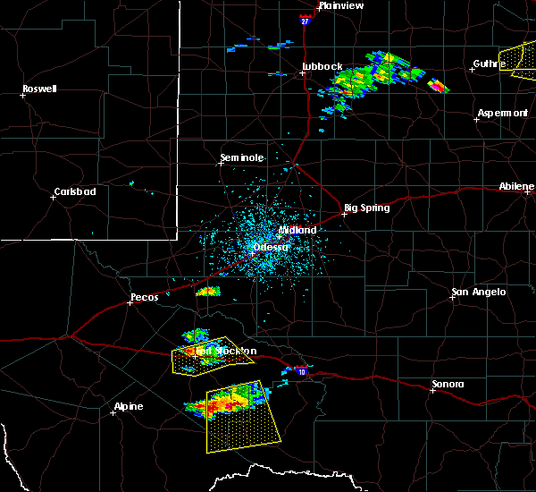 At 552 pm cdt, law enforcement reported golf ball size hail 5 miles northwest of fort stockton on highway 285. at 552 pm cdt doppler radar indicated a severe thunderstorm was located 5 miles northwest of fort stockton along highway 285. the storm was moving to the northeast at 25 mph (law enforcement). Hazards include golf ball size hail and 60 mph wind gusts. People and animals outdoors will be injured. expect hail damage to roofs, siding, windows, and vehicles. expect wind damage to roofs, siding, and trees. Locations impacted include, highway 385, 5 miles north of fort stockton. At 552 pm cdt, law enforcement reported golf ball size hail 5 miles northwest of fort stockton on highway 285. at 552 pm cdt doppler radar indicated a severe thunderstorm was located 5 miles northwest of fort stockton along highway 285. the storm was moving to the northeast at 25 mph (law enforcement). Hazards include golf ball size hail and 60 mph wind gusts. People and animals outdoors will be injured. expect hail damage to roofs, siding, windows, and vehicles. expect wind damage to roofs, siding, and trees. Locations impacted include, highway 385, 5 miles north of fort stockton.
|
| 4/19/2016 5:50 PM CDT | Golf Ball sized hail reported 4.9 miles SE of Fort Stockton, TX, heavy rain and golf ball size hail highway 285 and gomez road 5 mile nw fort stockton |
| 4/19/2016 5:31 PM CDT |
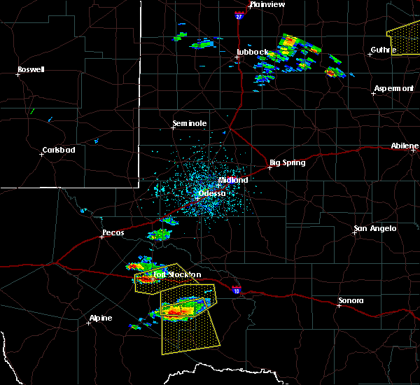 At 531 pm cdt, a severe thunderstorm was located over fort stockton-pecos county airport, or near fort stockton, moving northeast at 55 mph (radar indicated). Hazards include 60 mph wind gusts and half dollar size hail. Hail damage to vehicles is expected. Expect wind damage to roofs, siding, and trees. At 531 pm cdt, a severe thunderstorm was located over fort stockton-pecos county airport, or near fort stockton, moving northeast at 55 mph (radar indicated). Hazards include 60 mph wind gusts and half dollar size hail. Hail damage to vehicles is expected. Expect wind damage to roofs, siding, and trees.
|
| 5/28/2015 4:15 PM CDT | At 413 pm cdt, a severe thunderstorm was located 9 miles northeast of firestone test track, and moving east at 30 mph (radar indicated). Hazards include 60 mph wind gusts and quarter size hail. Hail damage to vehicles is expected. expect wind damage to roofs, siding and trees. Locations impacted include, fort stockton and fort stockton-pecos county airport. |
| 5/28/2015 3:56 PM CDT | At 349 pm cdt, a severe thunderstorm was located 9 miles northwest of firestone test track, and moving east at 25 mph. at 350 pm cdt, quarter size hail was reported 25 wnw of fort stockton (radar indicated). Hazards include 60 mph wind gusts and quarter size hail. Hail damage to vehicles is expected. expect wind damage to roofs, siding and trees. Locations impacted include, fort stockton, firestone test track, coyanosa, fort stockton-pecos county airport and imperial reservoir. |
| 5/28/2015 3:42 PM CDT | At 340 pm cdt, a severe thunderstorm was located 12 miles west of firestone test track, and moving east at 25 mph (radar indicated). Hazards include 60 mph wind gusts and quarter size hail. Hail damage to vehicles is expected. expect wind damage to roofs, siding and trees. Locations impacted include, fort stockton, firestone test track, coyanosa, fort stockton-pecos county airport and imperial reservoir. |
| 5/28/2015 3:24 PM CDT | At 322 pm cdt, a severe thunderstorm was located 9 miles south of b f goodrich testing track, and moving east at 15 mph (radar indicated). Hazards include ping pong ball size hail and 60 mph wind gusts. People and animals outdoors will be injured. expect hail damage to roofs, siding, windows and vehicles. Expect wind damage to roofs, siding and trees. |
| 5/27/2015 9:41 PM CDT | At 938 pm cdt, a severe thunderstorm was located 7 miles east of fort stockton, and moving east at 25 mph (radar indicated). Hazards include 60 mph wind gusts and quarter size hail. Hail damage to vehicles is expected. Expect wind damage to roofs, siding and trees. |
| 5/27/2015 9:25 PM CDT | Quarter sized hail reported 1.4 miles NE of Fort Stockton, TX |
| 5/27/2015 9:22 PM CDT | At 916 pm cdt, a severe thunderstorm was located near fort stockton, and moving east at 25 mph (radar indicated). Hazards include tennis ball size hail and 70 mph wind gusts. People and animals outdoors will be injured. expect hail damage to roofs, siding, windows and vehicles. expect considerable tree damage. wind damage is also likely to mobile homes, roofs and outbuildings. The severe thunderstorm will affect mainly rural areas of central pecos county but including the fort stockton and i-10 near fort stockton. |
| 5/27/2015 9:10 PM CDT | Quarter sized hail reported 11.6 miles E of Fort Stockton, TX |
| 5/27/2015 8:45 PM CDT | Golf Ball sized hail reported 11.2 miles NE of Fort Stockton, TX, quarter to golf ball size hail at the firestone test track. |
| 5/27/2015 8:45 PM CDT | At 842 pm cdt, a severe thunderstorm was located 5 miles northwest of belding, and moving southeast at 30 mph (radar indicated). Hazards include tennis ball size hail and 70 mph wind gusts. People and animals outdoors will be injured. expect hail damage to roofs, siding, windows and vehicles. expect considerable tree damage. wind damage is also likely to mobile homes, roofs and outbuildings. The severe thunderstorm will be near, and along highway 67 9 miles south from i-10, belding around 850 pm cdt. |
| 5/27/2015 8:31 PM CDT | At 824 pm cdt, a severe thunderstorm capable of producing a tornado was located 6 miles southwest of firestone test track, and nearing high 67 just south of i-10 and moving southeast at 20 mph (radar indicated rotation). Hazards include tornado and baseball size hail. Flying debris will be dangerous to those caught without shelter. mobile homes will be damaged or destroyed. damage to roofs, windows and vehicles will occur. tree damage is likely. This dangerous storm will be near, highway 67 6 miles south of i-10 at 835 pm and belding around 845 pm cdt. |
| 5/27/2015 8:20 PM CDT | At 814 pm cdt, a severe thunderstorm capable of producing a tornado was located 7 miles southwest of firestone test track, mile markers 238 to 242 and moving southeast at 15 mph (radar indicated rotation). Hazards include tornado and baseball size hail. Flying debris will be dangerous to those caught without shelter. mobile homes will be damaged or destroyed. damage to roofs, windows and vehicles will occur. tree damage is likely. This dangerous storm will be near, highway 67 at 835 pm cdt and belding around 845 pm cdt. |
| 5/27/2015 8:05 PM CDT | At 800 pm cdt, a confirmed tornado was located 7 miles west of firestone test track near i-10 mile markers 234 to 239, and moving southeast at 15 mph (radar confirmed tornado). Hazards include damaging tornado and baseball size hail. Flying debris will be dangerous to those caught without shelter. mobile homes will be damaged or destroyed. damage to roofs, windows and vehicles will occur. tree damage is likely. The tornado will affect mainly rural areas of west central pecos county. |
| 5/27/2015 7:59 PM CDT | At 755 pm cdt, a confirmed tornado was located about 20 miles northwest of belding oe 9 miles west firestone test track, and moving southeast at 15 mph (radar confirmed tornado). Hazards include damaging tornado and baseball size hail. Flying debris will be dangerous to those caught without shelter. mobile homes will be damaged or destroyed. damage to roofs, windows and vehicles will occur. tree damage is likely. the tornado will be near, firestone test track around 830 pm cdt. Belding around 845 pm cdt. |
| 5/23/2015 5:42 PM CDT | At 539 pm cdt, severe thunderstorms were located along a line extending from 7 miles west of pleasant farms to 13 miles southwest of bakersfield, and moving east at 60 mph (radar indicated). Hazards include 60 mph wind gusts and quarter size hail. Hail damage to vehicles is expected. expect wind damage to roofs, siding and trees. Locations impacted include, crane, bakersfield, girvin, pleasant farms, crane county airport and king mountain. |
| 5/23/2015 5:16 PM CDT | At 511 pm cdt, severe thunderstorms were located along a line extending from 5 miles northwest of roy hurd memorial airport to 6 miles east of belding, and moving east at 50 mph (radar indicated). Hazards include 60 mph wind gusts and quarter size hail. Hail damage to vehicles is expected. Expect wind damage to roofs, siding and trees. |
| 5/20/2015 5:32 PM CDT | Quarter sized hail reported 15.2 miles W of Fort Stockton, TX |
| 5/19/2015 4:11 PM CDT | Golf Ball sized hail reported 19.9 miles W of Fort Stockton, TX |
| 5/4/2015 8:34 PM CDT | At 831 pm cdt, a severe thunderstorm was located 9 miles east of fort stockton, and moving east at 15 mph (radar indicated). Hazards include golf ball size hail and 60 mph wind gusts. People and animals outdoors will be injured. expect hail damage to roofs, siding, windows and vehicles. expect wind damage to roofs, siding and trees. locations impacted include, mainly rural areas of central pecos county including i-10 east of fort stockton. 1. 75in. |
| 5/4/2015 8:20 PM CDT | At 818 pm cdt, a severe thunderstorm was located near fort stockton, and moving east at 10 mph (public). Hazards include lime ball size hail and 60 mph gusts. People and animals outdoors will be injured. expect hail damage to roofs, siding, windows and vehicles. expect wind damage to roofs, siding and trees. locations impacted include, mainly rural areas of central pecos county. 2. 00in. |
| 5/4/2015 8:17 PM CDT | Hen Egg sized hail reported 4.5 miles N of Fort Stockton, TX |
| 5/4/2015 8:01 PM CDT | Golf Ball sized hail reported 0.4 miles NE of Fort Stockton, TX, falling at the intersection of hwy 285/385 in mesa view neighborhood. |
| 5/4/2015 8:00 PM CDT | Quarter sized hail reported 0.4 miles NE of Fort Stockton, TX |
| 5/4/2015 7:56 PM CDT | At 754 pm cdt, a severe thunderstorm was located near fort stockton, and moving east at 25 mph (radar indicated). Hazards include golf ball size hail and 60 mph wind gusts. People and animals outdoors will be injured. expect hail damage to roofs, siding, windows and vehicles. Expect wind damage to roofs, siding and trees. |
| 5/4/2015 7:53 PM CDT | Ping Pong Ball sized hail reported 0.4 miles NE of Fort Stockton, TX, golf ball to ping pong ball size hail |
| 5/4/2015 7:46 PM CDT | At 742 pm cdt, a severe thunderstorm capable of producing a tornado was located 5 miles northeast of belding, 4 miles southwest of fort stockton and moving southeast at 15 mph (radar indicated rotation). Hazards include tornado and tennis ball size hail. Flying debris will be dangerous to those caught without shelter. mobile homes will be damaged or destroyed. damage to roofs, windows and vehicles will occur. tree damage is likely. this dangerous storm will affect mainly rural areas of central pecos county. Radar indicated. |
| 5/4/2015 7:32 PM CDT | Ping Pong Ball sized hail reported 9.8 miles E of Fort Stockton, TX, at the intersection if i-10 and highway 67 |
| 5/4/2015 7:29 PM CDT | At 726 pm cdt, a severe thunderstorm capable of producing a tornado was located 5 miles southeast of firestone test track, 4 miles west of fort stockton along i10 and moving southeast at 15 mph (radar indicated rotation). Hazards include tornado and tennis ball size hail. Flying debris will be dangerous to those caught without shelter. mobile homes will be damaged or destroyed. damage to roofs, windows and vehicles will occur. tree damage is likely. this dangerous storm will be near, belding around 735 pm cdt. fort stockton-pecos county airport around 745 pm cdt. fort stockton around 750 pm cdt. Radar indicated. |
| 5/4/2015 7:13 PM CDT | Golf Ball sized hail reported 19.3 miles E of Fort Stockton, TX, hail reported along 1-10 at exit 237 |
| 9/18/2014 5:04 PM CDT | Storm damage reported in pecos county TX, 1.8 miles SE of Fort Stockton, TX |
| 6/16/2014 4:59 PM CDT | Powerlines down in fort stockton in pecos county TX, 0.4 miles NE of Fort Stockton, TX |
| 6/16/2014 4:54 PM CDT | 4 power poles down between mile marker 255 and 256. 18-wheeler turned ove in pecos county TX, 2.1 miles E of Fort Stockton, TX |
| 6/16/2014 4:53 PM CDT | Quarter sized hail reported 2.1 miles E of Fort Stockton, TX, mile marker 255 on interstate-10 |
| 6/13/2014 11:58 PM CDT | Quarter sized hail reported 0.4 miles NE of Fort Stockton, TX |
| 6/13/2014 11:54 PM CDT | Quarter sized hail reported 1.4 miles NE of Fort Stockton, TX |
| 6/13/2014 11:15 PM CDT | Public report of 60 mph winds and dime size hail via social medi in pecos county TX, 10.8 miles NE of Fort Stockton, TX |
| 4/19/2014 7:15 PM CDT | Golf Ball sized hail reported 25.9 miles ENE of Fort Stockton, TX, deputy reports golfball size hail south of i-10 off hwy 67. |
| 6/14/2012 6:13 PM CDT | Quarter sized hail reported 2.1 miles E of Fort Stockton, TX, 2 mi west of fort stockton on alpine highway |
| 5/27/2012 4:48 PM CDT | Quarter sized hail reported 0.4 miles NE of Fort Stockton, TX, trained spotter reported quarter-size hail |
| 5/27/2012 4:45 PM CDT | Hen Egg sized hail reported 0.4 miles NE of Fort Stockton, TX, hen egg hail measured in fort stockton |
| 5/27/2012 4:44 PM CDT | Golf Ball sized hail reported 0.4 miles NE of Fort Stockton, TX, trained spotter reported golf ball size hail. |
| 5/14/2012 12:42 AM CDT | Storm damage reported in pecos county TX, 1.8 miles SE of Fort Stockton, TX |
| 5/14/2012 12:37 AM CDT | Storm damage reported in pecos county TX, 1.8 miles SE of Fort Stockton, TX |
| 4/9/2012 11:35 PM CDT | Golf Ball sized hail reported 29.4 miles E of Fort Stockton, TX, golfball hail was reported lasting from 1135 pm to 1200 am. tree limbs were blown down. |
| 3/26/2012 6:55 PM CDT | Quarter sized hail reported 6.8 miles E of Fort Stockton, TX, quarter hail at pearcy farms. |
| 3/26/2012 6:15 PM CDT | Quarter sized hail reported 9.8 miles E of Fort Stockton, TX, quarter hail 10 miles west of fort stockton on i-10. |
| 1/1/0001 12:00 AM | Quarter sized hail reported 41.9 miles W of Fort Stockton, TX |
| 1/1/0001 12:00 AM | Golf Ball sized hail reported 24.9 miles NW of Fort Stockton, TX, reported along highway 285. |
Hail Maps for Fort Stockton, TX
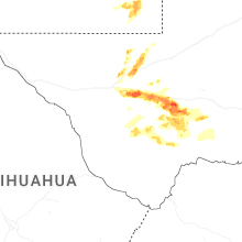
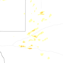
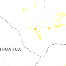
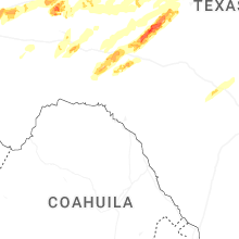
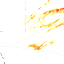
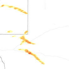
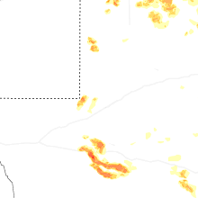


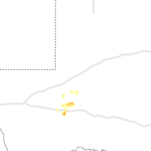


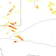


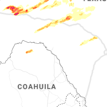


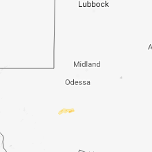


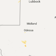


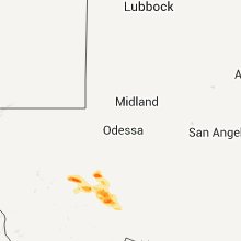


Connect with Interactive Hail Maps